Hydrogeological Features of Mount Fuji and the Surrounding ...
Upload
khangminh22Category
view
0download
0
Atmosphere
It is the vast expanse of air surrounding the Earth, within which all weather phenomenonoccurs.
Composition of the atmosphere The atmosphere is comprised of several gases, dust particles, and water vapour. The presence of oxygen becomes insignificant at the height of 120 km from the surface
of the earth with respect to the composition of the atmosphere. Water vapors and Carbon dioxide occur only up to 90 km.
Ozone Gas Present around 10-50 km above earth surface and acts as a filter, absorbing UV
(ultraviolet rays) from the sun. Ozone averts the harmful rays from reaching the surface of the earth.
Water Vapour Water vapour is a variable gas, declines with altitude. It also drops towards the poles from the equator. It acts like a blanket letting the earth to neither to become too hot nor too cold. It also contributes to the stability and instability in the air.
Dust Particles Dust particles are in higher concentration in temperate and subtropical regions due to dry
winds in contrast to the Polar Regions and equatorial regions. They act as hygroscopic nuclei over which water vapour of atmosphere condenses to
create clouds.
Nitrogen 78.03% of the total volume of the atmosphere Gaseous Nitrogen was discovered by Rutherford. It was initially called Rutherford. Since Nitrogen constitutes the largest proportion of the atmosphere, the phenomenon
such as pressure, force of winds and reflection of light is largely due to Nitrogen. Properties : No colour, No odour, No taste, Prevents quick burning Importance : generates protein which is essential for the natural growth of plants and
animals and also human beings Commercial usage : nitrogenous fertilizers The atmosphere is composed of 78% nitrogen. Nitrogen cannot be used directly from the air. Biotic things need nitrogen to make proteins. The Nitrogen Cycle is the way of supplying the required nitrogen for living things.
Oxygen 20.99% of the atmosphere volume. Importance : Life giver as it is essential for respiration, fuel combustion, provides base to
industries The atmosphere is composed of 21% oxygen. It is used by all living things and is essential for respiration. It is obligatory for burning.
Argon 0.94% It enters the atmosphere due to radioactive breakdown of potassium within surface rocks The rate of formation is very slow It is an inert gas They are mainly used in light bulbs.
Carbon Dioxide It was the first gas to be studied 0.03% in the atmosphere It is the heaviest gas It is confined to lower layers Importance : growth of vegetation, green house effect, asphyxiant gas Properties : colourless, odourless, naturally occuring in atmosphere, groundwater,etc,
water soluble It is used in fire extinguishers, for oil recovery, as a refrigerant and also for coal bed
methane recovery Plants use it to make oxygen. It is significant as it is opaque to outgoing terrestrial radiation and transparent to incoming
solar radiation. It is also responsible for the greenhouse effect.
Other major components of the air: Neon Helium Methane Krypton Hydrogen Water vapor (variable percentage)
Layers of Atmosphere Based on Composition of ConstituentsIt is the thin layer, in which most of the atmospheric processes take place. According to the concentration of the gases, atmosphere is divided into:
1. Homosphere: the lower part of atmosphere, upto the height of 90-100 kms. Theproportion of gases is homogenous throughout the zone, hence the name ‘homosphere’.Main constituents are nitrogen and oxygen. However, the natural homogeneity isnowadays being disturbed by the economic activities of mankind.
2. Heterosphere: It extends from 100 kms. to the outer limits of atmosphere. Here thelayers vary largely in their physical and chemical properties.
Importance of Atmosphere Base of life All the phenomenon concerning weather and climate Heat balance
Protection against sun’s harmful Ultra violet rays through the Ozone layer
Ionosphere layer helps in radio broadcasting.
Our atmosphere is composed of many components. But the structure of the atmosphereis a combination of various layers.
Structure of Atmosphere

There are five layers in the structure of the atmosphere depending upon temperature.These layers are:
Troposphere
Stratosphere
Mesosphere
Thermosphere
Exosphere
Troposphere
It is considered as the lowest layer of Earth’s atmosphere.
The troposphere starts at surface of the earth and goes up to a height of 7 to 20 km.
All weather occurs within this layer.
This layer has water vapour and mature particles.
Temperature decreases at the rate of 1 degree Celsius for every 165 m of height.
Tropopause separates Troposphere and Stratosphere.
Stratosphere
It is the second layer of the atmosphere found above the troposphere.
It extends up to 50 km of height.
This layer is very dry as it contains little water vapour.
This layer provides some advantages for flight because it is above stormy weather andhas steady, strong, horizontal winds.
The ozone layer is found in this layer.
The ozone layer absorbs UV rays and safeguards earth from harmful radiation.
Stratopause separates Stratosphere and Mesosphere.
Mesosphere
The Mesosphere is found above the stratosphere.
It is the coldest of the atmospheric layers.
The mesosphere starts at 50 km above the surface of Earth and goes up to 85 km.
The temperature drops with altitude in this layer.
By 80 km it reaches -100 degrees Celsius.
Meteors burn up in this layer.
The upper limit is called Mesopause which separates Mesosphere and Thermosphere.
Thermosphere
This layer is found above Mesopause from 80 to 400 km.
Radio waves which are transmitted from the earth are reflected back by this layer.
The temperature increases with height.
Aurora and satellites occur in this layer.
Ionosphere
The lower Thermosphere is called the Ionosphere.
Ionosphere consists of electrically charged particles known as ions.
This layer is defined as the layer of the atmosphere of Earth that is ionized by cosmic andsolar radiation.
It is positioned between 80 and 400 km above the Mesopause.
Exosphere
It is the outermost layer of the atmosphere.
The zone where molecules and atoms escape into space is mentioned as the exosphere.
It extends from the top of the thermosphere up to 10,000 km.
General Circulation of the Atmosphere
The pattern of the movement of the planetary winds is called the general circulation of theatmosphere.

Factors for General Circulation of the Atmosphere
The pattern of planetary winds largely depends on:
Latitudinal variation of atmospheric heating
The emergence of pressure belts
The migration of belts following the apparent path of the sun
The distribution of continents and oceans
The rotation of the earth
The general circulation of the atmosphere also sets in motion the marine watercirculation which affects the climate of the Earth.
The air at the ITCZ (Inter Tropical Convergence Zone) upsurges because ofconvection caused by high insolation and low pressure is generated.
The winds from the tropics join at this low-pressure zone.
The joined air upsurges along with the convective cell.
It reaches the top of the troposphere up to an altitude of 14 km.
It further moves toward the poles. This causes accumulation of air at about 30o
North and South.
Another reason for sinking is the cooling of air when it reaches 30 degrees Northand South latitudes.
Downward near the land surface, the air flows towards the equator as theeasterlies.
The easterlies from either side of the equator converge in the Inter-TropicalConvergence Zone (ITCZ).
Such circulations from the surface up and vice-versa are called cells.
This type of cell in the tropics is called the Hadley Cell.
In the mid-latitudes, the circulation is that of dipping cold air that comes from thepoles and the mounting warm air that blows from the subtropical high.
At the surface, these winds are called westerlies and the cell is known as theFerrel cell.
At polar latitudes, the cold dense air subsides near the poles and blows towardsmiddle latitudes as the polar easterlies. This cell is called the polar cell.
These Ferrel cells, Hadley Cell, and polar cell set the configuration for the generalcirculation of the atmosphere.
General Atmospheric Circulation and its Effects on Oceans
The general circulation of the atmosphere also influences the oceans.
Warming and cooling of the Pacific Ocean is most significant in terms of generalatmospheric circulation.
The warm water of the central Pacific Ocean gradually drifts towards the SouthAmerican coast and substitutes the cool Peruvian current.

Such presence of warm water off the coast of Peru is known as the El Nino.
The El Nino is associated with the pressure variations in Australia and Central Pacific.
This variation in pressure condition over the Pacific is known as the southern oscillation.
The combined phenomenon of El Nino and southern oscillation is known as ENSO.
Heating and Cooling of Atmosphere
There are various ways of heating and cooling of the atmosphere.
The earth after being warmed by insolation transfers the heat to the atmospheric layersin long waveform.
Conduction
The air in interaction with the land gets heated gradually and the upper layers in touchwith the lower layers also get heated. This process is called conduction.
This process takes place when two bodies of uneven temperature are in contact withone another, there is a flow of energy from the warmer to the cooler body.
The heat transfer continues until both the bodies reach the same temperature or thecontact is interrupted.
This process is significant in heating the lower layers of the atmosphere.
Convection
The air in contact with the earth upsurges vertically on heating in the form of currents andtransfers the heat of the atmosphere.
This vertical heating of the atmosphere is known as convection.
The convective transfer of energy is limited only to the troposphere.
Advection
The transfer of heat through horizontal movement of air is called advection.
Horizontal movement of the air is comparatively more significant than the verticalmovement.
Most of the diurnal variation in weather is caused by advection only in the middlelatitudes.
During summer in tropical regions predominantly in Northern India, local winds called ‘loo’is the result of advection process.
Atmospheric Pressure:
The weight of a column of air contained in a unit area from the mean sea level to the topof the atmosphere is called the atmospheric pressure.
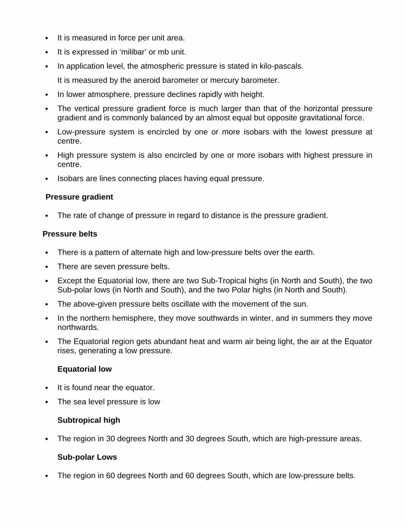
It is measured in force per unit area.
It is expressed in ‘milibar’ or mb unit.
In application level, the atmospheric pressure is stated in kilo-pascals.
It is measured by the aneroid barometer or mercury barometer.
In lower atmosphere, pressure declines rapidly with height.
The vertical pressure gradient force is much larger than that of the horizontal pressuregradient and is commonly balanced by an almost equal but opposite gravitational force.
Low-pressure system is encircled by one or more isobars with the lowest pressure atcentre.
High pressure system is also encircled by one or more isobars with highest pressure incentre.
Isobars are lines connecting places having equal pressure.
Pressure gradient
The rate of change of pressure in regard to distance is the pressure gradient.
Pressure belts
There is a pattern of alternate high and low-pressure belts over the earth.
There are seven pressure belts.
Except the Equatorial low, there are two Sub-Tropical highs (in North and South), the twoSub-polar lows (in North and South), and the two Polar highs (in North and South).
The above-given pressure belts oscillate with the movement of the sun.
In the northern hemisphere, they move southwards in winter, and in summers they movenorthwards.
The Equatorial region gets abundant heat and warm air being light, the air at the Equatorrises, generating a low pressure.
Equatorial low
It is found near the equator.
The sea level pressure is low
Subtropical high
The region in 30 degrees North and 30 degrees South, which are high-pressure areas.
Sub-polar Lows
The region in 60 degrees North and 60 degrees South, which are low-pressure belts.
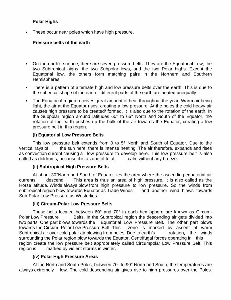
Polar Highs
These occur near poles which have high pressure.
Pressure belts of the earth
On the earth’s surface, there are seven pressure belts. They are the Equatorial Low, thetwo Subtropical highs, the two Subpolar lows, and the two Polar highs. Except theEquatorial low. the others form matching pairs in the Northern and SouthernHemispheres.
There is a pattern of alternate high and low pressure belts over the earth. This is due tothe spherical shape of the earth—different parts of the earth are heated unequally.
The Equatorial region receives great amount of heat throughout the year. Warm air beinglight, the air at the Equator rises, creating a low pressure. At the poles the cold heavy aircauses high pressure to be created/ formed. It is also due to the rotation of the earth. Inthe Subpolar region around latitudes 60° to 65° North and South of the Equator, therotation of the earth pushes up the bulk of the air towards the Equator, creating a lowpressure belt in this region.
(i) Equatorial Low Pressure Belts
This low pressure belt extends from 0 to 5° North and South of Equator. Due to thevertical rays of the sun here, there is intense heating. The air therefore, expands and risesas convection current causing a low pressure to develop here. This low pressure belt is alsocalled as doldrums, because it is a zone of total calm without any breeze.
(ii) Subtropical High Pressure Belts
At about 30°North and South of Equator lies the area where the ascending equatorial aircurrents descend. This area is thus an area of high pressure. It is also called as theHorse latitude. Winds always blow from high pressure to low pressure. So the winds fromsubtropical region blow towards Equator as Trade Winds and another wind blows towardsSub-Polar Low-Pressure as Westerlies.
(iii) Circum-Polar Low Pressure Belts
These belts located between 60° and 70° in each hemisphere are known as Circum-Polar Low Pressure Belts. In the Subtropical region the descending air gets divided intotwo parts. One part blows towards the Equatorial Low Pressure Belt. The other part blowstowards the Circum- Polar Low Pressure Belt. This zone is marked by ascent of warmSubtropical air over cold polar air blowing from poles. Due to earth’s rotation, the windssurrounding the Polar region blow towards the Equator. Centrifugal forces operating in thisregion create the low pressure belt appropriately called Circumpolar Low Pressure Belt. Thisregion is marked by violent storms in winter.
(iv) Polar High Pressure Areas
At the North and South Poles, between 70° to 90° North and South, the temperatures arealways extremely low. The cold descending air gives rise to high pressures over the Poles.

These areas of Polar high pressure are known as the Polar Highs. These regions arecharacterised by permanent Ice Caps.
Shifting of pressure belts
If the earth had not been inclined towards the sun, the pressure belts, as describedabove, would have been as they are. But it is not so, because the earth is inclined 23 1/2°towards the sun. On account of this inclination, differences in heating of the continents,oceans and pressure conditions in January and July vary greatly. January represents winterseason and July, summer season in the Northern Hemisphere. Opposite conditions prevailin the Southern Hemisphere. When the sun is overhead on the Tropic of Cancer (21 June) thepressure belts shift 5° northward and when it shines vertically overhead on Tropic of
Capricorn (22 December), they shift 5° southward from their original position. The shiftingof the pressure belts cause seasonal changes in the climate, especially between latitudes30° and 40° in both hemispheres. In this region the Mediterranean type of climate isexperienced because of shifting of permanent belts southwards and northwards with theoverhead position of the sun. During winters Westerlies prevail and cause rain. During summersdry Trade Winds blow offshore and are unable to give rainfall in these regions. When the sunshines vertically over the Equator on 21st March and 23rd September (the Equinoxes), thepressure belts remain balanced in both the hemispheres.
Insolation Solar Radiation
Incoming solar radiation is known as Isolation and it is received in the form of shortwaves. The earth's surface receives the radiant energy at the rate of 2 calories per sq. cm. perminute.
Factors effecting the distribution of Insolation:
1. Distance between Earth & Sun: The average distance between these two bodies is about149 million km. On January 3 the earth comes closer to the sun, called "perihelion". On July 4,the earth is little farther from the sun and this position is called 'aphelion'. Hence the amount ofincoming solar radiation is about 7 per cent more in January.
2. Angle of Incidence: The oblique rays have to travel longer distance through the atmospherebefore they strike the surface of the earth and large amount of energy is lost by various

processes of reflection, absorption, scattering, etc. At mid-day the intensity of insolation ismaximum. In winter and high latitudes , the insolation received is small.
3. Duration of Sunshine: The most important causes for the variation in the amount of solarenergy reaching the earth are the seasonal changes in the angle at which the sun's rays strikethe surface and the length of the day.
Summer Solstice: 21st June
Winter Solstice: 22nd December
Autumnal Equinox: 23rd September
Spring Equinox: 21st March
4. Solar Constant: When the sun spots appear in larger number, the intensity of the solarradiation received is increased. The number of sunspot changes on a regular basis in a cycle of11 years.
5. Transparency of Atmosphere:
Reflection from dust, salt, smoke particles, etc returns short wave radiation to space. Similarlyclouds tops deplete the amount of insolation. Transparency of the atmosphere is closely relatedto the latitudes. In the higher latitudes the sun's ray are more oblique. In winter when the altitudeof the sun is relatively lower, there is greater loss of incoming solar radiation than in Summer.
Heat budget
The average temperature of the earth remains rather constant. It has been possiblebecause of the balance between the amount of incoming solar radiation and the amount ofterrestrial radiation returned to space. This balance of incoming and outgoing radiation has beentermed as the earth's heat budget.
Let us assume that the total heat received at the top of the atmosphere is 100 units.About 35 units are reflected back to space even before reaching the earth's surface. Of these,27 units are reflected back from the top of the clouds and 2 units from the snow and ice-coveredareas of the earth. The reflected amount of radiation is called the Albedo of Earth.
The remaining 65 units are aborbed, 14 units within the atmosphere and 51 units by theearth's surface. The earth radiates back 51 units in the form of terrestrial radiation. Of these, 17units are radiated to space directly and the remaining 34 units are absorbed by the atmosphere6 units absorbed directly the atmosphere, 9 units through convection and turbulence and 19units through latent heat of condensation. About 48 units absorbed by the atmosphere (14 unitsfrom insolation and 34 units from terrestrial radiation) and also radiated back into the space.Thus the total radiation returning from the earth and the atmosphere respectively is 17 + 48 = 65units which balance the total of 5 units received from the sun. Hence the heat balance of theearth is always maintained.
Factors Influencing Temperature
1. Latitude: In general the temperature decreases from the equator to the poles as per thealtitude of the mid-day sun.
2. Altitude: Temperature falls by 6.5° C for every 1 km ascent.
3. Ocean Currents: Warm ocean currents, moving pole wards, carry tropical warmth into thehigh latitude. This warming influence is very marked in latitudes 40° to 65° on the west side ofthe continents, especially along the sea-board of Western Europe. Cold currents have fewereffects upon temperature because they usually lie under offshore winds. However, there aresome exceptions e.g. the coast of Labrador, where the summer temperatures are lowered by onshore winds which blow over the cold Labrador current.
4. Distance from Sea: The sun's heat is absorbed and released more slowly by water than bythe land. So the sea-adjoining areas experience warming and cooling effects. The climaticregions whose temperatures are influenced greatly by the sea are called "maritime or oceanic orinsular climate". Climate whose temperature is greatly influenced by the remoteness from thesea are called "continental climate"
5. Winds: In temperate latitudes, prevailing winds from the land lower the winter temperaturebut raise the summer temperature and the prevailing winds from the sea raise the wintertemperature but lower the summer temperature. In tropical latitudes, on-shore winds modify thetemperature of the coastal regions. Local winds sometimes produce rapid upward or downwardchanges in the temperature.
6. Cloud Cover and Humidity: Clouds reduce the amount of solar radiation reaching theearth's surface and the amount of earth radiation leaving the earth's surface. The heavy cloudcover of equatorial regions does not allow a day temperature over 30°C. In hot desert theabsence of clouds results in very high day temperature of over 38°C and clear sky allows theearth heat to escape freely resulting in fall of temperature up 20°C at night.
7. Aspects: South facing slopes are warmer than north-facing slopes in the NorthernHemisphere while, in the Southern Hemisphere the reverse is true. In the high latitude the mid-day sun is at a low angle in winter and hence blocks of flats are usually built far apart to enableall the flats to receive some sunshine.
8. Length of Day: The length of day also influences the temperature.
9. Amount of Dust and Other Impurities in the Air: In the industrial areas and large urbancentres, the polluted particles are abundant in the air .These particles not only absorb largeramount of insolation but also greatly absorb the terrestrial radiation. Hence these areas showlarger temperature than the surrounding areas and are converted into "Heat Islands".
Between January and July all the isotherms in the northern hemisphere move northward. Thismovement of isotherm is greater over the land than over the oceans. The highest temperaturesfor both January and July are over the continents. The isotherms bend pole ward over the oceanbut equator ward over the continent in January. The isotherms bend equator ward over theocean but pole ward over the continents in July. The seasonal changes are less marked overthe southern continents than over the northern ones. The range of temperature increases fromthe equator to the poles. The coastal regions have a smaller range of temperature than thecontinental interiors.
The range of temperature on the eastern sides of Asia and North America is greater than on theWestern side in the same latitude.
Temperature Anomaly: Temperature varies even along the same parallel of latitude becauseof the factors like altitude, land and water contrasts, prevailing winds and ocean currents. Thedifference between the mean temperature of any place and the mean temperature of its parallel

is called the Temperature Anomaly or Thermal Anomaly. It therefore, expresses deviation fromthe normal.
Inversion of Temperature: Air temperature also varies according to the altitude, at higheraltitudes air becomes less dense; it is unable to absorb heat, resulting in colder air temperature.The normal drop of temperature with height is known as normal lapse rate which is 6.4°C perkm on an average. Temperature inversion is the situation where there is increase intemperature, with height before beginning to drop into the normal lapse rate. In cases where thetemperature remains the same with increase of altitude, the layer of atmosphere is calledIsothermal.
Pressure & Wind: Wind can be defined as air in motion. The principal cause of winds is thedifference in pressure. Air always moves from areas of high pressure to those with low pressure.The slope of the pressure from high to low is known as the pressure gradient and the directionof this gradient decides the direction of the winds.
Owing to the earth's rotation, all the winds are deflected to the right in the northern hemisphereand to the left in the southern hemisphere. This is referred to as the Ferrel's Law and the forceoccuring due to the rotation of the earth is called the Coriolis force.
Buys Ballot's Law: In northern hemisphere, if a person stands with his back to the wind, lowpressure lies to his left and high pressure lies to his right. In S-Hemisphere it is reversed sincethe Coriolis deflection is to his left.
Types of winds:
(i) Planetary winds or Prevailing winds: Trade winds, Westerlies and Easterlies.
(ii) Periodic winds: Land breeze, Sea breeze & Monsoon winds.
(iii) Local winds: Loo, Fohn, Chinook, Mistral and Jet Streams.
(iv) Atmospheric Disturbances: Tropical Cyclones and Temperate Cyclones.
I. Planetary Winds: The wind systems that are bound to occur at the global level on any planethaving an atmosphere and rotating about its axis. The specific characteristics of trade winds,Westerlies and Easterlies may be determined by several conditions but the broad features areconstant over the globe.
Trade Winds: These winds blow from the subtropical high pressure towards the equatorialregion of low pressure regularly throughout the year. It brings little rain except on the line ofconvergence of the two trade wind systems-
Westerlies: The Westerly winds are those which blow with great frequency from the Horselatitudes towards the Polar region throughout the year with varing intensity and cause rain nearthe Polar Regions. Westerlies. are stronger in the Southern Hemisphere because of the vastexpanse of ocean waters. Owing to their ferocious nature, they are also described as "RoaringForties", "Furious Fifties" and "Shrieking Sixties" in southern hemisphere.
Doldrums: Also known as Intertropical convergence, it is the equatorial belt of low atmosphericpressure where the north-east and south east Trade winds converge. It is a region of calmness,the calm periodically broken by storms, accompanied by heavy rains.

Horse Latitude: They are the sub-tropical belts of high atmospheric pressure over the oceans(near 30° latitude} between the regions of trade winds and Westerlies. They are regions of calm,light variable winds and dry air .
II. Periodic Winds:
Monsoon: The word monsoon has been derived from the Arabic word "Mausim" which meansseason. The monsoon winds thus refer to the wind systems that have a pronounced seasonalreversal of direction. The monsoon winds blow over India, Pakistan, Bangladesh, Burma, SriLanka, Arabian Sea, Bay of Bengal, S.E. Asia, N. Australia, China and Japan.
Summer Monsoon: During summer, a thermal low Is developed over southern Asia in the lowerlevels of the atmosphere. From the Indian Ocean and the south western Pacific, warm humidair moves northward and north westward into Asia passing over India and China. This summermonsoon is accompanied by heavy rainfall in south-east Asia.
Winter Monsoon: The Winter monsoon is a gentle drift of air in which the winds generally blowfrom the north east. Retreating monsoon causes sporadic rainfall especially in the north-easternparts and Tamil Nadu coastal areas of India. Outside India, in the East Asian countries e.g.China and Japan, the winter monsoon is stronger than the summer monsoon.
III. Local Winds: There are winds that develop as a result of local conditions in temperature andpressure of air .They affect small areas in the lowest levels of Troposphere.
Loo: A very hot and dry wind (hot wave) in the North Western India and Pakistan which blowsfrom the west in the afternoon of May and June and may cause sunstroke.
Chinook and Fohn: Warm and dry local winds, also called 'snow-eater' blow on the leewardsides of the mountains. These are called Chinook in the USA and Fohn in Switzerland.
Harmattan: The warm and dry winds blowing from north-east and east to west in the easternparts of Sahara desert are called Harmattan. Similar winds are called 'brick fielder' in Australia,'blackroller' in USA, 'shamal' in Mesopotamia and Persian Gulf and 'Norwesters' in NewZealand.
Sirrocco: It is a warm, dry and dusty wind which blows in northward direction from Saharadesert and after crossing Mediterranean Sea reaches Italy, Spain etc. Similar winds are knownas Khamsin' in Egypt, 'Gibli' in Libya, 'Chilli' in Tunisia, and 'Simoom' in Arabia.
Diurnal Variation in Atmospheric Circulation
Diurnal wind systems occur frequently in many tropical areas. They also occur in otherareas but rather irregularly and less frequently. There are two major types of diurnal windsystems:
1. Land and Sea Breezes: These occur along the coast or near large water bodies. They arecaused by the thermal differences between the land and water surface.
Sea Breeze: Takes place during the day when a local thermal low develops over the land withthe winds blowing from the sea towards the land.
Land Breeze: Take place during the night when the land cools off rapidly while the sea is stillwarm. Then the winds blow from the land towards the sea.
2. Mountain (Katabatic) and Valley (Anabatic) Winds: During the day when insolation isintense the more exposed hill slopes are heated more than the valley bottoms. Thus winds blowupward from the valley. These are valley or anabatic (up slope) winds. The high lands cool offrather rapidly because of terrestrial radiation losses. Cold and dense air then drains downslopeinto valleys. Such cold winds are known as mountain or Katabatic winds.
Cyclones: This is a depression in a mass of air whose isobars form an oval or circular shapewith low pressure at the centre. The air converges at the centre and then rises. The windsrotate anti clock wise in the northern hemisphere while in the southern hemisphere the circularmovement of winds is in a clockwise direction: Moving cyclones are of three types:
A. Extratropical Cyclones:
1. Typical of middle and high latitudes; usually called a depression.
2. This cyclone varies in diameter from 200 km to 300 km.
3. Appearance may be circular or elongated or may be broad shallow, weak depressions.
4. Usually travel in groups or "Families" from the West to East.
5. Average speed is about 30-50 km per hour.
B. Tropical Cyclones:
1. Tropical Cyclones are found in low latitudes over oceans.
2. It is almost circular centre of extremely low pressure into which winds spiral.
3. The diameter of the storm ranges from 160 to 650 km and the velocity of the wind varies froma minimum of about 120 to 200 km per hour.
4. The life span of a tropical cyclone is about a week and the storm travels at the rate of 15-30km per hour.
5. Tropical cyclones are characterized by violent winds and heavy rains.
6. The source of energy for the maintenance of tropical cyclones is the latent heat ofcondensation.
C. Tornadoes:
1. The most violent storms of lower troposphere.
2. The funnel shape cloud extends downwards from the base of cumulonimbus cloud layer.
3. Tornadoes which occur in conjunction with scattered thunderstorms are usually short-livedand have irregular paths.
4. The circulation of wind is usually in a counter clockwise direction; wind velocities are veryhigh almost about 100 m/sec.
5. Occur frequently east of the Rockies Mountains in the Mississippi Basin in USA, in easternIndia and east of the Andes Mountain.

6. At sea, tornadoes become water spouts having same characteristic except that they are smallin diameter.
Anti-cyclones: It is opposite to the cyclones where two types of anticyclones are observed:
1. Relatively Stationary, also called, as warm anticyclones.
2. Travelling anticyclones, which are also called as cold anticyclones, are mainly found in thehigh latitude within continental polar air.
3. Barometric pressure is highest at its centre and decreases outward. Anticyclonic wind systemblows out from the centre and because of the Coriolis Effect it has a clockwise circulation in theNorthern hemisphere and counter clockwise in Southern hemisphere.
Beaufort scale: In 1806 “Admiral Beaufort” proposed a scale for estimating the wind velocityand developed the Beaufort scale.
Precipitation: It Is the process by which condensed water vapour falls to the earth's surface asrainfall, snowfall and other forms.
Dew point: it is the temperature at which a parcel of air would have to be cooled in order toreach saturation. The favourable conditions are moist air, light winds and clear night skies toensure maximum cooling by radiation.
Condensation: In this process the water vapour is changed into liquid state. If air is cooledbelow its dew point, some of air's water vapour becomes liquid. Thus any further cooling ofsaturated air starts the process of condensation. Condensation depends upon two factors -relative humidity of air and degree of cooling.
Necessary Conditions for Condensation are:
1. The air must be saturated. Saturation occurs either when the air is cooled below the dewpoint or when vapour is added to the air.
2: There must be a surface on which the water vapour may condense For dew or frost, solidobjects at the ground do this work. But when the condensation occurs in the air, the surface isprovided by the dust particles or aerosols and these particles are known as "hygroscopicnuclei".
On the basis of its origin, precipitation may be classified into three main types:
1. Convectional Precipitation: It is caused when moist winds are drawn into the convectioncurrents of a hot region. It generally occurs in equatorial region. The thundery rain of a summerafternoon is a typical example.
2. Orographic Precipitation: It is caused by the surface relief of the land, mainly, by the presenceof mountain range. There is heavy rain on the windward side.
3. Cyclonic Precipitation: It is associated with the passage of a cyclone or depression.
Rainfall: When precipitation is in the form of water drops, we call it rainfall. Only whentemperature of water vapour is above 0°C, rainfall will occur. At sub-zero level temperatures,snowfall will occur. Main determinants of rainfall are- latitude distance from the sea, direction ofwinds, proximity of mountains and seasons. The regions of heavy rainfall in the world are -
Equatorial regions, Tropical Monsoon regions and mid-latitude West Margin regions. Regions oflow rainfall (below 25 cm annual) are- tropical desert, mid-latitude deserts and Polar Regions.
Humidity: It refers to the content of water vapour present in air in gaseous form at a particulartime and place. It is measured through an instrument called 'hygrometer.'
Absolute Humidity: The total weight of moisture content or water vapour per volume of air atdefinite temperature is called absolute humidity.
Specific Humidity: It is defined as the mass of water vapour in grams contained in a kilogramof air and it represents the actual quantity of moisture present in a definite air .
Relative Humidity: It is defined as a ratio of the amount of water vapour actually present in theair having definite volume and temperature (i.e.. absolute humidity) to the maximum amount theair can hold at that temperature (i.e. humidity capacity).
Forms of Precipitation
Rain: Of liquid water particles in the form of drops of more than 0.5 mm dia.
Drizzle: Fine drops of water (diameter less than 0.5 mm), very closer to one another.
Snow: White and opaque grains of ice.
Sleet: Mixture of rain and snow.
Hail: Small pieces of ice with diameter ranging from 5 to 50 mm.
Zero Visibility: When the object cannot be seen easily beyond 25 m.
'9' Visibility: When the object can be seen easily upto 50 km.
World Distribution of rainfall:
After examining the latitudinal pattern of distribution of rainfall it will be seen that the maximum isreceived in the equatorial zone and the minimum is in the Polar Regions. A secondary maximumlies in the belt of 40°-60° N and 40°-60° S and a secondary minimum occurs around 30° N and30° S latitudes. This pattern of rainfall distribution is closely related to the distribution of majorpressure belts of the world. The two zones of maximum precipitation are related to theequatorial low pressure and sub-polar low pressure. These low pressure belts are regions ofascending air and therefore precipitation is greater than elsewhere. The belts of minimumprecipitation are zones of polar high pressure and subtropical high pressure. As the capacity tohold water vapour decreases sharply with temperature, precipitation is generally higher in thelow latitudes than in the high latitudes,
This broad latitudinal pattern is modified by the distribution of continents and oceans, andthe direction of prevailing winds. Winds blowing from the oceans towards the landmasses arecalled on shore winds. Such winds are moisture laden and give rainfall along the coast. Whenwinds blow from the land masses towards the oceans, they are called off-shore winds. Theseare not rain bearing winds.
In the belt of trade winds, there is maximum precipitation in the eastern margins ofcontinents as the easterly winds blow from the oceans. In this belt rainfall decreases towards

the west. The western margins of continents are deserts. These are the tropical deserts of theworld.
In the mid-latitudes, the westerly winds give maximum rainfall to the western margins ofcontinents. Rainfall decreases gradually towards the east and the interiors of large continentsare dry, These are mid-Iatitude deserts,
The location of mountain ranges with reference to prevailing winds also influences thedistribution of precipitation, Maximum precipitation is received where the mountain ranges lieright across the path of prevailing winds e.g. the Western Ghats in India.
(a) The regions of heavy precipitation (more than 150 cm):
1. Equatorial regions: The Amazon and the Congo basins, Malaysia, Indonesia and NewGuinea.
2. Tropical Monsoon regions: Parts of India, South-east Asia and South China,
3. Mid- Iatitude West Margin regions: Coastal regions of British Columbia, North-west Europe,South Chile and South Island of New Zealand.
(b) Moderate rainfall of 100 to 150 cm per year is received in the eastern margins ofcontinents in the trade-wind belt. These are the sub- tropical eastern margins of China, theU.S.A., Brazil, South Africa and Australia,
(c) Regions of extremely low rainfall (less than 25 cm)
1. Tropical deserts Western margins of continents in the trade wind belt- Californian desert inthe United States, Atacama, Kalahari, southern Africa, Sahara, Arabia and then in Afro Asia,and West Australia.
2. Mid-Iatitude desert in the interiors of large continents such as Asia and North America.
3. Polar Regions.
1. Fog: It is microscopically small drops of condensed water suspended in the air near the earthsurface in sufficient number. It reduces the horizontal visibility to less than 1 km. For aviationpurpose the reporting of fog is done only when the visibility is less than 9 km. On the basis ofappearance the fogs may be classified as-
2. Smog: It is formed in the polluted air of large industrial centres having large number of sootand dust particles, generally dirty and mixed with smoke.
3. Haze: It limits the visibility between 2 km and 5 km.
4. Mist: It is intermediate between fog and haze (visibility between 1 and 2 km).
5. Smaze: It is an a mixture of smoke and haze.
6. Frost-Smoke: It is formed in the Arctic region when the air temperature falls much below thefreezing point. It is a kind of fog having innumerable ice particles and super-cooled waterdroplets, formed by the process of condensation. It generally takes place on the surface of waterbodies and later carried over to the land by winds.
Condensation in Atmosphere: The cooling needed to produce condensation can occur in anumber of ways:
1. Relatively warm moist air moving over a colder surface.
2. The mixing of warm, moist unsaturated air with colder unsaturated air.
3. Radiative cooling from the land surface.
4. Upward motion of air.
Condensation Nuclei: The particles which serve as condensation nuclei are hygroscopic, thatis, they have affinity for water.
Adiabatic Lapse Rate: The rate at which temperature decreases in rising and expanding asparcel is known as the adiabatic lapse rate. Until condensation occurs, temperature fall at therate of about 9.8°C per/km. This is known as dry adiabatic lapse.
Multiple choice questions:
1. What is the meaning of the Albedo of earth?a) The reflected amount of radiationb) The absorbed amount of radiationc) Terrestrial radiationd) The heat budget2. Which one of the following is mainly responsible for slow heat transfer from the equatorial to the Polar Regions?a) Absorptionb) Conductionc) Advectiond) Expansion3. Which areas on earth are converted into “heat islands”?a) Islands located near equatorb) Industrial and urban centersc) Desert areasd) Forested areas4. The rainfall related to mountains is called:a) Orographic rainfallb) Cyclonic rainfallc) Convectional rainfalld) Frontal rainfall5. Which one of the following pressure belts is called ‘Doldrums’?a) Equatorial low pressure beltb) Polar high pressure beltc) Subtropical high pressure beltd) Sub polar low pressure belt
6. Mistral is a:a) Hot Dry Local Windb) Warm Dry Local Windc) Warm Moist Local Windd) Cold Dry Local Wind7. Most of the weather phenomena take place in the:a) Stratosphereb) Tropospherec) Ionosphered) Thermosphere8. ‘Horse Latitude’ is the term applied to the:a) 0°- 5° N and S Latitudeb) 60°- 65° N and S Latitudesc) 30°- 35° N and S Latitudesd) 40°- 60° N and S Latitudes9. The average atmospheric pressure at sea level is:a) 890 millibarsb) 1013.25 millibarsc) 1033.50 millibarsd) 1060 millibars10. The ozone layer, above the stratosphere, protect the earth from:a) X-Raysb) Alpha Raysc) Ultra Violet Raysd) Infra Red Rays11. On the earth’s surface, there are in all______ pressure belts.a) 3b) 5c) 7d) 912. Match List I with List II and select the correct answer from the codes given below the lists:List I List II A. Tornado 1. Area of low
rainfallB. Cyclone 2. Heavy rainfallC. Doldrums 3. Funnel shaped
whirlwindD. Volcano 4. Molten magma
Codes: A B C Da) 2 3 1 4b) 3 1 2 4c) 4 3 1 2d) 1 3 2 4
13. Which of the following four instruments is a simple hygrometer?a) Rain Gaugeb) Six’s max and min thermometerc) Wall thermometerd) Wet and dry bulb thermometer 14. What we call to the imaginary lines drawn on maps joining all places receiving the sameamount of rainfall.a) Isohyetsb) Isothermsc) Isobarsd) Isoseismic 15. Which of the following is not a type of precipitation?a) Snow fallb) Fogc) Hail stoned) Sleet16. Which process transfer heat directly by molecular activity?a) Radiationb) Advectionc) Convectiond) Conduction17. Which of the following is associated with clear skies, mild winds and dry conditions?a) Anti- Cycloneb) Norwestersc) Lood) Cyclones
18. In which region do the four O’ clock showers occur almost every day? a) Temperate
b) Equatorial c) Mediterranean d) Monsoon19. The name of the hot, dry and dusty winds which blow across Egypt is:a) Loo b) Harmattan c) Khamsind) Chinook20. ‘Horse Latitude’ is the term applied to the:a) 0°- 5° N and S Latitudeb) 60°- 65° N and S Latitudesc) 30°- 35° N and S Latitudesd) 40°- 60° N and S Latitudes21. Vertical movement of air is known as: a) Wind b) Air currentc) Moving air
d) None of them22. These places experience moderate climate:a) Mumbai and Kolkatab) Patna and Lucknowc) Bikaner and Jaisalmerd) Ranchi and Asansol23. Chinook is a:a) Cold wind in Europeb) Tropical desert storm in West Asiac) Warm wind in North Americad) Depression in South Africa24. The humidity of air measured in percentage is called:a) Absolute humidityb) Specific humidityc) Relative humidityd) All of the above25. Albedo effect would be relatively higher in:a) Early morning and late eveningb) Early morning onlyc) Noond) Late evening only26. The Westerlies have their origin in the:a) Polar highsb) Subtropical highsc) Equatorial lowsd) Sub polar lows27. Mid- Latitude cyclones:a) Usually move across North- America from east to westb) Are generally found only over the Oceanc) Generally bring clear skies and little precipitationd) Are formed in regions of strong temperature contrasts28. What is the most important element of weather and climate?a) Rainfallb) Pressurec) Temperatured) Humidity29. What is true about Troposphere? a) Contains all the atmospheric water vapoursb) Contains more than half the atmospheric ozonec) Maintains a constant temperature at a given heightd) With decreasing temperature pressure reduces.30. The normal lapse rate of temperature continues up to:a) Mesopause

b) Tropopausec) Stratosphered) Stratopause31. The mistral is experienced in:a) Southern France b) Iraq and Iranc) Californiad) North Adriatic Coast32. A local wind blowing in the North Adriatic coast region is the:a) Chinookb) Burgc) Bora d) Brick fielders33. In a Cyclone in the Northern Hemisphere winds blowa) Anticlockwiseb) Clockwisec) Radially outwardd) Straight centreward34. Which one of the following weather conditions indicates a sudden fall in barometer reading?a) Stormy weatherb) Calm weatherc) Cold and dry weatherd) Hot and sunny weather35. Rain shadow effect is associated witha) Cyclonic rainfallb) Orographic rainfallc) Convectional rainfalld) Frontal rainfall36. Match List 1 and List 2 and select the correct answer using the code given below the list:
List 1 (Winds) List 2 (Areas)A. Zonda 1. AustraliaB. Khamsin 2. New ZealandC. Nor-wester 3. ArgentinaD. Brick filders 4. Egypt
Code: A B C Da) 3 4 2 1b) 3 2 4 1c) 1 4 3 2d) 2 3 4 137. Which one of the following gases is found in highest quantity in exosphere?a) Hydrogenb) Heliumc) Nitrogend) Oxygen
38. The Coriolis effect is the result of a) Pressure gradientb) Earth’s axis of inclinationc) Earth’s rotationd) Earth’s revolution39. Consider the following characteristics of a tropical cyclone:1. A warm sea temperature of > 26 Degree Celcius2. High relative humidity of atmosphere at a height of > 700 m3. Atmospheric instabilityThe above mentioned characteristics are associated with which one of the following cycles of itsdevelopment?a) Formulation and initial stageb) Modification stagec) Full maturityd) Decay40. Logically, what does a continually rising air pressure indicate?a) Advent of unsettled and cloudy weatherb) Advent of cyclonec) Fine and settled weatherd) Fine and unsettled weather41. The thickness of the troposphere increases ina) Summerb) Winterc) Springd) Never Changes42. The fall in the temperature with increasing elevation is calleda) Thermal anomalyb) Thermal reductionc) Thermal falld) Lapse rate43. Where is doldrums belt located?a) Near the Equatorb) Near the Polar Regionsc) On the tropic of cancerd) On the tropic of Capricorn44. What is the name given to the wind blowing from sub tropical high pressure region to the equator?a) Westerliesb) Tradesc) Northerliesd) Doldrums45. The reason for the fact that stratosphere is ideal for flying jet air craft is-a) That this layer is rich in ozone which reduces fuel consumptionb) That the temperature is constant and ideal for aircraft engine efficiencyc) That this layer is out of the firing range of anti aircraft guns
d) That the absence of clouds and other weather phenomena 46. Incoming solar radiation is known as:a) Radiationb) Refractionc) Insolationd) Reflection47. The velocity of wind is governed by-a) Farrel's lawb) Pressure gradientc) Rotation of the earthd) Temperature48. Why does the sky look bluea) Because the blue light is scattered by dust particleb) Because blue is the natural colour of the skyc) Because of the presence of water vapour in the skyd) Because blue colour has longest wave length49. Water content in the atmosphere a) Is not dependent on temperatureb) Increases as temperature increasesc) Remain unchanged as temperature changesd) Can not be measured50. The instrument used for measuring humiditya) Barometerb) Thermometerc) Hygrometerd) Hydrometer51. Farrel's law describesa) Velocity of windb) Direction of windc) Temperature of windd) None of these52. Blizzards are found ina) Equatorial regionb) Tropical regionc) Antarctic regiond) Temperate region53. The importance of ozone in the atmosphere isa) That it provides condensation nucleib) That it provides protection against ultraviolet radiationc) That it helps in scattering blue lightd) That it creates greenhouse effect on earth54. What is cyclone?a) High pressure system with clock wise wind in the northern hemisphere

b) A low pressure system with clock wise wind in the northern hemisphere c) A high pressure system with anti-clock wise wind in the northern hemisphere d) A low pressure system with anti-clock wise wind in the northern hemisphere 54. What is anti-cyclone?a) A high pressure system with clock wise wind in the northern hemisphere b) A low pressure system with clock wise wind in the northern hemisphere c) A low pressure system with clock wise wind in the northern hemisphere d) A low pressure system with clock wise wind in the southern hemisphere55. In the some part of the atmosphere very high velocity wind system is found which is calleda) Monsoonb) Jet streamc) A cycloned) An anti-cyclone56. What is tornado?a) A very high pressure centreb) A very low pressure centrec) A very high ocean waved) None of these57. The process of changing water vapour into ice directly is calleda) Condensationb) Sublimationc) Snowd) Precipitation58. When humidity is expressed as percentage, it is calleda) Absolute humidityb) Relative humidityc) Specific humidityd) Percentage humidity59. What is vapour pressure?a) The pressure due to vapour in the air onlyb) Barometric pressurec) Presence of vapour in the aird) None of these60. Sling Psychorometer is used fora) Measuring temperatureb) Measuring humidityc) Measuring pressured) Measuring wind velocity61. The temperature at which the air is fully saturated is calleda) Saturation point b) Dew pointc) Critical temperatured) Condensation point

62. What is fog?a) A low status cloudb) A cirro status cloudc) An altocumulus cloudd) None of these63. Hail consists ofa) Water dropletsb) Crystals of icec) Granular iced) Masses of ice in layers one above another64. When mountain comes in the way of wind, it causes rain fall, it is calleda) Cyclonic rainb) Orographic rainc) Convectional raind) Adiabatic rain65. The leeward side of a mountain does not receive rain fall is known asa) Desert areab) Dry zonec) Rain shadow aread) Convectional dry area66. Which one of the following is used for measuring wind velocity?a) Anemometerb) Barometerc) Hygrometerd) Ammeter 67. Which one of the following is the pattern of circulation around a low- pressure area in the northern hemisphere?a) Counter- clockwise and away from the centreb) Clockwise and away from the centrec) Counter- clockwise and towards the centred) Clockwise and towards the centre68. What would be the influence on the weather conditions when in mid- winter a feeble high pressure develops over the north- western part of India?1. High and dry winds would blow outward from this high pressure area.2. The northern plain would become cold.3. Scorching winds (locally called loo) would blow during the day time.4. There would be torrential rains brought by thunderstorms.Select the correct answer using the code given below.a) 1 and 2 onlyb) 2 and 3 onlyc) 3 and 4 onlyd) 1, 2, 3 and 4
Copyright © 2022 FDOKUMEN