ARV15 - Fifteenth report of the Ontario Bureau of Mines, parts ...
485
THESE TERMS GOVERN YOUR USE OF THIS DOCUMENT Your use of this Ontario Geological Survey document (the “Content”) is governed by the terms set out on this page (“Terms of Use”). By downloading this Content, you (the “User”) have accepted, and have agreed to be bound by, the Terms of Use. Content: This Content is offered by the Province of Ontario’s Ministry of Northern Development and Mines (MNDM) as a public service, on an “as-is” basis. Recommendations and statements of opinion expressed in the Content are those of the author or authors and are not to be construed as statement of government policy. You are solely responsible for your use of the Content. You should not rely on the Content for legal advice nor as authoritative in your particular circumstances. Users should verify the accuracy and applicability of any Content before acting on it. MNDM does not guarantee, or make any warranty express or implied, that the Content is current, accurate, complete or reliable. MNDM is not responsible for any damage however caused, which results, directly or indirectly, from your use of the Content. MNDM assumes no legal liability or responsibility for the Content whatsoever. Links to Other Web Sites: This Content may contain links, to Web sites that are not operated by MNDM. Linked Web sites may not be available in French. MNDM neither endorses nor assumes any responsibility for the safety, accuracy or availability of linked Web sites or the information contained on them. The linked Web sites, their operation and content are the responsibility of the person or entity for which they were created or maintained (the “Owner”). Both your use of a linked Web site, and your right to use or reproduce information or materials from a linked Web site, are subject to the terms of use governing that particular Web site. Any comments or inquiries regarding a linked Web site must be directed to its Owner. Copyright: Canadian and international intellectual property laws protect the Content. Unless otherwise indicated, copyright is held by the Queen’s Printer for Ontario. It is recommended that reference to the Content be made in the following form: <Author’s last name>, <Initials> <year of publication>. <Content title>; Ontario Geological Survey, <Content publication series and number>, <total number of pages>p. Use and Reproduction of Content: The Content may be used and reproduced only in accordance with applicable intellectual property laws. Non-commercial use of unsubstantial excerpts of the Content is permitted provided that appropriate credit is given and Crown copyright is acknowledged. Any substantial reproduction of the Content or any commercial use of all or part of the Content is prohibited without the prior written permission of MNDM. Substantial reproduction includes the reproduction of any illustration or figure, such as, but not limited to graphs, charts and maps. Commercial use includes commercial distribution of the Content, the reproduction of multiple copies of the Content for any purpose whether or not commercial, use of the Content in commercial publications, and the creation of value-added products using the Content. Contact: FOR FURTHER INFORMATION ON PLEASE CONTACT: BY TELEPHONE: BY E-MAIL: The Reproduction of Content MNDM Publication Services Local: (705) 670-5691 Toll Free: 1-888-415-9845, ext. 5691 (inside Canada, United States) [email protected] The Purchase of MNDM Publications MNDM Publication Sales Local: (705) 670-5691 Toll Free: 1-888-415-9845, ext. 5691 (inside Canada, United States) [email protected] Crown Copyright Queen’s Printer Local: (416) 326-2678 Toll Free: 1-800-668-9938 (inside Canada, United States) [email protected]
-
Upload
khangminh22 -
Category
Documents
-
view
0 -
download
0
Transcript of ARV15 - Fifteenth report of the Ontario Bureau of Mines, parts ...
THESE TERMS GOVERN YOUR USE OF THIS DOCUMENT
Your use of this Ontario Geological Survey document (the “Content”) is governed by the terms set out on this page (“Terms of Use”). By downloading this Content, you (the
“User”) have accepted, and have agreed to be bound by, the Terms of Use.
Content: This Content is offered by the Province of Ontario’s Ministry of Northern Development and Mines (MNDM) as a public service, on an “as-is” basis. Recommendations and statements of opinion expressed in the Content are those of the author or authors and are not to be construed as statement of government policy. You are solely responsible for your use of the Content. You should not rely on the Content for legal advice nor as authoritative in your particular circumstances. Users should verify the accuracy and applicability of any Content before acting on it. MNDM does not guarantee, or make any warranty express or implied, that the Content is current, accurate, complete or reliable. MNDM is not responsible for any damage however caused, which results, directly or indirectly, from your use of the Content. MNDM assumes no legal liability or responsibility for the Content whatsoever. Links to Other Web Sites: This Content may contain links, to Web sites that are not operated by MNDM. Linked Web sites may not be available in French. MNDM neither endorses nor assumes any responsibility for the safety, accuracy or availability of linked Web sites or the information contained on them. The linked Web sites, their operation and content are the responsibility of the person or entity for which they were created or maintained (the “Owner”). Both your use of a linked Web site, and your right to use or reproduce information or materials from a linked Web site, are subject to the terms of use governing that particular Web site. Any comments or inquiries regarding a linked Web site must be directed to its Owner. Copyright: Canadian and international intellectual property laws protect the Content. Unless otherwise indicated, copyright is held by the Queen’s Printer for Ontario. It is recommended that reference to the Content be made in the following form: <Author’s last name>, <Initials> <year of publication>. <Content title>; Ontario Geological Survey, <Content publication series and number>, <total number of pages>p. Use and Reproduction of Content: The Content may be used and reproduced only in accordance with applicable intellectual property laws. Non-commercial use of unsubstantial excerpts of the Content is permitted provided that appropriate credit is given and Crown copyright is acknowledged. Any substantial reproduction of the Content or any commercial use of all or part of the Content is prohibited without the prior written permission of MNDM. Substantial reproduction includes the reproduction of any illustration or figure, such as, but not limited to graphs, charts and maps. Commercial use includes commercial distribution of the Content, the reproduction of multiple copies of the Content for any purpose whether or not commercial, use of the Content in commercial publications, and the creation of value-added products using the Content. Contact:
FOR FURTHER INFORMATION ON PLEASE CONTACT: BY TELEPHONE: BY E-MAIL:
The Reproduction of Content
MNDM Publication Services
Local: (705) 670-5691 Toll Free: 1-888-415-9845, ext.
5691 (inside Canada, United States)
The Purchase of MNDM Publications
MNDM Publication Sales
Local: (705) 670-5691 Toll Free: 1-888-415-9845, ext.
5691 (inside Canada, United States)
Crown Copyright Queen’s Printer Local: (416) 326-2678 Toll Free: 1-800-668-9938
(inside Canada, United States)

LES CONDITIONS CI-DESSOUS RÉGISSENT L'UTILISATION DU PRÉSENT DOCUMENT.
Votre utilisation de ce document de la Commission géologique de l'Ontario (le « contenu ») est régie par les conditions décrites sur cette page (« conditions d'utilisation »). En
téléchargeant ce contenu, vous (l'« utilisateur ») signifiez que vous avez accepté d'être lié par les présentes conditions d'utilisation.
Contenu : Ce contenu est offert en l'état comme service public par le ministère du Développement du Nord et des Mines (MDNM) de la province de l'Ontario. Les recommandations et les opinions exprimées dans le contenu sont celles de l'auteur ou des auteurs et ne doivent pas être interprétées comme des énoncés officiels de politique gouvernementale. Vous êtes entièrement responsable de l'utilisation que vous en faites. Le contenu ne constitue pas une source fiable de conseils juridiques et ne peut en aucun cas faire autorité dans votre situation particulière. Les utilisateurs sont tenus de vérifier l'exactitude et l'applicabilité de tout contenu avant de l'utiliser. Le MDNM n'offre aucune garantie expresse ou implicite relativement à la mise à jour, à l'exactitude, à l'intégralité ou à la fiabilité du contenu. Le MDNM ne peut être tenu responsable de tout dommage, quelle qu'en soit la cause, résultant directement ou indirectement de l'utilisation du contenu. Le MDNM n'assume aucune responsabilité légale de quelque nature que ce soit en ce qui a trait au contenu. Liens vers d'autres sites Web : Ce contenu peut comporter des liens vers des sites Web qui ne sont pas exploités par le MDNM. Certains de ces sites pourraient ne pas être offerts en français. Le MDNM se dégage de toute responsabilité quant à la sûreté, à l'exactitude ou à la disponibilité des sites Web ainsi reliés ou à l'information qu'ils contiennent. La responsabilité des sites Web ainsi reliés, de leur exploitation et de leur contenu incombe à la personne ou à l'entité pour lesquelles ils ont été créés ou sont entretenus (le « propriétaire »). Votre utilisation de ces sites Web ainsi que votre droit d'utiliser ou de reproduire leur contenu sont assujettis aux conditions d'utilisation propres à chacun de ces sites. Tout commentaire ou toute question concernant l'un de ces sites doivent être adressés au propriétaire du site. Droits d'auteur : Le contenu est protégé par les lois canadiennes et internationales sur la propriété intellectuelle. Sauf indication contraire, les droits d'auteurs appartiennent à l'Imprimeur de la Reine pour l'Ontario. Nous recommandons de faire paraître ainsi toute référence au contenu : nom de famille de l'auteur, initiales, année de publication, titre du document, Commission géologique de l'Ontario, série et numéro de publication, nombre de pages. Utilisation et reproduction du contenu : Le contenu ne peut être utilisé et reproduit qu'en conformité avec les lois sur la propriété intellectuelle applicables. L'utilisation de courts extraits du contenu à des fins non commerciales est autorisé, à condition de faire une mention de source appropriée reconnaissant les droits d'auteurs de la Couronne. Toute reproduction importante du contenu ou toute utilisation, en tout ou en partie, du contenu à des fins commerciales est interdite sans l'autorisation écrite préalable du MDNM. Une reproduction jugée importante comprend la reproduction de toute illustration ou figure comme les graphiques, les diagrammes, les cartes, etc. L'utilisation commerciale comprend la distribution du contenu à des fins commerciales, la reproduction de copies multiples du contenu à des fins commerciales ou non, l'utilisation du contenu dans des publications commerciales et la création de produits à valeur ajoutée à l'aide du contenu. Renseignements :
POUR PLUS DE RENSEIGNEMENTS SUR VEUILLEZ VOUS
ADRESSER À : PAR TÉLÉPHONE : PAR COURRIEL :
la reproduction du contenu
Services de publication du MDNM
Local : (705) 670-5691 Numéro sans frais : 1 888 415-9845,
poste 5691 (au Canada et aux États-Unis)
l'achat des publications du MDNM
Vente de publications du MDNM
Local : (705) 670-5691 Numéro sans frais : 1 888 415-9845,
poste 5691 (au Canada et aux États-Unis)
les droits d'auteurs de la Couronne
Imprimeur de la Reine
Local : 416 326-2678 Numéro sans frais : 1 800 668-9938
(au Canada et aux États-Unis)
VAL ONTARIO MUSEUM - L I B R A iv5,,,a* AftW, Jfc*,* Art f*TARI0 DEPARTMENT OF
MINERALOGY —————.—— — . /^
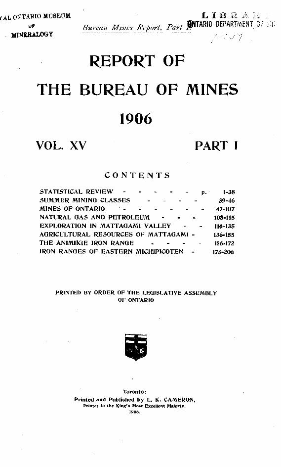
REPORT OF
THE BUREAU OF MINES
1906VOL. XV PART I
CONTENTS
STATISTICAL REVIEW - - ^ - - p. 1=38SUMMER MINING CLASSES - 39=46MINES OF ONTARIO - - ~ - - *- 47=107NATURAL GAS AND PETROLEUM - - ^ 108-115EXPLORATION IN MATTAGAMI VALLEY - - 116=135AGRICULTURAL RESOURCES OF MATTAGAMI - 136-155THE ANIMIKIE IRON RANGE - 156=172IRON RANGES OF EASTERN MICHIPICOTEN - 173=206
PRINTED BY ORDER OF THE LEGISLATIVE ASSEMBLY OF ONTARIO
Toronto: Printed and Published by L. K. CAMERON,
Printer to the King's Most Excellent Majesty, 1906.
Ofu.UJO MUSEUM
o
WARWICK ERO'S 6 RUTTER, Limited. Prinien TORONTO

CONTENTS
LETTERS OP TRANSMISSION ......FIFTEENTH REPORT OF THE BUREAU OF
MINES Mineral production, 1905............Mineral production, 1905; metals
at prices of refined (nearly)Mineral production., 1901 to 1905
Gold........................................Gold mining, 1901 to 1905......
S ilverDevelopment of Cobalt camp Prospecting for veins............The producing mines............Silver mining, 1901 to 1905... The subsidiary products.........Production of Cobalt mines,
1904-5................................A boom in mining stocks......
Cobalt.....................................Nickel and copper...................
Nickel-copper mining, 1901 to 1905 ................................
Water powers in Northern On tario
Iron ores ..............................Pig iron and steel...................
Production of iron and steel, 1901 to 1905.....................
Lead .....................................Building materials .................
Stone .................................LimeBrick ..................................CementProduction of cement, 1891 to
1905 ................................Corundum
Production of corundum. 1901 to 1905 ............................
FeldsparProduction of feldspar, 1901
to 1905 .............................Iron pyrites ...........................
Production of iron pyrites, 1901 to 1905 ....................
MicaSalt ......................................
Production of salt, 1901 to 1905 ................................
Petroleum ..............................Petroleum and petroleum pro
ducts, 1901-5 ....................Natural gas ...........................Other products .......................
Mining revenue .........................Crown lands sold and leased,
1905 ...................................Mining; companies .....................
Mining companies incorporated, 1905 ...................................
Mining companies licensed in 1905 ....................................
556789
10101011
13
131415
16161616161717
1819
1919
2020
212121
2121
22 •2'22324
2425
25
26
PAGE 26 29 29
2930
31
3133
33
343536363638
SUMMER MINING CLASSES .............39-46Desert Lake feldspar mine ......... 40General Electric mica mine ....... 41Star of the East go-Id mine ......... 41Jarman pyrites mine ................. 42Craig gold mine ....................... 42Craigmont corundum mine ......... 43Haileybury ................................ 43New Liskeard ........................... 43Cobalt ...................................... 44Giroux Lake .............................. 45Shakespeare gold mine ............. 45General ..................................... 4(i
MINES OF ONTARIO ......................!47-107
PAGE FIFTEENTH REPORT- Continued., viii The diamond drills, 1905 ............
Mining accidents ......................l-38 The Algoma Steel Company ...
American Madoc Mining Com pany ..................................
Canadian Copper Company ....Kingston Feldspar and Mining
Comp anyMassey Station Mining Com
panyThe Mond Nickel Company ... James Richardson ife Son's feld
spar mine ...........................S. E. quarter N. half 8 in 4,
Coleman Table of accidents ..................
Provincial Assay Office ............Work for Bureau of Mines ......Work for the public ...............
Temiekaming Mining Division ......
Northwestern Ontario Gold mines ...................
Minto .......................Sunbeam or A. L. 282 Laurentian
... 48 48
... 48
... 50
... 50Big Master ......................... 52Little Master ...................... 52Pay Master ........................ 52Gold Rock 52
Eagle Lake district ............... 52Eldorado Baden Powell
5254
Pioneer Island .................... 54Grace ................................. 54Golden Eagle ...................... 55Ideal ................................. 55Redeemer ........................... 55Mining Location E. D. B. l 55
Lake of the Woods district ......... 55Sultana ................................. 57Regina or Black Eagle ............ 57Bully Boy .............................. 58Combined .............................. 58Golden Horn ......................... 59Olympia ................................ 59St. Anthony Reef ........ .. . .... 59
[iii.l
IV. Contents No. 5
MINES OF ONTARIO. Continued. PAUEAtikokan iron mine ............... 59Shilton sulphur mine .............. 61Tip-Top copper mine ............... 61
Sudbury and the North Shore ... 61Water power developments ...... 61Canadian Copper Company ..... 63
Creighton mine ................... 64No. 2 mine ......................... 64Krean Hill ......................... 64Quartz Hill ........................ 64Cobalt refining plant ... ........ 64
Victoria mines ........................ 65Shakespeare gold mine ............ 66Copper mines ........................ 67
Massey Station ................... 68Hermina ............................ 68Prospect in May township ... 68Bruce Mines ....................... 68Superior ............................. 68Northern Ontario Copper
Company .......................... 69Whiskey Lake copper proper
ties ................................. 69Iron mines ............................. 70
Helen ................................. 70Breitung ............................ 71Williams ........................... 71
Petroleum and natural gas ...... 72Temiskaming district ................ 73
Silver-Cobalt mines ................ 73La Rose .............................. 73New Ontario or J. B. 7 ...... 74Coniagas or J. B. 6 ............ 76Buffalo ............................... 76Cobalt Silver Queen ............ 78Temiskaming and Hudson Bay 79McKinley and Darragh ........ 79Nipissing ............................ 79O'Brien .............................. 80Violet ................................ 80Hanson Cross Lake ............. 80Watts and Allen ...... ........... 80King Cobalt ......... .... ......... 81Nova Scotia ............,........... 81Peterson Lake ................... 81Drummond ................,........ 81Jacobs ................................ 83Hargrave ...............,........... 83Rothschild .......................... 83Lawson .............................. 83Silver Leaf ........................ 83Foster ................................ 84University .......................... 85Silver Bar .......................... 86Savage ............................... 86Temiscamingue .................... 86Beaver ................................ 86Columbus ............................ 86Benn .................................. 86Red Rock ........................... 87Edison Cobalt ..................... 87
Other minerals ....................... 87Temagami Mining and Mill
ing Company .................. 87Little Dan .......................... 88James Lake pyrites mine ... 88Temagami iron range ......... 88
Eastern Ontario ........................ 8S
MINES OP ONTARIO. Continued. PAQBGold mines ............................. 88
Craig ................................. 89Star of the East ................. 89 ,Big Dipper ........................ 89 f
Eldorado copper mine............... 90Lead and zinc mines ............... 91 l ,
Hollandia lead mine ............ 91Katherine lead mine ........... 91Stanley Smelting works ...... 91Frontenac lead mine ........... 91Richardson or Olden zinc mine 93
Iron pyrites ........................... 94American Madoc .................. 94British American ............... 94
Iron mines ............................ 95Radnor ............................... 95Mineral Range ................... 95
Corundum mines .................... 97Canada Corundum Company.. 97 Ashland Emery and Corun
dum Company ................. 99Feldspar mines ...................... 99
Richardson .......................... 99Border ............................... 102Kingston Mining and Devel
opment Company ............ 102Mica ..................................... 102
General Electric Company ... 102Richardson Bros. ................ 103Grant ................................ 103Bear Lake .......................... 103Kent Bros. ........................ 103Brockville Mining Company... 104Martha .............................. 104Mica Trimming works ......... 105
Graphite ................................ 106Talc ....................................... 106Fluorspar .............................. 106Sodalite ................................. 106Marble .................................. 107Granite ................................. 107Calcium carbide ..........,.......... 107
NATTTRAL GAS AND PETROLEUM ......108-115Geology of oil and gas fields ...... 109Wells, Nos. l to 14 ..................109-113Logs ........................................ 113
EXPLORATION IN MATTAGAMI VAL LEY .....................................116-135
Introduction ............................. 116The Mattagami valley ............... 117
The Mattagami river ............. 117The Coffey river ..................... 119Kamiskotaia lake ................... 119Coffey river to Sturgeon falls... 120Sturgeon falls ....................... 120Sturgeon falls to Speight's first
base ................................... 120Speight's first base to the Mus
kego ................................... 121The Muskego river .................. 122Driftwood creek ..................... 122Muskego to Poplar rapids ...... 123Poplar Rapids river ............... 123Red Pine lake to lake Clement 124
East of Frederick House andAbitibi ............................... 124
Pyne and Mortimer ............... 125

1906 Contents
PAGE EXPLORATION IN MATTAGAMI VALLEY.
Continued.Fox and Brower ..................... 126St. John and Hanna ............ 126
Economic Resources ................... 127The soil ................................. 127Forests .................................. 127Peat beds .............................. 128Water power ......................... 128Minerals ................................ 130Game '.................................... 130
Geology and Petrography .......... 131A Belt of the Huronian ......... 131Eruptive rocks ...................... 132Diabase and gabbro ............... 133Tourmaline schist ................... 134Granite bosses ........................ 134Glacial geology ...................... 135Conclusion ............................. 135
AGRICULTURAL RESOURCES OF MATTA GAMI ...................................136-155
General description of region ...... 136Black spruce forest ............... 136River bank ........................... 137Poplar knoU .........,............... 138Muskeg .................................. 138Jack-pine plain ..................... 138Rock ..................................... 138Drainage ............................... 138
Overland excursions .................. 139Township south of Jessop ...... 139Niven's base line of 1899 ...... 139Mattagami river to Kamisko-
taia lake ............................ 139Kamiskotaia lake ................... 140Kidd township ...................... 140Macdiarmid township ............ 141Carnegie township .................. 141Mahaffy and Crawford town
ships ................................... 141Aubin. Nesbitt, Kingsmill ...... 141Township of Dargavel ............ 142Township of Lennox ............... 142Latitude of mile post 162
Niven's line ....................... 142Sydere township ..................... 142Bast part Bradburn township... 143 Between Mattagami and Mus
kego .................................. 143West in latitude of mile post
174. Niven's line ................. 143Round Lake Clement ............... 144East in latitude of mile post
174, Niven's line .................. 144South of the line ..................... 145East from Jump Over falls ... 146 West of Jump Over falls ......... 146
Climate ................................... 147Flora and Fauna ....................... 149
Flora .................................... 149Fauna ................................... 151
Soil specimens collected in theregion ................................ 151
Chemical analysis .................. 153Physical analysis ................... 154Mattagami soils ..................... 155
THE ANIMIKIE IRON RANGE .........156-172Geology .................................... 156
PAGETHE ANIMIKIE IRON RANGE. Continued.
Keewatin ............................... 158The Lower Huronian series...... 159
Lower Huronian conglomerate 160The amphibolites ................ 161Sea-green porphyry ............ 161
Middle Huronian .................. 161Granite .............................. 161
The Animikie formation ......... 163Black slate ......................... 163The lower elates .................. 163Impure limestone ................ 163Quartz conglomerate ............ 164Iron formation proper ......... 164The iron ore ..................... 167Analysis of iron ores ............ 168
Keweenawan or Nipigon ......... 168The Logan or diabase sills ...... 170
Sorting operation on Loon lakeores ...................................... 172
IRON RANGES OF EASTERN MICHIPI COTEN ..................................173
Introduction .............................The geological nomenclature ......Development of the district .......Region south of Michipicoten river
Topography ...........................Blackinton's claims ................Iron formation near Mijinne-
mungshing ..........................Iron ore southeast of Cap ChoyyeIron formation near lake Anji-
gomi ..................................Iron formation on lake Mishe-
wawa ..................................Goetz claims ...........................Iron formation among the gold
mines ...........................;.....Goudreau lake pyrites deposits. The Bear claim '.....................The Emily gold mine ...............The Helen iron mine .............Post Huronian rocks ...............Eruptive? south of Michipicoten
river ..................................Schistose rocks of the region ...
Pleistocene geology ....................Glacial features .....................Old Lake deposits ..................Wave beaches on lake Superior Terraces near Michipicoten ......Terraces above Michipicoten
falls ........................... .......Highest terraces in the region.. Terraces along the Algoma Cen
tral Railway .......................Old water levels on St. Joseph
island ........................ .......Additional notes, by E. S. Moore
The field of work ..................Wawa City to Missanabie Sta
tion ........ ..........................Michipicoten schists ...............Helen iron formation ............The Keweenawan series; basic
eruptives . . . . . . . . . . . . . . . . . . . . . . . . . . . .Post Lower Huronian granites Pleistocene geology . . . . . . . . . . . . . . . . .
206173174174175175177
179179
179
180181
183183186187187189
190191192192193193194
198198
199
199200200
201202204
205205206

vi. Contents No. 5
ILLUSTRATIONS. .Page.
Minto gold mine, Rainy River district............................................................... 49Minto gold mine, camp buildings................... 49Laurentian gold mine, H. P. 371...........^.^.^^!^!^!.^.^'^^.!.!^^.^.^.^.. 50Shaft and hoist house, Laurentian gold mine...................................................... 51Gold Rock, Upper Manitou lake........................................................................ 53Eldorado gold mine, Eagle lake........................................................................ 54Sultana gold mine, shaft house........................................................................... 56Stamp mill, Sultana gold mine........................................................................... 56Regina gold mine, Lake of the Woods................................................................ 57Atikokan iron mine, camp buildings.................................................................. 60Atikokan Iron Company's coal dock, Port Arthur................................................ 61Power house, Wahnapitae Power Company...................................................... 63Trethewey silver-cobalt mine (J. B. 7)............................................................... 75Trethewey silver-cobalt mine, shaft house and compressor house........................... 75Buffalo silver-cobalt mine, compressor house...................................................... 77Buffalo silver-cobalt mine, shaft house............................................................ 77Cobalt Silver Queen mine, Cobalt........................................................................ 78Peterson lake; Nipissing Mining Company's pumping plant................................. 81Drummond silver-cobalt mine............................................................................. 82Drummond silver-cobalt mine; camp buildings...................................................... 82Camp buildings, Hargrave and White's claim, Coleman....................................... 84University silver-cobalt mine, camp building...................................................... 85Concentrating plant, Bis; Dan gold-arsenic mine................................................ 87Lead smelter at Bannockburn............................................................................ 92Old concentrating mill at Frontenac lead mine................................................... 92Mill at Olden zinc mine.................................................................................... 93Mineral Range Iron Mining Company; No. 4 mine............................................. 96Mineral Range Iron Mining Company ; No. 4 mine, looking east........................... 96Canada Corundum Company's mill, Craigmont................................................... 98Canada Corundum Company; workings on hillside ............ .............................. 98Ashland Emery and Corundum Company's mill................................................... 99Richardson feldspar mine.................................................................................. 100Richardson feldspar mine; No. 2 pit.................................................................. 100Kingston Mining and Development Company's feldspar mine.............................. 101Brockville Mining Company's mica mine, near Elgin.............................. ........ 104One of the chutes, Island Falls, Mattagami river............................................. . 129Yellow Falls, Mattagami river........................................................................... 130Typical view of poplar bank river country. Mattagami..................................... 137Voyageurs on the Mattagami..................!........................................................ 145Mattagami eoils (chart)..................................................................................... 155Current river in spring................................................................................ - 157Lower Huronian conglomerate on south side C. P. Railway.................... ...- 160Light gray granite cutting Lower Huronian conglomerate........................ 162Falls on Current river, four miles north of Port Arthur........................... -. 165Tunnel in Wiley's iron ore location........................................................ ......... 167Unconformity between Keweenawan and Animikie formations, east shore of
Iron lake................................................................................................... 169North shore, lake Superior...:............................................................................. 173Running a rapid, Michipicoten river ............................................................. 176Roches moutonnees, Michipicoten Harbor ......... .......................... ... . . ....... 177North shore, lake Superior................................................................................. 178North shore, lake Superior................................................................................. 180Cross section of George Goetz's claim.................................................................. 182Map of Goudreau lake pyrite deposits................................................................ 184Boyer and Sayers lakes, Helen mine................................................................... 188Keweenawan, near Cap Choyye........................................................................ 190Raised beach, Old Woman river......................................................................... 195Terrace, Michipicoten river.............................................................................. 196Projecting log from peaty deposit, Michipicoten river.......................................... 197Indians, Missanabie......................................................................................... - 201Map of Hawk and Manitowick lakes.................................................................. 203
MAPS.Map of the Animikie Iron Range, near Port Arthur. Ont., geologically colored. Scale,
one mile to one inch. To accompany report by L. P. Silver. Map of the Iron Ranges of Southeastern Michipicoten, geologically colored. Scale,
two miles to one inch. To accompany report by A. P. Coleman.

To His HONOR WILLIAM MORTIMER CLARK, &C., &C., &C.,Lieutenant-Governor of the Province of Ontario.
Sir:
I have the honor to transmit herewith for presentation to the Legislative Assembly, the Fifteenth Report of the Bureau of Mines.
I have the honor to be, Sir,Your obedient servant,
F. COCHRANE,Minister of Landt and Mines.
DEPARTMENT or LANDS AND MINES, TORONTO, 24th April, 1906.
[vii] .

To THE HONOEABLB FRANK COCHRANE,
Minister of Lands and Mines.
Sir:
I beg to submit herewith, to be presented to His Honor the Lieutenant-Governor,
the Fifteenth Annual Report of the Bureau of Mines.
The Report consists of two Parts, Part I, which passes in statistical review the
mining industries of the Province for the year 1905, gives the reports of the instructors
of Summer Mining Classes, and of the Inspector of Mines upon the mining properties
actually under operation, and presents articles upon Natural Gas and Petroleum, Exploration in Mattagami Valley, Agricultural Resources of Mattagami, The Animikie
Iron Range, and the Iron Ranges of Eastern Michipicoten; and Part II, which deals with Clay a.nd the Clay Industry of Ontario.
I have the honor to he, Sir,Your obedient servant,
THOS. W. GIBSON,Director*
OFFICE OF THE BUREAU OF MINES, TORONTO, 24th April, 1906.
[viii.j

Vol. XV.
REPORT OFTHE BUREAU OF MINES
1906By Thos. W. Gibson, Director
Part I.
Statistical ReviewThe mineral production of the Province of Ontario for the year 1905, including in that
term the output of the mines, metallurgical works, brickyards, quarries, etc., amounted in value to 117,809,226, at the prices payable for the several products at the mines and works. As compared with the production of 1904, this represents an increase of abont 54 per cent., a notable advance, and much the largest total of any year in the history of the mining industry in this Province. Table No. l gives a summary of the production, showing also that the num ber of employees and wages paid for labor, which in 1904 were 10.491 and S3.838.583 respec tively had increased to 11,151 and 85,082.653.
Table I.—Mineral Production, 1905
Product.
(a) -Metallic Gold................................Silyer....... . .......................Cobalt.............................Nickel..............................Platinum metals.Lead...............................Pig Iron............................Steel................................
Less value Ontario iron ore smelted and Ontario pig iron converted
Net metallic production
(b)-Non-Metallie
Brick, pressedpaving:.....................
Calcium carbide" natural rock..............
CorundumGraphite
Mica . . .Peat fuel............................
Salt..................................Talc. ................................
,i
d,i
into pig iron, into steel :
,,K
.........bbls.
t,* j,
u
Quantity
5.T70 2.473.452
' 118 9.503 41525 1,562
141 211,597 256.704 138,387
549 250.000,000
ISiOOO.OOO 26.010.000 4,500,000
2,427 1,254.360
14.741 1,681
12,234 2,078 2.353 7.325
3,100,000 315
400 22,131,658
60,415
1.120
Value
S
99.885 1.372,877)
100. 000 f 3.354.934 S
688:993 28,116j 9.000
227,909 3.909.527 \ 3, 321,884 7
13,113,125
2,912,115
10,201,010
2.693 1,937,500 1
220.0007 234.000
54,000 700,000 156,755
1,783.451 10,402
152.464 29,968
9,825 4,118
21,885 424,700
50,446 316,476
1.200 (d) 898,545
60,000 356.783 225:835
2,240
7.658.286 10,201,010
17,854,296
Employees No.
279 475
1,17516
2781,684
3,907
(c)
215 60
1.400 80
945 33
216 52 46 13 68
500 104 131
5(6) 65
148 55
9
7.244 3,907
11,151
Wages
S
175,818 191,582
833,822
10,000 164,153
1,131.078
2,50S,453
(0) 815,00085,000 28,000
500.000 35,600
504,122 4,453
109 128 19,200 13,375
1,614 27,*90
165,000 27.320 81,865
525 (e)
20,000 68,580 62,078
650
2,576,400 2,506,453
5,082.658
(c) Included in silver and cobalt, reported.
(d) Not including Dominion Government bounty of J331,975. (o) Not
[1]

Bureau of Mines No. 5
The usage of the Bureau of Mines from the first has been to compute the value of the mineral products of the country on the basis of their selling value at the mines or works. Thus, iron ore is taken for statistical purposes at its worth at the pit's mouth not at its value at the blast furnace, with the charges for transportation and middle man's profits, if any, added; nickel and copper in the mattes of Sudbury are estimated at their value in that condition and at the place of production, not at their market price as refined metals after having incurred all the costs of the processes of separation; silver is valued at the sums actually received by the mine-owners for their ore marketed in New York or elsewhere, not on the current price of fine silver; and so throughout the list. It is believed that in this way the actual value of the products as factors in the industries of our own country are more closely approximated, than by a method which attributes to them a value largely the result of the application of labor and capital to them outside the limits of Canada. For instance, the cobalt contents of the silver ores mined in the Cobalt camp are a.t present worth little or nothing to the producers of these ores, simply because they get little or nothing for them from the ore buyers. It is hardly correct then to estimate these cobalt contents, for purposes of Ontario statistics, as being worth the selling price of cobalt oxide, say 82.25 or $2.50 per pound. Again, the nickel and copper of the Sudbury mattes sell, when separated and refined, for say 40 or 50 cents per pound for nickel and 18 or 20 cents per pound for copper. But the refining and separating are done in the United States and Wales, and the additional value thus given to the crude materials is surely to be credited to these countries, and not to Ontario, the place of origin. However, this is not the view acted upon in compiling the statistics of some of the other Provinces of the Dominion by the Provincial authorities, or by the Geological Survey of Canada in making up the figures for the Dominion as a whole. Statistics being used largely for purposes of comparison, the result is that when the official figures for Ontario and say British Columbia are compared, the difference in the statistical methods employed gives an erroneous impression of the relative importance of the mining industry of this Province. In order that this may be clearly seen, and also to provide the means of making a fair comparison between the mineral statistics of Ontario and those of any other Pro vince or Provinces, the following table is given in which the metallic products of Ontario for 1905 are valued at nearly the market prices of the refined metals, and the non-metallic products, most of which are not susceptible of more than one method of valuation, are taken at their "spot" value, as in Table I.
Table II.—Mineral Production 1905; metals at prices of refined (nearly).
Product
Nickel . . . . . . . . . . . . . . . . . . . . . . . . . . . . . . . . . . . . . . . . . . . . "
Steel.......................... .................... "Total........... ........
Add non-metallic productionGross production.
Quantity
5.7702 473 452
' '1189,503
1,562141
211 597
138,387
Price
0 573(b) 2 25 per Ib
0400 165
18 00 ' oz.
152324 00
Value 9
99,885i 479 Q"'?
675,0007,602,40*1 4Q'2 750
' 28^11611,840
227,909
3,321,884
18,752,188i} m 9 i-i x
15,840,073
823 493 359
(*) No change owing to uncertainty of fineness of bullion, (b) As cobalt-oxide, CoO, containing 78.66 per cent. Co.
The foregoing table is comparable with a similar table given in the Annual Report of the Minister of Mines, British Columbia, for 1905, p. J9, in which the prices for
la M.

1906 Statistical Review
silver, copper and lead are the same as those used above, and are stated to be, for the first, 95 per cent., and for the last 90 per cent., of the average price for the year in the New York metal market, treatment and other charges not being deducted; and with the schedule in "Mineral Production of Canada, 1905," issued by the Geological Survey at Ottawa, in which the following prices are assumed: copper, 15.590 cents per pound, lead, '4.707 cents per pound, nickel, 40 cents per pound, silver 60.352 cents per ounce. This basis of computation gives the aggregate value of the minerals produced in Ontario in 1905, after eliminating duplicated materials, such as iron ore smelted into pig iron and pig iron converted into steel, as 823,493,359, while the total for British Columbia for the same year was 522,461,325. These figures alone are sufficient to indicate the growing importance of mining in Ontario. It is rapidly taking its place as one of the leading industries of the Province.
The increased aggregate production for 1905 as compared with 1904 is chiefly due to advances in the output of the following products; silver from Spill,887 to 11,372,877, nickel from 31,516,747 to 53,354,934, copper from 5297,126 to 5688,993, pig iron from ^1,811,664 to ?3,909,527, steel from 51,188,349 to 53,321,884, brick from 51,430,000 to 51,937,500, Portland cement from 51,239,971 to 51,783,451, and natural gas from S253,524 to 5316,476. No important falling-off is shown in any product, either metallic or non-metallic.
It will be observed that while there has been a general increase throughout the large and varied list of minerals and mineral substances produced in Ontario, the chief increases have been in the metalliferous branches of the industry, the total output of metallic products in 1905 being valued at 510,201,010, as compared with 54,906,677 in 1904, an increase of over 100 per cent. The largest previous metallic output was in 1902, when it reached the sum of S6,257,499. For the first time, the metallic production has surpassed the non-metallic in aggregate value, and the excess is the decided figure of 52,547,724. The future of the mining industry in Ontario belongs to the metals and their ores.
Ths output of non-metallic substances holds its own, or shows a slow increase from year to year. The yield in 1905 exceeded that for 1904 by 5987,316, and that for 1903 bv 525,268. In the latter year, however, the value of petroleum products was included in the total instead of the value of the crude petroleum produced, as has been the case since that time. This much more than accounts for the difference.
Table No. Ill given below shows the value of the several mineral products for each of the last five years, and demonstrates the substantial growth now being made in the various departments of the industry.
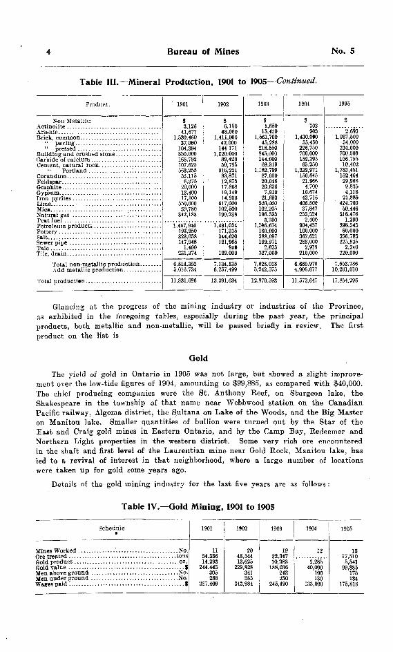
Table HI.—Mineral Production, 1901 to 1905Product.
Metallic: Gold.........................................Silver. . . . . . . . . . . . . . . . . . . . . . . . . . . . . . . . . .
Cobalt.......................................Nickel.......................................
Steel.........................................Pi* Lead.....................................Molybdenite
Less value Ontario iron ore smelted into pig
Net metallic production
1901
9
84,830
589,080
174,428
347,280
15,000
5,016,734
5,016,734
1902
S
58,000
680.283
518,445
1,610,031
40011.500
7,002,499
745,000
6.257,499
1903
9188,036
8,949
716.7262,499,068
450,099
1,5001,275
17,000
5,678,929
436,354
5,242,575
1904
S40,000
m.88710,45218,564
297,126
108,0681,811,6641,188,349
2,500
3,700
5,321,677
250,000
4,906,667
1905
S99.885
1,372,877
100.0006*8,993
3,354,934227,909
3,909,5273,321,884
9,660
13,113,125
2,912,115
10.201.010
Bureau of Mines No. S
Table III.—Mineral Production, 1901 to 1905- -Continued.
Product.
?Jon-Metaliic:
Mica.................................. ......
Salt..........................................
Tfilc
1901
t3,126
41,6771,530,460
37,060
850.000168,792107.625563,255
6.37520,00013.40017,500
550,00039.780
342,183
1,467,940193,950323.058147,948
1,400231,374
6.814,352
11,831,086
1902
S6,150
48.0001,411,000
42,000
1,C20.000
83.87112,87517.86819.14914,933
617.000102,500199.238
1 .431.054171,315344,620191,965
93*199,000
7.134.135
13.391,634
1903
S1,650
15,4201,561,700
45,288218.550845.000144.000
69.3191.182,799
87.60020,04620,636
7,91021,693
520,000102,205196.535
3.300
160,000388,097199.971
2,625227,000
12,870.593
1904
102903
1,430.0*055.450
226,750700,000152,29565.250
1,239,971150.645
21.96(14.700
10.67443,716
406.80037,847
253,5242.400
904,437100.000362,621283,000
2,919210,000
4,906.67V
11,572,647
1995
S2.693
1,937,50054,000
234,000700.000156.755
10,4021,783,451
152.46429,968
9.8254,118
21,885424,700
50,446316,476
1,200898,54560.000
356.783225,835
2.240220,000
10,201,010
17,854,296
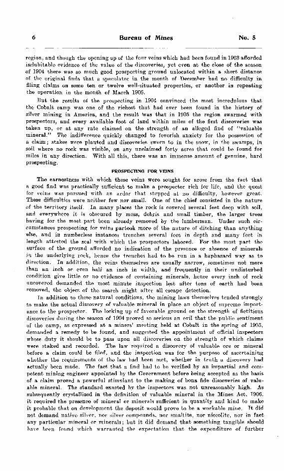
Glancing at the progress of the mining industry or industries of the Province, as exhibited in the foregoing tables, especially during the past year, the principal products, both metallic and non-metallic, will be passed briefly in review. The first product on the list is
Ooid
The yield of gold in Ontario in 1905 was not large, but showed a slight improve ment over the low-tide figures of 1904, amounting to |99,885, as compared with ^40,000. The chief producing companies were the St. Anthony Reef, on Sturgeon lake, the Shakespeare in the township of that name near Webbwood station on the Canadian Pacific railway. Algoma district, the Sultana on Lake of the Woods, and the Big Master on Manitou lake. Smaller quantities of bullion were turned put by the Star of the East and Craig gold mines in Eastern Ontario, and by the Camp Bay, Redeemer and Northern Light properties in the western district. Some very rich ore encountered in the shaft and first level of the Laurentian mine near Gold Rock, Manitou lake, has led to a revival of interest in that neighborhood, where a large number of locations were taken up for gold some years ago.
Details of the gold mining industry for the last five years are as follows :
Table IV.—Gold Mining, 1901 to 1905
Schedule9
1901
1154,33614.293
305288
287.409
1902
2048,54413,625
341385
343,984
1903
1932.34710,383
188,036243.ISA
245 490
1904
122.285
40,000100130
l"" fWVl
1905
1317,5105,541
99,885
134

1906 Statistical Review
SilverWith the discovery of the high-grade ores of the Cobalt district in 1903, silver
mining in Ontario entered upon a new lease of life. The production of silver in this Province has been from two districts, which though widely separated in distance, strongly resemble each other in the character and relationships of the ores. The first of these is on the northwest shore of lake Superior, including Silver Islet, where rich ore was discovered in 1868. This find was followed by others on the main land, and for a number of years the Beaver, Badger, Rabbit Mountain, Silver Mountain, Porcu pine and other mines yielded large quantities of silver, in addition to the pioneer mine on Silver Islet, which was perhaps the richest of them all. The lowering price of silver led in time to the entire suspension of silver mining in the Lake Superior region, the West End Silver Mountain being the last mine to remain in operation, and producing bullion up to 1903. The ores of this district carried native silver, argentite, cobalt, nickel and arsenic, 'the same assemblage of minerals as are found in the veins of the Cobalt region, though the proportion of the three last is probably greater in the veins of Cobalt than in those of Lake Superior. The close resemblance which these deposits bear to each other, though not less than 500 miles apart, warrants the hope that in the intervening distance veins of a similar nature may yet be found. By far the larger part of this immense district, lying partly north of Lake Huron and partly north of Lake Superior, has been but little prospected away from the railway and leading canoe routes, and there is ample room here for other Silver Islets and Cobalts. The geology of the country does not forbid the occurrence of rich mineral wealth ; on the contrary, the Huronian rocks which characterize a considerable part of it contain the greatest deposits of nnckel ore in the world, much wealth of copper and iron and considerable gold, not to mention minor ores, such as those of cobalt, arsenic anc sulphur.
DEVELOPMENT OF COBALT CAMP
The rise of the Cobalt mining camp has been rapid. Indeed, almost all the requisites for speedy development were found united here. The richest of ores out cropping at the surface, a railway running through the centre of the camp to bring in supplies and carry the ores to market at reasonable rates, abundance of wood for timber and fuel, plenty of labor and law and order well maintained, have combined to afford almost every facility a mining camp could require. Yet the news of the extraordinary riches found on the banks of Cobalt lake (then known as Long lake) by Prof. Miller, the Provincial Geologist, in the fall of 1903, though promptly published, excited for a time only a languid interest. The public had been through one or two mining booms and were not anxious for another; it was difficult for many to believe that ores of the character reported could exist in any quantity in a district from which nothing of the kind had hitherto come; and consequently the magnificent collection of specimens showing native silver in nuggets many pounds in weight, and profusely interspersed throughout solid blocks of smaltite and niccolite, with which Mr. Miller returned and which were kept displayed in the office of the Bureau of Mines and at the door of the Legislative chamber during the winter of 1903-4, attracted comparatively little attention.
Nor was this indifference confined to the general public, the great proportion of whom lack the necessary qualifications for judging the nature and value of ores or minerals, but even mining men at first failed to appreciate the significance and import ance of the new finds. The collection of ores and specimens mentioned above was exhibited at the annual meeting of the Canadian Mining Institute held in Toronto in March 1904, but the feeling aroused was curiosity rather than interest, and while the samples were regarded as excellent specimens, there was much skepticism as to the existence of a new silver field of any importance. The consequence was that the spring or even the summer of 1904 saw comparatively few prospectors in the Cobalt
Bureau of Mines No. 5
region, and though the opening up of the four veins which had been found in 1903 afforded indubitable evidence of the value of the discoveries, yet even at the close of the season of 1904 there was so much good prospecting ground unlocated within a short distance of the original finds that a speculator in the month of December had no difficulty in filing claims on some ten or twelve well-situated properties, or another in repeating the operation in the month of March 1905.
But the results of the prospecting in 1904 convinced the most incredulous that the Cobalt camp was one of the richest that had ever been found in the history of silver mining in America, and the result *was that in 1905 the region swarmed with prospectors, and every available foot of land within miles of the first discoveries was taken up, or at any rate claimed on the strength of an alleged find of "valuable mineral." The indifference quickly changed to feverish anxiety for the possession of a claim; stakes were planted and discoveries sworn to in the snow, in the swamps, in soil where no rock was visible, on any unclaimed forty acres that could be found for miles in any direction. With all this, there was an immense amount of genuine, hard prospecting.
PROSPECTING FOR VEINS
The earnestness with which these veins were sought for arose from the fact that a good find was practically sufficient to make a prospector rich for life, and the quest for veins was pursued with an ardor that stopped at no difficulty, however great. These difficulties were neither few nor small. One of the chief consisted in the nature of the territory itself. In many places the rock is covered several feet deep with soil, and everywhere it is obscured by moss, debris and small timber, the larger trees having for the most part been already removed by the lumberman. Under such cir cumstances prospecting for veins partook more of the nature of ditching than anything else, and in numberless instances trenches several feet in depth and many feet in length attested the zeal 'with which the prospectors labored. For the most part the surface of the ground afforded no indication of the presence or absence of minerals in the underlying rock, hence the trenches had to be run in a haphazard way as to direction. In addition, the veins themselves are usually narrow, sometimes not more than an inch or even half an inch in width, and frequently in their undisturbed condition give little or no evidence of containing minerals, hence every inch of rock uncovered demanded the most minute inspection lest after tons of earth had been removed, the object of the search might after all escape detection.
In addition to these natural conditions, the mining laws themselves tended strongly to make the actual discovery of valuable mineral in place an object of supreme import ance to the prospector. The locking up of favorable ground on the strength of fictitious discoveries during the season of 1904 proved so serious an evil that the public sentiment of the camp, as expressed at a miners' meeting held at Cobalt in the spring of 1905, demanded a remedy to be found, and suggested the appointment of official inspectors whose duty it should be to pass upon all discoveries on the strength of which claims were staked and recorded. The law required a discovery of valuable ore or mineral before a claim could be filed, and the inspection was for the purpose of ascertaining whether the requirements of the law had been met, whether in truth a discovery had actually been made. The fact that a find had to be verified by an impartial and com petent mining engineer appointed by the Government before being accepted as the basis of a claim proved a powerful stimulant to the making of bona fide discoveries of valu able mineral. The standard exacted by the inspectors was not unreasonably high. As subsequently crystallized in the definition of valuable mineral in the Mines Act, 1906, it required the presence of mineral or minerals sufficient in quantity and kind to make it probable that on development the deposit would prove to be a workable mine. Tt did not demand native silver, nor silver compounds, nor smaltite, nor niccolite, nor in fact any particular mineral or minerals ; but it did demand that something tangible should have been found which warranted the expectation that the expenditure of further

1906 Statistical Review
labor would result in an actual mine, and justified the handing over into private hands of 40 acres of the public domain.
The combined effect of these conditions the richness of the prizes and the require ments of the law was such as to make it doubtful whether a larger amount of pains taking, persevering work in the way of prospecting was ever expended within a like area. Men dug and shovelled in the trenches all day and were succeeded by their mates who continued the work all night; ditches twenty feet in depth and of corres ponding width were sunk to solid rock where the slate-conglomerate was known to exist; shafts of working size were put down 20, 30 or 40 feet in the solid rock following up a barren vein of calcite or in the hope that a crack the width of a knife-blade on the surface might increase in width and prove a bonanza in depth; diamond drills were called into requisition; and all this not to develop known deposits, but simply to find mineral in quantity and kind sufficient to satisfy the law and so show cause for title being given for the land.
The usual fantastic aids to prospecting in the shape of divining rods and similar appliances were not lacking, and in a camp where search for minerals had of necessity to be carried on to some extent blindly, were accepted by some, either out of credulity, or for lack of better guidance.
THE PRODUCING MINES
The producing mines of the Cobalt camp in 1905 were the following: La Rose Mining Company, on mining location J S 14; M. J. O'Brien, mining location R L 403; Kerr Lake Mining Company (Jacobs' mine) part of lot 3, concession four, Coleman township; Victoria Mining Company (Foster mine), the southeast quarter of north half lot 4, concession four, Coleman; Buffalo Mining Company (American mine) town-site of Cobalt; W. G. Trethewey, (Trethewey Silver-Cobalt Mining Company, or New Ontario mine), mining location J B 7; Trethewey and Leonard, (Coniagas mine), mining location J B 6; Cobalt and Silver Mining Company (MoKMey-Darragh mine), mining location .T B l; Nipissing Mining Company, mining locations R L 404, R L 406, etc.; H. E. Lawson (Lawson mine), southwest quarter of north half of lot 3, concession four, Coleman; White Silver Compa ay (Hargrave mine), part of lot 3, concession four, Coleman; The University Mining Company (University mine), south part of lot 4, concession four, Coleman ; Watts and Allan (Watts mine), northeast part of north half lot 3, concession five, Coleman; Temiskaming and Hudson Bay Mining Company (now Cobalt Silver Queen), part of southeast quarter of north half of lot 7, concession five, Coleman ; Violet Mining Company (Handy mine), northwest quarter of south half of lot 3, con cession six, Coleman; Drummond Mines, Limited (Drummond mine), northeast part of north half of lot 2, concession four, Coleman 16 shipping mines in all. The number of distinct shafts or openings from which ore was raised was greater, as several loca tions for instance, those owned by the Nipissing Mining Company, whose holdings are the most extensive of any company in the camp, aggregating in all 846 acres are included in the area worked by a single concern or individual, and treated for statistical purposes as one mine.
In addition to the mines engaged in commercial production, a small quantity of ore was shipped from Mr. Philip Green's property, the southeast quarter of the north half of lot 14 in the first concession of Bucke, and a quantity of silver in the shape of nuggets sold by Messrs. Gleudinning and McLeod from their claim situated in the southwest part of lot 3 in the sixth concession of Coleman.
The active prospecting carried on in the season of 1905 included the western and northern portions of the township of Lorrain, lying to the east of Coleman township, and the southern portion of the township of Bucke lying to the north, but the results were somewhat disappointing. The region within which the rich silver ores are found seems so far to be largely confined to the township of Coleman, and to certain belts of slate-conglomerate or breccia there, namely, those in the vicinity of Cobalt, Cross and
Bureau of Mines No. S
Kerr lakes respectively, together with local areas of Keewatin and diabase near by. Further exploration may reveal other highly argentiferous areas, but so far they have not been found.
Up to the present the occurrence of cobalt, nickel and arsenic in association with the silver of the Cobalt ores has not proven of great advantage to the mine-owners. The buyers of ore who at first were willing to pay 65 and 70 cents per pound for the cobalt contents, 12 and 15 cents per pound for the nickel, and l cent per pound for the arsenic, ceased during 1905 to pay anything whatever for these constituents. The main values being in the silver, the mines will continue to be worked and ore to be produced, notwithstanding that these subsidiary minerals have to be given "away; but ii is sincerely to be hoped that ere long a process may be devised and works estab lished either on the spot or somewhere within the limits of the Province, which will by recovering all the valuable constituents of the ore, put an end to this deplorable waste and source of financial loss, that in many cases amounts to at least S100 per ton of ore, and in some instances to considerably more.
The problem of the economical treatment of their ores is now being carefully con sidered by some of the leading mine-owners, who in default of relief from any other quarter, propose to take the matter in hand themselves. The Canadian Copper Com pany is now engaged in constructing a refinery at Copper Cliff, in which it is under stood that the ores from the Nipissing Mining Company's mines will be treated, either wholly or in part, and other works are talked of.
The demands for information respecting the Cobalt region made on the Bureau of Mines have been very extensive, and in order to meet it, a second edition of Prof. Miller's description of the region, being Part II of the Bureau's Fourteenth Report has this year (1906) been brought out. The edition is of 10,000 copies. The report has been in part re-written, and the geological map corrected and brought down to a later date. A review of the working properties by Mr. E. T. Corkill, Inspector of Mines, will be found in the present volume. Prof. Miller, the Provincial Geologist, and assistants are this year (1906) again to take the field for the purpose of reviewing and correcting the geology of the mineral area, and of bringing an account of the working mines and developments down to a somewhat late period of the year. It is hoped to publish this account, together with a more minute and detailed map of the region on a lyge icale and geologically colored, as part of the Sixteenth Report. Meantime, the Bureau is in a position to supply inquirers with the Report and map above referred to. That they have been of very great practical benefit in the examina tion and development of the district is amply vouched for by unsolicited testimony.
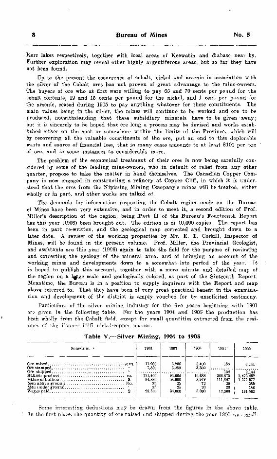
Particulars of the silver mining industry for the five years beginning with 1901 are given in the following table. For the years 1904 and 1905 the production has been wholly from the Cobalt field, except for small quantities extracted from the resi dues of the Copper Cliff nickel-copper mattes.
Table V.—Silver Mining, 1901 to 1905
Schedule. ' 1901
1 i finn
151.40084.830
SO35
1902
96.66B58,000
25
1903
3,360
8.9491220
8.000
190T
15S
158
111,8872928
12,300
1905
2,1442,473,4521,372,577
2891S6
191,582
Some interesting deductions may be drawn from the figures in the above table. In the first place, the quantity of ore raised snd shipped during the year 1905 was small.

1906 Statistical Review
The total amount hoisted, 3,144 tons and this from 16 mines is not more than three or four days' work for say the great Creighton nickel mine, while the total shipments 2,144 tons, are about equal to two days' delivery from that mine.
But the ore made up in quality what it lacked in quantity. The average contents of the ore shipped out of the camp were 1,143 ounces of silver per ton. and the average value of the ore per ton for silver only was 1635. The average value was perceptibly lowered by the shipment of some 352 tons of auriferous gravel from one of the mines on Cobalt lake, the debris from veins on the shore, which ran about 537 ounces per ton. Excluding these consignments, the average contents of the ore shipped from the veins in place was 1,262 ounces of silver, valued at about |700 per ton.
The number of men employed in the mines, 475 in all, is large in comparison with the quantity of ore handled, and works out at 6.6 tons of ore raised, and 4.5 tons of ore shipped per man. This is no doubt accounted for in part by the narrowness of the veins, which restricts the quantity of the ore, and in part by the fact that many, if not all of the mines were in the development stage, where much labor is necessarily in other work than actual mining.
On the other hand, out of every dollar received on account of ore shipped, only some 14 cents were paid out as wages for labor, leaving 86 cents for other expenses, replacement of capital and profit. The profitable nature of silver mining at Cobalt is apparent from this statement; and that no great amount of capital is necessary for the development of a bonanza vein is further evident from the fact that in several instances, the original prospectors who discovered the veins are still in possession of a controlling interest in their properties, and have without trouble realized sufficient money from the sale of ore to equip their mines with all needed machinery and plant. The Trethewey, University, and Foster mines are examples of this.
The Subsidiary Products
As stated above, the mine owners of Cobalt were paid for the cobalt, nickel and arsenic contents of their ores during the early part of the year only; for the remainder of the twelve months they received nothing for these constituents. No assays, consequently, were made to show the proportions or quantities of these metals present in the consignments in which they were treated as valueless. The various mines differ considerably from one another in the percentages of. cobalt, nickel and arsenic, but an attempt has been made with the imperfect data received to estimate the quantity and value of these elements shipped out of the district during the year. The result is as follows :
Quantity. Value. Tons. S
Cobalt ...................................................... 118 100,000Nickel ........................................... .......... 75 10,000Arsenic .................................................... 549 2,693
Total ............................................................ |112,693
This is on the basis of 5.5 per cent, of cobalt, 3.5 per cent, of nickel, and about 2o per cent, of arsenic. The value of these substances is arrived at by computing the several quantities at the prices paid in those cases where returns were received for them by the shippers. Adding the total to the silver value of the shipments, an aggregate is obtained of 11,485,570. being a gross average of S693 per ton a remark ably high figure.
10 Bureau of Mines No. 5
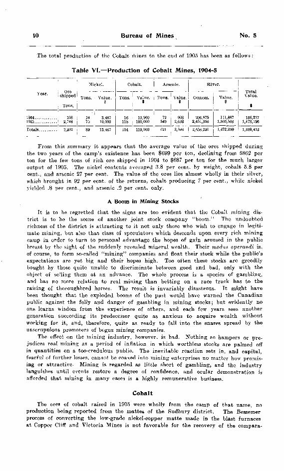
The total production of the Cobalt mines to the end of 1905 has been as follows :
Table VI.—Production of Cobalt Mines, 1904-5
Year.
1904............1905............
Ore shipped
Tons,
158 2,1442,302
Ni
Tons.
14 7589
ckel.
Value .S
3,467 10,000
13,467
Cobalt.
Tons.
16118
134
Value. 8
19,960 100,000119,960
Arsenic.
Tons.
72 549621
Value.S
903 2,693
Silver.
Ounces.
206,875 2,451,356
3,5U6 2,658,231
Value. 9
111,887 1,360,503
Total Value.
f
136,217 1,473,196
1,472,390 ! 1,609,413
Prom this summary it appears that the average value of the ores shipped during the two years of the camp's existence has been ?699 per ton, declining from $862 per ton for the few tons of rich oro shipped in 1904 to ?687 per ton for the much larger output of 1905. The nickel contents averaged 3.8 per cent, by weight, cobalt 5.8 per cent., and arsenic 27 per cent. The value of the ores lies almost wholly in their silver, which brought in 92 per cent, of the returns, cobalt producing 7 per cent., while nickel yielded .8 per cent., and arsenic .2 per oent. only.
A Boom in Mining Stocks
It is to be regretted that the signs are too evident that the Cobalt mining dis trict is to be the scene of another joint stock company "boom." The undoubted richness of the district is attracting to it not only those who wish to engage in legiti mate mining, but also that class of speculators which descends upon every rich mining camp in order to turn to personal advantage the hopes of gain aroused in the public breast by the sight of the suddenly revealed mineral wealth. Their modus operandi is, of course, to form so-called "mining" companies and float their stock while the public's expectations are yet big and their hopes high. Too often these stocks are greedily bought by those quite unable to discriminate between good and bad, only with the object of selling them at an advance. The whole process is a species of gambling, and has no more relation to real mining than betting on a race track has to the raising of thoroughbred horses. The result is invariably disastrous. It might have been thought that the exploded booms of the past would have warned the Canadian public against the folly and danger of gambling in mining stocks; but evidently no one learns wisdom from the experience of others, and each few years sees another generation succeeding its predecessor quite as anxious to acquire wealth without working for it, and, therefore, quite as ready to fall into the snares spread by the unscrupulous promoters of bogus mining companies.
The effect on the mining industry, however, is bad. Nothing so hampers or pre judices real mining as a period of inflation in which worthless stocks are palmed off in quantities on a too-credulous public. The inevitable reaction sets in, and capital, fearful of further losses, cannot be coaxed into mining enterprises no matter how promis ing or attractive. Mining is regarded as little short of gambling, and the industry languishes until events restore a degree of confidence, and ocular demonstration is afforded that mining in many cases is a highly remunerative business.
CobaltThe ores of cobalt raised in 1905 were wholly from the camp of that name, no
production being reported from the mattes of the Sudbury district. The Bessemer process of converting the low-grade nickel-copper matte made in the blast furnaces at Copper Cliff and Victoria Mines is not favorable for the recovery of the compara-
1906 Statistical Review
tively small proportion of cobalt which these ores contain. The chief features of interest in connection with the production of cobalt have already been touched upon under the heading of silver.
It is a little curious that although cobalt occurs so abundantly in the veins of Coleman township, the fact that it is for the most part associated with silver, a more valuable mineral, constitutes an obstacle to its utilization. Cobalt refiners in Eng land would willingly purchase supplies of cobalt ore, but they require it to be free from silver, and will not buy silver ore for the cobalt it contains. There are but few cobalt veins in the camp which do not carry silver as well. One of these is on Mining Location R L 404, owned by the Nipissing Mining Company, which was one of the four veins found in 1903, and is described by Prof. Miller in the Bureau's Thir teenth Report, 1904, p. 99. Another is known as the Benn mine, situated on the north part of lot 15 in the first concession of the township of Bucke. This was located by Ira L. Benn in the fall of 1904, and has since been purchased by Dr. C. K. Leith of Madison, Wis., and (associates.
The Cobalt deposits have made the characteristic and unmistakable hue of cobalt "bloom" well-known to the prospectors of Ontario, and discoveries of this compound have been reported from other parts of the Province for example, from Whiskey lake, in Algoma district north of the Sault branch of the Canadian Pacific railway, and from the vicinity of Madoc in the county of Hastings. The latter is not a, new occurrence, as the mineral has for many years been known to exist in that locality, apparently, however, in small quantities. No deposits of the unchanged ore or smal tite are alleged in either of these places. In the western portion of the township of Coleman near Portage Bay, an arm of Bay lake, which is itself an expansion of the Montreal river, several small veins of smaltite have been found, which do not, however, appear to be accompanied by silver. In the township of Casey, Temiskam- ing district, some twelve or fourteen miles north of Coleman township, a good cobalt vein has been found, which is said to carry native silver. The discovery on Rabbit lake, Temagami Forest Reserve, has not improved on further development work being done. "West of Bay lake, neiar Trout lake, Mr. Thos. A. Edison of Orange, New Jersey, has purchased a location upon which cobalt was found and will develop it during the present season (1906). Mr. Edison, it is alleged, has perfected a new storage battery, in which cobalt is employed as one of the electrodes for generating the electric cur rent, and will require considerable supplies of the metal for the manufacture of these batteries.
The total output of cobalt for 1905 is estimated at 118 tons, worth about S100,000.
Nickel and Copper
A very decided increase marked the output of nickel in 1905, as compared with that of 1904, or indeed of any previous year. In the latter year the production was 4.743 tons valued at fi .516,747, while in 1905 it was more than double the quantity, namely, 9,503 tons having a value of $3,354,934. The Largest previous production was 6,998 tons in 1903.
The sole producers continue to be the Canadian Copper Company, whose re modelled and greatly improved plant at Copper Cliff was in full operation through out the year, and tte Mond Nickel Company, who resumed the smelting of ore at Victoria Mines early in the year. Both companies now bring their ores to a Bessemer mat^ie, the former exporting their product for treatment at Constable Hook, New Jersey, and the latter to Clydach, Wales.
The Creighton mine, as in 1904, furnished the bulk of the ore treated by the Cana dian Copper Company, but a considerable quantity was also raised bv this company from its No. 2 mine at Copper Cliff, which was re-opened about the beginning of 1905.
12 Bureau of Mines No- 5
The ore smelted by the Mond Nickel Company came almost entirely from Victoria No. l mine. A few tons of ore were raised by the Lake Superior Corporation from the Gertrude mine, but none was smelted.
Following are the quantities of ore raised during the year, and the mines from which they were taken :
Canadian Copper Company :
Creighton ............................................................ 186,061 tonsNo. 2, Copper CHS ............................................. 38,940 "
Mond Nickel Company :
Victoria No. l ................................................... 51,998 : 'Victoria No. 2 ................................................... 267 "
Lake Superior Corporation :
Gertrude ............................................................ 300 "
Total ...............,......................................... 277,766 "
The nickel mining of the Sudbury region remains the most important- branch of the industry in Ontario, employing, as it does, more capital and labor, and turning out a product having a greater value than any other. The stage of development to which it has been brought, and the skilful manner in which it is conducted by the two companies above mentioned, reflects credit upon their courage, persistency and good management. They have given the nickel fields of Ontario an unquestioned supremacy in the world's production of this metal.
In the treatment of the Canadian Copper Company's mattes some 1,562 ounces of platinum metals were obtained during the year 1905, valued at ?28,li6. No separation was effected between the platinum and palladium thus produced.
The developments of the past year in the nickel mines are noted by Mr. Corkill, Inspector of Mines, in his report. A comprehensive account of the Sudbury Nickel Field by Dr. A. P. Coleman was printed as Part III of the Bureau's Fourteenth. Report, 1905, along with a map of the entire field, geologically colored, exhibiting both the northern and southern ranges. There has been a good demand for this Report, but a number of copies remain on hand for distribution.
The copper district lying to the north of Lake Huron has not yet reached the point of development which its merits seem to warrant. There are many prospects, but comparatively few mines. One lack of the district is a copper smelter, which would afford a market for ore taken out in the course of development that cannot now be disposed of, owing to the heavy burden of transportation charges to copper smelters in Michigan or the Eastern States. A number of the veins discovered are of small size, but judging from surface outcroppings, there are many others of payable dimensions. The lodes in the old Bruce mines were large, and modern methods of treatment and present day prices for copper should bring about a revival of interest in this promising region. The Bruce mines were being unwatered about the close of the year, preparatory to mining being begun by the Copper Mining and Smelting Company of Ontario, an English concern, of which Mr. H. J. Carnegie-Williams is manager.
The producing mines during the year were Massey Station, Superior and Her- mina, the total quantity of ore raised being 6,324 tons, the estimated contents of which were 143 tons of copper. The ore thus averaged about 2.3 per cent, copper.

1906 Statistical Review 13
In Table Xo. VII are given particulars of the nickel and copper production ofthe Province during the five years ending with 1905:
*Table VII.—NickeNCopper Mining 1901 to 1905
Schedule.
Valueof Nickel. . . . . . . . . .. . . . . . . . . . . . . . . . . . . . . . . . . S
1901
326,945270.380
15.54B
4.1971,859,970
589.080
2.284
1902
269,538233,388
24,69113,3325.9454,066
616.763835,050
1,445
1903
152.940220,937
14,4196,9984,005
583,646746,147
1,277
1904
203,388102,844
19,1236.924
2.163
297,126570,901
1,063
1905
284.090257,745
(a) 17,3889,503
3,354,934688,993833,822
1,176
(a) Bessemer.In addition to the foregoing statistics, it may be stated that 47.979 tons of coke
were used in smelting the nickel-copper ores of the Sudbury region, valued at 8319,535, and 23.745 cords of wood consumed as fuel, mainly for roasting the green ore for the expulsion of the sulphur. ;
The average proportion of nickel contained in the ore smelted in 1905, as deduced from the contents of the Bessemer matte produced, was less than in that smelted in 1904, dropping from 4.58 to 3.7 per cent. a fall probably due to the smaller propor tion of Creighton ore used in 1905 as compared with 1904. The copper contents of the ore smelted last year, similarly calculated, were 1.75 per cent., as compared with 1.86 per cent, in 1904.
Water Powers in Northern OntarioThe water power developments noticed in last year's Report as being under way
in the nickel region have since then been completed. These are three in number: The plant of the Huronian Company at High Falls on the Spanish river; the works of the Sudbury Power Company at McPherson's Falls on the Vermilion river in the township of Creighton; and the plant installed by the Wahnapitae Power Company at Dryden Falls on the Wahnapitae river. The combined capacity of these plants is about 24,000 horse power, of which less than half is at present developed. The power from the High Falls of the Spanish is transmitted to the Canadian Copper Company's mines and works at Copper Cliff, 30 miles away, where electricity is replacing steam in the operation of machinery. The substitution of power generated by the falling of water for that produced by the combustion of fuel, whether wood or coal, will allow n very considerable saving of coste in many branches of the mining industry, as well as contribute not a little towards the industrial development of the region in other lines.
In other parts of northern and western Ontario the question of utilizing some of the numerous water powers found on the large rivers and at the outlets of lakes is receiving practical attention. At High Falls on the Michipicoten river, a syndi cate from Berlin, Waterloo county, is installing a plant to provide cheap power for use of the low-grade gold mines of the region. The Kaministiquia Power Com pany is actively engaged in putting in important works at Kakabeka falls on the Kaministiquia river, and purpose supplying Fort William and Port Arthur with whatever power these places may require. The latter town has a municipally owned and managed water power on the Current river. The Spanish river at Webbwood falls, near the town of that name, has been harnessed by the Spanish River Pulp and Paper Company for the operation of a pulp mill on the spot. The falls of the Stur geon river at Sturgeon Falls hare for several years been producing power for pur poses of the pulp and paper mill at that place, now owned and operated by the
14 Bureau of Mines No. 5
Imperial Paper Mills, Limited. On the east branch of the Winnipeg river where it emerges from Lake of the Woods, the town of Kenora has had a. small power plant under operation for some time, and is taking steps to materially enlarge it. At rae town of Dryden in Rainy River district, the falls of the Wabigoon are to be brought into requisition for the operation of a pulp and paper mill. The falls of the Rainy river at Fort Frances are being developed by the Backus syndicate to provide power for pulp mills and other industries. The magnificent works of the Lake Superior Corporation by which the difference in level between Lakes Superior and Huron are utilized in the production of power, are well known. In the Temiskaming region, the falls of the Blanche river at the foot of Long lake have been improved for saw mill and similar purposes, and other falls lower down the same stream are also to be developed. There are several fine powers on the Montreal river, some of which might without great difficulty be made to contribute to the power requirements of the Cobalt mining region, not many miles away, where already the mine owners are beginning to experience difficulty in procuring sufficient supplies of wood suitable for fuel.
Coming to older Ontario, the town of Bracebridge has for years been drawing, energy for lighting and other uses from falls on the Muskoka river within the limits of the municipality, while Orillia has been doing likewise from Ragged Rapids on the Severn river about eighteen miles away. In the eastern part of the Province, a fall on the Madawaska river is^ employed in producing power for operating the Black Donald graphite mine in Brougham township, Renfrew county, and a water power at the outlet of Deer lake was a few years ago improved to furnish energy for the purposes of the Belmont gold mine at Cordova, Peterborough county.
The foregoing list enumerates only a few of the many fine water powers in the newer regions of the Province. The others are running to waste. It is certain that the part to be played by water power in the industrial development of the Province will be a very important one. Nowhere will it be more important than in the great Clay Belt north of the height of land, where the new Province now taking form contains many magnificent streams longer and more important than their compeers draining into the great lakes, but marked like them fry numerous rapids, falls and cascades.
Iron OresThere were raised from the iron mines of the Province in 1905 211.597 tons of
ore, valued at |227,909, as against 53,253 tons worth 3108,068 in 1904. The increase was due to the fact that the Helen mine, Michipicoten district, which was in opera tion for part of 1904 only, was working during the whole of last year. Of the quantity produced, 204,487 tons were hematite, and 7,110 tons magnetite.
Iron ore was produced at the Helen mine, and at the Breitung and Williams properties, near Sault Ste. Marie; these are all hematite mines. Magnetite was raised from the Radnor mine, near Eganville, Renfrew county, owned by the Canada Iron Furnace Company.
The production of iron ore during the last nine years was as follows :
Year.
18971898 . . . . . . . . . . . . . . . . . . . . . . . . . . . . . . . . . . . . . . . . . . . . . . . . . . . . . . . - - . - . . . . . . . . . . . . . .18991900lorn19021903 ............................... ................................. .......19041905
Total............................................. ..... ........
Quantity.
Tons. 2,770
27,40916.91190.302
273,538
208,16453,253
211,5971 243 2*22'
Value.
SA QQfi
48,875tt ft AC-1
174.428AfJ) flQQ
Iflfl (\GO
227,909
1,675,566

1906 Statistical Review 15
The quantity of iron ore extracted from the mines of the Province, as nearly as can be now ascertained, from 1869 to 1896, inclusive, was 582,542 tons, valued i at 11,445,228; consequently the total output from 1869 down to the end of 1905 was 1,825,764 tons, having a value of f3,120,794. A glance at the figures given above shows that the production began to increase in the year 1900 the date of the first shipments from the Helen iron mine. It fell off in 1903 and 1904, during parts of which years the Helen mine was closed for the most of the time owing to the financial difficulties of its owners. In the sir years the Helen mine has been worked, as shown in the above table, it has raised and shipped upwards of 1,100,000 tons of ore.
Exploring for iron ores goes on steadily from year to year. In addition to the iron ranges or fields mentioned in former Reports, there is reason to believe that ore bodies of importance will be, found west of the township of Hutton, probably con tinuations of the deposits in the latter place, for which a branch of the Canadian Northern railway will shortly afford an outlet; also at Woman river, north of the main line, of the Canadian Pacific railway. Iron ranges have also been located near Bur wash1 lake and Shining Tree* lake in the Temagami Forest Reserve, but the amount of development work done at these points is insufficient to prove the value or charac ter of the deposits. Prospecting work done in the vicinity of the banded magnetite deposits on thei northeast arm of Lake Temagami are said to have revealed the pres ence of hematite, but the extent ot the bodies has not yet been shown. Samples of hematite of good quality have also been brought from the neighbourhood of Plat Rock rapids, on the Montreal river.
In view of the importance of obtaining all authentic information possible regarding the iron ore resources of the Province, it is proposed to undertake an examination of the iron ore ranges lyin'g east of Lake Nepigon, which have frequently been referred to in the Bureau's Reports, and a visit to which in 1900 forms the subject of a brief note by Mr. J. W .Bain in the Tenth Report, pages 212 to 214. The investiga tion will probably be undertaken by Dr. A. P. Coleman, and in view of the large area which it will be necessary to examine, may extend over two or three years.
In' the present volume are published the results of Dr. Coleman's examination of the iron ranges of eastern Michipicoten, in which he was assisted by Mr. E. S. Moore. This work was in continuation of previous explorations in the Michipicoten region by Dr. Colemans himself, by Prof. A. B. Willmott,4 and also by Mr. James M. Bell.s
Pig Iron and Steel
The production of pig iron in' the blast furnaces of Ontario, situated at Hamilton, Deseronto, Midland and Sault Ste. Marie, during 1905 amounted to 256,704 tons, valued at 53,909,527, being more than double, both in quantity and value, of the previous year's output, which was 127,845 tons, worth 11,811,664.
To produce the above quantity of pig iron, 61,960 tons of domestic and 383,459 tons of imported ore were required.
Of the pig iron1 produced by the Hamilton Steel and Iron Company and the Lake Superior Corporation, a sufficient quantity was converted into steel by those com panies to make 138,387 tons of steel, worth f3,321,884.
Details of the operation and products of the blast furnaces and steel works are as follows :
.................................... " 383,459. i ' nn O0|i
. . . . - . . . . . . . . . . . . . . . . . . . . . . . . . . . . . . " 262,415
i Bur. Minei. 6th Rep. 1896, p. 170. 2 Ibid., p. 174.SBur Mines. 8th Rep. 1899, pp, 254-258 ; 9th Rep. 1900, p. 154 elseq ; 10th Rep. 1900, p. 191 el seq.; lith Rep. 1901
i 152 d seq.; 4 Ibid ; 6 Bur. Mines, Uth Rep. 1905, p. 278 (t ieq.
16 Bureau of Mines No. 5
Valueof fuel. ............................................ . ............ . ..........................8 1,250,816Charcoal for fuel................................................... ................................ bush 3,387,869Value of fuel ............................................................................................t 135,515Pig iron product ............................................ ........................................ tons 256,704Value of product ........................................................................................9 3,909,527Steel product ...............,......................................................................... tons 138,387Value of product .. .....................................................................................8 3,521,884Workmen employed .... ......,...................................................................... No. 1.684Wages paid, .. .................................................................... ........................3 1,131,078
Statistics of the iron and steel-making industry for the five years ending with 1905 are given in the following table:
Table VI H.—Production Iron and Steel, 1901 to 1905
Schedule.
Coke................................ "
1901
109.10985,40151,452
113,119915,789
1,701,70314,471
347,280
1902
92.88394,07958,885
968,623
1,683,05168,802
1,610,031
1903
48,092103,13749,42696,540
932.63J87,004
1,491,696
304,580
1904
50,423
61,566135,108
1,821,270127,845
1,811,664
1,188,349
1905
383,459121,052262,415
3,387,869256,704
138,3873,321,884
Total.
362,467839,2.58
718,572
700,61010,597,641
287,8916,772,144
LeadThe only mine raising lead ore in 1905 was that of the Ontario Mining and Smelt
ing Company at Bannockburn, Hastings county. A sufficient quantity of ore was mined to yield, together with some material from the dump, some 172 tons of con centrates containing an average of 82 per cent. lead.
Building MaterialsTaking up the products included in the non-metallic group, it is convenient first
to deal with Building or Construction Materials, comprising under this head Stone, Lime, Brick and Cement.
' STONE
Returns made to the Bureau indicate clearly that the building trade during 1905 was in an active condition throughout the Province. Stone, both for construction purposes, and in the crushed state for road material, had an output of some S700.000 in value. As the figures in the table indicate, the large proportion of this sum repre sents the cost of labor expended in quarrying and preparing the stone for market. Some interest has been shown in the building stone resources of the county of Hastings in the vicinity of Bancroft, where there are extensive beds of granite or gneiss, dolo mitic limestone or marble of varying texture and color, and also deposits of sodalite, whose deep blue tint makes it suitable material for inside decorative work. It appears likely that an effort will shortly be made to place these products on the market both in the cities of Ontario and those south of the boundary line within reach of trans portation, where there exists a large and steady demand for articles of the kind. An extension or spur of the Central Ontario railway may be built in order to afford the necessary outlet.
Attention may here be drawn to the full account of the Limestones of Ontario bv Prof: Miller, Provincial Geologist, published as Part II. of the Bureau's Thirteenth Report. 1904. A number of copies of this Report remain on hand for distribution.
LIMB
The lime kilns of the Province last year turned out in the neighbourhood of 3,100,000 bushels of lime, as compared with 2,600.000 bushels in 1904. There is abun-

1906 Statistical Review 17
dance of limestone throughout older Ontario, and although it varies greatly in com position, not only because of differing geological age but also through local conditions, it is a fortunate circumstance that its usefulness for conversion into lime for building is not materially affected by these variations. Experience for many years in Ontario seems to show conclusively that the prejudice against magnesian limestone for lime- burning purposes, existing in some parts of the world, is not well founded.
BRICK
The brickyards of Ontario were busy during 1905, and turned out a considerably increased output as compared with the previous year, the production being 250,000,000 common and 26.000,000 pressed, as against 200,000,000 common and 26,857,000 pressed a year ago. The value, too, went up considerably, averaging |7.75 per thousand as against ^7.15 in 1904. The increase, in the cost of labor, fuel, and manufacture gen erally within the last few years shows plainly in the price of brick, an article whose cost depends so little upon the value of the raw material, and so much upon the labor, fuel and plant required to produce it. This steady advance is shown by the following figures for the average price per thousand of common bricks produced in Ontario, as reported to the Bureau from year to year :
Year. Price per M.1900.................................................................................... 35 901901.............................................'....................................... 5 731902..................................................................'.................. 6 411903.................................................................................... 6 781904.................................................................................... 7 151905.................................................................................... 7 75
Part II. of this Report on Clay and the Clay Industry of Ontario, by Prof. M. B. Baker, of the Kingston School of Mining, will be appreciated by all who are interested in this most important branch of the mineral industry of the Province. Mr. Baker's investigations of the clays and shales of Ontario are probably the most systematic and extensive that have been made from the economic point of view since the days of the early Canadian geologists, and some of the facts and generalizations appearing in the Report afford new views of some departments of the subject.
Other clay products are drain tile, paving brick, sewer pipe and pottery, the output of all of which was nearly normal for the year. The manufacture of the last- named, however, can hardly be said to have obtained more than a foothold as yet in Ontario. Only the coarsest and cheapest goods are made of the native clays; all the finer articles of domestic production are made from imported material.
CEMENT
The manufacture of Portland cement grows apace, the output of Ontario factories for 1905 being greater than for any preceding year, and an advance over that of 1904 by 42 per cent, in quantity and 44 per cent, in value.
The producing plants numbered eleven, as follows: The Grey and Bruce Cement Company. Brookholm; The Owen Sound Portland Cement Company. Shallow Lake: The Sun Portland Cement Company. Owen Sound; The Imperial Cement Company. Owen Sound; The Canadian Portland Cement Company, Strathcona and Marlbank; The National Portland Cement Company. Durham: The Ontario Portland Cement Company, Blue Lake; Belleville Portland Cement Company, Point Ann; Lakefield Portland Cement Company, Lakefield; Raven Lake Portland Cement Company, Raven Lake; Hanover Portland Cement Company, Hanover.
Three plants, those of the Western Ontario Portland Cement Company at Atwood, the Colonial Portland Cement Company, near Wiarton, and the Superior Portland
2 M.
18 Bureau of Mines No. 5
Cement Company, at Orangeville, were in course of construction and equipment, but had not turned out any cement up to the close of 1905.
Natural rock cement does not seem to be growing in favour, judging from the lessening output from year to year. Three factories, those of Mr. F. W. Schwendiman, Rytnal; the Toronto Lime Company, Limehouse, and Mr. Isaac Usher, St. David's, produced 14,741 barrels, valued at 110,402, a decided falling off from 1904, when 85,000 barrels were made worth 565,250.
The average selling price of Portland cement at the factories was ?1.42 per barrel, an increase of two cents per barrel over the price obtained in 1904; that of natural rock cement was 70 cents, a reduction of seven cents as compared with 1904. The number of workmen employed in the Portland cement plants was 935, and the amount of wages paid out 5498,052; in the natural rock plants 33, who were paid wages to the extent of 54,453: the cement industry, as a whole, therefore, employed 968 work men and paid out wages aggregating 5502,505.
The steady and rapid expansion of the Portland cement industry in this Province can be traced very plainly from the following table:
Table IX.—Production of Cement, 1891 to 1905
Natural Rock.
Year. Bbl.
1891........................................ 46,17*1892. . . . . . . . . . . . . . . . . . . . . . . . . . . . . . . . . . . . . . . 54,1551883. . . . . . . . . . . . . . . . . . . . . . . . . . . . . . . . . . . . . . , . 74,3531895. . . . . . . . . . . . . . . . . . . . . . . . . . . . . . . . . . . . . . . . .55.L19
189S. . . . . . . . . . . . . . . . . . . . . . . . . . . . . . . . . . . . . . . . 91,5281899. . . . . . . . . . . . . . . . . . . . . . . . . . . . . . . . . . . . . . . 139.487
1903. . . . . . . . . . . . . . . . . . . . . . . . . . . . . . . . . . . . . . ,. 89,549190S. . . . . . . . . . . . . . . . . . . . . . . . . . . . . . . . . . . . . . . . 11,741
Total . . . . . . . . . . . . . . . . . . . . 1,195,264
Value 9
39,419 38,580 63,567 48,774 45,145 44,100 76,123 74,222
117,039 99,994
107,625 50,795 69,319 65,^50 10,402
950,354
Portland
Bbl.
2,083 20,247 31,924 30,580 58,699 77,760 96,825
153,348 222,550 306,726 350,660 522,899 695,260 880,871
1,254,360
4,704,742
Value J
5,082 47,417 63,848 61,060
114,332 188,230 170,302 302,096 444.228 598,021 563,255 916,221
1,182,799 1,239,971 1,783,451
7,630,312
Total
Bbl.
48,211 74,402
106,277 85,903
113,918 138,465 181,495 244,876 362,037 432,154 489,288 609.199 784,809 965,871
1,269,101
5,897,006
Value?
44,501 85,997
127,415 109,834 159,477 182.330 246,425 376,318 561,266 698,015 670.880 967,016
1,252,118 1.305,221 1,793.853
8,580,666
The remarkable development of the Portland cement manufacture in this Province shows that the conditions here for the industry are favorable, and that the demand for the product is increasing from year to year. That the increase in production has been in almost geometrical ratio for a number of years, and that it has been made in face of a pronounced tendency towards lower prices, may be seen from the following figures :
Year.
1899................................................................1900 . . . . . . . . . . . . . . . . . . . . . . . . . . . . . . . . . . . . . . . . . . . . . . . . . . . . . . . . . . . . . . . .1902190319041905
Increase over previous
year.
Per cent. 45381449
2742
Average price per
bbl
9 1.991.941.601.751.701.40
The Bureau's Fourteenth Annual Report, Part I, published last year, contained a full account of the Cement Industry of Ontario, by Mr. P. Gillespie, B.Se. Tables
2a M.
1906 Statistical Review 19
were given showing the results of tests made by the writer of the paper on the product of the several cement plants of the Province. It was asserted by the Lakefield Portland Cement Company that these tests did not do complete justice to their brand of cement, known as the "Monarch." Mr. Gillespie was accordingly asked to make another exam ination of the Lakefield Company's product. He did so, and reported as follows :
"Results of tests on a sample of 'Monarch' Portland cement supolied by the Lakefield Portland Cement Company in April, 1906:
Neat Cement. 3 days, 475 lb., 500 Ib.; 7 day.s, 620 lb., 625 Ib.; 28 days, 620 lb., 665 lb.
Three to One Mortar. (Note. The sand used for these briquettes was that pre pared by the Sandusky Portland Cement Company, and is recommended by the American Society for Testing Materials. It is a natural sand, not crushed quartz). 7 days, 170 lb., 180 lb.; 28 days, 255 lb., 275 lb.
Fineness. Residue on No. 50 sieve, 0.0 per cent.; on No. 100 do., 1.9 per cent.Hot Test. Pats were allowed to set in air for 18 hours, after which they were
exposed to steam in a loosely closed vessel for four hours. The result was satisfactory."
Corundum
The production of grain corundum in the counties of Renfrew and Hastings con tinues to make progress, though difficulties are not wanting. The business is confined to two companies The Canada Corundum Company, whose mines and works are at Craigmont in the township of Raglan, Renfrew county, and the Ashland Emery and Corundum Company, whose plant is at New Carlow, in the township of Carlow, Has tings county. The latter is the successor of the Ontario Corundum Company.
The first output of corundum was in 1900, when 60 tons were turned out, having a value of ?6,000. Last year there were produced 1,681 tons of grain corundum, worth 5152,464.
The development of the corundum industry is shown by the following table:
Table X.—Production of Corundum, 1901 to 1905
Schedule. 1901.
53453,115
6830,406
1902.
1,137
95
1903.
87,600186
106,332
1*04.
1,665150,645
202139,548
1905.
152,464216
109,128
FeldsparSteady, if not very rapid, growth is being made in the quarrying of feldspar at
points along the line of the Kingston and Pembroke railway, the product being shipped to New Jersey and Ohio factories for making enamelled ware, etc. The spar is min- eralogically a microcline, and contains a considerable proportion of potash. One of the problems which might engage the attention of the chemists of this country is the discovery of a feasible method of making use of the potash in this variety of feldspar for fertilizing purposes. The quarries of Bedford township and vicinity would afford an inexhaustible supply.
The producers in 1905 were Messrs. J. Richardson and Sons, Kingston, and Mr. Charles Jenkins, Petrolea. The quarries are in the township of Bedford, Frontenac county;

20 Bureau of Mines No. 5
Figures for the feldspar industry during the past five years are as follows:
Table XI.—Production of Feldspar, 1901 to 1905
Year.
1901 . . . . . . . . . . . . . . . . . . . . . . . . . . . . . . . . . . . . . . . . . . . . . . . . . . . . . . . . . . . . . . . .1 03................................... ..............................1905 .................................................................
Quantity.
Tons. 5,1008,776
15,29610,98312,234
52,389
Value.
96,376
M),04621,96629,968
{91,230
The number of workmen employed in the quarries last year was 52, and the amount paid out in wages f 19,200.
Iron Pyrites
The production of iron pyrites was smaller in 1905 thjan in the previous year, amounting to 7,325 tons, valued at Sp21,885, as compared with 13,431 tons in 1904, worth 543,716.
Tne production was mainly by the American Madoc Mining Company, whose mines are situated, one in the township of Hungerford about five miles east of Tweed, and one near Madoc. A small amount was also 'raised by the British America Mining Com pany of Toronto from a deposit near Queensboro.
The number of workmen employed in extracting the above quantity of mineral was 68, who were paid wages amounting to i?27,690.
The growing use of pyrite instead of sulphur in the manufacture of sulphuric acid gives an increased importance to the pyrite deposits of Ontario, which occur not only in the eastern, but also in the northern and northwestern portions of the Province. Several properties are undergoing development at the present time, from which no shipments have yet been made. One of these is situated on mining locations W D 404 and 405, at James lake in the Temagami Forest Reserve, where Major R. G. Leckie has located and is opening up what appears to be a promising and workable body of ore. Another is near lake Minnietakie, near the projected line of the Grand Trunk Pacific, in which Mr. E. L. Michie of New York and his associates are interested. At the Helen iron mine, as is well known, a remarkable body of iron pyrites exists enclosed by, but quite separate from, the iron ore, doubtless representing a remnant of the original material from which the iron ore was derived, but which by some means escaped the metamorphic processes.
In order to disclose the potential wealth of the Province in this useful material considerably more valuable, ton for ton, than iron ore the Bureau has undertaken an investigation of the known deposits in all parts of Ontario where transportation facilities exist, or to which they are likely to be extended in the near future. This work has been entrusted to Mr. E. L. Fraleck, M.E., who is a recognized expert in iron pyrite . It is hoped Mr. Fraleck's report may be published in the Bureau's annual volume for 1907

1906 Statistical Review 21
The following schedule gives the annual and total production of iron pyrites during the last five years :
Table XII.—Production of Iron Pyrites, 1901 to 1905
Year.
1901. ...................:.............................................1902.1903. . . . . . . . . . . . . . . . . . . . , . . . . . . . . . . . . . . . . .1904............................................. ..........,.........1905.
Quantity.
Tons. 7,0007,4697,325
Value.
l17,50014,99321,693
21,885
MicaThe output of the mica mines of the Province in 1905 was returned to the Bureau
as 815 tons, worth in the rough-cobbed condition some 550,446. There were 104 hands emplojed in the business, earning in wages 527,320. The General Electric Company, Sydenham, was the chief producer.
SaltThe brine wells of Ontario yielded a total of 60,415 tons of salt during the year,
an increase of 4,538 tons over 1904, but worth, according to the makers' returns, about ?o,838 less. The industry employed 148 hands, and paid out in wages 168,580.
The Canadian Salt Company, Windsor, now produces the bulk of the salt made in Ontario; other operating companies are the Exeter Salt Company, Exeter; North American Chemical Company, Goderich and Clinton; Messrs. Gray, Young and Spar ling, Wingham; the Sarnia Salt Company, Sarnia; Ontario People's Salt and Soda Company, Kincardine; and Parkhill Salt Company, Parkhill.
Table XIII exhibits the course of the salt industry for the past five years:
Table XIII.—Production of Salt, 1901 to 1905
Schedule. 1901.
60.S27323.05S
67,024
1902.
76,154
1903.
388,09787,995
1904.
362,621
84,682
1905.
356,783148
68,580
Total.
1,775,179
PetroleumThe production of crude petroleum rose from 17.237.220 imperial gallons in 1904
to 22,131.658 imperial gallons in 1905, the largest output since 1900. It would thus nnpear that the united effect of the opening up of new pools in the old oil fields or their vicinity and the bounty paid of one and one-half cents per imperial gallon, wl.Ich. has been paid by the Dominion Government since 8th June. 1904. on domestic crude oil has for the present overcome the tendency towards a decline in output which for many years previous characterized the old fields of the southwestern peninsula. Bering tor oil has been active in the Leamington field, and also in'Tilbury township. A number of logs were given in the Bureau's last Report,6 and further details are supplied in this volume by Mr. Eugene Coste, M.E., the well-known authority on oil and gas in Ontario.
The figures of production as given here are supplied by kindness of the Depart ment of Trade and Commerce, Ottawa, and as they represent the quantity of crude
6 Bur. Mines, 14th Rep., 1905, pp. 89-117.
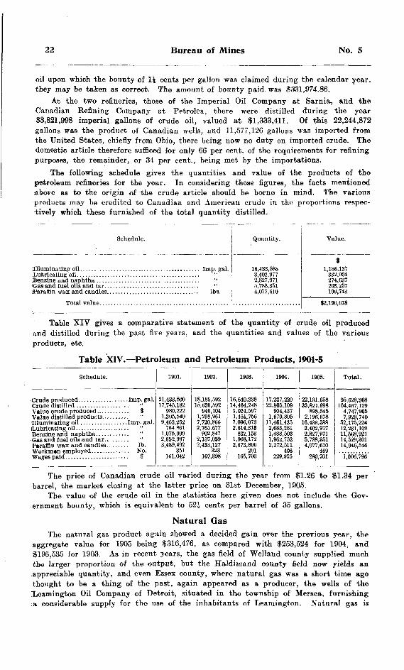
22 Bureau of Mines No. 5
oil upon which the bounty of li cents per gallon was claimed during the calendar year, they may he taken as correct. The amount of bounty paid was ?331,974.86.
At the two refineries, those of the Imperial Oil Company at Sarnia, and the Canadian Refining Company st Petrolea, there were distilled during the year 33,821,998 imperial gallons of crude oil, valued at 51,333,411. Of this 22,244,872 gallons was the product of Canadian wells, and 11,577,126 gallons was imported from the United States, chiefly from Ohio, there being now no duty on imported crude. The domestic article therefore sufficed for only 66 per cent, of the requirements for refining purposes, the remainder, or 34 per cent., being met by the importations.
The following schedule gives the quantities and value of the products of the petroleum refineries for the year. In considering these figures, the facts mentioned above as to the origin of the crude article should be borne in mind. The various products may be credited to Canadian and American crude in the proportions respec tively which these furnished of the total quantity distilled.
Schedule.
Total value . . . . . . . . . . . . . . . . . . . . .
Itti
.............. Ibs.
Quantity.
3,402.9772,827,9715,788,3514,077,610
Value.
9332,904
203,257199,743
32,196,678
Table XIV gives a comparative statement of the quantity of crude oil producedand distilled during the past five years, and the quantities and values of the various products, etc.
Table XIV.—Petroleum and Petroleum Products, 1901-5
Schedule.
Paraffin wax and candles. . . . . . . Ib.
1901.
17,746,182980,222
9,463,262764,861
1.075,999
3,489,492
161,042
1902.
940,1041,298,9617,720,866
902,847
2,433,127 323
169,398
1903.
16,640,33814,464,2481,024,597
7,096,073
832,1531,968,1722,673,806
165,700
1904.
17,237,220
904,4371,670,805
11,461,4352,683,2811,488,5031,962,7522,272,511
406229,955
1905.
22,131,65833,821.998
898,545
16,433,5883,402,9772.827,9715,788,3514,077,610
280,701
Total.
OR coo QnQ
104 467 1294,747,9051 Qf^t 7d(l
52,175,224
11,568,921
14,946,546
1,006,796
The price of Canadian crude oil varied during the year from Sfl.26 to ?1.34 per barrel, the market closing at the latter price on 31st December, 1905.
The value of the crude oil in the statistics here given does not include the Gov ernment bounty, which is equivalent to 52J cents per barrel of 35 gallons.
Natural QasThe natural gas product again showed a decided gain over the previous y*ar, the
aggregate value for 1905 being 5316,476, as compared with |253,524 for 1904, and S196,535 for 1903. As in recent years, the gas field of Welland county supplied much the larger proportion of the output, but the Haldimand county field now yields an appreciable quantity, and even Essex county, where natural gas was a short time ago thought to be a thing of the past, again appeared as a producer, the wells of the "Leamington Oil Company of Detroit, situated in the township of Mersea, furnishing .-a considerable supply for the use of the inhabitants of Leamington. Natural gas is

1906 Statistical Review 23
supplied to the people of that town at the following rates: Cook stove, per month, 52; house or office heater, 53; house furnace, $5; store heater, 13.50 or ?5; store furnace, S6; or through the metre at 30 cents per thousand cubic feet. The munici pality of Leamington formerly owned its own gas wells and supplied the people with gas as a municipal undertaking, but the supply failed. Now, the Leamington Oil Company supplies the gas through the town's mains, the gross receipts being divided eqaally between the company and the corporation, the latter defraying the cost of collecting the rates and attending to the distribution.
Gas is now piped from the Haldimand field to the following places: Dunnville, Dundas, Hamilton, Brantford, St. George, Galt, Jarvis, Attercliffe and Paris. It is sold both to distributing companies and to consumers direct, the price varying from 15 to 45 cents per thousand cubic feet, dependent upon the quantity used and whether for light or fuel. The field in this county is situated chiefly in the townships of Moulton and Walpole, and the gas comes from the Clinton and Medina formations at depths varying from 550 to 1,100 feet. The rock pressures run from 150 to 600 Ib.
Considerable quantities of gas are used in the burning of lime by the Empire Limestone Company at Sherkston, and the Welland County Lime Works at Port Col borne. In the Welland field, however, the Provincial Natural Gas and Fuel Company continue to produce much the larger quantity, which is chiefly marketed in Buffalo, bjt also to some extent on the Ontario side of the boundary line.
The total number of producing wells in 1905 was 273; the number of producing wells bored during the year was 58, and of non-producing wells 5; 461J miles of pipe were in use for distributing the gas; 130 workmen were employed in the industry; and 188,865 paid in wages.
The fluctuations in the value, and consequently in the quantity, of natural gas produced in Ontario during the past five years is shown by the following figures:
Year.
1901..........................................................1902.... .....................................................1903..........................................................1*04..........................................................1905..........................................................
Value.
S342,183199,238198,535253,524316,476
81,307,956
Other ProductsA quantity of arsenic, estimated at 549 tons, was contained in the shipments of ore
from Cobalt. This mineral occurs as a constituent of the smaltite and niccolite which form by weight the bulk of the ore in the veins of that camp. There was no production from the mispickel deposits of Deloro and elsewhere in the county of Hastings, or of Net lake in the Temagami Forest Reserve. A mill and concentrating plant were installed at the Big Dan mine, Net lake, but the success of the process has not yet been determined. Other promising mispickel locations in the same neighborhood are being developed by Major R. G. Leckie.
The output of calcium carbide from the factories at Merritton and Ottawa last year amounted to 2,427 tons valued at 5156,755, practically the same production as in 1904. The two plants employed 80 men, and paid out 535,600 in wages.
Two graphite properties were operated during 1905, the Black Donald mine on Whitefish lake, Renfrew county, and the deposit near Port Elmsley, Lanark county, owned by the Globe Refining Company. Mr. Rinaldo McConnell controls both of these properties. Some 2,078 tons of ore were raised from the two, from which 152 tons of refined products were obtained, valued at 59,825. Some 46 workmen were employed at the mines and works, who were paid 513,375 in wages.

24 Bureau of Mines No. S
Two gypsum deposits, both on the banks of the Grand river, were operated during the year, the output amounting to 2,353 tons in the crude condition, valued at S4,118. The Alabastine Company's works at Paris turns out a variety of products of which gypsum is the sole or leading constituent, the aggregate value of which was 323,833.
The problems involved in the manufacture of a satisfactory and economical fuel from the raw material contained in the peat bogs of Ontario have not yet wholly yielded to the persevering ingenuity which has been brought to bear upon them. One plant only was in commercial operation in 1905, that owned by Mr. Alexander Dobson of Beaverton, the output of which was 400 tons of compressed fuel, valued at 31,200.
One talc mine on lot 14 in the fourteenth concession of the township of Hunting don, Hastings county, yielded some 1,120 tons of talc, valued at the mine at 52.240.
Mining RevenueThe following statement shows the Crown lands sold and leased for mining purposes
during the year 1905:
Table XV.—Crown Lands sold and leased, 1905
District.
No.
32
19
39
Sales.
Ac.
2,11196
187750
3,144
Amt.i
3,038
6042,941
7,390
No.
11
73
130
Leases.
Ac.
1,542
19,911
Amt. f
1,542
4,09510,132
17,925
No.
32143192
Amount
Ac.
3,6532,2524,962
12 191'
Amt. S
4,580*) QH*t
18,073
On mining leases issued previous to 1905, rental was collected amounting to f21,622; and for miners' and prospectors' licenses there was received the sum of 314,623.
The gross revenue on account of mining, therefore, was as follows:Sales and leases of land, 1905 .......................................... 325,315Rental lands previously leased .......................................... 21,622Miners' and prospectors' licenses ....................................... 14,623
Total ..................................................................... ^61,560A very considerable number of mining leases having been suffered by the lessees
to fall into arrear for rental, for periods ranging from one year up to six and upwards, notice was given by advertisement in a number of newspapers of the Department's intention to cancel all leases in default for one year or more. A proportion of the delinquent lessees paid up the amounts owing by them, but many more failed to do so. The proper steps were accordingly taken to cancel those leases on which the rental remained unpaid, and some hundreds were voided before the close of the year, the process being continued during the opening months of 1906. The properties thus abandoned, by virtue of the provisions of the Mines Act 1897 reverted to the Crown and became open for disposal to other parties for mining purposes.
Most of these surrendered lands consisted of mining locations in the Lake of the Woods and Seine river regions taken up during the excitement which followed the finding of gold in those districts a number of years ago. For the most part, not only were the leases in arrear for rental, but the holders had done little or nothing towards developing the lands. The public interest seemed to require that these lands, amounting in the aggregate to not less than some 300,000 acres, should not be permitted to remain tied up in the hands of persons-who were unwilling either to work them or pay the small yearly rental accruing due.

1906 Statistical Review 25
Mining CompaniesIn the following schedule are given particulars of (1) the joint stock companies
incorporated for mining purposes, or for the purpose of manufacturing mineral pro ducts, under the laws of Ontario, and (2) companies of foreign incorporation licensed by the Lieutenant-Governor in Council to do business in this Province. The number of (1) was 99, with an aggregate authorized capital of 527,509,000, and of (2) 17, with a united capital of S6,190,000; total number of companies 116, and total capitalization 133,699,000.
Table XVI.—Mining Companies Incorporated, 1905
Name of Company.
Lake Huron Copper Mining Company, Limited . . . . .
New Ontario Cobalt and Silver Mining Company, Limited.
Ontario Smelters. Limited. .
The Alexandra Oil and Development Company, Limited...... The Annabella Mining company, Limited ..... ..... .......... The Annie Milling Company, Limited.........................
The Beaver Mica and Mining Company, Limited.
The Buster Brown Oil and Gas Company of Ontario, Limited. .
The Canada Sand Lime Pressed Brick Company, Limited. The Canadian Hart Corundum Wheel Com puny, Limited. . The Canadian Northern Ore and Coal Company, Limited. .
The Cleveland Michipicoten Mining ^ompany, Limited....... The Cobalt Canadian Mining and Milling Company, Limited.. The Coleman and Bucke Consolidated Cobalt Silver Mining
The Copper Mining and Smelting Company of Ontario. Limited
The Dymond and Abitibi Mining and Development Company,
The Gore Bay Brick and Tile Manufacturing Company, Limited
The Imperial Silver Mining Company of New Liskeard, Limited The Tsa Mining Company, Limited.
The McCormick Cobalt Silver Mining Company of Toronto, Limited . . . . . . . . . . . . . . . . . . . . .. . . . . .". . .
The Magpie Gold Mining and Development Company, Limited The Maiestic Oil Company. Limited . . . . . . . . . . . . .
Date.
February 3, 1905 Mav " 12, 1905 February 10, 1905 December 23, 1904 March 10, 1905 December 9, 1904 October 6, 1905 October 31, 1905 August 25, 1905 February 1, 1905 March 24, ]905 March 31, 190i August 9, 1905 March 29, 1905 October 4. 1905 December 15, 1905 August 15, 1905 July 12, J905 October 20, 1905 August 2ft, 1905 June 14, 1905 August 18, 190fi September 30, 1905 July 12, 1905 November 29, 1905 December 30, 1905 November 10, 1905 November lo. 1905 October 11,1905 November 3, )905 November 3. 1905 January 27, 1905 June 14, 1905 May 27, 1905 January 4, 1905 October 31, 1905 September 22, 1905 September 22, 1905 August 16, 1905 April 3, 1905 Mav 3, 1905 April 28, 1905 June 19, 1905 September 14, 1905 February 17, 190i September 20. 1905 September 30, 190* August 25, 1905 October 13, 1905
Jnlv 28, 1095 September 22, 1905 August 15, 1905 April 19, 1905 August 16, 1905
January 27, 1905 Mav 10 1905 April 19, 1905 April 5, 1905 August 9, 1905 October 31, 1905 October 6, 1905 October 6, 1905 November 3. 1905 March 22, 1905 July 14, 1905 November 3, 1905
December 13, 1905 February 1, 1905 October 4. 1905
Head Office.
Hamilton.
Toronto...........
Sault Ste. Marie . .
Windsor..........
Saint Marys
Toronto. Toronto.
Sundridge Sault Ste. Marie . . Peterborough. New Liskeard
Sault Ste. Marie. .
Toronto . . New Liskeard.... Michipicoten R'vr
Bruce Mines...
New Liskeard....
Sault Ste. Marie..
Leaii.ington ......
New Liskeard. . . Toronto...........
Toronto, Sault Ste. Marie.. Toronto...........
Capital.
J50,000 30,000
1.200,000 1,750,000
50,000 100,000
1,000,000 200,000 250,000
1,000,000 40,000
10C.OOO 40.006
500.000 40,000
350,000 1,000,000
50,000 W, 000
50*.OnO 100,000 500.000 250,000
1,000,000 200,000 200,0 0 40,000
166.000 100.000 40.000 40,01)0
760,000 100,000
50,000 200,000
2,500,000 40,000
100,000 50,008
500,000 15,000
1,000,000 60000 75,000
500,000 100.000 25,000
1,000,000 500,00*
1,000,000 300.000
1,000.000 15.000 25.000
250,000 40,000
100,000 40,000 (.000
200.000 40.000 50.001) 40.000
200,000 10.000 40,000
500,000 40,000
100.000

26 Bureau of Mines No. 5
Table XVI. Mining Companies Incorporated, 1905 Concluded.
Name of Company.
The New Liskeard and Northern Ontario Mining and Develop-
The Port Colborne-Welland Natural Gas and Oil Company,
The Silver Gulch Mining and Prospecting Company, Limited.The Standard Silver and Cobalt Mining Company, Limited The Stratford Brick. Tile and Lumber Company, Limited. The Sucker Creek Gas and Oil Company of Anderdon, Limited.
The Triple Link Mining and Development Company, LimitedThe White Silver Company Limited
Date.
April 5, 3905 November 3, 1905 January 27, 1905May 5, 1905 August 9, 1906 September 22, 1905 December 20, 1905 October 11, 1905 November 24, 19C5 December 27, 1905 March 8, 1905September 30, 1905 May 27, 190ft September 22, 1905 August 25, 1905 April 26, 1905 December 13, 1905 October 25, 1906 October 31, 1905 October 4, 1905 September 22, 1905 March 24, 1905 August 9, 1905 August 16, 1905 March 22, 1905 October 11,1905 November 15, 1905 October 13, 1905 July 22, 1905 December 1, 1905
Head Office.
New Liskeard....
Peterborough.
Peterborough. Port Colborne.....
Selkirk............New Liskeard....
New Liskeard....Amherstburg.....Toronto Junction. New Liskeard....
Capital.
S 1,000,000
40,000 200,00025,000
500,000 10,000
850,000 50,000 40,000 75,000
300,00050,000 40,000
500,000 250,000 10,000
500,000 40,600 75,080 50,000 40,000 40,000
250,000 100,000 40,000 40,00* 40,000
100,000 150,000 300,000
527,509,000
Table XVII- Mining Companies Licensed, 1905
Name of Company.
The Detroit and Kent County Oil and Gas Company of Ontario
The J. B. and J. C. Mining Development and Smelting Company
Date.
April 28, 1905 February 10, 1905 April 5, 1905 December 20, 1905 December 14, 1904 April 5, 1905 June 19, 1905 May 31, 1905 June 14, 1905 March 15, 1905 August 16, 1905 February 28, 1905 June 21, 1905 December 13, 1905 March 29, 1905 January 3, 1905 June 23, 1905
Head Office. Capital.
91,000,000 1,000,000
80,000 10,080 40,000 40,000
1,000,000 1,000,000
40,008 750.000 40,000 40,000
1,000,000 10,000 40,000 50,000
100,0006,190,0*0
THE DIAMOND DRILLS 1905After the close of the year 1904 both of the drills owned by the Government were
idle until July 1905, when the "S," or smaller drill, was again obtained by Mr. T. B. Caldwell to explore the iron ore body on the northeast arm of Lake Temagami. A description is given in the Fourteenth Report of the Bureau of Mines of a previous attempt to test this outcropping.
The drilling on this occasion was done 40 feet nearer the ore body, and at a depth of 72 feet in the first bore-hole mixed ore was struck, which continued for a depth of 12 feet. Nothing further of value was encountered in the remainder of the 156 feet, the depth to which this ore was bored, and the drill was moved to number 2 prospect, about 300 feet across the vein. In this hole, at a depth of five feet, the water was lost, necessitating the putting down of a reaming bit. At a depth of 71 feet the drill was still in the greenstone, and wo-V on the property was abandoned.
1906 Statistical Review 27
The gross cost of drilling the three holes one in 1904 to a depth of 194 feet, and the two in 1905 to an aggregate depth of 227 feats, making a total of 422 feet amounted to 33,042.58, or 37.23 per'foot, the net cost to the operator being $l,797.68, or 54.69 per foot; the gross cost of diamonds being 33.43 per foot.
From lake Temagami the drill was removed early in November to the silver-cobalt mine, near Cobalt, belonging to the La Rose Mining Company.
On account of the extremely shattered character of the rock in this prospect, the Ifjss of diamonds was unusually great, and the wear and tear on the drilling plant was severe.
The total cost for this bore-hole, 183 feet in depth, mostly in slate conglomerate, amounted to 31,474.60, or 38.06 per foot, and the net cost to the operators was 3958.50 of 35.24 per foot, while the gross cost of diamonds per foot was 35.50.
The plant was then moved to lot 15 in the first concession of the township of Bucke, to the property known as the Benn mine, owned by Dr. C. K. Leith, of Madison, Wis., and his associates.
Two prospects were tested, the total depth bored being 360 feet.Great difficulty was experienced in this work on account of the extremely hard
and broken nature of the rock, which caused great loss of diamonds and more than the usual amount of wear and tear on the plant. Work on this property was finished March 17th, 1906, and the drill was stored at Haileybury.
The gross cost of drilling the 360 feet was 32,808.44 or 37.80 per foot, the net cost to the operators being 31,825.48 or 35.07 per foot, and the gross cost of the diamonds per foot amounting to S3.62.
The "C" drill which was last in commission on the iron ore properties belonging to Wiley and Company near Loon lake, east of Port Arthur, was applied for by Mr. R. Richardes to explore a deposit of limestone near Port Colborne.
On lot 27 in the first concession of Humberstone township, four holes were bored, the total aggregating 78 feet, the limestone varying in depth from 7 to 16J feet and being mixed with flint, i
Twenty-one prospects were explored on lot 6 in the first concession of the town ship of Wainfleet, the total depth of which amounted to 404 feet, in which the depth of the limestone varied from 10 inches to 22 feet, in some cases being mixed with flint.
Three holes were bored on lot 7 in the first concession of Wainfleet, to a total depth of 41J feet, the depth in the limestone varying from 8 to 20 feet.
The drill was then moved back to the township of Humberstone, on lot 33 in the first concession, on which, five holes were bored, the total depth of which aggregated 126 feet, the thickness of the limestone varying from 9 to 23 feet.
In all, 33 holes of a total depth of 650 feet were bored, at a total cost of 31,292.05 or 31-99 per foot, costing the operators, net, 3839.84 or 31.29 per foot, the gross cost of diamonds per foot for this eervice being 30 cents.
Early in November the drill was moved from Humberstone to the town of Paris for the purpose of exploring gypsum deposits in and abo'ut the above named town, in the county of Brant.
The drift overlying the deposit was very heavy, and it was difficult to put down the casing pipe on account of the boulders and loose gravel. The rock cut by the drill was limestone and shale, with narrow bands of gypsum.
The depth of the one hole bored was 200 feet, at a total cost of 3409.21 or 32.05 per foot, and the net cost to the operators was 3265.98 or 31.33 per foot. The gross cost of diamonds per foot was .08J cents.
The drilling, including the work done in 1904 on the iron ore outcropping on the northeast arm of Lake Temagami, amounted to 1,815 feet, at a cost of 39,026.88 or 34.97 per foot, the net cost to the operators being 35,867.48 or 33.23 per foot, while the average gross cost of diamonds per foot was 32.19.

1.Sw
o•ocoE(8QJS•r
mc'•C21•sfc-03
EJ?
•cQ
(Q
S "S -0 sM ^ Q ^*l.aS.o
^ w^
II*seZ 8 l
li
-f|5||
MPo5
1t?O Ort
—•3*O OJc c5S
c
Locution ol Di
(H O
Ido! S.Jla
CO
09
CO
C& CO
t* -*
s2s"s* ieo"
- "H-l Tfl
Soc'OCd
V
oT'Eo
"D
fcroTeg
||O
1
i :5 :Sgo cd5 g
Mining Locations on 1 arm of Lake Tem
'S
2 "2
(Si-i
01
SiC
'O
.0
g
s00
s
s
saonglomei
ate and c
CO
*^ —
s wa. Hc1
Mining Location JS: of Coleman. ... . . .
3to'5Sort5
GO"
C*CO
CQ
^O•0
CO
"
s"
igCO
'SJ
cair*"sSW)-d rtO)cC "tn
C!OJ
! oj"
donglomer
o
"3oQ
o
.2'EgwOJ CJI
"K
s
'Sjwd
D
S
o*EN"
CO
s
s
s
.2r5
c03 0g1R dJJ-
03
oT o
I2
ei) J
sSfl qj-^ ".
.S|a|
iSILots 27 in tlie second
first concessions j stone and lots 6 i first concession of
O)T3H 01*sSa
b
its
S2CO
g i
s
1
g
O)c 3co
a13Ss
Oj"
0?
g7P.t-.
SM "o
co o
IisoO
q(S
1X
Ol
•M
CO
CO
s00Iff
Ol
88 1y.
in
2
13 oO H"
H -"J
1906 Statistical Review 294
MINING ACCIDENTSIn 1905 there were eighteen accidents reported to the Bureau of Mines, nine of
which were attended wth fatal conseqiiences. The majority of the casualties occurred above ground, no less than eleven men being injured, four of them fatally, and seven seriously, in working about the smelters and furnaces. Most of these accidents might apparently have been prevented by a little care on the part of the injured men.
A serious accident occurred at the Helen mine in 1904, which was not reported to the Bureau until January of the present year (1906). Carelessness on the part of Ales. McTavish, who brought a torch too near some caps, causing an explosion, resulted in the loss of his eyesight.
The Algoma Steel CompanyIn August two fatal accidents were reported by The Algoma Steel Company,
Limited, Sault Ste. Marie, as having occurred at their blast furnace. On the 5th of that month, as Guiseppe Zoccali was walking along the railroad track alongside the furnace, he was struck by an engine backing up with a slag car. His right leg and left arm were almost severed from his body, causing death in about half an hour.
The second fatality occurred on the lith, Guiliano Martino being the victim. He was standing on the edge of a hopper car prying open the door on the dust pipe with a bar when he overbalanced and fell to the ground, striking his head on the concrete foundation and causing dislocation of the neck.
In both of the above cases the coroner, Dr. J. D. McLurg, investigated the cir cumstances, and decided that death in each case was purely accidental and that no inquest was necessary.
On February 12 at 10 o'clock a. m., an accident occurred at the ore stock pile of the blast furnace department of the above company, whereby Jacob Johnston losit his life.
The foreman and six men were breaking frozen lumps at the foot of stock pile, when unexpectedly a portion'of the ore loosened from the pile and slid down a distance of about twenty-five feet. With the exception of Johnston all escaped. He was buried not more than a few seconds when he was uncovered and was found alive, but before he was dug out below his waist a second slide came from the same place and again covered him, also partly covering one of the men, Samuel Thompson, who was assisting in Johnston's release.
Johnston had been covered one hour and fifteen minutes before he was got out a second time, and then he was dead.
There was no apparent reason why the pile should slide, as it was sloping from the top and appeared solid and perfectly safe, and the occurrence seems to have been purely accidental.
American Madoc Mining Company
The iron pyrites mine belonging to the American Madoc Mining Company was the scene of an accident on February 14th, whereby James Miller was injured while blasting underground. He had finished drilling a round of holes, which were more or les'j widely separated, and misjudged the length of fuse necessary to allow him to fire same and retire to a place of safety, with the result that the holes began to explode while he was still in a partially exposed position. He received a wound in the back of the shoulder as well as one on the scalp, neither of which, however, proved serious. At the end of a couple of weeks he was able to resume work.

30 Bureau of Mines No. 5
Canadian Copper CompanyAt the mines and works of the Canadian Copper Company, Copper Cliff, eight
accidents occurred in 1905, six in the smelters, of which two were fatal, and two in the mines, both of which resulted in the death of the injured men.
On January 12th an electrician named John Johnston had his right hand taken off by the electric crane in the smelter. He and another man were fixing a bell on the crane track, and apparently Johnston lost his head, for instead of going ahead of the crane he attempted to get into a window frame to allow it to pass, in doing which his hand was caught by the window and taken off at the wrist by the crane. The injured man was at once removed to the hospital, from which place he got his dis charge about the end of the month, his wrist being almost healed over.
On March 29th a Finlander named Ithel Davis, while assisting with a team to unload a car of castings at the car shop, had some of the bones of his ankle broken by the canting over of one of the castings. He was removed to the hospital, and about a month later a report was received from the company to the effect that he was recover ing favorably and would be ready to leave the hospital in the early part of May.
On April 6th, Fred. Hargraves was accidentally killed while engaged in scaling down one of the company's furnaces at the new smelter. The coroner, Mr. Thomas Oliver, was notified, but he did not consider an inquest necessary. His report on the occurrence is substantially as follows:
The furnace in which the accident occurred had been shut down for repairs. Four men, one of them Hargraves, were sent to scale the hood—the first part of the large pipe which carries the smoke from the furnace to the large stack. In this hood was a great accumulation of a slag-like substance, partially hardened and stuck together. The distance from the top of the furnace was about ten feet. Four 6 x 8-inch timbers had been placed across the furnace, and on these planks were laid. Ladders had to be used to reach the portion requiring scaling, and the work to be done necessitated the use otf crowbars and hammers.
Shortly after the work had been commenced a great mass of slag loosened itself from the hood and fell, without warning, carrying the men with their equipment down to the scaffold across the furnace, which broke with the weight, precipitating men, slag, ladders, timbers and planks to the bottom of the furnace. Only one of the men, Hargraves, was under the debris, and when taken out he was dead. He was badly bruised and smashed, especially about the head, and death may have been due to these injuries or to suffocation. The unfortunate occurrence seems to have been entirely accidental, and no responsibility therefor was attributable to anyone. -
On April 12th an Italian, Michel Fasciono, (Mike Fisher) was fatally injured by the premature explosion of a sand blast. The coroner, Mr. Oliver, was notified and an inquest held. The evidence taken at the inquest was to the effect that a number of sand blasts had been loaded, that when the order to fire them was given by the foreman one blast exploded as soon as it was lighted, for no known reason, and the explosion injured Fasciono, or "Fisher" as he was called. After the explosion Fisher was able to go as far as the first level, when he fell. He was taken to the hospital, where he was found to be suffering from internal hemorrhage of the left lung, and a post mortem examination showed this to be the cause of death, all the organs being in normal condition. The verdict of the jury was as follows: "The verdict of the jury regarding the accident at Creighton mine on April 13th is accidental, all agreed; but we would suggest that a capable man or men be engaged to do blasting and more precaution used," this report being signed by each of the jurors.
On May 16th, Thomas Malloy, an electrician engaged in the smelter, while endeavor ing to replace a cable which had slipped from the groove on the drum of the electric crane's main hoist, had his foot caught between a gear wheel and the frame of the

1906 Statistical Review 31
crane, so crushing the first and second toes of his left foot that they had to be ampu tated. He was able to be discharged from the hospital in about two weeks' time.
The quartz quarry belonging to the above company was the scene of the next accident, which occurred May 20th, and resulted in the death of Arthur McGinley, the cruiher feeder. While a loaded car was being shoved back from the chute, and an empty car put in its place by two men with pinch bars, the deceased descended from the crusher floor and went to a ditch to get some water. No one had seen him go betwoen the cars, and he had no occasion to go near them, but he was found caught between the draw-bars of the quartz cars, facing the approaching car. The bumpers caught him in the pit of the stomach, and there was no external mark save a slight bruise.
Dr. Webb, the hospital physician, who is a coroner for Algoma, and who is also in the employ of the Company, made au investigation and reported practically a* above, being of the opinion that an inquest was unnecessary.
On account of the quartz quarry being situated in the district of Algoma, and no other coroner than the above-named Dr. Webb being near at hand, Mr. A. P. Turner, president of the company, himself visited the locality, and made an investigation. He referred the matter to the local coroner, Mr. Oliver, who said he could not act in Algoma, but who gave it as his opinion that there was no necessity for an inquest.
Some of the men working with the deceased seemed to think his action in placing himself between the cars was premeditated, as he had been very despondent for some time and was frequently heard to wish that he was dead.
On Saturday, June 3rd, an Italian, Gustenzo Montenaro, had both bones of his left leg fractured, midway between the knee and ankle, while attempting to jump on a moving train from the charging floor in the smelter. He was removed to the hospital, and two weeks later was reported as doing well.
On December 21st a drill runner named Isaac Wirtanen, with four other men, was engaged in No. 2 mine in loosening the drilling machine from the tripod. As they were in the act of carrying it away Wirtanen slipped down about eight or nine feet to another bench about six feet wide, landed on his feet, and then fell headlong into the stope below, a distance of twenty-five feet. He was carried up and taken to the hospital, where it was found his skull was fractured. He died from the effects of the injury about an hour and a half after reaching the hospital.
Mr. Thomas Oliver, coroner, investigated the case and decided no inquest was necessary.
Kingston Feldspar and Mining CompanyThe Kingston Feldspar and Mining Company, operating the Desert Lake mine,
reported an accident at the above-named property on November 15th to one Frank Judge, who lost three fingers of his right hand. While repairing a hoist, his hand was caught between the friction and the drum, and while in that position the engine moved enough to cut off his fingers.
Massey Station Mining CompanyAt 8.30 o'clock on the morning of March 16th an accident occurred at the Massey
mine whereby Bartolomeo Galluccio received such injuries that he died the next day.The man was an Italian, and at the time of the accident was helping the assistant
superintendent to put a sheet of iron into the bucket. No one appeared to know just how he fell, beyond the fact that he let go his end of the sheet of iron and fell to the bottom of the skip way, where he was wedged between the skip and the foot wall. -
The statement having been made that the skipway was not in safe condition, as there was no guard to prevent a man from falling down, and Galluccio could not understand English, the coroner, Dr. Struthers of Sudbury, was notified. He re-
32 Bureau of Mines No. 5
ported that he took the sworn statements of Messrs. Needham and Summers, assistant superintendent and mining captain, respectively, from which and from the facts gleaned, he did not think it necessary to empanel a jury.
It appeared that Gallucio was engaged with the assistant superintendent in load ing some iron plates from the floor of the fourth level of the shaft into the bucket to send down the shaft. There was a skipway and a bucket way, and the man in his eagerness stepped over the edge of the skipway and was killed. He had worked at the mine fifteen months and underground some weeks and was practically familiar with the mine and the shaft. The coroner gave it as his opinion that the shaft, skip and bucket way were all right.
Under the circumstances it was decided that a special inquiry should be made, and Mr. E. T. Corkill, Inspector of Mines, was instructed to proceed to the locality and report the result of his investigations.
Mr. Corkill reported as follows :"After examining the place at which the accident happened I concluded it would
be necessary to hold an investigation, which I did March 30th at 9 o'clock, taking the evidence under path of J. O. Summers, mine captain, Jarvis Guise, timberman, W. Witty, drill runner, Thos. Brown, assistant timberman.
"The deceased was an Italian, by name Bartolomeo Gallucio, but on the pay roll of the company as B. Carlo. He had been in the employ of the company for some eighteen months. During that time, according to the evidence of the mine captain, J. O. Summers, deceased had several times been sent into the mine to work for a short time, in all about two weeks. At the time of the accident he had been at work under ground mucking since March 15th, that is, he was on his second day's continuous work.
"On the morning of the accident deceased had been mucking on the fifth level. The mine captain with two other men were working on the fourth level putting in a pump. Previous to this time an air siphon had been in the shaft about 15 feet below the fourth level. This had not proved satisfactory, and was being replaced by a pump on the level. About 8.15 the assistant superintendent, E. V. Neelands, had called for a man to come up from the fifth level to assist in getting an iron plate from the fourth level to be sent down to the fifth. Apparently no one of the muckers in particular had been called, but the deceased had come. At this time there were on the level the mine captain, J. O. Summers, assistant superintendent E. V. Neelands, Tom Brown and Alf. Summers, engaged in piping, and the deceased.
"The assistant superintendent and de"fias~d had p-onp in on t*10 P"^ rl'- :fi. TO*- t^" iron plate and returning with it to the shaft, laid it down on the platform between the skip and bucket road, waiting for the bucket in order to send it to the level below. When the bucket came the assistant superintendent and deceased picked up vthe plate and, according to one of the witnesses, the deceased must have stepped backwards in order to let the other end of the plate be put in the bucket. Tn so c!"in" ho stcnroed into the open shaft, which at that time had no guard rail on it. Apparently no one saw him fall. The distance between the fourth and fifth levels is 80 feet, and the shaft is on an incline of about 87 degrees north. Deceased was found on the level below lodged on the bed piece between the foot wall and the skip. He was picked up ap parently conscious with a bad scalp wound, taken to the surface, and Dr. Baker of Massey telephoned for. I saw Dr. Baker and he gave me an account of his injuries. He saw the injured man one hour after the accident. On examination he found him to have a serious scalp wound, which would probably cause concussion, rib broken, and intestinal hemorrhage. Dr. Baker visited the deceased twice, and stated that death resulted from injuries received by falling down the shaft in the Massey mine on March 16th.
"I found when I inspected the mine on the 29th that the guard rail was in place on the fourth level, and everything around the shaft fitted up according to the Mining
1906 Statistical Review 33
Regulations. However, according to evidence given, the guard rail was not in position at the time of the accident. The mine captain had ordered this to be put in prior to the accident. It was claimed by the mine captain that the guard rail could not have been in position at the time of the accident without interfering with work that was carried on in piping, etc. This was not substantiated by one of the witnesses. All the witnesses called were of the opinion that the mine was in a safe condition, arid that great care was taken by the management to keep it so. They also claimed the accident was due to the deceased's own carelessness, and that the company were entirely free from blame.
"However, the Mining Regulations distinctly state that all openings to the shaft shall be securely fenced. This had not been done by the company, contrary to the Regulations, and also in violation of the instructions of Mr. Carter (Inspector of Mines) at previous inspections.
"It is immaterial whether guard rails could have been in position at the time or not without interfering with the work being done. It is sufficient that the guard rail had nr)t been put in before the accident, and consequently was not in place to be used if it had been possible.
"To sum up, I may say that the company, by neglecting to put in the guard rail around the shaft on the fourth level left themselves liable to blame for the accident. If the Inspector's instructions had been carried out and lived up to. no accident would have occurred, as it would have been impossible to fall down the shaft from the fourth level platform with the guard rail in proper position.
"I also recommend that greater care should be taken by mine superintendents in placing green workmen in places where there is any danger, before they arc familiar with the surroundings."
The Mond Nickel CompanyAt Victoria Mine No. l, belonging to the above company, Paul Cyr was injured
in the knee on February lith while breaking up some pieces of ore with dynamite. The injury was not considered a serious one.
On December 14th Jan Jokela was so se\-erely injured by a sand blast that he died the next day from the effects of concussion and shock.
The details of the accident are as follows : Jokela was mucking on the fourth level, east stope, where he had been placed by the foreman, who had ordered the machine runner in this stope to do certain sand-blasting as soon as the large pieces of ore had rolled down into convenient positions. The part of the stope where the machine men wero working was safe from any sand-blasting. Jokela. contrary to mine rules, appar ently undertook to blast for himself. The fact that the shot immediately followed his shout of "Fire" seemed to indicate that he had not safely covered the dynamite, which was ignited by the fuse spitting into it.
His injuries, except the almost complete severing of the biceps of his left arm. were not serious, and every care was taken to prevent Ios9 of blood. No bones were broken, and he remained conscious with apparently good chances of recovery for over twelve hours. He then began to sink, and died twenty-three hours after receiving the injury.
The coroner was not notified, as the doctor in attendance did not consider an inquest necessary. Inquiry by the Bureau as to how explosives were handled in this aiine elicited information which showed that care is taken in the storage and handling of explosives.
James Richardson Si Sons' Feldspar Mine
The first accident at the feldspar mine, near Verona, owned and operated by James Richardson A Sons, occurred on March 24th to a man named Johnston. He was
3 M.
34 Bureau of Mines No. 5
digging a trench about 500 feet from the mine and some loose rock and soil fell on him •while he was lifting a heavy stone and broke his leg. He was well taken care of at the hospital.
In the several years this mine has been working this is the only accident that has occurred.
S. E. Quarter N. Half 8 in 4, Coleman
It was reported to the Bureau that on November 13th a driller named Paul Graelle employed by M. E. W. B. Morrison on the above prospect met with a serious accident.
It appeared that Graelle carried a handful of detonating fuses in his trousers pocket, and in uiing his pick the handle struck his leg and the fuses exploded, lacerat ing and burning the upper part of the thigh and groin. Graelle's right hand, which was on the end of the pick, was also injured: The leg was not broken nor the artery severed, and on Dr. Codd's advice the injured man was sent to the hospital at North Bay, where it was thought he might recover if blood poisoning did not set in.
Ten days after the accident the Bureau was notified that Graelle was still improv ing.
The injured man had recently come from France, and had a certificate as to his ability to handle explosives from the French Government.
It seemed that no blame was attachable to anyone but the injured man himself, who showed great carelessness in working with fuses on his person.
3aM.

1906 Statistical Review 35
A'
SuxM'Ei0
Z03
Cause of Accident.
Nature of inju
- punojg Aiopg
•g ^ I^^J
D S ——————————
'jtlSi[S
•sName of injur person,
o
j
Mine or
S
6 f,
l Caught by electric crane. Buried in slide of ore .
Premature explosion of dynamite.
Fell from 4th to 5th level . Fall of rock and soil . Fall of heavy casting.
Fall of scale while scaling furnace.
Premature explosion .
t Foot caught between gear wheel and
frame of crane.
Caught between two loaded cars. ' Attempted to jump on moving train.
. . . : : : . . -o 5 : : : : : : : : :S e . . . . . . . .^ .x
i i a i i i : C 1
1 i fa' l! jii s,:2 :.ef 3 :^|58 - S- •0,0 2 -S 'CM 2*5" So! OP0 B SIH-" 0 S S-- — JS S a
: t-1 "-1 ; ; :^ : :^-
r*1 ; I 1""1 "! ~" l'~~t
: : 3 : : : . :g
g g -sg || ^ -fs
fi1!
: : : : : : :g : : :
; i ; ; ; ; ;jj ; 3 :
|| J|™r o 3 1 -S S. J d' o^ 6 or
Ifjiisf still IIecLsgSSggga e c '^^'o'^** 'S'3 tj'j 'j'Sc6*34)2i.rtflSa3Coo3 4a
!!rH i-lt-l r-i i-f CS CI "-l *H !M
i-j&H 3 -^ S — i
—— ™ — -s S3
t Struck by engine.
Fell from edge of car on concrete
foundation.
Explosion of detonating fuses.
S : 1S : -
a ' sRight leg *nd left a
severed. Neck dislocated
Thigh and groin lac
:i ; ?~l
: dGuiseppi Zoccali Guilliano MartiE Paul Graelle. . . .
j jg o; c: a3 fi * "^ "S S
. Algoma Steel Co., Bla . Algoma Steel Co., Bis . E. W. B. Morrison's J
3 - o
co -f -n
Starting up of engine while repairing
hoist.
Premature explosion. Fell 30 feet down stope.
11li
o 53
^ sJ s j
1 .1 5^ CO ce
. rH r^ i-
-
: : ^
T-H - - r-
fl"
V
f i i2 -8 ^III
: g
S 2c o -
. Kingston Feldspar M . Mond Nickel Co., Ltc . Canadian Copper Co. Total casualties.
G
to t^ oo

36 Bureau of Mines No. 5
PROVINCIAL ASSAY OFFICE
The assayer in charge, Mr. A. G. Burrows, B.Se., renders the following account of fhe work done at the Provincial Assay Office, Belleville, during th* year 1905:
The Provincial Assay Office was established in July, 1898, by the Ontario Govern ment, as an aid to the mineral development of the Province. The office has rendered many services for the public, as is shown by the large number of assays and analyses made The rates are sufficiently low to allow prospectors and others to have their finds examined at low cost. The office is well fitted with assay and analytical apparatus for the testing of the various ores and minerals which are distributed so widely through the Province.
As in former years, the bulk of the samples came from the newer settled portions of the Province, where the search for mineral wealth is very vigorous. Probably the most active territory was that adjoining Lake Temiskaming, where the recent finds of valuable ores of cobalt, nickel and silver were made. From many points, and some at a distance from Cobalt, samples showing cobalt bloom were received, indicating a probability of other fields of importance being found. Besides the ores above men tioned, this region sent in some promising specimens of galena, copper pyrites, iron ore, and also gold ore. The Loon lake region of western Ontario supplied some excellent samples of hematite iron ore, and the Michipicoten district some bog iron ore, somewhat high in sulphur, but otherwise of suitable quality. Many samples - of low grade copper ore, the copper-bearing mineral being copper pyrites, were received from the country north of lake Huron. The large number of copper propositions in this vicinity should be able to supply a centrally located smelter with ore.
In the North Hastings mineral belt, there was considerable activity, particularly in sulphur, iron, copper and gold ores.
From other parts of the Province were received gold, zinc, lead, molybdenum, copper .and other ores, and also limestones, clays, feldspar and corundum.
During the year 848 samples were analyzed in whole or part, with percentages of•constituents given, and 186 samples reported on as to probable commercial value. The .amount of fees collected for this work was 81,084.69, which was remitted to the Bureau of Mines. The value of the work performed for the Bureau was Sp900.00, making the•.total value of work 81,984.69.
Work for Bureau of Mines(a) Analyses and assays of samples of minerals and ores collected by Government
Geologists during their summer's explorations. The samples submitted included:(1) Hematite iron ores from the iron ranges of western Ontario.(2) Clays and peats from the northern portions of Algoma and Nipissing.(.3) Bock analyses of samples from the cobalt-nickel-silver district of Temiskaming.(b) Additional analyses of clays, for a report on the Clay Industry of the Province.(c) Analysis of a series of limestones, clays, and marls, for a report on the Cement
Industry of the Province.(d) Analyses of samples of iron ore for the Iron Mining Fund. This was discon
tinued early in the year.
Work for the Public(a) Issuing reports, consisting of assays, analyses, and identifications of samples,
'submitted for test.(b) Supplying information, where possible, to owners of mineral lands, who desire
to know of probable purchasers; and also advising as to uses, value, etc., of their minerals.
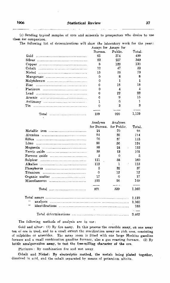
1906 Statistical Review 37
(c) Sending typical samples of ores and minerals to prospectors who desire to use them for comparison.
The following list of determinations will show the laboratory work for the year:Assays for Assays for
Bureau. Public. Total. Gold .............................................. 65 374 439Silver ............................................. 92 257 349Copper ........................................... 8 122 130Cobalt ............................................ 12 47 59Nickel ............................................ lo 55 70Manganese ..................................... 088Molybdenum .................................... O l lZinc .............................................. O 18 18Platinum ........................................ 044Lead .............................................. O 22 22Arsenic .......................................... 6 9 15Antimony ....................................... 101Tin ................................................ 033
Total 199 920 1.119
Metallic iron .. Alumina ........,Silica .............Lime ..............Magnesia ........Ferric oxide ....Ferrous oxide . Sulphur ..........Alkalies Phosphorus .....Titanium ........Organic matter Miscellaneous ..
Total
Analysesfor Bureau.
248476888888
5HI112
o0
17123
Analysesfor Public.
7030373624130
581
32120
26
Total.94
114113124112101
5169113371217
149
821 339 1.160
Total assays ........................................................................... 1,119" analyses .............................................. ........................ 1.160" identifications ............................................................... 183
Total determinations ................................................... 2.462
The following methods of analysis are in use:Gold and silver : (1) By fire assay. In this process the crucible assay, on one assay
ton of ore is used, and to a small extent the scorification assay on rich ores, consisting of sulphides or arsenides. The assay room is fitted with one large Hoskins gasoline furnace and a small combination gasoline furnace, also a gas roasting furnace. (2) By bottle amalgamation assay, to test the free-milling character of the ore.
Platinum : By combination fire and wet assay.Cobalt and Nickel: By electrolytic method, the metals being plated together.
dissolved in acid, and the cobalt separated by means of potassium nitrite.
38 Bureau of Mines No. 5
Copper: By electrolytic and cyanide methods: also by iodide method on mixed sulphide ores.
Lead : By molybdate method.Other metals are determined by standard methods.
Notes
In sending in samples it is desirable to have them not more than three pounds in weiizht. All samples are quartered and' pulped to 100-mesh. Wet samples are dried at 100 C., and analysis reported at that temperature. Circulars of rates and mailing envelopes are supplied to those desiring to send in samples for examination. It is desirable that all fees should be forwarded with the samples, so that there may be no delay in issuing reports.
Samples brought to the office are examined free of charge, except where a quanti tative determination is required.
Owe laboratory assistant. Mr. W. J. Embury, was employed during the year.
TEMISKAMINQ MINING DIVISION
In order to cope with the rush of prospectors into the Cobalt region which was foreseen would take place as soon as the snow left the ground in the gpring of 1905, and to provide a speedier means of dealing with applications for mining lands, the district was set apart as the Temiskaming Mining Division under the regulations provided for such Divisions by authority of the Mines Act 1897. These regulations required all prospectors to take out a miner's license, to stake out their claims on the ground, and to record them in the office of the local inspector or agent. The head office of the Division was fixed at Haileybury, and Mr. George T. Smith was appointed Inspector. The agreement proved a very convenient one. and indeed it is difficult to see how the situation created by the advent of hundreds of pros pectors and claim-seekers into this hitherto little known region could have been satisfactorily dealt with except by some such locally conducted system as was thus brought into operation. Under the regulations for Mining Divisions the size of claims was limited to 40 acres. The date of the Order-in-Council setting apart the Temiskaming Division was 5th April. 1905. Subsequently, the township of Cole man was constituted a separate Mining Division, and mining claims therein were re duced to 20 acres—10 chains in width by 20 chains in length. The date of this Order- in-Comicil was 30th October, 1905.
SUMMER MINING CLASSESBY W L QOODW1N
Itinerary
On Saturday, April 22nd, and Monday, the 24th, the boxes of mineral specimens to be used during the summer were prepared. As the work has been expanded and systematized, the number of mineral specimens to be distributed has been increased, so that their preparation has now become a considerable task. Some idea of its magni tude can be gathered from the statement that about forty different species are dis tributed and that every student receives a specimen of each species.
, Mr. J. Watson Bain was to have been my colleague again, but a telegram received shortly before the time set for leaving Kingston informed me that he would be unable to come. Until an appointment was made in his place, I took Mr. W. M. Goodwin ivith me, and left Kingston on Tuesday, April 25th, for Bedford station on the Kingston and Pembroke railway. It had been arranged with Messrs. Jas. Richardson A Sons to hold a class at their feldspar mine a few miles from this station. We drove four miles eastward to the landing on Thirteen Island lake where the mine tug was lying. Here the mine superintendent, Mr. M. J. Flynn, took charge of us and our luggage. After a run of a mile and a half we landed and walked to the mine, the property of the Kingston Feldspar and Mining Company. It lies between Thirteen Island lake and Desert lake, but nearer the latter.
On the evening of the 26th we were joined by Mr. E. G. B. Ardagh, B.A.Se., of the School of Practical Science, Toronto. Mr. Goodwin therefore returned to Kingston on the 28th, taking with him a good supply of feldspar, black hornblende and glassy quartz, which had been collected and packed the day before.
On Thursday, May 4th, we left the feldspar mines to go to the mica mine of the General Electric Co., situated near Sydenham. The manager, Mr. G. W. McNaughton, had arranged that I should meet him in Sydenham on Monday, May 8th. This left two days in Kingston, which were utilized in improving and completing the mineral collections. Mr. Ardagh was obliged to go to Toronto on business and did not join me again until May 10th. In the meantime the gap was filled again by Mr. Goodwin, who accompanied me to Sydenham on May 8th. We took the morning train (K. A P.) for Harrowsmith, and drove 3i miles from that place to Sydenham. The Company's tug was in readiness to take us up Sydenham lake. The mine captain, Mr. Henry Smith, accompanied us and saw to the transportation of the luggage from the landing place to the mine.
On Monday, May 15th, the General Electric mine was left behind. The Bay of Quinte railway took us from Sydenham to Tweed (46 miles); where we changed to the C. P. B., and arrived at Kaladar station (17 miles) at 1.15 p.m. Deline's stage took us northward through Cloyne (14 miles) to the Star of the East mine on Marble lakje. five miles from Cloyne. The miles are very long in that country. Near Kaladar the Laurentian hills are steep and rugged, but after these are crossed the road is fairly level and smooth. We were received in the kindest manner by Messrs. Wm. Vincent, superintendent, and E. Copeland, clerk.
On Tuesday, May 23rd, we left the Star of the East and proceeded to Bannockburn via Kaladar and Tweed, arriving that evening. Next day we drove to the Jarman pyrites mine where we found Mr. Burnside in charge with Messrs. Avery and Miller as shift bosses.
[39]

40 Bureau of Mines No. 5
On Wednesday, May 31st, we drove to the Craig gold mine, 6 miles northeast of Bannockburn, passing the Hollandia lead mine on the way. The manager of the latter, Mr. Cushman, told me that ho had 30 men at work. They were sinking a new shaft and had struck an eight-foot vein at 110 feet. Development work was being pushed. The Craig was reached at noon, and manager Hungerford gave us his usual hearty welcome.
On Tuesday evening, June 6th, the return to Bannockburn was made. The next morning I returned to Kingston by Bay of Quinte railway, and Mr. Ardagh proceeded to Toronto.
Work was resumed on Thursday, June 16th, when I left Kingston for Barry's Bay. on the C. A. R., via Renfrew. At Barry's Bay I met Mr. Ardagh, who had come by way of Scotia Junction. The yacht of the Canada Corundum Compay took us southward to Craigmont (18 miles). The manager, Mr. Kerr, entertained us with his unfailing hospitality.
On Saturday, June 24th, the company's steamer was ready to take us back to Barry's Bay. As we were leaving the landing, the engineer was blinded by the bursting of the steam gauge. The .captain was obliged to take his place, and a wheelman was found among the passengers. We reached Barry's Bay in safety, and took the injured man on with us toward Ottawa, where he was to be sent to the hospital.
Having spent the Sunday in Renfrew, we proceeded on Monday to North Bay, where we connected with the Temiskaming (STNorthern Ontario railway for Haileybury. The tender jumped the track a few miles north of North Bay,—and Haileybury was not reached until 11 p. m.
On Tuesday, July 4th, we drove to New Liskeard, and on Tuesday, July lith, we proceeded to Cobalt by the T. & N. O. R.
Tuesday, July 18th, saw us ready to make an early start for Giroux lake. Mr. H. E. Savage, owner of a prospect about half way to our destination, undertook to pack the baggage over the trail. He with a packer, Cryderman, and Messrs. Ardagh and George Sharp, went on with the baggage, while I remained to transact some business. When I arrived at Giroux lake late in the afternoon I found the stuff all there and the tent up. We camped near the old lumber camps, some of which were being used by the Fosters, who were developing their valuable mine on Glen lake, a short distance from Giroux lake.
Our outfit was on Tuesday, July 25th, again moved satisfactorily by two of Mr. Savage's miners, who may also be partners of his for aught I know. One is not safe in judging by appearances in this district. The goods were safely delivered at Cobalt station in time for us to catch the train for North Bay.
Webbwood was reached on Wednesday, July 26th. We loaded our stuff on to Dupuis' cart and managed to dodge the showers all the way to the Shakespeare mine, which is about four miles away.
The work was closed on Aug. 1st, tne last place on the list, Gold Rock, being omitted, as the appropriation was exhausted. We started for the east on August 2nd, and arrived in Toronto and Kingston on the 3rd.
Desert Lake Feldspar Mine
This mine, the property of Jas. Richardson & Sons, Kingston, produces a consider able fraction of the feldspar used in the United States. The deposit is worked as a quarry, and immense blocks of very pure feldspar are broken off by every shot. The floor of the quarry is mostly feldspar. This will be worked to a lower level, as the water is now drained off by a ditch cut through a clay basin lying between the feldspar deposit and Desert lake. This ditch showed that the feldspar extends at the lower level considerably beyond the present workings. There were 24 men employed.
1906 Summer Mining Classes 41
The class was opened on April 26th at 6.30 p. m. The men sat out-doors on seats improvised from the wood pile. We thus made the most of the waning light of the comparatively short April evenings. There were a few men present who had walked from Harris' and Chisholm's feldspar mines. The class was held every evening, out doors when the weather permitted, in the "dry" when rain or April winds drove us to shelter. After the distribution of minerals, we adjourned to the dining room for a lantern lecture on geology or mining.
This mine is the best locality in the Province for cleavage pieces of pink feldspar. Pieces of great size can be found, and sometimes long, very thin, slabs, almost transpar ent are met with. Under the guidance of the superintendent, Mr. Flynn, we were able to collect large quantities of barite at Howe's farm, about two miles from Bedford station. The barite is deposited with calcite in a cavity in the crystalline limestone. It is mostly fine-grained and would grind very easily, but it is much mixed with the calcite. Some of it has been precipitated in a loose friable condition. The calcite crystals are often large and well-formed. The shaft is about 30 feet deep, but work hapl been discontinued when we were there, and the shaft was full of water. The ore pile contained about 150 tons. Apatite is found in this district. There is a large deposit on the farm of Terence Kelly, where Mr. Ardagh collected specimens of the brown variety.
Thanks are due to the superintendent and the company for hospitality and many kindnesses during our stay.
The total attendance at clasess and lectures was about 35. The average attendance was 23. Complete sets of the specimens with printed descriptive labels were given to a number of men who were unable to attend.
General Electric Mica Mine
Here, as at the feldspar mine, most of the men are drawn from the farms of the district. Many of them spend the nights at home, and some of them board at home. These conditions make it somewhat difficult to get a class together; but, as the interest in mineral development grows, the men are more eager to enlarge their acquaintance with the subject, and are willing to suffer considerable inconvenience in order to do so. The attendance is therefore fairly steady throughout the six days, although broken more or less by change of shifts, early closing on Saturday, and other local causes. Our plan is to accommodate ourselves as well as possible to all circumstances, and to hold the classes at any hour of the day when a body of men can be got together for an hour or two. So on Saturdays, in places like this, where many of the men walk long distances after five o'clock so as to spend Sunday at home, we hold the class at noon. The man agers generally prolong the noon hour a little so as to give us a chance. The total attendance here was about 40, and the average 29.
We found this a good locality for collecting pyroxene, apatite, and mica. Some sheets of mica showed a peculiar dichroism.
The manager, Mr. G. W. McNaughton, kindly provided transportation from Sydenham to the mine and return.
Star of the East Gold Mine
It has been known for many years that gold exists in this district, and a considerable number of prospects have beei' more or less developed. The Star of the East is near Marble lake, about 19 miles north of Kaladar, a station on the C. P. R., west of Sharbot lake. The gold is found in a small quartz vein in crystalline limestone (dolomitic) not far from a contact with a dark Huronian rock, an outcrop of which can be seen about 300 yards northwest of the shaft house, near a little brook. There are streaks of mica
42 Bureau of Mines No. 5
schist (?) in the limestone near the vein, and actinolite is plentiful, as also is iron pyrite. The limestone also carries magnetite, often in well-formed octahedra. Small quantities of copper pyrite were also noticed. Some considerable masses of bismuthinite were obtained, and I heard with pain of larger pieces which had gone through the crusher as "lead." The hoistman, Michael Scullion, an unusually good observer, brought me small specimens of a mineral which I identified as native bismuth. Shows of gold are frequently found in the quartz, to which the bismuth and bismuthinite seem also to be confined. One beautiful specimen of gold was in the form of wire and long flat fibres interlaminated with the green fibres of actinolite. As the actinolite is found mostly in the limestone, this brings the three minerals into close association. The assays show that the gold values extend somewhat into the highly mineralized lime stone, but the quartz forms the pay streak. Several specimens of arsenopyrite, copper pyrite and iron pyrite were brought in by the men for identification.
The Star of the East is a model mining camp. The men are drawn largely from the farms of the district, and are bright and mostly well educated. The camp is kept clean, and much credit is due the management for their successful efforts to give the men a civilized life. We appreciated the hospitality extended to us, and enjoyed the unusual luxury of a bedstead and mattress in our tent.
The class for the day shift was held at 6.3.0 p. m., in the men's sitting room, or oiit-doors when the weather was favorable.. We met the night ^hift at 4 p. m., and various groups of men at odd times when it was convenient for them. Evening lantern lectures were given in the men's reading room. The total attendance was 32, and the average 26.
Jarman Pyrites Mine
As a class had been held here the previous summer, and as about half of the men at the mine this summer had then attended the class, the attendance was not very large; although some of the men came for the second time. We met at 6 p. m., so as to catch both shifts. Mr. Burnside, the superintendent, gave us much assistance in preparing for the class and in carrying on the work. Total attendance about 25, arerage 18.
Good specimens of specular iron ore were collected at the old hematite mine on the road to Madoc. A short visit was made to the old Bannockburn gold mine, where a few men were at work pumping out the shaft. A trip was made to the farm of Mr. George Smith, about eight miles north of Bannockburn, where we collected large quantities of tourmaline, barite, and bismuthinite, and incidentally enjoyed the generous hospi tality of Mr. and Mrs. Smith.
About a mile northeast of Bannockburn is a vein of quartz highly mineralized with galena, zincblende, iron, and copper pyrites, It has been explored to some depth, but no work has been done on it for several years. The discovery that the iron ore at the Coe mine on the Madoc road passes into copper pyrite, bornite, and copper glance should lead to careful testing of this highly mineralized district as a possible producer of copper. It is significant that the bog iron for which the Jarman mine was first worked gave place to solid iron pyrites with depth. It is quite probable that equally large bodies of copper ore may underlie some of the numerous pyritic and hematite deposits of the district.
Craig Ooid Mine
This mine was worked about ten years ago, but abandoned owing to the smallness of the pay streak. Under the management of W. A. Hungerford it was running at the time of our visit on a low grade ore which was being put through a 3-stamp Merrall mill. There were 35 men employed. The class was held in the men's sitting room, at 7 p. m. for the day shift, and at 4.30 p. m. for the night shift. The buildings are well

1906 Summer Mining Classes 43
kept and the dining room was unusually well served. There was here, as observed in ai! the mining camps of Ontario visited this summer, a vast improvement in the con ditions of life as compared with say ten years ago. Sanitary matters are attended to, and intelligent management shows itself in that matter of prime importance in any enterprise where considerable bodies of men are gathered together, viz., their personal comfort. Total attendance 30 : average 22.
Craigmont Corundum Mine
The class here was held in Dennison's boarding camp. The large proportion of employees unable to speak English accounts for a somewhat small attendance.
The manager, Mr. D. G. Kerr, kindly provided transportation for the luggage and drove us to points of interest. We visited with him the Burgess corundum mine about 8 miles southwest of Craigmont. Here we found a compact concentrating plant turning out about one ton of clean concentrates a day by a dry process. The working expenses should be small, as the concentration process requires little attention and there were only 7 men working in the mine and on the short tramway by which the ore waa brought to the mill.
At Craigmont we collected considerable quantities of. corundum and nepheline, as well as molybdenite and garnet. The nepheline can be obtained in any quantity at the west end of the mountain where some corundum rock was taken out last winter.
Total attendance about 40; average 22.
Haileybury
The Orange hall was given us for the occasion, and both class and lectures were conveniently held there. Prospectors came from considerable distances- every evening to attend. The minerals with the printed descriptive labels were particularly useful in this district, and there were many requests for complete sets from men who could only attend one evening. A great deal of time was given to this kind of one-man class. It was found possible to give hints of some value as the sets of specimens were being made up. Throughout the day we had calls in our rooms at Gillies' hotel from prospectors with specimens to identify.
On June 28th we drove over to New Liskeard and met Mayor McKelvie with Messrs. Sharpe, Taylor, McEwen and others, with whom we discussed the arrangements for a class at that place. This informal committee undertook to make all preparations for the class. A visit was made to Cobalt on the 29th to arrange for the class there. On the 30th we took the steamer Jubilee to New Liskeard and North Temiskamirig. On board the steamer and at the latter place many mineral specimens were identified for prospectors. A trip from New Liskeard to the end of the steel at White River was also rather fruitful in this respect.
Total attendance about 40; average 17.
New Liskeard
The town authorities had engaged the Orange hall as a suitable and convenient place for the class and lectures. The class was held at 7 p. m., and was followed each evening by a lantern lecture on geology. The large attendance taxed our energies to the utmost, as each member of the class received more or less personal attention in the examination and testing of the mineral specimens. Here, as in most places, large numbers of specimens wore identified for prospectors, both at the time of the class and during the day. Our room at the Hotel Canada was frequently visited for this purpose. The geological map of the district issued by the Bureau of Mines attracted a good deal

44 Bureau of Mines No. 5
of attention as soon as I posted a copy in the office of the hotel. By the way, this map, so promptly issued, was of immense service to prospectors, as many of them testified. On July 6th Rev. Mr. Pitts and Mr. MeCosh took us oat to see a new discovery in Hudson township (con. IV., lot 1), showing cobalt bloom, smaltite, niccolite and perhaps bismuth. It occurs in diabase, but from the disturbed condition one would judge that the Huronian is not very far away. That afternoon I attended a meeting held under the auspices of another department of the Ontario Government,—a meeting of farmers to discuss with Professors Zavitz and Reynolds the problems of agriculture as met with in that region. It is interesting to note the similarity of methods used in these two kinds of pioneer educational work,—distribution of specimens or seeds, informal dis cussions, practical lectures.
The class was closed enthusiastically on July 10th by a vote of thanks, both mover and seconder referring to their appreciation of such instruction furnished by the Bureau of Mines.
Total attendance about 80; average 47.
Cobalt
The class here was held in the tent of the Reading Camp Association, and among the stumps outside. Benches were made by Mr. Douglas Ellis of Kingston, who was in charge of the Association's work. The tent was always crowded, and the overflow stood outside at the doorway. Perhaps the most useful part of the work was done at various times during the day in spotting specimens for anxious prospectors. It was hard to have to tell so many of them that they had not yet 'found the desired smaltite or other minerals associated with the silver.
Prospecting was very active in the Temiskaming district during the whole summer of 1905. The re were about 600 prospectors' licenses issued from the office in Haileybury up to Oct. 31st. Each licensee may be assumed to have had a partner without a license : so that the total number of prospectors may be roughly estimated as 1,200. But not al! of these were in the district at one time. Many became discouraged and went out, but many more came in to take their places. As a conservative estimate I would put the number of prospectors in the district on August 1st at 500. They covered the dis trict pretty well, but naturally concentrated considerably around Cobalt. This impor tant centre owes its appropriate name to Professor W. G. Miller. In July, 1905, it- consisted of about a dozen log buildings, as many frame houses and stores, and numerous tents, with a population of about 200. Two of the best of the prospects are included in the boundaries of the town plot, viz., J B 6 (Trethewey and Longwell) and the Denison or Buffalo mine. The La Rose or Timmins mine and the lots of the Hudson Bay and Temiskaming Mining Co. are a few minutes walk north and south respectively from Cobalt station. The extensive holdings of the Nipissing Mining Co. begin on the shore of Cobalt lake across from the town and extend eastward. The McKinley and Parragh mine is a few minutes' walk around the south end of the lake. As these are all producing mines, or certain to become so in a short time, it will be seen that the mining population in and quite near Cobalt is already considerable. But the working mines around Giroux, Glen, Kerr, and Cross lakes, about seven in all,' are within two miles of Cobalt, which is thus already the centre for some fourteen mines. It must be remembered, too, that these silver veins are producers from the start. It may reason ably be expected then that this, the youngest mining town in Ontario, will grow very rapidly.
The total attendance at Cobalt was hard to estimate, as prospectors were coming and going every day. As a rule each man got a full set of specimens, even if he was present at only one meeting of the class.
Total attendance about 120: average 62.
1906 Summer Mining Classes 45
Qiroux Lake
The move from Cobalt to Giroux lake was made very comfortably, thanks to the assistance of Mr. H. E. Savage, whose claim is close to the trail between these two points. We pitched our tent close to the old lumber camps and boarded at Foster's camp. Numbers of prospectors were camped near by. The class was held in the open air, the men sitting on logs in a semicircle. Lectures were given in the old blacksmith shop of the lumber camp, which had the advantage of being easily darkened. All that was necessary was to shut the door. We shared this place with the fire ranger of that beat, who was out of work, as it rained every day.
Here we were within easy range of a number of camps,—Foster's, Lawson's, Jacobs', FTargrave's, Glendinning's, Drummond's and Handy's. Under the guidance of Mr. J. Gr. McMillan, my associate of a former summer, all these camps were visited, and the men were invited to attend the class.
On July 20th we had a visit from Mr. Glendinning, who invited us to his camp where a number of School of Practical Science men were engaged in developing a rich silver property. There we had dinner, and then completed the round by taking the north trail to Cobalt. On the way we overtook Mr. Derry, mine superintendent of the Superior copper mine, and Mr. Boyer, discoverer of the Helen mine. This is mentioned to show how attractive this district is becoming. In Cobalt we met Mr. Alfred Fitzpatrick, of the Beading Camp Association, who was accompanied by Rev. Ferguson Millar. TJiese gentleman went with us back to Giroux lake and spent the night there and the next day.
Here, as in Cobalt, the work of examining specimens for prospectors was very important and sometimes exacting. Numbers of the prospectors were shown how to dis tinguish between smaltite and pale iron pyrites by a simple test in a closed tube. As the iron pyrites in this district is often almost white, this distinction is important. We also suggested panning the dirt from likely-loking veins, so as to find any small nuggets of native silver or silver glance. As the amount to be looked for is relatively large, a rough panning in a deep plate or any handy dish is all that is necessary. If the apparatus and chemicals are available, the concentrates may be dissolved in nitric acid and tested for silver with hydrochloric acid.
Fine specimens of native bismuth were being taken out at Foster's mine, and here as at the other mines visited, the owners were generous in giving good specimens to those likely to value them for scientific purposes.
Total attendance about 70: average 31.An unusual characteristic of the Cobalt district is the large number of college men
who have made discoveries. Another is the large number of owners. The immense wealth of these deposits is to be distributed to the many. There was danger at one time that it would be nearly all swallowed up by one or two large companies; but, ae a result of vigilance on the part of the authorities, this has been prevented. The distri bution of wealth is one of the most serious problems of political economy. In this case the government has taken for its guiding principle,—to secure by its regulations at the very beginning the greatest possible amount of distribution. Surely this is desirable. These silver deposits are largely treasure trove. The cost of production is in most cases insignificant as compared with the value of the ore. It is better for the country if such treasure is well distributed.
Shakespeare Gold Mine
This mine is about four miles from Webbwood, a station on the Sault branch of the C. P. B. We were warmly welcomed by the manager, Mr. Wm. Wood, and by the mill foreman, Mr. G. Vary, an old friend. It was late in the afternoon when we arrived.

46 Bureau of Mines No- 5
but we had many helpers and were able to get the tent pitched and everything ready for opening the class, which was held out-doors in front of the sleeping camp. The hours were as usual, but an extra lantern lecture was arranged for the night shift. Many of the men working at this mine were drawn from the farms of the district.
We desire to thank the manager and his staff for many kindnesses which helped to make our stay pleasant. '
Total attendance about 40; average 25.
General
The total number who received instruction in these classes was about 550, nearly all of whom got sets of 40 specimens. This implies the preparation and distribution of over 20,000 mineral specimens with descriptive printed labels. In addition to these, numerous sets were made up and sent to persons who had heard of them and who wished to get a set for use in prospecting. That good work is being done in this way is proved by letters of thanks and other references to the practical usefulness of the specimens. For example, one writer says, "You will be interested to learn that the samples of minerals and descriptions and value of same you so kindly sent me a short time ago have already been of service. I interested a representative of a mining company in molybdenum properties I had got trace of * * *."
It is my duty to direct attention again to the alarming amount of illiteracy in some of our settled districts. This is shown by the fact that at some mines fully half of the men cannot sign the pay roll. These are mostly, too, natives of the district in which they work. If these illiterate men were all middle aged it might be hoped that they were a product of conditions from which the Province has emerged : but many of them are young,—some, indeed, mere lads. Here is certainly a, subject for inquiry by the Educa tion Department. Are the school facilities in the sparsely settled parts of the Province the best that can be devised for the conditions prevailing there? Can anything be done to improve matters by consolidation of small schools into larger ones and providing transportation for the children; or by Provincial assistance to outlying communities so small that they cannot support a good school or any school at all?

MINES OF ONTARIO
BY E. T. CORKILL
This report embraces all the working mines of Ontario, and for greater explicit- tK;ss the Province will be divided into four sections :
(1) Northwestern Ontario, embracing all that region^ north and west of Port Arthur.
(2) Sudbury and the North Shore, which includes the section from Sudbury wes; along the line of the Sault Branch of the Canadian Pacific railway, and the Michi- ooten District.
(3) Temiskaming district, which embraces all that part of the district of Nipissing through which the Temiskaming and Northern Ontario railway extends, including the Cobalt region.
(4) Eastern Ontario, including all of Ontario lying south of that part of the Canadian Pacific railway which stretches from the Ottawa river to the northern part of Georgia-n bay.
In Northwestern Ontario the mining industry has until the last year depended largely on the gold mines. During the latter part of 1905 and the present year work has been started on a large scale at the Atikokan iron mine, on which considerable exploratory work had previously been done. This, together with the erection of a smelter for the treatment of these ores at Port Arthur, should act as an incentive to the thorough exploration of the iron ore bodies of Western Ontario. The building of the National Transcontinental railway should also open up a section to the north of the Canadian Pacific railway which has previously been inaccessible for mining, especially in the vicinity of Sturgeon lake, lake Minnetakie and lake Nepigon. Near lake Minne- takie an iron pyrites deposit is being developed. This will depend altogether on the National Transcontinental railway for shipment of the ore, as the/ present condition of the market will not allow its being hauled a very great distance to the railway.
In the Manitou country the rich find of gold at the Laurentian mine caused a revival of interest in that section. On Lake of the Woods and Eagle lake a few properties are working, chief among these being the Sultana, where ore is being taken from the Crown Beef vein and milled. At Sturgeon lake the St. Anthony Gold Mining Company have put in a mill and are running steadily.
In the Sudbury and North Shore district the nickel industry is still expanding. The year 1905 saw the largest production of nickel up to that time. With the installation of their new smelter in 1903 and its completion in the fall of 1904 the Canadian Copper Company were enabled to handle a very large tonnage of ore, which for the last year has been obtained altogether from the Creighton and No. 2 mines.
The Victoria Mines, the property of the Mond Nickel Company, were in operation all year, adding considerably to the total production of nickel.
A plant for treating the Cobalt ores was erected in 1905 at Copper Cliff, a des cription of which will be found in another part of this report.
The Bruce Mines, which were the first copper mines to be worked in the Province, have been taken over by a new company, and work has again been begun. At Michi picoten the Helen mine still yields largely, being the largest iron producer of the Province. Considerable of this ore is shipped to the United States.
[47]

48 Bureau of Mines No. 5
The greatest activity in mining in the Province during 1905 and the present year has been in the Temiskaming district, especially in the vicinity of Cobalt. One of the most remarkable features about the camp is its large number of producing mines in so small an area, there being at least twenty properties that have shipped ore or are in position to do so, within an area of about six square miles. The camp is undergoing this year what is known in mining parlance as a "boom." A number of stock companies have been floated on doubtful or worthless claims, which they represent to be very promising, and their stock has been peddled out to the public. By these methods a wrong impres sion is given of the mining industry; in fact, a great many people consider mining only a gamble, and act accordingly. This belief should certainly be discouraged, as mining, if carried on properly, is as legitimate a business as any other. The mine owners of Cobalt who for the first year or so showed the public by their method of mining, namely open cutting, that their faith in the depth of their veins was very small, have begun to develop their properties systematically,thus showing that the veins are extending in depth beyond their first expectations. Two important discoveries of smaltite and silver on the northwest quarter of the north half of lot one in the third concession of Coleman show the mineralized belt to be wider than was formerly thought. Also, the discovery of smaltite in Casey township and the Portage Bay section shows this mineral to be more widely spread than the silver-bearing ores. There are a large number of small prospects on which a great deal of work has been done in the Cobalt district which have not been mentioned. Only the more important of the prospects are described in this report along with the shipping mines.
The fatal accidents that occurred underground during 1905 resulted chiefly either from careless handling of dynamite or from riding in buckets. The practice of com panies posting notices at the mouth of the shaft, forbidding their employees riding in the bucket and then not endeavoring to enforce that rule, does not render the employer free from blame in case of accidents.
There is considerable difficulty in selecting locations for dynamite magazines in tht Cobalt district, owing to the danger from forest fires, and the network of veins on various properties.
It is also necessary to call the mine owners' attention to the Mines Act 1906, whereby no building is allowed within 50 feet of the shaft house.
I-—Northwestern Ontario
GOLD MINES
The working gold mines of Northwestern Ontario may be briefly described as follows:
Minto Mine or A L 200
This property is reached by canoe route and portage from the Hospital on the Canadian Northern railway ,about 140 miles west of Port Arthur, and about three miles north of the Atikokan iron mine. Some work was done in 1903, but during 1904 very little was accomplished. The next year saw some further activity, when a stamp mill was purchased and hauled in, and boiler, compressor and hoist installed.
The property is now owned by the Reading Mining Company of Buffalo, with H. J. Thorle as manager, and John McLean, superintendent. A gang of 8 men were employed hauling out wood and timber..
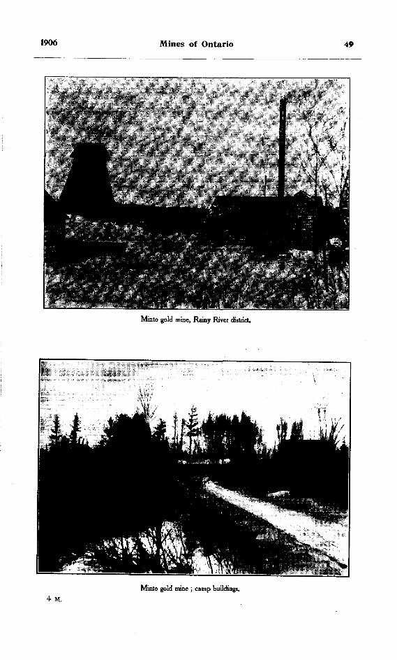
1906 Mines of Ontario 49
Minto gold mine, Rainy River district
Minto gold mine ; camp buildings.4 M.

50 Bureau of Mines No. 5
A shaft 7 by 9 feet has been sunk to a total depth of 60 feet, close cribbed for about 24 feet and ladder way partitioned off from the hoisting compartment. About half a mile northeast of the shaft the quartz ledge outcrops for about 300 feet. Consider able stripping has been done here, and the stamp mill is about to be erected.
During the past year a three-drill air compressor, Jenckes tubular boiler and a 20-inch drum double-cylinder hoist were installed, also pump and drill in the mine. An office building, boarding house and bunk house, have been built at the camp and dry, boiler house, blacksmith shop and shaft house at the mine.
Sunbeam or A L 282
This property remained idle last year. From the late superintendent Thos. R Jones, I learned that work ceased about the first of 1905. The extent to which the property was developed is fully described in the Fourteenth Report of the Bureau of Mines.
Laurentian Mine
In the Manitou district the Laurentian mine, comprising mining location H P 371, (if 52 acres extent, is situated about one half mile northeast of Gold Rock, at the head of Upper Manitou lake, some 20 miles south of Wabigoon. The owner is Anthony Blum of Boston, Mass., with Dryden Smith as mine superintendent, employing a force of 25 men, of whom 12 are working underground.
Laurentian gold mine, H P 371.
Mining operations began in October 1903, but work was suspended for part of last year pending a transfer of the property to the present owner from the Laurentian Mining Company. A strike of very rich ore on the first level about the first of the year has caused renewed interest to be taken in the surrounding district as well as in this particular property.
4a M.
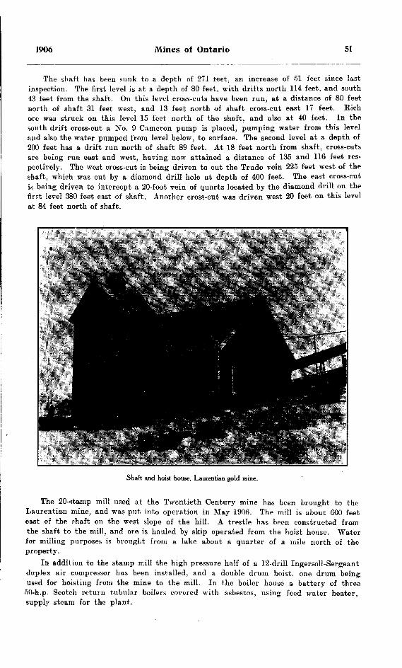
1906 Mines of Ontario 51
The shaft has been sunk to a depth of 271 feet, an increase of 51 feet since last inspection. The first level is at a depth of 80 feet, with drifts north 114 feet, and south 43 feet from the shaft. On this level cross-cuts have been run, at a distance of 80 feet north of shaft 31 feet west, and 13 feet north of shaft cross-cut east 17 feet. Rich ore was struck on this level 15 feet north of the shaft, and also at 40 feet. In the south drift cross-cut a No. 9 Cameron pump is placed, pumping water from this level and also the water pumped from level below, to surface. The second level at a depth of 200 feet has a drift run north of shaft 89 feet. At 18 feet north from shaft, cross-cuts are being run east and west, having now attained a distance of 135 and 116 feet res pectively. The west cross-cut is being driven to cut the Trudo vein 225 feet west of the shaft, which was cut by a diamond drill hole at depth of 400 feet. The east cross-cut is being driven to intercept a 20-foot vein of quartz located by the diamond drill on the first level 380 feet east of shaft. Another cross-cut was driven west 20 feet on this level at 84 feet north of shaft.
Shaft and hoist house, Laurentian gold mine.
The 20-stamp mill used at the Twentieth Century mine has been brought to the Laurentian mine, and was put into operation in May 1906. The mill is about 600 feet east of the rhaft on the west slope of the hill. A trestle has been constructed from the shaft to the mill, and ore is hauled by skip operated from the hoist house. Water for milling purposes is brought from a lake about a quarter of a mile north of the property.
In addition to the stamp mill the high pressure half of a 12-drill Ingersoll-Sergeant duplex air compressor has been installed, and a double drum hoist, one drum being used for hoisting from the mine to the mill. In the boiler house a battery of three
50-h.p. Scotch return tubular boilers covered with asbestos, using feed water heater, supply steam for the plant.

52 Bureau of Mines No. 5
Instructions were given regarding ladders in the shaft and prohibiting men riding in buckets.
The rich ore encountered on the first level occurs on the foot wall as a narrow vein of quartz and free gold. The free gold in some parts predominate?. The vein here occurs in the greenstone of Keewatin age.
A road has been cut through by Mr. Blum from the mine to Dinorwic, n,i.king an all-land route with the exception of the Wabigoon river crossing.
Big Master
This property resumed work in April 1905, after having been idle for over a year, under the ownership of the Big Master Mining Company, with Ben j. Hammond, president, and W. Shovells, superintendent. The head office of the Company is at Fislikill-on-Hudson, N. Y. From that time until January 4th 1906, the property was worked continuously, when it was again closed down.
During this time the shaft was sunk 100 feet to a total depth of .285 feet. No work was done on the first and second levels. On the third level a drift was run northeast 110 feet and a raise put through to the second level. A cross-cut was also driven east on this level 215 feet to cut the vein which outcrops east of the old vein. Work, how- erer ceased before the vein was reached.
The mill, which is of 10 stamps, was run for 83 days, producing ?9,800 worth of gold. The ore for this mill run was stoped from between the second and third levels.
Little Master
The Little Master mine, owned by the Summit Lake Gold Mining Company, has been closed for the last year and a half. Very little work was done subsequent to the last inspection. Accordingly, the development as recorded in the last Report brings the record up to the. present. Last winter some 800 cords of wood were got out in preparation for active work.
Pay Master
This property, comprising mining location H W 20, of 83 acres area, is about half a mile east of Gold Rock, and adjoins the Big Master. It is owned by the Northern Development Company, whose offices are at 1005 Majestic Building, Detroit, Mich Mr. R. J. Elliott is superintendent, and was at the time of my inspection, 20th Feb ruary 1906, engaged in installing a new boiler and compressor plant. This plant consisted of a 65-h.p. boiler, a duplex cylinder hoist, and half of a 12-drill air com pressor manufactured by the Allis-Chalmers-Bullock Company. During the summer of 1905 the mine was worked, and a shaft 7 by 9 feet sunk to a depth of 200 feet, being an increase of 100 feet.
As shown in last year's Report, there are two parallel lenticular quartz veins about 30 feet apart, on the surface, dipping a few degrees to the southeast, with strike about northeast by southwest. A cross-cut was run on the 100-foot level a distance of 18 feet and on the 200-foot level a distance of 23 feet to cut the ore body. On the 200-foot level the number 2 vein is, according to the superintendent, 11 feet wide.
The attention of the superintendent was drawn to the danger from fire by placing the boiler and compressor house so close to the shaft house.
Gold Rock Mine
The Gold Rock locations, owned by the Gold Rock Mining and Milling Com pany, consist of H P 405 and 407, the work at present being done on the former. Location H P 405 adjoins the Big Master on the southeast. Three shafts have been

1906 Mines of Ontario 53
sunk having depths of 50 feet, 60 feet, and 135 feet respectively. In 1905 work was carried on for about five months in the deepest one. At the time of inspection a drift was being made into the hill on the shore of Selby lake. The outcrop of the vein
Cold Rock, Upper Manitou lake.
on the hill is about 80 feet above the bottom of the drift, which is in 135 feet. . shaft 56 feet deep has been sunk on the vein some 800 feet southwest of the tunnel.
A Lidgerwood hoist and 20-h.p. boiler are being used in the development work.
EAGLE LAKE DISTRICT
The Eagle Lake district is reached in the summer by steamer from Vermilion Bay, a station on the main line of the Canadian Pacific railway, while in the winter the shortest route is from Eagle River, a station some miles east of Vermilion. No marked change has been noted in this area since last inspection.
Eldorado Mine
This property is now owned by the Eldorado Mining Company, with S. S. Fornerf as superintendent. Work began in October 1905, after having been suspended the pi-eater part of the year. A force of nine men is now employed in development and exploration. The shaft has been sunk to a depth of 140 feet, an increase of 55 feet, nnd a ladder way put in, divided from hoist-way to first level at a depth of 65 feet. On this level a drift has been run northeast a distance of 100 feet. The second level at depth of 120 feet has a drift northeast 25 feet in length.
The 2-stamp mill on the property described in previous reports was at the time of inspection being used in a test run on ore that was being taken out in the develop ment work.

54 Bureau of Mines No. 5
Baden-Powell
Work at this mine ceased temporarily in January of the present year owing to inadequate fuel supply. The shaft has now reached a depth of 140 feet, being an increase of about 40 feet. The first level at a depth of 60 feet has a drift run east 112 feet and west 17 feet. No drifting has been done on the second level.
The o-stamp mill has been completed, with assay plant in connection. A 40-h.p. boiler and 3-drill air compressor has been installed. The property is owned by the Northern Light Mining Company, who also own half the stock in the Eldorado Mining Company. Mr. S. S. Forneri is superintendent for the company.
Eldorado gold mine, Eagle lake.
Pioneer Island
This property was worked during the first part of 1905 and the shaft sunk to a depth of 80 feet. It is owned by the Northern Light Mining Company. A desciiption of the deposit is given in the last Report of the Bureau of Mines.
Grace Mine
Work was resumed here in December 190p. but unfortunately had to close again in February of the present year. The shaft was deepened about 10 feet, giving it a depth of about 65 feet. The tunnel some quarter of a mile from the shaft has been driven 100 feet.
During the time of operation a new gallows frame was put up over the shaft, and an 85-h.p. boiler, and a 14-h.p. hoist were installed. The boiler house is 300 feet from the shaft. A 10-stamp mill has been purchased, and is at Vermilion Bay ready for transportation to the mine. A force of 12 men were employed by Mr. J. H. Cas'er. manager for the owners, the Grace Mining Company.

1906 Mines of Ontario 55
Golden Eagle
This property was not in operation during 1905, but from the manager, Mr. N. Higbee, it is learned that the shaft has been sunk to a depth of 70 feet and 160 feet o) drifting done. The property is in proximity to other mines on Eagle lake.
Ideal Ooid Mine
The Ideal mine is situated in Van Horne township, about 6 miles south of Dryden station on the main line of the Canadian Pacific railway, about 80 miles east of Kenora. It is owned by the Ideal Gold Mining Company of Baltimore, with Mr Buxton as manager. Since the re-opening of the property a drift has been run north from the bottom of the shaft, which has a depth of 89 feet, a distance of 20 feet. The shaft, 7 by 12 feet, is closely cribbed to a depth of 35 feet, but has no suitable ladder way or dividing timbers. Instructions were left regarding this matter. Trenching has been done on the surface, and two veins uncovered, both having a strike east and west. The shaft has been sunk between the two veins, and cross cutting is being done on the 85-foot level to encounter them.
An experimental stamp mill called the Chas. Wallace improved stamp mill has been put in, having a capacity of o tons per 24 hours. This mill combines both the crushing and grinding effect. The plates are narrow, and arranged in series, making in all about 8 feet qf plates over which the pulp has to pass. Some of the ore treated has been roasted, which according to Mr. Buxton, greatly increases the capacity of the mfll.
The outcrop of the vein is 87 feet above the lake, and a site has been cleared here for a stamp mill to be erected as soon as the property warrants it. A force of 10 men were employed. Instructions were given regarding handling of explosives.
Redeemer Mine
This mine, which was in operation during part of 1905, was closed at the time of my visit. It is owned by the Redeemer Mining Company, Gus. Larson being superin tendent. The shaft has not been deepened, but about 100 feet of drifting has been done on the first level. No drifting on the second level. About 200 tons of ore was milled during last year. Since the time of inspection work has been resumed.
The plant consists of a 3-drill air-compressor, two boilers, 35- and 40-h.p. capacity, respectively, and a small hoist. The 10-stamp mill has been completed and cyanide plant capable of handling output of 5 stamps put in.
Mining Location E D B I
About six miles south ai Dryden Mr. Holmes is prospecting on the above location for a company from Minnesota. A shaft has been sunk 20 feet.
LAKE OF THE WOODS DISTRICT
In Lake of the Woo3s field two of the pioneer mines were in operation last year, namely the Sultana and Regina. The former is still working, but unfortunately the Begina had to close down in the early part of the year, owing, according to the manager, to financial difficulties. Two other properties on Lake of the Woods, the Bully Boy and Combined, were doing development work, while on Shoal Lake the Olympia and Golden Horn are the only properties being operated.
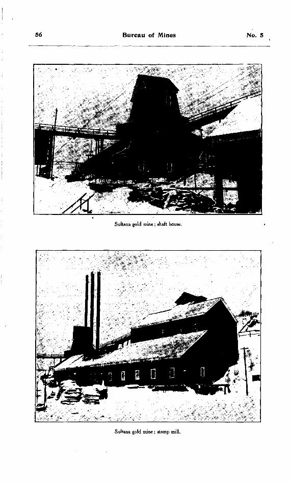
56 Bureau of Mines No. S
Sultana gold mine; shaft house.
Sultana gold mine; stamp mill.

1906 Mines of Ontario 57
Sultana Mine
Under the management of Mr. j. F. Caldwell, this property has been running steadily for the past couple of years and obtaining fair results. The shaft during 1905 was sunk 40 feet, making a total depth of the main shaft of 600 feet. At the time of my inspection, however, it was full of water up to a point between the fourth and fifth levels. The work was all being done on the Crown Reef vein, which is reached by a drift 750 feet south of the main shaft, being an increase of 250 feet, on the second level. A winze has been sunk from the second level to connect with raise from the fourth level, a distance of 140 feet. The stope between the second and fourth levels is worked, the ore being trammed from a chute on the fourth level.
The drift of the Crown Beef vein on the fourth level is 750 feet in length to con nect with ore body discovered on the second. All waste rock is being used to fill up the old stopes in the main part of the mine.
The mill is running steadily, lo to 20 stamps being in use. A force of 20 men are employed under superintendent Mr. J. Johnston.
Regina gold mine. Lake of the Woods.
Regina or Black Eagle Mine
This is one of the oldest and most widely known mines on Lake of the Woods. In 1901 it was transferred from the Regina Gold Mine, Limited, to the Black Eagle Geld Mining Company, Limited, with head office at College Street Chambers, Canning street. London. It was re-opened in 1905, after having been closed for two or three years, and worked for some months. Owing to lack of money for development, work at the mine ceased on the first of February of the present year.
During the period of activity the shaft was scaled thoroughly and sunk 30 feet to a depth of 550 feet. From the first level an adit was driven 80 feet to furnish a
58 Bureau of Mines No. 5
means of egress from the mine. This adit comes out in the old Tremain mill. On the fourth level the south drift was driven about 75 feet, making a total of 457 feet. A winze was sunk on the third level south drift about 30 feet, and a raise from fourth to connect with it of about 15 feet. On the ninth level south drifts stulls were put in and some ore broken down. The other levels remained unchanged.
On the surface the head frame of the shaft house was raised 30 feet, and a new tramway built to the mill. The ore is now dumped from buckets over grizzlies to the crusher. The fines from the grizzlies are trammed to the shaft, and from the crusher are carried by travelling belt.
During the summer of 1905 some ore was run through the mill, giving a fair result. The mill is equipped with 30 gravity stamps, 1050 pounds, arranged in batteries of 10 stamps. Concentrating is done by four Wilfley tables. Th*re are also in place three cyanide tanks of 20 to 30 tons capacity each. A cage has been purchased for use in the shaft, but has not been put in. The ore occurs in a contact between the slate and granite. The contact dips at an angle of about 50 degrees, cutting across the shaft at about the fourth or fifth level, thus throwing the ore body to the east side of the shaft. About 20 men were employed under the management of Lieutenant- Colonel Sir Henry Wilkinson.
Bully Boy Mine
This mine, which has lain idle for some time, has been acquired by the Arizona Camp Bay Mining and Milling Company, whose head office is in Detroit, Michigan. Work begun in July 1905. The president of the company is Albert Strelow, and the superintendent Fred. Pfau. The property comprises mining locations S 56, 57, 92 and D 240. The shaft is being sunk on S 56 and is about half a mile northeast of Camp bay and north of the mill belonging to the Camp Bay Mining Cotapany.
The shaft which had previously been sunk to a depth of 140 feet, has been con tinued to the 200-foot level and drifting has begun on the vein in each direction. Hoisting is done by bucket sliding on skids. The hoist-way is separated from the ladder-way.
The machinery consists of two 45-h.p. locomotive firing boilers, a Jenckes double cylinder 2i-foot drum hoist, and an 8-drill duplex Rand air compressor. The compressor ivas taken from the Boulder mine. During the year, shaft, engine and boiler house were built, as well as camp buildings. Attention was called to the danger from fire of having all buildings under the same roof as the shaft house. A force of 7 to 10 men is employed. The vein has a strike northeast by southwest, and is enclosed in a schistose rock of Keewatin age. The contact between the granite and Keewatin occurs about 20 chains northwest of the shaft. A diorite dyke is found about one mile north east of the shaft, cutting the formation normal to the contact.
Combined Mine
Mining was begun on this property, which is situated about two miles from Camp bay. in July 1905, after having been closed from February 1904. The new owners are the Camp Bay Mining Company of Buffalo. Mr. Blaksley is the president, and George Thurber, superintendent. The former superintendent, Mr. S. Pinchin, met hie death through drowning last summer.
On resuming mining operations, a new shaft was commenced 150 feet northeast of the old shaft, which has not been unwatered This new shaft has been sunk about 45 feet, and drifts run north, south, east and west on the vein which is here nearly horizontal and varies in width from two to six feet. The north drift has been run about 40 feet, south drift 60 feet, east drift 50 feet and west drift to connect with the old workings. The vein has been stoped out south and west of the shaft. Where

1906 Mines of Ontario 59
the ore has been stoped out timbers have been put in every five to ten feet to support the roof. In the fall of 1904 machinery was installed, but was not in use until July 1905. This consisted of one 70-h.p. and one 30-h.p. locomotive firing boiler, a 4-drill duplex cylinder Ingersoll-Sergeant air compressor and double cylinder hoist.
The 10-stamp mill belonging to the company is situated on Camp bay, about two miles from the mine. A narrow gauge railroad runs from the mill to the foot of the li ill near the mine. The ore is drawn by horse and car from the mine, a distance of iibout 500 yards to an ore shoot and bins, where it is loaded on ears and hauled by a small 10-ton locomotive to the mill. The mill was in operation for a short time in the fall of 1905. A force of 20 men are employed.
Golden Horn
In the Shoal lake district only two properties were operated last year. These were the Golden Horn and the Olympia.
The Golden Horn at the time of my inspection was closed down, but I obtained the following information regarding it from Mr. Rideout of Kenora. The property com prises mining location D 288, of 63 acres area, the owners being the Rush Bay Golden Horn Mining Company, Limited, of St. John, N. B.
No. l shaft has been si nk to a depth of 255 feet, and 175 feet of drifting has been done in both directions on the vein on the first level. On the third level a cross-cut has been driven south 285 feet. No. 2 shaft is 113 feet deep on vein 84 feet south of No. l vein.
The machinery, which consists of a 2-stamp Merrall mill, was described in the last Report of the Bureau of Mines. Last year a small tonnage of ore was run through it.
Olympia Mine
This property is owned by the Olympia Mining Company, with George H. Vernon of St. Paul, Minnesota, manager. It was not in operation at the time of my inspec tion. Preparations were however being made to begin extensive work in the spring.
St. Anthony Reef
This mine, situated on Sturgeon lake, some 75 miles north of Ignace on the main line of the Canadian Pacific railway, has been transferred from the Jack Lake Gold Mining Company to the present operating company, of which Mr. Arthur Hill of Saginaw is president, and Mr. McCuan, manager.
Owing to the difficulty of access, no inspection of this property was made last year. From the management it is learned, however, that both the mine and mill have operated steadily with good results.
Atikokan Iron Mine
Considerable interest has been manifested in the iron properties near Port Arthur during the past year, especially on the Atikokan range. Mining locations 10 E, 11 E, and 12 E have been acquired by the Atikokan Iron Company, with William McKenzie, president, and J. C. Hunter of Duluth, vice-president and general manager. This company have entered into an agreement with the town of Port Arthur, whereby they agree to put up large roasting and smelting works, employing 200 to 300 hands, in return for certain concessions from the town in the way of site and cash bonus.
At the mine a great deal of work was accomplished during the past winter, building boarding houses, store house, etc., installing a large plant, and making general pre parations for shipping a heavy tonnage from the mine.
60 Bureau of Mines No. 5
The range in which the ore is found occurs as a steep narrow hill of green schist interbedded with lenses of magnetite. A tunnel 288 feet long has been driven com pletely through the hill, disclosing ore in three separate places having widths of 44 feei, 10 feet and 16 feet respectively, the section being described in the Eleventh Eeport of the Bureau of Mines. The ore is a magnetite, partly coarse and partly fine grained. The magnetite in some parts is associated with pyrrhotite to such an extent that the ore must be roasted before smelting. The ore lenses run somewhat east and south of west, and are nearly vertical. The rocks enclosing the ore bodies belong to the Keewatin, and consist partly of hornblende chlorite schist, and partly of massive
Atikokan iron mine ; camp buildings.
pyroxenite. Under superintendent J. G. Harris the plant was installed during the last winter consisting of three 100-h.p. tubular boilers, a Band air compressor "B-3" having steam pressure 125 pounds, air pressure 80 and 100 pounds, and a capacity of 2672 cubic feet of free air per minute. Only the high pressure half of the compressor is being put in at present. Two No. 6 Austin gyratory crushers are being installed. The ore is to be brought from the tunnel, which has 80 feet of ore above it, in 2-ton cars and dumped direct into the crusher. It is then hoisted by belt and bucket con veyor and dumped on screens which lead to ore bins built directly over the railway track. A spur is being put in from the Canadian Northern between Kawene and the Hospital siding to the mine, a distance of over 4 miles. In addition to the' power plant, store houses have been built and a boarding house and bunk house to accommo date about 100 men.
At Port Arthur the work of building the roasting furnaces and smelter is being rushed forward to completion. The site of these works is west of the Canadian Northern elevators on the water front, and has a frontage of 1800 feet by depth of 3000

1906 Mines of Ontario 61
feet. On the eastern side are the coal docks and pockets, on the western side the blast furnace, and midway between, the coking furnace. The roasting furnace is to have a capacity of 500 tons per day. Ore containing about .75 per cent, sulphur will require about 27 hours to roast, using furnace gases as fuel. The machinery for the blast furnace has a capacity for handling 200 tons of ore per day, but linings are being only put in at present for 100 tons. All foundations are of piles filled in with con crete. The charging floor for the ore, limestone, coke, etc., is from a trestle running from the shore. The company expect to employ about 400 men at the mine and furnace. The superintendent of the smelter is Mr. B. B. Jones.
Atikokan Iron Company's coal dock, Port Arthur.
Shilton Sulphur Mine
On lake Minnetakie, Mr. E. B. Michie of Dinorwic has been developing a deposit of iron pyrites during the past year. At the time of my visit operations had ceased, owing to the management's decision to put in machinery before further work was done. Access to this property is obtained by means of a road 9 miles in length from Dinorwic to Sandy lake, thence by canoe across Sandy lake and a 15-chain portage to lake Minnetakie. A shaft has been put down to a depth of 125 feet. Shipping ore from this mine will be by means of the National Transcontinental or Grand Trunk Pacific railway, from the proposed line of which the mine lies only a few miles distant.
Tip-Top Copper Mine
The Tip-top copper mine, which has been quite fully described in former reports of the Bureau, has been working very little during the last year or so. At the time of my inspection Mr. Sandow, the foreman, had 6 men employed prospecting, sinking test-pits and trenching. No work has been done in the shaft. Colonel Bay is the present owner of the property.
H.—Sudbury and the North Shore
WATER POWER DEVELOPMENTS
The nickel-copper industry has during the last year been in the most healthy condition in its history. With the development of the mines, the demand for cheap power becomes most imperative. As a result the Canadian Copper Company, under
62 Bureau of Mines No. 5
a subsidiary company known as the Huronian Company, have installed a plant at High Falls on the Spanish river, where a head of nearly 90 feet is obtained, and a present capacity of about 7,000 h.p. The water is diverted from the natural course by a series of concrete dams, to two nine-foot penstocks through which it runs to the turbines, each turbine having a capacity of 3,550 h.p. The generators, which are directly connected with the turbines, are 2,600 KW. 2,200 volt, 3-phase, with sta tionary armatures. The current is run into two banks of transformers of three each, by which the voltage is raised up to 35,000 volts for transmission over the line to Copper Cliff, where similar transformers step it down to 2,200 volts part of which is again re duced for lighting purposes. These transformers are oil and water cooled.
The switch board is of the most modern make, and was installed by the Westing- house Electric and Manufacturing Company. It consists of five panels and is of the desk type. The instruments are placed in three pedestals in front of the board, and the arrangement of the whole is such that the operator standing at the board is able to see all the signal lamps, the instruments and machines without moving from his position. The switches are all equipped with over-load relays, and are situated in a tower back of the operator, from which they are all operated by direct current trip coils, by which means perfect safety is assured to the operator, as there is nothing higher than 110 volts at the board.
The transmission line is about 30 miles long and consists of 6 bare copper wires (No. 1), strung for the whole distance on sets of poles, two and two, 130 feet apart.
The wheels were made by the I. P. Morris Company of Philadelphia, the generators by the Crocker Wheeler Company of Ampere, New Jersey, and the governors by the Sturgess Governor Company of Troy, New York.
The total available capacity of the plant is 14,000 h.p., of which half is at present developed.
Another water power has been developed at McPherson's Falls on the Vermilion river on lot 11, concessions l and 2, Creighton township, about 16 miles west of Sudbury, for the sale of electric power, by the Sudbury Power Company, Mr. J. J. Turriff of Ottawa being president. The natural head of the water power at the falls is 17 feet, and the artificial head 24 feet. There is power capable of developing 5,000 h.p. The power house is built of stone, and the dam of timber filled in with stone. A 1,000-K.W. generator manufactured by the Allifl-Chalmers-Bullock Company has been installed. The voltage is raised by transformer to 22,000 volts before being transmitted. The
' generator is coupled direct to four horizontal water wheels of the Samson Leffel pat tern. There are also two 75-K.W. exciters, each driven by a separate pair of wheels, and each pair of wheels is coupled direct in its own flume. The tail races are 12 by 20 feet in section, and are cut out of the solid rock.
Another power plant was begun in November 1904, and completed last year. This is owned by the Wahnapitae Power Company, and is located about 2J miles southwest of Wahnapitae on the river of that name. The power plant is about 18 miles from the lake of the same name, which is 10 by 12 miles in area. The dam is built of timbers bolted to the rock bottom and to each other, with interstices between timber filled in with rock. It has a height of 35 feet, and a width of 200 to 250 feet. The forebay, which is south of the dam, is 300 feet in length, and its walls are of stone and cement.
-The dam at the end of the forebay is 25 feet in height, 15 feet thick at the bottom and about 6 feet at the top. The flume, from the forebay to the power house is 10 feet in diameter and 163 feet long. Three additional openings are left in the dam for increasing the capacity of the plant, which would thus have a total capacity of 5,000 to 6,000 h.p. The total height of the fall is 56 feet. The tail race is 20 to 25 feet deep, and 22 feet wide, cut out of solid rock. The turbine manufactured by the Jenckes Machine Company of 1,600-h.p. capacity is directly connected with an alternating
1906 Mines of Ontario 63
current, 60-cycle generator, which develops 800 K.W., or about 1,200 h.p. Space has been left in the power house for another unit of equal capacity, all that is required being the flume, turbine and generators. Two transformers raise the voltage from
Power House, Wahnapitae Power Company,
2,300 to 23,500 volts for transmission over the line. Power is at present being trans mitted to Sudbury, a distance of 9 miles, by triple-phase transmission wire (No. 4).
V transformer at Sudbury reduces the voltage to 110 or thereabouts for lighting pur- iprsts.
CANADIAN COPPER COMPANY
A very complete account of this company's operations is given in part III of the Fourteenth Report of the Bureau of Mines. No changes have been made in the man agement of the Company, except that Captain John Lawson has been made superin tendent. The management, since the completion of the power plant at High Falls, is eraduallv displacing steam by electric power, both in the mines and smelter. In the smelter Mr. P. B. Bradley has resigned, and has been replaced by Mr. D. N. Brown as smelter superintendent.
At the roast yards, the most important innovation has been the use of the steam shovel in loading the roasted ore on the cars prior to its being taken to the smelter. This has proved a great success, and has done away with the old time wheel-barrow brigade in loading the c&rs. No. l roast yard is being abolished. This is east of the town, and on practically the same elevation, thus subjecting the inhabitants to the furnpi-; from the roasting off of the sulphur. Now all the roasting is to be done at No 3 roast yard, which is north of the town and on much higher ground. The superinten dent of the roast yard is Mr. E. W. C. Perry.

64 Bureau of Mines No. 5
Creighton MineCaptain Thomas Travers was superintendent at this mine with a force of 135 men
at the time of inspection on September 1st, 1905. The daily production averaged about 800 tons. The work of mining the ore is still carried on by means of open pit work, the surface of the pit now measuring 500 feet by 300 feet in plan, by a total depth of 140 feet. A new shaft is being sunk in the granite about 600 feet west of the present shaft. By means of extensive diamond drilling the ore body is shown to extend westward from the present pit. The floor of the first level, which was at a depth of 60 feet, has been broken through, giving a stope 140 feet in height from the surface to the second level. An electric search light is used for, illuminating the pit at night. It was pointed out to the management that a railing was necessary around that part of the open pit on which work was not being done.
No. 2 MineThis mine was re-opened about the first of last year, and has since been being
worked very steadily, with an average daily production of from 150 to 200 tons. Wm. Hambly is mine foreman, with a torce ot about 50 men in the mine and 6 men in the rock house. During the last winter the floor between the third and the fourth levels was broken down and the greater part of the ore hoisted. "Work on this was neces sarily abandoned until more favorable weather, owing to the amount of ice that accumulated on the walks of th* open pit. A raise was put through from the fifth to the, fourth level and stqping begun. A floor of 25 to 30 feet was left over the fifth level and the walls and roof are very carefully scaled as stoping progresses. An electric pump with a 4-inch discharge is in use on the fourth level. The mine is also equipped at the stations and in the ladder way with electric lights and an electric bell is used for signalling. The system of balanced hoisting is employed.
In the rock house the crusher is driven by an electric motor. The crushed ore passes through a grizzly and over a shaking belt which is used as a picking table. Five or six boys are employed in picking out the rock matter from the ore.
Krean HillThis is another nickel-copper property being opened up by the Canadian Copper
Company, on the south half of lot 5 in the fifth concession of the township of Denison, about three miles northeast of Victoria Mine station, and two miles almost due east of Victoria mine. Four diamond drills were put at work here in September 1905, and a great deal of drilling has been done. A force of 40 to 50 men were engaged in stripping and a number more in building camps, etc. Captain Boss who is in charge of the work, expected to begin sinking during the winter. Good results are expected from this property.
Quartz MineA new quartz deposit is being opened up by the company on lot 8 in the fourth
concession of the township of Waters, about one and a half miles northeast of Naughton. A new rock house 48 feet high has been built and equipped with crusher and screens to separate the fines, which are shipped separately to be used for converter linings. A spur of about one quarter of a mile in length has been built in to the mine from the Sault line, and about 150 tons of quartz a day is shipped to Copper Cliff to be used at the smelter. About 45 men are employed under foreman Walker.
Cobalt Refining PlantWith the discovery of rich cobalt-nickel-silver-arsenic ore in the Temiskaming
district in the fall of 1903, came the question of a plant for refining the ore. The Canadian Copper Company took the initiative in this work, and in the spring of 1905 began the construction of a refinery on the site of the 'old Orford Refining works which

1906 Mines of Ontario 65
were burned down a few years ago. The method as adopted at present consists chiefly in extracting the arsenic by means of roasting and slagging off the rock material, pro ducing a rich, cobalt-nickel-silver speiss which is shipped to the works of the Inter national Nickel Company in New Jersey for further separation. The plant is very compact; in a receiving room the ore is weighed and fed through a small jaw crusher into a ball mill where it is ground to 20-or 30-mesh. An automatic sampler is attached to the discharge of the ball mill, and takes a sample of one-tenth of the total amount put through. The capacity of the ball mill is about one ton per hour. The ball mill empties into cars which run out on tracks and dump either into cars that lead to the roasting furnace or into storage bins. The sampling floor adjoins the above ro(om,, where the sample is further reduced by quartering until a sample sufficiently small for analysis is obtained. The ground ore is loaded into cars leading directly over the roasting furnaces, which are of the Edwards type, and are claimed to have a capacity of 10 tons of mispickel ore every 24 hours. The capacity for the cobalt ore was not determined at the time of my visit. Two of these Edward furnaces are placed along side of each other. They are arranged on a tilting pivot and screw at one end, in order tto tilt the furnace, so that the ore will travel along it while being roasted. The ore is mechanically rabbled by revolving arms, every alternate rabble being reversed in motion. The first half of the furnace has water cooled rabbles. From the furnaces, riues lead to the adjacent building into a series of settling and condensing chambers. There are 25 of these chambers, and near the centre of the line is an induced draft, consisting of a fan regulated according to necessity. From the condensing chambers the flue passes to the stack which is 6 feet in diameter and has a total height of about 100 feet. This set of condensing chambers is built in duplicate in order that one side may be cleaned out and fumes turned in the other without stopping the process. This double set of chambers is duplicated to condense the fumes from the hand reverberatory furnace, where the crude arsenious oxide is refined. This furnace is placed at the end of the condensing chambers. The building containing the cham bers is 253 feet long. A cupola furnace is being erected adjacent to the furnace building. The roasted ore as it is taken from the roaster is cooled by water being turned on it; this also has the effect of keeping down the dust which would rise from the finely ground roasted ore, and of lessening the quantity blown into the dust chamber after being fed into the furnace. In the cupola furnace the rock matter is slagged otf, and part of the silver values settle to the bottom of the matte. These after cooling can be broken away from the cobalt-nickel-silver matte and saved as silver bullion, containing arsenic as an impurity. The rich matte or speiss left will contain cobalt-nickel-silver and some arsenic. This is shipped to New Jersey for further treatment.
The plant is under the management of Mr. S. B. Wright, who employs about 40 men. An office and assay office are adjacent to the other buildings.
VICTORIA MINES
The mine was unwatered during the last months of 1904, and work has been con tinuous since that time. The owners remain the same, namely, The Mond Nickel Company, Limited, with H. W. Hixon, manager, and C. V. Corliss, mine superinten dent. The number of employees at the mine is 65. and the average daily production is 175 to 200 tons.
The two ore bodies are about 160 feet apart and dip uniformly to the east at an angle of about 70 degrees, maintaining about the same distance apart to the eighth level or the depth to which the mine was leached. These ore bodies are described as the east and west ore bodv. The west ore body cuts across the shaft at the fifth level, thns leaving both ore bodies below that level to the east of the shaft. On the first level the west ore body has been mined out as also the east, except for breaking down
5 M.
66 Bureau of Mines No. 5
the first level floor. On the second level there are a few months' work on both the east and west ore bodies. On the third level no work has been done since the mine was re-opened. On the fourth level, east ore body, a raise has been put through to the third level, and most of the ore mined out. No work has been done on the west ore body. On the fifth level, the west ore body is right at the shaft and stoping has begun. The east ore body is 160 feet from the shaft and a raise has been put through to the fourth level. On the sixth level, east ore body, a raise has been put through, and on the west ore body a horizontal section begun preparatory to raising to the level above. On the seventh level drifts have been run to the ore bodies and horizontal sections started. On the eighth level, the west ore body is 144 feet from the shaft, and the east ore body is 125 farther on. The west section has been cut full size of the ore body, and a diamond drill station cut out and drifting to the east ore body begun. The shaft was being put down to the next level. About 90 feet had been sunk at the time of my visit. The distance between the eighth and ninth levels is to be 150 feet.
At the roast yards 15 to 20 men arc employed in building the roast heaps and loading the roasted ore. The aerial tram buckets dump the green ore at the pile and are loaded from the pocket with roasted ore to be cairied on to the smelter. The roasted ore is loaded into cars by hand which are hauled up by hoist and dumped into storage bins from which the bucket is loaded. About 200 men are employed at the mine, roast yard and smelter. The smelter is being operated continuously, being under the direct charge of the manager. Only one furnace is used at a time. The matte is run direct from the settler of the furnace to the converters.
The Mond Nickel Company are prospecting several other properties. Lot 5 in the third concession of the township of Garson is being tested with a diamond drill.
SHAKESPEARE GOLD MINE
Since last inspection it is understood that this property has changed hands, and that the majority of the stock has "been bought up by other interests. The company operating the mine is known by the name of the Shakespeare Gold Mining Company, Limited, and at the time of my last visit the superintendent was Thomas Trotter, with Edward Doherty, mine captain, employing in all 29 men.
Since the last Report the shaft has been sunk to the 150-foot level and sinking below this level had begun. The ore body consists of two parallel veins, or rather enriched portions, as the vein material has a width of at least 40 feet. The enriched zones occur on the north and south sides of this vein known as No. l and No. 2 veins. These zones are in the vein material, which is chiefly qaartz and chlorite schist, the latter being highly altered and not in contact with the country rock. The quartz carries a small quantity of concentrates which aie chiefly pyrites. The ore shoots dip nearly vertical and have been quite uniform in occurrence to the depth to which development has progressed.
On the first level number l vein has been driven east 10 feet and west 35 feet. The shaft touches No. l vein on the 100-foot level. The ore has been stoped out for 35 to 40 feet along the vein up to the 50-foot level. On No. 2 vein the east drift has been driven 130 feet, and the west drift 50 feet. Stoping has begun on the east drift. On the 150-fcot level, No. l vein has been driven east 30 feet and west 35 feet. The ore has been stoped out for about 22 feet above the timbers on this vein. On No. 2 vein the east drift has been driven 75 feet and west 15 feet. A raise has been put through from the cast drift on this level to the surface for the purpose of ventilation. The stamp mill has run continuously all year. The first battery of five stamps began dropping on the 3rd of February 1905, and the second battery of five stamps in April of the same year With the taking over of the work by the new management it is stated that the
5a M.
1906 Mines of Ontario 67
mill has been closed down and all work directed to the development of the ore body. In one month's run of the 10 stamps over |7,000 was taken off the plates. The tailings carrv about 51.60 and the concentrates $40.00 per ton.
In the Michipicoten district no work was done on the gold properties during the last year. The Manxman, Mariposa and Grace mines are apparently waiting until they can obtain cheap power.
The Algoma Power Company are developing a water power on the Michipicoten river, about 7 miles from the Mission and 10 miles from the Helen mine. The company is composed of men chiefly from Berlin, Ontario. If cheap power can be furnished, a number of the small gold mines in the section, which cannot be operated successfully owing to the difficulty of obtaining fuel, will probably be worked at a profit.
COPPER MINES
Massey Station Mine
This mine was inspected twice during 1905, once in March and once in November. At the last inspection the staff had been changed, Mr. A. H. Sancton having been appointed superintendent in place of Mr. H. W. Hardinge, resigned. The mine was in operation all year, but the mill had closed temporarily owing to lack of water, and some ore was being shipped to the Victoria mine to be used there as converter lining. No work has been done during the last year below the fifth levtl, which remains un- watered. Second level: a little ore has been hoisted from the east stope. Third level: east drift continued 10 feet and west drift 25 feet. A raise has been put through from the fourth to the third level in the west drift and ore was being stoped out. Fourth level: unchanged except for raise in west drift to the level above. Fifth level: in the east drift the raise is within 20 feet of the fourth level, while in the west drift, a raise hag been carried up about 30 feet and some stoping done. The hoisting shaft has been partitioned off from the ladder way, to the fifth level, below which no work is being done.
About 13 men are employed above ground and 12 below ground under mine captain J. O Summers.
A new showing of chalcocite, bornite, and chalcopyrite was opened up three-eighths of a mile west of the present mine on the same ridge and strike as that of the vein at present being worked. A 22-inch vein of chalcocite was struck on the top of the ridge, replaced by bornite in a few feet, and then by chalcopyrite. There were two showings of the bornite about 40 or 50 feet apart. Nine tons of high grade ore carrying over 50 per cent, copper was shipped to New York, and 30 to 40 tons of lower grade to the Victoria Mines smelter. The ore occurs in a fractured zone in the quartzite and takes on a rather schistose character in places. One wall is very clearly defined, but the other wall occurs quite frequently impregnated with the ore. In one place the bornite occurs impregnated in the rock material to a width of 4 feet, averaging 4 to 5 per cent, of copper. The chalcocite and bornite appear to be the lower part of a zone of secondary enrichment, the upper part having been eroded and carried away.
The Elmore oil concentrating plant at the Massey mine was installed in the summer of 1904, and has been quite thoroughly tested since that time. The ore is trammed from the shaft house to the mill, where it is put through a 9 by 15-inch crusher. A conveying belt carries the crushed ore to the ball miy, where it is crushed to 8-mesb. then to a tube mill with a proved capacity of 75 tons crushing to 80- or 90-mesh. The pulverized ore is then conveyed to the mixers, where a given quantity of oil is fed in and the ore and oil thoroughly mixed. From the initial mixer the ore and oil passes through a separator, then to a second mixer and a second separator before passing to the centrifugal machine. The plant has concentrated 35 to 42 tons of ore per day during a run of 113 days and produced 507.62 tons of concentrates, which returned

68 Bureau of Mines No. 5
74.95 tons of copper. Of oil 15,504 gallons were used at 16 cents a gallon, or 4.3 gallons per ton of ore concentrated. The average assay value of the ore was 2.7 per cent, copper, and the returns on the concentrates showed a recovery of 2.1 per cent. The capacity of the centrifugal machines was found to be too low to permit of the plant being run at the rated capacity of 50 tons per day, and an extra set of centrifugal* is now being installed. The plant was run intermittently owing to inadequate water supply. A dam has been built to overcome this cause of frequent stoppages, and the plant is expected to be able to handle at least 60 tons of ore per day when it is put in operation again, with but slight increase in the cost of operation. The greater part of the ore concentrated was from old dumps, and consequently was partially oxi dized. It was found that when milling freshly mined ore the tailings did not assay over .25 to .35 per cent, of copper.
Herciina MineMining work was carried on on this property until the thirtieth of September, 1905,
on No. l shaft, which is on the southeast end of the property. The shaft was sunk to a depth of 300 feet and a cross-cut run N. 30" E. for a distance of 50 feet to the vein. A station 14 feet by 14 feet was cut ,on the third level. The shaft was not timbered between the second and third levels. When operations ceased at the shaft, work was begun on No. 3 shaft, which is about a mile northwest of No. l shaft. Here a three- compartment shaft is being sunk 15 feet by 7 feet, inside measurement, with two hoisting shafts 5 feet 2 inches by 7 feet, and ladder way 3 feet by ^ feet. At the time of inspection the shaft had been sunk 65 feet. The sh-tft is being sunk on the rein, which is quartz carrying chalcopyrite.
New machinery has been installed, consisting of a straight line 8-drill Rand air- compressor, one 60-h.p. boiler, locomotive firing, and a 75-h.p. Allis-Chalmers Lidger- wood hoist. A new blacksmith shop, boiler and compressor house, boarding and sleeping camps have been built, and a new hoist house was to be erected at once. The superin tendent is Edward L. Herman, and mine captain Wm. Daniells, employing a force of 38 men.
Prospect in May TownshipOn the south half of the north half of lot l in the sixth concession of the township
of May considerable prospecting was done in 1905 by the Tarsus Sulphur and Copper Company of Glasgow, Scotland, under option from Thomas Trotter. A shaft was sunk 41 feet on the south side of the vein, and a cross-cut run north 14 feet. On the north side of the vein a shaft was sunk 15 feet. On the surface a trench was cut two feet deep across the entire width of the vein, which is 60 feet, and consists of quartz quite highly mineralized with copper pyrites.
Bruce MinesThese mines which are the oldest in Ontario, having been first opened in 1843, have
recently been acquired by the Copper Mining and Smelting Company of Ontario, Limited, and the water is being pumped out of No. 4 shaft. This mine was closed about the middle of the summer of 1901, owing to the destruction of the head-work by fire, and although the shaft building was rebuilt, mining has not since that time heen resumed. The work is in charge of H. J. Carnegie Williams. Some very prominent English mining men are directors of the company, and it is hoped that the property, which has had such a varied caseer and has produced such a large amount of copper, will be put on a paying basis.
Superior Mine *At the time of the inspection of this mine in November 1905, the mill was ready
for work and development work was proceeding in No. 6 shaft. In this shaft, which
1906 Mines of Ontario ' 69
has reached a depth of 264 feet, no work was being done below the 100-foot level. On this level drifts had been run 75 feet northwest and southeast on the vein. No stoping had been done. The property is owned and operated by the Superior Copper Company, with William A. Madison as manager, employing a force of 25 men. The plant used for mining purposes consists of two 60-h.p. locomotive firing boilers and half of a 12-drill Ingersoll-Sergeant air compressor.
Ihe new concentrating mill at this mine was completed in November 1905. The motive part of the plant consists of one 10-h.p. tubular boiler, a 100-h.p. heater and a 75-h.p. heater, mill and feed pumps and mill engine, 14 inches by 36 inches, giving 80 revolutions per minute. The mill is built adjacent to the shaft house, to which the ore is trammed by car from the hoisting cage and dumped over a grizzly. The over size is then put through a 16 by ] 0-inch style "B" Farrell crusher, crushing to li inches, with a capacity of 100 tons in 10 hours, the undersize and crushed product passing to a storage bin. The ore is fed from a storage bin by a Challenge feeder into an elevator which hoists it to a set of 30 by 15-inch style "C" rolls crushing to five- eighths of an inch. This passes direct to a 3 by 6-foot shaking screen. The undersize from this passes direct to the classifier, and the oversize to a set of high speed 40 by 14-inch rolls crushing to about 10-mesh, and again to shaking screen 3 by 6 feet, which return the oversize to be reground. The crushed product that passes through screens passes direct to a three-compartment hydraulic classifier, passing from this to 4 No. 4 Wilfley tables. The product from each compartment of the classifier is led to a separate Wilfley table, as also the slime.
The dimensions of the mill building are 52 feet 6 inches long by 25 feet wide, of the Wilfley table room 42 feet 6 inches by 31 feet 4 inches, of compressor and engine room 32 feet by 17 feet 6 inches, and of boiler house 32 feet by 31 feet.
Northern Ontario Copper CompanyThis company commenced operations last winter on a copper prospect on the north
half of section 13, in the township of Thompson near Dean lake. Owing to the late season at which work was begun, it was impossible to visit the property, but from Mr. J. A. Montague, who has charge of the work for the company, it was learned that a shaft had been sunk on the vein to a depth of 30 feet. The strata occurring on the property consist of slate and quartzite, the latter overlying the former. The dip of the strata is approximately 75 degrees from the horizontal. An eruptive dike consisting largely of pyroxene with slate and quartzite inclusions follows the bedding planes of the strata in the slate, and some times at its contact with the quartzite on a course of 87 degrees east. In this dike immediately adjoining its contact with the slate, chalcopyrite and micaceous hematite is found, and this mineralization extends into the slate ior a width which is at present undetermined. Calcite in appreciable quantities accompanies the ore in both the dike and the slate.
At a point situate about 1,500 feet north 87 degrees east from the above mentioned shaft, fairly good ore has been exposed for a width of 3 to 4 feet.
Two boilers having a combined capacity of 65-h.p., a hoist and two drills, have been placed upon the property, and half of a four-drill air compressor is being installed, and camps are being built for the accommodation of the men.
Whiskey Laks Copper PropertiesFrom Mr. J. A. Montague I learned that considerable prospecting was done in
this area in 1905. A shaft was sunk 30 feet on a vein of chalcopyrite and a drift -24 fee{ in length was driven under Whiskey lake. A porphyritic dike occurs about 14 feet from the copper vein and parallel with it. Smaltite occurs near the dyke and parallel with it near the southwest corner of township 138, and about two miles west of the northerly portion of Whiskey lake, large boulders of chalcopyrite have been
70 Bureau of Mines No. 5
found. In this copper float a reddish brown mineral weighing from 5 to 6 pounds occurred, which re-acted for cobalt and sulphur and gave .6 per cent, of arsenic on analysis. On this location copper ore is found in ^place, but very low grade.
On White Fish lake one mile west of Whiskey lake claim, on W B 352, a mineral ized zone occurs about 20 feet in width carrying chalcopyrite. This zone lies in a diabase dike about 100 feet south of the contact with the quartzite. Masses of pure chalcopyrite were found in this weighing as much as 300 pounds.
On the north reaches of Caribou lake argentiferous galena occurs in a massive condition.
Northeast of Bear lake is a very wide quartz vein containing bunches of calcite, also small bunches of argentiferous galena, the pure galena running from 100 to 160 ounces per ton in silver, and from a trace to an ounce per ton in gold. The vein is about 20 feet wide and occurs in a diabase dike near the quartzite contact. The dikes dip at high angles from the vertical, and in them the galena is always associated with chlorite schist.
The Long property on McCool lake has a quartz vein from one to six feet in width and traceable for at least four miles. It follows an eruptive dike which forms the south erly wall. This vein lies south one-quarter of a mile and over a hill from the boulder vein. The gangue of the boulder vein is quartzite impregnated with calcite, while the other is typical white .quartz.
IRON MINES
Helen Mine
This property, the largest producer of iron ore in Ontario, is owned .and operated by the Lake Superior Power Company, with Mr. R. W. Seelye, superintendent, em ploying about 170 men. The mine produces on an average 800 tons of ore per day. Daring the summer this ore is shipped direct by Algoma Central railway to the ore dock at Michipicoten, where it is loaded on boats to be shipped to Midland, Hamilton, Pitsburgh, or wherever the ore is marketed. During the winter the ore is stock-piled some four miles from the dock, from which it is loaded by steam shovel in the summer time on to the cars for shipment to the ore dock. One engine and train crew is kept at work continually handling supplies and ore cars. The ore cars have a capacity of about 50 tons per 24 hours.
No. l shaft has been sunk to a depth of 286 feet. This is a vertical two-compartment shaft, one compartment being used for a cage and the other for a ladder way. The cage is not used for hoisting men. The shaft is only nse*d for development work, not for hoisting ore. Prom No. l shaft on the third level a drift has been run to connect wfth No. 2 shaft. This shaft, which has a double skip road, has been extended to this level. The timber work and skip track are being put in between the second and third levels. A drift some 13 feet wide (for double track) is being driven from this No. 2 shaft to tap the ore body. This drift is solidly timbered from the contact of the country rock (greenstone schist) through the decomposed clayey material to the ore body. The clayey material has a width of about 30 feet, lying between the greenstone and the ore body. A new Cameron pump, with 8-inch discharge has been installed on this level, but is not used all the time, as a No. 9 Cameron keeps the mine fairly free of water. All the ore shipped was being hoisted from the second level at the time of my inspection.
The system of mining used in getting out the ,ore is similar to the "room and pillar" method in coal mining. The main drift is driven down the whole length of the ore body which is about 500 feet and drifts are run from this main drift at right angles to it. Raises are made from these cross drifts for man holes, and the ore is stoped from the chambers by overhand stoping. The method is analogous to the methods
1906 Mines of Ontario 71
of mining used in the iron mines of Minnesota. The stopes are not more than 60 feet high, and are all worked out on the south side of the main drift oil the second level. There are two kinds of ore in the mine, namely red hematite and brown hematite, the former being higher in iron and the latter in moisture; in fact; the latter approaches very closely to a limonite. The brown ore comes mostly from the east end of the pit, and the red from the west pnd. A body of pyrite running 50 per cent, sulphur occurs on the northeast side of the deposit. This pyrite is in a fine granular condition, but is not being taken out at present. The ore does not increase appreciably in sulphur until within a few feet of the deposit of pyrites. The ore is dumped direct from the sEip into an Austin crusher of 2,500 tons capacity crushing to 6 inches. All work in ihs mine is done by contract. The machine men get so much per ton of ore broken, and the laborers and trammers so much per car. There are 12 machine drills running on each shift.
At the Josephine mine during the summer of 1905 some diamond drilling was done, but there has been no mining since the close down in 1903.
Breitung Iron Mine
This mine, formerly called the Loon Lake iron mine, is situated on Loon lake about one and a half miles from Wilde station on the Algoma Central railway. The property is owned and is now operated by the Breitung Iron Company, Limited, of Marquette, Michigan. The president of the company is George Wagner, the general manager Edward Breitung, and the superintendent J. W. Bodilly. Work was commenced by the present company in July 1905, after the Loon Lake Iron Company, who were operating it at the time of the last inspection, allowed their lease to expire.
The main shaft remains the same in depth, but has been timbered to the bottom, and a ladder way has been put in. A drift has been run south 20 feet. No work was being done in this shaft at the time of inspection. The tunnel, which is 180 feet south east of the shaft, has been driven in about 300 feet. At 210 feet cross-cuts have been run 37 feet southerly and 65 feet tforth to northeast. The winze in the south cross-cut has been enlarged to a shaft 10 by 12 feet and has a depth of 63 fetet. Drifts are being run north into the foot wall and in a southeasterly direction. The ore has been stoped tout directly over th'e winze and east of it, 40 by 37 feet and 25 feet high. A new tunnel has been started on the level of the railway track 95 feet above the lake and 74 feet below No. l tunnel, and driven in a distance of 132 feet.
A new powder magazine has been built about 800 feet north of the engine house, as well as two new thawing houses. About 150 tons of ore per week is being shipped to the smelter at Sault Ste. Marie.
The ore occurs as a hematite formation in banded slate. A dike of greenstone forms the foot wall of the winze being sunk. This has a strike north 60 degrees east. Other greenstone dikes cut the formation between the winze and the shaft at an angle of south 60 degrees east. The strike of the slate formation is north 15 degrees west.
Williams Iron Mine
This property which gave so much promise of becoming a good shipper during the fall of 1904 for some unexplained reason ceased operations in March 1905, after some ore of very good quality has been shipped to the furnace at the Sault. It is owned by the Williams Iron Mine Company, Limited, with John E. Burchard president, and C. C. Williams, manager.
On the 200-foot level a drift has been run north from the shaft 20 feet and south 16 feet. A cross drift over 100 feet in length has been run from the end of the 16-foot south drift. This cross drift extends 25 feet east of the shaft and at 25 feet west a
72 Bureau of Mines No. 5
drift has been run north 30 feet, and at 50 feet west another drift has been run south 75 feet, cutting some good or|e from which about 200 tons have been shipped. A good deal of diamond drill work has been done. The plant is in good shape to begin opera tions.
PETROLEUM AND NATURAL GAS
During the summer of 1905 the Northern Oil and Gas Company, whose head office is in Chicago, drilled several holes on the eastern end of Manitoulin island, about two miles southeast of Wekwemikong. Of six wells drilled during the summer three were producers and three dry holes. Oil has been known to exist on the eastorn part of the island for a long time. The Utica shales which outcrop at Cape Smyth are very bitum inous, so much so that a spring of petroleum rises from them at Maple point, and flows intermittently throughout the year. Some wells were drilled in search of oil in 1866, and the log of the well as then recorded shows about 500 feet of strata encountered consisting of Hudson Hirer, Utica, and Trenton. Dr. Robert Bell of the Geological Survey surveyed the island geologically, and his report is found in the Report of the Geological Survey for the years 1863-66. H© pointed out that fifteen anticlinal exist on the island, traversing it a little west of south. Two wells were drilled on the anti clinal cutting across the island from Wekwemikong to the north. No oil, however, was found in either of these wells. During the last few years some four or five holes were drilled by Senator Poirier near Sheguiandah giving a little showing of oil.
From the wells drilled and from outcrop pings it has been found that the Trenton rests on the Huronian and has a dip to the south of 35 to 40 feet per mile. The upper series of the Trenton consist of bluish and brownish magnesian limestones, and the whole series has a thickness of about 320 feet. An analysis by Mr. A. G. Burrows of drillings from the Trenton gives the following :
Per cent.Lime ..................................................................................... 32.17Magnesia .............................................................................. 12.02Alumina ................................................................................ 2.52Ferrie oxide .......................................................................... - 4.61Loss on ignition ..................................................................... 42.12Insoluble ............................................................................... 7.0^
There is an exposure of the Utica shale on the eastern end of Manitoulin island. Here it outcrops as Cape Smyth east of Wekwemikong, and has a thickness of 50 to 60 feet of very bituminous material, consisting of bluish and greenish argillaceous shales inter-stratified with gray drab-weathering calcareous limestone, having a thickness of probably 300 feet.
The wells drilled by The Northern Oil and Gas Company in 1905 were drilled at an elevation of 155 feet above the lake, and produced in all about 500 barrels of oil, one well producing about 50 barrels in the first 12 hours after shooting. The logs of some of the wells drilled by this company are as follows:
No. l Well.
Limestone........................... 50 feet.......... Niagara.Light shale ...............A........ 250 feet...........Gray shale ......................... 62 feet........... j- Utica and Hudson River.Black shale ......................... 21 feet........... JLimestone ........................... 137 feet........... Trenton.
Total depth ................... 520 feet
1906 Mines of Ontario 73
The Trenton limestone was struck at a depth of 383 feet and gas at 398 feet. This well shows 50 feet of Niagara limestone to have been passed through before encountering the shales.
No. 2 Well.Surface ............................ 34 feetLimestone and shales ......... 90 feet........... Niagara and Hudson River.Light shale ...................... 161 feet........... \Gray shale ........ .............. 65 feet.......... j- Hudson River and Utica shales.Black shale ...................... 9 feet........... JLimestone.......................... 50 feet........... Trenton.
The Trenton limestone was first struck at a depth of 359 feet, and gas and oil at 380 feet or at a depth of 21 feet in the Trenton.
No. 4. Well.Sand .................................. 15 feetLimestone ........................... 50 feet.......... Niagara.Light shale ........................ 250 feet........-r, , , , -n r j. i Hudson River. Dark shale ..................... . /O feet.......... lBlack shale ........................ 22 feet.......... Dtica.Limestone .................................................... Trenton.
The Trenton limestone was struck at 407 feet, and salt water at 438 feet.
No. 5 Well.Sand .................................. 14 feetLimestone ......... ................ 50 feet........... Niagara.Light shale ........................ 250 feet.........Dark shale ......................... 94 feet........... | Utica and Hudson River.Black shale ........................ 12 feet.........
The limestone was struck at a depth of 420 feet, and oil at 437 feet, or a depth of 17 feet in the Trenton. About 5 feet of soft porous oil rock was passed through at a depth of 437 feet.
No. 4 well is 640 feet northwest of No. o. No. l is about the same distance north west of No. 4, and No. 2 is about 500 feet northeast. Another well has been drilled northeast of No. 2 at an elevation of 55 feet, and the Huronian was struck at a depth of 625 feet. The oil is a very good quality, registering 36 Baume at 60 degrees.
A well was also drilled near Manitowaning by Mr. Tucker, but no oil was struck.
III.—Temiskaming District
SILVER-COBALT MINES
Following is a summarized description of the principal deposits of cobalt-nickel- arsenic and silver ores which have been, or are being worked.
La Rose Mine
This mine is situated on mining location J S 14 at the north end of Cobalt lake. It comprises 40 acres, and is owned by the La Rose Mining Company, president J McMartin, and manager Noah Timmins.
74 Bureau of Mines No. 5
The property was first taken up in the fall of 1903, and has since the summer of 1904 been worked steadily. The main vein, on which the greater part of the work has been done, has been very systematically developed. The shaft is vertical, and has now reached a depth of 280 feet, and sinking is being continued. The first level at a depth of 90 feet has a drift running north 179 feet and south to connect with the air shaft to the surface 100 feet. .South of the air shaft the main vein has been followed 178 feet. From this main vein two veins have been followed southeast for 50 feet each. A winze has been sunk 100 feet north of the main shaft to conect with the second level a distance, of 100 feet. In the south drift a winze has been sunk 12 feet at a point about 100 feet south of the air shaft. The second level ,at a dtpth of 190 feet has a drift running north on the main vein 110 feet connecting with the winze from the first level. The south drift on this level has been run about 100 feet. About 50 feet from the shaft on this drift a cross-cut is being put in and has now been driven 35 feet. Also on this level a cross-out has been driven in the hanging wall west from the shaft 80 feet, and in the foot wall 35 feet for pump and also for hoist for sinking.
Three other veins of the property are being developed. About 100 feet south of the air shaft a rein cuts the old vein at nearly right angles and has been traced in a direction a little south of east for about 800 feet, cutting across the ridge at right angles. A few carloads of very rich ore has been taken out of this vein, which runs high in native silver. The ore has been mined from this vein by .open cut work to a depth of 12 or 15 feet, where stulls are put in at a depth of 6 feet covered with lagging and then loaded with waste material. About 400 feet north of this vein on the same ridge, another vein has been worked, a drift run into the hill for 25 feet, and an open cut carried out from the hill to a depth of 8 feet. The vein has a strike of east and west. About 100 feet farther north a parallel vein is being worked. This vein carries high values in native silver, argentite and niccolite. The vein does not outcrop on the t'op of the hill, and is therefore being worked by a drift in the hillside. A number of smaller veins have been found, but are not being worked at present.
The surface plant consists of a 40-h.p. locomotive firing boiler, a small upright boiler, a 4-drill straight-line air compressor, and boist. In the shaft house are picking tables for sorting out the ores, gyratory crusher tor crushing the ore to a standard size, engine and ore bins. Camp buildings, consisting of bunk house, dining hall and office have been built. A force of 45 men is employed under superintendent John Harris.
New Ontario Mine or J B 7
The original owner of this property was Mr. W. G-. Trethewey, but it has recently been taken over by the Trethewey Silver-Cobalt Mining Company, of which Mr. Trethe wey is president. The property is known as mining location J B 7, and is situated in the southeast quarter of the north half of lot 6 in the sixth concession of the township of Coleman, about one quarter of a mile northwest of Cobalt. It was located by Mr. Trethewey in the spring of 1904 and has been worked continuously since that date, producing about ?250,000 worth of ore.
Very little prospecting has been done on this lot as yet. The main vein, which is *'n the south side of the lot, has a strike of about east and west, and cuts across the ridge at right angles. The shaft, 5 by 8 feet in plan inside of timbers, has been sunk a depth of 70 feet and sinking is now being carried on. At the 50-foot level, a drift has been run east a distance of 195 feet following the vein. At about 60 feet east ofthe shaft a drift has been run southeast for about 65 feet on an offshoot from the main vein. West from the shaft a drift has been run 35 feet on the vein. On the east side of the shaft the ore has all been stoped out for a distance of 40 feet along the vein to the first level. On the surface the vein has been traced westfrom the shaft a distance of 125 feet, and 10 to 15 feet of a stope taken out by
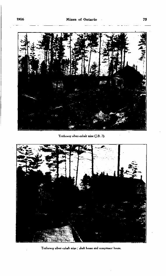
1906 Mines of Ontario 75
Trethewey silver-cobalt mine (J.B. 7).
Trethewey silver-cobalt mine ; shah house and compressor house.

76 Bureau of Mines No. 5
open cutting. The ore in this working was mainly smaltite for about 100 feet, when it changed to pyrrhotite, chalcopyrite and galena. A narrow vein parallel to the main vein has been uncovered 100 feet north of it.
The surface plant consists of shaft house 35 feet high, boarding house and com pressor and boiler house. The latter is situated 100 feet east of the shaft house, and in it two boilers, one a 60-h.p. locomotive firing and one 80-h.p. return tubular, a 12- drill duplex Band air compressor and a small hoist have been installed.
A force of 20 men is employed under superintendent J. Beddington.
Coniagas Mine or J B 6
This property, consisting of 40 acres, lies directly south of J B 7 on the town site of Cobalt, Messrs. W. G. Trethewey of Toronto and R. W. Leonard of St. Catharines being the chief owners. It was located in the spring of 1904, but owing to a dispute as to ownership it was not worked until the first part of 1905. Several veins have been uncovered all lying parallel and cutting the ridge at right angles Only two of the veins are at present being worked. These lie just south of the boundary between J B 6 and J B 7, and are parallel'to the main, vein on the latter. No. l vein has been open cut to the level of the valley lying west ,of it for about 75 feet on the vein. Drifte were run on the 75-foot level east 90 feet and west 60 feet. Six feet in from the shaft on the west drift, a cross-cut was run south 30 feet to cut No. 2 vein. At the junction with the vein a raise was put through to the surface. This has been, timbered and is used as the permanent working shaft, being 5 by 8 feet insido iotf timbers, with hoistway 5 by 4 feet and ladder way 5 by 3i feet in plan. Drifts are being run east and west on No. 2 vein, and a cross-cut from the east drift on No. l vein north to cut a vein that has been discovered near the north boundary line. An ore house and shaft house have been constructed, and hoisting is done by means of a duplex cylinder 5 by 5-inch Jenckes hoist. The power for the operation of the mine is obtained from a central power plant, situated on J B 7 and was described under that head.
Twenty-five men are employed under superintendent J. Beddington.
Buffalo Mine
This property is situated southwest of J B 6 on the town site of Cobalt, and is the southwest quarter of the south half of lot 6 in the sixth concession of the township of Coleman. jThe former owner and operator of the property was C. L. Denison of Buffalo, but it has been transferred to the Buffalo Mines, Ltd, C. L. Denison being president of the company. Mining work was begun in the spring of 1905 and has been carried on since that time. A number of veins have been found, but work is at present being concentrated on a vein on the east side of the property. A shaft 5 by 8 feet inside of timbers has been sunk on this to a depth of 70 feet, and drifts have been run west 105 feet ,and east 70 feet. On the west drift a stope 18 feet high and 28 feet long has been made and stoping has commenced in the east drift. East of the shaft on the same vein at 200 feet distant, a tunnel has been driven into the hill, and the ore has been taken out by open cut work for a depth of 30 feet. On the west end of the vein a shaft (No. 5) has been sunk to a depth of 50 feet and 25 feet of drifting done east and west from the shaft; the main shaft is partitioned from the ladder way and timbered the entire depth with square sets, and a cage is being put in. The power plant consists of an 80-h.p. boiler, one half of a 10-drill Band air compressor and an 8 by 10-inch double cylinder Jenckes hoist. The head frame for the shaft is 38 feet high, 16 feet square, and has rock house attached 16 feet by 20 feet by 24 feet high. A system of bins has been put in for storage and sorting the ore.
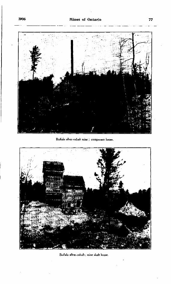
1906 Mines of Ontario 77
Buffalo silver-cobalt mine ; compressor house.
Buffalo silver-cobalt; mine shaft house.

78. Bureau of Mines No. 5
No. 4 vein has been leased from the company by Messrs. Doyle and Company and a shaft 50 feet deep sunk and drifts east and west begun.
No. 3 shaft 500 feet west of No. 4 is 50 feet deep with no drifting done. No. 5 shaft formerly leased to Messrs. McRae and McDonald is 30 feet deep.
Superintendent T. R. Jones has a force of 30 men employed.
Cobalt Silver QueenThis property owned by this company consists of the southeast part of the north
half of lot 7, in the fifth concession of Coleman, on which the mine is situated, and the southwest part of the north half of the same lot. It was formerly owned by the Temis- kaming and Hudson Bay Mining Company, but has recently been transferred to the above mentioned company, of which Lt.-Col. John I. Davidson of Toronto is president. The rein is located on the northeast corner of the lot, and two shafts have been sunk on it only a short distance apart. The vein strikes west of north j the westerly shaft has been sunk 65 feet, and the easterly, which is an enclosed shaft following the dip of the vein, 90 feet. The first level at a depth of 65 feet has drifts running east on the
Cobalt Silver Queen mine, Cobalt.
vein 90 feet and west 70 feet. A cross-cut has been driven south from the 65-foot level from the west shaft a distance of 30 feet. The vein on this property dips to the south at an angle of 30 degrees from the vertical. This is an exception to the rule in the Cobalt camp, where the reins for the most part are nearly vertical. The ore is smaltite carrying high silver values, and the vein is found cutting the conglomerate.
A new 5-drill compressor has 'recently been installed along with a double cylinder hoist with a 30-inch drum and a 60-h.p. return tubular boiler. A new boarding house has also been erected. Captain W. Vincent was in charge at the time of my inspection, employing a force of 20 men.
1906 Mines of Ontario 79
Temiskaming and Hudson Bay Company
Since the transfer to the Cobalt Queen Silver Mining Company of their working mine, this company have confined their attention to prospecting their other locations to the west and north of the Cobalt Silver Queen mine, comprising in all nine 40-acre locations. On the northeast quarter of the north half of lot 7 concession 5, Coleman, a shaft has been sunk 60 feet, but no ore has as yet been shipped.
McKinley and Darragh Mine
The property known as mining location J B l at the south end of Cobalt lake has recently been transferred by the former owners to the McKinley-Darragh-Savage Mines, Ltd., and is now being operated by them. The shaft which was originally sunk to a depth of 60 feet, and drifts run north from it towards the lake encountered some very loose ground, which made it impossible to work it further. The present company have filled the lower part of the shaft with rock, overlaying it with concrete and cement, and hope to be able to get out the ore. Another shaft has been sunk further south on the vein, and all work is being done through it. A second vein was discovered about 300 feet west and parallel to the old one. Some open cut work was done, and a shaft is now being sunk on it. A great deal of free silver has been found in the gravel on the shore of the lake, which has been bagged and shipped.
New machinery has been installed consisting of tw,o boilers of a capacity of 52-h.p. each, air compressor and hoist. New camp buildings have also been put up. Mr. McDonald is in charge with a force of 25 men.
Nipissing Mines
The Nipissing Mining Company own a block of land in the centre of the Cobalt camp comprising 846 acres. Only a small fraction of this area has been thoroughly prospected. The mines on this property have had the largest total production of any in the camp. From 25 to 30 veins have already been found, and of this number 11 of the veine were being worked at the time of inspection. The moat extensively developed vein is the Little Silver vein, which was the first silver vein on the property fjo be found and developed. A large tonnage of very high grade ore has been taken from this vein, the workings in which 'have reached a depth of 106 feet. The ore has been mined chiefly by open cut work. A small upright boiler furnishes power for a steam drill and hoist.
Veins number 6 and 25 are situated about the centre of K L 404, a little south of what was known as Cobalt farm. These are about 300 feet apart and have been opened by open cut to a depth of 50 feet, producing rich silver ore. Both of these veins have email upright boiler, hoist and drills. Hoisting is done by means of a swinging arm derrick.
Vein number 26 in the northeast part of B L 404 has been open cut to a depth of 30 feet. This vein in some places carries native silver in a very coarsely crystallized calcite. Hoisting from this vein is done by means of derrick and gasoline hoist.
Veins numbers 21, 13, 15, 12, 2 and 9 are being worked by open cutting to depths of from 15 to 30 feet. All of these veins carry silver values in the smaltite. New veins have been discovered on various parts of the property during 1906.
A large hydraulic plant has been installed on the shore of Peterson lake for the purpose of washing the soil off the surface, thus exposing the rock and any veins that may outcrop. The plant consists of two 125-h.p. boilers, a 150-h.p. engine and an 8-inch two-stage turbine pump with a capacity of 1,800 gallons of water per minute. This method of prospecting is new in Ontario and will be watched with much interest.

80 Bureau of Mines No. 5
On the shore of Cobalt lake a small crushing plant has been put up for the pur pose of crushing the ore to a uniform size before shipment. A large quantity of the ore is shipped to the cobalt plant at Copper Cliff for treatment.
Mr. H. Linney is superintendent, employing a force of 90 men, which is to b* increased as soon as accommodation can be provided.
O'Brien MineThis property is mining location R L 403, and the mine is just east of the La Rose
mine. The property is owned by Mr. M. J. O'Brien and his associates, and is operated by them. A shaft has been sunk to a depth of 200 feet oh the vein and levels have been opened at 50 and 100 feet respectively. Drifts have been run east on the vein on the 50-foot level a distance of 125 feet and west about the same distance. At the end of the east drift a raise has been put through to the surface on an incline of 45 degrees. On the second level drifts have also been run east and west on the vein. The shaft is timbered and hoistway partitioned from the ladderway. The ore house is connected with the shaft house. A few feet from the shaft house the boiler and compressor house have been built enclosing two boilers, a 4-drill compressor and hoist. A large dining room and bunk house have been built adjacent to the mine buildings. Very little prospecting has been done outside of this on the location owing to suit with the Crown regarding the title.
Mr. M. T. Culbert is superintendent, employing a force of 25 men.
Violet MineThis property comprises the northwest quarter of the south half of lot 3 in the
sixth concession of Coleman township, and was located in the spring of 1905. It has been worked quite steadily since that time, and some rich ore has been taken out. The shaft has now reached a depth of 100 feet, and at the bottom a drift has been run west 30 feet. The ore was at first taken out by means of open cut work, a cut 60 feet long and 25 feet deep being made. From this depth the shaft was sunk and the open cut timbered by stulls being put in and these overlaid with lagging. Some little pros pecting was done on other parts of the lot, but no mining work.
No machinery has as yet been put in, but camp buildings have been erected. Mr O. W. Albee is superintendent, employing a force of 10 men.
Hanson Cross Lake MineThis property, comprising the southwest quarter of the south half of lot 3 in the
sixth concession of Coleman township, has been transferred from the original owners, Messrs. McLeod and Glendinning, to a private enterprise in which the owners of the La Rose mine are chiefly interested. Work was carried on during the winter on the property just south of the Violet, by means of an open cut 20 feet in depth. A large number of narrow veins have been located on the property, but very little mining work has been done. A new plant consisting of boiler, compressor and hoist is to be in stalled in a short time.
Mr. R. H. M. Anson-Cartwright is superintendent, employing a force of 20 men.
Watts and Allen MineThis property consists of the northeast quarter of the north half of lot 3 in the
fifth concession of Coleman township, and is owned by the New Ontario Cobalt and Silver Mining Company, Mr. W. Gr. White being president, and Mr. Edwards Watts, manager. The vein on which the shaft has been sunk is on the edge of a high bluff on the west side of Cross lake, at the bottom of which considerable silver was found in the wash. A shaft has been sunk 70 feet deep and drifts run north and south on the lead 10 and 15 feet respectively. Nearly all the work during the summer was in surface pros pecting.
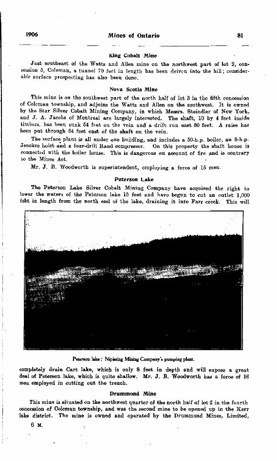
1906 Mines of Ontario 81
King Cobalt MineJust southeast of the Watts and Allen mine on the northwest part of lot 2, con
cession 5, Coleman, a tunnel 70 feet in length has been driven into the hill; consider able surface prospecting has also been done.
Nova Scotia MineThis mine is on the southwest part of the north half of lot 3 in the fifth concession
of Coleman township, and adjoins the Watts and Allen on the southwest. It is owned by the Star Silver Cobalt Mining Company, in which Messrs. Steindler of New York, and J. A. Jacobs of Montreal are largely interested. The shaft, 10 by 4 feet inside timbers, has been sunk 54 feet on the vein and a drift run east 80 feet. A raise has been put through 64 feet east of the shaft on the vein.
The surface plant is all under one building, and includes a 50-h.p. boiler, an 8-h.p. Jenckes hoist and a four-drill Band compressor. On this property the shaft house is connected with the boiler house. This is dangerous on account of fire and is contrary to the Mines Act. *
Mr. J. B. Woodworth is superintendent, employing a force of 15 men.
Peterson LakeThe Peterson Lake Silver Cobalt Mining Company have acquired the right to
lower the waters of the Peterson lake 16 feet and have begun to cut an outlet 1,000 feet in length from the north end of the lake, draining it into Farr creek. This will
Peterson lake ; Nipissing Mining Company'i pumping plant.
completely drain Cart lake, which is only 8 feet in depth and will expose a great deal of Peterson lake, which is quite shallow. Mr. J. B. Woodworth has a force of 16 men employed in cutting out the trench.
Drummond MineThis mine is situated on the northwest quarter of the north half of lot 2 in the fourth
concession of Coleman township, and was the second mine to be opened up in the Kerr lake district. The mine is owned and operated by the Drummond Mines, Limited,
6 M.
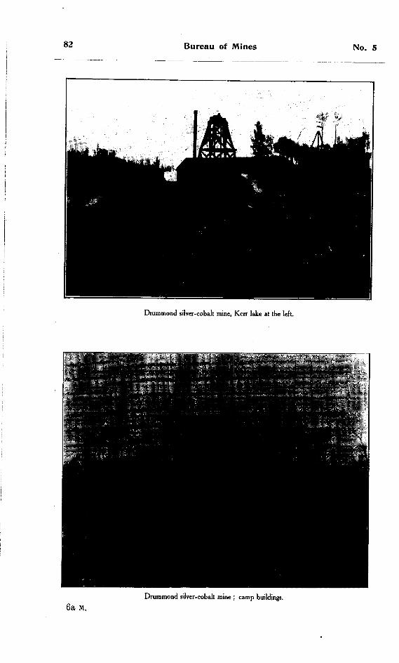
82 Bureau of Mines No. 5
Drummond silver-cobalt mine, Kerr lake at the left.
6a M.Drummond silver-cobalt mine ; camp buildings.

1906 Mines of Ontario 83
whose superintendent is R. W. Brigstocke, employing a force of 35 men. Three reins have been opened up, two of which are parallel, about 7 to 12 feet apart. A shaft 5 by 9 feet inside timbers has been sunk on these two veins, and to the north of the shaft on the surface the ore has been taken out by open cutting. The open cut is 80 feet long, 30 feet deep and 12 feet wide. On the "Bluejay" vein, which is about 100 feet northeast of the above mentioned veins, a shaft has been sunk 25 feet and an open cut run for some 50 feet along the vein for a few feet in depth.
The compressor and boiler house is located about 60 feet east of the shaft. The surface plant consists of an air compressor delivering 300 feet of air per minute, two 50-h.p. locomotive firing boilers and a 15-h.p. hoist. The company have also a diamond drill working on the property testing the vein at depth.
Jacobs Mine
The mine is located on the northeast part of lot 4 in the fourth concession of Coleman, and was the first property oh which smaltite and silver was found in the Kerr lake district. It was located in the fall of 1904, and was bought from the original locatee by the Kerr Lake Mining Company, of which B. J. Steindler of New York is president, J. A. Jacobs, secretary-treasurer, and Robert Jacobs, manager.
The vein on which work was first done is on the shore of Kerr lake, and fias been open cut to within a few feet of the level of the lake. In the spring of 1905 a new vein was discovered on the southeast corner of the lot. This vein occurs in the diabase formation running north and south, and there are high silver values in the calcite which is the vein filling. .A drift 200 feet in length has been run into the hill and the ore in the vein above this drift stoped out. This stope averages 30 to 35 feet in height. Another vein has been discovered in 1906 on the northwest part of the property on Kerr lake. This vein is very rich in native silver and argentite.
At the south vein a 60-h.p. boiler, 4-drill air compressor and hoist have been in stalled. Sinking on this vein at the mouth of the tunnel is in progress, 60 feet having at present been sunk.
Mr. S. W. Cohen is superintendent, employing at present about 30 men.
Hargrave Mine
On the northeast 50 acres of the south half of lot 3 in the fourth concession of Coleman, Messrs. Hargrave and White opened up the extension of the Jacobs south vein in 1905. Owing to legal difficulties regarding the title no work has been done on the property this year. The vein has been open cut for a depth of 30 feet along the vein for 100 to 125 feet. A shaft has been sunk 75 feet west of the vein and a drift run to the vein on this level. No other work has been done on the property with the exception of trenching and cross-catting for new vein. Camp building consisting of dining room, bunk house, office and laboratory have been constructed on the lot ad joining.
Mr. C. O'donnell is superintendent of the property.
Rothschild Mine
On the southwest quarter of the south half of lot 3 in the third concession of Coleman, the Rothschild Cobalt Mining Company have worked for the last year and have developed their property by sinking a 75-foot vertical shaft, and at this level running a cross-cut to intersect the vein. In addition to the mining work a good deal of surface prospecting is being done. A boiler and hoist have been installed.
Jos. Herman is superintendent, employing a small force.
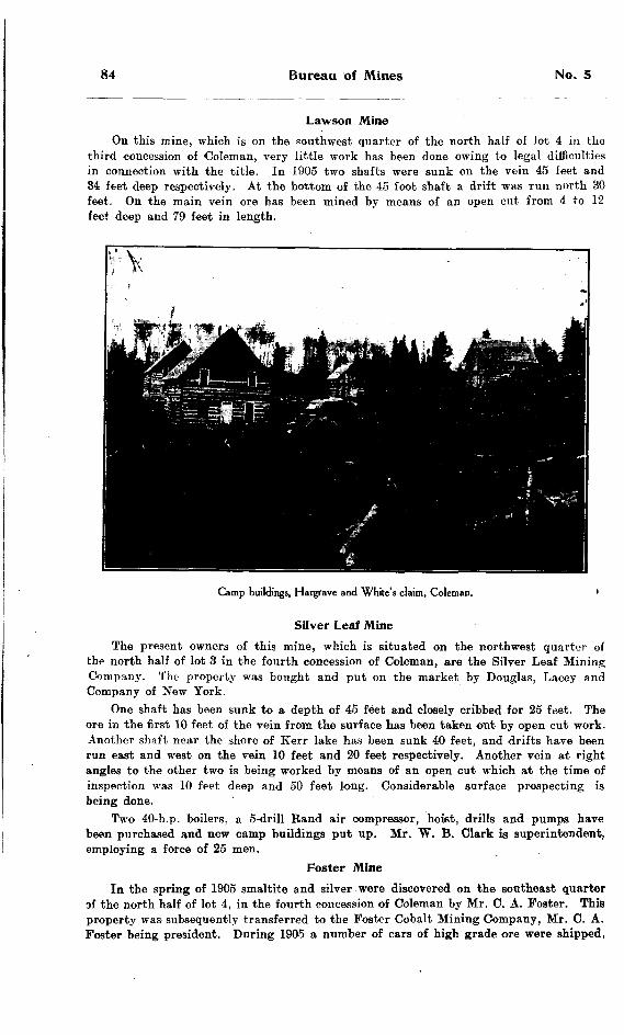
84 Bureau of Mines No. 5
Lawson MineOn this mine, which is on the southwest quarter of the north half of lot 4 in the
third concession of 'Coleman, very little work has been done owing to legal difficulties in connection with the title. In 1905 two shafts were sunk on the rein 45 feet and 34 feet deep respectively. At the bottom of the 45 foot shaft a drift was run north 30 feet. On the main vein or.e has been mined by means of an open cut from 4 to 12 feet deep and 79 feet in length.
Camp buildings, Hargrave and White's claim, Coleman. '
Silver Leaf MineThe present owners of this mine, which is situated on the northwest quarter of
the north half of lot 3 in the fourth concession of Coleman, are the Silver Leaf Mining Company. The property was bought and put on the market by Douglas, Lacey and Company of New York.
One shaft has been sunk to a depth of 45 feet and closely cribbed for 25 feet. The ore in the first 10 feet of the vein from the surface has been taken out by open cut work. Another shaft near the shore of Kerr lake has been sunk 40 feet, and drifts have been run east and west on the vein 10 feet and 20 feet respectively. Another vein at right angles to the other two is being worked by means of an open cut which at the time of inspection was 10 feet deep and 50 feet long. Considerable surface prospecting is being done.
Two 40-h.p. boilers, a 5-drill Band air compressor, hoist, drills and pumps have been purchased and new camp buildings put up. Mr. W. B. Clark is superintendent, employing a force of 25 men.
Poster MineIn the spring of 1905 smaltite and silver were discovered on the southeast quarter
of the north half of lot 4, in the fourth concession of Coleman by Mr. C. A. Foster. This property was subsequently transferred to the Poster Cobalt Mining Company, Mr. C. A. Poster being president. During 1905 a number of cars of high grade ore were shipped,
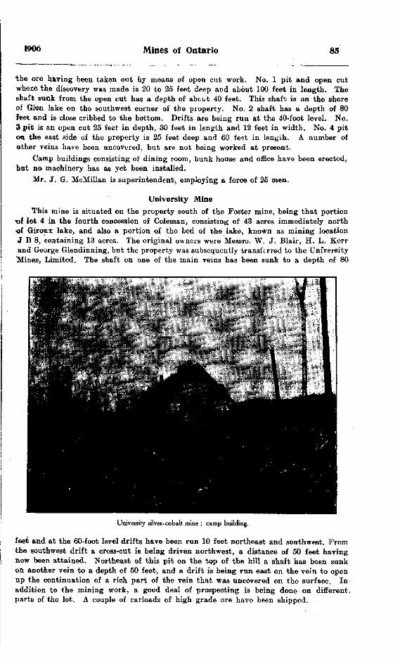
1906 Mines of Ontario 85
the ore having been taken out by means of open cut work. No. l pit and open cut where the discovery was made is 20 to 25 feet deep and about 100 feet in length. The shaft sunk from the open cut has a depth of about 40 feet. This shaft is on the shore of Glen lake on the southwest corner of the property. No. 2 shaft has a depth of 80 feet and is close cribbed to the bottom. Drifts are being run at the 40-foot level. No. 3,pit is an open cut 25 feet in depth, 30 feet in length and 12 feet in width. No. 4 pit OB the east side of the property is 25 feet deep and 60 feet in lenyih. A number of other veins have been uncovered, but are not being worked at present.
Camp buildings consisting of dining room, bunk house and office have been erected, but no machinery has as yet been installed.
Mr. J. G. McMillan is superintendent, employing a force of 25 men.
University MineThis mine is situated on the property south of the Foster mine, being that portion
•of lot 4 in the fourth concession of Coleman, consisting of 43 acres immediately north of Giroux lake, and also a portion of the bed of the lake, known as mining location J B 8, containing 13 acres. The original owners were Messro. W. J. Blair, H. L. Kerr and George Gleudinning, but the property was subsequently transferred to the University Mines, Limited. The shaft on one of the main veins has been sunk to a depth of 80
University silver-cobalt mine J camp building.
feet and at the 60-foot level drifts have been run 10 feet northeast and southwest. From the southwest drift a cross-cut is being driven northwest, a distance of 50 feet having now been attained. Northeast of this pit on the top of the hill a shaft has been sunk on another vein to a depth of 50 feet, and a drift is being run east on the vein to open up the continuation of a rich part of the vein that was uncovered on the surface. In addition to the mining work, a good deal of prospecting is being done on different, parts of the lot. A couple of carloads of high grade ore have been shipped.

86 Bureau of Mines No. 5
A 20-h.p. boiler and hoist have been installed on number 4 vein, and a compressor plant been ordered and will be put in without delay. A dining and sleeping camp 60 feet by 45 feet has been erected. Mr. G. Adler is superintendent, employing a force of 40 men.
Silver Bar
This property is the southwest part of the north half of lot 5 in the fourth con cession of Coleman, and wag located in 1905 by Mr. C. W. Knight, and sold by him to the Silver Bar Mining Company, of which Mr. Rinaldo McConnell of Ottawa is president, and J. B. Woodworth, superintendent. A shaft has been sunk on the vein to a depth of 45 feet. The vein was open cut for 30 to 40 feet and for a depth of 12 feet A boiler, compressor and hoist have been installed.
Savage Mine
This property, adjoining the Silver Bar to the north, is situated on thei north west quarter of the north half of lot 5 in the fifth concession of Coleman. It was located in 1905 by Mr. R. E. Savage of Sudbury, and sold by him to the Savage Mines, Limited. A coupfo of small parallel veins have been opened up, and a shaft 70 feet in depth sunk on one of them. Drifts have been run southeast a distance of 40 feet and northwest 15 feet. Prom the northwest drift a cross-cut 25 feet in length has been run. A 50-h.p. boiler, 3-drill compressor and double drum hoist have been installed. Mr. A. Sampson is foreman, employing 14 men.
On the southwest side of "Diabase Mountain" Mr. Howard Chapin has been pros pecting by driving a tunnel into the mountain on the contact between the slate and diabase. A tunnel 105 feet in length has already been driven. Power is supplied by means of a gasoline air compressor.
Temiscamingue Mine
On the south half of the northwest quarter of the north half of lot l in the third concession of Coleman, the Temiscamingue Mining Company have this year made a discovery of smaltite averaging over l foot in width, as far as uncovered. A shaft is being sunk on the vein and at a depth of 40 feet argentite was found. This vein has been traced across this property to the north half of the lot.
Beaver Mine
On the north half of the northwest quarter of the north half of lot l in the third concession of Coleman, the vein on which the Temisc-amingue Mining Company are working on the lot south of it, has been uncovered and found to contain native silver. The property is owned by the Beaver Mining Company.
Columbus Mine
On the northwest quarter of the south half of lot 2 in the third concession of Cole man, the Columbus Cobalt Mining Company are opening up a vein of cobaltite. The property was located in 1905 by Joseph Columbus. A large number of very fine crystals of cobaltite have been found in the vein. Mr. Harms is foreman, employing a force of about 25 men.
Benn MineOn lot 15 in the first concession of the township of Bucke on the shore of lake
Temiskaming, the Temiskaming Cobalt Mining Company have been working a vein of cobalt. A shaft has been sunk on the vein a depth of 60 feet, and two diamond drill holes put down to cut the vein at depth. The property was purchased from Mr. Ira L. Benn, who discovered the vein in 1904.
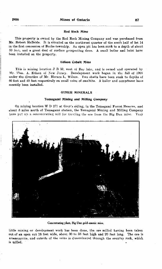
1906 Mines of Ontario
Red Rock Mine
This property is owned by the Red Bock Mining Company and was purchased from Mr. Robert McBride. It is situated on the northwest quarter of the south half of lot 14 in the first concession of Bucke township. An open pit has been sunk to a depth of about 50 feet, and a great deal of surface prospecting done. A small boiler and hoist have been installed on the property.
Edison Cobalt Mine
This is mining location J B 33. west of Bay lake, and is owned and operated by Mr. Thos. A. Edison of New Jersey. Development work began in the fall of 1905 under the direction of Mr. Horace L. Wilson. Two shafts have been sunk to depths of 60 feet and 40 feet respectively on small veins of smaltite. A boiler and compressor have recently been installed.
OTHER MINERALS
Temagami Mining and Milling Company
On mining location W D 271 at Grey's siding, in the Temagami Forest Reserve, and about 3 miles north of Temagami station, the Temagami Mining and Milling Company have pet up a concentrating mill for treating the ore from the Big Dan mine. Very
Concentrating plant, Big Dan gold-arsenic mine.
little mining or development work has been done, the ore milled having been taken out of an open cut 18 feet wide, about 30 to 35 feet high and 20 feet long. The ore is arsenopyrite, and outside of the veins is disseminated through the country rock, which is milled. .

88 Bureau of Mines No. 5
The or© is hoisted from the open cut by a skip and dumped into a Blake jaw crusher. The product is then dried, and is passed through rolls and elevated to trommels for sizing. The oversize passes down through a fine roll. The sized product is then put through Kriem air separators, of which there are three in the mill. The concentrates from these separators are drawn off and bagged for shipping. It is the intention of the management to do away with dry concentration and put in a plant using the wet process. Mr. Albert Smith is general manager, employing when operating, a small gang of men.
Little Dan
At Arsenic lake, about 3 miles west of Grey's siding, Captain J. Leckie has a small gang of men at work on mining locations W S 13, 14, W D 460, 461, 462, 463, 464 and 465. Nothing is being done at present at the Little Dan, which is an arsenopyrite prop erty. The rein has been opened up for some distance on the surface, showing there from S to 4 feet of good ore in addition to the impregnated country rocK.
On the north and south side of Arsenic lake some prospects carrying copper pyrites are being developed. Camps have been built on the shore of the lake.
James Lake Pyrites Mine
At James lake, about 8 miles north of Temagami on the Temiskaming and Northern Ontario railway, an iron pyrites deposit is being opened up under the management of Ronald Harris. A shaft has been sunk 60 feet and some very good ore shipped. A boiler hoist and compressor have been installed.
Temagami Iron Range
On the iron range near Temagami Messrs. Caldwell and Mulock are engaged in exploratory work. Diamond drilling, trenching and cross-cutting the ore body are being carried on. The work is in charge of Mr. A. B. Willmott of Sault Ste. Marie.
IV.—Eastern Ontario
GOLD MINES
The gold mining industry of eastern Ontario remains in about the same condition as for the last few years. The Belmont and Deloro mines have not as yet resumed opera tions, although the high price of arsenic should tend in this direction at the latter. A little bullion was produced at the Craig and the Star of the Bast, but the mills at these mines are only run at intervals, as development work has not proceeded far enough in advance of stoping operations to ensure a uniform production. These spasmodic attempts at turning out gold are due, as has been pointed out in former reports, to the undue haste in the erection of stamp mills before the mine is sufficiently developed. This Ras been the chief cause of giving gold mining a set-back in all parts of Ontario, and it is chargeable in part to the flotation of stock companies and the desire of the promoters to have something tangible on the surface to show the public, and also in part to the undue haste of shareholders to obtain dividends.
Gold mining in eastern Ontario dates back to 1867, when the Richardson Hill dis covery at Eldorado caused a rush of miners and prospectors to this centre. Since that time gold has been found in North Hastings and Frontenac at many places, but no very extensive development work has been carried on, on any of the properties with the exception of,the Belmont and Deloro mines.
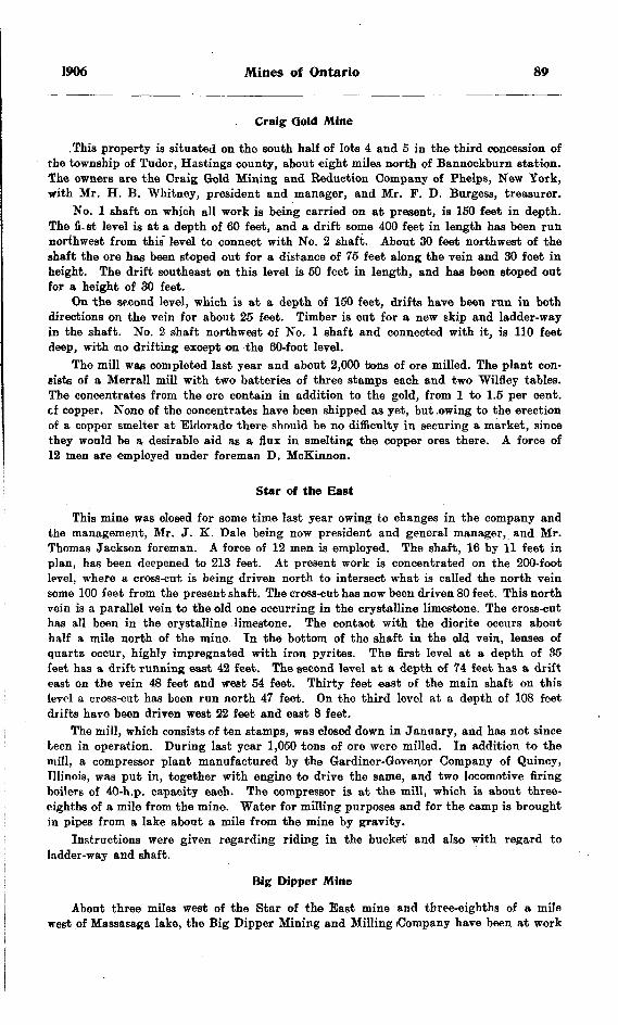
1906 Mines of Ontario 89
Craig Gold Mine
, This property is situated on the south half of lots 4 and 5 in the third concession of the township of Tudor, Hastings county, about eight miles north of Bannockburn station. The owners are the Craig Gold Mining and Eeduction Company of Phelps, New York, with Mr. H. B. Whitney, president and manager, and Mr. F. D. Burgess, treasurer.
No. l shaft on which all work is being carried on at present, is 150 feet in depth. The fi. st level is at a depth of 60 feet, and a drift some 400 feet in length has been run northwest from this" level to connect with No. 2 shaft. About 30 feet northwest of the shaft the ore has been stoped out for a distance of 75 feet along the vein and 30 feet in height. The drift southeast on this level is 50 feet in length, and has been stoped out for a height of 30 feet.
On the second level, which is at a depth of 150 feet, drifts have been run in both directions on the vein for about 25 feet. Timber is cut for a new skip and ladder-way in the shaft. No. 2 shaft northwest of No. l shaft and connected with it, is 110 feet deep, with no drifting except on the 60-foot level.
The mill was completed last year and about 2,000 tons of ore milled. The plant con- gists of a Men-all mill with two batteries of three stamps each and two Wilfley tables. The concentrates from the ore contain in addition to the gold, from l to 1.5 per cent, of copper. None of the concentrates have been shipped as yet, but .owing to the erection of a copper smelter at Eldorado there should be no difficulty in securing a market, since they would be a desirable aid as a flux in smelting the copper ores there. A force of 12 men are employed under foreman D. McKinnon.
Star of the East
This mine was closed for some time last year owing to changes in the company and the management, Mr. J. K. Dale being now president and general manager, and Mr. Thomas Jackson foreman. A force of 12 men is employed. The shaft, 16 by 11 feet in plan, has been deepened to 213 feet. At present work is concentrated on the 200-foot level, where a cross-cut is being driven north to intersect what is called the north vein some 100 feet from the present shaft. The cross-cut has now been driven 80 feet. This north vein is a parallel vein to the old one occurring in the crystalline limestone. The cross-cut has all been in the crystalline limestone. The contact with the diorite occurs about half a mile north of the mine. In the bottom of the shaft in the old vein, lenses of quartz occur, highly impregnated with iron pyrites. The first level at a depth of 35 feet has a drift running east 42 feet. The second level at a depth of 74 feet has a drift east on the vein 48 feet and west 54 feet. Thirty feet east of the main shaft on this level a cross-cut has been run north 47 feet. On the third level at a depth of 108 feet drifts have been driven west 22 feet and east 8 feet.
The mill, which consists of ten stamps, was closed down in January, and has not since been in operation. During last year 1,050 tons of ore were milled. In addition to the mill, a compressor plant manufactured by the Gardiner-Govei;or Company of Quincy, Illinois, was put in, together with engine to drive the same, and two locomotive firing boilers of 40-h.p. capacity each. The compressor is at the mill, which is about three- eighths of a mile from the mine. Water for milling purposes and for the camp is brought in pipes from a lake about a mile from the mine by gravity.
Instructions were given regarding riding in the bucket and also with regard to ladder-way and shaft.
Big Dipper Mine
About three miles west of the Star of the East mine and three-eighths of a mile west of Massasaga lake, the Big Dipper Mining and Milling (Company have been at work

90 Bureau of Mines No. 5
for the past year. The head office of the company is at Peterborough. The president is Mr. John Fletcher, general manager Mr. J. Jamieson, and foreman Mr. Robert Wilson. A force of 12 men is employed.
During last year on lot 4 in the tenth concession of the township of Barrie, Mie company drove an adit into the hill about 300 feet. This is not being worked at present. The camp buildings are on Massagaga lake near where the work was done. On lot 12 in the same concession a shaft is being sunk and prospecting carried on. The shaft, 9 by 6 feet in plan, has reached a depth of 62 feet, and is cribbed and the ladder- way partitioned from the shaft for 40 feet. About 100 feet west of this shaft another shaft has been sunk on the same vein 30 feet. The vein runs east and west and is composed of quartz carrying iron pyrites and magnetite. The magnetite occurs in the hanging wall in contact with the crystalline limestone. The granite outcrops about 30 feet north of the outcrop of crystalline limestone. The rock between the granite and limestone is very much altered, but is chiefly a granite gneiss. The hanging wall or wall of crystalline limestone dips nearly vertical for 20 feet, then at an angle of 75 degrees. Some free gold is found in the quartz near the surface. A small horizontal holler furnishes steam for hoist and pump.
The company is interested in lots 4 to lot 21 in the tenth concession of the township of Barrie, Frontenac county.
Eldorado Copper MineThis mine, which was originally opened for iron, but which has for the last couple
of years been worked for copper, is owned by the Medina Gold Mining Company of Syracuse, with Mr. Cole Saunders, president, and Mr. Arthur Coe, mine manager. The ore is chalcopyrite and was found at a depth of 75 feet displacing the hematite, which constituted the ore body to this depth. Some very fine samples of chalcocite are also found in the ore. The north or hanging wall of the ore body is granite, and the south or foot wall crystalline limestone. The ore body runs east and west in a wide open fissure in the contact between the granite and limestone. The open cut worked for iron is 75 feet in depth. Front this level a shaft has been sunk 75 feet with drifts and cross cuts at different levels. At a depth of 35 feet in the shaft a level has been driven, and 105 feet of drifting done. Twenty feet deeper in the shaft, another level has been run and 170 feet of drifting done. At the 75-foot level there are 175 feet of drifting. The ore body, which occurs as a shoot, dips to the northeast. At the lower level drifts have been run into it and sinking on it has begun. It is the intention to put down a winze on the ore body following its dip.
The plant consists of one 60-h.p. locomotive firing boiler, one 110-h.p. return tubular boiler, one 4-drill air compressor and an 8 by 10-inch duplex cylinder hoist with 36-inch drum. Hoisting is done by swinging arm derrick with guy ropes to enable it to deliver ore at the smelter or stock pile, or waste at the car, to be trammed to the rock dump. A 70-light dynamo supplies light to the mine, smelter and camp building. Two pumps— a 28-gallon Cameron and a 50-gallon Knowles—keep the mine free from water. The company has also erected a large boarding house and office.
In addition the company have purchased a diamond drill manufactured by the Standard Drill Company of Chicago, for use in prospecting their property. The drill has a capacity of 800 feet with a core fifteen-sixteenths of an inch in diameter. The drill is at present boring a hole to cut the ore body at a depth of about 300 feet.
The first copper smelter in eastern Ontario was blown in at this property on June 25th, 1906. The furnace is south of the mine on the side of the hill which furnishes ample ground for slag dump, and is so situated that the swinging arm derrick used for hoisting ore from the mine dumps the ore at the door leading to the charging floor. The furnace is 4 feet in diameter, round, water jacketed, manufactured by the Allis Oh'almers Company of .Chicago, is equipped with the regular style of settler, and has a capacity of about 50 tons per day. The height from base of furnace to charging; floor is 12 feet.
1906 Mines of Ontario 91
The ore, averaging from 4 to 10 per cent, copper, is smelted green. The fluxes, consisting of limestone and quartz, ,are obtained only a short distance from the mine. Matte running from 15 to 25 per cent, copper is obtained in the first, operation. It is the intention to run the matte through the furnace again separately in- order to raise the copper contents from 40 to 45 per cent. The superintendent of the smelter is Mr. Barclay.
LEAD AND ZINC MINES
Hollandia Lead Mine
At the time of my inspection of this property in April, the mine was full of water, but since that time it has been re-opened and mining again begun. Arrangements are being made to have the property taken over from the Ontario Mining and Smelting Company by the Stanley Smelting Company. Mr. Cushman is manager for the two companies. No. l shaft has been sunk to a depth of 100 feet and 50 feet of drifting, done along the vein in each direction. No. 3 shaft, 250 feet west of No. l shaft, is 45 feet deep. No. 4 shaft, some 250 feet west of No. 3, has a depth of 35 feet. A new lift pump worked by walking beam and engine was put in last year. The concentrating mill was overhauled last year and the concentration is now wholly by means of jigs, where before tables were used for the final separation. Considerable ore was run through the mill last year and shipped to the lead smelter at Bannockburn.
Instructions were given regarding putting ladder-way in proper condition and forbidding riding on the bucket.
Katherine Lead Mine
This mine was worked some years ago and is situated on lot 7 in the second con cession of the township of Lake, Hastings county, three miles northwest from Millbridge. It has recently been taken over from the British Colonial Mining and Development Company of Ontario, Limited, by the Stanley Smelting Company, and unwatered, and mining operations have been resumed.
The shaft is 125 feet deep, and on the 100-foot level has 100 feet of drifting to the north of the shaft. The present company are installing an air compressor and putting the old plant in good condition.
Stanley Smelting; Works
The lead smelter owned and operated by the Stanley Smelting Company was con structed in the spring of 1905, and has been in operation more or less continuously since that time. It is situated at Bannockburn, at the junction of the Central Ontario railway and the Bay of Quinte railway, thus giving good communication in every direction. It is a water-jacketed lead furnace of about 20 tons capacity per day.
A gasoline engine furnishes power to drive the blower and Centrifugal pump. The iron ore used for a flux is obtained from the Wallbridge mine, which is between Eldorado and Madoc. The silica comes from the immediate vicinity of the works. The superin tendent of the smelter is Mr. W. Weigel.
Frontenac Lead Mine
About one mile northwest of the old works of the Frontenac lead mine, near what was formerly known as the Frontenac lead mine No. 2, more work was done in 1905. The ore is. as shown in last year's report, a mixed ore of galena and zincblende. The vein on which the work has been done has a strike of northwest by southeast, and has been traced for a considerable distance; in fact it appears to be the same vein as that on which the shaft No. 2 was sunk.

92 Bureau of Mines No. S
Lead smelter at Bannockburn.
Old concentrating mill at Frontenac lead mine.
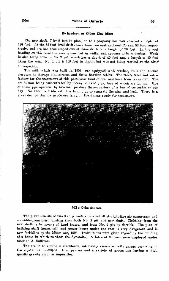
1906 Mines of Ontario 93
Richardson or Olden Zinc Mine
The new shaft, 7 by 9 feet in plan, on this property has now reached a depth of 120 feet. At the 65-foot level drifts havo been run east and west 25 and 50 feet respec tively, and ore has been stoped out of these drifts to a height of 20 feet. In the west heading on this level the vein is one foot in width, and appears to he widening. Work is also being done in No. 2 pit, which has a depth of 40 feet and a length of 50 feet along the vein. No. l pit is 109 feet in depth, but was not being worked at the time* of inspection.
The mill, which was built in 1905, was equipped with crusher, rolls and bucket elevators to storage bin, screens and three Bartlett tables. The tables were not satis factory for the treatment of this particular kind of ore, and have been taken out. The ore is now being concentrated by means of hand jigs, four of which are in use. One of these jigs operated by two men produce three-quarters of a ton of concentrates per day. No effort is made with the hand jigs to separate the zinc and lead. There is a great deal of this low grade ore lying on the dumps ready for treatment.
Mill at Olden zinc mine.
The plant consists of two 30-h.p. boilers, one 2-drill straight-line air compressor and a double-drum hoist hoisting from both No. 2 pit and new shaft. Hoisting from the new shaft is by means of head frame, and from No. 2 pit by derrick. The plan of building shaft house, mill and power house under one roof is very dangerous and is now forbidden by the Mines Act, 1906. Instructions were given regarding the building of a house in which to thaw the dynamite. A force of 25 men were employed under foreman J. Sullivan.
The ore in this mine is zincblende, intimately associated with galena occurring in the crystalline limestone. Iron pyrites and a variety of greenstone having a high specific gravity occur as impurities.
94 Bureau of^Mines No. 5
Another zinc property is being opened up by Messrs. Kirkgaarde and Chisholm about two miles west of the Richardson zinc mine. A few men are at work on a narrow seam or lens of zincblende.
IRON PYRITES
The interest taken in the production of iron pyrites in eastern Ontario has increased to such an extent that the business is now on a firm basis, and shipments of ore from the mines are being made regularly. The largest producers are the American Madoc Mining Company.
American Madoc Mining Company
This company are operating two properties, the Jarman pyrites mine and the Hungerford pyrites mine. Both are under superintendent Mr. A. F. Rising.
At the former the shaft has been sunk 55 feet below the third level, making a total depth of about 230 feet. All work since last inspection has been confined below the third level. Here a drift was run north under the pillar which forms the third level floor a distance of 175 feet and a raise put through to the third level, access to this level being gained through the raise. About 30 feet of the floor of this drift has been stoped out by overhand stoping, and another 25-Toot stope begun. The ore body dips to the north, thus leaving the shaft to intersect the south wall at the present depth. A dam and reservoir for catching all the water from above the third level has been put-in on this level, and a large Cameron pump installed. The water from the lower workings is pumped to the reservoir. Instructions were given to h"aVe additional landings in the ladder-way put in and the hoisting way separated from the ladder-way, also to strictly enforce the law prohibiting men riding on the bucket. A force of 30 men are employed under foreman Mr. T. E. Burnside,
At the Hungerford pyrites mine on lot 23 in the twelfth concession of the town ship of Hungerford, about 5 miles east of Tweed, a shaft 6 by 12 feet has been sunk a depth of 250 feet on the south vein. The first 50 feet of the shaft is on an incline of 79 degrees, and from there to the bottom at an incline of about 57 degrees. The first level at a depth of 100 feet on the south vein has drifts east 137 feet and west 35 feet, and on the middle vein east 18 feet and west 75 feet. From the south vein a cross-cut 115 feet in length cuts the north vein, which is some 20 feet in width and has drifts east 142 feet and west 175 feet. The second level, at a depth of 200 feet on the south vein, has drifts east 45 feet and west 25 feet. A cross-cut 175 feet in length from this to the north vein cuts 16 feet of ore. The shaft is sunk 50 feet below this level aad sinking is being continued. The ore is a fine granular pyrites, very free from rock matter, but containing some calcite. The hanging wall of the vein is a mica schist and the foot wall a quartzite.
The surface plant consists of an 80-h.p. return tubular boiler with feed water heater, a four-drill Ingersoll-Sergeant air compressor, and duplex cylinder 8J by 10-inch Lidgerwood hoist with 21-foot drum. The shaft house is 55 feet high with 31 by 26-foot Lase. The upper part of the shaft house is used as a sorting and breaking floor, while the lower part is not boarded in. A blacksmith shop and dry, compressor and boiler house and office, comprise the rest of the surface equipment.
British American Mine
The British American Pyrites Company, Limited, of Toronto, are still working on lot 11 in the lith concession of Madoc township, under superintendent Captain Williams. The shaft has been sunk to a. depth of 80 feet, and, at the 60-foot level a drift has been run in, and the floor blown up to provide a sump where a large sinking
1906 Mines of Ontario 95
I'Ump is installed. Two locomotive firing boilers having a combined capacity of 110-h.p., and a 3-drill straight-line air compressor have been installed, and also a small hoist. During the winter some 30 cars of ore were shipped from the mine. No stoping has vet been done, consequently the ore shipped was obtained from the development work.
IRON MINES
Radnor Mine
The Radnor mine owned by the Canada Iron Furnace Company was the only steady pioducer in 1905 in the eastern part of the Province. The new road to the railway, three and a half miles in length, has been completed, and it is expected by the manage ment that 5,000 tons will be shipped during the present year. All work is at present being done on No. 8 pit, which is situated on the more northerly part of the property. On account of the ore body occurring in beds which vary in thickness and dip at an angle of about 34 degrees, the work of mining is difficult and costly. As the upper bed lies immediately under the surface covering, it has to be mined by open-cut work, which necessitates the removal of a great deal of waste material. The beds are in places 8 feet thick, with granite and granite gneiss intervening. The ore is sorted into two grades, that running from 48 to 50 per cent, iron is shipped, while the second grade material of about 30 per cent, is put on the stock pile. There is a large tonnage of this second grade ore wiich could be quite economically treated by magnetic con centration.
The office was destroyed by fire during the last winter. The mine is now connected by telephone with Caldwell on the Canada Atlantic Railway. A force of 20 men are employed under superintendent Mr. D. J. McCuan.
Mineral Range Mines
The Mineral Range Iron Mining Company own the properties called No. 2 and No. 3 mines, situated on lots 2 and 3 in the sixth concession, and the Childs mine on lots 11 and 12 in the ninth concession of the township of Mayo, county of Hastings, about 5 miles by road from L'Amable station on the Central Ontario railway. Mr. H. C. Farnum is mine manager.
A railway line is being put in this summer from No. 3 mine to connect with the Central Ontario railway a short distance south of L'Amable. It is expected that the line will be completed about the first of September, when contracts call for large ship ments of ore. No. 3 mine is to be the property first developed extensively. In this mine the ore is coarse grained and free of visible sulphides, though containing a little lime. The ore body has been stripped for a width of about 50 feet and 300 feet in length. Mr. Farnum states that the dip needle shows the ore body to be at least double this width and length. The ore has been opened at the foot of the hill over which the magnetite extends, thus giving a stope above the level of the ground at least 25 feet in height by the width of the ore body. The wajl on the east side of the ore body is very clearly defined, but that on the west side has not yet been encountered. A band of greenstone three or four feet wide comes in about 25 feet from the east wall; also some granite dikes cut across the ore body in places. No. 3 body appears to be almost a continuation of No. 4, which has also been opened up for about 30 feet in width by 40 feet in length and 20 feet deep. No. 4 has been shown by the dip needle to be nearly 100 feet wide by 500 to 600 feet long.

96 Bureau of Mines No. 5
Mineral Range Iron Mining Company ; No. 4 mine.
Mineral Range Iron Mining Company ; No. 4 mine, looking east,
1906 Mines of Ontario 97
A portable boiler has up to the present furnished power for the hoist and machine drill. Hoisting is by derrick.
The following assays furnished by Mr. Farnum show the character of the ore body. No. 1. Result of shipment of 50 tons to the Tonawanda Iron and Steel Company.No. 2. No. 3 pit (stock pile) sampled and analysis made by Mr. W. Dixon Craig for
Canada Iron Furnace Company.No. 3. No. 4 pit sampled and analysis made by Mr. W. Dixon Craig for Canada
iron Furnace Company.No. 1. No. 2. No. 3.
Iron ................................................. 63.8 64.94 64.23Silica ............................................... 5.15 4.74 5.79Phosphorus ....................................... .024 .006 .013Manganese ....................................... .085 .27 .12Alumina ........................................... .35 .62 1.40Lime ................................................ 2.70 2.86 2.43Magnesia .......................................... 1.24 1.48 1.55Sulphur ............................................ .076 '.007 .007
CORUNDUM MINES
Canada Corundum Company
The system of quarrying the corundum-bearing rocks described in former reports of the Bureau is still being continued, but on a much larger scale. The whole face of the hill is being uncovered and prospected by means of drills, etc. To handle the ore from the upper workings on the hill, a system of balanced hoisting somewhat similar to the main and tail rope haulage system is used. A double track is carried up the side of the hill from the lower track to the top of the hill. Here a large drum with powerful friction brake is situate. The cables are fastened to the cars on each of the tracks, the other ends being attached to the drum and one rope winding on the drum iu the reverse direction from that of the other. In this way the loaded car pulls up the empty, the speed being regulated by the friction brake. From the track at the foot of the incline track, the ore is hauled by team to the storage bins at the mill. The workings are so extensive all over the face of the hill, that the cost of mining is greater than it would be if the work could be concentrated at one place.
One noticeable improvement in the operation of the mill is the milling of a. much lower grade of ore than formerly. A great deal of the corundum-bearing. rock formerly considered too low grade for economic treatment is now being put through the mill. During the winter some work was done on a prospect two miles from the main work ings on the same ridge.
The mill is at present handling a tonnage of about 200 tons of ore per day, and producing over 300 tons of refined corundum per month. There is also an increase in the number of grades of corundum produced. A full description of the mill is given in former Reports of the Bureau. There have been some changes, but they are in details rather than in principle. The present manager has by some slight alterations increased both the capacity and efficiency of the magnetic separations.
Mr. H. E. T. Haultain is manager, employing a force of over 200 men. About 10 miles from Craigmont in the township of Monteagle above Foster's Rapids, the company have 10 men employed in exploratory work.
7 M.
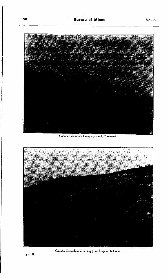
98 Bureau of Mines No. 5
Canada Corundum Company's mill, Craigmont.
7a M.Canada Corundum Company ; workings on hill side.
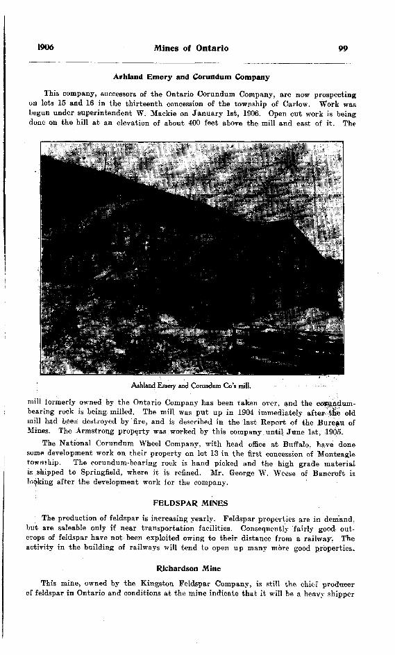
1906 Mines of Ontario 99
Affhland Emery and Corundum Company
This company, successors of the Ontario Corundum Company, are now prospecting on lots 15 and 16 in the thirteenth concession of the township of Carlow. Work was begun under superintendent W. Mackie on January 1st, 1906. Open cut work is being done on the hill at an elevation of about 400 feet above the mill and east of it. The
Ashland Emery and Corundum Go's mill. .
mill formerly owned by the Ontario Company has been taken over, and the coftfjidum- bearing rock is being milled. The mill was put up in 1904 immediately after -tie old mill had been destroyed by fire, and is described in the last Report of the Bureau of Mines. The Armstrong property was worked by this company until June 1st, 1905.
The National Corundum Wheel Company, with head office at Buffalo, have done somfl development work on their property on lot 13 in the first concession of Monteagle township. The corundum-bearing rock is hand picked and the high grade material is shipped to Springfield, where it is refined. Mr. George W. Weese of Bancroft is looking after the development work for the company.
FELDSPAR MINES
The production of feldspar is increasing yearly. Feldspar properties are in demand. but are saleable only if near transportation facilities. Consequently fairly good out crops of feldspar have not been exploited owing to their distance from a railway. The activity in the building of railways will tend to open up many more good properties.
Richardson Mine
This mine, owned by the Kingston Feldspar Company, is still the chief producer of feldspar in Ontario and conditions at the mine indicate that it will be a heavy shipper

100 Bureau of Mines No. 5
Richardson feldspar mine.
Richardson feldspar mine ; No. 2 pit.
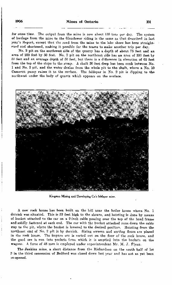
1906 Mines of Ontario 101
for some time. The output from the mine is now about 130 ton? per day. The system of haulage from the mine to the Glendower siding is the same as that described in last year's Report, except that the road from the mine to the lake shore has been straight ened and shortened, making it possible for the teams to make another trip per day.
No. 2 pit on the southwest side of the quarry has a depth of about 75 feet and an area of 250 feet by 50 feet. No. 2 pit on the northeast side has an area of 300 feet by 50 feet and an average depth of 50 feet, but there is a difference in elevation of 65 feet from the top of the stope to the sump. A shaft 30 feet deep has been sunk between No. l and No. 2 pit, and the water drains from the whole pit to the shaft, where a No. 10 Cameron pump raises it to the surface. The feldspar in No. 2 pit is dipping to the northwest under the body of quartz which appears on the surface.
Kingston Mining and Developing Go's feldspar mine.
A new rock house has been built on the hill near the boiler house where No. l derrick was situated. This is 53 feet high to the sheave, and hoisting is done by means of bucket attached to the car on a 2-inch cable passing over the top of the head frame and solidly fastened at each end. The car with the bucket attached runs down the cable way to the pit, where the bucket is lowered to the desired position. Hoisting from the northeast end of No. 2 pit is by derrick. Sizing screens and sorting floors are placed in the rock house. The impure ore is sorted out on the floor of the rock house, and the good ore is run into pockets from which it is emptied into the buckets on the wagons. A force of 48 men is employed under superintendent Mr. M. J. Flynn.
The Jenkins mine, a short distance from the Richardson on the south half of lot S in the third concession of Bedford was closed down last year and has not as yet been re-opened.
102 Bureau of Mines No. 5
Border Mine
This mine is situated on the west half of lot o in the twelfth concession of the township of Portland, and two miles northeast of Verona. The mine has been closed for about two years, but work was again begun about the middle of May, 1906. The feldspar is being taken out of an open cut some 200 feet long, 20 feet wide and 25 to 30 feet deep. The dike of feldspar here runs in a northeast by southwest direction, and cuts across the gneiss formation. Bodies of quartz are found in the dike where it has crystallized out from the magma. The feldspar is hauled from the mine by waggon to the nearest station, Verona, for shipment. Mr. W. H. Oliphant is superintendent, employing a force of 10 to 15 men. 'rhe property is owned by the Pennsylvania Feld spar Company.
Kingston Mining and Development Company
This company began work in September 1905, on lot 16 in the eleventh concession of the township of Portland about two miles west of Verona. The workings consist of an open cut 200 feet long by 25 feet wide and 8 feet deep. The feldspar occurs in a large pegmatite dike, and is the predominant mineral in that part of the dike being worked. A few hundred feet south on the dike large bunches of quartz are seen to outcrop. The dike occurs cutting a dark gneiss. A small boiler furnishes steam for use in drilling. The feldspar is hauled by teams to Verona where it is shipped to East Liverpool, Ohio.
The president of the company is Mr. W. Collier, and the foreman, Mr. H. Leeman. employing a force of 18 men.
MICA
During 1905 there were very few mica mines in operation in the Province, but the increase in the price has revived the industry to such an extent that three or four new properties have commenced operations. Another factor is the increased demand, and consequently the increase of price for small sizes. The cause of the increased consumption of mica is the activity in the manufacture of electrical machinery. All the large electrical companies have their factories running to their fullest capacity, thus creating a very large demand for mica, which is necessary for insulating purposes. -
In addition to the mining of mica the work of preparing it for use in the manu facture of micanite has created quite an industry. The mica factories are nearly all situated in Ottawa, where the supply of mica can be drawn both from the mines of Quebec, which are nearly all in that section, north of Ottawa between the Gatineau and Lievre rivers, and the mines of Ontario. In the preparation of mica for the market the most expensive part of the work is splitting the mica into exceedingly thin sheets to be built up into micanite. This labor has to be performed entirely by hand, girls being chiefly employed. In Ottawa alone over 800 girls are engaged in splitting and trimming mica.
General Electric Company
Except for employing a few prospecting parties, this company's operations in ]90o were confined to working the Lacey mine in Loughboro township some four miles north of Sydenham. This mine last year furnished over half of the total production of the Province. The main shaft (depth 185 feet) has not been sunk any deeper since last inspection, the greater part of the work being done on the first, fifth and sixth levels and on the side cut from the second level. On the first level (depth 60 feet) 20 feet in, on the cross-cut from the southeast drift at 100 feet from the shaft, a drift has been run back towards the shaft parallel with the main drift a distance of 25 feet. This drift runs to the end of the new stull on this level.
1906 Mines of Ontario 103
On the second level (depth 85 feet) the cross-cut into the hanging wall has been driven 55 feet to cut a parallel vein located by means of the diamond drill. On this vein a drift has been run southeast 95 feet, the drift averaging 17 feet in width owing to the width of the vein at this place. A winze has been funk from the e;.d of the drift 30 feet and drifts run from the bottom of the winze southeast 15 feet and north west 30 feet.
On the fifth level (depth 140 feet) a winze has been sunk to the sixth level, a dis tance of 30 feet, and the main vein stoped out for a distance of 50 feet. The side cut from this vein has been stoped out from the fourth to the sixth level for a length of 100 feet. This side cut is what was termed the westerly drift on this level.
The sixth level has been stoped out and the work of stripping the walls begun..A shaft is being sunk some 300 feet southeast of the main shaft and a depth of
60 feet has been reached. No changes have been made in the surface plant.Mr. G. W. McNaughton is manager of the General Electric Company's mines.The prospecting parties mentioned above operated in 1905 on properties owned by
the company, near Carp, Carleton county, on the Burns property near Perth, near Maberly, and in the vicinity of Gould lake, Loughborough township.
Richardson Bros., MinesThe Richardson Bros, worked two mica properties during part of 1905, the Freeman
mine on lot 7 in the ninth concession of Loughboro township, and the Baby mine on lot 11 in the fifth concession of North Burgess. In the former a vein of amber and milky mica was worked and also a vein of black mica. In the latter considerable work was clone in fitting up the mine, which had been worked some years ago, but no great quantity of mica was raised.
Grant PropertyThis property adjoins the McClatchey mine on lot 8 in the tenth concession of
Loughboro, and has been recently purchased by Mr. J. "W. Trousdale of Sydenham. A small force of about 6 men is employed under foreman Mr. D. Boyce. A pit about 50 feet long, 25 feet deep and 5 to 6 feet wide has been sunk. The mica occurs in crystals in pink calcite and pyroxene, having a strike northwest by southeast.
On the north part of the above mentioned lot a few men are employed prospecting under foreman Mr. A. Whaley. The owners of the lot are Messrs. Solliday and Grandon. One pit has been sunk to a depth of 25 feet in addition to smaller surface prospects.
Bear Lake MineThis mine was unwatered at the time of my inspection in May 1906, but no work
had been done in the main workings for the last three years. The mine is on lot 10 in the eleventh concession of Loughboro township, and is owned by Mr. J. H. Roberts of Perth Road. The main pit is about 100 feet deep from the mouth of the mine to the head ing on an incline of about 42 degrees. The mica in the main pit appears to occur in pockets in the pyroxene and calcite, and the pit has been opened up simply by following from one pocket to another. The vein matter of pyroxene and calcite has a strike of south 15 degrees west. A number of other leads have been .opened up on other parts of the property, having practically the same strike as the main vein. Instructions were given to have hoisting gear put in better condition.
Kent Bros.Messrs. Kent and Stoness are engaged in prospecting properties on Devil lake and
Bob's lake. Only a small gang of men are employed at each place and surface prospect ing only is being done. The property being worked on Devil's lake is what was formerly known as the Antoine property.
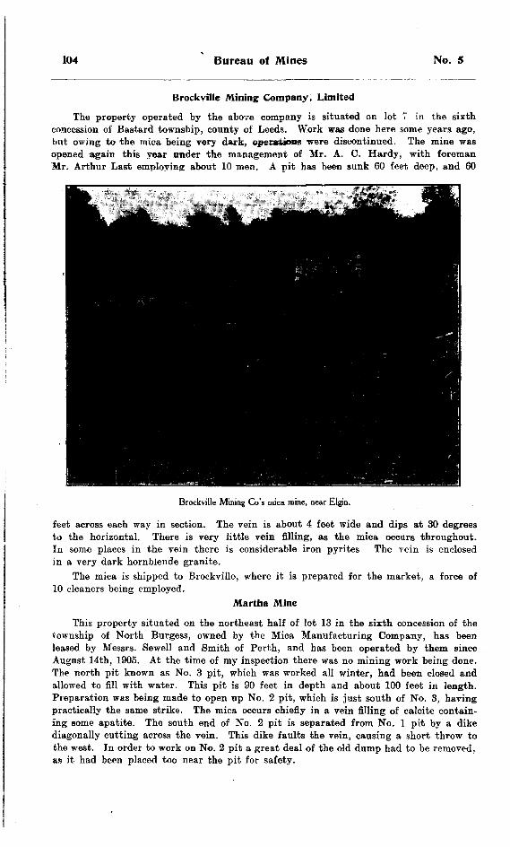
104 Bureau of Mines No. 5
Brockville Mining Company. Limited
The property operated by the above company is situated on lot 7 in the sixth concession of Bastard township, county of Leeds. Work was done here some years ago, but owing to the mica being very dark, operstjoas were discontinued. The mine was opened again this year under the management of Mr. A. C. Hardy, with foreman Mr. Arthur Last employing about 10 men. A pit has been sunk 60 feet deep, and 60
Brockville Mining Go's mica mine, near Elgin.
feet across each way in section. The vein is about 4 feet wide and dips at 30 degrees to the horizontal. There is very little vein filling, as the mica occurs throughout. In some places in the vein there is considerable iron pyrites The rein is enclosed in a very dark hornblende granite.
The mica is shipped to Brockville, where it is prepared for the market, a force of 10 cleaners being employed.
Martha Mine
This property situated on the northeast half of lot 13 in the sixth concession of the township of North Burgess, owned by the Mica Manufacturing Company, has been leased by Messrs. Sewell and Smith of Perth, and has been operated by them since August 14th, 1905. At the time of my inspection there was no mining work being done. The north pit known as No. 3 pit, which was worked all winter, had been closed and allowed to fill with water. This pit is 90 feet in depth and about 100 feet in length. Preparation was being made to open up No. 2 pit, which is just south of No. 3, having practically the same strike. The mica occurs chiefly in a vein filling of calcite contain ing some apatite. The south end of No. 2 pit is separated from No. l pit by a dike diagonally cutting across the vein. This dike faults the vein, causing a short throw to the west. In order to work on No. 2 pit a great deal of the old dump had to be removed, as it had been placed too near the pit for safety.
1906 Mines of Ontario 105
The machinery consists of an 80-h.p. return tubular boiler, steam hoist, drills and pumps. The mica is cleaned at the mine.
Mr. T. Smith is looking after the mining work, employing a force of 12 men.Mr. Edward Smith of Prescott has been carrying on mining operations on lot 9 in
the seventh concession, and on the east half of lot 13 in the fifth concession of North Burgess during the last year. On the former lot work is being done in two pits which had previously been worked. One pit is 35 feet deep and the other 50 feet, on parallel veins about 100 feet apart. Hoisting from each pit is being done by horse whim. Instructions were given to have the loose ground near the surface timbered. John McGlade is foreman, employing a force of 8 men. The mica taken out is cleaned on the property.
On lot 13 in the fifth concession a pit, which was described in a former Report as having been purchased and developed by the Dominion Improvement and Development Company with head offices at Hamburg, is being worked for mica. The option expired, and the property reverted to the original owner. A good showing of mica in the pit originally worked for apatite, has been struck. The mica is a very good quality, and occurs in a vein filling of calcite and apatite. The pit is 45 feet deep and 50 feet from heading to heading, having an average width of 10 feet. About 4 tons of apatite is hoisted per day in addition to the mica. The apatite is quite fine and granular, and of a greenish tinge.
Mica Trimming Works
The General Electric Company's factory on the corner of Isabella and Elgin streets, Ottawa, employs a force of 150, the greater number being girls, in cleaning, cutting and thin-splitting the mica, which is brought at present from the company's mine at Syden ham. The mica is shipped from the mine to the factory after being rough cobbed. At the factory the mica is cleaned, knife trimmed, graded and thin-split, after which it is packed and shipped to the company's factory at Schenectady, N. Y. The superintendent of the factory is Mr. R. E. Vivison. In addition to the factory in Ottawa the General Electric Company have opened up factories in Carleton Place, where 72 girls are employed, at Smith's Falls, where 60 girls are employed, and at Buckingham, Quebec, where 60 are employed. The mica for all these factories is brought from the Company's mine in Ontario.
The Laurentide Mica Company's factory on the corner of Queen and Bridge streets, Ottawa, employs a force of 450, of whom '400 girls are employed thin-splitting and the rest in cleaning, knife trimming and grading. Most of the mica used in this factory is mined in jQuebec. The superintendent of the factory is Chas. Girteau.
Kent Bros, of Kingston opened up mica works at 429 Sussex street, Ottawa, on 7th of March, 1906. Mica for the factory is brought from the company's mines in Ontario and Quebec. The superintendent is F S. Shirley, who employs a force of 50, most of whom are girls.
Kent Bros, have also a factory at the foot of Princess street, Kingston, where about 25 girls are employed. The mica used here is brought from their mines near Devil and Bob's lakes, Frontenac.
Eugene Munsell and Company have moved their factory to 400 Wellington street, Ottawa, and employ on an average 70 girls under superintendent F. Fillion. Mica is bought by the company in both Ontario and Quebec, and shipped to the factory to be prepared for the trade.
Norman B. Holland has opened mica works at 427 Sussex street, Ottawa, and employs a force of about 50, the greater number being girls. The mica used is bought both in Ontario and Quebec.

106 Bureau of Mines No. 5
The Wallingford Mining and Mica Company have mica works on Sussex street, Ottawa. The mica used is brought from the Wallingford mine to Quebec. About 10 girls are employed.
R. Blackburn's factory on Sussex street, Ottawa, employs about 80 girls, of whom 36 are employed thin-splitting, 40 cleaning and 5 knife trimming. The mica used is brought from the Blackburn mine, Perkins Mills, Quebec. Mr. A. Goulais is foreman of the factory.
Webster and Company have a force of 20 girls employed thin-splitting mica purchased both in Ontario and Quebec.
The Comet Mica Company, located on Wellington street, Ottawa, have a force of 25 girls employed.
In Perth the Adams trimming works have been in operation the most of the year, a few hands being employed.
At Sydenham, Mr. J. W. Trousdale has had a small force employed at different times cleaning the mica brought from his own mines.
Graphite
The Black Donald Graphite mine near Calabogie was in operation the greater part of last year. The new shaft on an incline of 30 degrees was continued until the water began to come in very heavily, and when work in it was stopped and the old pit pumped out. . This was followed by a cave in, without, however, disastrous effect. A new vertical shaft was then begun and a small gang are at work on it.
The McConnell graphite mine in North Elmsley township about seven miles from Perth was not operated during 1905, but it was stated by the manager at the time of inspection in May 1906, that it was to re-open very shortly. The mill two miles from the mine at Port Elmsley has been overhauled and new machinery installed and put in condition for operation. The graphite bearing rock is hauled by wagon from the mine to the mill. A full description of the mine and mill is given in the twelfth Report df the Bureau of Mines.
Talc
The Henderson talc mine on lot 14 in the fourteenth concession of the township of Huntingdon, about one mile east of Madoc, was operated for about two months during 1905 by Mr. S. Wellington of Madoc. Several hundred tons of talc was taken out and shipped Timber was put in near the surface as instructed*. In taking out the talc the pit was carried the full width of the deposit about 20 feet wide and 40 feet in length. Arrangements are being made to secure the Canadian trade and to put up a grinding plant at the mine
Fluorspar
Mr. S. Wellington of Madoc has opened up a deposit of fluorspar on lot one in the fourth concession of Madoc township, about l mile west of the town of Madoc. A car load of very high grade fluorspar has been taken out. The pure fluorspar occurs as a vein from one to two feet wide and disseminated through calcite and barite for another two to three feet. The strike of the vein is east and west, and it has been traced by shallow pits for about 40 feet. One pit has been sunk 20 feet on the vein.
Sodalite
About two miles southeast of Bancroft a sodalite deposit was opened up last winter by Mr. T. Morrison, representing a Scotch company. The sodalite occurs here massive in nepheline syenite directly as a product of the crystallization of a magma rich in soda. .Sodalite is chemically a complex silicate of sodium and aluminium, and is used chiefly as a decorative stone, having the property of taking a very high polish.

1906 Mines of Ontario 107
Two open pits have been opened up by this company and some very large blocks taken out. One open out is about 100 feet long by 25 feet wide.
On places near the contact of the sodalite with the nepheline syenite, are found some very fine crystals of aventurine oligoclase or sunstone, also crystals of apatite, mica and magnetite.
A building has been erected in which to cut and polish the material, but no machinery for this purpose has as yet been put in.
Marble
About 1J miles southwest of Bancroft on a farm owned by Wm. Gaebel, a deposit of marble is being opened up by the Central Ontario Granite and Marble Company of Trrnton, of which Mr. C. E. Ritchie of Akron, Ohio, is one of the directors. Mr. T. Morrison of Bancroft is superintendent, and has a force of about 25 men engaged in stripping and otherwise opening up the deposit. The marble is mostly a white crystal line limestone, but at one end of the ridge, it has a light grayish color,, and is also a little finer in texture. The ridge on which the marble outcrops has a strike northwest by southeast and has been tested by pits and trenches for about three-eighths of a mile. It has an elevation of about 60 feet above the average surface level in that vicinity, giving good quarrying ground. A spur line about one and a half miles long is being put in to the quarry from about half a mile below Bancroft on the Central Ontario railway.
Oranite
About one mile southeast of Bancroft a little work has been done to develop a deposit of granite which occurs here. The rock is essentially a granite gneiss carrying a little hornblende as a constituent. It is fine grained, compact, has a high tensile strength, and takes a good polish. Mr. James Best of Bancroft is interested in this granite property.
Calcium Carbide
The calcium carbide factories at Ottawa and Merriton were run continuously all of last year. There is an increased demand for the product, particularly from the small towns which have neither electric light or gas. The installation of an acetylene light ing system is not very expensive, and the light is useful in hotels, large stores, etc. The twenty furnaces of the Ottawa Carbide Company at Ottawa are all kept in opera tion when there is sufficient electric energy supplied. During low water on the Ottawa r'ver the amount of electricity generated is not sufficient to run all the furnaces.
NATURAL GAS AND PETROLEUMBY EUGENE COSTE, E.M.
The production of both natural gas and petroleum in Ontario show a marked increase in 1905 of about 24 per cent, each over the previous year. Some of the recent fields or pools found in 1903 and 1904 were considerably enlarged and became much more productive.
In the case of oil, the Leamington field of Essex county and the Moore field of Lambton county account for most of the increase; the Leamington field recording in 1905 a production of 113,806 barrels, or an increase of 351 per cent, over 1904, and the Moore field also showing the very substantial increase of 153 per cent., with a total production for the year of 93,815 barrels. Among the old pools the only one with a noticeably increased production was the Button pool, which produced 20,976 barrels in 1905, or 47 per cent, more than in 1904. The production of the Oil Springs and Bothwell old pools remained about stationary, with records for 1905 of 78,125 barrels, and of 47,959 barrels respectively; while the Petrolia field production declined 10 per cent., with a total of 250,701 barrels in 1905.
The increase in the natural gas production is due to the opening of new pools in the townships of Crowland, Humberstone (the N. W. part) and Wainfleet in Welland county, and also in the townships of Rainham and Walpole, near the village of Selkirk, in the county of Haldimand. From these new gas fields the cities and towns of Niagara Falls, Ont., St. Catharines, Hamilton, Brantford and Galt, are now enjoying the advantages of natural gas for fuel and light. Recent drilling is proving successful in enlarging the productive area of these fields^ and further drilling will most likely yet uncover several productive pools at present unknown. The outlook for a continuation of a moderate" supply to these towns can therefore be regarded as good, especially when it is considered that the old original field in Humberstone and Bertie townships, Welland county, is still supplying considerable quantities of gas after a continual heavy pnll oti the wells for more than 15 years.
In Essex county the town of Leamington is again getting a supply of natural gas, from wells a couple of miles southeast of the town. This gas territory constitutes the south end of the Leamington oil field, which runs from there, over a sharp and narrow fissured fold or break in the underlying strata, for a distance of 20 miles, right across the whole county of Essex in a north and south direction. The small production of oil on the Stony Point road near Comber is on this break, which reminds one of the Findlay break so well described by Orton in the Geological Reports of Ohio.
The other villages and towns of Essex county previously supplied with natural gas from the old Kingsville-Leamington field have now lost the advantages of this remarkably convenient and clean fuel, and the three main lines which had been laid from the field to Windsor have been picked up and sold. In this connection, the remark may be per mitted that if the big market of Detroit city had not been cut off some years ago by the action of the late Government of Ontario in withdrawing the license to pipe across the Detroit river, there would have been a much stronger incentive for drilling opera tions in the county of Essex, which it is quite reasonable to suppose would have brought about the discovery of new gas fields there, and probably also of new oil fields. Even the old field itself would have lasted longer, as it would have been better taken care of. As it was, a short time after the revocation of the license, this old field was allowed to drown out completely when the rock pressure of the field was still 300 pounds to the
[108]

1906 Natural Gas and Petroleum 109
square inch. To save the field from drowning at that time was quite feasible, but it was expensive, and in view of the limited market then available under the new con ditions created by the action of the Government, it was, evidently, considered too expen sive. The net and final result was a great loss to the people of the county.
Qeology of Oil and Gas Fields
The geology of the Ontario oil and gas fields was the subject of a complete review by Mr. E. T. Corkill in the report of this Bureau of last year, in which mention was also made of the previous work, references and published information on the subject. It is therefore not necessary to add very much to it this year, but as a further contribu tion there is presented below the logs of a few deep wells not heretofore published, and the records of two or three wells already published but somewhat differently interpreted here:—
Well No. l.Well No. 2 of the Grey and Bruce Oil and Gas Co., Limited, at Hep worth, on Lot l in the 10th
Concession of Amabel Township, Bruce County, Ontario. Elevation about 950 feet A. T.
Formation.
Soil..............................................Niagara limestone, Niagara shales, and Clinton
Thickness.
191 feet to750 feet to30 feet to
1,600 feet to
Depth.
4 feet.
945 feet.1,570 feet.1,600 feet.1,650 feet.
Remarks.
A little salt water at 760 feet.
Well No. Z.
Well in the southeast corner of Lot 10, in the lith Concession of Osprey Township, County of Grey, Ontario. Started 24th September, finished 22nd October, 1900. Elevation of derrick floor 1,550 above tide.
Formation.
Limestone with mud seams, Guelph and Ni agara; from 130 to 170 white crystalline porous limestone ; from 170 to 195 gray lime stone with spathic iron and a little shale. . . .
Blue shales and lime shells, Hudson KiverLimestone and shales intermixed in smallSolid compact dark gray limestone, mostly
saV"* *~Grey granite Arkose or coarse sandstone. . 1 ^ g Red granite Arkose or coarse sandstone. . . J
Thickness.
183 feet to . . . .
255 feet to . . . .
530 feet to . . . .
10 feet to . . . .10 feet to . . . . 15 feet to . . .
Depth.
12 feet.
195 feet.
275 feet.530 feet.
1,060 feet.
1,190 feet
1,785 feet. 1,800 feet. 1,801 feet.
Remarks.
10-inch drive pipe down to 25 feet ; 8%-inch casing down to 50 feet.
ing ; salt water at 295 and at 315 : re-cased with W± casing at 375.
depths in the Trenton, especially at 1,650. At 1.361 struck gas In white crystalline lavers of the limestone; burned in the 6*4 casing 3 to 4 feet high ; about 25,000 feet a day.struck between 1,760 ft. and J, 765ft.

110 Bureau of Mines No. 5
Well No. 3.
Well near Alma, on the J. Stickney farm, Lot 6, Concession 5, Pilkington Township, Wellington County, Ontario. Elevation by barometer about l,375 feet.
Formation.
Drift.................. ..........................Light colored and yellow limestone and dolo-
Thickness
103 feet to
393 feet to85 feet to
-
Depth.
103 feet.358 feet.570 feet.600 feet.642 feet.
1,025 feet.1,685 feet.2,380 feet.2,385 feet.
Remarks.
Well No. 4.
Well near Glen Allan, drilled by the Ohio Oil Co., on the Ernst farm, Lot 5, Concession 3, Township of Peel, County of Wellington, Ontario. Completed July, 1900. Elevation by barometer about 1,245 feet.
Formation .
Dolomite and limestoi e, Guelph and Niagara . .
Thickness
35 feet to . . . .517 feet to . . . .
220 feet to 30 feet to
367 feet to47 feet to
Depth.
" 35 feet.552 feet.
772 feet. 802 feet.
1,198 feet.1 77ft f PA t1,817 feet.9 ^'Xf f A*it
Remarks.
140. Another flow of sulphur water at 275 ;
40 to 50 bbl. per hour. Cased at 370 feet with S^ casing.
struck at 2,506 feet.2,578 feet, probably in granite.
Well No. 5.
Well drilled at Stratford, Ont., in 1895, Contractor J. H. Mock. Elevation about 1,180 feetabove tide.
Formation.
Drift.............................................Limestones and Dolomites, Onondaga, Guelph-Ked, blue and black shales. Medina, Hudson
Thickness.
143 feet to...1,159 feet to...
1,044 feet to...
Depth.
143 feet.
1,302 feet.
2,346 feet.
2,386 feet.
Remarks.
above the Trenton.
1906 Natural Gas and Petroleum 111
Well No. 6.Well near Inwood, drilled by the Ohio Oil Co., on Lot 5, Concession 4, Brooke Township,
Lambton County, Ont., completed March 3, 1900. Elevation by barometer about 690 feet.
Formation.
Shales..................................
Dolomites, limestones and marls with
Limestones and dolomites, Guelph and
Light gray shales with limestone shells, River...............................
Limestone, Trenton . . . . . . . . . . . . . . . . . . . .
•••11 ••••11I w
....)a
gypsum
Niagara
Hudson
Thickness.
60 feet to....* feet to....
205 feet to....ffi feet to....
]15feetto....
225 feet to....
175 feet to. . . .380 feet to. . . .
Depth.
60 feet.65 feet.
150 feet.1B5 feet.370 feet.395 feet.420 feet.535 feet.
1,835 feet.
2,860 feet.2, 110 feet.2,550 feet.2,835 feet.3,000 feet.3.380 feet.
Remarks.
the Petrolia aud Oil rock.
Rook salt from 1.410 to 1245 feet of it in a solic only 3 small layers of Another rock salt bed from 1,810 to 1,835 feet.
No oil, gas or lalt water.
Springs oil
1 bed, with limestone, at bottom
Well No. 7.Well on the Bradley Estate, Petrolia, Lot 11, Concession 11, Township of Enniskillen, County
of Lambton, Ontario, completed in 1900, drilled by F. J. Carman. Elevation 667 feet A. T.
Formation.
Claydrift..................... .. ........... ....Upper soap...... ( 0^~ .............127feet fMiddle Lime. . . . f a gj; . . . . . . . . . . . . . 18 feet f
Limestone and dolomite, gray and brown,' g ^
*m
52Hook salt intermixed with a little dolo- .S a
•S 13 Brown and sandy dolomite, Onondaga... f 3
Shales and limestone. Niagara and ClintonBlue and black shales, Hudson River and Utica
Thickness.
98 feet to....
240 feet to....
187 feet to.... 50 feet to....
630 feet to....
680 feet to....145 feet to.... 90 feet t"....
225 f eel to.... 50 feet to....
440 feet to.... 375 feet to.... 567 feet to....
Depth.
98 feet.
338 feet.
525 feet. 575 feet.
1,205 feet.
1,885 feet.2,030 feet. 2,120 feet. 2,345 feet. 2,395 feet. 2,835 feet. 3,2J 0 feet. 3,777 feet.
Remarks.
Heavy water vein in a brown soft limestone at 970 feet, cased with 6)4 casing in a dark hard dolomite at 1,015 feet, and dry hole after that.
Not more than about 75 feet of dolo mite.
Well No. 8.Well near Woodslee, on the Mitchell farm, Lot 28, Concession 2, Rochester Township, Essex
County, Ontario, completed December 5,1903. . Elevation by barometer 620 feet above tide.
Formation.
Dolomite and limestone with gypsum, Onondaga
Thickness.
84 feet to.'..1,037 feet to...
Depth.
228 feet.1,305 feet.
1,330 feet.
Remarks.
feet soft clay at bottom.
Cased at 840 feet with 6M casing, gyp sum bed from 1,260 to 1,270 feet.

112 Bureau of Mines No. 5
Well No. 9.
Well drilled by the Leamington Oil Co. in 1905 on east Lot 239, North Talbot Road, Mersea Township, Essex County, Ontario. Elevation 630 feet. A. T.
Formation.
Limestone and dolomites with gypsum. Onon-Limestone and dolomites, Guelph. Niagara and
Blue and black shales. Hudson River and Utica
Thickness.
89 feet to ..1,006 feet to ..
608 feet to ..
Depth.
89 feet.1,095 feet.1,470 feet.
2.488 feet. 2,896 feet.
Remarks.
10-inch drive pipe -down to 89 feet.
Some limestone at 1,650 feet.
Well No. 10.
Well drilled in 1888, at Brantford. Ontario. Contractor. W. H. Curtis. Elevation about 730feet above tide.
Formation.
Drift. . . . . . . . . . . . . . . . . . . . . . . . . . . . . . . . . . . . . .'. . . . . . .Limestones, dolomites and shales, Onondaga,Red sandstone, red and blue shales and whiteRed, blue and black shales, Medina, Hudson
Thickness.
45 feet to ..
100 feet to ..1.435 feet to ..
Depth.
45 feet.41 5 feet.515 feet.
1,950 feet.2,160 feet.
Remarks.
Well No. 11.
Well drilled in 1893, off Clyde Avenue West, in Hamilton, Ontario.above tide.
Elevation about 290 feet
Formation.
Red, blue and black shales, Medina, Hudson
Thickness. Depth.
1,250 feet.
Remarks.
Trenton measuring 7,000 ft. a day.
Well No. 12.
Well near St. Catharines, Ontario, on Lot 4, Concession 3, Township of Louth, Lincoln County, Ontario, drilled in 1888. Elevation about 300 feet A. T.
Formation.
Blue shales, Hudson River.
Thickness.
90 feet to . . . . 548 feet to ....
700 feet to . . . 168 feet to . . . . 667 feet to .... 27 feet to . . . .
Depth.
90 feet. 638 feet.
1,338 feet. 1,506 f eel. 2,173 feet. 2,200 feet.
Remarks.
At 57 feet a great deal of pure water in bed of gravel 7 or 8 feet thick.
Salt water at 220, small pocket of gas at 275 ; cased at 272, hole quite dry after.
Gas struck at 2,185 feet in small quantity.

1906 Natural Gas and Petroleum 113
Well No. 13.Well drilled at Thorold, Welland County, Ontario, in 1889. Elevation about 500 feet above tide.
Formation.
Drift.............................................
Dark blue and black shales, Hudson River and Utica........................................
Thickness.
905 feet to . . .
Depth.
43 f pet95 feet.. 125 feet.
207 feetOQ7 f oar
. 1,800 feet.
. 2,483 feet.i
Remarks.
A little gas at 2,400 feet. A little lalt water at 2,450 feet.
Well No. 14.Well No. 143, Provincial Natural Gas and Fuel Co. of Ontario, Limited, Lot 4, Concession 3,
Willoughby Township, Welland County, Ontario. Elevation 590 feet A. T.
Formation.
Blue and black shales at bottom, Hudson River
Thickness.
135 feet to . .227 feet to . .
20 feet to . .
Depth.
61 feetJOq ffiat-
CQJ fa,}*
fi! d f (*Pt. 1,529 feet.
t) QQC ffiftt
. 3,032 feet.
Remarks.
measuring 60,000 feet per day ; salt water at 3,830.
Logs
The above records show conclusively that from Osprey township, Grey county, to 'Petrolia, Lambton county, the strata dip more or less uniformly in a southwesterly direction; the top of the Trenton, for instance, being as follows: —
In Osprey township .......................................... 350 feet above tide.Near Alma ...................................................... 310 feet below tide.At Glen Allan ........................................... ....... 572 feet below tide.At Stratford ...................................................1,166 feet below tide.Near Inwood ...................................................2,310 feet below tide.At Petrolia ......................................................2,543 feet below tide.
Continuing in the same direction further to the southwest the strata rise, on the contrary, more or less gradually; the top of the Trenton having been found at 1,860 feet below tide near Leamington, and at 1,500 feet below tide in the southern part of Colchester township, Essex county, at the Woodbridge well." It is well known also that still continuing in the same southwest direction the top of the Trenton just across lake Brie in northwestern Ohio is about 800 feet below tide, and at Findlay, Hancock county, Ohio, only tibout 350 below tide. It is therefore quite plainly demonstrated that the Lambton county oil fields are really in the bottom of a broad deep syncline instead of being on the Cincinnati anticline as often supposed and contended. Orton, in his Geological Reports on Ohio, has long ago proved that the Cincinnati anticline runs northwest into Indiana, and not northeast, although he also shows that a minor fold runs through the northwest part of Ohio in a northeast direction, but this fold, which is still noticeable in the south part of E&sex county, Ontario, seems to die out in the northeast part of it and in Kent county before roachina; Lambton county.
i See the writer's paper on "Natural Gas in Ontario," Journal of the Canadian Mining Institute, Vol. 3, for the log of this well.
8 M.

114 Bureau of Mines No. 5
The records of the wells in the Niagara Peninsula above given, (as well as the records of other wells drilled there and already published) show that the strata in tnat peninsula have a more or less constant dip to the south-southeast.
As the gas fields of Welland and Haldimand counties are on the flank of that long slope which continues to the south across lake Erie into New York and Pennsylvania, and also to the north across lake Ontario, it is to be seen that the famous anticlinal theory of oil and gas production is far from being supported by the facts either in the gas fields of the Niagara peninsula or in the oil fields of Lambton county. Disturbances and faults do exist in these oil and gas fields, sometimes bringing up the strata locally, in blocks, terraces or sharp folds, but the more or less broad anticlines which those who support the tkeory of the organic origin of oil and gas regard as so necessary to the large accumulations of these products, are conspicuously absent.
Another result of the drilling recorded in the above logs which may be pointed out is that both oil and gas have been found in Ontario in the lower part of the Trenton and right on the top of the Archean. This of course cannot be explained by any other view of the origin of oil and gas than the view of volcanic emanations from below of the French School of geology, which the writer has advocated for several years past, 2 and to which he is not aware that any serious answer has yet been made. This is referred to only to point out the practical side of it; it is most important, in consider ing and planning future oil and gas developments in Ontario, to know that oil'and gas are due in large quantities just as well under the Petrolia oil rock, viz., the Corniferous limestone, as in or above it, and therefore that if we search and drill along the fissured oil belts or zones which traverse Ontario in exactly the same manner as they traverse Pennsylvania, Ohio and Indiana, we will develop in Ontario similar extensive oil and gas fields as have been found in the above named States. The Leamington oil field, the oil of which comes from the Guelph limestone, a stratum about 1,150 feet below the Corniferous, and the large gas fields of Welland and Haldimand which derive their supplies of gas from still lower strata, viz., the Clinton, Medina and Trenton, amply and fully demonstrate the above remarks.
Tabulated, the principal features of the above logs or records of deep wells are as follows: —
Formation.
onondaga, dolo mites and marls, thickness.......
Guelph, Niagara and Clinton, dol omites and lime stones, thickness
Medina, Hudson River and Utica, shales, thickness
Trenton, thickness.
Depth of Trenton above (+1 or be low (—) tide....
oSo.S
.(1)none
;.191
750
625
-H.
O.2cseVa O
(2)
none
^63
880
593
1390
* i ~~
c : ' Ls i "S •o \ s
83 ^,l i g 3 j 3(3) (4)
i
B o
1 1
(5)
^52
287
1043
695
—310
^17
279
986
705
—572
lj 1159
J
(6)
1300
S1(7)
1595i 1
S
1(8)
1037
276
1044 890
•;.-4d '^380
—1166 -2310
275
815
: a) .
^a w s0 Moto 2" o SK1 fi
(9)
^006 ^00
. . . . . . | 375 370
......
^7......
— 2M3J......
t1018
>408
—1858
870
>270
—1500
1
Sm(10)
>80
290
c'0
IB]
K(11)none
none
1535 J-1250
^•.210
—1220
So!.aaj U
en(12)
none
x aa IS
•a M ceoA H
(13)
none
none! ^82i
-,:-1416
. . . . . . 667
—960 —120*
1675
^3
—1300
l 1
(14)
'•* ]351
307
1810
685
—1723
The sign > stands for "more than".
2 See Vol. VI., Journal of the Canadian Mining Institute, pages 73 to 128.

1906 Natural Gas and Petroleum 115
The above table shows that in the western part of the Ontario peninsula the thick nesses of the various lower formations are as follows :
Dolomites and marls of the Onondaga........,....................... .1,000 feet to 1,600 feet,with some thick beds ; of rock salt in places. :
Dolomites and limestones of the Guelph, Niagara and Clinton......., 275 feet to 375 feet.Shales of the Medina, Hudson River and Utica.............. ......... 750 feet to 1,050 feet.Trenton limestone...................................................... 600 feet to 700 feet.Calciferous sandstone.................................................. 30 feet to 50 feet.
while in the Niagara peninsula there is a considerable thinning of the Onondaga, but also a great thickening of the shales, as follows :
Onondaga.............................................................. 400 feet.Guelph, Niagara and Clinton .......................................... 300 feet.Medina, Hudson River and TJtica..................................... .1,550 feet to 1,850 feet.Trenton ............. .................................................. 660 feet to 690 feet.

EXPLORATION IN MATTAGAMI VALLEYBY H L KERR
Introduction
In accordance with the instructions of Mr. T. W. Gibson, Director of the Bureau of Mines, I left Toronto June l, 1905, to take an exploratory party into that part of the great Clay Belt, which lies west and northwest of lake Abittibi and embraces the valleys of the Abittibi, Frederick House and Mattagami rivers.
Mr. Archibald Henderson, B. A., of Toronto University, accompanied the party, in the capacity of agricultural expert.
The object of the expedition was to collect information regarding the mineral, agricultural and timber resources of the region, and in fact all such data as would tend to show its suitability for settlement, and its possibilities as a wealth-producing part of the Province.
Having arrived at Sudbury, June 2nd, the balance of the week was spent in engaging voyageurs and in ordering supplies. On June 6th we left for Metagama station on the Canadian Pacific railway, where unfortunately we were delayed four days, owing to some of our outfit not having arrived from Toronto. On June 10th we started with our two canoes and about three months' provisions, up the Spanish river and arrived at the Hudson Bay Company's post, Fort Mattagami, on June 15th, where we were royally welcomed by the genial factor, Mr. Miller, and the Government fire rangers. A day was spent here making some necessary changes on our canoes, after which two days' paddling brought us to Niven's.base line of 1899, where work was begun.
From here north to Niven's base line of 1900, we followed the Matagami river, making numerous overland trips into all parts of the country not previously explored, besides going up all the navigable tributaries of the stream.
Most of the season was occupied with work on the Mattagami, but we were enabled to spend a couple of weeks in the townships being subdivided on the Abittibi and Frederick House. The party returned by way of Night Hawk and Montreal rivers, reaching Latchford during the first week of October. After storing our outfit with Mr. Grills, Crown Land Agent, New Liskeard, the members of the party left for their respective homes.
During the summer, besides the subdivision of certain townships, several base and meridian lines were run by Messrs. T. B. Speight, O. L. S., and A. Niven, O. L. S. These lines were used wherever possible as ties for our information. The plan followed in our overland trips was to take supplies for a few days and a light camp outfit along one of the lines and then tramp into the forest on both sides as far as the time would allow. In other places prominent features of the rivers were used as starting points. Mostly one-day trips were made, but occasionally they extended from two to six days. In this way the country was pretty thoroughly gone over, and the information gathered much more reliable than could possibly be obtained by remaining on the rivers.
As Mr. Henderson's report, which is published in this volume, deals in detail with the agricultural and timber resources of the region, anything I shall say on these subjects will be of the most general character, except regarding that part of the country examined after Mr. Henderson left the field.
[116]

1906 Exploration in Mattagami Valley 117
The earliest report dealing with this part of the Clay Belt is one by Dr. Robert Bell on Exploration in 1875, between James Bay and Lakes Superior and Huron, i Since then several reports by the Bureau of Mines contain excellent accounts of different parts of the legion by Dr. W. A. Parks,* G. F. Kay,3 T D. Jarvis,3 J. G. McMillan,4 and Archibald Henderaon,4 besides the report of the Exploration and Surrey of Northern Ontario in 1900.
I shall discuss the results of my observations made during the season under the following heads: —
I. The Mattagami Valley : —Itinerary and Topographical Description of the country along the Mattagami river.
II. Region east of the Frederick House and Abittibi. Details of the Country Explored in the valleys of these rivers.
III. Economic Resources : —(a) Soil.(b) Forests.(c) Peat Beds.(d) Water Powers.(e) Minerals. (/) Game.
IV. (a) Geology and Petrography. (6) Glacial Geology.
V. Conclusions.In the first of the above sections I shall mention very little about the rocks, pre
ferring to deal with those in the purely geological part.
I.—The Mattagami Valley
As the canoe route which we followed in reaching our territory up the Spanish and down the Mattagami, has been described in previous reports, I shall confine myself here to that part of the river and its tributaries passing through the country explored.
The Mattagami River
The Mattagami itself is a magnificent river ranging from three chains in width as it enters the Clay Belt to about ten in its lower reaches, and varying from four to twelve feet in depth. From its source to where it joins the Moose it offers unexcelled facilities for transportation purposes or as a canoe route for tourists. Indeed, it has few equals in the north country in these respects, as only occasional stretches of swift water or rapids sufficiently heavy to necessitate portaging occur. While few, fish were taken from the river in the Clay Belt itself (although according to the Indians sturgeon, pike and pickerel are fairly plentiful) great numbers of whitefish, pike, pickerel and trout are found in the river and lakes throughout the rocky Huronian and Laurentian area to the south. .
Shortly after the river crosses Niven's base line of 1899 it takes a big bend about 150 north of east for about four miles. At the end of this distance it swings abruptly north for another four miles where it turns west almost at right angles for probably six miles when it again changes a little west of north, which general direction it keeps as far north as we followed it.
On the west side of the river where it turns north, is the beginning of the Porcupine portages' which were'used later in the season in crossing to the Frederick House. A
i Geoi. Sur. Can., Eeport of Progress for 1875-6. .2 8th Rep. Bur. Mines, 1899, pp.'l75-196; 9th ftep. Bur. Min., 1900, pp1 . 12M.42. -3 13th Rep. Bur. Min., 1904, Part I. * 14th Rep. Bur. Min., 1906, Part i.,., t . ;.. i

US Bureau of Mines No. 5
full description of the Porcupine route will be found in G. F. Kay's report mentioned above. The slope of the river valley here is from thirty-five to silty feet high : but with a level stretch, in most places, just along the river before this elevation is reached. Occasional landslips occur here. The timber is chiefly poplar, balm of Gilead and jack-pine.
Overland trips prove the land embraced by the big bend to lie within the Clay Belt, not south of it as previously represented, while that along Niven's first base line and north and south of it is mostly rolling drift-covered country forested with spruce, jack pine, birch and poplar, often of large size, with fiequent exposures of Huronian schists and greenstone.
With the exception of some swift water, shortly after the river crosses the base line before mentioned, canoeing on this part of the Mattagami is unsurpassed, no obstructions being encountered until we reach the Sandy portages, which are about three miles from where the river takes the bend to the west. Here is a continuous stretch of rough water for about a mile and a half, with three portages past the heavy parts of the rapids. The first portage is on the left hand side of the river just where a small branch enters from the south, and is well marked, level and 19 chains long. The fall here is about ten feet. This rapid may be run in high water, with a light canoe, by keeping along the left hand shore. About half a mile of swift water takes us to the next portage also on the left hand side of the stream. The fall here is more abrupt, being thirty-nine and a half feet, (aneroid), the water going over in two chutes with an island between. The portage is well marked and seventeen chains long. Some swift dangerous water must be run before reaching the last portage of the series. The river takes a slight bend here around an island, and this makes it impossible to see the landing, which is on the right hand side, until you are almost upon it. The trail, which is much shorter than the others, being only about eleven chains long, is over sandy soil, from which the portages take their name. The fall here is a little over twenty-nine feet (aneroid).
About a mile below these rapids, the Water Hen creek enters the Mattagami from the left. This stream, which is connected with a couple of small lakes to the south, has been used, in high water, by the Indians, to cut across the big bend of the river. When, however, we reached this point the quantity of water was so small and the amount of driftwood so large that we found it impassable, and I doubt very much if it is used at all by the Indians at the present time.
From here down the river to the Coffey, the first tributary of importance—a distance of about six miles—the Mattagami flows with an even, gentle current between rather high banks of stratified clay and sand. Numerous small landslips occur throughout this distance, but here as elsewhere only occasional rock exposures are seen. White spruce, cedar and poplars of fair size fringe the banks.
Niven's second base crosses the river at Mile VII, two miles below the Water Hen. Overland trips along this line and north of it reveal good rolling clay land, heavily timbered with white and black spruce, balsam, balm of Gilead, poplar and white birch for the first two miles. A number of deep ravines running north and south, together with considerable fallen timber made travelling rather difficult. From here west to Mile XX, the country changes considerably, numerous hills and ridges of schist and diabase being encountered. These hills vary in elevation from fifteen to over three hundred feet above the river country, and from the tops of them the region in all directions is seen to be rough and rocky. From the top of the highest elevation at Mile IX, 40 chains, the view extends away beyond the Mattagami to the Frederick House, the large sheet of water which may be seen being in all probability Night Hawk lake. The soil is coarse to fine sand, with occasional stretches of clay, and the timber is mostly small black spruce, poplar, birch ar.d jack-pine with the latter predominating toward the end of the distance.
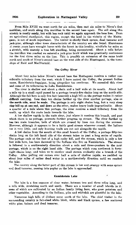
1906 Exploration in Mattagami Valley 119
From Mile XVIII we went north for six miles, then east six miles to Niven's first meridian, and south along this meridian to the second base again. The soil along this stretch is mostly sandy, but with less rock until we again approach the base line. From an agriculural standpoint, this region, except the land in the vicinity of the Matta gami, is not of much importance. The timber is chiefly black spruce, dead tamarao and j*ck-pine, although other trees characteristic of the country are also found. Hurricanes jf recent years have wrought havoc with the forest in this locality, windfalls for miles at a etretch, with scarcely a tree left standing, being encountered. About a mile before the meridian was reached we entered a jack-pine brule which was practically continuous for the first three miles on the line. This is possibly an extension of the same brule north and south of Niven's second base on the west side of the Maattagami, in the town ships of Reid and MacDiarmid.
The Coffey River
About four miles below Niven's second base the Mattagami receives a rather con siderable tributary from the west, which I have named the Coffey, the present Indian name, Kamiskotaia-Sagaigan, being altogether too cumbrous. We ascended this river and some of its tributaries to Lake Kamiskotaia.
The river is shallow and about a chain and a half wide at its mouth. About half a mile up is a small rapid passed by a portage twenty-five chains long on the north side. Although the fall here is only five feet (aneroid) a high hill on the portage makes it rather•difficult carrying. Less than ten chains farther up the river another portage, also on the north side, must be made. The portage is only eight chains long, but a very steep day hill up at one end, and down at the other, makes heavy loads impracticable. About a quarter of a mile "above this portage, the river receives a small tributary from the south, up which the route leads towards the lake.
A low shallow rapids in the main river, just where it receives this branch, and past•which there is no portage, prevents further progress up stream. The river farther up has two main branches, both of which are crossed by lines run during the summer. However, although it appears to be a fairly good stream wherever crossed, the Indians use it very little, and only hunting trails are cut out alongside the rapids.
A few chains from the mouth of this small branch of the Coffey, a portage fifty-two chains long on the left hand side of the stream takes us past a long series of rapids. "The portage ends at the foot of a high rocky hill, and the stream, which is only a few feet wide here, has been dammed by the Indians who live on Kamiskotaia. The stream is followed in a southwesterly direction about a mile and three-quarters to the next portage, which is on the right hand side. The portage which runs northwest is forty- eight chains long; and takes us to another small stream evidently also a branch of the Coffey. After pulling our canoes over half a mile of shallow rapids, we paddled up about four miles of rather dead water in a northwesterly direction until we reached the lake.
The country along the latter part of this stream is low and swampy with some spruce and dead tamarac, passing into poplar as the lake is approached.
Kamiskotaia Lake '
The lake is a fine expanse of clear water, between two and three miles long, and a mile wide, stretching north and south. There are a number of small islands in it, some of which are cultivated by an Indian family living here, who grow potatoes and other vegetables. According to the Indians, pike and whitefish are plentiful in the lake
Numerous high hills of diabase occur south of the lake. The chief timber in the•sui founding country is fair-sized white birch, white and black spruce, a few scattered white pine, balsam and dead tamarac.

120 Bureau of Mines No. 5
A portage a mile and three-quarters long leads from the northwest corner of Kam- iskotaia to another small lake beyond which we did not go, but we were given to under stand by the Indian living here, that a poorly marked trail leads from this lake to th^ Coffey.
Entering the southeast corner of Kamiskotaia is a small stream leading in a south easterly direction to a small marshy lake about two and a half miles away. About half way up, a twenty chain portage passes the only rapid on the stream. Niven's second base crosses the end of this lake about Mile XIII. It was in this neighbourhood that the hematite mentioned in a later part of this report was found.
Coffey River to Sturgeon Palls
The Mattagami continues nearly straight north from the mouth of the Coffey, with the same even current, for the next fifteen miles, at the end of which there is a mile of swift, treacherous water. Then a mile of more quiet water takes us to the Sturgeon falls in Mahaffy township. Prom about Concession I in MacDiarmid, north tor probably six miles, the same extensive brule mentioned above is seen. A hundred to two hundred yards back from the clay banks, the slopes of the river valley rise from thirty-five to forty feet above the water. The timber is black and white spruce, cedar, poplar and birch.
Nine miles below the Coffey a small tributary enters the river from the east, and just below the stretch of treacherous water mentioned, a somewhat larger stream enters from the same side. Neither of these streams is navigable.
Sturgeon Palls
These falls prove an effective barrier to the further progress of the sturgeon up stream, thus accounting for the present name given by the Indians. The water tumbles over hard olive green schist and diabase in two cascades, with a total drop of 15 feet 4 inches. The portage, which is very steep at the lower end, is on the east side of the river and only three or four chains long.
Overland trips were made in this section into the townships of MacDiarmid, Kidd, Reid, Carnegie, Crawford and Mahaffy, and into the country west of Niven's first meridian. The land throughout the area is chiefly good clay and clay loam, with black spruce of fair size making up the main part of the forest, although stretches of fine white birch, white spruce, balm of Gilead, poplar, balsam and dead tamarac occur. On a high rocky hill, with precipitous sides just south of M. XVIII on Niven's first meridian, a number of large white pine were found. From the top of this elevation, which I have named White Pine hill, and which is about three hundred feet high, the view extends for miles in all directions, and with the exception of a few isolated hills, away in the distance, the country appears as level as a prairie, and practically covered with black spruce forest. Back from the river, however, a great deal of the country is swampy, with two to four feet of decayed vegetation above the clay. Muskegs, some of which contain sciveral feet of excellent peat, become more numerous towards the north.
Sturgeon Falls to Speight's First Base
Below the falls is about a quarter of a mile of swift, shallow rapids, and again about a mile below this a similar stretch. About a mile from the foot of the portage is a high clay hill, on the west side of the river, but elsewhere the banks for the first two- miles are low and clad with small poplar and a narrow fringe of cedar. The country has evidently been burnt over in recent years. Shortly after this the river swings to the northwest for about six miles, and the timber changes to magnificent forests of poplar, making for the next eight miles one of the most picturesque parts of the-

1906 Exploration in Mattagami Valley 121
Mattagami. Then there are two miles of low banks with cedar, spruce and balsam before the poplar comes in again, and continues down as far as Speight's first base. Few rock exposures occur here, but occasional stretches of low shallow rapids make wading necessary in low water with canoes at all heavily loaded.
Two and a half miles below the north boundary of Mahaffy, a small tributary enters from the west, and six miles below this the White Caribou Head river also joins the Mattagami from the same side. These streams, although sufficiently large for canoeing, are filled with driftwood to such an extent as to be practically impassable. They were both crossed in several places on overland trips, and could no doubt be cleaned out without much trouble.
Overland trips were made along this part of the river north and south of the base linps run by Messrs. Speight} Niven and Patten, east and west of Speight's first meridian, as well as along these lines themselves and into the townships of Aubin and Nesbitt.
Here is the centre of the most promising agricultural land seen during the summer. For the most part the country is flat and covered chiefly with wet spruce woods of a somewhat better quality than farther south, but large areas of dry rolling clay and clay loam, with forests of large birch, poplar, balm of Gilead and an odd white spruce also occur. Although muskegs are more numerous than farther south, still there are very few of great extent. Fewer windfalls and thick tangled swamps, which make travelling so difficult in other parts of the country, were encountered, and practically no rock except an occasional boulder was seen. The section west of the Mattagami is particularly well drained not only by the tributaries mentioned, but by the upper parts of the Muskego and Poplar Rapids, and offers splendid possibilities for future settlement.
Speight's First Base to the MuskegoFor a mile below Speight's first base the river is much the same as before the line
was reached. At the end of this mile Loon portage—on the west side and 12 chains long—passes a rapid which is the beginning of about three miles of almost continuously bad water, that necessitates in all four portages. The dlrop in the river here is about 18 feet (aneroid). The beginning of the portage across country to Driftwood creek is on the 'east side of the river just at the foot of these rapids. This route to the Driftwood is used very little, as there is about seven miles of portaging over a poorly marked trail, which in places is very wet and heavy.
Half a mile of swift water full of boulders must be run before the next portage past Davis rapids is reached. The portage is on the cast side, and is 14 chains long. At th* foot of these rapids the first Laurentian rocks were found, the country up to tKis point being in the Huronian belt.
For a quarter of a mile below this, the current is swift, with many boulders. Then follows a mile of good paddling to the Yellow falls. Here the river passes over a ridge of gneiss and diabase in four lateral cascades, followed by a stretch of swift, dangerous water for another mile to Island portage. Island and Yellow falls are very similar in appearance, but in the former, one of the chutes is separated from the other three by a small island, over which the portage leads to the foot of the falls. The portage at the Yellow falls is on the west side and is about 10 chains long, being a little Ipnger than the Island portage. The drop in the river from the head of the chute to the foot of the rapids at the lower end of the portage is 27 feet (aneroid) while the difference of level at tlie Island falls is 22 feet, although the falls themselves are only about 18 feet and 15 feet respectively. Below Island portage another mile of swift current takes us to quieter water, which continues until the mouth of the Muskego is reached. From the Yellow falls to about Patten's meridian, which is a mile south of where the Muskego enters the Mattagami, low clay banks with small balsam, cedar, spruce and poplar are characteristic, while for the balance of the distance, large poplar predominates. Frequent exposures of Laurentian gniess occur here.
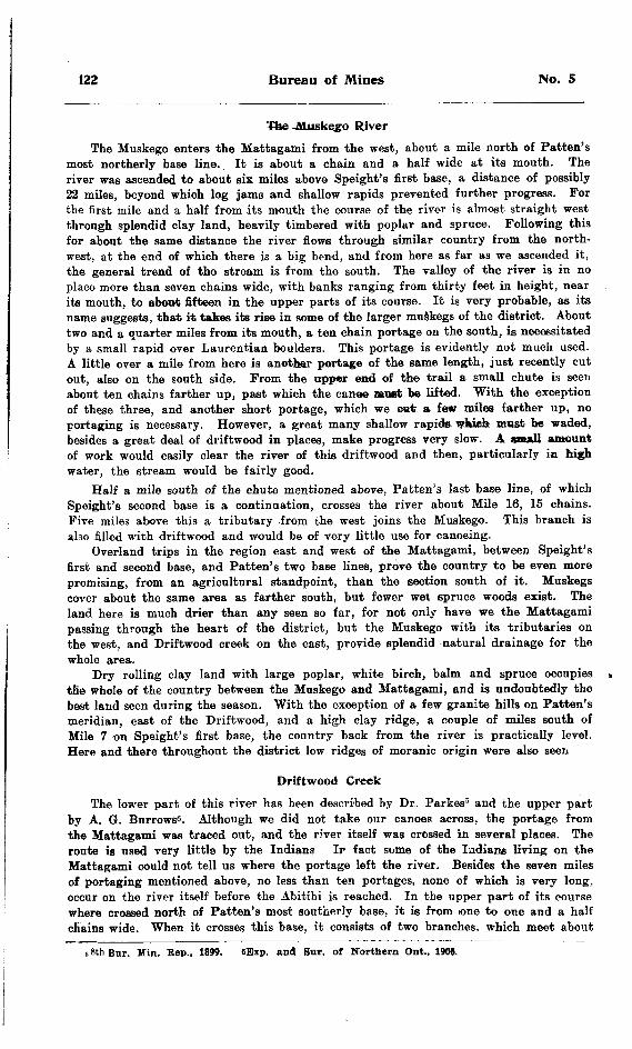
122 Bureau of Mines No. 5
The Muskego RiverThe Muskego enters the Mattagami from the west, about a mile north of Patten's
most northerly base line. It is about a chain and a half wide at its mouth. The river was ascended to about six miles above Speight's first base, a distance of possibly 22 miles, beyond which log jams and shallow rapids prevented further progress. For the first mile and a half from its mouth the course of the river is almost straight west through splendid clay land, heavily timbered with poplar and spruce. Following this for about the same distance the river flows through similar country from the north west, at the end of which there is a big bend, and from here as far as we ascended it, the general trend of the stream is from the south. The valley of the river is in no place more than seven chains wide, with banks ranging from thirty feet in height, near its mouth, to about fifteen in the upper parts of its course. It is very probable, as its name suggests, that it takes its rise in some of the larger muskegs of the district. About two and a quarter miles from its mouth, a ten chain portage on the south, is necessitated by a small rapid over Laurentian boulders. This portage is evidently not much used. A little over a mile from here is another portage of the same length, just recently cut out, also on the south side. From the upper end of the trail a small chute is seen about ten chains farther up, past which the canoe moat bc lifted. With the exception of these three, and another short portage, which we cat a few miles farther up, no portaging is necessary. However, a great many shallow rapids* wftich must be waded, besides a great deal of driftwood in places, make progress very slow. A small amount of work would easily clear the river of this driftwood and then, particularly in high water, the stream would be fairly good.
Half a mile south of the chute mentioned above, Patten's last base line, of which Speight's second base is a continuation, crosses the river about Mile 16, 15 chains. Five miles above this a tributary from the west joins the Muskego. This branch is also filled with driftwood and would be of very little use for canoeing.
Overland trips in the region east and west of the Mattagami, between Speight's first and second base, and Patten's two base lines, prove the country to be even more promising, from an agricultural standpoint, than the section south of it. Muskegs cover about the same area as farther south, but fewer wet spruce woods exist. The land here is much drier than any seen so far, for not only have we the Mattagami passing through the heart of the district, but the Muskego with its tributaries on the west, and Driftwood creek on the east, provide splendid natural drainage for the whole area.
Dry rolling clay land with large poplar, white birch, balm and spruce occupies the whole of the country between the Muskego and Mattagami, and is undoubtedly the best land seen during the season. With the exception of a few granite hills on Patten's meridian, east of the Driftwood, and a high clay ridge, a couple of miles south of Mile 7 on Speight's first base, the country back from the river is practically level. Here and there throughout the district low ridges of moranic origin were also seen
Driftwood CreekThe lower part of this river has been described by Dr. Parkes5 and the upper part
by A. G. Burrows6 . Although we did not take our canoes across, the portage from the Mattagami was traced out, and the river itself was crossed in several places. The route is used very little by the Indians Ir fact some of the Indians living on the Mattagami could not tell us where the portage left the river. Besides the seven miles of portaging mentioned above, no less than ten portages, none of which is very long, occur on the river itself before the Abitibi is reached. In the upper part of its course where crossed north of Patten's most southerly base, it is from lone to one and a half chains wide. When it crosses this base, it consists of two branches, which meet about
n 8th Bur. Min. Eep., 1899. 6Bxp. and Sur. of Northern Ont., 1908.
1906 Exploration in Mattagami Valley 123
three miles to the north. The banks of the stream where seen are somewhat higher than those of the Muskego, and the country through which it passes is made up largely of black spruce forests with only occasional stretches of poplar.
Muskego to Poplar RapidsThe Mattagami, whose waters have been augmented by many small streams from
both sides, together with those mentioned above, has attained a width of about seven chains by the time the Muskego is reached. Just below this tributary is a stretch of swift, treacherous water demanding great care in running. Jump Over falls is two and a half miles below this. The river here, confined by two narrow channels, rushes over hard, cystalline gneiss with a fall of 19 feet (aneroid) in a distance of about a chain. The portage, which is called Smooth Rock, ie on the east side over the rock close to the shore.
No more portaging is necessary for the next twenty-two or twenty-three miles, although one rapid, too dangerous to run in a loaded canoe, and considerable swift current, are encountered. At the end of this distance, the Poplar rapids or Mehkwane- gon, as the Indians designate it, enters the river from the southwest, the Mattagami flowing about 100 north of west at this point. About two miles above the junction of the two rivers are three rooky islands in midstream. For the first eight or ten miles from the Muskego the river presents the same general appearance as formerly. From here down to the Poplar Rapids, the banks are lower, and the river timber chiefly small black spruce, cedar and poplar, and at the end of this distance, the river itself is probably ten chains wide. Niven's base of 1900 crosses the Mattagami just where the two streams meet.
Indians are not very numerous along the Mattagami in the summer time, but at this most northerly point we found two families busily engaged in building canoes. Ca-pa-tis, the only one of the lot who could speak a word of English, informed us that they used Poplar Rapids and its lakes .as centres for their winter's hunting, but that game was becoming less plentiful every year in this locality. He also said that they went up to the Fort (Mattagami) twice a year, once in the spring with their pelts, and in the fall, to bring back their winter's supplies. He seemed much interested in our expedition, and gave, us some useful information regarding the Poplar Rapids. He spoke of a large lake at the source of the river, which he said was very difficult to reach at that time of the year. This is evidently the lake discovered earlier in the season, more about which will be said later on.
Poplar Rapids RiverThis tributary of the Mattagami was ascended a distance of about sixteen miles,
where we were obliged to turn back. Just where the stream enters the main river, Nivem's base of 1900 crosses the Mattagami. The Poplar Rapids, like many other rivers in the Clay Belt, is wide and shallow, being probably an average of two and a half to three chains wide in the lower part, and only three or four feet deep in most places. The course of the river is almost due north, excepting for the last two and a half miles, when it swings to the northwest. No rapids of any moment were encountered as far up as we went, although in several places the river is so shallow that wading is necessary. In the lower part of its course the banks are low, and the river timber ie small spruce and balsam, young poplar and birch, with a few cedar and occasional stretches of young tamarac. These tamarac were practically the only living representa tives of these trees noted, although large dead tamarac are common throughout the whole area explored.
Speight's last base crosses the river about Mile 9. From here on, the country is higher and the timber larger. About two miles above this base a small lake occurs just west of the river. It is divided into two parts by a narrow ridge of land. On
124 Bureau of Mines No. 5
this ridge is a clump of red pine trees of fair size. A few pines were also found east of the lake. In consideration of this almost unique occurrence, in that part of the country, I have named this body of water Bed Pine lake. Just across the river from this lake is a small grassy pond. Two miles above this is a long shallow rapids, unpro vided with a portage, and here we turned back.
Throughout its course numerous small tributaries enter the Poplar Rapids from both sides, most of which are undoubtedly connected with small lakes in the interior. Up one of these tributaries, from the west, about a mile below Bed Pine lake, a route leads to the Groundhog river, which is about thirteen miles away.
Scattered along the river are several Indian wigwams and camping grounds, which in all probability, mark stages in the travels of the Indian Ca-pa-tis and his family, to and from their hunting grounds on the lakes above.
Red Pine Lake to Lake ClementInstead of going up the river past Bed Pine lake, a short portage must be made
from the, south end of the lake, into another lake about twenty-five chains long. From the west side of this a twenty-chain portage leads south to a lake about a mile) in extent, and from the southerly end of this latter lake, is a thirty-chain portage running almost due east to the river again. About two miles above this is a lake about the same siae ae the last one. then a three-mile stretch of river with four short portages, to another small lake. From here there is a one-chain portage, by a fall 8 feet high, and about a quarter of a mile of paddling to lake Clement.
This is by far the largest lake discovered during the summer and was first seen by Mr. Henderson, in one of our overland trips, several days before, and is crossed by Speight's line. The lake is 15 chains wide where the line cuts it, and is 20 feet deep in the centre. It extends north and south for three miles, the line crossing it about a mile from the south end. Several outcrops of Laurentian rocks occur along the shores.
Overland excursions were made into various parts of the country, east and west of the Mattagami, between the Muskego and Poplar Bapids. Details of these expedi tions appear in Mr. Henderson's report.
The general elevation of the country after the first four or five miles is less than above the Muskego. Fewer areas of rolling poplar lands are seen, and wet spruce woods and swamps and muskegs become correspondingly more numerous. A great forest fire, a few years ago, destroyed all the timber of any size in the district north of Speight's last base, east of the Mattagami. Between the Mattagami and the Poplar Bapids the country is drier than on the east, the drainage being considerably better. However towards the far north, the land is very low. Despite the disadvantages of small timber and wet land, the soil is about of the same quality as farther south and in time may prove of value for farming.
Some of the overland expeditions during which the above information was collected were made while going down the river, and others were made on our way back. We pursued this course in order to have as many miles of base and meridian lines as possible, to which to tie our information.
II.—East of Frederick House and AbitibiAbout the end of the first week in September we left the Mattagami and crossed
to the Frederick House by the Porcupine portages. At this season of the year we found the trails between the various bodies of water to be in rather good shape, but the upper end of the Porcupine river was very low, and in places difficult to navigate.
Upon reaching the Frederick House we went down the river to the end of thp three chutes in the township of Mann. Here we left our'tents and cached most of our supplies, and with a light outfit went down the river to the north boundary of this
1906 Exploration in Mattagami Valley 125
township. From here we travelled by lines, to be designated below, through the town ships of St. John, Pyne, Mortimer, Fox and Brower, and back to the Frederick House. The rest of the townships subdivided in this locality this year were worked over by Messrs. McMillan and Henderson in 1904.
From the Frederick House to the southwest corner of St. John the prevailing forest after leaving the river timber is small black spruce growing on good clay loam. From here we travelled east three miles to the line between lots VI and VII, and found spruce swamps with fair sized trees most of the way. However, the west side of lot IX is drier, with larger timber among which are some fine white spruce. Practically all the south end of lot VIII is a muskeg with poor peat. Beyond this the land is drier.
From here we went north two miles. The first twenty chains is dry spruce with fair timber, followed by half a mile of swamp, the balance of the mile being like the first quarter. This continues for the first twenty chains of the next mile, while the rest of this mile is open muskeg with seven feet of good peat at the corner post, which is marked "qon. II and III lot VI and VII." From here we proceeded east to the Abitibi river, for the first mile through the same muskeg, followed by a quarter of a mile of spruce swamp; thence to the post between lots II and III was drier country timbered in patches with large white and black spruce, cedar .and birch, but for the most part consisting of spruce swamp, which continues for the next half mil© and is succeeded by dry river country up to the Abitibi, with the large trees always found near the rivers here. Wherever the soil was sampled through St. John it was always found to be good clay or clay loam, although frequently in the swamps it was under two to four feet of decayed vegetation.
Pyne and Mortimer
Having crossed the Abitibi on a raft we proceeded east through the townships of Pyne and Mortimer. The first mile we found magnificent forests of white and black spruce, white birch, balsam, poplar and balm of Gilead, but with large black spruce predominating towards the end of the mile. Several deep ravines here, running north and south, make travelling rather arduous. The soil is uniformly good clay loam. Practically the same class of soil and timber prevails through lots X, IX, VIII, VII and VI, when the country becomes lower again with small black spruce predominating as tar west as the beginning of lot I, when we once more have higher country. Lot II is almost all muskeg.
From here we continued east along the line between concessions II and III into Mortimer. After the first ten chains there is a forty-chain muskeg followed for the balance of the mile by dry spruce woods with large timber, among which is a great deal of dead tamarac. This dead tamarac is found almost invariably associated with the spruce throughout the whole area. The spruce woods continue 'for the firstt ten chains of lot X, and for the balance of the mile through lot IX the timber is larger and more varied, splendid white spruce, balsam, birch and poplar being associated with the black spruce. Just beyond the post between lots IX and X is a small clear water lake with a portage from the north end leading to another lake, a short distance away. These portages appear to be used a great deal. One of my Indians said it was in all probability a dog trail used in winter for travelling north, besides being used in summer for voyaging.
In going round the north end of this lake we struck the line between lots VIII and IX, and travelled north in some splendid forest through concession III to concession IV, when we again turned east. After ten chains of the same forest we passed into wet spruce woods again with fair timber, which continues up to the end of the mile. We were now in the centre of the township, and went north from here between lots VI and VII. The last 60 chains of the first mile is an extensive muskeg. This is followed for about fifteen chains by spruce swamp, when again muskeg comes in and continues to

126 Bureau of Mines No. 5
the end of the mile. We were unable to find the depth of this. bog. Muskeg continues for the first twenty-five chains of concession VI, and is succeeded by a quarter of a mile of swamp, with the balance of the mile dry spruce woods with large timber. We were now on the boundary between Mortimer and an unnamed township on the north. Wherever the soil was tested it proved to be good clay and clay loam.
From here we went west. Lots VII and VHI proved to be dry spruce woods of good quality over splendid clay loam. Lots IX and X are swampy with smaller spruce, and about ten chains of muskeg. This is followed through lots XI and XII by wet spruce woods for east half of lot XI, and the balance of the mile deep muskeg with only fair peat.
This same muskeg continues through lot I on the boundary between Pyne and Fox, followed by wet spruce woods for all but the last six chains through lot II. The muskeg which begins here continues for the first half of the next mile, then there is thirty chains of swamp, with muskeg .again for the balance of the mile, and on through lots V and VI to the end of the next mile. The peat in this last bog is of good quality.
Fox and Brower
From here we went north through Fox on the line between lots VI and VII. The same muskeg continues for twenty chains, when the country becomes drier until we find the first twenty chains of the last half mile heavily timbered with spruce, birch and balsam. Wet spruce woods over splendid clay loam ie found for the next mile, and for seventy chains of the next, when the country becomes drier with large white spruce, poplar, birch and balsam to the end of the mile.
W© now proceeded west between concessions III and IV through Fox and four miles into Brower. The first mile was through splendid forests of white spruce and birch, leith somewhat smaller timber through the last half of lot VIII. The soil here is sandy, with many glacial erratics scatterod over lot VIII. This continues for ten chains of the next mile, when the same large timber comes in again and is found to the end of the mile. Similar sandy soil continues to the end of lot XI, when soil of a better quality comei in.
The large timber found in lots XI and XII Fox, cbntinues half way through lot l in Brower, foUewed by small spruce and poplar for the balance of the mile, and through th* first half of the next mile. Then once more we are in the river country, with the Abitibi passing through the middle of lot IV. Lots V and VI are dry spruce woods with good clay loam, as also are lots VII and VIII. From here we turned south along the line between lots VIII and IX, and found the same dry spruce woods with fair- sized trees to continue for the first mile and a quarter, when larger spruce, birch, etc., obtain for the following mile, succeeded by a twenty-chain muskeg in concession I, with spruce woods for the balance of the distance to the boundary between Brower snJ St. John.
St. John and Hanna
We continued south into St. John along the same line. After the first ten chains, a great muskeg begins, stretching south for nearly a mile and a half. The balance of second mile is wet spruce woods with fair timber. The first half of concession IV is also muskeg, followed by a mile of large black spruce forest over good soil. The last forty chains of concession III is another muskeg with eight feet of good peat.
From here we burned west for two miles. The same muskeg continues for a quarter of a mile, giving place gradually to spruce woods with large timber which continues to within den o'hains of the end of the two miles. We ndw travelled south along the boundary between St. John and Hanna for two miles to the corner post between St. John and Mann. The first fifty chains is muskeg with eight feet of fair peat, and the

1906 Exploration in Mattagami Valley 127
balance of the distance to the corner post mentioned is wet spruce woods with fair timber and clay soil under two to four feet of decayed vegetation. From here we proceeded west to our starting point, the Frederick House, along the north boundary of Mann.
From the above notes collected in an overland tramp of about sixty miles, I should infer that there is a great deal more muskeg in this part of the country drained by the Abitibi and Frederick House than in any part of the Mattagami country explored. The travelling, on account of these great stretches of muskeg, and the absence of windfalls and wet tangled swamps, is also much less arduous. However, the soil which was examined at the end of each mile excepting in the muskegs themselves was found to be uniformly good clay and clay loam, excepting in that part of the township of Fox where the glacial deposits above mentioned occur.
HI.—Economic Resources
The Soil
As shown in the above general account of the country, the chief value of the district is in its agricultural possibilities. The whole region, north of Niven's third base, is particularly promising in this respect, while south of this the townships of MacDiarmid, Kidd and Jamieson, and the area contained by the big bend of the Mattagami, are almost, if not quite, equally so. According to Mr. A. Henderson's report, published by the Bureau of Mines in 1905, Jessop is also an average township. The small areas of sand, noticed here and there, would prove an advantage rather than otherwise in the country, if settled. South of Niven's third base, and west of his first meridian, the soil where examined was chiefly sandy and stony, with much more rocky country than seen elsewhere, but even here are. some stretches of good clay.
The temperature records obtained during the summer, which are given in Mr. Henderson's report, show that the climate is quite suitable for farming, and undoubtedly when the country is cleared, the mean summer temperature will be considerably higher.
Forests
Black spruce makes up by far the greater part iof the forests. The largest of these trees seen are probably from ten to twelve inches in diameter, but the great bulk of the timber of this type is much smaller. From one end of the country to the other, tamarac of about the same size is usually associated with the black spruce, but unfor tunately the tamaracs are all dead.
The chief use of the spruce is for pulp wood, but where the trees are of any size, rough lumber is made from spruce in other parts of Ontario. However, for neither purpose could it be advantageously taken out at present. When the numerous water falls and rapids on these northern rivers are developed for power, we may expect to see great pulp industries in thia part of Ontario. The tamarac may be used for heavy lumber, but probably the most likely use for a great deal of that in the north will be for railway ties.
The next tree in importance is the poplar, which grows to much greater dimensions than any other tree in the country, attaining a diameter of fifteen to twenty-two inches. White birch and balm of Gilead, equally large, are usually found with the poplar. Jack-pine is confined to the sandy districts of the south, where areas of fairly large trees were found. White spruce and cedar of large size were both found scattered over the country, but neither tree is at all common.

128 Bureau of Mines No. 5
Poplar, like black spruce, is used largely for pulpwood, but for lumber of any kind is of very little account. Balm of Gilead makes about the same quality of timber as our basswood. Jack-pine when of any size makes good lumber for almost any purpose, and of course birch, cedar and white spruce, for certain uses, are unexcelled. So taken altogether, the forest wealth of the Clay Belt may in time prove to be of no inconsiderable value.
Peat BedsAlthough these peat beds may seem to be a drawback rather than an advantage,
at the present time, if the country ever becomes settled, they will eventually prove of enormous value. The trees, native to that northern latitude, are not of the best quality for firewood, and unless coal should be discovered close at hand, the obtaining of fuel will prove to be a very live question not many years after the land is taken up. Scattered all over the country are small muskegs and some large ones, containing peat of an excellent quality. The depth of these bogs varies from three to fifteen feet, and they contain fuel sufficient for the needs of the country for hundreds of years. As it is now pretty generally acknowledged that peat may be prepared for the market at such a figure as to have a slight advantage over coal,7 in summing up the resources of the country we must give their true value to these apparently worthless muskegs.
As stated previously, the greatest muskegs are in the northern part of the district. Besides those large deposits of peat, already mentioned as occurring east of the Frederick House and Abitibi, note may be made of a few of the largest in the Matta gami country. In addition to those enumerated, it must be understood that there are a great many small ones also containing excellent peat. A large, muskeg occurs south of Miles IX and X, Speight's first base line, which is in all probability the samo as crossed west of here by the second meridian run by the same surveyor. Frequent stretches of peat beds of considerable size were found in the neighborhood of Speight's last base line, both east and west of the Mattagami, near Patten's two base lines.
The results of analyses made by A. G. Burrows of the Provincial Assay Office, Belleville, of several samples of peat, taken from various parts of the country, show it to be strikingly uniform in quality, all over this part of the Clay Belt. The fiollow- ing table proves the peats of the north to be comparable with those occurring in south ern Ontario, which are on the market at present.
*"5, oS
C8 .60JZ
2
3.4.
5.
Locality .
Tp. MortimerMile X., Patten's last base
Tp. CrawfordTp. St. John
Water.
Per cent.
11.5612.3212.5211.3111.44
Volatiles combustible.
Per cent.
62.0663.7661.9362.4963.32
Carbon.
Per cent.
20.0010.1519.3519.4021.12
Ash.
Per cent.
6.384.776.206.804.12
Water PowerSeveral waterfalls of sufficient magnitude to offer possibilities for the development
of power occur on this part of the Mattagami. Now that the country is being (opened by the construction of railways, we may reasonably expect to see, in the not very distant
'See Peat Fuel: Its Manufacture and Use. in itth Eep. Bur. Min., 1903.

1906 Exploration in Mattagami Valley 129
future, large pulp mills and plants for the preparation of the products of the great peat beds for the market as well as other industries in this northland, in which case these water powers will prove of great value.
Sturgeon falls, situated in the second concession of the township of Mahaffy, is probably one of the most important. Here the whcle force of the river in concentrated in a channel about a chain wide, having a total drop of about fifteen feet four inches in a distance of about forty yards. The large mass of unyielding schist and the diabase dike, which are the cause of this torrent, would materially assist in the con struction of a dam at the foot of the falls. Roughly estimated, the probable horse power capable of being developed here is between 4,500 and 5,000.
Next in importance is the Jump-over falls about four miles north of the mouth ,of the Muskego. The water here is confined to two narrow channels each less than twelve feet in width, and has a drop of nineteen feet in a distance of a chain or a chain and a half. Conservatively estimated, the horse power here is about 4,000.
One of the chutes. Island Falls, Mattagami River.
Two other possible water powers very similar to each other are the Yellow falls, four and a half miles below Speight's first base, and Island falls, a mile or a mile and a half farther down. These are two of the most striking and picturesque scenes on the whole river. In both cases the water comes over in four lateral chutes with an abrupt descent of eighteen feet in the former case and fifteen feet in the latter. There is a continuous rapid from the Yellow falls to Island falls, and if a dam were built at the head ,of the latter enormous power could be developed. With the means at our disposal for making measurements, it was difficult to obtain an accurate estimate of the probable horse power.
9 M.
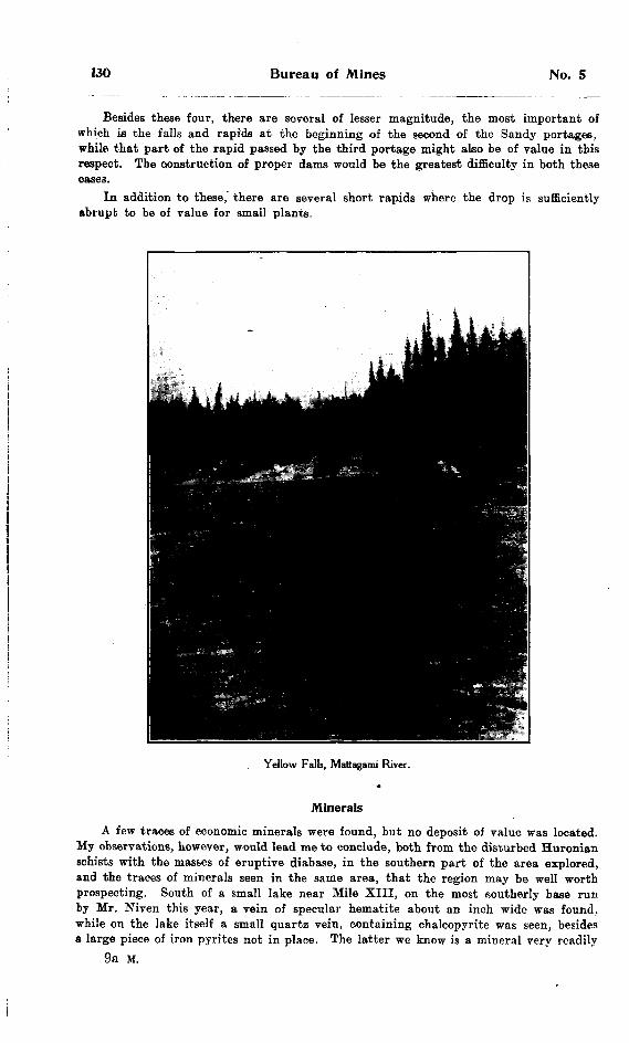
130 Bureau of Mines No. 5
Besides these four, there are several of lesser magnitude, the most important of which is the falls and rapids at the beginning of the second of the Sandy portages, while that part of the rapid passed by the third portage might also be of value in this respect. The oonstruction of proper dams would be the greatest difficulty in both thesecases.
In addition to these, there are several short rapids where the drop is sufficiently abrupt to be of value for small plants.
Yellow Falls, Mattagami River.
Minerals
A few traces of economic minerals were found, but no deposit of value was located. My observations, however, would lead me to conclude, both from the disturbed Huronian schists with the masses of eruptive diabase, in the southern part of the area explored, and the traces of minerals seen in the same area, that the region may be well worth prospecting. South of a small lake near Mile XIII, on the most southerly base run by Mr. Niven this year, a vein of specular hematite about an inch wide was found, while on the lake itself a small quartz vein, containing chalcopyrite was seen, besides a large piece of iron pyrites not in place. The latter we know is a mineral very readily
9a M.
1906 Exploration in Mattagami Valley 131
decomposed, so that this specimen could not have come from any great distance. The rock here is fine grained greenish schist, striking north and south and dipping vertically. Unfortunately the time at our disposal would not allow of a very thorough examination of the region.
Besides the above, a trace of ruby silver was found on a rock exposed two and a half miles below the mouth of the Water Hen on the Mattagami. The rock here was a fine grained slate. Here, back from the river, the rock was covered by thick beds of clay so that prospecting in the immediate vicinity would not be easy.
GameAccording to several Indians with whom we talked, game is not s.o plentiful as it
used to be, and Mr. Miller at Fort Mattagami also stated that the furs brought into the fort are becoming less in number each year. However, moose seem to be fairly numerous in all parts of the country, while there are a few red deer in the rocky area to the south. Numbers of bears were seen on the rivers during the summer. At one time it must have been a great country for beaver, for their old dams were found on almost every overland trip, while quite frequently fresh work was seen. Both martens and wild cats are plentiful, as also are minks and muskrats in the streams and rivers. The chief fish in the rivers are pike and pickerel, while below Sturgeon Falls sturgeon are plentiful, but on the whole the Clay Belt is not noted for its fish.
IV.—Geology and Petrography
Probably at one time a great lake, dammed in the north by the retreating ice, and in which the stratified clay and sand now covering the country was deposited, existed in this part of Ontario. Since that time many of the rivers have eroded deep valleys and in a few places along their courses have exposed the underlying rock. Most of the small lakes, left as remains of the larger lake, have been gradually filled in by the encroaching vegetation until we have today the many muskegs scattered over the whole region. All stages in the history of these muskegs may be seen, from the small lake, through the open shaking bog, to the muskeg covered with small scrub spruce, where the growth of a century is represented by trees two or three inches in diameter.
Probably over ninety per cent, of the rock seen during the season was south of Niven's second base. Here, also, the superficial deposits are more largely sand and gravel. While the bulk of this sand and gravel is undoubtedly the result of wave action on the rocky shores of the glacial lake, or the heavier deposits made by the rivers themselves near their mouths, still a great deal of it is material left by the retreat ing ice.
Back from the river valleys, north of this, the country is practically level. How ever, besides the inequalities, caused by the erosions of the rivers and their tributaries, occasional rolling areas of boulder clay, above the general level of the country, are found, and here and there a few high rocky hills are seen.
With the paucity of material at hand, it is impossible to work out the relationships of the various rocks in detail. As stated above, practically all the rock seen was along the rivers, and even here the exposures were by no means numerous.
A Belt of the Huronian
The Huronian belt which begins towards the foot of Kenogamisse continues north as far as Loon portage on the Mattagami, where the first Laurentian rocks were seen. The contact between the two formations was also located south of this on the Muskego river. The Laurentian stretches from here to Poplar Rapids, as far north as our exploration extended.

132 Bureau of Mines No. 5
Many of the rocks occurring in this part of the Clay Belt haTe been discussed by previous writers whose explorations took them through some part of the district. How ever, for the sake of continuity, I shall describe the various rock types for the whole area, mentioning their occurrences. Most of the rocks collected were sectioned and studied microscopically after coming from the field.
On Niven's first base at Miles 21 and 23 is a fine-grained greenish-gray rock, which extends southwest from the line. This same rock, or varieties of it, occur at several points along the Mattagami as far north as the Coffey river. Microscopically, it appears to be of volcanic origin, being in all probability devitrified glass. The ground mass is fine plagioclase crystals, with quartz grains of larger size scattered over it. However, in some specimens the development of the feldspar and quartz seem to be about equal. In others a certain amount of carbonate has been added. Some of the chiflf occurrences of this rock are just beyond the Porcupine portage, along the Sandy portages to the first part of the route to Kamiskotaia, and about two miles west of the river on Niven's second base.
Associated with this rock on Niven's base is a quartz diorite, which has been badly crushed, developing a distinct cataclastic structure. In places, too, in this greenstone is a well marked graphic intergrowth of quartz and feldspar.
Just at the beginning of the first of the Sandy portages is a fine-grained mica schist striking 30" south of east and dipping 60". This same schist occurs at several places along this series of rapids, always with approximately the same strike and dip. In several places along this part of the river small veinlets of quartz cut this schist as well as the quartzitic rock described above.
At the beginning of the second Sandy portage is a splendid example of a sheared porphyrite. The pressure must have been applied when the rock was in a plastic condition, for the large plagioclase crystals present have not been affected, although all the other constituents of the rock have been considerably disturbed. Associated with this rock is a dike of diabase striking north and south. Diabase is of frequent occurrence all along the river throughout the Huronian, and is almost always found in the neighborhood of the rapids and waterfalls.
At the foot of the last of the Sandy portages is a fine-grained olive green rock composed of feldspar and quartz with the original crystals badly broken up. A small quartz vein striking 10" south of east cuts through the rock.
About two miles below the mouth of the Water Hen creek is a pale green slaty rock of exceedingly fine texture. It was here we found the trace of ruby silver men tioned in another part of this report.
Eruptive Rocks
At the end of the third portage to Kamiskotaia are some high hills of a light colored felsite, associated with a darker rock evidently belonging to the same volcanic series mentioned above. In several places along this route are exposures of diabase, and in the neighborhood of the lake itself are several high hills of the same rock. This diabase is of two distinct periods of eruption. The contact between the two was traced for a considerable distance on the brow of one of the elevations.
Just where the river leaves the lake is an exposure of a dark rock of granitic texture composed of quartz, hornblende with chlorite, and magnetite. This is a very interesting exposure, situated as it is in the centre of a great mass of gabbro and diabase. It is somewhat difficult to suggest a reason for its presence there, but it may represent the centre of the original mass of eruptive, and is made up of those constitu ents which ordinarily crystallize last. However, it may be connected with a rock which

1906 Exploration in Mattagami Valley 133
looks much like it, found several miles away on Niven's first meridian between Miles VII and VIII, but the latter rock, besides haying all the constituents of the former, has considerable plagioclase and crystals of apatite or nepheline, probably the latter, so that the connection cannot be very intimate.
Between Miles XII and XIII, on Niven's second base, is a small lake, near which we found the narrow vein of specular hematite. At the south end of this body of water is a fine grained reddish rock composed of chlorite, some hornblende, calcite, leucoxene and decomposed feldspar. Cutting through this rock, which is evidently a greatly changed diorite, is a narrow quartz vein striking north and south, and containing copper and iron pyrites. Inland from this is a typical green schist and about a quarter of a mile farther is a rock of exceedingly fine texture whose essential constituents are plagioclase, hornblende changing to chlorite and epidote, with the accessory minerals quartz and magnetite. Running north and south through this is the small vein of hematite. The presence of the epidote here suggests a sedimentary origin for the rock, as epidote is frequently developed from the decomposing hornblende in the presence of calcite. Varieties of the same rock occur in the lake itself.
Diabase and Gabbro
Along this same base line both east and west of the above mentioned lake are several ridges and hills composed chiefly of diabase and gabbro. But at 9 M. 40 chains is a high hill of a fine hornblende schist with the rock striking 1350 and dipping ver tically. North of this base, on the meridian, occurs the same fine-grained volcanic which was found in so many places in this part of the country.
Near the mouth of the Coffey in the Mattagami is a small low island composed of diabase and calc schist. A small vein of calcite striking east and west cuts through the schist, but the vein matter is so badly decomposed that its discovery was only accidental. From here for the next eight miles calc schist, resembling this more or less, occurs several times. Besides this schist a few exposures of schistose, quartz diorite and ordinary diabase are found here, and on as far as Sturgeon falls. In this diorite, besides the essential minerals, a little calcite and epidote are usually present.
The only rock found in situ away from the river, in this locality, is that which forms White Pine hill just south of the southwest corner of Reid township. The rock is of very fine texture, and made up of poorly developed hornblende in a fine ground mass of plagioclase with very little quartz.
A rather interesting series of rocks is exposed at Sturgeon falls. At the lower end of the falls is a mass of diabase which is probably a dike, although this could not be made out satisfactorily. At the upper end is a hard fine-grained olive green rock. The metamorphic effect of an eruptive on the neighboring rock as well as the variety of texture developed by different rates of cooling, is beautifully illustrated here. Just at the contact, egg-shaped mosaics of quartz grain and porphyritic aggregates of feldspar, have been developed in the upper rock, besides which single quartz and plagio clase particles and hornblende may be readily made out under the microscope. These same conditions obtain to a lesser degree some distance from the contact, while at the extreme upper end of the exposure the rock is so fine-grained that very little can be determined positively. At the contact the diabase, although readily determined, is fine-grained passing into a coarser grained type a very short distance away, and a few feet from the contact into a typical coarse textured diabase. Besides augite and the well-developed ophitic structure of the plagioclases essential to all diabases, there is a beautiful micrographic intergrowth of quartz and feldspar.
About a mile below the falls is an exposure of a medium-grained gneissoid rock composed of hornblende, epidote, quartz and badly decomposed plagioclase feldspar.

134 Bureau of Mines No. S
From here to Loon portage, the rocks aie chiefly hornblende or green schist and diabase.
Tourmaline Schist
Just at the beginning of the Loon portage is a finely laminated tourmaline schist composed of quartz, calcite, a very little biotite and lath-like crystals of beautifully pleochroic tourmaline. The rock strikes 34.5o south of east and dips vertically. It passes into a more massive biotite schist with an occasional crystal of tourmaline and some calcite, which gives place towards the lower end of the portage to a finely lamin ated hornblende schist with the same strike and dip. Numerous small stringers and veinlets of quartz occur in the middle number of the series. So far as known this occurrence of tourmaline schist is unique for this part of Ontario.
A short distance below this portage is an exposure of diabase and the next rocks seen, which are in the neighborhood of Davis rapids, are Laurentian.
The elevation of the Laurentian is somewhat less than that of the Huronian. The rocks are rather monotonous and are made up largely of light colored gneisses and granites. The only exposures of gneiss seen were along the river, and in the majority of cases these would be hidden by high water. These nocks were found to be composed chiefly of quartz and microcline, with very little hornblende. In some cases, instead of microcline, orthoclase was associated with the quartz, while in others the plagioclase feldspar occurred. In those rocks in which plagioclase was present, the mutual reactions of the elements composing the basic bisilicate and the plagioclase has resulted in the formation of epidote. The latter mineral is quite prominent in the gneisses found from the beginning of the Laurentian at Davis rapids to about four miles below Island portage.
The chief eruptive here is granite, although diabase, which was found so largely to the south, also occurs quite frequently. In the granites very little orthoclase is present, the feldspar being chiefly plagioclase and, in several places, as at Island portage, the hornblende is replaced by epidote.
Oranite Bosses
The only elevations of any magnitude throughout this part of the country are formed by rounded bosses of granite. Several of these occur east of Driftwood creek on Patten's meridian of 1904. The largest of these hills, which is situated at Mile 39 on this meridian, is about one hundred and fifty feet high. West of the Mattagami, about two miles southeast of lake Clement, is a low rounded mass .of granite covering an area of several hundred acres. In places this rock is pegmatitic in structure.
Some of the granites are very interesting from a petrolpgical standpoint. One of these was found five miles west of the Mattagami near the probable position of Speight's last base, but as the line was not run at the time, the exact locality cannot toe given. Tt is dark colored vitreous rock of graiitic texture, and composed of fine crystals of hypersthene, some biotite, quartz, finely twinned plagioclase and magnetite. Both macroscopically and microscopically, it has a marked resemblance to the charnokite of Mount Thomas, Madras, India, the only difference being in the presence of plagio clase instead of microcline.
The rocks at Jump-over falls are rather interesting. Here the mass .of the exposure is a light colored hornblende gneiss, with angular fragments of a darker colored gneiss, also found here, enclosed in it. There is as well an ordinary looking red granite contain ing segregations of epidote as large as three-quarters of an inch in diameter. These three rocks are most irregularly arranged in relation to each other, showing evidence of greal; disturbance. Cutting through the mass of acid rocks are two or three small veins
.of diabase from two to four feet in width and striking 30" north of east. Under the

1906 Exploration in Mattagami Valley 135
microscope the hornblende gneiss gives further proof of some great change in the rock, subsequent to its original crystallization. The undulatory extinction of the quartz grains, the bent and twisted polysynthetically twinned feldspars often with included quartz fragments, the cataclastic structure developed in places, and the small cracks and fissures running through the rock, prove conclusively that some powerful dynamic force has greatly changed its original condition.
Any further detail in the description of the Laurentian rocks would be neither interesting nor profitable, as nothing of an economic nature was seen in them, and as the relationships of the various types could not be worked out with the information collected.
Glacial GeologyAs stated previously, the whole Clay Belt is, in all probability, the direct result
of the huge ice fields which once covered the country. But besides these vast deposits of stratified clay, we have more direct evidence of the ice age, in the glacial striae found on the rocks, in the occasional ridges of boulder clay, and the glacial erratics scattered over the whole region.
As rock exposures are not numerous, glacial striae were noticed in comparatively few places. However, their direction was always accurately determined. This direc tion varies from 120 west of south to 100 east of south, so that the ice must have been travelling nearly straight south here.
Ridges of boulder clay, and deposits of morainic origin, occur on Niven's first base, between Mile 19 and Mile 25, in several places along Speight's first base and south of it, and besides were seen occasionally on our overland trips away inland from the main rivers. Were it not for those glacial deposits the country, particularly north of Niven's third base, would have practically no relief. As it is, they embrace some of the most promising land of the area.
All through the Huronian are found glacial erratics from the north. These boulders, some of which show distinct glacial markings, are mainly granite and gneisses of various kinds, but occasionally limestone boulders were seen. In some of these latter Palaezoic fossils were noticed, chiefly corals and brachiopods.
ConclusionIn view of the probability that in the near future, railways will connect this part
of Ontario with the rest of the country, its splendid agricultural possibilities and the various other resources outlined in the foregoing pages, combine to make the future of this part of the Clay Belt particularly promising. Undoubtedly settlement will be slow, and the earlier settlers have much to overcome, but there is no reason why land, situated in the same latitude as some of the most prosperous parts of the great west, should not some time in the future -prove equally productive and support a large population.
In conclusion I take the opportunity of thanking Prof. T. L. Walker of Toronto University, for assistance and vai-able suggestions in the preparation of this report.

AGRICULTURAL RESOURCES OF MATTAGAMIBY ARCHIBALD HENDERSON
The region considered in this paper is a large portion of the Mattagami river valley between Niven's base line of 1899 and Speight's third base line of 1905. 1
The report of the work accomplished is presented under the following headings:I. Description in General of the Region.
II. Description in Detail of Overland Excursions.III. Climate.IV. Flora and Fauna.
V. Soil Specimens collected in the region.(a) Notes on localities of specimens.(b) Results of Chemical Analyses by Professor Harcourt, Ontario Agricultural
College.(c) Results of Physical Analyses by Professor Reynolds, Ontario Agricultural
College.
I. General Description of Region
The Mattagami valley is very similar to that part of the Clay Belt lying immediately to the east in the valleys of the Frederick Hou.se and Abitibi rivers. A somewhat exhaustive description of the latter area was given by the writer of the present paper in a former report;2 hence it is necessary at the present time only to outline briefly that description, slightly changed in order to apply accurately to the Mattagami valley.
The valley of the Mattagami river, like that ,of the Frederick House and of the Abitibi, consists of sir types of country, viz.: (1) Black spruce forest; (2) River bank; (3) Poplar knoll; (4) Muskeg; (6) Jack-pine plain; (6) Rock.
Black Spruce Forest
A very large proportion (sixty to seventy per cent.) of the valley of the Mattagami river is a black spruce forest. The predominant tree of this forest, as the name would imply, is the black spruce (Picea nigra). It averages in diameter only six or seven inches, whereas in the Abitibi region the same tree averages eight or ten. Tamarac (Lai'ix americana) are also common, but are all dead. Balsam, (Abies bcdsamea) is another common tree in the spruce forest, but is always small and of little value. White spruce, (Picea alba) and white birch, (Betula papyriferd) are sometimes found in the drier portions tof the black spruce forest.
The subsoil is commonly clay, clay loam, or heavy clay, rarely sand or sand loam, (soil specimens Nos. 7, 18, 19), overlying which is a layer of vegetable matter, a few inches to one foot thick and well decayed in most localities, two or three feet thick and peat-like in the wettest areas. A mixture of the commonest subsoil, clay or clay loam, and the overlying mould makes a good soil for agricultural purposes.
A variety of the black spruce forest type of area which was not seen in the Abitibi region is that described as occurring in Aubin, Nesbitt, Crawford and Mahaffy town ships. The trees are smaller than usual and grow on a dry, heavy clay soil. (Specimen No. 22).
t These base-lines are in the latitude of milepoats 120 and 186 respectively on the eastern boundary line of Algoma. '
• Report of the Bureau of Mines, 1905. Tol. XIV. Fart I. "Agricultural Resources of Abitibi.
[136]
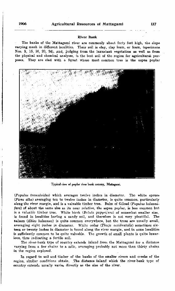
1906 Agricultural Resources of Mattagami 137
River BankThe banks of the Mattagami river are commonly about forty feet high, the slope
varying much in different localities. Their soil is clay, clay loam, or loam, (specimens Nos. 2, 15, 16, 20, 24), find, judging from the luxuriant vegetation as well as from the physical and chemical analyses, is the best soil of the region for agricultural pur poses. They are clad with a forest whose most common tree is the aspen poplar
Typical view of poplar river bank country, Mattagami.
(Populus tremuloides) which averages twelve inches in diameter. The white spruce (Picea alba) averaging ten to twelve inches in diameter, is quite common, particularly along the river margin, and is a valuable timber tree. Balm of Gilead (Populus balsami- fera) of about the same size as its near relative, the aspen poplar, is less common but is a valuable timber tree. White birch CBetula papyrifera) of somewhat smaller size. is found in localities having a sandy soil, and therefore is not very plentiful. The Dalsam (Abies balsamea) is quite common everywhere, but the trees are usually small, averaging eight inches in diameter. White cedar (Thuja occidentalis) sometimes six teen or twenty inches in diameter is found along the river margin, and in some localities is sufficiently common to be quite valuable. The growth of small plants is quite luxur ious, thus indicating a fertile soil.
The river-bank type of country extends inland from the Mattagami for a distance varying from a few chains to a mile, averaging probably not more than thirty chains in the region explored.
In regard to soil and timber of the banks of the smaller rivers and creeks of the region, similar conditions obtain. The distance inland which the river-bank type of country extends usually varies directly as the size of the river.

138 Bureau of Mines No. S
l
Poplar KnollHere and there throughout the spruce forest is a slightly elevated area resembling
the river bank type both in soil and vegetation. Like the latter, these areas are well drained and in this respect differ from the black spruce forest. The river bank and poplar knoll types together occupy about twenty per cent, of the whole region.
MuskegFor a description of this type the reader is referred to the former report spoken
of above, and to the section of this paper on drainage.About fifteen per cent, of the region explored is of this type, and it is an interesting
fact that muskeg and very wet spruce forest occupy a larger proportion of the northern part of the region than of the southern.
Jack-Pine PlainThe only jack-pine areas observed in the Mattagami valley are in the southwestern
part of the region, viz. : along the southern boundary of the Clay Belt, and in the vicinity of lake Kamiekotaia.
The trees are small and would not average more than eight or ten inches in diameter. They were most commonly seen in rough rocky districts, and in only one locality, north of lake Kamiskotaia, was a jack-pine plain observed.
RockThe outcrops of rock occupy only a very small proportion of the region explored,
probably one or two per fent. Like the jack-pine areas they are most common in the southwestern part of the region, which, as the map of northern Ontario published by the Department of Lands and Mines shows, is in the neighborhood of the southern boundary of the Clay Belt. Elsewhere only occasional isolated rocky mounds or hills occur.
DrainageThe types of country occurring in the region explored called river bank, poplar
knoll, black spruce forest, and muskeg represent three degrees of drainage, the first two being considered together. The river-bank and poplar knoll areas are well drained, and as has been stated, have generally clay, clay loam or loam subsoil, (the latter two being most common), with three or four inches of overlying organic matter in various stages of decay. Such soil will be available for crops as soon as denuded of forest growth.
The black spruce forest as a rule is poorly drained and has a subsoil of clay loam, clay, or heavy clay, the clay loam commonly occurring in the best drained parts of the forest, and the heavy clay in the worst. Above the subsoil is a layer of organic matter well decayed in the drier areas, peat-like and deep in the wetter. On the surface of this is a layer of moss mostly bryineous and only a few inches thick in the drier parts, sphagnous and a foot or more in depth in the localities where water pools are numerous. It is probable that clearing alone or some simple form of artificial drainage will be sufficient to render most of this type of country suitable for farming purposes.
Muskegs are areas which at the present time have little or no drainage. In the centre of the larger ones there is often a small lake. The depth of the moss and peat in such areas varies very much, frequently being ten feet or more in the larger ones, but in the smaller, which are by far the more common, generally being only five or six feet. The former will yield a large supply of peat, and the latter when drained will be available as farming land in the areas in which the soil is suitable. That draining such areas is a possibility is shown by the fact that creeks have been observed to have
1906 Agricultural Resources of Mattagami 139
their origin within them. They are therefore above the level of the rivers. The read ings of the aneroid barometer would lead one to the same conclusion. The soil under lying the muskegs is in most cases a heavy bluish white clay, (specimen No. 7) and is of very doubtful value for the production of crops. In its present condition much of if woiiid he suitable for brick-making.
H.—Overland Excursions
Township South of Jessop
The Mattagami river was descended to a point one mile below Niven's base line of 1899. Leaving the river at this point I went north, reaching the Mattagami again, on the northern side of the Big Bend, at the middle one of the three Sandy portages. According to calculation by the use of a tally register to count the paces, this distance is four miles and forty-six chains, of which the following is a description :
Mile 1: Poplar, averaging twelve inches in diameter; spruce, ten inches; balsam; balm of Gilead, ten inches; dead 'tamarac, ten inches. Soil, clay loam to thirty-six chains. Spruce, eight inches; some white birch. Soil, clay loam, to eighty chains.
Mile 2: Same, with some poplar, averaging fifteen inches, to sixty chains. Dead tamarac, twelve inches; spruce, ten inches, to seventy-two chains. Small lake from seventy-two to eighty chains in centre of marsh, surrounded by black spruce forest.
Mile 3 : Dead tamarac, spruce and some poplar. Soil, clay loam.Mile 4: Same to fifty chains. Poplar, fifteen inches; spruce, black and white,
twelve inches; tamarac, birch, to eighty chains.Mile 5: Same to river at forty-six chains.
Niven's Base Line of 1899
This line was reached at mile eighteen and twenty chains (hereafter written M. 18, 20c.), by the Water Hen portage. A poplar and spruce forest with clay soil extends west along this line to M. 19, 65c. In this locality the character of the country changes and the line to M. 25 runs through sandy and rocky country, wooded with small spruce, Banksiau pine, small poplar and birch.
The country for two miles north of M. 25 was found to be rocky or sandy and wooded with black spruce, seven inches, and jack-pine, eight inches. Continuing the trip two miles east and then two miles south to the line, very similar country was observed.
Mattagami River to Kamiskotaia Lake
On ascending Coffey (or Kamiskotaia) river, which is about one chain wide at its mouth, one observes that its banks are about forty feet high, of the usual clay nature, and wooded with poplar, twelve inches, black and white spruce, ten inches, balm of Gilead, white birch and balsam. After paddling one-half mile the first portage is reached, twenty-four chains long, which extends for two-thirds of the distance through a poplar and spruce forest growing on a clay soil, and for the middle one-third over a jack-pine ridge of sandy soil. The second portage, eight chains in length, is over a jack-pine ridge, but the third one, forty-five chains long, is over rolling clay and sand, wooded with spruce, ten inches, balsam and poplar. The last five chains of this portage lead one over an outcrop of rock sparsely wooded with dwarf black spruce. The next portage, forty chains in length, is over clay loam land, wooded with young poplar, eight inches, and
140 Bureau of Mines No. 5
spruce, four inches. The small creek which one now paddles down to Kamiskotaia lake has low banks with an alder border, behind which is a black spruce forest growing on a clay soil.
Kamiskotaia Lake
A portage extends from KamisKotaia to a smaller lake about a mile and forty-fire chains north of the former. For the first twenty chains this portage runs over sandy loam or loam (specimen No. 4, Martin's garden soil), wooded with poplar, .ten inches, some white spruce, sixteen inches, balsam, black spruce and dead tamarac. The flext mile is over a jack-pine plain, having trees six to eight inches in diameter growing on a very fine white sand. The rest of this distance to the small lake is through very wet country timbered with six-inch black spruce, some poplar and balm of Gilead, twelve inches, cedar, balsam, and dead tamarac.
The shores of the small lake are low, and wooded mostly with black spruce and dead tamarac, though there are some poplar and balm of Gilead on the northern shore.
Continuing north from the northeast corner of this lake, one passes through rolling sandy country wooded mostly with jack-pine, eleven inches in diameter, and some birch, small poplar, and black spruce, nine inches, and after having travelled fifty chains a river is observed one chain wide, flowing southeast. Its banks are at the point crossed about thirty feet high, sandy and wooded with jack-pine and black spruce, and an occasional white spruce, sixteen inches in diameter. The country for a mile and a half or more north of this point has sand, sand loam or loam soil, (soil specimen No. 3), is broken by several ravines from one hundred to two hundred feet deep, and is forested by jack-pine and associated trees. Much of it, however, was overrun by fire only two or three years ago, and the timber largely destroyed.
For three miles west of lake Kamiskotaia, the country is mostly rocky and sandy. The general surface is rolling, though here and there a rocky hill occurs. The forest growth consists largely of black spruce, seven inches, and some birch, jack-pine, and poplar of ordinary size.
Kidd Township
Kidd township was entered by travelling east from a point on the Mattagami river about five miles below the mouth of Coffey river. At this point the river bank is forty feet high, has clay loam soil and is wooded like much of the banks of the Mattagami, i. e., with poplar, twelve to fifteen inches, scattered white spruce, fifteen inches, balm of Gilead, balsam, and along the margin of the river, some fair cedar, sixteen inches. This timber extends east twenty chains. Then to fifteen chains on the second mile one passes through a black spruce forest of seven-inch trees, growing on a clay subsoil overlaid with twelve inches of moss and black muck. The balance of this mile extends through a brule two or three years of age, many blackened stumps of black spruce and tamarac, five or six inches, still standing. The black spruce forest of trees, seven inches, extends to the end of the fourth mile. Now turning south, one passes through the same sort of forest for sixty chains, and then one enters a very wet country deeply covered with sphagnum and sparsely wooded with dwarf spruce and tamarac, almost a muskeg, in fact. This extends to thirty-five chains on the second mile south, and then passes gradually into black spruce forest again, which continues to the end of the mile. Returning to the river, one passes through an almost unbroken black spruce forest of trees six to seven inches in diameter until within twenty-six chains of the Mattagami, when the usual well drained river bank clay loam soil with its characteristic timber appears.

1906 Agricultural Resources of Mattagami 141
Macdiarmid Township
On going west from the Mattagami one mile south of the north boundary of this township, the river timber is found to extend inland fifteen chains. For the balance of two miles one observes a black spruce forest of trees five to six inches in diameter. Now turning southeast, similar country is passed through for two miles, at the end of which a poplar area is entered. This is found to extend south forty chains, and then east one mile to the river. The soil is nearly all clay loam.
Carnegie Township
A trail directed east and west about sixty chains south of the north boundary of Carnegie township was followed and used, as a base line for trips into Carnegie and Crawford townships. The river-bank timber extends inland along this trail for twenty chains, and then wet spruce forest of seven-inch trees and an occasional small poplar knoll occupy the remainder of five miles of the trail.
An excursion to the south of this trail beginning two miles from the eastern boundary of the township showed an area of well-drained rolling clay land, wooded with spruce, fifteen inches, (some white spruce even twenty-four inches in diameter), balm of Gilead and poplar, twelve inches, cedar, fifteen inches, balsam and some birch. This area extends south of the trail for nearly three miles, and will make good farms. Turning west, wet spruce forest of seven-inch trees was observed to extend for two and one-half miles. Similar spruce forest and an occasional small poplar knoll was seen on the return trip north to the trail.
Mahaffy and Crawford Township
An excursion was made into these townships one mile from their northern boundary, starting from the Mattagami river and continuing east four miles. The return trip to the river was made over the same route.
The usual types of country were observed, with spruce foiest present in a larger proportion than is commonly the case. Most of this spruce forest, of which the trees average six inches, is dry, and the clay subsoil (very similar to soil specimen No. 22), is covered by only a few inches of organic matter, two features in which it contrasts sharply with most of the spruce forest of the region traversed.
On travelling north from the trail spoken of in the description of the excursion into Carnegie township, at a point one mile and sixty chains east of the Mattagami, wet spruce and tamarac forest is observed, and in sixty-four chains one comes to the southern boundary of Crawford township. Continuing as follows, two miles north, two miles east, then south to the trail, much of this corner of the township was found to be muskeg.
Aubin, Nesbitt, KingsmillAn excursion was made into the two former townships about two miles south of their
northern boundary. The river-bank timber, poplar, ten to twelve inches, spruce, eight to ten inches, balsam and occasional birch, extends inland twenty chains in this locality. Farther inland for six miles and twenty chains, a very large proportion of the country through which the excursion was made is a spruce forest of rather unusual character. The trees average only five or six inches in diameter and the soil is a dry heavy clay (soil specimen No. 22), covered by only a few inches of organic matter.
Extending from sixty chains on mile four from the river for about one mile east, there is a large muskeg, at least two miles long from north to south. It is nine feet
142 Bureau of Mines No. 5
An excursion into Aubin and the township west of Aubin, Kingsmill, was made as follows : west from the Mattagami river to Speight's meridian, which was intersected at M. 8, 40c.; south on the meridian to M. 9, 40c.; west four miles and return.
The large poplar and clay soil of the river bank at this point extend inland for thirty-six chains. The remainder of the excursion was through country of the usual alternation of spruce forest, poplar knoll and muskeg. The trees of the spruce forest average from five to six inches, and grow on a hard dry clay soil very similar to soil specimen No. 22. '
Township of Dargavel
This township was entered from the middle point of its northern boundary. Pro ceeding south, one passes through a wet spruce forest of six-inch trees. Towards the end of the third mile and continuing for sixty chains into the next, the forest is drier and some poplars occur. Turning east, one finds dry spruce forest of eight-inch trees, with some birch and poplar for one mile. The next mile, however, is very wet, and the first twenty-four chains and the last ten are muskeg with six feet of peat. Now re turning to the northern boundary a rolling clay loam country is found, well drained, and wooded with black and white spruce, ten inches, birch, ten inches, poplar, twelve inches, and balsam. The good trees, however, are scattered on account of the very large number of windfalls. *
Township of Lennox
On going south for three miles from the middle point of the northern boundary of this township, one passes over dry rolling clay loam land, wooded with a thicket of young poplar and spruce about forty years old. Soil specimen No. 9 was taken from this locality. For the next halt mile one observes wet spruce thicket. On turning west similar country is found for two and one-quarter miles. Then succeeds a wet spruce forest of seven-inch trees for twenty chains, which one finds on travelling north to extend to the northern boundary of the township.
Latitude of Milepost 162 Niven's Line
The base line in latitude of mile-post 162 of Niven's line was followed east from the Mattagami river for eight .and one-half miles, and trips to the north and south of it were made as described below.
The Mattagami, where the line crosses it, has rather low banks wooded with spruce, six inches, poplar, ten inches, balsam and occasional birch. In three chains this very poor type of river bank timber gives place to black spruce, six to seven inches, growing on clay soil, for the most part wet. With the following breaks this spruce forest extends to mile-poet 10: (1) From ten chains west to twenty chains east of mile-poet 10 a poplar knoll, from which soil specimen No. 8 was taken; (2) from mile-post 9 to twenty chains east of it, another poplar knoll; (3) from sixty chains west of mile-post 6 to twenty chains east of it, muskeg with six feet of peat; (4) about the middle of mile o Driftwood creek, eighty feet wide, with a few chains of river bank timber on either side.
Sydere Township
Turning north about the middle of the eleventh mile west of Speight's meridian (1905) on this line, the traveller passes successively through wet spruce forest for one mile and twenty-four chains; poplar knoll for forty chains; spruce forest for ten chains; poplar knoll having a rolling surface and soil much like soil specimen No. 10, for
1906 Agricultural Resources of Mattagami 143
sixty chains; spruce forest of six-inch trees for ten chains; muskeg, having se.ven feet of peat resting on a hard bottom of bluish white clay for forty chains. Toward the east this muskeg extends tweny chains. Continuing east for three miles, poplar woods and spruce forest in about equal proportions were observed. Returning south to the line similar country was seen, also having a good proportion of poplar woods. The western branch of the Muskego, forty-five feet wide and having the usual river-bank white spruce of twelve to sixteen inches in diameter, was crossed about one and one-half miles north of the line.
East Part Bradburn Township
Information concerning this township was obtained by an overland trip made west of Loon portage on the Mattagami river. After travelling for forty chains through a poplar, spruce and birch forest of small trees followed by a ten-inch spruce forest for ten chains, the eastern boundary of this township is reached at a point one mile and forty chains from its southern extremity. From this point north for forty chains, one observes a spruce and poplar forest growing on clay loam soil. Turning west a, rolling clay loam country is traversed, wooded fairly well with poplar and balm of Gilead, four teen inches, white spruce, twelve inches, and balsam. The eastern, branch of the Muskego river was crossed about two miles and twenty chains west of the eastern boundary. It is here about forty feet wide, and has clay banks ten feet high, on which grow some fine white spruce. Towards the end of the third mile, the soil becomes sandy and the timber somewhat smaller. This condition does not extend far, however, and on turning south one passes through excellent country, similar to that described between the eastern boundary and the Muskego river, until the southern boundary is reached.
A trip made through the township lying south of Sydere may be outlined as fol lows : southwest from M. 8, 40c. on the north boundary, one mile; then successively west two miles, south four miles, northeast one mile, east three miles, north to northern boundary, about four miles. Approximately fifty per cent, of this excursion was through spruce forest, thirty per cent, through poplar woods, and twenty per cent, over muskegs.
Between Mattagami and Muskego
Two and one-half miles west of the Mattagami the Muskego river (here about forty feet wide) crosses this line. Between these two rivers there is a well drained area of clay and clay loam soil, wooded with poplar, fifteen inches, black and white spruce, ten inches, balsam and dead tamarac. This continues a mile west of the Muskego. Then the country becomes wetter, with more spruce and less poplar, but at sixty chains on M. 5 of the line it becomes drier again and wooded with birch, poplar and spruce growing on a coarse sand. Sandy soil continues about one mile, (soil specimen No. 10). West to M. 8, 40c. the country is fairly well drained, and is wooded with spruce, seven inches, poplar, twelve inches and some birch. The soil is mostly clay, though there is an occasional low ridge of sand, running north and south. Tor two miles west of this point, the country is a wet spruce forest of six to seven-inch trees, •with here and there a small poplar knoll and an occasional small area of muskeg.
West in Latitude of Milepost 174 Niven's Line
At the point where this lin© crosses it. the Mattagami river has banks about forty feet high. Their soil is clay loam and their forest growth consists of poplar, twelve to fifteen inches, spruce, ten inches, balsam and white birch, ten inches. This description would apply generally to the banks of the Mattagami in the region explored. Their slope varies very much, but they are usually rather steep.

144 Bureau of Mines No. 5
The river-bank soil (specimens Nos. 12 and 13) aud timber extend westward from the Mattagami for twenty chains beyond the Muskego river, which crosses the line two miles from the Mattagami. Farther west, the line runs through wet spruce forest with here and there a poplar knoll. At the time of making this trip the line was cut only to M. 18, 30c.
The Muskego river is formed by two branches which unite about six miles south of the line, i'rom the point of junction a trip was made three miles west, then north and east until the line was reached quite near the Muskego. This excursion was through the usual alternation of six to seven-inch forest, poplar knoll and muskeg, the poplar knoll being proseut in somewhat greater and the muskeg in somewhat less pro portion than is often the case.
An excursion from the line at M. 18, lOc. southwest four miles, east two miles, then northeast to the line again, showed very similar country.
Between the Mattagami and Muskego a short trip to the south of the line was made. It extended south for two miles and was mostly through poplar woods. Sand loam was observed in one or two localities on this trip, but the usual clay loam was the predominating soil, and was wooded with poplar, birch, balsam and spruce.
Round Lake Clement
Proceeding two and one-half miles in a northwesterly direction from M. 18, 30c. on this line, a country is passed through nearly altogether of the spruce forest type. For the next mile is rolling clay land well timbered with poplar, birch and balm, though there were very many fallen trees. Some fairly good cedar were seen on the last ten chains of this mile. This brought one to the shore of a lake, apparently about three miles long from north to south and fifteen chains wide from east to west. It was afterward learned that the line between M. 2, 72c. and M. 3, 7c. west of mile-post 18, crosses this lake. The Indian name not being ascertainable. it was called Clement lake. It appeared to be surrounded by a bank from twenty to forty feet high, wooded as already described. Having proceeded north along the sandy shore for sixty chains, the northern end of the lake was reached, and a river about one and one-half chains wide. Poplar Rapids river, was seen flowing out of the northeast angle of the lake.
Turning east, two miles of rolling country were traversed, mostly clay loam and loam, but in some places sandy, wooded with timber similar to that around Clement lake. Fallen trees are exceedingly numerous in this locality.
On travelling southeast and south to the line, the usual spruce forest with occasional islands of poplar woods was observed.
Bast in Latitude of Milepost 174 Niven's Line
The east bank of the Mattagami river where the base line in latitude of mile-post 174 on Niven's line crosses it, is about thirty-fiVe feet high, its soil is sand and sand loam, and it is wooded with poplar, ten to twelve inches, spruce, eight inches, and balsam. Only fifteen chains inland, however, the soil is clay, and poplar averaging twelve to fifteen inches in diameter are common. The usual variation of poplar knoll, spruce forest and muskeg was observed along this line for fourteen miles. These are present in this distance roughly in the proportion of fifty, thirty-five and fifteen per cent., respectively, an unusually high percentage of poplar knoll.
Beginning thirty chains east of mile-post ten and extending east for eighteen chains, there is a dry clay area wooded with poplar, seven inches, spruce and tamarac, four to fire inches—timber very similar to that observed on the base line twelve miles south of this one, and also on the excursion made between these base lines. Frequent areas of forest of the same age occur throughout the rest of the distance travelled on this line, indicating that this old brule1 is of considerable extent.

1906 Agricultural Resources of Mattagami 145
Soil specimen No. 17 is taken from a small sandy knoll immediately east of mile- post- 6. Light white sand occurs for about sixty chains east of mile-post 4.
Driftwood creek crosses the line on the third mile about fifteen miles west of the district boundary. It is here about two chains wide, and has clay loam banks thirty feet high, wooded with poplar and balm of Gilead, twelve to fifteen inches in diameter, black and white spruce, ten to twelve inches, and balsam, this timber extending for ten chains on the west side of the river and twenty chains on the east side.
Voyageurs on the Mattagami.
South of the Line
The meridian forming the eastern boundary of a block twelve miles square south of the above mentioned base line between mile-posts l and 12, including what is now the northern parts of Calder and Bradburn townships, was followed south from the northeast corner of the block (mile-post 42 on the meridian) to M. 34. 20c. Spruce forest, poplar knoll and muskeg are present in this distance approximately in the proportion of seventy-one, twenty-two and seven per cent, respectively. Some areas
10 M.
146 Bureau of Mines No. 5
of the old brule, mentioned in the description of the northern boundary, occur along this line.
A granite hill, one hundred and fifty feet high, occurs on the fortieth mile. A good view of the surrounding country can ordinarily be obtained from the top of this hill. Unfortunately the view was obscured by mists and clouds on the day on which it was ascended. However to the south and west, as far as could be seen, eight or ten miles, the country presented a gently undulating surface with a covering of spruce forest and poplar woods, the latter present in somewhat smaller proportion than the former.
Soil specimens No. 18 and No. 19 were obtained from the floor of the spruce forest at M. 35, 60c.
After having travelled about six miles a few degrees to the south of west from M. 34, We., on the meridian, Driftwood creek was reached at a point a few chains north of the portage between this creek and the Mattagami river. This line of march led through a brule of similar age to that described elsewhere as occurring on thp northern, southern and eastern boundaries of this block. An unusually large proportion of the brule in this locality is fairly well-drained clay land, wooded with small poplar spruce and tamarac. West of the Driftwood, the poplar brule continues for one mile. It is also found to extend for the two miles of the portage immediately east of the Mattagami. The intervening portion of the portage leads for the most part through wet spruce country.
In this region a trip was made beginning at Davis rapids on the Mattagami river and extending one mile east, then north and west to the western boundary which was intercepted at M. 4, 40c. The trip thus far revealed fairly dry country, mostly brule, wooded with small spruce and tamarac, with occasional clusters of small poplar. From M. 4, 40c. to M. 8 spruce forest was observed, with two small areas of muskeg. Extend ing east of M. 8, and then northwest to the northern boundary, the common alternation of spruce forest, poplar knoll and muskeg was noted.
East from Jump-over Falls
The river bank at this point is fifty feet high, its soil is clay loam, and it is wooded witji spruce and birch, ten inches, poplar, ten to twelve inches, and balsam. This combination of soil and timber extends inland for two and one-half miles, with the exception that in occasional small areas the soil is loam or sand loam. Farther east sphagnous spruce forest of seven-inch trees extends for one and one-half miles. North of the farthest point east there is similar country for one mile and sixty chains, follow ing which is an area of well-drained clay loam soil wooded with spruce, ten inches (some large white spruce, sixteen inches in diameter), poplar and balm of Gilead. twelve to fifteen inches. There are very many fallen trees in this locality. Between this area and the Mattagami there is spruce forest of six or seven-inch trees, mostly fairly wel! drained and the usual river-bank country, which extends inland at this point for thirty chains.
West of Mattagami River, below Jump-over FallsThe river-bank timber extends inland at the starting point of this trip for thirty
chains . The remainder of the excursion, three miles and fifty chains west, two miles south, and finally east to the river, revealed dry spruce forest with occasional poplar knolls and small muskegs, the general surface being undulating rather than flat as is so commonly the case.

1906 Agricultural Resources of Mattagami 147
An excursion west of the Mattagami river was made about the latitude of mile- post 186 on Niven's line. The outline of this excursion is as follows: five miles west, two miles north, east to the river. The whole trip was through a country of the usual types of area present in the usual proportions.
Another trip was made east of the river for about eight miles in latitude of mile- post 183, and south to the base line in latitude of mile post 174 on Niven's line. The rurcir-bank timber extends inland only twelve chains in this locality. From this point to the end of the excursion at M. 7, 70c. on the base line in the latitude of mile-post 174 on Niven's line, there is an almost unbroken wet spruce forest of trees somewhat smaller than usual. In this large area there are very few poplar knolls. The surface of the country seen on this excursion is exceedingly flat.
III.—Climate
The climate of the Clay Belt of northern Ontario has been described in general in a former report, so that little need here be said. However, it is advisable to call attention to the fact that the summer of 1905 was considerably warmer than that of 1904. The only serious frost recorded was 28.5" on August 27, whereas in the summer of 1904 there was a frost of similar severity during each of the summer months. In this connection it might be well to state that on August 17, in a wet spruce forest, ice was found eighteen inches beneath the surface of the moss. Undoubtedly ice is perpetual in such localities, and is probably the main factor in the production of the summer frosts. It may logically be argued, therefore, that clearing away and draining the wet spruce forests would tend to prevent summer frosts by eliminating the conditions favor able to the preservation of ice throughout the summer.
The following is a record of the daily minimum and maximum temperatures, the former registered on a minimum thermometer, and the latter on an ordinary ther mometer about half past one o'clock. The records for September were made by Mr. H. L. Kerr, B.A., but for the sake of completeness are incorporated in this report. Some "weather notes" are also given.
JUNE, 190S.
Date.
H15.6171819202122''o
21252027282980
Minimum.
555456M5451434342344454384o33.53853
Maximum.
SO817870858270.575637676576067687775
Notes.
Clear. .Clear.Cloudy.Cloudv at intervals.Clear.Clear. Strong S.W. windClear.(Hear.Clear.Clear.Shower about 4.30 p.m.Cloudy. W. to N.W. wind.Clear. 'Mostly clear.Clear.'Rain at night with N.W. gale.1 hunder shower about '2 p.m., with strong Vi. wind .
Mean 46.15 72.97

148 Bureau of Mines No. 5
JULY, 1905.
Date.
1•i3456789
101112 13141ft161718192021222324252627282930 31ft
Mean
Minimum.
5448.55059 61.55456494939.5395554.54830.551.54953.556.53534525351394836.549.53845 36
47.58
Maximum.
73.5768670 67.573.578677076808077666467817561686967605362.558705668.577 55
69.431
Notes.
Showery at ni*ht.Clear.Clear. Strong S. wind.Cloudy and showery. Cloudy and showery.Mostly clear. Strong S. W. wind.Cloudy. Rain 3 to 7 p.m.Cloudy until 3 p.m.Clear.Clear.Clear. S. W. breeze.Rain in morning. Thunder shower at 7.30 p.m. Thunder showers at 1.30 nml 4 p.m., otherwise clear.Clear. Ualn at night.Clear.Raining most of (Jay.Clear. S.W. wind.Mostly clear. Shower at noon.Dull. A shower about 4 p.m.Clear.Clear.Rain in a.m., clear in p.ini S. windRain most of day. Strong K. wind.Rain most of day. Strong K. wind.Clear.Showery.Clear. Shower at 8 p.m. W. wind.Cloudy and drizzling until 5 p.m.Clear.Clear. Shower at 8 p.m. Strong W. Clear. Strong W. to N.VV. wind.
toN.W. wind.
AUGUST, 1905.
Ddte.
1234567 89
101112
Minimum.
30344748.5485134.5 3442524856.5
13 : 341415161718192021222324'25262728293031
Mean
363948375256.55251 4941.533.539.543.528.55245
46
43.65
Maximum .
6772.57474635261 685969.572.563606466707063.5647072 65706668.5657367.5726455
66-48
Notes.
Clear.Clear. W. breeze.Clear. Shower at 7 p.m. W. breeze.Cloudy at intervals.Raining all day.Cloudy with occasional showers.Showery until 4 p.m. Clear. S. to S.W. breeze.Cloudy. Rain at night.Cloudy in p.m.Cloudy until 1] a.m. Shower nt night.Clear.Clear.Clear. S.W. breeze.Cloudy in p.m.Clear.Cloudy in p.m.Cloudy. Rain after 4 p.m.Cloudy. Rain after ^ p.m.Clear. Strong K. to S.W. wind.Mostly clear. Showery at intervals. S. to S.W. breeze. Mostly clear. Showery at intervals. S. to S.W. breeze.Clear. Strong S.W. to S. winci.Clear.Clear.Clear.Cltar.Clear.Rain after 3 p.m.Cloudy and drizzling all day.Cloudy. N. to N. K. breeze.

1906 Agricultural Resources of Mattagami 149
SEPTEMBER, I90S
Date
9101112181415161718192021222324252627282930
Mean
Minimum Maximum Notes
40334651504452414051.7550562758524*484355.5454648
39.527.5352339434444
44.00
6463.558586269696865.570735865565769627073.5585656
51504345BlB4.576.577.5
f 2. 23
Cloudy and rain in a.m. Clear in p. m.Clear in a.m. Cloudy in p.m.Rain in a.m.Cloudy. Bain at 4 p.m.Cloudy. Rain at night.Rained heavily during night.Rainy all day.Mostly fine.Clear.Rain in early morning.Rain in p.m.Clear.Clear.Raining all day.Rain in a.m. Clear in p.m.Cloudy.Clear.Rain in evening. Strong S. wind.Thunder storm at noon.Clear in a.m. Some hail about l p.m.
strong S.W. wind. High wind veering to N.W. Rain in a.m.Cloudy. Snow flurries in a.m. Cloudy in p.m. Clear in p.m. Clear after 10 a.m. Clear. Clear.
with rain and
For the sake of comparing the temperature of the Clay Belt with that of an agricultural district of southern Ontario, the following table is given of the mean daily minimum and maximum temperatures in the Clay Belt and at the Ontario Agricultural College, Guelph. The latter figures were kindly supplied by Professor Eeynolds, of that institution.
Month
June
July
August
September
Temperatures of Clay Belt and Guelph
Region Mean daily maximum Mean daily minimum
Clay Belt Guelph
Clay Belt Guelph
Clay Belt Guelph
Clay Belt Guelph
72.9773 2
69.43
46.1552.0
47. SK70.7
66.48 76.8
OS. b
43.65 55.7
44.0049.3
IV.—Flora and Fauna
Flora
The following is a list of the names of plants identified in the Mattagami valley during the summer of 1905. Only "spare" moments, were given to this work, and the list is therefore very incomplete, and very similar to that reported for the summer
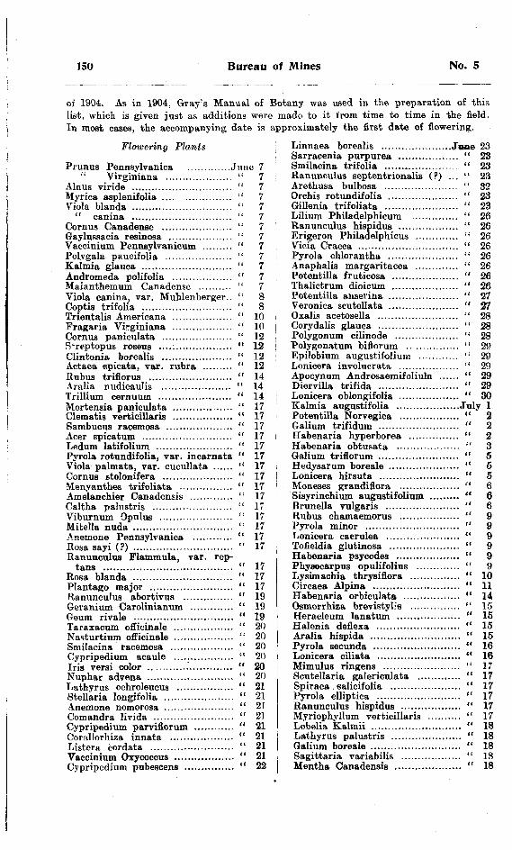
150 Bureau of Mines No. 5
of 1904. As in 1904, Gray's Manual of Botany was used in the preparation of this list, which is given just as additions were made* to it from time to time in the field. In most cases, the accompanying date is approximately the first date of flowering.
Flowering Plants
Primus Pennsylvania .............June 7
Linnaea borealis .....................June 23
Virginiana AInus viride ....................,.........Myrica asplenifolia . . . . . . . . . . . . . . . . . .Viola blanda ..............................
" canina ..............................Cornus Canadense .....................Gaylussacia resinosa ...................Vaccinium Pennsylvanicum .........Polygala paucifolia ....................Kalmia glauca ...........................Andromeda polifolia ..................Maianthemum Canadense ..........Viola canina, var. Muhlenberger.. Coptis trifolia ...........................Trientalis Americana ..................Fragaria Virginiana ..................Cornus paniculata .....................S'reptopus roseus ......................Clintonia borealis .....................Actaea spicata, var. rubra .........Rubus triflorus .........................Aralia nudioaulis .....................Trillium cernuum ......................Mertensia paniculata ............ .....Clematis verticillaris ..................Sambucus racemosa ....................Acer spicatum ...........................Ledum latifolium .......................Pyrola rotundifolia, var. incarnata Viola palmata, var. cucullata ......Cornus stolonifera .....................Menyanthes trifoliata ................Amelanchier Canadensis .............Caltha palustris ........................Viburnum Opulue ......................Mitella nuda ..............................Anemone Pennsylvanica ............Rosa sayi (?) ..............................Ranunculus Flammula, var. rep-
tans .......................................Rosa blanda ..............................Plantago major .........................Ranunculus abortivus ...............Geranium Carolinianum .............Geum rivale ..............................Taraxacum officinale ..................Nasturtium officinale ..................Smilacina racemosa ...................Cypripedium acaule ..................Iris versi color .. .......................Nuphar advena .............Lathyrus ochroleucus ....Stellaria longifolia ........Anemone nemorosa ........Comandra livida ...........Cypripedium parviflorum Corallorhiza innata ......Listera cordata ............Vaecinium Oxycoceus .....Cypripedium pubescens . .
77777777777788
101012121212141414171717171717171717171717171717
171717191919202020202020212121212121212122
Sarracenia purpurea Smilacina trifolia ..................Ranunculus septentrionalis (?)Arethusa bulbosaOrchis rotundifolia .................,Gillenia trifoliata ..................Lilium Philadelphicum ..........,Ranunculus hispidus ..............Erigeron PhiladelphicusVicia Cracca ..........................,Pyrola chlorantha ..................Anaphalis margaritacea ..........Potentilla fruticosa ................Thalictrum dioicum ................Potentilla anserina .................Veronica scutellata .................Oxalis acetosella ....................Corydalis glauca ....................Polygonum cilinode ...............Polygonatum biflorum ............Epilobium augustifolium ........Lonicera involucrata ..............Apocynum Androsaemifolium .. Diervilla trifida ....................Lonicera oblongifolia ..............
Potentilla Norvegica .........Galium trifidum ...............Habenaria hyperborea ......Habenaria obtusata ..........Galium triflorum ...............Hedysarum boreale ............Lonicera hirsuta ...............Moneses grandiflora .........
' Sisyrinchium augustifolium Brunella vulgaris .............Rubus ehamaemorus .........Pyrola minor ...................Lonicera caerulea .............Tofieldia glutinosa ............Habenaria psycodes ..........Physocarpus opulifolius ....Lysimachia thrysiflora ......Circaea Alpina .................Habenaria orbiculata ........Osmorrhiza brevistyl-s ......Heracleum lanatum ..........Halenia deflexa ................Aralia hispida ..................Pyrola secunda .................Lonicera ciliata ................Mimulus ringens ..............Scutellaria galericulata ... Spiraea , salicifolia ............Pyrola elliptica ................Ranunculus hispidus ........Myriophyllum verticillaris . Lobelia Kalmii .................Lathyrus palustris ...........Galium boreale .................Sagittaria variabilis .........Mentha Canadensis ..........
2223565666999999
1011141515151516161717171717171818181818

1906 Agricultural Resources of Mattagami 151
Nasturtium palustre ................July 18Apocynum cannabinum ............... " 18Asclepias incarnata ................... " 18Hieracium Canadense ................ " 18Seutellaria lateriflora ................ " 19Eupatorium purpureum ............. " 19Sanicula Marylandica ................ " 19Achillaea millefolium .................. " 19Sium cicutaefolium ..................... " 19Ranunculus affinis ..................... " 19Monotropa Hypopitys ................ " 21Spiranthes Romanzoffiana .......... " 21Goodyera repens ........................ " 25Monotropa uniflora .................... " 25Epilobium lineare ......................Geum strictum ...........................Galium trifidum, var. pusillum ... Galium trifldum. var. latifolium.. Campanula aparinoides ...............Chimaphila umbellata ................Stachys palustris ........................Prenanthes racemosa ..................Erigeron strigosus .....................'
Lycopus sinuatus .....................Aug. 4Lysimachia stricta ..................... " 5Ranunculus aquatilis, var. tricho-
phyllus ................................... 6Chelone glabra .......................... 6Rumex vertieillata ..................... 6Polygonum amphibium ............... 7Convolvulus sepium .................... 7Cnicus muticus. Rhamnus alnifolia. Epigaea repens. Parnassia palustris.
Ferns
Osmunda regalis.Osmunda cinnamomea, var. frondosa.Botrychium Virginianum.Pteris aquilina.Onoclea sensibilis.Asplenium thelypteroides.Polypodium vulgare.Cystopteris bulbifera.Phegopteris Dryopteris.Aspidium spinulosum, var. intermedium.
Fauna
The fauna of this region is that of the valleys of the Frederick House and Abitibi rivers. For details the reader is again referred to the Report of the Bureau of Mines, 1905.
The number of furs taken in trade from the Indians at Fort Mattagami during the year ending June, 1905, is stated by Mr. James Miller, Hudson Bay Company factor in charge of that post, to be slightly less than that of the previous year. During recent years there has been a marked decrease in the furs produced in this region.
V.—Soil Specimens Collected in the Region1. Lost.2. From bank of Water Hen creek. A rich alluvial soil on which grow luxuriantlj'
alders, willows and many smaller plants. Soil along small creeks is often of this nature3. From bank of creek three miles north of lake Kamiskotaia. A fine white or
reddish powdery soil, common in the southwestern part of the region and one on which are often found large poplar, birch and jack-pine. In this locality are poplar, fifteen inches in diameter, birch and jack-pine, twelve inches.
4. Subsoil from Indian garden on lake Kamiskotaia. Very similar to No. 3. Fair potatoes, turnips and onions are grown in this garden with no cultivation.
o. Surface soil from the same garden, the result of a mixture of soil like No. 4 with forest mould.
6. Decaying peat, twenty inches deep, from spruce forest near margin of a muskeg. Above the twenty inches of peat-like material is a layer of eight inches of moss.
7. Heavy clay subsoil taken just below No. 6. Bluish white hard clay. This is the common subsoil of musiegs and wet spruce forests of small trees.
8. From vicinity of mile-post 10, Patten's base line run west from M. 162 on Niven's line. A layer of decaying forest mould, two inches deep, overlies the subsoil of which

152 Bureau of Mines No. 5
this is a sample. The specimen was taken six inches below the surface. Young poplar, eight inches; spruce, seven inches; birch, six inches; balsam, five inches, are the common trees on this soil. This is a representative specimen of the soils of poplar knolls.
9. Taken two miles south of mile-post 3 on the same line. A reddish clay loam is common in this and other townships. Specimen taken three inches below the overlying covering of forest mould which is two inches thick. Small poplar and spruce are the forest trees in this locality. Another representative specimen of the soils of poplar knolls.
10. From vicinity of M. o, 40c. on Speight's base line in latitude of mile-post 162 on Niven's line. This soil extends only about one-half mile from east to west, but was found one mile south of this line. Poplar, fifteen inches; black and white spruce, ten inches, (some white spruce, sixteen inches); white birch, twelve inches, and luxuriant small flora. One of the best kinds of the lighter soils occurring in the region.
11. From district east of Clement lake. Specimen, a clay loam subsoil, taken two inches beneath the two-inch covering of decaying vegetable matter. Large poplar, balm of Gilead, spruce, balsam and birch grow on this soil. A common soil and a representative one of such a forest.
12. From vicinity of M. 15 on Patten's base line in latitude of M. 174 on Niven's line. Specimen is taken two inches below the overlying five inches of decaying vegetable mould. Poplar and balm of Gilead, twelve to fifteen inches; sprucd, eleven inches; balsam, eight inches; birch, ten inches, are the forest trees named in order of the most common. This is a common soil between the Mattagami and Muskego rivers, and in other parts of the region.
13. Same locality. Specimen taken from the surface covering of vegetable mould.14. Taken a mile and sixty chains east of Jump-over falls. Specimen of subsoil,
beneath two inches of vegetable mould. Spruce and birch, poplar and Balm of Gilead are common forest trees.
15. From bank of Poplar Rapids river, five miles from its mouth. Specimen taken fifteen inches below the surface. The overlying layer of decaying vegetable mould is four inches thick. Spruce and birch, ten inches; balsam, five inches small poplar and balm of Gilead, six inches, are the common trees.
16. Clay from landslide on bank of Mattagami river, two miles above Niven's line of 1900. Kiver bank here thirty-five feet high. Specimen taken about twelve feet above the water. A good representative of the clay soil so common in the region.
17. From vicinity of Mile-post 6, Patten's base line in latitude of M. 174 on Niven's line. Specimen taken just below the three-inch covering of vegetable matter. A reddish sand loam, though an uncommon soil; usually is wooded with spruce, twelve inches; poplar, twelve to fifteen inches; birch, twelve inches; balsam, small.
18. From vicinity of M. 35, 45c., on Patten's meridian of 1904. Specimen of sub soil taken fourteen inches below the top of the moss of a wet spruce forest. The moss itself is six inches deep under which is black muck for about ten inches, which gradu ally changes into the clay loam subsoil. The surrounding forest consists of black spruce averaging seven or eight inches in diameter.
19. Specimen taken about five inches above specimen 18. This and No. 18 are representative soils of the black spruce forest, and therefore are found in a very large proportion of the region.
20. Specimen from a potato patch on a bank, three chains wide, between the Mattagami river and a small lake near Patten's base line in the latitude of M. 162 on Niven's line. Not a common soil. Potato plants in blossom on August fourteenth, and tubers present, one to two inches in diameter. Poplar, ten to fifteen inches, and cedar, fifteen inches in diameter, are quite common on this bank. '
21. Taken two miles east of Mattagami river, opposite M. 8 on Speight's meridian

1906 Agricultural Resources of Mattagami 153
1905. Specimen a subsoil taken four inches under the two-inch covering of vegetable mould. Poplar, ten inches; birch, ten inches; few spruce and balsam are present.
22. Taken six miles east of Mattagami river opposite M. 8 on Speight's meridian of 1905. A hard heavy clay subsoil taken under four inches of vegetable mould not well decayed. The forest growth on this soil is pour. Black spruce, six inches; poplar, eight inches. A ten-inch poplar had seventy-eight annual rings.
23. From eastern boundary of Mahaffy township, between concessions five and six. A reddish brown subsoil taken two inches below the six-inch covering of well-decayed vegetable matter. This specimen is from a well drained spruce forest of trees averaging six or seven inches in diameter.
24. From bank of Mattagami river one mile south of the northern boundary of Mahaffy township. The bank is here sixty to seventy feet high, and the specimen is taken one-half way up the slope, five inches below the five-inch covering of vegetable matter. Poplar, twelve inches; spruce, ten inches; balsam and occasional ten-inch birch are the trees of the locality. Much of the river-bank soil is of this nature.
Chemical Analysis of SoilsFor the following tablet, showing the chemical constituents of a number of soil
specimens, I am indebted to Prof. Harcourt, of the Agricultural College. Guelph.
~ Moist- ji ure. o (HjO)o z
6 12.14
7 .41
13 14.17
16 .88
19 6.3622 2.0223 1.39
Organ ic and Vola tile.
74.46
4.2874.64
16.267.57
19.754.22.94 54
PERCENTAGE OF CONSTITUENTS.
In soluble Resi
due.
4.2671.193.09
51.47
.58.4982.35
77.30
Iron and Alumi
nium. (Fe.OaAA120S )
0.856.94 ...,
Lime. (CaO)
•2.92S 93
10.85 1 n.990.178.85
12.278.30
10 88:
2.66
15.13.34
1.35.73
1.18
Mag nesia. (MgO)
; j
Phos phoric acid
(1'20.,)
trace .305.295
trace .325
Potash. (K20) Humus, ™~-
.123 25.7 1.414
.207 !.......... ........
.577 i.......... 0.49
.111 19.05 18.27
Remarks.
5.68^ residue, Bndecayedwood.
14.7* residue, undecayedwood.
" 240 i 32 1 . .... 112 1.285
" i llr,.485 . -.21
.451 12.4 .37837 042356 ......... .iai
NOTE :—Soili 6 and 13 are almost wholly decayed or partially decayed wood. They thui contain quite a large quantity of residue from the Yi m- m - sieve. The other soils have but very little residue from sifting, what is present being mainly quartz and feldspar particles. No. 19 contains quite t large amount of residue, wnich consists of hardened soil which does not break down under quite a vigorous rubbing in an agate mortar.
Prof. Harcourt subjoins these remarks :"Samples No. 6 and 13 are evidently from swamp soils, or, at least, are soils com
posed largely of organic matter. Both are naturally rich in nitrogen, but comparatively poor in potash and phosphoric acid, but more especially in the potash. Soils No. 7 and 16 are very rich in lime, the latter one especially may be considered calcareous; in fact, all but No. 18 contain an abundance of lime for ordinary agricultural purposes. The percentage of phosphoric acid is very uniform throughout all the samples, while, as may be expected, the more aluminium there is present, the richer the soil is in potash. Potash and phosphoric acid are derived from the decomposed rock materials from which soils are formed; consequently, the amount present will depend upon the nature of the original rock material. The soils examined have, with the exception of 6 and 13, about as much of these two valuable fertilizer constituents as ordinary cultivated soils. The nitrogen content varies widely. Nos. 6 and 13 are scarcely decomposed far enough to produce profitable crops. No. 19 contains about the same amount of nitrogen as the richer farm lands throughout Ontario. The balance of the samples are taken from the subsoil, and consequently, as much nitrogen is not expected. However, nitrogen is s
154 Bureau of Mines No. 5
constituent which is gathered by the plants which have grown on the soil, and in their decomposition have left it in the surface soil. This constituent is more within the control of the farmer than the ash constituents, and to that extent is less important in considering the value of the soils.
"Taking all together, I think it might be safely said that all these soils would be comparatively easy of cultivation and that they contain a sufficient quantity of fer tilizing constituents to render them quite fertile."
Physical Analysis of SoilsProf. Reynolds, of the Ontario Agricultural College, has been good enough to make a physi
cal examination of the several samples of soil, the results of which are contained in the following schedule :
Grade.
Loam . . . . . . Loam Loam Loam . . . . . . . . . . . . . . Peat...........................
clay loam...... . ,. .. .... .. .... Loam Clay loam. Clay...........................Clay...........................
Clay...........................Light sandy loam Clay loam.Clay.................... ......
Sand group.
50.3. 53.3 39. B 44.2
6.3
25.1 60.1 29.5 12.0
20.4
27.116.2
70.126.118.275.2 28.7 3.9
17.7
Clay group.
49.7 46.7 60.4 55.8
93.7
70.374.9 39.9 70.5 88.0
79.6
83.8
29.973.981.824.8 71.3 96.185.682.3
Coarse gravel .
0.0 0.7 2.0 0.5
6.6
1.40.0 0.0 0.0 0.3
0.0
0.00.3
0.00.00.01.24 3.0 0.01.00.6
Fine gravel.
0.0 0.6 1.5 1.2
0.0
3.71.0 9.0 0.0 0.0
1.5
0.0
1.80.80.70.5 1.6 0.01.01.4
Coarse sand.
0.0 1.9 4.1 6.0
0.1
3.22.5
15.2 0.0 0.6
3.2
0.5
3.90.81.50.9 3.0 0.02.41.9
Medium sand.
0.4 2.0 2.2 3.71.6
3.22.8
15 0 1.6 1.1
1.7
0.81.5
5.29.72.61.0 3.0 0.0'2.2
Fine sand.
27.6 36.3 11.7 13.6
0.6
11.99.3
11.8 8.5 6.7
7.2
8.84.6
38.412.96.6
50.5 9.2i.e4.36.7
Very fine sand.
22.3 12.5 20 1 19.7
4.0
7.79.5 9.1
19.4 3.6
6.8
17.07.1
20.810.9
22.3 11.9 2.35.25.5
02
36.6 39.5 51.4 43.7
85.0, ——— ' 70
45.0 25.1 41.9 39.2
33.6
72
2940.036.015.9 51.6 49.057.332.3
it5
13.1 7.2 9.0
12.1
8.7
li '29.9 14.8 28.6 48.8
46.0~9 '
9~"
33.945.88.9
19.7 47.128.350.0
i0.21
'o.'ss'
0.48
0.320.45
'6!s7'0.360.70
i3
"i'925.93
"oisra•2.66
15.13
6.341.35
1.180.91
In further elucidation of this table. Prof. Reynolds says :"Of the twenty-one mineral soils analysed, 43 per cent, are clays and heavy clays.
Of these Nos. 12, 14, 19, and 24 have a relatively high percentage of clay proper, that is, of very fine soil particles composed principally of feldspar. Nos. 7, 9 and 23 have a relatively high percentage of silt. Silt consists of particles coarser than clay, bat still very fine, and is composed principally of quartz rock. Nos. 16 and 22 have nearly equal proportions of silt and clay. These numbers are the clays and heavy clays. The clay loams are Nos. 8, 11, 15, 18, and 21. The average percentage of sand in these is 28.2. The loams are Nos. 2, 3, 4, 5, and 10, the average percentage of sand in them being 49.5 per cent. There are two sandy soils, Nos. 17 and 20, with an average per cent, of sand of 72.6.
"Upon comparing my analyses with those made by Prof. Harcourt in the Chemical department, I observe that almost without exception soils that are high in clay are also high in potash, and vice versa. Soil No. 24 has 50 per cent of clay, and the potash con tent of this soil is .70 per cent.; No. 12 has 49 per cent, clay, and -58 potash; No. 19, 46 per cent, clay and .45 potash; No. 23 has 28 per cent, clay, and .21 per cent, potash. This comparison establishes in an interesting way the fact of the strength of clay soils as compared with soils deficient in clay, an since most of these northern soils are distinctly clayey in type, it may be inferred that they are well provided with potash.
1906 Agricultural Resources of Mattagami 155
"Another feature quite obserrmhk in the physical character of these soils is their large content of lime,—they are highly calcareous. Tic physical result of the lime content is the friability which they possess in a degree very marked when we consider that they are clay soils.
"A number of these soils have the appearance of cultivated soils with a good proportion of humus and in a good mechanical condition. It would, however, be erroneous to judge the value of these soils from their content of vegetable matter, siuce many of them are subsoils, but, taken altogether, they seem to me to be good agricultural soils."
A chart showing graphically the proportion of clay and silt, on the one hand, and of sand on the other, in the several samples of soil was prepared by Prof. Reynolds, and is herewith reproduced:
Mattagami Soils
to
60
la
10
B
Sand.
e. s. J. e. 7. o.l
s /c. //.
l C/ayaW
Silt
•aa Z
l •Sand,
lClay **d
Silt.
THE ANIMIKIE IRON RANGEBY L P SILVER, B.Sc.. A.M.
After having spent the month of May, 1905, in the Cobalt area assisting Prof. W. G. Miller, Provincial Geologist, the writer was instructed to proceed to Port Arthur and examine the Animikie iron range from Loon lake to Port Arthur, a distance of 30 miles. Mr. W. N. Smith of Wisconsin University had mapped the area the pre ceding year from Pearl River to Beck siding in great detail, so that the writer had to make but few minor additions to that part of the map. Mr. Smith's excellent summary of the region was printed in the Fourteenth Report of the Bureau of Mines, pages 254 to 260.
Mr. W. A. Begg was my assistant in the field, and he proved himself a very capable and untiring worker. The work was carried out under the direction of the Provincial Geologist, who spent a few days in the field at the close of the season, and to his valuable suggestions any credit due this paper belongs.
The country mapped consists mainly of old lake beaches, some of which are 400 feet above the present level of .Superior; the surface therefore is composed of sand and gravel terraces. The vegetation which covered these has been burned over, obliterating all the township lines, so that it was found advisable to use the Canadian Pacific Rail way track as a base line, and as every mile is numbered, it served the purpose excel lently.
Traverses were made to the north and south limits of the map sheet at every alternate mile along the division, one day's operations consisting of a traverse north from some point on the railway to the northern limit of the sheet, thence travelling westward for a mile, returning due south to the track. The next day the corresponding rectangle to the south of the track would be covered; .and the next mile being omitted, the operation would be repeated. In this wr.y no point in the map could be more than half a mile distant from territory which was actually gone over.
The Animikie iron-bearing series, which is the eastward extension of the Mesabi or Upper Huronian series of Minnesota, is best developed east of Port Arthur, where considerable exploratory work has been done. This area came into prominence about 40 years ago as the result of explorations for silver ore, a large quantity of which was mined from Silver islet in lake Superior, and from other mines on the mainland at Rabbit mountain and elsewhere. The iron deposits were early recognized as of pro bably commercial value, but the little prospecting then done was not attended with success. Within the last few years some very systematic work has been done in the region both in test pitting and diamond drilling by Mr. Rinaldo McConnell of Ottawa, Messrs. Wiley Bros, and Marks, Mr. T. Hogan, and Messrs. Flaherty and Knobell of Port Arthur, and to these gentlemen the writer is indebted for the opportunity of examining the properties.
As the Canadian Pacific railway passes right over the iron lands, the facilities for shipping the ore to the smelter now in course of construction at Port Arthur are very favorable.
GeologyConforming with the classification recommended by the International Committee
on the Pre-Cambrian geology, 1 all the rocks save the Pleistocene, and possibly the Logan
i Bnr. Min., 14th Report, 1904.[156]
[157J

158 Bureau of Mines No. 5
Sills are regarded as of pre-Cambrian age. We hare no means of determining the age of the Logan Sills, as they are evidently later than the Keweenawan, but how much later it is impossible to state.
The succession is as follows in descending order :Pleistocene: Glacial drift, residual .clays, beach sands and gravel.(Unconformity).Logan Sills: Diabase, diorite or gabbro intruding all the following formations.(Igneous contact).Keweenawan, (Nipigon): —Conglomerate, sandstone, impure marls.(Unconformity).Upper Huronian, (Animikie):—Iron bearing formation, black slates, impure
limestones and quartz conglomerate.(Unconformity).Middle Huronian granite. (Igneous contact.)Lower Huronian: Conglomerate, graywacke, greenstone, quartz porphyry,
amphibolite.(Unconformity).Keewatin : Quartz porphyry.
KEEWATIN
So similar lithologically is much of the Keewatin to the Lower Huronian, on account of the profound metamorphism which both have suffered, that only a small area o* rock was noted which the writer was able to say definitely belonged to the former age. This was a small exposure one-half mile south of mile-post 117 on the C. P. R. where the pebbles of the Lower Huronian conglomerate consist of fine grained, greenish quartz porphyry, containing bright specks of quartz and feldspar. Under the microscope these are seen to be made up of a ground mass of interlocking quartz grains, with a few shreds of biotite, in which are imbedded some phenocrysts of quartz and orthoclase, the whole exhibiting a flow structure induced by pressure.
The difficulty in distinguishing the Keewatin from the Lower Huronian was early noted by N. H. Winchell in Vol. o, Minnesota Natural Survey, page 6, where hewrites :
"The oldest detrital rocks are abundantly mingled with volcanic tuff of a basic nature. Indeed the fragmental greenstones of the Keewatin are so intimately associated with the massive greenstones that they cannot always be distinguished from them, whether in the field or in the microscopic thin section. Starting from the plain igneous rocks, the characters gradually change by the loss of one feature after another and the acquirement of slightly different features until finally the whole petrographic nature of the rock at one end of the series is so altered that it is not warrantable to class the rocks at both ends of the series in the same category. At one end of the series the rock considered is plainly an igneous one, and at the other is plainly a fragmental one. and it .is only by the most minute and painstaking comparisons that some of the steps in the series can be assigned to this of the other end of the scale."
It may be timely here to introduce the following by W. N. Smith from his paper previously quoted, page 255.
"The most western exposure of the graywacke series is largely represented bv a schistose conglomerate containing pebbles of the various phases of the underlying Kee watin, together with fragments of a massive granite and porphyry. The granite pebbles, are probably derived from the Laurentian granites, which although not exposed in the area mapped, occur over a considerable area north of Port Arthur. As the contact between the graywacke and the Keewatin is approached, the conglomerate character of the former disappears and the lowest member of the graywacke very closely resemble!! the Keewatin greenstones. It. however, can be distinguished from them bj the presence of scattered fragmental grains, and by the absence in the graywacke series of the minute crumpling at right angles to the general schistosity which is characteristic of the adjacent Keewatin."
1906 The Animikie Iron Range 159
As the Lower Huronian conglomerate is made up almost entirely of porphyry pebbleSj it was the writer's endeavor to find some area of the porphyry in place, and thus establish a known area of thei Keewatin. However, he only succeeded in locating a very small area midway between mile 117 on the C. P. E. and Thunder Bay, as pre viously mentioned.
The lithological similarity of our Lower Huronian in the Port Arthur region to the rocks of the same age south of the lake on the Mesabi and Penokee ranges, is very marked indeed, and some specimens of the Lower Huronian conglomerate brought down by Mr. A. P. Low from as far northeast as lake Mistassini, in Quebec, struck the writer as being remarkably similar to those of Port Arthur.
Writers on the geology of the Mesa"bi, namely, N. H. Winchell and TT. S. Grant, describe similar rocks as Upper Keewatin. Winchell and Grant called the greenstones Lower Keewatin, and the conglomerate which they recognized as being formed from the greenstone, Keewatin, but the study of field relations leaves little doubt of their being Lower Huronian, a fact brought out by Prof. C. K. Leith in his monograph or. the Mesabi range.
THE LOWER HURONIAN SERIES
To the Lower Huronian belong rocks of both sedimentary and igneous origin. The sedimentary include interbedded conglomerate and graywacke; and the igneous, por phyry, amphibolite and fine grained trachytic rocks.
The graywacke and conglomerate make up by far the greatest part of the Lower Huronian, and they cover the most extensive territory of any of the formations in the district.
Normally, the' graywacke is dark gray to dark greenish-gray in color, weathering to somewhat lighter tints. The bedding and schistosity are evidently conformable, both standing almost vertical, with a uniform strike of north 80 degrees east. In some places, owing to greater dynamic stresses, the graywacke has been altered somewhat to a hornblende schist, with the hornblende, mica and chlorite glistening on the parting planes of the rock. After examining many slides under the microscope, the graywacke was found to be fairly uniform in texture and composition, being made up of angular to subangular grains of quartz and feldspar which, after considering all the slides, appear about equally abundant. The cementing material in many cases seems to be chloritic and micaceous, and in others is replaced by a cloudy alteration of the feldspar.
Iron pyrites is abundant in most of the slides, though in some it has been altered to the oxide of iron.
No true slates were noticed, though in the neighborhood of intrusions some of the very fine grained graywacke was found to be metamorphosed into what very much resembled a dense compact slate. There has also been a very marked alteration of the graywacke, by the infiltration of quartz in the form of veinlets which conform as a rule to the schistosity and bedding. These graywacke® seem to have been near shore deposits of feldspar and quartz mud, which has been metamorphosed into dense rocks by the recrystallization of much of the feldspathic and ferromagnesian constituents into fresh feldspar, mica and actinolite; and also by the infiltration of much silica in the form of veinlets and as cementing material. All thei actinolite seems to be secondary, and to have been formed by dynamic metamorphism, but some of the mica has been deposited in its present position. The graywacke and conglomerate were noticed only in one place east of McKenzie Station (on the trail leading from Loon to Flaherty's) where in one small area may be seen a narrow band of very fine Lower Huronian con glomerate. West and north of mile-post 119, the graywacke and conglomerate shade into each other, the beds standing on end and striking north 80 degrees east.
160 Bureau of Mines No. 5
Lower Huronian Conglomerate
The best outcrops of this very interesting rock may be seen along the cuts of the C, P. E. at mile-post 116.2 and westward. They are both thin and thick bedded, the layers ranging from a few inches in thickness to several hundred feet, and are now standing almost vertically, often in parallel bands between which are thin beds of the ordinary graywacke. In color the conglomerate very closely resembles the graywacke, and in fact so profoundly have both been mashed that on fresh cuts only careful scrutiny will enable one to distinguish the pebbles from the graywacke matrix; but on weathered surfaces the elongated mashed pebbles stand out very distinctly, owing to
Lower Huronian conglomerate on south side C. P. Railway.
differential weathering. The pebbles, which range from microscopic size to six inches 01 more in diameter, are composed almost wholly of greenstone (fine grained quartz porphyry) and graywacke. Many of the porphyry pebbles are weathered to a pink felds pathic looking material, which might lead to their being mistaken in some cases 'for granite pebbles. True granite pebbles were nowhere noted in this formation. Under the microscope these porphyry pebbles were seen to be fragments of trachyte, which had a fairly uniform composition as follows: fine grained ground mass of plagioclase and quartz showing flow structure, in which are imbedded many altered orthoclase.
1906 The Animikie Iron Range 161
plagioclase and quartz phenocryst®; much secondary quartz, some biotite and actinolite, and a great deal of secondary products such as chlorite, muscovite, talc and sphene.
Associated with the porphyry pebbles are others of what appear to be a form of lean jaspilyte. This would lead to the supposition that somewhere in the district was a region of Keewatin iron formation, and as the strike of the conglomerate is about •east and west, the old shore line must have been some miles north of the present lake, and the region of Keewatin would probably be somewhere in that direction, and is at present probably covered by the Lower Huronian and granite.
The repetition of the bands of now vertically standing conglomerate are due to either the oscillation of the shore, or to the disturbed equilibrium between the sourco of the supply and the transporting power of the streams. The latter brought down the material, which was originally deposited in horizontal beds of conglomerate inter laminated with others of graywacke, and these were subsequently tilted to their pre sent position. So much metamorphism have some of the conglomerates suffered that the pebbles have become squeezed, elongated and broken so as to closely simulate a porphyry, from which only careful scrutiny can distinguish them. The pebbles are drawn out to conform to the strike of the beds, which is north 80 degrees east.
The Amphibolite*
On mining location A L 521 we first came upon an area of amphibolite which there intrudes the Lower Huronian graywacke. This intrusion may not be as continuous as shown on the maps, yet it occupies a large area. In several places the drift was too deep to admit of finding any outcrops. The amphibolite was found to be yonuger than the graywacke but older than the granite, which intrudes it, and at the contact includes many fragments of it. There have been later intrusions, in the form of small dikes, of a similar basic rock, which is very hard to distinguish in the field from the true amphibolite!. The latter is however coarser grained and contains much less feldspar, and under the microscope it is seen to be composed of large amphibole individuals, some biotite and a small amount of plagioclase.
The amphibolite is frequently cut by dikes of a dense grayish rock. This under the microscope seems to be a fine grained schistose diabase in which the amphibole and biotite much exceed the feldspar.
Sea-green Porphyry |
One mile west of Mackenzie at mile-post 116.5 and east of Mackenzie at mile-post 110 may be seen small areas of a dense grayish green rock showing quartz and feldspar in glistening grains, with some specks of pyrite. Where weathered this rock has a sea-green appearance, and under the microscope is seen to be composed of a fine grained ground mass of quartz and orthoclase, in which are imbedded phenocrysts from five to ten millimetres in diameter of the same minerals, with a few individuals of plagioclase. Of the secondary minerals muscovite and sphene are abundant, the latter occurring in vein-like aggregates. This rock intrudes the Lower Huronian graywacke-conglomerate.
MIDDLE HURONIAN
9 Oranite
One of the most prominent formations in the district is that mapped as granite, though it really varies from pegmatite containing tourmaline and muscovite on the one hand, through syenite to a grano-diorite on the other, and to the north evc.n shades into what might be called true diorite. It hag been correlated with the Middle Hur onian because it intrudes the Lower Huronian and is therefore younger and being overlain by the Tipper Huronian is older than it.
11 M.

162 Bureau of Mines No. 5
North and east of Loon lake the granite forms a series of small rounded hillocks. This peculiar topography is not due to weathering or glacial erosion, but to the shape of the original eruption, which came to the surface or just beneath the overlying cap of Lower Huronian in the form of small bosses. In some cases large fragments of the Lower Huronian may be found sticking to the crest and the sides of the boss.
Light gray granite cutting Lower Huronian conglomerate.
Some of the pegmatitic phases of the granite bear a very striking resemblance to the tin-stone granites of Cornwall, and although no evidence of cassiterite was noted, it may have been overlooked owing to the difficulty of its recognition. In color the granite varies from a pink to a pinkish gray, with the pink predominating, and it occasionally becomes pegmatitic over large areas, the feldspar crystallizing ou^into individuals from a half an inch to an inch and a half in length. Such areas are capable of affording fine building material, which when polished ought to prove specially suitable for monuments, etc. All the culverts on the C. P. E. along this section have been constructed from massive blocks (up to five feet in length) of this material, and these afford a fine example of what may be done with it.
Examination of many thin sections of the granite from various localities showed the more acidic sorts to contain a great deal of micropegmatite, quartz and microcline,
lla M.
1906 The Animikie Iron Range 163
some plagioclase and abundant garnet individuals. Some of the pegmatite varieties have large individuals of blue tourmaline, while muscovite, biotite and amphibole are also present, and the more altered varieties contain much sphene and chlorite. Some of the so-called granite, notably the later dikes, shade into a syenite porphyry composed of a ground mass of fine grained orthoclase, in which are imbedded many large crystals of the same mineral. In some of the granite dikes which cut the graywacke, hypersthene is abundant, and in places near the contact this mineral pervades both the granite and the graywacke. Some of the most basic varieties under the microscope closely resemble diorite, except that they contain somewhat more orthoclase than is usually seen in that rock. Along the lake shore, south of mile-post 121, the granite assumes the porphyritic phase above mentioned, some of the large rectangular individuals of the feldspar attaining a length of over one and a half inches. This rock undergoes a very peculiar change when weathered, becoming greenish and closely simulating in appearance and color a quartz diorite. Under the microscope the fresh varieties are seen to be made up of an equal number of orthoclase and plagioclase individuals, while quartz, amphibole and titanite are also present. In sections of the weathered varieties, the green color is seen to be due to an alteration of the feldspar and the ferromagnesian constituents to green fibres of chlorite.
THE ANIMIKIE FORMATION
The Animikie or Upper Huronian is the formation in which the iron ore occurs and ie composed of several members which are in descending order as follows:
1. Black slate.2. Upper iron formation.3. Slate (somewhat calcareous).4. Thin bedded impure limestones.o. Iron formation proper.6. Quartz conglomerate.
Black Slate
The Upper Black Slates, 150 feet or more in thickness, conformably overlie the Upper Iron formation, and have a gentle dip to the south, with which the cleavage is conformable.
They contain considerable pyrite, and though traces of carbonaceous material are evident, no sign of fossil remains was noted, in spite of the seemingly favorable con ditions for their preservation. Intruded into the slates conformably with the -bedding occur many of the Logan sills. A peculiarity which may be mentioned here is the deposition of graphitic carbon at Current river where the slates just under the bridge show a thin coating of carbonaceous material which may have been brought down by the stream in solution, probably in the form of hydrocarbon, and there reduced to almost pure carbon.
The Lower Slates
The Lower Slate is very similar in lithological appearance to the Upper, but in places has seams of calcareous material, and in the area north of Port Arthur shades at the base into the impure limestone.
Impure Limestone
An analysis of this rock by Mr. A. G. Burrows gave the following:
Insoluble residue..................................,. 7.24 percent.Fe2 O3 .............................................12.65 "Ga Co 0 ............................................52.10 "Mg Co s ............................................26.48 "A1 2 Os ............................................ .66 "
It is dark gray in color and occurs in beds of one inch to six inches in thicknes* interbedded with the lower slate and taoonyte beds.
164 Bureau of Mines No- 5
Quartz Conglomerate
The quartz conglomerate, at the base of the Animikie, overlies unconformably the- Lower Huronian graywacke and conglomerate, and also the granite. It is nowhere more than six inches in depth, and consists wholly of vein quartz with a few pebbles of jasper. It has been formed, no doubt, from the disintegration of the quartz veins whioh are so numerous in the Lower Huronian.
Iron Formation Proper
The Iron Formation Proper is a ferriferous cherty carbonate called taconyte by Winchell, and as this is the name by which these rocks are largely known to the miners and prospectors, it will be used in the following discussion.
The taconyte has a spotted appearance and in color is of various shades of gray, red, or green, according to its composition. It has a conchoidal to irregular fracture, and may be said to consist of a ground mass of cryptocrystalline, chalcedonic or finely phenocrystalline silica, which is evidently of secondary origin and a precipitate from solution. Throughout this are distributed numerous rounded or subangular bodies or granules, averaging one-thirtieth of an inch in diameter, composed chiefly of a green mineral, very slightly pleochroic, and without distinct cleavage, which on analysis, proved to be ferrous silicate. The origin of these green granules has been one of the most discussed subjects in connection with the Mesabi and Penokee ranges, and has been attacked from various points of view by the very able geologists who have written on these deposits, namely Spurr2 and Leith.3
The proper solution of this problem would be the solution of the origin of the iron ore deposits of the Mesabi, and of these north of Thunder Bay, because all the recent writers agree that the deposits as they at present exist, are concentrations of the ferriferous cherty carbonate. The composition of these granules has been worked out in great detail by both Spurr and Leith, and they agree in stating them to be ferrous silicate. From their similarity to the glauconite granules found in the green sands of recent times, as well as those of the Silurian period, Spurr in his bulletin, on the Mesabi, page 252, was led to call them glauconite granules. He says:
"Analyses showed this mineral to be essentially a hydrous silicate of iron, and selected sections kindly examined by Dr. J. E. Wolff of Harvard University, were stated by him to 'resemble in all physical character glauconite.' In one especially fresh specimen there were also rounded grains of calcite (probably magnesian), apparently originally detrital, and in some limited areas these increased in number till they formed nearly the whole bulk of the rock. These glauconitic carbonate layers are nearly identical in appearance with the glauconitic, St. Lawrence (Cambrian) limestone of Minnesota, of which sections were cut and compared. Dr. Wolff suggested tentatively that the rock was an altered greensand. There is, however, . . . . a constantly very small amount of potash."
This absence of potash was noted by Leith in the many analyses he had made of these granules, and as potash and phosphorus seem to be necessary constituents of true glauconite, he called these greenalite. Leith in his Mongraph on the Mesabi enumerates the following differences between greenalite and glauconite.
"The amount of alumina in glauconite averages 9 per cent. . while less than l per cent, is found in the greenalite rocks, and this doubtfully belongs with the greenalite. The ferrie iron in all of the best analyses of glauconite is in greater percentage than the ferrous iron. In the green granules from the Mesabi district ferrie iron is nearly if not quite absent. The percentage of metallic iron in glauconite is on an average lower than that of the green granules of the Mesabi district. Glauconite contains a small percentage of soda. In the Mesabi granules soda is entirely lacking. "Glauconite contains from 3 to 13 per cent, potassa, and indeed in descriptions of glauco nite in standard text books the content of potassa is noted as a characteristic of it. In the green granules from the Mesabi district potassa is entirely lacking, and the granules are so fresh and unaltered as to preclude the idea that this substance was originally present and has been removed."
2 The Mesabi Iron bearing rocks. Bull. Min. Geo. Sur. ' Mon. XLTII. U.S. Qeol. Sur. pp. 242-3.
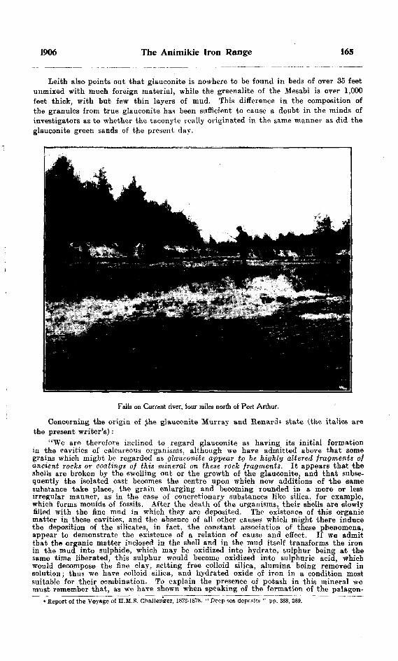
1906 The Animikie Iron Range 165
Leith also points out that glauconite is nowhere to be found in beds of over 35 feet unmixed with much foreign material, while the greenalite of the Mesabi is over 1,000 feet thick, with but few thin layers of mud. This difference in the composition of the granules from true glauconite has been sufficient to cause a doubt in the minds of investigators as to whether the taconyte really originated in the same manner as did the glauconite green sands of the present day.
Falls on Current river, four miles north of Port Arthur.
Concerning the origin of Jhe glauconite Murray and Renard4 state (the italics are the present writer's):
"We are therefore inclined to regard glauconite as having its initial formation in the cavities of calcareous organisms, although we have admitted above that some grains which might be regarded as glauconite appear to be highly altered fragments of ancient rocks or coatings of this mineral on these rock fragments. It appears that the shells are broken by the swelling out or the growth of the glauconite, and that subse quently the isolated cast becomes the centre upon which new additions of the same substance take place, the grain enlarging and becoming rounded in a more or less irregular manner, as in the case of concretionary substances like silica, for example, which forms moulds of fossils. After the death of the organisms, their shells are slowly filled with the fine mud in which they are deposited. The existence of this organic matter in these cavities, and the absence of all other causes which might there induce the deposition of the silicates, in fact, the constant association of these phenomena, appear to demonstrate the existence of a relation of cause and effect. If we admit that the organic matter inclosed in the shell and in the mud itself transforms the iron in the mud into sulphide, which may be oxidized into hydrate, sulphur being at the same time liberated, this sulphur would become oxidized into sulphuric acid, which would decompose the fine clay, setting free colloid silica, alumina being removed in solution; thus we have colloid silica, and hydrated oxide of iron in a condition most suitable for their combination. To explain the presence of potash in this mineral we must remember that, as we have shown when speaking of the formation of the palagon-
4 Report of the Voyage of H.M.S. Challenger, 1873-1878. " Deep sea deposit? " pp. 388, 389.

166 Bureau of Mines No. 5
ite under the action of sea-water, there is always a tendency for potash to accumulate in the hydrated silicate formed in this way. and. as we have stated before, this potash must have been derived from the sea-water."
Leith in quoting the above, remarks that it would be difficult for the quantities of iron found in the glauconite or in greenalite, to filter into the interior of the shell, and goes on to state that if the mud were derived entirely from the disintegration of basic rocks, the proportion of metallic iron would not be above ten per cent., but the actual percentage found in the granules is far higher than this. Analyses show it to be as high as twenty-five per cent. Leith also points out that this would require a larger amount of foreign material than is contained in the casts, and as foreign material is found outside the casts, he concludes that there is no reason why all of this material should not be drawn upon for the supply of iron. On page 254 of his Monograph he says :
"As the greenalite rocks of the Mesabi iron formation accumulated to a thickness of perhaps 1,000 feet, it would be necessary to assume that a thickness of detritus several times this figure originally was present to yield the necessary amount of iron to the granules. There is ample evidence that no such amount of detritus (in fact little or none beyond that now to be observed) was ever present in the Mesabi iron formation. This consideration calls for an additional source for the metallic iron of the Mesabi greenalite granules."
He then goes on to discuss the possible sources of the iron, mentioning direct pre cipitation from solution by organisms, and development similar to that of iron carbonate.
The vast amount of excellent work done by Spurr, Van Hise and Leith on the Mesabi, and the very high standing of these geologists would certainly deter all lesser seeker* of truth from encroaching on their field. The writer had therefore at first intended simply to describe and correlate the rocks in the Thunder Bay region, and avoid all discussion as to the origin of the green granules, but owing to his discovery of taconyte conglomerate in the Animikie, some new light seems to be thrown on the origin of the granules which the writer wishes tentatively to set forth.
The presence of a conglomerate in the Animikie composed of pebbles of taconyte embedded in a matrix of taconyte occurring in three or four separate thin beds would lead to the following conclusions :
The taconyte was deposited on an oscillating shore.' which interrupted the deposi tion by rising above the water; this deposit was then broken up and contributed the pebbles of the* conglomerate, and on a further sinking of the shore additional dis position of taconyte occurred; then as the shore was once more brought above the water another layer of conglomerate was laid down on the taconyte.
This condition, of course, prevailed at the shore, the taconyte conglomerate being an inter-formational conglomerate which was deposited at the same time as the taconyte was being laid down farther from the shore.
The assumption of the above conditions would lead one to the conclusion that the taconyte was some sort of a near-shore deposit, and the conditions which seem to the writer to most nearly conform to the above hypothesis would be the following.
Suppose we had a Lower Huronian or Keewatin peneplane with a sandy shore deposit, in which a concentration of magnetic iron was forming, intermingled with grains of the greenstone, similar to the magnetic sands of the present day. Then owing to change in the source of supply, calcium and magnesium carbonate and other alkaline solutions were brought down, filtering through the magnetic sands and deposit ing impure limestones off the shore. The magnetic and greenstone grains would then act as a nucleus about which concretionary layers of the lime would form. The alkaline solutions would at the same time dissolve some of the silica of the sand, thus rendering it free to form other concretionary Payers about those just described. This would result in granules composed of a nucleus of magnetite or greenstone, with concretionary layers of calcium or magnesium carbonate and silica. On weathering, the calcium, or magnesium and silica, would react on the iron nucleus to form the green hydrous

1906 The Animikie Iron Range 167
ferrous silicate and thus form granules similar to those of the Mesabi. To the writer some such explanation seems to account very well for the high content of iron in the greenalite, which was one of the most difficu't matters to explain in connection with their organic origin. These beds of taconyte were then faulted, and subjected to the ordinary process of weathering, much of the silica being dissolved out and re-precipitated in the veins of quartz crystals so common in the Animikie formation.
The banded taconyte of the Animikie, which simulates the jaspilytes of the other ranges, though not so distinctly banded, is really a fine grained chert containing the usual granules of the same composition as those of the groundmass, but the striping is due to iron oxide in evenly distributed particles.
Tunnel in Wiley's iron ore location.
The Upper Iron Formation is somewhat more slaty than the lower, has leu taconyte in its composition, is higher in phosphorus and lower in iron.
The Iron Ore
The iron ores of the Animikie range consist mainly of hematite and limonite, throughout which may be seen almost unaltered to very much altered lenses of siderite. This siderite is very abundant throughout the ore of erery pit and tunnel in the lower iron formation, and may be distinguished by its light color and by its glistening
168 Bureau of Mines No- 5
appearance, due to reflection of the' light from the cleavage surfaces. Magnetite occurs in small amounts generally near intrusions and is clearly a metamorphic product of the hematite.
The ore has been concentrated along and near the fault zones, much of it being changed to carbonate. That the deposits in question are still in process of formation may be seen by the presence in the ore of lenses of the comparatively unaltered taconyte and carbonate, which reduce the percentage of the otherwise high iron content of the- ore. Unlike the Mesabi and other iron regions south of lake Superior, the deposits do not occur in pitching troughs, nor do they rest on an impervious basement. This may in part also account for the absence of the pure concentrations of iron ore so- common to the south of the lake. The deposits here are however concentrations produced by meteoric waters circulating along faults, and the best ore occurs along the best defined faults, becoming leaner at a distance from them, and gradually shading int^ little altered taconyte.
Analyses of Iron Ores
The following are some analyses of the ores made by Mr. A. G. Burrows. The iron content is somewhat higher than indicated by the analyses as the high percentage of carbon dioxide in the ore is soon driven off in the furnace, leaving the remaining ore of a higher iron value.
Tunnel E of Deception lake. Per cent. Metallic iron .................................................................................. 31.03Sulphur .......................................................................................... .09Phosphorus ..................................................................................... .167
Stripping east of Deception lake.Metallic iron ................................................................................... 31.91Sulphur .....................-..................................................................... .06Phosphorus ..................................................................................... .321
'Wiley's Pit No. 2.Metallic iron .................................................................................... 35.11Sulphur ....................................................................................:..... .067Phosphorus ... ................................................................................. .015
Cliff of Flaherty's. (tMetallic iron .............................................................................*.... 27.64Sulphur .......................................................................................... .088Phosphorus ...................................................................................... .195
Flaherty's tunnel.Metallic iron .................................................................................... 40.45Sulphur .......................................................................................... .021Phosphorus ..................................................................................... .021
KEWEENAWAN OR NIPIGON
The Keweenawan overlies unconformably all the other rocks of the district, namely the Lower Huronian graywacke and conglomerate, the granite and the Animikie. It consists of conglomerates, sandstones and impure marls, and shows its greatest develop ment from Loon lake east, though a small area occurs about the western extremity of the lake. The series lies almost flat, with a slight dip towards the south and a strike of a little east of north. The conglomerate, which shades above into sandstone and impure marls, is made up of large boulders of granite, graywacke, Animikie (iron formation and slate), and amphibolite, in places rounded and water worn. The cut on the C. P. B. one mile west of Loon siding, is a fine example of this and also of the inter-fingering arrangement of the sandstone and conglomerate, which is explained
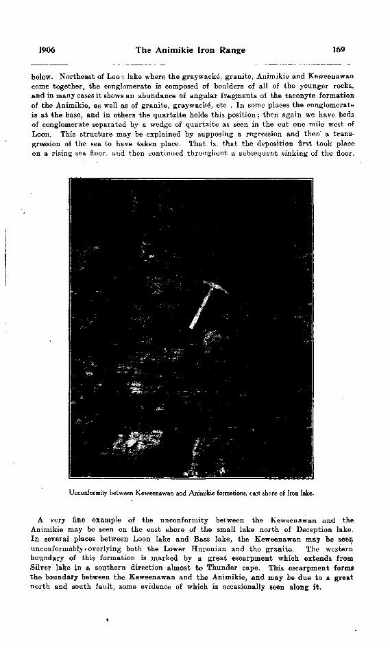
1906 The Animikie Iron Range 169
below. Northeast of Loo i lake where the graywacke, granite, Animikie and Keweenawan come together, the conglomerate is composed of boulders of all of the younger rocks, and in many cases it shows an abundance of angular fragments of the taconyte formation of the Animikie, as well as of granite, graywacke, etc . In some places the conglomerate is at the base, and in others the quartzite holds this position ; then again we have beds of conglomerate separated by a wedge of quartzite as seen in the cut one mile west of Loon. This structure may be explained by supposing a regression and then a trans gression of the sea to have taken place. That is, that the deposition first took place on a rising sea floor, and then continued throughout a subsequent sinking of the floor.
Unconformity between Keweenawan and Animikie formations, t ast shore of Iron lake.
A very fine example of the unconformity between the Keweenawan and the Animikie may be seen on the east shore of the small lake north of Deception lake. In several places between Loon lake and Bass lake, the Keweenawan may be seen unconformably.overlying both the Lower Huronian and the granite. The western boundary of this formation is marked by a great escarpment which extends from Silver lake in a southern direction almost to Thunder cape. This escarpment forms the boundary between the Keweenawan and the Animikie, and may be due to a great north and south fault, some evidence of which is occasionally seen along it.

170 Bureau of Mines No. 5
The railway out one mile west of Loon lake affords an excellent exposure of the Keweenawan conglomerate and also of the interbedded sandstone.. Between Loon lake and Bass lake this formation rests unconformably both on the granite, and the gray- wacke'. The impure marl of the Keweenawan is capable of affording fia* building material, and a great cliff of that material on the south shore of Thunder Bay k now being quarried by Wiley Bros, and Marks of Port Arthur, to 'supply excellent building stone, 'which is being largely used in the construction of some of the finest buildings of Port Arthur. It is light gray in color, and when dressed has a very pleasing appear ance.
Throughout this formation occur veins of zincblende and galena, some of which hare been known since the old silver mining days. Examples may be seen at Blend lake and at Silver lake, and farther east in Dorion township, where deposits were being worked last summer. It was found that almost invariably these veins occurred in. a faulted area, the galena and blende bearing solutions having been accompanied by much silica, which invaded the surrounding Keweenawan and caused the sandstones to assume the character of quartzite.
The Dorion zinc and lead mine being a typical case of the occurrence of these minerals in the Keweenawan, the following description will be characteristic for the whole region.
The vein, which occurs at the contact of the granite and the Keweenawan marls, has a strike of north 40 degrees west and a dip of about 70 degrees to the west. It occupies a fracture zone due to a fault which occurred along this contact, the blende and galena impregnating the granite (the foot wall) and the Keweenawan (the hanging wall), in the fcrm of veinlets, which fill the fractures for about 40 feet from the contact into the granite an.d 15 feet into the Keweenawan. The main concentration however, which is from three ttt three and a half feet wide occurs along the contact, which is the fault plane proper. The galena and blende solutions which were accompanied by silica, calcite and barite, filled the little fissures and cracks formed by the fault, and enlarged thnrn by replacement, the more soluble brecciated material being removed and the ores and gangue minerals deposited in its place.
There was considerable development work done at this mine and the vein looked rery promising.
THE LOGAN OR DIABASE SUXS
That this very important formation has been intruded into the sedimentary rocks of the districts after the method of a sill is no longer doubted. Andrew C. Lawson in his remarkable paper "The Laccolithic Sills of the Northwest Coast of Lake Superior"s set at rest all doubts on this point. The following is his summary of the reasons for calling these rocks "sills."
The trap sheets associated with the Animikie strata are not volcanic flows, because of the combination of the following facts :
d) They are simply geological units, not a series of overlapping sheets.(2) They are flat with uniform thickness over areas more than one hundred square
miles in extent, and where inclined, the dip is due essentially to faulting and tilting.(S) There are no pyroclastic rocks associated with them.(4) They are never glassy.(5) They are never amygdaloidal,(6) They exhibit no flow structure.(7) They have no ropy or wrinkled surface.(8) They have no lava-breccia associated with them.(9) They came in contact with the slates after the latter were hard and brittle and
had acquired their cleavage: yet they never repose upon a surface which had been exposed to sub-aerial weathering.
"Bull. Sfo. 8 Minn. Geol. Survey.

1906 The Animikie Iron Range 171
(10) They are intrusive sills, because of the combination of the following facts:(1) They are strictly analogous to the great dikes of the region (a) In their
general relations to the adjacent rocks and in their field aspects; (b) In that both the upper and lower sides of the sheets have the facies of a dense aphanitic rock, which grades towards the middle into a coarsely crystalline rock.
(2) They have a practically uniform thickness over large areas.(3) The columnar structure extends from lower surface to upper surface, as
it does from wall to wall in the dikes.(4) They intersected the strata above and below them after the latter bud
become hard and brittle.(5) They may be observed in direct continuity with dikes.(6) They pass from one horizon to another.(7) The bottom of the sedimentary strata above them, wherever it is. observable,
is a freshly ruptured surface.(8) Apophyses of the trap pass from the main sheet into the cracks of the siato
above and below.(9) The trap sheets, particularly at the upper contact, hold included frag
ments of the overlying sheets.(10) They locally alter the slates above and below them.
Again, on page 47 of the bulletin he says: "The sills are not only of later age than the Animikie, but they appear to be distinctly of post-Keweenawan age." That these sills are intrusive into the Keweenawan can be very well seen on the northeast side of Silver lake, but how much later they are in age we have no means of knowing, aa there is nothing between the Keweenawan and the Pleistocene in this area.
In composition, the sills vary from diabase to gabbro or norite, but even in the latter the ophitic structure is well marked. At about five miles east of Port Arthur these sills serve as an excellent example of an intrusive assimilating the part of the intruded mass and so undergoing profound alteration. Prof. Lawson noted this locality, concerning which he says: "Another feature of interest, but also quite local i ri its occurrence, is the presence of irregular patches or blotches or blebs of quartz in the mass of the rock." But he did not explain the reason for this occurrence. This local irregularity is very well seen in the rock cut at mile 121.5, and is found to be part of a large diabase sill through which the railway cuts at that point. Examining the rock very carefully on all sides of the cut we see that this phase of the diabase gradually assumes the natural characteristics, the area affected being comprised within a radius of 100 feet from the face of the cut. At the eastern end of the cut the diabase overlies the slates, just a few feet from where the phase in question is so well noted, and very close to this contact fragments of the slate may be seen in the diabase in all stages of assimilation. A little farther away we get the blebby quartz and feldspar of the diabase.
The analyses of the three samples by Mr. Burrows given below show the stages :(a) Diabase 50 feet from contact, normal.(b) 10 feet from contact (porphyritic quartz and feldspar).(c) At contact (contains fragments of partly assimilated slate).
(a) (b) (c)Si O...........................49.82 62.30 64.60AU O........... .............17.35 15.81 16.00Fe~, O, ........................ 1.76 2.19 traceFeO.......................... 8.22 3.88 4.06CaO.......................... 9.25 3.33 2.88MgO................. ........ 8.21 3.28 3.18K, O.......................... .70 1.87 2.01Na, O................... . .... 2SR " 3.84 4.27Los?. ..........................IS:} 3.:55 2.84
172 Bureau of Mines No. S
Sorting Operation on Loon Lake Ores
Some experiments in concentration were performed by Mr. Knebel of Port Arthur, the results of which were kindly given to the writer and are here appended :
"Some ore was taken out from three different places, with an endeavor to represent as large a cross section as possible of the ore bed, and then hand sorted into piles, measured up, sampled and analysed.
"The sorting was done chiefly by Finns who were entirely unaccustomed to handle iron ores, but I personally took part and found that it was feasible to make a perfect separation purely from the weight and not from the outside appearance of the sample.
"The following are the results :
Place.
Pit 465 ft. west of tun-
Cross section of ore body.
12 feet . . . . . .
6V fc6t
Grades.
No. 1No. 2 . . . . . . .
Ori inaloreSorted ore . .
Tonnage. p. c.
9M........— —- ——
5..........
Tonnage, p. c.
1611.3
90
en
Iron, p. c.
55.2028.24
53.6159.70
Silica.p. c.
————
16.6051.80
13.46
22.59
Phos. p. e.
.019
.027
.015
Sulph. p. c.
Nil.
Nil.
Moist, p. c.
0.20
"The ore from the tunnel was divided into three grades, 1st, 2nd and waste, but as will be seen from the analyses, the 2nd grade should have been more closely sorted, a small percentage being added to the first grade, bringing that up to say 75 per cent, of the total tonnage, and the rest discarded. In round figures the result of the foregoing would show that 70 per cent, of the top ten feet of the ore body will produce a grade of ore averaging 55 per cent, iron, .022 phoe. and 17 silica, and that 30 per cent, must be discarded as waste,
"It was also found in taking out the ore, that the lean cherty bands break big and the ore breaks small, and that in designing a plant for the practical hand sorting of the ore, advantage could be taken of this, by passing the material through say two sets of grizzlies, one a six-inch and the other of three-inch ring. I believe it will be found that 90 per cent, of the material remaining on the first grizzly and 75 per cent, on the second will consist of waste, which would very much facilitate the subsequent handling of the fines."
In conclusion, it may be pointed out that though the percentage of iron in the "run of mine" ore is low, as shown by Mr. KnobeFs experiments, it may be greatly increased by concentration.
Acknowledgment is due Prof. R. W. Brock for much valuable assistance rendered the writer.

IRON RANGES OF EASTERN MICHIPICOTENBY A P COLEMAN
Introduction
Much interest has attached to the iron formation northeast of lake Superior, since the Helen iron mine, at present the most important in Canada, was opened up. Many prospectors have worked over the region; the former Lake Superior Power Company has explored it carefully on its own account; and the Bureau of Mines of Ontario has had parties engaged in mapping the iron ranges. The region including the*Helen mine itself was mapped and reported upon by the present writer and Professor A. B. Willmott in 1902;" and afterwards the outlying parts of the formation, especially to the north and west, were mapped and described by Dr. J. M. Bell, whose report appeared in 1905. 3
North Shore, Lake Superior.
In accordance with the instructions of Mr. T. W. Gibson, Director of the Bureau of Mines, my field work during the past summer was directed toward completing the mapping of the iron formation in the comparatively unimportant parts of the region to the south and southeast of the Helen mine, and some isolated bands of the formation to the north. Curiously enough, a range of considerable magnitude was recently dis covered only a mile or two from the Helen mine, between it and the Magpie river on the northwest, within territory supposed to have been carefully covered by prospectors, and
iBur. Mines, Ont., Vol. XI, pp. 152-185.[173]
, Vol. XIV, Part I, pp. 278-355.

174 Bureau of Mines No. 5
included in Dr. Bell's map. This has been mapped during the past summer, and will be described in the present report. Most of the region has been carefully reported upon in the two papers just referred to ; the previous literature on its geology has been detailed, and the geneial topography and geological relationships have been discussed: so that little need be added from those points of view.
The Geological Nomenclature
Since the former papers appeared the geological nomenclature of the lake Superior pre-Cambrian has been discussed and adjusted by a committee of American and Canadian geologists, so that the terms used in this report will differ from those employed by Prof. Willmott and myself, on the one hand, and by Dr. J. M. Bell on the other, though the distribution of the rocks in the field and the colors used in mapping them Vill not be changed.
For convenience the three systems of nomenclature are given beneath, No. I being that of Willmott and myself, No. II that of Bell, No. Ill the one recommended by the Pre-Cambrian committee : 3
I.LAURENTIAN. . . . . . . . . .Gneisses and Granites
(Acid Eruptives UPPER HURONIAN . . -i Basic Ernptives
(.Dore Conglomerate( Eleanor Slates
LOWER HURONIAN, ^'wa S8/"1" tton \Gios Cap Greenstone
II.
KEWEENAWAN . . . . . . . Basic EruptivesPOST HURONIAN..... -Acid EruptivesUPPER HURONIAN. ...Dore Formation
UnconformityLOWER HURONIAN.
III.
CAMBRIAN . . . . . . . . . . . . . Upper SandstonesUnconformity
PRE-CAMBRIAN . . . . . . . Keweenawan— Basic Eruptives and ConglomerateUnconformity
HURONIAN . . . . . . . . . . . . .Dore FormationUnconformity
L'PCu/iTiM f Helen Iron Formation . KEfcW ATIN . . . . . . . . . . ^ Qros Cap and wawa Schists and EruptivesEruptive Contact
LAURENTIAN . . . . . . . . . . Gneisses and Granites
It will be observed that Dr. Bell omits the Laurentian from his series of formations. though Logan himself described it as existing at Michipicoten, and all later geologists working in the region have used the term. His reason for so doing seems to have been the impression that the Laurentian is necessarily older than the Huronian, but the general experience of Canadian geologists to the contrary and the final decision of the correlation committee leave no doubt that in the main the granites and gneisses of the region should be regarded as truly Laurentian.
DEVELOPMENT OF THE DISTRICT
The Michipicoten region first attracted attention in 1897 as a gold mining district. hundreds of locations being taken up in the next two or three years to the north of Wawa lake. On many of them free gold specimens of a promising kind were found. but none of the prospects discovered can be said to have developed into mines, except
3Bur. Mines, Ont, Vol. XIV, Part I, pp. 269-277.
1906 Iron Ranges of Eastern Michipicoten 175
the Grace, which was worked for some time, apparently at a profit, by the Lake Superior Power Company, but was closed down in 1903 along with all the other enter prises of that company, owing to financial embarrassment. One or two of the prospects were located on fragments of the Helen iron formation. The location including the Helen mine itself was first staked as gold-bearing, but soon turned out to be of vastly greater value as an iron mine.
The gold excitement of the later nineties caused the founding of two villages, the Mission near the mouth of Michipicoten river, and Wawa City on the shore of the lake of the same name. Little of permanent value resulted, however, except the building of some miles of wagon roads and the opening up of two or three farms which are still occupied. ,
The Helen iron mine has been the occasion of more important opening up of the district by means of wagon roads, railroads and steamers. The old Grasett road from Michipicoten to the Canadian Pacific railway at Grasett has been repaired and is regularly in use during the winter, when navigation is closed. The railway, eleven miles in length, between Helen mine and Michipicoten harbor is in constant use, bat the Josephine branch is idle, and the main line of the Algoma Central, from Sault Ste. Marie to Josephine, and then on to the northwest, is still unfinished. As far as Josephine the grading is done and ties are ready for track laying, but bridges are lacking and rails have been laid only about 70 miles north of the Sault. Northwest of Josephine the line has been located but not graded.
In many parts of the region these railways and the "tote" roads made during their construction give access to the iron ranges, in other parts canoes must be used or one must tramp through the woods. Numerous townships have been surveyed or blocked out to provide for the allotment of lands granted by the Legislature to the Algoma Central railway; and the lines and mile-posts are of service in fixing the position of ranges. In our own case this has been done mainly by pacing on compass lines to the nearest fixed point.
During the summer two assistants were engaged in the work, Mr. T. L. Goldie being with me from the first, and Mr. E. S. Moore joining the party later. After my departure the work was continued for some weeks under the direction of Mr. Moore. Both gentlemen gave efficient service, the topographic side of the work having been done largely by Mr. Goldie, while Mr. Moore attended to the geology during the latter part of the season. His work, where independent of mine, will be described at the end of this report. As canoemen and guides, Indians from the Mission were employed and gave fairly good service when in the field, but were quite untrustworthy when in the settlements.
A map prepared by the geologists and topographers of the Lake Superior Power Company, mainly under the direction of Prof. Willmott, has been of the greatest service, and the kind aid and advice of the Professor must be acknowledged as having helped forward our work in important ways.
REGION SOUTH OF MICHIPICOTEN RIVER
Topography
The region south of Michipicoten river is typical rocky lake country overlaid with morainic material and old lake deposits in many places. The hills, though generally round topped, present steep slopes toward the valleys and often drop off in impassable cliffs one hundred or more feet in height. None of the hills rise much over 1,000 fee; abovp lake Superior, but many reach 900; and magnificent cliffs face the east shore of the lake, giving comparatively few landing places and still fewer good harbors.

176 Bureau of Mines No. 5
Two or three small and generally swift rivers or creeks flow westwards into lake Superior, such as Old Woman and Brule rivers, having a course of not more than 15 miles, draining deep valleys with numerous little lakes. The eastern side of the region has larger lakes and less impetuous streams tributary to Michipicoten river, the most important being Anjigomi river draining a half dozen lakes of considerable size.
The Michipicoten is much the largest river flowing into the east side of lake Superior. It is about 175 miles long, heading in lake Wahatongusheen north of the Canadian Pacific railway, passing through Dog lake, Manitowick lake and Whitefish lake, all large bodies of water, and emptying into the northeast angle of lake Superior. It receives many tributaries, and often has a width of several hundred yards in its lower course. The part of special interest here extends from the westward bend, a feiw miles south of Whitefish lake, to Michipicoten bay, a distance of more than 20 miles, including numerous curves and meanders in the lower portion. Below the junction of Anjigomi
Running a rapid, Michipicoten river.
river the Michipicoten flows with a fairly swift current over a bottom of rounded stones derived from morainic and old lake deposits. In high and medium water it forms an excellent canoe route down stream, but in low water is in places shallow. Up stream the current is often so swift as to require poling.
Six or seven miles by road above its mouth the High falls of the Michipicoten interrupt canoe navigation, necessitating a two miles portage. The drop is estimated at 128 feet, and the falls are in two parts over a peculiar porphyritic granite. Surveys have been made for a power plant at this point, and sufficient power could easily be obtained for all probable mining and railway purposes of the region.
Below the falls for two miles there are violent rapids, so that the whole drop from above the falls to lake Superior is estimated at nearly 200 feet (aneroid). Below the rapids the river resumes its usual character, being shallow with a swift current over coarse gravel and rounded stones, until near the Mission. Here Magpie river comes in over a fine fall, and the combined channel is wider but with shifting shoals of sand and

1906 Iron Ranges of Eastern Michipicoten 177
mud. There are at present two outlets, a small one toward the north between a rocky island and the mainland, and a larger one to the west, interrupted by large sand bars. Until a few years ago the small outlet was closed with sand, but storms have removed the sand and it is now the usual channel taken by boats going to Michipicoten harbor.
Below the rocky portion of its valley at the High falls the Michipicoten flows between high banks of stratified sand and gravel, which it is rapidly cutting at bends, giving fine exposures of the old lake deposits. At one bend canoes going up stream make a portage of three or four chains and avoid two or three miles of swift water. The last bend towards the Mission was even more extravagant until, about 26 years ago, the Hudson Bay Company had a channel cut through the neck, where it was only 100 feet wide. The river quickly made use of the new channel and cut off the bend, which is now called Dead river. Since that time the upper opening to the oxbctw has been silted up, but the lower outlet is still open.4
Roches moutonnees, Michipicoten Harbor.
Blackinton's Claims
Two or three miles south of the Mission, near the mouth of Michipicoten river, a number of sma'l areas of iron formation occur on or near Bridget lake, and the locations are generally spoken of as Blackinton's claims. Bridget lake empties by a small swift stream into lake Superior half a mile to the west, but it is most easily reached by canoe, up the Michipicoten for a mile, across a portage on gravel plains to Pike lake, and from this through Bound lake, Cross lake and two small nameless lakes to the west. On the last portage into Bridget lake an irregular band of iron formation is crossed and may be followed from northeast to southwest for about 200 paces, but with very unequal widths. At various points it has been stripped, showing in some cases black cherty looking material heavy with magnetite, in others fine sandy looking rock with little ore.
*For a fuller description of the Michipicoten see Prof. Willmott, Bur. Mines. 1897, pp. 188-192. 12 M.

178 Bureau of Mines No. 5
The next largest deposit lies south of Bridget lake, between it and a small tributary pond. Here the Iron formation consists mostly of whitish, sandy looking silica without any large amount of iron ore
The other outcrops on islands, etc., are too small to be of much practical importance.What probably represents an extension of these bands of iron formation occurs about
a mile west on the shore of lake Superior, It is lean and sandy looking, and somewhat mixed up with greenstone and porphyry. At the southeast end the ordinary banded silica passes into black slate and pyrites.
North shore, Lake Superior.
South of Bridget lake small outcrops of iron formation occur at a number of points, the west end of Junction lake, at each end of Island lake, and between Peter's lake and Centre lake. At the outlet of Island lake into Noisy river the formation is different from the varieties mentioned before, consisting of pretty heavy magnetite interbanded with a green silicate, some of which may be rich enough in iron to constitute an ore. The other bits of iron formation are chiefly of the sandy variety and without much promise of ore. The enclosing rocks are porphyrite and schist with a roughly east and west strike.
The Iron formation near Peter's lake will be described later by Mr. Moore.12a M.
1906 Iron Mines of Eastern Michipicoten 179
Iron Formation near Mijinnemungshing
To the west of lake Mijinnemungshing a number of claims have been located on Iron formation. These may be reached by six miles of rough road southeast of Brule bay, or by a canoe route from the lakes previousy mentioned, through Great lake, Bottle lake. Summit lake. Bear lake. Pickerel lake. Trout lake and Almonte lake.
Starting in from the mouth of Old Woman river on Brule bay a small bit of Iron formation is found near the north side of the second township inland from Cap Choyye. This includes some rather heavy magnetite with green hornblende as well as the usual lean banded silica.
Nearly two miles to the south of this, about the middle of the township, a hill of Iron formation rises sharply from a plain of old lake deposits, and from point to point similar material may be traced for about three miles to the east. The hill just men tioned rises nearly 100 feet above the plain with almost vertical cliffs, forming a ridge which may be followed for a quarter of a mile, with a width in places of more than 100 paces. The banded silica is of the usual lean kind, with nearly east and west strike and vertical dip. The smaller bands to the east are of the same character but narrower, and they should perhaps be connected up as two fairly continuous outcrops, but drift and forest made the tracing difficult. The associated rocks are chiefly green schist and greenstone, but some rusty sericite schist occurs also, very like; part of the enclosing rock of the Helen mine.
On the northern extension of Mijinnemungshing, about midway along the north shore, a considerable band of rusty banded silica occurs, and opposite it on the south- east shore there, are rusty surfaces of a sericite schist containing siderite, which should perhaps be included in the Iron formation. Near the last exposure a bright red monzonite, or augite syenite, runs for at least 100 paces. The other rocks observed are the usual Keewatin schists and basic eruptives.
Iron Ore Southeast of Cap Choyye
Inland from the shore of an exposed bay, about two miles southeast of Cap Choyye, a small deposit of impure hematite occurs, but without the usual rocks of the Iron forma tion. A sharp ridge of brecciated material, three or four feet wide, stands nearly vertical and runs about fifteen feet to the east, beyond which rusty patches may be seen at some points. The ore is generally bright red hematite, to a less extent black, with no magnetite, and small pieces of good quality are found, but all the larger rusty blocks contain much barren rock. The adjoining rock is pale green schist with some pyrite, striking m the same direction. The source of the ore is not clear, but the amount to be seen is too small to give the deposit any practical importance. The facts that no Iron formation is to be seen, and that the rock mixed with the ore is shattered and slickensided suggest a quite different origin for this little deposit from that usual in the region. Solutions moving along a fault plane seem to have brought the ore to its present position.
Iron Formation near Lake AnjigomiAn interesting development of the Iron formation just to the east of lake Anjigomi
was stripped and explored last summer by Mr. Edgar Brown. A railway cutting dis closes coarsely banded silica with magnetite, thrown into small sharp folds and associate*) with bands of green schist. There are three strips of Iron formation with, a total width of about 27 feet. On a hill side to the east the formation widens to about 60 feet, with some interruptions of schist; and the character of the formation changes, becoming black and heavy with magnetite. Some parts contain green hornblende instead of eilica, and remind one greatly of the Iron formation at Moose Mountain mine in Hutton township near Sudbury.
180 Bureau of Mines No. 5
The banded silica can be followed as a narrow band along the north side of a little lake, and then turns northeasterly; and in places widens out to 90 feet on a hill side. The range then stops rather suddenly at a hill toward the northeast end, apparently cut off by red granite, which penetrates the Keewatin greenstones and schists as large bosses and dikes. The richer parts of the Iron formation here seem heavy enough to form ore of fair quality. If any large deposits can be found it will be another instance like that of Hutton township, where the Iron formation itself is nearly enough pure
North Shore, Lake Superior.
magnetite to be workable. In the American iron ranges this type seems not to be found, since all the ore bodies worked are concentrations of secondary ore derived by leaching from comparatively poor Iron formation in basins which arrest the flow pf solutions.
Iron Formation on Lake Mishewawa
Along the northeast side of lake Mishewawa a steep ridge rises between two bays, and crossing the ridge in a northwest and southeast direction is a strip of Iron forma tion consisting of banded granular silica or quartzite, with magnetite enough to render

1906 Iron Ranges of Eastern Michipicoten 181
the compass useless. The green schist adjoining is often finely banded, as if a transition rock between the ordinary schist and the Iron formation. The strike of the schist and of the banded silica is across the sharp, steep walled ridge, a most unusual arrangement. At the outlet of a small lake tributary to Mishewawa banded silica occurs again on a small scale, and may be continuous with the outcrop described above, though it was not found on the wooded and drift-covered country between.
About two miles east of lake Mishewawa there is a considerable outcrop of Iron formation on the township line at about the fourth mile south of the northeast corner; and a still larger series of outcrops occurs to the northwest toward the High falls of Michipicoten river. The latter is described by Mr. Moore in a report appended to the present one.
Qoetz Claims
The most surprising recent development of the Iron formation of the region was the finding of a large band within two miles to the northwest of the Helen mine, in a part which was supposed to have been carefully explored. This has been stripped and made accessible by Mr. Alois Goetz, who has taken up a series of claims upon it. The rangs is known to extend for a mile and three-quarters in a direction somewhat south of west and to have in places a width of 200 paces, with some schist intermingled. Part of the range rises as the usual steep ridges, but other parts are in low ground and more or less drift-covered. The formation includes quartzitic and also granular silica, often with magnetite enough to disturb the compass greatly, pyrites, porous black slate and schistose siderite, almost all the forms occurring at the Helen mine. Much of the banded silica has been crushed to a breccia. All the features of the range at the Helen mine seem to be repeated here, except that the band is only about half as wide; but thus far no important mass of ore has been found.
Parallel to the Iron formation along the north there is a fairly thick belt of black slate (Eleanor slate), but most of the enclosing rock is green schist or greenstone of the Gros Cap formation, or paler schist belonging to the Wawa tuffs.
As the examination of this range was completed by Mr. Moore, his account is given as follows in his own words:
"The most interesting and important outcrop of the Helen formation seen in the region is the property of George Goetz. This had been examined by Dr. Coleman, but the writer visited it later, when some trenching had been done, and made a cross section of the claim. The trench along which the measurements were taken runs along the north and south line at the west end of the George Goetz claim.
"The removal of the soil exposes in several places large masses of rock, which consist mainly of carbonate, and which weather with a thick brown layer on top. These masses lie embedded in the banded silica and extend rather regularly across several of the trenches, which are about sixty feet apart. Thy appear at first sight to resemble dikes, but they have no doubt been formed by deposition of sediments of different com position from the banded silica, and have been laid down between the bands of silica- bearing rock.
"One specimen from the claim was found to be greenish gray in color, weathering somewhat rusty, coarse-grained and massive, and composed of impure carbonate and chkrite. This rock has been formed by deposition of carbonate- from chemical sediments, while the chlorite has probably been supplied from rocks which have yielded mechanical deposits. As this particular type was not observed in large quantities possibly its formation is somewhat of a concretionary nature.
"The bands of carbonate have had a considerable influence upon the banded silica rock, this being seen in the brecciation of the latter rock where it has been folded over and around the former.
V/VWM QNV vonis as
MOUI do 3ivNoaavo
•vonis
jo 3j.vNoaavo
vonis
SddOJ. VMVM
jo 3±vNoaavo
vonis OHONVH
|182]
1906 Iron Ranges of Eastern Michipicoten 183
"Between the carbonate and the country rock there are some bands of banded silica, but the great mass of the silica rock lies to the south of the former rock. The diagram shows very distinctly the nature of the deposits and the close relation between the country rock, Michipicoten schists, and the Helen Iron formation.
"The schists here are of the type called Wawa tuffs. They are flesh gray with rusty spots, and have the composition as shown by a microscopic section, of a felsitic ground mass containing porphyritic crystals of feldspar, mostly plagioclase, one crystal of quartz and many crystals of carbonate, possibly ankerite.
"The rock rises quickly from a valley at the south end of the claim to a height of one hundred and fifty feet, and then slopes gradually away to the north end. There is a mass of pyrite in the trench to the east of the one along which the section was made, the only mass of pyrite of any extent seen in the deposits. The dip of the rock varies from almost vertical to seventy degrees to the south.
"Some banded cherty rock was found, but the larger part of the iron range rock is composed of typical banded silica similar to that in the region of the Helen mine."
Iron Formation among the Ooid Mines
At several of the gold mines hints of the Iron formation are found, and there can be no doubt that the disturbed mass of eruptives and green schists in which the gold was found include small patches of it. Only one band of any magnitude is known, however, that on Barton's claim (1582), near the Grace mine road. On this claim there are two parallel bands showing in small workings just south of the road, one six feet wide, the other four, with seven feet of green schist between. On the larger band a drift has been run forty feet into a hill, and on the smaller one a shorter drift. The Iron formation is of white granular silica, with bands of darker material and often much pyrite, in thin bands or irregular masses. The bands run 165", stand vertical, and can be traced over the hill for about 100 feet. The enclosing rocks are pale and dark green schist, having about the same strike and dip as the banded silica. A dike of biotite picrite cuts the formation in a northeast and southwest direction in one of the workings.
There is very little iron oxide in this deposit, pyrite or marcasite largely replacing it, as in the Goudreau lake deposits, to be described later. Though some gold was found here, the amount stems to have been unimportant.
There are indications of small bits of the iron range at the Grace and Minto mines also, in the latter case consisting of black slate with pyrite, and it may be that some gold accompanied the silica which was in solution when the granular silica was deposited; or perhaps the brittle iron range rock was shattered during later eruptions of granite or diabase, affording channels for the gold-bearing solution to circulate in and deposit its sulphides and gold.
Goudreau Lake Pyrites Deposits
Much the most interesting, and, from the economic standpoint, by no means the least important, of the mining claims visited during the summer was the series of pyrites deposits near Goudreau lake. At first it seemed doubtful if they should be included in the Iron formation, since crystalline limestone and iron pyrites are their two prominent features. However, there are also suggestions, such as a considerable amount of banded silica and black slate, making it certain that these deposits are simply an extremely sulphurous variety of the Iron formation. It is known that the Iron formation at the Helen mine originally contained its iron largely in the form of pyrites, and there are still thick bands very rich in pyrites just south of Sayers lake, the next body of water to the west of Helen mine.

184 Bureau of Mines No. 5
We had the good fortune to be guided in our work at Goudreau lake by Prof. Will mott, who had examined the property before. Without his aid we should hardly have found all the scattered pits which have been sunk on the property.
The region can be reached by canoe on Wawa and Hawk lakes and McVeagh's creek, from the northern end of which a portage over hills for about two miles toward the east brings one to the deposits. Or one may come in from the east from the Emily mine on Dog lake, a portage of three miles leading to Jackfish lake and a chain of small lakes ending westwards at the ore deposits.
Banded schist with rusty streaks suggests the deposits as one turns east over the hills from McVeagh creek, but characteristic material is not seen until a succession of ponds is reached, running east and west through the property.
*44?
Cs cc
Map of Goudreau Lake pyrites deposits. Pyrites * Scale, 2 miles = one inch.
The first outcrop toward the west, named "E" by the prospectors who explored it, runs east and west for about 100 feet, and in cross section shows from south to north:
Pyrite with some green schist .......................................... 8 paces.Limestone (mostly hidden by debris) ................................. 6 "Pyrite .................,............................................................ 4 "Green schist (strike 1000, dip 600 S.) ................................. 33 "Pyrite with some cellular silica ....................................... 29 "Very rusty banded silica (dip 25" S.) ................................. 19 "
Width of section ................ ......... ,. .............................. 98 paces.

1906 Iron Ranges of Eastern Michipicoten 185
Just to the west of the hill top on which the section was measured, the limestone and much of the pyrites have been dissolved out as a narrow ravine, and here a shaft 25 feet deep has been sunk. The materials on the dump are mainly limestone, but with some bands and knots of green schist and many masses of pyrite, sometimes inter- banded with the limestone. The limestone is exactly like that of the Grenville series, but the silica at the north end of the section is unmistakeably Iron formation, though with little interbanded magnetite. The pyrites often has a porphyritic look, large crystals being embedded in a finer ground mass.
A quarter of a mile to the east another hill contains a large amount of pyrites at deposit "D," shown massively by the stripping, but mainly covered with a thin sheet of gossan, the largest outcrop being about 90 by 25 feet in dimensions. Just to the west between the two hills lies a muskeg with a pool having yellow ochre at its bottom. No limestone was seen on this hill.
Still farther to the east, there are small outcrops of pyrite for more than 100 feet, when the hill sinks away toward bouldery ground, followed by a email lake. Along the south side of this pond gossan shows at many points on the steep bank, and stripping discloses more or less pyrite, with a little pyrrhotite. The bottom along the south shore is often covered with gossan, and the lake basin may represent pyrites and limestone, now dissolved away.
Near the east end of the small lake, on the edge of the hill there are interesting sink holes representing the solution of sulphides.
A short distance to the north of this lake along the path from outcrop "E" a nearly straight band of crystalline limestone was followed for 410 paces. In some places it is 50 feet wide, though generally less than that, and parallel to it on the north runs a Ion'3; depression, sometimes showing gossan on its north side, and perhaps representing a band of pyrites. The limestone is white or gray, and dips about 800 to the south, with a strike nearly east and west. After the 410 paces diorite seems to cut off the limestone, but 160 paces to the east there are two sink holes running east and west as narrow trenches. The largest is 15 feet long, and 8 or 10 feet deep, with six feet of partly decomposed pyrite at the bottom.
Somewhat to the east of these sink holes and a little north of the second small lake, there is a low hill of gossan, 200 paces long from east to west, and about 120 paces broad. Most of the hill is covered with small pines, but where these have been over turned rusty banded silica may be seen, containing some pyrites. The dip and strike were not clearly determined, the dip seeming to be very flat in some places, but as high as 600 N. in others.
Still to the north along a road are found deposits "C," some of which contain fairly pure pyrites, as shown by several strippings, one extending for 50 feet. In places the pyrites is interbanded with granular silica or has a band of chert to the north, and in one stripping a little impure siderite was found with the silica.
Deposit "A," to the northeast of "C," is very interesting, owing to the sink holes and small caverns resulting from the weathering of pyrites. Toward the east end there are two depressions, one 120 feet long, the other 80 feet, with their longest diameters nearly east and west. They are about ten feet deep and are floored mainly with peat. Along the northwest wall of the more westerly depression there are pits and small caves of natural origin, but suggesting mining operations. The longest cave runs in ten feet and has about the same depth, the roof being of rusty pyrite and the floor of gossan. One natural open pit is about 10 by 25 feet in dimensions. There is a larger flat depression to the southeast of the two just mentioned, but with no evidence of pyrites.

186 Bureau of Mines No. 5
To the northwest and west of the depressions just described, a gossan-covered hill runs westerly with green schist on the north and more or less pyrites on top and along the south side, where a band of crystalline limestone ten or fifteen feet wide stretches for about 150 feet. At one place a care opens into the limestone, roofed with limestone and gossan, the bottom being largely covered with blocks of limestone. Here the limestone seems to arch over the pyrites.
A section across the low hill near its west end shows green schist to the south, then limestone with some pyritous schist; 30 feet of pyrite, 12 feet of green schist, 9 feet of pyrite, and green schist to the north. There seems to be little continuity in the structure however, and sections at different points vary greatly among themselves. Pyrites or gossan extends about 400 feet from east to west, with a width of about 150 feet, but it ife greatly mixed with other materials, especiallly schist and limestone. It is stated that a diamond drill hole on "A" claim showed pyrite to a depth of 169 feet, averaging about 35 per cent, sulphur.
The Bear ClaimThe most easterly deposit, called the Bear claim, displays many interesting features,
and has the largest extent of all the outcrops seen, with a length from east to west of 1,200 feet and a width of nearly 300. To the west there is low peaty ground with small pools containing a foot or more of ochre or bog ore, probably leached from the deposit; and much of the deposit itself is gossan-covered or hidden beneath drift. A stripping near the middle shows gossan or pyrite at several points across the strike over a width of 150 feet, but no stripping crosses the full width. Toward the east, walls of green schist, or schistose hornblende porphyrite, rise on both sides, and at the east end of the deposit the appearance is that of an amphitheatre with walls 50 or 75 feet high. Here pyrites seems to dip in all directions under the hornblende porphyrite, as if it was a dome with the top removed. The pyrites has weathered out near the top of the wall of the amphitheatre, leaving the schist projecting over it like au eave. Whether the valley was formed by the destruction of pyrites is uncertain, but the arrangement suggests this. The pyrites of the Bear claim seems more mixed with rock matter than in most of the deposits, but it covers a far larger area than any of the others.
The length of the series of outcrops from east to west is Si miles, and at the end of the first little lake there are outcrops over a width of half a mile; so that a con siderable territory is more or less covered with pyrites or gossan formed from it. The total amount must ge into the millions of tons; but undoubtedly much of it is too low grade to be profitably used. With selection there should be a large amount available, reaching a percentage of 35 or 40 in sulphur, and a considerable amount still higher in grade.
There is very little magnetic disturbance near some of these deposits, but at others the compass is untrustworthy, probably, however, from the presence of pyrrhotite rather than of magnetite. The iron of the Goudreau lake range must be looked on as almost entirely combined with sulphur rather than with oxygen, as in almost all other ranges.
The large amount of crystalline limestone is most striking in a region so devoid of limestone as that north of lake Superior. One band near the west end of the series of deposits runs nearly a quarter of a mile without a break, and limestone is found from point to point for a mile and a half, though none was observed at the Bear claim. The limestone varies a good deal in appearance, some being yellowish and other parts gray, very little being white. It is generally somewhat streaked or banded, and portions would make a good ornamental stone. Some parts are somewhat coarsely crystalline, like much of the limestone of the Grenville series in the east, but others are rather fine-grained, though none of it has the bluish gray of the Huronian limestone near Garden river or Echo bay. If met with in the Parry Sound region or the Ottawa valley, the rock would certainly be considered to belong to the Grenville series or possibly, where somewhat fine-grained and gray, to the Hastings series.
1906 Iron.Ranges of Eastern Michipicoten 187
The considerable amount of banded silica associated with the deposits leaves no doubt of the age relationships. The series belongs to the Iron formation, and so occupies the upper part of the Keewatin. The associated rocks are largely green schist and porphy rite, but along the northern side of the range surface volcanics are found in the shape of * band of greenstone showing pillow structure. The schistose rocks generally have a strike of from 800 to 100", and a steep dip, from 60" to 900. It is probable that with more time than we could afford a series of anticlines and synclines could he worked out, disentangling the somewhat complex relationships between limestone, Iron formation and accompanying schists sketched in the foregoing pages. The rather widespread drift deposits hamper field work for the prospector and the geologist in this part of the district.
Dikes of rather fresh diabase and of older basic rock were found north of the range, but time was not available to follow them up. The Goudreau lake Iron forma tion is of special interest as containing probably the largest known pyrites deposits of Ontario, and also the only extensive and fairly pure limestones known to exist for hundreds of miles along the north shore of lake Superior.
The Emily Gold Mine
About twelve miles east of the Bear claim is the Emily gold mine on a small western projection of Dog lake. The rocks observed along the route are green schist and greenstone, often with the pillow structure. Though the Emily mine was taken up for gold, a portion of the ore is undoubtedly Iron formation, as may be seen at the most westerly pit, where rusty or whitish banded silica dips 250 or 30" to the east, with greenstone above and green schist beneath. At the most northerly opening brecciated banded silica with sulphides and felsite is found, dipping 35" to the southeast under greenstone. The ore includes a carbonate, pyrite, pyrrhotite, and, it is said, a little free gold also. This fragment of Iron formation is of no practical importance, except as suggesting a continuation of the Goudreau lake deposits toward the east.
The Helen Iron Mine
The Helen iron mine was described in some detail in 1902. from the results of work clone the previous summer, and it is not intended here to cover the whole ground a second time,5 but merely to add certain features of interest which later mining operations have disclosed. At the beginning of work on the mine lake Boyer occupied the basin west of the ore deposit, hiding everything below its surface. This pond has been pumped out and the whole basin, except a remnant stilll covered with water, is now open to study. This and the underground work in the mine itself provide much fresh informa tion.
The character of the basin is excellently seen from below, cliffs and steep slopes of solid Iron formation rising on the north and west sides with soft clay and ochre toward the east end, and more or less talus toward the southeast. It is clearly a basin hollowed out of solid rock, the east end somewhat obscured and filled in by later deposits. The massive dam at the former outlet westward into Sayers lake consists of siderite heavily charged with pyrite and white grains of silica. The steep north wall of the basin is largely of breccia made up of small blocks of white granular silica cemented with carbonate or hematite: A dike of diabase crosses the basin from north to south near its east end, as shown by mining operations, and its outcrop on the ridge to the north of the basin can now be seen, since the ground has been cleared; but its continuation on the south side of the basin is not evident. This dike of diabase helped to cut off the eastern end of the basin, and most of the ore was deposited to the east of it, though
SBnr. Mines, lith An. Eep. pp., 167, etc.

188 Bureau of Mines No. 5
some good ore occurs to the west of the dike also. This basin. 130 feet deep and a quarter of a mile long cut out of the solid rock is a puzzling phenomenon to account for. It rurjs across the direction of ice motion, and in any case is too deep and narrow to have been carved by glacial action. The only satisfactory solution of the problem is to be found in the theory that acid waters probably due to weathering of iron pyrites, attacked the Iron formation at a point where it had been shattered and so rendered permeable, and carried off its materials in solution. The unshattered sill to the west was much less rapidly attacked.
In the earlier account of the mine it was suggested that most of the ore deposited at the east end of the basin had been derived from impure siderite, which still rises hundreds of feet above it in Hematite mountain just beyond it to the east. Though most of the ore probably came from siderite, there is now no reiason to think that
Boyer and Sayers lakes, Helen mine.
pyrites was of greater importance than was supposed when the report was written. Quite large masses of soft sandy pyrites have been found enclosed in the ore; and as sinking goes on more of these masses of pyrite occur in depth. Specimens of porous limonite with a nucleus of pyrite are often found, and every stage may be traced between nearly pure pyrite and a good quality of ore, the transition often taking place within a few inches.
The efficient mine manager, Mr. R. W. Seelye, states that the workings are 280 or 300 feet below the original level of Boyer lake, and that the ore body does not seem to narrow downwards, but tends to dip a little eastwards as if passing under the siderite hill. The quality of the ore remains about the same, running from 55.15 to 60.56 per cent of iron, .09 of sulphur and 4.32 of water. About 1,500,000 tons of ore have been mined in all, and perhaps as large an amount of similar ore remains in the mine, but the increasing number of sheets or inasses of pyrite make the mining more difficult. The diamond drill shows that good ore extends 165 feet below the second level, which- is 180 feet below the original surface of Boyer lake.
1906 Iron Ranges of Eastern Michipicoten 189
Along the southern margin of the ore body mucky ochre or "paint rock" marks the limit against the green schists; to the north the ore rune gradually into lean material with too much of the white silica to be worth mining, but there is no sharp boundary to the ore body in that direction.
The large masses of jellow ochre disclosed by draining operations at the east end of the old Boyer lake show that iron is still being dissolved and re-deposited as the hydrous oxide; and crusts of "lake ore" formed around stones just below lake level and as concretions of limonite in shallow water give evidence of the same action.
The series of chemical changes appears to have been elaborate and long-continued. The original rock seems to have included siderite with a percentage of silica and of pyrite, banded silica with a small amount of iron ore, and pyrite. All of these con stituents may havei furnished part of the ore, but at present the ore is most closely associated with pyrite. The banded silica was shattered at an early stage into a breccia, and the fragments were cemented, partly with impure siderite and perhaps later with limonite, since both cements now occur. Beside the original sandstone-like granular silica there are secondary siliceous masses, dull brown jasper or chert, associ ated with the ore. Siderite has been dissolved and re-deposited, and silica has been dissolved and re-deposited; while sulphide and'carbonate of iron have been dissolved and afterwards deposited mainly'as limonite, but partly as hematite. The early stages of the formation of the ore body may have taken place at a considerable d-epth below the surface and under the action of warm water which could dissolve] silica. The later stages probably went on in the open and at ordinary temperatures; and similar processes Are still going on on a small scale.
Post-Huronian Rocks
While in general the ro^ks of the Michipicoten district belong to the Archean, (the Keewatin, Huronian and Laurentian), there are in the southern part along the shore of lake Superior fringes of la,ter rocks, including the Keweenawan and the Cambrian. The Keweenawan shows as a narrow band along the shore of the bay south of Cap Choyye, generally as low red rocks carved by the waves, occasionally rising into a rugged hill. The best outcrop is at the mouth of a creek where a brownish red mass lifts itself almost like a pillar, leaving a gap of 50 paces between itself and the usual Keewatin schist, forming hills inland. Th* rock is a rather soft tuff or conglomerate made of flattened lapilli, with some whitq minerals between the fragments, probably formed later by circulating water. The tulj seems to dip about 30" north or northwest, but this may only represent jointage. A similar but even narrower fringe is found south of the mouth of Old Woman river, on the northern side of Cap Choyye. No solid Ke weenawan eruptive rock was observed. The bands of tuff appear to be mere remnants of a sheet which formerly rested against the Archean, and dipped downwards under the water of Superior; and the main hills and valleys of the Archean seem to have existed before the Keweenawan was formed.
The latest rock of the region is a flat-lying sandstone just to the north of Cap Choyye on Grindstone point. This low and flat bit of rock, perhaps a square mile in extent, is all that is left of the St. Mary's sandstone on this part of the shore of lake Superior. It forms a very striking contrast with all the other rocks, which rise as precipitous cliffs with structures more nearly vertical than horizontal; while the sand stone forms thick strata dipping beneath the lake at an angle of only 50 to 150 .
The sandstone is coarse-textured, brick red or pink or creamy in color, and some parts pass into conglomerate. It nowhere rises much above the lake, but blocks and slabs of it may be seen beneath the water stretching out for a long distance as shoals. Tt was on this treacherous shore that the Arcadia was wrecked in a snowstorm seven

190 Bureau of Mines No. 5
or eight years ago, and some parts of the vessel are still to be seen. The St. Mary's sandstone is generally held to belong to the Cambrian, though no fossils have yet been found in it.
Eruptives South of Michipicoten River
The Keewatin rocks of the Michipicoten district are mainly of eruptive origin, if the uppermost part, the Helen Iron formation and certain black slates associated with it, are excluded. The original eruptives have generally been greatly squeezed and
Keweenawan, near Cap Choyye.
metamorphosed, so that they now appear as schists, the basic ones as hornblende or chlorite schists, the more acid ones as felsite or sericite schists. There are however considerable ontcrops of basic eruptives, perhaps of a later age, which still retain their massive appearance and often form the tops of hills: though in most cases they are so far changed that the original constituents have disappeared, and they may be classed as greenstones. They differ so little from the Gros Cap greenstones described in former reports that it is unnecessary to take them up in detail.
1906 Iron Ranges of Eastern Michipicoten 191
Of greater interest are the acid eruptives which form bosses of large dimensions, and are sometimes accompanied by dikes of various kinds and of different ages. A fine example of one of these granite areas occurs on Brule bay and harbor, forming striking Reddish cliffs on the shore and rising as a group of very rugged hills inland, occupying an area of about two square miles. The granite is pale flesh-colored and of medium grain} and some stripping was done upon it years ago with the idea of opening up a quarry; but it was found that the system of joints near the harbor made it difficult to get out large dimension blocks, so that the enterprise was given up. On a hill to the northeast of the harbor the granite has much fewer joints and would furnish itones of large dimensions.
Thin sections show an unusually large amount of plagioclase (near oligoclase) equalling in amount the orthoclase, so that the rock should perhaps be called grano diorite. Penetrating the main body of granite are a few irregular pegmatite masses and also well defined dikes of later) fine-grained granite and of what appears to be felsite. Thin sections show that both have the same composition as the main granite mass, but are of finer grain.
A still later set of dikes of a curious kind penetrates all phases of the granite in various places, especially near the landing place in Brule harbor. The rock shows very rusty, weathered surfaces, but fresher material is easily got below the surface. The color varies from pale buff to dark gray, often with a slightly porphyritic look, and the dikes vary in width from a few inches to a few feet. Under the hammer the rock breaks with a conchoidal fracture. Sections vary a good deal in appearance, bul al) are unfortunately badly decomposed so that few of the original minerals remain. In the best sections brown biotite is distinct, and many square crystals of magnetite, while olivine is represented by its crystal outlines filled in with a carbonate and often also serpentine. No plagioclase could be reuognized, but short turbid prisms may have been plagioclase originally. The most completely weathered sections show only a confused mass of carbonates with some quartz and numerous crystals of magnetite.
Comparing them with thin sections of biotite picrite from Magpie river and other points to the north it is found that the two rocks are probably the same, though the Brule harbor specimens are more completely weathered. A dike of dark gray eruptive rock from Barton's claim north of the Mission was found to be the same, so that this somewhat rare basic rock is evidently widely distributed in the Michipicoten region.*
Other granite bosses or broad dikes were observed in several parts of the region, but none have been studied or mapped in detail. A granitic looking rock from the northeast arm of lake Mijinnemungshing, running for a short distance as a broad dike, deserves separate mention however. It is dark flesh-red in color with some black mineral in comparatively small amounts, but the feldspars, which make up the bulk of the rock, are in broad laths or narrow plates instead of having equal diameters.
Thin sections show that the rock consists mainly of orthoclase, often turbid with iron oxide, a little broadly twinned plagioclase and still less of the dark-minerals, which are largely wedged into corners between the feldspar plates. Ruddy brown mica, dark green hornblende and clear augite make up the dark ingredients. The rock is clearly a syenite with a suggestion of monzonite, but no nepheline rocks were found in its neighborhood, as so often happens with the monzonite group.
Schistose Rocks of the Region
As the pale and dark green schists of the Wawa tuffs and Gros Cap greenstones hare been somewhat fully described by myself and Dr. Bell in former reports, it has not been thought necessary to examine many of the schistose rocks microscopically; but two were of considerable interest and may be referred to here.
6Bur. Mines, 1903, p. 179.
192 Bureau of Mines No. 5
The crystalline limestones of the Goudreau lake region, associated with pyrite deposits and banded silica, attracted attention as the only limestones of any extent north of lake Superior. In hand specimens they are medium-grained rocks, pale gray or brown or white in color, sometimes streaked with schist or pyrites. Thifi sections show mainly calcite of the usual kind, with characteristic rhombohedral cleavages and many twin lamellae. Scattered through the calcite are a few grains of quartz, pyrite, and green hornblende.
At the Bear claim, in the same region as the limestone, a gray rock, speckled white and dark green or black, having the look of a somewhat schistose diorite, turns out to be ottrelite schist, a rather rare species of rock. Thin sections consist of a fine-grained ground mass, of quartz, some carbonate, and a little magentite, in which are scattered many large masses of ottrelite, a mineral belonging to the group of chlorites, but at first glance suggesting hornblende. Cross sections are dark green, and show little change from light to dark between crossed nicols, while length sections, which have prismatic shapes with jagged, irregular ends, are quite strongly doubly refractive, displaying a fine lamellar twin structure. The mineral has a rather strong pleochroism, pale yellow ish brown, green, and green blue. The crystals sometimes enclose a rough, hour-glass shaped, arrangement of darker, nearly opaque, material.
PLEISTOCENE GEOLOGY
Glacial FeaturesThe Pleistocene of the north shore of lake Superior has attracted much attention
because of its magnificent raised beaches rising at various points for hundreds of feet above the present lake. The glacial deposits which in some places underlie the terraces, and which have furnished much of the materials of the beaches have been less carefully studied. During the past summer morainic materials have been found at many points, especially above the lower and more widely spread terraces. In the region south of Michipicoten river many of the portage paths from lake to lake are across moraines, the lakes themselves being due to the blocking of the valley by morainic deposits. This is true of the paths between Summit, Bear, Pickerel, Trout and Mijinnemungshing lakes j and around several of the lakes morainic hills rise as prominent ridges.
In parts of the country where there are few lakes, as on the road between Michi picoten falls and lake Anjigomi, or the road southeast from Brule harbor to the iron range west cf Mijinnemungshing, the route often leads over bouldery hills, evidently morainic, and in general the boulder clay is overgrown with maple, often in respectable groves. Seeing a slope or hill covered with maple one may almost be sure of finding a moraine or a rolling surface of boulder clay. The other types of glacial deposit, drum- lins, kames and eskers seem to occur seldom, though the portage from Pickerel lake to Trout lake runs for some distance along an esker.
In the northern part of the region morainic ridges are found also, as on the Grasett road north of the Josephine railway and near the Half Way house; but instead of clay there is more often sand as the matrix of the boulders. The portages along Michipicoten river above the falls are largely over moraines, ae at Pigeon rapid and the "Big Stony" portage between Dog lake and Manitowick lake. Along the trail from Goudreau lake to Emily mine on Dog lake, morainic hills are crossed and some small kettle valleys may be seen.
Near Goudreau lake and McVeagh's creek there are what may be called glacio lacustrine deposits, "pitted plains" evidently laid down in great lakes at the margin of the ice, blocks of which were buried under sand and gravel, and afterwards slowly melted, leaving basins. The basins commonly qontain a lake or pond, sometimes with no outlet but seepage through some permeable layer. Occasionally the pond has been drained and the basin encloses only a bit of marsh.
1906 Iron Ranges of Eastern Michipicoten 193
Ice-carved rock surfaces are to be found on most hills, and are often very well shown along the shore of lake Superior. The rocky hills rising above Michipicoten harbor are well-rounded and smoothed.
While the rock surfaces have almost everywhere been well scoured, there is one point near Hawk lake where a railway cutting shows very angular stones of all sizes, seeming to pass into broken, and then solid, rook (granite). If the inference ia correct, that this surface is unglaciated, it must have been well protected from the onset of the ice which has worked so effectively on all the hills around. There is a somewhat similar instance of an apparently unglaciated surface on the south side of one of the Slate islands near the north shore of lake Superior. There too the solid rock seems to pass tip into more and more weathered fragments without stones of distant origin. How these exceptions are to be accounted for in a region intensely glaciated all around ia not easy to explain.
Old Lake Deposits
In almost all parts of the region old delta deposits, gravel bars and shore terraces are found rising often at several levels in succession up to 350 or 400 feet above lake Superior, and sometimes much higher. These deposits are naturally best marked near the bays along the shore of lake Superior and along the river valleys inland from the bays ; but they may often be seen in the interior more or less surrounded by hills, where the surface is low enough, and where drift materials were at hand to provide sand and gravel to be worked upon by the waves or to be spread out by rivers. A large portion of the surface between the hills consists of nearly flat sand or gravel or rounded stones, and a smaller part at lower levels is covered with silt or stratified clay.
Terraces on the north shore of lake Superior have been noted from the time of Agassiz' first visit to the present, the most complete account of them having been given by Dr. Lawson;? and by geologists of the Bureau of Mines of Ontario. 8 Tables are given in these reports by which the elevations along different parts of the north shore may be compared.
During the past summer a number of terraces were fixed by hand level from lake Superior or bench marks of the Algoma Central railway, and many others were deter mined by aneroid. For long excursions inland the latter method was necessarily used, but in changeable weather the results afforded are by no means accurate. The highest terrace determined accurately from a bench mark was near Goudreau lake at 728 feet above Superior ; not as high as former aneroid levels obtained near Pokay lake on Dog river?; which gave 843 feet above Superior. The 728-feet terrace is well formed and no doubt represents a water level. It and the Pokay lake terraces are of special interest since they rise 240 feet or more above the divide between Dog lake and the Hudson bay waters (490 feet above Superior). Unless these terraces were made in an ice dam med lake the sea must have extended quite round from James bay to the basin of the Great Lakes and the St. Lawrence, with a strait having depth of 240 feet. What body of water formed the highest beaches has never been clearly settled, but it must have been some very early stage of lake Warren, while the northeast part of the con tinent was still deeply depressed by its load of ice.
Wave Beaches on Lake Superior
There was opportunity while working along the shore of lake Superior to examine somewhat carefully the splendid wave beaches near Brule harbor, and these may be described as typical. Rugged hills of granite cut off the land-locked harbor from the next bay to the south, at the entrance of Old Woman river, and the best exposures of the beaches may be found along the trail connecting the two bays.
jGeol. & Nat. Hist. Sur., Minu. 20 Ann. Rep., p. 287. 81899; pp. 153-3, and 1900, 175, etc. 9lTnd, 1900, p. 176.
13 M.
194 Bureau of Mines No. 5
Beginning on the shore north of the sand and gravel bar at the mouth of Old Woman river, one finds that the present beach consists of well rounded stones larger than a man's head. The stones are clean up to ten feet above the present lake level, evidently the highest to which wave action reaches in the fairly well sheltered bay. Above this comes beach after beach of exactly similar stones, each rising a few feet above the last, to a level 34 feet above the lake, when there is an interruption in the succession. AU the stones above the present beach are lichen covered and have evidently rested unmoved since the water sank. At various levels there are logs and bits of timber on the succession of beaches, the lowest ones, on the present beach, fresh and clean and with many marks of man's work, the upper ones rotten dried up trunks and stumps that seem to be decaying where the waves left them. On the highest part of the group of beaches above 21 feet, bushes and trees are beginning to cover the stones and a certain amount of soil fills the spaces between them.
Continuing along the trail through the woods, no distinct beach is seen up to 85 feet, when a second group of lichen covered boulder beaches commences, running with no marked break up to 148 feet, the last two levels consisting of gravel rather than boulders, however. After a gap boulder beaches begin again at 212 feet and go up to- 256 feet, above which, at 265 feet, there is a gravel bar connecting two rocky hills a quarter of a mile apart. This is the divide between the two bays. Descending toward Brule bay gravel terraces come at various levels which correspond roughly to the beachee described. The two rugged granite hills rising above the beaches have greatly checked and jointed cliffs, falling by frost action into small blocks, which seem to have provided most of the material for the rounded boulders and gravel.
The three successions of boulder and gravel beaches, as shown in the following table, probably represent stages of water corresponding to some definite level of outlet, but whether they should be referred to old lakes Nipissing and Algonquin as hitherto defined does not seem quite clear. The lowest series may correspond to Taylor's Sault beach.
BEACHES NORTH OF OLD WOMAN RIVERFeet
Gravel beach.................................... .2(i6Boulder beach
............. .....................240 J- Algonquin Beaches?
Gravel beach .....................................148 'Bou der be
.2(15 -j
.2S6
.240 J- Algonq
.222
.212 J
eh lichen covered ". ". '. ' '. '. '. ' ' '. ' ". ' '. ' ' ' .']26 V Nipissing Beaches ? ..... 106 l or Algonquin?
" ....................34-1...... ............. 24
" (driftwood)...... 21 J. Sault Beaches?of clean stones, . . . . . . . . . . .. .. . .. . . 10 j
Lake Superior. . . . . . . . . . . . . . . . . . . . . . . . . . . . . . . . . . . . o J
Going inland southeast from Old Woman river wave-built terraces are found up to 180 feet, and beyond this sand and gravel terraces, perhaps of delta formation, up to 315 feet. Some miles inland there are broad gravel flats or bouldery terraces at 534 and 543 feet. The last water levels must belong to lake Warren.
Terraces near Michipicoten
The fine terraces rising northeast of Michipicoten harbor and the Mission have been referred to several times in former reports, and do not require much further description. 10
icBur. Mines, 1899, p. 154, etc.

1906 Iron Ranges of Eastern Michipicoten 195
Raised beach. Old Woman river.
Raised beach, Old Woman river.
196 Bureau of Mines No. 5
The region just mentioned has been fairly inundated with the delta deposits of Michipicoten river and its large tributary, Magpie river; so that the rooky hills rise
•island-like above the gravel plains. On the road from the Mission north to Wawa terraces or wave-built sand ridges are found at levels of 23, 29, 54, 79, 85, 90, 92, 100, 130 and 208 feet in the first two miles. Nearer Wawa there are higher terraces up to 365 feet above lake Superior, the last gravel ridge forming the barrier of Wawa lake itself and rising 27 feet above it. Wawa lake must have been a fine bay of lake Warren until ultimately cut off by a bar. It is said to be 150 feet deep at the deepest point, and to average 80 feet in depth. Inland from lake Wawa, along the canoe route to Maiiitowick, terraces rise to 440 feet.
The railway from Michipicoten harbor to the Helen and Josephine mines cuts numerous gravel terraces near Magpie river, the best marked being 70, 170, 210, 364 and 383 feet respectively above lake Superior. In several cases, as at Trembly station, there are broad sand and gravel plains, and railway cuttings on both sides of the Magpie valley display 50 o'r 100 feet in thickness of delta materials.
Terrace, Michipicoten river.
On the Josephine branch railway, north of Helen mine, sand plains are found up to 47'J feet, and these run, with some interruptions, for about 20 miles along the Grasett road, which follows the Magpie valley.
Along the Michipicoten valley terraces occur as far as the falls, in the form of wide plains which extend for miles to the north and south. The river cuttings display excel lent sections of the delta, the highest observed reaching 135 feet. Near the level of the water there is generally some stratified clay, but almost all the rest of the section is of moderately coarse sand, with a few thin gravel layers and a clayey seam half way up. There are no indications of unconformity in the 135-fe^t section, and it is probable thai, the lower terraces have been carved from the highest ones by the meandering of the river as its base level sank with the lowering of the great lakes into which it flowed. In some of the sections exposed along the lower part of the river, there is very extensive cross bedding directed lakewards (southwest), probably formed as the delta grew outward into deep water.
1906 Iron Ranges of Eastern Michipicoten 197
The most interesting section is about three miles up the winding river from the Mission, where a log of wood projects 20 feet straight out from the middle of the bank; and smaller logs and sticks with peaty matter are crowded into the lower part of the section, which is as follows :
Stratified sand with some gravel ....................................... 20 feet.Peaty clay with silty sand ................................................ 8 "Hard blue clay, apparently unstratified .............................. 2 "
The section varies up Et'eam beyond a projecting point of rock, where one finds ten feet of finely laminated clay without leaves or wood below the stratified sand. The materials of the sec ion showing the logs were probably laid down in a email separate basin or channel when the water was not much higher than in lake Superior at present, for the river at this point cannot be more than five or at most ten feet above the lake. At what stage of the glacia! or post-glacial history of the region this took place is
Projecting log from peaty deposit, Michipicoten river.
uncertain; though the fact that clay is found at the bottom of many sections of the lake deposits of Michip cottn, and never in any quantity higher up, makea it fairly certain that the clay is the oldest of the pleistocene deposits.
It is generally assumed that the post-glacial lakes began with water dammed to the highest level, and from time to time sank as the outlet was lowered and the rising of the land to the northeast increased. It is hardly possible however that these woody and peaty clays could have been laid down miles from shore in a lake rising hundreds of feet above the little basin. Instead one can hardly avoid thinking that the matted but fairly well preserved leaves and bark and cones were left in some shallow pool or sluggish stream before the sand delta began. It is however just possible that this deposit is later than the terraces above and below it along the river, and that it was formed during one of the later stages of the water, such as Great Lake Nipissing, or the stage which formed the Sault series of beaches. The stratified sand above the clay is just, like the beds making up all the higher terraces along the river, one of which rises to 72 feet a short distance in the rear of the section just described. It is far more probable
198 Bureau of Mines No. 5
chat the plant bed was there before the delta sand was spread out, which means that it is in some sense inter-glacial. The absence of boulder clay above the plant beds may perhaps be accounted for by later erosion, though there is no direct evidence of that.
The large projecting log is of fairly well preserved white pine, and an expert lumber man tells me that the frrgments of other logs collected in the deposit include jack pine, balsam, cedar, white snd black spruce and poplar. The peaty material contains many deciduous leaves, pine and spruce needles, cedar leaves, scales of cones, bits of birch bark, and a very few mosses. There are a few bits of charcoal, proving forest fires. The trees indicate a climate about the same as at present,—coo) temperate. The logs of wood are not much flattened by pressure, and have undergone scarcely any change towards lignite, points in which they differ from the inter-glacial formation at Toronto. The large pine log has been known to the Indians for 40 years. For the present the age of these interesting plant remains must be left doubtful.
Terraces above Michipicoten Falls
Along ihe reads leading northeastward and eastward from the Mission numerous higher terraces are found, whose elevations unfortunately are not very definitely fixed, owing to great variations of weather at the time of our excursions to them. Our read ings give terraces at 269, 314, 339 and 404 feet above Superior in the neighborhood of the falls. South of this near lake Anjigomi some equivalent terraces were measured from bench marks on the Algoma Central railway, so that they are fairly accurate. They run from a silty plain along Anjigomi river at 387 to 415, 442, 462, 481 and 498 feet above lake Superior. The two highest are bouldery gravel flats rising to the east of lake Anjigouii, now more or less cut into by streams flowing into the lake.
Fine terraces occur in succecssion near the Manxman mine a mile or two northwest of Michipicoten falls, well exposed since the wood cutters for the mine have removed the" woods. Wave-built ridges facing southwest with lagoons between occur at several levels, made by aneroid 332, 378, 400 and 450 (P) feet.
Highest Terraces in the Region
The highest terraces in the region were observed along Hawk lake, McVeagh's creek, and the series of small lakes between the north end of McVeagh's creek and Dog lake. Here fortunately several benchmarks on the route of the railway furnished good starting points for measurement, so that the levels given must be nearly correct. The northeast end of Hawk lake is enclosed by flat sand plains rising from 6 or 8 to 50 feet above the water, which the railway levels put at 430 feet. McVeagh creek rises rather rapidly towards the north as one ascends it, with sand terraces at various levels up to 567 and 590 feet. North of Gaudreau lake and immediately above a bench mark is a weil defined terrace at 728 feet, the highest measured by hand level from a fired point. This and other gravel flats must have been' formed in the highest of the glacial lakes at the margin cf the retreating ice, for several of the ponds of the region are typical kettles, some with no visible outlet. About 20 miles to the east is the low divide between Dog lake and the Hudson bay waters, rising only about 1.090 feet above the sea, :r 490 feet above lake Superior. The terrace just mentioned stands 238 feet.above the pacs towards Hudson bay.
Dr. Lawson's highest recorded terrace near this end of lake Superior is only 455 feet, and the highest terrace given in his table reaches only 607 feet. His work was do'io along the shore of lake Superior, however; and the highest beaches are inland toward the Hudson bay watershed.
1906 Iron Ranges of Eastern Michipicoten 199
If we assume that all our higher beaches belong to different stages of lake Warren, and this seems the most natural supposition, between Goudreau lake and the outlet at the present Chicago drainage canal there is a difference of 728 feet, or say 750 feet, allowing for the depth of the river draining lake Warren into the Mississippi. As the two points are about 470 miles apart this gives a differential elevation in a direction 1-50 east of north of a little more than 14 feet per mile. This is not at all an impossible shifting of level since the Ice Age.
Terraces along the Algoma Central Railway
Going north from the Sault one is struck by the succession of levels presented, first .clay flats, then sand plains, and finally gravel beaches. The terraces in the town itself have often been referred to and need not be mentioned again. The lower clay and sand represent probably deposits in moderately deep water, while the gravel plains are delta deposits at about the level of the old lake, and the gravel bars show wave work often rising slightly above the old lake. Only well defined terraces representing distinct water levels will be referred to here. The levels are mainly taken from the railway profile.
Along the road running north of the town there is about two miles out a gravel bar at a small cemetery, the first clear evidence of wave work, at 198 feet above Superior (aneroid), and probably the same water level is found as the rear of a terrace near mile 5 on the railway (200). Below this level a broad flat strewn with boulders indicates long wave action. At mile 6 there are bars at about 250, at 7*, a terrace at 330 feet, and at mile 8 one at 355 feet, all wave-built structures.
At mile 9i a new series seems to begin near a granite quarry at 417 feet; while at Aweres station (mile 12) there is a gravel terrace at 450, and another at Hayden, 470 feet. Crossing a rocky ridge there are gravel bars farther north near mile 20J rising
"to about 480 feet, the highest level noted in our journey, which did not cover the high est part of the line towards Montreal river.
Other determinations of beach levels in the region ,may be found in Lawson's work" and in former reports of the Bureau of Mines."
Old Water Levels on St. Joseph Island
A spare day was spent in a run over St. Joseph's island to the southeast of the Sault! The island is largely covered with boulder clay and other drift deposits and several terraces occur at varibus levels. A shore cliff cut in clay is found not far from Richard's landing at 654 feet above sea or 62 feet above lake Huron. Farther inland tfiere is a gravel flat at 156 feet, and one or two lower ones just to the north. Another bar occurs at 172 feet. Boulder pavements and sand or gravel bars occur some miles to the east at 240 and 250 feet, and a very good, bar is found 6 miles south of Richard's landing, at a cross roads near a church. This rises 295 feet above lake Huron, and is the highest water level observed on the island. As there is sandy or clayey morainic material rising to the south, forming a shore cliff, higher beaches might have left their mark.
Near Hilton, a port about the middle of the island on the north side, there are several terraces, one rising 65 feet above lake Huron. Mr. Fremlin of Hilton has found shells in sand 90 feet below the surface, starting about 150 feet above the lake; but none of them were preserved.
North of lake Huron terraces rise much higher than any encountered on St. Joseph's island, but Mie short time at my disposal and the wooded character of the higher parts of the island make the working out of beaches difficult. Certain dome-like hills in sight toward the eouth are said to consist of limestone, and so would not be very favorable for beach construction.
. Nat. Hist. Bur., Minn., 20th An. Eep., p. 28S. it 1899, part II, p. 153.

200 Bureau of Mines No. 5
ADDITIONAL NOTES
On the Iron Ranges of Eastern Michipicoten
BY E S MOORE
The Director of the Bureau of Mines sent the writer instructions to assist Dr. A. P. Coleman in the Michipicoten Mining Division and carry on the work after he should leave for Africa. The field was reached on the first of July, and when Dr. Coleman left the field a few days later, the writer took charge of his party and con tinued the work of exploring the iron ranges in that region.
As many of the more important ranges had already been visited, much of our work necessarily consisted in completing the map of the region already begun, in looking up isolated patches of iron range of which we heard from time to time, and in studying the general geology of the district.
Mr. T. L. Goldie, B.A., who had already spent some time with Dr. Coleman, con tinued in the field and rendered efficient service in the topographical work. Besides Mr. Gtoldie and the writer, the party included three Indian canoemen and packers who were familiar with the region and could act as guides.
Making Michipicoten Biver village its headquarters our party worked largely along the chain of lakes "60 the southeast of the village ? and thence northeast towards Missi- nabie station on the Canadian Pacific railway.
Thanks are due for many favors and much assistance to a number of people in the region who kindly furnished information and aided in many ways in our work.
The Field of Work
The Michipicoten district has been so frequently mentioned in connection with the irou mining industry, paper manufacturing and railway development, and its very interesting geological features have so often been described, that one feels as if the region should be familiar to the general reader.
Leaving Michipicoten River village we travelled up the river of the same name as far as the first large bend. The region is covered with sand terraces, but in the distance one can see numerous green hills rising on every side. A portage leads south- east from this bend in the river over a sandy plain to the hills, among which lay the first small lake of this chain. The hills are not very high, and are composed of green schist which is generally found dipping at a very high angle. During the remainder of our trip over this chain around by Pickerel and Anjigomi lakes and back tr Michipicoten Biver, we found nothing but hill, lake and forest.
The country is literally covered with lakes. In some cases there are only a few paces from one to the other, and the longest portage, that between Centre lake and Great lake is not more than three miles. It would be hard to surpass part of the region in beautiful scenery, and the view enjoyed from the top of some of the highest hills rewards one for the ascent.
The timber is mostly small, consisting largely of cedar, spruce and white birch, with scarcely any large pine, unless it be a little which once grew along the Michipicoten river, but which has already been cut. In some places there is a growth of small maple timber.
A few of the lakes, such as Beed lake, are conspicuous for their beautiful, white water lilies. Deer, moose, duck, partridge, rabbits and fish abound in the southern region, along with some wolves and a few caribou. In the northern brule region where small fruits, as raspberries and blueberries are plentiful, the bear is quite common.
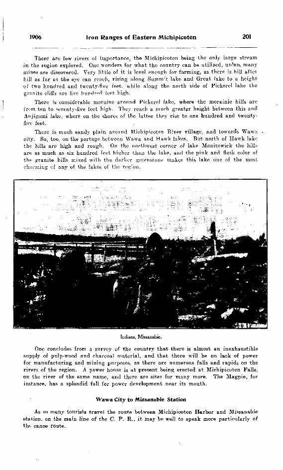
1906 Iron Ranges of Eastern Michipicoten 201
There are few rivers of importance, the Michipicoten being the only large stream in the region explored. One wonders for what the country can be utilized, unless many mines are discovered. Very little of it is level enough for farming, as there is hill aftei hill as far as the eye can reach, rising along Sumnr't lake and Great lake to a height of two hundred and twenty-five feet, while along the north side of Pickerel lake the granite cliffs are five hundred feet high.
There is considerable moraine around Pickerel lake, where the morainic hills are from ten to seventy-five feet high. They reach a much greatpr height between this and Anjigomi lake, where on the shores of the latter they rise to one hundred and twenty- five feet.
There is much sandy plain around Michipicoten River village, and towards Wawa city. So, too, on the portage between Wawa and Hawk lakes. But north of Hawk lake the hills are high and rough. On the northwest corner of lake Manitowick the hills are as much as six hundred feet higher than the lake, and the pink and flesh color of tho granite hills mixed with the darker greenstone makes this lake one of the most charming of any of the lakes of the ree-ion.
Indians, Missanabie.
One concludes from a survey of the country that there is almost an inexhaustible supply of pulp-wood and charcoal material, and that there will be no lack of power for manufacturing and mining purposes, as there are numerous falls and rapids on the rivers of the region. A power house is at present being erected at Michipicoten Falls, on the river of the same name, and there are sites for many more. The Magpie, for instance, has a splendid fall for power development near its mouth.
Wawa City to Missanabie Station
As so many tourists travel the route between Michipicoten Harbor and Missanabie station, on the main line of the C. P. R., it may be well to speak more particularly of thft canoe route.

202 Bureau of Mines No. 5
The portages from Wawa to Hawk lake are easily followed, and are mostly over a sandy plain in which are five small morainic lakes, eome of them beautifully clear. Hawk river has several rapids, but there is only one requiring a long portage. Manito- wick is a very dangerous lake for small canoes, because it is subject to bad and sudden etorms; the waves running extremely high, and the shores in several places so steep as to make landing difficult.
Returning from Missanabie the trip down the Michipicoten river is a pleasant one. Though there are several short portages around rapids, and one long one,—about two miles, around the high falls and rapids below,—the current is strong nearly all the way and paddling is easy. The scenery is very fine, and fish are plentiful.
Michipicoten Schists
These form a series of hills extending from Pike lake southeast nearly to Great lake, where the granite begins; they reappear on the northeastern part of Anjigomi lake, and again near the northeastern part of lake Manitowick and southern part of Dog lake. They vary in color from a quite dark speckled rock more or less massive through yellowish schists containing carbonates to light green, slaty chlorite-schists.
On Pike lake the rock in some places is fairly massive, dark green and bears some pyrite. It is probably closely related to the Gros Cap greenstone, and weathers to a greenish chloritic rock.
On Round lake the rock is very schistose with a dip of nearly ninety degrees, and strike northwest. On one point a, yellow carbonate and oxide of iron occur in small quantity.
On Peter's lake there are found greatly weathered diabases and some quartz por phyry, and on Island lake and part of surrounding region there is a rock which is fine grained and green and'under the microscope has the appearance of ash rock, though it is so weathered as to be scarcely recognizable. Thus the rock in this region would correspond very closely to the Wawa tuffs mentioned by Professors Coleman and Will mott.
On Centre lake the rock is much the same, and the writer observed some uncertain indications of bedding. Between this lake and Hilltop lake there is some very light green chlorite schist approaching a slate in appearance. The strike is 155", and the dip varies from forty-five northeast, to ninety degrees. On Great lake and Bottle lake we find small masses of greenstone greatly weathered, and carried off eruptirely by the granite.
On the north shore of lake Mishewawa there is hornblende schist, a dark rock con sisting only of quartz and hornblende.
The rock of the same series on the eastern side of lake Anjigomi at the northern end of the narrows is very similar to that on Bound lake. It bears some traces of iron ores, has a dip of about ninety degrees, and a strike of 1630 . Mixed with the schist are some distinct diabases.
Along the northeastern end of lake Manitowick wo again find these gchista carrying streaks of iron ore. On the northeast shore of the large expansion of the lake the roeks vary quickly from massive to a very schistose structure. The strike here is almost east and west and the dip varies from 45" to 70" north. The rock is greatly shattered, and is lined by numerous quartz veins, some of which pass into a granular form of silica and contain traces of iron ores. There is a narrow band of iron-bearing rock about

1906 Iron Ranges of Eastern Michipicoten 203
t.wo feet wide and a mile long, extending along the north shore of the lake. At the beginning of the narrows the strike suddenly changes to north and south, or in a direction at right angles to its former strike, with a dip of 300 to 45" to the east.
On the southern end of Dog lake ,the rock is partly schistose and partly massive. It is greatly weathered and has a strike of 160" and vertical dip. This continues north as far as the large island on Dog lake, where the granite begins, and on Rabbit island we have the typical Laurentian granite and greenstone'.
It appears from observation that these schists have been thrown into immense folds by the eruption of the later granites, and the anticlines of these folds have largely disappeared through weathering so that what remains of the schists stands nearly vertical, nipped in between the masses of granite. The bands of iron ore, which occur
Map of Hawk and Manitowick lakes. Scale, 6 miles — If inch. Iran formation |.
in these schists, though in small quantity, show a very close relation in genesis between the Helen formation and these schists. As these masses of ore occur in regions where the rock is very schistose, where the squeezing has been greatest, and are parallel to the schistosity of the rock, the pressure in forming the schists must have also affected the concentration of the ore and the weathering of the original minerals.
There seems to be little doubt that the ore has been formed by the deposition of compounds from solutions. If this be the case, the dip of the rocks at present must represent the planes of original bedding, and the schistosity of the rocks must be due to the lateral pressure on the rocks after they were folded, because the planes of schist osity will naturally be formed at right angles to the direction of the force causing them.
204 Bureau of Mines No. 5
Helen Iron FormationThis formation is widely distributed in the region. Many masses of it were found,
buc they were mostly either too small or too lean in concentrated ores of iron to make them of economic importance.
The first outcrop visited is north of Peter's lake. This mass is about three hundred and fifty yards long, but not more than twenty yards wide at any place, and it narrows towards both ends. The dip is vertical and the general strike 1050, while the rock is greatly twisted, forming in some cases complete ovals. This contortion is no doubt largely due t- the presence of a mass of granite close to the range. There is some typical banded silica which varies to a quartzite, more or less stained by iron oxides. The^e is also a quantity of blue quartz in the range rock. The contact rock is schistose diabase.
Near the southwest end of Peter's lake a small patch is seen, also in contact with diabase, showing large crystal cleavage surfaces, when broken.
On Junction lake near the portage there is a mass some two hundred paces long and ninety wide at the widest point, showing the typical banded silica running out into a coarse quartzite. It is more or less mixed with greenstone, which seemed to cover it in one part, and disappears into a large swamp at one end. There are some small scraps on the lake lying between Junction and Cross lakes, but these are not of importance.
It was reported that a considerable iron property lay just southeast of the northern end of Loonskin lake. This was visited, and though the range rock extended a distance of at least three hundred and seventy-five paces in one direction and two hundred in another, the rock was much mixed with greenstone, which appeared to be all through it. The rock varied from banded silica and magnetite, through greatly weathered carbonates, to almost pure quartz. The dip varied from forty-five degrees northwest, to vertical.
A narrow seam of carbonate and oxides of iron lies along the edge of the north west side of lake Manitowick. It is about one mile long and maintains a regular width of two or three feet. Several small masses are found in the region, the continuations of those on the northwest shore being found r cross the lake on the east shore, where the strike is at right angles to the former.
Search had been made some years before by geologists for a mass of iron range said to be to the east of the large bay near the aarrow part of lake Manitowick. An outcrop was found extending over a large area, but the rock carried little iron and is unimportant. The conditions are favorable for a concentration of iron ore in this immediate vicinity, and one would look for such if a large quantity of the iron range rock should ever be discovered.
A quarter of a mile from the west end of lake Mishewawa there is a band of iron range rock, a continuation of the tand which Dr. Coleman had already examined for some distance. The strike is directly northwest, and the dip n'nety degrees. It holds an average width of about one-quarter of a mile, cutting across the country to the Magpie rivor. It crosses the Michipicoten river just below the High Falls and passes the Mission in Simon's hill just north of the village. Some parts show little iron, while in others banded silica and carbonates are found. On the small lake just northwest of Miehewawa there are evidences of great squeezing, and the rock has the appearance of cross bedding. It is closely associated with some felsite-schists below the falls.
Among othev small masses of the range examined were one on the "tote" road from the Mission to Great lake, and one known as Ganley's claim directly inland from the mouth of Noisy river at lake Superior. Although this had four distinct claim stakes guarding it there was nothing exceptional about it unless it be the presence of more sulphides than are usually found, the principal one being pyrite.

1906 Iron Ranges of Eastern Michipicoten 205
The Keweenawan Series ; Basic Eruptives
The representatives of this series in the region include diabase, diorite and norit*. These rocks are generally found as distinct dikes or as irregular masses cutting the earlier rocks.
On Peter's lake a mass of diabase showing large flat crystal faces is found in con tact with the Helen formation, and a jimilar occurrence is found farther north.
On the portage from Centre to Great l?ke and near the latter, the path follows a stream running along a dike of diabase cutting through the granite, and extending out into the lake. This dike has largely weathered away. Between Great lake and Bottle lake a mass of very fresh diabase is found, and there are many similar intrusions of this rock, but with no striking characteristics.
The diorite is more rare in this district, but a fine mass of typical diorite is found on the northwest corner of lake Manitowick. It forms a huge irregular maes rising about six hundred feet above the lake and extending a considerable distance to the northwest, while towards the southeast it runs out into the lake, cutting through the granite as a distinct dike about two hundred and fifty yards wide. It is a coarse*, dark green and white speckled rock, weathered with large brown crystal surfaces.
The masses of norite found in the district are interesting on account of being the only examples of this rock of which the writer has heard.
On Reed lake at the southwest corner there is a mass of granite one hundred feet higher than the lake, and on the side of this hill is a speckled green and white rock which under the microscope shows quartz in small quantity, much plagioclase and hypersthene and some augite. This composition is that of norite.
On the portage between Fisher and Bear lakes a dark green speckled rock was found, containing quartz, plagioclase, hornblende, some rhombic augite and much magnetite. This composition would indicate a rock similar to norite, tLough it might be placed with the weathered gabbros.
No other specimens of this rock were discovered unless it be a small mass which lies near the Manxman mine and which in the hand specimen quite resembles the norite of the Sudbury reigon. Mr. A. Gibson, who vras there at the time of my visit, informed me that the rock on analysis was found to contain some cobalt and nickel. There was much blue quartz in the rock around the mine. The writer has not had any micro scopic sections made of this mass, so cannot speak more definitely in regard to it.
Post-Lower Huronian Granites
These granites cover large areas in the region, and are undoubtedly later than all the other rocks except the basic eruptives. They have risen under and through the Keewatin rocks, throwing them into large folds, and no better example of the action of these rocks on the older schists is seen than on the northern end of lake Manitowick, where the masses of granite to the southwest, south, and northeast have combined to fold some of the schists in a direction at right angles to the others.
These rocks are quite typical in composition and color, varying from flesh red to dark gray, depending upon the excess of orthoclase and hornblende or biotite.
Following the route already mentioned, from Pike lake to Anjigomi, the granite begins near Great lake, continuing through to Anjigomi, and west to lake Superior. It is to some exteut mixed with greenstone, and in one case the writer observed a small mass of Helen iron rock carried off eruptively.
There is nothing exceptional in the granite until we reach, lake Anjigomi. where there is a large mass of granite near the west end of the narrows, varying considerably in color. Its composition, as shown by the microscope, is quartz, plagioclase, ortho clase, epidote and muscovite, so we might properly apply to it the name grano-diorite.
206 Bureau of Mines No. 5
On Hawk lake the granite is very coarse } and the writer observed hornblende crystals as much as two inches in length. In this region it is largely mixed with greenstone. It has not much of the gneissic structure except in a few places such as on a hill about three hundred feet high just north of Hawk river. It forms a contact with the schistose greenstone about half way up lake Manitowick, and the contact and folding of the rocks hfire has been the cause of the formation of this large lake Most of the granite on this lake has a peculiar pink shade.
Another mass of rock occurring with the granite on the ''tote" road from lake Wawa to Hawk lake and just north of the third small lake in that chain, is a quartz porphyry containing very large porphyritic crystals of quartz and some of orthoclase, lying in a very fine-grained ground mass. Cutting this porphyry is a dike of diabase containing quartz, epidote, chlorite, and in a few places pyrite in considerable quantity. In this rock some one had sunk several test pits, while investigating for copper.
Pleistocene Geology
It is not the writer's intention to touch on this subject more than to briefly state a few observations made, since Dr. Coleman has already extensively investigated this feature of the geology of the district.
The writer was struck by the large morainic deposits which occur on Pickerel lake. The hills rise some seventy-five feet above the lake, and on lake Anjigomi they are much higher.
On Summit lake there is a short esker, stretching from the hills to the lake, form ing a distinct rounded sand and gravel ridge.
In going down Hawk river one notices the great width of the valley, which is. nearly one-half mile wide and carved out of very hard rocks. It looks as if this had been the valley in glacial days of a much larger river than the one at present flowing through it. '
On the last small lake expansion of Hawk river before one enters lake Manitowick, there may be seen two quite distinct sand and gravel terraces, one about five feet and the other about eighty feet above the present water level. The sand is quite perfectly- stratified, and there is no sign of shells in it. No doubt these terraces are the remnanta of the beaches of the large glacial lakes which at one time covered the whole region.

INDEX.
PAGE Abitibi river ......................... .115, 125Abies balsamea ....................... .136, 137Accidents, mining ...................... 29, 48Acid eruptive* ......................... 174, 191Agassiz on terraces, L. Superior........ 193Agricultural possibilities of Mattagami
valley ................................ 135Agricultural Resources of Mattagami, by
Archibald Henderson ...........,... .136-155A L 200 or Minto gold mine............ 48A L 282 or Sunbeam gold mine.......... 50A L 521 .................................. 161Alabastine Coy. ......................... 24Algoma Central Railway .............. 70, 175
Land grant to ........................ 175Terraces on ........................... 199
Algoma Power Coy. .................... 67Algoma Steel Coy.'s works, accidents at 29 Alma, log gas well at .................. 110Almonte Lake ............................ 179Alteration effects in Logan Bills ........ 171Amabel township, log of gas well in.... 109American Madoc mine, accident at .... 29American Madoc Mining Coy. .....,.... 20, 94American or Buffalo silver mine ...... 7Amphibolite of Lower Huronian ........ 161
Dikes in ............................... 161Analyses of iron ores .................. 97,168Analyses of Logan sills ................ 171Analyses of Trenton formation ........ 72Animikie and Keweenawan, unconform
ity between ......................... 169Animikie formation
Black slate of ........................ 163Calcareous slate of ................... 163Impure limestone of .......... .. ... l f 3Iron formation of ....................163, 164Iron ore of ............................ If7Quartz conglomerate of ...... ... . 163, 164Upper iron formation of ............ 163
Animikie iron-bearing series ........... 156Animikie Iron Range
Geology of ............................ 156Keewatin of .......................... 158Keweenawan of ....................... 158Logan sills of . ...................,... 158Lower Huronian of ..... ............ 158Middle Huronian of .................. 158Pleistocene of ......................... 158Upper Huronian of ................... 158
Animikie Iron Range; Report on by L.P. Silver, B.Sc., A.M. ..............156-172
Animikie or Upper Huronian of Animi kie Iron Range ..................... 163
Anjigomi river .......................... 176Anticline theory of oil and gas produc
tion ...... ....... .................... 114Antoine mica prospect ................. 103Apatite .................................. 105"A" pyrites deposit, Goudreau lake.... 185Arcadia, wreck of ...................... If 9Archean rocks of Michipicoten ........ 1E9Ardagh, B. G. R. ...................... 39Argentite ................................. 86Arizona Camp Bay Mining and Milling
Coy. .................................. 58Arsenic ..........................l, 8, 9, 10. (5
In Cobalt ores ................. ..... 8, 9, ^0Plant for producing ............ ... 65Production of ...........,............. 23
Arsenic lake ............................ 88Arsenic mines,
Little Dan ..................:.......... 88Temigami Mining and Milling Ciy..... 87
Arsenopyrite .............. .......... 87 . f 8Ashland Emery and Corundum Coy..... 19.99Aspen poplar ............... .. ......... 137Assay office, Provincial .. . . . . . . .. ... . ... 36
Analyses made at .................... 77Assays made at .......... ..... ..'7Samples received at .. . 36 Work done at ...................... . 36
Atikokan Iron Coy. ...................... 59Atikokan iron mine ........ R9Atikokan iron range .................... 59, 60Aubin township .. .. . . . . . ... ... . . . . ... .121, 146Aweres station, terraces at ......... ... 199
Baby mica mine Baden-Powell gold mine Badger silver mine Bain, J. Watson Baker, M. B.
[207]
PAGE ............ 103........... 54........... 5........... 39........... 17
Balm of Gilead ......... .118, 120, 121/122, 125,127, 128, 137
Balsam.... 118, 119, 120, 121, 123, 125, 136 137Bancroft .................................106, 107Banded magnetite..... .177, 178, 179, 180, 181Bannockburn ............................. 91
Lead smelter at ...................... 16Barrie township ........................ 90Barton's claim .......................... 183
Iron formation at .................... 183Base lines in Mattagami valley ........ 115Basic eruptives .................. 174, 190, 205Basin at Helen mine ..,............... 187
Possible origin of .................... 188Bass lake ..................'.............. 170Bastard township ................... 104Bay lake ................................11,87Bay of Quinte railway .................. 91Beaches of Lake Warren ....... ...... 199Bear Lake ....................... 70 179, 192Bear Lake mica mine .................. 103Bear pyrites claim, Goudreau lake. ..186, 192 Bears .................... ........ . . 131Beaver .... .............................. 131Beaver Mining Coy. . ... ............... 86Beaver silver mine .................... 5, 86Bedford township, feldspar in .......... 19Begg, W. A. ............................ 156Bell, Dr. J. M., referred to .......... 173, 174Bell, Dr. Robert, on geology of Manitou
lin island ........................... 72Belleville Portland Cement Coy. ........ 17Belmont gold mine ..................... 14, 88Benn cobalt mine ........... .......... 11, 86
Drilling at ............................ 27Benn, Ira L. ............................ 86Best, James ............................ 107Betula papyrifera ..................... .136, 137Big bend of Mattagami river ........118,139Big Dan arsenic mine .................. 23, 87Big Dipper gold mine .... ..... ....... 89Big Dipper Mining and Milling Coy..... 89Big Master gold mine . ...... ..... ...... 4, 52Big Master Miniue Coy. ................ 52Big Stony portage ..... .... . ... .... 192Biotite picrite .......................... 191Biotite schist ............................ 134Birch ...................................123, 125Birch, white, see white birch.Bituminous shales ...................... 72Black Donald graphite mine ...... .14, 23, 106Black Eagle Gold Mining Coy.......... 57Black Eagle (or Hegina) gold mine...... 57Blackinton's iron claims ..... ...,....... 177Black slate, Animikie formation ...... 163
Lower .................................. 163Upper .................................. 163
Black spruce........118, 119, 120, 121, 125, 136Black spruce forest country, Mattagami 136
Forests of ....... . . . .... .... .... 123, 1 25, 127Blair, W. H. ..... ....................... 85Blanche river, falls on ................ 14"Blanketing" condemned . ....... ...... 5Blast furnace at Port Arthur .......... 60Blast furnaces ........................... 15Blend lake ............................... 170Blum Anthony .. . . . . . . . . .... ... ... ..... 50Bob's lake mica prospect .............. 103Boom in mining stocks ................ 10Border feldspar mine .. .......... 102Bornite ............. ...... ................ 67Bothwell oil field ...................... 108Bottle lake .............................. 179
Diabase near .... .................... 205Greenstone on .. ....................... 202
Boulder clay ..... ....................... 192Bounty on petroleum .................. 21Boyer lake .............. ............... 187Bracebridge ........ . ................... 14Bradburn township .................. 143, 145Brantford, log of well at .............. 112Breitung Iron Coy. .. .................... 71
208 Bureau of Mines No. 5
PA G K Breitung iron mine .................... 14, 71Brick ...................................... 16
Common ................,............... lPaving ...................... .......... lPressed ................................. lPrices of .............................. 17Production of .......................... li
Bridget lake, iron formation on ......177,178British America Mining Coy. .......... 20British American Pyrites Coy- .......... 94British American pyrites mine ........ 94British Colonial Mining and Develop
ment Coy. ........................... 91British Columbia Mines report ........ 2Brockville Mining Coy. ......... ........ 104Brockville Mining Coy.'s mi^a mine.... 104Brooke township, log of gas well in.... lilBrougham township, graphite in ...... 14Brower, township of .................. 125, 126Brown Edgar .......................... 1/9Bruce Mines ............................ 12, 68Bruce bay ............................179, 19'Brule harbor, dikes at .................. 191
Wave beaches near .................... 193BrulS river .............................. 176Bucke township ........................ 86, 87
Silver claims in ........................ 7Buflalo Mines, Limited .................. 76Buffalo Mining Coy. . ..... ............. 7Buffalo or American silver mine..,..... 7, 76Building materials ................,..... 16Building stone .......................... 1
Of Keweenawan formation ........... 170Bully Boy gold mine ..... . ..... ... .. ... 55, 58Bureau of Mines, Fourteenth Repor*, cf 8,12, IR Bureau of Mines, Thirteenth Report of.. J6 Burrows. A. G. ...... .... ..... ........ . .. 36
Analyses by ........................ 168, 171Report on Assay Office By... .... 36
Burwash lake, iron ore at.........,.... 15Calabogie ................................. 106Calcareous slate of Animikie formation 163 Calcium carbide .................... l, 23, 107
Production of . ..... .... .............. 23Calc schist .............................. 133Calder township ........................ 145Caldwell and Mulock, Messrs. .......... 88Caldwell T. B. ...... .................... 26Cambrian formation .................... 174
In Michipicoten ....................... 189Camp Bay Mining Coy. ... .. ... ........ 58Canada Atlantic railway ............ .. 95Canada Corundum Coy. ... ............ 19, 97Canada Iron Furnace Coy. ............. 14, 95Canadian Copper Coy. ..............11. 61, 63Canadian Copper Coy.'s mines, accidents at 30
Silver refining works .................. 8Canadian Northern railway ............ 60Canadian Oil Refining Coy. ............ 22Canadian Portland Cement Coy. ....... 17Canadian Salt Coy. .................... 21Cancellation of mining leases .......... 24Canoeing on Mattagami river .......... 118Ca-pa-tis, Mattagami Indian ........... 123Cap Choyye' ............................. 179
Iron formation inland from .......... 179Iron formation south of ............ 1 79Iron ore southeast of ............ .... 179KeVeenawan at ...................... 189
Cape Smyth ............................. 72Carbide of calcium ..................l, 23, 107Carbonate of iron ...................... 168Caribou lake ............................ 70Carlow township ..................,..... 99Carnegie township .................... 120, 141Carneeie-Williams, H. J- ................12,69Cart lake ................................ 81Casey township, cobalt in ..............11,4"
Silver in .............................. 11Cedar................ 120, 121, 123, 125, 127, 128Cement ................................... 16
Natural rock ...... ................. ... 1,18Portland .................. ............ l, 17Prices of ................................ ISProduction of ........................ 18See Portland cement; also Natural
rock cement. Central Ontario Granite and Marble Coy..107
PAGE Central Ontario Railway ......16, 91, 95, 107Centre lake .................. ........... 178
Wawa tuffs on .... .................... 202Chalcocite .............................. 67, 90Chalcopyrite................. .....67, 69, 70, 76
In Mattagami valley .................. 130Charnokite, resemblance of certain gran
ites to ....................... ........ 134Chemical analyses of soils from Matta
gami valley ......................... 153Childs' iron mine ...................... 95Chlorite .................................. 133Chlorite schist gold in ................ 66
On Hilltop lake ........................ 202Cincinnati anticline .................... 113Clay and the Clay Industry of Ontario 17 Clay Belt, geology of .................. 135
Great ................................... 115Clay laud................121, 122, 125, 136, 137
Loam ..................121. 125, 126, 136, 137Climate of Mattagami valley .......... 147Clinton formation, natural gas in ... .23, 114Clydach, Wales, nickel refinery at.... 11Coal docks. Port Arthur ..............,. 61Cobalt ..................... ........ l 8, 9, 10Cobalt and Silver Mining Coy. .......... 7Cobalt at Portage bay ................ 11
At Trout lake ........................ 11In Casey township ...... ............. 11In Cobalt ores ......................8, 9, 10
Cobalt bloom ................ ........... 11At Madoc ............................ . 11On Rabbit lake ........................ 11On Whiskey lake .................... 11
Cobalt farm ............................ 79Cobalt mines, production of .......... 10Cobalt mines, see Silver-cobalt mines. Cobalt mining camp ..... .............. 48Cobalt, mining class at.................. 44Cobalt (or Long) lake............. .5, 7, 73, 80Cobalt ores, nickel in ................8. 9, 10
Non-argentiferous . . . .... ......... ..... 11Silver in .................'...........8. 9, 30
Cobalt refining plant ..... ............. 64Cobalt silver Camp .................... 5
"Blanketing" in condemned .......... 5. Development of ............... ........ 5
"Discovery" insisted on in ...... . ... 5Divining rods used in ................ 7Effect of mining la.ws in .............. 5Producing mines in .... .............. 7Prospecting in ........................ 5Trenching for veins in ............... 5
Cobalt Silver Queen mine ............. 7,78Oo^a't Silver Queen Mining Coy. ........ 78Cobalt town-site ........................ 7Cobalt veins ........ ... .................. 86Cobalt veins, non-argentiferous ...... . 11.
Benn mine ............................ 86Edison Cobalt ....... .................. 87
Cobaltite .................,............... 86Coe, Arthur ........ .... ...... .. ......... 90Coffey (or Kamiskotaia) river.. 118, 119, 139, 140
•Coke ...................................... 13Coleman A. P. ...... .................. 12, 15
On Iron Ranges of Eastern Michipicoten..173 Coleman Mining Division ................ 38Coleman township..7, 74, 76, 78, 79, 80, 81, 83,
84, 85. 86 College men as prospectors ............. 45Colonial Portland Cement Coy. .... ... 17Columbus cobalt mine .................. 86Columbus, Joseph ....................... 86Combined gold mine .................... 55Concentrating Loon lake iron ores .... 172Concentrating plant, Elmore .......... 67Conglomerate. DorS .....,............... 174
In Lower Huronian of Animikie Iron Range ..............................159, 160
Coniagas silver-cobalt mine ............ 7,76Constable Hook, N.J., nickel refinery at 11 Contact of Huronian and Laurentian in
Mattagami valley ................... 131Copper .............. ..................... 1,11
On north shore Lake Huron .. ...... 12On Whiskey lake ....... . . . ..... f9
Copper Cliff nickel smelter at ........ 11Copper in Sudbury ores, 1905 .......... 13

1906 Index 209
, PAGE Copper mines ..........................12,67
Bruce Mines ........ . .......... 12, 47, 68Eldorado .......................... ... 90Hermina ............................... 12, 67Massey Station .................... 12, 31. 67May township prospect ................ 68Northern Ontario Copper Coy. ...... 69Superior . .................. ........... 12, 68Tip-top ................................. 61Whiskey lake locations ................ 69See also Nickel-copper mines.
Copper mining, 1901-1905 ................ 13Copper Mining and Smelting Coy. of Ont.12,68 Copper pyrites in Mattagami valley .... 133Copper smelter first in Eastern Ontario 90 Corkill, B. T.' .......................... 8
Report of on mining accident ........ 32Corniferous limestone, oil in .......... 114Corundum ....... ........................ l, 19
Method of producing ................ 97Production of ......................... 19
Corundum mines ........................ 19, 97Ashland Emery and Corundum Coy... 19, 99 Canada Corundum Coy.........19. 40, 43, 97
Coste, Eugene .......................... 21On Matura! Gas and Petroleum ...... 108
"C" pyrites deposit Goudreau lake .... 185Craig gold mine ......................4, 88, 89
Mining class at ...................... 42Craig Gold Mining and Reduction Coy.. 89 Craigmont ................................ 97Craigmont corundum mine, mining class
at ..................................... 43Crawford township .................... 120, 141Creighton nickel mine ............... 8, 11. 64Creighton township ...............,..... 13, 62Cross lake ..........................7. 80, 177Crowland, township of ................. 108Crown Keef vein, Sultana mine ...... 57Crushed stone ........... ........ .... lCrystalline limestone at Goudreau lake...183,
185, 186, 192 Current river, water power on ..... .. 13Cyr, Paul, accident to ................ 33Davis, Ithel. accident to ................ 30Davis rapids ..........................121. 146Dargavel township ...................... 142Dead stretch on Michipicoten river.... 177Dean lake .............................. 69Deception lake, iron ore of ........ ... 168Deer lake, water power at ............ 14Deer, red ................................ 131Deloro gold-arsenic mine ............... 88Delta deposits, Michipicoten ........ . 193
Of Michipicoten river ...,............ 196Of Magpie river ...................... 196
Denison, O. L. ..................... .. .. 76Denison township ....................... 64Desert lake feldspar mine, mining class
at .................................... 40Development of Cobalt camp ..........., 5Devil's lake mica prospect ............. 103Devitrifled glass ........................ 132Diabase..............132, 133, 134, 187 205, 206
Dike at Helen mine .............. ... 187Mountain ...............:..................86Or Logan sills .......... ..... . .. 170
Diamond drills, government ............ 26Table showing operations with .... 28
Dike, diabase, at Helen mine ......... 187Dikes at Brute harbor .................. 191
in amphibolite .................. .... 161Dinorwic .................................. 52Diorite ................................... 205Dip of strata in Niagara peninsula .... 114
In southwestern Ontario .............. 113"Discovery" an essential ........ ..... 5
Definition of, in Mines Act, 1906...... 5Inspection of .......................... 5
Disturbance of strata in oil and gas fields 114Divining rods ............................ 7Dog lake ......................... .176 184, 192
Books of ................. ............ 203Dominion Improvement and Development
Coy. .................................. 105Dore conglomerate ...................... 174Dorion township ........................ 170
Zinc and lead mine in ................ 17014 M.
PAGEDouglas. Lacey & Coy. .................. B4"D" pyrites deposit, Goudreau lake.... 185Drainage of Mattagami valley ........121.124
127, 131, 138 Drain tile .............................. 17Driftwood creek...................121, 122, 145Driftwood in streams of Mattagami
valley ............................. 121, 122Drummond Mines, Limited ............. 7, 81Drummond silver-cobalt mine .......... 7, 81Dryden .................................. 55Dryden falls, Wabigoon river .......... 14
Wahnapitae river ..................... 13Dutton oil field .......................... 108Dynamite magazines, sites for ........ 4810 E11 E .....................,12 E ......................Eagle Lake gold district Eagle Riv.er
........... 59.......... 59........... 60.......... 53........... 53
Eastern Michipicoten, Iron Ranges of.. 173Additional notes on Iron Ranges of.. 200
Eastern Ontario, iron mines in ........ 95Mines of ................................ 47Mining region ........................ 88
Economic resources of Mattagami valley 127E D B l, gold location ................ 55Edison cobalt mine .................... 87Edison, Thomas A. ..........,......... 11, 87Edward roasting furnaces ............ 65Eldorado copper mine .................. 90
Copper smelter at .................... 90Gold mine ......'...................... 53
Eldorado Mining Coy. .................. 53Eleanor slates ........................ ..174,181Electricity from water power .......... 13Elmore oil concentrating plant ........ 67Emily gold mine ....................,. 184 187
Irdn formation at .................... 187Empire Limestone Coy- ................ 23Enniskillen, log of deep well in ........ 111Epidote ................................... 133"E" pyrites deposit, Goudrean lake .... 185Eruptives, acid .......................... 174
Basic ................................... 174Eruptive rocks of Mattagami valley ,... 132
Of Michipicoten ........................ 190Esker, at Pickerel lake ................ 192
On Summit lake ...................... 206Essex county gas field ................ .22, 1 08
Drowning of .......................... 108Effect of prohibiting export of gas on....108Partial resuscitation of .............. 108
Exeter Salt Coy. ........................ 21Exploration in Mattagami valley, by H.
L. Kerr ..............................115-135Farunm, H. C. .......................... 95Farr creek .............................. 81Pasciono, Michel, (M. Fisher) accident to 30 Fauna of Mattagami valley ............ 151
Of Michipicoten district .............. 200Feldspar ................................. l, 19
Production of ......................... 20Feldspar mines ..........................19,99
Border ...........................,....... 102.Tenkins, Chas. .......................... 19Kingston Mining and Development Coy. 102Richardson A Sons, J., 19, 31, 33, 39 40. 99
Felsite .................................... 132Fish in waters of Clay Belt .......... 117Flaherty and Knobel .................. 156Flaherty's cliff, analysis of iron ore of 168
Tunnel, analysis of iron ore of...... 168Flat Bock rapids ....................... 15Flora of Mattagami valley ............ 149
Of Michipicoten district .............. 200Flowering plants of Mattagami valley.. 150 Fluorspar ................................ 106Folding of Michipicoten schists ........ 203Forests of Mattagami valley..... .125, 126. 127Formation of oil and gas theories of.. 114 Fort Frances, falls at .............,.... 14Fort Mattagami . .....,................ 115, 151Foster, C. A................................ 84Foster Cobalt Mining Coy............... 84Poster silver-cobalt mine ..............7, 9, 84Foster's Rapids .......................... 97
210 Bureau of Mines No. 5
PAGEFourteenth Report Bureau of Mines..8, 12, 18 Fox township ................... ....... 125, 126
Glacial deposits in .................... 127Fraleck, E. L. ............................ 20Frederick House river ................ 115, 124Freeman mica mine .................... 103Frontenao county, gold in .............. 88 'Frontenao lead mine .................... 91Frontenao lead works .................. 91Fur-bearing animal! of Mattagami val
ley .................................... 131Fun at Fort Mattagami, decrease of.... 151Gabbro ................................... 133Gaebel, W. ......................... . 107Galena ..................................91, 170Galluccio, Bartolomeo, accident to .... 31Gams animals of Mattagami ........ 123, 131Ganley's claim .......................... 204Garson Township ......................... 66Gas fields, geology of ..,................. 109General Electric Coy. ..................21, 102General Eeotric mica mine, mining class
at ..................................... 41Genesis of iron ore in Michipicoten
schists ...................... ..... .... 203Geological nomenclature ................ 174Geological relationships of Post-Lower
Huronian granites ............... .... 205Geology of Animikie Iron Kange . .... 156
Of Clay Belt .......................... 135Of Mattagami valley .................. 131Of oil and gal fields ............ .... 109
Geology, Pleistocene .......... .......... 192Pre-Cambrian, International committee
on .................................... 156Gertrude nickel mine .................. 12Gibson, A. .................... .......... 205Gillespie, P. .............................. 18, 19Giroux lake ..............................40,85
Mining class at .................... ... 45Glacial basins of Michipicoten ........ 192Glacial deposits .......................... 175
In Fox township ............ . . 126In Michipicoten valley ................ 197On McVeagh's creek ............... 192
Glacial erratics .......................... 135Glacial geology of Mattagami valley.... 135
Of north shore L. Superior ............ 192niaeial striae .....................-...... 135Glacio-lacustrine deposits ................ 192Glauconite ............................ .164, 165
Compared with greenalite.............. 164Murray and Renard on origin of .... '65
Glen Allan, log of gas well at ........ 110Glendinning and McLeod's silver mine.. 7 Glendinning, George .................... 85Globe Eefining Coy. ............ ...... 23Gneiss ..................................134, 174Goetz, Alois ....,..................... ... 181Goeti, George, iron claim of ............ 181
Cross section of .................... 182Goetz iron claims ................ . . 181
Description of by E. S. Moore .... ... 181Gold ...................................... l
Statistics of ............................ 3Gold In quarts and chlorite schist..... 66Gold mines .............................. 4, 48
Baden-Powell .......................... 54Big Dipper ............................. 89Big Marter ............................ 4,52B'aok Eagle or Eegina ..............55,57Bully Boy .............................55,58Camp Bay .............................. 4Combined .............................. 55. 58Craig ........................4, 40, 42, 88, 89Eldorado ............................... 52Emily .................................. 187Golden Ea gle .......................... 55GoHen Horn . ............. ...... . 55, 59Gold Rook ............... .......... 52Grace (Rattle lake). ...... ............ 54Grace (Klehipiooten) ............. ... 67, 175Ideal ................................ 55Laurentian .......................... 4, 47, 50Little Master .......................... 52Mining Location E.D.B. l.............. 55Minto, or AL 200 ...................... 48Northern Light ......... ........ , 4
Gold yines-f Continued, PAGE Olympia ............................... 55, 59Pay Master .......... .. ... . .... . 52.Pioneer Island ........................ 54Redeemer ......... . ... .. 4, 55Regina or Black Eagle ..............66, 57St. Anthony Beef ........ ... . ...... 4, 47, 59Shakespeare ....................4, 40, 45, 66Star of the East ............ 4, 39, 41, 88, 89Sultana ..........................4, 47, 55, 57Sunbeam or AL 282 .................... 50
Gold mines, iron formation at ...... 183Producing ...................... . . 4
Gold Rock ............................ 50Go d mines of Eastern Ontario .......... 88Gold Rock mine ....................... .. 52Gold Rook Mining and Milling Coy...... 52Golden Eagle gold mine .............. 55Golden Horn gold mine ................55,59Goldie, T. L. ..........................175, 200Goodwin, W. L., Eeport of on Summer
Mining Classes ...................... 39Goudreau lake, crystalline limestones
of ..............................185, 186, 192Glacial deposits of ................ 192
Pyrites deposits on ......... ..... . 183Terrace at ............................193, 198
Grace gold mine (Eagle lake) .......... 54(Michipicoten) ........................67, 175
Grace Mining Coy. ............. ........ 54Graelle, Paul, accident to ........,..... 34Granite .......................... 107, 134, 174
At Bancroft .................. -.. - .... 16Post-Lower Huronian ............... 205Characteristics of ..... ... .... .. . 205Geological relationships of ............ 205Near Great lake ................. .... 205On Hawk lake..........,........... . 206On lake Anjigomi............ ...... . 205On lake Manitowick . .............. . 205On lake Superior ................. 205
Granite bosses ....................... 134, 191Granite hili. Mattagami valley ........ 145Granite of Middle Huronian, Animikie
Iron Range .......................... 161Granite on Brul6 harbor ........ ..... 191
Suitability of for construction purposes 191 Granite, pegmatitic ..................... 162Granitic rook ............................ 132Grano-diorite ............................. 191Grant, U. S., referred to ......... 159Graphite .............................. l, 23, 106Graphite mines .......................... 105
Black Donald .......................... 105Mcconnell ...........,.................. 105
Graphite, production of ................ 23Refining works ......................... 106
Graphitic carbon, coating of ..... ...... 163Grasett road ............................. 175
Morainio ridge on ................. 192Gravel ban of Michipicoten ............ 193Graywacke' in Lower Huronian of Ani
mikie Iron Parere ..,............. 159Gray, Tonne and Sparling ............ 21Great lake .......................... .. 179
Diabase dike on ...................... 205Greenstone on ....................... . 202Post-Lower Huronian granite near.... 205
Great Lake Nipissing ................. 197Greenalite and glauconite compared.... 164Green grannies In taoonyte.............. 164
Origin of ............................164, 166Proportion of iron In.................. 166Similnritv of to glauconite .......... 164
Green, PWlin, silver mine of .. . .... 7Green schist ............................ 133Greenstone on Bottle lake .............. 202
On Great lake ................... 202Pebbles in Lower Huronian conglom
erate .......,......................... 160Greenstones. Gros Cap .................. 190Grenville series, limestone resembling,
at Gondreau lake .............. ... 186Grey and Bruce Cement Coy......... . 17Grev's siding ........................ 88Grinds*one point ................... 189Gros Cap greenstones .......... 174, 190, 191Groundhog river ........................ 124Guelph and Mattagami valley, tempera
tures of, compared ................. 149

1906 Index 211
PACEGuelph limestone, oil in ................ 114Gypsum .................................. 1,24
Drilling for at Paris .................. 27Production of .......................... 24
Hai'eybury ............................... 38Mining class at ..................... 43
Haldimand county gas flald ......22, 23, 108Hamilton, log of well at ,,.......,...... 112Hamilton Steel and Iron Coy........ . 15Handy silver mine ...................... 7Hanna, township of .................... 126Hanover Portland Cement Coy. ........ 17Hanson Cross Lake silver-cobalt mine... 80 Harcourt, Prof., chemical analyses of
soils by .............................. 153Margraves, Fred., accident to .......... 30Hargrave silver-cobalt mine ........... 7, 83Hastings county, corundum in ........ 19
Gold in ................................ 88Hawke lake ............................184, 202
Post-Lower Huronian granite on ...... 206Terraces on ............................ 198Unglaciated granite at .............. 193
Hawk river ...................... ....,.. 202Width of valley of .................... 206Sand and gravel terraces on .......... 206
Hayden, terraces at ...................... 199Helen iron formation .................... 174
At Ganley's olaim ...................... 204Near Mission vilage .... .......... :. 204On Junction lake ...................... 204On lake Manitowick ................... 204On lake Mishewawa .................... 201On Loonskin lake ... ....... . .. . 204On Peter's lake ........................ 204See Iron formation.
Helen iron mine ..........14, 15, 70, 175, 187Accident at ........................... 29Basin at .............................. 187Developments at ....................... 187Diabase dike at ...................... 187Iron pyrites at ................... .20, 71, 187Ochre at ........................ .... 189Origin of ore at ...................... 188on ntity of ore taken from .......... 188System of mining in ......... ... 70
Hematite ....................14, 15, 71, 167, 179In Mattigami valley .............. 130, 133
Her'de'-son, Archibald ............. ... 115Report by, on Agricultural Resources
of Mattagami ...................... 136-155Henderson talc mine' .................... 106Hppworth, log of gas well at ............ 109Hermina copper mine ....... . . . 12,68High falls of Michipicoten river ...... 13, 176High falls. Spanish river .............. 13, 62Hilltop lake, chlorite schist on ........ 202Hilton, terraces at ...................... 199Hogan, T. ................................ 156Hollandia lead mine .................... 91Hornblende ............................ . 134Hornblende schist ... .................... 134HP 405 ............................... . . ... 52HP 407 ................................. . 52Humberstone, drilling limestone in .... 27
Township of ........... . . .. . ..... ....... 108Hungerford pyrites mine .. ............. 94Hungerford, township of . . . ...... . ... ... 94
Iron pyrites in 20Huntingdon township ............. ...... . lOfiHuron!-^ n Coy. .......................... 13, 62Huronian rocks, Mattagami valley.
............................118, 120, 121, 131Of Michipicoten ........................ 189
Huronian schists of Mattagami valley.. 130Hutton township, iron ore in .......... 15"W 20. or Pay Master gold mine ...... 52Hydraulic plant for silver mining .... 79Ice age, changes of level since ........ 199Ice below moss, Mattagami valley .... 147Ideal gold mine .......................... 55rdeal Gold Mining Coy. .............. 55Igneous rocks of Lower Huronian ...... 159Illiteracy in mining camps ............ 46Imperial Cement Coy. .................. 17Imperial Oil Coy. ...................... 82Imperial Paper Mills, Limited .......... 13
PiOE
Impure limestone of Animikie formation 163 Analysis of ............................ 163
Indians ............................119, 120, 123Inspection of discoveries ................ 5International committee on pre-Oam-
brian geology ........................ 156Inwood, log of well at .................. 111Iron-bearing schists .................202, 203
On lake Anjigomi .... .......... 202On lake Manitowick ..... . . ....... 202
Iron carbonate ............ .. .. 168rron formation among gold mines .. 183 Iron formation at Barton's olaim...... 183
At Emily gold mine .................. 187At Grace gold mine (Michipicoten).. 183 At Goudreau lake .................... 183At Minto gold mine .................. 183Between Peter's and Centre lakes .... 178Helen .................................. 174Inland from Cap Choyye' ............ 179Near Helen mine...................... 181Near Lake Anjigomi .................. 179On Bridget lake .................... 177, 178On Island lake ........................ 178On Junction lake ..................... 178On Lake Miiinnemungshung ......... 179On Lake Mishewawa .................. 180On shore of Lake Superior .......... 178Part of Keewatin ...................... 187South of Cap Choyyg ........ ........ 179
Iron formation proper, of Animikie. .163,164 Iron mines .......................... 14, 70, 95
Atikokan ................................47, 59Breitnng .............................. 14. 71Childs .................................. 95Helen ....................14, 47, 70, 175, 187Mineral Eange ......................... 95No. 2 Mineral Range ................ 95No. 3 Mineral Eange ................. *5Eadnor .................................14, 95Williams ..:............................14, 71
Iron mines in Eastern Ontario ........ 95Iron ore .............................. l, 14. 15
At Helen mine, origin of ............ 188Processes of formation of ............ 189At Burwash lake ...................... 15At Shining Tree lake ................ 15Bast of Lake Nipigon ................ 15Exploring for .......................... 15In Animikie Range .............. 156 et sea.In Eastern Michipicoten ........173 et seg.In Hutton township ................... 15In Michipicoten schists, genesis of... 203 Of Animikie formation ............... 167
Analysis of ....,..................... 168On Lake Temagami ............ ..... 15, 88On Montreal river .................. . 15On Woman river .....................- 15Production of .......................... 14Quantity of, taken from Helen mine. 188 Southeast of Cap Ohoyye' ........... 179West of Hutton ...................... 15
Iron ores, analyses of ..................97,168Iron pyrites ......................l, 20, 88, 94
At James lake ................... .. . 20At Helen mine ........................ 20In Hungerford township ............ 20In Lower Huronian rocks .... ........ 159In Mattagami valley ................130,133Near Madoc ........................... 21Near Queensboro ..................... 20On lake Minnietakie .................. 20On Goudreau lake ................ 183Production of .,........... .......... 21Eeport on .............................. 20
Iron pyrites mines .....................- 20, 94American Madoc Mining Coy. ......20, 29,
39, 42, *4 British America Mining Coy. ....'....20,94Goudreau lake deposits .............. 183Helen ............................20, 187, 188Hungerford .................,........... 94Jarman ................................ 94Lake Minnietakie .....................20,61Madoc ..................................20, 94W D 404 and 405 ......................20,88
Iron Eanges of Eastern Michipicoten; byA. P. Coleman ......................173-206

212 Bureau of Mines No. 5
Iron Ranges of Eastern Michipicoten,Additional Notes on, by E. S. Moore 200-206
Island Palls .............................. 129Mattagami river ...................... 121
Island lake, iron formation on ........ 178Wawa tuffs on ........................ 202
Island portage ........................... 121
Jaokflsh lake ............................ 184Jack Lake Gold Mining Coy. .......... 59Jack-pine ....................118, 119, 127, 128Jack-pine plains. Mattagami ........... 138
Soil of ................................ 138Jacobs silver-cobalt mine .............. 7, 83James lake .............................. 88
Iron pyrites at ........................ 20Pyrites mine .......................... 88
Jarman pyrites mine ..... ........ . .. 94Mining class at ....................... 42
Jaspilyte in Lower Huronian conglome rate .................................. 161
J B l .................................... 79J B 6 .................................... 76J B 7 .................................... 74J B 33 . ................................ 87Jenkins, Charles ........................ 19Jenkins feldspar mine ................. 101Jessop, township south of .............. 139Johnston, ——, accident to ............ 33
Jacob, accident to .................... 29John, accident to ...................... 30
Jokela, Jan, accident to .............. 33Josephine iron mine ................... .71 175J S 14 or La Kose Mine .......... ... 73Judge, Frank, accident to .............. 31Jnmp Over falls ........................ 129
East of ................................ 146Nature of rooks at .................... 134On Mattagami river ............. ..... 123West of ................................ 146
Junction lake. Helen iron formationon ..................................178, 204
Kakabeka falls ..................... .... 13Kaministiquia Power Coy. .............. 13Kamiskotaia lake ........................ 140Kamiskotaia (or Coffey) river .......... 119,139Kamiskotaia-Sagaigan river ............ 119Katherine lead mine .................... 91Keewatin formation .................... 8, 174
Iron formation part of .............. 187Keewatin, of Animikie Iron Range .... 158
Metamorphism of ...................... 158Similarity to Lower Huronian of .. 158
Keewatin rooks of Michipicoten ......189,190Kenora ................................ .. 14Kent Bros. ...................... . ...... 103Kerr, H. L. ............. ..... .... . 85,115Kerr lake ............................. .8, 81, 84Kerr Lake Mining Coy. ................. 7,83Keweenawan and Animikie, unconform
ity between .......................... 169Keweenawan or Nipigon formation ...168, 174
Conglomerates of ..............168, 169, 170Impure marls of .............. ...... 168Sandstones of ......................... 168
Keweenawan, of Animikie Iron Range 158 Keweenawan rocks of Michipicoten .... 189Keweenawan series .................. . 205Kidd township .......................... 120, 140King Cobalt silver mine ................ 81Kingsmill township ..................... 142Kingston Feldspar and Mining Coy. .... 31Kingston Feldspar Coy. ................ 99Kingston Mining and Development Coy. 102 Knight, C. W. .......................... 86Knobel, Mr., experiments of, in sorting
Loon lake iron ores ................ 172Krean Hill nickel-copper mine ........ 64Lacey mica mine ................. .. .. 102Laccolithic sills of L. Superior, A. C.
lawson on .......................... 170Lake Anjigomi, iron formation near... 179
Moraines on .......................... 200Morainic deposits on ... .. .. . . 206Post-Lower Huronian granite on ... 205 Schist on . ......... ... ........ . . . . .. ... 202Terraces on ................ ........ ... 198
PAGELake Boyer .............................. 187Lake Clement ......... . .............. 124, 144Lakefleld Portland Cement Coy. ...... 17, 19Lake Kamiskotaia ...................... 11*Lake Kenogamisse ................... .. 131Lake Manitowiok, diorite at ....... . 20i
Helen iron formation on ....... ...... 204Post-Lower Huronian granite on .... 205Schists on ............................ 202
Lake Mijinnemungshung, iron formationon .................................... 179
Granite dike at ....................... 191Lake Minnietakie ........................ 61
Iron pyrites on ...................... 20Lake Mishewawa, Helen iron formation on.,204
Iron formation on .................... 180Schist cm .............................. 202
Lake Nepigon iron ranges .............. 15Lake of the Woods mining district..... 55Lakes of Michipicoten district .......... 200Lake Superior Corporation ............. 12, 15
Water power of ....................... 14Lake Superior, glacial geology of north
shore of ............................. 192Iron formation on .................... 178Nomenclature of pre-Cambrian of .... 174Old beaches of .......... .. ........ 156Post-Lower Huronian granite on ...... 205Terraces of ............................ 193Wave beaches on .................... 193
Lake Superior Power Coy. ............ ..70,175Lake Superior silver district .......... 5Lake Temagami, iron ore on.......... 15
Drilling iron ore on .................. 26Lake township .......................... 91Lake Wabatongusheen .................. 176Lake Warren ................193, 194, 196, 199
Beaches of ............................ 199Lambton oil fields in a syncline ........ 113Land grant to Algoma Central railway 175 Larix Americana ........................ 136La Rose Mining Company . .. . ........ .. 7La Rose silver-cobalt mine, or J. S. 14.. 7, 73
Drilling at .......... .....,............. 27Latchford ................................. 116Latitude of mile 162. Niven's line...... 142
Of mile post, 174 Niven's line..... .143,144Of mile post 186. Niven's line........ 147
Laurentian at Michipicoten, Logan on 174 Elevation of in Mattagami valley..... 134
Laurentian formation ................ 174Laurentian gold mine :................. 4, 50T laurentian Mining Coy. ................ 50Laurentian rocks, Mattagami val
ley ............................121, 124, 131Of Michipicoten ....... . .... .... 189
Lawson, A. C., on laccolithic sills of L.Superior .............................. 170-
On terraces L. Superior ...193, 198 Lawson, H. E. ........ ......... ......... 7Lawson silver-cobalt mine ............ 7, 84Lead ...,.................................. l, 15Lead and line mine in Dorion township 170 Lead mines .............................16,91
Frontenac .............................. 91Hollandia ....................... ....... 91Katherine .............................. 91Stanley Smelting Works .............. 91
Lead smelter at Bannockburn .......... 16Leamington, natural gas at ...... .. 22
Petroleum at ........................21, 108Leamington Oil Coy. .................... 22Leamington oil field .................. ..21,108Leckie, E. G. ............................ 2frLeith, C. K. ........................11, 27, 159
Quoted on greenalite and glauconite 164 Lennox township .... .... .............. 142Leonard, R. W. .......................... 76Lime ...................................... 1,16
Production of ......................... 16Limestone boulders, in Mattagami valley 135
Crystalline at Goudreau lake..185, 186, 192 Drilling in Humberstone ..... . ...... 27Drilling in Wainfleet ................. 27Impure, of Animikie formation....... 163
Analysis of .................... . .. 163Limonite .............................. .. 167Little Dan mispickel mine . .... . .... 881
1906 Index 213
I'AGR
Little Master gold mine ................ 52Logan, on Laurentian at Michipicoten.. 174Logan or diabase sills ................158, 170
Analyses of ........................... 171lawson, A. C., on ....................170,171Ophitic structure of .................. 171
Log in peaty deposit. Michipicoten river 197Logs of gas wells........ 1U9, 110, 111, 112, 113
On Manitoulin island ................72, 73Long copper location .................... 70Long lake, falls at ...................... 14Loon lake ..............................71,170
Drilling at ............................ 27Granite rooks of ....................... 162
Loon Lake Iron Coy.................. 71Loon Lake iron mine................'.... 71Loon lake ores, sorting operations on.. 172lioon portage ............................ 121Ijoonskin lake. Helen iron formation on 204 Lorrain township, prospecting for silver
in ..................................... 7Loughboro township ................., 102, 103Louth, log of well in .................... 112Lower Huronian conglomerate ......159, 160
Greenstone pebbles in ................ 161Jaspilyte in ........................... 161Vertioality of bands of .............. 161
Lower Huronian formation ............ 174Igneous rocks of ...................... 159Of Animikie Iron Range .,............ 158Sedimentary rocks of ..............,. 159
Lower Huronian rooks, amphibolite of 161Iron pyrites in ........................ 159
Mcconnell graphite mine ................ 106Mcconnell, Einaldo ................23, 86, 156MoCool lake ............................. 70KaGinley, Arthur, accident to .......... 31Mcleod and Glendinning ............... 80MeKin'ey-Darragh-Savage Mines ...... . 79HeKinley and Darragh silver-cobalt
mine .................................. 7,79WcPherson's falls, Vermilion river .... 13, 62MoVeigh's creek .......................... 184
Glacial deposits on ................., 192Terraces on ...................... ... 198
McDiarmid township ..............119, 120, 141MackenzieMadawaska, falls on .Madoc, cobalt bloom at
Iron pyrites near Madoc township
Pyrites in
....... . . 161
........... 14
........... 11
... ........ 20............ 106........... 94
Magnetite .......................... 14, 168, 191At Atikokan iron mine .............. 60
Magnetite, banded. See Banded magnetite. Magnie river ............................ 176
Delta deposits of .................... 196Palls on ............................... 177Terraces at ......................120, 141, 196
Mahaffy township ...................... 120, 141Malloy, Thomas, accident to ........... 30Manitou gold district .................... 50Manitoulin island ........................ 72Manitowick lake ........................ 176, 192
Terraces at ........................ . 196Manitowaning ............................ 73Mann, township of ...................... 124Manxman gold mine .................... 67
Terraces near .......................... 198Maple, groves of, in Michipicoten ...... 192Marble .................................... 107
At Bancroft ................... ......... 16Mariposa gold mine .................... 67Martens .................................. 131Martha mica mine ...................... 104Martino, Guiliano, accident to ........ 29Maisasaga lake .......................... 89, 90Massey 8ta,tion copper mine ............ 12, 67Massey S'ation Mining Ooy....... ...... 31Mattagami river .................... 115
Big bend of ...........................118, 139Character of ............................. 117Sturgeon falls on .. ................... 120
Mattagami soils, chart showing composi tion of ................................ 155
Mattieami valley, agricultural possibili ties of ............................... 135
Mattagami valley— L'ontinuid. PAGE Agricultural resources of ............ 136-155And Guelph, temperature of compared 149Black spruce forest country of ...... 136Chemical analyses of soils from .. 153Climate of .............................. 147Contact of Huronian and Laurentian
in ..................................... 131Copper pyrites in .................. 133Drainage of ............121, 124, 127, 131, 138Economic resources of ................ 127"levation of Laurentian in ............ 134Eruptive rooks of ...................... 132Exploration in.............. ... .. 115Fauna of .............................. 151Flora of ..................... . . .. . 149Forests of .................. 120, 125, 126, 127Flowering plants of .................. 150Fur-bearing animals of ................ 131Game animals of ....................123, 131General description of ................ 136Geology of ............................ 131Glacial geology of ........... ........ 135Granite hill in ........................ 146Huronian rocks in .................. . 131Huronian schists of ........ ........ 130Ice below moss in ...................... 147Iron pyrites in ............... ........ 133Laurentian rocks of .................. 131Limestone boulders in ................ 135Minerals of ............................ 130Muskeg country of ............... 136Peat bogs of .......................... 12aPetrography of ............ .... 131Physical analyses of soils from ...... 154Physiograhy of .... .......... ........ 131Poplar knoll country of ........ .... 136Pulpwood in ......... ................. 127River bank country of ....... ... 136, 137Rock country of .. ........ ..... 136Soil of....................... .................. 127
Of black spruce forest in ......... 136Of jack-pine plains in ........ .... 138Of muskeg areas in .......... ..... 138Of poplar knoll country in .. ...... 138Of river bank country in ........... 137Specimens from .................... 151
Specular hematite in ................ 133Suitabi ity for farming of ..... . .... 127Summer frosts in ...................... 147Volcanic rooks of ........ ........... 132Water powers in ............... . 127
May township, copper in .............. 68Medina formation, natural gas in ....23, 114Medina Gold Mining Coy. .............. 90Mehkwanegon river ..................... 123Meridian lines in Mattagami valley .. .. 115Mersea township, natural gas in .. ... 22
Log of well in ........................ 112Mesabi formation of Minnesota ........ 156Metallic minerals, output of ............ lMethod of computing mineral values .. 2
By British Columbia Mines Dept...... 2By Geological Survey of Canada .... 2By Ont. Bureau of Mines .............. 2
Mica ..................................l, 21. 102Mica Manufacturing Coy. .............. 104Mica mines ............................. .21, 102
Bear Lake ............................. 10}Brockville Mining Coy's................ 103General Electric Coy. ........21, 39, 41, 10ZGrant ................................... 103Kent Bros'. ...................... . 103Martha ........................ ....... 103Richardson Bros". ..................... 103
Mica mining .............................. 102Mica Schist ........................ 132Mica tr mmine works ...,.......... 105
Adams .................................. 104Blackburn's, R. ........................ 106Comet Mica Coy. .................... 106General Electric Coy'*. ................ 105Holland's, N. B. ....................... 105Kent Bros'. ............................ 105Lanrentide Mica Coy. ............ 105Munsell and Coy., E. .................. 105Trousdale's, J. W. .................... 106Wallingford Mining and Mica Coy.... 106Webster and Coy................ ...... 106
Michie. E. L. ......... ...... . ... .... 29

214 Bureau of Mines No. 5
PAGEMichipicoten, Archean rooki of .. .... 189
Delta deposits of ...................... 193Discovery of gold in .................. 174Gravel bars of ........................ 193Shore terraces of ...................... 193
Michipicoten district .................... 14, 67Abundance of pulpwood in .......... 200Development of ........................ 174Flora and fauna of .................... 200Glacial basins of ...................... 192Lakes of .............................. 200Old Inke deposits of ...... ...... .... 193"PitUd plains" of .................... 192Pleii ocene geology of ............ . 206Resources of ............................ 200Eivwg of .............................. 201Sen stose rocks of .................... 191Terraces near ................... .... 194Timber of ............................. 200Water powers on ...................... 200
Michipicoten, Eastern Iron Ranges of.. 15, 173Additional notes on .................. 200
Michipicoten falls, power development at 200Terraces above ........................ 198
Michipicoten river ....................176, 202De'ta denosits of ..................... 196High fals of .......................... 13, 176Log in peaty deposit on .............. 197Ka ids on .............................. 177Region south of ............... ..... 175Water power on ...................... 67
Michipicoten schists ..................174, 202Folding of ............................ 203
Michipicoten valley, terraces of ........ 196Middle Hnronlan of Animikie Iron
Range ..............................158, 161Granite of ............................. 161
Miiinnemungshung lake ................ 192Grari-'te dike at ...................... 191
Vilepost 162 Niven's line, latitude of .... 142174 wien's line. latitude of ......143, 144186 Niven's line, latitude of .......... 147
Mi ler. James, accident to .............. 29MI"er. Prof. W. O., Provincial geologist.5. 8,16 Mineral production ...................... l, 3
Value of, at prices refined metals .... 2Mineral Range iron mines .............. 95F: net-nl Ranee Iron Mining Coy...... 95Minerals of Mattagami valley .......... 130Minera' values, for statistical purposes.. 2Miner's licenses .......................... 24M { "ers' meeting at Cobalt .............. 5Mines Act 1906 .......................... 5Mines of Ontario, Report on by E. T.
Corkill ............................... 47-107vising accidents ........................ 29,48
Table of ...........................-.... 35Mining companies ....................... 25
Licensed ................................ 26Mining industry, effect of speculation on 10Vising lands Uastd .................... 24
Sold .................................... 24Win'ns laws, effect of .................. 5Mining lexsot ca""*lled .......... ..... 24
r: r*(ng location JB l ................... 7,TB 6 ................................... 7JB 7 ................................... 7RL 4P4 ................................. 7T?L 406 ...:............................. 7WD 404 and 405 ...................... M, M
Mining revenue ...................... .. 24•wining stocks, boom in .................. 10Mining, system of, in Helen mine 70Mink ................................. 131Minnietakie. lake, Jron pyrites on .. 20Minto or AL 200 gold mine ............ 48M'shewnwa lake, iron formation on . . 1SOMispickel ................................. 23
Mines .................................. 87, 88MissauaHe station ...................... 200Mission village ........,................. 175
He'en ir^n formation near .... 204Mond Wrltpl r-~v ............... ... 11, 33, 65Monteagle township ................. 97MYvntenaro, Gustanzo, accident to 31Montreal river ............ .... IJjj
ore on . . . 15
Montreal river— Continued. PAGE Water powers on ...................... 14
Monzonite ................................ 179Moore, E. S. ............................15, 175
Additional Notes on Iron Ranges of Eastern Michipicoten by ............ 200
Description of Goeti iron claims by.. 181 Moore oil field .. ....................... 108Moose ..................................... 131Moraines in Michinicoten ................ 192
On lake Anjigomi ...................... 200On Pickerel lake ...................... 200
Morainic deposits ........................ 135On lake Anjigomi .................... 206On Pickerel lake ...................... 206On St. Joseph island .................. 199
Morrison, T. ............................ 106, 107Mortimer, township of .............. 125, 126Moulton township, natural gas in ...... 83Murray and Renard on origin of glau
conite, quoted ........................ 165"nskegg ................121, 122, 124, 126, 127Muskeg area,, Mattagami, soil of ...... 138Muskego river ....................121, 122, 123
East branch ........................... 143West branch .......................... 143
Muskoka river, water power on ....... 14Muskrats ................................. 131
National Corundum Wheel Coy. ........ 99National Portland Cement Coy. ........ 17National Transcontinental railway .. 61 Natural Gas and Petroleum, by E.
Coste ............................... 108-115Natural gas and petroleum ....... .. . . . 72Natural gas ..........................l, 22, 72
Increased production of in 1905...... 108Prices of .............................. 23Production of .......................... 23
Natural rock cement .................. 18Price of ................................ 18Production of ......................... 18
Natural rock cement plants .......... 18Schwendimnn's p W ................ 18Toronto Lime Coy.'s ................. 18Usher's, Isaac ........................ 18
Naughton ...........:.................... 64Nesbitt township ......................121,141New Liskeard, mining class at ......... 43New Ontario Cobalt and Silver Mining
Coy. ..............,.................... 80New Ontario silver-cobalt mine ........ 7, 74Nickel ..........................l, 8, 9, 10, 11
In Cobalt ore ........................8,9,10In Sudbury ores, 1905 ................ 13Production of in 1905 ................ 11
Nickel-copper mines .................... 11Creighton .......................... 11, 47, 64Gertrude ................... ........... 12Krean Hill ............................. 64No. 2, Copper Cliff........... .11, 31, 47, 64Victoria No. l ................11. 32, 47, 65Victoria No. 2 ............. .......... 11, 47
Nickel mines, tee Nickel-copper mine*. Nickel mining industry ............ .. 12Nickel mining, 1901-1905 ................ 1JNickel reflnery at Olydach, Wales ...... 11
At Constable Hook, N.J. ............. 11Nickel smelter at Copper Cliff .......... 11
At Victoria mines .................... 11Night Hawk river ...................... 115Nipigon or Keweenawan formation, tee Ke
weenawan. Nipissing Mining Coy. ..............7, 11, 79Niven, A. ................................ 115Niven's base line, 1899 .................. 139
1900 ................................115, 123Niven's meridian line .................118, 120
Latitude of mile post 162 of ........ 142Latitude of mile post 174 of ........ 143,144Latitude of mile post 186 of ........ 147
Niven's second base line ........118, 119, 120No. 2 Mineral Eange iron mine ........ 95No. 3 Mineral Range iron mine ........ 95No. 2 nickel-copper mine ..............11,64Noisy river .............................. 178Nomenclature, geological, systems of... 174 Non-metallic minerals, output of ...... lNorite .................................... 205

1906 Index 215
Norite— Continued. PAGEBetween Fisher and Bear lakes...... 205On Eeed lake ........................ 205Near Manxman mine ................. 205
North American Chemical Coy. ........ 21North Burgess township ..........103, 104, 105North Elmsley township ................ 106Northern Light Mining Coy. .......... 54Northern Oil and Gas Coy. ............ 72Northern Ontario Copper Coy. ........ 69North Hastings, gold in ................ 88North shore Lake Huron, copper on .... 12
Terraces on ........................... 199North shore of L. Superior, glacial geol
ogy of .............................. 192Northwestern Ontario, mines of ........ 47Nova Scotia silver-cobalt mine ......... 81
O'Brien, M. J. .......................... 7, 80O'Brien silver-cobalt mine .............. 7,80Ochre at Helen iron mine .............. 189Ochre, yellow ........... ............... 185Oil concentrating plant, for copper.... 67Oil fields, geology of- .................... 109
Production of, in 1905 ................ 108Oil Springs oil field ........ ........... 108Old lake deposits of Michipicoten ...... 193Old Woman river ....... ............... 176
Keweenawan at ........................ 189Wave beaches at ....................,. 194
Olympia gold mine .................... 55, 59Olympia Mining Coy. .................. 59Onondaga formation ..................114,115Ontario Corundum Coy. ................ 99Ontario Mining and Smelting Coy. .....16, 91Ontario People's Salt and Soda Coy..... 21Ontario Portland Cement Coy. ........ 17Ophitic structure of Logan sills ...... 171Ores, silver-cobalt, average contents of 9Orillia .................................... 14Orton, Prof., on Cincinnati anticline ... 113Osprey township, log of gas well in.... 109Ottrelite schist at Bear claim .......... 192Owen Sound Portland Cement Coy. . 17
Palladium ................................ 12Paris, drilling for gypsum at .......... 27Parkhill Salt Coy. .................... 21Patten's meridian line .................. 121Patten's northerly base line ............ 122
Southerly base line ...,................ 122Paving brick .....-....................... 17Pay Master gold mine .................. 52Peat bogs ..............................125,126Peat bogs of Mattagami valley ........ 128
Analyses of ............................ 128Fuel value of ........................ 128
Peat fuel ................................ 124Peaty deposits in Michipicoten valley..197,198 Peel township, log of gas well in ...... 110Pegmatitic granites .................... 162Pennsylvania Feldspar Coy. ............ 102Peter's lake ............................. 178
Diabase on ............................ 205Helen iron formation on .............. 204Wawa tuffs on ........................ 202
Peterson lake .......................... 79. 81Peterson Lake Silver Cobalt Mining Coy. 81 Petrography of Mattagami valley .... 131Petroleum ............................l, 21, 72
At Leamington ........................ 21Bounty on .............................. 21Imports of ............................ 22Increased production of in 1905 ...... i08In Tilbury township .................. 21Prices of in 1905 .....................- 22Production of ........................ 22Products ............................... 22
Petroleum and natural gas ............72,108Petroleum refineries ..................... 22
Canadian Eeflning Coy. ................. 22Imperial Oil Coy. .................... 22
Petroleum wells, logs of on Manitoulinisland ................................ 72
Petrolea, log of deep well at............ IllPetrolea oil field ........,............... 108Platinum ................................ 12Platinum metal* ........................ l, 12Pleistocene, of Animikie Iron Bange.... 158
PAGE Pleistocene geology ...................... 192
Of Michipicoten ........................ 206Physical analyses of soils from Mat
tagami valley ....................... 154Physiography of Mattagami valley.... 131
Of region south of Michipicoten river 175 Pioea alba ............................136, 137Pioea nigra ............................. 136Pickerel .................................. 131Pickerel lake ..........................179, 192
Moraines on ........................... 200Morainic deposits on ................. 206
Pigeon rapid ............................ 192Pig iron .................... .......... 1,15
Production of ........................ 15, 16Porphyry, sea-green .................... 161Portage bay, cobalt at ................ 11Pike ...................................... 131Pike lake ..............................177, 202Pilkington township, log of gas well in 110 Pine log in glacial deposit ............ 198Pine, white, see White pine.Pioneer Island gold mine .............. 54"Pitted plains" of Michipicoten ........ 192Poirier, Senator ........................ 72Pokay lake, terrace at .................. 193Poplar..........118, 120. 121, 122, 123, 127, 128
Magnificent forests of ................ 120Poplar knoll country. Mattagami ....136,137
Soil of ........... ............:......... 138Poplar Rapids river.............. 121, 123, 144Populus balsamifera ........,........... 137
Tremuloides ............................ 137Porcupine portages .................... 117,124Porcupine river ......................... 124Porcupine silver mine .................. 5Porphyry, sea-green .................... 161Portage bay, cobalt at .................. 11
Smaltite at ............................ 48Port Arthur, blast furnace at .......... 60
Coal docks at .......................... 61Portland cement ......................,. 17
Prices of .............................. 18Production of .......................... 18
Portland cement industry .............. 18Portland cement plants .................. 17
Belleville Portland Cement Coy. ..... 17Canadian Portland Cement Coy. ..... 17Colonial Portland Cement Coy. ...... 17Grey and Bruce Cement Coy. ........ 17Hanover Portland Cement Coy. .... 17Imperial Cement Coy. ................ 17Lakefleld Portland Cement Coy. ...... 17National Portland Cement Coy. ...... 17Ontario Portland Cement Coy. ...... 17Owen Sound Portland Cement Coy.... 17Baven Lake Portland Cement Coy... 17 Sun Portland Cement Coy. .......... 17Superior Portland Cement Coy. ...... 17Western Ontario Portland Cement Coy. 17
Portland, township of .................. 102Post-Huronian formation ................ 174Post-Huronian rocks .................... 189Post-Lower Huronian granites .......... 205Potash, absence of, in green granules
of taconyte .......................... 164Pottery .................................. l, 17Pre-Cambrian formations ............... 174
Geology. International Committee on.. 156 Nomenclature of lake Superior ...... 174
Producing silver mines ................. 7Production, mineral ....................., l
Of brick ................................ 16Of calcium carbide .................. 23Of Cobalt mines ...................... 10Of corundum .......................... 19Of feldspar .................... ...... 20Of graphite ............................ 23Of gypsum ............................ 24Of iron ore ............................14,15Of iron pyrites ..................,... 21Of lime ................................ 16Of natural gas ..,................ .... 23Of nickel in 1905 ..................... 11Of pig iron ............................ 15, 16Of salt ................................. 21Of steel ................................ 15, 16
Profits in silver mining ................ 9
216 Bureau of Mines No. 5
I'ACiK
Prospecting at Cobalt, difficulties of.... 5Prospecting for silver at Cobalt ........ 5, 7Prospector's licenses .................... 24Provincial Assay office ................. 36Provincial Natural Gas and Fuel Coy. 23Pulpwood, abundance of, in Michipicoten 200
In Mattagami valley ................. 127Pyne, township of ..................... .125,126Pyrite at Helen mine ..................71,187
•In diabase dike Pyrite, see Iron pyrites. Pyrites, iron
On Goudreau lakeBear claimOutcrop 'A"Outcrop "C"Outcrop "D"Outcrop "E"
Pyrrhotite
206
20183 186 185 185 185 185 60
" At Goudreau lake .................. .186,187
Quarry, granite, at Brule bay .......... 191Quartz ................................... 133
Conglomerate, of Animikie .......... 163Diorite .................................. 132Mine ................................. .-. 64Porphyry .................. .. . 206Quarry ........................ ...... 31, 64
Queensboro, iron pyrites near ........ . 20
Rabbit island, Laurentian rocks on . 203Rabbit lake, cobalt bloom at .......... 11Rabbit Mountain silver mine .......... 5Radnor iron mine .................... -. 14, 95Ragged Rapids on Severn river ........ 14Rainham township ....................... 108Rainy river, falls on ..................'- 14Range, iron, recently discovered ...... 173Ranges, Iron, of Eastern Michipicoten. 173Raven Lake Portland Cement Coy....... 17Reading Mining Coy. .................... 48Red deer ................................ 131Redeemer gold mine .................... 55Redeemer Mining Coy. .................. 55Red Pine lake ........................... 124Red Rock Mining Coy. .................. 87Red Rock silver-cobalt mine ............ 87Reed lake, norite on .................... 205Regina gold mine ................ .... 55, 57Regina Gold Mine, Limited ............ 57Region south of Michipicoten river...... 175
Topography of ............... ...... 175Reid township ........................ .119,120Renfrew county, corundum in .......... 19Resources of Michipicoten district...... 200Revenue from mining lands ............ 24Reynolds, Prof., physical analyses of
soils by .............................. 15*Richardes, R. . ....... . .... ............ ... 27Richardson and Son, James........19, 33, 40Richardson Bros., mica miners ........ 103Richardson feldspar mine .............. 99Richardson Hill gold discovery ........ 88Richardson zinc mine .................. 93Ritchie, C. E. .......................... 107River bank country, Mattagami ....136, 137
Soil of ............................... - 137Rivers of Michipicoten district ........ 200R L 403, or O'Brien silver mine........ 7R L 404 ...............................- 79Roberts, J. H. ............................ 103Rochester township, log of well in...... IllRock country, Mattagami .......... 136,138Rocks of Mattagami valley ............ 132
Biotite schist .......................... 134Calc schist ............................ 133Chlorite ................................. 133Devitrifled glass ....................... 132Diabase ........................132, 133, 134Epidote ............................. - - -. 133Felsite ........................ ......... 132Gabbro ................................. 133Gneiss ....... .........................— 134Gneissoid rock ......................... 133Granite ................................. 134Granitic rock ......................... 132Green schist .......................... -. 133Hornblende ............................. 134
Rocks of Mattagami valley—Continued. PAGEHornblende schist .................... 134Mica schist ............................ 132Quartz ...............................133, 134Quartz diorite ........................ 132Sheared porphyrite ...,................ 132Tourmaline schist ..................... 133
Rothschild Cobalt Mining Coy. ..... ... 83Rothschild silver mine ,,, .............. 83Bound lake ............................... 177
Schists on ............................. 202Ruby silver on Mattagami river .. 132Rush Bay Golden Horn Mining Coy..... 59
St. Anthony Reef gold mine ............ 4,59St. Catharines, log of well at .......... 112St. John, township of ........ ......... .125,126St- Joseph island, morainic deposits on 199
Old water levels on .................. I'MSt. Mary's sandstone at Grindstone point 189Salt ...........,.......................... l, 21
Production of ........................... 21Salt wells ................................ 21
Canadian Salt Coy. .................. 21Exeter Salt Coy. ...................... 21Gray, Young and Sparling .......... 21North American Chemical Coy. ...... 21Ontario People's Salt and Soda Coy... 21Parkhill Salt Coy. .................... 21Sarnia Salt Coy. ...................... 21
Samples received at Assay office........ 36Sand and gravel plains at Trembly sta
tion .................................. 196On Grasett road ...................... 196On Josephine branch railway ........ 196
Sandy lake .............................. 61Sandy portages ........................118,139Sarnia Salt Coy. ........................ 21Sault Ste. Marie, terraces in .......... 199Sault series of beaches ................. 197Saunders, Cole .......................... 90Savage Mines, Limited ... ............;. 86Savage, R. E. ..........,................. 86Savage silver-cobalt mine ............... 86Sayers lake .............................. 187Schist on lake Anjigomi .............. . 202
On lake Manitowick .................. 202On lake Mishewawa .................. 202Ottrelite, at Bear claim ............. 192
Schistose rocks of Michipicoten ........ 191Schists of eruptive origin .............. 190
Michipicoten .................... ... ... 202Schwendiman, F. W. .................... 18Sea-green porphyry ..................... 161Sedimentary rocks of Lower Huronian 159Seelye, R. W. ............................ 188Sewer pipe .............................. l, 17Sewell and Smith. Messrs. Severn river, Ragged Rapids on Shakespeare gold mine
Mining class atShakespeare Gold Mining Coy. .. Sheared porphyrite Sheguiandah Shilton sulphur mine Shining Tree lake, iron ore at . Shoal lake
104 14
4, 66 45 66
132 72 61 15 55
Shore terraces at Michipicoten ........ 193Siderite .................................. 167
At Helen iron mine .................... 187Sills, Logan or diabase ................. 170Silver .................................... 1,5Silver Bar mine ........................ 86Silver Bar Mining Coy. ................ 86Silver bullion .......................... 65Silver-cobalt mines ..................... 7,73
Beaver ................................. 86Benn ................................... 86Buffalo ..............................7, 44, 76Cobalt Silver Queen (or Temiskaming
and Hudson Bay) ................7, 44, 78Columbus ............................... 86Coniagas, (or J. B. 6) ... ... ....... ... 7, 76Drummond ......................... .7, 45, 81Foster ..............................7, 45, 84Green .................................... 7Handy (or Violet) ................. .7, 45, 80Hanson Cross lake ................... 80Hargrave ......................... .7, 45, 83

1906 Index 217
Silver-cobalt mines—Continued. PAGE Jacobs (or Kerr Lake) ............l, 45, 83J. B. 6 (or Coniagas) ................. 7,76J. B. 7 (or Trethewey) ..............7, 44, 74J. S. 14 (or La Rose) ................ 7, 73Kerr Lake (or Jacobs) ............... 7,83King Cobalt .......................... 81La Kose, (J. S. 14) ................7, 44, 73Lawson ..............................7, 45, 84McKinley-Darrag'n, .................... 'tNew Ontario ....................... .7, 44, 74Nipissing ............................... 7, 79Nova Scotia ............................ 81O'Brien, (or E. L. 403) .............. 7, 80Peterson Lake ......................... 81Bed Bock .............................. 87E. L. 405 (or O'Brien) ................ 7, 80Rothschild .............................. 83Savage .................................. 86Silver Bar ............................. 86Silver Leaf ............................ 84Temiskaming and Hudson Bay (or Co
balt Silver Queen) ..............7, 44, 79Temiicamingue ......................... 86Trethewey (or J. B. 7) ........,....,. 7,44University ..........................7, 45, 85Violet, (or Handy) ................. .7, 45, 80Watt* .................................. 7, 80
Silver-cobalt ores, average contents of 9 Treatment of .......................... 8
Silver in Casey township .............. 11In Cobalt ores...................... 8, 9, 10
Silver Islet mine ......................... 5Silver lake .............................. 170Silver Leaf Mining Coy. ................ 84Silver Leaf mine ........................ 84Silver, L. P., B.Sc., A.M., Report of on
Animikie Iron Eange .......... ..156472Silver mines, see silver-ooimlt mines. Silver mining in Ontario .............. 5
1901 to 1905 ............................ SSilver Mountain mine .................. 5Slate, calcareous, of Animikie formation 163 Slat* island, unglaciated rocks on ..... 193Slates, Eleanor ........................ 174Smaltite at Portage bay ............... 11
In Casey township . . . .... .. .... 11Smith, Edward .......................... 105Smith, Gteorge T. ........................ 38Smith, W. N., on Animikie Iron Eange,
quoted ..............................156, 158Smooth Bock portage .................. 123Sodalite ................................... 106Soil* from Mattagami valley, chart
•bowing composition of ............ 155Chemical analyses of ................ 153Physical analyses of .................. 154
Soil of black spruce forest, Mattagami 136 Of jack pine plains, Mattagami ...... 138Ot Mattagami valley ................. 127Of muskeg areas. Mattagami ........ 138Of Poplar knoll country, Mattagami.. 138 Of river bank country, Mattagami.... 137Specimens from Mattagami valley.... 151
Sorting operations on Loon lake ores. 172 Spanish river, High falls of ............ 13, 62
Water power on ................. ... 62Webbwood falls on .. . .............. 13
Spanish river Pulp and Paper Coy..... 13Specular hematite in Mattagami valley 133 Speculation in mining stocks .......... 10Speight, T. B. .......................... 115Speighfs meridian lines ..............121,142
Speifls ................................... 65Spruce ..................................122, 123
Black, see Black spruce. White, see White spruce.
Spurr, on Mesabi Iron-bearing rocks,quoted ................................ 164
Stamp mills, haste in erecting .......... 88Stanley Smelting Coy. .................. 91Star of the East gold mine ..........4, 88, 89
Mining class at ........................ 41(tar Silver Cobalt Mining Coy. ........ 81atiatical purposes, mineral values for 2 'jam shovel, for loading ore .......... 63^el .......... ........................... l, 15iroduotion of .i....................... -. 15, 16
I'MSK
Stone .................................... 16Building ................................ lCrushed ................................ l
Stratford, log of well at ................ 110Stratified sand on Hawk river ........ 206Sturgeon ................................. 131Sturgeon Falls ........................... 13
On Mattagami river .................. 120,12*Sturgeon river, falls on ................ 13Sudbury and North Shore, mines of.. 47,61 Sudbury Nickel Meld, Eeport on ...... 12Sudbury ores, copper in .............. 13
Nickel in .............................. 13Sudbury Power Coy. .................. 13, 62Sudbury region, nickel mining in ...... 12Sultana gold mine ..................4, 55, b7Sulphur in magnetite .................. 60Sulphur mine, Shilton .................. 61Sulphur, see Iron pyrites; also Pyrites. Summer frosts in Mattagami valley.... 147
•Summer Mining Classes ................39-46Summit lake ............................ 192
Esker on .............................. 206Summit Lake Gold Mining Coy. ....... 52Sunbeam or A L 282 gold mine ........ 50Sun Portland Cement Coy. .............. 17Superior Copper Coy. .................... 69Superior Copper mine .................. 12, 68Superior Portland Cement Coy. ...... 17Sydenham ................................ 102Sydere township ........................ 142Syncline in Lambton oil fields ...... 113Taconyte ..........,......,................ 164
Banding of ............................. 167Conglomerate in Animikie formation 166 Characteristics of .................. ..164, 167Green grannies in .................... 164
Origin of, discussed ................ 164,166Similarity of to glauconite ........ 164
Hypothetical origin of ............... 166Possible method of formation of .... 164
Talc ..................................l, 24, 106Tamarac............ll9, 120, 123, 125, 127, 136Tarsus Sulphur and Copper Coy. ...... 68Temagami Forest Reserve ............. 15, 87
Iron pyrites in ...................... 20Temagami iron range .................. 88Temagami Mining and Milling Coy. .... 87Temagami station ...................... 87Temiscamingue Mining Coy. ... ........ 86Temiscamingue silver-cobalt mine .... 86Temiskaming and Hudson Bay Mining
Coy- ..............................7, 78, 79Temiskaming and Northern Ontario railway 88 Temiskaming Cobalt Mining Coy. ...... 86Temiskaming district ................... 73
Mines of .............................. 47Temiskaming Mining Division .......... 38Temperature of Mattagami valley and
Guelph compared .................. 147Eecord of .............................. 147
Terraces above Michipicoten falls ..... 198Along Algoma Central railway ...... 199At Aweres station .................... '99At Hayden ........ .... ............... 199At Hilton ......................... .... 199At Manitowick ........................ 196At Wawa lake ........................ 196In Michipicoten valley ................ 196
Section of ............................ 197In Sault Ste. Marie . ..... . ... 109Near Magpie river ................... 196Near Manxman mine ................. 198Near Michipicoten .................... 194North of lake Huron ................. 199Of L. Superior .. ,. ,. . . . 193
Agassiz on .......................... 193Lawson on .......................... 193
On Hawk lake ........................ 198On Hawk river ........................ 206On ake Anjigomi .. . .. .. .. .. ..... . . . .. 198On McVeagh's creek ... . .... .. 198
Thickness of formations in Niagarapeninsula ............................. 115
In western peninsula ................. 115Thirteenth Eeport Bureau of Mines . 16 Thompson township ............. .... 69
3 M.
218 Bureau of No. 5
PAUK Thorold, log of well at ......... . 113Thuja ocoidentalis ............... ... 137Thunder cape ............................ 169Tilbury township, petroleum in ... .... 21Timber of Michipicoten district ... '..... 200Timmins silver-cobalt mine, see La . Hose mine.Tin-stone granites, rocks resembling .. 162 Tip-Top copper mine .................... 61Toronto Lime Coy. ............. . ... 18Tourmaline whist ...................... 133Township south of Jessop .............. 139Town-site of Cobalt .................... 7Trembly station, sand and gravel
plains at ............................. 196Trenching, as a means of prospecting.. 5 Trenton formation ...................... 113
Analysis of ............................. 72Depth of at various places .......... 113Oil and ga* in ........................ 114Oil wells in ............................ 72,73On Manitoulin island .................72,73
Trethewey, W. G. ........................ 7. 74Tretuewey and Leonard silver mine .. 7 Trethewey silver mine .................. 9Trethewey Silver-Cobalt Mining Coy... 7, 74 Trousdale, J. W. ........................ 103Trout lake ............................ 179, 192Tudor township .......................... 89Tuffs, Wawa .............................. 174Twentieth Century gold mine .......... 51
Unglaciated rocks near Hawk lake .... 193On Slate island ........................ 193
University Mines, Limited .............. 85University Mining Coy. ................. 7University si ver-oobalt mine ....... .. 79, 85Upper Huronian formation ............ 174Upper Huronian of Animikie Iron
Bangs ..............................158, 163Upper Iron formation .................. 167
Of Animikie ............................ 163Upper Manitou lake .................... 50Ujper sandstones .... ............... .. 174Usher, Isaac ............................ 18Utioa shales ..................... ....... 72, 114
Values, mineral, for statistical pur poses .................................. 2
Tan Hise, Prof., referred to ........... 166Van Horne township .................... 55Vegstab.e matter in soils of Matta
gami ................................. 136Veins in Cobalt mostly vertical ........ 78Vermilion Bay .... ..................... 53Vermilion river, falls on ................ 13
McPherson's fa.Is on .................. 62Verona ................................... 102Victoria, mine .......................... 64, 65Victoria mines ................ ......... 65
Nickel smelter at .................... 11Accidents at .......................... 33
Victoria Mining Coy. .................... 7Victoria No. l nickel mine ............ ]2Victoria No. 2 nickel mine ............ 12Violet Mining Coy. ...................... 7Vio et silver-cobalt mine ................ 80Volcanic emanations, origin of oil and
ras in ...........,................... 114Volcanic rocks of Mattagami valley .... 132
Wabatongusheen, lake ................... 176Wabigoon ................................ 50Wabigoon river, Dryden falls on ...... 14Wahnapitse Power Coy. ..... ....... .. 13, 62WahnapitsB river, falls on .............. 13
Water power on ...................... 62Wainfleet, township of . ... ... . . 108
Drilling limestone in .. .... ......... 27Wallbridge iron mine .... .... ........ 91Walpole township ... . .. ..... ..... 108
Natural i us in ........................ 23Water HH week ........... . . ...... 118
PAUK Water Hen portage ..................... 139Water levels, old, on St. Joseph island.. 199 Water ,power developments ............ 13, 61Water 'power on Michipicoten river .... 67
On Spanish river .................... 62On Vermilion river .................... 62On Wahnapitfe river .................. 62
Water powers .,........,................. 13, 14In Mattagami valley ................,. 127In Michipicoten ........, .. . ....... 200
Water powers on Mattagami ............ 128Island falls ............................ 129Jump Over falls ...................... 129Sturgeon falls .......................... 129Yellow falls ............................ 129
Watts and Allen .............,.......... 7Watts and Allen si.ver-oobalt mine .... 7, 80Wave beaches at Old Woman river..... 194
Near Brule harbor .................... 193On L. Superior ........................ 193
Wawa City ........................... . 175, 200
.. 91, 174,18419618120220220287
WD 404 and 405 ..........'.....'.'.'.'.'"" 20 88j,
Wawa lake Terraces at
Wawa tufls On Centre lake On Island lake On Peter's lake
WD 271WD 460 WD 461 88. . . . . . . . . . . . . . . . . . . . . . . . . . . . .WD 462 . . . . . . . . . . . . . . . . . . . . . . . . . . . . . . . . . . , 88
88WD 463WD 464 .................................. ttWD 465 . . . . . . . . . . . . . . . . . . . . . . . . . . . . . . . . . . 88Welland county gas field . . . . . . . . . . . . 22, 108Welland County Lime Works . . . . . . . . . . 23Wellington, S. . . . . . . . . . . . . . . . . . . . . . . . . . . 106Wel s, oil, on Manitoulin island . . . . . . . . 72Western Ontario Portland Cement Coy. 17 Whiskey lake . . . . . . . . . . . . . . . . . . . . . . . . . . . 69
Cobalt bloom at . . . . . . . . . . . . . . . . . . . . . 1 1Copper properties . . . . . . . . .. . . . . . . . . . . 69
White birch.... 118, 119, 121, 122, 125, 127, 128,136, Ii7
White Carilou Head river . . . . . . . . . . . . . . 121White cedar . . . . . . . . . . . . . . .. . . . . . . . . . . . . 137White Fish lake ........................70, 176White pine . . . . . . . . . . . . . . . . . . . . . . . . . . . . . . 119White Silver Coy. . . . . . . . . . . . . . . . . . . . . . . . . 7White spruoe..ll8, 119, 120, 121, 125, 127, 121, 137 Wikwemikong . . . . . . . . . . . . . . . . . . . . . . . . . . . .. 72Wild cats . . . . . . . . . . . . . . . . . . . . . . . . . . . . . . . . 131Wilde ..................................... 71Wiley and Coy. ..................27, 156, 1701 . iley's pit, analysis of iron ore of . . . . 168Wilkinson, Lt.-Col. Sir Henry . . . . . . . . . . 58Williams iron mine . . . . . . . . . . . . . . . . . . . . 14, 71Williams Iron Mine Ooy. . . . . . . . . . . . . . . . . 71Wil.mott, Prof. A. B. ........88, 173, 174, 184Willoughby township, log of well in . . . . 113Wilson, Horace L. . . . . . . . . . . . . . . . . . . . . . . . 87Winohell, N. H., quoted . . . . . . . . . . . . . . . . 151Windfall ...............................119, 121Winnipeg river, falls on . . . . . . . . . . . . . . . 14Wirtauen, Isaac, accident to . . . . . . . . . . 31H'ood for fuel . . . . . . . . . . . . . . . . . . . . . . . . . . 13Woodslee, log of well at . . . . . . . . . . . . . . . 111Woman river, iron ore on Work done by Assay Office WE 352 WS 13 ......................
153670
Yellow falls ............................121, 12*Yellow ochre ............................ 185Zinc and lead mine in Dorion describ
ed ..................................... 170Zinc mines ............ ................ 91
In Dorion township ....... ............ 17*Richardson or Olden mine ............ 93
Zinc property, Kirkgaarde ajd Chisholm 94Ziuoblende ..............................91, 17PX.occali, Guigeppe, accident to .......... 2!
END OF PART 1.
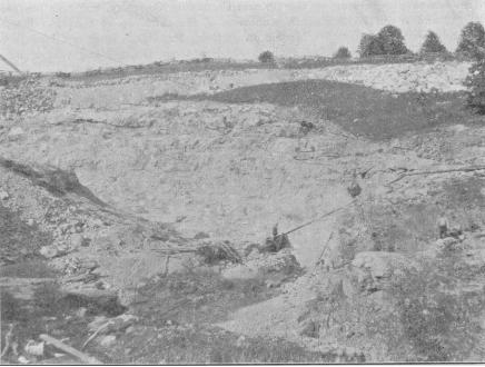


fc m'
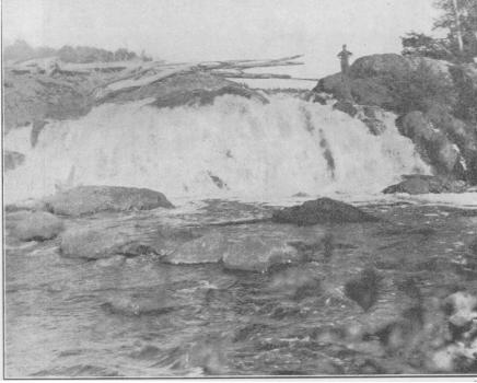


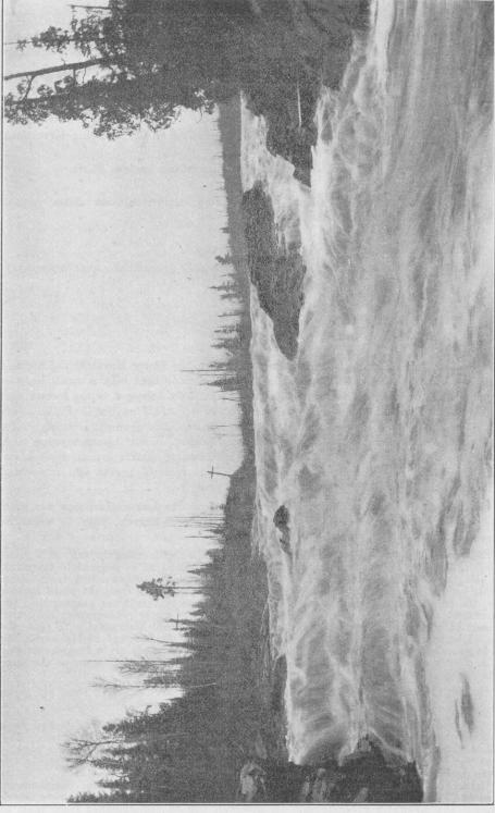
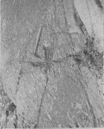
M i

r J*
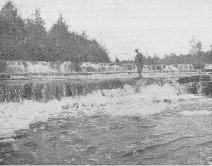

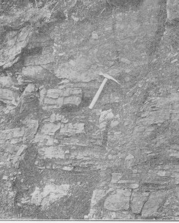

r ' . -"-f.

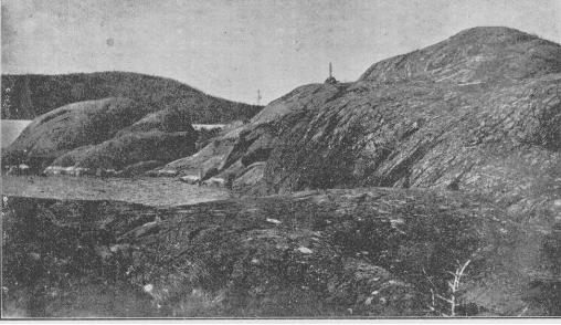
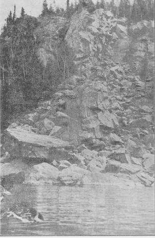

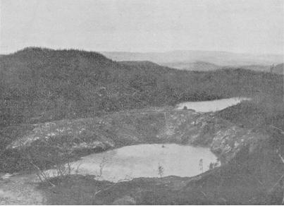
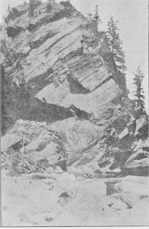
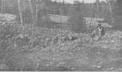
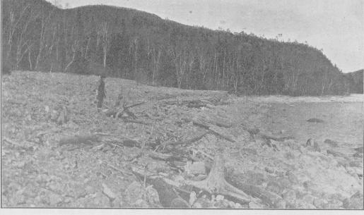

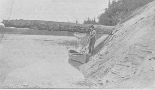
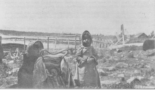


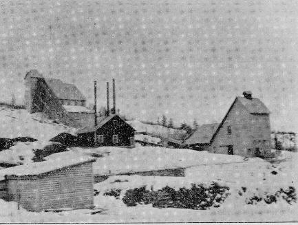
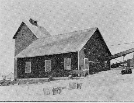
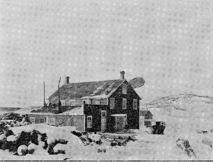

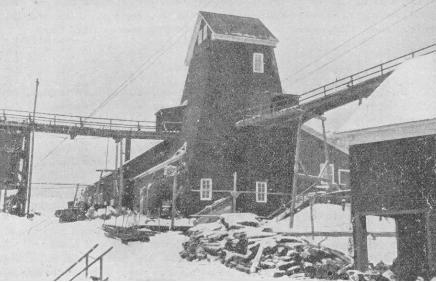
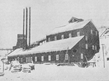
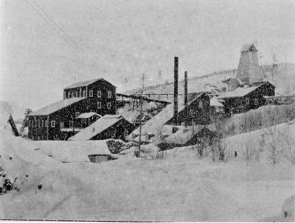
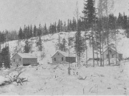
r'.V-i


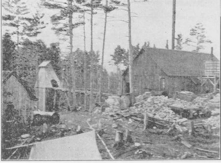
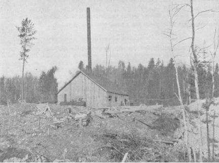


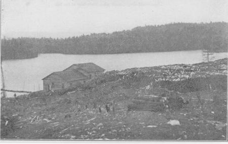

51 n
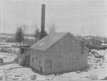
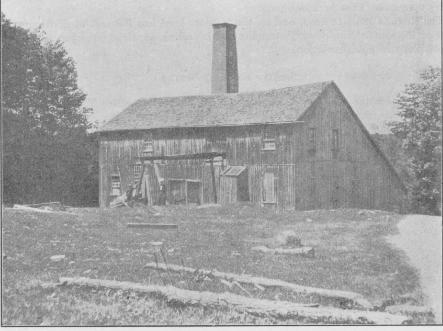


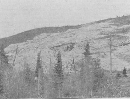
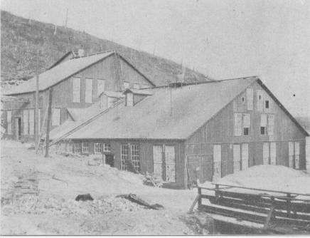

REPORT OF
THE BUREAU OF MINES1906
VOI. XV. PART II
THOS. W. GIBSON, Director
Clay and the Clay Industry of OntarioBY
M. B. BAKER
PRINTED BY ORDER OF THE LEGISLATIVE ASSEMBLY OF ONTARIO
TORONTO:Printed and Published by L. K. CAMERON, Printer to the King's Most Excellent Majesty
1906
WARWICK ERO'S fc RUTTER, Linuud, Prinien TORONTO

CONTENTS
Part I: Clay, and its Mode of Occurrence 3The origin of Shale . .....,... . ....... 4Boulder and Lacustrine Clays ........ 5Age Classification of Ontario Clays.... 6Composition of Ontario Shales ... ... 6
Analyses of, from Western Ontario. . 8The Clays of Western Ontario . . . .'. . .. 10
The Boulder Clay .. ....... . .. 10The Erie Clay .. . ....... . ..... ..... 10Analyses of Erie Clay .. .. ... ....... 14The Upper Erie or Red-Top Clay... 15Analyses of Red Top Clay ........ 17The Saugeen Clay ............ ...... 18Composition of the Saugeen Clay... 20Analyses of Saugeen Clay .......... 26
Eastern Ontario Clays ...... .. .. . . .. 29Boulder Clay . ... ............ . .. ..... 30The Leda Clay .... . . ................ 31The Saxicava Sand . .... .. ....... . . -32Saugeen Clay in the East ... ....... 33
Physical Properties of Clay .. ........ 34Plasticity . . .. ...... ... ............... 34Tensile strength ...... ..... ......... 34Shrinkage ...... . ..................... 38Slaking .. ............................ 39Fusibility .. ....... .. ................. 39
Part II: The Manufacture of Clay Pro ducts ............................... 41
Mining the Raw Material ........ . 41Ridding the Clay of Stones .. ...... 42Tempering . ... . ...... ........ .... ..... 43Moulding ............. .. ... .......... 44Drying .. . . ....... . . . . . . . . . . ... . .. . . . .. 47Burning . ......... .. . ............... 50The Question of Fuel .. ...... . . .. 53Flashing .............................. 54
Part III: The Clay Industry in Ontario 56in Addington county ................ 56in Algoma district .................. 5hin Brant county ... ................. 58in Bruce county .................... 59in Carleton county .... ............. 60
PAG Kin Dufferin county . . .............. 61in Durham county . ............... 61in Elgin county . .. ............... 62in Essex county ...................... 63in Frontenac county .. ............. 64in Grenville county ... .. ........ 65in Grey county ..... ............ ... 65in Haldimand county .. ............. 66in Halton county .................... 66in Hastings county ................. 69in Huron county .................... 70in Kent county ...................... 72in Lambton county .................. 74in Lanark county ...... .. ...... 75in Leeds county ...................... 76in Lennox county ...... ....., . ...... 77in Lincoln county ................... 77in Middlesex county ... ....... .... 79in Muskoka district . .............. 82in Nipissing district .............. 83in Norfolk county .................. 85in Northumberland county ......... 85in Oxford county .................... 85in Ontario county .................. 87in Parry Sound district ............ 88in Peel county ...................... 89in Perth county .................... 91in Peterborough county ............ 94in Prince Edward county ........... 95in Renfrew county ................... 96in Russell county ................... 97in Sincoe county ................... 99in Victoria county .................. 100in Waterloo county ...... .......... 102in Welland county .................. 104in Wellington county . ....... ..... 105in Wentworth county .............. 106in York county ...................... 107
Paving Brick .............. ............ 112Portland Cement ...............'...... 115Tile making ............. ... .......... 116Sewer Pipe ............. .............. 116Pottery Terra-cotta
118120
LIST OF ILLUSTRATIONS
Fig. 1. Rock surface striated by a glacier.Fig. 2. Solater's quarry, St. Mary's, Perth County. For lime burning only. Ten feet of clay
and gra\el overlying limestone.Fig. 3. Shale bank, Milton Pressed Brick Co., Milton.Fig. 4. Bank of Medina shale worked by Toronto Pressed Brick Company, Milton. Fig. 5. Boulder clay at Thedford, resting on Devonian shale in place. R. Elliott's yard. Fig. 6. Section of Erie blue clay overlaid by sand and gravel; exposed in cutting C. P. railway,
Goderich. ,, . , , . n , . . Fig. 7. Bank of Erie blue clay 120 feet deep, in west bank Maitland river, Goderich. Fig 8. Close view of Erie clay bank, showing jointings and some laminations at base. Fig 9 Ideal section showing how weathering penetrates a clay bed, especially along roots and
cracks in the clay. This process has produced the Red- ion clay from Erie blue clay. Fig 10 Section of Erie clay bed, with Red-Top clay above as the darker weathered top of the
Erie, which in the cut is lighter colored. Fig. 11. Saugeen clay along railway near the snore of lake Temiskaming, between Haileybury
and New Liskeard, Ont.Fig. 12. Finely laminated Saugeen clay, New Liskeard. . Fig 13 Saugeen clay This illustration represents a closer view of a part of the clay bank
shown in Fig. 11. The alternate lighter-colored layers are more or less marly. Fig 14 Igneous rocks overlaid by clay and sand, and later cut by the Spanish River. Fig 15' Large pulp mills of the Spanish River Pulp and Paper Company; also workmen's houses
of red brick made from Saugeen clay. Espanola.Fig 16 Saugeen clay overlaid by sand. Exposed in banks of Spanish River at Espanola.
[iii.]
iv. Bureau of Mines No. 5
'fi LIST OF
g. 17. Saugeen clay in the Spanish River at Espanola; part of the bank as shown in Fig. 16much enlarged.
Fig. 18. Saugeen clay bank at Casselman, showing pick marks and laminations plainly. Fig. 19. Bank of Saugeen clay, Baker Bros.' yard, Casselman. Here the laminated clay is over
laid by about 4 feet of sand. Fig. 20. Sand and gravel laid obliquely, showing evidence of currents. Photo, of section of
gravel bed at Owen Sound. Fig. 21. Section of Iroquois -beach exposed at Hamilton, showing relations of clay, sand and
gravel. Fig. 22. Section of lacustrine clay at Builder's Supply Co.'s plant, London; four feet of gra\el
is removed from top for road purposes. The light band is a very strong clay. Fig. 23. Boulder clay on the face of an excavation at Ottawa. Fig. 24. Twenty feet of Leda clay, Ottawa.Fig. 25. Examples of Seger cones, (1) placed for fusion test, (2) after fusion test, etc. Fig. 26. A novel method of mining and transporting clay from pit to machine; Watson and
Hutchison's yard, Bracebridge. Fig. 27. Clay brought over the tops of the hacks by clay cars and cable, F. Entricken's yard,
Stratford.Fig. 28. Hand moulding plant, Mouldy Bros., Kingston : one man moulds 2,000 brick per day. Fig. 29. Bechtel automatic end-cut cut-off machine in operation at Stratford Brick, Tile and
Lumber Co.'s yard. Fig. 30. Slop-brick plant in operation, Orediton. The brick are dried in the open yard as
shown in the photo.Fig. 31. Rack and pallet yard, Cain Brick Co.'s yard, Ottawa. The kiln shed is in the rear. Fig. 32. J. Logan's yard, Greenwood avenue, Toronto; showing Sheldon dryer and down-draft
kiln. Fig. 33. One of the steel carg used in the Sheldon and Sheldon tunnel dryer, capacity about 330
brick. Fig. 34. Open shed scoved kiln, showing method of setting and nature of arches. W. Hedden's
yard, Crediton. Fig. 35. Permanent walled up-draft kiln, capacity 250,000 brick, London Builders' Supply Co.,
London.Fig. 36. Round down-draft kiln, five arches, with chimneys outside; capacity 60,000 brick. Fig. 37. A rectangular down-draft kiln, capacity about 120,009 brick.Fig. 38. 16-chambered continuous down-draft kiln, capacity 340,000 brick; Port Credit Brick Co. Fig. 39. Double rectangular down-draft kiln, one set of chimneys for both kilns; F. Entricken's
yard. Stratford.Fig. 40. Bell Bros.' yard, Paisley. Fig. 41. Medina shale bad worked for pressed brick and terra cotta tay the Toronto Pressed
Brick Co., Milton.Fig. 42. General view of the Toronto Pressed Brick Company's plant at Milton, Ont. Fig. 43. Medina shale bank worked for pressed brick by Milton Pressed Brick Co., Milton. Fig. 44. Milton Pressed Brick Co.'s plant, Milton. Fig. 45. General view of James Cornhill's yard, Chatham. Fig. 46. Geo. Moody's Yard, Highgate, showing open hacks with pivoted roofs, filled with hollow
blocks; also Bechtel dryer.Fig. 47. Plant of Beamsville Brick and Terra Cotta Co., Beamsville. Fig. 48. Plant of London Brick Mfg. and Supply Co., London. Fig. 49. A 45-h.p. water wheel installed by Mr. Watson, Bracebridge, with which he operates
his whole brick plant at a cost of about ten cents per day. Fig. 50. Beaverton Brick and Tile Co.'s yard, Beaverton. Note round down-draft kilns burning
coal. Fig.-51. Port Credit Brick Co.'s pressed brick plant, Port Credit, showing large continuous
down-draft kiln. Fig. 52. Part of Close Brick Co.'s plant, Stratford, showing a Baird clay-car bringing clay to
the machine.Fig. 53. Laminated Erie clay beds at F. Entricken's yard, Stratford. Fig. 54. A double rectangular down-draft kiln at F. Entricken's yard, Stratford. No. l is being
fired, while No. 2 is being discharged. Fig. 55. Curtis Bros.' yard, Peterborough.Fig. 56. Merkley Bros.'s yard. Casselman; showing the scoved kilns and drier. Fig. 57. Rack and pallet yard of Mr. 8. J. Fox. M.P.P., Lindsay. Fig. 58. Mr. S. J. Fox, M.P.P.'s brick yard and workmen.Fig. 59. A former "hack" yard replaced by a Bechtel Carless dryer Brantford Brick Co.'s yard. Fig. 60. General view of Mr. F. Schaefer's brick yard, Breslau.Fig. 61. Large continuous down-draft kiln in Jos. Russell's yard. Queen Street East, Toronto. Fig. 62. A. H. WapBtaff's yard, Greenwood Av., Toronto, showing rectangular down-draft kiln
and Sheldon dryer.Fig. 63. Part of a series of rectangular down-draft kilns used by Toronto Fire Brick Co., Mimico. Fig. 64. General view Ontario Paving Brick Company's plant, showing stock of paving brick
and Sheldon dryer.Fig. 65. Rectangular down-draft kilns for burning paving brick; Ontario Paving Brick Company. Fig. 66. Goderich Cement Brick Co.'s plant. Goderich. Fig. 67. Discing Red-Top clay, which is shipped by rail from Stratford to Durham for the
manufacture of cement by the National Portland Cemei.t Co.Fig. 68. Dominion Sewer Pipe Co.'s plant, Swansea; showing low down-draft kilns. Fi?. 69. Ontario Sewer Pipe Co.'s plant. Mimico, showing down-draft kilns used for sewer p : pe Fig. 70. Strong clay left by potter to dry, showing shrinkage of clay on drying. Fig. 71. Huron Pottery, F. Burgarde and Son, Egmondville.

PREFACE.
The more stable but more prosaic mineral industries of a country are apt to be-somewhat neglected for those which appeal more strongly to men's imagination or-cupidity. The clay working industry, which next to agriculture can be called the most ancient of industries, has up to the present been almost ignored by scientific workers, although during late years in Germany, the United States and in other coun tries, it has been receiving more attention. Several of the States of the American union, and other countries now have departments devoted to the study of clay and its pro--ducts. In Ontario the clay industry has grown rapidly during recent years. Brick, which is cheaper than stone, is being used in modern cities in place of wood for fire protection purposes. As years go on the clay industry must become proportionately more important. It is well, therefore, at this time, for Ontario to have a systematic report such as that of Mr;. Baker on "Clay and the Clay Industry."
In Part I. of his report Mr. Baker gives, in 41 pages, an account of the character,-origin and modes of occurrence of clay, written in such a way as to be understood, it is believed, by persons who have had little technical training. His age classification of clays will doubtless be found very useful by manufacturers, as well as possessing an-educational value from the side of culture. Every worker's interests will be widened and his mental attainments broadened by his understanding something of the origin and relationships of the materials with which he is dealing. There is nothing in Mr. Baker's report treating of the relationships of the various shales and clays—Erie, Red Top, Leda and Saugeen—with which every clay worker in the Province has something to do, that cannot be understood by almost any one who can read English. Manufacturing difficulties will thus be avoided, and a scientific knowledge will be gained which cannot be estimated in mere dollars and cents.
The 15 pages of Part II. are devoted to the Manufacture of Clay Products. 'Methods of manufacture are described, and practical hints are given for overcoming difficulties which are met with almost daily in manufacturing.
In Part III., pages 56-112, typical shale and clay working plants are described under the heading of counties, which follow one another in alphabetical order. This part of the report will be of local interest. The clay worker who desires to gain a knowledge of the modes of occurrence of his material will have descriptions of similar occurrences in his own county with which to compare it.
Pages 112-120 deal briefly with various industries in which clay is used as part of the raw materials.
The seventy-one illustrations in the report have been carefully selected to illustrate typical occurrences of clay and shale, to throw light on the modes of occurrence of these materials, and to represent various machines and plants used in the clay industry in the Province.
Mr. Baker's labors in connection with the industry have not only been of value in the preparation of this report, but he has done work, which has been highly commended by clay workers in various parts of the Province, in giving practical advice in his visits to many plants.
Three or four years ago the clay workers, first of Ontario, and now of the whole Dominion, organized a society known as the "Canadian Clay Products Manufacturers," which holds an annual meeting—the last two being at "Waterloo and Hamilton respec tively—at which papers are read and discussions held on various topics connected with the industry. These meetings have proved very valuable, and every clay worker of the Province should join the rapidly growing membership of the society,
l M2. [1]

Bureau of Mines. No. 5
The statistics of the clay industry show more clearly the relative importance of clay among mineral products. In this Province the manufactures from clay have till recently represented nearly 20 per cent, of the output of our total mineral industry. In the United States clay products form nearly 10 per cent, of the very large mineral ouptut. Moreover, it should be remembered that a high percentage of the receipts from the clay industry are expended on labor and supplies. From this point of view no mineral industry can be claimed to benefit a community or a country more than that •whose raw material is clay.
W. O. M.
laM2.
CLAY AND THE CLAY INDUSTRY OF ONTARIOBY M. B. BAKER
PART II.—CLAY, AND ITS MODE OF OCCURRENCE
In dealing with clay, it would probably be as well to have a clear understanding of the substance itself, before discussing its properties and uses. Almost everyone is sufficiently acquainted with clay to recognize the substance readily, but if asked for a definition of clay it is doubtful whether many could so define it that a stranger would recognize the substance on seeing it. To define clay specifically then, we would say, "Clay is an earthy material which when moistened becomes plastic, and can then be moulded or fashioned into any desirable shape; which shape is preserved intact upon drying. Furthermore, if heated to redness, or slightly above it, the substance fuses, and on cooling assumes a rock-like consistency." From this definition we see that clay has several essential qualities, and cannot well be confused with any other substance.
The above is a rather popular definition, and one easily understood by almost everyone. To define clay chemically, i. e., taking note of its actual composition, we would say that clay is a hydrated silicate of aluminium, with the following formula, A12O3, 3Si02, 2H2O. It is a substance resulting from the decomposition of rocks con taining silicates of aluminium, with alkalies, etc. Chief among these is the mineral feldspar, which is a silicate of aluminum with the alkalies, potassium or sodium or calcium, having in general the following chemical formula: K2O, A12O3, 6SiO2, Eain- water and percolating solutions in general, on meeting this mineral, dissolve the alkalies and carry them away in solution, leaving behind the silicate of aluminium, which has become hydrated during the change. This part being insoluble is left as a residue, and is a pure kaolin or "residual" clay. We can readily see that pure kaolin, or residual clay, is not very apt to be left undisturbed, but is almost sure to be trans ported mechanically by moving water, and finds a resting place in some hollow, e. g., a valley or lake. This is the normal method for the collection of clays.
We have seen above that clay is not usually left in the place at which it formed, but is transported or collected into beds by water. Sometimes, however, clays form in place and remain there; they are then properly called residual clays. When we remem ber that the weathering commences at the surface, and works gradually downward, we see that the surface has been suffering alteration for a longer period of time than the deeper portions, and so we expect to find, starting at the surface, first a layer of completely formed clay; below this a layer composed of a mixture of clay and partially decomposed rock fragments; below this again is a layer of comparatively fresh rock, which passes finally into the undecomposed rock proper.
The character of the clay will naturally vary with the character of the rock from which it is formed. If the parent rock be largely feldspar, with the composition as. given above, the resulting kaolin should be white, or nearly so. If the parent rock contain free silica or quartz, then the resulting clay will contain considerable sand,, and will be what is known as a "lean" clay; the pure clay being known as a "fat" or "strong" clay. If, again, the parent rock contains considerable iron, the resulting clay will contain iron, and will be a light yellow to brownish, or even a rich red, color, according to the percentage of iron present. All possible combinations of these may arise. Another point worth considering is the presence of lime in a clay. If the original rock contains limestone, or calcite, considerable of it will be left as grains, mixed with the clay, i.e., particles of completely decomposed mineral, represented by
[3]
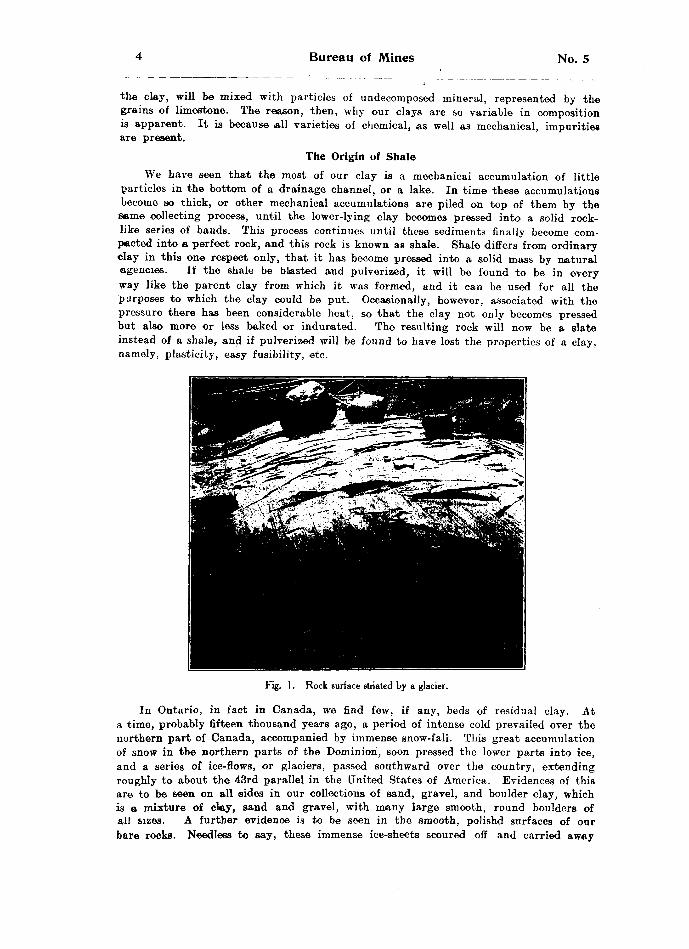
Bureau of Mines No. 5
the clay, will be mixed with particles of undecomposed mineral, represented by the grains of limestone. The reason, then, why our clays are so variable in composition is apparent. It is because all varieties of chemical, as well as mechanical, impurities are present.
The Origin of ShaleWe have seen that the most of our clay is a mechanical accumulation of little
particles in the bottom of a drainage channel, or a lake. In time these accumulations become so thick, or other mechanical accumulations are piled on top of them by the eeme collecting process, until the lower-lying clay becomes pressed into a solid rock- like series of bands. This process continues until these sediments finally become com pacted into a perfect rock, and this rock is known as shale. Shale differs from ordinary clay in this one respect only, that it has become pressed into a solid mass by natural agencies. If the shale be blasted and pulverized, it will be found to be in every way like the parent clay from which it was formed, and it can be used for all the purposes to which the clay could be put. Occasionally, however, associated with the pressure there has been considerable heat, so that the clay not only becomes pressed but also more or less baked or indurated. The resulting rock will now be a slate instead of a shale, and if pulverized will be found to have lost the properties of a clay, namely, plasticity, easy fusibility, etc.
Fig. 1. Rock surface striated by a glacier.
In Ontario, in fact in Canada, we find few, if any, beds of residual clay. At a time, probably fifteen thousand years ago, a period of intense cold prevailed over the northern part of Canada, accompanied by immense snow-fall. This great accumulation of snow in the northern parts of the Dominion, soon pressed the lower parts into ice, and a series of ice-flows, or glaciers, passed southward over the country, extending roughly to about the 43rd parallel in the United States of America. Evidences of this are to be seen on all sides in our collections of sand, gravel, and boulder clay, which is a mixture of clay, sand and gravel, with many large smooth, round boulders of all sizes. A further evidence is to be seen in the smooth, polishd surfaces of our bare rocks. Needless to say, these immense ice-sheets scoured off and carried away
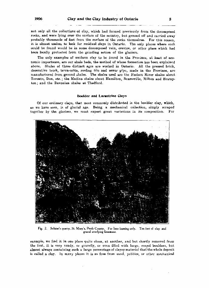
1906 Clay and the Clay Industry of Ontario
not only all the collections of clay, which had formed previously from the decomposed rocks, and were lying over the surface of the country, but ground off and carried away probably thousands of feet from the surface of the rocks themselves. For this reason, it is almost useless to look for residual clays in Ontario. The only places where such could be found would be in some decomposed vein, crevice, or other place which had been locally protected from the grinding action of the glaciers.
The only examples of uniform clay to be found in the Province, at least of eco nomic importance, are our shale beds, the method of whose formation has been explained above. Shales of three distinct ages are worked in Ontario. All the pressed brick, decorative brick, terra-cotta, roofing tile and sewer pipe, made in the Province, are manufactured from ground shales. The shales used are the Hudson River shales about Toronto, Don, etc.; the Medina shales about Hamilton, Beamsville, Milton and Bramp ton; and the Devonian shales at Thedford.
Of our ordinary clays, that most commonly distributed is the boulder clay, which, as we have seen, is of glacial age. Being a mechanical collection, simply scraped together by the glaciers, we must expect great variations in its composition. For
Fig. 2. Sclater's quarry, St. Mary's, Perth County. For lime burning only. Ten feet of clay andgravel overlying limestone.
example, we find it in one place quite clean, at another, and but shortly removed from the first, it is very sandy, or gravelly, or even filled with large, round boulders, but almost always containing such a large percentage of clayey material that the whole deposit is called a clay. In many places it is so free from sand, pebbles, or other mechanical

Bureau of Mines No. 5
impurities that it presents a fat, clean clay, and it is in these places that it is used for the manufacture of brick and tile. The surprise is, that so much of the clay should br found so free from impurities. The series of analyses given below made from Erie clay, taken from all parts of the Province, show what a remarkable uniformity there is in this accumulation as a whole. (See table on page 14.)
This remarkable sameness in the clays of the Province would seem to indicate the presence of immense quantities of water, associated with the ice, because in most cases where sand or gravel is found with the clay, it is well sorted into distinct beds, and where large deposits of clay are found, many of which are from 70 to 120 feet thick, they are remarkably clean, only occasional stones being found scattered through them, which would appear to have dropped from pieces of floating ice, in melting.
There is still a third class of clay found in Ontario, namely, lacustrine clays, or clay, collected locally into hollows or lakes. These accumulations have taken place since glacial times. Such clays will naturally be re-sorted glacial clay in most cases, with possibly here and there a slight accumulation of clay formed from the decompo sition of exposed rock surfaces. These clays will not be widespread, nor of great thick ness, as the time since the glacial period is, from a geological standpoint, not a long one.
We have now shown that the clays of Ontario are of three great classes, according to their method of accumulation. Keeping this in mind, we may classify our Ontario clays as follows. In this classification, the shales as well as the clays are taken into consideration, as the shales are simply the clays of earlier times, pressed into a hard ened or rock-like form, and as we have seen above, they require only to be blasted and pulverized to be in every respect true clays, and capable of being used extensively in the manufacture of clay products. The classification as given below is in descending order.
Age Classification of Ontario Clays
WESTERN ONTARIO. EASTERN ONTARIO.
Post-glacial—Lacustrine.
l Saugeen. Glacial .... \ S2Per Erie OT Red TOP"
Post-Glacial—Lacustrine.
Boulder.
Pre-Glaciali a l JResidual.
Underlying rocks including Hudson River, Medina, and Devonian shales.
^Saugeen clay.i^ion,- Q i l Upper Leda or Sadicava sand, waciai. l Leda
\ Boulder.
f Residual, l
Pre-Glacial. -( Underlying rocks comprising l chiefly limestones and igneous ( rocks," but no shales.
The above classification is based upon the time of the accumulation. Amongst the pre-glacial, we notice residual clays. These have been discussed above with the possibility of their occurrence in Ontario, and nothing further need be said here con cerning them.
Composition of Ontario Shales
As to the shales of pre-glacial times, they play an important part in Ontario, for the manufacture of all the better classes of clay products. As mentioned already, the three shales used in Ontario are the Hudson River, Medina, and Devonian. The Hudson River shale is a red-burning shale with certain bands more highly cal careous, which burn to cream or buff-colored goods. These shales are worked exten-

1906 Clay and the Clay Industry of Ontario
sively about Toronto and the Don, and at Toronto Junction, in the manufacture of vitrified paving brick by the Ontario Paving Brick Company. The Medina shales are very abundant about Hamilton, Milton, and up the Credit Valley. They are a rich red color, so much so, that the surface of the ground, where these shales occur, is quite red or painty from the leaching of the iron from the shales. Needless to say, this Medina shale burns to a rich red color, although there are many bands of a blueish- .gray shale in the Medina, which, if blasted and worked by themselves, yield an excel lent buff-colored product. These shales are used in the manufacture of pressed brick,
Fig. 3. Shale bank, Milton Pressed Brick Co., Milton. Note lighter band of shale about half way down section, which burns to buff brick ; also over-burden of boulder clay.
terra-cotta, etc., at Beamsville, Milton, Brampton and other places in the Credit Valley, and are also used at Hamilton, Swansea and Mimico in the manufacture of glazed sewer pipe.
The Devonian shale is worked at only one place at present in the Province, namely, at Thedford, Ontario. Here the shale is of a deep blue color, resembling very closely ordinary blue Erie clay. It is exposed on the surface by the removal of the overlying sandy Erie clay from 8 to 12 feet in thickness. The surface of the shale on exposure to the air, soon slakes sufficiently to be dug, and is used then like an ordinary clay

Bureau of Mines No. 5
ir. the manufacture of brick and tile by the stiff-mud process. Scattered through this shale, and occurring abundantly in the overlying clay, are many fossils of Devonian age, including among others the following: Zaphrentis prolifica, Cystiphyllum, Helio- phyllum, Crinoidea, Spirifera mucronata, Favosites, and many other typical Devonian fossils. The following are analyses of these various shales: —
ANALYSES OF WESTERN ONTARIO SHALES.
No. sample.
9......................15......................18......................19.......... ...........20......................21.....................22......................23....... .............24......................36......................
73......................
Silicia. per cent.
54.9666.8259.8456.5256.4647.9853.2065.0455.9050.4059.5457.8643.3857.1263.60
Alumina, per cent.
19.1511.6817.7815.2118.1913.1017.7316.1418.4615.2117.2020.0010.9618.5216.49
Ferrie Oxide,
per cent.
6.686.586.205.827.434.826.916.376.604.115.43
4.567.285.27
Lime, per cent.
4.02.62
2.486.802.56
12.536.00
.803.82
10.136.722.92
18.003.92
Mag nesia,
per cent.
2.71.90
3.112.822.93
3.242.17
4.60
3 0^
3.333.32
Soda, per cent.
.30
.381.25
.56
.63
.78
.46
.64
.531.95
.50
1.30.40
1.04
Potash, per cent.
3.472.582.733.593.543.393.403.213.552.591.60
2.123.061.30
Sulphur trioxide. per cent.
.63
.59
.27
.20
.15
.13
.14
.12
.31
.27
.17
Loss by heat,
per cent.
8.488.856.108.798.52
14.509.585.988.74
11.007.445.74
1(5.526.408.71
9.—Red burning Devonian shale which is allowed to slake on the surface, when it is dug and worked into brick and tile by the stiff-mud process, by Mr. Elliot, of Thedford, Ont.
15.—A shale probably of Hamilton age, occurring in Lambton county, and under lying Erie blue clay, No. 14, at Alvinston. The shale occurs in the bed of the river. It has never been worked, but would yield splendid red products.
18. 20.—Bed-burning Medina shales, worked for brick by the Port Credit Brick Com pany, at Port Credit.
19.—Red-burning Medina shale worked for red pressed brick by the Brampton Pressed Brick Company, of Brampton.
21.—A bluish-gray shale, interbanded with the Medina shales and made into buff-colored pressed brick by the Milton Pressed Brick Company.
22.—Red-burning Medina shale, from the same deposit.23.—Red-burning Medina shale, manufactured into glazed sewer pipe by the Toronto
and Hamilton Sewer Pipe Company, of Hamilton. The shale is blasted and shipped by Grand Trunk from Waterdown, Ont.
24.—Red-burning Medina shale, which is allowed to slake and is then dug and used for the manufacture of red pressed brick, by George Grain, of Beamsville, Ont.
36.—Another sample of the Devonian shales from Tbedford, Ont. This sample taken a little lower in the bank than No. 9 above, would probably burn buff-colored products.
70.—A red-burning shale-like clay blasted out and worked by Wagstaff, Webb, Logan and Price, Greenwood Ave., Toronto.
71.—Red-burning Hudson River shale used for manufacture of red pressed brick by the Don Valley Brick Company, Toronto.
72.—Buff-burning clay, with Hudson River formation, worked by the Don Valley Brick Company, Toronto.
73.—Red-burning Hudson River shale, used by the Toronto Fire Brick Company, Mimico, for manufacture of red pressed brick.
74.—Red-burning Hudson River shale, used by the Ontario Paving Brick Company at Toronto Junction, for the manufacture if vitrified paving brick.
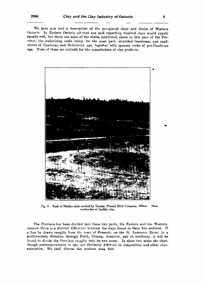
1906 Clay and the Clay Industry of Ontario
We have now had a description of the pre-glacial clays and shales of Western Ontario. In Eastern Ontario all that was said regarding residual clays would appply equally well, but there are none of the shales mentioned above in this part of the Pro vince, the underlying rocks being, for the most part, stratified limestones and sand stones of Cambrian and Ordovician age, together with igneous rocks of pre-Cambrian age. None of these are suitable for the manufacture of clay products.
Fig. 4. Bank of Medina shale worked by Toronto Pressed Brick Company, Milton, overburden of boulder clay.
Note
The Province has been divided into these two parts, the Eastern and the Western, because there is a distinct difference between the clays found in these two sections. If a line be drawn roughly from the town of Prescott, on the St. Lawrence River, in a northwesterly direction through Perth, Ottawa, Arnprior, and on northerly, it will be found to divide the Province roughly into its two areas. In these two areas the clays, though contemporaneous in age, are distinctly different in composition and other char acteristics. We shall discuss the western area first.
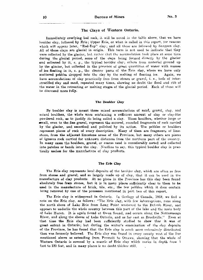
10 Bureau of Mines No. 5
The Clays of Western Ontario.
Immediately overlying bed rock, it will be noted in the table above, that we have boulder clay, followed by Erie; Upper Erie, or what is called in this report, for reasons which will appear later, "Red-Top" clay; and all these are followed by Saugeen clay. All of these clays are glacial in origin. This term is not used to indicate that they were collected by the glacier, but rather that the accumulation took place at some time during the glacial period, some of the cLays being formed directly by the glacier and collected by it, e. g., the typical boulder clay; others from material ground up by the glacier, but collected in the presence of great quantities of water with masses of ice floating in it, e. g., the cleaner parts of the Erie clay, where we have only scattered pebbles dropped into the clay by the melting of floating ice. Again, we have accumulations of clay practically free from stones or gravel, i. e., beds of inter stratified clay and sand, repeated many times, showing no doubt the flood and ebb of the water in the retreating or melting stages of the glacial period. Each of these will be discussed more fully.
The Boulder Clay
By boulder clay is meant those mixed accumulations of sand, gravel, clay, and mixed boulders, the whole mass containing a sufficient amount of clay or clay-like powdered rock, as to justify its being called a clay. These boulders, whether large or •mall, even to the fine gravel, represent the scoured, rounded fragments of rock carried by the glacier, and smoothed and polished by its action. The pebbles or boulders represent pieces of rock of every description. Many of them are fragments of lime stone, from the adjacent limestone areas of the Province, but many others are pieces of igneous rock carried for unknown distances from the northern part of the country. In many cases the boulders, gravel, or coarse sand is considerably sorted and collected into patches or bands into the clay. Needless to say, this typical boulder clay is prac tically useless for the manufacture of clay products.
The Erie Clay
The Erie clay represents local deposits of the boulder clay, which are often so free from stones and gravel, and so largely made up of clay, that it can be used in the manufacture of clay products. At no place in the Province has this clay been found absolutely free fr*m stones, (but it is in many places sufficiently clear to them to be used in the manufacture of brick, tile, etc., the few pebbles which it does contain being removed by one of the processes mentioned in part two of this report.
The Erie clay is widespread in Ontario. In Geology of Canada, 1863, we find a note on the Erie clay, as follows: "The Erie clay, with few interruptions, runs along the north shore of Lake Erie from Long Point westward to the Detroit River, and appears to underlie the whole country between this part of the lake and the main body of Lake Huron. It is again found at Owen Sound, and occurs along the Nottawasaga River, and along the shores of Lake Ontario, and as far east as Brockville." Even at that time the Erie clay had been sufficiently studied to show that it was of great extent in Ontario; but during the writer's examination of the clay deposits of the Province, he has found that the Erie clay is much more extensively distributed than was formerly believed. The Erie clay was found in every county west of the line mentioned above as extending from Prescott to Ottawa, showing that the whole of Western Ontario is covered by a mantle of Erie clay which varies in depth from l foot to 130 feet, and in many places is no doubt thicker still.

1906 Clay and the Clay Industry of Ontario H
The Erie clay then, appears to be only the cleaner localized accumulations of the boulder clay, and was probably formed in the presence of much more water than was ashy-gray color when dry. It is highly calcareous, as will be seen by the group of the typical boulder clay. The Erie clay is of a deep blue color when wet, and of an analyses given on page 14, so much so that it effervesces freely when moistened with an acid of any kind. 8ome specimens, especially from the more westerly parts of the Province, contain as much as 30 per cent, of carbonate of lime. They are in reality an impure blue marl rather than a clay. Most of the Erie clays which are used
Fig. 5. Boulder clay at Thedford, resting on Devonian shale in place. (Hat and box are on one bedof shale). R. Elliott's yard.
in the manufacture of brick, do not exceed 18 per cent, carbonate of lime, but even this is sufficient to counteract the effects of as much as 6 per cent, of ferric oxide and cause the brick to burn to a white or buff color. All the white brick, white tile, hollow block, etc., made in Ontario, are from the Erie clay. It is usually found in deep banks of a stiff, tough nature, and is commonly known as "blue clay."
Almost everyone is familiar with this clay. It is not often seen on the surface, but in railroad cuttings, in the banks of rivers, and in almost every well, this stiff blue clay, or hard-pan, is readily recognized. When properly worked by the stiff-mud pro cess, and even by the soft-mud process, it yields a good class of brick, but, as is
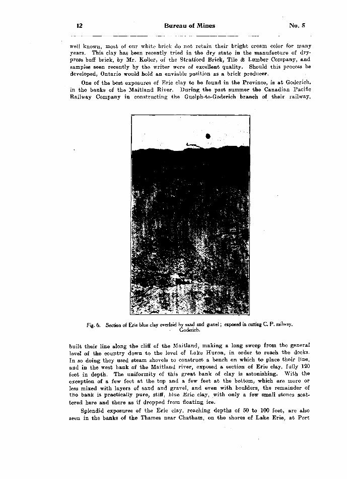
12 Bureau of Mines No. 5
well known, most of our white brick do not retain their bright cream color for many years. This clay has been recently tried in the dry state in the manufacture of dry- press buff brick, by Mr. Keller, of the Stratford Brick, Tile A Lumber Company, and samples seen recently by the writer were of excellent quality. Should this process be developed, Ontario would hold an enviable position as a brick producer.
One of the best exposures of Erie clay to be found in the Province, is at Goderich, in the banks of the Maitland River. During the past summer the Canadian Pacific Railway Company in constructing the Guelph-to-Goderich branch of their railway,
Fig. 6. Section of Erie blue clay overlaid by sand and gtavel; exposed in cutting C. P. railway,Goderich.
built their line along the cliff of the Maitland, making a long sweep from the general level of the country down to the level of Lake Huron, in order to reach the docks. In so doing they used steam shovels to construct a bench on which to place their line, and in the west bank of the Maitland river, exposed a section of Erie clay, fully 120 feet in depth. The uniformity of this great bank of clay is astonishing. With the exception of a few feet at the top and a few feet at the bottom, which are more or less mixed with layers of sand and gravel, and even with boulders, the remainder of the bank is practically pure, stiff, blue Erie clay, with only a few small stones scat tered here and there as if dropped from floating ice.
Splendid exposures of the Erie clay, reaching depths of 50 to 100 feet, are also seen in the banks of the Thames near Chatham, on the shores of Lake Erie, at Port

1906 Clay and the Clay Industry of Ontario 13
Dover, Port Stanley, and Port Talbot, in the cuts about the Don, at Brantford, at Owen Sound, at Walkerton, and elsewhere, and the blue clay may be seen from 10 to 30 feet thick at almost any place.
It is often interstratified with bands of gray quicksand, which are frequently at such convenient distances apart, that the clay can be worked as a series of benches, the sand making a splendid floor to which to break.
Fig. 7. Bank of Erie blue clay 120 feet deep, in west bank Maitland river, Goderich.
Fig. 8. Close view of Erie clay bank, showing jointings and some laminations at base.
The Erie clay often shows vertical jointing, and in many places distinct lamina tion with small bands of gray quicksand, or even with thin streaks of gravel. There is no series of characteristics, which will apply everywhere to the Erie clay and this fact has led so many clay-users to claim that their particular clay is different from all others. Any real differences depend upon the percentage of impurities, such as sand, quicksand, gravel, etc, There are only two or three characteristics which are

14 Bureau of Mines No. 5
constant; namely the blue color of the clay, its highly calcareous nature, and the pre sence in it of a greater or smaller proportion of stones, rounded and scratched owing to their glacial origin. In addition it always burns to white or buff-colored goods.
If we look at the analyses below, we will be impressed with the uniformity of com position of this Erie clay, and when we think of the method in which it has been accumulated, our surprise is that there is any similarity at all. All the variations claimed by different brick-makers are really small local differences, caused usually by variable proportions of sand in the clay. The presence of sand in a clay will modify the ease of working in almost every way, that is, it will make a difference in the dig ging, a difference in the amount of water required for tempering, a difference in the ease of pugging, a difference in the facility with which the clay passes through the machine, a difference in the rate and result of drying the brick, a difference in the rate and result of burning the brick, and a difference in the color, porosity, and strength of the brick itself. Consequently, even although we find considerable differ ences in the manipulation and ease of working in the various yards, the clay is never theless only the Erie blue clay, in one or other of its phases.
ANALYSES OF ERIE CLAY.
No. sample.
2.......... .........3
8......................
14 ....17 . ...................
27......................on
38......................
40......................
42......................
Silica, per cent.
40.1645.4644.3038.4037.7238.9450.2041.4039.9240.1437.5034.4851.9251.3045.8951.0647.5052.1753.2249.85
Alumina, per cent.
13.769.73
11.219.62
10.7212.1012.6612.5412.6915.0410 319.11
13.749.80
14.1015.5813.6614.9014.0315.10
Ferrie oxide,
per cent.
5.583.834.053.943.514.835.144.884.674.563.593.715.033.705.564.784.444.205.216.18
Lime, per cent.
15.7415.8016.1017.3216.9017.5811.4615.9816.5614.6022.5623.3310.0313.6310.0010.0015.589.19
11.0811.32
Mag nesia,
per cent.
3.785.063.815.887.054.172.934.203.724.972.614.833.783.823.004.47
.804.14
.614.13
Soda, per cent.
.70
.78no
.98
.87
.901.351.00
.76
.811.11
.901.671.642.222.422.821.911.01i i^ 1.35
Potash, per cent.
2.001.85
1 Q^2.192.38
2.332.431.862.341.763.062.271.632.681.602.163.442.79
Sulphur trioxide. per cent.
.17
.12
.18COC,**
.02
.38
.06
.12
.19
.19
.19
.57
.15
.16
.20
Loss by heat,
per cent.
n JQ
17 37
21.46
1 1 ft Si17.6510 CI
19.6022.3010 Q C
13 949.76
11.8710.28
2. Erie, blue clay, underlying No. l, for whose analysis see table on page 17. This blue clay is worked at Stratford for white brick and tile, and has recently been used by the Stratford Brick, Tile A Lumber Co., in the manufacture of buff-col ored dry pressed brick. It yields a first-class sharp-edged brick.
3.—Sandy Erie clay, worked by F. Entricken for the manufacture of white brick and tile at the Little Lakes, three miles east of Stratford.
5.—Stiff Erie blue clay, worked by Bechtel Bros., of Waterloo, for the manufac ture of wire-cut brick and tile.
6.—Sample of Erie blue clay taken from C.P.R. cut at Goderich. This clay here roaches a depth of 120 feet, and rests directly on glaciated limestone.
8.—Erie blue clay as found in the Crediton yards, and worked into white brick and tile. It is overlaid by a thin band of Red-Top clay, No. 7. (See table on page 17.) But this clay has never been recognized or worked.
11.—Erie blue clay, worked by James Irwin at Norwich.12.—Sandy Erie blue clay, worked in two yards situated side by side at Orwell.
Used chiefly in the manufacture of tile.13.—Stiff Erie blue clay, manufactured into white brick and tile by the stiff-mud pro
cess, by H. Janes of Delaware.

1906 Clay and the Clay Industry of Ontario 15
14.—Stiff Erie blue clay about 70 feet deep overlying shale No. 15, (see table on page 8,) and manufactured into white wire-cut brick and tile at Alvinston.
17.—A mixture of yellowish brown Erie and typical blue Erie clay, as used by Bell Bros., at Paisley.
25.—Stiff Erie blue clay, yielding excellent white tile, and worked for brick and tile by the Beaverton Brick and Tile Company, at Beaverton.
27.—Erie blue clay, very highly calcareous, yielding a very white brick and tile, and used for the same at Picton.
30, 31.—Two samples of Erie blue clay, which are found underlying red top clay, No. 29, (see table on page 17,) and used for the manufacture of 'white brick, by Wiser & Son, Prescott.
37.—Sample of Erie blue clay as found on St. Joseph's island, yielding a buff-col ored brick.
38. 42.—Samples of sandy, yellowish brown, upper Erie clay, as found underlying Red Top clay No. 48, (see table on page 17.) Used in the manufacture of white brick and tile by the soft-mud process, and the Kells machine respectively, by Thomas Hen derson of Renfrew.
39.—Sandy Erie blue clay, overlaid by Red Top clay No. 57, (see table on page 17), and manufactured into white brick by the soft-mud process, by Curtis Bros., Peterborough.
40.—Blue clay, very sandy, and not very calcareous. Burns to buff-colored pro ducts, and worked by the Imperial Land Co., of Sturgeon Falls. A thin layer over Saugeen clay; therefore a lacrustine clay.
41.—Stiff blue Erie clay, not strongly calcareous, and found above sample No. 27, at Sullivan's yard, Picton. Note the difference in the percentage of lime, between this clay and No. 27 above, taken from the same bank, but No. 41, being at a higher horizon than No. 27, has lost considerable of its lime contents by the leaching action of percolating solutions.
The Upper Erie or Red-top Clay
The upper Erie, or what the writer has named the Red-Top clay, found in Ontar io, is not a separate formation. It represents simply a weathered zone on the top of the Erie clay. It has been given a distinct name, the Red-top, because it is an extremely important formation in Ontario. It was formerly thought that all the red brick, tile, etc., made in Ontario, were from the Saugeen clay, or from the shales as explained above. But this is not the case. Nine-tenths of the red brick made in the Province, are simply the product of the upper weathere^d band of the Erie blue clay. This weathering usually extends from one to three feet below the surface, rarely deeper than this.
The weathering extends to a very uneven line, in some places reaching 3 feet, while in others not over a foot. The deepest spots were along cracks or joints, or fol lowing roots of weeds, shrubs or trees. An idea of the irregularity of this weathering may be gathered from fig. 9. Here we see how irregular is the contact between this Red-top clay and the underlying Erie clay. This fact leads to a great deal of trouble for those brick makers using the Red-top clay, as they are constantly digging too deeply, thereby including some of the underlying blue clay, which causes the result ing brick to be spotted by inclusions of the white-burning clay.
From the analyses given below, it will be noticed that the lime is reduced from roughly 16 per cent, in the case of the Erie clays, to about 2 to 4 per cent, in the Red-top, while the percentage of iron remains about the same. The percentage of magnesia is also reduced, and the loss on ignition is also lessened from roughly 18 per cent, to about 5 per cent. All these are the result of the weathering of the orig inal Erie clay.

16 Bureau of Mines No. 5
We mentioned above that the Erie clay was highly calcareous, that is, it contains abundance of calcium carbonate. In burning this Erie clay, the calcium carbonate is broken up by heat, and carbon dioxide gas is given off, which accounts for the large percentage of loss by ignition. It is a well-known fact that calcium carbonate is solu ble in acids, however weak. Ordinary rain water existing as clouds, or when further
3Fig. 9. Ideal section, showing how weathering penetrates a clay bed, especially along roots and cracks in the clay. This process has produced the Red-top clay from Erie blue clay.
condensed and falling as rain through the air, and further still by coming in contact with' decomposing vegetation on the earth's surface, becomes more or less charged with carbon dioxide gas. The rain water thus becomes, in reality, a dilute solution of car bonic acid, and on meeting the Erie blue clay dissolves much of the calcium carbonate.
Fig. 10. Section of Erie clay bed, with Red-top,clay above as the darker weathered top of the Erie,which in the cut is lighter colored.
carrying it avnay in solution. Thus \se have the resulting weathered Red-top clay, much reduced in lime and magnesia and with a corresponding diminution in the amount of loss on ignition.
Iron oxides are almost insoluble in these dilute solutions, therefore the percentage of ferrie oxide is left practically, unchanged. The result is, the iron which was present
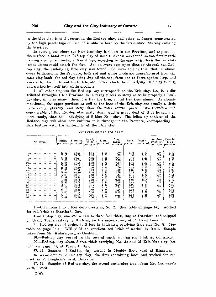
1906 Clay and the Clay Industry of Ontario 17
in the blue clay is still present in the Red-top clay, and being no longer counteracted by the high percentage of lime, it is able to burn to the ferrie state, thereby coloring the brick red.
In every place where the Erie blue clay is found in the Province, and exposed on the surface, a band of the Red-top clay of some thickness was found as the first mantle varying from a few inches to 3 or 4 feet, according to the ease with which the percolat ing solutions could attack the clay. And in every case upon digging through the Red- top clay, the underlying Erie clay was found. So invariable is this, that in almost every brickyard in the Province, both red and white goods are manufactured from the same clay bank, the red clay being dug off the top, from one to three spades deep, and worked by itself into red brick, tile, etc., after which the underlying Erie clay is dug, and worked by itself into white products.
In all other respects the Red-top clay corresponds to the Erie clay, i.e., it is dis tributed throughout the Province, is in many places so stony as to be properly a boul der clay, while in many others it is like the Erie, almost free from stones. As already mentioned, the upper portions as well as the base of the Erie clay are usually a little more sandy, gravelly, and stony than the more central parts. We therefore find considerable of this Red-top clay quite stony, and a great deal of it is leaner, i.e., more sandy, than the underlying stiff blue Erie clay. The following analyses of the Red-top clay will show how uniform it is throughout the Province, corresponding in this feature with the uniformity of the Erie clay.
ANALYSES OP RED TOP CLAY.
No. sample.
1.......... ............4.. ....................
TO .....................-29 . . . . . . . . . . . . . .43 . . . . . . . . . . . . . . . . . . . . .44.. .......... ...... .. ..45...... ................46.. . ....... . . . . ...... ..47.. ....................48........ ..............
50................ ....fi}......................52......................
54 . . . . . . . . . . . . . . . . . . . . . .
Silica, per cent.
69.12(57.1063.5666.0661.0859.4866. H63. 2S58.9757.8854.3855.3459.9661.7857.1656.1858.0057.1864.44
Alumina, per cent.
14.0315.3016.9114.1517.2817.4814.8017.2058.1018.6419.1819.8019.5816.0320.4519.4017.0416.3815.26
Ferrie Oxide,
per cent.
4.814.806.244.676.207.385.506.267.307.207.307.625.866.166.286.696.167.365.96
Lime, per cent.
1.941.631.912.362.542.601.762.822.842.864.602.182 623.373.122.882.842.763.65
Mag nesia,
per cent.
1.101.592.422.182.353.321.501.602.501.953.702.392.302.282. 71;1.943.433.911.78
Soda, per cent.
1.53.91.70
1.481.801.741.331.852.121.461.421.932.481.951.401.321.422.342.52
Potash, per cent.
2.052.303.152.663.502.962.193.142.403.223.623.742.572.382.763.763.723.213.20
Sulphur trioxide. per cent.
.10
.16
.28
.32
.16
.30
.25
.16
.14
.18.12.13.23.31.17.17.13.09.21
Loss by heat." per cent.
4.805.445.646 765.193.826.564.305.906.645.607.125.005.505.008.805.525.962.92
1.—Clay from l to 3 feet deep overlying No. 2. (See table on page 14.) Worked for red brick at Stratford, Ont.
4.—Red-top clay, one and a half to three feet thick, dug at Stratford and shipped by Grand Trunk railway to Durham, for the manufacture of Portland Cement.
7.—Red-top clay, 6 inches to 2 feet in thickness, overlying Erie clay No. 8. (See table on page 14.) Will yield an excellent red brick if worked by itself. Sample taken from Mr. Kuhn's yard at Crediton.
10.—Red-top clay worked in the several yards making red brick at Conestogo.29.—Red-iop clay about 3 feet thick overlying No. 30 and 31 Erie blue clay (see
table on page 14), at Prescott, Ont.43, 44.—Samples of Red-top clay worked in Mouldy Bros, yard at Kingston.45, 46.—Samples of Red-top clay, the first containing loam and worked for red
brick in F. Lingham's yard, Belleville.47, 51.—Samples of Red-top clay, the second containing loam, from Mr. Lawrence's
yard, Tweed.2 M2.

IS Bureau of Mines No. 5
48, 49.—Red-top clay one to three feet thick, overlying Erie clays Nos. 38 and 42, (see table on page 14), and worked in Thomas Henderson's yard, Renfrew.
50.—Red-top clay, 3 feet thick, taken from Watson's yard, Orillia.52, 53, 54.—Three samples of Red-top clay. The first a strong chisel clay, the last
two ordinary brick clays, taken from Mr. Rollin's yard, Madoc.55.—Sample of Red-top clay taken from a cut on the Bay of Quinte railway exten
sion at Bridgewater.57.—Red-top clay about 2 feet thick, overlying Erie blue clay, No. 39, (see table
on page 14), and worked for red brick by Curtis Bros., Peterborough..
The Saugeen ClayThe latest of the glacial clays, or that named in our classification Saugeen, is-
a distinct and separate clay, readily distinguishable from the Erie and the Red-top.
Fig. l l. Saugeen clay along railway near the shore of Lake Temiskaming, between Haileyburyand New Liskeard, Ont.
It is found in every case overlying the Erie clay, unconformably, and is usually separ ated from it by a layer of sand or gravel. In Geology of Canada, 1863, page 896, we find the following note: "Two divisions have already been indicated in "the stratified clays of western Ontario, the lower of which was partially worn away before the deposi tion of the upper division, so that this rests unconformably upon it, adapting itself to the irregularities of the denuded surface. The latter is sometimes associated with beds of sand or gravel, a layer of which belonging to the upper division sometimes marks the contact with the underlying deposit."
"The upper division of these deposits which is largely developed and well-exposed along the Saugeen river, may be called the Saugeen clay. With the exception of a yellow band sometimes found at the top, it consists of thinly bedded brown calcareous clay, containing but few boulders or pebbles. The layers of clay seldom exceeding c.n inch in thickness are separated by thin partings of a drab or olive color. This
2a M2.
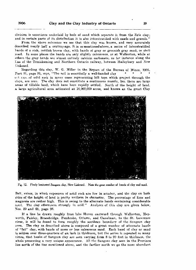
1906 Clay and the Clay Industry of Ontario 19
division is sometimes underlaid by beds of sand which separate it from the Erie clay; and in certain parts of its distribution it is also interstratified with sands and gravels."
From the above reference we see that this clay was known, and very accurately described nearly half a century ago. It is as mentioned above, a series of interstratified bands of a rich, reddish brown clay, with bands of gray or greenish gray sand, or shell marl. Jn some places the bands are only slightly calcareous, as at Walkerton, while at others the gray bands are almost entirely calcium carbonate, as for instance along the line of the Temiskaming and Northern Ontario railway, between Haileybury and New Liskeard.
Regarding this clay, W. G. Miller in the Report of the Bureau of Mines, 1905, Part II, page 26, says, "The soil is essentially a well-banded clay * * * * or.t rops of solid rock in many cases representing hill tops which project through the clays, are seen. The clay does not constitute a continuous mantle, but there are large areas of tillable land, which have been rapidly settled. North of the height of land, a, Large agricultural area estimated at 16,000,000 acres, and known as the great Clay
Fig. 12. Finely laminated Saugeen clay, New Liskeard. Note the great number of bands of clay and sand.
Belt, exists, in which exposures of solid rock are few in number, and the clay on both sides of the height of land is pretty uniform in character. The percentage of lime and magnesia are rather high. This is owing to the alternate bands containing considerable marl. The clay effervesces strongly in acid." Analyses of this clay are given below, Nos. 59 and 65, page 26.
If a line be drawn roughly from lake Huron eastward through Walkerton, Hep- worth, Paisley, Bracebridge, Pembroke, Ottawa, and Casselman, to the St. Lawrence river, it will be found to form roughly the southern boundary of the Saugeen clay area. The clay as described above is composed of a great number of alternate bands of "fat" clay, with bands of more or less calcareous sand. Each band of clay or sand is seldom over three-quarters of an inch in thickness, but the series is repeated so many times, that banks of Saugeen clay are seen varying from 8 to 20 feet in thickness, the whole presenting a very unique appearance. All the Saugeen clay seen in the Province lies north of the line mentioned above, and the farther north we go the more abundant

20 Bureau of Mines No. 5
is this clay. In age the writer has placed it as dating from the close of the glacial period, for it appears to have been formed from the flow and ebb about the edge of the retreating or melting glacier, and each two bands, i.e., a band of clay with a band of sand, together represent the accumulation for one season. During the summer or warmer months, the increased flow of water carried the clay farther out, and the sand would be deposited closer to the ice margin. In the winter or colder months, when the flow of water was lessened, a layer of clay would be deposited over the sand, and this was repeated year after year, for many years, as shown by the great number of bands in this accumulation. This process would be gradually carried back in a northerly direction as the ice-front slowly retreated, and in this way we find the deposits thicker and more widespread as we go north. The few stones found in this clay—and they are extremely scarce—would be caused by small pieces of floating ice, dropping imprisoned stones, upon melting.
Fig. 13. Saugeen clay. This illustration represents a closer view of a part of the clay bank shown in Fig. l l. The alternate lighter-colored layers are more or less marly.
Composition of the Saugeen Clay
We have mentioned above that the Saugeen clay varies considerably in its com position, more especially in its calcium content. In some places the gray bands which occur with the brown rich bands of clay, are shell marl, i. e., calcium carbonate. In the railway cutting of the T. A N. O. railway between the towns of Haileybury and Liskeard the clay beds are shown in figures 9 and 10; the gray bands are shell marl. In other places the gray bands are sand, for example, at Pembroke, Walkerton and Casselman. In others, again, the gray bands are a sandy clay, for example, at North Bay, New Liskeard, Sturgeon Falls and Sault Ste. Marie. These localities are cited because they are places where the clay is being worked; but local differences of sand contents are often seen in the same yard ; for example, at Mr. Evans' yard at Sudbury *nd at Mr. Elliott's yard at, Sault St. Marie. Here a decided difference in the character

1906 Clay and the Clay Industry of Ontario 21
of the clay is seen in fifty yards of the clay bank, so much so that it was necessary to change the plant because in the one place the clay was so strong that it could not be worked, the drying being very difficult. A change of only fifty yards to a much leaner part of the deposit yielded a clay which worked admirably in every part of the process.
In places where the clay is marly, it is unsuitable for brick-making. The marl burns to lime and this affects the color of the brick, making them a light pink color. It also causes the brick to break up badly on exposure to heat. Where the gray bands are sand we have a combination which is most desirable. The brown clay of itself would be too strong to work, but the addition of the sand already mixed in the clay renders the whole so mild that it works admirably, and a deep Saugeen clay bank where the clay is interbanded with sand forms the best possible deposit for the manu facture of red stock brick. Such clay tempers easily, shifts easily, dries readily, and burns with little shrinkage, while the sand does not affect the color.
Where the gray bands, with the brown clay, are themselves a gray sandy clay, the percentage of sand is not quite sufficient to make the whole workable, such a deposit being so strong that it can only be mixed with great difficulty. Moreover, such strong clay is very difficult to shift and still more difficult to dry. This is a difficulty which many brick-makers in northern Ontario are experiencing. In drying the brick, they find that if exposed to direct sunlight or to wind the brick crack. This is because the clay is so strong that, having been wet in the making of the brick and now exposed to the air, it really slakes; or, in some cases, the outside of the brick dries so much more rapidly than the inside, on account of the density of the strong stiff clay, that a shell is formed around the outside, so that when the inside of the brick finally dries and therefore shrinks it cracks this shell, or outer part of the brick. Two things would help this clay; first, it should be dug into heaps and allowed to slake thoroughly before making the brick; second, in tempering the clay it should be mixed with about 25 per cent, of clean sand. The character of the sand does not matter much so long as it is clean, that is free from organic impurities and limestone.
The Saugeen clay belongs to the later glacial period. It rests unconformably on the Erie clay with a layer of sand forming the contact. There are a few exceptions to this rule, however. As we work northward from the southern boundary of the Saugeen clay belt, which was described above, we find that the Erie clay becomes shallower in depth until we reach North Bay on the C. P. R. main line, when in general we find that the Erie clay is almost entirely wanting, and the Saugeen clay rests immediately on top of the galciated surface of the rocks. In fact, the rocks form
Fig. 1 4.—Igneous rocks overlaid by clay and sand, and later cut by the Spanish River.
the greater part of the area with local collections of sand, or gravel, or Saugeen clay in the hollows. At North Bay the clay associafed with red sand is found in a hollow extending from North Bay to Widdifield on the T. A N. O. railway. Passing northward we find no more clay to speak of till we reach the town of Haiteybur.v. Pro n Ware north the clay becomes more and more abundant and also quite strong in most places. Soon the Temiskaming outlier of great Clay Belt of New Ontario is reached, composed of Saugeen clay, and is estimated to cover roughly one" million acres. For the most part this clay is strong, but it naturally has its sandy places or milder spots, as any other like area would have. Moreover, in some cases in this northern part we find the
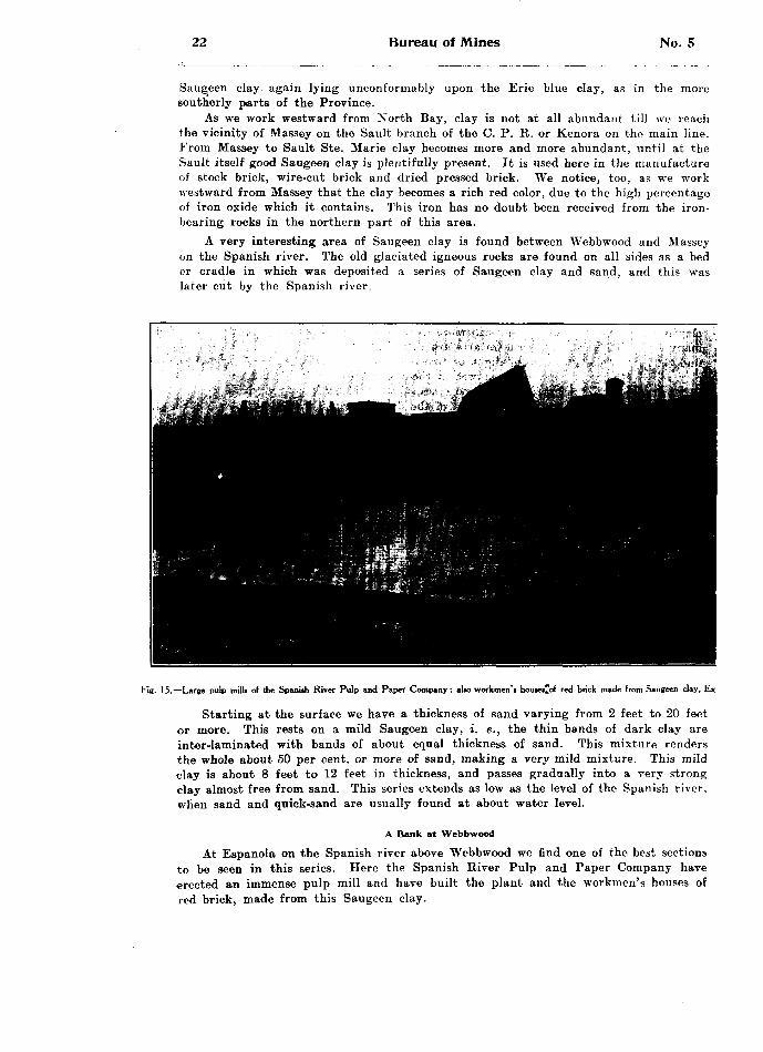
22 Bureau of Mines No. 5
Saugeen clay again lying unconformably upon the Erie blue clay, as in the more southerly parts of the Province.
As we work westward from North Bay, clay is not at all abundant till we reach the vicinity of Massey on the Sault branch of the C. P. R. or Kenora on the main line. From Massey to Sault Ste. Marie clay becomes more and more abundant, until at the Sault itself good Saugeen clay is plentifully present. It is used here in the manufacture of stock brick, wire-cut brick and dried pressed brick. We notice, too, as we work westward from Massey that the clay becomes a rich red color, due to the high percentage of iron oxide which it contains. This iron has no doubt been received from the iron- bearing rocks in the northern part of this area.
A very interesting area of Saugeen clay is found between Webbwood and Massey on the Spanish river. The old glaciated igneous rocks are found on all sides as a bed or cradJe in which was deposited a series of Saugeen clay and sand, and this was later cut by the Spanish river.
Fig. 15.—Large pulp mills of the Spanish River Pulp and Paper Company; alto workmen's houie*rof red brick made from Saugeen clay, Esj
Starting at the surface we have a thickness of sand varying from 2 feet to 20 feet or more. This rests on a mild Saugeen clay, i. e., the thin bands of dark clay are inter-laminated with bands of about equal thickness of sand. This mixture renders the whole about 50 per cent, or more of sand, making a very mild mixture. This mild clay is about 8 feet to 12 feet in thickness, and passes gradually into a very strong clay almost free from sand. This series extends as low as the level of the Spanish river, when sand and quick-sand are usually found at about water level.
A Bank at Webbwood
At Espanola on the Spanish river above Webbwood we find one of the best sections to be seen in this series. Here the Spanish River Pulp and Paper Company have erected an immense pulp mill and have built the plant and the workmen's houses of red brick, made from this Saugeen clay.

1906 Clay and the Clay Industry of Ontario 23
On the opposite bank of the Spanish river from the pulp mills, we find a section of clay and sand about 35 feet deep. It occurs in a hollow between two ridges of rock as shown in the accompanying cut. The first 5 feet from the water's edge is com posed of sand and quick-sand, with a few glaciated boulders mixed through it. Above this we pass into strong Saugeen clay. It is inter-laminated with sand, but the sand partings are very thin, so that the whole series of 10 feet or more is very strong clay. Towards the upper part of this strong belt the sand layers become thicker and thicker, until a belt is reached in which the percentage of sand is about right for a first- class mix for brick-making. This belt is about 10 to 12 feet thick, and is ready to work into red brick as it lies. The underlying strong clay mentioned above would require sand before it could be worked, as it is so strong that it could not be dried or burned as it is. There is abundance of sand on all sides to render this clay the proper temper.
Fig. 16.—Saugeen clay overlaid by sand. Note Junction about half-way up the series. Exposed in banks of Spanish River at Espanola.
Above the mild clay the sand gets thicker and thicker, while the layers of clay get thinner till we pass into a series of 6 to 10 feet of very fine sandy clay or almost pure sand with only very thin partings of clay. Three analyses are given below of this series.
Sample.
No. 2............
No. 3............
Silica,
per cent.
69.62
59.50
61.40
Alumina,
per cent
13.07
15.30
17.08
Ferrie Oxide,
per cent.
2.99
5.26
6.34
Lime,
per cent.
4.42
6.15
2.66
Magnesia,
per cent.
1.96
3.14
3.35
Soda,
per cent.
2.98
2.82
1.94
Potash .
per cent .
2.19
2.50
2.74
Loss,
per cent.
3.32
6.16
4.52
No. 1.—Is the sand or sandy clay forming the upper 6 to 8 feet of the section.No. 2.—The mild, workable clay forming the middle belt of the section.No. 3.—The strong clay forming the lower part of the uection.

24 Bureau of Mines No. 5
The upper sand or sandy clay would do to mix with the strong clay to render it mild enough to work. This sand, however ; is rather fine in grain, and coarser grained sand would be preferable. Suitable sand can be had very conveniently on all sides of this deposit, particularly on the opposite bank of the river.
With a good railway siding, plenty of fuel, and plenty of power right at hand, this bank could no doubt be worked to advantage even if the surface sand had to be removed. All these things exist there at present, as the Pulp and Paper Company have developed 11,000 horse power from the high falls adjoining this property, and there is plenty of power going to waste still.
The deposit of clay at the Pulp and Paper Company's works is the; thickest one seen yet in the Province, there being fully 25 feet of clay which is already fit for work ing into brick, etc., or easily made so by the addition of sand.
Fig. 17.—Saugeen cliy in the Spanish River at Espanola; part of the bank as shown in Fig. 16 much enlarged. Note laminatedcharacter of day.
We notice here that we have the usual layers of sand and quick-sand at the base of the Saugeen series. We note also freedom from boulders or only a few at the base of the series. The layers of clay are very thick and of sand very thin in the lower parts of the Saugeen clay, and as we work up to the surface the layers of sand get thicker and the layers of clay correspondingly thinner till they form mere partings in the sand and marly clay, as the sand did in the clay at the base of the series. These points tend to substantiate the belief that at first we had deep water, few currents and therefore more clay was laid down and little sand, also a shorter period or summer sason of melting. As the time went on the melting season got longer and the layers of sand become correspondingly thicker, till towards the close of the period the warmer climates give us much more sand, and less clay. The absence of boulders and pebbles shows freedom from floating ice.
In all parts of Ontario the Saugeen clay is remarkably free from stones and boulders, and for this reason it is an excellent clay for the manufacture of red brick

1906 Clay and the Clay Industry of Ontario 25
of all kinds and for the manufacture of tile or hollow blocks. Of course the location must be selected, as with every other clay. If the clay is strong a suitable supply of sand should always be sought near at hand, for it is almost impossible, as we have pointed out, to work this Saugeen clay unless it contains about 25 per cent, of sand, and if this is not already present it must be added by the workmen. If a place can be found where the clay already has sufficient sand interbanded with it to render the whole workable, no better clay could be desired than the Saugeen.
Saugeen clay with marly bands is to be avoided. The marl can always be detected by moistening a sample of the clay with a drop of any acid. If it effervesces, or bubbles, it should be avoided; but if not, it is safe.
Fig. 18.—Saugeen clay bank at Casselman. Note contact of sand and strong clay, which shows the pick marks and laminations plainly.
The Saugeen clay, as has been stated, is usually underlaid by a layer of sand or gravel. The writer's experience bears this out, for in every case where the Saugeen series and the Erie clay were found associated, a band of gray sand from l to 3 feet in thickness was found immediately under the Saugeen. In many cases a layer an inch to an inch and a half of sand^ has been converted into a flag of sandstone by a certain amount of calcium carbonate having leached down from the overlying clay, cementing the grains of sand together. At Walkerton, for example, the clay bank was drained by occasionally punching a hole through the thin cake of sandstone, into the soft sand below. The water would sink through this hole, and run away in the loose sand below, while the cake of sandstone itself afforded an excellent working floor.
The Saugeen clay with the accompanying sand worked as a whole section, forms the most homogeneous, and the best working clay in the Province, for red pro ducts. Being from 8 to 20 feet in thickness, a good supply of practically uniform quality is assured, and this is a feature entirely wanting in the Red-top clay. In the latter, the brick-maker has to skin over the whole of his clay bed, in order to get sufficient red clay for a very few years' run.

26 Bureau of Mines No. 5
The presence of the bands of shell marl proves that the Saugeen clay in the western and northern area was laid down in fresh water. The organisms producing the marl were fresh water forms; and any of the larger shells found in these marly bands represent fresh water types, comprising among others the following,—Planorbis campanulatus, P. bicrinatus, P. parvus, Melandia acuta, M. conica, Cylas similis, etc. We will find in examining the eastern area that the organisms are marine, instead of fresh water.
Fig. 19.—Bank of Saugeen clay. Baker Bros' yard, Casselman. Here the laminated clay is over laid by about 4 feet of sand.
ANALYSES OF SAUGEEN CLAY.
Sample No.
OK .
CO
tQ . . . . . .
56............ •••••- -
CO
Silica, per cent.
63.0059.3462.3061.2051.0065.0864.0858.3049.6865.4263.2064.30
Alumina, per cent.
15.1517.6816.5116.4016.1114.8317.2115.7013.9516.0615.7535.45
Ferrie oxide,
per cent.
6.286.745.656.254.693.175.405.415.325.444.675.22
Lime, per cent
3.482.943.163.108.264.182.345.109.463.204.323.42
Magnesia, per cent.
2.673.362.683.254.102.572.753.274.162.312.732.02
Soda, per cent.
2.642.132.251.941.742.761.942.041.961.901.912.51
Potash, per cent.
3.113.072.612.322.762.242.972.732.763.062.802.72
Sulphur trioxide.
per cent.
.30
.47
.40
.52
.09
.04
.05
.04
.04
.07
.04
.05
Loss by heat,
per cent.
3.634.603.604.949.645.103.907.301.292.784.353.89

1906 Clay and the Clay Industry of Ontario 27
26. Saugeen clay about 20 feet deep worked for tile and brick by Watson A Hutch ison at Bracebridge.
34. Saugeen clay about 10 feet deep worked for red brijBk by Merkley Bros, of Casselman.
35. Saugeen clay, very sandy. Worked from a bank about 10 feet deep by J. Thibadeau at Pembroke.
58. Saugeen clay, a continuation of the bank worked by Merkley Bros., and made into red brick by Baker Bros, of Casselman.
59. Saugeen clay in the railway cutting of the T. *fe N. O. railway, between Hailey- bury and New Liskeard. Very marly clay.
56. Saugeen clay worked by the Imperial Land Co., for red brick and tile at Sturgeon Falls.
64. Saugeen clay from Wallace'A Son's yard, North Bay j requires sand.65. Saugeen clay from R. Scott's yard, New Liskeard.67. Saugeen clay from D. dark's yard, Powassan. A good clay; about proper
percentage of sand.68. Saugeen clay from A. W. Evans' yard, Sudbury.69. Saugeen clay used for red pressed brick by the Algoma Commercial Co. of
Sault Ste. Marie.Lacustrine Clays
The latest clay mentioned in our classification is the Lacustrine clay, formed since glacial times. Residual clays formed from decomposing rocks rarely rest on steep slopes, or on hill tops. Moreover, the running 'water after each rain storm shows
Fig. 20.—Sand and gravel laid obliquely, showing evidence of currents. Photo, of section of gravel bed atOwen Sound.
us that our glacial clays are being gradually carried off the higher ground to lower levels. By such means mixed clays, t. e. clays collected from very different gourdes, are washed down and deposited in new resting-places. As soon as the velocity of the stream is checked, and the water becomes free from currents, the particles begin to drop to the bottom, forming layer after layer of an even-grained, washed clay. Thus all our lacustrine clays will be sedimentary and stratified. They will not be absolutely homogeneous, because all will not have a common source. Moreover, the velocity of the current will not be constant the year round, but there will be flow and ebb,
•depositing respectively coarser and finer material on any given area. Evidence is seen of currents in the layers of sandy clay or sand itself, showing oblique stratification.
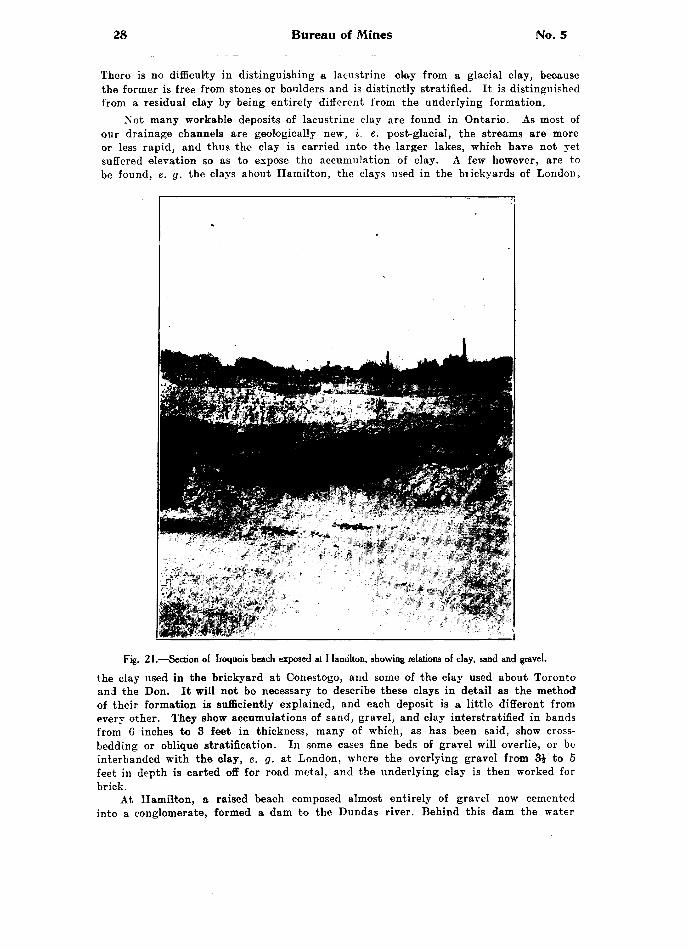
28 Bureau of Mines No. 5
There is no difficulty in distinguishing a lacustrine clay from a glacial clay, because the former is free from stones or boulders and is distinctly stratified. It is distinguished from a residual clay by being entirely different from the underlying formation.
Not many workable deposits of lacustrine clay are found in Ontario. As most of our drainage channels are geologically new, i. e. post-glacial, the streams are more or less rapid, and thus the clay is carried into the larger lakes, which have not yet suffered elevation so as to expose the accumulation of clay. A few however, are to be found, e. g. the clays about Hamilton, the clays used in the brickyards of London..
Fig. 21.—Section of Iroquois beach exposed at Hamilton, showing relations of clay, sand and gravel.
the clay used in the brickyard at Conestogo, and some of the clay used about Toronto1 and the Don. It will not be necessary to describe these clays in detail as the method of their formation is sufficiently explained, and each deposit is a little different from every other. They show accumulations of sand, gravel, and clay interstratified in bands from 6 inches to 3 feet in thickness, many of which, as has been said, show cross- bedding or oblique stratification. In some cases fine beds of gravel will overlie, or be interbanded with the clay, e. g. at London, where the overlying gravel from 3} to 5 feet in depth is carted off for road metal, and the underlying clay is then worked for brick.
At Hamilton, a raised beach composed almost entirely of gravel now cemented into a conglomerate, formed a dam to the Dundas river. Behind this dam the water
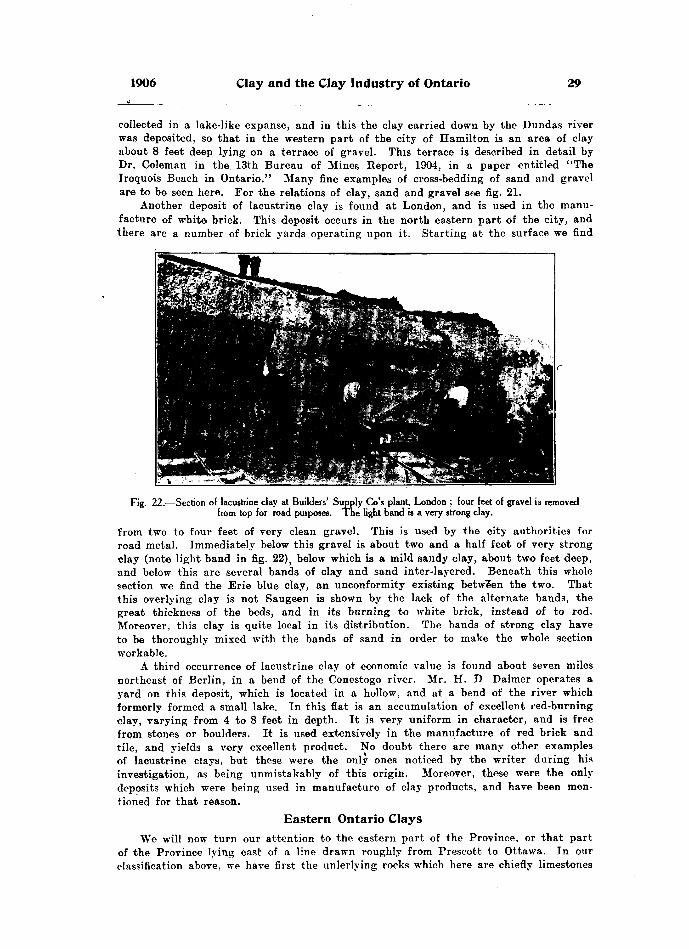
1906 Clay and the Clay Industry of Ontario 29
collected in a lake-like expanse, and in this the clay carried down by the Dundas river was deposited, so that in the western part of the city of Hamilton is an area of clay about 8 feet deep lying on a terrace of gravel. This terrace is described in detail by Dr. Coleman in the 13th Bureau of Mines Report, 1904, in a paper entitled "The Iroquois Beach in Ontario." Many fine examples of cross-bedding of sand and gravel are to be seen here. For the relations of clay, sand and gravel see fig. 21.
Another deposit of lacustrine clay is found at London, and is used in the manu facture of whit© brick. This deposit occurs in the north eastern part of the city, and there are a number of brick yards operating upon it. Starting at the surface we find
Fig. 22.—Section of lacustrine clay at Builders' Supply Go's plant, London ; four feet of gravel is removed from top for road purposes. The light band is a very strong clay.
from two to four feet of very clean gravel. This is used by the city authorities for road metal. Immediately below this gravel is about two and a half feet of very strong clay (note light band in fig. 22), below which is a mild sandy clay, about two feet deep, and below this are several bands of clay and sand inter-layered. Beneath this whole section we find the Erie blue clay, an unconformity existing between the two. That this overlying clay is not Saugeen is shown by the lack of the alternate bands, the great thickness of the beds, and in its burning to white brick, instead of to red. Moreover, this clay is quite local in its distribution. The bands of strong clay have to be thoroughly mixed with the bands of sand in order to make the whole section workable.
A third occurrence of lacustrine clay of economic value is found about seven miles northeast of Berlin, in a bend of the Conestogo river. Mr. H. D Balmer operates a yard on this deposit, which is located in a hollow, and at a bend of the river which formerly formed a small lake. In this flat is an accumulation of excellent red-burning clay, varying from 4 to 8 feet in depth. It is very uniform in character, and is free from stones or boulders. It is used extensively in the manufacture of red brick and tile, and yields a very excellent product. No doubt there are many other examples of lacustrine clays, but these were the only ones noticed by the writer during his investigation, as being unmistakably of this origin. Moreover, these were the only deposits which were being used in manufacture of clay products, and have been men tioned for that reason.
Eastern Ontario ClaysWe will now turn our attention to the eastern part of the Province, or that part
of the Province lying east of a line drawn roughly from Prescott to Ottawa. In our classification above, we have first the unlerlying rocks which here are chiefly limestones

30 Bureau of Mines No. 5
and sandstones, of Cambrian and Ordovician age, together with igneous rocks of pre-Cambrian age. We have no shales in this part of the Province which can be used in the manufacture of clay products. The result is there are no pressed brick made in this district.
Regarding the next formation, namely the residual clays, nothing further need be said in addition to the discussion above. The residual clays here will naturally have suffered in the same way as those in the West, i. e. they would have been completely removed and mixed up with foreign material by the advance of the glaciers, as has been described.
Fig. 23.—Boulder clay on the face of an excavation at Ottawa.
Boulder Clay
We therefore find resting immediately upon underlying rocks for the most part a formation of stiff boulder clay. Concerning this formation, Dr. H. M. Ami says,'
"No special formational name or designation Las as yet been ascribed to the series of boulder clays which vary in thickness from a few inches or feet, to upwards of 100 feet in thickness, and which overlie the subjacent, glaciated and striated surface of the ancient, Palaeozoic rock formations in the Ottawa district. * * * This formation is met with throughout the Ottawa district, and the materials which compose it consist of accumulations of the more or less travelled, broken, ice-scored, and rolled fragments of all the rock formations which the great Labradorean glacier and all its lateral ramifications met along its way, and deposited in its different stages until the close of the glacial period. * * * * These boulder clays, as is well known, were deposited for the most part at the time when land ice prevailed in and about Ottawa ; when great accumulations of snow and ice in the form of glaciers, had gathered on the Chelsea hills and north of Ottawa, and spread to the south and carried along whatever loose materials or easily-broken rocks could be detached, in their progress along and deposited them in the valley of the Ottawa, which for the time being must have been filled with rock and ice, as well as the country to the south of the river."
The boulder clay here differs somewhat from that in the West, having many more igneous boulders mixed with it. This is accounted for by the proximity of this area
1 ecology of the Principal Cities in Eastern Canada, p. 137.
1906 Clay and the Clay Industry of Ontario 31
to the igneous Laurentian area immediately north of Ottawa. Again, the eastern boulder clay appears to be distinct and separate from the overlying Leda clay, whereas in the West, the boulder clay appears to pass imperceptibly into the Erie clay. In the East, then, we find an unconformity between the boulder clay and the next overlying formation. This is well shown in a sewer which was being dug in Ottawa during the writer's visit. Here the underlying boulder clay could be seen in the lower parts of the sewer in several places, and lying unconformably upon it was the later formation of Leda clay. Concerning the relation of these deposits, Dr. Ami says that at the close of the glacial period the Champlain period of submergence began. It was at this time that the boulder clay formation was modified and considerably denuded, carried away and redeposited, forming the Leda clay and Saxicava sand overlying. 2
The Leda ClayThe next overlying formation above the boulder clay is the Leda clay. This corres
ponds very closely with the Erie clay in the West, but it differs in some respects, one of which is mentioned above, i. e. it is a separate formation lying unconformably upon the boulder clay. It has the same blue color, and is a stiff strong blue clay, which at first sight would be taken for the typical Erie blue clay. Upon examination, however, it is found to be quite low in lime, and in this respect is in marked contrast to the Erie blue clay of the West.
ANALYSES OF LEDA CLAYS.
Sample No.
32.....................33.....................60. ...................61.....................62.....................63.....................
Silica,
per cent.
58.5456.0057.9862.0652.8652.17
Alumina,
per cent.
17.0217.0719.0015.5417.4219.40
Ferric Oxide.
per cent.
5.488.276.J85.708.859.19
Lime,
per cent.
6.364 173.784.913.693.88
Magne sia.
per cent.
2.224.553.823.113.373.72
Soda,
per cent.
2.181.811.871.921.851.96
Potash,
per cent.
2.952.573.812.383.123.16
Sulphur trioxide.
per cent.
.56
.59
.35
.14
.58
.52
Loss by Heat.
per cent.
3.424.893.184.018.035.65
32.—Leda clay from a bank 14 feet deep, worked by the Cain Brick Co. of Ottawa. Burns to rich red brick.
33.—Leda blue clay taken from a similar bank at Morris and Ballantyne's yard at Ottawa. The upper part of this bank is quite sandy, but is mixed with the lower, stronger clay, and yields a rich, red brick.
60.—Leda clay, used chiefly in the manufacture of red tile by William Baker at Arnprior.
61.—Milder clay taken from the same bank and manufactured into red brick, by William Baker of Arnprior.
62. 63.—Samples of Leda clay taken from a very stiff bank, which is worked by the International Portland Cement Co., and used with limestone in the manufacture of cements at Ottawa.3
From the above analyses we notice that its percentage of ferrie oxide is about the same as the Erie blue clay, viz. about 6 per cent., and this with the low percentage of lime causes this clay to burn to a red color. In many places it reaches a depth about .as great as that of the Erie clay. For instance, at Ottawa, where the foundations were being dug for the new Geological Museum, a splendid exposure of strong, blue Leda clay is to be seen. The foundation for this building had to be placed in a bed of this clay, as borings showed it to be 94 feet deep, at this point. Thus in many respects is resembles the Erie blue clay of the west. There is, however, one great difference. The Leda clay was laid down in salt water, whereas the Erie clay was deposited in fresh water. This is proven by the presence of fresh water organisms found in the sands associated with the Erie clay, whereas the shells of marine organisms are found through-
2" Geology of the Principal Cities in Eastern Canada," p. 136. Information and analyses kindly supplied by the chemist of the works at Hull. Que.

32 Bureau of Mines No. 5
out the Leda clay. Dr. Ami reports from this formation the following marine fossils. Leda artica, Mallotus villosus, Fucus digitatus, Byrrhus Ottawaensis, Craniella Logani, and many others, all of which prove that this clay was laid down in salt water.
Towards the close of the glacial period it is believed that a large ice dam formed about Prescott, to Ottawa, turning the fresh water of the upper lakes down through the Hudson river. Thus the water west of this dam was kept fresh by the constant melting of the glacier, whereas east of it the St. Lawrence valley was a wide gulf, which, together with the Ottawa valley was covered with salt water to a height of probably 600 feet ab,ove the present water level. In this salt water the Leda clay, which was largely the resorted boulder clay, was deposited. It is therefore now found comparatively free of calcium carbonate, but abounding in the shells of marine life. Through the clay are many glacial boulders which were no doubt dropped from floating ice, as were those found in the cleaner parts of the Erie clay in the western part of the province.
The Saxicava SandWe have said above that this Leda blue clay is a strong, stiff clay. This description
is correct for the most part, but the upper part of the deposit is quite sandy, so much so that it has been divided, and called by two distinct names, the lower or strong part is called the Leda clay, while the upper, sandy part is called the Saxicava sand. In Geology of Canada, we find the following reference.4
"The valleys of the St. Lawrence and the Richelieu in Canada East, and a con siderable portion of the region between the St. Lawrence and the Ottawa, to the east of the meridian at Kingston, are occupied by stratified clays j which, unlike those of western Canada, contain abundance of marine shells, for the most part identical with the species now living in the lower St. Lawrence and the Gulf. These clays are in many cases overlaid by sands, occasionally interstratified with clay, which also con tain marine remains. The two are regarded as forming parts of one formation. *
* * * Dr. J. W. Dawson, who has carefully studied these deposits in Canada, distinguishes the lower as Leda clay from one of its characteristic shells; and the upper, for a similar reason, as the Saxicava sand. He considers the one as hav ing been formed in shallow waters, and the other as a deep water deposit."
Concerning the same formations Dr. Ami says,"This formation is divisible into two series, one a marine clay, the other a marine
sand formation. The 'Leda clay' appears to occupy the lower levels of the St. Lawrence immediately overlying the boulder or glacier clays. * * * * * These•clays vary from a few inches in thickness to several feet, reaching 50 feet in certain localities, and also carry boulders disseminated throughout the mass. They are for the most part 'bluish gray, fine-grained, more or less plastic or stiff clays and muds,* * * * * and hold both vegetable and animal remains in a fossilized condition. * * * * * The Saxicava sand consis-ts for the most part of light yellow and ferruginous sands immediately overlying the Leda clay, of which it may be considered, in a perfectly logical way, as the littoral or shore deposit. It varies in thickness from a few inches to several feet, and is marked by the presence of Saxicava rugosa, Mya arenaria, M. truncata, Macoma fragilis, Macoma calcarea. These are amongst the most conspicuous and characteristic marine organisms."
We thus see that the upper part of the Leda clay, like the upper part of the Erie clay, is usually more or less sandy, but we find more sand associated with the eastern deposits than with the western.
In using this clay, for the manufacture of brick, etc., the upper red clay with the yellowish sand and sufficient of the underlying strong blue clay, are worked together to prepare a proper mix. The upper parts alone, on account of the abundance of sand, would prove too lean, so that a section from 12 to 20 feet is usually worked for the manufacture of brick, tile, etc. A series of analyses is given on page 31, which can be compared with those of the Erie blue clay given on page 14. Nearly all the red brick of the eastern part of Ontario are made from the Leda clay ; only a few of those made in the more northerly parts of this area being from a still later formation, namely, the Saugeen.
4 Geology of Canada, 1863, page 915. ''Geology of the Principal Cities in Eastern Canada,

1906 Clay and the Clay Industry of Ontario 33
Saugeen Clay in the EastOverlying the Leda clay and the Saxicava sand we have another clay, which
resembles in every way the Saugeen clay of the western part of the province. It bean the same relation to the Leda clay in the East, as it does to the Erie clay in the West. We mentioned above that if a line be drawn from Lake Huron via Walkerton, Paisley, Bracebridge and Pembroke, to Ottawa, then southeasterly to Casselman and on to the St. Lawrence river, it would form roughly the southern border of the Saugeen clay
Fig. 24.—Twenty feet of Leda clay, Ottawa. Note strong clay at base J also weathering of the topalong roots, joints, etc.
area. This clay is found in the eastern part from 4 to 20 feet deep, thinly interlam inated as in the West and of similar character, 'except that it is more sandy in the East than in the West, just as we found the Leda clay more sandy in the East, than the corresponding Erie clay in the West. At the base of this Saugeen series in the East, we find the band of grayish sand, as we did in the West. It also 'lies unconformabiy upon the Leda clay. There seems little doubt that all this Saugeen clay was laid down contemporaneously, and represents a deposition of clay in the retreating or melting stages of the glacial period. The sand layers are an evidence of slight flood, whereas the clay layers represent the quieter waters of a less rapid melting, t. e. each layer of clay and sand combined would represent the deposition for one season. As in the Saugeen clays of the West, the individual bands of sand and clay are rarely over three-
3M2.
34 Bureau of Mines No. 5
quarters of an inch in thickness. This Saugeen clay is worked in the East in some of the largest yards, notably at Pembroke, Arnprior, Casselman, Plantagenet, Vankleek Hill, etc., and yields excellent red brick and tile.
The latest clay in eastern, as in western Ontario, would be lacustrine clay, but tho writer saw no deposits of this character during his investigations in this part of the Province. No doubt some exist here, but they are purely local in their distribution, and do not need further discussion. They have of course been formed almost entirely from one or other of the clays collected during glacial times.
Physical Properties of Clay
We have now discussed the classification, the distribution, and in a general way the chemical composition of our Ontario clays, but there is another important series of properties which deserve attention. These are the physical properties of clay. By this is meant such characters as plasticity, tensile strength, shrinkage, slaking, fusi bility, etc. These are the more important properties considered under this heading
* PlasticityIn our definition above we found that a clay when moistened becomes plastic, which
allows it to be moulded or shaped as desired. It has been generally thought that the fatter a clay, the more plastic it would be, while on the other hand the leaner it was the less plasticity it would have. But this is not altogether correct. Some very fine grained clays, even if quite fat—for example, many washed clays—are nevertheless not so plastic as one might expect from their composition alone. Plasticity seems more closely associated with the fineness of grain in the clay, or in other words, with the completeness of the disintegration of the clay particles, than with the actual per centage of clay material. On this point Heinrich Hies in his report on the clays of New Jersey says: 6
"A residual clay was compared with a sedimentary clay of the same composition. The residual clay was found to posses* less plasticity than the sedimentary clay, the particles of which had been transported long distances and had thereby been more or less rubbed and ground together previous to their deposition. Inasmuch as the kaolin ite particles, as shown by the microscope, are more or less bunched, it is to be expected that the rubbing and grinding action during transportation would break up the bunches to some extent, and it is believed that the incrersed plasticity of the sedi mentary clay is due to this cause. This conclusion is in accord with the facts notc-d by Prof. George H. Cook, who found that by rubbing a mass of kaolin in a mortar thr bunches were easily broken apart and that the mass afterwards showed greater plus ticity."
Since nearly all our Ontario clays were laid down during glacial times and suffered a great deal of rubbing and grinding action by which each little bunch of clay was pretty thoroughly disintegrated, we are not surprised to see that our Ontario clays, especially the Erie clay, is particularly plastic.
Tensile StrengthThe next point mentioned is tensile strength. By this is meant ability to withstand
a pulling strain; in other words, ability to adhere when subjected to a pulling teet. This is an important property, in that it enables the freshly made brick when air-dried to stand the handling, piling, and to some extent the superincumbent weight to which they are subjected in setting a kiln, although this latter property is more closelv associated with a crushing test. The tensile strength is measured by moulding the moistened clay into briquettes, whose shape is about that of the figure 8 and which are made of such a form that their smallest diameter is an inch; their thickness is also an inch. In this way their smallest cross section, and the place where they will
6Clay6 and the Clay Industry of New Jersey H. Kies.3a M2

1906 Clay and the Clay Industry of Ontario
naturally break when subjected to a pull is one square inch. The test is made with a machine so constructed that two brass clips grip either end of the briquette. The strain is then put on and the force required to pull the brick apart is registered on a dial as so many pounds. OUT cross section being a square inch, the tensile strength is reckoned as so many pounds per square inch.
It was found impossible to make physical tests of all the clays mentioned in this report from the various yards, but a number were made by the writer at the School of Mining, Kingston, using several examples of each of the clays which have been described in this report. The briquettes were moulded in little brass moulds to the size and shape indicated above. They were then allowed to air-dry until thoroughly dried. They were then placed over coils and afterwards in a hot air bath at a temperature of 1050 C. (or 2210 F.) One set of tests was made on the clays as taken from the clay banks at the various yards mentioned below. Another set of tests was made on the same clays when the percentage of sand in them had been increased to 33. These tests were made for the purpose of seeing what effect the addition of sand to our clays would have on their tensile strength. As the table below shows, it reduced the tensile strength, but not materially. Moreover, the percentage of sand was a little too great. All these clays were brought up to 33, which is a little too high, but the tests show that the addition of sand up to 25 per cent, would be a great advantage to all of our clays. The advantages of the addition of sand have already been discussed fully in this report, and need no further mention. The tests show that the clays rich in sand have a lower tensile strength, but here again we find that the very finest grained clays, as was the case in plasticity, are also low in tensile strength. From this it appears that too great a percentage of coarse material, for example, sand, or even too great a percentage of the finest material, or in other words a clay almost free from sand, has a small tensile strength, while the clay of intermediate composition, that is, a clay with a fair proportion of sand, say 25 per cent., gives the most desirable results. The numbers used in the following tables are the same as used under the lists of analyses, so that the locations can be identified under the lists of analyses for each class of clay men tioned.
TENSILE STRENGTH OF CLAY BRIQUETTES UNBURNED.
Uass of Percentage of Strength of Samnlp 2 Avprae-p strpns-th Clay. sand contained. Sample l. bampie 2. Average strength.
o ...... Erie.......... 15 190 165 1782!"!.".'.".......... " .......... 33 140 140 140
3 " .......... 25 100 90 953'.'.'.'.'.'.'.'.'.'.......... " .......... 33 60 70 65
15 155 130 14233 ns 130 j 12212 .... ..... 24 115 120 11712.".'.".'.'!!!.'.'......! " .....- 33 100 100 100
14 120 130 12533 140 115 127
27 . . ..... .......... 15 120 115 11727 ;;;;;; ......... " .......... 33 90 105 9730 " .......... 20 120 135 127ZQ'.'.'.'.'.".'.'.'.'........ " ..........! 33 60 65 62
•3-1 " ..........l 27 140 180 l 135si.';..';;;;.'".;.'.'... " .......... 33 us iso 1325 ..... l " .......... 21 150 165 157b'.'.'.'.'..'..'.... - - - - - - - " .......... 33 120 130 125
l ... Red-top...... 40 145 160 152l'.'.'.'.'.'.'.........-... " •••••- 33 140 155 147
30 130 125 12733 j 175 180 177
29 .. . l " .....- 23 190 170 180' 29'.'.'.'.'.'.!;'.!'.!!.....' " ...--. 33 170 l 180 175,
36 Bureau of Mines No. 5
TENSILE STRENGTH OF CLAY BRIQUETTES UNBURNED.— Continued.
No.
34 . . . . . . . . . . . . . . . . . .84..................
35..................36............... .
59..................00
33..................
Class of Clay.
Saugeen . . . . . .
,,it,,K
4lii
Percentage of sand contained
21 3327 33
17 33
21 33
21 33
Strength of Sample 1.
155 135
IfiO 135
145 130
140 120
200 200
Sample 2.
170 200
185 155
170 110
315 110
190 180
Average strength.
162 167
172 146
157 120
127 115
195 190
TENSILE STRENGTH OF BRIQUETTES BURNED.
Sample No.
()
12..................12..................
25........... ......25.................
27..................27.............. ...
30..................30..................
31..................31..................
1...................1 . . . . . . . . . . . . . . . . . . .
7...................7...... ............29 . . . . . . . . . . . . . . . . . .29..................
34..................34..................
35..................35..................
59..................59 .................
32..................32............. ....
33..................33..................
9........... .......
18..................
21..................
23
24..................
Class of Percentage of Clay. Sand contained.
Erie
,,ii,,o,,• i(lM,,iiM "ii
" ..........
,,H
,.ii,,ii
,,ii,,ii
Leda...... ....
,,• i
,,,,
15 33
25 33
21 33
15 33
24 S3
14 83
15 33
20 33
27 33
40 33
30 33
23 33
21 33
27 33
17 33
21 33
21 33
19
25
20
19
33
20
Strength of Sample 1 .
250250
320 270
250 340
290 340
200 200
300 390
210 200
225 210
220 215
300 280
320 326
380 320
350 300
330 360
235 200
29* 230
295 125
430
360
370
540
370
580
Sample 2 .
210 265
365 290
270 290
325 325
180 285
340 300
170 230
300 240
265 290
310 295
295 300
350 350
375 330
350 400
270 210
260180
320 150
470
310
365
500
400
610
Average strength .
230 257
342 280
260 315
307 332
190 242
320 345
190 216
262 225
242 252
105 287
307 310
S65 S35
362 315
340 390
252 205
275 205
307 137
450
335
367
520
385
595
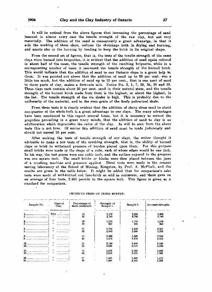
1906 Clay and the Clay Industry of Ontario 37
It will be noticed from the above figures that increasing the percentage of sand lessened in almost every case the tensile strength of the raw clay, but not very materially. The addition of the sand is consequently a great advanatge, in that it aids the working of these clays, reduces the shrinkage both in drying and burning, and assists also in the burning by tending to keep the brick in its original shape.
From the second set of figures, that is, the tests of the tensile strength of the same clays when burned into briquettes, it is evident that the addition of sand again reduced in about half of the cases, the tensile strength of the resulting briquette, while in a corresponding number of cases it increased the tensile strength of the burned brick. This would indicate that the addition of sand to our Ontario clays is a great help to them. It was pointed out above that the addition of sand up to 33 per cent, was a little too much, but the addition of sand up to 25 per cent., that is one part of sand to three parts of clay, makes a first-rate mix. Notice No. 3, l, 7, 29, 34, 35 and 33. These clays each contain about 25 per cent, sand in their natural state, and the tensile strength of the burned brick made from them is the highest, or about the highest, in the list. The tensile strength of the six shales is high. This is probably due to the uniformity of the material, and to the even grain of the finely pulverized shale.
From these tests it is clearly evident that the addition of sharp clean sand to about one-quarter of the whole bulk is a great advantage to our clays. The many advantages have been mentioned in this report several times, but it is necessary to correct the prejudice prevailing in a great many minds, that the addition of sand to clay is an adulteration which depreciates the value of the clay. As will be seen from the above tests this is not true. Of course this addition of sand must be made judiciously and should not exceed 25 per cent.
After making the tests of tensile strength of our clays, the writer thought it advisable to make a few tests of the crushing strength, that is, the ability of burned clays or brick to withstand pressure of burden placed upon them. For this purpose small bricks were made in the shape of a cube, each of whose edges would be one inch. In his way, the test pieces were one cubic inch, and the surface exposed to the pressure was one square inch. The small bricks or blocks were then placed between the jaws of a crushing machine and pressure applied. These tests were made in the cement testing laboratory of the School of Mining, Kingston, by Prof. A. McPhail, and the results are given in the table below. It might be added that for comparison's sake tests were made of well-burned red face-brick as sold in commerce, and these gave on an average of four tests, 2,460 pounds to the square inch. This figure is given as a standard for comparison.
CRUSHING TESTS ON CUBES BURNED.
Sample No.
2................... 2...................
1...................3...................
6...................5................. .
12.............. ....12..................
27..................27..... ............
31...... .... ......31..................
Class of Clay.
Erie ...T......
,,..
,,o
,,H
,,it
,,ii
,,'i
Percentage of sand contained.
15 33
2533
2133
15
33
15
33
Strength of Sample 1.
3,150 3,790
1,875967
2,7832,640o onn
2,510
3,1903,050
2,620
1,4651.965
Sample 2.
2,820 3,700
1,765925
3,3403,060O Kflfl
o Q -m
Q OQfi
3,010
2,760
1,4802.440
Average strength.
2,985 3,745
1,820946
3,0612,850
2,7402,410o oon
1 992
1,4722.200

38 Bureau of Mines No. 5
CRUSHING TESTS ON CUBES BURNED.— Continued.
Sample No.
34 .... 34.....
Class of Ciay.
Red-top
Saugeen
Led a
Percentage of sand contained.
9............... ,. . Shale
'21.
22.
23.
24.
Strength of Sample 1.
•2,410 3,740
2,6102,460
2,3103,390
4,3603,800
2,9903,400
4,4801,960
2,7603,615
3,2504,610
3,710
3,640
4,740
5,660
4,600
9,200
Sample 2.
3,1953,220
3,0202,600
2253,570
4,7203,740
3,3902,760
2,3902,400
3,1902,880
3,5803,020
3,410
4,370
5,340
6,510
4,060
6,290
Average strength.
2,8023,550
2,6173,480
4,5403,770
3,1903,080
3,4352,180
3,4153,816
3,560
4.005
5,040
6,085
4,330
7,745
From the above table it will be readily seen that the addition of sand up to 33 per cent, does not materially affect the ability of these clays to withstand pressure, or to carry loads} when burned to good hard brick, so that it is again demonstrated that the addition of sand, within reasonable limits—up to say 25 per cent.—is a decided advantage, and not a detriment, especially when we remember the increased facility in working that the addition of sand to a clay gives.
The table also shows the great carrying power of bricks made from shale. Probably this is caused by the homogeneity of the raw material, resulting in a brick of perfect uniformity, whereas in making brick from clay it is impossible to get the product absolutely homogeneous. Sand was not added to these shales since they are all worked by the dry method for the manufacture of pressed brick, and the addition of sand in this process would not only be much trouble, but would be hard on the machinery on account of its grinding action.
ShrinkageThe next physical property mentioned was shrinkage, and under this heading we
have to consider two phases, one known as air-shrinkage and the other as fire-shrinkage. Whether brick are made by the soft-mud, stiff-mud, or even the dry-press method, they contain more or less moisture. This moisture is disseminated throughout the clay around and between all tKe particles. After the brick are made they are set to dry by one or other of the methods mentioned below. In the drying process the moisture leaves the interspaces and the particles of clay come together to take the place of the water. This means a shrinkage in the size of the brick as a whole, and this is what is meant by air-shrinkage. See fig. 70.
But even when this moisture has been driven off and the little particles of clay touch each other they do not form a perfectly compact mass, for there are still small spaces (amongst the grains in which the water can lie, and this moisture remains until
1906 Clay and the Clay Industry of Ontario 39
driven off by heat. This is the moisture that escapes during the "water-smoking," or "steaming" as it is often called by brick-makers. There is even yet additional moisture present in the chemical make-up of the kaolin, which is not driven off until the heat reaches 4000 C. (752o F.) This causes the greater part of the fire shrinkage, although other things, such as the loss of carbon dioxide, etc., from clays rich in lime, have their effect. The amount of shrinkage which a clay will undergo is lessened by the addition of sand. The air shrinkage is low in lean clays and high in very plastic clays. Soft- mud brick usually shrink more than stiff-mud brick because the former are mixed with more water and are not pressed so compactly as the latter. At the same time soft-mud brick, which contain considerable sand, shrink less than soft-mud brick which contain less sand. This is a matter of experiment, and clearly proves that the addition of sand within certain limits, is a decided advantage from the standpoint of drying the brick, and preventing excessive shrinkage which so often causes the brick to crack or shake, thus pulling themselves to pieces. The kind of sand used, that is, whether coarse or fine, or its color, etc., does not matter much so long as it is clean, that is, free from lime stone and organic impurities.
SlakingAnother physical property ot considerable importance is slaking. If a lump of clay,
however hard, be moistened, it will slake or break to pieces. Sandy clays powder up more readily, whereas the fat or strong clays will slake very slowly, and sometimes may only scale or chip off gradually. This property of slaking is of considerable importance, because it forms a method of thoroughly disintegrating the clay. Many of our clay- workers take advantage of it by digging up their clay in the fall, and letting it lie over winter exposed to the rains and frosts. In the spring when the frost has left it, it will be found to powder readily, and can be dug and wheeled directly to a machine even without the use of a pug-mill.
This property of slaking is of a special advantage to those brick-makers using the Saugeen clay. This clay, as we have seen, occurs in layers, and when dug breaks out into large stiff lumps or cakes; in many cases also it has nodular concretion-like forms enclosed in it. Upon exposure to the air, however, these lumps and cakes break up completely. Many of the brick-makers do their tempering and mixing the sand with the clay by this process. The clay and sand are dug and dumped in layers in a heap. The clay afterwards slakes so completely that when the heap is dug over the clay and sand are very readily mixed, and can be sent directly to the soft-mud machine without having to be put through a pug-mill at all, although a pug-mill is always of the greatest advantage in tempering clay.
FusibilityThe last physical property mentioned in our list was fusibility. After the clays
have been water-smoked and as the heat continues to be raised, as soon as a tempera ture of about 4000 C. is reached, the combined water is given off. After this point is passed and the heat raised to about 9000 C., or perhaps a little higher, the particles of clay fuse and knit to each other, forming a perfectly coherent mass which on cooling retains its hardness. In the manufacture of ordinary brick this fusing temperature must not be passed, or the brick will become viscous and the" whole mass will fuse together into great lumps within the kiln. It is therefore important that brick should be burned till incipient fusion begins, but not materially above this point
In order therefore to test a kiln, or to be able to control the temperature, an excel lent method was devised as far back as 1886, by Dr. Herman Seger. This consists in the preparation of a series of pyramids or cones known as Seger cones. Their preparation and use is well described by Prof. Edward Orton of Ohio State University, Columbus, Ohio, from whom the cones may be had at one cent each. In a pamphlet advertising these cones Prof. Orton says:
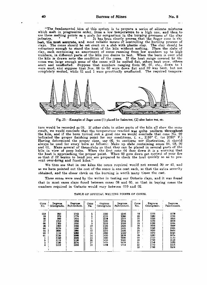
40 Bureau of Mines No. 5
"The fundamental idea of this system is to prepare a series of silicate mixtures which melt in progressive order, from a low temperature to a high one, and then to use these melting points as a scale for comparison in the burning processes of the clay industry. * * * * It has been clearly proven that the Seger cone is the best, the most accurate, and most reliable means of controlling the burning process of clays. The cones should be set erect on a slab with plastic clay. The clay should be refractory enough to stand the heat of the kiln without melting. Place the 'slabs of clay, each containing an assortment of cones running from low numbers up to high numbers, in different parts of the kiln you desire to test. When the burn is over and the kiln is drawn note the condition of the cones. If the heat range covered by the cones was large enough some of the cones will be melted flat, others bent over, others erect and unaffected. Suppose that numbers ranging from 08, 07, etc., down to l were used, and suppose that Nos. 08 to 03 were down flat and 02 was bent, but not completely melted, while 01 and l were practically unaffected. The required tempera-
Fig. 25.—Examples of Seger cones (l) placed (or fusion test, (2) after fusion test, etc.
ture would be recorded as 02. If other slabs in other parts of the kiln all show the same result, we would conclude that the temperature reached was quite uniform throughout the kiln, and if the burn turned out a good one we would conclude that cone No. 02 indicated the proper finishing point for our conditions, i. e., 1110 0 C. (or 20300 F.) Having determined the proper cone, say 02, to continue our illustration, it should always be used for every burn as follows: Make up slabs containing cones 04, 03, 02 and 01. Make several of these* slabs so that they can be placed in several parts of the kiln in view of peep holes. When the first cone 04 does down it is a warning that the heat is approaching the proper point. When 03 goes down get control of your fire so that if 02 begins to bend you are prepared to check the heat quickly so as to pre vent over-firing and fused kilns."
We thus see that in our kilns the cones required would not exceed 30 or 40, and as we have pointed out the cost of the cones is one cent each, so that the extra security obtained, and the closer check on the burning is worth many times the cost.
These cones were used by the writer in testing our Ontario clays, and it was found that in most cases clays fused between cones 08 and 05, so that in buying cones the numbers required in Ontario would vary between 010 and 02.
TABLE OF OFFICIAL MELTING POINTS OF CONES.
Cone No.
010090807060604030201
12•i4
Degrees Centigrade.
950970990
1010103010M10701(90111011301160117011901210
Degrees Fahrenheit.
17421778181418601886192219581994208020662102213821742210
ConeN*.
56789
101112131415161718
Degrees Centigrade.
1230mo127012901310133013501370139014101430145014701491
Degrees Fahrenheit.
224622822318235423902426246224982534-25702606264226782714
Cone No.
192021222324252627282930313233
Degrees Centigrade.
15101530155015701590161016301650167016901710173017hO17701790
Degrees Fahrenheit.
275*27862822285828942930296630023038307431103146318232183254

1906 Clay and the Clay Industry of Ontario 41
PART H.—THE MANUFACTURE OF CLAY PRODUCTS
The uses to which clays and shales are put are varied and widespread, and only those which are of more importance in Ontario will be considered. Among these the manufacture of brick, whether face, common, or pressed, plays the most important part. Other uses are the manufacture of hollow-block, terra cotta, roofing tile, drain tile, sewer pipe, paving brick, chimney flues, terra-cotta lumber, pottery, and Portland cement. Brick are made in Ontario from all the classes of clay mentioned above, as well as from the various shales, these latter being used in most cases in the manufacture of pressed brick.
In brick manufacture there are three processes known, (1) the soft-mud, (2) the stiff-mud, and (3) the dry-press; and all three processes are in use in Ontario. We will consider these in order.
Mining the Raw Material
The clay is as a rule simply dug with pick and shovel and transported by cart or car to the machine. In other cases, the clay is dug at the end of the brick-making season and thrown in a heap, where it is allowed to freeze and disintegrate throughout
Fig. 26.—A novel method of mining and transporting clay from pit to machine ; Watson and Hutchison's yard, Bracebridge.
the winter. This serves to thoroughly break up the clay, and in the spring it is taken direct from this heap to the machine. In still other cases, the clay is collected by an automatic clay-gatherer, which is a revolving drum, hauled by a team of horses, and in passing over the clay bed, loads itself. This method of clay gathering is confined however, to dry clay, when the horses are driven over the surface of the whole bed of clay

42 Bureau of Mines No. 5
In mining the shale, it is always necessary to blast. This is done in the usual way, by drilling a hole, either by hand or with machine drill, to a suitable depth. The hole is then charged with powder or dynamite, and blasted in the usual way. In some cases the surface of the shale, which on exposure to the air powders up or slakes is simply ploughed, and on being left, thoroughly disintegrates to a powdered form which can easily be worked in the machines. Those shales which are blasted require crushing before they can be used in any of the classes of machine used for brick-making. This crushing may be done in one of three ways. First, by passing the shale through a pair of jaw crushers, but this method does not produce a product of even grain, and i? therefore unsatisfactory. A second method in more common use, is the use of rolls. These consist of two sceel rolls, usually of unequal diameter, revolving in opposite directions, and with different velocities. The surface of the rolls may be smooth, cor rugated, or pebbled. This machine works much better, but its capacity is not great enough. It is especially useful for clays which contain a few pebbles, as it crushes
Fig. 27.—Clay brought over the tops of the hacks by clay cars and cable, F. Entricken's yard, Stratford.
these, but allows the pieces to mix throughout the clay. The third, and most satis factory method of crushing the shales, is the pan-mill, which consists of a large pan with a perforated steel bottom, so that the ground material may fall through when sufficiently pulverized. In the pan two large roller-like wheels revolve by the friction of the pan which turns below. The pan in turning carries the pieces of shale beneath these rollers, and these crush by their weight, which ranges from one to two tons and a half per wheel. Two scrapers are placed in front of the rolls, to throw the material in their path. A machine of this kind has capacity of eight tons per hour, or better.
Ridding the Clay of Stones
One method for removing the stones, is to crush them, but this is not very satis factory, especially if the pebbles be limestone, for the pieces whether large or small remain in the clay, and on burning are converted into lime, which invariably expands, bursting the brick. The only proper method is to remove the stones entirely, and

1906 Clay and the Clay Industry of Ontario 43
this is a difficult problem. A first-class machine for the removal of stones from ordinary sun-dried clay, is the Bechtel disintegrator, manufactured by Bechtel Brothers, of Waterloo, Ontario. The stones here are removed by centrifugal motion, by which the stone, being heavier than the clay, is thrown to the outside, while the lighter pulverized clay works down, passing out through the bottom. This is an "excellent machine, but can only be worked on dry clay. The only method in use in Ontario for the removal of stones from wet clay, is washing. The clay is dug and dumped into a circular pit, which may be from twenty to thirty feet in diameter, about three feet in depth and lined round the side with boards or brick. In one side a sluice-gate is left, which can be closed or opened at will. The clay is thoroughly wet, and round and round the pit a horse travels, turning a beam on which may be hung drags or wheels, which will thoroughly mix the water and clay. In a very few hours the whole of the mass will be thoroughly mixed and the stones will have settled to the bottom. The sluice-gate can then be opened and the upper soft clay slurry can be run off to a clay dump. This process at once removes the stones, and thoroughly tempers or mixes the clay. The cost of this operation will not exceed 35 cents per thousand of brick, and in every case adds at least 50 cents per thousand to the price obtainable as compared with bricks even from the same yard, made of unwashed clay.
TemperingBy -tempering the clay is meant mixing it with sufficient sand, loam or other
material to render it less strong or fat, and thereby bring it to a workable consistency.The materials added to clay for this purpose, are often spoken of as "grogs," and
many different kinds are used according to the ease with which they can be procured. Sand is by all means the best, as it mixes thoroughly with the clay and does not have any effect on the brick in burning, as the sand itself does not fuse. Unfortunately, however, sand cannot always be procured within reasonable distance, and then resort must be had to other means. In many cases a mild loam is used for red brick, and it not only tends to make the clay less strong but also improves the color of the brick by deepening it. In other cases, ground brick-bats are used, that is all the broken brick of the yard are ground up and added to the raw clay.
It is a serious mistake to use a strong clay without something to temper it, for the brick will almost invariably crack either in the drying or burning. Most of our Ontario clays, unless the bank be already sandy, will stand from a quarter to one- third their bulk of sand or other grog. In other countries, saw-dust, ground coal, charcoal, etc., are used.
The tempering may be done on au old mixing floor, which was the earliest method, by simply digging the clay over with a shovel. This has now been largely replaced by more modern methods. One of these is the ring pit, a description of which was given above in connection with the removing of stones by washing. Another process, still used to some extent, is the soak pit. The clay with its mixture of sand, etc., is dumped into a pit, a good supply of water poured over it, and the whole allowed to soak over night. This thoroughly softens the clay but does not in any way mix it. This has to be done entirely in the machine, and is not at all satisfactory. Both of these methods require so much handling and labor that new methods employing machinery have replaced them almost entirely.
The best of these is the pug-mill. This consists of an ordinary steel semi-cylin drical trough, which may be of any length, but usually from five to eight feet. Running lengthwise through the trough is a shaft on which are a number of knives or blades, set at such an incline that in revolving they mix the clay, sand, etc., thoroughly and at the same time keep feeding it along the trough towards the exit. Here the clay can be wet and tempered to the exact consistency desired. The machines take about six horse power and very little space, and can be placed so as to discharge directly into the moulding machine. They have therefore replaced almost all other methods of tempering.
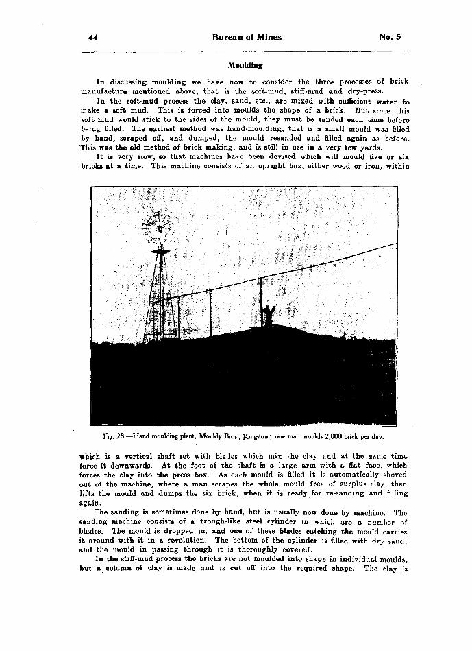
44 Bureau of Mines No. 5
Moulding
In discussing moulding we have now to consider the three processes of brick manufacture mentioned above, that is the soft-mud, stiff-mud and dry-press.
In the soft-mud process the clay, sand, etc., are mixed with sufficient water to make a soft mud. This is forced into moulds the shape of a brick. But since this soft mud would stick to the sides of the mould, they must be sanded each time before being filled. The earliest method was hand-moulding, that is a small mould was filled by hand, scraped off, and dumped, the mould resanded and filled again as before. This was the old method of brick making, and is still in use in a very few yards.
It is very slow, so that machines have been devised which will mould five or air bricks at a time. This machine consists of an upright box, either wood or iron, within
Fig. 28.—Hand moulding plant, Mouldy Bros., Kingston ; one man moulds 2,000 brick per day.
which is a vertical shaft set with blades which mix the clay and at the same time force it downwards. At the foot of the shaft is a large arm with a flat face, which forces the clay into the press box. As each mould is filled it is automatically shoved out of the machine, where a man scrapes the whole mould free of surplus clay, then lifts the mould and dumps the six brick, when it is ready for re-sanding and filling again.
The sanding is sometimes done by hand, but is usually now done by machine. The sanding machine consists of a trough-like steel cylinder in which are a number of blades. The mould is dropped in, and one of these blades catching the mould carries it around with it in a revolution. The bottom of the cylinder is filled with dry sand, and the mould in passing through it is thoroughly covered.
In the stiff-mud process the bricks are not moulded into shape in individual moulds, but a column of clay is made and is cut off into the required shape. The clay is
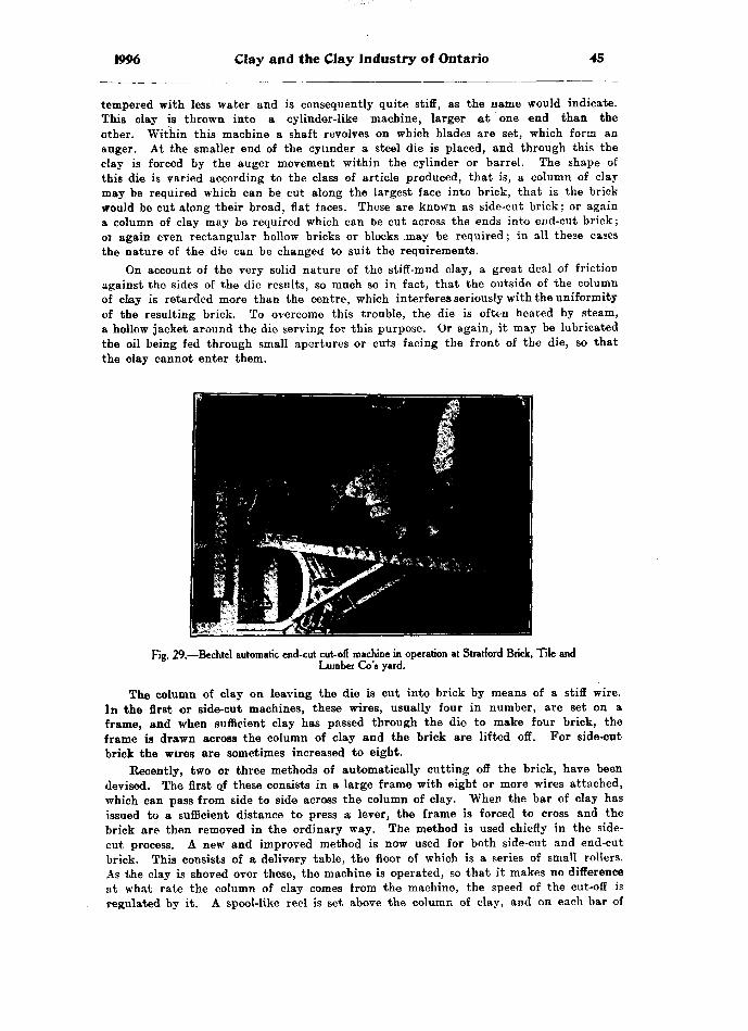
1996 Clay and the Clay Industry of Ontario 45
tempered with less water and is consequently quite stiff, as the name would indicate. This clay is thrown into a cylinder-like machine, larger at one end than the other. Within this machine a shaft revolves on which blades are set, which form an auger. At the smaller end of the cylinder a steel die is placed, and through this the clay is forced by the auger movement within the cylinder or barrel. The shape of this die is varied according to the class of article produced, that is, a column of clay may be required which can be cut along the largest face into brick, that is the brick would be cut along their broad, flat faces. These are known as side-cut brick: or again a column of clay may be required which can be cut across the ends into end-cut brick; oi again even rectangular hollow bricks or blocks .may be required; in all these cases the nature of the die can be changed to suit the requirements.
On account of the very solid nature of the stiff-mud clay, a great deal of friction against the sides of the die results, so much so in fact, that the outside of the column of clay is retarded more than the centre, which interferes seriously with the uniformity of the resulting brick. To overcome this trouble, the die is often heated by steam, a hollow jacket around the die serving for this purpose. Or again, it may be lubricated the oil being fed through small apertures or cuts facing the front of the die, so that the clay cannot enter them.
Fig. 29.—Bechtel automatic end-cut cut-off machine in operation at Stratford Brick, Tile andLumber Go's yard.
The column of clay on leaving the die is cut into brick by means of a stiff wire. In the first or side-cut machines, these wires, usually four in number, are set on a frame, and when sufficient clay has passed through the die to make four brick, the frame is drawn across the column of clay and the brick are lifted off. For side-cut brick the wires are sometimes increased to eight.
Recently, two or three methods of automatically cutting off the brick, have been devised. The first ojF these consists in a large frame with eight or more wires attached, which can pass from side to side across the column of clay. When the bar of clay has issued to a sufficient distance to press a lever, the frame is forced to cross and the brick are then removed in the ordinary way. The method is used chiefly in the side- cut process. A new and improved method is now used for both side-cut and end-cut brick. This consists of a delivery table, the floor of which is a series of small rollers. As the clay is shoved over these, the machine is operated, so that it makes no difference at what rate the column of clay comes from the machine, the speed of the cut-off is regulated by it. A spool-like reel is set above the column of clay, and on each bar of
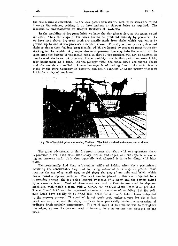
46 Bureau of Mines No. 5
the reel a wire is stretched. As the clay passes beneath the reel, these wires are forced through the column, cutting it up into end-cut or side-cut brick as required. The machine is manufactured by Bechtel Brothers of Waterloo.
In the moulding of dry-press brick we have the clay almost dry, as the name would indicate. Thus the shape of the brick has to be produced entirely by pressure. Aa we have seen above, dry-press brick are usually made from shale, which requires to be ground up by one of the processes described above. This dry or nearly dry pulverized shale or clay is then fed into steel moulds, which are heated by steam to prevent the clay sticking to the mould. A plunger descends, pressing the clay into the mould, at the same time the bottom of the mould rises, so that all the pressure will not be exerted on one face of the brick. A pressure of about eighty tons is thus put upon each brick, four being made at a time. As the plunger rises, the made brick are shoved ahead and the moulds are refilled. A machine capable of making four bricks at a time is made by the Berg Company of Toronto, and has a capacity of about twenty thousand brick for a day of ten hours.
Fig. 30.—Slop-brick plant in operation, Crediton. The brick are dried in the open yard as shownin the photo.
The great advantages of the dry-press process are, that with one operation there is produced a dry, hard brick with sharp corners a'nd edges, and one capable of carry ing an immense load. It is thus especially well adapted to large buildings with high walls.
We occasionally find that soft-mud or stiff-mud bricks, after their preliminary moulding are considerably improved by being subjected to a re-press process. This requires the use of a small steel mould about the size of an unburned brick, which has a movable top and bottom. The brick can be placed in this and subjected to a re-pressing process, the top being lowered by means of a screw and the bottom raised by a screw or lever. Most of these machines used in Ontario are small hand-power machines, with which a man, with a helper, can re-press about 3,000 brick per day. The stiff-mud brick can be re-pressed at once at the time of moulding, but the soft- mud brick have usually to be dried from three to six hours before being subjected to the re-press process. This method is not much used, unless a very few choice face brick are required, and the dry-press brick have practically made the re-pressing of ordinary brick entirely unnecessary. The chief value of re-pressing was to straighten the edges, square the corners, and to increase to some extent the strength of the brick. '
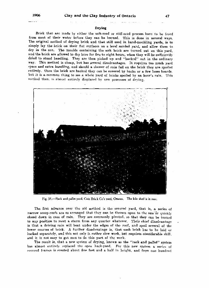
1906 Clay and the Clay Industry of Ontario 47
DryingBrick that are made by either the soft-mud or stiff-inud process have to be freed
from most of their water before they can be burned. This is done in several ways. The original method of drying brick and that still used in hand-moulding yards, is to simply lay the brick on their flat surfaces on a level sanded yard, and allow them to dry in the sun. The moulds containing the soft brick are turned out on this yard, and the brick are allowed to dry here for five to eight hours, when they will be sufficiently dried to stand handling. They are then picked up and "hacked" out in the ordinary way. This method is cheap, but has several disadvantages. It requires too much yard space and extra handling, and should a shower of rain fall on the brick they are spoiled entirely. Once the brick are hacked they can be covered by hacks or a few loose boards, but it is a common thing to see a whole yard of bricks spoiled by an hour's rain. This method then, is almost entirely displaced by new processes of drying.
Fig. 31.—Rack and pallet yard, Cain Brie k Go's yard, Ottawa. The kiln shed is in rear.
The first advance over the old method is the covered yard, that is, a series of narrow scoop-roofs are so arranged that they can be thrown open to the suu'or quickly closed down in case of rain. They are commonly pivoted, so that they can be turned to any position to meet a storm from any quarter whatever. Their chief disadvantage is that a driving rain will beat under the edges of the roof, and spoil several of the lower courses of brick. A further disadvantage is, that each brick has to be laid or hacked separately, and this not only is rather slow work, but requires considerable skill, and it is not easy to get men to do this part of the work.
The result is, that a new system of drying, known as the "rack and pallet" system has almost entirely replaced the open hack-yard. For this new system a series of covered frames is erected about five feet and a half in height, and from one hundred

48 Bureau of Mines No. 5
to two hundred feet long. Beneath each of these roofs cleats are so placed that from seven to ten pallets, each capable of holding six brick, can be set like a series of shelves, to dry. When the brick are dried they are lifted from these pallets, and taken to the kilns as usual, while the empty pallets are returned to the machine to be refilled. This yard has the special advantage of being easily handled, as anyone can lift a pallet from the barrow ,and place it on the rack. The chief disadvantage is that it requires a large number of pallets, but as these are made from rough lumber or strips of any kind, lath for example, and do not wear or get destroyed in any way, they are not expensive.
These are the only systems of open air drying in use in Ontario, but there are other systems of artificial drying which are becoming quite popular. The first of these in the tunnel dryer. For this system a yard is supplied with cars, capable of holding from three hundred to three hundred and sixty newly made brick. These care are
Fig. 32 —J. Logan's yard, Greenwood avenue, Toronto ; showing Sheldon dryer and down-draft kiln.
loaded at the machine; they are then run into a tunnel, closed in on all sides, and through the tunnel a blast of warm air is forced by a fan. The wet brick enter at the cool end of the tunnel, and as car by car of dry brick are taken from the opposite end of the tunnel, these damp brick are brought nearer and nearer to the hot blast. In this way the wet brick are prevented from being cracked and checked by being exposed directly to a hot dry blast. This forms a very good system of drying, its only disadvantage being that it requires a large number of cars, since the brick are not unloaded from the time they leave the machine till they reach the kiln yard. But as these bricks can be dried in thirty-six to forty-eight hours, the rapidity with which the brick are dried, counteracts to a great extent the disadvantage of requiring so many cars. This system of drying is installed by the Sheldon *fe Sheldon Co., of Galt, Ontario, and is the best system for drying ordinary stock brick seen in the Pro vince.

1906 Clay and the Clay Industry of Ontario 49
Another system of drying is known as the Bechtel Carless Dryer, which overcomes the difficulty of providing so many cars. A series of three or more shallow trenches are made in the floor of a shed, well closed in. Into the end of these trenches a blast of warm dry air is forced by a fan, and by means of dampers the blast can be turned into one or other of these trenches as desired. The newly made brick, aif made by the stiff-mud process, are piled on a single pallet, 'say eighty to one hundred brick, or if made by the soft-mud process each mould is dumped on a separate pallet, and eight to twelve pallets are piled one on another in a heap. Lifts on the ends of the pallets prevent them from touching the under brick. These piles of brick are then wheeled in by a specially devised truck, and are set in a row over one of these trenches. They
then covered by a loose canvas and the blast of air is turned into that trench.
Fig. 33.—One of the steel care used in the Sheldon and Sheldon tunnel dryer, capacity about 330 brick.
This air distributes itself from end to end throughout the trench, and in rising through the moist brick escapes through the loose canvas, thereby drying the brick. This method is especially well suited to the drying of wire-cut brick, as it combines quick handling and rapid drying with few pallets required. Furthermore, the brick when dried can be picked up by these trucks, eighty to one hundred at a time, and wheeled
-to the kilns. This dryer is made by Beohtel Bros, of Waterioo, Ontario.The only other system of artificial drying in use in Ontario is the open floor dryer.
This consists simply of an open floor, beneath which are placed a series of iron pipes,-or a series of flues, or even a blast of warm air may be blown. The heat and accom panying rising air passes up through the floor and dries the brick. This method is not in much use, as it is too expensive and where employed at all only the exhaust steam is used. This system is somewhat used in the drying of tile. For brick, the distribu tion is too unequal, and too much labor 4s required in handling the brick.
4M2.
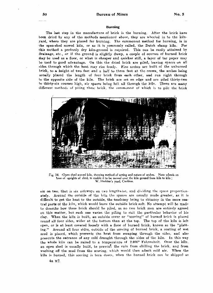
50 Bureau of Mines No. 5
BurningThe last step in the manufacture of brick is the burning. After the brick have
been dried by any of the methods mentioned above, they are wheeled in to the kiln- yard, where they are placed for burning. The commonest method for burning, is in the open-shed scoved kiln, or as it is commonly called, the Dutch clamp kiln. For this method a perfectly dry kiln-ground is required. This can be easily attained by drainage, etc., or if the ground is slightly damp, a couple of courses of burned brick may be used as a floor, or what is cheaper and quicker still, a layer of tar paper may be used to good advantage. On this the dried brick are piled, leaving spaces on all sides through which the heat may rise freely. Fire arches are built of the unburned brick, to a height of two feet and a half to three feet at the crown, the arches being usually placed the length of four brick from each other, and run right through to the opposite side of the kiln. The brick are set on edge and are piled thirty-two to thirty-six courses high, air spaces being left all through the kiln. There are many different methods of piling these brick, the commonest of which is to pile the brick
Fig. 34.—Open shed scoved kiln, showing method of setting and nature of arches. Note wheels onbase of uprights of shed, to enable it to be moved over the kiln ground from kiln to kiln ;
W. Hedden's yard, Crediton.
six on two, that is six sideways on two lengthwise, and dividing the space proportion ately. Around the outside of the kiln the spaces are usually made greater, as it is difficult to get the heat to the outside, the tendency being to chimney in the more cen tral parts of the kiln, which would leave the outside brick soft. No attempt will be made to describe how these brick should be piled, as no two brick men are entirely agreed on this matter, but each one varies the piling to suit the particular behavior of his clay. When the kiln is built, an outside cover or "scoving" of burned brick is placed round all four sides, wider at the bottom than at the top. The top of the kiln is left open, or is at least covered loosely with a floor of burned brick, known as the "platt ing." Around all four sides, outside of the scoving of burned brick, a coating of wet mud is placed, which prevents the heat from escaping through the sides, and also prevents the entrance of any cold draught through the sides of the kiln. In this way the whole kiln can be raised to a temperature of 2,0000 Fahrenheit. Over the kiln, an open shed is usually built, to prevent the rain from chilling the brick, and from washing off the mud from the scoving, which would then admit cold air. When the kiln is burned, this scoving is torn down, when the burned brick can be shipped as
4a M2.
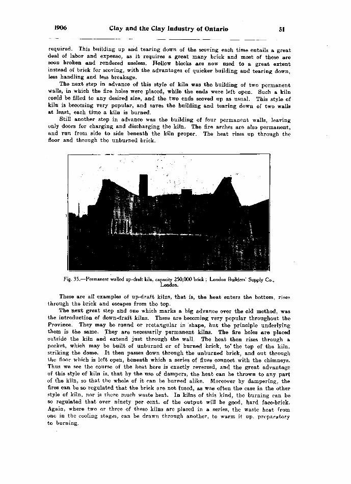
1906 Clay and the Clay Industry of Ontario 51
required. This building up and tearing down of the scoving each time entails a great deal of labor and expense, as it requires a great many brick and most of these are soon broken and rendered useless. Hollow blocks are now used to a great extent instead of brick for scoving, with the advantages of quicker building and tearing down, less handling and less breakage.
The next step in advance of this style of kiln was the building of two permanent walls, in which the fire holes were placed, while the ends were left open. Such a kiln could be filled to any desired size, and the two ends scoved up as usual. This style of kiln is becoming very popular, and saves the building and tearing down of two walls at least, each time a kiln is burned.
Still another step in advance was the building of four permanent walls, leaving only doors for charging and discharging the kiln. The fire arches are also permanent, and run from side to side beneath the kiln proper. The heat rises up through the floor and through the unburned brick.
Fig. 35.—Permanent walled up-draft kiln, capacity 250,000 brick ; London Builders' Supply Co.,London.
These are all examples of up-draft kilns, that is, the heat enters the bottom, rises through the brick and escapes from the top.
The next great step and one which marks a big advance over the old method, was the introduction of down-draft kilns. These are becoming very popular throughout the Province. They may be round or rectangular in shape, but the principle underlying them is the same. They are necessarily permanent kilns. The fire holes are placed outside the kiln and extend just through the wall. The heat then rises through a pocket, which may be built of unburned or of burned brick, to* the top of the kiln, striking the dome. It then passes down through the unburned brick, and out through the floor which is left open, beneath which a series of flues connect with the chimneys. Thus we see the course of the heat here is exactly reversed, and the great advantage of this style of kiln is, that by the use of dampers, the heat can be thrown to any part of the kiln, so that the whole of it can be burned alike. Moreover by dampering, the fires can be so regulated that the brick are not fused, as was often the case in the other style of kiln, nor is there much waste heat. In kilns of this kind, the burning can be so regulated that over ninety per cent, of the output will be good, hard face-brick. Again, where two or three of these kilns are placed in a series, the waste heat from one in the cooling stages, can be drawn through another, to warm it up, preparatory to burning.
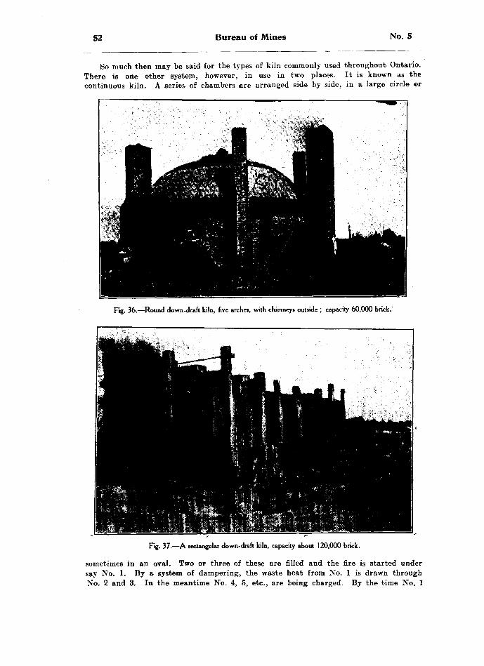
52 Bureau of Mines No. 5
So much then may be said for the types of kiln commonly used throughout Ontario. There is one other system, however, in use in two places. It is known as the continuous kiln. A series of chambers are arranged side by side, in a large circle or
Fig. 36.—Round down-draft kiln, five arches, with chimneys outside ; capacity 60,000 brick.
Fig. 37.—A rectangular down-draft kiln, capacity about 120,000 brick.
sometimes in an oval. Two or three of these are filled and the fire is started under say No. 1. By a system of dampering, the waste heat from No. l is drawn through No. 2 and 3. In the meantime No. 4, 5, etc., are being charged. By the time No. l

1906 Clay and the Clay Industry of Ontario 53
is burned, the fire has been gradually coaxed into No. 2, and so on, the process is repeated throughout the circle, so that once the fires are lighted, they are never let out, but are drawn round and round the kiln, from chamber to chamber, some cham bers being burned while others are being charged, and still others are being discharged. Th's is known as a continuous kiln, and its advantages are apparent.
Fig. 38.—16-chambered continuous down-draft kiln, capacity 340,000 brick ; Port Credit Brick Co.
The Question of Fuel
The first step in the burning of every kiln, is the removal of a certain amount of moisture, which remains after any one of the systems of drying mentioned above. This process is known as steaming, or water-smoking. This should always be done slowly, as too rapid heating will burst the brick, either by the escaping steam or by forming a crust or shell around the brick which prevents the moisture from the centre escaping. The water-smoking should be done with wood as a fuel, or coke, for if coal be used the soot will lodge in the spaces between the brick and choke the kiln. After the water-smoke is off, any fuel may be used for the burning, but dry fuel should always be used as far as possible.
A great deal has been said on this subject and the question is commonly asked, "Which do you find cheaper to burn, wood or coal?" The answer to this depends entirely on the kind of wood or coal burned. Unfortunately, the majority of brick- makers get the poorest class of wood to be had in the neighborhood. This is a great mistake. The brick-maker should get as good wood as possible, and particularly dry wood, that is wood that has been cut for at least a year. Each 10 per cent, of moisture
54 Bureau of Mines No. 5
in wood detracts 12 per cent, from its heating value, and since wood which has been cut even for a year, contains 25 per cent, of water, 30 per cent, of the heating value is used in driving off this moisture, before any of the heat is available to burn the brick. This being the loss with dry wood, how much greater is the loss when wet, punky wood is used?
Another point not generally known, is that one kind of dry wood has the same heating value as another, when considered weight for weight; that is one pound of dry pine has the same heating value as one pound of dry hickory or maple. To compare these with coal, it is found that taking air-dried wood :
l cord of hickory or maple, weighs.... ... ..... 4,500 Ibs. -- l,8001bs. soft coal.l cord white oak, weighs ... .. ...... . .. ... .. . 3,850 Ibs. — 1,340 Ibs. soft coal.l cord beech or red oak, weighs ...... .... .... .3,250 Ibs. ~ l,300 Ibs. soft coal.l cord elm, weighs... ... ...... ... ...... ...... 2,350 Ibs. — 940 Ibs. soft coal.l cord pine, weighs.... ...... .... .... ........ .2,000 Ibs. — 800 Ibs. soft coal.
From the above it will be seen that one pound of soft coal is eq'aal to about two and a half pounds of any kind of dry wood, and that pound for pound, one kind of wood is as good as another, if dry. Again, one cord of maple is as good as two and one-half cords of pine, and one cord of pine is about as good as a cord of elm. Other com parisons are obvious. It would appear, however, since a cord of dry maple is not equal to one ton of soft coal, which rarely costs over three dollars and a half, that coal is the cheaper fuel to use. Moreover, coal takes less handling and less yard-room.
The burning of clay in the manufacture of brick, is probably the most important part of the industry, for the best of clay can be spoiled by poor burning. Two classes of brick are made in Ontario, red brick, and buff brick, commonly spoken of as white brick. The red color of the brick is caused by the iron in the ferrie state. Strange to say, the clay from which red brick are made and the clay from which white or buff brick are made, have in Ontario, practically the same percentage of iron, but the difference in the result of burning is caused by the high percentage of lime in the clay used for white brick. This lime prevents the iron burning to the ferrie state, and thereby prevents the brick from burning to a red color.
The word ferrous comes from the Latin root "ferrum," meaning iron. Iron has the power of forming two classes of compounds; for example, it can combine with oxygen in the ratio of l to l, forming the compound FeO, known as ferrous oxide. Or again, it can combine with oxygen in the ratio of l to li, but as we have no half quantities in chemistry, this formula must be doubled, thereby being written Fs*fis ; this is known as ferrie oxide. Thus the "ic" compounds are the more highly oxidized. Hence the statement above that the red color of clay products is due to some compound of iron in the ferric state. These two conditions are brought about by the Character of the atmosphere of the kiln in which the goods are burned, e. g. if a kiln be burned with the drafts well opened, so that plenty of air is admitted, we will have an oxidizing atmosphere within the kiln, and this will tend to produce ferrie compounds, which as we see would be red. On the other hand if a kiln be burned in which the drafts are not kept freely open, a scant supply of oxygen is admited, and this is not more than is required by the burning fuel. The result will therefore be that the kiln will be filled with reducing gases, and this will produce buff-colored goods. Therefore in burning red brick, tile, or other products, a liberal amount of air is required, while in burning \white brick ~tile, etc., too much air should not be admitted.
Plashing
tOne other point in connection with burning, which requires special attention, is flashing. Many bricks used for the fronts of large buildings, especially where pressed brick are used, are purposely flashed. This consists in darkening the edges, while the

1906 Clay and the Clay Industry of Ontario 55
centres of the faces are left the proper color. This darkening is caused by a special. treatment in firing, that is by so placing the brick that the edges to be flashed are exposed to reducing conditions at some stage in the burning. In this way the iron is reduced to the ferrous state, and at a later stage they are suddenly exposed to an oxidizing action, which darkens the edges to a rich reddish-brown, or even a greenish tint. The oxidation usually takes place in the cooling stages of the burning. If all the brick are desired a light grey color, the cooling should be done with all the air entrances closed.
The flashing, to which special reference should be made, is not that referred to above. The trouble, as most of the brick-makers in Ontario know, consists of red flashes or streaks on white brick and tile, and is due to some of the iron in the clay having been oxidized to the ferric state. The Erie blue clay mentioned above as occurring over the greater part of Ontario, has roughly 5 per cent, of iron. If this could all be burned to the ferrie state, the brick would be red, but the presence of so much lime in the clay prevents this. Where the percentage of lime is three times or over the percentage of iron, it will prevent the iron being burned to the ferrie state. Instead of that we have ferrous carbonate, and this gives the buff color to the goods. If anything should happen to cause the oxidation of a little of the iron to the' ferrie state, a red streak or flash would be produced. In following a kiln of white brick, we see that first the \vater-smoke is driven off by a slow fire, then the kiln is heated up; between fires when the kiln is going well, the doors are closed and in many cases they are even mudded over. The consequence is a scarcity of oxygen, and a reducing atmosphere within the kiln. This as we have seen forms ferrous oxide-s, carbonates and silicates. This is quite correct, and should be the condition for white goods. The flashes, however, occur in the cooling stages. After the kiln has been burned, as we have seen above, it is closed up, and allowed to cool for a couple of days, i. e. the draft® are all closed up. But as the kiln cools it naturally contracts, i. e. the bricks in cooling contract as well as the air within the kiln. The result is, they tend to occupy less space within the kiln. Cold air must therefore get in to fill the unoccu pied space. It cannot enter through the doors, since they are closed and mudded up, it therefore comes down through the chimneys, and through the flues, rising through the floor it meets hot brick, whose compounds we have seen, are in the ferrous state. This fresh air at once oxidizes some of the ferrous compounds, especially the oxides to the ferrie condition, and a red flash is produced. This of course all applies to those burning in down draft kilns, and it is in these that the difficulty is met. We thus see that to prevent flashing white goods, we must prevent oxidizing drafts coming in contact with the hot brick. Probably the best way to overcome this difficulty is to Keep one or two fires burning lowly during the first day or so of the cooling, thereby allowing the kiln to cool off gradually, and at the same time enabling a reducing atmosphere to be preserved till the brick have cooled to a point where the admission of air can no longer oxidize them. For burning red goods just the reverse is required, that is, a plentiful supply of air must be admitted throughout the whole of the burning and cooling.
For burning brick with coal, it is always best to water-smoke with wood, and even to heat up from four to six hours with wood before going on to coal.
One other point should be mentioned in connection with the cooling of the kiln. This should never be hurried, for if brick are cooled too quickly the outside of the brick pools too quickly for the interior, and the result is that the kiln is "shaken," or in other words, the brick will be all cracked.
In burning brick in open-shed scoved kilns, great difficulty is experienced in dis tributing the heat evenly throughout the kiln. A great many devices have been tried to overcome this difficulty. In the old country the raw clay has been mixed with saw dust, ground charcoal, or powdered coal, so that in burning, these combustible products would help distribute the heat. In Ontario, powdered coal has been used in this way

56 Bureau of Mines No. 5
for the bricks placed in the heads of the kiln, the user claiming good results from the practice. There is never any difficulty in getting sufficient heat up through the centre of the kiln, but it is difficult to get sufficient heat to pass up through the heads to burn them to hard brick. This is accomplished to some extent by leaving the spacing wider in the heads than in the central part of the kiln in piling the brick, but this is not altogether satisfactory. A very ingenious method and one employed to some extent in Ontario, is to place a email ridge of hard coal screenings around the edge of the kiln on top of the platting. After the fires have been started, and the heat has worked pretty well up to the top, the kiln man goes up with a small wedge-like poker, and works the bricks slightly so as to allow a little of the. screenings to trickle down through the heads. These take fire, and by their heat not only help to burn the brick, but induce a little additional draft up through the heads, drawing more of the kiln-fire to those parts of the kiln. This operation is repeated every hour, only a little of the coal screenings being allowed to trickle down each time. This must be carefully watched so as not to allow too much to enter, so as not to block or choke the drafts through the heads. In the kilns where this is used, excellent hard face brick were taken from against the scoving, and the process seems to largely prevent the occurrence of soft brick in the heads. The coal is piled about eight inches deep, and sixteen inches wide, at the base, tapering down from the crown to the base.
PART III.—THE CLAY INDUSTRY IN ONTARIO
Having now dealt in a general way with the subject of clays and their occurrence in Ontario, let us take up the industry in more detail.
To do this we will discuss it county by county. It was found impossible to call at all the brick and tile yards and all the potteries in each county, but as many as pos sible were risited, and suggestions were made and samples were collected at many of these.
A detailed description of the plants found at the various yards is given in order that those directly interested in clays may see points in which their plant, or pro cesses of manufacture are perhaps capable of improvement. The clays will each be referred to its proper class as described in the former part of this report, viz.: Red- top clay, Erie clay, Saugeen clay, etc.
AddingtonJ. Sauls, Tamworth : This yard is situated in a hollow about two hundred yards
from Tamworth station. There is about three feet of Bed-top clay lying on Erie clay, and this is dug by hand and carted to a tempering heap close to the machine; here it is mixed with sand, and wheeled in barrows to a Martin machine run by horse power.
The brick are "hacked " out to dry and are burned in up-draft scoved kilns with wood as fuel. Red brick only are made here.
AlgomaW. A. Evans, Sudbury: This yard is situated about two miles west of Sudbury
on the Copper Cliff road. A very excellent clay is found here. In some places it is rather sandy, especially on top; but these spots are quite local, and the clay as a whole is excellent. The Saugeen clay is dug directly from the bank and hauled by car and cable to two Iron Quaker machines. These are run by steam power, the hoisting also being done by steam. The brick are hacked out in the usual way to dry in open yards, and are then burned with wood in open-shed scoved kilns, also one case kiln. The output of this yard is about three million per season; all red brick.
A new use for this clay has recently been found by the Canadian Copper Company

1906 Clay and the Clay Industry of Ontario 57
at Copper Cliff. In lining their converters, fire clay was always used, but running short of fire clay they got some of this clay from the brick-yard, and on trying it found it to give very good satisfaction. The result has been that they have been using it since, and it is claimed to work quite satisfactorily, although, of course, not the equal of fire-clay, but. when it can be dug within two miles of the works, at comparatively little cost, it is considered to be no small advantage. The analysis of this clay is given as No. 68, page 26 of this report.
M. Mcvittie, Whitefish : This is a small yard situated at Whitefish on the Sault branch of the C. P. B. There is the usual section of Saugeen interbanded clay, which is dug in the fall, put in a heap and allowed to slake. It is then wheeled to a Martin machine run by steam power. The brick are hacked out in the ordinary way to dry, and are then burned with wood in open-shed scoved kilns. A good quality of red brick is made, and the output is about 700 thousand per season.
The Algoma Commercial Company, Sault Ste. Marie: As we work westward from North Bay we find the clay becoming much stronger, the bands thicker, and very much redder in color, so much so that by the time we reach the Soo the clay is quite red in color, resembling very much the Medina shales worked at Milton, Hamilton, etc. At the above mentioned yards a very high bank of red Saugeen clay is found. This bank was exposed in making a cutting for the Algoma Central railway, and was acquired by the Algoma Commercial Company for the manufacture of the brick required for their many beautiful buildings at the Soo. They, however, installed a dry- press plant, which has not worked altogether successfully. The trouble appears to be that the clay was not ground fine enough, nor was the burning quite hard enough, as all the softer brick upon exposure to the weather, especially to moisture, have been found to crumble readily.
The clay was dug from the face of a bank in places twenty feet deep. It was hauled by car to a long shed, the floor of which was composed of steam-heated coils. The clay was dumped on this to dry, after which it was taken in cars and dumped to a hopper from which an elevator took it to storage bins. These in turn fed a pan- mill, where the clay was ground; but the grinding does not appear to have been fine enough. This is the difficulty which all makers using clay instead of shale are experienc ing as yet in Ontario. The clay must be ground to a very fine powder. The ground clay was then fed to a Simpson dry press, and the brick wheeled directly to a series of six rectangular down-draft kilns. The water smoking was done with wood or coke and the final burning with soft coal. Those brick which were composed of fine enough material and which were burned sufficiently hard are a very superior brick, and there is little doubt that with these two points improved an excellent product would result from this clay, as the color, etc., was excellent. This plant is not working at'present. The analysis of this Saugeen clay is given above, No. 69, page 26 of this report.
Charles Lethbridge, Sault Ste. Marie : This is a small yard situated about three- quarters of a mile northwest of the last mentioned yard, where there is the usual section of Saugeen clay, here very red in color. This is dug and carted to a pug-mill feeding a new Quaker machine. The bricks are dumped on pallets and dried by the rack and pallet system, after which they are burned with wood in open-shed scoved kilns. The output is about 500 thousand per season, all stock brick. Pressed brick is made from the same clay by the Algoma Commercial Company. Here we have stock brick made from it by the soft-mud process, and in the yard to be described next we will have wire-cut brick made from the same clay by the stiff-mud process.
Elliot A Sons, Sault Ste. Marie : This is one of the most interesting yards in the Province. Mr. Elliott, who was a brick-maker in England, came with his family to Canada, and he and his several brothers have had brick-yards in various parts of the Province; for example, at Wingham, at Thedford, Glenannan, Bluevale and the Sault. At the last named place it was found difficult to get a machine, so Mr. Elliott

58 Bureau of Mines No. 5
built a little furnace, bought scrap-iron, and after melting his iron, made his own machines completely from his own patterns and ideas. Everything in his yard in the way of equipment has been designed and manufactured on the place, and a better equipment would be difficult to find in the Province. He manufactures wire-cut side- cut brick, also tile and block, all of excellent quality. His clay is dug and hauled by cars with a horse to the machine of his own make, which resembles very closely a Kells machine. The brick are then piled on pallets and dried in a rack and pallet yard, and are then burned in open-shed scoved kilns and also in one rectangular down- draft kiln of Mr. Elliott's own design. This is not a large yard, making only about BOO thousand brick, with some tile, etc., but the originality displayed by Mr. Elliot in every part of his yard is a great credit to him.
BrantWm. Blacker, Brantford, makes white brick only; this is an old yard. The clay
is got from the face of a large hill, which is composed of a very sandy blue- clay. Tt is blasted out in winter and allowed to slake until spring, when it is carted to a
Fig. 39.—Double rectangular down-draft kiln, one set of chimneys for both kilns ; F. Entricken's yard,Stratford.
Martin brick machine which turns out a first-class stock brick. The brick are dried in a rack and pallet yard, and are burned in a double long walled rectangular down- draft kiln. There are two kilns placed side by side with a row of chimneys between the two, which serve for both kilns. The fire holes, ten in number, are all located in the outer wall of each kiln.
Brantford Brick Company, Limited, Brantford : Manufacture red stock brick from a very sandy red clay which has been collected locally and varies in depth from three to twelve feet. It is underlaid by the Erie blue clay, but this is not used. The clay is dug in the fall or early spring, and is piled in heaps interlayered with proper proportions of sand. The whole section is then cut down and wheeled to a Martin machine. The Bechtel Carless dryer is used to dry the output of 12,000 per day, and the dry brick are burned in ordinary scoved kilns, and are of very fine quality.
Sam Allen runs a red brick yard at Brantford, and uses a similar red clay to that at the Brantford Brick Co.'s yard. He hauls his clay by cart from about three- quarters of a mile, and heaps it with sand in proper proportions to temper. It is then
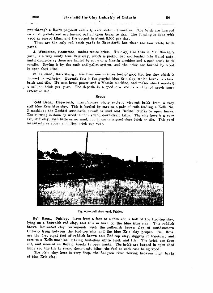
1906 Clay and the Clay Industry of Ontario 59
put through a Baird pug-mill and a Quaker soft-mud machine. The brick are dumped on small pallets and are hacked out in open hacks to dry. The burning is done with wood in scoved kilns, and the output is about 8,000 per day.
These are the only red brick yards in Brantford, but there are two white brick yards.
J. Workman, Brantford, makes white brick. His clay, like that in Mr. Blacker's yard, is a very sandy blue Erie clay, which is picked out and loaded into Baird auto matic dump-cars; these are hauled by cable to a Martin machine and a good stock brick results. Drying is by the rack and pallet system, and the brick are burned by wood in open shed kilns.
N. B. Card, Harrisburg, has from one to three feet of good Bed-top clay which is burned to red brick. Beneath this is the grayish blue Erie clay, which burns to white brick and tile. He uses horse power and a Martin machine, and makes about one-half a million brick per year. The deposit is a good one and is worthy of much more extensive use.
BruceReid Bros., Hep worth, manufacture white end-cut wire-cut brick from a very
stiff blue Erie blue clay. This is hauled by cart to a pair of rolls feeding a Kells No. 2 machine; the Bechtel automatic cut-off is used and Bechtel trucks to open hacks. The burning is done by wood in four round down-draft kilns. The clay here is a very fat, stiff clay, with little or no sand, but burns to a good close brick or tile. This yard manufactures about a million brick per year.
Fig. 40.—Bell Bros' yard, Paisley.
Bell Bros., Paisley, have from a foot to a foot and a half of the Red-top clay, lying on a brownish red clay, and this in turn on the blue Erie clay. This reddish brown laminated clay corresponds with the yellowish brown clay of southwestern Ontario lying between the Bed-top clay and the blue Erie clay proper. Bell Bros, use the first eight feet of reddish brown and Bed-top clay, digging it together, and cart to a Kells machine, making first-class white brick and tile. The brick are then cut, and wheeled on Bechtel trucks to open hacks. The brick are burned in open shed kilns and the tile in round down-draft kilns, the fuel in each case being wood.
The Erie clay here is very deep, the Saugeen river flowing between high banks of blue Erie clay.

60 Bureau of Mines No. 5
William Adamson, Walkerton, manufactures only red tile and hollow block, using an English plunger machine. He burns in a square down-draft kiln, with a mixed fuel of wood and coal. The clay here is the typical Saugeen clay described above. The thin bands of reddish brown clay and grayish sand alternate from top to bottom of the bank, making a very odd but interesting section. The bands are not over half an inch in thickness, and give a perfect mixture when the cliff is dug from top to- bottom. The individual bands of clay would be much too strong to work by themselves, even could they be obtained, so that the alternating bands of sand are the salvation of the deposit. The bank itself is eight feet thick and rests on a bed of white quartz sand, the upper two inches of which have become cemented into a flag of sandstone by the calcareous material derived from the overlying clay'; beneath this the sand is quite soft and granular. The clay is dug and wheeled to a pug-mill which mixes it thor oughly; it then drops to a cotton belt carrier which feeds the plunger machine. The tile produced are very smooth and free from cracks, and are claimed to stand the frost and burden admirably.
L. Yaack, Walkerton : This yard is situated about one mile northeast of Adam- son's yard, but strange to say contains quite a different clay. It is situated on the opposite bank of the Saugeen river at about forty feet higher altitude. The clay here is the usual Erie blue clay with the yellowish brown top, from which white brick only are made. The clay is ploughed in the fall and scraped into heaps, where it is allowed to freeze during winter. It is then wheeled to a Close machine making jside-cut wire-cut brick. The clay is practically free from stones, and works up well after freezing. The brick are piled six on a pallet and are dried by the rack and pallet system. They are burned in one round down-draft Cornell kiln, and in one square down-draft kiln with permanent side walls and open ends which are scoved up as usual.
CarletonMorris A Ballentine, Billings 'Bridge, have a great depth of red burning clay.
The first five feet is quite strong; this is followed by about seven feet of milder yellowish brown sandy clay; below this is the typical blue Leda clay which corresponds to the Erie clay in the west. It has the same blue color, is equally tough and strong, and at Ottawa is ninety-four feet deep; burns to red goods, but differs in having the marine shells as described in the preliminary part of this report. The red, the yellowish, and sufficient of the underlying blue clay are all dug together and loaded to automatic dump-cars which are dumped into a Baird pug-mill. This feeds a pair of rolls, which crush any small stone present, and the product is fed to two machines, one being a Martin, and the other a Standard, manufactured in Ohio. The brick are then piled, one hundred to a car, which is run to the rack yard where the pallets are piled off as usual. The dried brick are again piled on the cars for "wheeling in." The burning is done in open shed kilns, scoved as usual, the fuel used being wood. This company manufactures over two million brick per season.
H. Mulligan, Harvard, Ottawa, has a deep bank of the Leda clay on the shores oi the Rideau canal. The clay is dug in the winter time to about water level, and is piled in heaps to freeze; it is then hauled in cars which dump to a pug-mill, which in turn feeds a pair of rolls, and Hercules six-brick machine. This is a good type of soft-mud machine; it is built entirely of steel, and is open to view all the time, so that any change of temper can be readily effected. - The bricks are dried by the rack and pallet system, and are burned with wood in open-shed kilns, and in one round down-
. draft Cornell kiln. Only red brick are made and the output is about one million and a quarter per season.
i'-J The Ottawa Brick Manufacturing Co., Harvard, Ottawa: This company oper ate a large yard and manufacture about two and one-half million brick per year. They have the same clay as Mr. Mulligan, and the description of it will apply to

1906 Clay and the Clay Industry of Ontario 61
all the Ottawa yards. The clay is dug in winter, and heaped to slake; it is then wheeled in barrows and dumped into three pairs of rolls, which in turn feed two pug- tnills and one belt conveyor; these feed three Martin machines, the brick are dried by the rack and pallet system.
The burning is done in one large twenty-four arch, permanent walled up-draft kiln, capable of holding four hundred thousand brick. In addition to this, open shed scored kilns are used, the fuel in both cases being wood. Three independent gangs operate in this yard, giving an output of four million red brick of first-rate quality per season.
Odell Brothers, Ottawa : The same clay is found here as in the other Ottawa yards, so that a description of it is not necessary. The clay is dug in the winter as usual and allowed to slake; it is then wheeled to a Quaker, and a Martin machine, the brick are dried by the rack and pallet system, and are-burned with wood in scoved kilns without sheds. In case of rain the kiln is covered with loose boards. The oper ator claims that the time saved in loading and unloading the kiln, together with the advantage of building his kiln at any point on his yard more than makes up for the extra handling of lumber and loss in case of storms. For his yard he would require a much larger shed than he cares to build. He manufactures about two million brick per year.
Cain Brick Company, Ottawa, has the clay described above, which is dug in winter and mixed with the proper proportion of sand for tempering, and allowed to stand until spring. It is then wheeled to two Martin machines, making a good stock brick. The brick are dried by the rack and pallet system, and are burned with wood in open shed kilns. The output is about two million and a half per year, and the brick are of excellent quality.
T. O'Reilly, Harvard, Ottawa, has the usual section of Ottawa clay, that is, a Bed-top clay, quite {strong, which overlies roughly five feet of a milder sandy clay, which in turn overlies a great depth of stronger Leda blue clay. The Bed-top clay, with the mild clay and three to five feet of the blue clay, is dug in winter and heaped to temper until spring. It is then wheeled to a pair of rolls which feed a pug-mill that in turn feeds a Martin machine. The bricks are dried by the rack and pallet system and are burned with wood in open shed scoved kilns. The output is about one million red brick per year.
DufferinThomas Cook, Orangeville, manufactures only red stock brick, using a Martin
machine and horse-power. He works about three feet of strong Bed-top clay, which is taken directly from the bank to the machine. The brick are "hacked" out to dry, and are burned with wood in open shed scoved kilns. The output is only about three hundred thousand per year.
DurhamR. H. Hambly, Bowmanville, has three feet of strong Bed-top clay underlaid
by blue Erie clay which is also very strong and free from stones. Both these clays arei worked, the Bed-top clay being made entirely into brick with a Martin machine and horse-power. The brick are dried by the rack and pallet system, and are burned with wood in open shed scoved kilns. The output is about five hundred thousand red brick per season. The blue Erie clay is also dug and made into tile by a Kells machine. The tile are of an excellent quality and are creamy white in color. A few hollow blocks are also made from the blue clay by the Kells machine. These are very strong, and are becoming quite popular in building foundations for barns or other frame buildings. The output of tile from two and one-half to five inches in diameter is about sixty thousand per year
62 Bureau of Mines No. 5
Crowhurst Bros., Port Hope : This is a small yard, manufacturing only seven hundred thousand red brick per year, but they are of the very finest quality, and the yard is one of the best in the Province. There are from two and one-half to five feet of Red-top clay practically free from stones, but immediately below this is the Erie blue clay, and strange to say, this is quite stony. The Red-top clay only is used, and is manufactured by a Martin machine with horse power into stock brick. The brick are hacked out in the usual way to dry; they are then burned with wood in open shed acoved kilns, and it is in this respect that this yard excels all others seen in the Province; the burning is so carefully done that even the arch brick are in excellent shape, and are sold readily for face brick. These kilns are a good example of what can be done by the brickmakers themselves, if they would study their burning more carefully. Probably one secret of this firm's success is that the arches are built much higher in the crown than those seen in most yards.
Elgin
William Light, Aylmer, has an excellent deposit of Red-top clay in some places locally collected to twelve feet in depth. This is manufactured into red brick, tile, and hollow block, especially the latter. The burning is done in open shed scoved kilns with wood for fuel. About four hundred thousand brick per year, and one hundred thousand tile and hollow block constitute the output from this yard. These are purely for local consumption.
E. C. Becket, Orwell; F. Davenport, Orwell: These two yards lie side by side with a fence between and as the clay is the same in both, as well as the method of manufacture, a single description will apply to both. The chief output is tile and hollow block, with just sufficient wire-cut brick for the pockets in the kilns. All the goods are creamy white in color and of excellent quality, smooth, hard, and free from cracks. The Erie blue clay here is overlaid by only a foot of Red-top clay, and this is shovelled off and kept to re-cover the blue clay with a soil which will preserve the farm. The blue clay only is used. The burning is done in round down-draft Cornell kilns, the pockets are built each time of green wire-cut brick arranged in a semi-circle with their ends to the fire. The remainder of the kiln is filled with tile or hollow block. All sizes of tile are made, from two and one-half to twelve inches in diameter, and in filling the kiln these are so "nested" as to give large capacity. The brick, tile and Hollow block are all made by the Kells machine. The water-smoking is done with wood, after which the kiln is fired up from four to six hours with wood. This is to drive off the last traces of moisture before going on to coal, and prevents to some extent the red flashes so often seen on white brick and tile. Both these gentlemen by this method of burning, turn out goods of a beautiful cream white color. The grates used in these kilns are thirty-six inches long, fifteen inches wide, and twenty inches high, and give first-class satisfaction.
D. McGibbon, Shedden, manufactures white brick, tile and hollow block from the Erie blue clay. This is dug from a mound, on the top of which there is little or no Red-top clay, but as we approach the hollow about the mound the Red-top clay begins to thicken and in places reaches three feet in depth. The blue clay only is used. This is carted to a Tecumseh machine, an American machine of large capacity, having an automatic cut-off, very much like the Bechtel cut-off. The Bechtel trucking system is used for wheeling out, and the drying is done in sheds. The goods are burned in a down-draft Stuart kiln with wood for fuel. The floor, the pockets, and the fire holes are all built of fire brick, making a very expensive kiln, but the goods burned in it are of excellent quality. This is a very neat, tidy yard, having granolithic walks from the machine to the drying sheds, and from these to the kilns.
Ponsford and Freek, St. Thomas; The operators of this yard are building con tractors and use for the most part pressed brick or stone for their outside work. They
1906 Clay and the Clay Industry of Ontario 63
manufacture their own brick for inside work, the result being that they pay little or no attention to the shape or color of the brick, so long as they are burned sufficiently for inside brick. They make only white brick by a Martin machine, dry by the rack and pallet system, and burn with wood in open-shed scoved kilns, their output being about one million brick per year.
Essex
D. Volkes, Comber, works two and one-half feet of Red-top clay which is dug and carted directly to a Kells machine with a pair of rolls to crush the small stones and lumps. Manufactures red wire-cut brick, tile and hollow block. The brick are wheeled out on Bechtel trucks to open air drying sheds, and the burning is done with wood in two round down-draft kilns. The output is about six hundred thousand red brick and about two hundred thousand tile and blocks. The quality of the goods is first class, and Mr. Volkes is aiming at making his yard much more efficient by studying and improving wherever possible.
H. Hallat, Comber : This yard is situated about half a mile west of Comber station, at what was formerly a charcoal plant, a series of bee-hive charcoal kilns being all that is left to mark the place of the former industry. Mr. Hallat attempted to use these kilns by putting in a series of fire arches and an open kiln bottom. Upon burn ing his first kilnj however, the charcoal in the floor, below his kiln bottom, burned out, allowing the kiln to settle unevenly, so that it choked in many places, and the burn was a failure. At the time of the writer's visit he was re-constructing the kilns, making them lower and otherwise attempting to avoid the former difficulty. His clay is the usual thickness—about three feet. This is hauled by automatic dump cars to a Baird pug-mill, which feeds a pair of rolls and a Kells machine. The Bechtel automatic end- cut cut-off machine is used here with good results. The brick are wheeled on Bechtel trucks to open air drying sheds. The fuel is wood for thei water-smoking and heating up, and coal for the finishing. The yard has been in operation only two months when visited by the writer, and will no doubt prove a success with the improvements made by Mr. Hallat, as his brick plant is a gcod one, and is nicely arranged. The power used is a twenty-five h.p. gasoline engine.
Hill Brothers, Essex Centre : The clay bank here shows about two and a half feet of Bed-top clay, underlaid by about two feet of more or less stony red clay, and beneath this about one hundred feet of typical blue Erie clay as shown by a well bored in the yard. The Red-top clay only is used. This is hauled in automatic dump cars to a hopper which feeds a Baird pug-mill, on which Mr. Hill has arranged a cone- pulley for three speeds, for brick, tile and hollow block. The Baird pug-mill feeds a pair of rolls on a Kells machine ; the brick are cut off by an automatic end-cut machine of Mr. Hill's own manufacture. The bricks are dried in open hacks and are burned in two round down-draft kilns. A single large chimney placed between the kilns serves for both, and the heat usually lost in cooling off one kiln is used by Mr. Hill to help dry and warm up the green kiln. This is done by having a sheet iron plate on the top of his kiln, which is lifted off the green kiln, the drafts to the chimney are closed, and the heat is thereby drawn through the green kiln, escaping through its top. The kiln is then closed up and fired in the usual way. By this means a great deal of fuel is saved. Mr. Hill has a further simple, but very ingenious method of controlling his burning; by carefully watching he has found that when his brick have shrunk one-eighth they are sufficiently burned. To accomplish this without cracking or fusing the arches or pockets, he has found that his whole kiln should shrink one- quarter of an inch per hour ; to regulate this he makes a small hole in the iron plate mentioned above and through this he stands an iron rod on end, the lower end resting on the brick inside the kiln; this rod is marked off into quarter inches. As the kiln shrinks this rod sinks through the hole and be can
64 Bureau of Mines No. 5
hasten or slacken the fire as required. His water-smoking and first firing are done by wood, after which he finishes with soft coal. This yard turns out first rate red brick, tile and hollow block, and is a fine example of what can be done by each man studying the peculiar behavior of Iris own clay. The result to Hill Bros, is that over ninety per cent, of their output is first class face brick.
J. Wigle, Leamington, has two and one-half feet of Red-top clay underlaid as usual with the Erie blue clay. The Bed-top clay only is used, and is made into red brick, tile and hollow block. About six hundred thousand brick and about three hundred thousand tile and hollow block ara made per season. The clay is hauled in cars to a Baird pug-mill, which feeds a pair of rolls and a Kells machine for the tile and hollow block; and a Penfield U. S. side-cut wire-cut machine for brick. The tile and hollow block are dried in a hot air drier of Mr. Wigle's own design. He uses the exhaust steam through a series of iron pipes beneath an open slat floor. The tile and block are stood on end on this floor and dry much more quickly than they would in an open shed, and being away from winds they escape the cracking often caused thereby. His brick are dried in open hacks as usual, the tile and block are burned in down- draft kilns with green brick for the pockets, and the brick are burned in open shed scoved kilns. *
William Curry, Sandwich, has about two and one-half feet of Red-top clay, which is used with Erie clay and iron-bearing sand, the whole burning to red brick. The clay is hauled by car to a six-mould plunger machine manufactured in Detroit. This machine has a large capacity and runs with very little power. The brick are dumped, six at a time, to a pallet, and thirty-two pallets are piled on a rack set on a car; thus each car holds 192 brick; these are run into the rack-yard, and the pallets are piled into the racks to dry. They are then re-loaded and run into the kiln yard. The burn ing is done with coal, coke being used for a water-smoking. The scoving is done with hollow block, which has several important advantages, for example, the scoving can be run up much more quickly than with brick; there is little or no waste in taking it down as the blocks are strong; and it can be used over and over. Mr. Curry claims that this method saves considerable fuel, the air space in the blocks preventing the escape of heat around the sides of the kiln. The output from this yard is about three million brick per year.
J. Robinet, Sandwich, has two feet of Red-top clay, underlaid by two feet of mixed red and blue Erie clay, followed by typical blue clay below. The whole section is dug about seven feet deep, and is mixed with some red sand, the whole burning to red brick. The clay is hauled about two hundred yards by mule and car which dumps to a hopper, feeding a plunger machine. The mould holding six brick are dumped on pallets j thirty-two of which are piled on ia car, which is run to the rack yard and allowed to stand till dry. The cars are then run on to the kiln yard, so that the brick are not touched from the time they leave the machine till they are piled in the kiln, but this system requires over one hundred cars. The rails used throughout the yard are old gas pipe, which serves admirably, and have the advantage of being easily handled. The output is about eighteen thousand per day, and the clay for this is dug by two men and is all hauled by one mule, the men filling one car while another is being taken to the machine. The burning is done by coke and coal, as in Curry's yard, except that Mr. Robinet uses a grate four feet long in each end of his fire arches.
FrontenacMouldy Brothers, Kingston, have about two to four feet of Red-top clay lying
on Erie blue clay. Both are more or less stony, the pebbles being for the most part limestone. These, in burning are converted into little pieces of lime, which when moistened expand and burst the bricks, so that it is necessary to remove the pebble* as far as possible by washing or crushing before the brick are made. The Red-top
1906 Clay and the Clay Industry of Ontario 65
clay only is used, but two methods of brick making are employed. Wire-cut brick are made with a Kells machine, using steam power, and stock brick are also made by hand. In this process the clay is mixed in an upright box by a series of blades which are turned by horse power; the mixed clay is then packed in single sanded moulds, scraped off on top and dumped one at a time on a small pallet, which is then hacked out in the ordinary way. Three men mould the brick in this yard, each one capable of turning out two thousand brick per day. This method differs from "slop" brick making, which is also a hand process, in that the moulds here are sanded, whereas in the slop brick method the moulds are washed each time they are dumped. This hand moulding makes a very fine brick, but the whole process, including the drying, is much too slow. The burning is done by wood, in one round down-draft Cornell kiln, and in open-shed scored kilns.
GrenvilleA. Clothier, Kemptville, has fully five feet of Red-top clay quite clean and free
from stone. This is underlaid as usual by the Erie blue clay. The Red-top only is used, and is hauled by cars to a Baird pug-mill, which feeds a Quaker six-brick machine. The brick are hacked out in the ordinary way, but a change to the rack and pallet system is likely to be made. The goods turned out in this yard are of excellent quality, but the local market is easily supplied and the output is therefore small. The burning is done with wood in open-shed scoved kilns.
J. P. Wiser and Son, Prescott : This firm have an excellent bank of Red-top clay two to three feet in depth, used in the manufacture of red brick. Beneath this is a yellowish clay, a transition stage between the Red-top and the typical Erie clay below, which is used in the manufacture of tile and some light-colored inside brick. In the manufacture of brick, the clay is carted and dumped into a large circular "ring pit" capable of holding enough clay for a day's run. These are large circular vats from twenty to twenty-five feet in diameter and about three feet deep. They may be lined with boards, brick or concrete. Travelling around in a pit of this kind is an iron wheel about six feet in diameter, which at the same time moves back and forth along a shaft from the centre to the circumference of the pit, thus thoroughly mixing the clay. The clay is dumped into this pit, sufficient sand is then spread over it to give the correct temper, water is added and the whole thoroughly mixed in the manner described above. These machines take the place of the pug-mill, and are largely used in the United States, but this is the only one found in Ontario. Two of thetse pits are operated in this yard, each holding one day's supply, so that one can be mixing while the other is being discharged. The clay is wheeled from the pit to a six-brick machine made at Croton Landing, N. Y. This machine makes a first-class brick, but too small for the Ontario standard, being only 7 by 2^ by 3^ inches, instead of 8i by L'i by 4. The brick are dried by the rack and pallet system and are burned with wood in open-shed scoved kilns. The firm has also a re-press machine, but finds no demand in Ontario for this class of bricks.
GreyJ. Lowe, Meaford : This yard, situated about three and one-half miles from
Meaford, has about 3^ feet of Red-top clay underlaid by yellowish gray clay passing gradually into Erie, blue clay below. The yellowish clay is used in addition to the Red-top clay by Mr. Lowe in the manufacture of red stock brick. The clay is carted to a pug-mill feeding a Martin machine. The brick are hacked out in the ordinary way to dry, and are burned with wood in open-shed scoved kilns.
J. M. Scott, Meaford : This clay is similar to that in Mr. Lowe's yard, but in addition to the Red-top clay which he uses in the manufacture of red stock brick, Mr. Scott also uses the underlying Erie clay for the manufacture of white brick, Both these kinds are manufactured with a Martin machine using horse power, and are burned with wood in open-shed scoved kilns.
5 M.2

66 Bureau of Mines No. 5
W. H. White, Owen Sound, has three feet of Red-top clay overlying yellowish gray clay, which in turn overlies the Erie blue clay. The Red-top clay only is used in the manufacture of red brick. The clay here is somewhat sandy, showing a mixed character. It also contains stones of many sizes from pebbles to boulders a foot or more in diameter. All three clays fill an old gorge of pre-glacial age which cuts the Medina and Clinton formations. The clays in the gorge have the same relation to each other as those on the general land surface outside the gorge, but there seems to be more local interruptions, causing the clay to be more or less mixed with sand. The Red-top clay in the gorge is hauled by car to a Baird pug-mill which feeds a Martin machine; the brick are dried by the rack and pallet system and are then hauled by horses on small trucks holding from two to three hundred brick, to open-shed scored kilns. The loaded truck is left at the kiln while an empty truck is being re-loa-ded. Tlie burning is done by wood and the output for the season is about two million brick.
Robert Wyllie, Owen Sound : This yard is situated in the same gorge as that of Mr. White, but the clay here is very sandy. About five feet of it is dug and used in the manufacture of red stock brick. The clay is carted to a Baird pug-mill, feeding a Monarch machine, which makes six bricks at a time. The bricks are dumped on pallets and are dried by the rack and pallet system. The burning is done with wood i n open-shed scoved kilns. The clay here has become so sandy as to be practically MEnt for brick-making, and the yard is being abandoned, but Mr. Wyllie will locate near Mr. White's yard and will continue operations there.
J. Boone, Thornbury ; John Buell, Thornbury : These two gentlemen operate side by side, the former using the Red-top clay in the manufacture of red brick, the latter using the Erie blue under clay in the manufacture of white tile. The brick are made with a horse-power machine making four brick at a time; these are hacked out in the ordinary way to dry, and are burned with wood in a permanent walled up-draft kiln, the ends being scoved. Mr. Boone improves his burn by mudding over a piece in the centre on top of the platting, thereby driving the heat to the walls of the kiln, and burning the heads much harder than they would otherwise be. This mudding is done when the centre of the kiln is seen to be sufficiently burned, and thus only uses tho last r.f the heat ut the kiln to improv the outside. Mr. Buell's tile machine is a small hand one, and while making a good tile has but a very limited capacity. His burning is done by wood in a small round down-draft kiln.
HaldimandMcDonald and Company, Canfield, have about two and one-half feet of Red-top.
clay underlaid by the usual Erie blue-, clay. The Red-top clay is made into red brick in a horse-power machine, only a few being made each season. They arei dried by the hack system^. The tile are made from the blue Erie clay, in a Kells machine, using steam power. The brick and tile are both burned by wood in two round down-draft kilns.
H altonToronto Pressed Brick Works, Milton : This yard is operated by Mr. C. J.
Lewis, and is situated on the C. P. R. about one mile and a half northeast of Milton. All classes of building material made of clay are turned out by this company, including red pressed brick, buff pressed brick, and all varieties of fancy building brick for cor nices, mouldings, corners and decorative purposes, also all varieties of red or buff terra-cotta. This is the only large terra-cotta works in Canada. This part of the plant is in charge of Mr. J. Lewis, a brother of the manager, and the excellence of the products testify to Mr. Lewis' ability in this line of work. This company also produces all kinds of roofing tile and cornice decorations.
The raw material used in the manufacture of all these goods is the Medina shale, so common to this section of the country, and which is seen in many parts coloring
5a M 2.

1906 Clay and the Clay Industry of Ontario 67
the soil quite red. The shale bank here is about fifty feet high, and about thirty feet from the surface is a band of bluish gray shale about two feet thick, which is used in the manufacture of the buff colored goods. The shale is drilled with steam drills and is blasted with dynamite, ft is then hauled in carts to two pan mills, which are used
Fig. 41.—Medina shale bed worked for pressed brick and terra cotta by the Toronto Pressed Brick Co., Milton. Note light colored band half way up, which burns to buff brick ; the remainder burns a rich, red color. ^
Fig. 42.—General view of The Toronto Pressed Brick Company's plant at Milton, Ont.
to grind the shale to a very fine powder, which is then elevated by belt carriers and dropped on an inclined screen. The ' 'over-size" is returned to the pan-mills to be re-ground, that which passes through the screen drops to hoppers which feed four presses, two of which are built by the Goldie and McCulloch Company of Galt, the
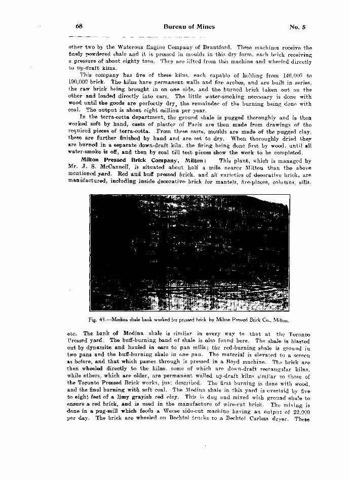
68 Bureau of Mines No. 5
other two by the Waterous Engine Company of Brantford. These machines receive the finely powdered shale and it is pressed in moulds in this dry form, each brick receiving a pressure of about eighty tons. They are lifted from this machine and wheeled directly to up-draft kilns.
This company has five of these kilns, each capable of holding from 146,000 to 190,000 brick. 'The kilns have permanent walls and fire arches, and are built in series, the raw brick being brought in on one side, and the burned brick taken out on the other and loaded directly into cars. The little water-smoking necessary is done with wood until the goods are perfectly dry ) the remainder of the burning being done with coal. The output is about eight million per year.
In the terra-cotta department, the ground shale is pugged thoroughly and is then worked soft by hand, casts of plaster of Paris are then made from drawings of the required pieces of terra-cotta. From these casts, moulds are made of the pugged clay, these are further finished by hand and are set to dry. When thoroughly dried they are burned in a separate down-draft kiln, the firing being done first by wood, until all water-smoke is off, and then by coal till test pieces show the work to be completed.
Milton Pressed Brick Company, Milton : This plant, which is managed by Mr. J. S. McCannell, is situated about half a mile nearer Milton than the above mentioned yard. Eed and buff pressed brick, and all varieties of decorative brick, are manufactured, including inside decorative brick for mantels, fire-places, columns, sills.
Fig. 43.—Medina shale bank worked for pressed brick by Milton Pressed Brick Co., Milton.
etc. The bank of Medina shale is similar in every way to that at the Toronto Pressed yard. The buff-burning band of shale is also found here. The shale is blasted out by dynamite and hauled in oars to pan mills; the red-burning shale is ground in two pans and the buff-burning shale in one pan. The material is elevated to a screen as before, and that which passes through is pressed in a Boyd machine. The brick are then wheeled directly to the kilns, some of which are down-draft rectangular kilns, while others, which are older, are permanent walled up-draft kilns similar to those of the Toronto Pressed Brick works, just described. The first burning is done with wood, and the final burning with soft coal. The Medina shale in this yard is overlaid by five to eight feet of a limy grayish red clay. This is dug and mixed with ground shale to ensure a red brick, and is used in the manufacture of wire-cut brick. The mixino- is done in a pug-mill which feeds a Weese side-cut machine having an output of 22,000 per day. The brick are wheeled on Bechtel trucks to a Bechtel Carless dryer. These

06 Clay and the Clay Industry of Ontario 69
brick are made for inside walls only, and the output of them is about 2,000,000 pear season. The pressed brick plant is run winter and summer, and has an output of one million brick per month. These are sorted into four grades, and are shipped carefully packed in straw. The burning is done in nine kilns and the output keeps a staff of fifteen men continually loading cars, which are placed alongside the kilns.
Fig. 44.—Milton Pressed Brick Go's plant, Milton.
HastingsM. Lingham, Belleville, has three feet of Red-top clay which he uses in the
manufacture of red stock brick. Below this is the typical Erie blue clay, but it is not used: the Red-top clay is wheeled to a Martin machine run by horse-power, making fire brick at a time; these are hacked out in the ordinary way to dry, and are then burned with wood in open-shed scoved kilns. The. output of this yard is about five hundred thousand per season.P*?I E. Naylor, Stirling, has about three feet of Red-top clay underlaid by the Erie blue clay. The upper clay is used in the manufacture of red stock brick which are made in a Martin machine operated by horse-power. The brick are dried in open hacks, and are burned with wood in open-shed scoved kilns. The output of this yard is about five hundred thousand per season.
J. Hill, Madoc, has about two and one-half feet of Red-top clay which is made into red stock brick by the old hand-moulding process. The brick are made in small moulds, on-e at a time; the clay is mixed by horse-power and two men mould the worked clay by hand. The brick are then hacked out in the ordinary way to dry, and are burned with wood in open-shed scoved kilns. The output for the season is about three hundred thousand.
70 Bureau of Mines No. 5
Fargey and Rollins, Tweed: This is the only yard operated at Tweed, those formerly run by Messrs. Lawrence and Countryman having been bought out by this firm. They have about two and one-half feet of Bed-top clay lying on blue Erie clay. The Red-top clay only is used for the manufacture of red stock brick and red tile. The brick are made in a Martin and also an Iron Quaker machine, while the tile are made in a Kells machine. The brick are dried in the rack and pallet system, and the tile in open sheds. Both are burned in round down-draft kilns, one permanent up-draft kiln, and in some cases open-shed scoved kilns are used. The burning is done with wood and a good grade of brick and tile is made. The clay being practicall}7 free from stones has very little lime in it. and the bricks are seldom burst after burning, as s^ many of the brick in this part of the country usually are. The output of brick is about five hundred thousand, and of tile about sixty thousand per season.
HuronFrazer and Logan, Blyth: The Erie blue clay here is overlaid by a mixture of
sand and sandy clay. The latter is made into white brick, but the chief output of this yard is in white tile from two and one-half to ten inches in diameter. The clay is dug and hauled by car to a pair of rolls feeding a Kells machine. The tile are cut off by hand aod stood in open sheds to dry. The burning is done in three round down-draft kilns, the pockets are built each time of green brick, but the rest of the kiln is usually filled with tile. The water-smoking is done with wood, the remainder of the burning with soft coal. The blue clay here, as in many other yards in the Province, contains small pebbles of limestone. These are often spoken of by brick men as "ginger" probably because when the brick or tile are burned the little white pieces of lime resemble pieces of ginger root, and are, as brick men know, the cause of the brick or tile scaling or even bursting open. Although crushed in rolls, they still cause trouble, for instead of one big piece- there are a great number of small ones. To obviate these bad effects, this firm throws in two or three shovelfuls of common salt, a little at a time, with the last three or four fires before cooling down ; this kills the lime and thus prevents it doing any harm. The objection will probably be raised that it will glaze the tile, but this is not so, as the temperature reached in the kiln is not sufficient for this purpose. The tile turned out by this firm are smooth, strong and practically free from cracks and scales.
A. Wettlaufer, Blyth : While Messrs. Frazer and Logan are chiefly engaged in making tile, Mr. Wettlaufer manufactures only brick. The blue Erie clay is carted to a Martin machine making white stock brick. These are dumped on pallets and hncktd out in the ordinary way to dry. They are then burned by wood in open-shed scoved kilns. This yard is a small one, making only about five hundred thousand brick per year.
Cruse Brothers, Seaforth : This firm uses the Erie blue clay in the manufacture of white brick, tile, and three-spaced hollow block. The clay is hauled by cart and dumped to rolls feeding a Kells machine. Side-cut wire-cut brick are made and are cut off by hand. The die is lubricated to prevent the centre tjravef,ling faster than the outside, thus obviating the warping so commonly seen in side-cut brick. Brick, tile and block are all burned together in round down-draft kilns, wood being used for the water-smoking and for the preliminary heating up, and soft coal for the finishing. The output of this yard is about one-half million brick, seven to ten kilns of tile, two and one-half to twelve inches in diameter, and about four thousand three-spaced Fleck. The goods are all of excellent quality.
N.. McClarty, Benmiller, has about three feet of Red-top clay, underlaid by about twelve feet or more of Erie blue clay. He uses both kinds, the red for the manufacture of brick, and the white for the manufacture of tile, both of which are made with the Kells machine. About half a million end-cut wire-cut brick are made

1906 Clay and the Clay Industry of Ontario 71
from the Red-top clay per season, and about one hundred thousand white tile, varying from two and a half to eight inches in diameter. The brick are dried in hacks and the tile in open sheds and both are burned together in down-draft kilns. Mr. McClarty is making several changes to increase his output.
Eli Elliott, Wingham, works a bank of Erie blue clay, making only white brick. The clay is hauled by cart to a pug-mill which feeds a pair of heavy rolls on a Kells machine. The brick are side-cut wire-cut, and the centre is held back by three iron rods inside the die, the friction of the clay on these helps to equalize the friction of the clay against the sides of the die, and thus prevents the centre from travelling faster than the outside. The burning is done by wood in open-shed scoved kilns.
Crediton Yards. In the immediate vicinity of Crediton is one of the oldest brick•districts c f Ontario, there being no less than eight yards operated here at present, by the following : Fred. Kerr, George Hertzel, F. Hist, George Mantel, William Ander son, H. J. Kuhn, Russell Hedden, W m. Hist.
All of these yards turn out white brick, as all are manufacturing from the Erie blue clay. Two or three different methods of manufacture are used, and these will be described. Four of the yards use the "slop brick" method. The clay is dug and dumped from carts to a tempering box which is set beside a machine; in this box the clay is well mixed with water and allowed to stand over night. During the forenoon of the next day this soft clay is dug out, and put in a mixing box in which a horse- whim works to mix thoroughly. The soft*clay comes out of a hole in the bottom of the box, where it is picked up by one man in masses large enough for one brick and is dropped into a mould. Four moulds are arranged in one block; as soon as these have been filled they are carried off and dumped on a sanded yard, exposed to the sun and wind to dry. This work is continued for half the day, by which time the brick first made an the nwjlrning 'are hard enough to stand handling, when they can be piled in hacks to continue drying. Thus the brick that are made in the forenoon are picked up and hacked in the afternoon; the remainder of the process is the same as for any hack yard, that is, the brick are wheeled in and burned as usual in open-shed scoved kilns.
The other four yards were formerly slop brick yards, but are now operated chiefly for wire-cut brick. Mr. Fred Kerr manufactures both brick and tile. About seven hundred thousand brick and about sixteen kilns of tile varying from three to twelve inches in diameter represent his yearly output. Ho uses a Kells machine making both end-cut and side-cut brick, the side-cut brick are perforated with thirteen•small holes, made by that number of rods set inside the die for the purpose of holding the centre of the clay back in order that the brick will not warp m drying. This number of holes, each about as large as a leadpencil, scattered over the broad surface of the brick, aids the drying and the burning, gives a better hold for mortar and does not weaken the brick, as does the three larger holes so often used in side-cut brick. Brick having three large holes aro weak across the centre hole, whereas the thirteen smaller holes do not weaken the brick to any appreciable extent. The tile are burned in two down-draft kilns, and the brick in open-shed scoved kilns. Mr. H. J. Kuhn manufactures brick and tile also. His output of brick is about one hundred thousand per season of both end-cut and side-cut brick. His side-cut brick are perforated in the same way as are Mr. Kerr's, that is, with the thirteen holes. Mr. Kuhn's chief product is tile, of which he makes about four hundred thousand per year, ranging from three to twelve inches in diameter. His tile are perfectly even and smooth, and show that he has this branch of the trade in excellent shape. Mr. Russell Heddon's yard is used chiefly in the manufacture of white brick, both end-cut and side-cut. The side-cut brick are perforated here as usual. He has the largest output of brick in this locality, being about twenty thousand per day. They are all wire-cut and made with a Kells machine. They are dried in open hacks and burned with wood in open- shed scoved kilns.
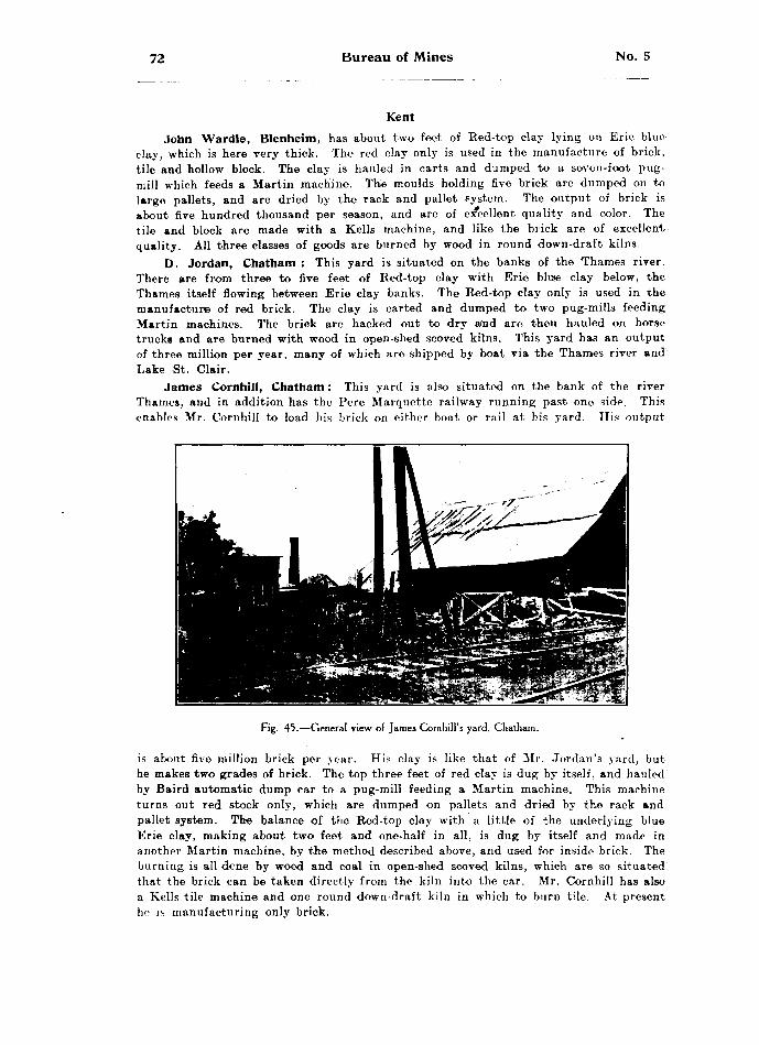
72 Bureau of Mines No. 5
KentJohn Wardle, Blenheim, has about two feet of Red-top clay lying on Erie blue
clay, which is here very thick. The red clay only is used in the manufacture of brick, tile and hollow block. The clay is hauled in carts and dumped to a s&ven-foot pug- mill which feeds a Martin machine. The moulds holding five brick are dumped on to large pallets, and are dried by the rack and pallet system. The output of brick is about five hundred thousand per season, and are of excellent quality and color. The tile and block are made with a Kells machine, and like the brick are of excellent quality. All three classes of goods are burned by wood in round down-draft kilns.
D. Jordan, Chatham : This yard is situated on the banks of the Thames river. There are from three to five feet of Red-top clay with Erie bluie clay below, the Thames itself flowing between Erie clay banks. The Red-top clay only is used in the manufacture of red brick. The clay is carted and dumped to two pug-mills feeding Martin machines. The brick are hacked out to dry and are then hauled on horse trucks and are burned with wood in open-shed scoved kilns. This yard has an output of three million per year, many of which are shipped by boat via the Thames river and Lake St. Clair.
James Cornhill, Chatham: This yard is also situated on the bank of the river Thames, and in addition has the Pere Marquette railway running past one side. This enables Mr. Cornhill to load his brick on either boat or rail at his yard. His output
Fig. 45.—General view of James Cornhill's yard, Chatham.
is about five million brick per yoar. His clay is like that of Mr. Jordan's yard, but he makes two grades of brick. The top three feet of red clay is dug by itself, and hauled by Baird automatic dump car to a pug-mill feeding a Martin machine. This machine turns out red stock only, which are dumped on pallets and dried by the rack and pallet system. The balance of the Red-top clay with a little of the underlying blue Erie clay, making about two feet and one-half in all, is dug by itself and made in another Martin machine, by the method described above, and used for inside brick. The burning is all dene by wood and coal in open-shed scoved kilns, which are so situated that the brick can be taken directly from the kiln into the car. Mr. Cornhill has also a Kells tile machine and one round down-draft kiln in which to burn tile. At present he is manufacturing only brick.
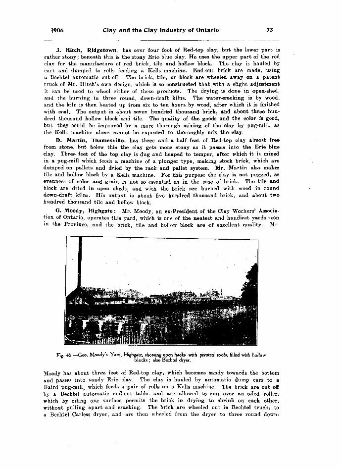
1906 Clay and the Clay Industry of Ontario 73
J. Hitch, Ridgetown, has over four feet of Red-top clay, but the lower part is rather stony; beneath this is the stony Erie blue clay. He uses the upper part of the red clay for the manufacture of red brick, tile and hollow block. The clay is hauled by cart and dumped to rolls feeding a Kells machine. End-cut brick are made, using a Bechtel automatic cut-off. The brick, tile, or block are wheeled away on a patent truck of Mr. Hitch's own design, which is so constructed that with a slight adjustment it can be used to wheel either of these products. The drying is done in open-shed, and the burning in three round, down-draft kilns. The water-nsmoking is by wood, and the kiln is then heated up from six to ten hours by wood, after which it is finished with coal. The output is about seven hundred thousand brick, and about three hun dred thousand hollow block and tile. The quality of the goods and the color is good, but they could be improved by a more thorough mixing of the clay by pug-mill, as the Kells machine alone cannot be expected to thoroughly mix the clay.
D. Martin, Thamesville, has three and a half feet of Red-top clay almost free from stone, but below this the clay gets more stony as it passes into the Erie blue clay. Three feet of the top clay is dug and heaped to temper, after which it is mixed in a pug-mill which feeds a machine of a plunger type, making stock brick, which are dumped on pallets and dried by the rack and pallet system. Mr. Martin also makes tile and hollow block by a Kells machine. For this purpose the clay is not pugged, as evenness of color and grain is not so essential as in the case of brick. The tile and block are dried in open sheds, and with the brick are burned with wood in round down-draft kilns. His output is about five hundred thousand brick, and about two hundred thousand tile and hollow block.
Q. Moody, Highgate : Mr. Moody, an ex-President of the Clay Workers' Associa tion of Ontario, operates this yard, which is one of the neatest and handiest yards seen in the Province, and the brick, tile and hollow block are of excellent quality. Mi-
Fig. 46.—Geo. Moody's Yard, Highgate, showing open hacks with pivoted roofs, filled with hollowblocks ; also Bechtel dryer.
Moody has about thre'e feet of Red-top clay, which becomes sandy towards the bottom and passes into sandy Erie clay. The clay is hauled by automatic dump cars to a Baird pug-mill, which feeds a pair of rolls on a Kells machine. The brick are cut off by a Bechtel automatic end-cut table, and are allowed to run over an oiled roller, which by oiling one surface permits the brick in drying to shrink on each other, without pulling apart and cracking. The brick are wheeled out in Bechtel trucks to a Beehtel Carless dryer, and are then wheeled from the dryer to three round down-
74 Bureau of Mines No. 5
draft kilns. The water-smoking and six hours of burning are done with wood, after which soft coal is used. For tile and hollow block a Kells machine is used in the ordinary way. The walks throughout this yard to the kilns, etc., are granolithic. In fact. Mr. Moody's yard is one of the most up-to-date in the Province.
LambtonMartin and Company, Alvinston : The clay in this yard is an Erie blue clay,
sandy in the upper part. Lower down the clay is much stronger, and practically free from sand. Above the Erie clay is about six feet of fine gravel; this is taken away by the public for road metal and building purposes. The sandy blue clay is used for the manufacture of white sand stock brick, about five hundred thousand of which are made per season. The stronger blue clay is used for the manufacture of tile, which are of good color and very strong, about two hundred thousand being made per season. The Erie blue clay extends continuously down to shale, which has the follow ing composition :
Per cent. Silica .................................................................................... 66.82Alumina ............................................................................... 11.68Ferric Oxide ........................................................................ 6.58Lime .................................................................................... .62Magnesia .............................................................................. .90Soda .................................................................................... .38Potash .................................................................................. 2.58Loss by Ignition .................................................................. 10.59
F. Hewlett, Petrolia, has from two to six feet of Red-top clay lying in a hollow w h ifh accounts for the great depth of red clay here, as it has been concentrated from the surrounding hills. Mr. Hewlett's former brick plant is now a pumping station for a series of oil wells. In his new yard are several wells in operation. He makes red stock brick, using a Quaker machine, and also red wire-cut brick and red tile with a Kells machine. His burning is done by wood in two round down-draft kilns, the output being about three hundred thousand brick and about two hundred thousand tile per season.
H. Hales, Brigden: Mr. Hales has been making brick for about forty years, and has been largely responsible for some of the best methods of brick-making and burning now in use in Canada. He has about five feet of Red-top clay lying on Erie blue clay, which he has found to be 117 feet deep here. These two clays are situated on a high hill, past the foot of which flows a river with a broad low flat for its other bank. On this flat is an excellent deposit of red alluvial clay, which is used for the manufacture of red brick. They are made in a Quaker machine with a pug-mill attached for mixing. The brick are hacked out in the ordinary way. and are burned with wood and coal in an up-draft kiln. The brick are of a deep red color, and of an excellent quality. Leading from the top of the hill across tb-e river to the low flat on the opposite side is a tramway up which Mr. Hales hauls the alluvial clay by Baird cars to a pug-mill which feeds a Kells machine and uses it to make tile, varying from three to fourteen inches in diameter. Mr. Hales uses a very ingenious device for trans ferring his tile to the upper story of an adjoining building; on a broad belt which turns about four-foot pulleys, he ha? nailed shingles, with the thick ends together, so as to form a horizontal set of steps on the belt. As this belt slowly turns be sets a tile on end on each step, it is thereby elevated and carried to the adjoining building, thus obviating the lifting of the tile or wheeling them up by hand. Mr. Hales burns p round down-draft kiln, and in a rectangular down-draft kiln. These were built many years ago by Mr. Hales from his own plans, and the round one is in reality the same as the Cornell patent kiln, which has become so popular. Previous to building his ree-

1906 Clay and the Clay Industry of Ontario 75
tanguiar kiln. Mr. Hales built a very small kiln which would hold about five thousand brick, and strange to say this experimental kiln is almost identically like the latest patent kiln: finding that the small one worked perfectly, he built the large rectangular kiln which is still in use in his yard, and this kiln is in almost every particular iden tical with the Stewart kiln. This yard is filled with small labor-saving devices, and with appliances for improving the quality of the goods or increasing the output.
A. Elliott, Thedford, has about eight to twenty feet of Erie blue clay, under laid by a blue Devonian shale, both of which have been cut and exposed by a small stream known as Decker creek. At a point where the blue clay was shallow, being not over eight feet deep ? the Devonian shale was bared (see fig. 5), the high water of the creek in spring time performing a great deal or the work itself. At the contact of the Erie clay with the shale are many boulders, showing the lower part of the Erie clay to be a typical boulder clay. This Devonian shale is ploughed about six inches deep in the early spring and allowed to slake, and is then carted to a pair of rolls feeding a Kells machine. These rolls are necessary because the shale is filled with concretion ary nodules and abundant Devonian corals, for example:—Zaphrentis, Cystiphyllum. Heliophyllum, Favosites, Crinoidea, and Spirifera mucronata. and many others. As the clay slakes these are found in abundance scattered through it. In addition to these are many small pieces of selenite, that is, calcium sulphate, the presence of which would hurt the clay for brick by causing an efflorescence, or white coating often called "'soda," which appears on the brick after they are burned. The following is an analysis of this shale: —
Per cent. Silica .................................................................................... 54.96Alumina ...................... ....................................................... 19.15Ferrie Oxide ........................................................................ 6.68Lime .................................................................................... 4.02Potash .................................................................................. 3.47Sulphur Trioxide .................................................................. .93Loss by Ignition .................................................................. 8.48
It will be seen from, this analysis that the percentage of sulphur trioxide is very high as compared with other clays and this feature would be very objectional in brick. It can, of course, be overcome by the addition of a barium salt which would form barium sulphate, this compound not being soluble would not discolor the brick.
This clay is particuarly suited to the manufacture of tile and it is for this purpose that Mr. Elliott uses it. The tile are of excellent quality, being; hard, even in grain, and very strong. The green tile can be stood in the rain without suffering any damage. This clay was used in the Toronto Exhibition for the manu facture of tile by H. C. Baird A Co. of Parkhill, in one of their Kells machines, when a tile twelve feet long was made and shoved along a board without cracking, thereby showing the tensile strength of this clay. The tile are burned to a beautiful dark red color in six days, the burning being done with wood in round down-draft kilns.
LanarkQ. A. Burgess, Carleton Place, has from three to eight feet of Leda clay, of
which he uses only the upper three to four feet, that below being too wet. The clay is dug and mixed with sand as it is loaded to a car, hauled by horse to a Quaker machine making five brick at a time. These are dumped on a pallet and set in racks on cars which are run down the hack yards. The brick are then dried by the rack and pallet system, after which they are piled on cars three hundred to a load, and are run to the kiln yard, where they are burned with wood in open-shed scoved kilns. The burning is splendidly done, even the arch brick being easily saleable. The output

76 Bureau of Mines No. 5
of this yard is fourteen thousand per day, and the power used is a 16-h.p. gasoline engine, which for this quantity of brick uses SI.15 worth of gasoline per day, and has the additional advantage that having been once started it needs little or no further attention.
Robert Scott, Perth, has from three to five feet of Red-top clay, in places quite stony. This overlies Erie blue clay, which is also stony. The red clay is used for the manufacture of red stock brick in a Martin machine, using horse power. The brick are hacked out in the old way, but Mr. Scott contemplates an early change to the rack and pallet system. The blue Erie clay is used for the manufacture of white stock brick, which are the finest brick of this class seen in the Province. This per fection is reached by washing the clay, the only way to get rid of the limestones and other pebbles so commonly found in Erie clay. This is a very common process in England in the manufacture of brick. A circular pit about twenty feet in diameter and probably three feet deep is lined with wood, brick or cement; at some point in the circumference about one foot and one-half from the top is a small gate which can be opened or closed at will. In this pit is a horse-whim pivoted at the centre, the beam reaching over the edge of the pit so that the horse can turn the whim. Suspended from the beam on either side from the centre is a wooden frame set with teeth much resembling those of a harrow. The stony clay is dug and dumped into this pit, water is then run in until the whole mass is semi-liquid, and the horse is started. In travelling round and round these drags agitate the whole mass, all stones, hard lumps, etc., sink to the bottom of the pit; the gate is then opened, and the upper slimes are run off. They can be deposited on level ground where they will naturally drain themselves and can be worked afterwards like an ordinary clay deposit. Mr. Scott does this work in the fall of the year when brick-making has ceased, and thus has a deposit of clay ready for the next season's work. Contractors are ready and willing to pay for a better quality of brick, provided they know they can be supplied with a uniform grade, and Mr. Scott has no trouble getting one dollar and a quarter per thousand more for this grade of white brick than he or others in the section can get for red brick, or white made from unwashed clay. The washing can be done for 35 to 50 cents per thousand.
M. Ryan, Smith's Falls: Situated on the bank of the Rideau canal, Mr. Ryan can work about five feet of Red-top clay down to water level. Below this is Erie blue clay as usual, and some of this was formerly used for the manufacture of white brick, but now the Red-top clay only is employed. This is collected by wheeled scrapers and dumped on a mixing floor. The necessary amount of sand is added for tempering, when the clay is dumped in a hopper and carried by an endless chain conveyor to the top of the mill, and dropped into a pair of rolls which feed a Baird pug-mill that in turn feeds a Martin machine. The brick are then dumped on pallets and dried by the rack and pallet system. The moulding sand is mixed with red oxide of iron which improves the color and aids the "shifting;" this costs about two and a half cents per thousand, but has the disadvantage that in handling after burning some of the red oxide rubs off, thereby making the contrast in color more noticeable. The brick are burned with wood in open-shed scoved kilns, and the output is about one million per season. The power used on this yard is electricity, and gives excellent satisfaction, as it can be started or stopped on a moment's notice, and when once started needs no further attention.
LeedsR. J. Wilson, Gananoque, has from two to four feet of Red-top clay, which is
very strong and practically free from stone. This is wheeled to two tempering pits, each capable of holding a day's run, thus while one is being emptied the other is being filled and allowed to slake and temper, the required amount of sand being added for this purpose. Water is then added, and the mass is allowed to soak over night.
1906 Clay and the Clay Industry of Ontario 77
From these pits the clay is wheeled to a Quaker machine making five brick at a time ; these are dumped on pallets and dried by the rack and pallet system. The burning is done with wood in open-shed scoved kilns. Mr. Wilson is contemplating the use of round down-draft kilns next season. He uses a fifteen h.p. gasoline engine, which makes nine thousand brick per day and requires only five gallons of gasoline.
W. H. Wood, Brockville, has from three to five feet of Red-top clay overlying the Erie blue clay as usual, but the latter is not used. The Red-top clay only is used in the manufacture of red stock brick. The clay is carted to a pug-mill, which feeds a Quaker six-brick machine. The brick are dried by the rack and pallet system, and are burned in open-shed scoved kilns with wood as fuel. Mr. Wood also uses red oxide of iron in his moulding sand to improve the color and aid the shifting. He has also a Kells machine, and will add tile and twire-cut brick to his output.
LennoxGeo. Whittington, Napanee : This yard is located in a hollow or gorge below
a limestone ridge, and has a very fine deposit of clay. In addition to the ordinary Red-top clay resulting from the weathering of the underlying Erie, there is here an additional concentration of clay from the higher ground, which increases the layer of red-burning clay until with the little sand it contains it is nine feet deep. This admixture of sand makes the clay most desirable for stock brick, and since it is the result of washing from higher ground, it is practically free from stone. The clay is dug and dumped directly into a Martin machine run by horse power; the brick are dried by the rack and pallet system and are of excellent quality. Mr. Whittington has also a Kells machine run by steam power, and makes red tile from the stronger bands of the red clay. The brick and tile are both burned in round down-draft kilns of a large size, being six feet high and twenty-five feet across, inside measurement. The burning is done with wood, and the season's output is about five hundred thousand
LincolnJ. M. Carter, St. Catharines, has about two feet of Red-top clay underlaid by
the usual blue Erie clay. The Red-top clay is made into red stock brick with a Martin machine. The brick are dried by the rack and pallet system and burned in open-shed scoveci kilns with wood at first, and finished with coal. The underlying Erie clay is manufactured into white tile. The clay is allowed to dry in the sun, and is then dumped inta a Bechtel disintegrator which pulverizes the clay and throws out all stones larger than a pea. The product of the disintegrator passes through a pair of rolls feeding a Kells machine. This pulverizes all the smaller stones. The Bechtel auto matic cut-off is used for end-cut brick and a hand cut-off for tile. The brick are wheeled out by the Bechtel trucking system to open sheds, and when dried are burned in open-shed scoved kilns. The water-smoking and first heating is done with wood, and the remainder with soft coal. The output for the season is about one million and a half.
Watt and Smith, Attercliffe : The clay in this yard is somewhat stony; but the upper two feet of Red-top clay is more or less free from stone, and is dug and piled in heaps and allowed ta slake, when it is fed to rolls which in turn feed a Monarch six-brick machine. The brick are dried by the rack and pallet system, and are burned with natural gas in open-shed scoved kilns. This company was burned out this spring and this accounts for the very simple plant they are now operating. Previous to the fire they had a very complete plant, the clay being dug, pulverized with a pair of rolls which fed a Monarch machine. The brick were trucked by the Bechtel system to driers using a forced draft, which was heated by natural gas, the output at that time being about two million per year. The plant which they are now operating will shortly be improved. This firm has three flowing gas wells in its yaifl, and these are

78 Bureau of Mines No. 5
used in all parts of the yard requiring heat. The power for example, is got from a steam engine, the boiler of which is heated by gas. A pipe leads beneath the boiler, the jet is lighted in the morning and once steam is up, the taps can be so adjusted as to require practically no attention for the remainder of the day. In burning the brick, an ordinary sooved kiln is built, in every way similar to those ordinarily built for wood or coal. Into either end of each arch an inch pipe leads; this extends not more than a foot. The doors -ire closed up, with the exception of a draft of about an inch around the pipe; the quantity of gas can then be regulated by taps just outside the doors. The brick are very uniform in color, and are of an excellent quality; the arch brick cannot be told from any of the others, all being alike in hardness and color. This is a very unique yard.
Fig. 47.— Plant of Beamsville Brick and Terra Cotta Co., Beamsville.
George Grain, Beamsville, operates the Beamsville Brick and Terra Cotta Com pany, which manufactures red pressed brick, and buff pressed brick, all sorts of fancy ornamental brick, and side-cut wire-cut brick for inside walls. The red Medina shale which outcrops here is used in the manufacture of these goods. The more or less decomposed surface shale is ploughed up, and allowed to slake further. This shale has the following composition : —

1906 Clay and the Clay Industry of Ontario 79
Per cent.Silica ................................................................................... 55.90Alumina ............................................................................... 18.46Ferrie oxide ........................................................................ 6.60Lime .................................................................................... 3.82Magnesia .............................................................................. 2.65Soda .................................................................................... .53Potash ................................................................................. 3.55Sulphur trioxide .................................................................. .31Loss by ignition .................................................................. 8.74
The shale is fed to one pan mill, from which it is elevated and screened to a hopper, the over size returning to be ground again. From the hopper the ground shale feeds two Simpson dry presses. The burning is done in six down-draft kilns, two of which are round, and four rectangular. The preliminary burning is done with coke, and the remainder of the burning with soft coal. For the manufacture of the inside brick the ground shale is dumped to a pug-mill, which feeds a large auger machine of German manufacture, making side-cut brick. Thirteen brick are cut off at a time; these are then piled on steel cars (see fig. 33) four hundred and fifty to a load, and are run into long drying tunnels through which a draft of warm air is forced by a fan; the air is heated by passing through hot arches built of brick and heated with coal. At the end of twenty-four hours the dried brick on the same car are run out to the kilns, where they are water-smoked with coke, and finished with coalj. The burned brick, especially the pressed brick, are sorted into four grades and are shipped as such. The dry-press plant has a capacity of thirty thousand per day, and the wire-cut plant an output of twenty thousand; the quality of brick made by this company is excellent, and the yard very neat and tidy.
MiddlesexH. James, Delaware, manufactures white end-cut wire-cut brick and tile from
a fine bank of Erie blue clay. The clay is carted to a pair of rolls which feed a Baird pug-mill, which in turn feeds a Kells machine. A Bechtel automatic end-cut machine is used, and Bechtel trucks for wheeling out to open air-drying sheds. The tile are wheeled out and dried also in sheds. They are of excellent quality, and very smooth, hard and free from checks and cracks. The burning is done in two down-draft Stag kilns, rectangular in shape, the chimney being between the two and serving for both. The burning is done with wood.
James Richardson and Son, Kerwood, manufacture white brick and tile from the Erie blue clay. The clay is hauled by car and cable to a pug-mill feeding a Martin machine!. The brick are wheeled out and dried in open sheds, and are then burned in large up-draft permanent-walled kilns. These are covered by a long kiln shed, along one side of which is the wagon road, and along the opposite side the railway siding, so that the brick can be loaded from the kilns right into the car. A separate plant is used for the manufacture of tile, which are made in a Kells machine producing all sizes from three to nine inch. These are cut off by hand, and elevated by an endless chain elevator to an upper floor where they are lifted off and wheeled away to dry. They are burned by themselves in a round up-draft kiln, using wood for fuel. The output of brick from this yard is about one million, and of tile about three hundred thousand.
C. Q. Frank and Sons, Strathroy, manufacture end-cut wire-cut brick only from the Erie blue clay. The clay is dug and carted directly from the pit to a pair of rolls feeding a Kells machine. A Bechtel automatic end-cut cut-off table is used, and the brick are trucked by the Bechtel system to open sheds and hacks to dry. They are then burned in open-shed scoved kilns using wood for the water-smoking and first burning, and coal afterwards to finish. The output of this yard is about eight hundred thousand per season.
80 Bureau of Mines No. 5
H. C. Baird and Son, Parkhill : This firm manufactures brick machinery, including pug-mills, rolls, Quaker brick machines, Kells tile and brick machines, automatic dump-cars, etc., and also takes the contract for building the Cornell patent down-draft kiln, in fact for fully equipping a brick yard. In addition to manufactur ing brick machinery, Mr. Baird operates a brick yard, where all these machines can be seen at work. He has two i'eet of Red-top clay underlaid by sandy blue Erie clay, followed by a strong blue Erie clay. The upper sandy part is worked into stock brick; this is dug, hauled by Baird cars to two pug-mills which mix thoroughly. From this it feeds to an iron Quaker machine. The brick when dried are burned in two round down-draft Cornell kilns, the output being about one-half a million white brick per season. The stronger under Erie clay is hauled by car and used in the manufacture of white tile, hollow block and wire-cut brick. This clay, which is somewhat stony, is put through a pair of rolls feeding a Kells No. l machine. Tile are made from three to twelve inches in diameter, hollow block of one- and three-spaced patterns, also end-cut wire-cut brick. These are burned in round down-draft Cornell kilns. The output of this yard is not large, Mr. Baird's idea being to supply the local market only, and to have a place where the working qualities of his machinery can be shown'. A glance over the yards of the Province will show the popularity of Mr. Baird's machinery, especially the pug-mills, and Kells tile and brick machines.
J. W. Cawrse, Walker and Logan, John McLaughlin, Waide Bros., Warwick and Son, London Brick Manufacturing and Supply Company, London.
The clay in use at these London yards is somewhat different from that found in the other yards of western Ontario. It here seems to be a local collection of more recent age than the Erie, as it is found on the surface overlying the true Erie clay be low, as shown by borings and wells (see fig. 22). The area is possibly an expansion of the old Thames drainage basin; at any rate the clay is here inter-stratified with bands of sand, sandy clay, and blue quick sand; in some cases, even gravel bands arei found. For example at Waide Bros.' yard the following section is shown: —
Gravel (stratified) ............................................................... 6 feetStrong reddish clay ............................................................ 3 feetSand ................................................................................... 3 feetSandy clay .......................................................................... 4 feetStrong blue clay .................................................................. l footQuicksand ........................................................................... l footBlue clay ...................................r .....................................
From the above section it will be seen that this is an entirely different clay from those met in other parts of the Province, and is purely a local accumulation. The gravel is cleaned from the top of the clay and carted away for road metal. This not only exposes the clay but is a source of revenue to the owners of the yards, as they receive 10 cents a load for the giavel. The ten feet of clay, sand, etc., down to the quicksand is wedged off and thoroughly mixed, with the result that an excellent quality of white brick is turned out by all these yards. The general method of manufacture is about the same for all of them; two or three: examples will suffice.
The London Brick Manufacturing and Supply Co. has a very fine new plant, turning out thirty thousand brick per clay, or about three million for the season. The section of clay is dug as described above, hauled in dump cars and dumped into a Raymond machine. This is an American machine which resembles the Monarch made by Baird and Son of Parkhill. It is a very powerful machine with a good pug-mill attachment, and makes six brick at a time. These brick are dumped on pallets which are piled on cars carrying three hundred and thirty brick at a load. These cars are run into long tunnels, through which a blast of hot air is forced by a fan. The cars all enter at one end of the tunnels, which is also the cooler end, so that the green
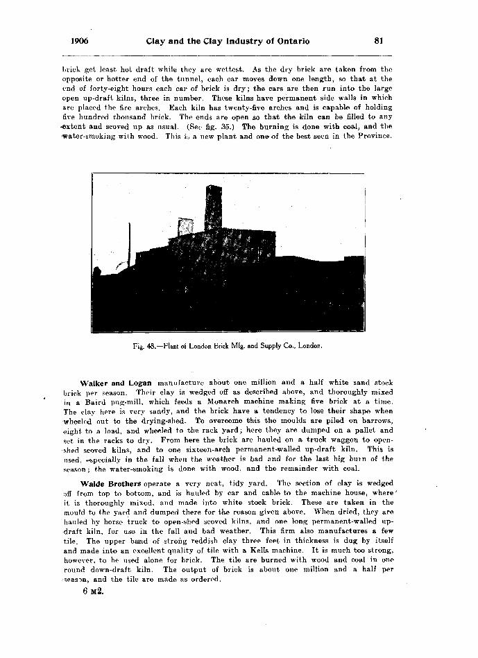
1906 Clay and the Clay Industry of Ontario 81
brick get least hot draft while they are wettest. As the dry brick are taken from the opposite or hotter end of the tunnel, each car moves down one length, so that at the end of forty-eight hours each car of brick is dry; the cars are then run into the large open up-draft kilns, three in number. These kilns have permanent side walls in which are placed the fire arches. Each kiln has twenty-five arches and is capable of holding five hundred thousand brick. The ends are open so that the kiln can be filled to any
•extent and scoved up as usual. (Sec, fig. 35.) The burning is done with coal, and the 'water-smoking with wood. This ic a new plant and one of the best seen in the Province.
Fig. 48.— Plant of London Brick Mfg. and Supply Co., London.
Walker and Logan manufacture about one million and a half white sand stock brick per season. Their clay is wedged off as described above, and thoroughly mixed in a Baird pug-mill, which feeds a Monarch machine making five brick at a time. The clay here is very sandy, and the brick have a tendency to lose their shape when -wheeled out to the drying-shed. To overcome this the moulds are piled on barrows, eight to a load, and wheeled to the rack yard ; here they are dumped on a pallet and set in the racks to dry. From here the brick are hauled on a truck waggon to open- shed scoved kilns, and to one sixteen-arch permanent-walled up-draft kiln. This is used, ^specially in the fall when the weather is bad and for the last big burn of the season; the water-smoking is done with wood, and the remainder with coal.
Waide Brothers operate a very neat, tidy yard. The section of clay is wedged off from top to bottom, and is hauled by car and cable to the machine house, where it is thoroughly mixed, and made into white stock brick. These are taken in the mould to the yard and dumped there for the reason given above. When dried, they are hauled by horse truck to open-shed scoved kilns, and one long permanent-walled up- draft kiln, for use in the fall and bad weather. This firm also manufactures a few tile. The upper batnd of strong reddish clay three feet in thickness is dug by itself and made into an excellent quality of tile with a Kells machine. It is much too strong, however, to be used alone for brick. The tile are burned with wood and coal in one round down-draft kiln. The output of brick is about one million and a half per season, and the tile are made as ordered.
6M2.
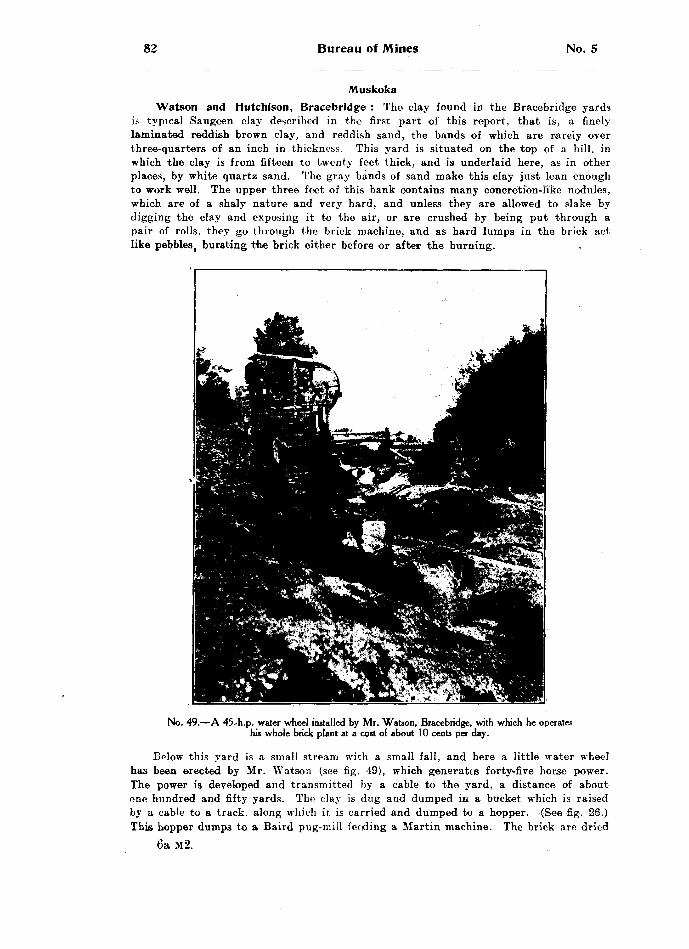
82 Bureau of Mines No. 5
MuskokaWatson and Hutchison, Bracebridge : The clay found in the Bracebridge yards
is typical Saugeen clay described in the first part of this report, that is, a finely laminated reddish brown clay, and reddish sand, the bands of which are rarely over three-quarters of an inch in thickness. This yard is situated on the top of a hill, in which the clay is from fifteen to twenty feet thick, and is underlaid here, as in other places, by white quartz sand. The gray bands of sand make this clay just lean enough to work well. The upper three feet of this bank contains many concretion-Ifke nodules, which are of a shaly nature and very hard, and unless they are allowed to slake by digging the clay and exposing it to the air, or are crushed by being put through a pair of rolls, they go through the brick machine, and as hard lumps in the brick act like pebbles, bursting t'he brick either before or after the burning.
No. 49.—A 45-h.p. water wheel installed by Mr. Watson, Bracebridge, with which he operates his whole brick plant at a cost of about 10 cents per day.
Below this yard is a small stream with a small fall, and here a little water wheel has been erected by Mr. Watson (see fig. 49), which generates forty-five horse power. The power is developed and transmitted by a cable to the yard, a distance of about one hundred and fifty yards. The clay is dug and dumped in a bucket which is raised by a cable to a track, along which it is carried and dumped to a hopper. (See fig. 26.) This hopper dumps to a Baird pug-mill feeding a Martin machine. The brick are dried
6a M-2.

1906 Clay and the Clay Industry of Ontario 83
by the rack and pallet system, and are burned with wood in a permanent-walled up- draft kiln, and in open-shed scored kilns. A new Kells tile machine has lately been installed for the manufacture of tile, hollow block, and wire-cut brick. These will be burned in round down-draft kilns now in course of erection. The plant as a whole is one of the neatest amd most economically run in the Province; for example, the power necessary to manufacture thirteen thousand brick per day has been calculated, and found to cost less than ten cents per day. This plant is a comparatively new one, but with the cheap power and the fine deposit of Saugeen clay should have a bright future. The main difficulty to be overcome is the crushing of these nodular pieces mentioned above. This can be done either by slaking, which is a slow process, or better still, by rolls.
Bracebridge Brick Company, Bracebridge : This yard is also situated on Sau geen clay in every way like that at Watson and Hutchison's yard. The clay is finely laminated with grayish sand, and in places reaches a depth of twenty-two feet. Below this is white quartz sand, which has been found in so many places underlying the Saugeen clay. The surface is ploughed and is left to slake, after which it is mixed with a little more sand and is heaped close to the machine. The clay is then worked in an Iron Quaker machine making six brick at a time;; these are dried with the rack and pallet system, and are burned in open-shed scoved kilns. This clay also con tains many of the objectionable concretion-like nodules. The brick made in th ; s yard are of good quality, and1 the output is about seven hundred thousand per season.
NipissingWallace and Son, North Bay : Saugeen clay occurs at this yard in a bank
varying from three to ten feet in depth, and rests immediately on the polished granite surfaces of the old Laurentian formation. Most of the country about North Bay is bare and rocky, with the hollows usually filled by sand, gravel, and occasionally Sau geen clay. It is one of these hollows, with a variable depth of Saugeen clay, over laid in places by a foot or two of red sand, that is worked for a brick-yard. Such hollows are comparatively rare, and especially hollows with clay sufficiently clean and free from over-burden of sand and gravel. The underlying layer of Erie clay usualty found in other parts of the Province is entirely wanting here.
The clay is dug to a heap and allowed to slake, when it is wheeled to a Martin machine run by horse-power. The brick are dried in open hacks and burned with wood in open-shed acoved kilns as usual. The output for a season is about 800 thous and, all red. These brick are of good quality, but burn a little light in color. Th,e analysis of this clay is No. 64 under Saugeen Clays, page 26 of this Report.
Standard Clay Company, North Bay: In another hollow this company have started the manufacture of brick, and built a more modern plant. They have the usual section of Saugeen clay with sufficient sand to render the whole quite work able. This clay is dug and carted directly to a Hercules machine. The excellent, pug-mill attachment on this machine is of great service in thoroughly mixing the sand and clay. The brick are dumped on pallets and piled on steel cars, which are then run into tunnel dryers of the Sheldon and Sheldon type of Galt, Ontario. After drying for thirty-six hours, they are taken from thet opposite end of the tunnel and burned in open-shed scoved kilns with wood as the fuel. Red brick only are made, and the output for the season is about one million. This plant is a very modern one, and with the brisk demand which the influx of people to New Ontario is caus ing, it should have a very much increased output in the near future. It may be further added that there is very little clay near North Bay save that worked by theise two companies.
The Liskeard Brick, Coal and Lumber Company, New Liskeard: This is a new yard recently opened to supply the demand for brick in New Ontario, but the deposit is not uniform in character from top to bottom. The first six feet of typical interbanded

84 Bureau of Mines No. 5
Saugeen clay burns to a rich red color. The next four feet or so does not burn so rich a red, but rather a pinkish shade. Below this is a very blue laminated clay, free from stones, but containing considerable quicksand. This blue clay burns to a creamy white brfck All these clays are very strong, so much so that they are only worked with the greatest difficulty. The drying is especially difficult, and if the brick be exposed to direct heat or draught, the outside dries so much more rapidly than the inside that the brick break badly. This could be largely overcome by the addition of red sand to the red clay, and gray sand to the blue clay; but unfortun ately this sand is difficult to find. At present the cLay is dug and hauled by truck wagon to a pug-mill, which feeds a Doig machine, making five brick at a time. The brick are dumped on pallets end set in large racks in a covered shed, or really a dry kiln, since this clay will not stand wind or sun drying. The sheds are closed in and a series of coils, steam heated, is placed in the floor. A little steam is even liber ated into the tunnels at first, to prevent the outside of the brick drying too rapidly for the inside. The dried brick are burned with wood in open-shed scoved kilns.
In this yard there is also a Kells tile machine for the manufacture of tile, hollow block, and wire-cut brick. The wire-cut brick are trucked out by the Bechtel truck ing system to open shed-dryers, after which they are burned in the usual way in opeji-shed scoved kilns. The output for this yard is expected to be about a million brick per seasjon. They will make both red and white brick, and both sand stock and wire-cut brick. The yard is not in full running order, however, as yet. The analysis of this blue clay at the base of the Saugeen proper is given as No. 66, page 26 of this Report.
R. Scott, New Liskeard : Mr. Scott operates one of the first yards ever worked in New Ontario. He has the usual section of Saugeen clay, which he has been in the habit of digging over and allowing to slake, after which it is worked in a Martin machfine using horse-power. The brick were dried by the hack system and were burned with wood in open-shed scoved kilns. This was a small yard with a yearly output of about 300,000. The building of the T. tfe N. O. railway rather damaged Mr. Scott's yard by running through it, thereby cutting off his supply of clay, but he has now crossed the railway and is establishing a bigger and better yard there. He is installing a new machine with the rack and pallet system of drying, and will no doubt increase his output materially. The analysis of his Saugeen clay is given as No. 65, page 26 of this Report.
The Imperial Land Company, Sturgeon Falls: This large plant was built some years ago by the Sturgeon Falls Power Company, now the Imperial Pulp and Paper Company. It was built for the manufacture of the brick required in the power houses, factories, offices, etc., required by this company at Sturgeon Falls. They have since continued to operate the yard for the manufacture of brick for the local market. The clay in this yard has given considerable trouble. There are in reality three diffe;rent classes of clay in the deposit. Starting at the surface we find a layer of stiff blue clay about three feet thick. It is free from the inter-laminations seen in the Saugeen clay. It is also free from stones, but contains considerable quick sand. This clay, if dug and worked by itself, will yield a buff brick, and it should be worked by itself if used at all. At any rate, it should be kept out of the under lying laminated clays.
Immediately beneath this blue clay we have the Saugeen clay, the upper part of which is composed ^xf alternate bands of a blackish brown clay, with gray clay, while the lower part of the bank is composed of bands of a rich chocolate brown clay with a dark gray clay. Both of these latter clays will burn to red brick, but are rather too fat of themselves, and would yield much better brick if mixed with about 25 per cent, of red sand. These three clays are at present dug to heaps where they are allowed to slake. They are then carted and dumped to a pug-mill feeding an [ron Quaker machine, making six brick at a time. The brick are dumped on pallets

1906 Clay and the Clay Industry of Ontario 85
which are piled on steel cars, and are then run into the tunnels of a Sheldon end Sheldon drier, where they are allowed to stand in a hot draft for thirty-six hours, after which they are burned with wood in up-draft case kilns, of which this com pany has three. The output is chiefly of red brick, but some white ones are also made. The total output for the season is about two million. Thei analysis of the upper blue clay which burns buff is given as No. 40, page 14. It is not an Erie clay, but like the latter burns white. The analysis of the underying Saugeen clay at this yard is given as No. 56, page 26 of this Report.
NorfolkC. Mason, Simcoe, has the Red-top and underlying Erie clay, both rather
sandy. The Red-top clay is used for the manufacture of brick, and the Erie blue clay for the manufacture of tile and end-cut wire-cut brick. The Red-top clay is made into stock brick by a Martin machine, the moulding sand is mixed with red oxides to improve the color, and aid in shifting, the brick are hacked out in the ordinary way to dry, and are burned in open sooved kilns and in round down-draft kilns. The white clay is worked by a Kells machine into tile and wire-cut brick, which are burned in the same way. The clays of this district are rather too sandy to turn out first-class goods. Mr. Mason has about three feet of good strong clay at the surface overlying sandy clay.
NorthumberlandH. Hall, Cobourg, has been making brick for a great many years, during which
time he has introduced many little devices for improving the products of his yard. He has about three feet of Red-top clay, which is dug in the fall, heaped over winter and allowed to freeze and slake. It is then manufactured in a Martin machine turning out five brick at a time. The drying is done by the rack and pallet system, and the brick are burned in scoved kilns; it is in this department that Mr. Hall has made his chief improvements. On top of the platting he places hard coal screen ings in such position that at tEe desired time they can be allowed to trickle through the platting into the kiln, these screenings are placed over those parts only of the kiln which do not burn hard enough under ordinary conditions. This as a rule is around the walls and in order to allow the coal to trickle well down into the brick a row of "scintlers" are placed all around the kiln from the "checker" to the top. At inter vals a little of the screenings are allowed to trickle down, and the burning of this coal causes a little additional draft in those parts which otherwise would have beenu'nder-burned. Mr. Hall has had first-rate results in this way, as he is able to tear
down the scoving and start at once and ship face brick, hard brick being burned right to the heads. At the time of the writer's visit to this yard, a kiln had just been finished, the scoving was torn out and the very first brick were of excellent quality, and quite hard enough for outside brick. His output for the season is about six hundred thousand.
Jex and Company, Cobourg: This firm are building contractors, and manufac ture brick almost entirely for their own work. They make red brick only, using the Red-top clay which is about two and one-half feet thick in this yard. The clay isheaped in the fall and worked the following spring to stock brick, using a Martin machine and horse-power. The brick are hacked out in the ordinary way, and areburned with wood in scoved kilns.
OxfordOdell and Son, Ingersoll, uies the Erie blue clay in the manufacture of white
brick, three-spaced hollow block, and tile from three to twelve inches in diameter. The clay is dug and dumped to a pair of rolls feeding a Kells machine. All the good* are made by this machine. The brick are side-cut, wire-cut, the flat-faced being per forated with three holes. The chief output is tile, especially large sizes. The Erie
86 Bureau of Mines No. 5
clay here is excellently suited to the manufacture of tile. The power used here ii a twenty-five h. p. gasoline engine, which Mr. Odell claims is a great saver of fuel and attention. The goods are burned in two excellent round down-draft kilns, the water-smoking is done with wood, and the first of the firing up is also done with wood, after which soft coal is used with the result that the goods are very hard, and of a beautiful cream white color.
Wm. Marshall and Son, Woodstock, use Red-top clay only in the manufacture of side-cut wire-cut brick, employing a Close machine which was made at Woodstock. The clay is dug in the fall and heaped near the machine: it is tempered with water containing red oxide of iron, which aids the color materially. The side-cut brick are per forated with three holes in their flat surface to prevent them from warping during drying. The brick are dried in open sheds and are burned with wood in kilns hav ing the two side walls which contain the fire arches built permanently, while the ends are left open and scoved up whatever size required. (See fig. 35.) The brick turned out are of good quality, being quite hard and of dark red color. The output is about eight hundred thousand per year. The Close machine is of a plunger type which avoids the curly or rolled centre so commonly seen in wire-cut brick made in auger machines, but it has one defect especially for working Canadian clays, in that the die is lined with cloth which soon wears unevenly causing the brick to be mis-shapen Especially does it wear out in working our gritty and more or less stony Erie clay. and this is the class of clay usually manufactured into wire-cut stock.
E. Cherret, Woodstock : This yard was also visited, but is in every way th? same as Marshall's. The same class of clay is used, and the same system of manu facture followed throughout.
Deller and Son, Norwich, has about two feet of Red-top clay underlaid by Erie clay. Both are used, the top clay for the manufacture of red brick, and the lower cLay for the manufacture of white tile, three-spaced hollow block, and wire-cut brick. The clay is carted to a Baird pug-mill which feeds a pair of rolls on a Kells machine, the Bechtel automatic cut-off is used for brick, tile, and hollow block. Tile up to eight inches in diameter are cut off by this machine; above this size they are cut off by hand. The output of tile is about three hundred thousand, more particularly the large sizes. About sixty thousand three-spaced hollow block are made per season, and a few red and white brick, but this part of the trade is left largely to the nest described yard at Norwich Junction. The brick, tile, and hollow block are all burned in down-draft kilns, one round and one rectangular, the water-smoking and first burning is done with wood, and the remainder with soft coal. All in all, this is an excellent yard, turning out first-class clay products.
James Irwin, Norwich, has from two to three feet of Red-top clay, below which is the Erie blue clay as usual. The top clay is made into red brick by a Kells machine. The brick are wire-cut end-cut, cut off by a Bechtel automatic end-cut machine, are dried in hacks and burned with wood in open-shed scoved kilns. The output is about one million per season.
John Kaar, Brownsville, uses the Erie blue clay in the manufacture of white tile, hollow blocks and end-cut wire-cut brick. The clay is used dry, and wheeled to a Bechtel disintegrator which breaks the lumps and throws out all stones. The product is fed to rolls, wich crush the clay to powder; it is then screened, and that which passes through the screen is fed to a pug-mill which in turn feeds- a Kells machine. The brick are cut off by a Bechtel automatic end-cut machine, and are wheeled on Bechtel trucks to a earless dryer built by Bechtel Bros. The tile are piled on end on racks having four shelves, and when each rack is filled it is picked up by a gig and carried as a whole into the Bechted dryer. Here the racks are placed in a row, a covering of tar or felt paper is laid over them, and a blast of warm air blown on. When dry, the goods are burned in round down-draft Cornell kilns. Here Mr. Kaar uses an artificial blast from a fan in his drying house; this blast is used after the
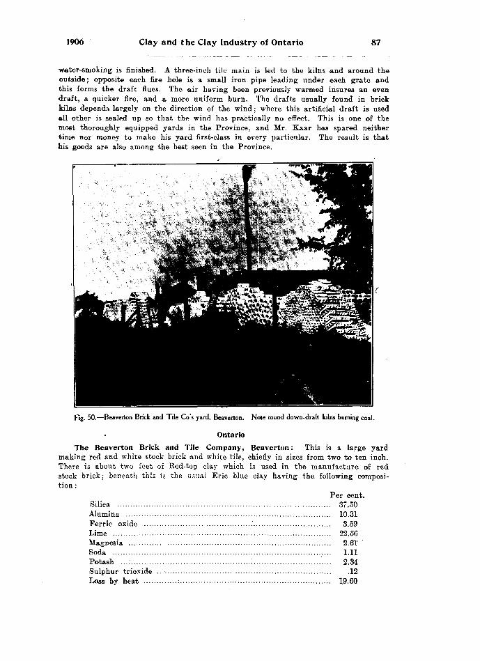
1906 Clay and the Clay Industry of Ontario 87
water-smoking is finished. A three-inch tile main is led to the kilns and around the outside; opposite each fire hole is a small iron pipe leading under each grate and this forms the draft flues. The air having been previously warmed insures an even draft, a quicker fire, and a more uniform burn. The drafts usually found in brick kilns depends largely on the direction of the wind : where this artificial draft is used all other is sealed up so that the wind has practically no effect. This is one of the most thoroughly equipped yards in the Province, and Mr. Kaar has spared neither time nor money to make his yard first-class in every particular. The result is that his goods are also among the best seen in the Province.
Fig. 50.—Beaverton Brick and Tile Go's yard, Beaverton. Note round down-draft kilns burning coal.
OntarioThe Beaverton Brick and Tile Company, Beaverton: This is a large yard
making red and white stock brick and white tile, chiefly in sizes from two to ten inch. There is about two feet of Red-top clay which is used in the manufacture of red stock brick: beneath this is the usual Erie blue clay having the. following composi tion :
Per cent. Silica .................................................................................. 37.50Alumina ............................................................................... 10.31Ferrie oxide ..........................................'.............................. 3.59Lime .................................................................................... 22.56Magnesia .............................................................................. 2.61Soda ................................................................................ ; ... 1.11Potash ...:..............................................:..........................'.... 2.34Sulphur trioxide .................................................................... .12Loss by heat .........................................................:.............. 19.60
88 Bureau of Mines No. 5
The Rod-top clay is mixed with sand for red brick, the next three feet of grayish blue clay is mixed with one-third its volume of sand, to make white stock brick; below this again is the typical blue Erie; clay, which is made into tile of all sizes. All three classes of goods are of excellent quality. The tile are burned in three round down-draft kilns using wood for the water-smoking, and soft coal for the; remainder of the fire. The red and white stock brick are burned for the most part in up-draft permanent walled kilns, the ends being scoved. The output of brick is about one and a half millions per season, and the output of tile is about* seven hundred thousand, varying from two and one-half t'J ten inches in diameter. This company's output, especially its tile, is sent all over eastern Ontario, and even to Quebec.
William Gilmore, Whitby : Mr. Gilmore, who is eighty-seven years of age, has been operating this yard for the past fifty years. He makes red brick, about one- half a million per year, and sixty to one hundred thousand white tile, varying in size from two and a half to nine inches in diameter. The brick are made from Red-top clay in a Martin machine using horse-power. They are hacked cut in the ordin ary way and are burned with wood in open-shed scoved kilns. The tile are made from the underlying Erie clay in a Kells machine using steam power. When dry. these are burned in an old fashioned up-draft kiln, having an open floor. The fire arches run from one side to the other beneath this open floor, so that the heat passe? directly from the fire places up through the open floor into the tile and out at the top This makes a kiln which is very hard to control, and is the only one of its kind seen in the Province. The goods turned out by Mr. Gilmore are of excellent quality, and shaw that his long experience has made him a first-class brick-maker.
Parry Sound
D. Clark, Powassan, has a section of about twelve feet of Saugeen clay, quite free from stone, but containing the usual amount of interbanded sand. This sand dug in with the clay renders the whole quite mild, making it an excellently workable deposit. The clay is dug over in heaps and is allowed to slake during the winter with the frost and rain. It ie then loaded into small dump-cars, which are hauled by cable and which dump automatically into a Monarch six brick machine. The brick are then hacked out to dry, and after drying are wheeled to Case up-draft kilns, where they are burned with wood in the usual way. A very handy method is used here in setting the kiln, which avoids throwing up the brick. An elevator io placed at one end of the kiln, and tthc barrows when wheeled on to it are raised to the required height, the brick being set directly from this. The elevator is movable, and as the kiln is built, it is gradually shifted so as to always be handy to the setting.
The burning is done in three of these up-draft kilns, and the brick produced are of an excellent red color. The output per season is from a million and a half to two million, all red brick. The analysis of this clay is given as No. 67, page 26 of this report.
V. Russel, Burk's Falls: Mr. Russel is successor to Mr. F. Kerr and is rebuilding the yard, adding a steam plant and additional drying space to the yard as formerly run by Mr. Kerr. He has from six to ten feet of Saugeen clay with its usual bands of sand, which render the whole- quite m ; ld and easily workable. The clay is dug as usual into a heap and allowed to slake in the weather. The advantage of this method of disintegrating, or pulverizing clay, is readily seen by exposing a piece of tough. hard clay to the weather, especially if it be frozen. It will be found that the stiff lump upon being exposed and frozen will crumble readily to an earthy powder. This is taken advantage of by brick-makers geenrally through the Province.
Mr. Russel wnee'.s his clay from the heap to a Doig six-brick machine. The brick are then hacked out in the ordinary way. and when dry are hauled by truck-wagons
1906 Clay and the Clay Industry of Ontario 89
to open-shed scoved kilns, where they are burned with wood in the ordinary manner. Red brick only are made, but a good quality of these, the annual output being about 800,000 to a million.
L. H. Ware, Huntsville, has the usual section of six to ten feiet of Saugeen clay somewhat fatter than that of Burk's Falls, but not so fat as that of Bracebridge. This is dug to a heap and allowed to slake as usual, when it is worked in a Martin machine using steam power. The brick are dried by the rack and pallet system, and are then burned in open-shed scoved kilns. The output for the season is about 700.000 red brick.
PeelA. Norton, Bolton, manufactures red brick from the Bed-top clay colored by
red oxide. The brick are made in a Martin machine using horse power, are dried by the rack and pallet system, and are burned with wood in open shed kilns. Beneath the red clay is the usual supply of Erie blue clay, which is made into white tile with a Close machine. This machine is also run with horse power. Although the output is small, the goods are of excellent quality. Mr. Norton makes about one hundred and fifty thousand tile per season, varying in size from two and one half to eight inches. They are burned with wood in a rectangular down draft kiln.
Brampton Pressed Brick Company, Brampton : This yard is managed by Mr. Packham, who previously owned the yard himself, but it has been considerably enlarged and it is about to be moved to a new locality and further enlarged. The Medina red shale is used in the manufacture of red pressed brick. The shale is blasted and hauled by car to a pan mill, and the ground product is elevated to a set of screens placed at an angle of about forty degrees to the horizontal. The over size is returned to the pan mill to be re-ground, while that which passes thrdugih the screen is fed to a Boyd press. From the press the brick are wheeled directly to permanently-walled up-draft kilns, where they are burned in the ordinary way at first with wood, then by coal and wood, and finally by coal alone, the whole process lasting about two weeks. The output of pressed brick is about one million and one-half per season. On top of the shale is a coating of mixed clay and shale which is dug and used in the manufac ture of red tile; about three hundred thousand of these are made per season and are burned in a round down-draft kiln. Mr. Packham is now moving his yard to the Credit Valley branch of the Canadian Pacific railway, where he intends to install two more presses, which will increase his output by two or three million per season. The shale used in this yard for the manufacture of red pressed brick analyzes as follows: —
* Per cent. Silica .................................................................................. 56.52Alumina .............................................................................. 15.21Ferrie Oxide ........................................................................ 5.82Lime ......................................................................... -.......... 6.86Magnesium ........................................................................... 2.82Soda .................................................................................... .56Potash ................................................................................. 3.59Sulphur trioxide .................................................................. .20Loss by ignition ..................................................................... 8.79
As will be noticed by the above analysis, this shale is comparatively free from sulphur, so that the brick made from this shale do not show the efflorescence or "soda" so commonly seen on pressed brick, after they are built in the wall.
The Port Credit Brick Company, Port Credit: This yard, which is under the management of Mr. Thos. Buchanan, is used in the manufacture of red pressed brick and is one of the largest and best run yards in Canada. It is situated on the shore of Lake Ontario about half way between Toronto and Hamilton. The brick are made

90 Bureau of Mines No. 5
from a mixed shale, the upper part being reddish; below this tlhe shale is yellowish brown, and lower down it is blue. The whole section is used in the manufacture of brick. The shale is blasted from the top to the bottom, and is 'hauled by car to two pan mille, the ground shale is elevated to screens, the oversize returning to be re-ground. The screened shale is then used in the manufacture of brick with a Berg press. The shale, when ground, has the following composition: —
Per cent. Silica ...................................:.............................................. 56.46Alumina ............................................................................... 18.19Ferrie oxide ........................................................................ 7.43Lime .................................................................................... 2.56Magnesia .............................................................................. 2.93Soda .................................................................................... .63Potash ................................................................................. 3.54Sulphur trioxide .................................................................. .15Loss by ignition .................................................................. 8.52
This analysis shows a high percentage of iron well fitted to produce the red color of the brick, together with a low percentage of lime, which, therefore, does not coun teract the iron. The percentage of sulphur trioxide is very low, consequently the brick are practically free from the so-called "soda." usually found on red pressed brick.
Fig. 51.—Port Credit Brick Coy's pressed brick plant, Port Credit, showing large continuous down-draft kiln.
The brick are wheeled from the machine directly to a Hoffman continuous kiln, consisting of eighteen chambers arranged continuously in an oval. The waste heat from one chamber passing through the adjoining chambers first dries off the brick, then, as the fire is led nearer1 , it heats them up; finally the fire is led right into the new chamber, and so the process continues round the oval of eighteen chambers, so that when the fire is once kindled, i^ is never let out, but some chambers are being charged while others are burn : ng. and still others are being discharged. Each chamber

1906 Clay and the Clay Industry of Ontario 91
is capable of holding about twenty thousand brick; thus the whole kiln will burn three hundred and eighty thousand in one round; and this can be done in sixteen days, once the fire is up. The firing is done from above through small hand holes about five inches square. A good sized handful of cracked coal is dropped down each hand-hole every twenty minutes, a large flue serving for all the chambers passes along the centre of the kiln with a small flue connecting it with each chamber, and in the outer end of each of these is a hand damper by which the fire can be regulated from one chamber to another.
This plant runs night and day. making thirty-eight thousand brick in twenty- three hours, or about eight million for the season. In addition to the Hoffman kiln a few permanent walled up-draft kilns are used to burn the surplus brick, but at the time of the writer's visit the foundations were dug for five new round down-draft Stewart kilns. Several other additions to the plant were being considered, among them being two more presses and an endless chain conveyor for the shale from thei bank to the plant. This machinery, in fact, was already on the ground, electrical power was about to be acquired from Niagara, when the lighting t power, and electric rock drills were to be used. It will be thus seen that this plant is one of the finest and most thoroughly equipped in Canada.
PerthStratford Brick, Tile and Lumber Company, Stratford: This yard was formerly
operated by Keller Bros., but has recently been rebuilt and enlarged and is now worked by the above named Company, although it is still managed by C. S. Keller. It has from two to four feet of Bed-top clay, below which is the typical blue Erie clay. The Red-top clay only is used as yet, but the company expects to manufacture white brick and tile as well. The Red-top clay is dug and carted to a Kells machine. The Bechtel automatic end-cut cut-off is used. The brick are dried in open hacks and are burned in down-draft kilns, and occasionally in open-shed scoved kilns. The company has attempted the manufacture of dry pressed brick from this Red-top clay. It is dug as usual and left in the sun to dry, when it is hauled to a clay shed. Here it is put through a Bechtel disintegrator; the powdered clay is elevated to screens, and the over-size returned to be re-ground. This machine is excellently adapted to stony or lumpy clays, but will not pulverize the clay finely enough for pressed brick. A Berg press is used, and at the time of the writer's visit, a few pressed brick hed been made, but the material was so coarse that the brick were mealy in grain, the particles not having fused together. It is quite likely, however, that when a, machine in got that will pulverize the clay finely enough, a good pressed brick will result.
The clay used for the manufacture of these red pressed brick analyzes as follows : — (No. 1.)
No. 1. No. 2. Per cent. Per cent.
Silica ......................................................... 69.12 40.16Alumina ...................................................... 14.03 13.76Ferrie oxide ............................................... 4.81 5.58Lime .......................................................... 1.94 15.74Magnesia .................................................... 1.10 3.78Soda ........................................................... 1.53 .70Potash ........................................................ 2.05 2.00Sulphur trioxide .......................................... .10 .17Loss by ignition .......................................... 4.80 17.48
No. 2 is the Erie blue clay immediately below No. l, and burns to white goods on account of the high percentage of lime. Since the writer's visit this blue clay has been made into dry pressed brick and specimens shown at the Clay Workers' Conven-
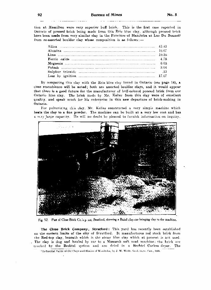
92 Bureau of Mines No. 5
tion at Hamilton were very superior buff brick. This is the first case reported in Ontario of pressed brick being made from this Erie' blue clay, although pressed brick have been made from very similar clay in the Province of Manitoba at Lac Du Bonnet7 from re-assorted boulder clay whose composition is as follows : —
Silica .................................................................................. 45.43Alumina ............................................................................... 10.67Lime .................................................................................... 10.50Ferric oxide ........................................................................ 4.78Magnesia .............................................................................. 6.03Potash ................................................................................. 3.04Sulphur trioxide .................................................................. .13Loss by ignition .................................................................. 17.07
By comparing this clay with the Erie blue clay found in Ontario (see page 14), n close resemblance will be noted; both are assorted boulder clays, and it would appear that there is a good future for the manufacturer of buff-colored pressed brick from our Ontario blue clay. The brick made by Mr. Keller from this clay were of excellent quality, and speak much for his enterprise in this new departure of brick-making in Ontario.
For pulverizing this clay. Mr. Keller constructed a very simple machine which beats the clay to a fine powder. The machine can be built at a very low cost and has a very large capacity. He will no doubt be pleased to furnish information on inquiry.
Fig. 52.—Part of Close Brick Co.'s p ant, Stratford, showing a Baird clay-car bringing clay to the machine.
The Close Brick Company, Stratford : This yard has recently been established on the eastern limits of the city of Stratford. It manufactures red stock brick from the Red-top clay, beneath which is the stony blue clay which at present is not ueed. The clay is dug and hauled by car to a Monarch soft mud machine; the brick are trucked by the Bechtel system and are dried in a Bechtel Carless dryer. The
~' Industrial Value of the Clays and Shales of Manitoba, by J. W. Wells, Geol. Surv. Can., I'JOS.

1906 Clay and the Clay Industry of Ontario 93
output is about fifteen thousand per day, or two million for the season. The brick are burned in up-draft scoved kilns, the water smoking is done with wood and the remainder by coal. Mr. Close, the manager of the yard, superintended the erection of the plant and has a very up-to-date one, producing a good red stock brick.
F. Entricken, Stratford: This yard is situated at the little lakes, three miles east of Stratford, and was formerly run by Mr. John Jarvis, now of Dorchester, one of the oldest brick-makers in the Province. These little lakes, three in number, repre sent pool-like basins in a former drainage channel which fed the Avon river, a small drain only remaining to mark the course of a former stream of considerable size. They are at present twenty-four to forty feet deep. It is supposed by the people of the district that they are connected by underground channels, but this cannot be the case, because the Grand Trunk Railway Company's pump house, situated on the shore of one of them, can lower the water in that lake without affecting the level of the other two. Moreover, the second lake level is twelve feet below that of the first. These lakes are the deep remnants of a former channel, which can be traced from above the first lake through the second and third and on over the country until it joins the present val!ey of the Avon river. At present the water is received from
Fig. 53.—Laminated Erie clay beds at F. Entricken's yard, Stratford.
the surface drainage of the surrounding country. Mr. Entricken's yard is situ ated near the shore of one of the lakes, in fact his clay is dug from a pit which is below the level of the water in the lake, and a centrifugal pump is required to keep the pit dry. The clay, however, is excellent, it being very free from stones, and just sandy enough to be nicely tempered. Its analysis is as follows: —
Per cent.Silica ................................................................................... 45.46Alumina .-............................................................................. 9.73Ferric oxide ........................................................................ 383Lime .....,............................................................................ 15.80Magnesia .............................................................................. 5.06Soda .................................................................................... .78Potash ................................................................................. 1.85Sulphur trioxide .................................................................. .12Loss by ignition ............ t..................................................... 17.37

94 Bureau of Mines No. 5
The clay is dug end taken direct from the pit in cars to a Monarch soft-mud machine; the brick are dumped on pallets, dried by the rack and pallet system, and burned in three down-draft kilns with wood. The output for the season is about two. million brick.
Fig. 54.—A double rectangular down-draft kiln at F. Entricken's yard, Stratford. No. l is being fired,while No. 2 is being discharged.
W. B. James, Mitchell, has from two to four feet of Red-top clay, underlaid by the Erie blue clay, which has been proven to be over twenty feet deep. He manu factures both red and white brick and tile, the chief output being red brick, of which he makes about one million per year, and in addition about eight kilns of tile running from two and one-half to ten inches in diameter.
For brick the clay is dug and carted to a pug mill, feeding a Quaker machine. The moulds are sanded by ground ''bats," which are pulverized in a ball mill. The brick are dried by the rack and pallet system, and are burned by wood and coal in two round down-draft kilns. For tile a Kells machine is used.
W. H. Barnard, Monkton; J. Johnson, Monkton: These two yards, situated almost side by side, are working the same clay, namely, the Red-top clay, both making brick and tile. The brick are made by a Kells machine ucing the Bechtel automatic cut-off; they are then hacked out to dry and are burned in round down-draft kilns, using wood as fuel. The brick from these two yards were among the finest se-en in the Province, especially on account of their rich, uniform, red color.
PeterboronghCurtis Brothers, Peterborough, have about two feet of Red-top clay, which is
nnderlnid by sandv Erie blue clay. Both are used in the manufacture of red and white brick, and tile and paving block. ' In this yard are two Iron Quaker machines and one Martin machine, all run by steam power. The clay is hauled direct from the pit in automatic dump-cars which feed Baird pug-mills, which in turn feed the brick- machines mentioned above.
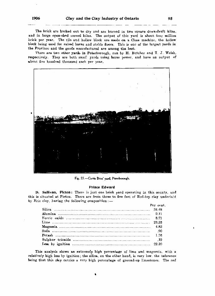
1906 Clay and the Clay Industry of Ontario 95
The brick are hacked out to dry and are burned in two square down-draft kilns, and in large open-shed scoved kilns. The output of this yard is about four million brick per year. The tile and hollow block are made on a Close machine, the hollow block being used for raised barns and stable floors. This is one of the largest yards in the Province and the goods manufactured are among the best.
There are two other yards in Peterborough, run by H. Butcher and T. J. Welsh, respectively. They are both small yards using horse power, and have an output of ebout five hundred thousand each per year.
Fig. 55.—Curtis Bros' yard, Peterborough.
Prince EdwardD. Sullivan, Picton : There is just one brick yard operating in this county, and
this is situated at Picton. There are from three to five feet of Red-top clay underlaid by Erie clay, having the following composition : —
Per ce-nt. Silica .................................................................................. 34.48Alumina ...............................................................................' 9.11Ferrie oxide ........................................................................ 3.71Lime .................................................................................... 23.33Magnesia .............................................................................. 4.83Soda .................................................................................... .90Potash .................................................,............................... 1.76Sulphur trioxide .................................................................. .19Lose by ignition ................................................................... 22.30
This analysis shows an extremely high percentage of lime and magnesia, with a relatively high loss by ignition; the silica, on the other hand, is very low. the inference- being that this clay carries a very high percentage of ground-up limestones. The red
96 Bureau of Mines No. 5
clay is used in the manufacture of red stock brick by means of a Martin machine and horse-power. The brick are hacked out to dry, and are burned with wood in open- shed scoved kilns. While the green brick are being set in the kilns, hard coal screen ings are scattered through the heads to aid in the burning. The output of the season is only about four hundred thousand, as the demand is purely local.
Renfrew
Wm. Baker, Arnprior, has from three to eight feet of very strong clay; this H underlaid by six feet of a mild, grayish clay, and below this is Leda blue clay to an unproved depth. The same section is thus exhibited as is shown in the other northeastern parts of the Province, for example, at Ottawa. A section of about fifteen feet is worked; the clay is hauled by horse and car to the foot of an incline, where it is elevated by a cable, and dumped to a pug-mill feeding a pair of rolls, from which it passes to a second pug feeding a new Quaker six-brick machine. In this way the strong top clay and the mild under clay are thoroughly mixed and an excellent product results. The brick are dumped en pallets and piled in racks on iron care, which are run to a tunnel drier ; the care of dry brick are taken from the opposite end of the tunnels, to four round down-draft kilns, and occasionally to opeai-shed scoved kilns. The strong top clay is also used by itself in the manufacture of red tile; the clay is pugged, tfeeu passed through rolls to an English tile machine. An automatic cut-off is used, and the tile are stood on end on pallets placed in the same cars; they are also dried in the tunnel dryers and are burned in the down-draft kilns.
This is an excellent yard, and has an output of about twelve hundred thousand brick and tile per season, the power being steam and a sixty-horse compound engine. The clay here instead of being mixed with limestones, contains a corresponding number of hardheads or igneous boulders, carried by the glaciers from the igneous area to the northeast.
J. A. Thibadeau, Pembroke : Here we have another area of Saugeen clay, differing only from the others in being much more sandy. The section is dug and carted directly to a Martin Machine run by steam power. The brick are hacked out to dry, and are burned in open-shed scoved kilns with slabs. The brick are of a good color, but the clay is so sandy that it should be thoroughly pugged before going to the Martin machine. The output of this yard is about seven hundred thousand per year.
J. Johnson, Pembroke. This yard works on the same Saugeen clay as the last mentioned, the bank being in every way similar. It is operated in the same way except that horse power is used instead of steam. The output of this yard is only about four hundred thousand per season.
The Saugeen clay at Pembroke has the following composition : —Per cent.
Silica ................................................................................... 62.30Alumina ............................................................................... 16.51Ferric oxide ........................................................................ 5.65Lime .................................................................................... 3.16Magnesia .............................................................................. 2.68Soda .................................................................................... 2.25Potash ................................................................................. 2.61Sulphur trioxide .................................................................. .40Loss by ignition ................................................................... 3.60
Thomas Henderson, Renfrew, has two to three feet of Red-top clay, underlain by a grayish yellow clay which soon passes into Erie blue as usual. The Red-top clay is made into red stock brick, the under clay, which of itself will burn to white brick. is mixed with a coloring (of Mr. Henderson's own invention and for which he has

1906 Clay and the Clay Industry of Ontario 97
applied for a patent), and is burned also to a red brick. These are made with a Martin machine using electrical power; the tile are made in a Kells machine. The dried brick and tile are burned together in three round down-draft kilns. This yard has an output of about five hundred thousand brick, and about three hundred and fifty thousand tile per season, all being red. Mr. Henderson contemplates several improve ments, among them being an artificial drier, and two more down-draft kilns.
F. Hilliard, Renfrew, has from two to three feet of Red-top clay lying on grayish yellow Erie clay, again underlaid by Erie blue clay, these layers representing the different stages of weathering. Mr. Hilliard uses only the Bed-top clay in the manufacture of red stock brick and also red tile. The clay is carted to a Quaker machine moulding five brick at a time; these are hacked out in the ordinary way to dry, and are burned with wood in open-shed scoved kilns. For tile the clay is put through a pair of rolls feeding a Kells machine. The tile are burned with wood in two round down-draft kilns and an excellent quality of goods results. The output of bricks is about six hundred thousand per year, and of tile about three hundred thousand. This is a neat yard, and the goods are first class.
Russell
Merkley Brothers, Casselman : In this yard we find about four feet of a reddish iron-bearing sand underlaid by eight feet of Saugeen clay, this again being underlaid by white quicksand } and the whole by blue Leda clay. (See fig. 19.) The Saugeen clay is used with the sand in the manufacture of brick. The clay has the following compo sition : —
Per cent.Silica ................................................................................... 59.34Alumina .............................................................................. 17.68Ferrie oxide ........................................................................ 6.74Lime .................................................................................... 2.94Magnesia .............................................................................. 3.36Soda .................................................................................... 2.13Potash .................................................................................. 3.07Sulphur trioxide .................................................................. .47Loss by ignition ................................................................... 4.60
The Saugeen clay, dug with the sand and hauled in cars to a pug-mill, is thoroughly mixed, the pug-mill feeding a Monarch six-brick machine. The brick are dumped on pallets, which are piled on cars, each of which carry four hundred and thirty brick. These are run into a Sheldon and Sheldon dryer capable of holding about sixty-four thousand brick. The day's output is about twenty thousand. These are dried in a little over forty-eight hours.
Up to the present year this yard ran about eight months for a season, and had an output of about four million brick, but this year the proprietors are trying a new and ingenious method to enable them to work through the winter months. A few large stringers, boom timbers for example, were laid on top of the ground parallel with the clay cliff, one coming very near the edge of the bank. Rough lumber was laid on these, and on top straw or other material; the lumber was allowed to project over the face of the cliff like a roof, and the face of the cliff was all boarded in so as to just leave working space on the face of the cliff. A door was made for the car track to enter the shed, the rest all being weather tight. An exhaust steam pipe was then run from the boiler into this shed and each night when the men quit work the shed was closed up and live steam blown into it until it was filled, this would prevent the clay freezing over night, and the men could start in the morning on fresh clay. As the bank is
7 M2.
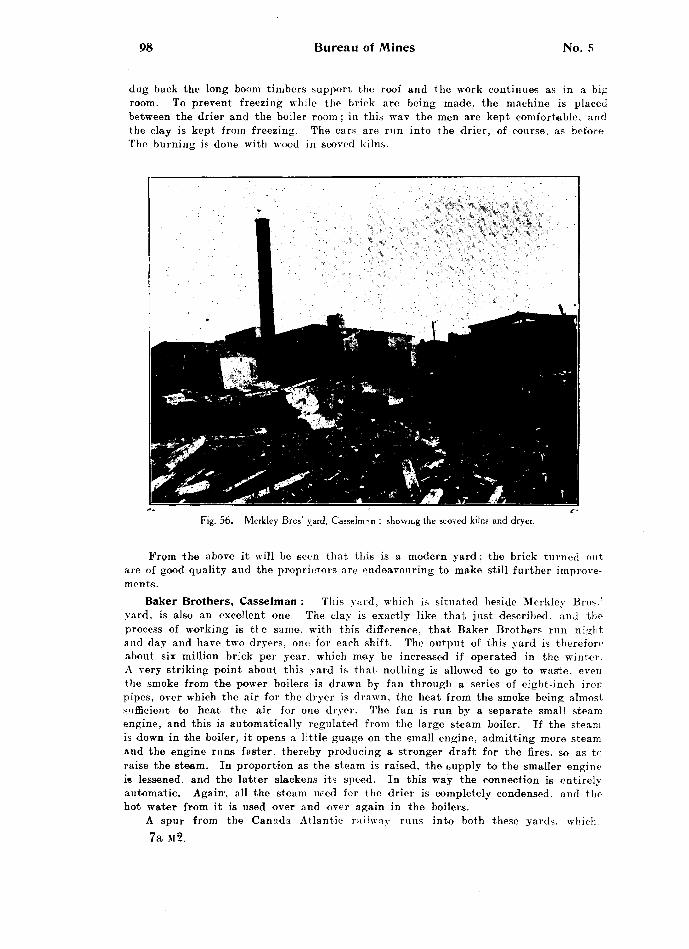
98 Bureau of Mines No. 5
dug back the long boom timbers support the roof and the work continues as in a big room. To prevent freezing while the brick are being made, the machine is placed between the drier and the boiler room ; in this wav the men are kept comfortable, and the clay is kept from freezing. The cars are run into the drier, of course, as before The burning is done with wood in scoved kilns.
Fig. 56.—Merkley Bros' yard. Casselman : showing the scoved kilns and dryer.
From the above it will be seen that this is a modern yard; the brick turned out are of good quality and the proprietors are endeavouring to make still further improve ments.
Baker Brothers, Casselman : Tin's yard, which is situated beside Merkley Bros.' yard, is also an excellent one. The clay is exactly like that just described, and the process of working is tl e same, with this difference, that Baker Brothers run night and day and have two dryers, onn for each shift. The output of this yard is therefore about six million brick per year, which may be increased if operated in the winter. A very striking point about this yard is that nothing is allowed to go to was'te. even the smoke from the power boilers is drawn by fan through a series of eight-inch iron pipes, over which the air for the dryer is drawn, the heat from the smoke being almost sufficient to heat the air for one dryer. The fan is run by a separate small steam engine, and this is automatically regulated from the large steam boiler. If the steam is down in the boiler, it opens a little guage on the small engine, admitting more steam and the engine runs faster, thereby producing a stronger draft for the fires, so as to raise the steam. In proportion as the steam is raised, the cupply to the smaller engine is lessened, and the latter slackens its speed. In this way the connection is entirely automatic. Again', all the steam need for the drier is completely condensed, and the hot water from it is used over and over again in the boilers.
A spur from the Canada Atlantic railway runs into both these yards, which.7a M-2.

1906 Clay and the Clay Industry of Ontario 99
although situated in a village, are two of the best yards in Ontario. This shows what can be done if brick-makers will only manufacture the right goods. Here we have two yards situated in a village, which, with the immediate surroundings, would not require three hundred thousand brick per year, nevertheless these yards turn out about ten million brick, and these are shipped all over the Province.
SimcoeW. J. Norton, Alliston, had about two and one-half feet of Red-top clay over
lying the grayish yellow and blue Erie clay. The Red-top clay has been all used for the manufacture of red brick; the grayish yellow clay is now being drawn upon, and this and the sand are mixed with a coloring of iron oxide to give the red color to the brick. The clay is dug and hauled by car to a Baird pug-mill which feeds a Martin machine. The brick are dumped on pallets and are dried by the "rack and pallet" system. The output is about 10.000 per day. The burning is done with coal in a square down-draft kiln, as well as in open-shed scoved kilns. The water-smoking is done by wood ae usual. Mr. Norton also makes tile from this grayish yellow clay, but does not use any coloring, as the color of tile does not signify. These tile range from two and one-half to ten inches in diameter and are of excellent quality. They are burned with wood and coal, in a rectangular down-draft Stewart kiln, and also in a simple rectangular down-draft kiln of Mr. Norton's own construction. (See fig. 37.)
W. Freek, Barrie, has about three feet of clean Red-top clay, below which is stony red clay passing gradually into stony Erie clay. The clean top clay only is used in the manufacture of stock brick. It is hauled in carts to a Martin machine, and the brick are dumped on pallets and dried by the rack and pallet system. They are burned in two square down-draft Stag kilns, and in one round down-draft Cornell kiln. The output is about one million per year. The brick made in this yard are of excellent quality, and the percentage of face brick got from each kiln is extremely high; as many as forty-nine thousand face brick have been taken from a kiln holding fifty-two thousand. This is got by tightening up the first three courses above the flues. and leaving the rest of the kiln more open. These thre© courses serve as a check to hold the heat throughout the kiln, when a good temperature has been reached. This tightening is done by piling three on three for three courses high from the; top of the flues; these are taken out each time a kiln is burned. Mr. Freek claims to have had excellent results with this style of kiln bottom.
Thomas Bembrose, Beeton, has two and one-half feet of Red-top clay overlying yellowish gray Erie clay, the whole underlaid by Erie blue clay. The Red-top clay is used for brick and the balance for tile. The brick are made in a Quaker machine using horse power; they are hacked out to dry and are burned in a permanent up-draft kiln and an open-ehed kiln. Mr. Bembrose burns almost entirely with coal, even to the water-smoking. The tile are made in a Kells machine, and are burned in a down- draft square kiln. Roofing tile is also made.
The output of the yard is about five hundred thousand brick and three hundred thousand tile.
Ridler Brick Company, Penetanguishene: In this yard there are about three feet of red sand, underlaid by four feet of clay. These seven feet are dug together and thoroughly mixed in a pug-mill and burned to a red brick. The Baird pug-mill feeds a Martin machine operated in one yard; the brick are hacked out to dry in the ordinary way and are burned in open-shed scoved kilns.
This firm has erected a new plant alongside the old one, a Hercules machine made by Doig and Co., Toronto, being used. The brick are dumped on pallets and are dried by the rack and pallet system. The dried brick are piled on truck wagons carrying from two hundred and fifty to three hundred and fifty brick to a load. They are
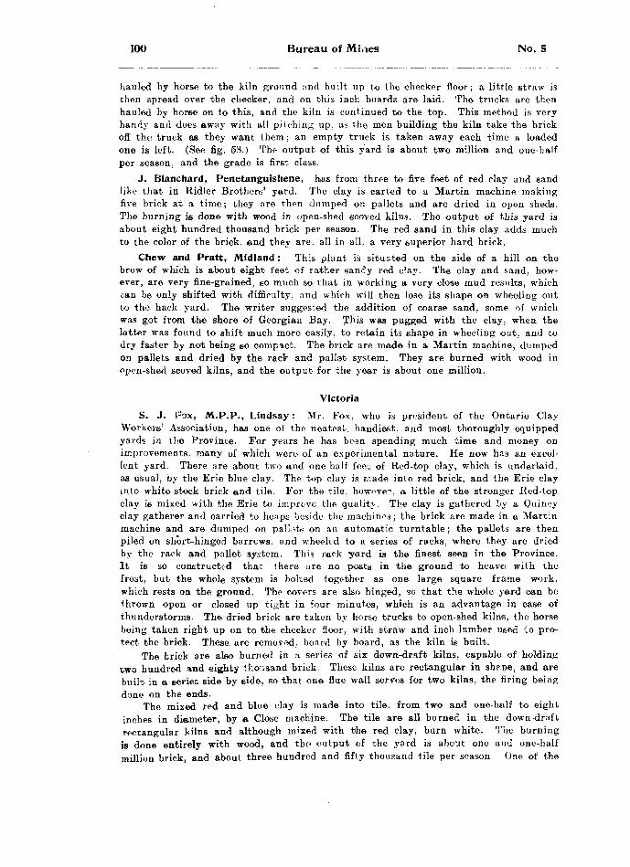
100 Bureau of Miaes No. 5
hauled by horse to the kiln ground and built up to the checker floor; a little straw is then spread over the checker, and on this inch boards are laid. The trucks are then hauled by horse on to this, and the kiln is continued to the top. This method is very handy and does away with all pitching up. as the men building the kiln take the brick off the truck as they want them; an empty truck is taken away each time a loaded one is left. (See fig. 53.) The output of this yard is about two million and one-half per season, and the grade is first class.
J. Blanchard, Penetanguishene, has from three to five feet of red clay and sand like that in Ridler Brothers' yard. The clay is carted to a Martin machine making five brick at a time; they are then dumped on pallets and are dried in open sheds. The burning is done with wood in open-shed ecoved kilns. The output of this yard is about eight hundred thousand brick per season. The red sand in this clay adds much to the color of the brick, and they are, all in all, a very superior hard brick.
Chew and Pratt, Midland : This plant is situated on the side of a hill on the brow of which is about eight feet of rather sandy red clay. The clay and sand, how ever, are very fine-grained, so much so that in working a very close mud results, which can be only shifted with difficulty, and which will then lose its shape on wheeling out to the hack yard. The writer suggested the addition of coarse sand, some of which was got from the shore of Georgian Bay. This was pugged with the clay, when the latter was found to shift much more easily, to retain its shape in wheeling out, and to dry faster by not being so compact. The brick are made in a Martin machine, dumped on pallets and dried by the rack and pallet system. They are burned with wood in open-shed scoved kilns, and the output for the year is about one million.
Victoria
S. J. Fox, M.P.P., Lindsay : Mr. Fox, who is president of the Ontario Clay Workers' Association, has one of the neatest, handiest, and most thoroughly equipped yards in the Province. For years he has been spending much time and money on improvements, many of which were of an experimental nature. He now has an excel lent yard. There are about two and one-half feet of Red-top clay, which is underlaid, as usual, by the Erie blue clay. The top clay is made into red brick, and the Erie clay into white stock brick and tile. For the tile, however, a little of the stronger Red-top clay is mixed with the Erie to improve the qualitj , The clay is gathered by a Quincy clay gatherer and carried to heaps beside the machines; the brick are made in a Martin machine and are dumped on pallets on an automatic turntable; the pallets are then piled on short-hinged barrcws. and wheeled to a series of racks, where they are dried by the rack and pallet system. This rack yard is the finest seen in the Province. It is so constructed that there are no posts in the ground to heavei with the frost, but the whole system is bolted together as one large square frame work, which rests on the ground. The covers are also hinged, so that the whole yard can be thrown open or closed up tight in four minutes, which is an advantage in case of thunderstorms. The dried brick are taken by horse trucks to open-shed kilns, the horse being taken right up on to the checker floor, with straw and inch lumber used to pro tect the brick. These are removed, board by board, as the kiln is built.
The brick are also burned in a series of six down-draft kilns, capable of holding two hundred and eighty thousand brick. These kilns are rectangular in shp.pe, and are built in a series side by side, so that one flue wall serves for two kilns, the firing being done on the ends.
The mixed red and blue clay is made into tile, from two and one-half to eight inches in diameter, by a Close machine. The tile are all burned in the down-draft rectangular kilns and although mixed with the red clay, burn white. The burning is done entirely with wood, and the output of the yard is about one and one-half million brick, and about three hundred and fifty thousand tile per season. One of the
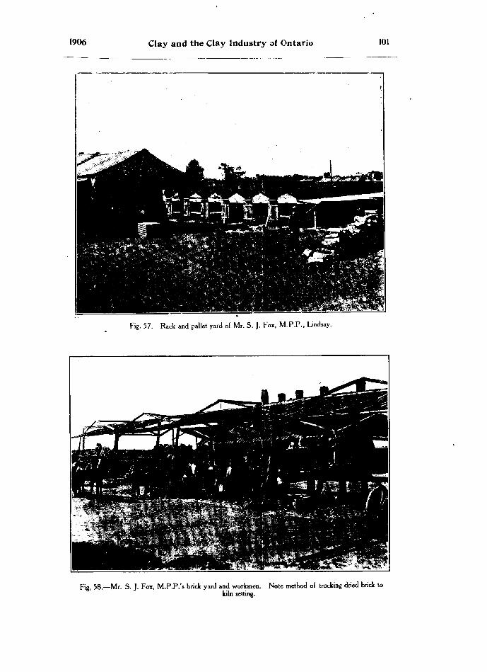
1906 Clay and the Clay Industry of Ontario 101
Fig. 57. -Rack and pallet yard of Mr. S. J. Fox, M.PP., Lindsay.
Fig, 58.—Mr. S. J. Fox, M.P.P.'s brick yard and workmen. Note method of trucking dried brick tokiln setting.

102 Bureau of Mines No. 5
chief features of Mr. Fox's yard was the fine state of repair in wh'ch everything was kept. For example, his drying racks, described above, have been up for fourteen years and are as square and upright as ever; his kilns are the same, his machinery, engines, shaftmg, etc., have been running twenty years and are apparently in as good condition as ever. This is all the result of repairing every break at the time.
F. Curtin, Lindsay. In addition to Mr. Fox's yard there is another smaller yard located at Lindsay and run by Mr. F. Curtin. Both the Red-top and underlying Erie blue clay are used in the manufacture of brick. The clay is hauled by cart and put through a Baird pug-mill, which feeds an Iron Quaker machine. The brick are hacked out by the old system, and when dried are burned in open-shed scoved kilns with wood for fuel. Mr. Curtin has one round down-draft kiln, but does not use it; it was built for tile, and is at present idle. The output of this yard is about, eight hun dred thousand of both red and white brick per season. The output is small, but the quality of the brick very good.
Fig. 59.—A former " hack " yard replaced by a Bechtel Carless dryer; BrantfordJBrick Go's yard.
WaterlooBechtel Brothers, Waterloo, have operated their yard for many years and
now possess a first-class brick plant; at the same time they have been gradually im proving their machinery until now they have one of the largest brick manufacturing establishments in Canada. Among the machines patented by Mr. Byron E. Bechtel which are now on the; market and in very general use throughout the Province are the following:—The Bechtel Disintegrator, for the removal of stones and pulverizing lumpy clay; a Lubricating Die for use on side-cut wire-cut brick machines; an Auto matic Wire-cut Cut-off machine for either end, or side-cut brick (see fig. 29); a System of Trucks for handling brick or tile; an Automatic Wire-Cut Cut-off for hollow block and tile from two and one-half to eight inches in diameter; the Bechtel Carless Dryer.
In connection with the factory for making these machines Mr. Bechtel runs a brick yard where they can all be .seen in operation. He works an Erie clay bank for the manufacture of white brick. The clay is gathered dry by a Quincy clay gatherer, an American machine for which Mr. Bechtel has the Canadian agency. With this machine one man and a team bring in sufficient clay for twenty thousand brick per
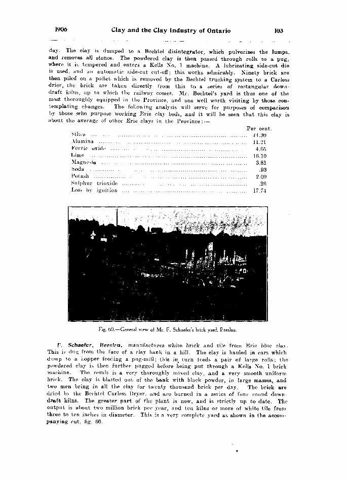
1906 Clay and the Clay Industry of Ontario 103
day. The clay is dumped to a Bechtel disintegrator, which pulverizes the lumps, and removes all stones. The powdered clay is then passed through rolls to a pug, where it is tempered and enters a Kells No. l machine. A lubricating side-cut die is used, and an automatic side-cut cut-off; this works admirably. Ninety brick are then piled on a pallet which is removed by the Bechtel trucking system to a Carless drier, the brick are taken directly from this to a series of rectangular down- draft kilns, up to which the railway conies. Mr. Bechtel's yard is thus one of the most thoroughly equipped in the Province, and one well worth visiting by those con templating changes. The following analysis will serve for purposes o-f comparison by those -who purpose working Erie clay beds, and it will be seen that this clay is about the average of other Erie clays in the Province: —
Per cent. Silica ...................... . .......... ............................................. 44.30Alumina .............. .. ...... 11.21Ferric oxide .................. ..................................................... 4.05Lime ...........................,........................................................ 16.10Magnesia ............................................................,................ 3.81Soda ........................................ .......................................... .93Potash .................... ..... ...................................................... 2.09Sulphur trioxide ..............,..................................................'. .26Loss by ignition .................................................................. 17.74
Fig. 60.—General view of Mr. F. Schaefer's brick yard, Breslau.
F. Schaefer, Breslau, manufactures white brick and tile from Erie blue clay. This is dug from the face of a clay bank in a hill. The clay is hauled in cars which dump to a hopper feeding a pug-mill; this in^ turn leeds a pair of Large rolls; the powdered clay is then further pugged before being put through a Kells No. l brick machine. The result is a very thoroughly mixed clay, and a very smooth uniform brick. The clay is blasted out of the bank with black powder, in large masses, and two men bring in all the clay for twenty thousand brick per day. The brick are dried by the Bechtel Carless Dryer, and are burned in a series of four round down- draft kilns. The greater part of the plant is new, and is strictly up to date. The output is about two million brick per year, and ten kilns or more of white tile from three to ten inches in diameter. This is a very complete yard as shown in the accom panying cut, fig. 60.

104 Bureau of Mines No. 5
W. Collard and Son, Waterloo manufacturers of white wire-cut brick, use Erie clay with the same composition as that in Bechtel Bros' yard, whose analysis is given above. A fine new plant has been installed in this yard, which is now turning out about two and one-half million per year. The clay is scraped on to a platform, and dumped through a hopper to a clay car, which carries it to the clay shed. It is then worked dry in a Bechtel disintegrator, the product passing to a Baird pug-mill, and a Kells No. l brick machine. The Bechtel automatic end-cut wire-cut machine is used, and the brick are then piled on to steel cars, which are run to a Sheldon and Sheldon dryer. The dried bricks are taken from the opposite end of the tunnels to the kiln yard, where they are burned with coal after water-smoking with wood. This is also one of the most complete yards in the Province.
Michael Ott, Berlin, manufactures white wire-cut brick from the Erie blue clay which in this yard is very sandy. The clay is gathered with a wheel scraper, after being sun dried; it is then dumped into a Bechtel disintegrator. The product passes through rolls to a Kells No. l brick machine. The Bechtel automatic end-cut cut-off is used and Bechtel trucks to an open-air drying shed. At the time of the writer's visit Mr. Ott was contemplating the installation of an artificial dryer, which would largely increase his present output of one and one-half million per year. The burn ing is done with coal, after water-smoking with wood, in four circular down-draft kilns.
H. D. Dalmer, Conestogo ; This yard is situated at a bend in the Conestogo river, on a flat which appears to have been formerly a flood plain of this river. Here is a first-class accumulation -of Red-top clay), which is remarkably free from stones, and uniform in character. It is thicker here than in most parts of the Pro vince, being an accumulation from the surrounding country. The analysis is as fol lows : —
Per cent. Silica ...............'.................................................................... 65.06Alumina .............................................................................. 14.15Ferrie oxide ......................................................................... 4.67Lime .................................................................................... 2.36Magnesia ............................................................................. 2.18Soda .................................................................................... 1.48Potash ................................................................................. 2.66Sulphur trioxide ................................................................... .32Loss by ignition .................................................................. 6.76
Mr. Dalmer manufactures red brick and tile only. About one and one-half million brick, and about seven hundred thousand tile per season is his output. His clay is carted to rolls feeding a Kells machine. An automatic end-cut cut-off is used, and the Bechtel trucking system to open-air dryers. The brick are burned in down- draft kilns, and also in open-shed scoved kilns using wood for fuel. Mr. Dalmer also operates a white brick yard at Elmira, where he makes one and a half million white wire-cut brick. These are burned in a square down-draft Stewart kiln, using wood for fuel. Taking into account his two yards. Mr. Dalmer has one of the largest outputs of brick and tile in the Province.
WellandD. D. Hooker, Welland, has about three feet of Bed-top clay, underlaid by Erie
blue clay. The Red-top clay is somewhat stony. The pebbles are removed by pass ing the clay through a Bechtel disintegrator; the product from this passes by carriers to a pug-mill, which feeds a Martin machine. The brick are dumped on pallets, and are dried by the rack and pallet system; the burning is done in open-shed scored kilns, using wood for fuel. Mr. Hooker also makes red tile and hollow block; the pugged clay for which is used in a Kells No. l machine. The tile and hollow block are dried
1906 Clay and the Clay Industry of Ontario 105
in open sheds, and burned with wood in a round down-draft kiln. The yard is sit uated on the bank of the Welland canal, which at the time of the writer's visit was being dredged, and the dredge brought up Erie blue clay, showing that this clay must be at least twenty feet deep at this point.
T. M. Ryan and Company, Niagara Falls, have about three feet of Red-top clay overlying the Erie blue clay as usual. The firm uses both kinds in the manu facture of brick, the Red-top clay being made up into stock brick with a Martin machine; about eight hundred thousand of these brick are made per season. The drying is done by the rack and pallet system, and the burning in two large up-draH permanent walled kilns. The water-smoking is done with wood, and the remainder of the burning with coal. The underlying Erie clay is made up into wire-cut brick; the sun dried clay is pulveTized is a Bechtel disintegrator, and the clay is then passed through an American machine turning out end-cut wire-cut brick. This part of the plant is not much used at present, Mr. Ryan giving most of his attention to red stock brick.
WellingtonBell Brothers ; R. Holton ; Smith A Colfax, Drew : These three yards situated
side by side, are located about one mile and one-half from Drew. The clay is a sandy, mild, blue Erie clay, making white brick. On the surface is a foot to a foot and one-half of Red-top clay, somewhat stronger than the underlying Erie clay. This Red-top clay is made into tile, which are formed in Kells machines, and are burned in down-draft kilns using wood for fuel. Bell Bros, use a round down-draft Cornell kiln, while Smith and Colfax have a rectangular down-draft kiln, which they use for tile. In the manufacture of brick all three use Martin machines. The brick are hacked out to dry, and are burned with wood in open-shed scoved kilns. Each of the yards has an output of about one million and a half brick per year.
All three are very progressive yards, and are making brick for shipment, as the local demand is extremely small.
WentworthThe Fruitland Brick Company, Fruitland : This yard is situated on the line
of the Hamilton, Grimsby and Beamsville electric railway. Red brick are made from Medina red shale, which underlies this part of the country, and has the follow ing composition: —
Per cent. Silica .................................................................................. 56.90Alumina .............................................................................. 17.40Ferric oxide ......................................................................... 6.64Lime ................................................................................... 3.84Magnesia ............................................................................. 2.65Soda ............................ ....................................................... .53Potash ............................................t................................... 3.51Sulphur trioxide .................................................................. .31Loss by ignition .................................................................. 8.78
The sha'e is uncovered on the surface and allowed to slake: it is then collected in a scraper, and dumped to a pan-mill, where it is ground; the pulverized shale is then elevated to a hopper which feeds a Baird pug-mill that in turn delivers to * another side-cut machine very similar to the Freeze wire-cut machine, which is also used; it has an automatic side-cut cut-off, so that both classes of brick are made in this yard. The brick from both machines are piled on pallets, and trucked by the Bechtel system to open sheds, and also to a Bechtel Carless dryer. The dried brick are burned in permanent-walled up-draft kilns, and also in one round down-draft

106 Bureau of Mines No. 5
kiln. The water-smoking is done with coke, and the remainder of the burning with soft coal. Here we have an example of the stiff mud process of brick making us*ed on a shale, which is better suited to the manufacture of dry pressed brick.
Hamilton Brick Yards : In the western part of the city of Hamilton there are eleven brick yards, all apparently in a very flourishing condition. They are all sit uated on a high bench which represents a former stretch of Dundas bay. On the sur face is from fives to eight feet of goad red-burning clay. This is underlaid by great bods of gravel which form the margins of the old beach, probably acting as a darn across the Dundas river, behind which the clay settled. At any rate this bank is part of a long raised beach, which extends from the foot of the mountain across the western part of the city to and beyond what is known as the High Level Bridge, then eastward as a bank along the Grand Trunk Railway between Hamilton and Toronto as far as Burlington. The outline of this beach can be traced very clearly; all the lower part of the beach is composed of fine gravel, cemented to a conglomer ate. Above and behind this to the west we find the clay which is used in these brick yards. Below the gravel is the usual Erie blue clay. (See fig. 21.)
On this clay bank eleven yards are manufacturing brick, namely,The Aberdeen Brick Company ; John Hancock ; Edward New ; Crawford Brothers ;
M. Oilman ; George Mills ; Sam Cheesman ; Frid Brothers ; Thomas Landers ; George Webb ; George Frid.
All these yards are manufacturing red stock brick and the method in almost all of them is the same. A description of one will suffice for all.
The Aberdeen Brick Company was originally formed by the International Har vester or Deering company to ensure a supply of brick for the construction of their large plant, and finding that there was demand for all the brick that could be turned out in the city of Hamilton, they decided to continue operating the plant. Mr. George Beven is manager. This is the largest brick works in the city of Hamilton, the plant itself covering about two acres. Red brick are made by both the soft-mud and stiff- mud process. The clay is dug, hauled by automatic dump car, and dumped into .1 disintegrator, feeding a Freeze wiret-cut machine; and an automatic side-cut cut-off is used. The brick are then piled on cars and run to a tunnel dryer of the Sheldon tt Sheldon type. Some of the brick are dried in a Bechtel open-air dryer. In the soft- mud process, the powdered clay is thoroughly tempered in the pug of a Hercules machine. The brick are dumped on pallets and are dried by the rack and pallet system. The burning of both classes of brick is done in a series of eleven up-draft kilns, some of which are permanent-walled, while others are open-shed scoved kilns. The water-smoking is done with coke, and the balance of the burning with soft coal. This plant runs winter and summer, the clay being protected in winter by a coat in 2; of straw and manure spread over the surface. The output for the year is about two and one-half million wire-cut brick, and about eighteen hundred thousand stock brick. making a total output of about four and one-half million.
The reimaining ten yards, whose proprietors are enumerated in the list above, are so near alike that it is not necessary to describe each one individually. The method of manufacture is practically the same in all of them, and the output is roughly the same. They all have from five to eight feet of the same strong red clay as is worked in the Aberdeen yard. The clay is carted or hauled in cars and dumped to a pug-mill; the pugged clay is fed to a Martin machine, and in a few cases to a Quaker machine; the brick are then dumped on pallets and dried in a rack and pallet yard. The burning in all these yards is done in up-draft permanent-walled kilns or occas ionally in scoved kilns; the water-smoking is done with coke or wood, and the balance of the burning with soft coal. These yards have an output of about one and one- half million, each, per season. Mr. John Hancock's yard is a little larger than the others, as he works two Martin machines and has an output of two and a half million or more per season. Many of these yards are run by electric power, which is got
1906 Clay and the Clay Industry of Ontario 107
from Decew Falls: Mr. Hancock, vor example, operates his plant, which includes cars hauled by cable?, two pug-mills, and two Martin machines, quite easily by a thirty horse-power electric motor. Even the large Aberdeen works, which contain a great deal of machinery is run by an electric motor. The chief advantage of this is that the plant can be started or stopped in a moment, and when once started the motive power requires practically no attention for the balance of the day. The brick made by all these firms are excellent red stock brick, so much alike in color and quality, that they are handled by one contractor, who contracts the brick for all the build ings in the city using the Hamilton product.
York
In Toronto and its suburbs, including Toronto Junction, Carlton West. Humber Bay and Mimico are many brick yards; in all some thirty, engaged entirely in the manufacture of brick, together with several yards making sewer pipe, paving brick and drain tile, as well as pottery. The output of these thirty yards is something over a hundred million brick per season, and the majority of these are stock brick, only about twenty-two million pressed brick being included. There is but one yard engaged in the manufacture of wire-cut brick, but this is largely due to the nature of the clay used.
The clay found in most of these yards represents an accumulation of re-sorted glacial clay. The accumulation seems to have taken place at some inter-glacial period, because glacial clay is found both above and below it. The clays of the Toronto dis trict have been described by Dr. Coleman in the report of the Bureau of Mines for 1904. The clay is very mild and sandy, the upper part of it burning to a red brick, very dark red in color. Beneath this red-burning clay is a gray colored clay, which is also quite mild from the large percentage of sand which it carries, and this when burned yields a white brick, or as they are locally called, gray brick. Both these clays, while containing a great deal of sand, are remarkably free from boulders and pebbles. This clay is so mild that it is used in all cases in the manufacture of soft mud brick, and it is doubtful whether it is strong enough to be used in the manufacture of wire- cut brick.
The above mentioned yards fall into several groups, as certain localities have been chosen by the brick makers, and several yards are found side by side in such places. These yards will therefore be taken up in groups, as the method of working is prac tically the same in each group.
Wakefield Brothers, C. Mason, J. W. Lainson, James Lochrie, Edward Wakefeld, J. Brown, Thomas Norton; Carlton West: All these yards are situated a little west of Toronto Junction. The post-office, however, for all of them is Carlton West. The general method of manufacture is the same in all, so that a general description of this group will suffice. The clay is dug separately, that is, the red by itself, and the underlying white-burning clay by itself. As a rule these clays are dug to heaps and allowed to slake, when they are taken by cart or wheel-barrow 10 the machine. In most cases the Martin machine is used, although Mr. Lainson and Mr. Lochrie use the Hercules machine. The brick in most cases are hacked out in the ordinary way to dry. Mr. Lainson, however, uses the rack and pallet system. The brick in all cases are burned together, that is, both red and white, in ordinary open-shed scoved kilns using wood for fuel. The outprt of each of these yards varies from one million to three million. Mr. Lochrie has the largest output. The brick made here are of excellent quality, the red brick especially having a splendid color.
rtinde Brothers, Lainson and Son, William Bushell, Titley and Frost, Smith and Crang, Brown Brothers ; Carlton West : These six yards are situated in another group close to Toronto Junction station on the Grand Trunk Railway. They are smaller yards, and all have about the same method of manufacture. They each have an output of about one million brick per year, part of which are white and part red.
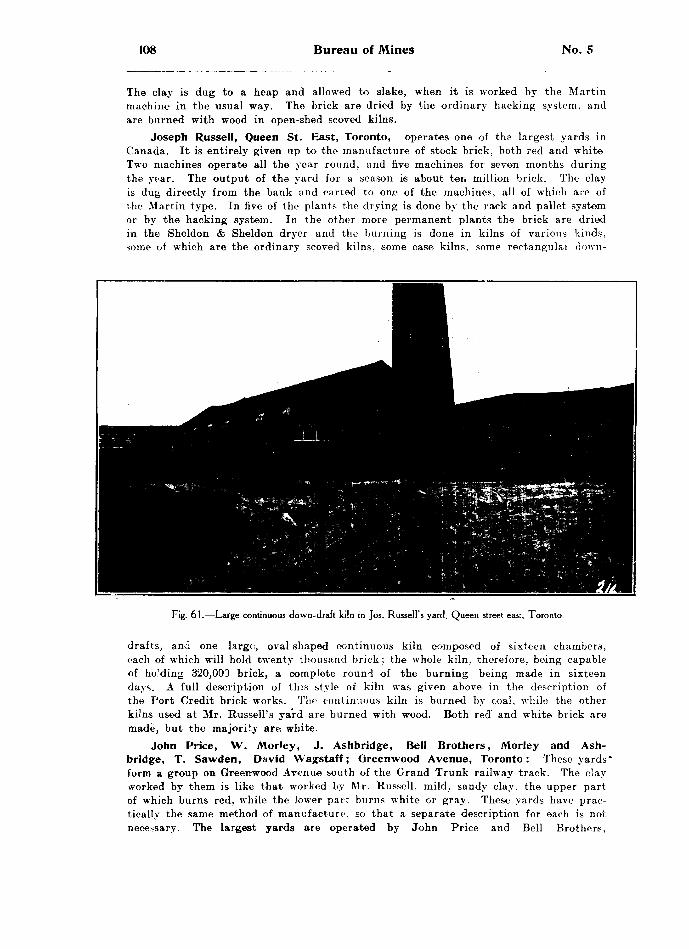
108 Bureau of Mines No. S
The clay is dug to a heap and allowed to slake, when it is worked by the Martin machine in the usual way. The brick are dried by the ordinary hacking system, and are burned with wood in open-shed scored kilns.
Joseph Russell, Queen St. East, Toronto, operates one of the largest yards in Canada. It is entirely given up to the manufacture of stock brick, both red and white Two machines operate all the year round, and five machines for seven months during the year. The output of the yard for a season is about ten million brick. The clay is dug directly from the bank and carted to one of the machines, all of which are of the Martin type. In five of the plants the drying is done by the rack and pallet system or by the hacking system. In the other more permanent plants the brick are dried in the Sheldon *fe Sheldon dryer and the burning is done in kilns of various kinds, some of which are the ordinary scoved kilns, some case kilns, some rectangular down-
Fig. 61.—Large continuous down-draft kiln in Jos. Russell's yard. Queen street east, Toronto.
drafts, and one large, oval-shaped continuous kiln composed of sixteen chambers, each of which will hold twenty thousand brick; the whole kiln, therefore, being capable of holding 320,003 brick, a complete round of the burning being made in sixteen days. A full description of this style of kiln was given above in the description of the Port Credit brick works. The continuous kiln is burned by coal, while the other kilns used at Mr. Russell's yard are burned with wood. Both red and white brick are made, but the majority are white.
John Price, W. Morley, J. Ashbridge, Bell Brothers, Morley and Ash- bridge, T. Sawden, David Wagstaff; Greenwood Avenue, Toronto: These yards' form a group on Greenwood Avenue south of the Grand Trunk railway track. The clay worked by them is like that worked by Mr. Russell, mild, sandy clay, the upper part of which burns red, while the lower part burns white or gray. These yards have prac tically the same method of manufacture, so that a separate description for each is not necessary. The largest yards are operated by John Price and Bell Brothers,

1906 Clay and the Clay Industry of Ontario 109
so that a description of one of these will be given. The clay is dug and carted directly to Martin machines, of which Mr. Price has two. The brick are dried by the Sheldon *fe Sheldon drier, after which they are burned in open-shed scored kilns with wood. Both red and white brick are made of an excellent quality. The output of Mr. Price's yard is over seven million per season. The output of Bell Bros.' yard is nearly four million, while the remaining yards make from a million and a quarter to two million per season.
J. Logan, A. H. Wagstaff, I. Price, J. E. Webb; Greenwood Avenue, Toronto:These four yards are on Greenwood Avenue, north of the Grand Trunk railway
tracks, and are working a very different clay from those south of the railway. They are situated on the top of the banks of a ravine about a hundred feet deep. The clay is dug in the bottom of the ravine from the face of a steep bank on either side.
Fig. 62.—A. H. Wagstaff's yard, Greenwood Ave., Toronto, showing rectangular down-draft kiln and Sheldon dryer.
Examining a section of this clay bank, we find that the upper twelve to twenty feet of clay is very like our typical boulder clay throughout the Province, in that it contains many boulders and pebbles of glacial origin. Immediately beneath this clay, however, there is thirty to eighty feet of a stiff blue clay free from stones of all sorts, but containing many small bands of quicksand. This blue clay is exceptionally uniform in character, and is very compact and laminated like a shale or limestone. Immediately below it again we find the stony clay of glacial age, thereby indicating that this inter mediate band was laid down in comparatively still water at some inter-glacial period. This blue clay, unlike the blue Erie clay found throughout the Province, burns to a rich red brick of excellent color and strength. In this respect this clay acts like the Leda clay found in the eastern part of the Province, but of course bears no relation to it. This istiff, blue clay is blasted loose by dynamite. It is then loaded into cars and hauled by cable up on to the level ground to the brick plant, which is situated above the ravine. Here the cars dump to a pug-mill, after passing through a pair of rolls
110 Bureau of Mines No. 5
wh : ch serve to break up the stiff layered lumps as they blast out with the dynamite. From the pug-mill the clay feeds to a Martin machine, after which the brick are dumped on pallets which are piled on steel cars and are dried by the Sheldon & Sheldon drying tunnels. They are then burned in scoved kilns or in up-draft case kilns, and in some cases in rectangular down-draft kilns, the fuel being wood in all cases.
Mr. Logan makes about three million bricks per year, Mr. Price and Mr. Wagstaff each making a similar amount, while Mr. Webb, who does not use the Sheldon tt Sheldon dryer (see fig. 32), does not make quite two million brick per year. All four yards make very excellent hard red brick. The; analysis of this inter-glacial clay is given amongst Lacustrine clays above, No. 70, page 8, of this Report.
John Pears, Davisville : This yard is situated at Davisville and is reached by Yonge street. This clay is unlike any of those mentioned before. It is a local collection, variable in nature. In some places it is very sandy and mild, while in other places it is quite strong. Both red-burning and gray-burning clay are found here, red occurring on top of the gray. This is the order as we have seen throughout the whole of the Province. The two classes of clay are dug separately in the fall, and are allowed to freeze and disintegrate during the winter. The clay is then dug and worked in a Martin machine, one machine being kept for white brick and one for red. The brick are then dumped on pallets, forty of which are piled in a rack on a four-wheeled truck which is hauled by a horse to the rack-yard, where the brick are placed in the racks and allowed to dry. In this way 200 brick are taken at one time by one horse and a boy. It requires in addition one man to load the trucks and one man to unload, but as this yard makes twenty-six thousand brick per day, two men with one boy and a horse handle the total output from the machine to the racks, which appears to be about the most economic method yet seen for handling brick in an open yard. The brick when dried are burned in open-shed scoved kilns with wood for fuel. The output of both red and white brick is something over four million per year.
Butwell Brothers, G. Armstrong; Humber Bay, Toronto: These yards arc situated at the Humber and work a very mild, sandy clay much like that found at Mr. Russell's yard, or at the yards on Greenwood Avenue. We have here a mild, sandv clay, the upper part of which burns to red brick, while the lower gray colored clay burns to white or gray brick. Both these clays are dug in separate heaps and allowed to slake. They are then wheeled to Martin machines, dried in an open hack yard, and are burned with wood in the ordinary way in open-shed scoved kilns. Butwell Bros, have two yards having an output of something over two million per year. Mr. Armstrong has one machine with an annual output of about 800 thousand.
The Toronto Fire Brick Company, Mimico: This plant was built some years ago for the manufacture of fire brick, when it was thought that by mixing our Ontario clays with certain imported clays a good grade of fire brick could be made. The method, while successful enough, could not be carried on economically, and the plant was closed down. It has been lately acquired by other parties who have formed the Toronto Fire Brick Company, preserving the old name, but engaging in the manufacture of red pressed brick only. The plant was rebuilt and has only recently been started, the first kiln of brick having just been opened before the writer's visit. The brick were found to be of excellent quality, both as regards color and strength. The raw material is the Hudson River shale, which is blasted, after being steam drilled, and hauled by car and cable to a panmill. From this the powdered clay is elevated to a hopper which feeds the dry presses, three of which are used in this plant. The brick are taken directly from the machine to a series of rectangular down-draft kilns, each of which will hold a quarter of a million brick. See fig. 63. When this plant is running per fectly the output will be about a million per month. The addition of this plant to those previously existing will materially increase the output of pressed brick in On tario. The shale used has the composition of No. 73, page 8, of this report, analyses of shales.
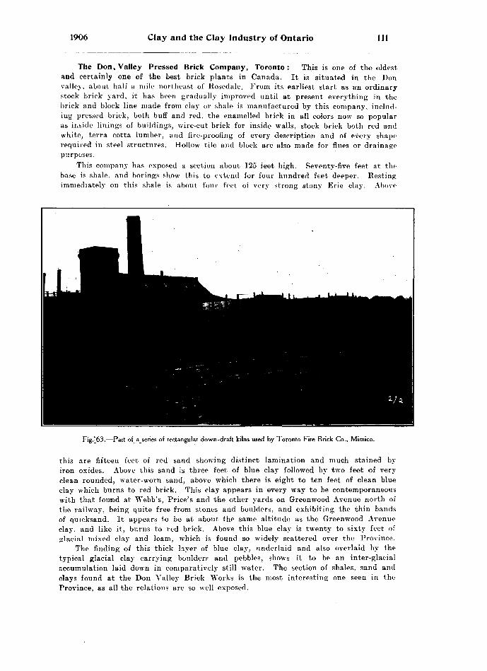
1906 Clay and the Clay Industry of Ontario 111
The Don, Valley Pressed Brick Company, Toronto: This is one of the oldest and certainly one of the best brick plants in Canada. It is situated in the Don valley, aboiit half a mile northeast of Rosedale. From its earliest start as a*n ordinary stock brick yard, it has been gradually improved until at present everything in the brick and block line made from day or shale is manufactured by this company, includ ing pressed brick, both buff and red, the enamelled brick in all colors now so popular as inside linings of buildings, wire-cut brick for inside walls, stock brick both red and white, terra cotta lumber, and fire-proofing of every description and of every shape required in steel structures. Hollow tile and block are also made for flues or drainage purposes.
This company has exposed a section about 125 feet high. Seventy-five feet at the base is shale, and borings show this to extend for four hundred feet deeper. Resting immediately on this shale is about four feet of very strong stony Erie clay. Above
Fig.^63.—Part of a series of rectangular down-draft kilns used by Toronto Fire Brick Co., Mimico.
this are fifteen feet of red sand showing distinct lamination and much stained by iron oxides. Above this sand is three feet of blue clay followed by two feet of very clean rounded, water-worn sand, above which there is eight to ten feet of clean blue clay which burns to red brick. This clay appears in every way to be contemporaneous with that foumd at Webb's, Price's and the other yards on Greenwood Avenue north of the railway, being quite free from stones and boulders, and exhibiting the thin bands of quicksand. It appears to be at about the same altitude as the Greenwood Avenue clay, and like it, burns to red brick. Above this blue clay is twenty to sixty feet of glacial mixed clay and loam, which is found so widely scattered over the Province.
The finding of this thick layer of blue clay, underlaid and also overlaid by the typical glacial clay carrying boulder? and pebbles, shows it to be an inter-glacial accumulation laid down in comparatively still water. The section of shales, sand and clays found at the Don Valley Brick Works is the most interesting one seen in the Province, as all the relations are so well exposed.

112 Bureau of Mines No. 5
All the clays mentioned above are worked by the company into one class or other of clay product. The top boulder clay amd loam is worked by itself in a wire-cut plant for the manufacture of inside brick. Of this class of goods the company made eight million and a half last year. This clay is also made up into porous brick, or what is known as terra-cotta lumber. These are large hollow blocks of any desired shape, made so that nails, screws, etc., may be driven into them. The demand for these is becoming quit*! great, and 600 thousand blocks of various shapes were made by this company last year. They are usually one foot square and two or three or more inches in thick ness, as required.
The red-burning clay, as well as the gray-burning clay, is made into stock brick. This clay is dug and sent in cars from the upper part of the hill to the valley where the cars are dumped on automatic tipples, to a large granulator, or pug-mill. From this the clay feeds to conical rolls. The empty car is hauled to the top of the hill by the descending loaded car, a brake being all that is necessary to govern the speed. The brick are made in a Hercules machine, are dried by a system of Sheldon tfe Sheldon dryers, and are burned in a continuous kiln.
The wire-cut brick, which are made from the gray, or upper Erie clay, which is dug by steam shovel, are made at the rate of 80 thousand per day in a Chambers auto matic wire-cut machine. The bricks are piled on cars and dried in a Sheldon A Sheldon dryer, and are burned, like the stock-brick, in a continuous down-draft kiln. In the manufacture of fire-proofing, the Erie clay, after being thoroughly ground to crush any pebbles, etc., which it may contain, is mixed with a certain percentage of sawdust. It is then forced through a tile machine with a die of the required size. The blocks are piled on cars and are dried in a Sheldon *fe Sheldon dryer, after which they are burned in a down-draft kiln, when the sawdust burns out, leaving the blocks quite porous. This has two advantages : in the first place, the blocks are left so porous that they are light and therefore fit for ceilings, arches, walls, etc., with the minimum of weight; and again, being porous, nails, screws, etc., can be driven into them about as readily as into lumber.
The shales underlying the clay are worked into pressed brick; both buff and red colored. The shale is blasted out as usual. It is drawn up by car and cable and dumped to a panmill, where it is thoroughly ground. It is then fed to three presses. The bricks are taken directly from this to a series of six rectangular down-draft kilns. The output of red pressed brick for last year was three and a half million, and of buff pressed brick about two million. The burning in all these kilns is done with coal. In addition to the six down-draft kilns, this company has two large continuous down-draft kilns, one of which holds 400 thousand brick, the other one and a quarter million brick. These are charged and burned in the usual way and need no description here.
For the manufacture, of enamelled brick this company has the only plant at present in the Province. The pressed brick, whether red or buff as required, are dipped on face in a glaze, after which they are dried. This'dipping is repeated several times, and when a sufficient coat is deposited the brick are burned in a special kiln. This is a muffle kiln heated by coal, but the brick are not exposed to direct heat. Glazed brick of all colors are now made by this company. The output for last year of all classes of enamelled brick was 120 thousand.
Paving BrickThe Ontario Paving Brick Company, Limited, Toronto Junction: Having
now dealt with the manufacture of building brick in yards representing all parts of the Province, we will turn our attention to some of the other products manufactured from our Ontario clays. That most nearly associated with brick is paving brick, whose chief quality is hardness and resistance to wear. Its manufacture is made possible

Clay and the Clay Industry of Ontario 113
Fig. 64.—General view Ontario Paving Brick Company's plant, showing stock of paving brick and Sheldon dryer.
Fig. 65.—Rectangular down-draft kilns for burning paving brick ; Ontario Paving Brick Company.8 M2.

114 Bureau of Mines No. 5
by finding a clay which, in addition to burning hard, can be vitrified by a little higher temperature without causing the whole mass to become viscous and lose its shape. There is only one such plant in the Province of Ontario. Vitrified paving brick differ from building brick in shape and hardness. They are made 4x4x9 inches, with rounded edges so as to prevent chipping and when laid in a pavement outlast any other material for paving. The chief objection, however, to them is that they are noisy. The size of brick mentioned above is somewhat greater than usual. The increase in size is for the purpose of making the brick less noisy by a reduction in the number of joints per square yard of pavement, for it is the rattle of the joints which causes the noise.
This company has a very successful plant situated at Toronto Junction. They are engaged in the manufacture of vitrified paving brick, sidewalk brick, sewer brick, also red and gray building brick. The raw material used is a mixture of Hudson River shale with the Red-top clay, about one-seventh of the latter being added. The shale is hauled to a store shed during the winter and allowed to dry. It is then ground in two pan mills, the ground material being elevated to a hopper from which it is fed to a large pug-mill. This in turn feeds an auger stiff-mud machine, which tiirns out the bricks like an ordinary wire-cut machine. The brick are then re-pressed in a machine which shapes them perfectly and rounds the edges and corners. The re-pressed brick are then piled on steel cars and run into tunnel dryers for forty-eight hours. By this time they are thoroughly dry, when the cars are run out in the opposite end of the tunnels to a series of five rectangular down-draft kilns. The water-smoking is done with wood as usual, and the balance of the burning with soft coal. The brick are burned for about four days after water-smoking, when the temperature is raised sufficiently to vitrify them without causing the whole mass to fuse. The interior of the kiln is fire-brick. The open floor is composed of a specially large fire-brick block. The output, of paving brick from this company is about five million per year. Pavements laid from these brick may be seen in Toronto between the car tracks of the Toronto street railway, and on the following streets: Simcoe, Pearl, Lombard, Henry, Duncan, Concord, also at the Union Stock yards, and at other places. Many of these have been down for fourteen years and are still in good condition. The company is also engaged in the manufacture of building brick both red and white, and its output of these brick is about four million per year. The brick are made in two Doig machines, are dried by the rack and pallet system and burned with wood in four large kilns, two of which are permanent up-draft kilns and two open-shed scoved kilns.
A series of analyses of the Hudson River shale used by this company in the manu facture of paving brick shows a very interesting^ariation, which corresponds ver.T closely with the variation in an Erie clay bank m any part of the Province. This variation has been described above, namely, the removal of lime constituents from the upper part of the bank by ordinary surface weathering. These analyses from two different shale pits are given below, and it will be noticed how completely the lime ha* been removed from the upper parts of the formation. This corresponds entirely witVt the same change that has taken place in the Erie clay banks throughout the Province.
SHALK PIT No, I.
Tup ShaleMid. Shale......... . ..Base Shale............. ..
Alumina. Per cent.
10.491-2.1114.77
Silica. Per cent.
41 63
Lime. ' Magnesia. Per cent. ; Per cent.
99 "' 40
19 71 2.711
Iron. Per cent.
6.279 45
Alkali. Per cent.
2 341 *)6
Loss. Per cent.
8.71
SHALE PIT No. 2.
Top Shale.. Mid. Shale. Kase Shale.
18.6218.4214.77
M).01 59.2451 82
.103.32
16.30
.203.30
1 10.15 jV37
5.83 3.16
6.70 11 .4:.1.60 9.U.1.3(5 17. 74
8a M2.
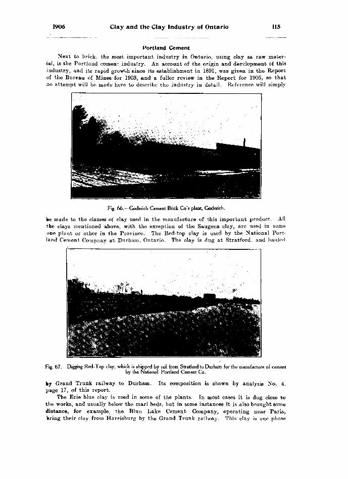
1906 Clay and the Clay Industry of Ontario 115
Portland CementNext to brick, the most important industry in Ontario, using clay as raw mater
ial, is the Portland cement industry. An account of the origin and development of this industry, and its rapid growth since its establishment in 1891, was given in the Report of the Bureau of Mines for 1903, and a fuller review in the Report for 1905, so that Jio attempt will be made here to describe the industry in detail. Reference will simply
Fig. 66.—Goderich Cement Brick Go's plant, Goderich.
be made to the classes of clay used in the manufacture of this important product. All the clays mentioned above, with the exception of the Saugeen clay, are used in some one plant or other in the Province. The Red-top clay is used by the National Port land Cement Company a'fc Durham, Ontario. The clay is dug at Stratford, and hauled
Fig. 67. -Digging Red-Top clay, which is shipped by rail from Stratford to Durham for the manufacture of cement by the National Portland Cement Co.
ky Grand Trunk railway to Durham. Its composition is shown by analysis No. 4, page 17, of this report.
The Erie blue clay is used in some of the plants. In most cases it is dug close to the works, and usually below the marl beds, but in some instances it is also brought some distance, for example, the Blue Lake Cement Company, operating near Paris, bring their clay from Harrisburg by the Grand Trunk railway. This clay is one phase

116 Bureau of Mines No. 5
of the Erie blue clay. In most other cases the blue clay is dug from beneath the marl, close to the company's plant. In the case of the Canadian Portland Cement Com pany, located at Strathcona, the marl is brought to the clay, the marl being dug at Marlbank. This was the old plant belonging to this company, but it is about to be abandoned in favour of the Marlbank works, where the marl and clay are dug together. The International Portland Cement Company, of Ottawa, use limestone with Leda clay, which is dug there from a bank about 25 feet deiep. This is an excellent clay, having composition of Nos. 62, 63, page 31, of this report. An idea of the importance of clay in cement manufacture, can be gathered from the fact that the statistics for 1905 show that 1,254,360 barrels cement were manufactured, haying a value of &1,783,451.
Tile MakingAnother industry of considerable importance is that of tile making. Ordinary
unglazed drain tile are made, or can be made, in almost every brick yard in the Pro vince, while glazed Bewer pipe are made by only three concerns. Drain tile are made from all classes of clay mentioned above, but 'the stronger clay is preferred. The clays are worked in any of the, machines suited to the manufacture of stiff-mud brick, as described above, the form of the die being all that requires changing. Dies making from two-and-a-half to ten-inch tile are in common use, and in some cases, where special orders are received, these ordinary tile are made as large as eighteen inches in diameter. The tile are usually fourteen inches long, and about a half to three-quarters of an inch in thickness. As mentioned above, the stronger clays are preferable for tile making, as they are tougher and can, therefore, be worked stiffer, which is an advantage, since a softer tile will not retain its shape while drying. Freshly made tile should be stood on end for the first twenty-four hours, to prevent flattening. Moreover, they should not be exposed to the wind or sun, as the strong clay will usually crack if dried too quickly. (See fig. 70.) In burning tile they can be so nested, that is, set one within another, as to give a kiln great capacity. Most of the tile in the country are made from Erie blue clay, and burned creamy white. This clay often con tains small pebbles of limestone, and the clay itself is highly calcareous. Both these ingredients are objectionable, as the small pieces of limestone, when burned to lime, as they arc in the burning of the tile, cause the latter to burst, and even the presence of so much lime finely scattered through the clay, seems to cause the tile to scale. These defects can be almost entirely overcome by the addition of a half a shovelful of common salt, to the last two or three fires before the kiln is cooled. This addition of salt will not glaze the tile, as the temperature at which ordinary drain tile are made is not sufficiently high for glazing. '
Sewer PipeThe Toronto and Hamilton Sewer Pipe Company: In the manufacture of sewer
pipe Medina shale is used with the composition shown in No. 23. under shales of Ontario, page 8, of this report. It is blasted out, and brought by Grand Trunk railway to Hamilton from Waterdown, a distance of four miles. Three cars of shale per day are used. The shale is ground in a panmill, and elevated to a hopper, which feeds the tile machine. The manufactured tile are stood in a drying room on end, till they dry sufficiently to be handled. They are then shifted to a hotter drying room, above the kilns, seven in number. These are round down-draft kilns, lined with fire brick. When the tile are well dried, they are stood on end in the kilns, and, after drying, require only forty-five hours to burn, including the glazing, which is done towards the end of the process. When the tile are thoroughly burned, and are raised to such a heat that they are just fusing, as shown by test pieces which can be lifted out by a poker, common salt is thrown in to each fire, and a good hot fire kept up. The salt fuses and is .carried into the kiln, where it meets the tile, which are also just at the fusing temperature, and a splendid glaze is the result. After this, the tile are allowed to cool gradually, for about three days, when the kilns are emptied. Even then they are as hot as th? men can handle. This company manufactures all classes

1906 Clay any the Clay Industry of Ontario 117
of sewer pipe, elbows. T's, etc. All the curved forms are made in plaster of Paris moulds, the clay being fashioned by hand, and all joints, etc., are carefully made by hand moulding. The company shipped four hundred cars of glazed tile of all descrip tions last year, in addition to all local sales.
The Dominion Sewer Pipe Company, Swansea: This company, like the Toronto and Hamilton Sewer Pipe Company, gets its shale from Waterdown. This is the Medina shale, and three cars per day are brought to the works. This shale is ground in a wet-pan mill, which thoroughly pulverizes the clay, and at the same time tempers it to a good stiff mud. It is then carried by elevator to the top of the plant, where it feeds a large tile machine, making tile of all sizes from four to twenty-four inches in diameter. T's, elbows, reducers and expansion joints and all other classes of sewer pipe are made. These, of course, are moulded by hand in plaster of Paris casts, as described above in the Hamilton Sewer Pipe works. They, as well as the tile, are
Fig. 68.—Dominion Sewer Pipe Coy's planl, Swansea ; showing low down-draft kilns.
dried over a lattice floor by steam heat, and when dried are set in a series of six round down-draft kilns. When the tile are thoroughly burned, a salt glaze is put on as usual, after which they are allowed to cool gradually and are then ready for shipping. This is a new company which has not been in operation for a year as yet, so that their output is not known; but they report a very brisk demand for all classes of articles which they are manufacturing.
The Ontario Sewer Pipe Company, Mimico : This company, which is situated alongside the Grand Trunk railway tracks near Mimico, is also engaged in the manu facture of sewer pipe and all varieties of glazed pipe. They, like the others, get their clay shale at Waterdown, bringing it thirty miles by railroad. Their plant is in every way like the Dominion Sewer Pipe Company, so that a description of it will not be necessary. Their output is about equal to that of the Toronto and Hamilton Sewer Pipe Company.
The production of sewer pipe is expanding rapidly in Ontario. In 1900 the value was only S130,635, while in 1905 it was $225,835.

118 Bureau of Mines No. 5
PotteryThe only other clay products of much interest in Ontario are pottery and terra
cotta. The pottery industry a few years ago was of great importance in Ontario, and almost every town had its local pottery. The manufacture of the better classes of pottery, stoneware, etc., in the southern parts of the States, where a better class of clays, much purer than the glacial clays found in Ontario, is to be found, has seriously interfered with the use of the Ontario clays, which are suitable only for the manufac ture of common pottery. The result has been that nine-tenths of the potteries of Ontario have* been forced to close, and those which remain are running on a vary small scale. Pottery is made, however, from both the Red-top clay and the Erie blue clay; the first, turning out red pottery, suitable for flower-pots, etc., the second, a better pottery suitable for domestic purposes, such as churns, crocks, jugs of all sorts, and other common stoneware. The clay in all cases is well washed, and then worked by hand into the desired articles. Most of the white ware is glazed, the glaze varying to suit the requirement.
Fig. 69.—Ontario Sewer Pipe Go's plant, Mimico, showing down-draft kilns used for sewer pipe.
As stated above, very few of the potteries formerly in operation in Ontario now exist. Most of them have been closed up; a few, however, are still engaged in the manufacture of flower-pots, butter crocks, churns, and jugs of various kinds, includ ing vinegar and syrup jugs. The flower-pots, both red and white, are unglazed, while the other classes of pottery are glazed in various ways from clear transparent glazes through mixed glazes to deep brown and almost black. Among the potteries operating in Ontario the following may be mentioned : —J. Taylor, Port Hope, Durham county ; Horning *fe Br.ownscombe, Owen Sound, Grey county; F. Burgarde (fe Son, Egmond- ville, Huron county; S. R. Burns. Bolton, Peel county; J. (fe G. Cranston, Hamilton, "Wentworth county; S. P. Foster, Hamilton, Wentworth county: Wm. Stonehouse, (Carlton West, York county; Joseph Davis, Davisville, York county.

1906 Clay and the Clay Industry of Ontario 119
The method of manufacture, the output and the varieties of goods made in all these works are about the same, so that a general description will be given for them. Both the Erie and Red-top clay are used in the manufacture of pottery. The Erie burns to a white color, while the Red-top burns to red. These clays are usually dug and
Fig. 70.—Strong clay left by potter to dry. Note shrinkage of clay on drying ; hence necessity for adding sand lo strong clay in brick-making to prevent cracking when drying.
re-washed so as to remove all sand, gravel, or other impurities. The washed clay is run into settling tanks and allowed to dry, or it is taken wet and is thoroughly beaten to remove all air from the interspaces in the clay, or, as the potters say. to beat the
Fig. 71.—Huron Pottery, F. Burgarde and Son, Egmondville.
wind out of it. After this, the clay is either moulded by hand for certain of the forms, or is pressed into moulds for other forms. The articles are then slowly dried to prevent cracking, and when thoroughly dry are ready for the kilns if they are to be unglazed.

120 Bureau of Mines No. 5
If glazed ware is required, the thoroughly dried articles are dipped into the required glaze several times until a sufficient coat has adhered. They are then placed in the kiln where they are slowly heated for three or four hours, after which they are fired up to a high temperature, about the same as for brick, that is, from 1700 to 2100 degrees Fahrenheit. The kilns are heated by wood or coal or coke, but the ware is not exposed to direct heat, that is, the fires do not lead through the ware. The inner lining of the kilns is built of fire-brick. The output varies with the demand, so that no definite list can be given. Some of the potteries have now gone into the manu facture of drain tile, since the demand for pottery is not brisk.
R. Campbell and Sons, Hamilton : This pottery deserves special mention, because it is one of the largest doing business in the Province. The business, however, has been largely increased by using foreign clays. A great deal of this comes from the United States.
The firm manufactures many varieties of pottery and stoneware. Tea-pote, coffee pots, stove mouldings, stove linings, and all classes of ordinary stoneware, such as crocks, cuspidors, etc., including stone mugs, jugs and water-tanks, with many other varieties of products, are made by this firm. Most of the clay used is imported from the different parts of the United States, as these clays will stand much higher tempera tures than the clays found in Ontario, and, therefore, a better class of stoneware and crockery can be made from them. The articles are all made in moulds, very little hand work being used in this factory. In many cases the clay forms are turned out as on a turning-lathe. The goods are all.glazed, and after glazing are placed in jackets, which prevent one piece from touching another, while the jackets themselves can be stacked in the kiln and used over and over. This is the largest pottery doing business in Ontario at present, and it is the superiority of these clays which has enabled the manufacturers in the United States to replace the Canadian manufacturers in this line.
Terra-cotta
Another industry closely allied to pottery-making is terra-cotta making. This branch of clay manufacture is not as flourishing in Ontario of late years as it was formerly. Since the burning of the Rathbun Company's terra-cotta plant at Deseronto, there has been little done in this line in Ontario. A few buildings have been erected, using Ontario terra-cotta, made by companies manufacturing pressed brick. Chief among these companies is the Toronto Pressed Brick Company, of Milton. Ontario; and also the Milton Pressed "Brick Company, of Milton. The raw material used here is the red Medina shale, which is also employed in the manufacture of pressed brick. The shale is blasted, and pulverized by a panmill } after which it is wetted and thoroughly worked to expel all the air from between the particles, i. e., the clay is worked, and beaten, till it becomes very close in grain. Plaster of Paris moulds are made from the drawings of the articles required ; from these moulds plaster of Paris casts are made and these in turn are covered by the compact clay. The plaster of Paris is then removed, and the clay model is thoroughly dried, after which it is burned in the usual way. Most of the terra-cotta used in Ontario recently has been imported from the United States, where it has been claimed that the clay is much purer, but since these companies in Ontario have been using the ground shales, the quality of red terra-cotta, could not well be improved. The largest manufacturer of terra-cotta is Mr. Lewis, who operates the Toronto Pressed Brick works at Milton, and splendid examples of his work may be seen at the Macdonald Institute building recently erected at Guelph. Ontario. For any of the other colors of terra-cotta goods, for example, the buff, cream, white, etc.. suitable clays have not yet been found in t?e Province, but for, those requiring red terra-cotta, that manufactured from our Medina shale could scarcely be imoroved on.
INDEX
Brick Coy. .................... 106Abundance of Saugeen clay in Northern
Ontario ............................... 20Adamson, William ...................... 60Addington, brick yard in ................ 56Age classification of Ontario clays .... 6Air shrinkage of clays ................. 38Algoma, brick yards in ................56,67Algoma Commercial Coy. ............... 57Allen, Sam .............................. 58Alliston, brickyard at .................... 99Alluvial clay, used in making brick.... 74Alvinston, brickyard at ................. 74Ami, H. M., quoted ..................30,31,32Analyses of Erie clay ........14, 74, 87, 91, 103
Of Hudson river shale ................ 114Of Leda clays ......................... 31Of Bed Medina shale..... ...78, 89, 90, 105Of Bed Top clay..............17, 91, 95, 104Of Saugeen clay ................... .26, 96, 97
At Espanola ......................... 23Of Western Ontario shales .......... 8
Analysis of boulder clay, Manitoba..... 92Of clay near Stratford ............... 93Of Devonian shale .................... 75Of Erie clay at Alvinston ............ 74
At Beaverton ........................ 87At Stratford ........................ 91At Waterloo .......................... 103
Of local clays ..........................80,93Of Bed Medina shale .................. 78
At Brampton ......................... 89At Pruitland ......................... 105
Of Bed Top clay, at Conestogo ........ 104At Pioton ............................ 95At Stratford ......................... 91
Of Saugeen clay, Pembroke .......... 96Of shale, Port Credit .................. 90
Anderson, William ...................... 71Arnprior, brickyard at ................. 96Artificial draft for drying brick ...... 86Artificial systems of drying brick ...... 48Ashbridge, J. ............................. 108Attercliffe, brickyard at ................ 77Automatic machinery for cutting off brick 45 Automatic wire-cut cut-off machines,
Bechtel ............ ................. 102Avon river ..............................~ 93Aylmer, brickyard at .................... 62Baird A Son, H. G. . Baker Bros. Baker. Wm. Barnard, W. H. .....Barrie, brickyard at
8098969499
Beamsville ................................ 5, 7Brickyard at .......................... 7P
Beamsville Brick and Terra Gotta Coy. 78 Beaverton Brick and Tile Coy. ......... 87Beaverton, brickyard at .............. 87Bechtel brick machinery ................ 102Beohtel Bros. ...........................49,102Bechtel, Byron E. ........................ 102Bechtel disintegrator .................. .43,102
Automatic wire-cut cut-off machines...46,102 Garless dryer ..........................49,102Lubricating die ........................ 102System of trucks ...................... 102
Becket, E. C. .. -......................... 62Beeton, brickyard at .................... 99Bell Bros. ..........................59, 105, 108Belleville, brickyard at .................. 69Bembrose, Thomas ...................... 99Benmiller, brickyard at ................ 70Berg machine for dry-press brick ....... 46Berlin, brickyard at ...,................ 103Billing's Bridge, brickyard at .......... 60Blacker, Wm. ............................. 58
;PAGEBlanchard. J. ...........,. ............ ' 100Blasting shale .............i............. 42Blenheim, brickyard at ...........,..... 72Blue Lake Cement Coy. ................. 115Blyth, brickyards at .................... 70Bolton, brickyard at ..................... 89
Pottery manufacture at .............. 118Boone. J. ................................. 66Boulder clay ..........................5, 6, 11
Of Eastern Ontario ................... 30Manitoba, analysis of .................. 92Nature of ............................... 11
Boulders, igneous, in clay .............. 96Bowmanville, brickyard at ............ 61Bracebridge Brick Company ............ 83Bracebridge, brickyard* at .............. 82, 83Brampton ................................ 5, 7
Brickyard at .......................... 89Brampton Pressed Brick Coy. .......... 89Brantford Brick Coy. ................... 58Brant, brickyards in .................... 58Breslau, brickyard at .................... 103Brick, burning .......................... 50
With natural gas ..................... 77Brick, common ....................... .41, etc.
Face .................................... 41Paving .................................. 41Pressed .................... ............ 41
Brick. Devonian shale used for ........ 75Drying before burning ................ 47Dry-press, moulding of ................ 46Berg machine for making ............ 46
Advantages of ........................ 46Flashing ................................ 54"Hacking" ............ ................ 47How placed in kiln for burning........ 50
Brick kilns ............................... 50Continuous ............................. 52Down-draft ............................. 62Dutch clamp .......................... 50Permanent walls in .................... 51"Scoving" ............................ .. 51
Brick machinery manufactured at Parkhill 80At Waterloo ............................ 102
Brick-making, in winter ................ 97Dry press, process of .................. 41Soft mud process of .................. 41Stiff-mud process of .................. 41Water power utilized in .............. 82
Bricks, re-pressing soft and stiff-mad... 46End-cut ................................. 45Side-cut ................................ 45Steaming of ............................ 39"Water-smoking" of ................... 39
Brickyards:In Addington countyIn Algoma districtIn Brant countyIn Bruce countyIn Carleton county ..................In Dufferin countyIn Durham countyIn Elgin countyIn Essex countyIn Frontenac countyIn Grenville countyIn Grey countyIn Haldimand countyIn Halton countyIn Hastings countyIn Huron countyIn Kent countyIn Lambton countyIn Lanark countyIn Leeds countyIn Lennox countyIn Lincoln county
56565859606161626364656566666970727475767777
[121]

122 Index No. 5
Brickyards—ton/.In Middlesex county ........... .... 79In Muskoka district ..... .. ... . 82In Nipissing district ........ . . . . . . 83In Norfolk county .......... .... 85In Northumberland county ... . . .. 85In Ontario county ............. .. .. . . . 87In Oxford county ............. .. 85In Parry Sound district ........ . 88In Peel county ............... .. 89In Perth county ............... . 91In Peterborough county ....... . .. 94In Prince Edward county .... . . . . 95In Renfrew county ............ .. 96In Eussell county .............. . . 97In Simcoe county ............... . . 99In Victoria county ............ 100In Waterloo county .............. .. 102In Welland county ............ .... 104In Wellington county .......... ... 105In Wentworth county ............. . ... 105In York county .................. .. 106
Brigden, brickyard at ................... 74Briquettes, clay, tests of for tensile
strength .............................. 34Brockville, brickyard at .......... .... 77Brown Bros. ...................... . . . ... 107Brown. J. ............................... . 107Brownsville, brickyard at ............ . 86Bruce county, brickyards in ........ . . 59Buell, John ........................... . 66Buff brick ................................ 13Buff pressed brick from Erie blue clay.. 92Burgarde and Son, F. ............... ..... 118Burgess, G. A. ...... .................... 75Burk's Falls, brickyard at .............. 88Burned clay briquettes, tests of for ten
sile strength .......................... 35Cubes, crushing tests on ..... 37
Burning brick ...................... . ..... 50Importance of ............... ... ..... 54With natural gas ............ .. . 77
Burns. S. R. .................. . ..... . 118Bushell, William ,............ .. 107Butcher, H. ......................... ..... 95
Cain Brick Co. .. . ........ .. ............ .. 61Calcite ......... ... ... . .................... 3Calcium carbonate bands in Saugeen clay 19
In Erie clay ............. ............... 15Calcium sulphate ............. . ........... 75Campbell A Son, R. ........... ... ...... 120Canadian Copper Company ............ 56Canadian Portland Cement Coy. ........ 116Canfield, brickyard at ................... 66Card, N. B. ........ ........... .... . . ..... 59Carless dryer, Bechtel, ..................49,102Carleton county, brickyards in .. ...... 60Carleton Place, brickyards at .......... 75Carlton West, brickyards at ............ 107
Pottery manufacture in .............. 118Cars for undried brick .............. . 48Carter. J. M. ............................ 77Casselman, brickyards at ............ 97Cause of cracking in drying brick .. .... 43Cawrse, J., London ...................... 60Characteristics of Saugeen clay ........18, 19Chatham, brickyards at ................ 72Cheesman, Sam .......................... 106Cherret, E. .............................. ?6Chew and Pratt ......................... 100Chimney flues ............................ 41Clark. D. ............................... . 88Classification of Ontario clays .. ... .... 6Clay, alluvial, used in making brick... i 74
Mode of occurrence ................... 3Boulder ................................ 5,6Chemical composition of .............. 3Definition of ............................ 3Effects of sand in .................... 43Erie ................................6. 11, etc.Glacial, used for brick at Hamilton.. 106How accumulated ...................... 3, 4How formed ........................... 3How transported ...................... 3Lacustrine ............................ - 5, 6Leda .............................. ......31,36Lime in ................................ 3
Local, utilized at London ... . .. .Physical properties of ........ . .......Post-glacial ................. ..,.......Pre-glacial ................... ...Residual ........................... ....,Saugeen ...................... .......Strong, how to temper .. . .. .Tempering .................... .. .... ..Upper Erie or Red-Top .... .. . .Upper Leda .................. . ..Varieties of ..................... . . ... . .Washing ........................ ......Weathering of ..........................
Clay Belt of New Ontario ..... .... .Clay cubes, burned, crushing tests on.. Clay for lining converters at Copper Cliff Clay Industry in Ontario ..............Clay products, manufacture of ..........Clay Workers' Association ........Clays, disintegration of ............
Eastern Ontario ................ .Glacial origin of ................Of Ontario, classification of ...Of Western Ontario . . . .........
Close Brick Coy. ................. .Clothier, A. ........................ . . ...Coal for burning brick ............. . .Cobourg, brickyards at ............Coke for water-smoking brick .... ..Coleman, Dr. A. P., cited ........Collard and Son, W. ............... .....Coloring for red brick ................Color of brick, how determined ......Comber, brickyards at .......... .. . ... .Combined water in clay, expulsion of. Common brick .................., . ... .,..Composition of Ontario shales . .. .
Of Saugeen clay ............. ...Conestogo, brickyard at ...... .... ..
Lacustrine clay at . .. . . .. ... . . .Continuous brick kilns ..... ... ....... ...Cook, Thomas ........... ... .... . ...Cooling a kiln .......... . . ..... . . . . .Cornhill, James - ....... . . . . .. .......... .. .Cracking of drying brick, cause of.....Grain, George . ........ .... . ... . . . ...Cranston, J. A G. ... ... . . .. . ...... .Crawford Bros. .. . ... . .. .. . . . . . .. ... .. .Crediton, brickyards at . . ... . .......Credit valley, shales of ... . . . .. . ..Crowhurst Bros. ......... .. . ... .. ..Cruse Bros. ............. ...............Crushing shale for brick-making .......Crushing tests on burned clay cubes... Curry. William ............. ............Curtin. F. ................ ................
29,10462
118,. 118. 118
7886
"Oahmer, H. D.Davenport, F.Davis, JosephDavisville, pottery manufacture at...Decline of pottery making in Ontario.Delaware, brickyard atDeller and SonDevonian fossils ....... .......... . .... . ... 7Devonian shale .......................... 5, 6, 7
Analysis of ............. ...... . .... 75Characteristics of .......... . ..... . 7Used for brick ........ ..... .... . ...... 75Where worked in Ontario . ... 7
Disintegration of clays .. . .. ...... . 39Of shale ...................... ...... ... . 42
Disintegrator, Bechtel ..... .............. 43Distributing heat in a kiln ........ . 55
Devices for ............................ 55Distribution of Saugeen clay .... . ...... 19Dividing line between clays of Eastern
and Western Ontario ................ 9Dominion Sewer Pipe Coy. ....... .. . 117Don river, lacustrine clay on .. ... . 2S
Shales of ................... .......... 5Don Valley Pressed Brick Coy. .... 111Drain tile ...............................41,116Drew, brickyards at ... ..... ........ 105Drying brick, artificial draft in........ 87
Before burning ............. . ........ 47Old method of .. .. .............. 47

1906 Index. 123
Drying Brick— Con. Open floor dryer "Rack and pallet" method Sooop-roof system The trench plan The tunnel dryer
1J AC!K....... 49....... 47........ 47....... 49.. . . 48
Dry-press brick, advantages of ..... . .. 46Moulding of ................. ........... 46
Dry-press process of making brick...... 41Dufferin county, brickyard in ....... .. 61Dundas bay .......................... .. 106Dundas river ....,....................... 28Durham county, brickyards in ....... . . . 61Dutch clamp kiln ................... . . 50
Eastern Ontario, boulder clay in ... .. 30Eastern Ontario clays .............. ... 29
Saugeen clay in ........................ 33Egmondville, pottery manufacture at .. 118Electric power, brickyards operated by.. 106Elgin county, brickyards in ............ 62Elliott, A. ................................ 75Elliott and Sons ........................ 57Elliott, Eli ................... ..,...... .. 71Enamelled brick ......................111, 112End-cut brick ................ . . . .. 45Entricken, F. ............... ............ 93Erie clay ................................ 6, 11
Analysis of ..........,.......... ....... 14, 74At B*ntfordAt GoderichAt Owen SoundAt Port DoverAt Port StanleyAt Port TalbotAt WalkertonCalcium carbonate in ..Composition ofDistribution ofFor dry-press buff brickIn Don valleyNature ofNear ChathamOn Lake Erie
1312131213131315111112131112
- - 12 Uniformity "of ......................... 12, 14White brick from ...................... 11
Erie clay, used for making brick andtile .................. ...............58,116
At Alliston .... . . . .......... 99At Alvinston . . ........ 74At Barrie ..... . . .. ...... . . 99At Beaverton . ... .. .......... 87At Beeton ..... . . . .. . ... . . . ........ . .... 99At Belleville .... .................... 69At Benmiller ... . ... .. . . . ....... ... . . . . 70At Berlin ...... . .. . . . . .. . . . . . . . . . . . . . .. 103At Blenheim .. . ............ 72At Blyth ....... ... . ...... ... 70At Bolton ...... ...... . - - 89At Bowmanville . . .. ..... . .. 61At Brantford .. . . . ... .... 53, 59At Breslau ...... . .. ............. 103At Brigden ...... . ..... . 74At Brownsville .. . . ...... . ...- 86At Canfield ....... . . ..... .... 66At Chatham ..... . .. ..... 72At Crediton ....... . ..... ...... 71At Delaware ....... .. ........ . -- 78At Drew ............... .............. 105At Essex Centre ... ........... ..... . 63At Hepworth ............ . .. .... 59At Highgate ....... ........... ....... 73At Ingersoll ........................... 85At Kemptville .. ... . .. ... 65At Kerwood ......... .. .. 79At Kingston .......... .... ........... 64At Leamington ....... .. .. ...... 64At Lindsay .......................... 100, 102At Meaford ............ .. ........ ... 65At Midland -............................ 100At Napanee ........... ... ...... -. 77At Niagara Falls ..... ... . .. ..... 105At Orwell ............. ............... - 62At Owen Sound ..... . . .... ... 66At Paisley ........... ........... ..... 59At Parkhill ........... ... . ........- 80At Penetanguishene ................ 99, 100At Perth ...,...........-.....-.......... 76At Peterborough ....................... 94
At PictonAt Port Hope ...At PrescottAt RenfrewAt RidgetownAt St. CatharinesAt SandwichAt SeaforthAt SheddenAt SimcoeAt Stirling ......At StratfordAt StrathroyAt Thamestown .At ThedfordAt Thornbury ...At TorontoAt Tweed
f Mi K................. 95................. 62. ................ 65.. . ........ . . 96, 97.. . .. . ...... ..... 73.. ... . ........ ... 77.................. 64............... . 70................. 62....... ......... 85
. . ............ 69
. . .............. 91........ . .. . .... . 79................. 73. .... .......... 75. ............... 66................ 111. . . . . . . . . .... 70
At Waterloo .......... ..... . . 102, 103At Welland .......... . .. . .. 104At Whitby ............................. 88At Wingham ....... ............... 71
Erie clay, used in making cement:At Blue Lake .......................... 115At Strathcona ............,............ 116Used in making pottery ............118, 119Washing ................................ 76
Espanola, large deposit of Saugeen clay at 22Essex Centre, brickyard at .. .^........... 63Essex county, brickyards in ..... ...... 63Evans, W. A. ........................... 56
"Fat" clays ........... .................. 3Feldspar .......... .. .................. 3Ferrie iron ........... .. . . .... .. . . . . ..... . 54Ferrie oxide .......... . . .. 16
In Leda clay .... . . ........ 31Ferrous iron .......... ... 54Fire brick ............................... 110Fire shrinkage of clays .......... .... 38, 39Flashing brick ...:...................... 54
Method of .............................. 55Flashing or streaking in bricks . 55
Causes of .............................. 55How to prevent ........................ 55
Farpey and Rollins ... .......... . 70Fossils, Devonian ......................... 7Fossils in Devonian shale ................ 75Foster. S. P. .... ......................... 118Fox, S. J., M.P.P. ....................... 100Frank and Sons, C. G. ............... ... 79Frazer and Logan ........................ 70Freedom of Saugeen clay from pebbles.. 24Freek. W. ................................ 99Freezing clay ...................... .... 41Frid Bros. .................... 10SFrid, George .............................. 106Frontenac county, brickyard in 64Fruitland Brick Coy. ........... .. .. . 105Fruitland, brickyard at ....... . 105Fuel for burning brick ................ 53Fusibility of clays ...................... 39Fusing temperature of clay ..... ... 39, 40Fusion of clays ................... . ... 39
Gananoque, brickyard at ............... 76Gathering dry clay .................. .. 41Geological museum at Ottawa ........ . 31Geology of Canada, 1863, quoted... ...11,18,32Gilmore. William ......................... 88"Ginger" .................................. 70Glacial action ...... .................. . 4Glacial clay used for brick-making, 10'. 107,109
For making pottery .................. 118Glacial origin of clays ................. 10Glaciers, transportation of drift by.. 4Goderich, Erie clay at .............. 12Gravel .................................... 13
Terrace at Hamilton .................. 29Underlying Saugeen clay .............. 20, 25
Grenville county, brickyards in .... .... 65Grey county, brickyards in ........... 65"Grogs" ............... -... -....... - -. 43
"Hacking" bricks ........Haldimand county, brickyard in Hales, H. Hall, H.
47667485
124 Index. No. 5
PAI; E Hallat, H. ................................ 63Halton county, brickyards in .......... 66Hambly, E. H. .......................... 61Hamilton .................................. 5,7
Brickyards at .......................... 106Gravel terrace at ...................... 29Lacustrine clay at .................... 28Manufacture of sewer pipe at ........ 116Pottery manufacture at ............ ..118,120
Hancock, John .......................... 106Hand-moulding brick .................... 44Harvard, Ottawa, brickyards at ........ 60Hastings county, brickyards in ........ 69Heat, proper distribution of, in a kiln.. 55Hedden, Russell .......................... 71Henderson, Thomas ...................... 96Hepworth, brickyard at ................ 59Hertzel, George .......................... 71Highgate, brickyard at ................. 73Hill Bros. ................................. 63Hill, J. .................................... 69Hilliard, F. .............................. 97Hinde Bros. .............................. 107Hist, P. .................................. 71Hist, Wm. ................................ 71Hitch. J. .............. .................. 73Hollow blocks............41, 61, 62, 64, 70, 73,
80, 85, 86, 95, 111Use of for "jsooving" .................. 51
Holton, E. ............................... 105Hooker, D. D. ............................ 104Horning and Brownscombe .............. 118Howlett, P. .............................. 74Hudson Eiver shale, analyses of ....... 114
For brick-making ...................... 114Used in making brick at Toronto..... Ill
At Toronto Junction ... ............ 114Hudson Eiver shales .................... 5,6
Characteristics of ..................... 6Where worked in Ontario ............ 5, 7
Humber Bay, brickyards at ............ 107Huntsville, brickyard at ................ 89Huron county, brickyards in ........... 70
Ice age ................................... 4Imperial Land Coy. ..................... 84Impurities in clay ...................... 4,13Ingersoll, brickyards at ................ 85Interglacial clays ....................109, 111
At Toronto ............................ 107International Portland Cement Coy..... 116Iron ...................................... 3
Cause of color in brick ................ 54In Bed-Top clay ...................... 15
Iron oxides, insolubility of .............. 16Iroquois beach .......................... 29Irregularity of contact of Bed-Top with
Brie clay ............................. 15Irwin, James ............................ 86
James. H. ................................ 78James. W. B. .......................... .. 94Jaw crushers ............................. 42Jex and Coy. ............................ 85Johnson, J. .............................. 94, 96Jointing, in Erie clay .................. 13Jordan, D. .............................. 72
........ 86........ 3........ 65........ 72........ 71........ 79........ 55....... 50........ 50........ 50........ 50........ 64........ 71
Eaar, JohnKaolinKemptville, brickyards at .Kent county, brickyards inKerr, Fred.Kerwood, brickyard atKiln, cooling
Dutch clampHow brick are placed in .
Kiln-groundDrainage of
Kingston, brickyard at Kuhn, H. J.Lacustrine clay ........................5, 6, 27
At Conestogo ......................... 28, 29At Hamilton ........................... 28At London ............................ 28, 29At Toronto ............................ 28Comparatively rare in Ontario ........ 28
PAfiEOf sedimentary origin ................ 27Stratified and free from boulders .... 28
Lainson and Son ........................ 107Lainson, J. W. .......................... 107Lambton county, brickyard* in ........ '.Lamination of Saugeen clay ............ 20Lanark county, brickyards in .......... 75Landers, Thomas ......................... 106Leamington, brickyard at ............... 64"Lean" clays ............................ 3Leda clay ............................31, 75, 96
A salt water deposit .................. 31Exposure of at Ottawa ............... 31Ferrie oxide in .......................... 31Lime in ................................. 31Eed colored brick from .............. 31Upper .................................. 6
Leda clays, analyses of ................. 31Leda clay used in making brick and tile:
At Arnprior ............................ 96At Billing's Bridge ............... .... 60At Carleton Place ................. ... 75At Casselman ........................ 97, 98At Harvard, Ottawa .................. 60At Ottawa ............................ 61
Leda clay, used in making cement..... 116Leeds county, brickyards in ............ 76Lennox county, brickyards in............ 77Lethbridge, Charles ................. A... 57Lewis, C. J. .............................. 66Light, William .......................... 62Lime in clay .............................. 3
In Eed-Top clay ...................... 15Limestone ................................. 3
Pebbles in clay, effect of .............. 42Lincoln county, brickyards in .......... 77Lindsay, brickyards at ................ 100, 102Lingham, M. ............................ 69Liskeard Brick, Coal and Lumber Coy... 83Little lakes, near Stratford ............ 93Local clay, section of at London ...... 80Local clays used in making brick and tile,
At Brantford ........................... 53At Carlton West ...................... 107At Hamilton ........................... 106At London ............................. 80At Toronto ......................107, 108, 109Near Stratford ........................ 93
Lochrie, James .......................... 107Logan. J. ................................. 109London Brick Mf e. and Supply Coy..... 80London, brickyards at ................... 80
Lacustrine clay at .................... 28Lowe, J. .................................. 65Lubricating die, Bechtel ................ 102
McClarty, N. ............................ 70McDonald and Co. ...................... 66McGibbon, D. ............................ 62McLaughlin, John ....................... 80McPhail, Prof. A., crushing teats by.... 37Mcvittie. M. .............................. 57Wadoc. brickyard at .................... 69Magnesia in Eed -Top clay .............. 15Maitland river, Erie clay on .......... 12Mantel, George .......................... 71Manufacture of clay products .......... 41Marine fossils in Leda clay ............ 31Marlbank, Portland cement plant at... 116Marshall and Son, Wm. ................ 86Martin and Co. .......................... 74Martin, D. ................................ 73Mason. C. ................................85,107Meaford, brickyards at .................. 65Medina shale used in making brick
at Milton ............................. 66, 68Medina shale used in making sewer
pine ................................116, 117At Hamilton ............................ 116At Mimico .......... .................... 117At Swansea ............................. 117
Medina shales .................... 5, 6Characteristics of ...................... 7Where worked in Ontario ............ 7
Melting points of Seger cones .......... 40Merkley Bros. ............................ 97Middlesex county, brickyards in ........ 78

1906 Index. 125
PAGEMidland, brickyard at .................. 100Mil'er. Prof. W. G., on Saugeen clay.... 19Mills, George ............................ 106Milton .................................... 5,7
Brickyards at ......................... 66, 68Milton Pressed Brick Coy. .............. 68Mimico ................................... 7
Brickyards at .......................... 107Manufacture of sewer pipe ........... 117
Mining clay for brick-making .......... 41Mining shale for brick-making ........ 42Mitchell, brickyard at ................... 94Monkton, brickyards at ................ 94Moody, G. ................................ 73Morley and Ashbridge .................. 108Morley, W. ............................... 108Moulds, brick ............................ 44Moulding brick .......................... 44
Machines for .......................... 44Mouldy Bros. ..........................., 64Mulligan, H. .............................. 60Muskoka, brickyards in ................. 82
Napanee, brickyards at ................. 77National Portland Cement Coy. ........ 115Natural gas, burning brick with ...... 77Naylor, E. ............................... 69New, Edward ............................ 106New Liskeard, brickyards at ............ 83Niagara Palls, brickyard at ............ 105Nipissing, brickyards in ................ 83Nodules in Saugeen clay ................ 83Norfolk county, brickyards in .......... 85North Bay, brickyards at .............. 83Northern Ontario, Saugeen clay in..20 et teq.Northumberland county, brickyards in.. 85Norton, A. ............................... 89Norton, Thomas .......................... 107Norton, W. J. ........................... 99Norwich, brickyards at ................ 86
Odell and SonOdell Bros.Oilman, M.Ontario, clay industry inOntario county, brickyards in
8561
1065687
Ontario Paving Brick Coy. .............. 112Ontario Sewer Pipe Coy. ............... 117Open-air method of drying brick ...... 47Open-floor method of drying brick...... 49Orangeville, brickyard at .............. 61O'Keilly. T. .............................. 61Origin of clays, glacial .................. 10Origin of shale .......................... 3Orton, Prof. Edward, on Seger cones.... 39Orwell, brickyards at .................... 62Ottawa Brick Mfg. Co. .................. 60Ottawa, brickyards at .................. 60
Leda clay at .......................... 31Ott, Michael .............................. 103Owen Sound, brickyards at .......... -. 66
Pottery manufacture at ............... 118Oxford county, brickyards in ............ 85Oxygen, supply of, for burning brick... 54, 55
Paisley, brickyard at .................. 59Pallets for drying brick ................ 48Pan mill, for crushing shale .......... 42Parkhill, brickyard at .................. 80Parry Sound district, brickyards in..... 88Paving brick .......................... ...41,112
On Toronto streets .................... 114Pebbles, removing from clay .......... 42Peel county, brickyards in ............ 89Pembroke, brickyards at .............. 96Penetanguishene, brickyards at .........99,100Permanent walls in brick kilns ........ 51Perth, brickyard at ...................... 76Perth county, brickyards in ............. 91Peterborough, brickyards at ...........94,95Peterborough county, brickyards in .... 94Petrolia, brickyard at ................... 74Physical properties of clay ........... 34
Fusibility .............................. 39Plasticity .............................. 34Shrinkage ............................... 38
SlakingTensile strength
Picton. brickyard at Plasticity of clays "Platting" brick kilns .., Ponsford and Freek Port Credit Brick Coy. . Port Credit, brickyard at Port Hope, brickyard at
i'A r, E 39 34 95 34 51 62 89 89 62
Pottery manufacture at .............. 118Portland cement ......................... 41
Industry ............................... 115Use of clay in .......................... 115
Post-glacial clay ......................... 6Pottery .................................. 41
Manufacture of ........................ 118Powassan, brickyard at ................. 88Pre-glacial clay .......................... 6Pressed brick ............................ 41
From Erie blue clay .................. 91Prescott, brickyard at .................. -. 65
Dam at in glacial period ............. 32Price, I. .................................. 109Price, John .............................. 108Prince Edward county, brickyard in.... 95Pug mill, for tempering clay ............ 43
Quartz, see Silica. Quicksand 13
"Rack and pallet" system of drying brick 47 Bain water, a solvent of calcium car
bonate in clay ....................... 16Bed brick from lacustrine clay ........ 29
From Red-Top clay .................... 15, 17Red colored brick from Leda clay..... 31Red color of brick due to iron .......... 54Red Medina shale, analysis of .......... 78
At Brampton .......................... 89At Fruitland .......................... 105At Port Credit ........................ 89Used for brick and tile......... ..78, 89, 105Used in making terra cotta .......... 120
Red-Top, or Upper Erie, clay .......... 6, 15of 17
15 15 15 15 17 16 15
Used for making pottery ............118,119In cement making .................. 115
AnalysesIron inIrregular contact of with BrieLime inMagnesia inOccurrence ofOrigin ofRed brick from
Weathered surface of Erie Red-Top clay, used in making brick
tile ...'...........................At AllistonAt AttercliffeAt AylmerAt BarrieAt BeavertonAt BeetonAt BellevilleAt Benmil'erAt Billing's BridgeAt BlenheimAt BoltonAt BowmanvilleAt BrantfordAt BrigdenAt BrockvilleAt CanfieldAt ChathamAt CobourgAt Comber
and15
569977629987996970 60 72 89 61 59 73 77 66 T). 85 63
At Conestogo .......................... 104At Essex Centre ...................... 63At Gananoque ........................ 76At Harrisburg .......... ............ 59At Highgate ........................,. 73At Kemntville ........................ 65At Kingston ..,........................ 64At Leamington ........................ 64At Lindsay ........................ 100, 102At Madoc .............................. 69

126 Index. No. 5
Red-Top clay—dm. At Meaford At Mitchell At Monkton At Napanee At Niagara Falls At Norwich At Orangeville .. At Orwell .......At Owen Sound .At PaisleyAt Parkhill .....At Perth ........At Peterborough At Petrolia At Picton
At Port Hope ... At Prescott ......
I'A (J K. ................ 65
.. . ............ 94................ 94........... ..... 77
. . . ...... . . .... ... 105......... . .. .. .. 86................. 61.................. 62........ ...... . 66
............... 59......... ........ 80..... . .......... . 76........:..... .. 94, ................. 73... . . ........... 95.......... .... 62........ ......... 65
At Renfrew ....... . . ..... ... . . . . . .... 96, 97At Ridgetown ..... . . . .. . .. . . .. ...... 73At St. Catharines . . ...... ....... ... . .. 77At Sandwich ...... . . . . .. . ... . .... 64At Shedden ........ . .. ............ 62At Simcoe ......... . . . . . . . . ... .. . .. .. ... 85At Smith's Falls .. . . . . ... . . ..... .. ..... 76At Stirling ........ .. . ... ... . ...... 69At Stratford ........ . . .. ....... 91, 92At Tamworth ........ .. .. .. .. .... 56At Thamestown ..... .. . .. . 73At Thornbury ........ .. .. ... .. .. 66At Toronto Junction . . H4At Tweed ................. .. ........... 70At Welland ............................ 104 ,At Whitby ....................... ... . 88At Woodstock ........................ . 86
Reducing gases in kilns, effect of........ 54Refractory clay ................... .... .56, 110Reid Bros. ......................... . .. . 59Removing pebbles from clay ......... 42Renfrew county, brickyards in ........ 96Re-pressing soft or stiff-mud bricks...... 46Residual clay .......................... 3, 4, 6Richardson, James and Son . ... ...... 79Ridgetown, brickyard at ................ 73Ridler Brick Coy. ............ . .. 99Ries, Heinrich, quoted ......... .. . 34Ring pit, for tempering clay .. ... . .. 43Robinet, J. ...................... .. .. . . . ... 64Rock yard, improved ........... ..... ... . 100Rolls, for crushing shale ...... ... . 42Roofing tile ...................... . . . .... 41Russell county, brickyards in.. . .. .... 97Russell, Joseph .................. .. 108Russell, V. ..................... . . . . . . ..... 88Ryan and Company, T. ....... .. . 105Ryan, M. ....................... ....... . 76
8t. Catharines, brickyard at .... . 77St. Thomas, brickyard at .......... 62Salt, use of in burning tile ......... .. . 116Sand, effect on clay of adding.... . .. 35, 37
In clay, effects of ............. .... 43Saxicava .. ...................... ...... 6Underlying Saugeen clay .............20, 25
Sanding brick moulds .............. .. .. 44Sandwich, brickyards at .............. .. 64Saugeen clay ............................. 6, 18
Abundance of in Northern Ontario .... 20A fresh water deposit ....... .... . . 26Analyses of .................. . ...... 26Analyses of Espanola bank .. .... . 23Bands in, nature of ................. . 20Calcium carbonate bands in .......... 19Causes of lamination of ......... . .. 20Characteristics of ............. . ..... 18, 19Composition of ............. . . ......... 20Distribution of .............. ... . 19Freedom of from pebbles .. . .. 24Glacial origin of ............. ......... 20In Eastern Ontario ............ . .. 33
Characteristics of ........... . . .. . ... 33Laree deposit of at Espanola ... .. 22
On T. A N. O. railway ...... 19Oripin of name ................ .... 18Prof. W. G. Miller, quoted on .. .. 19Red colored goods from ........ . 24Sand and gravel associated with...... 20Suitability of for brick-making . . 25
PAUKThickness of ........................ .. 19Unconformity of with Erie clay ..... 18Underlaid by sand or gravel ...... .. 25Variability of ........................ 20
Saugeen clay, Casselman, analysis of.. 97Pembroke, analysis of ................. 96Refractory ............................. 56Slaking of ............................. 39Used for making brick anl tile....... 56
At Bracebridge .......... .. . . .82, 83At Burk's Falls ........ .. . .. 88At Casselman ......... . 97, 98At Huntsville ......... . . . . .. . . 89At New Liake ird ... .. .. .. . . . 84At North Bay ......... . . . ... .... 83At Pembroke ......... . ... . .. 96At Powassan ............... .... ... 88At Sault Ste. Marie ............. .. 57At Sturgeon Falls ...... .. ...... 84At Walkerton .............. . .... .... 60At Whitefish .................... .... 57Near Sudbury ................. . . .... . 56
Saugeen river ...................... ..... 59Sauls, J. ................................. 56Sault Ste. Marie, brickyards at ... .... 57Sawden, T. .......................... . 108Saxicava sand ....................... . 6, 32Schaefer, F. .......................... - 103"Scintlers," use of in burning brick . 85Scoop-roof method of drying; brick ... .. . 47Scott, J. M. .......................... . 65Scott, R. ............................... ... 84Scott, Robert ............................ 76"Scoving" brick kilns .................... 51Seaforth, brickyard at .................. 70Sedimentary origin of lacustrine clays 27Seger, Dr. Herman, referred to ....... 39Seger fusion cones .................. . 39
Melting points of .................... 40Selenite in Devonian shale ............ 75-Sewer brick .............................. 114Sewer pipe .............................. 41
Manufacture of ................ .. .. . 107,116Output of ............................. . UT
Shale ..................................... 3Crushing ................................ 42Devonian used for brick ........ . . 75Disintegration of ...................... 42Mining ................................-. 42Origin of .............................. 3Red Medina..................78, 89, 105, 120Strength of bricks made from......... 38
Shale used for brick-making ..........90,111Analysis of ............................. 90
Shales, Analyses of Western Ontario... 8, 9'tCredit Valley .................... . ..... 7Devonian .............................. 5, 6, 7Don river .......................... 5Hudson River .................. .5. 6, 7Medina ............................ 5, 6, 7Ontario, composition of .... .... ... 6
Shedden, brickyard at ................... 62Sheldon and Sheldon Coy. ... .. 48Sheldon brick dryer ........ ....... .... . 48Shrinkage of clays ................... . 38Side-cut brick ................... . . .. ^Sidewalk brick ......................... 114Silica ....................... ....... .. .. . 3Simcoe, brickyard at .................... 85
County, brickyards in .......... 99Slaking of clays ........... ... ... .... 39Smith and Colfax ........... ... 105Smith and Crang .............. .. .. 107Smith's Falls, brickyard at ........ .. 76Soak pit, for tempering clay ............ 43Soft-mud process of m aki ne: brick ...... 41Spanish River Pulp and Paper Coy... 22Spanish river. Saugeen clay on ......... 22Standard Clay Coy. ............... P3"Steaming" of bricks ............. 39Stiff-mud brick, moulding of ... . 44
Process of making brick ..... .. 41Stirling, brickyard at ............ . 69Stonehouse. Wm. ........................ 118Stratford Brick, Tile and Lumber Coy.. 12, 91 Stratford, brickyards at ............. .91, 92, 93Strathcona, Portland cement plant at 116
1906 Index. 127
Strathroy, brickyard at . . . . . . . . . . . . . . . . 79Stratification of lacustrine clays . . . . . . 28Strength of bricks made fiom shale .... 38"Strong" clays . . . . . . . . . . . . . . . . . . . . . . . . . . 3
How to temper . . . . . . . . . . . . . . . . . . . . . . . . 43Sturgeon Falls, brickyard at ........... 84Suitability of Saugeen clay for brick-
making . . . . . . . . . . . . . . . . . . . . . . . . . . . . . . .. 25Sullivan, D. . . . . . . . . . . . . . . . . . . . . . . . . . . . . . . 95Swansea . . . . . . . . . . . . . . . . . . . . . . . . . . . . . . . . . . 7
Manufacture of sewer pipe at . . . . . . 117System of trucks, Bechtel . . . . . . . . . . . . . . 102
Tamworth, brickyard at . . . . . . . . . . . . . . . . 56Taylor, J. . . . . . . . . . . . . . . . . . . . . . . . . . .... . . . 118Temperature of brick kilns . . . . . . . . . . . . 51
Fusing of clay . . . . . . . . . . . . . . . . . . . . . . . 39Tempering clay . . . . . . . . . . . . . . . . . . . .. 43
Ring pit for . . . . . . . . . . . . . . . . . . . . . . . . . . .. 43Soak pit for . . . . . . . . . . . . . . . . . . . . . . . . . . 43Use of sand in . . . . . . . . . . . . . . . . . . . . . . . . 43
Tensile strength of clays . . . . . . . . . . . . . . 34Terra Cotta . . . . . . . . . . . . . . . . . . . . . . . . . . . . .. 41, 66
Lumber ..........................41, 111, 112Manufacture of . . . . . . . . . . . . . . .. .. . . . . . 120
Testing temperature of kilns . . . . . . . . . . . . 39Tests of clay briquettes for tensile strength 35Thames river . . . . . . . . . . . . . . . . . . . . . . . . . . . . 72Thamesville, brickyard at . . . . . . . . . . . . . . 73Thedford . . . . . . . . . . . . . . . . . . . . . . . . . . . . . . . . . 5, 7
Devonian shale at . . . . . . . . . . . . . . . . . . . . 75Thibadeau, J. A. . . . . . . . . . . . . . . . . . . 96Thickness of Saugeen clay . . . . . . . . . . . . . . 19Thornbury, brickyards at . . . . . . . . . . . . . . . 66Tile, Devonian shale used for . . . . . . 75
Drain . . . . . . . . . . . . . . . . . . . . . . . . . . . . . . . . . . . 41Making . . . . . . . . . . . . . ... . . . . . . . . . . . . . . . . . 116Roofing . . . . . . . . . . . . . . . . . . . . . . . . . . . . . . . 41Yards . . . 59. 60. 61. 62. 63, 64, 66, 70, 71, 72,
73, 74, 75. 77, 79, 80, 81, 84. 85. 86. 87, 88,89. 91. 94, 95, 96, 97, 99, 100, 102, 103, 104.
Titley and Frost . . . . . . . . . . . . . . . . . . . . .. 107Toronto and^ HamiUon Sewer Pipe Coy. 116Toronto, brickyards at . . . . . , . . . . . . . . . . . ing
Lacustrine' c'ay at . . . . . . . . : . . . . . . . . . . . 28Toronto Junction, brickyards at...... 107, 112Toronto Pressed Brick Works
Manufacture of Terra Cotta by Trucks, Bechtel system of . . . . . . . .Tunnel dryer for drying brick . . Tweed, brickyard at . . . . . . . . . . . . . .
661?01024870
Unburned clay briquettes, tetts of fortensile strength ...................... 35
Unconformity of Saugeen with Erie clay 18 Uniformity of Erie clay:............... 12, 14Up-draft brick kiln* .................... 52Upper Erie, or Red-Top clay...... . 6, 15, 17Upper Leda clay ........................ 6
Variability of Saugeen clay Victoria county, brickyards in Vitrified brick
Ontario Paving Brick Coy.'s plant Volkes. D. ...........................
PAGE 20
100114114
63
Wagstaff, A. H. ................. .. .. 109Wagstaff, David ...... .. . ... . 108Waide Bros. .......... ....... .... .. 80, 81Wakefield Bros. . ............... . . 107Wakefield, Edward ............ ...... 107Walker and Logan ...................... 80, 81Walkerton, brickyards at ..... ........ 60Wallace and Son ............... ........ 83Wardle, John ................... ...... 72Ware, L. H. .............................. 89Warm air for drying brick ..... .... 48, 49Warwick and Son ...................... 80Washing clay, advantages of .......... 76
For pottery making .................... 117For removing pebbles .................. 43
Water, combined, in clay, expulsion of 39Water power utilized in brick-making.. 82"Water-smoking" of bricks ............ 39Waterdown, Medina shale at ..........116, 117Waterloo, brickyards at ..............102, 103
County, brickyards in ................ 102Watson and Hutchison .................. 82Watt and Smith ..................... .. TTWeathered surface of Erie, or Red-Top clay 15Weathering of clay ...................... 3Webb, George ............................ 106Webb, J. E. .............................. 109Welland, brickyard at ... ...... .... 104
County, brickyards in .... ............ 104Wellington county, brickyards in . .. 105Welsh. T. J. .............................. 95Wentworth county, brickyards in . .. . 105Western Ontario shales, analyses of .. . 8Wettlaufer, A. ....... .................... 70Whitby, brickyard at ............. . . 8PWhite brick ........................ . - 11, 13
From lacustrine clay ................ 29White. W. H. ........................ . 66Whitefish, brickyard at ........... .. 57Whittinpton, Geo. ..... ............. . . 77Wigle. J. ................................. 64Wingham, brickyard at ................ 71Winter, brickmaking in .................. 97Wiser and Son, J. P. .................... 65Wood and coal for fuel, compared...... 54Wood for water-smoking brick ... .. .. 53, 55Wood, W. H. ........................ .. 77Woodstock, brickyards at ..... .. ... ... 86Workman, J. ...................... . . 59Wyllie, Bobert ........................... 66-
Yaack, L. ................................ 60York county, brickyards in ........ . 107
FINIS