AP Human Geography - West Linn-Wilsonville School District
189
AP HUMAN GEOGRAPHY Unit One: Thinking Geographically
-
Upload
khangminh22 -
Category
Documents
-
view
5 -
download
0
Transcript of AP Human Geography - West Linn-Wilsonville School District

AP HUMAN GEOGRAPHYUnit One: Thinking Geographically

The AP Exam
• TUESDAY, MAY 5th
•Two-hours and 15 minutes
• 75 multiple choice (60 minutes)
• 3 essays in free response section (75
minutes- answer all 3 FRQ’s)
• Students who score high enough on the
exam can receive college credit for taking the
course.

Course Outline
Thinking Geographically 8-10%
Population and Migration Patterns and Processes 13-17%
Cultural Patterns and Processes 12-17%
Political Patterns and Processes 12-17%
Agriculture and Rural Land Use 12-17%
Cities and Urban Land Use 13-17%
Industrial and Economic Patterns and Processes 13-17%

Syllabus Highlights
• Calendar and Vocab for each unit on website.
• Two Interactive Notebooks.
• Late and Missing Work:
– All work turned in at the end of the unit in the
Interactive Notebook.
– Due dates for specific assignments will serve as
checks on progress and completion.
• Homework:
– Quality time v. Quantity
– Manageable units spread over time = Better
Retention (avoid the cram)
– Pomodoro’s = Focused 20 minutes, 5-6 days per
week.

Unit Breakdown
• NOTEBOOK
– Vocab: Human Geography is a vocab intensive
course. Notebooks will become a comprehensive
study guide in the spring.
– Ultimate Guides: Two page essays on key topics and
concepts.
– Textbook Assignment: 6 Response Questions each
Unit.
– Practice Free Response Questions
– Current Event Articles – Applying human geography
concepts.
– Regional Country Reports

Unit Breakdown
• ASSESSMENT
– Daily Review Quizzes
– Regional Map Quizzes
– Unit Exams
– Multiple Choice
– Free Response Questions
– Comprehensive Semester Exams
• Semester 1: Units 1 - 4
• Semester 2: Units 5- 7

1.1 Introduction to Maps

Spatial ApproachA spatial approach considers the arrangements of phenomena being studied across the earths surface.
It considers location, distance, direction, orientation, pattern and interconnection
Geographers ask spatial approach based questions such as;
Why are things where they are?
How did things become distributed as they are?
What is changing the patterns of distribution?
What are the implications of the spatial distributions for people?

•History = Time
•Geography = Space
Television Introduction by Country

Physical Geography
• Spatial analysis of the structure, processes and location of the Earth’s natural phenomena such as climate, soil, plants, animals and topography.

Latitude
The distance north or south of the equator.

Equator
• Imaginary line that circles the globe exactly halfway between the North and South poles.
• The equator is designated as 0 degrees latitude and the poles as 90 degrees north and 90 degrees south.

Longitude
• The distance east or west of the Prime Meridian.

Prime Meridian
• An imaginary line that circles the runs from pole to pole through Greenwich England. It is designated as 0 degrees longitude.
• On the opposite side of the globe from the Prime Meridian is 180 degrees longitude.

International Date Line• An imaginary line that runs from the North Pole to
the South Pole and demarcates the change of one calendar day to the next.
• It passes through the middle of the Pacific Ocean, roughly following the 180° line of longitude but deviating to pass around some territories and island groups.

Ultimate Guide: What is Human Geography and why is it important?
• https://www.youtube.com/watch?v=dDk06h7Abbw
• Video:
Take notes on video in notebook
• Power Research:
15 minutes
Gather as much info as possible to answer the question
Take notes
• Outline
3-4 minutes
Outline your essay
Topics, examples, definitions
• Power Write
20 minutes of writing
Minimum of two pages completed

What is Human Geography?

Human Geography
• The study of:
• how people make places,
• how we organize space and society,
• how we interact with each other in places and across space,
• and how we make sense of others and ourselves in our locality, region, and world.

Human Geography
• The impact of geography on humans and the impact of humans on geography
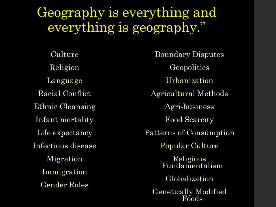
Geography is everything and everything is geography.”
Culture
Religion
Language
Racial Conflict
Ethnic Cleansing
Infant mortality
Life expectancy
Infectious disease
Migration
Immigration
Gender Roles
Boundary Disputes
Geopolitics
Urbanization
Agricultural Methods
Agri-business
Food Scarcity
Patterns of Consumption
Popular Culture
Religious Fundamentalism
Globalization
Genetically Modified Foods

Cartographic Scale
The ratio between the size of objects in the real world and their representation on the map.
Also known as map scale.


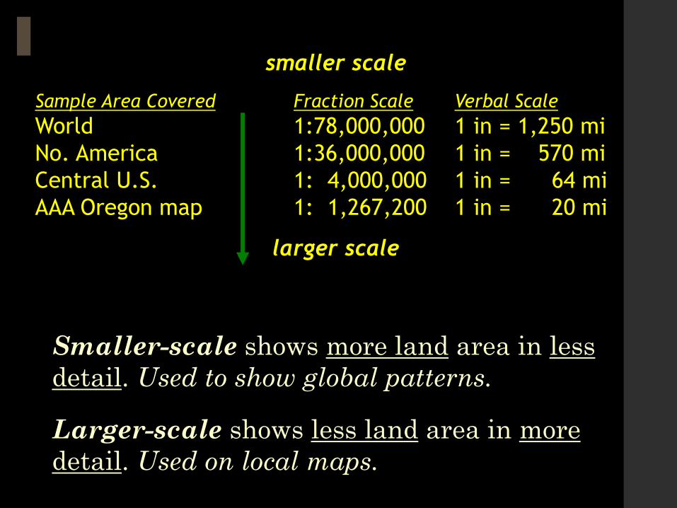
smaller scale
Sample Area Covered Fraction Scale Verbal Scale
World 1:78,000,000 1 in = 1,250 mi
No. America 1:36,000,000 1 in = 570 mi
Central U.S. 1: 4,000,000 1 in = 64 mi
AAA Oregon map 1: 1,267,200 1 in = 20 mi
larger scale
Smaller-scale shows more land area in less
detail. Used to show global patterns.
Larger-scale shows less land area in more
detail. Used on local maps.

Absolute Direction
Directions to a location based on the cardinal points – North, South, East, West.

Relative Direction:
Directions to a location that use relative terms, such as left, right, up, down, over.
Example: Go down McKillican, cross 43, keep walking along the road, on your right will be a red brick building.

Clustering
• Map making tool that allows you to cluster your data into smaller data points so that it is easier to see from the larger groupings.


Dispersal
• Map making tool – spread out overlapping data symbols to make them easier to differentiate.


Elevation
• Mapping techniques to show the height above a certain level - commonly above sea level.
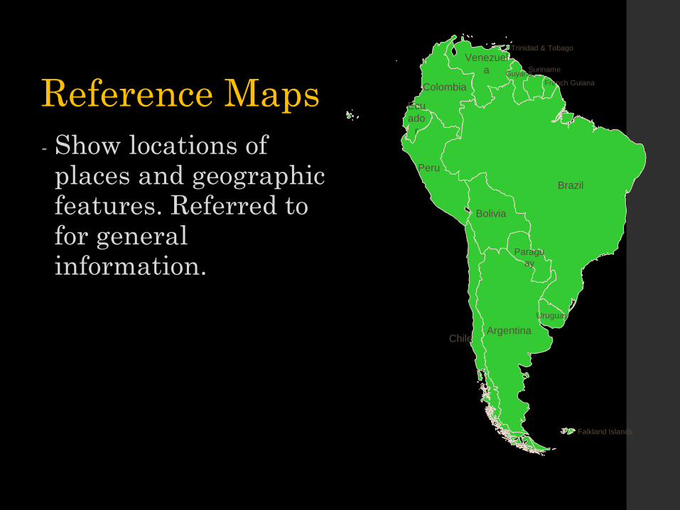
Reference Maps
- Show locations of places and geographic features. Referred to for general information.
Peru
French Guiana
Bolivia
Brazil
Venezuel
a
Colombia
Suriname
Argentina
Paragu
ay
Guyana
Uruguay
Chile
Ecu
ado
r
Falkland Islands
Trinidad & Tobago

Common Types of Reference Maps
1. Political Maps
2. Physical Maps
3. Road Maps
4. Plat Maps
5. Locator Maps

Political Maps: Show human created boundaries and designations, such as countries, states, cities and capitals.

Physical Maps: Show natural features, such as mountains, rivers and deserts.

Road Maps: Shows highways, roads, and streets.

Plat Maps: Show property lines.

Locator Maps: Used in books, newspapers, advertisements to show specific locations mentioned in the text.

Thematic Maps
- Show degree of an attribute, the pattern of its distribution, or its movement.
- Relative locations

Common Types of Thematic Maps
1. Categorical
2. Choropleth
3. Isoline
4. Dot Distribution
5. Graduated Symbol
6. Cartograms

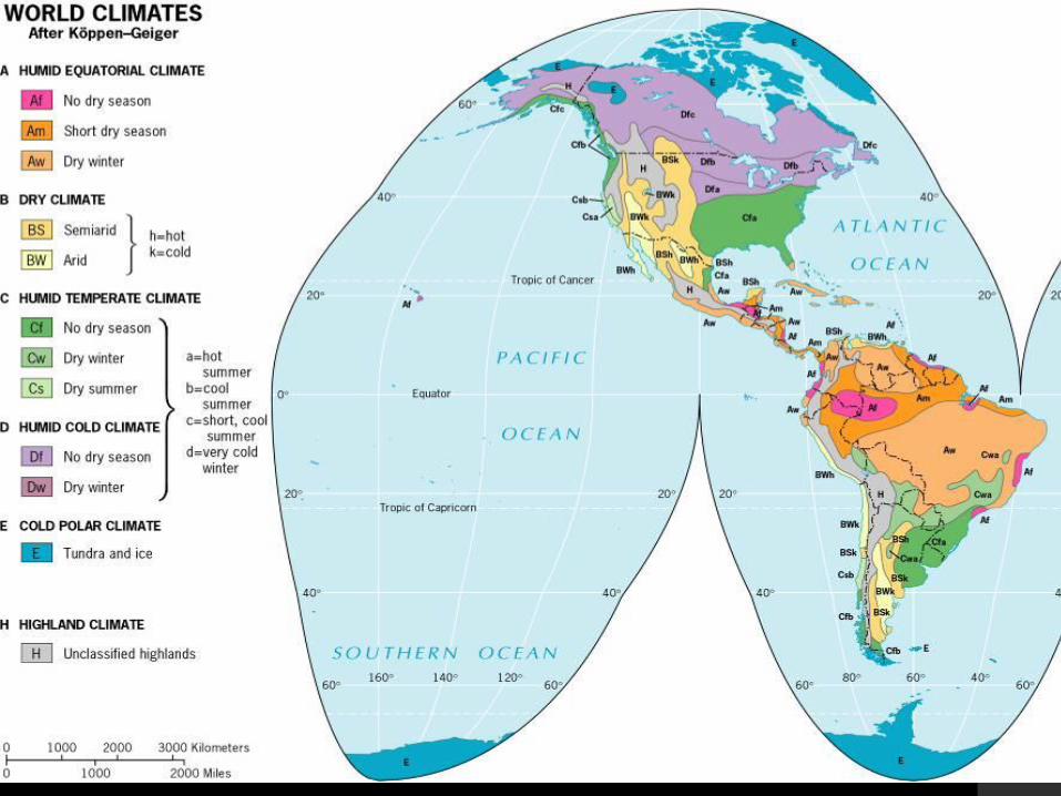
Categorical Thematic Maps
Shows areas that are different in kind
Shows different kinds of the same thing
(category).
Uses several distinct colors to show different
categories
Desert Forest Tundra
Examples: climates, form of government,
political parties

Choropleth Thematic Maps
Shows areas that are different in amount
Use shades of similar colors to show different
values
high value medium value low value
Examples: population density, literacy rates


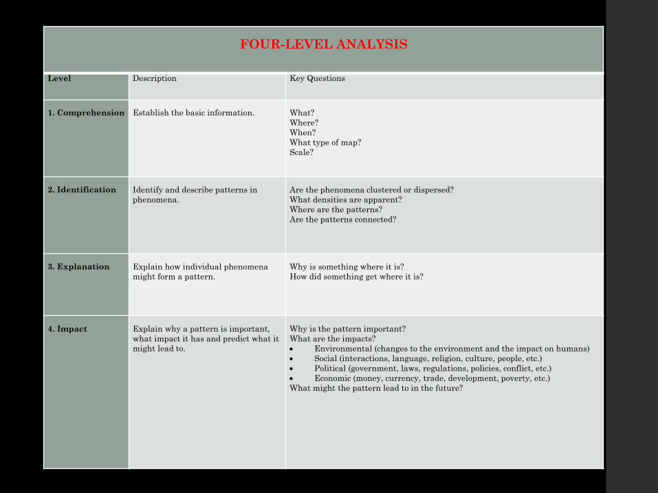
FOUR-LEVEL ANALYSIS
Level Description Key Questions
1. Comprehension Establish the basic information. What?
Where?
When?
What type of map?
Scale?
2. Identification Identify and describe patterns in
phenomena.
Are the phenomena clustered or dispersed?
What densities are apparent?
Where are the patterns?
Are the patterns connected?
3. Explanation Explain how individual phenomena
might form a pattern.
Why is something where it is?
How did something get where it is?
4. Impact Explain why a pattern is important,
what impact it has and predict what it
might lead to.
Why is the pattern important?
What are the impacts?
Environmental (changes to the environment and the impact on humans)
Social (interactions, language, religion, culture, people, etc.)
Political (government, laws, regulations, policies, conflict, etc.)
Economic (money, currency, trade, development, poverty, etc.)
What might the pattern lead to in the future?

Human Development Index (HDI) Rankings
Includes GNI/PPP, Literacy, and Life Expectancy
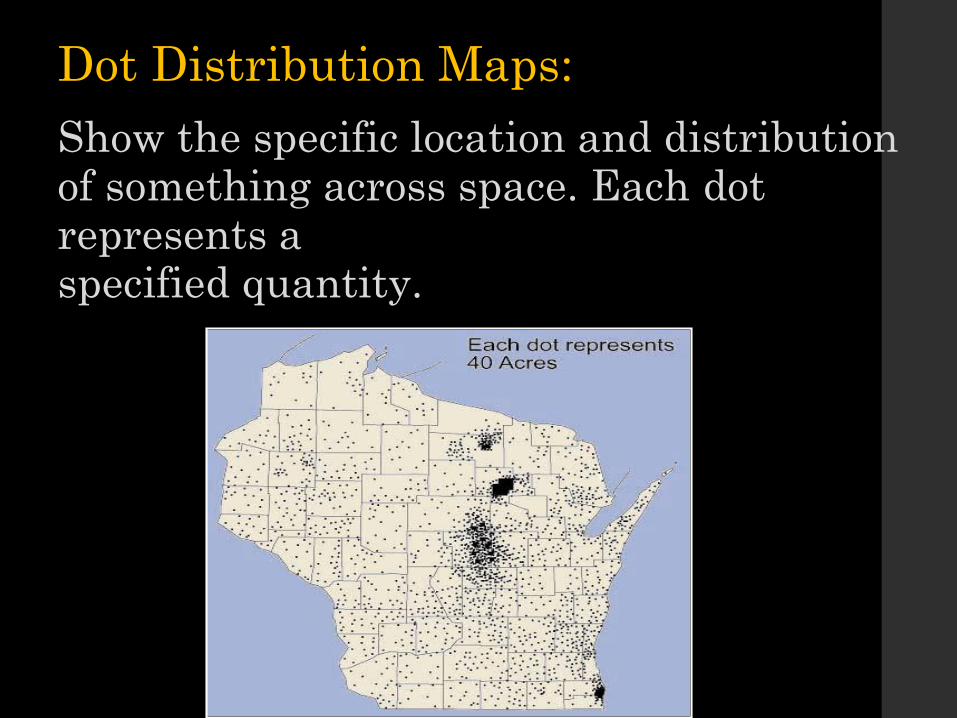
Dot Distribution Maps:
Show the specific location and distribution of something across space. Each dot represents aspecified quantity.

Graduated Symbol Maps:
Uses symbols of different sizes placed in an area to show value or quantity. Often a circle, but could be any symbol – people representing population


Isoline Maps
• Use lines to connect points of equal value to show variations in data across space.
• Lines close together show that the phenomena is changing rapidly. Lines farther apart show the phenomenon staying relatively the same.

Topographic MapsType of Isoline Map.
Most commonly shows changes in elevation using contour lines.
Source: M. Gastner, C. Shalizi, and M. Newman, University of Michigan
http://www-personal.umich.edu/~mejn/election/
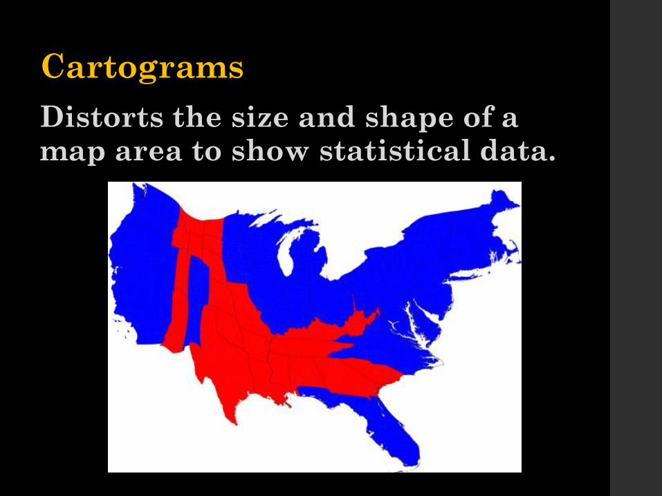
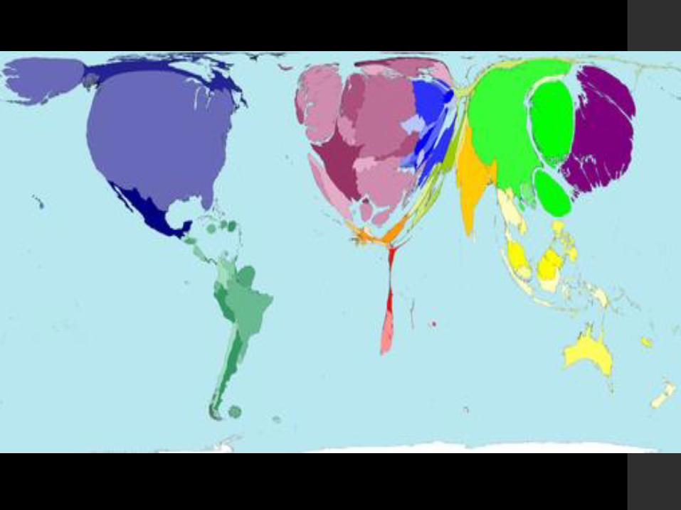
Cartograms
Distorts the size and shape of a map area to show statistical data.


Source: M. Gastner, C. Shalizi, and M. Newman, University of Michigan
http://www-personal.umich.edu/~mejn/election/
Political Party Affiliation Red = Republican Blue = Democrat


Map Projection
Systematic methods of transferring a spherical
surface to a flat map
Distortion must occur in either size, shape, distance,
or direction – all projections are compromises

Common Map Projections
• Mercator
• Peters – Equal Area Projection
• Conic
• Robinson

Mercator Projection
A projection of a map of the world on to a cylinder in such a way that all the parallels of latitude have the same length as the equator, used especially for marine charts and certain climatological maps.

The Mercator Projection
Strengths
Directions are shown accurately
Lines of latitude and longitude meet at right angles
Distortion
Distances between lines of longitude appear constant
Land masses near the poles appear large


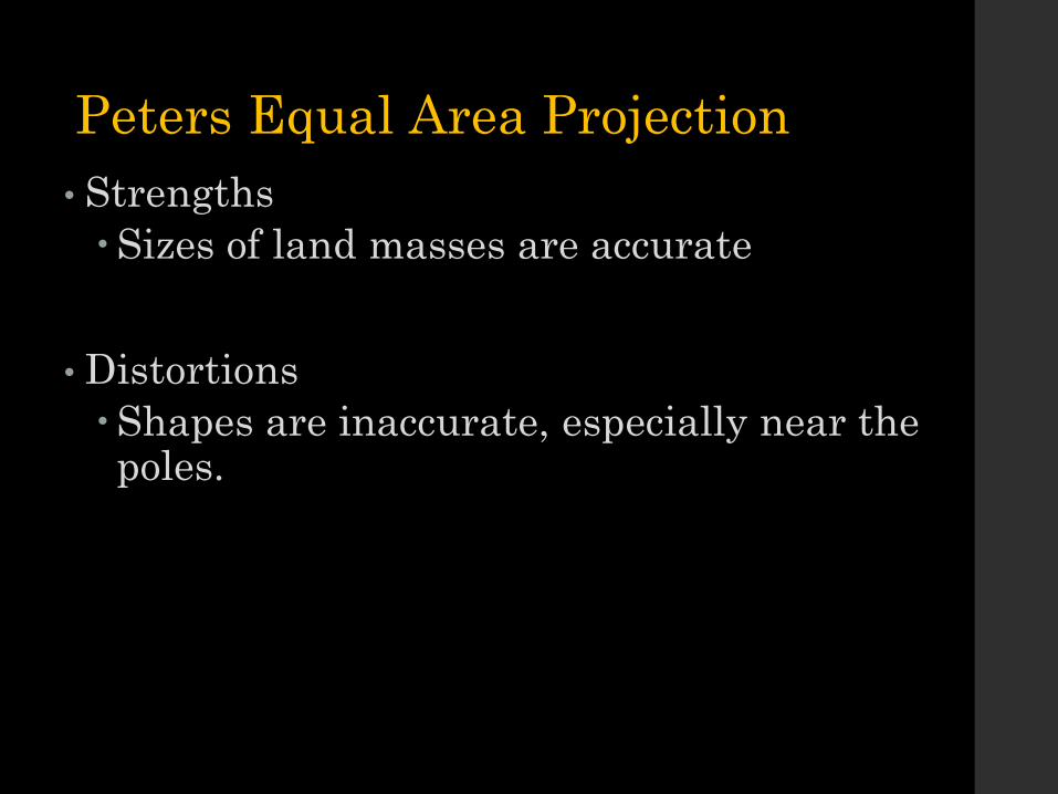
Peters Equal Area Projection
• The Peters projection is a rectangular map projection that maps all areas such that they have the correct sizes relative to each other.
Peters Equal Area Projection
• Strengths
Sizes of land masses are accurate
• Distortions
Shapes are inaccurate, especially near the poles.


Conic Projection
• A map projection based on the concept of projecting the earth's surface on a conical surface, which is then unrolled to a plane surface.

Conic Projection•Conic Projection
• Strengths
Lines of latitude converge
Lines of latitude are curved
Size and shape are both close to reality
• Distortion
Direction is not constant
On a world map longitude lines converge at only one pole


The Robinson Projection
• A map projection which shows the entire world at once. It was specifically created in an attempt to find a good compromise to the problem of readily showing the whole globe as a flat image.

The Robinson Projection
• Strengths
No major distortions
Oval shape appears more globe like than rectangle form
• Distortion
Area, shape, size, and direction are all slightly distorted


Denver metro area


Christian

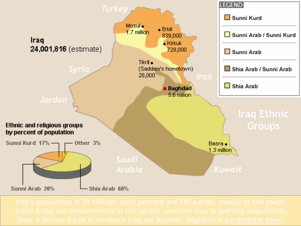
Iraq’s population is 29 million: sixty percent are Shi’a Arab, mostly in the south.
Sunni Arabs are concentrated in the center (western Iraq is sparsely populated).
Over 4 million Iraqis in northern Iraq are Kurdish. Baghdad is a transition zone.
Saudi
Arabia Kuwait
Iran
Jordan
Syria
Turkey
Iraq Ethnic
Groups

1.2 Geographic Data

Remote Sensing
The use of cameras or other sensors mounted on aircraft or satellites to collect digital images of the earth’s surface.

Geographic Information
System (GIS)
A computer system that can store, analyze and display information from multiple digital maps or geospatial data sets.

Global Positioning System (GPS)
• GPS receivers on the earth’s surface use the locations of multiple satellites to determine and record the receivers exact location.

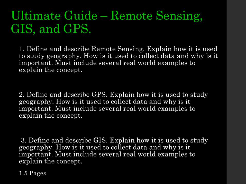
Ultimate Guide – Remote Sensing,GIS, and GPS.
1. Define and describe Remote Sensing. Explain how it is used to study geography. How is it used to collect data and why is it important. Must include several real world examples to explain the concept.
2. Define and describe GPS. Explain how it is used to study geography. How is it used to collect data and why is it important. Must include several real world examples to explain the concept.
3. Define and describe GIS. Explain how it is used to study geography. How is it used to collect data and why is it important. Must include several real world examples to explain the concept.
1.5 Pages

Quantitative Data
• Information that can be measured and recorded using numbers.
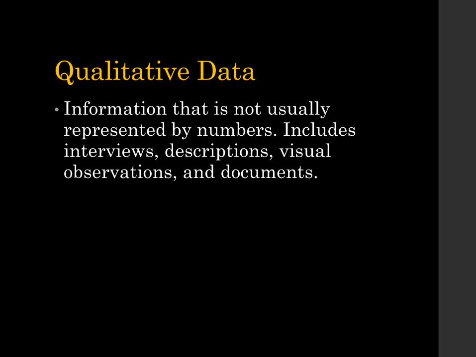
Qualitative Data
• Information that is not usually represented by numbers. Includes interviews, descriptions, visual observations, and documents.

Census Data
• Information gathered through an official count or survey of a population, typically recording various details of individuals.
• The United States Census is a survey conducted every ten years to determine the population for taxation and political representation purposes.

1.3 The Power of Geographic Data

Geographic Models
• Representations of reality or theories about reality, to help geographers see general spatial patterns, focus on the influence of specific factors and understand variations from place to place.
• Models help explain, describe and predict spatial activity and phenomena.

Spatial Models
• Look like stylized maps. Used to show theories about spatial distributions.

Nonspatial Models
• Show theories and concepts using words, graphs or tables. Often show changes over time rather than across space.


1.4 Spatial Concepts

Absolute Location
Uses a coordinate system, such as latitude and longitude, to show the precise plotting of where something is located.
An absolute location describes a fixed position that never changes.


Relative Location
The location of a place in relation to other human and physical features.

Write one paragraph describing the relative location of Caracas, Venezuela

Place
Describes a location by it’s physical and human features.
What does this place look like?
Describes the uniqueness of a location.
The physical and human elements that make it a “place” not just a “space”
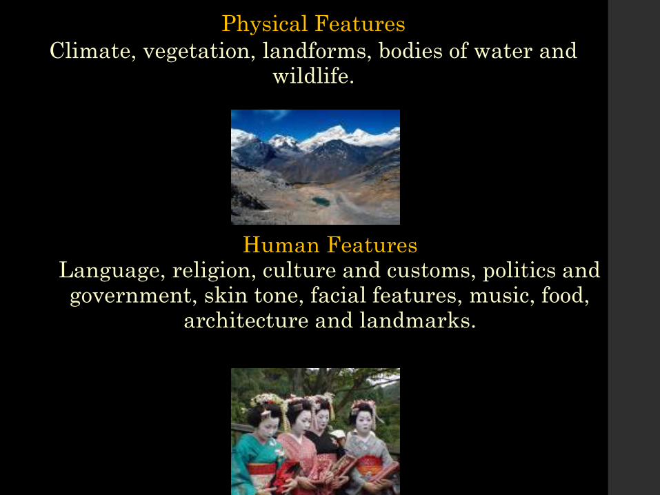
Physical Features
Climate, vegetation, landforms, bodies of water and wildlife.
Human FeaturesLanguage, religion, culture and customs, politics and government, skin tone, facial features, music, food,
architecture and landmarks.

Sense of Place
Infusing a place with meaning and emotion.

Site
The absolute location of a place or activity described by local physical and cultural characteristics.
The characteristics are contained or located within the absolute location.


Situation
The relative location of a place described in relation to the physical and cultural characteristics of the larger region of which it is a part.
The characteristics are outside of the locations absolute location.

Mini Ultimate Guide• Describe the site of West Linn High School
• Describe the situation of West Linn High School
• Describe the site of London
• Describe the situation of London


Space
• Implies the extent of an area

Flows
• The movement of objects from one location to another, such as the number of people in a migration or the amount of goods being traded between two countries.

Distance Decay
The declining intensity of an activity, process or function with increasing distance from its point of origin.

Accessibility
The ease of reaching one location from another.

Connectivity
The degree (amount) of linkage between locations from another.

Time-Space Compression
Refers to the greatly accelerated movement of people, goods and ideas made possible by modern technology. Less time to go across space.

Spatial Distribution
The physical location of a geographic phenomena across space.
There are three main properties of distribution
Density
Concentration
Pattern

Density
The frequency with which something exists within a given unit of area.

Concentration
The spread of something over a given area.
When objects are close together they are clustered or agglomerated.
When objects are relatively far apart they are dispersed.

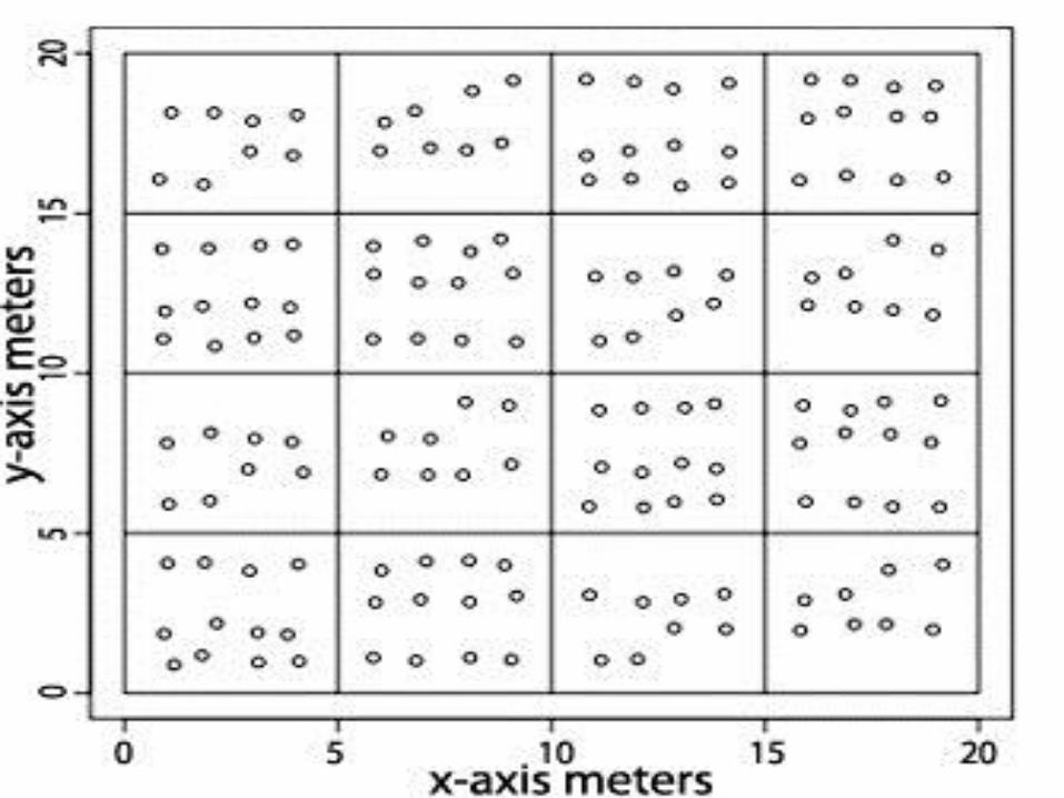
MAP MAKING1. Choose a phenomena that would have a clustered concentration and create a grid map demonstrating the cluster2. Choose a phenomena that would have a dispersed concentration and create a grid map demonstrating the dispersion

A MINI ULTIMATE GUIDE TO DENSITY AND CONCENTRATION
Density and concentration are not the same.
1. Define and EXPLAIN density.
2. Define and EXPLAIN concentration.
3. Create a visual that demonstrates the difference between density and concentration (map, chart, graph).
Guide should be one full page in length. Three quarters writing and one quarter visual.


Spatial Patterns of Distribution
The geometric arrangement of something in a study area.
There are three primary types of spatial distribution
1. Linear
2. Centralized
3. Random
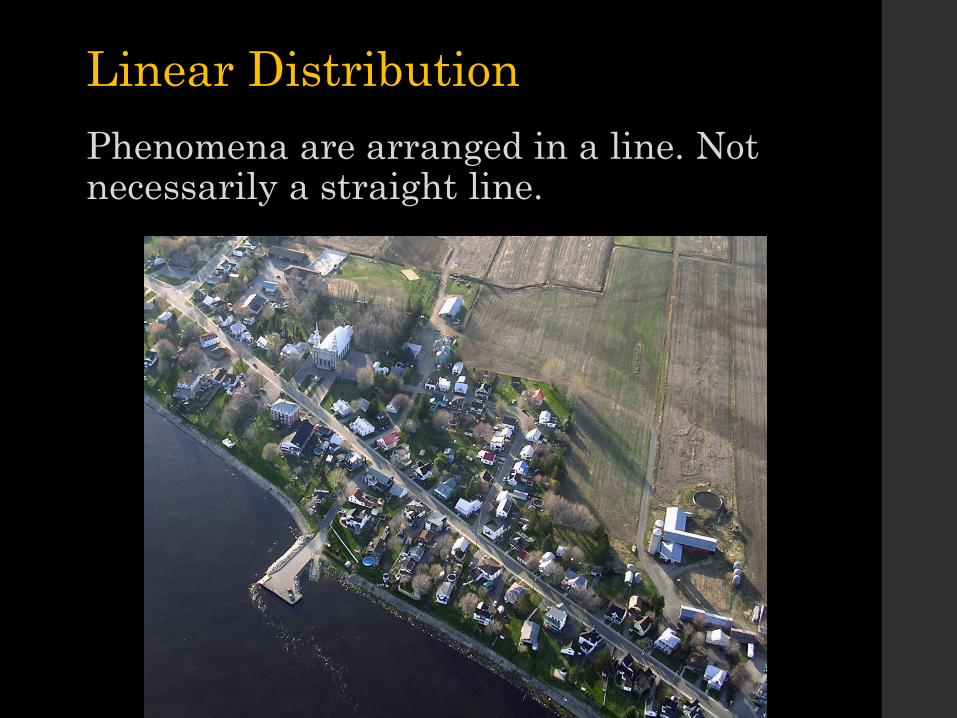
Linear Distribution
Phenomena are arranged in a line. Not necessarily a straight line.

Nucleated or Centralized Distribution
Phenomena are spaced around a central point. Creating a circular cluster.
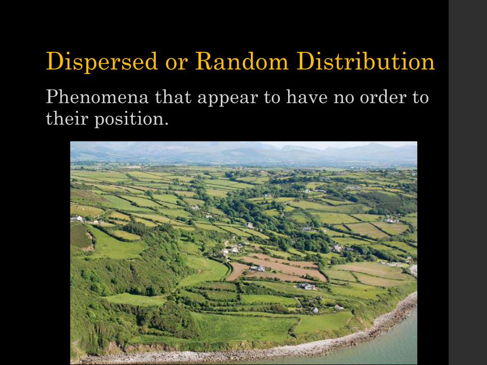
Dispersed or Random Distribution
Phenomena that appear to have no order to their position.

Various Pattern Arrangements
What phenomena could explain the
patterns shown in A, B, and C?

1.5 Human – Environmental Interaction

Environmental Determinism
Social Culture is developed completely by the environment.
Similar environments produce similar cultures.

Possibilism
People develop culture as much as environment.
The environment provides possibilities for a culture.
Technology increases the possibilities.
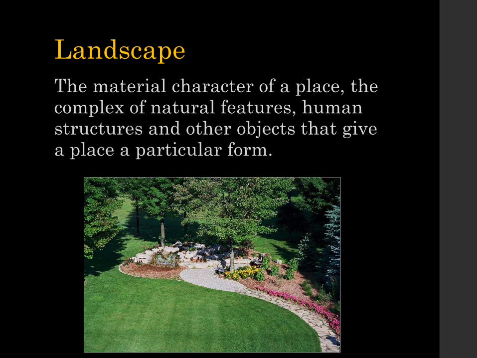
Landscape
The material character of a place, the complex of natural features, human structures and other objects that give a place a particular form.

Built Environment
Human created structures and objects that give form to a particular place.

Cultural Landscape
The visible imprint of human activity and culture on the landscape.


Globalization
A set of processes that are:
- increasing interactions
- deepening relationships
- heightening interdependence
without regard to country borders.
A set of outcomes that are:
- unevenly distributed
- varying across scales
- differently manifested
throughout the world.

1.6 Scales of Analysis

Geographic Scale
• The relationship between the portion of the Earth being studied and Earth as a whole. Specifically, the relationship between the size of an object on the map and the size of the actual feature on earth.
• The standard scales are:
- Global
- Regional
- National
- Local

ULTIMATE GUIDE: Globalization
Video: Focus on identifying both positive and negative aspects of globalization. Gather real world examples.
Additional Research: Gather more info on the good and bad of globalization.
2 pages


PRACTICE FRQ - GLOBALIZATION
A. Define and describe globalization.
B. List and explain at least two positive effects of globalization.
C. List and explain at least two negative effects of globalization.
20 minutes – 2 pages.

1.7 Regional Analysis

Region
An area on the Earth’s surface that has a marked degree of homogeneity of some phenomenon.
Types of Regions
1. Formal
2. Functional
3. Perceptual.

Regionalization
• The process geographers use to divide and categorize space into smaller units.

Formal Region
Formal regions are areas that share a common human or physical geographic feature.
Also known as Uniform or Homogeneous Regions
Feature is quantifiable – can be counted or measured.
Defined border can be drawn around the region

Formal Regions – Common Human or Cultural Features
• Language
• Religion
• Nationality
• Political Identity
• Ethnicity


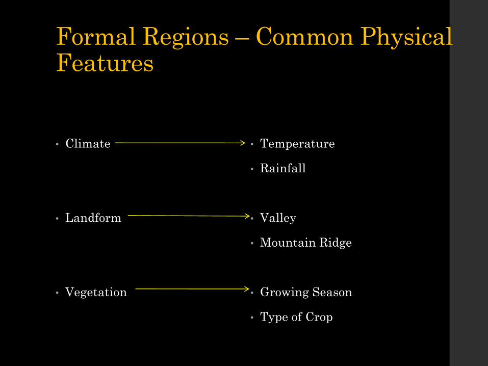
Formal Regions – Common Physical Features
• Climate
• Landform
• Vegetation
• Temperature
• Rainfall
• Valley
• Mountain Ridge
• Growing Season
• Type of Crop


Functional Region
The deliberate organization of space to accomplish some function.
It is organized around a node or focal point that draws people from the surrounding area.
Also known as a Nodal Region

Functional RegionsShopping Regions – MallTransportation – Airport, port, train stationFinancial – BankEntertainment – Providence Park , Sydney Opera House

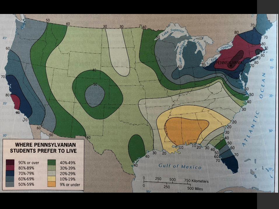
Perceptual Region
Region determined by people’s beliefs, emotions and attitudes about an area.
Also known as a Vernacular Region.
Perceptual regions do not have specific boundaries.
Because people’s beliefs about a region may be based on stereotypes, the perception may not even be true or common in the region.


Mental Maps Maps we carry in our minds of places we have been and places we have heard of.
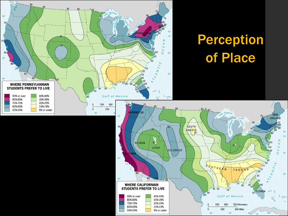
Where Pennsylvanian
students prefer to live
Where Californian
students prefer to live
Perception
of Place

Activity Spaces
The places we travel to routinely in our rounds of daily activity.

World Regions
• AP Human Geography divides the World into 10 large regions and 22 subregions.

Large Regions
• Divides world into 10 regions
• The 7 continents + 3 cultural regions, based on shared languages and histories.
Central America
Sub-Saharan Africa
Russian Federation

Subregions
• A Subregion shares some characteristics with the larger region, but is distinctive in some ways.
• Example – Brazil
Shares many common characteristics with other South American countries, such as Roman Catholic religion.
Brazil’s primary language is Portuguese, which makes it unlike any other country in the Spanish speaking Latin America.


MINI ULTIMATE GUIDE• Describe how friction of distance has been impacted by
globalization.
• 2 paragraphs

• FRQ’S ARE STRUCTURED RESPONSES
No formal introduction
No conclusion
No transition sentences needed
Spelling and grammar will not be graded
Unless it makes your response unclear/confusing
Handwriting should be as legible as possible

• RESPONSES SHOULD BE 2-3 PAGES IN LENGTH!!!!
• PLAN ON 20 MINUTES PER ESSAY
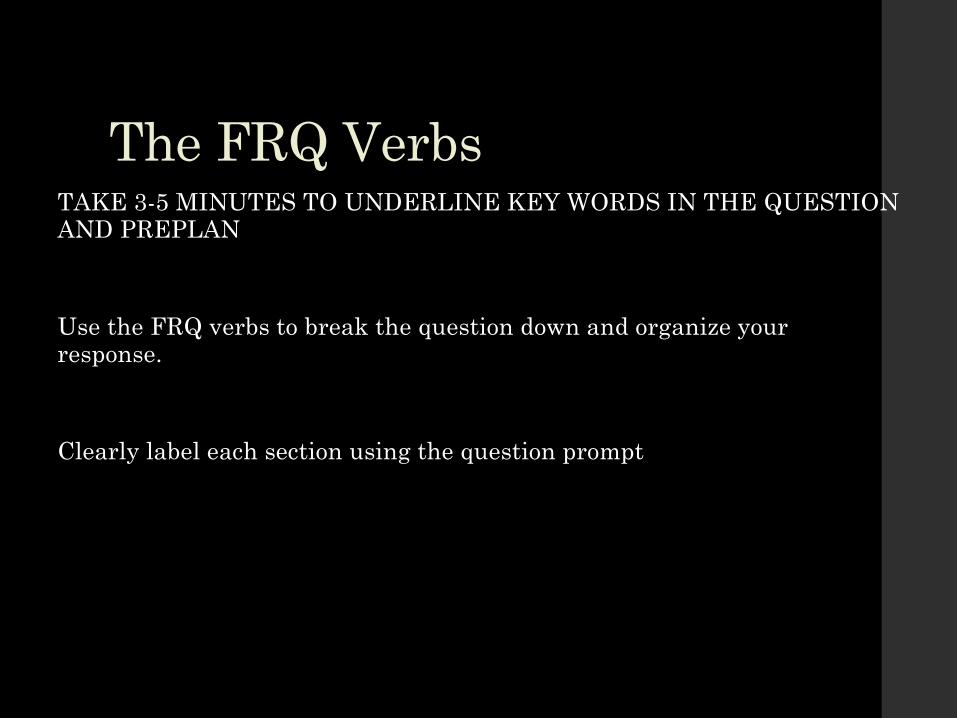
The FRQ VerbsTAKE 3-5 MINUTES TO UNDERLINE KEY WORDS IN THE QUESTION AND PREPLAN
Use the FRQ verbs to break the question down and organize your response.
Clearly label each section using the question prompt
• REMEMBER THIS IS A GEOGRAPHY EXAM
• WRITE LIKE A GEOGRAPHER
• USE YOUR GEOGRAPHY VOCAB
SCALE
REGIONS
ALL THOSE GEOGRAPHIC CONCEPTS

WRITE AS IF YOUR READER HAS NO
KNOWLEDGE ABOUT THE TOPIC!
EXAMPLES, EXAMPLES, EXAMPLES!
The more “real” the better.Use Hurricane Harvey vs. general hurricane

CRAM SESSION
Review, study and be prepared to
write about
REGIONS

A. Define and explain formal region.
B. Identify a functional region and explain why it would be considered a functional region.
C. Identify a vernacular region and explain why it would be considered a vernacular region.
C. Identify the type of region which is most difficult to clearly define and describe. Give one real world example to explain why this type of region is more difficult to define.


Which statement describes the relative location of Barcelona, Spain?
a) 386 miles west of Madrid and 644 miles south of Paris
b) In the Northern and Eastern Hemisphere
c) 41 degrees N, 2 degrees E
d) The capital of the Catalonia region
e) One of the largest cities in Spain


• Two Columns
• Divide Vocab (Calendar)
Sort of Understand
Do not Understand at all


Source: M. Gastner, C. Shalizi, and M. Newman, University of Michigan
http://www-personal.umich.edu/~mejn/election/
2008 Presidential Election Red = McCain Blue = Obama

Source: M. Gastner, C. Shalizi, and M. Newman, University of Michigan
http://www-personal.umich.edu/~mejn/election/
2008 Presidential Election Red = McCain Blue = Obama