Persistent multi-decadal Greenland temperature fluctuation through the last millennium
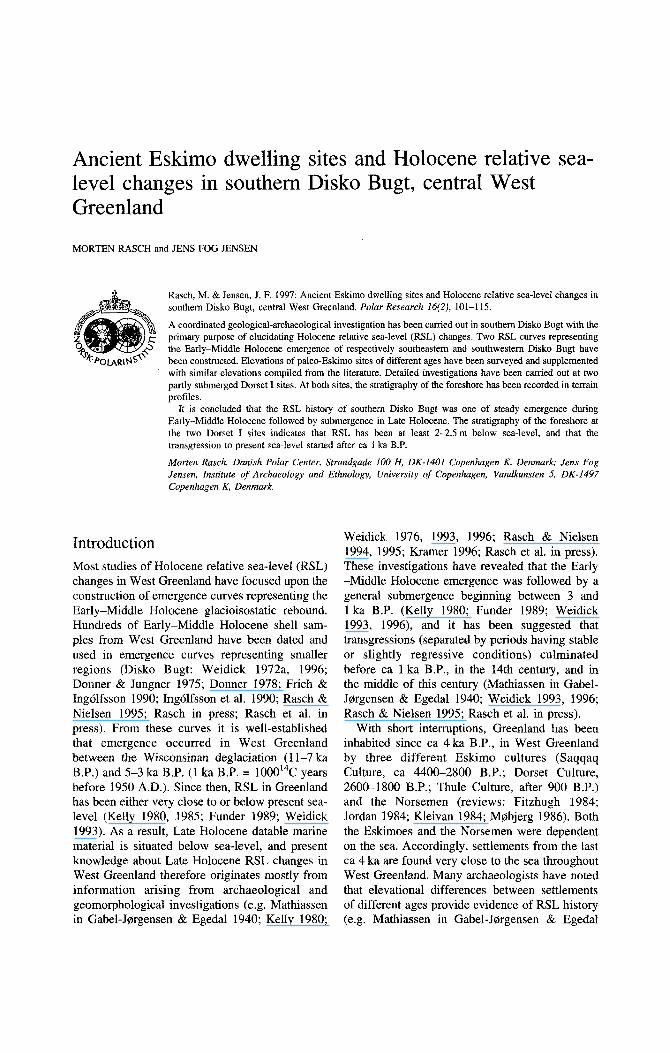
Ancient Eskimo dwelling sites and Holocene relative sea- level changes in southern Disko Bugt, central West Greenland
MORTEN RASCH and JENS FOG JENSEN
Rasch, M. & Jensen, J. F. 1997: Ancient Eskimo dwelling sites and Holocene relative sea-level changes in southern Disko Bugt, central West Greenland. Polar Research 16(2), 101-1 15.
A coordinated geological-archaeological investigation has been carried out in southern Disko Bugt with the primary purpose of elucidating Holocene relative sea-level (RSL) changes. Two RSL curves representing the Early-Middle Holocene emergence of respectively southeastern and southwestern Disko Bugt have been constructed. Elevations of paleo-Eskimo sites of different ages have been surveyed and supplemented with similar elevations compiled from the literature. Detailed investigations have been carried out at two partly submerged Dorset I sites. A1 both sites, the stratigraphy of the foreshore has been recorded in terrain profiles.
It is concluded that the RSL history of southern Disko Bugt was one of steady emergence during Early-Middle Holocene followed by submergence in Late Holocene. The stratigraphy of the foreshore at the two Dorset I sites indicates that RSL has been at least 2-2.5 m below sea-level, and that the transgression to present sea-level started after ca 1 ka B.P.
Morten Rasch, Danish Polar Center, Strundgade I00 H, DK-1401 Copenhagen K, Denmark; Jens Fog Jensen, Institute of Archaeoloxy arid Ethnology, University of Copenhagen, Vundkunsten 5, DK-1497 Copenhagen K, Denmark.
Introduction Most studies of Holocene relative sea-level (RSL) changes in West Greenland have focused upon the construction of emergence curves representing the Early-Middle Holocene glacioisostatic rebound. Hundreds of Early-Middle Holocene shell sam- ples from West Greenland have been dated and used in emergence curves representing smaller regions (Disko Bugt: Weidick 1972a, 1996; Donner & Jungner 1975; Donner 1978; Frich & Ingdfsson 1990; Ingdlfsson et al. 1990; Rasch & Nielsen 1995; Rasch in press; Rasch et al. in press). From these curves it is well-established that emergence occurred in West Greenland between the Wisconsinan deglaciation (1 1-7 ka B.P.) and 5-3 ka B.P. (1 ka B.P. = 1000'4C years before 1950 A.D.). Since then, RSL in Greenland has been either very close to or below present sea- level (Kelly 1980, 1985; Funder 1989; Weidick 1993). As a result, Late Holocene datable marine material is situated below sea-level, and present knowledge about Late Holocene RSL changes in West Greenland therefore originates mostly from information arising from archaeological and geomorphological investigations (e.g. Mathiassen in Gabel-Jorgensen & Egedal 1940; Kelly 1980;
Weidick 1976, 1993, 1996; Rasch & Nielsen 1994, 1995; Kramer 1996; Rasch et al. in press). These investigations have revealed that the Early -Middle Holocene emergence was followed by a general submergence beginning between 3 and 1 ka B.P. (Kelly 1980; Funder 1989; Weidick 1993, 1996), and it has been suggested that transgressions (separated by periods having stable or slightly regressive conditions) culminated before ca 1 ka B.P., in the 14th century, and in the middle of this century (Mathiassen in Gabel- Jorgensen & Egedal 1940; Weidick 1993, 1996; Rasch & Nielsen 1995; Rasch et al. in press).
With short interruptions, Greenland has been inhabited since ca 4 ka B.P., in West Greenland by three different Eskimo cultures (Saqqaq Culture, ca 4400-2800 B.P.; Dorset Culture, 2600-1800 B.P.; Thule Culture, after 900 B.P.) and the Norsemen (reviews: Fitzhugh 1984; Jordan 1984; Kleivan 1984; Mobjerg 1986). Both the Eskimoes and the Norsemen were dependent on the sea. Accordingly, settlements from the last ca 4 ka are found very close to the sea throughout West Greenland. Many archaeologists have noted that elevational differences between settlements of different ages provide evidence of RSL history (e.g. Mathiassen in Gabel-Jorgensen & Egedal

102 M. Rasch & J. F. Jensen
1940; Roussel 1941; Knuth 1958; Larsen & Meldgaard 1958; Mobjerg 1986; Hansen & Brinch Petersen 1989b, 1990; Kramer 1996).
In 1988 and 1990 Saqqaq (4400-2800 B.P.) and Dorset (2600-1800 B.P.) sites were registered in large numbers in Disko Bugt. Based on these registrations, Hansen and Brinch Petersen (1989b, 1990) noted that Saqqaq sites generally occur at higher elevations than Dorset I sites. A similar elevational distribution of paleo-Eskimo sites occurs in the Sisimiut area, where Saqqaq sites consistently occur at levels above 8 m a.s.1. while Dorset sites occur at levels below 8 m a.s.1. (Kramer 1996).
The fact that many Thule Culture (after ca 900 B.P.) ruins from the 17th and 18th centuries are damaged or partly submerged by the sea through- out western and southeastern Greenland (Mathias- sen 1930, 1931, 1933, 1934, 1936a, 1936b) has
been interpreted as evidence of low RSL during the 17th and 18th centuries and rising RSL thereafter (Mathiassen in Gabel-Jorgensen & Egedal 1940). Investigations of Norse settlements (ca 1000-600 B.P.) have also contributed to our knowledge of RSL changes in the recent past. A submerged church at Sandnes in the Nuuk area is a frequently cited example (Bruun 1918; Roussell 1936, 1941; Weidick 1976).
In this paper, new and previously published archaeological and geologicaVgeomorphologica1 observations are combined in a discussion of Holocene RSL changes in southern Disko Bugt. In this area, 45 shell samples (all older than ca 4 ka B.P.), 61 archaeological samples (all younger than ca 4 ka) and 1 gyttja sample have been dated. In addition, some of the most extensive archaeolo- gical excavations in Greenland have been carried out in the area (Meldgaard 1952, 1983, 1991;
Fig. 1. Location map. The frames A and B indicate detail maps of southwestern and southeastern Disko Bugt which are represented in Figs. 2 and 4, respectively. Place names are spelled in accordance with current Greenlandic orthography.

Ancient Eskimo dwelling sites and Holocene relative sea-level changes 103
Larsen & Meldgaard 1958; Mathiassen 1958; Mobjerg 1986; Grannow & Meldgaard 1988, 1991; Gronnow 1990, 1994; Hansen & Jensen 1991; Evaldsen & Brinch Petersen 1995; Jensen 1995), and registration of former Eskimo dwelling sites is at an advanced stage (Mathiassen 1934; Larsen & Meldgaard 1958; Hansen & Brinch Petersen 1989a, 1989b, 1990; Jensen et al. 1995). The datings have allowed us to construct two RSL curves representing southeastern and southwes- tern Disko Bugt, respectively. More detailed information about RSL changes during the last ca 4 ka has been achieved by studying elevation differences between Eskimo sites of different ages and by studying the stratigraphy beneath the foreshore at two partly submerged Dorset I sites.
Physical setting
The study area includes southern Disko Bugt between 68'30" and 69'15" and between 50'00'W and 54'00'W (Figs. 1, 2 and 4). To the east, the area is bordered by the Greenland Ice Sheet. The general altitude of the area decreases westwards from ca 500 m a d . near the Greenland Ice Sheet to below 100 m a.s.1. east of Aasiaat. No local glaciers occur in the area.
Bedrock consists mainly of Precambrian gneiss (Escher et al. 1976). The landscape has developed by aerial scouring by the Greenland Ice Sheet during the Quaternary glaciations (Sugden 1974). Southwestern Disko Bugt is fringed by an archipelago. Towards the east, a landscape with plains dissected by troughs and fiords becomes more common.
Southern Disko Bugt was deglaciated between ca 11 and ca 7ka B.P. The oldest date on postglacial marine fossils from central West Greenland (> 11.8 ka B.P.) originates from Nas- suttooq a little southwest of the study area (Kelly 1985). During the deglaciation, there were probably periods of glacial readvances or still stands (Weidick 1972a; Donner & Jungner 1975; Funder 1989; Funder & Hansen 1996). The oldest date on marine shells from the eastern part of the study area is 7210 * 170 B.P. (Hel-369, see Table 1). The altitude of the Holocene marine limit increases westward from ca 70m a.s.1. near the Ice Sheet to above 120m a.s.1. west of Aasiaat (Donner & Jungner 1975; Funder 1989; Funder & Hansen 1996; Rasch 1996).
The wave climate in southern Disko Bugt is characterised by wind waves from the east caused by katabatic winds from the Ice Sheet and by swell from the west caused by the passage of depressions in Davis Strait and Baffin Bay. Generally, the wave energy decreases. eastwards from the outer skerries of the archipelago towards the mainland coast. Sea ice normally covers Disko Bugt from the middle of December to the beginning of June (Danish Meteorological Insti- tute 1967-1986). Spring tidal range is a little more than 2.5 rn (Farvandsvaesenet 1994).
Methods
The datings applied in this investigation have been carried out by many different laboratories. Datings given without ~3~~C-values have not been corrected for isotopic fractionation. Errors intro- duced by lack of 6'3C-corrections are assumed to be less than *80 years on shell samples, while dates on terrestrial samples are assumed to be up to 200 years too young. Datings on terrestrial material with given 613C-values have been corrected to 613C = -25.0%0 PDB. Datings on marine material with given 613C-values have been corrected to 613C = 0.0%0 PDB. The marine reservoir effect in Greenland is expected to be 410 years (Rasmussen & Rahbek 1996).
Dated samples have been collected by different scientists using different methods for altitude determinations. As a result, errors on sampling altitudes vary from sample to sample. Unless otherwise stated in Table 1, errors on sampling altitudes on geological samples (shells) are expected to be less than +5 m, while altitude errors on archaeological samples are expected to be less than * 2 m. The sampling altitudes on most archaeological samples were originally given in metres above spring high-water level. In Table 1, these altitudes have been converted to metres above mean sea-level by subtracting the differ- ence (1.4 m) between mean spring high-water level and mean sea-level at Qasigiannguit from all measured altitudes.
Terrain profiles have been surveyed using theodolite. Spring high-water level on the beaches (highest occurrence of relatively fresh seaweed) has been used as temporary datum in the field. During data processing, datums have been corrected to mean sea-level using the method

104 M. Rasch & J. F. Jensen
Table 1. Holocene radiocarbon datings from southern Disko Bugt. Sources for dates and sampling altitudes: 1. Harder et al. 1949; 2. Laursen 1950; 3. Mathiassen 1958; 4. Tauber 1960; 5 . Tauber 1964; 6. Fredskild 1967; 7. Weidick 1968; 8. Tauber 1968; 9. Weidick 1972a; 10. Weidick 1972b; 11. Weidick 1973; 12. Weidick 1974; 13. Donner & Jungner 1975; 14. Meldgaard 1983; 15. M0bjerg 1986; 16. Biicher & Fredskild 1993; 17. Gr0nnow 1994; 18. Gronnow, B. pers. comm.; 19. Meldgaard, J. pers. comm.; 20. This work.
LOC. Reference N W 6°C no. Lab. no. no. Lat. Long. Material I4c age * m a.s.1. %O PDB
17 17 5 8 8
20 8 8
23 8
10 17 34 17 17 8 8
10 6 7 6
10 22
3 13 8 3
21 8
13 4 3
28 11 3
11 28 17 17 3 3
22 1 2 1 8 1 2 9 2 1 1 2 2 8
HEL-365 HEL-343 1-6242
HEL-361 K-2026
AAR-2555 K-1815 K-2020
AAR-2556 HEL-328 HEL-367 HEL-436 HEL-360 HEL-364 HEL-344 K-1814 K-2019
HEL-438 HEL-454 HEL-370 HEL-371 HEL-366 HEL-342
1-6243 HEL-347 K-1817 K-992
HEL-363 HEL-369 HEL-346
K-993 K-2022
HEL-455 HEL-329
K-987 HEL-368 HEL-341 HEL-345 HEL-437 K-1818 K-2023
HEL-362 K-557 K-3653 K-556
AAR-2554 K-813 K-3652 K-4.560 K-3903 K-515 K-517 K-3898 K-3897
AAR-2350
13 13 11 13 12 20 10
2, 12 20 13 13 13 13 13 13 10 12 13 13 13 13 13 13 10 13 10
7, 9 13
1, 13 13
7. 9 2, 12
13 13
7, 8, 9 13 13 13 13 10 12 13
3, 4 14, 19 3, 4 20
3, 5 , 6 14, 19
18 14, 19 3, 5 , 6 3, 5, 6 14, 19 14, 19
21
68-39' 52"15' 68"38' 52"16' 68"56' 51"OO' 68"34' 52'39' 68"37' 52"20' 68"38' 52"20' 68"37' 50"51' 68"37' 50"40' 68"40' 52"49' 68"37' 50"52' 68"33' 51"29' 68"39' 52"15' 68"34' 52"58' 68"39' 52"15' 68"38' 52"16' 68"37' SO"51' 68"37' 50"40' 68"33' 51"29' 68"39' 51"15' 68"38' 51"lO' 68"39' 51"15' 68"33' 51"29' 68"36' 52"32' 69"05' 51"08' 68"36' 51"53' 68"37' 50"51' 69"Ol' 51"04' 68"37' 52"21' 68"37' 50'32' 68"36' 51"51' 68"58' 50"53' 69"03' 51"08' 68"34' 52%' 68"31' 51"39' 6901' 51"04' 68"31' 51"38' 68"34' 52"58' 68"39' 52"lS' 68"39' 52O1.5' 69"06' 51"04' 69"Ol' 51"08' 68"36' 52"34' 6912' 51"ll' 69"08' W43' 69"12' 51"ll' 68"37' 50"52' 69"12' 51"ll' 69"08' 50"43' 68"35' 51"05' 69-08' 50"43' 69"12' Sl"11' 69"12' 51"Il' 69"08' 50"43' 69"08' SO"43' 68"37' SO"52'
Peat w. cult. rem. 1730 Peat 1860 Peat 1910 Peat 1940 Peat 2150 Peat 2200
Caribou 2200
Shells Shells Shells Shells Shells Shells Shells Shells Shells Shells Shells Shells Shells Shells Shells Shells Shells Shells Shells Shells Shells Shells Shells Shells Shells Shells Shells Shells Shells Shells Shells Shells Shells Shells Gyttja Shells Shells Shells Shells Shells Shells Shells Peat Peat Peat Peat Peat Peat
5330 5340 5395 5480 5460 5660 5820 5890 5920 5970 6040 6100 61 10 6220 6300 6360 6380 6460 6560 6680 6690 6790 6800 6835 7010 7030 7110 7150 7210 7160 7650 7690 7800 7880 7850 7880 8330 8550 8630 8630 8680 8970 710 750 940
1025 1540 1600
210 145 110 130 100 I80 I10 100 110 130 1 50 160 140 160 160 160 110 210 210 160 160 170 165 125 170 130 140 210 170 170 140 120 260 150 190 250 220 190 200 140 130 170 100 70
120 55
100 55 70 70
100 100 75 75 65
8.7 5.1 2
3
3.6 3 6 -1.3
14.1 -2.7
21.8 -2.5
7-10 -1.9
29 15.3 15.3 -3.4 28.9 5.1 3
37 40.3 37.9 18.9 37.9 40.3 -0.7 21.4 30 24.3 2
40 17.2 10.7
52 < 15 42.2 50 -2.6
? 50 42.2 15.3 -1.6 28.9 5-10
? 18.5 -3.0 6 7 <5 -24.3 6-7
5 -27.7 4.4 <5 -24.3
43 -3.6
~ 2 . 5 -24.2 <5 -24.7 4 4.4 <5 -25.1 <5 -24.7 1.4 -18.0

Ancient Eskimo dwelling sites and Holocene relative sea-level changes 105
Table 1. Continued.
LOC. no. Lab. no.
2 K-3902 1 K-3769 2 K-3896 1 K-812 1 K-811
12 AAR-2343 12 AAF-2351 1 K-809 2 K-3895 2 K-3894 2 K-3649 1 K-516 2 K-3901 1 K-808 2 K-3647 2 K-3646 2 K-3905
9 K-4820 2 K-3645 2 K-3650 9 K-4816 1 K-807 9 K-4561 9 K-5128 2 K-3648 2 K-3900 9 K-5124 2 K-3906 9 K-5126 1 K-806 2 K-3904 2 K-3899 9 K-5127
25 AAR-2957 9 K-4822 9 K-4818 9 K-4817 9 K-4562 1 K-3768 9 K-4563 9 K-4564 9 K-4565 9 K-4821 9 K-4819 9 K-5125 9 K-4566 9 K-4823
27 HEL-359 8 K-1816 8 €EL-330 8 K-2021
2 K-3651
Reference N W 6I3C no. Lat. Long. Material I4c age t m a d . %O PDB
14, 19 15, 19 14, 19 3, 5
3, 4, 5 20 20
3, 4, 5 14, 19 14, 19 14, 19 3, 4, 5 14, 19 3, 5
14, 19 14, 19 14, 19 14, 19
16, 17, 18 14, 19 14, 19
16, 17, 18 3, 4, 5
16, 17, 18 17, 18 14, 19 14, 19
18 14, 19 17, 18 3, 4, 5 14, 19 14, 19 17, 19
20 16, 17, 18 16, 17, 18 16, 17, 18 16, 17, 18
15, 19 16, 17, 18 16, 17, 18 16, 17, 18 16, 17, 18 16, 17, 18
18 16, 17, 18 16, 17, 18
13 10 13 12
69"08' 69"12' 69"08' 69"12' 69"12' 68"35' 68"35' 6Y12' 69"08' 69"08' 69"08' 69"12' 69"08' 69"12' 69"08' 69"08' 69"08' 69"08' 68"35' 69"08' 69"08' 68"35' 69" 12' 68"35' 68"35' 69"08' 69"08' 68"35' 69"08' 68"352' 69"12' 69"08' 69"08' 68"35' 68"382' 68"35' 68"35' 68"35' 68"35' 69"12' 68"35' 68"35' 68"35' 68"35' 68"35' 68"35' 68"35' 68"35* 68"39' 68"37' 68"37' 68"37'
50"43' 51"Il' 50"43' 51"lI' 51"Il' 51-52' 51"52' 51"Il' 50"43' 50"43' 50"43' 51"Il' 50"43' 51"Il' 50"43' 50"43' 50"43' 50"43' 5 l"05' 50"43' 50"43' 5 l"05' 51"ll' 51"05' 51"05' 50"43' 50"43' 51"05' 50"43' 51"05' 51"ll' 50"43' 50"43' 51"05' 52"38' 51"05' 51"05' 51"05' 5 1 "05' 51"Il' 51O0.5' 51"05' 51"05' 51"05' 5 l"05' 51"05' 5 l"05' 51"05' 53"02' 50"51' 50"52' 50'3 1'
Peat Peat w. cult. rem.
Peat Peat w. cult rem.
Peat Caribou Charcoal
Peat Peat Peat Peat Peat Peat Peat
Wood Peat Peat Peat
Peat w. cult rem. Peat Peat
Peat w. cult. rem. Peat w. cult rem. Peat w. cult. rem.
Seal in midden Peat
Wood Seal from midden
Wood Seal from midden Peat w. cult. rem.
Wood Wood
Seal from midden Seal from midden Peat w. cult. rem. Peat w. cult. rem. Peat w. cult. rem. Peat w. cult. rem. Peat w. cult. rem. Peat w. cult. rem. Peat w. cult. rem. Peat w. cult. rem. Peat w. cult. rem. Peat w. cult. rem. Seal from midden Peat w. cult. rem. Peat w. cult. rem.
Shells Shells Shells Shells
2210 2260 2280 2330 2350 2460 2530 2570 2640 2700 2720 2740 2830 2830 2850 2890 2910 3100 3150 3150 3290 3310 3360 3390 3400 3430 3440 3460 3490 3500 3510 3550 3550 3570 3630 3640 3650 3680 3690 3690 3720 3730 3750 3760 3780 3820 3880 3980 4070 4870 5040 5190
70 70 75
110 110 70 75
110 15 75 80
100 80
120 80 65 75 75 80 80 80 80
120 80 80 85 80 80
140 80
120 85 80 80 60 75 85 85 80 80 80 80 80 80 85 60 85 85
130 110 140 100
<5 <5 <5 4.2 4 1.5
-0.1 3.8 <5 <5 <5 3.7 <5 3.8 <5 <5 <5 <5
4.5-5.5 <5 <5
4.5-5.5 3.6
4.5-5.5 4.5-5.5
<5 <5 <2.5 <5
4.5-5.5 3.5 <5 <5
4.5-5.5 12
4.5-5.5 4.5-5.5 4.5-5.5
<2.5 ?
<2.5 <2.5 <2.5
4.5-5.5 4.5-5.5
<2.5 <2.5
4.5-5.5 8 6.8
12.9 7
-24.5 -25.0 -25.5
-18.7 -23.4
-25.4 -25.5 -25.1
-24.2
-26.2 -23.8 -25.6 -24.0 -27.9 -25.1 -27.3 -26.2
-24.8 -14.9 -25.8 -25.9 -14.4 -26.7 -14.1
-26.7 -25.6
-14.0 -14.0
-26.7 -27.3 -26.6 -22.5 -23.3 -24.2 -24.3 -22.4 -27.3 -25.6 - 14.6 -22.5 -25.5 -0.6
-0.6

106 M. Rasch & J. F. Jensen
c
Fig. 2. Detail map of southwestern Disko Bugt. The numbers on the map refer to the location numbers in Table 1 and Fig. 6.
Archaeological ? 60
5 0 1 Arrow ~ ~ ~ ~ ~ o s s i b l e relative points sea level towards / Vertical line marks possible position of
40 data point
0 Marine shells
10
0 - - ~:: '-
0
0
0 0
CI
- 1 0
0 1 2 3 4 5 6 7 8 9 1 0 ka BP
Fig. 3. RSL curve for southwestem Disko Bugt. The area was deglaciated between ca 1 1 and ca 8 ka B.P., and the Holocene marine linut is situated between ca 80 and ca 130 m a d . (Kelly 1985; Funder 1989).
mentioned above. Absolute and relative errors on terrain profiles are assumed to be less than k0.5 m and less than kO.1 m, respectively.
Results
Data for this investigation originate from field work carried out in the summers of 1989, 1993, 1994 and 1995 and from data compiled from the literature.
RSL curves
Two RSL curves representing, respectively, the western and the eastern part of southern Disko Bugt have been constructed (Figs. 3 and 5). Each curve represents regions having almost uniform altitudes of the Holocene marine limit (Donner & Jungner 1975; Funder 1989; Funder & Hansen 1996; Rasch 1996). In southwestern Disko Bugt (Fig. 2) the Holocene marine limit varies between 100 and 130m a d . In southeastern Disko Bugt (Fig. 4) the limit varies between 70 and 100m a d .
Previously published and new datings on both terrestrial and marine material have been used for constructing the curves. The curve representing the eastern part of the study area is based on 78 datings of which 2 are new. The curve represent- ing the western part is based on 26 datings of which 5 are new. Three datings were excluded

Ancient Eskimo dwelling sites and Holocene relative sea-level changes 101
' 4 5 V
pg . . . .
Fig. 4 . Detail map of southeastern Disko Bugt. The numbers on the map refer to the location numbers in Table 1.
because the field altitude of the samples were unknown. Datings are listed in Table 1.
Most archaeological samples from southeastern Disko Bugt were collected in midden layers in active coastal cliffs. The low elevation of these middens and the fact that they are being eroded indicate that they were developed at a RSL very close to or below present sea-level.
Above sea-level both RSL curves have been constructed as the best fitting polynomial to data points representing dated marine deposits which are assumed to have been formed near sea-level. As a result, the RSL depicted by the curves are
60
50
40
30
20
10
0
- l C
0 Marine shells
m a x i m u m possible relative sea level
Vertical lines mark
- T 1 0 1 2 3 4 5 6 7 8 9
ka BP
Fig. 5. RSL curve for southeastem Disko Bugt. The area was deglaciated at ca 8 ka B.P., and the Holocene marine limit is situated between ca 60 and ca 80 m a.s.1. (Donner & Jungner 1975).
probably slightly too low. For southwestern Disko Bugt, the polynomial has been extended below sea-level. For southeastern Disko Bugt the RSL curve below sea-level has been drawn free-hand, taking archaeological evidence into consideration. In this part of Disko Bugt the occurrence of layered middens with remnants from Saqqaq, Dorset I and Thule Culture suggests minor RSL changes since the first immigration to the region (see below).
Elevational distribution of archaeological sites
Southwesteni Disko Bugt. - Fig. 6 presents a

108 M. Rasch & J. F. Jerisen
J
5 -
1
m a.s.1.
A A A A A A A
A A A A A O - - ~ - - - - - - - - - - - - - - - - - - - - - - - - -
Fig. 6. Altitudes of the lowest pints on Dorset I and Saqqaq sites with diagnostic tools in
Paleo-Eskimo sites with dlagnostic tools Southwestern Disko Bugt 0
G
compilation of elevational data from the three most recent archaeological reconnaissance sur- veys in the western part of the area (Fig. 2) (Hansen & Brinch Petersen 1989b. 1990; Jensen et al. 1995). Altitudes of the lowest point on registered Saqqaq and Dorset I sites have been plotted using the graph type introduced by Kramer (1 996). Chronologically significant tools (Fig. 7) distinguishing Saqqaq sites from Dorset I sites have been found at all sites, but extensive test pitting has only been conducted in a few cases.
At Illorsuup Nuua (LOC. 19, Fig. 2 ) and Niuertusannguaq (LOC. 20, Fig. 2), Dorset I artifacts were found at levels up to 10m a.s.l., which is surprisingly high. However, the artifacts above 3 m a.s.1. occur sparsely in peat deposits on gravel terraces. This might suggest a functional difference (i.e. different sites for different pur- poses) compared with lower sites, which have relatively rich artifact deposits. A comparable situation has been described from Philips Garden, Newfoundland, where Renouf (1993) suggests the same age but functional differences between artifact-poor sites located high on a bluff (used for short term, warm weather occupations) and axtifact-richer lower lying sites (used for cold weather occupations).
Southeastern Disko Rugt. - Unfortunately, data from southeastern Disko Bugt (Fig. 4)
A B
the are
SAQQAQ
C
DORSET
D
O n m
Fig, 7. Examples of chronologicaly significant artifacts from the Saqqaq and Dorset I Cultures. A. Saqqaq endblade. B. Dorset I endblade. C. Saqqaq burin. D. Dorsel I burin. Drawing: Lykke Johansen.

Ancient Eskimo dwelling sites and Holocene relative sea-level changes 109
Fig. 8. Thule Culture sod house (upper picture) and fireplace with fire encrusted blubber (lower picture) at Illorsuup Nuua (LOC. 19). The photos were taken at spring high-tide. White hatching indicates areas under water.
more limited and less unequivocal than the data from Southwestern Disko Bugt. At Orpissooq (LOC. 8, Fig. 4), a Saqqaq site occurs at ca 4 4 m a d . , while a Dorset I site at the same locality occurs at 0-1 m a.s.1. (see next section). However, what characterises the best known settlements in this region (e.g. Sermermiut (LOC. 1, Fig. 4), Qajaa (LOC. 2, Fig. 4) and Illorsuatsiaat (Fig. 4)) is that Dorset I Eskimoes have established their sites on top of former Saqqaq sites (Larsen & Meldgaard 1958; Mathiassen 1958; Meldgaard 1983, 1991). This suggests that only small changes of RSL have occurred in this part of
Disko Bugt between the immigration of the Saqqaq people (ca 4.4ka B.P.) and the disap- pearance of the Dorset I Culture (ca 1.8 ka B.P.).
Thule Culture settlements. - Only little attention has been paid to Thule Culture sites. In the study area, sod houses (winter dwellings) from the Thule Culture (<900 B.P.) are found at very different elevations. However, submergence of Thule Culture dwelling sites occurs frequently. At Illorsuup Nuua (Fig. 2, LOC. 19) a Thule Culture sod house occurs just above spring high-water

110 M. Rasch & J. F. Jensen
level. The fireplace and the entrance passage of the house becomes flooded at spring high tide (Fig. 8). The typology of the house suggest that it was built around the 17th century (Gullgiv 1983). The flooding of Thule Culture sites indicate transgression after establishment of the sites.
Geomorphology at two Dorset I sites
Field work was carried out at Orpissooq (68"37'N 50°52W, Fig. 1) and at Annertusuaqqap Nuua (68'35" 51"52W, Fig. 1) in order to determine the highest possible RSL at the time of occupa- tion. Terrain profiles of the beach were surveyed at both sites (Figs. 11 and 12).
Orpissooq. - At Orpissooq, a Saqqaq site and a Dorset I site occur within a distance of a few hundred metres. The Saqqaq site lies on a blowout approximately 4-5 m a.s.l., and the Dorset I site lies on a tombolo covered by minor dune deposits, grass and marsh vegetation (Fig. 9). Today most of the tombolo is flooded at spring high-tide.
At the Dorset I site, the stratigraphy above spring high-water level was recorded in a 4 x 1 m transect excavated in 1989, while the stratigraphy below spring high-water level was recorded in 1995 from cores taken at ca 5 m intervals along the profile line.
Well-sorted sand constitutes the foreshore sediment at Orpissooq. Peat layers containing Dorset I cultural remains (tools, debitage and charcoal) extend below foreshore sediments to a level of 0.3 m a.s.1. (Fig. 11).
A bulk sample from the top of the peat (AAR- 2554; 1025 2 55 B.P.) beneath the foreshore at 0.3 m a.s.1. and a caribou bone (AAR-2350; 2200 * 65 B.P.) from the middle of the peat layer beneath the subaerial part of the tombolo were dated (Fig. 11, Table 1). The date on the caribou bone corresponds well with the generally accepted duration of the Dorset I Culture, whereas the peat bulk sample is too young to be contemporaneous with the Dorset I occupation. The occurrence of Dorset I artifacts in the younger peat suggests that some redeposition of cultural material has occurred. Probably, the redeposition results from a transgression starting after ca 1 ka B.P.
Annertusuaqqap Nuua. - At Annertusuaqqap Nuua a Dorset I site is located on a tombolo
immediately above spring high-water level (Fig. 10) (Jensen 1995). A trench (Fig. 12) dug across the foreshore showed subangular-subrounded cobbles overlying patches of peat containing cultural remains (tools, debitage, charcoal and bone) and extending down to -0.1 m a.s.1. (Figs. 10, 12 and 13).
A caribou bone from the excavated dwelling structure at 1.5 m a.s.1. (AAR-2343; 2460 & 70 B.P.) and a sample of charcoal (AAR-2351; 2530 f 75 B.P.) from the peat layer underneath the foreshore at -0.1 m a.s.1. were dated (Figs. 12 and 13, Table 1).
The low-lying cultural deposits at -0.1 m a.s.1. consist of unsorted charcoal, bone, and stone artifacts which indicate that significant redeposi- tion has not occurred. The good concordance between the two dates from this site supports the conclusion that peat deposits beneath foreshore cobbles are the eroded but not redeposited remnants of a formerly more extensive culture layer extending over the flat area now constituting the foreshore.
Discussion and conclusions
The two RSL curves from southern Disko Bugt indicate emergence during Early-Middle Holo- cene. It is evident that the curve from southeastern Disko Bugt is steeper than the curve from southwestern Disko Bugt. This result accords well with results from earlier investigations both in Disko Bugt (Rasch & Nielsen 1995; Rasch et al. in press; Weidick 1996) and other parts of Greenland (e.g. Funder & Hansen 1996; Weidick 1996), indicating higher rates of Early-Middle Holocene emergence closer to the Greenland Ice Sheet. It is suggested that the differences between the two curves is mainly the result of difference in the rate of eustatic sea-level rise in the periods of rapid glacio-isostatic land rise immediately after the deglaciation of the two regions. When western Disko Bugt was deglaciated at ca 10 ka B.P. the eustatic sea-level was rising ca 1.3 cm per year, while when eastern Disko Bugt was deglaciated at ca 7 ka B.P., the eustatic sea-level was only rising 0.7cm per year, and the rate was decreasing rapidly (Fairbanks 1989). Accordingly, the glacio- isostatic land rise probably had a larger relative effect on the Early-Middle Holocene RSL

Ancient Eskimo dwelling sites and Holocene relative sea-level ch.anges 11 1
Fig. 9. Air photograph showing the position of the Dorset I site and the Saqqaq sites at Orpissooq (Loc. 8) (Copyright: Kort- og Matrikelstyrelsen, Denmark).
i I k550 ANNERTUSUAQQAP NUUA
Fig. 10. The excavated Dorset I site at Annertusuaqqap Nuua (Loc. 12). Altitudes are given in m a d .

112 M. Rasch & J. F. Jensen
E rn.a.s.1
ORPISSOOQ, PROFILE 01 W
2 1 2200 f 65 B.P
SHWL -. ... ._. . . . . . . .. . . . . . . . . . .. . .. . . . .
Pavement (cobbles 1
0
I I I I I I I I I 1 0 10 20 30 40 m
rn.a.s.1. ANNERTUSUAQQAP NUUA, PROFILE A1
Vegetation
5
4
3
2
1
0
Pavemenl (cobbles)
SHWL
75 B.P.
O f -
I I 1 10 20 30 40 rn
- l + I 0
changes in eastern Disko Bugt than in western Disko Bugt.
Both RSL curves from southern Disko Bugt are relatively steep where they reach present sea-level (Figs. 3 and 5). This suggests that they continue below present sea-level (as depicted in the figures), and, consequently, that the Holocene RSL history of southern Disko Bugt was one of emergence during Early-Middle Holocene fol- lowed by submergence during Late Holocene. A Late Holocene submergence in southern Disko Bugt is supported by (1) the occurrence of peat
Fig. 11. Profile showing the stratigraphy beneath the foreshore at the Dorset I site at Orpissooq (LOC. 8).
Fig. 12. Profile showing the stratigraphy of the foreshore at Annertusuaqqap Nuua (Loc. 12). The position of the profile is shown in Fig. 10.
with cultural remains below present high-tide level at Annertusuaqqap Nuua and Orpissooq, and (2) the frequent occurrence of partly submerged Dorset I and Thule Culture ruins.
At Orpissooq and Annertusuaqqap Nuua the lowest occurrence of peat with cultural remains are 1.1 and 1.5 metres below spring high tide level, respectively (Figs. 11 and 12). This indicates that RSL has been at least 1.1-1.5 metres lower than at present. It is, however, unlikely that the Dorset I Eskimoes resided exactly at the high-tide level. Accordingly, it is

Ancient Eskimo dwelling sites and Holocene relative sea-level changes 113
Fig. 13. The foreshore at Annertusuaqqap Nuua at normal low tide. The arrow points at the lowest occurrence of peat with Dorset I remains. Spring high-water level is indicated by the dashed line.
considered more probable that RSL has been at least 2-2.5 metres lower than at present.
The dating of the peat immediately below the foreshore sediment at Orpissooq (AAR-2554; 1025 rt 55 B.P., Fig. 11) suggests a transgression after ca 1 ka B.P. This accords well with the implications of datings of basal peat from several lagoons on Disko (Rasch 1996; Rasch et al. in press). These lagoons probably developed as a result of transgression after ca 800 B.P.
The general distribution of archaeological sites in southwestern Disko Bugt, with Saqqaq sites occurring at higher elevations than Dorset I sites (Fig. 6), agrees well with the RSL curve for the region showing falling RSL at least until 3 ka B.P. (Fig. 3). The RSL curve for southeastern Disko Bugt shows that RSL reached present sea-level at about the time (ca 4.4ka B.P.) Saqqaq people came to the region. The fact that Dorset I sites generally are found very close to Saqqaq sites suggests that only small RSL changes occurred from the immigration of the Saqqaq people at ca 4400 B.P. to the disappearance of the Dorset I Culture at ca 1800 B.P. This suggestion might appear to correspond poorly with the steepness at ca 4ka B.P. of the RSL-curve for the region, which, when extrapolated, suggests continuing RSL fall after 4ka B.P. (Fig. 5). However, a reduction in the rate of RSL fall and a subsequent RSL rise may have occurred as a glacio-isostatic response to a readvance of the Greenland Ice Sheet during the Neoglacial, i.e. the last 3 ka (Kelly 1980; Weidick 1993). According to Weidick et al. (1990), the Ice Sheet has advanced by ca 10-2Okm in southern Disko Bugt since
4-5 ka B.P. Based on computer models, Kelly (1980) demonstrated that the Late Holocene readvance of the Greenland Ice Sheet may have caused glacio-isostatic subsidence of ca 10 m even at the outer coast of Greenland.
Based on the location of former Thule Culture sites of different ages it has been suggested that a transgression before ca 1400 A.D. led to relatively high RSL in the 15th century which was followed by relatively low RSL in the 17th century and rising RSL thereafter (Mathiassen in Gabel- Jgrgensen & Egedal 1940; Weidick 1993, 1996). These suggestions have recently been supported by studies of the coastal geomorphology and lagoon sediment stratigraphy on the island Disko (Rasch et al. in press) which suggest several regressiodtransgression cycles during the last ca 1000 years.
Our studies neither support nor contradict suggestions of recent cyclic sea-level change. The evidence of buried peat (dated to 1025 B.P.) below present high-water level at Orpissooq (Fig. 4, LOC. 8) and the submerged Thule Culture ruin from the 17th century (assuming the dating based on typology of the ruin is correct) at Illorsuup Nuua (Fig. 2, LOC. 19) indicate net rise in RSL since ca 1 ka B.P.
Acknowledgements. - This paper is based on field observations collected in the summers of 1989, 1993, 1994 and 1995. The Danish Natural Science Research Council, The Joint Commit- tee of the Nordic Research Councils for the Humanities, N.A.P.A. Nordens Institut i Granland, De Granlandske Kommuners Fond ti1 Arksologiske Undersagelser, Det konge- lige Grgnlandsfond, SAS and Gr0nlandfly’s Rejsestipendium made funds available for the field work. Datings were carried

114 M. Rasch & J. F. Jensen
out at the University of Aarhus, Denmark. The Arctic Station, Qeqertarsuaq (University of Copenhagen) and the Museum of Qasigiannguit provided logistics for the field investigations. K. M. Hansen, E. Evaldsen, M. Oddershede, M. Steenholt, M. A. Nielsen, J. L. Madsen, L. Villadsen and E. Brinch Petersen participated in the field work. The authors are indebted to N. Nielsen, U. Rahbek, J. Meldgaard, E. Brinch Petersen and K. M. Hansen for helpful comments on the manuscript, to J. Meldgaard, U. Rahbek and B. Grgnnnow for putting unpublished datings from Qajaa and Qeqertasussuk at our disposal and to two anonymous referees for providing constructive reviews. J. Jgnsson and L. Johansen did the final line drawings, and 0. B. Berthelsen did the photographic work.
References Bruun, D. 1918: Oversigt over Nordboruiner i Godthaab- og
Frederikshaab-Distrikter. Medd. Gr@nl. 56(4), 57-147. Bocher, J. & Fredskild, B. 1993: Plant and arthropod remains
from the paleo-Eskimo site on Qeqertasussuk, West Green- land. Medd. Grmnl., Geosci. 30, 1-35.
Danish Meteorological Institute 1967-1986 (20 vols.): The ice conditions in the Greenland waters 1958-1981. Danish Meteorological Institute, Copenhagen.
Donner, J. 1978: Holocene history of the west coast of Disko, central West Greenland. Geog. Ann. 60A, 63-72.
Donner, J. & Jungner, H. 1975: Radiocarbon dating of shells from marine Holocene deposits in the Disko Bugt area, West Greenland. Boreas 4 , 2545.
Escher, A,, Sgi-ensen, K. & Zeck, H. P. 1976: Nagssugtoqidian mobile belt in West Greenland. Pp. 77-103 in Escher, A. & Watt, S . (eds.): Geology of Greenland. Geological Survey of Greenland, Denmark.
Evaldsen, E. & Brinch Petersen, E. 1995: The Museum of Aasiaat: Ikkarlussup Tima, Excavation of an Early Dorset site Disko Bay, Western Greenland. Pp. 46-50 in Bertulli, M., Berglund, J. & Lange, H. (eds.): Archaeological Field Work in the Northwest Territories in 1994 and in Greenland 1993 and 1994. Prince of Wales Northern Heritage Centre Archaeology Reports 16.
Fairbanks, R. G. 1989: A 17,000-year glacio-eustatic sea-level record: influence of glacial melting rates on the Younger Dryas event and deep-ocean circulation. Nature 342, 637-642.
Farvandsvzsenet 1994: Tidevandstabeller, Grenland, 1995. Forsvarsministeriets Tryk, Kgbenhavu. 108 pp.
Fitzhugh, W. W. 1984: Paleo-Eskimo cultures of Greenland. Pp. 528-539 in Damas, D. (ed.): Handbook of North American Indians 5, Arctic. Smithsonian Institution, Wa- sbington.Fredskild, B. 1967: Paleobotanical investigations at Sermermiut, Jakobshavn, West Greenland. Medd. Grenl. 178(4), 1-54.
Frich, P. & Ing6lfsson. 0. 1990 Det holocrene sedimenta- tionsmilijg ved Igpik samt en model for den relative landhzvning i Disko Bugt, Vestgrgnland. Dan. Geol. Foren. Adrsskriff for 1987-89, 1-10,
Funder, S . 1989: Quaternary geology of the ice-free areas and the adjacent shelves of Greenland. Pp. 743-792 in Fulton, R. J. (ed.): Quaternary Geology of Canada and Greenland. Geological Survey of Canada, Geology of Canada 1.
Funder, S. & Hansen, L. 1996: The Greenland ice sheet - a model for its culmination and decay during and after the last glacial maximum. Bull. Geol. Soc. Den. 42, 137-152.
Gabel-Jgrgensen, C. C. A. & Egedal, J. 1940: Tidal observa- tions made at Nanortalik and Julianehaab in 1932-1934. Medd. Gr@nl. 107(2), 1 4 7 .
Grgnnow, B. 1990: Prehistory in permafrost. Investigations at the Saqqaq site Qeqertasussuk, Disko Bay, West Greenland. J. Dan. Archaeol. 7 , 103-144.
Grfinnow, B. 1994 Qeqertasussuk - the archaeology of a frozen Saqqaq site in Disko Bugt, West Greenland. Pp. 197-238 in Morrison, D. & Pilon, J. L. (eds.): Threads of arctic prehistory: Papers in honour of William E. Taylor Jr. Mercury series, Archaeological Survey of Canada, paper 149.
Grgnnow, B. & Meldgaard, M. 1988: Boplads i dybfrost. - Fra Christianshaib Museums udgravninger pai Vestgrgnlands reldste boplads. Naturens Verden 11-12, 41M40.
Grgnnow, B. & Meldgaard, M. 1991: De fgrste vestgrgn- laendere, Tidsskr. GrQnl. 4-7(1991), 7 4 8 .
Gullgv, H. C. 1983: Nuup Kommuneani qangamitsanik eqqaassutit inzit-kulturip nunaqa@i. Fortidsminder i Nuuk kommune-inuit-kulturensbopladser. Kalaalit Nunaata Kater- sugaasivia & Nationalmuseet, Nuuk. 240 pp.
Hansen, K. M. & Brinch Petersen, E. 1989a: Beretning om en rekognosering ved Nordenskiolds gletscher i Tasiussarssuaq og Tasiussarsup quingua udfQrt for Christianshabb Museum iperioden 8-20 august 1987. Unpublished report on file at Qasigiannguit Katersugaasiviat. 45 pp.
Hansen, K. M. & Brinch Petersen. E. 1989b: Rekognoscer- ingsrapport sotrimeren 1988. Rekognoscering af kyststrar- kningen i omraddet Nivap Suvdlua, Nivap Pa, skrergadrden i Nivap Pa, den sydvestlige del af Sydostbugten i Qasigianguit Kommune. Unpublished report on file at Qasigiamiguit Katersugaasiviat. 144 pp.
Hansen, K. M. & Brinch Petersen, E. 1990 Rekognoscering i Aasiaat Kommune Sommeren 1990. Unpublished report on file at Aasiaat Katersugaasivik. 102 pp.
Hansen, K. M. & Jensen, J. F. 1991: Orpissooq - en sommerfangstplads fra Saqqaq-kulturen. Tidsskr. Grenl. 4-7(1991), 181-190.
Harder, P., Jensen, A. S. & Laursen, D. 1949: The marine Quaternary sediments in Disko Bugt. Medd. Gr@nl. 149(1), 1-85.
Ing6lfsson, O., Frich, P., Funder, S . & Humlum, 0. 1990 Paleoclimatic implications of an early Holocene glacier advance on Disko Island, West Greenland. Boreas 19, 297-3 1 1.
Jensen, J. F. 1995: AMertUSUaqqap Nuua - en Dorset-boplads i Sydostbugten, Vestgr0nland. Tidsskr. Gr$nl. 5(1995), 225- 240.
Jensen, J. F., Olsen, B., Bjerck, H. B. & Evaldsen, E. 1995: Rapport over rekognoseringer udf@rt i Saqqarleq, Amitsuar- suk og Appaluzguit, Vestgr@nland, Sommeren 1995. Unpub- lished report on file at Qasigiannguit Katersugaasiviat. 129 PP.
Jordan, R. H. 1984: Neo-Eskimo prehistory of Greenland. Pp. 540-548 in Damas, D. (ed.): Handbook of North American Indians 5, Arctic. Smithsonian Institution, Washington.
Kelly, M. 1980: The status of the Neoglacial in western Greenland. Gr@nl. Geol. Unders. Rapp. 96. 24 pp.

Ancient Eskimo dwelling sites and Holocene relative sea-level changes 115
Kelly, M. 1985: A review of the Quaternary geology of western Greenland. Pp. 461-501 in Andrews, J. T. (ed.): Quuternary environments, Eastern Canadiun Arctic, Baffiin Bay und Western Greenland. Allen and Unwin, Boston.
Kleivan, I. 1984: History of Norse Greenland. Pp. 549-555 in Damas, D. (ed.): Handbook of North American Indians 5, Arctic. Smithsonian Institution, Washington.
Knuth, E. 1958: Archaeology of the Farthest North. Proceed- ings of the 32nd International Congress of Americanists, 561-573.
Kramer, F. E. 1996 The Paleo-Eskimo Cultures in Sisimiut District, West Greenland Aspects of Chronology. Pp. 39-63 in Gr@nnow, B. (ed.): The Puleo-Eskimo Cultures of Greenland. Danish Polar Center, Copenhagen.
Larsen, H. & Meldgaard, J. 1958: Paleo-Eskimo cultures in Disko Bay, West Greenland. Medd. Gr@nl. 161(2), 1-75.
Laursen, D. 1950: The stratigraphy of the marine Quaternary deposits in West Greenland. Medd. Gr@nl. 151(1), 1-142.
Mathiassen, Th. 1930: Inugsuk, a medieval eskimo settlement in Upernivik district, West Greenland. Medd Gr@nl. 77(4), 147-339.
Mathiassen, Th. 1931: Ancient eskimo settlements in the Kangwut area. Medd. Gr@nl. 91(1), 1-147.
Mathiassen, Th. 1933: Prehistoly of the Angmassalik Eskimos. Medd. Gr@nl. 92(4), 1-158.
Mathiassen, Th. 1934: Contributions to the archaeology of Disko Bay. Medd. Gr@nl. 93(2), 1-192.
Mathiassen, Th. 1936a: The former Eskimo settlements on Frederik VI’s coast. Medd. Gr@nl. 109(2), 1-58.
Mathiassen, Th. 1936b: The eskimo archaeology of Julianne- haab district. Medd. Gr#nl. 118(1), 1-140.
Mathiassen, Th. 1958: The Sermermiut excavations 1955. Medd. Gr@nl. 161(3), 1-52.
Meldgaard, J . 1952 A paleo-Eskimo culture in West Green- land. Am. Antiq. I7(3), 222-230.
Meldgaard, J. 1983: Qaji, en k@kkenm@dding i dybfrost. Feltrapport fra arbejdsrnarken i Gr@nland. Nationalrnuseets arbejdsmark 1983, 83-96.
Meldgaard, I. 1991: Bopladsen Qajaa i Jakobshavn Isfjord. Rapport om udgravninger 1871 og 1982. Tidsskr. Gr#nl.
Mobjerg, T . 1986: A contribution to paleoeskimo archaeology in Greenland. Arc. Anthropol. 23, 19-56.
Rasch, M. 1996: Holocene relative sea-level changes in Disko Bugt, West Greenland. Unpublished PhD-thesis. Arctic Station, University of Copenhagen, Qeqertarsuaq, 152 pp.
Rasch, M. in press: A compilation of radiocarbon dates from Disko Bugt, central West Greenland. Dan. J Geogr. 97.
Rasch, M. & Nielsen, N. 1994: Holocene relative sea-level changes indicated by morphostratigraphic sequences; Sinig- fik, Disko Island, West Greenland. Geogr. Tidsskr. 94, 3745.
Rasch, M. & Nielsen, N. 1995: Coastal morpho-stratigraphy and Holocene relative sea-level changes at Tuapaat, south- eastern Disko Island, central West Greenland. Polar Res. 14(3), 277-289.
4-7(1991), 19 1-209.
Rasch, M., Jakobsen, B. H. & Nielsen, N. in press: Geomorphology and sedimentary record of three cuspate forelands as indicators of Late Holocene relative sea-level changes, Disko, West Greenland. Dan. J. Geogr. 97.
Rasmussen, K. L. & Rahbek, U. 1996: The I4C reservoir effect in Greenland. Pp. 237-242 in Gronnow, B. (ed.): The Paleo- Eskimo Cultures of Greenland. Danish Polar Center, Copenhagen.
Renouf, M. A. P. 1993: Paleoeskimo seal hunters at Port au Choix, Northwestern Newfoundland. Newfoundland Studies 9(2), 185-212.
Roussel, Aa. 1936: Sandnes and the Neighbouring Farms. Medd. Gr#nl. 88(2), 1-219.
Roussel, Aa. 1941: Farms and churches in the medieval Norse Settlements of Greenland. Medd. Gr@nl. 89(1), 1-342.
Sugden, D. E. 1974 Landscapes of glacial erosion in Greenland and their relationship to ice, topographic and bedrock conditions. Institute of British Geographers, Special pub- lication 7, 177-195.
Tauber, H. 1960 Copenhagen radiocarbon dates IV. Am. J. Sci. Radiocarbon Suppl. 2, 12-25.
Tauber, H. 1964: Copenhagen radiocarbon dates VI. Radio- carbon 6, 215-225.
Tauber, H. 1968: Copenhagen radiocarbon dates VII. Radio- carbon lO(2). 295-327.
Weidick, A. 1968: Observations on some Holocene glacier fluctuations in West Greenland. Me& Gr@nl. 165(6), 1-202.
Weidick, A. 1972a: Holocene shore-lines and glacial stages in Greenland - an attempt at correlation. Gr@nl. geol. Unders. Rapp. 41, 1-39.
Weidick, A. 1972b: CI4 dating of survey material performed in 1971. Gr@nl. Geol. Unders. Rapp. 45, 58-67.
Weidick, A. 1973: Ci4 dating of survey material performed in 1972. Gr@nl. Geol. Unders. Rapp. 55, 66-75.
Weidick, A. 1974: Ci4 dating of survey material performed in 1973. Gr@nl. Geol. Unders. Rapp. 66, 4244.
Weidick, A. 1976: Glaciation and the Quaternary. Pp. 431458 in Escher, A. & Watt, S . (eds.): Geology of Greenland. Geological Survey of Greenland, Denmark.
Weidick, A. 1993: Neoglacial change of ice cover and the related response of the Earth’s crust in West Greenland. Gr@nl. Geol. Unders. Rapp. 159, 121-126.
Weidick, A. 1996: Neoglacial changes of ice cover and sea- level in Greenland - a classical enigma. Pp. 257-270 in Gr@nnow, B. (ed.): The Puleo-Eskimo Cultures of Green- land. Danish Polar Center, Copenhagen.
Weidick, A,, Oerter, H., Reeh, N., Thomsen, H. H. & Thorning, L. 1990: The recession of the Inland Ice margin during the Holocene climatic optimum in the Jakobshavn Isfjord area of West Greenland. Palaeogeography, Palaeoclimatology, Palaeoecology (Global and Planetary Change Section) 82, 389-399.
Copyright © 2022 FDOKUMEN


![Commentary on M. HEIDEGGER, Costruire abitare pensare [Building Dwelling Thinking], transl. by M. BARISON, in L. TADDIO (ed. by), Costruire abitare pensare [Building Dwelling Thiking],](https://static.fdokumen.com/doc/165x107/6322becd63847156ac06c332/commentary-on-m-heidegger-costruire-abitare-pensare-building-dwelling-thinking.jpg)