13. fluvial
64
Chapter 10 Streams and Floods Photo credit: G. Mattio
Transcript of 13. fluvial

Chapter 10Streams and Floods
Photo credit: G. Mattioli

Streams and Floods Topics• The Hydrologic Cycle
• Stream Profiles
• Channel Flow and Sheet Flow Basics
• Drainage Basins
• Drainage Patterns

Hydrologic Cycle

Typical Stream Cross-sections

Continental Divide and Mississippi Drainage

Typical Drainage Patterns
uniform lithology fractured rocks
volcanic or domed uplifts alternating strong vs. weak rocks

Factors Affecting Stream Erosion & Deposition
• Velocity
• Gradient
• Channel Shape and Roughness
• Discharge

Regions of Maximum Velocity
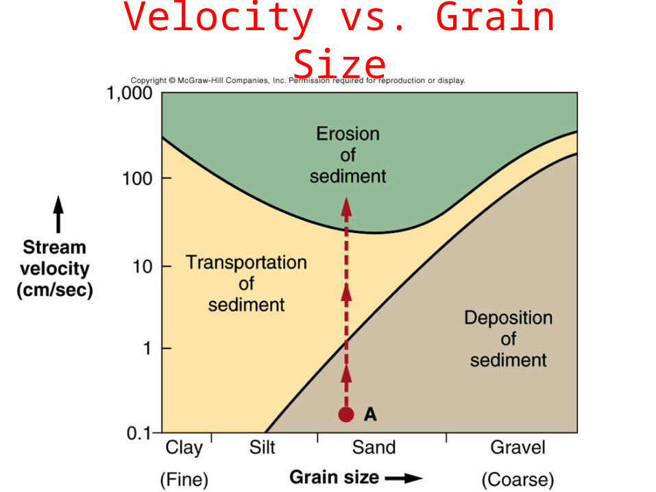
Velocity vs. Grain Size

Channel Roughness
Smooth, semi-circular channel yields highest velocity
Wide, shallow channel increases friction
Rough channel also slows river at base

Channel Width and Obstructions
Width change due toStrength change
Channel narrows -> increases stream velocity

Giant Boulders; Moved During Floods

Stream Discharge Defined
Discharge (cfs) = average stream width (ft) •
average depth (ft) •average velocity (ft/sec)
Example: Stream dimensions are 100 ft wide and 15 ft deepFlowing at 6 ft/sec (4 mph) has a discharge of 9000 cfs
Humid climates discharge typically increases downstream:1) Water flows into stream from ground2) Tributaries are added downstream
Volume of water that flows past a given point per unit time
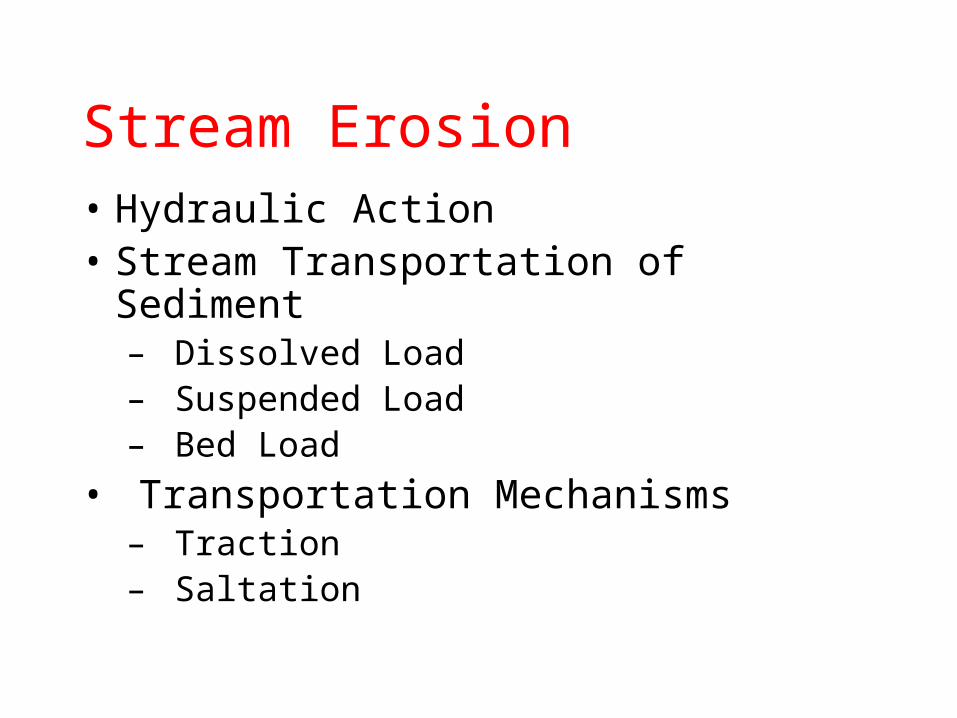
Stream Erosion• Hydraulic Action• Stream Transportation of Sediment– Dissolved Load– Suspended Load– Bed Load
• Transportation Mechanisms– Traction– Saltation

Hydraulic Action

Niagara Falls
Hydraulic Action!

Stream Sediment Loads

Sediment Load Animation

Stream Deposition
• Bars• Braided Streams• Meandering Streams and Point Bars
• Flood Plains• Deltas• Alluvial Fans

Deposition and Erosion of River Bars
Flood: Increaseddischarge anderosion!
Normal Flow
Post-flood; newbars deposited

Braided Streams

Gravel Bars

Braided Stream - Petrified Forest
From: http://geoweb.tamu.edu/RGallery/zion2003/six/6c.html

Placer Deposits

Oxbow Lake Development
INCREASING TIME
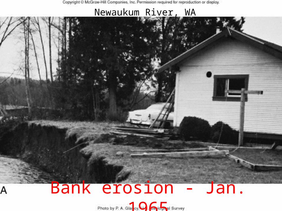
Bank erosion - Jan.
1965
Newaukum River, WA

Bank erosion - Mar.
1965

Stream Meanders & Oxbow Lakes

Point Bar Development Animation

Flooding• Urban Flooding• Flash Floods• Controlling Floods• The Great Flood of 1993

Location Map Grand Canyon Flood

Discharge with Time

River Changes Tanner Rapids

1997 Flood Floated House

Effect of Urbanization on Discharge

Peak Discharge - Cosumnes River, CA
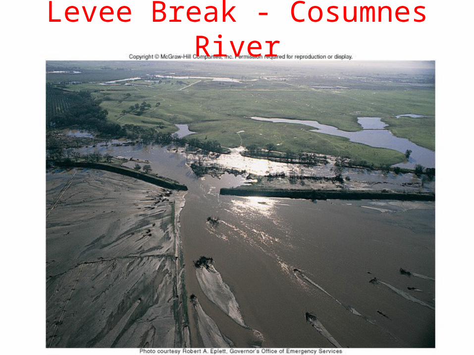
Levee Break - Cosumnes River

Flood Frequency Curves
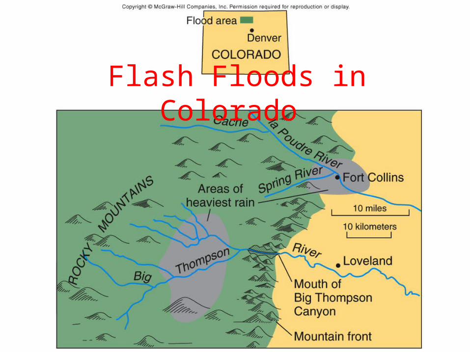
Flash Floods in Colorado

Flash Flood Effects
Big Thompson Canyon, CO - 1976

Flash Flood Effects
Spring Creek - 1997 Fort Collins, CO

Flood Control Structures

Great Flood of 1993
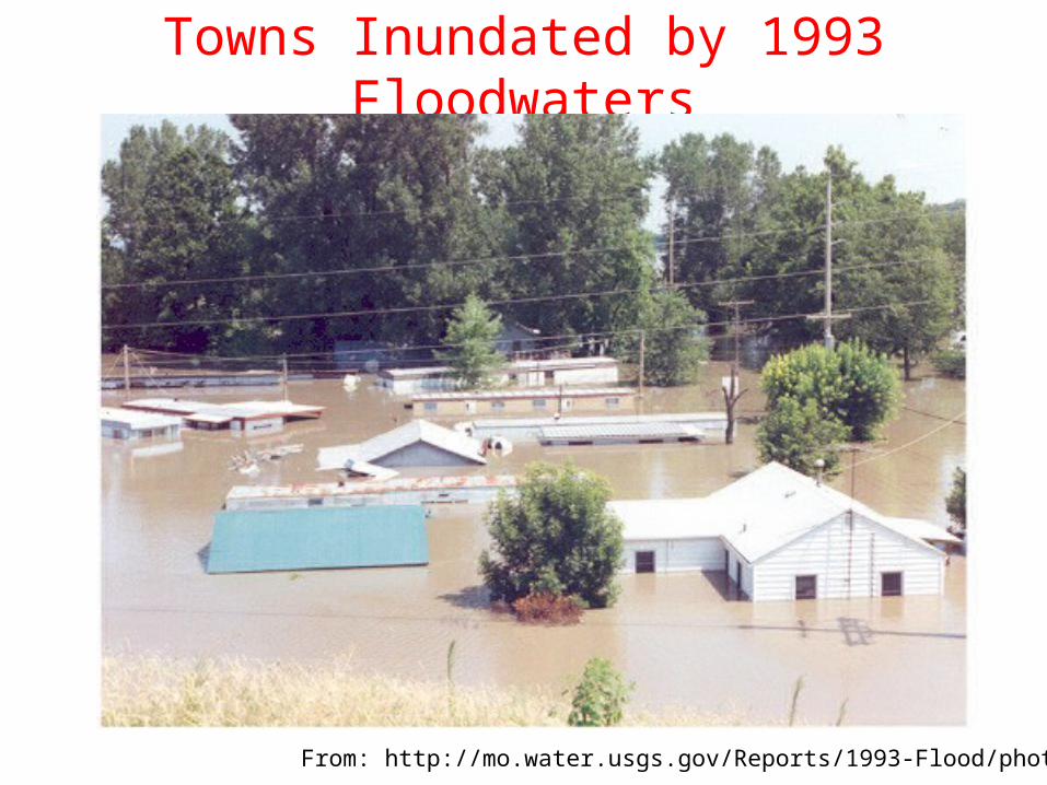
Towns Inundated by 1993 Floodwaters
From: http://mo.water.usgs.gov/Reports/1993-Flood/photos.htm
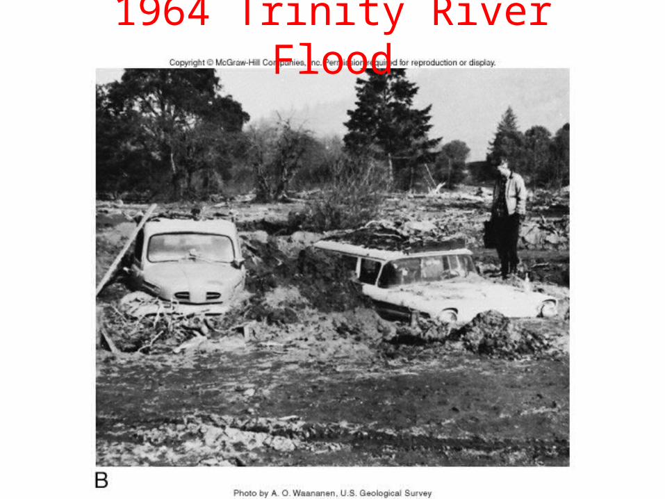
1964 Trinity River Flood

Flood Plains and Bars

Natural Levees

Natural Levee Development Animation

Delta Formation and Morphology• Deltas form when a stream or river flow into a quiet body of water (usually a large lake or ocean).
• Surface marked by distributaries– Small shifting channels that carry water away from main river channel
– Sediment deposited at mouth of eventually block flow causing shift of deposition
• Internal morphology dominated by topset-cross-beds-bottomset sequences
• External morphology depends on environment
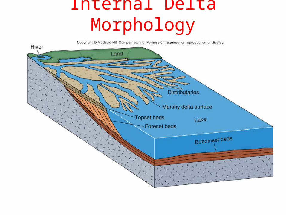
Internal Delta Morphology

Wave vs. Tidal Deltas

Stream Dominated Delta
LANDSAT Image of Mississippi River Delta

Alluvial Fans
Badwater Canyon Alluvial FanDeath Valley, CA
Photo credit: National Park Service
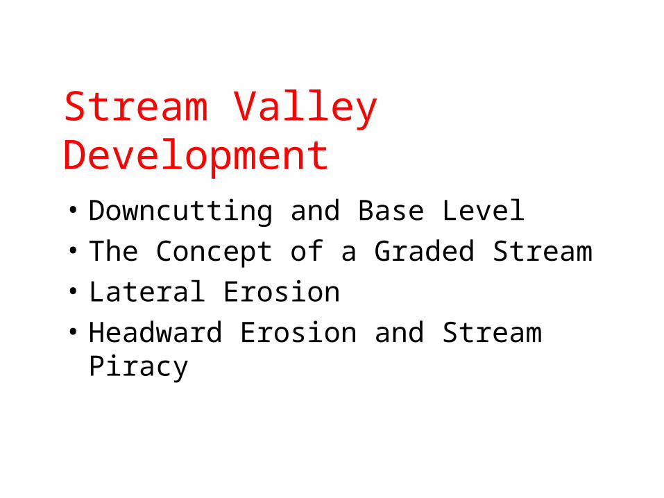
Stream Valley Development• Downcutting and Base Level• The Concept of a Graded Stream• Lateral Erosion• Headward Erosion and Stream Piracy
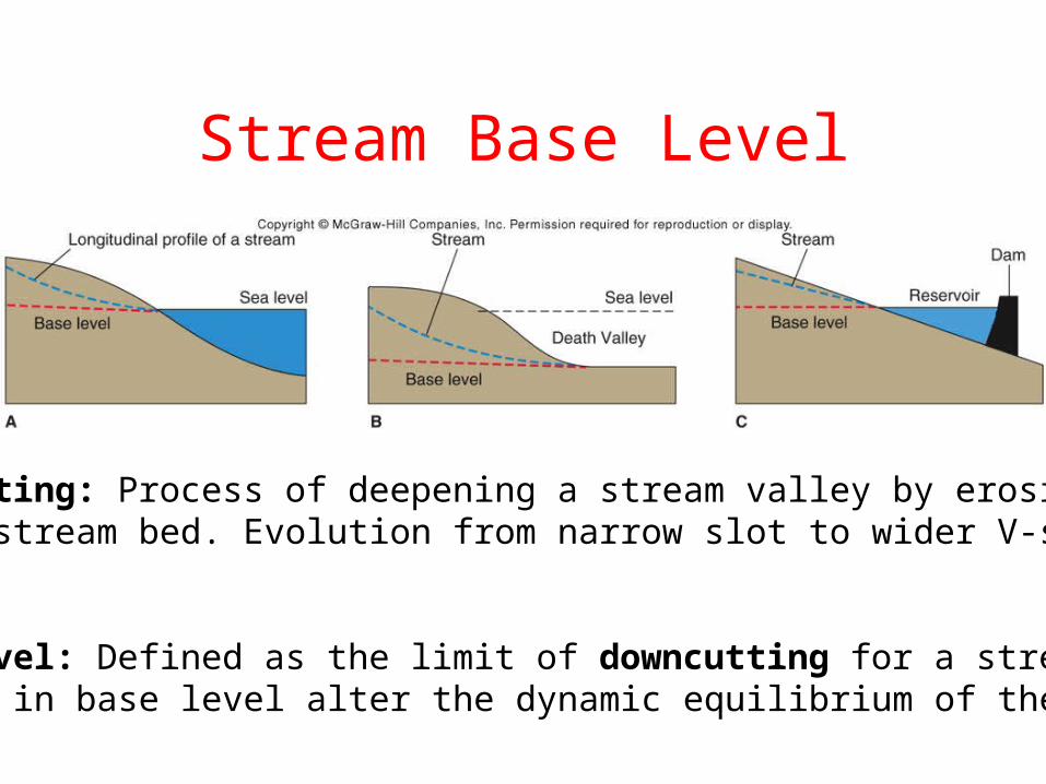
Stream Base Level
Downcutting: Process of deepening a stream valley by erosionof the stream bed. Evolution from narrow slot to wider V-shapedvalley.
Base Level: Defined as the limit of downcutting for a stream.Changes in base level alter the dynamic equilibrium of the system.

Ungraded vs. Graded Streams
Graded stream: Balance between transport capacity and sediment load.Maintained by altering the shape of the channel and stream profile.
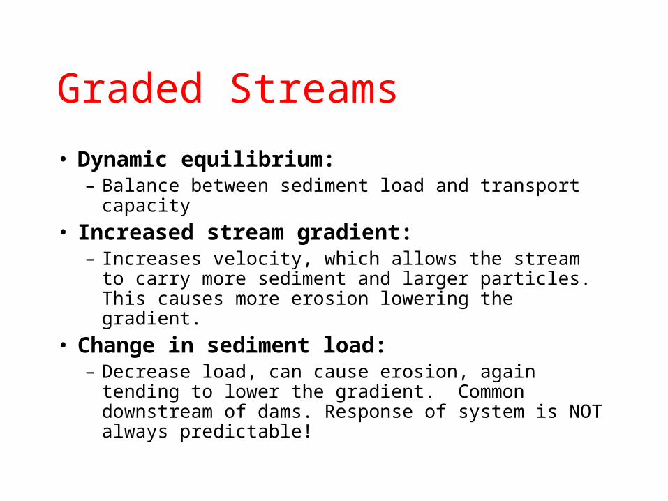
Graded Streams• Dynamic equilibrium:
– Balance between sediment load and transport capacity
• Increased stream gradient:– Increases velocity, which allows the stream to carry more sediment and larger particles. This causes more erosion lowering the gradient.
• Change in sediment load:– Decrease load, can cause erosion, again tending to lower the gradient. Common downstream of dams. Response of system is NOT always predictable!
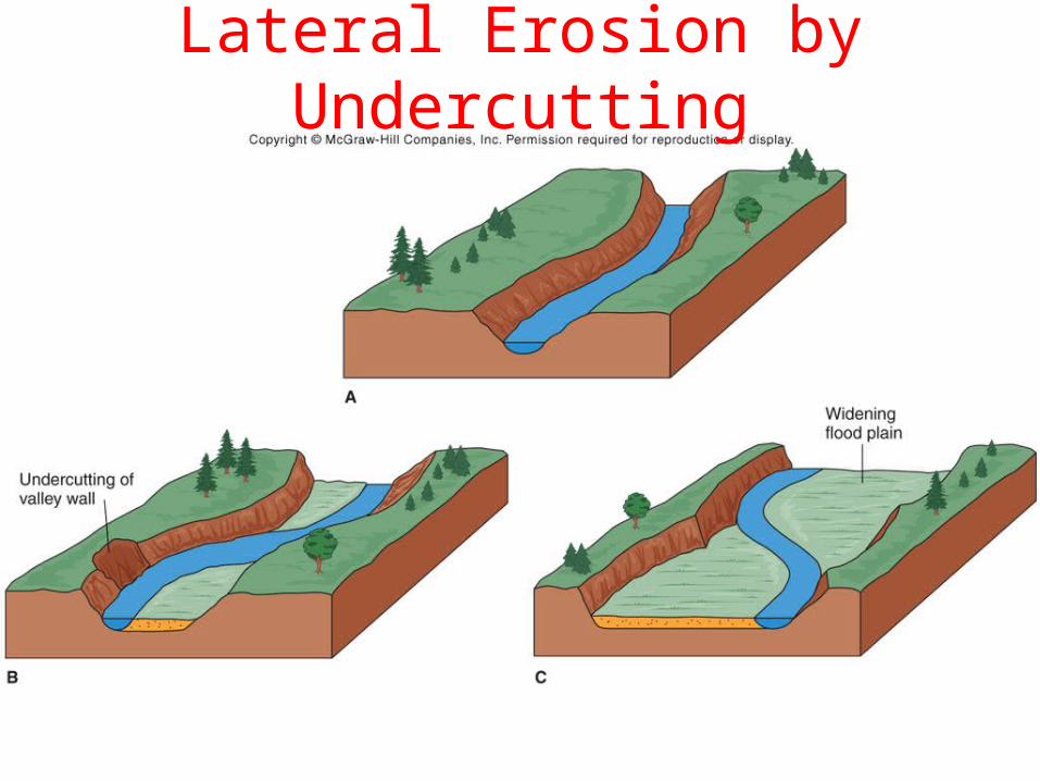
Lateral Erosion by Undercutting

Stream Landforms
• Stream Terraces
• Incised Meanders
• Superposed Streams
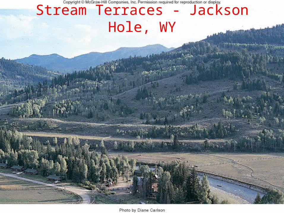
Stream Terraces - Jackson Hole, WY

Stream Terrace Model

Goosenecks of the San Juan River, UT
Photo credit: Synaptic Gallery

Incised Meanders

Superposed Streams
Development ofwater gap
Folded Units
Erosion and downcuttingthrough younghorizontal units