


Bahasa
Halaman
Hukum

MAP TO IMAGE GEOREFERENCING
By
Swetha A 5WD12CGI15

Run ERDAS software Open a new viewer i.e. viewer1

Open the satellite image which needs to be geo-referenced.

Open a new viewer i.e. viewer2 For this viewer open the toposheet which is already georeferenced.
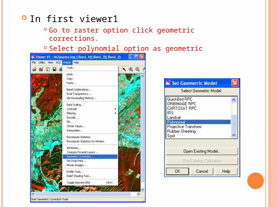
In first viewer1 Go to raster option click geometric corrections.
Select polynomial option as geometric model.

Click add/ change projection . Select geographic(lat/lon) as projection type and Everest as spheroid name.
Close the polynomial model.
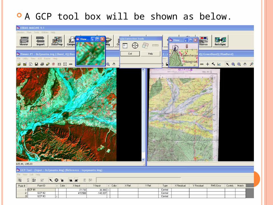
A GCP tool box will be shown as below.

Use the symbol in the in GCP tool box to mark the ground control points (GCP’S ) as shown.
Mark at least 4 GCP’s to get a georeferenced image.

4 GCP points are shown below .

Use symbol in tools to do resampling method .
Give output file name select required resample method n click ok.

After performing resampling open the new output file created in different viewer.

The image can be verified using swipe command. In the viewer with georeferenced image can be opened with raster options fit to frame and background transparent.

This will be the result

Further validation can be done using swipe command ..

The swipe position can be moved to see the overlap of the features.

THANKS
Top Related
Copyright © 2022 FDOKUMEN

