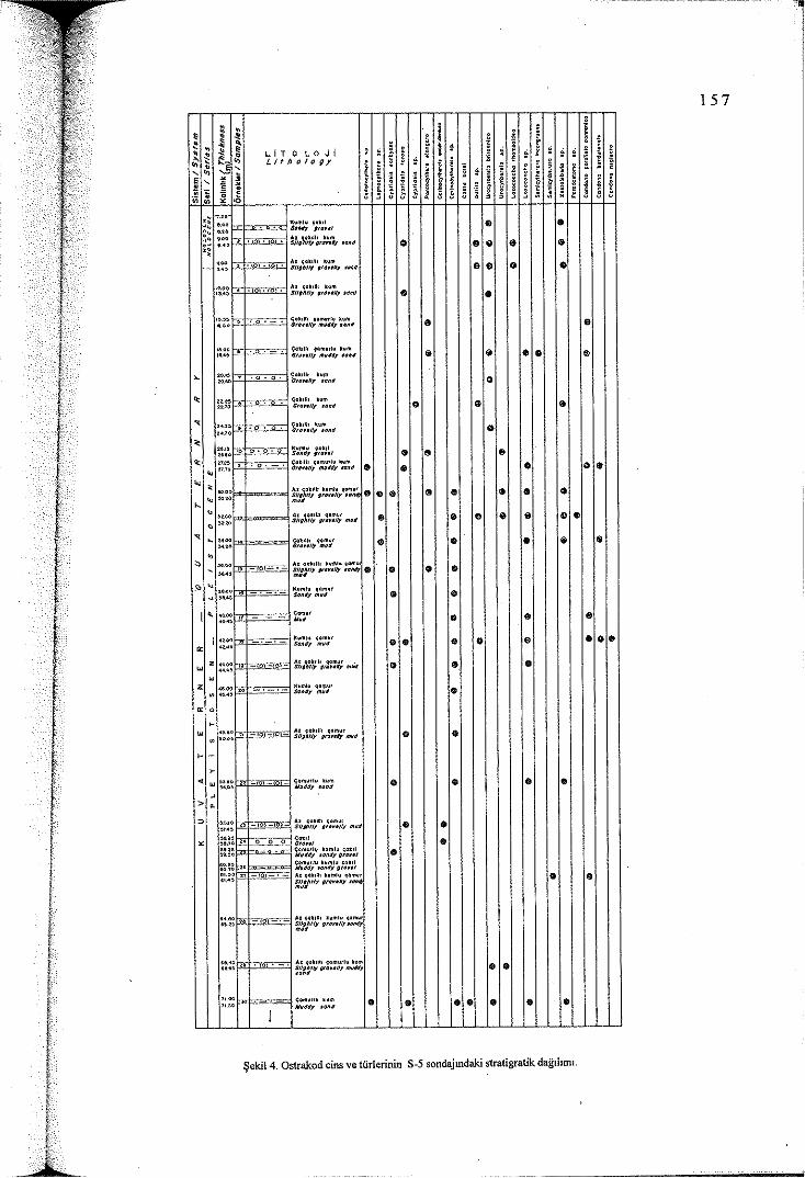
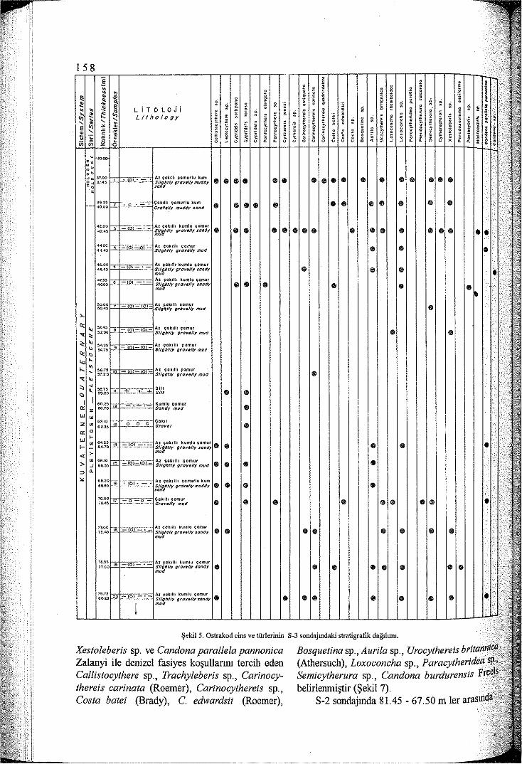
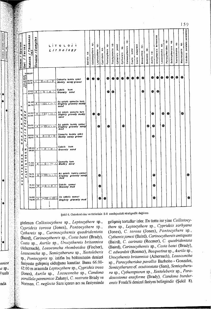
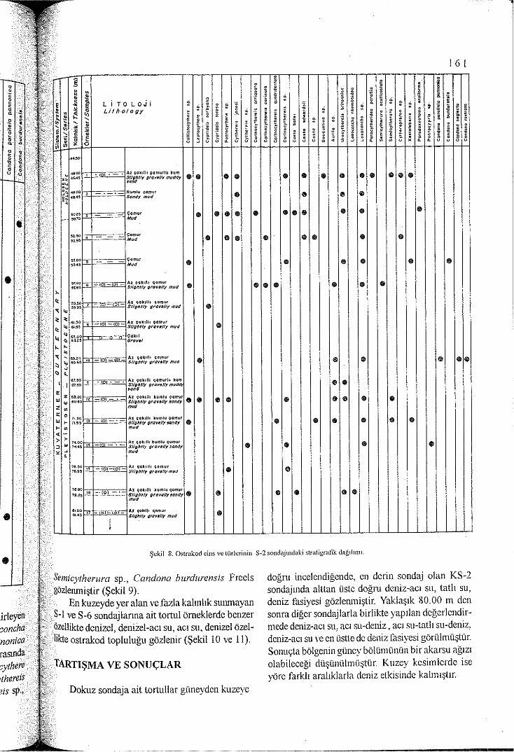
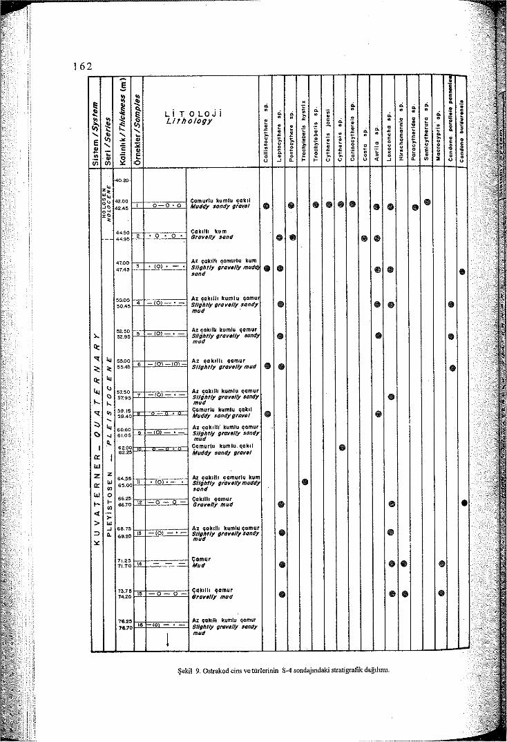
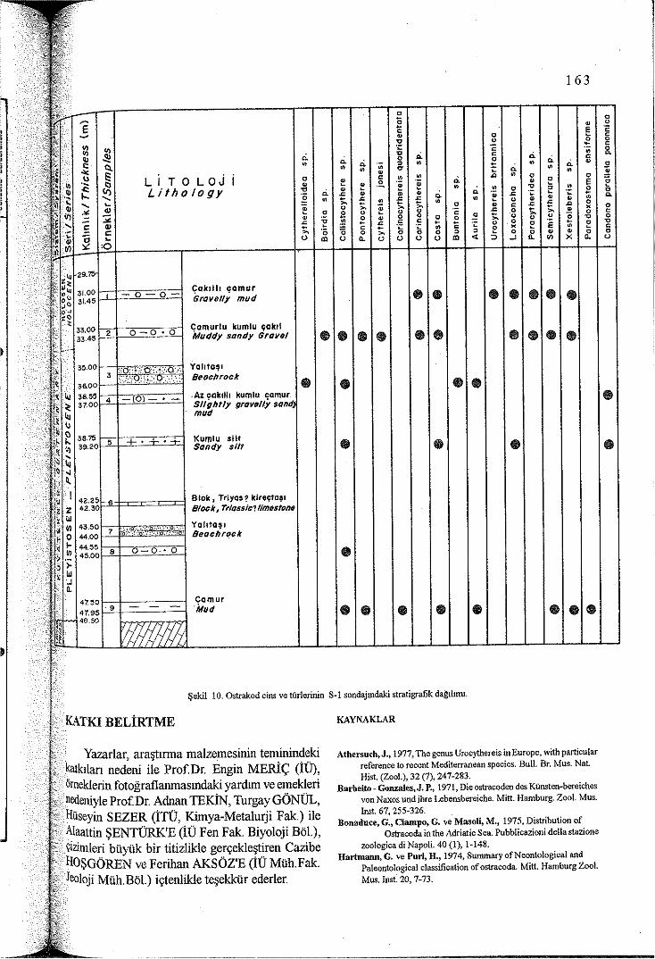
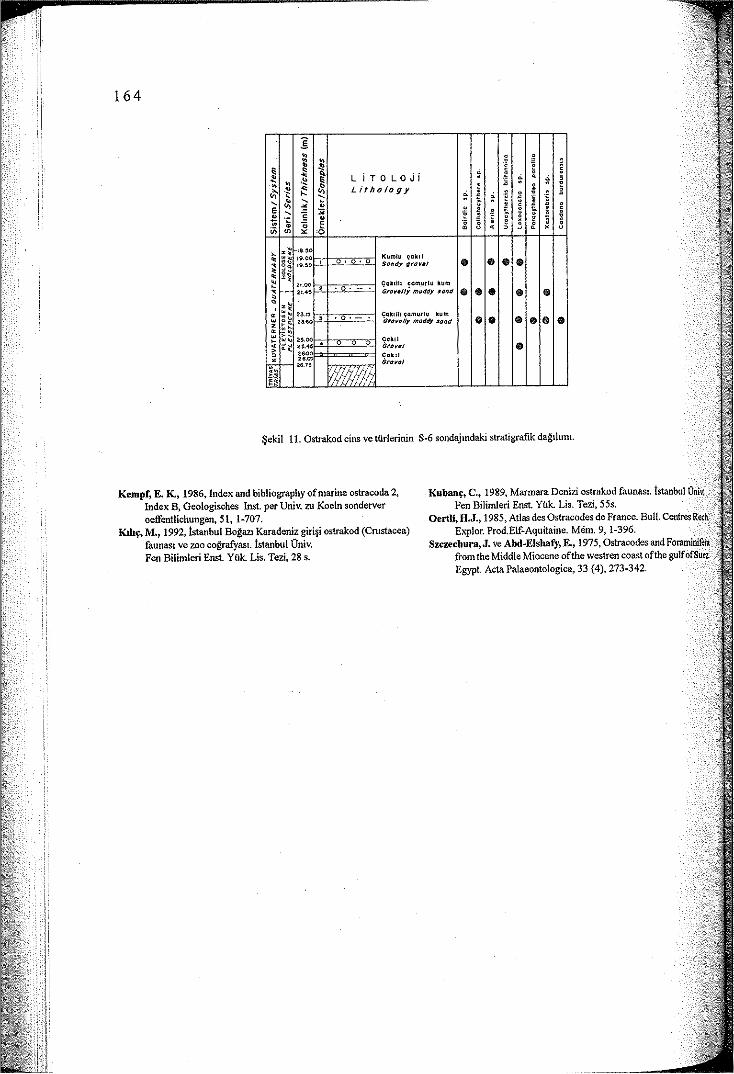
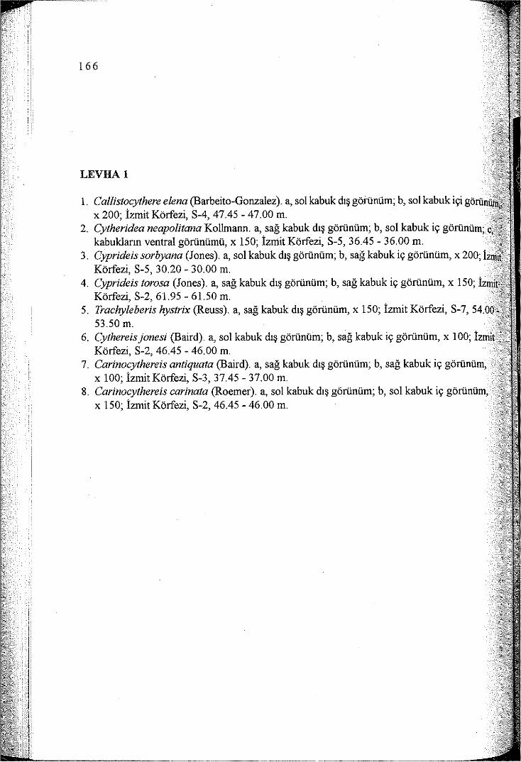
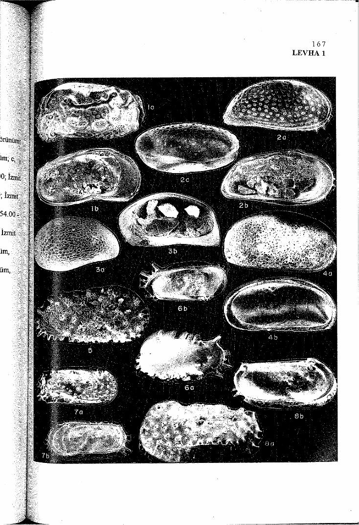
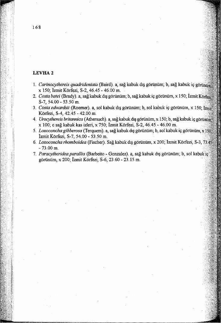
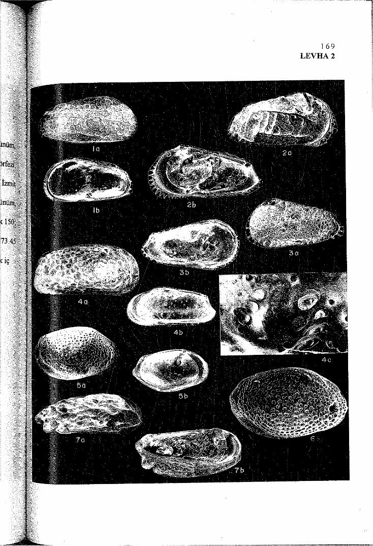
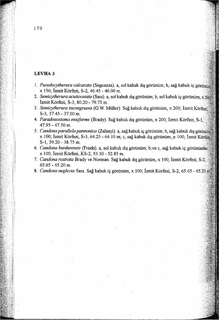
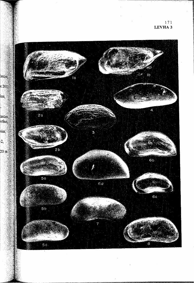
Top Related
How far did the surface rupture of the 1999 İzmit earthquake reach in Sea of Marmara?
Izmit earthquake postseismic deformation and dynamics of the North Anatolian Fault Zone
North Anatolian Fault in the Gulf of Izmit (Turkey): Rapid vertical motion in response to minor bends of a nonvertical continental transform
North Anatolian Fault in the Gulf of Izmit (Turkey) - GeoMapApp
The generating mechanisms of the August 17, 1999 İzmit bay (Turkey) tsunami: Regional (tectonic) and local (mass instabilities) causes
Seismotectonic setting at the North Anatolian Fault Zone after the 1999 Mw=7.4 Izmit earthquake based on high-resolution aftershock locations
The August 17, 1999 Izmit, Turkey, earthquake: slip distribution from dislocation modeling of DInSAR and surface offset
İZMİT KÖRFEZİ KIYILARINDA, KIYI JEOMORFOLOJİSİ-KIYI KULLANIMI İLİŞKİSİNİN COĞRAFİ ANALİZİ