Z. Czajlik - A. Bödőcs (eds.), Aerial Archaeology and Remote Sensing from the Baltic to the...
20
Transcript of Z. Czajlik - A. Bödőcs (eds.), Aerial Archaeology and Remote Sensing from the Baltic to the...

AERIAL ARCHAEOLOGY AND REMOTE SENSINGFROM THE BALTIC TO THE ADRIATIC

Institute ofArchaeological Sciences, Faculty ofHumanities, Eötvös Loránd University
Budapest2013
AERIAL ARCHAEOLOGY AND REMOTE SENSING
FROM THE BALTIC TO THE ADRIATIC
Selected Papers
of the Annual Conference of the Aerial Archaeology Research Group,
13th–15th September 2012, Budapest, Hungary
Edited by Zoltán Czajlik and András Bödőcs

Translated by
Magdaléna Seleanu and the Authors
The publication ofthis volume was supported by
© The Authors, 2013
© L'Harmattan, Budapest, 2013
© Institute ofArchaeological Sciences, Faculty ofHumanities, Eötvös Loránd University, Budapest, 2013
ISBN 978-963-7343-95-7
Cover design
András Bödőcs
(photos and illustrations: András Bödőcs, Zoltán Czajlik, Balázs Holl, Sándor Puszta, FÖMI, Museum ofMilitary History)
Printed in Hungary in 2013
Eötvös Loránd University, Faculty ofHumanities
NKA (National Cultural Fund ofHungary)
AARG (Aerial Archaeology Research Group)

TABLE OF CONTENTS
Foreword .... . . . . . . . . . . . . . . . . . . . . . . . . . . . . . . . . . . . . . . . . . . . . . . . . . . . . . . . . . . . . . . . . . . . . . . . . . . . . . . . . . . . . . . . . . . . . . . . . . . . . . . . . . . . . . . . . . . . . . . . . . . . . . . . . . . . . . . . . . . . . . . . . . . . . . . . . . 7
Editorial preface .... . . . . . . . . . . . . . . . . . . . . . . . . . . . . . . . . . . . . . . . . . . . . . . . . . . . . . . . . . . . . . . . . . . . . . . . . . . . . . . . . . . . . . . . . . . . . . . . . . . . . . . . . . . . . . . . . . . . . . . . . . . . . . . . . . . . . . . . . . . . . . 9
METHODOLOGY
Aerial Archaeology
René GOGUEY—Alexandra CORDIER: Les techniques de la photographie aérienne
en France et dans le Bassin des Carpates: photographie oblique en couleurs
et en infra-rouge, photographie verticale .... . . . . . . . . . . . . . . . . . . . . . . . . . . . . . . . . . . . . . . . . . . . . . . . . . . . . . . . . . . . . . . . . . . . . . . . . . . . . . . . . . . . . . . . . . . . . . . 11
Vedrana GLAVAŠ—Rog PALMER: Aerial and field reconnaissance ofVelebit mountain .... . . . . . . . . . . . . . . . . . . . . . . . . . 19
Balázs HOLL—Zoltán CZAJLIK: Where are all the tumuli? ... . . . . . . . . . . . . . . . . . . . . . . . . . . . . . . . . . . . . . . . . . . . . . . . . . . . . . . . . . . . . . . . . . . . . . . . . . 25
Remote Sensing
Łukasz BANASZEK: Lidarchaeology .... . . . . . . . . . . . . . . . . . . . . . . . . . . . . . . . . . . . . . . . . . . . . . . . . . . . . . . . . . . . . . . . . . . . . . . . . . . . . . . . . . . . . . . . . . . . . . . . . . . . . . . . . . . . . . . 31
Dimitrij MLEKUŽ: Roads to nowhere? .... . . . . . . . . . . . . . . . . . . . . . . . . . . . . . . . . . . . . . . . . . . . . . . . . . . . . . . . . . . . . . . . . . . . . . . . . . . . . . . . . . . . . . . . . . . . . . . . . . . . . . . . . . 37
Cezary SOBCZAK: An Experimental Application of Airborne Laser Scanning for
Landscape Archaeology in Northeastern Poland .... . . . . . . . . . . . . . . . . . . . . . . . . . . . . . . . . . . . . . . . . . . . . . . . . . . . . . . . . . . . . . . . . . . . . . . . . . . . . . . . . . 43
CASE STUDIES
Prehistory
Gábor BERTÓK—Csilla GÁTI: Circles in the Field through Circles in the Air.... . . . . . . . . . . . . . . . . . . . . . . . . . . . . . . . . . . . . . . . . . . 49
László REMÉNYI—Ákos PETŐ—Árpád KENÉZ—Szandra BAKLANOV: Archaeological
and pedological investigations at the fortified Bronze Age settlement of
Perkáta–Forrás-dűlő .... . . . . . . . . . . . . . . . . . . . . . . . . . . . . . . . . . . . . . . . . . . . . . . . . . . . . . . . . . . . . . . . . . . . . . . . . . . . . . . . . . . . . . . . . . . . . . . . . . . . . . . . . . . . . . . . . . . . . . . . . . . . . . . . . 55
Roman Period
András BÖDŐCS: Borders. The problems of the aerial archaeological reserach
of a Roman limitatio in Pannonia.... . . . . . . . . . . . . . . . . . . . . . . . . . . . . . . . . . . . . . . . . . . . . . . . . . . . . . . . . . . . . . . . . . . . . . . . . . . . . . . . . . . . . . . . . . . . . . . . . . . . . . . . . . . . . 59
Florin FODOREAN: Roman Potaissa and its surroundings .... . . . . . . . . . . . . . . . . . . . . . . . . . . . . . . . . . . . . . . . . . . . . . . . . . . . . . . . . . . . . . . . . . . . . . . . . . 67
László RUPNIK—Zoltán CZAJLIK: Aerial archaeological survey of the legionary camp
and military town at Brigetio .... . . . . . . . . . . . . . . . . . . . . . . . . . . . . . . . . . . . . . . . . . . . . . . . . . . . . . . . . . . . . . . . . . . . . . . . . . . . . . . . . . . . . . . . . . . . . . . . . . . . . . . . . . . . . . . . . . . 71
Máté SZABÓ: Using remote sensing and non-invasive archaeological methods
in the research of Roman villas and the ancient landscape of Pannonia .... . . . . . . . . . . . . . . . . . . . . . . . . . . . . . . . . . . . . . . . . . . . 79
Middle Ages
Zsuzsa MIKLÓS: Aerial archaeological investigation of Árpádian Age
earthen forts and castles in Hungary .... . . . . . . . . . . . . . . . . . . . . . . . . . . . . . . . . . . . . . . . . . . . . . . . . . . . . . . . . . . . . . . . . . . . . . . . . . . . . . . . . . . . . . . . . . . . . . . . . . . . . . 85
András SÓFALVI: Ramparts in the Görgényi, Hargita and Persányi Mountains .... . . . . . . . . . . . . . . . . . . . . . . . . . . . . . . . . . . . . . 89
References .... . . . . . . . . . . . . . . . . . . . . . . . . . . . . . . . . . . . . . . . . . . . . . . . . . . . . . . . . . . . . . . . . . . . . . . . . . . . . . . . . . . . . . . . . . . . . . . . . . . . . . . . . . . . . . . . . . . . . . . . . . . . . . . . . . . . . . . . . . . . . . . . . . . . . . 95
Plates .... . . . . . . . . . . . . . . . . . . . . . . . . . . . . . . . . . . . . . . . . . . . . . . . . . . . . . . . . . . . . . . . . . . . . . . . . . . . . . . . . . . . . . . . . . . . . . . . . . . . . . . . . . . . . . . . . . . . . . . . . . . . . . . . . . . . . . . . . . . . . . . . . . . . . . . . . . . . 109
Authors .... . . . . . . . . . . . . . . . . . . . . . . . . . . . . . . . . . . . . . . . . . . . . . . . . . . . . . . . . . . . . . . . . . . . . . . . . . . . . . . . . . . . . . . . . . . . . . . . . . . . . . . . . . . . . . . . . . . . . . . . . . . . . . . . . . . . . . . . . . . . . . . . . . . . . . . . . 127
Conference Programme ..... . . . . . . . . . . . . . . . . . . . . . . . . . . . . . . . . . . . . . . . . . . . . . . . . . . . . . . . . . . . . . . . . . . . . . . . . . . . . . . . . . . . . . . . . . . . . . . . . . . . . . . . . . . . . . . . . . . . . . . . . . . . . 131

FOREWORD
The Aerial Archaeology Research Group (AARG) – under whose banner the papers in this volume werepresented – is an organization that promotes the advancement of aerial archaeology and remote sensingtechniques. AARG has provided a forum for the exchange of ideas and information for all those activelyinvolved in aerial photography, photo interpretation, field archaeology and landscape history for the lastthirty years. While there has been an emphasis on keeping abreast of the quickly changing field of aerialarchaeology through the exchanges of its members on new research, there has also been the develop-ment of guidance and advice for policies that have helped to preserve archaeological sites and land-scapes.Recent advances in aerial archaeology – promoting the techniques and approaches that employ aerialphotographs, satellite images, and other ‘remote’ techniques such as airborne laser scanning (ALS)/li-dar/LiDAR – have been an influential force used to re-examine the archaeological sites and landscapesof many regions, such as those from the Baltic to the Adriatic. The present volume contains a series of se-lected papers from AARG’s annual conference held in Budapest in 2012, hosted by Eötvös Loránd Uni-versity, and published by L’Harmattan.It is a pleasure to introduce this publication with a foreword as all the papers have drawn on the tech-niques associated with aerial photography, satellite and other imagery to re-shape an understanding ofthe long-term human presence that has been affected by, but has also shaped the topography of the Bal-tic to the Adriatic region. As such, the selected papers from the conference represent innovative re-search being undertaken in a region at the time of the conference (in 2012). And although thesetechniques are being advanced in new directions every day, the present volume’s focus on the region’sarchaeology that has been enhanced by these techniques should allow it to help perpetuate further re-search that will continue to understand the past. Like many of the papers, the knowledge of the past hasbeen enhanced by using multiple techniques, presenting side-by-side in the field research such as walkover surveys or geophysics, alongside aerial archaeology and with remote sensing techniques such asanalysing a satellite’s hyperspectral bands or extracting features from ALS data. The collective impact ofthese techniques results in a richer, deeper understanding of how sites and landscapes were connectedto past people’s lives.I am certain that this volume will remain a standard text for those working in the region. I congratulateand I am pleased for Zoltán and András whose hard work has put this volume together, and I also com-mend those contributing to this publication.
Oscar AldredUniversity ofNewcastle
Chairman ofAARG


Editorial preface
The creation of an Aerial Archaeological Photo Archive in the Institute ofArchaeological Sciences of theEötvös Loránd University was one of the many fruits of the eight years long Hungarian-French aerialarchaeology collaboration begun in 1993, exactly twenty years ago. The research project initiated byMiklós Szabó and directed by René Goguey led to the discovery of a series of remarkable sites, whichwere presented to the Hungarian and international archaeological community. The first presentationwas held in 1995 at the Eötvös Loránd University; concurrently with the conference, the French Instituteof Hungary organised an exhibition linked to the conference and published a bilingual colour catalogueto the exhibition.When the Eötvös Loránd University was entrusted with organising the AARG conference of 2012, ourgoal was not merely to provide a venue for a major international event serving as a forum for the pre-sentation and discussion of new advances in aerial archaeology and remote sensing seventeen years afterthe previous similar conference, but also to learn about the many new research findings from this re-gion. The past fifteen to twenty years have seen profound political and economic changes in the count-ries lying between the Baltic and the Adriatic, amongst them in Hungary too, which have provided newopportunities for archaeological remote sensing after the forced gap of over forty years and have led to aseries of amazing archaeological discoveries and results following the initial delight over the first aerialarchaeological photos.The presentation of new directions in methodological research is an important part of the activities ofthe Department of Archaeometry and Archaeological Methodology of the Institute of ArchaeologicalSciences of the Eötvös Loránd University, founded ten years ago in 2003. We therefore turned to theAARG leadership and proposed that the most important new advances and research findings relevant tothis region presented at the conference be published in a separate volume. To our great delight, thisproposal was favourably received not only by the younger generation of researchers, but also by ourolder colleagues such as Zsuzsa Miklós and René Goguey, who had played an active role in reviving ae-rial archaeological reconnaissance in Hungary during the 1990s. We divided the volume into two majorparts: the studies addressing various issues of traditional and modern research techniques are followedby studies covering various archaeological periods. It is our hope that the present volume, marking animportant anniversary for us, will offer a meaningful overview of the current state of aerial archaeolo-gical research and remote sensing in East Central Europe.The Faculty of Humanities of the Eötvös Loránd University, the Aerial Archaeology Research Groupand, not least, the National Cultural Fund of Hungary played a key role in organising the conference at-tended by over a hundred researchers from sixteen countries, as well as in the publication of the studieswith a relevance for this region. Thanks are due to the Matrica Museum of Százhalombatta for organis-ing the excursion for the conference participants. We are greatly indebted to Tamás Dezső, Dean of theFaculty, Oscar Aldred, Chairman of AARG, and Magdolna Vicze, Director of the Matrica Museum fortheir enthusiastic and generous help in all matters pertaining to the conference, and to Szilvia Bartus-Szöllősi, who tirelessly dealt with the practicalities during the organisation of the event and during theconference itself.
Zoltán Czajlik – András BödőcsBudapest, November 18, 2013


Authors


BAKLANOV, SzandraHungarian National Museum, Centre for National HeritageH-1113 Budapest, Daróci u. [email protected]
BANASZEK, ŁukaszInstitute of Prehistory, Adam Miczkiewicz UniversityPL-61-809 Poznań, ul. Św. Marcin [email protected]
BERTÓK, GáborDepartment ofArchaeology, Janus Pannonius MuseumH-7621 Pécs, Káptalan u. [email protected]
BÖDŐCS, AndrásInstitute ofArchaeological Sciences, Faculty ofHumanities, Eötvös Loránd UniversityH-1088 Budapest, Múzeum krt. 4/[email protected]
CORDIER, AlexandraUniversité de Bourgogne, UMR 6298 ARTEHISF-21000 Dijon, 6 Boulevard [email protected]
CZAJLIK, ZoltánInstitute ofArchaeological Sciences, Faculty ofHumanities Eötvös Loránd UniversityH-1088 Budapest, Múzeum krt. 4/[email protected]
FODOREAN, FlorinDepartment ofAncient History and Archaeology, Babeș-Bolyai UniversityRO-400084 Cluj-Napoca, Str. Mihail Kogălniceanu [email protected]
GÁTI, CsillaDepartment ofArchaeology, Janus Pannonius MuseumH-7621 Pécs, Káptalan u. [email protected]
GLAVAŠ, VedranaDepartment ofArchaeology, University ofZadarCR-23000 Zadar, Obala Kralja Petra Krešimira IV., [email protected]
GOGUEY, RenéF-21240 Talant, 4 rue Colonel [email protected]
129
Authors

KENÉZ, ÁrpádCentre for National Heritage, Hungarian National MuseumH-1113 Budapest, Daróci u. [email protected]
MIKLÓS, ZsuzsaInstitute ofArchaeology, Research Centre for the Humanities, Hungarian Academy of SciencesH-1014 Budapest, Uri u. [email protected]
MLEKUZ, DimitrijDepartment ofArchaeology, Faculty ofArts, University of LjubljanaSL-1000 Ljubljana, Aškerčeva [email protected]
PALMER, RogAir Photo Services21 Gunhild Way Cambridge CB1 8QZ, [email protected]
PETŐ, ÁkosCentre for National Heritage, Hungarian National MuseumH-1113 Budapest, Daróci u. [email protected]
REMÉNYI, LászlóCentre for National Heritage, Hungarian National MuseumH-1113 Budapest, Daróci u. [email protected]
RUPNIK, LászlóInstitute ofArchaeological Sciences, Eötvös Loránd University – Hungarian Academy of SciencesH-1088 Budapest, Múzeum krt. 4/[email protected]
SOBCZAK, CezaryState Archaeological Museum in WarsawPL-00-241 Warsaw, ul. Długa [email protected]
SÓFALVI, AndrásMuzeul Haáz Rezső / Haáz Rezső MúzeumRO-535600 Odorheiu Secuesc / Székelyudvarhelystr. Kossuth Lajos [email protected]
SZABÓ, MátéDepartment ofArchaeology, University of PécsH-7624 Pécs, Rókus u. [email protected]
130
Authors

Conference Programme

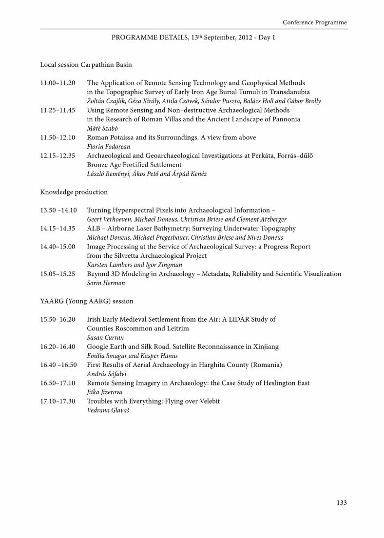
PROGRAMME DETAILS, 13th September, 2012 - Day 1
Local session Carpathian Basin
11 .00–11 .20 The Application ofRemote Sensing Technology and Geophysical Methodsin the Topographic Survey of Early Iron Age Burial Tumuli in TransdanubiaZoltán Czajlik, Géza Király, Attila Czövek, Sándor Puszta, Balázs Holl and Gábor Brolly
11 .25–11 .45 Using Remote Sensing and Non–destructive Archaeological Methodsin the Research ofRoman Villas and the Ancient Landscape of PannoniaMáté Szabó
11 .50–12.10 Roman Potaissa and its Surroundings. A view from aboveFlorin Fodorean
12.15–12.35 Archaeological and Geoarchaeological Investigations at Perkáta, Forrás–dűlőBronze Age Fortified SettlementLászló Reményi, Ákos Pető and Árpád Kenéz
Knowledge production
13.50 –14.10 Turning Hyperspectral Pixels into Archaeological Information –Geert Verhoeven, Michael Doneus, Christian Briese and Clement Atzberger
14.15–14.35 ALB – Airborne Laser Bathymetry: Surveying Underwater TopographyMichael Doneus, Michael Pregesbauer, Christian Briese and Nives Doneus
14.40–15.00 Image Processing at the Service ofArchaeological Survey: a Progress Reportfrom the Silvretta Archaeological ProjectKarsten Lambers and Igor Zingman
15.05–15.25 Beyond 3D Modeling in Archaeology –Metadata, Reliability and Scientific VisualizationSorin Hermon
YAARG (Young AARG) session
15.50–16.20 Irish Early Medieval Settlement from the Air: A LiDAR Study ofCounties Roscommon and LeitrimSusan Curran
16.20–16.40 Google Earth and Silk Road. Satellite Reconnaissance in XinjiangEmilia Smagur and Kasper Hanus
16.40 –16.50 First Results ofAerial Archaeology in Harghita County (Romania)András Sófalvi
16.50–17.10 Remote Sensing Imagery in Archaeology: the Case Study ofHeslington EastJitka Jizerova
17.10–17.30 Troubles with Everything: Flying over VelebitVedrana Glavaš
133
Conference Programme

KENÉZ, ÁrpádCentre for National Heritage, Hungarian National MuseumH-1113 Budapest, Daróci u. [email protected]
MIKLÓS, ZsuzsaInstitute ofArchaeology, Research Centre for the Humanities, Hungarian Academy of SciencesH-1014 Budapest, Uri u. [email protected]
MLEKUZ, DimitrijDepartment ofArchaeology, Faculty ofArts, University of LjubljanaSL-1000 Ljubljana, Aškerčeva [email protected]
PALMER, RogAir Photo Services21 Gunhild Way Cambridge CB1 8QZ, [email protected]
PETŐ, ÁkosCentre for National Heritage, Hungarian National MuseumH-1113 Budapest, Daróci u. [email protected]
REMÉNYI, LászlóCentre for National Heritage, Hungarian National MuseumH-1113 Budapest, Daróci u. [email protected]
RUPNIK, LászlóMTA-ELTE Research Group for Interdisciplinary Archaeology, Eötvös Loránd UniversityH-1088 Budapest, Múzeum krt. 4/[email protected]
SOBCZAK, CezaryState Archaeological Museum in WarsawPL-00-241 Warsaw, ul. Długa [email protected]
SÓFALVI, AndrásMuzeul Haáz Rezső / Haáz Rezső MúzeumRO-535600 Odorheiu Secuesc / Székelyudvarhelystr. Kossuth Lajos [email protected]
SZABÓ, MátéDepartment ofArchaeology, University of PécsH-7624 Pécs, Rókus u. [email protected]
130
Authors