Volcanism and Ice Interactions on Earth and Mars
35
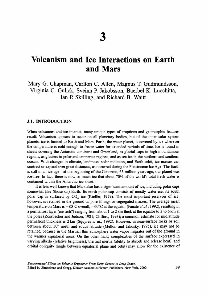
3 Volcanism and Ice Interactions on Earth and Mars Mary G. Chapman, Carlton C. Allen, Magnus T. Gudmundsson, Virginia C. Gulick, Sveinn P. Jakobsson, Baerbel K. Lucchitta, Ian :P. Skilling,andRichard B. Waitt 3.1. INTRODUCTION Whenvolcanoesandiceinteract,manyuniquetypes of eruptions and geomorphic features result. Volcanism appears to occur on all planetary bodies, but of the inner solar system planets,ice is limitedtoEarthandMars.Earth,thewaterplanet,iscoveredbyicewherever the temperature is coldenoughtofreezewaterforextendedperiods of time. Ice is found in sheetscoveringtheAntarcticcontinentandGreenland,asglacialcapsinhighmountainous regions,asglaciersinpolarandtemperateregions,andasseaiceinthenorthernandsouthern oceans.Withchangesinclimate,landmass,solarradiation,andEarthorbit,icemassescan contractorexpandovergreatdistances,asoccurredduringthePleistoceneIceAge.TheEarth isstillinanice age-at thebeginning of theCenozoic, 65 millionyearsago,ourplanetwas ice-free. In fact, there is nowsomuchicethatabout70% of theworld'stotalfreshwater is containedwithintheAntarcticicesheet. It is lesswellknownthatMarsalsohasasignificantamount of ice,includingpolarcaps somewhat like (those on) Earth. Its north polar cap consists of mostly water ice, its south polar cap is surfaced by CO 2 ice (Kieffer, 1979). The most important reservoir of ice, however,isretainedinthegroundasporefillingsorsegregatedmasses.Theaveragemean temperatureonMars is -80°C overall, -60°C attheequator(Fanale et al., 1992),resultingin apermafrostlayer(icerich?)rangingfromabout1to2 km thickattheequatorto3to6 km at thepoles(RossbacherandJudson,1981;Clifford,1993);acommonestimateformidlatitude permafrostthickness is 2 km (Squyres et al., 1992). However, in near-surface rocks orsoil between about 50° north and south latitude (Mellon and Jakosky, 1995), ice may not be retained,becauseintheMartian thin atmospherewatervapormigratesout of thegroundin the warmer equatorial areas. On the other hand, complexities of the surface expressed in varyingalbedo(relativebrightness),thermalinertia(abilitytoabsorbandreleaseheat),and orbital obliquity (angle between equatorial plane and orbit) may allow for the existence of Environmental Effects on Volcanic Eruptions: From Deep Oceans to Deep Space. Edited by Zimbelman and Gregg, Kluwer AcademicfPlenwnPublishers, New York, 2000. 39
-
Upload
unitedstatesgeologicalsurvey -
Category
Documents
-
view
1 -
download
0
Transcript of Volcanism and Ice Interactions on Earth and Mars
3
Volcanism and Ice Interactions on Earthand Mars
Mary G. Chapman, Carlton C. Allen, Magnus T. Gudmundsson,Virginia C. Gulick, Sveinn P. Jakobsson, Baerbel K. Lucchitta,
Ian :P. Skilling, and Richard B. Waitt
3.1. INTRODUCTION
When volcanoes and ice interact, many unique types of eruptions and geomorphic featuresresult. Volcanism appears to occur on all planetary bodies, but of the inner solar systemplanets, ice is limited to Earth and Mars. Earth, the water planet, is covered by ice whereverthe temperature is cold enough to freeze water for extended periods of time. Ice is found insheets covering the Antarctic continent and Greenland, as glacial caps in high mountainousregions, as glaciers in polar and temperate regions, and as sea ice in the northern and southernoceans. With changes in climate, landmass, solar radiation, and Earth orbit, ice masses cancontract or expand over great distances, as occurred during the Pleistocene Ice Age. The Earthis still in an ice age-at the beginning of the Cenozoic, 65 million years ago, our planet wasice-free. In fact, there is now so much ice that about 70% of the world's total fresh water iscontained within the Antarctic ice sheet.
It is less well known that Mars also has a significant amount of ice, including polar capssomewhat like (those on) Earth. Its north polar cap consists of mostly water ice, its southpolar cap is surfaced by CO2 ice (Kieffer, 1979). The most important reservoir of ice,however, is retained in the ground as pore fillings or segregated masses. The average meantemperature on Mars is -80°C overall, -60°C at the equator (Fanale et al., 1992), resulting ina permafrost layer (ice rich?) ranging from about 1 to 2 km thick at the equator to 3 to 6 km atthe poles (Rossbacher and Judson, 1981; Clifford, 1993); a common estimate for midlatitudepermafrost thickness is 2 km (Squyres et al., 1992). However, in near-surface rocks or soilbetween about 50° north and south latitude (Mellon and Jakosky, 1995), ice may not beretained, because in the Martian thin atmosphere water vapor migrates out of the ground inthe warmer equatorial areas. On the other hand, complexities of the surface expressed invarying albedo (relative brightness), thermal inertia (ability to absorb and release heat), andorbital obliquity (angle between equatorial plane and orbit) may allow for the existence of
Environmental Effects on Volcanic Eruptions: From Deep Oceans to Deep Space.Edited by Zimbelman and Gregg, Kluwer AcademicfPlenwn Publishers, New York, 2000. 39

40 Chapman, M. G., et ilL
near-surface ice even in this region (paige, 1992; Mellon and Jakosky, 1995). Geologicobservations attest to a large reservoir of ground ice, near the surface or at depth, almosteverywhere on Mars, leading Carr (1995) to suggest an ancient water layer several hundredmeters thick (if evenly distributed). These observations include flow lobes on crater ejecta,features possibly attributed to thermokarst such as chaotically collapsed ground and irregulardepressions, flow lobes on scarps that resemble rock glaciers, and numerous fluvial valleysand outflow channels. Water from channels appears to have pooled in the northern lowlands,forming a lake or ocean (Lucchitta, 1981; Witbeck and Underwood, 1983; Lucchitta et al.,1986; Parker et aI., 1989, 1993; Jons, 1990; Baker et aI., 1991; Scott et al., 1992; Lucchitta,1993; Kargel et al., 1995). This ocean, though blanketed by dust, may remain as a vastreservoir of subsurface ice.
Our knowledge of planetary volcano and ice interactions begins on Earth. Manyterrestrial composite volcanoes have considerable ice covers on their slopes and somevolcanic regions are covered by large ice sheets and icecaps. These different settings giverise to two types oferuptions: (I) those in alpine situations beneath mountain snow or summitand valley glaciers and (2) those beneath broad continental-scale glaciers or ice sheets. A thirdtype are not true eruptions but result from explosions caused by lava flowing over water/icesaturated ground and form phreatic craters. Terrestrial volcano/ice interactions of eruptiontypes I and 2 both involve large volumes of meltwater and therefore usually generate floods,ranging from water floods to mudflows or lahars (an Indonesian term) composed chiefly ofvolcaniclastic materials. Jiikulhlaup is an Icelandic term for glacier outburst flood.
On Earth, sub-ice-sheet eruptions (type 2) from fissures or point sources produce pillowlavas and hyaloclastites (vitroclastic tephra produced by interaction of water and lava).Overlain by meltwater and ice, such eruptions from fissure sources form hyaloclastic ridges,while those from point sources form mounds. If the eruption penetrates the ice, subaeriallyextruded layered lava may cap these volcanoes, resulting in a tuya. This feature is oftencommonly and perhaps incorrectly called a table mountain, since a table mountain in ageomorphic sense refers to a flat-topped mountain of any origin and translates directly tomesa.
Volcanic accumulations of hyaloclastites, combined with pillow lavas, irregular intrusions, and occasionally subaerial lavas, are widely exposed in the volcanic zones of Iceland.Moberg, a generic Icelandic term, literally means "rock that looks like peat" and is used todescribe all brownish, rich in palagonite (hydrated volcanic glass), basaltic, hyaloclastic rocksof Iceland, including all subglacial volcanic materials that formed during the upperPleistocene but also during recent times. Therefore the use of the term moberg ridge,when discussing a hyaloclastic ridge, is a misnomer.
The origin of the hyaloclastite volcanoes was for a considerable time a matter ofdispute.Peacock (1926) was first to present a "volcano-glacial" origin for hyaloclastites. NoeNygaard (1940) gave a description ofa subglacial volcanic eruption in Iceland. Independentlyin the I940s, Kjartansson (1943) in Iceland and Mathews (1947) in British Columbiapresented the hypothesis that the Pleistocene hyaloclastite mountains are piles formed insubglacial eruptions. The work of Van Bemmelen and Rutten (1955) in the northern part ofIceland established the theory. Moore and Calk (1991) provided definitive geochemicalstudies of Icelandic tuyas. Because of the late acknowledgment of subglacial volcanism as aprocess, it is a relatively young science and geologists are unfamiliar with the subject. Thischapter seeks to help alleviate this problem with detailed terrestrial examples of recentvolcano/ice eruptions, lithologic details of hyaloclastic ridges and a tuya deposit, anddescriptions of recent lahars and jokulhlaups.

Volcanism and Ice Interactions on Earth and Mars 41
Our planetary discussion of volcano/ice interactions is limited to Mars, whose surfacecontains ice and a variety of volcanic landforms, including volcanic plains, ancient highlandvolcanoes, and two large volcanic regions, Tharsis and Elysium (see Chapter 4). Craterdensity data suggest that volcanism continued throughout Mars's geologic history (Tanaka etal., 1992). Because extensive morphologic evidence exists for ground water and ground icethroughout the planet's history, ground ice and frozen waters likely interacted with subicevolcanoes. In fact, there are Martian geomorphic features that have been interpreted to beanalogous to those terrestrial edifices that form from all three types of subice eruptions.Therefore, in addition to the discussion of terrestrial volcano/ice interactions, other sectionsin this chapter note these examples of Martian analogues.
Volcano/ice interactions on Earth produce catastrophic lahars and distinctive edifices.On Mars these types of interactions seem to produce geomorphic change on two time scales.The emplacement of the volcano itself can produce large-scale geomorphic signatures (e.g.,cones, tuyas). On a more gradual time scale the subsurface heat source could heat and cycleground water to the near-surface environment over periods of thousands to millions of years,depending on the size of the intrusion. The resulting hydrothermal systems may also providehospitable environments for the evolution of life on Mars. Therefore, the importantimplications of ground water and snow/ice perturbations from hydrothermal systems willalso be discussed in this chapter.
3.2. NEVADO DEL RUIZ, COLOMBIA: ERUPTION BENEATHALPINE ICE
Although Baker et al. (1991) have suggested the possibility of local snowfall on elevatedareas surrounding the hypothetical paleo-ocean ofMars, certain volcano/ice interactions maybe unique to the Earth, where precipitation occurs regularly. This limitation may be the casefor eruptions beneath ice-capped volcanoes. A recent, relatively small example of this type oferuption occurred on November 13, 1985, at Nevado del Ruiz, Colombia. Nevado del Ruiz is5400m high, the northernmost-active volcano of the Andes, and a typical subduction zoneandesite (Williams et aI., 1986) volcano, that produced a horrible catastrophe, killing morethan 23,000 people living 72 km away, in the city of Armero. The 1985 eruption is only themost recent event in a series of 12 eruptive stages that have occurred in the past 11,000 yearsat the 0.2-Myr-old volcano (Thouret et al., 1990).
About 25 to 30% of the ice on the icecap of Nevado del Ruiz was fractured anddestabilized by earthquake and explosion; nearly 16% (4.2 km2
) of the surface area of the iceand snow (about 0.06 km3 or 9% of the total ice and snow volume) was lost (Thouret, 1990).Large volumes of meltwater were produced (20 million m3 and combined peak discharge of80,000m3 S-I) that flowed downslope, liquefied some of the new volcanic deposits, andgenerated avalanches of saturated snow, ice, and rock debris within minutes of the eruption(pierson et al., 1990; Pierson, 1995). Lahar extents varied from 7.2 to 102.6 km from the vent.Thouret (1990) estimates that the meltwater volume released during the 1985 eruption wastwo to four times that which was incorporated into the lahars. This noncontributing waterwas: (1) included in snow avalanches or bound up in pyroclastic surge deposits, (2)incorporated in the phreatic explosive products (see Chapter 2), (3) sublimated into steam,or (4) stored within the current icecap (Thouret, 1990).

42 Chapman, M. G., et aL
The key lessons of the Nevado del Ruiz eruption are: (I) catastrophic lahars (Section3.6) can be generated on ice- and snow-capped volcanoes by relatively small eruptions, (2)the surface area of an icecap can be more critical than total ice volume when considering laharpotential because of mobilizing processes acting predominantly at the surface, (3) placementof hot rock debris on snow is insufficient to generate lahars-the two materials must bemechanically mixed together (in pyroclastic flows, surges, and mixed avalanches) forsufficiently rapid heat transfer, (4) lahars can increase their volumes significantly byentrainment of water and eroded sediment, and (5) valley-confined lahars can maintainrelatively high velocities and can have catastrophic impacts as far as 100 km downstream(pierson et al., 1990). Based on these lessons, one might expect much larger lahar volumesand extents on the comparatively larger volcanoes of Mars.
Many factors continue to render the Ruiz domes unstable, including deeply dissectedtroughs, strongly hydrothermally altered summit flanks, currently glaciated high cliffs, andsteep unstable icecap margins (Thouret et al., 1990). The presence of a large volume ofhydrothermally altered rock within the volcano not only increases the potential for edificecollapse because the altered rock is less competent, but also increases its potential to becomea saturated, liquefied debris flow because the rock can hold more water (Carrasco-Nunez etal., 1993). Alteration gases and waters are emitted from fumaroles and thermal springs on theflanks of the volcano and are likely to be derived from a two-phase vapor-brine envelopesurrounding the magmatic system (Giggenbach et al., 1990).
Hydrothermal alteration leading to unstable flanks may have also occurred on Mars.Olympus Mons and Apollinaris Patera are bound by steep scarps, indicating failure of flanks,and Olympus Mons appears to be surrounded by some type of debris lobes (aureole; seeSection 3.9.3). Furthermore, hydrothermal discharge from fumaroles and springs may haveformed valleys on the flanks of Martian volcanoes (see Section 3.9).
3.3. GJALp, VATNAJOKULL: ERUPTION BENEATH AN ICE SHEET
Because outflow channels may have accumulated water in ponded situations, subglacialeruptions under broad ice sheets may be a more likely occurrence on Mars. Subglacialeruptions are frequent in Iceland, and the majority occur within the Vatnajokull icecap (Figure3.lA; Thorarinsson, 1967, 1974; Bjomsson and Einarsson, 1990; Voight, 1990; Williams,1990; Larsen et al., 1998). However, owing to low activity in recent decades, the first sucheruption to be monitored in any detail was the 13-day-long fissure eruption in GjaIp,Vatnajokull, in October 1996 (Gudmundsson et al., 1997). The progress of the eruption isshown schematically in Figure 3.lB. The eruption melted its way through 500 m of ice in30 hr, forming a subaerial crater (Figures 3.2 and 3.3). The eruption produced basalticandesite with a Si02 content of 54% (Gudmundsson et al., 1997). A thin layer of tephra wasdispersed over about 10,000 km2 but its volume is no more than 1-2% of the total erupted.The eruption formed a 6-km-long ridge with three peaks in the bedrock (Figure 3.1B), with anestimated volume of 0.7 km3 . The bedrock relief increased by 200-350 m; the highest peak isabout 150m below the initial ice surface. The new ridge is partly built on a ridge formed in asimilar eruption in 1938.
Data on melted volumes allowed calorimetry to be used to infer roughly the eruption ratewith time and provide an estimate of the total volume erupted (Gudmundsson et al., 1997).Magma discharge was highest in the first 4 days (melting rate 0.5 km3 day-I) and by the endof the eruption melted ice had produced 3 km3 of water. After 100 days the melted volume

54'40'N 17'SO'W(a)
S 10 km
(b) 2000 1 Octob" 1m orlglnll k:1 .uriau
-: 1500'".; le.E 1000 ,
bldJookN500
2000
-: 1500"!..E 1000 .,
500
2000 15 Octob'r UU
-: 1500'" leIaI
E 1000
bid rock5000 2 4 6 8 10 12 14 16 18 20 22
km
Figure 3.1. (a) Distribution of Upper Pleistocene «0.78 Ma) and Recent hyaloclastites andassociated lithofacies in Iceland. Modified after Johannesson and Saemundsson (1998). The hyaloclastite units shown cover an area of about 10,600 km2, those hidden by present icecaps may bring thetotal area to some 15,OOOkm2• The total volume is unknown, but by rough estimate, 60-70% of theexposed units are primary or redeposited hyaloclastites, 15-25% are pillow lavas, with the remainderbeing subaerial lavas and intrusions. Basalts are 90% of the volume, probably <5% are intermediaterocks and ~5% silicic rocks. Insert shows the location of GjaJp and Grimsvotn. During the latter partof the eruption an ice canyon formed in the ice surface, where part of the meltwater flowed beforedisappearing down into the glacier (after Gudmundsson et al., 1997). (b) Sections showingschematically the development of the subglacial ridge in the Gjalp eruption and the accumulationofmeltwater in the subglacial lake of the Grimsvotn caldera. Five weeks after the eruption started, thesubglacial lake was drained in a very swift jokulhlaup.

44 Chapman, M. G., et aL
Figure 3.2. The eruption on October 3, 1996. The crater in the ice surface is about 500 m in diameter.The ice surface is covered with tephra. From Gudmundsson et al. (1997).
was 4 km3 and the total reached 4.7 km3 in January 1998. The high rate of heat transferduring the eruption suggests that fragmentation of magma into glass (hydroclasts orvitriclasts) was the dominant form of activity, not eruption of pillow lava. About 20% ofthe melting during the eruption occurred over the subglacial path of the water, indicating thatits temperature was l5-20oe when it left the eruption site. This high temperature must havegreatly enhanced the opening of subglacial drainage channels.
The meltwater from the eruption accumulated in the Grimsvotn caldera lake for 5 weeksbefore it was released in a very swift jokulhlaup. An estimated volume of 3.5 km3 wasdrained in 2 days, flooding the Skeidanirsandur outwash plain to the south of Vatnajokull,destroying bridges and roads.In June 1997, inspection of the exposed uppermost 40 m of the edifice showed that it was
mainly made ofhydrothermally altered clastic rocks with ash- to lapillus-sized glass particles;only a small fraction was crystalline rock (maximum diameter of fragments ~20 cm). Thetemperature at a depth of 0.5 m was 6o-70oe. By June 1998, ice flow had covered the edifice.Monitoring of heat flow and other observations may show to what extent the ridge becomespalagonitized and consolidated.
Significant storage of meltwater at the eruption site did not occur at Gjalp, as explainedby applying the theory of water flow under temperate glaciers (Paterson, 1994; Bjornsson,1988). The direction of flow is down the slope of a potential function determined by (1) theslope of the bedrock and (2) the slope of the overlying ice surface. The ice surface slope isnine times more influential and controls the flow direction except in areas of very ruggedbedrock (flow may be uphill, see Figure 3.lA). Thus, meltwater was drained away from thebeginning, as if it were flowing on the ice surface. (This has potential implications for Mars,

Volcanism and Ice Interactions on Earth and Man
~Ur1aC8
Figure 3.3. Schematic sections showing the penetration of the icecap by the eruption. The centralpiston was rapidly melted as it collapsed onto the underlying vent. From Gudmundsson et al. (1997).
45
where overlying, nonpolar surface ice has long since sublimated away and paths ofmeltwaterare assumed to follow bedrock slopes.) After depressions had formed, subglacial drainagecontinued, since melting related to the heat of the water prevented closure of the subglacialconduits.
The opening formed in the ice (Figure 3.3) remained only 200-300m in diameterthroughout the eruption; wall melting was apparently compensated by ice flow. The waterlevel at the eruption site was ISO-200m below the original ice surface; the icecap in thesurrounding area is 600-700 m thick, hence, the height of the water column was 70-80% ofthe ice thickness. Outside the subsidence cauldrons, no signs of enhanced ice flow have beendetected, indicating that for temperate glaciers the effects of subglacial eruptions on ice floware localized.
3.4. SUBGLACIALVOLCANIC HYALOCLASTIC RIDGES
Subglacial hyaloclastic ridges are unique indicators of volcano/ice interaction andappear to have only been described in Iceland. However, some formations on the volcanicisland Jan Mayen in the Norwegian Sea (Imsland, 1978) may be classified as short ridges.Although unreported, hyaloclastite ridges probably occur in other volcanic subarctic or arcticregions.

46 Chapman, M. G., et aL
A distinction is made between three main phases in the generation of a subglacialvolcano: pillow lava, hyaloclastites, and subaerial lava. A pile of pillow lava forms if thehydrostatic pressure exceeds the gas pressure of the magma (see Chapter 5). Typically, only aminor amount ofhyaloclastites form between pillows. Pillow lavas are often found at the baseof hyaloclastite mounds, ridges, and tuyas. The thickness of basal basaltic pillow lava pilesoften exceeds 60-80 m, and a 300-m-thick section has been reported (Jones, 1970).
The depth at which effusive eruption of pillow lava transitions to fragmentation ofhyaloclastites is not well known. The transition depth appears to be controlled by two factors:(1) the volatile content of the magma and (2) the hydrostatic pressure at the vent. Eruption ratemay also be an influencing factor. On the basis of Late Pleistocene formations, Jones (1970)suggested basaltic phreatomagmatic explosions produce hydroclastites at a water depth lessthan approximately 100-200m. Recent field studies in Iceland, however, suggest that asomewhat greater depth may be typical for basalts (Kokelaar, 1986).
Hyaloclastites of Icelandic deposits can be subdivided into two main types. Type one ispoorly bedded, unsorted hyaloclastite (Jakobsson and Moore, 1982) that probably wasquenched and rapidly accumulated below sea level without penetrating the surface. Thecoarse-grained, often massive core ofmany of the larger tuyas and ridges may have formed inthis way. Type two is more fine grained than the lower, more massive part and forms atshallow water depths (approximately 20-30 m in the submarine Surtsey eruption; Kjartansson, 1966). At these shallow depths, the phreatic eruptions penetrate the water surface, andbedded hyaloclastite (tephra) is deposited by air fall or base surge on ice or land and sedimentgravity flows into ponded water (e.g., in the Surtsey and GjaIp eruptions). In some cases,hyaloclastites form flows, but their extent is not known and may be limited to southeast andsouth Iceland (Walker and Blake, 1966). Walker and Blake (1966) have described such anEarly Pleistocene mass of hyaloclastite with associated pillows and columnar basalt inDalsheidi in southeastern Iceland. It is interpreted as a flow beneath a valley glacier in achannel previously excavated by englacial floods. It is 300 m thick and may originally havebeen 35 km long and about 0.5 km wide.
Lava caps the hyaloclastite section of the tuyas and possibly about 10-15% of theIcelandic hya10clastite ridges. This lava is comparable to other subaerial lava; sheet lava ismost common but massive, simple flows also occur. The lava grades into foreset breccia andsometimes into gently dipping, degassed pillow lava. Besides regular feeder dikes, apophysesand small irregular intrusions are common.
Moore and Calk (1991) studied the geochemistry of four Icelandic tuyas and onehyaloclastite ridge. A systematic upward change in rock composition was found in mostcases, exemplified by decrease of the MgO content. The upward decrease in sulfur content isthought to be a measure of the change in depth ofwater (or ice) cover at the vent during eruption.
Evidence for gravitational sliding (Fumes and Frid1eifsson, 1979) and collapse in thewalls of the subglacial volcanoes is commonly seen. Evidently the walls became unstablewhen the confining ice retracted. Prior to consolidation the hyaloclastites are easily eroded byglaciers and running water, both during and after the eruption.
The bulk of the hyaloclastites are consolidated and altered. The volcanic glass isthermodynamically unstable and the basaltic glass alters easily to palagonite (Fisher andSchrnincke, 1984). Palagonite is a complex substance and variable in composition; the overallprocess of alteration is not well understood. Alteration primarily occurs under two differenttypes of conditions: in short-lived, mild, hydrothermal systems and in weathering conditions(Jakobsson, 1978). Intrusions in the hyaloclastite provide the heat for the hydrothermalsystem in the Surtsey tuya (Jakobsson and Moore, 1986). The basal pillow lava pile possibly

Volcanism and Ice Interactions on Earth and Mars 47
serves as a heat source in subglacial and subaquatic volcanoes (Sigvaldason, 1968). Theidentification of bacteria in near-surface subaerially fonned palagonite has led Thorseth et of.(1992) to suggest that microbes have played an important role in the development of certaintextures in porous palagonite.
The distribution of upper Pleistocene and Recent Icelandic eruption units with significant hyaloclastite is shown in Figure 3.1A. Most of these units belong to the MobergFonnation (Kjartansson, 1960), fonned during the upper Pleistocene (0.01-0.78 Ma), and arepredominantly of subglacial origin, though a smaller part is fonned in lacustrine and marineenvironments. Tuff and tuff breccia are common along with pillow lava. Moraines andfluvioglacial deposits are often intercalated with the hyaloclastites. Intraglacial and interglacial lavas are also an important constituent. Subglacial eruptions within the icecaps ofVatnajokull and Myrdalsjokull have continued up to the present.
Subglacial hyaloclastite ridges and mounds are distributed throughout the volcanic zonesof Iceland. The number of exposed units is not known but may easily exceed 1000-1200. Arecent study (unpublished) in the northern part of the Western Volcanic Zones (Figure 3.lA)has identified 83 englacial volcanoes, of which 59 are hyaloclastite ridges or mounds and 24are tuyas. The most common lithofacies is poorly bedded tuff breccia, often with pods andlenses ofpillow lava, and finely bedded tuff. Basal pillow lava is found in 30 mountains, 8 aresolely made ofpillows. The length of these ridges ranges from 1 to 18 km and the width from0.5 to 2.2 km. Maximum height is commonly 20()...400m.
Two examples of medium-sized subglacial hyaloclastite ridges occur in the WesternVolcanic Zone (Figure 3.4A, B). Pillow lava is seen at the base ofboth ridges. The distinctionbetween the ridges and tuyas sometimes is not clear, as demonstrated by the mountain St6raBjornsfell (Figure 3.4C). The basal pillow lava appears to have erupted from a fissure. As theeruption progressed, activity concentrated at one vent and eventually produced the subaeriallava cap. Nine ridges in the Western Zone have remnants of subaerial lava on the top;therefore, these units, like the tuyas, have penetrated the ice sheet.
Jones (1969, 1970) published a structural analysis of the subglacial ridge Kalfstindar inthe Western Volcanic Zone. Kalfstindar (Figure 3.5) is not a typical ridge in that it isunusually large, has an exceptionally thick basal pillow pile, and may be composed of a fewsmaller eruption units.
The area between Vatnajokull and Myrdalsjokull is dominated by hyaloclastite ridges(Figure 3.6 and Figure 3.l7A); no basaltic tuyas are found in the area. The ridges are largerthan in the Western Zone, with the largest eruption unit 44 km long (Vilmundardottir andSnorrason, 1997). The ridges in this area commonly have relief of 30()...400m. A number ofridges have been found with radio-echo soundings under the western part of Vatnajokull(Bjornsson, 1988).
Silicic subglacial hyaloclastites are found within Pleistocene central volcanoes inIceland, although comparatively rare (Fumes et af., 1980). Typical rhyolitic fonnations areridges 2 to 2.5 km long and 0.7 to 1km wide. Well-known examples are Bhilunikur in theEastern Volcanic Zone (Saemundsson, 1972) and Hlidarfjall in the Northern Zone (Jonasson,1994). A few examples of rhyolitic tuyas have been briefly described [e.g., Kirkjufell in theEastern Zone (Saemundsson, 1972) and Hottur in the Western Zone (Gronvold, 1972)].
The reason hyaloclastite ridges fonn in some cases and tuyas in other cases remainsunclear. Analyses of rocks from the northern half of the Western Volcanic Zone have shownthat the distinction is not governed by magma chemistry. Tectonic control may be importantsince in an eruption on a typical rifting-related fissure, the available magma will be quicklyerupted along the length of the fissure. The hyaloclastite ridges most likely fonn in such

48 Chapman, M. G., et aL
,
T1NDASKAGI..
SKEFILSFJOll
STORA-BJORNSFEll
_ P1l1owlava
_ Hyalodasttte
c:=:J Sheet lava
Figure 3.4. Morphology and main structural units of three Upper Pleistocene subglacial volcanoes inthe region southwest of Langjokull, the Western Volcanic Zone in Iceland. (Al Tindaskagi. (B)Skefilsfjoll, two typical medium-sized hyaloclastite ridges. Only minor pillow lava is exposed. Theridges are partly buried by Recent lava flows. (C) St6ra-Bjornsfell, an elongated medium-sized tuya.The basal pillow lava appears originally to have erupted from a fissure.
eruptions. In contrast, the tuyas in Iceland appear to form in eruptions along short tectonicfissures producing large volumes of magma per unit length (Figure 3.7). Possibly, theunderlying tectonics in tuya-forming eruptions are vertical crustal movements related toloading/unloading when overlying ice sheet advanced/retreated in response to climaticfluctuations.The height of a tuya/ridge subaerial lava cap must have some relation to the ice
thickness, but the relationship is not simple. The level of a meltwater lake determines theheight where subaerial flow of lava starts. In temperate icecaps, the water level of subglacial

Volcanism and Ice Interactions on Earth and Mars
North peak
49
200 m - ..~ ...
800m -
pillow & parapillow lava
SOOm -
.. 5Km
Figure 3.5. Schematic sections through the large Kalfstindar hyaloclastite ridge in the WesternVolcanic Zone in Iceland. From Jones (1970).
lakes rarely rises to 90% of the ice thickness, the level required to float the ice and such lakesare drained in jokulhlaups at levels several tens ofmeters below the floating level (Bjomsson,1988). Thus, within temperate glaciers, sernistable water levels higher than 80% of the icethickness appear unlikely (see Section 3.3). Cold-based glaciers are frozen to their beds, andif water is to flow subglacially, brittle failure of the ice-bedrock contact must take place.However, because of the strength of the ice-bedrock contact, water flow along the ice surfacemay be dominant in eruptions within thin cold-based glaciers. No observations exist, but in
Figure 3.6. An oblique aerial photo of subglacial hyaloclastite ridges southwest of Vatnajokull,Iceland. The ridges are 2Q-30km long and have a relief of 3OQ-SOOm. (Photo by Oddur Sigurdsson.)

'b0
oo
o
°oo(f)° Q° •....
Chapman, M. G., et aL
• Ridges. West Volcanic Zone
• Ridges, East Volcanic Zone
o Tuyas. West Volcanic Zone
8 10 12 14 16 18 20 22
<€ Gjalp, 1996
8 •!.. ..... ... :.: ..4 62
50
10
8
E 6~
~.."i 4
2
00
Length, km
Figure 3.7. A diagram showing the relationship between what various authors have designatedbasaltic subglacial hyaloclastite ridges and tuyas, as regards length and maximum width. Data fromthe Western and Eastern Volcanic Zones in Iceland. The estimated position of the basalt-andesitichyaloclastite ridge formed in the 1996 Vatnajokull eruption is indicated.
this case, the water level of an meltwater lake may be comparable to the ice thickness. At thepeak of the last glaciation in Iceland, the ice sheet would have had a mean thickness of about1.0 km, double the typical height of ridges and tuyas. This may suggest that the tuyas andlava-capped ridges were formed during intervals with less extensive glacial cover.
3.5. SUBGLACIALVOLCANIC TUYAS
Hyaloclastic ridges capped by subaerial lavas are called tuyas. Basaltic hydrovolcanicsequences with tuya or table-mountain form, which have been interpreted as the products ofsubglacial and englacial eruptions, have been recorded at several localities on Earth. All of thelocalities are in present-day high-latitude areas, reflecting the low preservation potential ofsuch sequences and/or problems of interpretation in areas situated far from present-dayglaciers or ice sheets. Sequences have been recorded from Iceland (Saemundsson, 1967;Sigvaldason, 1968; Jones, 1969, 1970; Allen et al., 1982), British Columbia (Mathews, 1947;Allen et al., 1982; Hickson and Souther, 1984), and Alaska (Hoare and Coonrad, 1978).
Brown Bluff volcano (Smellie and Skilling, 1994; Skilling, 1994) is a I-Myr-old (Rex,1976) tuya, located at the northern tip of the Antarctic Peninsula (Figure 3.8). A number offactors suggest Brown Bluff was initially erupted subglacially and later within an englaciallake. Field evidence suggests that there were drainage and refilling episodes of the lake, withdrawdown and rise of at least 100 m, during construction of the volcano (Figure 3.9). This ischaracteristic of englacial lakes, which are typically unstable, especially in active volcanicregions (Bjornsson, 1988). Changes in sea level or a nonglacial lake level of this magnitudeare unlikely to have occurred during construction of the volcano. There is also no likelypaleotopography in this area that could have caused a lake to pond.

Volcanism and Ice Interactions on Earth and Mars 51
Weddell5e8
.......
64'1','5
.~~... ~.. -.•; .~ COItfa3······-
~ .....
.~_. : _I'\ ,.... '"
\ :....."' ...;:.... tloft!lI .. '
( ('\~r;;'~.. .\.__01_.............,.\ , _ .._01-.....
IIUpclMd IIXfC
,~~O'"
Figure 3.8. Maps illustrating location of Brown Bluff volcano, In B, the dips of hyalotuff conedeposits (Units B and D) radiate approximately from the present summit region, indicating a sourceregion in that area, Adapted from Skilling (1994),
2
subaeriallavas
hyeloclestlte
pillow lavas
resedlmentedhyalotuffs
conglomerates
Figure 3.9. Summary diagrams of the evolution of Brown Bluff volcano, I: entirely subglacial(pillow volcano stage); 2: hyalotuff cone stage, tenninated by lake drainage; 3: slumping within tuffring; 4: lake refilling and continuation of tuff cone construction; 5: subaerial lava flows erupted andformation of hyaloclastite deltas; 6: second episode of lake drainage and partial infilling of troughsurrounding the cone by subaerial lava flows, Adapted from Skilling (1994),

52 Chapman, M. G., et aL
The total thickness of >400 m for the Brown Bluff succession implies that the icethickness was at least of a similar order. Skilling (1994) suggested that the original diameterof the volcano was about 12-15 lan, probably with a single central vent. The rock is exposedin five corries (cirques) in the northern half of the volcano, labeled corries 1 to 5 (Figure 3.8).The southern half of the volcano is obscured by ice. Brown Bluff conforms to the simplefourfold structural and lithologic subdivision oftuyas, described by Jones (1969, 1970) fromLaugarvatn, Iceland. This sequence comprises basal pillow lavas overlain by lapillus-sized(2-64mrn) vitric tuffs (hyalotuffs) and is capped by hyaloclastite delta deposits and overlyingsubaerial lava flows. The following is an account of the processes and products that gave riseto this sequence at Brown Bluff. A more detailed account of the sedimentology is given inSkilling (1994).
Brown Bluff is subdivided into four stages-pillow volcano, tuff cone, slope failure, andhyaloclastite delta/subaerial-and into five structural units (A to E, Table 3.1). Unit A is thebasal and oldest unit, termed the pillow volcano stage, and is composed dominantly ofpillowlavas draped by massive hyaloclastite. Units B and D comprise the tuff cone stage and consistdominantly of vitric lapillus tuffs. These units are separated in the northeast of Brown Bluffby deposits ofUnit C. This unit represents the slope failure stage, and consists dominantly ofdebris avalanche deposits. Unit E is the uppermost hyaloclastite delta/subaerial stage, and iscomposed of hyaloclastite delta deposits and overlying subaerial lava flows. Figure 3.9summarizes the evolution of Brown Bluff, including periods of lake drainage and recharge.
The major lithofacies and their relative abundances within each unit are illustrated inTable 3.1. More detailed information on lithofacies is given in Skilling (1994). Most of thefacies are subdivided into "hyaloclastite" and "hyalotuff." These are defined on the basis ofan estimate of the vesicularity of the lapillus (or coarser) clasts «25%: hyaloclastite; >25%:hyalotufi). No particular fragmentation is implied by these terms. The sedimentary termconglomerate is used where lithification prior to resedimentation had taken place. Sedimentary grain sizes are used throughout.
Table 3.1. Description and Interpretation of Lithofacies of Brown Bluff Volcano, a Tuya in Antarctica
Stage Units
Hyaloclastite delta and subaerial E
Slope failure (interbedded between Units B Cand 0; present in corries I and 2 only)
Tuff cone B and 0
Pillow volcano A
Lithofacies
Subaerial: pahoehoe lavas> water-cooled lavas (nearbase)Hyaloclastite delta: stratified cobble and gravelhyaloclastite > massive cobble hyaloclastite > massivesandy hyaloclastite > normally graded sandyhyaloclastite > complete pillow-rich hyaloclastite >sandy conglomeratesSandy conglomerates> gravel hyalotuffs > stratifiedcobble and gravel hyaloclastite
Gravel hyalotuffs > massive gravel hyalotuffs > watercooled lavas> sandy conglomerates> normallygraded sandy hyalotuffs > massive cobblehyaloclastite> complete pillow-rich hyaloclastite>pillow lavas
Pillow lavas> stratified cobble and gravelhyaloclastite > massive gravel hyalotuffs > completepillow-rich hyaloclastile > massive sandyhyaloclastite > stratified gravel hyalotuffs

Volcanism and Ice Interactions on Earth and Mars
3.5.1. Unit A
53
Unit A has similarities to pillow volcano or seamount sequences, which often consist ofa core of pillow lavas draped by massive and steeply bedded hyaloclastites (Lonsdale andBatiza, 1980; Staudigel and Schmincke, 1984). The presence ofpillow lavas at the base of theBrown Bluff succession and at the base of several other subglacial tuyas (Jones, 1969, 1970;Womer and Viereck, 1987) suggests suppressed explosivity related to the overlying water/icehydrostatic head. Unit A was constructed by both extrusive and intrusive processes withintrusion of pillows and pillow-margined bodies continuing at depth while tuff coneconstruction had already commenced (Skilling, 1994). The massive hyaloclastites thatdrape the pillow lavas probably represent slumped deposits produced by failure of a steepsided pillow volcano, or may represent slumped hyaloclastite delta deposits, from an earlystage of emergence, developed without an intervening tuff cone.
3.5.2. Units Band D
Units B and D represent the deposits of a Surtseyan-type tuff cone. In the summit region,the presence of some inward-dipping beds, more pervasive hydrothermal alteration, and radialdips of the outer cone slope deposits away from this area, imply the proximity of a vent. Asteep inward-dipping contact in this region is interpreted as a crater margin (Figure 7 inSkilling, 1994), and the facies as the crater-fill. Tuff cone deposits were probably generatedinitially by subaqueous and subaerial wet tephra fallout (and surge?), with redeposition intothe crater by mass flows and slumps. The occurrence of massive tephra in this area isinterpreted as a vent slurry (Figure 3.10). Curvicolumnar-jointed lavas in the summit area areinterpreted as water-cooled lavas ponded within the crater. The interbedding of air and watercooled lavas in the uppermost parts of Unit D implies periodic water flooding of the craterfloor.
The deposits of the outer cone slope were interpreted by Skilling (1994) as densitymodified grain flows that had transformed to turbidites on the lower slopes. The occurrence ofturbidite deposits, the absence of fluidal gravity flow deposits, and the lack of reworking ofthe tephra, imply that the tuff cone was constructed within a ponded water environment(Figure 3.10). The lateral impersistence and amalgamation of most of the beds suggests thatthe primary emplacement was from low-volume, discrete, simultaneous eruptions, interpretedas Surtseyan "tephra jets" (Figure 3.10). There is no evidence of direct deposition bypyroclastic surges or airfall, implying either that all of the tephra was resedimented downslopeor back into the crater, or that the subaerial upper part of the tuff cone has been lost to erosion.
lwator _I
Figure 3.10. Diagram illustrating the eruptive and depositional processes that operated during thehyalotuff cone stage. Adapted from Skilling (1994).

54
3.5.3. Unit C
Chapman, M. G., et aL
The conglomerates of this unit record the failure of the northeast flank of the volcano,during tuff cone construction. Jigsaw-brecciated clasts, very poor sorting and poor mixing ofclast populations with steep internal contacts, imply that this unit comprises dry debrisavalanche deposits. This means that the ponded water necessary for turbidite deposition inUnit B had drained away, but that the lake must have refilled to allow continued depostion ofUnit D turbidites (Figure 3.9). The origin of the collapse is unclear, but the abundance ofstrongly hydrothermally altered clasts suggests that pervasive alteration of tephra to clayminerals in the vent region was a contributing factor. Drainage of the lake may also havecontributed to collapse.
3.5.4. Unit E
The wedge-shaped morphology, steep to asymptotic bedding, and the capping of lavaflows with lobes that extend down into hyaloclastite (Skilling, 1994), suggest that Unit Erepresents hyaloclastite delta deposits (Figure 3.11). The angle of deposition and the presenceof inverse grading implies that the dominant process ofdeposition was density-modified grainflow. The occurrence of several conglomerate facies on the upper parts of the delta slope, andtheir juxtaposition with facies at the delta brink point from which they were derived, suggeststhat they originated by oversteepening and collapse in this area (Figure 3.11). Skilling (1994)suggested that a variable input rate and volume of lava streams into the lake influenced thetype of deposits that ponded at the brink point, and consequently the type of flows that aregenerated by their collapse. Narrow lava streams generated density-modified grain flows ofcobble hyaloclastite, while wider streams formed pillow lavas that ponded at the brink point,and subsequently collapsed down the delta front. The widest streams of lava ponded at thebrink point as large masses of curvicolumnar-jointed lavas, which also collapsed downslope.
water level
w'I.'~I.dponded lavas
.t..tlfted CODDI.hy81ocla.I,lt,
m.otv. cobblehyaloclutll.
~~::~~~:tft:IOW
conglom....t.
Figure 3.11. Diagram illustrating the processes and products generated during hyaloclastite deltaconstruction (Unit E). Adapted from Skilling (1994).

Volcanism and Ice Interactions on Eartb and Mars ss
Rockfalls from the surrounding lithified tuff cone deposits also collapsed onto the delta. Thejuxtaposition of subaerial lava flows and hyalotuffs in corrie 4 without any interveninghyaloclastite (Figure 7 in Smellie and Skilling, 1994), implies that a second drainage of thelake took place, allowing subaerial lava flows to fill a drained trough around the tuff cone(Figure 3.9).
3.6. LAHARS AND JOKULHLAUPS
As we have learned in the previous sections, hyaloclastic ridges and tuyas are a ventphenomenon and are restricted to eruptions beneath ice sheets or water (Surtsey is a marinetuya); therefore they are a definitive indicator ofvolcano/ice interaction. Floods and resultingmass flows are triggered by numerous causes including volcano/ice interaction, which formlahars and jokulhlaups (mass flows consisting of volcanic material). Although mass flows arenot definitive indicators of volcano/ice interaction, they are usually the most widespread,voluminous, and destructive products of subice eruptions.
Mass flows are gravity-driven, viscous non-Newtonian fluids. Features shared by mostmass-flow deposits are poor sorting (Rodine and Johnson, 1976), lack of internal stratification(Crandell and Waldron, 1956), support of large clasts in a finer-grained matrix (Johnson,1970), sharp contacts (Hooke, 1967), and somewhat uniform thickness over large expansiveflats (Bull, 1972) like the Martian lowlands. Morphologically, they may have steeply dippinglobate snouts, elevated margins, and central plugs of coarse clasts (Johnson, 1970). Laharshave been known to abraid underlying bedrock, contain well-rounded cobbles and boulderswith increased distance downstream, and deposit boulder clasts at flow obstructions (piersonet al., 1990). The following discussion provides details of terrestrial lahars and jokulhlaups.
3.6.1. Alpine Situations
Snowmelt by Pyroclasts. Explosive eruptions and subglacial melting at snowcladvolcanoes swiftly generate in several ways (Major and Newhall, 1989) huge floods that arehazardous and can alter landscape. A common process is turbulent hot flows entraining snowto produce diverse "mixed avalanches" consisting of debris-bearing snow avalanches,snowflows, and slushflows that may transform downvaIley into great debris-laden floods(Pierson and Janda, 1994; Pierson, 1995).
During the first 2 minutes of the May 18, 1980, eruption of Mount St. Helens, a greatturbulent pyroclastic surge melted snowpack, fim, and the surfaces of small glaciers.Thousands of small slushflows mixed with surge debris and accumulated unstably on steepslopes, coalescing downslope into slushy floods. Because constituent snow and debrisretarded turbulence, the flows accelerated to 100 km hr-I and more (Waitt, 1989) into valleys,which channeled the floods for tens of kilometers (pierson, 1985; Scott, 1988). Duringeruptions at Mount St. Helens between 1982 and 1991, smaIl pyroclastic flows and surgesrepeatedly melted snowpack and formed various mixed pyroclast-snow-grain flows andfloods (Figure 3.12; Waitt et al., 1983; Waitt and MacLeod, 1987; Pierson and Waitt, 1997).
Alaska's snowy volcanoes often generate floods during eruption. Pyroclastic-flowdeposits of eruptions of Augustine volcano in 1976 and 1986 grade into bouldery flooddeposits (Waitt and Beget, 1996). During each of three eruptions of Crater Peak (MountSpurr) volcano in 1992, hot pyroclasts melted snowpack to form diverse debris-rich snowavalanches and flows intermediate between pyroclastic flows and lahars (Waitt, 1995).

56 Chapman, M. G., et aL
Figure 3.12. Snowy flood from crater of Mount SI. Helens induced by small explosive eruption inMarch 1982. From outer margin to center is the succession: snowflow, slushflow, watery flow.
Influence of Glaciers. Like Nevado del Ruiz (Section 3.2), other historical summiteruptions have triggered remarkable lahars. In winter 1989-1990, dome-collapse pyroclasticflows at Mt. Redoubt, Alaska, stripped snowpack and fun to form a 3- to 20-m-thick icydiamict of snow grains and coarse ash freighted with huge blocks of andesite, glacier ice, andsnow (Waitt et al., 1994). Some icy flows reached 14 km laterally over an altitude drop of2.3 km. Erupting hot andesite probably mixed turbulently with snow, triggering avalanchesthat rapidly entrained fun and ice blocks from the heavily crevassed glaciers. Successiveeruptions melted snow and glacier ice, incising and eventually beheading Drift glacier(Trabant et al., 1994). Resultant floods swept down Drift River valley for 35 km to the seawith discharges as high as 10,000 to 60,000m3 S-1 (Dorava and Meyer, 1994).
Glaciated Mount Rainier volcano has shed at least 60 sizable lahars in postglacial time,many of them clearly originating by eruption but a few very large ones originating aslandslides, perhaps noneruptively (Crandel1, 1971; Scott et al., 1995). Though Rainier'seruptions tend to be far less explosive than Mount St. Helens, meltwater from pyroclasticeruption or geothermal heating near Rainier's summit must flow at least 5 km across or

Volcanism and Ice Interactions on Earth and Mars 57
beneath steep, snowclad, much-crevassed glacier(s), a situation ripe for generating lahars andfloods.
3.6.2. Icecaps and Ice Sheets
Many volcanoes, especially in middle to high latitudes, are crowned by icecaps or icesheets. Besides the swift melting of snow and ice during explosive eruption, these volcanoesand their geothermal systems can slowly melt ice and store water at the glacier bed(Bjornsson, 1975; Figure 3b in Bjornsson, 1988). Such unstable icebound water may thenbreak out as a subglacial jokulhlaup.
Iceland's Vatnajokull (icecap) overlies several hydraulic basins (Plate 8 of Bjornsson,1988), some of which are repeatedly swept by jokulhlaups. Archetypical jokulhlaups issuefrom the iceshelved caldera of Grimsvotn and flow down Skeidanirsandur (Figure 3.IA),typically without eruption. Geothermal heating gradually melts ice and lifts the lake level inGrimsvotn until hydraulic stability is exceeded and the lake suddenly drains subglacially(Bjornsson, 1974; Nye, 1976). Before 1940 the lake drained every 7-10 years and releasedlarge volumes (4.5 km3) of water in large-discharge (>25,000 m3 S-I) floods; in 1938 aflood was thought to have peaked at about 30, 000 m3 S-l (Bjornsson, 1992; Gudmundssonet al., 1995) but was recently recalculated to 40. 000 m3 S-I, although the peak value is verysensitive to the estimated duration of the flood (Ami Snorrason, personal communication,1998). Since 1940 jokulhlaups recur every 4-5 years, have typically smaller volume (1 to2.5 km3), and have lower peak discharges of 600 to 11. 000 m3 s-l. The unusually large 1996Skeidara jokulhlaup of 52,000 m3 S-1 (Jonsson et al., 1998a,b) was caused not just bypassive geothermal melting but by a subglacial Gjalp eruption (Section 3.3) that rapidlymelted glacier ice.
Skafa River on southwest Vatnajokull has flooded suddenly many times. Some 40 kmabove the glacier terminus where the flood emerges, the glacier surface sags as two deepcauldrons, where Bjornsson (1977) concludes geothermal heating melts the glacier bed toform cupola lakes. Sudden draining of either of these unstable lakes causes the ice surfacedirectly above it to subside. Glacier flow then gradually infills the cauldrons.
In southeast Vatnajokull, icecapped Orrefajokull-Iceland's largest volcano--eruptedexplosively in 1362, sending huge debris-laden floods down outlet glaciers and erasingfarmsteads (Rorarinsson, 1958). Bouldery diamict hummocks 2-4m high stand well out infront of the glacial moraines. Voluminous snow and glacier-surface ice may have been meltedswiftly as at Mount St. Helens, but the floods were large enough to indicate release ofsubglacially stored water, as in 1918 at Katla (see below).
Jokulsa a Fjollum, a large glacial river, drains from Vatnajokull icecap 190 km northwardto the sea. A scabland-carving flood had swept down lower Jokulsa a Fjollum about 8000years ago. About 2000 years ago Kverkfjoll caldera generated a gigantic flood that carvedrecessional cataracts and other scabland topography and laid gravel bars along 150 km ofJokulsa valley (Figure 3.13). Smaller floods from Kverkfjoll in the fifteenth to eighteenthcenturies destroyed farms in Axarfjordur. Many erosional and depositional features along thispath resemble parts of Washington's Channeled Scabland, carved by one of Earth's largestPleistocene floods. The late Holocene Jokulsa flood probably peaked between 0.4 and 1million m3 S-1 (Tomasson, 1973; Waitt, 1998). Subglacial Kverkfjoll caldera is a floodsource, but farther west a subglacial fissure system and Bardarbunga caldera are also potentialsources. Had the 1996 GjaIp eruption (Section 3.3) been farther north along the subglacial

58 Chapman, M. G., et aL
Figure 3.13. Scabland with relief of 20m carved about 2000 years ago by huge j6kulhlaup alongJ6kulsa a Fj611urn, north Iceland.
rift, its meltwater would have drained north to Jokulsa a FjOllum rather than as it did south toGrimsvotn and Skeidara.
In south Iceland Myrdalsjokull (icecap) overlies Katla caldera, whose eruptions triggeredenormous floods in 1660, 1725, 1755, and 1918 (Jonsson, 1982). For the great 1918 Katlaflood, Tomasson (1996) recalculates peak discharge at about 300,000 m3 s-I-one ofEarth'slargest historic floods. It seems impossible that the enormous Katla jokulhlaups could haveoriginated solely from melted snow and ice during brief eruption. Quick release of suchvolumes implies breakout of dammed water, probably geothermally melted water stored in acupola at the base of the ice. The eighteenth-century jokulhlaups of M)iTsdalssandurtransported megaclasts, which Jonsson (1982) interprets to be deposits of dense debrisflows. The poor sorting and weak stratification indeed resemble deposits of debris flows andhyperconcentrated flows from Mount St. Helens during its May 18, 1980, eruptions (Scott,1988).
3.7. PHREATIC CRATERS ON EARTH AND MARS
Another type of volcano/ice interaction occurs not as a true volcanic eruption, but as aresult of steam explosions when lava flows over ground saturated with water or ice (seeSection 2.4.5). Many of the Earth's volcanic regions are dotted with craters formed by steamexplosions. Eruptions near the ocean or lava flowing into the sea commonly produce tuff ringsor littoral cones. The Hawaiian and Galapagos islands contain many such features. Theencounter of magma with ground water at depth can yield spectacular maars and explosioncollapse depressions such as the Pinacate craters of Sonora, Mexico.

Volcanism and Ice Interactions on Earth and Mars 59
Tuff rings and maars are found in Iceland, but a third type of steam explosion craterseems unique to that country. This is the phreatic crater, or pseudocrater, a landform resultingfrom explosions caused by lava flowing over water-saturated ground (Thorarinsson, 1960).Phreatic craters are cones, generally resembling small cinder cones, which are rootless. Thatis, they are not formed above a vent.
The type locality for these pseudocraters is Lake Myvatn in northern Iceland,where basaltic lava flowed into the shallow lake basin around 2500 years ago. Thesouthern shore and islands of Myvatn are dotted with over 1000 of these small cones(Figure 8 of Allen, 1979b). They can be as high as 30m and have basal diameters as largeas 320 m. The average Myvatn phreatic crater rises no more than 5 to 10m and isapproximately 50 to 100 m across. They were formed in a pahoehoe flow that ranged from3 to 5m thick.
Though the phreatic craters at Myvatn are the best known, similar features occur in manyparts of Iceland. At least eight fields of these craters have been mapped in other parts of thecountry. Phreatic craters are diverse in terms of composition, size, and morphology. A broadcentral pit is common, often approximately one-half of the basal diameter across. Not eventhe crater form is requisite, however. Some of the features in southern Iceland have no swnrnitpits, but are tumuli several meters in height. Most phreatic craters are composed primarily ofspatter, indicating that the explosions occurred while the bulk of the lava was still molten or atleast semiplastic. In some cases coherent basalt layers over a meter thick were uplifted andcontorted without breaking (Allen, 1979b).
Individual phreatic craters are similar in many respects to small cinder and spatter cones,though their origin is significantly different (see Chapter 2). Morphologic evidence for anorigin by steam explosion includes small size, large crater diameter/basal diameter ratio, lackof alignment among craters, and confinement to a single flow.
The formation of phreatic craters by steam explosion is well accepted, on the basis offield observations. Fluid basalt can flow rapidly enough to trap water, which flashes tosuperheated steam. The calculated steam pressure is around 100 times the pressure exerted bythe overlying lava (Allen, 1979a). Violent explosions should be expected in such anenvironment.
What if, instead of water, lava flows over ice? The situations are actually very similar.The heat needed to melt ice and create superheated steam is only around 7% more than theenergy required to make the steam by heating water (Allen, 1980). If the ice is buried under afew meters of crushed rock, the heat of a lava flow is still sufficient to produce a steamexplosion (Allen, 1979a,b). This simplified description of the near surface may apply to someareas ofMars. With surface gravity less than 40% of that on Earth and a much more tenuousatmosphere, phreatic craters several times larger than their terrestrial counterparts might beformed (McGetchin et al., 1974).
Groups of small cones, suggested to be of phreatic origin, have been recognized byseveral independent investigators in the Chryse Planitia (Greeley and Theilig, 1978),Deuteronilus Mensae (Lucchitta, 1978), and Acidalia Planitia (Frey et al., 1979; Allen,1980) regions ofMars (Figure 3.14), but the origin of these features is under debate. Most ofthese features measure approximately 600 m across the base, or double the size of the largestMyvatn crater. The Martian examples are simple, occasionally overlapping cones with cratersabout half their basal width. The cones are morphologically distinct from primary andsecondary impact craters of the same size, as well as from the small shield volcanoes in theregion. If these are really phreatic craters, they hold promise for mapping near-surfaceMartian ice deposits.

60 Chapman, M. G., et aL
Figure 3.14. Part ofYiking Orbiter image 72A02 showing possible hyaloclastic ridge and surrounding phreatic cones in Acidalia Planitia, Mars; note central ridge and alignment with nearby fissures;illumination is from the left.
3.8. HYALOCLASTIC RIDGES, TUYAS, LAHARS, AND JOKULHLAUPSON MARS
Possible analogues to terrestrial hyaloclastic ridges, tuyas, lahars, and jokulhlaups havebeen identified on Mars in the Acidalia Planitia region, north and northwest ofElysiurn Mons,a large volcanic construct on the east edge of the Utopia Planitia basin, and in Ares Valles atthe site of the Mars Pathfinder Lander (see Chapter 4).
3.8.1. Hyaloclastic Ridges and Tuyas
Hodges and Moore (1978) noted that landfonns resembling tuyas are concentrated inAcidalia Planitia. Allen (1979a) identified three tuya analogues and two possible hyaloclastiteridges in the Acidalia area. These features closely resemble Icelandic subice volcanoes in bothmorphology and size. Figure 3.15 shows a steep-sided, flat-topped mountain near latitude45°N and longitude 21 ° in central Acidalia Planitia. A large cone with a shallow crater capsthe mountain. The main plateau measures approximately 7 km by 4.8 km. By analogy, tuyaswith similar structural features in Iceland are characteristically less than 10 km across. OnEarth the height of the plateau approximates the local thickness of the ice during eruption,generally 200 to 1000m. Figure 3.14 features a sharp ridge at latitude 38°N and longitude13°. The ridge is 6 km long and 2 km at maximum width. Several smaller ridges and fissuresparallel the main feature. These dimensions are well within the range of the myriadmorphologically similar hyaloclastite ridges throughout central Iceland. These subice eruptivefeatures range from < 1 km to > 35 km in length and are generally 20Q-400 m high.
Northwest of Elysium Mons, landfonns interpreted to be subice volcanoes occur asridges on the flanks of the volcano (Anderson, 1992; Chapman, 1994) and as mesas in UtopiaPlanitia, near the Viking 2 Lander Site (Hodges and Moore, 1978; Allen, 1979a,b). The

Volcanism and Ice Interactions on Earth and Mars
Figure 3.15. Part of Viking Orbiter image 26A28 showing possible tuya in Acidalia Planitia, Mars;illumination is from the left.
61
enigmatic ridges and mesas on the flank of Elysium Mons were initially included in largeareas mapped as lahars (Mouginis-Mark, 1985; Christiansen, 1981; Christiansen, 1989).However, as discussed in Section 3.6, mass flows tend to form deposits of uniform thickness,not high-standing mounds and ridges. A subice volcanic origin of the ridges on the Elysiumflank is supported when these features are compared with the Icelandic subglacial volcanoHerdubreidartogl, a tuya whose narrow central ridge is clear evidence of its origin by fissureeruptions (Figure 3.16A; Werner et ai., 1996). The rough-textured Martian mounds and ridgescontain similar central, narrow, linear ridges and pits; narrow ridges also extend away fromthe mounds (Figure 3.16B). Moberg ridges erupted along fissures southwest of theVatnajokull icecap (Figure 3.17A) form lineaments that appear very similar to some roughtextured ridges in the Elysium area (Figure 3.17B). Central, narrow, linear ridges and pitswithin the mounds and the alignment of mounds with Elysium Fossae (volcano-tectonicdepressions) and linear chains of domes attest to fissure eruptions as the likely source of themounds and ridges. Their rough texture, topography, and similarity to Icelandic featuressuggest that they may be formed from friable materials such as palagonite and breccia and arepossible hyaloclastic ridges. The slopes of the Elysium ridges average about 2°. Curiously, theslope of Kalfstindar, Iceland (Figure 3.5), is a much steeper 18°. This discrepancy may berelated to erosion of friable hyaloclasts on the much older Martian ridges «0.8 Ma forKalfstindar versus 200Ma or more on Mars) and because Kalfstindar is unusually large (seeSection 3.4).
Mesas in the northeastern part ofUtopia Planitia may be tuyas erupted from central pointsources (Figure 3.l8A; Hodges and Moore, 1978; Allen, 1979a). Gaesafjoll (Figure 3.18B) isan Icelandic tuya that erupted palagonite-forming basalt from a central source until thesurrounding icecap retreated and the meltwater drained; continued eruptions producedlayered, subaerially extruded lavas and a central summit crater (Van Bemmelen and Rutten,1955). One Martian mesa at about latitude 46°N, longitude 229° (Figure 3.18A) is super-

62 Chapman, M. G., et ilL
(A) (B)
Figure 3.16. Comparison of Icelandic and Martian features; illumination is from the right. (A)Herdubreidartogl (Van Bemmelen and Rutten, 1955), a tuya 4 km wide; its narrow central ridge isevidence of emission via fissure eruptions. (B) Part ofViking Orbiter image 54lAlO showing a moundinterpreted as hyaloclastic ridge; note mound contains an inner ridge.
(A) (B)
Figure 3.17. Comparison of Icelandic and Martian features; illumination is from the bottom left. (A)Hyaloclastic ridges, 2-3 km wide, erupted along fissures southwest of Vatna icecap (Van Bemmelenand Rutten, 1955). (B) Part of Viking Orbiter image 541A20 showing possible hyaloclastic ridges;note central pits and ridges extending away from mounds.

Volcanism and Ice Interactions on Earth and Mars 63
(A) (B)
Figure 3.18. Comparison of Martian and Icelandic features. (A) Possible tuya on Mars in UtopiaPlanitia at about latitude 46 eN, longitude 229 .; arrows denote break in slope between cap rock andunderlying material; illumination is from the upper left. (B) Gaesafjoll (Van Bemmelen and Rutten,1955), a tuya about 5km wide with a central summit crater; illumination is from the top.
posed on polygonal terrain; the break in slope between the cap rock (layered lavas?) andunderlying slope (palagonite?) is clearly visible. The morphology of the mesas, their locationin the Utopia Basin near the large volcanic center of Elysium Mons, and their alignment withother volcanic cones (Chapman, 1997) suggest that they may be tuyas.
As noted in the introduction, water may have ponded in the northern lowlands ofMars,which includes Utopia Planitia. As some additional evidence suggests, any hypotheticalpaleolake or ocean (and any connecting ephemeral lakes) in the basin was likely frozen tosome depth (Lucchitta et ai., 1986, 1987; Scott and Underwood, 1991; Kargel and Strom,1992). The thickness of the ice sheet and water level may be estimated from the height of thesubglacial volcanoes (Section 3.4) in Utopia Planitia. Photoclinometric measurements of theridges and mesas northwest of Elysium indicate that the paleo-ice sheet in Utopia may havebeen 200 m thick (Chapman, 1994). In addition, on images obtained by the Mars OrbiterCamera on Mars Global Surveyor, researchers at Malin Space Science Systems haveinterpreted small cones in the Elysium and Amazonis regions to be possible phreatic craters.
3.8.2. Lahars and Jokulhlaups
Surrounding and downslope of the hypothetical hyaloclastic ridges ofnorthwest ElysiumMons, extending 1500 km away into central Utopia Planitia, is a lobe of coarse, roughappearing material with inner, smooth areas. This lobe was interpreted by Christiansen (1989)to be laharic material, based on its morphologic similarity to terrestrial mass flows. Becauseof its proximity to the hypothetical hyaloclastic ridges, this rough-textured material wasreinterpreted as jokulhlaup deposits (Chapman, 1994). The material appears to have beendischarged from fissures related to the Elysium moberg ridges, as the lobe deposit can betraced back to these volcanic features. These rough deposits form topographically lower,

64 Chapman, M. G., et ilL
smoother appearing deposits locally bounded by lobate scarps. The smooth areas containnested I-lan-wide concentric craters and smooth-floored, irregular channels that may berelated to collapse and dewatering of mass flow material (Christiansen, 1989).
On the north flank of Elysium Mons (west of Hecates Tholus) are local, subdued reliefflows that are less lobate than other upflank lava flows. Mouginis-Mark (1985) interpreted thesubdued flows to be the Martian equivalent of Icelandic jokulhlaups. Finally, deposits in Aresand Tiu-Simud Valles at the site of the Mars Pathfinder Lander were compared by Rice andEdgett (1997) to similar Icelandic outwash plains formed by jokulhlaups.
3.9. VOLCANo-GROUND WATER INTERACTIONS AND SNOWlICEPERTURBATIONS ON MARS
Ground ice on Mars is a likely indicator of ground water at depth. In fact, volcan<rground water or ground ice interactions appear to have been pervasive throughout thegeologic history of Mars. Ground water or ground ice can interact with volcanoes in severalways. Shallow intrusions can interact directly with ground water, resulting in explosivevolcanism, such as maar craters. Or water might enter a magma chamber, thereby affectingthe style of volcanism, perhaps producing pyroclastic activity (see Chapters 2 and 4). Amagmatic intrusion at depth will alter the flow of ground water, producing convecting cells ofwater and a potentially long-lived hydrothermal system.
Perhaps the most convincing evidence for volcan<r-ground water interactions are thelarge channels found immediately adjacent to some volcanoes. These channels emanate fromdiscrete collapse zones, suggesting a close relation between intrusive igneous activity and thesudden release of ground water. Examples are the channels west of Elysium Mons volcano(Mouginis-Mark, 1985; labeled 10 in Figure 4.1), Dao Vallis on the flank of the volcanoHadriaca Patera (Squyres et al., 1987; Figure 4.13), and the small channels immediately to theeast of Olympus Mons (Mouginis-Mark, 1990; Figure 4.2). On the largest possible scale,Baker et al. (1991) have suggested that the formation of the largest outflow channels waslinked to a regional-scale hydrothermal system triggered by the formation of the Tharsisbulge.
On a smaller scale, fluvial valleys are found predominantly in the ancient crateredhighland terrain and on the slopes of some volcanoes. The northern flank of the volcano AlbaPatera is dissected by many small valleys (Gulick and Baker, 1989, 1990). Several othervolcanoes, including Apollinaris Patera, Hecates Tholus, and Ceraunius Tholus (see Chapter4), also exhibit small valleys. These valley systems conceivably could have been formed byrainfall processes, although evidence exists for ground water outflow in many cases.Furthermore, Alba Patera formed long after the putative early warm, wet period of Mars'sclimatic history. Fluids discharged by hydrothermal activity are thus an attractive alternativefor the source of these valleys (Gulick and Baker, 1989, 1990).
3.9.1. Hydrothermal Systems
The possible influence of hydrothermal systems has long been recognized. Schultz et al.(1982) and Brakenridge et al. (1985) suggested that impact-induced hydrothermal systemscould be responsible for valleys on ejecta blankets on Mars. Gulick and Baker (1989, 1990)proposed that the discharge of hydrothermal fluids to the surface was an important process for

Volcanism and Ice Interactions on Earth and Mars 65
the fonnation of those valleys that fonned on the flanks ofMartian volcanoes, particularly onthe younger, ash covered Hesperian- and Amazonian-aged volcanoes. Some hybrid modelsinclude both precipitation and hydrothennal systems. Gulick et al. (1997) proposed that asubstantial amount of water could be transported during modest greenhouse periods fromsurfaces of frozen bodies ofwater to higher elevations, despite global temperatures well belowfreezing. This water, precipitated as snow, could ultimately fonn fluvial valleys if depositionsites were at or near regions of hydrothennal activity. Hydrothennal systems have alsoreceived a great deal of attention as agents for producing aqueous alteration of the SNCmeteorites (Wentworth and Gooding, 1994) (see Chapter 4), for exchanging deuterium andhydrogen between the crust and atmosphere (Jakosky and Jones, 1994), for providingpaleohabitats for life, and for preservation of fossils (Walter and DesMarais, 1993; Fannerand DesMarais, 1994).
An example of an idealized model of ground-water flow associated with a magmaticallygenerated hydrothennal system as might be produced by the fonnation of a Martian volcanois shown in Figure 3.19. Soon after emplacement of the magma, the outer shell of the magmachamber starts to solidify, fonning a low-penneability outer shell of hot rock, the thickness ofwhich increases with time (Gasparini and Mantovani, 1984). Thennal energy is transportedprimarily by conduction from the magma through the shell, and then primarily by convectioninto the saturated, penneable country rock. This shell prevents ground water from contacting
Permeable Basalt
Permafrost
runoff~~~~~ spring sapping
• ' recharge~ . ~~
\1'1::~ .- ~
IL- .....---+---
Ash BedFilled Venl
Hot Impermeable Rock
---/Crust
==-
o 20kilometers
Figure 3.19. Conceptual model illustrating the ground-water flow field of a vigorous hydrothermalsystem associated with volcano formation on Mars. Vertical scale is exaggerated by a factor of 4 inorder to illustrate details of ground-water flow in the stratigraphic layers of the volcano. Martianvolcanoes are unusually large compared with their terrestrial counterparts, ranging on the order of 102
to 103 Ian in diameter, and those that are dissected by valleys tend to have low aspect ratios withaverage slopes of less than a few degrees. Our numerical model considers hydrothermal systemsassociated with magmatic intrusions on Mars in general. Topography, multiple intrusions, and boilingare not directly simulated in our model, although their effects on these systems are discussedelsewhere. From Gulick (1993, 1998).

66 Cbapman, M. G., et aL
the intrusion itself. Surrounding ground water that is heated by the magma forms an upwardlymoving buoyant plume near the intrusion. Colder, denser ground water flows in toward theintrusion from surrounding regions and continues to replace the upwardly moving groundwater as long as a thermal gradient exists. Depending on the size of the intrusion, groundwater within several tens of kilometers or more could flow into the system. Ground ice aboveand near the intrusion would be melted, locally eliminating or thinning the permafrost zone(Gulick and Baker, 1992; Gulick, 1993). Ground water reaches the surface as liquid or vaporor both. The near-surface behavior of the hydrothermal fluids would depend on theirtemperature and mineral concentration, and on the atmospheric temperature and pressure.
Ground water that reaches the near-surface environment can contribute to thegeomorphic modification of that surface. If local hydrologic and lithologic conditionspermit, water could flow on the surface and reenter the ground water system in regionswhere the rate of infiltration is sufficiently high. However, if the atmospheric temperature andpressure are not favorable for fluid flow, ground water would initially start to boil andevaporate but then freeze as a result of the heat-liberating process of evaporation. This processwould result in the formation of an insulating ice layer beneath which subsequent outflows ofhydrothermal water may move as ice-covered streams (Wallace and Sagan, 1979; Carr, 1983;Brakenridge et aI., 1985). Ground water that does not interact with the surface would help torecharge near-surface aquifers and eventually could outflow to the surface farther away fromthe intrusion. Whether ground water remains liquid would depend on the local lithologicconditions, the temperature and mineral concentration of the water, and the atmosphericconditions at the time of ground water outflow.
3.9.2. Permafrost
The presence of ice-rich permafrost would affect an active hydrothermal system onMars. Upwardly moving hydrothermal fluids must melt through permafrost to reach thesurface. Assuming that convective warming is much faster than conductive cooling, Gulick(1998) computed the time required to melt through a 2-km-thick permafrost zone. She foundthat if permafrost on Mars fills a region with a pore space of 10 to 35%, then hydrothermalfluids can melt through the permafrost in several thousand years. This time is short comparedwith the lifetime of moderately sized hydrothermal systems (about 100,000 years for a50 km3 intrusion). Therefore, the presence of an ice-rich permafrost zone should have anegligible effect on the lifetime of a hydrothermal system on Mars.
Even directly above a volcanic intrusion, the surface temperature at Mars would beprimarily controlled by the balance between absorbed solar and emitted infrared radiation(Fanale et al., 1992). The surface temperature will remain below freezing and a residual icerich permafrost zone will remain near the surface, except for areas directly above the intrusionor where springs or seeps have formed. Figure 3.20 (from Gulick, 1998) illustrates theequilibrium thickness for a variety ofheat flows and surface temperatures (applying McKay etal., 1985, Equation 2). The present-day background geothermal gradient probably provides anaverage of around 0.03--0.04 Wm-2 (Fanale, 1976; Toks6z and Hsui, 1978; Davies andArvidson, 1981). However, the average heat flow in the presence of an active terrestrialhydrothermal system can range from 2 to 5Wm-2. For example, at Wairaki, New Zealand,the regional heat flow averaged over approximately 50 km-2 is 2.1 W m-2, whereas fluxesaveraged over the more intense regions are oforder 500 W m-2 particularly in localized areasaround springs (Elder, 1981). Figure 3.20 shows that the equilibrium permafrost thicknessabove an active hydrothermal system may be less than 100m. Any inhomogeneities in the

Volcanism and Ice Interactions on Earth and Mars 67
10
54
Tsurt = 220K
2 3Heat flow (watt/m2)
Tsurt =180K
0.01 L...-__"--__""""-__........_-=~__......J
o
(f)(f)Q)c~()
E 0.1I-
........
~1'-"
Figure 3.20. Equilibrium permafrost thickness as a function of geothermal heat flow. Permafrostthickness is shown for three mean surface temperatures. Typical estimates of current Martian heat flowas well as geomorphologic evidence indicate permafrost thicknesses of approximately 2 Ian. Highersurface temperatures and interior heat fluxes both produce thinner permafrost layers. Heat flow abovean active hydrothermal system may be as large as 3 to 5Wm-2• indicating equilibrium thicknesses ofseveral hundred meters or less. From Gulick (1993, 1998).
subsurface, such as fractures, would pennit egress of hydrothennal water to the surface. Thesystem can adjust to the new pennafrost equilibrium thickness in less than about 10,000years, a time that is short compared with the lifetime of the hydrothennal system.
Though these theoretical ideas apply to hydrothennal systems on Mars, to date littlework has been done to analyze specific potential hydrothennal sites, partly because relativelylittle imaging data at sufficiently high resolution are available to unequivocally identify sitesof hydrothennal outflow. Also, insufficient high-resolution spectral data exist to identifyhydrothennal minerals that might be associated with sites of hydrothennal activity. Once suchdata become available, as from Mars Global Surveyor and later orbiters, it may be possible toconstrain uniquely the properties of specific hydrothennal systems on Mars.
3.9.3. The Aureole Deposits of Olympus Mons
The origin of the lobate overlapping aureole deposits around Olympus Mons remainscontroversial. These deposits extend from the volcano's basal scarp to distances up to1000 km (Mouginis-Mark et al., 1992) and consist of enonnous lobes of closely spaced,roughly parallel arcuate ridges. Data from the laser altimeter (MOLA) aboard Mars GlobalSurveyor indicate that the volcano's basal scarp appears to be approximately 8 km high andthe aureole deposits are roughly 3 to 4 km of relief (Smith et al., 1998). Several hypotheseshave been put forth to explain these landfonns, including Hodges and Moore (1979), whosuggested that Olympus Mons is analogous to Icelandic tuyas and its aureole deposits were

68 Chapman, M. G., et aL
fonned by subglacial lava flows. They conclude that the associated ice sheet thickness wascomparable to that of the aureole deposits, or 3--4 km thick. Difficulties with this hypothesiscast doubt on its validity, and mainly revolve around the preferential location of an extremelythick ice sheet late in Martian history around Olympus Mons. Subsequently, Lopes et al.(1980) and Frances and Wadge (1983) have attributed the presence of the aureole deposits asmass movement of slide material from the volcano.
3.10. CONCLUSION
Volcano/ice interactions produce meltwater. Meltwater can enter the ground water cycleand under the influence of hydrothennal systems, it can be later discharged to fonn channelsand valleys or cycle upward to melt pennafrost. Water or ice-saturated ground can erupt intophreatic craters when covered by lava. Violent mixing ofmeltwater and volcanic material andrapid release can generate lahars or jokulhlaups, which have the ability to transport coarsematerial great distances downslope from the vent. Eruption into meltwater generates uniqueappearing edifices that are definitive indicators of volcano/ ice interaction. These features arehyaloclastic ridges or mounds and if capped by lava, tuyas. On Earth, volcano/ice interactionsare limited to alpine regions and ice-capped polar and temperate regions. On Mars, whereprecipitation may be an ancient phenomenon, these interactions may be limited to areas ofground ice accumulation or the northern lowlands where water may have ponded relativelylate in Martian history.
3.11. REFERENCES
Allen, C. c., Volcano-ice interactions on Mars, J Geophys. Res., 84, 8048-8059, 1979a.Allen, C. c., Volcano-ice interactions on the Earth and Mars, NASA TM, 81979, 164-326, I979b.Allen, C. C., Icelandic subglacial volcanism: Thermal and physical studies, J Geol., 88, 108-117, 1980.Allen, C. c., M. 1. Jercinovic, and 1. S. B. Allen, Subglacial volcanism in north central British Columbia and Iceland,J Geol., 90, 699-715, 1982.
Anderson, D. M., Glaciation in Elysium, MSATI Workshop Polar Regions ofMars, Lunar Planet. Sci. Inst. Tech.Rep., 92-08(1), 1992.
Baker, V R., R. G. Strom, V C. Gulick, 1.S . Kargel, G. Komatsu, and V S. Kale, Ancient oceans, ice sheets and thehydrological cycle on Mars, Nature, 352, 589-594, 1991.
Bjornsson, H., Explanation of jokulhlaups from Grimsvotn, Vatnajokull, Iceland, Joku//, 24, 1-26, 1974.Bjornsson, H., Subglacial water reservoirs, jokulhlaups, and volcanic eruptions, Joku//. 25, 1-14, 1975.Bjornsson, H., The cause of jokulhlaups in the Skafui River, Vatnajokull, Joku//, 27, 71-77,1977.Bjornsson, H., Hydrology of ice caps in volcanic regions, Soc. Sci. lsI., 45, 137 pp., 1988.Bjornsson, H., Jokulhlaups in Iceland: Prediction, characteristics and simulation, Ann. Glaciol., 16, 95-106, 1992.Bjornsson, H., and P. Einarsson, Volcanoes beneath Vatnajokull, Iceland: Evidence from radio echo-sounding,
earthquakes and jokulhlaups, Joku//, 40, 147-168, 1990.Brakenridge, G. R., H. E. Newsom, and V R. Baker, Ancient hot springs on Mars: Origins and paleoenvironmental
significance of small Martian valleys, Geology, 13, 859-862, 1985.Bull, W. 8., Recognition of alluvial-fan deposits in the stratigraphic record, in Recognition of Ancient Sedimentary
Environments, Soc. Econ. Paleont. and Miner. Spec. Pub., 63-83, 1972.Carr, M. H., Stability of streams and lakes on Mars, Icarus, 56, 476-495, 1983.Carr, M. H., The Martian drainage system and the origin of networks and fretted channels, J Geophys. Res., 100,
7479-7507, 1995.Carrasco-NWiez, G., J. W. Vallance, and W. I. Rose, A voluminous avalanche-induced lahar from Citlaltepetl volcano,
Mexico: Implications for hazard assessment, J Volcanol. Geotherm. Res., 59, 35-46, 1993.

Volcanism and Ice Interactions on Earth and Mars 69
Chapman, M. G., Evidence, age, and thickness of a frozen paleolake in Utopia Planitia, Mars, Icarus, 109, 393-406,1994.
Chapman, M. G., Subglacial volcanoes on Mars, GSA Abstr. Progr., 29, A137, 1997.Christiansen, E. H., Lahars in the Elysium region of Mars, Geology, 17, 203-206, 1989.Christiansen, E. H., and R. Greeley, Mega-lahars (?) in the Elysium region, Mars, Lunar Planet. Sci. XlI, Lunar and
Planetary Institute, Houston, 138-140, 1981.Clifford, S. M., A model for the hydrologic and climatic behavior of water on Mars, J Geophys. Res., 98, 10973
11016, 1993.Crandell, D. R., Postglacial lahars from Mount Rainier volcano, Washington, Us. Geol. Surv. Prof Pap., 677, 75 pp.
and 2 plates, 1971.Crandell, D. R., and H. H. Waldron, A recent volcanic mudflow of exceptional dimensions from Mt. Rainier,
Washington, Am. J Sci., 254, 349-362, 1956.Davies, G. E, and R. E. Arvidson, Martian thermal history, core segregation, and tectonics, Icarus, 45, 339-346,
1981.Dorava,1. M., and D. E Meyer, Hydrologic hazards in the lower Drift River basin associated with the 1989-1990
eruptions of Redoubt Volcano, Alaska, J Volcanol. Geotherm. Res., 62, 387-407,1994.Elder, 1., Geothermal Systems, Academic Press, New York, 1981.Fanale, E P., Martian volatiles: Their degassing history and geochemical fate, Icarus, 28, 179-202, 1976.Fanale, E P., S. E. Postawko, 1. B. Pollack, M. H. Carr, and R. O. Pepin, Mars: Epochal climate change and volatile
history, in Mars, edited by H. H. Kieffer, B. M. Jakosky, C. W Snyder, and M. S. Matthews, pp. 1135-1179,University of Arizona Press, Tucson, 1992.
Farmer, 1., and D. DesMarais, Exopaleontology and the search for a fossil record on Mars, Lunar Planet. Sci., xxv,367-368, 1994.
Fisher, R. Y, and H.-V. Schmincke, Pyroclastic Rocks, 472 pp., Springer-Verlag, Berlin, 1984.Frances, P. W, and G. Wadge, The Olympus Mons aureole: Formation by gravitational spreading, J Geophys. Res.,
87,9881-9889, 1983.Frey, H. Y, B. L. Lowry, and S. A. Chase, Pseudocraters on Mars, J Geophys. Res., 84, 8075-8086, 1979.Fumes, H., and 1. B. Fridleifsson, Pillow block breccia-0ccurrences and mode of formation, Neues Jahrb. Geol.
Palaeontol. Monatsh., 3, 147-154, 1979.Fumes, H., I. B. Fridleifsson, and E B. Atkins, Subglacial volcanics. On the formation of acid hyaloclastites, J
Volcanol. Geotherm. Res., 8, 95-110, 1980.Gasparini, P, and M. S. M. Mantovani, in Geophysics ofGeothermal Areas: State ofthe Art and Future Development,
edited by A. Rapolla and G. Y Keller, pp. 9-40, Colorado School of Mines Press, Golden, 1984.Giggenbach, W E, N. Garcia P., A. Londono c., L. Rodriguez, Y, N. Rojas G., and M. L. Calvache Y, The chemistryof fumarolic vapor and thermal-spring discharges from the Nevado del Ruiz volcanic-magmatic-hydrothermalsystem, Colombia, J Volcanol. Geotherm. Res., 42, 13-39, 1990.
Greeley, R., and E. Theilig, Small volcanic constructs in the Chryse Planitia region of Mars, NASA TM, 79729, 202,1978.
Gronvold, K., Structural and petrochemical studies in the KeriingarfJ6ll region. central Iceland, Ph.D. dissertation,unpublished, University of Oxford, 327 pp., 1972.
Gudmundsson, M. T., H. Bjomsson, and E Palsson, Changes in jokulhlaup sizes in Grimsvotn, Vatnajokull, Iceland,1934-91, deduced from in-situ measurements of subglacial lake volume, J Glaciol., 41, 263-272, 1995.
Gudmundsson, M. T., E Sigmundsson, and H. Bjomsson, Ice-volcano interaction of the 1996 Gjalp subglacialeruption, Vatnajokull, Iceland, Nature, 389, 954-957, 1997.
Gulick, Y C., Magmatic intrusions and a hydrothermal origin for fluvial valleys on Mars, J Geophys. Res., 103,19365-19388, 1998.
Gulick, Y C., Magmatic intrusions and hydrothermal systems: Implications for the formation of Martian fluvialvalleys, Ph.D. thesis, University of Arizona, 1993.
Gulick, Y C., and YR. Baker, Fluvial valleys and Martian paleoclimates, Nature, 341, 514-516,1989.Gulick, Y C., and Y R. Baker, Origin and evolution of valleys on Martian volcanoes, J Geophys. Res., 95, 14325
14344, 1990.Gulick, Y c., and Y R. Baker, Martian hydrothermal systems: Some physical considerations, Lunar Planet. Sci.
Conf, XXIII, 463-464, 1992.Gulick, Y c., D. Tyler, C. P. McKay, and R. M. Haberle, Episodic ocean-induced CO2 pulses on Mars: Implications
for fluvial valley formation, Icarus, 130,68-86, 1997.Hickson, C. 1., and 1. G. Souther, Late Cenozoic volcanic rocks of the Clearwater-Wells Gray area, British Columbia,
Can. J Earth Sci., 21, 267-277, 1984.

70 Chapman, M. G., et ilL
Hoare, T. M., and W. L. Coonrad, A tuya in Togiak Valley, southwest Alaska, J Res. Us. Geol. Surv., 6(2),193-201,1978.
Hodges, C. A., and H. 1. Moore, Tablemountains of Mars, Lunar Planet. Sci. Con!, 9th, 523-525, 1978.Hodges, C. A., and H. 1. Moore, The subglacial birth ofOlympus Mons and its aureoles, J Geophys. Res., 84, 8061
8074, 1979.
Hooke, R. L., Processes on arid-region alluvial fans, J Geol., 75,438-460, 1967.Imsland, P., The geology of the volcanic island lan Mayen, Arctic Ocean, Nord. Volcanol. Inst. Rep., 7813, 74 pp.,
1978.
lakobsson, S. P., Environmental factors controlling the palagonitization of the Surtsey tephra, Iceland, Bull. Geol. Soc.Den., 27, 91-105, 1978.
lakobsson, S. P., and 1. G. Moore, The Surtsey Research Drilling Project of 1979, Surtsey Res. Prog. Rep., 9, 76--93,1982.
lakobsson, S. P., and 1. G. Moore, Hydrothermal minerals and alteration rates at Surtsey volcano, Iceland, Geol. Soc.Am. Bull., 97, 648-659, 1986.
lakosky, 8., and 1. lones, Evolution of water on Mars, Nature, 370, 328-329, 1994.10hannesson, H., and K. Saemundsson, Geological Map of Iceland: Bedrock Geology, Icelandic Institute of Natural
History, Reykjavik, 2nd ed., scale I : 500,000, 1998.10hnson, A. M., Physical Processes in Geology, 577 pp., Freeman and Cooper, San Francisco, 1970.10nasson, K., Rhyolite volcanism in the Krafla central volcano, north-east Iceland, Bull. Volcanol., 56, 516--528,
1994.10nes,1. G., Intraglacial volcanoes of the Laugarvatn region, south-west Iceland, I, Q. J Geol. Soc. London, 124, 197
211, 1969.lones, 1. G., Intraglacial volcanoes of the Laugarvatn region, south-west Iceland, II, J Geol., 78, 127-140,
1970.lons, H. P., Das relief des Mars: versuch einer zusammenfassenden ubersicht, Geol. Rundsch., 79, 131-164, 1990.16nsson, 1., Notes on Kalla volcanoglacial debris flows, J6kull, 32, 61--{j8, 1982.16nsson, P., A. Snorrason, and S. PaIsson, Discharge and sediment transport in the jokulhlaup on Skeidanirsandur,
Iceland, in November 1996, University of Alicante (Spain), 15th International Sedimentological Congress,Abstracts, pp. 455-456, I998a.
16nsson, P., O. Sigurdsson, A. Snorrason, S. Vikingsson, I. Kaldal, and S. Amason, Course of events of thejokulhlaup on Skeida.rarsandur, Iceland, in November 1996, University of Alicante (Spain), 15th InternationalSedimentological Congress, Abstracts, pp. 456-457, 1998.
Kargel,l. S., and R. G. Strom, Ancient glaciation on Mars, Geology, 20, 3-7, 1992.Kargel, 1. S., V R. Baker, 1. E. Beget, 1. F. Lockwood, T. L. Pewe, 1. S. Shaw, and R. G. Strom, Evidence of
continental glaciation in the Martian northern plains, J Geophys. Res., 100,5351-5368, 1995.Kieffer, H. H., Mars south polar spring and summer temperatures: A residual CO2 frost, J Geophys. Res., 84, 8263
8288, 1979.Kjartansson, G., Geology of Amessysla [in Icelandic], Amesingasaga, I, 1-250, 1943.Kjartansson, G., The Moberg Formation, in On the Geology and Geophysics of Iceland, edited by S. Thorarinsson,
Int. Geol. Congr. XXI Session, Guide to Excursion No. A2, 21-28, 1960.Kjartansson, G., A comparison of tablemountains in Iceland and the volcanic island of Surtsey off the south coast of
Iceland [in Icelandic with English summary], Natturufraedingurinn, 36, 1-34, 1966.Kokelaar, P., Magma-water interactions in subaqueous and emergent basaltic volcanism, Bull. Volcanol., 48, 275
289, 1986.Larsen, G., M. T. Gudrnundsson, and H. Bjornsson, Eight centuries of periodic volcanism at the centre of the Iceland
hotspot revealed by glacier tephrostratigraphy, Geology, 26, 943-946, 1998.Lonsdale, P., and R. Batiza, Hyaloclastite and lava flows on young seamounts examined with a submersible, Geol.
Soc. Am. Bull., 91, 545-554, 1980.Lopes, R. M. C., 1. E. Guest, and C. 1. Wilson, Origin of the Olympus Mons aureole and perimeter scarp, Moon
Planets, 22, 221-234, 1980.Lucchitta, 8. K., Geologic map of the Ismenius Lacus quadrangle, Mars, Us. Geol. Surv. Misc. Invest. Map, 1-1065,
scale I : 5,000,000, 1978.Lucchitta, B. K., Mars and Earth: Comparison of cold-climate features, Icarus, 45, 264-303, 1981.Lucchitta, B. K., Ice in the northern plains: Relic of a frozen ocean? MSAIT Workshop Martian Northern Plains,
Lunar Planet. Sci. Inst. Tech. Rep., 93-04, Part 1,9-10 [Abstr.], 1993.Lucchitta, B. K., H. M. Ferguson, and C. Summers, Sedimentary deposits in the northern lowland plains, Mars, J
Geophys. Res., 91, 166--174, 1986.

Volcanism and Ice Interactions on Earth and Mars 71
Lucchitta, B. K., H. M. Ferguson, and C. Summers, Northern sinks on Mars? Lunar Planet. Sci. Inst. Tech. Rep., 8702,32-33, 1987.
Major, J. J., and C. G. Newhall, Snow and ice perturbation during historical volcanic eruptions and the formation oflahars and floods, Bull. Volcanol., 52, 1-27, 1989.
Mathews, W H., "Tuyas": Flat-topped volcanoes in northern British Columbia, Am. } Sci., 245, 560-570, 1947.McGetchin, T. R., M. Settle, and B. A. Chouet, Cinder cone growth modeled after Northeast crater, Mount Etna,
Sicily, } Geophys. Res., 79, 3257-3272, 1974.McKay, C. P., G. D. Clow, R. A. Wharton, Jr., and S. W Squyres, Thickness of ice on perennially frozen lakes,
Nature, 313, 561-562, 1985.Mellon, M. T., and B. M. Jakosky, The distribution and behavior of Martian ground ice during past and presentepochs,} Geophys. Res., 100, 11781-11799, 1995.
Moore, J. G., and L. C. Calk, Degassing and differentiation in subglacial volcanoes, Iceland,} Volcanol. Geotherm.Res., 46, 157-180, 1991.
Mouginis-Mark, P. J., Volcano/ground ice interactions in Elysium Planitia, Mars, Icarus, 64, 265-284, 1985.Mouginis-Mark, P. J., Recent meltwater release in the Tharsis region of Mars, Icarus, 84, 362-373,1990.Mouginis-Mark, P. J., L. Wilson, and M. T. Zuber, The physical volcanology of Mars, in Mars, edited by H. H.
Kieffer, B. M. Jakosky, C. W Snyder, and M. S. Matthews, pp. 424-452, University of Arizona Press, Tucson,1992.
Noe-Nygaard, A., Sub-glacial volcanic activity in ancient and recent times. Studies in the palagonite-systern ofIceland No. I, Folia Geogr. Dan., 1(2),67, 1940.
Nye, J. E, Water flow in glaciers, jokulhlaups, tunnels, and veins,} Glaciol., 76, 181-207, 1976.Paige, D. A., The thermal stability of near-surface ground ice on Mars, Nature, 356, 43~5, 1992.Parker, T. J., R. S. Saunders, and D. M. Schneeberger. Transitional morphology in the west Deuteronilus Mesae regionof Mars: Implications for modification of the lowland/upland boundary, Icarus, 82, 111-145, 1989.
Parker, T. J., D. S. Gorsline, R. S. Saunders, D. C. Pieri, and D. M. Schneeberger, Coastal geomorphology of theMartian northern plains,} Geophys. Res., 98, 1/061-11078, 1993.
Paterson, W S. B., The Physics of Glaciers, 3rd ed., 4800 pp., Pergamon, Oxford, 1994.Peacock, M. A., The vulcano-glacial palagonite formation of Iceland, Geol. Mag., 63, 385-399, 1926.Pierson, T. c., Initiation and flow behavior of the 1980 Pine Creek and Muddy River lahars, Mount St. Helens,
Washington, Geol. Soc. Am. Bull., 96, 1056-1069, 1985.Pierson, T. c., Flow characteristics of large eruption-triggered debris flows at snow-clad volcanoes: Constraints for
debris-flow models,} Volcanol. Geotherm. Res., 66, 283-294, 1995.Pierson, T. c., and R. J. Janda, Volcanic mixed avalanches-A distinct eruption-triggered mass-flow process at snow
clad volcanoes, Geol. Soc. Am. Bull., 106, 1351-1358, 1994.Pierson, T. c., and R. B. Waitt, Dome-collapse rockslide and multiple sediment-water flows generated by a small
explosive eruption on February 2-3, 1983, in Hydrologic Consequences ofHot-Rock/Snowpack Interactions atMount St. Helens Volcano, Washington 1982-84, edited by T. C. Pierson, Us. Geol. Surv. Open-File Rep., 96179,53-68, 1997.
Pierson, T. c., R. J. Janda, J.-C. Thouret, and C. A. Borrero, Perturbation and melting of snow and ice by the 13November 1985 eruption of Nevado del Ruiz, Colombia, and consequent mobilization, flow and deposition oflahars,} Volcanol. Geotherm. Res., 41, 17-66. 1990.
Rex, D., Geochronology in relation to the stratigraphy of the Antarctic Peninsula, Br. Antarct. Surv. Bull., 43, 49-58,1976.
Rice, J. W, Jr., and K. S. Edgett, Catastrophic flood sediments in Chryse Basin, Mars, and Quincy Basin, Washington:Application of sandar facies model,} Geophys. Res., 102, 4185~200, 1997.
Rodine, J. D., and A. M. Johnson, The ability of debris. heavily freighted with coarse clastic material, to flow ongentle slopes, Sedimentology, 23, 213-234, 1976.
Rorarinsson, S., The Orrefajokull eruption of 1362, Acta Nat. lsI., 2(2), 102, 1958.Rossbacher, L. A., and S. Judson, Ground ice on Mars: Inventory, distribution and resulting landforms, Icarus, 45,
25-38, 1981.Saernundsson, K., Vulkanismus und tektonik das Hengill-Gebietes un siidwest-Island, Acta lsI., //(7), 1-103, 1967.Saemundsson, K., Notes on the Torfajokull central volcano [in Icelandic with English summary], Natturufraedingur
inn, 42, 81-99, 1972.Schultz, P., R. Schultz, and J. Rogers, The structure and evolution of ancient impact basins on Mars,} Geophys. Res.,
87,9803-9820, 1982.Scott, D. H., and J. R. Underwood, Jr., Mottled terrain: A continuing Martian enigma, Proc. Lunar Planet. Sci. Con!,
21st, 627-634, 1991.

72 Chapman, M. G., et aL
Scott, D. H., M. G. Chapman, 1. W Rice, Jr., and 1. M. Dohm. New evidence of lacustrine basins on Mars: Amazonisand Utopia Planitiae, Proc. Lunar Planet. Sci. Conf, 22nd, 53-62, 1992.
Scott, K. M., Origin, behavior, and sedimentology of lahars and lahar-runout flows in the Toutle-Cowlitz Riversystem, Us. Geol. Surv. Prof Pap., U77-A, 74 pp., 1988.
Scott, K. M., 1. W Vallance, and P T. Pringle, Sedimentology, behavior, and hazars of debris flows at Mount Rainier,Washington, us. Geol. Surv. Prof Pap., 1547, 56 pp. and plate, 1995.
Sigvaldason, G. E., Structure and products of subaquatic volcanoes in Iceland, Contrib. Mineral. Petrol., 18, 1-16,1968.
Skilling, I. P, Evolution of an englacial volcano: Brown Bluff, Antarctica, Bull. Volcanol., 56, 573-591, 1994.Smellie, 1. L., and 1. P Skilling, Products of subglacial volcanic eruptions under different ice thicknesses: Two
examples from Antarctica, Sediment. Geo/., 91, 115-129, 1994.Smith, D. E., M. T. Zuber, H. V Frey, 1. 8. Garvin, 1. W Head, D. O. Muhleman, G. H. Pettengill, R. 1. Phillips, S. C.
Solomon, H. 1. Zwally, W B. Banerdt, and T. C. Duxbury, Topography of the northern hemisphere ofMars fromthe Mars Orbiter Laser Altimeter, Science, 279, 1686-1692, 1998.
Squyres, S. W, D. E. Wilhelms, and A. C. Moosman, Large-scale volcano-ground ice interactions on Mars, learus,70, 385--408, 1987.
Squyres, S. W, S. M. Clifford, R. O. Kuzmin, 1. R. Zimbleman, and F. M. Costard, Ice in the Martian regolith, inMars, edited by H. H. Kieffer, B. M. Jakosky, C. W Snyder, and M. S. Matthews, pp. 523-556, University ofArizona Press, Tucson, 1992.
Staudigel, H., and H. V Schrnincke, The Pliocene seamount series of La Palma, Canary Islands,} Geophys. Res., 89,11195-11215, 1984.
Tanaka, K. L., D. H. Scott, and R. Greeley, Global stratigraphy, in Mars, edited by H. H. Kieffer, 8. M. Jakosky, C. WSnyder, and M. S. Matthews, pp. 345-382, University of Arizona Press, Tucson, 1992.
Thorarinsson, S., Hekla and Katla: The share of acid and intermediate lava and tephra in the volcanic productsthrough the geological history of Iceland, in leeland and Mid-Ocean Ridges, edited by S. Bjomsson, Soc. Sci.Is/., 38, 190-197, 1967.
Thorarinsson, S., The postglacial history of the Myvatn area and the area between Myvatn and Jokulsa a Fjollum, inOn the Geology and Geophysics of leeland, Guide to Excursion No. A2, Int. Geol. Congr. XXI Session,Reykjavik, pp. 33-45, 1960.
Thorarinsson, S., Wimin Slrid [The swift flowing rivers], 254 pp., Minningarsj6dur, Reykjavik, 1974.Thorseth, 1. H., H. Fumes, and M. Heldal, The importance of microbiological activity in the alteration of natural
basaltic glass, Geochim. Cosmochim. Acta, 56, 845-850, 1992.Thouret, 1.-C., Effects of the November 13, 1985 eruption on the snow pack and ice cap of Nevado del Ruiz,
Colombia,} Volcanol. Geotherm. Res., 41,177-201,1990.Thouret, 1.-c., R. Salinas, and A. Murcia, Eruption and mass-wasting-induced processes during the late
Holocene destructive phase of Nevado del Ruiz volcano, Colombia,} Volcanol. Geotherm. Res., 41, 203224, 1990.
Toksoz, M. N., and A. T. Hsui, Thermal history and evolution of Mars, learus, 34, 537-547, 1978.T6masson, H., Harnfarah1aup i Jokulsa a Fjollum, Nattlirufr/Edingnum, 43, 12-34, 1973.T6masson, H., The jokulhlaups from Katla in 1918, Ann. Glacio/., 22, 249-254, 1996.Trabant, D. C., R. B. Waitt, and 1. 1. Major, Disruption of Drift glacier and origin of floods during the 1989-90
eruption of Redoubt volcano, Alaska,} Volcanol. Geotherm. Res., 62, 369-386, 1994.Van Bemmelen, M. G. and R. W Rutten, Tablemountains ofNorthern leeland 217 pp., Brill, Leiden, 1955.Vilmundardottir, E. G., and S. P. Snorrason, Skaftarveita: Bedrock geology at Langisjor [in Icelandic], Energy
Authority, Reykjavik, OS-97067 (mimeogr. rep.), 24 pp., 1997.Voight, B., The 1985 Nevado del Ruiz volcano catastrophe: Anatomy and retrospection,} Volcano/. Geotherm. Res.,
42, 151-188, 1990.Waitt, R. B., Swift snowmelt and floods (lahars) caused by great pyroclastic surge at Mount St. Helens volcano,
Washington, 18 May 1980, Bull. Volcano/., 52, 138-157, 1989.Waitt, R. B., Hybrid wet flows formed by hot pyroclasts interacting with snow during Crater Peak (Mt. Spurr)
eruptions, summer 1992, in The 1992 Eruptions ofCrater Peak at Mount Spurr Volcano, Alaska, edited by T. E.C. Keith, Us. Geo/. Surv. Bull., 2139, 107-118, 1995.
Waitt, R. 8., Cataclysmic flood along Jokulsa a Fjollum, north Iceland, compared to repeated colossal jokulhlaups ofWashington's Channeled Scabland, University of Alicante (Spain), Int. Sediment. Congr. Abstr., 15th, 811-812,1998.
Waitt, R. B., T. C. Pierson, N. S. Macleod, R. 1. Janda, 8. Voight, and R. T. Holcomb, Eruption-triggered avalanche,flood, and lahar at Mount St. Helens---effects of winter snowpack, Science, 221,1394-1397,1983.

Volcanism and Ice Interactions on Earth and Mars 73
Waitt, R. B., and 1. E. Beget, with contrib. by 1. Kienle, Provisional geologic map ofAugustine volcano, Alaska, Us.Geol. Surv. Open-File Rep., 96-516, 44 pp. and map, I: 25,000 scale, 1996.
Waitt, R. B., and N. S. MacLeod, Minor explosive eruptions dramatically interacting with winter snowpack at MountSt. Helens in March-April 1982, in Selected Papers on the Geology of Washington, Wash. Div. Geol. EarthResourc. Bull., 77,355-379, 1987.
Waitt, R. B., C. A. Gardner, T. C. Pierson, 1. 1. Major, and C. A. Neal, Unusual ice diamicts emplaced during 15December 1989 eruption of Redoubt Volcano, Alaska, J Volcanol. Geotherm. Res., 62,409-428, 1994.
Walker, G. P. 1., and D. H. Blake, The formation of palagonite breccia mass beneath a valley glacier in Iceland, Q_ JGeol. Soc. London, 122,45-61, 1966.
Wallace, D., and C. Sagan, Evaporation of ice in planetary atmospheres, ice-covered rivers on Mars, Icarus, 39, 385400, 1979.
Walter, M. R., and D. 1. DesMarais, Preservation of biological information in thermal spring deposits: Developing astrategy for the search for fossil life on Mars, Icarus, 101, 129-143, 1993.
Wentworth, S. 1., and 1. 1. Gooding, Carbonates and sulfates in the Chassigny meteorite: Further evidence foraqueous chemistry on the SNC parent planet, Meteoritics, 29, 860-863, 1994.
Werner, R., H. U. Schrninke, and G. Sigvaldason, A new model for the evolution of table mountains: Volcanologicaland petrological evidence from Herdubreid and Herdubreidartogl volcanoes (Iceland), Geol. Rundsch., 85, 390397, 1996.
Williams, S. N., Nevado del Ruiz volcano, Colombia: An example of the state-of-the-art of volcanology four yearsafter the tragic November 13, 1985 eruption, J Volcanol. Geotherm. Res., 41, 1-5, 1990.
Williams, S. N., R. E. Stoiber, N. P. Garcia, A. C. Londono, B. 1. Gemmell, D. R. Lowe, and C. B. Connor, Eruptionof the Nevado del Ruiz volcano, Colombia, on 13 November. 1985: Gas flux and fluid geochemistry, Science,233,964-967, 1986.
Witbeck, N. E., and 1. R. Underwood, Jr., Geologic mapping in the Cydonia region of Mars, NASA TM, 86246, 327329, 1983.
Womer, G., and 1. Viereck, Subglacial to emergent volcanism at Shield Nunatak, Mt. Melbourne Volcanic Field,Antarctica, Polarforschung, 57, 27-41,1987.