Protecting Privacy From Aerial Surveillance: Recommendations for Government Use of Drone Aircraft
Upload
independentCategory
view
7download
0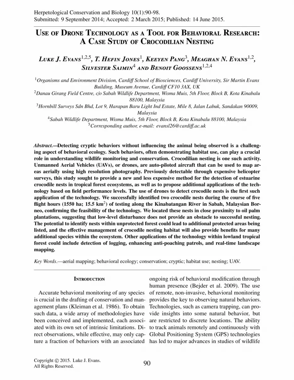
Herpetological Conservation and Biology 10(1):90-98.Submitted: 9 September 2014; Accepted: 2 March 2015; Published: 14 June 2015.
Use of Drone Technology as a Tool for Behavioral Research:A Case Study of Crocodilian Nesting
Luke J. Evans1,2,5, T. Hefin Jones1, Keeyen Pang3, Meaghan N. Evans1,2,Silvester Saimin4 and Benoit Goossens1,2,4
1Organisms and Environment Division, Cardiff School of Biosciences, Cardiff University, Sir Martin EvansBuilding, Museum Avenue, Cardiff CF10 3AX, UK
2Danau Girang Field Centre, c/o Sabah Wildlife Department, Wisma Muis, 5th Floor, Block B, Kota Kinabalu88100, Malaysia
3Hornbill Surveys Sdn Bhd, Lot 9, Harapan Baru Light Ind Estate, Mile 8, Jalan Labuk, Sandakan 90009,Malaysia
4Sabah Wildlife Department, Wisma Muis, 5th Floor, Block B, Kota Kinabalu 88100, Malaysia5Corresponding author, e-mail: [email protected]
Abstract.—Detecting cryptic behaviors without influencing the animal being observed is a challeng-ing aspect of behavioral ecology. Such behaviors, often demonstrating habitat use, can play a crucialrole in understanding wildlife monitoring and conservation. Crocodilian nesting is one such activity.Unmanned Aerial Vehicles (UAVs), or drones, are auto-piloted aircraft that can be used to map ar-eas aerially using high resolution photography. Previously detectable through expensive helicoptersurveys, this study sought to provide a new and less expensive method for the detection of estuarinecrocodile nests in tropical forest ecosystems, as well as to propose additional applications of the tech-nology based on field performance levels. The use of drones to detect crocodile nests is the first suchapplication of the technology. We successfully identified two crocodile nests during the course of fiveflight hours (1550 ha; 15.5 km2) of testing along the Kinabatangan River in Sabah, Malaysian Bor-neo, confirming the feasibility of the technology. We located these nests in close proximity to oil palmplantations, suggesting that low-level disturbance does not provide an obstacle to successful nesting.The potential to identify nests within unprotected forest could lead to additional protected areas beinglisted, and the effective management of crocodile nesting habitat will also provide benefits for manyadditional species within the ecosystem. Other applications of the technology within lowland tropicalforest could include detection of logging, enhancing anti-poaching patrols, and real-time landscapemapping.
Key Words.—aerial mapping; behavioral ecology; conservation; cryptic; habitat use; nesting; UAV.
Introduction
Accurate behavioral monitoring of any speciesis crucial in the drafting of conservation and man-agement plans (Kleiman et al. 1986). To obtainsuch data, a wide array of methodologies havebeen conceived and implemented, each associ-ated with its own set of intrinsic limitations. Di-rect observations, while effective, may only cap-ture a fraction of behaviors with an associated
ongoing risk of behavioral modification throughhuman presence (Bejder et al. 2009). The useof remote, non-invasive, behavioral monitoringprovides the key to observing natural behaviors.Technologies, such as camera trapping, can pro-vide insights into some natural behavior, butare restricted to discrete locations. The abilityto track animals remotely and continuously withGlobal Positioning System (GPS) technologieshas led to major advances in studies of wildlife
Copyright c© 2015. Luke J. Evans.All Rights Reserved. 90
Herpetological Conservation and Biology
behavior and habitat usage, while also providingmore accurate home range estimates (Seegar et al.1996; Hebblewhite and Haydon 2010). Despitethese advances, the monitoring of more cryptic,fine scale behaviors remains a challenge.
The use of drones, or unmanned aerial vehi-cles (UAVs), is a burgeoning facet of conserva-tion biology with the potential to revolutionizethe way in which animals and habitats are mon-itored. Drone technology in itself is not a newdevelopment, with military applications havingexpanded rapidly over the past decade (Vogel2010). These tools have, however, always beentoo expensive for scientific application. The de-velopment of low-cost, open-sourced alternativeshas brought the technology within financial reachof researchers and conservationists, and low-costaircraft can be purchased and equipped for aslittle as $2,000 US (Koh and Wich 2012). Theopen-sourced nature of the technology, coupledwith the large online community of hobbyists,as well as professionals, could lead to drone usebeing a viable staple of conservation biology.
One example of a taxon whose biology andecology can be much better investigated andunderstood by applying drone technology iscrocodilians. This is particularly so in the detec-tion and mapping of crocodile nesting behavior.Until recently, crocodilian nest studies focusingon location and distribution have used helicopterand airboat surveys both for identification andvalidation of nest sites (Magnusson et al. 1978;Rice et al. 2000; Harvey and Hill 2003). Thesetechniques are financially costly, despite beingmore feasible for more remote regions. Walkedsurveys have, until now, often been used in con-junction with helicopter surveys to find and val-idate crocodile nesting habits (Harvey and Hill2003).
Estuarine Crocodiles, Crocodylus porosus, arethe largest extant crocodilians, with individualsreaching in excess of 6 m in length (Britton et al.2012). Nesting behavior in C. porosus involvesfemales building mounds of both vegetation andmud (Webb et al. 1977). Nests are usually built
within 5–10 m of permanent water sources, how-ever, they can be as much as 100 m from deepwater (Webb et al. 1977; Harvey and Hill 2003).Work on C. porosus nesting has been largely con-fined to Australia, with a paucity of studies inSouth East Asia.
As well as being highly labor intensive, thereare numerous challenges involved in the survey-ing of C. porosus nests in mixed tropical habi-tats. Semi-inundated and swamp forests, with tallgrass, pose logistical challenges to nest detectionefforts, as well as being potentially dangerousobstacles for surveyors. Drone technology pro-vides a logical next step in nesting monitoringmethodology, due to relatively low initial cost, re-peatability, and flexibility. Here the potential useof such applications is described on C. porosusin the Lower Kinabatangan Wildlife Sanctuary(LKWS), Sabah, Malaysia
Materials andMethods
We carried out flights using a fixed-wing drone(Bormatec-MAJA: Bormatec, Mooswiesen,Ravensburg, Germany), with a wingspan of1.8 m and a weight of 3 kg, comprised largelyof expanded polypropylene. The aircraft wascapable of bearing a payload of about 500 g.This allowed us to add camera equipment (250g), as well as maximizing the flight time ona single battery (3S 4,000 mAh). The aircraftwas able to make single flights of 23–25 km, orapproximately 250 ha, if flown in grid formation,with flights of this distance taking between 30and 40 min to complete (Fig. 1). We could haveextended this range to a maximum of 50–70 kmwith the use of larger 3S 10,000 mAh batteries,but this would have resulted in a reduction inpayload capability.
Our choice of camera (Model S100, Canon,Ota, Tokyo, Japan) used during flights was basedon both cost and performance capabilities, theunit was customised with a firmware (a set ofinstructions stored in ROM Read Only Mem-ory) enhancement created using a Canon Hack
91
Evans et al.—-Use of drones for behavioral research.
Figure 1. Planning missions using Auto Pilot Module (APM) planning software. Flights were flown in agrid formation with transects separated by a predetermined distance to allow sufficient overlap for stitching.Transect separation was 170 m. The image displays the actual route taken by the unmanned aerial vehicle(UAV) during a single flight covering around 300 ha.
Development Kit (CHDK), which is stored in acamera memory card. A special inter-volameterscript was developed by Conservation Drones(www.conservationdrones.org) allowing the cam-era to take pictures at regular intervals. To pro-vide sufficient picture overlap of about 50%,we calculated the shutter intervals by evaluat-ing drone airspeed and altitude (Koh and Wich2012). Our flights were planned and uploadedthrough the Auto Pilot Module APM missionplanner, an open sourced ground control stationsoftware, in concordance with methods describedby Koh and Wich (Fig. 1). We flew transects 170m apart. This distance was based on the altitudeand the resolution of the camera. As the flightswere flown at 300 m, we instructed the firmwareto take a single picture every 3 sec. This resultedin a picture overlap in excess of 60%.
Flying at 300 m allowed maximum landscapecoverage, as well as ensuring good clearanceabove all tree lines. Also, at this altitude, pic-ture resolution averaged 8–9 cm per pixel. Thisallowed us to easily detect any potential crocodile
nests, which measure 1–2 m in diameter (Webb etal. 1977). We launched the drone manually andflew via remote control until it reached an altitudeof about 100 m. Once this height was reached,we switched to auto-pilot, controlled via the mis-sion planner, which ordered the drone to followpredefined coordinates at the cruising altitude.We recorded average drone airspeeds of 40–50kmph, but this was heavily influenced by windspeed and direction. Greater resolutions of pic-tures could be achieved, but to attain this wouldrequire flying at a lower altitude. When flownat 200 m, flights yielded a resolution of around5–6 cm per pixel. This resulted in a reduction inaerial coverage per flight of around 26%, giventhe same payload and battery capabilities. Thismethod can be used, however, when images arenot sufficiently clear to identify nesting moundseffectively.
We piloted these missions from 14–18 Oc-tober 2013, Sabah’s wet season; during thenesting season for the region’s crocodiles. Weflew flights in four key, predetermined areas
92
Herpetological Conservation and Biology
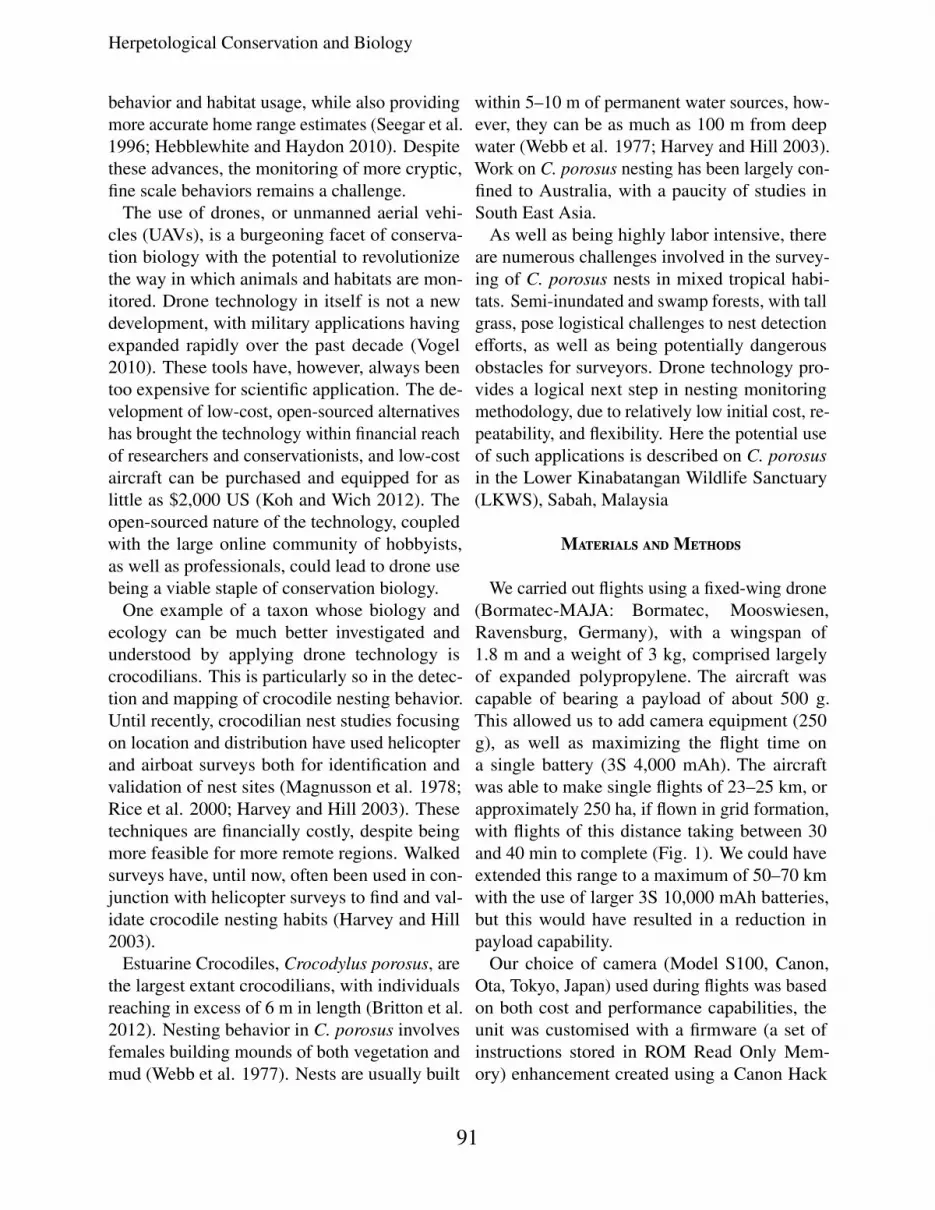
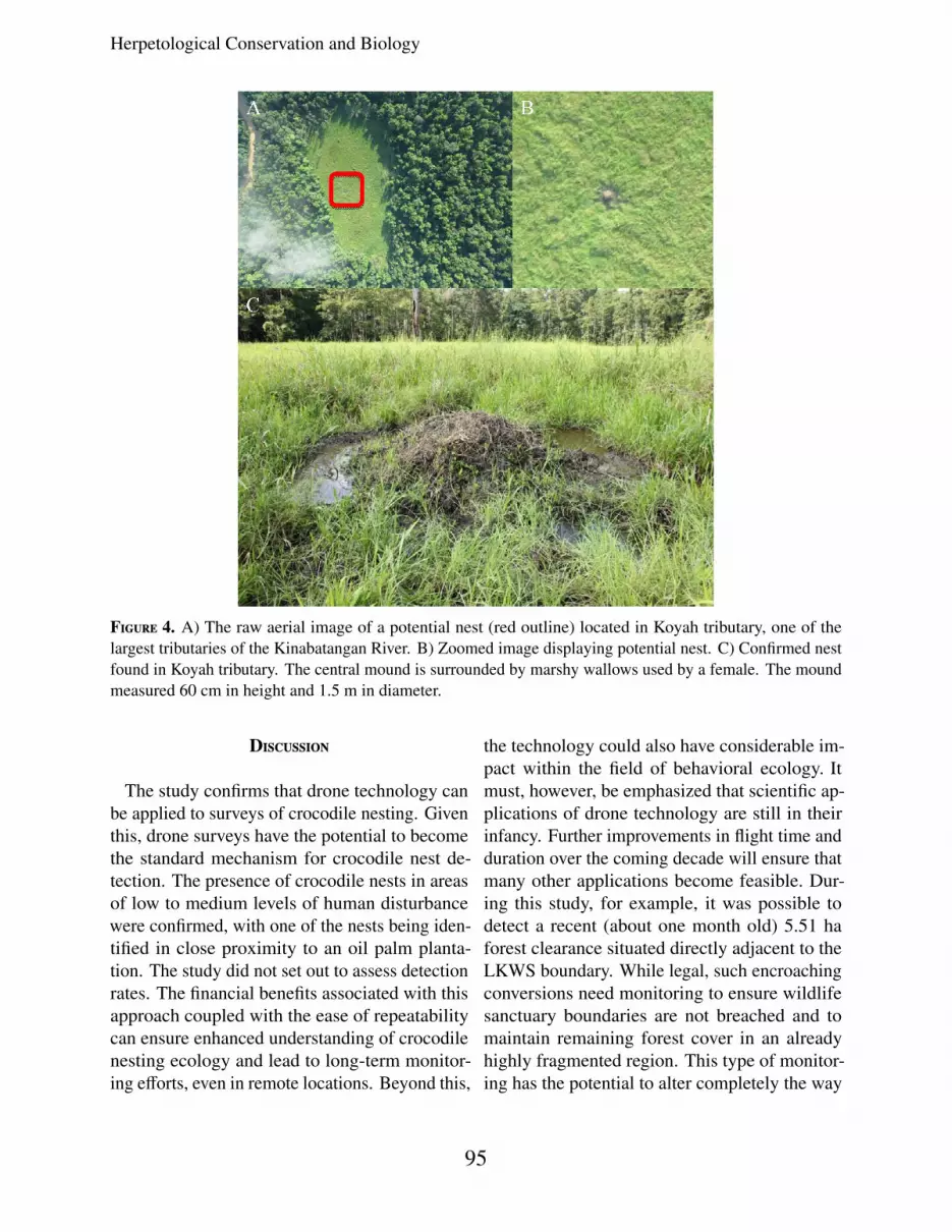
Figure 2. The study site situated in the Lower Kinabatangan Wildlife Sanctuary (LKWS), located within theMalaysian state of Sabah. The survey area comprised parts of Lot 5, 6, and 7.
based on direct observations of both crocodilejuvenile prevalence and suitable habitat. Oursurvey areas covered two of the largest tribu-taries along the Kinabatangan. Both tributariesare sites of human fatalities from crocodile at-tacks within the last two years and are subjectto direct encroachment from agriculture. We se-lected two additional areas as characterized bylarge areas of swamp-land and drying, old oxbowlakes, both excellent crocodile nesting habitat.We timed our flight missions to occur at dif-ferent times to establish which daylight condi-tions resulted in the best nest detection and im-age stitching capability. We conducted flightsin early morning (0700–0900), later morning(0900–1100), or afternoon (1400–1600). Onceretrieved, we stitched together our images usingprogram Pix4D (Pix4D SA, Lausanne, Switzer-
land), and the minimum system requirements forthis program include an i7 quad core processoralong with 32 GB RAM Random Access Mem-ory and an SSD Solid State hard drive.
Our study site consisted of a stretch ofthe LKWS encompassing Lots 5 (N5.423742◦,E118.055597◦), 6 (N 5.397137◦, E 118.073509◦),and 7 (N 5.414195◦, E 117.972◦; Fig. 2). Thisregion is comprised of a forest-oil palm matrix,located some 150 km from the Sulu Sea in anarea with a large and growing crocodile popu-lation (Luke Evans, unpubl. data). The nestingof crocodiles in the area has not been studied indetail, although several unsuccessful helicoptersurveys have been conducted within the Kin-abatangan (Jibius Dausip, pers. comm.). The useof drone technology allowed for the specific tar-geting of areas deemed suitable for assessment
93
Evans et al.—-Use of drones for behavioral research.
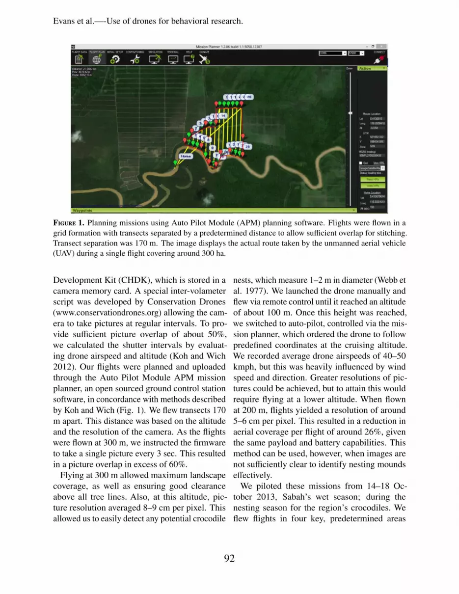
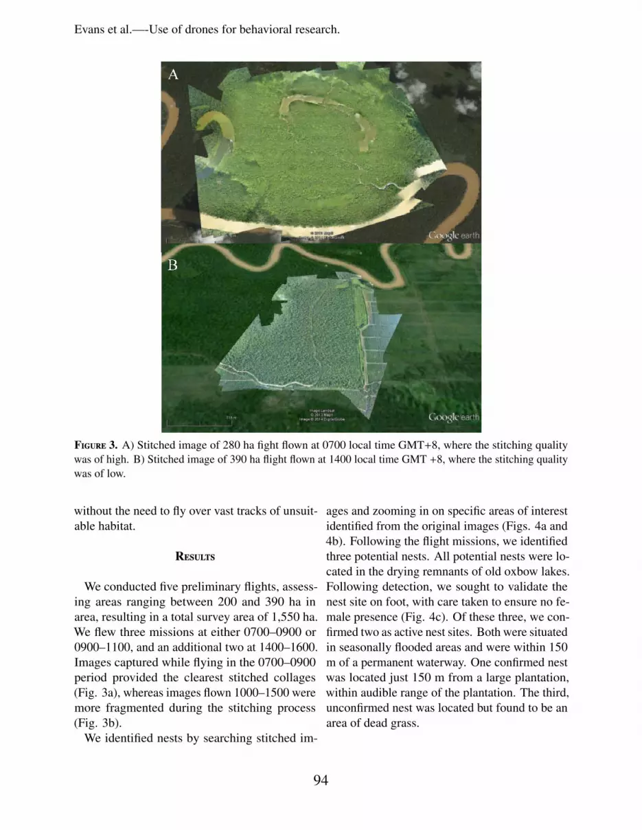
Figure 3. A) Stitched image of 280 ha fight flown at 0700 local time GMT+8, where the stitching qualitywas of high. B) Stitched image of 390 ha flight flown at 1400 local time GMT +8, where the stitching qualitywas of low.
without the need to fly over vast tracks of unsuit-able habitat.
Results
We conducted five preliminary flights, assess-ing areas ranging between 200 and 390 ha inarea, resulting in a total survey area of 1,550 ha.We flew three missions at either 0700–0900 or0900–1100, and an additional two at 1400–1600.Images captured while flying in the 0700–0900period provided the clearest stitched collages(Fig. 3a), whereas images flown 1000–1500 weremore fragmented during the stitching process(Fig. 3b).
We identified nests by searching stitched im-
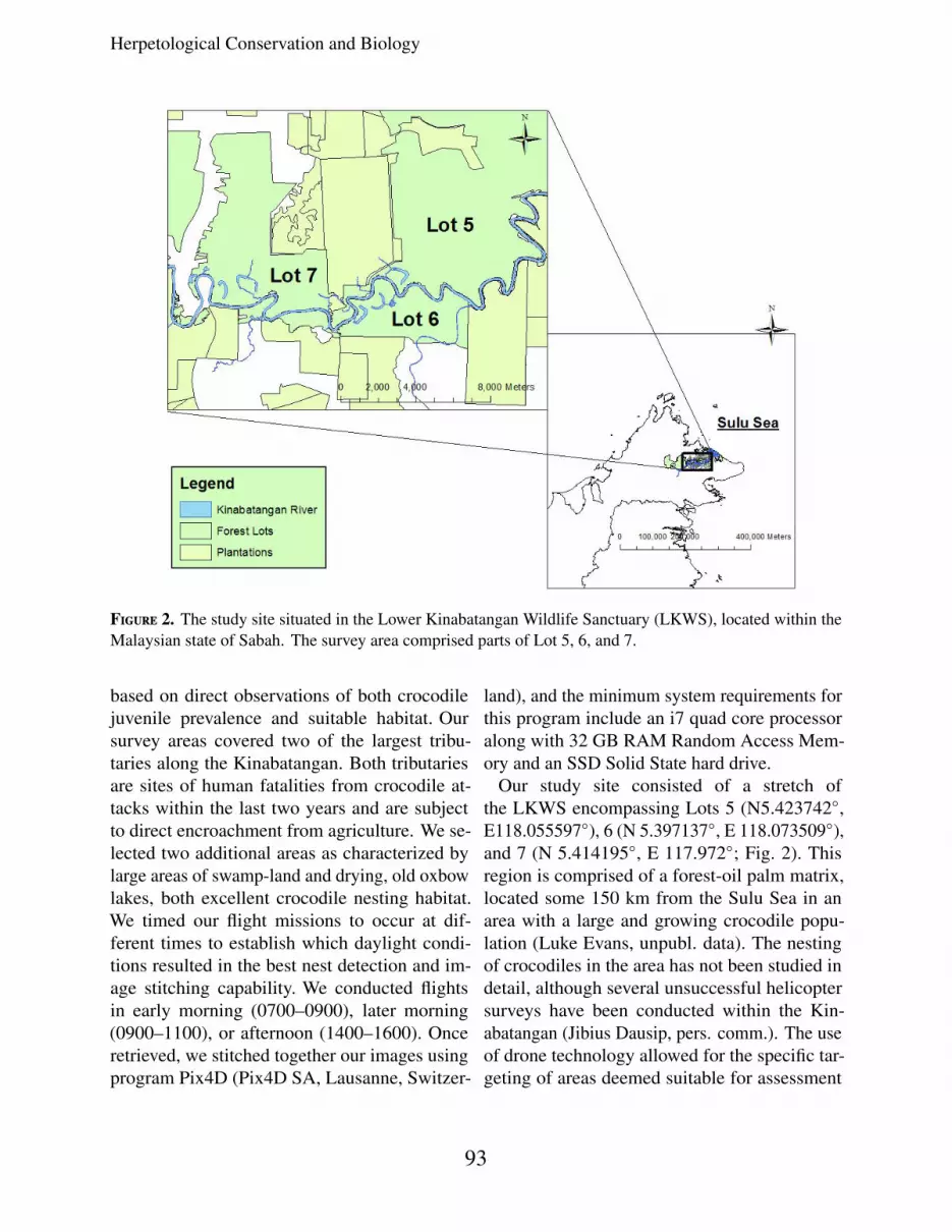
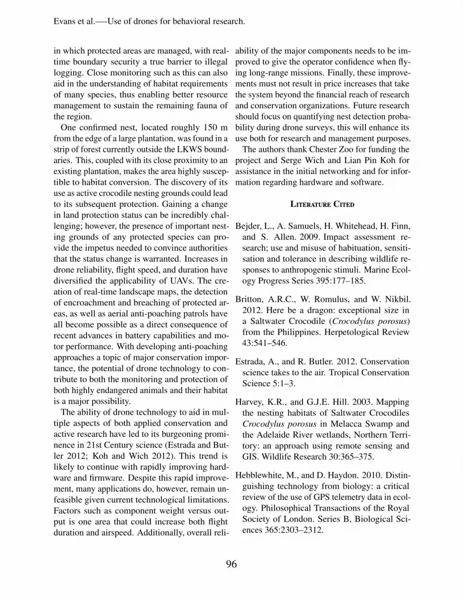
ages and zooming in on specific areas of interestidentified from the original images (Figs. 4a and4b). Following the flight missions, we identifiedthree potential nests. All potential nests were lo-cated in the drying remnants of old oxbow lakes.Following detection, we sought to validate thenest site on foot, with care taken to ensure no fe-male presence (Fig. 4c). Of these three, we con-firmed two as active nest sites. Both were situatedin seasonally flooded areas and were within 150m of a permanent waterway. One confirmed nestwas located just 150 m from a large plantation,within audible range of the plantation. The third,unconfirmed nest was located but found to be anarea of dead grass.
94
Herpetological Conservation and Biology
Figure 4. A) The raw aerial image of a potential nest (red outline) located in Koyah tributary, one of thelargest tributaries of the Kinabatangan River. B) Zoomed image displaying potential nest. C) Confirmed nestfound in Koyah tributary. The central mound is surrounded by marshy wallows used by a female. The moundmeasured 60 cm in height and 1.5 m in diameter.
Discussion
The study confirms that drone technology canbe applied to surveys of crocodile nesting. Giventhis, drone surveys have the potential to becomethe standard mechanism for crocodile nest de-tection. The presence of crocodile nests in areasof low to medium levels of human disturbancewere confirmed, with one of the nests being iden-tified in close proximity to an oil palm planta-tion. The study did not set out to assess detectionrates. The financial benefits associated with thisapproach coupled with the ease of repeatabilitycan ensure enhanced understanding of crocodilenesting ecology and lead to long-term monitor-ing efforts, even in remote locations. Beyond this,
the technology could also have considerable im-pact within the field of behavioral ecology. Itmust, however, be emphasized that scientific ap-plications of drone technology are still in theirinfancy. Further improvements in flight time andduration over the coming decade will ensure thatmany other applications become feasible. Dur-ing this study, for example, it was possible todetect a recent (about one month old) 5.51 haforest clearance situated directly adjacent to theLKWS boundary. While legal, such encroachingconversions need monitoring to ensure wildlifesanctuary boundaries are not breached and tomaintain remaining forest cover in an alreadyhighly fragmented region. This type of monitor-ing has the potential to alter completely the way
95
Evans et al.—-Use of drones for behavioral research.
in which protected areas are managed, with real-time boundary security a true barrier to illegallogging. Close monitoring such as this can alsoaid in the understanding of habitat requirementsof many species, thus enabling better resourcemanagement to sustain the remaining fauna ofthe region.
One confirmed nest, located roughly 150 mfrom the edge of a large plantation, was found in astrip of forest currently outside the LKWS bound-aries. This, coupled with its close proximity to anexisting plantation, makes the area highly suscep-tible to habitat conversion. The discovery of itsuse as active crocodile nesting grounds could leadto its subsequent protection. Gaining a changein land protection status can be incredibly chal-lenging; however, the presence of important nest-ing grounds of any protected species can pro-vide the impetus needed to convince authoritiesthat the status change is warranted. Increases indrone reliability, flight speed, and duration havediversified the applicability of UAVs. The cre-ation of real-time landscape maps, the detectionof encroachment and breaching of protected ar-eas, as well as aerial anti-poaching patrols haveall become possible as a direct consequence ofrecent advances in battery capabilities and mo-tor performance. With developing anti-poachingapproaches a topic of major conservation impor-tance, the potential of drone technology to con-tribute to both the monitoring and protection ofboth highly endangered animals and their habitatis a major possibility.
The ability of drone technology to aid in mul-tiple aspects of both applied conservation andactive research have led to its burgeoning promi-nence in 21st Century science (Estrada and But-ler 2012; Koh and Wich 2012). This trend islikely to continue with rapidly improving hard-ware and firmware. Despite this rapid improve-ment, many applications do, however, remain un-feasible given current technological limitations.Factors such as component weight versus out-put is one area that could increase both flightduration and airspeed. Additionally, overall reli-
ability of the major components needs to be im-proved to give the operator confidence when fly-ing long-range missions. Finally, these improve-ments must not result in price increases that takethe system beyond the financial reach of researchand conservation organizations. Future researchshould focus on quantifying nest detection proba-bility during drone surveys, this will enhance itsuse both for research and management purposes.
The authors thank Chester Zoo for funding theproject and Serge Wich and Lian Pin Koh forassistance in the initial networking and for infor-mation regarding hardware and software.
Literature Cited
Bejder, L., A. Samuels, H. Whitehead, H. Finn,and S. Allen. 2009. Impact assessment re-search; use and misuse of habituation, sensiti-sation and tolerance in describing wildlife re-sponses to anthropogenic stimuli. Marine Ecol-ogy Progress Series 395:177–185.
Britton, A.R.C., W. Romulus, and W. Nikbil.2012. Here be a dragon: exceptional size ina Saltwater Crocodile (Crocodylus porosus)from the Philippines. Herpetological Review43:541–546.
Estrada, A., and R. Butler. 2012. Conservationscience takes to the air. Tropical ConservationScience 5:1–3.
Harvey, K.R., and G.J.E. Hill. 2003. Mappingthe nesting habitats of Saltwater CrocodilesCrocodylus porosus in Melacca Swamp andthe Adelaide River wetlands, Northern Terri-tory: an approach using remote sensing andGIS. Wildlife Research 30:365–375.
Hebblewhite, M., and D. Haydon. 2010. Distin-guishing technology from biology: a criticalreview of the use of GPS telemetry data in ecol-ogy. Philosophical Transactions of the RoyalSociety of London. Series B, Biological Sci-ences 365:2303–2312.
96
Herpetological Conservation and Biology
Kleiman, D.G., B.B. Beck, J.M. Dietz, L.A.Dietz, J.D. Ballou, and A.F. Coimbra-Filho.1986. Conservation program for the GoldenLion Tamarin: captive research and manage-ment, ecological studies, educational strate-gies, and reintroduction. Pp. 959–979 In Pri-mates: The Road to Self-Sustaining Popula-tions. Benirschke, K. (Ed.). Springer Verlag,New York, New York, USA.
Koh, L.P., and S.A. Wich. 2012. Dawn of droneecology: low-cost autonomous aerial vehiclesfor conservation. Tropical Conservation Sci-ence 5:121–132.
Magnusson, W., G. Grigg, and J. Taylor. 1978.An aerial survey of potential nesting areasof the Saltwater Crocodile, Crocodylus poro-sus Schneider, on the North Coast of ArnhemLand, Northern Australia. Wildlife Research5:401–415.
Rice, K.G., H.F. Percival, and A.R. Wood-ward. 2000. Estimating sightings proportionsof American Alligator nests during helicoptersurvey. Proceedings of the Annual ConferenceSoutheast Association of Fish and WildlifeAgencies 54:314–321.
Seegar, W.S., P.N. Cutchis, M.R. Fuller, J.J. Suter,and V. Bhatnagar. 1996. Fifteen years of satel-lite tracking development and application towildlife research and conservation. John Hop-kins APL Technical Digest 17:401–411.
Vogel, R.J. 2010. Drone warfare and the law ofarmed conflict. Denver Journal of InternationalLaw and Policy 39:101–137.
Webb, G.J.W., H. Messel, and W. Magnus-son. 1977. The nesting of Crocodylus porosusin Arnhem Land, Northern Australia. Copeia1977:238–249.
Luke Evans is a Ph.D. student registeredto Cardiff University, Wales. He has beenworking on crocodilians for five years in Sabah,Malaysian Borneo. He is a British citizen andwas born and raised in Cornwall, South WestEngland. He completed both B.Sc. and M.Res.through Cardiff University before embarkingon his current Ph.D. in 2012. (Photographedby Ryan Pang).
T. Hefin Jones graduated in Zoology from theUniversity of London, where he also gained hisPh.D. He spent 11 y working on host-parasitoidinteractions at Imperial College, London. In1994 he was appointed a Research Fellow andProject Leader at the UK’s Centre for Popula-tion Biology where he led an international teamof climate change researchers using the EcotronControlled Environment Facility. Since mov-ing to Cardiff University, his research has con-centrated on the effects of climatic variation onterrestrial and freshwater communities. (Pho-tographed by Geraint Tudur)..
97
Evans et al.—-Use of drones for behavioral research.
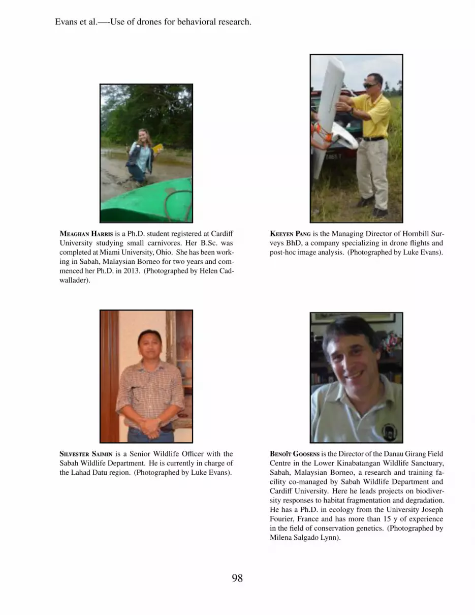
Meaghan Harris is a Ph.D. student registered at CardiffUniversity studying small carnivores. Her B.Sc. wascompleted at Miami University, Ohio. She has been work-ing in Sabah, Malaysian Borneo for two years and com-menced her Ph.D. in 2013. (Photographed by Helen Cad-wallader).
Keeyen Pang is the Managing Director of Hornbill Sur-veys BhD, a company specializing in drone flights andpost-hoc image analysis. (Photographed by Luke Evans).
Silvester Saimin is a Senior Wildlife Officer with theSabah Wildlife Department. He is currently in charge ofthe Lahad Datu region. (Photographed by Luke Evans).
BenoitGoosens is the Director of the Danau Girang FieldCentre in the Lower Kinabatangan Wildlife Sanctuary,Sabah, Malaysian Borneo, a research and training fa-cility co-managed by Sabah Wildlife Department andCardiff University. Here he leads projects on biodiver-sity responses to habitat fragmentation and degradation.He has a Ph.D. in ecology from the University JosephFourier, France and has more than 15 y of experiencein the field of conservation genetics. (Photographed byMilena Salgado Lynn).
98
Copyright © 2022 FDOKUMEN