The fishery for black scabbardfish ( Aphanopus carbo Lowe, 1839) in the Portuguese continental slope

1
Urban Reform in times of change, 1839- 1881.
Ottoman town planning and the founding of a border city in Thessaly
Alexandra Yerolympos
Aristotle University, Thessaloniki, Greece
Keywords: Border cities, Volos, Thessaly, Ottoman Reforms, Greece, westernisation
1. Introduction Let me first define the time and the place. The time: A few years after the creation of the modern state of Greece south of Thessaly (1828-1830), reforms striving to ‘westernize’ the Ottoman Empire (1839) were officially proclaimed. Wishing to halt the disintegration of the Empire, the sultan signed the Tanzimat Charter, which made possible, especially after 1856, an extensive economical and sociopolitical transformation of the old political system. Tanzimat was founded upon a double political emancipation: the granting of equal rights to all Ottoman subjects, whether Moslem or not, and the separation of state and public administration from religious law. The relationship between government and the people was defined and codified, and concepts of equality, liberty and human rights were introduced in the political discourse1. The 'westernization' was greatly encouraged when not imposed by western European states wishing to control national liberation movements, as well as in search of new markets. In any case and for the first time non-muslims, Christians and Jews, were in a position to invest in land and thus affect significantly the remaking and the expansion of existing towns. In 1878, the Great European Powers decided that the province of Thessaly would be integrated into Greece by 1881. Between 1839 and 1881, there was a forty-year period during which new planning practices were introduced by the Ottoman authorities. My paper deals with this episode of – let me call it- planning ‘prehistory’ in a frontier province gradually passing from a premodern state to modernity. The place is the province of Thessaly and the city of Volos: In fact, until the early XIXth century Thessaly, a rich and fertile plain in the Greek peninsula, was among the most dynamic places in the Greek world under Ottoman rule. Thessaly was also ‘the most industrialized region of Greece’, owing to the manufacturing activities which had evolved in its mountain areas. The mountain villages and many towns produced substantial quantities of woven goods, an activity that later on declined, as it was unable to compete with the mass production of European industrialisation. At the same time at a period when the main trading routes were by sea, the region of Thessaly had active continental commercial centers which complemented the network of markets, such as Larissa and Pharsala, Trikala, Karditsa and Volos. The prosperity the region enjoyed up until 1800, and the subsequent increase in its population did not, however, alter the traditional aspect of the
1 Z. Celik, The Remaking of Istanbul. Portrait of an Ottoman City in the 19th Century. Seattle and London: University of Washington Press, 1986; esp. p. 31-35.

2
urban settlements. Economic decline after 1800, was followed by the difficult years of the Greek war of independence. The calm returned to the area after 1828, but the economy recovered only with the proclamation of the Reforms. Yet people continued to move into the cities for a number of different but interrelated factors: migration as a consequence of the end of political tensions and military conflict2; the prospect of new business activities; hopes of economic improvement, as well as a keen sense of insecurity in the countryside owing to the general state of turmoil and anarchy. These phenomena led to an increase in urban populations, the growth of certain activities and the appearance of ‘modernised’ or new occupations, requiring new types of business premises and dwelling places within the towns.
Fig. 1. 1830 creation of Greece, 1881 integration of Thessaly, 1913 integration of Epirus and Macedonia At the same time the concession of equal rights under the law tonon-Muslims had facilitated their settlement in areas once prohibited to them, while the guarantees of “life, property and honour” furnished by the Reforms encouraged individuals to invest in property, whether for residential or business purposes. Also non-Muslim (mainly Greek and Jewish) communities undertook to erect religious buildings, schools and charitable institutions. People began to take a real and sustained interest in the value of urban land, which until then had been regarded as worthless. In a period of transition to new institutions, interest in the development of land was bound to lead to conflict, since it would clash with traditional forms of ‘ownership’ which still remained strong. The principal ideas on how the urban space should be shaped (inspired by the rules and practices current in Europe since the XVIIth and XVIIIth centuries) had already been formulated by 1836 and were aligned along two main axes. The first derived from the need to require that non-combustible materials be used in construction, in order to improve the quality of the urban space and to protect towns and cities from frequent fires. The second introduced the idea of shaping urban space according to geometrical principles (e.g. a rectangular street grid). There were good reasons of hygiene, fire safety, policing and political control to add their weight to these decisions. An immediate consequence was the need to open up broad, straight road arteries through the old, labyrinthine quarters of the towns. Improving access would assist in fighting the frequent fires which were the scourge of the old towns. At the same time, districts that did succumb to fire would have to be re-designed, providing a testing ground for new ideas. These new ideas took the form of regulatory provisions in the imperial decree of 1846 and the regulations of 1848 and 1849, while more detailed provisions were subsequently added
2 The fight for Greek independence ended in 1827.

3
in the legislation of 1864. The paper follows the efforts to introduce changes in the urban scenery. It is true that planning measures are ‘elementary’. The main amendments to the general Ottoman framework that would facilitate major planning operations only came into effect after 1880, and thus no longer applied to the cities of Thessaly. Still the modernizing project and its spatial imprint on Thessalian cities, although transient and elusive, can still be traced and provides interesting evidence of this early stage in the planning reforms. A brief presentation of the newly designed town of Volos by myself, based on hypotheses and written accounts in the absence of planning documents, was included in a book on Ottoman cities, published in 19923. Since then, I was fortunate to find the original plan of [old and new] Volos and safely date it in 1842-43. It provides information on the original form of the new settlement, and also on the way Ottomans perceived town development on an ad hoc basis, in these early years before the shaping of an official planning legislation. The plan illustrates new opportunities as well as limitations to which spatial changes were subject at the time.
Fig 2 and 3. Sketch and plan of the castle of Volos (1779 and 1880).
3 A. Yerolympos, “Urbanisme et modernisation en Grèce du Nord à l’époque des Tanzimat”, in P. Dumont, F. Georgeon (sld), Villes Ottomanes à la fin de l’empire, L’Harmattan, Paris 1992, p. 47-74. See also A. Yerolympos Between East and West. Planning in the Ottoman Reform Era. University Studio Press, Athens 19971, Thessaloniki 20042 [in Greek].
4
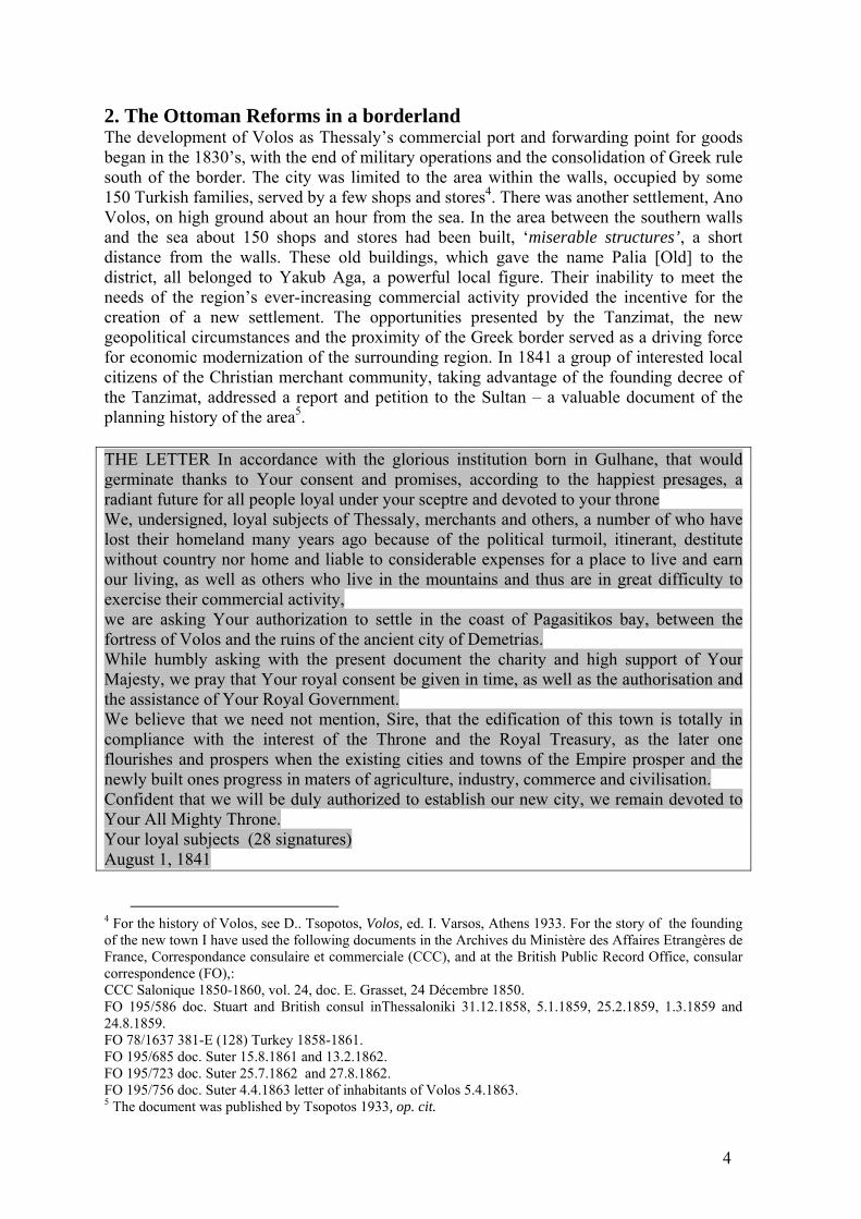
2. The Ottoman Reforms in a borderland The development of Volos as Thessaly’s commercial port and forwarding point for goods began in the 1830’s, with the end of military operations and the consolidation of Greek rule south of the border. The city was limited to the area within the walls, occupied by some 150 Turkish families, served by a few shops and stores4. There was another settlement, Ano Volos, on high ground about an hour from the sea. In the area between the southern walls and the sea about 150 shops and stores had been built, ‘miserable structures’, a short distance from the walls. These old buildings, which gave the name Palia [Old] to the district, all belonged to Yakub Aga, a powerful local figure. Their inability to meet the needs of the region’s ever-increasing commercial activity provided the incentive for the creation of a new settlement. The opportunities presented by the Tanzimat, the new geopolitical circumstances and the proximity of the Greek border served as a driving force for economic modernization of the surrounding region. In 1841 a group of interested local citizens of the Christian merchant community, taking advantage of the founding decree of the Tanzimat, addressed a report and petition to the Sultan – a valuable document of the planning history of the area5. THE LETTER In accordance with the glorious institution born in Gulhane, that would germinate thanks to Your consent and promises, according to the happiest presages, a radiant future for all people loyal under your sceptre and devoted to your throne We, undersigned, loyal subjects of Thessaly, merchants and others, a number of who have lost their homeland many years ago because of the political turmoil, itinerant, destitute without country nor home and liable to considerable expenses for a place to live and earn our living, as well as others who live in the mountains and thus are in great difficulty to exercise their commercial activity, we are asking Your authorization to settle in the coast of Pagasitikos bay, between the fortress of Volos and the ruins of the ancient city of Demetrias. While humbly asking with the present document the charity and high support of Your Majesty, we pray that Your royal consent be given in time, as well as the authorisation and the assistance of Your Royal Government. We believe that we need not mention, Sire, that the edification of this town is totally in compliance with the interest of the Throne and the Royal Treasury, as the later one flourishes and prospers when the existing cities and towns of the Empire prosper and the newly built ones progress in maters of agriculture, industry, commerce and civilisation. Confident that we will be duly authorized to establish our new city, we remain devoted to Your All Mighty Throne. Your loyal subjects (28 signatures) August 1, 1841
4 For the history of Volos, see D.. Tsopotos, Volos, ed. I. Varsos, Athens 1933. For the story of the founding of the new town I have used the following documents in the Archives du Ministère des Affaires Etrangères de France, Correspondance consulaire et commerciale (CCC), and at the British Public Record Office, consular correspondence (FO),: CCC Salonique 1850-1860, vol. 24, doc. Ε. Grasset, 24 Décembre 1850. FO 195/586 doc. Stuart and British consul inThessaloniki 31.12.1858, 5.1.1859, 25.2.1859, 1.3.1859 and 24.8.1859. FO 78/1637 381-E (128) Turkey 1858-1861. FO 195/685 doc. Suter 15.8.1861 and 13.2.1862. FO 195/723 doc. Suter 25.7.1862 and 27.8.1862. FO 195/756 doc. Suter 4.4.1863 letter of inhabitants of Volos 5.4.1863. 5 The document was published by Tsopotos 1933, op. cit.

5
In making their representation to the Sultan, the Greeks of Thessaly were anxious to take advantage of the new spirit of Reforms, perhaps afraid that it could not last long… Their arguments are clearly economic, but also – indirectly – political in nature. The itinerant…, destitute and without country nor home, as they describe themselves in their petition, seek permission to found a new settlement and to establish an organized community of responsible citizens, which will foster the economic and commercial development of the region and thus contribute significant resources to the state coffers, while also utilizing barren land that was not being exploited. The British consul Stuart (25.2.1859) was even more explicit in respect of the political benefits: “If the government entertained any suspicion that any disloyal feeling prevailed amongst the inhabitants of this district, the best policy would have been to encourage by all means the building of a town, where they would be concentrated with their families and effects, and where they would be kept in awe by the presence of a single sloop of war. Whereas they are now distributed in the surrounding villages, most of which are difficult of access”. The Greek merchants’ petition was accepted by the Sultan. According to the information of the British consular agent H. Suter, before they proceeded to build they were very cautious, taking pains to follow all the procedures laid down. They sought the dispatch of an engineer from the Porte, who mapped the district and prepared ‘a regular plan, with streets laid out at right angles, worthy of a European city’. At the same time a significant sum of money was deposited into the private coffers of the Sultan. If the local Muslims fiercely resisted the changes at first, they gradually realized that it was preferable to share in the profits those changes would generate. 3. The plan for Volos, 1842-42
Fig. 4. Ottoman plan for the new city of Volos 1842-43
6
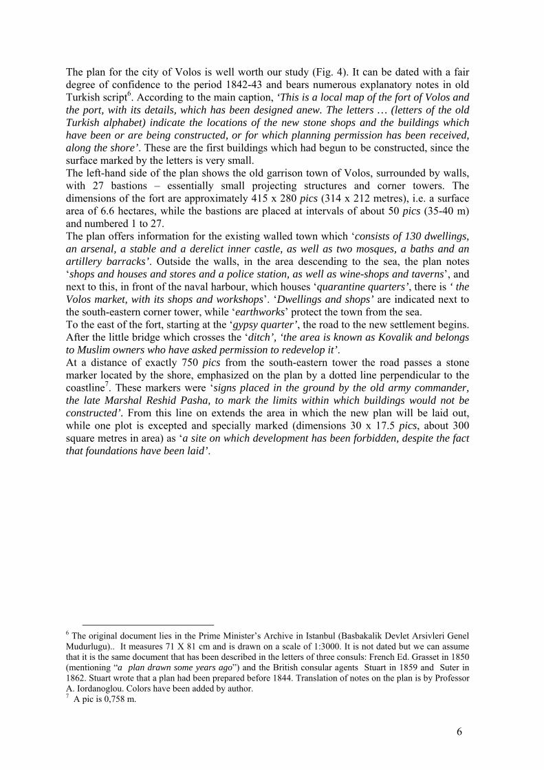
The plan for the city of Volos is well worth our study (Fig. 4). It can be dated with a fair degree of confidence to the period 1842-43 and bears numerous explanatory notes in old Turkish script6. According to the main caption, ‘This is a local map of the fort of Volos and the port, with its details, which has been designed anew. The letters … (letters of the old Turkish alphabet) indicate the locations of the new stone shops and the buildings which have been or are being constructed, or for which planning permission has been received, along the shore’. These are the first buildings which had begun to be constructed, since the surface marked by the letters is very small. The left-hand side of the plan shows the old garrison town of Volos, surrounded by walls, with 27 bastions – essentially small projecting structures and corner towers. The dimensions of the fort are approximately 415 x 280 pics (314 x 212 metres), i.e. a surface area of 6.6 hectares, while the bastions are placed at intervals of about 50 pics (35-40 m) and numbered 1 to 27. The plan offers information for the existing walled town which ‘consists of 130 dwellings, an arsenal, a stable and a derelict inner castle, as well as two mosques, a baths and an artillery barracks’. Outside the walls, in the area descending to the sea, the plan notes ‘shops and houses and stores and a police station, as well as wine-shops and taverns’, and next to this, in front of the naval harbour, which houses ‘quarantine quarters’, there is ‘ the Volos market, with its shops and workshops’. ‘Dwellings and shops’ are indicated next to the south-eastern corner tower, while ‘earthworks’ protect the town from the sea. To the east of the fort, starting at the ‘gypsy quarter’, the road to the new settlement begins. After the little bridge which crosses the ‘ditch’, ‘the area is known as Kovalik and belongs to Muslim owners who have asked permission to redevelop it’. At a distance of exactly 750 pics from the south-eastern tower the road passes a stone marker located by the shore, emphasized on the plan by a dotted line perpendicular to the coastline7. These markers were ‘signs placed in the ground by the old army commander, the late Marshal Reshid Pasha, to mark the limits within which buildings would not be constructed’. From this line on extends the area in which the new plan will be laid out, while one plot is excepted and specially marked (dimensions 30 x 17.5 pics, about 300 square metres in area) as ‘a site on which development has been forbidden, despite the fact that foundations have been laid’.
6 The original document lies in the Prime Minister’s Archive in Istanbul (Basbakalik Devlet Arsivleri Genel Mudurlugu).. It measures 71 X 81 cm and is drawn on a scale of 1:3000. It is not dated but we can assume that it is the same document that has been described in the letters of three consuls: French Ed. Grasset in 1850 (mentioning “a plan drawn some years ago”) and the British consular agents Stuart in 1859 and Suter in 1862. Stuart wrote that a plan had been prepared before 1844. Translation of notes on the plan is by Professor A. Iordanoglou. Colors have been added by author. 7 A pic is 0,758 m.
7
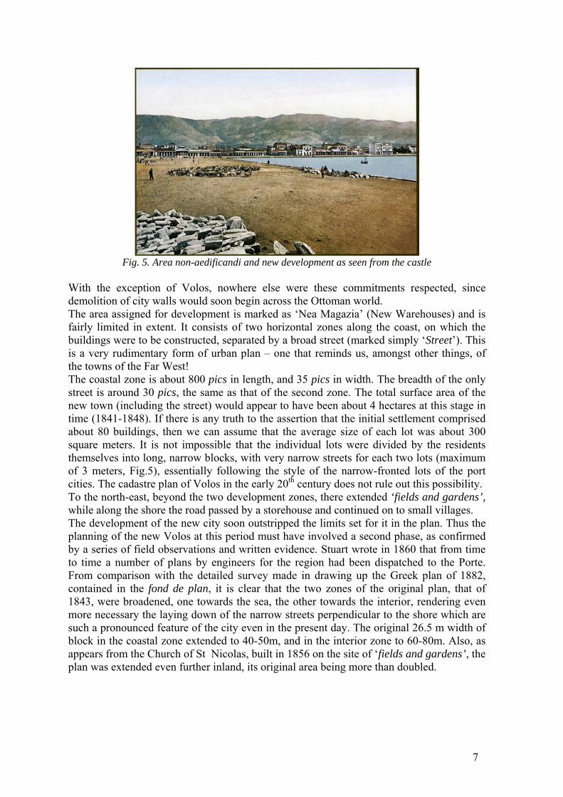
Fig. 5. Area non-aedificandi and new development as seen from the castle
With the exception of Volos, nowhere else were these commitments respected, since demolition of city walls would soon begin across the Ottoman world. The area assigned for development is marked as ‘Nea Magazia’ (New Warehouses) and is fairly limited in extent. It consists of two horizontal zones along the coast, on which the buildings were to be constructed, separated by a broad street (marked simply ‘Street’). This is a very rudimentary form of urban plan – one that reminds us, amongst other things, of the towns of the Far West! The coastal zone is about 800 pics in length, and 35 pics in width. The breadth of the only street is around 30 pics, the same as that of the second zone. The total surface area of the new town (including the street) would appear to have been about 4 hectares at this stage in time (1841-1848). If there is any truth to the assertion that the initial settlement comprised about 80 buildings, then we can assume that the average size of each lot was about 300 square meters. It is not impossible that the individual lots were divided by the residents themselves into long, narrow blocks, with very narrow streets for each two lots (maximum of 3 meters, Fig.5), essentially following the style of the narrow-fronted lots of the port cities. The cadastre plan of Volos in the early 20th century does not rule out this possibility. To the north-east, beyond the two development zones, there extended ‘fields and gardens’, while along the shore the road passed by a storehouse and continued on to small villages. The development of the new city soon outstripped the limits set for it in the plan. Thus the planning of the new Volos at this period must have involved a second phase, as confirmed by a series of field observations and written evidence. Stuart wrote in 1860 that from time to time a number of plans by engineers for the region had been dispatched to the Porte. From comparison with the detailed survey made in drawing up the Greek plan of 1882, contained in the fond de plan, it is clear that the two zones of the original plan, that of 1843, were broadened, one towards the sea, the other towards the interior, rendering even more necessary the laying down of the narrow streets perpendicular to the shore which are such a pronounced feature of the city even in the present day. The original 26.5 m width of block in the coastal zone extended to 40-50m, and in the interior zone to 60-80m. Also, as appears from the Church of St Nicolas, built in 1856 on the site of ‘fields and gardens’, the plan was extended even further inland, its original area being more than doubled.

8
Fig. 6. Evolution of Volos, 1880, with inland expansion of plan of 1842-43 and strip of building blocks reclaimed of the sea. Another expansion of the plan, involving reclamation of the sea and construction of a strip of building blocks, occurred on the eve of Thessaly’s annexation by Greece (Fig. 9). It appears that the process had begun even earlier (from 1874-75)8, but after various setbacks was finally completed on the eve of the Ottoman withdrawal. Experience of landfill operation for the Salonika new waterfront (1870-71), using material from the demolished sea walls, and likewise in Smyrna (1867-69), was still recent. Actually, the plan drawn up by the architect Polykarpos Vitalis for Thessaloniki in 1871 envisaged a waterside piazza and the erection of the Prefecture9. Yet because of bad management, this land was sold to private individuals and was developed in its entirety – more or less what occurred in Volos, although for different reasons. Other features of the 1843 plan include a port at Nea Magazia, the marking of a safe navigation line on the sea (‘the waters are shallow; note that vessels should not come alongside beyond the present line’), the marking of ‘quarantine quarters’ and a ‘tower’ on the coast opposite the new layout of the city and, finally, a note with the names of each of the 27 bastions. It is reasonable to assume that the detailed stating of these names was intended to endow with greater importance a fort that was in military terms entirely without significance, while at the same time the draughtsman forgets to record the moat around the fort, which only appears on later plans. Once the imperial approval had been secured for the plan, development began immediately along both sides of the city’s central artery. Without delay 70-80 stone buildings were completed, dwellings and storehouses, while another 30 were already under construction. Efforts to organize and endow the new town with amenities went hand in hand with the opening of the new Church, and with the setting up of an Ephorate of the New Town of
8 V. Hastaoglou, Volos, portrait of the city in the 19th and 20th centuries, Volos 2002, p. 39 (in Greek). 9 See also A. Yerolympos, “Urban Transformations at the European Provinces of the Ottoman Empire”, in (L.T.Baruh, V. Kechriotis, eds), Economy and Society on both Sides of the Aegean, Historical Archives Alpha Bank, Athens 2010, 449-486; and "Urban space as 'field': Aspects of Late Ottoman Town Planning After Fires" in G. Massard-Guilbaud, H. Platt, D. Schott (eds.) Cities and Catastrophes -Villes et catastrophes. Coping with Emergency in European History. Peter Lang, Europaischer Verlag des Wissenschaften, Frankfurt am Main 2002.
9
Volos (1856), to act as an administrative body for the new community10. In its founding charter the Ephorate noted that in order to promote the general interests and progress ‘of the newly established town’ it was appointing ‘a regular revenue both from commercial activities and from the properties of the local residents, both permanent and temporary’. The income would be levied as “right for the Church and works of philanthropy”. It may be that the independent spirit of the new residents alarmed the authorities, as it was combined to the unsuccessful uprising of Thessaly in 1854, when Greek irregular troops landed in the area. In the same year, 1856, a prohibition on building was imposed, directly this time and by government decree, on the pretext that new building might weaken the defensive capacity of the garrison. The true reasons, as we learn from consular agent Stuart, were different11. They involved the financial interests of the Turkish landowners of the area, whose income was threatened by the expansion. They also involved the ability of the new settlement to threaten the defense of the fortifications – these were uncertain times, and the border with the new Greek state was close at hand. The various twists and turns in the building of New Volos illustrate the difficult and hesitant progress of the Tanzimat reform programme, and have been recounted in detail elsewhere12. They include speculative behaviour, rivalries between businessmen and particularly between the two main population groups (Muslims and Christians), intervention by highly placed persons in the capital, bribery, the involvement of foreign diplomats and, finally, pressure at the Porte, which sooner or later yielded results. It soon became clear to all that this prohibition was damaging the economic development of the region. Old Volos continued to be strictly guarded and the gates of the castle generally remained closed between dusk and daybreak. The lack of storage spaces impeded the growth of commerce and the work of the port, while at the same time a serious housing problem was developing. Many attempts had been made to have the ban lifted, involving suggestions to the Turkish administrators that the property market would prove extremely lucrative in an area with such a brilliant future. The visit of the governor Ismael Pasha in August 1862 proved decisive; he declared that he supported the efforts to create a New Volos, he managed to buy together with a number of other beys of Larissa, plots of land in New Volos, and a short time after he announced the lifting of the prohibition, granting freedom to develop in all directions except to the north-west of the castle. From that point on, development was rapid (Fig. 10). The Austrian shipping agents had opened a branch in New Volos since 1852, and in 1854 a Greek consulate was opened. In 1862 the British Consular Agent Suter moved his office to Volos from Larissa13. The growth in population is rapid: from 1,500 inhabitants in 1860 and 3,000 in 1865, Volos grew to a population of 5,000 in 1881, the year it became part of Greece. In 1879 the Christian Mayor, Kartalis, ‘made tireless efforts to beautify the city’, in association with the governor and the administrative council of the district14. The awareness of the Ottoman authorities of the financial benefits of the ‘urbanization’ of the area is indicated by the expansion of the city into the sea15. Six months before their departure the Turkish authorities in the town hastened to sell to Greek owners of plots by the coast the 50 meters of sea lying in front of their land, together with permits to reclaim this area of sea. The contracts were drawn up as rapidly as possible so that the Greek government could not challenge the ownership. Shortly before the arrival of the Greek authority, the people of
10 Tsopotos 1933, op. cit., p. 34. 11 FO 195/586, doc. Stuart, March 1, 1859. 12 Ibid. 13 FO 195/685 doc. Suter 15.7.1861 and Tsopotos 1933, op. cit., p. 32. 14 Newspaper Hermes 383/1879 (Thessaloniki) (in Greek). 15 D. Tsopotos, “Eparhia Volou” in Thessalika Chronika (1935), 137 (in Greek).

10
Volos were working night and day, bringing materials by the cartload to reclaim the sea and create a new row of building lots!
Fig. 7. The city of Volos in 1900. (1) the castle, (2) the ex non-aedificandi area, (3) the original plan for the new city.
Although an overall assessment of the modernizing operations does not yield particularly impressive results, we have to concede that time was limited and that, despite the difficulties encountered and the military and political uncertainties of the period, a modernizing dynamic did manage to emerge, one which went beyond the purely urban areas. On the eve of the year 1880, as the Empire sought to prove to Europeans and locals that it was able to secure equal status under law for all subjects and economic growth for the region, various projects saw the light of day: discussion and plans for port facilities in Volos; preparations for the laying of a railway line from Volos to Jannina via Larissa and Trikala; a telegraph connection for the region; improvements to roads and asphalt surfacing; the construction of bridges. We might add a number of other items to this list: Municipal governments in all cities with Muslim or Christian mayors, freedom for non-Muslims to establish themselves wherever they wish, ‘unimpeded’ acquisition of land and building of dwellings, schools, professional premises and places of worship. This was merely a first step in the extension of the ‘right to the city’ to all Ottoman subjects, regardless of faith, a first elementary phase in the making of a new modernized urban space. The rise of a multi-ethnic bourgeois elite - developing its own collective identity and urban pride, formulating more elaborate demands for civic amenities and urban spaces such as piazzas, parks, theatres, clubs and modern hotels – was still some years away. Yet, in a period of 40 years, centuries-old habits, attitudes, and patterns of life were overturned in the area. This rapid change was manifested in a clear, spatial dimension, giving shape to new townscapes reflecting the changing needs of the local urban population and marking the transition of cities and towns in Thessaly from their pre-industrial form to an enlarged and more open contemporary spatial pattern. Most traces of these changes may have

11
disappeared from the urban landscape, but some can still be seen, offering us the opportunity to explore the slow but undeniable shift from an archaic, oriental, Ottoman society to one of more modern, western attitudes and lifestyles, social ideals and economic activities. Within this context the planning of Volos acquires an almost emblematic character. The settling of a new, free border city marks the hesitant but indisputable arrival of a new era in this part of the world. Fig. 8,9. The city of Volos in 1900
Alexandra Yerolympos Professor in Urban Design and Planning History School of Architecture Aristotle University of Thessaloniki, GREECE [email protected]
Fig. 10, 11. The city of Volos today. Persistance of the chessboardplan. Narrow streets on the seafront
12
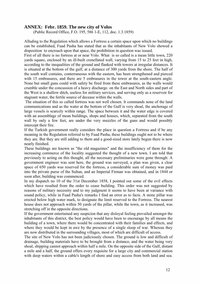
ANNEX: Febr. 1859. The new city of Volos (Public Record Office, F.O. 195, 586 1-E, 112, doc. 1.3.1859) Alluding to the Regulation which allows a Fortress a certain space upon which no buildings can be established, Fuad Pasha has stated that as the inhabitants of New Volo showed a disposition to encroach upon that space, the prohibition in question was issued. First of all there is no fortress at or near Volo. What is so called is a mean little town, 220 yards square, enclosed by an ill-built crenellated wall, varying from 15 to 25 feet in high, according to the inequalities of the ground and flanked with towers at irregular distances. It is situated at the bottom of the gulf, at a distance of 300 yards from the shore. The half of the south wall contains, conterraneous with the eastern, has been strengthened and pierced with 15 embrasures, and there are 5 embrasures in the tower at the south-eastern angle. None but small guns could with safety be fired from these embrasures, as the walls would crumble under the concussion of a heavy discharge. on the East and North sides and part of the West is a shallow ditch, useless for military services, and serving only as a reservoir for stagnant water, the fertile source of decease within the walls. The situation of this so called fortress was not well chosen. It commands none of the land communications and as the water at the bottom of the Gulf is very shoal, the anchorage of large vessels is scarcely within range. The space between it and the water edge is covered with an assemblage of mean buildings, shops and houses, which, separated from the south wall by only a few feet, are under the very muzzles of the guns and would possibly intercept their fire. If the Turkish government really considers the place in question a Fortress and if be any meaning in the Regulation referred to by Fuad Pasha, these buildings ought not to be where they are. But they are still adding to them and a good-sized store lately begun there is now nearly finished. These buildings are known as "the old magazines" and the insufficiency of them for the increasing commerce of the locality suggested the thought of a new town. I am told that previously to acting on this thought, all the necessary preliminaries were gone through: A government engineer was sent here, the ground was surveyed, a plan was given, a clear space of 650 yards was reserved for the fortress, a considerable sum of money was paid into the private purse of the Sultan, and an Imperial Firman was obtained, and in 1844 or soon after, building was commenced. In my dispatch no 10 of the 31st December 1858, I pointed out some of the evil effects which have resulted from the order to cease building. This order was not suggested by reasons of military necessity and to my judgment it seems to have been at variance with sound policy, while in Fuad Pasha's remarks I find an error as to facts. A stone pillar was erected below high water mark, to designate the limit reserved to the Fortress. The nearest house does not approach within 50 yards of ths pillar, while the town, as it increased, was stretching off in the opposite directions. If the government entertained any suspicion that any disloyal feeling prevailed amongst the inhabitants of this district, the best policy would have been to encourage by all means the building of a town, where there would be concentrated with their families and effects, and where they would be kept in awe by the presence of a single sloop of war. Whereas they are now distributed in the surrounding villages, most of which are difficult of access. The site of New Volo has not been judiciously chosen. The ground is low and difficult of drainage, building materials have to be brought from a distance, and the water being very shoal, shipping cannot approach within half a mile. On the opposite side of the Gulf, distant a mile and a half, the ground offers every requisite for a large city and commercial station with deep waters within a cable's length of shore and easy access from both land and sea.
13
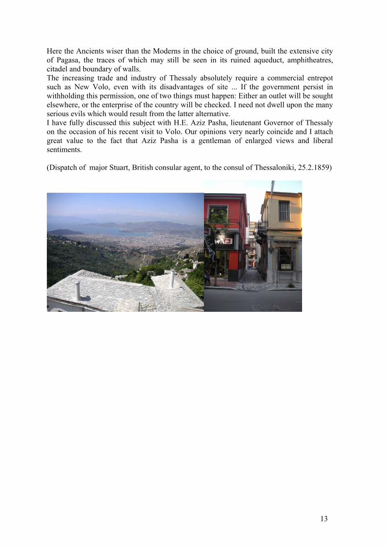
Here the Ancients wiser than the Moderns in the choice of ground, built the extensive city of Pagasa, the traces of which may still be seen in its ruined aqueduct, amphitheatres, citadel and boundary of walls. The increasing trade and industry of Thessaly absolutely require a commercial entrepot such as New Volo, even with its disadvantages of site ... If the government persist in withholding this permission, one of two things must happen: Either an outlet will be sought elsewhere, or the enterprise of the country will be checked. I need not dwell upon the many serious evils which would result from the latter alternative. I have fully discussed this subject with H.E. Aziz Pasha, lieutenant Governor of Thessaly on the occasion of his recent visit to Volo. Our opinions very nearly coincide and I attach great value to the fact that Aziz Pasha is a gentleman of enlarged views and liberal sentiments. (Dispatch of major Stuart, British consular agent, to the consul of Thessaloniki, 25.2.1859)
Copyright © 2022 FDOKUMEN


![«Μεσαιωνική Θεσσαλία», Θεσσαλία, Α΄ τόμος, Θέματα ιστορίας, ΕΤΕΔΚ Θεσσαλίας, Λάρισα 2006, 57-71 [Mediaeval Thessaly]](https://static.fdokumen.com/doc/165x107/631c2682d5372c006e044bd5/esioniki-essli-essli-tomos-emt.jpg)