Topographic Research on Neolithic Settlements in Békés-Sárrét
8
ARCHAEOMETRICAL RESEARCH IN HUNGARY n. Edited by L. Kolto and L. Bartosiewicz ^^f^ii^^M^m^\^:m^M, Budapest-Kaposvar-Veszprem 1998
-
Upload
independent -
Category
Documents
-
view
0 -
download
0
Transcript of Topographic Research on Neolithic Settlements in Békés-Sárrét

ARCHAEOMETRICAL RESEARCHIN HUNGARY
n.
Edited byL. Kolto and L. Bartosiewicz
^^f^ii^^M^m^\^:m^M,
Budapest-Kaposvar-Veszprem1998

Gyorgy GOLDMAN - Julia SZENASZKY
TOPOGRAPHIC RESEARCH ON THE NEOLITHICSETTLEMENTS IN BEKES SARRET
Abstract: Ws were able to study numerous Neolithic and Copper Age sites on the Great Hungarian Plainbeginning from the development of Koros up to the Tiszapolgdr culture by using systematic surface col-lection from each and every site and proton-magnetometer examinations.Keywords: Neolithic, settlement, houses, surface collection.
The history of a neolithic settlement, or its reconstruction obviously cannot excludemention of the use of tne resources originating from excavations; still our present paperis, first and foremost, based on data obtained from surface or topographic examinationand analysis. Numerous neolithic cultures settled in Bekes Sarret, which is located aiong asection of Koros river valley in Bekes county (SE Hungary). Soil erosion has not de-stroyed or washed away these traces of culture, nor has it buried its most significant re-mains or deposits. This therefore makes it possible to examine the succession of Koros,Alfold Linear Pottery (ALP), Esztar, Szakalhat, Tisza and Herpaly cultures and possibleinternal connections between them. We have already selected numerous sites from theseareas and, on several occasions, carried out a number of surface investigations on them.The first phase of our research, in the form of a joint English - Hungarian program, tookplace between 1979 and 1981 (SHERRATT, A., The Development of Neolithic and Cop-per Age Settlement in the Great Hungarian Plain. Part II. Site Survey and SettlementDynamics. OJA Vol. 3. No. I. Oxford, 1983.) The participants of this programme in-cluded the Oxford University Ashmolean Museum, Archaeological Institute of the Hun-garian Academy of Sciences and employees of the Mihaly Munkacsy Museum in Bekesc-saba. Through this co-operation, we were able to study numerous Neolithic and CopperAge sites beginning from the development of Koros culture up to the Tiszapolgar culture.However, only questions relevant to the period between the appearance of the ALP re-siding or living in this place, and the Tisza culture are discussed in this paper.
Throughout the process of our surface research, we carried out systematic surfacecollection from each and every site. This in itself meant identifying the characteristics ofthe given sites, and collecting any find of archaeological vaiue from selected areas using agrid system. On the basis of the data thus obtained, we carried out a proton-magnetometric examinations using the same grid. A Philpott fluxgate gradiometre wasused, to which an automatic x-y drawing equipment was connected which produced acontinuous graphic output.
ALP refers to the second half of the Early Neolithic on our region. If we look at thedispersion of such settlements on the map we notice that, in accordance with NandorKalicz's earlier observation, it considerably differs from that of the Koros settlements inthe area. Instead of the tracks of settlements, found earlier along river banks, traces ofsettlement of uncharacteristic shapes, also occur inthe areas of lower relief. These settle-ments recede away from the river bank. During a joint English-Hungarian co-operation,the site called Devavanya-Tarcsany was chosen for the purposes of a detailed research.This site was selected primarily, because it was exclusively in this place where traces ofthe ALP were found previously. We carried out different kinds of work at this site.- Wewalked throughout the whole area in a chain, labelling every piece of find including allstones, decorated sherds, vessels and utensils and subsequently collected and mapped all
13

of them. We marked segments 2 x 2 m in size and 10 - 20 m apart within an area covering200 x 150 m in the most significant, central part of the site. From each of these segmentswe gathered all finds or materials of possible archaeological significance. We also usedproton-magnetometric examinations to help the gathering process (figure 1). It was thuspossible to determine that occurrences at these sites were of minute intensity; presumablythere is a series of holes or pits under the surface.
These examinations did not provide information on the existence of ALP; that is tosay, in this case, a negative result cannot lead to positive knowledge. In the absence of aconsiderable amount of mud-flakes, we can only come to the conclusion that if there wasa house, it was not burned down. On the basis of the existing anomalies, surface examina-tions did not provide information on the presumed existence of houses between a series ofpits or holes at the sites.
Devavanya had been inhabited as early as the ALP period as well as during the subse-quent periods of the Szakalhat and Tisza cultures, so we also studied the interrelationbetween the periodization and changes in settlement at this place. These settlements werediscovered by Dr Imre Bereczky during the 1930's. Following repeated reports, JozsefKorek carried out verifying excavations in the middle of the settlement on the slopes ofSzarka-halom in October 1959. Between 1979 and 1981 surface area, measuring ap-proximately 1.5 x 0.5 km, was examined. In the case of sites covering large areas, weestablished a base-line from where a stream ran along a crack to the end, and along this, asystematic row of collecting segments were perpendicularly marked (figure 2, afterSHERRATT, 1983.). We started in Kova-halom, which was the settlement's highestpoint. Here we built a 4 x 4 quadrangular surface collecting grid at distances of 20 mapart. We chose this site because our observation showed that settlement or habitationwas densest at this point. From this so-called 9th line, we drew straight lines, three ofwhich ran southwards, and four northwards.
Just as we did along the Tarcsany-stream, we gathered ail flint implements at intervalsof 2 m on both sides of the 9th line. This method revealed that the dispersion of the re-mains or finds had a high concentration within a distance of 80 m from the edge of theterrace but it was of small and secondary concentration at a distance of 200 m. It had acontinuous distribution up to a distance of over 300 m. We used one collecting fine tohelp us determine the relative borders between the Szakalhat and Tisza cultures. Alongsuch a line, we only collected decorated fragments. On the settlement, in areas dividedinto 50 x 100 m, we opened altogether nine small test areas. We examined cultural re-mains in surfaces measuring 2 x 2 m. After exploring the upper 50 cm, we reduced theexploration to areas to 1 x 1 m. The examination showed that at a distance of 200 m fromthe terrace, the remains cover a layer of 1.5 m thick, at 300 m the thickness is only 1 m.They disappear at distance of 500 m. Here we found natural sub-soil at a depth of 1 m.
In order to examine the characteristics of bigger magnetic anomalies, we opened 2 x 2m test areas so that we could further examine the results obtained through magnetic meas-urements. To our delight, houses of the Tisza culture were discovered at these points,within a depth of about 50 cm below the surface. This in itself meant that, the samemethod could be used to determine the nature of those houses found on the surface. Sam-ples taken from the sites showed burned houses very well. This means that magnetic re-search in and of itself can give a clear picture of the sites' internal structure.
The distributions of the surface finds or remains in reality show more than just presentagricultural operations. On the contrary they reveal layers of settlements buried below thesurface. Structural phenomena of surface remains or archaeological legacy that can be
14

thus examined includes magnetic anomalies of exactly visible remains such as burnthouses or the internal and external borders between sites within the well defined system-atic collection rows or layers. On the basis of all these, the general development of thesettlement was therefore as follows: during the ALP period, settlement was only confinedto the northern part, although the phenomena or occurrences of settlement pertaining tothis epoch obscured by the Tisza culture occupation. Despite this, sporadic occurrences ortraces from this era were found in the central area as well; first, in one of the clay con-taining pits, we found fragments that originate from the ALP period. One ALP statuettewas found still further away from the settlement. It was discovered in the south-westernpart of the settlement where ALP type ceramics were not expected to appear at all. It ispossible that it found its way there as a secondary deposit.
The most extensive dispersion of Szakalhat finds was found in a north to south direc-tion, parallel to the edge of the terrace. However, it never went beyond a distance of 300m. A house from this period stood on the bank of the terrace. It had a 20 cm thick mud-and-daub wall, and the roof structure was supported by posts from the inside. The floorwas plastered with a .layer of light, yellow loess and was repeatedly renewed. The wastecontained fish remains as well as other animal bones. On the upper floor lay in situ frag-ments of sinew-jug ceramics. The outer surface of the wall was levelled and also renewedfrom time to time with a thick layer of yellow clay. We also noticed a grey layer of ash onboth the outer as well as the inner surfaces.
At the bottom of the terrace below the slope, a 75 cm thick layer of meadow-clay wasfound which contained no traces of remains, but below it lay fragments of neolithic pot-tery. This obviously shows that this alluvial layer moved down and has accumulated heresince neolithic times. In the southern part of the site, Szakalhat ceramics (without Tiszaculture contamination) were found on the surface. For this reason, it seemed reasonable toexamine the nature of the Szakalhat phenomena using magnetic methods. We decided thatwe cannot account for the houses which burned down here during the Szakalhat period.
During the Tisza period, the settlement abandoned the north-south expansion andstarted expanding westwards. This means that the north-south expansion became shorter;while the east-west one became longer. The intensity of settlement remains increased: theremains of the wattle-and-daub houses with post structures could be found everywhere atthe site (figure 3). Burnt down houses showed the greatest magnetic anomalies, whereasthe smaller peak house activation anomalies were shown by places where there had onlybeen smaller fires. These relatively prominent peak anomalies are probably a result ofscattered shallow pits (with approximate diameters of 2 - 4 m). The houses and the anom-aly-signalling group of pits that lay around them occupied a an area of a diameter of about30-50 m. We also found areas where magnetism was relatively even and undisturbed.This meant the settlement showed a characteristic modular distribution.
Under the burnt layer of the wattle-and-daub Tisza culture houses lay a rich deposit ofarchaeological finds. House remains in the excavated sections showed that these houseswere built directly into the natural ground, and that they had not covered the remains ofearlier cultures. Naturally, this does not necessarily mean that the group of houses whichwere clearly shown by the anomalies exclusively belonged to the Tisza culture.
At Devavanya-Sarto, the ALP shows differing samples from the Szakaihat and Tiszacultures. These settlers, despite their similar geographical environment, formed differentsettlements, while at another nearby site (Szeghalom-Varhely) such significant differenceswere not found between the Middle and Late Neolithic cultures. Szeghalom-Varheiy layon the raised northern bank of the 'Sebes-Koros' river. It is so close to the present-day
15

riverbed that probably the river's dam itself acts as a protective cover for the neolithicsettlement as well. From the west and east, its borders are defined by the old channels. Itis not possible to determine its northern extension on the basis of topographical data be-cause holiday resorts cover this area. The intervals between these resorts are covered witheither grass or trees. Under such circumstances, it was therefore very difficult to carry outa surface investigations as has so far been described. The extent settlement could only bedetermined through open sections at different points on the site. We were able to uncovera close interconnection between the eastern and western parts of the settlement. We no-ticed that in both the Szakalhat and Herpaly cultures, the layers of the site formed clearlydefined borders and thus did not intermix. Contrary to this, the test pits in the middle ofthe settlement were indicative of intensive occupation. Here, fragments pertaining to theHerpaly culture lay within a depth of 60 cm, followed by those of the Esztar and Szakal-hat cultures at a depth of 80 cm. The east-west section of the site gave a good view of thewater trench which ran parallel to the river 'Sebes-Koros'. While trying to find a solutionto the question of the section or segment running southwards from the north, we openedsurface areas measuring 15 x 1 m. From this it became clear that beyond a distance of 200m from the river bank there were no neolithic remains. Judging from these sites, we canconclude that site phenomena of the Szakalhat and Herpaly cultures which settled here arecompletely similar to one another. Everywhere we observed Szakalhat culture pits in asimilar way as we saw Herpaly occurrences. In accordance with life in the later period,houses with structures of posts, as well as pits were found at the Herpaly site. There wasnothing to indicate that this phenomenon is indigenous to eastern Hungary. To the best ofour knowledge, there was nothing to indicate that the settlers here might have formed atell. The site during the Herpaly period was also of single layer. Both of these great cul-tures settled in Sarret, that is, the southern and central sections of the Great HungarianPlain during the Middle Neolithic. We probably studied the border zone between thesetwo cultures.
The situation was even more exciting during the Late Neolithic, Devavanya-Sarto is awidely-spread Tisza culture settlement, with a multi-strata habitation in the centre. Sze-ghalom-Kovacsdomb 15 km to the east from here. Going further 6 km to the south, theVeszto-Magor tell settlement can be found. Between the last two, and hardly a few kmfrom either of them, we find Szeghalom-Varhely a single layer, Herpaly culture settle-ment. The southernmost Herpaly tell, which is the nearest here, lay in Korosujfalu-Jakodomb, approximately 10 km east of Veszto-Magor. If we go another 6 km furthersouth-eastwards, another Tisza culture settlement, Zsadany-Puski-hill can be encountered.We think that an examination of relationships between these settlements could providesome very interesting data. Very important results can be expected in connection with theappearance of Szakalhat and Tisza cultures, and the part they played in the developmentof Neolithic, especially if we examine developments observed in the K6ro"s-valley alongthe Maros-vafley. Here SzakaShat occurrences are more intensive than those of the Tiszaculture.lt seems to have occupied a major part of the plain starting from here.
16

17

C/Z
1861 OlttVS
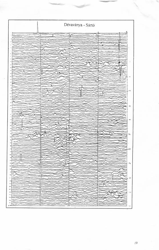
Devavanya - Sarto
19