The cruise of the Minnie Maud; Arctic Seas and Hudson Bay, 1910 ...
668
L -1 â-S J \ ^ \^ ^ ALFRED TREMBLAY
-
Upload
khangminh22 -
Category
Documents
-
view
0 -
download
0
Transcript of The cruise of the Minnie Maud; Arctic Seas and Hudson Bay, 1910 ...

L -1 â-S J
\ ^ \^ ^
ALFRED TREMBLAY


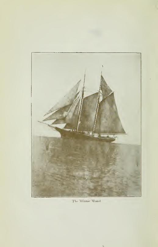
Thi' Miii/iir Mi.ud

Digitized by the Internet Archive
in 2010 with funding from
University of Ottawa
http://www.archive.org/details/cruiseofminniemaOOtrem

Alfred Trfmblay.
\ relic l*>\plorrr nrul \fltriiii of the (ircftl \\ itr
V-\?o\e.r
Cruise ofTHE Minnie Maud
ARCTIC SEAS and HUDSON BAY
1910-11 and 1912-13
ALFRED TREMBLAYVeteran of the Two Arctic Expeditions
and of the Great War 1915-18
COMPILED AXD TRANSLATED BY
A. B. READER
I1 0^55^
PUBLISHED BY
THE ARCTIC EXCHANGE and PUBLISHING Limited
QUEBEC, CANADA
1921
V. t rr
CANADIAN COPYRIGHT, 1921
Printed fob Tiin Publishers by VEvénement Press, Quebec.

SeMcateîr
Etx All Ihase ffîhn Atïreît lis
So the Canabtan people
€tx ®ur Mather Countries


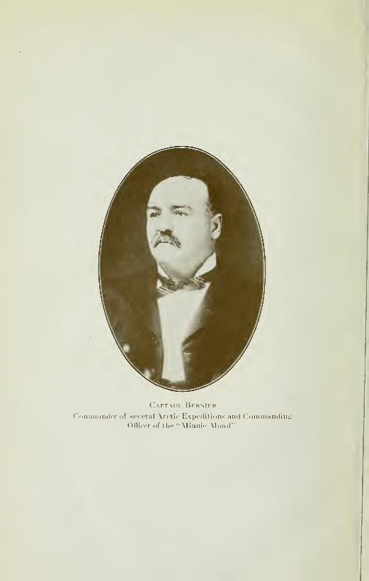
Captain BermehCoimiuiiitler of several Arctic Expeditions and ('ommanding
Officer of tlie 'Minnie Maud""
FOREWORD
|HE Cruise of The Minnie Maud to the arctic seas,
1910-11-12-13 was made in 1912—When the news
appeared in the Press that gold had been found in
the Arctic Islands, by Robert S. Janes, of Newfound-
land, three expeditions were arranged, one from Newfoundland,
another from Montreal, and ours from Quebec. One was lost in
Ponds Inlet, another turned a failure to St. John, Newfoundland,
and ours was a success, not in gold, but we paid our expenses,
besides the knowledge we now put before the pubhc. One of
our party Mr. A. Tremblay was sent with another person,
M. G. Wilson and a family of Eskimoes, named Peewiktoo, the
same which had gone with Lavoie the year before, to look for min-
eral, game and other things of interest. Mr. A. Tremblay nowmakes his report of what he has seen and done, and he deserves
encouragement, being persévérant and honest, so may he succeed
in his endeavors to finish his travels and give his fellow citizens a
clear truthful report of his travels
Quebec, June 7th 1921.


Mr. A. B. Reader
PREFACE
IHERE is undoubtly a plethora of books in the world
and by adding another to the hst one assumes some
small measure of responsibihty. The only plea, put
forth in extenuation, is that the present volume is
designed to be, while of interest to the general reader in search of
true tales of sport, travel and adventure, of permanent value as a
guide and reference to all those, whether they be sportmen,
navigators, prospectors, explorers or tourists, who are more espe-
cially interested in the remote and comparatively unknown spaces
of the frozen Northland.
A year's sojourn among the Eskimos of Nort h Baffin Land
brought the conviction that there was yet room for an authentic
and practical handbook of Arctic Canada which would include a
history, in brief, of Arctic Exploration to date, and of HudsonBay—that vast inland Canadian Sea—its physical features and
commercial and other potentiahties; potentialities that are fast
becoming present-day possibilities in view of the near completion
of the Hudson Bay railway.
It is true that Mr. A. P. Low, the able geologist and historio-
grapher of the Canadian Government, in his valuable and extrem-
ely interesting volume entitled "The Cruise of the Neptune
—
1903-04"—printed by the Department of Marine and Fisheries at
Ottawa— contains a full account of the known geology, to that
date, of the Arctic Islands; a valuable historical summary of the
search for the Northwest Passage, and a couple of chapters,
replete wqth interesting detail, of the hfe and habits of the Eskimos.
Only a hmited number, however, of that volume was printed and,
apparently, copies of Mr. Low's work are no longer available for
viii PREFACE
the public; nor are the archives of a Governement department as
readily accessible to the reading world as is the pubhc book-stall.
The author begs to convey his sincere appreciation of the
great value and assistance rendered b}^ the pubhshed records andexcellent maps of the Canadian expeditions, entitled "Cruise of
the Neptune 1903-04", "Cruise of the Arctic 1906-07" and "Cruise
of the Arctic 1908-09"; and by the explorations in and around
Hudson Bay made by J. Burr Tyrrell in 1893 and 1894; by A. P.
Low in 1897, 1898 and 1899, and by Dr. Robert Bell in 1897.
"The North Pole" by Commander Robert E. Pearj-, U. S. N.,
is another valuable and beautifully arranged and illustrated
volume which contains a fascinating account of the manner in
which the well-nigh insuperable difficulties and dangers of the
Arctic were foreseen and overcome by American "system",
daring and resource, and from which the short, epitomised account
of the conquest of the North Pole, was obtained. The manner in
which the prow of the "Rosevelt" was pushed, cajoled and "butted'
through the gigantic ice-floes and bergs of Kennedy and Robeson
Channels to Cape Sheridan in Latitude 82° north constitute in
itself an enthralhng epic of the north.
Information from a variety of other sources, including able
Press articles by experts on such subjects as the winter navigation
of the St. Lawrence, the movements and ever-recurring dangers
of the ice-berg flotillas oft' the coasts of Labrador and Newfound-
land, the history of the early discovery of America by the early
Norsemen, the whahng industry, etc., have been consulted and
included in the present volume.
An interesting speculation as to the origin of the white
Eskimos discovered by Steffannsson on the shores of Coronation
Gulf and their probable connection with theWhaleman and with the
mysterious disappearance of Sir John Frankhn's party will be
found in Chapters VI and XIV.
The history of Arctic exploration and of the struggles, un-
flinching courage and endurance displayed by the early navigators,
is a subject that should never be allowed to die out and become for-
gotten. As many of those records are extremely difficult of access,
are out of print or so widely scattered as to be practically unob-
tainable by the general reader, an effort has been made in Chapter
XIV to give as complete a summary, chronologically arranged, as
was possible from the date available, of the different expeditions

PREFACE ix
that ^vere undertaken in search of the Northwest Passage, the
North Pole, and the search for FrankMn. These expeditions resulted
in the enrichment of the commerce and industry of the world by
tens of milhons of dollars from the whale, walrus and seal-fisheries
that were estabhshed as a result of the voyages of Wilham Baffin
and Henry Hudson at the end of the sixteenth century; they also
contributed in a large measure to the enrichment of the world's
store of scientific, nautical, geographical, geological and astronom-
ical knowledge the definite location of the Magnetic Pole, for the
benefit of commercial navigation, not to mention the invigorating
and tonic influence that it exercised upon the rising generations
through the unparalleled daring, fortitude and resource, pushed to
the very limit of human endurance, that was displayed by the
cream of the northern races, notably the Scandinavian, British
and American, in their long and brilliant struggle for supremacy
over those remorseless foes, frost, ice, fog, storm, darkness, hunger
and disease:
In all probabilit\' the history of Arctic exploration is the most
romantic and the least sordid page in all the history- of the world
and forms the finest and most enduring movement to humanvalour, patience, skill and self-sacrificing devotion to duty in face
of tiie direst odds and most depressing and dangerous conditions
possible to meet with and that makes the fabled epics of ancient
Greek mythologies pale in comparison. The story of the search for i
Franklin and his gallant but ill-fated comrades will stand for all 1
time as the noblest and most unselfish task ever undertaken in
the history of mankind.
No such lofty purpose, we are fain to confess, inspired the
voyage of the Minnie Maud—it was gold—the sordid lure of
gold and the hope of filthy lucre that impelled nine men—six French
Canadians, two Englishmen and one New Zealander—to venture
forth from the shadow of the ancient embattlements of old
historic Quebec in a two masts schooner and brave the perils andrigours of the Arctic seas and wilds.
The existence of gold in the rocks of Baflin Land has long
been a subject of belief ever since Martin Frobisher, when in search
of a northwest passage through the mythical strait of Anian in
1576, picked up some black earth on Hall island, at the entrance of
Frobisher Gulf. On his return to England, Frobisher submitted his
find to Baptista Angello, an alchemist, who after "coaxing nature"
X PREFACE
reported that he had obtained gold from the samples submitted to
him. As a result, Frobisher fitted out another expedition and in
1578 filled fifteen ships with the supposed ore, but which, after his
return to England, proved worthless.
Since Frobisher's time whalers have occasionally brought
back accounts of gold nuggets having been picked up on the
northern beaches, but not much credence was given to these so-
called sailors'varns until 1912, when a Newfoundland officer of the
Canadian Go\'ernment Ship "Arctic" gave it out that he haddiscovered nuggets of gold in the bed of the Salmon River which
flows into Echpse Sound.. North Baffin Land. As a result of this
report three expeditions were hastily outfitted and sailed from St.
John's Newfoundland and Quebec in search of this rumouredKlondike of the Arctic Islands.
Two of .these expeditions, under Captains Scott and Munn,sailed from St. John's in July 1912 in the steam-sealers, Neptune
and Algerine, while the third sailed from Quebec on Ju/y 29th,
in the schooner Minnie Maud.The Algerine was "nipped" in a "lead" between two ice-floes
off" Erik Harbour, Pond's Inlet, and sank in 20 minutes on July
16th; the members of the expedition and crew, 24 in number,
having just time to scramble out on the ice-pans before the ice-
floes parted and allowed the crushed vessel to sink into five
hundred fathoms of water, taking with her all their effects. Makingtheir way over the ice-pans to Button Point, Bylot Island, they lived
on the provisions that the Canadian Government had thoughtfully
caused to be cached at Albert Harbour, against such an emergency,
until the Neptune arrived two weeks Later and took them on board.
The Neptune, too, had a narrow escape from being "nipped"
in the heavy ice in Echpse Sound and of being pushed ashore by
ice during a gale on the shoals at the mouth of the Salmon
River. Prospectors were sent ashore over the ice to prospect the
reported gold placers, but returned in a few days and reported
that, after panning the stream to its source, they had not seen the
slightest evidence of the existence of gold but found some fine
seams of coal in the river bank. They therefore came to the
conclusion that the whole Janes story, like that of Frobisher's
discovery three hundred years before, was either a delusion or a
deliberate hoax.
After bartering with the Eskimos of Pond's inlet and Admir-

PREFACE xi
ally Sound, the Neptune, with the members of both expeditions on
board, returned to St. John's, Newfoundland, on September 24th
laden with three tons of ivory, 76 Polar bearskins and 83 foxskins.
On her way back from Pond's inlet, the Neptune called in at
Cumberland Sound and grounded on a shoal near Blacklead
Island at low water. When the tide rose the ship shd off into deep
water. Shortly after this epsiode the staunch vessel nearly found-
ered off Hudson's Strait in a terrific two days gale.
The Minnie Maud reached Pond's inlet on August 29th, and
after spending a couple of days beset in the ice-floes, when she was
nearly driven ashore on the rocks by the hea\'y pressure of the
grinding floes, anchored in Albert Harbour on the same day that
the Neptune sailed for home. The schooner remained imbedded in
the ice at Albert Harbour until the following August, when she
sailed for Quebec on August 25th reaching that port on September
25th, after a series of narrow escapes from collision with icebergs
and the rock-bound coasts of Belle-Isle Strait.
The members of the expedition lived ashore in woodenshacks and snow igloos with the Eskimos and were engaged during
the winter in fox-trapping and barter for ivory, skins and seal-oil
and, in the summer of 1913, some 3000 salmon were caught in
seines at the mouth of the Salmon River, and were salted away in
barrels. The value of the cargo was valued at §25,000. No trace of
gold was found at the Salmon River or in the rocks or streams of
the adjacent country.
The brightest feature of the expedition was the explorations
of Eclipse Sound, Admiralty Inlet, Cockburn land. Fury andHecla strait and Melville Peninsula made by Alfred Tremblay, a
young French-Canadian from Beauport, only twnety-four years
of age. Tremblay succeeded, where several well-equipped expe-
ditions despatched had failed, in reaching Igloolik, and Fury andHecla Strait for the first time since the memorable visit in 1822-
23 of Sir ^\ . E. Parry, with his ships Fury and Hecla, whenmaking his third attempt to force a North-West Passage through
the ice-bound waters of the North.
Mr. Tremblay, with barely any equipment ^^orthy of the namesave for his Ross rifle and Colt Automatic, and with no provisions
saving the game that he could shoot and harpoon by the way,
covered over 4000 miles on foot in the -depth and obscurity of the
xii PREFACE
Arctic winter, and explored and afterwards, with my assistance,
mapped and re-mapped some 3000 miles of coastline. This samework, if carried out by the Government, would have cost the
people of Canada, to cover the same ground, at least S75,000.00.
As a matter of fact, two costly Government expeditions in the
"Arctic," that wintered at Pond's inlet in 1906-07 and at Arctic
Bay In 1910-11, made three vain attempts to reach Igloohk and
Fury and Hecia Strait by overland expeditions.
Mr. Tremblay, in spite of every obstacle and with the constant
risk of death from star\'ation and cold, was the first white man to
cross the land from the head of Admiralty Sound to Fury and
HecIa Strait and to make the long and dangerous overland crossing
from Murray Maxwell Bay, across Cockburn land, to Milne
Inlet. But for his skill -svith the rifle and never-say-dle determina-
tion to win through, he and his Eskimos companions would certain-
ly have perished. A perusal of Mr. Tremblay's own narrative,
which appears in chapters, III, IV, V, VI, VIII, IX, X and XIwill give the reader a vivid account of what he went through and
of the dilFiculties and dangers that have to be endured by those
employed in exploring, trapping or prospecting in the glacial
regions of the north.
Few men, I venture to think, would have set out so light
heartcdl}^ in the depth of an Arctic winter, as did Mr. Tremblay,
with only a young Eskimo and his girl wife for his sole companions,
on a journey that in\'olved so much hardship and suffering,
over an unmapped route with practically no provisions. Mr.
Tremblay's voyage was undertaken, perhaps without the
eclat and brilliant auspices that generally attach to Government
or Polar expeditions, but the distance that he actually
tra\'elled—-through storm, blizard and darkness over the most
treacherous and deep-drifted barrens with the thermometer
ranging steadily between 10^ and 57^ below zero with raw frozen
walrus, seal and caribou meat, generally putrid, for his sole
nourishment—was four times greater than that travelled by
Peary from his ship to the Pole and back. Peary was supported
during his 81G miles dash from land to Pole and back by seven
capable assistants, 19 Eskimos, 140 dogs and 28 sledges, tlie latter
well-packed with an abundant supply of pemmlcan, tea, biscuits,
condensed milk and oil fuel. Peary travelled mostly over favourable
ice, in clear spring weather, for 53 days. Tremblay travelled for
PREFACE xiii
156 days over equally dangerous ice and some 300 miles of unex-
plored land covered deep with snow-drifts, in the depth of winter,
having to build his own snow-igloo every night at the end of the
day's march and often going two and three days without food or
fire and depending entirely, with an unsufficient cartridge supply,
upon his rifle to bring down a flying caribou at long range or a
diving seal to provide himself with food. Much of the time he was
as far from help or a base of suppHes as was Peary when at the
Pole. No disparagement of Peary's wonderful achievement is
intended i^y this comparison; but Peary's risk of being cut off
from the land by the opening of leads' in the ice-floes, was
counterbalanced by Tremblay 's constant risk of failure of
cartridge supply, and consequently of food. If anything taking
all the circumstances of both cases into consideration, the greater
risk was Tremblay's.
While Tremblay was making his various exploration trips to
the south, I spent the time in prospecting and exploration trapping
from shack and igloo round. Salmon River and Bylot island and in
collecting a vocabulary of the dialect of the Bafhn Land Eskimos.
The latter was by no means an easy task as the Eskimo is handier
with his harpoon than he is with synonyms; but it completes the
chain of Eskimo vocabularies; as Tyrrell made a short vocabulary
of the West Coast of Hudson Bay natives; and the British Admir-
alty, as a result of the collections made by Parry, Dr. Richardson
and the Moravian Missionaries of Labrador, pubhshed for the
benefit of British Arctic expeditions, vocabuLaries of the Labrador,
Melville Peninsula, and Kotzebue (Alaska), Eskimo dialects.
The vocabularies of three of these five dialects are included in
this volume, so that, no matter where the Arctic traveller of the
future may find, himself, with the choice of these vocabularies at
hand, he should have no difficulty in making himslef understood
by the Eskimos or in communicating to them his wants andnecessities.
I also prepared tiie accompanying map of Cockburn Land,
Fury and HecLa Strait, Melville Peninsula, and Eclipse Sound in
accordance with Mr. Tremblay's notes and pencil sketches andfrom my own notes and observations of Eclipse Sound.
In compiling the volume I have endeavoured to give, in con-
densed form, only the most authentic information based on reliable
authorities with the object that with this book in hand, navigators,

xiv PREFACE
prospectors., explorers, sportmen and tourists generall\- will beenabled to find at a moment's notice accurate information as to
the fauna, geology, economic minerals, ice-movements, currents,
tides, seasons and historical data of any particular region dealt
with.
A faithful description of that most interesting and deserving
people—the Eskimos—their customs, behefs and superstitions,
will be found in chapter VI, and full accounts of the different
animals, fishes and birds, including whales and the whale fishery,
have been Scattared in appropriate chapters, throughout this
book.
A full discussion of Polar Tides will be found on pages 408,
Chapter XIV. The subject of Undiscovered Lands in the Arctic is
dealt with on pages 435, Chapter XIV. A description of the Pole
Star and other Constellatioyis will be found on pages 284, of
Chapter XII. The phenomena of the Aurora Borealis and other
Arctic Phenomena, as described by Parry, Frankhn and Peary are
described on pages 160, Chapter VII. An authentic summary of
the Geological Conditions and History, taken from the official
records of the different geologists who have explored these regions,
and an interesti?ig statement of the Theory of the Change oj Poles,
and its possible explanation of the partial glaciation of the Earth's
surface at different periods of time, will be found in the last section
of Chapter XIV.The location of the Mag7\etic Pole, as described by Lieut,
James Clark Ross, the first discoverer; the Variations of the Compass.
the History of the Compass and Sextant, the Rules oJ the Road at Sea,
and a full description of the Equipment necessary for an Arctic
Expedition, will be found in the last Chapter.
A. B. READER.

TABLE OF CONTENTS
Dedicatiox Ill
Foreword - V
Preface \ II
Contents XVList of Illustration XVI
I
Chapter I.
—
Voyage from Quebec to Pond's Inlet; North Baffin Land.—Whales and Whale Hunting.—Ice-floes and '"Middle-Pack" in
Baffin Bay.—Navigation of East Coast of Baffin Land.—Pond's
Inlet 1
Chapter II.
—
Trading, trapping and prospecting with the Eskimos of
North Baffin Land.—Narwhale.—KiUer.—Gold.—Salmon and
Trout.— Arctic Birds.— Coal.— Copper,— Arctic.— Fox. —Salmon River.—Expeditions and Occupations 27
Ch.apter III.
—
Tremblay s trip to Arctic Bay 51
Chapter IV.
—
Arctic Bay and Admiralty Sound.—Winter and Arctic
Bay.-—Admiralty Sound.—Borden Peninsula.—Prince Regent's
Inlet.—White W hales.—Bear Hunt.—The Polar Bear.^—Eskimoand Caribou trails.—^The Musk "Ox" 69
Chapiter V.
—
Tremblay s trip to Scheming.—Scheming.—Seal Hunting.
—The Seal 87
Ch.\pter VI
—
-Tremblay s trip. Scheming to Igloolik.—The Eskimos.
—
The Arctic Caribou.—Lapland and Siberian Reindeer.—Ca-ribou Valley.—Gifford River 107
Chapter VII.
—
Igloolik.—Aurora Borealis.—Parry's Voyage (1822-23) 155
Chapter VIII.
—
Tremblay s trip to Aggo through Fury and Hecla Strait.
—The Walrus.—A Walrus Hunt.—A hard trip.— Aggo.
—
Return Journey 175

XVI TABLE OF CONTENTS
Chapter IX.
—
Tremblay'' s trip to Melville Peninsula.—Rock-Fonuation—Lake Taseonia.—Lake Sarcpa.—Coimaught Mountains.
—
Barrow Falls.—A Perilous Journey.—^The Wolverene. ... 199
Chapter X.
—
Tremblay's trip across Cockburn Land.—Leave Igloolik.
—New Geography.—The Arctic Wolf.—Hard Travelling andSoft Snow.—Eskimo Tragedies.—More Topography.—ReachPond's Inlet 217
Chapter XL-
—
Tremblay's trip round Eclipse Sound and Navy Board.
Inlet.—Navy Board.
—
Tremblay Sound.—Milne Inlet.—Arctic
Sound.—The Arctic Weasel.—The Lemming.—Haley on days at
Salmon River 239
Chapter XII.
—
Return Voyage—Pond's Inlet to Quebec.—Icebergs.
Damage to Shipping.—Perils of Newfoundland Sealers.—Belle
Isle Strait.—First Discovery of Newfoundland.—Navigation in
the St. Lawrence.-—Ci\ilization once more 265
Chapter XIII.
—
Hudson Bay.—Description.—Cambro.—Silurian Sea.
—Ice.—Currents.—Navigation.—Storms.—Glacial Phenomena
—Climate.—Resources.—History.—Hudson Bay Company.
—
—Baffin Land.—Southampton Island.—North-West Coast.
Hudson Strait.—-West Coast.—East Coast.—James Bay.
—
Ungava Bay and Labrador 295
Chapter XIV.
—
Historical Summary of Arctic and Polar Exploration.—The North-West Passage.—^The Search for Franklin.—The
future of the Arctics.—Canadian Expeditions.—Smith Sound
and Polar Research.—The North Pole.—Geohgical Summary. 365
Chapter XV.
—
Meteoroligical Notes and Arctic Outfit.—Eskimo Vocabu-
laries.—Labrador.—Melville Peninsula.—Kotzebue Sound
(Alaska) Baffin Land (Pond's Inlet) and West Coast of Hudson
Bay 511

TABLE OF ILLUSTRATIONS
The "Minnie Maud" i
Mr. Alfred Tremblay, Arctic Explorer and Veteran of the Great War. . i
Captain Bernier, Commander of several Arctic Expeditions and Com-manding Officer of the "Minnie Maud"
Mr. A. B. Reader vii
Peewiktoo and Tootiliik my faithful compaions 1
"Arctic" leaving Quebec, July 7th, 1910 4
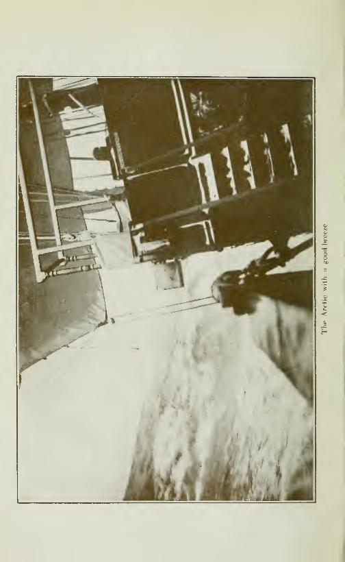
The Arctic with a good breeze 5
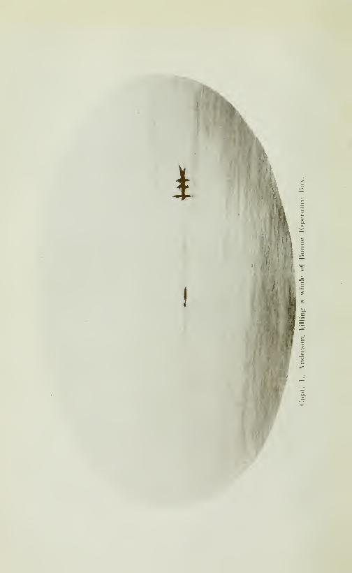
Steam Whaler, Port Saunder, Whaling 10
Capt. L. Anderson, killing a whale of Bonne Espérance Bay 11
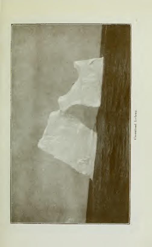
Greenland iceberg 14
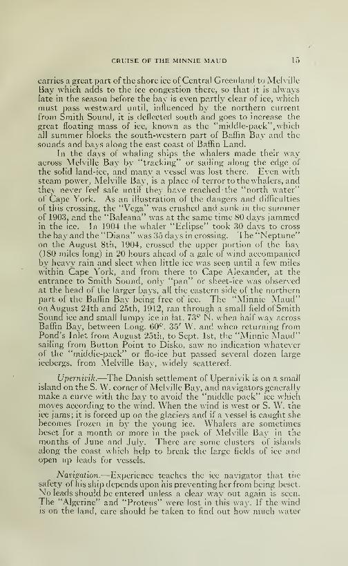
Iceberg in Baffin Bay 15
The first Eskimos we met, July 1910 22
The Pond's Inlet, Eskimos at Button Point 23
Port Albert 24
Peak King George, Pond Inlet, August 1st, 1910 25
Narwhale killed in Admiralty Inlet 281—Arctic White Fox 292—The Arctic Wolf 29
1—Pond's Inlet Village 322—The "Minnie Maud" in winter quarter at Albert Harbour 321—Salmon River 332—Fishing salmon a net at Salmon River 33Alfred Tremblay 52The Eskimos of Arctic Bay, Septem.ber 13th, 1910 53Iceberg in Lancaster Strait 56Adam Sound 571—SS. "Arctic" heading North for tlie \Mnter, Arctic Bay, Oct. 1910. . 702—"Arctic" atl a. m., July 1910 703— Ice anchor from Capt. W. E Parry, 1822-23, discoverer at Igloolik
by Alfred Tremblay, March 1913 701—Eskimos deserted village Adam Sound 712—Sn<5w Igloo, Arctic Bay village 711—^Cape Riley, Nortii Devon 722—Rugged Cliffs, north side of Adams Sound 72Drying Seal skins, March 1911 731—Admiralty Inlet, West of Arctic Bay 742—Pond's Inlet Coast 743—Ice pressure Baffin Island Coast 74Cape Rotunda, Adam Sound, 1919 75First Polar Bear killed by Alfred Tremblay 781—Musk-ox in Melleville Island 79
XVIII TABLE OF ILLUSTRATIONS
2
—
Second Polar Bear killed by Alfred Trembla\' 793^—Return Reindeer hunting trip • 79Polar Bear killed by Capt. Bernier 80
Musk-ox head 81
Base of Cross, Arctic Bay 84
Seal Hunting Apparatus 85
Arctic Calèche, June 23rd, 1911 88Eskimos party on Admiralty Inlet, October 1910 89
Iceberg, Admiralty Inlet, August 1911 94The Eskimos dogs 95A good team of Eskimos dogs \ . . . 96
Eskimos Sledges 97
A big Arctic Seal 104
The Scheming Eskimos 1051—A troop of Arctic Reindeer 142
2—The Walrus 142
3—The Arctic Blue Fox 1424—A Polar Bear swimming 142
Igloolik Eskimos 1431—Iceberg in Lancaster Strait 1802—Cape Ross, Cornwallis Ishind 180
Beechy Island 180
Barrow Strait ice 181
1—Hunting Pohir Bear whh Dogs 201
2—The foot of a glacier 201
Sir John Franklin Memorial Tablet 233
1—Bylott Island at Midnight 241
2—Baffin Land, Midnight View 241
1—The midnight^sun 2492—Hunting Polar Bear in Kayak by the Eskimos 249
\\'haHng Boat—Leaving for Button Point 261
Iceberg in Baffin Sea 270
Iceberg in Baffin Bay 271
Baffin Sea Iceberg 311
Iceberg from Groenland Coast 371
MAPS
North Baffin Land and Melville Peninsula,i
• 574
The Arctic Islands 574

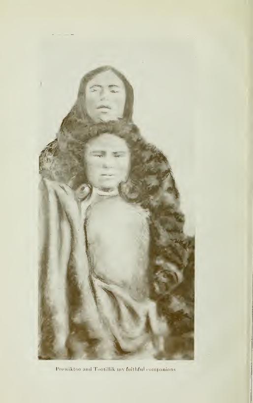
Ppowiktoo and Tootillik my faitlifiil (companions

CRUISE OF THE MINNIE MAUD
CHAPTER I
VOYAGE FROM QUEBEC TO POND S INLET
The Miiviic Maud.—When the news appeared in the Press
that two well equiped expeditions had already sailed in 1912 for the
new Eldorado that was reported to exist in North Baffin Land, the
old mackerel shooner Minnie Maud was purchased and hastily
fitted out for what was expected to be a two year sojourn in the
Arctic islands. The schooner 85 feet long, 22 feet wide with adraught of 9 feet aft, was docked, overhauled and fitted with a thin
sheating of steel plates, six feet below the water line, as a protection
against the assaults of the ice-floes. The schooner was twenty yearsold and her ribs of seven inch spruce and three inch oak plank-ing, did not ofTer much security in the event of the pressure fromthe grinding ice-floes, nor did they compare very favorably w'ith
the 18 inch wooden walls of the C. G. S. Arctic, built of the finest
oak greenheart and pitchpine.
The Minnie Maud proved herself howe\er to be a fast sai-
ler and an excellent sea-boat and her decks were dry in the rou-ghest weather.
The cargo.—The cargo consisted of the usual assortment ofbarrels of hard tack, biscuits, pork, beef, molasses, beans, salt,
sugar, etc., and also tobacco, cartridges, matches, needles, beans,knives, harpoon, steel clothing and other requisities to be used in
trading with the Eskimos. Lumber for building sheds; gazoline for
the two gazoline engines that were fitted in two large boats carriedon deck; and an assortment of rifles, drill steel, blasting powder,hammers, picks, shovels, and pans for prospecting purposes alsoformed part of the equipment.
The party.—The members of the party w ere Messrs J. E. Ber-nier, Captain; N. Chassé, William and John LeBel, W. Caron, G.Wilson, G. Lawson, Alfred Tremblay, and A. B. Reader, all hailing

Z CRUISE OF THE MINNIE MAUD
from Canada although Messrs Lawson and Wilson originally camefrom England and M. Reader was from New Zealand. Five ofthe party had had previous experience in the frozen North; havingaccompanied the Canadian Goverment ship Arctic in her va-rious expeditions, to take possession of the northern islands for
Canada.
Departure from Quebec.—The schooner was towed out of theLouise Basin at Quebec, at five o'clock in the afternoon of July 29th,
1912, amid the cheers and friendly shouts of Boii Voyage from thecrowd of the dock. She anchored outside until midnight and thenset sail for I' Islet, where she arrived the next day and where somepleasant hours were spent ashore. The next day we sailed down theri^'er to Kamouraska and the weather being rainy, sou'westersand oilskins were served out. At Kamouraska, Messrs Chassé,Wilson and Lawson joined the party and we continued down theriver, amid, rain, calms and fogs until Pointe-des-Monts was reachedearly on August 3rd. Pointe-des-Monts is the meeting place of thefresh waters of the St. Lawrence with the salt waters of the Gulfand is the site of the most imposing lighthouse. Here we anchoredfor a few hours and had a pleasant visit with the Fafard famih'
despactching our last letters and telegrams; as Pointe-des-Montswas to be our last point of contact with civilization for the next
fourteen months.
Pointe-des-Monts.—We left Pointe-des-Monts at 2 p. m. andas we ran rapidly away before an eight-knot westerly breeze, wereceived a parting salute of two guns which were fired from the
lighthouse and which we acknowledged by dipping an ensign.
Gulj of St. Lawrence.—^The next five days were spent in boat-
ing our way along the north coast of Anticosti and along the north
shore of the Gulf of St. Lawrence, encountering light breezes from
the south-east, dead-calms, fogs, and sometimes drizzling rains. Thewatches were set and our days occupied in cleaning ship, refitting
ropes, painting boats, sharpening axes and tools, lashing the cumb-rous water-casks and boats to the deck and getting everything
shipshape in anticipation of the rough weather that were bound to
encounter when crossing the North Atlantic.
Watches.—The starboard watch consisted of Messrs Dernier,
(Captain), Chassé, Reader, John LeBcl. In the Port watch were
Alessrs Caron (I\Late), William LeBcl, Tremblay and Wilson.
Lawson acted as cook.
Marie Romkey.—On August 8th, we had an interesting brush
with a fast sailing schooner the "Maric-Romkcy" which cameswooping down on us with all sail set from behind some islands andchallanged us to a race. After an hour contest the breeze felt andwe lost her astern in the fog.

CRUISE OF THE MINNIE MAUD à
Belle-Isle strait.—On August 10th, the massive blue mountainsoi Newfoundland came into view of our starboard bow, and weentered the strait of Belle-Isle at five p. m., running nine knots anhour before a strong westerly wind. We passed a large steamer the
"Saturnias", inward bound, and made our first acquaintance with
ice in the shape of two large icebergs which were apparently
aground on the Newfoundland coast. The fog then descended andwe ran thro a field of broken ice, evidently fragments of some i^ig
bergs in the vicinity. As the fog grew denser we shortened sail for a .
couple of hours, when we hoisted the reef mainsail in the hope of
quickly clearing the dangers of the narrow straits, and gaining
the open sea. Suddenly two liuge gastly yellow bergs loomed upthrough the fog a few hundred feet awa^^from the port bow, so wedropped the mainsail and hove to "à la cap" under foretop stay-
sail and reefed mizzen all night, which was cold and wet with a
strong west wind blowing and accompanied by a cold drizzling
rain and dence fog. It was anxioux work at the look-out as ice-
bergs were all around, the shore was close and we ran constantly,
risk of either colliding with an iceberg, of running on shore or
being run down by a steamer, in the fog. The foghorn was keptgoing and soundings were taken every hour, as we were in ignor-
ance as to our exact position and the straits are only from 8 to10 miles wide, with strong currents running. All hands were gladwhen themorning broke at 3 a.m. August 11th., and wind and seaabated altho the fog still continued dense. Soundings were takenand we got 70 and 75 fathoms. At 8 a. m. we hoisted sail andmade an easterly course passing an iceberg to starboard at 1 p. m.Hoisting more sail we ran before a steady S. W. breeze for theopen sea. At 2 p. m. the fog lifted and the sun shone out over-head, and for the first time in twenty hours we saw land asternof us which proved to be Belle-Isle.
The Broad AtlaiUic.—We had run the seventy miles of narrowstraits thro dense fog without once catching a glimpse of lajid oneither side. The afternoon was perfect with the sun warm andbright in a blue sky and a nice six knot breeze wafted us alongE. N. E. towards Greenland. It was an agréable contrast with themiserable weather we had left behind us in the straits. \\'e countedfifteen bergs, gleaming white in the sunlight, on either side andbehind us, dense clouds of white fog coxered the dangerous straits
and coasts as with a shroud. The breeze freshened towards eveningand hoisting our jib-topsail we bowled along all night at a nineknot clip over the broad Atlantic. The night was thick with fog anddrizzling rain and a double lookout was posted on the forecastle towatch for icebergs. It was anxious work, at night on the look-out,with the ship tearing and plunging over the waves at 9 or 10 knotsan hour, before a cold wind through dense fog and rain-squalls.Every moment we expected to see the cruel yellowish glare ofa monster berg loom up out of the fog at the end of the bowsprit,

4 CRUISE OF THE MINNIE MAUD
and the white phosphorescent patches of foam, caused by break-ing waves, kept us in a state of constant anxiety as whether it wasice or water, as one sharp blow from a floating fragment of ice,
not to mention an iceberg, would have sufficed to send the wholeship's crew to the bottom. After four hours spent on the look-
out under these conditions we were glad to go below and forget
our anxieties in sleep, if the rolling and the pitching of the vessel,
the creaking and groaning of the timbers and the roaring swirl
of wind and wa^^es would permit.
A Narrow Escape.—Next morning at 7.30 a. m. we found our-
selves flying before the wind strait for a huge greenish yellow bergwhich sprang up like a mountain out of the fog. The man on thelook-out gave a shout, the helm was thrown over and we passed bywithin a few hundred feet to starboard ofthe monster, whilst visions
of the ill-fated "Titanic" rose before our eyes. We ran fast all the
morning through dense fog and rain, when the wind shifted andfell, leaving the ship roUing and straining her masts and boomin the heavy swelL At 4 p.m. the wind began to freshen fromthe N. W.jthe fog lifted, the sun shone out of a beautiful clear
evening sky and there was no ice in sight. Early next morning,
August 13th, the wind became very unsteady, shifting from N. W.to S. W. and then N. E. and caused the schooner to pitch and roll
in a Iump3' cross-sea, which made several members of the part}^
sea-sick and made it difficult to steer and hold the wheel steady.
At 3 p.m. the wind suddenly sprang up from the S. W. and setting
all sail we sped along once more for Greenland. At noon wewere in lat. 55-43 N and long. 54-, about 300 miles from CapeFarewell the most southerly cape of Greenland. The wind hadboxed the compass during the last 24 hours, as this action of the
atmosphere, as we proved on several subsequent, occasions gener-
ally presages the occurence of a gale of two or three days duration,
when the wind settled down to blow from a regular quarter.
We ran before the S. E. breeze all night at an 8 knot clip, the
shooner riding the heavy swell like a sea-bird and proved herself
to be very dry and steady in a sea-way. That night the deck wascovered with a heavy dew, betokening the continuance of the
southerly wind. The nights were getting longer as we approached
the Arctic Circle, daylight appearing at 2 a.m. and the sun setting
at about 2 o'clock at night.
Southerly Gale.—At noon, August 14th, we were in lat. 57-47'
having logged 126 knots in the past 24 hours In the afternoon the
wind increased in strength and wemadge60 miles or one degree of
latitude, on our course, from noon till 6 p. m. an average of ten
miles an hour. In the evening we took in hcadsails and reefed the
huge mainsail, the schooner ran nearly 12 miles an hour through
the night, making 47^ miles between midnight and 4 a.m. Wehad the benefit of the southerly current with us, which flows up

**î?s««s^»
c

CRUISE OF THE MINNIE MAUD 5
the west coast of Greenland. At midnight all hands took in the
mainsail and jibs as the wind and sea were increasing in strength
and violence, and there was danger of the great 57 foot mainbow-jibing and tearing away the mainmast. On August 15th, we werein latitude 61-.43'and long. 54 W. having reeled off 216 nautical
miles in the last 24 hours The wind blew with terrific force
from the south all day accompanied by a mountainous following
sea which on several occasions threatened to poop and engulf
the schooner. The helmsman was lashed to the bitts to prevent
his being washed overboard, and the schooner under double-
reefed mizzen and foresail sped 10 knots an hour before the gale.
In the afternoon a heavy sea struck the poop, flooded the after-
cabin, and the cold wind and drifting rain wet and chilled us to
the bone. In the evening both wind and sea moderated and at
midnight we shook out the reef in the mizzen and hoisted the
main-jib Four oclock next morning, August 16th, we hoisted
the main-sail gaft and jib top-sail and by noon were in latitude64-.3' having logged 175 miles since noon the day before.
The Greenland Coast —We bowled along all day at a 7 knotclip under full sail and caught our first glimpse of the Greenlandcoast at 5 p. m. As we neared the land the magnificent panorama of
the Isortok Range came into view, the snowy peaks standing outagainst the clear sky in all their rugged grandeur. These mountainswhich rise to a height of 4,000 feet are very grand and inspiring, andgave us a pleasurable sense of being once more in the neighbour-hood of land and human beings, as the fiords are inhabited byDanish settlements.
A Perfect Night.—^That night was a perfect one. The sky wasfilled with a golden-pink twilight and the schooner glided gentlyover a greenish-silvery ambient swell. To our right the majesticsnow-capped peaks of Isortok stood out, clear cut and rugged,against the clear atmosphere. The perfect stillness and repose of thenight was broken only by the occasional creaking of the cordageand spars, the reepling of the reef points against the sails, as thebreeze rose and died away; or the lazy swish of the swell against theship's sides, or the subdued croak of a sea-bird, or the distant"woof" of a narwhal coming to the surface to blow. It was anideal night and, when the watch on deck was ended, one descendedinto the stuffy foc'sle with a feeling of regret. At midnight thebreeze collapsed entirely and the ship rose and felt lazily on theoily swell.
Halibut Bank —In latitude 64-N, there is a fine halibut banksituated about thirty miles from the Greenland coast, which ex-
tends for many miles to the northward. It is called the Hallebank,and is favorite feeding ground for halibut. The depth of waters onthe banks varies from 15 to 20 fathoms, and icebergs from Melville
Bay and Greenland are often seen aground on its outer edge.
6 CRUISE OF THE MINNIE MALU
The whaling ships have fished there for years catching hahbutfor their own use, and several American schooners formerly visited
the Hallebank for the Boston market.
In the evening of August 17th, we sighted six whales "blow-ing" on the port side, the weather being calm and mild as a sum-mer's day with a heavy dew falhng at night on the deck. Thenext day (Sunday) was a beautiful, bright, clear, calm day and in
the evening we indulged in a gramophone concert in the after-
cabin, enjoying at second hand the songs and wit of favourite
artists. At night whales kept blowing near the ship. At midnightwe saw the hghts of a steam vessel approaching us from the northand although she veered in as to inspect us, no hail was given andshe passed on. We presumed her to be a Danish GovernmentCoastguard Ship, as no foreign vessels are allowed to trade or
even to land on the Greenland coast without the previous per-
mission of the Danish authorities.
A Dead Whale —August 19th, was calm with a light drizzling
rain falling and we made slow progress. Large icebergs were oneither side of us. In the evening under a 4 knot breeze we drew nearthe island of Disko, and ran the schooner along side the carcasse of
an enormous dead Greenland whale which we had noticed floating
in the water for sometime before reaching it. The dead whalewas about 65 feet long and belonged to the Bowhead, Greenlandor Right species. It had»evidentlybeen killed by a thrust from a
harpoon or by a giant swordfish, as there was a large wound in
its exposed side. Its entrails were floating along side in the waterand the stench was abominable. Crowds of screaming gulls
were pecking away on its back and dozen of wicked-looking dog-
fish or Greenland sharks, were swimming around the floating
carcase and tearing away chunks of hide and blubber from the
submerged portion. As the whalebone in its huge upper jawwas only three feet in length, we did not bother to cut it away.
Greenland or Right Whale.—The Right whale has become very
scarce in recent years, owing to the persistent manner in which it
has been hunted and killed by Scotch, American and Norwegianwhalers during the past 50 years. In the height of the whaling in-
dustry there were from 600 to 630 whaling vessels, in active service,
in the Atlantic, Pacific and Arctic Oceans, hailing mostly from the
United States and British Ports; now the number scarcely reaches
50, and the Scottish whalers have in the last few years, entirely
abandoned whaling in Baflin Bay and Greenland waters. In twoconsecutive summers, 1906 and 1907, patrollng the northern waters,
the "Arctic" only sighted one whale after cruising in Ponds' Inlet,
Barrow Strait, Navy Board-Inlet, Admiralty Sound, Prince RegentInlet, Peel Sound, Austin Channel, Melville Sound, Jones Sound,Baflin Bay and Cumber and Gulf. There can be no revival of the
whaling industry until there is first the renewal of the supply of
CRUISE OF THE MINNIE MAUD /
whales, and that can only be procured by protection and by the es-
tablishment of a lengthly close season, during which the killing
of whales is prohibited.
It was that intrepid early navigator, William Baffin, whofirst passed through Davis Strait and explored Baffin Bay, as
far back as 1616, and who first called attention, after his return
to England, to the great value of the whahng industry in Green-land waters.
During the last 45 years nearly 2,000 whales, yielding 1,000
tons of w halebone and 23,000 tons of oil, worth at current marketprices about §17,000,000.00 have been captured in Baffin andHudson Bays; with the result that the species have become so
scarce that the chase no longer warrents the great expense andrisk that are attached to the outfitting of vessels, manned by large
crews, for the trade.
The Governments of Canada and Danemark would do well
to prohibit the further killing of these valuable and highly interest-
ing sea-mammoths for a period of 20 years, or the race will soonbecome as extinct as the buffalo.
Dimensions oj Whalebone.—An adult whale varies from 40 to
60 feet in length, extra large ones, 65 feet, andthelargest recordedmeasured 80 feet in length. The head measures a th rd about of thelength of the body and the upper jaw, which carries the baleen or
the whalebone is only a few feet shorter. The baleen occurs in theform of a thin slab or "splits" set close together in the gum at right
angles to the length of the jawbone. There are about 360 of thesesplits on each side of the jaw. The largest recorded split measures14 feet in length, but the ordinary length in adult whales is from9 to 10 feet. Bone of that length will nearly average a ton to awhale and at current prices is worth .S15,000.00 a ton, and theprice is rising every year. Six foot bone and under brings onlyhalf the price of larger bones.
^V7ja/e Food.—The baleen in the whale's mouth acts as a sieveto entangle and collect the small animals upon which it feeds. Thefood of the animal consists of small crustceans (called sea-lice bythe whalers) and swimming pterepods known as "whalefood" and"blackberries." These creatures in turn feed upon minute animalorganism, known as diatoms, which are found in countless numbersin these northern waters, being so numerous as to discolour largeareas of the sea, giving it a light-green or brownish hue. Thediatoms are propagated in the fresh water pools upon the largepans of ice and they thrive best, apparently, in the comparativelyfresh surface-water in the vicinity of melting ice, which wouldaccount for the whales frequenting such localities. The favoriteresort of whales in northern waters is along the edge of the ice,
still fast to the shore, with an abundance of loose ice outside.When the shore-ice is all melted or loosened, they remain about
8 CRUISE OF THE MINNIE MAUD
the edge of the large masses of floating ice. The ice gives themboth food and protection against their deadly enemy the giantsworfish or killer, which pursues them relentlessly but will notenter the ice-floes.
Value and Products.—The average whale carries about a ton ofwhalebone, and an adult femalewhale will furnish blubber for nearly
30 tons of oil, the male providing about 20 tons, which is worthSIOO.OO a ton. The total value of a large whale varies from §15,000.-
00 to S20,000.00 for whalebone and oil.
The whale's body is covered with a thick skin, an inch to aninch and a half in thickness, which the Eskimos and whaling crewsconsider a great luxury. It is eaten boiled, a small amount of
blubber being attached to give it a flavor. When cooked it has
the appearence ofthick black india rubber, being soft and glutinous,
while it has a clam-like flavor. The flesh of the whale is coarse
and tough, being used by the Eskimos mostly for dog-food. Thefat or blubber, from which the whale oil is made, resembles veryfat pork and varies from twelve to 18 inches in thickness, beingthickest towards the tail.
Habits —Whales are gregarious, and when plentiful travel in
large bands, but they are now so rare that a band of 3 or 4 is the
greatest number seen together in late years
A whale is generally sighted by the column of spray, or con-
densed moisture from its lungs, which it throws up when breath-
ing, and which often rises 20 feet in the air, accompanied by a
hoarse puffing sound. A whale generally spouts or breaths five
or six times, when it comes to the surface for that purpose, andremains up for several minutes. It then goes down to feed,
remaining under water for 15 or 20 minutes, during which time
it travels about a mile. When feeding, a whale travels at or
near the surface, about 2 or four miles an hour. When harpooned
and dragging a boat a whale rarely exceeds six miles an hour.
The Cachalot —The Cachalot or Sperm whale (P. niacrocepha-
lus L) is the largest and most massive of all animals. The head is
enormous, square in shape, and the animal has no neck. The stom-
ach is divided in 4 compartments and the intestine is 15 times the
length of the body. The colour is black except the belly which is
grey. The teeth of the cachalot are hard, compact and easily
polished, if they were white, they would have the value of the
ivory. A cachalot's tooth in the British Museum is 10 inches
long, 9 inches in circumference and weights 3 lbs and a half.
Formerly the male attained a length of 100 feet and a girth
of 30 feet; the female attaining only half of that size. But nowthey rarely exceed 60 feet in length. The cachalot is a cosmo-
politan animal and is found in all warm seas, but is rarely found
in the glacial seas, beyond the 6Gth parallel, north and south.
CRUISE OF THE MINNIE MAUD 9
They pass from one sea to another, as whales that were woundedin the Pacific were afterwards killed in the Atlantic. They travel
in numerous bands headed by a vigorous male that defends the
females and their youngs from the attack of their ennemies. Theyalways frequent deep water and when in flight swin as fast as
the fastest sailing vesseL Their ordinary cruising gate is 3 to 4
miles an hour. The interior of the cachalot's mouth is a briUiant
white for the purpose of attracting when opened, the caphaloids
and other diet. The female has sometimes two, although moreoften one young at a time, which have a length when born, of
thirteen feet.
Products Oil—The products of the cachalot are oil, sperma-cetis and ambergris. The oil is of an excellent quaUty and a single
whale will produce from 80 to 100 barrels
Spermaceti.—The spermaceti (palmitate of cetile or palmetic
ether) is a liquid fat, faintly odoriferous, which is found in a cavity
on the top of the skull and just behind the nazal ducts. W henpetrified in a weak solution of caustic potash and boiling waterthe spermaceti is cooled and made into cakes of 40 or 50 lbs weight,
pommades and cold cream. In 1831, 7,600 tons of spermacetiwere collected, but since then the supply has greatly diminished.
Amber siris.—The ambergris are found in the beaks of caphal-
oids shell and spikes of fishes that have been swallowed by the
whale. The ambergris is generally found floating on the surface
of the broad ocean in a void, irregular mass that weighs twopounds or over. It is also found deposited on the coast of Madag-ascar, Japan, Brazil and the Antilles. Ambergris is used in
perfumery and the making of the oriental pastilles. Thirtyyears ago, ambergris was worth S400.00 per pound, but owing to
Its great scarcity it is worth much more now.The pursuit of the cachalot is costly, uncertain and highly
dangerous as the animal is, when attacked, both fierce and cour-
ageous. When harpooned, it makes furious rushes at the whale-boats, which it has often succeeded in wrecking with its ponderoushead or terrible flukes. The whaling ship "Waterloo" manyyears ago was rammed and sunk by a wounded cachalot in theNorth Sea. One of the most fascinating stories is Bullen's "Cruiseof the Cachalot," which gives a stirring account of the pursuitof this formidable marine monster.
Swordfish and Killers vs Cachalot.—Bullen writes:—"When a
sperm whale is in health, nothing that inhabits the sea has anychance with him; neither does he scrupule to carry the war in tiie
ennemy's country since all is fish that comes to his net, and a shark15 feet in length has been found in the stomach of a "cachalot."
"I once saw a combat between a bull-cachalot and so powerfula combination of ennemies, that even one knowing the fighting
qualities of the sperm whale, would have hesitated to back him

10 CRUISE OF THE MINNIE MAUD
to win. Two "Killers' and a sword-fish, all of the largest size,
inspired no doubt against their usual practice of leaving the
cachalot alone had come to an evident understanding to attack
the giant and solitary bull. Upon th"s memorable occasion,
however, I guess the two Orcas were starving and they had organ-
ized a sort of foreom hope with the Xiphias as an auxiliary whomight be relied upon to ensure success if it could be dorie.
Anyhow, the syndicate led off" with their main force first; for while
the two killers hung on the cachalot's flanks diverting his attention,
the sword-fish, a giant some 16 feet long, launched himself at
the most vulnerable part of the male whale, for all the world like
a Whitehead torpedo. The wary eye of the whale saw the long
dark mass coming, and, like a practised pugilist, cooley swerved,
taking for the nonce no notice of those worrying wolves astern.
The shock came; but instead of the sword penetrating three, or
may be four feet just where the neck encloses the huge heart, it
met the mighty impenetrable mass of the head, solid as a block
of 30 tons of india rubber.
"So the blow glanced, revealing a white streak running
diagonaly across the eye while the great Xiphias rolled helplessly
over the top of that black bastion. With a motion so rapid that
the eye "could scarcely follow it, the whale turned settling withal,
and, catching the momentarily motionless agressor in the lethal
sweep off those awful shears, crunched him in two halves, which
writhing sections he swallowed seriatim And the allied forces
aft, what of them? Well they had been rash they fully realized
that fact, and would have fled, but one certainty found that he
had lingered on the scene too long. The thouroughly-roused
leviathan with a reversal of his huge bulk that iiiade the sea
boil like a pot, brandished his tail aloft and brought it down upon
the doomed "killer," making him at once the "killed." He was
crushed hke a shrimp under one's heel
"The survivor fled—never faster—for an avalanche of living
furious flesh was behind him, and coming with enormous leaps
half out of the sea every time. Thus they disapeared, but I have
no doubt as to the issue. Of one thing, I am certain, if any of the
trio survived, they never afterwards attempted to rush a cachalot".
Whale Hunter.—A correspondant of the "Quebec Chronicle,"
gives the following graphic description of the present day methods
of hunting and preparing whales for market:
"With the perfection of the harpoon-gun, invented by Svent
Foyn, a Norwegian, began a new area in the history of whaling
This invention has made possible the capture, in tremendous
numbers of the fin whales, animals which had been little troubled
bv the men who hunted in a small boat with a hand harpoon
and lance, because their great speed and tendency to sink when
dead, as well as their thin blubber and short coarse, "whalebone"
or baleen, made them difficult and unprofitable to kill.

I
ï -
CRUISE OF THE MINNIE MAUD 11
"Svend Foyd discovered that by mounting a small cannon,
which shot a heavy harpoon, upon the bow of a small iron steamer,
the fin whales could be killed in sufficient numbers to warrent the
erection of stations at certain places upon the shore near the
feeding grounds of the animals, where the huge carcasses could
be hawled out of the water by means ofa steam winch and converted
into commercial products. These short stations proved so im-
mensely profitable, that within a few years, they had been erected
in almost every part of the world where conditions were favorable
—in Newfoundland and Labrador, Alaska, British Columbia,Washington, Oregon, Mexico South America and the islands of
the Antartic; on the coast of Japan, Corea, Africa and Russia.
Austraha has recently been invaded; in New Zealand humpbackwhales are being taken in wire nets, and some in every part
of the globe the world hunt goes on. But it is from the stations
of the South Atlantic islands that the greatest fortunes are being
made todav.
The Harpoon Gun.—"It was onK' after years of experimentingthat the harpoon gun of the present time was evolved. This is a
short, heavy cannon 51j^ inches long, with a three inch bore, and is
mounted upon a swivel, which works easily up and down and fromside to side. At the butt end a short wooden handle projects, underwhich is an iron lever, the trigger. The charge is of 300 or 375drams of very coarse black powder, which is sewed up in a cheese
cloth sack and rammed in from the muzzle, then comes a ward of
oakum, hard rubber or cork and wool, after which the harpoonwell grasped is pushed in and hammered solidly into place witha wooden mallet.
"The harpoon is 7(3 inches in length and has a double shaft,
at the end of which is a four twelve-inch flukes or barbs; these
spread and pre\ent the iron from drawing out of the whale's body.The tip of the harpoon is a hallow point, called the "bomb" whicii
is filled with powder and ignited by a time fuse; three or four
seconds after the discharge of the gun, the bomb bursts, killing
the whale almost instantly.
Whali}}^ Steamers —"The whaling steamers are trim, high-
bowed vessels of about 100 tons burden, 90 to 100 feet long, andhave a speed of from 9 to 12 knots (10 to 14 miles an hour). Round-bottomed, to facilitate speedy manipulation, they ride the waterlike a cork, but roll and pitch tremendously in the lightest sea way.
Attacking a Whale.—"As soon as a whale is sighted at sea thevessel is headed at full speed straight for it. When close by someCaptains will "lie to" with engines stopped, waiting for the animalto rise again, while others prefer to steam slowly in a wide circle
about the spot where the whale went down. If the anjmal rises nearenough for a shot, the gunner waits until the maximum amount of
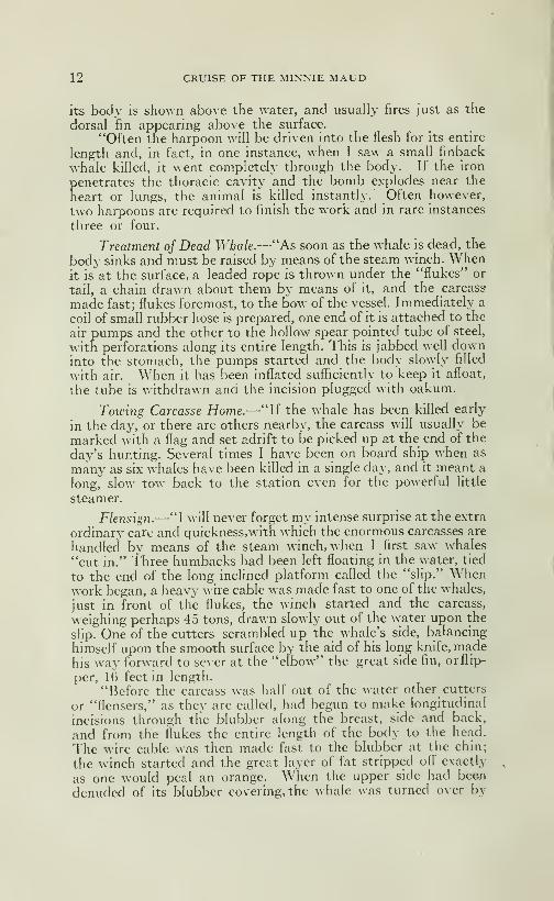
12 CRUISE OF THE MINNIE MAUD
its body is shoAvn above the water, and usually fires just as the
dorsal fm appearing above the surface.
"Often the harpoon will be driven into the flesh for its entire
length and, in fact, in one instance, when I saw a small finback
whale killed, it went completely through the body. If the iron
penetrates the thoracic cavity and the bomb explodes near the
heart or lungs, the animal is killed instantly. Often however,
two harpoons are required to finish the work and in rare instances
three or four.
Treatment oj Dead Whale.—"As soon as the whale is dead, the
body sinks and must be raised by means of the steam winch. Whenit is at the surface, a leaded rope is thrown under the "flukes" or
tail, a chain drawn about them by means of it, and the carcass
made fast; flukes foremost, to the bow of the vesseL Immediately a
coil of smafl rubber hose is prepared, one end of it is attached to the
air pumps and the other to the hoHow spear pointed tube of steel,
with perforations along its entire length. This is jabbed well downinto the stomach, the pumps started and the body slowly filled
with air. When it has been inflated sufficiently to keep it afloat,
the tube is withdrawn and the incision plugged with oakum.
Towing Carcasse Home.—"If the whale has been killed early
in the day, or there are others nearby, the carcass will usually be
marked with a flag and set adrift to be picked up at the end of the
day's hunting. Several times I have been on board ship when as
many as six whales have been killed in a single day, and it meant a
long," slow tow back to the station even for the powerful little
steamer.
Flensign.—"I will never forget my intense surprise at the extra
ordinary care and quickness,with which the enormous carcasses are
handled by means of the steam winch, when I first saw whales
"cut in." Three humbacks had been left floating in the water, tied
to the end of the long inclined platform called the "slip." Whenwork began, a heavy wire cable was made fast to one of the whales,
just in front of the flukes, the winch started and the carcass,
weighing perhaps 45 tons, drawn slowly out of the water upon the
slip. One of the cutters scrambled up the whale's side, balancing
himself upon the smooth surface by the aid of his long knife, madehis way forward to sever at the "elbow" the great side fin, orllip-
per, 16 feet in length.
"Before the carcass was half out of the water other cutters
or "flensers," as they are called, had begun to make longitudinal
incisions through the blubber along the breast, side and back,
and from the flukes the entire length of the body to the head.
The wire cable was then made fast to the blubber at the chin;
the winch started and the great layer of fat stripped ofl' exactly
as one would peal an orange. When the upper side had been
denuded of its blubber covering, the whale was turned over by
CRUISE OF THE MINNIE MAUD 13
means of the canting winch and the other surface fleeced in the
same manner.
Extracting Oil.—"Both flesh and bones were piled separately
into great open vats which border the carcass platform, and boiled
to extract the oil. The flesh was then artificially dried and sifted,
thus being converted into fine guano; and the bones are pulverized
to form "bone meal," also a fertihzer. Even the blood of whichthere are several tons on a large whale, was carefully drained fromthe slip into throughs, boiled, dried, and converted into fertilizer.
Finally, the water in which the blubber had been dried out, wasused in the manufacture of glue."
"Few people reahze that whale flesh supplies the greatest
part of the meat diet of the ordinary Japanese. It is prepared
in a variety of ways, but perhaps is most frequently choppedfinely mixed with vegetables and eaten, dressed with brown sauce.
Almost every part of the great carcass is utihzed for human con-
sumption, even the tendons, heart, livers and intestmes being
prized by the cooks.
Commercial Value.—"In American and other countries, the
commercial value of whales depend entirely upon how thoroughlythe by-products are utilized. If only the oil is taken, a blue whalemay be worth little over S200.00, but if the entire carcass is workedup, it may bring $1,000.00 or 81,500.00, according to the price andguano."
Disko.—After leaving the dead whale we approached theisland of Disko as night fell and, a very cold N. E. wind springing
up, we were obliged to tack ship every hour during the night. Nextmorning (August 20th) which was bright and clear, a stronghead wind and sea from the N. E. obliged us to tack ship all day.We had a good view of Disko Island. The coast-line of the island
consists of highhead yellowish sandstone cliffs, 2,000 feet high,
and at this time, quite bare of snow. A long fiord, penetratesthe centre of the island from the west side and affords first rate
shelter and anchorage for ships. There are large and valuabledeposits of coal on the west side. The scenery of the island is
very grand; the shortline is deeply indented by narrow bays,from which the land rises abruptly into irregular mountain masses,terminating in sharp peaks, whose loftier summits were hiddenin a straight line of clouds formed from recently rising fogs. All
the higher valleys were filled with great glaciers pouring slowlyinto the sea, which was dotted with fantastic icebergs. Thecontrast between the dark sombre rocks of the hills and the dazz-ling whiteness of the glaciers, was enhanced by the streams ofsunlight which flooded the .interior, while the coast was veiled
by the fog clouds.
Dangers of Icebergs.—August, 21st, was calm and the ship rolled

14 CRUISE OF THE MINNIE MAUD
idly on the swell, with sails flapping and booms jerking andstraining with every roll. At one time it looked as if nothing couldsave us from drifting on the ram-shiped bow of a huge iceberg, thatlay unpleasantly close by to the schooner. At mid-day a N. W.breeze sprang and we were glad to escape from the vicinity of thedangerous berg. A ship should never approach too close to an ice-
berg, as the latter is hable, without a moment's warning, to breakinto fragments or roll completely over. The steamship "Miranda"from St. Johns' Newfoundland, paid the penalty for her curiosity
some years ago. Laden with passengers, and wishing to satisfy
their curiosity, the captain run the vessel alongside an iceberg in
o rder to examine it at close range. The giant berg broke and afragment fell on the ship, breaking in her plates. At the sametime the berg rolled and hfted the ship clean out of the wateron a projecting bench of ice, with the result that the vessel hadto be abandoned and the passengers saved into boats.
It is a grand and awesome sight when a huge iceberg, weighingperhaps several milhons of tons, calves or breaks into several
pieces, roIHng conipletely over with a thunderous roar and rumble,and raising a wave large enough to swamp a ship.
Owing to calm and contrary breezes we did not lose sight of
Disko Island until the evening of August the 22nd, and we often
lamented the absence of an auxiliary engine to help us on ourway. Enforced inaction through calms and head winds becomesvery monotonous and disperiting, especially when one is coopedup on the deck of a small vessel. When off Hare Island, north
of Disko, we sighted over 40 icebergs, large ones, 30 of which wereaground. These bergs would not reach the Atlantic until next
year, as they travel with the current about 500 miles a year.
In these northern waters, hazy and foggy weather require
ceaseless care and constant look-out on the part of the officers
and the crew of a vessel, as icebergs and "growlers" are every-
where and constitute an ever present menace and danger espacially
in heavy winds.
Melville Bay.—About 120 miles north of Disko, extending for a
distance of 480 miles from Svarton Peninsula, on the south to Cape"^'ork, on the north west, is Melville Bay; known and dreaded bywhaling captains as a death-trap for ships. Melville Bay is about 90miles deep and its coastline is only partially surveyed. Theshore line consists of an almost broken line of glaciers whichconstantly discharge large icebergs into the waters of the bay.
A large number of rocky islands break its surface and the bottomappears to be very uneven, with much shallow water; in conse-
quence, many icebergs are grounded in the shallower parts of the
bay. The islands and grounded bergs break the wind and wavesand so allow the formation of heavy sheets of ice between themduring the winter months, while in summer they act as anchors
for this sheet of flo-ice. Every June and July, theS. W. current

CRUISE OF THE MINNIE MAUD 15
carries a great part of the shore ice of Central Greenland to Melville
Bay which adds to the ice congestion there, so that it is alwayslate in the season before the bay is even partly clear of ice, whichmust pass westward until, influenced by the northern current
from Smith Sound, it is deflected south and goes to increase the
great floating mass of ice, known as the "middle-pack", whichall summer blocks the south-western part of Baffin Bay and the
sounds and bays along the east coast of Baffin Land.In the days of whaling ships the whalers made their way
across Melville Bay by "tracking" or sailing along the edge of
the solid land-ice, and many a vessel was lost there. Even withsteam power, Melville Bay, is a place of terror to the whalers, andthey never feel safe until they have reached the "north water"of Cape York. As an illustration of the dangers and difficulties
of this crossing, the "Vega" was crushed and sunk m the summerof 1903, and the "Baleana" was at the same time 80 days jammedin the ice. In 1904 the whaler "Eclipse" took 30 days to cross
the bay and the "Diana" was 35 days in crossing. The "Neptune"on the August 8th, 1904, crossed the upper portion of the bay(180 miles long) in 20 hours ahead of a gale of wind accompaniedby heavy rain and sleet when little ice was seen until a few miles
within Cape York, and from there to Cape Alexander, at theentrance to Smith Sound, only "pan" or sheet-ice was observedat the head of the larger bays, all the eastern side of the northernpart of the Baffin Bay being free of ice. The "Minnie Maud"on August 24th and 25th, 1912, ran through a small field of SmithSound ice and small lumpy ice in lat. 73"^ N. when half way across
Baffin Bay, between Long. 60*^. 35' W. and when returning fromPond's Inlet from August 25th, to Sept. 1st, the "Minnie Maud"sailing from Button Point to Disko, saw no indication whateverof the "middle-pack" or flo-ice but passed several dozen large
icebergs, from Melville Bay, widely scattered.
Uperyiivik.—The Danish settlement of Upernivik is on a smallisland on the S. W. corner of Melville Bay, and navigators generally
make a curve with the bay to avoid the "middle pack" ice whichmoves according to the wind. When the wind is west or S. W. theice jams; it is forced up on the glaciers and if a vessel is caught shebecomes frozen m by the young ice. Whalers are sometimesbeset for a month or more in the pack of Melville Bay in themonths of June and July. There are some clusters of islands
along the coast which help to break the large fields of ice andopen up leads for vessels.
Navigation.—Experience teaches the ice navigator that thesafety of his ship depends upon his preventing her from being beset.
No leads should be entered unless a clear way out again is seen.
The "Algerine" and "Proteus" were lost in this way. If the windis on the land, care should be taken to find out how much water
16 CRUISE OF THE MINNIE MAUD
there is between the ice and the land. As a general thing, themost open navigation is along the land, but the usual coast dangershave to be contended with, and a change of wind may crush a
ship between the ice and the shore.
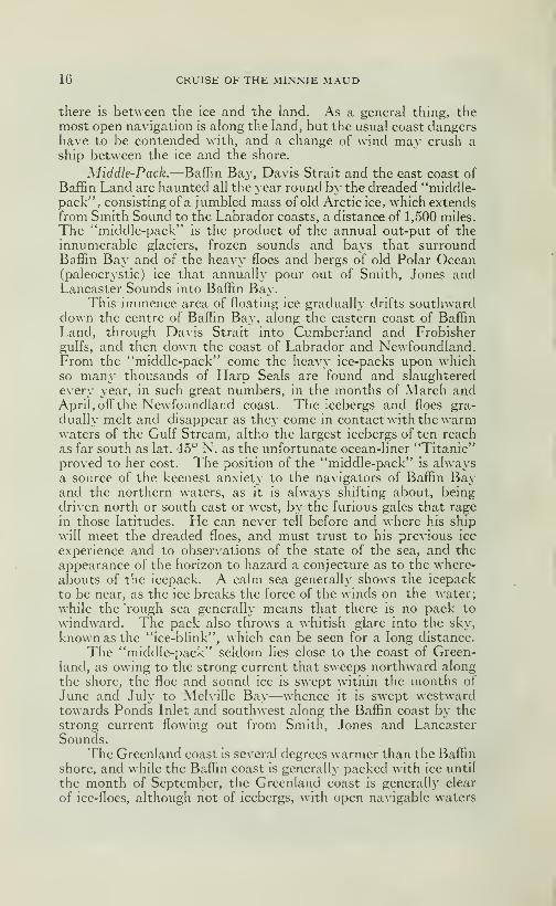
Middle-Pack.—Baffin Baj»", Davis Strait and the east coast of
Baffin Land are haunted all the year round by the dreaded "middle-pack", consisting of a jumbled mass of old Arctic ice, which extendsfrom Smith Sound to the Labrador coasts, a distance of 1,500 miles.
The "middle-pack" is the product of the annual out-put of theinnumerable glaciers, frozen sounds and bays that surroundBaffin Bay and of the heavy floes and bergs of old PoLar Ocean(paleocrystic) ice that annually pour out of Smith, Jones andLancaster Sounds into Baffin Bay.
This immence area of floating ice gradually drifts southwarddown the centre of Baffin Bay, along the eastern coast of Baffin
Land, through Davis Strait into Cumberland and Frobishergulfs, and then down the coast of Labrador and Newfoundland.From the "middle-pack" come the Iieavy ice-packs upon whichso many thousands of Harp Seals are found and slaughtered
every year, in such great numbers, in the months of March andApril, off the Newfoundland coast. The icebergs and floes gra-
dually melt and disappear as they come in contact with the warmwaters of the Gulf Stream, altho the largest icebergs of ten reach
as far south as lat. 45" N. as the unfortunate ocean-liner "Titanic"proved to her cost. The position of the "middle-pack" is alwaysa source of the keenest anxiety to the navigators of Baffin Bayand the northern waters, as it is always shifting about, beingdriven north or south east or west, by the furious gales that rage
in those latitudes. He can never tell before and where his ship
will meet the dreaded floes, and must trust to his previous ice
experience and to observations of the state of the sea, and the
appearance of the horizon to hazard a conjecture as to the where-
abouts of the icepack. A calm sea generally shows the icepack
to be near, as the ice breaks the force of the winds on the water;
while the 'rough sea generally means that there is no pack to
windward. The pack also throws a whitish glare into the sky,
known as the "ice-blink", which can be seen for a long distance.
The "middle-pack" seldom lies close to the coast of Green-land, as owing to the strong current that sweeps northward along
the shore, the floe and sound ice is swept within the months of
June and July to Melville Bay—whence it is swept westwardtowards Ponds Inlet and southwest along the Baffin coast by the
strong current flowing out from Smith, Jones and LancasterSounds.
The Greenland coast is several degrees warmer than the Baflin
shore, and while the BaflTin coast is generally packed with ice until
the month of September, the Greenland coast is generally clear
of ice-floes, although not of icebergs, with open navigable waters
CRUISE OF THE MINNIE MAUD 17
as far as Melville Bay by the end of June. By the beginning of
August, Melville Bay has been swept clear of ice-floes and there is
generally open waters to Cape York and across to Lancaster
Sound and Ponds Inlet. Early in August, ships generally have
to cross Melville B£iy and steer to within a degree of Cape Yorksay lat. 75^ N. in order to avoid the tail-end of the "middle-pack",
before bearing away for Lancaster Sound and Ponds Inlet. The"Minnie Maud" saw no signs of the "middle-pack" in lat. 73^ N.
on August 24th and 25th, 1912; as the pack had had time to drift
south to probably 72^ N. consequently the northern part of Baffin
Bay was clear, save for some floating pans from Smith Sound.
Unless returned by southern gales the "middle-pack" drifts south
about ten miles a day. Smith Sound remains frozen until the
middle of August before sending its vast contingent of iiieavy ice
southward, in consequence there is a wide interval of open water
during the month of August between the two streams of ice from
the north, and ships bound for Lancaster Strait and Ponds Inlet
or Etah should best pass up the Greenland coast and across Melville
Bay and North Baffin Bay in lat. 74^ or 75^ early in August,
arriving in Ponds Inlet about August 12th.
STnith Sound Ice.—The Smith Sound ice continues to pour out
into Baffin Bay in heavy floes, often square miles in extent, fromthe middle of August until the end of the year, and this stream
finally joins the earlier ice from Lancaster Strait, Melville Bay andthe Baffin Land Sounds in the western and southwestern part of
Baffin Bay. All these ice streams from the great mass of the "mid-
dle-pack". On August 10th, 1904, the "Neptune" encountered afew miles south of Cape Sabine in Smith Sound, lat. 78- 40' N.,
large masses of Arctic ice, which had just commenced to breakloose from the fast ice and which was quickly emptying throughSmith channel into Baffin Bay. All this ice was solid and from20 to 40 feet thick having been formed in the Arctic Ocean for
several years. This ice had recently broken away in great sheets
(one of which was about six miles long and took the "Neptune"three quarters of an hour to steam past it) from the mouths of
the bays whose inner surfaces were still frozen over.
The diverse characters of these large sheets of ice is further
increased by the number of small icebergs often seen frozen into
the mass with the Polar Sea ice. Under ordinary circumstances,
this Smith Sound ice would arrive of Lancaster Strait and Pond'sInlet about the end of September, which is the time for a vessel
to leave these places unless she intends to pass the winter in the ice.
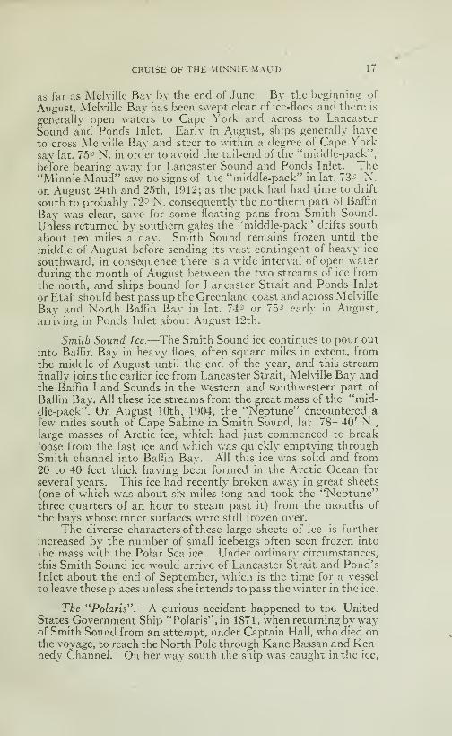
The "Polaris'".—A curious accident happened to the UnitedStates Government Ship "Polaris", in 1871, when returning by wayof Smith Sound from an attempt, under Captain Hall, who died onthe voyage, to reach the North Pole through Kane Bassan and Ken-nedy Channel. On her way south the ship was caught in the ice,

18 CRUISE OF THE MINNIE MAUD
Oil August 1-ith, in Kennedy Channel and remained fast^in the
pack until the 15th ofOctober, \vhen a furious gale i^roke up the
pack in sight of Northumberland Island, nearly destroying the
ship which had drifted with the ice over 200 miles in two monthstime. When this occured several of the party, who were landing
stores on the ice, were left on the floes and they drifted southward
1,500 miles on the ice floe exposed to all the rigors and gales of
tire Arctic winter, until they were rescued six and a half monthslater, April 30th, 1872, by the "Tigress", off the coast of Labrador.
This experience is unique in the annals of Arctic peril and hardship
and we often pondered over the desperate expedients to which
these unfortunate but hardy men must have been resorted in
order to survive and endure the terrible cold and misery during
their unvoluntary long voyage on the ice-pack. The "Polaris"
was beached at Life Boat Cove near Etah and the remainder of
the crew passed the winter in safety in a house built from the
wreck. During the winter, two boats were built in which the
party started to retreat on Upernivik, but were fortunately rescued
by a relief steamer in the vicinity of Cape York.
East Cost of Baffin Land.— Ships entering or leaving Baffin
Bay, should avoid the Baffin Land Coast, as the drift of the current
of the North carries the ice-pack against the shore and the ice-floes
extend out into the bay for a distance of over 100 and often 200
miles, while, save for icebergs, the Greenland is clear. In July 1912,
the "Neptune" steamed north along the Baffin coast from Cum.ber-
land Gulf to Pond's Inlet and was battling with the ice-floes for
over 700 miles. In 190^, the "Neptune," when steaming south along
the Bafïin coast from Pond's Inlet to Cumberland Gulf spent six
days, from August 21st to 27th, battling against heavy ice-floes,
fog and south-easterly gales and was forced by the heavy floes
of northern ice to within a 100 miles of the island of Disko. The"Arctic," in 1907, when steaming south from Jones Sound to Cum-berland Gulf, encountered S. E. and S. W. gales accompanied byrain and thick fogs from August 16t-li to August 24th, meeting
the ice-pack in latitude 71*^ N. and long. 59°. 30' W. (within a
hundred miles of Disko) which forced her to steer to the eastward
and to follow tlie edge of tlie ice-pack. On August 24th, the ice
was so thick, the "Arctic" was obliged to stop and to wait for
openings in the ice, reaching Cumberland Gulf, which was full of
ice, on August 25th.
The "Arctic" Cruise.— In September the ice-pack generally
recedes from the Baflin Shores for a distance of 12 to 20 miles,
leaving a lane of open waters upon which ships can sail, but if east-
erly winds occur, there is alwajs danger of a ship being caught in
the ice-floes and sunk or driven on shore. In September, 1909, the
"Arctic" from September 3rd to 9th, steamed down the east coast
of Baffin Land from Pond's Inlet to Cumberland Gulf, meeting no
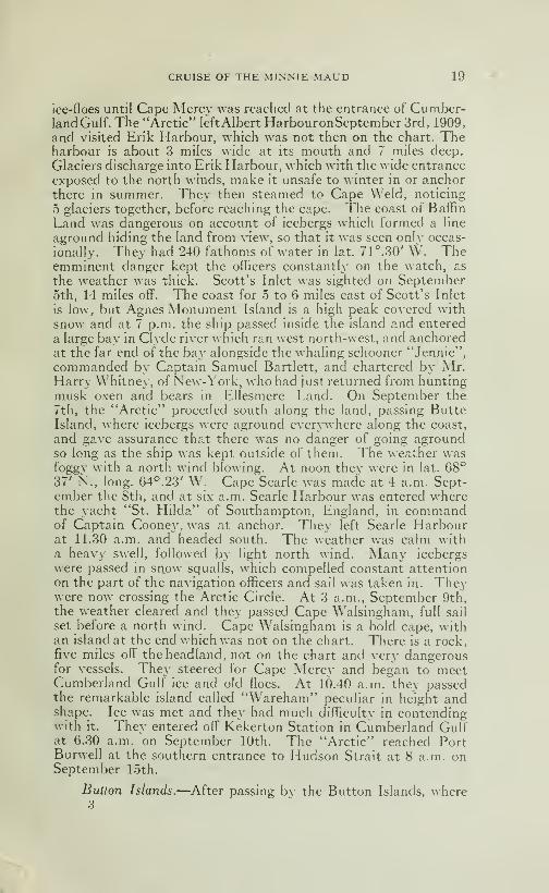
CRUISE OF THE MINNIE MAUD 19
ice-floes until Cape Mercy was reached at the entrance of Cumber-land Gulf. The "Arctic" left Albert HarbouronSeptember 3rd, 1909,
and visited Erik Harbour, which was not then on the chart. Theharbour is about 3 miles wide at its mouth and 7 miles deep.
Glaciers discharge into Erik Harbour, which with the wide entrance
exposed to the north winds, make it unsafe to winter in or anchorthere in summer. They then steamed to Cape Weld, noticing
5 glaciers together, before reaching the cape. The coast of Baffin
Land was dangerous on account of icebergs which formed a line
aground hiding the land from view, so that it was seen only occas-
ionally. They had 240 fathoms of water in lat. 71°. 30' \V. Theemminent danger kept the officers constantly on the watch, as
the weather was thick. Scott's Inlet was sighted on September5th, 14 miles off. The coast for .5 to 6 miles east of Scott's Inlet
is low, but Agnes Monument Island is a high peak covered with
snow and at 7 p.m. the ship passed inside the island and entered
a large bay in Clyde river which ran west north-west, and anchoredat the far end of the bay alongside the whaling schooner "Jennie",
commanded by Captain Samuel Bartlett, and chartered by Mr.Harry Whitney, of New-York, who had just returned from huntingmusk oxen and bears in Ellesmere Land. On September the
7th, the "Arctic" proceded south along the land, passing ButteIsland, where icebergs were aground everywhere along the coast,
and gave assurance that there was no danger of going agroundso long as the ship was kept outside of them. The weather wasfoggy with a north wind blowing. At noon they were in lat. 68°37' N., long. 64^.23' W. Cape Searle was made at 4 a.m. Sept-ember the 8th, and at six a.m. Searle Harbour was entered wherethe yacht "St. Hilda" of Southampton, England, in commandof Captain Cooney, was at anchor. They left Searle Harbourat 11.30 a.m. and headed south. The weather was calm witha heavy swell, followed by light north wind. Many icebergs
were passed in snow squalls, which compelled constant attentionon the part of the navigation officers and sail was taken in. Theywere now crossing the Arctic Circle. At 3 a.m., September 9th,
the weather cleared and they passed Cape Walsingham, full sail
set before a north wind. Cape Walsingham is a bold cape, withan island at the end which was not on the chart. There is a rock,five miles off the headland, not on the chart and very dangerousfor vessels. They steered for Cape Mercy and began to meetCumberland Gulf ice and old floes. At 10.40 a.m. they passedthe remarkable island called "Wareham" peculiar in height andshape. Ice was met and they had much difficulty in contendingwith it. They entered off Kekerton Station in Cumberland Gulfat 6.30 a.m. on September 10th. The "Arctic" reached PortBurwell at the southern entrance to Hudson Strait at 8 a.m. onSeptember 15th.
Button Islands.—After passing bv the Button Islands, where3

20 CRUISE OF THE MINNIE MAUD
the tides are \ en' strong, and which vessels, esp>ecially if they are
weak-i>owered and slow, should avoid as they are not correctly
chartered. There are 22 islands in the group.
East Coast ojBaffin Land.—^Although generally inaccessible onaccount of the ice-floes, the east coast of Baffin Land contains manygood harbours and anchorages known only by the whaling captains
who frequented those waters for many years. The coast has never
been accurately surveyed , and Captain \V. F. Mihie, of the Scottish
steam whalers "Eclipse" and "Esquimaux", gives the following in-
teresting description of the best harbour to be found there: "Thesouthern coast of Ponds' Inlet is more or less broken land withhigh p>eaks until you reach Eric Harbour. Cape Bowen should besurveyed for latitude and longitude as it should be further north
and not so far east. Then to the south of Cape Bowen there are
two islands with a fiord running S. ^^ . by S. The next place of
importance is Cout's Inlet where there are a few more fiords
running W. after you pass Antobus. There is better anchoragein Dexterity fiord, 18 miles from Cape Adair, than to the S. of
Caj>e Adair, which abound with deer. To the S. of Cape Adairyou enter Scott's Inlet where there is a fine harbour. FromAustin to Agnes Monument S. W. Clyde Harbour, there is a pretty
good harbour inside of Bute Island called Refuge Harbour, there
is a fiord S. of Scott's Inlet with 2 branches. Then south to that
there is a bay to the N. of Cape Eglington where there is a fine
harbour on the south shore- Natives are to be found and lots of
salmon. From Bute Island to Austin in (Cape Aston) it is a lowsandy coast. Austin is dangerous. Low land as far as CapeRaper. There is Isabella Bay and Antilrviag Harbour, which is
a good harbour, keep the coast and from Cape Raper to harbourW. a quarter N., by compass, and anchor inside the hook. Fromthere keep going S. 10 miles to Cape Kater, then go N. W. into
a large bight to the N. of a small island. Home Bay is rather dang-
erous and full of islands and reefs. Don't attempt to go into the
bay until you pass the 68th parallel Kangeakdjung. Then steer,
keeping the land aboard and anchor half way between the main-
land and the island. The harbor is called Hooper, but not the
HooF>er on the chart, and from there steer to Cape Broughton,
there is a fine anchorage to the S. of that island and you can go
on as far as you like, which is called Broughton Harbor in lat. 67°.
27' N. From there steer for Merchants' Bay, inside of CapeSearle Island, on the W. point going to the entrance. Here is
a bar with two feet and should not be attempted by the E. side.
In Dunbar Harbour (Durham) there is a deposit of coal which
might be looked into, it is considered the best harbour on the coast
in lat. 67°.5' N. From Dunbar Harbour to Cape Dier there is
a bight 10 miles N. of Cape Dier where you can anchor in a S.
\V. wind. From Cape Dier steer W. by S. passing two islands,
CRUISE OF THE MINNIE MAUD 21
then to the \\ . N. W. where there is a fine basin to the S. Wpart of the bay ealled Exeter Bay.
"After having passed Cape Mercy entering into CuniberhuulSound you can go into Nijadkik HarJjour, recommended for
large vessels. After passing that 11 miles about N. W. there is
a good harbour in Abraham Bay. There is fine sahiion in both
harbours. From there proceeding N. N. E. there is a fine harbour15 miles from Abraham Bay. From Abraham Bay to Kekerton,
is about 40 miles, keep to the W. of Kekerton about one mile
and anchor a mile abreast of the station. From Kekerton to
Brown's Harbour is about 12 miles, the harbour lays on the N.side between islands and the mainland. There is a fine harbour at
Mantillik Fkirbour, to the S. W. of Black Lead we anchor to the
W. near the station, near a small island. There is also a fine
harbour inside of two little island "Karodliun".
lVire/e55 Observations.—As the climate of eastern Canada andthe entire north Atlantic shipping trade is afl'ected by the position
find annual quantity of the ice-floes in Baflin Bay, and by the pre-
vailing winds and temperatures, which are constantly varying in
the northern lattitudes it would be of undoubtedly great value to the
farmers of eastern Canada and to the shipping trade of both conti-
nents, if the Canadian Government were to establish a chain of
meteorological observatories, each equiped with a wireless outfit at
say: Resolution Island, Coburg Island (Cumberland Gulf), CapeDier, Cape Kater, Cape Aston and Cape Adair on the Baflin Landcoast; Button Point on Bylot Island; Cape Crawford on BrodeurPeninsula; Erebus Bay on North Devon; Cobourg Island in JonesSound, and at Cape Sabine at Smith Sound. A station at Cape Yorkand at Disko Islands or Upernivik would complete the chain andwould keep the world daily informed on the conditions and changesof wind and temperatures and of the conditions and positions of theice in the various localities. The cost of annual maintenance shouldnot exceed 8100,000.00 annually, and the information obtainedabout the movements of the ice in the most dangerous ice-zonein the world would be of incalculable benefit to shipping andcommerce. Predictions could be made with considerable accuracyas to the probabilities of early or late spring or of mild or • everewinters in the north-eastern states of Canada and the UnitedStates.
It appears that McMillan's Exp oring Expedition that is nowin searcli of the New Arctic Land, that was discovered and namedby Dr. Cook as Crocker's Land, has already established a wirelessoutfit at its base in Smith Sound. Undoubtedly with the rapidstrides that are being made in aviation and with the perfectionof the mechanical stability and increase in range of flying machines,aeroplanes or aero-hydroplanes will soon play a prominent partin the development and accessibility of the Arctic Regions.
22 CRUISE OF THE MINNIE MAUD
Reach Pond's In!et.—After leaving Disko Island, we sailed
thro many large icebergs as far as N. lat. 73°. 50' N., then turningW. steered for Pond's Inlet, and arrived off Erik Harbour about 1
a.m. August 27th, being somewhat, ahead ofour calculations, as wedid not expect to see the land before another 12 or 15 hours. At 6 p.
m.,the night before, we ran through a quantity of heavy lumpy ice
and passed a huge flat-topped iceberg which we did not see in the
fog, until we had nearly run on top of it. Baffin Bay was covered
with thousands of small divers swmiming in the sea and feeding
of small blue-lish. The occurrence of such a continuance of deadcalms and light-breezes as we had encountered during the past
8 or 9 days was, we were informed, quite unusual at this time of
the year.
The high hills which flanked Ponds' Inlet in our port side
were covered with snow, and we tacked about all the morningagainst the light breeze through the ice-floes and came abreast of
Button Point at 3 o'clock in the afternoon. The day was fine
sunny and brisk with a cool breeze from the N. E. About oneo'clock we saw the smoke of a steamer coming round the By lot
shore from the N. It proved to be the 'Neptune" returning
from am ineft"ectual attempt to enter Arctic Bay in AdmiraltySound. She made straight for Albert Harbour, nozing her waythrough the heavy ice-floes that blocked the narrows. The breeze
improved for an hour or two in the afternoon, and the schoonerbowled along merrily at a 7 knot clip through the floes and ice-pans,
giving herself some hasty bumps against the ice, one of whichsmashed two of the rotton planks in her port side; fortunately
above the water-line or the story would have ended then andthere The breeze dropping again we spent the night tacking
about through the ice within 5 or 6 miles of Albert Harbour. Wetried to tow the schooner with one of the gasoline boats but the
engine balked and the attempt had to be abandoned. Threenatives with two women and some dogs came alongside in a whaleboat and we realized that we had at last arrived in the land of the
Eskimo. These Eskimos gave us the first intelligence of the loss
of the "Algerine" on July 16th, near Erik Harbour.
Meet the Neptime.—The next day, August 28th, was clear, cold
and frosty. The entrance to the narrows was jammed solidly with
ice-pans, behind us the flows having been blown in from the sea bythe easterly wind. Fresh ice was forming all around us and the
pans cut us off from Albert Harbour where the "Neptune" lay at
anchor behind Belœil Island. In the morning a steam launch
struggled out of the harbour and by dint of poling managed to comealongside. On board were some members of the Scott Expedition
who told us that there were no sign of gold at Salmon River or in
this region; that counting the "Algerine" survivors they were 52
men aboard the "Neptune" and that they were to make another

The first Eskimos we met JnW 1910
à» V
. t
>' \
CRUISE OF THE MINNIE MAUD 23
attempt tomorrow to enter "Arctic Bay", with the idea of building a
shack there and leaving 4 men during the winter, when the rest of
the expedition would return home. They told us that the "Nep-tune" a week or so before, had caught in the ice-pans and was nearly
driven on shore in a gale near Salmon River and that they were
all glad to leave this desolate region. It was not encouraging
news for our party and al ideas of amassing a fortune quickly
from rich deposits of placer gold were rudely dispelled. Theysaid that the prospectors of botli expeditions were disgusted of
having lost a whole season's prospecting in more promising regions
and were vowing vengeance on the author of what they termedvery freely a "fake" and a "hoax"
Nearly Ashore.—We spent the day poling and wharping the
schooner by means of ice-anchors through the ice-pans and it wastedious and laborious work. We were tired out with want of sleep
and continuous exertion, and the discourageous news brought to us
by the "Neptune's" steam launch did not tend to raise out spirits.
About teatime the pressure of the ice-floes carried us periliously
near the stiff rocks on the shore, the ship being driven by the ice-
pans under pressure of the out floating current within 50 feet of the
black and forbidding rocks. At one time, it looked as if nothingcould save her from being pressed ashore but by hard pohng andwarping on the ice-anchors and with half the men out on the ice-
pans which surrounded the vessel, we managed to warpe her outof the dangerous position and anchor to an ice-pan near the east-
ern entrance of Albert Harbour, where we remained all night. Nextmorning August 29th, we found that ship and ice-pan had beendrifted bodily several miles back towards Button Point and webegan to despair of ever reaching the bleak hole in the hills thatwas our goal. At midway the "Neptune" steamed out of theharbour and, pushing her way through the loose floes, approachedto within a few hundred yards of the schooner when she droppeda boat and Mr. Scott with two companions, came on board. Air.
Scott told us that they were going musk-ox hunting after makinganother attempt to enter Arctic Bay and then they would steamfor home. Mr. Scott offered to tow us into the harbor but for
some reason the offer was not accepted. So saying good-byethey returned to the "Neptune" which, after an exchange offlag salutes, steamed away. They were the last whitemen wewere to see until we reached Quebec, fourteen months later anda good deal of our enthusiasm went with them as we viewed ourbleak and inhospitable surroundings.
Reach Albert Harbour.—We managed to struggle into AlbertHarbour at 8 o'clock that evening, and anchored abreast the Go-vernment Depot, in 14 fathoms of water. A watch was kept ondeck all night to pole away the ice-pans that kept floating on tiie
ship, and next morning we moved the schooner over a little cove
24 CRUISE OF THE MINNIE MAUD
under the lee of Belœil Island, whose bare, rocky, boulder-strewnwalls towered nearly a 1,000 feet above us.
Although affording a splendid anchorage in 15 to 20 fathomsof water, sheltered against all winds, a more desolate, bleak andforbidding spot than Albert Harbour can scarcely be imagined.
It is surrounded, on all sides, by black barren hills or crumblinggneiss which tower 1,000 to 1,500 feet above its gloom\- waters.
Cold winds whistle through it constantly, the sun seldom shines
there, and the patches of snow on the bleak hills and the treach-
erous ice-floes that are constantly drifting through its narrow en-
trance, heighten the soul-chilling impression of gloom and desolation.
The exact location of Albert Harbour according to obserxations
taken by the "Arctic" in 1906 is lat. 72^.42' 32" N., Long. 77^.50'
W. and the magnetic variation of the compass is 90" to 93° \V.
The harbour is situated about 20 miles from Button Point,
on the Baffin Land coast, and is a mile long and 3,000 feet wide,
lying between Belœil Island and the mainland. The eastern
entrance is 3,842 feet wide and the western entrance is 482 feet
across with 14 fathoms of water in the mid channel. The tide
rises nine feet in Albert Harbour, according to season of the moon,and the flow is irregular depending upon the direction of the wind.
The narrows, between Beloeil Island and the opposite shore
of Bylot Island, are 35,324 feet or nearly seven miles wide. Beloeil
Island which encloses the harbour on the north side is a high
rocky mass of gneiss, 8,200 feet long and 950 feet high, whichharbours a few hares and provides splendid shelter and anchoragefor ships against the winds that blow. Albert Harbour is the only
safe harbour winter and summer, in the Ponds' Inlet region.
There is no anchorage near the northeast entrance and although
there is a gravel bank and beach and river delta on the eastern
shore, by keeping in mid-channel there is plenty of deep water
and clear passage into the harbour which lies behind the angle
of Beloeil Island. In Ponds' Inlet there are 460 fathoms of water.
The only drawback to Albert Harbour is the short season it is
opened and accessible for ordinary ships, August 8th to October 1st.
Button Paint.—Button Point affords good anchorage in 12
fathoms of water, in front of a small circular bay, about 600 yards
deep and w de, into which runs a small creek, but there is no pro-
tection from the winds and ice-floes when the wind blows from the
southeast to southwest; and a ship has to have steam up and be
always ready to hoist anchor and away at a minute's notice. Thewinds in July and August are very variable and liable to veer from
one point to another with surprising quickness, with the result
that the Ponds' Inlet narrows may be ice-free at one part of the dayand in a few hours a sudden change of wind will completely jam the
passage with ice-floes, which will in a few days, be blown awayagain.
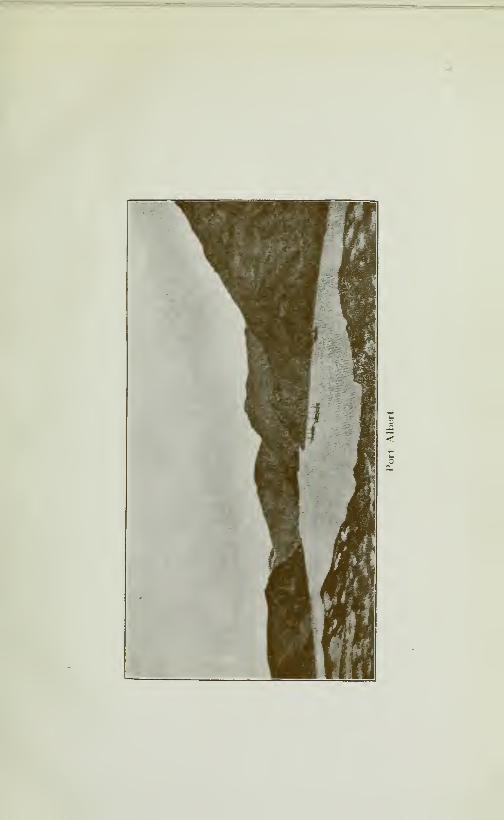
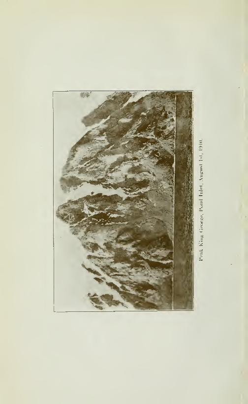
c

CRUISE OF THE MINNIE MAUD 25
Erik Harbour.-—Erik Harbour is about 37 miles, east by south
of Albert Harbour and is about 20 miles southeast of Button Point.
The measurements of Erik Harbour, which were taken by the mem-bers of the Arctic Expedition in 1906, are 38,500 feet deep and 13,-
600 feet wide at the entrance. There are two good anchoragegrounds in about 9 or 10 fathoms of water, at the far end of the bay,
on the southwest side, opposite a large glacier. Erik Harbour is
not safe as a winter or summer harbour as its wide mouth leaves
it exposed to northeast winds, and a heavy gale from that quarter
fills the harbour with heavy Arctic ice-pans which are hable to
drive a vessel ashore. There are no Eskimos at Erik Harbour.In fact the whole eastern coast of Baffin Land from CumberlandGulf to Ponds' Inlet, with the exception of Home Bay and CapeKater, is devoid of Eskimos. At Clyde River, a few families fromPonds' Inlet, pass the summer hunting caribou and fishing salmon.Home Ba\' is full of seal and at Cape Kater, Polar bears are killed.

CHAPTER II
TRADING, TRAPPING AND PROSPECTING WITH THE ESKIMOS
Mooring Schooner.—The first few days at Albert Harbour, werespent in mooring the schooner for the winter in a small cove nearthe western entrance of the harbour, close to the frowning walls
ofBeloeil Island. Two anchors were dropped in fifteen fathoms of
water, the bow pointing east, and two rope hawsers were run fromeach side of the bow to the boulders on shore with two steel wirehawsers from the stern to the shore, about 100 feet away. Thestern of the ship was brought in hne with a small rocky point andthe Government cache near this point were some bad rocks underwater close to the shore which should be avoided by vessels. Wehauled cargo from the hold and loaded it into boats for transfer tothe village.
The Narivhal.—Narwhal kept plunging through the narrow har-bour, hugging the south shore and going west up EcHpse Sound,always keeping close to the shore and passing within a few hundredfeet from the steep rocks near the village, where the natives shootthem from the rock. A couple of Eskimos wait by the shore in
their kayaks and whenever a narwhal is shot from the rocks, theydart out and, harpooning the carcase, drag it ashore. If they arenot quick in sinking a harpoon into the wounded animal, theweight of the horn and the head will cause it sink slowly andbe lost. We shot several in the eastern narrows of the harbour,but they dived and escaped. The narwhal whose scientific nameis Monodon Monoceras, travels in bands and appears to prefer theproximity of ice, probabely to escape the attacks of the giantKiller which pursues it relentlessly. The Baffin Bay whalersobtain a considerable quantity of narwhal ivory from the nativesof North Greenland, the best place being in the vicinity of CapeYork and Melville Bay. They are also found in CumberlandGulf, on the shores of Hudson Strait, in Fox Channel and FrozenStrait. They are very plintiful in Ponds Inlet, Albert Harbour,Button Point, Eclipse Sound, Arctic Sound Milne Inlet, Kuluk-too, Toolooria and at Kiluteas (Navy board Inlet); at BaillargerBay, Elwin Inlet, Strathcona Sound, Adams Sound, and MoffetBay (Admiralty Sound); Peel Sound, Erebus Bay and especially
at Port Leopold, North Somerset.
28 CRUISE OF THE MINNIE MAUD
As many as 300 have been killed in a single season by the nativesof Ponds Inlet who used the ivory horn to make carved ornementsof sleds, kayaks dogs, animals and harpoon barbs. They also eatthe flesh, which is coarse and dark; and the boiled skin (mi'ik-
tûk) is a native dainty, being soft and gelatinous.
Narwhal Horn.—The narwhal attains a length of between 20 and30 feet and a weight of two tons. It is distinguished from thewhite whale (or white porpoise) by its darker colour, its white spotsand its horn. The colour of the narwhal becomes Hghter with age,
so that ver}^ old individuals become dirty white. According to theEskimos, the horn is confined to the males, and its chief use is for
domestic bottles. Only one horn is usually developed which growsout of the upper jaw, projecting directly forward. A second hornon the other side of the jaw is not uncommon, but it is alwaysshorter, and is often malformed or rudimentary. The horn varies
in length up to eight feet, and is composed of very fine ivory. Atthe base the average thickness is from two to three inches; it tapersto a point and has a spiral twist throughout the length. There is
a large pith core at the base, which gradually fills after the hornhas reached maturity, so that in the older animals the horn is al-
most completely sohd. The ivory is worth from SI.50 to .S3.00 a
pound. The ultimate destination of the ivory is China, where it is
used for ornemental purposes as well as for médecine, and for themanufacture of cups, as it is supposed to absorb all poisons placedin them.
Habits.—The narwhals are very sporti\ e in their habits and weoften used to watch them from the chfi's pkaying about and divingin and out amongst the holes in the ice floes of EcHpse Sound. Theyenter the sounds in the spring and return to ocean in the fail. Thesefish are easily approached and take but Httle notice if a vessel, al-
though the sound of the propeller striking the water will frighten
them, from a long way off, as they have a keen sense of hearing andthe water is an excellent sound conductor. The narwhals are not
so dangerous when hunted as are the vicious walrus. They needto be shot in the head to kill them instantly or otherwise they will
dive and escape. A solid metal-jacketted bone-piercing bullet is
the best for killing narwhal. The natives shoot and harpoon themin the cracks of the ice-floes in June, July and August and then haul
them on to the ice-pans, where they cut off the blubber, skin andhorn. If they kill them in open water in August and Septemberthey tow the carcase by the horn to the shore, where they cut
up and cache the meat under cairns of heavy stones for winter con-
sumption.
The Killer.—The Killer, otherwise known as the Grampus or
Swordfish, is very voracious and savage. It lives largely uponfish, seals, porpoises and white whales. It also attacks large Right
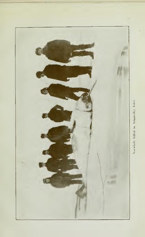
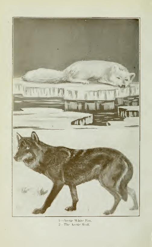
1
—
Xrclic Whilf Fox.
•_>~-Thp An-lic Wolf.
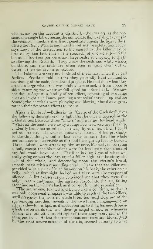
CRUISE OF THE MINNIE MAUD 29
whales, and on this account is disliked by the whalers, as the pre-
sence of a single killer, means the immediate flight of all creatures in
the vicinity. Luckily it will not penetrate among the heavy floes,
where the Right Whales and narwhal retreat for safety. Some idea,
says Low, of the destruction to hfe caused by the killer may be
formed by the fact that in the stomach of one were found the
bodies of fourteen porpoises and large seals; it chocked to death
swallowing the fifteenth. They chase the seals and white whales
on shore, and the seals are often seen jumping clear out of
water in their endeavour to escape.
The Eskimos are very much afraid of the killejs, which they call
Ardloo. Pewiktoo told us that they generally hunt in families
consisting of the male, female and progeny. He said that when they
attack a large whale the two adult killers attack it from opposite
sides, ramming the whale at full speed on either flank. \\ e sawone day in August, a familly of ten killers, consisting of two large
ones and eight small ones, pursuing a school of narwhal up Ecilpse
Sound; the narwhals were plunging and blowing ahead at a great
rate in their desperate efforts to escape.
Killer vs Bowhead.—'Bullen in his "Cruise of the Cachalot" gives
the following description of a fight that he once witnessed in the
Okhotsk Sea between three "killers" and a large Bowhead whale:
"\\'hile all the boats were away a large bowhead rose near the ship,
evidently being harrassed in some way by enemies, which I could
not at first see. He seemed quite unconscious of his proximity
to the ship, though, and at last came so near that the wholeperformance was as visible as if it had been got up for my benefit.
Three "killers'^ were attacking him at once, like wolves worryinga bull, except that his motions were far less lively than those of
any bull would have been. The first inkling I got of what wasreally^ going on was the leaping of a killer high into the air by the
side of the whale, and descending upon the victim's broad,
smooth back with a resounding crash. I saw that the killer wasprovided with a pair of huge fins-one on his back, the other on his
belly—which at first sight looked as if they were also weapons of
offence. A little observation convinced me that they were fins
only. Again and again the agressor leaped into the air, falling
each time on the whale's back as if to beat him into submission.
"The sea around foamed and boiled like a couldron, so that it
was only occasional glimpses I was able to catch of the two killers,
until presently the worried whale lifted his head clear out of the
surrounding smother, revealing the two furies hanging—one oneither side—to his lips, as if endeavouring to drag his mouth open-which I afterwards saw was their principal object, as wheneverduring the tumult I caught sight of them they were still in the
same position. At last the tremendous and incessant blows, dealt
by the most active member of the trio, seemed actualh' to have

30 CRUISE OF THE MINNIE MAUD
exhausted the immense vitality of the great bowhead, for he lay
supine upon the surface. Then the three joined their forces andsucceeded in dragging open his cavernous mouth, into which theyfreeley entered devouring his tongue. This, then, had been their
sole object, for as soon as they had finished their barbarousfeast they departed, leaving him helpless and dying to fall an easyprey to our returning boats."
"The "Killer" or Orca Gladiator" writes BuIIen," is a true whale,
but hke the cachalot, has teeth. He differs from that great ceta-
cean, though in a most important particular; i. e. by having a
complete set in both upper and lower jaws, like any other carni-
vore. By some authorities he is thought to be identical with the
grampus, but whalers all consider the animals quite distinct.
The Eskimos, The need of Tobacco.—The Eskimos during those
da3^s would come aboard the schooner in their boats and kayaks,bringing skin and ivory to exchange for tobacco and cartridges.
No vessel had entered Ponds Inlet in the preceding year and, in
consequence, they had passed a very hard winter, having neither
tobacco nor cartridges, and they suffered consequently in health
and spirits. Tobacco is almost a necessity for the Eskimos, whosmoke and chew incessantly. The women and children also use
it. It is their one great craving and without the consolation of
"My Lady Nicotine", life in the Arctic, to must of us would bevery comfortless and dreary.
The Scotch \]'halers.—The natives seemed very disappointed
in the size of the schooner, as the visits of the "Neptune", "Arctic"
and the steam-whalers had accustomed them to bigger ships.
They marvelled how such a small ship could have managed to
make such a long voyage and said she could not have brought
enough provisions to feed them all during the winter. When the
Scotch whalers visited Ponds Inlet regularly, they used to give
the Eskimos a scant weekly allowance of biscuits, tea, molasses,
and tobacco during the dark winter months, in order to keep themon hand until spring arrived, when the men were sent out on the
ice-pans, armed with guns and harpoon, to hunt narwhal and seal
in the ice-cracks near the open water at Button Point, while the
women were employed in boiling down the blubber into oil,which
was shipped away in the Fall. The whaling ships used to hunt
whale along the coast of Greenland, in the months of June and
July, arriving off Cape York and Whale Sound at the middle of
July. They would enter Ponds Inlet at the end of July or beginn-
ing of August; navigate Lancaster Sound as far as Erebus Bay,
Port Leopold and Batty Bay during August and would then
coast down the East Coast of BafFm Land in the month of
September. There was also a whaling station at Clyde River
and at Cape Kater, as well as at Cumberland Sound and Fro-
bisher Bav.

CRUISE OF THE MINNIE MAUD 31
Ponds Inlet Village.—On Sunday September 1st, we paid a visit,
in the gazoline launch, to the native village and former Scotchwhahng station at Ponds Inlet cove, about 33^ miles west of AlbertHarbour. The hills of bare rock, 1400 feet high, descend into
the sea in sheer impassaMe chffs between the village and theharbour and the only land passage between the two places is
through a rocky valley, which leads from Cameo Bay in theeastern harbour, back of Morin Mountain. At the foot of thelatter is the Government depot of provisions and Brokenhauser'sgrave. Brokenhauser was an oiler on boar4 the "Arctic" whodied in Ali^ert Harbour on February 11th 1907.
On arrival at the village, we found some nineteen sealskin tents
or toopiks, inhabited by about fifty Eskimos, man, women andchildren who raised shouts of "Saimo" (welcome) as we roundedthe rocky point. Dogs were growHng and fighting every-where.over the greasy and gory remains of a narwhal that had recently
been killed and hauled up on the shore-ice. The children wan-dered about with a piece of raw blubber in their hands, which,in the process of eating, became smeared all over their very dirty
little faces. The tents and surrounding ground were unspeakablydirty and redolent of raw apd putrefying blubber and other filth.
In the centre of the village, on a small plateau at the base of thehigh massive mountain of "Ee-yook-tsua" stood a house of woodand galvanised iron, which had been built and used by the DundeeWhaling Firm as a trading station. Their agents were MessrsMutch and Cameron, who took it in turns to spend a year alter-
nately at Ponds Inlet, living alone with the Eskimos.
The house contained six rooms, which we used as a tradingheadquarters. Part of the expedition lived there at Christmasand New-Year and later again in the summer. The long room in
front, about 18 x 10 feet was used as kitchen, dining-room, living
room, trading store, Eskimos reception room, concert and dancehall. Being fitted with a bench, iron screw-vize and anvil, this
room was also used as a workshop, where the natives repaired
their broken sleds, harpoons, and rifles. The men slept in woodenbunks in two small rooms off the long room. The rest of the
house and attic were used for storing provisions, trading goods,
skins and ivory.
In front of the house was a flag-staff and some huge empty tins
which had been left by the whalers. This residence in 72" 40' Nis the most northerly habitation on the Américain Continent,
and with the exception of the village of Etah, in Smith's Sound,the most northerly habitation in the world.
From the small rocky knoll, to the west of the village, a magni-
ficent view is obtained of Eclipse Sound, to the West, and of the
glaciers and splendid snow-capped peaks of Bylot Island, across
the Sound to the north.
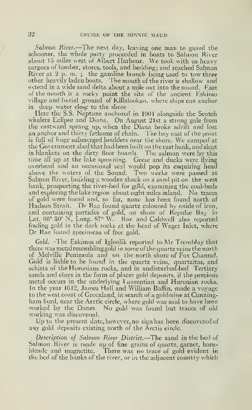
32 CRUISE OF THE MINNIE MAUD
Salmo7i River.—The next day, leaving one man to guard theschooner, the whole party proceeded in boats to Salmon Riverabout 15 miles west of Albert Harbour. We took with us heavycargoes of lumber, stores, tools, and bedding; and reached SalmonRiver at 2 p. m. ; the gazoline launch being used to tow threeother heavily laden boats. The mouth of the river is shallow andextend in a wide sand delta about a mile out into the sound. Eastof the mouth is a rocky point the site of the ancient Eskimovillage and burial ground of Killalookan, where ships can anchorin deep water close to the shore
Here the S.S. Neptune anchored in 1904 alongside the Scotchwhalers Eclipse and Diana. On August 21st a strong gale fromthe eastward sprang up, when the Diana broke adrift and lost
an anchor and thirty fathoms of chain. The bay east of the pointis full of huge submerged boulders near the shore. We camped at
the Government shed that had been built on the east bank, and slept
in blankets on the dirty floor boards. The salmon were by this
time all up at the lake spawning. Geese and ducks were flying
overhead and an occasional seal would pop its enquiring headabove the waters of the Sound. Two weeks were passed at
Salmon River, building a wooden shack on a sand pit on the westbank, prospecting the river-bed for go'ld, examining the coal-bedsand exploring the lake region about eight miles inland. No traces
of gold were found and, so far, none has been found north of
Hudson Strait. Dr Rae found quartz coloured by oxide of iron,
and containing particles of gold, on shore of Repulse Bav in
Lat. 66° 30' N, Long. 87° W. Rae and Caldwell also reportedfinding gold in the dark rocks at the head of Wager Inlet, whereDr Rae found specimens of free gold.
Gold.—The Eskimos of Igloolik reported to Mr Tremblay thatthere was metal resemblinggold in some of the quartz veins the northof Melville Peninsula and on the north shore of Fox Channel.Gold is liable to be found in the quartz veins, quartzitas, andschists of the Huronians rocks, and in undisturbed-bed Tertiarysands and clays in the form of placer gold deposits, if the preciousmetal occurs in the underlying Laurentian and Huronian rocks.
In the year 1612, James Hall and William Baffin, made a voyageto the west coast of Greenland, in search of a goldmine at Cunning-ham fiord, near the Arctic circle, where gold was said to have beenworked by the Danes. No gold was found but traces of oldworking was discovered.
Up to the present date, however, no sign has been discovered of
any gold deposits existing north of the Arctis circle.
Description of Salmon River District.—The sand in the bed ofSalmon River is made up of fine grains of quartz, garnet, horn-blende and magnetite. There was no trace of gold evident in
the bed of the banks of the river, or in the adjacent country which

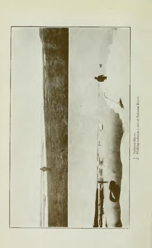
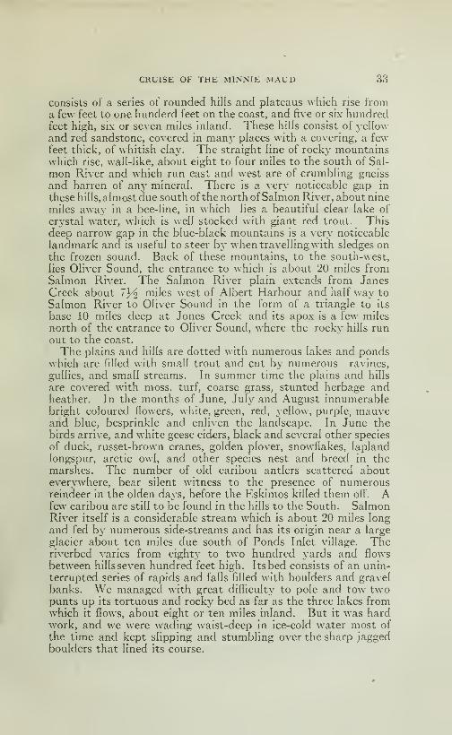
CRUISE OF THE MINNIE MAUD 33
consists of a series of rounded hills and plateaus whicii rise froma few feet to one hunderd feet on the coast, and five or six hundredfeet high, six or seven miles inland. These hills consist of yellow
and red sandstone, covered in man}' places with a covering, a fewfeet thick, of whitish clay. The straight hne of rocky mountainswhich rise, wall-hke, about eight to four miles to the south of Sal-
mon River and which run east and west are of crumbhng gneiss
and barren of any mineraL There is a very noticeable gap in
these hills, almost due south of the north ofSalmon River, about nine
miles away in a bee-line, in which lies a beautiful clear lake of
crystal water, which is well stocked with giant red trout. Thisdeep narrow gap in the blue-black mountains is a very noticeable
landmark and is useful to steer by when travelling with sledges onthe frozen sound. Back of these mountains, to the south-west,
lies Oliver Sound, the entrance to which is about 20 miles fromSalmon River. The Salmon River plain extends from JanesCreek about 1]^ miles west of Albert Harbour and half way to
Salmon River to Oliver Sound in the form of a triangle to its
base 10 miles deep at Jones Creek and its apox is a few miles
north of the entrance to Oliver Sound, where the rocky hills runout to the coast.
The plains and hills are dotted with numerous lakes and pondswhich are filled with small trout and cut by numerous ravines,
gullies, and small streams. In summer time the plains and hills
are covered with moss, turf, coarse grass, stunted herbage andheather. In the months of June, July and August innumerablebright coloured flowers, white, green, red, yellow, purple, mauveand blue, besprinkle and enliven the landscape. In June the
birds arrive, and white geese eiders, black and several other species
of duck, russet-brown cranes, golden plover, snowflakes, laplandlongspur, arctic owl, and other species nest and breed in themarshes. The number of old caribou antlers scattered abouteverywhere, bear silent witness to the presence of numerousreindeer in the olden days, before the Eskimos killed them off". Afew caribou are still to be found in the hills to the South. SalmonRiver itself is a considerable stream which is about 20 miles long
and fed by numerous side-streams and has its origin near a large
glacier about ten miles due south of Ponds Inlet village. Theriverbed varies from eighty to two hundred yards and flows
between hills seven hundred feet high. Its bed consists of an unin-
terrupted series of rapids and falls filled with boulders and gravel
banks. We managed with great difficulty to pole and tow twopunts up its tortuous and rocky bed as far as the three lakes fromwhich it flows, about eight or ten miles inland. But it was hardwork, and we were wading waist-deep in ice-cold water most of
the time and kept slipping and stumbling over the sharp jaggedboulders that lined its course.

34 CRUISE OF THE MINNIE MAUD
Tbe Sainton Lakes.—The first lake is about a mile long and is
connected with the second or middle lake by means of a shortrapid. Both the first and middle lakes are muddy. The middlelake is about three miles long with a large bay in the north-eastcorner, about two miles long into which the upper-river flowesthrough clay and sandstone hills from the glacier. The third
lake lies in the Gap to the south of the middle lake, from which it
is separated by a short shallow stream curves round a rock}' knoll.
The third lake, which is about 4 miles long and a quarter of a milewide, is enclosed by high precipitous rocky walls which tower aboveit and shut out the sunlight from its ice-covered surface. This third
lake IS the home of the red trout whose gleaming red bodies can beseen darting about in its clear, crystal depths. The middle lake
is the spawning ground and winter quarters of the salmon that,
from September to June, frequent its waters in thousands. Somegiant specimens of the red trout descend from their own lake into
the middle, Salmon Lake and interbreed with the salmons as wecaught with a seine over a hundred of these half-breed salmon thathavered bellies covered with silver and yellow spots, denotingtheir semi-trout parentage. In a clear shallow creek, betweenthese two lakes we saw a dozen of these giant trout and scores
of beautiful salmon lazily swimming, preparatory to spawningon the nearby gravel bed. There is a flat gravel spit near this
creek, clear of brush and boulers, that would form an ideal camp-ing and fishing ground from which to cast a fly at these beautiful
game fish. We fall lamented the fact we had brought no rods
and flies or fishing tackle and often speculated on the sport wecould have had in hooking and playing one of these 15 lbs crimsontrout or silver salmon. We caught in the net seven of these
beautiful trout which weighted fully 12 to 15 pounds a-piece.
The Arctic Salmon.—The Salmon descend to the sea in the
middle of June, when the lakes begin to unfreeze and the rivers
to run. The spring salmon run from lake to sea from June 15th
to July 5th; when they gorged themselves on shrimps, tonningcod and small fish resembling whiting that swarm at the river
mouth and at the mouths of all the small creeks that flow into
the sound. The salmon cruise leisurely along the shore of the
sound at a rate of 2li miles an hour during July and August whenthey become very fat. During the month of August, from the
fifth to the 25th, they ascend the river to spawn. By the first of
September they are all up in the lake. By the end of Septemberthe lakes and rivers are frozen until the following June. W hat the
fish live on in the muddy and frozen waters of the lake, during
their long incarceration is a mystery, unlcssthey become half frozen
into a somnolent state and only revive when the waters begin to
run in the spring. The fish seem to descend and ascend the river
in greatest numbers when the moon is full. The spring salmon were
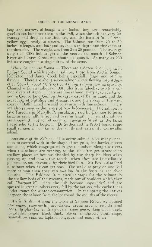
CRUISE OF THE MINNIE MAUD 35
long and narrow, although when boiled they were remarkablygood to eat but drier than in the Fall, when the fish are very fat
chunky and deep at the shoulder, and the females full of ripe,
yellow eggs, ready to spawn. The Salmon ran from 20 to 30inches in length, and four and six inches in depth and thickness at
the shoulder. The weight was from 3 to 20 pounds. The averageweight of 3000 fish caught in the nets at the mouth of SalmonRiver and Janes Creek was about six pounds. As many as 250fish were caught in a single draw of the seine.
Where Salmon are Found.— There are a dozen river flowing in
Eclipse Sound which contain salmon, those from Arctic Sound,Koluktoo, and Janes Creek being especially large and of fine
flavour. There are about seven salmon rivers flowing into Admi-ralty Sound; about 20 rivers containing salmon flowing into FoxChannel within a radious of 100 miles from Igloolik; two fine sal-
mon rivers at Aggo. There are fine salmon rivers at Clyde Riverand in Cumberland Gulf on the east coast of Baffin Land, and thegreat lake of Natiiling and Amagjuak and the rivers on the westcoast of BaflTin Land are said to swarm with fine salmon. Thereare also salmon in the rivers of North-Somerset. The salmon in
lake Taseonia in Melville Peninsula, are said by Eskimos to be as
large as seal, fully 4 feet and over in length. The arctic salmonare apparently not found north of Lancaster Strait as the lakes
freeze solid to the bottom. Dr Sutherland in 1850-1 found somesmall salmon in a lake in the south-east extremity Cornwallisisland.
Ennemies of the Salmon.—The arctic salmon have many enne-mies to contend with in the shape of sea-gulls, fish-hawks, divers
and loons, which congregated in great numbers along the rivers
when the salmon are running, as the fish often get stranded in
shallow places or become disabled by the sharp boulders whenpassing up and down the rapids, \\hen they are immediatelypounced on and devoured by their bird foes. Mr Fox is also fondof salmon when he can get one. The seal also prey on and kill
more salmon than they can swallow in the bays at the river
mouths. The Eskimos from circular traps for the salmon in
the shallow beds of the streams, made out of boulders which.theycall "Sarpootik". Here the fish become impounded and are
speared in great numbers every fall by the natives, who cache themunder stones for winter consomption. In the spring the natives
harpoon the salmon from the ice round the mouths of the rivers.
Arctic Birds.—Among the birds at Salmon River, we noticedptarmigan, snow-owls, snowflakes, arctic ravens, red-throatedloons, fish-hawks, golden-plovers, snow-geese, king-eider duck,long-tailed jaeger, black duck, plover, sandpiper, pipit, snipe,
russet-brown cranes, lapland longspur, and manv others4
36 CRUISE OF THE MINNIE xMAUD
Golden Plover.—The golden plover conies all the ways from theArgentine Repubhc by way of Venezuala, the Caribbean Sea,
Bermuda and Labrador to nest and breed in the Arctic zone.
Those beautiful httle songbirds, the Lapland Longspur, immedia-tely on their arrival begin to construct a nest of dried grasses
generally placed on the side of a tussock and much exposed.
The female bird gathers the material for the nest and then com-mences to lay and incubate the eggs, while her little male com-panion hovers on high, pouring forth his joyous trill in the
balmy sunshine. These little birds have a bobolink fashion of
soaring up in the air, and then descending in circles on outstretched
wings, volplaning to earth and piping out a long trill of melodiousthroat notes, which is very inspiring after the death-like stillness
ofthe frozen atmosphere during the long, dark silent winter months.
Arctic Tern.—At Button Point millions of arctic tern arrive in
early June and darken the sky as with a dense pall of smoke.The}' leave in August when the sun begins to droop behind theBylot peaks. Mr Wells W. Cooke of the U. S. Biological Survey,writing in the National Geographic Magazine, in April 1911,
writes of the Arctic tern: The world's navigation champion is
the Arctic Terns. It deserves its title of Arctic, for it nests as far
north as land has been discovered; that is as far north as the bird
can find anything stable on which to construct its nest. Indeedso Arctic are the conditions, under which it breeds that the first
nest found by man in this region, only 7}4 degree from the pole,
contained a dowing chick surrounded by a wall of newly fallen
snow that had been scooped out of the nest by the parent. Whenthe young are full grown the entire family leaves the Arctic, andseveral months later they are found skirting the edge of the An-tarctic Continent. What their track is over 11,000 miles of inter-
vening space no one knows. The Arctic terns arrive in the far-
north about June 15th and leave about August 25th, thus stayingfourteen weeks at the nesting site. The^^ probably spen a fewweeks longer in the winter than in the summer time; and if so,
this leaves them scarcely 20 weeks for the round trip of 22,000miles: not less than 150 miles in a straight line must be their daily
task and this is undoubtedly multiplied several times by their
zig-zag twisting and turning in pursuit of food.
The Arctic terns have more hours of daylight and sunlight than.•any other animal on the globe. At their most northernly nesting
site, the midnight sun has already appeared before their arrival
and it never sets during their entire stay at their breading groundsin the Arctic Circle, where they repair in millions everj^ year.
During two months of their sojourn in the Antarctic they do notsee a sunset (November 15th to January 15th) and for the rest
of the time the sun dips only a little way below the horizon, andbroad daylight continues all night. The birds have therefore,
CRUISE OF THE MINNIE MAUD 37
twenty-four hours of daylight for at least eight months in theyear, and during the other four months have considerably moredayhght than darkness.
The Arctic Tern arrive at Button Point, Bylot Island, in Mayand June. They come in dense clouds, flying so closely packedtogether that they blacken the sky and on calm days the noise of
their wings makes a deafening noise. Their rate of flight approx-imates a mile a minute. They make straight for the high rockledges in the cnff"s, about 500 feet above the sea. Every morningabout 2 a. m. they fly in a sohd cloud away over the ice-flœs near
the land to the open water, ten or fifteen miles away, in search of
food. They return in the same dense formation every evening at
6. p. m. We saw one bunch of these Terns flying in a westerly
direction along the south shore of Bylot Island, that extended in
a solid black impenetrable cloud over a mile in lenght, some 20 feet
thick and several hundred yards wide. They were flying at a rate
of over 60 miles an hour and only about 50 feet above the surface
of the ice-covered sound. It would be a nice little mathematicalstudy, taking the dimensions of the average tern, to calculate how-
many there were in this single flock. The Eskimos are very fondof their eggs.
Antarctic Penguin.—While on the subject of Arctic birds, wemight venture the suggestion that it would pay the CanadianGovernment to introduce the Giant Penguin of the Antarctic,
where they are found in millions on tlie edges of the ice-fringe, in
the waters of the Arctic Islands and Hudson Bay where they wouldthrive mightily upon the abundant marine life and would be of
inestimable value to the Eskimo as an additional article of food,
fuel and bedding. Their eggs and flesh providing the food; their
oil, fuel; and the feathers, bedding. One of the Antarctic Expe-ditions could be commissioned to bring a consignment. Themanner of feeding and keeping them alive when crossing thetropics would be the principle problem, but this no doubt could besolved by proper study and precaution.
Arctic Hares.—The Arctic hares frequent the deep ravines androcky hillsides. Their weight, when dressed is at least eight poundand often exceeds that weight; their meat has an excellent flavour.
The fur is beautifully white and sold although the tips of the ears
are black and the hair is so long and loose that it flutters in thewind. They climb cliffs at a wonderful rate often ascending per-
pendicular cliffs and hillsides, several hundred feet high, with thegreatest ease. The female brings forth her young ones, usually
four in number, about the end of June.
Non-Migratory Birds.—The only birds that do not migrate
38 CRUISF OF THE MINNIE MAUD
from the Arctic in the winter time are the snowy-owls, the
Ptarmigan and the Arctic Raven.
Snowy Owl.—The Snowy Owl is found in most of the Arctic
Islands, where the lemming and ptarmigan are numerous, whichis their principal prey. Their nests are placed on small dunes,
or earth mounds and are merely a slight hollow in the soil,
no material being employed in its construction. The young snowyowl is covered with down of a dirty colour which as the bird beco-
mes older, gradually turns to a dark drab. When the nest of this
bird was disturbed, the male showed fight, while his mate from her
distant perch on a rock gave vent to plantif mews. The malewould circle over-head, clattering his bill with astonishing rapidity
and giving out hoarse cries of "woo". These birds are equippedwith wonderful powers of vision which makes it difficult to get
within shooting range.
Arctic Rave7i.—-The Northern Raven is a jet black bird w^ith
3^elIow legs and bill. It lives in the high rocky cliffs and plunders
every thing within range. It robs the fox-traps, eats the dead car-
case of all animals and robs the birds of their eggs. It flies over-head
intering a hoarse mournful croak, going its round every morningwith clock-like regularity. Although very suspicious, we caught
several of these ravens in the fox-traps.
Insects and Mosquitoes.—The insects found at Salmon River
included flies, beetles spiders, daddy long legs, bumble-bees,
butterflies, caterpillars and mosquitoes. The mosquitoes were
black with grey stripes and appeared in clouds on calm, sultry days
between the middle of July and the middle of August; at this time
mosquito veils and netting would have been very acceptable.
Mushrooms.—We also found some delicious mushrooms growingin a sheltered ravine; Some of which measured four inches across.
Coal.—The Salmon River coal consists of old lignite. Thebeds run from a few inches to many feet in thickness andare overlaid by beds of sandstone and surface clay. This Coal is
in a verv good quality and in a great abundance. The best out-
crop occurred about four miles from the river mouth on the west
bank, from which we picked out about ten tons to burn during
the winter; packing the bags unto dogs sleds and sledding it downthe frozen river bed. It was very cold and disagreable workstripping and mining this coal from an exposed hillside, with a strong
west breeze blowing and the thermometer between 30° and 40°
below zero. We often froze our hands, noses and cheeks in the
process.
CRUISE OF THE MINNIE MAUD 39
Arctic Coal Deposits.—There are also beds of lignite at CanadaPoint, on the west shore of Bylot Island. Lignite was also found
at Cape Hay, Bylot Island. Parry and Liddon discovered coal
on the shores of Liddon Gulf on Melville Island. Peat and coal
were found near Phipps' Point, 12 miles west of Winter Harbour.
Coal was found by chief Officer Green of the "Arctic" in a ravine
on the east side of Rood Head, north shore of Banks Land, where
a large seam was visible with loose coal scattered over the beach.
Coal was reported by McCIure in the middle of the west shore of
Mercy Bay, Banks Land. Between Winter Harbour and Fife
Harbour, Melville Island, coal was found all along the beach, but
none was seen in place. The "Arctic" found pieces of bituminous
shale on the shore of Chevallier Bay, Melville Island. South of
Sargent Point on the east coast of Bathurst Island, a good deal of
coal was found by Commander Richards when searching for
Franklin, of the ordinary nature and of close jetty nature like
English sea-coal. The ground in which this coal was found wasbetween 200 to 300 feet high, consisting of limestone overlying
sandstone, between or among which was coal and a calcarous
deposit resembling plaster of paris.
In the depressions between the mountains abutting on EurekaSound on the west coast ofEllesmere Land are in many places,
rich deposits of quartz-sand with imbedded strata of lignite.
Lignite and masses of slaty coal were also found in Sverdrup in
Beaumann fiord. Stenkul (Stone coal) Fiord, and Blaamandenin the west coast of Ellesmere Land,
Bituminous coal was found near Cape Murchison, Lake Hazen,and Lincoln Baj', and Lady Franklin Bay on the east coast of
Ellesmere Land, 82nd parallel. Nares reports:—
"This deposit
of coal is exposed in a ravine for a distance of 300 yards. At its
greatest exposure the thickness of the seam is 25 feet but we hadno means of telling how much it descended below the level of the
stream. The coal was tried by our engineers and pronounced equal
to the best Welsh coal. "Above the coal are beds of shale andsandstone.—Lieut. Lockwood reporting on this coal to Lieut.
Greely, writes: "The coal is soft and lies in two deposits which are
probably connected and form one seam. The coal lies in thin
strata".
Small pieces of coal were also found by McCIintock on the
South shore of Byam Martin Island; and also on the shores of the
most southerly arm of De la Beche Bay and on the shore north-
west of Scoreby Point, Bathurst Island.
Professor Haughton remarks: "The coal found in the Arctic
Islands, excepting that of Tertiary Age at Disko Island, Greenland,
40 CRUISE OF THE MINNIE MAUD
presents evenwhere the same character. It is of a brownishcolour and hngnaceous texture, in fine layers of brown coal andjet black, glossy coal interstratified in delicate bands not thicker
than paper. It has a woody ring under the hammer, recalhng the
peculiar chnk of the valuable gas coal of Scotland, It burns witha dense smoke and brillant flame and would make an excellent gascoal; and, in fact, resembles in many respects the celebrated
Torbane Hill mineraL"
Peat at Salmon River.—There is a quantity of good peat in theSalmon River district.
Copper m the Arctic.—It rained during most of the two weekswe spent at Salmon River and the sound was full moving of ice-
pans and young ice. We made one attempt to visit Milne Inlet,
with the gazohne launch, in order to visit a spot on the east shoreof that sound a httle south-east of the entrance to Koluktoo Bay,where native copper was said to exist, but the cedar launch wastoo frail and her gazohne engine too bulky to push her way throughthe fields of young ice and pans that blocked the sound abouteight miles west of Salmon River.
Samples of the copper from this spot were vsubmitted on the
return of the "Arctic" expedition in 1907 to the GovernmentMineralogist, Mr Robt A. A. Johnstone, who pronounced themto consist of grains of native copper associated v.ith pale apple-
green subtranshicent prehnite. We had samples of copper-pyrites
and bornite brought to us by the natives from the east coast of
Bylot Island and from Canada Point or Navy Board Inlet.
—
Captain Adams of the whaler Diana, reported having picked upsamples of copper rocks on the beach at Clyde River. Greencarbonate of copper stains the firm white sandstone chffs four
miles west of the depot at Cape Providence, Melville Island.
Copper drift has been found along the shores of Prince of Walesstrait, and on Melville Island. In regard to this drift. Professor
Haughton writes: "Near Princess Royal Island, in Prince of WalesStrait, and also on the coast of Prince of \\ ales Island, the coppersaid to be picked up in large masses by the Eskimos may be sup-
posed to be derived from the Cambrian rocks of the CoppermineRiver region to the south, as it is not probable that it occurs in
place any where in the region of horizontal hmestone where it is
found". Native copper is said to existe in Large quantities in the
vicinity of the Coppermine River, which flows into CoronationGulf and in the small island of the Gulf. Copper might probablybe found in the Huronian rocks which border the shores of SmithSound. No signs of any large copper deposits have, as yet, been
CRUISE OF THE MINNIE MAUD 41
,found in tlie Arctic Islands. Among the specimen brought homeHall from Frobisher and Cyrus Field Bays, in the south-east partof the Baffin Island, were bornite, and pyrite showing that copperores also occur in that portion of the Island.
Return to Albert Harbour.-—On September 12th the small pools
and the margins of the river and lakes began to freeze and on the14th we re-embarked in the boats to return to the schooner in
Albert Harbour. Trouble was experienced in poling the boatsthrough the ice which blocked the mouth of the river and we ma-naged by hard work to push our way through the ice-pans whichcovered the surface of the sound until within a mile of the entranceto the harbour, where solid pans blocked further progress. Theafternoon was spent in poling the boats and towing them with ropesalong the ice-pans, and we often had to use the axe to cut passagesbetween the floes. Our progress was slow and wind from the westbitterly cold. We spent the night huddled together in the openboats shivering from the keen wind and were glad to haul theboats on to the heavy pans at 3 a. m. the next morning we whereleft them. Taking the flat bottomed punt, which was fitted withsteel shod runners, we made our way over the pans to the shoreand then rowed across thro open water to the schooner. Caronwho had remained by the schooner told us that a few days before,
some heavy ice had drifted down upon the ship and threatened to
put her ashore. Luckily the anchors hold and by liberal use of
poles the danger was averted. We remained on the schooner until
September 23d, as the pans which blocked the eastern entranceprevented boat communication with the village. The time wasspent in prospecting the hills round the harbour^ which consisted of
barren gneiss, diorite and garnetiferous hornblende schist, contain-ing no mineral except some small patches of black mica. Wehad occasional shots at seals and narwhal that were swimmingabout the harbour, but did not succeed in capturing any. Theweather was very variable, at times clear and at others snowingheavily. Young ice kept forming on the harbour, which keptfilling and emptying with small pans and loose ice with each changeof tide. We saw little of the sun which was dipping lower everyday and the high hills surrounding the harbour hid it from view.The view from the schooner's deck was gloomy in the extreme andon shore there was no comfort as the perpendicular hills cumberedwith enormous boulders made walking a difficult and dangerousscramble.
Landing Stores Jar the winter.—On the September 23d the windafter blowing steadily for eight days from the west suddenlj- chan-ged to tlie south-east and developed into a gale which soon claeredthe harbour of ice and removed the ice-jam at the western en-trance, allowing us once more free passage to the village in the
42 CRUISE OF THE MINNIE MAUD
boats of which we quickly took advantage with the gazohnelaunch and towing the two whaleboats, which leaked freely andrequired constant bahng, we ran before the gale to the village
heavily laden with stores for the winter use. on shore. Findingthe small cove in front of the village jammed with ice we hastily
unloaded our unwieldy cargo of gazohne and kerosine casks,
heavy barrels of pork, beef and flour, stoves, bags of salt, coal
and lumber on to the shppery and unstable ice-pans which werestained and discoloured with the blood and bkibber of a slaughterednarwhah Helped by the agile and wilhng Eskimos we stumbledand struggled with the heavy loads over the rough ice to the sho-
res and hauled the two heavy whaleboats high up on the land,
out of danger from ice-pressure, the Eskimo women turning outin force and lending a hand with the tow-ropes. We were sur-
rounded by a hundred savage Eskimo dogs that growled andfought all around us over the remnants of the dead narwhah It
was a wild and wintry day with a cold south-east gale blowingand the snow drifted in all directions. Fearing to be storm-bound we hurriedly started back in the launch for the harbour.We had a hard fight against wind and sea which several timesnearly dashed us on the rocky coast as the engine kept balkingand the oars were powerless to keep the boat from drifting, until
the engine would start off again. Had we hit the steep shore, not aman would have survived, as the rocks which descend abruptlyinto the sea, afford no foothold and with the strong tide running,
numbed as we were by cold wind and spray, we should have soonsuccumbed to exposure and exhaustion. After a couple of hourshard struggle we managed to reach the schooner, wet through,cold and with our fingers so numbed that we could hardly holdthe oars. A warm dinner in the foc'sle soon restored us and,as usual, our troubles were forgotton as soon as they were over.
The gale continued all night with drifting snow, the noise of thewaves and the grinding and thumping of the difting ice against
the ships sides keeping us awake with the incessant noise. Ahuge mass of old Arctic ice, over 20 feet thick, blew down uponus in the evening and at one time threatened to drive the schooneranchors and all, bodily upon the rocks that lay close astern. Werealised that night wha": danger beset an Arctic anchorage andthat a ship, even in the most sheltered spot, is ever at the mercyof wind, tides and drifting ice.
The next day the storm abated and the weather was calmand clear. We spent the following days until October 2d, in
trarfsporting cargo in the launch and ship's boat to the village.
The weather was very variable, sometimes calm and clear andthen changing to heavy cold south-east gales accompanied withsnow that would nearly swamp the boats. One day the harbourand sound would be free and the next, loose ice-pans would beall around us blown in bv the east winds. The moment the wind
CRUISE OF THE MINNIE MAUD
dropped, young black ice would form on the surface of the waterthrough which it was hard work to push the boats. The only daythat we saw Eclipse Sound entirely free from ice was on September27th, which was a fine calm day, with a light west wind accompa-nied by light flakes of snow. The Eskimos during these dayswere busy hunting seal in the open waters in boats and ka\-aks
m anticipation of the approach of winter, and some of them cameon board every day for a meal of soup, biscuit and tea. The}- some-times brought us a seal some Arctic hares or a duck, and fitted
us out with sealskin mits boots and caps. On October 2d, wewere kept awake all night by the thumping and grinding of avagrant iceberg against the stern of the ship The next day theship was frozen in with young ice and some of the men were fei ried
in the punt across the harbour and made their way on foot to thevillage by the ravine which runs back of Morin's Mountain wherethey remained for a week building sleds and fitting them withsteel runners, to be traded to the Eskimos. On October 4th thetroublesome berg at the stern of the ship was floated by the tide
and we gladey speeded it on its way by the aid of long poles. Theyoung ice drifted out of the harbour at the same time. As ourwater supply that we had brought in casks from Quebec hadgiven out and the streams on the east shore of the harbour wasfrozen we levied toll on the ice-berg astern of us before it tookits departure and the deck was soon littered with huge fragmentsof fresh water-ice, which we had hacked off the surface of theberg with axes. From this time on we iiad to depend for ourwater supply on ice and snow melted in pots and kettles overthe stove, until the first week of June in the following year, aperiod of eight months water for washing purposes was almostunobtainable, and an occasional bath at long intervals was aluxury. Alost of the party suffered tortures from lice whichappeared in the foc'sle in some mysterious fashion and the Eski-mos' igloos and toopiks were infested with these loathsome para-sites, especially in the warm summer months.
Young ice Jorinmg.—On October the 5th and 6th young ice beganto form again round the ship and in two days the whole surface ofthe harbour was covered with a flat coating of new ice, three inchesthick. We sawed a channel through this ice, ahead of theschooner, and hauled her 60 feet further away from the shore soas to prevent her hull from being strained from the up and downmovement of the tides and the présure of the ice near the shore.
On October 9th the ice was 5 inches thick all over the harbour,except near some open-water seal holes or "swatches" near theeastern entrance. The weather became intensely cold. TheEskimos now paid us regular visits, walking over the ice from thevillage, in order to get free meals, tobacco and presents of biscuits
for their children.
44 CRUISE OF THE MINNIE MAUD
Laying Jo.x-traps.—On the 14th we began to lay fox-traps all
round the harbour and by the 21st had caught seventeen foxes,
one hare and one weaseL We were much annoyed at night bythe hordes of famished Eskimos dogs that came from the village
and hovered and howled round the ship hke so many wolves, fromwhich thej^ are evidentl}^ descendant. These dogs would campout on the bare ice, exposed to the biting blasts of the windsthat constantly blow through Albert Harbour, their bitter inten-
sity being increased by the narrow funnel-shaped formation of
the high hills on either side. The dogs would continually keepgetting caught in the fox-traps, when walking after the bait, andwe were often obhged to crawl out of our warm bunks, at mid-night, and cross the ice in the bitter wind in order to free someunfortunate canine that had got caught by the paw and wasmaking night hideous with its anguished howls. The Eskimoslost some sixty dogs in the winter in this manner.
Fox-trapping.—Fox trapping is a favorite and profitable amu-sement and means of exercise in the Arctic, especially during thelong dark and otherwise profitless months of November, Decemberand January. It gives the men something to do and a walk seve-
ral miles along the traps is necessary to the health of mind andbody, although, at first, until one gets broken into the game, it
is bitter by cold work handling, the frozen steel traps with barehands as one can not set the spring without first removing the
fingerless and clumsy mitts. The trap used by the Eskimo is
usually a single-spring steel one, of which the natives have usually
two or three. We took with us and employed over 500 Victor
No 2 double spring steel traps with a chain attached for anchor-
ing the traps to a boulder or to heavy boulders of ice. We laid
the traps in sets of three, placed round the bait, and all securely
anchored by chain and string. The usual bait was seal-meat
and the foxes seemed to be unusually attached to a seal head. Ablack rock is a good mark near a trap as it immediately arrests
the attention of the fox, which always mounts on high rocks,
hills or ice-bergs from which to survey the scene and to gain a
better view of possible food in the shape of ptarmigan, hares,
lemming and stray pieces of dead seal or walrus that have beenleft by the bears or the Eskimos on the ice. The white and the
blue Arctic fox are the only kind found in the north, and are
much more easily caught than are their southern red and yellow
brothers. Probably the intense cold, hunger and difficulty of finding
enough game in the Arctic makes them bolder and more reckless.
Even when they have lost a frozen paw through being caught in
a trap, it is no uncommon thing for them to return to the bait andget caught again. A three-legged fox has not much chance of catch-
ing a spiritely hare; and he must take what the gods give him,
trap or no trap, or surely perish of hunger. The Eskimos anchor
CRUISE OF THE MINNIE MAUD 45
their single traps to a hole cut in a peace of ice with a knife, or,
where traps are not available, they construct a long narrow boxmade of stone or slabs of ice, with the bait in the back part, andattached to a dead fall, so that when it is disturbed, the doorfalls upon the fox. The most effective manner in which to trap the
Arctic fox is to construct a small house of stone or ice slabs, andwith the bait put, well back inside, to lay a single steel trap at the
entrance, lightly covered with snow, over which the fox must step
to reach the bait. But the trap must be securely tied to the ice
or the fox will drag it for miles and escape. We have know themto bite through the string and to drag three traps over the roughice and snow for miles and escape. The principal food for the
Arctic fox is the Lemming (a small fur-covered rat) of which the
fox refuses only to eat the stomach which they leave in the snow,and which like so many miniature tomb-stones, mark the scene of
,a tragedy and a fox repast. They vary their diet by eating ptarmi-
gan and Arctic hare, which they stalk from behind rocks andsnow covered boulders. The deep, snow-banked valleys are
the places to reconnoitre, and, during the winter, it is amusingto study the tale-telling trails which these cute animals make in
the snow. The tracks, which their neat little foot pads makein the snow, form a regular lace-work pattern as the fox crosses
and recrosses its trail in pursuit of the lemming. The Arctic
fox is a beautifully made little animal, the perfection of symme-try, strength and agility combined. Generally throughout thefall and winter the Arctic fox is quite lean, but as the month of
March approaches and the sun gets high, they become very fat,
living on lemmings and ptarmigan, hares and young seal whichthey dig out of their snowhouses on the sounds. Their fat is
very oily, and lies between the vellum and the hide, but by theend of April it has condensed itself into a form of suet. The fur
is at its best during the months of January and February but goodpelts are often secured as late as April. This is most likel}'
caused b}^ the winter coat of the young fox developing itself later
in the season than that of the older animal, for the winter fur of
the matured fox is superior in quality to that of the young.Throughout the winter the edges of the ears and tips of the tail
remain darker in colour than the rest of the coat. When aboutto lose its winter coat, the fur of the Arctic fox becomes wooleyand yellowish on the under parts, and the back and tail turnbluish. The brown fur of the summer coat first appears on theface and legs of the animal, and the whitish fur of the back andsides is removed by the fox itself, which it does by rubbing itself
against boulders, to which the fur ma}^ often be seen clinging.
The young when born are of the same colour as the adults are in
summer, but the fur is finer in colour and texture. The motherfox shows the greatest affection towards her young, which, when

46 CRUISE OF THE MINNIE MAUD
born, have soft and tender eyes, altho expressing at the sametime the cunning that is only possessed by that animal.
We were surprised that nearly all the foxes trapped were malesvery few females being caught. On August 5th 1909 a large
Arctic fox was seen swimming from pan to pan in Winter Har-bour, in order to secure a meal from the garbage heap on a panabout 300 3^ards out. The value of the white fox skin is about$30.00 to $45.00 and the skin of the blue fox is worth three
times that price.
Leave the ship.—On October 21st after loading our baggageand stores on a number of sleds which the Eskimos had broughtfrom the village, we left the schooner, and walking and runningalongside the heavily laden sleds over the frozen waters of Eclipse
Sound, reached Salmon River in the afternoon. The day wasfine, clear and invigorating and we all enjoyed the walk and ourescape from the stuffy quarters on the schooner in the bleak andwind-swept harbour.
At Salmon River.—We camped in the small shack at SalmonRiver and our quarters were very cramped. Nine men and a
dozen Eskimos had to crowd into a small room only 8x12 feet
square which contained in addition, 3 bunks, a stove, pots andpans and a small table in one corner, not to mention all our clothes
and baggage. Cooking was carried on 2 small gazoline stoves, andthe meals were served in relays of three men at a time on the small
table. Half of the partj^ slept in the small altic overhead. Thefirst few days were spent in preparing the expeditions that weresoon to set out for Arctic Bay and Milne Inlet, and in mining coal
4 miles up the riverbed.
Expeditions Start.—On October 23rd with a cold north windblowing accompanied by thick fog, Messrs Tremblay and Wilsonwith two heavily laden sleds and the Eskimos, Tom Lasso andCoonoo and the latter's wife and infant, started for Arctic Bay,where they expected to remain until the following spring. Onthe same morning, Messrs Chassé and Wm Le Bel, with twoheavily laden sled and accompanied by the native, Ooming set
out for Koluktoo, in Milne Inlet.
Occupatio7is.—Mr Reader a few days later accompanied bythe native Tonga, examined a copper deposit reported to exist
in a nighboring sound, but found no trace of the mineral. On No-vember 8th Messrs Reader and John Le Bel crossed the sound andspent six weeks on Bylot Island, living in snow huts with someEskimos and trapping foxes ef which they caught 40 and saw the
CRUISE OF THE MINNIE MAUD 4<
only Polar bear seen by the party. It was a two year old malethat passed within a 100 yards along the edge of the sound.Having left their rifles at the snow-hut, they were unable to
secure the bear, so they scared it way by shouting and the animaldesapeared behind some ice in the fog. Mr Caron trappedfoxes at Salmon Lake for a few weeks and then spent the rest
of the winter at Button Point where most of the Eskimos werecongregated, as it is a good place to catch seal nearthe edge of the
open water. Messrs Capt. Bernier and Lawson remain at the Sal-
mon River shack and at Ponds Inlet; where the former carried ontrade with the Eskimos, exchanging tobacco, cartridges, (Mau-ser, Martini Henry, 303 Winchester and 44 \^'inchester) needles,
snowknives, pocket knives, rifles, sleds etc. for foxskins, bear-
skins, walrus and narwhal ivory, seal oil, sealskins and sealboots.
Christmas and the Dark Days.—The whole party, with the ex-
ception of Messrs Tremblay and ^^ ilson, who remained at ArcticBay, re-assembled at the desolate village of Ponds Inlet for Xmasand New Year, where several hundred Eskimos were also assem-bled. After the New-Year the party separated for Koluktoo, But-ton Point and Salmon River. Our Christmas was not a lively one,
as the weather was extremely cold, foggy and dark. Our bunksin the house were lined with several inches of solid ice and thefloors and ceilling were dripping wet from the continual condensa-tion, of moisture. We did not see the sun for three months and noone, who has not spent à winter in the Arctic during the longmonths of semi-obscurity, dirt, discomfort and desolation andmonotonous period of enforcing inactivity incramped quarterswith the thermometer constantly ranging between 30° and 55°
below zero can appreciate the feelings of intense longing thatcomes over one to see once more the pale golden orb rising overthe southern horizon andthekeensenceof relief and joy that oneexperience when the cheering rays of the sun enter once more into
a fight of supremacy with that gloomy tyrant of the North, KingFrost. Another feature of the north is the intense stillness andsilence everywhere in winter, as if even the very atmosphere veryfrozen. Sound travels to an immense distance and one can hearthe Eskimos shouting to their dogs seven miles away on the soundoften long before they come into sight.
The Artie Moon.—The main consolation, in winter time for ten
days in each month is the unusual brilliance ofthe moon, whichstays above the horizon, when full, twenty hours out of thetwenty-four and floods the snowy landscape and gleaming hills
with a soft luminous radiance that almost equals daylight in its
intensity. \\'hen the moon is full the tides become extremely highand the sea disrupts the ice along the shores in steep sloping
ridges and flood the snow and ice-covered beaches to the very
48 CRUISE OF THE MINNIE MAUD
foot of the hills. In these days and nights of high moon theEskimos travel and visit their traps.
Salmon fishing.—In the months of June, July and August, sal-
mon fishing was carried on at Salmon River and at Janes Creekby means of seines, and over 3000 fine fish were caught and salted
in barrels.
Janes Creek.—Janes Creek is about 4 miles west of Ponds Inlet
village, and runs back south, through deep canyons and gorges to
the foot of the southern range, eight miles away. Its mouth swarmswith fine salmon during the month of Jul}'; and at the mouth are
the remains of an old Eskimo encampment. It dévides into twostreams a mile or two above the mouth, where there is a smallisland formed in the bed of the river. Janes Creek brings down a
great volume of water for a few weeks in the spring; and as wenever explored its channel, we could not say whether the salmonascended its shallow stream to a lake or whether they only fre-
quented its mouth where there is a fine gravel and sand bottom,for feeding purposes.
Springtime at Salmon River.—No more healthy or delightful
spot on earth could be found than Salmon River in the months of
May, June, July and August, when the sun is shinning night andday overhead and the air is filled with the sound of rushing streams,
the hum of insects and bumble-bees and the song of birds. Theground is carpetted with soft springy turf and moss, delightful
to walk upon, and sprinkled with bright Arctic flov.ers of every huethe air is deliciously clear and invigorating with a cool tang in it
that makes walking and exercise a pleasure. The river is full of
salmon ; the lakes abound in trout, duck, pluver and geese andthe waters of the sound are alive with seal, big seal (oogjook)
and narwhal. Across the Sound the high snow-clad peaks of BylotIsland show in dazzling splendour against the clearest of azure
skies. With an air-ship to land one in 24 hours from Quebec at
the end of May and to take one back at the end of August,Salmon River and many other favoured spots in the Arctic zonewould soon become a Sportman's Paradise and a health resort
of the first order. At the present time, the journey by sea is too
long and too dangerous to over become popular and ships canonly arrive in the middle of August, which is too late in the year
for sport and pleasure as there is too much ice in the sounds, for
boating; and sled travel is impossible until the middle of October.
But all things seem now possibleof human achievement so far as
science and mechanical inventions are concerned, and it does
not require a Jules Verne to predict that in a few years, regular
lines of airships will be patrolling the Arctic Regions and convey-ing sportmen, health seekers and tourists to the land of the
Eskimo and the midnight sun; the hunt of the musk-ox and

CRUISE OF THE MINNIE MAUD 49
polar bear. When this happens, as it probably will, in the not far
distant future, it will be necessary for the Governement to reserve
great areas of favorite nesting and grazing grounds for the birds
and Arctic animals, or they will spedily disappear. Aviation andwireless telegraphy are evidently destined to open up the wasteplaces of the earth, inckiding the regions that border on the
north and south poles.
On August 22d, we all left Salmon River, and after a hard dayspent in hauling the boats through the ice-floes which emcumberedthe Sound, camped for the night at Ponds Inlet. The next day it
was snowing heavily and we had much trouble in pulling and haul-
ing the heavily laden boats to within a mile of the schooner,
where we were forced to leave them amongst the ice and to proceedon foot over the pans and rocks to the schooner, which lay spick
and span in a new coat of paint, ready for the return voyage.Her rudder had been injured by her long incarceration in the ice
and the vessel leaked a good deal from the strain to which she hadbeen subjected by the action of the tides, as she had been mooredtoo close to the shore. On August 2-4th, the wind blew the pansaway from the harbour entrance and we paid our last visit to thevillage, preparatory to sailing for Home the next dav. The Es-kimos looked very sorrowful as the time for parting approachedand some of them wept, they gave us all parting presents of seal
caps, mitts and clothing, which their women had made.All members of the expedition were pleased at the prospect of
returning once more to civilisation and cleanliness, as the discom-forts and dirt of the past year had become almost intolerable. Weregretted however parting with our Eskimo friends as they haddone ever\'thing in their power, in the most willing and friendly
wa}', to help us to carry out the objets of our visit to their far-off
and desolate shores.

CHAPTER III
MR. TREMBLAY S TRIP FROM PONDS INLET TO ARTIC BAY
Our route.—I left Salmon River at 8 a. m., on October 25th (1912)in company with Mr. Wilson and the Eskimos : Tom Lasso, Coonoo,Coonoo's wife and infant. Our destination was Arctic Bay, in Ad-miralty Sound, where we were to spend the winter and the following
spring hunting, trapping foxes, and prospecting the country roundStrathcona and Adam's Sounds for mineral. Our route lay across
EcHpse Sound to Bylot Island, round the western side of Bylot Is-
land, up Navy Board Inlet, along Lancaster Sound and down Ad-miralty Sound to Arctic Bay, a distance altogether of about 250miles.
Equipment.—We started with two sleds, drawn by 22 dogs, anheavily laden with half-inch tongued and grooved lumber, thathad already been cut into proper lengths for the 6x6 foot unlined
shack that was to be our winter home; and also with barrels con-
taining fox-traps, biscuits, pork, gazoline, flour and other provi-
sions, that we calculated, before starting, would last us for eight
months, but which were all consumed before Christmas, as ourjourney took us twice as long to accompHsh as we had estimated,
and instead of three we had to feed six Eskimos for a month andwere obliged to engage two more sleds at Toolooria to help us
with our loads. For arms, I had my 280 H. V. Ross, a 303 Win-chester and a Colt 45 automatic Revolver; Wilson had a 303 Win-chester and Coonoo a long barrel mihtary Mauser. At Arctic Bay,I gave my Winchester to Coonoo in payment for his services
during the winter and thereafter depended upon my 280 Rossand Colt 45 automatic, which I found to be the best arms for
exploration in the Arctic.
The Start.—We left the shack at Salmon River about an hourafter Wilham LeBel and Chassé had started for Koluktoo in MilneInlet, accompanied by the native Ooming, and two heavily ladensleds on a journey of about 100 miles. We were anxious to reachour trapping ground as early as possible in November, before thedays become too dark for travel, and expected to make the trip in
twelve days, but the bad condition ofthe ice at the head of Admir-5
52 CRUISE OF THE MINNIE MAUD
alty Sound, delayed us and we did not arrive at Arctic Bay until
November 19th, taking 26 days to make the journey.
We crossed Echpse Sound, travelHng in a north-westerly direc-
tion, towards Bjlot Island, but, beforewe had proceeded half a mile,
the fog descended and became so dense that our only guide wasthe hght south-westerly breeze that blew in our faces. The fog con-
tinued all the day but the sleds travelled well on the newly formedslat-water ice of the sound, which was about ten inches thick andco^'ered with snow. Here and there the ice had rafted where the
pans had been overlapped by the wind, and had formed rough rid-
ges of sharp broken ice which made the going more difficult. Atone of these ridges, one of the dogs' traces was cut by the ice, andthe dog returned to Salmon River. We travelled all day and madea ziz-zag route of about 30 miles in the fog, not knowing exactly
where we were going. In the evening, the moon showed up for a few
hours through the fog, and by its light we made out the hills of By-lot Island and landed a few miles west of the large glacier lying op-
posite to Salmon River. Here we built a snow igloo and passed a
comfortable night, after a good supper of pork and beans which I
cooked on the gazoline stove.
Bylot Island.—Next morning (October 26th) was fine and clear
and the sun shined out for a few hours Making an early start wetraveled westward along the south shore of Bylot Island. Thegoing was good and the dogs pulled their heavy loads at a smartpace, making about S}/2 miles an hour. One of the sleds, being war-
ped and the runners being rusty, did not run well and we felt the
loss of the dog that had escaped the day before. We made about25 miles and camped that night on the S. W. point of Bylot Island.
The formation here, from what little we could see of it, was a light-
coloured gray sandstone, cut by ravines running generally north
and south, with a gravel beach along the shore. During the daywe saw the tracks of a 2-year old polar bear that had come downNavy Board inlet and was making for Button Point. The Eskimoscan tell by the size and formation of a bear's foot-print in the snowits age and sex.
Toolooria.—On October 27th, we crossed Navy Board Inlet in
a north-westerly direction and reached, at about ten o'clock at
night, a small native setlement called Toolooria situated in a small
bay on its western shore. The day was fine and the ice was smooth
but thin and caused us some anxiety for the safety of the heavy
loads as we neared the shore. Here we found three Eskimos, living
with their wives and families in separate igloos. Toolooria is a good
hunting ground for seal, walrus and narwhal and the hills contain
caribou, hares, foxes, and ptarmigan. There is also a small salmon
river south of the village. The natives were named : Angia-tuktua,
Okai and Inuiya. The former's wife was a pretty little red-cheeked,
brown eyed woman, whose father was an officer on one of the Scotch
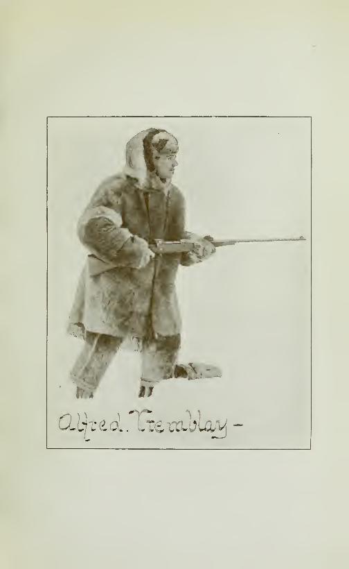
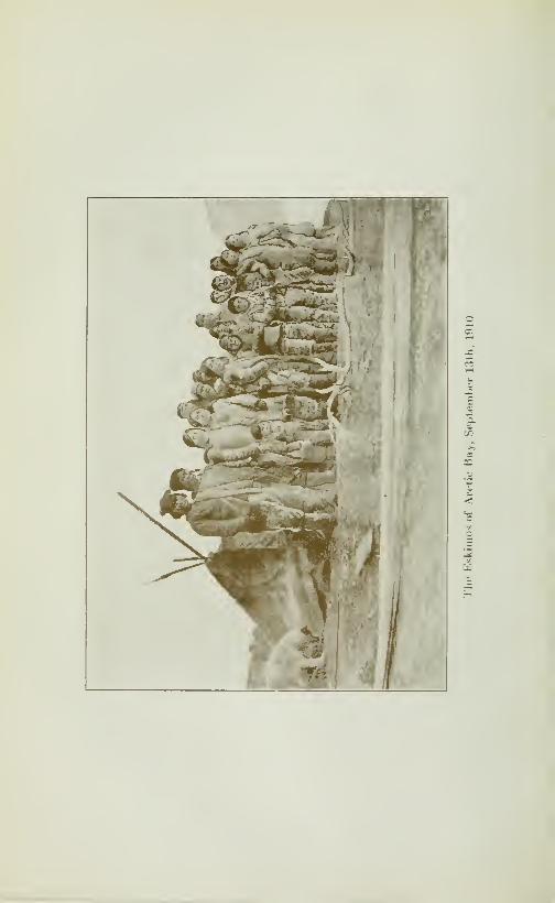

CRUISE OF THE MINNIE MAUD 53
whalers. She had four children: a fine handsome boy of sixteen andthree little girls who formed a pretty picture in their fur hoods andclothing. These little girls were born in Cumberland Gulf, andwere said to be the children of another Scotch Captain, which wouldmade them three-quarters Scotch and only one quarter Eskimo.They all had the features and healthy complexions of beautiful
white children and had very nice manners. Angiatuktooa was a
splendid specimen of an Eskimo, who spoke EngHsh and had lived
for some j'ears with the whalers. He was a great hunter and tra-
veller, having travelled all round and across Baffin Land and also
on Melville Peninsula and the islands of North Somerset and NorthDevon.We camped that night in an old snow igloo that had been built
and used by Coonoo, when coming from Arctic Bay, a couple of
weeks before.We gave the natives small presents of biscuit and to-
bacco which they were greatly in need of. At Toolooria the gravel
shore slopes at an angle of 45" into flat-topped hills which are about200 feet high and composed of granite gneiss.
Low Point.—We left Toolooria on October 28th, early in the
morning and travelled northward along the west shore of NavyBoard Inlet, for about ten miles when, the ice becoming rough andcrumpled, we camped at Low Point. Here we lost another dogwhich slipped his harness and disappeared. We left the sleds on the
ice, as the tide had piled the ice into ridges along the shore. Theformation was the same as at Toolooria consisting of granite gneiss
hills.
A handsome Eskimo.—Next morning, October 29th, just as wewere on the point of starting at 9 a.m., a native named Ee-ching-ia
came up with his sled and dogs from the village of Kilutea, whi-
ther we were bound. He was on his way to Toolooria. As he stoodbefore us with the sun shining on his bronzed, ruddy face ; withhis sparkling brown eyes and long raven looks, arms folded, fur
hood thrown back with a smile that showed his strong white teeth,
we agreed that we had never seen a finer specimen of manhood. Hereminded us, with his long locks, picturesque costume, enertformand smiling insouciant face, of one of the Chevaliers of France in
the olden days rather than a humble Eskimo, who live in a snowhut and depended on his skill with harpoon and rifle to eke outa poor existence in the frozen north. Ee-ching-ia, we learned,wasborn in Ai-villik and undoubtedly had a strong strain of Americanor European blood in his veins. When we explained our need of
dogs, Ee-ching-ia immediately gave us three from his team as wehad lost another dog that morning. Saying goodbye to Ee-ching-ia,
we proceeded on our w^ay and shortly after met two more youngEskimos, one of whom was a son of Koonoo and the other a son of
Kilutea, the headman of the village whither we were bound. Theseyoung men were on their way to pick up a barrel of fox-traps

54 CRUISE OF THE MINNIE MAUD
and a barrel of flour that they had brought from Ponds Inlet for
our use, and which they had been compelled to leave behind, as the
ice was then too thin to bear the heavy loads. We had comeaccross these barrels on the ice and had added them to an already
overladen sled. We transfered some of our loads to their sleds,
and then proceeded to Kilutea's village, where we arrived about7 p. m. The travelling was good and the day fine, but we weredelayed at one point by Koonoo's old sled breaking down owingto the pounding of the heavy lumber on the rough ice.
Kiluteas.—When we reached the village, which is about 20
miles north of Low Point, Kilutea, a tall, elderly, powerfully
built Eskimo, with a black beard, came out to welcome us, and,
with all his men, helped us to unload the sleds and build a snowigloo. He gave us a warm greeting and made us a present of someseal liver for which we gave him some biscuits and tobacco of
which they were all badly in need. At Kilutea's I counted ten
men, ten women and about a dozen children, who were all living
comfortably in snow igloos, pitched about 200 feet from the shore,
on the northern side of a wide, shallow bay opposite to CanadaPoint, on Bylot Island. Kilutea's village is a favorite stopping
place for the Eskimos when travelling between Ponds Inlet andAdmiralty Sound, as seal, walrus and narwhal are plentiful there,
and in the neighboring hills are herds of caribou and Arctic fox,
hares and ptarmigan. The Eskimos stop there generally for
several days to hunt seal with which to feed themselves andtheir dogs until they reach Elwin Bay and Baillargé Bay, onAdmiralty Sound. The hills that surround the bay rise abruptly
some 500 feet to a flat-topped plateau composed of granit-gneiss.
On the west side of the bay are five small glaciers, each about300 yards wide. Opposite Kilutea's on the other side of NavyBoard Inlet, is Canada Point on Bylot Island, where extensive
beds of lignite coal occur in the hills a few miles back from the
shore. South of Canada Point are two small glaciers and a
small river, which is said by the natives to have its origin in
a mineral spring which does not freeze in the winter time. Just
north of Canada Point is a small bay that would provide ananchorage and where I camped later in June 1913. Navy BoardInlet is at this point about eight miles wide.
Kilutea showed us samples of bornite (cooper pyrites) whichwas evidently taken from pockets in the rock near Canada Point,
but as we were anxious to push on we did not delay to do anyprospecting for the mineral.
We spent October 30th at Kilutea's and left the next morning at
9 a. m., our party being increased by two sleds which we engagedto accompany us, as our own sleds were too small to carry
everything in addition to the lumber for the shack. One sled laden
with narwhal meat which we had bought for our dog, was driven
CRUISE OF THE MINNIE MAUD OO
by Enoo-ara, a brother of Coonoo's and the other by Oloo-riana,
brother of the handsome Ee-ching-ia.
Naiy Board Inlet.—Soon after leaving Kilutea's the gravelly
hills on our left changed to a light and dark red sandstone,
bedded in horizontal layers and dipping slightly to the south.
These were surmounted by round gravelly hills which rose about
200 feet above shore-level. This formation continues for about
ten miles when it changes into high limestone cliffs. On the
opposite shore of Bylot Island, in the neighborhood of CanadaPoint, the land is much broken and consists of high declivitous
hills cut by numerous ravines and backed to the eastward bythe high snow-capped peaks of the Byam Martin ranges, someof which rise -4000 feet in height. North of Canada Point, the
country along the west shore of the Bylot Island, becomes lower
and runs flat out to the north-west point, which abutts on Lan-
caster Sound, and forms the north-east entrance to Navy BoardInlet.
We covered about 15 miles over good ice, which was rough
and rafted in places, and saw the fresh tracks of three Polar Bears
in the snow. The tracks were those of a large male with foot-
prints, 15 inches long; female and her cub. We also saw several
arctic foxes, one of which Oolooliana caught with his bare
hands ih a hole in the limestone rock.
We camped that night in a small cove in the limestone cliffs
which rose sixty or seventy feet above us.
Adam s Island.—On November 1st, leaving camp about 8 a.
m., we travelled over good ice for six hours when we began to
meet the rough and rafted ice of Lancaster Sound. Here Wilsonand Enoo-ara followed the track of a large male bear, as far
as half a mile east of Adam's Island, which lies about two miles
from the north-west entrance of Navy Board Inlet. They did
not see the bear which was travelling towards the open wateralong the Bylot Shore, so they turned back. Enoo-ara said
that he would go after the bear the next day before returning
to Kilutea's, They halted on a small linestone point, waitedfor me to come up with the sleds, as I had stayed behind to take
on some dog meat from a cache further back. They also sawtwo foxes, when out on the ice after the bear, and Enoo-ara tooktwo foxes from traps which he had previously set on the shore.
We could see the steam rising from the open water in Lan-caster Sound, about three miles out from the shore, but couldnot see the cliffs of North Devon Island, 50 miles away to the northas the fog was too thick.
We proceeded a few miles further and camped in a small bayon the limestone coast in front of Adam's Island.
Enoo-ara's death.—On November 2nd, we did not start untill 11

56 CRUISE OF THE MINNIE MAUD
a, m., as we lost some time in an unsuccessful effort to catch a
dog which had escaped from its harness and followed Enoo-ara,
who had gone after the large Polar bear, previous to returning
to Kilutea's village. This was the last we saw of poor Enoo-ara,
as we learnt afterwards at Arctic Baj-, that he had died the dayafter he reached his home at Kilutea's as a result of eating too
much frozen seal meat after his prolonged fast when on the bear
hunt. Coonoo, his brother, when he heard the, news at Arctic
Bay, was terribly upset and would tramp by himself up and downoutside in the snow, and would climb the hills calling the Enoo-ara's spirit. We also felt Enoo-ara's death keenly, as he was a
first rate hunter and a most agreeable companion. Enco-arawas about 35 vears of age and left a voung widow and a small
child.
Lan aster Sound.—We had sent a letter by Enoo-ara to bedelivered at Ponds Inlet, in which we reported finding open waterat Lancaster Sound and asked that more provisions be sent onafter us, as soon as possible, as we feared thatwemightbedetainedon the route. Owing to Enoo-ara's untimely death this letter
was never delivered. We travelled westward along the shore of
Lancaster Sound over ummocky and rafted ice which was about
8 inches thick. The open water was about 3 miles distant on
our right. Towards the end of the day's march we came uponan intrusion of dark red sandstone that extended along the shore
for a couple of miles. That night we camped in a small valley,
between the low limestone hills, which were about 20 to 30 feet
high near the shore. A small creek entered the shore at this
point, but was, of course, frozen solid. We obtained our drink-
ing water from the fresh water bergs which were scattered along
the shore. The weather was fine and we had had but little windsince leaving Kilutea's, the air was filled and obscured by the
light mist that kept rising from the open water on Lancaster
Sound.On November 3rd, we travelled well as the icewas not too rough.
The shore consisted of light-coloured limestone which varied
from 5 to 40 feet in height, rising in places to 150 feet. At someplaces holes and small caves had been hollowed out of the rock
by the action of the water. We reached some gravel hills about
4 p. m. and camped in a deep gully where we had trouble in find-
ing snow deep enough to make an igloo. One of our lost dogs
returned.
November 4th, we started at 8 o'clock in the morning andwhen crossing a wide shallow bay that was surrounded by round
gravel hills, encountered very rough ice and a bitterly cold south-
west wind, that nearly froze our hands and faces. About 3.30 p. m.we came to a long, low gravel point. Here there was a narrow
portage, about 100 feet long, from the gravel shore to the east

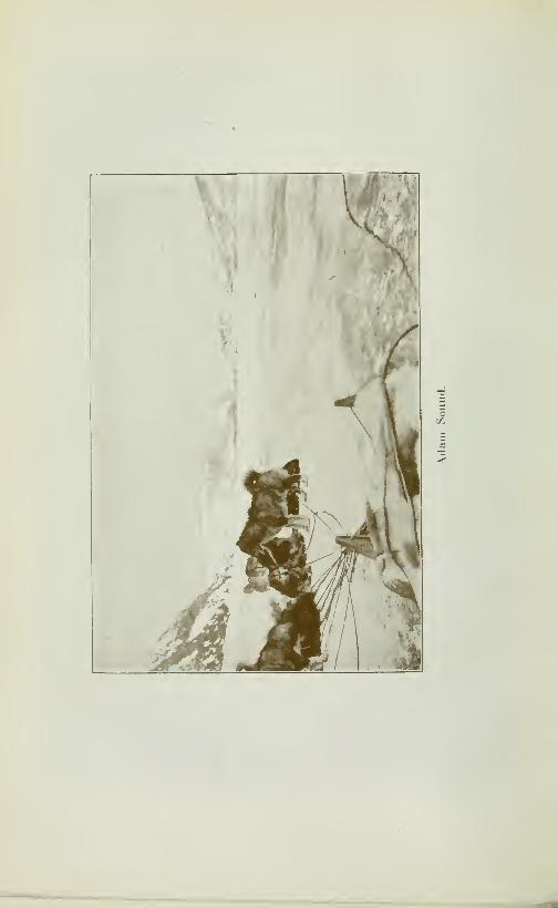
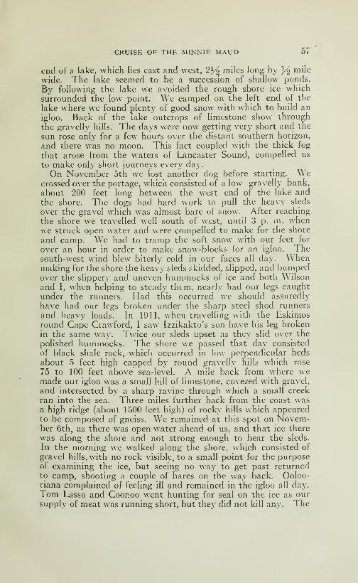
CRUISE OF THE MINNIE MAUD 57
end of a lake, which lies east and west, 2}^ miles long by Yi mile
wide. The lake seemed to be a succession of shallow ponds.
By following the lake we avoided the rough shore ice whichsurrounded the low point. We camped on the left end of the
lake where we found plenty of good snow with which to build an
igloo. Back of the lake outcrops of limestone show through
the gravelly hills. The days were now getting very short and the
sun rose only for a few hours over the distant southern horizon,
and there was no moon. This fact coupled with the thick fog
that arose from the waters of Lancaster Sound, compelled us
to make only short journeys every day.
On November 5th we lost another dog before starting. Wecrossed over the portage, which consisted of a low gravelly bank,
about 200 feet long between the west end of the lake andthe shore. The dogs had hard work to pull the heavy sleds
over the gravel which was almost bare of snow. After reaching
the shore we travelled well south of west, until 3 p. m. whenwe struck open water and were compelled to make for the shore
and camp. We had to tramp the soft snow with our feet for
over an hour in order to make snow-blocks for an igloo. Thesouth-west wind blew biterly cold in our faces all day. Whenmaking for the shore the heavy sleds skidded, slipped, and bumpedover the slippery and uneven hummocks of ice and both Wilson
and I, when helping to steady them, nearly had our legs caught
under the runners. Had this occurred we should assuredly
have had our legs broken under the sharp steel shod runners
and heavy loads. In 1911, when travelling with the Eskimosround Cape Crawford, I saw Izzikakto's son have his leg brokenin the same way. Twice our sleds upset as they slid over the
polished hummocks. The shore we passed that day consisted
of black shale rock, which occurred in low perpendicular beds
about 5 feet high capped by round gravelly hills which rose
75 to 100 feet above sea-level. A mile back from where wemade our igloo was a small hill of limestone, covered with gravel,
and intersected by a sharp ravine through which a small creek
ran into the sea. Three miles further back from the coast wasa high ridge (about 1500 feet high) of rocky hills which appearedto be composed of gneiss. We remained at this spot on Novem-ber 6th, as there was open water ahead of us, and that ice there
was along the shore and not strong enough to bear the sleds.
In the morning we walked along the shore, which consisted ot
gravel hills, with no rock visible, to a small point for the purposeof examining the ice, but seeing no way to get past returnedto camp, shooting a couple of hares on the way back. Ooloo-riana complained of feeling ill and remained in the igloo all day.Tom Lasso and Coonoo went hunting for seal on the ice as oursupply of meat was running short, but the}' did not kill any. The

58 CRUISE OF THE MINNIE MAUD
weather was fine with little wind. The night was very cold andthe ice was making fast on the shore.
Thin ice.—On November 7th, we took two light loads over the
young ice, which was only 2}/^ inches thick and covered withsnow, to the point that we had visited the day before. Wewished to test the ice and in order to lighten the loads took themby detachments. It was easy travelhng over the smooth ice,
which was very weak in spots and a man had to walk ahead to test
it with a harpoon. The wind from the southwest was bitterly
cold and so strong that we had to weigh down the stores that
we left at the point with lumber and stones. In our absence,
Oolooriana had built a new igloo, as the one w^e had built withrotten snow had fallen in on us during the night and smotheredall our things with wet snow.We suffered a good deal when building our snow igloos every
night at the end of a long march, especially when having to spendan hour or two tramphng the soft snow till it could be madeinto blocks which continually broke and filled our clothes withcold wet snow, while the cold wind chilled us through in the
process.
The following day (November 8th) leaving camp about 9
o'clock in the morning we travelled another six miles to the
southwest. The wind was cold from the same quarter and the
pans of thin ice kept sinking under water with the weight of the
sleds. The dogs, getting frightened would stop, and we wereoften obhged to jump into the water and with a Hberal use of
the long whips, force them on before the sleds had time to sink
with the thin pans. Finding some good snow in a small ravine
with a huge granite boulder marking its position on the shore,
we built an igloo and spent the night. A dog which had left us
the third day before, returned to camp. The country all aroundconsisted of low gravel hills.
Dangerous work.—On November 10th, starting early, we tra-
velled over a number of small moving ice-pans that were driven
before the wind from Lancaster Sound. Large cracks in the
ice kept opening and closing all around us. We had to keep the
frightened dogs continually moving under the whip from onesinking pan to another or we should assuredly have lost our loads
through the thin ice Our position the whole day was one of dis-
comfort and danger as a very strong cold wind was blowing
and we were continually walking in the water or jumping fromone pan to another Darkness was coming on and we did not
know whether we should be able to reach the shore or whetherat any moment sleds, dogs and men would sink through the
fragile and crumpHng pans into the icy waters of the sound.
At 2 p. m., we came on a huge crack on the ice floes, about 300yards wide, near the Entrance of Elwin Inlet, that ran out into
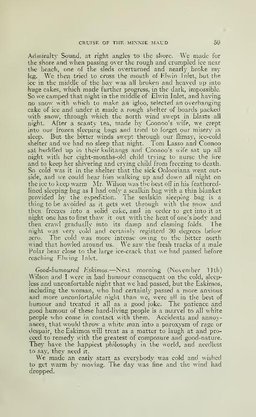
CRUISE OF THE MINNIE MAUD 59
Admiralty Sound, at right angles to the shore. We made for
the shore and when passing over the rough and crumpled ice near
the beach, one of the sleds overturned and nearly broke myleg. We then tried to cross the mouth of Ehvin Inlet, but the
ice in the middle of the bay was all broken and heaved up into
huge cakes, which made further progress, in the dark, impossible.
So we camped that night in the middle of Elwin Inlet, and havingno snow with which to make an igloo, selected an overhangingcake of ice and under it made a rough shelter of boards packedwith snow, through which the north wind swept in blasts all
night. After a scanty tea, made by Coonoo's wife, we crept
into our frozen sleeping bags and tried to forget our misery in
sleep. But the bitter winds swept through our flimsy, ice-cold
shelter and we had no sleep that night. Tom Lasso and Coonoosat huddled up in their kulitangs and Coonoo's wife sat up all
night with her eight-months-old child trying to nurse the fire
and to keep her shivering and crying child from freezing to death.
So cold was it in the shelter that the sick Oolooriana went out-
side, and we could hear him walking up and down all night onthe ice to keep warm Mr. Wilson was the best off in his feathered-
lined sleeping bag as I had only a sealkin bag with a thin blanketprovided by the expedition. The sealskin sleeping bag is a
thing to be avoided as it gets wet through with the snow andthen freezes into a solid cake, and in order to get into it at
night one has to first thaw it out with the heat of one's body andthen crawl gradually into its damp and claming folds. Thenight was very cold and certainly registerd 30 degrees belowzero. The cold was more intense owing to the bitter northwind that howled around us. We saw the fresh tracks of a malePolar bear close to the large ice-crack that we had passed before
reaching F.Kving Inlet.
Good-humoured Eskimos.—Next morning (November 11th)
Wilson and I were in bad humour consequent on the cold, sleep-
less and unconfortable night that we had passed, but the Eskimos,including the woman, who had certainly passed a more anxiousand more unconfortable night than we, were all in the best of
humour and treated it all as a good joke. The patience andgood humour of these hard-living people is a marvel to all whitepeople who come in contact with them. Accidents and annoy-ances, that would throw a white man into a paroxysm of rage or
despair, the Eskimos will treat as a matter to laugh at and pro-
ceed to remedy with the greatest of composure and good-nature.They have the happiest philosophy in the world, and needless
to say, the}' need it.
We made an early start as everybody was cold and wishedto get warm by moving. The day was fine and the wind haddropped.
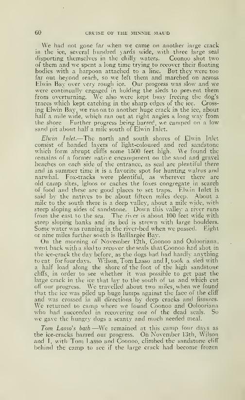
60 CRUISE OF THE MINNIE MAUD
We had not gone far when we came on another large crackin the ice, several hundred yards wide, with three large seal
disporting themselves in the chilly waters. Coonoo shot twoof them and we spent a long time trying to recover their floating
bodies with a harpoon attached to a line. But they were too
far out beyond reach, so we left them and marched on across
Elwin Bay over very rough ice. Our progress was slow and wewere continually engaged in holding the sleds to prevent themfrom overturning. We also were kept busy freeing the dog's
traces which kept catching in the sTiarp edges of the ice. Cross-
ing Elwin Bay, we ran on to another huge crack in the ice, abouthalf a mile wide, which ran out at right angles a long way fromthe shore Further progress being barred, we camped on a lowsand pit about half a mile south of Elwin Inlet.
Elwin Inlet.—The north and south shores of Elwin Inlet
consist of banded layers of light-coloured and red sandstonewhich form abrupt cliffs some 1500 feet high. We found the
remains of a former native encampment on the sand and gravel
beaches on each side of the entrance, as seal are plentiful there
and in summer time it is a favorite spot for hunting walrus andnarwhal. Fox-tracks were plentiful, as wherever there are
old camp sites, igloos or caches the foxes congregate in search
of food and these are good places to set traps. Elwin Inlet is
said by the natives to be about fifteen miles deep. About a
mile to the south there is a deep valley, about a mile \\ ide, withsteep sloping sides of sandstone. Down this valley a river runs
from the east to the sea. The river is about 100 feet wide with
steep sloping banks and its bed is strewn with large boulders.
Some water was running in the river-bed when we passed. Eight
or nine miles further south is Baillargée Bay.On the morning of November 12th, Coonoo and Oolooriana,
went back with a sled to recover the seals that Coonoo had shot in
the ice-crack the day before, as the dogs had had hardly anythingto eat for four days. Wilson, Tom Lasso and I, took a sled with
a half load along the shore of the foot of the high sandstonecliffs, in order to see whether it was possible to get past the
large crack in the ice that lay to the south of us and which cut
off our progress. We travelled about two miles, when we foundthat the ice was piled up huge lumps against the face of the cliff
and was crossed in all directions by deep cracks and fissures.
We returned to camp where we found Coonoo and Ooloorianawho had succeeded in recovering one of the dead seals. Sowe gave the hungry dogs a scanty and much needed meal.
Tom Lasso's bath —We remained at this camp four days as
the ice-cracks barred our progress. On November 13th, Wilsonand I, with Tom Lasso and Coonoo, climbed the sandstone cliff
behind the camp to see if the large crack had become frozen
CRUISE OF THE MINNIE MAUD 61
over but it was still open. Tom and Coonoo then went after
seal. They shot one, and Tom returned to the camp for the
shove'- with which to cut off a lump of ice to serve as a raft, on
which he preposed to float out to the dead seal and affixing a
harpoon and line, to draw it ashore. Tom cut a large piece of
ice from the edge of the crack and, boarding it and using the
shovel as a paddle, reached half way to the floating body of the
dead seal, when the ice-raft, which was too thin to stand the
strain broke into pieces under his weight, and he fell, deerskin-
clothes and all, into the water. Fortunately he had the harpoon
in his hand, to which a line was attached with Coonoo at the
other end, as Tom could not swim and would otherwise certainly
have been drowned. Coonoo pulled him out. Tom tried to
save the shovel by putting it between his legs, but it slipped and
sunk. Tom then ran back to the camp, two miles away, andarrived there almost frozen, with his teeth chattering and shiver-
ing in every limb. We stripped off his soaking clothes and gave
him some dry clothing and he soon recovered his accustomed
gaiety. Wilson went out after some hares and brought back a
fox which he had shot.
The next day Tom, Coonoo and Mr. Wilson walked along the
shore to see whether there was any possibility of crossing the
crack, but finding it still open, returned to camp. Wilson then
walked to the entrance of Elwin Inlet to look at the formation
and found it consisted of sandstone which in places ran into
shale, but there was no sign of mineral.
Tremblay Mouiitain.-—On the 15th, Wilson and I went after
hares and each taking a side of the river, ascended the valley-
two miles from its mouth. I climbed up a flat-topped mountain,
that rose 1500 feet on the south side of the valley, in order to
get a good view of the sound to the south. I had a terribly hard
and dangerous climb, having to cling on to the steep face of the
hill to prevent my being carried down hundreds of feet by snowslides. At times, I nearly slipped backwards, but retreat wasimpossible and the only hope of salvation was to go on climbing
until the top was reached. As I neared the top darkness cameon and Wilson returned to camp. On reaching the top I fired
four shots at a hare in the dusk and left the empty shells, with
my name and the date on a piece of paper, under a small cairn
of stones as a record. I named this hill Tremblay Mountain.I was fortunate in finding a long steep ravine on the other side of
the mountain, as I could never have returned by the way I came.
As it was I had a hard time and many bad falls in slidding gravel
and snow before I reached the valley. I reached the camp, se-
veral hours after Mr. Wilson, with my clothes all covered with
gravel and snow from frequent falls in the dark. The Eskimosnever expected to see me again alive when they learnt where
62 CRUISE OF THE MINNIE MAUD
I had been. Although we saw some hare and ptarmigan In the valley,
we shot none, as the light was too bad.
Tom, Coonoo and Olooriana had spent the day repairing
the sleighs in order to be ready to leave in the morning as the
large crack showed sign of closing. The weather was fine withhardly any wind.On November 16th, we loaded up the sleds and leaving camp
about 9 a. m. we started to try and cross the big crack whichhad shown sign the day before of freezing over. Coonoo went aheadwith his harpoon to test the strength and thickness of the ice
and we managed to get across, although the newly formed ice
was very thin and weak in places and the harpoon pierced it
easily.
A dangerous place.—We had no sooner crossed this crack whena north wind sprang up and it began to open again, cutting off
all possibility of a retreat, and we advanced over the smoothpans for about five miles when another large crack, 500 feet
wide, opened in front of us and ran from the foot of the high
cliffs out into the sound. Our position was now a most unplea-
sant and dangerous one. In front and behind us were impas-
sable cracks, on our left, huge beachless cliffs, which offered nofoothold or shelter and on our right, three miles away were the
open water of the sound. The ice-pans, which were only 8 in-
ches thick, we^re being driven before the wind, crushed together
and blown apart with increasing violence as the wind grew into
a gale. We saw several seals in the ice-cracks, but had no time
to spare for hunting them. Leaving the sleds on the pans, wefirst made for the shore hoping to find a passage, but the steep
cliffs that were fringed with crumpled ice-pans offered no hope in
that direction. Returning to the sleds we noticed that the crack
was closing in slowly about two miles out from the shore, wherethe strong wind was driving the pans together.
We signalled to the sleds to follow us and as the edges of the
pans came together, one pan sliding or "rafting" over the other,
we hurriedly crossed the sleds on to the overlapping pan. After
that we made good progrès? until 4 o'clock in the afternoon, whenthe ice began to get very thin and the wind increased to a gale.
It was also growing dark. The pans were cracking, grinding
and rafting all around us and if we allowed the sleds to remain
too long in one spot the thin ice pans would slowly bend under
their weight and commence to sink. Our position was grow-
ing more dangerous and desperate every minute, as the farther
we went the more rotten became the ice and the gale kept tearing
the pans apart and crushing them together again with terrific
noise and force; the cliffs offered no security and darkness wascreeping over everything. The noise of the crushing and grind-
ing pans heightened our sense of the danger. Pushing on we
CRUISE OF THE MINNIE MAUD 63
came to a place where the ice was so thin and rotten that the sleds
began to sink though the ice into the water, and several times
my foot went clean through the ice into the water. The dogs
all stopped and the Eskimos becoming thoroughly frightened
started to loosen the dogs from the sleds, thinking that the sleds
were doomed and must abandoned. Shouting to them, I whippedup the dogs and forced the settHng sleds into motion once moreand, taking a desperate chance, headed them over the rotten
ice for the shore, in the hope of the ice getting stronger inshore
and or being able to find a niche in the cHffs. The wind kept
increasing in violence and the noise of the grinding pans wasdeafening; it was almost completely dark and we could not see
-two yards ahead. But luck was with us, and we had not gone a
couple of hundred yards when we struck sohd ice at the mouth of
Baillargée Bay, and, striking in for the shore, at the northern
entrance of that sound, found a sloping beach at the foot of
the chffs with plenty of good snow to build an igloo. As we reached
the shore we heaved a fervent sigh of rehef and felt that we hadhad a narrow escape, and were thankful that we had escaped
not only with our hves but with our sleigh-Ioads as welL Whenhunting around an old cache looking for good snow, from whichto make blocks for the igloo, Tom found a fox in the cache
and choked it to death with his hands. We passed a good night
in the solid snow although a cold gale from the northwest
was howling outside.
Baillargée Bay.—The hills at the entrance to Baillargée Bayrise in abrupt cliffs, 1500 feet high, above the waters of the
sound and are composed of red and light-coloured sandstone.
They are flat-topped and terraced, with, here and there, squareisolated blocks, that give them the appearence of an old castle
or turretted fort. On the southern side, the cliffs are beautifully
rounded and rise plumb out of the waters of the sound, and so
evenly set are huge rectangular sandstone blocks that they appearto have been constructed by the hand some giant mason.
Baillargée Bay is somewhat narrower at the entrance thanElwinInlet, being about two miles wide. The natives, who go there
regularly to hunt, told us that it runs about 20 miles inland. Onthe north side of the entrance, we found an old cache, whichshowed it to be a good hunting ground for seal,walrus and narwhal.
On this day we saw the sun for the last time, and beyoud a
few short hours of twilight, were to see no more sunlight until
the fifth day of February.November 17th, was a fine day with a cold south wind blowing
in our faces. And as neither Wilson nor I, had any deer-skin
clothes at that time, we felt the cold keenly and our hands suf-
fered especially. We started early and crossing the mouth of
the sound made a good day's march to the south. Wilson,
64 CRUISE OF THE MINNIE MAUD
Cooaoo and I walked ahead, Tom and Oolooriana following with
the sleds. We came on some fresh sled-tracks in the afternoon,
which cheered us greatly, as it was the first indication of humanbeings that we has seen in this desolate and forbidding region.
Adniiraby Sound.—The character of the shore gradually changedas we left Baillargée Bay behind us; the sandstone gradually
changing into low gravel hills. At 4 p. m., we came upon a large
boat, about 30 feet long which was drawn up on the beach, andwhich proved on closer inspection to be an old gazoline launch,
with her engine removed, that had been abandoned by the
"Neptune" last September. She belonged, we were told, to
the wrecked "Algerine" and after being towed round here, hadbeen abandoned as an encumbrance.
Nearly on top of the low flat hill we found a pile of one inch
tongued and grooved lumber, with some 3x6 " scantlings, which
had also been left by the "Neptune" with the idea, no doubt,
of building a shack; but I suppose the prospectors, after viewing
the country, had decided against spending a year's prospecting
in this remote and desolate region.
Eskimos Sujmiier Camp.—We were new about half way be-
tween Baillargée Bay and Strathcona Sound, which are some 20
miles apart and this spot is a favorite summer camp of the Eskimosof Strathcona Sound and Arctic Bay, where they hunt seal,
w^alrus and narwhal.
We camped here on a flat beach and found some fox-traps
which had been set by the natives of Strathcona Sound. Thedogs kept constantly ioeing caught in these traps, as they were
so hungry they could not resist the pieces of meat that were placed
near the traps for bait. We kept crawling out of the igloo at
intervals during the night to release the howling dogs as they
got in the traps, and our hands were nearly frozen with hand-
ling the cold steel.
Chief Lasso.—At this spot, old Lasso, Tom's father, the white-
haired chief of the Arctic Bay natives, was buried, he had died
shortly after the visit of the "Neptune" to Strathcona Sound,
in the Fall. Old Lasso was a fine stern figure of an Eskimo, a
great walrus hunter and was greatly feared and respected bythe other Eskimos. He had killed several male-factors, it was
said, with very little compunction. One of them he found crawl-
ing one night near his igloo, and driving his harpoon throuhg the
man's body, who was a well known thief, called the other Eskimos
out of their igloos, and, pointing to the dead body, said he had
taken it for a seal in the darkness. His action was promptly
commended. Tom only learnt of his father's death when wearrived the next dav at Strathcona Sound.
CRUISE OF THE MINNIE MAUD 65
Stratbcona Sound.—-November 18th. Before starting we hada good deal of trouble with the hungry dogs which would keeprushing for the bait and getting caught in the fox-traps, and wehad hard work to get them harnessed to the sleds. We roundedStrathcona Point and by noon reached the native village, whichis pitched on a small gravelly beach about two miles from the point.
The point consists of low gravel hills, which are backed by high
sandstone mountains about 1200 feet high. Strathcona Soundis seven or eight miles wide at the entrance and runs 30 miles
to the eastward, dividing into two arms at the far end of whichthe southern branch takes a turn south and reaches the samelatitude as Arctic Bay. The village contained 5 igloos whichwere inhabited by old Lasso's widow, old Lasso's sons, Etotah andPeewiktoo, with their wives and children, Kakkio, Akwino,and Kakto, also with their wives and children, about 20 in
number. We remained about an hour talking to the natives, butdid not enter the igloos. Tom Lasso here learnt for the first
time from his mother, an old lady with much autority in the vil-
lage, of the death of his step-father, old Lasso. Tom did not
seem much affected by the news, as old Lasso who was only his
step-father had married his mother when he was a small boy.
Akwino's wife, Pakka was also a daughter of old Lasso. HereI met Peewiktoo and his quaint little wife, Tootillik, who after-
wards accompanied me in all my wanderings to Igloolik andMelville Peninsula. I had know Pewiktoo before, when I passed
the winter of 1910-11 at the Arctic Bay with the GovernmentShip "Arctic". Peewiktoo and Coonoo had accompanied Mr.Lavoie, the Government surveyor, when he made his trip across
Brodeur Peninsula, down Prince Regent Inlet to Aggo and re-
turned overland from Aggo to Scheming, and then by wayof Moffet Bay to Arctic Bay. Mr. Lavoie had his face andihands badly burnt by a gazoline stove in Moffett Bay andprobably owed his life to the devotion of Pakka, Peewiktoo'ssister and Coonoo's wife, who tended him carefully, even licking
his face in order to clean it from poisonous matter. Tootillik
when she heard that the schooner was going to spend the winterat Ponds Inlet, clapped her small hands and danced with joy, as
it meant dancing, music, biscuits, molasses, needles, ribbons andbeads for the women and cartridges, knives, rifles, and tobaccofor the men; which things constitute the principal requirementsand pleasures of the Eskimos.
Victor Bay.—Leaving the village at one o'clock, we crossedStrathcona Sound over fine smooth ice and reached the entranceof Victor Bay, about ten hours later. We noticed at the westernentrance of Victor Bay an outcoop of diabase that cropped outfrom beneath the overlying sandstone. We continued down
66 CRUISE OF THE MINNIE MAUD
Victor Bay and over good ice to the southern extremity of theba3% where we camped on a flat beach.
Victor Bay is about 4 miles deep and 3 miles wide with anentrance about 33^ miles wide. It is a fine bay but is exposedto the north winds which drive the icebergs and pans into thebay thus rendering it an unsafe anchorage. The bay is surroundedby low hills of sandstone, hmestone, sand and gravel with occa-
sional outcrops of diabase. There is a long reef running outfrom the western point of Victor Bay which is very dangerous,as it is not marked on the chart. This point should be given
a wide berth. The coast west of Victor Bay is very low.
Victor Bay is separated from Arctic Bay, which lies to thesouth, by a low saddleback of hard limestone, much broken into
sharp-edged stones and gravel, which is very troublesome to
walk over. This ridge is about two miles wide and from two to
three hundred feet high.
Reach Arctic Bay.—On November 19th we made an early
start on the last lap of our journey, and we took only half loads
as the ridge between the two bays was too steep for full loads.
The descent on the south side was so steep that we had to unhar-ness the dogs and lower the sleds down the slope with ropes. Wecrossed Arctic Bay on the ice and, hauled the sleds over a quarter
of a mile of low flat gravelly beach on the west shore of the bay to
a fresh water lake, which lies between Arctic Bay and JohnstonHarbour. This lake which I named, Arctic Lake, is about twomiles long by 3^ a mile wide. We pitched camp about 7 p. m. ona little bay in the centre of the north side of the lake. We passed
the night in an igloo, and the next day, Tom Lasso, Coonoo andI went out seal hunting as the dogs had had nothing to eat for
five days, and Wilson and Oolooriana went back for the remainderof the loads which we had left at Victor Bay. Not getting anyseal, I sent Tom that night to the village at Strathcona Soundto get some seal meat from Etotah with which to feed the dogs,
which were so weak they could hardly pull the sleds. On No-vember 21st, Tom returned with two seals and we gave the dogs
a good meal, eating some of it ourselves. We spent the day putt-
ing up the wooden shack, which was to be our winter headquar-
ters. The next day we surrounded it with snow blocks and built
two adjoining snow igloos alongside, in which we stored our
traps, fuel and provisions. We moved into the shack whichwas only six feet square and 6 feet high and which contained also
two bunks and our gaxoline stove on a box. We did all our cook-
ing, sleeping, eating and drying of clothes in this small space
and into it would crowd at the same time half a dozen Eskimosfrom Strathcona Sound, who frequentl}^ came to visit us andget an occasional meal. The shack leaked badly as the heat
of the stove condenced the frost and snow outside and the water
CRUISE OF THE MINNIE MAUD 67
would pour down on us night and day. We often felt that wewould have been better oflF in a snow igloo, confortably lined
with sealkins such as the Eskimos used.
Tom and Oolooriana left us that day to return to Ponds Inlet
after spending a few daj^s at Strathcona Sound, and we sent aletter by them requesting that more provisions be sent as soonas possible. We did not received these provisions until after
Christmas, when we had completely run out of provisions andgazoline, and were compelled to borrow some seal from Etotahor we should have starved before the fresh supply reached us.

CHAPTER IV
ARCTIC BAY AND ADMIRALTY SOUND
Fo.\-trappi7ig.—We spent the dark days of December andJanuary at Arctic Bay trapping foxes: we laid traps round the
shores of Arctic Bay and Johnston Harbour. We caught only
13 foxes in that neighborhood, as the animals had been thinnedout by the heavy trapping carried hn by the "Arctic" when she
wintered in Arctic Baj- in 1910-11, and also by the Eskimos that
live at Strathcona Sound.
Prospecting.—We made several flying trips to Adams Sound,Johnston Harbour, Victor Bay and Stratlicona Sound, but as
the weather was so dark, foggy and intensely cold; and the land
covered with snow and ice, it was difficult to do much in the
way of prospecting or to make more than a perfunctory exami-nation of the rocks in those localities.
Arctic Clothing.—During those trips we were accompanied bythe Eskimos, Peewiktoo, Koonoo and Kakkio, whilst their wivesand old Lasso's widow made us kulitangs, trousers, socks andmitts of caribou skin, of which we were greatly in need of. MrsLasso also knitted us some splendid wooleen mitts from woolthat we gave her, as she had learnt the art of knitting from the
Scotch whalers that used to visit Admiralty Sound.
Christmas.—Just before Christmas our stock of provisions
was exhausted, as also our stock of gazoline. We did not passeda very merry Christmas; our Christmas dinner consisted of a
little flour and grease that we cooked in a frying pan over a kero-
sine lamp. After that, we borrowed some seal-meat and blubberfrom Etotah, at Strathcona Sound, who, fortunately, could spareus a little. We were beginning to get very anxious when some moreprovisions arrived from Ponds Inlet on December 30th whichwere brought by Attita and Nooyeeso. The small shack leaked
badly as the snow and frost on the walls and roofs kept conden-seing from the heat of the lamp and the gazoline stove, and bedd-ing and clothing were continuously damp from the drippings
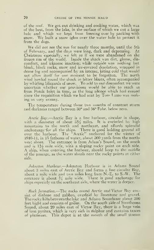
70 CRUISE OF THE MINNIE MAUD
of the roof. We got out drinking and cooking water, which wasof the best, from the lake, in the surface of which we cut a large
hole and which we kept from freezing over by packing with
snow. We built a snow igloo over the water hole to protect it
from the dogs.
We did not see the sun for nearly three months, until the 5th
of February, and the days were long, dark and depressing. AtChristmas especially, we felt as if we were abandoned on the
frozen rim of the world. Inside the shack was dirt, gloom, dis-
comfort, and irksome inaction; while outside was nothing but
bleak, black rocks, snow and ice-covered desolation, wrapped in
dense fog and accompanied by an intense, biting cold that wouldnot allow itself for one moment to be forgotton. The north
wind howled round the shack in bitter blasts, often accompaniedby whirling blizzards of snow. To add to our discomfort we wereuncertain whether our provisions would be able to reach us
from Ponds Inlet in time, as the long silence which had ensued
since the requisition which w» had sent by Tom Lasso was mak-ing us very uneasy.
The temperature during those two months of constant storm
and darkness ranged between 30° and 56° Fahr. below zero.
Arctic Bay.—Arctic Bay is a fine harbour, circular in shape,
with a diameter of about 3^ miles. It is encircled by high
mountains to the north and northeast, and affords splendid
anchorange 'for all the ships. There is good holding ground all
over the harbour. The "Arctic" anchored for the winter of
1910-11, in 15 fathoms of water, about 500 yards from the north-
west shore. The entrance is from Adam's Sound, on the south
and is IJ^ mile wide, with a sloping rocky point on each side.
A ship, when entering the harbour, should keep to the middle
of the passage, as the water shoals near the rocky points at either
side.
Johnston Harbour.—Johnston Harbour is in Adams Soundabout 3 miles east of Arctic Bay and forms a fine circular Bay,
about a mile wide and two miles long from N.-E. to S.-W. Theentrance is about ^ mile wide. There is good anchorage for
ships especialy on the southeast side, where the water is deeper.
Rock jormalion.—The rocks round Arctic and Victor Bay con-
sist of diabase and gabbro, overlaid by limestone and gravel.
The rocky hills between the lake and Adams Soundsare about 300
feet hight and consists of gneiss. On the south side of Strathcona
Sound, about 20 miles east of Victor Bay, there is a Large vein
of iron pyrites, which is very rich in sulphur and contains traces
of platinum. This depot is at the mouth of the small stream
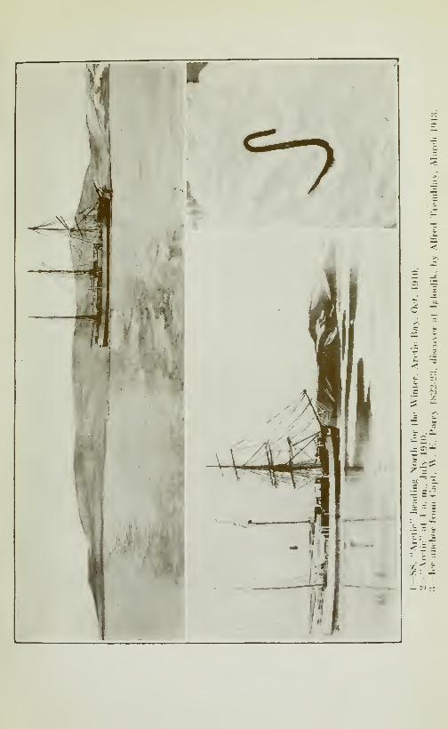
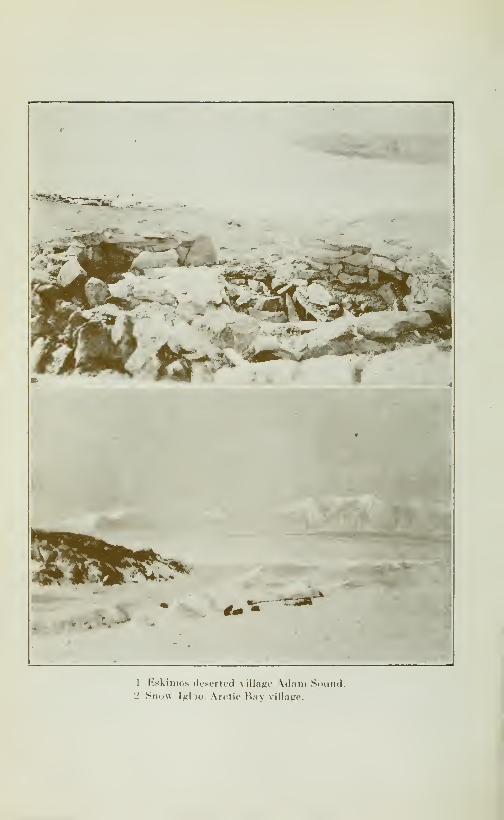
1 Eskimos deserted village Adam Sound.2 Snow \g\-)0: Arctic Bay village.
CRUISE OF THE MINNIE MAUD . 71
which runs into the south side of tl:e sound, opposite ChasséIsland and EngHsh Bay. There is good anchorage in 7 or 8
fathoms of water, near the shore opposite the outcropping of
this mineral.
Borden Peninsula.—The long peninsula that hes betweenAdmiralty Sound and Navy Board and Milne Inlets, I namedBorden Peninsula in honor of the Prime Minister of Canada.Borden Peninsula is very mountainous, with small glaciers fill-
ing its seaward valleys and is pierced by many deep fiords, abovewhich the high encircling snow-topped mountains, rise dark andforbidding. On the peninsula, many varieties of rock occur in-
cluding gneiss, granite, diabase, diorite, gabbro, sandstone,
limestone, shale (yielding shale oil) and gravel. In TremblaySound at the western head of Milne Inlet, are numerous veins
of quartz, some of which contain copper and iron pyrites. Sil-
ver was reported to have been seen in Strathcona Sound andMoffet Bay. Copper pyrites, bornite, iron sulphides, contain-
ing traces of platinurn, rock crystals, fluorspar and graphite are
also found. The northern shore of Borden Peninsula which fronts
on Lancaster Sound is very rough and broken, rising in the in-
terior to a general elevation of 2000 feet. The Eskimos travel
occasionally across Borden Peninsula, from the head of Strath-
cona Bay to Tremblay Sound and from Scheming to Koluktoo.The Ponds Inlet natives also wander up the centre of BordenPeninsula from Koluktoo and Tremblay Sound in the summertime in search of caribou and other game. The rivers containsalmon and the hills abound caribou, white fox, ptarmigan,wolves and birds. The various sounds and bays are frequentedby seal, walrus and narwhal. At Koluktoo, Toolooria, Kiluteas,
Strathcona Sound and Scheming are native camps, each contain-ing about four Eskimo families.
Admiralty Sou7id.—Admiralty Sound runs, generally, duesouth from Lancaster Sound for a distance of 200 miles to the71st parallel and has a width of 1.5 to 25 miles. The eastern shoreis indented by the following large bays or fiords: Elwin Bay,Baillargée Bay, Strathcona Sound, Adams Sound, LevasseurBay, Moffet Baj'.. Vanasse Bay and Berlinguet Bay. At thesouthern end are two large bays, south of Scheming, which I
have named South Bay and West Bay. The west side of Admi-ralty Sound, bordered by Brodeur Peninsula, consist of flat-
bedded, limestone cliffs, which rise about 1000 feet to a compa-ratively flat plateau, which descends in altitude towards thewest, along the eastern shore of Prince Regent Inlet. The westshore of Admirait}' Sound is unbroken by any large bays andsounds.
72 . CRUISE OF THE MINNIE MAUD
Eski7iio Trails.—Opposite to Moffet Bay and continuing south,
the rock formation of Brodeur Peninsula changes and there are
several mountains near the sound. The rock becomes black
and schistose and we were shown samples of copper pyrites
pyrhotite, which the Eskimos said came from there. In winter-
time the Eskimos travel with dog-sleds across the centre of Bro-
deur Peninsula, following the valleys, to Port Bowen and Mac-bean Bay, whence they cross Prince Regent's Inlet to the NorthSomerset shore for the purpose of hunting walrus and Polar bear.
They also pass from Fury Point to Cresswell Bay and crossing
North Somerset from Creswell Bay to Peel Sound, run their sleds
over some frozen lakes where the land is flat and narrow, for the
purpose of hunting musk-ox. The Eskimos also cross to Port
Leopold and thence cross Lancaster Strait to Erebus Bay in the
winter time after Polar bear.
"Arctic's" trip.—On September 6th and 7th, 1906, the "Arctic"
steamed to the end of Admiralty Sound in clear water, going
nearly as far as the narrow channel leading to Scheiming, which
they named Sassilook, and which means in Eskimo, "shallow
water". Soundings there showed 25 fathoms of water. Onthis trip names were first given to Brodeur Peninsula, Berlinguet
Bay, Vanasse Bay, Levasseur Inlet, Moffet Bay, Baillargée Bay,
and Strathcona Sound.
Erebus Bay.—Erebus Bay is at the south-west corner of
North Devon and is a fine land-locked harbour, open during
the months of August and September and formed Ijy BeecheyIsland with the mainland. The harbour is about two miles wideand about 3 or 4 miles deep, with good anchorage in 13 facthomsof water opposite the Franklin Memorial. The entrance to the
harbour is from Lanscaster Strait on the south. A permanentmemorial in honor of the Franklin Expedition was erected byCaptain McClintock, R. N., in 1858, which still stands as a
mark of the sorrow and respect of the World for the gallant
Franklin and his equally gallant companions. Erebus Bay wasthe last port in which the Franklin ships, Erebus and Terror
spent a winter before being lost in the ice near King William's
Land. In 1907 the "Arctic" raised the yatch, Mary, whichhad been left by the British Franklin Relief ship "North-Star"
in 1854 and placed it in a position to be use in case of shipwreck.
The North Star was stationed in Erebus Bay as a base andrescue-ship for the various Relief ships that were sent by the Bri-
tish Admiralty in 1854 and that radiated over Wellington Chan-nel and Barrow Strait in search of the Erebus and Terror. Thesevessels were the "Assistance" commanded by Captain Sir Ed-ward Belcher: The "Resolute" under Captain Henry Kellett;

1—Cape Riley. North Devon.2—^Rijpsed Clilfs. north ^ifle cf \(l;iiii Sc.iirnl.

CRUISE OF THE MINNIE MAUD 73
the "Pioneer" under Lieutenant Sherard Osborn; the "Intrepid"
under Captain F. L.McCIintock. All of these vessels were lost
in the ice and their crews were rescrued b}' the "North Star"
commanded by Captain Pullen at Erebus Bay, and taken back
to England without having accomphshed the object of their search
but they mapped the coast hnes of all the islands explored andbrought back much valuable scientific information of those
regions.
In 1908 the "Arctic" landed four boat-loads of provisions at
Erebus Bay and left them in a strong shelter for the use of fu-
ture expeditions.
Eskimo Tragedy.—Erebus Bay, some 35 years ago, was the
scene of an Eskimo tragedy. A large party of Natives fromPonds Inlet assembled to spend the w^inter, but, presumably,seals and others animals were scarce and the weather was unpro-
pitious, and they began to perish of starvation and disease.
As they died, their dead bodies were devoured by the starving
survivors. In their desperation they even fell to fighting andkilhng one another. Only two survivors, a man named Kamm-ing-Eya and a woman named Angestoon, lived to tell the tale,
when they were rescued by a Scottish whaler in the following
summer, and were taken to Ponds Inlet.
Erebus Bay is 250 miles from Arctic Bay, by way of CapeCrawford and Port Leopold or about the same distance that
Arctic Bay is from Ponds Inlet.
Prince Regent Inlet.—As previously remarked, the Eskimosoften cross from Arctic Bay by way of Brodeur Peninsula to
Prince Regent Inlet; the ice of which is very treacherous owingto the strong currents in that strait, which is full of open-waterholes that do not freeze over.
Port Leopold.—On the north-east corner of North SomersetIsland is Port Leopold which is open to ships during the monthsof August and September. Low gives the following descriptionof Port Leopold: "The high limestone cliffs of North Somersetwhich rise 1000 feet perpendicularly and which are composedof horizontal beds of yellow limestone with the castellated appea-rence of some gigantic fortress, fall away abruptly into a lowpoint of spingle which partly closes the mouth of the spaciousand safe harbour of Port Leopold. The light-coloured limestone,which forms the bottom of the harbour, gives the water a dan-gerous looking, light tinge, which is quite mislading, as the depthis sufficient for the largest ships. The east and west sides of theharbour are bounded by high cliffs, while at the northern end

74 CRUISE OF THE MINNIE MAUD
the land is low, and it is not far across it to the bay on the north-
east lying directly west of Cape Clarence".
On August 15th, 1904 the "Neptune" leaving Erebus Bay,steamed across Barrow Stiait to Port Leopold, where she an-chored. No ice could be seen on that date up Wellingtonchannel, in Barrow Strait or Lancaster Sound.On August 7th 1907, the "Arctic" entered Port Leopold,
altho Barrow Strait was full of ice. The bay was full of narwha-les and white wales. The ship filled her water-casks from ahttle stream that enters the bay from the west. In the eveningthe ice began to enter the harbour, in large cakes, before a hghtS. E. wind; they got up steam and tried to escape, but they hadto let go a second anchor to keep the ship from drifting. Nextmorning (august 8th) they let go the steam anchor with a large
steel wire. A large piece of ice was across the bow and the ship
started to drift, then thej^ let go the two kedge anchors and putthe ship full speed ahead on the engine. They seemed to cantthe piece of ice. They got two big saws out and began to cutthe ice; they were still drifting, but after a while started to goahead, and in about an hour were clear of the ice. At noon theice drifted out of the harbour, and the}" took in the wires andanchors.
Captain Sir J. C. Ross with the British ship "Enterprise"wintered in Port Leopold in 1848-49 when in search of Franklin.
Batty Bay.—Fifty miles south of Port Leopold in the NorthSomerset east coast is Batty Bay, where William Kennedy,Master of the "Prince Albert," belonging to Lady Franklin, win-tered in 1851-52. Kennedy explored Bellot Strait and thecoasts of Prince of Wales Island. Batt}" Bay used to be a favo-
rite resort of the Scottish Whalers, where they killed large num-bers of white whales which abounds in its waters.
The white uhale.—The white whale (Beluda catadon) a whiteporpoise, the marsouin of the St-Lawrence River, is commonto all the Arctic coasts, and remains through out the year. It
usually travelled in large schools, frequenting the bays andmouths of the rivers. In the north large numbers have beentaken b}' the whalers along the coasts of North Somerset, bothin Prince Regent inlet and Barrow Strait. It is plentiful in
the rivers at the heads of Cumberland Gulf and Frobisher Bay.Many are killed annually by the natives of the south siiore of
Hudson Strait. The Eskimos depend upon the white whale for
y)art of their food and lamp oil. The meat is coarse and dark,
being, like that gf seals, highly charged with blood and having a
fishy flavor. The boiled skin is a native daintv, being soft
and gelatinous. The blubber and skin are valuable, each whitewhale being worth about S25.00
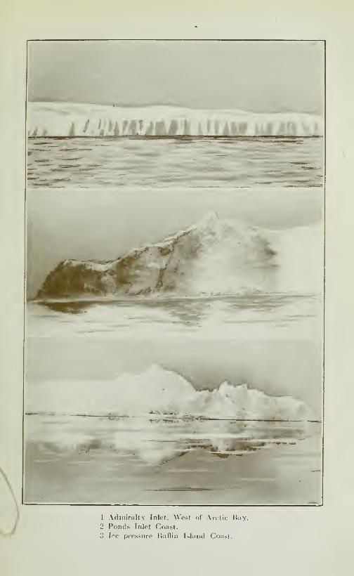
^^nm^^à^^^^
\
•f-W^ ^^'-M^fiT-
1 Adiniraltv Inlet, West of Arctic Bay.
2 Ponds Inlet Coast.
3 Ice pressure BaHin Island Coast.


CRUISE OF THE MINNIE MAUD /O
Government depots.—The Canadian Government has established
depots of provisions at Ponds Inlet, Port Leopold, Erebus Bayand Winter harbour (Melville Island).
Parry^ and Ross.—Sir W, E. Parry made his forth and final
attempt to find the North-west passage by way of Prince Re-
gent inlet. He wintered in 1824-25 at Port Bower, BrodeurPeninsula and the next summer lost one of his ships, the "Fury"wh.ich was wrecked in a gale on Fury Point on the coast of NorthSomerset. The Commander of the "Fur\" was Captain HoppnerParry with great forethought, caused all the provisions to be
landed from the wreck and safely housed on Fur\- Beach, wherethey were subsequently found by Sir John Ross in 1832, who wasalso trying to find a North-west passage and were the means of
rescuing Ross' crew from starvation. Ross had been compelled to
abandon his ship the "Victory", on the west side of Prince Regentinlet, nearly opposite Fury and Hecia Strait. Ross' party spent
the winter 1832-33 at Fury beach, and escaping from the ice. in
boats, were picked up by H. M.S. "Isabella" in Navy Board Inlet.
The remains of the wreck of the "Fury" and many old beef tins
can still be seen at "Fury" beach.
Two Eskimos with their wives, belonging to Arctic Bay, per-
ished of starvation about 16 years ago when hunting seal andPolar bear in winter at Fury Point.
In August 1910 I accompanied the Canadian Governmentship the "Arctic" to Melville Sound in an endeavour to makethe north-west passage. We were troubled with heavy ice-floes
all the way from Lancaster Sound to 80 miles west of Melville
Island, when, we turned back, and, after spending a few hoursat Melville Island, where I shot 9 musk-oxen, we steamed backthrough heavy ice-floes through Barrow Strait and down Ad-miralty Sound to Arctic Bay where we spent the winter.
Polar Bear Hunt.—\\ hile wintering at Arctic Bay, I occupieda party of Eskimos, in the months of March and April 1911,
on a hunting expedition round Cape Crawford and along thenorth shore of Brodeur Peninsula as far as Cape York. Thenatives were Izzikakto, his two young sons, Enooara, and TomLasso with two sleds and dog teams. We were away aboutsix weeks. On the 11th of March as we were travelling oversome very rough ice about 8 miles north-east of Cape Crawfordin search of Polar Bear and seal, we came across the largest Polarbear that the Eskimos said they had ever seen. It was an old
male which measured over eleven feet in length from nose to
tail, and when standing on all fours, measured 4' G" high at the
shoulder. It had an enormous head, armed with long yellow fangs,
which were much worn, and its paws, full of very long sharpclaws, measured over 13 inches in length and breath. The great
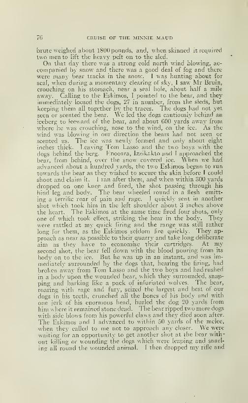
76 CRUISE OF THE MINNIE MAUD
brute weighed about 1800 pounds, and, when skinned it required
two men to lift the heav}' pelt on to the sled.
On that day there was a strong cold north wind blowing, ac-
companied by snow and there was a good deal of fog and there
were many bear tracks in the snow. I was hunting about for
seal, when during a momentary clearing of sky, I saw Mr Bruin,
crouching on his stomach, near a seal hole, about half a mile
away. Calling to the Eskimos, I pointed to the bear, and they
immediately loosed the dogs, 27 in number, from the sleds, but
keeping them all together bj^ the traces. The dogs had not yet
seen or scented the bear. We led the dogs cautiously behind an
iceberg to leeward of the bear, and about 600 yards away fromwhere he was crouching, nose to the wind, on the ice. As the
wind was blowing in our direction the bears had not seen or
scented us. The ice was newly formed and only about eight
inches thick. Leaving Tom Lasso and the two boys with the
dogs behind the berg. Enooara, Izzikakto and I approached the
bear, from behind, over the sno^^" co^ered ice. When we hadadvanced about a hundred yards, the two Eskimos began to run
towards the bear as they wished to secure the skin before I could
shoot and claim it. I ran after them, and when within 300 yards
dropped on one knee and fired, the shot passing through his
hind leg and body. The bear wheeled round in a flesh emitt-
ing a terrific roar of pain and rage. I quickly sent in another
shot which took him in the left shoulder about 3 inches above
the heart. The Eskimos at the same time fired four shots, only
one of which took effect, striking the bear in the body. Theywere rattled at my quick firing and the range was still rather
long for them, as the Eskimos seldom fire quickly. They ap-
proach as near as possible to their quarry and take long deliberate
aim as they have to economise their cartridges. At riiy
second shot, the bear fell down with the blood pouring from its
body on to the ice. But he was up in an instant, and was im-
mediately surrounded by the dogs that, hearing the firing, had
broken away from Tom Lasso and the two boys and had rushed
in a body upon the wounded bear, which they surrounded, snap-
ping and barking like a pack of infuriated wolves. The bear,
roaring with rage and fury, seized the largest and best of our
dogs in his teeth, crunched all the bones of his body and with
one jerk of his enormous head, hurled the dog 20 yards from
him w here it remained stone dead. The bear ripped two more dogs
with side blows from his powerful claws and they died soon after.
The Eskimos and I advanced to within 50 yards of the melee,
when they called to me not to approach any closer. We were
waiting for an opportunity to get another shot at the bear with-
out killing or wounding the dogs which were leaping anci snarl-
ing all round the wounded animal. I then dropped my rifle and
CRUISE OF THE MINNIE MAUD 77
with my 455 Colt Revolver in hand walked to within 20 yards
of the bear, which appeared to be too fuIK- occupied fighting the
dogs to be aware of m\' presence. The Eskimos shouted to
me to stop or the bear would catch me. At this moment the
bear suddenly wheeled round and saw me, but made another
wheel in the direction of the dogs, slashing at them with a scythe-
like sweep of his forepaw. Thinking that he had decided to
pay no attention tome, I approached a few steps nearer ; when sud-
denly he rounded on me like a flash, and with a blood-curding roar
that came from the depths of his stomach, wheeling on his hind
lengs, made a quick whirling cat-like bound in my direction.
The agility, strength and quickness of the large brute was amazing.
I mage a quick snap-shot with the revolver at his enormous white
head, when he was about 15 feet away, and the bullet struck
him in the centre of the forehead, piercing the brain and lodg-
ing in his throat. He had just commenced a second spring in
my direction, when my bullet caught him, and he collapsed onhis side, but the momentum carried his great bulk along the slip-
pery ice and his head struck my left foot. Fortunately he wasdead, with blood gushing from his mouth and the death rattle
in his throat, as the air left his lungs. The brute was very fat
and old; his body being covered with a thick coating of blubber
and his tusks were long, yellow and much broken. \\ hen cut
up, the carcase furnished enough meat to load the two sleds
to their full capacity, and there still remained over enough meatand bones to give the two dozen dogs a full meal.
Another bear-bunt.—One daj- in September 1910, when the "Arc-
tic" was jammed in the ice-floes of Melville Island, my watchwas engaged in filling the watercasks by pumping fresh waterfrom a small pond on the surface of the ice-pan near the stern of
the vessel. Seeing the watchman running on deck with a rifle in
hands, I looked over the ice and saw a bear climbing over the
rough, piled up ice, towards the bow of the ship. I ran on boardand got my rifle. \\'hen the bear was about 300 yards awaj^he stopped for a moment and raised his head high in air, as is
their custom to snifi" the air, when I fired and hit him in the breast.
The bear fell and disappear behind the ice. Thinking he wasdead, William Morin and I ran over the ice towards where the
bear had fallen. Morin was a little ahead of me and unarmed.He came suddenly on the bear which was bathing the blood fromhis wound by rolling in a shallow pool on the ice behind some ice-
hummochs. \Mien he saw us, the bear, which was not over sevenor eight yards away, gave a deep roar and came straight for us
with his lips drawn back and fangs exposed, growling furiously.
Mr. Morin drew back quickly and said 'Tor God's Sake, Fred,
don't miss him, or its all up with us". 1 fired quickly and hit him
78 CRUISE OF THE MINNIE MAUD
in the left shoulder, which I broke. As the bear fell 1 gave himanother shot in the temple which finished him.
The Polar Bear.—The polar bear is found everywhere in the
northern waters that remain open to any extent during the sum-mer, and upon the ice in the same region during winter and spring
months. Wherever seal and walrus are plentiful. Polar bears
will be found. They are numerous in Jones Sound, Smith SoundLancaster Sound, Welhngton Channel, Barrow and Melville
Straits, Peel Sound, Prince Regent Inlet, along the east coast
of Baffin Land in Fox Channel, on the West coast of Baffin Landand on the South shore of Hudson Strait. They even reach the
Labrador coast and have been killed on Belle Isle. They live
on seal, walrus and lemming. They hunt the seal and walrus
along the holes and cracks in the ice-floes, where they will crouchfor hours on the leeward side of a seal-hole, waiting for the seal
to come -up and blow. The moment the seal's head appearsabove the water, the bear crushes the thin coating of ice covering
the hole, and seizes the head of the seal in his powerful jaws,
enlarging the hole in the ice with its powerful claws. It thenhawls the seal bodily on the ice and often devours it at a single
meal. The bear then curls up on the ice and goes to sleep. APolar bear will travel along the edge of the shore ice about 30or 40 miles a day in search of seal. It swims like a fish in the
sea, spending hours in the icy waters, often going to sleep as it
floats on the surface. A bear ^^•^l swim from one ice-pan on ice-
berg to another upon which it clambers to rest and to watchfor seal. The Eskimos say that the bear, when swimming will
dive and catch a seal or young walrus under water and drag it
on to the ice. Polar bears unless very hungry or surprised andattacked will seldom attack a man, but the males when hungryor wounded are very savage and dangerous. The female whenaccompanied by their cubs, are also savage. Bears have a very
keen sense of smell, and have been known to come alongside
ships beset in the Arctic ice, in search of garbage, when many of
them ha\"e been shot from on deck. Tliey are also shot from the
decks of vessels when swimming through the ice-pans. A bear will
run away from a noise, unless very hungry, when it will attack. Ninebears, females with their cubs, were killed by the Eskimos near
Button Point in April 1913,. where they had camped in the gla-
ciers on the east coast of Bylot island, and where they had scooped
great hollows in the deep snow for a shelter. They would climb
the hills in the vicinity and after their long winter's sejourn cameout with their new-born cubs to look around for a few days,
before going out on the ice-floes in search of seal. These bears
were quite fat. Osborn mentions that both male and female
bears some of the latter followed by cubs were seen on the ice
at all seasons of the year north of WelHngton Channel. Early
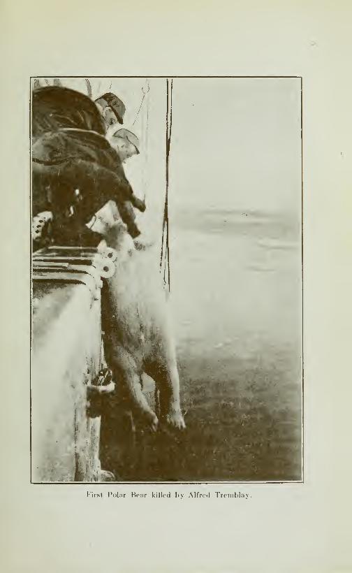
First Polar Bear killed bv Alfred Tremblav.
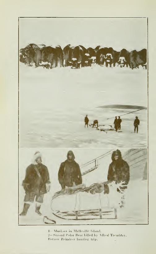
1-Musk-ox ill Mcll.-N ilk' Island.
2— Second Polar licar killed h> Alfred Tremblay.Hetiirn Reindeer liiinliî'f; trip.
,

CRUISE OF THE MINNIE MAUD 79
in June he observed a female bear over-turning blocks of sandstoneon the east shore of Bathurst island that her cubs might secure
lemmings underneath; and he saw her suckle her young sit-
ing on her haunches and lowering her breasts that cubs mightreach them from a standing position. No traces of bear weremet with by McQintock along the northern shores of Melville
or Prince Patrick island, but two were seen by Alecham on the
south shore of the latter. Three males were killed by sled par-
ties from the Arctic, south of Dundas Peninsula during the se-
cond week in April 1909, and on the 27th a female and cub des-
troyed the outfit and camp of second officer Morin near CapeJohn Russell, Bank's Island. On this occasion the bears visited
their igloo and sledge, tore up their sleeping bags and ate upmuch of their provisions. Mr. Morin and his companions hadto travel across McClure Strait to Providence Cape, on Melville
Island, over 65 miles of the roughest ice imaginable, before theycould get any more provisions or shelter.
The Eskimos use cunning and show great nerve ^^hen hunt-ing bears and even boys of fourteen approach and shoot themfrom a distance of ten yards. The Eskimos will dress themsel-ves in sealskins and lie in one spot, allowing the bears to approachthem unsuspicious of danger and when bruin is close enough to
make the aim perfectly sure the Eskimo shoots and invariablylays the animal out within a few feet of himself, either dead or
so nearly so that there is not much difficulty in dispatching him.When on the march, the Eskimo, on catching sight of a bear,
will loosen his dogs which immediately chase and surround theanimal. When engaged with the dogs, the Eskimo approachesclose to the infuriated and fighting animal or either shoots it
or keeps launching his harpoon, to which a seal line is attached,into the soft flanks of the bear, until it succumbs through loss
of blood. But it is a dangerous pursuit at all times, and on oneoccasion an Eskimo of Ponds Inlet when on a distant bear huntwith his wife and two small children, was caught and killed bya bear. The two children died of starvation and the motherlived on their dead bodies until found by seme more Eskimoswho were hunting in the same region.
An adult male bear will measure 12 feet from nose to tail andwill stand 4' G" at the shoulder and weight about ISOO pounds. Theskin of an adult Polar bear is worth from $50.00 to $75.00 accordingto size. The bears apparently bring forth their young in Marchand April, and the cub remains with its mother until it is two yearsold, when it is able to forage for itself.
Lavoies Expedition.—During the winter of 1910-11, Mr. Lavoiethe Government surveyor attached to the "Arctic" expeditioncrossed Brodeur Peninsula from Admiralty Sound, accompanied
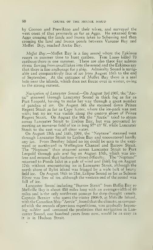
80 CRUISE OF THE MINNIE MAUD
by Coonoo and Peewiktoo and their Avives, and surveyed the
west coast of that peninsula as far as Aggo. He returned fromAggo crossing the lands and frozen lakes to Scheming and then
crossing the land and frozen ponds between Vanasse Bay andMoffet Bay, reached Arctic Bay.
Moffet Bay.—Moffet Bay is a fine sound where the Eskimosresort in summer time to hunt caribou. Tom Lasso killed 73
caribous there in one summer. There are also three fine salmonrivers flowing from small lakes into the sound and the Eskimos say
that there is fine anchorage for a ship. Admiralty Sound is navig-
able and comparatively free of ice from August 15th to the end
of September. At the entrance of Moffet Bay there is a seal
hole near the islands, which does not freeze over in winter, owingto the strong current.
Navigation oj Lancaster Sound.—On August 3rd 1907, the "Arc-
tic" steamed through Lancaster Sound in thick fog as far as
Port Leopold, having to make her way through a great numberof patches of ice. On August 5th she steamed down Prince
Regent Strait as far as Cape Kater, where the ice-pack was metwith; but no ice was visible along the eastern shore of Prince
Regent Strait. On August the 9th the "Arctic" tried to steam
across Lancaster Strait to Erebus Bay, but was prevented bymeeting an immense field of ice in long 87° 43' W. wdiile Lancaster
Strait to the east was all clear water.
On August 13th and 14th, 1904, the "Neptune" steamed west
through Lancaster Strait to Erebus Bay and encountered hardly
any ice. From Beechey Island no ice could be seen to the west-
ward or northward in Welhngton Channel and Barrow Strait.
The "Neptune" then steamed across Lancaster Strait to Port
Leopold through gale and fog on August 15th, which was ice-
free and entered that harbour without difficulty. The "Neptune"returned to Ponds Inlet in a gale of wind and thick fog on August17th without encountering ice in Lancaster Strait, although the
north shore of Bylot island was fringed by a wide belt of heavyfield ice. On August 18th to 21st, Eclipse Sound as far as SalmonRiver was free of ice, although the western end of the sound wasfull of ice.
Lancaster Sound including "Barrow Strait" from Baflin Bay to
Mellville Bay is about 450 miles long with an average width of 40
miles and is the only northwest passage for deep draught vessels.
Captain Bernicr who spent the winter 190S-9, at Melville Island,
with the Canadian Ship "Arctic", found that the climate, as compar-
ed with the records of previous expeditions, was gradually becom-ing milder and ventured the prediction tliat navigation in Lan-
caster Sound, one hundred years from now, would be as easy as
it is in Hudson Strait.
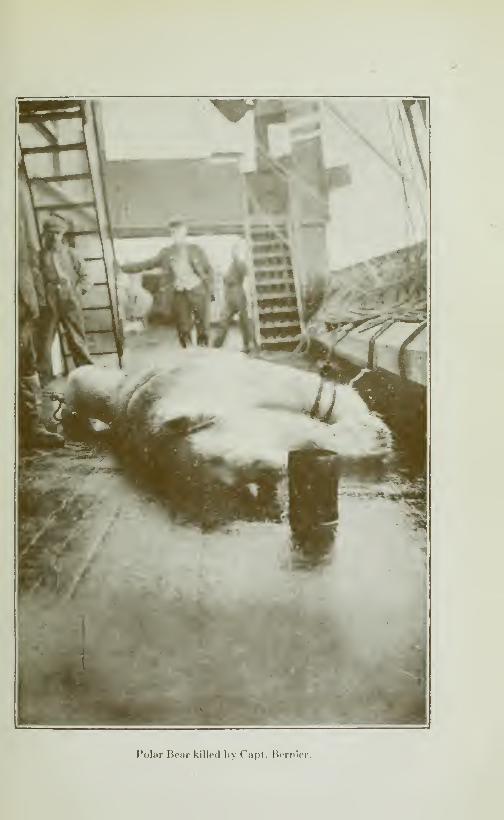
Polar Bear killed hy Cnpt. Berniei
Miisk-o\ honrls.
CRUISE OF THE MINNIE MAUD Si
'Ihe best time to enter Lancaster Sound, as far as AdmiraltySound, Port Leopold and Erebus Bay, is after August 12th, returning
by the end of September. The worst place for congestion of ice-
floes in Lancaster Sound, is Barrow Strait, between Grifliths andLowthers island on the north, and Russell Island on the south.
Here the narrowest passage, being only 25 miles wide and the
heavy ice-floes from Weflington Channel and Macdougall Strait
on the north, Melville Bay on the west, and Peel Sound andPrince Regent Inlet on the south, pour into Barrow Strait andbecome jammed there in the vicinity of Grifliths island by the
strong tide and heavy gales.
The best time to pass west of Erebus Bay is from August 24th
to September 1st, keeping close along the shores of Cornwallis
and Bathurst islands.
Tbe Western Island.—The island of the North Somerset, Prince
of ^^'ales, Brodeur Peninsula, Russell, Lowther, Grifliths, Corn-wallis, King William, Victoria Land and the South Westerncorner of North Devon consist of barren limestone rock, whichis devoid of vegetation and therefore of animal life, although their
shores abound in seal, walrus, narwhal, white whales and Polarbear.
The western shore of North Somerset and the eastern side of
Prince of Wales Island, on each side of Peel Sound, are howevercomposed of Archaen rocks and sandstone which provide vege-
tation for herds of musk-oxen and caribou which roam along theshores. Salmon are also said to exist in the rivers of North So-merset.
Original route of Musk-ox, Caribou and Eskimos.—The musk-ox and the caribou must originally have journeyed up Boothiaand Melville Peninsulas from the mainland of Canada, crossing
HecIa and Fury Strait into Baffin Land and crossing Bellot Strait
to the islands of North Somerset and Prince of Wales. FromPeel Sound they crossed Lancaster Strait to North Devon andup Wellington Channel to Grinnell Land. Another stream crossed
Coronation Gulf to Prince Albert Land and Banks Island.
Then across McClure strait to the fertile plains, rich with aprofusion of Arctic grasses and vegetation, of Melville island
and Prince Patrick island. From there they wandered over to
Byara Martin and Bathurst Island and to the rich pastures of
the broad, coast lowlands of the Sverdrup island. These twostreams then converged and pushed along the fertile shores of
the west coast of Ellesmere land as far as Grant and Grinnelllands, and perchaps even to Crocker and Bradley lands, further
north. They had only to cross the narrow neck of land that
separates Bay Fiord and Flagler Bay in Ellesmere land to reachSmith Sound, whence it was only a short 30 miles across to Green-land where musk-ox and caribou are found in the vicinity of Etah.

82 CRUISE OF THE MINNIE MAUD
Eskimo route.—The Eskimos who have always Ii\-ed by the chasemust have followed the same route, where the hunting was good,and this would account for their presence in North-^^ estern
Greenland. The natives from Etah regularly cross Smith Soundevery summer, and journey overland to Bay Fiord where theyslaughter numbers of musk-ox and caribou that are found on thewestern shore of Ellesmere Land, where is a wide margin of soft
mesozoic rock which forms low plains extending from the sea-
shore several miles inland to the base of the high cliffs of the older
rocks. These plains are covered with Arctic vegetation. Musk-oxen, barren-ground caribou and arctic hares are found there in
large numbers, along with geese and other aquatic birds. Alongthe west side of North Devon there is lower land with good growthof arctic plants on which large number of musk-oxen some ca-
ribous and arctic hares feed. Bathurst island, Byam MartinIsland, and Melville Islands, which consist of carboniferous
sandstones, are covered with a rich growth of vegetation wherethousands of musk-oxen, caribous and arctic hares roam centen-
tedly. Banks Land, also formed of carboniferous sandstone,
feeds large bands of musk-oxen, caribous and arctic hares in therich soil of the deep valleys. The Sverdrup Islands or AxelHeiberg, Amund Ringes, Ellef Ringes, King Christian and NorthCornv.all consist of high lands composed of bedded rocks anderuptives in the interior with low wide foreshores, wheie gameis plentiful. On the barren limestone islands there is neither
vegetation nor animals.
Sverdrup found the remains of Eskimos encampments every-
where along the west coast of Ellesmere and not knowing with
what case the natives of Ponds Inlet and Admiralty Sound crossed
Lancaster Strait to Erebus Bay, speculated where they had comefrom. Remains of old Eskimo encampments have also beenfound in Byam Martin Island, Bathurst Island, and Melville
Island and round the shores of Lidden Gulf, Melville island, whichshowed that they followed the musk-ox and caribou ever^•where.
With the exception of Etah and Cape York, on the Greenlandside of Smith Sound, there are no Eskimos now living north of
Lancaster Sound. The Eskimos apparently were formerly morenumerous than they are at present and the hundreds of old graves
at Killalookan on Eclipse Sound and at other places would seemto show that they had been swept away in large numbers by epi-
demics of desease.
The Musk-ox.—The musk-ox (ovibos) was originally found
all over the northern plains of Asia and Europe, as well as on the
Américain Continent. How it desappeared from there does not
seem to be known. It is now only found in the barren lands of
Canada from the Mackenzie River to Hudson Bay and in the
Arctic Islands of Canada.
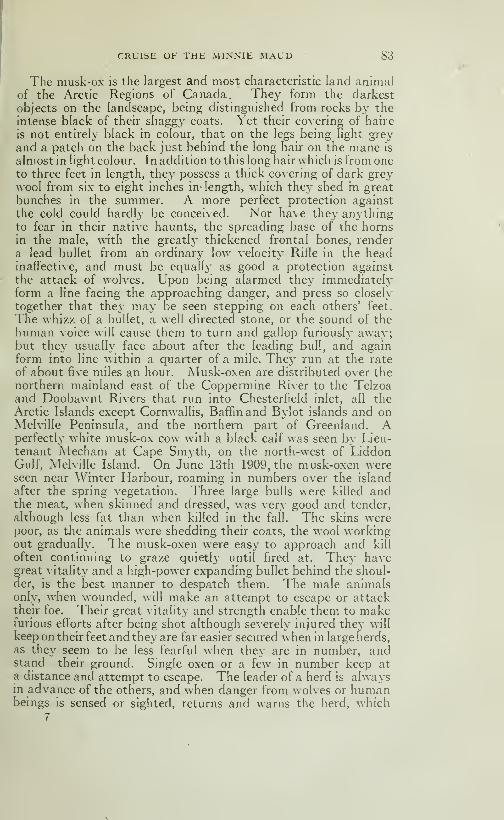
CRUISE OF THE MINNIE MAUD 83
The musk-ox is the largest and most characteristic land animalof the Arctic Regions of Canada. They form the darkest
objects on the landscape, being distinguished from rocks by the
intense black of their shaggy coats. Yet their covering of haire
is not entirely black in colour, that on the legs being hght greyand a patch on the back just behind the long hair on the mane is
almost in light colour. In addition to this long hair which is from oneto three feet in length, they possess a thick covering of dark greywool from six to eight inches in- length, which they shed in great
bunches in the summer. A more perfect protection against
the cold could hardly be conceived. Nor have they anythingto fear in their native haunts, the spreading base of the hornsin the male, with the greatl}' thickened frontal bones, render
a lead bullet from an ordinary low velocity Rifle in the headinaffective, and must be equally as good a protection against
the attack of wolves. Upon being alarmed they immediatelyform a line facing the approaching danger, and press so closely
together that they may be seen stepping on each others' feet.
The whizz of a bullet, a well directed stone, or the sound of thehuman voice will cause them to turn and gallop furiously away;but they usually face about after the leading bull, and againform into line within a quarter of a mile. They run at the rate
of about five miles an hour. Musk-oxen are distributed over thenorthern mainland east of the Coppermine River to the Telzoaand Doobawnt Rivers that run into Chesterfield inlet, all theArctic Islands except Cornwallis, Baffin and Bylot islands and onMelville Peninsula, and the northern part of Greenland. Aperfectly white musk-ox cow with a black calf was seen by Lieu-tenant Mecham at Cape Smyth, on the north-west of LiddonGulf, Melville Island. On June 13th 1909, the musk-oxen wereseen near Winter Harbour, roaming in numbers over the island
after the spring vegetation. Three large bulls were killed andthe meat, when skinned and dressed, was very good and tender,
although less fat than when killed in the fall. The skins werepoor, as tlie animals were shedding their coats, the wool workingout gradually. The musk-oxen were easy to approach and kill
often continuing to graze quietly until fired at. They havegreat vitality and a high-power expanding bullet behind the shoul-der, is the best manner to despatch them. The male animalsonly, when wounded, will make an attempt to escape or attacktheir foe. Their great vitality and strength enable them to makefurious efforts after being shot although severely injured they will
keep on their feet and they are far easier secured when in large herds,as they seem to be less fearful when they are in number, andstand their ground. Single oxen or a few in number keep ata distance and attempt to escape. The leader of a herd is alwaysin advance of the others, and when danger from wolves or humanbeings is sensed or sighted, returns and warns the herd, which
7
84 CRUISE OF THE MINNIE MAUD
Stops. The scattered ones are rounded up by the leader, whopushes or horns them into the group. If no danger is apparentthe herd follows the leader along their accustomed grazing dis-
tricts or paths. When a foe appears the herd forms a partial
circle with the male animals on the outside and the female andyoung in the rear. The leader occupies the most dangerous po-
sition, and if killed or overcome, another male takes his place.
When attacked, the leader makes an occasional short charge
and then returns to his post. The herd is always more easily
secured by kilhng the leader and his successors first. The mostvital spot to aim at in shooting are the chest or behind the shoul-
der, but even if hit in those parts, a male musk-ox will run for
some distance with several expanding bullets inside him. Whenassailed by a number of hunters they are apt to stampede, butthe rush does not last long, and they will make a stand again until
too hard pressed. The meat is very palatable in the fall of the
year, but the hide must be taken from the animals shortlj' after
they have been slain, and the insides removed, or the meat be-
comes tainted and has a disagreable odour. The various expe-
r ditions to Melville island always prefered the musk-ox beef to' the fresh killed beef of ordinary cattle. On August 9th 1909
a small musk-ox calf was captured near the ship and taken onboard, where it was kept and became very tame. In the preced-
ing May another very young musk-ox had been captured near
Winter Harbour and was cared for by the men on board the "Arc-tic" who fed it on concentrated milk and porridge. Both these
young musk-ox became very tame and would follow the menabout like dogs. One died from swallowing some of the contents
of a paint pot which was left on the deck. The other was takento Quebec and was eventually presented to the Bronx Zoological
Gardens of New-York. A full grown musk-ox will weight on the
hoof close to 1,000 lbs and, when dressed give 450 lbs meat andbone. The average weight of the dressed carcase, minus head,
hide, hoofs, and inside parts is 300 to 350 lbs. The hide in goodwinter condition is worth about $75.00.
Battle with a Musk-ox.—Lieutenant J. C. Ross gives the follow-
ing graphic account of an encounter ^\ ith a wounded musk-oxnear Cress Well Bay, North Somerset in may 1830:
—"The sight
of a fine musk-ox at bay before the three dogs cured our fatigue
in an instant and we went off ourselves at full speed to the rescue.
Poo-yet-tah, however, kept his lead in front of me and was in
the act of discharging his second arrow when I came up. Wesaw that it struck a rib, since it fell out without even diverting
the attention of the animal from the dogs, which continued bark-
ing and dodging round it, seizing it by the heels whenever they
had an opportunity, or when it turned to escape, and then re-
treating as it faced them. In the meantime the animal wastrembling w^ith rage, and labouring to reach its active assaillants
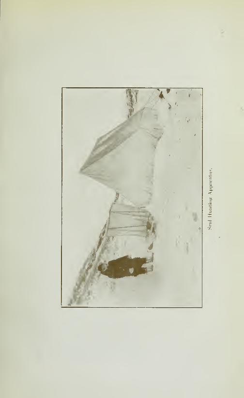
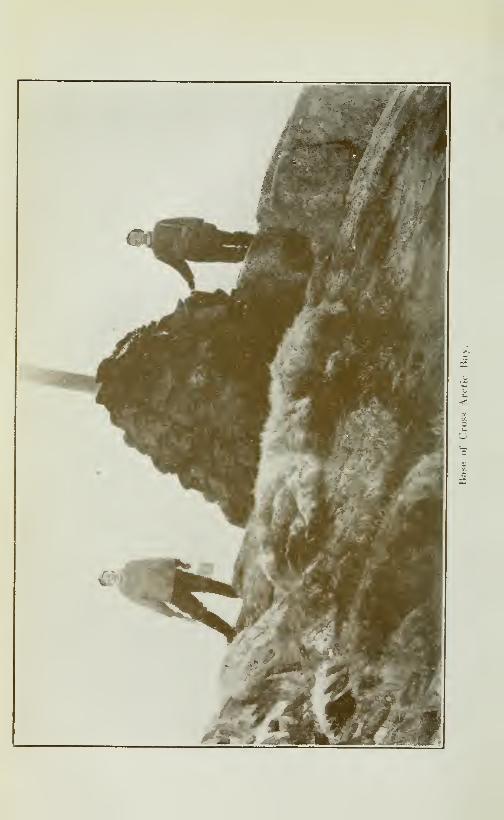

CRUISE OF THE MINNIE MAUD 85
but was u nable to touch them, experienced as they were in the
service. Seeing that my native companion's weapon were of
httle value in this warfare, or that the victory would not at least
have been gained under many hours; as he continued to shoot
without much apparent effect, finding his opportunities to aimwith much difficulty, and losing much time, afterwards, in reco-
vering his arrows, I, therefore, fired at the animal with two balls,
at the distance of about fifteen yards. They took effect andit fell; but rising again, made a sudden dart at us, standing close
together as we were. We avoided the attack by dodging behinda large stone, which was luckily near us, on which, rushing
with all its force, it struck its head so violently that it fell to the
ground with such a crash that the hard ground around us fairly
echoed to the sound. My guide, on this, attempted to stab it
with his knife; but faihng in this, he sought shelter behind the
dogs, which now again came forward to the attack.
"At this time the wounded bull was bleeding so profusely
that the long hair on its sides were matted with blood; yet its
rage and strength seemed undiminished, as it continued to advanceand butt with the same ferocity as before. In the meantime I
had reloaded my gun (a muzzle loader) behind the stone, and wasadvancing for another shot, when the creature rushed towardsme as before, to the great alarm of Poo-yet-tah,who called to
me to return to the same shelter. But I had time for a cool aim;and it inmediately fell on the discharge of both barrels, but not
till it was within five yards of me. The sight of his fallen enemymade my companion scream and dance with joy, and on his com-ing up, it was dead; one ball having passed through the heart,
and the other having shattered to pieces the shoulder joint. Poo-yet-tah was lost in horror and amazement at the eflfect of thefire-arms, but it was the state of the broken shoulder which mostsurprised him."The musk-ox is especially abundant on Melville Island, where
countless herds frequent the low ground where grasses and mossflourish. They roam aimlessly about (writes Mr Henneaseyofthe"Arctic" expedition) in herds of from 3 to 20, but sometime as
great a number as forty will band together. Their great coat
of hair is very long, sometimes trailing the ground, and frequentely
attaining a length of forty inches. The forequarters of this
animal are much more powerful than the hinder, but appear muchlarger than they really are by the presence of the wooly manewith which their shoulders are covered. So appearent is this,
that a large bull advancing towards a person, may be mistakenfor two animals. Their coat which is at its best from the monthof November to the end of April, is made to appear very oddlooking in the spring, by the large clumps of wool that hang sus-
pended from the hair and which it is sledding. When enragedor suspicious the musk-ox paws the ground or snow frantically

86 CRUISE OF THE MINNIE MAUD
with his forehoofs. They are an animal of great vitahty, as they
must be to withstand the rigours of the se^•ere winters to whichthey are exposed
How Arctic Animals live i^i Winter.—An answer to the query
as to how the wild herbivorous animals, hke the musk-ox andthe reindeer survive the winter in that snow covered land Pearywrites: "By a strange paradox, the wild winds that rage in that
country help them in their struggle for existence for the windsweeps the dried grasses and scattered creeping willows bare of
snowover great stretches of land, and there the animals can graze."
In the spring of the year the herd generally break up and the
animals, especially the bulls, roam about singly, but, as the winter
approaches, the}' again congregate in herds. The foot print of
the musk-ox is very difficult to distinguish from that of the barren
ground caribou but if the trail be on snow it should be followed
until the animal treads upon deeper parts, when it will be foundthat the impression made by the caribou will rest much nearer
the surface than that of the musk-ox. If the imprint be on sandor in soft mud, it may be determined by the greater diameterof the hinder part of the impression in the case of the musk-ox,and by the greater space between thetwo fore parts of the hoof in
the case of the caribou.
These valuable animals, which combine the wool-giving qua-lities of the sheep with the beef of cattle, could undoubtedly be-
come a most valuable asset to the farmers of Canada. They are
easily domesticated and if a stud-farm and muclues herd could
be inaugurated at some convenient spot, like Southampton Is-
land, in Hudson Bay, which is a naturel game resort for caribou
and birds of all descriptions it would soon grow large enoughto stock the Western Prairies with this highly valuable animal.
Young ones could be caught by the Eskimos inland of Chester-
field Inlet and in the Arctic Island and conveyed every year to
the breeding station. The wool is of the best quality, and knits
into the warmest of mitts, socks and neckties.
It seems a pity that an animal, combining so many valuable
qualities as the musk-ox, should be allowed to go to waste andextinction, when, with a little expense, trouble and care it mightbe made the most valuable adjunct of the farm.

CHAPTER V
On January 23rd 1913 Wilson left Arctic Bay in company with
Coonoo, with the object of prospecting Strathcona Sound for
mineraL Afterwards he was to go to Ponds Inlet and, if possible,
return to Aggo wùth more provisions and then join me in a pros-
pecting tour round Fury and Hecia Strait and Melville Peninsula
as the natives had shown us some samples of hkely looking quartz
from that region.
But Wilson caught cold, through sleeping in a draughty igloo
on the way to Ponds Inlet by way of Lancaster Strait and NavyBoard inlet. Setthng on his chest it developped into inflamma-tion of the lungs which kept him in bed at Salmon River for a
couple of months. He took with him a requisition from me to
the storekeeper of the expedition, to send me more cartridges for
my 280 Ross Rifles and some more provisions, which, in case
Wilson could not join me at Aggo, were to be sent to Schemingwhere I would arrange to have them sent on after me, by anEskimo, to Igloolik.
Reasons for Expedition.—Foxes being scarce round Arctic Bay,and as the object of our expedition, as agreed upon in Quebec,was to explore the country in all directions for furs and mineral,
we decided to go to Scheming, at the head of Admiralty Sound, andthence to IglooHk and Melville Peninsula, and if possible to mapthe unsurveyed eastern shore-line of Fox Channel.
Hards bips Endured.—On January 29th I started from Arct c
Bay with the faithful and cheery Peewiktoo and his staunch little
wife, Tootillik; the day was intensly cold. By the time we rea-
ched Ponds Inlet on Àlay tenth, three and a half months later,
we had covered over 2000 miles of the roughest and coldest tra-
velling imaginable. The temperature throught-out the wholetrip varied from 25" and 55° Fahr. below zero, and storms andblizzards were of frequent occurence. After reaching Schemingwe had no provisions or fuel and had to depend on our rifles
to provide food for men and dogs. We often ate nothing for
48 hours and what we ate was raw, frozen and generally rotten,
walrus salmon or caribou meat. The dogs frequently hadnothing to eat for 4 or 5 days at a time. The ice in many placeswas of the roughest description, and, on land the snow was so
deep and rotten in places as to be almost impassable. Thecaribou were wild and difficult to approach on the land, and theseal in the open water holes would when the w nd was strong.
88 CRUISE OF THE MINNIE MAUD
bob up their heads only for a moment for air and disappear
again, \vh eh made the shooting of either in the intensely co!d
wind a matter of great uncertainly and difficulty. The knowl-
edge that our cartridges were so few and that our verj^ lives
depended upon the accuracy of every shot at a disappearing
seal's head or a flying caribou generally from 500 to 800 yardsdistant, added to our anxiety. I had depended of course uponprovisions and cartridges being sent after me to Scheming or
Igloolik.
Equipment.—We commenced our journey with half a barrel
of biscuits, 20 lbs flour, 15 lbs pork, 4 lbs tea, 15 lbs suggar, 1
gallon molasses, 10 lbs cooked beans (which were almost uneatable)
and two large seals (one which weighed about 300 lbs), with whichto feed the dogs and provide blubber for our Eskimo stove, consist-
ing of a small open tin pan with a wick of moss and vegetable
cotton spread along the rim. This stove was all that we hadwith which to light and warm our igloo, and, as may be imaginedwe suffered greatly at night from the intense cold in the draughtyigloos of snow that we constructed at the end of every day's
march.
No alternative.— I had no alternative of starting later or of
waiting at Arctic Bay until I received more provisions andcartridges from Ponds Inlet as I had to cover some 2000 miles
and more over unexplored territory and then return overland
before the end of May when the land would be swept bare of
snow and the sleds would be unable to travel.
Clothing.—For clothing I had three bags of clothes that I hadbrought with me from Quebec and a kulitang or Eskimo cloak
and hood made of caribou skins, a pair of caribou knee breeches
and seal boots. I discarded the skin-clothing most of the time
as the exertion of walking and running after the sled through the
heavy snow, and of constantly pulling and righting the sled,
caused me to perspire too freely and then I would suffer from a
subsequent chill from the biting winds and the very low temper-atures.
Arms, etc.—For arms I had my trusty 280 High Velocity RossSporting Rifle, which, after much testing in all kinds of winds,
weather and temperatures, I proved to be the best rifle in the
world for all kinds of game. The 280 Ross has the flattest
trajectory, the best lock system and the greatests hocking powerof any rifle I know of, and I have used them all. Another quality
in its favor lies in the fact that there is no prelimincry adjustment
of sights as the same sight does for 100 or 500 yards, which is a
most important factor when shooting at flying game at an unknownrange. I had 200 copper-tube expanding bullets for this rifle. I

CRUISE OF THE MINNIE MAUD 89
also had a Colt 45 Automatic Pistol with the case serving as a
shoulder-butt, and this too, is the best secondary arm in the Arc-
tic or anywhere else. \\ ith this Colt I often shot seal at 100
yard range when only their noses showed 5 inches above the
ripphng water and I had on other Expeditions shot Polar bear
and small game with the same arm. I started with only 100
cartridges for this Pistol as I had previously lost 200 Pistol car-
tridges which dropped off the sled in the rough ice when travell-
ing from Ponds Inlet.— I also carried a small hatchet, 3 skinning
knives, a snow knife and a saw for cutting snow blocks for the
igloo. Peewiktoo had an old military Mauser, 43 calibre, with
50 cartridges, a snow knife, a saw and an old broken hatchet for
chopping tusks out of walrus heads, etc. We each carried a
harpoon with which to catch seal.
For sleeping bag I had a caribou-skin bag (hair inside) whichfitted inside my seal-skin bag and an old blanket. As the seal-
bag was continously wet through and frozen by the snow andfrost, I had great difficulty in getting into it, having first to thawit out by the warmth of my body and then push into it, feet fore-
most, by instalments. I suffered in consequence a great deal
from the cold.
We also carried 114 Victor No 2 Fox Traps which added con-siderably to the weight of the load.
Small dog power.—Our sled was an old one belonging to Peewik-too which had already seen much rough service, and which wasconstantly needing repairs. We had eight dogs, four of whichwere good and the others were small pulling power with the re-
sult that Peewiktoo and I, for many days, had to harness our-
selves with the dogs to the heavy sled, and my body and collar
bones bear witness to this day to the rough harness work andheavy hauling we had to do.
Drop baggage.—The first day, on account of the load being tooheavy for the dogs, two of which were too old and two were tooyoung to be of much use, when crossing some rough ice in theArctic Bay, we threw off half the load and camped on the southshore of Adam's Sound, where we built an igloo and spent thenight.
January 30th Peewiktoo and I took the sled back for the seal
and baggage that we had left on the ice in Arctic Bay, leavingTootillik to mind the igloo and stores in our absence. The wea-ther was intensely cold and the sun was not yet visible.
The need of Eskimos.—January 31st, the next day, as I hadnoticed many wolves' tracks in the snow, I decided to take thewhole load with us, and harnessing myself with the dog pulled
the sled all day. Peewiktoo drove the dogs and helped to pull
the sled, while his poor little wife walked during the whole day,
90 CRUISE OF THE MINNIE MAUD
which is an accustomed thing for the Eskimos to do. Withoutthe Eskimos, travelhng in the Arctic would be almost an impossi-
hty for the white men. The suffering and hardship would betoo great, while the Eskimo is rarely at a loss, and long customhas taught him where to look for seal and other animals withwhich to feed himself and his dogs and how to protect h mself fromthe elements. It is surprising how the natives find their waywithout compasses in these barren lands and among the vast
labyrinth of sounds, island and mountain ranges. They place
stones in different positions at several places and use these as
marks; every native has his own marks which are recognized bythe others who can tell there-from who has passed along the route,
although they can not tell the direction of the route followed
from the stones. They calculate the distance from one place to
another by the number of sleeps (skinnikpoo) or days, every rest
or sleep counting for one day a skinnikpoo generally means from20 to 30 miles per day, the distance for each day varying withthe number of dogs, the weight of the loads on the sledge andthe roughness or smoothness of the road travelled, all of whicheffect the number of miles travelled in a day.
First view of the Sun.—We marched and hauled the sled all
day without stopping to rest, and camped on the ice near theshore. As the twilight in day time only lasted for a few hours,
our marches were short during the next week or so. On this
day we saw for the first time the rim of the sun peep above the
southern horizon and it was a cheering sight after nearly three
months of dismal obscurity. The weather was intensely cold,
but as there was little wind it did not incommode us greatl}'. Wesuffered however from the cold during the night, as a bitterly
cold wind sprang up and nearly blew the igloo down, and the cold
draughts nearly froze us in our sleeping bags, and we could notput much blubber on the stove as our two seals had to last us
until we reached Scheming. For supper we ate some of theinfamous boiled beans that needed a hunger like that of a fami-
shed wolf to make us face them.
Bad weather and interise cold. — Fcbruar}' first. — Taking ourplace once more among the dogs we resumed our march in
spite of a protest from the Eskimos, who feared to brave the
,
bitter north wind, which nearly bit us in two. Fortunately thewind blew on our backs and not in our faces: but when we cameto look for a place to build an igloo that evening on the bleakexpanse of the sound, our sufferings became intense. The per-
spiration, when we ceased to walk, froze on our bodies and I
almost decided that it would be better to march all night in orderto keep warm. We spent a schivering hour looking for snowfor an igloo, and when we found it I froze my hands and wrists
handling the snow blocks in the biter wind. \\ hencver I faced
CRUISE OF THE MINNIE MAUD 91
the wind to lift the snow blocks into place my nose and cheeks
would freeze and I was often compelled to stop and rub themwith snow in order to restored the circulation. At last the un-welcome task was finished, and we plunged into our gloomy anddraughty snow hut and into our frozen sleeping bags after a hastymeal of the noxious beans, and tried in vain, to forget our miseryin sleep. My nose and cheeks were skinned from constant
rubbing with frozen snow and my shoulders ached and my handswere cut and bleeding from pulling at the seal-cord attached to
the sledge.
Rock Jormatioti. — The cold was too intense to permit of
sleep so we shivered all night as the igloo was pitched on the un-protected surface of the sound about 300 feet from the eastern
shore which appeared to me to consist of a dark rock resemblingdiabase and which might pay to prospect for mineral.
February 2d.—The wind was not so strong next morning,and we resumed our march, pulling the sled as before. We madegood progress and camped that evening on the sound, close to
the land. The wind increased in strength at night and we suf-
fered again intensely when building the igloo and during the night.
Still the same nauseating beans to haunt our slumbers.
Repairs.—February third.—We remained at this camp thenext day and night as we had to repair the sled, as the lashings
had become loosened through pounding over the rough ice underthe weight of the heavj- frozen seal. We also repaired the dogharness which was continually being cut by the sharp ice.
Near Moffet Bay— February fourth. — A very cold day withless wind. We started early and toiled in the harness all dayand were all tired out when we reached our camping place. Wecamped close to a small island in the middle of the sound, nearthe entrance to Moffet Bay. The rock on this island appearedpromising as it consisted of diabase or diorite, crossed b\ nume-rous small veins of quartz, calcite an mica schist.
Thirst and illness.—During the day I suffered intensely froma raging thirst, which was aggravated by the exertion of pullingthe sled. I tried to appease it by drinking snow along the routeand when we camped at night drank too freely of cold watermade from melted snow. The horrible beans being finished, wedined ravenously on old buck seal, half cooked, which had adisgusting flavour and smelt abominably Even the dogs, hun-gry as they were, seemed to balk at this tough old seal. Theresult was I felt as if there were a lump of ice on my chest andstomach, and I commenced to get cold and to shiver all over.I crept into my frozen sleeping bag but, could not sleep on accountof the pain and the cold, as the igloo was like an ice-house.
92 CRUISE OF THE MINNIE MAUD
Very sick, indeed.—February fifth.—In the morning I was so
ill, that I had great difficulty in getting out of my sleeping-bag,
so weak had I become. Peewiktoo and Tootilhk became alarmedand wished me to leave the things and to hurry back to Wilsonat Arctic Bay, as if I was going to die, they feared that they wouldbe blamed. I refused and said that I would, now that we hadstarted, push on to Igloohk, even if I died on the road.
They harnessed the dogs and loaded the sled and we resumedour march southward. I tried on several occasions to help pull
the sled, but kept falhng down in the snow, so I had to abandonthe attempt and staggered along feebly behind the sled, often
falhng from weakness. When I picked myself up I could see
at least two sleds ahead of me all the time. Once when I ran
up to the sled to try and help the dogs, I fell and struck the endof the sled with my shoulder. I think that if I had struck it
with my head, I should have given up. Peewiktoo looking backand seeing me fall said: "You plenty sick, better go back."
Near death.—At last I could go no further, as the pain wascatching me all round the base of the Hver, and it felt as if it
was creeping close to the heart. I thought that it was all upwith me and that any moment I should drop dead. Peewiktooand his wife began to cry, but I told them not to be afraid. Sothey made an igloo and I crept into it, thinking to die. I tried
to write a letter exonerating them from any blame, and told to
them to take my body if I died, to Ponds Inlet, where no armwould come to them, and I told Peewiktoo and Tootillik that
they could have my rifle and clothes and to give my revolver
to Etotah, his brother. Peewiktoo said : "You no fraid to die?Eskimo plenty fraid to die". I told him that: "White men are
not afraid of death".
My fingers were too cold and cramped to write and one momentI would burst into a profuse perspiration and the next would beshivering, as cold as ice. Peewiktoo sat with his head in his
hands, the picture of woe, and Tootilhk began to cry. I could
neither eat nor drink anything all day and to this and the efforts
that I had made in walking after the sled, I attril)ute the fact of
my not succombing. Had I stayed in my sleeping-bag at the
last igloo I am conhdent that I should not have left it alive.
I had to sit through that long dreary day, cold as ice in the
igloo, with my right shoulder propped against a bag. When-ever I tried to rest on my left side, the pain would catch me roundthe heart, and I could not breathe untill I changed position. Se-
veral times when Peewiktoo spoke to me I could not answer andI many times felt that the next moment would be my last andthat I should never lea^'e the igloo alive. I told Peewiktoo, whowanted to sit up with me, to go to bed and sleep. I wanted to
keep up their courage and told them I would soon be well again.
CRUISE OF THE MINNIE MAUD 93
But they saw the alteration in my face and became very alarmed,
TootilHk crying all the time. Had I swooned or lost conscious-
ness but for a moment, and have fallen on my left side, my heart
would have stopped beating at once. The pain seemed to cut
my very inside in two. I never hope to go through another such
day and night in this life, as death would have been a rehef.
The camp was pitched less than two miles from the last one,
as I could not walk any further. The cold continued intense,
being 45" below zero. My hands, face and feet seemed frozen all
the time as my blood was thin and chiled from fasting
February sixth.—Feehng no better in the morning, I decided
that if I had to die, it might as well be here as to struggle on for
anothermileor twoand then die ontheice, as so many of Frankhn'smen had done JDcfore me. In the evening I began to feel some-what better, the pain was less severe and I could rest easier. I
neither ate nor drank anything that day, going two days andnights without food and drink.
Convalescent.—February seventh.—Feehng somewhat better
I ate a httle biscuit and we started on our march again, as our
seal meat was getting exhausted and we had little to give the
dogs. We must either reach Scheming or all perish of starvation
I was so weak that I could hardly wabble along behind the sled.
Had I sat on the sled the dogs could not have pulled the load.
We managed to travel some five or six miles and the walkingimproved my condition, as it restored the circulation ofmy blood.
Two miles were over very rough ice, where the pans of youngice had met old Arctic pans and the edges had crumpled up into
cakes There was an open water-hole right at the point thathad just frozen over, as the rapid tide there had kept the ice
from forming. I remarked the track of a medium-sized Polarbear on the snow. We camped on the sound and I was able
to make out the character of the rock on the peninsula west of
Moffet Bay, which looked favorable for prospecting and con-sisted of a clear brownish rock that seemed to contain magnetics.The weather was terribly cold and the operation of building the
igloc was a most painful one, handling the heavy snowblocks in
the bitter wind.
Snow Igloos.—When tra\'elling in the wintertime, the Eskimosbuild a small snow-house or igloo every night with blocks" cut froma convenient snowbank. These small houses, built only for thenight, seldom exceed nine or ten feet in diameter, and it is onlywhen a considerable stay is expected that larger houses are built.
The Eskimo first tests the snow of the neighbouring banks byprobing with his long snow-knife, often a 12 inch butcher knife,
and when he finds a bank formed from the drift of a single storm,he cuts an oblong hole about five feet long, 2 or 3 feet wide, andabout 20 inches deep, with a clean face. He next cut blocks from
94 CRUISE OF THE MINNIE MAUD
this face, these blocks are about 5 or 6 inches thick and 20 inches
deep. When each block is cut out it is eased away with the knife
and with blows from the toe apphed underneath, and gently
pried from its position in the bank, so as not to break it. Aboutseventy or 80 of these blocks will form a small igloo. One manusually cuts the blocks while another builds the house. A circle
the size of the intended house is traced on the surface of the snowand the first circle of blocks are arranged round, all touching.
When this is completed the first few blocks are cut down diago-
nally, so that the next layer, placed on top will take a spiral formand the layers, as thej- are superimposed, gradually take a spiral
form, leaning inwards, until the dome is reached and closed by anirregular shapped key-block, with a hole cut in it, for the ventila-
tion and to allow the smoke from the seal-stove to escape. Thespiral manner of building is superior to a succession of lessening
circles, as each block is so cut by the man standing inside, as to
be kept in place by the block placed immediately before it, andthus only one man is needed at the work of building, whereas if
the circular method was used, the diff"erent blocks of the circle
would required to be held in place until the circle was complete.
The finished house is a snow-dome, in the form of an inverted
cup, about 6 feet high in the center with sloping walls and the
arc flattened at the summit. When all the blocks are in place,
the cracks between them are chinked with loose snow, generally
by the women, who also help to carry the blocks. A door is
now cut in the wal about thirty inches high and 18 inches wideOpposite the door a raised platform, about 18 inches higher thanthe floor is made inside the igloo, of snow blocks upon whichsealskin and caribou sk ns with the hair left on are laid to formthe sleeping place, where on the sleeping bags made of caribou
skin are laid with the feet against the wall and head towards
the door. A low snow block porch or tunnel is built out fromthe door to keep the wind out and also serves as a shelter for
the dogs in rough weather. The door is closed by a snow-block.
Side platforms of snow extend each side of the door to the bedplatform on which are placed the seal-stove, stores and cooking
ustenslls.
While the men are finishing the porch and other work out-
side, the women take the bedding and household goods fromthe sled and put the house in order for the night. The beddingis arranged on top of several thicknesses of caribou skin placed
over dried sealskins to shields them from the snow underneath.
The seal lamp or stove is next put in position on the snow shelf
that extends from the bed platform to the door and is then filled
with blubber and lighted. A rack made of sticks and strings
is arranged over the lamp from which the cooking pot, filled with
snow, is hung and from which water for drinking and making tea
is obtained.
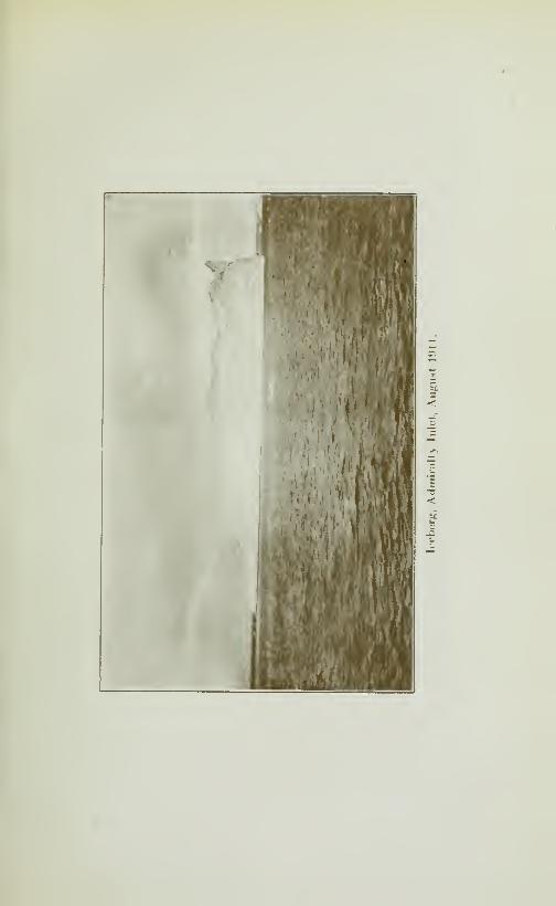

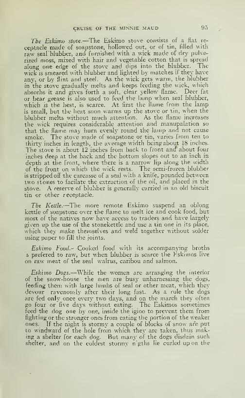
CRUISE OF THE MINNIE MAUD 95
Tbe Eskimo stove.—The Eskimo stove consists of a flat re-
ceptacle made of soapstone, hollowed out, or of tin, filled with
raw seal blubber, and furnished with a wick made of dry pulve-
rized moss, mixed with hair and vegetable cotton that is spread
along one edge of the stove and dips into the blubber. Thewick is smeared with blubber and hghted by matches if they have
any, or by flint and steel. As the wick gets warm, the blubber
in the stove graduafly melts and keeps feeding the wick, which
absorbs it and gives forth a soft, clear yellow flame. Deer fat
or bear grease is also used to feed the lamp when seal blubber,
which is the best, is scarce. At first the flame from the lampis small, but the heat soon warms up the stove or tin, when the
blubber melts without much attention. As the flame increases
the wick requires considerable attention and manupalation so
that the flame may burn evenly round the lamp and not cause
smoke. The stove made of soapstone or tin, varies from ten to
thirty inches in length, the average width being about 18 inches.
The stove is about 12 inches from back to front and" about four
inches deep at the back and the bottom slopes out to an inch in
depth at the front, where there is a narrow lip along the width
of the front on which the wick rests. The semi-frozen blubber
is stripped off the carcasse of a seal with a knife, pounded between
two stones to facilate the extraction of the oil, and placed in the
stove. A reserve of blubber is generally carried in an old biscuit
tin or other receptacle.
The Kettle.—The more remote Eskimo suspend an oblong
kettle of soapstone over the flame to rnelt ice and cook food, but
most of the natives now have access to traders and have largely
given up the use of the stonekettle and use a tin one in its place,
which they make themselves and weld together without solder
using paper to fill the joints.
Eskimo Food.—Cooked food with its accompanying broths
s prefered to raw, but when blubber is scarce the Eskimos live
on raw meat of the seal walrus, caribou and salmon.
Eskimo Dogs.—While the women are arranging the interior
of the snow-house the men are busy unharnessing the dogs,
feeding them with large lumbs of seal or other meat, which theydevour ravenously after their long fast. As a rule the dogsare fed only once every two days, and on the march they often
go four or five days without eating. The Eskimos sometimesfeed the dog one by one, inside the igioo to prevent them fromfighting or the stronger ones from eating the portion of the weakerones. If the night is storm}- a couple of blocks of snow are putto windward of the hole from which they are taken, thus mak-ing a shelter for each dog. But many of the dogs disdain such
shelter, and on the coldest stormy n'gths lie curled up on the
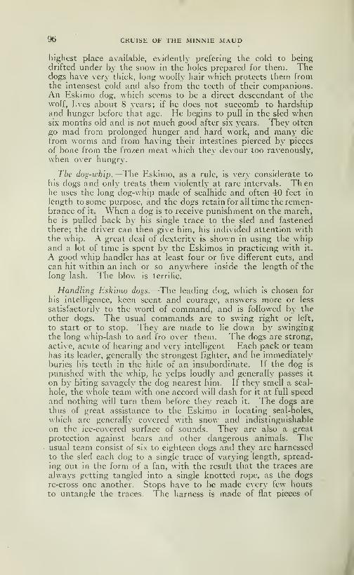
96 CRUISE OF THE MINNIE MAUD
highest place available, evidently prefering the cold to beingdrifted under by the snow in the holes prepared for them. Thedogs have very thick, long woolly hair which protects them fromthe intensest cold and also from the teeth of their companions.An Eskimo dog, which seems to be a direct descendant of thewolf, Lves about 8 years; if he does not succomb to hardshipand hunger before that age. He begins to pull in the sled whensix months old and is not much good after six years. They often
go mad from prolonged hunger and hard work, and many die
from worms and from having their intestines pierced by pieces
of bone from the frozen meat which they devour too ravenously,
when over hungry.
Tbe dog-whip.—The Eskimo, as a rule, is very considerate to
his dogs and only treats them violently at rare intervals. Th enhe uses the long dog-whip made of sealhide and often 40 feet in
length to some purpose, and the dogs retain for all time the remen-brance of it. When a dog is to receive punishment on the march,he IS pulled back by his single trace to the sled and fastened
there; the driver can then give him, his individed attention withthe whip. A great deal of dexterity is shown in using the whipand a lot of time is spent by the Eskimos in practicing with it.
A good whip handler has at least four or five different cuts, andcan hit within an inch or so anywhere inside the length of thelong lash. The blow is terrific.
Handling Eskimo dogs.—The leading dog, which is chosen for
his intelligence, keen scent and courage, answers more or less
satisfactorily to the word of command, and is followed by theother dogs. The usual commands are to swing right or left,
to start or to stop. They are made to lie down by swingingthe long whip-lash to and fro over them. The dogs are strong,
active, acute of hearing and very intelligent Each pack or teamhas its leader, generally' the strongest fighter, and he immediatelyburies his teeth in the hide of an insubordinate. If the dog is
punished with the whip, he yelps loudly and generally passes it
on by biting savagely the dog nearest him. If the\' smell a seal-
hole, the whole team wâth one accord will dash for it at full speedand nothing will turn them before they reach it. The dogs are
thus of great assistance to the Eskimo in locating seal-holes,
which are generally covered with snow and indistinguishable
on the ice-covered surface of sounds. They arc also a great
protection against bears and other dangerous animals. Theusual team consist of six to eighteen dogs and they are harnessed
to the sled each dog to a single trace of varying length, spread-
ing out in the form of a fan, with the result that the traces are
always getting tangled into a single knotted rope, as the dogsre-cross one another. Stops have to be made every few hours
to untangle the traces The harness is made of flat pieces of

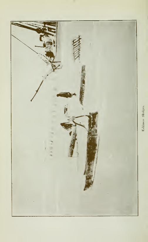
a
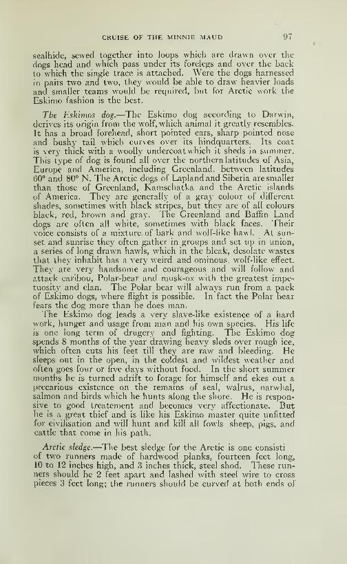
CRUISE OF THE MINNIE MAUD 97
sealhide, sewed together into loops which are drawn over the
dogs head and which pass under its forelegs and over the back
to which the single trace is attached. Were the dogs harnessed
in pairs two and two, they would be able to draw heavier loads
and smaller teams would be required, but for Arctic work the
Eskimo fashion is the best.
Tbe Eskuiios dog.—The Eskimo dog according to Darwin,
derives its origin from the wolf, which animal it greatly resembles.
It has a broad forehead, short pointed ears, sharp pointed nose
and bushy tail which curves over its hindquarters. Its coat
is very thick with a woolly undercoat which it sheds in summer.This type of dog is found all over the northern latitudes of Asia,
Europe and America, including Greenland, between latitudes
60° and 80° N. The Arctic dogs of Lapland and Siberia are smaller
than those of Greenland, Kamschatka and the Arctic islands
of America. They are generally of a gray colour of different
shades, sometimes with black stripes, but they are of all colours
black, red, brown and gray. The Greenland and Baffin Landdogs are often all white, sometimes with black faces. Their
voice consists of a mixture of bark and wolf-like hawl. At sun-
set and sunrise they often gather in groups and set up in union,
a series of long drawn hawls, which in the bleak, desolate wastesthat they inhabit has a very weird and ominous, woIf-Iike effect.
They are very handsome and courageous and will follow andattack caribou. Polar-bear and musk-ox with the greatest impe-tuosity and elan. The Polar bear will always run from a packof Eskimo dogs, where flight is possible. In fact the Polar bearfears the dog more than he does man.The Eskimo dog leads a very slave-like existence of a hard
work, hunger and usage from man and his own species. His life
is one long term of drugery and fighting. The Eskimo dogspends 8 months of the year drawing heavy sleds over rough ice,
which often cuts his feet till they are raw and bleeding. Hesleeps out in the open, in the coldest and wildest weather andoften goes four or five days without food. In the short summermonths he is turned adrift to forage for himself and ekes out aprecarious existence on the remains of seal, walrus, narwhal,salmon and birds which he hunts along the shore. He is respon-sive to good treatement and becomes very affectionate. Buthe is a great thief and is like his Eskimo master quite unfittedfor civilisation and will hunt and kill ail fowls sheep, pigs, andcattle that come in his path.
Arctic sledge.—The best sledge for the Arctic is one consist!
of two runners made of hardwood planks, fourteen feet long,
10 to 12 inches high, and 3 inches thick, steel shod. These run-ners should be 2 feet apart and lashed with steel wire to cross
pieces 3 feet long; the runners should be curved at both ends of
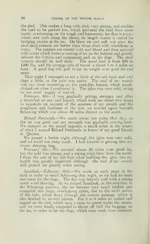
98 CRUISE OF THE MINNIE MAUD
the sled. This makes a long wide sled, very strong, and enablesthe load to be packed low, which prevents the load from cons-tantly overturning on the rough and hummocky ice that is every-where met with along the shore; its length makes it useful for
bridging cracks in the ice. On blare ice and soft wet snow thesteel shod runners are better than those shod with whalebone orivory. The runners are coated with seal blood and then sprayedwith water which forms a coating of ice on the bottom and greatlyreduces the friction and consequent pull on the dogs. The steel
runners should be iced daily. The usual load is from 800 to
1200 lbs, and the average rate of travel s about 3 to 4 miles anhour. A good dog will pull twice its weight over good ice andsnow.That night I managed to eat a little of the old buck seal and
slept a little, as the pain was easier. The roof of my mouthwas raw from munching on the rock-like biscuit, which nearlychoked me when I swallowed it. The igloo was very cold, owingto our smal supply of seal oil.
February' 8th.— I was gradually getting stronger and after
a breakfast on sea' and biscuit, which took me about two hoursto negotiate on account of the soreness of my mouth and thetoughness and hardness of the fare, we started again towardsSchem.ng which was about 40 miles distant to the south.
Béland Peninsula.—We made about ten miles that day, as
the ice was good and my strength was gradually coming back.
We camped on the sound opposite a small point in the centre
of what I named Béland Peninsula in honor of my good friends
in Quebec.We passed a better night although the igloo w^as very cold,
and we could not sleep much. I had trouble in getting into myfrozen sleeping bag.
February 9th.—We covered about 20 miles over good ice,
but the cold was intense and a strong wind blew from the north.
I froze the sole of my left foot when building the gloo, but myhealth was greatly improved although the roof of my mouthstill pained me greatly when eating.
Sassilook.—February 10th.—We made an early start in the
dark in order to reach Scheming that night, as we had no 'moreseal meat for the dogs. The day was bitterly cold with a strong
north wind blowing. As we neared Sassilook, at the entrance to
the Scheming narrows, the ice became very much broken andcrumpled into large, overlapping cakes, due to the swift action
of the tide, which flows through the narrow passage, which is
also blocked by several islands. For 5 or 6 miles we pulled andtugged on the sled, which near y came to pieces under the strain,
and we were finally compeied to throw off half the baggage onthe ice, in order to let the dogs, which were weak from constant
CRUISE OF THE MINNIE MAUD 91)
heavy pulling and hunger, make any headway. \\ e left only
such things as the wolves could not devour.
Reach Scbeming.—When we reached the site of the Eskimocamp on the western side of the narrows, we were al: fagged out
and wet through with perspiration. An Eskimo who had just
returned from hunting seal near the island, helped us build the
igloo and gave us some seal meat for the dogs and some blubber
for our stove.
I could not eat much but slept soundly from sheer fatigue, in
spite of the intense cold. My relief at reaching Scheming after
all the trouble. Illness and cold that I had undergone and at
being able to feed the dogs was so great that I passed the best
night that I had known since leaving Arctic Bay.
Scbeming.—Scheming is the name given by the natives to the
northern island in the narrow channel which runs north andsouth between the head of Admiralty Sound and the large baywhich I have named South Bay. Scheming is about 100 miles
from Arctic Bay.—The channel of Scheming is about 5 miles
wide at the north end, 3 miles at the southern end. The narrowsare about 15 miles long The principal island lies north andsouth in the northern end of the channel, and is five miles long
and from one to three miles wide. In the eastern channel for-
med Itv' the island and the mainland are three small rockyislands. A mile and a quarter south is another island, about1}4 mile long and a mile wide on each side of which is a channelabout a mile wide and which is probably deep enough for a schoonerto pass. Both islands are low and rocky being not over 100feet high and consist of granite gneiss boulders and black rockthat looks like diorite, with many cracks or fissures but no veinsof quartz visible.
At the northern end of the larger island is a large open water-hole, about 3 miles long by 500 yards wide which is open all theyear long as the swift rush ot the tides in the narrows preventsthe water from freezing over. Here the natives shoot and har-poon seal all winter, on the west side of the island is anotherwater-hole, open and smaller, about 100 yards long and 30 yardswide, which first begins to freeze over about the middle of Fe-bruary. The natives' summer camp is opposite the southwestcorner of the island, in an angle of the shore. The winter campis about ten miles further south, round the corner and on thenorth shore of what I named West Bay, near a small lake, wherethey are more sheltered from the north wind.
I found four Eskimos living at Scheming whose names wereCoodnoo, a fine elderly native with a very good disposition, Sken-nikar, Attitar and his brother Eejoonia, with their wives andchildren.—Four men, five women and two children; eleven all
told.
8

100 CRUISE OF THE MINNIE MAUD
The country east of the narrows consists of high, easy slopingrocky hills, from 200 to 300 feet high, which slope down gra-
dually to a gravel and boulder beach along the shore.
On the west side of the narrows the country is low for aboutten miles back from the w^ater, where high rocky hills begin,
1000 to 1500 feet high. The low land between these hills andthe narrows is about 100 square miles in extent and consists of
black rock, gravel and boulders.
I spent 24 days at Scheming, from January 11th to March 7th,
spending the time in fox-trapping, exploring the country andwaiting to catch enough seal to carr^- us over the long land trail
to IglooHk.
The first day Peewiktoo and I visited the long open water-holewhich runs along the east side of Scheming island, for the purposeof catching some seal. But the wind was so cold and the fog
so dense that we could not see 50 yards ahead of us. Peewiktoosaw one seal come up and blow for an instant, but the wind wastoo cold for the seal to remain for any length of time above water,
and after wandering around the hole for some hours, we returned
to the igloo which we had built at the Eskimos regular summercamping ground. On February 12th, I sent Peewiktoo with the
sledtto bring up the baggage we had left on the rough ice in front
of the narrows. I spent the day in changing the magazine onPeewiktoo's old Mauser rifle and cutting off superfluous woodfrom the barrel, making it lighter and easier to shoot with.
I spent the days exploring the country all round the narrows,
where I set out fox-traps, but only caught one fox. I saw nosigns of any deer tracks and only a few hare tracks. Wheneverwe kill a seal, we would see the next day, the tracks of foxes whichhad been attracted by the smell of blood. The whole country
round Scheming at this time of year, was desolate in the extreme.
There was no game to hunt, as the caribou had gone south towardsthe sun. Seal were scarce and very hard to kill, and the country
seemed hopelesly devoid of animal life.
In the summer time. Scheming is a Paradise for hunters, as
it'abounds in caribou, salmon, geese, duck, ptarmigan and hare.
There are also wolves and foxes. Occasionally a Polar bear will
wander down Admiralty Sound from the north in search of seal.
Coodnoo told me that he once killed a female bear and her cubon our camping ground. Seals are plentiful in the waters of
the sound, but there are no walrus narwhal in those waters.
Seal bunting.—Most of our days were spent in hunting seal,
as without seal meat we could not continue our journey. Weused to hover round the open water-holes for days armed with
rifles and harpoon, after seal, where we suffered greatly from the
intense cold and biting winds from the north, which often froz»
our feet, hands and faces. After much trouble and exposure
CRUISE OF THE MINNIE MAUD 101
we succeeded in killing 8 seals in the Scheming water-hole andfive more in the middle of West bay. Of these we only managedto capture the bodies of five, as the remainder were swept awayunder the ice by the swift current before we could secure themwith the harpoon, and it was very dangerous work approachingthe edges of the water-holes, as the ice was thin and rotten, andto fall in the water meant certain death. On February 15th, I
killed a seal and when trying to recover it froze my face and onefoot and, what was worse, lost the seal.
After my experiences at Scheming, at Igloohk and mybitter sufferings when hunting seal there in winter time, I could
fully sympathise with the poor Eskimo who has to endure this
disagreable and plaintful task every winter, in order to provide
food for himself and family. They have to stand for hours at
a time on the exposed ice in the coldest weather, often in a howl-ing northerly bhzzard, with the thermometer 40 or 50° below zero,
in the hope that a seal will come up to blow and give the waiting
and motionless Eskimo a chance to shoot or strike it with his
harpoon. If he misses his shot and the seal escapes, the Eskimoknows how^ bitter will be the disappointment of his starving
and shivering wife and children when he returns empty-handedto his cold and fireless igloo. If the seal are scarce and the weatherunfavorable it means slow death from starvation and cold for
all of them. And the seal are by no means easy to catch, as they
are very wary and suspicious of any noise or movement on the
ice, and their sense of smell is also keen. So the hunter mustkeep perfectly still for hours over the hole waiting for the "ploof,"ploof" of the animal when it comes to the surface to breathe; andyet he must ever be on the alert all the time, and ready to plungehis harpoon through the thin ice that crusts the hole, into the
seal's head, or it will blow^ quickly and dive again. He has to
remain in a crouching posture all this time, the harpoon in his
right hand and the line in his left, and he generally leans his fore-
arms on his thighs as he crouches, waiting to strike. Often he
ties his knees together with a piece of seal string to keep themfrom trembling and knocking together with the cold; his handsand feet become numbed wàth the frost and as he has to face the
wind from the leeward side of the sealhole, his face often gets
frost-bitten. The near approach of a seal is heralded by strings
of bubbles formed by the animal empting its lungs as it rises
to the hole. It first rises to the surface of the water under the
ice, gives a quick blow and disappears. If nothing has aroused its
suspicion, it shortly returns and gives two more short blowswith its nostrils and dives as before. If on the second visit to
the hole, nothing has happened to alarm it, it will rise to the
surface a third time, and begins a series of long respirations,
accompanied by a strong blowing noise as the air is expelled andinhaled by its lungs. That is the moment to strike, and the

102 CRUISE OF THE MINNIE MAUD
patient Eskimo no.selessly brings his spear directly over the centre
of the hole, and strickes down with all his force, hoping to drive
the barbed point into the brain and immediately kill the seal.
This often happens with small ones, but with the large ground-seal, a single blow rarely kills it and a struggle between manand the wounded beast then takes place. The barbed head of
the harpoon is arranged to slip off the point once it has entered
the flesh and remains jammed in the body of the animal, at right
angles, so that it can not be drawn out again. To the barb is
attached a long and very strong line made of sealhide, and the
moment the animal is struck the hunter lays down the handleand devotes his attention to the line which is attached to the
struggling seal s body by the barbed lance head. If the seal
is a large one and struggles much, a turn of the line is taken aroundthe waist, and the hunter braces himself for an encounter in
which the seal is sometimes a victor. Great care is necessary
in paying out the line, for many a finger has been lost by becom-ing tangled in a loop. The violently struggling seal must soonbreathe, and to do so is compelled to rise in the hole; then the
hunter endeavours to drive the pointed rod into its brain, andusually does so very quick'y. The hole in the ice is then enlarged
with the ice-chisel on the end of the spear handle. When the
seal has been hauled on the ice, a number ofceremonies are gonethrough in order to propitiate its spirit and to please Nuliayok,the goddess of the marine animals. One of the customs consists
in bursting the eyes of the dead seal by a prick from the point
of the knife or harpoon, so that th e seal's spirit may not see that
it is being taken to the snowhouse. Another custom is to fill
the mouth with snow and to squirt it in the form of water over
the seals' body, if it is the first seal killed at the hole, or other-
wise no more seal will come to that hole to be killed.
When the ice has frozen over the sea surface for several miles
out from the shore, many of the seals, especially the older ones,
remain in the shallow waters of the bays and sounds. In order
to do this, they are compelled to keep holes open so that they maybreathe from time to time. They form these holes either byenlarging natural cracks or, when such do not occur by scrapingwith their front flippers a conical hole large enough to admittheir body and with a few inches of ice to spare at the surface,
through which is a small round aperture in the centre. By lying
down on the ice and applying one's eye to this aperture andgazing steadily down into the water one can often see se\eral
seals darting about under water in chase of the small fish on whichthey feed. A seal does not necessarily confine itself to one or
more breathing holes of its own, but uses those of other seals,
so that the chances of killing a seal at any particular hole vary.
As the winter draws on, the Eskimo forsakes the edges of the ice-
floe and hunts his seal at these holes. In order to find the holes
CRUISE OF THE MINNIE MAUD ]03
he employs his keenest scented dog, harnessed, wlio soon smells
a hole and drags his master to it. If the hole appears well fre-
quented, and the Eskimo is anxious to obtain the seal, takes
the dog some distance away and ties him securely by its trace
to the ice. He then returns to the hole, and clears the snowfrom about its opening, replacing it with a thin fresh slab of ice
on which the centre of the hole is planly marked. If he intends
to remain until a seal comes, he often erects a low wall of snowto windward and sometimes places a block close to the hole as
a seat.
Seals igloos.—As the time approaches to bring forth her young,the female seal enlarges a hole usually in rough ice where the snowis deeply drifted, and there clears away the snow about the hole
forming a flat domed house sufficiently large to accomodate her-
self and her young. The pups are born in March and April.
When born they have a glistening white coat of soft hair, andthey increase very rapidly in weight. Eskimos, bears and foxes
dig the young seal out the snow houses on the ice, as their flesh
is very fat and tender, and the skin with the fur on makes verywarm socks and m tts.
The Arctic Seals.—There are many different kinds of seals,
but the most common is the ringed or Jar seal (Nitchick, Eskimo)which is the common small seal of the coasts. It varies in
size, markings and colour according to its age which has led to
its being classed under several species. Its flesh is the chief
article of diet of the natives the year round, while its skin, whenescraped with the hair left on, is used for clothing, tenting andbags; when dressed by removing the hair it is used for coveringof Kayaks and for boots. Its blubber, which the Eskimos burnin their lamps, is the chief source of artificial heat. The skin
has a very strong and unpleasent odor, and its scientific name is
Pagomys Foetidus, or the Stinking Seal. The liver s very goodto eat when fried, especially with bacon. The meat i darkred and full of thick dark red blood.
Big seal.—There is also the Bearded, Big, Ground or Square-flipper seal (Oogjook-Eskimo) which is found on all the coasts.
The Big Seal is next in size to the walrus, and its capture alwaysbring gladness to the Eskimos, as it provides a large amount ofmeat blubber, while from its hide is cut an exceedingly strongline used for dog-traces, whips, harness and other purposes. Thedressed skin which is usually thick and tough, is used for thesoles of boots, for covering kayaks, tentings etc. The flesh oftheOog-jook is courser in texture, but less fishy in flavor thanthat of the smaller seals. The liver is said to be somewhat poi-
sonous, and is not often eaten.—The OOg-jook or Big-seal
brings forth its young, which are born near an opening in the

104 CRUISE OF THE MINNIE MAUD
shore ice, about a month later than the Ringed Seal, that is,
in April and Ma\\
Bladdernose Seal.—The Hooded Seal or Bladdernose (Nit-
shivok, Eskimo) is a large and ferocious seal, second in size only
to the Big Seal or Oog-jook. It is found at Pounds Inlet and is
caught on the ice-floes off the Newfoundland and Labrador coasts.
It is not known in Hudson Bay. It produces its young abouttwo months later than the Harp Seal and usually in the ice fur-
ther off the coast.
Harp Seal.—The Harp, Saddleback or Bedlamier Seal, (Kir-
olik Eskimo) supphes nearly two-thirds of the seals taken an-
nually off the coasts of Newfoundland in the spring, when the
females give birth to their young on the floating ice of the Arctic
Pack. The harp seal is more common along the Atlantic coast
of Labrador. These seals commonly travel in bands, and are
known by their habit of frequently leaping from the water. $2.00
for the skin and $2.00 for the blubber is the average current price
in Newfoundland.
Harbour Seal.—-The Harbour, Ranger or Freshwater Seal (kas-
sigiak, Eskimo) is found, but is not plentiful, on all the coasts.
It is found usuall}^ about the mouths of the rivers, and in baysand fiords. It is found also in the larger lakes of Labrador,
Baffin land and Melville peninsula, where many of them reside
permanently, living on the salmon and trout in those waters. Theyoung, unlike those of other seals, are produced in July on the
rocks about the banks of rivers. The skins are greatly prized
by the natives owing to their fur-like character and beauty of
colour. The flesh and blubber especially of the older and larger
fresh-water reals have a disagreable odor and taste.
Fur Seal.—The Fur Seal as known in the shops are not found
in the Arctic islands waters, being common to the Pacific shores
of Siberia and Alaska and Behring Strait, where the temperature
of the ocean is warmer.On February 18th, a party of Eskimos, with three sledges,
arrived at Scheming, having come from Ponds Inlet, by way of
Arctic bay where they had gone to spend Christmas and to ex-
change their skins and ivory for cartridges and tobacco. Theybrought me half a barrel of biscuits and 10 lbs of tobacco, which
I divided amongst Peewiktoo and the different natives at Schem-ing who had supplied me with caribou and seal meat. This party
consisted of Izzikakto his wife and child, Mannil (Izzikakto's son)
wife and baby, and Nootararia (a brother of Coonoo's with his
wife and small baby. They proceded the same night to the win-
ter camp at West Bay.
On Februarv 20th all the Scheming natives left to hunt bear
A big Arctic Seal.

CRUISE OF THE MINNIE xMAUD 105
on the Gulf of Boothia, Prince Regent inlet and Lancaster Sound.One party went to Bernier Bay, the head of which is separated fromWest Bay by a narrow neck ot low land only a few miles across.'
A second party went to Prince Regent inlet and a third up Ad-miralty Sound to Cape Crawford.
On February 24th, a heavy gale blew from the north accom-panied by a snowstorm. On February 26th when we were re-
turning from laying fox-traps on South Bay, one of our old dogsdied, leaving us with only seven.—On March 1st, I visited all
the traps I had laid round the narrow?, but could find only a
third of them, as the dogs could not find the trails owing to the
fierce, cold wind that was blowing, accompanied by a thick
snowfall.
Eskimos arrive.-—On March fifth, five Eskimos arrived fromAggo and Igloolik on their way to Ponds inlet to exchange their
furs, skins and ivory for tobacco and cartridges. They wouldhave to travel over 1000 miles before they reached their homesagain. Their names were Ikkipiria and Mifes; his son Otar wïïe
and two children; Coggan, wife and two children; Zillakappsi,
wife and two children; and Takkowa and wife. A party of
fourteen altogether and five sleds.
These natives remained at Scheming for a couple of days andthen with the exception of Coggan and Takkowa proceded ontheir way to Ponds Inlet.
Takkowa, a son of Eetotiardjo, the head man of Igloolik hadcame from there with a sledge, runners and all, made out of fro-
zen walrus skin. He had come to get an old wooden sled withwhalebone runners which Izzikakto's son, Mannil, had left for
him at Scheming.Coggan had come all the wa}^ from the native village of Ai-
villik, situated a few miles north of Wager Bay on the west coastof Hudson Bay, where Captain Comer, the commander of theAmerican whaling schooner "Era" had made his headquartersduring the past 30 years. Ai-villik is about 200 miles down theeast coast of Melville Peninsula, from Igloolik and about 370miles from Scheming. Coming by way of Aggo, as Coggan hadcome, it was much further. Coggan was a fine handy man andspoke some English, which he had picked up from Comer's men.Coggan is a man of about 35 years of age, very intelligent and a
great traveller. He had visited Marble Island, Southamptonisland, Wagner inlet, and had crossed from Wagner inlet overlandto the Back's river, traversing the same country where Mr Cald-well, some years ago, disappeared and was never heard of again.Coggan and Takkowa returned with me to Igloolik.


CHAPTER VI
TREMBLAY's trip—scheming to IGLOOLIK—THE ESKIMOS THEARCTIC CARIBOU
Leave Scheming.— I left Scheming on March the 7th and it
was the first fine day we had since leaving Arctic Bay. The sun
shone bright and clear and there was no wind. For several
hours during the day I got so warm from walking and running
and from tugging at the sleds that I was obhged to shed my coat.
I picked up some fox-traps along the route that I had laid south
of the camp. When the sun went down it got bitterly cold again.
The thermometer at Salmon River registered 52*^ below zero
on this day.
Party, etc.—Our party consisted now of Peewiktoo and wife,
Takkowah and wife, and Coggan his wife and two small children
and myself. We had three sleds, two of which were drawn by seven
dogs a piece and our own sled drawn by nine dogs, as I had pur-
chased three dogs from Skennikar and Attitar at Scheming,
each dog costing me 5 Victor Fox-traps. We also had the bodies
of five seals to provide us with food and fuel on our long journey,
from Scheming to Igloolik, a distance of 160 miles, of which
100 miles were overland with very heavy going for the sleighs.
As it usually requires two seals to feed and provide fuel for an Eski-
mo, his family and his dogs for a week, this was not much in the
way of food and fuel for a party of eight persons and 23 dogs for
two weeks of hard travel before us. But as caribou were said to
be'plentiful along the valley that we were to traverse, I trusted
to' be able to kill enough animals to keep us alive till we reached
Igloolik. I did not know until afterwards, in view of our limited
supply of cartridges, what a risk we had run.
Quart/, veins.— It was my first intention to go to Aggo andthence by way of Fury & Hecla Strait to Igloolik, but when I
heard from Takkowah of the existence of a large vein of milk-
white quartz near lake Taseonia on Melville Peninsula, and also
from Coggan of the existence of other quartz veins in that vici-
nity, I decided to press straight on to Igloolik in the hope that
Wilson would follow me to Aggo and that I could join him there
from Igloolik, when we could both prospect the country where
the quartz veins were said to exist.
108 CRUISE OF THE MINNIE MAUD
Leave Seal and note.— I left a large seal, weighing fully SOO^Ibsfor Wilson at Scheming with a note of my movements, as I knewfrom my own experience, that when he reached Scheming hewould be hkely to be short of food for his dogs.
Fall River—We marched south all day and pitched camp onthe south point of W'est Bay. Opposite this point, on the east
side of South Bay, a fairly large river about the size of SalmonRiver runs into South Bay from Borden Peninsula. There is
a heavy rapid and fall, strewn with large boulders, near its mouth.This river contains no salmon. I named this the Fall River.
The ice on the narrow sound was good and level, and coveredwith a thin coating of snow, but the sleds were heavy for the dogsand I pulled at the sled all day.
South Bay.—March 8th—On this day, which was very cold,
(the thermometer registering 48° below^ zero at Salmon Riverand with a bitter north wind blowing, we made good progress
and camped on the ice about seven miles from the southern shoreof South Bay. I have seen no map that shows correctly theshape and formation of the southern extremity nor of the v.estern
shore of Admiralty Sound. The south-western shore line of thesound consists of bluff reddish sandstone cliffs that rise sheer
outthe water to a height of 2000 feet, and which are pierced by nar-
rows ravines. Opposite Béland Peninsula the west side of the soundconsists of black rocks similar to the diabase and pjTrhotite shownto me at Arctic Bay. This chain of black rocks, mineralized in
places, runs S. W. and N. E. from the west side of Melville Pe-ninsula and Fury & Hecla Strait across the southern end of
Brodeur Peninsula to Arctic Bay, Adams and Strathcona Soundsand obtrudes through the predominant granite and red sand-
stone and limestone formation. Northeast of Strathcona Soundthe Black rock disappears and the formation is of red and yellow
sandstone, limestone and gravel. This intrusive belt is highly
mineralized in places, as at Strathcona Sound there is a large
deposit of iron pyrites, heavily charged with sulphur, assays
of which have shown it to contain platinum.
Méthode of xnjormat'ion.— I made careful notes and sketches
in my pocket-book throughout my journeys in these localities,
of the shape, formation and relative bearings and distances of
the different bays, sounds, headlands, and prominent landscapefeatures. WHierever possible I used the compass, altho I hadno means of determining the magnetic variation, having neither
sextant or artificial horizon, but the position of the sun at noongave me the true south, and the Pole Star at night, gave me the
true north and by these two indications I was enabled with the
daily estimates of the distances travelled in a direct line, to cometo a fairly accurate decision as to my latitude and direction ot

CRUISE OF THE MINNIE MAUD 109
route. This added to such known positions as Igloolik, CapeHallowell on Fury & Hecia Strait, Cape Kater and Prince RegentInlet, Cape Crawford, Arctic Bay, Albert Harbour, the entrance
to Murray Maxwell Bay or other points on existing charts, haveenabled me to plot in with aproximate accuracy the contour anddirection of the coast-hne and landmarks over which I travelled,
much of which had never been travelled before by a white man.I also got the most intelligent Eskimos of each locality to drawfor me sketch maps of the various bays, rivers and sounds that
I was unable to visit personally; and this they did with great
readiness and ability, as they were conversant from boyhoodwith the localities sketched and also were in the habit of huntingthere every year. They could thus give me full particulars of
each place with the approximate distances and general direc-
tions and bearing. Peewiktoo, Tootillik, Coonoo, Eetotiardio,
Coggan, Panniloo, Akkoomalee, Tom Lasso and Okai were espe-
cially useful and helpful in this work.
Preparation oj map.—As I went along, I named the most im-
portant features on the land as they appear on the mapthat accompanies this volume, being assisted by Mr Reader in thepreparation of the map and in the selection of suitable names.
Repairs.—We spent the next day and night (March 9th) at thesame igloo, as we had to mend our sleds, the wire fastening of
which had become slack and one of the runners on Coggan'ssled was broken.—March 10th.—Made an early start and tra-
velled all day while the sunlight lasted. We reached the south-ern shore of the sound about noon and our journey over the landbegan. No sooner had we struck the land, that our troubles
commenced. The land which was overlain by snow from a foot
to two feet deep, was full of holes. There was a thin crust ontop of the snow, through which men, dogs and sleds kept conti-
nually breaking, with the result that our progress was slow andlaboured. The dogs would sink in up to their bodies in the soft
and crusty snow, and we were kept busy all that afternoon tuggingat the sleighs and adjusting the dogs' harness. I saw plenty of
caribou tracks for the first time, and it cheered me greatly, as
it meant food for men and dogs. The weather continued on verycod and the sun shone each day only for a few hours at a lowangle over the Southern horizon. The cold north wind of theprevious days had moderated.
Zig-7ag River.—We did not follow the riverbed, as it was toozig-zag in its meandering course over the flat land, but cut acrossthe land till we reached the point where the river comes out fromthe mountains, on the east of the valley. We camped on the ice
of the riverbed, close to the foot of the mountains. This river,
which I named the Zig-zag River, is about 75 yards wide and

110 CRUISE OF THE MINNIE MAUD
teems with salmon in the summer. The rivei loiks alH)ut
three miles below where we camped, one short bianch runningS. W. for a few miles and then terminating in a large lake,
which the Eskimos told me was about 6 miles long and 3
to 4 miles wide. I called this lake Zig-zag Lake. The mainbranch of the Ziz-zag river runs for a much longer distance through
the mountains to the S. E. About 5 miles west of the Zig-zag
river, another river which I have named the Sarpoolik River,
enters South Bav. The Sarpoohk river runs from a very long
lake, which lies about eight miles to the S. W. This lake I namedLong Lake, as it is about 30 miles long and from 3 to 4 miles
wide, so the natives informed me. When going to Aggo the Es-
kimos travel fast with their sleds over its flat, frozen surface.
This lake is also said to be full of salmon. About four or five
miles distant from the S. W. end of Long Lake is another lake,
called by the natives Ibbi-sauk-too. Between the two lakes
is a low round hlll which forces them to make a short detour
to the south. A river flows from the lake Ibbi-sauk-too into
the north eastern arm of Aggo Bay, and this river and lake are
also the home of many fine salmon. The distance from Schem-ing to Aggo is about 95 miles which makes Scheming about the
half way house between Arctic Bay and Aggo.
Fare during trip.—During this trip I hved entirely on half-
cooked or raw seal and caribou meat unaccompanied by bis-
cuits, tea or sugar; as what httle I had of those luxuries I gave
to the Eskimos, in order to make the trip, if possible, somewhatmore attractive for them. I drank only hot or cold water, andoften ate snow instead of water. This was the fare, varied oc-
casionally by a meal of rotten walrus or salmon, eaten frozen
and raw, on which I lived for the next two months until I reached
Salmon River on Mav the tenth. I gave the Eskimos all the
biscuits, tea and suggerthat I had, as I wished to show them that
a white man could live on the same food as they were accustom-
ed to, and also to make them feel that they were not being treat-
ed with injustice. To do them justice Peewiktoo and Tootillik
did not want to eat the biscuits and drink the tea by themselves
and always offered me some. But I always refused, altho I mustconfess that my mouth often watered for a hot cup of tea at the
end of a hard day's march, when I was shivering with cold in
the igloo. I suffered intensely all the trip from a raging thirst,
and the temptation to drink of the tea, while it lasted was some-times often almost too great for me. I often reduced my share of
the seal meat, whenever I saw that Peewiktoo and Tootillik
were over-tired and hungry, as they were always so willing,
patient and enduring that I hated to think that they were under-
going so much hardship and suffering on my account, when they
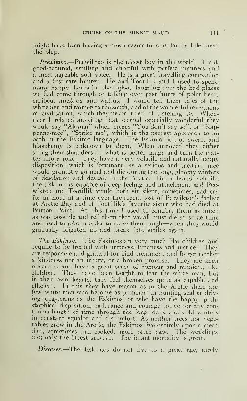
CRUISE OF THE MINNIE MAUD HI
might have been having a much easier time at Ponds Inlet nearthe ship.
Peeiviktoo.—Peewiktoo is the nicest boy in the world. Frankgood-natured, smiUing and cheerful with perfect manners anda most agréable soft voice. He is a great travelhng companionand a first-rate hunter. He and TootilHk and I used to spendmany happy hours in the igloo, laughing over the bad places
we had come through or talking over past hunts of polar bear,
caribou, musk-ox and walrus. I would tell them tales of thewhitemen and women to the south, and of the wonderful inventions
of civihsation, which they never tired of listening to. When-ever I related anything that seemed especially wonderful theywould say "Ah-mai" which means "You don't say so", or "Kap-penna-mee", "Strike me", which is the nearest approach to anoath in the Eskimo language. The Eskimo do not swear, andblasphemy is unknown to them. When annoyed they either
shrug their shoulders or, what is better laugh and turn the mat-ter into a joke. They have a very volatile and naturally happydisposition, which is ortunate, as a serious and taciturn racewould promptly go mad and die during the long, gloomy wintersof desolation and despair in the Arctic. But although volatile,
the Eskimo is capable of deep feeling and attachment and Pee-wiktoo and Tootillik would both sit silent, sometimes, and cryfor an hour at a time over the recent lost of Peewiktoo's fatherat Arctic Bay and of Tootillik's favorite sister who had died atButton Point. At this time I used to comfort them as muchas was possible and tell them that we all must die at some timeand used to joke in order to make them laugh—when they wouldgradually brighten up and break into smiles again.
The Eskimos.—The Eskimos are very much like children andrequire to be treated with firmness, kindness and justice. Theyare responsive and grateful for kind treatment and forget neithera kindness nor an injury, or a broken promise. They are keenobservers and have a great sense of humour and mimicry, like
children. They have been taught to fear the white man, butin their own hearts, they feel themselves quite as capable andefficient. In this they have reason as in the Arctic there arefew white men who become as proficient in hunting seal or driv-ing dog-teams as the Eskimos, or who have the happy, phili-
stophical disposition, endurance and courage to live for any con-tinous length of time through the long, dark and cold wintersin constant squalor and discomfort. As neither trees nor vege-tables grow in the Arctic, the Eskimos live entirely upon a meatdiet, sometimes half-cooked, more often raw. The weaklingsdie; only the fittest survive. The infant mortality is great.
Diseases.—The Eskimos do not live to a great age, rarely
112 CRUISE OF THE MINNIE MAUD
beyond 60 years and at 50 both of them, man and woman, are
old and wrinkled; they often die from acute indigestion from
eating a surfeit of frozen meat after several days enforced
fast when game is scarce. They also suffer a good deal from
ulcers and boils from eating raw meat of the seal and caribou
which has become tainted and rotten in the stone caches through
exposure to the sun's rays during the short summer months.
They also suffer from rhumatism, dysentry, typhoid, and bron-
chial troubles and occasionally from inflammation of the lungs.
Their eyes become inflamed with dirt and weakened by the glare
of the sun on the snow in summer. Some become totally blind
with cataract. There are a few weak-minded, but the blind,
the cripple, the insane and the aged are fed and cared for whenpossible. However if food is scarce these are the first to gc.
Many die from accidents and exposure. Some are killed by
rocks falling when hunting, others through the ice-pans on which
they are hunting seal, breaking away and being blown out to sea;
whole parties of Eskimos have been swept away and have pe-
rished in this manner. Others again are upset and drowned
from there flimsy and unstable kayaks when engaged in the
perilous pursuit of the vicious and dangerous walrus. Polar
bears have disposed of some. But hunger and starvation are
their greatest enemies and are responsible for the majority of
deaths.
Effects of Meat diet.—The unlimited use of stimulating ani-
mal food, on which the Eskimos are fed from infancy, induces
at an early age a highly plethoric state of the vascular system.
The weaker over-distended vessels of the nose quickly yield to
the increased impetus of the blood, and an active haemorrhage
or nose-bleed relieves the subject. As the same causes continue
to be applied in excess at frequent intervals, and are followed
by similar effects, a kind of vicarious haemorrhage at length
becomes established by habit; and having no small share in
maintaining a balance in the circulalory system—the nose act-
ing as a safety valve.
Ice-Walking.—Even on dangerous ice-whether consisting of
constantly moving unstable blocks or of thin, young ice,—the
Eskimos-men, women and children alike-will walk fearlessly,
though cautiously in spring or Fall from the shore to a ship or
out to the seal holes. Their method is to go in a line ahead, or
by single files the leader or perhaps one or two of the others
carrying a spear with which they constantly try the ice before them,
keeping their legs as far apart as possible so as to bear upon a
large surface and carefully avoiding the parts that look black,
when a white man would not dare to venture out at all until the
ice became more stable or thicker by several inches.
CRUISE OF THE MINNIE MAUD 113
Religion.—"Strickly speaking writes Peary, the Eskimos have
no religion in the sense in which we used the word. But theybelieve in the survival of the person after death, and they believe
in spirits—especially evil spirits. It may be that their lack of
any idea of a beneficent God, and their intense consciousness
of evil influences, result from the terrible hardship of their lives.
Having no special blessings for which to be grateful to a kind
Creator, they have not evolved a conception of Him, while the
constantly recurring menaces of the dark, the bitter cold, the sa-
vage wind, and gnawing hunger, have led them to people theair with invisible enemies. The beneficent spirits are those of
their ancestors (another Oriental touch) while they have a wholelegion of malevolent spirits, led by the Tornarsuk, the great
devil himself."
Beliefs in devib.—-"They are constantly trying to propitiate
Tornarsuk by incantations and when they kill game, arf offering
is made to him. The devil is supposed to have a knee appre-ciation of these habits. On leaving a snow igloo the Eskimosare careful to kick the front out of it, that the evil spirits maynot find shelter there, and when they throw away a worn-outgarnment it is never left intact, but is torn in such a way thatthe devil may not use it to warm himself. A comfortable devil
is presumably more dangerous than a shivering one. Any suddenand unexplained barking or howling among the dogs indicates
the invisible presence of Tornarsuk, and the men will run outand crack their whips or fire their rifles to scare away the invader.
When the ice presses hard against the ship an Eskimo will call
on his dead father to push it away; when the wind blows withspecial violence, ancestors are again appealed to. Passing alonga cliff, on a sledge journey, a man will sometimes stop and listen
and they sa^': "Did-you hear what the devil said just there?"I have asked the Eskimo to repeat tome the word of Tornarsukup there on the cliff and I would not dream of laughing at myfaithful friends at such a time; the messages of Tornarsuk I re-
ceive with a respect for gravity."
All calamities and bad-luck are attributed to the malevolentspirit of Tornarsuk, the evil god, or Nuliayok the evil goddess,working to the detriment and misfortune of the hard-living Es-kimo and many rites and superstitious practices are performedto propitiate these malignant spirits.
Fear of death and evil spirits.—The Eskimo fears the death of
others more than their own, as they believe that the spirit lives
after death and that if they displease the spirits of dead menor animals they will be persecuted and haunted by their angryspirits or by the Evil gods that preside over them. For that
reason, they are careful to place beside the dead body the favorite

114 CRUISE OF THE MINNIE MAUD
weapons or the implements used by the dead. They perform
various rites and ceremonies over the bodies of animals which
they have killed. They never use an igloo or a toopik where
a death has occured. The body they drag out by a rope, as
they do not hke to handle human remains, and cover it with
stones or blocks of ice to keep off the weasels, foxes and wolves.
But wild animals or the dogs generally manage to find access
to the body and to devour it The after-world of the Eskimosis hke that of the Turks and other Orientals a material abodewhere the spirit enjoys the good things of the hfe without too
much trouble in seeking them. .
Burial customs.—The sledge and kayak, with his weaponsand articles of daily use are placed besides the grave of the hunter
and scmetimes his favorite dogs are struggled so that they maykeep his spirit company in the unknown world. If the deceased
is a woman, her lamp and the little wooden frame on which she
has drieS the family boots and mittens are placed beside her
grave. A little blubber is placed there, too, and a few matchesso that the woman may light the lamp and do some cooking
on the way; a cup or old kettle is also provided that she maymelt snow in case she becomes thirsty. Her needle, thimble
and other sewing things are placed with her in the grave. In
the case of a child a tiny kayak or sledge is carved of wood or
bone, together with a miniature set o! bows and arrows and other
small articles are placed in the grave.
If a death occurs in a tent, the poles are removed and the tent
is left to rot on the ground. It is never used again. If the death
occurs in a permanent igloo, made of stones, earth and whale-
bone, the habitation is vacated and not used again for a long time.
The name of the lost one is rarely, if ever, mentioned, and the
relatives of the dead observe certain formalities in the matter
of food and clothing for some time afterwards.
Eskimo devils.—The Eskimos are very superstitious and be-
lieve in all kinds of devils or evil spirits, which belief has been
common to all the races of the world before the teachings of
Christianity appeared on earth. They have many kinds of
devils which they call Toonga, Toongasuk or Toopilan. Thesedevils assume various forms when they appear. Sometimes a
devil will appear half-man, half-polar-bear, 8 or 10 feet high;
half-man and half-seal, or in the guise of the Toopilan, a small
round person with huge popping eyes, like a seal's, with a cir-
cle of flame round its body. These devil forms are undoub-tedly the result of imagination engendered of weakness, hunger
and cold, during the devilish hours of fog and obscurity in the long
winter months. In the death like stillness of the frozen north-
land, rocks, hills and ice-blocks assume all kinds of weird andfantastic shapes, in the dark drifting fog. One suddenly sees a
CRUISE OF THE MINNIE MAUD 115
dark object loom through the fog which appears as il it werejumping about with some omnious intent, causing a nervousperson to start and to feel a creepy sensation crawhng up his
spine. On closer inspection it proves to be only a rock or a solid
block of ice past which the dense fog is drifting. It is the fog
that is moving and not the object. But to an Eskimo doseing
on his sled, and weak from a long exposure and fasting in the
darkness and intense cold, to his fevered imagination it ap-
pears as if he had suddeni}' seen the devil of his early dreams,and he makes all haste to camp and invokes the aid of an Angakokor conjuror to rid him of the evil spirit that is dogging his foot-
steps and preventing him from killing game. The Eskmiosnever see these devils in the summer months of continual sun-shine. Then all is brightness, gaiety laughter and love making.The young Eskimo wanders hand in hand with his girl wife,
singing and laughing from sheer gladness of heart, over the barebrown hills where the song of birds and the rush of runningbrooks fill the air with music. The air is clear and bracing,
wild flowers of every hue enliven the view, bumble-bees humand dart from flower to flower while across the sound are magni-ficent ranges of snow-clad peaks outlined relief against the blue
sky. The flowers however in the Arctic are scentless. Therivers are full of silvery salmon, the lakes and ponds are alive
with luscious trout, and wild geese and ducks that have comefrom the far-away south, are flying around in flocks. Caribouin their soft brown summer coats are sleek and fat, and easyto approach. In the summer time the Eskimo abandons the
sea-shore and wandering over the hills and lakes-strewn vallies
lives on the flat of the land, while the days of only too short
sunshine last. As winter approaches, he returns to the shoreand, travelling by sled over the new-formed ice, reaches his winterquarters, where he resumes the work of seal hunting, fox-trapp-
ing, and the chase of the Fall caribou and the polar bear.
Eskimo origin and physique.—The Eskimo is distinctly of Mon-golian origin, having come no doubt from the north of Chinaby way of Behring Strait. They are very robust and healthyand have finely muscled bodies and limbs. They are very strongand of great endurance, being able to travel for days withoutfood in the coldest of weather. They are generally short andsturdy, but there are many five foot ten inches in height andthey sometimes weigh 180 lbs. Their eyes are black and their
hair, which is allowed to grow long as a protection to the face
and ears, falls like a horse's mane over their shoulders. Theirjaws and teeth are very strong from constant chewing of toughmeat and leather. Mr Charles Dawson, according to a recent
newspaper despatch from London, who found the famous Pilt-
down skull, has made another surprising discovery of profound

116 CRUISE OF THE MINNIE MAUD
interest to anthropologists. He has discovered that a certain
Eskimo tribe have literally more backbone than the rest of hu-manity that is to say, they have in their waists one extra joint
(or vertebra) to which small ribs are attached.Mr Dawson has lately been making an examination of various
skeletal remains brought from the Arctic regions and has madethe remarkable discovery that both the man and woman of anEskimo tribe show this abnormal development of the backbone.Mr Dawson is of opinion that what is an occasional abnor-
mality in men and the higher apes has become, through survival
of the fittest, a fixture and permanent character in the tribe in
question.
The extra joint lends strength and suppleness to the waist,
and thus enables the members of the tribe to be more dexterousin the management of the Eskimo canoe or "kayak".
This canoe which is only five or six inches deep, and on whichthe Eskimo formerly depended for theii living, is mainly governedas to balance and righting powers by the muscles of the waist.
Eskimo Women.—The women when young are often quitegood-looking, with fine busts and arms, but their legs are generallywarped and stunted from their habit of constantly sitting on their
haunches, with their knees doubled under them in the igloos.
The women are great adepts with the needle and for the makingof skin garnments and sealskin shoes are unsurpassed. Theysew away from them, instead of to them, as is the custom ofwhite women, and use the thumb for the thimble-finger. Theyalso use the feet to hold garment that they are working on,
gripping the garment between big toe and second finger. Theyare very skilful in piecing the different coloured skins together,
making all kinds of fancy patchwork and trimmings; and theyuse the sinew from the back of the deer for thread, which is un-breakable and does not rot from moisture. The}' also use thesinew from the tail of the narwhal. Where formerly they usedbone punches for sewing, they now use steel needles obtainedfrom the traders, using the three cornered needle for makingleather shoes. They do not use scissors for cutting out the skin
to pattern, but a semi-circular double-edged blade with a woodenhandle, which is generally made from saw steel. The best winterclothes for the Arctic are those made by the Eskimo womenfrom the skins of seal, caribou and polar bear, and consist of aninner shirt and troussers of caribou skin with the hair inside against
the body; long socks of caribou, hare or young seal with the hair
inside; an outer hooded cloak of caribou skin which fits on overthe head; outside trousers made of polar bear or car'bou skin,
warm fur-lined mittens and outer shoes or kammings of sealskin
with soles made of the heavier skin of the big seal or Oog-jook.Add to these a pair of snow-goggles for use in the months of
March, April and May and the winter costume is complete.
CRUISE OF THE MINNIE MAUD 1 17
Mariage customs —The Eskimo women are excellent motherand bestow the greatest care and afFection upon their small
children which they carry in a fur-lined bag strapped to their
shoulders. They are firm believers in the trial marriage system.
A young man and woman will start housekeeping together withoutany preliminary ceremony other than that of setting up their
own separate toopik (tent) after the young man has made a pre-
sent of some kind to the father of the bride or the nearest malerelative. If they find that they are not suitable to each other,
they try again, and sometimes several times until mutually sa-
tisfied, when they generally form a permanent marriage. TwoEskimos will sometimes exchange wives at intervals or lend
each other their wives when one of them is going hunting or ona long journey. They are usually very devoted companions,and the wife's advice is often listened to and followed, althoughthe man is always master and the head in his own household.
Among the Eskimos the woman is as much a part of the man'sproperty as his dog or sledge-except in some rare cases, wherethe woman, from natural force of character and good judgement,takes the lead in deciding as to the movement of the household.
The cause of the militant suffragettes has as yet made little
headway in this region, possibly perhaps, because a woman canalmays find a husband to support her. The women are much morejealous than the men and a woman will often pull the hair of
another woman and administer a good drubbing if she thinks
the latter is encouraging the attentions of her husband. Wife-
beating is sometimes indulged in, but not often. If two menwant to marry the same woman they generally settle the matterin good humour by a trial of strength, either by wrestling or bypounding each other on the arm to see which can stand the pu-nishment the longest. The winner gets the woman who is soughtfor as a wife, not so much on the score of good looks as for her
ability to tend igloo, sew clothes, and help with the dogs and hunt-ing. If a man grows tired of his wife he tells her there is no roomfor her in his igloo and she returns to her relatives or takes anotherhusband. In these cases the husband keeps one or all of thechildren or the woman takes them with her. Sometimes a goodhunter will have two wives, generally where the first wife hasno children. Each woman keeps her own fire alight and the twowives are the best of friends and great company for eachother when the man is away hunting. But most of the natives
have only one wife as the number of women is about equal to
that of the men. In fact it may be said that the customs of theEskimos are the outcome of the climatic conditions and of thevery rigorous life they lead, and white men who have lived amongthem for any length of time generally concede that the less so-
called improvement or change in the marriage customs the better.
The Eskimos do not have many children, two or three being
118 CRUISE OF THE MINNIE MAUD
the usual number. The woman always retains her own name.Tootillik for instance will remain Tootillik, whether she had onehusband or several. Children do not address their parents as
father as mother, but call them by their names, though sometimesvery sma I children use a diminutive which corresponds to our
"mamma' —The husband often calls the wife "Kooma ' whenaddressing her. gK^
The girls marry very young, sometimes at the age of twelve.
In many cases the marriages are arranged between the parents
when the children are quite young; but the boy and girl are not
bound, and when they are old enough they are permitted to
decide for themselves. In fact thev can make several such deci-
sions without losing caste. Cases have occured where an Es-
kimo has kidnapped another's wife, but in these cases the injured
husband, when he is attached to his wife sometimes retaliates bykilling or wounding the interloper.
Eskimo children.—The Eskimo children are delightful with
their tawny skins, rosy cheeks and sparkling black eyes. Theyare very intelligent, quick and observant. They delight in gamesand in learning to acquire the accomplishments of their elders.
They are dutiful, respectful and obedient and the smallest gift
of a toy, ornament or useful article renders them very grateful andhappy. Thev are very fond of their parents who rarely, if ever,
treat them with aught but the greatest kindness and affection.
—The Eskimos do not lie orsteal, unless they have been corrup-
ted and taught to do so by their white visitors. They are hos-
pitable, kindly, tactful and considerate. They share the produceof their hunting with their less fortunate companions, protect,
and feed the cripples and helpless, are every devoted to w ife andchildren and are always occupied in the chase or busy at someoccupation. They are staunch companions and faithful to
their trust.—With permanent central trading stations established
at easely accessible points where a vessel could call once a year
and where they could be sure of being able to exchange the pro-
duce of their chase, on just and equitable terms, for a liberal
supply of cartridges, tobacco, sugar, flour, biscuits, matches,needles, timber for kayaks and sledges, knives, cooking ustensils,
dried apples and potatoes, tea, molasses, coffee, salt, rifles, axes,
and other necessities, and some medical attention, the Eskimowould be perfectly happy and contented.
They are a magnificent race of people, without the need of
any system of intricate laws or administration, and are indispen-
sable to the development of the Arctic regions and they arc quite
unfitted for contact with the white man's civilization. Theyare now full-fledged members of the Great Canadian common-wealth and deserve the protection and encouragement of that
Government.

CRUISE OF THE MINNIE MAUD 119
The greatest tribune to the Eskimos character is the fact
that all white men who have hved among them became greatly
attached to them, invariably admire their wonderful courage,
patience and endurance, and when the time comes sincerely
regret to parting and always look forward with pleasure to
meeting them again.
They have a rich and wonderfully expressive language andwhen soap and water are obtainable are cleanly in their habits
and dispositions.
Deserve better treatement.—The Eskimos are the guardians of
the north and are the only hope of salvation for the crews of
shipwrecked vessels and exploring parties stranded in those in-
hospitable regions. They are a peaceable people and mostfriendly disposed and are deserving of much better treatementthat they have hitherto obtained from the scheming traders andwhite men's scum that have occasionallv visited their shores
and who have unscruspulously plundered them of their hard-
earned produce of the chase.
Excellent mechanics 6- carvers.—They are natural-born mecha-nics and can take a complicated watch, rifle or modern mechanismto pieces and put it together again with unfailing skill. They are
excellent carvers in ivory and their kayaks or skin canoes are
marvels of ingenuity. They know the habits of every thing that
moves on land or swims under the water, and when hunting, takeadvantage of each animal's weakness or peculiarities. They are
a most sociable people, being intensely fond of music, singing
and dancing which they indulge in whenever the occasion pre-
sents itself. They eat and sleep at all hours of the day andnight and will often be seen or heardi ndulging in a noisy gameof football, made out of a sealskin bag stuffed with feathers, at 2
o'clock m the morning in a moonlight winter's night with the
thermometer 40° below zero. The men indulge in wrestling
harpoon-throwing and whip practice for amusement. Thewomen and men play cards, dance and sing in chorus together.
The children play at catc's cradle with a piece of string, ball andstick and other games, including the harnessing of the puppiesto miniature sleds and the building of miniature igloos of snowand stones. They visit each other's igloos at all times of the dayand night, which they enter and leave without formality. Asthey are much intermarried, and men and woman have gene-rally been married several times, the relationship of the children
is most confusing and impossible for the white stranger to un-derstand. When a woman has no children, another women whohas several, will give her one, which she will treat and bring upwith as much care and attention as if it were her own. Theyform one large happy family, and although the dialect of one

120 CRUISE OF THE MINNIE MAUD
tribe will differ from that of another, the main language is thesame and is understood by all.
Eskimo writing.—The Eskimos have adopted a form of syllabic
symbols, somewhat resembling shorthand, which was invented for
them by the reverend E. J. Peck, the Anglican Missionary atCumberland Gulf, and which they use for the purpose of writingletters in pencil to one another.
The Devil Supreme.—From leading a life of constant suffering
and danger the Eskimos have come to believe in the potencyof the devil or devils rather than in the Goodness of God, ofwhomuntil the Anglican Mission of Cumberland Gulf was established,
they had rib conception. In the long sunless winter the wholeArctic Region-—cliffs, plains, ocean and glaciers^—is coveredwith a monotonous pall of snow that shows up a ghostly grayunder the pale light of the northern stars. When the stars are
hidden by the dense fogs that continually envelope the region,
all is black, void and soundless. The dense blackness and awfulstillness of the brooding landscape are deathlike in their effect
upon the senses. When the wind is blowing, if a man venturesout, he seems to be pushed backward by the hand of some in-
visible and icy fiend, while a vague, unnameable menace seemsto lurk everywhere around him. It is small w onder, then, if
the Eskimos believe that evil spirits or devils walk upon the windand lurk behind the dark forbidding rocks and glaciers along
the shore.-—As Tom Lasso once put it "No God, only devil",
looks after the Erkimo with an empty belly and starving wife
and children in the freezing igloo. And in the freezing tempe-ratures, biting wind and misery and extended gloom of an Arctic
winter, it is hard work to explain to this keenly logical race that
God is supreme and Eivil only subsidiary. Thej^ believe in
the existence of the soul (Tarninga) and in its continued exis-
tence after death, and they make solitary visits to the grave
and address the spirit of the departed one. They believe that
if a child is named after the spirit of a dead relative, that spirit
will enter the child's body for a year and endow the child with
its good qualities. They also believe that the spirit of a deadEskimo or animal, if offended by them through failure to observe
the innumerable taboos imposed upon them by the Angakoks,will complain to the Goddess of Evil named Nuliayok, that pre-
sides over the marine animals and this goddess will cause tempests
to arise and prevent them from killing enough animals to feed
them and their families. They believe in a future state, or
Heaven, which they call Skinniktanga (the place of Sleep). Thereare there planes of Heaven for the soul of a man and four for
the soul of a woman. Heaven in their estimation, is a place
that is always bright and warm, where there is plenty to eat,
and drink and clothes to wear with little to do.

CRUISE OF THE MINNIE MAUD 121
Murder and Suicide.-—Murder is rare and, then, it generally
occurs over the possession of some woman. Incurables someti-
mes commit suicide, which is not considered a crime, and their
spirit after death is credited as going to an upper plane in Heavenalong with the other good people.
Lunatics and Criminals.-— If an Eskimo becomes dangerousobnoxious or insane the men of the band consult together, andone or more of them are deputed to remove the criminel or lunatic
in which case they are held blameless in the matter. Some-times they will marron an obnoxious individual on an island
where they leave him to die of starvation. Their Hell, called
Sen-nalies at the bottom of the sea and is presided over by Nulia-
yok, the Goddess of Evil. The souls of evil Eskimos go to Sen-
na when they die, and are tormented for a time by the father
of Nulia-yok. The souls of transgressors of the numerous Taboosor rites and rules prescribed by the Angakoks or Seers, and the
souls of men that have been carried away on the ice-floes also
spend sometime in Purgatory or Sen-na.
Nulia-yok Goddess of Evil.—All the Eskimos believe in a supre-
me goddess, called Nulia-yok, who, according to 1 skimo tra-
dition, was an Eskimo maiden who would not marry any of their
young men. She was finally wooed and won by the Fulmai,a Gull who persuaded her to accompany him to his island as.
his wife. On arriving there Nulia-yok found that she had been de-
ceived and that the deceithful Gull's splendid home was nothingbut a nest of sticks perched upon the bare high rocks, withoutany shelter from the winds or snow. The abundance of food
that he had promised her turned out to be nothing but rotten
fish and she was continually being jostled by the other Gulls,
so that she had difficulty in keeping her place on the rock.
Very soon Nulia-yok managed to send word to his father
Anautelik, and he came in his boat and took her away duringthe absence of the Fulmar. When the gull discovered his loss,
he caused a great storm to spring up and Anautelik, to preserve his
own life, threw his daughter overboard, but she clung to the gun-wale, so he cut off her fingers, one by one, to make her let go. Asher fingers dropped into the sea they changed into the whale(ak-bin) the walrus (aivil) the big-seal (oog-jook) and the smallseal (nitchiek) and so gave origin to the sea- animals. Her fathernext knocked one of her eyes out, after which Nulia-yok let goher hold of the boat and her spirit went to the world beneaththe sea, where she became Queen and lived in a house built ofstones and whalebones and where she was guarded by her hus-band, the dog. Nulia-yok can not walk, but "hunches" ovf^r
the ground with one foot beneath her body. Her father Anautelikwas also drowned later and now lives with his daughter wrappedup in his tent cover and employs his time in torturing the souls

122 CRUISE OF THE MINNIE MAUD
of the wicked. The souls of the sea-animals go to join Nulia-yok at the bottom of the sea, after death, after having remainedfor three days besides the body. For this reason, when a seal
or sea-animal is killed the Eskimos puncture its eyes so that it
may not see that it is being taken to the igloo; as otherwise the
soul might be offended and cause trouble by complaining to
Nulia-yok. For this reason, a great deal of respect is shownto the bodies of sea-animals when they are slain and is the origin
of a number of taboos in connection with them. If the soul
of a sea-animal makes complaint to Nulia-yok her hands swell
and she revenges herself by bringing ill-luck or sickness uponthe Eskimos. But if all the ceremonies are properly observed
the soul of the dead animal is propitiated, and other animals
will allow themselves to be killed by such considerate people.
Taboos.—The various taboos that have been formulated bythe Angakoks for observance by the Eskimos when dealing withthe skins and bodies of slain animals are well describded by MrLow in his "Cruise of the Neptune" and by other writers.
When the taboos have been broken they can only be condo-ned by open confession in the presence of an Angakok, who,through his familiar spirit, which he invokes in a state of self-
induced hypnotic trance, reports the confession to Nulia-yokand the sin is forgiven.
Another Eskimo legend.—-There is another legend in connection
with Nulia-yok and her husband, the dog, which explains the ori-
gin of the Indian race and the white people. The story runs
that Nulia-yok was deceived by the dog, who took the form of
a 3'oung man a sort of corollary to the myth of Leda and the
Swan when her father found her with a litter of red and white
puppies he was very angry, and placed her with her strange
progeny upon an island, sending food to her by the dog. Later
he drowned the dog and brought her food in his Kayak. Nulia-
yok in revenge for the death of the dog set the pups on her father
who killed him. Being now without means of getting food for
herself or her pups, Nulia-yok made two large slippers and plac-
ing the white pups in one and the red pups in the other, set themafloat on the ocean before a north wind, which blew them south,
where they landed and the white pups became the ancestors
of the white folks and the red pups the ancestors of the Indians
who have always been the hereditary foes of the Eskimos whostyle themselves Inyooit, the word Eskimo or Esquimaux having
been applied to them by the first French Settlers in Canada,meaning "Eaters of raw Fish".
Pookimma —There is also a goddess of the land animals called
Pookimma, who appears to be the same personage as Nulia-
yok under another name. The Polar bear is under the special

CRUISE OF THE MINNIE MAUD 123
protection of another goddess called Angea-garak-takto, wholives in an iceberg. When killed the jaw, skin and ciaws of a
Polar bear must not be brought into an igloo or harm will cometo the woman.
Familiar Spirit.—Every Eskimo, man or woman, has a fami-
liar spirit belonging to one of the sea or land animals, throughwhom he or she may intercede with Nulia-yok, Pookimma or
Angea-garak-takto for forgiveness for the non-observance of
the prescribed taboos in order to ward off ill-luck or disease.
Exorcising the Devil.— If an Eskimo becomes ill, he has evi-
dently offended some spirit by a breach of the taboos, and his
only chance of a remedy is to go to some Angakok, who holds a
seance at which all the women sit in a circle and sway their bodies
and shout Atté-Atté and clap their hands. The Angakok goes
into a trance and foaming at the mouth, goes through someweird performance on the ice outside, sometimes chansing the
Devil with a harpoon, till the suffered announces h mself better
or the Angakok returns with the report that he has killed the
Devil.
The Angakok.—The Angakok or the medecine-man, is belie-
ved by the Eskimos to possess supernatural powers, wherebyhe can charm away sickness, lighten the displeasure of Nulia-
yok, when she sends famine or misfortune to the band, put the
Evil eye (Ee-zinga) on those who displease him and also see
into the future. The Angakok can also by gazing fixedly at
a knife or some other object that he holds before his eyes, throwhimself into a self-hypnotic trance when he foretells where seal
or caribou can be found when the band is starving. By a remark-able coincidence Pannikpa, a noted Angakok at Botton Point
actually predicted the correct number of a herd of caribou that
would be found the next morning in a certain ravine, on Bylot
Island. Three Eskimos went hunting the next day and not
only sighted a herd of nine caribou in the ravine, corresponding
to the number and place indicated by Pannukpah the night
before, but killed some of them and returned with two sled-
loads of meat to the hungry but rejoicing band of natives assem-bled there.
The Tonuak.—The Angakok is supposed to derive his powersfrom the aid of a familiar spirit, called his Tonwak, which usu-ally assumes the form of some animal, often that of the walrus.
Novitiate.—To become an Angakok it is necessary to receive
instructions in the mysteries from some other Angakok, andusually more than one take part in the instruction and initia-
tion of the candidate. During his preparation, the novice cooks
124 CRUISE OF THE MINNIE MAUD
his own meals and eats nothing that is prepared by any other handthan his own. During the period wanders about in solitary
meditation.
After being instructed, the novice has a series of incantations
performed over him by the assembled Angakoks, who danceround him uttering charms. He is then taken to his home andleft for several daj^s in sohtude, during which time he meditatesand prays for his tonwak to appear; this usually happens after
several days, when all that remains to make him a full-fledged
Angakok is to learn certain words that are unknown to the uni-
tiated. An Angakok will perform all kinds of conjuring tricks
for which he prepares behind a curtain or screen, such as takinga knife and plunging it through his koolitang into his heart,
while his face becomes deathly pale, his eyes are staring andwide-open and blood drips apparently from the wound. Ofcourse it is a trick, but sometimes it looks too real tc be pleasant.
Peary, writing of the Angakoks, says: "There is no chief amongth'sse people, no men in authority; but there are médecine menwlo have some influence. The Angakok is generally not oved heknows too many unpleasant things that are going to happen,so he says. The business of the Angakok is mainly singing in-
cantations and going into trances, for he has no médecines. If
a person is sick, he may prescribe abstinence from certain foodsfor a certain number of moons; for instance, the patient mustnot eat sealmeat, or deer meat, but only the flesh of the walrus.
Monotonous incantations take the place of the white man'sdrugs. The performance o a self confident Angakok is quite
mpressive—if one has net witnessed it too many times before.
The chanting, or howling, is accompanied by contortions of thebody and by sounds from a rude tambourine made from thethroat membrane of a walrus stretched on a bow or bone. Thetapping of the rim by another piece of ivor^' or bone marks thetime. This is the Eskimo's only attempt of music. Somewomen are supposed to possess the power of the Angakok—
a
combination of the gifts of the fortune teller, the mental healerand the psalmodist, one might saj'."
"Once years ago, my little brown people got tired of an Angakokone Kyoahpahdo, who had predicted too many deaths; andthey lured him out on a hunting expedition from which he neverreturned. But these executions for the peace of the communityare rare."
Through contract with the white man the Eskimo is graduallylosing his be.'ief in the Angakok and their practices, but in theabsence of their remedies and amusements the Angakok is likely
to remain their chief counsellor and physician for many yearstc come. The Cumberland Sound natives call God "Goti".
Charms.—Amulets in the shape of small pieces of skin or
CRUISE OF THE MINNIE MAUD 125
cloth are sewn to the under coat by the wife of an Angakokto ward off sickness and to bring good luck. Many of these
are decorated with beads. The tip of the deer's tail is sewnto the tail of the coat for success in hunting and when sewn to
the coat of a boy ensures his becoming a successful hunter. Agull's feather dipped in the drippings of the lamp is placed betweenthe harpoon and spear hne, and so carried to the ice, where the
hunter sucks the feather and spits in the water in order that
the walrus may not known that it is being hunted. The dried
skin of a newly born lemming, when attached to the float of a
walrus harpoon, prevents the animal from attacking the boat
when wounded, and the skin of a lemming carried in the boat
ensures safety. There are numerous other charms used, together
with invocations and songs for success in hunting.
Tattooing.—The married \\omen are often tattooed on the
face and hands to denote the tribe to which they belong. Tat-
tooing is not practiced by the men.
Piblokto —The adult Eskimo are often subject to a peculiar
nervous affection, a form of hysteria, which they call piblokto.
It seems to result from the morbid brooding over absent or deadfriends and relatives or a fear of the future. The woman suf-
fers from it most, and when attacked with this form of hysteria,
they will begin to scream and tear off their clothes and then
run about screaming and gesticulating like some one possessed.
They will rush out of the igloo in the coldest of weather, and runabout, almost nude, on the snow and ice till they fall exhausted.
If the other Eskimos did not forcibly bring them back they wouldcertainly be frozen to death. The attack usually ends in a fit
of weeping and then the patient quiets down, the eyes are blood-
shot, the pulse high, and the whole body trembles for an houror so afterwards.
Eskimo dogs and foxes suffer also from piblokto and althoughthe symptoms seem to resemble those of hydrophobia, it doesnot seem to be dangerous or infectious. The dogs suffering
from piblokto are generally shot. Several Eskimos at PondsInlet lost nearl}^ all their dogs from this desease.
Eskimo astronomy.—"In a country," writes Peary, "where the
stars are visible for many weeks at a time it is not strange perhapsthat they receive much attention from the nati^^es. The Eski-
mos are, within barbaric limits astronomers. The principal
constellations visible in northern latitudes are well known to
them and they have given them their own names and descriptions.
In the Great Dipper they see a herd of celestial reindeer. ThePleiades are to the Eskimos a team of dogs pursuing a solitary
polar bear. Gemini, they describe as two stones in the entrance
126 CRUISE OF THE MINNIE MAUD
of an igloo. The moon and the sun represent to the Eskimos,as to some of our North American Indian tribes, a fleeing maidenand her pursuing admirer."
Classification.—Dr Frank Boas, who made a special studyof the Eskimos of Baffin Land and Hudson Bay, has apphed theterm of Central Esk mos to the tribes that inhabit Baffin Land,the Arctic Islands, Labrador, Hudson Bay and the North EasternMainland of Canada lying between the Mackenzie River andHudson Bay. The natives of Greenland he describes as East-ern Eskimos and those inhabiting Alaska and the country tothe west of Mackenzie River as Western Eskimos.
Central Eskimos.—The Central Eskimos number about 4000and are scattered in small tribes, each tribe consisting of a fewfamihes, over a vast area that embraces some 3,000,000 squaremiles, most of which is treeless and inhabited only by barrenground caribou, musk-ox, arctic hare and other arctic game.
Similarity of tribes.—Scattered over such a wide area of coun-try, with such poor means of communications, it naturaly fol-
lows that the Eskimo race is broken up into a number of smalltribes that are distinguished one from the other by differencein dialect and by shght differences in manners and customs.These differences are, however, so surprisingly few, consideringthe conditions, that an Eskimafrom the Atlantic coast has nodifficulty in conversing with the natives of the west coast ofHudson Bay, or with those of Greenland. Their religious be-Hefs and ceremonies are also wonderfully alike. Everywhere,and only minor differences are to be seen in their sleds, boots, tentsand implements of the chase which are largely due to the dif-
ferent materials available in the different localities. The lan-guage, beliefs, manners and customs of all the Eskimos withonly slight modifications, are wonderfully similar.
Smith Soimd Eskimos.—A considerable number of Eskimos,forming small communities, inhabit the east coast of Greenlandfrom its southern end, near Cape Farewell, up to Upernivik atthe southern end of Melville Bay, where a stretch of coast oc-curs until Cape York is reached, where are found the Eskimosof Smith Sound who formed the most northerly permanent set-
tlement of the human race. These Arctic highlanders inhabitthe region between Cape York and the great Humboldt glacier
on the east side of Smith Sound, between Lats 76 and 79*^ N.These Smith Sound Natives are said to be of a specially fine
type and have rendered Peary, Cook and other searchers afterthe North Pole the most material, and in fact, indispensableassistance in the matter of providing them with dogs, sleds, dri-
vers and the meat of musk-ox and caribou which they killed onEllesmere land in the vicinitv of Hazen Lake and Ladv Franklin
CRUISE OF THE MINNIE MAUD 127
Fiord.—Peary when he reached the Pole in April 1909 took
with him 49 Eskimos from Etah and Cape York and 246 dogs.
The four Eskimos that reached the Pole with Peary were namedOotah, Oogueah, Seegloo and Ejingwah. Dr Cook who reached
the vicinity of the Pole the year before Peary, also had with
him as his sole companions, two young. Smith Sound natives.
Commander Peary, who has probably lived longer among the
Eskimos than any other man, writes of these natives, and wecan not do better than to repeat his words, as follows: "Themembers of this little tribe or family, inhabiting the western
coast of Greenland from Cape York to Etah, are in many waysquite different from the Eskimos of Danish Greenland, or those
of any other Arctic territory. There are now between 220 and230 in the tribe. They are savages, but they are not savage;
they are without government but they are not lawless; they are
utterly uneducated according to our standard, yet they exhibit
a remarkable degree of intelligence. In temperament like chil-
dren with all a child's delight in little things; they are never-
theless enduring as the most matured civilised men and women,and the least of them are faithful onto death. Without religion
and having no idea of God, they will share their last meal with
any one who is hungry, while the aged and helpless amongthem are taken care of as a matter of course. They are heal-
thy and pureblooded; they have no vices, no intoxicants andno bad habits-not even gambling. Altogether, they are a peo-
ple unique upon the face of the earth. A friend of mine calls
them the philosophic anarchists of the North.""I have been studying the Eskimos for 18 years and no more
effective instruments for Arctic work could be imagined, thanthese plumb, bronze-skinned keen-eyed and blackmaned chil-
dren of nature. Their very limitations are their most valuable
endowments for the purposes of Arctic work. They exihibit,
too, in marked degree all the Oriental capacity for imitation.
Out of walrus ivory, in some respects their substitute for steel
—
and a surprisingly good substitute it is,—they will construct
amazingly good models or copies of various objects, while it
does not take them long to master the use of such tools of civili-
zation as may be put into their hands. It will easily be seen
how valuable and useful a quality this has proved for the purpo-ses of the Arctic explorer. If he could not rely on the Eskimosto do the white man's work with the white man's tools, the labors
of the Arctic travel would be tremendously increased and the
size of his expeditions would be enlarged to limits that might befound unwieldy (and expensive) in the extreme. It has beena fundamental principle of all my Arctic work to utilize the
Eskimos for the rank and file of my sledge parties. Withoutthe skilful hand work of the women we should lack the warmfur clothing which is absolutely essential to protect us from the

128 CRUISE OF THE MINNIE MAUD
winter cold, while the Eskimo dog is only tractive force suitable
for serious Arctic sledge work."These Eskimos from Smith Sound are in the yearly habit
of crossing Smith Sound and Ellesmere Land, from Flagler Bayto Bay Fiord, where they hunt the musk-ox and caribou thatare numerous along the western shores of that island.
Eskimos formerly lived over nider area.—At the time of theEuropen discovery of the northern parts of America, the Eski-mos extended along the coasts considerably south of their pre-
sent Hmits. They occupied the entire Atlantic coast of Labrador,and hved far along the north shore of the Gulf of St. Lawrence.The Eskimos and Indians have always been open enemies. Withthe advent of the whites, the Indians soon became possessed of
firearms, which gave them a great advantage over their northernfoes, who were compelled to retreat beyond the tree limit in thenorthern regions; here they were safe as the Indians can not live
without firewood.
Hostility oj India^is and Eskimos.—The Eskimos continued toinhabit the eastern part of the shore of the Gulf of St-Lawrenceuntil about 1630, where they were expelled by the French andIndians. Captain W. Coats, in his notes on Hudson Bay, states
that in 1748 the Iroquois sent to the Indians of Hudson Bayfour captive Eskimos, to be used as human sacrifices at some greatfeast; that the chief of the northern Indians proceeded forthwithagainst the Eskimos of whom they captured seven and killed
thirteen; the captives were sent south to the land of the Iroquoisin what is now New-York state. Their southern limit is nowLat 54^ N. in Labrador and at Churchill on the west coast ofHudson Bay in Lat 57" 30' N. They are found along the Eastcoast of Hudson Bay as far south as Cape Jones, at the entranceof James Bay.
In 1770-72 Samuel Hearne, who was sent by the Hudson BayCompany to investigate the rich copper deposits of the Copper-mine River, accompanied a band of Chippewyan Indians jour-neyed from Churchill to the mouth of the Coppermine River in
Coronation Gulf. These Indians were only induced to go tothe Arctic coast on the chance of killing Eskimos. This theydid, by surprising a band of Eskimos who were busily engagedin fishing at the first fall, above the mouth of the CoppermineRiver, massacring them all. This fall is named Bloody Fallto this day.
Northern limit of Eskimos.—No natives inhabit the ArcticIsland north of Lancaster Sound although the remains of oldencampments have been found on Melville Island, Byam MartinIsland, Bathrust Island, and along the western shores of NorthDevon and Ellesmere Land. Occasionalv natives from Ponds
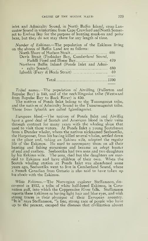
CRUISE OF THE MINNIE xMAUD 129
inlet and Admiralty Sound, in North Baffin Island, cross Lan-caster Sound in wintertime from Cape Crawford and North Somer-set to Erebus Bay for the purpose of hunting musk-ox and polar
bear, but they do not stay there for any length of time.
Number oj Eskimos.—The population of the Eskimos hvingon the shores of Baffin Land are as follows:
North Shore of Hudson Strait 400Davis Strait (Frobisher Bay, Cumberland Sound,
PaddH Fiord and Home Bay 470Northern Baffin Inland (Ponds Inlet and Admi-• ralty Sound) 480
Igloolik (Fury & Hecia Strait) 40
Total 1390
Tribal naynes.—The population of Aiwilling (FuIIerton andRepulse Bay) is 140, and of the nechillingmiut tribe (Westwardfrom Repulse Bay to Back River) is 450.
The natives of Ponds Inlet belong to the Tunungmiut tribe,
and the natives of Admiralty Sound to the Tunurusugmiut tribe.
Those from IglooHk are called Igloohngmiut.
European blood.—The natives of Ponds Inlet and AiwiJIig
have a good deal of Scotch and American blood in their veins
through contract for many years with the whaling ships thatused to visit these waters. At Ponds Inlet a young Scotchmanfrom a Dundee whaler, whom the natives nicknamed Seebootika,
the Harpooner, from his having killed several whales, settled downat the place and, taking an Eskimo wife, adopted the regular
life of the Eskimos. He used to accompany them on all their
hunting and fishing excursions and became an adept hunttrof seal and caribou. Seebootika had two sons and two daughtersby his Eskimo wife. The sons, died but the daughters are mar-ried to Eskimos and have children of their own. When theScotch whaling station at Ponds Inlet was abandoned someyears ago, Seebootika went to hve in Cumberland Sound, wherea French Canadian from Ontario is also said to have taken uphis abode with the Eskimos.
White Eskimos.—The Norw-egian explorer Steffansson, dis-
covered in 1912, a tribe of white half-breed Eskimos, in Coro-nation gulf, into which the Coppermine River falls. Steffanssonreports these Eskimos as having light hair and blue eyes, and withstrong traces in their physique of their European ancestry.
"It is" says Steffansson, "a fine, strong race of people who haveup to the present, escaped the diseases that civilization almost
130 CRUISE OF THE MINNIE MAUD
invariably brings in its train to ruin the morals and physiqueof the savage races." These natives are clever and vigorousand they live exclusively by the chase and fishing, as caribou,
salmon and seal abound in their contry.
Steffansson came to the conclusion that they were descendantfrom some Swedish or Norwegian explorers who had becomestranted in the north. But there are no records of any Swe-dish or Norwegian expeditions having visited that part of the
country since—Hearnes visit in 1771.
In 1819-22 Frankhn, Hood, Back and Dr Richardson explored
the shores of Coronation Gulf as far as Cape Turnagain in Long109«' 25' W.—In 1825-27 Sir John Franklin made anotli^r ex-
ploration of that region.—In 1838-39 the eastern portion of thenorthern coastline, between point Turnagain and the estuary
of the Black River, was surveyed by Messrs Peter Warren andThomas Simpson, who were outfitted and sent by the HudsonBay Company for that purpose, when the search for a N.W. passage was in active progress.
None of those parties came in contact with such a tribe of
half-white Eskimos.The only Scandinavian to pass through Coronation Gulf since
that time, was Amundsen in the Gjoa in 1903-06 when he success-
fully accomplished for the only time in historiy the navigation
of the N. W. passage.—Collinson with the British ship "Enter-prise", passed through Coronation Gulf in 1850-55 and Dr JohnRae, under Admiralty orders, visited Victoria island, on thenorth side of the gulf in 1853 when searching for Franklin's
party. Neither Rae nor Collinson reported meeting with anysuch tribe.
Franklins party.—Sir John Franklin's expedition cameto grief in 1847-48 when his ship the Erebus and Terror werebeset in the ice in Victoria Strait and were abandoned on the
22d of April 1848. Sir John Franklin died on board his ship
on June 11th, 1847. On April 26 th 1848 Capt Crozier and 105
ofTiciers and men, the survivors of the original complement of
129 men, left King William's Island on their way to the mouthof the Back River. The Eskimos living at the mouth of the
Back River told Dr Rae that about 40 white men reached themouth of the river, having dragged a boat as far as Montrealisland, where it was abandoned. The last of these survivors,
according to the Eskimos, died shortly after the arrival of the
summer birds in early June. Might it not be possible that the
survivors of the balance of the party, perhaps even a scant dozenor so of the hardiest men of the expedition, struck west along the
south shore of Victoria Island, towards the Coppermine Riveras offering the best hope of salvation,, and meeting Eskimosthere remained with them until they gradually died.
CRUISE OF THE MINNIE MAUD 131
It seems more than probable that these half-white Eskimosdiscovered by Steffansson are the direct descendants of Fran-
khn's men, since in the 66 years that have elapsed there wouldbe at least three generations born and some members of eachgeneration should be alive at the present day or and descendantsof the party fromthe Whaleman, Whalingfor yearsfrom Behringstrait to Bank land in Beaufort sea. A good interpreter
would perhaps be able to elicit a number of interesting
facts from the older members of the tribe in regard to their an-
cestry, and it is even possible that some members of the Fran-klin Expedition may have survived for twenty or thirty ^earsafter throwing in their lot with the capable and friendly Eski-
mos being without provisions and guides. They would have hadlittle chance of making their way across the barren and desolate
regions that lies between Coronation Gulf and Great Bear Lake.Possibly howe\-er the se\'erity and hardships of a few Arctic
winters spent with the Eskimos may have so acted upon their
minds and bodies, allready enfeebled "by the hardships theyhad undergone and the despair they experienced at never seeing
their homes and countrymen again may have caused them to
die after a few short years.
What would be more natural than that they should divideinto two parties, one party taking Franklin's old route by theCoppermine River, the Greal; Bear Lake and ALackenzie River,and the other going by the Backs River to Hudson Bay ? Which-ever party reached civilization first would report and send suc-cour to the other, and they would have the advantage of tworoutes to safety and a better chance of securing enough gameto feed themselves than if they were all in one large party.
Apparently from what the natives living at the mouth of theBacks River told to Dr Rae, in 185-1, the Backs River partydragged a heavy boat with ropes, over the ice as far as Mont-real island where they abandoned it and the Eskimos broke it
up for wood to use for their sledges. The Eskimos said thatmany of the men fell on the ice and died in the dragropes fromfatigue and cold. About 40 men reached the Backs River and diedafter the arrival of the summer birds, which would be early in
June. McClintock two years later found a deserted boat,with two skeletons in it, on the west coast of King W^illiam Island.
The other half of the party probably crossed Victoria Straitand followed the ice along the south shore of the Victoria Landuntil they reached Dease Strait, which they crossed to the main-land and entered Coronation Gulf. The party was well providedwith guns and ammunition and consequently had nothing tofear from the Eskimos. The weather in May is comparativelymild in those latitudes, seal are basking in hundreds on the ice
10
132 CRUISE OF THE MINNIE MAUD
and in June the rivers would be full of salmon and game andbirds are plentiful on the land. It would seem therefore inexplic-
able that, under such conditions all the robust, young and hardymen of the party, which was composed of the pick of the British
Navy, should have died in a few short weeks. It is much morehkely that 30 or 40 of them, at least, survived for several years.
This party would be the most likely one to have taken with
them the long and other oflTicial documents of the expedition.
It is also quite sure that the fear of the Indians and the whitemen would deter the Eskimos from accompanying them into
the interior, and without guides or provisions they could nevermake the overland journey.
For years past there have been rumours current that Franklin's
men had founded a white race in the wilds of Northern Canada,and Steffanson's discovery may be a confirmation of that rumour.
Surmner hundrig.—In summer half of the natives travel onfoot into the vast interior of their Arctic domain in search of
caribou which are sleek and fat and easy to kill at that timeof the year. They cache the meat and skins under stones at
the places where the caribou are killed and removed them to
the coast in the winter on sledges when the ground is coveredwith snow.— The other half remain by the sea-shore huntingseal, narwhal walrus and white whales in pre^'isions for the comingwinter. They cache the meat under heaps of stones along the shore
for consumption during the long dark winter months. If the
the cache is poor, the Eskimos will suffer bitterly from hungerand cold at the end of the winter and some adults and manychildren will die. In the months of March and April, when the
sun is once more high in the heavens, they will catch the newlyborn seal in their snow hunts on the ice and also the polar bear
as they emerge from their winter quarters. In May, June andJuly the sun is up day and night and the seal lie basking andsleeping in hundreds on the ice, and are then easy to approachand kill. The rivers are running and full of salmon, and large
flocks of geese and ducks provide an agréable change to the
never-changing seal diet of the long winter months.
Hunting seal on the ice.—A good deal of patience and someexcellent mimicry is displayed in killing seals as they lie bashingin the warm sun. When one is seen lieing on the ice of the
sound near its hole, the Eskimo approaches as near as possible
say to within 500 yards, when he lies down on the soft wet snowand wriggles the remainder of the distance during this operation,
great care is taken not to excite the animal's suspicion, and anadvance is only made when the seal's head is down. A seal
appears to sleep in short naps, and raises its head to look aroundevery few minutes; when he does so the hunter hides his face, andwith his arm and legs imitates the motion of the seal scratching
CRUISE OF THE MINNIE MAUD 133
or lazily rolling, at the same time mimicking the blowing andother noises made by the seals; by so doing he lulls suspicion,
and is enable to crawl a little closer. It is a tedious and tiring
process and the natives hands are often numbed with cold andtheir clothes wet through by crawhng through wet snow or wa-ter on the ice. By advancing in this manner he gets within
fifty yards of his prey, when he shoots it in the head. If he
shoots and only wounds it, no matter how badly, the seal will
instantly dive through the hole close by and escape or die in the
water. When the Eskimo has no gun, he continues to close in until
sufficiently near to kill it with his harpoon; this must, however,
be done very quickly, for the seal displays wonderful agility in
falling into the water when disturbed.
From this description it will be seen that even under the mostfavorable circumstances the providing of an Eskimo meal is not
an easy task; in the winter when the seals are scarce and theyonly appear for a few second to breathe under a hole in the ice
the operation is attended with a good deal of mental anxiety
and physical suffering.
Spring-time.—With the advent of June the snow begin to
melt and soon after the land bedomes bare. This is a period
of trial for the house-wife; the sun's '^varmth causes the roofs
ofthe snow-houses to leak, and they can only be kept up by a daily
patching with loose snow,while the ground is not sufTiciently
bare for erection of the summer hut; it becomes a constant fight
with the heat and water, terminated only by the roof falling
in. The small and general lilthiness of one of those deserted
spring houses is better left to the imagination; it is indeed beyonddescription. During this time, while the ice on the coast still
holds, the men are busily employed killing seals, whose skins
are needed to repair the summer tent and to cover the Eskimo'sboat or kayak. The men bring in the slain seals and skin themafter which the skins are handed to the women to dress. If
they are used to repair the tent, or for bags, they are simplydried by stretching them on wooden pegs about six inches abovethe ground.—Many Eskimos have an entrance extension totheir sealskin tents made of transparent tanned sealskin, thickenough to keep out the rain but not the light which adds to theroominess and confort of their summer dwellings. If the skinsare required to cover the kayak, or for boots, the hair is scrapedoff with an ordinary chopping knife, against the grain, and thefilm is removed from the inner skin. For winter boots, thehair is rotted off and the skin has a w^hite colour.
The Kayak.—This is the time to repair, and if necessary tomake new, wooden frames for the kayak. The Kayak is a longnarrow canoe, sharply pointed at both ends, and entirely deckedover except a small well near the centre sufficiently large for a

134 CRUISE OF THE MINNIE MAUD
man's body. The frame is of wood, and is covered with sealskins
sewn together to make a watertight cover. The frame is madeof thin strips of wood forming the gunwales and of five or sevenadditional strips, one of which is the keelson. These are keptin place by light ribs placed about a foot apart, with corresponding
deckbeams. Considerable mechanical skill is displayed in the
making of this frame which is all fitted together without the use
of a single nail, wooden pegs and sinew lashing being alone used.
As soon as the frame is complete, all the women of the encamp-ment join in sewing on the sealskin cover, as the operation whenstarted must be completed at one sitting, before the skin dries.
The seams are made with a double lap, and are quite watertight.
The skin shrinks on drying, and becomes stretched like a drumover the frame. Writing about the Kayak, Peary says, in his
very interesting book entitled "The North Pole". "To mymind the skin cause of these Northern Aborigènes is, with its
hunting implements, one of the most complete and ingenious
manifestations of intelligence to be found in any aboriginal
tribe. Over a light frame work, an almost infinite number of
small pieces of wood deftv lashed together with sealskin thongs, is
stretched the tanned skin of seals, the seams being neatly sewedby the women, and then rendered watertight by an application
of seal oil, and soot from the native lamps. The result is a craft
of great buyoancy, grace and especial fitness and effectiveness
for the purpose for which it is intended, that is to enable the hunterto creep softly and noiselesslv upon seal, walrus or white whale.This canoe, while varying with the size of the owner and makerwill average between 20 and 24 inches in width by 16 or 18 feet
in length. It carries one man only.
The Harpoon.—The harpoon is the most useful weapon in the
Eskimo's equipment, and accompanies him everywhere. Withit he kills seals, walrus, narwhal and white whales, also salmonin the rivers and lakes. In winter he will use it to kill polar
bear, when he has no cartridges or rifle. In former days it wasTnade of walrus ivorv and wood. Now it is generally madeof heavy round half-inch steel rod about 3 feet long which fits
in a round wooden handle about 2 feet long. The winter harpoonconsists of four parts, the steel rod, the wooden handle, the barb,
and the ice-cliisel on the other end of the handle. The end of
the rod is pointed and fits into a socket of the steel or ivory barbwhich is about 3 inches long. The barb is attached to several
fathoms of strong seal line; and is secured to the rod by a short
shp line. When a seal is struck the slip line is released and the
barb or spear head is detached from the rod and enters deepinto the animal's body. In striking a seal or other animal, the
handle is held in the right hand and the line attached to the barbis coiled in the left. Immediatelv the animal is struck the hunter

CRUISE OF THE MINNIE MAUD 135
lays down the handle and devotes himself to the hne. Whenthe wounded animal rises to the surface to breathe, the hunterdrives, if possible, the pointed rod into the brain and ends the
struggle. The summer harpoon, which is used for hunting the
seal animals from the kayak differs from the winter harpoonand consists of a stout wooden handle from 4 to 6 feet long; at
one end it is tipped with ivory with a cone like socket in its upperside, into which a similar cone on the lower end of the ivory
shaft or barb lies. The shaft is usually made from a single tuskfrom 12 to 18 inches long. The shaft is pointed with a pointedpiece of iron, usually an old knife blade, which is let into a slit
in the ivory to which it is secured by rivets. The harpoon is
thrown at the seal, walrus or whale, and its weight is sufficient
to drive the head completely through the skin; the head slips andseparates from the wooden handle which floats away. The shaft
which is buried in the animal is attached by a seal line to a sealskin
bladder which is thrown overboard from the kayak. After a fewwild rushes the animal comes to the surface, dragging the bladder
along The native then either shoots, or kills with the lance
.
The lance is somewhat similar in construction to the harpoon,but is without the head, the ivory shaft terminating in a widesteel blade usually cut out of a saw or large knife, and is withoutbarbs.
Duck dart—The other weapon of the kayak is the duck dartused to entangle the eider duck when they become fat and lazy
in the late summer This consists of a light wooden shaft 5or 6 feet long, with a trident of deer horn at its upper end. Thepieces of deer horn are from six to eight inches long and abouthalf an inch in diameter, their sides are notched by a numberof barbs pointing downwards. This dart is very skilfully thrownmany yards and entangles itself about the neck or in the wingsof the ducks.
Bou- and arrow.—The Eskimos are also skilful with the bowand arrow, which before they obtained guns and rifles from thewhalers, they used regularly when hunting caribou, hares andbirds. The bow they make out of caribou horn, the strings
out of of deer sinew and the arrow of light wood tipsed with aknife blade. They also use a sling made of sealskin from whichthey will throw stones at birds a long distance oflf.
Eskimo fishing device.—The Eskimo method of fishing is in-
teresting. The fish in the Arctic will not during the wintertimerise to the bait but are captured by cutting a hole in the ice anddropping in a piece of ivory carved in the shape of a small fish.
When the fish rises to examine this visitor, it is secured with aspear. The Eskimo fish spear has a central shaft with a sharppiece of steel, usually an old nail, set in the end. On each side
136 CRUISE OF THE MINNIE MAUD
is a piece of deer antler pointing downward, lashed unto the
shaft with a fine Hne, and sharp nails, pointing inward, are set
in the two fragments of outler. When this spear is thrust downon a fish, the antlers spread as they strike the fish's back; he is
impaled by the sharp point above him, and the sharp barbs oneither sides keep him from getting away. "The char ( ?) of
North Grant Land" writes Peary, "is a beautiful motted fish,
weighing sometimes as much as eleven or twelve pounds. I
beheve that the pink fiber of these fish-taken from water neverwarmer than 35° or 40*^ above zero—is the firmest and sweetest
fish fiber in the world. During my early expeditions in this
region, I would spear one of these beauties and throw him onthe ice to freeze, then pick him up and fling him down so as to
shatter the flesh under the skin, lay him on the sledge, and as
I walked away pick out morsels of the pink flesh and eat
them as one would eat strawberries. In September 1900 withthis fish, a party of six men and 23 dogs were supported for someten days, until we found musk-oxen. We speared the fish in
the way the Eskimos taught us, using the regular native spear."
Origin of Eskimos.—There is a theory, first advanced by Sir
Clements Markham, ex-president of the Royal GeographicalSociety of London, that the Eskimos are the remnants of anancient Siberian tribe, the Onkilon; that the last members of
this tribe were driven out on the Arctic Ocean by the fierce wa-ves of Tartar invasion in the middle ages, and that they foundtheir way to the New Siberian Islands, thence eastward overlands yet undiscovered to Grinnell Land and Greenland. I
am inclined to believe in the truth of this theory for the follow-
ing reasons:
Physical characteristics.—Some of the Eskimos are of a dis-
tinctly Mongolian type, and they display many Oriental cha-
racteristics, such as mimicry, ingenuity, and patience and me-chanical dupHcation. There is a strong resemblance between their
stone houses and the ruins of the houses found in Siberia. TheEskimo girl brought by Mr Peary in 1894, was mistaken byChinamen for one of their own people. It has also been sug-
gested that their invocation of the spirits of their dead may be a
survival of Asian ancester worship.
As a generally rule, the Eskimos are short in stature, as are
the Chinese and Japanese. The women are short and plump.They all have powerful torsos, but the legs are rather slender.
The muscular development of the man is astonishmg, thoughtheir fatty roundness hides the difl^erenciation of the muscles.
Eskimo language.—Their language Is agglutinative with,
complicated prefixes and suffixes, by which they extend a wordto a considerable length from the original stem. In addition

CRUISE OF THE MINNIE MAUD 137
to their ordinary speech, they have an esoteric language knownonly to the adults of the tribe. I can not say where it differs
from the other having made no attempt to learn it, and I doubtif any white man has been fully taught this secret speech, as
the knowledge is carefully guarded by its possessors.
Better off in their own country.—The suggestions of some well-
meaning persons that they be transported to a more hospitable
region would, if carried out, cause their extermination in two or
three generations. Our variable climate they could not endureas they are keenly susceptible to pulmonary and bronchial af-
fections. Our civilisation, too, would only soften and corrupt
them, as their racial inheritance is one cf physical hardship;
while to our complex environment they could not adjust them-selves without losing the very childlike qualities which cons-
titute their chief virtues. To Christianise them would bequite impossible; but the cardinal graces of faith, hope and cha-
rity they seem to have already, for without them they could
never survive the six-mcnth night and the many rigours of
their home.
Customs should not be changed.-— It would be worse than use-
less to attempt to engraft our marriage customs upon these
naive children of nature. Should an Arctic explorer consider
it as a duty to tell a young Eskimo that it is not right for himto exchange wives with his friend, it would be well for the explorer
to have his supporting argument well prepared beforehand,for the censured one would probably open wide his eyes andinquire, "why not"?
In September 1907, the head of the Moravian Mission at
Killinik, Labrador, applied in a letter to the commander of theCanadian Government ship "Arctic" to assist them in the matterof an Eskimo who, in pursuance of an acknowledged native
custom, had taken unto himself two wives. The missionarystated that he had endeavoured to pursuade this native to se-
parate again from his second wife and that if nothing were donein the matter, he feared that the other natives in the communitymight follow his pernicious example.The commander of the Arctic intervened and compelled the
uxorious Eskimo to free his second wife and return her to her
parents. Everybody was satisfied, wrote the commander in
his report, except the first wife who cried bitterlv when she sawthe other leaving her.
There are few things that the Eskimos require to learn fromthe white man, but there are many Christian qualities inherentin the Eskimos that the white man, on his present plane of ci-
vilization, might copy and practice with a resultant benefit
to the peace and happiness of the world
138 CRUISE OF THE MINNIE MAUD
Eskimos self-sufficient.—"Much nonsense" continues Peary,
"has been told by the travellers in remote lands about the Es-kimos" regarding as gods the white men who, come to them,but I have never placed much credence in these stories; nor
has the conduct nor social amenuties of many of the white menwho have visited them, been of a character to inspire god-hkeveneration and respect. For the white man has too often takenadvantage of their remote and necessitous condition to despoil
them of their furs and ivorj-, corrupt their morals and poison
their blood with infectious diseases. My own experience has
been that the average aborigine is just as content with his ownway as we are with ours, just as convinced of his own superior
knowledge, and that he adjusts himself with his knowledge in
regards to things, in the same way that we do. The Eskimosare not brutes; they are just as human as Caucasians.
Are not cruel.—My own observations of this interesting peo-
ple have taught me to repose no confidence whatever in the
tales of barbaric craft and cruelty which I have heard related
of them. On the contrary, taking into consideration their un-civilized state, they must be ranked as a humane people. More-over they have always been quick to grasp the purposes that
I have had in view and to bend their energies towards achieving
the ends for which my expeditions have been striving.
Eskimos are humane.—Their humanity, as has been indicated,
takes a form that would delight a sociahst. They are generous
and hospitable in a crude way, almost without exception. Asa general rule, good and bad fortunes are shared. The tribe shares
in the proceeds of goodluck on the part of the hunters and, as
their existence depends on hunting, this accounts in large mea-sure for the preservation of the tribe.
Their jovial disposition. —On the whole, these people are
much hke children and should be treated as such. They are
easily elated, easily discouraged. They delight in playing tricks
on each other and on the sailors, are usually good-natured, andwhen they are sulky there is no profit in being vexed with them.
The method which children characterize as "jollying" are best
such emergencies. Their mercurial temperament is Nature's
provision for carrying them through the long dark night, for
if they were morose hke the North American Indians, the wholetribe would long ago have Iain down and died of discouragement,
so rigourous is their lot.
How to manage the Eskimo.—In managing the Eskimos, it
is necessary to make a psychological study of them, and to con-
sider their peculiar temperament. They are keenly apprecia-
tive of kindness, but like children, they will impose upon a weakor vacillating person. A blending of gentleness and firmness
CRUISE OF THE MINNIE MAUD 139
is the only effective method. The fundamental point in all
my deahngs with them has been always to mean just what I
say and to have things done exactely as ordered. I have madeit to their interest to do what I want done. For example, the
best all-round man on a long sledge journey got more than the
others. A record was always kept of the game secured by eachEskimo, and the best hunter got a special prize. Thus I keptthem interested in their work. I have made it a point to befirm with them, but to rule them by love and gratitude rather
than by fear and threats. An Eskimo, like an Indian, neverforgets a broken promise nor a fulfilled one.
Should not be civilized.—Enough has been said to give thereader a general idea of these strange people, that have been so
valuable to me in my Arctic work. But I want to say again,
at the risk of being misunderstood, that I hope no efforts will
ever be made to civilize them. Such efforts, if successful, will
destroy their primitive communism, which is necessary to pre-
serve their existance. Once give them an idea of real-estate
interest and personnal propertv rights in houses and food, andthey might become as selfish as civilized beings; whereas nowany game larger than a seal is the common property of the tribe
and no man starves while his neighbours are gorging themselves.If a man has two sets of hunting implements, he gives one of
them to the man who has none. It is of this feehng of good fel-
lowship which alone preserves a race. I have tought them someof the fundamental principles of sanitation and the care of them-selves, the treatement of simple diseases, of wounds and otheraccidents; but there I think their civilization should stop. Thisopinion is not based on theory or prejudice, but on eighteen yearsof intimate study and experience.
Eskimo dwellings.—During the winter, whenever possible
these patient and cheerful children of the North live in igloos,
or huts built of stones and earth. It is only when they are tra-
velhng as sometimes during the moonlit period of the monththat they five in the snow igloos, which three good Eskimoscan built in an hour or two. In the summer they live in thetupiks, or skin tents. The stone houses are permanent, anda good one will last perhaps one hundred years, with a little
repairing of the roof in summer. Igloos are found in groopsor villages at intervals along the coasts. As the people are no-
madic, these permanent dwellings belong to the tribe and notto individuals, constituting thus a crude sort of arctic socialism.
One year all the houses in the settlement may be occupied, thenext year none or only one or two.
These houses are about 6 feet high by eight to ten feet wide,
by ten to twelve feet long and one may be constructed in a month.An excavation is made in the earth which forms the floor of

140 CRUISE OF THE MINNIE MAUD
the house; then the walls are built up sohdiy with stones chinked
with moss; long, flat stones are laid across the top of the walls;
this roof is covered with earth, and the whole house is bankedwith snow. The constuction of the arched roof is on the plan
which engineers know as the cantilever, and not that of the
Roman arch. The long flat stones which form the roof are
weighted and counter-weighted at the outer ends, and in all
my arctic experiences I have never known the stone roof of an
igioo to fall upon the inmates. There is no doors in the side
but a hole in the floor at the entrance leads to a tunnel, sometimes
ten, sometimes fifteen, or even twenty five feet in lenght, through
which the tenants crawl into their home. There is always a
small window in front of the igloo. The window space is not
glazed, of course, but is covered with the thin intestinal menbraneof seals, skilfullv seamed together. To a traveller across the
dark and snowy winter waste, the yellow light from the interior
lamp is visible, sometimes, a long distance away.
Bed Platejorm.—At the farther end of the igloo, is the bed
platform about a foot and a half above the earthen floor. Usu-
ally this plateform is not built, but is the naturel level of the earth,
the standing place being dug before it, in some houses, however,
the bed platform is made of long, flat stones raised upon stone
supports. When the Eskimos are ready to move into the stone
houses in the fall, they cover the bed platform with grass, which
they bring in by the sledge-load; the grass is then covered with
sealskins, above these are spread deerskin, or musk-ox skins,
which form the mattress. Deerskins are used for blankets.
When retiring for the night, the Eskimos remove all their clothes
and crawl in between the deerskins.
Eskimo Lamps.—The lamp which stands on a large stone at
the front of the bedplatform on one side, is kept burning all
the time, whether the familly is asleep or awake. An imagi-
native person might liken this lamp to an ever-burning sacred
flame upon the stone alter of the Eskimo home. It serves also
as a stove for heating and cooking, and makes the igloo so warmthat the inhabitants wear little heads towards the lamp, so the
woman may reach out and tend it.-—Oil is the only fuel for heat,
light and cooking. The Eskimo women trim the lamps so well
that there is no smoke from them, unless there is a draught in
the tent or igloo. They cut small pieces of blubber, which they
lay on moss and ignite and the heat from the moss tries out the
oil, making a surprisingly hot flame. Until I gave them matches,
they had only the primitive means of ignition by flint and steel,
which they obtained from a vein of pyrites. When I first went
up there all their lamps and rectangular pots were made of soap-
stone, two or three veins of which arc found in that country.
CRUISE OF THE MINNIE MAUD 141
Their ability to utilise the soapstone and pyrites is an illustra-
tion of their intelligence and ingenuity.
Temperature in igloo.—On the other side of the house food
is generally stored. \\ hen two famihes occupy one igloo, there
may be a second lamp on the other side; and in that case the food
must be stored under the bed. The temperatures of these houses
varies from 80 to 90 degrees Farrenheit, on the bed platform
and near the roof, to someting below freezing point at the floor
level. There is a httle air-hole in the center of the roof, butin the happy home of an Eskimo family, in winter the atmos-phere could be handled with a shoveL
Welcome shelter.—Often, in winter travelHng, I have beenobhged to sleep in one of these inhospitable igloos. It is not
well for an Arctic explorer to be too fastidious. A night in oneof these igloos, with the familiy at home, is an offense to everycivihzed sense, especially that of smell; but there are timeswhen a man, after a long sledge journey in the terrible cold andwind, hungry and footsore, will welcome the dim light shining
through the translucent window of an igloo, as one welcomesthe light of home. It means warmth and comfort, supper andblessed sleep.
Eskimos do not wash.—There is no blinking the fact that
my Eskimo friends are very dirty. \\ hen I have them on the
ship with me they make heroic eff^orts to wash themselves oc-
casionally; but in their own homes they practically never do,
and in winter they have no water except from melted snow. Onrare occasions, when the dirt gets too thick for comfort, theymay remove the outer layer with a little oil.
The skin tent.—With the coming of summer, the stone andearth houses become damp, dark holes, and the roofs are takenoff to dry and ventillate the evil-smelling interior. The familythen moves outside and sets up the tupik, or skin tent, whichis their home from about the first of June till seme timeinSep-tember.
Continue the march.—March 11th.—The day was fine and cold
with a light north wind We made an early start and travelled
over ground that was as flat as the ice on the sound. The sledgeand dogs kept breaking through the thin snow crust and we werekept busy tugging and hauling on the sleds and traces. Justbefore reaching camp, I saw through the telescope a large herdof caribou about two miles away to the west, in the direction
of Zig-zag Lake. I pitched camp with the object of huntingthem and obtaining some much needed meat.
Caribou hunting.—March 12th.—We made an early start
after the deer we had seen the day before, as they were timid

142 CRUISE OF THE MINNIE MAUD
and easily frightened, and in order to make as little noise aspossible we stepped on the boulders and the flat stones that werescattered about. We had to crouch down with the rifle withone hand using the other as an extra foot. We could not getnearer than 400 or 500 yards and I was glad to have my hard-hiting 280 Ross with its flat trajectory.
The Ross rifle.— I killed 8 medium-sized young does that wereabout two years old. I missed the first shot as the deer heardone of the Eskimos walking on the snow^ and bounded away just
as I fired. I wounded the animal which although it bled a gooddeal, escaped. I then shot 8 of the heard as it was on the runat about 500 yards range. The Ross Copper-tubed bullets,
which made a terrible wound, dropped them all. The Eskimosdid not hit one and the caribou were soon out of the range oftheir rifles. Coggan shot away 12 Martini-Henry cartridgesand Takkowah fired seven British 303 cartridges from an oldsingle-shot rifle that he had got from the Scotch whalers.
I could have got more deer but wanted to skin and cut upthe eight that were shot before they froze. There must havebeen over one hundred deer in this herd and I could see otherdeer scattered ah over the country in twos and threes.
We skinned and cut up the deer, reserving the backs and shoul-ders for our own use and giving the rest to the dogs. All the deerswere in very poor condition, having no fat at ah, and I ate themeat with great repugnance as the flesh on their loins, betweenthe skin and the meat, where the fat accumulates in summer,was one mass of crawling, big, white fat maggots, as thick asone's finger and about an inch and a quarter in length. Thesemaggots were clustered in a soHd mass ah across the back andloins of the deer, and the Eskimo children would eagerly seize
them in their fingers and devour them raw with apparent relish.
These maggots occur in the fatty cells of the deer in the winter.In the summer the maggots disappear and are replaced by fat.
I have eaten deer meat killed in the summer time which hadfat three inches thick over the loins.
The Arctic Caribou.—The Barren Ground or Arctic Cariboucorrespond to the Rein-deer of Norway, Lapland and Siberia.
These fine animals are found in all the Arctic Islands and in thehuge hinterland that lies between the west coast of Hudson Bayand the Mackenzie River, and north of the sixtieth parallel oflatitude. They collect in immense herds in Baflin Land, in
Labrador near the Western Shores of Hudson Bay and in themainland interior. Herds containing as many as 700,000 ca-
ribous have been seen to the east of the Mackenzie River. Theyare very numerous on Melville island and Banks Land. Pearyand other explorers killed many caribou as far as north as Lat.
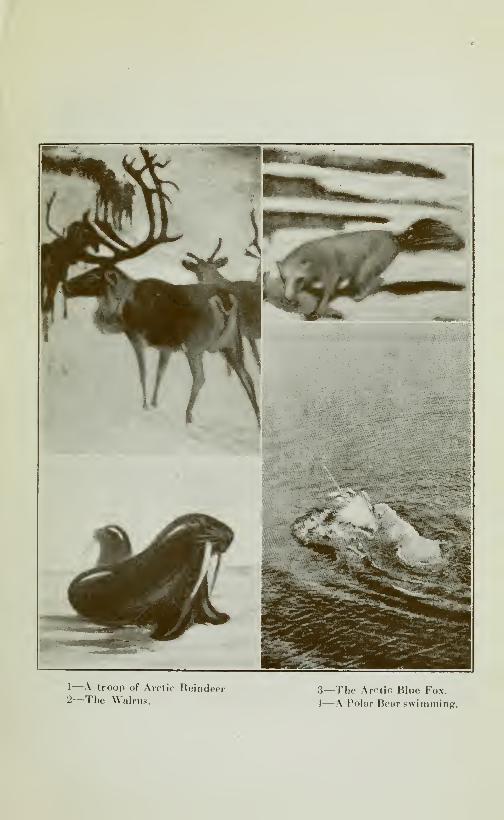
1—\ troop of Arclic Heindeer2—The Walrus.
3—The Arctic Blue Fox.
i—A Polar Bear swimming.
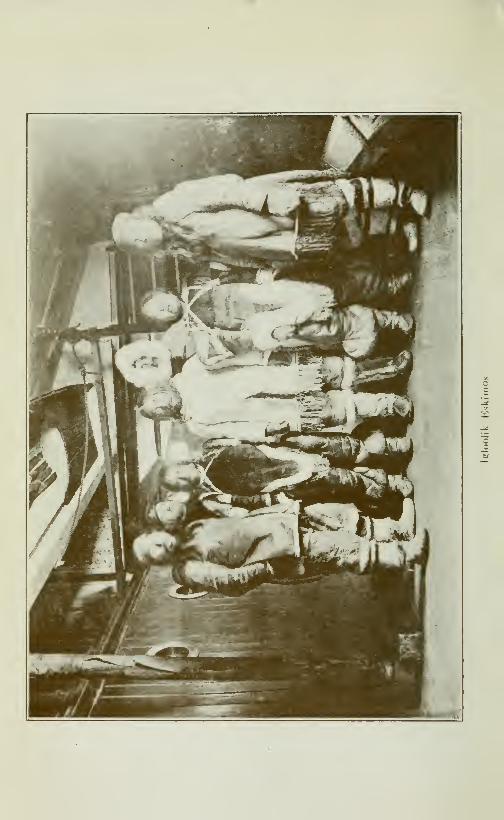
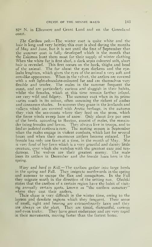
CRUISE OF THE MINNIE MAUD 143
82° N. in Ellesniere and Grant Land and on the Greenlandcoast.
Tbe Caribou pelt.—The winter coat is quite white and the
hair is long and very brittle; this coat is shed during the monthsof May and June, but it is not until the first of September that
the summer coat is fully developed which is the month that
the Eskimos hunt them most for their supply of winter clothing
When the white fur is first shed, a dark sepia coloured soft, short
hair is revealed. This first occurs on the back, thighs and headof the animal. The fur about the eyes darkens and the eye-
lashs lenghten, which gives the eyes of the animal a very soft andcow-like appearence. \\1ien in the velvet, the antlers are covered
with a soft hght-chocolate-coloured fur and are themselves very
flexible and tender. The males in the summer frequent the
coast, and are particularly curious and sluggish in their habits,
whilst the females, which at this time remain farther inland,
are very wild and fidgety. The summer coat when in its primevaries much in its colour, often assuming the richest of amberand cinnamon shades. In summer they graze in the lowlands andvalleys which are covered with Arctic herbage, in the autumnthey visit the sea-coasts where they feed on the moss, whichthe fierce winds sweep bare of snow. Only about five per cent
of the herds, according to Buxton, consist of males, the remain-der being females and fawns. They always live in troops, and to
find an isolated caribou is rare. The mating season is Septemberwhen the males engage in violent combats, which last for several
hours and when their enormous antlers become enlaced. Thefemale has only one fawn at a time, in the month of May. Sheis very fond of her fawn which is a very graceful and dainty little
creature, over which she watches with the greatest care and ten-
derness. The wolves are their greatest enemy. The maleloses its antlers in December and the female loses hers in the
spring.
Wary and hard to Kill.—^The caribou gather into large herdsin the spring and Fall. They imigrate northwards in the springand summer to escape the flies and mosquitoes. In the Fall
they migrate south in the direction of the setting sun. Obalskistates that the caribou of a certain region have the habit of visit-
ing annually certain spots, known as "the caribou cemetery"where they cast their antlers.
Their chase is very difficult in the winter time, owing to thebarren and desolate regions which they frequent. Their senseof smell, sight and hearing are extraordinarily keen and theyare always on the alert. They are timid, distrustful, curious
and even tricky. They have great endurance and are very rapid
in their movements, moving faster than the fastest horse.
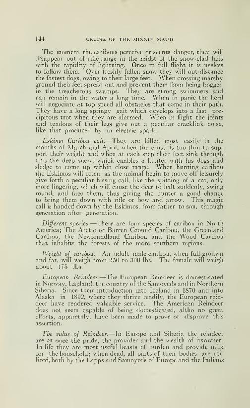
144 CRUISE OF THE MINNIE MAUD
The moment the caribous perceive or scents clanger, they will
disappear out of rifle-range in the midst of the snow-clad hills
with the rapidity of hghtning. Once in full flight it is useless
to follow them. Over freshly fallen snow they will out-distance
the fastest dogs, owing to their large feet. When crossing marshyground their feet spread out and prevent them from being boggedin the treacherous swamps. Thej' are strong swimmers andcan remain in the water a long time. When in panic the herdwill negociate at top speed all obstacles that come in their path.
They have a long springy gait which develops into a fast pre-
cipitous trot when they are alarmed. When in flight the joints
and tendons of their legs give out a pecuhar crackUnk noise,
like that produced by an electric spark.
Eskimo Caribou call.—They are killed most easily in themonths of March and April, when the crust is too thin to sup-port their weight and when at each step their feet sink throughinto the deep snow, which enables a hunter with his dogs andsledge to come up within close range. When hunting caribouthe Eskimos will often, as the animal begin to move off leisurely
give forth a peculiar hissing call, like the spitting of a cat, onlymore lingering, which will cause the deer to halt suddenly, swinground, and face them, thus giving the hunter a good chanceto bring them down with rifle or bow and arrow. This magiccall is handed down by the Eskimos, from father to son, throughgeneration after generation.
Different species.—There are four species of caribou in NorthAmerica; The Arctic or Barren Ground Caribou, the GreenlandCaribou, the Newfoundland Caribou and the Wood Caribouthat inhabits the forests of the more southern regions.
Weight oj caribou.—An adult male caribou, when full-grouwn
and fat, will weigh from 250 to 300 lbs. The female will weighabout 175 lbs.
European Reindeer.—The European Reindeer is domesticatedin Norway, Lapland, the country of the Samoyeds and in NorthernSiberia. Since their introduction into Iceland in 1870 and into
Alaska in 1892, where they thrive readily, the European rein-
deer have rendered valuable service. The American Reindeerdoes not seem capable of being domesticated, altho no great
efl"orts, apparetnly, have been made to prove or disprove this
assertion.
The value of Reindeer.— In Europe and Siberia the reindeer
are at once the pride, the provider and the wealth of its owner.In life they are most useful beasts of burden and provide milkfor the household; when dead, all parts of their bodies are uti-
lized, both by the Lapps and Samoyeds of Europe and the Indians
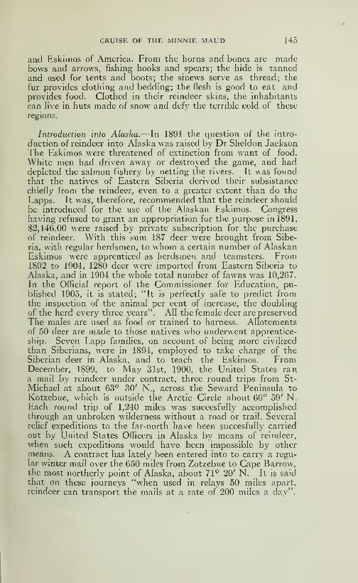
CRUISE OF THE MINNIE MAUD 145
and Eskimos of America. From the horns and bones are madebows and arrows, fishing hooks and spears; the hide is tannedand used for tents and boots; the sinews serve as thread; the
fur provides clothing and bedding; the flesh is good to eat andprovides food. Clothed in their reindeer skins, the inhabitants
can hve in huts made of snow and defy the terrible cold of these
regions.
Introduction into Alaska.—In 1891 the question of the intro-
duction of reindeer into Alaska was raised by Dr Sheldon JacksonThe Eskimos were threatened of extinction from want of food.
White men had driven away or destroyed the game, and haddepleted the salmon fishery by netting the rivers. It was foundthat the natives of Eastern Siberia derived their subsistance
chiefly from the reindeer, even to a greater extent than do the
Lapps. It was, therefore, recommended that the reindeer should
be introduced for the use of the Alaskan Eskimos. Congresshaving refused to grant an appropriation for the purpose in 1891,
$2,146.00 were raised by private subscription for the purchaseof reindeer. With this sum 187 deer were brought from Sibe-
ria, with regular herdsmen, to whom a certain number of AlaskanEskimos were apprenticed as herdsmen and teamsters. From1892 to 1904, 1280 deer were imported from Eastern Siberia to
Alaska, and in 1904 the whole total number of fawns was 10,267.
In the Official report of the Commissioner for Education, pu-blished 1905, it is stated; "It is perfectly safe to predict fromthe inspection of the animal per cent of increase, the doublingof the herd every three years". All the female deer are preservedThe males are used as food or trained to harness. Allotementsof 50 deer are made to those natives who underwent apprentice-
ship. Seven Lapp famihes, on account of being more civilized
than Siberians, were in 1894, employed to take charge of theSiberian deer in Alaska, and to teach the Eskimos. FromDecember, 1899, to May 31st, 1900, the United States rana mail by reindeer under contract, three round trips from St-
Michael at about 63° 30' N., across the Seward Peninsula to
Kotzebue, which is outside the Arctic Circle about 66'' 59' N.Each round trip of 1,240 miles was succesfully accomplishedthrough an unbroken wilderness without a road or trail. Severalrelief expeditions to the far-north have been succesfully carried
out by United States Officers in Alaska by means of reindeer,
when such expeditions would have been impossible by othermeans. A contract has lately been entered into to carry a regu-lar winter mail over the 650 miles from Zotzebue to Cape Barrow,the most northerly point of Alaska, about 71° 20' N. It is said
that on these journeys 'Svhen used in relays 50 miles apart,
reindeer can transport the mails at a rate of 200 miles a day".

146 CRUISE OF THE MINNIE MAUD
Importation.—In 1898 the United States Government importedfrom Lapland 538 head of choice reindeer trained to harness,
418 sleds and 411 sets of harness, a few herding dogs and 50drivers some of whom had famihes, making in all 113 immigrants.These Lapland deer were not for breeding purposes, but onlyfor harness. More than half of them died of starvation after
reachmg Alaska, as no moss had been provided for them. From1894 to 1903 Congress has appropriated no less than .$158,000.00
for the introduction into Alaska of domestic reindeer from Siberia.
It has been found that "with careful training the Eskimos makeexcellents herders". It is thought that in 35 years there maybe 35,000,000 reindeer in Alaska, with a large export of carcasses
and skins every year. The deer purchased in Siberia from theChunches cost $4.00 a head, from the Tunguse §7.50 a head.
Only a single species.— It is stated b}^ Mr Gilbert H. Grosvenorthat "the tame reindeer from Siberia is practically the sameanimal as the wild caribou of Alaska, changed by being domestica-ted for centuries". This corresponds with the general viewof English Zoologists, that there is but a single species of reindeer,
but presenting local peculiarities. It appears that the Alaskadeer is not equal to the Lapland deer in strength or speed. Apair of the latter can pull a load of 500 to 700 lbs at the rate
of 35 miles a day, and keep this up for weeks at a time. MrArmstrong states that a single deer can draw- 600 lbs, on a sled
30, 50 and even 90 miles a day. It is said the Lapland deercan in point of speed do 150 to 200 miles a day, and sometimes20 to 25 miles down hill in one hour. The Alaska reindeer ex-
press has been driven at a rate of 95 miles a day. Reindeer cantravel as well at night as in the day time. In Siberia a caravanof 160 sleds is managed by ten men. In summer a reindeer
can carry as a fair load, a pack of 150 lbs. A good deer caneasily carry a fair sized man. The reindeer cow gives aboutone teacupful of very rich milk, nearly as thick as the best creamwhich makes delicious cheese.
Should acclimatize readily in America.—There is now no doubtthat the Lapland or Siberian reindeer would thrive over all thebarren-lands of Canada, the Mackenzie country, the ArcticIslands and in Labrador and Newfoundland; as both climateand food are suitable. It would be an easy matter for natives
or residents of those regions, who are accustomed to handle dogsleighs, to learn to handle reindeer, in the same way that the resi-
dents of Australia have learnt to handle camels for purposes oftransport over their barren, waterless interior.
Would be a great value.—American experience would seem to
leave the question open as to whether reindeer should be best
imported from Siberia, from the Tunguse or from Lapland. They
CRUISE OF THE MINNIE MAUD 147
might not be procurable, at least for many years, from Alaska.
But it seems clear that the teachers should be Laps. The Ame-ricans found that the dear stand a journey remarkably well.
Immense herds could be run all over Labrador, Baffin Land andthe Mackenzie country, enough to supply the population with
food, to provide them with a means of travel, and to furnish a
valuable export of meat and skins. Reindeer post communica-tions would be of inestimable service to those remote regions.
Threatened with Extinction.—A despatch dated February 9th,
1914 from Christiania, Norway, gives the information that MrStaaf, Government Inspector of Lapland, has reported that the
usuful race of Lapland reindeer is on the point of extinction owingto a change in the mode of living of the Laplanders. The natives
are abandoning their nomadic life of moving from one place
to another accompanied by their reindeer, and are establishing
themselves in fixed settlements on the river-banks and devoting
themselves to fishing. In 1912 there were in Lapland 29,346
reindeer; to day there are not more than 25,761. Mr Staaf is
urging the Norwagian Government to take special means to en-
courage the raising of reindeer.
Cold weather.—After giving the dogs a good feast of the caribou
meat, we drew the balance on the sled back to camp, which wereached in the dark, completely tired out and hungry, but
happy in the knowledge that our larder was replenished.
The sun sank below the horizon about 6 o'clock in the evening,
and the thermometer at salmon River registered 49° below zero.
Rather cold weather for hunting; but our lives depended on it.
March, 13.—We started early and made a good dajs march.The sun was shining bright and there was scarcely any breeze.
The breath from our lungs ascended straight in the air, at least,
so much of it as did not condense and freeze on our bards andmoustaches.
A large Caribou herd.—-About 9 a. m. I sighted a very large herdof caribou on my right to the east and very nearly abreast of us.
The herd was about 3 miles away nd two miles long. Throughthe telescope I could distinguish^ the individuals of the herd
scraping the snow with their feet and eating the stunted grass.
Some were lying down asleep; others were walking about slowly,
and others were grazing, A dence cloud of vapour rose in the still
cold air from their condensed respiration.
The valley narrows.—In the afternoon we reached a small hill
that rose like a miniature island, out of the plain at the narrowsetpart of the long valley. Here the hills on either side approachto within half a mile. I called a halt to give the tired dogs a rest,
a» the going was verv heavv over the rotten, thin-crusted snow11
1-48 CRUISE OF THE MINNIE MAUD
The hills on our eastern flank were composed of dark-brown, rusty
looking rocks which enclosed a well formed quartz vein, very well
defined, about 4 feet wide, and running right up the hill, east
and west. Numerous small quartz stringers ran into it. Thequartz, some of which I broke away, was full of black, gray andblue spots, but contained no mineral. Adhering to it was a darkdirty looking greenish clay similar to what is known as "slic-
kensides" in Porcupine. As we resumed our march I walked along
the base of these hills for over an hour and noticed that similar
veins of quartz were everj-where apparent. I brought back with
me some of these quartz samples.
A cold 7iight.—When darkness fell we had trouble in finding
snow compact enough with which to built an igloo. To addto our discomfort a north wind sprang up which cut our faces
like a knife, the long narrow valley between the lines of hills
acting as a funnel, and increasing the wind's intensity-. Wepassed a very cold night.
Caribou valley.—The valley which I have named the caribou
valley, was evidently at one time under water and a connectingwaterway between Admiralty Sound and Roald Sound and FoxChannel. The rock on each side of the valley are scarred, rubbedand polished as if by glacial ice-floes and bergs. The valley
which is flat and level and very little above the level of the sea,
has evidently been pushed up by some volcanic or seismic up-
heaval. Brodeur Peninsula was formerly an island, or probablytwo islands, as the few miles of low land which separate Bernier
Baj^ from West Bay, have apparently been the result of a similar
upheaval. Perhaps also the southern portion of Brodeur Penin-
sula was subdivided by a similar upheaval of the land betweenSouth Bay and Aggo Bay, along the route of Long and Ibbi-
sauktoo Lakes.
Intensely cold.—March 14th.—We made another good day's
march. The sun was often obscured with clouds and the free-
zing northwest wind nearly cut us in two. We dared not stop
to rest the dogs for fear of freezing to death. The thermometerthat day at Salmon River registered 44*^ degree below zero, butwhere we were I believe it was over 50* below.
Huntiîig Caribou.—Seeing some caribou about two miles awayon the hills, with the aid of the telescope, Coggan and I started
after them. W^e saw plenty of deer around us. As we approa-
ched them, one of the old dogs, that was tired, began to howland frightened them and the deer fled out of range. We chased
them for nearly a mile but the wind was blowing too strong to
risk a long shot, and we had no cartridges to waste. We tried
to get closer to them, hopping from stone to stone, in order to make

CRUISE OF THE MINNIE MAUD 149
no noise on the crust, but to no purpose. After spending four
hours chasing them over the hills, first dripping wet from perspi-
ration owing to our exertions in running and then freezing in thebitter wind, we overtooke the rest of the party who had pitchedcamp at the N, W. of a long lake. The}- had only just cut thesnow-blocks for the igloo when we arrived and we helped to buildit. When finished I crawled in thoroughl}- fagged out andhungry, and after a scanty meal of raw caribou and melted snow,struggled into my frozen sleeping bag, where I dosed and shiveredall night.
Flat Lake.—The valley throughout its length was flat andlevel, so level indeed that we only knew we had come on the lake
by the firm feeling of the snow-covered ice underfoot instead of thesofter and more yielding moss and turf on the land. The hills
each side consisted of black-brown rocks that were fissured every-
where by perpendicular cracks. The lake which I christened
"Flat Lake" runs about N. W. and S. E., is about ten miles
long and from one to three miles wide. In the center the lake
narrows to half a mile wide; the northern end being very shallowand covered with small rocky knolls and inlets. The southernhalf is deeper and free from these knolls. The Eskimos told methat the lake teems with salmon.
Caribou hunting.—March 15th.—We remained all day at
Flat Lake Camp in order to hunt caribou, as we had no meatfor the dogs. The day was bitterly cold with a strong N. W.wind blowing. Accompanied by Coggan and Takkowah, I
went after caribou and when we had travelled into the hills on thewest side some ten miles from the camp, we managed at night tokill ten small deer, after walking hard after them all day. Ofthese Coggan killed one, Tokkowah spent three cartridges on his
two deer and I bagged the rest, spending a single cartridge for eachdeer. We skinned and cut up the deer where they fell and, after
giving the tired and famished dogs a meal, returned to camp. Wecached the meat and skinstobepickedupthe next day as we passed.We reached camp in the dark, very tired, cold and hungry as usual.
During all these days we ate only twice a day and were thirsty
all the time and in consequence I ate or drank a great amount ofsnow. That night I thought we should all freeze in the igloo.
Two ivolves.—March 16th.— I sent Takkowak after the deer-
meat that we had cached, and made a good day's march. Shortlyafter starting from camp, Peewiktoo shot at and badly woundedtwo wolves at long range with my 280 Ross. These wolves hadstopped to gaze at us about a quarter of a mile away. We sawcopious marks of blood which thev left on the snow as they lopedawav.

150 CRUISE OF THE MINNIE MAUD
Almost jrozen to death.—When Takkowah overtook us, wehalted and built an igloo I nearly froze my hand and one foot
in the process. So numbed was I in all my limbs that I thoughtat any moment they would become frozen. Peewiktoo had to
help me into my sleeping bag as it was frozen stiff and I crawled
into it by degress as the heat of my legs and body gradually thawedit out. We camped on the ice at the southern extremiêy of
Flat Lake, close to where the river flows from it into Roald Sound.This river appears on existing maps as the Gifl^ard River.
Stoves run out.—March 17th., St-Patrick's Day.—We started
early in morning to make a big day's march, as our supph' of fro-
zen seal blubber for the Eskimo stove was running short, and I
was anxious to reach Igloolik as soon as possible.
We had long ago finished our supply of seal meat and our only
food supply was the poor, frozen flesh of the caribou that wehad shot.
We followed the course of the Giff^ard River which consisted of
a continuous series of small chutes or rapids running in ziz-zag
fashion, until we reached the head of what I named Roald Soundin honnor of that intrepid Arctic and Antartic explorer, RoaldAmundsen.—The Gilford river is only about three miles long andthirty-five yards wide; but it must contain a large volume of
water in the spring, as several small streams and rivulets flow
into it from both sides. The largest of these streams enters
it from the east side, about 500 yards from where the river leaves
the lake.
Lieut. Hoppner of the Fury visited Gifi^ord Inlet in June 1823.
His account reads as follows:—
"I walked up the inlet and after
passing the two first points of land, made towards a high mounton the south side, about 12 or 14 miles distant from the entrance,
hoping from thence to see the termination of the inlet, which here
varied from one to three miles in breadth. At 5 p. m. finding
the above mentioned hill still too distant for me to reach on foot,
I landed on the right hand shore from whence the opening appea-red to extend at least a day's journey for the sledge, continuingabout the same breadth and not appearing to terminate even at
the furthest point seen". Returning to camp, Lieut. Hoppneron the following day, June 25th started again up the inlet. "TheEsquimos told us we might reach the head of the inlet to day, wetherefore resumed our journey. At 4 p. m. having reached
two small inlets situated nearly in mid-channel, we stopped for
half an hour to refresh ourselves and again set ofl^ at a quickpace. The weather was so thick it was but rarely we got a glimpseof the shores on each side of us; when we did they appeared rockyand steep; but a short distance from the beach the land appearedwell-clothed with vegetation. As we advanced the ice becamevery thin and rotten, and gave indication of our approach
CRUISE OF THE MINNIE MAUD 151
to its termination; at length we found ourselves within fifty
yards of the water, and were obliged to .pick our way to the shore
over very rotten ice. On landing we were gratified by the sight
of a noble sheet of water, one mile and a half in breadth andperfectly fresh. The tide was out, but there was no current
perceptible in the middle, nor did we notice any during the wholetimeof our stay. The Esquimaux had informed us of a large fall,
but as we neither saw nor heard anything of it, it must be a goodw^ay higher up, our point of view extending full fifteen miles,
w^hen it terminated in two bluff points, between which the stream
seemed to wind. Tc these points, to all appearance, it continued
about the same breadth and from the colour of the water it mustb*" deep enough for ships of large burden. The land on each
side was high, and where we stood was more closely covered with
vegetation than any spot I had ever seen in these regions. The dwarfwillows grew to a height and size almost entitling it to be called
a shrub, and the Andromeda tetragona was in the greatest abun-dance."
Parrv also mentions the Giffard river as having tremendousforce in July and that at the entrance of Roald inlet was a high
wall of ice-blocks that extended from land to land and which hadbeen thrown up the surface of the ice by the force of the current.
"The force employed for this purpose may be conceived whenI mention that of several of ice-blocks, one in particular was aboveeight feet thick, fully fortv yards in circumference and lay morethan five hundred yards from the open pool from which it musthave been thrown up."The country, through which the Giffard River runs, consists
of low, round and almost flat hills. As I started down the frozen
riverbed, jumping from one ice-covered stone to another, I slipped
and one leg fell through the thin ice-crust on the rocks beneath.I nearly broke my right knee-cap and the pain made me sick.
So painful was the bruise that I could hardly limp along behindthe sledge, and could not put mv whole weight on that foot,
nor straighten the leg for three or four days afterwards. Duringthe following three or four days, until we reached Igloolik, I
had to ride part of the time on the sled and, between the pain of
the bruise and the intense cold through not being able to runbeside the sled, I suffered a great deal, but I had burnt my brid-
ges, and a case of reach Igloolik or perish of cold and starvation.
Painful progress.—We camped about seven miles from thehead of Roald Sound, in a small bay on the north shore. I hadgreat difficulty in getting into my sleeping bag with my crippled
knee and I was completely fagged out with the efforts I hadmade to hobble along behind the sledge and help the dogs withthe load. The pain kept me awake all night although I nearly
fell asleep, so tired was I' when eating my supper of raw frozen
152 CRUISE OF THE MINNIE MAUD
caribou, and could not write up my diary. I would dose off
when an extra throb from n«iy wounded knee wou Id wake me up again.
Roald Sound.—Roald Sound, which appears in Low's map as theGiffard River, is a fine sound about 25 miles long and 3 miles wideat the upper end, and 5 miles wide at the mouth. It is borderedon either side by low sloping hills of black and gray rock whichgradually run lower towards the mouth.
A plainjul day.—March 19th.—Starting early, we proceededsteadily down the sound. The daj- was intensity cold but withscarcely any wind. I suffered agony from my bruised knee andwas very tired when we reached camp that night, as part of the
day I hobbled painfully along behind the sledge. We built
an igloo in a small bay on the south side of the sound about five
miles from the entrance. We had no fire to warm the igloo,
as our oil was finished and the night was intensely cold at least45*^ below zero. After a scanty supper of raw caribou and snow,I tumbled into the frozen sleeping bag and, with my aching kneeto keep me from sleeping passed a truly wretched night.
The last lap.—March 19th.—We started early on our last lap
for Igloolik. I left Coggan on the point at the southern side of
the entrance to the sound to hunt for caribou and then follow
us to Igloolik. We marched all that day all night and half the
next day without stopping and we ate nothing for nearly twodays. We stumbled along in the dark in a dogged, spiritless
fashion, just walking, tugging at the sleds and falling over the
rough, rafted ice that had been piled up by the continual conflit
of currents from Fury & Hecla Strait and Fox Channel. I suf-
fered, as may be imagined, agonies from my bruised knee, espe-
cially when stumbling over unseen ice-cakes that would rise upand hit me in the dark. The dogs were faint with hunger andfatigue and could hardly muster up enough strength to pull the
load. The Eskimo men and women, were half stupid with cold
hunger, thirst, fatigue and want of sleep. I often thought that
my feet would freeze as my socks were all the time wet with pers-
piration and I had no opportunity of drying them in the igloo
having no oil for the stove.
For the rest of my days I shall recall with a shudder the pain
and prolonged miseA- of that last 36 hours hike into Igloolik.
When we struck the rough ice north of Igloolik, we were com-pelled to throw off the fox-traps and other baggage on to the ice
as the dogs could not pull them any further. The day of the
19th was most terribly cold and a strong freezing wind blew fromthe north-east. The thermometer at Salmon River registered
on that day 48*^ below zero. That night as we stumbled along
in the dark over the rough ice, I nearly froze my face, handsand feet, due to wet mitts and socks. To make matters worse
we struck the rough ice at the darkest hour of night, and we fell,
CRUISE OF THE MINNIE MAUD 153
slipped, stumbled and floundered along, often losing our direction
and were at last obliged to lighten the loads in order to makeany headway at all.
Reach Igloolik.—March 20th.—When the morning broke, I
saw the low-lying land of Igloolik island ahead of me. Theisland is so flat that I could only distinguish it from the surround-
ing ice that covers the water of Fox Channel by the high-piled
masses of rafted shore-ice, twenty and 30 feet high, that fringed
the shore.
We struggle in to the native village, at the south-eastern ex-
tremity of the island, about noon, and standing on the shore I
saw four Eskimos, who comprised the whole of the male popula-
tion, as most of the Igloolik natives had gone to Ponds Inlet
and two had travelled south to trade with Captain Comer at
Aiwillig, near Wager Inlet.
Astonishmejit oj natives.—These natives were very astonished
when they saw me as I was the first white men to visite Igloolik
since Sir W. E. Parry, the pioneer and champion explorer of the
British Navy, had wintered there, with his historic ships the
Fury & HecIa in 1822-23, ninety years before. Some of these
natives had never seen a white man before and held them in fear.
They had heard of Parry and his men only through tradition.
Complete Exhaustion.—That night we were all too worn out
with fatigue, hunger and want of sleep to build and igloo,
and, after constructing a small snow hut in which to store the
things and harness to protect them from the starving dogs that
were as hungry and ravenous as wolves, we all crowed into Eetoo-
tarjoo's igloo, and after a supper of some tough, putrid, frozen
walrus which smelt abominably and tasted worse, I fell asleep
with my head on mv knees. I could not get into my sleeping bagas it was frozen and had shrunken to half its size. I was like a
drunken man through want of sleep hunger, cold and sheer phy-sical exhaustion.
Peewiktoo and his poor, plucky little wife, Tootillik were in the
same condition. They simply fell forward, head on knees, andslept. All three of us sat huddled together, back to back, for
mutual support and slept. But even then we were not allowedto slumber indisturbed, as the curious and wondering nativesfrom the other igloo kept crowling into our igloo to feast their
eyes on the strange white man who had so unexpectedly stumb-led into their midst from the far north in the depth of winter.
They would persist in talking and putting questions to us
which we were too exhausted to answer. Our only responsewas a grunt and a snore. All that we wanted was to be left
alone and to forget our misery in sleep. My soreknee too hadbeen badly bruised again when stumbling over the bad ice andcaused me much pain and also interfered with my repose.


CHAPTER VII
IGLOOLIK AURORA BOREALIS PARRY S VOYAGE
Dryvig Clothes.—We slept late, on March 21st, the day after
our arrival at Igloolik, as we were all worn out with fatigue andwant of sleep. My first occupation was to dry my sleeping bag,
wet mitts and socks, my whole suply of the latter being dampas I had no opportunity of drying them on the march. Theusual winter foot gear in the Arctic is a pair of long tooktoo
(caribou), or young seal socks that reach to the knee, with the
hair lining inside, a small overshoe of tooktoo or sealskin whichfits over the foot to protect the sole of the foot from the intense
frosty cold that beats up from the ice, and an outer shoe, madeof big seal (oogjook) or bearskin with legs of caribou skin with
the hair outside, or made of the untanned skin of the polar bear.
This is the warmest and softest form of foot clothing imaginable,
in the ordinary footgear of civilization the feet would becomefrozen instantly. In the Arctic one's feet are constaintly perspir-
ing in the Eskimo airtight shoes and unless the wet socks are
changed and dried when camp is reached, they are very liable
to freeze. The same thing applies to the gloves, of which twopairs are worn; an outer pair of deer, seal or bearskin, with thehair outside, and an inner pair of deerskin, with the hair inside.
When the oil supply is low and the tent or igloo contains several
people all anxious to dry their wet socks and mitts over the
feeble flame at the same time it is a discouraging process. Theother mode of keeping the blood warm and in active circulation
is to keep constantly moving about. When walking and runningalongside the sleds during the daytime one often gets over-heated;
but when the day's journey is done the reaction sets in, and the
misery of handling the wet snow blocks when building the igloo
and of standing about in the biting north-winds, with the tempe-rature 40° to 50° below zero, is often almost unendurable, espe-
cially when one's blood is thin from want of nourishment.
Unpleasant diet.—We breakfasted that day on raw putrid
walrus which smelt and tasted worse than rotten onions; butit was either that or starve. My hands and beard were satu-
rated with its fou 1-sm ailing grease. We passed the night in
Eetootarjoo's igloo, as we could not master up sufficient energ}-
156 CRUISE OF THE MINNIE MAUD
to build a snow igloo for ourselves in the freezing wind that wasblowing from the north. The cold intensity of the winter windsin the Far North is hard for any one living in the more temperatezones to imagine.
The Arctic uiiids.—The northerly winds sweep down fromoff the glacial expanse of the Polar Ocean, accompanied by gusts
of whirling, blinding snow-clouds, with such force and bitiug
face-freezing intensity that the traveller is forced to hurriedly
build a snow igloo or take refuge in a snow-drift until the fury
of the storm is spent. Sometimes the wind will start to blowfrom the N. \\., and then gradually increasing in strength, will
swing to the W. and S. W. and sweeping over the landscape
will bury every thing in snow, several feet deep. During the
height of the storm, travel is impossible—the trail is wiped out,
the landscape is obscured, lamps and lanterns are invisible at
a distance of a few yards away and the unfortunate being whofinds himself outside and exposed to its fury, is forced to crawl
on hands and knees to avoid being blown bodily away. Butthe strongest gales often come from the S. E. and are terrific
in their force and destructiveness. At Ponds Inlet last Christ-
mas, a huge unweildy Newfoundland boat, over thirty feet in
length and built of heavy solid timber, was picked up by the
furious blasts of a south-easter and carried bodily a distance of
50 yards, demolishing in transit an igloo built of heavy snowblocks, which, fortunately, the family had left the night before.
At Melville Island a wind velocity of 100 miles an hour was once
recorded, and gales from 70, 80 and 90 miles an hour were not
unfrequent during the months of February, March and April.
These gales often last three days at a time and during the height
of the storm the temperature will rise from 40^ to 50*^ below zero.
The hill sides are swept bare of snow which packed deep and solid
into all the ravines, valleys and depressions.
Another bad 7iight.—That night, having no sleeping bag, I
slept with only my coat to cover me, and as the temperature wasabout 50- below, I spent a restless and shivering night, whichwas agraved by the pain of my wounded knee.
Go after walrus.—March 22d.—Taking with me, Takkowahand the Igloolik native, Awah, I went after walrus, as we hadno oil for our fire and the dogs had not eaten for three days.
We, too, were completely out of deer meat and our only suste-
nance was that furnished by the rotten, old, stinking walrus meatthat we had got from Eetootarjoo. I left Peewiktoo behind
to build an igloo, as Coggan was expected to turn up at any momentwith a fresh supply of caribou meat.
Dangerous ice.—We took a team of dogs and a sled to reach
the walrus hunting ground on the edge of the ice-fringe about
CRUISE OF THE MINNIE MAUD 157
three miles east of the islands. As the wind was blowing strong
from the S. E. we found that the loose ice-pans that are alwaysfloating about in Fox Channel were being driven up on the edgeof the soHd shore ice. We had to avoid these, as if we had em-barked on one of these floating pans, with a sudden change of
wind, our position would have become desperate. The panswould be driven away from- the shore into the center of the FoxChannel and we should all have perished of cold and hunger.
Whole parties of Eskimos have perished in this way while huntingseal and walrus on the unstable edge of the shore ice; as a suddenchange of wind would disrupt and break off great pans from the
outer ice-fringe driving away from the land out the sea. All
the men and the women of the native village near StrathconaSound were swept away and perished in this fashion, only twoold women who had remained in the igloos, being left to tell
the tale.
No luck.—We saw a big seal (oojook) asleep on the ice andAwah and 1 started after him with rifle and harpoon, but the
animal aw'oke and, seeing us, plunged into the sea through a
hole in the ice. We saw no walrus and were forced to return to
our wretched igloo, cold, tired, hungry and, what was worse, emptyhanded. We found that Peewiktoo and Tootillik had built
the igloo in our absence, and the latter, brave little woman, madea small fire of seal blubber which she had barrowed from anothernative. For supper we chewed on some of the old rotten walruswhich was tough as leather. My sleeping bag was not yet dryand my knee pained me badly. It was terribly cold in the fire-
less igloo and as Coggan had not yet arrived with a fresh suppl}^
of caribou meat, the outlook was depressing in the extreme. Wehad neither food nor fuel and the Igloolik natives had none to
spare, being themselves ill-provided with meat and blubber.
The dogs had eaten nothing for nearly four days and between us
and the rest of the expedition lay some 400 miles of inhospitable
frozen sounds and barren snow-covered hills. Our position
was rendered the more precarious through the fact that our car-
tridge supply was limited, and on our rifles lay the responsability
of providing us with food and fuel. But through it all I neverlost hope and always held the firm conviction that we should camethrough in safety.
Igloolik island.—March 23d.— I spent the day in exploring the
island of Igloolik. The island resembles in shape the form of a
crouching bear with the head towards the east and the tail to-
wards the west. The native village is pitched on a low flat point
on the south-eastern extremity of the island, near a small lake.
The island which is some eleven miles long and six miles widefrom north to south is very low and flat. The beach is coveredwith limestone pebbles smoothed and rounded by the action of
158 CRUISE OF THE MINNIE MAUD
ice and water, and the interior of gravel banks which are coveredwith stunted scurvy grass (cochlearia fenestrata) and which are
not over ten to twenty-five feet above sealevel. So flat is thebeach that, when covered with ice in the winter, it is hard to tell
where the land begins and the water ends. The heavy ice-pans
are everywhee driven up high on the low beach by the force
of the wind and tides. The sea is very shallow all round theisland. On the eastern end of the island, between the head andfore-paws as it were, is a triangular bay about three miles deepand the same width at the mouth. In the center of the island is
a shallow bay that runs into the body of the island in a northwesterly direction. This baj' is about five miles deep and one mile
wide. Near the head of the bay is a small lake which discharges
into the bay, and was said by the narives to contain small Arcticsalmon.
Sir W. E. Parry.—In 1821, Sir W. E. Parry, who had pre-
viously explored Baffin Bay and Lancaster Strait as far as Mel-ville Island, entered Hudson Bay and passing to the north of
Southampton Island examined Repulse Bay and wintered at
Winter Island, a few miles beyond the eastern entrance of FrozenStrait. Parry was then searching for a north-west passage.
His ships "Fury" & "Hecla" were released from the ice on the 28thof June, 1822, and Parry then pushed northward through theheavy ice-floes of Fox Channel along the eastern shore of Melville
Peninsula, until stopped by the heavy floes of old Arctic ice of
the eastern entrance of Fury and Hecla Strait, where the remain-der of that season and the early part of the next (1823) was spentin trying to pass through the strait, the western part of whichremained continuously blocked with heavy ice. Exploringparties from Parry's ships made flying sled surveys and soundingsalong the eastern shores of Melville Peninsula and in the vicinity
of Fury and Hecla Strait, but I found that the formation, shapeand position of the islands and bays in that neighborhood, as
described in the existing maps, were very far from accurate.
Parry explored the west side of Fox Channel from Frozen Strait
to Fury and Hecla Strait. The results of his observations havebeen summarized by Dr Dawson as follows:
—
Geological formation.—The geological specimens brought backwere examined by Professor Jameson and the detailed maps of
the expedition include indications of the character of the rock
at so many places, as to aff^ord the means of tracing the geological
outlines with very considerable accuracy. Granitic and gneissic
rocks occupy the whole of the southern part of the east shore of
Melville Peninsula, and are continued northward behind a lowtrack of limestone country, forming a range of mountains in the
centre of the peninsula to Fury and Hecla Strait. They also

CRUISE OF THE MINNIE MAUD 159
form the south shore of this strait, and most of the islands in it
,
and apparently the whole eastern shore of the adjacent southpart of Cockburn "Island".
Rock specimens.—The rocks referred to abo^e, are similar in a
general way, to the Archaean, probably including areas of Huro-nian, Jameson mentions as among the prominent varieties of rocks
derived from this region; "Granite, gneiss, mica-slate, clay-
slate, chlorite-slate, primitive-trap, serpentine, limestone andporphyry". In a ssociation with these the following minerals
occur. "Zircon and beryl, also precious garnet, actinolite, tre-
molite, diallage, coccolite, rock-crystal, cale-spar, rhomb- spar,
asbestos, graphite or black-lead, specular iron-ore, chromic ore, or
chromate of iron, titanic iron, common and magnetic iron py-rites". Some of the "transition rocks" noticed by Jamesonshould probably also be classed with the Archaean, and in
addition to several of the minerals above mentioned, in these
were found tourmaline (schorl) and molybdenite.
Magnetic Variation.—Igloolik was observed bv Parrv in 1823to be in Latitude 69^ 20' 30" N. and Longitude 81" 52' 46"\V.The Magnetic Variation of the Compass was 82''^ 21' 51" iiest-
erly and the dip of the Magnetic Needle 87° 37' 09"
Tide.—The tide at Igloolik rise and falls about 5 feet.
Parry's Observatory.—Parry's observatory, 13x8 feet, wasbuilt with a flat instead of a pitched roof, and this as well as thesides were of single planks, lined on the inside with canvas andclosely covered with first bj- turf and then by slabs of snow,Being smaller than previous observatory houses built by Parrythere was a great increase in warmth and reduction of labourand materials required in the construction.
Tbe Sun.-—The sun disappeared from sight below the southernhorizon at Igloolik for seven weeks-—November 26th to January6th. When the sun re-appeared a parhelion appeared on eachside of it and exactly opposite to it near the northern horizonwas a large circular patch of whiet ligth.
Refraction.—Shortly after the sun's re-appearance, it notunfrequently happened about this time, that a part of the lowshore to the southward of Igloolik appeared by the effect of re-
fraction, to be raised and separated, forming a long, narrow streakof dark colour, like a cloud, suspended a few minutes above theland, in a position nearly horizontal.
Winter Temperature.—The average temperature at Igloolik in
1822-23 as determined bv Parrv for that winter were:—November19° 37, December 27*^ 8, January 17° 7, February 20° 4, andMarch 19° 75; which indicate a mild winter for those regions.
160 CRUISE OF THE MINNIE MAUD
Spring Temperature.—Parry writing of the sudden transition
from perpetual darkness to perpetual daylight at Igloolik writes:
—
"The difference in the temperature of the day and night beganto be sensible as early as the first week in March, the daily range
of the thermometer increased considerably from that time. Theincrease in the average temperature of the atmosphere, however,
is extremely slow in these regions long after the sun has attained
a considerable meridian altitude, but this is in some degree com-pensated by the inconceivable rapidity with which the days seemto lengthen when once the sun has reappeared. There is indeed
no change which continues to excite so much surprise as that
from almost constant darkness to constant day; and this is, of
course, the more sudden and stricking in proportion to the height
of latitude; for soon after the middle of March, only ten weeksafter the sun's reappearance above the horizon, a bright twilight
appeared at midnight in the northern heavens .
Clouds.—Writing at Igloolik on March 28th, 1823, Parryreports:
—"One of the most remarkable circumstances aboutthis winter, which distinguish it from any preceding one we hadpassed in the ice was frequent occurrence of hard, well-defined
clouds, a feature we had hitherto considered as almost unknownin the winter sky of the polar regions. It is not improbable,
that these may have in part owed their origin to a large extent
of sea open to the south-eastward throughout the winter, thoughthey not only occured with the wind from that quarter but also
with the colder weather usually accompanying north-westerly
breezes. About the time of the sun's reappearance and for a
week or two after it, these clouds both from their novelty andfrom the glowing richness of the tints with which they were
adorned were a constant subject of admiration. It is scarcely
possible for nature, in any climate, to produce a sky exhibiting
greater splendour and reckness of colouring than we at times
experienced in the course of the spring. The edges of the clouds
near the sun often presented a fiery or burnished appearance,
while the opposite side of the heavens was distinguished by a deep
purple about the horizon, gradually softening upwards into a
warm yet delicate rose-colour of inconceivable beaut}'. Thesephenomena impressed us the more forcibly about the time of sun's
permanent setting, and that of his re-appearance-especially the
latter. Besides the colouring of the clouds just mentioned, I
also observed five or six times, in the course of the spring, those
more rare and delicate tints of pale-green, carmine, salmon-pink,
mauve, gold and rose-pink that we observed at sunset at Winterisland."
Aurora Borealis.—Parry reported:—"On the 26th November
1821, (at Igloolik) both in the morning and evening, the Aurora
again appeared from south-east to south-west, the brightest part
CRUISE OF THE MINNIE MAUD 161
being about ten degrees above the horizon, and with pencils of rays
shooting upwards towards the zenith. In almost every instance
it is observable that the light, however irregularly disposed in
other respects has a tendency to assume an arc-like form; butI think a plane bisecting the arch would more generally have coin-
cided with the true than the magnetic meridian ; in the phenomenawe had an opportunity of observing. This was particularly thecase in the morning of the 27th when at 6 a. m. the Aurora formedone broad and continous and well-defined arch, its centre passing
rather to the southward of the zenith, and its legs appearing to
rest upon the horizon at east and west. For several hours onthe evening of the 28th, it was seen in the south-east, with rays
darting rapidly up nearly as high as the zenith. There is almostalways one stationary patch of light near the horizon, appearing,
as it were, the source whence the shifting or variable part of thephenomenon proceeds. It will be seen from about this period
how much more froquently the Aurora seem to issue from the
south-eastern quarter than from any other during the rest of the
winter."
In the concluding month (December) of the year 1821 at WinterIsland there were more brilliant displays of the Aurora Borealis
than we had noticed at an earlier period of the winter. Sirius
which was nearly on the meridian at the time, exhibited the mostbeautiful violet and blue colours that can be imagined. The violet
was to the westward which was the direction in which the moonwas and the Aurora was playing about at the time— I thoughtI had never seen anything so brilliant; the play of prismaticcolours in a cut diamond comes the nearest to it.
"On the evening of December 3rd, the Aurora appeared in
little white spots, resembling the nebulae in the heavens, as
viewed in the telescope, or the milky way in a very clear night.
I may here remark by the way that this last beautiful featureof the heavens very seldom appeared here, for notwithstandingthe notion generally entertained of the extreme clearness of theatmosphere under a Polar sky. We have always found thereverse to be the fact. It is true, indeed, that with the northerlyor westerly wind; the sky was generally what would be called
clear; but there is scarcely one night in twenty when the heavenly-bodies, if viewed through a telescope, do not appear surroundedwith more or less haze. Indeed it very seldom happens that a
considerable deposition of minute snow may not be observed totake place, evening in the clearest nights in these regions."
Encyclopedia Britannica.—"Aurora Polaris, Aurora Borealisor Australis, Polar Light, Northern Lights or Streamers, anelectrical metoor, appearing most frequently in high latitudesin the form of luminous clouds, arches and rays, of which thelatter sometimes met at a point near the zenith and form what
162 CRUISE OF THE MINNIE MAUD
is called a boreal crown. The arches are sometimes single; so-
metimes several consecutive ones are seen, and they are usually
stationary or move slowly southward. They cross the magneticmeridian at right angles, and therefore in England have their
centres nearly N. N. W. The rays rise perpendicularly fromthe arches, but are sometimes seen detached, or when the arch
is below the horizon. They are parallel to the dipping needle,
or in other words, to the curves of magnetic force; and the boreal
crown, at which they appear to meet, is merely an effect of perspec-
tive. The rays are seldom stationary, but appear and disappear
suddenly, shooting with great velocity up to the zenith, andmoving slowly estward or westward but more commonly the
latter. They sometimes cover the whole sky, and frequentlj'
have a strong tremendous motion from end to end. This tre-
mendous motion is sometimes seen also in the arches when nearthe zenith; and Benjamin V.March mentions a case, in which the
matter of the arch had the appearance of a rapid torrent flowing
from east to west. A rare form of Aurora is that in which the
rays appears to hang from the sky like fringes or folds of a mantle.
The ordinary colour of the Aurora is a pale greenish-yellow, butcrimson, violet and steel-colour are not uncommon. CrimsonAuroras have often been imagined by the superstitious to beomens of war, pestilence and famine. They were called by the
ancients chasmata, bolides, and trabes according to the formand colours. In Shetland they are very frequent and in the
north of Scotland, they are known as the "merry dancers" (per-
haps the ancient caprao saltantes); while from a curious passagein Sirr's "Ceylon and the Cingalese" Vol. II, p. 117, it seemsthat the aurora, or something like it, is occasionally visible in Cey-lon, and that the natives call it Buddha lights. Mr Jansensays, however, that the great Aurora of 4th February, 1872which was seen at Bombay, was not visible in Ceylon. In manyparts of Ireland a scarlet aurora is supposed to be a shower of
blood, and under this name, is not unfrequently mentioned in
the old annals, always in connection with some battle or the mur-der of a great chief.
Explanation of Aurora.—As the arch of the Aurora is always at
right angles to the magnetic meridian the phenomena is assumedto be the result of magnetism. It also affects electrical wires
and the magnetic needle; thus in France and elsewhere the Auroraof August 30th and September 1st, 1859 noiselessly worked the
telegraph needles and violently rung the alarm bells. The aurora
is believed to be produced bj?^ electric currents in the higher
regions of the atmosphere. Its great elevation above the earth
is evident from the fact that the same aurora has been witnessed
at the same time in Moscow, Warsaw, Rome and Cadiz.
Franklms description.—Franklin made the following remarks

CRUISE OF THE MINNIE MAUD 163
in his journal on the Aurora Boreahs as observed by him at BearLake in latitude 65° North in the year 1825:
—"From the diffe-
rence in the appearence and activity of the Aurora at Port Bowenand Forts Enterprize and Franklin an inference may be de-
duced for observing this phenomena and its effects on the needlethan in higher northern latitudes". "Bear Lake-Latitude 65°
north—26 October 1825. These corruscations were extremelybrilhant, and in continual motion. The principal feature wasa broad band of light that extended along the northern part of
the sky from W. N. W. to E. N. E. at an elevation of 20°, fromwhich beams of a less intense hght were frequently projected across
the zenith from north to south, or in the contrary direction; andthey sometimes reached the opposite horizon before they dis-
appeared. The band as well as the beams seemed to be composedof an infinite number of slender rays which were highly inchnedand exhibited the prismatic colours, the strongest tints being redyellow and green. The whole of the corruscations appeared to
be interposed between the spectator and a thin film}' mass of
cloud. The needle deflected during these corruscations 2° 41'
to the east and 1° 20" to the west".
November 2d 1825. The Aurora this night was extremelybrilliant and active, and exhibited the prismatic tints. Thecorruscations commenced with a highly illuminated arch, spread-ing from S. E. to N. W. across the Zenith, in which part it formeda corona, from whence slender rays were projected perpendiculardownwards, going to the corruscation the appearance of a globe,
with the meridians marked on it. This Aurora originally sprangfrom a mass of cloud bearing S. S. E.; which gradually changedits position to the eastward, and on its reaching the east point aband of light resembling the fringe of a curtain rushed forth andextended round the northern horizon at an elevation of 8°. Thecorona disappeared at the time this latter change took place andarches were projected in rapid succession from S. S. E. to N. N.W. south-north, and W. N. W. to south; all of them displayingthe most brilliant colours. The needle betrayed its greatestdeviation during the projection of these last-mentioned arches,and was, in fact, kept in a state of vacillation for about five minutesapproaching towards, or receding from, the true north, accordingto the apparent motion of the rays of light. Extreme deflections
of needle during these corruscations, 1° 25' to the east and 2° 23"to the west."
"December 7th 1825.—The Aurora this night was very gene-rally diffused, and extremely active and brilliant. The mostremarkable part of the corruscation was three perfect arches,at the several altitudes of 40°, 50° and 90°, having the samepoints on the horizon. From the lowest of this arch a beamflashed towards the horizon to W. N. W., which producea change in the needle of 2° 45', as above noted. When these
12

164 CRUISE OF THE MINNIE MAL D
arches became faint, a mass of light rushed from E. S. E. and in
its progress to the N. W., in a horizontal direction the rays of
hght, of which the stream was composed, were seen vibrating
backwards and forwards between the two extremes in the most rapid
manner. During this commotion, which lasted ten minutes,
the needle deviated between 39° 15' and 41° 15'. If aftenvards
continued stationary for three minutes at 40° 45', though the
Aurora was violently agitated; but the motion of the hght wasthen nearly circular, or in the form of a horseshoe, and confined
to the zenith. The colour of the hght was faint red. In a fewseconds afterwards, the whole body of the hght, being concentra-
ted in the ^\^ N. W. point, darted in an instant across the zenith
to E. S. E., exhibiting in its progress a similar agitation in its
rays to that already described. The corruscation then branchedoff the north, forming a broad band of light about 20° high, reas-
sumed the horseshoe form at the latter point and its rays
undulated through every part of this figure like the wavesof the sea, or a rolling volume of smoke. During these last-
mentioned changes the needle retraced its course, as shown in
the three last notices, and remained stationary at 38° 05', while
the Aurora formed a zone that encircled the horizon at an eleva-
tion of 30°, in which shape it remained a few minutes and thendisappeared."
Capt. Bernier.—Captain Bernier in his report of the voyage of
the "Arctic" to Melville Island in 1908-09 reports: "The sun wasseen on November 7th for the last time until early in the following
February. Beautiful purple hues tinted the northern sky onsome of the last days of its appearance. After the disappearance
of the sun the aurora borealis was occasionally seen. Thesephenomena which in these northern latitudes appear in the
southern sky, though perhaps more frequently sun on accountof the extended nights are not more brilliant than those seen in
the middle latitudes".
Paraselene.—Peary thus describes, in his "North Pole", themeteorological phenomena observed by him at Cape Sheridan,
North Grant land:—"On the evening of November 11th, there
was a brilliant paraselene, two distinct halos and eight false moonsbeing visible in the southern sky. This phenomenon is not unusualin the Arctic, and is caused by the frost crystals in the air. Onthis particular occasion the inner halo had a false moon at its
zenith, another at its nadir, and one each at the right and left.
Outside was another halo, with four other moons.
Parhelion.—"Sometimes during the summer we see the parhe-
lion, a similar phenomenon of the sun. I have seen the appea-
rance of the false suns—or sun-dogs as the sailors call them—so
near that the lowest one would seem to fall between me and a
snow-bank twenty feet away, so near that by moving my head
CRUISE OF THE MINNIE MAUD 165
backward and forward I could shut it out or bring it into view.
This was the nearest I ever came to finding the pot of gold at the
foot of the rainbow."
Parhelia.—Parry writes:—
"Parheha and imperfect halos veryoften occured in the spring (1823), their angular distance fromthe sun being from 22° to 23", but having nothing remarkableeither in form, situation or colours, to need a separate descrip-
tion on each occasion. Parheha occur most frequently and ex-
hibit the greatest intensity of Hght at low altitude of the sun.
This is often particularly observable in the short days, when these
phenomena assume a very brilHant appearance soon after sunrise,
decrease in splendour towards noon, and resume their brightness
as the sun descends towards the horizon, continuing however dis-
tincly visible the whole time, and being sometimes accompaniedby a more or less perfect halo undergoing corresponding varia-
tions. Another peculiarity observed in this winter (1822-23)
was the rare occurence of the Aurora Borealis and the extraordi-
nary poorness of its display whenever it did make its appearance."The concluding month of this year presented more frequent
as well as more brilliant displays of Aurora Borealis than we hadnoticed at an earlier period of the wànter. The colour of thelight was most frequently yellowish-white, sometimes greenish
and once or twice a lilac thinge was remarked, when several strata,
or undulating bands of streamers of light across the sky, appearedto overlay each other by very rapidly meeting, in which case thelight was always increased in intensity". Double-moons, para-selene and other interesting meteorological phenomena werealso noticed by Parry when at Igloolik.
Parry's voyage to Igloolik.—After passing the winter of 1821-22
at Winter island. Captains Parry and Lyon with their ships
Fury and Hecla, sailed northwards along the east coast of Mel-ville Peninsula which, like Melville Bay and Melville Island, wasnamed by them after Lord Melville, the First Lord of the British
Admiralty. They left Winter island on July 2nd. 1822 andarri\ed off the island of Igloolik, at the eastern entrance of Fuiyand Hecla strait, on July 21st, having taken three weeks tocover the distance of the two hundred and hfty miles, or abouttwelve miless progrès northward per day. Before they startedfrom Winter Island the Wind had blown steadily for ten daysfrom the W. S. W. which was very unusual and had opened upfavourable leads between the land-ice and the exterior floes.
Parry had previously got a very useful and what turned out tobe a remarkably accurate sketch-map of the coast-line from anEskimo women, named Igluliuk.
Shore ice.—Leaving Winter island on July 2rd, before a W. N. W.breeze and clearing the rocks at the entrance of the bay, they

166 CRUISE OF THE MINNIE MAUD
ran quickly north and eastward. The land was completely lined
with ice extending two to five miles seaward and apparently
firmly attached to the shores. The outer band of ice was of the
"hummocky kind, consisting of broken masses left bjtheautumnand cemented together by the succeeding winter's frost. Theice in the offing was also of the latter kind and drifting rapidly
about with the tides, leaving a navigable channel varying in width
from two miles to three or four hundred yards.
Soundiiigs.—Having passed Adderley's Bluff, which is much the
highest land hereabouts they soon found the ice closing in on
the land floe and made the ships fast to the latter, after a fine
run of ten leagues without any obstruction. The soundings
here were extraordinary, considering the bold appearance of
the land; for at a distance of two miles they got only eleven fathomson a bottom small stones and shells; and by the boats found from
ten to twenty-two fathoms along the edge of the floe. July 3rd.
They cast ofi" and after sending a boat ahead to sound, ran along
the margin of the floe. Between Cape Wilson and Point Eliza-
beth the land forms a considerable indentation and is here mode-ratelv high. At noon thev were in latitude, bv observation,
66° 50' 40" and longitude, l3y chronometer, 81° 5^' 12". After
sailing two miles towards Cape Wilson the ice closed in with
the land floe and drifted to the S. W. with the extraordinary
flood-tide, which they found to monopolise fully three-fourths
of the 24 hours, besides running in general much more rapidly
than the opposite abb-tide. The tide ran a full knot and a half
and the two ships were crushed together by the grinding floes
which resulted in the loss of one of the Hecla's boat which wastorn to pieces by the Fury's anchor, the shank of which also
badly cracked. At midnight July 4th, the ice began drifting north-
east with the ebb-tide and in consequence of this movement a
number of heacy floe-pieces came with great violence against the
sterns of both ships and threatened to carry them away in spite
of five stout hawsers attached to the land-floe. The ebb-tide
slackned after running less than four hours to the north-east
and, the ice-opening with only a slight breeze blowing, the ships
cast off and following a lead became separated and beset in lati-
tude 66° .54' 17", longitude 81° 24' 50" in 38 fathoms of water,
the bottom consisting of sand and small stones. No land wasseen to the eastward during the whole voyage in spite of a fa-
vourable voyage.Owlitteeweek Island.—On July 5th, the Fury pushed her way
under sail through leads in the ice to within 1}4: niile of Owlit-
teeweek island and made fast to the ice in nine fathoms, the tide
flowing with great rapidity. Here for the first time the ship
made fast to the smooth and level land-floe, which continued
to run along the shore at a distance before described, the Hecla
being twelve miles away and beset in the drifting floes. On
CRUISE OF THE MINNIE MAUD 167
Owlitteeweek island deer, king-eiders, little long-tailed ducks,
red and black-throated divers %vere abundant. Tern and silvery
gulls and snow-geese were also seen. The island which is high
on its N. N. E. but very low on its south side is composed of
gneiss, the rocks presenting a wavv or serpentine appearance.Latitude 65° 55' 58", longitude 81° .38' 43"-dip of magneticneedle 87° 47' 13" and the variation of compass was 62° 17'
westerly. Here Parry found the largest collection of hea\ymasses of grounded ice that he ever saw in one place. Thesoundings were never less than five fathoms with a regular decrease
towards the shore. For the first time the ebb-tide was runniugfully as strong as the flood and setting more from the land to the
eastward than before. "The atmosphere was most deceptive
and the extraordinary degree of refraction altered all objects
near the horizon in a curious manner. For some hours the Hecla's
masts twelve miles away to the south-east, seemed thrown upinto one peaked body, like an immense steeple, and at othertimes, she seemed alltogether flattened down into the form of alow and preposterously long ship without masts. The windwas light and several times veered round the compass in thecourse of the day, with now and then a httle moist-feehng in
the atmosphere."
Cape Wilson. — On Jul}- 7th, the ships rejoined each otherthrough the leads and rounded Cape Wilson where the ice as-
sumed a different and more dangerous character. The wholeway from Winter island its margin had borne evident marks of
tremendous external pressure, but it had hitherto afforded nu-merous bays or identations, into which a ship might be taken withsome hope of finding shelter from the sea ice. Here, however,the floe, besides being infinitely heavier and more "hummccky"(for it was in many places from 8 to 12 feet above the water)was also so straight along its edge as to offer not the smallestsecurity; while the enormous masses, everywhere piled up byrecent pressure, appeared like so many beacons placed to warna ship of the fate which she might expect to meet, if obhged to
make fast in so exposed a situation. "Such however is the na-ture of this navigation, and the necessity of pushing on to thelast moment of any clear water appearing, that to bestow athough on our next place of security, until the moment arrives,
would be to lose opportunities, which no exertions could regain,
and ultimately to mean certain failure. We therefore made fast
on this occasion in the first place that presented itself, for therewas, in fact, no choice; neither was there any time to lose, as theice was beginning to close and would soon commence drifting tothe southward, so that our only chance of holding on consistedin securing our hawsers as quickly and effectively as possible".
They were now one and three-quarters of a mile from land in
21 fathoms. At a distance of one and a half mile from land

168 CRUISE OF THE MINNIE MAUD
they found 35 to 39 fathoms, the deepest casts since leaving
Winter island. The ebb-tide here set to N. N. E., the flood to
S. S. W., as before, but the former now ran about five hours to
the other's seven but it was not, however, so strong by morethan half a knot, so that the southerly set still considerably
predominated. When the ebb slackened the stream almost im-
mediately began to set to the southward bringing with it, as
usual, the whole body of drift ice along the edge of the land-floe
and quickly filling the narrow channel through which they hadbeen making their way northward.
Treat Ice Pressure.—The ships were moored to the land ice bynumerous hawsers, but so great was the pressure on the ship's
bows from the huge drifting floes that the friction on the Hecla's
hawsers became so great as to nearly cut through the bitts,
and ultimately set them on fire, so that men had to keep pour-
ing buckets of water on them. "A huge floe" Captain Lyonreported, "jammed the Hecla on her broadside and being bac-
ked by another large body of ice gradually litfed her stern as
if by a wedge. The pressure at last became too heavy and the
stream cable, with two six and one five-inch hawsers parted at
the same time. Three others soon followed. The sea wastoo full of ice to allow the ship to drive, and the only way bywhich she could yield to the enormous weight which opposedher was leaning over on the land ice, while her stern at the
same time was entirely lifted more than five feet out the water.
The lower deck beams now complained very much, and the
whole frame of the ship underwent a trial which would ha^e pro-
ved fatal to any less strengthened vessel. At this moment the
rudder was unhung with a sudden jerk, which broke up the ruddercase and struck the driver boom with great force. In this state
I made known our situation by telegraph, as I clearly saw that
in the event of another floe backing the one which lifted us, the
ship must evidently turn over or part in mid-ships. The pres-
sure which had been so dangerous at length proved our friend,
for by increasing weight the floe on which we were borne burst
upwards, unable to resist its force. The ship righted and a small
slack opening in the water, drive sexeral miles to the southwardbefore she could be again secured to get the rudder hung; cir-
cumstances much to be regretted at the moment, as our people
had been employed with but little respite for three days andnights, attending to the safety of the ship in this dangerous ti-
deway". The Fury was subjected to pressure of a similar nature.
Clear water and fine weather.—In the course of the evening animmense floe was separated from the land, just beyond them to
the northward and, drifting out into the main stream of the
tide, left the first clear space completely free from ice as far as
the shore, since Iea\"ing Winter island. "This occurance, though
CRUISE OF THE MINNIE MAUD 169
it gave us evident proof that the discription of the ice was rapi-
dly going on, at the same time increased the hazard of this na-
vigation, for the pressure of such a floe in motion in a strong
tide-way would be sufficient to crush the strongest ship, while
the absence of land-ice in that part would render her more liable
than before to be forced upon the shore. The wind came from
S' S. W. at night, with clear and delightful weather, and a
sky that might vie in beauty with that of an Italian landscape.
Open Leads.—On July 9th, they had a narrow escape fromthe heavy floes several miles in extent that had become detatchedfrom the land and which whirled down on them before the strong
tide. On July 10 th, the breeze freshened from S. S. W. andthey continued northward through open leads one and three-
quarter miles from the land in from twenty to 25 fathoms of waler.
There was very little snow on the land and numerous streamsof water rushing down the hills and sparkling in the morningsun relieved the melancholy stillness of the desolate shore.
Barrow River.—They reached the Barrow River, twelve miles
south of Cape Penrhyn, on July 11th, and south Ooglit island
on July 12th. Here the land was so extrem.ely low that as the
sun got round ahead they could scarcely distinguish its points,
and ran along chiefly guided by the soundings. In the course
of the night they passed thousands of walrus, large herds of whichwere lying with their young on almost every loose piece of ice
in sight. After this they met with no ice except in some loose
"streams" and the soundings fell to nine, eight and seven fathoms,and the water appeared much discoloured.
Impenetrable ice ahead.—On July 16th., a great deal of highland came into sight to the north and east. After sailing a fewmiles they were disappointed to see an unbroken sheet of ice
extending completely across the supposed passage from onecoast to the other, and evidently from the floe being so level andcontinuous, the ice was last winter's ice and firmly attached to
the land everywhere.On July 17th and 18th, the ships ran into a heavy gale and
were nearly driven on the ice-floes. The temperature of thewater at the bottom of the sea was 31^° by the Fahrenheitand the surface 343<^'' by the same thermometer.
Igloolik.—On July 21st.—They anchored four miles ofl theshore of Igloolik in 11 to 12 fathoms of water, which had shoaledin two or three miles from 42 fathoms further east. They boreup to the edge of the new ice which surrounded the island andwere met by a number of Eskimos who came to greet them in 11
canoes. They made an examination the next day of the sheetice which filled the bav and Furv and HecIa strait and found it

170 CRUISE OF THE MINNIE MAUD
to be only a few inches to a foot in thickness and very rotten andfull of holes. Parry accounted for the retention and late presence
of this ice by the smallness of the tides round Igloohk, whichrise and fall some five feet.
On July 22rd, the temperature of the air was 32° Fharen-heit, the sea-water at fifty fathoms was 31^° and S0%° at the
surface.
Tern Island.—Parry's ship visited a small rocky island, north
west of the island of Igloolik, and anchored half-way betweenit and Neertonatko in 52 fathoms of water, in latitude, 69*' 33'
27", longitude, 81° 09' 13" W.—The dip of the magnetic needle
being 87° 37' 09" and the magnetic variation of the compass82° 21' 51" wasterly. This small island is called by the EskimosSee-o-wak or Tern island on account of the immense number of
Arctic Tern that make it their nesting place in summer.Tern island is particularly dangerous for ships on account
of its being surrounded by rocks and shoals, although the groun-
ded ice is a tolarably safe beacon. The bottom of the sea consisted
of a soft, greenish mud and near this point the compass of both
ships were observed to be badly deranged by some intermediary
local attraction. Tern is about three quarters of a mile long, N. W.to S. E. and is extremely narrow being in no part more than
20 to 25 feet above the sea-level. In the middle is a lagoon
which communicate with the sea The island is covered with
pieces of limestone and lumps of granite, gneiss, hornblende,
mica-slate and some common iron-pyrites. When they landed
the island was found to be literally covered with the eggs andyoung of the tern, which were met with at every step. The eggs
were brownish-green with dark-brown irregular spots all over
the eggs. Three eggs were rarely met with in the same nest andthe eggs of the King Eider were found scattered amongst them.
Calthorpe Islands.—Captain Lyon at the same time with the
Hecia visited the Calthorpe islands, which he found to becopmo-sed of gneiss and a counterpart in every respect of Winter Is-
land in its mineral production. Many old abandoned igloos,
skulls and evidences of previous Eskimo occupation were found
on the Calthorpe islands, which at the time were covered with
rich grass.
Fury and Hecla Strait.—In the month of August 1822 Parry
and his officers explored Fury and Hecla Strait in boats and on
August 26th. the two ships made a trial to pass through under
all possible sail before an easterly wind. "The course being
shaped and no ice in our way I then went to bed; but was imme-diately after informed by Mr Crozier that the compasses then
had shifted from N. 3^ È. which was the course I left them in-
dicating, to E. ^2 N., being a change of seven points, in less
CRUISE OF THE MINNIE MAUD 171
than ten minutes. After running half a mile in a true W. b. N.direction the needles began to return to their true position; in
half a mile further they had resumed their proper direction andagreed exactly at North. Having sent a boat to the Hecia im-mediately on our noticing the first alteration, I found out from the
Captain that a similar phenomena was observed to take place onboard that ship; Which was following in our wake. The breezeslowly increasing from the eastward, and the weather happily
unusually clear for that direction of wind, we soon arrived off
the narrow part of the strait, immediately on opening which,we met a tide or current running about two knots to the east-
ward with numerous eddies and ripphngs. By keeping on thesouth or Continental shore, and passing along by Cape North-East, within two or three hundred yards of the rocks, we suc-
ceeded with the assistance of the boats ahead in getting throughthe channel soon after eleven o'clock. The length of this nar-
rowest part of the strait is three miles in an E. by S. and \\ .
by N. direction; it is two miles across and nearly uniform in its
width the whole way through. The rocks of red sandstone onthe south side shelve gradually down from a height of three or
four hundred feet so that in sailing through we had generally
tw^o fathoms more depth of water on the outer than on the inner
side of the ship, the soundings continuing deep almost close to
the shore. The opposite or northern land of the narrows, whereon .closer examination we found several islands, is also high, but
less shelving than the other, and presenting, when clear of snow,
a much darker appearence."They were ho^^ ever, soon stopped by a barrier of fixed ice which
stretched completely across the strait a little beyond them in
one continous and impenetrable field through which the ships
could not drive. So after a \exations delay of six weeks at the
eastern entrance of the strait they had finally to anchor in 36
fathoms, on soft bottom, a mile and a half from high ragged land
on the continent to the south and one and three-quarter miles
from the comparatively low land of Liddon island.
Liddon island.—Liddon island consists of brownish sandstone
with various shades of red, dark-brown and white and striped
with curved lines in the manner described near Cape North-
East (Point Pelletier). On the high part of the land, nodules of
white quartz were found embedded in the sandstone and a great
variety of other substances in the sandstone were lying in loose
pieces on the beach. Of these the most abundant was a species of
ironstone which from its weight, appeared to be rich ore and a
large rock on the beach contained a good deal of asbestos.
The tides.—"The fact of our never having seen a stream of
tide or current setting through the narrows of the strait in any
direction but to the eastward, made it an object of curiosity to
172 CRUSE OF THE MINNIE MAUD
ascertain by observation on the spot during two executive tides,
whether or not a permanent current existed there. By our
observations it was perceived that in mid-channel the stream
constantiv set to the eastward from daylight till dark, andthat when on the south shore a westerly set was observable,
the tide was generally falling. From these observations it wouldappear that a regular stream of flood-tide sets to the eastward
and that of the ebb to the westward in this strait; though at this
season, the latter is not always perceptible on account of this
rapid current presumably running against it in easterly direc-
tion. "The rise of tide in the narrows was 5 feet 2 inches, andthe fall 5 feet ten inches and 7 feet on August 31st, and September
1st.
Ships return to Igloolik.—On September 17th, owing to youngice forming the ships broke their way out and returned to Igloolik
and about two miles north-east of the mainland. Near Ternisland before the ice took, they saw sea-horses, sillock (a small
fish) and white whales dispering themselves. The native nameof Ormond island was Khemig, meaning the plug or cork of a
bottle. The mean temperature of the atmosphere at Igloolik,
Lat 693/^° during the six months. October to March, 1823,
was-18° 3 as against-24° for the same period at Melville island,
(lat 7434°) in 1819-20, and 11 7" at Winter Island (lat 66i^°)
in 1821-22. The "corrected temperature" being a deduction of
3" for the warm atmosphere of the ship from the "registered
temperature".
Elder's death. Mr Alexander Elder, Greenland mate of
the Hecla died of dropsy on April 15, 1821 and was buried near
the observatory on Igloolik island under a tomb of stones, "with
a handsome tomb-stone raised over the grave". By the end ot
May, ducks, silver gulls, snow-buntings, King-eider, Brent geese
appeared in numbers and some brown, ash-coloured cranes, sand-
pipers, phalaropes and Lapland finch were also seen. Deer-tracks
and seal were numerous on the ice. The open sea had approa-
ched to \\ithin three-quarters of a mile of Cape Arlagnuk and deer,
geese and other wild-fowls were seen on Neertonatko island.
Sea-scurvy made its appearence amongst the crews in July 1823
and limejuice was administered
On the first of August the ships were still as securely confined
in the ice as in the middle of winter, except for a pool of water,
about twice the ships' length in diameter, in which the ships
lay.
Eskimo Names.Repulse Bay Ai-wil-lik
Chesterfieild Inlet .= Ik-kee-rei-seuk
Land south of Chesterfield Inlet Noo-wook
CRUISE OF THE MINNIE MAUD 173
Southampton Island Sead-Ier-meooHoppner I niet Tai-Ioot
Island off Cape Wilson Ow-Iittee-week
Barrow River Seag-gasse-0-wik
Ormond Island Khe-migQuilliam Creek .t-. Kangek-IooTern Island See-o-wakAmherst Lidden islands Seag-glur-ru-ok
Cockburn land Keiyuk-tarru-oke
Return voyage.—Parry and his ships left Igloolik on August 12.
1823 and with a southerly wind made over to the Calthropeislands, amid thick fog and a good deal of loose drifting ice. Theweather continued thick and rainy and the next day they followed
a south-westerly course in a perfectly clear open sea towards
S. Ooglik island which they reached the next day They passed a
great many walrus but saw no other animals. Near Ooglik
island on the mainland is the Eskimo settlement of Ag-wisse-o-
wik in lattitude 68° 23' 58".
On August 15-21 the ships were beset in the main body of the
ice to the shore and had only a "hole" m the water to work in
and they were unpleasantly close to the coast. On August 22rd.
They were off Amitioke where a north wind and slack ice enabledthem to make some progress. They drifted south past CapePenrhyn on August 24th, drifting at the rate of 21 miles in 24hours. They encountered a very strong current, two or three
knots an hour, off Cape Penrhyn. On August 25th they wereopposite the Barrow River in latitude 67° 17' 28" and had scar-
cely seen a bird since leaving Igloolik; walruses were lare along
the coast south of Amitioke, August 27, they were off CapeWilson and the island of Ow-littee-week. September 1st. Theyanchored in eleven fathoms of water some three or four hundredyards off the rocks on the eastern side of winter Island, whenthe Hecla nearly went ashore in the dark. Both ships werecarried by the ice before an easterly wind some distance up LyonsInlet. At the end of August a very heavy dew fell every eveningimmediately after sunset and was converted in an hour or twointo hoar frost on the decks.
Fox Channel clear of ice in September.—The ships finally madetheir escape from the ice on September 6th after having beenalmost invariably beset for 24 days out of the last 26 since leav-
ing Igloolik, in the course of which the vessels had been taken across
no less than 140 leagues of ground, generally very close to the shore
and always unable to do anything towards effecting their es-
cape from danger. They then sailed along the north-east coast
of Southampton island and Parry reported: "After now leaving
the body of ice we saw no more on our return to the eastwardwhich circumstance agrees with the accounts of Baffin in 1615
174 CRUISE OF THE MINNIE MAUD
and Fox in 1631; the former after stretching over from Sou-thampton islands without obstruction, and the latter appearsnot to have seen any ice the whole way up to the farthest north(Point Peregrine). I have no doubt that the same clear sea
would be found to extend some distance to the northward of
where Fox turned back, and that the band of ice from whichwe now extricated our ships continues down to the neighbour-hood of Carey's Swan's Nest (on Coat's island) producing theobstruction occasionally met with by the Hudson Bay Company'sships on their return homeward in the autumn."
Parry and Lyon reached Deptford on the Thames on November14th, after calling at the Orkney and Shetland isles on the wayhome.
Elder's Tombstone.—While exploring the south shore of Igloolik,
I came across on a beach, at the water's edge, a large flat stone.
On turning it over it proved to be the headstone of one of Parry's
man,who had died in April, 1823, and had been buried in thatdesolate shore. The inscription read as follows: "Mr Alex.
Elder, Greenland Mate, H. B. M. Ship Hecla. Obit April 15,
1823. Aged 36 years".
I could find no trace of the grave, as the stone had evidently
been moved from its proper resting place by the ice-pressure.
Parry's Ice-Anchor.—Back from the shore, I found five old
abandoned igloos, in ruins and built of stones, in one of which I
found a curious old iron ice-anchor, formed like the letter S.
and which Parry mentions in his report as having been left be-
hind. This anchor which weight about 150 pounds, I broughtback with me on Coggan's sled to Ponds Inlet and thence bysea to Quebec, as an interesting and valuable relic of Parry's
visit to those waters, 90 years before. The old ruined igloos
were half buried in gravel by the pressure of the ice. I could notwalk far as my knee was still very painful, and I returned to
camp.
No records found.—-During my stay at Igloolik I searched eve-
rywhere for other evidences and records of Parry's visit, but,
could find none. Perhaps had I been there in summer time, whenthe ground was bare of snow and ice, I might have been morefortunate.
Fresh meat arrives.—March 24th. In the forenoon I repai-
red my clothes, mended socks etc., and in the afternoon set somefox-traps round the island, using walrus skin for baits. Cogganarrived that evening with four caribou, some of which we fed to
the famished dogs, as they had not eaten for nearly five days.
We, too, were glad of the change of diet from the tough, rotten
walrus on which we had been living since our arrival at Igloolik.
CHAPTER VIII
FURY AND HECLA STRAIT TREMBLAY S TRIP TO AGGO.
Fox-trapping.—On March 25th, 1913 the weather was intensely
cold with a strong wind blowing from the South-east. In the
morning I made a tour of my traps on IglooHk island, and set
some more. I found two foxes that had been caught, and re-
turning to the igloo, skinned them and, after supper, went to
bed.
Igloolik Eskimos.—The natives used to be more numerousat Igloolik thanwhen I visitedthem,asthe majority had gone either
to Ponds Inlet, to be near the ship, or South to Repulse Bayand Aivilhng, where the American Captain Comer and a ketchtender to the Scotch Whaler Active had their headquarters.
The Igluhngmint are a small tribe occupying the west shore
of Fox Channel, from Repulse Bay northward to Fury & HeciaStrait, and were the tribe met with and described by Parry,
who wintered among them in 1821-22 and 1822-23. Accordingto Captain Comer they numbered in 1903 only sixty persons, andare not increasing.
Nechillingmiut.—The Nechillingmiut are the most numeroustribe to the westward of Hudson Bay, and number about 450persons. They inhabit the country to the westward of Igloohkand AivilHk, extending wetsward and northward to the Backriver, and the shores and islands of the Arctic Sea. The Sinimiutwere a small indépendant tribe, living about the southern shores
of Committee bay, but they have now been absorbed into the
Nechilliks.
Shaunuktungmiut.—Kenipitus.—^Another inland tribe is theShaunuktungmiut, allied to the Kenipitus, who occupy the ter-
ritory to the southwest of Chesterfield Inlet Tyrrell
came across these people in 1893 and 1894 on the banks of the
Kazan river, north of the edge of the woods, where they live almostentirely on deer and musk-ox, the former of which they spear fromtheir kayaks which are made of deerskin parchment sewed over
a light wooden frame, while the animals are swimming in the
water. This tribe of Eskimos appeared to number betweenfive and six hundred souls. They seem to live entirely inland,
176 CRUISE OF THE MINNIE MAUD
and thus differ from the maritime seal-hunting Eskimos, whoinhabit all the Arctic coasts from Greenland to Behring sea.
Their language is very distinct from the Eskimos of the Labradorand the north side of Hudson Straits, and also from the Eskimosof the delta of the Mackenzie river. Tyrrell compiled a vocabu-ry of about 300 words of this tribe, which is appended at the endof this volume.
Walrus plenlijul at Igloolik.—Igloohk is a favorite feeding
ground for walrus, which feed on the clams and small fishes that
are found in the shallow waters around the islands. The walrusabound there in great numbers in the summer and the nativesinformed me that sometimes they could hardly sleep for the noise
made by the "barking" of the bulls as they lay basking in theperpetual sun-shine on the ice-cakes.
Tbe Walrus.—The walrus although resembling the seal in
its general characteristics belongs to a dintinct family. It is
a carnivorous animal that has lost part of its teeth and has modi-fied them by adaption to a particular regime. In the upper jawit carries two enormous canine teeth or curved tusks that attain
sometimes in length 30 inches, and a weight of 13 lbs; althoughthe average length is 2 feet and weight 9 lbs. These tusks pro-
trude downward from the upper jaw for about two thirds of their
length. The tusks of the female are always smaller and thinner,
and rarely attain a length of 20 inches. These tusks serve thepurpose of enabling the walrus to clamber on the ice-pans, as aweapon of offence and defence and for prying the clams andshell which they chiefly live on from the bottom of the sea. Thefish ivory although less valuable than that of the elephant, wasworth in 1879, 40 to 45 cents the lb., in 1880 one dollar and onedollar and a half a pound, in 1883, 4 dollars and 4 dollars and a
half per pound and the present price is probal^ly S5.00 a pound.
Walrus hide.—The skin of the walrus is about three quarters
of an inch thick, and even thicker on the neck, and is generally
covered with cicatrices from wounds received in battle, duringthe breeding season. Young walrus have a yellowish-brown skin
covered with short hair; as the animal grows older the hair beco-mes thinner and lighter in colour, and the skin of the older ani-
mals is often quite bare in places. The hide of the walrus is
worth now about 40 to 50 dollars being sold by the pound and is
increasing as it makes the best leather belting for machinery andis also used for "buffing " metal goods. Oil is made from the
blubber. The usual length of the walrus is from ten to twelvefeet but they sometimes are found as long as sixteen feet and anadult male will weigh from 1200 to 3000 lbs. They measurefrom ten to 13 feet round the shoulders. They live on clamscrabs, shellfish, oysters, molluscs, small fish and even on young seal,
CRUISE OF THE MINNIE MAUD 1/ i
They swim with great speed in the sea, but on land or on the ice
their progress is laboured and slow.
Habits.—When not excited the walrus is lazy and indiffe-
rent, but when alarmed or angr\' they become active and dan-gerous. Their bark resembles sometimes the roaring of a bull,
at others the bark of a dog, and when very angry they give forth
a terrible cry somewhat like the neigh of a horse. When oneis attacked all the herb rush to the rescue and they will attacka boat and endeavour to overturn it by gripping the sides withtheir tusks or to crush its sides with a blow of their powerfulheads, which can break eight inches of solid ice, and which, onaccount of the great thickness of skin and bone is impervious to
bullets. The best means of defence, when attacked by walrusin a boat, is to fire them a solid metal jasket bullet through,the head though the}- have no fear of bullets. When a walrusIS wounded it is carried away and supported by its companions,who with great intelligence will bring it to the surface, fromtime to time, to breathe. The male is faithful to the female,
and they meet in the breeding season on the rocks of the coastin the months of May, June and July. The breeding seasonlasts about fifteen days, when the males engage in terrific andbloody combat making full use of their terrible tusks. In thefollowing spring the female gives birth to one, rarely two, smallones. They take great care of their young, supplying them withmilk for at least two years, and protecting them fiercely againstall foes. At this time the females are said to live by themselvesin separate herds.
Habitat.—The walrus is found all over the Polar Ocean andalong the coasts of the land lying inside the Arctic circle. Theyare especiallv numerous in Smith Sound, Jones Sound, alongthe coast of Ellesmere, in Lancaster Sound, Cumberland Gulf,and Fury and Hecla Strait. The whalers and natives reportthem as very plentiful in Wellington Channel. They are verynumerous in Fox Channel, Frozen Strait, and Roes Welcome;they are also found on both shores and on the islands of HudsonStrait. W^hen the St-Lawrence was discovered they were foundas far south as the Magdalen islands and on the coast of Labra-dor now they are rarely killed at Cape Chidley, the northernpoint of the last coast. On Hudson Bay they were formerlyfound as far as south as the Paint islands on the east side ofJames bay, but their southern limit is now about latitude 57° N.,on the Belcher islands.
In 1852 as many as 3000 and 4000 walrus were found in a sin-
gle troop along the coast of Greenland.
178 CRUISE OF THE MINNIE MAUD
A Walrus Hunt.—Low gives the following interesting accountof a Walrus hunt near Charles island at the western end of Hud-son Strait:
—"Soon after leaving the ship in a small steam launch,
several hundred w^alrus were seen sporting in the water aboutthe islet. They were in bands, varying in number from ten totwenty, each band probably composed of an old male and his
harem. A band would be singled out, and the launch, at full
speed, would put after it. When the animals became awarethat they were being chased, they would endeavour to escapeby diving, always keeping close together. At first they wouldremain under for several minutes, and would travel four hundredyards; as the chase became hotter and hotter, the length of thedive would gradually decrease, so that, finally, the animals couldhardly remain below the surface. The launch was forced
among the mass of frightened creatures, and when directly overthem, a man in the bow would select a large one and drive aharpoon into it. The head of the harpoon was fastened by afew fathoms of line, to our empty water keg, as the animals sink
as soon as they are killed and the buoyancy of the keg is required
to keep them from being lost. When one had been harpooned,the launch was stopped, and the rest of the band continue to
flee. Now comes the dangerous moment of the chase. Thewounded walrus rises to the surface, and immediately attacksthe launch, w'hich it endeavours to capsize by fixing its tusksover the side. Quick shooting is the order, and even with a
storm of bullets, man\^ a monster has to be rapped over the head,
and pushed away with guns and spears. After the experiencewith the first few killed, it \\as found that by keeping the pro-
peller in motion and the whistle blowing, they would not attackthe Ia.unch, but would waste their energies in an endeavour to
destroy the keg; consequently the danger of the sport was con-
siderably lessened. Upwards of half a dozen shots, at close
range, were necessarv to kill each walrus. As soon as one wasdispatched, it was towed to the ship, or to a convenient cove onthe shore. Seven were captured during the day, and hoisted onboard, where they completely filled the after deck. Owing to
the difficult}- of securing these large animals, at least twice that
number, fatally wounded, were lost; we later found this to be the
usual proportion of killed or captured, where these animals are
hunted for their skins and blubber, a waste of life altogether
too great. Parry writes in his book "North Pole": The hunting
of these monsters is the most exciting and dangerous sport in
the Arctic regions. The polar bear has been called the tiger of
the north; but a contest between one or two, or even three
of these animals and a man armed with a Winchester repeating
rifle is an entirely one-sided afl"air. On the contrary, a contest
with a herd of walrus,—the lions of the North,—in a small wha-
CRUISE OF THE MINNIE MAUD 179
leboat, will give more thrills to the minute than anything else
I know of within the Arctic Circle."
Yet the Eskimo in his frail and cranky kayak will paddle outwithout a moment's hesitation, sink his harpoon, with a hne andseal bladder attached, in one of these savage monsters, and even-
tually dispatch it with a lance. Okl Tom Lasso, Peewiktoo's
father, was a famous walrus hunter, and once had his kayak upset
in a struggle with a wounded walrus, and was barely saved bysome more Eskimos who where close by, and who came to his
rescue in a boat.
Start Jor Aggo.—March 26th.—At ten a. m. Takkowah andI started on a flying trip through Fury & Hecia Strait to Aggo,with a light sled and 14 fresh dogs and provisions, in the shapeof walrus and seal meat to last us for a few days only, as I ex-
pected to kill some seal on the way, and at Aggo, the natives told
me, there was a large cache of salmon, which had been caughtby Ikkiparcah in the Fall.
Aggo.—Aggo is situated at the southwest corner of BrodeurPeninsula on the Gulf of Bothia and is 150 miles from Igloolik,
100 miles from Scheming, 230 miles from Arctic Bay and 480miles from Albert Harbour, Ponds Inlet.
Object of trip.—My object in going to Aggo was to find outif Wilson had gone there from Ponds Inlet as arranged, witha fresh supply of provisions and cartridges, as I had no provi-
sions at all and not many cartridges. L also wished to visit Fury& Hecla Strait and examine the rock formation on the northshore. I borrowed 3 dogs from Eetook-sar-djooa (the father of
Takkowa), 7 dogs from Takkowah, one from Akkriagro andthree from Peewikto, making altogether fourteen dogs. I left
Peewiktoo and Tootillik at Igloolik in order to rest his dogsand to attend to the fox traps in my absence. Takkowah's wifealso accompanied us, as an Eskimo seldom travels without his
wife.
Enter Fury and Hecla Strait.—The day was fine, clear, cold
and sunny, with a light northerly breeze blowing in our faces.
As we left the island of Igloolik the ice was very rough and piled
up along the shore, and several times our sledge was nearly broken.We travelled about N. by W. towards the long narrow pointwhich forms the south-east entrance to Fury & Hecla Strait andwhich I named Pelletier Point in honor of the Canadian Ministerof Posts, and as we travelled, I gained a splendid view of the re-
3 80 CRUISE OF THE MINNIE MAUD
lative bearing and conformation of the islands and mainland to
my left. The three small islands to north-east of Point Pelletier are
so closely clustered together, that, as we approached them from the
south, they appeared as one island. Each of these islands is about
three quarters of a mile in diameter and are composed of black-
brown rock and are about 200 feet in height. They are distant
two or four miles from Cape Griffith. I called them the Triplets.
Bear tracks.—After we passed these islands, we came on the
fresh tracks of a two-year old male polar bear. We campedin an igloo made of frozen snow-blocks in the centre of the strait
nearly the half-way between the three small islands and the point
on the north-east entrance of Fury & Hecia Strait, which I namedPoint Sevigny after the Federal Member of Quebec. I could
see vapour, rising like steam, from some open water holes to
the west. The night was very cold, and the temperature through-
out the trip averaged between 30° and 50° below zero.
Plenty oj Sun light.—March 27th.—^I started about sun—rise
every day and travelled while the sunlight lasted, there being
about fifteen hours of sunlight at this time; the days gradually
lengthened out until in May the sun was shining day and night,
revolving in the heavens like a great golden ball of fire.
Fine weather.—The day was clear and cold with a steady north-
west wind blowing in our faces. With the exception of one
day, when leaving Aggo on the return journey, the weather
was fine and clear throughout the trip, which gave me a aplendid
opportunity to study the topography and formation of the coasts
on each side of the strait.
Good ice.—The ice across the eastern end of Fury & HecIa wasfairly good, and as the sled was light and on 14 dogs in good
fettle, we travelled fast and reached Sevigny Point in about an
hour. The distance across the strait between Pelletier and Se-
vigny Points is about eight miles. Sevigny Point is encircled
by five small rocky islets, which lie from half a mile to a mile from
the shore, with good smooth ice in between.
Ormond island.—When crossing the strait I had good view of
Ormond island, which lay about seven miles to the west, in the
very centre of the strait. Ormond island is about eiglit miles
long from east to west and six miles wide from north to south and
consists of a rusty-btown rock—-probably gneiss—which rises
from 100 to 150 feet above the sealevel in rounded knolls. Tothe north of Ormond island, and between it and the north shore,
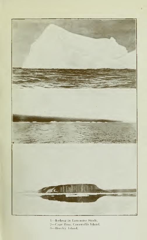
1—Iteberg in Lancaster Slr.Tit.
2—Cape Ross, Cornwallis Island.
3—Beerhy Island.
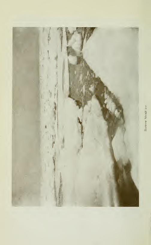

CRUISE OF THE MINNIE MAUD 181
is another smaller island of the same rocky character, about3 to 4 miles long and two miles wide. On each side of this island,
which I named Elder Island, after Parry's mate who died and wasburied at Igloolik, is a channel with a very swift current running.
The southern channel between Elder and Ormond islands is
about a mile wide with an open water hole caused by the swift
current about a mile long and half a mile wide. The northernchannel between Elder island and the north shore is about half
a mile wide with an open water hole about 500 yards long and 200yards wide. Through both of these narrow channels a veryswift current runs, the flood tide to the east and the ebb tide to
the west; the current flowing east being about one and a half
knot faster than the one flowing west, which accounts for the
constant jam of old Arctic floes at the eastern end of Fury &Hecia Strait.
Ship passasse.—-Between Ormond island and the south shoreof Hecla & Fury Strait, the main channel is from three to four
miles wide with a very swift current flowing. In the middleof this passage there is an open water hole, which does notfreeze over in winter, about two miles long and ^' of a mile wide.
Through this channel lies the only safe passage for the ships.
Soundings taken by Parry in 1823 showed the depth to be bet-
ween 30 and 3.5 fathoms.
Numerous seals.—Seals in great numbers were continually
bobbing their heads above water in each of the three open waterholes in the vicinity of Elder and Ormond islands. In the m.ost
northerly one, between Elder island and the north shore, I killed
seven seals in nine shots with my 280 Hight Velocity Ross,but succeeded in capturing only three, as young Takkowahwas not very expert with the harpoon and the swift current sooncarried the bodies out of reach under the ice. One has to aimquick to hit these seal, as their heads, which offer a target ofonly 3 inches square, would bob up for an instant to breatheand then disappear. The nearest range was about a hundredyards and the farthest about 300 yards. It was very disappoint-ing after killing seven to be able to recover only three, especially
as we needed the meat so badly for the dogs and our own nourish-ment. *
A Seal harpoon-gun needed.—The Eskimos need badly a goodharpoon spring or air-gun that would throw a light harpoon andbarb with a line attached some 75 yards, as they can only throwthe hand-harpoon about 25 yards and they lose more than halfof the seals killed through inhability to recover their bodies,which are swept away by the current before the Eskimos can

182 CRUISE OF THE MINNIE MAUD
reach them. And the very existence of the Eskimos, in wintertime, depends upon their ability to catch enough seal to providethemselves and their dogs with seal meat and blubber for fuel.
Dangers oj water-holes.—The ice at the edge of these open seal
holes is only about one and a half inch thick, and piled all aroundthe edgee are large, flat, sharp-edged and sHppery cakes of ice which,
render a near approach to the water very difficult and dangerous.
For a distance of 100 yards round the hole the ice was only some 5
inches thick and covered with soft, wet slush. Under it the tide
rushed and roared as through a mill race. We betide the manwho fell in, he would be frozen and swept away under the ice in
a twinkhng. Peewiktoo nearly perished in this manner at Schemingowing to the thin ice-edge breaking under his weight and hejust managed to save himself by throwing himself backwards onto his back on the sohd ice. Two men should always go after
seal at these holes and be roped together, with one man standingback on the sohd ice and the other, the hunter, near the edgeof the water. An Eskimo of IglooHk who was hunting seal the
year before my arrival at a water hole near there also nearly
lost his Hfe through the ice-breaking. Fortunately he was ac-
companied by his wife who succeeded in puUing him out with a
harpoon line.
Feed the dogs.—We had great difficulty to harpoon and haul
out the three seals that I had shot, and after skinning them in
the freezing temperature, with our feet and hands nearly frozen,
gave the hungry dogs a good feed. We left the carcase of oneand the skins and spare blubber of the other two in a snow cache
on the north shore, to pick up on our return from Aggo. I^took
with me some of the bkibber for our seal stove.
Leave record.— I chmbed the rounded point on the north shore,
opposite the water hole, where the land consists of rolhng hills,
about 200 feet high of rusty bhick rock, much cracked in all
directions. On the top and about 120 yards back I placed a
1 ong biscuit barrel stave upright and well driven home in a cre-
vice of the rock, on which I cut my name and placed at the foot,
under a heavy stone, a 280 Ross cartridge, containing my name,
the name of the schooner, the date and a short memorandum of
the route by which I had travelled. The barrel stave is visible
for a long distance on the strait, from south, east and west.
Old Arctic floes.—After resting for a couple of hours, to give
the dogs time to digest their meal, we continued west along the
northern coast to the next point, about 11 miles west of Elder
island. Here we struck a very Large pan of old Arctic ice which

CRUISE OF THE MINNIE MAUD 183
Stretched right across the sound and which consequently could
not pass last summer through the narrow channels between the is-
lands and the shore into Fox Channel. This ice was hard to cross,
being full of holes and covered with large lumps and broken masses
of ice. These old pans were between ten and fifteen feet thick.
Rocky islet.—NesiT the point, on its east side is a small square
rocky islet about 100 yards from the shore. This islet rises
about 150 feet straight up from the water with square perpendicu-
lar sides composed of a dark brown black rock. The coast
is of the same formation.
We camped that night out on the old Arctic ice-pan, about 3 miles
from the shore, opposite a high mountain about 1000 ieet high,
on the north shore.
Sandstone coast,—March 28th.—Starting at sunrise we conti-
nued west along the north shore. About 12 or 13 miles fromour last camp, the character of the north coast changes,—the rusty
black rock being succeeded by a salmon-pink sandstone forma-
tion, the smooth, low, rounded hills stretching back about 6 miles
to the north, where they terminated in a high range of black
hills, rising to a height of 1000 feet and running east and west.
The stretch of sandstone deposit continues along the north shore
for a distance of fifty miles and terminates on the west shore of
Autridge bay, where it is succeeded by the same rusty black-brownrocks which form the general formation of the coast.
North shore.—The snow-capped peaks on the north side of
FurvandHecla Strait were trigonomitrically measured by Parry's
officers and found to be 1447 feet in height.
Parry describes a wide area of a similar sandstone, probablythe base of the cambro-silurian, which separated the hihglands
of the interior of Melville Peninsula from the western shores
of the northern parts of Fox Channel. These rocks are conti-
nued on the north side of Fury & Hecla strait. Parry reported
having found coal in Autridge bav.
Rough ice.—We followed the north shore all day; the ice wasvery rough, consisting of old Arctic pans. Several times the sled
upset and nearly broke my leg as well as the guns that
were lashed on top. The dogs travelled very fast and the light
sled careened, bumped and glided over the rough slippery hum-mocks in all directions. Every now and then a dog's trace
would catch in the jagged ice and I would have to run full speedto free it before the sled run over and killed the dog. I had hardwork to keep up with the dogs, and it was a hard long, hard, trying
day. About noon I saw a fox running over the ice and started
after it, with the rifle, but, frightened by the dogs, he escaped in the
rough ice. I saw also the fresh tracks of a bear and a wolve-rene. We made forty good miles during the day, and after pass-
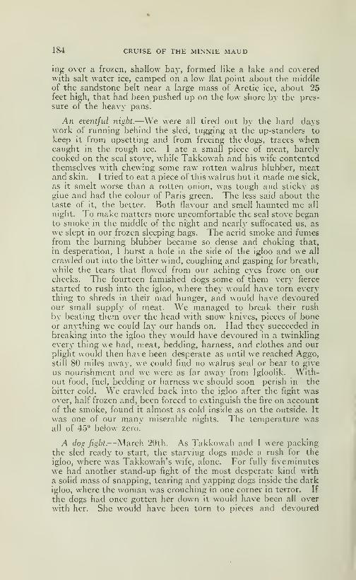
184 CRUISE OF THE MINNIE MAUD
ing over a frozen, shallow bay, formed like a lake and coveredwith salt water ice, camped on a low flat point about the middleof the sandstone belt near a large mass of Arctic ice, about 25feet high, that had been pushed up on the low shore by the pres-
sure of the heavy pans.
An eventful night.—We were all tired out by the hard dayswork of running behind the sled, tugging at the up-standers to
keep it from upsetting and from freeing the dogs, traces whencaught in the rough ice. I ate a small piece of meat, barelycooked on the seal stove, while Takkowah and his wife contentedthemselves with chewing some raw rotten walrus blubber, meatand skin. I tried to eat a piece of this walrus but it made me sick,
as it smelt worse than a rotten onion, was tough and sticky as
glue and had the colour of Paris green. The less said about thetaste of it, the better. Both flavour and smell haunted me all
night. To make matters more uncomfortable the seal stove beganto smoke in the middle of the night and nearly sufl'ocated us, as
we slept in our frozen sleeping bags. The acrid smoke and fumesfrom the burning blubber became so dense and choking that,
in desperation, I burst a hole in the side of the igloo and we all
crawled out into the bitter wind, coughing and gasping for breath,
while the tears that flowed from our aching eyes froze on ourcheeks. The fourteen famished dogs some of them very fierce
started to rush into the igloo, where they would have torn everything to shreds in their mad hunger, and would have devouredour small supply of meat. We managed to break their rush
by beating them over the head with snow knives, pieces of boneor anything we could lay our hands on. Had they succeeded in
breaking into the igloo they would have devoured in a twinklingevery thing we had, meat, bedding, harness, and clothes and ourplight would then have been desperate as until we reached Aggo,still 80 miles away, we could find no walrus seal or bear to give
us nourishment and we were as far away from Igloolik. With-out food, fuel, bedding or harness we should soon perish in the
bitter cold. We crawled back into the igloo after the fight wasover, half frozen and, been forced to extinguish the fire on accountof the smoke, found it almost as cold inside as on the outside. It
was one of our many miserable nights. The temperature wasall of 45° below zero.
A dog figbt.—March 29th.—As Takkowah and I were packingthe sled ready to start, the starving dogs made a rush for the
igloo, where was Takkowah's wife, alone. For fully fiveminutes
we had another stand-up fight of the most desperate kind with
a solid mass of snapping, tearing and yapping dogs inside the darkigloo, where the woman was crouching in one corner in terror. If
the dogs had once gotten her down it would have been all over
with her. She would have been torn to pieces and devoured
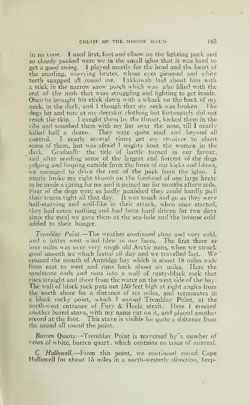
CRUISE OF THE MINNIE MAUD 185
in no time. I used first, foot and elbow on the fighting pack andso closely packed were we in the small igloo that it was hard to
get a good swing. I played mostly for the head and the heart of
the snarhng, worrying brutes, whose eyes gleamed and whiteteeth snapped all round me. Takkowah laid about him with
a stick in the narrow snow porch which was also filled with the
rest of the mob that were struggling and fighting to get inside.
Once he brought his stick down with a whack on the back of myneck, in the dark, and I though that my neck was broken. Thedogs bit and tore at my deerskin clothing but fortunately did not
reach the skin. I caught them by the throat, kicked them in theribs and smashed them with my fist over the nose, till I nearly
killed half a dozen. They were quite mad and beyond all
control. I nearly several times get my revolver to shoot
some of them, but was afraid I mights hoot the woman in the
dark. Gradually the tide of battle turned in our favour,
and after sending some of the largest and fiercest of the dogsyelping and limping outside from the force of our kicks and blows,
we managed to drive the rest of the pack from the igloo. I
nearly broke my right thumb on the forehead of one large bruteas he made a spring for me and it pained me for months afterwards.
Four of the dogs were so badly punished they could hardly pull
their traces tight all that day. It was touch and go as they werehalf-starving and wolf-hke in their attack, when once started,
they had eaten nothing and had been hard driven for two dayssince the meal we gave them at the sea-hole and the intense cold
added to their hunger.
Tremblay Point.—The weather continued clear and very cold,
and a bitter west wind blew in our faces. The first three or
four miles was over very rough old Arctic pans, when we struckgood smooth ice which lasted all da>- and we travelled fast. Wecrossed the mouth of Antridge bay which is about 18 miles widefrom east to west and runs back about six miles. Here thesandstone ends and runs into a wall of rusty-black rock thatrises straight and sheer from the water on the west side of the bay.The wall of black rock puts out 150 feet high at right angles fromthe north shore for a distance of six miles, and terminates in
a black rocky point, which I named Tremblay Point, at thenorth-west entrance of Fury & Hecla strait. Here I erectedanother barrel stave, with my name cut on it, and placed anotherrecord at the foot. This stave is visible for quite a distance fromthe sound all round the point.
Barren Quartz.—^Tremblay Point is traversed bya number ofveins of white, barren quart, which contains no trace of mineral.
C. Hallowell.—From this point, w^e continued round CapeHallowell for about 15 miles in a north-westerly direction, keep-
186 CRUISE OF THE MINNIE MAUD
ing a mile to three miles off the shore, the coastline consisting
of dark, rusty-looking hills, about 600 feet in height, sometimesalmost perpendicular, at others having a more easy ascent.
Grassy valley.—We camped for the night on the ice aboutthirty feet from the shore, and a mile beyond a valley, abouttwo miles wide, that penetrated the hills by gradual ascent in anorth-easterly direction for about three miles, and which endedapparently in a high hilL This valley was covered with goodgrass and affords good pasturage for caribou in the summermonths. I saw no traces of anj' creek running down the valley.
White Inlet.—Lieut. Reid, who accompanied Parry, reported:—"To the southward of Cape Hallowell are several small rockyislets. Twelve to fifteen miles from C. Hal.'owell is \\ hyte Inlet
which extends inland five or six miles in a north-east direction,
its general breadth one to one and a half miles. At the head of
the inlet I fouud a ravine running into it and the vegetation here
was more abundant than any I had seen during the voyage. Wesaw also the remains of two Eskimo huts which were old andsupposed to have been winter habitations."
I saw no signs of these small rocky islands near Cape Hallowell
unless he meant the islands on the opposite side of the strait, andwhere Whyte Inlet appears on Parry's chart on the east end of
Autridge Bay, I found no sings of any such inlet as Lieut.
Reid journeved,. according to his own account, from 5.30 a. m.till 9 a. m. beyond Cape Hallowell. I imagine the cartographer
of the expedition was misled and should have placed WhyteInlet about fifteen miles on the north-west side of Cape Hallowell,
which would make it coincide with the long valley, where I camped,opposite the large island south of the entrance Aggo Bay.
Large island.—Almost due west of our camp and about eight
miles away is a large island, which was visited and explored byMr Lavoie in 191LMarch 30th.—Following the coast-line in a northerly direc-
tion round an easy bay, about four miles wide and three miles
deep we reached a point where the ice became rough and hardto travel over. To avoid this we kept a mile off the point and soonthe ice became smooth again. From the point a 3 foot crack
in the ice floor ran due south in the direction of the large island.
At this crack we found the remains of a seal which had lately beendevoured by a female bear and her two cubs, about six hoursprevious to our arrival. The tracks, according to Takkowah,were those of a 3 year old female and two yearling cubs. Wefollowed the tracks westward for about four miles when the dogslost the scent and we then headed straight for Aggo whichwe reached at 6 p. m. The native camp was on a sloping point
which juts when out about a couple of miles from the north shore.
CRUISE OF THE MINNIE MAUD 187
Here we found the remains of Ikkipareah's old snow igloo and that
of his son, who were away at Ponds Inlet and who, with their wi-
ves and famihes, are the only permanents residents at Aggo.
Salmon cache.—We made a new igloo and being verj- hungry-,
were fortunate to find a cache near by under a heap of stones,
with ten frozen salmon in it. Part of these salmon had alreadybeen eaten by foxes, whose tracks were very nuuicrous around thecache. In mj- hunger I seized a large frozen salmon which weighedabout seven pounds and devoured the whole fish while helping
to build the igloo, as it was the first full satisfying meal that I
had had since leaving Scheming three long weeks before. Whenthe biscuits were finished at Scheming, I had to live on raw seal
and walrus, often putrid or on caribou meat that was full of
maggots and so thin as to be almost uneatable. No one whohas not actually experienced it, can form a conception of the pangsand terrible craving that haunts one mind and wreck the systemas a result of continual hunger endured for any length of time.
Not only had I been suffering all these weeks from unappeasedhunger, but for about six weeks I had been suffering the torturesof frozen hands, face and feet from the intense cold, often wetthrough, with frozen clothes and sleeping bag and with my limbsracked and aching from long, stumbling marches over rough ice
and heavy snow and from constantly hauling and tugging atthe sledge. My mind all the time was constantly filled withanxiety where to find food for ourselves and the dogs and whetherour cartridges would hold out and enable us to reach PondsInlet.
So woIf-Iike was my hunger and so desperate were the conditionsthat I firmly believe, if any one had attempted to deprive me ofthat salmon, I should have shot him on the spot. Takkowahand his wife also gorged themselves on the fro .en salmon untilthey could eat no more. To the famished dogs, that had drawnus 120 miles with nothing to eat for three days, we also gave ascanty meal.We all passed a very restless night after our surfeit of salmon
and it was two days before I felt well again. The fear of deathitself could not have stayed me from eating my fill. I could wellsyrnpathize with poor Enoo-arah of Toolooria who died from over-eating after a prolonged fast on a bear hunt. But the relief
from the continous pangs of hunger and from the ceaseless anxietyas to where the next meal was to come from was too great tobe endured, and I threw caution to the winds. It was a caseof eat, drink and be merrv, for tomorrow we may die.
^ggo.—Aggo is a fine circular bay about six miles wide atthe south, where the entrance lies, and widens out to ten milesm width and depth. In the north-east corner is a long narrowarm, about 8 miles long and 2 miles wide, which runs to the
188 CRUISE OF THE MINNIE MAUD
north-east. Into this sound the lake of Ibbi-sauktoo discharges
by a river about 8 miles long. Both river and lakes teem with
salmon in the summer. Up this frozen river and lake, in winter,
lies the sled trail to Scheming.
In the centre of the main bay, on the north shore and aboutsix miles west of the village promontory- is another river whichdischarges from Aggo lake, which lies some six miles to the north.
This lake and river also abound in fine salmon.
Aggo bay is surrounded by high hills on all sides, 1000 feet in
height, which slope at an angle of about 35° straight into the
water. There is no beach to speak of along the shore. The rock
is granite and rusty gneiss, like the rest of the coast. Low des-
cribes the rocks that compose the high cliffs of Brodeur Peninsula
north of Aggo, on the east side of Prince Regent inlet as basal
sandstone and shale overlaid by limestones, which in places
are interbedded with beds of gypsum.Mr Lavoie made a survey of Aggo and the coastline north to
Cape Kater in 1911, for the Canadian Government, but I have
been unable to obtain a copy of his report or map.In the bay, in summertime, are found seal and walrus but no
narwhal. In the hills are numerous caribou, fox, wolves, wolve-
rene and hares.
March 31st.—Starting early we travelled west for six miles'
along the north shore of the bay to the mouth of the Aggo river,
where we found a large cache of salmon. On opening the cache
we found that all the fish were frozen together and had great
diflficulty in prying them apart. We took out about fifty of these,
which weighed in the aggregate some 200 lbs The average
being from S}4 to 4 lbs. Some weighed 7 lbs.
We returned to the igloo by noon and I spent the rest of the
afternoon while daylight lasted, in filing about an inch and a
lialf of the muzzle of Takkowah's old 303 Martini Henry rifle,
which some Scotch whaling ship had brought from England.
The muzzle had become bulged through being fired too close
to the ice at the seal holes, the gas pressure having burst the
muzzle. I also fixed the fore-sight and it shot well after that.
Leave Aggo.—April 1st.—Disappointed at not finding anynews from Wilson at Aggo, whom I expected to meet there with
a fresh supply of cartridges and provisions, or at least that Coonoo,
his Eskimo, had been sent there to meet me, I decided to return
to Igloolik, hoping to find them tlicrc. Before leaving, I left
a note in English for Wilson, in case he should arrive there later
telling him of my movements and where he could overtake me.
I learned later that he was ill at the time with congestion of the
lungs and could not leave Salmon River.
I also left a written record in a cartridge shell under a pile of
stones on the top of Aggo point, about 100 feet above water-level
CRUISE OF THE MINNIE MAUD 189
and 100 yards back from the shore, surmounted by a barrel
stave with my name carved on it.
A had storm.— It was a terrible day on which to start out ona journey, but my food supply was hmited, my supply of car-
tridges was running short and I had manv hundred miles to tra-
verse before reaching Ponds Inlet.
The wind blew a heavy gale from the south-east, right in ourfaces, and was so strong at times that the dogs would turn tail
to the wind and refuse to pull the sledge. They could not hearus when we shouted at them and we could scarcely throw the longdog-whip against the wind. The gale was accompanied by awhirhng storm of sleet and snow, which bhnded and nearly chokedus, and caused us to lose the trial we had broken a few days before.
The hard snow and sleet beat upon and stung our half-frozen
faces till they burned as if pounded by a sandstorm. We couldnot see thirty feet in front of us, and the leading dogs lookedlike blurred spots, so thick was the driving snow.
The pleasures oj Arctic sledding.—A few miles fom Aggo weran into a field of very rough, jagged blocks of ice. which lasted
for several miles The sledge capsized a dozen times and thedog's traces were continually catching and breaking on the sharpice projections. We were kept busy righting the sled and repair-
ing the broken harness. I was several times nearly caught bet-ween the heavy sled runners and the ice when walking andrunning alongside in order to guide it, as it would suddenly swerveand swoop down on me from the summit of a rounded and slipperyice-hummock. Had I been caught I should assuredly havelost a leg, as the heavy, polished, steel shod runners cut like aguillotine when pulled at speed by a strong team of dogs. And tolose one's leg under the circumstances was to lose one's life.
Sledding in the Arctic is no child's play especially when the sledis slipping and sliding over rough cakes, jagged pinnacles androunded hummocks of slippery ice in the semi or total obscurityof an Arctic storm. It is hard shoulder and heart-breakingwork all the time, save when one can ride on the sled for a shortspace over smooth, level ice, which only occured at rare intervalsduring my trips. In places I would have to hack and saw a trial
with axe and saw through the rough bouldery ice that blockedthe path, while the tired and hungry dogs lay whining and shi-
vering in the bitter blasts of the blizzard.
Eskimo Dog-Power.—A strong and numerous team of dogs will
draw a lightly loaded sled over level ice at a rate of seven to tenand even twelve miles an hour,—so fast that running one's hardestyou cannot keep up with them, and the keen frosty air cuts yourlungs like a knife. When they scent a seal-hole they will suddenlydash in that direction at a 20 miles an hour gait and no power

190 CRUISE OF THE MINNIE MAUD
can stop them until they reach it. Then is the time to fling one-self, breathless, on the flying sled and hang on for dear life, until
spurt is over. Over good level ice, a good team of dogs will drawa heavily loaded sled from four to five miles an hour and keep it
up all day. Over bad ice they will not average over two miles,
and in very hard places, not one mile an hour. The length ofthe daj^'s journey depends upon and varies with the conditionsof the ice, the weight of the load, and the condition and numberof the dogs. One day you will cover forty and even sixty milesin a day without an^' trouble, the next, after the hardest kindof work, you will be fortunate if you make five or six miles. A fair
average is from 15 to 25 miles a day. When passing round a shoreof steep cliff^s where the action of the tide and wind is strong,
you may spend days waiting for the moving pans to freeze to-
gether before a passage can be made at all.
Eskimo Dogs.—Examination of the vertabrae by Mr Skeochof Parry's Expedition to Igloolik showed that the Eskimo doghas the same number of vertebrae and corresponds with thewell-known anatomy of the wolf-cervical, 7; dorsal 13; lumber7; sacral, 3; caudal 19.
On the subject of the ability of the Eskimo dogs Parry writes—"The rate at which they travel depends, of course on the weightthey have to draw and the road on which the journey is performed.When the latter is level and very hard and smooth, constituting
what in other part of North America is called "good sleighing", six
or seven dogs will draw from eight to ten hundred-weight and will
easily under these circumstances, perform a journey of fifty to
sixty miles a day-on introdden snow, five and twenty miles or
thirty miles would be a good day's journey. The same numberof well-fed dogs, with a weight of five or six hundred pounds(that of the sledge included) are almost unmanageable and will
on a smooth road run any way they please at the rate of tenmiles an hour. The work perfermed by a greater number of
dogs is, however, by no means in proportion to this; owing to
the imperfect mode already described of harnessing these sturdycreature, and to the more frequent snarling and fighting occa-
sioned by an increase of numbers."Though the dogs are kept in training entirely by fear of
the whip, and indeed without it would soon have their own way,its immediate effect is always detrimental to the draught of the
sledge; for not only does the individual that is struck draw backand slacker his trace, but generally turns upon his next neigh-
bour, and this passing on the next occasions a general divergen-
cy accompanied by the usual yelping and showing of tooth. Thedogs then come together again be degrees, and the draughtof the sled is accelerated; but even at the best of times, by this
rude mode of draught the traces of one-third of the dogs form
CRUISE OF THE MINNIE MAUD 191
an angle of thirty or forty degrees on each side of tiie direction
in which the sledge is. advancing. Another great inconvenience
attending the Eskimo method of putting the dogs to, besides
that of not employing their full strength to the best advantage,is the constant entanglement of the traces by the dogs repeated-
ly doubling under from side to side to avoid the whip, so that,
after running a few miles, the traces always require to be takenoff and cleared.
On this day, owing to the blinding storm, we soon lost all
sense of direction and Takkowah, who was young and inexpe-
rienced kept allowing the dogs to work away from the wind andfrom the land, when we ran the risk of losing the land altogether
and of running full tilt into open water of the gulf of Boothia.
I had hard work to make him keep to the left against the keen,
cutting-wind and snow-blasts so as to strike and follow the coast,
which we eventually reached about a mile north of the igloo,
where we had camped on March 29th. Following the shore
which I recognized, we soon reached the igloo, where I had left
a piece of seal-meat, some blubber and a small piece of rotten
walrus, which were inestimable treasures to us at that time,
and which I was anxious to recover. We reached the igloo
completely exhausted by our battle with the blizzard and withour clothes wet through with the damp snow that penetratedour sleeves and drifted down the backs of our necks.
The dogs were completely fagged out and curled up at onceand went to sleep in their harness on the snow.We doubled the snow blocks round the igloo to prevent it form
being blown down by the gale that raged and howled round usall night from the south-east, and after a meal of raw frozen salmon,crawled into damp and frozen sleeping bags and tried to forget
our misery in sleep. But the furious gusts opened up cracksin the igloo and draughts of cold air swept over us all night.
Arctic ivorries.—No one who has not had the actual experienceof travelling with Eskimos, li\'ing on their fare of raw, frozen
seal or walrus and depending entirely upon his skill with rifle
and harpoon to provide food and fuel for men and dogs, canform any idea of the mental w^orry and ceaseless anxiety to whichthe winter traveller in the Arctic is constantly exposed. Shall
we be able to kill a seal or caribou tomorrow or otherw^ise we all
starve? Will the dogs go mad from hunger and rush upon uslike a mob of crazy wolves? Will the ice be too rough or too thinfor us to pass over? Will a tidal crock open up and keep us heretill we starve and freeze to death ? Can we pass over those loose,
treacherous, moving ice-pans, or shall we, men, dogs and sleds fall
through the treacherous young ice and be sucked under the ice-floes
and drowned by the racing tides? Shall we find snow withwhich to build an igloo at the end of a long wear\' dav's march
192 CRUISE OF THE MINNIE MAUD
or be compelled to camp out, without fire or shelter, in the bitter
north-wind? Will our scanty store of seal meat and blubberhold out until we can kill another seal? Will our dogs, hungryand lean, which have not eaten for the last five days, be able
to last for another day until we can kill something, or will theydie and leave us stranded in a desolate region of snow, ice andtempest, to perish slowly of cold and hunger? Shall we, as so
often has happened to the Eskimos, after finishing the deadcarcases of the frozen dogs, be compelled to live on the deadbodies of our companions, and then slowly perish? Will ourcartridges hold out? Will the wind suddenly change and dri-
ve the ice-pan over which we are travelling, out to sea and des-
truction ? Will this fog never lift and show us our direction?
Will the sun never shine again ? Are we driving straight for
open water and a miserable death in this land of interminable
fog and darkness ? W ill we ever get back to warmth, confort
and freedom from constant suffering, frostbite, hunger, thirst
and misery? There are some of the life and death questions
that constantly haunt the mind of the traveller in the Arctic.
Sometimes the strain is over-great and men like the dogs, gomad and perish.
Tremblay Point.—April 2rd.—Yesterday's south-east gale N\ith
driving snow continued this morning and the dogs objectd stren-
ously to being harnessed in such a storm. We started neverthel-
less, soon after daybreak and followed the shore in the south-eas-
terly direction until we reached Cape Hallowell and TremblayPoint, which I climbed and where I took some samples from the
quartz veins that cross it in all directions, and which vary fromone inch to a foot in thikness.
Soon after we reached Tremblay Point the storm abated, thewind fall and a bright sun shone out, giving me a splendid viewof Fury & Hecla strait and the southern shoreline. From the
point I could see the rough masses of heavy, ancient Arctic ice-
floes, all crushed and pilled up on the shores; so I made out into
the middle of the strait, at the western entrance, where the ice-
floes appeared smoother, but which were much rougher andharder to pass over them than they looked from the point.
Fury & Hecla Strait.—Fury & Hecla Strait which runs almost
due east and west just south of the seventieth parallel, is ninety
miles long and varies in width from eight to 20 miles. Its west-
ern entrance, between Tremblay Point and Cape Inglefield
is about 12 to 13 miles across, which is reduced by a couple of
Islands that lie north of the latter, cape. The straits narrowin towards the east, until south of Ormond island the channel
is onlv about four miles wide. The heavy Arctic Hoes often
several miles in length and breadth and from 20 to 30 feet in
thickness, that drift in from the gulf of Boothia and Prince Re-
CRUISE OF THE MINNIE MAUD 193
gent Inlet, are driven eastwards by the strong prevailing current
and become solidly jammed between Ormond and Elder islands
and the mainland, where they remain winter and summer, drift-
ing east and west alternately with the change of tide, and north
and south, with the varying winds, thus effectually blocking
the straits as a channel of communication for ships betweenFox Channel and the Gulf of Boothia. The soundings madeby Parry in 1822 at the eastern end of the strait showed only
thirty fathoms of water between Ormond island and the south
shore, so that a large iceberg, standing only 30 feet high abovethe water, could not pass through into Fox Channel, but wouldground and remain for an indefinite period in the strait.
For these reason Fury & Hecia strait will never become a prac-
ticable route for ships, as navigation is only possible, under the
ever-present risk of being crushed and sunk through being caughtbetween the heavy ice-pans jammed together with irresistible
force by the swift currents and strong winds from September20th to October 15th. In some years the passage is never open,
except for a few leads between the pans along the shore, and onlythe strongest ship with powerful engines would have a chanceof squeezing through, without being beset or crushed betweenthe floes.
Leaving Tremblay Point we travelled well out into the middleof the strait and as the weather was now fine and bright I hada good view of the southern shore, as we coasted along the east for
about 20 miles.
In Parry's map there appear five small islands, north and westof Cape Inglefield, but I had a good view at short range of this
point and could only make out two islands in that vicinity.
—
One island which I named Alfred Island, is situated about twomiles from the southern shore as the western end of the strait
and bearing due south from Tremblay Point on the north shore.
Alfred island is about 3}/2 miles long by 2 miles wide. Thesecond island is smaller and Hes about 3 miles west of Alfredisland and five or six miles north-west of Cape Inglefield.
The south shore of Furj^ & HecIa strait is formed or sloping,
rounded hills, cut by small valleys w^hich gradually attain a
height of 1000 feet and consist of rusty, black rock, identical
with the rocks of the north shore. The strait appears to havei^een opened or thrust apart by a sudden crack or cleavage of
the earth's crust.
Amherst and Liddon islands.—Amherst island and Liddon is-
land, as presented on existing maps, are far too big and are mis-
placed; they are not in the middle of the strait, but he close to
the southern shore, about a mile off shore and are distant respec-
tively about 25 and 17 miles from Pelletier Point at the eastern
entrance. These islands lie eaât and west and are about 4 or 5

194 CRUISE OF THE MINNIE MAUD
miles long and from one and a half to two miies wide. Theyare about two miles apart. Opposite to Amherst island the
strait is fully 12 miles wide, while in the existing charts it appears
as being only about 4 miles wide. There is no large bay as re-
presented to the south and south-east of Amhesrt island, butthe coast runs generally almost straight, by gentle and easy curves
to Pelletier Point, which, moreover, does not consist of a long
narrow island, with a small islet between it, and the mainland,
as represented, but is a long narrow neck of land which juts out,
due east, from the shore.
Amberst' Island.-—Parry writes:—^"The appearance of Amherstisland is remarkable on account of the materials of which it is
composed (which differed geologically from any hitherto metwith) and from its singularly dark aspect which contrasted stran-
gely with the surrounding lands. The snow always first dissol-
ved upon this island, which, even on some very cold days, con-
trived to throw off its fleecy mantle when no other shore wasuncovered—which circumstance may perhaps be in part attri-
buted to the colour as well as to other qualities of the rocks.
Captain Lyon reported the flat beach and the whole northern side
of the island was covered with minute scale of black slate—andsuggested that coal, although no signs of it were discovered,
might be found a few feet underneath the surface. The southern
half on the island was covered with small amorphone masses
of clay and limestone and some low swampy places were thinly
clothed with shrivelled grass and moss; while on the northern
slaty side we could perceive no sings of vegetation. The base
of Amherst island is argillaceous or graywacke schist. The moreelevated ridges of the island are formed of the disintegrating re-
mains of a super-incumbent stratum of hard, compact limestone
of a dark greyish blue colour; externally, where exposed to air
or moisture deeply ferriginous.—It does not burn into quick-
lime but contains minute veins of calc-spar and corresponds with
the calc of Kirwan. Worm blocks ofsandstone, granite, gneiss andother quartzose rocks are scattered over the surface ofthe island."
A beautiful sirotto.—Captain Lyon reported on Amherst is-
land in September 1823:—"Near the place at which Mr Ross
was stationed to observe the tides I found a most fairy-like grotto
in a small cliff of black and rugged slate, through whicii the water
as it oozed had formed icy stalactites, five or six feet in length.
These hung across the front of the cave in a variety of fanciful
forms over a sniall basin which was frozen as smooth as the mostpolished mirror. The sun shone full but powerless on the sil-
very icicles wiiich formed a brilliant contrast to the deep ebon
shade of the cave behind tiiem. The whole appearance of this
little spot was of the most delicate and novel description, andI felt that neither by pen nor pencil could I do it justice."
I

CRUISE OF THE MINNIE MAUD 195
"Liddon Island Is formed of coarse, whitish sandstone andOrmond of gneiss.
We camped that night in the middle of Fury & Hecia strait,
finding good snow for our igloo.
April 3rd.—A clear, bright day with a cold south-east
wind blowing. We travelled along the centre of the strait,
within five miles of the southern shore, the character of which
I studdied carefully as we passed. For the first ten miles we tra-
velled over very bad, rough, old Arctic ice, and after that over
rounded hillocks of polished ice on the top of the old Arctic pans
over which the dogs travelled fast. We covered over fifty miles
during the day, and crossed the strait from the west end of Liddonisland to the north shore to the igloo that we had built on March27th, where I had left some seal meat and blubber. It wasdark when we reached the north shore, and but for the keen scent
of the dogs, should have passed the igloo in the dark. We sawfox tracks round the igloo, as the smell of the meat had attrac-
ted them.That night was very cold and the igloo was full of holes from
the heat of the stove and, consequently, very draughty. After
eating some raw salmon, I fell asleep as I sat, in the igloo fromsheer fatigue, and woke up, two or three hours later, chilled to
the bone, when I crept shivering as with an ague, into my fro-
zen sleeping bag.
April 4th.—We made an early start at daybreak, as I wasdetermined to reach Igloolik without breaking the journey. Theday was bright, intensely cold (about 40° below zero) and clear
with a light south-easterly breeze blowing in our faces. Follow-
ing the north shore along our old sled trial, which we had bro-
ken a week before, we reached the cache of seal meat which wehad left near the water hole between Elder island and the shore.
Here we fed the dogs, and that was no easy operation as, like
famished wolves, they hovered round the seal and would every
now and again dart in to secure a mouthful, and one had to keepfighting them off and to be careful at the same time not to hit
them with the axe when chopping up the frozen carcase.
I then climbed the hill to get a view of the water-hole and to
see if it contained any seal. As I saw many bobing heads, Takko-wah and I took our rifles and proceeded as near to the edge of
the hole as was prudent, as the tide was rushing and roaring underthe ice from the west at a great rate, and the small thin ice
at the edge was continually being torn away in chunksand carried under the pan. The wind in the narrow channel
between Elder island and the shore became very strong and blewcold on our faces like an ice-blast. The wind was too cold for
the seals to stay up long and they would poke their noses outof the water only for one moment at a time, quickly empty andfill their lungs, and disappear. They were also timid and seamy
14

196 CRUISE OF THE MINNIE MAUD
from the fusillade I had treated them to the week before. I
shot one with a quick snap shot from my Ross 280 at 80 yardsand killed it instantly, but before we could get a harpoon into
its body the swift tide had swept it away under the ice. Takkowahnearly fell into the water while trying to harpoon it, before it
desappeared under the ice, as the thin ice kept breaking off fromthe edge. Once in it would have been all over with him in aninstant as I could never have saved him. He would have beenfrozen and swept under the ice in a very short time. It wasrisky and anything but an enjoyable form of sport The cold
wind filled my eyes with tears and nearly froze my fingers, so
that, after two more shots at a couple of bobbing seal's noses,
which I missed, I gave up and told Takkowah to go back for the
sled. The cold wmd was causing a dense black fog to rise fromthe surface of the open water.
Neertonatko Island.—We followed our old track for a while,
and then bore away round the east end of Ormond island, whenI got a good view of the dimensions of the large water hole to
the south of that island. Passing round Pelletier Point, of
which I took good note, we bore away south-east for Igloolik.
By nightfall we were about five miles from the north-east point
of Neertonatko Islands, when darkness came upon us. ButI was determined not to stop and we travelled all night. Weskirted the north end of Neertonatko island, which is a lime-
stone island and so flat that it looks like a large ice-floe. Theshore is however littered with crumpled ice-pans which caused us,
in the dark, a great deal of trouble to pass over. The sled cap-
sized a couple of times and the dogs' harness kept getting caughtand breaking in the jagged blocks of ice. Several times the dogsfell into ice- cracks and broke their harness, when we had to
haul them out and repair the harness. Takkowah keptfalling asleep on the sled from fatigue, and I had continually
to be shaking him to keep him awake in order to keep the dogsmoving. I myself was almost done up with want of sleep, fa-
tigue and hunger.
While passing along the north shore of Neetonatko, I came across
tow sled tracks which, according to the dogs footprints, were travel-
ling towards Igloolik. I recogni .ed the trail of Coonoo's sled andthe footprints of his young son. I isaid to Takkowah "That is
Coonoo's sled and may be Mr Wilson is with him", althoughI could see no traces of a white man's tracks in the snow. Thesight cheered me up greately as it meant fresh provisions and morecartridges with which to kill game. I pressed on eagerly after
that, in the direction of Igloolik.
We crossed the eastern end of Neertonatko island and thenlost our way again in the dark and stumbled about in the roughice all night, falling into cracks, pulling out the dogs, righting
the sled which kept continually capsizing, until we nearly ran
CRUISE OF THE MINNIE MAUD 197
off the edge of the shore ice into the open water of Fox channel,
which borders the island of IglooHk at a distance of about 8 miles
from its eastern shore. I suddenly noticed that we were travell-
ing over thin ice and woke up Takkowah who was fast asleep onthe sled just in time and we altered our course to the westwardin the direction of the land. We must have travelled in this
way at least 15 miles in the dark more than was necessary andwhen we reached Igloolik had covered over 70 miles since leaving
our last camp the morning before, without stopping to rest or eat.
Reach Igloolik.—^As daylight broke, I recognised two ice-
bergs which were grounded near the island and which I had pre-
viously remarked when hunting seal. Soon after that we struck
the sled trail leading to Igloolik and reached the village about10 a. m. on April 5th, after a 28 hours march.
I made straight for our igloo, where I found Peewiktoo andTootillik, and was so tired and hungry- that I fell asleep whentrying to eat a small piece of frozen salmon. I slept for about 5
hours, and then ate some more frozen salmon and a biscuit thatTootillik cooked for me from a small bag of flour that Coonoohad brought from Ponds Inlet.
Shortly after, Coonoo, who had accompanied Wilson from Arc-tic Bay to Ponds Inlet, paid me a visit with Nookudla.After a short rest, to show the whiteman, the possibility to
return to his country- on foot when his vessel is wreched in these
glacial regions. I decided, no matter the risk, to journey homefrom Igloolik to Winnipeg, following the west shore of Fox Channeland Hudson Bay to Fullerton and thence to Churchill and over-
land to the railroad at Le Pas. But the natives were afraid to
accompany me and having no stock of seal meat I was compelledto abandon the idea.
—
I then asked the Eskimos of Igloolik to accompany me on a
flying tour round the north and eastern shores of Fox Channel,which are still unexplored. I specially wished to make a surveyof that coast as I believed it would provided valuable informationof general interest. But the natives refused to accompany- me.
I finally decided that I would make a flying trip to the greatlakes on Melville Peninsula, as the natives had told me therewhere large quartz veins in that neighborhood, and then to
return, without delay, overland to Ponds Inlet.
Had I been provided with a proper supply of provisions andcartridges I could within three weeks have easily explored thenorthern and eastern coasts of Fox Channel as far as the outlet
of Lake Netilling and have returned overland across CockburnLand to Ponds Inlet before the snow had disappeared. I couldalso have doubled my contribution of foxskins and bearskinsto the coffers of the expedition.
Before starting for Melville Peninsula I spent 3 days at Igloolik
recuparating from my Aggo trip and drying my wet clothes.
198 CRUISE OF THE MINNIE MAUD
On April 6th.-— I spent the day repairing an old single-barrel
450 Express, Martini-Henry action for Akkri-agro. The stock
had broken in two across the narrow portion, and I fashioned twosteel plates from a peice of steel sled runners, through which I
had much trouble to drill holes for the screws; my only tool
being a small file, which I used for a drill. This job occupied meall day, but when finished, it was stronger than when new andAkkri-agro was very grateful, as without his rifle, he was in badshape to provide his family and dogs with seal meat. On April
7th.— I repaired and adjusted the sight of Coonoo's 303 Win-chester carbine and spent the rest of the day making prepara-
tions for an early start for Melville Peninsula on the morrow.During these days the weather was clear, bright and intensely
cold, with a strong northerly' wind blowing.
CHAPTER IX
TREMBLAY S JOURNEY TO MEL\ ILLE PENINSULA
April 8th.—The morning broke fine and clear for our trip
to Melville Peninsula. A bright warm sun was shining overhead
and a gentle breze from the south softened the frost in the atmos-
phere. It was the first warm day that I had experienced since
the previous September, and Takkowah and I started oflF fromIgloolik in good spirits.
Trouble with Eskimos.—It was only by a ruse that I induced
Takkowah to accompany me, and he was quite a boy and hadnot got over the hardship of our trip to Aggo. I pretended that
I only wanted to explore the coastline in the direction of Hoppnerinlet; to the west of Igloolik, and would be away only a couple
of days. I knew that once we had left Igloolik he would gowhere ever I told him. Nookudla by his underground workand which was unknown to me at the time, had frightened the
rest of the natives of Igloolik from accompanying me, and whenI had broached the subject, they had raided all kinds of objection;
saying that the ice was too rough, the season was getting late,
that their supply of walrus meat was too small, etc., etc. It
was a case of "where there's a will, there's a way", and they did
not have the will, Coggan, Peewikto and Nookudla all wishedto return to Ponds Inlet as they pretended that the snow wouldsoon vanish from the hills and valleys of Cockburn Land whichI knew would last until the end of May, They also told methat several bands of Eskimos had lost th°ir lives when crossing
the land, owing to their cartridges giving out and being in con-
sequence unable to kill enough caribou for themselves and their
dogs. So I took only the young Takkowah, under the pretenceof making only a short flying trip for a couple of days. But I
was secretlv determined to visit the great lakes and countrythat lay 100 miles to the south, as the Eskimos had told me therewere many veins of qua^z in the rocks of that region.
Light Equipment.—We took 15 dogs and no load beyond enoughwalrus meat—which was rotten and stinking—to give the dogs a
couple of meals; some seal oil for the blubber stove; some caribou,
seal and walrus meat
—
the latter also putrid—and only enough
200 CRUISE OF THE MINNIE MAUD
to last Takkowah and myself a couple of days; and our sleeping
bags, snow knives, harpoon and rifles.
I left Peewiktoo at Igloolik to trap foxes and to hunt seal andwalrus in preparation for our return overland to Ponds Inlet,
A beautiful day.—Shortly after we started the breeze fell to adead calm and the warm sun began to melt the snow in the drifts
and on the hills. The ice, which had been bare swept bareby the late gales, was as flat ?s a bilhard table and ghstened like
a pohshed mirror in the sunhght. It was a delightful day and ourlarge, strong team of fresh dogs raced along at full speed, drawingthe light sled on the smooth ice at a great rate. We must havemade at times, over ten miles an hour. Whenever the dogswould scent a seal hole in an ice crack, they would make a spurtin that direction, and on coming to the hole, would stop short, whenTakkowah and I would have to check the sled with all our force
to prevent it overrunning and hurting the dogs.
Fast travel.—In this way we travelled steadily at an averageof six miles an hour for over ten hours when we slackened upa little, and then travelled for another four or five hours, andcovered about 70 miles before we camped for the night. Weaveraged not less than five miles an hour during the whole trip,
which lasted six days.
Hoppner Inlet.—On Iea\"ing Igloolik I took a westwardlycourse, as it was my first intention to proceed up the sound that
terminates in the Crozier River, the natives having informed meof the existence of a large vein of quartz on the south shore of
that sound. We continued in this direction about \\ . by S. of
Igloolik, until the south wind sprang up again, the sky becameblack, and overcast, and some snow began to fall. Fearing badweather and having so little food for the dogs, I abandonnedthe idea of continuing further in that direction, as I had already
some samples of the quartz which the natives had given me. Soafter reaching Hoppner Inlet we turned round and ran eastward
along the shore of the mainland for about thirty miles.
Quartz vein—Crozier river.—The quartz vein that the Eskimosmentioned as being on the south shore of Crozier sound is, accord-
ing to their report, four feet in width and occurs as a high fissure
vein that runs for a long distance in a south-westrely direction.
It is highly mineralized with iron pyrites.
Islands.—During the morning I had a fine opportunity, in
the clear atmosphere, of studying the character, bearing and for-
mation of the islands and coasts line that lie to the west of Igloo-
lik. The long point which, in Low's map, juts out into FoxChannel, due west of the island of Igloolik, is in realty, no penin-
sula at all, but consists of two large islands, separated from each

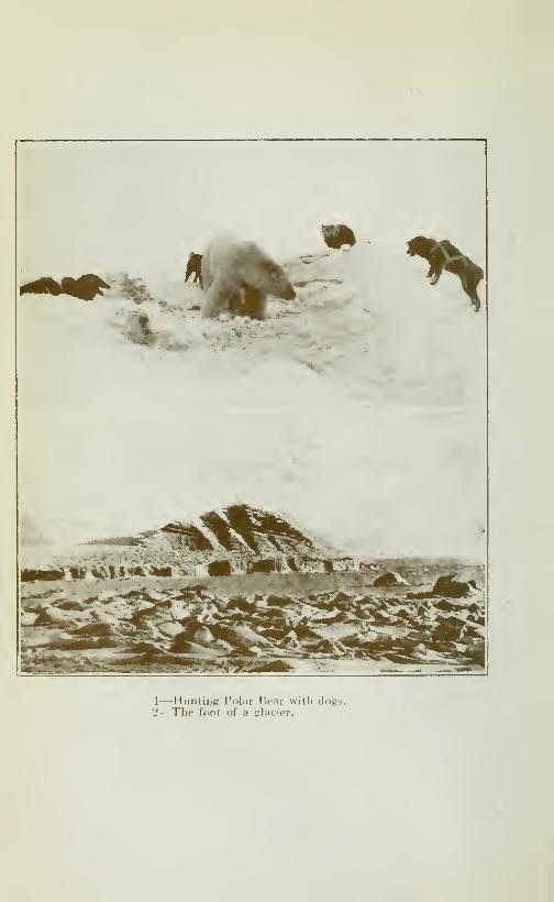
>
1—Hunting Polar Bear with clogs.
2—The foot of a glacier.
CRUISE OF THE MINNIE MAUD 201
Other and the mainland by well defined channels about a mile anda half wide. These islands which I named "A" and *'B" are
about 150 feet high, and are composed of the same rusty, brown-black rocks which, apart from the low-lying strip of limestone
which lies along the eastern coast of Melville Peninsula, charac-
terize the formation of Hecla & Fury strait, and the other is-
lands with the exception the limestone islands of Igloolik andNeertonatko.There are four other islands, lying to the south of these two
large islands, which are formed of the same rock, and which I
have marked, C, D, E and F, on the map.
Huronian rocks.—The black rusty-looking rocks which predo-minate in this region are cut by numerous small veins of quartz,
which cross them in all directions and some of them containquantities of iron and copper pyrites. I traced this formationfor over 250 miles in length from the western shores of lakes
Sarcpa and Taseonia in the south to 100 miles north of MurrayMax-well Bay, and just south of Milne inlet, in the north. This same class
of rock, cut by numerous quartz veins, often contains pyrites of
copper and iron sulphide, covers the north-westren section of
Melville Peninsula, both shores of Fury & Hecla strait and crosses
the southern portion of Brodeur Peninsula and again occurring in
Borden Peninsula, from Moffet Bay to Strathcona Sound. Thisblack rusty rock stops short about 30 miles from the southernend of Milne inlet, where it changes into the typical Laurentiangneisses and schists of the rocks of Ponds Inlet, Bylot island
and Eclipse sound.West of the large lakes of Sarcpa and Taseonia on Melville
Peninsula this rock is displaced by decomposed mica-schist,
granite and diabase, all cracked and interspersed by numerousveins of quartz and calcite, many of them impregnated withiron and copper pyrites and other minerals.
Geological formation.—Parry in 1822, \\hen searching for thenorth-west passage explored the east-coast of Melville Peninsulafrom Frozen strait to Fury & Hecla strait and Dr Rae in 1847explored the west coast of Melville Peninsula., from Rae Isthmusto Cape Crozier. The result of Parry's observations has beensummarized by Dr Dawson as follows:
—"The geological spe-cimens brought back were examined by Prof Jameson, and de-tailed maps of the expedition include indications of the characterof the rock at so many places, as to afford the means of tracingthe geological outlines with very considerable accuracy. Gra-nitic and gneissic rocks occupy the whole of the southern partof the east shore of Melville Peninsula, and are continued north-ward behind a low track of limestone country (along the north-
eastern shore) forming a range of mountains in the centre of
202 CRUISE OF THE MINNIE MAUD
the peninsula to Fury & tftcla strait. They also form to thesouth shore of this strait, and most of the islands in it, and appa-rently the whole eastern shore of the adjacent south part ofCockburn "island".
"The rocks referedto above, in a general way, to theArchaean,probably include areas of Huronian. Jameson mentions asamong the prominent varieties of rocks derived from this region,"Granite, gneiss, mica-slate, clay-slate, chlorite-slate, primitivetrap, serpentine, limestone and porphyry". In association
with these the following minerals occur:—
"Zircon, and beryl,
also precious garnet, actinolite, tremolite, diallage, coccolite,
rock crysral, calc-spar, rhomb-spar, asbestos, graphite or black-lead, specular iron-ore, magnetic iron-ore, chromic ore, or chro-mate of iron, titanic iron, common and magnetic iron pyrites".
Some of the "transition rocks" noticed by Jameson should pro-babh^ also be classed with the Archaean, and, in addition toseveral of the minerals above mentioned, in these were foundtourmaline (schorl) and molybdenite."
Dr Bell writes:—"The intrusion of the granite appears to
have greatly affected these clastic rocks, changing them into
gneisses and schists, so that, for a considerable distance from thecontract thev resemble lithologically, the Grenville series of theLaurentian. The granites appear not only to have produced theschistosity, but to have caused infiltration of heated waterscarrying silicates in solution deposing large quantities of quartzand felspar between the laminae of the mica and hornblende-schists, changing these into typical gneisses, which, as well as
the schists, usually carry large quantities of garnet, often in verylarge crystals. When associated with gabros, diabase and their
decomposition-products, the bedded rocks are often ramified
with quartz veins, generally holding considerable pyrite, these
are most abundant near the contact with newer granite. Seve-ral samples from such veins have been asseyed for gold withnegative results, but these can not be accepted as in any sense
conclusive.
Referring to a similar formation on the east coast of Hudsonbay, Mr Low, writes:
—"The intrusion of granite into the large
areas of basic rocks met with along the coast at intervals fromKovik river to the southward of East Main river and the folia-
tion of those latter by pressure has caused a segregation of sul-
phides, always found scattered through the diabase, into long
lenticular masses parallel to the foliation, and large veins of
quartzose granite and pegmatite from the granites penatrating
those basic rocks have also taken up some of their sulphides
which may prove valuable ores The area northward from Port-
land promontory to the vicinity of Mosquito bay appears to

CRUISE OF THE MINNIE MAUD 203
be the most promising for the discover}' of sulphide ores in the
form of pyrite, pyrrhotite and chalcopyrite as the diabases at
that region have been greatly crushed and foliated and are also
penetrated by man\^ veins of quartz."
Huronian belt.—From the foregoing and taking into accountTyrrells' description of the Huronian rocks which he found southof Chesterfield inlet, quoted in chapter XIII of this volume,it would appear that a broad band of Huronian rocks, consist-
ing of dark-green eruptive rocks, chiefly diabases., often very muchsqueezed and altered into schistose diabases and gabbros, andmingled with micaceous rock, stretches from Dawson inlet onthe west coast of Hudson bay, on the south-west, through Mel-ville Peninsula, Cockburn Land, Brodeur and Borden peninsulasto Cadogan inlet (Ellesmere land) and Ing'efle d Gulf (Green-land) in the neighbourhood of Smith Sound on the north east.
This broad of Huron an rock which s roughly 150 miles wideand 1250 miles long occurs between extensive beds of limestones
and Archaean Granite-Gneisses, and is cut in many places bynumerous veins of white quartz, highly charged with iron andcopper-pyrites, notably at the head of Tremblay Sound andKa -joo-ark-to island (Eclipse Sound); Arctic bay, Adams andStrathcona Sounds in Admiralty Sound; in the centre of CaribouValley and around Quartz lake (Cockburn land) ; in the vicinity of
Tremblay Point and Autridgebay (Fury & Hecla strait); betweenHoppner in et and the Crozier river (north Melville Peninsulato the west of Lakes Sarcpa and Tasonia in the Connaught Moun-tains (Melville Peninsula) and on the west coast of Hudson bay,between a point 45 miles north of Cape Esqu maux an! Baker'sForeland.
Limestone cowitry.—We journeyed along the coast, about 4 milesfrom the shore, o\'er fine smooth ice and passed across the mouthof the wide shallow bay that lies to the south-west of Igloolik.
The rock was of the same character until we reached the easternside of the bay, when the country changed to a series of low,rounded hills of gravel and sand, superimposed by flat beds oflimestone and covered with short stunted grass which showedup through the scanty snow covering. This formation continuedout to the shore near Cape Arlagnuk. About seven or eightmiles from this atter point we turned inland and crossed overwhat seemed to be a good sized lake, which Takkowah informedme contained salmon. We then travelled for about fifteen milesin a south-westerly direction, across the land, which was veryflat and covered with a thin covering of hard snow about a foot
deep, through which I occasionnally caught glimses of grass
and boulders. The dogs travelled easily and fast until we reacheda bay situated at the entrance of a sound, which I named Foster
204 CRUISE OF THE MINNIE MAUD
Sound, in honor of the Canadian Minister of trade and Commerce,and about ten miles south of Arlagnuk Point.
As we had travelled some 70 miles since leaving Igloohk withoutstopping to eat or rest, and the dogs were tired, I decided to camphere for the night until dayhght should break and enable us to
proceed. When looking around for suitable snow with which to
build our igloo, I walked over a very deep snow drift whichsounded hollow under my feet On examination I found that I
was walking on top of an old igloo which had been buried deep in
snow by the recent gales and which had been built by a couple
of Eskimos on their way down to east coast of Melville Penin-
sula to Captain Comer s trading station at Aivillig near Wagernlet, and about 400 miles south of Igloolik.
On breaking into the igloo I found it to be large, roomy andclean, and was greatly relieved at not being compelled to build
a new one, as we were both fatigued with the long daj- s march,without stopping for rest or food. The building of a new igloo
out of snow blocks, an operation which takes about an hour and a
half of hard and unpleasant work, at the end of every day's marchin the Arctic, becomes very tedious and is a great burden to tired
and hungry men after the long dav's journey.
We were so tired from the long day's work, during which wehad hard work to keep the large and unruly team of dogs on the
course and to prevent them from continually chasing after seal-
holes, that, after holding some caribou and seal meat hastily
warmed on the seal stove, we fell asleep in our clothes. Thestove soon went out and the temperature of the igloo resembled
that of an ice-house.
Just before turning in, I found an unfortunate fox with its
leg broken struggling in a trap that had been left there by the
Eskimos, and I killed the poor animal to save it from furthur
pain and buried it under a snow mound and re-set the trap,
which was a hard and cruelly cold operation.
Parry's flagstaff and record.—Half-way between Arlagnukand Mogg Bay, Parry, before leaving Igloolik in August 1823 erec-
ted of flagstaff 56 feet in height, having at its top a ball madeof iron hoops and canvas, ten feet in diameter, and buried a cylin-
der near its foot, containing a parchment with an account of his
visit to this region. In addition to this record Parry left at
Igloolik all his sledges an old boat and a quantity of wood of con-
venient size for bows, spears and paddless and the ice-anchor
which I found. The natives mentioned the boat to me, but no
signs of the flagstaff were visible when I crossed the land near
the spot where it was erected and as I had, unfortunately, no
knowledge at the time of the fact or the place that he had left
such a record, I made no effort to find it.
Foster Ba\
.
—April 9th.—We remained in the igloo three or

CRUISE OF THE MINNIE MAUD 205
four hours and resumed our journey southward about an hourbefore the sun rose over the horizon. We journeyed due southfor about ten miles over smooth, polished ice along the westernshore of a large bay. This bay hes north and south, betweenCape Pingitkahk and the entrance of what I named Foster SoundThe distance between these two points is about 13 miles, and its
greatest extension, north-west to south-east is about 15 miles.
The mouth facing east on Fox Channel is about 13 miles wide,
and soundings taken by Parry showed 16 fathoms of water ten
miles from the shore. From Cape Arlagnuk south to the 68thparallel, an extension of 100 miles, the coast consists of flat, low-
lying hmestone country with a very shallow shore, which gives
soundings of only 10 to 13 fathoms five to ten miles out. Tenmiles south of Cape Amitioke, near 68th parallel the limestone
comes to an end and the shoreHne changes to Archaean rocks
of granite and gneiss, and the water along the shore deepensto between ten to 50 fathoms as far south as Lyon inlet, at the
entrance of which there are 105 fathoms.
Islands.—To the south-east of Cape Pingitkahk are five small
islands, and I saw North Ooght island lying about three miles
north-east from the southern promontory at the entrance of
Foster bay.
Foster Sound.—The shores of Foster bay consist of low sand-
hills and from the centre of the south-western shore of the baya long, narrow, shallow sound, about 20 miles long and 2J^ miles
wide, runs inland in a south-westerly direction through low sandand gravel hills, covered with short herbage. We reached the
end of this sound (Foster) about 9 o'clock in the morning, andcrossing a narrow strip of low land, about 2 miles wide, coveredwith boulders and black rocks, which were pohshed as if by gla-
cial action, and reached a small bay on the eastern shore of a
huge lake, which the natives call Taseonia.
Taseonia Lake.—Taseonia Lake resembles in shape a huge fish
with its wide-open mouth to the north-east and its tail, to the
south-west. It is about 45 miles long and 30 miles wide fromeast to west. The eastern shores are low and flat consisting ol
sand gravel hills; the western shore is composed of the black-
brown rocks which characterize the island region. These hills
rise 150 to 200 feet in altitude. At the mouth of the small baynear the head of Foster sound, is a small rocky island covered
with gravel and sand, about a mile in diameter. In the centre of
the lake, about 20 miles E. by S. from this bay, is a large rocky
island, lying E. and W, shaped like a basking walrus, about
50 feet high, about 8 miles long and S}/2 miles wide, which I
named Walrus island. Distant from Walrus island about a
mile, is another smaller island, about two miles in diameter.
206 CRUISE OF THE MINNIE MAUD
and lying due north of the centre of Walrus island, which I namedKite island, on account of its shape. A long arm of the lake
stretches north-east parallel to Foster sound; the western side
of the Lake stretches away, in an easy semi-circle, to the south-
west; the eastern shore is broken by a series of irregular bays,
separated by sharp, narrow points. To the south-east a long,
rounded point, 8 miles long by five miles wide, juts out iuto the
lake and consists of the same black-brown rock. The southern-
end of the lake terminates in a curved bay, running S. E. and
N. W., about 12 miles long and 6 miles wide. The lake empties
on the east side into the northern arm of what I have namedRoche bay, after the Canadian Minister of the Interior, by a short
wide stream which is not over a mile in length, with a not very
rapid current and a depth of 6 feet. Roche Bay I had no time
to visit, but the oldest Eskimo of Igloolik, who goes there to hunt
every summer, gave me a good sketch and particulars of its out-
line and dimensions. Roche bay consists of three separate
bays, separated by two long interior promontories, that run east
and west, and the whole bay measures about 25 miles deep and
wide from north to south. The bay is surrounded by a low lime-
stone country, covered with low sand and gravel hills, and is
apparantly very shallow. Cape Amitioke forms the promon-
tory at the southern entrance of the bay. The shallow water
along the shore is obstructed nearly all summer by the ice-floes
that are swept down on that coast by the current that flows
from Fury & Hecla strait.
Taseonia lake is a favorite fishing and hunting resort for the
natives of Igloolik in the summer, as its waters abound in the
largest kind ofArctic salmon, which the natives told me often exceed
four feet in length, and freshwater seal, and its shores abound inArc-
tic fox, caribou, wolverine, wolf, Arctic hare, and migratory geese
and waterfowl of many varieties. Walrus and seal are plentiful
alongthesho^esofFox channel. Unfortunately thisveritable sport-
man's paradise is almost inaccessible to vessels as the low coast
is covered with ice-pans that are pushed up on the shallow^ coast
by the strong northern current and the strong east winds that
prevail in the summer months.
Ari ice ridge.—The ice of lake Taseonia was in excellent con-
dition and we travelled fast until we came to a large upheaval
in the middle, evidently caused by the ice surface having cracked
and been pushed together by the force of the wind. This uphea-
val formed a ridge about 8 feet high and we had considerable
trouble to push the sled across it. Fortunately there was a bank
of hard packed snow piled up in drifts against it and over this
we pulled the sled. We made a wide detour to the north shore
to look for caribou and finding no tracks, turned south and madestraigth for the large island in the middle. Passing along the

CRUISE OF THE MINNIE MAUD 207
eastern side of Kite island we passed bet\veen tliat island and the
north shore of Walrus island, along the north shore of the large
island and do^vn the west shore of the lake for about 15 miles,
when we camped on the frozen surface of the lake near theentran-
ce of the southern bay. \\ hen passing along the shore of Walrusisland, I saw a white fox running at some distance away. \\ e
had covered about 80 miles since the morning without stopping
even to eat. We gave the dogs a good meal at this camp, as,
since leaving Igloolik thej- had travelled about 150 miles in twodays without eating.
April lOth.^—A fine day, clear, warm sun and light breeze
from the south. We started before daybreak and travelled fast
down the southern bay for about seven miles, when we came to
a river that runs into the west side of the bay. We ascended the
frozen riverbed for about 3 miles, and then struck overland in a
southerly direction over a number of small frozen lakes or ponds,where I saw a great number of fox tracks. The land here con-
sisted of a succession of low, round hills, from 50 to 200 feet
high and consisting of rusty black gneiss, granite and diabase,
crossed in every direction by veins of quartz in which I couldsee no signs of mineral. I also noticed a nunjber of veins of mica,
mostly white that were associated with the gneiss. At one place
about ten miles south of the river, I came on a three-foot vein
of quartz that ran east and west, almost vertical, for a long dis-
tance inland through a fissure in the rusty rocks. I saw nomineral in this vein, from which I took several samples. I hadsome difficulty in examinig it, as the ground was covered withsnow and the grass underneath grew thick over the surface. HereI left a record in a 280 Ross cartridge which I placed under acairn of stones erected over the hole from where I obtainedthe samples. Some three miles furthur on from the top of ahill I came into view of a large lake that is called by the EskimosSarcpa. The lake lay about a mile away to the south, and lay
east and west with an approximate length of 25 miles and awidth of 8 miles. The lake was surrounded by rocky hills, about300 feet high which increased in height to the westward. Thehills were of black rock and granite the former predominatingand I saw many large boulders scattered about, all cracked bythe frost and polished as if by glacial action. These hills are tra-
versed in all directions by numerous veins of quartz.
Sarcpa lake discharges through a considerable river,about
15 miles in length, into the centre arm of Roche bay, and wassaid by the Eskimos to abound in Arctic salmon. I saw a numberof fox tracks all over this neighborhood and in the summertimethe Eskimos told me it was frequented by large herds of caribouand that the innumerable small lakes and ponds that dotted thecountry were favorite breeding grounds of large flocks of geese,
ducks and other fowl.
208 CRUISE OF THE MINNIE MAUD
My original intention wsls to cross Melville Peninsula byfollowing Sarcpa lake and the valleys that led through the moun-tains to the west coast, on the Gulf of Boothia, as the Igloolik
natives had mentioned the existence of some quartz veins near
the Prince of Wales island. But this meant travelling over anadditional 200 miles and having no food for ourselves or our dogs
I was compelled to relinquish the idea and to turn back for Igloo-
lik.
Connaught Mouiitaiiis.—The west coast of Melville Peninsula
consists of a series of high mountains that run in chains, north
and south as far as Fury & Hecla strait, ranging in height from
800 to 1000 feet, and are composed of granite, diabase, mica-
schist and other rocks of the Huronian series. These hills I
named the Connaught Mountains in honor of H. R. H. the Gover-
nor of Canada.
Barrow Falls.—Twelve miles south of Cape Penrhyn on the
east coast of Melville Peninsula and about 75 miles south ofAmi-tioke, Captain Parry discovered the magnificent falls of the
Barrow River At the head of the fall, which is about two miles
and a quarter from the river's mouth, the river is contracted to
about 150 feet in breadth, the channel being hollowed out through
a solid rock of gneiss. After falling about fifteen feet at an angle
of 30*^ with a vertical line, the width of the stream is still nar-
rowed to about40 yards, and then, as if mustering its whole force
previous to its final descent, is precipitated in one vast continuous
sheet of water almost perpendicular for 90 feet or more. The foot
of the fall can be approached to within a few yards by the rocky
ledges that fringe the basin. "The dashing of the water from
such a height produced the usual accompaniment of a cloud
of spray, broad columns of which were constantly forced up,
like the successive rushes of smoke from a vast furnace, and onthis, near the top, a vivid iris or rainbow was formed by the bright
rays of an unclouded sun. The roaring of that magnificent moun-tain cataract amid this sublime scenery was deafening and at the
foot of the fall the very rock seemed to suffer a concussion under
our feet. The basin that received the water at the foot of the
fall is nearly of a circular form, and about four hundred yards
in diameter, being rather wider than the river immediatelv below
it."
"After remaining nearly an hour, fixed as it were to the spot
by the novelty and magnificence of the scene before us, we con-
tinued our walk upwards along the banks; and after passing twosmaller cataracts, found the river again increased in width to
above two hundred yards, winding in the most romantic mannerimaginable among the hills, and pursuing a smooth and unruf-
fled surface of three or four miles that we traced to the south-
CRUISE OF THE MINNIE MAUD 209
west of the fall. What added extremely to the beauty of this
picturesque river, which Captain Lyon and myself, named after
our mutual friend, M. Barrow, Secretary of the Admiralty, wasthe richness of the vegetation on its banks, the enlivening bril-
liance of a cloudless sky, and the animation given to the scene
by several rein-deer that were grazing beside the stream. Oursportsmen were fortunate in obtaining four of these animals; butwe had no success with the seines, the ground pro\ing altogether
too rocky to use them with advantage and safety. The eider-
ducks were here tolerably numerous, and we also met with someblack-throated divers, golden plovers and snow-buntings."
"The entrance of this river lies in latitude 67"^ 18' 05" andin longitude, by chronometer, SI'' 25' 20". We found at half
tide from ten to twelve feet of water in mid-channel, for a mile
above the first shallows, and it then quickly deepens to as manyfathoms.""The mineralogical character of this part of the coast is compo-
sed of greyish gneiss with fragments of granite quartz, mica-slate, some iron-pyrites and most of the other substances observedat Winter Island, (called by the Eskimos Neiyuning Eitva)
lying scattered on the surface. Many of the stones found in the
streams were coated with a thin crust of the oxide of iron."
Vegetation.—"There was no absolute want of vegetation;
many considerable patches occurring entirely- covered with moss,grass and other plants; but the whole of these were in a remar-kably backward state, the saxifraga oppositifolia being, I believe
the only one as yet in flower (July 13th 1822), The andromedatetragona was here very abundant, and numerous tufts of sorrel
were just putting forth their first red leaves. Other specimensincluded the potentilla nivea, saxifraga caespitosa, draba alpina
and oxytropis arctica. In that year the first flower of the saxif-
raga oppositifolia was remarked on June 9th one day later thanit had (its appearance at Melville island in 1820."
Bad weather comes on.—Turning the sled round we retracedour route reaching lake Taseonia a few miles south of the river
that we had ascended in the morning. Crossing the bay diago-nally in a northwest direction we coasted round the large pro-
montory that forms the east side of the southern bay and thencontinued up the centre of the lake to the east end of Walrusisland. As we entered upon the vast expanse of the lake a cold
northeast wind began to blow in our faces and by the time wehad reached the island it had increased to a gale, accompaniedby driving snow and sleet. So strong was the wind that we couldhardly face it and the dogs kept sidling away to the east. Thesky became so black and the snow fell so thick that we couldhardly seetwenty feet in front of us. After working our way against
210 CRUISE OF THE MINNIE MAUD
the Storm and biting wind we ran into the long ridge of piled ice
about eight miles east of the island and I decided to build an igloo
from the snow drift under the lee of the ridge as a refuge from the
raging elements, as the dogs were completely worn out and could
not make further head way against the gale. We had covered
at least 65 miles that day and had hard work to pull the sled overthe hills near Lake Sarcpa. Building the igloo was terribly
cold and tryingwork and when cutting andhandling the heavy snowblocks I froze my nose and cheeks badly. I rubbed them plen-
tifully with snow to restore the circulation, but so badly werethey frost-burnt that water formes underneath the skin and myface was swollen for a long time after. My nose froze frequently
during the trip from facing the bitter north winds and caused m.e
a good deal of trouble and inconvenience.
It was terribly cold in the igloo all that night and every minute I
thought the furious gale that raged outside would blow it downon top of us and that would have ended us, as each snow block
weighed over 100 lbs. We had no fire as our supply of seal oil
was finished. That night we ate the last remnants of our seal
and rotten walrus. Our meat for the dogs was finished and 'we
still had some 80 miles to cover before we could reach Igloolik,
not allowing any extra mileage for deviation en route. To makematters worst we had to face a north-east gale that sweptdown on us with cyclonic fury from the icy north, accompaniedby a blinding snow-storm that obliterated the landscape andenveloped everything in thin clouds of dense black ice-cold
vapour that rose from the open waters of Fox Channel. Ourposition was not an enviable one.
Travelling in a blizzard.—^April 11th.—The next morning the
gale continued to rage with even more violence and Takkowahwas afraid and wished to remain under shelter in the igloo. ButI told him that we had no alternative if we remained we should
surely die ofhunger and cold and that we must face the blizzard
and reach Igloolik in the next 24 hours or die, as we had neither
food nor fuel to keep us alive. So we harnessed up the shivering
dogs exposed to the bitter blasts of wind and snow, with no food
in our stomachs, our faces, hands and feet numbed with the
intense cold, and started in the teeth of the storm on the mostdangerous and painful 36 hours journey that I had yet under-
taken.
We fought our way slowly over the lake in a northeasterly
direction our only being the wind that pierced us to the marrowwith its pitiless blasts, and the air was so black with vapour
and filled with drivimg snow we could scarcely see the leading
dogs. We struggled on till we hit the flat, narrow portage,
leading into Foster Sound, down which the icy wind pelted as
through a funnel. The dogs at times would absolutely refuse to
CRUISE OF THE MINNIE MAUD 211
face the storm and we were kept constantly busy lashing themwith the 40 foot whip to keep them moving. So strong was the
wind that the lash would be blown back in our faces and wewere compelled to run ahead and beat them with the butt. OnceTakkowah in his efforts to use the whip, brought the end of the
lash across my face and it raised a great welt across my cheek,
that burnt like fire. The pain was so great it nearly made mesick. We could onl}- keep our course by hugging the northwestshore of the long narrow sound and, when we struck the large bayto the north, by following along its western shore. I shall neverforget the pain, misery and despair of that day while I live, nor
the utter bleakness, desolation and black, stormy violence that
was all around us.
At last we reached the old igloo that we had used for our campthe first night after living Igloolik, and here Takkowah wantedto stop for the night, but I said. "If we stop, we shall surely
die let us go on!" So we pushed on all night without food or rest
for 24 hours and fighting the pitiless blizzard every inch of the
way. Before leaving the igloo, I tried in vain to find the fox I
had buried in the snow, as I wished to take it to the owner,
but could not find it. I first thought of returning the same wayas we had come, as I did not relish the idea of rounding CapesPingit-Kalik and Arlagnuk in such a storm, as the ice-pressure
on the shore would be terrific, the ice was sure to be rough andthere was the additional danger of our losing the land in the
dark and wandering off the ice into the waters of Fox Channel.But our old sled track was completely obliterated and fearing
to lose our way on the land, which was low and featureless, in
the dense blackness of the night, we kept on round the coast roundPingitkolik and Arlagnuk, which consist of low rounded hills,
of sand and gravel, nowhere rising above 50 feet in height.
Here we came into the full force and fury of the storm whichswooped down on us out of the blackness of the night like a fiend
in anger, and we blundered through miles of ice that had beencrumpled and piled up on the shore by the violence of the storm.
Tornarsuk was out in deadly earnest that night and we felt the
power of his wrath. We hugged the shore as much as possible
until we reached the point, as it was our only guide and safety.
If the wind had suddenly shifted without warning to the north-
west, as it so often does in the far-north, the pans over wihch wepassed would have been disrupted and driven out to sea, and weshould have surely perished. One Eskimo from Igloolik whowent out on the pans over which we passed to hunt walrus,
nearly lost his life in this way, as the wind suddenly changedand he had just time to loose his dogs and jump back on the shore
ice before the slowly opening crack became too wide to jumpacross and his sledge, which he abandoned, was carried awayto sea.
15
212 CRUISE OF THE MINNIE MAUD
We struggled on, through the night, falling in the dark overblocks and pressure ridges of the ice, in which the dog traces keptcontinually catching and over which the sled would careen,
bump and slide in all directions, often turning clear over andrequiring to be righted. All this time the storm, sleet and snowpelted down on us with icy fury.
When we passed Cape Arlagnuk we had no land to guide us,
but the ice became smoother as we left the coast. Takkowahwas completely fagged out from cold, hunger and exhaustion
and kept falling asleep on the sled, and I several times nearly
had to use the whip on him to keep him awake and the tired
dogs moving. The dogs were almost finished and some of the
the best and hardiest would keep falling in the traces from sheer
weaknes and fatigue. I kept shouting at Takkowah to keep to
the left, telling him that if he allowed the dogs to run into thewind or away from it to the east we should strike the thin edgeof the shore ice and then go through into the water. I kept call-
ing to him that Igloolik bay was to the left, but so stupid was hewith cold and fatigue that he would dose off and allow the dogsto run into the teeth of the gale. Another risk we ran was of
running full till in the dark on to a seal or walrus hole. Theseholes they keep open all winter by the warmth of their breath
and bodies and by the strength of their skulls and flippers.
These holes are covered with the thinnest of ice, as the animals
are always breaking them open at short intervals, when theycome up to breathe and never allow the new ice to form too
thickly. The thin ice is covered with a thin coating of snowwhich renders it impossible to detect them in the daytime,
at night, of course, it is out of the question. I nearly fell into oneof these holes, a few weeks before, when hunting walrus near Igloo-
lik. One foot went through and I only saved myself by thro-
wing myself backwards, at full length, on the firmer ice.
The dogs on this night particularly, impelled as they wereby the insatiable pangs of hunger, whenever they would scent a
seal or walrus hole, would dash madly in the direction of the
promise of food, and we had the greatest difficulty, using voice
and lash, to stop them before they plunged us all through the
thin ice-covering into the black and icy waters. Five minutesimmersion in such weather would have settled us, half-starved
exhausted and frozen as we were.
Once when hunting with a band of Eskimos near Cape Craw-ford on Lancaster strait in 1911, I nearly had such an experience.
The dogs smelt a seal from a nearby hole and dashes off in its
direction. We did all we could by clinging on to the sled and digg-
ing our feet into the snow to check them; but the 15 dogs, strong,
keen and furious with hunger swept on at top speed, regard-
less of our puny efforts and plunged out on the thin ice that
surrounded the open water hole. The ice began to bend and
CRUISE OF THE MINNIE MAUD 213
buckle under the weight of their pounding feet and of the sled
with us seated upon it. I shouted to the Eskimos and we all
jumped ofF-thinking it better to let the dogs perish than lose
our own Hves. The dogs finding the ice breaking under them,becamed frightened and we had the greatest difficult}' and ran
a good deal of risk before we got them and the sled back safely
on the solid ice.
During ail this night I had this danger constantly in mindof running full tilt in th.^ dark on to the brittle ice-covering of
a seal-hole and of going through.
In spite of me Takkowah would collapse into sleep on the
sled and allow the dogs to follow their own course, and they,
instead of keeping to the left, made for the open water.
At daybreak, as luck would have it, I felt that the sled wastravelling over thin ice and peering ahead through the semi-
light of dawn saw that we were heading at full speed for the openwater, not 300 yards away and from which a dense cloud of
black vapour was rising like steam. I shouted to Takkowah,who seemed quite oblivious of the danger, to stop the dogs,
which, waking up, he did just in time. Another few minutesand we should all, men, dogs and sled, have been through the ice
into the black icy depths and all would soon have been over.
I was so mad with rage, cold, want of sleep, hunger, fatigue
and desperation that I nearly fell upon Takkowah with myfists, but keeping a tight rein on myself and remenbering all
that he had come through in the long, heartbraeking hours
of that dreadful night, I contented myself with giving him a
good tongue-lashing instead and, turning the sled round in the
opposite direction, made a westerly course where I supposedIgloolik lay.
Many times during the blackness of that hideous night, whenone danger would be averted onlj' to be succeeded by another,
and then another, with the freezing wind howling and thesnow-drift whirling all round us, with nothing but the merestguesswork as to the direction of the wind for a guide^ faint
with hunger and fatigue, battered to the ground by the force
of the gale, shivering with cold to the very marrow, I would sayto myself, "This is the end! But I never lost courage and wasdetermined to plod on the end as long as I could keep on my feet.
Reach Igloolik.—April 12th.—We travelled all the next daj",
ziz-zagging about on the ice, utterly lost in the storm and thedense, black vapour clouds that rose from the open water nearby, with the sled capsizing every now and again, and the dogsfalling and stumbling from weakness, until at last we hit ona sledge trail that led us to Igloolik, where we arrived about5 o'clock in the afternoon, wet through, hungry and nearlv fro-
zen to the bone.
214 CRUISE OF THE MINNIE MAUD
I made straight for Peewiktoo and Tootillik's igloo and theywere enjoyed to see me, as they and the other natives had givenus up for dead, knowing how httle food and fuel we had takenwith us, and thej' thought it was impossible that we could find
over way back in such storm and darkness.
We had covered nearly ninety miles in the last 30 hours, in
the height of the worst storm of the year without rest or nour-
rishment.
The Eskimo dogs.—The dogs had eaten nothing since 3 daysand the poor, dumb I^rutes, whose only lot during the greater partof the year is the lash, perpetual semi-starvation and the draw-ing of heartbreaking loads, had drawn the sled over 150 miles
in that time.
These Eskimo dogs are magnificent animals and withouttheir aid travel would be impossible in these regions. Otherdogs may be able to travel as fast and as far, when fully fed;
but there is no dog in the world than can work so long in the
lowest temperatures on practically nothing to eat. There is
only one breed of Eskimo dogs, but they are of all colours. Somesay that they are the direct descendants of the Arctic wolf, yet
they are, generally speaking, as affectionate and obedient to
their masters as our own dog at home. Their food is meat andany ofîal they can pick up. For water they eat snow and I
have seen them drink the sea-water in the summer. They are
very strong and great swimmers and live outside in the coldest
weather. The puppies when only a few weeks old can be seen
toddling, like a perambulating ball of fur, after the sleigh.
With a decent daily ration of pemmican or tallow and corn-
meal these Eskimo dogs would do better work, be able to pull
heavier loads and last much longer.
Tootillik gave me some half-cooked musky biscuits that she
made from flour, water and baking powder and I devoured themwith some raw salt pork with the greatest relish, so ravenouswas I for food of any kind. Then, wet clothes and all, I crept
into my frozen sleeping bag, and fell straight away, into the
deepest slumber of sheer exhaustion. But even then I was notallowed to sleep undisturbed as the natives fully aware of the
miraculous escape we had had, kept crowding into the igloo to
satisfy their curiosity and ask all about it.
Takkowah and I had covered over 300 miles in five days,
resting only a few hours each night, with nothing to eat during
the last 48 hours and the dogs had but two meals during the
whole trip, eating nothing during the last three days.
During the next two days April 13th and 14th, the north-east
gale continued to blow with tiic same violence accompanied by
CRUISE OF THE MINNIE MAUD 215
heavy driving snow and dense black fogs, and the temperature
was about 20"^ to 30"^ below zero, at Salmon R ver some 250
miles to the N. E. in a direct line the temperature ranged bet-
ween five above and the weather Mas bright, clear and cahn
with a light southerly or southwesterly breeze blowing.
The next few days I spent in skinning foxes, drying sealskins
and chopping walrus tusks out of the frozen skulls with an axe
which is anything but an easy operation, and the axe suffered
considerably in the process. I afterwards scraped and cleaned
the tusks, and made all preparations for our start on the long
overland journey across Cockburn land to Ponds Inlet, the
moment the gale abated. On April 13th, the wife of Takkowah's
father Ee-took-sard-jooa, died of consumption and was buried
on the land, a few stones being piled over the body to prevent
it from being eaten by the dogs and foxes.
Tootilhk's aunt, Coodloo, a bright, hardworking little widowand the mother of 15 children of whom two only were living,
made me some caribou socks and dried my sleeping bag and
wet clothes.
Poverty oj Eskimos.—The squalor, gloom and poverty of the
Ig.'oohk natives during this winter was beyond description.
They had scarcely any walrus or seal meat in their caches andthe men were compelled to go out every day in the storm and
obscurity to hunt walrus and big seal (oogjook) on the edge of the
ice at the open water. A dangerous, painful and often desperate
occupation. But they had to do it or starve and there were a
hundred starving, woIf-Iike dogs to feed besides.
On one of these days Coonoo, with some more natives shot
a young walrus on the edge of the ice and when running forward
to plunge the harpoon into the wounded animal before it plunged
into the sea, the ice gave way and Coonoo fell into the water.
The other Eskimos threw him a harpoon line, which he caught
and they pulled him out on the ice. He stripped off his wetclothes before they had time to freeze and the other Eskimostook off their outer clothes and put them on the shivering andsemi-frozen Coonoo, when all the party drove at full speed ontheir sleds to the village.
The little store of flour and meat that I received by Coonoowas almost finished, and with no seal or walrus meat on handto feed ourselves and the dogs, the outlook was not very bright.
All that lay between us and starvation was my trusty Ross anda few dozen cartridges with which to shoot seal on the ice andthe flying caribou on the land.
Peewiktoo and I lifted the fox-traps and repaired the dogs
harness and smeared the steel sled runners with seals' blood andthen sprayed them with water which, freezing instantly, covered
216 CRUISE OF THE MINNIE MAUD
them with a thin coating of ice and which reduces the friction andweight of haulage by about 50%
April 14th, was the last day of the storm and the weather wasvery bad, the atmosphere being filled with clouds of dense blackvapour and driving snow. It was so dark that one could notsee 20 yards ahead. Peewikto returned with the rest of the trapsand two foxes; and reported the loss from one of the traps of a
large wolverene, as the spring was too weak to hold the strongbrute. There are many wolverene round Igloolik and on Melville
Peninsula and they are a source or constant trouble to the Eskimos,as they rob their caches of salmon and caribou meat.
Tbe wolverene.—The wolverene (Glouton Arctique) resemblesa young bear with a long tail, and belongs to the marten family.
It is of a blackish-brown colour and is found throughout the northof Europe and Siberia. In America it extends from Arizonaand New-Mexico to the borders of the Polar Ocean having beenfound as far north as Melville Island in the 75th parallel of
latitude—Numerous fossil remains of this animal have beenfound in the Pleistocene deposit of Southern and Central Europe.The body of the animal attains a length of 3 to 33^2 f^^t and its
tail is about a foot in length. It has a curious rolling gait butis quick and active when in pursuit of its pray, on which it leaps
and with a sweep of its powerful claws, cuts its throat. In thesnow it leaves four deep holes as it leaps forward all four feet
of the ground at the same time. Its senses of sight, smell andhearing are very keen. It is a good swimmer and takes to the
water without hesitation. The wolverene lives on the flesh of all
animals including the caribou, hares and lemming in the north
and horses, cattle and sheep in the south.
The wolverene is verj- courageous, fierce, powerful and des-
tructive and in captivity has been known to attack and defeat
a Polar bear, also in captivity. It is also a great thief and will
steal guns, knives, axes, traps and other implements which it
will hide under ground. With its immensely powerful forepaws,
armed with five steel-like claws, it can enter with ease any cache.
The wolverene is very cunning and intelligent, and is generally
fat and well-fed when the wolves and other beasts of pray are
thin and starving. It is the bête-noire of trappers, as it seemsto take a delight in destroying their traps and in devouring the
game caught therein, as well as the bait.
The female gives birth to four or five little ones in the monthof May, and these she will nurture until the following winter,
when they must shift for themselves. She will defend the youngones with the greatest courage and ferocity, even against man.The skin of the wolverene is very warm, light, and fine and
is much prized for the making of caps and bonnets in the Eskimocountry. The fur is worth from $10.00 to $15.00 a skin.
CHAPTER X
Tremblay's Journey from Igloolik to Ponds Inlet
Another dog-fight.—April 15th, 1913.—We rose early and spent
several hours packing sleds and harnessing the dogs, that gaveus a lot of trouble. The moment we left the igloo, the dogs, ot
which there about a hundred, that had very little to eat andwere in consequence half-starved, rushed the igloo in search of
something to eat. Once inside they would have soon have demol-
ished and devoured every thing in a few moments, including
our scanty provisions, harness, clothes and bedding. When I
returned from the sled to get another load, I found the narrowpassage-way, made of snow blocks in front of the smal doorway,filled and completly blocked by a tearing, growling, fighting
and furious mass of tangled canines, ail bent on forcing their
way inside the igloo, which was already filled to overflowing.
Knowing that Peewikto's little wife, Tootillik, was inside andfearing for her life, I fought my way inside with fistes and feet
and nearly clubbed half-a-dozen of the desparate animals to
death. In getting inside, I found the igloo packed with the
rabid brutes and Tootillik crouching in a corner, crying with
fright. I soon put the leaders hors de combat and clearing out
the rest of the dogs put a couple of Eskimos on guard at the door,
armed with whips and harpoons.
The gale had subsided during the night and it was not so cold,
and by the middle of the day a bright sun was shining overhead.
Goodby to Igloolik.—After bidding goodbye to the natives
of Igloolik and telling them that I hoped to come and see themagain some day and bring them plenty of cartridges and tobacco,
I started about 8 a. m. for Murray Maxwell bay, where we intended
to kill some seal before starting on the 'hike' across Cockburnland to Milne Inlet.
Our party.—Our party then consisted of Peewikto, Tootillik
and myself with one sled and thirteen dogs; Coggan, his wife,
his little daughter, his son and his son's future wife, with another
sled and nine dogs; old Ootootia of Igloolik, his wife, and youngson with a third sled and seven dogs. Nookudla and his wife,
Vonnie, joined us a couple of days later with a fourth sled andtwelve dogs. The whole party, therefore, consisted of thirteen
218 CRUISE OF THE MINNIE MAUD
natives, myself, four sleds and 41 dogs. All the sleds were heavilyladen with seal tents bedding, camp ustensils, big seal and walrusskins, foxskins, walrus tusks, etc., whilst Nookudia also carriedalong, Mr Elder's heavy gravestone and Coggan carried on his
sled, Parry's old ice-anchor. The headstone and anchor eachweighed about 150 lbs.
Small supplies.—When we started we had no meat for thedogs and the poor animals had had nothing to eat during thepast two days, owing to the storm which prevented the nativesfrom kilhng any walrus or seaL For our own consumption therewas only enough food in the shape of some walrus and seal meatto provide us with one meal and a few pieces of blubber for thestoves, enough to cook one meaL When this was finished, wehad to depend on our straight shooting, with the few cartridgesremaining, to kill enough seal and caribou to feed ourselves andthe dogs until we could reach Ponds inlet, four hundred milesaway, without counting another hundred miles or so which wewould have to cover when hunting; a journey that took us threeweeks and a half to accomplish.
Fox Channel ice.—We travelled all day skirting along the shoreice that fringes the open water of Fox Channel, which lies some four
miles east of Igloolik. Fox Channel remains open all the winterand is filled with large pans and masses of old ice which are driven
about by the winds. Sometimes when an east-wind is blowing,
the ice-pans will extend for many miles along the shore, at others,
when the wind blows from opposite quarters, the ice will be drivenawa\' out of sight and only open water will be visible to the horizon.
The fixed shore ice as a rule extends permanently during thewinter for a distance of three or four miles from the coast, butis by no means a constant quantity, as great pans are continually
being broken off by the rise and fall of the tide and carried outto sea by the heavy winds and swift currents.
Granite Island.—We travelled over fairly good ice all the morn-ing and made for a small island that is about 40 miles from Igloolik
to its north-east, and about seven miles from the southern entranceof Murra^^ Maxwell bay. On this island, which is Poe TernIsland mentioned by Parry, were cached some walrus tusks, oog-
jook and seal skins, and foxskins which I had bought from Ee-valo-
ard-jook of Igloolik. Tern island is about two miles in diameterand consist of granite, diabase, and rusty-brown-black rock,
rising about 300 feet above the sea-level. After picking up the
contents of the cache on the island, we followed a painful andwinding course of about 15 miles, over very rough crumpled ice,
which took us all nigjit to negociate, before we reached the entranceof South Channel leading into Murray Maxwell bav.
CRUISE OF THE MINNIE MAUD 219
Seal Point.—April 16th.—We reached the South Channelentrance to Murray Maxwell bay about 6 o'clock in the morningafter having travelled nearly 60 miles in 22 hours, since leavingIgloohk, without stopping to rest or eat. We camped on thesouthwest point, which I named Seal Point, at the entrance to
South Channel, close to a large open water-hole which is causedby the swift tides that rush in and out of Murray Maxwell bay,and which is frequented by numbers of seal in the winter time.
I was faint with hunger and fatigue and, after a scanty meal onthe last remnants of seal meat, slept for several hours in afilthy old igloo which we found on the point, as I was too tired to
build a new one.
While we slept there came an ominous groaning sound of breaking ice, the following tide having split the ice-floe on which wewere camped, in two. A three-inch crack opened up right across
the floor and continued through the roof and walls of the igloo,
which fortunately did not collapse on top of us. The cold northwind rushed in through the opening and nearly froze us as we lay,
too tired and sleepy to move in our w^et clothes and sleeping-bag.
Half of the floor sank several inches and we finished the nightwith our head lower than our feet. To further disturb our slum-bers the starving dogs kept climbing, clambering and slipping all
over the roof of the igloo in search of something to eat, and keptwaking us up with the noise and fear that they would send the rooftoppling down on top of us. Their weight and the shock of their
teet kept shaking down large lumps of damp snow which coveredus, as we lay, with a loose, wet blanket of snow which, penetratingour sleeping bags and down the back of our necks, added to ourgeneral discomfort and prevented us from getting the rest thatwe so badly needed.
The Seal bole.—About eleven o'clock, when the sun was high andthe air somewhat warmer I reluctantly crawled out to hunt seal in
the waterhole, as we had nothing to eat, for ourselves or the dogs,and no more seal blubber for the stove. I was so tired and weekthat I could hardly lift my feet and I nearly fell down every timethey encountered a hollow in the ice or stumbled on a small ice-
hummock. But it was a case of life or death—we had to shoot seal
or die. So Peewikto and I took my 280 Ross and 45 Colt automaticand struggled to the waterhole, the southern end of which layabout 400 yards from the igloo. Coggan and old Ootootia were sofagged out we could not awake them up. The seal hole was about2 miles long and 500 or 600 yards wide and ran up the centre of thenarrow channel. Broken ice was piled in lumps and ridges all roundthe edge of the hole, from 6 to 15 feet high, and the current rushedunder the ice like a mill-race.
Seal Hunting.—When we reached the hole, we saw many seal
220 CRUISE OF THE MINNIE MAUD
heads bobbing up and down as the animals came up for a momenttobreathe and then dived again for shelter against the biting north-wind that swept, like an ice-draught, through the narrow channel.A heavy cloud of dark vapour hung over the hole caused by thecondensation of the water coming in contact with the colder air,
and we could not see far through it. I gave Peewiktoo my rifle andtaking my Colt revolver we each took a side of the hole. Peewiktowas lucky and killed five seals, all of which he managed to recoverwith his harpoon, as it was high water and the tide was nearly
stationery He shot three more after the tide turned, but lost themall as the swift current swept them under the ice before he couldget his harpoon into them. Shortly after I shot and killed threemore seal in three consecutive shots with my Colt Automatic, oneat 50 yards and the other two at 100 3'ards range, but, owing to theswift current that was running at the tine, lost them under the ice.
I ran to the igloo to fetch Coggan to give me a hand to recoverthem with the harpoon, but by the time we reached the waterhole,their bodies had disappeared. Out of eleven seal that we had shotwe only succeeded in recovering five. We took two of the sealsto
the igloo and after givingthestarvingdogsamealandsomeblubberto the women for their stoves, ate some of the meat for ourselves.
In the afternoon w^e laid some fox-traps for about four miles
west of Seal Point, and, on returning to camp, had another goodmeal of seal liver and meat and, after patching up the cracks in theigloo, turned in for the bed, completely tired out The night wasfine with a light wind blowing from the north.
April 17th.— I went after seal in the morning with my Coltautomatic, but the wind was too cold and they would just showtheir noses above the water and then be gone. They were also
badly frightened, no doubt, by the noise of the firing and slaughterof the da}' before. I did not get even a chance to shoot, and had nocartridges to waste. After wandering around the water-hole all dayI returned to the igloo and finished cleaning the walrus tusks.
Peewikto, to whom I had given my 280 Ross, retured shortly after
with four caribou, all in poor condition, which he had shot aboutfive miles west of South Channel, on the south shore of
Murray Maxwell bay. He had started very early in the morning,taking his dogs and sled, and shot them out of a herd of fifteen
caribou. He slightly wounded four others, which escaped. TheEskimos seem to have a habit of slightly wounding the animalsthey chase and of then following them up till they drop. It seemshard for them to hit a vital spot at the start. This may be the fault
of their old-fashioneded, high trajectory arms, but they all seemedsurprised when I would drop a running deer InstantK' at 500 or 600yards with my 280 Ross copper-tube bullets'
After feeding his dogs on the intestines, Peewikto brought the
skins and dressed carcasses of the caribou back to camp, each of
which gave us about 80 lbs of poor meat, as the deer were very
CRUISE OF THE MINNIE MAUD 221
thin and their flesh full of maggots. That night we had a good meal
of caribou meat and passed a restful night.
Nookudia and his wife arrived from Igloolik on this day andaccompanied our party overland as far as Milne ihlet
Avoie also arrived with his wife, two boys, five dogs and a sled
from Igloolik, as he had promised to accompany me to a point
some 50 miles north of Murray Maxwell bay to show me the loca-
lity ofsomegood-Iooking rocks, of which he had showed me somesamples. He remained with us seven days and swelled our party to
eighteen persons and forty-six dogs. Avoie during this time, killed
two deer that gave us about 100 lbs of meat, which went into the
general fund, but he did not kill any seal, although he shot one and
lost it.
April 18th.—We built a new igloo as the old one was falling in
pieces, as the crack in the ice grew wider. It was a very bad stormy
day and a gale blew from the north east, the air being filled with
snow drift and black fog from the water-hole. It was useless
attempting to shoot any seal, as the dense black fog that hung over
the water-hole prevented us from seeing them.. So we lifted the
fox-traps and re-laid them along the west side of South Channel.
The rest of the day I spent in cleaning and drying fox-skins in the
igloo.
April 19th"—The weather cleared up somewhat and after visit-
ing the fox-traps I went after seal at the water-hole, but they
would not stop long enough above the water to give me a shot.
April 20th.—The weather improved and the wind dropping I
tried once more for seal at the water-hole, but did not get a shot.
April 21st.—
^The weather was fine, but very cold with a cold
north-east gale blowing and the water-hole was covered with a
lack vap our-cloud. Accompanied by all the men, with the excep-
tion of Ootootia and Coggan who were away hunting caribou, I
went to the waterhole after seal, as all the meat in camp wasfinished—and I had given Coggan and Ootootia a good supply
before they started, counting on being able to kill some more seal.
But owing to the bad weather, strong tides and dense fog that
constantly obscured the waterhole, we were unable to kill anysince they left.
We killed four seals that morning, but they were too far awayfor us to reach them with the harpoon, and we lost them. Fromconstantly keeping my eye glued to the sight w^hen waiting in the
cold wind, to get a snapshot at seal's head when it bobbed up abovethe water for a momentary breathing spell, I nearly froze my right
eye, and my sight was continually blurred by the stream of water
that kept flowing from it and freezing on my face. For about ten
days my eyesight was affected and my shooting ability was un-
paired, as my eyeball seemed blurred all the time as with smokeand I missed several shots that we could ill-afford to lose, owing to
the paucity of our cartridge supply.
V
222 CRUISE OF THE MINNIE MAUD
A desperate position.—Our position was getting desperate andunless we couW kill some more seal shortly we should all perish of
starvation in a few days. It is true that we could have killed andeaten the dogs, and so have prolonged our existence for some dayslonger, but by doing that we would have removed our only chanceof getting back to Ponds Inlet, and, in the end, the result wouldhave been the same.What with the pain and trouble of my shooting eye, the anxiety
of knowing that if I was unable to shoot and recover any more seal
the whole party would perish, I grew desperate and told the
Eskimos that if we shot another seal I was going to jump in after
it and pull it to the edge of the ice, so they could reach it with their
harpoons and thus secure the meat that they were all so badly in
need of. I hated to think of the unfortunate women and children
slowly dying of starvation before my eyes. I knew that it probablymeant a swift death either from being swept by the strong current
under the ice or of being frozen in my wet clothes, even if theysucceeded in pulling me out, the weather being about 30" belowzero at that time. But I imagined that the loss of one was preferable
to the loss of all, and that if I succeeded of rescuing the body of
only one seal the Eskimos could live on it until the weather got
better when they would be able to catch some more. The Eskimosall protested against it and said that it meant certain death andthat they were afraid. But I was determined that when the next
seal was shot, I would make the attempt. Fortunately for me,perhaps, we did not see another seal rise that day, and we all
returned to camp, hungry, cold and tired, hoping against hopethat we should be more fortunate tomorrow.
Trouble with the Eskimos.—A disagreable incident happenedthat night in the igloo which might have easily resulted in blood-
shed, owing to the lies and underhanded work of Nookudla. Beforeleaving Igloolik I had paid Takkowah for his services when heaccompanied me to Aggo and Melville Peninsula. The pay accord-
ing to his own demand, was fifteen foxtraps which I gave him.When Coggan arrived at Igloolik he brought with him a new 303Winches terrifie, which he had purchased for 15 foxskins from Takko-wah's father, Eetook-sard-jooa, wanted one like it, and havingfiteen foxskins and some walrus tusks on hand, proposed sendingTakkowah on a flying trip, with a light sled and strong team of
dogs, overland to Ponds Inlet to bring him a similar rifle and somecartridges. I told him tiiat he would get very few cartridges for thewalrus tusks, I lent him four white foxskins and one blue foxskin,
which double the value of a white fox, on the understanding that
he should catch me six white foxes with which to repay the loan,
and that I would wait for him for ten days at the entrance of
Murray Maxwell bay, as I had to wait there to catch se^il before
undertaking the overland journey. This Eetook-sard-jooa agreed
CRUISE OF THE MINNIE MAUD 223
to; and Takkowah started off for Ponds Inlet to bring back therifle and cartridges, taking with him a pencil note from myselfto Captain Bernier, in which I asked the latter to dehver the goodsto Takkowah.Takkowah left Igloohk the day after we started and left my
camp at Seal Point on April 17th, for Pond's Inlet.
Nookudla, on the evening of April 21st, came to my igloo andsaid he wanted to leave at once and follow Takkowah, and told methat he had a seal cache half-way across the land trial, and saidthat he wanted to start at once as he feared the snow would soonmelt and render the land travel impossible. As he was the only Es-kimo with me who knew the trail across Cockburn Land toMilne inlet, the others having been in the habit of going b\'
way of Scheming and Admiralty Sound, I told him to waitand accompany us as our guide. I told him that I had pro-mised to wait for Ee-too-ksard-jooa to bring me the six
foxskins and that I needed those daj's for seal hunting.Noo-kud-la then told me that Ee-took-sard-jooa was notgoing to bring me the foxskins and had told him (Nookudla) thatI was of no account, that only Captain Bernier was of any accountand that he had no intention of following after me. When Nookudlatold me this I became very angry, as I was sure that he was lyingto me and if I had enough seal meat, would have forced him toreturn with me to Igloolik to confront Ee-took-sard-jooa. Had I
done so there would assuredly have been a fight with a probablecertainty of bloodshed. I told the Eskimos that a whiteman wasnot going to allow himself to be cheated after having done a kind-ness and said that unless one of them started immediatly to over-take Takkowah and bring me back the letter and the foxskins thatI had given him, I would take them all back to Igloolik and con-front Ee-took-sard-jooa, and get at the truth of the story.
At this they all got very alarmed and Nookudla became verypale. They begged me not to go back to Igloolik and said thatCoggan who had returned that day would ride after Takkowahand bring back the foxskins. Coggan started that night leaving hisload so as to travel light as Takkowah had a good start. We agreeto divide up his load and bring it on with us.
As Coggan had reported that caribou were numerous on thenorth side of Murray Maxwell bay I decided to follow on the nextmorning and not to waste any more time or cartridges after theseal. During the afternoon I lifted the foxtraps and explored thecountry to the west of South Channel.On May 9th, I met Takkowah in Milne inlet when returning
from his mission and he assured me that his father, Ee-took-sard-jooa, had never spoken of me in the manner indicated by Noo-kud-la and that he intended to bring me the foxskins. Noo-kud-lafearing probably, that I might meet Takkowah on the road, hadmade a pretext the day before to fall behind on the excuse that he
224 CRUISE OF THE MINNIE MAUD
and his dogs were too tired to go any further. He then passed meand reached Ponds inlet ahead of me and went straight on to
Button Point and so I had no opportunity, before sailing for home,of giving him a lesson. But from the moment that Nookudiaarrived at Igloolik I had trouble with the natives, who from beingwilhng and anxious to accompany me and assist me in everj- way,suddenly became sullen and suspicious, and refused to accompanyor to help me in any way.
Explorations.—During the time I spent at Seal Point I spent a
good deal of the time exploring the adjacent coasthne and the large
triangular shaped island which forms the southeastern shore of
Murray Maxwell bay. I named this island,Hazen Island, in honourof the Canadian Minister of Marine and Fisheries. Hazen island
is about 40 miles long from east to west and eighteen miles widefrom north to south, being widest at its eastern end. The southernpart consists of granite, diabase and a blackish-brown rock. I hadno time to explore its eastern coast, but in Low's map it is represen-
ted as consisting of lime stone. To the southeast of Hazen island I
saw five islands which are evidently the Calthorpe islands. I tookthe relative bearings of these islands and also took note of their
size and general conformation. I also obtained a good sketch mapof them and of the large sound lying to the east from a native in
Igloolik who was in the habit of hunting walrus, seal and salmon in
that locality. These islands run from 100 to 200 feet in height.
Along the south coast of Hazen islands and in the vicinity of theCalthorpe islands Parry got surroundings of 13, 15, 18, 20 and 21
fathoms.
South Channel.—South Channel is the southern entrance to
Murray Maxwell bay and is about five miles long and two miles
wide with a depth, accordingto Parry, of between 28 to 35 fathoms.
At the northern end of the channel, right in the centre is a small
island, about a mile long, half a mile wide and 50 feet high, which I
named Deer island. This island, which consists of granite, diabase
and a blackish-brown-rock with a good grass beach, is a favourite
resort of the Igloolik natives in summer, as the channel aboundsin seal and walrus and about twelve miles away to the east, onHazen island, a fine salmon river empties from a small lake by a
short river into a small bay. The natives also spear the caribou
that swin across the narrow channel from Hazen island to the long
promontory on tiie west side of South Channel in the summer,using their harpoons and kayaks for the purpose.South channel is not safe for ships entering Murray Maxwell
bay as the channel is constantly blocked with ice and very sSvift
currents flow through the narrow passage.
East Channel.—On the north shore of Hazen island is a long
channel, running east and west, just south of the 70th parallel.
CRUISE OF THE MINNIE MAUD 225
This channel, which I have named East Channel, is the only safe
approach for vessels entering Murray Maxwell bay. East Channelis about 19 miles long and four miles wide. In the centre of EastChannel, near the eastern entrance are two small islands, eachabout three miles long and one and a half mile wide and separatedfrom each other about four and a half miles.
Reader Sound.—East of Murray Maxwell bay, from which it is
separated by a long curving peninsula about ten miles wide and35 miles long, is a long sound that penetrates deep into Baffin Landin a north-westerly direction. This sound which I named after
Mr. Reader, who has assisted me with the map and who is mainlyresponsible for the compilation of this volume, is about 60 mileslong and varies from four to ten miles in breadth. Reader sound, sothe natives informed me, loses its ice early in the summer and thetwo bays at the head of the sound would afford good shelteredanchorage for ships. Into the most westerly of these bays, a largeriver, about twenty miles long, empties from a large lake whichlies to the north-west and which the natives called Tass-uwa.Tass-uwa lake abounds with thousands of the finest Arctic salmon.The promontary between Reader Sound and Murray Maxwell
bay is composed of a number of rounded hills that rise some 500to 700 feet above sea-level, with many valleys in between. Thesehills are composed of granite, diabase and rusty rocks, which arecovered with an abundant growth of Arctic herbage on whichgraze numerous herds of Arctic caribou.
Patricia Lake.—Some seven miles east of Reader Sound andabout five miles north of the 70th parallel is a long circular lakewhich I named Patricia Lake, in honor of H. R. H. the.PrincessPatricia. This lake empties to the south-east by a long river into alarge bay on the northern shore of Fox Channel. The natives ofIgloolik told me that they frequently visited Patricia Lake, whichabounds in fine salmon, and also for the purpose of hunting thelarge herds of caribou that are found in its vicinity. They also toldme that foxes are very numerous there and that Polar bear wereoften killed along the shore.
Murray Maxwell Bay.—Murray Maxwell bay is a large ova.bay or indentation in the Baffin land coast that lies along theseventieth parallel of latitude and between 77° and 80° longitude.It is about 65 miles long from east to west and 25 miles wide fromnorth to south, being somewhat narrower at the western end.It is surrounded by smooth stretches of narrow gravel beachfrom which rise a number of rounded hills, 50 to 800 feet in height,and which are covered with a profusion of Arctic herbage on whichlarge bands of caribou are found pasturing at all seasons of theyear. These hills consist generally of the usual granite anddiabase and blackish-brown rocks that characterize the region.
226 CRUISE OF THE MINNIE MAUD
In the centre of the north shore is a low point which puts out S. E.
for about four miles into the bay and which from l^/^ to 2 miles
wide. This point I named Fox Point.
Four islands.—East of Fox Point is a good salmon river andfour small islands rise from 100 to 400 feet in height and are
composed of the same rock as the mainland. I named them theFour Islands. Each island is about two miles long and one mile
and a half wide; and they are separated by channels two to three
miles in width. The most easterly island is somewhat larger thanthe rest. A small river, about five miles long, discharges froma small lake into the bay opposite the centre of the Four islands,
and is said by the natives to contain salmon. A third river, also
said to contain salmon runs from a lake into the western end of
the bay.
Murray Maxwell Bay Jul oj ice.—Murray Maxwell bay is
generally jammed with ice the whole year round as the pans are
driven back at the eastern entrance by the northern current whichsweeps up the west coast of Baffin land and the south channel is
generally completely blocked by the westerly current that sweepsin through Fury & Hecia strait.
Cross Murray Maxwell Bay.—April 22nd.—A fine, bright, clear,
cold day with hardly any wind stirring. We started at daybreakfrom Seal Point and travelled all day over very bad ice whichformed the surface of Murray Maxwell bay. Before leaving I
left a board on the point with my name cut on it, and a record
in an empt}' cartridge at its foot.
After starting, we visited the waterhole in a last endeavourto kill a seal. Nookudla shot at one and missed it; the only onewe saw.
We stopped at Deer island to pick up an old seal that Avoiehad cached there, when I took the opportunity of ascending the
island and obtained a splendid view of Murray Maxwell ba}' andthe surrounding country.
We travelled all day across the centre of the bay, generally
north by west, towards Fox Point. About noon we crossed a
Jarge crack that bisected the old Arctic ice-pans right across the
bay, from north to south. This crack was filled with snow andcrumpled ice, and we had hard work to pull the heavy laden sleds
across it. We steered for Fox Point as one of the Igloolik natives
Ee-to-Iee-go b}' name, had cached a very fine pair of walrus tusks
and a fine foxskin near the point, and I was anxious to get them.These walrus tusks weighed fully eight or nine pounds a piece
and were of the finest ivory. Avoie had also cached there twolarge oogjook (big seal) skins, which I bought from him. I also
wished to pick up the foxtraps that Ootootia had laid round the
point. With the aid of a telescope I gained a magnificent view
CRUISE OF THE MINNIE MAUD 227
in the clear atmosphere, of the entire coastline, east, west andsouth. To the east I made out the entire outline of both shores
of the East channel and could see the smoke rising from the openwaters of Fox channel that lay beyond.
After leaving Fox Point we travelled in an easterly direction
until we reached the second of the Four islands and pitched campon a small point on the north shore near the small river that enters
the bay at that point. We found some good snow^ for the igloos
and passed a fairly confortable night, although I suffered terribly
from thirst all night, which was a common occurrence during mytravels in the far north.
Begin the overland journey.—April 23rd.—The day broke fine
and clear, with but little wind. We started about 10 a.m. andstriking north, along the banks of the small river, began our long
wearisome and hazardous journey across Cockburn land. I
saw plenty of caribou grazing on the small hills to our right, andfive miles from the bay crossed a small lake, about three miles
long and one mile wide, from which the river took its source,
and which the Eskimos told me was full of salmon.
A Hunter's Paradise.—The country all round the MurrayMaxwell bay consists of rolling rounded hilles of red granite,
boulders and gravel, from 50 to 200 feet high and covered with aluxuriant growth of Arctic vegetation. This is a favourite feed-
ing ground for vast herds of caribou, and wolves, w-olverene andfoxes roam over the country. The rivers and lakes teem withArctic salmon, and geese, ducks and birds innumerable make it
their nesting ground in the summer. The waters of the baycontain large numbers of walrus, oogjook (big seal) and Harbourseal, which latter are highly prized by the natives for their rich
and handsome fur.
In the summer time, during the months of June, July andAugust it must be a veritable hunters' paradise.
South Caribou Mountains.—When we had proceeded abouttwelve miles from the bay we passed on our left a curious, flat-
topped, steepsided range of hills, about 500 to 600 feet in height,which ran S E and N W for a distance of about 40 miles. Thisrange was covered with grass and Arctic herbage and is a favouritegrazing ground for immense herds of caribou. Here the Eskimosin the summertime kill the caribou which are then fat and easyto approach, with the bow and arrow. Avoie told me that oncehe had seen through the telescope, the entire range so denselycovered with feeding caribou that he could scarcely see the landI named this range the South Caribou Mountains.
North Caribou Mountains.—Running parallel to this range, andabout ten miles further north is another, similar range, although
16

228 CRUISE OF THE MINNIE MAUD
slightly lower in altitude, which I named the North CaribouMountains.These flat-topped hills are composed of Archaean rock and
black, rusty gneiss, with steep hill-sides which are covered withthick soil on which grows an abundant vegetation.
Tassuwa Lake —Between these two ranges, lies the fine lakeTassuwa, which is about 25 miles long and from 4 to 6 miles in
width, and which communicates by a large river, about 20 mileslong, with the head of Reader Sound to the south east. Tassuwalake according to the Eskimos swarms with Arctic salmon ofmedium size.
After we had travelled about 15 miles in a direct line fromthe bay, although we had covered much more ground owingto the sinuosities of the trail, we reached Tassuwa lake. Theground over which we travelled was very hilly and the snowwas from 20 inches thick and the heavy sleds would continuallybreak through the crust. Both men and dogs were completelyworn out by the heavy going when we reached the lake, and wepitched camp on the middle of its frozen surface, about four miles
from the river outlet at its southern end.
Caribou hunting.—April 24th.—-The day broke very cold andclear, with a light north wind blowing. Travelling over thesmooth ice and snow-covered surface of Lake Tassuwa we madean easy day's march and reached the western end of the lake at
about 8 p. m. in broad daylight; as the sun does not set at this
time of year in that latitude before 9.30 p. m. We pitched campat the foot of a small hill, about three miles from the west endof the lake. Seeing numerous deer tracks around the head of
the lake, Nookudla and I started after them with a sled and ourrifles, being followed by Makatawee's boy on a small sled. Afterwalking through the snow for about five miles from the lake
towards the west end of the North Caribou range, I succeededin killing three caribou at 400 to 500 yards range. Nookudlawounded one which the dogs caught the next day. We broughtthe three I had killed back to camp on the sled arriving there
about eleven o'clock at night.
April, 25th.—A beautiful bright sunny day. We remained all
day at the camp at the west end of Tassuwa lake in order to let
Avoie bring some caribou fat and meat which he had cached the
previous summer on the south shore of the lake. When he returned
the meat proved to be rotten but we ate it nevertheless and gavethe dogs some. It was either eat that or starve; and we chose the
former alternative. In the morning Nookudla and I went after
some deer and also to recover two of his dogs which had run awayafter the deer he had wounded the evening before. We tramped all
day througii heavy, rotten snow and eventually found the dogs

CRUISE OF THE MINNIE MAUD 229
lying down beside the remains of the deer, which they had over-
taken and I<;illed. They had gorged themselves so that they could
not stand up, and we were obliged to cart them back to the campon the sled. We saw plenty of caribou but the dogs made so muchnoise with their barking that we could not get within range.
Quartz Lake —April 26th.—-We started shortly after sunrise,
about 4 a. m. and travelled all day in a northerly direction till wereached a large lake at about ten o'clock that night. This lake
which I named Quartz lake, lies north and south along Long. 82°
W and Latitude 70" 50' N. It is some 12 miles long and two to four
miles in witdh. A large river flows out of the southern end of
Quartz lake in a south-easterly direction and probably forms part
of the river that flows into Murray Maxwell bay just to the east of
Fox point. Another river flows into the northern end of the lake
and probably is the same stream that flows out of the southern endof Fox lake, 40 miles to the north. In this case this river, which I
named the Fox river, has a length of over a hundred miles anddrains half a dozen goodsized lakes and a large area of country. In
the vicinitv I found an abundance of quartz and rock crystal. Thecountry tra\ersed, between lake Tassuwa and Quartz lake, con-
sists of a low, rolling hills of granite and gneiss rock and gravel,
covered with grass. These hills varv in height from fifty to 200 feet
and are intersected by numerous, winding ravines and gullies. I
saw several small herds of caribou during the day and the snow-
was covered with their tracks, but they were very wild and wouldmake off at a great rate behind the hills when they heard us ap-
proaching. From one herd of seven caribou I killed three at a range
of 600 yards. My right eye, which I had frozen when hunting seal
was still very painfull and blurred, so that I had difficulty in takmga clear sight at the deer.
The day was a most disagreable one, as it snowed heavily all dayand a strong, bitterly cold north-west wind that blew right in ourteeth. I froze my nose when after the caribou and, losing my left
mitt, froze the fingers of my left hand; neither of which was con-
ducive to good shooting. But for the long range and flat trajectory
of my 280 Ross I am convinced that we should all have perished,
as the deer were so wild and the dogs when pulling the sleds, madeso much noise that the only chance was to hit them on the run at
long range-seldom less than 500 to 900 yards. The Eskimos withtheir old, high trajectory Martin-Henrys and Mausers could not
hit them at all.
We covered fully 25 miles that day, in a direct line, and travelled
actually half as much again before we pitched camp, after the sunhad set, on the east side of Quartz lake. It was very heavy travel-
ling as we had to be constantly helping the dogs to pull the heavysleds against the strong head wind through the rotten snow andover innumerable small hills and ravines. About 8 miles before

230 CRUISE OF THE MINNIE MAUD
reaching Quartz lake we came to a small round hill, covered withgrass, where Avoie told me he was in the habit of camping everysummer, when after deer. From the side of this hill I obtained somequartz samples, after I had scraped the snow away with a shovel.
April, 27th.^—We spent all the next day camped on the frozen
shore of Quartz lake, in order to rest the dogs and for the purposeof replenishing our empty larder. I also examined, as far as thesnow-covered ground would allow, the rock formation roundQuartz lake. We killed no caribou as they had alldisappeared, havingevidently been alarmed by the noise of our progress through theheavy snow, and sound travels wonderfully far in the still, frozen
atmosphere of the north. On a calm day I have often heard the
3'elping of dogs for more than an hour before they came to sight.
When hunting around the shores of Quartz lake I came across
the bones of many caribou that had been slained and devoured bythe wolves.
The Arctic WolJ.—-The Arctic wolf is somewhat larger and moreleggy than his southern compatriot and attains a length of 5}/2
feet from the nose to the tip of the tail. The tail is large and bushyand is about 18 inches long, and, unlike the dogs, is carried low.
An adult male will stand 34 inches at the shoulder. The females are
somewhat smaller with finer muzzles and less bushy tails.
The hair is long and coarse, especially on the neck, flanks andthighs; it is thick and bristling round the neck. The colour in
summer is a dirty yellowish white, mixed with black and gray; in
winter the coat turns to a whitish gray. The skin is worth about$10.00.
They travel in packs of from four to eight, although frequently
the track of a large sigle wolf will be seen in the snow. They canoutrun the fastest horse, and their daily range in search of food
will average thirty or forty miles. Thc}^ live mostly on the caribou,
of which they kill and devour large numbers, especially the does
and fawns. But they will eat anything when hungry, dead meat,leather, moss and grass. The Arctic wolf is cowardly and verywary, which make it very difficult to trap or to kill. It has verypowerfiil jaws and its bite is terrible. They are subject to rabies
when they are more to be feared than the most savage dogs. Theydevour their own dead and sick companions and the females haveto hide their offspring for fear of their buffering the same fate.
The female gives birth to four or six young ones in the spring,
which remain blind for about 8 or 10 days. She gives them milk
for six weeks and then nourishes them on meat, which she has
previously chewed. In one year the young ones are able to huntfor themselves, and are full-grown at two years of age. Their sense
of smell is very keen and they would scent out live or dead gameseveral miles away.
In the north they are cowardly and rarely attack a man, unless
CRUISE OF THE MINNIE MAUD 231
desperate from extreme hunger and in a band. They are very
crafty and are rarely caught in a trap. Their howl in the lonely
stillness of the Arctic night is a blood-curdling sound and causes
a cold chill to descend the spine when heard for the first time.
April, 28th.—A fine, clear, intensely cold day with alight windfrom the north. From Quartz lake we journeyed due north follow-
ing the 82° west parallel of longitude. We journeyed over rough
hills and boulders, covered with snow, through, which we wouldplunge, often waist deep. The dogs had not eaten for two days andwere, in consequence, weak, and suffered considerably. The cari-
bou we had killed we were obliged to keep for our own food. Weshot nothing that day and after travelling some 12 or 15 miles,
camped in a ravine amongst the low hills. That night my sleeping
bag was frozen and I had some difficulty in getting into it.
Cross Fox River.—About six miles north of Quartz lake wecrossed the bed of a river which flowed into Quartz lake and whichw^e did not cross again. I presume it is the same stream that runs
out of Fox lake further north and I named it the Fox river.
April, 29th.—Clear, cold and bright. We continued our journeynorth under the same heartbreaking conditions. During the day,
Nookudla, shot a deer and I killed two: the second one I woundedand, having no cartridges to spare, stalked and despatched it withmy hunting knife, after a desperate struggle with the woundedanimal. This gave us enough meat to give a medium sized meal to
the 14 persons and the 41 dogs comprising the party, Avoie havingturned back at Quartz lake, to return to Igloolik. It generally
took four large caribou to give us all a good meal as the deer werelight and in verj- poor condition.
WolJ Lake.—^April, 30th.^—Clear, bright and cold with little
w4nd. We continued our journc}' north until 3 o'clock in the after-
noon, when we halted as I saw some caribous in the distance. Wehalted on the east side of a small lake and went after them. Aftera hard chase, lasting several hours, I succeeded in killing four at
500 to 900 yards. Peewikto and Nookudla were with me but didnot manage to kill a single deer. Coggan also shot one. Nookudlaleft his load at the small lake, which I named Wolf lake, on accountof the many wolf tracks in the neighbourhood, and travelled withhis dog-team and sled to a cache that he had left near five smalllakes that lay about four or five miles east of our trail. I namedthese the Five Lakes.
Before reaching the southern end of Wolf lake, I set out in thehope of killing some more caribou, as I saw a herd of at least, 200three-quarters of a mile away. Peewikto, Nookudla and I startedafter them, but when the dogs that were drawing our sleds caughtsight of them they began to bark and made such a noise that thedeer made off" at top speed. I wounded one at long range, but it
232 CRUISE OF THE MINNIE MAUD
escaped. We returned to camp late that night, dispirited and tho-
roughly worn out with our fruitless chase all day after the vanishing
deer and the rough snow-covered country.
Twin Lakes.—May, 2nd.—Clear, cold and bright sunshin-î.
Starting early from Woh' lake, we proceeded north for about five
miles, when we reached two small lakes that lay close together,
and which I named Twin lakes. About a mile north of Wolf lake
we came on a very bad hill, about 3 miles long, where we had to
throw off half the loads in order to climb it, and then return for the
rest of the loads. The road was very rough, rocky and covered
with deep snow. On each side of the road between Wolf and Twinlakes arc two high hills, about 700 feet high and four miles apart.
These hills were covered with snow except wher'^ large masses of
boulders and gravel occasionally showed through. To east and to
west of us, about 25 to 30 miles distant, lay two long, high chains
of mountains, which ran generally north and south. These moun-tains I judged to be from 1200 to 1400 feet high and their massive
rounded peaks, covered with snow, showed up well against the
clear skv.
Caribou trails.—We pushed on to the Twin lakes and campedabout three or four miles to the north of them. Wolf and cari-
bou tracks crossed the snow in every direction, as this point lies
in the route of their annual migration from Cockburn land to
Brodeur peninsula. They migrate towards Scheming and Bro-
deur peninsula in the spring and return south to the shores of Foxchannel in the Fall.
Out of Jood.—We shot nothing during the day and both dogs
and men were gaunt and starved-looking and showed plainly the
effects of the continous hard work and want of food. Continous
hunger, thirst, sleeplessness and fatigue added to the miseries of
the trip and our minds were kept in a state of constant anxiety as
to whether we should be able to kill enough deer to enable us to
reach Milne inlet, and whether our cartridges would hold. I passed
a bad sleepless night on account my sleeping bag being frozen.
Our meat was all finished and we had just enough oil left to light
two small lamps, which we gave to Coggan's wife as she had a
small baby with her. The dogs had not eaten for three days, and
we still had five days of rough, heartbreaking travel ahead of us
before we could reach Milne inlet, where we might hope to kill a
seal, and after that another 130 miles before we could reach Ponds'
inlet and safety.
An Eskimo tragedy.—It was at this spot, eight years before,'
that a party of Eskimos, consisting of three nien, their wives and
four children, who were making the overland journey from Ponds,
inlet to Igloolik found themselves in the same predicament as

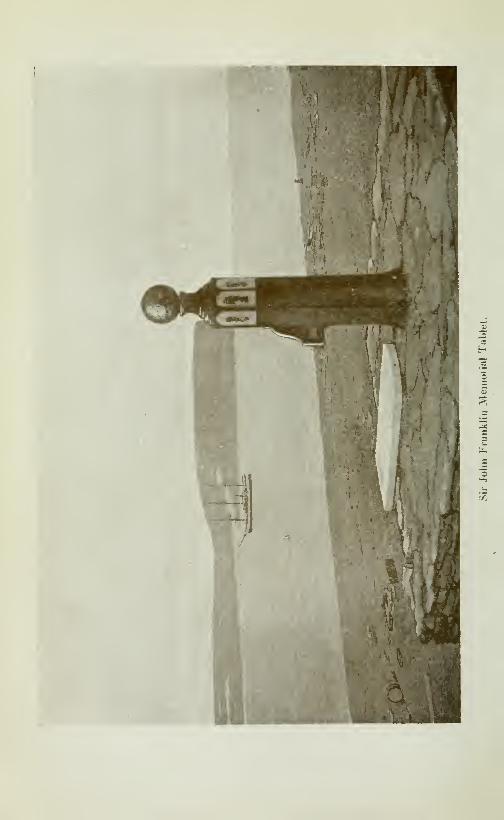
CRUISE OF THE MINNIE MAUD 233
ourselves. The deer were scarce and too wild to be killed andtheir dogs gradually died of starvation. They lived on the dogswhile they lasted, and then, one by one, the menbers of the partysuccombed. Three children died first, a girl of five, a girl of seven
and then a girl of thirteen years of age. As they died their bodies
were eaten. Then two of the men and two of the women died,
and the survivors lived on their corpses until another Eskimo hap-
pened to come along and rescued them, taking them to Igloolik.
Of the three survivors, the man and a boy soon died after reach-
ing Igloolik from the effects of their suffering and privation.
The sole survivors now living is a woman named Attow-oo-tar-oonow the wife of Ee-to-tard-jooa, the headman of Igloolik and whoI saw in Igloolik. She is a sister of Coonoo's, Wilson's guide.
Our present plight reminded us of this tragedy and we felt nonetoo bright over the prospect of reaching Milne inlet alive Thescarcity of cartridges was what bothered me most and I often
gritted my teeth as we shot nothing on that day.
May 3rd.—The day was fine and clear, with a bright sun shi-
ning overhead and we started early. When loading the sleds I
saw three caribou on a nearby hill and going after them, shot andkilled one at about a450 yard range using up one of our precious
cartridges. The entrails were fed to the starving dogs thatfought desperately over them and nearly strangled themselves in
their struggle to get a mouthful.
Fox Lake.—After this welcome, if scanty repast, we travelled
north for about five miles until we came to a lake, which I namedFox lake, on account of the number of fox tracks which markedthe snow in all directions. Fox lake is about 5 miles long, twoor three miles wide, and lies generally north and south. The lake
was covered with a thick crust of snow through which the tired
dogs and the sleds kept continually breaking; which made ourprogress both slow and painful. I pulled so hard in the traces
that I strained both shoulders and could hardly sleep for the painat night. Peewikto and his little wife, Tootillik, showed greatpluck and endurance and pulled away at the sled, day after day.On reaching camp we had barely enough energy left to build anigloo. We camped at the north-west end of Fox lake.
Round Lake.—May 4th.—Another fine, clear day with a light
north wind. We started early in the morning from Fox lake andafter travelling for a few hours, reached a small lake, which I na-med Round lake. On each side of Round lake, east and west,there is a high mountain, about 1000 feet high and about 6 or 7
miles apart. The face of the one to the east is square.The road was a difficult one for the heavy sleds and consisted of
a number of small hills which had to be climbed and which werecovered with rotten snow. The dogs and the sleds kept brea-

234 CRUISE OF THE MINNIE MAUD
king through the thin crust and the exertion of continually pulhngthem out was very trying to us, in our weakened state. We pu-shed on another five or six miles to the north end of Round lake,
where we camped. I killed a caribou not far from the camp at
about 600 yard range, which left me with only four cartridges to
provide us with food until we reached Ponds inlet, 150 miles away.
Height oj Land.—A river runs out of the north end of Roundlake and runs due north until it falls into the Peewikto river, nearits mouth. The height of land is apparently between Round andFox lakes as the river which runs from the former lake flows northwhile the river that flows out from the Fox lake flows south.
Eskimos meet us.—That night a number of Eskimos from Pondsinlet camped near us as they were on their way to hunt cariboubetwennFox and Quartz lakes. Their names were Tom Lasso, Pan-niloo, Noota-rah-riac, Kilooti, Jocano, Makaskaw and Pannikpathe Angekok. They were all accompanied by their wives.
They had brought very few provisions, as they were dependingon killing enough caribou to feed themselves and their dogs; andtheir cartridges were of no use to us, as their rifles were all of a
different pattern. They told me afterwards, on their return,
that they had had a very hard time on account of the deep snow,thick fog, high wind and the fact that the deer were so wild. Theydid not kill many deer in consequence, and, running out of to-
bacco, hurried back to Ponds inlet for a fresh supply. Tom Lassotold me, "Me no more hunt deer in snow".
Peewikto River.—May oth.—Light snow fell and a cold north-
west wind blew about ten miles an hour. Leaving Coggan be-
hind to rest his dogs and hunt deer with the rest of the natives
from Ponds inlet, we made an early start. We travelled east bynorth along a valley full of small hills, flanked on each side byhigh mountains that rose from 1000 to 1200 feet above us. After
travelHng about twelve miles we reached a river which I namedafter my faithful Peewikto. Peewikto also means in the Eskimolanguage "bad" and was apphed to Peewikto when he was a little
boy; his right name was Kow-bak-too, which means "Chief". ThePeewikto river is a "bad" river and is consequently well named.We reached this river at a point about 20 miles above its mouth.The Peewikto river flows in a north-easterly direction, in a very
crooked, sinuous fashion, into head of Milne inlet. The riverbed
is from 50 to 100 yards wide and flows, by a series of continuous
chutes, cascades, rapids and falls, between mountains that rise
500 and 600 feet on each side. As Milne inlet is approached these
mountains become higher. The riverbed itself was a mass of
boulders, rapids and falls; some of the Litter being 50 to 100 feet
in height, and when we came to these we were obliged to leave the
riverbed and follow the sides of the hills. Sometimes we would
CRUISE OF THE MINNIE MAUD 235
have to ascend 300 feet above the riverbed to avoid these dange-
rous falls. We could then throw off half the loads and malce twotrips. All this entailed the hardest kind of work for men anddogs and, owing to our weakened condition, caused us to makeslow and painful progress.
Hayes, Expedition.—On February 14th. 1907, Mr George Hayes,chief officer of theC. G. S. "Arctic" started from Albert Harbourwith a well equipped party to make the overland journey by wayof Milne inlet to Igloolik with instructions to ascertain how far
south Milne inlet ran and to learn from the natives the ice-condi-
tions of Fury & Hecia strait with a view to studying the possibi-
lities of navigating that strait. Hayes returned to the ship onMarch 5th having been away 19 days and was forced to return onaccount of losing some of his dogs.
He appears to have reached somewhere in the vicinity of Roundlake and he reported Milne inlet as extending as far south as lati-
tude 71*^ 30'N. This must be an error as the position of the en-
trance to Milne inlet is well established and the inlet is not morethan fiftv miles long, which would place its southern end aboutlatitude Vl'^ 50'N.The riverbed was full of sharp, jagged and polished boulders, of
a hard yellowish-brown limestone, and betwenn these were deepholes filled with ice and snow.About twelve miles from its mouth, the river branches into two
streams, forming an island in the centre, which is about a mile
long, half a mile wide and 300 feet high. At this point Kookudiastopped, saying that his dogs were tired and could go no further,
Reach Milne inlet.— I, with Peewikto, Tootillik, old Ootootia.his wife and boy continued to work our way slowly down theriverbed, all day, all that night and all the next daj' and night(May 6th) without stopping to eat or rest. At midnight on May6th, we reached the head of Milne inlet, when we hastily built anigloo and tumbled into our sleeping bags, without having any-thing to eat, and fell asleep from sheer fatigue. Since leavingRound lake we had travelled three days over the roughest coun-try possible for sleds to pass over, with practically no food, savefor the nourishment we could extract from sucking the grease andblubber of some sealskins that we had brought with us from Mur-ray Maxwell bay.
May 7th.—We slept till about 2 p. m. and then remenberingthat the dogs had eaten nothing for four days, Peewikto and I
took two dogs and went in search of a seal on the ice of Milneinlet.
I had but four cartridges for my rifle and each of us had a har-
poon. We took the dogs to help us to find the seal holes by their
keen scent. We travelled in ziz-zag fashion across the baj* until
236 CRUISE OF THE MINNIE MAUD
8 o'clock that night, when the dogs found the remains of a youngseal which had been killed and partially eaten by a fox. Whenwe rescued the remains from the dogs, there was about threepounds of meat left, which we took back to camp and after divi-
ding it into six portions devoured it raw in its frozen state. Therest of that night we spent in resting ourselves and our dogs, aswe still had 130 miles to cover before reaching Ponds inlet.
May 8th.—We travelled due north all this day and all night,
along the eastern shore of Milne inlet. The day was bright, cold
and clear with little or no wind. The ice was good on the soundbut the poor dogs that had eaten nothing for nearly 'six days,kept falling down from sheer weakness. W'e had to kept whip-ping and shouting at the poor brutes to make them get up andtravel at all.
Meet some Eskimos.— I took good note of the coast as we passedlong it and we camped along side the east shore of Milne inlet op-posite the large island of Kai-giook-ta-soog-joo, about 2 a. m. onthe morning of May 9th. We stopped here as I heard some dogsbarking near the shore and found two Eskimos camped there,
with their wives and two small children. They proved to beFilla-Kap-si and Takkowah on their way back to Igloolik andAggo by the same trail that we had just crossed. They gave us
a little seal meat that we ate raw, before going to sleep. We ate
onlv a little for fear of becoming ill after our long fast. We let
the tired dogs sleep a little before giving them anything to eat, as
in their exhausted condition, to have allowed them to eat any-thing straight off the march, would have killed- them. In the
morning we brought each dog into the igloo and gave it a small
portion of meat; about two hours later we repeated the operation,
as their digestive apparatus needed careful nursing.
Had we not met those Eskmos we should undoubtedly havebeen obliged to kill several of the dogs to feed the others and our-
selves, as we could see no seal and had only four cartridges lett.
About twelve miles south of where we were camped, and just
opposite the entrance to Kolukto bay,thereisabayontheeastsideof Milne inlet, with a small island in the centre, which the natives
call Toogar. A small salmon river runs from a lake into the
north-east corner of the bay.
Another Eskimo tragedy.—At Toogar, about 40 years ago, a
party of thirteen Eskimos, who were travelling from Igloolik to
Ponds inlet, went through a similar experience to oursel>s andhaving nothing more to eat, could proceed no further. Eleven of
the party died and the survivors lived on the dead bodies of their
companions. Only two men of the party survived and managedto reach Ponds inlet alive.
East coast Milne i?i/ef.^After resting a few hours we started
CRUISE OF THE MINNIE MAUD 237
again about 7 a. m. in the morning and continued along the north-
east shore of Milne inlet. After going due north about six miles,
the coastline took an abrupt turn to the east by north and ran in
that direction for about 14 miles, when it turned abruptly again
to north by east for another eleven miles, when it debouches into
EcHpse sound. In this angle of the coast are two large islands
and three smaller ones. The natives call the largest island Im-
miggin and the second largest, Kai-joo-ark-too. The channel bet-
ween the southern extremity of Immiggin and the mainland is only
about 300 yards wide, which the Eskimos from Koluktoo use as a
short cut to Ponds inlet. In the summer from August 20th to
September 20th this channel could be used as a schooner passage.
We stopped that night, the sun only set for a couple of hours at
this time, for two hours to rest the dogs about four miles
from Eclipse sound, in the channel that lay between Kai-joo-ark-
too island and the mainland. Here we found an old igloo that
had been built by Tom Lasso, and finding inside some old seals-
kins gave them to the dogs to gnaw.
The last lap.—May 10th.—At daybreak we started again on
our last lap for Ponds inlet as I was anxious to see white faces
again after so many months of hardship and wandering in the
frozen north with only Eskimos for my companions. I was also
consumed with an intense longing for some wholesome and pala-
table food, a warm dry bed and some clean clothes.
The day was beautifully bright and a warm sun shone over-
head, as if to make me forget the long days of merciless cold andArctic gloom which I had passed through. The ice on Eclipse
sound was very good in places, in others it was covered with deep,
heavy snow, which made fast travel difficult.
Enter Eclipse Sound.—On rounding the point Eclipse soundopened up before me in all its glory and dazzling splendour. Onmy left were the snow-white, serrated peaks of Bylot island with
the glittering, ice-covered sound at the foot. In front, to the
east, rose the majestic, blue-black triangular mountain of Ee-
yuk-tsua, at the foot of which, only seventy miles away, lay the
village of Ponds inlet; where I could revel in good food, warmth,cleanliness and rest my weary and aching limbs. My heart rose
at the sight and urging the dogs to full speed we made in the di-
rection of Salmon river. The dogs refreshed with food and rest
travelled well and made about five miles an hour.
At noon we sighted the wooden shack at Salmon river, and at
the sight I was overtaken by an almost unbearable sensation of
intense thrist and desire to eat. We reached the shack at about2 p. m. and, pounding on the door, I was admitted and warmlywelcomed by Messrs Reader, Wilson and Lawson, who had heard
from a native that I was coming.
238 CRUISE OF THE MINNIE MAUD
On seeing friendly, white faces once more I was almost overco-
me and completely lost the ravanous desire for meat and drink
which had possessed me. I had almost lost the power of expres-
sing myself in French and English having been so long with the
Eskimos that I could only express myself in a braken misture of
the three languages. After a good meal of soup and sourdoughbread we all felt better. Peewikto and Ootootia revelled in a
good smoke, as they had both run out of tobacco long since.
We rested up for several hours, exchanging our news, and then
resumed our march to Ponds inlet, about 12^ miles further east
where we arrived about one o'clock that night. The rest of the
party, had seen me coming over the sound and were all up to
greet me. They all extended to me a warm welcome and it wasvery early in the morning when we went to bed; having so much to
recount and talk over.
I remained at Ponds inlet from May 11th to June 15th, during
which time I helped to repaint the schooner and prepared her for
sea; mined and freighted coal by sled from Salmon river to Pondsinlet, and also spent a few days with my friends at Salmon river.
I was very thin when I returned from my hard journeys and.
my head often ached badly from the strain and hardships I hadundergone. Abcesses formed at the foot of the teeth in my lo-
wer jaw and I suffered agonies from toothache.

CHAPTER XI
Tremblay's—Exploration of Eclipse Solxd, Navy BoardAXD MlLXE IXLETS.
Leave Pond's Inlet.— I started from Ponds inlet on June 15tli
(1913) to make a flying trip round Navy Board inlet and Eclipse
Sound, with the special object of exploring the large sound at the
west and of Eclipse Sound near the entrance to Milne inlet, as it
had never been visited before by others than the Eskimos.
It was late in the season as the ice on the sound was melting
fast and was covered with pools of water. The snow had melted
and left the surface of the ice like the face of a rasp which played
havoc with the dog's feet. At this time of the year the Eskimosplace small sealskin boots on their dogs' feet to protect them fromthe sharp, knife-like projections of ice that cover the sounds; butwe did not have enough of these feet-protectors and those that wedid have kept constantly working off, and the dogs suffered in-
tensely from the cut and bleeding feet and were all lame at the
end of the trip.
The day was a perfect one; a bright, warm sun circled in the
heavens above us, day and night, and a light westerley breeze
gave the air an exhilarating tang that filled one with a delightful
sense of health and energy.
Peewikto and Tootillik accompanied me and we took a sled,
nine fresh dogs, a sealskin tent, seal stove and enough provisions
and blubber for the stove to last us twelve days, which was the
time I estimated it would take us to complete the tour. It ac-
tually took us 27 days and turned out to be a much more arduousand hazardous undertaking that I had anticipated. We also
took the body of a seal along to feed the dogs and to supplementour supply of fuel.
Bylot island.—\We called in at Salmon river where I spent anagreeable hour with my three friends stationed there and then
started off across Eclipse sound in a north-westerly direction to-
wards Bylot island. Many seal were basking on the ice in the
warm sunshine, and we camped that night on the south shore of
Bylot island. As the snow was all gone, we pitched our sealskin
tent on the shore at about one o'clock in the morning with a
240 CRUISE OF THE MINNIE MAUD
bright sun shining overhead. The dogs suffered greatly from the
rough sharp ice that cut their feet when crossing the sound.
During the day, when in the middle of the sound, the dogs sud-
denly' scented a seal hole and bolting in that direction, nearly
wrecked the sled amongst some ice boulders; and one of the dogswas nearly killed by being caught under the sled.
A gale.—June 16th.—We had just finished pitching the tent
at one a. m. on a low, flat, gravely point in front of an inland gla-
cier when the wind changed to north-west and was accompaniedby a whirling tempest of damp snow. That night I heard somegeese "quacking" as they flew overhead.
We remained here all dav in order to repair the broken sled andharness. A north-west gale accompanied by a heavy snow andrain, raged all day, blowing the tent down several times and wet-
ting our clothes and bedding. Travel was impossible in such
weather, as the rain and damp snow falling on the ice froze ins-
tantly into rough particles like coarse sandpaper that would havecut the dogs' feet into ribbons.
June 17th.—Making an early start we travelled west along the
south shore of Bylot island, which consists of hills of sandstone
and gravel that gradually slope out to the low, rounded and al-
most imperceptible point at the south-west corner of the island.
We saw many seal basking on the ice, of which I shot one and Pee-
wikto shot an Arctic goose. The day w^as cold, raw and black,
with a strong south-east wind blowing accompanied by a heavyrain-squall We travelled all day over soft, slushy snow, mixed
with water that was about twenty inches deep, into which the
sled kept sinking; and our progress was slow and laboured. Thesled would keep gathering a heavy mass of slushy snow at its prow,
which kept us constantly busy freeing it and tugging at the traces.
Our feet and legs were damp and half frozen through trudging all
day and night in the wet slush.
Toolooria —We crossed Navy Board inlet and camped at 4 a,
m. the next morning near the village of Toolooria, which is situa-
ted about seven miles south of Low point.
Navy Board Inlet.—June 18th.—We started again at 11 a. m.
and marched north all day along the west shore of Navy Board
and past the village of Kilutea's. We travelled all that night and
all the next day and camped the next night (June 19th) on the
west shore of Navy Board, about seven miles south of Lancaster
strait.
Local winds.—Aher rounding Low point we trudged for manymiles through deep slushy snow and water, which made the jour-
ney very slow and laborious, and the dogs' feet were all swollen
and bleeding and they were completely worn out when we rea-

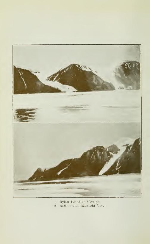
1—Bylott Island at Midnight.
2—Baffin Land, Midnight View.
CRUISE OF THE MINNIE MAUD 241
ched our camping ground. The day was dull and leaden, and a
cold north-wind blew in our faces piercing us to the marrow. Thewind blew from the east during that day at Salmon river, as the
winds there are entirely local as a result of the conformation of
the land' and the protection afforded by Bylot island. The north
winds that sweep down Navy Board are deflected by the high
range that runs east and west some eight miles south of Salmonriver and are there converted into westerly and north-easterly
breezes.
Lancaster Sound.—-June 20th.—Leaving the tired dogs in chargeof Tootillik, Peewikto and I walked up Navy Board as far as Lan-caster Sound; and then north-west for about eight miles, alongthe shore of that strait, opposite Adam's island. We returnedoverland across the low, flat hills that form the north-east cornerof Borden Peninsula. The day was foggy, with light rain andsnow, and a light north wind blew in our faces.
State oj the ice.—The ice in Navy Board ended between Adam'sisland and the Bylot shore, and Lancaster sound was a body of
open water, filled with broken ice-pans that were being carried
east-ward by the current into Baffin bay. I counted fifteen large
icebergs that were jammed bet\\een Adams island and the main-land.
Leave record.—The ice on Navy Board was covered with waterand many seal could be seen basking on the surface, I left arecord of my visit in a cartridge placed at the foot of a board onthe point. We reached camp about 11 p. m.
Objects of trip.—My object in re-visiting Navy Board inlet andLancaster strait, was to study the condition of the ice at this timeof the year, to verify the topographical features of the coastline
and to look for mineral.
Arichorages and Navigation.—According to Captain W. F. Mil-ne who commanded fot many years the Scotch whaling steam-ship "Eclipse" and who was the first navigator to explore thesesounds; "There is a fine anchorage and shelter from southerlygales inside the Wollaston islands; and six or seven miles farther
south, on the west shore of Bylot island, a bay called Tay ba}',
where a ship can anchor in any depth of water she pleases. Goingfrom here south a vessel should keep in the middle of Na^"y Boardinlet—the points in the old charts are too prominent—but shouldkeep well away from the low land on Bylot island; no less thanthree miles, as it is shallow and extremely dangerous when theweather is thick. From here towards Milne inlet, steer betweenhigh island, pass close to same, steer for two low islands (Bizzi-
Tark-pin) and keep them on the port hand. Keep to the west all
the way until you get into Milne harbour (Koluktoo) where you
242 CRUISE OF THE MINNIE MAUD
will find any amount of salmon in the river flowing from the west.
Going north of Milne sound, give the east outside islands a goodberth, and then keep midway in Echpse sound, towards the Sal-
mon river, where you can take salmon at high water."
Cross Navy- Board.-—June21st.—We marched Souty-East downNavy Board to Canada point—the dogs being up to their bellies
in slushy snow and water-—and had a hard time. The day wasclear and fine with a north wind blowing. I could see the coast
of North Devon quite plainly, fifty miles away to the north,
across Lancaster sound, which was full of open water right across
to the North Devon chffs.
Canada Poin:.—We reached a small bay about a mile to the
north of Canada Point, where we camped at 10 p. m.June 22rd.— I spent the day which was fine and clear, looking
for mineral inland and north-east of Canada Point. The hills to
the north of the point consist of gneiss and rise 1400 feet straight
out of the sea. Eight miles south of the point, the mountainsrecede for a distance of two miles from the shore, which consists
of a flat, gravelly plain. To the south of this plain are two gla-
ciers, from which a small stream flows into Navy Board. Thisstream is said by the Eskimos to have its source in a warm mine-ral spring which does not freeze in the winter months. Just
north of the glaciers and about three miles back from the shore is
a large deposit of lignite coal near the top of a hill about 600 feet
above sea-IeveL On the top of one of these hills a member of
the "Arctic" expedition found a large tree stump in good preserva-
tion, how it got to such an altitude is a mystery. The southwestcorner of Bylot island consist of low, rounded sandstone hiUs
which slope gradually into Navy Board and Eclipse sounds Onthis day I shot a seal on the ice.
June 23rd.— I spent the day prospecting round Canada Point,
as the dogs' feet were too sore to traveL The day was fine andclear, the sun shone warm overhead and a light breeze blew fromthe north. I killed another seal that was asleep on the ice.
BluJJ Head.—When looking north from Canada Point, BIufF
Head on the west side of Navy Board, the point at the northwestentrance just south of Adams isLind, and Canada appear almostin line.
June 24th.—A day of furious north wind, rain and snow. Wemade an early start and travelled from Canada Point across
Navy Board in a south-westerley direction to Low point the dogs
being all the time up to their bellies in cold slush and water,
through which we had also to tramp. All the dogs had their
feet cut and bleeding and some of them were unable to pull the
sled at all.
CRUISE OF THE MINNIE MAUD 243
Schooner anchorage.—Just south of Low point there is a small
rocky islet, about 300 yards long and 150 yards broad, which is
separated from the shore by a narrow channel some 300 yardswide. There should be a fine winter sheltered harbour for a
schooner between this island and the shore, and a ship should ap-proach the channel from the south side.
Eskimo Punishment.—Some years before, this island was the
scene of an Eskimo tragedy or execution. An Eskimo who lived
at Toolooria was constantly annoying the other natives by thefts
of their meat, cutting their harness and other misconduct, until
the rest of the band became so exasperated that they took himin a boat and marooned him in the small island. There they left
him without food or arms, and, as he could not swim across theicy waters of the narrow channel, he perished of starvation. The-re happened to be a cache of seal and walrus meat on the island,
but he did not know of it, or would have been able to subsist onits contents until the channel froze over, when he could havewalked ashore.
Salmon Stream.—After passing low point we continued southalong the west shore of Navy Board, past the village of Toolooriaand camped about six miles south of that village. Near here asmall shallow river, about 50 feet wide, empties from a small lakeinto Navy Board. The Eskimos told me that the salmon fre-
quent the river and lake. The hills run due south from Toolooriawith a narrow strips of flat beach between them and shore. At themouth of the river the flat beach runs inland for about two miles.
Plague oj Spiders.—We passed amostuncomfortablenightasourclothes were wet through by the rain and mj-riads of small spi-
ders swarmed out of the moss-covered gravel and crawled on ourbacks, over our faces and into our ears, which rendered sleep outof the question. The wind that night was very cold and we shi-
vered all night in our wet clothes.
Inclement weather.—June 25th.—We remained here and I spentthe day in exploring the neighboring hills for mineral, but couldfind no traces of any. The hills were composed of rusty gneiss,
granite and mica schist and were about 600 feet high. It rainedheavily all day, and a moderate wind blew from the northeast.The rain which was very cold soon wet us through. I killed aseal and a red-throated loon. We spent another miserable nightin our saturated clothes, as the night was very cold and we werepestered all night by the small spiders that swarmed over us.
Navy Board Inlet.—June 26th.—We started early and continuedour journey south down the west shore, of Navy Board inlet,
which is about 65 miles long from north to south, with an average17
244 CRUISE OF THE MINNIE MAUD
width of ten miles. We made about 25 miles that day and cam-ped at the foot of a mountain at the south-west entrance to NavyBoard.A strong north wind blew all day, accompanied by fog, rain and
snow. The ice on the sound was covered with slush and water,
so deep that the dogs often had to swim. We tramped throughthis, knee-deep in the ice cold water and slush, all day andsuffered intensely from cold and exposure. In the afternoon I
killed a seal. We nearly lost one of the dogs that, being tired,
lagged behind and was run over by the sled. We could only
keep ourselves warm by keeping constantly moving; as the mo-ment that we stopped the rain, cold and raw wind would freeze
us to the bone.
When we reached our camping ground all our bedding and clo-
thes were wringing wet, the sled having been often completelysubmerged.
Sketch bearings.—Each day I took careful notes of the relative
bearings of the different headlands, islands and bays, by the com-pass and position of the sun, and at night made rough pencil
sketches after my arrival in camp.
Anent provisions.—We spent another cold, damp, cheerless andmiserable night. The provisions that I had brought from the
ship were all finished and during the rest of the trip we lived onseal meat, ducks, and, when we could kill nothing, on moss androots or anything that was at all edible. Had I known that the
ice would have been in such bad condition and the consequent
rate of travel so slow, I would have taken provisions enough to
last a month. The tendency in the Arctic is always to underes-
timate the difficulties and probable duration of a trip, and in-
fluenced by the desire to make the load as light as possible, onegenerally take an insufficient supply of eatables. Weather con-
ditions and the state of the ice aresovariableandinsuch uncertain
quantities in these latitudes, and game is so hard to kill that one
should always take a good surplus of food, in concentrated form,
to provide against storms, bad ice and other unforeseen conti-
gencies.
West End of Eclipse Sound.—June 27th.—Making an early
start, we experienced another day of continual hardship and dis-
comfort. We travelled round the shore of a wide circular bay at
the west end of Eclipse sound, which is about ten miles across
from north to south and six miles deep. At the southern extremi-
ty of this bay lay the long and hitherto unexplored sound, the ex-
ploration of which formed the principal object of my trip. Thedogs and sleds were constantly immersed in the ice-cold water
that lay on the ice in large pools, and the former often had to
swim. Tootillik rode on top of the sled, while Peewikto and I

CRUISE OF THE MINNIE MAUD 245
splashed alongside through the water, which wet us through andmade us cold and miserable all day. East of the southern point
of this bay is a small island which lies about a mile off shore.
Three miles further out, to the north-east, are two small islands,
about three quarters of a mile apart, the larger and more easterly
one is called, by the natives, Pizzi-tark-pin. We reached the en-
trance of the unknown sound about mid-day, and I named it
Tremblay sound. On arriving at the entrance I took bearings
and I found that the point at the north side of the entrance wasin a direct line with the small islands lying a mile from it andwith the extreme northerly point of Kai-joo-ark-to island whichlay to the south-east, on the other side of Milne inlet. Thispoint which I named Alfred point, is also in a straight line withand about due west of Belœil island and Albert harbour in latitude72» 42' 32"N. The entrance is about four miles wide and thesharp point on the south side I named Athole point. After pas-
sing the entrance the sound widens out to five miles, as there is
a curved shallow bay on the north side, which extends in a wes-terly direction for about twelve miles. The sound then turns to
the south-west and runs about twenty-eight miles in that direc-
tion, which gives the sound a total length of 40 miles. It is about5^2 miles across at the widest part, about ten miles from the en-
trance, and averages from 3 to 4 miles in width, gradually narro-wing in towards the head. At the extreme south-western end of
the sound there is a small bay, about two miles long and one milewide, which is protected by a point and the entrance to which is
half a mile wide. A river discharges into the head of this bay,which is completely sheltered from all storms and ice pressure
and where a ship could lie in perfect safety during the winter. Afew miles to the east of this point a fine salmon river runs into thesound from the west, and caribou, hares and ptarmigan are nu-merous in the neighbouring hills.
Overlayxd trails.—This fine sound can be entered and navigatedby the largest vessels for six weeks in the year, from August 15thto September 30th. From the end of the sound there is an over-land trail, practicable for sleds in the winter time, to Koluktoo,and another across Borden peninsula to Moffet bay, which lies
about 25 miles to the west. The Angokok, Pamikpa, told methat he had crossed, by this trail from Tremblay sound to Moffetbay in five days, by way of the Salmon river, and that there is
only one day of hill climbing near Moffet bay. He evidentlyloitered along in leisurely fashion, hunting caribou on the way,and no doubt could have accomplished the journey n half thattime. Another trail also practicable for sleds in winter-time,runs up the Salmon river valley through the centre of Bordenpeninsula to the head of Adams and Strathcona sounds.The natives as a rule prefer to travel in winter round the coasts

246 CRUISE OF THE MINNIE MAUD
by the sounds instead of crossing the land even if it takes longer,
as they can kill seal on the way for themselves and their dogs.
Rivers.—On the north side of the sound, the mountains rise hkesquare walls from the waters' edge to a height of some 700 to 1500feet as far as the first river which I named the Alfa river. Thehills then become lower and more rounded and are cut by nume-rous deep ravines. The second river I called the Beta river, andthe third river, which enters the head of the sound, the Gammariver.
Graphite mountains.—Between the Alfa and Beta rivers there
are huge mountains, black as coal, that are heavily impregnatedwith graphite (black lead). From these hills I obtained samplesof graphite, talc, mica schist, iron-stained gneise, copper and iron
pyrites. There is evedently a large outcropping of Huronianrocks in this vicinity, near the mouth of the Gamma river, in ahill about 300 feet high, I found a large quartz vein, about 15 feet
wide which contained copper and iron pyrites. This quartz wasmilky-white and rusty in appearance. The mountains at the
head of the sound, for the last ten miles, consist of these black,
graphite hills, cut by numerous quartz veins and seemed to ex-
tend inland for a distance of ten miles.
We camped on the north side of the sound, about fourteen mi-
les from its mouth, on a small, flat gravel beach about 400 feet
wide, back of which the mountains rose straight up to a height of
1200 feet.
Our clothes were wringing wet by the constant rain and snow,and we passed a cold, sleeples, shivering night.
The dogs' feet were bleeding from the cuts b\' the sharp ice andonly about four of the poor animals were able to pull at all, al-
thought fortunately the load on the sled was light.
June 28th.—We started early down the sound, amid rain andsnow, with a strong north-east wind blowing, which swept downthe narrow, high-walled sound like an ice-blast that chilled us to
the bone. The footsore dogs had great difficulty in pulling the
sled-sometimes they would have to swim through the large pools
of water that covered the ice. On the narrow beach near the
mouth of Alfa river I came across the trunk of a balsam tree, that
was about 15 feet long, and one foot in diameter, with long roots
attached that had been bruised and torn by the ice-floes. This
log must have come all the way from the Gulf of St-Lawrence or
Hudson's Bay, up the Greenland coast, across Baffin bay andthen, being caught by the ice, have been blown by the east windsthrought Lancaster strait, down Navy Board and into the sound.
One of our party found on the south shore of Bylot island a large
tree-trunk of red-wood, corresponding to mahogany from the
description, which may have come by the gulf-stream and then

CRUISE OF THE MINNIE MAUD 247
by the same route and in similar fashion, from Cuba or the \\ est
Indies.
Alfa River.—-The Alfa river runs into the sound through a deep
valley one or two miles wide, between high mountains. It rises
in a lake to the north-west, and its bed is from 100 to 300 yards
wide with low banks that are only a few feet high. When I visited
it there was a stream of water running down the riverbed about
30 feet wide and two feet deep. The bed was full of small ra-
pids, boulders and gravel with very little sand. I noticed nume-rous small ducks and King Eiders swimming in the open water near
the river mouth, which led me to the conclusion that salmon andother fish must freequent the mouth of the stream. I shot twoducks here, A little further on I killed a very large seal that wasasleep near its hole on the ice. We camped on a small gravel
beach about three miles south-west of the Alfa river. This beachran back about 3 or 400 yards to some small hills at the foot of
some high mountains.We were, as usual, wet through, chilled and tired out and the
dogs were all limping, footsore and worn out with pulling the
sled through the water and thick slush. In the middle of the
night a north-east gale sprang up, accompanied by whirling
clouds of thick, wet snow. Our tent was blown down by the
storm and we all got wetter and colder when putting it up again.
Beta River.—June 29th.—The wind shifted to the north-westin the morning and blew a gale all day, with a heavy snow-stormin the afternoon. I spent the day walking over the hills betweenthe Alfa and Beta rivers, studying the rocks and formation of thecountry, I walked inland about ten miles from the camp; thenwest and back to the sound along the high-hill-tops that borderedthe east bank of the Beta river. I saw plenty of water runningdown this river, which runs east and west down a deep valley,
one to three miles in width. The Beta valley is flanked by highmountain chains on each side. I saw plenty of small long-tailed
ducks swimming at the mouth of the Beta river, which is a fine
salmon stream and which the Eskimos used to frequent manyyears ago. On a small point south of the river mouth are the re-
mains of an old Eskimo encampment, consisting of old stone andearth igloos that were built about 20 feet above the waters of thesound.
I reached the camp about one o'clock in the morning, in a how-ling snow-storm, wet through, cold, tired and hungry. Abouttwo miles north of the Beta river I passed another old Eskimoencampment of old stone igloos which were situated on a pointof black, rusty rock about 100 feet above the sound.We passed another wretched night, shivering with cold and wet
through. It blew hard and snowed all night.
248 CRUISE OF THE MINNIE MAUD
June 30th.—The wind blew hard all day from the north-westaccompanied by torrents of rain and snow. In the afternoon thewind veered to the north.
Leaving Tootilhk in camp with half of the dogs that could nottravel on account of sore-feet, Peewikto and I took the sled withfive dogs and started out to visit the head of the sound, as I wan-ted to sketch it and see the rock formation. The ice on thesound was covered with water and made it hard travelhng for menand dogs; and we had to travel knee-deep in ice-cold water andheavy sludge most of the day. \\ hen we reached the mouth of
the Gamma river, I saw seven caribou on top of a hill about three-
quarters of a mile away to our right. Peewikto went after themwith my 280 Ross but could not get near enough for a shot. I
spent the day in examining the rocks and making a cairn on thebeach at the south side of the river mouth, in which I placed a re-
cord in a cartridge case with a note of the date of my visit andmarked the spot with a board on which my name was cut.
Just before reaching the Gamma river, the dogs, when theycaught sight of the caribous made a furious dash in their direction
and capsizing the sled, knocked me off the ice into the deep ice-
cold water of the sound, at the river mouth. The strong currentcarried my legs under the ice and I was for fully fifteen minutesstruggling in the icy waters of the sound and was fortunate not to
have been attacked with cramps. Peewikto had started awayafter the deer and I had only the dogs for company, and they keptcommg and sniffing and whining to the edge of the ice as if theywanted to help me. My fingers would slip on the edge of the ice
whenever I tried to pull myself out. Eventually I managed,with the aid of a fragment of loose, floating ice to paddle across
fift}' feet of water and to clamber out on the ice where it wasthinner and I could get a better grip. As I climbed out on the
ice I lay there gasping for breath for several minutes, and myteeth chattered all day with the cold of my wet clothes. It wasa close call and came near to ending the story.
The Gamma river.-—The Gamma river enters the small bay at
the head of the sound and flows down a broad deep valley, one to
three miles wide, from a lake to the south-west. The valley is
flanked by high mountains on each side. The riverbed is of gra-
vel, quite free of large boulders. The stream of water that flowed
down the bed was about 30 feet wide and from two to three feet
deep and ran down a series of small rapids to the bay. Seeing no
ducks or gulls at the river mouth I concluded that it contained no
salmon.
A large quartz vein.—On the north side of the river I found
many veins of quartz, which traversed the rusty gneiss and mica
schist in a westerly direction and which dipped to the north at an


1—Tho iiiitJniphi Sun.
2— Hunting Polar Rear in Kayak l>y (he Kskinios.
CRUISE OF THE MINNIE MAUD 249
angle of 45*^. One of these quartz veins measured fully fifteen
feet across and contained an abundance of iron and copper pyri-
tes and mica. The vein ran from the shore of the sound into the
centre of a high mountain that was about 1200 feet high. Atthe mouth of the river I saw traces of an old Eskimo camp.
In the afternoon the wind increased to a hurricane and was ac-
companied by furious storms of rain and snow. When Peewiktoreturned from his fruitless chase after the deer we travelled backto camp which was about ten miles up the sound and arrived
there about 11 o'clock at night. We found poor httle Tootillik in
tears as she was alarmed at our long absence and was frightened
at being left all alone in the storm.
The tent was split in several places by the force of the wind andthe rain and snow pelted in on top of us. We had no fire to dry
our clothes and, having no change, had to stay in our wet clothes
all night. Our tea consisted of raw seal. We passed another
miserable night and were nearly frozen. Peewikto and I sat
back to back all night with our teeth chattering and shivering in
every limb. Tootillik cried most of the night as she feared wewere all going to die of cold and starvation before we could reach
Salmon river.
Bellevue Aiountam.—July 1st.—The storm abated and the daywas fine and clear, with grey clouds obscuring the sun. A mode-rate cold wind blew from the north. It was the first fine day wehad had since leaving Canada point. Peewikto and I walkedsix miles inland from the camp to the north and I climbed a verysteep mountain, about 1500 feet in height, on the south side of
the Alfa river, as I wished to get a good view of the whole coun-try and this was the highest mountain in the neighbourhood. I
had terribly hard work to climb up its steep sides, as the hill wasbare of snow and covered with treacherous slides of gravel andboulders that kept slipping and sliding down under my handsand feet. Peewikto would not face it and said I should be killed
if I attempted it. So he remained below when I climbed, andshot a hare with my rifle.
The top of the mountain was quite flat, covered with smallgravel and snow and about 300 yards long on top. The moun-tain itself seemed to be composed of a hard, slatey limestone all
stained and rusty, which seemed, to be the characteristic forma-tion of the hills of both sides of the sound.From the summit I obtained a magnificient view of the country
in all directions. To the north-east I could see the entrance tothe sound, the three small islands outside and the magnificientblue-black snow-capped peaks of Bylot. Almost due south, op-posite the mouth of the Alfa river, across the sound, I viewed the^'aIIey by which the Eskimos travelled overland from Tremblaysound to Koluktoo and Milne harbour. I had a splendid view of
250 CRUISE OF THE MINNIE MAUD
the valleys of the Alfa, Beta and Gamma rivers and saw depres-
sions in the first two valleys where I supposed lay the lakes fromwhich they took their source. To my extreme west lay the ex-
tensive region of coal-black, graphite mountains.
I had very hard and dangerous work to descend the mountainwhich I named Bellevue mountain.
Peewikto and I then returned to camp which we reached about
9 p. m. and passed a somewhat better night. We dined luxu-
riously off the hare that Peewikto had shot, eating it raw as wehad no seal blubber for the stove. We were. also greatly cheered
up by the improvement in the weather, by the good meal and at
the prospect of starting back for Salmon river in the morning.
Start Jor home.—July 2nd.—Making an early start we travelled
up the sound, along the south shore and splashed through ice-cold
water all day that reached to our knees. The dogs were very
foot-sore and the day was fine and clear, with a strong cold windblowing from the north. We saw the sun for the first time in
many days. We camped that night at 8 p. m. on the south shore
about four miles from the entrance. We passed a somewhatbetter night, although our clothes were still wet through and wesuffered greatly from cold in consequence. In the middle of the
day I killed a small seal.
July 3rd.—^We remained at this camp all the next day as I
wished to kill some seal, if possible, to feed ourselves and the dogs.
Peewikto and I walked all day knee-deep in the water that covered
the ice looking for seal. We saw many, but could not get near
enough to shoot them as en our approach they would instantly
dive through a hole in the ice into the sound. Unless you shoot
a seal in the head and kill it instantly, it will, no matter how badly,
it is wounded, dive through its hole and escape. And it is no
easy matter to get a shot at the head as they often have it shelte-
red by their back and it is a small mark to aim at in any case;
especially when one is shivering with cold, wet through and cram-
ped from carwling several hundred yards through the icy water
and slush that cover the surface ot fhe frozen sound.
We returned to camp in the evening, without having been able
to shoot anything and, were shivering with cold, wet through,
tired out, hungry and dispirited.
Cross Milne Inlet.—July 4th.—We made an early start and
rounding Athole point, crossed the entrance of Milne inlet on our
way back to Salmon river. From the start we were walking
knee-deep through water that lay on the ice in great pools, and
the dogs were swimming half the time. When we were half wayacross Milne inlet the north-east wind increased to a gale and was
accompanied by driving snow and bitterly cold rain, which added
to our discomfort. The farther we travelled the deeper became
CRUISE OF THE MINNIE MAUD 251
the pools of water on the ice, and the last part of the journey wasthrough a large lake, with every here and there a small projec-
tion or mound of ice topping the water. This water was caused
by the melting of the snow and the heavy rains that had beenunable to escape through the ice into the sound; when the high
tides at full moon would cause great cracks to open up in the pans,
all this water would disappear. There were two weeks yet before
the moon would be full.
The surface of the ice was uneven underneath the water and wewould keep stumbling into holes where the water reached to our
waists, and the dogs would have to swim and pull the sled from
one hummock to the next, and they half drowned each other,
when swimming in their harness, and from scrambling on each
other backs. Poor little Tootillik bobbed about like a cork or.
the top of the floating sled, and we were all wet through and shi-
vering with cold in the chilly wind.We were kept busy all the time hauling the struggling dogs and
the sled out of the deep holes and were wet through from head to
foot.
Immiggin island.—Passing round the north end of Immigginisland, we travelled south down the channel between that island
and the island of Kai-joo-ark-too and camped after a long, trying
day on the mainland, a few miles south of what I named \\ est
point. It was impossible to camp on the ice on account of the
water.
West Point.—In the granite rock at W est point I came across
a number of horizontal veins of quartz which varied in thickness
from five inches to 2 feet, generally running north and southwith a few cross veins, and which contained iron and copper py-rites.
Milne Inlet.—Milne inlet runs north and south for a distance
of 50 miles between latitude 72° 40' and 71° 50'N and lies bet-
ween longitude 81° \V. Its breadth varies between five and nine
miles, and appears to be a southern prolongation of Navy Boardinlet; and is shaped like a leg with a foot at the southern end.
The sound runs towards the south-west for about 15 miles andthen turns due south. On the east side of the entrance are the
two large islands of Immiggin and Kai-joo-ark-too with narrowchannels between them and the east shore; there are three or
four smaller islands close to them. About 23 miles southof the entrance lies another large island, which the Eskimos called
Kai-kiook-ta-soog-joo and which lies north and south almost to
the centre of the sound, but a little to the west. This island is
about ten miles long and four miles wide, and tapers at both ends.
The western channel, between this island and Borden peninsula,
is about two miles wide and the eastern channel, down which I
252 CRUISE OF THE MINNIE MAUD
passed in the "Arctic" drawing 20 fathoms of water, at the end of
August, 1911 on our way to Koluktoo, is three and a half mileswide.
Toogar.-—Opposite the island of Kai-kiook-ta soog-joo on theeast side of Milne inlet is a shallow bay, about five miles longfrom north to south, and which the natives called Toogar. In
front of Toogar and close to the shore in the southern angle of thebay is a small peaked island. A small salmon river runs from alake into the centre of Toogar bay; from here there is a sled trail,
used by the Eskimos in winter time to the head of Arctic sound.
Koluktoo.—On the west shore of Milne inlet, about six miles
south of Kai-giook-ta-soog-joo island, there is the large bay nowcalled Milne Harbour after the Scotch whaler Captain who dis-
covered it, and which the natives call Koluktoo. The distance
across Milne inlet from the entrance to Koluktoo bay, and Too-gar island is five good miles. The entrance to Koluktoo bay is
about two miles across and the bay runs in a south-westerley di-
rection for about 13 miles and widens out to about 4 miles. Oneach side of the bay lie high mountains which rise sheer out of thewater to a height of 1200 feet. At the head of the bay is a large
flat plain, through which the Koluktoo river flows from the south-
west into the head of the bay. The Koluktoo river is both widerand deeper than the Salmon river, and flows into the baV throughthree separate channels, which come together about a mile and a
half, back from the mouth. Two miles from the mouth the river
flows through a narrow, rocky channel which has an abrupt dropof about eight feet and from which a good water-power could beobtained during the four summer months. About eight miles
inland there is a lake where great quantities of the finest salmonspawn and eight miles farther inland to the south-west, are three
more lakes. Caribous, Arctic foxes, wolves, hares and ptarmigansare abundant in the large plain and neighbouring hills, while seal
and narwhal inhabit the waters of the bay.
Captain W. F. Milne, commander of the Dundee steam wha-ler, Esquimaux, was the first white man to enter Koluktoo baywith a ship and he proceeded to the head of navigation at the
south end of Milne inlet, which he estimated to be in latitude
71° 40'N. He reported finding the ribs of a whale about 100
feet above the shore-level on the west shore which had probably
been carried there by the pressure of the ice-floes, when pushed
up the cliffs in a gale of wind.
There is deep water in Koluktoo bay and the "Arctic" in 1911
anchored about two miles north of the river mouth where a ship
can find any depth of water she requires. The head of the bayis sheltered from all winds save the north-east and east winds
that sweep down the sound like a hurricane, with the result in
CRUISE OF THE MINNIE MAUD 253
wintertime that the bay and adjacent beaches are soon sweptbare of snow.There is a native encampment about two miles from the mouth
of the river, on the north side; and W ilham Le Bel and Chassébuilt, in the winter of 1912-13, a small wooden shack, six feet long,
wide and high, near the river mouth on the south side from whichthey trapped foxes round the shores of the bay.
The Eskimos travel occasionnally across Borden peninsula bysled trail, in the wintertime from the Koluktoo lakes to Schemingat the head of Admiralty sound. Koluktoo river is about 150
miles from Albert harbour.South of Koluktoo bay, Milne inlet runs south for about 17
miles and ends in a boot-shaped bay, about six miles wide and six
miles deep, into which the Peewikto river flows from the south-
east, from which point the trail runs overland to Murraj^ Maxwellbay and Igloohk. The Peewikto river is full of high falls andrapids and contains no salmon.About 12 miles to the south-east of Koluktoo bay, on the east
shore of Milne inlet, is a deposit of copperpyrites from whichsamples of native'copper are said to have been obtained.
Scanty Fare.—July 5th.—A fine, clear day with the sun shi-
ning warm and bright overhead, and httle or no breeze. We left
West point early in the morning, and resumed our wet, cold, andtiresome journey over the water-covered surface of the sound.
We followed the south coast of Eclipse sound in a south-easterly
direction, and were wading and sometimes swimming in ice-
cold water all day. We had nothing to eat the previous night,
and having no seal meat, chewed some moss and roots which wefound near the point.
Owri-tibbi island.—After rounding West point, the coast ran
in a straight line to the soutii-east for about 30 miles as far as the
entrance of Arctic sound. About seven miles to the south-east
of W^est point there is a break in the shore-line formed by the is-
land of Owii-tibbi, which is about ten miles long and four miles
wide. The island is surrounded by a channel, on its west andsouthern sides, which is about seven miles wide and 17 miles long.
The eastern end of Owri-tibbi island forms the entrance of Tongasound, which penetrates the land in a southerly direction for
about 15 miles. Mr Reader visited Tonga sound with the Eski-
mo, Tonga, on October 30th and 31st, 1912, which is about westby south of Salmon river. The entrance is about a mile widewith a rocky islet in the centre. The sound gradually widens to
three miles across and runs between high walls of crumblinggneiss about 700 feet high; eight miles from the entrance it opensout to eight miles wide and ends in a boot-shaped bay about ten
miles wide, from east to west, and about fhe miles deep. To the
254 CRUISE OF THE MINNIE MAUD
south of Tonga sound the country stretches away, as far as theeye can see, in a succession of low, sloping rounded hills, in whichare found large herds of caribou and foxes, hares, ptarmigan andweasel.
The Weasel.—
^There are thirty-five species of weasel in theworld, of which 23 are found in America, and they are found all
over the world, in all latitudes. They are the smallest and at
the same time the most courageous, persistent and blood-thirsty
of all the carnivorious animals. They are only 8 or 9 inches longincluding the tail, which is about two inches and a half long. Theyhave very short legs, armed with very sharp daws and they re-
semble in miniature to a tiny polar bear.
The Arctic weasel of America corresponds to the Ermine of
Russia, Sweeden and Norway, although the skin is not so valua-ble. In summer the fur is reddish-brown in colour, in winter it
turns to a pure white, slightly tinged with yellow under the bel-
ly. The tip of the tail remains a brillant, glossy black, and the
hair is longer and more abundant in the wintertime. They chan-ge their coat when the snow mehs in the spring, and in the fall
the fur turns white. Hares, ptarmigan and lemmings form their
principle diet, which they chase with remorseless agility and de-
termination. They also catch fish in the summertime as thej-
are excellent swimmers. They progress over the snow in a se-
ries of bounds and it is surprising the distance these fierce httle
animals will cover at a leap. They are very curious and are
quite fearless and when in numbers will even attack man. A sin-
gle weasel has been known to destroy forty fowls in a night andthey are the mortal enemy of rats. They can readily be tamedand become great pets. In a natural state they will live to the
age often years.
The weasel hve, as a rule, in pairs and find their home in holes
in the ground. The female gives birth to two to twelve little ones
in the month of May, which she cares for with great tenderness
until the following winter, when they are sufficiently skilled in
the arts of the chase to hunt for themselves. The young ones are
very playful and indulge in all kinds of play and exercise to deve-
lop their muscles and jumping powers. They are very useful andornemental animals, but, when hard pressed or attacked will
emit a liquid with a very desagreeable and penetrating odour.
High hills.—Between Tonga sound and Arctic sound are the
highest hills in the neighbourhood, as they ascend in great, gloo-
my escarpments to a height ot 2000 feet.
During the day several of the dogs were nearly drowned in
their harness when swimming, attached to the sled, across the
deeper water-holes. We would often fall up to our necks into
deep seal holes in the ice. The wooden sled was just buoyant
CRUISE OF THE MINNIE MAUD 255
enough to support Tootillik, but she was sitting in ice-cold water
most of the time and often cried with fright and cold. It was a
most trying and most dangerous day's journey owing to the rotten
condition of the ice; and we had a wonderful exhibition that day
of the toughness and courage of the Eskimo dogs-
Kai-nee-pee island.—In the morning I killed a small seal in a
crack in the ice and we gave ourselves and the dogs a snack before
starting. We ate nothing all day and had a small meal of raw
seal meat after arriving at our camping ground on Kai-nee-pee
island, where we arrived about midnight wet through, hungry
and tired.
We were all wet to the skin and having no fire or dry clothes,
shivered all night with the cold, in our sleeping bags.
July 6th.— I explored the coast of Kai-nee-pee island during
the day, almost circum-navigating it. I made notes and pencils
sketches of its dimensions, formation and position. The island
is in the shape of an equilateral triangle, the sides of which are
about eight miles long and the base of which faces Bylot island;
the apex abuts on the entrance to Arctic sound. The island is
composed of granite-gneiss, and I found some quartz-veins on a
point in the centre of the north shore. These quartz-veins were
three and four feet thick and ran in all directions. They contai-
ned no mineral, and were mixed with black mica.
On each side of Kai-nee-pee island are two narrow channels,
about a mile wide, that lead into the three long, narrow sounds
that form Arctic sound. There are three small rocky islands
that he south and south-west of the island, and another that lies
due west of Kai-nee-pee island, in the centre of the broad channel
between its west shore and the mainland.
Arctic Sound.—Arctic sound, the entrance of which is about 56miles distant from Albert harbour, is composed of three narrowsounds which penetrate the mainland of Baffin island in a south-
easterly, southerly and south-westerly direction. These soundsare known to the Eskimos as Tooneen, Kai-nai-yook-too andIr-kud-loo-in (the place of salmon). Tooneen the more easterly
branch, is about thirty five miles long, and from three to four
miles wide. There is a fine salmon river flowing into the head of
the sound from a couple of lakes to the south-east. The central
arm, Kai-nai-yook-too, is about 20 miles long and two miles widewith a large lake near its eastern shore, which discharges by a
short stream into the sound. The natives rarely visit Kai-nai-
yook-too as they say there are no salmon in the river.
Ir-kud-loo-in.—^The more westerly branch of Arctic sound,
Irkud-Ioo-in, is about 25 miles long and four miles wide. It
opens out at the end into a large pear-shaped bay which is aboutten miles wide and nine miles deep. This bay on the south shore
256 CRUISE OF THE MINNIE MAUD
is subdivised into two smaller bays into each of which flows a nice
salmon river. The easterly of these bays is called by the Eski-
mos, A-rak-pee and the westerly one they call Ir-kud-Ioo-in onaccount of the number of salmon that the river contains.
The Ir-kud-loo-in river, a few miles above its mouth, branchesinto four separate streams which have their source in five lakes,
which are the sprawning places of thousands of arctic salmon.On the west shore of this arm of the sound, is another small river
and lake where Peewikto informed me he often used to catchplenty of salmon in the summertime. At the head of Ir-kud-Ioo-
in sound is an old stone igloo which the Eskimos use when hun-ting caribou in the winter in the hills to the south.
In summertime the Eskimos will wander in search of caribouand birds, over the land, from the head of Arctic sound to the
Clyde river, on the east coast of Baffin land, a distance of 300miles. From the Clyde river they have crossed Baffin land to
east coast of Fox channel.
Rotten ice.—In the afternoon I hunted after seal but could not
get near them on account of the water on the ice and the dange-rous condition of the ice which was disrupted in many places bythe swift currents flowing in the narrow channels each side of
Kai-nee-pee island.
July 7th.—-A fine but foggy day. We started early in the hopeof reaching Salmon river which was about 30 miles away to the
east from our camp. But the ice was so rotten in front of Oliver
sound and so full of holes, that we kept constantly breaking
through, men, dogs and sled-until it finally became so bad that
we could proceed no further. We had the greatest difficulty in
getting to the shore, as the thin, black, rotten ice near the shore
kept breaking under our feet and letting us into the water. Theice along the shore had wasted av^ay near the land, under the
action of the sun, wind, high tides and the strong currents that
swept out of Oliver sound. Many times I thought that we wouldall be drowned, but at last the dogs leapt off" a moving pan into
the water and, swimming, dragged the sled ashore. We followed
suit and managed to reach the shore, wringing wet, cold and com-pletely exhausted with hunger and fatigue, but thankful to be
once more on solid ground and off the treacherous pans. It hadbeen touch and go with us many times during the day andPeekwito said the Eskimos would nc\ er have taken such chances
in travelling over such rotten ice as we had done.
Schooner anchorage.—We pitched camp about midnight in a
small bay about five miles north of the entrance to Oliver sound.
There is a small island in front of this. bay about 200 yards off
the point, and between the island and the shore, would be a good
anchorage for a schooner or a small vessel.

CRUISE OF THE MINNIE MAUD 257
Nothing to eat.—We had been unable to kill any seal and hadeaten nothing since the morning of the sixth, nearly 48 hours be-
fore, and \vere consequently faint with hunger and exhaustionand our teeth chattered and limbs shivered from our wet clothing.
We ate some moss and roots which we gathered on the shore andslept a little.
Oliver Sou7id.—Oliver sound lies about 45 miles south-west of
Albert harbour and penetrates Baffin land in a south-easterley
direction for about 25 miles. The head of the sound lies aboutdue south of the mouth of Salmon liver, from which it is distant
about 25 miles as the crow flies. The sound is about three miles
wide, and is bordered on the north by a high, rocky ridge of hills
that run out to a long rocky point near the entrance. On thesouth shore of the entrance is a very high, square, bluff, rockymountain, about 1000 feet high, on the top of which is perched anold stone Eskimo igloo. Peewikto gave me this information as hehad visited it. How this igloo came to be built there, is a mys-tery, as the Eskimos invariably build their igloos close to the wa-ter so as to be able to hunt seal and narwhal in the waters of thesound. It would almost seem as if some gigantic upheavel, at
no very distant date, had thrust these mountains bodily up fromthe bed of the ocean, as marine shells can be found on the top of
most of them.There is a salmon river running from a lake into the head of
Oliver sound, but the Eskimos rarely go there, prefering Arcticsound as a place for salmon fishing and caribou hunting.
July 8th.—We could not kill any seal as the ice along theshore was too rotten to allow us to go out on the sound after
them; and we had no boat. So leaving Tootillik to mind thedogs and sled, Peewikto and I started off" to walk along the shoreto Salmon river which was about twenty miles away. We left
her Peewikto's Mauser rifle and my Colt automatic pistol withwhich to kill any ducks or rabbits that might happen along, asthere was nothing to eat and neither we nor the dogs had eatenanything for 3 days. As we could not drag the sled over the barerocks, we decided that it was best for us to hurry to Salmon river
and get a punt and some provisions so that we could transportdogs, sled and our baggage over the rotten disrupted pans. Too-tillik cried bitterly when we left, but we told her that we wouldsoon be back and bring her plenty to eat and some tobacco toconsole her.
We walked all day along the shore, stopping now and then topluck and munch some roots and grass, and often falling downfrom sheer weakness. Our thin, wet seal shoes were a poor pro-tection against the sharp rocks and gravel that lined the shore,
and our feet soon became bruised, swollen and very painful aswe stumbled along the rocky shore.
258 CRUISE OF THE MINNIE MAUD
Reach Salmo7i river.—We struggled in to the Salmon river
shack about ten o'clock that night with the sun shining high over-
head and, in spite of our utter exhaustion and bruised feet, wereterribly glad to reach good food and shelter once more. Therewe found most of the party engaged in fishing salmon at themouth of the river with seines which they salted away in barrels.
After a good meal and a change of clothes we had the first goodnight's rest since leaving Ponds inlet 24 days before.
Return for Tootillik.—July 9th.—A beautigul, warm, sunny daywith a genthe breeze blowing from the west that made life puredehght. After dinner, when the fishing party had finished withit, we took the flat bottomed punt, fitted with runners, and star-
ted back for TootilHk and the dogs with a good supply of fresh
salmon, pork, biscuits, sugar and tea.
We pulled and pushed the heavy punt through the water andover the rough, broken pans of ice all the afternoon and all that
night until we reached a point on the shore about four miles fromwhere our camp lay. We were completely worn out and could
push the punt no further. Packing the provisions on our backswe walked to the camp which we reached about noon on July10th, having been before continually hauling and pulling at the
wretched punt through and over the pans for 23 hours since lea-
ving Salmon river.
We found poor little Tootillik inside the tent, tired and sick
with hunger; as with the exception of two small thin ducks whichshe had managed to shoot she had had nothing to eat for four
days. She wept when she saw us, but after a good meal of sal-
mon and biscuit and a cup of tea, she felt better and we all wentto sleep.
July 10th.—We slept only a few hours and then started backfor Salmon river, at 3 o'clock in the afternoon. We had great
trouble to drag the sled and the baggage along the shore and over
the ice-pans for over four miles to the place where we had left the
punt. When crossing the pans we would keep falling into the
water up to our necks and the dogs were weak with hunger, having
eaten nothing for five days. We had hard work to pull the heavypunt laden with our baggage and the heavy sled over and through
the rotten ice, open lanes of water and loose pans along the shore.
We spent the rest of the day and all that night over the dange-
rous and laborious task. We reached Salmon river the next day(July 11th) about 11 o'clock. The morning was calm and dull
and it rained steadily all the time.
Near drowning.—When out on the pans in front of Salmonriver I attempted to leap from one loose pan of rotten ice to ano-
ther. The ice gave way at the edge as I jumped and I went into
the water over my head. On coming to the surface I shouted
CRUISE OF THE MINNIE MAUD 259
for help, but there was no one near as the men were all inside the
shack a hundred yards away and Peewikto was busy with the
dogs and sled some distance out on the ice. The swift current
from the river, that ran Hke a mill-race, carried my feet, legs andbody under the pan and the ice was too rotten at the edge to bear
my weight and kept breaking under my grip. The water wasic3^-cold and I thought I was done for as in a few moments I
would have been swept under the ice. Fortunately Tootilliksawmefall in and called to Peewikto who came running to my assistance
and all but feel in himself. He managed by laying flat on the ice
to grasp my arm by the sleeve and with his aid I succeeded after
much trouble in pulling myself out. I was in the water fully ten
minutes and had Tootillik not seen me when I fell I should havebeen carried under the ice and no one would have known what hadhappened. To have perished so miserably, after coming throughso many risks and mishaps, when in sight of home, would havebeen a strange irony of fate. I was so weak with hunger and fa-
tigue of hauling on the punt all the previous night that but for
Peewikto's timely assistance, I should have succumbed in a fewmoments more to the effects of the ice-cold water, and have beenswept out of sight under the pans.
After a change of clothes and a good meal at the shack Peewik-to, Tootillik and I pitched the seal tent on the sand near theshack and took a well earned rest.
Thus ended the most unpleasant dangerous and trying trip
that I had undertaken and had I known before-hand what wasin store for us, would certainly never have undertaken it. Theseason was too late, and the ice on the sound is not safe to travel
over after June 15th. Two days after my arrival the Eskimoscould not travel with their sleds from Salmon river to Ponds inlet
as the ice all over the sound was moving and braking jinto loosefragments, which were thin and treacherous.
A well earned rest.— I remained at Salmon river until August21ts, resting up after nine months of the most arduous travel andcontinuous hardship and suffering from cold and hunger. Peewik-to, Tootillik and myself were all as thin as rails and wanted tosleep day and night. I suffered a great deal from headachesand toothache, as abcesses had formed under the teeth of my lo-
wer jaw; and I tried to obtain relief by poulticing them with hotmustard and pepper, with but indifferent success.
During these days we killed seal and salmon for ourselves andthe dogs lazed about in the sunshine, recuperating after theirlong months of hard pulling in the sled and constant starvation.They were all lame with cut and swollen feet and it took severalweeks before they were sound again. In October the poor bruteswould begin the treadmill over again.One day when visiting the old stone igloos at Killalucan point,
18
260 CRUISE OF THE MINNIE MAUD
a mile to the east of the mouth of the river, I caught a lemmingwith my hands, and as this curious animal forms the principal
item of diet of many of the Arctic carnivores, it is deserving of afew words of description.
The Lemmiiig.—The lemming belongs to the Arvicola family
or campagnols and resembles a short-tailed rat, but they differ
from the rat family in that their teeth have no roots and lie onthe gums in a ziz-zag method. They are of a yellowish-browncolour with yellow feet and belly; the hair is long, very soft andthick, and turns white in winter. They are found everwhere in
the Arctic regions of Canada, the Arctic islands, Alaska and in
the northern mountains of Norway, Sweden, Lapland and Siberia.
The Alaska type has black feet. They are very abundant onMelville island, where on the low, moss-covered area, the groundis penetrated in countless places by the entrance of their burrow.Their fore paws are armed with stout claws and a rudimentary-
thumb and a short rudimentary tail about half an inch long. Thebody of the adult male is about three inches long and the tail
about half an inch long. Two of the fore daws, (the centre one)
are doubled and well adapted to burrowing, which they do with
astonishing rapidity, in the soft earth and sandstone hills. Thehind feet have five long slender cIa^^s which are covered with a
number of long hairs. The claws are light in colour and semi-»
transparent. The ear of this rodent is not like that of other ani-
mals, being merely an unprotected hole in the side of the head,
with the exception that it is covered over with a reddish hair.
The fur is soft and a dark-drab in colour mixed with grey andyellow. They burrow in the earth and snow, where they form
little house for themselves with long underground tunnels of com-munication in which they keep restlessly moving about day andnight. They live on lichen, moss herbs and roots and do not lay
up any store for the winter. Where there is no reindeer-moss
there are no lemmings. The female has four of five little ones at
a litter. In Norway they occasionaly form in large bands andmigrate to the south when nothing can stop their progress andthey will cross any obstacle that comes in their path, even to
swimming lakes and rivers. The Polar bear, fox, wolf, weasel,
wolverene, raven, snowy owl and even the arctic hare wage cons-
tant warfare on the fat little wayfarer. They are very coura-
geous and make great and creditable efforts to defend themselves
when attacked, by standing on their hind legs or lying on their
back, all the time beating the air with their tiny pa^ys in an effort
to wound their agressor; they also make use of their sharp, slen-
der teeth in such a case. When attacked they give utterance to
successions of squeaks and grunts which accord well with their
fat, rolling body as it tumbles about endeavouring to keep off the

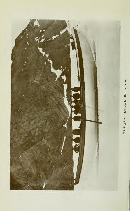
CRUISE OF THE MINNIE MAUD 261
enemy. They readily resort to cannibalism when food is exhausted.
The lemming has always been a matter of great interest to the
northmen and to the scientists. Olaus Magnus relates, in 1518,
that these animals fell from the sky in a storm and torrent of rain
and Wormius wrote a whole book to prove that they were born
in the clouds. The Laplanders eat the flesh of the lemming.
Halcyon days at Salmon River.—The last six weeks that I spent
at Salmon river, from July Uth to August 21st, were most enjo-
yable. The days were generally calm and clear with a bright sun
shining overhead and with light breezes alternating from the
east and west. The air was as invigorating as wine and the pa-
norama of blue-black mountains surmounted by snow-capped
peaks, the glistening sound, bright blue atmosphere and russet-
brown hills was inspiring and unexcelled. Rippling stream sand
rushing waters, the song of birds and the hum of insects filled the
air with joj'ous music. Golden plover. King eiders, red-throated
loons, snowflakes, Lapland longspurs, snowwhite geese, gulls,
ravens, snowy owls, and longtailed jager were flying about every-
where; the river which flowed past the shack was full of the mostbeautiful salmon in the world and seal lay basking in the warmsunshine out on the sound. Great troops of narwhal would co-
me plunging and blowing up the sound in full flight before a
small band of voracious killers. There was no night as the sun
shone over-head the day round. We had great sport spearing
salmon and catching them even with our hands in a back pondat low tide; or in wandering over the hills after snow-white geese
or golden plover. Occasionally a curious seal would pop its
head and great, round enquiring eyes out of the water when ta-
king a respite from its labours in pursuing the countless salmonand small fish that infested the mouth of the river; when there
would be a rush for our rifles and then a volley would be let
loose at the visitor; which sometimes would end in a tragedy and,
more often, not.
Mitchell's grave.—Often, after tea, we would wander along the
placid shore under the golden sunlight as far as Mitchell's grave
and ponder on the calm and lovely splendour that surrounded that
Arctic tomb, that lay so peaceful, silent and remote from the
bus}' hum of men.
The grave lies about two miles to the west of Salmon river on
a low, verdure-clad plateau, some fifty yards from the shore,
with the feet pointing to the north and the sightless eyes gazing
eternally at the Pole Star that silvern magnet of all things ter-
restial.
A wooden cross, painted white, bears the inscription: "Sacred
to the memory of John Mitchell of Dundee, Engineer on board
S. S. Esquimaux who died September 17. 1885, aged 49 years."
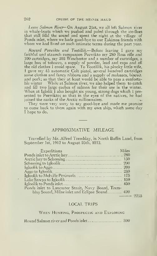
262 CRUISE OF THE MINNIE MAUD
Leave Salmon River—On August 21st, we all left Salmon river
in whale-boats which we pushed and poled through the ice-floes
that still filld the sound and spent the night at the village of
Ponds inlet, where we bade good-bye to our Eskimos friends wdthwhom we had lived on such intimate terms during the past year.
Reward Peewikto and Tootillik.—Before leaving I gave myfaithful and staunch companion Peewikto my 280 Ross rifle and100 cartridges, my 303 Winchester and a number of cartridges, alarge box of tobacco, a supply of powder, lead and caps and all
the old clothes I could spare. To Tootillik, his plucky little wife,
I gave my 45 automatic Colt pistol, several hundred cartridges
some clothes and fancy ribbons and a supply of molasses, biscuit
and pork; so that they at least would be able to pass a conforta-
ble winter While at Salmon river, we also helped them to catchand fill two large caches of salmon for their use in the winter.
When at Iglolik I also bought six young, strong dogs which I pre-
sented to Peewikto; so that in the eyes of the natives, he hadjoined the ranks of the Arctic millionnaires. v
They were verj^ sorry to say good-bye and made me promiseto come back to them again with my own ship, which some dayI hope to do.
APPROXIMATIVE MILEAGE
Travelled by Mr. Alfred Tremblay, in North Baffin Land, fromSeptember 1st, 1912 to August 2oth, 1913.
Expeditions Miles
Ponds inlet to Arctic bay 280Arctic bay to Scheming 150
Scheming to Igloolik 200Igloolik to Aggo 200Aggo to Igloolik 230Igloolik to Melville Peninsula 175
LakeSarcpato Igloolik 150Igloolik to Ponds inlet 450Ponds inlet to Lancaster Strait, Navy Board, Trem-
blay Sound, Milne inlet and Eclipse Sound 4202255
LOCAL TRIPS
When Hunting, Prospectig and Exploring
Round Salmon river and Ponds inlet 300

CRUISE OF THE MINNIE MAUD 263
Round Arctic Bay-70 days-Trapping 600Round Scheming-20 days 200Hunting on road to Igloolik 100Hunting and Exploring round Igloolik 150Hunting on Aggo Trip 25Exploring and Hunting round Murray Maxwell bay 100Hunting and Exploring when crossing Cockburn Land. .
.
150Hunting and Exploring on Eclipse Sound Trip 150
1775
Total miles 4030
An average for 359 days of elev^en and a third miles per day.

CHAPTER XII
The Return Voyage from Ponds Inlet to Quebec
After filling the water casks we hoisted both anchors witli the yc
aid of a dozen Eskimos who had come from the village in their
boats and kayaks, and, hoisting sail in a dead calm, managed to
drift with the current through the western entrance of Albert
harbour.
Leave Albert Harbour.—An easterly breeze sprang up aboutnoon and the schooner under lull sail began to forge slowly throughthe water "homeward bound". The Eskmios after a good meal,
said good-bye and dropped into their boats which we were towingalong-side. As we sailed away they stood up in the boats and,
raising their caps, gave us three rattling cheers, to which we res-
ponded with another hearty cheer. The last we saw of them as
the schooner tacked out of sight behind Belœil island, they wereall sitting motionless at their oars, gazing sorrowfully after us
and our hearts went out to the faithfull, brown-skinned peoplewhose companionship and help had meant so much to us duringthe long, trying months of the past year.
We left Albert harbour on August 25th. and tacked back andforth all the afternoon against a stiff easterly breeze towardsButton point. Eclipse sound, with the exception of a few scatte-
red icebergs, was free from floes and there was open water aheadof us clear out into Baffin bay. We spent the afternoon clearing
decks, lashingthe boats and battering down the hatches in prepar-ation for the rough seas that la\' before us. We were all clad in
sealskin coats and trousers, knee boots, shoes and mitts; the par-
ting gifts of our Eskimo friends. These clothes afforded us greatprotection against the raw east winds and rain. The watcheswere set at 8 o'clock that night.
Greenland Coast.—We did not glimpse the Greenland coast
until the afternoon of August 31st, as we ran into a succession of
calms, fog and head winds. We saw no ice as we sailed across
Baffin bay; but as we neared Greenland saw many large icebergs
that had come from Melville bav.

266 CRUISE OF THE MINNIE MAUD
On September 1st, we made good progress, when we ran downthe Greenland coast at a seven knot chp before a north-westbreeze accompanied by snow and sleet. The next day we werebecalmed and sleet and rain felt in the afternoon. We noticedgreat quantities of feathers that had been dropped by the innu-merable ducks and water-birds that infest the waters of Baffin
bay, floating around us. It remained calm all that night and theschooner rose and fell idly on the oily swelL At midnight a heavysnow-storm fell and covered the decks deep in snow and we hois-
ted our side-hghts in the rigging for the first time. The next day(September 3rd) was a beautiful one and the schooner bowledmerrily along, before a north-east breeze opposite the island of
Disko but out of sight of the land. In the afternoon the windveered to the north-west and the schooner increased her pace to
six knots an hour. In the evening we took in the staysail andthe jib-topsail and ran between nine and nine and a half knots all
night in the dark; keeping a good look-out ahead for icebergs.
The vessel had been badly strained by her long stay in the ice at
Albert harbour and we manned the pumps CA'ery two hours. Thewind from the north-west steadily increased in strength with abig following sea. The night was starlit and cloudy. The sunrose over the eastern horizon at 4.30 a. m. the next morning (Sep-
tember 4th) when we saw a rare and beautiful sight. A huge ice-
berg with a large circular hole in the middle, passed between us
and the slowly rising sun, and for a few minutes we enjoyed the
curious spectacle of the pale golden orb shining at us, like a massof golden flame, through the centre of the gleaming-white andglistening berg. It made a unique and inspiring picture. Wewere running then at ten knots an hour and at breakfast timeboth watches took a reef in the mizzen and mainsail as the windwas continually increasing in strength. At noon we took another
reef in the large mainsail, and ran all that afternoon before the
heavy north-west gale and sea which kept increasing in strength
and violence. At tea-time we shipped a heavy sea over the bow,which poured down the foc'sle and broke the lashings of one of
the boats on deck. The sky took on a deep, angry red and yellow
colour, which bespoke more wind. The sea was lashed by the
fury of the wind into clouds of spary and spindrift that whirled
over the sur*face of the sea in all directions. After tea we took in
the mainsail and jib and ran all night through the darkness andstorm, under reefed mizzen and fore-top jib.
A furious gale.—On September 5th, the gale continued to blowwith even greater fury and the heavy following sea became higher
and higher. The schooner scudded along before it, all day, under
reefed mizzen and fore-top jib, at eight and nine knots an hour.
Both watches had a trying and anxious time during the night
when peering into the darkness ahead of the flying schooner, on

CRUISE OF THE MINNIE MAUD 267
the constant watch for the ghostly, yellowish glare of the dreadedbergs. At noon we flew past a couple of large icebergs over
which the mountainious seas were dashing and breaking a hun-dred feet in the air. We also passed a quantity of seaweed that
lay in our track. At 3 p. m. we hoisted the main jib and ran
through some dangerous chunks of ice, fragments of a large berg,
one of which hit the schooner a glancing blow. At 4 p. m. the
wind shifted to north by west and increased in fury; and we all
realised that we were in for another dangerous and trying night.
The wind was blowing at least sixty miles anhourand theeven-ing clouds were scudding past the setting sun at a great rate.
As soon as a wave broke it was caught up by the wind and whirled
away to leeward in great sheets of foam and spary. The gulls
had hard work flying, to windward and would keep swoopingunder the lee of the giant waves for protection against the batter-
ing wind. At 6 p. m. we lowered the main-jib. At 7.30 p. m.we were aroused by a fearful racket overhead, and found that all
our heavy water-barrels that were lashed on deck abaft the main-mast, had shpped their moorings and were careering over the
deck and threatening to pound their way through the lee bulworkinto the sea. Had they brooken the lee rail and rolled overboardour position would have been a bad one; as, we were at least twoweeks sail from where we could obtain a fresh supply, and to havegone two weeks without drinking water would probably havespelled death for us all. All hands rushed to the rescue and, af-
ter a hard tussle, succeeded in morning the heavy casks withchains, once more to the deck, and we also steadied them withwooden chocks nailed to the deck.
A close shave.—At 11 o'clock that night, as the ship was driving ^fast before the gale in the blackest hours, Mr Reader and JohnLeBel, who were on watch on tlie bow, with Chassé at the wheel,saw a grisly, low-lying berg suddenly loom up out of the waterahead of the starboard bow and, as it seemed, right under thebowsprit. LeBel rushed off and shouted through the storm to
Chassé, who, seeing the yellow glare over the bow and almostaboard, threw the wheel hard over with all his might, when thenext wave would have dashed the schooner on top of the berg.
The schooner, which was travelling very fast, answered her helmnobly and swung round so quickly that her bow missed the grisly,
two-horned monster, by not more than a few feet while her coun-ter, some fifteen feet from the stern, smashed into a projection of
the iceberg, with a grinding crash, that broke in two planks in thestarboard bulwarks. At first we thought, in the darkness, thatthe ship's bottom had been pierced, but, fortunately, the woundin the ship's side proved, on examination with a lantern, to beabove water. It was a very close call; too close for comfort. We

268 CRUISE OF THE MINxNIE MAUD
spent an anxious time on the lookout during the rest of the night,
peering out over the bow into the inkv darkness that was lit upevery now and again by the milk-white phosphorescence of thebreaking waves. So dark, was the night and so fast was the
schooner travelhng, one moment poised on the top of a hugewave and the next buried from sight in the deep through of the
sea. that it was an impossibility for us to have avoided runningfull tilt on any berg that lay in our course. All hands heaved a
sigh of rehef when daybreak broke although the following day(Sept. 6th) was thick and foggy and the schooner continued to
plunge and roll before the gale through a heavy cross sea, whichmade some of the party sea-sick. We were pumping the schoonerevery two hours, as her seams were opened by the strammg of
the heavy seas and clear water gushed from the pumps. A lot
of rum was served out to celebrate our narrow escape from the
iceberg on the previous night. We spent a wet, cold and uncom-fortable day and worked at the pumps every half-watch as the
strained hull was leaking badly. At 4 p. m. we shipped a heavysea over the bow which flooded the narrow foc'sle where we slept
cooked and ate our meals. That night the wind shifted and felt
and the sea moderated so we hoisted the double-reefed mainsail
and the main-jib and travelled fast through the night.
A head wirid.—Early next morning (Sept. 7th) we hoisted the
flying-jib and shook out the reef in the mizzen and, later, the
reefs in the mainsail. A few hours later we were obliged to takein the two jibs and to again double-reef the mizzen and mainsail,
as a furious head wind sprang out from the south with a heavyhead sea. The ship pitched and rolled around like a drunkenman; half of the crew were sea-sick and the pots, pans and cup-
board doors banged about in the fos-cle, making an awful din.
The old timber of the schooner creaked and groaned as though in
pain as she pounded into the heavy seas. Later in the day wetook in the mainsail and jib. At night the wind fell and it beganto rain; the heavy sea keeping up all night. The plunging of theship caused one of the wire stays that ran from the bowsprit to
the foretopmast head to break and we feared that we should lose
our bowsprit and topmasts. The bowsprit was old and dange-rous to climb out on when handling and stowring the jibs.
The night was damp and dirty and the ship rolled like a barrel
and it rained heavily from the south-east.
The next morning (September 8th) broke fair and fine with a
light breeze blowing from the south-east. All hands were tired
out with the strain of keeping a constant look-out for icebergs at
night and with the continuous hoisting, lowering, reefing andhandling of sails, and working at the pumps.
CRUISE OF THE MINNIE MAUD 269
During the day the wind veered from the south-west to east,
then to north-east and finally to north-west. It rained very hea-
vily the whole morning and we were in our oilskins all day. Weran S. W. by S all day at seven knots and saw no ice. That night
was dark and clear, with a north-west wind and heavy sea.
Fine sailing.—Next morning (September 9th) was beautifully
bright and clear, and a west wind bowled us along on our course
at 8 knots an hour, with all sails set. The sea was a deep blue
and the sun was shining overhead. At 4 p. m. the wind droppedfor a while, and revived and we made 93^ knots during the night.
We passed two large icebergs in the afternoon, the first we hadsince our narrow escape on September 5th. We counted six
whales spouting to windward, about two miles away. A beauti-
ful sailing breeze kept up all night and we travelled fast. Several
times during the night we had trouble in doggins icebergs andfloating fragments of ice that would suddenly crop up ahead of
the schooner out of the fog and mist. We were nearing the La-
brador coast and the bergs were plentiful. That night we weretreated to a wonderful display of northern lights that kept ap-
pearing, disappearing and reappearing in sudden flashes, cove-
ring half the sky.
Icebergs.—The icebergs at night appeared like dark-grey anddeep misty-blue ghosts envelopped in a shroud of cloud-mist.
In the day time, when it is foggy their approach is heralded by the
thick, ghastly, yellow, glarish fog that envelops them.
A writer in the Montreal Star, writing on January 10th, 1914,
from St-John, Newfoundland, gives the following interesting ac-
count of the icebergs that infest these waters and constitute sucha menace to shipping:
—"The year 1913 has been almost un-exampled in the abundance of these crystal islands, and the early
period of the season at which they showed themselves in suchnumbers. Towards the end of January their advance guard wassighted off tlie Newfoundland coast. During March and April
these ramparts adrift were a constant menace to the big liners
which, trying to make fast passages, had to risk more chancesthan mere freighters, so that more than one ocean greyhoundcame within an ace of meeting her end thereby. As early as
March 20th the steamship Savoie, on arriving at New-York, re-
ported sighting an icefield two hundred miles long floating direc-
tly in the path of incoming steamboats.
"These great flottillas of majestic icebergs have been for somemonths moving down across the Grand Banks, imperilling the
safety of the ocean steamships which traverse that area, and in
the spring forcing the first-class liners to abandon their accusto-
270 CRUISE OF THE MINNIE MAUD
med tracks for areas further south while many a craft which arri-
ved in port bore ghastly evidences of encounter with these silent
but deadly destroyers of the deep or told of narrow escapes fromtheir fangs.
* 'All these icy masses which infest the North Atlantic steamertrack have their origin in the frigid Greenland fiords, wheremighty glaciers, real sohd Niagaras, are formed from the vast
ice-cap which covers that remote Arctic region and move resis-
tlessly to the sea, where each summer they "calve" or give upenormous fragments which, dividing and sub-dividing again,
become the bergs so much dreaded by the springtime voyager .
' 'These northern monachs are borne down in stately procession
from the dreaded Baffin bay on the Labrador current, whichsweeps past the eastern coast of Newfoundland, across the GrandBanks and into the Gulf Stream, where they gradually disappearunder influence of the increasingly powerful rays of a more verti-
cal sun and the higher temperature of the surface water.
"During their long journey down past Labrador and Newfound-land, the bergs do not remain of the same shape as when brokenoff the parent glacier or sundered again by internal fractures or
grounding on reefs, but frequently turn a somersault to accommo-date themselves to the changes centre of gravity of the berg.
The tallest berg.—"Admiral Markham,in his exploring cruise in
Melville bay, counted between seven hundred and 800 bergs, all
under way for summer climes and some of them exceedingly large.
One of them he estimates to have been 400 feet high and 1800
feet long. This berg would have required no less than 1800 feet
or 466 fathoms of water to float it. The tallest berg ever repor-
ted about the liner track was one observed bj' the steamship
"Mineola", in June 1890, which was 450 feet from water hne to
summit. Thisberg would require water 3150 feet deep to float in.
The Hafis, in May, 1892, sighted one which was 425 feet high.
Bergs 150 to 250 feet high and 1000 to 1500 feet long are
by no means uncommon along the Newfoundland coast, but theyusually ground on the Grand Banks, are bufl'etted by storms, andsplit themselves into many lesser fragments.
Fog.—"These bergs are not dangerous in clear weather, because
they can easily be made out when a long distance away, and cantherefore be avoided; but from April till October the Grand Banksare almost always veiled in fog, and it is then that tlie menace of
these ghostly wanderers most oppresses liner captains a,jid mari-
ners generaIl3^ Only the vigilance now enforced on the oceangrey hounds prevents terrible disasters, and even as it is many
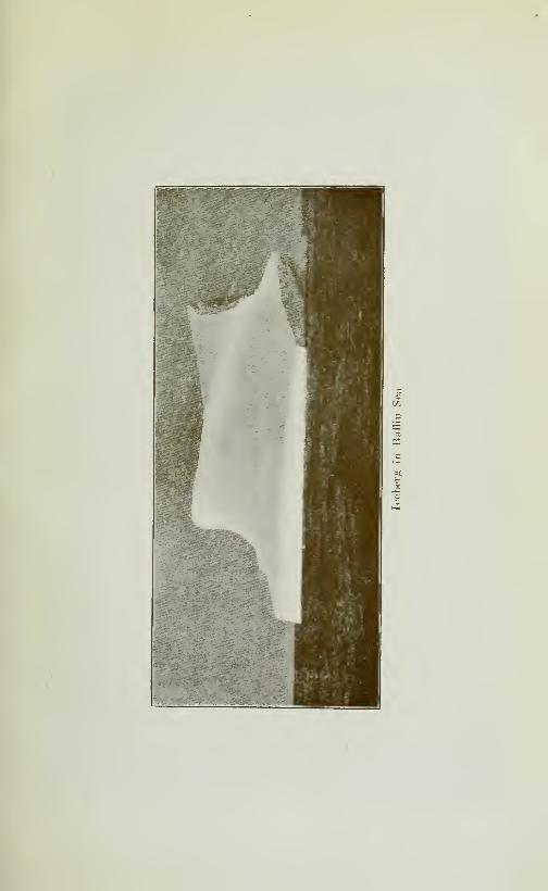

PC
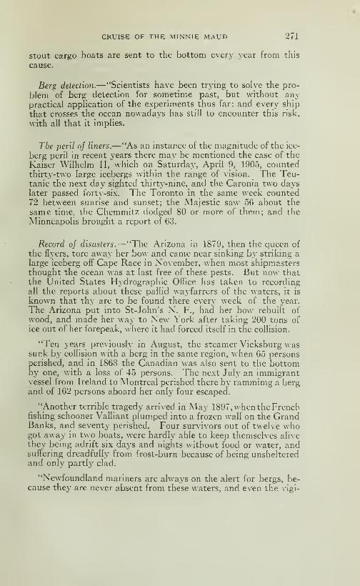
CRUISE OF THE MINNIE MAUD 271
Stout cargo boats are sent to the bottom every year from this
cause.
Berg detection.—"Scientists have been trying to solve the pro-
blem of berg detection for sometime past, but without anypractical apphcation of the experiments thus far: and every ship
that crosses the ocean nowadays has still to encounter this risk,
with all that it implies.
The peril of liners.—"As an instance of the magnitude of the ice-
berg peril in recent years there may be mentioned the case of the
Kaiser W'ilhelm II, which on Saturday, April 9, 1905, countedthirty-two large icebergs within the range of vision. The Teu-tanic the next day sighted thirty-nine, and the Caronia two dayslater passed fortv-six. The Toronto in the same week counted72 between sunrise and sunset; the Majestic saw 56 about the
same time, the Chemmitz dodged 80 or more of them; and the
Minneapolis brought a report of 63.
Record oj disasters.^' 'The Arizona in 1879, then the queen of
the flyers, tore away her bow and came near sinking by striking a
large iceberg off Cape Race in November, when most shipmastersthought the ocean was at last free of these pests. But now thatthe United States Hydrographie Office has taken to recordingall the reports about these pallid wayfarrers of the waters, it is
known that thy are to be found there every week of the year.
The Arizona put into St-John's N. F., had her bow rebuilt of
wood, and made her way to New York after taking 200 tons of
ice out of her forepeak, where it had forced itself in the collision.
"Ten years previously in August, the steamer Vicksburg wassunk by collision with a berg in the same region, when 65 personsperished, and in 1863 the Canadian was also sent to the bottomby one, v>-ith a loss of 45 persons. The next July an immigrantvessel from Ireland to Montreal perished there by rammimg a bergand of 162 persons aboard her only four escaped.
"Another terrible tragedy arrived in May 1897, when the Frenchfishing schooner Valliant plumped into a frozen wall on the GrandBanks, and seventy perished. Four survivors out of twelve whogot away in two boats, were hardly able to keep themselves alive
they being adrift six days and nights without food or water, andsuffering dreadfully from frost-burn because of being unshelteredand only partly clad.
"Newfoundland mariners are always on the alert for bergs, be-cause they are never absent from these waters, and even the vigi-
272 CRUISE OF THE MINNIE MAUD
lance and expertness of the hardy fisher-folk do not prevent ma-ny a fatality. The bark Nellie left St-John's one May morningtwo years ago. and before night fall there were only two survivors
of the crew of ten, the vessel and the other eight having gone to
the bottom througli the ship hitting against a berg in a sudden fog.
"The schooner Albatross, with a crew of 22 seal men was neverheard of after she sailed in March, 1903 and the general impres-
sion is that she struck a berg and went down. In April 1904, thesteamer Grand Lake, while engaged in the seal fishery with 200men aboard, rammed a big berg on the Banks, and narrowly es-
caped foundering and got back to St-John's with all her crew bu-
sily engaged pumping and baiUng her out. A like mishap befell
the Newfoundhind, which was engaged in the same hunt, in April
1898, and her phght was even worse, for her sides were crushedby a floe as she tried to escape, and she reached port in almost a
sinking condition.
"Sometimes even these staunch and specially built vessels are
unable to withstand the contact with floes or bergs and within
the last ten years, the Wolf, one of the finest of her class afloat;
the Hope, which had an enviable record in Arctic exploration;
The Mastifl", which had been built originally b\- the British Ad-miralty for northern work; the Resolute, a one—-time Scotch wha-ler; and the EUiot—all succumbed to the terrible forces which na-
ture exerts in this fashion, and it would require pages to tell of
the mishaps to coasting and saihng craft in this region whichhave come to grief before these ice-monsters.
"St. John's is the haven of refuge every year for ships disabled
by contact with bergs, which have to be docked for repairs to
bows or bulks. In July 1897, the Concordia put in with her
whole bow torn off" by a berg, and only her front bulkhead to
withstand the strain of forcing 200 miles through the ocean to
reach a shelter. The Knight Bachelor was an almost identical
case, and the Hatasu another.
"The John Bright, the Addington, and Rotterdam, and the
Glenwet, to mention only a few, were similarly smitten. All
tiiese had to get wooden bows to continue their voyage. Whatsmall prospect of escape the crews of such crafts have is proven
by the case of the Castlegate which in March, 1893, was crushed
and sunk off Newfoundland, her men taking to the floe and being
adrift thereon for two days and nights till rescued by the sailer
Diana at the beginning of the blizzard which they could never
have survived, for it battered the ice into chowder and wouldhave overwhelmed them.
Narrow escapes oj liners.—"Big passenger steamers frequently
CRUISE OF THE MINNIE MAUD 273
find themselves in dire peril from bergs, as was the experience of
the liner Normannic, now the French flyer l'Aquitaine, on the
Grand Banks on May 31, 1890, when having threaded her waythrough a wide array of bergs, she put on speed and was racing
ahead till fog shut down. Then a crystal barrier interposed,
which she escaped impahng herself upon only by the promptwork of her twin screws in opposite directions, causing her to
spin round on her heel and just graze the berg with her side as
she passed it.
"The City of Berhn struck a berg in a fog on the Banks three (3)
years later; but fortunately was going at reduced speed else she
would have torn her forepart asunder. Even as it was, her
stern was telescoped, her forepart was shattered, and the falling
of a hundred tons of ice about her decks made a wreck of all the
gear and fittings from the bowsprit to the foremast. Her sister
ship, the City of Rome, in September 1900, knocked off her stern
below the water-line, leaving an aperture large enought to admitan automobile. The Swedish steamer Nordcap with 400 immi-grants hit a similar berg off" Cape Race in May, 1901, and sustai-
ned such damage that she had to put into St-John's to effect re-
pairs This was also the experience of the French steamer Bur-gundia off St-Pierre, in March 1903 with 1000 French fishermenaboard, whom she was transporting tb that port to engage in thecod-fishery, and of whom 12 perished by the dismanthing of theforecastle in which thej^ were lodged.
"The Scale was another liner that rammed a berg, striking it aglancing blow as she swung round on sighting it: but the pressureof the mighty mass flung her over on her side until it was fearedshe would sink. Indeed, the coal in her bunkers ran over becauseof this, and she made port with a heavy list.
"The Portia when ofl" Newfoundland in 1895 ran near a berg toenable some passengers to "snapshot" it; but went upon a sunkenportion of the ice, disturbed its equilibrium and was being turnedup out of water by the swaying mass, when her weight broke off"
the fragment which held her and she sank back into her nativeelement again.
"Ths Caspian, with 550 immigrants aboard bound for Montrealnear Cape Race in 1890, in a thick fog, drove against a berg, andshattered her bow so badly that she was barely able to reach St.
John's, so fast did the water gain on the pumps.
"The Erl King in 1892, met a like mishap when entering BelleIsle strait with 725 immigrants, and had to make this port sternfirst to relieve the strain on her leaky forward end and bulkhead.
"The French liner Gascogne with 600 aboard, came near being

274 CRUISE OF THE MINNIE MAUD
overwhelmed by ice on the Grand Banks in April 1898, havingbeen caught there with a broken shaft, and was in extreme peril
for several days, until the floe swept her bodily southward into
warm water and was then dispersed by a stiff" breeze, which set
her free.
"The German hner Bulgaria, in 1901 was compelled to seek har-
bour at St. John's with nearly 1000 passengers, having injured her
propeller amid the floes."
The Titanic.—But the greatest disaster and tragedy of themall, and one of the most recent, was that which happened to the
White Star liner, "Titanic", the largest steamship in the world,
when making her maiden voyage from Liverpool to New York in
April 1912. At eleven o'clock at night, when several hundred of
miles south-east of Cape Race, she steamed at full speed into a
field of large icebergs, and although she swumg round on sighting
them, side-swiped her bottom plates the whole lenght of the ship
against an under-water projection of a huge berg, and in twohours went to the bottom, in water two miles deep, when only
700 out of the 2300 souls on board were saved in the boats. Otherships attracted by the Marconi wireless signals for help arrived onthe scene the followins morning and rescued the survivors fromthe boats.
From the foregoing list of disasters, an idea can be formed of
the dangers that beset the Labrador, Greenland and Newfound-land coasts from these death dealing and treacherous foes to navi-
gation and the benefits that would be obtained by an extension ot
the wireless observatories along the Baffin land coast as far as
Lancaster strait and Smith sound.
The Labrador coast.—At daybreak of September 10th, we cameabreast of seven rocky islands that lie off^ the coast of Labrador.
The sight was a pleasant one as it showed us that we were ap-
proaching home waters and we were all throughly tired of the
tedious voyage.
For two days (Sept. 10 and 11), we enjoyed beautiful calmweather, with a warm sun, blue sea and light head breeze that
kept us constantly tacking to windward and keeping a sharp look-
out for the large bergs that lay around. The nights were calmand wringing wet from the damp, penetrating fog that rose upfrom the sea. As we drew near to the coast of Labrador we hadto kept a sharp look out for rocks, ships and bergs. The sunsets
were specially gorgeous at this time of year, as the fiery golden
orb of the sun sank behind the sombre rockv islands off" the La-

CRUISE OF THE MINNIE MAUD 275
brador coast into a blue-black sea and the pale moon, ^ full, rose
at the same time in its silvery splendour and illuminated the
Eastern sky.
Belle Isle.—We were slowly working our \\ay to^^ards Belle-
Isle, and at 4 a. m. on the morning of September 12th, heard the
deep booming bellow of the steam siren on the eastern end of the
island, piercing the fog ahead of us, about two miles on the port
bow. Hoisting gaff topsail and jib-topsail that were wringing
wet and heavy to handle with the damp, dripping fog, we squared
away before a light north-east breeze and ran into the strait. Thefog was so thick that we could not see 50 yards from the schooner
the water was smooth and the breeze very light. We had takenexactl}' the same number of days to cover the distance betweenPonds inlet and Belle Isle strait as on the previous outwardvoyage 17 days.
About noon we heard through the fog, on our starboard side,
the muffled roar of heavy surf pounding on the rocks and altered
our course to keep away from the north-shore. The breeze fres-
hened and we were soon running seven knots an hour under full
sail through the dense obscurity of the fog, in the hope of being
able to pass through this narrow and dangerous passage before
nightfall. The strait of Belle Isle separates Newfoundland fromthe Labrador coast and is about 90 miles long, from the outer
end of Belle Isle island to the Bay of St. John, and from nine to
ten miles wide.
Peary writes the following account of his passage through thestraitsof Belle Isle, in his very interesting book The 'North Pole":
Tn passing through the Straits of Belle Isle, "the Graveyard ofShips", where there is always danger of encountering icebergs in
the fogs, or being swung upon the shore by the strong and capri-
cious currents. I remained up all night, as any man would whohad care for his ship. But I could not help contrasting that easysummer passage (on July 19th) with our return in November1906, when the Roosevelt was standing on end half the time, andthe rest of the time was rolling the rail under water, losing tworudders, being smashed by the sea, creeping along the Labradorcoast in the berg season, through dense fog, and picking up PointAmour Light only when within a stone's throw of theshore, guidedonly by the sirens at Point Amour and Bald Head, and the whistlesof the big steamships lying at the entrance of the strait, afraid to
attempt the passage".
The breeze fell shortly after that, leaving a heavy swell
in which the schooner rolled about and lost her steerage way.The fog was as dense as ever and a cold rain added to
19
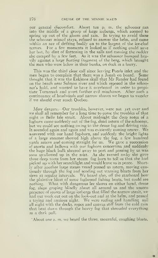
276 CRUISE OF THE MINNIE MAUD
our general discomfort. About ten p. m. the schooner ran
into the middle of a group of large icebergs, which seemed to
spring up out of the gloom and rain. In trying to avoid these
the schooner missed stays, refused to answer the helm, and camewithin an ace of drifting bodily on to the largest of the ice-clad
terrors. For a few moments it looked as if nothing could saveher but, by dint of flattening in the sails and coaxing the ruddershe escaped by a few feet. As it was the schooner bumped hea-
vily against a large floating fragment of the berg, which broughtthe men who were below in their bunks, on deck in a hurry.
This was the third close call since leaving Ponds inlet and the
men began to complain that there was a Jonah on board. Somethought that it was the Eskimos skull that Mr Reader had foundon the beach near Salmon river and which reposed in the schoo-
ner's hokl, and wanted to have it overboard in order to propi-
tiate Tornarsuk and avert further evil mischance. After such a
continuance of headwinds and narrow shaves we began to wonderif we shouki ever reach Quebec.
More dangers.—Our troubles, however, were not yet over andwe shall all remember for a long time to come the troubles of that
night in Belle Isle strait. AJjout midnight the deep notes of a
foghorn came suddenly out of the fog, dead astern of the schooner,
but we could see nothing owing to the dense fog and driving rain.
It sounded again and again and was evidently coming nearer. Weanswered with our hand fog-horn, and suddenly the bright hghts
of a large steamer showed high above the fog, a few hundredyards astern and coming straight for us. We gave a succession
of snorts and bellows with our foghorn concertina and suddenly
the huge black bulk sheered away to port and passing by us wassoon swallowed up in the mist. As she turned awà}' she gavethree deep toots from her steam fog horn to tell us that she hadpicked up with her searchlight and would leave us in peace. Short-
ly after another large steam vessel passed us astern, moving cau-
tiously through the fog and sending out warning blasts from her
siren at regular intervals. We heard also, off the starboard bowthe plaintive bleat of some fogbound fishing boats, but could see
nothing. What with dangerous lee shores on either hand, dense
fog, ships groping blindly about all around us and the unseen
presence of scores of large icebergs that filled the narrow strait, wehad our work cut out on the look-out and at the helm, and passed
a trying and anxious night. We were reefing and handling sail
all night with the decks, ropes and canvas stiff" from the cold rain
that beat down through the heavy fog that shrouded everything
as a dark pall.
'About one a. m. we heard the three, mournful, coughing blasts.
CKUISE OF THE MINNIE MAUD 277
that fell away into a long drawn moan, of the steam fog signal at
the southern end of the straits and making for it and judging the
distance by the sound and the sounding lead, re-adjusted ourcourse. This powerful fog-signal, which pierced the fog and mist
at regular intervals, had a most weird and uncanny- effect andsounded for all the world hke the angry moans of some demoniacmonster in pain. If any of our Eskimo friends had been with us
they would assuredly have taken it for Tornarsuk himself or so-
me mythical monster that guarded the straits and hved on thebone.s of shipwrecked mariners.
Another berg.—About 3 a. m. when the schooner w'as runningfast before an easterly breeze and when we w^ere congratulatingourselves that most of the dangers were safety over, an enormousiceberg loomed up, cold, blue and menacing, right in our path.
This berg was fully 200 feet high and its summit was wrapped in
a dense white cloud. The helm was thrown over and we passedthis berg w^ithin 200 feet to starboard. The steamer ManchesterCommerce recently had her bows stoven in by coming in contactwith an iceberg in Belle Isle strait, while outward bound fromMontreal, and just managed to limp into St. John's where she wasdocked and temporarily repaired, but for her comparatively lowspeed and specially stable build, as a freight boat, she would pro-
bably have gone to the bottom with all on board, as she met tem-pestuous weather after striking the ice island, and had greatdifficulty in reaching the land. Fortunately, too, she had nopassengers on board, and the world thus escaped a possible repe-
tition, on a smaller scale, of the Titanic tragedy of April 1912,
We were all glad when the night w^as over and by day light hadpassed out of the narrow straits and the fog became lighter.
Clear the straits.—The next day (September 13th) the windchanged to the south-west—a head wind for us—and soon deve-loped into a gale with a very heavy sea running. The schooner layhove-to, under reefed mizzen and fore-top jib all that day andthe next night in the narrow bay at the south-w^estern entranceof the strait, exposed to the pounding of the waves that sweptacross the whole lenght of the Gulf of St. Lawrence. The schoo-ner rolled, pitched, plunged and strained for about 30 hours underthe worst pounding she had yet received. The waves rose like
solid walls, 20 feet in height and threatened every minute toswamp our buoyant, but distressed little craft. Men who hadnavigated the gulf for years said it w as the worst and most dan-gerous sea thej' had ever experienced. The schooner kept plun-ging her heavy bowsprit into the solid walls of water and we ex-
pected at every dip to see it snap off, and if the bowsprit went weshould have lost our topmasts. Two outside planks were stove in
278 CRUISE OF THE MINNIE MAUD
by the force of the waves and the stay-bolts in the bow began to
draw. The deck planks forward began to open and through the
open seams in the deck the water poured down in a fine sprayinto the dingy forecastle. Half of the crew were sea-sick and the
cook was too ill to light the stove; so that our meals consisted of
some cold meat and hard-tack. The schooner never had such a
bifFetting before and strained and groaned like a creature in pain.
The water poured through her opening seams and we were kept
constantly busy at the pumps. Another 12 hours of such weatherwould have seen the end of the "Minnie Maud", and ofher crew,
as no boat could have been launched or could have lived in such
a sea.
We were not in favourable position either in regard to the land,
as we were right in the funnel-shaped mouth of the strait of Belle
Isle, with the rocky coast of Newfoundland on our lee, and the
ship was gradually being forced to the eastward under the poun-ding of the huge seas and by the full sweep of the south-westerly
wind.
The discovery of Newfoundland.—About 450 years before Chris-
topher Colombus was born, Newfoundland was discovered by a
Norwegian boy named Biorn, son of Hergolf.
In the year 1002, Hergolf, an Iceland colonist, fitted out twosmall vessels for a trading voyage to the Greenland settlement
and placed one of these under the command of his son, Biorn, a
youth of 16 years, who, having been bred to the sea almost since
infancy, had mastered the details of his profession by the timethat he arrived at an age when other boys usually commencetheir apprenticeship.
When near the southern coast of Greenland, Biorn's ship wasdriven to the south and west. One morning he discovered a
strange land close aboard. Sailing along the coast fot some dis-
tance, he found a large bay, into which he steered and droppedanchor. Upon landing the country was seen to be clothed withvegetation and the streams swarmed with fine salmon. Trees of
large growth grew in great numbers just back from the shore, andthe climate was balmy and delightful. Of natives they saw no-
thing, and believed the land uninhabited.
Rejoiced over his important discovery, Biorn returned to Ice-
land, and communicated the news to his friend Lief, son of Eric
the Red, who had founded the colony on the coast of that island.
The two ambitious young men immediately entered into anagreement to share the expense of equipping a suitable vessel,
sailing to this newly discovered land and bringing back whatevercargo promised to reimburse them for fitting out the ship.

CRUISE OF THE MINNIE MAUD 279
Their first sight of new land was not calculated to impress Lief
with a promise of its fruitfulness, for it was rocky, barren andgloomy. This gave rise to openly expressed dissatisfaction onhis part, but Biorn assured him that further south they wouldmeet with green fields and woodlands. After the fashion of
early navigators in naming geographical discoveries according to
the features first presented, this place they called Helleland, andto the low, sandy shore wliich thej' observed beyond it and whichwas covered in spots with clumps of small trees, they gave thename of Markland. Two days later they fell in with a new line
of coast, and sailing along this for several hours Biorn made outthe bay in which he had anchored on his previous voyage. Intothis harbour they brought the ship and moored her.
The explorers soon succeeded in catching a number of fine sal-
mon from the river that emptied into the bay, and collected quan-tities of fruit of diff"erent varieties, and of most agreeable flavour.
The temperature of the air, as on the former voyage, was foundto be delightfully mild to the Icelanders, and the soil proved to
be rich and productive. One of the members of the crew, a Ger-man, met with quantities of grapes growing wild, and from this
circumstance the two young navigators decided to name thecountry Vinland, meaning the land of grapes. This Vinland ofthe early voyagers is known at the present day as Newfoundland.After making several short cruises to the southward and west-ward, and sailing through the Gulf of St. Lawrence until the river
of that name was reached, the ship returned to her first anchora-ge, where the explorers passed the winter.
During the months that the vessels lay at anchor, many valua-ble furs and skins were obtained by the hunters, and in the springthe ship was freighted with valuable lumber hewn from the fo-
rests that grew close to the shore. With the proceeds of this
venture the two boy discoverers fitted out their vessel the secondtime, but an unfortunate quarrel breaking out between them,Lief sailed alone to established a colony after the example of his
father. For this purpose he embarked some 70 men and women,who were glad to exchange the bleak shores of Iceland for therich meadows and purling streams of this promised land.
Perils oj Neivfoundland Sealers.—The following editorial onthe subject of the perils of the Newfoundland sealers appeared inthe "Quebec Chronicle" of April 13th, 1914: "There is no morethrilling chapter in the story of the harvest of the sea than thatwhich tells of the excitement, the perils and the profits of thegreat spring seal hunt among the ice-floes of the Gulf. The an-nual value of the industry runs from half a million to a milliondollars per annum, and its importance to the Newfoundlanders

280 CRUISE OF THE MINNIE MAUD
may be judged of from the fact that some six thousand men, 22
large steamers, and a number of sailing vessels take part in the
seal-hunt. To this must be added a considerable number of
men who are employed in the manufacture of the oil and its pre-
paration for market.
It must be remenbered that the seals captured in the Gulf andaround the coasts of Newfoundland are very different from the
seals of Alaska, whose soft coat is the pride of the city belle, being
the hair seals, which furnish the seal oil of commerce. The color of
their skin is mottled grey, and though some winter garnmentshave been made of it, and it has lately given promise of becomingfashionable for overcoats, capes and caps, it is chiefly used for the
manufacture of a coarse-grained but expensive leather, emplojxdin the making of trunks, boots, purses, etc., and also in costly
book-binding.
There are four species of seals in the waters around Newfound-land and Labrador, that known as the harp seal being par excel-
lence the seal of commerce. It owes its name to a broad, curved
line of connected dark spots proceeding from each shoulder andmeeting on the back above the tail, forming a figure something
like an ancient harp. There is a still larger variety known as the
hood seal. The male, called by the hunters the dog-hood, is dis-
tinguished from the female by a singular hood or bag of flesh on
his nose. When attacked or enraged, he inflates this hood so as
to cover the face and eyes, and it is strong enough to resist seal
shot. When thus protected, he can only be killed by being shot
in the neck or at the base of the skull. He fights desparately in
defence of his mate and young ones, and, if they are killed, he
becomes furious, inflates his hood, while his nostrils dilate into
two huge bladders. His appearance is now terrific, and with
uncount, floundering leaps he rushes on his foe. Instances have
occured where a fight between an old dog-hood and five or six
men has lasted for an hour; and sometimes a hunter is fearfully
torn, and even killed in the encounter. The young of the seal
are born on the ice-fields off the north-east coast of Newfound-land about the middle of February. They are suckled by their
mothers for about six weeks, and about the first of April they take
to the water. Having reached the Straits of Belle Isle the vast
herds of seals floating in a southerly direction with the Arctic
current, divide into two distinct parties, one passing through the
Straits into the Gulf of St. Lawrence, and the other moving along
the eastern shore of the island. Early in May, accompanied bytheir young, they commence their northerly movement, and the
sealing season of the Gulf is over.
The sealers usually leave St. John's shortly after the 10th of
March, and it may be weeks or even months before they return,
CRUISE OF THE MINNIE MAUD 281
all depending upon the ice. On the other hand, the steamer
Neptune, after an absence of only eighteen days, returned to
port some few years ago, loaded down to the water's edge with
42,000 seals valued at §105,000. The object of the sealing vessels
is to get as near as possible to a large field of ice containing seals.
The men are landed from small boats on to the ice-field, someti-
mes several miles in extent. Then the butchery of the annimalcommences. Each man is armed with a stout stick, eight or ten
feet long, which not only aids him in leaping from one ice-floe to
another when necessary but also serves him as a weapon for kill-
ing the seals. One blow over the nose suffices to kill or at least
to stun a seal, and as many as possible are so disposed of in order
to prevent their escape, before the final slaughter is commenced.The great aim of the hunters is to get among the "whitecoats"as the young harp seals are called in their babj'-hood, when yet
fed by their mother's milk and while they are powerless to escape.
The oil extracted from the blubber of these young seals is of a
much finer quahty than that obtained from adults.
Considering all the perils encountered, it is surprising that fatal
disasters are not mort frequent, and that so many vessels yearafter year come home unharmed. Only men of iron can success-
fully face and endure such dangers. They are so accustomed to
the sea and the ice-floes that they seem to have an absolute con-tempt for their terrors. They leap fearlessly from pan to panand think little of passing a night on the ice far from the steamergoing off as far as four or five miles in their eagerness to slay.
Should a fog or snowstorm set in, there is risk of losing their wayand perishing misera bh^ in these ice-deserts, as has been so fear-
fully illustrated during the last few days.
Perils of Newfoundland Sailors.—-The most terrible catastro-
phe in the history of Newfoundland occured on March 31, 1914,when the sailing fleet consisting of the Steamers "Newfoundland","Bellaventure", "Florizel", and "Bonaventure" were suddenly,without warning, overtaken by a terrible blizzard of snow, sleet,
hail and rain when engaged in hunting seal on the ice-floes off"
Newfoundland banks. When the easterly gale descended abouta thousand men were scattered over the ice several miles awayfrom their vessels. The method of seal-hunting pursued by theNewfoundland ships in for four-fifths of the crew to leave the shipevery morning and travel over the ice a distance from four to six
miles killing seals as they go and heaping them in piles for the shipto secure as she follows them. The men go lightly clad, and withbut little food, and when blizzards overtake them their chancesof escape are few. When the storm burst the men nearest theship got on board as quickly as they could but many were unableto find their way through the blinding snow-squalls. The "New-

282 CRUISE OF THE MINNIEMAUQ
founcUand" Avas separated from the rest of her crew by the stormand they were exposed on the grinding and crushing floes to the
full fury of the bhzzard, for fully 48 hours before the storm abatedand enabled the "Bellaventure" to go to their rescue. So badwas the condition of the ice that it took that ship nine hours to
penetrate four miles through the floes to where the unfortunate
men, or such of them as had survived, were imprisoned. Theyfound the greater number of the survivors unconscious, manywere dead, while others had been completely bhnded by the fros-
t}^ snow or rendered dehrious from cold, hunger and exposure.
Several bodies were so encrusted in the ice that they had to bechopped out with axes. As a result some eighty men were fro-
zen to death and many were rendered bhnd or badly frostbitten.
In the same storm another fine vessel the Southern Crosswhich had previously been used by Sir Ernest Shackleton on aSouth Polar Expedition, disappeared amid the vast expanse of
ice-floes off Cape Race with a crew of 170 men on board, whenreturning from successful catch of 17,000 seals in the Gulf of St.
Lawrence. No signs of her were reported after prolonged search
and it is supposed that this staunch vessel, specially built at Que-bec for work among the heavy ice, had been wrecked with all onboard. Thus in one day 250 famihes were reduced to destitution
b}^ the loss of their bread-winners. In 1898 a similar disaster
overtook the steamer Greenland when out of a crew of 180 menwho had been sent out on the ice-floes, 48 were frozen to death
and 63 were frostbitten. The year 1908 and 1909 were also di-
sastrous, as five ships were lost in those two seasons.
Hdad winds.—A bright moon shone out that night and the fog
lifted and the wind and sea, although still very heavj, began to
abate. On September 14th, the schooner continued to plunge
and roll about in the heavy sea and we kept constantly at the
pumps. We were all convinced at this time that there was not
only one Jonah on board, but several. On September 15th, wewere still battling against a heavy head sea and a strong windfrom the south-west, but we stood in towards the north coast andsaw several steamers pass, outward bound. The day was fine
with a bright sun shining on a deep-blue sea and sky. At 3 p. m.we had passed the fine new lighthouse at Ste. Mary's Isle and in
the evening the wind veered to north of west, and the schooner
plunged her nose into a very heavy sea all night. The next day(September 16th) the wind was still ahead, west by south, andthe vessel kept pinching into the wind, making about two knots an
hour in the right direction. The day was fine but we were all
heartily tired of the constant head winds and sighed for a favou-
rable breeze. We spent the night tacking about between the
north shore of Anticosti and Natasiikwan. The breeze fell at
CRUISE OF THE MINNIE MAUD 283
midnight and the schooner rolled in the heavy swell under the
rays of a brilliant moon. September 17th was a beautiful dayand the sun's rays were very warm; a light breeze blew from the
south-west, causing us to make slow progress. In the afternoon
the breeze veered all round the compass at times developing into
a 7-knot breeze and at others dropping into a dead calm. In the
night it rained heavily.
Perroquet Light.—On September 18th. we were off Anticosti in
a smooth sea with fog, rain and a head wind. All hands weretired of the slow progress and not in the best of humours. Atnoon the weather cleared and the wind changing to N. N. W. webowled along until we reached Perroquet lighthouse, when the
breeze dropped and we lay becalmed all night. There was a
most beautiful sunset and the sky was a clear, carmine-pink as
the pale golden sun sank slowly- into the dark-blue sea. Then the
light of the Perroquet lighthouse shone out and twinkled across
the calm water and then another from the Light at the west endof Anticosti. The brilhant evening star slowly rose in the pale,
azure sk}- and later a gorgeous moon rose out of the sea and floo-
ded the scene with its golden radiance. The schooner rose andfell lazily on the calm, moonlit sea. It was a perfect night.
Beautiful u'eaf/)er.—September 19th.—A beautiful day withbright, warm sun and cloudless sky and we lay becalmed off thebarren, un-inhabited coast of the north shore, which consisted of
high rocky cliffs covered with stunted timber, west of the Moisieriver. We passed another calm, beautiful night under the bril-
hant moon and starlit heavens; and the schooner rolled heavilyon the swell from the south-west The long-rolling swell becameso heavy that we were obliged to lower the mainsail and lash thelong boom amidships, so great was the strain on the mast. Thedetk was covered with dew and the next morning (September20th) we enjoyed a most beautiful sunrise, as the sun rose in its
golden splendour above the eastern horizon in a sky that was gol-
den-pink. The sun shone bright and warm over the blue spark-ling waters of the gulf. In the distance we sighted the white sails
of three schooners and passing by the long, straggling fishing vil-
lage of Moisie at noon, reached the Seven islands' lighthouse at
5 p. m. In the afternoon a fine breeze sprang up from the north-east, the first fair wind that we had enjoyed for nine days, andwe ran before it all night, making the Egg island lighthouse at
three o'clock the next morning. The nigiit was perfect after agorgeous sunset; when a brilliant moon shone high in the clear
starry sky in which were conspicuous the two Dippers, the PoleStar, the Evening and Morning Star and that most beautiful
constellation of all, Orion's belt.
284 CRUISE OF THE MINNIE MAUD
We were now at the apex of the Equinox and the sun rose at 6a. m.and set at6p.m. being visible for exactly twelve hours duringthe day; whilethe silvery moon, just past the full, rose at 7 p. m.and remained visible until sunrise. Porpoises and blackfish sportedand gambolled round the schooner, and the weather was ideal.
The Stars.—Over a hundred constellations, or star-groups, are
known to man. The naked eye, on a clear night; can distinguish
SIX thousand stars-eighty million can be seen through a powerfultelescope and, when the moon passes between us and certain
nebulous spaces, she hides over fifty thousand stars from our view.
Co)%sttllations.—The principal constellations in the NorthernHemisphere are the Little Bear (Little Dipper) of which the PoleStar forms part; the Great Bear (Big Dipper) or David's Chariot;Cassiopeia, opposite the Great Bear; Cygnus (the Swan) or theCross, in the Milky Way; the Coachman; Lyra and the Eagle, to
the south of Cygnus; Andromeda, Perseus and Pegasus to thesouth of Cassiopeia; Hercules and Bootes (the Ox-Driver) inclu-
ding Arcturus, the second largest star; Taurus (the Bull) whoseeye is Aldebarar ; Germini (the Twins) and Leo (the Lion) inclu-
ding Regulus to the south of Capricornus (the Goat) and theGreat Bear. The Equator is marked by the Spica of Virgo (the
maiden), and by the Three Kings which form part of Orion, themost beautiful constellation in the heavens.
In the Southern Hemisphere we find Canis Maior, of which Si-
rius (the Dog Star) the greatest and most brilliant of all stars,
forms part; and the far-famed Southern Cross.
All these stars are, in reality, brilliant suns many times greater
than our own, but which appear to us on account of their great
distance as only fixed twinkling points of light. They probablyall have their individual and, to us, invisible planets. Thenearest star is 290,000 times further from us than the sun.
The Pole 5/a?—The Pole Star is 2,900,000 times further awaythan the sun, and its light takes forty-six years to reach the earth,
while the Sun's light reaches us in 8 m. 16s. The Sun and the
Pole Star are considered by astronomers to occupy the samepoint in the heavens and the axis of the Earth, i. e. the imaginaryline drawn between the Poles and prolonged indefinitely, passes
through the centre of both. The North Pole is situated 1^/2° fromthe Pole Star.
The Sun.—The Sun is 1,300,000 times greater than the Earthand 93,000,000 miles away. It is constantly moving through
CRUISE OF THE MINNIE MAUD 285
space towards Hercules. The sun's diameter is 886,400 miles
and it takes 25 days, 10 hours to revolve on its axis.
The sun is composed of a more or less fluid nucleus which is re-
latively obscure, and an exterior gaseous envelope or incandes-
cent photosphere, whence emanate our hght and heat. The ro-
tation of the sun was discovered from observation of the sun
spots on the nucleus or main incandescent body. Spectral ana-
lysis has demonstrated that the photosphere contains sodium,
iron, nickel, copper etc., in a vaporised state, and that the gaseous
protuberances are composed of incandescent hydrogen.
The Moon.—The Moon, our only visible satelHte, is a sohdglobe, devoid of water or atmosphere, one forty-ninth the size of
the Earth, and 240,000 miles distant. The surface of the moonis covered with high mountains and vast craters of extinct volca-
noes. The diameter of the moon is 3,447 kilometres or about2400 miles. The moon circles round the earth in an orbit that is
elliptical rather than circular, and at times the Moon is some30,000 miles nearer the Earth than at others. The moon completesher circuit round the earth in 27 days, 7 hours, 43 minutes, 11 se-
conds and five tenths, but as the Earth has travelled a considera-
ble distance along its own orbit round the sun in that time, the
Moon does not reach opposite the same spot on the Earth's sur-
face until two days later, that is 29 days, 12 hours, 44 minutes, 2
seconds and 87/100 ths. The Moon also spins round its own axis
in the same time as it takes to revolve round the Earth, and as its
axial movement is in the contrary direction to its course round theEarth, we only see one and always the same side of its surface;
the other side is eternally unknown to us. The rate of movementon its axis is 4 metres 86 centimetres per second at the surfaceand it travels with the Earth round the sun at a rate of 90,000kilometres or approximately 60,000 miles an hour. It travels at
a rate of 1197 metres or 800 miles per second round the Earth andcrosses the orbit of the earth round the Sun, in sinuous fashion,
24 times in the 3'ear.
Tbe St, Lawrence.—The river St. Lawrence is becoming of grea-ter importance to the development of the maritime commerce of
Canada every year, and many millions of dollars have been spentby the Canadian Government in widening and deepening thechannel between Quebec and Montreal. The St. Lawrence andOttawa rivers are to Canada what the Hudson River and ErieCanal are to the United States. Montreal and Quebec share theambition of becoming the main gateway of Canada, as New Yorkat the mouth of the Hudson has become the Metropolis, andmain port of entry and departure and the distributing centre ofthe United States.
286 CRUISE OF THE MINNIE MAUD
Navigation is closed on the St. Lawrence from the end of No-vember until the middle of April, a period of four and a half monthsin the year, when the fruit boats, laden with oranges and bananasfrom the West Indies, and the coal-boats begin to arrive. In
April the regular freighters begin to run to Quebec, although the
channels are still filled with ice-pans and dense fogs are common.In May and June the great passenger liners and mailboats can
travel from Quebec to Montreal and these are the two best monthsfor navigation in the year. In July the weather is warm and the
gulf clear of ice; but it is often obscured by the dense smoke ari-
sing from numerous and extensive forest fires that often rage
along both shores and render navigation difficult and dangerous
on account of the narrow channel, cross-currents, shoals androcky islands of the riverbed. In August and September the na-
vigation is rendeied unpleasant by the frequent strong easterly
winds accompanied by heavy rains and dense fog when the wind
veers to the west; icebergs then begin to drift through Belle Isle
straight into the gulf and add to the dangers. The easterly winds
will sometimes continue to blow uninterruptedly for two andthree weeks at a time. In October the wind is very variable and
liable to blow from any quarter. In November the weather is
very cold but clear, and navigation is at its safest; as the weather
is usually free from fog and rain and there are few if any icebergs
in the gulf. A westerly current sweeps in through Belle Isle strait
along the north coast as fai as Pointe des Monts, where the gulf
and river meet; and an easterly current sweeps down along the
south shore to the Atlantic ocean. Large ships and ocean stea-
mers always pass to the south of the large island of Anticosti; the
northern channel being only used by fishing boats and small local
trading steamers and schooners. Although the various channels,
shoals and rocky islets are well buoyed and lighted every ocean-
going vessel is obliged to take a pilot for the river as far as Que-
bec and another pilot for the section between Quebec and Mont-real; and no man can be a pilot on the St. Lawrence until he has
served a seven-years apprenticeship on steamers navigating the
river and gulf and made a certain number of voyages across the
Atlantic on an ocean liner, and after that have passed a rigorous
examination.
Winter Navigatioii.—The question of opening the St. Lawrence
river to navigation by means of giant ice-breakers during the
winter months has occupied the attention of the Canadian Go-vernment for many years as a result more especially of the présure
brought to bear by the shipping and commercial interests of
Montreal; and the Government at Ottawa has just placed an or-
der in England for the construction of the most powerful ice-
breaking ship in the world, to cost S500,000.00. The following
CRUISE OF THE MINNIE MAUD 287
letter written by Mr E. T. Nesbitt, of Quebec, which appeared in
the "Quebec Chronicle" of 17th. March 1914,givesacarefulandlu-
cid summary of the difTicuIties which beset the opening of the St.
Lawrence to winter navigation:—
"Winter navigation and the question of keeping the St. Law-rence open during the winter by powerful ice-breakers are ques-
tions that are as broad as the St. Lawrence itself. There are four
distinct conditions to be considered in as many different locah-
ties, such as the "180 miles of ice" in the Atlantic, the movementof ice in the gulf, and the conditions in the river from the gulf to
Quebec and again from Quebec to Montreal. These are so to-
tally different that they require long experience to discuss. In
fact, it is hard to find any one man capable of grasping the wholesituation, so varied are the conditions; what would be a goodcourse to pursue in overcoming the difficulty at one stage wouldbe the verj- cause of making it more difficult at the other.
In considering the problem of keeping the channel open bet-
ween Quebec and Montreal (if it is possible), we must remenberthat ice is continually forming on that 170 miles of river and floa-
ting down towards the gulf for four and a half months, with the
current practically continuous in that direction. The river mustof necessity be covered with floating ice, fresh^^•ater ice, hard as
flint and growing in area and thickness every moment. Theseice-fields eventually completely cover the lower river and greater
part of the gulf. When, under the influence of the sun and warmwater from the west in spring, ice ceases to form in the upper river
and the ice-breaker's mission is accomplished, we would find that,
although the river is clear, this very clearing has covered the gulf
to such an extent as to retard the entrance of ships into it; there-
fore, the very object which the breakers have to accomplish hasbeen defeated.
A Suggested Remedy.—-On the other hand, if the ice were toform early, by allowing the bridge to gather at Cap Rouge, thenarrowest point of the St. Lawrence, immediately above the portof Quebec, thereby assuring the formation of an icebridge overthe whole of the river from that point to Montreal, there wouldbe so much less ice floating towards the gulf. What would be theresult ? Assuming that the ice forming from Quebec to Montrealwere half a mile wide-85 square miles of ice-passing out to thegulf, say one half of it every tide at two tides per 24 hours, for
120 days would cause 10,200 square miles of the surface of thegulf to be covered by spring. This vast area of ice would be ad-ded to by natural increase and by the ice of the lower St. Lawren-ce from Quebec.
To overcome this, I would advocate that not onl}- should the
288 CRUISE OF THE MINNIE MAUD
ice be allowed to form in the river above Quebec, but that a studyshould be made of the possibility of helping it to form as soon as
the last ship has passed out in the fall. As the channel at CapRouge is very narrow, piers could be built or contrivances could
be devised, so that when the ice ceased forming in spring, aboutMarch 25th. the powerful ice-breakers, would accomplish in fromten days to two weeks what, under the other conditions, wouldtake them four and a half months.
I advance the theory that, allowing or helping the ice to formon the river above Quebec as early as possible, would avoid the
terrible ice jams that occur at Cap Rouge; because when an eas-
terly gale occurs the ice is held back at this narrow point, and the
great weight of that behind chokes the gorge. The fragmentswork their way underneath until they form a solid wall or barrier
to the bottom which can be removed only by melting. Shouldsuch a gale occur when the ice-breakers were west of Cap Rougethey could not get through. Guncotton could not break this
barrier when it was tried by the garnison at Quebec on several
occasions without success; the ice-breakers would be at the mer-cy of the ice with only one result.
Result oj Early Formation.—The ice by being allowed to formas early as possible, would create a sheet all the way to Montreal,
and it is well known that ice so forming hardly ever gets thicker
than thirty inches. Consequently the great jam at Cap Rouge,which has always been the reason for the lateness of the openingof the river in the spring would be avoided. In support of mytheory, it is worthy of notice that, when the ice bridge has not
formed above Quebec, the river from Quebec downwards is com-pletely covered with a thin sheet of ice all winter.
By following the reports from signal stations along the river as
to movements of ice a difference is noted as soon as the Cap Rougebridge has formed.
Winter Navigation.—As to the feasibility of the navigation of
the St, Lawrence during winter, there can be no question in any-body's mind about its impossibility above Quebec. What use
would it be to keep that part of the river open if the gulf would beso choked with ice by this very effort that ships could not enter.
The opening of the river earlier in the spring can be accompli-
shed, and winter navigation from Quebec to the sea can be bene-
fitted, by holding back the heavy floating ice that forms aboveQuebec and covers the river eastward from that point.
Quebec to Tadousac.—Let us now consider the problem of ice-
breaking from Quebec to Tadousac or Red Island. This part of
the river would be considerably improved by the ice forming

CRUISE OF THE MINNIE MAUD 289
above Quebec being held back. A ship would only have to con-
tend with the newly formed aheet ice moving out every tide,
which would not have time to get thick enough to impede mate-rially the progress of a steamer.
How about snowfall and snowdrift and the short days of De-cember and January ? The steamers that have already got downand up the river below Quebec in winter have always left Quebecat break of day after waiting day after day for a promising time
to leave in order to get below the St. Roch Traverse and, if possi-
ble, below Red Island, by daylight.
If unfortunately, a snowstorm or drifting snow off the floating
ice were to spring up and a navigator were not able to keep his
landmarks in sight in that part of the river it would be fatal; to
anchor is out of the question-no anchor, chain or ship, has j^et
been devised that could withstand the strain of the ice movingwith the wind and tide.
All I have said in the foregoing remarks goes to show that aship's chances are very much improved when the Quebec-Montrealend of the river is frozen over.
To Cape Ray.—Now for the gulf as far as Cape Ray or CabotStrait between Cape Ray and Cape Breton.
My experience has been that navigation of the gulf is perfectly
free and open until about the tenth of January; after that datefloating ice-fields appear and increase in size with the advance of
the winter; near spring the gulf reaches its worst condition, andthe rivers in the west disgorge ice, which comes down, impelled b}'
the influence of the sun and warm water, and forms the greatice fields. These are blown about bj- the winds and fill the gulffrom Anticosti to Cape Breton Island. If northeasterly windsprevail very long at that season, the ice is retarded' from makingits way to the ocean through that comparatively narrow strait
between Cape Ray and Cape Breton, so that when our river is
clear the entrance to the gulf is jammed. The reverse conditionsobtain in the fall, so that navigation is open in the gulf six weekslater than the river; while navigation could be opened in the river
three or four weeks earlier in the spring than in the gulf.
The fourth consideration is the entrance to the gulf.
Some years ago a steamer was put on between Paspebiac andLondon to run in winter. The late J. U. Gregory, Agent of Ma-rine and Fisheries, Department in Quebec-than whom no manknew more about ice conditions in the gulf-asked me if I thoughtshe would succeed. My answer was that she would get out ofthe gulf easily on her December trip and on her January trip if
she would steer north on leaving Paspebiac and hug Anticosti
290 CRUISE OF THE MINNIE MAUD
coast and steer that course to Cape Ray, but I was sure she wouldnot get back on her return trip in February. The ship steered astraight course out across the gulf and she wintered in the ice.
A Government steamer from Pictou had to go to her assistance
with provisions, and she drifted for months at the mercy of the ice.
I hope that the reading of this article, will start a movement to
investigate ice conditions in the St. Lawrence by competent menI am sure a steamer could run between Murray Bay and the
lower north shore ports all winter, provided no importance wouldbe attached to the fact that schedule time would be kept up.
Although the north shore is comparatively clear during winter,
the prevaihng winds being west to north, yet the occasional eas-
terly gales do block up that shore for several days at a time, du-ring which navigation is impossible.
The navigator should have a free hand in being allowed to goand come as conditions permitted; after early March conditionswould improve quickly. Ice conditions in the lower river are
greath" controlled by the current as well as the wind, and, as theprevaihng winds are mostly northerly, and as the current is out-
wards, the tendency is toward the south shore. Thus the current
sets from the Pointe des Monts over towards the Gaspe coast
about Cape Chat; therefore the north shore is never so congestedwith ice as the south shore, and a vessel has a better chance to goup and down that part of the river in winter by keeping to that
coast.
Opening of Navigation.—For a period of 64 years, from' 1850 to
1913, the St. Lawrence was opened to navigation between March20th, the earhest recorded date, and May 5th the latest recordeddate. The average date of opening was round April 20th. Theearliest date of opening recorded was on March 20th, 1878 and the
latest date. May 5th, 1885.
Closing of Navigation.—For the same period navigation wasclosed between November 26th., the earliest recorded date, andJanuary 2nd., the latest. The average date of closing of naviga-
tion on the St. Lawrence was round December 12th. The ear-
liest date of closing recorded was November 26th, 1873 and the
latest January 2, 1878 and 1882.
Open Season.—Thus the average number of days in the year
that the St. Lawrence was open to navigation was 237 days, or
about eight months.
Navigation.—-An authority on ice-navigation in the St. Lawren-ce once stated it as his opinion that most of the disasters to
shipping would have been prevented if two precautions had beentaken. One of these was the more frequent use of the lead in
foggy weather and narrow channels; and the other was a dead
CRUISE OF THE MINNIE MAUD 291
Stop, or at least the smallest possible speed with any headway onat all, in the presence of ice, or even in possible proximity to it
whenever the weather was not perfectly clear.
Since writing the above paragraph the dreadful accident to the
"Empress of Ireland" has occured in a sudden descent of fog off
Father Point the vessel being rammed by the collier "Storstad"shortly after dropping her pilot at that place. The Empresssank in five minutes and eleven hundred persons lost their lives.
Had both vessels stopped their engines the moment the fog des-
cended the desaster would not have occured.
Pointe des Monts.—By daylight (September 21st) the northerly
breeze stiffened and we bowled along at a steady five-knot clip.
We passed the Egg Island light at 6 a. m,; the Caribou River
Fishing village at 8 a. m. where the local magnate, Mr de Jour-
dain, hoisted a flag and saluted us with three cannon shots of
welcome, which we acknowledged by dipping our ensing. Ourspirits rose at the sight of human habitations and we began to
feel as if the end of our tedious journey was approaching. Rightahead of us, gleaming white, solitary and majestic, rose the mas-sive lighthouse of Pointe des Monts, the sentinel at the gate of
the mighty St. Lawrence. It was our last place of call before wesailed north fourteen long months before. We ran towards this
welcome landmark at 73/^ knots an hour before an ever ripening
northerly breeze, and, when abreast of it, hove-to and sent themate ashore in the punt for letters and newspapers and to tele-
graph the fact of our arrival to Quebec. The lighthouse keepertreated us to a three-gun salute which we ackoowledgeby dipp-
ing the red ensing that was flying at our main. The sea becamevery rough and the breeze grew very strong while we waited for
our messenger to return. He had some trouble in getting backto the schooner in the cranky punt and neaily upset as we threwhim a line. But he brought us from the lighthouse a bundle of
newspaper, the first we had seen for fourteen months and we weresoon immersed in the news of the world. We squared away at
11 a. m. and ran from eight to ten knots before a strong east windand heavy following sea. From noon until four o'clock that af-
ternoon we made 39 knots, when the fog came up and we had to
take in the mainsail, gaff-topsail, staysail and jibtop-sail.
From then on we alternately beat our way against head winds,calm, fog and rain, up the river St. Lawrence; anchoring at everj^
change of the tide, and were kept constantly busy reefing, lower-ing and hoisting sails, tacking, boisting and letting go the an-chor.
When anchored one night right in the fairway we were nearl}^
run down by a large steamer that rushed past us out of the fog.
We anchored again near the Horse-shœ shoal, in the St. Rock20
292 CRUISE OF THE MINME MAUD
traverse, as our flying-jib stay had snapped in two and had to berepaired.
We cast anchor opposite the bright little town of L' Islet, wherethe church-bells rang out and the flag at the end of the wharfdipped us a welcome. Caron rowed ashore and brought us back-
some more newspapers.
The southern coast of the St. Lawrence made a pretty picture
in the warm sunlight, with its church spires, trim hamlets, well-
cultivated farms and its hills of green, gold and russet, coveredwith wide-spread groves of maple and birch, the leaves of whichwere beginning to turn to rich hues of crimson, brown and gold.
On the morning of the 24th, we passed under the impulsion of
the strong, inflowing tide, the famous old Canadian ship "Arctic"
the strongest-built ice-ship in the world and now converted into
a lightship at the St. Roch Traverse, where she rests, after her ma-ny eventful voyages to the Frozen North, on the storm}- bosomof the St. Lawrence, a guide and a beacon to the commercialshipping that throngs that historic stream.
We anchored the last night off the beautiful He d'Orleans withits trim painted villas, farmhouses, and fertile fields; and the hootof passing tug, rattle of machinery and the noise made by loco-
motives on the opposite shore sounded strange to our ears that
had so long been accustomed to the silent stillness of the north.
Coming back to civilization, after living among the Eskimos in
peace and quiet, the world seemed full of discord, wars, strikes,
murders, robberies and disasters; unceasing trouble and turmoil
seemed to be the principale theme of the newspapers. Here mo-ney and the Almight\^ Dollar governed everything and everybody,and reigned supreme. Up there in the north, money was un-
known and life was reduced to the simplest problems; while here
money was every-thing and peace and friendship were supplanted
by greed, cunning, and seemingh' perpetual strife and injustice.
The contrast was most forcible and made us doubtful of the bene-
fits of this so-called Christian civilization; we were not at all sure
when the voyage was so nearly ended that we looked forward to
the change. The costs of living, too, seemed to have gone up byleaps and bounds during our absence.
Reach Quebec.—At two o'clock in the afternoon of September25th, we came abreast of the bustling terminus of Levis and hada magnificient view of the famous Montmorency Falls that fell
and tumbled in a foaming torrent over the rocky cliffs. In front
of us lay the historic town and fortress of old Quebec, the city
founded by Champlain in 1608 and which has formed the cradle
of the great French-Canadian race. Pufling tugs swarmedaround us and the whole scene was one of restless occupation andactivitv. The dav was a beautiful one and the sun- shone down

CRUISE OF THE MINNIE MAUD 293
with such warmth that we were nearly roasted in our sealskin
clothing.
A tug took us peremptorily in tow and we were soon mooredinside the cement walls of the Bassin Louise, where a small crowdof friends and curious onlookers welcomed us back to civihzation.
The trip was over and all that remained was to quarrel over the
spoils and settle down once more in the hum-drum channels of
every-day life.
We can not do better than wind up the chapter with the wordsof Commander Robert E. Peary, "The lure of the North. The"Arctic fever" as it has been called, is a strange and powerful
thing. More than once I have come back from the great frozen
spaces, battered and worn and baffled, sometimes maimed, tell-
ing myself that I had made my last journey thither, eager for
the society of my kind, the comforts of civilization and the peace
and serenity of home But somehow, it was never many monthsbefore the old restless feeling came over me. Civihzation beganto lose its zest for me. I began to long for the great white deso-
lation, the battles with the ice and the gales, the long, long Arctic
night, the long, long Arctic day, the handful of odd but faithful
Eskimos who had been my friends for years, the silence and vast-
ness of the great white lonelv North."

CHAPTER XIII
HISTORY OF HUDSON BAY
Frobisher.—Previous to the discovery of Hudson Bay by HenryHudson, in 1610, several earlier navigators had entered HudsonStraity Sir Martin Frobisher in 1578, when making a voyage in
search of gold on Hall island at the entrance to Frobisher Gulf wascarried southward by strong currents and sailed for some distance
through the sitrait.. If Frobisher had been on a voyage of disco-
very he might easily have entered Hudson Bay, but discovering
his mistake, turned back and entered Frobisher Bay. Two years
before, en 1576, Frobisher filled with enthusiasm by accounts of
a mythical strait of Anian, which was said to offer a safe passagebetween the Atlantic and Pacific, through the north temporateregions of America, resolved to explore the strait. Aided by po-werful friends, he overcame the opposition of the Muscovy Com-pany and under the direct patronage of Queen Elizabeth, hesucceeded in outfitting three small clumsy vessels, two being of
25 tons burden each, and the third being a pinnace of 10 tons.
These he provisioned for 12 months, and with the combinedcrews, numbering 35 persons, sailed from the Thames. On the11th of July, in North Lat, 61*^, high pinnacled land, coveredwith snow was seen. Off this and the pinnace foundered withall on board, and his other consort, deserting, returned to England.Continuing to the westward alone, in a leaky ship with a sprung
mast, high land was again seen on the 28th of July. Frobishernamed this land Queen Elisabeth Foreland, but it was not until
the 10th of August that a landing was affected. The followingday, in north Lat. 63°, he entered the bay which bears his name,thus being the first to reach the great island of Baffin, which hasan area of 211,000 miles square and is the largest and probabi}''
the most valuable of the Arctic islands.
Davis.—In 1585, John Davis, "a man well grounded in theart of navigation" was placed in command of two vessels, the Sun-shine and the Moonshine, by some London merchants, with theobject of searching for a north-west passage. His combined crewsnumbered 42 persons. On his outward voyage Davis landed onthe southeast coast of Greenland, and named that coast the Landof Desolation. One fiord in Lat. 63° 15'N,. where the Danish
296 CRUISE OF THE MINNIE MAUD
mission stations of Godhaab and Nye Hernhut are located, henamed Gilbert's Sound. He then proceded to Exeter Sound in
Baffin Land, which he reached five days later and where he an-chored on August 5th, 1585. He named Cape Dier and CapeWalsingham. Davis then sailed south and up Cumberland Gulffor sixty leagues. He afterwards sailed south till he reached CapeChidley, at the southern entrance to Hudson Strait, which healso named. Davis remarks on the strong tides that he met with
in the entrance to Hudson Strait.
Weyynouth.—George Weymouth was the next adventurer to
seek the north-west passage. He was fitted out by the MuscovyCompany of London in 1602. On the 28th of June, 1602, in theDiscovery, Weymouth reached Warwick's island, between Fro-
bisher and Cumberland bays, and saihng northward passed CapeWalsingham and nearly reached the 68th parallel, when the crewmutinied and forced him to return south. Passing around Hat-ton headland on Resolution island, he, too, sailed a considerable
distance up Hudson Strait, and then returned to England, wherehe arrived on the fifth of August.
Knight.—-Captain John Knight, in the Hopewell, sailed in 1606but the voyage terminated speedily by the death of Knight, his
mate and three of the crew, who were surprised and slain by theEskimos.
Hudson.—In 1610 Sir John Wolstenholme and Sir Dudley Dig-ges fitted out the Discovery, of 55 tons, to continue the search for
a northwest passage, and appointed Henry Hudson to the com-mand, Hudson had already proved his capacity as a bold and suc-
cessful navigator on previous voyages to Spltzbergen and to theHudson River on whose banks now stands the stately and bus-tling metropolis of the United States. This was the last voyageof Henry Hudson and it resulted in the discovery of Canada'sgreat inland sea, which was named after him. Eleven days after
sighting the south shores of Greenland he entered Frobisher Bay,but was soon turned back by ice and then passed south into Hud-son Strait, which he followed westward into Ungava Bay, where*he was greatly obstructed by ice. Passing Akpatok island, whichhe named Desire Provoketh, on the 11th of July, he reached theislands of God's Mercies, and then sailed along the south shore ofthe strait; naming it Magna Britannia. He sailed into HudsonBay on the 2nd of August, through a strait about two leaguesbroad. The southern head of this strait was named Cape Wols-tenholme and the northern one called Saliburies Foreland (Sali-
bury island) Hudson's journal ends the next day, August the 3rdand the rest of the sad story is told by Abacuk Prioket. who states
that they were frozen in on the 10th of November, in the south-east part of the bay, after sailing threemonths through a labyrinth
I
CRUISE OF THE MINNIE MAUD 297
of islands. Dissentions had early sprung up among the crew,
and in the month of June following a mutiny broke out headed byRobert Juet and Henry Greene. On the 21st. Hudson was sei-
zed by the conspirators, and, with his young son, forced into asmall boat. The carpenter John King, whose devotion is wor-
thy of mention, accompanied him voluntarily, while six sick menwere also forced into the boat, which was cut a drift, never to beheard of again. On the way home Juet and others of the leading
mutiners were killed by the Eskimos at Cape Digges, and the re-
mainder only reached England after great sufferings from famine
and other hardships.
Button.—Roes Welcome was first visited by Sir Thos. Buttonin July 1613. In 1612 Button accompanied by Bylot and Pricket
ofHenry Hudson's mutinous crew entered Hudson Strait throughthe channel between Cape Chidley and the Button Islands. Ha-ving passed Hudson Strait through the channel, he continued
westward, passing the south end of Coat's island, which he namedCary's Swan's Nest, and reached the western side of the bay,
north of Chesterfield inlet, where he named the land "HopesChecked" because further progress to the west was barred. Hewintered at the mouth of the Nelson River. His crew suffered
greatly from scurvy, but an abundant supply of birds and fish in
the spring recruited the strenght of the men sufficiently to allow
them to continue the voyage. This is memorable as the first ins-
tance of a crew wintering in the north and being sufficiently heal-
thy to remain the following summer. The year's voyage endedin latitude 65*^N. near Whale Point in Roe's Welcome.The following extract from Prince Henry's instructions to But-
ton, dated ôth of April 1612, shows the accurate knowledge of
Hudson Strait possessed at that early date: "being in; we holdeit best for you to keep the northern side, as most free from the pes-
ter of ice, at least until you be passed Cape Henry, as from thencefollow the leading ice, between Cape James and Queen Anne'sForeland, the distance of which two capes observe if you can, andwhat harbour or rode is near them, but yet make all the haste youmaie to Salisbury island, between which and the northern conti-
nent you are like to meet a great hollowe billowe from an openingand flowing sea from thence."
Baffin.—In 1615 William Baffin, accompanied by Bylot, sailed
through Hudson Strait. He then passed north of Mill island into
what was subsequently termed Fox Channel and traced the north-east shore of Southampton island, from Sea-horse point to CapeComfort, the last being according to his observations in latitude65*^ N, Long. 85*' 22'W. Doubling this cape, the tide was foundto set differently, from what had been expected, and gave no hopeof a passage in that direction, so he turned back. The following
298 CRUISE OF THE MINNIE MAUD
extract from Baffin's journal gives his opinion as to the possibility
of a passage westward being found leading from any of the chan-nels entering Hudson Bay. "And now it may be that some ex-
pect that I should give my opinion concerning the passadge. Tothose my answere must be, that doubtless there is a passadge.
But within this strayte, whome is called Hudson's Straytes, I amdoubtful supposing the contrarye. But whether there be or no,
I will not affirme But this I will affirme, that we had not beenin any tyde than that from Resolutyon Island, and the greatest
indraft of that cometh from Davis' Straytes; and my judgment is,
if any passage within Resolution Island, it is but some creeke or
inlett, iDut the maine (passadge) will be up fretum Davis." In ac-
cordance with this opinion in 1616, Baffin sailed up Davis Strait,
his instructions being to reach if possible the 80th parallel before
turning west-ward. By following along the Greenland coast, andafter being beset and greatly embarrassed by the ice at several
places, he succeeded in reaching parallel 78'' N, from where hesaw, in the offing, Smith Sound, which he named after Sir ThomasSmith. This was the northern limit of the voyage, and Baffin,
after circum-navigating Baffin Bay, returned home.
Jens Muck.—About this time, a Danish expedition, under the
command of Jens Munck, sailed into Hudson Bay and wintered
in the mouth of Churchill River. The ships were unpreparedfor a winter in the northland and consequently the crew suffered
terribly from the scurvy, so that in the spring, out of 52 persons
only Muck and two others survived. These fortunately procu-
red some grasses from under the snow and as the water openedkilled ducks and fish enough to give them strength to repair the
smaller vessel, in which they managed to reach home.
Luke Fox.—-The Muscovy Company, in 1631, decided to send
out another expedition to search for a passage from Hudson Bayand instrusted the command to Capt. Luke Fox, who sailed onMay 5th from Deptford in the Charles a pinnace of 72 tons bur-
den. Having passed through Hudson Strait he landed at Cary's
Swan's Nest, and then rounded the south-west point of Southamp-ton island and proceeded to explore the channel between that is-
land and the mainland, up to Lat.64° lO'N., where he saw an is-
land near the mainland which he named Sir Thos. Roe's Welcome,a name now applied to the whole channel. Fox's instructions
limited him to the coast south of Lat. 63*^ N, so he now stood to
the south along the shore, passing Marble island, which he called
Brooke Cobham, and the mouth of the Churchill river until hereached the Nelson river on the 10th of August. Keeping a sou-
therly course for a forthnight longer, he fell in with Capt. Jamesnear Cape Henrietta Maria. Having convinced himself that
there was no opening to the west between Lat. 64° 30' and 55°
CRUISE OF THE MINNIE MAUD 299
lO'N; Fox turned northward and explored Fox channel to the
east of Southampton island, naming the prominent point on thewest side of Baffin Island, King Charles his Promontory, CapeMaria, Lord Weston's Portland and Point Peregine, the last beingthe most northerly point reached.
James.—Captain James was in command of a rival expedition,
fitted out the same year, with instructions to explore to the southof the track taken by Fox. After parting with Fox, James sailed
southward to the west coast, thoroughly examined it, and after
several narrow escapes from shipwreck through grounding onshoals, finally ran his ship aground on Charleton island, and there
passed the winter. He gives a woeful tale of the hardships cau-sed by cold, lack of food and scurvy.
Hudson Bay Company.—From the time of Charles I to that of
George I England was convulsed with civil war and revolutions,
and was also at war with other nations abroad, so that for nearly
a century after Luke Fox no maritime discoveries were under-taken, and nothing would have been done in the north but for thefoundation of the Hudson Bay Company.
Origin.—Two French Canadian fur traders, named Radissonand Chouart dit Groseilliers, had for a number of years tradedand lived with the Indians in the country north and west of LakeSuperior, in what is now the province of Ontario, where theylearnt a good deal about the great sea to the north and the ca-
noe routes leading to it. They visited its southern shores in 1659,and, on their return to Quebec, endeavoured to enlist prominentmerchants there in a scheme to establish permanent trading portson the ba}- , to be supplied by ships from Canada or France. Beingunsuccessful, they crossed to Paris, where they found no one whowas willing to advance the capital necessary to start the project.
The English Ambassador, hearing of their scheme, sent them toLondon, where they interested Prince Rupert and several influen-
tial men of the court and city. These advanced sufficient moneyto outfit a small vessel under the command of Zachariah Gillam,a New England Captain, who accompanied by Groseilliers andRadisson, sailed through Hudson strait and down the bay toRupert river. Here friendly intercourse was held with the nati-
ves, and a small fort was built in which the party succesfully win-tered.
Another version, however, of the origin of the Hudson's BayCompany, states that the two Frenchmen went to Boston, NewEngland, where they met Sir George Carteret (or Cartwrightwho gave them letters of introduction to King Charles.
Charier.—On the return of Gillam in 1669.. Prince Rupert andhis associates applied to Charles II for a charter. This was gran-

300 CRUISE OF THE MINNIE MAUD
ted on the second of May 1670, to the Governor and Companyof Advanturers trading from England to Hudson Bay. Thecharter reads: "In consideration of their having at their own costand charges undertaken an expedition to Hudson bay in the north-east part of America, for the discovery of a new passage to theSouth sea, and for the finding of some trade for furs, mineral andother considerable commodities, and of their already having madeby such their undertakings such discoveries as did encourage themto proceed farther in pursuance of the said desing, by meanswhereof there might probably arise great advantage to the Kingand his Kingdom, absolutely ceded and gave up to the said un-dertakers, the whole trade and commerce of all those creeks, seas,
straits bays, rivers, lakes and sounds, in what latitude soever theymay be, which are situated within the entrance of Hudson Straits,
together with all the countries, lands and territories upon thecoasts and confines of the said seas etc., so that they alone shouldhave the right of trading thither and who ever should infringe
this right, and be found selling or buying within the said boun-daries, should be arrested and all his or their merchandises shouldbecome forfeit and confiscated, so that one-half should belong to
the King and the other half to the Hudson's Bay Company."Fort Rupert.—In 1670 the newly formed Company sent on
Charles Bayly a Governor to establish Fort Rupert at the mouthof the Rupert River, in latitude 51* 30'N., thus establishing their
sovereignty by the right of the first permanent habitation grantedto them by the King.
French Opposition.—The French soon felt the competition of
the English trading posts of Hudson Bay and sought to oust them,claiming the territory about Hudson bay by right of dicsovervand possession. They claimed that in 1656 the So\"ereign Councilof Quebec authorized Jean Bourdon to make discoveries in Hud-son Bay, and that he proceeded there and took possession in thename of the King of France, and made treaties of alliance withthe natives. This claim is disproved by the journal of the Jesuits
for that year, which relates that Bourdon sailed on the second of
May, and returned on the 11th of August, having been stoppedby the ice on the coast of Labrador, where a Huron Indian, ac-
'
companying the expedition was killed by the Eskimos.The French Governor of Canada, D'Argenson, in 1661, despat-
ched Lablon, a Jesuit missionary, accompanied by Druillette deVallicrc, to the country about Hudson Bay. They travelled byway of the Saguenay but did not reach the watershed, their gui-
des refusing to proceed on account of the Iroquois war parties
that were between them and Hudson Bay. The ravages of theIroquois were such that no travel was possible in the north until
1683, when Sieur de la Couture with five men, it is claimed, pro-
ceeded overland to the bay, took possession of the territory in the
CRUISE OF THE MINNIE MAUD 301
name of the King of France, noted the latitude, planted a cross,
and deposed His French Majesty's Arms engraved on copper at
the foot of a large tree. Sieur Duquet and Jean L'Anglois are
said to have visited the bay the same year, by order of D'Argen-
son,and to have there set up the French King's Arms. No men-tion of these important expeditions occurs in the relations of the
Jesuits. The first Frenchman whose visit to the bay is undis-
puted was the missionary Albanel, who crossed by way ot the Sa-
guenay and Rupert rivers, arriving at the mouth of the latter on
the 28th of June 1672, where he found a small fort and a boat be-
longing to the Enghsh traders.
Forts Established.—The Hudson's Bay Company, always ener-
getic in establishing trading posts wherever the Indians congrega-
ted about the shores of the bay, had, by 1865, small forts at the
mouth of the Albany, Moose, Rupert, Eastmain, Severn and Nel-
son rivers. All were trading posts except eastman, were a micamine w-as worked for a few years, but finally abandoned as un-
profitable. No attempts were made to carry the trade inland in
direct competition with the French, whose coureurs de bois the
English appear to have held in great respect.
Warfare.—Many complaints were soon made to the Governorof Canada by merchants and missionaries that the English posts
on the bay were ruining the fur trade and demoralising the nati-
ves; and he, knowing that no affront in this quarter would cause
James H to break with Louis XIV., resolved, in a time of peace,
to take possession of the English forts. The Governor accordingly
sent a detachment of soldiers, under the command of Cheva-lier de Troyes, overland from Quebec, who, almost without a
struggle, took possession of Rupert, Moose and Albany forts.
This was the commencement of an intermittent warfare betweenFrench and English in Hudson Bay, which lasted until the treaty
of Utrechtin 1713. In 1690D'IberviIIesaiIed from Quebec withtwoships to capture Fort Nelson, but was unsuccessful. War ha-ving been declared between England and France in 1693, theCompany, assisted by warships, retook Albany, Moose, and Ru-pert forts. The following year d' Iberville, with two ships and120 men, took fort Nelson from the English; while a strong force-
sent overland from Canada, easily recaptured Albany and Ru-_pert forts. These two latter forts were a second time recove-red by the assistance of the British warships Bonaventure andSeaford., in 1695 while in the following summer Fort Nelson wasrecovered with the aid of four warships.
Treaty of Ryswick.—In 1697 D' Iberville again visited the baywhere he destroyed the English ships amongst the ice, and after-
wards took Nelson, renaming it Fort Bourbon. By the treatyof Ryswick, signed in the same year, each country returned to

302 CRUISE OF THE MINNIE MAUD
the Other all places taken during the war, and retained those cap-
tured previously, thus leaving to the Hudson's Bay Companythe possession of Albany only.
Treaty oj Utrecht.—^Affairs remained in this condition until the
treaty of Utrecht, in 1713, when the French rehnquished all
claims to the territory about Hudson Bay.
Exploration.—The first attempts at exploration inland was madeby the Hudson's Bay Compnay in 1691, when Henry Kelsey
by order of the Governor at Nelson, accompanied some Indians to
the interior. From his diary, it would appear that he journeyed,
in a canoe some distance up the Nelson river and then trampedoverland to the open country north of the Saskatchewan.
Fort Churchill.—^About 1715, the Hudson's Bay Companybuilt a trading post at the mouth of Churchill river, and in 1740
erected a massive stone fort, which was named the Prince of
Wales Fort.
Capt. Knight.—In 1719, the Company made extensive prepa-
rations for an exploration of the northern parts of Hudson Bay,
and to look for gold and copper' etc. The expedition which sai-
led from Gravesend consisted of a frigate, commanded b}^ Capt.
Vaughan, and a sloop by Capt. Barlow, the chief command being
entrusted to Capt. James Knight, who had been Governor of a
number of forts, but who was 80 years of age. The expedition
sailed from England in June, well stocked with provisions, with a
frame house and a large stock of goods for trade. Their instruc-
tions were to proceed to the northward, as far as 64^ latitude in
search of the supposed Anian Strait. As the ships did not retur-
to England in 1720, fears were entertained for their safety, andorders were despatched by the next ship to send the "Whalebone",John Scroggs, master, in search of them. The instructions rea-
ched Churchill too late to be acted on that season, and Scroggs,
did not sail until 1722. After considerable trouble with shallo
water and shoals along the coast he managed ro reach MarbleIsland, where pieces of wreck were found, but they were conside-
red of no importance by Scioggs, who returned without conti-
nuing the search. Hopes were long entertained that Knight had
made his way to the Pacific, and it wai' not until 1767 that the
fate of the expedition became known. That year the Companystarted a whale fishery at Marble island, and one of the boats en-
gaged in the fishery accidently discovered a harbour near the
east end of the island; at its head guns, anchors, cable and manyother articles were found. The wrecks of the ships lay in five
fathoms of water, and the remains of the house were still in exis-
tence, with two skulls on the ground near by. Hearne learned
from the Eskimos that the ships arrived late in the summer, that

CRUISE OF THE MINNIE MAUD 303
the larger one received much damage entering the harbour, that
soon after arriving the house was built and that the white mennumbered about 50. When the natives again visited them, du-
ring the following summer, their number was greatly reduced,
and the remainder were unhealthy. The carpenters were then
at work on a boat. By the beginning of winter the number wasreduced to 20, and in the following summer only five remainedalive, all of whom died within a few days after the arrival of the
natives. That such a disaster, says Low, could occur within 250miles of Churchill is astonishing at the present day, when so
much more is known of the comparative ease with which long
journeys may be made over the ice and snow in the spring time.
Crow and Napier.—In the beginning of July, 1737, MessrsCrow and Napier sailed from Churchill on a voyage of disco-
very, but they merely went to Whale Cove, where they tra-
ded with the Eskimos. ^^ hale cove is said to have derived its
name "from a whale having carried one of the Company's sloops
to sea, by its tail getting foul of the anchor and cable". Napierdied duiing the voyage and Crow returned to Churchill.
Capt. Middleton.—In 1741, Captain Christopher Middleton in
the Furnace, a slopp or bomb-ketch, and Mr ^^'iIIiam Moore in
the Discovery, a pink, sailed from England in search of the North-west passage, which the}' hoped to find near the north-west angle
of Hudson Bav, They spent the winter at Churchill, where theHudson Bay Company was engaged in building a massive stonefort. The next summer they sailed north and discovered Wa-ger Inlet and Repulse Bay, where they turned southward to
"Brooke-Cobham" or Marble Island. On August the 12th, 1742John Rankin, the Lieutenant of the Furnace, discovered and ex-
ploied the harbour on the south side of Marble Island which af-
tenvards became the headquarters of the whaling fleets whichevery year visited the bay.
Arthur Dobbs.-—About this-time, one Arthur Dobbs, a zealousand enthusiastic advocate of the north-west passage, had influen-
ce enough to procure the passage of an Act of Parliament, off'ering
a reward of £20,000 for the discovery of a notrh-west passage;and was also instrumental in raising sufficient money to outfit
two ships to earn the reward. The Dobbs, of 180 tons was com-manded by Capt. William Moore, who had been in charge-of thediscovery on the previous expedition, and the California of 140tons in charge of Captain Francis Smith. They sailed from En-gland on the 20th Mav, 1746 and wintered at Port Nelson. Thenext year on July 26th, they discovered Chesterfield inlet whichthey sailed up as fa^ as an overfall or cascade when they were dis-
couraged from proceeding further, because the water "from beingsalt, transparent and deep, with steep shores; and strong currents.
304 CRUISE OF THE MINNIE MAUD
grew fresher, thicker and shallower at that height." After obtai-
ning this information about Chesterfield Inlet, the two ships sai-
led northward and re-explored \\'ager Inlet, and then returned to
England.The explorations of Fox, Moore and Smith had shown that
there was no hope of a North-west passage from the west side of
Hudson Bay south of Repulse Bay, except possibly by Chester-
field or b}' Corbett Inlets, the bottoms of which had not been visi-
ted.
Capt. Christopher.—-To settle the question, the Hudson Bay'sCompany sent Captain Christopher in a sloop to examine Ches-terfield Inlet again in 1761. On his return he reported that he
Ijad navigated the inlet for more than 150 miles in a westerly di-
rection, until he found the water fresh, but had not seen its end.
On this Mr Norton was sent in 1762, to trace it to its extremitywhich he did and found it to end at a distance of 170 miles fromits entrance, in a freswater lake 72 miles in length and from 20 to
22 miles wide. In 1791 Capt Charles Duncan examined, for the
Hudson Bay Company, Corbett's or Rankin inlet, which provedto be a bay, and Chesterfield Inlet which he found to agree withNorton's description.
Hearne.—Prior to Samuel Hearne's wonderful overland jour-
ney the country to the West of Hudson Bay had remained unex-
plored, for in it valuable fur-bearing animals are scarce or inmostplace almost entirely wanting, and fur-traders had, therefore, not
penetrated into it, become fan.iliar with its waterways, or mar-ked out its portages. Its lakes, streams, and mountains had re-
mained unknown. No trading posts had ever been established
in it, and its beauties and dangers were wrapped in the deepest
mystery. North of the limits of the woods it had never been
crossed by civilized man. Reports were brought in to Churchill
of the existence of great quantities of native copper in the banksof a stream far to the north where the Indians were said to procu-
re the metal of which their implements and cooking utensiles weremade. About the same time the Hudson Bay Company was sub-
jected to severe criticism and violent censure in England on ac-
count of the constant assertions, and growing belief, that the
Company was strongly opposed to any investigation or explora-
tion of the interior country, back from the shores of Hudson Bay.Accordingly Samuel Hearne., a clerk at Fort Prince of ^^'ales
the strong fortress on Churchill River, was sent with some In-
dians, in the Autumn of 1769, to look for the Coppermine River
and the deposits of copper ore on its banks. He went but a short
distance up Seal River when the Indians deserted him and hewas obliged to return, having been absent 36 days.
On the 23rd of February, 1770 he again started and wandered
CRUISE OF THE MINNIE MAUD 305
westward as far as Yath-kyed Lake. From Yath-kyed Lake heaccompanied a large band of Indians hunting caribou and theseason becoming so advanced his Indian guide refused to accom-pany him to the Coppermine River. The Indians plunderedhim of almost all his possessions and to complete his decomfiturehis sextant was blown over by the wind and shattered. Hetherefore had to return to Churchill, which he reached on November25th, "after having been absent eight months and twenty-twodays, on a fruitless or at least unsuccessful journey."Twelve days afterwards, having obtained new guides, Hearne
agîin set out for the Coppermine River, but on this occasion heavoided the Barren Lands as much as possible. He left Chur-chill on December 7th, 1770 and travelling by way of Kasba,, rea-
ched the Coppermine River on Julv the 15th, 1771. He returned
by the same route to Churchill which he reached at the end of
the same year. The record of his travels whs published in a vo-lume entitled "A Journey from Prince of Wales Fort, in HudsonBay, to the Northern Ocean" by Samuel Hearne, Dublin 1796.
Hearn's book gives an exceedingly interesting account of life
among the Ii\dians at that time, and the animals and birds foundin the vicinity of Churchill, but it contains very little informa-tion about the character of the country over which he passed andnothing about its geology.
Nortb-wesi Compaiiy.—This ended for many years Hudson BayCompany's attempts at northern exploration, their undividedenergies being required to maintain the trade struggle withthi.ir energetic rivals, the North-west Company.
Previous to the conquest of Canada, the French fur traders
had carried their trading posts beyond the great lakes and across
the wooded foot of the rocky mountains. Shortly after thecession of Canada to the British, a number of Scotch and Cana-dian merchants acquired the rights of the old French companyand, under the name of the North West Company, prosecutedthe trade with such increased vigour, that they greatly diminishedthat of the Hudson Bay Company, who in self-defence werecompelled to establish trading posts inland close to those of their
rivals. In this manner the interior of British America was soondotted with trading stations that extended over the whole terri-
tory from the bleak shores of Labrador to and beyond the RockyMountains and as far north as the Great Bear Lake and themouth of the Mackenzie River. The strong rivalry for furs
soon led to collisions between the partisans of both companies,and blood was often shed; the natives were debauched with li-
quors, and general lawlessness continued until the amalgamationof the two companies in 1820.
Revillon Frères.—In recent years Revillon Frères, the largest
306 CRUISE OF THE MINNIE MAUD
Fur House in Paris have established over a hundred fur-trading
posts round Hudson Bay, in the Northwest and Mackenzie countryand are cutting heavily into the profits of the Hudson's BayCompany.Harry A. Auer writing in Field and Stream, March 1914, says:—"The competition between the Hudson Bay Company and
Revillon Frères has had the effect of raising the prices paid to
Indians for furs, without particularly bettering the Indians con-
dition except to increase his extravagance. No longer is hecontent with the birch-bark canoe, but must have one of thenumerous Peterbourough canoes brought out by the Hudson'sBay company steamer through Hudson Straits; only a latest
model Winchester satisfies his need for a gun, which with canœ heobtains easily on credit at the Hudson's Bay Company, wùthresult that hs never cleans his gun and takes no care of his canoe,
so that the following year both are useless and he must acquire
a new outfit, also on credit. This credit system instead of being
beneficial to eitjier the Indian or the trading companies is detri-
mental to both. The Indian obtains credit at the Hudson BayCompany for his known ability as a hunter, then goes to Revillon
Frères Post and obtains like credit, indulging in all sorts of extra-
vagances and useless and frivolous purchases. The following
spring furs are sufficient to pay off only half the debt to eachcompany. As a result of this condition both companies, knowingthat the Indian will paj' only about half his dept, charge higher
prices for the goods he purchases and pay him the lowest prices
for the furs he sells. The Indian having obtained credit so easily
is exceedingly prodigate and extravagant, and were the credit
system abandoned as it has been in the western territory the
Indian would be less extravagant and having no debt would bein better position to sell his furs at better prices, while the trading
companies, not having to consider the large debt, would be in
position to pay better prices for furs.
The Hudson Bay in return for large concessions of Governmentlands in the West and certain exemption of taxes has since the
Confederation of the Canadian Provinces ceded its sovereign
rights over the shores and waters of Hudson Bay to the Govern-ment of Canada.
In 1911 the International Court of Arbitration at the Haguerecognized and awarded the sovereignty and sole jurisdiction
of the waters of Hudson Bay to Canada, as the United States
had for some time maintained that Hudson Bay was not a mareclansum. In 1903 the Canadian Government dispatched the
Neptune under the command of Mr A. P. Low to establish a
permanent station at Fullerton at the entrance to Roe's Welcome,5 miles south of Cape Fullerton and north of Chesterfield Inlet,
for the purpose of asserting its authority, attending to the col-
lection of customs, the administration of justice and the enfor-
CRUISE OF THE MINNIE MAUD 307
cement of the law as in the other parts of the Dominion. Toperform these duties Major Moodie, of the North West Moun-ted Police was appointed Acting Commissioner of the unorga-nized Northeastern Territories, now called Franklin Territory.
Capt. Lyon.—In 1824 Captain Lyon, in the Griper, made anunsuccessful attempt to continue the work of Parry and himselfin Fox Channel. He left England on the 20th of June, roundedSouthampton island on the 30th of August, and stood up Roe's
Welcome, where exceedingly bad weather was met with. Hereached Wager inlet on the 12th of September, and when riding
out a gale lost his two anchors, while the ship was rendered veryleaky. In such a state he was unable to anchor, and was obliged
to return home immediately.
Capt. Back.—^A second attempt to continue Parry's work in thesame region was made by Capt. Back, in 1836. He was in com-mand of the "Terror" and left England on the 14th of June.On the first of August he was among heavy ice, off ResolutionIsland. On the 23rd, he was working through heavy ice on theeast side of Southampton island, and finally nearly reachedRepulse Bay, where he intended to winter, when he was drivenback late in September, past Cape Comfort, out into the middleof Fox Channel, where the ship became fast frozen in, and drifted
all winter at the mercy of wind, tide and ice. Toward the close
of February the floe broke up, and the ship was caught in a pres-
sure ridge formed between great pieces of the broken floe. In
this manner the vessel continued to be tossed about and squeezeduntil the 16th of March, when an extra heavy squeeze lifted theship up and left her stranded on the top of a great mass of ice,
caused by the piling of large broken cakes upon one another.The Terror remained embedded on this mass of ice, and drifted
with it until released on the 13th of June, near Charles island
in Hudson Strait. Notwithstanding the terrible usage of theship, Back managed to calk and fit her, so that he reached thecoast of Ireland, but there had to run the ship ashore to preventher from sinking.
Dr John Rae.—In 1845 Dr JohnRae, in the employment of theHudson Bay Companj^ journeyed by boat up to the west coastof Hudson Bay, from Churchill to Repulse Bay, where he passedthe winter, supporting his party mainly by his own skiU in hunt-ing. The following spring (in 1846) he portaged his boats, bya number of lakes, across the Rae isthmus to the bottom of Com-mittee Bay, and surveyed the southern part of the Gulf of Boothiaand the west coast of Melville Peninsula as far north as CapeCrozier. He did not go quite as far as Fury and Hecla Strait.
The object of Rae's journey was to survey the coast line betweenthe mouth of the Back or Great Fish River and Regent inlet
21
308 CRUISE OF THE MINNIE MAUD
in order to see if there was a passage for ships between the Gulfof Boothia and King William Sea. Dr Rae returned in his
boats to York factory in the autumn of 1847, without losing aman of his party.
Description of Hudson Bay
Area.—Hudson Bay is 500 miles long and wide with an area
of 250,000 square miles, and Fox Channel is 450 miles long andhas an average width of 200 miles, and an area of 90,000 square
miles. Hudson Strait is 500 miles long and 100 miles wide,
with an area of 50,000 square miles. The eastern entrance
between Cape Chidley and Resolution Island is 50 miles wide.
The only other outlet is Fury and Hecia Strait in the northwestcorner of Fox Channel wirh a length of 100 miles and a widthof 20 miles, with an area of 2,000 square miles. Ungava Bayis 150 miles deep and 140 miles wide, with an area of 21,000 squaremiles. James Bay is 250 miles long, 120 miles wide with an area
of 30,000 square miles. The combined area of the waters of Hud-son Bay and adjacent bays and straits is 443,000 square miles,
and, excluding Hudson Strait, is about the size of the Province
of Ontario. Hudson Bay, from the south shore of James Bayin latitude 51^ 20'N., to the north shore of Fox Channel in lati-
tude 70° N.,is 1,300 miles long; the distance from Port Churchill
to Port Burwell is 1,150 miles, and from Port Churchil to the
mouth of the Nottaway River, in James Bay, is 900 miles.
Origin.—Dr Robert Bell of the Geological Survey of Canadain his report of his voyage to Hudson Bay in 1897, writes: "FoxChannel and the southern part of Fox Basin is a continuation of
Hudson Strait, and the deep submerged valley in which theylie has a straight northwesterly course of 700 miles. HudsonBay is comparatively shallow. The bottom is very even andfrom 70 to 100 fathoms in depth over great areas. Its outlet
falls, at right angles, into the channel of Hudson Strait, in whichthe soundings range from 200 to upwards of 300 fathoms. Theorigin of the straight and deep depression in which Hudson Strait
and Fox Channel lie, is probably of very ancient geological date.
In the great Archaean regions of Northern Canada, the long
straight channels and numerous narrow lakes and direct river
courses are due to erosion commenced along decomposing dykesof igneous rocks, and the depressions so formed have, in somecases, been subsequently enlarged from time to time by denu-dation. Sometimes a group of dykes or fissures produces the sameeffect as a single dyke. The depression of Hudson Strait andFox Channel may have originated in the same way."In preglacial times, when the northern portion of the continent
was elevated considerably above its present level, this valley
CRUISE OF THE MINNIE MAUD 309
was situated on the dry land probably as far down as the existing
general line of the Atlantic coast, as its depth increased fromnorthwest to southeast or from the interior to the ocean, andthe ice-sheets of the glacial period moved from the high landon bo'èh sides directly towards and into it and then down thevalley itself, as shown by the striation and the material of thedrift. The few soundings which have been taken eastward of
the mouth of the strait would seem to show that its channelcontinues outward in the same direction, in the bottom of the sea,
with comparatively shallow water immediately south of it. Thelatter section is overlooked by the mountains running in that
direction from Cape Chidley. A preglaçial river, exceedingany in size of those at present existing in North America andwhose branches traversed the dry bed of Hudson Bay, comingtogether in its north-eastern part, probably flowed down this
valley into the Atlantic."
Cambro-Siluriayi Sea.—Low writes:—"The western Cambro-
Silurian Sea filled the jkesent depression of Hudson Bay, andextended forth to the south and westward of its present limits,
outliers of limestone containing fossils of this age, and verysimilar in mineral character, being found in the valleys of thegreat lakes of Manitoba. From Manitoba these rocks havebeen traced southward into the United States, so that at thetime of their deposition the Cambro-Silurian Sea occupied a
great basin open to the Arctic Ocean and extending southwardinto the middle of the continent."
La7id Uplift.—TyrreW reports:—"Whether the land round
the shores of Hudson Bay is still rising or whether it has nowreached a condition of stability are interesting questions. In
1733, the Hudson Bay Company began building the massivestone fortification, which they call Fort Prince of Wales, on thesummit of the low point west of the entrance to Churchill Har-bour. The fort is surrounded by a gravel-covered plain or ter-
race, and the base of its walls is now seventeen feet above ordi-
nary springtide, and thetop of theshingle beach, that is now regu-larly washed by the storm-waves at ordinary spring tides, is
only six feet below the base of the walls. If the land had beeneight or ten feet lower in 1833 than it is at present, the storm-waves with high spring tides would have regularly washed overthe point, and it is not likely that a structure of any kind wouldhave been built there, for the place would have been a disagree-
able and dangerous one."Tyrrell also measured the height of certain names, including
that of Samuel Hearne, which were carved in the months of Mayand July, 1741, 1746, 1748, 1753, 1757 and 1767 on the rockywalls of Sloops Cove in Churchill Harbour, the rock having been

310 CRUISE OF THE MINNIE MAUD
planed smooth by the second glaciation from the south-west.He came to the conclusion "from the present height above sea-
level of these names and of the ancient mooring rings for ships
that were leaded into the rock, that there would here be evidenceof the rise of the land to the extent of two feet in the last centuryand a half, but as neither of these points are certain the evidencein favour of this rise is too indefinite to be considered at present.
The positions and states of preservation of these rings clearly
indicate that there has been no great change in the relative heights
of land and water since the molten-lead was poured round themas they were set into the rock."
Glacial Phenomena
Glaciers.—The lands fronting upon Hudson Bay and HudsonStrait are now free from glaciers, the nearest approach being theoccurrence of detached snow banks in protected positions, whichrernain throughout the year. The most southern glacier is theGrinnell glacier situated on the north side of the high land separ-
ating Hudson from Frobisher bay, and plainly seen crowning thesummit of the north shore of Hudson Strait for a distance of morethan fifty miles. This glacier is not very active, and is said to
discharge only a few small icebergs into one of the fiords on thesouth side of Frobisher bay.
Low says.—Tyrrell's observations on the glacial phenomena of
the barren land region west of Hudson bay show that the countrywas intensely glaciated; that the centre of glaciation was on anearly level plain now eleveted some 400 or 500 feet above sea-
level, there being no evidence to show that it was much more ele-
vated during the period of glaciation. The centre of ice distri-
bution was situated close to the western shores of Hudson bay,and the moisture sufficient to allow of such an accumulation of
ice was probably derived from an open Arctic sea. The glacier
moved south and southwest from this centre up a gradual gradeto Manitoba, where morainic accumulations are found on thesummits of the Duck mountains at elevations from 1800 to 2400feet above present sea-level. Striae evidently formed by movingice from this centre have been found by the Dr Barlow and by thewriter (Mr A. P. Low) on the branches of the Moose river to thesouth of James Bay, where the movement was from the N. W.
Erratics.—"There is little doubt that the ice also moved north-ward from the centre of glaciation, and that the evidence quotedabove of the erratics found in the western Arctic isilands is proofof this.
"Little or no attention was given by the earlier explorers to themarkings of ice-striae and other glacial phenomena, and the only

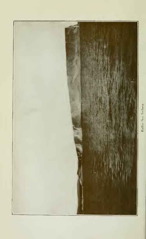
CRUISE OF THE MINNIE MAUD 311
records of the movements of the glacial ice noted by them was the
distribution of erratic boulders. These observations have beensummarized by Dawson as follows: "Along the Arctic coasts,
and among the islands of the Archipelago, there is a considerable
volume of evidence to show that the main direction of movementof erratics was northward. Thus boulders of granite supposedby Prof. Haughton to be derived from North Somerset are found100 miles to the northeastward, and pebbles of granite identical
with that of Granite point, also in North Somerset, occur 135 mi-
les to the northwest. The east side of King William Land is also
said to be strewn with boulders like the gneis of Montreal island,
to the southward. Near Princess Royal Island, in Prince of Wa-les Strait, and also on the coast of Prince of Wales Island, the cop-
per said to be picked up in large masses by the Eskimos may besupposed to be derived from the Cambrian rocks of the Copper-mine River region to the south, as it is not probable that it oc-
curs in place anywhere in the region of horizontal limestonewh^re it is found."Much of this drift is however carried from place to place in the
Arctic sometimes a thousand miles from the place of origin, byisolated icebergs which are driven by the wind and current fromone island to another as an instance of this on the top of a hugeiceberg, which stood 100 feet out of the water and w as 45 acres in
extent and which was frozen in and spent the winter in Eclipse
Sound, opposite Salmon River, several large gneis boulders con-taining we found hornblende, mica and feldspar, with undistur-
bed earth and loose pebbles on top of them. Boulders ^'ound
along the Arctic shores may have travelled from a long way off
before being dropped from a tilting or broken iceberg.
Centre of Glaciation.—how writes: "From a study of the diffe-
rent sets of glacial striae, Tyrrell concluded that the centre of gra-
vitation was, in the early part of the glacial period, somewhere tothe north and west of the head of Chesterfield inlet; that later,
when the ice incresaed in thickness, the centre of the dispersionmoved to a position southwest of Baker Lake; while as the glacier
diminished, the centre moved nearer the seashore, and the final
stage was probably represented by the ice-cap breaking up intoa number of distinct glaciers, each with a local movement of its
own."'These conclusions of Tyrrell as to the southern movement of
the centre of glaciation were borne out by Mr Low's observationsalong the shores of Roe's Welcome, where the direction of thestriae showed that the earliest accumulation of ice in the regionnorth of the western side of Hudson Bay was somewhere to thenorthwest; this was followed by an abrupt change in the ice-mo-vement, as the ice-cap gradually shifted, by way of north, to north-
312 CRUISE OF THE MINNIE MAUD
west. Mr Low is of the opinion that the centres of dispersion weremrch greater in area than the limits placed upon them by Tyrrell.
Labrador ice-cap.—"This southern movem.ent of the centre ofdispersion of the ice is diametrically opposite to what occured in
the case of the ice-cap of Labrador, where the striae along the east
side of Hudson bay show that the centre of ice-movement chan-ged from a position near the central area of the peninsula, a shortdistance north of the southern watershead, to one some three hun-dred miles north, in the vicinity of the headwaters of KoaksoakRiver.
"The glaciation of Labrador seems to have been later than thatof the western side of Hudson bay, as the striae from the westernglacier are almost obliterated by those from the east and north-east along the rivers south of James Bay.
Ice in Hudson Bay
On this subject. Low writes: 'The mainstream of the Arctic cur-
rent passes southward across the mouth of Hudson strait, andforms the northern current of the Atlantic coast of Labrador. It
bears on its surface the wide stream of ice which in summer formsthe "middle pack"ofBafFinba3', and which later in the year, beginn-ing late in October, passes the mouth of Cumberland gulf andFrobisher ba^', and in November or nearly in December closes theeasthern entrance to Hudson strait. At that time a considerablearea of this northern ice may enter the eastern part of the strait,
but is prevented from completely filling the strait by the imountof locally formed ice already covering its waters. Continuingsouthward on the current, this stream of ice, often upwards of
fifty miles in width, blocks the coast of Labrador during the early
months of the year, and by the end of March arrives off thecoasts of Newfoundland, bearing on its surface an immense num-ber of newly born seals to make the important fishery of New-foundland. Part of this ice is carried through the strait of Belle
Isle into the northern portion of the Gulf of St. Lawrence, whilethe greater portion passes south along the east coaft of Newfound-land to Cape Race. Here the western part of the ice is deflected
to the westward along the southern shores of the island, and fi-
nally enters the southern part of the Gulf of St. Lawrence, whilethe remainder is soon melted in the warmer waters of the Atlanticsouth of Newfoundland.
Ice forms in Hudson Bay.—"Ice commences to form in thesmaller bays of the northern parts of Hudson bay and HudsonStrait early in October, and by the end of that month the northernharbours are frozen over. The more southern ones, especially
those of the mouths of the large rivers, do not close until late in
November or early in the following month. By the beginning of
CRUISE OF THE MINNIE MAUD 313
January, James bay is frozen across, and at the same time solid
ice usually extends from the east coast of Hudson bay to the ou-
ter line of islands, some sixty to 70 miles from that coast. In
other parts of Hudson bay and in Hudson strait a margin of solid
ice usually extends from one to 5 miles from the shore except wherethe coast is high and bold with deep water close to the base of
the cliffs. In such places, especially at headlands, solid ice does
not form, and the natives in winter often have to make long anddifficult detours inland to pass them.
Hudson Bay does iiot freeze.—"The main body of Hudson bay
does not freeze solid, and the same may be said of Hudson strait
Although this is the case, these waters are quite unnavigable for
ordinary ships during the winter and spring months owing to the
great sheets of heavy ice borne backwards or forwards by the
tides and currents, and drifted about by the winter gales. Thereis a little doubt that a specially constructed ship for ice naviga-
tion might pass through Hudson strait at any season, but the
voyage would be a longone, and the difficulties and dangers wouldbe great.
Character of ice.—"If a single thickness of sheet-ice, writes Low
covered the northern waters (Hudson Bay) they would be com-pletely clear early in July, but unfortunately much ofthe floating
ice is "afted' ' or piled up, sheet on sheet, and the whole cemented soli-
dly together to form large masses often 20 feet or more in thickness.
This rafting is caused by the pressure formed by large masses of
ice driven together, or against ice attached to the shores, whichcauses the ice along the margins to break and buckle, cake oncake. These pressure areas are often of considerable size, andusually are many times longer than broad. They serve as a fra-
mework to hold together large fields of single sheet ice. Whenthe thinner ice melts, these pressure masses remain, and are dan-gerous to shipping until the water has become sufficiently warmto melt the ice cementing the cakes together; then they are harm-less and fallto pieces with a great commotion, but with little dan-ger. This désintégration is known as "calving"."The northern ice which occasionally enters Hudson strait in
the early part of the winter as before described, is much morecomplicated and much heavier in character than the local ice.
Some of this ice may be met with in the earlier period of naviga-tion to the eastward of Big island, and should be treated withrespect. The icebergs included with it often remain until late
in the season, and form a source of danger in foggy weather, butthey are usually so few as to be negligable, especially in thewestern half of the strait".
Early navigation.—The Diana, a Newfoundland sealing steam-ship, built especially for work in heavy ice, was chartered by the
314 CRUISE OF THE MINNIE MAUD
Canadian Government in 1897 for the purpose of testing the pe-
riod during which Hudson strait is open for navigation. Dr Ro-bert Bell, of the Geological Survey, accompanied the party. TheDiana sailed from Halifax on June 3rd, and passed through Belle
Isle strait, where the first heavy ice was encountered. On theway northward along the Atlantic coast more or less delay wasoccasionned by the heavy pack drifting southward,and the east-
ern entrance of Hudson strait was not reached until the 22nd of
June. Further delays by ice, especially in the neighbourhood of
Big island, near the middle of the strait, prevented the Diana frompassing into the open water of Hudson Bay until the 12th of July.
Returning immediately, an attempt was made to land Dr Bell's
party in the vicinity of King Cape on the eastern side ofthe mouthof Fox Channel, but owing to the great quantity of heavy ice
about Salisbury and Nottingham islands and to the northward, it
was found impossible to do so, and the ship was headed east, to
land the party at the first convenient place on the southern shore.
This would go to show that the entrance of Fox Channel is notclear of ice before the month of August.
CURRENTS IN HUDSON BAY
Direction of Currents.—"Some knowledge of the currents writes
Low, is desirable in discussing the navigabihty of Hudson Strait
and Hudson Bay, for on them largely depend the character andamount of ice met with in these northern waters. Observationson the drift of the ice that covers the Arctic Seas point to a gene-
ral law governing the currents. This law, briefly stated is nomatter what the size, shape and direction of one of these northern
bodies of water n\a.\ be, the direction of flow of the current will
be such that one facing with it will have the land on the right hand.This may be differently stated by saying that with bodies of wa-ter having a general north-and-south trend, the current will flow
north on the east side and south on the west, while in east-
and-west bodies the direction of flow will be west on the north
side and east on the south side.
"The current flowing westward along the north side of the Hud-son Strait sweeps northward up the east side of Fox Channel,round the head of that large northern bay and then flows south-
ward along the east side of Southampton, bringing with it the
heavy ice from the northern parts of Fox Channel, so that heavydrift ice is almost always found to the north of the eastern en-
trance to Evans strait, and often comes suflTiciently south to
partly block the channel between Mansfield and Coats islands."
Fox Channel.—The Eskimos of Igloolik stated that the east andcentre of Fox Channel are quite clear of ice during the months of
August and September, I)ut that the southerly currents of Fury

CRUISE OF THE MINNIE MAUD 315
and Hecia Strait and the deflection south of the northerly cur-
rent which flows along the western shore of Baffin Land sweepsthe ice on the shore and blocks the entire east coast of Melville
Peninsula from Cape Arlagnuk to Frozen Strait, which also wasParry's Experience.
West shore of Hudson Bay.—"The current from the north along
the western shores of Hudson Bay is not important as regards
navigation, as it comes from the narrow waters of Roe's Wel-come and does not transport a large quantity of field ice.
Currents m Baffin Bay.— "Similar currents follow the shores
of Baffin Bay and Davis Strait; on the east, or Greenland side,
the flow is northward, while along the west side or that of the
Arctic islands the current is southward, and carries on its surface
great quantities of heavy field ice formed in these northern wa-ters, together with extensive masses of Arctic ice which have pas-
sed south or east through the wide sounds connecting the northern
parts of Baffin Bay with the Arctic ocean. Many icebergs dis-
charged from the northern glaciers are also found in this heavyice of the middle-pack of Baffin Bay and Davis Strait. This Arc-
tic current closely follows the eastern shores of Baffin island,
branches of which sweep into Cumberland gulf and Frobisher bay.When it reaches the latitude of the mouth of Hudson strait, thepart adjacent to the land turns westward through the channelbetween Resolution island and the north shore of the strait, whileanother stream sweeps westward around the island of Resolu-tion, where, meeting the current flowing out of the strait, thestrong cross currents, tides and "overfalls"' noted by the earhestnavigators are formed".
Navigation of Hudson Bay and Straits
Period of Navigation.—Commander A. B. Low, in command of
S. S. Neptune, who wintered at Furlerton in 1905-06 said that theperiod of safe navigation for ordinary iron steamships throughHudson Strait and Hudson Bay to Port Churchill may be takento extend from July 20th to November 1st. This period may beincreased without much risk by a week in the beginning of theseason and perhaps by two weeks at the close.
Captain Bernier reports in 1904 that Port Churchill is often
stiff open in the first weeks of November, and could easily bekept open with an ice-breaker if desired.
Hudson strait and Hudson bay do not freeze soHd, but are so
covered with masses of floating ice as to be practicaffy unnaviga-ble for at least seven months in the year. The ice does not beginto melt until weH into the month of June, and it is not sufficiently
melted for safe navigation with ordinary steamers until the mid-dle of July. No ice is formed in the strait and bay sufficiently
316 CRUISE OF THE MINNIE MAUD
heavy to obstruct ordinary navigation until the latter part of
November, but towards the close of this period there is dangerfrom the early passage of the northern pack from Baffin Bay andDavis Strait across the north of Hudson Strait, and, also, to amuch less degree from Fox channel partly closing the western en-
trance to the strait.
Captain Adams who has frequented Hudson Bay and the north-ern waters in command of a whahng ship for 35 years, says thatthe strait of Hudson is navigable in round numbers for aboutfour months every year. Captain A. B. Fisher stated that hehad visited the strait and baj^ several times on different vessels
since 1864 and that in his judgment the strait can be navigatedfrom 3 to 33^ months each year by steamers for commercial pur-poses. Mr Beach, who spent 1905 and 1906 at Churchill states
that a steamer left Port Churchill on October 24th'1905 and madethe trip across the bay and through Hudson Strait to St. John's,
Newfoundland in eleven days. The straits were wide open until
that date. The bay is open all the year round and was still openwhen he left on January 3rd. The average date for the closing
of navigations for the eastern entrance of Hudson strait is aboutthe last days of October; while the opening of Port Burwell is
about July 15th. In the spring of 1905 Capt. Bernier reports
that he left FuIIerton Harbour about the 5th of July in the Cana-dian Government ship "Arctic" and he encountered ice fields
outside of Churchill, 60 miles north; a strong steamer could havepassed through and have entered Port Churchill. In the 3 suc-
cessive years, 1905, 1906 and 1907, he entered FuIIerton on Octol^er
16th and saw no field ice in the strait but saw a couple of icebergs.
There was no ice in the bay, and the ice in the harbour of FuIIerton
was only 4 inches thick.
Aids to Navigation.—With the proper aids to navigation the
dangers would not be so great during the fall. With wireless te-
legraphy at a station at the entrance of Hudson Bay, the openingof navigation could be made in the first week of July; by infor-
ming the steamers which side of the strait to pass on so as to find
clear navigable water. In this way much detention would besaved in the first part of the month of July. There is no doubtthat the strait is navigable four months of the year, with suitable
steamers; and that Hudson Bay is navigable for one monthlonger, though there is a large field of ice in the bay, which is theoutput of the land ice, and is over the year's formation, throughwhich a suitable steamer would have to pass to reach Port Chur-chill.
Fogs.—When the temperature of the air falls several degreesbelow zero, as it does in November, a thick mist or fog rises fromthe open water and renders navigation somewhat dangerous. In
CRUISE OF THE MINNIE MAUD 317
the early part of the season before the ice has completely melted,
fogs are hable to occur in proximity to the ice-fields. At other
times fogs are not prevalent, and the weather is ordinarily fair.
The worst storms occur from the south and east, and these are
usually accompanied by rain in the summer, and by snow later
in the season. Northerly winds bring clear cold weather as a rule.
September weather.—Mr Tyrrell when tra\"ening in canoes
along the west shores of Hudson Bay, from Chesterfield Inlet to
Port Churchill in September 1894 reports the weather in that
month as being constantly overcast with a dull, leaden sky andin the latter days of the month it snowed every daj'. The fresh
water ponds were frozen over and the subarctic winter was rapi-
dly closing around them; and ice formed on their paddles in the
clear cold wind.
Navigation oj Hudson Strait.—"Ships entering Hudson Strait,
from the Atlantic during the early part of the season writes Low,when ice is present in the strait, should keep in the northern half
of the channel between Resolution and the Burton Islands. Careshould be taken to keep some miles from Resolution, as the strong
currents close to the island cause the ice to come together andopen again with considerable violence. The north side of the
strait should be followed as far as Big island, keeping at a respect-
ful distance from the land in order to avoid pressure when the ice
is pressed on the land by southerly winds. There are frequently
large quantities of ice in the neighborhood of Big island with at
times considerable pressure; on this account ships should not ap-proach close to the island. From Big island the course shouldbe so laid that the ship may pass a few miles to the northward of
Charles island, and from there the middle channel should be fol-
lowed to pass between Nottingham island and Cape Wolsten-holme. The southern side of the channel between Mansfieldand Coats is usually freer of ice than the north side.
In passing eastward through Hudson Strait advantage shouldbe taken of the favourable current on the south side, and thatshore followed to Charles island, where the channel to the southof the island may be used, taking care to keep well away from themainland until Cape Weggs is passed. The southern half of thecentre channel should then be followed to beyond Big island,
when the mid channel across the mouth of Ungava bay will pro-
bably be found clear of ice.
Eastern Entrance.-—The heavy tides of Ungava Bay exhaustthemselves in the passages between the Button islands, and, in
doing so, cause very dangerous currents. Gray strait, lying bet-
ween Cape Chidley and the inner Button islands, would form anexcellent ship canal, if it were not for these strong currents whichcause a dangerous sea when the tide is running against the wind

318 CRUISE OF THE MINNIE MAUD
especially when the wind is eastward and the Atlantic swell
heaves into the strait.
At present the Eastern part of Ungava Bay has not been sur-
veyed; it is studded with unknown islands, even the Button Is-
lands are more numerous than what they are on the chart. It
requires skilful navigation on account of the strong tide comingin and out of the strait, as the soundings are very deep even close
to the shore; a sharp look-out has to be constantly kept and the
position must be verj- accurate.
CLIMATES OF HUDSON BAY
Climate.—Samuel E. White in his "Tale of the North" gives
the following good description of the climate in the regions roundHudson Baj' : In summer is a world of riotous vegetation, of pro-
digal bloom, of droning insects, calling birds winnowing butter-
flies, and the warm gliding of rivers, with the suddenness of birth
summer spring from the womb of Labrador. July suns eat the
snows and spew the floods. July days stain the hillsides withmillions of ripened berries and scatter strange rare flowers throughthe valleys. Geese, ducks, loons and other waterfowl float down-ing broods upon the waterways. The osprey loads the younghawk through the air. The ptarmigan scurries a gray shadow^
trailed by little gray shadows, in the thick cover.
"Abroad in the land forage the Arctic fox, the black fox, the lynx,
the wolf, the bear, all ravenous, all predatory, seekers after the
weaker lives. For the beast who was stronger survived. Theone weaker fell. Thus the iron country worked out its iron course
of natural selection, called its chosen, standardized its strain.
All by summer moved the vast herds of caribou, hundreds of
thousand strong in annual migration.
Winter.—"But now the bitter winter has come and he whojourneys the Barrens in Winter sets himself a Titanic task, for
every mile of the waste has to be literally won. Before winningeach mile, it is necessary to thrust back the grim, unseen antoga-nist. Here was the season that thrust crises upon all living
things, the Winter, the final lash to smite down the frail. Fromthe Height of Land of Ungava Bay will be waged a battle for
existence. From Hamilton Inlet to the East Main would the
conflict spread. How well the Barrens deserved its name? In
it was no movement, sound, or life except that which came to it
extraneousl.y. The snow fell upon it, the w^ind howled over it,
daring feet crossed it ociëasionally, but organically it was dead.
Its plane lay relatively flat, tilting like a lid. In its vast loneli-
ness, entirely without contrast or detail, it seemed the dull, pul-
seless surface of a planet that has cooled.
"As if their watching drew the storm, it fell howling at the
CRUISE OF THE MINNIE MAUD 319
close of the blustery afternoon. All night a terrific gale rockedthe camp, pelting like stinging drift of hail. The storm wasswooping swiftly. The sledge track was filled with swirling snow.The wind began with terrific pressure to lift Lavergne's bendingfigure. Each bellowing gust threw him back to the perpendicu-lar, held him there, buff^eted him from side to side, and by a sud-
den withdrawal of its strength almost pitched him on his head.
Continually it charged and retired erratically, until at last it pou-red in a steady, ever increasing blast, a perfect torrent of windwhose only suggestion was greater fury behind. The sun wentout, cHnching with the storm giants which rioted across his zone,
and the ruthless feet of those giants made all the Barrens smokePallor, gloom, night fell over the world like three successive blan-
kets. The unearthly tempest put such a pressure upon things as
bore them to the ground. All outer space might have been a gi-
gantic funnel and all the winds of all the worlds herded into it to
blow upon him at the funnel spout.
"All the next day it raged and another and yet another. Thenthe heavens showed brittle, cold and clear. The wind had pac-ked the snow solid. The frost was intense.
"Driving the huskies with a long whip made of twisted hide,
they left the silent, sealed river and headed into the silent, sea-
led hinterland. Above, below, behind, before was silence, awe-inspiring, deadly. The commotion they aroused in passing, madedog pant, snowshoe crunch, sled creak, echoed faintly in the in-
terminable void.
"As they quitted the spot which had been their temporaryabode and forged on where was no abode, where was nothing butsnow, the sky, and the cold, the spirit of the wild asserted itself.
They had the impression that amid the white loneliness theywere not alone. A presence, vague, inimical, strong, was outagainst them. The foe they had defied, whose fuel they had bur-ned, whose meat they had plundered, whose waters they hadtrespassed, was at last arisen. That foe was giving a hint of its
might."Small wonder, then, that the storm-driven, snow-bound. Es-
kimos hold, Tornarsuk, the Storm Fiend, in fearsome awe anddread that outweighs belief in a more powerful Deity.
Resources of Hudson Bay
Mineral resources.—The mineral resources of Hudson Bay, sofar discovered, are:
Gold.—In Wagner Inlet discovered and reported bv Dr Rae in
1553: and Mr Caldwell in 1903.
Iron.—In the Nastapoka islands, reported by Dr Bell and MrA. P. Low, of the Geological Survey of Canada.

320 CRUISE OF THE MINNIE MAUD
Copper.—On the west coast of Hudson Bay, south of Chester-field inlet, reported by J. Burr Tyrrell.
Graphite.—Extensive bands, or veins of this mineral were dis-
covered by Mr Caldwell to the south of Port Burwell along theeast shore of Ungava bay.
Mica.—On the north side of Hudson Strait at Lake Harbour,where work is being carried on by a Scotch Compan\- in connec-ting with the whaling steamer Active In 1903 thirteen tons ofexcellent mica were taken out of the mine during the summermonths.
Coal.—There is none in Hudson Bay.
Gold arid Diamonds.—Prospectors in 1912 reported havingfound placer gold and diamonds along the banks of the EastmainRiver that flows into the east-side of James Bay, but nothingfurther has, apparently, been found in corroboration of the ru-
moured discovery. The Jesuits have also reported the existenceof Indian legends as to their existence.
Silver.—A small quantity of silver is found in the galena, whichoccurs in pockets in the limestone along the whale river coast onthe east side of Hudson Bay. Low states that the amount of ga-lena is small, and so widely scattered that it would probably beunprofitable to mine even under favourable circumstances.
Aluminum Clay.— Is also reported to exist in large quantitiesin the vicinity of the Eastmain river.
Magnetic Pyrites.—A considerable amount of" magnetic py-rites was found in the squeezed diabase rocks along the east
coast of Hudson Bay, but careful analyses failed to show any- thatcontained Gold, Nickel or Copper^ and Low reports that it is highlyprobable that no important deposits will be found in the basic
rocks on that side of the bay.
The fisheries.—The fisheries of Hudson Bay will probably pro-
ve to be its greatest natural resource, as along the east-coast thesea is found well stocked everywhere with food fishes. In JamesBay a net set at randon along the shore or about the islands al-
ways caught fish: these are usually sea-run brook trout and whitefish identical with the Lake Superior white fish and being sea-run
are, like the trout, much improved in flavour. These trout andwhite fish vary in weight from one to six pounds and are the best
of food-fish. Similar fish are found abundantly along the entire
coast to Cape Wolstcnholme. The Arctic trout or Hearne sal-
mon is found along the northern coast as far south as Seal Riverwhich is situated a few miles south of Cape Jones. This is abeautiful fish, with well flavoured, dark-pink flesh and it varies

CRUISE OF THE MINNIE MAUD 321
in weight from one to 15 pounds, the average being about five
pounds. These fish are salted at Fort Chimo on Ungava bayand sold at nearly the same price in London as salted salmonfrom the same locahty. They are very plentiful about all of thenorthern rivers and along the coast, while the Eskimos report
them abundant at the Belcher and other islands lying off the east
coast. There is no doubt that this fish equals or surpasses in co-
lour and flavour the salmon of British Colombia. Cod are knownto exist in Hudson Bay, being taken at Cape Smith and at CombHills in James Bay bv members of the Low expedition. The Es-kimos also catch them in Nastapoka Sound and at the BelcherIslands; at a number of places in James Bay they are also takenby the Indians.
The specimens of cod taken by Low were not very large but themen who caught them were Nova Scotia fishermen and they said
that they were true cod and identical with those taken on theGrand Banks. Food for these fish is abundant in Hudson bayand there is no reason why extensive fisheries in this Canadianisland sea should not exist. The undoubted presence of cod in
Hudson bay deserves investigat on, as a very valuable and ex-
clusively Canadian fishery may be formed there. The presencaof cod points to that of hahbut in the deeper waters of the bay.The only other salt-water foodfishes in Hudson bay are a cou-
ple of species of sculpin which are eaten extensively by the Eski-
mos. Sturgeon are caught in the lower parts of the southern ri-
vers to the East Main river and lake trout occurs in the mouthsand lower reaches of the northern rivers. The Atlantic salmondoes not appear to enter Hudson bay, as no record could be ob-tained of its doing so from the Eskimos. Its range in the Arcticwaters of Hudson strait seems to limit it to the rivers on the westside of Ungava bay. A curious coincidence in connection withthis range of the salmon is that the ouananiche or land-lockedsalmon has never been found in Hudson bay, although commonin the rivers of the northern, southern and eastern watersheds ofLabrador.
White Whales.—^Tlie Hudson Bay Company formerly conduc-ted successful fisheries of the White whale or white porpoise(Kellulauak, Eskimo) in the mouths of the Great and Little Wha-le rivers on the east side of Hudson Bay, but after some successthe whales would not enter these rivers over the nets, and thefisheries were abandoned. Great numbers of white whales havebeen seen in the mouths of the rivers to the northward of Little
Whale river, notably so in that of Nastapoka.
Whales.—The northern and eastern part of Fox Channel arestill unexplored, and owing to the large masses of ice found therealmost continuously, and to the numerous shoals and reefs in
322 CRUISE OF THE MINNIE MAUD
the known parts, it has never been a favorite place for whalers,
its waters being the only portion of the bay where the whales havebeen left undisturbed. The whales are known to enter HudsonStrait early in the spring; they have been captured along BigIsland in April and May, and at the western end of the strait
in the latter part of May. They then crossed to the west side
of the bay along the edge of the open water, being found in Juneand early July along the land-floe on both sides of the southernpart of Roes Welcome. As the Welcome clears of ice they proceednorth to Repulse Bay, and still later, pass through Frozen Strait
into Fox Channel. Late in the autumn they again pass throughHudson Strait going eastward. By far the greater number of
whales taken in Hudson Bay have been killed in the vicinity of
Whale Point near the southern entrance to the Welcome.Some whales are supposed to remain during the winter in the
waters of Hudson Bay, as they have been reported by the Eskimos,as being seen in the depth of winter off Mansfield and some of
the more southern islands of the east side of the bay.The future of the whaling industry appears to be very gloomy.
The annual catch is decreasing regularly, and only the high price
of whalebone makes it at all profitable. No certainty of a single
whale can be had, and the enterprise is reduced to almost a gam-bling chance. None of the whales now killed possess the precious
whalebone. They are also of comparatively little value for oil,
and when hunted by steamers in conjunction with shore factories,
where all the products can be turned to profitable account, as is
done in Norway and Newfoundland, and at Sept-Isles in the
Gulf of St. Lawrence, can the chase for whales be made profitable.
These whales include the Big Finner, which gives very little oil;
the little Finner and the Humpback whale, whose whalebone is
very short and a poor quality, and the blubber is poor and gives
little oil. The very valuable Right or Greenland whale is pract-
ically extinct.
Future of Hudson Bay.—These undeveloped resources of thenorth will no doubt, when developed add greatly to the annualshipping of Hudson Bay, but the main increase to the fleet will
be due to the products of the great plains of the North-West,now rapidly filling with robust settlers. These products of the
western farms, grain, butter and cattle, will naturally seek the
shortest road to the European markets; a road not only shorter,
but owing to its cool climate, capable of landing perishable productsand grain in a better condition than the more southern routes.
Given a good harbour such as that of Churchill, and an adequatenumber of tramp steamships, there will be no difficulty in remov-ing from that port during the season of safe navigation all the
grain and other supplies that can be drawn there by a single line
of rails.

cruise of the minnie maud 323
Hudson Straits
Hudso7i Strait, North Coast.—Dr. R. Bell visited the northshores of Hudson Strait in 1884 and 1885, and again in 1897,when he made a close examination of the coast from the neigh-
bourhood of Big Island to Chorkbak inlet near Gordon bay.Dr. Bell describes the prevailing rocks of the southern shore of
BafTm islands as consisting of well straitfield hornblende andmica-gneiss, mostly gray in colour, but sometimes reddish, inter-
steatified with great bands of crystalline limestones, parallel
to one another and conformable to the strike of the gneiss, whichin a general way may be said to be paralled to the coast in theabove distance.
The northern shores of Hudson Strait along its western half
although bold are not high, and the interior probably does notreach a general elevation of 1,000 feet. To the eastward of Bigisland the coast becomes higher, and the land rises slowly inland
to elevations of 2,000 and 3,000 feet. The coast is not surveyedand is dangerous to shipping on account of the numerous shoals
and rocky reefs that fringe it.
Dr. Bell in 1897 reported: "The whole coast is rugged andfor the most part mountainous. The innermost islands inter-
lock with the bays and points of the mainland in such a mannerthat it is impossible to know without the aid of a guide whetherone has reached the main shore or not. So that the interveningchannels cannot be seen, the eye fails to detect any difference
between the general appearance of the islands and the mainland.The outer islands, which are also the smallest and most scattered,
represent the more completely sunken hills, while as we proceedinward the progressingly larger and larger ones represent theless and less submerged areas and ranges, until, at last, we find
onh" narrow channels of the sea running into the solid land.
Besides these narrow and sometimes tortuous channels, numerouswide and tolerably straight fiords run inland. These generallyhave high hills on either side of them.
Hudson Strait, South Coast.—-Ancient crystalline rocks occupythe entire coast-line from the mouth of the George river at UngavaBay to Cape Wolstenholme at the western entrance of HudsonStrait. In passing westward from Ungava Bay the granitepredominates along the coast, and the areas of the altered beddedrocks and their accompanying traps are much smaller, and areso intimately intruded by the granite that it is very difficult
to separate them. Large masses of these basic rocks occur alongthe coast in several places between Cape Hopes Advance andDouglas harbour, most noticeably about Wakeham and Fisherbays, where quartz veins are numerous, and carry considerablequantities of sulphides.
22
324 CRUISE OF THE MINNIE MAUD
Graphite.—Extensive bands, or veins, of this mineral werediscovered by Mr. Caldwell to the south of Port Burwell alongthe east shore of Ungava bay. Graphite has also been foundin the neighbourhood of Cape Wolstenholme, and along the east
side of Baffin island, but no attempt has been made to developany of the outcrops. Mr. Trembla}' reports the existance of
an abundance of graphite in the mountains on the northeast
side of Tremblay sound, North Baffin Land. An attempt wasmade to mine graphite at the island of Blacklead in Cumberlandgulf but the enterprise was soon abandoned.
Mica.—A Scotch whahng firm has worked a mica mine at
Lake Harbour, on the south side of the Hudson Strait. A numberof white men are brought to the place from Scotland in the early
summer by the whaling steamer "Active"; and they, with theassistance of the Eskimos, work the mine, and then return homein the fall. In 1903, thirteen tons of excellent mica were takenout in this manner. A mica mine was opened some years agoon the west side of Cumberland gulf, but for some reason wasshortly after abandoned. Low says: "Other deposits of this
mineral will probably be found on that coast to the westwaidin association with the crystallinehmestones so largely developedthere."
Port Burwell.—Port Burwell, at the southern side of the east-
ern entrance to Hudson Strait, is an excellent habour, sheltered
from all but the south-west winds, and, even with these, distant
capes break the force of the wind and sea. The harbour hes onthe western side of Gray strait; and about 15 miles from capeChidley. It was originally discovered by Commander A. B.
Gordon who erected one of the observation Stations therein 1885.
The surrounding country, although low in comparison with that
to the southward, is rugged, with steep rocky cHffs, that rise from100 to 500 feet above the water of the harbour. There is Httle
level ground in the neighborhood, and the trading post estabh-
shed there is situated in a small inside harbour, which can not beseen from the anchorage. In the outer harbour there are fromeight to fifteen fathoms of water. The water rises 19 feet in
spring tides, and 14}^ feet in neap tides. It is the best sheltered
harbour in the neighborhood, and it is also the easiest of access.
With a light at the mouth of the entrance, there would be no diffi-
culty for a stranger to find the harbour, and it would make a fine
place of call for vessels going in or coming out. At present theeastern part of Ungava Bay has not been surveyed; it is studdedwith unknown islands, even the Button islands are more nume-rous than they are on the chart. It requires skillful navigationon account of the strong tide running in and out of the strait, thesurroundings are very deep even close to the shores, a sharp

CRUISE OF THE MINNIE MAUD 325
lookout has to be constantly kept and the position very accurate.
There is only one strait runnings out of Ungava Bay, to the ocean;
it is called .\IcLeLan Strait, in which a very strong current runs
during the latter part of the tide. No vessels should attemptto go through this strait without the aid of a local pilot; as there
is a rock about three-fourths of the way eastward, marked by a
tide ripple, on which a vessel would be liable to touch, but there
is sufficient room to pass on eithre side. The tide is yery strong
on the western entrance, but is more regular on the eastern side.
Moravian Mission.—In 1904 the Moravian Brothers boughtfrom Messrs Job Brothers, of Newfoundland, their fishing andtrading establishment at Port Bunvell, where cod and seal are
plentiful and a large trade in fur, skins and salmon is carried onwith the Eskimos of Labrador .The Missionaries have built a
church there, and in 1904 there were besides the members of theMoravian Mission, seventeen families of Eskimos living there,
all of whom are devout Christians. The Eskimos on the Labra-dor coast in charge of the Moravian Mission, number about 1200souls and derive their living from hunting and fishing seal, trout
salmon, codfish, foxes, polar bears, wolves, martens, otters, minks,etc. The Moravian Nlission has been established for more than150 years, and the natives have all adopted Christian mannersand customs. Two steamers from the Hudson Bay Companyand two steamers of Revillon Bros of Paris call regularly at PortBurwell in the summer months and a mail reaches the Missionmonthly, during the summer, by the coast of Labrador, and twiceduring the winter overland with dog sledges.
The south side of the mouth of Hudson Strait, during the sea-
son if ice, is much less embarrassed than the northern side; as arule Port Burwell is free of ice early and late in the season.
Wakebam Bay.—Wakeham Bay is the safest and best harbouron the south coast of Hudson Strait. The coast rises abruptlyfrom the shore and increases in altitude as Wakeham Bay is ap-proached, where, on the east side of the entrance, a rounded hill
rises 1800 feet directly from the water and must be a prominentmark from far to seaward; the other hills along this part of thecoast vary in altitude from 800 to 1500 feet.
Wakeham Bay is 20 miles long at its mouth it is nearly 2}/^ mi-les wide, gradually narrowing to a little over a mile about 3 milesfrom the entrance. The water of the approach is deep, and theonly obstruction to free navigation are two small islands, nearlycovered at high tide, one of which lies about two miles north-eastof the western head and the other three miles due north of theeastern side of the entrance. There is plenty of room betweenthem, and they should not be dangerous when approaching thebay. The eastern aide of the entrance is formed by a rocky pe-
326 CRUISE OF THE MINNIE MAUD
ninsula 600 feet high, with a small lake in the middle. Beyondthe narrows the bay averages 3 miles in width for 10 miles; theremainder of the upper end being less than a mile wide. A fine
protected harbour out of the run of the tide and consequent!}^
free from the danger of quickly moving ice was found just inside
the peninsula, with good anchorage in from 15 to 25 fathoms op-
posite the low sandy neck. There is no current in the cove andthe ice pressure in winter is only from the wind.
Ungava Bay and Labrador
Ungava Bay, West Coast.—Dr. Bell explored Ungava bay in a
small yatch in August, 1897. He described Cape Hopes Advanceas about 300 feet high and rising boldly out of the water, butsouth of it, the coast is much lower and irregular hills rarely ex-
ceed 200 feet in altitude. Thick fog appears to hang nearly
constantly about Cape Hopes Advance, a circumstance causedby the warmer currents of water and air from Ungava Bay meet-ing the colder currents of the strait. But there was little fog in-
land. The bottom of the sea along the coast was covered withgreat quantities of kelp, and dredging produced three new small
fishes, a sponge an anemone, a shrimp, some corals, and a fewshells.
Shallou\ rocky coast.-—-For about eleven miles south of the capelow rocky islands form a fringe about four miles wide along the
coast. The water between the islands is very shallow, so that
at low tide many of them are joined together and to the main-land. For the next twenty-eight miles the islands gradually die
out, but the shallow water continues and the bottom being un-
even is very dangerous on account of the great blocks and boulders
scattered over it. The coast is low and broken only by detachedirregular hills never over 200 feet high. The country is covered
with drift to a considerable extent and the floats are dotted withmany small ponds, the breeding place of ducks and wading birds.
There are no large streams, the ponds being drained by a net-
work of brooks. Great numbers of Eiders were seen nesting onthe islands.
The appearance of the bay at this point at low-tide was start-
ling. The bottom was entirely exposed for about three miles
outside high-water mark and was formed of low rocky ridges
with mud flats between them, while everywhere boulders of all
sizes were strewn about. Sailing southward for another five mi-
les they searched for upwards of an hour for sufficient depth of
water to anchor in; and thev finally found a hole between a num-ber of small drift-covered islands with forty feet of water at high-
tide. At half-tide the current between the islands was so strong
that the yacht surged to and from and was in danger of breaking
CRUISE OF THE MINNIE MAUD 327
adrift, or dasliing against the hummocks of boulders which for-
med the sides of the hole. Fortunately, as the tide became lowthe shallows about became dry and the current slackened, so
that when the yacht grounded for upwards of an hour it was quiet
water. This is an example of the great rise and fall of the tide
in Ungava bay, and of the danger in navigating its shallow waters,
where the tide falls an inch a minute, and where, in consequence,
if a boat grounds in falling tide it is impossible to release her until
the water rises again. On the Plover islands close by great flocks
of these birds were met with, together with thousands of gulls,
sea-pigeons and eider ducks. The coasts in the vicinity is lowand flat like that previously described, and the shallow waterextends several miles out from shore.
Payne Bay.—On August 15th they proceeded twenty miles
further south, passing among the islands formed of rock and drift,
separated from one another and from the low shores by shallowwater, and arrived at a rocky headland called Tuvalik, on thenorth side of Payne Bay, where they found an Eskimo Encamp-ment. They sailed up the bay, passing in shallow water overmuddy flats and some time was spent examining the rocks of
the mainland and islands, which were found to contain large
Quantities of iron-ore.
Payne River.—They then worked their way out of the bay(nearly dry at low tide) and afterwards ascended the PayneRiver, and anchored in thirteen fathoms of water six miles fromits mouth. Next day, piloted by the Eskimos, they raced upstream, treble-reefed, ahead of a gale and made over 25 milesin lesfe than three hours, where a bar of huge boulders, stretchingdiagonally across the stream, barred further progress. Caribouwere plentiful in the hills, which rise about 600 feet above thestream and which are rough and rocky, consisting of granitemantled with clay up to an elevation of 300 feet. The climateseems to be less rigorous than along the coast, as the willowsgrow to bushes several feet high, instead of only rising an inchor two from the ground as on the sea-shore. Numbers of largetrout were seen swimming in the eddies. Atlantic salmon werealso abundant in the river.
Payne Bay.—Payne Bay is fourteen miles across at its entranceand gradually narrows to about three miles at the mouth of theriver, which is eleven miles to the west ward of Tuvalik, andthe bay is generally shallow and dotted with islands and boulderyshoals. There appear to be two deep channels leading fromthe mouth of the river towards the sea, one on either side of agroup of five islands about three miles off the mouth. The deepwater extends beyond the islands, but outside, in line with thecapes, there appeared to be a number of low bars and shoals
328 CRUISE OF THE MINNIE MAUD
which practically block the entrance to the river for large vessels.
The Eskimos said that far inland from the Payne River andsouthward the country is lower and flatter than the highlandsof the coast, and that the extensive plains are dotted with lakes
and covered with much better growth of vegetation, affording
excellent feeding-ground for immense herds of caribou.
Low shores and shallow waters.—On August 20th, they sailed
southward along a low flat coast, being gradually forced off shoreby the shallowness of the water, which never exceeded five fathomsand at times less than three fathoms. For twenty miles theypassed between a number of low rocky islands, lying from five
to ten miles off the mainland. Eight miles further south the coast
is rocky, having isolated hills 200 feet high, but generally lowand flat. From here the course was south-south-east for seven-teen miles to Cone island, only 140 feet high but very conspicuousamong the surrounding low islands. They anchored in deep waterbehind some small islands six miles to the south-east of Coneisland.
Hopes Advance Bay.-—\\ hile looking for a harbour they enteredthis bay and found it verj- shallow. The mouth of the bay is
blocked by large islands with shallow channels between them,through which the tides rush in and out with great violence,
rendering the bay quite unnavigable for large ships. A river
nearly as large as the Payne River is reported to flow into thehead of Hopes Advance Bay. The next day they sailed through alabyrinth of islands which were named the Cyrfalcon Islands
from the number of those birds seen. From the southern limit
of the islands they crossed a bay called Leaf River Bay.
Leaf Lake.-—Leaf River Bay is about eight miles wide at
its mouth, but narrows to three miles across some ten miles up,
where is the entrance to Leaf Lake, a body of salt water dividedfrom the ba^^ by a deep narrow strait walled in by rocky cliffs.
The lake is about fifty miles long and ten miles wide, and the
Leaf River flows in on the west side almost opposite the outlet,
and is a considerable stream having a volume about equal to thePayne River. Salmon are not known to enter this river. Barren-ground caribou are always plentiful on the plaiiis inland alongthe course of the stream, where willows and arctic birches growabundantly as large bushes, and are the only tree of the region,
the northern limit of spruce and larch being still further south.
A small vessel called the "Fox" was sent annually by the Hudson'sBay Company from Fort Chimo to kill white porpoises in thelake.
Stony Point.-—^The south side of Leaf River Bay is totally
different in character from the north shore being formed of granite

CRUISE OF THE MINNIE MAUD 329
rock; there is an absence of islands and the water is shallower
gradually deepening to about five fathoms off shore. StonyPoint is a rocky hill about 200 feet high, with a number of rockj-
knolls outside, which become islands at high-tide, with hugemasses of rock scattered ever\"\vhere. The water is very shallow
for two miles outside the point, and for five miles beyond the sea
breaks upon a number of boulder shoals.
Coast north of Koksoak River.—From Stony Point the coast
stretches for fifty-five miles along a low and almost unbrokenshore to the mouth of the Koksoak or Ungava River, This part
of the coast is low, with only three or four islands of shingle close
to the shore and separated from the mainland by shallow channelsdry at low-tide. This water deepens slowly to about five fathomsa mile off shore, and there appears to be very few shoals outsidethat limit except towards the mouth of the Koksoak river, wherea number of rocky islands and shoals extend outwards from the
north point for more than a mile. Other shallow places in themouth of the river render an entrance hazardous without the aid
of a pilot.
Fort Cbimo.—-The Hudson's Bay Company Post at Fort Chimois thirty miles up the Koksoak river, and is the most northerly
post of the Company in Labrador, being situated in latitude
SO*' 08'N. or just inside the tree limit. The fort is located ona low terrace on the south bank, facing a small cove and oppositethe highest safe anchorage for sea-going ships. The post consists
of about a dozen small buildings, the greater number of whichaie made from imported lumber as the trees of the region aretoo short and small to be of much use for building purposes. Thepermanent inhabitants are the usual officers and servants ofsuch a post, and these with their Eskimos, wives and childrennumbered in 1896 about twenty-five persons in all.
Indiaii trade.—Trade is carried on with the Indians, who live
along the tributaries of the Koksoak, and with the Eskimos alongthe coast of Ungava bay and Hudson strait as far west as CapeWolstenholme. The total number of Indians trading at anddependent on Fort Chimo, is about 150. They belong to theNascaupee tribe and speak a dialect of the Crée or Algonquinlanguage. They are a poor, degraded people, without thrift or
forethought, and as a rule, very lazy, being caribou hunters theycan hardly be induced to trap fur-bearing animals. They dependwholly on the herds of barren-ground caribou for their food andclothing, and sell a certain number of caribou skins not requiredfor their own use as food and clothing, with a few furs, to theHudson's Bay Company for powder, shot, tea, sugar and tobacco,which comprise all their necessaries of life. Foxes both whiteand the varieties of the red species, form their principal fur hunt,

330 CRUISE OF THE MINNIE MAUD
but Otters are also taken, and in early spring they make excursionssouthward into the wooded country for marten.
Eskimo trade.—The Eskimo trading at Fort Chimo are about140 families, or 700 persons in all; but less than half of themvisit the post, as the more northern families send in their furs bya few able bodied men who travel with dogs on the ice alongthe coast to and from the post in the spring. The Eskimo trade
IS chiefly in deer, seal, fox, white bear, wolf and wolverene skins,
walrus ivory, seal and porpoise oil.
Fisheries.—^The Company also engages in the salmon andporpoise fisheries along the lower Koksoak and in the WhaleRiver to the south, and Leaf River to the northward. In 1896 thesalmon fisher\' was poor, the catch being far below the averageand only equal to half the catch of the previous year. The por-
poise fishery is small and would be abandoned if it did not give
employment to the Eskimos during the summer season.
Vegetation.—The trees in the valley below the Kaniapiskanare all small, and consist nearly exclusively of black spruce andlarch, with only a few clumps of balsam poplar on the low sandyislands of the upper reaches. The trees cover the bottom lands
and grow about half way up the hillsides about the Forks, butas the stream is descended they become smaller and are onlyfound on the lower parts, and finally die out about fifteen miles
above the mouth of the Koksoak river, the only remaining veget-
ation being small arctic willows, birches and shrubs.
Climate.—The climate of this region totally unfits it for agri-
cultural purposes. At Fort Chimo, lettuce, radishes and a few-
small turnips are grown with a great deal of care and attention.
The rivers break up in the interior about the first week in June,
but the ice does not leave the large lakes before the end of that
month. The snow of the previous winter remains in all sheltered
gullies fronting the north throughout July. During the day the
temperature rises to 70^ Farh., but the nights are always cold
and severe frosts are common, throughout July and August; ice
a quarter of an inch thick having been noted during the night of
August 8th. Snow falls about the middle of September, and bythe end of the month the ground is permanently covered, and the
small ponds are frozen over; the rivers being closed by the middle
of October. The following are the mean temperatures fromthree readings daily taken at 6 a. m., noon and 9 p. m.: July 50. 7FAugust 54. IF.; September (1 to 11) 42. 8F.; Light rains and sho-
wers are frequent during the summer months, but the total rain-
fall is not great; during July and August rain fell on 40 days. Theprevailing winds of summer are from west and north-west, andthey are generally accompanied by clear weather, with passing
showers.
CRUISE OF THE MINNIE MAUD
Wbale River.—The channel up to the post varies from a mile
to a mile and a half in width and is full to the banks at high-tide,
but at low-tide, bare mud-flats occupy over two-thirds of the
width, with the deep channel considerably below their level.
The post is situated at the head of navigation, there being shal-
low rapids only a short distance above it, where the influence of
the tide ceases. The river has a volume about equal to the PayneRiver on the Gatineau River at Ottawa, and drains a large area
of country to the southward, between the Koksoak and GeorgeRivers. It rises in large lakes about 200 miles inland, on one of
which the Hudson's Bay Company formerly had an outpost, men-tioned as Eriandsen's Lake post in Mc Leans narrative entitled
"Notes of a Twenty-five Years Service in the Hudson's Bay Ter-ritory", London 1849.
The banks of the Whale River are generally low, with terraced
drifts behind and highlands in rear of post, where the hills rise
about 500 feet and are partly wooded with small black spruceand larch, the woods extending nearly to the mouth of the river.
The post at \\ hale River is merely a fishing establishment andsmall trading station for the natives in the vicinity, consisting of
three small buildings. The salmon fishery in the lower part of
the river was formerly a paying industry, but has been graduallydecreasing and in 1897 was almost a total failure, as were thefisheries in the Koksoak and George rivers.
Coast between Koksoak and Wbale Rivers.—The coast betweenthe mouths of the Kodsoak and Whale Rivers is generally low,with a range of hills extending from the mouth of the former,stream south-east about the head of False River Bay (so called onaccount of having been often mistaken for the mouth of the Kok-soak) to the mouth of the \\ hale River. False River Bay is se-
veral miles long and about three miles wide at its mouth, but is
so shallow that it cannot be navigated even by small craft.
A line of reefs, bare at low tide, extends northward from theislands at the mouth of Whale River to end beyond a large island
called Saiglorsoak, that lies sixteen miles outside. This island is
surrounded by a cluster of smaller ones, all high and rocky andforming good marks in steering for Koksoak River. Saiglorsoak
is about five miles long and should be kept well to the southwardas the reefs continue some miles beyond it.
Coast East of Whale River.—The coast east of the Whale Riveris generally low with an occasional rocky point. The water is
very shallow everywhere for two or three miles off shore. Thereare a few rocky islands scattered along the shore, but they are
surrounded by water too shallow to afford harbours betweenthem. There are two long bays extending inland, but they are
very shallow and nearly dry at low-tide and quite unapproacha-

332 CRUISE OF THE MINNIE MAUD
ble. The margin of low land varies from one to five miles in
width; beyond it the country consists of rocky hills rising from500 to 1000 feet, the hills are broken by deep river valleys and mi-nor streams.
George River.—The George River is a large stream, second onlyto the Koksoak; it drains a wide area of country to the south-w^ard, extending from the western slopes of the Atlantic rangeto the Whale and Koksoak drainage-areas on the west. It rises
in large lakes of Central Labrador, in the vicinity of the fifty-
fifth parallel of north latitude, close to the headwaters of the
North-west and Hamilton rivers which flow eastward into Ha-milton Inlet. Beacon island is the largest of the group lying ofF
the western point at the mouth of the river, and is situated abouttwo miles from Gull island, which is connected with the shore at
low-tide. The width of the main channel is three miles at the
mouth. The Hudson Bay post is situated in a cove on the east
side of the river twenty three miles from Beacon island. Thepost consists of the usual three or four small houses built on the
side of a hill that rises sbout 700 feet above it. The opposite side
of the cove is bounced by a similar hill, and the situation is
very desolate especially at low-tide when the bottom ofshmymudand boulders is bare out to the river a mile away. A few stunted
trees grow along the banks of a large brook which flows into the
upper part of the cove. The post is kept up chiefly for the sal-
mon fishery and for the trade with about 20 families of Eskimosliving along the eastern shore of Ungava Bay. All the goods are
landed with boats at the post more than a mile away, and as this
can only be done when the tide is more than half in, the ship al-
ways tries to be at George River near the time of highest tides.
There is a great difference in the appearance of the river at high
and low-tide. When the tide is high the water reaches to the
foot of the bold rocky shores generally without a beach, while at
low-water a wide-margin of boulder-strewn mud intervenes bet-
ween the channel and the rocky banks. The hills about the
mouth of the river range from 100 to 400 feet in height. As theriver is ascended there is a gradual increase in the general eleva-
tion, so that above the narrows the hills are from 500 to 1,000
feet high, and the general level of the country is close on 500 feet.
Small spruce trees are first seen a short distance above the east-
ern end bond, and the forest becomes quite thick and continnousin the river valley about ten miles above the post. The influence
of the tide extends to a rapid some ten miles beyond the post, andabove it the river varies from a quarter of a m le to a mile in
width and is very swift, flowing in a shallow channel with nearly
continuous rapids but no actual falls. It is navigable with boatsfor about forty miles above the post.
Iron ores.—"Mention has been made" writes Low, "of the iron
CRUISE OF THE MINNIE MAUD 333
ores on the west shores of Ungava bay, on the north side of the
Payne river. The rocks in which these ores are found have beenaltered by the intrusion of granites. They now consist of quart-
zites, mica-hornblende schist and crystalhne limestone, and are
the metamorphic representatives of the unaltered iron-bearing
rocks of the interior of Labrador peninsula and the east coast of
Hudson bay. In locahties where the rocks are unaltered the iron
ores occur either as carbonates in a cherty rock, or as a mixtureof magnetite and haemetite intimately associated with chert andjaspar. At Payne river the iron-bearing beds have a thickness
of 420 feet. The upper 70 feet is a light-yellow fine granular
quartzite containing patches of ankerite and lime. Towards the
top the rock shades to a dark bluish-gray, from the presence of
large quantities of magnetite in small flattened grains, together
with small scales of specular iron. These are usually mixed with-quartz with evidence of foliation, and at other places are in large
masses of nearly pure ore. Underlying these beds is 350 feet of
dark-bluish slaty quartzite holding considerable magnetite andhaematite, and shading upwards into a barren quartzite. Mostof the ore of this locality would probably require separation andconcentration from the admixed quartz before being of a gradesufTiciently high for smelting. The position of the deposits onthe west side of Ungava bay, where the tide rises and falls forty
feet or more, is not very promising for shipping."
Labrador.—Labrador will probably never support a large po-pulation, for the climate is not conducive to the production of
crops and the land is very rocky and for the most part mountai-nous; but there is wealth to be developed in its minerals and fromits forests and fisheries; and there are great cataracts and water-powers there that will, when harnessed generate almost unlimi-
ted electric powers. One of them is the Grand Falls on the Ha-milton river, one of the great water-falls of the world, and it is to
be harnessed, according to recent reports, for the production of
nitrogen. A concession has been granted by the government to
a company and it is estimated that a million horse-power can besecured. In this case nitrates will soon be coming from Labra-dor to fertilize the almost exhausted soil of sections of the earth
that have been thickly populated for centuries, and when further
improvements are made in the electric smelting of ores, the enor-
mous water-powers will doubtless be applied to reducing the im-mense deposits of iron-ores in Hudson Bay.
B A FEINS Islands
The territory now known as Baffin Land, until about 1875, wassupposed to consist of different islands known as Cockburn Is-
lands, Cumberland Islands, Baffin Land, Sussex Islands, Fox

334 CRUISE OF THE MINNIE MAUD
Land, etc. It is now established that these are all connectedand that there is but one great island, comprising them all, towhich the name of Baffin Land has been given. It forms thenorthern side of Hudson Strait, its southern extremity being in
Lat. 61® 42'N., opposite Cape Chidley, and it extends in a north-
westerly direction to latitude 74o 'N., on Lancaster Strait. It
has a lenght of about 1,005 English statute miles with an averagebreadth of'305 miles, its greatest width being 500 and its least 150miles. Its area approximates 300,000 square miles, and it there-
fore comprises about one tenth of the whole Dominion of Canada.It is the third largest island in the world, being exceeded only by-
Australia and Greenland. It was until recently, called Cock-burn land although it had been named Baffins Island or Baffin
Land by Lieutenant (afterwards Admiral) W. E. Parry in 1821,
out of respect to the memory of that able and enterprising navi-
gator".
Grinnell Glacier.—The southern extremity of the island; is co-
vered by the Grinnell Glacier, between 70 and 100 miles in lengthfrom southeast to nortwest, between Lat 62"^^ and 63°, with abreadth of about 20 miles. The smooth summit of the glacier is
distinctly visible from vessels in Hudson Strait in certain condi-
tions of the weather. One narrow stream of ice is said to reachthe waters of the strait. The existing charts represent the north-
ern side of the glacier sending ice down at two or three places into
the head of the Frobisher Bay. The Eskimos called the Grinnell
Glacier, Ow-u-i-to, and the Eskimo guide of Dr. Bell knew of onlyone place, called Pak-a-Iui-a, where it discharged into the sea, notfar from the north-west of Resolution island. There are no gla-
ciers discharging into Fox Channel or Hudson Bay.
East Coast.—The eastern coast of Baffin Island is generally
high and rocky and has never been accurately surveyed and char-
ted. The land rises quickly from the sea, often in abrupt chflFs,
to elevations of a 1000 feet or more, after which the upward slope,
is more gentle as the land rises towards the interior table land.
T!ie general elevation of the table land, to the south of Cumber-land Gulf, ranges from 2000 to 3000 feet, while to the northwardthis wide coasted area is much higher, reaching a general eleva-
tion of 5000 feet, with hills rising above that perhaps one ot twothousand feet higher. Inland, to the south of Ponds Inlet, the
general elevation does not appear to exceed 3000 feet, and to the
westward along Fox Channel, is considerably lower.
The western side of Baffin island is as yet unexplored, and all
information concerning it has been obtained from the Eskimos.They describe the coast as generally low, and much the same in
character as that of the limestone islands of Hudson Bay. Thecrystalline rocks appear to form the south-west coast of Baffin
CRUISE OF THE MINNIE MAUD 335
land for some distance beyond King Cape on the east side of FoxChannel, when they give place to a wide area oflowlandsextend-ing nearly to the head of Fox Channel, where the crystalline rocks
again form the higher lands to the north and east of Fury andHecia Strait.
The western interior of the northern half of Baffin Land, whichis known on the chart as Cockhurn Land, is described by the Es-
kimos as a rough plain, probably less than 1000 feet in elevation
diversified by rolhng hills with numerous lakes in the valleys bet-
ween. This country is well covered with an Arctic vegetationwhich provides food for large bands of barren ground caribou.
There are no musk-oxen in Baffin Land there are two large lakes
in the lower country of the south-western part of the island, called
Nettilling and Amadjuak; both are upwards of a hundred miles
long, and are said by the natives to abound in salmon and fresh-
water seal. A short rapid stream connects these two lakes, andLake Nettilling connects with Fox Channel by a wide stream,called the Koukdjuak about 60 miles in length that is said by theEskimos to be capable of being navigated by vessels of shallowdraught.The natives told Dr. Boazthat this river was a very large stream
with numerous rapids. Old Peter, a Cumberland Sound native,
living at Ponds Inlet told us that the upper part had little cur-
rent while in the lower part the current was more rapid. Theaverage descent is probably 5 or 6 feet per mile. Lake Nettil-
ling or Kennedy is about 250 feet above sea-level and about 150miles long and 60 miles wide. Lake Amadjuak is about 120 mi-les long by 40 in breadth and 290 feet above the sea-level. It
connects with Lake Mingo to the south by a small stream, witha moderate current, up and down which the natives paddle their
Kayaks. Lake Mingo is 300 feet above sea-level and fifteen mi-les in diameter and connects by a series of small lakes and streamswith Amadjuak Bay on the north coast of Hudson Strait.
Dr. Robert Bell of the Canadian Geological Survey visited
Amadjuak Bay in a small yacht in July 1897 and travelled northto lake Amadjuak, a distance of 50 miles in seven days. Thesoil consisted of till and dry heaps and ridges of sand and gravelwithout boulders or even large stones. The till was present in
the bottoms of valleys and partook of a gravelly and sandy na-ture rather than of clay. Most of the way was along the bottomsand sides of valleys, the course being crossed frequently by river-
lets of transparent ice-water.
No trees.—The rocks of Baffin island are principally Lauren-tian, and the climate is sub-arctic and the soil, in common withthe rest of the Arctic islands is destitute of trees, and agricultureis impossible.
Game plentiful.—In lake Amadjuak icebergs have been seen
336 CRUISE OF THE MINNIE MAUD
floating in its waters, which have broken off from glaciers on theeastern and southern mountains which enclose the lake. Thenatives from Cumberland Gulf, Frobisher Bay and the north sho-
res of Hudson Strait resort to the shores of these lakes annuallyto slaughter large numbers of barren ground caribou, which are
found m large bands on their favorite feeding grounds in the lowlands that encompass the lakes to the north and west. At the
mouth of the large Koukdjuak river that flows from lake Nettilling
into Fox Channel about Lat 66*^ 30'N., and just within the Arctic
Circle, the sea-shore is sandy and the waters of the long bay are
shallow with a sandy bottom, covered with clams and other sea-
shells on which walrus and seal feed in large numbers. Ptarmi-gans and Arctic hares and large flocks of migratory birds are also
found there, and Polar bears along the high mountains shore to
the south of Cape Dorchester.
South shore, Baffin land.—The northern shores of Hudson strait
along its western-half, although bold are not high, and the inte-
rior does not reach a general elevation of 1000 feet. To the east-
ward of Big island the coast becomes higher, and the land rises
slowly inland to elevations of 2000 to 3000 feet.
Direction oj Ranges.—The mountains of Baffin Land may begrouped as three principal ranges, all running north-north-west-erly nearly parallel to the eastern side of the island and the west-
ern coast of Greenland, the north-eastern or outmost range beingthe highest and the south-western the lowest.
Elevation oj the High Lands.—^According to Dr. Franz Boas, the
high interior of Baffin Land, lying just north of CumberlandSound, is apparently all covered with ice like the interior of Green-land. Around the margins of this ice-cap the general elevation
above the sea is about 5000 feet, and it rises to about 8000 feet in
the central parts. Another area of smaller extent, but apparentlyequal by high, lies a short distance to the north-west of theone just described. The high land, mostly ice-covered, lying
north-east of Cumberland Sound and stretching over to ExeterSound, is probably at least 5000 feet high. Large portions of
the northern interior are over 1000 feet above the sea, often nea-
rer 2000 feet, while the higher parts of these areas may be 2000or more. The mountain region between Frobisher Bay and Cum-berland Sound appears to have an elevation of between 2000 to
3000 feet.
Graphite.—Graphite is found abundant and pure in several is-
lands situated on the 65th, parallel of atitude, in Cumberlandgulf, and on the west side of Davis Strait. At Cape Durban, onthe 67th. parallel, coal has been found by the whalers. Coal also
is found at Salmon River on the South shore of Eclipse Sound.
CRUISE OF THE MINNIE MAUD 337
C. F. Hall brought home a considerable collection of rocks andminerals picked up during his explorations about Frobisher bayand the southeast coast of Baffin island. These were named byProf. B. K. Emerson, and consist of ordinary Laurentian rocks,
including granite, gneis and schists. The minerals were magne-tite, apatite, bornite and pyrite from Frobisher and Cyrus Field
bays.
Silliman's Fossil Mou7it.—Lower Silurian limestones werefound in a small outlier at Silliman's Fossil Mount near the headof Frobisher bay. This locality was visited in 1897 by a partyfrom the Peary Arctic Expedition of that year. In the course of
a few hours they obtained 54 species of fossils from this locality,
which were later named by C. Schuchert of the United States Na-tional Museum. The only known occurence of Silurian limestoneon the eastern side of Baffin island is at Silliman's Fossil Mount,near the head of Frobisher bay, where the limestone forms a hill
1000 yards long and 350 feet high, resting almost flat upon thecrystallme rocks. Seventy-two species were identfiied by Schu-chert from fossils brought back from this locality; and 28 of theseare not known to occur elsewhere. The majority of all the speciesor 57 per cent, correspond with those of the Galena or Trentonformation of the Minnesota and Manitoba region, while 17 areknown to occur in the Trenton of the Ottawa valley and the Sta-te of New York. About 20 of the species are now to palaeonto-Iog3' and most of these are described and figured in Prof. Schu-chert's paper. He adds: "The lithological similarities of theMinnesota Galena and Silliman's Fossil Mount, light-coloredshales predominating in both areas, may explain in a large mea-sure the close identit}' of these widely separated faunas. Thelittle fauna likewise brings out the fact that the corals, brachio-pods, gasteropods and the trilobites are slow in their evolutionalchange, and the species can therefore spread over very large areaswhile the cephalods, and particularly the pelecypods, are moresensitive to change and are thus restricted to localities... TheBaffin Land fauna had an early introduction of Upper Siluriangenera in the corals, Halysites, Lyellia and Plasmopora. In Ma-nitoba similar conditions occur in the presence of Halysites, Fa-vosites and Diphyphyllum. Other Upper Silurian types do notappear to be present".
Southampton Island
Southampton Island.—Southampton Island is situated in thenotrhern part of Hudson Bay, which it divides into Fox Ghannelon its east-side and Roes Welcome on the west, and is separatedfrom the mainland at its northern end by the narrow FrozenStrait. The island covers three degrees of latitude or 210 miles
338 CRUISE OF THE MINNIE MAUD
from north to south and is 200 miles wide at its grestest breadth.It is triangular in shape and has an area of 19,000 square miles.
The greater part of the island is composed of flat-bedded limes-
tone, causing the southern and western shores to be generally lowand flat, with a margin of shallow water extending several milesfrom the land. Along the eastern side a land of crystalline gneis-
ses, schists, and granites entends from Seashore Point to the northend of the island, and this forms much high land with bolder wa-ter adjoining than is found elsewhere. The rocks near the junc-
tion of the Archaean with the Silurian limestones at Seahorse are
largely a very quartzose, light grey mica-gneiss holding graphite
in small flakes, the rusty colour being due to the decompositionof small grains of pyrite disseminated through the rock. Thisgneiss appears to be similar to the sillimanite gneis of the Gren-ville series of Southern Canada. The gneiss is cut and twisted
by masses of a coarser granite-gneis pink to red in colour, withnearly feldspar and smoky quartz, all are cut by dikes of feldspa-
thic pegmatite containing niuch of the pearly feldspar. Flat
lying beds of light coloured yellow and drab limestone occupythe lowlands and western parts of Southampton Island. Fossils
from the beds forming the southern half of the west coast of theisland containing a fauna closely resembling that of the LakeWinnipeg basin and extend over a period from the Cambro-Silu-rian. to high up in the Silurian.
Game abundant.—-The western shores of Southampton are low.
The land behind rises in a succession of ridges each a few feet
higher than the one immediately in front. These ridges are for-
med of broken limestone. Very little vegetation grows on the
ridges, but in the wide depressions between them there is a profu-
sion of grasses and other arctic plants on the waste ground sur-
rounding the many ponds and lakes found there. The shores
and islands of these lakes are the breeding grounds of a numberof rare birds, among which may be mentioned Sabine's Gull, Arc-
tic Tern, Whistling Swan, Hutchen's Goose, Snow Goose, Jager,
Little Blue Crane, and Red Phalarope. Caribou are plentiful in
the interior and are, according to the Eskimos, very fat in the
summer time. Walrus abound in great numbers in Roes Welco-me and along the northern coast.
Dangerous Coast.—The water in Roes Welcome is usually very
shallow for 2 or 3 miles from the land, and reefs of limestone ex-
tend much farther out. About Cape Kendall dangerous reefs
are found at least eight miles from the land.
Formation.—Low writes: "Sealhorse point is the junction of the
granite and gneisses with the Silurian limestones. There is here
a marked difference between the southern limestone area and the
northern country, underlain by crystalline rocks, with its typical

CRUISE OF THE MINNIE MAUD 339
long, low rounded hills, lying in roughly parallel ridges, and separ-
ated by wide shallow valleys dotted with lakes and ponds, or
filled with coarse boulder clay, with boulders scattered in profu-sion everywhere. This land, although high by contrast with thelimestone country, seldom reaches an elevation of 500 feet, andthat only far inland, there is one conspicuous peak, which rises
like a great sugar loaf, far inland, its snow-capped summit of thelightest-blue."
The limestone country.—"The limestone country occupies all
the southern p^rt of this great island, and also underlies the large
islands of Coasts and Mansfield farther to the south. The samephj'sical characteristics prevail wherever the limestone is found.The low shores are bounded by gradually deepening water, brokenby dangerous reefs that extend several miles from the land.The country rises very slowly inland, from the shores, in a suc-cession of low, broad terraces, each a few feet higher than the onein front. These terraces are covered to a depth of several feet
by broken limestone, which affords perfect drainage, and in con-sequence the surface is so dry that it will not even support a co-vering of the hardy Arctic plants. This absence of vegetationleaves the monotonous light-yellow shingle quite unrelieved byany dash of other colour, and the general view is one of dry deso-lation, much worse than that of the hilly country. The lime-
stone region never reaches an elevation of one hundred feet
than walking distance of the shore."
North-West Coast - Hudson Bay
North-west Coast.—The rocks seen along the shore betweenChesterfield and Winchester inlets are largely a flesh-red to pinkmica-hornblende granite gneiss. These are associated with brokenbands of dark-gray or red gneisses, usually very quartzoesand containing a considerable quantity of mica and hornblende,the latter often partly decomposed to chlorite. These gneisseshave evidently been cut and broken by the intrusion of the gra-
nite-gneisses. Many veins of pegmatite cut all these rocks; it
consists chiefly or red or violet feldspar with much quartz and in
some places large crystals of black hornblende. The granite-
gneisses are also most abundant inland, as was seen by Low alongthe lower part of Chesterfield inlet and in the country forty milesinland from Winchester inlet.
The granites occupy the shores and islands between Winches-ter inlet and the west side of Island bay, about half way to Ful-lerton, when they give place abruptly to a series of dark schists.
These schists are largely micaceous, out there are also frequentbands containing considerable quantities of hornblende, andthese are more basic than the more common mica-schists, which
23
340 CRUISE OF THE MINNIE MAUD
always contain quartz in varying amounts. Man\' of the basic
bands contain varying quantities of pyrite, but it was never seen
in sufficient abundance to constitute a mine. All the schists
carry dark-red garnets, some of which are regular in their crys-
tallisation and of good size.
Fullerton Harbour.—The islands about FuIIerton harbour are
formed partly of granite and partly of these dark schists. Areasof coarser rocks now occur in the rocks along the coast, usually
in the form of coarse gabbro, but often in a more altered condi-
tion as coarse hornblende-gneisses. The granite are the prevai-
ling rocks along the coast as far north as the mouth of Wager inlet
and have generally a red or pink colour. Associated with themand evidently altered by their intrusion are patches of gray quart-
zose, gneiss, and less frequently areas of old basic intrusive rocks.
Wager Inlet.—The explorations for minerals by Dr. Rae endedat Repulse Bay which was discovered first in 1742 by CaptainMiddleton who was sent by the British Admiralty to look for a
north-west passage. Capt Middleton also discovered WagerBay in the same voyage. All the geological informations concern-
ing the western coast of Hudson Bay to the northward of Wagerinlet is contained in the narratives of the voyages of Parry andDr. Rae. The latter reported only Laurentian rocks along the
coast, with granite-gneiss predominating, these being accompa-nied by considerable areas of greenstones, showing the rocks in
the northern part to be very like those along the southern shores
of Roe's Welcome. The granites prevail about Wager Inlet, butthere are more and larger areas of the dark basic rocks aboutthat great bay than to the southward, especially as these basic
rocks generally carry sulphides and Rae reported free gold to
have been found about the head of the inlet. Mr G. F. Caldwell,
who accompanied Mr. Low's expedition in 1903-04 made a sledge
journey to the head of Wager Inlet and also found traces of gold
in the rocks of that region.
The entrance to Wager Inlet is very narrow and full of dange-rous whirlpools owing to the swift tides which rush through it
and which do not freeze over in winter. The native village of
Aivillig lies about 20 miles north or the entrance opposite somesmall islands in Roe's Welcome, where whales and walrus are
plentiful.
Fox Channel.—Fox Basin lies in the middle of a very exten-
sive flat through of horizantal limestone, surrounded in a general
way on all sides by high Laurentian hills. The Spicer islands in
the centre, in latitude 68° North, are composed of light-grav
quartzose gneis, some of it holding purple garnets.

cruise of the minnie maud 341
'West Coast - Hudson Bay
Character of Coast.—The western coast of Hudson bay is lowand flat. It rises very slowly from swampy shores, while the wa-ters deepen slowly, and there are numerous shoals and bars thatextend for a considerable distance from the shore-line and rendercoastwise navigation dangerous. This character of coast extendsfrom the southern end of James Bay to beyond the mouth of theChurchill harbour. Further north the character of the coastchanges semowhat, being still low, but much more uneven in
outlines, with a corresponding unevenness in the sea-bottom.Beyond Eskimo point, in 61° N. latitude, the straight shoreof the southward gives place to a ragged coast-line, broken bylarge bays, and fringed with rocky islands having shallow w'ater
between them, and a broken bottom very dangerous to naviga-tion. On this account, and because of the danger of outlyingshoals, and strong currents, the navigation of Chesterfield inlet
and that of the other northwestern bays and harbours is debar-red from consideration from a commercial and shipping point.
The mouths ot all the large rivers to the southward of Churchillare more or less blocked by deposits of sand and clay with bars or
flat shoals with river deposits at their mouths. Only small craft
can enter these rivers and larger ships are obliged to lie outside in
the dangerous roadsteads usually several miles from the nearestdry land.
Huronian rocks.—Tyrrell reports that on his journey south-ward from Chesterfield inlet to Port Churchill he found Huro-nian rocks occupying the west shore of Hudson Bay for a distanceof nearly a 100 miles. At haphazard landings along this shorestraces of copper deposits were found in a number of places, andsystemathic search would probably lead to important discove-ries in this area.
Copper deposits.—Of these deposits Tyrrell reports as follows:
"At a point northeast of Rabbit island the character of the shoreschanges, and dark-green Huronian schists crop out from be-neath the boulders.
Mispickel diabase.—"North of Rabbit island is a high point,on which the Eskimos are accustomed to camp while waiting for
the traders from Churchill. The point is composed of green cal-
careous, chloritic schist, striking south SS'^ W., at an angle of 60°The schist is cut by a dike 75 feet wide, of massive green, highlyaltered diabase, containing a large amount of mispickel. Thisdiabase also outcrops along the shore, where it encloses manybands of schists.
Quartz, calcite and copper pyrites.—"The rock at the Point south
of Corbett inlet is a massive green, fine or medium grain diabase,
342 CRUISE OF THE MINNIE MAUD
which is now altered almost entirely into a mass of chlorite, espi-
dote, zoisite, and calcite. This diabase is out by many small
veins of quartz and calcite, holding copper pj'rites arsenopyrite
and chalcopyrite.
"On the northern shore of Mistake Bay, nine miles west of
Term point, is a long point of similar diabase. Seven miles fur-
ther southwest, about the middle of the west shore of Mistakebay, is a similar point of similar dark-green diabase, containing
in many places large amount of copper pyrites, and cut by small
veins of quartz studded with iron pyrites.
Two miles south of Sir Bibby island is a prominent rocky point
with a high rocky island, lying a short distance off it. From this
prominent point the shore turns westward, and is bold and rockybeing composed of dark-green diabase, studded with copperpyrites.
Churchill to Cape Esquimaux.—The coast between Churchill
and Cape Esquimaux is described by Tyrrell as follows: "On the
low flat shores of Hudson Bay between Seal river and Cape Es-
quimaux few rock exposures occur, but those seen consisted of
granites and gneiss of typical Laurentian aspect. For forty mi-
les north of Cape Esquimaux no rock in place was seen, and thencenorthward to Baird bay some of the points consisted of granite
and gneiss, though the shore generally consisted of Huronianrocks".
Marble Island, Quartzites.—Marble island is composed of hardwhite quartzite, which is composed of more or less rounded grains
of quartz, of moderately regular size cemented together with in-
terstitial silica. These quartzites, says Tyrrell, are very distinc-
tly bedded in thick or thin beds, and the surfaces of the beds also
often show distinct false-bedding. These quartzites are proba-bly the base of the Huronian rocks on the mainland. Tj'rrell
thinks that it is not improbable that this Marble island quartzite
is the oldest part of the Huronian in the region near the shore of
the west coast of Hudson Bay.
Inland.—On the west coast of Hudson Bay Tyrrell, when des-
cending the Doobawnt or Telzoa River in 1893, came across thelast grove of black spruce a few miles south of Doobawnt Lake in
Lat. 63*^ N., where the trees were so stunted tliey were not headhigh. In the river at this point, opposite the grove, he caughtsome fine salmon-trout and white fish, the former weighing as
much as ten and a half, and the latter as much as S}4 lbs. Thebanks of the river, of red till and boulders, were low and sloping
and rose to awide grassy plain, on which large herds of barren-
ground caribou were grazing. One vast herd estimated to con-
tain 200,000 deer was seen on the shore of Carey Lake. These
CRUISE OF THE MINNIE MAUD 343
deer were migrating southward toward the edge of the woods,
where they would spent the winter.
Tyrrell made the following entry in his journal: "After paddling
up Carey Lake for five miles, directing our course to a high point
with a large boulder on its summit, afterwards called Cairn Point
we saw an immense herd of caribou (Rangifer Groenlandicus),
moving along the east shore. We at once paddled towards the
land, and found the deer standing on low wet grassy land near
the water, at the foot of a long stony slope. Here were deer in
abundance, and near at hand was a grove of small black spruce
and tamarack, which would furnish fuel to smoke and dry as
much meat as we could carry, July 30. Yesterday was the best
clear warm day that w^e had had for a long time, but to-day is
also clear and warm, with a gentle breeze blowing from the west.
We spent the day skinning and cutting up the fattest of the bucks
that we had killed yesterday. Our camp is a hundred yards from
the lake, near the edge of a bog, with a scattered grove of larch
and small black spruce, just behind us. All day the caribou havebeen around us in vast numbers, many thousands being collected
together in single herds. One herd collected on the hill behind
our camp, and another remained for four hours in the wet bog onthe point in front of us. The little fawns were running abouteverywhere, often coming up to within a ysLvd or two ofus, ulter-
ing their sharp grunts as they stood and looked up at us, or as
they turned and ran back to the does. About noon a large herd
had collected on the sides and summit of the hill behind us.
Taking the small hand-camera with which we were supplied, wewalked quietly among them. As we approached to within a few
yards of the dense herd, it opened to let us in and then formed a
circle round us, so that we were able to stand for a couple of hours
and watch the deer as they stood in the light breeze, or rubbedslowly past each other to keep off the black flies. The bucks,
with their beautiful branching antlers, kept well to the background. We obtained a number of protographs, which showthe animals in many positions. Later in the afternoon a herd of
bucks trotted up to us, and stood at about forty yards distance.
This was a most beautiful sight, for their horns are now full-
grown, though still soft at the tips, but unfortunately we had not
the camera with us. We did not shoot any to-day. Ptarmiganare very plentiful in the vicinity.
Animals.—Musk-oxen seemed to be confined to the countrylying between the Doobawnt river, north of Doobawnt Lake andthe west shore of Hudson Bay, Red, black and cross foxes rangeas far north as the northern limit of timber. Arctic foxes, wolves,gray and white, wolverenes range the Barren Lands. Martenare particularly abundant in the southern part of the region.
Otter are also found in the wooded countrv. Black bears are
344 CRUISE OF THE MINNIE MAUD
seen in the woods and Polar bears on the northern shore. Arctic
hares were found scattered over the Barren Lands. Moose werefound as far north as the Stone River. Water birds were scarce
in the interior, back from the shore. The Canada and RuffedProuse were fairly numerous in the wooded country. The Willowand Rock Ptarmigan were abundant in the summer time through-out the Barren Lands.
Fishes—Fish seemed to be everywhere abundant in the lakes
and streams. Lake trout and whitefish were the more abundantand valuable foodfishes; the latter being especially abundant in
Doobawnt lake, Pike and a species of sucker were seen. Tyrrell
considers it probable that some of the true salmon ascend thestreams of Northern Hudson Bay, although none were seen.
Chippewyan Indians inhabit the woods and inland Eskimos campalong the northern banks of the Telzoa and Kazan rivers.
Chesterfield Inlet.—Tyrrell explored Baker Lake and Chester-field Inlet in 1893 and gives the following description of the latter:
"On the evening of September 6th we entered the northern out-
let of Baker Lake, down which the water was flowing towards us.
For a moment it seemed as if we must have taken the wrongcourse, but we soon recognized that we had met the incomingtide, though the water was quite fresh. The tide therefore ap-pears to ascend as far as Baker Lake, though it does not appre-ciably affect the level of the lake itself." These falls, mentionedby Turreli, at the junction of Chesterfield Inlet and Baker Lakeare reversible and flow in opposite directions as the tide rises andfalls.
"Chesterfield Inlet is a long, narrow fiord extending 125 miles
westward from the north-west coast of Hudson Bay. Including
Baker Lake it has a total length of 210 miles. On each side are
bare, rocky slopes usually from 100 to 200 feet high. No sound-ings were taken by the writer, but the greatest depth marked onCaptain Christopher's chart made in 1762, is forty fathoms. Atits upper end, just east of Bowell island, the tide was found to
rise six feet, while at its mouth the rise of the spring tide is abouteighteen feet. At the rocky point southeast of Spurrell Harbourwhich is at the southern entrance to Chesterfield Inlet we foundthe latitude to be 62® 20' 10", and the variation of the compass10^ W".The country round Chesterfield Inlet consists of utterly sterile
rocky hills of coarse red granite or light-gray gneiss, often cut byveins of coarse pegmatite, mica-schist, coarse white granite andnarrow dykes of dark greenstone.
Loudon Rapids.—About twenty miles south of where the Doo-bawnt River enters Lake Aberdeen, in latitude 64", 27' 12, a nar-
row dyke of green diabase crosses the river, forming a heavy ra-

CRUISE OF THE MINNIE MAUD 345
pid, here called Loudon Rapid, after the President of TorontoUniversity. The diabase dyke cuts through a coarse red massiveandésite composed of a fine-grained micro-felsrtic groundmass,coloured by a number of rods and granules of iron ore, in whichare imbedded large phenocrysts of plagioclase, very much decom-posed. There are also a few crystals of light-green chlorite, with
dark borders of magnitite, and a few scattered crystal of apatite.
The rock is very much jointed, and breaks easily when struck.
Along the jointage planes it is often considerably decomposed,with the formation of a green-crust of copper-carbonate".
Wbart07i Lake.—About a mile and a quarter above WhartonLake Tyrrell found that the Telzoa or Doobawnt river flowed very
swifth over a ten-foot fall over a ledge of massive red and green
epidolic quartz-chorite which contained large crystals of plagio-
clase, with smaller intermediate grins of quartz and plagioclase,
biolite altered to chlorite, hornblende, epidote, apatite, and iron
ore altered to lencoxene. The western shore of the lake is a grassy
slope, rising to a terrace thirty feet above the water, or to
rounded grassy hills sixty feet high. From the foot of the slope
long points of boulders and masses of red quartz-porphyry andmottled red-sandstone run out into the water, and the shores
and hills are also largely composed of loose masses of red quartz-
porphyry. The whole character of the country suggests a mo-rainic area Laurentian gneiss appears at the north-west angle of
the Lake, behind a long island, and on the point just north of the
outlet of the lake is a rounded hill 230 feet high of white Huro-nian quartzite, seamed by narrow veins of white chalcedonicquartz.
Canot Cassé Rapid.—-Nine miles below Lake Marjorie and twomiles below Canot Cassé Rapid is a hill, 200 feet in height, com-posed of mottled, light-greenish, coarse diabase, made up of large
interlocking lath-shaped crystals of plagioclase, between whichis angite, largely altered to a light-green hornblende. With theseare crystals of apatite and a number of particles of copper-pyrites.
Angikuni Lake.—Tyrrell reports the existence of a small island
in Angikuni Lake on the Kazan River in latitude 62*, 20' N.,which is composed of highly ferruginous schist much reddenedby oxidation which could not be examined as it was held sacredby the numerous Eskimos camped in that vicinity. Anothersmall island close by was found to be composed of dark medium-grained diabase, containing much pyrite, cut by many veins ofwhite quartz. In the vicinity is a fine-grained dark mica-schist,through which the diabase is probably intruded.Where theHazan river leaves lake Angikuni, Tyrrell writes:
"It first spreads out over a wide bed of boulders, becoming veryshallow, and then contracts to seventy yards in width, and
346 CRUISE OF THE MINNIE MAUD
rushes as a deep rapid and almost straight stream, between bankswhich rise in gentle slopes from the edge of the water. Theseslopes are covered with grass and low willows. Many caribouwere lazil}' lying down or feeding among the bushes and turningtheir heads, they looked in quiet wonder as the strange appari-
tion of the two canoes that had penetrated the centre of their
northern home. The whole landscape seen in the early morninglight presented such a picture of wild but quiet beautj-, as I haveseldom had the good fortune to enjoy."
Port Churchill.—^The approach to the harbour of Churchill,
if aided by a few beacons and lights, would be comparatively
safe, as the channel of approach is fairly deep and wide. Onceinside the points of the mouth, the harbour extends up streamabout a mile, and has an average width of half a mile, with a
couple of shallow places in the upper part that might easily beremoved by dredging; the general depth of the harbour being
from 4 to 4^ fathoms.
For many years the Hudson Bay sailing ships and steamers
have sailed to Churchill, anchoring behind the beacon light;
for Churchill possesses an excellent natural harbour, deep andwell sheltered. Admiral Markham in his report stated that
"Churchill would some day be a famous harbour".
In 1886, Commander A. R. Corden made a survey of Chur-chill Harbour and he noted the soundings in fathoms at low
water. Outside the entrance of the harbour, the depth wasfrom 9 to 13 fathoms, decreasing until opposite the Hudson Baywarehouse it was 5 fathoms.
Port Nelson.—Port Nelson at the mouth of the Nelson River
in lat. SV^N., long 92'^ 30'W., is to be the terminus of the HudsonBay Railway that is now in course of construction from Le Pasin Manitoba to connect the bay with Winnipeg and the other
grain centres of the Great Canadian West. Port Nelson is a
more exposed harbour than Churchill and at the mouth are large
shoals and sand bars that will have to be dredged before it will
be a safe harbour from the strong gales that ravage Hudson Bay.
Great difficulty has already been experienced in landing lum-ber, machinery and construction materials at Port Nelson. In
1913 several vessels that arrived off Port Nelson in the month of
August were obliged to anchor far out from the mouth in order
to avoid grounding, and after waiting there for two or three
weeks were obliged to throw o\"erboard part of their cargoes andto return, without having landed the rest, before they becamefrozen in. The Alette ran ashore with three million feet of pine
on board and two barges destined for the port were lost. Thetransport Caerense was wrecked on a sand bar 20 miles from the
mouth of the river and totally lost. The Alkazar with two mil-

CRUISE OF THE MINNIE MAUD 347
lion feet of lumber was obliged to anchor 15 miles out to sea from
the mouth of the Nelson River in order not to run agroundand after jettisoning part of her cargo was obhged to return to
Sydne}-, Cape Breton without having been able to land her cargo.
It seems probable that the railway will eventually have to becontinued to port Churchill, which is a much better port and the
hne will only have to be prolonged some 70 or 80 miles over com-paratively flat country-.
In 1886, Commander Gordon visited the mouth of the Nelsonriver, and made soundings of Nelson harbour, which were given
in feet at low water. It was unsafe to take the ship nearer than13 miles the mouth of the river, and the soundings were accord-
ingly made, in Nelson harbour, in a boat. The channel fromthe Nelson river, into the bay is narrow and tortuous, with mudflats on either side, and Gordon reported that silt and mud,brought down by freshets in the spring of the year, would fill
up any artificial harbour that might be made at Nelson. Themost direct line of soundings gave the depth from 5 feet near the
shore and 33 feet near the ship and 14 feet were found a short
distance from the ship. Commander Gordon came to the con-
clusion that it was impossible for a vessel drawing any depthof water to get within 12 miles of the mouth of Nelson river, andthat Churchill harbour is a natural harbour, where the tide rises
1.5 feet 5 inches at spring tide and 8 feet at neap tide, and that
it was a very much better place for vessels to load than the mouthof the Nelson river could possibly be made.The entrance from Port Churchill and Nelson to Liverpool is
apout 2900 miles or about the same distance as from Montréalto Liverpool.
When the railway is completed great impetus will be given to
the development of the fisheries and mineral industries of thebay, and during four months of the year tramp ships will be able
to relieve the congestion of the grain trafic as the grain route to
Liverpool by way of Port Nelson is 1000 miles shorter than bythe way of the port of Montreal and the railway mileage is muchless; consequently there will be a saving in distance of a 1000miles of rail and river carriage in favor of the Hudson Bay route.
Regina, Saskatchewan, which may be taken as the centre ofthe western farming lands is about 800 miles by rail to either
Churchill or Fort William on Lake Superior. Le Paz's about430 miles from Port Nelson and about the same distance separa-tes Winnipeg from Le Paz. Edmondton in Alberta is about 1100miles and Saskatoon 750 miles from Port Nelson.
Fullerton Harbour.—FuWerton Harbour is quite small, withroom for about three ships, and is fully protected by the islands
and reefs surrounding it. The usual entrance is from the west-ward, where the channel is not above 50 yards wide, and the
348 CRUISE OF THE MINNIE MAUD
water at high tide is only five fathoms deep. The eastern entranceis narrower, and a ship obhged to make several sharp turns whenpassing through it. Owing to the low even coast, without anylandmark in the vicinity, the position of the harbour is difficult
to locate without entering the wide danger-zone of shoals as the
islands are very low and extend more than five miles out beyondthe harbour. Surveys made in 1904 show that a fairly safe
channel will be found by keeping well to the eastward of the
harbour, and by then following a northwest course, keeping in
hne the beacons on a small island about a mile outside the harbour.
When the beacon Island is reached the ship should pass in mid-channel between it and the adjoining island to the westward;passing these, the outer harbour island should be given a wideberth, until the entrance to the harbour is opened fully, a long
shoal extending from the western point of the island.
The spring tide rises 16 feet and the neap tide 11 feet at Fuller-
ton Harbour and the Magnetic variation is 18-W.
East Coast—Hudson Strait.
The east coast of Hudson Bay may, for descriptive purposes,
be divided into three portions, namely, the northern part extend-ing from Cape Wolstenholme to Portland promontory; the middlesection lying between Portland promontory and Cape Jones, andthe southern portion from Cape Jones to the south end of Jamesbay. The northern and southern sections are very similar in
character, the shores being formed of low rounded hills of gneiss
or granite, rising very httle above the wide drift-covered valleys;
and inland, presenting a shghtly rising plain broken by long,
rocky ridges, hardly worthy of the designation of hills. Theshores are rocky at points, where the bays are fringed by sand or
boulder beaches. The water for a considerable distance fromland is shallow, and the bottom very uneven, with rocky ledges
and sharps ridges of boulders, which when they rise above thesurface, from the wide fringe of small islands characteristic ofthese portions of the coast. From the above description, it will
be seen that the greater parts of both the northern and southernsections of the coast are dangerous to approach with ships drawingany considerable depth of water, especially in the present unsur-veyed state of the waters.
Central portion.—The central portion, however, from Portlandpromontory to Cape Jones at the entrance of James Bay, differs
from the coast to the north and south of it, being bold, with hills
often rising directly from the water to altitudes of a 1000 feet
and upwards. Chains of islands, lying from half a mile to five
miles from the coast with deep water between, extend along morethan half this section, and afford excellent shelter for the largest
ships, as well as a safely protected channel for small craft.
CRUISE OF THE MINNIE MAUD 349
Geological Jormation.—Low reports: "The rocks of the entire
east coast of Hudson Bay are very ancient and with the excep-
tion of those which form the chain of islands along shore betweenPortland promontory and Cape Jones; and also a narrow margin
on the part of the coast in the same region, they have all been
cut by the granite which has not only intimately penetrated thembut its heat and pressure has so changed them to crystalHne
schists and gneisses that only in a few places can any trace of an
original redimentary origin be found. The unaltered sedimen-
tary rocks with their associated sheets of trap and diabase bear
not only a remarkably close resemblance to the so-called Cam-brian rocks of other parts of the Labrador peninsula, but also to
the iron-bearing rocks of the southern shores of Lake Superior
and the Animikie and Nipigon rocks to the north of Lake Supe-
nor.
Granite irruption—The granite eruption was co-extensive with
the area now known as the Archaean region which embraces the
greater portion of Eastern Canada and extends southward into
the United States, thus occupying fully a third of the northern
half of North America. The irruption of the granite was almost
universal over this vast region, and it is now found in large
areas where no remnants of the former sedimentary crust remains.
Oldest Sedimentary^ rocks in Canada.—Mr Low reports, "Theclose ressemblance of this series of (sedimentary) rocks occupyingover an area extending from the southward of Lake Superior to
north of the Arctic Circle, and from the eastern part of Labradorto the neighbourhood of the MacKenzie river shows that the con-
ditions under which they were deposited must have been nearly
identical throughout this wide area. The finding of new areas of
these rocks as the northern country is more fully explored points
to an almost continuous deposition of this formation over the
whole Archaean area of Canada. No fossils have as yet beendiscovered in any of the beds of this formation, but the presence
of certain concretionary forms in the limestones and the amountof carbon in many of the shales lead to the belief that at least
low forms of life existed at the time these rocks were deposited.
The lack of fossil evidence as to their age, which is taken to bevery great, makes their classification in the Cambrian probablyerronous, as in all likehood they are of pre-Cambrian age and in
the opinion of the writer are the oldest known sedimentary rocks
of Canada."
Richmond GulJ to Ungava Bay Geology.—"The rocks met with
along the greater part of the route from Richmond Gulf to Unga-va Bay have been classed as Laurentian. They are composedchiefly of more or less foliated granite made up of felspar, quartz,
mica and hornblende, with minerals of decomposition. The fels-
350 CRUISE OF THE MINNIE MAUD
par is chiefly orthoclase, and varies in colour from red throughpink to white; quartz is always present and often in considerable
quantities, and the mica and hornblende are genrallly foundtogether, but at times one or other is absent.
Dyke rocks.—True eruptive masses are also represented bysmaller areas of dark-greenish basic, granite composed largely
of plagioclase, quartz, hornblence and mica; and also by dyke-rocks, usually more or less altered diabase, which appear to bemuch newer than the rock Cut by them, there are also a number of
dykes of fine-grained, dark-red syenite in the granite area aboutClear-water Lake.
Mica-schists.—"Intimately associated with the granite is aseries of more or less quartzose, mica-gnessses and mica-schists,
interblended with hornblende schists and hornblende gneisses, andat times with a quartz-magnetite-gneiss. These are cut by newergranite and their present highly crystaHine condition is thoughtto have been caused by the deep-seated intrusion of great masseof granite.
"The age of these bedded schists is for the most part verygreat, as some of them were altered by the granites and subse-
quently deformed along with the granite, after which they havebeen deeply sculptured and denuded before the deposition of the
iron-bearing Cambrian rocks. The Cambrian rocks of the east-
coast of Hudson Bay have a breadth of 20 miles at RichmondGulf.
Diabase dykes.—"Two diabase dykes were seen on the portage
leading to Clearwater River the first five to fifty feet in width;the second seventy feet wide there is another 30 feet wide at the
head of an island in the Clearwater, a short distance from the last
dyke. At the third portage below Clearwater Lake, is anotherdiabase dyke one hundred and fifty feet wide. Near the con-
tact with the gneiss it is very fine-grained, but towards the mid-dle is much coarser; it is dark-green in colour and contains aconsi-
derable quantity of dissiminated pyrite. The rock is now abouthalf decomposed to serpentine, the decomposed portions formingirregular blotches of an apple-green colour.
Acidic dykes.—"The granites are also cut by acidic dykes in
the form of a dark-red, compact syenite, largely composed of
flesh-red orthoclase with a httle hornblende, but no visible quartz.
Granite intrusions.—"In 1897, along the south shore of HudsonStrait and about Ungava Bay, the writer found the Cambrianrocks passing from unaltered black shales, grits and ferruginous,
siHceous delomite with associated greenstones, into garnet-bear-
ing mica-schists and gneisses, quartzites and crystaUine lime-
CRUISE OF THE MINNIE MAUD 351
Stones, in consequence of adjacent intrusive masses of granite andassociated dykes of pegmatite. (See Low, part L. Annual Re-port, Vol. IX. Geological Survey of Canada, 1898.)
East COi^sT Hudson Stbaits
Iron deposits.—"More attention", writes Low, "has been given
to the iron deposits of the east side of Hudson bay than to
any other of the mineral deposits of the north. In 1877, Dr. Bell
explored the east shore of Hudson bay, as far north as Dufferin,
and in his report on this exploration called attention to the depo-sits of iron ore found in a bedded series of rocks, chiefly sand-stones, cherts and dolomites. These rocks he found forming theislands along that coast from Cape Jones at the north of Jamesbay, to Cape Dufferin, some 200 miles further north. A strip of
the same rock occupies the mainland from the vicinity of GreatWhale river to bevond the head of Richmond gulf, a distance of
120 miles.
"The iron ores of value were found to be confined to the Nas-topoka chain of islands, which extend northward from Little
Whale river for a distance of 100 miles.
"A further exammation of these iron bearing rocks was madeby the writer (Mr A. P. Low) during the summers of 1898 and1899, and more closely during the summers of 1901 and 1902when engaged in the work for a private company.
"These iron-bearing rocks of the east-side of Hudson bay, havea close resemblance to those of Lake Superior, so famous for theamount and quality of their associated ores of iron. They con-sist of bedded sandstones, cherts, shales, graywakes, and dolomi-tes, associated with great outflows and sills of trap.
"The iron ores have a greater thicknes and are richer in theislands in the middle of the chain than elsewhere. The beds in-
crease in thickness as the beds are followed northward and reachtheir maximum development on Davieau island and northwardto McTavish island, where they have a thickness of 50 feet. Thesemeasures can be traced southward from the Nastapoka chainin the outer islands lying along the coast for upwards of 150 milesbeing last seen on long island just north of Cape Jones, wherethey are overlaid by considerable thickness of trap.
"The ore is either a dark-gray silicious rock, containing magne-tite with small quantities of Ankerite or a red iaspilite rich in
haematite ore. The upper siHcious ores containing magnetiteore too much broken and too intimately mixed with the cherts for
profitable mining. The rusty character of the rock is due to
surface decomposition af ankerite to limonxite. The ores varyfrom a lean ferruginous chert to a rich ore containing upwards of
60 per cent of iron. Large quantities of the better ores betweenthe beds of gray silicious rock, and their intimate association with
352 CRUISE OF THE MINNIE MAUD
finely divided silica, point to their disposition and enrichmentfrom the infiltration of waters carrying solutions of iron and silica
which were deposited in the waters in cracks and between thebedding of the already formed sihceous rocks. This mode offormation has been described by Van Hise for similar ores in theLake Superior region.
"On the three southern islands of the chain there is a gradualchange in the nature of these measures. They pass into a brownish-black sihceous shale, rich in iron and containing considerable
carbon as small scales of graphite. This is the form in whichthey are found to the southward, on the islands as far as LongIsland. The thickness of the division is very constant on the is-
lands northward to McTavish, but it does not occur on Cotterisland.
"The typical rock of the second division is fine-grained andvery siliceous with minute particles of silica coated with red oxideof iron, forming a coarse impure jasper.
"These jasper rocks usually occur in their broken bands, thepartings then being filled with a finaly-divided mixture, of haema-tite, magnetite and Jasper. The haematite is greatly in excess
of the magnetite. The association of the iron ores and the jas-
per is intimate, and they have been deposited simultaneouslyfrom aqueous solutions probably leached from the cherty car-
bonate measures above. Microscopic sections from these rocksare almost identical with those of jaspilite figured by Van Hise,
in his monograph on the iron-bearing rocks of the Lake Superiorregion.
"The amount of area in this admixture of haematite and jasper
varies greatly. When the ore is poor, the jaspery rock predomina-tes and encloses lenses of haematite, while where the haematiteis most plentiful it encloses similar lenses jasper. The detailed
description of these rocks shows that the measures of this division
do not occur on all the islands, being wanting on Flint, Bélangerand Ross. On Anderson they are represented by a few thin
beds not rich in ore, while on Clarke they form the summit of thesection with a thickness of 80 feet. They reach their maximumdevelopment on Gillies and Taylor, where the ores are richest
and more concentrated. Farther northward they become thinnerand poorer in ore, being 20 feet thick on Davieau and only8 feet thick on McTavish, where they die out. No trace of
these measures is found underlying the upper rocks on the islands,
south of the Nastapoka group. The richest ores are foundin beds, several feet in thickness, containing ore pratically free
from jasper, and ranging in iron values from 30 to 60 per cent.
Most of these ores, however, would require separation from the
bands and lenses of jasper before becoming sufiiciently rich to
be economically treated in the furnace.
"The position of the ores in the islands separated from the

CRUISE OF THE MINNIE MAUD 353
mainland by a sound varying from a mile to four miles in widthwith excellent, almost tideless, harbours, constitute ideal con-
ditions for shipment. The mining of the ore would also be easy
and cheap, if advantage were taken of the great waterpower of
the Nastapoka river, which falls 160 feet into the sea within a few
miles of the best ore deposits, and from which electrical powermight be generated easily and cheaply. Owing to the distance
of these ores from the nearest furnaces, and the want of experi-
ence in the navigation of Hudson strait, the shipment of them as
at the present out of question. No coal is found in Hudson bay,
so that economical smelting near the mmes can not be attempted,until electrical smelting becomes practicable some time in the
future.
"In all the fields where extensive areas of iron-bearing rocks
occur in the Lake Superior region, the search of drilling has
disclosed large deposits of concentrated ore, and there is little
doubt that such a search in the Hudson bay region would lead
to similar discoveries, as the manner in which the ores occur is
favourable for such concentrations"
Nastapoka-iron beds.—Thirty mining claims on Clarke (3000acres), Armstrong (500 acres), and Curran (800 acres) Islands
have been assigned by Order in Council of the Federal Govern-ment at Ottawa to a Montreal Corporation, the Ungava Minersand Traders Limited. Two of the islands are said to contain
about 365,000,000 tons of the finest quality of iron ore. Theore-beds vary from seven to fifteen feet in thickness. It is inten-
ded, if possible, to smelt the ore on the islands, which are aboutfive miles from the mainland opposite the northern end of Rich-mond Gulf. The Nastapoka claim is composed of forty-four
islands, large and small, there being ten islands upwards of five
miles in length. They are formed from beds of stratified unalte-
red rocks, all dipping gently seaward and presenting steep cliffs,
from 100 to 400 feet high towards the land. The rocks are largely
silicious and nearly- every bed is more or less ferriginous. whilesome of them often of considerable thickness are almost pureiron ore. The ore is largely magnetite or a mixture of magnetiteand haematite when associated with the sandstones, grits and-jaspylitebut with the limestones and dolomites, beds of siderite
and ankerite are found, and as these, from analysis of specimensobtained by Dr. Bell, in 1877, contain a large percentage of man-ganese they form excellent ores for Bessemer steel. The bedscompare favorably with the immense deposits worked to thesouthward of Lake Superior; and the United States Steel Cor-poration is understood to have staked a number of claims on thelarge islands. Mr. Low took photographs in 1898 of some of thethick beds (80 feet) of almost pure magnetite. There is a fine
fall (60 feet) near the mouth of the Langland River on the main-
354 CRUISE OF THE MINNIE MALD
land, which consists of high granite hills. There are no harbourson the mainland, but there is a fine anchorage in a wide bay onthe inside of Davieau island.
From an economic standpoint, the investigation of the rocks
along the east coast of Hudson Bay has shown that extensive
deposits of iron ore occur in the unaltered sedimentary rocks of
the Cambrian, These ores occur as beds interstratified with cer-
tain sihcious rocks of the middle portion of the series, and appearto have been deposites from solution in a shallow sea."
Carbonates.—"The upper beds of ore occur as ankerite or a
carbonate of lime, magnesia and iron, which renders the ores
valuable in the manufacture of Bessmer steel. Beneath thecarbonates are sihcious beds in which the ores are present as
oxides either magnetite or haematite, or a mixture of both, asso-
ciated with red jasper. These beds may be due in part to in-
filtration of iron leached from the carbonates above, but much of
the iron appears to have been originally deposited in the pre-
sent beds. The carbonate ores are found on all the islands of
the Hopewell chain, on a number of the Nastapoka islands, andon Long island. The greatest thickness of ore noted was abouttwenty feet and it was broken by partings of black chert."
Oxides.—"The oxides are largely developed in the Nastapokaislands where their thickness is often more than fifty feet, but all
of these measures are sihcious and only part of them sufficiently
rich for profitable mining. The oxide ores also occur on the
islands and southern shores of Richmond Gulf but of all theexposures seen there, none were sufficiently rich to be worked."
Sulphides.—"The intrusion of granite into the large areas of
basic rocks met with along the coast at intervals from Kovikriver to the southward of East Main and the foliation of these
latter by pressure has caused a segretion of the sulphides, alwaysfound scattered through the diabases, into long lenticular massesparallel to the foliation. And large veins of quartzose granite
and pegmatite from the granites penetrating these basic rocks
have also taken up some of their sulphides which may provevaluable ores. The area northward from Portland promontoryto the vicinity of Mosquito bay appears to be the most promis-
sing for the discovery of sulphide ores in the form of pyrite,
pyrrhotite and chalcopyrite as the diabases of that region havebeen greatly crushed and foliated and are also penetrated bya great many veins of quartz. Little time could be given to theexamination of that area and the chance specimens obtainedfrom the mineral deposits there show that they contain a small
quantity of nickel and copper without gold, but results obtainedfrom hurriedly collected samples need not be taken as an indica-
tion of the absence of these metals in paying quantities in these

CRUISE OF THE MINNIE MAUD 355
rocks. The Paint Hill area of squeezed trap contains in manyplaces large segregation masses of pyrite which carry a small
quantity of silver but no gold. Pyrites is also plentiful in the
hmestones of Long Island and the islands north of Cape Jones.
There is a bed of silicious dolomitic hmestones full of cavities
a short distance below the thick capping of diabase which extends
along the coast from beyond the north end of Richmond Gulf
southward to the head of Manitounuk Sound. In many places
the cavities of this bed are filled with galena accompanied bypyrite and blende, all of which appear to have been leached out
of the overlying diabase and to have been deposited in the cavi-
ties of the limestone. These deposits have not as yet proved
to be sufficiently concentrated to allow profitable mining."
Rocks suitable for building and decorative purposes.—'Tn the
upper portion of the Cambrian formation, as seen along the coast
south of Great Whale River, on the Manitounuk islands, andalongthe coast, below the traps, are beds of fine-grained limestones,
some of which apparently be suitable for lithographic purposes.
In many places the granites would afford excellent and beau-
tiful building stones; most noticeable among these is the Augite-
syenite found on Walrus island, of the Paint Hills group. Therock is a beautiful porphyry holding pearly crystals of feldspar
varj'ing in colour from pink to violet or flesh-red, set in a dark-
green ground-mass. Large slabs of this rock could easily beobtained which would be admirably adapted for interior andexterior decorations."
Ungava Railway Company.—^An application was made in October1913, to the Parliament of Canada for permission to construct
a railway under the name of the Ungava Railway Company, fromthe mouth of the Great Whale River or from a point betweenthe mouth of the Great Whale River and the Nastapoka Riveron the east coast of Hudson Bay to Aylmer Sound on the Gulfof St. Lawrence or to some other point on the Gulf of St. Lawrencebetween the parallels of 50 and 51 north latitude.
Richmond GulJ.—Richmond Gulf is a large body of saltwater,
occupying a depression behind the coastal range of trap-cappedhills. Its greatest length from north to south is thirty miles
while its greatest breadth along its southern shore is twenty miles.
In form it is roughly triangular with the apex of the triangle at
the north end. The western side is occupied by sharp cliffs,
formed of bedded rocks capped by a thick overflow of trap. Thesecliffs are very jagged, and indented by deep bays, and as the rocks
rise as they extend inland, the cliffs of the headlands are fully
1,500 feet above the water, while those at the head of deep baysare not above 1000 feet to their summits. Along the south andeastern shores the bedded rocks have been faulted and in places
24
356 CRUISE OF THE MINNIE MAUD
replaced by granites, so that the coast is more irregular andless bold than along the western shore, the hills rising from 500to 1000 feet.
Islands and Rivers.—The southern part of the lake Is coveredby large high islands formed from tilted beds of the stratifield
rocks and traps. A large number of large streams enter thelake on its east side; among these the Clearwater is the largest
while a couple of miles south of its mouth is the Wiachewan,which has a beautiful fall of 315 feet where it descents to thelake. Further northward is the Deer river which like the Clear-
water flows out of Clearwater lake. At the north end anotherfairly large stream called the North River flows in from the
eastward, through a wide valley.
Trees.—The coast outside Richmond gulf is almost treeless
only small spruces growing in protected gorges. The changew^hen the lake is entered is very striking as all the slopes of the
hills and islands are well wooded with spruce and larch and only
the summits of the hills are barren, showing that the climate is
more moderate away from the cold waters of Hudson Bay.Balsam poplar is found as straggling trees on some of the islands
showing that the northern limit of this species almost coincides
with that ofthe supposed much hardier spruce and larch. The coun-try between Richmond Gulf and Clearwater Lake has a great same-ness of character and consists of plateau rising abruptly from the
coast to a general elevation of 750 feet. Its surface is brokenby rounded ridges of granite hills that rise from 100 to 400 feet
above the general level, while the valleys between the ridges
are filled with lakes, generally long and narrow; those of each
valley being connected by short rapids. The largest rivers
like the Clearwater, have deep valleys cut below the general
level of the plateau, but these only extend a few miles inland,
so that beyond fifty miles from the coast all the water courses
are but little below the level of the plateau. About one half
of the plateau is barren, the trees being confined to the marginsof lakes and the lower lands of the valleys. The forest is w^holly
composed of black spruce and larch, the former constituting
about ninety per cent of the whole. The trees are small, slim
and grow close together on the lower grounds, but on the higher
they are separated by open glades. The largest trees never
exceed twelve inches in diameter three feet from the ground,nor are they ever more than 30 feet high. The small streams
and lakes are well stocked with trout and whitefish.
Fish and Specimens.—The waters of Richmond Lake are plen-
tifully stocked with fish including, arctic trout, brook trout, andwhitefish. Dredgings made by Mr. Low, in from 15 to 25 fa-
thoms of water, in a long narrow bay in the south-west angle
CRUISE OF THE MINNIE MAUD 357
of Richmond lake, where the bottom was found to be soft mud,procured the following species:—Pecten (Camptonectes) ; Groen-landicus; Modiolaria discors; Portlandia glacialis; Mucula ex-
pansa; Astarte Banksii, van striata; Astarte crenata; Gray, var-
Macoma calcarea; Thracia myopsis; Saxicava arctica; Tor-nicella marmorea; Litorina rudies; and the following sponges:
—
Suberites montalbidus; Craniella cranium. The above spe-
cies are common in the Pleistocene sands and clays of the Gulf of
St. Lawrence and show that the present conditions of thewaters of Hudson resemble those of the St. Lawrence region
during the close of the glacial -period.
Entrance to Richmond Gulf.—The entrance to Richmond or
Hazard gulf is situated eleven miles north of the mouth of Little
Whale river, and oppositethe north end of Bélanger island, the se-
cond southern island of the Nastapoka chain. The entrance formedby a deep rent in the rocks of the coast, and is about two miles
long and varies in width from 100 to 400 yards. The water is
very deep and the walls of the channel rise in perpendicular cliffs
from 100 to 1,500 feet, the highest, increasing inward from the
coast owing to the bedding of the rocks dipping seaward. Thisnarrow channel connects Richmond gulf with Hudson bay andin consequence the water rushes in and out through it with agreat velocity, with the rise and fall of the tide allowing onlyshort periods of quiet when the tide is high or low.
Tide.—The average rise and fall of the tide in this part of
Hudson Bay is about six feet, and is sufficient to cause a tremen-dous rush of water in and out through the narrow channel. Thedifference between high and low water in the lake is about 20inches.
Inland Lakes.—Inland of Richmond Gulf are numerous fine
lakes that abound in large trout and brook-trout, whitefish
and suckers. In Seal lake are also found harbour seal, a hundredmiles from salt water and 800 feet above sea-IeveL Clearwaterlake is a large and beautiful body of water. 45 miles long and20 miles across; the water is remarkably clear, deep and cool,
and well stocked with trout, whitefish and suckers. Minto,Stillwater and Natuakami Lakes are also fine bodies of water.
The surrounding country is formed of rounded Laurentianhills that rise 200 to 500 feet above the lakes, the land becominglower and flatter to the north and east, where large areas are
flat and swampy. The forest is similar in size, growth and dis-
tribution to that already described near Richmond Gulf, and thewoods are continuous over the low areas. Barren ground caribouare plentiful on the sandy islands above Natuakami Lake and in
the summer time swarms of tormenting flies are met with in thevalleys. Willow ptarmigan are found everywhere in great num-
358 CRUISE OF THE MINNIE MAUD
bers, but other feathered game is scarce. A few families of wander-ing Indians inhabit these areas.
Navigation.—On June 6, 1899, Mr. Low started from the HudsonBay Post at Great Whale river in a small yacht and passing upManitounuk Sound and through the Boat-opening saw a narrowstreak of comparatively open water along the coast to the north-
ward, with heavy ice outside. On the 8th of June they had nodifficulty in reaching the mouth of the Little Whale river, as a
light cast wind had driven the ice off shore. Here he found andrelieved several Eskimos families that were in a starving condition.
He continued the same day to the mouth of Richmond gulf, wherehe found the tide rushing out strongly and carrying with it muchfloating ice. The yacht was nearly wrecked in the narrow channelby being dashed by a sudden squall against the steep rocky walls.
Thej' finally made a small harbour just inside the narrows andgetting out two anchors rode safely through the heavy gale of
that night which was accompanied by snow and squalls off^ the
heads 1,000 feet above them, that caused the boat to trembleand sunk her several inches in the water as thej^ burst down uponher. During their stay in Richmond Gulf (June 9th to 22nd)the ice in Hudson Bay had been closely pressed in upon the coast
filling up Nastapoka sound and completely blocking navigation.
They remained in Richmond Gulf which was found free of ice,
until the 22nd ofJune, when they sailed out of thegulfand managedwith considerable difficulty to pick their way through narrowleads to the mouth of Little Whale River. Here they remainedhemmed in by the ice, until the 2nd of July when a strong breeze
off" shore opened a channel and permitted them to sail south to
Great Whale River. At Great Whale River they were againdelayed by ice until the 7th of July when they were advised by all
the Eskimos to abandon their proposed trip to the Belcher islands
which lie about 70 miles off" the coast, and about which, and owingto the prevalence of the westerly winds during the early summer,the ice would be very thick. This advice proved correct as theHudson Bay Company's ship "Lady Head" was beset with heavyice as far south as Bear island in James Bay, where the ice wasleft on the 20th August. Sailing southward from Great WhaleRiver, much ice was encountered for upwards of 60 miles until
the\^ passed into the sound between Long island and the mainland,where the last of the ice was encountered on the 11th of July whenthey reached Cape Jones, 85 miles from the mouth of the GreatWhale river, and which marks the entrance of James Bay.
Ma7iitounuk islands.—Low describes these islands as follows:
"The Manitounuk chain of islands is about 25 miles long andextends to within 6 miles of the mouth of Great Whale river.
The islands have a close resemblance to those of the Hopewell
CRUISE OF THE MINNIE MAUD 359
chain, being composed of similar stratified beds capped \yith
great thickness of dark-green trap, often roughly basaltic in
structure. The sound formed by these islands is a charmingplace after the barren, inhospitable coast to the northward. Thecolours of the trap and underlying stratified rocks in the high
cliffs of the islands contrast beautifully with the dark-green of
the spruce and the lighter shades of the willows and mosses. Theprevailing colours of the stratified sandstones are various shades
of pink; the limestones vary from buff through cream to light-blue,
while the trap weathers a warm brown and purple and wherethe cliffs have recently fallen the colour is dark-green, so that
there is no lack of colour in the picture."
Fort George.—Fort George is a port of the Hudson Bay Com-pany, situated on an island at the mouth of the Big river, and is
the headquarters of the Whale River district. Here is foundthe most northerly cultivated land on the east coast of HudsonBay. Excellent potatoes and other root crops are grown here
and a good herd of cattle adds to the comfort of this northernoutpost of civilization.
Big River.—The Big River is one of the largest streams of thepeninsula, and takes its rise in the central area of the peninsula.
The distance from the mouth of the bay and the East Main river
is 115 miles and the general course is S. 10® E. The Big river
discharges by two main channels separated by a wide flat sandyshoal. The northern channel is that used by large vessels, as it
leads past a small safe anchorage called Stormness harbour situatedamongsomerocky islands about three miles northeast of the river.
This channel has two sharp bends and is difficult to navigate,whereas the south channel runs straight seaward from the mouthof the river, the boat channel runs due south sixteen miles to
Earthquake island, so called from the legendary trembling of
the island during a battle between the Crées and Iroquois,
East Main.—A small trading post is situated near the mouth*on the southern bank of the East Main river, which is 138 miles
from the Big river. A large herd of cattle is kept here as well
as a number of sheep, and the surplus stock is distributed annuallyto Rupert House and Moose Factory. The East Main river is
not as large as the Big River, and drains the country betweenthe latter and the Rupert. The rocks in the vicinity are Huro-nian, andthecontry was explored by Low, of the Canadian Geolo-gical Survey in 1892-93, and a full account of it is given in thereport on the Labrador Peninsula. (Ann. Rep. Surv. Can., Vol.Vni, (N. S.) pp. 77-102 L). From the mouth of the East Mainthe general trend of the coast is south-southwest for fifty milesto Sherrick mount at the entrance to Rupert bay, into whichflow the Rupert, Nottaway and Broadback rivers, all of which

3'60 CRUISE OF THE MINNIE MAUD
have brought down large quantities of sand and mud. Thecoast along this portion is exceedingly low, and rocky hills only
come out to the shore in a couple of places; elsewhere wide bayswith sandy shores and boulder strown points are found rising
slowly inland and faced with wide mud flats at low water. Theislands off the coast are few in number, and owing to the shallow
waters surrounding them, hard to approach. In fact, although
the coast is free of islands, it is exceedingly dangerous to approach,
owing to the shallow water extending out over a very unevenbottom covered with boulder ridges. According to the Jesuits
the Indians have a tradition that diamonds exist in the banksof the East Main, and several prospectors have reported finding
small diamonds, but since then no further developments haveoccurred to confirm the truth of the reported discovery.
James Bay
South and east Coasts.—The south and east coasts of JamesBay are generally low, with a wide margin of swampy land abovehigh tide, while between high and low water mark, wide mudflats sometimes extend for miles. As the coast is followed north-
ward the flat swampy land is broken by rocky ridges; these increase
in height and number, so that in the vicinity of Cape James the
area of rocks exceeds those of swamp and drift. The shore is
broken by long irregular points, and in many places is fringed
with islands that extend several miles from the mainland; they
are rocky or formed of drift. A chain of large islands lies parallel
to the coast and about a third of the way across James Bay.These are composed of sand, clay and boulders, representing the
higher parts of a terminal moraine of an ice-sheet from the La-brador side.
Sherricks Mount.—The coast to the southward of the East mainriver is even lower than the northward, and rocks only comeout on shore in a few places. Islands are less numerous, andtoward the mouth of Rupert bay are largely formed of drift.
Sherricks mount, which marks the eastern entrance to Rupertbay, is a peninsula with a cone-shaped hill about 700 feet high,
and it forms the most striking landmark of James bay. To the
southward of the East Main river the whole bottom of JamesBay has been silted up with sand and mud brought down by the
large rivers flowing into its southern part, and in consequence,
wide flats extend far out from the shore, increasing in width as
Rupert bay is approached, so that in that bay, the only navigable
parts are in the channels cut out by the currents of the rivers
flowing into it, and even these rarely have a depth exceeding
ten feet. (See Low's report Ottawa 1898).

CRUISE OF THE MINNIE MAUD 361
Resources oj James Bay.—The following account of the resources
of Hudson bay is taken from the official report of Mr. A. P. Low:—"The country to the south of James Bay is flat, where nearly
horizontal beds of Silurian and Devonian limestones are maskedbeneath a considerable thickness of stratified clay and sand.
These deposits of drift thin out towards James Bay so that for
upwards of 50 miles inland from the mouth of the river, the land
does not reach an elevation of one hundred feet above the sea.
This great plain was once covered with large spruce trees andremnants of the forest are still found in patches along the banksor on the inlands, but elsewhere it has been burnt and its place
taken by a thick growth of small aspen and white birch. Muchof the plain would undoubtedly make fine agricultural land andthe climate is sufficiently temperate to allow the successful growthof hardy cereals and root crops, as these are now grown at MooseFactory, which is less favorably situated than the country further
away from the influence of the cold waters of James Bay. Adrawback to settlement exists in the swampy nature of large
areas having a heavy clay subsoil, but this might easily be over-
come in many places by drainage to the rivers, and a large track
of country made fit to support a considerable population whenit is rendered accessible, by railways.
Climate.—"The southern part of f^udsonand James Bays maybe classed as cold-temperate, while the northern part is truly
Arctic. The temperate climate may be said to extend to CapeJones or to be limited to the shores of James Bay, while to the
northward it is subarctic or arctic and unht for agricultural pur-
poses of any kind, at Rupert House in the southern part of
James Bay excellent root crops are grown annually. Oats havealso been successfully grown and no doubt the hardier varieties
of wheat will also ripen. In 1896 and 1897 wheat ripened at
Waswa-napi, in latitude 51° 45' or 122 miles south of Rupert'sHouse, from seed sent by Dr. Robert Bell to the ofRcer in chargeof that post. Rupert House is situated practically upon the sea-
shore and consequently is directly influenced by the cold ice-laden
waters of James Bay which must considerably lower the tempera-ture in early summer. Such being the case there can be little
doubt that better crops could be raised a short distance farther
inland, away from the direct influence of the sea. There is nodoubt that the large area of country situated to the south andsouth-east of James Bay and underlain by good clay soil cappedwith sandy loam would with proper drainage make excellent
farming land capable of raising any crop grown in the North-Westterritories. At the mouth of the East Main river, roots are grownto perfection and abundant crops of wild hay are gathered yearly
to feed the large herd of cattle kept there. At Fort George, at
the mouth of Big river, good crops of potatoes and other roots
362 CRUISE OF THE MINNIE MAUD
are grown annually, and cattle are also kept. This is the presentnorthern limit of agriculture as nothing is grown at Great Whaleriver where sandy soil aids the climate to prevent the successful
cultivation of any crop.
Timber.—"The southern portion of Ungava is partly wooded:the northern tree limit, leaving the coast of Hudson Baj' near thenorth end of Richmond gulf, curves northward and crosses theroute to Lake Minto about 20 miles inland, thence bending east-
ward and southward recrosses the Leaf River about 100 miles
inland and comes out on Ungava bay near the mouth of the Kok-soak river. The trees near the northern limit are all short andstragglin; they grow only in the protected valleys and their struggle
for existence is manifest by the number of dead tops and bran-ches found everywhere. Black spruce and larch, or tamarac,are the last survivors of the forest to the south and the latter
tree grows to about twice the size of the spruce. The whitespruce reaches nearly as far as north as the black spruce, andthe balsam poplar comes neat in order, followed quickly by thebalsam fir, all of which trees are found in the islands of Richmondgulf. The banksian pine grows as far north as the Great Whaleriver, which is also the limit of the white birch and aspen.
"The islands of the coast between Cape Jones and Big river,
with the exception of a few southern ones close inshore, are all
barren. To the southward of Big River the trees gradually ex-
tend out on the islands so that at Cape Hope, Lat. 52^ 30', all of
them are wooded."Merchantable timber is found in the valleys of all the rivers
northward to the East Main River and pulpwood to the Big Ri-
ver, beyond which, although much of the country is well woodedthe trees are small and the branches continue to the ground, cau-
sing the stems to be full of knots and consequent'y of little value.
West Coast, James Bay.—-The west coast of James Bay is oneof the lowest and most difficult shores in the world to navigate
and is particularly hazardous for canoes. At high tide the waterextends to a continuous marsh, about three miles back of whichlies real land, while at low tide the water is five to eight miles
distant from the* outer edge of the marsh with only muck andmud between. From Fort Albany to Moose Factory there are
only a few places where it is possible to land on a sand bar or
shoal point without wading through the marsh and these landing
places must be reached at the flood tide and left at the same tide,
for when the tide is at its ebb one is miles out of sea. This con-
dition and the consequent necessity for going far out to sea andthe tendency of sudden squalls which raise immense waves of
the combing sort renders canoe navigation a dangerous under-
taking.
CRUISE OF THE MINNIE MAUD 363
Montreal andJames Bay Railroad —A charter has recently beenapplied for to build a connecting railroad between Montrealand the Transcontinantal railroad in Northern Quebec, with acontinuation down the Nottaway river to James Bay wherethere is a good harbour for vessels of deep draught. When this
railroad is finished, James Bay will rapidly spring into favouras a sum.mer resort for tourists, sportsmen and prospectors,
where the chmate is dehghtful, the fishing and bird-shooting of thebest, and the rocks of the surrounding country offer great
possibihties to the mineralogist and the prospector; while thecountry through which the Railway will pass, consisting as it
does over the greater portion of its area of heavy clay soil andsandy loam, is admirably adapted to the cultivation of root andgrain crops and the raising of cattle, sheep and other animals.
Several milhon of acres have been granted by the Governmentto the Railway Company which has, according to report, alreadyformulated plans for placing thousands of setlers upon the vastarea of agricultural lands that will be through open the settlement.

CHAPTER XIV
Historical Summary of Arctic and Polar Explorations.
The North-West Passage
Geological Summary.—A summary of Arctic Explorations
must be confined to a brief account of the objects and achieve-
ments of the various expeditions, and, consequently, loses muchof the charm of the matter of fact manner in which the dangers
and difficulties and hardships are recorded in the different nar-
ratives.
The following brief summary gives only an inadaquate con-
ception ofthe immense treasures of money and lives that have been
expended by the nations to explore the northern ice world in
search of a passage from the Atlantic to the Pacific, and to attain
the apex of the earth, the North Pole.
The struggle for the North Pole and a Northern Passage byway of the Polar Ocean between Europe and Asia began one
hundred years before the landing of the Pilgrim Fathers at Ply-
mouth Rock, being inaugurated in the year 1527 A. D. by KingHenry VHI of England.
It was in the ninth century that the problem of a northern
passage to Asia seems to have been first proposed; and the first
northern expedition by sea, of which we know, was that ofOTHER-VIE, who sailed from Drontheim to the White Sea. Iceland
was also discovered about the same period, and subsequently,
Greenland, by means of a voyage from that island in the year 970.
The acquirement by Spain of all the richer parts of Americafollowed close on the discovery of Columbus in the year 1492;
at the same time Portugal laid claim to the southern routes,
by the Cape of Good Hope and Straits of Magelland, to India
and China, in consequence of the discoveries of Vasco da Gama,England was thus debarred from these new fields of wealth,
and it was the search of a northern unclaimed passage to the
East which stimulated, in the reign of Elizabeth, the awaken-ing enterprise of London and Bristol merchants to outfit expedi-
tions under brave and adventurous seamen.
Cabot.—^The first attempt was made to the eastward, arouiid
the northern coasts of Europe and Asia. Although failing in

366 CRUISE OF THE MINNIE MAUD
the main object, a large and profitable trade was opened withnorthern Russia, which led to the founding, by Sebastian Cabot,of the Muscovy Company of London in 1553. Sebastian Cabotwith his father, Jean Cabot, of Venice, were despatched by orderof the King of England, to discover a passage to India and, withthe exception of the earher discovery of Newfoundland by theNorwegian Youth Biorn in 1002, have the distinction of beingthe original discoverers of Canada, as they landed on the shores
of Labrador, Newfoundland and Nova Scotia in 1497, after
having sailed as far north as Davis Strait.
Columbus.—The illustrious Christopher Columbus, born in
1436, was outfitted by the Kings Ferdinand and Isabella, of
Spain in 1492 and with three small vessels sailed from Palos andlanded on October 12th, 1492 on an island in the West Indes whichhe christened San Salvador. Columbus did not set foot on theNorth American Continent but, in 1498 and 1502 discovered thecoasts of Venezuela and Central America.
Etymology Arctic.—^The word Arctic is derived from the Greekword Arktos, meaning bear, and was first applied to the sevenstars which constitute the constellation of the Great Bear. Ca-nada was called after the Iroquois word, Kanata, meaning avillage or collection of huts-. America derives its name fromthe Florentine, Amerigho, Vespucci, who after having accom-panied Columbus on his last voyages, made several explorations
along the coast of South America. But subsequent research
has disclosed the fact that the name America is Indigenous andis the name given to a chain of mountains the Sierra Amérique,and to an Indian tribe, los Amerriques, on the coast of Nicara-gua. It signifies., "country of winds".
Greenland.—The Danes and Scandinavians unknown to therest of Europe at the time appear to have discovered Icelandand Greenland in the tenth century; and to have also visited La-brador, Newfound land and Canada long before the subsequentdiscovery by Columbus and Sebastien Cabot. Greenland wasso called on account of the abundance of lichens and moss thatcover its coasts in the summer.
Cotreal.—In 1500-1502 Caspar and Michael Cotreal made twovoyages to Greenland and affirm that they reached the 60thdegree of latitude. They discovered the straits of Caspar andseveral islands, together with the strait which was called Anianby them.
Cartier.—From 1508 to 1535 Jacques and Aubert Cartier madeseveral voyages for the purpose of exploring a new passage to thecountries from which Spain derived her treasure, and they dis-
covered the Gulf of St. Lawrence.

CRUISE OF THE MINNIE MAUD 367
In 1534 Jacques Cartier, of St-Malo, explored the St. Lawrence.The French, English and Spaniards then divided the possession
of the American Continent between them.
Willoughby.—In 1554 Sir Hugh Willoughby and all his crewafter having discovered Nova Zembia, died of starvation onNokonief island.
Muscovy Company.—The Muscovy Company, through selfish
motives, was unfavorable to the prosecution of a search for anorthern passage to the westward, and nothing was attempted in
that direction until 1576.
Frobisher.—The history of the exploration of the AmericanArctic opens with the first voyage of Sir Martin Frobisher, in
1576, which was said to afford a safe passage between the At-lantic and Pacific, through the north temperate regions of
America, resolved to explore the strait. .
A piece of black earth picked up on Hall island was submittedto an alchemist, Baptista Angelo, who said that he had "by coax-ing nature" obtained some gold from it. On the strength ofthis discover}-, money was immediately raised for a second ex-
pedition, with the sole purpose of bringing back ore. Threeships were again sent under Frobisher, and returned well ladenwith the supposed ore. During the stay of the expedition in
Frobisher bay, several skirmishes took place with the natives,
a number of whom were killed. Fifteen ships were fitted outin 1578 for the third voyage, to bring home ore. Carried south-ward by strong currents, the fleet entered what was later called
Hudson strait, and sailed several days westward through it beforethe mistake was discovered. If Frobisher had been on a voyageof discovery he might easily have entered Hudson bay, but thesearch for gold being his object he turned back, and enteredFrobisher bay by passing through the strait to the east of Reso-lution island. On the first of August most of the fleet was assem-bled at the Countess of Warwick island, where the ore was minedand all the ships loaded by the end of the mouth. The ore finally
proving worthless, nothing further was done to continue the dis-
coveries of Frobisher.
John Davis.— In 1585. See page 296.
Davis.—On his second voyage, in 1588, Davis rounded CapeFarewell the southern end of Greenland and keeping northwardalong the west coast of Greenland, which he called the Londoncoast, passed through the strait that bears his name into Baffin

368 CRUISE OF THE MINNIE MAUD
bay and reached latitude 72° 12', the farthest north of theperiod and only 1128 miles from the Pole. Leaving the coastof Greenland, he sailed west for forty leagues, where he fell in
with the ice of the niddlepack of the whalers; a strong gale thenforced him south along the edge of the ice, so that no land wasseen either to the west or north.
Scores of hardy navigators, British, French, Dutch, German,Scandinavian and Russian followed Davis, all seeking to find aroute across the Arctic ocean to China and the Indies.
Barentz.—WiUiam Baventz in 1594-96 sailed for the Dutchmerchants of Amsterdam and made three attempts to accomplishthe North-East Passage around Nova-Zembla.
George Weymouth.—In 1602. See page 296.
Knight.—In 1602. See page 296.
Hudson.—In 1607 Henry Hudson, when seeking a North-East Passage to the Indies, discovered Jan Mayen, circumnavi-gated Spitzbergen, and reached latitude 80^ 23'N. He broughtback accounts of the great numbers of whales and walruses,
with the result that in the succeeding years those new waterswere thronged with fleets of whaUng ships from every maritimenation. The Dutch specially profited by Hudson's discovery
of Spitzbergen. During the 17th and 18th centuries they sent
no less than 300 ships and 15,000 men each summer to these
arctic fisheries and estabhshed on Spitzbergen, within the Arctic
Circle, one of the most remarkable summer towns the world has
ever known, where stores and warehouses and reducing stations
and cooperages and many kindred industries flourished during
the fishing season. With the approach of Winter all buildings
were shut up and the population, numbering several thousand,
all returned home.
The Arctic islands of Spitzbergen have hitherto belonged to noGovernment, but the discovery and exploitation of coal by Ame-rican capitalists has drawn the attention of the European powersto the question of an international control. The coal mines are
situated in Advant Bay and the American miners have workedthere every summer since 1905. Germany has an important me-teorological station and Great Britain has also mining interests
there. It is now proposed in pursuance of a plan submitted to
the powers by Norway, to declare Spitzbergen neutral territory
open to all nations, but under the control of the three northern
powers, Russia, Sweden and Norway; the administration to becontrolled by a commission of three members, a Russian, a Swede

CRUISE OF THE MINNIE MAUD 369
and a Norwegian; the expenses of the Government to be defrayedout of taxes on the mines, land and other taxes agreed upon byall the signatory powers, including Great Britain, France, Hol-land, Germany, Denmark and the United States; the conventionto be renewed every eighteen years.
Henry Hudson.—In 1610. See page 296.
Sir Thos Button.—In 1612. See page 297.
Hall and Baffin.—In 1612, James Hall and William Baffin
went to the west coast of Greenland in search of a gold mine, at
Cunningham fiord neai the Arctic Circle, which was reported to
have been worked by the Danes. No ore was found, but traces
of old workings were discovered.
Greenland.—Greenland is by far the largest island in the world,having an approximate area of 575,000 square miles. The cli-
mate is very cold and the mainland is covered with snow and per-manent ice-caps, with a general interior elevation of5000 to 11,000feet. The population numbers some 10,000 of which the greaterpart are Eskimos. The principal settlements are: Juhanshaab,to the north-west of Cape Farewell; and Upernivik at the south-ern end of Melville bay, in latitude 72° 50'N., which is the mostnorthern Danish settlement. Greenland with the exception ofthe Cape York region is accredited as belonging to Denemark,although they actually only occupy some 45000 square miles, onthe southern and western coasts.
Miocene Plant beds.—"One of the most remarkable geological
discoveries of recent times has been that of the Miocene plantbeds in North Greenland. Heer has described a flora extendingat least up to 70^ N., containing 137 species, of which 45 are foundalso in the Central European Miocene basins, More than halfof the plants are trees, including 30 species of conifers (Sequioia,Thujopsis, Salisburia, etc.) besides beeches, oaks, planes, poplars,maples, walnuts, limes, magnolias and many more. These plantsgrew on the spot, for their fruits in various stages of growth havebeen obtained from the beds.- From Spitzbergen (78'^ 56'N. Lat.)136 species of fossils plants have been named by Herr. But thelatest English Arctic Expedition (Nares-Ellesmere Land) broughtto light a bed of coal black and lustrions like one of the Palaezoicfuels, from 81^ 45' lat. It is from 25 to 30 feet thick and is co-vered by black shales and sandstones, full of land plants. Heernotices 26 species, 18 of which had already been found in theArctic Miocene zone. As in Spitzbergen, the conifers are mostnumerous (pines, firs, spruces and cypresses) but there occur also
370 CRUISE OF THE MINNIE MAUD
the arctic poplar, two species of birch, two of hazel an elm and avirburnum. In addition to their terrestrial trees and shrubs thestagnant waters of the time bore water-hhes, while their bankswere clothed with reeds and sedges. When we remember thatthis vegetation grew luxuriantly within 8^ 15' of the North Pole,
in a region which is now in darkness for half of the year, and is
almost continuously buried under snow and ice, we can reaHzethe difficulty of the problem in the distribution of climate whichthese facts present to the geologist" (Encyclopedia Britannica).
Baffin und Bylot.— In 1615. Sec page 297.
Baffiin.—In 1616. See page 298.
Jens Munck.— In 1616. See page 298.
Luke Fox.—In 1631. See page 298.
Captain James.— In 1631. See page 299.
Henry Kelsey.—In 1691. See page 302.
Captain James Knight.— In 1719. See 302,
Captain Meddleton.—In 1741. See page 303.
Anhur Dobbs.— In 1746. See page 303.
Captain Christopher.— In 1761. See page 304.
Samuel Hearne.—In 1770. See page 304.
Phipps.—Hudson's record of "farthest north" when he reachedlatitude 80® 23' in the neighbourhood of Spritzbergen remainedunequalled for 165 years, or until 1773, when J. C. Phipps sur-passed it by 25 miles. The most interesting fact connectedwith the Phipps expedition is that Nelson, the Hero of Copen-hagen, Trafulgar and the Battle of the Nile, then a lad of fif-
teen, was a member of the party. Thus the boldest and stron-gest spirits of the most adventurous and hardy profession ofthose days sought employment in the contest against the frozenelements of the north.
Cook.—In 1776 Captain James Cook (accompanied by Cap-tain James Clerke) who had already made two voyages round

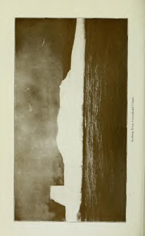
CRUISE OF THE MINNIE MAUD 371
the world, attempted to discover the North-west passage byBehring's strait which he entered in August 1779 and penetrated
to a point which he named Icy Cape, in latitude 70*^ 29'N., andlongitude IQS*^ 20'W., where he found the ice impenetrable
being a sohd mass ten feet thick and extending across to the coast
of Asia, "and aground in 27 fathoms. He returned to the Sand-wich islands and, there, lost his life in a skirmish with the natives.
Pickersgill.—Lieut. Piçkersgill was sent out in 1776 in the
brig Lion, to meet Captain Cook by Baffin's Bay. He reachedlatitude 68*^ lO'N., and then bore away for Labrador, returning
unsuccessful.
Gierke and King.—In 1780 Captains Clerke and King madeanother unsuccessful attempt by way of Behring strait; butthe furthest point to which thev proceeded was Latitude 70°
33'N. in longitude 194^W.
Mackenzie.— In 1789, a young Scotchman, Alexander Mac-kenzie, who had been engaged for some years in the CanadianFur Trade, journej^ed with a party of Indians and Canadiansvoyageurs in canoes from Montreal to the Mackenzie River,
which vast river he traced to its mouth at the Polar sea for thefirst time and to which he gave his name as well as to the vastcountry which it drains. In 1793 Mackenzie made a similar
exploration of the Peace river. He embodied his experiencesin 1801 in a volume entitled "Voyage from Montreal on the RiverSt. Lawrence through the Continent of North America to theFrozen and pacific Oceans in the years 1789 and 1793 with apreliminary account of the rise, progress and present state of theFur Trade of that country", illustrated with maps and dedicatedto His Most Sacred Majesty, George HI.
In the preface Mackenzie writes;—
"I was led, at an early
period of life, by commercial views, to the country North-westof Lake Superior, in North America and being endowed by Na-ture with an inquisitive mind and enterprising spirit; possessingalso a constitution and frame of body equal to the most arduousundertakings, and being famihar with toilsome exertions in
the prosecution of mercantile pursuits, I not only contemplatedthe practicabihty of penetrating across the continent of America,but was confident in the qualifications as I was animated bythe desire to undertake the perilous enterprize."
"The general utihty of such a discovery has been universally
acknowledged, while the wishes of my particular fiiends andcommercial associates that I should proceed in the pursuit of
it, contibuted to quicken the execution of this favourite project
2.5
372 CRUISE OF THE MINNIE MAUD
of my own ambition; and as the completion of it extends theboundaries of geographic science,andadds new countries to therealms of British commerce, the dangers I have encountered,and the toils I have suffered, have found their recompense; norwill the many tedious and weary days, or the gloomy and incle-
ment nights which I have passed, have been passed in vain."
"The first voyage has settled the dubious point of a practical
North-west passage; and I trust, that it has set that long agitated
question at rest, and extmguished the disputes respecting it for
ever."
"In this voyage, I was not only without the necessary booksand instruments, but also felt myself deficient in the sciences of
astronomy and navigation: I did not hesitate, therefore, to under-take a winter's voyage to this country (England), in order to
procure the one and acquire the other, These objects being accom-plished, I returned, to determine the practicability of a commer-cial communication through the continent of North America,between the Atlantic and Pacific oceans, which is proved by mysecond journal, nor do I hesitate to declare my decided opinion,
that very great and essential advantages may be derived by ex-
tending our trade from one sea to the other."
Mackenzie suggested:—"A line of communication and trading
posts between the Columbian river (which was reported by the
explorer, Vancouver, to be the most northern situation fit for
colonization and suitable for the residence of a civilized people)
on the west, and the Nelson River flowing into Hudson Bay onthe east."
"-
"By opening the intercourse between the Atlantic and Pacific
Oceans, and forming regular establishments through the interior,
and at both entrances, as well as along the coasts and islands, the
entire fur trade of North America might be obtained from the
latitude 48° north to the Pole, except that portion of it whichthe Russians have in the Pacific. To this may be added the fishing
in both seas, and the markets of the four quarters of the globe.
Such would be the field for commercial enterprize, and incalcu-
lable would be the produce of it, when supported by the opera-
tions of that credit and capital which Great Britain so eminentlypossesses. Then would this country begin to be remuneratedfor the expenses it has sustained in discoveiing and surveying the
coasts of the Pacific ocean, which is at present left to Americaadvanturers, who without regularity or capital or the desire
of conciliating future confidence, look altogether to the interest
of the moment. They, therefore, collect ail the skins they canprocure, and in any manner that suits them, and having exchan-
ged them at Canton for the produce of China, return to their
CRUISE OF THE MINNIE MAUD 373
own country. Such adventurers, and many of them, as I havebeen informed, have been ver\' successful, would instantly disap-
pear from before a well-regulated trade."
"These voyages will not, I fear, afford the variety that maybe expected from them; and that which they afford to the eye,
is not of a nature to be effectually transferred to the page. Moun-tains and vallies, the dreary waste, and wide-spreading forests,
the lakes and rivers succeed each other in general description.
The beaver and buffalo, the moose-deer and the elk, which are
the principal animals to be found in the countries, are alreadyfamiliar to be inhabitants of Europe, and have been so often
as svell as correctly described in their works, that the bare mentionof them, as they enlivened the landscape, as they were huntedfor food; with a cursory account of the soil, the course and navi-
gation of lakes and rivers, and their various produce, is all that canbe reasonably expected from me."
"I do not possess the science of the naturalist; and even if thequalification of that character had been attained by me, thecurious spirit would not have been gratified. I did not stopto dig into the earth, over w^hose surface I was compelled to passwith rapid steps; nor could I turn aside to collect the plantswh'ch nature may have scattered on the way, when my thoughtanxiously employed in making provision for the day was passingover me. I had to encounter perils by land and perils by water;to watch the savage who was my guide, or to guard againstthose of his tribe who might meditate our destruction. I had,also, the passions and fears of others to control and subdue.Today I had to assuage the rising discontent, and on the morrowto cheer the failing spirits of the people who accompanied me.The toil of our navigation was incessant and oftentimes extreme;and in our progress over land we had no protection from theseverity of the elements, and possesed no accommodations or
conveniences but such as could be contained in the burden onour shoulders, which aggravated the toil of our march, and addedto the wearisomeness of our "way".
"Though the events which compose my journals may havelittle in themselves to strike the imagination of those who loveto be astonislied or to gratify the curiosity of such as are ena-moured of romantic adventures, nevertheless, when it is con-sidered that I explored those waters which had never beforeborne any other vessel than the conoe of the savage; and traversedthose deserts where an European had never before presentedhimself to the eyes of the swarthy natives; when to these consi-
derations are added the important objects which were pursued,with the dangers that were encountered, and the difficulties
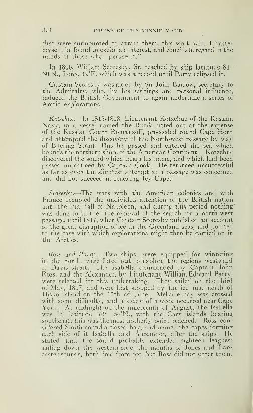
3<4 CRUISE OF THE MINNIE MAUD
that were surmounted to attain them, this work will, I Hatter
myself, be found to excite an interest, and concihate regard in theminds of those who peruse it."
In 1806, William Scoresby, Sr. reached by ship latutude 81-30'N., Long. 19'E. which was a record until Parry eclipsed it.
Captain Scoresby was aided by Sir John Barrow, secretary to
the Admiralty, who, by his writings and personal influence,
induced the British Government to again undertake a series of
Arctic explorations.
Kotzebue.—In 1815-1818, Lieutenant Kotzebue of the RussianNavy, in a vessel named the Rurik, fitted out at the expenseof the Russian Count Romanzoff, proceeded round Cape Hornand attempted the discovery of the North-west passage by w^ay
of Bhering Strait. This he passed and entered the sea whichbounds the northern shore of the American Continent. Kotzebuediscovered the sound which bears his name, and which had beenpassed un-noticed by Captain Cook. He returned unsuccessful
as far as even the slightest attempt at a passage was concernedand did not succeed in reaching Icy Cape.
Scoresby.—The wars with the American colonies and withFrance occupied the undivided attention of the British nation
until the final fall of Napoleon, and during this period nothing"
was done to further the renewal of the search for a north-west
passage, until 1817, when Captain Scoresby pubhshed an accountof the great disruption of ice in the Greenland seas, and pointed
to the case with which explorations might then be carried on in
the Arctics.
7^055 and Parry.—Two ships, were equipped for wintering
in the north, were fitted out to explore the regions westwardof Davis strait. The Isabella commanded by Captain JohnRoss, and the Alexander, bj^ Lieutenant William Edward Parry,
were selected for this undertaking. They sailed on the third
of May, 1817, and were first stopped by the ice just north of
Disko island on the 17th of June. Melville bay was crossed
with some difficulty, and a delay of a week occurred near CapeYork. At midnight on the nineteenth of August, the Isabella
was in latitude 76*^ 54'N., with the Gary islands bearing
southeast; this was the most notherly point reached. Ross con-
sidered Smith sound a closed bay, and named the capes formingeach side of it Isabella and Alexander, after the ships. Hestated that the sound probably extended eighteen leagues;
sailing down the western side, the mouths of Jones and Lan-caster sounds, both free from ice, but Ross did not enter them.
i
CRUISE OF THE MiNN.E MAUD 375
He described Lancaster sound as closed by the Crocker moun-tains. The expedition returned to England in October, having
accomplished practically nothing beyond confirming the state-
ments of Baffin made many years ago.
Parry and Liddon.—The report of Ross was not thought con-
clusive by the Admiralty, and in 1819 the Hecia and Griper
were commissioned to explore Lancaster sound. Lieutenant
Parry was given command in the HecIa, with Lieutenant MathewLidden in the Griper. The ships, without much difficulty, reached
the mouth of Lancaster sound, continued westward past Regentinlet in the south,and Wellington channel and Byan Martin chan-
nal on the north, reached the south side of Melville island, wherethe winter was safely passed by the both ships in a small cove
called winter harbour. The following summer an attempt wasmade to penetrate the heavy arctic ice which forms an almost
perpetual barrier across the strait between Melville island andBanks island; this proving impossible, the expedition returned
safely to England in October 1820. Parry in his voyage passed
over nearly half the distance between the Atlantic and Pacific,
and saw from his farthest western point the shores of Banksisland beyond the middle of that distance. He laid down, onthe north of his track the chain of islands bearing the names of
North Devon, Cornwallis Bathurst and Melville; and on the
south, North Somerset, Cape Walker and Banks.
On September 15th 1908 Capt Bernier and a party from
the Canadian ship "Arctic", found a record which had been left
by Parry in 1820 in a cairn on Table hill. The Cairn was abouteight miles distant from Winter harbour, and was on the
south west corner of Table hill. Thedocument was of parchment,and contained a record of an attempt to discover the north-west
passage, and describes the entrance of the Hecla and Griper
(the former ship commanded by Parry and the latter by Lieut
Liddon) into Lancaster sound and a continuation westwardthrough Barrow strait. Barrow strait was named by Parryafter Mr. Banow, Secretary of the Admiralty. Nine islands
were discovered and named New Georgia and the North Georgiaislands, in honor of King George the HL The record stated
further that Lancaster and Barrow straits were found to give
an entrance from Baffin baj- into the Polar sea. This parchmentwas signed W. E. Parry and Mathew Liddon and was in anexcellent state of preservation.
From Table hill the Arctic's party gained a splendid \iew ex-
tending as far as Liddon gulf, about twenty miles distant; the
country being rather flat but undulating, with the exception of
a ridge which ran north-westward from Cape Bounty. On

376 CRUISE OF THE MINNIE MAUD
Table hill a record was left by Mr W. A. Jackson, the meteoro-logist of the expedition in place of Parry's record.
Parry and Liddon explored Melville island during the spring
of 1820 and brought home very detailed accounts and samplesof the geology, minerals, flora and fauna of that island. The Bri-
tish Parliament had offered a prize of £5000 to the first navigator
who passed the 110th meridian west Greenwich; and this Parryand his companions received and they named Cape Bounty onthe south coast of Melville island in commemoration of the feat.
Magnetic Pole.—Parry was also the first navigator to pass di-
rectly north of the magnitic North Pole, which he located appro-ximately and thus was the first to report the strange experience of
seeing the compass needle pointing to the south. He also has the
distinction of being the only navigatorwho ever succeeded in reach-
ing Melville island by vessels propelled only by sail-power andof bringing them back safely through the terrible ice-floes that
block Barrow strait.
So great was Parry's success that the British Government sent
him out in command of two other expeditions in search of the
North-west passage.
Frayiklin —During the time that Parry was making his impor-
tant discoveries by sea, Lieutenant John Franklin was employedin tracing the northern shores of the American continent. From1819 to 1822 Franklin was engaged in leading an expedition over-
land from Hudson bay to the Arctic shores, in the vicinity of the
Coppermine river. The British Admiralty, who planned the ex-
pedition, knew practically nothing about the conditions for tra-
vel through the regions it purposed exploring, and depended for
aid solely upon the Hudson's Bay Company. Unfortunately
at this time the quarrel between the Hudson's Bay Company andthe North-west Company was at its height, and the resources of
both were consequently crippled. The North West Companywas far stronger in the Mackenzie river valley, and their rivals,
the Hudson's Bay Company, who were to help Franklin, wereunable to. give him efficient aid, or to supply him with a large
stock of provisions; in consequence, he started from the outposts
with almost no food, determining to trust to his hunters for the
provisions required for his party. This finally led to disaster,
and on the retreat from the Arctic sea, over one half of the party,
including Lieutenant Hood, died of starvation.
Franklin left England in the Hudson's Bay Company's ship,
accompanied by Lieutenants Back and Hood, Dr Richardson
and one seaman. Thev arrived at York Factory, at the mouth
CRUISE OF THE MINNIE MAUD 377
of the Hayes River on the ^vest coast of Hudson bay, where theymet four of the leading partners of the North-west Company,who were held prisoners by their rivals. As the men had spenta number of years in the \Iackenzie river country, Franklin ob-
tained much valuable information from them. After a few daj'S
at York, the party proceeded by canoes from there, 650 miles to
Cumberland House, on the Saskatchewan river, where the first
winter was passed.
The following summer (1820) the party reenforced by a num-ber of Canadian voyageurs, started northward in canoes, andreached Fort Chipewyan, on Great Slave lake, before the ice hadmelted. The expedition, now consisting of 25 persons, started
away from Fort Chipewyan with one day's supply of provisions
andatotally inadequate amount of ammunition. Travelling to
the north side of the lake, the party was further increased by aband of Copper Indians, and all journeyed to Fort Enterprise,
which was built near the edge of the barren lands, in latitude 64°
30'N. The total distance travelled during this season was, 1,350miles.
Venison was plentiful during the winter (1820-21) but the sup-ply failed in the spring, so that a start was made over the barrenswithout any food except such as fell to the hunters from da\' toda}'. The distance from Port Enterprise to the mouth of theCoppermine River is 334 miles. The first 120 miles were madeby tramping with canoes and outfit over the snow; the remainderwas made in canoes and the mouth of the river was reached on the21st of July. Turning eastward, the shores of Bathurst inlet andCoronation gulf were surveyed to Point Turnagain, in latitude 68^19'N.and longitude 109* 25'W. The canoes were detained hereseveral days by a snowstorm, and a retreat was necessary as soonas the weather moderated. The course along the coast was there-
fore retraced to Hodd river, and that stream was ascended for
a short distance. The equipment was reduced to the smallestcompass, and a course was shaped overland for Fort Enterprise,the travelling being through deep snow. Game was very scarce,
and the hardships soon began to tell on the weakermembers of theparty, with the result, as before stated, that half the number, in-
cluding Lieutenant Hood succumbed to cold and starvation.
The survivors were secoured by Indians on the 7th of Novem-ber, 1821, and reached the Hudson's Bay post on Great SlaveLake on the 11th of December, and England in October 1822.
Parry and Lyon.—In 1821, Sir W. E. Parry made his thirdvoyage totheArcticisIands,incommand of the Fury having as se-
cond in command, Captain G. F. Lyon, in the Hecla. This time
378 CRUISE OF THE MINNIE MAUD
the attempt was made through the Hudson strait and up Foxchannel. The first season he examined Repulse bay and wentinto winter quarters at Winter island, a few miles beyond the east-
ern entrance of the Frozen strait of Middleton, whose accuracywas proved after being long clouded by the reckless attacks of
Dobbs. The ships were released from ice by the 28th of June,
and no time was lost in pushing northward, until stopped by the
heavy ice off the eastern mouth of Fury and Hecia strait, wherethe remainder of that season and the early part of the next w-ere
spent in trying to pass through the strait, the eastern part of wdiich
owing to the islands that are clustered in the narrow channel, re-
maining continuously blocked with heavy ice-floes.
Parry and his assistant charted the eastern shore of Melville
peninsula, made soundings of Fox channel and Fury and HecIastrait, charted the coastline and brought home a very completecollection of geological specimens from the surrounding country.
Scoresby.—In 1822 Captain \\'m. Scoresby, Jr. made a voyageto the east-coast of Greenland, upsetting all previously conceived
ideas as to the nature of that coast and made a number of scien-
tific observations.
Parry and Hoppner.—In 1824-25 Parry tried a forth time to
make the north-west passage, by way of Regent inlet. He win-
tered at Port Bowen on the east side of the strait, but the attemptwas determinated by the wreck of the Fury, commanded by Capt.Hoppner, the following spring near Cape Fury on the east coast
of North Somerset. With great forethought. Parry caused all
the provisions to be landed from the wreck and safely housed onFury beach, where they were subsequently found by Ross, andwere the means of rescuing his crew from starvation.
In explorations and discoveries, the result of these two later ex-
peditions were not so rich, but the experience in ice work that theyafforded suggested to Parry ideas that revolutionized all methodsin arctic navigation.
Captain Lyon.— In 1824. See page 307.
Frayiklin,—In 1825-27, Captain Sir John Franklin, resumedhis exploration of the Arctic coasts of America in much happier
circumstances. The rival for companies had now amalgamatedforming one powerful company, with full control over the natives
and capable of rendering valuable assistance to an exploring
party in the far north.
Franklin profiting by his former sad experience, had a large sup-

CRUISE OF THE MINNIE MAUD 379
ply of pemmican prepared in advance, and stored at Fort Chipe-
wyan. The journey from England was made by way of Mont-real and the Great Lakes.
After passing a winter at Great Bear lake, Franklin descended
the Mackenzie to its mouth, and then surveyed the coast west-
ward to return reef, passing the northern end of the Rocky moun-tains, leaving only 160 miles of unsurveyed coast between his far-
thest point and Point Barrow, reached the same year by CaptainBeechey in boats from Bering straits. •
Richardson and Kingdall.—While Franklin was thus engagedwith one-half of his party, the other half, under the command of
Dr. Richardson and Lieutenant Kendall, were exploring the coast
between the mouth of the Mackenzie and Coppermine rivers.
These surveys carried the exploration from Bering strait to Coro-nation gulf, with only a break of 160 miles between Return reef
and Point Barrow, or through 60 degrees of longitude. Theeasthern end of these surveys was overlapped six degrees in longi-
tude by the discoveries of Parry to the northward, and only a
channel running north and south was required to connect them,and so complete the long sought northwest passage.
Parry.—Hitherto all attempts to approach the Pole had beenin ships. In 1827 Parry suggested the plan of a dash to the Pole
on foot, from a base on land. He obtained the assistance of the
Government, which for the fifth time sent him to the Arctic pro-
vided with well equipped ships and able officers and men. Hecarried a number of reindeer with him, to his base in Spitzbergen,
purposing to use these animals to drag his sledges. The schemeproved impracticable however, he was compelled to depend onthe muscles of his men to handle his two heavy sledges, whichwerein reality boats on steel runners. Leaving Spitzbergen on June23rd with 28 men, he pushed northward. But summer sun hadbroken up the ice-floes, and the party repeatedly found it necessary
to take the runners off their boats in order to ferry across the
stretches of open water. After thirty days of incessant toil Parryhad reached 82*^ 45', about 150 miles north of his base and 435geographical miles from the Pole. Here he found that, while his
party rested, the drifts of the ice was carrying him daily back,
almost as much as they were able to make in a day's work. Re-treat was therefore made to the ship and he returned to England.
Parry's exploits, which marked a new era in Polar explorations,
created a tremendous sensation. Knighthood was immediatelybestowed upon him by the King, while the British people heapedupon him ail the honours and applause with which they crownedevery explorer returning from the north with even a measure of

380 CRUISE OF THE MINNIE MAUD
success. In originality of plan and equipment Parry has only
been equaled by Nansen and Peary.
John Ross.—In 1829, Captain John Ross, being anxious to re-
move the reproach of his former failure, and having been provided
by Sir Felix Booth, with a well-fitted paddle-wheel steamer.the
Victory, of 150 tons, sailed from the Thames with the intention
of seeking a passage through Regent inlet. He was assisted as
mate, by his nephew, James Clark Ross, who was young andenergetic and who was later to win laurels at the opposite end of
the globe. This was the first attempts to use steam for ice-navi-
gation, and although if failed to achieve a north-west passage the
Rosses brought back very valuable information as a result of
their voyage.
The ship was beset fast in the ice, and finally abandoned in
Victoria harbour, on the west side of the gulf of Boothia, nearly
opposite Fury and Hecla strait. The expedition was remark-able for the number of winters spent in the Arctic circle, three of
them on the Victory and the fourth at Fury beach, where the pro-
visions that had Ijeen throughfully housed by Parry were the
means of saving the crew from starvation.
J. C Ross.—The chief discoveries were made by LieutenantJames Clark Ross who by several long sled journeys traced a part
of the shores of King WilHam island, and of the west side of the
peninsula of Boothia, up to the Magnetic Pole; also the shores of
Lord Mayors bay and its vicinity in the gulf of Boothia. Duringthe retreat to Fury beach, Brentford bay was crossed several
times without notice being taken of Bellot strait.
During their five year's absence, 1829-34, they made importantdiscoveries around Boothia Felix, but most valuable was their de-
finite location of the Magnetic North Pole, and the remarkableseries of magnetic and meteorological observations which theybrought back \\ith them.
Sir John Ross in his "Narrative of a Second Voyage in Search
of a North-west Passage and of a residence in the Arctic Regionsduring the years 1829, 1830, 1831, 1832 and 1833 and the Disco-
very of the Northern Magnetic Pole", published in London in
1835 writes: "It is a remarkable circumstance that the meansof all the latitudes and longtitudes of Melville island, Igloolik,
Winter island and Port Bowen, give nearly the actual situation
of the Victory at Felix Harbour, while the temperature of these
four positions; indicating thereby a gradual relation of tempera-
CRUISE OF THE MINNIE MAUD 381
tures, which is at variance with a popular theory on that subject.
"He found the tides at Fehx Harbour very irregular-the extremerise being nearly six feet. On the morning of Alarch 7th., the
tide rose one foot eight inches, and in the evening five foot three
inches. Salmon, caribou, musk-ox, seal, bear and wolverene wereplentiful on Boothia Peninsula, and also Eskimos. Felix Har-bour is in latitude 69^ 58' 42" 5N., and longitude 92° 1' 6"6 W.Victory Harbour is in latitude, 70*^ 9' 18"N and longtitude 91*^
30' 35" W., and the Magnetite Variation was 101° 32' 03" wes-terly.
They left Fury Beach on July 8th 1833 and after traveling in
three boats to Batty Bay, 62 miles further north, crossed RegentInlet in clear water on July 17th and on the 25th were picked upby H. M. S. Isabella in Navy Board inlet. The results of the ex-
pedition were the discovery of the Gulf of Boothia, the continent
and isthmus of Boothia Felix and a vast number of islands, rivers
and lakes, and the establishment that the north-east point of
America extends to the 74th degree of latitude. The expedition
also located and named after King William the Fourth of En-gland the Northern Magnetic Pole.
Bac/e.—Considerable anxiety was felt in England, after twowinters had passed without any tidings of the Victory and Cap-tain Back was oufittted by public subscription to descend the
Great Fish river to its mouth, and there if possible, with the help
of natives, succour the crew of the Victory. Back spent the win-ter of 1834 at Great Slave lake, and the following summer crossed
the height-of-land and descended Great Fish river to its mouthin a heavy boat. Having been informed, by an express fromEngland, of the safe return of Ross, he confined himself to geo-
graphical work, and traced the estuary of the river to Cape Bri-
tannia on the one side and to Point Richardson on the other,
being only a short distance between his northern termination andthe southern point of James Clark Ross' southern sled journey.The result of Back's journey left only 160 miles to the west of theMackenzie, and thirtheen degrees of longitude between Franklin's
Point Turnagain and the Gulf of Boothia to complete the north-
west passage.
Captain Back.—In 1836. Sec page 307.
Dease and Simpson.—The Hudson's Bay Company undertookto fill the gaps of unsurveyed coast-line left by the Rosses and Sir
John Franklin and sent an expedition under the direction of Pe-ter Warren Dease and Thomas Simpson, an expert surveyor.The western section was first completed in 1837.
382 CRUISE OF THE MINNIE MAUD
In 1838-39 the eastern portion between Point Turnagain andthe estuary of the Great Fish river was surveyed by the same in-
trepid explorers, without any loss of life to their party, and with-out other hardships than those incidental to travel in the Arctic.The boat voyages—by which these surveys were completed werethe longest ever undertaken in arctic waters, and embraced sixty-two degrees of longitude between Point Barrow and Castor andPollux river, the most eastern point of Simpson. While survey-ing the coast to the eastward, Simpson charted the south sideof Victoria island and the south side of King William island.
Unfortunately the advanced state of the season w^ould not per-mit Simpson to connect the mouth of the Great Fish river withRegent inlet, or with King William sea. This the Hudson's BayCompany resolved to complete, and selected Dr. John Rae for thework.
Maury.—There is a great branch of physical geography whichhas only been effectively studied within the last seventy years,namely the physical geography of the sea. Mathew FontaineMaury, an American in charge of the Washington Observatoryin 1842 by his wind and current charts, by his trade, wind, storm,rain and whale charts and above all by his charming work "ThePhysical Geography of the Sea", gave the first impulse to this
study. It was Captain Maury who organised the first deep-seasoundings in the North-Atlantic, which up to that time was dee-med to be unfathomable; and when his work was published theillustrious Humboldt declared Maury to be the founder of a newand important science the meteorology of the sea.
Dr. Rae.— In 1845. See page 307.
The Search for Franklin
Franklin and Cro7.ier.—In 1845 the British Government fitted
out the Erebus and Terror with provisions for three years, andwith tiie most approved system of heating and ventilating, andother means of preserving the health and comfort of the crew.The command of the expedition was given to Sir John Franklin,with Captain Crozier, of the Terror, second in command. Theother officers wers carefully selected from among the most pro-mising and energetic of the junior ofiiciers of the navy, whilethe seamen and the petty officers were also the best in the navy.
The crews leaving England amounted to 134 persons, of whomfive were sent home from Greenland, leaving a total of 129 onboard the ship, when they entered Lancaster sound, and wereseen for the last time.
CRUISE OF THE MINNIE MAUD 383
No band of men ever set out for the unknown with brighter
hopes or with more just anticipation of success than Sii JohnFrankhn's expedition of 1845. The frightful tragedy whichoverhelmed them, together with the mystery of their dissappear-
ance, which baffled the world for years and is not yet entirely
explained, forms the most terrible narrative in arctic history.
Franklin had been Knighted in 1827, at the same time as Parry
for the value and very extensive explorations which he had con-
ducted by snowshoes and canoe on the North American coast
between the Coppermine, the Mackenzie and Great Fish rivers,
during the same years that Parry had been gaining fame in the
north. In the interval Frankhn had served as Governor of
Tasmania for seven years. His splendid reputation and ability
as an organizer made him, though now 59 years of age, the una-
nimous choice of the Government for the most elaborate expedi-
tion it had prepared in many years. Frankhn's fame and expe-
rience, and that of Crozier and his other Lieutenants, who hadseen much service in the north, his able ships the Terror and the
Erebus, which had just returned from a voyage of unusual suc-
cess in the Antartic, and his magnificent equipment, aroused
the enthousiasm of the British to the highest pitch and justified
them in their hopes of bringing the wearying struggle for the
North-west Passage to an immediate conclusion.
For more than a year everything prospered with the party.
Frankhn's instructions were to enter Lancaster sound, and, whenin the vicinity of Cape Walker to penetrate to the southward andwestward in a course as direct as possible to Bering strait. Aquick passage appears to have been made through Lancaster
sound to Wellington channel, up which the ships sailed to the
seventy-seventh parallel, and then down again on the west side
of Cornwallis island, returning eastward to winter at Beecheyisland (Erebus bay). Many traces of a winter residence werefound there, including sites of workshops, forge and observatory.
Over 700 empty meat cans, all labelled "Goldner's Patent" werefound pilled in regular mounds. A large quantity of similar
tins supplied to the navy had been found to be putrid, and were
condemned. This had probably happened to the tins left at
Beechey island, and helped to hasten the starvation of the un-
fortunate crews two winters later. Three seamen died during
the first winter, and were buried on the island.
By September, 1846, Franklin had navigated almost within
sight of the coast which he had explored 20 years previously, andbeyond which the route to Bering sea was well known. Theprize was nearly won when the ship became imprisoned by the
ice for the winter in Victoria strait; a few miles nort!i-\\est of
King William island.

384 CRUISE OF THE MINNIE MAUD
Record of Disaster.—The next information concerning the fate
of FrankUn was obtained from a brief record, found on KingWilliam island by M'CIintock, in 1859. The record is as follows:
"Lieutenant Graham Gore and Mr. Charles F. des Vœux, mate,
left the ships on Monday, the 24th of May, 1847, with six men,(to deposit papers on King Wilham's island) H. M. ships Erebusand Terror wintered in the ice in latitude 74^ 5'N., longitude 98*^
23'W. Having wintered in 1845-46 at Beechey island in lati-
tude 74» 43' 28"N., longitude 91° 31' 15"W. After havingascended WeUington channel to latitude 77°, returned by the
west side of CornwaHis island, (Sir) John Franklin commandingthe expedition. All well."
This was the original record, and on the 25th of April, 1848,
after passing another winter in the ice, a most mounful addition
was made to it. The addition read as follows. "(I) 848. H.M. ship Terror and Erebus were deserted on the 22nd April,
5 leagues N. N. W. of this— having been beset since 12th
September, 1846. The Officers and crew consisting of 105 souls
under the command of Captain F. R. M. Crozier landed here
in lat. 69» 37' 42", long 98° 41'. (This) paper was found byLt. Irving under the cairn supposed to have been built bj^ Sir
James Ross in 1831, four miles to the northward, where it hadbeen deposited by the late Commander Gore in June, 1847. Sir
James Ross pillar has not, however, been found, and the paperhas been transfered to this position which is that in which Sir
J. Ross pillar was erected. Sir John Franklin died on the 11th
June, 1847, and the total loss by deaths in the expedition has
been to this date 9 officers and 15 men. F. R. M. Crozier, Cap-tain and Senior Offr., and start on tomorrow 26th, for Back's
Fish river. James Fitzjames, Captain H. M. S. Erebus".
Tbe Fate of Franklins Expedition.—The rest of the sad story
may shortly be told: the distance to mouth of the Fish river,
from the spot where the ships were abandoned, is about 250miles. They started from the ships dragging heavy boats onsleds. In 1859 M'CIintock found one of the boats on the west
side of King William island with two skeletons inside, and cloth-
ing and chocolate. He also found among the Eskimos silver
plates and other relics of the party; in another place he found
tents and flags; and elsewhere he made the yet more ghastly
discovery of a bleached human skeleton, proof on its face, as
though attesting the truthfulness of an Eskimo woman who,claiming to have seen forty of the survivors late in 1848, said
"the}»- fell down and died as they walked".
The Eskimos living at the mouth of the Fish river said that about40 white men reached the mouth of the river, and dragged a
CRUISE OF THE MINNIE MAUD 385
boat as far as Montreal island in tiie estuary, ^vhere the nativesfound it and broke it up. The last of the survivors died shortlyafter the arrival of the summer birds. It is exceedingly doubt-ful, if their strength had lasted, whether they could have travelled
over the thousand miles of barrens separating the mouth of theriver from the nearest trading post on Great Slave lake but at
least a trial would have been made.
It is quite possible, however, that half of the party headed for
Coronation Gulf and the Coppermine river in the hopes of winn-ing their way back by Franklin's old route.
Search Expeditions.—-The fate of the expedition remained for
a number of years unknown, although the British governmentspared no expense in the attempt to rescue the unfortunatecrews, and, when the hope of succouring was gone, in a searchfor proof of their fate. Official relief expeditions were supple-mented by others under private auspices, due either to LadyFranklin or to her appeals to the sympathy of the public for
convincing evidence as to the terrible fate of her unfortunatehusband and his companions. America joined forces with En-gland in the attempts to rescue the expeditions, and sent outa number of ships to act in conjunction with the others,
while France sent two gallent officers, one of whom. LieutenantBellot, lost his life while engaged in this work. As the conditionsunder which the searches were made were exceedingly difficult
and hazardous, much time and energy were spent, and manyrisked and lost their lives.
Twelve years passed before M'Clintock discovered undoubtedproofs of the complete loss of the ships and the death of the entire
crews. During this time thirty-five ships and five overlandexpeditions carried a host of eager searchers to the Arctic,whereincidental to their main object of rescuing the crews of the Erebusand Terror, they explored the entire coastline of America andthe shores of the Arctic islands, with such minute care as onlytheir mission would warrant.
To these search expeditions an intimate knowledge of ArcticAmerica is largely due, and when the search was finished onlythe most northern islands remained for future explorer. Assometimes happens, the brave but unfortunate Franklin andhis equally brave and enduring companions in disaster accom-plished more for human knowledge by their pitiful fate thanif they had successfully accomplished the object of their under-taking.
The following is a brief account of the numerous search ex-

386 CRUISE OF THE MINNIE MAUD
peditions, and a brief summary of the geographical work accom-plished by them.
Dr. fJae.—Meanwhile, when Franklin failed to return in 1848
—
he was provisioned for only three years—England became alarmedand dispatched relief expeditions by sea from the Bering sea
and the Atlantic and by land north from Canada, but all efforts
failed to gather news of Franklin till 1854, when Rae fell in with
some Eskimos hunters on the east side of King William island
who told him of two ships that were beset some years previous
and of the death of the party from starvation. Dr. Rae thus
was the first to bring back intelligence of the loss of the Erebusand Terror, and of all their crews.
Sowiders.—-1848-49—James Saunders, Master of H. M. S.
North Star to Wolstenholme sound and Ponds inlet.
Moore and Kellet.—1848-50—Captian Thomas Moore, of H.M. S. Plover, and Captain Henry Kellet, of H. M. S. Heraldand Robert Dhedden, in yatch Nancy Dawson, to Bering sea.
Goodsir.—1849—Dr. R. A. Goodsir, in the Advice whaler
to baffin bay.
Pu//en.—1849—Lieutenant W. J. S. Pullen, of H. M. S. Heraldboat voyage from Bering strait to the Mackenzie.
U. S. Parties.—1850-51—Lieutenant De Haven, of United
States navy, in the Advance; S. P. Griffin, of the United States
navy in the Rescue; Captain Horatic Austin, of H. M. S. Reso-
lute; Captain Ommaney, of H. M. S. Assistance; William Penny,
Master of the Lady Franklin, under Admiralty orders; AlexanderStewart, Master of the Sophia, under Admiralty orders; Rear-
Admiral Sir John Ross, in the Felix yacht fitted at the expense
of the Hudson's Bay Company, all to Lancaster Sound.
1850—Captain C. E. Forsyth, R. N., commanding the Prince
Albert, belonging to Lady Franklin, to Regent inlet.
McC/ure.—1850-54—Captain Robert McClure, of H. M. S.
Investigator, to Bering strait, Banks island and Lancaster sound.
McClure had begun his search for Franklin in company with
Commander Collinson who was his superior officer, from Londonin 1850, and passed through Magellan strait, afterwards calling
at Honolulu where he and Collinson procured stores. The twovessels became separated, the Investigator outsailing the Enter-
CRUISE OF THE MINNIE MAID 387
prise, or rather sailing a different course, McCIure made Bering
strait first, and continued his voyage without waiting for CoIIin-
son, although he had been advised by Captain Kellet who was then
in the same waters to wait. The Investigator was several days
in advance on the Enterprise, and her course northeastward
was continued until Banks island was sighted and the coast
followed in search of FrankHn around the northwestern end,
and party down Prince of Whales strait between Banks island
and Victoria island. The Investigator wintered in the strait
of Princess Royal islands, in lat. 72° 50'N., long. 117° 35', during
the winter of 1850-51. After the liberation of the ship, the
next summer the southern end of Banks island was rounded,
and the Investigator passed north again until Bay of Mercywas reached, on the south side of McCIure strait between Banksand Melville islands, from which harbour the vessel never emergedunless she has drifted out since her abandonment in 1853.
McCIure with sledge parties crossed the strait named after
him to Winter harbour on Melville harbour, and there left records
on Parry's rock with the hope that Sir John Franklin might beco-
me acquainted with the fact that the Investigator was fast in
Bay of Mercy. These records were found by Captain Kellet
after McCIure had returned to his vessel, and Lieutenant Pin
and Dr. Domville, of the Resolute, were sent by Kellet to com-municate with McCIure and apprise him of the fact that the
Resolute was at Dealy island, a short distance from Winterharbour.
The papers found by the Canadian Ship Arctic, when she
wintered at Melville island in 1908-09, in Kellett's depot at
Dealy island contained a pathetic story of the weakened anddebilated state of McCIure's crew, immediately previous to theabandonment of the Investigator. Commander Kellet, whowas at the time the superior in rank to McCIure directed himto have an examination of the men made, and to call for volun-teers who might be willing to remain another season on boardthe Investigator.
The medical officers reported that the men of the crew werein no condition to pass another rigorous season on board ship
and any attempt to do so would be sure to meet with fatal results.
The officers, the carpenter and four seamen, with great pluckvolunteered to stand by the ship, but the number was not suffi-
cient to man the vessel, therefore there was no other course
for McCIure than to abandon the Investigator; this he did withregret and left her to the charge of the ice and the winds. Be-fore doing so, he caused, to be cached enough provisions for
66 men for four months, and anchored his vessel in a position
that he supposed would allow her to be upon a shoal, where, he
26

388 CRUISE OF THE MINNIE MAUD
said, she would last for ages. He was mistaken, however, as nosign was visible of either the cache of the vessel when Officers
Green and Morin of the Arctic visited Bay of Mercv in thespring 1909.
McCIure and his men abandoned the ship in the spring 1854
and by walking over the ice of McCIure, Melville, Barrow andLancaster straits to Beechey island made the northern northwestpassage on foot. Here they were rescued and taken home to
England. A valuable meteorological table made by McCIurewhen he wintered in Prince of W ales strait in 1850-51 was found
in 1908-09 by the officers of the Canadian ship Arctic.
Collinson.—1850-55—Captain Richard Collinson, C. B., of
H. M. S. Enterprise, to Bering strait, Banks island, and along
the continental channel to Cambridge bay, in Victoria island
near King William island.
Collinson, who had been given the chief command of the twovessels, Enterprise and Investigator, made his voyage throughBering sea and proceeded north to a higher latitude than anynavigator in the western part of the Arctic ocean, reaching above73*^ N. He made a circuitous course in search of Franklin, andalso at the same time giving his attention to a search for McCIure.Signs of the landing of the latter were observed upon the coasts
of banks and Victoria islands, but when these ceased he shapedhis course in a southeasterly direction along the coast and passed
through Union and Dolphin straits, Coronation gulf and Deasestrait, to a point in Victoria strait, within sight of the place whereSir John Franklin died, but did not know it. The exact spot
where the lamented Franklin ended his expedition and his life
was afterwards discovered by McClintock, and it was then madeknown, that Collison was near the object of his search. CoUisonwintered in Cambridge bay, 1852-53, and returned westward to
Bering strait and sailed for Hong Kong, where he dispatched
copies of documents to the Admiralty.
Krabbië and Mecbam.—Krabbie and Mecham, who accompaniedMcCIure, crossed McCIure strait and part of Melville soundand found evidences of the landing of Collinson in April 1851,
on the north end of Victoria island.
Râe.—Dr. John Rae, employed by the Admiralty, descended the
Coppermine river, and traced Victoria island up to the parrallel
of the north end of King William island, in Victoria strait, in
1851.
Kennedy.—1851-52—William Kennedy, Master of the Prince

CRUISE OF THE MINNIE MAUD 389
Albert, belonging to Lady Franklin, to Regent inlet, Bellot
strait and Prince of Wales island. Kennedy wintered at Battybay on the east coast of North Somerset and explored thecoasts of North Somerset, Prince of Wales and Russell islands.
Inglefield.—1852—Captain Edward A. Inglefield, in the Isabel,
Lady Franklin's vessel, to Lancaster sound.Captain Inglefield left England, in the crews schooner Isabel,
with the intention of searching the deep northern inlets of Baffin
bay for traces of Franklin, and with the hope of reaching theopen Polar sea through Smith sound. Cape Farewell was sighted
on the 30th of July, and Cape York on the 21st of August where a
number of natives were seen in the vicinity. At North Omenaknative caches of meat and winter clothing were found. On the
26th Cape Alexander, the farthest point seen by Baffin, was passedwith an open sea to the northward. On the 27th he reachedlatitude 78^ 2rN., in Smith sound, 140 miles beyond any pre-
vious navigator. He was forced by a strong northerly gale andlow temperature to retreat south, and on his way entered Jonessound, which he explored to latitude 76^ ll'N. and longitude84^ 10' W., in the neighbourhood on Haven fiord. He then ente-
red Lancaster sound, and visited Beechey island, after which,turning homeward, he did not cross the Arctic circle until the
12th of October.
Maguire.—1852-55—Captain Rockfort Maguire, of H. M. S.
Plover to Bering strait.
McCormick.-—-1852—Dr. R. McCormick, a boat excursion to
Wellington channel.
Belcher.—1852-54—Captain Sir Edward Belcher, C. B., of
H. M. S. Assistance, to Wellington channel.
Captain Belcher was the senior officer of all the ships then in
the Arctic searching for Franklin, including Kellet in the Reso-lute. McCIintock in the Intrepid, Sherard Osborn in the Pioneer,
McCIure in the Investigator and PuIIen in the North Star.
Belcher's ship, the Assistance and the Resolute^ Intrepid,
Pioneer and Investigator had all to be abandoned as they werehopelessly beset in the ice-floes of Wellington channel and Barrowstrait. All the crews of these five vessels were conveyed backto England in 1854 by the North Star, commanded by CaptainPuller which was stationed as a rescue ship at Beechey island,
North Devon.
The Assistance wintered in \N'ellington Channel near Grinnell

390 CRUISE OF THE MINNIE MAUD
Peninsula and Osborn, Austin, Richards and Hamilton, underBelcher's orders, traced by means of sledge journeys the north-
ern end of Grinnell Peninsula and of Cornwallis, Finlay andMelville islands. They made full reports of their journe\"S andobservations of the geology, fossils, flora and fauna of the regions
traversed and also of the meteorological conditions, tides andmovements of the Polar ice.
/<:e//e».—1852-54—Captain Henry Kellett, C. B., of H. M. S.
Resolute, to Lancaster sound, Melville and Banks islands.
Captain Henry Kellett had made a voyage to Bering strait
previous to his joining the expedition of Captain Belcher, andhad met McCIure in the Arctic ocean on his way sailing north-
east. Kellett reached Herald island in Bering strait on that
voj'age. and returned with his ship to the Pacific ocean andaround cape Horn, succesfully reaching England.
This voyage with Captain Belcher to Lancaster sound, in
the Resolute, was the beginning of the eventful period between1852-54, in which Kellett was in charge of the western expedition
already mentioned, in search of Franklin, compiising the waters
in Barrow strait and of the Southwestern part of the Arctic
archipelago, including Banks island and Victoria island south
of the McCIure strait.
This fine officer was well worthy of the confidence of the Ad-miralty, who placed him second in command of Belcher; he
eclipsed his superior officer in his discoveries and executive abi-
lity and was most ably aided by the activity and sterfing ability
of McCHntock. The haidships, adventures and experiences of
Kellett, as well as the ships unde him, are but a memory of the
past, but his depots and cairns for the assistance and guidance
of ships, are monuments of his forethought. His bravery wasundoubted, and his refusal to abandon his ship unless a preremp-tory order was given by Capt. Belcher, furnishes proof of his
decisive character as a sailor and dogged purpose to do his utmost,
in the search for Franklin.
The records which he had gathered from others, as well as copies
of his own orders, were carefully deposited in safe places for the
assistance of other navigators, entertaining always the forlorn
hope, that Franklin might find his way to Dealy island. Thelarge depot on Dealy island was well arranged and the plans of
stores prepared with infinite detail, show his thoroughness. Hecarefully noted the safest routes to the rcndez-vous,thc numberof hours which Iiis men should travel and rest and the food they
should be supplied with; during his final days of command in the
western division of the expedition he travelled six hundred miles
CRUISE OF THE MINNIE i\!AUD 391
on foot to the North Star, which conveyed him back to Englandin company with the crews of the five vessels abandoned by theorder of Commander Belcher. Dealy island, 35 miles east of
Winter harbour and south of the Entrance to Bridport inlet,
Melville island was the winter station of H. M. Ships Resoluteand Intrepid in 1852-53.
The Resolute ^ drift.—Kellett's ship, the Resolute and Mc-Clintock's ship, the Intrepid, were beset and abandon on theice-flœs of Barrow strait in 1853. The Resolute was abandonedin April 1853, 20 miles off Cape Cockburn, drifted through Bar-row strait and Lancaster sound, and was picked up in the follow-
ing 3'ear by an American Whaler in Davis strait. This repre-
sents a drift of 1000 miles.
Soundings in Lancaster Strait.—Soundings showed that Lancaster sound was nowhere much deeper than 300 fathoms, andBarrow strait mostly under 100 fathoms in depth.
McClintock.—1852-54—Captain Francis Leopold McCIintock, of
of H. M. S. Intrepid, to Lancaster sound and Prince Arthurisland.
• Captain McCIintock of the Intrepid, and second in commandto Captain Kellett, early showed his great activity by makingsledge journeys of a hazardous nature across Melville islands, fromthe locality in which the Resolute and Intrepid were frozen in
near Dealy island. The tracings made by McCIintock around theshores of Melville island and Prince Patrick island, on foot, addedmany hundreds of miles to the coastline of the territory surveyedunder Belcher and Kellett. The cairns established by him,between 1852 and 1854 arc mentioned in his reports to CaptainKellett, and copies of these were afterwards found on Dealyisland by Capt Bernier of the Arctic in 1908-1909.
1852-54—Captain W. S. J. Pullen, of H. M. S. North Star,
to Beechey island.
1853—William H. Fawckner, Master Breadalbane, TransportBeechey island; crushed in the ice and foundered.
Rae.— 1853^—Dr. John Rae, under Admiralty orders, by sledto Victoria island, and by boat voyage to Victoria strait.
Kane.— 1853-55—Dr. Elisha Kent Kane, of the United Statesnavy, to Smith Sound, Humboldt glavier and Grinnell land.
1853—Captain E. A. Inglefield, of H. M. S. Phœnix, andLieutenant Elliot, of the store ship, Diligence, to Beechey island.
392 CRUISE OF THE MINNIE MAUD
Anderson.—1855—Chief factor JohnAnderson, of theHudson'sBay Company, canoe voj'age down the Great Fish River toMontreal island and Point Ogle, procuring further rehcs of theErebus and Terror.
McC/infocle.—1857-59—Captain F. L. McCIintock, R. N., in
the Fox, Lady Franklin's yatch, to Peel sound, Regent inlet,
Bellot strait. King William island and Montreal island, bringingprecise intelligence of the fate of the Erebus and Terror, anda short record of their proceedings. Lieutenant Hobson, underMcCIintock, was the man who found the document, which so terselytold the sad tale, of death of the brave man, whose fate awakenedthe greatest interest of any explorer of modern times and perhapsin all history.
Summery of Search.—The above list is taken from "The PolarRegions", by Sir John Richardson, Franklins's old comrade, andgives a very brief statement of the numerous expeditions sentout in search of these ill-fated ships. Lengthy records of mostof these expeditions have been published, in which the trials
and hardships undergone are recorded in a matter of fact way,without any attempt to excite sympathy, and all honour shouldbe paid to the memory of these men, many of them volunteers, for
the dangers they passed through in the endeavour to rescue their
fellowmen from terrible death by starvation and cold in theinaccessible Arctics.
Many lost their own lives, while others drifted all winter in
ships crushed between great floes of arctic ice; others, again,travelled through the northern winter, with its short days andintensely cold nights, with only fireless tent to shield them fromdeath in the howling storms which sweep the treeless regions;all did their duty, and were faithful unto death.
Coastline.—A summary made shortly after the search ended,gives the length of coastline examined by the various searchingparties as follows: Sir James Ross, in 1849, explored 990 milesof coastline on the eastern side of the Peel strait, in Lancastersound, and in Regent inlet; Captain Austin traced 6,087 miles;
Sir Edward Belcher and Captain Kellett, 9,432 miles; Sir RobertMcClure 2,350 miles; Captain Collinson on his voyage to Cam-bridge bay, andDr.Rae on the same coasts, 1,030 miles, makingin all, 21,500 miles of coastline examined, of which 5,780 mileswere previously unknown. From this summary the search ofthe American expeditions is omitted, as well as those of LadyFranklin's private expeditions, all of which would add greatlyto the total.
The cost.—Admiral Sir F. L. McCIintock has estimated the
CRUISE OF THE MINNIE MAUD 393
amount of money expended bj' the British Government pn Arctic
research, including the Erebus and Terror, research, including
the out-fitting of the Erebus and Terror at £272,000 and onthe rehef and search expeditions £675,000; to this must be addedthe money subscribed for private expeditions, amounting to
£35,000. The expeditions fitted out in the United States,
mostly by private subscriptions, cost over £250,000.00.
Résultant benefit.—Admiral McCIintock has further estimatedthat the number of miles traversed by sled expeditions only, overice and land is about 43000 miles. His views as regard the
economic and scientific value of the Arctic explorations are
as follows;—"The benefits, doubtless, have been very great, to
whaling commerce it has opened up all to the north and west of
Davis strait. The value of these fisheries alone amounts to
many milHons sterhng into the pockets of Enghsh and Americantraders. The scientific results are very varied, and ample in
about every department, and pecuharly so in magnetism, meteo-rology, the tides, geographical discoveries, geology, botany andzoology, as shown by the general advance in each branch. Uponnaval impulse the influence has been truly great; we could manan expedition with Enghsh naval officers."
Franklin memorial.—A suitable memorial in honour of the
brave Frankhn and his men. in the shape of a marble slab, suit-
ably inscribed, was left at Beechey island, North Devon, the last
winter head-quarters of the expedition, by Lieutenant McChn-tock, R. N., who landed there from the Fox, in 1858.
The inscription reads as follows:—To the Memory of Frank-hn, Crozier, Fitzjames and all their gallant brother officers andfaithful companions who have suffered and perished in the causeof science and the service of their country. This Tablet is erec-
ted near the spot where they passed their first Arctic winter,
and whence they issued forth to conquer difficulties or TO DIE.It commemorates the grief of their admiring countrymen andfriends, and the anguish, subdued by faith, of her who lost in theheroic leader of the expedition, the most devoted and affectionate
of husbands. "And so He brought them into Heaven wherethey would be."
This stone had been entrusted to be affixed in its place to theofficers and crew of the American expedition commanded byLieut. H. T. Hartstein. who set out in search of Mr. Kane andhis companions.
This expedition was unable to reach Beechey island in 1855 andleft the tablet at Disko island, which was afterwards brought from
394 CRUISE OF THE MINNIE MAUD
Disko ta its present resting place by Captain AlcCIintock in the
Fox, when he commanded the final expedition in search of Sir
John Frankhn and his companions in 1858 under the commandof Capt Bernier the officers and crew of the Canadian Govern-ment ship "Arctic" built a cement foundation for this tablet andset it up in an upright position against the cenotaph in September1906. The\^ also raised the yatch Mar\', that had been left onthis island, Union Bay, by Sir John Ross, in 1852. They placed
this yatch so that it can not be destroyed by the sea, and could
serve in case of any ship wreck in the vicinity. On the barrenplain, a few hundred yards from the ruins of the ancient house, are
four graves marked by small wooden crosses, the last resting place
of two of Franklin's crew and two belonging to the search parties.
Bellot.—Another tablet erected at the same spot bears the fol-
lowing inscription:
Sacred to the memory of JOSEPH RENNE BELLOT
Lieutenant of the French Navy.
Who was unfortunately drowned, by a sudden disruption of the
ice, in a heavy gale of wind, on the morning of 18th day
of August, 1853, whilst gallantly leading a small
party of British Seamen from the North
Star, up Wellington Channel, with
despatches for the Arctic
Searching Expedition
Amuiidsen.—The Northwest Passage was not again made unti^
Roald Amundsen, the famous Norwegian Polar navigator whoshared with the heroic but ill starred RobertScott, the discovery
in December, 1911 and January 1912 of the South Pole andthe location of the South Magnetic Pole, navigated the tiny Gjoa,
a stout, sailing sloop with a crude oil engine, from the Atlantic
to the Pacific, 1903-06.
The object of Amundsen's voyage in the Gjoa was to locate the
exact position of the Magnetic Pole on the west coast of BoothiaPeninsula. This he did and established the North Magnetic Pole
to be in Latitude 70.5 N and longitude 96.50 W.
Amundsen arrived at Erebus bay in the latter part of August,
1903, after having picked up the provisions left for them at Dal-
rymple island by one of the Scotch whalers, and then proceeded
immediately down Peel Sound in order to get the Gjoa as near as
possible to the magnetic pole before the sound became frozen

CRUISE OF THE MINNIE MAUD 395
over. He then slowly forced his way down Franklin and Victo-
ria straits, where the unfortunate Franklin lost his ship and his
life; then through Dease strait, Coronation gulf, Dolphin andEnion straits into the Beaufort sea, and thence, huggin the coast,
to the Mackenzie river, where he had only to await the coming of
Spring to follow the course of the whaling ships that ever\' j'car
visit Herschel island from the Pacific Amundsen finally emer-ged in 190G and saihng through Bering strait reached San Fran-cisco, where he was acclaimed by the world as the only man whohad accomphshed the north-west passage by sea.
Roald Amundsen in the light of this and his more recent ex-
ploits has proved himself a notable descendant of the Vikings anda worthy compeer of such a hardy Norsemen as Eric the Red,Hergolf, Biorn, Lief, Nansen, Sverdrup and Nordenskjold.
He now proposes, with Hansen's, Sverdrup's and his own old
ship, the historic and incomparable Fram, to enter the Polar Seathrough Bering strait and to dare a four-year's drift, beset in thepoleocrystic ice of the Polar ocean, across the neighbourhood of
the North Pole itself.
To have located both magnetic poles; to be the only man to
have navigated the north-west passage; the first to discover the
South Pole and, with the single exception of Peary to be the onlyman to visit the North Pole should be a sufficient record to satisfy
the most exacting ambition and betitled Amundsen as the mostdaring and successful Arctic traveler and ice-navigator that the
world has known.
Bering Strait.—On November 26th and 27th, 1899 CharlesBrouard of Southsea England was the first white man to cross
the Bering straits between Asia and America on foot over the ice.
The distance across the straits is 38 nautical miles, and the tem-perature at the time was 35° below zero. Brouard was accompa-nied by two Eskimos and a dog team of five: and it took him twodays
This trip was previously attempted by Harry De Windt, whowas compelled to remain on the Siberian coast and was rescued
by the San Francisco whaler "Belvedere", as an Indian chief
stole his provisions and left him to his own resources.
In the center of the straits are the Diomede islands and the
Fairway rock and the depth of water runs from 20 to 25 fathoms.
Canadian Expeditions
Loif.—On August 24th, 1903, Mr. A. P. Low, Geologist for the
390 CRUISE OF THE MINNIE MAUD
Canadian Government left Halifax in command of the sealing
steamer Neptune to patrol the waters of Hudson bay and of theeastern Arctic islands further north, and for the purpose of esta-
bhshing permanent stations of the collection of customs and theascertion of the Canadian juridiction, over these regions. Cap-tain S. \y. Bartlett was in command of the vessel in 1903.
The Neptune in the course of her voyage visited Navak bay in
Labrador, Port Burwell, Cumberland Gulf, Kekertin, Blacklead,Cape Haven, Frobisher bay, Hudson strait and Douglas.
The cruise was continued past Southampton island to FurletonHarbour on the west side of RoesWelcome, where she passed thewinter. A plan of FuIIerton harbour was made duringthe winter.
On July, 1904 the Neptune left FuIIerton harbour and, after call-
ing at Port Burwell for stores, steamed northward along the coast
of Greenland until Cape Sabine, in Smith Sound was reached.
Smith Sou7id Region.—^The Neptune sighted Cape York on the8th of August and entered the fine harbour of Parker Snow bay,just inside of Conical rock. The hills surrounding Parker Soundbay, rise in abrupt cliffs nearly 1500 feet above the water; thecountry then rises less abruptly another thousand feet to the lo-
wer level of the great ice-cap which covers the entire interior of
Greenland. A light pink gneiss, cut by manj- veins of quartz ap-parently all quite barren, is the chief rock of these hills. CapeYork is a bold, bluff headland snow-capped and visible for a longdistance in clear weather above the horizon as it is approachedfrom Melville bay and marks the southern point of the stretch of
arctic coast inhabited by the Smith Sound Eskimos, the most nor-
therly human beings in the world. At the base of the headlandnestles the most southerly of the Eskimo villages of that region.
Petiwik Glacier.—The Great Petiwik glacier was passed at mid-night, with the sun shining over the top of its five-mile front of
ice, which ends in abrupt low cliffs of ice rising directly from the
sea. Large icebergs are frequently broken from this long face,
and hundreds of them were seen aground on ledges for miles onboth sides of the glacier.
Cape Atholl —The westward course was followed a few miles
farther, after which the ship turned nortli through the fine chan-nel between Cape Atholl and \\ holstenholme island A small
amount of loose ice was met witii in the channel and in the cros-
sing to Saunders island. The crystalline rocks which occupy the
coast from Cape York give place here and to the northward to al-
most horizontal beds of sandstone and lightered coloured rook,

CRUISE OF THE MINNIE MAUD 397
probably limestone Large masses ot" dark trap are associated
with these bedded rocks, either as sills injested along the bedding,
or as dikes approaching more or less closely the vertical To the
west lay the Gary islands, in Lat 76° 40'N , and between Long72*^ and 73° W , where is the nameless grave of one of the ill-fated
Kalstenius Expedition and where the Scotch whaler. Windward,was wrecked in a gale in July, 1907; Captain Cooney and his menmaking their way, after much hardship, in whale boats to Pondsinlet where thev were picked up by the whaler Morning
Wbale Sound —Cape Parr_\' was passed at eight o'clock on the
morning of the 10th of August, when, crossing the mouth of theWhale Sound, they followed the channel between Northumber-land and Herbert islands, having a fine view of their high cliffs of
sandstone and light-coloured rock, which rise almost perpendicu-lar from 500 to 1000 feet above the sea Similar cliffs occupy the
coast of the mainland from the north side of Inglefield gulf to theneighbourhood of Etah, at the narrowest part of Smith sound.The day was very fine, and only a few loose pans of floe ice andmanv icebergs embarrassed the course followed by the ship
Inglefield Gulf—The upper portion of Whale sound, Inglefield
gulf and Mc Cormick bay were filled with ice, which from a dis-
tance appeared to be still unbroken from the shores During theday walrus were frequently seen in groups upon the floating pansof ice, where many large seals lay basking in the sun The wal-rus were most numerous on the ice between Cape Alexander andEtah, where attempts were made to photograph the larger groups,but without success, as it was late in the evening and the animalswere unusually wild
Cape Alexander—^As the coast is followed northward the cliffs
and the mainland behind becomes lower, so that about Cape Ale-xander the general level of the front of the ice-cap does not appearto be greatly over 1000 feet in elevation
Scenery Cape }'ork to Etah —Peary gives the following descrip-
tion of the scenery of the coastline between Cape York and Etah;Steaming in a northwesterly course from Cape ^ ork, we passedthe "Crimson Cliffs", so named b\- Sir John Ross, the Englishexplorer, in 1818 This vivid name was applied to the cliffs byreason of the quantities of "red snow" which can be seen from aship miles out at sea. The colour is given to the permanent snowby the Protococcus nivalis, one of the lowest type of the single, li-
ving protoplasmic cell. The nearly transparent gelatinous mas-ses vary from a quarter inch in diameter to the size of a pin-head.

398 CRUISE OF THE MINNIE MAUD
and they draw from the snow and the air the scanty nourishmentwhich they require Seen from a distance, the snow looks like
blood This red banner of the Arctic greeted me on all m\' north-ern journeys. These cliffs extend for thirty or forty miles.
In a little oasis lives the meagre and scattered handful of theEskimo population a little oasis along the frowning western coastof Northern Greenland between Melville bay and Kane basin.
This region is three thousand miles north of New York City, as
a steamer goes; it lies about half-way between the Arctic Circle
and the Pole, within the confines of the great night. Here, ta-
king the mean latitude, for one hiundred and ten days in summerthe sun never sets; for one hundred and ten daj'S in winter the sunnever rises, and no ray of light save from the icy stars and thedead moon falls on the frozen landscape.
Sceiiic splendour.—"There is a savage grandeur in this coast,
carved by eternal conflict with storms and glaciers, bergs and grin-
ding ice-fields; but behind the frowning outer mask nestle in sum-mer many grass-carpeted, flower sprinkled, sun-kissed nooks.Millions of little auks breed along the shore. Between the tower-ring cliffs are glaciers which launch at intervals their fleets ofbergs upon the sea; before these cliffs lies the blue water dottedwith masses of glistenning ice of all shapes and size; behind thecliffs is the great Greenland ice cap, silent, eternal, immensura-ble the abode, say the Eskimos> of evil spirits and the souls of theunhappy dead.
Su7% kissed oasis.—"In some places on this coast in summer, the
grass is as thick and long as on a New England farm. Here bloompoppies, with dandelions, buttercups, and saxifrage, though to thebest of my knowledge the flowers are all devoid of perfume. I
have seen bumble bees even north of Whale Sound; there are flies
and mosquitos, and even a few spiders. Among the fauna of thecountrj- are the reindeer (the Greenland caribou), the fox-bothblue and white the arctic hare, the polar bear, aad perhaps oncein a generation,, a stray wolf.
Vivid colouring.—^"The listless sea and the over arching sky area vivid blue in the sunlight-more like a scene in the Bay of Ma-ples than one in the Arctic. There is a crystalline clearness in
the pure atmosphere that gives to all colours a brilliancy seen nowhere else the glittering white of the icebergs with the blue veinsrunning through them; the deep reds, warm grays, and rich brownsof the cliffs, streaked here and there with the yellows of the sand-stone; a little farther away sometimes the soft green grass of this
little Arctic oasis; and on the distant horizon the steel blue of the
CRUISE OF THE MINNIE MAUD 399
gieat inland ice. When the little auks fly high against the sunlit
sky, they appeared like the leaves of a forest when the early frost
has touched them and the first gale of autumn carries them away,drifting, eddying through the air. The desert of northern Afri-
ca may be as beautiful as Hichens tells us; the jungles of Asia maywear as vivid colouring; but to my eyes there is nothing so beau-tiful as the glittering Arctic on a sunlit summer day.
In ivinter time.—"But in the long sunless winter the whole re-
gion cliffs, ocean, glaciers is covered with a pall of snow that showa ghastly gray in the wan starlight. When the stars are hiddenall is black, void, and soundless. W hen the wind is blowing, if aman ventures out he seems to be pushed backward by the handsof an invisible enemy, while a vague, unnamable menace lurks
before and behind him. It is small wonder the Eskimos believe
that evil spirits walk upon the wind."
Near Etah.—On the trip northward the Neptune passed close
to several of the places where the Eskimos usually reside duringthe summer months, but no signs of them were seen (August 11th)
as far north as the Littleton islands, whence they crossed to CapeSabine, after making a call into the harbour of Etah, famous as
the most northern habitation of humans on the earth, being 78°
30'N., latitude. At Etah they saw a number of deserted under-ground houses, where the natives live during the winter, and asmall quantity of coal left by Peary, who used this place as head-quarters during one of his attempts to reach the Pole.
Heavy Arctic ice.—The Neptune voyage northward was stop-
ped by heavy sheets of Arctic ice coming down Smith Sound in
the vicinity of Littleton islands. A crossing was made to CapeSabine, and considerable anxiety for the ship's safety was felt
when passing between the great pans of thick solid ice, some of
which were miles in extent, and rose from three to six feet aboveand seven times that thickness below the water, with pinacles of
much greater height. Some very hard knocks were given to theship as she was forced through the heavy ice from one lead of wa-ter to the next, and every body on board felt relieved when thelittle harbour at Cape Sabine was reached in safety.
Payer Harbour.—A landing was made here, and a visit paid to
the last winter quarters of Peary, which are situated near theeastern end of the cape on the side of Payer harbour, foimed by a
few small islands lying a short distance from the cape. The har-
bour being full of ice, the ship could not enter it, but stood off un-
der steam, it being dangerous to anchor with the large sheets of
heavy ice passing southward on the tide. The landing was made
400 CRUISE OF THE MINNIE MAUD
about a mile from the house, which was reached by climbing overthe granite cliffs of the shore, on two o'clock on a delightful calm,clear morning, with the sun well above the horizon.
The station consisted of two small houses, one belonging toPeary, being the old deck-house of his ship the Windward, theother, a small building with single-boarded sides, in which theStein expedition spent two winters. The houses were only a fewyards apart both about 50 j^ards from the water, and surroundedwith the usual heaps of old tin cans and empty boxes found aboutnorthern quarters where the staples of food are carried in cases.
A large amount of putrid walrus blubber was scattered every-where about the place, and the smell from it was far stranger thanthat of a deserted snow-house in springtime, which was theprevious limit to pungent and disagreable odours. On a lowrocky hill, a few yards behind the houses, were the burial moundsof five Eskimos, four adults and one child, all wrapped in musk-oxskins and loosely covered with stones. An old gun, snow knives,and other gear belonging to the dead were placed alongside thegraves. These must have been cheerful company during the longarctic night, especially so close to the scene of the Greely disaster,
when so many of the party died of starvation and sickness beforerelief could reach them.
The power of the ice-floes.—When one has been at the headquar-ters of these Arctic expeditions, a good idea is gained of the diffi-
culties and privations of those engaging in polar research.
On returning to the boat, they found that a very large floe hadcome between them and the ship, and in doing so a corner of it
had caught on a small island and had gone completely over it,
showing the momentum of these great cakes, and the hopeless-ness of attempting to build a ship strong enough to withstand thepressure exerted by such ice moving on the tide and when sudden-ly arrested by land or by motionless ice. A narrow lane of waterstill showed between the floe and the land, and by hard rowingthey got safely through before it closed, when the ship buttedher way through other ice and took them on board.
Ross 6ay.^Ross bay was now crossed so that a record mightbe left at Cape Herschel on the mainland of Ellesmere, Cape Sa-bine being on an island separated from the mainland by a narrowstrait. When about a mile from Cape Herschei, going full speedand while an attempt was made to pass between two small ice-
bergs, the ship struck heavily on a sharp point of rock, and boun-ced off, striking again amidships and finally on the stern-post.
The damage although serious was fortunately not enough toprevent the ship from continuing her voyage.

CRUISE OF THE MINNIE MAUD 401
A landing was made at Cape Herschel where a documenttaking possession of the large island of Ellesmere in the nameof King Edward VII, for the Dominion of Canada, was read
and the Canadian flag raised and saluted. A copy of the
document was placed in a large cairn built of rock on the end of
the cape.
Coast near Cape Isabella.—Steaming southward, the heavydangerous ice from Smith sound was soon left behind. Theycontinued southward, all day (August 11th), passing as close to
the land as the ice would allow, so as to make a chart of this
badly surveyed coast. The survey was carried to a point about
fifteen miles south of Cape Isabella, while the weather becamefoggy and progress through the ice w^as only possible by following
leads of open water running south-east or diagonally away fromthe coast.
East coast Ellesmere land.—The eastern side of Ellesmere
island is quite high, the probable general elevation exceeding
2000 feet, and perhaps 3000 feet. The coastline is broken bymany deep bays and prominent headlands. The land rises
precipitiously from the frozen sea into irregular mountains,
where partly rounded peaks arc as a rule masked by an ice-cap
which appears to be continous along this eastern coastal region,
although it is said not continued for any great distance inland.
Great glaciers fill all the valleys and actively discharge icebergs
into the bays. Only the projecting rockyheadlands and someof the lower points facing south in the bays are free of snow andice, so that at least nine-tenths of the surface is permanently co-
vered by an icy mantel. This is in marked contrast to the Green-
land coast opposite, where all the outer clifFs and the shores are
comparatively free from snow and ice. The cause of this markeddifference of climate is probably due to a divergence of direction
of currents along these coasts. On the Greenland side a southerly
current, comparatively free of ice, allows the open sea to raise
the general temperature where to the Ellesmere side the Arctic
current, with its continous stream of ice, blocks the bays anddœs not allow the open water to ameliorate the cold of ice-covered
lands. The prevailing easterly winds also carry more moisture
to the west side, causing it to be masked by fog at the time of
brilliant sun-shine on the opposite coast.
Lancaster Strait.—After this the Neptune crossed the entrance
of Jones sound, entered Lancaster sound and visited Cunningcreek,Erebus bay and Port Leopold in the middle of August 1904.
From the summit of Beechy island no ice could be seen to the west-
ward or northward in Wellington channel and Barrow strait.

402 CRUISE OF THE MINNIE MAUD
Low's instructions limited the cruise westward in Lancaster soundto their present position, and the damaged condition of the ship,
together with a supply of provisions and coal insufficient for an-
other winter in the ice, all militated against an attempt to makethe North-west passage, which under favourable conditions then,
seemed possible.
East Coast oj Baffin Land.—The Neptune next visited ButtonPoint, Ponds inlet. Eclipse sound, Salmon river, Erik harbour,
and then on August 22nd, steamed southward from Erik harbouralong the Baffin coast. The fog closed down shortly after leav-
ing and large sheets of heavy ice forced them to the eatswardaway from the land, which was not seen again until they werewithin a few miles of Cumberland Gulf,on the morning of the 27th.
Meanwhile the ship, continuously battling with heavy floes of
northern ice, had been forced nearly over to the Greenland coast
and had to work her way back to the western side of Davis strait
to visit Cumberland gulf. They reached Blacklead island onAugust 31st, through heavy ice which completely filled the gulf,
having passed a small Norwegian brigantine tightly- beset in the
ice about 20 miles from that place. At Blacklead they were visi-
ted by the Rvd. J. Peck of the Anglican mission there and by the
agent of the whaling station, who informed them that, owing to
the succession of easterly gales that had occured during the win-
ter, the past year had been very unprofitable to the whalers anddisastrous to the natives. The Neptune reached Port Burwell
on September 4th and after visiting Wakeham bay on the south
side of Hudson strait, Douglas harbour, Sudluk bay, Salisbury is-
land entered Fullerton harbour on September 16th. Near here
she met the Scotch whaler Active, returning from Repulse bay andCaptain Comer's ship, the Era. The commander of the Active
had entered Hudson strait early in July and had experienced
great difficulty with ice, while crossing Fox channel from King's
Cape to Seahorse point on Southampton island. The Active hadproceeded up Roes Welcome to Repulse bay, which she did not
enter until August 10th which was still solidly frozen, although
little ice was metwith in Roes Welcome. Frozen strait remainedfull of ice all the summer season.
Fox Channel ice.—The Neptune left Fullerton on September25th in fine weather and found that the ice from Fox channel hadadvanced southward and westward 25 miles since they last saw it,
which necessitated their keeping close to Mansfield island. Call-
ing at Wakeham bay to drop their pilot, they reached Port Bur-well on October 1st and reached Halifax on October 12th, after
fifteen months' absence. Thev entered the strait of Belleisle,
CRUISE OF THE MINNIE MAUD 403
after a fine passage down the Labrador coast, and the trip acrossthe Gulf of St. Lawrence and the coast of Nova Scotia was rough.
Result of trip.—In addition to establishing Mounted Police andCustom House stations at Port Burwell and Port FuIIerton; ex-
tensive meteorological observations and examination of the geo-
logical formation of the places visited by Mr. Low were made andthus a vast amount of geological knowledge of Hudson bayand the Arctic islands was added to what had previously beenacquired.
Published Report.—On account of the voyage with extensive
chapters on the Eskimos, trade possibihties navigation, tides, ice,
currents, geologv, flora, fauna, fossils and historical summary ofArctic explorations was embodied in Mr. Low's very valuableand interesting book. "The Cruise of the Neptune, 1903-04,"
which was published by the Marine and Fisheries Department of
the Government of Canada.
Capt. Bernier.—The next exp>edition was sent to Hudson Bayby the Canadian Government in 1904 under the Commandof Capt. Bernier to establish Mounted Police stations and toannexe to Canada all the Arctic territory granted by the British
Imperial Government. The Arctic which had been bought bythe Canadian Government from the Government of Germanywas the ship selected for the work; she had been especially cons-tructed for a German Antarctic expedition and is probablythe strongest ship in the world for ice-navigation. The Arctic
spent the winter of 1904-05 at FuIIerton harbour. On July 1st,
1905, the Arctic commenced breaking her way out of FuIIerton
harbour, and left the harbour on the fifth. On the tenth of Julythe vessel was 400 miles from Churchill; the ice was packed tight,
and the vessel was headed for Hudson strait and on July 14th,
ran clear of all ice and returned to Quebec.
Cruise oj the Arctic 1906-07.—In 1906 the Arctic was dispat-
ched by the Canadian Government, under the command of Cap-tain J. E. Bernier, to patrol the waters of the Arctic regions, andto hoist the flag and deposit records of annexion in cairns of sto-
nes on the Arctic islands.
Islands visited.—The Arctic left Quebec, on July 28th, 1906,and passing along the coast of Greenland, visited Albert harbour.Button Point, Navy Board Inlet, Lancaster sound. Port Leopold,Barrow strait, Cornwallis island, GriflSth island, Bathurst island
Byam Martin and Melville islands. All these islands together27
404 CRUISE OF THE MINNIE MAUD
with Prince Patrick island and the whole Parry group of islands
were taken formal possession of and records were left at the dif-
ferent places touched and cairns built as tokens of their annexa-
tion. The most westerly point reached, on this voyage, was Arc-
tic point, on the south-east end of Melville Island, where docu-
ments claiming for the Dominion of Canada, in pursuance of the
grant of these islands by the Imperial Government, all islands andlands adjacent to the territory visited.
Peel Sowid and ErehusBay.—From Melville island, the steamer
proceeded east-ward to Lowther island, and entered Peel
sound going as far south as Cape Whitehead on North Somerset
island. The course was then changed to north to Limestone is-
land and from there to Resolute bay, on the south of Cornwalhs
island, and from Resolute bay eastward to Erebus bay, where the
memorial tablet erected to Sir John Franklin was re-erected.
Admiralty inlet was entered, several points and bays named, andthen the vessel returned to Navy Board inlet and coasted south
and east until Albert harbour in Ponds inlet was reached, where
the Arctic wintered. The Arctic in 1907; proceeded east and
north to Cane island, Jones sound, on the east coast of NorthLincoln, where a flag was raised and records left; from there her
course was directed east, across Baffin bay to the coast of Green-
land until about opposite Cumberland gulf; when a crossing wasmade westward to CumberLand gulf, which was entered andKekerton reached.
Port BurweV,—^The course was then made to Blacklead, andfrom there to Port Bunvell, where some soundings were taken and
some beacons placed. From Port Burwell the Arctic returned
to Quebec, where she arrived on October 19th, 1907.
Numerous places visited.—^The voyage was noted for the num-ber of places visited in Lancaster sound, Barrow strait, Peel
sound, Prince Regent inlet, Admiralty inlet, Navy Board inlet,
Ponds inlet and the visit to Cone island, Jones sound latitude 76*^
20' north, longitude 81° 30' west. Harbours, bays and straits,
visited by Sir Edward Parry and by the expeditions sent in search
for Sir John Franklin, were also visited b}'^ the Arctic. In addi-
tion, many records were left in different localities, to apprise all
interested of the fact, that all lands and islands in the Arctic andnorthern regions, granted by the Imperial Government, were ta-
ken possession of and now formed part of Canada.
Report of voyages.—The report of this voyage was published in
1909, by the King's Printer, for the Department of Marine and
Fisheries at Ottawa.
CRUISE OF THE MINNIE MAUD 40o
The ship's company on the voyage, including officers and crewconsisted of 41 persons. The report of the voyage of 1906-07,
shows that the voyage was difficult owang to head winds, foggyweather and to meeting heavy ice.
Cruise of the Arctic 1908-09.—In 1908 the Arctic was again des-
patched by the Canadian Government, with Captain Bernier in
command, and a crew all told, numbering 43, to patrol the north-
ern waters and to continue the work of annexing the Arctic islands
to Canada.
Quebec Tercentenary.—The Arctic on this occasion left Quebecthe 28th, of July 1908, in the midst of the festivities that w^ere
being held in the occasion of Tercentenary Celebration of the
founding of Quebec, and steamed between the vessels of the
British fîeet and several French and American vessels that were at
anchor. As the Arctic steamed down the river on her long cruise
the band of H. M. S. Indomitable played "Auld Land Syne", H.R. H. the Prince of Wales, now King George V. of England wasthen present in Quebec.
Etah.—Proceeding, as before, up the west coast of Greenlandthe Arctic passed Cape York on August 17th and dropped anchorin Etah harbour, on the east side of Smith sound, on August 19th.
There they found the supply ship under the command of CaptainSamuel Bartlett, which had been chartered to carry coal to Peary's
ship. The ship Rosevelt, of the Peary expedition, had left for
Kane Basin and Poleson channel the day before. They landed
stores at Etah during the night for Dr. Frederick Cook, ofBrook-lyn who was away at the time on a sohtary and plucky attemptto reach the North Pole. At Etah, being Commander Peary's
headquarters, there were considerable quantities of stores andcoal on the shore and also a few aged Eskimos in charge of the
Eskimo women. An effort was made to procure two teams of
dogs, but the men in charge of Peary's stores would not sell the
dogs on any account. In the harbour of Etah, especially in the
eastern part, a vessel in an emergency could be beached and re-
pairs made to her bottom or propeller at low waters. Very fewplaces offer the same advantages in northern waters along the
Greenland coast.
Lancaster Sound.—Leaving Etah on August 20th the Arctic
steamed along the shore of Eilesmere land and across the mouthof Jones sound, where a quantity of small rotton ice was encoun-tered in the midst of which were some large icebergs entering Lan-caster sound, into which they drift for a certain distance, until
thev meet the western tide which drives them out of the sound.
406 CRUISE OF THE MINNIE MAUD
Entering Lancaster sound, Erebus bay was reached on August24th where they landed four boat loads of provisions and built a
shelter over them as a precaution in case they should be com-pelled to abandon the ship. Leaving Erebus bay the same day theycontinued westward towards Griffith island, meeting the packice 24 miles west of Erebus bay, to which they made fast in a dense
frozen fog.
Barrow Strait.—As leads were opened in the ice by the wind andtides they pushed on westward along the south shores of Corn-wallis and Bathurst islands and past the smaller islands of Bakerand Moore. Near Acland bay the water is very shallow al-
though the soundings 5 to 16 fathoms are regular, and a badrockv patch, with a tide ripple, was observed due west of Moore'sisland in latitude 74'' 57'N., and 99° 25'W., Byam Martin is-
land, all covered with snow, was passed on August 26th, whereherds of musk-oxen and caribou were seen grazing on the low
gra.s?y plains of that island. Professor Haughton was of opinion
that. "The sandstone of Byam Martin island is of two kinds-
one red, fme stratified, passing into purple slate, and very like
the sandstone of Cape Bunny, North Somerset, and some varie-
ties of the red sandstone and slate found between Wolstenholmeand Whale sound. West Greenland, lat. 77'' N. The other sand-
stone of Byam Martin island is a fine, pale greenish, or rather
grayish-yellow, and not distinguishable in hand specimens from
the sandstone of Cape Hamilton, Baring island as essentially
composed of sandstone, with some granitic and feldspathic rocks,
these last being probably erratics, carried there by the ice". Par-
ry's Cape Bounty was passed on the 27th and at 10 p. m., they
sighted Parry's Rock, which from the sea resembles a square
dwelling, at the entrance to Winter Harbour, and upon whichParry had inscribed a short record of his prolonged stay there in
1819-20. Continuing to the westward they attained latitude
74 ^^ 29' north, longitude 112° west, near Cape Providence where
a depot of provisions was established. No ice was visible to the
westward, but heavy Arctic ice was seen to the south. Theywere then half way through McClure strait and the commander,in his report, stated that if their instructions had included the
making of the Northwest passage, he felt confident they could
have done so. Off Cape Providence, where the water is bold to
the shore, the flood tide runs westward and the ebb tide eastward,
and the general outflow is eastward, carrying many large fields
of ice, in the fall of the year. McClure strait is from 50 to 55miles wide and is the only proper passage to make the passage
westward to Herschel island near the mouth of the Mackenzieriver.
CRUISE OF THE MINNIE MAUD 407
Winter Harbour.—Turning back the "Arctic" steamed to Win-ter harbour which she entered without difliculty and anchoredtiiere for the winter in 7 fathoms of water in Lat. 74*^ 47' 10"
north and long. 110° 48' 15" west. Magnetic variation, 98 de-
grees east; the dip of the magnetic needle was 88*^ 43'. High wa-ter full and change at 1.30 p. m. and the rise of the tide, 3 feet 3
inches.
Scientific Observations.—-They spent the winter at Melville is-
land where extensive and valuable meteorological, geological,
geographical, botanical, zoological observations and specimens of
birds and rocks were brought back. Melville island consists of
carboniferous sandstones and limestones containing coal, sand-
stone, clay-ironstone and brown haematite. The carboniferous
limestones, with characteristic fossils, underlie the limestones, so
that it is probable that the coal beds of Melville island are verylow down in the series, and do not correspond in geological posi-
tion with the coal beds of Europe.
Ice and Snoiv.—McCIure strait fills with heavy ice-floes fromthe Beaufort sea during the fall, and finally closes about the first
week in November. The polar basin having a higher level, the
water runs toward the east and south, carrjàng with it an immen-se quantity of ice. The snow at Winter harbour was deeper thanat Ponds inlet, giving proof of more moisture, and consequentlyof more open water northwest of Melville and Prince Patrick is-
lands.
Climate.—The last week of December was the coldest of thatwinter; the thermometer registering 50*^, 53*^ and 56o below zero
on the 27th, 28th and 29th respectively, the lowest temperaturerecorded by Parry was 65° below zero in January 1853. Galeswere frequent and blew with an intensity of from 40 to 100 miles
an hour. The ice attained a maximum thickness of eight feet
(96 inches) on June 3rd; and first began to move in the harbourthe 31st July. On August 3rd., the Arctic was blown out of Win-ter harbour with the ice and on August 4th, all ice was gone fromthe harbour. The prevailing winds during the winter were fromthe north-north-west. Snow fell during every month in the yearbut July, while in that month the only thunderstorm occured.Storms were most numerous from November to April, attaining amaximum in February. The most violent storm was centred onFebruary 8th and showed a velocity of 86 miles an hour for acontinuous hour and for a fifteen minute period of 100 miles anhour. The mean temperature of the air, taken by Parry on H.M. S. Resolute at Dealy island, when beset in the ice-floes,
showed between 1st July, 1852 and 30th June, 1853: 7''9.

408 CRUISE OF THE MINNIE MAUD
Mean temperature Vegetation arid animals.—In the spring of
1909 Melville island was covered with luxuriant flowers and Arc-
tic hchens, grasses and mosses on which grazed thousands of
musk-oxen and Arctic caribou. Hares, wolves, foxes, lemmings,
polar bear, walrus and seal were abundant, and the waters of theshore teemed with small fishes and marine life.
Polar Tides.—\\'. Bell Dawson, Superintendant of Tidal Sur-
veys, to whom the tidal observations obtained bj^ the officers of
the Arctic were submitted gave it as his opinion that they hadsucceeded in obtaining the true tide of the Arctic ocean itself, as
the observations were taken within 200 miles of the open ocean
to the north. The small range of the tide, less than five feet, in-
dicated its oceanic character; the diurnal inequality amountingto about 25 per cent of the range . These features, according to
Mr. Dawson, accord better with an oceanic origin, than with a
tide which could only reach Melville island by traveling manyhundred miles through a series of straits and sounds from the re-
gion of Baffin bay and Davis strait. The tidal observations ob-
tained at Spitzbergen by the Swedish Government, from Marchto July in 1900, show a range of tide which is much the same as at
Melville island. Systematic tidal observations were taken bythe Peary Polar Expedition in 1908-09 along the northern coast
of Grant Land and Greenland, as it was believed that such obser-
vations mightthrow light upon the possible existence of a consi-
derable land mass in the unknown area of the Arctic ocean. Thesemidaily range of tide at Cape Morris Jusup was found to be
only 0.38 feet; and at Cape Bryant, northwest of Robeson Chan-nel, the range is 1.07 feet.
Peary reported:—"One of the most important results brought
out from the tidal observations of the expedition is the fact that
high water occurs two hours earlier (in absolute time) at CapeColumbia than at Cape Sheridan. The Cape Columbia tides
are even earlier than the tides along the northern coast of Spitz-
berger islands. These facts prove that the tide at Cape Columbiacomes from the west. It is the Baffin Bay tide transmitted,
first, northwesterly through the eastern portion of the Arctic
Archipelago to the Arctic Ocean, and then easterly along the north-
ern coast of Grant Land to Cape Columbia. That the tide waveshould be felt after a passage of this kind, instead of practically
disappearing after entering the Arctic Ocean, is one argumentfor the existence of a waterway of limited width to the northwest
of Grant Land. This suggests that Crocker Land, first seen byPeary on June 24:th, 1905, fro m an altitude of about 2000 feet,
may form a portion of the northern boundary of this channel
or waterway. The tides along the northern coast of Greenland
are due mainly to the large rise-and-fall occurring at the head

CRUISE OF THE MINNIE MAUD 409
of Baffin bay. The Arctic Ocean being itself a nearly tidelessbody
so far as semidaily tides are concerned, it follows that the timeof tide varies but little as one goes through Smith sound. KaneBasin, Kennedy Channel and Robeson Channel; in other wordsthere exists a stationary oscillation in this waterway. A no-tide
point doubtless exists in Lincoln sea, off Peary Land. The semi-
diurnal tidal forces vanish at the Pole and are very small over
the entire Arctic Ocean. As a consequence the semidiurnal
portion of the tide wave in these regions is almost wholly derived
from the tides in the Atlantic Ocean. Such tides are essentially
equilibrium tides for this nearly enclosed body of water.
Description oj tides.—For the benefit of those who are not well
posted in the matter of tides the following information, while ele-
mentary, may be useful.
The alternate movements of the waters of the ocean, which are
raised and lowered by the attraction of the sun, and especially
of the moon, are called the Flood (flow) and Ebb(reflow)of the tide.
The moon on account of its proximity to the earth exercises anattractive force over the waters of the ocean two and a half timics
as great as that of the Sun. The Flood and Ebb Tides succeedeach other at intervals of 6h. 12}-^ minutes; so that there are
two high tides and two low tides every day of 24h. 50 minutes,which corresponds to the lunar day. One lunar hour = L035solar hours.
When the moon rises over any particular portion of the earth's
surface, the attraction is strongest and the waters nearest themoon, being more mobile than the solid globe, rise in conse-quence; and, as the moon disapears, fall again. The earth at
the same time, being also attracted, is drawn in a lesser degre e
towards the moon, with the result that the waters on the otherside of the globe remaining inert, are also raised. In this way,there are constantly at opposite portions of the earth's surfacealways two high tides, one in the direction of the moon and theother in the opposite direction; while the sea is correspondinglylowered on the intermediate surfaces of the globe, when low tides
occur. These two swellings of the ocean follow the moon as it
moves round the earth. The high tides, however, do not arrive
at the same time as the moon passes over the meridian of anyparticular spot, but, on account of the inertia of the waters, 36hours later. The sun or moon is said to be in meridian when it
is highest in the heavens over any particular spot. A "luniti-
dal interval" is the time elapsing between the passage of the moonacroos the meridian of the place or station and the occuranceof high or low water.
410 CRUISE OF THE MINNIE MAUD
The hight of the tides is variable, and high tides occur whenthe sun and moon are in conjunction or in opposition; at the
time of the Equinoxes they are greatly affected by the contours
of the land and the force of the winds. When the sun and moonand earth form as it were a right angle, the moon is said to be in
quadrature with the sun, and the action of the one tends to neu-
tralize the force of attraction of the other, and the tides are, in
consequence, lower than at other times. The highest tide occurs
in the Bay of Fundy, where it rises to a height of 60 to 70 feet. In
the open ocean the tide may rise and fall only a few inches.
The ocean covers three-fourths of the surface of the Globe,
or about 145,000,000 square miles. The average depth is about
14,000 feet and the maximun sounding ever obtained, in the
middle of the Pacific Ocean, was 31,614 feet (about six miles)
which is deeper than the altitude of the highest mountain on the
earth.
Sled parties.—In the spring of 1909 sledge parties were dispat-
ched from • Winter harbour to cross McCIure strait with the
object of hoisting the flag and leaving records of the formal
annexion of Banks island, Victoria island and Prince ofWales island
to Canada.
Morin.—On March 30. O. J. Morin, second officer, accompa-nied by Napoleon Chassé and Renben Pike started from Winterharbour and crossing McCIure strait accomphshed the work of an-
nexing Banks island and Victoria island,and left records at CapeRussell of the fact of annexation. The journey was carried out
with great hardships owing to the difficulty of traveling over
rough hummocky ice with deep snow in the depressions, and to
the destruction of their food supplies by bears and their oil fuel
running short. The loss of these, temporarily cached aboutfive miles from Cape Russell, Banks island, prevented Mr. Morinfrom continuing his trip to princess Royal islands, which he
proposed doing. He did not find any of McClure's cairns either
at Cape Russell or Mount Observation; and concluded, as there
were no rocks in the vicinity, that they must havebeen composedof sand and gravel and have been destroyed by the gales of
the locality, which are frequent and heavy from the north andeast. When returning they suffered greatly from hunger, thirst
and blindness. On May 3rd, tiiey came across on a block of
ice, an uprooted a tree of red spruce, about 30 feet long and 14
inches in diameter, which was slowly being drifted eastward with
the ice through McCIure strait.
CRUISE OF THE MINNIE MAUD 411
Green.—Another party under third officer C. W. Green had beendispatched in April to Baj' of Mercy, Banks isla^id to examinethe cairn left by Lieut. McCIure on his voyage from Bering Seato Banks island, and to locate a coal seam 9 miles east of CapeHamilton. Mr. Green was also instructed to search for the re-
mains or signs of McCIure's ship, the Investigator, which wasabandoned in 1853 and also to look for a depot of a large amount of
stores left by Commander McCIure and Captain Krabbie in
1854. Mr. Green's party returned to Winter harbour on June 11thin a very exhausted condition, as they suffered great hardshipswhen crossing McCIure strait, being short of food as the bears
had, as in the case of Mr.Morin, destroyed their provisions. Theyhad to travel over pinacle ice and deep soft snow into which themen sank to their hips and they suffered from swollen feet andsore eyes. They also suffered from rhumatism and diarrheaowing to wet clothes and sleeping bags. Mr. Green discovered
seams of coal on the north shore of Banks island and found theremains of a large cairn near Cape Hamilton with a pick-axe of
ancient make, and stamped with broad arrow and name. Someprevious party had evidently visited and rifled it of any recordthat it might have contained. He found the remains of twomorecairns near Back Point but no records. Near Back Point theyfound the crater of an extinct volcano, where they left a record.
They collected samples of the iron ore which was scattered aroundin all directions. While travelling in and around Mercy Bay,they found ancient traces of Eskimos at Back Point and at thebottom of the bay: rings of stones showed where they camped,also bones of seals and deer lay strewn about. Mr. Green con-cluded his report: "My opinion is that the Investigator is nowlying on the bottom of Mercy bay, and all the caches and cairns
have been rifled bv whalers."
Morin.—On May 17th, 1909. Mr. Morin accompanied byWilliam LeBel, William Doyle and Reuben Pike started on asecond journey to Mercy bay. Banks island. They journeyedalong the shore of Melville island until Cape Providence wasreached. On May 22nd they started across McCIure strait, andsetting the sail on the sledge ran before the wind over smooth ice.
clear of snow for 16 miles, which they covered in 23^ hours.After that they had to hand the sledge by drag ropes as the windfailed them and the ice became too rough. They sighted Banksisland, miles away, on May 27th, which they reached on June2nd.The shore of Banks islands is composed of sand, gravel and a red-
dish shale rock. Deer trails were observed leading to the souththrough the ravines that run inland every mile and a half.
The coast is elevated in flats, 500 to 700 feet high, and is covered
412 CRUISE OF THE MINNIE MAUD
with abundant vegetation of moss. Mr. Morin found pieces of coal
very hard, bright, black and brittle as glass which when broken,
made no dust. Traces of polar bears, deer, foxes, wolves andrabbits were numerous; also gulls, ptarmigan and other Arctic
birds. There was a tremendous pressure of ice all along the
coast. He found Lieut. Court's cairn near Cape Hamilton,Which Mr. Green had previously- visited and had left a record.
On June 6th he reached Point Providence, and searched aroundfor McCIure's cairn; but found only a few rocks scattered aroundon the sand. Entering the Bay of Mercy he found at first smoothyoung ice. Later he encountered very old ice, which was smoothand covered fully two-thirds of the bay; which led Mr. Morinto the conclusion that the interior of the bay had not seen openwater for very many years, although he thought that there hadbeen open water at the mouth of the bay the previous autumn.They reached McCIure's old depot where they found about six
tons of coal. "With this all that can be seen of the large
deposit that was made by the crew of the Investigator in 1853,
were pieces of sails, pieces of old ropes, and debris of packingmaterials. We could not locate the cemetery where were buriedthree members of the crew of the Investigator, nor could we find
any trace of Mr. Green's passage at the cache. Nothing could
be found of the records left by Mr. McClure, everything haddisappeared. As to the ship Investigator, it sank in the bay,or has drifted away. No trace of her can be seen. We then pro-
ceeded to the far interior of the bay, a distance of several miles,
to McCIure's cache. The land here is elevated by a series of
plateaus, separated by ravines. The grade is easy, and forms goodmoss pasturage. Great disturbances must have taken place in
this part of the country in centuries past. The volcanoes at
Point Back can be seen from here, and must have been the causeof this strange and noticeable disturbance of the hills. Duringthe day Pike and Doyle made a hunting trip into the interior,
and killed two deer, from which we got a good supph' of fresh meatfor the return journey. During the day I, with LeBel madeobservations of the formation of the hills, and found mountainsof limestone, separated by ravines. The east coast of Merc\'
bay is much higher than the west coast. We rebuilt the cairn
at the point where a cairn had been erected by the crew of the
Investigator in 1853, and erecting the flag and using the barrel
of our rifle for a staff, I officially took possession of Banks island, in
the name of Canada, and left a record of the trip, wrapped upin the folds of the flag, which was deposited in the cairn."
Mr. Morin and his two companions returned, across McCIurestrait, to Cape Providence and Winter harbour, arriving there
CRUISE OF THE MINNIE MAUD 413
on June 20th., they were much hampered by the quantity of
water on the ice, after being forced to walk up to their knees in
the cold water, and sometimes it was deeper.
Kœnig.—The Chief Engineer, John Van Koenig, was in chargeof the depot of provisions at Cape Providence which was thestarting point of the parties that left for Banks island, He foundthat bear and musk-ox grease made good fuel when soaked in
waste and shot ptarmigan, musk-oxen, ducks, Brant geese,
sparrows, seal and hares. He noted that the musk-oxen shedtheir wool freely in May and picked up a quantity on the ground.He saw many herds, varying in number from 16 to 40. Seal
were more plentiful at Cape Providence than at W inter harbour;they could be seen a mile and a half from the beach, 20 in a group,
on fine days, but were difficult to approach on account of their
acute hearing and the level nature of the ice. Peat valuable for
fuel was found in large quantities near Point Philipps twelvemiles west of ^^ inter harbour.
Jackson.—Mr. Jackson visited Cape Bounty and took obser-
vations for variation-compasses, on account of the overchangingmagnetic variation, were found to be of little use in those latitudes.
The variation had apparently diminished since Parry's time. Forsledge travelling the only correct and reliable bearings are thesun's true bearings. Every officer was provided with a pocketcard, on which was marked the sun's bearing every twenty minutesfor the 24 hours during the long days. The need of dogs for
drawing the sleds was felt badly; as when the men had to drawtheir own supplies over snow too soft to bear them, the traveling
was extremelv slow and hard work.
McMillan.-—Mr J. G. McMillan, with Mr. Jackson and JamesBrace visited Cape Bounty, Dealy island. Captain Kellett's
and McClintock's headquarters in 18.52-53, Bridport inlet andSkene bay. At Dealy island .35 miles east of ^^'inter harbour,were found the storehouse, built of stones by Captain Kellett
of the Resolute in 1854, and the graves with headstones of threemen who died on board the Resolute and Intrepid. The roof
had been blown to some distance and was in pieces; there wasconsiderable water on the floor and a quantity of damaged stores.
A considerable portion of the provisionswas in good state ofpreser-
vation ; enough had been left in 1854 for 66 men for 266 days. Theseincluded casks of flour, peas, potatoes, sugar, tea, rum, clothing,'
ammunition, books, three tanks of bread and cans of pork, muttonand carrots so placed as to form an end of the building. A can of
414 CRUISE OF THE MINNIE MAUD
pork when opened seemed to be still fit for food, and the woollenclothing was in as good a condition as when left there 55 yearsago. Felt and leather boots were damaged by leakage from casks.
The clothing had been packed in thick oak barrels with iron staves.
Two muskets were found, but were useless, and were taken hometo be placed in the national museum. These guns were replaced
by two Ross rifles and 1000 rounds of ammunition. The cachewas re-roofed stocked with provisions. Depots for shipwreckedparties were also estabhshed at Cape Providence, Port Leopold,Erebus bav and Ponds inlet.
Bridport Inlet.—^Bridport inlet was Inamed after Lord Brid-
port by Parr}'. Soundings gave 25 fathoms inside the harbour,which was large enough to hold the whole naval fleet of Britain,
the shores being 300 feet high and consequently protecting theharbour from violent winds.
Parry's Garden.—Parry's old garden was located, where hehad tried the experiment of gardening and growth of vegetables
in the Arctic without success, as the seeds that were sown didnot germinate, although flowers indigenous to the soil and grasses
grow luxiriantiy on Melville isLand.
Liddon Gulj.—Mr. McMillan, accompanied by Reuben Pikemade a trip in July to the eastern shore of Liddon gulf. Theintervening country is very level, resembhng an old lake or seabottom, and is studded with shallow lakes at a level of about270 feet. Shale beneath grey sandstone composed the rocksOn the shores of ChevalHer bay pieces of coal and bituminous shale
were found. A river 50 yards wide and 3 feet deep in the shal-
lowest part, was forded near the east side of CheNalHer bay. Tracesof old Eskimos encampments had been found previously on theeastern and northern shores of Liddon gulf.
Records.—Records that had been left on Melville island in
cairns prominently placed on the shore by Captain Kellett, Com-mander Parry and Lieutenant Meecham were found and broughtback.
Nortb-West Passage.—On the practicabilit}- of the North-westPassage, Captain Bernier reported: "In regard to the North-westPassage, which received so much attention from early naviga-tors and which they displayed so much anxiety to find and safely

CRUISE OF THE MINNIE MAUD 415
navigate, I here express my opinion, based upon observations so
far as I have gone, and from information received from whalerswho had come from the Pacific. I have not any doubt that withwooden ships and the aid of charts and other informations pu-blished, that the Northwest passage can be made without muchrisk. The discovery of the passage by Commander Roald Amund-sen, along the coast of the mainland, is not practicable for mer-chant ships of size on account of the shallow water in Dease andSimpson straits, and the ice jams in Victoria strait in which Sir
John Franklin's ships were caught.
"The safest and best passage fron the Atlantic to the Pacific, is
by Davis strait along Greenland, as far north as Cape York, cross-
ing Davis strait in northern waters, coming south then to Lan-caster sound along North Devon, keeping North Devon island
close on board all the time until Erebus bay is passed, then cross-
ing the WelHngton channel to Cape Hotham on Cornwallis is-
land, keeping it near until Griffith island is reached. On no ac-
count should that island be left out of sight in passing; vessels
should pass to the north if possible, as the ice is always kept in
motion by the tide, then cross MacDougal's channel well to the
north. Bathurst island should be within three miles all the timeof passing along its coast. Baker island will appear dark if nosnow has fallen on it, but a snow squall will change its appearanceto resemble a large mass of floating ice. Moore island under the
same conditions will appear exactly like Baker island; marinersshould, therefore, guard against being deceived after a snowfall.
This part of the coast of Bathurst island shows shallow water as
far as Cape Cockburn. The direction should be continued across
Austin channel to Byam Martin island, keeping along the coast
of Melville island into McCIure strait, and then proceeding until
Cape Wrottesly is passed, then steering along the coast of Banksisland into Beaufort sea along Mackenzie bay, then along the
coast of Alaska to Behring strait. A vessel should be throughthe passage and on the Pacific side before the 10th of October. Ex-perience has also shown that the earliest time that is safe to pass
through Barrow strait, past Griffith's island is between August26th and September 1st , according to the blockage of ice-floes in
that narrow strait, and the season.
Climate slowly becoming warmer.-—In another place CaptainBernier writes: "The climate is rigorous be\ond what people in
other climes will endure, but in my opinion, is improving slowly.
Coast lines sheltered from north and east winds are much warmerthan the shores exposed to these winds. The farther west ourvoyage extended, the better the climate became; even in a dis-

416 CRUISE OF THE MINNIE MAUD
tance of 36 miles west, the temperature on Melville island washigher and spring about one month earher than where our ship
wintered. I venture the opinion, arrived at b}' reading of for-
mer expeditions and comparing our own experience, that naviga-
tion in Lancaster sound, one hundred years from now, will be as
easy as it is in Hudson strait."
Return voyage.—On August 3rd, 1909, the Arctic was carried
bodily with the ice, before a strong westerly wind, out of Winterharbour. The ship regained Winter harbour which she finally
left on August 12th. Byam Martin channel being free of ice onthe 20th, the ship steamed north beyond the 76° parallel, whenheavy Arctic ice extending across from Cape Hotspin to Melville
island formed a barrier to further progress. The ship was mooredto the floes and a landing was affected on Bathurst island,
which consisted of the same grey sandstone as on Melville island.
Cherty particles in the sand on the beach seemed to indicate the
nearness of limestone.
Ancient Ice.—The ice across the northern part of Byam Mar-tin channel was old and heavy, floating several feet above the sur-
face of the water. The surface of the ice was very uneven andconsisted of a succession of knolls a few feet in height with abillowy surface, characteristic of the ancient ice. The tide at this
point was not over a foot in height, and from the appearance of
the ice it seemed doubtful if this channel ever open. BetweenMoore and Baker islands ice was again encountered at noon onthe 22nd, and a week was occupied in making the 80 miles throughthe ice in Barrow strait, some of the floes that filled the channelwere five miles in extent. Each flood tide set the ice in motion to-
wards the west, and often carried the ship with it for several mi-
les. Browne island was visited on the 24th. Here some of the
pans were old, and all were thickly packed. Several carried loads of
earth and stones, and one a piece of the trunk of a tree, about 20feet in length and 15 to 20 inches in diameter. Griffiths island
was passed on the 27th. Wellington channel was reached at
noon on the 29th. The western side contained considerable loose
ice, but the eastern side and Lancaster sound were entirely free,
except for a few bergs which had drifted in from Baffin bay. Thefirst of these, fully 100 feet in height, was aground in Union bay.
The first iceberg seen on the south side of the sound was about 20miles west of Cape Crawford.
Cumberland Gulf.—The Arctic then steamed through the openwaters of Lancaster sound, down Navy Board inlet and Eclipse

CRUISE OF THE MINNIE MAUD 417
sound to Ponds inlet. From there she proceeded on September3rd., along the east coast of Baffin land to Clyde river where shemet a small Newfoundland schooner S. W. Bartlett, master-charted by Mr Whitney of New Haven. The Arctic then coasteddown to Cumberland gulf and reached Kekerton on September10th; exactingpayment of the fishing license from every whalershe encountered. After visiting the mission in charge of Mr. Peckand the whaling station at Blacklead she reached Port Burwellon September 15th. Crossing Hudson strait on the 18th to Bigisland and Ashe inlet, the site of a former meteorological station
she set sail for Belle IsJe strait and passing through on Septem-ber 30th, reached Quebec on the morning of October 5th.
Thus ended a remarkable and valuable voyage which had ex-
tended over a period of even fourteen months.
Published report.—^A full account of the voyage was publishedby the Department of Marine and Fisheries at Ottawa under thetitle: "Cruise of the Arctic, 1908-09".
Cruise of the Arctic, 1910-11.—On the seventh of July, 1910, theCanadian Government dispatched the "Arctic" once more, un-der the command of Captain Bernier with a party of 36 on board,to the northern waters this time to make, if possible, the North-west Passage. Sailing up the coast ofGreenland, the Arctic passedDisko island on July 22nd in very thick fog and a constant look-
out had to be maintened for fear of colliding with the numerousicebergs that were every where about. On July 24, the ship en-countered a very large field of ice through which she had to pro-ceed cautiously. After reaching Lat. 76^ they saw the coast ofGreenland again for the first time in eight days. From here thepassage to Ponds inletwas clear of ice and they reached Ponds inlet
on the 30th. The steward was dispatched to the village of Pondsinlet with a boat and returned the next day to the ship with five
Eskimos and fourteen dogs. The ship was working her waythrough the ice.
Albert Harbour.—On August 3rd Albert harbour suddenlyemptied of ice before the north-west wind and theship entered andanchored there. At Albert harbour they erected a depot of pro-
visions and during their stay caught a number of salmon at Sal-
mon river.
Western Voyage.—The Arctic left Albert harbour on August13th, and passing along the east coast of Bylot ran into heavy ice
418 CRUISE OF THE MINNIE MAUD
on the 16th, in Lancaster sound, which detained her for 8 hours.They reached Beachey island in the night of the 18th, and anchored,but could not communicate with the shore on account of
the ice. The next day they landed provisions over the ice andleft a depot at Erebus bay as a base to fall back on in case of
need. Bears had destroyed the cache left there on the precedingvoyage.
Barrow Strait.—On August 19th they left Erebus bay and con-
tinued westward. Barrow strait was full of ice through whichthe ship made her way slowh' past Cornwallis island. Along the
coast of Bathurst island there was open water; and a north windblew the ice southward. She passed the night of the 25thanchored to an ice-floe and the next morning saw Byam Martinisland ahead. They were again stoppied by the ice, on the 29ththey were between Byam Martin island and Melville island andwerebesetintheice. On August 30th the passage was clear and theypassed Dealy island at noon, and the same night they droppedanchor at Winter harbour, where the strong northwest caused themmuch diffiiculty in debarking. Another cache of provisions wasleft at Winter harbour. They could not leave on September 1st
as the fog was too thick but the water near Melville was clear of
ice. They left Winter harbour at 2 a. m. on Sept, 2nd and, as
McCIure strait was clear they steamed until mid-day towardsCape Russell on Banks island; when the course was changed as
there was a quantity of ice near that shore. They then steamedin a north-westerly direction till late that night when the com-mander summoned all the officers on the bridge and, pointing to
the ice-field ahead, said that it was impossible to continue thevoyage further west and turned the ship round towards Melville,
after navigating 80 miles of Cape Providence, further west thanany ship had been hitherto able to reach, and after having aproxi-
mately reached 116« 30'W., and Lat 74* 30'N. When theyturned back they were about opposite the Bay of Mercy whereMcCIure had brought his ship in 1851, about the same time of
the year, from Behring strait. The order was given to reverse thecourse and the ship steared for Dundas Peninsula where somemen were sent ashore the next morning (Sept. 3rd) to hunt musk-ox of which 23 were killed.
Return from Melville.—The journey eastward was then begunand by Sept. 5th., the ship was between Byam Martin island andMelville surrounded by heavy ice and the weatiier was cold, andsnowing. A pokar bear was killed that afternoon, with a strong
southwest wind blowing they passed Bathurst island on the 6th,
and Cornwallis island on the 7th.

CRUISE OF THE MINNIE MAUD 419
They anchored in Arctic bay, Admiralty sound on Sept. 10th,
quite close to the shore in 20 fathoms of water; where the winter
(1910-11) was passed. In the fall Mr Morin with Matte andtwo Eskimos started off for Igloohk, but they only reached Schem-ing, and returned. The sun sank out of sight on November 6th
and did not reappear again until February 5th. The winter wasdark and cold and snow fell constantly. The coldest day was6th of February when the thermometer registerd ôô'^ below zero.
Arctic bay is situated in Lat. 73.^ 15'N., and Long. 84^ W. Thenew^ ice formed in the harboui in September, and by the 29th the
ice round the ship was a foot thick. On May 27th, 1911 the ice
reached its maximum thickness of 56 inches. On July 8th the
ship was free of the ice and the anchor was thrown overboard; in
the 10th, the ice in the bay was half a mile from the ship. Onthe 20th the ship left Arctic bay for Ponds inlet and was stopped
by the ice in Adams sound. On the 25th the ship in AdmiraltyInlet was caught between two large pans that were forced to-
gether by a gale and if the ship had not been ofthe strongest cons-
truction she would have been crushed and sunk. On the 29th
she was clear of the ice in Admiralty sound and steamed for Pondsinlet, anchoring at Button point on the 31st. The Fog was dense
and Eclipse sound was full of ice. Working her way slowly
through the ice, the Arctic reached Albert Harvour on August 6th
1910.
Fury and Hecla Strait.—Leaving Albert harbour on August15th they steamed up Eclipse sound to Koluktoo bay, wheresome salmon were caught in a seine in the river. Thev then pro-
ceeded up Navy Board inlet to Lancaster sound and Prince Re-gent inlet. The ship nearly ran on Adams island in a gale of
wind at night at the entrance of Navy Board. They were off
Cape Kater on the evening of the 17th, were they were prevented
by heavy ice from reaching Fury & Hecla strait.
Return voyage.—On the 18th August they turned back fromthe large island near Aggo and steamed back to Ponds inlet, arriv-
ing off Button point on the 21st and nearly ran into a large ice-
berg in the fog. The voyage was then continued down the east
coast of BafFin land through thick fog and through hundreds of
huge icebergs and large ice-pans. They reached Kekerton onAugust 31st and Blacklead, in Cumberland gulf on September1st. After calling in at Cape Haven, where there is a Scotchwhaling station they reached Port Bunvell on September 9th andQuebec on the 26th.
Lavoie, Tremblay.—Mr. Lavoie in the spring crossed Brodeur28
420 CRUISE OF THE MINNIE MAUD
Peninsula and surveyed the west coast as far as Aggo but did notreach Igloohk. Mr. Alfred Tremblay visited Cape Crawfordand Cape Charle York to observe the ice movements.
Stejannsson.—In 1911-12 the Norwegian explorer, Stefannsson,
visited and explored Coronation gulf on the north of the main-land.
Algerine.—In June 1912, the Newfoundland sealing steamer,Algerine, an old British slopp of war with a party of gold-hunters
on board sailed from St. John's to Ponds inlet where she becamebeset in the ice of Erik harbour. Capt. Munn, the leader of theexpedition went ashore over the ice to hunt and prospect on theneighbouring hills. While he was away the ship was caught bet-
ween two large pans on July 16th, and her sides were crushed in.
Some boats and stores were hastilj^ put out on the ice, but it wasthought that when the pans blew apart the ship would float andthere was no immediate danger. After being held up by the pansfor some three hours the ice began to break and it was seen thatthe ship was doomed. Everybody on board scrambled hurriedly
out on the ice, and in twenty minutes, when the pans opened theship sank to the bottom. The members of the expedition madetheir way to the shore over the ice-floes guided by the Eskimosand reached Button point on Bylot island and Albert Harbourwhere they subsisted on the stores cached by Captain Bernier in
1910-11 at the latter place, unt ilrescued by the S. S. Neptunewhich arrived on the scene a couple of weeks later. They lost
their ship and all their stores, baggage and personal effects whenthe ship went down.
How the Ice crushes a ship.—"The destruction of a ship between
two ice-floes" writes Peary, "is not sudden, hke her destruction
by a submarine mine, for instance. It is a slow and gradually in-
creasing pressure from both sides, sometimes till the ice meets in
the vitals of the ship, A vessel might stay thus, suspended bet-
ween two floes, for 24 hours-or until the moment of the tides
relaxed the pressure, when she would sink. The ice might open at
first just sufliciently to let the hull go down, and the ends of the
yards might catch on the ice and break, with the weight of thewater-filled hull, as the case with the ill-fated Jeannette. Oneship in the Gulf of St. Lawrence, was caught in the ice and draggedover the rocks like a nutmeg over a nutmeg grater. The bottomwas sliced off as one would slice a cucumber with a knife, so
that the iron blubber tanks in the hold dropped out of her. Theship became nothing but the sides and ends of a box. She remai-
CRUISE OF THE MINNIE MAUD 421
ned some 24 hours, gripped between the floes, and then wentdown."
Neptune.—In June 1912 the famous Newfoundland seaHng
steamer Neptune left St. John's Newfoundland, with another
party of prospectors on board under Mr Scott, for Salmon river.
Eclipse sound w here placer gold was reported to have been disco-
vered by Mr. Janes, a former officer of the Canadian ship Arctic.
The Neptune visited Cumberland gulf and then steamed for 700
miles north, along the east cost of Baffin land, continually
battling with the heavy ice-floes of the "middle-pack" until she
reached Albert harbour. Ponds inlet at the end of July. There she
took on board the ship-wrecked members of the Algerine expedi-
tion and proceeded to Salmon river, where she too was nearly
driven on shore by the pans in a gale. Finding no traces of gold at
Salmon river the Neptune visited Arctic bay at the end of August,
but could not enter the harbour on account of the ice-pans; so,
she steamed back to Button point, where she dropped some Eski-
mos, and returned to St. John's with the members of both expedi-
tions, 52 persons in all.
Minnie Maud.—On July 29th, 1912, the sailing schoonerMin-nie Maud 85 tons, commanded by Captain Bernier with a party
of nine sailed from Quebec to Ponds inlet, also in search of the
rumoured gold at Salmon river. Messrs Tremblay and Reader
accompanied the expedition. The schooner spent the winter
1912-13 at Albert harbour and reached Quebec on September 25th
1913, being away fourteen months.
Tremblay s Trips.—During the year Mr. Tremblay made sled
excursions for purpose of exploring, trapping, prospecting andhunting all round Eclipse sound, and travelled from Ponds inlet
to Igloolik where he discovered an old ice-anchor that had been
left by Sir Edward Parry on the island when he wintered there
in 1822-23 and the headstone of one of Parry's officers who died
there. Mr. Tremblay visited Melville Peninsula and Aggo andreturned overland across Cockburn land from Murray Maxwellbay to Ponds inlet. During the year he covered over 4,000 miles
on foot in the depth of winter, wdth the temperature ranging from30° to 60o below zero and explored and re-mapped some 3,000 mi-
les of coast line and discovered and named many new bays, islands,
lakes, rivers and sounds. During his journeys, Mr. Tremblaylived like the Eskimos, on raw, frozen seal, walrus and caribou
meat that was often putrid; and had to depend mainly upon his
rifle for food and fuel.
422 CRUISE OF THE MINNIE MAUD
Reader.—Mr. Reader in the meanwhile, made a vocabulary of
the Ponds inlet dialect; hunted, trapped and prospected roundEclipse sound and Bylot island; and compiled from Mr. Trem-blay's notes and sketches and his own, a new map of the NorthBaffin and Melville Peninsula.
Smith Sound and Polar Research
The exploration of Smith Sound, the northern inlet to Baffin
bay, was commenced during the search of Franklin.
Iriglefield.—In 1852, Captain Edward A. Inglefield left Englandin auxiliary crew schooner Isabel, with the intention of searching
the deep northern inlets of Baffin bay for Franklin, andwith the hope of reaching the open Polar sea through Smith sound.
Kane.—American and Scotch whalers had been venturing fur-
ther north in Davis strait and Baffin bay and Behring sea, but
America had taken no active part in polar exploration until the
symphaty aroused by the tragic disappearance of Franklin in-
duced Henry Grinnal and George Peabody in 1853 to send out the
Advance in charge of Dr. EHsha Kane to search for Franklin north
of Smith sound. In spite of inexperience, which resulted in scurvy,
fatal accidents, privations, and loss of his ship, Kane's achieve-
ments (1853-55) were brilhant. He discovered and entered
Kane basin, which forms the beginning of the passage to the polar
ocean, explored both shores of the new sea, and outlined what has
since been called the American route to the Pole.
Rensslaer bay.—The Advance entered Smith sound on the 7th
of August, and, after considerable danger and trouble with ice,
was moored in Rensslaer bay on the coast of Greenland, in latitu-
de 78"^ 40' and longtitude 70° 40'W., from which she never emer-
ged. This wintering place was nineteen geographical miles fur-
ther north of the latitude reached by Inglefield in the previous
year.
Humboldt Glacier.—Kane confined his explorations to the
Greenland side of the sound, and personally reached the southern
edge of the great Humboldt glacier, which extends for sixty miles
on the east side of Kane basin Dr. Hayes surgeon to Kane,
crossed Kane basin to the neighboughood of Cape Fraser and
CRUISE OF THE MINNIE MAUD 423
William Norton, on the Greenland coast, passed the Humboldtglacier and attained Lat. 80° 35' in the vicinity of Cape Cons-titution, where from an elevation of 500 feet he saw openwater in Kennedy channel extending to the north as far as
eye could reach. In July 1854, the ice being still firm, andhis ship fast in Rensslear harbour, Kane attempted to reach
Beechey island, where he knew that assistance could be obtained,
but had to return before reaching Cape Parry, south of Whalesound. At the end of August, Hayes and eight others of thecrew left the ship with the intention of reaching the Danish settle-
ment of Upernivik, at the southern end of Melville bay; theyreturned in December, nearly dead of starvation and cold. Thevessel was formally abandoned on the 20th. of May, 1855, andon the 17th, of June the boats were launched in open water nearCape Alexander. Cape York was doubled on the 21st of Julyand the greatly reduced party reached Upernivik on the 6th of
August. D.r I.I. Hayes, who had accompanied Kane's expedition
as surgeon was the next to attempt to reach the supposed opensea by way of Smith sound. He left Boston in the schoonerUnites States, on the 7th of July 1860, and on the 12th of Augustreached Upernivik where he added six natives to his crew, bring-
ing the total number up to 21. Meeting with a succession of
northerly gales off Cape Alexander, Hayes was obliged to watersouth of Littleton island in Fauike fiord better known as Etah,in latitude 78° 18'N. He first tried to explore the Greenlandcoast, but was obliged to abandon the attempt on account of thevery rough ice. He then determined to cross Kane basin andfollow the west coast northward. Thirty-eight daj'S were occu-pied in crossing the 70 miles between the ship and Cape Hawkes,after which he claims that six days travel brought him to CapeLieber, situated 170 miles beyond Cape Hawkes. The ship
was released from the ice in Etah harbour on Juh^ 10th, 1861 andthe passage north being barred by solid ice, Hayes crossed to thewest side, and explored the coast southward from Cape Sabineto Cape Isabella before returning home. He was thus makinggood the claim of being the first white man to tread the shores
of Ellesmere island; although Inglefield nine years previouslyhad erected a cairn at Cape Isabella.
Long.—In 1867 an American whaler, Thomas Long, reportednew land, Wrangell land, about 500 miles northwest of Behringstrait, which was hailed by many as the discovery of the edgeof a supposed continent extending from Asia across the Pole toGreenland for the natives around Behring strait an Kotzebuesound had long excited explorers by their traditions of anicebound big land beyond the horizon. Such extravagant claimswere made for the new land that Commander De Long, U. S. Navy,
424 CRUISE OF THE MINNIE MAUD
determined in 1879 to explore it and use it as a base for gaining
the pole.
Germania.—In 1869-70 a German North Polar expedition set
out the ship Germania, under the command of Captain Koldewe^^
for the north-east of Greenland and explored that coast andvaluable scientific observations.
Hansa.—^A second German Polar expedition was dispatched
in 1869 in the ship Hansa to the north-east coast of Greenland.After calling at the island of Jan Mayen, the Hansa cruched in
the ice and sunk on October 16th, 1869. The crew escaped to
an ice-flce on which they drifted in the darkness of an arctic
winter for 1300 miles along the coast of Greenland, from the
Liverpool coast to Fredericksthaal near Cape Farewell.
Hall.—The next expedition to Smith sound was commandedby Charles Francis Hall, in the Polaris. Hall who was an Ame-rican, had previoush' spent two yeors 1862-64 among the natives
at Frobisher bay, the charting of which is due to his efforts. On his
return from this first trip he went, in a whaler to Rœs Welcome,where he again hved with and hke the natives, in the attempt to
recover the logs and records of Franklin's ship, the Erebus and the
Terror. He remained in that region for four winters 1865-69
before he succeeded in reaching the southern shores of King Wilhamisland; he was unsuccessful in his quest. Hall throughout his
journeys kept a voluminous journal; he took meteorological
observations and observations for his position.
Tbe Polaris.—In 1871 the United States government fitted outthe Polaris expedition commanded by Hall, with the object of
reaching the North Pole. The Polaris left New-York on the 29thof June, 1871, with a crew of 23, which was increased by ten
Greenlanders. Melville bay was crossed in 24 hours, and Smithsound being free of ice, an almost uninterrupted passage was madethrough Kane Basin and Kennedy channel, so that the Polar
Ocean was reached on the 31st of August, in latitude 82^ 11',
to the north-west of Repulse harbour, where heavy, ancient,
arctic ice stopped further progress. He had reached a northernlatitude never before attained by previous navigators and thuscompleted the exploration of the outlet which Inglefield and Kanehad begun. Returning southward, the Polaris went into winter
quarters at Thank God harbour on the Green land side. Hall,
in October, reached Cape Brevoort, but died shortly after his
CRUISE OF THE MINNIE MAUD 425
return in November from over-exertion caused by a long sledge
journey. His explorations, begun so auspiciously, were thussuddenly terminated by his tragic death; and this calamity puta stop to further efforts to reach the Pole. Some explorations
were made in the early spring before it was decided to return
home.
Weyprecht and Payer.—In 1872-74, Messrs Weyprecht andPayer, the leaders of an Austria Hungary Polar expedition dis-
covered Franz-Joseph Land, which they named after the Emperorof Austria-Hungary. Franz-Joseph Land, which consists of manyislands, is situated between latitude 79° and 85'^ 50' and longi-
tude 42'^ 64*^ E, within 500 geographical miles of the Pole, andhas, since its discovery, served as the base of many dashes for thePole. Nansen in 1895, the Duke of Abruzzi and Captain Cagniin 1901 and Andrée in 1897 all started from its northernmostpoint in their attempts to reach the coveted Pole.
Markbam.—In 1874, Lieutenant A. H. Markham of Englandmade a voyage in a whaler to BafFm bay when he made a valuablecollection of geological specimens and embodied his experiences
in a book.
Sberald Osborn.—In England the very important branch of geo-graphiclal research relating to the Arctic Regions was neglected
by the British Government during the interval of 10 \'ears (1865-
1875) while the Americans, Sweeds Norwegians, Germans, Aus-trians and English \^achts men were making praiseworthy efforts
with more or less success. The resumption of English Arctic
research on an adequate scale is due to the exertions and argumentsof Admiral Sherald Osborn during that period. He set forth
the valuable results to be obtained, and the means of success.
Basing his arguments on long experience, he showed that it wasnecessary for success that an expedition should follow the caost-
line, that it should pass beyond any point previously reachedand then winter, and that the work should be completed by sledgeparties in the spring. At length, as a result of Sherald Osborn'sinsistance, an expedition was fitted out on those principles theSmith Sound route was selected, and in May 1875, the "Aiert"and "Discovery" sailed from Portsmouth under the commandof Captain Nares.
Nares.—In 1875, the British Government fitted out a well equipedexpedition with Captain George Nares in command of the

426 CRUISE OF THE MINNIE MAUD
Alert, and Captain Stephenson, second in command, on the Dis-
covery, the complete crew numbeiing 130 officers and men, withthree native dogs drivers. The instructions, which were to pro-
ceed up Smith sound, indicated that the primary object of the
expedition was to attain the highest northern latitude, and, if pos-
sible, the North Pole, including explorations to the adjacent
coasts, from winter quarters. The ship left England on the 29th
of May, and Cape York was reached on the 25th of July, after
very little trouble with the ice. Here the first of a series of ca-
ches of provisions was established, to provide for the safety of the
crews in case they were obliged to abandon the ship and retreat
southward over the ice. These caches were not used, and being
left for future explorations, were the means of preserving life in
the survivors of Greely's party some years later.
From Cape York the passage northward was a constant struggle
with immense floe of heavy ice, so that it was the 25th of Augustbefore the Discovery anchored for the winter in Discovery
harbour. The Albert pushed on, and reached Floeberg beach, in
latitude 82« 25'N., and longitude 61<^ 30'\V., where further pro-
gress was barred by heavy ancient ice of the Polar sea, to whichNares has given the name poleocrystic, to distinguish it from the
ice of more southern waters, which is formed annually. Here the
Alert was moored for the winter exposed to the solid action andmovement of these solid floes, in a latitude fourteen miles further
north than Hall in the Polaris had penetrated four years previously.
Depots of provisions were established during the autumn bysledging parties for use in the following spring. On the 3rd, of
April, 1876, seven sleds, manned by 43 men under Commanderafterwards Sir Clement Markham, w^ere to push northward over
the frozen ocean ; the other, under Lieutenant Aldrich was to ex-
plore the north coast of Grinwell land.
Markham.—Markham, after great toil and hardships, hauling
heavy sledges and boats over exceedingly rough ice, and with five
of his 18 men helpless from the effects of scurvy-, succeeded in reach-
ing of a point on the ice in latitude 83'=^ 20' 36", the further
north to that date. The health of the men became worst on the
return journey, and if Lieutenant Parr had not, by a forced marchof 24 iiours, reach the ship for assistance, all would probably
have been lost; as it was one died and eleven others had to bedragged to the ship on the sleds.
Aldrich.—Lieutenant Aldrich surve3^ed two hundred andtwenty miles of new coast, reaching, on the 18th. of May, Point
CRUISE OF THE MINNIE MAUD 427
Albert, in 82'' 48'N, and 85'' 33'W., whichwas three miles nearer
the Pole than Parry's mark made 48 years before. Aldrich's
•party, also attacked b}' scurvy, would not have reached the ship
without assistance.
Exploring parties were, at the same time, in the field from the
Discovery.
Archer.—Lieutenant Archer explored Frankhn sound and reachedthe head of Archer fiord.
Beaumont.—Lieutenant Beaumont left the ship with two sleds
and after first visiting the Alert, crossed Robeson channel to
Repulse harbour, on the coast of Greenland. He succeededwith one man, in reaching the eastern side of Sherard Osbornfiord, in 82'^20'N., and 50» 45'W., on the20th. ofMay. The return
was made under distressing circumstances; only Beaumont and oneman were free from scurvy when Repulse harbour was reach.
The ice in Robeson channel was too rotten to cross with his crewof invahds and but for the timely arrival of a rehef party all
would have perished two men died, and only with great diffi-
culty did the remainder reach the ship.
Fielden and DeRance.—Captain H. W. Fielden and C. E. De-Rance were the geologists of the expeditions and they both con-
tributed valuable reports on the geology of the regions visited.
Ellesmere Land.—The knowledge of Tertiary deposits of eachside of Ellesmere is summarized as follows by Dawson: "Smalloutlying areas of Tertiary (Myocene of Heer) are noted as
occuring at Water-course bay, at the entrance of Lady Frankhnsound, and two places at the north shore of the sound. Coal is
found in these beds in association with black shales and sandstones,
and from collections m.ade by Capt. Fillden and Dr. Moss. Prof.
Heer describes thirty species of plants closely alhed to the Spitz-
berger flora, and indicating rather colder conditions than are
expressed by the character of the Disko island Tertiary pLants.
The coal appears to be an excellent fuel, containing only 2.01
per cent of water."
Coal.—The coal discovered by tlie Nare's expedition at Water-course bay is exposed in a ravine for a distance of 200 yards,
along the bed of the stream for a distance of 100 yards. The
428 CRUISE OF THE MINNIE MAUD
exposed part of the stream was 25 feet thick and how much farther
it descended could not be ascertained. The coal was bituminous,of good quahty and lay beneath beds of shale and sandstone.
Etberidge.—R. Etheridge contributed a valuable essay on the
Palaeontology of the coasts of the Arctic Lands as a result of the
expedition.
Scuny.—Owing to the scurvy, Captain Nares wisely deter-
mined to return home. The disease had attacked almost everyman of the ships outside the officers, but it is a mysterj^ why it
should have played such ravage on an expedition fitted out andprovisioned with all possible precautions against the disease;
the only explanation given is that the men were over-worked,
slept in damp clothes, and were regularly served with a liberal
ration of spirits. The Alert left Flœberg beach on the 31st
of July, and on the 9th of September both vessels safely reachedthe open sea, and re-crossed the Arctic Circle on the 4th of October.
Nordenskjold.—In 1878-79, Adol Erik Nordenskjold was the
first to achieve the North-east Passage. Step by step energetic
explorers, principally Russian, had been mapping the Arctic
coasts of Europe and Siberia until practically all the headlandsand islands were well defined.
Nordenskjold, whose name was already renowned for importantresearches in Greenland, Nova Zembia and Northern Asia, in
less than two months guided the steam whaler Vega fromTromsœ,Norway, to the most easterly peninsula of Asia. But whenbarely more than 100 miles from Bering strait, intervening ice
blocked his hopes of passing from the Atlantic to the Pacific in
a single season and held him fast for ten months from Sept. 28th,
1878, before permitting him to complete his journey.
Exploration in Greenland.—In 1883, Nordenskjold penetratedthe interior of Greenland for a distance of 200 miles from Chris-
tianshaab on the west coast, and found the interior was entirely
covered with a gLacier that rose to a height of over 8,900 ft.
Antarctic.—In 1902, Nordenskjold made an expedition to the
Antarctic; and in August, 1903, Dr. Charcot went in search of himfearing that he had met with disaster.
CRUISE OF THE MINNIE MAUD 429
DeLong. "Jeannette".—As a result of the discovery of Wrangellland by an American whaler, Thos Lonp- in 1867, Commander De-Long U. S. Navy, determined in 1879 to explore it and use it as abase for gaining the Pole. He entered the Polar sea and his shipthe Jeannette was caught in the ice and frozen fast in the packa hundred miles north-east of Wrangell island in September, anddrifted with the ice, in a westerly direction right through the
place where the new continent was supposed to lie. For neartwo years DeLong's party remained helpless prisoners on the ship
until in June 1881, the ship was crushed and sank, forcing themen to take refuge on the ice-flœs in mid ocean, near the DeLongislands and about 150 miles north-east of the New-Siberianislands. They saved several boats and sledges and a smallsupply of provisions and water. After incredible hardshipsand sufferings, G. E. Melville, the chief engineer, who was in
charge of the boats, was rescued on September 26th, and taken to
a Russian village on the Lena. All the others perished, somebeing lost at sea, by the foundering of the boats, while others,
including DeLong, had starved to death after reaching the deso-late Siberian coast.
Drift of wreckage.—Three years later, in 1884, some Eskimosfound washed ashore on the southeast coast of Greenland, nearJulianshaab, several broken biscuit boxes and hst of stores, whichwere said to be in DeLong's handwriting. The starthng cir-
cumstance that these relics in their long drift from where theship sank had necessarily passed across or very near to the Polearoused great speculation as to the probable currents in the polarsea, and inspired Nansen to attack the Pole, some j'cars later,
from that direction.
Leigb Smith.—In 1880-82 a British expedition under LeighSmith explored Franz Josef Land.
Greehf.—In 1881 the United States Government determinedto establish a meteorological station in connection with the inter-
national polar stations in the region of Smith , ound—if possible,
at Lady Franklin baj'. The U. S. Congress voted an appropria-tion of $25.000.00 for this expedition, a sum ridiculously small,
as only $6,000.00 remained after paying for the party to their
destination. The expedition was under the command of Lieu-tenant now Major-General—A. W. Greeley, and was composedof officers and men trom the U. S. Army, none of whom had hadprevious work in the Arctic work. The party, numbering twenty-six, sailed from St- John's, Newfoundland, in the steam sealer
430 CRUISE OF THE MINNIE MAUD
Protens, on the 4th of July, 1881. At Upernivik two Eskimodogs drivers were added to their number. Little trouble wasexperienced from the ice until the ship reached Discovery bay,
where the station was to be erected, and after a short delay the
party was landed on the 11th of August. Two men found to
be physically unfit were sent home with the ship. A house wassoon erected, and the observation work carried on regularly during
the time that the expedition remained at Fort Conger as the sta-
tion was called. Extensive explorations were carried out byGreeley on Elesmere land and the Greenland coast, and by his
two lieutenants Lockwood and Brainard.
Lockwood.—In the spring of 1882 several sled journeys weremade, the most important being that of Lieutenant Lockwood,who crossed Kennedy channel, and passing north-eastward along
the coast of Greenland pushed forty miles beyond the farthest
point reached by Lieutenant Beaumont of the Nare's expedition,
and succeeded in reaching latitude 83- 24'N., the highest attained
up to that time.
Brainard.—The Neptune attempted to reheve them during
the summer of 1882, but found Smith sound blocked with ice.
The second spring and autumn were spent in making expeditions,
chiefly in Elesmere land, where Brainard confirmed the discovery
of coal by Nares in Lady Frankhn fiord. Lieut Brainard des-
cribed a fossil forest which he discovered in Archer fiord, a few
miles west of Cape Baird, which the associated rocks, undoub-tedly belong to the Tertiary. Toward the head of Chandlerfiord (running west of Lady Frankhn sound) he mentions high
cliffs of "schistose slate" and in Ruggles river, the outlet of LakeHazen, large slabs of "slate", which had been used by the Eskimosin building their huts. Brainard speaks of the chff"s of Beatrix
bay as dark, those of Ella bay as very light in colour. The baysconstitute the termination of Archer fiord. He remembers the
cHffs on Muskox valley to have been of dark colours. Respect-
ing Greely fiord, on the west coast of Grinnell land, he quotesfrom his diary: "On the north shore of this fiord the line of
cliffs presents a feature of marked peculiarity, horizontal lines
or strata of different colours run uniformly for miles along the
face. The predominating colours in those lines and of the cliff
was a pale yellow. On the south side, where we were camped,the cliffs were about of the same colour as those spoken of abovebut the strata was not noticed. They were from 1,500 to 8,000
feet above the sea-level, and presented a castellated appearance.
Fossils in great numbers were found here."
CRUISE OF THE MINNIE MAUD 431
Lockwood attempted to pass his previous record, but was pre-
vented by the loose ice and the rugged mountains along thenorthern coast. As no relief ship arrived and part of the suppheswere running short, a retreat was decided upon, and the partystarted south in the steam launch and two boats, on the 11thof August, 1883. Great trouble was experienced in the heavyice, and they were obhged to abandon their boats on the 10thof September, after having been beset by the ice for two weeks.Land was reached at Cape Sabine on the 29th of September,where a poor shelter of stones and canvas was erected, in whichthe party passed the winter. Their provisions com.prised theremainder of the provisions taken with them, and a small quan-tity landed from the Protens after that ship had sunk from anice rip while trying to rescue them a few weeks earlier in the season.
The winter of 1883-84 was passed in great misery and horror.
The bulk of their provisions was obtained from the caches left
by Nares in 1875. Exposure to the weather had nearly ruinedeverything left in the caches, but their contents, even in this
shape, were of great assistance to these famished men; withoutthem all would have succombed. When help finally arrived at
the Cape Sabine camp on June 22, 1883, in the shape of a rescuesteamer, only seven of the party had survived, including Greelyand they were in the last stages of starvation.
Greely's provisions.—In 1909, Donald B. MacMillan, assistant
to Parry's succesful Polar expedition, when making tidal obser-
vations at Fort Conger, found some remains of the supplies of
the desastrous Greely expedition of 1881-84. They includedcanned vegetables, potatoes, hominy, rhubarb, pemmican, tea
and coffee. Strange to say, after the lapse of more than a quarterof century, many of these supplies were still in good conditionand some of them were eaten with relish by various members of
the party.
Kislungbury.—One of the finds was a text-book which h?dbelonged to lieutenant Kislungbury, who lost his life with th'
Greelej' party. Upon its fly leaf it bore this inscription. "Tomy dear father, from his affectionate son". Harry Kislungbury.May God be with you and return you safely to us. "Greely'sold coat was also found on the ground. This was also in goodcondition.
Cape Sabiyie.—The desolate wind swept and ice-ground rocksof Cape Sabine marks the spot of one of the most sombre chaptersin Arctic history. The ruins of the rude stone hut built by
432 CRUISE OF THE MINNIE MAUD
Greely's men during the last year of their lives can still be seen
on the bleak northern shore of Cape Sabine, only two or three
miles from the extreme point. It is doubtful if a more desolate andunsheltered location tor a camp could be found anywhere in the
Arctic regions, fully exposed to the biting winds from the north,
cut off by the rocks back of it from the rays of the southern sun,
and besieged by the ice-pack surging down from Kane basin in
the north. The saddest part of the whole story lies in the know-ledge that the catastrophe, was unnecessary and, with only a
medium of previous Arctic experience, might have been avoided.
Greel}' when found by the rescue party, was lying inside the
wretched hut in the last stage of emaciation and dehrium caused
by starvation and was chewing on some old shoelaces from a tin,
which he kept grasping to his breast and refused to part with,
saving. "Thev are mine—thev are mine".
Peary.—In 1886, Robert E. Peary, civil engineer in the UnitedStates navy, made a summer excursion to the west coast of Green-land, inland of the island of Disko, and penetrated the ice-capped
interior for a distance, due coast, of about 150 miles. Peary's
interest had been aroused by reading accounts of explorations
made by Nordenskjold in the interior of Greenland.
Nansen.—In 1888, Dr Fridtjhof Nansen, of Nonvay, crossed
the island of Greenland for the first time and found it to consist
of a high plateau. 8000 to 10000 feet in height and coveredwith a perpetual ice-cap. Nansen crossed from Gyldenlovefiord and the east coast to Godthaab, on the west a distance of250 miles; and took from August 15th to September 25th to
accomplish the journey.
Peary.—In 1891, Robert E. Peary undertook his first Arcticjourney, with the object of determining the insularit}' of Green-land and the extent of its projection northward. Mrs Pearyaccompanied him and during the duration of the expeditionpresented him with a daughter, who was christened Marie Ah-nighito Peary and had the distinction of having the most northerlybirthplace of any white child. Peary had his leg broken on thevoyage up, through the rudder of his ship, the Kite, becomingwedged by a cake of ice, off the Greenland coast, and the wheelreversing, jammed his leg against the casement. In spite of this
accident Peary continued his journey. In the following Mayof 1892 when his leg was mended, with one companion, Astrup, he
CRUISE OF THE MINNIE MAUD 433
ascended the summit of the great ice-cap which covers the interior
of Greenland 5000 to 8000 feet in elevation, and pushed northwardfor 500 miles to Independence bay, which he discovered andnamed on July, 4th, 1892. On descending from the table landhe was surprised to enter a little valley with gorgeous flowers
and alive with murmuring bees, wheie musk-oxen were lazily
browsing. Peary returned to McCormick bay across the ice-
cap and then, the same year to New-York.
In 1893-95 Pear\-, started again from McCormick bay, and,sledging over the same route, defined the northern extensionof Greenland and conclusively proved that it is an island insteadof a continent extending to the Pole. For this and the manfuland persistent way in which he overcame all obstacles, Pearydeserves the greatest credit.
Peary now turned his attention to the Pole, which still lay396 miles further north than any point reached by man on thewestern hemisphere.
From his experiences from his Greenland explorations Pearydetermined that the best method to reach the desired goal, wasto adopt the manner of life, the food, the snow-houses and theclothing of the Eskimos, who by centuries of experience had lear-
ned the most effective method of combating the rigors of arctic
weather; to utilize the game of the northland, the arctic reindeer,
musk-ox etc., which his explorations had proved were comparati-vely abundant and thus keep his men fit and in good temperwith fresh meat through the long, depressing winter months;and lastly to use the Eskimos for his sledging crew.
Nansen.—In 1893, Nansen, the famous Norwegian, who hadalready crossed Greenland, decided that if he allowed his ship todrift with the ice in the same direction as was followed by DeLong'sill-fated Jeannette, he would be able to reach the Pole. He the-
refore constructed a unique craft, the Fram, so designed that whenhugged by the ice-pack she would not be crushed, but would belifted up and rest on the ice. He provisioned the vessel for five
years and sailing from Tromsoe, Norway, steamed and sailed
along the coast of Sibeija till he reached the New Siberian islands,
where he allowed the Fram to be frozen in near where the Jean-nette had sunk, 78o 50'N, 134o E., on September 25th, 1893.When at the end of eighteen months the ship had approached 314miles nearer to the Pole, Nansen and one companion, Johansen,with kayaks, dogs, sledges, and three months' provisions, delibe-
rately left the ship and plunged northward over the ice towards
434 CRUISE OF THE MINNIE MAUD
the Pole, March 14th., 1895. In 23 daj's the two men had over-
come one third of the distance to the Pole, reaching 86o 12', the
farthest north on that date. To continue onward would havemeant certain death, so they turned back. When their watches ran
down the Providence guided them, and the marvellous physiqueof both sustained fhem through fog and stoim and threatened
starvation until they reached Franz Josef Land, late in August.There thev built a hut of stones and killed bear for meat for thewinter. In May 1896, they resumed their journey southward,when fortunately they met the English expedition, under Jack-son, who was exploring the Archipelago, and were conveyedback safely to Norway.
Meanwhile the Fram, after Nansen left here, continued her
tortuous drifting amid the ice-floes. Once she approached as
near as 85o 57' to the Pole-only fifteen miles less then Nansen'sfarthest. At last, ir August, 1896, with the help of dynamite,she was freed from the grip of the ice and hurried home, arriving
in time to participate in the welcome of Nansen, who had landeda few days earlier.
Jackson.—In 1894-1897 a British expedition under the leader-
ship of Frederick Jackson explored the Archipelago of Franz Jo-
sef Land and was instrumental in rescuing Nansen.
Andrée.—In July 1897 a daring Frenchman named Andrée,with two companions, sailed from Franz Josef Land in a balloon
toward the Pole. They were never heard off again, except for
three message buoj^s dropped in the sea a few miles from the star-
ting point.
Wellman.—In 1898 an American, Walter Wellman with Eve-lyn B. Baldwin sailed from New York to Franz Josef Land andon August 15th. 1899, started from there in a balloon for the Pole,
but they were compelled to soon abandon the attempt.
Sverdrup.—In 1898 the Norwegian, Captain Otto Sverdrup,sailed from Norway in Nansen's old ship, the Fram with the in-
tention of exploring the northern part of Greenland, but finding
Smith sound blocked with ice, was obliged.to pass the winter of
1898-99 at Cape Sabine, where Greely's party passed their last
winter. In the spring, parties from the ship explored Hayes soundand crossed Ellesmere island to its west coast. In 1899 Smithsound continued closed, and Sverdrup returned south with the
CRUISE OF THE MINNIE MAUD 435
intention of exploring Jones sound. Taking the Fram up that
channel, he went into winter quarters at Haven fiord on the north
side of Jones sound. During the spring 1900 two long sled jour-
neys were made to the north and west occupying 76 and 90 days
respectively. Sverdrup discovered, traced and named Ellef
Ringnes and Axel Heiburg islands and traveled through Nansenand Eureka sounds and mapped and explored Jones sound and
the western side of Ellesmere island.
Grinnell Land.—The Fram broke out of winter quarters on the
9th of August, 1901, and proceeding westward, and passing out of
Jones «îound, was beset off the north coast of Grinnell Land until
the middle of September, when she was again released, and rea-
ched winter quarters at Belcher channel. In the spring of 1902
two long journeys were again undertaken by Sverdrup and Isack-
sen involving important discoveries. On these trips he discove-
red two other large islands in latitude 79°, extending westward to
longitude 106 W., which is that of the eastern side of Melville is-
land, while North Cornwall and Findlay islands were seen to the
south. To the westward and northward no signs of land wereseen, and the ancient Arctic ice was found pressing on the coasts
of these new northern islands, so that the drift line of pressure can
now be traced from Behring sea to the east coast of Greenland.
Tbe Jourth winter.—The Fram could not be released from the
ice in 1901 and a fourth winter had to be faced. Sverdrup madehis longest and most important journey in the spring of 1902,
where his companions were making minor trips. On the 6th of
August 1902 the Fram was released, and returned to Norway, af-
ter having completed the exploration and mapping of the last of
the Arctic islands discovered up to that date.
Melville, Bryant Casks.-—In the summer 1899 some casks, spe-cially constructed to withstand the enormous pressure of the ice,
were set adrift of Cape Barrow, Alaska with the object of ascer-taining the rate and direction of the ice across the Polar basin.One of these casks after a supposed drift across the regions of thePole and between the north coast of Greenland and Spitzbergendrifted ashore near Cape Randagnupe on the east coast of Icelandin 1905, having taken six years to accomplish a distance of 3500miles, an average rate of a little more than a mile and a half a day.A record cask followed the same mouth apparently until off Prin-ce Charles Foreland on the west coast of Spitzbergen, when in-
fluenced doubtless by the Gulf Stream, drifted to the east andsouth of Spitzbergen till it was picked up near Hammerfest, on
29
436 CRUISE OF THE MINNIE MAUD
the north coast of Norway, on November 3rd, 1908, having ta-
ken over ten years to cover a distance of some 3C0G miles ; anaverage drift of about three quarters of a mile a da3^
Undiscovered Lands.—The conjectural course of the drift ofthese
casks and of the relics of the Jeannette and of the Fram, effec-
tually disposed, in the minds of many of the theory of the existen-
ce of any very considerable land mass in the centre of the unex-plored Polar ocean in the vicinity of the Pole. As the Eskimosof Behring strait and Kotzebue sound have often spoken of their
traditions of an ice-bound big land beyond the horizon; and the
Melville Bryant casks may have been carried westward for a long
distance round this coast to the neighbourhood of the De Longislands, when they fell in wdth the sam-^ current that bore the
Fram and the relics of the Jeannette towards the Greenland Sea;
and this would account for the number of years that they tookto reach the end of their long voyage in the polar ice.
First Polar Expedition.—Peary in his first north polar expedition,which lasted for four years, 1898-1902, Peary failed to get nearer
than 343 miles to the Pole. Each successive year packs of ice
blocked the passage to the polar ocean, compelling him to makehis base approximately 700 miles from the Pole, oi 200 miles
south of the headquarters of Nares, which was too great a dis-
tance to be overcome in one short season. During these years
none of the ships engaged to take supplies to him were able to
penetrate more than the southern portion of Smith sound, andconsequently Peary had to hand all his provisions and outfit
over the very rough ice in dog-sleds two hundred miles before
he arrived at the original starting point of Beaumont and Lock-wood. This was a handicap of the severest description. Duringthis trying period, he explored and mapped hundreds of miles
of the coastline of Greenland and of the islands west and north ofGreenland.
Abruzzi and Gagni.—In 1900 Italy made a bid for the Pole whenthe Due d'Abruzzi in Stella Polare, captained by Captain nowAdmiral Cagni, sailed from Franz Josef Land. The Due d'Abruz-zi, a member of the Italian Royal Family was the leader of the
expedition, and on April 25th, 1901. Cagni reached 86o 34' andwon from Nansen for the Latin race the honor of the Farthest
North. Captain Cagni reported that the ice at that point was so
smooth and level that if he had had an automobile he could havereached the Pole.
Farthest North.—On April 21st 1902 Peary reached Latitude
CRUISE OF THE MINNIE MAUD 437
84*2 17' Qn the ice ot the Polar ocean, some 40 miles further thanMarkham's "farthest north" in 1876.
Second Polar Expedition.—For the next attempt in 1905 Pearydesigned and constructed the Roosevelt for the purpose of forcing
the passage through the resistless floes of Kennedy channel andsucceeded in pushing his ship up to cape Sheridan on the north-
east of Grant Land, and on the very edge of the ice-laden Polar
ocean. Here they spent the winter and the next spring.
April 21st 1906, Peary reached 87° 7', a new world's record. It
was a season of unusually violent and continued winds, and these
disrupting the ice-pack, separated Peary from his supporting
parties, and opened big "leads" or channel of open water in the
ice-flœs. Peary having insufficient supplies was compelled,
when almost within striking distance in latitude 87** 6' only154 geographical miles away from the Pole, to abandon the attemptand being threatened with starvation, to return to Cape Sheridan.
In doing so he and the rest of his party nearly lost their lives
when the Big Lead at the edge of the Continental Shelf openedup a wide channel between them and the land. In returning
the eastward drift of the ice carried them off their course and theylanded on Markham island, at the north-end of Greenland andthey rejoined the ship at Shelter river. Captain Bartlett, the
master of the Roosevelt had in the meantime, tried to drive the
ship south from her exposed position at Cape Sheridan to a moresheltered place in Lincoln bay, where it had been agreed Pearywas to rejoin her. At Shelter river, the Roosevelt had been caughtbetween the moving pack and the vertical face of the ice-foot
receiving an almost fatal blow. She had been lifted bodily out
of the water, the stern-post and rudder smashed into kindling
wood, and a blade ripped off the propeller. When the pressure
of the ice was partically released the ship was floated. But she
lay there nearly a month, and twice during that time even the
rigging of the ship was landed, when it seemed impossible that
she could survive. A new rudder was improvised, and the crip-
pled and almost helpless ship floated around into Lincoln Baywhence she finally limped home to New -York.
Harris' report.—R. A. Harris of the United States Coast andGeodetic Survey writes as follows on this subject in Appendix I of
Peary's book "The North Pole": "The range and time of occur-
rence of the diurnal tide at Point Aldrift (Grand Land) do not dif-
fer greatly from their equilibrium values based upon the assump-
tion of a deep polar basin extending from Grant Land and the
Arctic Archipelago to the marginal waters off the portion of the
coast of Siberia lying east of the New Siberian Islands. But De
438 CRUISE OF THE MINNIE MAUD
Long's party observed tides at Bennett Island in 1881. Fromthese observations it is seen that the diurnal tide has a muchsmaller range than would be permissable under the hypothesis of
deep water in the portion of the Arctic Basin just referred to.
The diurnal tides at Pitlekaj, Point Barrow and Flaxnan island
are, as noted below, also too small to permit of this hypothesis.
The smalless of the diurnal tides in the cases cited can probably
be explained on no other assumption than that of obstructing
land masses extending over a considerable portion of the unk-nown region ot the Arctic Ocean.
"No further effort will be made here to prove the necessity for
a tract of land, an Archipelago, or an area of very shallow watersituated between the present arctic Archipelago and Siberia. Abrief discussion of this question together with a tidal map of the
Arctic Regions, will be found in a paper about to be issued by the
Coast and Geodetic Survey and which has already been referred
to. A few pertinent facts may, however, be mentioned.
(1)—^At Point Barrow, Alaska, the flood stream comes from the
west and not from the north, as the hypothesis of an extensive
deep polar basin implies.
(2)—The semi-daily range of tide at Bennett Island is 2.5 feet,
while it is only 0.4 foot at Point Barrow and 0.5 foot at FlaxmanIsland, Alaska. This indicates that obstructing land masses lie
between the deep basin or channel traversed by theFram and the
northern coast of Alaska.
(3)—The observed tidal hours and ranges of tide show that the
semi-daily tide is not propagated from the Greenland sea to the
Alaskan coast directly across a deep and uninterrupted polar ba-
sin.
(4)—The observed ranges of the diurnal tides at Teplitz Bay,Franz Josef Land; at Pitlekaj, north-eastern Siberia; and at PointBarrow and Flaxman Island have less than one half of their theo-
retical equilibrium values based upon the assumption of an unin-
terrupted and deep polar basin.
In addition to these facts are the following items which havea bearing upon the shape and size of this unknown land.

CRUISE OF THE MINNIE MAUD 439
The westerly drifting of the Jeannette.
The westerly drifting north of Alaska observed by Mikkelsonand LefFingwell.
The shoahng indicated by a sounding of 310 fatiionis taken in
Latitude 85o 23 'N.
The eastern progression of the tide wave along the northern
coast of Grant Land as shown b}^ observations at Point Aldrich,
Cape Sheridan., and Cape Bryant.
The great age of the ice found in Beaufort Sea.
Items of some importance in this connection, but w hich cannotbe rega'-ded as established facts are:
The probable westerly courses taken by casks set adrift off
Point BaTrow and off Cape Bathurst, the one recovered in thenoith-eastern coast of Iceland, the other on the northern coast of
Norway.
The question suggested bj»- Harrison whether or not enough ice
escapes from the Arctic to account for the quantity which mustbe found there if one were to adopt the assumption of an unobs-tructed polar basin.
Taking various facts into consideration, it would seem that anobstruction (land, islands or shoals) containing nearly half a miî-
ion Isquare statute miles probably exists. That one corner lies
north of Bennett Island; another north of Point Barrow; another,
near Banks Land and Prince Patrick Island; and another north-
ouest coast of Grant Land.
It is to resolve these problems that the exploring expedition of
Stefannsson north of the Mackenzie river, and MacMillan, at
Smith Sound.
Ziegler Fiala.—In 190305 the American Ziegler Polar expe-
dition sailed from New-York under the leadership of AnthonyFiala and made their headquarters at Franz Josef Land.
440 CRUISE OF THE MINNIE MAUD
Orleans-Belg'xca.—In 1905 the Duke of Orleans organized a
Belgian Polar expedition and sailed in the ship Belgica to the
north-east coast of Greenland. They reached Cape Bourbon in
Lat. 79°, long. 20-W., and explored a portion of the Greenland
coast, which they style Duke of Orleans Land.
Dr Coofe.—In 1907-08-09, Dr Frederick A. Cook, in the yacht
Bradley, from New-York, landed at Anoritok (Eskimo-place of
Wind), a bay just north of Etah, and with two young Eskimosfor his sole companions sledged across Ellesmere land into BayFiord, Eureka sound and then up Nanson strait northward along
Crocker Land, which had first been viewed by Peary and Cookin 1906. Dr Cook had accompanied Peary as his medical assistant
in 1906 and had then gained a good knowledge of the countryand the requirements of Arctic travel on that exciting and adven-turous voyage. Cook made his preparations for his journey
to the Pole with the most minute attention to detail everything
in the shape of provisions and equipment were in the most concen-
trated form,. His sleeping bag was of the lightest and warmest
—
the woolly skin of a young musk-ox with a guilt of eider downfeathers inside—and he took along with him the necessary ins-
truments, sextant, compass and chronometer to determine his
direction latitude and longitude by the sun and Greenwich time.
Cook had previously morgaged his home in Brookh^n to raise
enough money for his equipment and a friend had lent him his
schooner to convey him to Etah. Cook was a man of unflinching
courage and determination and Peary spoke of him in 1906 in
the highest terms—as a man made of the very stuff to reach the
Pole. It certainly required desperate courage for a man to risk
his life and fortune on a march of 1800 miles from his base at
Anoritok to the Pole and back, half of which lay over the treach-
erous ice-pans, thin ice and ever opening and closing "leads" of
the Polar ocean: the more so, as, save for his two inexperienced
Eskimos, with their sledges and dog teams, he had no oneto depend on but the guiding and helping hand of Providenceand his own endurance, determination and resource. CookCook on his return claimed to have reached the Pole, or its
vicinity, on or about April 20th, 1908, just one year before
Peary and this was accepted as correct until Peaiy returned in
1909 and denied the truth of Cook's statements. Peary stated
that he had proof from the Eskimos of Etah that Cook wasnever in that vicinity. A heated discussion in the newspapersfollowed, as each had their partisans when Cook, being unable
to produce documentary proof of his bearings and in relation
to the Pole, was discredited and Peary was acclaimed the
victor. Cook claimed, in defence, that he had lost his ins-
CRUISE OF THE MINNIE MAUD 441
truments and notebooks and accused Peary of having tem-pered with his stores and of having with the aid of his power-ful and wealthy associates in New York, instituted a campaignof persecution and calomny against him for the sole purpose of
discrediting him and awarding the palm of the Polar discovery
to Peary.
The true merit of the dispute owing to the impossibility of
production of proof on either side may never be known;
When he returned he was, as occurred with Peary in 1906,
carried eastward by the drift of the ice and reached Etahafter crossing on foot the mighty Humboldt glacier for a dis-
tance of over 200 miles, a feat never before accomphshed, althouphseveral times attempted. Cook returned to Etah and, fromthere, made his way along the Greenland coast and across theglaciers that line the shores of Melville bay to Upernivik; a dis-
tance of over 800 miles and constituting one of the most ardousand difficult trips ever recorded. In the summer of 1909 DrCook was conveyed from Upernivik by a Danish vessel to Copen-hagen, where he was accorded a royal welcome by the King of
Denmark and by the Royal Geographical Society of Danmarkand was hailed by the entire world as the Discoverer of the Pole;
until Peary returned in September and denied Cook's story andclaimed the Pole for himself.
Dangers oj Glacier travel.—The perils of glacier travel are well-
known to all Alpine climbers and travellers in the Arctic, butthe following description of the fate that befell Lieut. R. E. S.
Nivinis of the British Royal Fusiliers who accompanied DrMawson's Australian Antartic Expedition, 1911-14, will give
an appreciation of the risks run by Dr Cook, when he traversed
the Humboldt elacier.
Mawson.—Dr Douglas Mawson gives the following account of
the death of Ninnis:—"My companions were Lieutenant B. E. S.
Ninnis, of the Royal Fusilliers and Dr Xavier Mertz, an expert
Swiss ski runner. The object of the dash (inland from Em-mons in Wilkes Land) as far as east as possible was to ascertain
the nature of the land in the direction. We were assisted by16 dogs in dragging a load of 1700 pounds.
"The morning of December 14th found us in latitude 68° 53'S.,
and longitude 151° 35'E, having covered a distance of 311 miles.
The track had laid over plateau heights and crevassed glacial de-
pressions, three of which were encountered aggregating 9000 feet
442 CRUISE OF THE MINNIE MAUD
in ascents and as much in descents. All were in high spirits. All
trouble seemed then at an end, as we had arrived on an unbro-ken plateau with a clear sweep of coast to the east, and it was in-
tended to keep the track at a safe distance to the south of the cre-
vassed coasted downfalls. December 14th was a beautiful day.
We were just reveling in it when calamity overtook us. Mertz onhis ski as a trail braker was a quarter of a mile in advance of my-self and the first dog team. Close behind came Ninnis, with a se-
lect team of dogs dragging a sledge, on which was packed, mor e
vital necessities. This arrangement had been adopted becauseit was thought that if anyone was to suffer by crevasses it wouldbe the first sledge. Believing we were outside the danger zone,
I was greatly surprised to observe the faint outline of a crevasse
crossing. Mertz had crossed without regarding it as specially
dangerous. My team was on top of it before being aware of the
fact, but I was not specially anxious as I had already negociated
scores of them. However as was the custom, I called back fromthe crevasse to put Ninnis on his guard. Looking behind, soOnafter, what was my astonishment when nothing met my eye, butthe great expanse of snow and ice. Where, then were Ninnisand his team ^ Then the possibilities of the crevasse dawnedupon me.
"Hastening back, we came to the yawning abyss. As our eyes
became accustomed to the dark blue light from below an in-
jured dog was observed caught on a ledge, and he presently beganto moan. Some other fragments were also observed at the samespot, but no trace of our comrade. He must have gone down to
where we knew not, but certainly to instantanous death.
"We called for hours without getting any answer. The dogceased to moan and an eerie stillness rose from the depths. All
the rope left was of no avail to leach the ledge, 150 feet below,
where the remains of the dog and a few scraps might have beensecured, any of which would have been of great value in the posi-
tion in which Mertz and I were left. The remaining sledge hadonly one and a half weeks man's food and no food at all for the
six woeful!}^ emaciated dogs. There was saved a spare tent coverand a frame was improvised by using a pair of skis and the theo-
dolite legs. Later on a broken spade was picked up at an old
camp. We decided that eating the dogs we would have meatenough to reach the hut across the plateau. The sea ice wasbreaking up. Nine hours after the accident, I read the burial ser-
vice and we slnrted to return.
"The food was apportioned on a mileage basis, but owing to
delays caused by bad weather the ration was reduced. The dogs
CRUISE OF THE MINNIE MAUD 443
gave out daily, and soon none was left. There was no nutriment
in their flesh and no marrow in their bones. Early the first weekin January, we arrived 500 miles from the hut. Our alimentary
systems were affected by the short ration. Mertz was worse than
I. and very weak. The weather was abominable. Day after daythere was dense falling and drifting snow. The cold struck homeas it never does when one is in good condition. The stages of a few
miles were covered with great difTicuIty. On January 3rd, it
became evident that my comrade's condition was worse than myown. Even the best food we had did not have the efi^ect expected
Meitz was very cheerfull and I could not have wished for a bet-
ter companion. The same applied to Ninnis, both were fine
characters.
"The weatlier became a little clearer on January Qtht but, owingto the slippery surface, falls were continuous It soon becameevident that Mertz could not proceed on foot. With him on boardthe sledge, even with the help of a sail, progress was slow, andmuch toil resulted in two and a half miles, only being recorded onthe meter. It was possible to steer only a very rough course in
the drift. On the morning of January 7th, ^Iertz's condition
grew much worse, and about midnight. January 7th, he passed
away. My own condition was such as to hold out little hope, butI determined to push on to the last.
"Of the month that followed, which was consumed on tne onehand by a ciose fight with starvation and on the other with a warupon the miles that lay ahead, I do not wish to be reminded. It
snowed and drifted every day. As I crossed cravassed glaciers I
fell in the length of the rope several times. I had miraculous
escapes from these falls, and I was so weak I could scarcely climb
out by the rope. My skin, hair and nails came off. UnexpectedlyI found a food cache left by a search party and reached the hut
eventuallv."
Tbe Maivson Expedition.—The Ma\\son expedition was madepossible by the subscription of SIOO.000.00 contributed largely bythe public of Australia, although §.50,000.00 was subscribed in
three days through an appeal by Sir Ernest Shackleton in the Lon-
don Daily Mail. In addition several British firms contributed
supplies and equipment worth about 810,000.00. The chief ob-
ject of the expedition was to explore 2000 miles of coastland fa-
cing Australia. The explorers took along complete wireless appa-
ratus and erected stations at Mc Quarrie island and Adelie Land,
so that they could keep in regular communication with Hobart,
Tasmania. The expedition consisted of 50 men, 32 sledges and
444 CRUISE OF THE MINNIE MAUD
a pack of well-trained Greenland dogs under the leadership of DrDouglas Mawson. Oceonagraphic investigation carried out bythe ship Aurora, under Captain Davis, in the depths betweenAustralia and the Ant-Arctic continental shelf, by means of soun-dings and trawlings, was successfully conducted to a depth of twomiles and through fifty-five degrees of longitude. The land wasfollowed through 33 degrees of longitude, 27 of which were sled-
ged over. Journe^^s were made over sea-ice and a plateau never
before sledged over, at a main base aggregating 2400 miles and a
western base of 800 miles, not including journeys, supporting
parties or relay work.
Wilkitzki.—On June 10th, 1913 Commander Wilkitzki sailed
from Vladivostock with the ships Taimyr and Waygatch on a
russian Polar exploration. The ships sailed by way of Petropo-
volok and East Cape through Behringstrait into the Polar ocean.
The expedition then sailed westward along the Siberian coast to
Lat. 81o N., and Long. 104 E., where they discovered a new landconsisting of high volcanic peaks, one of which, some distance in-
land, seemed recently alive, as what seemed to be vapour was seen
rising from it. This new land was opposite Cape Chelyuskin, onthe coast of Siberia. The expedition landed on the coast, whichCommander Wilkitzki reported as being rocky with high, abruptclififs formed evidently by volcanic activity. The temperature
ofthe water near the shore was 51.8 degrees, Fahrenheit, while the
temperature of the water on the shore was 62.6 degrees. Theland was covered with snow almost to the sea. In July and Au-gust, the expedition saw considerable evidences of the presence of
reindeer on the land. Many walrus were seen and bird life wasplentiful. A number of Polar bears were also noticed. The ve-
getation was scanty. Twenty fathoms from the shore a depth of
95 fathoms was obtained The expedition cruised north-westerly
along the margin of the land to Lat. 81o N., Long. 96o E., andwas then forced to turn away from the land, which continued in
a north-westerly direction, by the solid ice-pack. The expc-dition
then followed the shore-line in a south-easterly direction as far as
was possible, but, in latitude 76o 40'N., were forced away fromthe land by the ice; and then they travelled east-ward to Becett
Jeannette and Henrietta islands, the location of which was accu-
rately taken. Wilkitzki found that Becett island had been pla-
ced too far north, and De Long island is much smaller than hadbeen formerly reported. The new land he called Nicholas Se-
cond Land in honour of the Czar of Russia. No evidence of mi-
neral was found there; and as the Fram drifted north of Nicholas
second Land, without discovering it, it is probably an island of
moderate dimensions.
CRUISE OF THE MINNIE MAUD 445
Open ii;afer.— Commander Wilkitzki reported that the voyagein the Arctic Ocean, in the months of July, August and Septem-
ber, was exceptionally pleasant. The only ice-packs met with
during the westward voyage was south of Wrangel island, in the
neighbourhood of Lat. 71o N., Long. I8O0 E., and along the sho-
res of Nicholas Second Land.
Heavy gale.—When returning by way of Behring strait on Octo-
ber 3rd, the ships encountered the most severe gale ever experien-
ced by the officers. The gale continued to rage with great vio-
lence until October 7th, and they were compelled to take refuge
in the harbour of St. Michel in Alaska, which they reached on Oc-
tober 9th and from which point they telegraphed the news of
their discoveries.
MacMillan.—In 1913-14 Donald B. iMacMillan, who accompa-nied Peary when he discovered the Pole in 1909 sailed for Smithsound with the object of exploring Crocker and Bradley land,
west of Ellesmere island. MacMillan was equipped with a
wireless outfit which he proposed erecting at his base in Smithsound, with which he could keep in constant communication bymeans of another field equipment, and if possible with the Belle
Isle wireless station.
The preceding summary gives only an adequate conception of
the immense amount of money and lives that have been expendedby the nations to explore the northern ice world and to attain
the northern apex of the earth.
St'xll work jor the explorer.—In this rapid and perfunctory sketch
of the history of geographical discovery, the labours of numerousexplorers have been enumerated; but its perusal will show that
notwithstanding all this work, there is much remaining to bedone. Vast areas around both poles, and in the interior of Asia,
Africa, South America and New Guinea, are still unknown,even more extensive regions have only been partially explored,
and millions ot square miles remain to be surveyed before the workof the geographer is complete.
The North Pole
The struggle for the North Pole began some four hundred years
ago when Sebastien Cabot reconnoitred Davis strait in 1497
in search of a North-west passage to India and China for King
446 CRUISE OF THE MINNIE MAUD
Henry VIII of England. Since then hundreds of venturesomespirits and hardy navigators, British, Scandinavian, French,
Dutch, German, Russian, Italian, Belgian and American, haverisked and, in many cases lost their lives in an attempt to force
a passage through the frozen seas, across the Pole, to the wealthof China and the Indies. In 1554 the heroic Willoughby, dis-
covered Nova Zembia and died of starvation; in 1588 John Davisrounded the southern cape of Greenland and followed the western
coast northward for 800 miles and gained for Great Britain the
record of the farthest north, at that time, by reaching 72° 12',
a point onl}^ 1128 miles from the geographical North Pole. WilliamBaffin, another Englishman in 1616 eclipsed Davis record whenhe reached the 78th parallel and discovered Smith sound, only
700 geographical miles in a direct line from the Pole; while HenryHudson, a few years before, had navigated his ship through the ice
round Spitzbergen and pushed his way north to 80*^ 23'. Hud-son's record remained unequalled for 165 years until J. C. Phippsin 1773 accompanied by Nelson afterwards the hero of Tra-falgar, surpassed it by 25 miles. In 1819 William Edward Parrywas the first to pass directly north of that Magnetic Pole and to
pass the 11th. meridian west of Greenwich; and in 1827, leaving
his ship at Spritzbergen, Parry reached, over the ice, latitude
82° 45'N., 435 grographical niiles from the Pole. In 1871 anAmerican, Charles Francis Hall sailed his ship through the ter-
rible ice-floes of Kane basin and Robeson channel to 82° 11',
when his death checked further progress.
In 1875 Aldiich of the British Nares' expedition reached 82° 48on Grant Land, which was three miles nearer the Pole than Par-
ry's mark made 48 years before, and the following spring ClementsMarkham gained 83o 20' on the Polar ocean, the farthest north
yet attained and only 380 geographical miles from the Pole. In
1882 Lieutenant Lockwood of the American Greely expedition
reached 83o 24'N, bettering Markham's record by four miles andwresting from Great Britain for the first time in 300 years the re-
cord of Farthest North.
Nanstn.—In 1895 the dauntless Norwegian, Dr Nansen, lea"
ving his ship the Fram beset in the ice, reached 86o 12'. only 228miles from the Pole, and established a new record of "farthest
north". In 1901, Nansen's record was surpassed by the Italian
Captain Cagni of the Due d'Abruzzi's expedition, who reached86o 34', twenty-two geographical miles nearer the Pole than Nan-sen's record.
Pcary.^But the final triumph was reserved for America, when

CRUISE OF THE MINNIE MAUD 447
Commander Robert E. Peary, a civil engineer of the United Sta-
tes navy, hoisted the American flag at the Pole on April 6th, 1909
for the first time in the histoiy of the world, and only two and a
half years before Roald Amundsen and Robert Scott had shared
the honours of planting the flags of Norway and Great Britain
on the South Pole.
Peary was in his fifty-third year when he discovered the Pole
and had spent 23 years of his life in Arctic explorations in Green-
land and, since 1898, had made three previous attempts to reach
the Pole. On his first attempt he only came within 343 miles of
the Pole; on April 21st, 1902 he reached 84*^ 17' which was someforty miles nearer than Markham's record in 1876. On April 21st
1906 Peary forced his specially constructed ship, the Roosevelt,
to Cape Sheridan, Grant Land, in Lat. 82° 30'N., and leaving the
land at Cape Hecla, 45 miles northwest of the ship, reached the
unprecedented latitude of 87° 6', only 174 miles from his goal
when through scanty provisions and the opening of enormouschannels of water in the ice-floes, he was forced to return to his
ship, which he reached after the greatest difficulty, dangers andsufferings and when he and his party nearly lost their lives.
Last and Successful.—Underterred by his previous failures Pea-
ry, with the assistance of wealthy friends in the United States,
again outfitted his ship, the Roosevelt, in 1908 and after the mi-
nutest attention to details in the matter of equipment, sledges,
cooking stoves, clothing and personnel, sailed from New-York in
July 1908 and from North Sydney, Cape Breton on July 17th, onhis last, and as it proved, successful quest of the Pole.
Party.—The expedition comprised 22 men including the crew
of the Roosevelt, who were Newfoundlanders commanded byCaptain Robert A. Bartlett. His assistants were Messrs Marvin,Dr Goodsell, MacMillan, Borup and Mathew A. Hanson (negro).
Supplies.—The supplies for the ship on the voyage and whenin winter quarters included, flour, coffee, tea. sugar, kerosene,
bacon, biscuit, condensed milk, pemmican, dried fish and smokingtobacco. They relied on killing enough walrus, caribou andmusk-ox to supply them with fresh meat for men and dogs. Apianola, books, gramophone and magazines were also supplied
to provide amusement during the long winter months.
Outfit.—For work in the held special outfits were provided
44:8 CRUISE OF THE MINNIE MAUD
in the matter of sledges, tents, observation instruments andsoundings apparatus, arms and ammunition, alcohol and Kerosenestoves and provisions.
Field provisio7is.—The field provisions consisted of pemmican,tea, ship's biscuits and condensed milk. Pemmican is a prepared
and condensed food, made from beef, fat and dried fruits. It
may be regarded as the most concentrated and satisfying of all
meat foods, and is the best form of nourishment for sledge workin the Arctic.
Sledge.—The Peary sledge was twelve to thirteen feet in length
two feet in width, and seven inches in height; the runners curved
at both ends, in front and behind, with two inch wide bent ash
runners attached, the runners being shod with two inch widesteel shœs. The sides of both runners were solid and were lashed
together with sealskin thongs. Two strong upstanders of woodwere attached at the rear end, with a cross-bar, for guiding the
sledge. On a level surface this sledge will support ten or twelve
hundred pounds. The dogs are attached to the sledge fanwiae,
as is the Eskimo custom; and the standard team is eight dogs;
although for rapid travelling with a heavy load, ten or twelve
are often used.
Harness.—For dog harness Peary adopted the Eskimo pattern,
consisting of two loops joined by a cross strip at the back of the
neck and under the throat, made of special webbing or belting;
about two and a half inch in width, with a braid linen sash cord
for a trace. The dogs forelegs pass through the loops, and the
ends are joined over the small of the back, where the trace is
attached. This harness is very simple and flexible and has the
advantage over sealskin that the dogs won't eat it when hungryin camp.
Load.—The sledges were loaded as follows: On the bottomwas a layer of dog pemmican in red tins, covering the entire
length and width of the sJedge; on this were two tins of biscuit,
and crew pemmican in blue tins; then the tins of alcohol andcondensed milk; a small skin rug for the men to sleep on at night
in the igloo, snow-shœs and spare foot gear, a pick-axe and asaw-knife for cutting snow-blocks and few extra pairs of Eskimosealskin boots. An alcohol-stove, specially designed by Pearycompleted the outfit. Compactness was the main idea andkeeping the centre of gravity as low as possible in order to preventthe sledges from overturning.
• CRUISE OF THE MINNIE MAUD 449
Rations.—The daily ration, when sledging to the Pole, consis-
ted of:—one lb pemmican, one lb ship's biscuits, 4 oz condensedmilk, 3^ oz compressed tea, 6 oz liquid fuel, alcohol and petro-
leum. A total of 2 lbs 43^ oz, of sohds per man per day. It wasfound that on this ration a man could work hard and keep in goodcondition in the lowest temperatures for a very long time; and that
no other food item, either for heat or muscle building, was needed.
The daily ration for the dogs was one pound of dog pemmican.
Kitchen-Box.—The kitchen-box for the sledge journeys consisted of a wooden box containing two double burner oil stoves'
with four inch wicks. The two cooking pots were the bottomsof five gallon coal-oil tins, fitted with covers. When packedthey were turned bottom side up over each stove, and the hingedcover of the box closed. By this water-boiler they wereenabled to melt ice and make tea in ten minutes; which on pre-
vious journeys had taken an hour. The stimulons of tea is a
necessity in Arctic travel and by this simple device Peary savedone and one-half hours each day when travelling to the Pole.
On reaching camp, whether tent or igloo, the kitchen box wasset down inside, the. top of the box turned up to keep the heat
of the stove from melting the wall of the igloo or burning thetent; the hinged front of the box was turned down and formeda table. The two cooking pots were filled with pounded ice
and put on the stoves; when the ice melted, one pot was used for
tea, and the other to warm beans or boil meat. Each man hada quart cup for tea, a hunting knife and a teaspoon. Two meals
a day, one in the morning and one at night, was the rule, where-ver possible, although sometimes they travelled twenty-four hourswithout stopping for food. On the trip to the Pole they did notcarry oil-stoves at all , except some small ones with two inch
wicks, which were used for drying mittens.
Tent.—The tents were especially made of lightweight canvas,
with the floor of the tent sewed on to it. The fly was sewed upa circular opening cut in it, just large enough to admit a man,and the opening fitted with a circular flap which was closed by a
draw-string, making the tent absolutely snow-proof, as an ordi-
nary tent, when the snow is flying, would soon be filled. Thetent was pyramidal in shape, with one pole in the centre, and the
edges were usually held down by the sledge runners or by snow-shœs used as tent-pegs. The men slept on the floor in their skin
clothes, with a musk-ox skin under, and a light deer skin over them.Peary did not use sleeping bags since his Arctic trip of 1891-92owing to the danger of the ice opening under the floor of the igloo

450 CRUISE OF THE MINNIE MAUD
and letting them into the water, when a man in a bag wouldbe helpless. He always, when camped on the ice of the ocean
slept in his clothes with his fur mittens on his hands, so as to be
ready for any emergency that might happen in the night.
Instruments*—The instruments used in taking the observations
for latitude were a sextant, an artificial horizon and a small
theodolite; although the latter was not used owing to the low
altitude of the sun. Had the expedition been delayed until Mayor June, the theodolite would have been of value in determining
position and variation of the compass. The artificial horizon
consisted of a specially designed wooden trough filled to the
brim with mercury, previously warmed in the igloo, and covered
with a metal-framed roof carrying two pieces of very accurately
ground glass, set inclined like the roof of a house. The object
of this roof was to prevent the slightest breath of wind from dis-
turbing the surface of the mercury and so distorting the sun's
image in it, and also to keep out any fine snow or frost crystals.
By the use of this mercury trough it was possible to bring the
mercury very close to the edges of the trough and so to read
angles very close to the horizon.
Observations.—In taking an observation the instrument boxwas firmly unbedded on the level in the snow which was trampeddown and packed firmly round the box. Then a skin was throwndown on the snow to shield the observer from the sun's glare,
and to prevent the sun's warmth from melting the snow andaltering the bearing of the box. If there was any wind, a windshield of snow-blocks was raised to windward. In placing the
mercury trough and roof on the box, the longest diameter of
the trough was directed towards the sun. The observer then
lay down flat on his stomach on a skin placed on top of the snow,
with his head to the south, and with the sextant grasped in both
hands, and resting on his elbows, moved his head and the instru-
ment until the image, or part of the image of the sun could be
seen reflected on the surface of the mercury.
The latitude of the observer is equal to the distance of the
centre of the sun from the Zenith, plus the declination of the sun
for that day and hour, which may be obtained for any place at
any hour from tables prepared for that purpose, and which give
the declination for noon of everyday in the GreenAvich meridian,
and the hourly change in the declination. Declination tables
with tables for refraction to minus 10° Fahrenheit, were
obtained from the Nautical Almanac and Navigator.

CRUISE OF THE MINNIE MAUD 451
A compass, barometer, chronometer for calculating the longi-
tude west of Greenland were also included.
Sounding apparatus.—A part of the scientific work of theexpedition was a series of deep-sea soundings from Cape Columbiato the Pole. The sounding apparatus comprised two woodenreels of a length equal to the width of the sledge, a detachablewooden crack to go on each end of the reel; to each reel a thousandfathoms (6000feet ) of specially made steel piano w^ire of a dia-
meter of .028 inches, and one fourteen-pound lead having at its
end a small bronze clam-shell device, self-tripping when it reachedthe bottom, for the purpose of bringing up samples of the ocean-bed. The weights of this outfit were as follows; each thousandfathoms of wire 12.42 pounds, each wooden reel 18 pounds, eachlead 14 pounds. A complete thousand fathoms outfit weighed44.42 pounds. The two outfits therefore, weighed 89 pounds,and a third extra lead brought this toral up to 103 pounds. Whenthere was a "lead" they sounded from the edge of it, when there
was no open water they made a hole in the ice when any could befound thin enough for the purpose. By reason of the lightness
of the equipment, two men could readily make these deep-seasoundings.
Arms, etc.—^A good rifle with sufficient ammunition, and along, powerful telescope completed the field and hunting equip-ment.
Clothes.—In the winter they wore the regular Eskimo garments,modified to taste, consisting of a fur jacket made of fox or deer-
skin, with no buttons, which goes over the head, called a Kooli-
tang. Attached to this jacket is a hood and around the face a
thick roll of fox-tails. The shirt or ahteah; is usually of fawn-skin with the hair inside next the skin of the wearer. Their fur
trousers were made of the shaggy skin of the polar bear, hair
outside; sometimes these trousers are made of caribou skin, withthe fur inside; kaminks, or boots of sealskin soled with the heavier
skin of the Big or Square-flipper seal (oogjook) and fur mittensof fawn skin completed the winter garb. In summer they worewoollen shirts, socks and trousers with jackets made of Michigansheepskin.
The voyage.—The Roosevelt passed Cape York on August 1st
1908, the headland being encircled by a large number of floating
icebergs which made it difficult for the ship to approach the shore..30
452 CRUISE OF THE MINNIE MAUD
Here some Eskimos came ofF in their kayaks. Their next stop
was on August the 3rd, at North Star Bay, called by the Eskimos,Oomunnui, on Wolstenholme Sound, where they met the Erik
and took on board several families of Eskimos. On August 5th
a clear, sunshiny night, Peary transferred to the Erik and visited
the various Eskimo settlements on Inglefield Gulf and along
the coast, while the Roosevelt steamed ahead to Etah. Pearyvisited Karnah on the Redcliffe Peninsula, then Kangerdlooksoahnear the head of the gulf; then south to the Itiblu Glacier andnorth again to Kookan in Robertson bay, then to Nerke, onCape Saumarez and then on to Etah, where he joined the Roosevelt
having gathered in a number of Eskimos and their families and246 dogs. He reached Etah on August 11th. Some three hund-red tons of coal, and fifty tons of walrus and whale meat weretransferred at Etah from the Erik to the Roosevelt; and fifty tons
of coal were cached at Etah for the Roosevelt's return voyagethe following year. Two men with full provisions for two years
were left in charge and Mr. Harry Whitney, who had come in the
Erik, for the purpose of hunting musk-ox and polar bear, wasalso landed at Etah. Rudolph Franke, who had came with Dr.
Cook in 1907 returned in the Erik. Some more Eskimos weretaken on board at Etah, 22 men, 17 women and 10 children, and246 dogs. In addition the Roosevelt had on board 70 tons of
whale meat, bought in Labrador and the meat and blubber of
50 walruses. When she left Etah there were sixty-nine persons
on board.
Etah to Cape Sheridan.—The Roosevelt left Etah on the after-
noon of August 18th, and shortly after having struck a small
iceberg in the fog, which fortunately did no dammage. Fromthere on she had to force her way through the most dangerousice-passage in the world, until she reached Cape Sheridan, her
destination and wintering place, 350 miles north of Etah. "FromEtah to Cape Sheridan."—Imagine about 350 miles of almostsolid ice of all shapes and sizes, mountainous ice, flat ice, raggedand tortured ice, ice that for every foot of height revealed abovethe surface of water, hides seven feet below.
Character of ice encountered.—Peary in his "North Pole" gives
the following lurid description of the ice, met with in Kennedyand Robeson channels:
—"It must be remembered that from
Etah to Cape Sheridan, for the greater part of the course, the
shores on either side are clearh' visible,—on the east the Greenlandcoast, on the west the coast of Ellesmere Land and Grant Land.At Cape Beechey, the narrowest and most dangerous part, the
channel is only eleven miles wide, and when the air is clear it
I
CRUISE OF THE MINNIE MAUD 453
almost seems as if a rifle bullet might be fired from one side tothe other. These waters, save in exceptional seasons, are filled
with the heaviest kind of ice, which is constantly floating south-ward from the Polar Sea towards the Baffin bay.
"Whether this channel was carved in the solid land by theforce of pre-Adamite glaciers, or whether it is a Titanic cleft
formed by the breaking off of Greenland from Grant Land, 'is aquestion still undetermined by geologists; but for difficulty anddanger there is no place to compare with it in the whole arctic
region.
"It is hard for a layman to understand the character of the ice
through which the Roosevelt fought her way. Most personsimagine that the ice of the Arctic regions has been formed bydirect freezing of the sea water; but in summer time very little
of the floating ice is of that character. It is composed of hugesheets broken off from the glacial fringe of North Grant Landbroken up by constant contact with other floes and w^ith the land,
and driven south under the impetus of the violent flood tides.
It is not unusual to see these ice between 80 and 100 feet thick.
As seven-eight's of these heavy floes are under water, one doesnot realize how thick they are until one sees where a huge mass,by the pressure of the pack behind it, has been driven upon theshore, and stands there high and dry, eightj^ or a hundred feet
above the water, like a silver castle guarding the shore of this
exaggerated and ice-clogged Rhein,
"The navigation of the narrow and ice-encumbered channelsbetween Etah and Cape Sheridan was long considered an utter
impossibility and only four ships besides the Rosevelt havesucceeded in accomplishing any considerable portion of it. Ofthese four ships, one, the Polaris, was lost. Three the Alert
the Discovery, and the Proters, made the voyage up and backin safety; but one of these the Proters was lost in an atttempt to
repeat the dash. The Roosevelt on the expedition of 1905-6
made the voyage up and back, though she w^as badly smashedon the return.
"Going north, the Roosevelt followed the coast a portion of
the way, as only close to the shore could any water be found whichwould enable the ship to advance. With the shore-ice on one side,
and the moving central pack on the other, the changing tides
were almost to give us an occasional opportunity to steam ahead.
"This channel is the meeting place between the tides comingfrom Baffin bay on the south and Lincoln sea on the north, the

454 CRUISE OF THE MINNIE MAUD
actual point of meeting being about Cape Frazer. South of thatpoint the flood tide runs north, and north of it the flood tide
runs south. One may judge of the force of these tides from the
fact that on the shores of the Polar sea the mean rise is only a httle
over a foot, while in the narrowest part of the channel the tides
rise and fall 12 or fourteen feet.
"As a rule looking across the channel, there seems to be nowater—nothing but uneven and tortured ice. When the tide
is at the ebb, the ship follows the narrow crack of water betweenthe shore and the moving pack of the centre, driving ahead withall her force; then when the flood tide begins to rush violently
southward, the ship must hurry to shelter in some niche of the
shore ice, or behind some point of rock to save herself from des-
truction or being driven south again.
"This method of navigation, however is one of constant ha-
zard, as it keeps the vessel between the immoveavie rocks and the
heavy and rapidly drifting ice, with the ever present possibility
of being crushed between the two. On my various expeditions
I had walked every foot of the coastline, from Payer Harbour onthe south to Cape Joseph Henry on the north, from three to eight
times. I knew every indentation of that coast, every possible
shelter for a ship, every place where icebergs usually grounded,and the places where the tide ran strongest, as accurately as atugboat captain in New York harbour knows the piers of theNorth River water front. When Baitlett was in doubt as to
making a risky run, with the chance of no shelter for the ship
I could usually say to him: "At such and such a place, so far fromhere, is a little niche behind the delta of a stream, where we candrive the Roosevelt in, if necessary; or Here icebergs are almostinvariably grounded, and we can find shelter behind them: "or"Here is a place absolutely to be shunned, for the floes pile uphere at the slighest provocation, in a way that would destroy anyship afloat". It was this detailed knowledge of every foot of theEllesmere Land and Grant Land coasts, combined with Bartlett's
energy and ice experience that enabled us to pass four timesbetween this arctic Scylla and Charybdis.
Cape Sabine.—Cape Sabine and Payer Harbour, where Pearywintered in 1901-2 were passed the first night out from Etah.North of Cape Sabine there was so much open water that theythought of hoisting the lug sail to run before the southerly wind,but changed their minds when they saw the appearance of theice. About 60 miles north of Etah they ran into a solid ice-pack,
where they filled their water-tanks with fresh water ice from a flœ.
CRUISE OF THE MINNIE MAUD 455
They drifted slowly north with the south wind and as the strongwind opened pools of water in the ice they steamed westwardtoward the Land, with the spray blowing clear across the deck.The boats were provisioned and hoisted ready in case the Roose-velt should be crushed or sunk by the ice; and every body was readywith a small bundle to chmb over the side and provisions wereplaced near the rail, to be thrown on the ice in case of need. It
rained heavily with the south wind and as the wind opened upleads in the ice, they slowly pushed and bored their wa}* northwaydthrough the ice, which would have been impassable for any or-
dinary ship. Dense fog descended from time to time and added to
the dangers of the situation. The engines of the Roosevelt wereequipped with a by-pass, by which live steam could be turnedinto the big cylinder, thus more than doubling the power of theengines for a few minutes. This simple bit of mechanism savedher on several occasions from being caught and crushed betweenthe heavy ice-floes. On the 22nd of August, the fifth day they hada phenomenal run and made over a hundred miles right up themiddle of Kennedy Channel, uninterrupted by ice or fog and at
midnight the sun shone bright through the clouds. On thatday they had run the entire lenght of Kennedy Channel and sawonly scattered ice ahead. But beyond, thirty miles away, lay
Robeson channel where they encountered again ice and fog. Whi-le looking for an opening the ship was forced clear across to theGreenland coast at Thank God Harbour, the winter quarter's
of Hall's ship, the Polaris, in 1871-72. From here on they werebiting the drifting floes dodging through lanes of open wateror taking shelter behind the grounded bergs and in small bay.The weather was alternately foggy, cloudy and, sometimes sunny.There was no darkness as it was the season of perpetual day andnight. Sometimes when the ship was beset, the men of the partywould leave the ship and travel over the loose ice pans to theshore, to get a glimpse of the condition of the ice ahead of them.On these occasions, using the boat hooks as vaulting poles theywould leap from one fîœ to another, when the leads were nottoo wide At other times, when the open water could not becrossed in that fashion, they would cross the leads on small float-
ing cakes of ice, using their hooks to push and pull themselvesalong and sometimes, slipping at the edge of a floe, would fall
waist-deep into the icy water being rescued by their companions.It requires a good nerve, strong legs and steady eye to travelover the treacherous, grinding Arctic pans. On August 24ththe Roosevelt lay quietly all night in open water and on August25th steamed northward nearly to Cape Union, butfinding the ice
closely packed beyond that place, returned to Lincoln Bay wherethe ship was made fast between two grounded ice-floes. It snowedheavily all that day. A cache of provisions was piled on the
456 CRUISE OF THE MINNIE MAUD
shore, as a precaution in case any mishap should befall the ship.
They lay in Lincoln Bay all the next day, protected by the groundedfloes outside them from the endless procession of ice-flces that
were being hurled through the narrow straits by a strong, raw,
north-east wind. The next day was spent in creeping up the
narrow lane of open water that was opened up along the shore
by the force of the wind and in dodging icebergs and floes that
whirled about them before the strong tide. There was no sleep
on that night. August 30th was the most trying day of the trip,
as a large fîœ picked up the grounded berg to which they weremoored and dashed the berg against the ship, smashing a big
hole in the bulwarks, and another berg spht in two just aheadof them, one huge piece missing the ship as it fell by a few feet
only and the ship, quite at the mercy of the ice, was driven towardsthe shore. At this point dynamite was placed between cracks
in the ice-floe that threatened the ship and the ship was rehevedfrom the ice-pressure, but she had been pushed too close to the
shore, and as the tide lowered was bodily aground from amid-ships forward, heeling over on one side and then the other withthe pressure of the ice. A httle before midnight on September2rd, the Roosevelt escaped from the impasse in which she hadbeen imprisoned at Lincoln Bay for the past ten days and steam-ing first forward and then astern, extricated herself from the
shore ice. Following a narrow lane of open water along the
shore she rounded Cape Union about half an hour after mid-night.
Black Cape.—"But we soon were held up again by the ice, alittle below Black Cape, a dark cone-shaped mountain stand-
ing alone, on the eastern side washed by the waters of the sea,
on the west separated by deep valleys from the adjacent moun-tains. It was a scene of indescribable grandeur, for the coast
was lined for miles with bergs, forced shoreward, broken andtilted at right angles. At Black Cape we had made half the
distance between our former position at Lincoln Bay and thenlonged—for shelter at Cape Sheridan."
At Black Cape they made the ship fast to the land ice, andthe Eskimos were set to work with axes bevelling of the ice-foot
abreast of the siiip, to enable her to rise easily should she besqueezed by the heavy floes outside. Here another cache of pro-
visions was landed in case of emergency. On September 4th,
the wind came strong from the south and seeing a little openwater ahead they started to leave their berth. It took an hourto break up the "slob" ice which had cemented about the ship.
But the ice ahead refused to open and drift ice coming rapidly

CRUISE OF THE MINNIE MAUD 457
up from the south before the wind, they were compelled to hurryback to Black Cape. They had trouble in regaining this position
and coming in contact with a large berg, the starboard quarterboat was badly smashed and the starboard corner of the for-
ward deck house was almost ripped from the decking. That even-ing the ebb tide slackened the ice and they reached the delta
of Black Cape river, a few miles north of their former shelter;
but when the tide turned were obhged to hurry back a short distance
to the shelter of a grounded berg. To the north was a sohdsea of packed ice. The wind continued to blow violently fromthe south and early in the morning of September 5th the ice
began to slack a little, and orders were given to steam full speedahead. They rounded Cape Rawson when the sloping headlandof Cape Sheridan, Lat. 82*^ 30', the long looked-for haven, cameinto view. They rounded the cape at a quarter past seven in themorning, fifteen minutes later than the time of their arrival at
the same spot in 1905. Seeing open water ahead, they steamed onhoping to reach Porter bay, but after two miles coming upon animpenetrable barrier of ice, they steamed back to Cape Sheridanwhere they decided to make their headquarters. The Rooseveltwas grounded inside the ice-crack. Stores and other heavymaterials such as whale and walrus meat coal and boats werelanded on the shore ice to make the ship lighter. A gang of menwere set to work with ice-chisels, poles, saws and axes to chopaway the ice so that the Roosevelt could be warped, at high tide,
broadside to the shore, so as to get the ship beyond the flœbergbarrier and into the shallow water of the ice-foot. On the pre-
vious expedition the ship, being moored just on the edge of theice-foot, was subjected to every movement of the icepack, withthe constant danger of being crushed or carried away. All thestores were landed at once so, in case of the ship being destroyedby fire or crushing of the ice, they would not suffer for want of
food shelter. Eighty tons of coal were also landed to act as fuel
in case of the loss of the ship. This was the first part of thedaring programme successfully accomplished.
The Fall Months.—The autumn months were spent in huntingmusk-ox, caribou, polar bear, in the vicinity of Porter Bay,James Ross Bay with its towering mountains, Clements Mark-ham's Bay and Hazen Lake. Provisions for the attack on thepole next spring were conveyed by sledges along the shore fromthe ship to Crane City, Cape Columbia, ninety miles north-westof Cape Sheridan, from where the march over the ice-crust ofthe Polar ocean begin. This was done by a system of relay
stations at Cape Belknap, Cape Richardson, Porter Bay, Sail
Harbour, Cape Colan and finally at Cape Columbia. By this
means the trail was kept open and the sledge parties had time to
458 CRUISE OF THE MINNIE MAUD
hunt at the same time. MacMillan suffered an attack of grip
in September due to the raising of temperatures by the south
wind. Peary relates on page 176 of "The North Pole" how,following one of the peculiar Greenland storms, similar to those
in the Alps—a storm which evidently swept the entire widthof Greenland from the south-east, raising the temperature fromthe minus thirties to phis forty-one in 24 hours in 1892—everymember of his party, and even some of the Eskimos, had a pro-
nounced attack of grip. This fall work was vakiable train.ng for
the new men who were unaccustomed to the regions of the ^Arctic
climate. It taught them how to defend themselves against frost-
bite, how to get the most benefit and protection from their clothes
and how to handle the dogs and the Eskimos.
As early as November thej- began to be worried about the dogs
as many of them had died and all were in poor condition. On the
8th of November there remained only 192 out of the original 246,
and the whale meat seemed to be lacking in nutriment; so they
tried to feed them on pork. Sixteen more died and by November25th there were only 160 left and ten of them were in such badcondition that they began to fear that they would soon not haveenough left for the spring march to the Pole. They e^^entually
found that walrus meat, of which they had an abundance, wasthe best food. Peary writes on this question of dogs: "It is
ahvays necessary to take up twice as many dogs as will be needed,
in order to provide for probable accidents. It is absokitely
impossible to figure on the Eskimo dog's uncertain tenure of life.
The creatures will endure the severest hardships; they will travel
and draw heavy loads on practically nothing to eat, they will
live for days exposed to the wildest arctic bhzzard; and then,
sometimes in good weather after an ordinary meal of apparently
the best food, they will lie down and die. Dogs, and plenty of
them, were vitally necessary to the success of the expedition.
Had an epidemic deprived us of these animals, all the moneybrains and labour would have been utterly thrown away, so far
as concerned the quest of the North Pole."
Water Supply.—They got their water from a pond one mile in-
land from the Roosevelt, with fifteen feet of water in it, when the
water of the Cape Sheridan river failed them. They built a snowigloo over the ice-hole to keep the water in the hole from freezing
quickly and brought the v.-ater in barrels on sledges drawn by the
Eskimo dogs. On Christmas day the thermometer was only 23°
below zero. On October 29th., it was 26° below zero. On Oc-
tober 12th the sun disappeared below the southern horizon anddid not reappear again until February 9th one hundred and ten
days of darkness and intense cold in the midst of ice, snow.
CRUISE OF THE MINNIE MAUD 459
furious storms and the bleakest desolation, A record of theapproximate mean temperatures for the winter showed thatevery month except October had been colder than three years
before. For December it was eight degrees lower.
By the February moon more stores were moved up to CapeColumbia and other sledge parties in divisions, followed.
Peary's Plan.—Peary's plan which he worked out and adheredto with remarkable success and good fortune, was to drive theship through the ice to the farthest possible land base from whichshe could return the following year Cape Sheridan; to do enoughhunting during the fall and winter to keep the part}' supplied withfresh meat; to have dogs enough to allow for the loss of 60% t)y
death or otherwise; to employ the Eskimos as sledge drivers andhelpers; to transport beforehand to the point (Cape Columbia)where the expedition leaves the land for the sledge journe}*, suffi-
cient food, fuel, clothing, stoves (oil or alcohol) and other mechan-ical equipment to get the main party to the Pole and back andthe various divisions to their farthest north and back; to have anample supply of the best kind of sledges; to have a sufficient num-ber of divisions, or relay parties, each under the leadership of a
competent assistant, to send back at appropriate and carefully
calculated stages along the upward journey to the Pole; to haveevery item of equipment of the best quality, thoroughly tested,
and of the lightest possible weight; to know by long experience,
the best way to cross wide leads of open water; to take along onlymen, Eskimos included, who were absolutely efficient and tho-
roughly to be relied on; and to return by the same route followed
on the upward march, using the beaten trail and the already
constructed igloos to save the time and strength that would havebeen expended in constructing new igloos and in trail-breaking.
The Sledge parties.—Bartlett's division, consisting of himself, 3
Eskimos, with one sledge and team of dogs, carrying their owngear and five dogs supplies, was to pioneer the road and act as
trail-breaker, keeping close to the main party, one day ahead.Next came Borup's division with himself, 3 Eskimos, four sled-
ges and dog teams acting as a supporting party to Bartlett for
three marches and then hurry back to Cape Columbia in onemarch and bringing up more supplies. Bartlett's pioneer partywas to make a march in every 24 hours in spite of every obstacle
except on impossible lead, and no matter what the weather mightbe. He had only lightly loaded sleds, the best dogs and five or
six days provisions and was replenished by overtaking supportingparties that kept travelling between him and Cape Columbia.The supporting parties by thus constantly travelling to and from

460 CRUISE OF THE MINNIE MAUD
between the pioneer party and the land base were able to keepthe trail open for the main party when it returned from the Pole,
and to knit together the breaks in the trail caused by the crushinggrinding and drifting of the floes and the opening of leads or waterchannels across the trail and subsequently freezing over againwith newly formed ice.
Each sled party self dependant.—The other supporting divisions
were headed by Marvin, Mac Millan, Dr Goodsell and Hensen,each with 2 Eskimos, 3 sleds and dog teams. Each division wasself dependant and had its complete travelling outfit; in fact,
except for the alcohol stove and cooking utensils, each sledge wascomplete in itself. On each sledge were the provisions for menand dogs, and clothing for the drivers. The standard sledge loadwould support the driver and the dog team for about fifty days,and by sacrificing a few dogs as food for the other dogs and themen, for sixty days. Were any sledge and its provisions cut off
from the rest of its division, the man with it would have had everything he needed, except the cooking outfit. Had the sledge withthe alcohol stove been lost, either in a lead or otherwise, the divi
sion to which it belonged would have had to double up with oneof the other divisions. It would seem as if two stoves to a divi-
sion instead of one, would have been a wiser prevision.
The main party.—The main party that was destined to reachthe Pole consisted of Pear\% Henson and four Eskimos, Oo-queah,Ootah, Eging^vah and Seegloo, consisting of two divisions, hea-
ded by Peary and Henson, that amalgamated when within stri-
king distance of the Pole.
Keeping sled parties in constant touch.—The main preocupationthroughout the trip over the polar ice was to keep the pioneer di-
vision always suppHed and steadily moving ahead with the sup-porting divisions keeping close and in constant touch with boththe main and pioneer parties and to have them all massed as close
together to minimise as much as possible their being separatedand the trail broken by the opening of water channels in the ice.
Peary leaves the ship.—When Peary left the ship in February22. 1909 for Cape Columbia there were already in the field ahead of
of him, seven members of the expedition, nineteen Eskimos, onehundred and forty dogs, and 28 sledges in six advance divisions
which were to meet him at Cape Columbia on the List day of Fe-bruary. The trail from the ship to Cape Columbia was ninety

CRUISE OF THE MINNIE MAUD 461
miles long ^vith Cape Hecia haIf-^vay, and had been kept open bythe hunting parties and supply trains. The trail followed the
ice-foot along the coast the greater part of the way, only taking
to the land occasionally to cut across a peninsula and thus shor-
ten the road.
Bartlett starts for the Pole.—On the last day of FebruaryBartlett and Borup started away to the north over the glacial
fringe from the land with their divisions, as there was by that
time enough daylight to travel by and they were thus the first to
embark on the Polar ocean.
Before starting two Eskimos were disabled through frozen heels
and had to be left at Cape Columbia and six more dogs died of
throat distemper. This caused the abandonment of the idea of a
pick-axe division under Goodsell, just ahead of the main party.
Peary leaves Cape Columbia for the Pole.—On March 1st., all the
supporting parties drew away from Cape Columbia and followed
Bartlett's trail over the glacial fringe round the shore and then onto the ice towards the Pole. Peary's main party brought up the
rear and an hour after starting he had crossed the narrow glacial
fringe and embarked on the Polar ocean about latitude SS^ witha Polar party comprising altogether 24 men, nineteen sledges and133 dogs. For the first time in all his many years of experience
the wind was blowing strong from the east.
They started from Cape Columbia the most northerly pointon the north coast of Grant Land across the sea-ice eight daysearlier than their start from Cape HecIa three years before in 1906.
Ice Navigation.—From Cape Columbia their course lay 413geographical miles straight north over the ice of the Polar sea.
The distance travelled day by day was first determined by deadreckoning and verified later by sun observations for latitude.
Dead reckoning was the compass course for direction, and for dis-
tance the mean estimate of the various division leadere as to thelength of each day's march. On board ship dead reckoning is thecompass course for direction and the reading of the log for distance.
On the smooth inland ice of Greenland, Peary made his dead re-
koning from the compass course for direction and from the odo-meter, a wheel with a cyclometric registering apparatus, for dis-
tance. The odometer could not be used on the rough ice of thepolar sea, as it would have been smashed into pieces when thesleds overturned. In general the dead reckoning on the polar ice
462 CRUISE OF THE MINNIE MAUD
was the personal estimate of approximate distance, criecked andcorrected from time to time by astronomical observations. Du-ring the earlier stages of the journey there was no sun by whichto take observations. As soon as the sun rose high enough abovethe horizon, observations were taken every five marches.
The Polar Ocean.—Peary gives the following description of the
Polar Ocean: "There is no land between Cape Columbia and the
North Pole and no smooth and verv little level ice.
Glacial Fringe.—For a few miles only after leaving the land wehad level going, as for those few miles we were on the "glacial
fringe". This fringe which fills all the bays and extends across
the whole width of North Grant Land, is really an exagerated
ice-foot; in some places it is miles in width. While the outer
edge in places is afloat and rises and falls with the movements of
the tides, it never moves as a body, except where great fields of
ice break off from it and float away upon the waters of the Arctic
Ocean.
Tidal Crack.—"Beyond the glacial fringe is the indescribable
surface of the shore lead, or tidal-crack-that zone of unceasing
conflit between the heavy floating ice and the stationary glacial
fringe. This shore lead is constantly opening and shutting; ope-
ning when there are off shore winds, or spring ebb-tides, crushing
shut when there are northerly winds or spring flood tides. Herethe ice is smashed into fragments of all sizes and piled up into
great pressure ridges parallel with the shore.
Pressure Ridges.—"The ice is smashed into these pressure rid-
ges b}' the sheer and unimaginable force with which the floes are
driven against the edge of the glacial fringe, just as farther outthe pressure ridges are caused by the force with which the great
floes themselves are crushed and smashed together by the force
of the wind and the tides.
"These pressure ridges may be everywhere from a few feet to
a few rods in height; they may be anywhere from a few rods
to a quarter of a mile in width; the individual masses of ice of
which they are composed may vary, respectively, from the size
of a billiard ball to the size of a small house.
"Going over these pressure ridgss one must pick his trail as
best he can, after hacking his way with pick-axes, encouraging the

CRUISE OF THE MINNIE MAUD 463
dogs by whip and voice to follow the leader, lifting the 500 poundloaded sledges over hummocks and up acclivities whose difficul-
ties sometimes seem likely to tear the muscles from one's shoul-
der-blades.
Old floes.—Between the pressure ridges are the old floes, moreor less level. These floes contrary to wide-spread and erroneous
ideas, are not formed by direct freezing of the-waters of the Arctic
Ocean. They are made up of great sheets of ice broken off fromthe glacial fringe of Grant Land and Greenland, and regions to
the westward, which have drifted out into the polar sea. Thesefields of ice are anywhere from less than twenty to more than onehundred feet in thickness, and they are of all shapes and sizes.
Surface of Polar Sea.—"As a result of the constant movementof the ice during the brief summer, when great fields are detachedfrom the glaciers and are driven hither and thither under the im-pulse of the wind and the tides-unpinging against one another,
splitting in two from the violence of contact with other large fields
crushing up the thinner ice between them, having their edgesshattered and piled up into pressure ridges the surface of the polar
sea during the winter may be one of almost unavigable uneven-ness and roughness.
"At least nine-tenths of the surface of the polar sea betweenCape Columbia and the Pole is made up of these floes. The otherone-tenth, the ice between the floes, is formed by the direct free-
zing of the sea water each autumn and winter. This ice neverexceeds eight or ten feet in thickness".
Ice conditions dependant on weather.—"The weather conditionsof the fall determine to a great extent the character of the ice sur-
face of the polar sea during the following winter. If there havebeen continuous shoreward winds at the time when the increasing
cold was gradually cementing the ice-masses together, then theheavier ice will have been forced toward the shore; and the edgesof the ice-fields farther out, when they come in contact, will havepiled up into a series of pressure ridges one beyond the other, whichany one travelling northward from the land must go over, as onewould over a series of hills.
"If, on the other hand, there has been little wind in the fall,
when the surface of the polar sea was becoming cemented and fro-
zen over, many of these great floes will have been separated from
464 CRUISE OF THE MINNIE MAUD
Other floes of like size and character, and these may be stretches
of comparatively smooth j^oung or new ice between them. If, af-
ter the winter has set in, there should still be violent winds, muchof this thinner ice may be crushed up by the movement of the
heavier floes; but if the winter remains calm, this smoother ice
may continue until the general breaking up in the following sum-mer.
Leads.—But the pressure ridges above described are not the
worst feature of the arctic ice. Far more troublesome and dan-
gerous are the "leads" (the whaler's term for lanes of open water)
which are caused by the movements of ice under the pressure of
the wind and tides. These are the even-present nightmare of the
traveller over the frozen surface of the polar ocean on the upwardjourney for fear that they may prevent further advance; on the
return journey for fear that they may cut him off from the land
and life, leaving him to wander about and starve to death on the
northern side. Their occurrence or non-occurence is a thing im-
possible to prophesy or calculate. They open without warningimmediately ahead of a traveller, following no apparent rule or
law of action. They are the unknown quantity of the Polar
equation.
Method oj crossiyig leads.—"There are various ways of crossing
the leads. One can go to the right or the left, with the idea of find-
ing some place where the opposite edges of the ice are near enoughtogether so that our long sledges can be bridged across. Or, if
there are indications that the lead is closing, the traveller can wait
until the ice comes quite together. If it is very cold, one maywait until the ice has formed thick enough to bear the loaded sled-
ges going at full speed. As, one may search for a cake of ice, or
hack out a cake with pick-axes, which can be used as a ferry-boat
on which to transport sledges and teams across.
The "Big Leads".—But all these means go far naught when the
"big lead", which marks the edge of the continental shelf where it
dips down into the Arctic Ocean, is in one of its tantrums, ope-
ning just wide enough to keep a continued zone of open water or
impraticable young ice in the centre, as occured on our upwardjourney of 1906 and the never-to-be forgotten return journey of
that expedition, when this lead nearly cut us off forever from life
itself. The "big lead" probably follows the continental shelf at
about the 84th., parallel. The continental shelf is simply a sub-
merged plateau surrounding all the continent, the "big lead" mar-king the northern edge of that shelf when it dips into the polar
sea.

CRUISE OF THE MINNIE MAUD 465
A big lead.—Describing one of the big leads, Peary writes: "Abroad and ominous band of black extending far to the east andwest across our course and apparently ten or fifteen miles to the
north of us, gave me serious concern. Evidently the ice was all
abroad in every direction, and the high temperature and snow ac-
companying the west wind proved that there w^as a large amountof open water in that direction. Pushing on, we soon reached
the Captain's camp. There I found the familiar unwelcomesight which I had so often before me on the expedition of 1905-06
the white expanse of ice cut by a river of inky black water, throw-ing off dense clouds of vapour which gathered in a sullen cano-
py overhead, at times swinging lower with the wind and obscu-
ring the opposite shore of this malevolent Styx. The lead hadopened directly through the heavy floes, and, considering that
floes are sometimes 100 feet in thickness, and of almost unimagi-
nable weight, the force that could open such a river through themis comparable with the forces that threw up the mountains on the
continents and opened the channels between the lands". Theywere held up for five da3-s March 5th to 10th by this lead on the
way northward.
"Should the ice open across the bed platform of any igloo,
and precipitates its inhabitants into the icy water below, theywould not readily drown, because of the buoyancy of the air inside
their fur clothing. A man dropping into the water in this waymight be able to scramble onto the ice and save himself; butwith thermometer at 50° below zero it would not be a pleasant
contigency."
Young ice.—Another danger to be faced is the young, or new ice
that forms in a night over the open leads between the flœs. Pearyencountered one of these on April 4th. "Near the end of the
day we crossed a lead about 100 yards wade on young ice so thin
that, as I ran ahead to guide the dogs, I was obliged to slide myfeet and travel w^ide, bear style, in order to distribute my weight,
while the men let the sledges and dogs came over by themselves,
gliding across where they could. The last two men came overon all fours. I watched them from the other side with my heart
in my mouth—watched the ice bending under the weight of the
sledges and the man. As one of the sledges neared the northside, a runner cut clear through the ice, and I expected ever^^
moment that the whole thing, dogs and all, would go through theice and down the bottom.
"This dash reminded me of that day, nearly three years before
when in order to save our lives we had taken desperate chances
466 CRUISE OF THE MINNIE MAUD
in recrossing the "Big Lead" on ice similar to this—ice thatbuckled under us and through which my toe cut several timesas I slid my snowshœs over it. A man who should wait for theice to be really safe would stand small chance of getting far theselatitudes. Travelling on the polar ice, one takes all kinds of
chances. Often a man has the choice between the possibihty of
drowning by going on or starving to death by standing still, andchallenges fate with the brief and less painful chance.
Marvin's death.—Roes G. Marvin, one of the Peary's assistants,
when returning to the land lost his life on April 10th, when, somedistance ahead of the sledges, he broke through the treacherousyoung ice that had but recently closed over a streak of openwater at the "Big Lead". He apparently did not notice thegradual thinning of the ice towards the centre of the lead until
it was too late and he was in the water. The Eskimos were toofar in the rear to hear his calls for help, and death must havecome quickly in that ice-cold water. One of the Eskimos onarriving at the spot where the ice was broken said that the backof Marvin's fur jacket was still visible at the top of the ice, butit was impossible for them to recover the body.
Polar difficulties.—"The difficulties and hardships of a
journey to the North Pole "writes Peary," are too complexto be summed up in a paragraph. But, briefly stated, the worstof them are: the ragged and mountainous ice over which the tra-
veller must journey with his heavily loaded sledges; the oftenterrific wind, having the impact of a wall of water, which hemust march against at times; the open leads already described,
which he must cross and recross, somehow; the intense cold
sometimes as low as 60° below zero, through which—he must
—
by fur clothing and constant activity—keep his flesh fromfreezing; the difficulty of dragging out and back over the raggedand "lead" interrupted trail enough pemmican, biscuit, tea,
condensed milk, and liquid fuel to keep sufficient strength in his
body for travelling. It was so cold much of the time in this
last journey that the brandy was frozen solid, the petroleumwas white and viscid, and the dogs could hardly be seen for thesteam of their breath. The minor discomfort of building everynight our narrow and unconfortable snow houses, and the cold
bed-platform of that igloo on which we must snatch such hours of
rest as the exigencies of our desperate enterprise permitted us,
seem hardly worth mentioning in comparison with the difficulties
of the main proposition itself.
Blizzards.—"At times one may be obliged to march all day

CRUISE OF THE MINNIE MAUD 467
long facing a blinding snowstorm with the bitter wind searchingevery opening in the clothing. Those among my readers who haveever been obhged to walk for even an hour against a blizzard,
with the temperature ten or twenty degrees above zero, pro-bably have keen memories of the experience. Probably theyalso remember how welcome was the warm fireside of home atthe end of their journey. But let them imagine tramping throughsuch a storm all day long, over jagged and uneven ice, with thetemperature between fifteen and thirty degrees below zero, andno shelter to look forvvard to at the end of the day's march ex-
cepting a narrow and cold snow house which they would them-selves be obliged to build in that very storm before they couldeat or rest.
"But fortitude and endurance alone are not enough in them-selves to carry a man to the North Pole. Only with years ofexperience in travelling in these regions, only with the aid of alarge party, also experienced in that character of work, onlywith the knowledge of arctic detail and the equipment necessary
to prepare himself and his party for any and every emergency,is it possible for a man to reach that long sought goal and return."
March to the Pole
Peary's.—Peary and his divisions, comprising altogether 24 men,nineteen sledges, and 133 dogs, left Cape Columbia, latitude 83°
N,, longitude 71° W., at ten oclock in the morning of March1st., 1909.
After passing the glacial fringe and the pressure ridges severalmiles in width of the tidal crack, they struck the old floes, whichwere covered with only a few inches of snow , hard-packed by thewind, when the going was better. On March 4th they struckthe first lead of open water, and came to the "big lead" alreadydescribed, in Lat. 84°, the next day w^here they were detainedfive days. The temperature ranged from 5° to 32° below zero.
This march to the edge of the lead put them beyond the British
record of 83° 20' made by Captain Clements Markham, northof Cape Joseph Henry, on May 12, 1876. On March 10th, thelead being nearly closed they crossed the big lead and paral-lel 84° and advanced twelve miles. That night the ice keptup a continual grinding, groaning and creaking, as the heavypieces of ice were crunched together by the movement of the tide.
31
468 CRUISE OF THE MINNIE MAUD
On March 11th, the temperature was 45° below zero, andon March 13th, the thermometer ranged from 53° and 59° belowzero. As there was bright sunshine at midday, and no wind,they did not suffer in their fur clothing from the cold. Thebrandy was frozen solid, the petroleum was white and viscid,
and the dogs, as they travelled, were enveloped in a white cloudof their own breath. On March 14th, Dr Goodsells' division
turned back for the ship at Lat. 84° 29'. Marvin made a soundingthrough the ice at this point and got 825 fathoms w^hich showedthat the "Big lead" on the edge of the continental shelf hadbeen crossed. March 15th., which was clear and cold, with atemperature of 45° and 50° below zero, MacMillan with his
division set out for the ship. The wind had shifted again to the
East and was very penetrating. They had several leads to
cross. On March 17th., they marched over a broad zone of
very rough rubble ice, with a good deal of young ice between.From the time of MacMillan's departure at the end of everyfive marches supporting a division turned back for the ship. OnMarch 19th., the temperature was 50° below zero and the trail
was very heavy and much raftered ice. That night the}- campedin latitude 85° 23' in the neighbourhood of the "storm camp"of Peary's 1906 expedition; but they were 23 daj^s ahead of the
former schedule. Here Borup's division returned to the land.
From here on, each division consisted of three men instead of
four, although being hungrier they consumed four mens' rations.
On the 20th. Marvin made a sounding and got 310 fathoms.
The going was partly over rough, heavy ice and partly across,
large level floes. On March 22nd. Marvin took an observation
of the sun and found them to be in latitude 85° 48', figuring onthe refraction of minus 10 Farh. the lowest temperature for whichthey had tables. Up to this point they had averaged eleven andand a half geographical miles of northward progress for each
day. The next day, March 23rd., put them across the 86thparallel. They crossed several leads and travelled over small
old flœs with heavy pressure ridges between, which they climbedover with much difficulty. They passed Nansen's "FarthestNorth" Norwegian record of 86° 13' 6" and fifteen days ahead.
The next day, March 24th, they made a good march of 20 miles
in a snow-storm, crossing several leads with treacherous youngice. Near these leads they saw the fresh tracks of a polar bear
going west, towards Crocker land, and over 200 miles from land.
On March 25th, Marvin took an observation in clear weatherand obtain 86° 38' which was beyond Cagnis' Italian record,
of which they were 32 days ahead in time. They had averagedsixteen and two thirds miles per march for the last three days.
On March 26th, Marvin turned back, with his division, latitude
86° 38', and lost his life by falling through young ice in a lead
and being drowned before he reached the land. Peary now had
CRUISE OF THE xMINNIE MAUD 469
eight companions, sixty dogs and seven fully loaded sledges;
and Bartlett kept breaking trail one day in advance. The trail
lay over large, level snow-covered flœs, of varying height andsurrounded by medium rough old rafters of ice and young ice ave-
raging a foot thick. Near the end of the day they were deflected
some distance to the west by an open lead. The temperaturewas fifteen to 20 below zero. On March 27th., they had a roughmarch over broken and raftered ice, sharp and jagged whichcut their sealskin boots and was painful to the feet. The day wasa brilliant dazzling sunshine, the sky a glittering blue and, al-
though provided with smoked goggles, the dazzling glare of the
ice pained their eyes. The temperarure was 30 to 40° below zero.
During the day they saw the track of two foxes nearly 240nautical miles beyond the northern coast of the Grant Land.They were now across the 87th parallel in the region of perpetual
sunlight for about six months day and six months night during the
rest of the year, and only six miles south of Peary's farthest
north in 1906. On March 28th., they came on a wide lead of openwater, after travelling over large flœs and young ice. In the
night a broad lead opened up between Peary and Bartlett's igloos,
and the latter floated away on an ice-raft. Both parties managedon to get to a large, old flœ where they camped in latitude 87° 12'.
Bartlett made a sounding from the edge of the flœ and got, 1,260
fathoms but found no bottom. From the open lead black smokebelched out, as thick as a prairie fire and they could not see howfar the lead extended to the north. On March 30th., the lead
closed up before a bitter northwest breeze, with the temperature30° below zero, and they rushed the sledges across the junction
of the flœs. That day they had to cross a lake of young ice. six
or seven miles across, that buckled under their weight, and making20 miles they camped on a heavy old flœ. Their experience
of open leads here made them anxious as to the nature of the return
journey, but they pressed on. They had to face a strong northerly,
wind the next day, March 31st, but there was no westerly or easter-
ly drift of ice, and the northerly wind closed up the leads. Onarriving at camp, April 1st, Bartlett took an observation and ob-
tained 87° 46' 49". Here Bartlett turned back, and Peary, culling
the best dogs, proceeded on his way to the Pole, accompaniedby his negro assistant, Henson, and the four Eskimos, Ootah,Ooqueah and Eging\vah and Seegfoo. Ootah and Henson hadaccompanied Peary on his expedition of 1906. They had now five
sledges and forty dogs, the pick of 140 that had left the ship.
They were 133 nautical miles from the Pole. Peary's plan wasto press on, with utmost speed, in five marches of 25 miles a dayand then to take an observation. The ice was smoother and the
northerly winds had closed the leads. The}'' rested on April 1st
repairing sledges, and, killing the poorest dogs of Bartlett's divi-
sion, ate them boiled, and fed them to the dogs.

470 CRUISE OF THE MINNIE MAUD
The final spurt.—Early in the morning of April 2rd., they
started on their final spurt to the Pole. The weather wasclear and sunht, the wind had sunk to a gentle breeze and the
temperature was 30° below zero. The floes were large and old,
hard and level, with patches of sapphire blue (the pools of the
preceeding summer) while the pressure ridges surrounding themwere stupendous, some of them 50 feet high, they were not hard
to negotiate, either through some gap or up the gradual slope of a
huge snow-drift. The surface of the ice, on the great cap of the
world, was absolutely dead level with a straight line for the horizon,
except where pressure ridges cast, dark shadows on the ice. Steer-
ing from ice pinacle to pinacle, after taking a compass direction,
they covered thirty miles due north the first day, and were well
across the 88th parallel. At the end of the day they ferried the
sledges across an open lead on an ice-cake. On April 3rd the wea-
ther continued clear and calm, and they travelled fast over level
old flœs, having been delayed at the start by Pick-axing their wayover some heavy pressure ridges. They made 20 miles and could
hear the ice grinding on all sides under the influence of the high
tide caused by the approaching full moon; a disk of silver opposed
in the sky to the sun's disk ofgold. By thewaterclouds behind them.
They could see that a wide lead was opening some miles distant
to the south and south-east. Continuing their march westwardon April 4th over ice as level as the glacial fringe from CapeHecla to Cape Columbia, and harder, they reeled off 25 miles
in ten hours, passing over, at one place, some very thin youngice over which they were obliged to scrambled on all fours. Thatnight they had nearly reached the 89th parallel and the tempe-
rature was 40° below zero. Here they put the poorest dogs into
one team and began to kill and feed them to the other dogs.
They continued on the same day, after a short rest, and travelling
over the same level ice against a bitterly cold east wind, tempe-
rature minus 35°, struck a lead running north and south, covered
with young ice, which they followed for two hours and over whichthe dogs raced along at a great pace. The Eskimos complained
greatly of the cold east wind and for the first time had their noses
frost-bitten. "The air was keen and bitter as frozen steel".
At the next camp it was six weeks since they had left the Roosevelt,
and they killed some more dogs. On April 5th they had reached89° 25', thirty-five miles from the Pole and the going was even
better than before. There was hardly any snow on the hard,
granular surface of the old flœs, and the sapphire blue lakes were
larger than ever. The temperature had risen to minus 15-,
which softened the ice, surface and lessened the friction of the
sled-runners. In twelve hours of actual travelling time they
had made thirty miles. The last march northward ended at
ten o'clock on the forenoon of April 6th. An observation at

CRUISE OF THE MINNIE MAUD 471
the last camp, Camp Marris Jessup, showed latitude 89° 57',
only three miles from the Pole.
The North Pole.—After a rest for a few hours, Peary accompa-panied by two Eskimos, took a light sledge carrying only the ins-
truments, a tin of pemmican and one or two skins, and drawnby a double team of dogs, pushed on an estimated distance of
ten miles. The sky cleared and he took a satisfactory series
of observations at, what he called, Columbia meridian midnight.
"These observations indicated that their position was then beyondthe Pole". "East, west, and north had disappeared for us. Onlyone direction remained and that was south. Every breeze that
could possibly blow upon us, no matter from what point of thehorizon, must be a south wind. Where we were, one day and onenight constituted a year, a hundred such days and nights cons-
tituted a century. Had we stood in that spot during the six
months of the arctic winter night, we should have seen every star
of the northern hemisphere circling the sky at the same distance
from the horizon, with Polaris (the North Star) practically in
the zenith."
Polar observation.—"All during our march back to camp the
sun was swinging around in its ever moving circle. At six o'clock
in the morning of April 7th., having again arrived at camp Jessup,
I took another series of observations. These indicated our position
as being four or five miles from the Pole, towards Behring strait.
Therefore, with a double team of dogs and a light sledge. I
travelled directly towards the sun an estimated distance of eight
miles. Again I returned to the camp in time for a final and com-pletely satisfactory series of observations on April 7th at noon,Columbia meridian time. These observations gave results essen -
tially the same as those made at the same spot twenty-four hoursbefore. I had now taken in all thirteen single or six and onehalf double latitudes of the sun, at two diff"erent stations, in threedifferent directions, at four different times. All were undersatisfactory conditions, except for the first single altitude on the6th. The temperature during these observations had been fromminus 11° Fahrenheit to minus 30° Fahrenheit, with clear
sky and calm weather (except as already noted for the single
observatiom on the sixth).
"In traversing the ice in these various directions as I had done,I had allowed approximately ten miles for possible errors in myobservations,and at some moment during the marches and counter-marches, I had passed over or very near the point where northand south, east and west blend into one".

472 CRUISE OF THE MINNIE MAUD
Precisely speaking the North Pole is simply a mathematicalpoint, and therefore, in accordance with the mathematical defi-
nition of a point, it has neither breadth, length, nor thickness.
Determmation of Polar' s position.—"If the question is asked,how closely can the Pole be determined the answer will be : Thatdepends upon the character of the instrument used, the abihtyof the observer using them, and the number of observations taken.
If there were land at the Pole and powerful instruments of great
precision, such as are used in the world's great observatoires,
were mounted there on suitable foundations and used by prac-
tised observer for repeated observations extending over years,
then it would be possible to determine the position of the Polewith great precision,
"With ordinary field instruments, transit, theodolite, or sextant
an extended series of observations by an expert observer shouldpermit the determination of the Pole within entirely satisfying
limits, but not with the same precision as by the first method.A single observation at sea with sextant and the natural horizon
as usually taken by the master of a ship, is assumed under ordi-
nary satisfactory conditions to give the observer's position within
about a mile. In regard to the difficulties of taking observations
in the Arctic regions, I have found a tendency' in the part of
experts, who, however, have not had practical experience in
the arctic regions themselves, to over estimate and exageratethe difficulties and drawbacks of making these observations
due to the cold. My personal experience has been that, to anexperienced observer, dressed in fur and taking observations
in calm weather, in temperatures not exceeding, say 40° belowzero Fahrenheit, the difficulty of the work resulting from cold
alone are not serious. The amount and character of errors dueto the effect of cold upon the instruments might perhaps be asubject for discussion, and for distinct differences of opinion.
My personal experience has been that my most serious trouble
was with the eyes. To eyes which have been subjected to bril-
liant and unremitting dayfight for days and weeks, and to the
strain of continualK' setting a course with the compass, andtravelfing towards a fixed point in sucli fight, the taking of a
series of observations is usuafiy a nightmare; and the strain of
focussing, of getting precise contact of the sun's images, andof reading the vernier aU in the blinding fight of which only those
who have taken observations in bright sunfight on an unbrokensnow expause in the arctic regions can form any conception,
usually leaves the eyes bloodshot and smarting for hours after-
wards. The continued series of observations in the vicinitv of
CRUISE OF THE MINNIE MAUD 473
the Pole, noted above, left with eyes that were, for two or three
days, unless for anything requiring careful vision, and had it
been necessary for me to set a course during the first two or three
days of our return I should have found it extremely trying. Snowgoggles as worn constantly by us during the march, while helping
do not entirely reheve the eyes from strain and during a series
of observations the eyes became extremely tired and at times
uncertain.
Probable error.—Various authorities will give different estima-
tes of the probable error in observations taken at the Pole. I
am personally inchned to think that an allowance of five miles
is an equitable one. No one, except those entirely ignorant
of such matters, has imagined for a moment that I was able
to determine with my instruments the precise position of the Pole,
but after having determined its position approximately, thensettling an arbitrary allowance for about ten miles for possible
errors of the instruments and myself as observer, and then cross-
ing and recrossing that ten mile area in various directions, no oneexcept the most ignorant will have any doubt what, at some time,
I passed close to the precise point, and had perhaps, actually
passed over it."
Record.—Peary remained thirty hours at the Pole where heraised the American flag and deposite a glass bottle containing
a strip of the flag and a record of his discovery in a space betweenthe ice blocks of a pressure ridge.
Return from Pole.—They started back from the Pole on their
return march to Cape Columbia about 4 o'clock in the afternoon
of April 7th., from which they were separated by 413 nautical
miles of ice-flœs and open leads.
A hurried mixious journey.—"From now on it was to be a case
of "big travel", little sleep, and hustle every minute. My planwas to try to make double marches on the entire return journey;
that is to say, to start out, cover one northward march, maketea and eat luncheon, then cover another march, then sleep afew hours, and push on again. As a matter of fact, we did notfall much short of accomplishing this program. To be accurate,
day in and day out we covered five northward marches in three
return marches. Every day we gained on the return lessened
the chances of the trail being destroyed by high winds shifting
the ice. There was one region just above the 87th., parallel, a
474 CRUISE OF THE MINNIE MAUD
region above 57 miles wide, which gave me a great deal of concernuntil we had passed it. Twelve hours of strong wind blowingout from any quarter excepting the north would have turnedthat region into an open sea. I breathed a sigh of relief when weleft the 87th parallel behind". "The dogs were given double ra-
tions and the poorer ones ehminated. Occasional storms and openleads were encountered, but they were not delayed over two hours
at any one of these. In the greater part of the time, the wea-ther was calm with dazzhng sunshine and the temperature rangedbetween 10° and 30° below zero. The northerly wind prevented
the young ice from opening to the south of them and they hadpassed the danger zone, some fifty miles wide, near the 87th.,
parallel by April 13th. They passed the zone of the Big Lead in
84° without much trouble, fifty miles from the land, on April 21st.,
where they saw numerous fresh tracks of bear, fox and hare.
They reached the glacial fringe of Grant Land the next day andCape Columbia early in the morning of April 23rd, where theyrested two days, and then returned to the ship at Cape Sheridanin two marches.
Summary.—Peary's journey to the Pole from Cape Columbiahad taken 37 days that included 27 marches. He returned in
only sixteen daj^s, an average of 26 miles a day; which was account-
ed for by the good condition of the ice, absence of big leads andthe favourable wind and weather. The entire journey from CapeColumbia to the Pole and back occupied 53 days, or forty three
marches.
Summer 1909.—On June 12th the summer had returned, the ice-
floe turning blue and the ground gradually showing bare; on June16th the first summer rain fell, although next morning all the pools
were frozen. On June 22nd, the heat seemed almost tropical andglimpses of open water were seen round Cape Sheridan. On July
the 8th the Roosevelt was moored in open water and started south
on July 18th. Off Cape Union the ship bow was forced out into
the ice in the centre of the channel, as being the quicker methodwhen returning, than hugging the shore. On August the 8th the
Roosevelt emerged from the ice at Cape Sabine, having made the
downward trip from Cape Sheridan in 21 days as against 19 dayswhen going north a distance of 350 miles. The Roosevelt hadalso reached the "farthest north" at Cape Sheridan 82o 30' of anyvessel under her own steam, although Nansen's ship the Framwhen beset in the ice had drifted as far north as 85o 57'. Theycleared Cape York on August 26th and entered India Harbour,Labrador on September 5th 1909 whence Peary telegraphed the
news of his success.

CRUISE OF THE MINNIE MAUD 475
Peary's records accepted.—On November 4th 1909, a sub-com-mittee of the National Geographic Society specially appointedfor that purpose reported that they had examined his original
journal and record of observations, together with all his instru-
ments and apparatus, and that they were unanimously of the opi-
nion that Commander Peary had reached the Pole on April 6th
1909 and that "they also felt warranted in stating that the orga-
nization, planning and management of the expedition, its com-plete success, and its scientific results, reflect the greatest credit
on the abihty of Commander Robert E. Peary, and render himworthy of the highest honours that the National Geographic So-
ciet}^ can bestow on him".
Gold medals.—A special gold medal was awarded to Peary in
consequence; and he was also awarded gold medals, as the Disco-verer of the North Pole, by the most of the Geographical Societies
of the world, including Great Britain, Germany, Italy, Austria,
Hungary, Belgium and Holland.
Scottish trophy.—Peary was presented with a special trophy bythe Ro3'aI Scottish Geographical Society a replica in silver of
the ships used by Hudson, Baffin and Davis. The ship is a copyof a three masted vessel in full sail, such as was in use in the latter
part of the sixteenth century; and on one of the sails the following
inscription in Latin was engraved: "This model of a ship, such as
was used by John Davis, Henry and William Baffin, illustrious
Arctic navigators of the olden time, has been presented by theRoyal Scottish Geographical Society as an evidence of its con-
gratulation, admiration and recognition to Robert Edwin Peary,
American citizen, an explorer of the frozen Arctic, not less daringthan his daring predecessors, who was the first to attain thethrice-noble goal so long sought bv innumerable bold navigators
the North Pole. Edinburgh, May 24th 1910."
Peary's book.—The foregoing is but a brief analysis of Peary's
successful attack on the Pole, and to fully appreciate the magni-tude of the task and the difficulties and dangers that encompassedit, the reader is referred to Commander Peary's own book, beau-tifully illustrated, entitled "The North Pole".
The Future of the Arctics
The question naturally arises, "What more in the future re-
476 CRUISE OF THE MINNIE MAUD
mains to be done in the Arctic?" The Pole has been definitely
located in the depths of an impenetrable sea two miles deep; since
the construction of the Suez and Panama canals and the develop-ment of steam for the propulsion of vessels there is no longer anyneed for a north-west passage; the whale fisheries are exhaustedand the outlines of most of the Arctic islands have been exploredand charted. The Arctic currents, tides, depths and prevailing
winds have been recorded Life is almost impossible there, ex-
cept under the most rigourous and often painful and repellant
conditions. Transportation of goods in bulk, by sea or by land,
is out of the questi(>n during the greater part of the year. Al-
though rich in economic minerals, such as coal, iron, copper, pe-
troleum, gypsum, building stones etc., mining is out of questionon account of the inaccessibility, difficulties of transportation,
absence of labour and excessive cost; and prospecting can onlybe accomplished under similar disabilities. Without the aid of
a safe and practicable means of air locomotion the north offers noattractions to the sportman; as ships arrive too late in the sum-mer to permit of reaching the hunting grounds for caribou, musk-ox and salmon by sledging over the ice; the sounds at that timeare too full of ice for boating and at the same time sledging is im-possible. In winter, the chase of the Polar bear, caribou, musk-ox and fox, during the intense cold, darkness, blizzards and fog,
is not a pastime or an enjoyable sport, it is only indulged in whenhunger and the direct necessity compel. The cost of arriving in
the north, where everything for at least fifteen months has to beprovided for ahead, is, to the ordinary traveller, prohibitive. TheEskimos are a few and far between and trapping for furs and pelts
has to be done principally with their cooperation and throughbarter. For a vessel the voyage is always a hazardous one onaccount of icebergs, pack-ice, storms, fog and uncharted rocksand shores.
When aviation is further advanced the Arctic islands maypossibly become, on account of the purity of the air, the grandeurof the scenery and great abundance of bird, fish and animal life, afavourite summer resort and recruiting ground in the months of
June, July and August for wealthy sportsmen, tourists, artists
and seekers after health and nerve tonic.
For explorers, geographers, governments and scientists gene-rally there still remain to be traced, sounded, mapped and explo-
red the undiscovered, but almost certainly existant gigantic is-
lands, or collection of islands, that lie between Canada and Alas-ka and the North Pole, to the north of Behring strait, the Beaufortsea, and Melville island, and to the west of Ellesmere island.

CRUISE OF THE MINNIE MAUD 477
The 20th century apparently belongs to Antarctica that giant
continent, as large as all Canada and the United States combinedthat caps the southern apex of the globe under the Southern Crossalready made tragically famous by the brilliant exploits and too
often desastrous explorations of Ross, Borchgrevink, Nordensk-jold, Balch, Fricker, Robert Scott, Amundsen, Shackleton andNansen.
The last question of interest that remains to be answered in
connection with these large polar island continents, so vast, deso-
late, barren and frozen, that he in their lonely grandeur to the
north and to the south is; Will they ever come wàthin the range of
human habitation and be of service to the human race?
A certain savant whose name is not at the moment recalled hasformulated and advanced the theory a most plausible one, if true
that, in addition to its diurnal rotation on its own axis and its an-
nual rotation round the sun this mundane sphere, once in every13000 years, takes a gradual tumble and reverses the position of
the North and South Poles. This theory is a most attractive oneand would clearly explain the glaciation and covering with a denseice-cap, of the different portions of the earth's surfaces at diffe-
rent periods. It will also go far to explain the periodic upheavelsand subsidences beneath the ocean of the land surfaces at long
intervals of time; and the periodic flattening at the poles and si-
multaneous increase of the earth's bulk at the equator, caused bythe greater force of the sun's attraction and by the centrifugal
action of the earth as it spins round the polar axis. This theorywould also account for the variation and constantly changing po-
sitions of the Magnetic Poles; and would similarly account for
the occurence of new islands, volcanic outbursts, and fissures as
the stress and strain of the sun and moon's gravitai attraction
and the centrifugal force of axial rotation are slowly transfered
from one portion of the earth's crust to another. This, too, wouldaccount for the gradual changes in atmospheric pressures, cyclo-
nic disturbances, temperatures, ocean currents and seasons; andfor the presence of extensive coal beds and mineral, marine andfossil deposits in the polar regions and also for the evidence of
shifting centres of extreme glaciation in the temperate subtropical
zones.
Should this theory be correct, the Poles are gradually rolling
towards the Equator and the low-lying tropical lands, the Sahara,the Brazilian pampas and the great Missisipi Plain of Americawill, once more as they enter the Polar zones, gradually disappear
beneath the relentless water of the mighty, invading ocean; andthe high lands will become as Greenland, covered once more with
478 CRUISE OF THE MINNIE MAUD
a vast glacial ice-cap, and the forests of the tropical regions^'of
to-day with all their luxuriant profusion, will be crushed into
immmense coal-beds for the use of future civilizations.
At the same time the immense and potentially fertile plains,
Mezozoic, Vivonian and Carboniferous, of Northern Siberia,
the Mackenzie, Alaska, the Arctic islands, Petagonia and the
Antartic Continent, as they slowly emerge into the Equatorial
zone will be drawn still higher above sea-Ievel and become the
seedbed of mighty forests and their soil, further enriched bynew fissuress from the bowels of the earth with every form of
mineral expression, will become the resting place and seats of
industry of future civiHzations. Flourishing cities, factories
and farms, will supersede the snow-huts of the primitive Eski-
mos and might}' fleets will sail the peaceful, sunht waters of the
Arctic ocean, whence the impenetrable ice-flœs and withering
blizzards of the present daj^ will have vanished. Then the natu-
ral waterways will be through the open straits of BfFian bay.
Smith sound, Lancaster, Behring straits and the Greenland sea;
and the history of our present civihzation will be, for all earthily
traces, as if it had never been.
Mr. A. P. Low the eminent Canadian Geologist, writing onthis subject, says: "A new explanation must be found for the
depression and subsequent uphft of the land covered by ice if
the uphft be practically the same in northern Ellesmere, wherethe accumulation is as great to-day as at any previous timej
while in the southern part of Baffin island a great thickness o,
ice was present during the glacial period and has now completely
disappeared. Perhaps we have been taking the cause for effect,
and the uphft due to some unknown cause may have been the
cause of lessening of ice; certainly the almost rise equal of the land
throughout the Arctic islands is an argument against the subsiden-
ce of the northern lands being due to the burden of ice-cap andthe subsequent uphft due to the disappearance of this burden."
Perhaps the unknown cause referred to by Low is the constant
and gradual variation of the position of the Poles and resulting
elevation and depression of the earth's crust by the shifting of
centrifugal action and the subjection of the different portions
ofthe globe to different pressures as its angleof relation to theSunischanged. As the Poles of to-da}' recede from their present po-
sition the glacial caps would gradually disappear and those portions
of the globe as they slowly emerge towards the temperate and tro-
pical zones, would be raised, while the portions of the globe's
surface that replace them would gradually become depressed
or partially submerged while the higher lands would become
CRUISE OF THE MINNIE MAUD 479
glaciated and covered with an ice-cap. In this case we mightexpect to find, in a certain period of time, possibly 2000 years,
Lancaster strait occupying the present position of the Gulf of
St. Lawrence and Hudson Bay a vast, undulating tropical plain,
which had been raised by centrifugal action, above sea-Ievel.
At the same time the Antarctic Continent would move slowly
into the realm of habitable domain and Siberia and Central
Asia would push their way towards the North Pole and, in all
probability-, become submerged beneath the waters of the Polar
Sea.
Perhaps, too the relative position of the Moon in its sinuous
circuit round the Earth, may be slowly shifting all the time andthus have a constant tendency to cause the Earth to slowly
roll over and over; and this motion may possibly be accelerated
from time to time by the periodic approach.at long intervals, of
huge comets. Whatever the cause, it seems absolutely certain,
from the abundance of evidence before our eyes, that the various
portions of the surface of the globe do not rest indefinetely at
the same angle to the sun but are constantly, if very slowly,
always changing their climatic and physiographical conditions.
Low writes in his "Cruise of the Neptune":—From the cha-
racter of the fossil plants found in these deposits (Ellesmere Land)there can be little doubt that during the Miocene at present, andapproached a tropical condition.
One of the most remarkable geological discoveries of recent
times has been that of the Miocene plant beds in North Greenland.
Heer has described a flora extending at least up to 70^N., con-
taining 137 species, of which 45 are found also in the Central
European Miocene basins. More than half of the plants are
trees, including 30 species of conifers (Sequionia, Tjuopsis, Sa-
lisburia, etc.) besides beeches, oaks, planes, poplars, maples,
walnuts, limes, magnolias and many more. These plants grew onthe spot, for their fruits in various stages of growth have been
obtained from the beds. From Spitzbergen (70*^ 56"N. Lat.)
136 species of fossils plants have been named by Heer. Butthe latest English Arctic Expedition (Nares-Ellesmere Land)brought to light a bed of coal black and lustrous like one of the
Palaezoic fuels, from 81° 45" lat. It is from 25 to 30 feet thick
and is covered by blackwhales and sandstones, full of land plants.
Heer notices 26 species, 18 of which had already been foundin the Arctic Miocene Zone. As in Spitzbergen, the conifers
are most numerous, (pines, firs, spurces and cypresses) but
there occur also the arctic poplar, two species of birch, two of
hazel, an helm and a virburnum, In addition to their terrest-

480 CRUISE OF THE MINNIE MAUD
trial trees and shrubs the stagnant waters of the time bore water-
lilies, while their banks were clothed with reeds and sedges.
When we remember that this vegetation grew luxiriantly within8° 15" of the North Pole, in a region which is now in darkness
for half of the year, and is almost continuously buried under snowand ice, we can realize the difficulty of the problem, in the distri-
bution of climate which these facts present to the geologist"
(Encyclopedia Britannica).
"Under the Glacial of Pleistocene Period the whole of the
north of Europe was buried under snow and ice and the greater
portion of Britain was similarly ice-covered. The existing snow-fields and glaciers of the Pyreness, Switzerland and Norwayare remnants of the great ice-sheets of the glacial period, while
the arctic plants of the mountains are relics of the northern vege-
tation which was universal from Norwa\' to Spain" (Encyclope-
dia Britannica.)
Low writes on this subject:—
"Tyrrell's observations on the
glacial phenomena of the barren land region west of HudsonBay show that the country was intensely glaciated; that the
centre of glaciation was on a nearly level plain now elevated
some 400 or 500 feet above the sea-Ievel, there being no evidence
to show that it was much more elevated during the period of
glaciation.
In the "The Cruise of the Arctic" Captain Bernier writes:
—
' ' The climate is regorous beyond what people in other climes will
endure, but in my opinion, is improving slowly. Coastlines
sheltered from north and east winds are much warmer than the
shores exposed to those winds. The farther west our voyageextended, the better the climate became; even in a distance of
35 miles west, the temperature on Melville island was higher andSpring about one month earlier than where our ship wintered.
I venture the opinion, arrived at by reading of the former expe-
dition and comparing our own experience, that navigation in
Lancaster sound, one hundred years from now, will be as easy
as it is in Hudson strait."
From the evidence of the comparatively recent, from a geolo-
gical standpoint, disappearance of an immense glacial ice-cap,
noticed by Tyrrell on the west coast of Hudson Bay and by DrBell on the southern coast of Baffin land, from the gradual rise
of the bed of James Bay, estimated by Tyrrell at Port Churchill
at two feet raise in 150 years; from the comparatively recent emer-
gence from the bed of the Polar Ocean of the Mesozoic strata
that form the coast of the Parry and Swerdrup islands between
CRUISE OF THE MINNIE MAUD 481
Latitudes 75° and 81° N., and between Longitude 80° and 120°
west of Greenwitch; from the fact that in the period of less than a
hundred years the minimum winter temperatures of Melville
island has abated nine degrees (from 65° Fahr. as recorded byParry in 1920 to 56° as recorded by the "Arctic" in 1909);
From the recent emergence from the Pacific Ocean near the
south coast of Alaska of volcanix islands, steaming hot, and the
recent heavy volcanic disturbances in Japan; from all these obs-
erved and recorded facts it would appear that there is abundanceof evidence to support the theory that the present Polar regions
have formerly been, not once but manj" times, situated in the
Equatorial zone and that they are once more gradually emergingfrom the Polar zone and, in consequence, the crust of the earth
in those regions is undergoing a continual change of stress as the
centre of the centrifugal force is slowly transferred from one place
to another.
All this would seem to offer proof that the northern hemis-phere including Alaska, Northern Canada, Greenland and North-ern Europe, between Longitudes 160 W., and 20° East are slowly
rolling over towards the Equator and becoming warmer, and that
the opposite hemisphere, comprising Northern Russia and Sibe-
ria are gradually approaching the Glacial area of the Pole and be-
coming colder and that a similar transformation is gradually ta-
king place in the Southern Hemisphere.
A German scientist has recently remarked that deep cleava-
ges in the earth's crust are slowly appearing along a line betw^een
the Persian gulf and the Polar Sea and he predicts that at somefuture date, in consequence, Europe will be separated from Asiaand will become an island.
Geological Summary
Haughton.—The first attempt to delineate the limits of the dif-
ferent formations of the Arctic Archipelago, based on the results
of the Franklin search and earlier expeditions, was made by Prof.
Samuel Haughton (Journ Roy-Dublin Soc. 1858 L, 183-250).
This geological map, which is reproduced with additions by the
same author, in Mc Clintock's Narrative of the Discovery of the
Fate of Sir John Franklin (The Voyage of the Fox, etc., London1859) forms the basis of all subsequent maps.
Fielden and De Ranee.—The most important observations on
482 CRUISE OF THE MINNIE MAUD
the geology of northern Ellesmere land were made by Fielden andDe Ranee of the British expedition of 1875-76. These and other
observations to date were incorporated in the Notes to Accompa-ny a Geological Map of the Northern Portions of the Dominionof Canada, by Dr C. M. Dawson. (Geol. Surv., Canada Amn.,Rep 1886, R.)
Schei.—The most valuable contribution to the geology of the
Arctic islands has been made by Mr Per. Schei, geologist on board
the Fram, 1898-1902, in the Smith sound and Jones sound re-
gions. (New Land, Captain Otto Sverdrup 1904).
Low.—The observations of Schei on the Cambrian, Sihirian
and Devonian formations of the southern half of Ellesmere is-
lands are quoted in full by Dr A. P. Low in connection with his
observations on the Silurian of Lancaster sound; and the best geo-
logical map to date, showing in colours the different geological
formations of the Arctic regions of Canada, accompanies his vo-
lume. (The Cruise of the Neptune, Ottawa,- Government 1906).
Boas Baffin Land.—Dr Franz Boas describes the nucleus of the
mountain masses of Baffin island to be everywhere gneiss andgranite with Silurian hmestones about the region of the large la-
kes of the interior and along the low lands of the west coast. (Dr
Franz Boas, Baffin Land, Petermanns Mitteilungon, Erganzun-sheft, Nr 80, 1885).
Bell.—Dr R. Bell of the Geological Survey of Canada visited
the north shores of the Hudson strait in 1884 and 1885, and again
in 1897, when he made a close examination of the coast from the
neighbourhood of Big Island to Chorkbak inlet near Gordon Bay.
Dr Bell describes the prevailing rocks of the southern shore of
Baffin as consisting of well stratified hornblende and mica-gneiss,
mostly gray in colour, but sometimes reddish, interstratified with
great bands of crystalhne limestone, parallel to one another andconformable to the strike of the gneiss, which in a general way maybe said to be parallel to the coast in the above distance. The di-
rection, however, varies somewhat in different sections of the
coast.
Arctic Archipelago.—This great archipelago extenging from 60°
west longitude to 141° west longitude, and extending from the
northern mainland of the continent of America northwards over
some 20 degrees of latitude to the region of the North Pole, from
CRUISE OF THE MINNIE MAUD 483
the northeastern portion of the Dominion of Canada. It com-prises some of the largest islands in the world, and has an approx-
imate area of 600,000 square miles. The whole of this immenseterritory-explored at great cost by the British Government wasin the early eighties given to the Dominion of Canada as a natu-
ral result of the surrender by the Hudson Bay Company of their
vast territory to the south.
Physiography.—The data relating to the physical features of
the inland portions of the Arctic islands are extremely meagre,
owing chiefly to the difficulty of travel in the interior. The ob-
servations made upon the western islands by the various Fran-
khn search parties, upon which we are to a great extent depen-
dent for our information, were necessarily confined to the coast.
The interior of the large islands of Baffin and Ellesmere hkewiseremain almost untravelled.
Prospecting.—Prospecting for minerals in the Arctic islands is adifficult and costly undertaking owing to the long sunless winter
season, where everything is covered with a thick mantle of ice andsnow, and to the expense attached to outfitting an expedition andhiring of a vessel and crew. Prospecting parties arriving in Au-gust would be obliged to spend one or more winters on the groundto do any effective work. Work could be carried on in the monthsof September, and October the first year and in the mont\\s of
May, June, July, August and September on the following year , be-
fore returning with the ship. The best months for sledge travel
from one district to another are March, April and May when the
ice is thick and the snow hard packed and when the sun shines
bright with little wind. The mining laws are regulated by the
Department of Interior, Ottawa, and are similar in character to
the mining laws of British Columbia, Yukon, Alberta, Saskatche-wan the Northern territory.
Tyrrell.—In 1893 and 1894, J. Burr Tyrrell, geologist, for the
Canadian Government, made a report on the geology and gene-
ral resources on the country west of Hudson Bay, lying north of
the 59th parallel of latitude and embracing an area of about 200,-
000 square miles. The explorations included the examinationand survey of the Telzoa or Doobaunt, Kazan, Ferguson, Chipi-
man and Cochrane Rivers, Chesterfield inlet, and the coast of
Hudson Bay from Chesterfield inlet to Churchill, and two over-
land routes, travelled in winter with two dog teams and sledges
between Churchill and Nelson Rivers. The illustrations, chosenfrom more than 400 photographs taken during the explorations.
32

484 CRUISE OF THE MINNIE MAUD
give a better idea of the characteristic features of the country thanextended descriptions. (See Report on the Doobaunt, Kazanand Ferguson Rivers and the north-west coast of Hudson Bay byJ. Burr Tyrrell Part F. Annual Report, VoL IX, 1896 Geog.
Surv. of Canada).
Arctic Islands.—All the Arctic islands, lying to the north of the
mainland of the American continent, with one combined area of
some 600,000 square miles, equal in area to a fifth of the wholeDominion of Canada, formed part of the British Possessions in
North America, by right of Discovery, dating from periods of
143 to 183 before the acquisition of Canada. Thej^ were former-
ly transfered to the Dominion by Order in Council of the Impe-rial Government on the 1st of September, 1880. In 1903-04, 1906-
07, 1808-09 and 1910-11 the Canadian Government dispatched
expeditions to winter in the northern waters of Hudson Bay andthe Arctic Archipelago and to take formal possession by raising
the British and Canadian flag over them and depositing copies
of the Proclamations in cairns erected at various points.
The following is the list of the islands of the archipelago, ha-
ving an area greater than 500 square miles:
Group I.—Southampton (19,100 sq. m.);
Group //.—Baffin (211,000 sq. m.) Bylot (5,100 sq. m.);
Group ///.—Banks (26,400 sq. m.), Victoria (74,400 sq. m.);
Prince of Wales (14,000 sq. m.); North Somerset (9,000 sq. m.);
King Wilham (6,200 sq. m.);
Group /y.—EUesmere (76,600 sq. m.); North Devon (21,900
sq. m.); Bathurst (7,000 sq. m.); Cornwallis (2,700 sq. m.); Eglin-
ton (700 sq. m.); Prince Patrick (7.100 sq. m.); xMelville (16,200
sq. m.) ; Axel Heiberg (13,200 sq. m.) ; Ellef Ringnes (4,800 sq. m.);
Amund Ringnes (2,200 sq. ra.); King Christian (2,600 sq. m.);
Morth Cornwall (600 sq. m.).
The resources of the Arctic islands include :
P.esources Mineral.—Coal, Petroleum, Gypsum, Graphite, Cop-pei. Silver, Shale Oil, Talc, Slate, Mica, Mobybdenite, etc.
CRUISE OF THE MINNIE MAUD 485
Fauna.—Musk-ox. Arctic Caribou, Polar Bear, White andBlue Arctic Fox, Wolves, Arctic Hare, Arctic Salmon, Trout,Char, Geese, and Ducks, Ptarmigan, Seals, Walrus, White-whales,Nanvhal, etc.
Commercial Products.—Skins of Musk-ox, Polar Bear, Arctic
Fox, Wolves, Caribou, Seal, Walrus, White Whale and Nanvhal;
Oil.—Of whales, walrus, white-whales and Narwhal and seal.
Fish.—Salmon;
Ivory.—of Walrus and Narwhal;
Seal Boots made by the Eskimos.
Rock Classification Huronian.—^To give the reader a better com-prehension of the rock classification in these regions, it will be well
to explain that the Huronian represent white quartzites and the
greenish quartzites, intimately associated with eruptive rocks,
and also diabase and gabbro. Dark green eruptive rocks, chiefly
diabase, often very much squeezed and altered, are largely deve-
loped in the Huronian, composing a considerable proportion of
the rocks of this system. On the west coast of Hudson Bay, onMelville and Borden Peninsula, these are cut with many whitequartz veins, highly charged with iron and copper pyrites. Silu-
rian and Camhro-Silurian represent the different varieties of Li-
mestone, the Cambrian represents Athabaska sandstone and con-
glomerate. Masses and dykes of dark-green basic eruptive rocks,
such as pitch stone, diabase, minette, etc., flows and dykes of red-
dish acid eruptive rocks, such as rhyolites or quartz porphyries,
andésites, angite-porphyrites, etc., and Churchill arkose. Thecarboniferous comprise the sandstones and slately clay in whichbed of lignite coal are found. The Cape Raivson beds are compo-sed of large slabs of slate in association with black shales and sand-
stones in which are found extensive deposits of Fossils and also
large deposits of bituminous coal.
Mesozoic.—The Secondary or Mesozoic, Triassic or New RedSandstone overhe the Carboniferous rocks below, and include
Quartzose pebble-beds and soft bright-red and varieted sand-
stone, without pebbles, conglomerate with base of calcareous
486 CRUISE OF THE MINNIE MAUD
breccia; white, brown or reddish sandstones, micaceous sandstones
and marls (waterstones) passing downwards into red, green
and grey marls, red and grey shales with beds of rock-salt and
gypsum.
The Mesozoic rocks of the Arctic basin consist largely of sand-
stones with shales, schists and limestones. Archeaen rocks inclu-
de crystalhne gneisses, schists and granites, which often contain
small flakes of graphite and iron pyrites. The term Laurentian
apphes to the crystalhne, massive or altered, crushed and contor-
ted rocks of Fundamental Gneiss or "Basement Complex" con-
sisting of granites and diorites-gneisses which it has so far been
impossible to separate in any definite time-series.
A. P. Low in his "Cruise of the Neptune" writes: "There is a
marked diff"erence in the evidence of the intensity of glacial action
between the southern regions and the eastern and northern por-
tions of the great area embraced in this report. On the shores
and islands of Hudson Bay and Hudson Strait the crystalline
rocks have been denuded of every trace of rotted surface material;
then have been smoothed, pohshed and intensely striated,and their
present conditions is such that little or no change has taken place
since the disappearance of the ice, which once covered themdeeply, the striae being so fresh as to appear of forrnation of yes-
terday. When the eastern mouth of Hudson Strait is left a chan-
ge is soon seen in following the eastern side of Baffin's Land north-
ward. The hills are less rounded, and takis hes on the slopes of
the chff's; about Cumberland gulf and Cyrus Field bay there is
evidence of a universal ice-cap having been present, but rounding,
polishing and striation of the rocks are markedly less than the
south and westward. In these places, and these when found
show that the movement was local and from the highlands to-
wards the open sea. In the northern part of Baffin island the.hills
become more serrated in outline, and many of the higher points
appear to have never been subjected to glaciation, the glaciers
having only filled the valleys; if an ice-cap existed the ice move-
ment to the coast was determined by the course of the local val-
leys, and there is no evidence of a movement not depending upon
local conditions as is the case in the region about Hudson bay.
At Erik harbour, on the south side of Ponds Inlet, there is eviden-
ce that the glacier which now terminates at the head of the har-
bour once extended five miles farther seaward, and fillled the val-
ley to a height of 100 feet above the present level of the sea. Abo-
ve that height the rocky walls of the harbour are not glaciated,
and are covered by slopes of desintegrated rocks. Passing north
of Lancaster sound to the south of North Devon, there is little
CRUISE OF THE MINNIE MAUD 487
evidence to show that the glaciation was ever much more severe
than at present. At Cuming Creek, a narrow fiord cut sometwelve miles into the hmestone chffs, there is evidence that a gla-
cier once covered its bottom, and rose some 2 or 300 feets abovethe present level of the sea; but it was purely local, and the limes-
tone chfFs everywhere show that they have been long subjected
to subaerial denudation, and that the broken rock covering their
sides have never been displaced by ice.
Cape Sabine.—"Very little time was given to the study of
glaciation at Cape Sabine, and the only evidence to show that
it was more intense formerly was a low moraine in rear of Peary's
house at Payer harbour. Schei, who devoted considerable
attention to the glaciation of Ellesmere is of the opinion that
the ice covering never greatly exceeded its present limits, if
it did at all.
Dr Bell in his report on the geology of Hudson Bay and HudsonStrait, 1885, drew attention to the flow of the ice from the land onboth sides of the strait into that body of water, while the striae
on the islands in the strait show that a great stream of ice passed
eastward through the strait from Hudson Bay into the north
Atlantic. These observations have since been confirmed byobservations of the striae on other islands of the strait.
From the observations of McCIintock and others on the dis-
tribution of drift boulders over the western islands. Proof.
Houghton came to the conclusion that the drift had been north-
ward and due to floating ice. In an able summary of the evi-
dence provided by erratics, and by masses of Copper thoughtto have come from the Coppermine river—which were said to
have been picked up by the natives in Prince of Wales strait,
Dr Dawson concluded that the movement of the glacial drift
had been from south to north over practically the whole area.
Tj^rrefl located one centre of the great ice-cap near the north andwest and the head of Chesterfield inlet, west shore of Hudson bay,
and inferred that the moisture necessary for such an accumula-tion of ice was derived from an open Arctic sea. Later, whenthe ice increased in thickness, the centre of dispersion moved to
a position southwest of Baker lake; while as the glacier dimi-
nished the centre moved nearer the seashore, and the final stage
was probably represented by the ice-cap breaking up into a num-ber of distinct glaciers, each with a local movement of its own.
Low writes on this subject:—
"Tyrrell's observations on the
glacial phenomena of the barred land region west of Hudson bay

488 CRUISE OF THE MINNIE MAUD
show that the country was intensily glaciated; that the centre
of glaciation was on a nearly level plain now elevated some 400
or 500 feet above the sea-level, there being no evidence to show that
it was much more elevated during the period of glaciation. Thecentre of ice distribution was situated close to the western shores
of Hudson bay, and the moisture sufficient to allow of such an accu-
mulation of ice was probably derived from an open Arctic sea.
The glacier moved south and southwest from this centre up a
gradual grade to Manitoba, where morainic accumulations are
found on the summits of the Duck mountains at elevations from
1800 to 2400 feet above present sea-level Striae evidently formed
by moving ice from this centre have been found by Dr Barlow
and the writer on the branches of the Moose river to the south
of James bay, where the movement was from the northwest.
There is little doubt that the ice also moved northward from
the centre of glaciation, and that the evidence quoted above of
the erratics found in the western Arctic islands is proof of this.
The conclusion of Tyrrell as to the southern movement of the
centre of glaciation are borne out by the writer's observations
of the striae along the shores of Roes Welcome where as many as
six sets of striae were found at Whale point, the usual numberbeing three. The oldest set, found only at Whale point, showedthat the ice movement was from the northwest. The next in
age were from N. 50°E., or almost at right angles to the oldest;
following in order of age some striae from N. 25'^E., N., N. 30*^W.,
and N. W. last three sets are found in a number of places betweenWinchester inlet and Whale point; the others only at Whalepoint. The direction of the above sets of striae apparently shows
that the earliest accumulation of ice in the region north of the
western side of Hudson bay was somewhere to the northwest
this was followed by an abrupt change in the ice-movementwhich was next from almost northeast, after which the centre
of the movement of the ice-cap graduallj^ shifted, by way of
north to northwest. It would also appear that the centre of dis-
persion were much greater in area than the limits placed uponthem by Tyrrell.
"This southern movement of the centre of dispersion of the ice
is diametrically opposite to what occured in the case of the ice-
cap of Labrador, where the striae along the east side of Hudsonbay show that the centre of ice-movement changed from a position
near the central area of the peninsula, a short distance north of
the southern watershed, to one some 300 miles north, in the vi-
cinity of the headwater of the Koaksoak river."
"The glaciation of Labrador seems to have been later than that
of the western side of Hudson bay, as the striae from the western
CRUISE OF THE MINNIE MAUD 489
glacier are almost obliterated by those from the east and northeastalong the rivers south of James bay."
Geological Summary
Laurentian granite Ellesmere Land.—Low writes:—"The gra-
nite seen at Cape Sabine and Cape Herschel is an ordinary Lau-rentian granite, and it no way resembles the acidic rocks of Ter-
tiary or Post-Fertiary age. The sandstones, Hmestones, and their
associated traps bear a close resemblance to portions of the Huro-nian series found on Hudson bay and in the interior of Labrador.There is also a similarity between their contacts with the Lauren-tian granite and some of the contacts found in these rocks, anduntil such are found it is thought best to remove the series fromthe Tertiary and place it in the Huronian. Both the Lauren-tian and Huronian divisions of the Archaean are represented in
the area.
Rocks of Arctic Isla7id.—"The rocks of the Arctic islands and
of northern coasts of the continent present an almost continousascending series from the Archaean to the Tertiary, while theupper loose material represents various phases of the glacial
age and of the subsequent Post-glacial deposits.
"Only isolated attempts have been made to subdivide the
Archaean complex into Laurentian, Huronian and other men-bers of the system. This lack of subdivisions is due to want of
detailed knowledge; not to the absence of the various membersof the complex in these northern regions, where the greater num-ber of the members are known to occur.
East Coast Hudson Bay.—"The rocks of the entire east coastof Hudson Bay are very ancient and with the exception of thosewhich form the chain of islands along shore between Portlandpromontory and Cape Jones, and also a narrow margin on partof the coasts in some regions, they have all been cut by granitewhich has not only intimately penetrated them, but by its heatand pressure have so changed them to crystalhne schists andgneisses that only in a few places can any trace of an original
sedimentary origin be found. The unaltered sedimentary rockswith their associated sheets of trap and diabase bear not onlya remarkably close resemblance to the so-called Cambrian rocksof other parts of Labrador peninsula, but also to the iron-bearing
rocks of the southern shores of Lake Superior and the Animikeand Nipigon rocks to the north of Lake Superior,
490 CRUISE OF THE MINNIE MAUD
Palaeozoic.—"The Palaeozoic rocks are well represented on
the islands by thick deposits extending upwards in a continuousseries from the Cambro-Silurian to the upper beds of the Carbo-niferous. Rocks older than the Galena-Trenton are only foundin the northern part of Ellesmere island, where a series of bedsappear to connect the Upper Huronian formations with the lowermembers of the Cambro-Silurian.
Mesozoic.—Mesozoic rocks are found on the northern Parryisland, on the Sverdrup group and on the w^estern and northern
sides of Ellesmere island."
Parry ef Sverdrup Islands.—The Parry islands include Melville,
Byam, Martin, Prince Patrick, Cornwall's and Bathurst.
The Sverdrup islands comprise Ellef Ringnes, Amund Ringnes,
King Christian and North Cornwall.
Tertiary rocks.—"Tertiary formations occur on the north-
western islands, on the northern part of Ellesmere, as well as onthe northern and eastern parts of Baffin island.
Earth movements.—"The sequence of earth movements and phy-sical conditions, read from the geological formations of the north-
east, are as follows: "An ancient floor of crystalhne rocks, largely
of igneous origin, represents the most ancient crust of the earth.
These, associated with ancient bedded deposits and cut by darkbasis intrusions of trap and alHed rocks, were at a very earl}- pe-
riod so crushed and fohated that it is now impossible to separate
them. Upon this ancient complex was laid down a series of bed-ded deposits, chiefly sandstones and dolomites associated withcontemporaneous traps, as may be seen along both the shores of
Smith sound. Following this came a great outburst of granite andother acidic igneous rocks which, over large areas, inclosed, pene-trated, compressed and otherwise altered the sedimentary depo-sits to such an extent that it is now impossible to separate themfrom the older complex upon which they were originally deposited.
Only in a few comparatively small areas were the conditions of
the granite intrusion such as to allow the sedimentary deposits to
preserve their original unaltered conditions. All the above rocks
are grouped in the Archaean, and further and closer examinationwill probably show that it contains all the members of Laurentianand Huronian found in the more southern Archaean regions of
Canada."
CRUISE OF THE MINNIE MAUD 491
Granite and Huronian contact.—"An examination of a number
of the contacts between the granite and Huronian rocks shows analteration, from a shght crumphng and baking to highly tilted andcontorted crystaHine schist and gneiss. The accompanying ba-
sic igneous rocks, originally fine-grained traps or diabase, are
changed in like manner to strongly foliated homblendic and chlor-
itic schists, usually freely penetrated by quartz veins holding
quantities of pyrite and other minerals.
Wager Inlet.—"The granites prevail about Wager inlet, but
there are more and larger areas of the dark basic rocks about that
great bay than to the southward, making it a more promissing
field for economic minerals, especially as these basic rocks gene-
rally carry sulphides, and Rae reported free gold to have beenfound about the head of the inlet.
Huronian area.—"The largest area of Huronian rocks found in
this district, extends more or less continuously for 120 miles along
the west coast of Hudson bay, from near Baker's foreland to apoint 45 miles north of Cape Esquimaux.
West Coast, Hudson Bay.—"In one place near the cache on the
west side of Hudson bay, a thickness of 60 feet of quartzite, in
a nearly vertical attitude, was seen almost in contact with the
Laurentian gneis, there being but a narrow, drift filled gapbetween the tv.-o. This would indicate either the existence of afault, or that here the quartzites are the base of the Huronian sub-
sequent to the deposition of the quartzite.
Sedimentary Rocks.—"Except in the northern part of Ellesmere
there is a considerable time-break in the geological sequence in
the northeast between the Archaean rocks and the Cambro-Silu-rian strata which rest uncomformably upon them. Schei, the
geologist who accompanied Sverdrup's expedition in the "Fram"in 1899-1902, found at Bache peninsula, on the eastern side of
Ellesmere, a series of stratified sedimentary rocks resting upon the
northern flank of the Archaean and containing fossils of Cambrianage. These deposits have a thickness of nearly 1500 feet, andare overlaid by limestones containing Cambro-Silurian fossils.
ArchaeaJi Rocks.—"The Archaean rocks at the time of deposi-
tion of the lower beds of the Cambro-Silurian Hmestones appearto have extended southward from the vicinity of Bache peninsula
•492 CRUISE OF THE MINNIE MAUD
in a gradually widening ridge, along the western side of Baffin
bay and Davis strait. In this manner they attained a width of
70 miles on the southern side of North Devon, and occupied the
entire southern shore of Baffin island, being separated from the
great area of Labrador by the depression of Hudson strait, which
probably existed at that early period. Islands of Archaean rocks
may also have risen above the surface of the Cambro-Silurian sea
in the present island of North Somerset and on Melville and on
Boothia Peninsulas, as well as on the other portions of the north-
ern coasts of the mainland, to the west of Hudson bay.
Camhro-Silurian Sea.—"The western Cambro-Silurian sea fitt-
ed the present depression of Hudson bay, and extended forth to
the south and westward of its present limits, outliers of limestone
containing fossils of this age, and very similar in mineral charac-
ter, being found in the valleys of the great lakes of Manitoba.
From Manitoba these rocks have been traced southward into the
Unites States, so that at the time of their deposition the Cambro-Silurian sea occupied a great basin open to the Arctic Ocean andextending southward into the middle of the continent.
Fossil strata.—"On the southern side of Ellesmere there is a
complete succession of strata, fossils from Middle-Silurian age
up to the Upper Devonian. These strata have an aggregate
thickness of 8000 feet, and form the thickest and most carefully
measured section of the Silurian and Devonian beds of the Arctics.
Ocean recedes.—"This was the time of maximum encroachment
of the northern ocean, after which the land gradually rose, andthe sea slowly receded. Owing to the great lapse of time and the
eroding of the thick ice-cap in the more southern regions, it is ex-
ceedingly difficult to now trace the boundaries of the narrowing
sea during Silurian and Devonian times. Cambro-Silurian li-
mestones containing fossils which refer to Galena-Trenton, are
widespread over the northern islands and in a wide margin along
the western and southern shores of Hudson bay. Outliers of these
rocks occur at the head of Frobisher bay, on thesoutheast part of
Baffm island and on Akpatok island in Ungava bay. As before
stated, similar limestones are found in the lake valleys of Manito-
ba, it is quite possible that these limestones were once continuous
with those of Hudson bay, the present break having been caused
by the erosion of the glacier.
Silurian limestones.—"The upward continuation of these li-
mestones containing Silurian fossils occupied a corresponding but
CRUISE OF THE MINNIE MAUD 493
slightly circumscribed area. These Silurian limestones form the
characteristic abrupt cliffs of the islands on both sides of Lancas-ter Sound, and continuing southward occupy the larger part of
Southampton coasts and Mansfield island in Hudson bay as well
as the low lands of the western part of Baffin island. They are
not well marked, and are probably considerably thinner on the
western side of Hudson, bay, but are found in the Winnipeg basin.
Silurian.—The yellow and drab limestones of this age have a
wider distribution than that of any other formation on northeast-
ern America, extending as they do, from Ellesmere island to Vic-
toria island and to western Baffin land on either side of the Ar-chaean spur. No distinctive break separates these marine sedi-
ments from those of the Ordovician below or the Devonian above.
Silurian fossils have been collected by Mc Clintock and others,
from the following locahties: North of Jones sound from SouthCape to Hell Gate; the upper part west of Bjorneberg; Cornwalhsisland-south-east extremes; Griflfiths island east end; Browne is-
land; Bernier Bay and Port Leopold on North Somerset; CapeYork-south side of Lancaster sound; Possession Bay-Bylot island;
Port Bowen and Fury Point in Regent inlet; Depot Bay-Bellot
strait; East Boothia-Cape Farrand; West Boothia-vicinity of the
Magnetic Pole; Prince of Wales island-east side; King WilHamisland-west coast; Princess Royal islands; Prince of Wales strait.
Crystalline Limestones.—Dr Bell writes "The distinguishing
feature in the geology of the southern part of Baffin land is the
great abundance, thickness and regularit}^ of the hmestone asso-
ciated with the gneisses. At least ten immense beds, as shownin the accompanying map, were recognised, and it is probablethat the two others, discovered in North Bay, are distinct fromany of these. There would, therefore, appear to be twelve prin-
cipal bands as far as known, to say nothing of numerous minorones, between Icy cape and Chorkbak inlet. The hmestones are
for the most part nearly white, coarsely crystalhne, and mixedwith whitish felspar. The hmestone usually contain scattered
grains of graphite, and among the other minerals which com-monly occur in the various bands are mica, garnet, magnetite,
pyrite, and hornblende.
"As to the total thickness of the twelve bands of crystalhne
Hmestones which have been mentioned as occurring in this part of
Baffin Land, the available data on the subject are not suffi-
cient to form a correct estimate but on adding together their pro-
bable approximate widths it seems to be no exagération to place
494 CRUISE OF THE MINNIE MAUD
their possible total volume, great as it may appear, at about30,000 feet, or on an average of 2500 feet for each of the prin-
cipal bands, taking no account at all of the smaller ones.
On this subject Dr Low writes:—"At present we know that
highly crystalline equivalents of some of the Huronian lime-
stones. This probably is the case in Baffin Island, where these
rocks with the accompanying gneisses represent a highly meta-morphic phase of portions of the Huronian, while others of the
gneisses are the foliated state of the masses which caused thealteration of the hmestones. This would correlate the rocks onthe north side of Hudson strait with the altered Huronian rocks
of northern Labrador, where in places similar crystalhne limestone
occur. The Huronian rocks of Labrador are marked by the num-ber of repetitions of the strata caused by thrust faults in all the
areas examined, and this repetition of measures by similar faults
ma}' account for the number of bands of hmestone found in thesouthern part of Baffin island."
The Cumberland gulf region has been dealt with in brief in
Dr Low's report, which contains a summary in full of the obser-
vations made in the different Archaean regions.
Devojiian.—Dr Low writes:—"The Devonian gradually emerges
from the Silurian in the cHffs of the islands to the north of Lan-caster sound, and forms the lower parts of the chffs of the southernside of Ellesmere. Devonian fossils are not found in the hme-stones of the islands of Hudson bay, and onl}^ occur in a narrowbelt on the low lands to the west and southwest of James bay,similar rocks from the upper beds of the Winnipeg basin.
The only one of the early expeditions which collected fossils of
Devonian age was that of Sir George Nares to Robeson channeland northern Ellesmere Land. These were found in Dana Bay,latitude 82° 30' north. Our knowledge of the Devonian of this
region is due almost entirely to the researches of Schei in south-
western Ellesmere land, where beds of this age occur. Theseinclude above series (C) which may be either Lite Silurian or
early Devonian, a series (D) of 55-60 fossils corresponding to
those of the Lower or Middle Devonian, and a series (E) of quartzsandstones, 900 to 1200 feet in thickness containing fossils cha-
racteristic of Upper Devonian.
"The work of the older geologists" says Low, "which wassummarized by Haughton and later by Dawson, took no account

CRUISE OF THE MINNIE MAUD 495
of the Devonian in their divisions of the Palaezoic rocks of thenorth of Lancaster sound. All the lower hmestones were classed
as Silurian,while the overlaying sandstones were placed in the Car-boniferous. Fossils of Devonian age were collected, by the expe-
dition of 1876, from the northern part of Ellesmere, but their occu-
rence and relations were only finally settled by Schei as given
above. From his observations it is plain that the upper part of
the limestones and the lower 100 feet of the overlying sandsto-
nes are of Devonian age. The early explorers were not trained
geologists and it could hardly be expected that thej- would disco-
ver the thin bands containing fossils in these great thickness of
barren beds. Owing to this supposed lack of fossils the rocks wereseparated into Silurian and Carboniferous almost wholly onlithological differences, the limestones being classed as Silurian
and the sandstones as Carboniferous."
"There is no doubt that Devonian rocks are included in the
Carboniferous of the western Parry islands, but as they occuronly in the chffs underlying the Carboniferous beds that coverthe surface of the islands, it would be impossible to map them onthe scale used in illustrating this report, and in consequence theold colouring follov/ed here.
Carboniferous Rocks.—."There is no break in the passagefrom Devonian to Carboniferous in the rocks forming the Parryislands and the southern part of Ellesmere, where carboniferous
rocks occupj'- w^ide areas on these northern islands, but are notfound to the southward of Lancaster sound, showing that thePalaeozoic sea had retreated far north before the close of the
Devonian.
"The southern boundary of the Carboniferous sandstoneswith their included coal seams across the southern part of
Banks island in a north-north-east direction and the}^ consequent-ly cover the northern two-thirds of that island, while the extremenorth-west portion of Victoria island is also occupied by these
rocks. The western Parry islands, on the north side of Alelville
sound, are almost wholly formed of these rocks, whose southernboundary strikes northeast across the northern half of Corn-wallis island. They are found again in Grinnell peninsula the
northwest portion of North Devon and again on the northwestside of Ellesmere, in the vicinity of Store Bjornekap, being pro-
bably largely developed in the north-east part of that great
island.
"These rocks are described as follows by Prof. Haughton: "The
496 CRUISE OF THE MINNIE MAUD
Upper Silurian limestones, already described are succeeded bya most remarkable series of close-grained white sandstone, con-
taining numerous beds of highly bituminous coal and but fewmarine fossils. In fact the only fossil shell found in these beds,
as far as I know, in any part of the Arctic Archipelago is a spe-
cies of ribbed Atrypa, which I beheve to be identical with the
Atrypa fallax of the carboniferous slate of Ireland. These sand-
tone beds are succeeded by a series of blue hmestone beds con-
taining an abundance of marine shells, commonly found in all
parts of the world where the Carboniferous deposits are at all
developed. The line of junction of these deposits with the Si-
lurian on which they rest is N. E. to E, N. E. (true) Like the for-
mer, they occur in low flat beds, sometimes rising into chffs,
but never reaching the elevation attained by the Silurian rocks
in Lancaster Sound."
"The earhest rocks of this age-from their relationship, likely
lower Carboniferous consist of a remarkable series of light
coloured sandstones, often cross-bedded and more or less friable,
clayey of the Carboniferous and shales.
"The southern boundary of the Carboniferous sandstones
with their included coal seams crosses the southern part of Banksisland in a north-north-east direction, and they consequently
cover the northern two-thirds of that island, while the extremenorth-west portion of Victoria island is also occupied by these
rocks. The western Parry islands on the north side of Melville
sound are almost wholly formed of these rocks, whose southern
boundary strikes north-east across the northern half of Corn-walhs island. They are found again in Grinnell Peninsula,
the north-west portion of north Devon, and again on the western
side of Ellesmere, in the vicinity of store Bjornckap, being proba-
bly largely developed in the north-east part of that great island.
Respecting the coal seams which have been discovered in the
Arctic Archipelago. Professor Haughton remarks: "If the dif-
ferent points where coal was found be laid down on a map, wehave, in order, proceeding from the Southwest, Cape Hamilton,Baring Island; Cape Dundas, Melville island, Schomberg point,
Graham Moore bay, Bathurst island; a line joining all these
points is the outcrop of the coal beds of the south of Melville is-
land, and E. N. E. At all the localities above mentioned, andindeed in every place where coal is found, it was accompaniedby the grayish-yellow and yellow sandstone, already described,
and by nodules of clay-ironstone, passing into brown hematite
sometimes nodular and sometimes pisoHtix in structure."
"It is doubtful if the Carboniferous rocks occur in the north-

CRUISE OF THE MINNIE MAUD 497
west part of North Devon, though placed there by De Ranee andDawson. Schei found only Silurian and Devonian in the north-
ern part of that island explored by him, and the Carboniferous
rock do not show on the west, coast of Ellesmere until Store Bjor-
nekap is reached."
"The Carboniferous rocks of western Ellesmere appear to beisolated areas resting upon the underlying Devonian, and in turn
covered by Mesozoic rocks."
"The extreme northeast of Axel Heiberg island is marked as
Carboniferous by Schei, but there are no notes concerning this lo-
cality in his geographical summary."
"The carboniferous sandstones have not been found in the
north-west part of Ellesmere island, but limestones of that age
were found in several locahties to the west of Dana bay, and there
is every likelihood that rocks of this age extend across the north-
ern part of the island to join those of the western shore and the
northern part of Axel Heiberg island."
McChntock states that: "Point Wilkie, Prince Patrick island,
appear to be an isolated patch, of Liassic age, resting upon Car-
boniferous sandstone and hmestone, with bands of chert, of the
same age as those of Melville island. The eastern shore of In-
trepid inlet is composed of this formation; while the western is of
the underlying Carboniferous rock."
"The condition present from Ordovician times of a continuously
emerging continent, gave place during this period to a submer-gence of the land, as evidence by these limestones which overlie
sandstones of Farly Carboniferous and Devonian age.
Mesozoic.—"The land rose above the ocean at the close of the
Carboniferous, and wath the exception of the northern parts of
the Parry islands, the Sverdrup group and the western part of
Ellesmere has not been deeply submerged since. Rocks of Meso-zoic age, belonging to the Alpine Triassic, have been found in the
last-named places, but in no other localities to the southward wi-
thin the limits of this report.
"Considerable earth movements occured at the close of the Me-sozoic period, causing those and older rocks to be highly titled
and folded.
"This discovery of the Sverdrup group of islands has greatlj'

498 CRUISE OF THE MINNIE MAUD
extended our knowledge of the Alesozoic rocks of the Arctic ba-sin. The Franklin search parties discovered rocks of this age onthe northern shores of the Parry islands; at Point Wilkie, in PrincePatrick island; Rendez-vous Hill, near the north-western extre-
me of Bathurst island and at Exmouth island and places in the vi-
cinity, near the northwest part of the North Devon. The ex-
plorations from the Fram now show that these are but the south-ern edge of a wide basin of these rocks which form the islands of
King Oscar, Ellef and Amund Ringes, while they constitute thelow lands of Axel Heiberg and the western shores of Ellesmere
along both sides of Eureka Sound. There they consist largely of
sandstones with shales, schists and limestones."
"As before stated, Schei hints that their eastern extension to
the shores of Kennedy channel may be marked by the tilted andfolded strata, classed by De Ranee as the Cape Rawson series, of
supposed Cambrian age."
McCIintock makes the following observation: "At WilkiePoint, Prince Patrick Island a few hundred yards from the beachthere are steep hills about 150 feet in height, and upon the side of
these, in reddish coloured sandstone, cast of fossils shells abound.These were examined bj* Prof. Haughton, and described or namedas follows: Amonites McChntocki, Monctis Septrionalis, Pleuro-
tomaria sp., Nucula sp., and a cast of univalve. Professors Neu-mayr and Waegen when consulted referred the ammonite to theJurrassic. This view was taken by the Royal Geological Society.
Professor Haughton remarks in his treatment of the Alesozoic
Geological appendix referred to above, that, "Captain SherardOsborn found broken vertabrae of an icthysaurus, 150 feet upRendez-vous Hill, at the northwest extreme of Bathurst island.
Sir Edward Belcher observes, regarding the locality on Ex-mouth island: "The summit is capped by a reddish limestone for-
mation of about one fifth of the entire height, resting on friable,
disintegrating sandstone, having a dip at its western end of 7°.
Salter identified from this limestone, fossil remains of vertabraeand portions of the rib of an ichthysosaurus, Spirifer, Keilhair,
and Productus cora.
Eruptive rocks are included in this series of Triassic sediments.
Miocene Tertiary^.—"Another slight submergence took place
in the Miocene Tertiary, when shallow water deposits of sand,gravel and clay, associated with beds of lignite, were laid downin the wide valleys along the margin of several of the Arctic

CRUISE OF THE MINNIE MAUD 499
islands. Such deposits are known to exist in Banks islands, onthe western side of Ellesmere and along the northern and eastern
sides of Baffin island. There is httle doubt that other depositsof this age will be discovered when more systemathic search hasbeen made for them in these northern regions. From the character
of the fossils plants found in these deposits there can be httle
doubt that during the Miocene the chmate of these northernislands was much warmer than at present and approached a tro-
pical condition.
"The knowledge of the Tertiary deposits of the east side ofEllesmere is summerized as follows by Dawson: Small out-lying areas of Tertian (Miocene of Heer) are noted as occurring atWater-course bay, at the entrance of Lady Frankhn Sound, andin two places at the north shore of the sound. Coal is found in
these beds in association with black shales and sandstones, andfrom collections made by Captain Fielden and Dr Moss, Prof.
Heer describes thirty species of plants closely allied to the Spritz-
bergen Tertiary flora, and indicating rather colder conditionsthan are expressed by the character of the Disko island Tertiaryplants. The coal appears to be an excellent fuel, containingonly 2.01 per cent of water.
Marine Terraces Uplift oj Land.—"The conditions of the landand water surfaces during the Glacial period differed little fromthose at present, except that these have been a considerableuplift of the land as proved by the marine terrace found alongthe coasts. The maximum uplift probably amounted to 700feet along the eastern side of Bafïin island, and was perhapsslightly less on the islands farther north, where Scheis reportsbeaches 600 feet and upwards above the present sea-Ievel. Thisbeing the case, a new explanation must be found for the depressionand subsequent uplift of the land covered by ice, if the uplift
be practically the same in northern Ellesmere, where the accu-mulation is as great to-day as at any previous time, while in thesouthern part of Baffin island a great thickness of ice was presentduring the Glacial period and has now completely disappearedPerhaps we have been taking cause for effect, and the uphftdue to some unknown cause may have been the cause of a lessen-
ing of ice; certainly the almost equal rise of the land throughout-the Arctic islands is an argument against the subsidence of thenorthern lands being due to the burden of the ice-cap, and thesubsequent uphft due to the disappearance of this burden."
Tertiary.—T. G. McMillan, Geologist, in the "Cruise of theArctic, 1908-09" writes: "Deposits of this age, often contain-
33
500 CRUISE OF THE MINNIE MAUD
ing seams of coal have been found in many wideh^ separated
areas in the Arctic islands. They consist for the most part
of sand, and are not readily distinguished from later deposits.
In the region about Davis strait, these include besides the sedi-
ments, considerable thickness of volcanic eruptives. CapeSearle is formed of at least 800 feet of volcanic agglomerateand stratified tuff."
"The localities where Tertiarj' beds have been found, include
the following: Durban island, Isabella bay. Eclipse soundin Baffin island and Cape Hay on Bylot island, lignite being
found at Durban island and Cape Hay; in various places betweenthe 81st and 82nd parallels about Lady Franklin sound, as out-
liers on the Cape Rawson beds—Mesozoic?—bituminous coal
being found near Cape Murchison, Lake Hazen and Lincoln
bay—82nd parallel. These areas have been fully dealt with
in the works referred to."
Low reports: "In many places along the western side of the
Ellesmere in the depressions between the mountains, thick depo-
sits of sand with embedded stratta of lignite were found. Si-
milar deposits were found in the lowlands east of Blaamandan,and at the head of Stenkulfiord in Baumann fiord. "In addition
to the lignite, masses of slatj^ clay were in the latter place, in
which were well preserved remains of Sequoia Langsdorfii, Taxo-dium distichum var, miocenum and some others, well-knownwitnesses to a southern vegetation in these regions in a geo-
logically late period, i. e., the Miocene."
Low writes: "The Tertiary coal-bearing formation is evident-
ly much more widely spread in the part of Grinnell land, in the
vicinity of Lady Franklin sound, than the previous quoted mapof Messrs Fieldon and DeRance would indicate, though it mayprobably be regarded as forming detached outliers (which I donot venture to outline) on the Cape Rawson beds, shown by these
authors to characterize the region generally. Bitumunous coal
was found at Lincoln ba}', half a degree north of the mouth of
Lady Franklin sound, on the east Grinnell land coast, in diffe-
rent parts of the Bellows valley (which runs inland to the north
of the same sound) to the head, and in the neighbourhood of
Lake Hazen, to the westward, by Captain Greely. Lieut. Brai-
nard also describes in an appendix a fossil forest discovered by himArchor fiord, a few miles west of Cape Baird, which, with the
associated rocks, is without doubt referable to the Tertiary."
"To the west of the narrows of Ponds inlet, Salmon River,
the high hills of cr3-stalline rock retreat from the southern shore
CRUISE OF THE MINNIE MAUD 501
of the inlet, leaving a wide plain of stratified sand, gravel andclay, which extends far to the west and southwest, and is penetrat-
ed by a number of deep bays on that side of the inlet. This plain
is indented by all the rivers traversing it, and in the beds of the
streams broken lignite is found, evidently fallen from beds of
that mineral in the banks above. The pressure of hgnite in these
stratified deposits point to their being Tertiary in age, and corres-
ponding with the northern areas of this formation already des-
cribed as lying undisturbed in the wide valleys of the older rocks."
"There is little doubt that other areas of these Tertiary depo-
sits occur on the Arctic islands, but owing to no hgnite or fossils
having been found in them they have not been separated from the
drift and newer post Tertiary deposits of sand, gravel and clay
of these coasts."
The deposits of Ballast beach. Banks island, are described byMcCIure, as follows: "Extending along a range of hills varying
from 350 and 500 feet above the sea, and half a mile upwards,inland, there are great quantities of wood, some of which wasrotten and discomposed, but much of it sufficiently fresh to becut and used for fuel. Whenever this wood was in a well-preser-
ved state, it was either detected in ravines, or had been recently
exhumed from the frozen sail. "Armstrong says of the area:
"Trunks and branches of trees one 25 by 26 inches in diameter
and another three feet in circumference, were found in loam}^
soil at an elevation of 300 feet. Some of these were quite fresh
but hard and dense; others dark and semi-carbonized. Someapproached lignite in character; others were impregnated with
limonite and silicified. Pine cones, etc., were among the remains.
Several miles inland at an elevation of 600-700 feet, similar con-
ditions prevail."
Mecham's journal contains this description of another area:
"On the return across Prince Partick island, in a ravine westof the head of Walker inlet, a large tree four feet in circumference
was observed protruding ten feet from the bank. Parts of other
trees showed just above the white sandy soil one was 30 feet
long and another 34 inches in diameter. The wood was similary
to that found at an elevation of 90 feet in the chff at Cape Man-ning, the southwest point of the island. "Dr Oswald Heer in
his Flora Fossile Artica (I., 1868; II., 1871; V., 1878; VI., 1880)
refers this wood to the Miocene in which the following species
are described by Cramer: Pinus MacCIurrii, Pinus Armstrongii,
Cupressimoxylon cfr. pulchrum, polyommatum, bubium andBetula McChntocki.
From these observations it is apparent that the southwest
502 CRUISE OF THE MINNIE MAUD
of Prince Patrick island, and portions of the northwest of Banksisland are occupied by Tertiary sediments. The remainder of
Prince Patrick island, excepting the Alesozoic area about Wilkie
point, has been mapped by Haughton as consisting of Carbonife-
rous limestone. The journals of McCIintock make no mentionof limestone being found on Prince Patrick island, except on the
west side of Intrepid inlet." It seems much more probable that
the western portion of the island, at least is occupied b}- sediments
of Tertiaryage McMillan.
Schei found Tertiary fossils on the northwestern point of
Graham island, and form the description of the Ringes islands,
by Captain Isachsen, it seems not likely that these, too, maybe of Tertiary formation.
Post Tertiary.—Low writes: "Little or no attention was given
by the earlier explorers to the markings of ice-stria and other
glacial phenomena, and the early records of the movement of
the glacial ice noted bythem was the distribution of erratic boulders.
These observations have been summarized by Dawson as follows:
"Along the Arctic coast, and among the islands of the Archipelago,
there is a considerable volume of evidence to show that the maindirection of movement of erratics was northward. Thus, boulders
of granite supposed by Prof. Houghton to be derived from NorthSomerset are found 100 miles to the north east ward, and pebbles
of granite, identical with that of Granite Point, also in NorthSomerset, occur 135 miles to the northwest. The eastside of
King Wilham land is also said to be strewn with boulders,
which shows the direction and distance and travel of
the gneiss of Montreal island, to the southward. Prof. Houghtonshows the direction and distance of travel of some of these frag-
ments by arrows on his geological map of the Arctic archipelago,
and reverts to the same subject on pages 393-394, pointing outthe general northward movement of ice indicated, and referring
the carriage of the boulders to floating ice of the glacial period."
"Near Princess Royal island, in Prince of Wales strait, andalso on the coast of Prince of Wales island, the copper said to bepicked up in large masses by the Eskimos may be supposed to
be derived from the Cambrian rocks of the Coppermine Riverregion to the south, as it is not probable that it occurs in place
anywhere in the region of horizontal limestone where it is found."
"Dr. Armstrong, previously quoted, notes the occurence of
granitic and other crystalline rocks, not only on the south shore
of Behring land, but also on the hills inland. These, from what
CRUISE OF THE MINNIE MAUD 503
is known of the region, can scarcely be supposed to have comefrom elsewhere than the continental land to the southward."
"In an account of scientific results of the Polaris Expedition,
it is stated of the west coast of Smith Sound, north of the Hum-boldt glacier that, wherever the locahty was favourable the landis covered by drift, sometimes containing very characteristic
lithological specimens, the identification of which with rocks
of South Greenland was a very easily accomplished task. Forinstance, garnets of unusual large size were found in latitude 81o30', having marked mineralogical characters by which the identity
of some garnets from Tiskernaces was established. Drawing aconclusion from such observations, it became evident that themain hne of the drift, indicating the direction of its motion, runsfrom south to north."
McMillan on page 460, Cruise of the Arctic 1908-09, reports:
"Post-Tertiary sands are found on the shores of the Arctic islands,
with certainty, up elevation of 50 feet. The few shells, collected
by the writer, at an elevation of 10-20 feet, have been identified
by Mr. Lambe, as those of living species. Dr. Walker, surgeonof the Fox, collected at Port Kennedy, Bellot strait, at elevations
from 100 to 500 feet, specimens of Saxicava rugosa, Astarte Bor-ealis, Mya trunkata, Cyprina, Islandica, Talima proxiana, MyaEddevallensis, Cardium sp., Buccinum undatus, Balanus Udde-vallensis. The finding of large bones at greater elevations wouldtend to show the existence of such deposits up to elevations of
500 feet. In this connection, mention might be made of thefinding by Osborn, of the crown and shoulder bones of a whale
—
almost fossil—50 feet above the sea on the south shore of Harveyisland; and by Belcher, of the head bones of a large whale onMount Parker, Bere Bruce point, and an imbedded whale onCape Disraeli, North Devon, both at about 500 feet above thesea.
"Boulders and fragments of various Archaean rocks and pieces
of Silurian limestone are to be found on Melville island up to
elevations of 800 feet. The evidence produced of drift bouldersof North Somerset granite found at Graham Moore bay. CapeRennell and Leopold, is not very conclusive. Following the sameline, another might infer that graphic granite found at Bridportinlet. Melville island, came from Cape Warrender, where suchgranite is known to occur. The evidence deduced from thefinding of masses of native copper in limestone areas is perhapsmore conclusive. In this connection mention might be madeof the finding by one of our seamen of native copper, containingcrystals of calcite in the gravelly soil at Winter Harbour."
504 CRUISE OF THE MINNIE MAUD
"Granted—as have been supposed by Suess—that Baffin Bayremained an unsubmerged portion of the continent until compar-atively recent times, the presence of boulders and fragmentsof Archaean and Silurian rocks on the western Arctic islands
would be amply accounted for the carrying agency- of floating
ice.
Post-Tertiary.—Under this division are included the various
superficial deposits in which all the mollusca are still living species.
It is usually divided into two series.
(1)—an older group of deposits in which many of the Mammalsare extinct species to this group the names of Pleistocene, PostPleiocene or Diluvial have been given; and
(2)—a later series, wherein the mammals are all of still living
species, to which the name of Recent or Alluvial has been assigned.
These subdivisions, however, are confessedly very artificial, andit is often exceedingly difficult to draw any line between them."
"In Europe and North America a tolerably sharp demarcationcan usually be made between the Pliocene formation and those
now described. The Crag deposits of the south-east of Englandshow traces of a gradual lowering of the temperature during later
Pliocene times. This change of climate continued to augmentuntil at last thoroughly Arctic conditions prevailed, under whichthe oldest of the Post Tertiary or Pleistocene deposits wereaccumulated."
"It is hardly possible to arrange the deposits in a strict chrono-
logical order, because we have no means of deciding, in many ca-
ses, their relative antiquity. The following table is rather an enu-
meration of the more important of them than an arrangement in
their exact sequence: "Recent-River Alluvia, Peat Mosses, LakeDeposits, Blown Sand, Marine Deposits, Raised Beaches.
Pleistocene or Glacial.—Moraine Stuff—Kame or Esker Series
—
Clyde-beds—Upper Boulder Clays—Inter glacial Beds—LowerTill—Iceworn Rock Surfaces—Preglacial Forests and Land Sur-
face.
"Under the Glacial or Pleistocene Period the whole of the north
of Europe was buried under snow and ice and the greater portion
of Britain was similarly ice-covered. The existing snow-fields
and glaciers of the Pyrenees, Switzerland and Norway are rem-nants of the great ice-sheets of the glacial period, while the arctic
CRUIES OF THE MINNIE MAUD 505
plants of the mountains are relics of the northern vegetation whichwas universal from NorvNay to Spain (Encyclopedia Britannica).
Economic Minerals.—Most of the economic minerals, such as
coal, iron, gold, copper, and silver have been treated of else-
where in this volume.
Coal.—Low writes: "Tlie presence of extensive deposits of coal
on the islands north of Lancaster sound has already been mentio-ned in the discussion of the Carboniferous and Tertiary forma-tions of the northern islands. The Carboniferous rocks cover all
the western islands of the Parry group, and extend northwester-
ly into the northwest part of Ellesmere. Parry first discovered
coal in the chffs at Winter harbour on Melville island, and used it
for fuel on his ships. The Frankhn search parties later foundoutcrops of coal in other places along the southern and eastern
chores of that island and in the cliffs of Bathurst island.
"These outcrops of coal indicate that the seams seen in thesouthern chffs will be found extending inland over the greater
portion if the islands, where they are covered by several hundredfeet of newer rocks. No coal has been found in the Carbonifer-
ous rocks of Ellesmere island. The mineral occurs in thin-
beds along with sandstones and shales, and is a good quahtyof bituminous coal.
"In the folded Tertiary rocks found in the vicinity of LadyFrankhn sound on the west side of Kennedy channel several
outcrops of excellent bituminous coal have been discovered.
The beds in the neighbourhood of Fort Conger have been minedalong the outcrop and used for fuel by the Nares expedition
and bv Greelv and Pearv.
Lignite. "Attention has been drawn to the occurrence of lignite
of an excellent quahty in the sand and clay deposits of Tertiary
age along the northern and eastern shores of Baffin island andon the west side of Bylot island."
These hgnites probably correspond to the bituminous coal foundin the folded Tertiary rocks of the far north, and may prove to
be quite extensive and of economic value, as the locahties at
which they have been found, although within the Arctic circle,
are by no means so dangerous of access as the coal beds of the
north.
"There is no doubt that the combined areas of Carboniferous
506 CRUISE OF THE MINNIE MAUD
and Tertiary coals are ver\- extensive, and that they would forma valuable addition to the mineral wealth of the Dominion if
the}^ were located in a more accessible region. Situated as theyare in the northern Arctic islands, where navigation is at all
times uncertain and usuall}' perilous, it is very doubtful if thej^
will ever prove of economic value.
Iro7i.—Pieces of lay ironstone are abundantly distributed in
carboniferous sandstone of Melville and Bathurst islands. Thinlayers occur in the shale at various places. The qualitj^ is suchas hardiv to be considered of economic value.
Ungava Bay.—"Mention has been made" writes Low, "of theiron ores on the west shores of Ungava bay, on the north side
of the Payne river. The rocks in which these ores are foundhave been altered by the intrusion of granites. The}' now consist
of quartzites, mica-hornblende schist and crystalhne limestone,
and are the metamorphic representatives of the unaltered iron-
bearing rocks of the interior of Labrador peninsula and the eastcoast of Hudson bay. In localities where the rocks are unalteredthe iron ores occur either as carbonates in a cherty rock, or as amixture of magnetite and haemetite intimately associated withchert and jaspar. At Payne river the iron-bearing beds havea thickness of 420 feet. The upper 70 feet is a hght-yellow fine
granular quartzite containing patches of ankerite and lime. To-wards the top the rock shades to a dark bkiish-gray, from the pre-sence of large quantities of magnetite in small flattened grains,
together with small scales of specular iron. These are usuallymixed with quartz with evidence of foliation, and at other placesare in large masses of nearly pure ore. Underlying these bedsis 350 feet of dark-bluish slaty quartzite holding considerablemagnetite and haematite, and shading upwards into a barrenquartzite. Most of the ore of this locahty would probably requireseparation and concentration from the admixe quartz beforebeing of a grade sufficiently high for smelting. The positionof the deposits on the west side of Ungava bay, where the tide
rises and falls forty feet or more, is not verj' promissing for
shipping."
Nastapoka.—A description has already been given in chapterXIII on Hudson Bay, of the iron deposits of the NastapokaisLands on the east side of Hudson Bay.
Molybdenite.—Flattened crystals of molybdenite have beenfound in many localities in the pegmatite veins penetrating the

CRUISE OF THE MINNIE MAUD 507
Laurentians rocks, but in no place has the quantity been suffi-
cient for mining.
Gypsum.—This has been reported from near Port Bowen,Batty bay, and Port Leopold in Regent inlet, and from various
places to the westward, notably at Cape Colquhoun, in the northof Melville island, and near the eastern end of the Jeffries rangeBathurst island, where limestone formed the upper part of the
cliff at Cape Colquhoun; masses, pale blue and rose-pink in colour
were found by Osborn among red and green earth resembling of
copper. Near Sergent point—east coast of Bathurst—a calca-
reous deposit is mentioned as occuring with or amongst sandstonewith overlying limestone.
Petroleum.—Pitch mount in Arthur fiord, North Devon, is
described by Belcher as of whinstone formation with strong
naptha and asphalt effluvium. The limestone erratics on Mel-ville island have included so much of the gaseous products of
distillation that the fetid odour was detected by Parry from thecartwhell stricking the stones. A similar odour is given off
when the limestone of Browne island is broken. These observa-
tions indicate the possibiHty of petroleum being found in thelimestones and dolomities of the central region.
Probable condition of the earth's iiiterior.—Various theories
(most fanciful) have been propounded on this subject. Thereare only three which merit serious consideration.— (1)— Oneof these supposes the planet to consist of a solid crust and a molteninterior.— (2)—The second holds that, with the exception of local
vesicular spaces, the globe is solid and rigid to the centre.— (3)
—
The third contents that, while the mass of the globe is solid,
there lies a liquid substrarum beneath the crust (EncyclopediaBritannica).
Volcanœs.—^The first of these theories has, apparently, the
most supporters on account of the numbers of extinct and active
volcanœs which are scattered over the earth's surface, whichform a small proportion of the whole which have been in operation
since early geological times. It has been inferred therefore thatthese numerous funnels of communication with the heated in-
terior could not have existed and poured forth such a vast amountof molton rock, unless they drew their supplies from an immenseinternal molton nucleus. When the products of volcanic action
from different of widely separated regions are compared and ana-lysed they are found to exhibit a remarkable uniformity of charac-
508 CRUISE OF THE MINNIE MAUD
ter. Lavas from Vesuvius, from Hecia, from the Andes, from theJapan and from New-Zealand present such an agreementin essential particulars as, it is contented, can only be accountedfor a supposition that they have all emanated from one vast
common source.
Drilling Experience.—The following newspaper chpping throwssome hght on the question of the nature of the earth's interior:
—
"Pittsburg, April 27, 1914. Scientists have asserted of late thatthe earth's interior is not a molten mass, but rather is a solid subs-
tance with greater rigidity than steel. Practical experience withthe deepest hole into the interior of the earth known to be in
existence smiles and declares that a drill proves an entirelj' con-clusion.
On the one side, advancing the claim of theorotical science
are the detailed experiments of Prof. Albert A. Michelson, nearthe Yerkes Observatory at Lake Geneva, Wis. He declares thathis test is proof conclusive that the interior of the earth is rigid,
and 3'et of great elasticity.
On the side of practical knowledge is to be had the experience
of the drillers of the famous deep well near Oakdale, this countrybelonging to the People's Gas Company, which has now reacheda depth of nearly 6,500 feet.
The man in charge of the drilling smiles at Prof. Michelson' s
claim. Not only do they say that their drilling operations provethe contrary, but each day brings some new evidence to provethe fallacy of science.
Long since the immence drill, which is boring into the bowelsof the earth, was attached to a steel cable, as a rope continuallyburned off. Even though specially constructed hard steel
drills costing thousands of dollars have been made, they will
only hold their point for a few minutes, the heat being so intense
that they sotfen rapidly. Different kinds of mineral formationsbrought up by big drills also weaken Prof. Michelson's claim."
Earthquake.—The abundant earthquake shocks which affect
large areas of the globe are maintained to be inexplicable unless
on the supposition of the existence of a thin and somewhat flex-
ible crust.
Age of the Earth.—Geologists var^^ greatly in their estimates

CRUISE OF THE MINNIE MAUD 509
of the age of the earth and base their theories on widely different
phenomena. Dr CroII puts it at 60 milhon years. Sir William
Thomson contents that the globe became sohd some ten thousandmillion years ago. Professor Tait considers the possible period
which can be allowed to geologists is something less than ten
millions of years. In another place he places the limit of time
during which the sun has been illuminating the earth, as "on the
very highest computation, not more than 15 to 20 millions of
years"; while in another sentence he admits that "by calcula-
tions in which there is no possibility of large error, this hypothesis
is thoroughly competent to explain 100 millions of years solar
radiation at present rate, perhaps more."
To the illustrious James Hutton (1785) geologists are indebted
for strenuously upholding the doctrine that it is no part of the
province of geology to discuss the origin of things. He taught
them that in the materials from which geological evidence is to
be compiled there can be found "no traces of a beginning, no
prospect of an end". How the earth originated is entirely pro-
blematical and the subject of theoretical guesswork. The exte-
rior part of the terrestrial globe is a solid crust of rock and earth,
surrounded in part by a liquid envelope, or the sea, and entirely
surrounded by a gaseous liquid, which is the atmosphere or air
The interior of the earth is fluid and incandescent according to
some, and sohd (some even say of solid iron) according to a greater
number. The sohd crust is composed mainly of rock, and is es-
timated to be some thirty miles thick, while that of the atmosphere
is estimated at 100 miles. Miners have descended some 5000 feet
nearly a mile below the earth's surface, and a small perforation
has been made as far as 7350 feet in depth. It has been observed
that, when descending the mines, the heat increased one degree
Fahrenheit, every 55 deep of descent. The circumference of the
earth is 24,902 miles or 40,000 kilometres; the polar diameter,
7,899.58 miles; equatorial diameter, 7,926,59 miles.
"The oldest rocks which have been discovered in any part of
the globe have practically been derived from other rocks older
than themselves. Geology by itself has not yet revealed, andis little hkely ever to reveal a trace of the first solid crust of our
globe. Geological history is compiled from direct evidence
furnished by the rocks of the earth, it begins at the beginning of
things, but" must be content to date its first chapter from the
earliest period of which any record has been preserved among the
rocks."
"Nevertheless astronomy, physics and chemistry have in late
years all contributed to cast much light on the earlier stages of

510 CRUISE OF THE MINNIE MAUD
the earth's existence, previous to the beginning of what is com-monly regarded as geological history. Geology is no longercontent to begin its annals with the records of the oldest rocks,
but is grouping its way through the ages which preceded the for-
mation of any rocks. Thanks to the results achieved with thetelescope, the spectroscope, and the chemical laboratorj^ thestory of those earhest ages of our earth is every year becomingmore definite and intelligible." (Encyclopedia Britannica 1879Ninth Edition.)
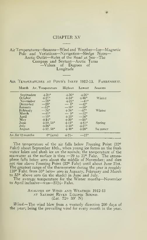
CHAPTER XV
Air Temperatures—Seasons—Wind and Weather—Ice—MagneticPole and Variations—Navigation—Sledge Notes
—
Arctic Outfit—Rules of the Road at Sea—TheCompass and Sextant—Arctic Terns—Values of Degrees of
Longitude
Air Temperatures at Pond's Inlet 1912-13. Fahrenheit.
Month Av. Temperature Highest Lowest Seasons
September +30° +36° +26°October 1
27° +34° +80° WinterNovember —18° +22° —40°December —28° — 8° 42°
January —32° —10° —50°February —34° + 30° —47° WinterMarch —41° — 9° —52°April —19° + 18° —36°May +16° + 30° —10°June +30.50° +44° +60° SpringJuly + 36° +50° +27°August +32.50° +40° +28° Su mmer
Av. for 12 months 0° (zero) +21- —15°
The temperature of the air falls below Freezing Point (32^
Fahr) about September 15th., when young ice forms on the fresh
water lakes and slush ice on the sounds; the temperature of thesea-water at the surface is then —29 to 31° Fahr. The atmos-phere falls below zero about the middle of November; and does
not rise above Freezing Point (32° Fahr) until about June 21st.
The greatest range of the thermometer during the year is roughly110° Fahr. from 55° below zero in January, February and Marchto 55° above zero (in the shade) in June and July.
The average temperature for the Winter months—Novemberto April inclusive—was—253^2" Fahn.
Analysis of Wind and Weather 1912-13AT Salmon River Eclipse Sound.
{Lat. 72o 30' N)
Wind.—The wind blew from a westerly direction 209 days ofthe year; being the prevailing wind for every month in the year.
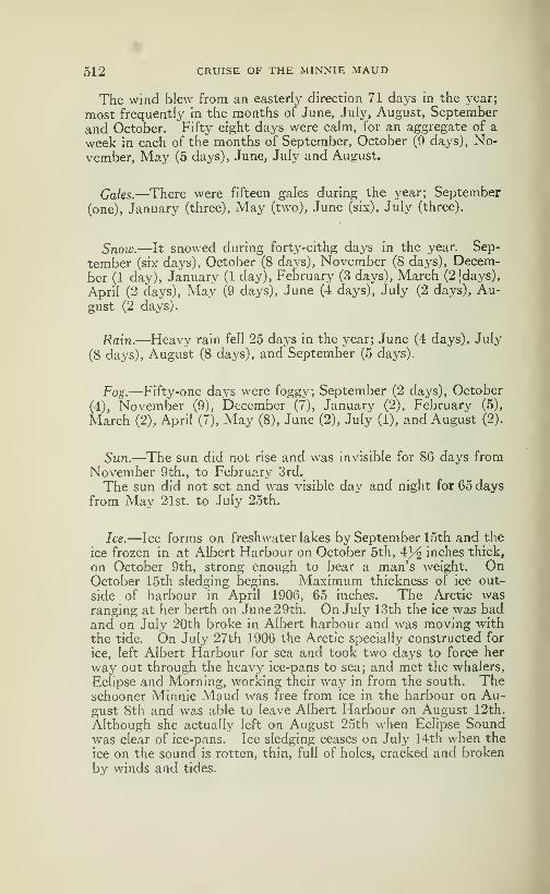
512 CRUISE OF THE MINNIE MAUD
The wind blew from an easterly direction 71 days in the j'car;
most frequently in the months of June, July, August, September
and October. Fifty eight days were calm, for an aggregate of a
week in each of the months of September, October (9 da\'s), No-
vember, May (5 days), June, July and August.
Gales.—^There were fifteen gales during the year; September
(one), January (three). May (two), June (six), July (three).
Snow.—It snowed during forty-eithg days in the year. Sep-
tember (six days), October (8 days), November (8 days), Decem-ber (1 day), January (1 day), February (3 days), March (2|days),
April (2 days), May (9 days), June (4 days), July (2 days), Au-gust (2 days).
Rain.—Heavy rain fell 25 days in the year; June (4 days), July
(8 daj^s), August (8 days), and September (5 days).
Fog.—Fifty-one days were foggy; September (2 days), October
(4), November (9), December (7), January (2), February (5),
March (2), April (7), May (8), June (2), July (1), and August (2).
Sun.—The sun did not rise and was invisible for 86 days from
November 9th., to Februarj^ 3rd.
The sun did not set and was visible day and night for 65 daysfrom May 21st. to July 25th.
Ice.—Ice forms on freshwater lakes by September 15th and the
ice frozen in at Albert Harbour on October 5th, 4^ inches thick,
on October 9th, strong enough to bear a man's weight. OnOctober 15th sledging begins. Maximum thickness of ice out-
side of harbour in April 1906, 65 inches. The Arctic wasranging at her berth on June 29th. On July 13th the ice was badand on July 20th broke in Albert harbour and was moving with
the tide. On July 27th 1906 the Arctic specially constructed for
ice, left Albert Harbour for sea and took two days to force her
way out through the heavy ice-pans to sea; and met the whalers,
Eclipse and Morning, working their way in from the south. Theschooner Minnie Maud was free from ice in the harbour on Au-gust 8th and was able to leave Albert Harbour on August 12th.
Although she actuall}^ left on August 25th when Eclipse Soundwas clear of ice-pans. Ice sledging ceases on July 14th when the
ice on the sound is rotten, thin, full of holes, cracked and broken
by winds and tides.

cruise of the minnie maud 513
Magnetic Pole and Variations
Location of Magnetic Pole
Magnetic Pole—(Ross 1831). Lat. 70o 5' 17", Long. 96o 56' 45' W.
Description of Magnetic Pole
The Northern Magnetic Pole was for the first time in historylocated by Lieutenant Commander James Clark Ross the activeand indefatigable nephew of Sir John Ross, on June 1st. 1831; in
latitude 70o 5' 17", longitude 96o 46' 45" West—dip of the needle89o 59' within one minute of the vertical. The proximity of themagnetic pole was further established by the total inaction of theseveral horizontal needles in Ross' possession; not one of whichshowed the slightest effort, although delicately suspended, to mo-ve from the position in which it was placed. They hoisted theBritish Flag on the spot and took possession of the North Magne-tic Pole with all adjacent territory in the name of Great Britainand King William, the Fourth; and erected a large cairn of lime-stone boulders marking the spot, under which was placed a canis-ter with a record of the discovery.
Lieut. Commander Ross in his report wrote: "The land at this
place is very low near the coast, but it rises into ridges of fifty
or sixty feet high about a mile inland. We could have wished thata place so important had possessed more of mark or note. It wasscarcely censurable to regret that there was not a mountain toindicate a spot to which so much of interest must ever be attachedand I could even have pardoned any one among us who had beenso romantic or absurd as to expect that the magnetic pole was anobject as conspicuous and mysterious as the fabled mountain ofSinbad, that it even was a mountain of iron, or a magnet as large
as Mont Blanc. But nature had here erected no monument todenote the spot which she had chosen as the centre of one of hergreat and dark powers. We were fortunate in here finding somehuts of Esquimaux that had not long been abandoned and wereenabled within their shelter to establish our observations with thegreater ease."
Magnetic Variations — Navigation.
Magnetic Variations of Compass.
PLACES Magnetic Variation
Ashe Inlet-Hudson Straits +52°31'4"W.Albert Harbour-North Baffin Land -f-93°W.Blacklead Island-Cumberland Gulf -f-oC'l' 9" W.Belle Isle 34° W.Browne island, Cornwallis Island —149° 57' 9" W,Cape Bounty, Melville Island —107° 8' 4" E.Cape Fisher—Winter Island —145°58' 5" E.

514 CRUISE OF THE MINNIE MAUD
Cape Fisher—Winter Island —56° 18 'W. Dip 87° 49' 33".
Cape Hotspur. Bathurst island —145° 58' 5" E.
.
Cape Welsford—Southampton island —50° 18' W.Cape York. Greenland +29° 18' 6 W.Chesterfield Inlet (S. Entrance) +10°W.Dealv Island, Melville Island —106° 35' E.Disko Island. Greenland. Godhaven +62° 32' 2 W.&ebus Bay, North Devon +123° 75' W. (approx).Gibson Cov(^Repulse Bav —48°33' W. Dip88-07H'-IglooHk, Fui-y & Hecla Strait (Parry 1823) . . +82° 39' 54" W.Fox Channel—Lat 65- 7' N; Long. 79- 28'W Magvar. 52° 11^' W.Igloolik 82° 39' 54" W. Dip 88° 55".
Fullerton Harbour. Hudson Bay +18° W.North End—Neertonatko island —87° 20' W.Point Gillman, Bvam Martin Island —128° 45' 4" E.Point Griffiths. IVIelville Island —120° 18' 1"E.Port Burwell Hudson Strait +44° 1' 3" W.Port Churchill. Hudson Bay 2° E.Port Leopold, North Somerset +120° W . (approx).River Clyde. East Baffin Coast +75° 1
9' 4" W.Salmon River, Eclipse Sound +96° W. (approx).West End—Amherst island (Fury & Hecla
strait) —89°18K'W.Tern Island 82° 22' W. Dip 87- 37'.
Winter Harbour, Melville Island —97° 17' 6" E.
Magnetic Variations
From observations taken by C. P. L. "Arctic" in 1907-08; A. P.
Low in "Neptune" in 1903-04; and by C. C. Craft, of the U. S.
Department of Terratial Magnétisme in 1908.
PLACES Magnetic Variations
Godhaven (Disko Island) + 62°32'.2 W.Hare Island (Greenland) + 63° 15' .3 W.Upernivik (Greeland) + 69°30' W.Cape York (Greenland). . + 79°18'.6 W.North Star Bav (Greenland) + 89°55'.l W.Kangerdlooksoah (Greenland) + 92° 07' .9 W.Etah (Greenland) +104°04'.2W.Hawk Harbour (Labrador) + 39°57'.0 W.Battle Harboiu- (Labrador) + 35°05'.8W.Flœberg Beach (near Cape Sheridan) 97°57'W.Port Foulke (near Etah) 110°36'8. W.Port Foulke (near Etah) 110° W.Folk Conger (Lady Franklin Sound) 100° 36. 8' W.
Navigation.—North of the Arctic Circle the ship's compass be-comes very sluggish and unrehable, owing to the proximity of theMagnetic Pole. The ship's position must be ascertained daily
when the atmosphere is not abscured by fog and clouds, from thesun at noon for latitude and by the ship's chronometer for longi-
tude; and the day's run checked by the log's with allowance madefor favorable and contrary currents. Bearings are laid from theland where possible, and in the long hours of dayhght, in the sum-mer months it is often expedient to set the course from one ice-
CRUISE OF THE MINNIE MAUD 515
berg to another. When near the land, soundings should be taken
and a constant look-out kept for tides ripples or shoals, low islands
and reefs. In times of fog, mist and tlie dark hours of night, es-
pecially in stormy weather, wherever icebergs are likely to be
met with, the ship should slow down to half or quarter speed or
heave to until dayhght appears. Ice at a distance can be dis-
tinguished from land by the whitish glare or "glint" which it
throws up from the surface of the water, while the land always
appears dark unless it be very low-lying and thickly covered with
snow.Navigation — Sledge Notes
Leads.—No "leads" or open lanes of water between the heavyice-floes should be entered bj^ a ship unless a way out again is seen.
Many ships have been lost through neglect of this precaution;
amongst others, the "Algerine" in Ponds Inlet and the "Proteus"
in Smith Sound and many others. No ship is strong enough to
withstand the pressure of two huge floes, often square miles in
area, that are crushed together by wind and tide. It sometimeshappens that the large icebergs, impelled by wind and current,
will plough their way through the icefields, which they break up,
causing "leads" through which a ship may follow or go in the op-
posite direction.
Ice Navigation.—Parry when navigating Fox Channel to the
north-east of Southampton Island in August 1821, writes: "Atthis time the prospect to the westward off"ered from the crow's
nest as unpromising, on account of the closeness and extent of the
ice, as I ever remember to have seen it. Shortly afterwards, ho-
wever, the ice, gradually, or rather suddenly, became navigable
in that direction, the ice separating and, in fact, disappearing in
so rapid and extraordinary a manner as to astonish even those
amongst us who had been the longest accustomed to this naviga-
tion, and aff"ording a striking example of those sudden changes
which in icy seas, almost teach us never to despair of making pro-
gress, even under circumstances apparently the most unfavora-
ble. We did not fail to take advantage of this alteration, andunder all sail soon made Southampton island after an unobstruc-
ted run of between thirty of forty miles, when we were again stop-
ped by the heavy and extensive floes."
Dismantling Ship.—Parry remarks: "It may indeed, be safely
aff"irmed that in a high latitude the less the masts and yards are
dismantled the better, for the frost does no injury to the gear
while it remains unmoved; and none can possibly occur from tha-
wing till the proper season for refitting arrives."
Sledge Notes
For seldge travel in the Arctic, the only correct and reliable
34
516 CRUISE OF THE MINNIE MAUD
bearings are the sun's true bearings, as the compass is very unre-
liable and is not used in fine weather. The magnetic variation of
the compass also varies from year to year, which makes naviga-
tion by that means, on sea and land, very unreliable. Parryfound the magnetic variation at Winter Harbour, Melville Island,
in 1819-20 to be 127 degrees easterly; while the "Arctic" in 1908-
09 found it to be 98 degrees easterly a difference of 29 degrees.
The officers of the Arctic, when preparing for their sledge jour-
ney across Mc Clure Strait, from Melville Island to Banks land
took beforehand the sun's bearings on the 74th., and 75th. paral-
lels for use in April and May. Each officer was provided with a
pocket card on which was marked the sun's bearings every 20 mi-
nutes for the 24 hours during the long days when the sun dii notset. In the dark winter months when the sun is low, the moonshines with great brilliance for about ten days in each month, andthe natives take advantage of these moonlit days and nights to
travel from place to place and to visit their traps. The "Arctic"officers also prepared a chart showing the bearings of the moonfor each day and night of the month, and prepared a table for their
guidance when traveling at night. This table was found of great
service when crossing the wide strait when the land was not visi-
ble.
With regard to the comparative value of dog-power and man-power for hawiing sleighs, the commander of thi "Arctic" repor-
ted: "I regret that dogs were not available for drawing the sleds.
Our explorations and traveling would have been accomplished in
much less time and more territory covered, and, in consequence,a more extensive field examined by the scientific officers and less
hardship endured by the men on the expedition to Banks island,
if dogs had been available. Travelling is extremely slow andhard for men who draw their own supplies over snow that wouldnot bear the weight of the men. The reports of the officers sent
to Banks island show the extremely arduous work performed bythem on their trips across Mc Clure strait, where hummocks of
ice and deep snow impeded their progress. They also show thatthe exposure to extreme cold and high winds, which swept the un-protected strait, was prolonged by the necessity of drawing their
own supplies and equipment. I, therefore, advise the precau-tion of providing dogs in similar expeditions".
Arctic Outfit
The following is a list of selected articles that will serve as aguide to sportsmen, explorers, and prospectors who comtemplatespending a season or more in the Arctic.
Every article should be of the best quality and as compact andlight as possible. Provisions wherever possible, should be pac-ked in hermetically sealed tins of moderate dimensions for sledge
CRUISE OF THE MINNIE MAUD 517
transport, and the rifle should be carried in a very strong box to
stand every sled accidents, for the sledges often turn upside downin bad ice. This box should be in a handy place so to be alwaysin position to catch at a glance the rifle.
Arctic Equipment
For purposes of trading and the hiring of Eskimos, dogs andsledges, a sufficient supply of arms and ammunition (43 Mauser,Martin-Henry, 303 British, 303 Winchester, 450 Express, 57
Snider and 44 Winchester in proportion to the foregoing order)
and of Smoking and Chewing Plug Tobaccos, Matches, Hatchets,
Skinning and Snow Knives saws knives handsaws. Pocket Knives,
Files, Needles (assorted). Beads, etc., should be included in the
equipment, small sets of tools and traps No l}/^ "Victor" and few
No 4.
The equipment may be classified under the headings of: Ins-
truments, Arms, Clothing, Provisions, Kitchen, Transport, Sun-dry and Medical and Pastimes.
Instrument.—Compass, Sextant, Chronometer, Watch, Pedo-meter, Artificial Horizons and Mercury, Telescope, Binoculars,
Photographic Camera or Kodak and Moving Picture Kodak andnecessaries to finish those pictures.
Compass.—Kraemar's Pathfinder is a suitable instrument.
Telescope.—The Bardou Extreme High Power Telescope with
a magnifyina: power of 47 times is about the best instrument for
all purposes, terrestrial and astronimical—25 in., closed 30% in.,
extended. Weight 4 lbs. Or any other better, the very best
and compact.
Binoculars.—The Busch 10 Power Terlux Army and NavyModel, specially designed to stand rough usage, adopted by U. S.
Army and Navy is probably the best combination for Power, De-finition and Illumination. Field of view at 1000 yards, 80 yards
Diameter of object lense 1^ in.—Height 7% in. Weight 7^ lbs.
The best Range-Finder, to take the longest distance you can,
the more compact instrument.
Note.—^These instruments can be obtained from any well knowndealer in sportmg goods.
Franklin s Instruments.—Franklin, on his continental expedi-
tion to the Polar Ocean by way of the MacKenzie river in 1825
included the following instruments in his equipment: "In the
choice of astronomical instruments I was necessarily guided bytheir portability. Our stock consisted of two small sextants, twoartificial horizons, two altitude instruments, a repeating circle
or lunar observations, and a small transit telescope for ascertai-
ning the rates of the chronometers. We had a dipping-needle
518 CRUISE OF THE MINNIE MAUD
mounted on Meyer's plan, a plain needle verj- delicately fitted for
observing the diurnal variation; two of Kater's azimuth compas-ses, and a pocket compass for each officer. The atmosphericalinstruments were two electrometers, two of Daniel's hygrometers,Leslie's photometer and hygrometer, besides a supply of mercu-rial and spirit thermometers of different sizes."
Amis, Rifle.—The 280 High Velocity Sporting Ross Rifle is thebest all round rifle for big game of any description. The Ross280 has proved its efficiency and dropping-power on polar bears,
musk-ox, caribou, walrus, narwhal and seal in the Arctic; on ele-
phants, lions, tigers, rhinoceros andbisons in Africa and India; ongrizzlies, mountaingoats, elks and moose in the Rockies of America.It has the flattest trajectory of any rifle made, 43^ in., rise in 300yards and 9 feet in 1000 yards as against the U. S. Springfield's
14 feet at the latter range. It has a muzzle velocity of 3050 feet
seconds and its 145 grain bullet strikes a ton and a half blow. Thestraight-pull bolt action is the simplest, strongest and quickestmade-five shots in two seconds-and it does not jam in the coldest
weather. Weight 7}^ lbs. The Ross Copper Tube Bullet is
the most deadly in use and is the best for bear, musk-ox, cari-
bou and seal. The all metal cased bullets are most suitable for
piercing the tough, heavy bones of walrus and narwhals also
the Newton Rifle Caliber, 256, 30 and 35, are the tv.o best Rifles
for any largest game in the world and the cartridges can be loadedwith reduced charges for small game with the best accuracy, I
recommend these Rifles for explorers, prospectors, hunters, sport-
men, and tourists.
Combinatio7i Rifle and Shotgun—A very useful arm for theArctic for large and small game is the "Mixed Exprès" made bythe Manufacture Française d'Armes et Cycles of Saint Etienne,France. It combines a pair of 405 (10.5 m m) Express rifles witha 12 or 16 bore shot gun underneath. Weight 8 lbs.
Marble's Game Getter Gun.—12 in., barrel is a handey little wea-pon for small game, hares, ducks geese and ptarmigan, or evenfor caribou, and seal at close range. It has a verj^ accurate 22rifle barrel on top with a 44 smooth bore, for shot or ball cartrid-
ge, underneath. The stock folds up and the arm is carried in ashoulder holster. Weight 2'-<f lbs.
Pistol.—The most powerful and reliable pistol in the world is
the Colt. 45 Caliber Automatic Pistol 7 shots-as adopted by theU. S. Army; and can be relied on to drop the largest game, inclu-
ding bear and walrus, at short range. Weight 39 oz.
Clothing
Winter.—The best clothing in the Arctic in wintertime, whenthe thermometer ranges steadily from November to June bet-
CRUISE OF THE MINNIE MAUD 519
ween lOo and 60o below zero, is made by the Eskimo women fromthe skin of caribou, polar bear, fox, hare and seal. A good com-bination is heavy, all-wooI shirts, button sweater with pockets,drawers and socks underneath with Eskimo skin clothing consis-ting of Koohtang, trousers, socks, shoes and mittens outside. Awarm-lined leather cap with ears-and-neck-flaps; several pairs ofinside woolen mitts trigger-finger; a fur or wool-lined leather face-mask to cover the nose and cheeks but leaving the eyes, nostrils
and mouth free; snow-goggles with wooden or felt covered metalrims; several pairs of thick felt insoles to put inside the Eskimoshoes as a protection against the frost; and a pair of snovvshoescomplete the winter equipment.The wooleen-socks should be of different sizes so that two or
three pairs can be worn at the same time. Ordinary stiff leatherboots are useless in the Arctic in winter and will freeze the feet
in short order. The Eskimo boots should be made long and largeenough to cover a thick felt insole, a thick pair of wooleen socks,
a caribou-or hare lined Eskimo sock (hair inside), a caribou orseal over-sock with long caribou legs to the knee. The socks andinside mittens (wool or fur) should be changed or dried everynight as otherwise the perspiration soon freezes the feet and hands.
Summer.—In summer time wooleen under-clothing; ordinaryrough outer clothes; a button sweater jacket with pockets; a sheeplined coat; high leather water-proof mocasin boots with soles andheels (the latter steel-studded)or Eskimo Big Seal (oogjook)boots; wool-lined leather mitts with trigger finger; a light hun-ting cap with flaps; rain coat, and rubber thigh boots for wadingand fishing.
Provisions
(For the Base of Permanent Camp.)
Fresh meat of seal, seal liver, walrus, caribou, hare, ptarmigan,bear and musk-ox are obtainable from the Eskimos or by hunting.
In summer salmon, trout, geese and ducks are obtainable.A selection can be made from the following:
Bacon (slabs).—Salt Pork, Canned Beef, Sausages, Bologna,Pork and Beef in tins.
Dried fish.—Salmons and Sardines in tins.
Biscuits.—Hard tack or ship's biscuits, four to the pound pac-ked, 120 in a sealed tin.
Beans, Peas.—Rice, Oatmeal, Wheat Flour in tin. Corn Meal,Baking Powder (1 lb to 100 lbs. Flour) and Yeast cakes for ma-king Sourdough bread and pancakes.
Sugar, Molasses (syrup), Tea, Coffee, Cocoa, Sweet Chocolate^

520 CRUISE OF THE MINNIE MAUD
Milk Powder, Condensed Milk, Tinned Butter, Eggs, CheesePowder, Lard, Salt, Pepper, Mustard, Curry and Onion PowderRaisins.
Dehydrated Vegetables.—Potatoes, Onions, Carrots, Sweet Corn,
Green Peas, Spinach, Horse Radish, Shced Beans, Asparagus.
One pound of dehydrated potatoes will make seven pounds of
fresh, and one pound of dehj^drated spinach will make 19 lbs of
fresh spinach.
Dried Vegetables and Fruits.—Onions, Potatoes, Spinach, Tur-nips, Apricots, Rhubarb, Peaches, Apples, Prunes, Dried apri-
cots are especially recommended as a preventive of scurvy.
Pemmican, Bovril, Tabloid or Compressed Tea, soup tablets
(pea-bean), barley, tomato, onion, mulligatanny, rice and mockturtle, consommé tablets and Erbswurst.
Pickles.— (1 quart per man per month), Limejuice and Vinegar.
Alcohol.—No alcohol is required as a stimulant in the Arctic
—
Tea, Coffee and hot Soup are better. A case of Liquor Brandymight be included as médecine in case of cramps, cohc or dysen-
tery.
Pemmican.—Is a prepared and condensed food, made from beef
fat and dried fruits. Peary, who should be the best authority onthe subject, describes it as the most concentrated and satisfying
of all meat-foods and as absolutely indispensable in protracted
Arctic sledge journeys. A bullock dressing 698 pounds of beef
and bone yields 47 lbs of first-class pemmican, 47 pounds of se-
cond-class pemmican and 23 pounds of dried meat, includino- ton-
gues, a total of 117 pounds, dried. The total nutritive strength
is thus reduced in weight to one sixth that of the fresh beef.
Erbswurst.—Soup Rolls form the standard concentrated foodused in the armies in Europe. They contain more nourishmentfor their weight and bulk than any other emergency ration. Erbs-wurst is compounded of pea, bean or lentil meat, meat and vege-
tables, well seasoned with pepper and salt. It is in the form of
a powder and is dropped into boiling water to make a thick soupor gruel in a few minutes. It is made up in ^ lb., and 3^2 It)-,
rolls and 3^ lb. will make two big helpings.
Sledge ration in the Field.—Peary found the best ration for
sledge journey in the Arctic to be, one pound Pemmican, onepound Ship's Biscuits, half oz., compressed Tea, 6 oz Kerozene or
Alcohol for fuel a total of 2 lbs. 43^^ oz. of solids per man. To this
.night be added an alternative diet including Erbswurst and Cho-colate.

CRUISE OF THE MINNIE MAUD 521
The "Arctic" ration for sledge expeditions consisted of: Pem-mican, 1 lb., Biscuit ^ lb.. Chocolate \}/2 oz.. Sugar J^oz., Tea34 oz.. Sugar for Cooking 3^oz., Potatoes 2 oz., Tobacco J^ oz.,
Curry and onions; Pepper and salt for soup 2 lbs }/2 oz. per man.Tobacco.—Smoking and Chewing, and Matches. Couple of
waterproof boxes at least for each man. All matches shouldbe carried in water and fireproof boxes.
Kitchen
For the permanent camp a coal and wood stove with an ovenfor baking is the best, as it also warms the dwelhng. In addition
to the regular set of boilers, fry-pans and kettles, a good cereal
steam-boiler should be included for cooking porridge and corn-
meal and for making steamed sourdough bread. For boihngand frying and for use in tent and igloo Kerosene and Alcohol sto-
ves are the best; as the gasoline stove is not satisfactory in theArctic as if, constantly getting out of order and the even presentdanger of an explosion and fire. The 4 inch double-wick burneris probably the most useful size for a Kerosene stove.
Travelling Kitchen
The "Kitchen box" as designed by Pearj' for his sledge jour-
neys to the North Pole is simply a wooden box containing twodouble burner oil stoves with four inch wicks. The two cookingpots are the bottoms of five gallon Kerosene tins, fitted with co-
vers. When packed they are turned bottom side up over eachstove and the hinged cover of the wooden box is closed. On rea-
ching camp, wheter tent or snow igloo, the kitchen box is set
down inside, the hinged top of the box is turned up and keeps theheat from melting the wall of the igloo or burning the tent. Thehinged front of the box is turned down and forms a table. Thetwo cooking pots are filled with pounded ice and put on the stoves;
when the ice melts one pot is used for tea, and the other may beused to warm beans, or to boil meat.
Transport
Sledge.—The best sledge for all round Arctic work, capable of
standing the roughest usage when travelling over hummucky ice,
pressure ridges, ice-cracks and deep holes, crusted snow and wa-ter covered ice is one made of hardwood throughout (well seaso-
ned oak for preference), and is 14 feet long, 3 feet wide and therunners, one foot high. The runners are solid, 14 feet long, 3 in-
ches wide and shod with 3-16 inch steel shoeing bending over to
reinforce the bow for a couple of feet. The bow and stern are
curved and only about eight feet, in the centre, of the runners are
522 CRUISE OF THE MINNIE MAUD
Straight and rest plumb on the ground, so as to make the sledge
easy to guide and turn as on a pivot. The bow is curved up 18
inches from the ground and both bow and stern are braced with
inner and outer galvanized plates to stand heavy shocks. Therunners are braced together, at bow and stern, by strong galvani-
zed iron cross bars. The runners are two feet apart inside andthe cross pieces project 3 inches on each side of the runners andare notched at the ends to catch the sled lashings. The cross
pieces are of hardwood, 13 centre ones, two inches apart and 3
feet by 6 inches by one inch. The bow and stern cross boards are
one foot wide, three feet long and 2 inches thick. All the cross
boards are lashed to the runners with galvanized steel strand wire.
The upstanders at the stern are 2 feet long, 3 inches thick and8 inches wide at the base; they are bolted or clamped to the run-
ners. The drag-chain or bridle consists of galvanized chain links
with ring, attached to the inside of the runners by galvanized
steel plates and bolts under the bow board about seven inches
from the ground.This sledge which will not weigh over 250 lbs and will carry a
load of 1500 lbs., should not cost more than $15.00. It can bedrawn by a team of ten or 12 dogs.
Sledging Outfit.—Party consisting of 1 white man, 1 Eskimoand his wife, the following equipment, for 60 days hunting,
exploring or prospecting trip, can be packed on the above des-
cribed sledge.
30daysDogPemmican (red tins) 360 pounds.60 davs Men Pemmican (Blue tins) 180 "
Ship's Biscuits 180 "
Condensed Milk 40 "
Compressed Tea 5
Liquid Fuel-Keroseneor Alchool 40Tobacco 15Tent, Pole and Steel Stakes 30 ']
Rifles and Ammunition Harpoon )
Pick-axe saw, saw-knifeJ
150Spare boots and clothes . 20Bedding 50 "
Stove and Cookery 20 "
1090 pounds1 Seal 150 "
Total load 1240poundsWeight of sledge 250 "
1490 pounds
The sledge should be packed as low down as possible to keepthe centre of gravity low to prevent overturning; and the load
should be covered with waterproof sleigh covers to keep the bed-
CRUISE OF THE MINNIE MAUD 523
ding etc., from being wet by rain and snow. Twelve dogs will
pull this load, which will become lighter by about 20 lbs everyday. The dogs and men will feed part of the time, on seal, cari-
bou and bear meat when killed, and the pemmican held in reserve
for occasions when the weather is too bad for hunting and game is
scarce.
Peary's Sledge.—The Peary sledge was twelve to thirteen feet in
length, two feet in width, and seven inches in height; the runnerscurved at both ends, in front and behind, with two inch wide bentash runners attachers, and the runners being shod with two inch
wide steel shoes. The sides of both runners are solid and lashed
together with sealskin thongs. Two strong upstanders of woodare attached at the rear end, with a cross bar, for guiding the sled-
ge. On a level surface this sledge will support ten or twelve hun-dred pounds. The dogs are attached to the sledge fanwise, as is
the Eskimo custom; and the standard team is eight dogs; althoughfor rapid travelling with a heavy load, ten or twelve are often used.
Dog harjiess.—For dog harness Peary adopted the Eskimo pat-
tern, consisting of two loops joined by a cross strip at the back of
the neck and under the throat, made of special webbing or belting;
about two and a half inches in width, with a braided-linen sash cordfor a trace. The dog's forelegs pass through the loops, and theends are joined over the small of the back, where the trace is at-
tached. This harness is very simple and flexible and has the ad-vantage over seakskin that the dogs won't eat it when hungry in
camp. In the Northwest dogs are harnassed tandem. This is
the white man's method. In the Arctic they are harnassed fanfashion the Eskimo method. That is to say, each dog has an in-
dividul trace secured to the end of a single thong, leading outfrom the bow of the Kamutik (sledge) and called the bridle. Theindividual traces are various lengths. The dog with the longest
trace is the leader of the pack, and particularly trained to respondto the drivers directions. The other dogs will follow his lead.
For open country and sea-ice travel the Eskimo method is proba-bly the best, as the work is more even distributed and the driver
can always tell if each dog is doing his share of the work, but for
narrow trails and wood travel the tandem method is more prac-
ticable.
Load.—Peary's sledges were loaded as follows: On the bottomwas a layer of dog pemmican in red tins, covering the entire length
and width of the sledge; on this were two tins of biscuits, and crewpemmican in blue tins; then the tins of alcohol and condensed milk,
a small skin rug for the man to sleep on at night in the igloo, snow-shoes and spare foot gear, a pick-axe and a saw-knife for cutting
snow-blocks and a few extra pairs of Eskimo sealskin boots. An al-
cohol stove, specially designed bj' Peary completed the outfit.
524 CRUISE OF THE MINNIE MAUD
Compactness was the main idea and keeping the centre of gravi-
ty as low as possible in order to prevent the sledges from o\ertur-
ning.
Sled Driving.—The dogs are guided by the whips and the voice.
It takes considerable time and practice for a white man to master
the use of the long whip and to learn how to control the dogs, andto acquire the exact Eskimo accent to the words: "Ar-ree, Ar-ree"
meaning to the right; and "Arkai, Ar-kai" to the left; as well as
the "Huk, huk, huk" which is the equivalent of "go on"—
"Shoo-
oo" means to "stop". When the sledge is stopped, if loaded, the
runners are blocked with tramped snow; and if unloaded, it is
overturned, to prevent the dogs from running away after seal andother animals that they may scent afar off.
Sledge équipement.—^A couple of saw backed snow knives; astrong hatchet; a pick axe; short handled snow shovel; waterproofed canvas sled covers; water proofed canvas duffle bag for
clothes, etc; two 50-foot twisted fibre Hemp Lariats for rescue
work and for tent guys; bamboo ice walking-stick; long hghtstrong pole; Eskimo stove; traveUing kitchen and kerozene or al-
cohol stove; oil cans fitted with spout and screw-top fitted with
liquid fuel; compact canteen equipment containing a few plates
knives, forks, spoons and cups; a couple of butcher's skinning
knives with sharpening steel; a strong pair of snow-shoes; a small
combination tool set; harpoon; Thermos bottle for keeping tea
and bovril hot on the march; a good telescope; pedometer; watch;compass; rifle and ammunition and a plentiful supply of matches.
A dozen fox-straps it can also be added an "Acme" Collapsible
Canvas Boat, for crossing rivers and small lakes in summer can
be added with advantage.
Tent.—For summer work the lightest and easiest erected tent is
the "Miners" or "Yellowstone" Tent, which is square shaped andhas the advantage of being easily and quickly set up, easily rolled
for transporting and the sharp pitch of the roof and sides sheds
rain and snow. It is made of heavy, white double-filled 10 oz.,
duck, woven double and twisted both ways. The flooring, whichis made of extra heavy duck, is permanently attached to the tent,
a five inch sill keeps out the dirt and rodents, and the doors or
flaps are fastened by snap-hooks, making it easy to open and close.
For winter use a similar tent made of caribou or goat skins with
the hair outside would make a warm and snow proof shelter,
with the door flap away from the wind. In this case the bottomshould be omitted and the snow floor covered »vith seal and cari-
bou skins. A rope or cord could be attached to the top of the
pole and attached to heavy ice or snow-blocks to windwardand leeward, so as to hold the tent down in a strong wind; andsnow-blocks could be packed around the edges to keep out the
wind.
CRUISE OF THE iMINNIE MAUD 525
Sleeping bag.—The best low temperature sleeping bag for arctic
use is one of caribou skins, made by the Eskimo women with thehair inside. Under ordinary conditions, however a water-proofedcanvas bag lined with a detachable feather-filled bag; or a baglined with four thicknesses of Lhamaand duffle (that is, four thick-
nesses ove-r and four beneath the sleeper), should not weigh morethan ten pounds and afford good night covering. Woollenblankets are too heavy and became sodden with snow and frozen
in the Arctic.
The best combination would be a heavy waterproofed canvascover with a flap over the top to exclude wind and rain, weightabout 6 lbs and that will absolutely keep out water; and an inner
bag of caribou skin with the hair inside; or feather quilting whichis very light and warm, or young musk-ox skin with the wool andhair inside. Each bag should open for a couple of feet from the
top down and shut with snap kooks in order to facilitate getting
in and out. A light circular stiffish pillow should also be included.
Sundry
Combination Tool Set; Thermometer (outside); Hunting kinfe;
Hatchet; Butcher and Skinning Knives; Sharpening Steel; Whet-stone; Pocket Knives; Vacuum Bottles; Waterproof and Fire-
proof Match box; Fox Traps; Canvas Game Bag with shoulder-
strap; canvas-duffle-bags for clothing; drawing instruments andstationary; mirror; scissors for hair clipping; soap and towels;
pocket drinking cup; lantern; leather belts; insect powder; pros-
pector's pick and magnifying glass "Arbalette" or Cross-bow for
spearing salmon from the river bank as sold by the manufactureFrançaise d'Armes et Cycles of Saint-Etienne, France and Har-poon, thread, buttons and needles.
Medical
Médecine Chest containing: Catgut and needles. Bandages andCotton; Quinine; Astringent (Tannic acid); Gauze; Plaster, sur-
gical liniment; Sticking Plaster; Electric Tape; Listerine; Perman-ganate of Potash; Carbolic Acid Tablets; Mustard Plasters; Lin-
seed Meal for Poultices; Spirits of Camphor; Camphorated Vase-line; Boracic Acid Tablets; Dusting Powder; Hydrogen Peroxide;
Anti-phlogistin; Cathartic Pills; Ipecacuanha; Liniment; Oiled
Silk; Lint; Oil of EucaK-ptus; Oil of Cloves for toothache; Den-tal forceps; Pile remedy; Camphor Cream; Peroxide Cream; Mer-curial Ointment; Bi-Chloride of Mercury; Scissors etc. And abook of direcctions as provided by Burroughes, Wellcome & Coor other responsible druggists.

526 cruise of the minnie maud
Pastimes
For the long sunless winter months spent in camp, games andpastimes are necessary to keep men in good health and spirits.
The days can be employed in going the round of the fox-traps
and the evenings spent in recreation. Chess and draughts (Chec-kers)
;playing cards; gramophone with some hvelj- reels and dance
records to amuse the Eskimos; and a supply of books of travel
and sport and illustrated magazines and catalogues will contri-
bute to the general comfort and amusement.
The Mariner's Compass
The Mariner s Compass.—The earliest reference to the Compassare to be found in Chinese History in the 64th year of the reign of
Ho-ang-ti (2634 B. C.) The power of the loadstone to commu-nicate polarity to iron is explicitly mentioned for the first time in
a Chinese dictionary, finished in 121 A. D., when the loadstone is
defined as "a stone with which an attraction can be given to theneedle."
It is uncertain when the compass was first used by Western na-
tions. Its introduction into Europe has been attributed to FlavioGioia, about the jear 1307. Encouraged by the possession of
this sure guide, by which at all times and in all placs he couldwith certainty steer his course, the navigator gradually abando-ned the method of sailing along the shore and boldly committedhis bark to the open sea and thereafter navigation made rapid
progress.
Apart from the earlier Norwegian navigators of the ninth cen-
tury, the first navigator to undertake serious voyages for the be-
nefit of geographical knowledge and discovery was Prince Henryof Portugal, surnamed the Navigator and younger son of KingJoao of Portugal and Queen Philippa of Lancaster, the grand-child of King Edward III of England; so that the first navigatorwas half British by descent. Prince Henry was born on March4,1394 and when grown to manhood sailed round the north-westcoast of Africa, past Cape Bojador, which he named and he also
visited and discovered Madeira, the Cape Verde islands and thecoasts of Senegal and Gambia.
In Mr William Barlowe's "Navigators Supply", published in
1597 we read: "Some few yeeres since, it so fell out that I had se-
veral conferences with two East Indians, which were brought to
England by Master Cavendish (Thomas Cavendish) and hadlearned our language: The one of them was of Mamillia (Manila)in the Isle of Luzon, the other of Miaco in Japan. I questionedwith them concerning their shipping and manner of sayling. Theydescribed all things farre different from ours, and showed that in
steade of our Compass, they use a magneticall needle of six in-
CRUISE OF THE MINNIE MAUD 527
ches long, and longer, upon a pinne in a dish of white China earthfilled with water: In the bottome whereof they have two crosselines, for the foure principall windes; the rest of the divisionsbeing reserved to the skill of their Pilots."
The Sextant.—The sextant is an instrument for measuring an-gles (latitudes) on the celestial sphere, and is furnished with a gra-duated arc, equal to one-sixth of the circle. It was originally in-
troduced about the year 1570 by the illustrious Swedish astro-
nomer, Tyco Brahe, who constructed several sextants with twosights, one on a fixed, the other on a movable radius, which theobserver pointed to the two objects of which the angular distancewas to be measured.Hooke later contrived the reflecting quadrant and Hadley in
1731 and Newton in 1742 also made improvements in the instru-
ment, which they called an Octant. Newton's instrument con-sisted of a sextor of brass, the arc of which, though only equal toone-eight part of a circle, is divided into 90o. A telescope is fixed
along a radius of the sector, the object glass being close to thecentre and having outside it a plane mirror inclined 45o to the axisof the telescope, and intercepting half the light which wouldotherwise fall on the object glass. One object is seen through thetelescope, while a moveable radius, carrying a second mirror closeto the first, is turned round the centre until the second object bydouble reflexion is seen in the telescope to coincide with the first.
As constructed by Hadley the instrument could only measure an-gles up to 90o; but in 1757 Captain Campbell of the British Navyone of the first to use it assiduously, proposed to enlarge it so asto measure angles up to 120o, in which form it is now generallyemployed.
Rules of the Road at Sea
Quite independently of Hadley and Newton, the sextant wasinvented by Thomas Godfrey, a poor glazier in Philadelphia, in
November 1730. Godfrey's instrument was a common sea-qua-drant to which he had fitted two pieces of looking-glass in such amanner as brought two stars at almost any distance to coincide.
"If the sextant is employed on land, an artificial horizon, whichconsist of a basin of mercury protected from the wind by a plateglass roof with perfectly parallel faces, has to be used.
_"Towards the end of the eighteenth and the beginning of the
nineteenth century the sextant was much used on land for deter-mining latitudes, but though in the hands of a skilful observer it
can give results far superior to what one might expect from a smallinstrument held in the hand (or attached to a small stand) it hason shore been quite superseded by the portable Altazimuth ortheodolite, while at sea it continues to be indispensable". (En-cyclopoedia Britannica.)
528 CRUISE OF THE MINNIE MAUD
The general rules of the road at sea, intended to prevent colli-
sions, especially where steamships are concerned, are embodied
in the following rhymes, prepared by Thomas Gray of the British
Board of Trade:
1.—Two Steamships Meeting\—When both side hghts you see aheadPort your helm, and show your Red.
2.—Two Steamships Passing\—Green to Green — or Red to Red.
Perfect safety — Go ahead.
3.
—
Two Steamships Crossing]—If to your starboard Red appear.
It is your duty to keep clear,
To act as judgment says is proper-
To port, or Starboard, back, or stop her.
But when upon your port is seen
A steamer's starboard hght of Green
There's not so much for you to doFor Green to port keeps clear of you.
4.
—
All Steamers must keep a good- look-out, and steamships stop
and go asteryi if necessary]—Both in safety and in doubtAlways keep a good look-out;
In danger, with no room to turn
Ease her !—Stop her !—Go astern !

CRUISE OF THE MINNIE MAUD 529
LIST OF SOME OF THE TERMS USED IN ICE NAVIGATIONBY WALERS, SEALERS AND OTHERS
Floe—A large mass of floating ice.
Pan—A small floe or small piece; one that can be forced aside or slewed.A field—A large body of ice that nmy be seen around.Land fioe—-Ice frozen fast to the shore.
Packed ice—Are small pieces close together and held by the pressure ofice and currents.
Ice blink—Is a peculiar pale yellow reflection of the sky, indicating thepresence of ice at a distance.
The ice pack—Is a large body of vsolid ice extending across the whole sea,and beyond which it is impossible to advance.
Slack ice— Is detatched so that it can be worked through. Ice is saidto be slacking when it begins to be open so as to be navigable.
Running abroad—Ice is said to be running abroad when it opens outor slack away so as to be navigable.
A Nip— Ice is said to be nipping when it begins to close by reason of theaction of the winds or currents, so as to prevent the passage of a vessel.
Calving—Ice is calving when the small pieces break off from the bottomand rise to the surface of the water.
A lead— Is a strip of navigable water opening into the pack.A blind or lead pocket—Is a short opening into the pack, and termina-
ting against solid or thick ice.
Hummocky ice—Is rough, uneven or thick ice.
Porridge ice—Is small finely ground up ice.
Slob— Is snow afloat and forming into ice.
Sish—Is thin new ice just formed in thin sheets.Lolly—Is loose new ice.
Waking—Is the following in the wake of another vessel through leadsand slack ice.
Backing running or butting—Is backing and running the ship at icein order to force or head a way through it.
Slewing—Is forcing the vessel ahead against the corner of a piece of ice,
with the intention of causing it to slew or swing out of the way, so asto force a passage by it.
Tracking—Is following along the edge of the ice pack.Water sky—Is a dark and blueish appearance of the sky indicating open
water beyond the pack.Slatches^Are considerable pools of open water in the ice.
Swatch—Is a small pool of open water in the ice.
Swatching—^Watching for seal around a swatch.Wash—Is the sound of the sea breaking against the ice.
Rote—Newfoundland term for wash.Rafting—Occurs when two pans meet with force, either by the action
of the winds or currents, the edges are broken off or either rise on thetop of our pass under the body of the pans.
Pressure ridge—Is the ridge or wall thrown up while the ice is rafted.Growler—Is a more or less washed and grounded lump of ice which rolls
about in the water formed from broken up bergs or detached piecesof heavy old arctic floe ice.
Decker—Rafter at a pressure ridge (Newfoundland).Black sheet—Is thin dark looking ice with snow on it; usually found bet-
ween pans of older ice. At night or at a distance looks like open wa-ter.
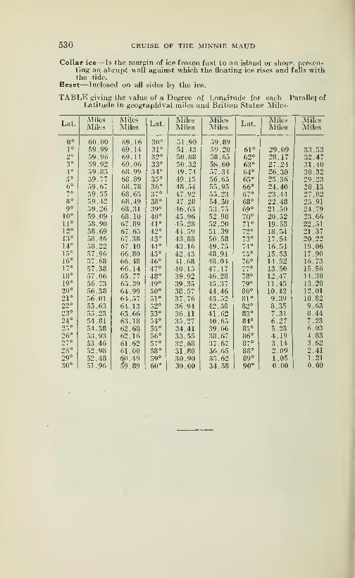
530 CRUISE OF THE MINNIE MAUD
Collar ice— Is the margin of ice frozen fast to an island or shore. p)re.sen-
ting an abrupt wall against which the floating ice rises and falls withthe tide.
Beset^Inclosed on all sides by the ice.
TABLE giving the value of a Degree of Longitude for each Parallel ofLatitude in geographival miles and Britian Statue Miles-
Lat.Miles Miles
Lat.Miles Miles
Lat.Miles Miles
Miles Miles Miles Miles Miles Miles
0° 60.00 69.16 30° 51.90 59.891° 59.99 69.14 31° 51.43 59.28 61° 29.09 33.532° 59.96 69.11 32° 50.88 58.65 62° 28.17 32.473° 59.92 69.06 33° 50.32 58.00 63° 27.24 31.404° 59.85 68.99 34° 49.74 57.34 64° 26.30 30.325° 59 . 77 68.89 35° 49.15 56.65 65° 25.36 29.236° 59.67 68.78 36° 48.54 55.95 66° 24.40 28.137° 59.55 68.65 37° 47.92 55.23 67° 23.44 27.028° 59.42 68.49 38° 47.28 54.50 68° 22.48 25.919° 59.26 68.31 39° 46.63 53.75 69° 21.50 24.79
10° 59.09 68.10 40° 45.96 52.98 70° 20.52 23.6611° 58.90 67.89 41° 45.28 52.20 71° 19.53 22.5112° 58.69 67.65 42° 44.59 51.39 72° 18.54 21.3713° 58.46 67.38 43° 43.88 50.58 73° 17.54 20.2214° 58.22 67.10 44° 43.16 49.75 74° 16.54 19.0615° 57.96 66.80 45° 42.43 48.91 75° 15.53 17.9016° 57.68 66.48 46° 41.68 48.04 76° 14.52 16.7317° 57.38 66.14 47° 40.15 47.17 77° 13.50 15.5618° 57.06 65.77 48° 39.92 46.28 78° 12.47 14.3819° 56.73 65.39 49° 39.35 45.37 79° 11.45 13.2020° 56.38 64.99 50° 38.57 44.46 80° 10.42 12.0121° 56.01 64.57 51° 37.76 43.52 81° 9.39 10.8222° 55.63 64.13 52° 36.94 42.58 82° 8.35 9.6323° 55.23 63.66 53° 36.11 41.62 83° 7.31 8.4424° 54.81 63.18 54° 35.27 40.65 84° 6.27 7.2325° 54.38 62.68 55° 34.41 39.66 85° 5,23 6.0326° 53.93 62.16 56° 33.55 38.67 86° 4.19 4.8327° 53.46 61.62 57° 32.68 37 . 67 87° 3.14 3.6228° 52.98 61.00 58° 31.80 36.65 88° 2.09 2.4129° 52.48 60.49
59.89
59° 30.90 35.62 89° 1.05 1.2130° 51.96 60° 30.00 34.58 90° 0.00 0.00
I
Esquimaux and English Vocabulary for Use of the ArcticExpedition.
(Published by Order of the Lords Commissioners of the Admiralty.)
PREFACE
The following vocabulary is compiled for the use of the Arctic expe-ditions, fitted out at the expense of the British Government, to carryrelief to Sir John Franklin and his companions. It was begun speciallywith a view to the Behring Strait expedition, and we learn from theaccounts of Cook, Kotzebue. and Beechy, that much intercourse tookplace during those voyages with the natives of the north-western coastof North America. It may also prove useful to the expedition about tosail for Lancaster sound.The only existing published vocabularies of the Eskimaux language
are contained in Fabricius's "Greenland and Danish Dictionary", 1904in the account of Parry's Second Voyage in the years 1821-23; in
Beechy's "Voyage of the Blossom in 1824-2.5"; and in Sir John Ross'sVoyage in 1829-33. The three last mentioned are thick quarto volumesand therefore of little use in that form for the daily requirements ofparties absent from the ships or boats or on land expeditions. Theobject of the present work is to supply that want, and to furnish everyofficer and leading man in the ^Arctic expeditions with a book of readyreference that he can carry in his pocket without inconvenience.The vocabulary is drawn up in three parallel columns, consisting
of the dialects as spoken by the Natives in Kotzebue sound, in Melvillepeninsula and on the coast of Labrador. The authority for the first,
which may be termed Western Eskimaux, is Beechey's "Voyage ofthe Blossom" above referenced to, with the addition of a few wordsfrom a manuscript vocabulalry of the late Captain Wolfe, R. N., whowas a mate of the Blossom in her voyage to Behring strait. The autho-rity for the dialect spoken at Winter island and Iglolik, which for dis-
tinction's sake may be called Central Eskimaux, is Sir Edward Parry'sSecond Voyage, evidently a carefully drawn up list of 800 words, towhich have been added a few words from the only remaining fragmentof an extensive vocabulary collected by Sir John Richardson, duringa winter passed at Fort Franklin, from a native of Hudson Bay. butwhich was unfortunately lost. For the Labrador or Eastern Eski-maux, I am indebted to the kindness of the Reverend Peter Lalrobe,well known as secretary, and to Mr Mallalieu, treasurer, to the Mora-vian Mission in London, who procured for me a translation by MessrsKmoch, Hertzberg, Morhardt and Stock, and especially by the Rev.Z. Clitsch, all of whom have resided many years at the missionary set-tlements at Okkak. Nain, Hopedale, and Hebron on the coastof Labrador.The people whom we term Eskimaux, but who call themselves Innuit,
are spread along the whole of the Northern coast of Americafrom Behring strait on the west of Greenland on the east; and thereis little doubt that the same language is understood throughout thatextent, varying, of coiu-se in dialect, but radically the same. Weknow, too, that Augustus, Frsnklin's interpreter from Hudson Bay,
35

532 CRUISE OF THE MINNIE MAUD
had no ditliculty in conversing with the natives immediately to the westof Mackenzie's river, in 137 degrees west longitude. It may. thereforefairly be presumed that fhe Labrador vocabulary the only completeone of the three, will prove useful on whatever part of the shores ofthe Arctic sea the navigators may chanse to meet with the natives.
As before mentioned, these people call themselves Innuit, and donot know the word Eskimaux . This name, it is believed, is first
mentioned by Charlevoix in his "Histoire de la Nouvelle France", whosays that the natives of the east of Labrador, who then extended south-wards to the river St. Lawrence, were called Eskimantik (that is.
"raw fish eaters), in the Mohican idiom by their neighbours, theAbenakis. with whom they where commomly at war. If this is thetrue derivation of the name, it appears that the Eskimaux were onlyknow to the civilized world by a nick-name given by their enemies.
If the extent of country be considered, the Innuit or Eskimaux is
one of the most widely spread nations on the globe. We find themin Behring strait, occupying both sides of the strait, the Asiatic as well
as the American: as the stationary Chukchis of Chuckchi Noss andAnadyr are doubtless Eskimaux. and many of their words are the sameas those in use in Greenland. From Kotzebue sound and Icy capethey have spread eastward along the shore of the Ardtic ocean by the
Colville. the Mackenzie, the Coppermine, and the Great Fish rivers
to Melville Peninsula, and to Fort Churchill in Hudson Bay. Theyoccupy the whole of the great peninsula of Labrador and the east coast
of Hudson bay as far south as East Main river: also the islands bet-
ween the coast of America and the pole as far as they are habit-
able, as well as both shores of Greenland, thus ranging through 140degrees of longitude, or an extent of .3,500 miles.
The inquiry into the connection between the dialects spoken by thi&
widespread nation and those spoken by the several tribes of Bussian,America, is one of high interest. Inhabiting the northwestern extremityof America, these latter are divided from Asia only by the narrowchannel of behring strait, so that of all nations of the New World theyare nearest in contact with those of the Old. The generally received
opinion as to the peopling of America is in favour of the passage fromthe old continent to the new having taken place by Behring strait,
where the shortest distance to be traversed dœs not exceed fifty miles:
a careful comparison, therefore of the languages spoken by the tribes
resident on each side of the strait might throw some light on this ques-tion.
As an example of the connection that exists between the Eskimaux,fhe Chukchi, and other dialects spoken by the tribes in that region.
I have inserted at the end of this vocabulary, a comparative table of
a few words taken from Balbi's "Atlas Ethnographique," some of whichshow a great similarity, and there can be little doubt that they belongoriginally to the same language. Those who have leisure to pursuethis subject, will find some u.seful information in the 2nd volume of the
Archaeologia Americana, in a paper by Dr B. (t. Latham, in the London'Tthnological Journal, and in Ba-r's "Statische and EthnographischeNachrichten". which contains the words collected by Admiral VonWrangell in these regions.
A few words of explanation are necessary as to the orlhographyadopted in this vocabulary. It is very nearly the same as that first
suggested by Sir William Jones in the Preliniinary Discourse to the
Asiatic Besearches, vol.1, and since adopted by the Asiatic and Geo-graphical Sociaties of London. The consonants retain their English
value, and the vowels have the same invariable» sound as in German,Italian Spanish and other languages. Many reasons might be urgedin favour of this system, but it will be sufficient in the p)resent <ase to
say that it is the same that has l)een pursued in the translation of the

CRUISE OF THE MINNIE MAUD 533
Bible into th<' Greenland and Labrador dialects of Eskimaux. In orderto save the reader trouble, the scheme is repeated at the foot of everypage of the vocabulary, and it may be permitted to express a hope thatall collectors of vocabularies will in future adopt the same system; orsubstitute a better scheme, and adhere to it. The scheme is as follows:
—
"A" is to be sounded as in the En- 'i' as in 'ravine';
glish word 'father': "u' as in 'flute';
'a', dotted 'the hick sound of a" au" as 'ow' in 'how';common among the natives), as 'ch' as in 'church';
the 'u' in 'but": 'kh' as 'ch' in 'loch';
'e' as in 'there'; 'r' and 's', dotted, require a forci-
'o' as in 'more'; ble, or, if the term may be al-
'ai' as 'i' in 'time"; lowed a guttural sound of those'ok' asin 'oak"; letters,'g' as in 'get';
Every vowel is to be sounded. The accent marks the emphatic syl-
lable. The hyphens are only inserted for facility in reading.At the conclusion of the vocabulary will be found a specimen of some
dialogues on the first meeting with the natives, on preparations for anexploring expedition, the purchase of dogs, sledges, etc.. with a few-
sentences to explain to the Eskimaux the object of the present expe-dition, and that a large reward will be given to any one who will first
bring the joyful intelligence of the safety of Sir John Franklin and his
companions.JOHN WASHINGTON,
London. .March I. 18-50. Caplain. R. N.
BRIEF SKETCH OF THE ESKIMAUX GRAMM.\R. 1.
The language of the Eskimaux is far from being rude or imperfectIt abounds in words expressive of common objects, and distinguishesslight shades of diflFerence by appropriate terms.
Animals of the same species receive peculiar names according to va-rieties of age, sex, or size. The verb to fish is expressed by a diff"erent
word for each kind of fish. Much, therefore, may be said in a few works,and with precision; but as might be supposed, the language has nowords for abstract ideas. The words are variously inflected, but accord-ing to certain rules and provided with numerous affixes and sufB.xes,
which render the language graceful and énergie. Many words areconnected together, or, as Humboldth appily expresses it, joined by-
agglutination, and blended into one, so that, like the North AmericanIndians, they can express themselves at once with strength and brevity.This circumstance, however, renders it very difficult for a stranger toacquire a knowledge of it; and thaï only after a residence of some yearsamong the natives.
Several of the letters in the English alphabet are wanting in the Es-kimaux language, as f, j, q. x, z; and in the annexed vocabulary, of morethan 2,000 words, b. d, g, 1, q, and r, rarely or never begin a word; kis the letter of most frequent occurence.
1.—Chiefly from Crantz's Historv of Greenland. Vol. I. chap.p. 201, and Parry's Second Voyage. 1821-2.3.
534 CRUISE OF THE MINNIE MAUD
The r and s are pronounced much more forcibly than is usual in
English. Sir Edward Parry says the r approximates to the Northum-brian "burr", and the s to the ch in the Scottish woed "loch". Theletters ng, followed by a vowel, as ang-ut, male, and ping-ahuk, three,
are sounded invariably as in German, or as in the Scottish name "Ang-us", or as in the English word "hanger", and not as in "anger". TheEskimaux commonly vary the prononciation of their words, withoutaltering the sense, and particularly so the women, who seem to be fondof the termination ng, as hiuting-a, ear, for hiuting-a; and niakoa, head,for niakok.The accents generally falls on the last syllable.
The nouns substantive, as well as the verbs, have a singula dualand plural form; they have no distinction of gender, and no article.
The dual generally ends in k. and the plural in t, but there are exceptions.
Singular Dual Plural
Nt^na (land) Nuneik NuneitNorrak (calf) Nonek NorretUyarak (stone) Uyarkek UyarketIn!o (house) Igluk IglutInnuk (man) Innuk InnuitTiiktu (reindeer) Tuktuk Tuktut
Nouns may vary to a great extent; as diminutives, e, g., nunarsuk,a small land, augmentatives, as nunarso-ak, a great land.The declension of nouns is simple. The genetive only add a "b"
(or an "m" before a vowel)' to the last syllable.
The personal pronouns always follow the verb. They are:
—
U-ang-a-I U-a-gut—we.Igwit—thou or you. lUipsi—ye.
Oma—he. Okkoa—-they.
Apparently, a part of these pronouns is suffixed to the nouns as pos-sessive pronouns; as:
—
Nuna—land. Nuna-rwuk—land of us two.Nuna-ga—my land. Niina-rse—your land.
Niin-at—thy and. Nuna-rsil—the land of you two.Nunnng-a—his land. Nuna-il—their landNuna-rwul—our land. Nuna-ik—the land of those two.
The propositions, if words may be so called which always follow thenoun, are; mik, signifying at, with; as iglu-mik-pok, he is at the huts;mit, from; as nuna-mil, from land; mut, to; as u-agna-mut, to the west-ward; mi, in or upon; as unia-mi, in the ship; sikko-mi, upon the ice;
and Crantz adds kut and agut, through and round.The verbs have been divided into four conjugations, according to
their terminations:—1
—
tn kpok, as ermikpok—he washes himself.2
—
rpok, as matlarpok—he undresses.3
—
pok, as egipok—he throws away.4
—
ok and wuk, as piyok—ho receives, and assawok, ho loves.
The negative; form of tlie verb is marked by the termination ngilak:thus, erming-ilak, he decs not wash himself.
There as three tenses: present, ermikpok: past, ermisawok and ermigo-marpok; the first expressing simple futurity, the last denoting decision.
In like manner the imperative mood is of two kinds, the one gently re-
minding, as ermina, pray wash yourself; the other commanding, as
ermigit, wash yourself.
CRUISE OF THE MINNIE MAUD 535
The third person singular may be considered the root of the verb,
and generally ends in ok; and most of the verbs in the vocabulary areinserted in this person.The verb piwok is of constant use, somewhat similar to the English
words get and do; it is difficult to assign its meaning—perhaps to obtainor accomplish.
It requires much study to master the inflections of the verbs, and theyare too numerous to be entered upon here. The following may be takenas a specimen:—
Ermik-ponka— I wash."
-put—they wash.-potil—thou washest. Nappa-Iang-a— I am well
-pok—he washes."
-latil—thou art well." -pogut—we wash "
-lak—he is well." poguk—we two wash.
"-lagut—we are well.
" -potik—you two wash."
-lase—you are well." -pose—you wash.
"-lei—they are well.
The participle, which supplies the want of an adjective, is the sameas the preterite of the indicative; as ermilaukpok, one who wavshes;
in the future, it makes ermissirsok , about to wash.The conjunction lu (and) is added to the end of the word, like the
Latin que. A common interjection is Hei; or Hei-ya! but a great degreeof astonishment mixed Avith pleasure, is expressed by the word atamna-trani; according to Parry; or Tatamnamak! in Labrador.The numerals in general only extend to five, occasionally to six, and
then begin again. In the Labrador dialect they are as follows:
—
Altau-sk—one. Tedlima—five
Maggok—two or seven. Bing-asu-yoklul—six.
Ping-asul—three. Sillamau-yoklul—eight.
Sillamet—four or nine. Telliman-yoklul—ten
Six and seven are sometimes expressed by argwenrak and argwenrak-towa, respectively. In counting, they use their fingers; but Sir EdwardParry says, at Melville island they did not use their tœs to count, as
in Greenland.The form of answering a negative question differs from any European
language: thus the reply to piomang-ilattit "^ will you not have it .^ mustbe nagga, no if the affirmative be intended: on the contrary, if the offer
is declined the answer is, Ap, pionang-ilang-a; Yes. I will not have it.
The Eskimaux make much use of winks and nods in conversing;the former are always intended to convoy a negatiA-e meaning. A nod,as with us, implies an affirmative.
It may be useful to add that in the vicinity of Behring strait (as welearn from Beechy's "Voyage of the Blossom", and more recently fromCaptain Kellett, holding up the arms at an angle of 4.5 degrees on first
meeting the natives, whether in a boat or on land, is a sign of peace afriendliness, and on coming to close quarters rubbing noses is the mostapproved mode of salutation. Also, that if a line be drawn on the groundround a party of Europeans engaged on shore or on the ice in makingobservations, or otherwise not wishing to be disturbed, the natives will
understand that it is intended as a barrier they are not to pass, and, ge-
nerally speaking, will respect it.

536 CRUISE OF THE MINNIE MAUD
EskimoNumerals
1 . . . . Attawson4. . . .Tisshi-man7. . . . Markoning9. . . .Tisshi-maning
THE CRUSE OF THE MINNIE MAUD
(Prepared by A. B. Reader 1912-13)
11.
12.
13.
14.
15.
16.
19.
20.21.
22.
23.24.
25.
26.27.
28.
29.30.40.50.60.
70.
80.
90.100.200.300.400500.600.700.800.900.
1000.2000.3000.4000.5000.10000.
2 . . , . Markow 3
5. . . .Teddli-man 6.
8. . . .Pingi-shoo-ning10 Koli
Pingi-shoot. Ak-bjnnik-poo
Prefix "More than ten"—Koli-ood-looti.
. Shinni-voon or Koli-attowson or Shinni-kee-koon
. Markoning or Koli-markow
. Pingi-shooning Shinni-raktooning or Koli-pingi-shoot
.Tishi-manni Shinni-raktooning or Koli-tisshi-maning
.Tedli-nian Shinni-raktooning or Koli-tedliman
. Ak-binnlk rak-tooning or Shinni-kee-koon or Koli-ak-binnik-poo
. Markoning shinnink rak-tooning or Shinnik-kee-koon mark-oning. or Shinnik-kee-koon Tisshi-maning
. Pingi-shooni-shinnik-raktooning or Shinnik-kee-koon orKoli pingi-shooningTisshi-maning Shinik rak-tooning or Koli-tisshi-maning
. In-yooig-nahvo
. In-yooig-nahvo attowson or Azzi-ruk-tuk-poo
. In-yooig-marko-nahvo
. In-yooig-pingi-shoot-nahvo or Pingi-shoot-na-luk-poo
. Tesshi-man na-luk-poo or In-yooig tisshi-man-nahvo
. In-yooig-tedli-man-nahvo or Tedli-nian na-luk-poo
. In-yooig-ak-binnuk-poo
. Marko na-luk-poo in-yooig
. Pingi-shooning na-luk-poo in-yooig
. Tisshi-maning azzi-ree-tuk-poo
. In-yooig koli-nah-vo
. In-yooig tesshima-nah-vo
. In-yooig Teddli-ma-nah-vo
. In-yooig Ak-bin-nuk-pooIn-yooig-marko-ning
. In-yooig Pingi-shooning. In-yooig Tisshi-ma-ning. Koli-ruk-pa. or Koli-koli
. Ai-pirrik-tuk-poo
. Ai-pirrik-tuk-poo pingi-shooning
. Ai-pirrik-t uk-poo 1 isshi-maningAi-pirrik-tuk-poo ted-li-nianing
. Ai-pirrik-tuk-poo ak-bin-nuk-poo
. Ai-pirrik-tuk-poo marko-ning
. Ai-pirrik-tuk-poo pingi-shooning. Ai-pirrik-tuk-poo tisshi-maning. Ai-pirrik-tuk-poo tcd-ii-maning. Ai-pirrik-tuk-poo in-yooig-marko-ningAi-pirrik-tuk-poo in-yooig pingi-shoot
. .\i-pirrik-tuk-poo in-yooig tisshi-manAi-pirrik-tuk-poo in-yooig tedli-nian
.Ai-pirrik-tuk-poo in-yooig Koli
ESKIMO ALFABET AND SYMBOLS
(By Revd E. .1. Peck)
Voue/>.—a,(eh,)."^ .e. ree).-^ -o. (oh),D^ .a,(u).^ .i, (ai),^^^
.u, (oo)/t> a. (ah).<l .ow. (au). <]|> .oi, (oy), t>^ .
Consonanis.—p, <^ ; t,c: ; k, b ; g, U ; m,L_ ; n,Q— ; ?, I ;
\,^ ;Ve. f^.v./^;r. Ç ; h.^ ; ng.^ : rk, Çb
Syllables.—pa (peh), V .pee /\ .poh / pu fpa) \ .pai V.poo (pu) ]>• .pah •<(—ta (teh), U .tee .toh 3 .tu (ta)C
.tai U. -too ftu) Z)* .tab C ka (keh). cj .kee p .koh J .ku
(ka) b -^^i 9» ^'^o ''^"> ^' -^^^ ^ S^ (geh), *] .gee p
.goh J .gu (ga) (j -gai ^. goo (gu) J. gah [)• ma (meh), —
;
.niee p .moh_J .mu (ma) L- .mai "1' -moo (mu) «J* .mah Ll
na (neh), -^ .nee o" -"oh _^ .nu (na) q_ .nai -O* .noo (nu)-^«
.nah Q- .sa (seh), C. .see ^^ .soli (^ .su (sa) "^ .sai !• .soo
(su)^. .sah •) la deh),"^ -lee^^ .loh _o .lu (la) ^^ .lai -^3.
.loo (1u)_j:p. lah<£:_ va (yeh), -^ .yee p •yo'''<i
•yu.(ya) y.yai n* yoo (yu), <* .vah /, va (veh) V^ .vee b\ .voh ^.vu (va)^.vai v'.voo (vu)*^ .;.'ali >^ ,.ra (reh) "l^ .ree fL
.roh r ru (ra) 1 .railj .roo (ru) r .rah S .ngah^ngee r
nglcr".ngoo (ngu)L^o •


ESKIMO VOCABULARY
(Used by natives of North Baffin Land)
Prepared by A. B. Reader at Pon'ds Inlet
1912-1913
Above, (on top—Kai-sun.Above, (upstairs)—Kah-Uk.Across, (on the other side)^Akki
aning.Adam's island—Too-id-joon.Adam's sound—Kai-yoo-ting-maAfternoon—W ah-ree-yoo.Afraid—Kappi azook-too, ee-Ia-ra
sook-too.Afraid, (very much)—Kappi ammi-
shoot, Alian-akaroo.Ask why she or he does not come—Shoo-kin-kai-yoo nee lung-illa.
Aunt—Attunga. Ung-ugga.Autumn—Ikki-ak-sah.Axe—Ood-lee-ma-oon.Axe, (to chop with)—Ood-lee-
mark-to.Afraid, (I am) — Ee-la-ra-sookpooma.
Afraid, (you are) — Ee-Ia-ra-sook-pootit.
Again—Ak-shoot, Attee-attee.Air, (atmosphere)—Tak-seerk-too.
See-lah.Albert Harbour—Kirrl-yook-tsua.Alive—Tookung-ee-toon-Ig-noi-yo.All—Tah-mow-mee, Ah-wah-ting,Attan-uk slootee.
All right, (enough)—Tub-ha-Pee-yooi-yook.
All the same — Ad-jing-ha-Tai-mat-too.
All the time—0-kud-Iik-to.Alone—Kissi-mahAlone, (myself I) all alone. —
U-wang-ah. Kissimah.Anchor—Kish-own.Anchor, (to anchor)—Kish-uk-to.Angry, (annoyed)—Ning-nak-too,
Kow-muk-too.Anus, (vent)—Itti-yeng.Arctic Bay— Toon-noon-ah-roosaArctic Sound—Toon-neen.
Are, (thev are, it is so)—Ak-soo-ee-lah.
Are, (they are in the act of—Kai-ming.
Arm—Tell-ehg. Ag-gah-tee-gan.Arrow—Kat-tyoo.Ask h'm—Ok-kar-harsi-yak too.
B
— Sed-look-in-ai-
— Sed-luk-nh-see
rik-
Back to frontyook.
Back to frontmai-yo.
Back of neck—Toona-shook.Bad—Pee-yoong-ee-too. Pee-
too.
Bad—Ar-koom (Nasty).Bad (very bad)—Pee-yoong-ee-too-
arlo.
Bad man—Kah-loon-ai-yoo.Bae, (small)—jN'ah-poon.Bag, (sack) — Kah-wittee-Ik-pee-
ard-jioo.
Baillargee Bay—Kai-nak-soo-ard-lioo.
Barrel, (cask)—Kutt-oh-wiya.Beach, (a flat)—Oo-Iee-nung, Tin-
neen-nung.Beads—Sah-pung-un.Bead breast fringe—Sak-keeya-
roti.
Bead shoulder fringe—Too-eeya-roti.
Bear, (polar)—Na-nook.Beetle—Kai-loo-goo-arlee.Begin—Arri-booma.Belch (to)—Nik-see-ark-to.Belly—Nah-jee-ka.Belly, (my belly is full)—Nah-jee
ruk pooma.Below, (underneath)—Ud-lin.
Belt—Tuss-see.Bend down (to)—Kai-tikki-sow-
oon.Better
—
Pee-voo-nuk-sah .

540 CRUISE OF THE MINNIE MAUD
Biceps—Kai-too-an, Ak-sah-ko.Big—Ang-ee-yoo.Big, (very)—Ang-ee-you-arlo.Bino, (ciilars—Igloo-wee-lee.Bird—Ting-mee-ah.Birds—Ting-mee-sah.Birds, (place of)—Kak-kood-loo-inBirth, (to give)—Ir-nee-yo.Biscuit—Sib-boh-mee.Bite, (to)— \t-tirri-neeto.Bitter— Muni-niung-ee-too.Black—Kirri-neeto.Black, (eyed)—Karren-arik-to.Black, (haired)—Keerg-ni.Black and white stripes (caribou
hair cap, cap decoration)—Ud-lark-to. Kip-pezzi-ark-too.
Blacksmith—Ka-jik-to.Bladder—Nah-kassoo.Bladder, (nosed seal)—Ap-pah.Blanket—Kai-pee.Blind, Blindfold—Mattoo-oord-leeBlood
—
A-ow.Blow, (to give a)—Pingi-see-niee-
tanna.Blow, (puff, exhale)—Soo-pee-yoo.Blow the nose—Tarkeek poonia.Blow out the light match etc
—
Kah-niik-ta.Blow hard, (to wind)— Noori-ad-
looni-loo.
Blue — Toong-ee-yoo(a, Koog-nook-ta.
Blue-eyed— Kai-yoo-arlo.Blunt—Ee-kee-to, Keena-rag neetOBoat, (ship)—00-niia.Board, (wooden)—Koo-vee-ar-to.Bodkin, (ivory)—Nee-ekki-town.Body—00-win-ning.Boil, ulcer—Poo-wik-too, Ai-yoo-
wark-too.Boiler, (large tin)— Kut-tan.Bone—Ag-gow. Chowna, Sow-oonaBone ring (for dog trace)—Oork-
so, ok-sik.
Book—Oo-kah-lee nied-jen.Boots— Ka-niing.Boots, Make off your boots)—Ka-
rning ah-looti.
Borden Peninsula — Arkoo-rik-kuttaro.
Bosun, ((juU or Hawk)—Ishoonga.Bottle— Ar-ree-yoh.Boulder, (large)—Ig-nah-loo.Bow, (and arrow)—Pee-sikki-see.Bowels— Na-ra.Bowels, Intestines—Akko-anga.Bowels, (to act freely)—An-naria-
zook-.too-arlo.
Bowels, (to act freely)—An-naria-took-too.
Box, (wooden)—Ee-glee-via. Ik-tee-oor-bee.
Box— Id-loo-iya.
Boy—Soo-oo-sah, Kid-la.
Boy, (small)—Noo-ko-pee-ya.Boy, (young male of any species,
animals, birds, men—INoo-tar-rakBracelet—Tall-ee-see-yen.Brace and Bits in handle—Nee-oo-
tah.Braces—00-wittee-ootee.Brain—Sow-ah-nah.Brass—Kak-or-lin-Poo-koo.Brass forehead hand—Kow-oon.Break, (to)— Now-wik-po. Now-
wik-too.Break, (to break glass, crockery
etc)—Sukko-miktoo. So-ruk-too.Breast, (chest)—Suk-bee-ya.Breasts—Noo-lee-ah, Ibbi anya.Breathe, Mo)—Nee-ook-troo.Breathe out exhale— An-nuk-sah-
toh.
Breeches (caribou)— Kah-gleep.Breeches, (sealskin)—Nitlo-kotee.Breeches, (cloth)—Koo-garooBridge of nose — Arkoolee-ah-
kuttak.Bright, (clear)— Ig-gah-lah.Bring— Kai-joon. Kai-siggo.Broad—See-lik-to.
Brodeur Peninsula — Arkoo-rik-koo-taroo.
Brodeur Peninsula — Arkoo-lee-ah-kuttak.
Broken—Now-wik-poo.Broom, (brush)—Sang-moon.Brown — Ee-zook-ta, Keyan-nak-
too.
Brown, (eyed)—See-ung-nah.Brother—Noo-kah Ung-nah.Brothers—Noo-ka-ra.Brush, (piece of)—Ee-week-soo-ahBubble—Ting-mee-gark-to.Bucket— Kut-tah.Build, (construct)—Igloo-lee-yoo.
Bullet—Ah-keek.Bumble, (bee)—Ig-goo-tah.Burn—Ikko-muk-too.Business— Isso-mai-yoh.Busy, (to be)—San-nang-wak-too.Busy, (I am busy to-night)—Oo-gnoo u-wang-ah isso-mai-yoh.
Busy, (Ncry busy)—San-neh-voo-arlo.
Butterfly—Ta-gah-lee-kee-sah.Buttocks—Oh-pat-teeka.
CRUISE OF THE MINNIE MAUD 541
Button — Issi - ree - oh, See-ah-go(Igloolik).
Button Point—Sen-nown.Buy— Nee-oo-wik-too.Bye and bye, (later)—Wah-tchero.Bylot Island—Kai-Giook-tah.
Cache— Kaing-ni-ak.Calf, (leg of)—Nak-kai-shug-nah.Call, (how do you ?)—Kissh' moonaCalm sea, (water)—Ook-soo-ark-
too.
Canada Point—Ik-kak-tooria.Cannibal, (he is a)—Ee-nuk-took-
too-arlo.
Cannibal, (I am a)—Ee-nuk-tookpoonga.
Canoe— Ko-took-sa-eer, Kayak.Cap—Nas-sart-looga.Cap, (for pipe)—Mattoo wah-taimaCaps, (percussion)—Seeg-nee-tah.Cape Adair—King-ard-joo.Cape Bowen—Ee-jook-too.Cape Crawford—Kan-ya.Cape, (headland)—Nee - ard - joo,
Noo-wah-dla.Capsize, (to)—Oo-mee-yoo-ee-yoo.Cards, (playing)—Mukki-towti.Card, s (game of)—Muk-kee-lin.Carry on back, (to) — Nag-mook-
too.
Carry child on back, (to)—Am-mark-too.
Cary, (you carry on back)—Ibbinam-mang-eeto.
Carry, (he carries on back)—Oonaam-mang-eeto.
Cartridges—Soon-iga.Cartridges, (empty)—Poo-koo.Cartridges, (loaded)—Soo-nah-ga.Cask— Kat-tow-iya.Catch, (Take, capture) — Mikki-
yark-to.Catch, (to)—Ak-kuk-para.Catch, (I catch)—U-wangah ak-
kuk-para.Catch, (you catch)—Ibbin ak-kuk
tenga.Catch, (he (-atches)—Oona ak-kuk
pung-in.Cat's craddle, (game with string)—Ai-ya-ha.
Certain, (I am not)—Shee-bo-go.Certainly—Inni-ola, Am-mee-lah.Change, (to)—Akki-lee-yo.Cheeks—Oo-roo-ark-o.Cheeks, (fat cheeks)—Oo-roo-ark-o
too-ee-yoo.
Cheeks, (thin cheeks) — Oo-roo"ark-o pooti.
Chest, (breast)—Sug-vik.Chew, (to)—Tomma too-ad lunga.Chewing tobacco—Ta-bakka-meeChief—Kow-bak-to.Child— Noo-t uk-kun.Child, (the child wants to eat) —
arpa-pug-leeko.Chop with axe, (to) — Ood-lee-
mark-to.Claws—Koo-king.Clean—Puk-koo-ee-ya.Clear, (bright)—Ig-gah-lah.Clever—Kow-ee-yoo, Mey-ee-yoo.Cliffs, (where sea-birds lay eggs)-^Kah-kood loo-in.
Close, (near)-—Kree-moosi.Closer—Kai-nee-kud-loo-go.Clouds—Nooi-ya.Clyde River—An-now-loo-elli.Coal— Kee-yook-sah.Coal at Canada Point — Kirri-
muk-too.
Coal mine— Kee-yook-sah-ping.Coat—Jai-ka.
Co-ition—Kooni-moon.Cold, (noun)—Ik-kee.Cold, (adj)—Iglee-yuk-too.Cold water— Miggli-nuk-too.Cold in the nose, (rheum)—Soor-
dloo Koork-too.Colour—See-arng-nung.
Comb— Id-Iai-oo-tee, Id-la-goh-tinComb, (to comb the hair)—Id-lee-
ark-to.
Come, (to)—Kai-yo.
Come back (to)—Oo-peer-nuk-sahCome early, (to morrow morning)—Oo-mik-pen kai-niak-pooli.
Come in—Kai-eet.Come, (thou)— Kai-lee.
Come and eat—Oo-ee-yook Kai-eet.
Come, (are you coming)—Kai-ah-ruk-pee.
Come, do you comme from (over
there)—Akki aning arkpee.Come, (he is coming)—Ee-set-ton.
Come (I come from over there)
—
Akki aning ark-pooma.Come, (I come from my igloo) —
Igloo-ning ark-poonuiCome, (I will come presently) —U-wangah wah-tchero anni ruk-to
Come, (tell him to come)—Oo-kow-tee niak-kan—Attee-loo-taro Kaiyin nee lungi-lung—Kai-koo-yowa-rowa-lee.
542 CRUISE OF THE MINNIE MAUD
Come, (tell woman to come)—Arg-na-mee Kai-yoo.
Come, (tell her not to come) —Oo - kowt - lee lao kai - nee-vng-moon.
Come, (when did you come)—Akki-lar-poo.
Come, (when will he come)—Oh-ka-na Kai-yak-pee.
Come, (where do you come from ?)—Nga-kin-nga-pin.Come, (where does he come from)—Nga-kin-ooud.Come, (where do you come from)—Takko-warra, Nga-kin-nga-pin—Nga-kin-kai-pee—Kai-ya luk
ka-nee.Come (why do you come ?)—Nga-
kin ibbin kai-yo.Come, (will come no more)—Kai-
jai-yoo-nuk-too.Construct, (build to)—Igloo-lee-
yoo.Cook, (to)—Oo-tee-yoo.Cooking Pot—Oo-koo-seeCopper—Kan-noo-ee-yook.Cork—See-ming.Cork (piece of cork)—-Po -ping.Corner—Tirrik-kow-ah-nee.Cough—Kovee-urk-sook-too.Cousin, (either sex)—Ig-gorin.Cousin, (children of 2 brothers ortwo sisters)—Anoo-ter-uttin.
Cover (to)—Ee-yoo-ee-yoo.Crane)Tad-ee-gark-tchoo-ah.Crooked—Sang-oo- ee-uk-to.Cross over (to)—Ik-kee yan.Crow—Too-doo-a.Cry, (howl) to—Kee-ai-yoo.Cup—Im-woi-soo.Cup, (tin cup, pannikin)—Ig-noo-
see-ya.
Curl, (on girl's head)—-Peerka-nik-ta.
Curl, (on boy's forehead) —Seè-boonga.
Cut, (to)—Kip-pce'i.
Cut off (to)— Nah-kut-too.Cut, (to cut up meat of any kind)—Ah-goo-eh-yoo.
Cut wood (to)—San-nang-wak-too.
Damp—Ka-zook-too. Pan-nik-poo.—K ai-you-king-ai-\oo.
Dance— Moo-iiierrin.
Dance, (to)
—
Moo-inuk-toon. Moo-meerk-too.
Dark—Tah-mee Tark-to.Daughter—Ah-ninga.Daughter of father—Ang-oh-ta.Daughter of mother-—Eer-nunga.Daughter in law—Oo-koo-ara.Dawn—Nooi-luk-t oo.Day—Oog-loo.Day, (after to-morrow) — Kowk-
pen-oong-ah-lee-eh-ga.Day, (early to-morrow morning)
—
Kow-look-pen.Day, (evening sundown)—Nee-pee-
you.
Day, (last night)—Ee-puk-rcha.Day, (mid-day, noon)—Kuk-kah-
nee.
Day, (morning)-—Soo-koo-neh luk-too.
Day, (to-morrow morning) — Ood-lah. Oo-blah-ko.
Day, (to-day)—Oo-ah-ree-ani, Oo-gloo-mi.
Day, (to-morrow)—Kowk-pen.Day, (tonight)^—Ood-noo.Day, (yesterday)—Ood-loomi.Daylight—Kow-nia-poo.Dead — Too - kung - ai - yo. To-
ko. To-ko-bo.
Dead man, (Corpse)—Ee-nung.Deaf—Too-see-an-eetoo.Deep, (very deep)—Itti-yoo-arlo.
Ook-sook-too-arlo.Deer, fcaribou)—Took-too.Deer skin— Am-mil.Deerskin cap—Nai-suk-loo-un.Deerskin cloak—Koo-li-tang.
Deerskin, (fringe or ears of Hood)—Nali-zov-kah-gee.
Deerskin, (fringe on bottom of
Kilitfuig)—Nig-gia.Deerskin, (head band)—Am-ntingaDeerskin, (mittens) — Poo-ah-lo.
Poo-ah-looka.Deerskin, (shirt, hair inside)—At-
teo-gee. Ah-toe-ali.
Deerskin, (sleeping bag)—Poh-oo.Deerskin, (sleeping rug) — Ma-
minjra.
Deerskin socks—Pee-nah-ran.Deerskin, (steel scraper)—Mam-
luia.
Deerskin trousers, (hair inside)
—
ll-loo bud-da.Deerskin trousers, (hair outside)
—
Kah-glcep.Deer, (hair)—Pee-Iuk-took-too.
Deer hair, (to scrape off)—Pill-yuk
took-too.Deer sinew, (for tliroad)—Ee-vel-lo
CRUISE OF THE MINNIE MAUD 543
Deer teeth—See-boo-tee-ah.Deer, (teeth sewn on leather band)—Took-too see-boo-anni.
Deer, (to hunt, shoot or stalk) •
—
Tooktoo koo-kirri-yarg-too.Devil — Toong-ah, Too-pee-lan.
—
Torna-suk, Kunn-ar-loon.Diamond, (glass)—Al-lee-goh.Die, (to)—^Too-koo-eelya.Different — Idli - ung-eh-yo, Idli-
ar-lo.
Difficult, (hard)— A.k-seor-loor-in.
Dirt^Powk.Dirty—Pow. Ee-peern.Dirty, (very dirty)—Pow aui-nii-
shoot.Diver, fgull)—Kak-kood-Ia.Dog—Mik-ki.Dogs howling—Mik-ki meer-gohk
too.
Dogs, (to right)—Wo-a. Wo-war-raDogs, (to left)—Ar-ree. Ar-kai.Dogs, (go on)—Tchek-tchek. Hutt-
Hutt.Dogs, (stop)—Oh-a. Shoo-oo.Dog trace—Ippi-yoota.Do not, (dor't)—^Ai-ee-na.
Doobaunt, (tribe of Eskin.os) —Seeko-sooi-Iung-nung.
Door, (gate)—Ho-Kwanga.Door of igloo—Ook-wa.Door, (open the door)—Mattoo-ee-
roon, Nuk-pig-goon.
Door, (shut the door) — Oo-mee-yak-poo, Oo-niee yan-nik-poo.
Door, (shut the door, iniper) —Oo-mig-Iee.
Door, fshut the igloo door) —Ook-wa ar-lee.
Doorway
—
Down—Ab-ah-to.Down below—Ud-lin.Drag attached to harpoon—Nee-
yoo-tuk.Drawers, (woolen)—Nee-yoo-fuk.Dream, (to)—Shin-nuk-took-too.Drink, (to)—Nee-ook-see-oh.Drink, (to drink milk)—Im-niinga.Drive dogs, fto)—Ingi-kut-tee-yo.Drop, (to)— Knt-tak-po.Drunk, 'intoxicated)—Im-meerk-
look-kai-yak.Dry—Pan-nook-to.Duck— Kig-goori-ark-tchoo.
King Eider— Mee-li-uk.Long-tailed Jaeger — Aggi-ark-tchoo.
Dung, (excrement)—An-nung.To excrete—An-nuk-1o.
Eagle—Kig-gabbi-ark-too.Ear—See-yoo-tee.Early—Row-lee.Very early—Cho-kai-yoo-arlo.
Early tomorrow morning-—Kow-look-pen.
Earth, (the)— Ang-ma-looki-tah.East— ]\Iah-nee.
From the east—Marng-ung.To the east—Mow-nga-ga.
Easy—Kai-toong-fdla-ga.Eat—Nirr-ee-yo. Oo-ninga.Come and eat — Oo-ee-\ook kai-
eet.
Eat plenty—Kark-took-too.Good to eat—Pee-yoo-ee-yoo.Have eaten plenty-—Ar-kai-tak-pooma.Have not eaten, am hungry —Pee-yoo-ma ruk pooma.I have eaten well—Ikl<i anna ai
yowk tak-poo.They are eating—Kai-ming nirr-
ing-ma.To eat a man—Ee-nuk took-too.We are eating—Kai-ming-nirr-ee-yo.
Edible roots—Koong-oo-lce, Ai-ra.
Egg—Mun-ning.Eight—Pingi-shco-ning.
Eight o'clock—Pinga-shoo-an.Eighteen— Koli pingi-shooning.Elbow—Ik-koo-seeEleven—Sinni-voon, Shin-nee-vo.Eleven o'clock^—Shin-ning-an.Elwin Inlet— Kai-nak-tloo-ar-pee.Emptey -— Now-wik-para, Il-loo-
luk-kan-ee-to.Emptey cartridge—Poo-koo.Enough—Tub-lia.
Erik Harbour—Ig-sook-too, Kai-nak-tjoo-ark-tchoo.
Eskimos—In-yoo-in.
Everybody—Ab-bah-no.Everything—Ah-wah-tik.Evening, (sundown)—ISee-pee-yoo
Evil eye, (the)—Ee-jinga.
Excretion—An-nung.To excrete—An-nar-to.
Eye—Ee-yee.Eye, (brow)— K»id-bloo.kah.
Eye, (lash)—Kinna rid-jen.
Eye, did)—Toona cc-lee-yo.
Exclamation, fmy Goodness, whata big one)—Waii-kiid-lunga.
Excited—Oo-ning.I am excited, nervous—00-ning
544 CRUISE OF THE MINNIE MAUD
ak poonia.You are excited, nervous—Oo-nirg ak pooti.
Face—Kee-na.To lie face down—Pah-nuk-too.To lie face up—Noo-kud-luk-too.To turn face down—Poo-seeto.To turn face up— Mah-keet-to.
Fall, (toi—Too-na-hiktoo. Pard-luk-too.
Fall, fslip. toi—Wad-look-too. Issi-
wad-luk-too.Fall over, (to)— Koo-rik-koo-ruk-
poo.Far away—Oo-ar-zik too-ar-loo.
Pah-nee-ar-Io.Far off land—Noona pah-nee-arlo.
Far ofT ice—Seeko oo-nan-ee-ar-IoFarewell , (goodbye )—Tah-bow-oo-
teh.
Fart— Nee-luk-too.Fast, (swift)—Too-ar-rurg-in, Soo-
keUi.
Very fast—Soo-kai-ar-lo.
Fasten tightly, (to)—Ak-soo-ar-loFat— Koo-ee-nee-yoo, Too-ee-yoo.Father—At-ta-ta, An-uiik-ta.
Father to son—Eer-nug-ga.Father to daughter—Pan-nee-ga.Father in law—Sak-keenga.
Feathers—Meerk-Koonga. Meerk-wa. Ark-serrik-see-yo.Feather wiper—Ik-hoon.
Female—Koo-ni.Snia'l femele—Nibbi-ark-tcha.
Fever, (to have)—Ee-pee-kee-juk-too.
Fifteen— Koli tedli-maning.Fifty—In-yooig Tedli-nian-ah-vo.Fight, (to)—Pingi-see-niee-yak-tooFile—Ag-gee-ya.Find, (to)—Nan-ni-var-ra Teego-
war-ra.
Finish, (to)—No-ook-poo.Finished — Noong - ook - pa. Pee-
nissi.
Fill (to)—Ill-yoo-ltik-para.
Fill witli water, (to)— Ini-nuk-para.Filled, (replete)—Tai-tak-to.Fingers—Kah-mung-min.
Thunil)— Kud-loo-a.Forefinger—Tee-kee-rali.Middle finger—Kiddo kleerah.Third finger—Mee-kiddi-iah-ha.Little finger—Reer-koh.
Finger (nail)—Koo-kee-yoo.Finger, (nails, claws)—Koo-king.First, (class)—Pee-yooi-yook.Fire—Ee-gah.Fish—Oo-wah.
Big Fish—Oo-wak-tchoo-ah.Snidl sea fish, (varieties)—King-oon. Toola-ga-nah.— Kanni-yoo-arlan. Izzi-too-arlan.
Queer one-eyed sea-fish— Mit-tang-nah.
Fish, (hook)—Oo-gah-tchoo.Five—Ted-li-man.Five, (o'clock )—Ted-li-niung-an.Flag—Sai-min. Ow-luk-koo.To hoist the flag—Shan-nai-yo.I hoist—U-wangah Shan-na-largoYou hoist— Ibbin shan-nargo.
Flag pole— Nah-pai-yo.Flat beach — Oo-lee-nung. Tin-
neen-nung.Flat Point, (S.W . Bylot island) —
Kaing-ni-uk-too.Flint—Ang-inah.Flint, (stone)— Ig-nung.Flint, (barb for harpoon)—Ak-ki-
koo-an.Float (bladder— attached to harp-oon— Ah-bah-tuk.
Florida water, (bottle of)—Tippi-tee-rown.
Flowers—Ow-billik-tunga.Fly, (small, black)—An-nungee.Fly, (to)—Ni-ed-luk-to.Fog—Tark-sin.Food—Nirri-nee-akto.Fooling, (stop your)—Pirrarrek-town nerrin.
Foot—Izzi-kan.
Feet— Izzi-lee-kan.
Forearm—Ur-gowt.Forehead—Kow.Forget, (iK))—Nah-loo-wara, Pooi-
yook-para, Poo-ai-gooi-yoo.I am forgetful—Poo-ai-go-pooma
Fork—Kah-kee-yah, Kar-ee-lia.
Forty — In-yooing Tesshi-man-ah-vo.
Fourteen— koli Tissbi-maning.Fox—Terri-ga-nee-ya.To skin a fox—Terri-ga-nee-yato-koo-ee-aroo.
Freeze
—
Kwa.Fresh, (water iceberg)—^Pikka-rooi.
Friend— Ee-ling-nee. .
Fringe round Koolifang—Nig-gia.From (sufilx)— Min.From Igloolik— Igloolik-min.
Frozen — K wa-ardlo-kuk-ee-yoo-arlo.
CRUISE OF THE MINNIE MAUD 545
Full—Tai-tak-to.Stove full of bluhhcr— Ook-sooktak-ow-ep-\a.
Game of Cards—Muk-kee-tin.Game of Cats Cradle—Auja-ha.Game with Ivory ball and stylus
—
Peer-koo-tingi.Game with lance and hanpinp hall— Nood-look-ta.Gate, (doorj—Ho-kwanRa.Get away from there—Sak-kah.Get up from hed. fto)— .Mukki-loo-
len.
Get out of hed 'iniper)—Mukki-loo-a.
Girl, fsmall )— Mbbi-ark-tcha.Yonnp female of all species —?Sihhi-ark-1(ha.
Young maiden—Nibhi-ark-tchaweenung.
Give, 'to!— Kai-jo.
Give me — Pee - i a - ree - yo. Kai-tchoo-arlee.
Give me water—Im-ma rooraa.
Give me the next time yon come
—
Shoona gam-min.Glacier—Seerng-ming.
Big Glacier—Seerng-mee-arlo.Glass— Al-lee-yo.
Gloves—Poo-ah-lo.Gloves with hair lined fingers —
Ar-gai-tchin.
Go, (to)—Oo-ard-luk-too.I go—U-wangah luk-tfio.
I shall go—U-wangah lo-ai.
You go—Owd-lee-lark-to, Owd-luk-pee.He goes—Oona lee argo.
Going, (to be)—An-nia rah-bin.
I am going—Owd-lee ruk pooma,Ikko gn.'iro ma oonia.I am going there— Ik-kani-taima.I am going to—Arng-moon.I am going to Ponds Inlet—Ee-yuk-tsua arng-moon.I am going home—An-nia gah-mee ruk pooma.—An-nia gah-mee a la ra-bee.
I am going to-morrow—Kowk-pen oona lee argo.
Where are you going friend ? —Na-moon ook-w a eeling-nee ?—Kah-na owd-lee ark-to ?—Kah-na owd-lee nee-ar lipj)i.—Ikkognari ?
When did he go ?—IS'a-moon an-ni mak-ki.
Go away, itoi— \n-na gark-to.Go down, 'to!—Puk-koe-to.Go on deck (to)—An-nee-gee.Go no more, (to)—Owd-lee jai-
yoo-nuk-too.Go out, (I;—U-wangah an-ni luk-
too.
You go out— Ibbin an-ni luk-too.Go up, (to)— Puk-tee-yo.Go you?—Ard-looa. Azzi-wak-too.God— Goti. Oonah-mee-ark-tsoo.My God—Targoa ingoona.(Exclam) My God. What hashappened— Kah-nooi-too-ar-loo-ween.
Gold-—Eerk-look-pah.Golden Flower—Sow-kwa.Gone—Owd-luk-to.He has gone away— An-nee-\o.
Good—Pee-yooi-yook.No good—Ar-ka. Too-koo-arri-ook' Pee-yung-eeto.Very good— Pee-yooi-yoo-arlo.Good for you -— Narko pooti,
Narko loo-iyoo.
Good-bye—Tah-bow-oo-teh.Good night—Tah-bow-oo-teh-naitGood, (that is night)—Tiddli see
yooma. — Man-na rowk-ta-tak-poo.—Mow-mat tee googa ooma.
Goose, (wild)^—Kung-oon.Goose, (dung)—Man-nee.Got—Tak-wa.Have got plenty—Tak-wa ang-ee-yoo.Have you got plenty—Tak-pukang-ee-yoo.Have not got—Man-nook-poo.
—
Peeta-rah nik-ta.—Peeta-rah nig-
nam-mi.Have only got a little—Mik-keetokoo-roo roo-min.
Grand-daughter — Am-mee-geeung-a.
Grand-father— Ing-oo-tunga.Grand-mother—Ing-oo-tunga.Grand-son—Am-mee-gee unga.Grave— Id-loo-viak.
Gravel—Too-ar-pai-ya.Grease—Ip-pa-ringa.
Great— Ang-ee-yo.Very great or large—Ang-ee-yoo-arlo.
Green^—Toongi-yooki-sah.Greyhaired—Kood-jook.Ground-bird (small brown i— Ko-
pen-ar.Gull—Nowee-ya.
Small white gull—Koo-kood-la.
,Gun— Koo-kee-yoo, Zoo-cho-tee.
.>46 CRUISE OF THE MINNIE MAUD
H
Hail, (sleet)—-Ma-rook-too.Hair—In-oo-ee-ya, Nee-akko.Long hair—In-oo-ee-yukka ang-ee-yo.
Short hair— Nee-ak-kal-eeto.To ruffle the hair—Mak-sook-tooLocks of hair—Noo-tin.
Half—Ah-wig-loo.Halibut—Nat-tar-nung.Hammer— Gra-tchee-\a.To hammer— Kassoo-ak-too.
Hand—Oor-gut, Ah-ka-kap.Right handed
—
Ter rook-pee.
Left handed—Sow-mee rool-ah.
Hand bag—Ak-ka-ban.Handkerchief—Il-hik-loo-a
.
Hand-saw—Tid-h).
Happy
—
Arp.Hard, (not soft)—Tiss-ee-yo.
Very liard—Tisshi-yoo-ar-lo.
Hard, (difficult)—Ak-soo-roor-in.
Hare—Oo-ka-duk.Harnessing dogs (are)—Kai-men
an-no-ring-nien.Harpoon—Now-rik-pa, Now-koon,
Oo-nah.Harpoon float—Awa-ta.Harpoon shaft—Oo-nah.Harpoon bar^)—Suk-ko.
Harpooner—See-boo-tik^sa.
Hatch, (to)—Too-keerk-too.Haul back—Ah-mook-kan-ero.Have, 1^1 have)—U-wangah rukpooma.You have—Ibbin ruk poolit.
Have you got—Peela-ruk-pootit.Have only a little—Mik-keetoKoo-roo roo-min.
Hawk—Im-muk-kat-tai-lan.He, Him, His, Her, Hers—Ooma,Oona.
He is there—Tow-ar-niaima.Head—Nee-arko.Headman—Kow-bak-to.Hear—Too-suk-poo.Heart—Oo-mun.Heather—Kai-yook-ta.Heavy—Wah-kud-lunga, Oko-mai-
tchoo.Heaven—Shin-nik-tanga.Heel—K ing-mee.Hell— Sen-na.Here—Oo-ba.
Here it (he) is—Taima tul)-ha.
He is not here—Marni taima.Over here—-Toong ar-nee.Here they are—Oo-bow-oona.Here, take it!—Attee.
Hiccough— Nirri-so-ark-to.Hide, (to)—Ee-yuk-to.High —Ee-ta.
High, (snow-clad hills)—King-ai-kah-ning eeta.
High tide—Oo-lee-to.Hill, (^mountain)—King-ai, Ping-
oo-wah-lo.Hit, (to)—^Jing-ah-to.
Hit with fist— Pingi-see-mee-tan naHole—Ang-mai-yo.
flole in seat of trousers—Ak-koo-langa.Make a hole here—Poo-oo-roon.Hole in pipe mouthpiece—Poo-
too-ee-yoo.To stop up hole in igloo—Silli-
yak-kak-to.Home, (I am going) — An-niagah-mee luk pooma.
Hood, (to cover head with)—Xah-sak-too.To uncover head — Naz-zai ak-too.
Horn of narwhal—Too-gar.Horn of deer—Xag-sook-Horse—Kai-mook-shoo.Hot—Oh-ko.Hot water—Oo-mikt-see-o.Hour—Ee-kark-to.House, (tent)—Too-pik.House of pleasure—-Ag-zee-o.
Snow house—Ig-loo.
Howl — Meer-gohk-lchoo, Kee-ai-yo.
How many — Kat-seeni, Im-ma-nani.
How much—Kish-ooma.Hundred—Koli-koli.
Hungry—Kark-poo.I i m hungry—^Karoo sak yapooma.I am very hungry — Kark-pooyoo aroo.Bye-and-bye I would like to eat
—
Wah-tchero kark pooma.Hunt—Koo-kirri-arg-to.To hunt seal—Azzi-wak-lo.To hunt game—Turrik-shoo-too.
Hurry up, (be quick)—Soo-kelli.
Hurt, (to)—Arri-nook-too.Sore— Kai-mud-loo-ar.
Husband—Ween.
I
I, (me)—Il-wang-ah. U-win-nee.I am, (I have)—Ruk pooma.Ice^Sce-ko.
Ice crack—-Koog-ning.
CRUISE OF THE MINNIE MAUD 547
Ice-floes (pans)—Kee-lai-yo.
Ice-hole-—Man-ni lark t.o-arlo.
Piece of ice—Nee-lah.Rough, crumpled ice— Man-ilia.
Young ice—Seeko-ar.Ice-berg—Ag-gai-yook.
Fresh water berg—Pik-ka rooi-
yuk.Igioo (a good igloo)—Igloo tub-ha.
Old, abandoned igloo — Igloo-ee-
y<i-
From my igloo—Oo-wit-tin-nee.From my igloo to the left —- Sow-mee tlin-ni.
From my igloo on the right—Tee-luk-pee tlin-ni.
From my igloo back there—Too-nood look-pah-nee.F^rom my igloo in front—Sed-lookpah-nee.
In, (inside)—lUoo-a, Illoo-ani.
In a short while, soon—Soo-kai-took-aroo.
India, (rubber)—Pee-ee-ya-singd.Inhale—Nee-ook-troo.Ink—Mee-zook-terra.Inland—Noo-na-win, Illi-ar-loo.
Insteps, (white leather)—Dad-hia.Intestines.—In-nar-lo.
Iron—Sowee rai-yah.Island—Kai-jook-t a.
It is so—Ak-sook Ak-soo-ee-la.It is not so.—Ak-soom-an-eeto.
.lealous—^Sing-neh-ya.Jump, (to)—iVIee-sik-too.
Kayak, (to handle kayak)—Kayaktook-too.
Keep, (to)—Pee- ara.
I will keep it—U-wang-ah-pee-vara.You keep it—Ibbin peeta ree-go.
Kelso ,—Kai-yuk-tsua.Kettle—Oo-na setti.
Keys—Palla-rata.Kick, (to)—Ai-yak-piggin.To kick a man—Issin-mik-pug-gin, An-nuk-piggin.
Kill, (to)—Ka-pee-war.Kiss, (to)— Koo-mik-ta.Knee—Seer-ko, Seer-ko-ga.Knee, (cap)—Sheer-ko.Kneel, (to)—Seer-kook.Knife, (large)—Sow-ee, Pah-nee.
Pocket knife—Pok-tee-o, Oo-ka-
ruk-too.Women's scraping knife—()od-la.
Table knife—Pap-koo-a.Sticking knife—Pa-tik-too.
Knife sharpener, (steel)—Ee-pik-chow.
Knitting needle, (ivory)—Nik-kee-tow.
Knock, (to) — Tig-look-too.Tig-look-para.
Know, (to)—Kah-yee-meh-yo.I know—Kah-yee-boo-ga.I do not know — Soo-gah-mee,Na-loo-booma.You do not know—Na-loo-wah-ga vin.
Soon I shall know—U-wang-ahKah-yee-niak, pooma wah-tcheroSoon you or he will know—Kah-yee niak pooti wah-tchero.Not to know — Na-loo-ee-yoo,Kah-vee-mung-ecto.
Ladder—Too-mukka.Lake—Tezzuk.To form a lake—Telli-zuk-too.
Lame, (to limp)—Too-see-ak-too.Lamp—Kood-la.Land—Noona.
Dirty land—Noon-em pow.On land—Noo-na-mi.
Lantern—Kood-la.Lapland Longspur^—Shoo-gloonLark—T o-til-lik.
Last night—Ee-puk-tcha.Last year—Ah-kar-nee.Late, (to be late)—Kai-niak-too.
Laugh—Eeglark-too-Ig-gli.
Lazy— San-nung-eeto, Nuk-kungeh-yo.
Lead, (metal)—Ar-kik-sa.
Leak— Ko-took-too.Lean on, (to)—Ai-ya-puk-too.Learn, (to)—Tanna-oo-wi-toon.Left-handed—Sowmee roolah.
Leg—Nee-yoLemming—Awig-nung.Let Letter—Chee-chu a.
Lick, (to)—Al-look-took-loonga.Lie, (deceive)—Tag-loo-ee-yoo.
Don't lie—Tag-looti na-mee.Lie down, (to)—Nallai-yo.
Lie down (imper) — Kai-tooli-
yooma.Lift, (to)—Tee-go-wara.Lift, (pick up)^— Kee-wik-para.Light, (haired)— Kai-yoo.Light, (daylight )—Ao-mai-yo.
36
548 CRUISE OF THE MINNIE MAUD
Light, (ot lire or match i—Ik-kooniaLight, (weight)—Oh-keetoo.
very light—Oh-kee-tikki-loo.Like, love, (to)—Pee-yooi-yoo. Al-
lee-ana.
I like—U-wangah peeta-ree-largo
—U-wangah al-lee-ana.
I don't like—U-wangah ak-kai'
larga.—Pee-yoo na-mee. — Pee-yoo-wik-too.You like—Ibbin peel-yargo.
He likes—Oonia ee-lar.
He does not like — Oonia peeyoong ma ee-larga.
I like you — Pee-yoo ma ooPee-tark hinga.I don't like \ou—Pee-yoo miingnee yoonga.He likes me — U-wangah oomaee-lar.
He does not like me—U-wangahpee yoong ma ee-larga.
Listen—-Too-suk-poo.Little, small^Mik-keeto. Lakeeto.
Tai-shoo-mah-nee.Very little— Mikki-tookoo-loo.
Little bag, (pouch)—Poo-chee.Liver—Tingo.Long—Takeeyo.Very long—Takeeyoo-arlo.How long—Kanook-too pah-loon
Long time—Ik-tah.
Long time ago—Ik-tar-la.
Look—Peerk-too, Tak-ko.I go to look—Tak-ko lunga leeto.
You go and look—Takki loo-a.
Look for (seek) — Kai-muk-to,Sheerk-too.I look for—Kai-nuk-poonga.You look for— Kai-nuk-pootit.He looks for—Kai-nuk ooma.They look for—Kai-nuk ook-wa.What are you looking for P —Kisshoo sheerk-pin.
Look out, (to)—Pee-rook.Look out (imper)—Peeri.
Looking-glass—Tar-kark-ta.Loon—Kok-soak.Loose, (slack)—Ka-shooga.Louse—Koo-mung.
Lice—Koo-mung-min.Low tide—Tin-nee-to.Lyon's Gulf—Ak-sung-nung.
MMaggot—Kee-te rod-lee.
Maiden—Nibhi-ark-cha wec-nung.Make—Shan-neyo
I make—Shan-booma.
You make—Shan-na pootit.
He makes—Ooma shan-neyo.Male—Azzi-kai.
Small male—Noo-tar-ak.Man—Ang-oot, Azzi-kai.
I am a man—Ang-ootea boonia.Bad man—Kah-loon ai-yoo.
Many—Am-mi-shHow many— Kat-seeni.Very many—Am-mi-.shoo-aroo.
Map—Noo-neng-wa.
Matches— Ikki-tee, Ikkoo-mah-ni.A match (light)—Ik-koo ma.This kind of match-—Id-low-ee-tow-iya.Box of matches—Ik-kooma poori.
Match-box — Ik-kooma tik-koovin.
Give me a match, friend—Ikki-
tee ma booma, ee-ling-nee.
Matter, (what is the matter^ —Kan-nai-pee\Yhat is the matter with you —Kan-nai-pee wee yow.
Me—U-wang-ah.Meat—Mer-kai.Médecine man.^onjuror)—Anga-
kok.Mend, (sew)—Meerk-suk-too.Men, (red)—Ow-bor-rook-ta.Men, (white) — Kat-tung-ai-yoo,
kar-blooma..Mid-day, (noon)^—Kuk-kah-nee.Milk—Im-mo.To drink milk—Im-minga.
Milky way, (the)—Ah-wig-noon.
Mind, (never mind)—Koo-ee-yan-na.
Minutes—00-ee-wak-tanga.Mirror—Ta-ra-toon.Mittens—Poo-ah-lo.Moffet Bay— Ik-pee-keet .
Money—Kce-now-iya.Moon—Tuk-kuk. r
Full iiK on—Ooma"ruk-see-o.More—At-tee-loo.
M ornin g—Soo-koo-neh
.
To-morrow morning — Ood-lah,Oo-blar-ko.
Mosquito—Keek-toor-ia.Moss, (edible)—7Seerng-na.Moth—Seed-lah.Mother—A-ma-ma , Ar-ren-ar
.
Mother to son—Eerg-ninga.Mother to daughter—Pa-ninga.
Mother-in-law—Sak-keenga.Mouldy—Oo-ko-wah-lo.To be mouldy— Oo-kook-too.
Mountain—King-oi.

CRUISE OF THE MINNIE MAUD 549
Big.'rocky hills, bare of snow —Pinp-oo-wah-lo.
Moustache—Oo-mee-ka.Mouth—Kah-na.Mouth organ—Soo-poo-kan.Move— Ow-leya.Much—Ain-mi-shoot, Oo-nuk-toonÏ* How much—Kish-oonia.Muff—Kai-pee-ga.Muscular—Ta-keela rak soo-wa.Mushrooms—At-toong-ow-iya.Musk-ox—Oo-ming-iuak.My, f mine I—Oo-win-neh.My God! What has happened?
—
Kah-nooi-too-ar-loo-in.
N
Narrow, (very, too) — Xirro-kee-took-aroo.
Nail—Ki-keeya.Finger nail—Koo-kee-yoo.
Name, (word)—Oo kuk-poo.Name, (call, to)—At-tinga.^
What is your name ?—Kee-nar-win-at-tinga. Ibbin kee-nar-win,Ke -nar-wid-li.
What is his (its) name— Kee-nowoona.
Narwhal—Yoo-nik, Kai-ya loo-ga.
Gccd place for narwhal—Kai-ya-loo gah-loo-in.
Narwhal horn—Too-gar.Near — Ka - nik - tuk - aroo, Kree-
moosi.Neck—Koong-ai-sah, Xee-oh-luk.Back of neck—Toona-shook.Short-necked —• Xeeyo-la-keeto.Koongai-see-kee-to.
Neckerchief—King-ai-son.Needle—Meer-koon.
Needle, (case)—Kak-ee-vin.Nephew—0-goo-go-ga.Nest—Ee-yai-yo.Net— Ma-tee-ta.Never mind—Koo-ee-yanna.New—Ak-too-ee-too, Ma-kuk-too.Next year—Ah-kar-go.N iece—-A-goo-go-g a
.
Night—Ood-noo-a.Last night—Ood-lah.To-night—Ood-noo.
Nine—Tisshi-maring.Nine o'clock—Ka-pee-via.Nineteen—Tisshi- eerk-poon.No—Ark-kah, Nark-kah.
No, (emphat)— Ark-kah-leeya.Noise, do make a)—Ah-vil-la-wah-
lo.kto.Noon, mid-day— Ood-Ioo-ruk-poo.
None, (there is)—Ark-koom, Nung-ook-poo.There are none—Peeta-rang-nee-la.
North—Ik-ki-yung.From the north—Oo-nung-ung.To the north—Oo-noonga.
Nose—King- a.
To rub noses—Koon-igloo.Nose, (shield)—King-ailee-suk.Nostrils—-Soor-gloo-mi .
Not—Mah-mi, nah-mee, na-ow.Not here—Mah-ni tub-ha, Na-ow.Not there—Mah-ni. tai-ma.Nothing—Noo-ook-poo.
Zero—Ang-mai-yo.Now, (immediately)—Too-ar-wik-
too, Too-ar-wad-l;nga.
Oars'—Ip-poon.Oatmeal—^Ar-rek-tee-ya.
O'clock—.5 o'clock—Ted-li-ming-an.6 o'clock—Ak-pin-nin -an.
7 o'clock—Ak-bin- ing ai-pa.
8 o'clock—Pinga-shoo-an.9 o'clock—Ra-pee-via.10 o'clock—Koli.
11 o'clock—Shin-ning-an.12 o'clock—Koli-lo-ah-gan.
Old—Itto-ko-ark-.sah.
One— \t-tow-son.Open— le-lee.
Open the door— Mat-too ig-lee.
Other, (^others;—Ai-pungi.^
Out, (^outside)—See-la-tah, Seed-la
Overland, (to go)—(Ka-moo-tik)nrjona wee-ar-lo.
Over there—-Oonga ta-ni.
Pack, (to pack on shoulders) —
•
Mow-muk-too.Paddle, (to)—Powk-too.Pail—^Kut-tang.Paint—A-ming-goon.To paint—A-ming-wa-roon.
Pancake—-Sah-too-ee-ya.
To make pancakes—A-koo-tee-o.
Pannikin— Ig-noo-see-ya.
Pants—San-nai-yan, Koo-ga-roo.Paper—Pai-pa-jin allee-lai-yo.
Toilet paper—^Eer-kow-tik.
Give me paper—Kai-choo teer-
tuk-to yah vee sah-ming.Patch, (to)—Poo-jook-too.To p tch shoes—Izzi-kan poo-jook-too-aroo.
550 CRUISE OF THE MINNIE MAUD
Patricia River—T kki-rali-ruk-tua
Pay, fgive. to)— Kai-jo.
Peat—Man-na.Pegs, fient)—Pow-oo-war.Pen—Tee-took-too yown.Pencil—Tee-sootee-yown, Tee'suk.
too-iya.
To sharpen pencil — Xoo-1 ok-shak-timga.
Penis— Oo-soo-ga.People—In-voo-in, Yak.Petticoat (short)—Ang-ee-yook-taPhotograph—Ai-pug-oo-wah.Pick up, (to)—Teego-wara.Picture ('gi\e roe)—Kum-niik poo
rd lung .
Pillow— .\r-kee-sa.
Pin—Kee-kee-ya.Pipe — Shee-book-toon, Kee-yoo,
Poo-yoo-rit-tee-o, Pee-yoo-er-rit
(igloolik).
Pipe made of soapstone—0-koo-zi -sail.
Pipe cover—Mat-too wah-taima.To smole a pipe—Kee-yoo shee-
book-toon.To clean a pipe—Al-larto, pah-ow-suk-pah.To light a pipe—Ow-ma-ree-to,Shee-book-toon-ee-kee-wee-tin.To fill pipe with tobacco—Mow-muk-too, Oo-wik-see-o il looli
keeto.
Pitch, to ( ike a ship)—Poo-kaktuk.
Pitch tent, (to)—Pee-tuk- oo-goo.
Place, (^suffix)—Lik. tsua.
Example — Oo-miak-tsua, Ig oo-ik.
^Vhat place ? — Nan-ni noo-nako\\-pee ?
Plate—Oo-tig-gan-ee-a Ow-see- ah(Ig oo ik)
Play, (to)—Pirra-rek-too.
To stop placing—Pirra-rek-townnerrin.
To play cards— Marri-tak-too.To play lance and ball— Nood-ook-tak-to.
Plenty—Am-mi-shoot . Tai-tak-to,
Oo-nook-toon.Plower—Too-ee-loo-ee.
(ÎO den Pover—Sow-kwa.Pocket (women's trousers)—Ow-
wad-oo.Pocket knife—Pok-tee-yo.Point of land—Noo-wah-da.Pole (wooden!—kah-mmgPond's Inlet—Ee-yuk-tsua.Poor— Mikki too-koo-roo.
Pot, (large boiler)— Oo-koo-si, Kut-tah.
Small earthern pot—Yar-kar.Potatoes—Tat-tee.Pour water, (to)—Koo-ee-see-yoo.Pregnant—Nark-to.Pretty—Kun-nuk-too.Pretty woman—Ah-na kun-nuk-
too.
Promise, (to)—Shoo-mee soo-pah,Takko shai-ya.
Prospect, (to)—Oo-ee-yah-tuk.Pro pector— Oo-ee-yah-yook-tar-
tee.
Ptarmigan—Ark-kigogi-an.Full, (to)—Noo-sook-pah, Nooi-
yark-tinga.—Noo-sook-tinga.T pul) tight—Ak-sah-rook-too.
Pupil of eye—Takko nat-tee.
Push, (shove, to)—Ai-yuk-tinga,Ai-vok- uggin-ai
.
Push in (to)—.\i-ynggi-yaroo.
Put down, (to ay a thing down)
—
I - ee-vara.
Put a hole here—Poo-oo-roon.Put on, (tfi)— Kard-ik-too.Put shirt on—At-tee-yee-yo.
Put hood over head— Nah-sak-too.
Put on a woman's leggings—Ka-mik-too.
Putrid, (rotten")—Ee-go-nuk.Very putrid—Ee-go-nuk-to -aroo
Quick— Soo-kelli.
Very quick—Soo-kai-yoo-arlo.
Quiet—Kai-kidk-too.
Rabbit—Oo-ka-duk.Rack for drving clothes — In-nee-
tah.
Rain— Ma-kuk-too.To rain heavily—IMa-kook-klooniloo.
Ramrod—Parni-wee-yown.Rat ( emming)— A-wig-nung.Razor-—Oong-eo-yown.Read, (\u)—Kai-mik-ko-ark-tooRed—Ow-bor-rook-ta.
R(mI hair<'d—Ow-bor-rook-ta.Reindeer—Took- o .
Reindeer moss— !Neerng-na.
Remain, (to) — Kai-tar-to, Keh-yak-to.Remain to day—Oo-gloo-mi Keh-vak-to.

CRUISE OF THE MINNIE MAUD 551
Remember—Ee-ah-kuk-para.Repulse Bay—0-ko-zik-soo-a.Rich—Oo-nook-too-ar- oo-ee.
Right, (good)—Tub-ha.All right—-Ik-karo.
That's right— Ig-nai-iya.
Ring, (for finser) — Na-goo- rni,
Metti-lee-ar-ga-go flglooli).
Rip, (tear)—Ang-mak-tooRiver—Koo.
Big River (in flood)—Koo-gar-lo,Rock—Oo-wee-ya
.
Rocks—Oo-wee-yagga-oo-yo.Solid rock—Ig-nard-o.Large rocks—Ig-nar-lo.
Roll (like a -hip), to—Nangi-ark-toRoot—Ok-pee-gah
.
Edible roots—Koong-oo- ee, Ai-
ra.
Rotten—Ee-goo-nuk.Very rotten — Ee-goo-niik-too-arow.
Rough (water, sea)—Ing-i-yoo-lee-
too.
Round—Ag-ma-rook-too.To turiî round—Sans-oo-man-na.
Rub—Koo-mi- ak-to.
To Rub noses—Koon-igloo.Rubber—Pee-ee-yah-singa.Ruffle the hair, (to)—Slak-sook-
too.
Run — Oo-gah-look-too, Ood-li-
ook-too.To run fast Pung-ar-rik-to.To run slow—Pee-\ook-too.
Sack-^i\ ar-poon.Knapsack—Poo-koo-mal-oo.
Sail, (to)— Im-mow-vrin-uk-too.Sail of ship—Tingi-kowta.Sail of small boat—\a-pa-ra-ton.
Salmon—Eer-kud-do.Place of salmon—Eer-kud-loo-in.
Salmon trap—Sar-poo-ting.Salmon River, (Ponds Inlet) —
Ki -lah-loo-kan.Salt—Turree-yo.Salt water—Im-mik-turree-yo.Same, f^thesameas)—Tai-mar-too,
A-J-jing...
Sand—See-ook-ah, See-oo-gai-yah.Sand fly—Kee-tooria.Satchel—Po-kah-mirro.Saucer—Ta-ma-rai-koon.Saw—Tidd-lo. Kig-gloo.Say, (to)—0-kar-lec.
I say—U-wangah o-kai-yo.You sav—Ibbin 0-kar-lee.
He says—Oona o kar-lee.
What does he say.—Shee-bo-go.Scheming river—Seerng-niing.Scissors— Kibbi-ow-tip.Scott's Inlet—Ow-ning.Scrape, (to)—Tassi-yook-too.
Tin scraper—-Tai-yook-kan.Sea—Im-mee-arlo.Calm sea^Ook-soo-ark-too.Roug sea (waves)—In-yoo-lio
ang-ee-yo.To go to sea—Im-mow-wee-arlo,Im-mow-win-uk-to.
Seal—Nit-ti-ek.
Big. square-flipper. Seal—Oog-jook.Bladder-nose Seal—Ap-pah.Young Seal—Nit-tia.
To hunt seal—Azzi-wah to. Poo-see-moon.
Sealskin— Kisshin.Unbleached sealskin—Ak-too-oo-mah.Bleached sealskin—Is-sheeka.
Bleached seal insteps—Dad-lua.Seal beef—Xar-kum-ming.Seal blubber—Ook-sook.Seal boots—Kam-ming.Seal breeches (hair utside)
—
Nitto kotee.Sealskin canoe—Ko-took-sa-eer,
Kayak.Seal insteps (fancy work —Keep-
too-ser-ar-ning.
Sealskin mittens—Yee-kar-tin.
Seal rope—Ak-kloo-nab.Seal rope for harpoon—Ak-s o-nahSeal rope for narwhal harpoon
—
Ard-look.Seal shoes (low)—Izzi-kan.
Seal shoes with fur leg—Nee-yoo-gah-geeya, Kanik-pa.
Sealskin slippers (fur inside) —Izzi-gow-yen.Sealskin slipper (unlines)... izz
ya-goten.Seal socks (short hi ir outside) —
ee-nah-ran.Seal stove—Kood-lin.Seal or caribo i sinew—Sing-ha.Sealskin (transparent) window —
Igloo-peer-ko.Seal whip for dogs—Pa-ra-oota.
Sea Toad—^Kan-nai-yo.See, (to)—Tak-ko.
I don't see—Tak-ko nah-mee.See, (look, imper)—Tak-ko, Peer-
koo.No* to see in the dark—Tar-marah-nia.
552 CRUISE OF THE MINNIE MAUD
Seek, (look for, to)—Kai-nuk-to.Sheerk-to.
Sell, (to)—Pood-latti.Send, (t )—At-tirri-nuk-siik-in.
Seven-—Mar-koning.Seventeen— Mar-lah-koli.
Sew, (to)—Meerk-sook-too.Shadov^—Tar-kunga.Shake, (to) — Iz-zook-tanna-eet-
kunga.Shake with palsy, (to)—Oo-too-
wee.Shallow^Eer-ka-too-kdroo.Sharpen pencil, (to)—Noo-book-
shak-tunga.Sharp—Ee-pik-tchoo.Shave, (to)—Oong-ee-yar -too.
Shinbone—Kiin-nar.
Ship—Oo-miak-sa.Ship in sight off point—Noo-wad-Itt sarg-arni.
Ship rolls—Oo-ai-yoo.Ship pitches—Poo-kak-tak-too.
Shirt—Man-noo, An-noo-ar-jikka.Deerskin shirt—\t-tee-gee, Ah-tee-ah.
Shoes—Kamniing.Shoot, (to) — Koo-kerri-ark-to.
Koo-koo-ee-voo-ning Sar-koo-too(Igloolik).
Short—Nait-to.
Too (very) short—Nai-took-arooShort t'*me, (soon) — Tai-shoo-
mah-nee.Short time ago— Ini-iuitti-ak-aroo
Short wool, (fur or hair)—Seerk-
gar.
Shoulder—Too-ee-ga.Shove, (push, to)—Ai-yuk-tinga,
\i-yak-'uggin-ai.
Shovel— Kaid-loo-own, Poo-ar-kin(Ingloolik).
Shut, (to)—Oo-mee-yak-poo.Shut the door (iniper)—Oo-niig-li
Sick—Na-ah.Side, (the other side)—Akki-aning.On this side—Noo-now-ow.
Silent island, (Scott inlet)—In-ar-
loo-ard-joo.
Silver, (white metal)—Kowd-look-tan.
Sing, (to)—Ing-niuk-too, K- g-gee-
yo, Ingi-yoo-moo .
Singlet, (woolen)—Oo-win-ne -go.
Sister—Ney-yah.Sisters—Nookah.Sisters call each other—An-ninga.Sister call brother—Nee-yunga.
Sit (to)—An-nuk-toon.Sit down, (to)—In-nee-to.
Six—Ak-bin-nik-poo.Sixteen—Sun-ni Kalek-poo.Skin—Koo-jik-ta! ai-singa.
To remove the skin—Ark-tinga.
To skin—Eer- ik-too.
Skin of deer—Am-mil.To skin a deer — Took-too too-
koo-ee-aroo.To skin a seal—Nit-ti-ek too-koo-ee-aroo.
To skin a fox — Terri-ga-neeyatoo-k no-ee-aroo
.
Skin stretchers, (pincers)— Kee-see-titti-yoo-teo.
! Sky— Nooi'-ya.
! Clear sky—See-luk-kuk-too.
Slack, Ooose)—Ka-shoo-gaSleep, (to)—Shin-nik-poo.You sleep with me—Tool-iijloo,
', Tooti larg lung ai.
I sleep—Shin-nik poonga.You sleep—Shin-nik pin.
Sleeping-bag—Poh-o .
! Sleeping rug—j\la-minga.
,Sleepy—Ney-y r-uk-too.
I
Sleeve— Ai-ra.
Sleigh—Ka-moo-tik.The sleigh rolls—Oo-wai-yoo.The sleigh pitches—Poo-kak-tak-too.
Slip, (toj—Too-noo-ard-look-too.Slip up (to)— I.ssi-wad-luk-too.
Slow — Kak-too-ai-yoo, Kai-toon-ag-gin.
Small—Mik-keeto, Lak-keeto.Very (too) small—Mikki-toc-kooloo.
Smear, (to)—Am-min -wa-roon.Smell, (to)—Ma-muk-too.To smell strong—Ma-muk-too-arlo.
Badsmel (stink)—Tippi-lee-garaSmoke— Iz-zee Kai-yo.To smoke a pipe—Shee-book-too.
Smooth the hair, (to) — Nillar-mai-yoo.
Snake— Nee-meeri-ak.Sneeze, (to)—Tarri-uk-to .
Snipe (to)— Neer-sik-too.Snow— A p-poot.
Soft snow—An-yo.To snow—-Kan-nuk-too.Snow is falling—Kan-ning.To fall in the snow—00-kee-o.
Snow-blind—Id-look- oonga.To l)e snow-blind — Id-loo-lik-
pooma.Snow goggles—Ig-gar.
You make snow-goggles for me
—
CRUISE OF THE MINNIE MAUD 553
Ig-gar-ning shan- nin- nee arkpooti.
Snow-hut— Igloo.
Snow-knife—Sow-wee, Pah-nee.So—Y a-ni ah-no
.
Soap—Wash-ow.Soapstone rock—0-koo-sik-san.Socks woollen—Ee-nikki.Socks, (deer or seal)—Pee-nah-ran.Long deer socks (hair insid )
—Al-look-see.Long outer deer socks (hair out-side)—Meer-ko-leen.To dry socks—Oo-koo ee-nikki.
Soft—Ah-rit-too. Ard-lari.
Son—Noo-ko-pia.Son calls mother—Eer-ninga.Son calls father—Ah-ri-nunga.
Son-in-law—Ni g-owga.Song—Ing-nee-ran.Soon—Soo-kai-took-aroo.Sore— Kai-mud-loo-a.Sorrel—0-kah-wee-ya.Soul—Tar-ninga.Sound, (fiord)—-Kai-ni-oo-kloo.
To go to the sound—Kangi-wak-too.
Sour—Ai-ee-tar.
South—Pah-nee.From the south—Pahng-ung.To the south—Powng-a.
Speak, (to) — 0-kard-lik-to. O-kark-to..Speak (imper)—0-kar-ee.
Don't speak—0-kar-ee nah-mee.I speak—U-wangah o-kark-to.
You speak—Ibbin o-kard-lik-to.
He speaks (says)—Oonia o-kow-tee nia ruk para.—Oonia o-kar-ee
Sqirit—Tar-ninga.Split, (to)—Oo-ee-arlo.Spoon—Al-loon.Square— Kip-pa-reeto.Stab me, (exclamation)—Kah-pen
na-niee.
Stalk game, (to)—Turrik-shoo-tooStand erect, (to)— Ma-kik-pc.Stand up (to)—Man-nook-to.Stars—Uo-gloo-ria.Start on journey, (to)—In-nar-
kai-yo.Steal (to)—Tec-gleek-to.Steam — See - luk-kut-to, Ikkoom alii.
Steep shore—Ko-tai-too.Steer with wheel (to)-—Ark-koo-too
Steering wheel—Arko-oon.Stick (of wood)—Kee-YOO-wak-ka-
duk.Stick for lighting pipe—Tak-koon.
Stick, (upright) in drying rack
—
Soo-ka-ree-ya.Stick, (horizontal) drying rack
—
Pow-oo-sah.Stick with a knife, (to)—Pa-tik-tooSting—Tee-toi-ya.Stink—Tippi-lee-gara.To stink^—^Nai-yo.
Stockings-—Ar-rut-see.
Stomach—Suk-hara, Nad-jeer-ka.Stone—Oo-ee-yagga.Many stones—Oo-ya-rud-da.Sharpening stone—Izzi-kah-kap.To prospect stones — Oo-ee-yar-tuk.Prospector—Oo-ee-ya yook-tar-tee.
To throw stones—Na-ka-takto.Stoop, bend down, (to)—Oo-koo-goStop—Noo-ka-ga-lee-gee.Stop at, (remain, to)—Kai-tar-to.
Straight^—Tru-ak-to, Too-kee-lee-ak-to.
Strathcona Sound—Ab-bark-to.Stretch, (skins) to-—Ig-nia.
Stretch, (yawn) to—Tazzi-suk-to.Strike, (to)-—Pingi-see-mee-tanna.String—Ak-soo.
String to tie boots at knee —Ooma rotee.
String to tie round waist^—Tirrik-
see-yo.
Strong—Sug-nee-yo.Stupid (sleepy)—Ney-yan-uk-too.Suck, (to)—Mee-look-loo-goo.To suckle child-—Am-ma muk-too
Summer^—^Ow-iya.Sun -— Seer-kun-nuk. — Seer-kun-yung—Noo-wee-ai-yoo.Small (young) sun—Mah-koo-tooSun up day and night—Tig-kee-toon.Sun high (over head)^—Ood-looruk-poo.Sun rise (down)—Nooi-luk-too.Sundown—Nee-pee-yoo.Sunset — Ik pukki too-koo-roorook-too.Sun at zenith (mid-day)—Koo-kah-nee.
Sure, (certainly)^—Ah-mee-lah.Swan—Tat-ti kak-tooa.Sweat-—^Sar-to.
To sweat^—-Ki-ak-teeto sar-to.
Sweater—Oo-win-nee-go.Sweet—Seer-mik-too.Swi m^—Oong-wai-yo.
Tangle, (to)-
—
Nee-gah-week-too.
554 CRUISE OF THE MINNIE MAUD
Tar—Tar-la.
Tent—Too-pik.Tent pegs—Pow-oo-wah.To put pegs roud tent—Pow-oo-wah-loo-goo.To pitch tent—Pee-tuk-loo-goo.
Tern, (Arctic) — Ak-pah, See-ar-
week.Thank you—Koo-ee-yoo-an-amik,
Ne.rko pootit.
Thank you very much—Koo-ee-
yoo kowt-lee lah-goona.That—Tai-ka.That one there—Taima mah-ni.
Them—Ooma pingin.
All of them—Ook-wa, Muk-kwa.There — Taima, Mowna, Ooba
taima.He (it) is there—Tow-ar-ni taimaHe (it) is not there—Mah-nitaima, Na-owk.I am going there — Ik-kar-ni
taima.They—Ook-kwa, Muk-kwa.Thigh-—Kak-too-aroon. Kok-toogaThimble—Teeka. Tee-Keera,Thin—Sal-look-troo.
Think—Sa-oona.Thirsty-—Im-ma ruk poo.
I am thirsty—Im-ma lee rukpooma.Are you thirsty—Im-ma lee rukpootit.
Thirteen^—-Pingi-shooning.
This-—Tub-ba, ooba.On this side^—^Noo-now-ow.
Those present^—In-nooi.
Thread^—Ee-vel-lo.
Three—Pinga-shoot
.
Throat^—Toork-lo.Throw stones, (to)—Na-ka-tak-to
Mel-loori-ak-to.
Throw away, (to)—Eed-lug-go.
I throw away—U-wangah-eed-lug-go.You throw away
—
Ibbin ee-geet-
cho.He throws away—Ooma ee- geet-
cho.They throw away—Ookwa ee-
geet-chin.Thomb-—^Kood-loo-a.Thump (knock)—Tig-look-too.
Tickle, fto)—Koo-niak-sak-too.Tide-—Tag-va-ruk-too.
High tide-OO-lee-toLow tide—Tin-neeto.
Tie (make fast,) to—Kill-yeh-go-
Nar-kit-tar-eh-yo.Time—Ook-wa.
What is the time ?—Nomoon ook
.
wa.A short time ago—Mowna ka-neet too-koon.A long time ago — Ik-ta-roo ik-
tah.
A very long time — Mikki too-koo-loo-een.
Tin—Koo-sook-sia.Tin cup, (pamikin)—Ig-noo-sia.
Tired—Tah-kai-yo, Hoo-ee-yoo.Tobacco—Tab-bek, Ow-wik-see-o.Chewing tobacco — Ta-bakka-mee.To cut tobacco—Ow-wik-see-osee-ar-glo.
To fill pipe—Il-looli-keeto.
Tobacco pouch—Tah-bakka-sha.Toes—See-bo-ningi.
Big toe—Poo-tooi-yak-poo.To move the toes—Oo-jikka kai-
yook-tar-too.To-day—Ood-loomi.Tomorrow^—^Kowk-pen.Tomorrow morning—Oo-blark-oTomorrow, early—Kow-luk-pen
Too much—Tar-ret-too, Am-mishoot.—Ar-ri-etti took-too (Igloo
lik).
Tonga Sound—Koong-ig-lar-lo.Tongue^—O-kah.To-night^—Ood-noo.Top, (on top, up above)—Kar-sun.Torn-—^Ang-mai-yoo.Touch—Ak-took-too.Towel—Al-lar-go.
Tremblay Sound^—Kang-ak-tloo.Trow.«:ers— Ktji-gleep, Koo-ga-roo.Truth, to tell the—Sug-gloo-neek-
too.
Tumble, (fall, to)-—Ig-joo-allo-minTurf, (peat) —M?n-na.Turn round, (to)—Sarng-oo-iyoo.Tusks, (Walrus or NtrwhaD—Too-
gar.
To pull out tusks—Nah-zook-para, Kee-luk-para.
Twenty—In-yooig-nah-vo.Twist, fto)—Kid-sak-luk-see-mai-
yoo.Two—Mar-kow.
U
Ugly—Pee-yung-ee-toVery ugly—Pee-yung-ee-to-p i lo.
Uncle—Ung-ug-ga.Under, (below)—Ud-lin.
Understand—Kow-yee-meh-\oo.

CRUISE OF THE MINNIE MAUD 555
I understand very well—U-wan-gah how-yee-meh-yoo-arlo.Do not understand—Nah-loo-ee-yoo, Kow-yee-inung-ee-to.Will understand later—Kow-yeeniak pooma wah-tchero.
Unstitch, (to)—Tekki.Up—Ko-bar-to.Up above, (on top)—Kar-sun.Urine—Kok-vik, It-ta-ro.
To urinate—Ko-sook-too, Ko-sook-tarri.
Vagina—Oog-choo, Oo-toong.Valley—Narg-s£ h.
Large glacial valley—Nark-sar-toVegetable cotton, (for wick) —
Ikko muk-too.Very -—
- Am-mi-shoot. — (Suffix)-
Arlo, arloo-ee.
Vomit, (to)—Soong-ak-suk-too.
WWaist string—Tirrik-see-o.
Wait, (stop at)—Keh-yak-to, Pik-see-luk-too.Wait (stop) here to-day—Oo-gloomi Keh-yak-too.Wait a minute—Ah-mee-lah.
Walk, (to)—Pee-suk-too.Walrus—Ai-vil.
Walrus tusk—Too-gar.Want, (I want)^—Mec-taima.
I want one — At-towson meetaimf.—At-towson yoong mi' oomr.I don't want one—U-wangah f t-
towson narka.Not to want — Nee yoong maooma.I want a match — Ik-koomaattowson.What do you want ?—Soolee ordloo-tee.
Warm—Okoh Oo-muk-too.To warm socks—Okoh ee-nikki.Warm water—Oo-nukt-see-o.
Wash, (to)—Eer-mee-too.To wash dishes^—^Wash-ook-too.You wash the dishes—Wah-sak-too.
Watch, (timepiece) — Koo-ming,Sug-ug-noi-yook. — Kow-ee-sah(Igloolik).
To watch—Takko.Watch him-—-Takkoo-eetoona.
Water—Tm-mik.
Fresh water—Im-mug-lo.Salt water—Turr-ee-o.Cold water—Nig-gli-nuk-too.Hot water—Oo-nukt-see-o.Deep water—Itti yoo ar-lo.
Shallow water—Ik-ka too-koo-looFresh water iceberg—^Pikka-rooi-yuk.In the water—Im-ah-mi.Give me the water—Im-ma lowglunga.To pour water—Koo-ee-see-yoo.
Waves—In-yoo-lin.Big waves—In-yoo-lio ang-ee-yo.
We—Oo-weh.Weak—Shug-nee-o.Welconrje—Sai-moh.
Well (in health)—Pee-roo-nee-poo.It is well—Pee-yooi-yook, Ing-oi-ya.
West—Ow-wah-nee.From the west—Ow-wanga.To the west—Ow-goon-ga.
Wet—Kee-yoo-kak-too.
Whale—Ak-bin.Whale blows or spouts—An—nuksar-to.
Whsle blubber—Muk-tuk.Whale skin—Ook-sook.
What is it?—Hai ?
What?— Kisshoo ?
What are you looking for ?—
-
Kisshoo sheerk-pin ?
^^ hat does he say ?—She-bo-go .^
What for fwhy) ?—Kan-noo-mee.too ?
What's the matter ? — Kan-nai-pee ?
What is the matter with you ? —Kan-nai-pee wee yow^ ?
What is the time .^— Nam-moonek-pah ?
What is your name .^—Kee-nar-win ibbin ?
Whf,t is his name ?—Kee-now-oona.What do you want ? — Kisshoo-min ? Soolee ard-Ioo-tee ?
Wheel—Arko-oon.When-—-Kan-na ? Kood-yoo ?
When do you go ?—Kan-na owd-lee nee-ar luppee ?—Kanna owd-lee lark-to.
When did you come .^—Akki-la-o .^ A l-i lar <-poo !*
Whence, (from where ?) — Nar\-kin.
Whence comes, (he) — Nark-kinoona.
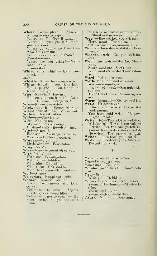
556 CRUISE OF THE MINNIE MAUD
Where, fwhj.t plf ce) — Now-gli,\pn-ni noona kow-pee.Where is it ?)—Now-Ii taima.Where did you get it ?—Nam-moon ook-wa.Where do you come f om ? —Now-kin gnar-pin ?
Where does he come from ?—
Now-kin-oona.Where are you going ?—Nam-moon nar-pin ?
an-mak-ki ?
Whip, (dog whip) — Ip-pa-row-ootah.
otah.Whist'e, (to)— Oo-wig-nee-arto.White^—Kowd-hik-too, Kud-joo.White people -- Kar-hloom-ah.Kat-tung-ai-yo.
Who—Kee-sho ? Kee-nr.Who gave it you, friend ?—Nam-moon Ook-w&, ee-ling-nee?
Why—Kan-noo-wee-tooWick, (made fro fibre)-—Man-na.Wick, (made of moss)-—Shoo-pooti.Widow—Oo-ee-ka-shoo.Widower— Noo-lee-to.Wife—Noo-lee-an.My wife^—Noo-lee-anga.Husband calls wife—Kom-ma.
Wind—A-nooi -i.
Etst wind— Ar-weeg-Ttrg-nung.West wind—Oo-warg-nung.
Window^—Ig-gah-lah.Little window—Ee-gah-langa.
Wing—Soo -loo.
Wise—Kow-ee-yoo-ni-eh-ee-voo.With (sufTix)—lo.W ith me—U-wang-ah-lo.With you—Ib-bid-lo.With him—Oo-nad-lo.With them—Ook-wad-lo.With the captain—Kap-pi-tad-lo.
Wolf^—Ar-now.Wolverene—Kappi-yark-tchoo.Woman—Koo-nee, Ah-n?h.
I am a woman—Ah-nah lookaoo-weh.Tell woman to come — Arg-na-mee kai-yoo kill-owg lillee.
Tell woman not to come — Oo-kowt - lee lao kai - yoo nee - ung-moon.
Ask why womar does not come ?—Shookin kai-yoo nee lung ilia.
Wood—Kee-yo. kee-yoo-ark-tsoo.Hard wood—Tiss-uk-ta.Soft wood—Kai-yoo-ark-tchoo.
Wooden board—Sai-luk-ta. Koo-vee-ar-to.
Wooden stick—Kee-voo wak-ka-duk.
Wool, (fur, hair)—Meerko, Aleer-kwa.Short wool etc-—-Seerk-gah.Long wool etc—Meerko-wik-too-arlo.
Word—Tai-yoo-ee-yoo.Work, (to^—San-nuk-suk-too.
W^ork—San-neh-yo.Plenty of work^—^San-nuk-suk-too-arlo.
To be full of work—San-neh-yoo-arlo.
Worm, (maggot)—Kec-tee rod-lee.Wrist—Ur-gow-tikka.
I have cold wrists—Ur-gow-taiyook pooma.You have cold wrists—L'i-gow-t< i-yook poolit.
Write, (to)—Tee-tuk-too yak-too.W. iting (n)—Tee-tuk-too-yak-kaI write—Tee-tuk-too ya-tek-ka.You write--Tee-tuk-too ya-tret-ti
He writes—Tee-tuk-too ya-tengi.Writer — Tee-tooti-yook-tar-ti —Writer — Tee-tooti-yook-tar-ti —Tee zuk-too-varti.
Yawn, (to)—Tazzi-suk-looYes—Ee-yee. Ak-soo.Yes, (sure)-—Eed-lah.Yonder, (over there) — Oonga tf.h-
ni.
You—Ib-biji.
With you—Ib-bid-lo.
Young boy or me.lc—Noo-ta-rak.Young girl or female—Ninni-ark-tcha.Young sepl—Nit-tia.
Young sealskin—Nit-ti-an.
Youth—Noo-ko-pia wee-nung.
VOCABULARY OF WORDS
USED BY THE
TRIBE OF INLAND ESKIMOS INHABITING THE BANKSOF KAZAN AND FERGUSON RIVERS
By J. Burr Tyrrell
Obtained from A-yout, an Eskimo living on the upper part of theKasan River. It was largely revised at Churchill by Powow, an Eskimofrom the same district, with the assistance of the Rev. Jos. Lofthouseas interpreter.
The words are given in very much the same order as in J. \\ . Powell's"Introduction to the Study of the Indian Languages", and with someslight modifications the sounds of the letters are the same.
The following is a list of the vowel sounds here used:
—
as in English fat.
dodododododo
fa
.. .all. u. . . met.ûas. .they, ai
. . .pin. ymarine, ou
o " in English potÔ do . . .
u do . . .
oo dodododo
go.
but.
. fool.
. aisle.
year.
out.
(1) Persons
Man—ang'-ut.Woman
—
âr'-nak.Elderley man
—
ô-tok'-kak.Old woman—ar-nak-kwek-kak.Young man
—
în-nû-kûk-tûk.Boy
—
nù'-kâ.Girl—nai-uk.Infant—nû-târ'-ak.
(2) Parts of the Body
Head—ni-ak'-kuk.Hair—nut'-tek.Grey hair—ka'yuk.Face—ki'-nak.Forehead—kou.Eye
—
i'-ik.
Eyebrow
—
kab'-lût.
Ear
—
ki-yû'-tik.
Nose—kaing'-ak.Beard—Qm-mik.Mouth—kan'-yek.Teeth—kl-Qt'-ti.
Tongue—ok'-ka.Chin—tab-Iii.
Neck
—
kon-i-lî-ni-ak.
Body, (trunk)—ka-te-guk.Shoulder
—
nï-gu-blû.Back—kai-mer'-i-luk.
Breast
—
ûm'-met.Breast bone—hak'kig'-gek.Belly— ner-rok'-kak.Arm—tal'-yek.
Hand—ag'-gck.Fingers
—
-hï-tam-ut.Thumb
—
kôb'-Iû.Leg
—
nî-0.
Thigh
—
kok-tô-ak.

558 CRUISE OF THE MINNIE MAUD
Leg below the Knee—kan'-nak.Foot—î-ki-gek.Toes—taip-in-in-û-dik.Marrow—pat'-chuk.
(3) Dress and Ornements
Hood—na'-ha.Coat (outer deer-skin garnment)—
tko'-!f-tok.Trimming round coat—ag'-Iuk.Shirt (inner deer-skin garnment)—
at-tî-yî.
Trousers—ka'-Iïk.
Gloves (with fingers)—ad-gui-ut.Boots—kam'-mi.Deer skin blanket—kaip'-puk.
(4) Dwellings, Etc.
Camp or village—ig-Iô.
Tent—to-pek.Fire—ok'-ka.Flame—ek-wa-Ia'.Smoke—pQ-yuk.Ashes—îm-më-an-nî-kô.Cache—pe-rûl-yâ.Track—tO-mî.Iron—hâ'-wik.Copper or brass—ka-nû'-huk.A sound—nâ-ki-nim'-na.A blow—a-nou'-yuk.Sight—tak-kO-yuk.
(5) Implements
Bow—pid-jik'-î.
Fishing spear—kuk'-ki-wa.Deer spear—u-puk-to.Head of deer spear
—
û'-Iû.
Handle of deer spear—î'-pii.
Fishing hook—kar'-î-ô-kuk.Fishing line of sinew^—î-pî-û-tuk.
Stick on which line is wound—û-Ied'-gût.
Float for fishing net—puk-tak'-kutKnife—pï'-Iout.
Knife (small penknife)—o-kut'-takSnow knife—pan-ne'.Pipe—pu-Iu-yet'-ti.
Pipe stem—i-po-ak.Awl (for boring)—i-kai-tak'.
Needle—mit-kut.Canoe (for one man)—kai'-ak.
Wooden gunwale, piece of kaiak—ap-pum'-mak.
Double paddle
—
pou'-tik.
Boat—Omi-ak.Boat, white man's—Ka blû-nak-
tho-ak.
Boat, large—O-mi-ar'-yQ-ak.Sail—tin-gin-er-ou-tuk.Sledge—kam-5d'-jik.Deer skin line—hî'-ni-ak.Plaited sinew line—pîl-er-ak.Thread—en-na-Iû'-ka.Parchment—kai'-tin-kû-ni.
Cup—îm-mo-hû'-yak.Spoon (musk or horn)
—
ôu'-i-yû'yak.
Kettle—hcâ-wik.
Lid of kettle—o'-ku-ak.
(6) Food
Meat (of deer)—ti-yuk.Dry meat—nip'-ku.Fat—tûn'-nûk.Boiled grain—kat'-che-wuk.
(7) Colours
Black or blue—ka-re-nek'-tô.Red—ou-pa-Iuk'-to.White—ka-guk'-tô.
(8) Numerals
1-—a-tou'-i-ak.2
—
mal'-rôk.3
—
ping'-a-yû-ak.4
—
hî-tâ'-mut.5—ted'-Ii-ma.6—ar'-wing-e-gik.7—mal'-ung-ik.S—ping-a-hyû-ni-ik.9
—
kû-ling-gûl-u-ak-tak.10—koul'-yik.20
—
mal-rô-ad-gug'-gik.30—ping-a-ho-ad-gu'-yik.40
—
hî-tam'-ad-gu'-yik..50—tcd'-Ie-mat-ad-gu'-yik.Half—nap'-puk.
(9) Divisions of time
Day—u-blut.
Night—û-nû-ak.Sunrise—he-kan-yek'-pôk.Sunset—he-kan-rek'-pok.Noon—ka-wa-tan-u-a-ti'-wok.Winter—û'-ki-ok.
Spring—û-ping-râ'-ka.Summer—ou'-i-a.
(10) Animals
Reindeer—tûk'-tû.
Buck (deer)—pung'~ni-uk.Doe—no-ral'-Iik.
CRUISE OF THE MINNIE MAUD ;59
Buck (youngj
—
nû-ka-tû'-ak.Fawn—nô'-kak.Dog—kaip'-mik.Fox Twhite)
—
ter-re-gû'-ne-ak.Musk ox—0-ming-muk.Wolf—am-niâr'-ro.Wolverene
—
kâk'-wik.Crane (brown)—nek'-to-al-Ii.
Diver (red-throated)—pai'-uk.Duck—pû-Iû-et'-û-ak.Goose—ting-ni-ak.Gull—nou-yet'-yû-ak.Loon—kak'-kou.Merganser—a-àn'-yek.Ptarmigan—pe-ku-li'-a
Wavy—kang'-uk.Fish—ye-kal'-lu k.
Ling ' Lota maculosa)—tik-tal'-luk.
Pike ' Esox lucius)—hyu-lik.Perch—hû-Iûk-pou'-i.Sucker—ant'-ni-ak.
Lake trout—ich-chlô'-ra.
Trout (large fish)
—
kek'-ki-wî-ak'-tô.
Whitefish—an-ak'-Iuk.Black fly—me-Iu'-i-ak.
Gad fly—a'-Iung'-i-yu.
Mosquito— kik-to'-ri-ak.
Spider—ni-ni'-yo.
(11) Plants
Tree—ne-pâk'-tuk.Shrub fsmall black spruce)—kai'-
uk-tok.Wood, fallen—tip'-ya.
Wood, dry—tlp'-i-a-Iuk.
Wood, dry—pal'-Iuk.
Willow—ok'-pik.Bearberry f Arctostaphylos uva-
u rsi )—a-tu ng-gou'-Iik.Labrador tea—nû-kâr-r'ô.Grass—î'-wi.
Moss—ô-â'-rû.
Lichen (black hair, like)—king-ou-yak.
(12) Geographic Terms, etc.
North—wak-nyek-tok.East—kâ-nak-yek'-tok.South—nig-yek'-tok.West—ping-ak-yek'-tok.River
—
kôg.Rapid river—kôg'-ni-ak.Rapid in river—kôg-nîk'-yû-ak.Mouth of river—kâ-tïn'-i-a.
Lake—kâ-man'-yuk.Small lake—kâ-man-ou'-uk.Very small lake or pond—te-
her'-ok.
Bay—kang'-ek-Iuk.Shore—hig'-gî-a.
Point of land—nû'-ûk.Island—ka-gek'-tok.Portage—nap'-muk.Hill—king-'-a.
Pointed hill with stone on it
—
û-yâr'-ra-hûg'-Iûk.Stone placed on h II—in-nûk-kûkStone or rock— -yar'-ruk.
(IS) Geographic Names
Fort Churchill— û-yar'-ri ig-Iô.
Doobaunt Lake — tû'-Ii-ma-Iû'-gvû-a kâ-man'-yi.
Little Doobaunt Lake—tû'-li-
ma-Iû' gyu-et-na kâ-man'-yi.Big Lake — ang-gi-kû'-ni ka-
man'-vi.Yath, kyed Lake
—
hï-co-Ii'-gyû-aka-man'-yi.
Child Lake — nû-tar'-a-wit ka-man'-yi.
Kamanuriak Lake—ka-man-yur'-vu-ak.
Kazen River—in'-nwi kôg.Seal River—net-chil kôg.Pallelluah—pal'-Ier-yQa.
(14) Social Organization
An Eskimo—în-nwl.Chief—i-hyû-mat'-tok.Trader—ï-hyù-ma-tër'ok.White man— kab-Iû-na.
(15) nship
Son—îr-ner'-ik.
Daughter—pa'-nik.Father—at-ta'-na.
Mother—an-nâ'-na.Wife—nû'-Ii-a.
Sister—në'-yuk.Twins—nu-kar'-a.Grandchild—ok-kô'-ga.
'16) The Firmament
Cloud—nû-û'-ya.
Sky—al-Ia-kû'-ni.
Sun—hï-ak-kên'-i-ak.
Moon—yat-ke'.
Stars—û-blû-ri-ak.
Aurora—ak'-ka.
Hoar frost—hâ-kû-ni.
Snow—ap'-put.
Ice— hi'-kô.
Rain—ni-pal'-iu.
560 CRUISE OF THE MINNIE MAUD
Water-—im'-mek.Tide—pit'-tak.
Sea—tar'-rê-ô.
Wind—an-nôr'-re.
Darkness—tâ'-kû-ni.
(17) Pronouns, Adjectives,Adverbs, Etc.
I—u-wung'-a.Thou—ig'-bi.
Small— mlk'-ki-kfi-ni.
Large—ang'-gi-kû-ni.
Long—ta'-ki-kû-ni.
Short—na'-hi-kO-ni.
Narrow—ik'-ik-i-kû'-ni.
Broad—i-kek'-to-kû-ni.
Light—ok'-e-ku-ni.
Heavy—ok-u-mai'-i-kO-ni.Near—kan'-i-kO-ni.
Far—o-ma-hi-ko'-ni.
Flat—man'-i-ko'-ni.
Cold—ik'-ki
Cold—ik'-ki-an-ni-kii-ni.
Warm—ik'kl-an-ê'-kû-ni.
Hot (warm)
—
O'-na-kû-ni.
Good—pi-chi-ak.
Bad—pl-tou-i-kû-ni.
Lost—na-lûn'-i-kû-ni.
Broken—he-ko-mct'-uk.Departed—oug'-Iuk-p5k.That—ted-ba.Where—nâ'-ni.
There—mâ'-ni.
Where is it—nan-nim'-ne.On this side of—mi-kâ'-ni.
On that side of—o-ma-ta'-ni.
To-day—û-blù'-mi.
So—ta-man-nô.There is none—nouk.Plentiful—mai (in sufflx).
Wanting (or no)
—
nâ'-ga (in suffix)
(18) Verbs
To see—tak'-kô.
To sleep—hî-nik-tûk.
To portage—nap'muk-tô.To travel—kak-mal'-to.
To walk—pi-hûk'-tuk.
To run—ak-pâ'-tô.
To talk—ok-kak'-tô.To drink—im-ma-kyû'-ya.To drink—im-mek'-to.To stoop and drink—hik-kî'uk.
To dip up—kal-u-ing'-i.
To eat—ner-rà'-yûk.To grasp—te-ho-yuk.To brush off the snow—5-yek'-tokTo sneeze
—
tâ-ri-uk-to-kû-ni.
To cry—il-Iuk'-ku-ni.
To laugh— kap-ma-tuk'-to.To be pleased—kou'-gak-tô.To be displeased—an-nu-ke-ni.To write—ik-ke-rok'-to.
To cook—i-rë'-yuk.
To cut—kï-lêk'-tok.
To plane (wood)
—
hâ-ner-ô'-mik.To saw—û-Iût.
To splash— mal'-lo.
To squeak—nï-ko-Iak-tô.
It is raining— ni-pal'-i-ku-ni.
It is snowing—kan-yi-ku-ni.It is stormy (on the weather) —
at-kon-i-ku-ni.It is lost—nou-gim-na.It smells nice—ma-ma-ku-ni.It smells unpleasant—ma-mai'-i-
ku-ni.
I do not know^a-mî'-a-huk.Arise—tô-pal-ycr'-ik.
Go!—On-gak-wok'-to.Come!— kai'-uk.
(19) New Words
Handkerchief—kon-ji-hi-në'-rût.
Muffler—tap'-pi.
Paper—al-li-Iê'-uk.
Buttons—han-ner'-i-ak.
Tobacco—tlp'-Ie-të'-rût.
Rifle—am-me-hû-ek-ta-yû'-yuk.Gun (single barreled)
—
kai-ûk-të-tô
Gun (doubled barreled)— mal-rôl'-
yi-
Gunpowder—ar'-yet.
Gun caps—ik'-ni-uk.
Bullet— kar'-i-ok.
Biscuit— nck-ICi-uk.
Bottle—kî-li-an-â'-kut.
Fork—nî-ô-gî-tik.
Plate—pà-wu-tuk.

REGULATIONS OF VOCABULARLY OF IGLOO LIK
ESQUIMAUX WORDS AND SENTENCES
BY
—
Sir William Edward Parry
IN 1821-1822-1823.
The language of the Esquimaux is so full of words, and ?o varied andpeculiar in the formation of its sentences that it would require a muchlarger acquaintance with these people, as well as far greater ability thanmine, to give a satisfactory account of its grammaticnl construction. In
the few remarks which follow, I have taken as my guide Crantz's Ac-
count of the language of Greenland and have endeavoured to trace a re-
semblance or to discover a difference between the two. as far as our know-ledge enables us to ascertain. They afe in fact, howeveir. so nearly allied
to each other, that it cannot but excite surprise to observe how slight a
change time and distance have been able to effe; t in the language, as well
as in the habits of this widely-scattered nation.
One of the principal difficulties experienced by an European in acqui-
ring a knowledge of this language, arise from the constant blending of
the several words of a sentence into one, not simply by joining them loo-
sely together but by a regular combination of the whole, according to fi-
xed yet infinitely varied rules. Of this peculiarity Crantz (11-224, 22.5)
has given an instance or two, which, though extreme cases, serve to showthe kind of difficulty which occurs in distinguishing the separate words of
which such a sentence is comproundred.Several of our letters, taken according to the English mode of pronon-
ciation, are not in use among these people. The letter c may at all times
be very well represented by k : and f, q,,v, x anf z never, I believe occur at
all of about 800 words contained in the annexed Vocabulary, I can find
none beginning with the letters, b. d, g, 1, r, or u. The (words so spelt
by Crantz are. according to the English pronunciation, more accurately
expressed by Oo. as in Oo-ang-a. Nearly the same remark applies to the
V of the Missionaries, for which, in English, w must bp substituted.) Doccurs very seldom in the middle of a word, and b still more rarely: andin most cases these letters immediately precede the liquids 1 or r. It is
worthy of remark, that the only exception to this that I have met withoccurs in three of the words used in the games already described, wherethe b is followed by a vowel, as if. in the formation of these probably un-meaning words, as well as in the mode of uttering them something out of
the common way had been intended by the inventor. The letter f beingquite unknown to them, the first attempt at the word "fife" produced"pipe" and it was not till after much practice that they could pronounceeven one of the f's with distincness.
I have remarked above that I is not used at the beginning of a word;for though it thus occurs in the conjunction loo, yet as this is invariably
placed at the end of the noun or pronoun, it can hardly be considered anexception to the rule. The Esquimaux had great difficulty in pronoun-cing Captain Lyon's name which it was more convenient to them to chan-
ge in Xayon. The letter I occurs perhaps more frequently than any
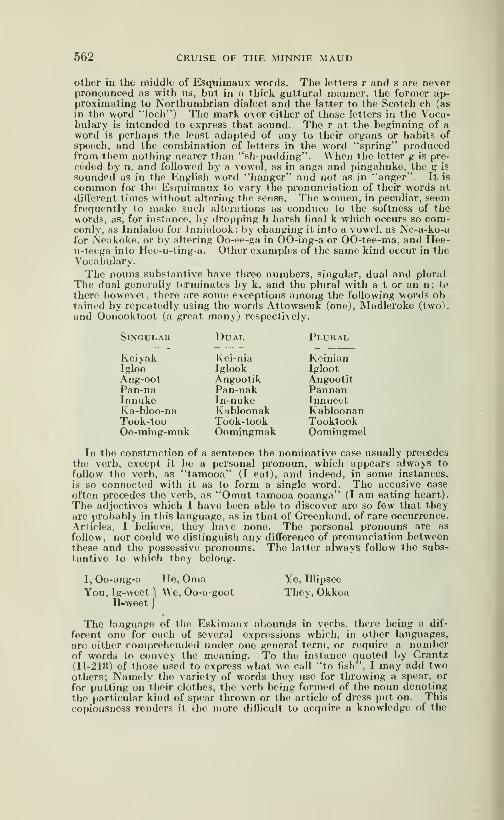
662 CRUISE OF THE MINNIE MAUD
Other in the middle of Esquimaux words. The letters r and s are neverpronounced as with us, but in a thick guttural manner, the former ap-proximating to Northumbrian dialect and the latter to the Scotch ch (as
in the word "loch") The mark over either of those letters in the Voca-bulary is intended to express that sound. The r at the beginning of aword is perhaps the least adapted of any to their organs or habits ofspeech, and the combination of letters in the word "spring" producedfrom them nothing nearer than "sh-pudding". When the letter g is pre-
ceded by n, and followed by a vowel, as in anga and pingahuke, the g is
sounded as in the English word "hanger" and not as in "anger". It is
common for the Esquimaux to vary tlie pronunciation of their words atdifferent times without altering the sense. The women, in peculiar, seemfrequently to make such alterations as conduce to the softness of thewords, as, for instance, by dropping h harsh final k which occurs so com-conly, as Innialoo for Innialook; by changing it into a vowel, as Ne-a-ko-afor Neakoke, or by altering Oo-ee-ga in 00-ing-a or 00-tee-ma, and Hee-u-teega into Hee-u-ting-a. Other examples of the same kind occur in theVocabulary.
The nouns substantive have tliree numbers, singular, dual and plural
The dual generally terminates by k, and the plural with a t or an n; to
there howevei , there are some exceptions among the following words obtained by repeatedly using the words Attowseuk (one), Madleroke (two).and Oonooktoot (a great many) respectively.
Singular Dual Plural
Keiyak Kei-nia KeinianIgloo Iglook IglootAng-oot Angootik AngootitPan-na Pan-nak PannanInnuke In-nuke InnueetKa-bloo-na Kabloonak KabloonanTook-too Took-took TooktookOo-ming-muk Oomingmak Oomingmel
In the construction of a sentence the nominative case usually precedesthe verb, except it be a personal pronoun, which appears always to
follow the verb, as "tamooa" (I eat), and indeed, in some instances,
is so connected with it as to form a single word. The accusive caseoften precedes the verb, as "Omut tamooa ooanga" (I am eating heart).
The adjectives which I have been able to discover are so few that theyare probably in this language, as in that of Greenland, of rare occurrence.Ariicles, I believe, they have none. The personal pronouns are as
follow, nor could wo distinguish any difference of pronunciation betweenthese and the possessive pronouns. The latter always follow the subs-tantive to which they belong.
I, Oo-ang-a TIo, Oma Ye, Illipsee
You, Ig-weet ) We, Oo-a-goot They, OkkoaII«weet J
The language of the Eskimaux abounds in verbs, there being a dif-
ferent one for each of several expressions which, in other languages,arc either comprehended under one general term, or require a numberof words to convey the meaning. To the instance quoted by Crantz(II-21«) of those used to express what wo call "to fish", I may add twoothers; Namely the variety of words thoy use for throwing a spear, or
for putting on their clothes, the verb being formed of the noun denotingthe particular kind of spear thrown or the article of dress put on. Thiscopiousness renders it ihe more diflicult to acquire a knowledge of the

CRUISE OF THE MINNIE MAUD 563
moods and tenses, especially when the words of a sentence are so closely
blended as in the language. The following are the six persons of the
present tense of the verb "to be well".
Nappa-woong-a I am" -wooke Thou art" -wwotik He is
" -woot We are" -wootit You are" -wook They are
The third person singular generally terminates in oke, and most of
the verbs in the Vocabulary are inserted in this person, which the Eski-
maux more commonly gave than any other. These appear to be, as
in Greenland, two imperative moods, one expressing a desire and theother a summary command. This last ends in it, as "Eliiarit igloomoot"(Go away to the hut), and, when spoken with seriousness by a manto his wife or child, ensures immediate attention.
The only propositions that I have noticed (If indeed parts of speechcan be so called which always follow the noun), are three; namely, mik(ac), as "Igloomikpoke", (he is at the hut); mee (in, upon, or sometimesat), as "Oomia-mefc", (in the ship),; "Sikhomee", upon the ice; Amitio-me, at Amitioko; at moot (to), "Ooagna-moot" to the westward. Theseare always tacked on at the end of the noun, like que in Latin; and so
is the cctajunction loo (and), being pronounced with it. as if one word.Common interjection, expressing surprise and admiration, is a Hei! or
Hei-ya ! but a superlative degree of astonishment, mixed with pleasure,
is expressed by the words A-1âmma-trânee.The Esquimaux make much use of winks and nods in conversing.
The former, which are always intended to convey a negative meaningare frequently the only reply made to a question, which a bystandermight therefore suppose to be still unanswered. A nod, as with us,
implies the affermative, A peculiarity in the idiom of this language whichmay here be noticed, is the affirmatuon of a question put in the negativein order to convey a negative reply, as "Have you not been out ïishing
to-day?" to which if a negative answer be intended the person says"Yes" or returns a nod,implying "I have not". I may also mentionas another peculiarity in their mode of expressing themselves, a commoncustorii of speaking of a third person, not by his own name but as "thefather", husband, brother, etc.. of such a one, "and this even whenthe individual so spoken of is brother to the person speaking. Thus,Iliglilik would often call her brother Toolooak" the son of Ka-oong-ut".In mentioning names it is not uncommon for them to adopt a modeof pronounciation differing from the correct one, and which (if the termcan at all be applied to an unwritten language) may be called collo-
qmal; this consists in a change of the termination, as "Toolooahgioo"for Toolooak, "Oongalaghioo" for Oong-a-luk, etc., and appears equi-valent to the familiar diminutives of Christian names common amongus. The proper names in common use among these people are borrowedfrom the most familiar objects in nature, and have no reference to the qua-lities of the possessor , as among other savages of the North Americancontinent. The names are common to both sexes (so at least we foundthem in various instances and are usually given after some of the rela-
tives of the parents, but only on one occasion that we knew of, afterthe child's own parent. That they consider the sun as feminine andthe moon masculine (as, indeed, do Greenlanders) may be applied fromthe words "neiya" and "Anunga", by which those objects are respecti-vely called, but which literally mean "sister" and "brother". But thename of "tatkuk" by which the moon is likewise distinguished belongedto a female in the only instance we knew of its being in use
37
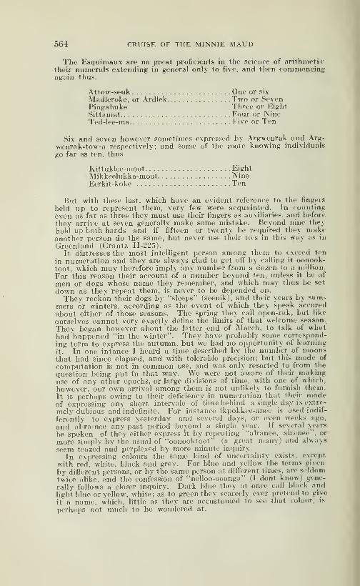
564 CRUISE OF THE MINNIE MAUD
The Esquimaux are no great proficients in the science of arithmetictheir numerals extending in general only to five, and then commencingagain thus.
Attow-seuk One or six
Madleroke, or Ardlek Two or SevenPingahuke Three or EightSittamat Four or NineTed-lee-ma Five or Ten
Six and seven however sometimes expressed by Argwenrak and Arg-
wenrak-tow-a respectively, and some of Ihe more knowing individuals
go far as ten, thus
Kittuklee-moot EightMikkeelukka-moot NineEerkit-koke Ten
But with these last, which have an evident reference to the fingers
held up to represent them, very few were acquainted. In counting
even as far as three they must use their fingers as auxiliaries, and before
they arrive at seven generally make some mistake. Beyond nine theyhold up both hands and if fifteen or twenty be required they makeanother person do the same, but never use their tas in this way as in
Greenland (Crantz 11-225).
It distresses the most intelligent person among them to exceed ten
in numeration and they are always glad to get off by calling it oonook-toot, wkich may therefore imply any number from a dozen to a nsillion.
For this reason their account of a number beyond ten, unless it be of
men or dogs whose name they remember, and which may thus be set
down as they repeat them, is never to be depended on.
They reckon their dogs by "sleeps" (seenik), and their years by sum-mers or winters, according' as the event of which they speak accured
about either of those seasons. The spring they call open-rak, but like
ourselves cannot very exactly define the limits of that welcome season.
They began however about the letter end of March, to talk of whathad "happened "in the winter". They have probably some correspond-
ing term to express the autumn, but we had no opportunity of learning
it. In one intance I heard a time described by the number of moonsthat had since elapsed, and with tolerable precision; but this mode of
computation is not in common use, and Mas only resorted to from the
question being put in that way. We were not aware of their makinguse of any other epochs, or large divisions of time, with one of which,
however, our own arrival among them is not unlikely to furnish them.It is perhaps owing to their deficiency in numeration that their modeof expressing any short intervale of time behind a single day is extrf-
mely dubious and indefinite. For instance ikpokkee-anee is used indif-
ferently to express yesterday and several days, or even weeks ago,
and al-ra-nee any past period beyond a single year. If several years
be spoken of the'y either express it by repeating "alranee, ah-anee", or
more simply by the usual of "oonooktoot" (a great many) and always
seem teazed and perplexed by more minute inquiry.
In expressing colom-s the same kind of uncertainty exists, except
with red, white, black and grey. For blue and \ellow the terms given
by different persons, or by the same person at different times, are seldom
twice alike, and the confession of "nelloo-ooanga" (I dont know) gene-
rally follows a closer inquiry. Dark blue they at once call black and
light blue or yellow, white; as to green they scarcely ever pretend to give
it a name, which, little as they are accustomed to see that colour, is
perhaps not much to he wondered at.
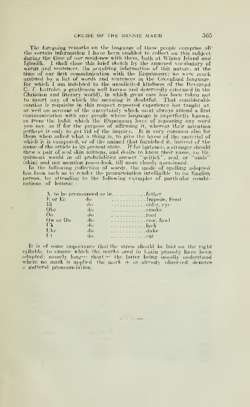
CRUISE OF THE MINNIE MAUD 565
The foregoing remarks on the language of these people comprise all'
the certain information I have been enabled to collect on this subjectduring the time of our residence with them, both at Winter Island andIgloolik. I shall close this brief sketch by the annexed vocabulary ofwords and sentences, (in acquiring information of this nature, at thetime of our first communication with the Esquimaux; we were muchassisted by a list of words and sentences in the Greenland language,for which I am indebted to the unsolicited kindness of the ReverendC. T. Latrobe, a gentleman well known and deservedly esteemed in theChristian and literary world), in which great care has been taken notto insert any of which the meaning is doubtful. That considerablecaution is requisite in this respect repeated experience has taught us,
as well on account of the uncertainly which must always attend a first
communication with any people whose language is imperfectly known,as Iroin the habit which the Esquimaux have of repeating any wordyou Kay, as if for the purpose of affu'ming it, whereas their intentionperhaps is only to get rid of the inquiry. It is very common also forthem when asked what a thing is, to give the hame of the material ofwhich it is composed, or of the animal that furnished it, instead of thename of the article in its present state. If for instan<^e, a stranger shouldshew a pair of seal skin mittens, and desire to know their name, an Es-quimaux would in all probabilities answer "neitick". seal, or "amia"(skin) and not mention poo-a-look, till more closely questioned.
In the following collection of words, the mode of spelling adoptedhas been such as to render the pronunciation intelligible to an Englishperson, by attending to the following examples oif particular combi-nations of letters:
—
A. to be pronounced as in fatherE or Ee do Impede, FeedEi do eider, eyeOke do smokeOo do rootOw or Ou do cow, fowlUk do luckUke do dukeUt do cut
It is of some importance that the stress should be laid on the rightsyllable, to ensure which the marks used in Latin prosody have beenadopted; namely long— short ^-' the latter being usually understoodwhere no mark is applied the mark -f as already observed, denotesa gutteral pronounciation.
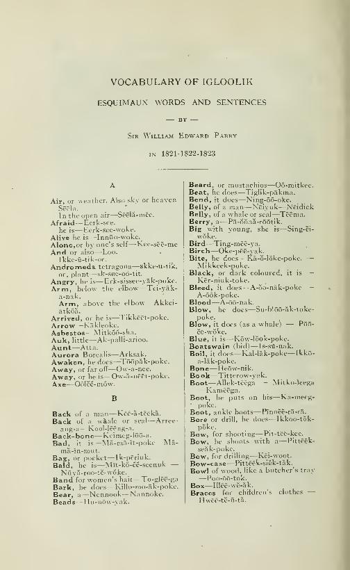
VOCABULARY OF IGLOOLIK
ESQUIMAUX WORDS AND SENTENCES
BY
Sir William Edward Parry
IN- 1821-1822-1823
Air, or weather. Also sky or heavenSêëla.
In the open air
—
Sëêla-mëe.
Afraid—Eerk-see.
he is—Eerk-see-woke.
Alive he is—Inniio-woke.
Alone, or by one's self
—
Kee-sëë-meAnd or also—Loo.
Ikke-û-tik-or.
Andromeda tetragona—skke-u-tik,or. plant
—
sk-see-ôô-tit.
Angry, he is— Erk-sissee-yak-poke.
Arm, below the elbow—Tei-yak-a-nak.Arm, above the elbow—Akkei-âtkôâ.
Arrived, or he is
—
Tikkëët-poke.
Arrow— Kakleoke.Asbestos—Mitkoo-sha.Auk, little—Ak-palli-arioo.
Aunt—Atta.Aurora Borealis—Arksak.Awaken, he does
—
Tôôpâk-poke.Away, or far ofT—Ow-a-nee.Away, or he is
—
Ow-â-nêët-poke.Axe—Oôlëë-niôw.
B
Back of a man
—
Këë-a-tëëkâ.
Back of a waale or seal—Arree-ang-a
—
Kool-lëëng-a.
Back-bone— Keinieg-lôô-a.
Bad, it is
—
Ma-mâ-ït-poke—Mâ-mâ-in-mut.
Bag, or pocket
—
Ik-përiuk.
Bald, he is
—
Mît-kô-ëë-seenuk —N ûy a-roo-të- woke.
Band for women's hair
—
To-glêê-ga
Bark, he does—Killo-mo-ak-poke.
Bear, a—Ncnnook—Nannoke.Beads—Ilu-nôw-vak.
Beard, or mustachios—Oo-mitkee.Beat, he does—Tiglik-pakma.Bend, it does
—
Ning-ôô-oke.Belly, of a man—Neiyuk
—
NêidiekBelly, of a whale or seal
—
Tëêma.Berry, a
—
Pâ-ôônâ-rôôtik.Big with young, she is—Sing-ei-
woke.Bird—Ting-mëë-ya.Birch—Oke-pëë-yak.Bite, he does
—
Kâ-ô-Iôke-poke. —
•
Mikkeck-pokc.Black, or dark coloured, it is —
Kër-niuk-toke.Bleed, it does
—
A-ôo-nâk-poke —A-ôôk-poke.
Blood—À-5ô-nak.Blow, he does
—
Su-blôô-âk-toke-poke.
Blow, it does (as a whale) — Pôô-ëe-wÔke.
Blue, it is
—
Kôw-lôok-poke.Boatswain (bid)
—
Is-sû-nak.
Boil, it does
—
Kal-lâk-poke—Ikkô-a-lâk-poke.
Bone—Heôw-nik.Book—Titterow-yak.Boot—AUek-tëêga — Mitko-Ieega—Kamëëga.Boot, he puts on his—Ka-meeg-
poke.Boot, ankle boots
—
Pînnëë-râ-ra.
Bore or drill, he does
—
Ikkôô-tôk-poke.
Bow, for shooting
—
Pit-tëë-kee.
Bow, he shoots with a
—
Pittëëk-
seâk-poke.Bow, for drilling—Këi-woot.
Bow-case—Pittëëk-siëk-tâk.
Bowl of wood, like a butcher's tray— Poo-ôô-tok.
Box— Illëë-wë-ak.
Braces for children's clothes —I Iwëë-të-û-tâ.
CRUISE OF THE MINNIE MAUD 567
Bracelet—Seap-pâng-a.Brains— Kârrëtâk.Brass—Ka-kô-blek.Break—Now-îk-poke — Kêêk-tô-
âk-poke.Bread—Shê-gà-Iak.Bread-dust—Kâ-nik-roôt.Breast of a woman
—
Oô-ëe-âg-nig.
Breast, bone
—
Toonëk-fl-â.Breeches—Kaklêê-ga — Kakleek.Breeches, he puts on his—Kakleek
poke.Brent, goose, or barnacle—Nur-
glûk.
Bristles—Oomia.Brother—Kattangôôtee anêëga(or
anninga).Brown, it is
—
Këi-yôke-toke.Buoy (made of an inflated seal
skin)—How- wQt-tak.Burn, it does
—
0-ô-nâk-poke.Button—Ichë-rëê-yuk.Butterfly, a
—
Tâkkëë-lîkkëë-tâ.
Calcareous spar
—
Oku-rëë-yuk.Calm, it is
—
Illëë-ûng-nâk-poke.Canoe—Cei-yak.Canoe, he paddles a—Kei-yak-to-
poke.Cap, or hood—Nei-seak.Charm, a skin stap worn as a —Oo-yà-mëë-ga.
Cheek—Oôlniak — Oô-lôô-â-ga.Chew, he does
—
Ang-ôô-Ia-woke.Chin— Kablôôga.Clay, shite
—
Ow-wëë-wiuk.Clench his fist, he does
—
Eêr-këet-pokf.
Climb, he does
—
Mâ-yù-âk-poke.Cloud—Noo-wôô-ë-â..Coal—Aggâ-ë-âCald— Ik-kee.
Comb— Ilia-û-tik.
Come, here
—
Kêi-Iëê. Kârree.Come here (more commanding —
Këiliarit.
Come here, he does
—
Këi-wa.Come down
—
Ka-nôông-a.Come or go in—Ittiek.
Come shall I ?
—
Ittiek-Iâng-à ?
Come out, it does (^as an arrow)—Kat-tâk-poke.
Conjuror, or Sorceror
—
Ang-ët-kook — Annât-kô-â —Annâtkô.
Copper— Ka-nôô-yak.Cough, he does
—
Ko-âktô-poke.Crane (bird)—Tattêë-Iëe-ârûok.Cry, he does
—
Këi-â-woke.
Cup, or bowl of musk-ox horn —Kei-yû-tuk.
Cut, he does — Sôwë-âk-poke —Sowë-rôke-poke —• Pilliuk-tôke-
poke.
Dance, he does—Momek-poke.Dark—Tak.Dark, it is
—
Tâk-pokc.Dart for birds
—
Nôô-gôo-ëe.Daughter
—
Pannëëya Pannêë.Dead, he is
—
Tôkôo-woke.Dirt
—
Ippûk.Dirty, he is—Ippuk-poke—Oo-In-
ya.Dive, he does—Atka-moke — At-
kâk-poke.Dive, it does into a hole as a seal
—
Aglook-poke.Dog
—
Mïkkee — Kei-meg.Draba alpina (plant)—Nap-poo-
yat.
Dream, he does — Seenik-tôômô-woke.
Dress victuals, he does
—
Koo-lîp-
siuk-poke.Dress i with clothes,) he does—An-
no-ak-poke — Kap-pëët-poke.Drill, a
—
Ik-kôô-tak.Drill, bow of
—
Këi-woot.Drill, he does
—
Ik-kôô-tôk-pôke.Drink, he does—Immiek-moke.Drinking-cup
—
Im-môô-chiuk.Drop, it does, as water
—
Kôô-tÔo-âk-poke.
Drown, he does
—
Ippëe-woke.Drum or tambourine
—
Kêi-ia-ôw-
tik.
Drunk, he is
—
Tôkôo-yâkpokc.Dry, it is
—
Pân-nëk-poke.Duck, king—Mit-tiek.
Duck, eider
—
Am-môw-lîgùôk.Duck, long tailed
—
Al-diggee-ârioo.
Dust—Oke-oke.
Ear—Hëë-û-têë-gâ — Hee-u-ting-a.
East—Nëë-yuk.East, to the
—
Nëë-yùk-mëe.Eat, he does
—
Tamôô-â-woke.Egg—Mannig. PI. Mannian-Eight—Pîng-â-huke.Eight—Pïng-â-huke — Kit-tùk-
lëe-moot.Eighth— Ping-â-hû-at.Esquimaux—Innûeët. (PI.) when
strangers. Sead-lër-më-oo.
568 CRUISE OF THE MINNIE MAUD
Elbow— Ikkô-sëê-gâ.Ermine—Ter-rêë-ga.European (sub)
—
Kablôôma.European (adj)
—
Kâblôô-nâk-ta.Eye— Ei-êê-ga.
Eye, he has an inflamed — Illëe-û-
poke.Eye-lash—Kei-ma-rëi-yak.Eye-bro'w—Ka-blôôt-kee.
Face—Ke-nâr-râ — Ke-niak.Fall, it does
—
E-û-kâ-poke —E-û-kak-poke.
Fall, the tide does
—
Ting-ïng-ôô-ôke.
Far off—Ovv-fi-nee.
Far, he is
—
0\v-â-nêët-poke.Fat, he is
—
Ovv-in-nïk-tôô-woke.Father—Attâta.Father or mother in law—Sakkee.Fawn, a—Noke-wa.Feather—Shôô-Iook. Plur. Shôô-
lôoâ.
Female, of any animal
—
Arûg-nâ.Fern—Oo-êê-beit.
File, a
—
Arrëc-yak.Finger, a—Tik-kiek.Finger, the first
—
Tik-këc-ë-râk.Finger, middle
—
Kei-tûk-lie-rak.
Finger, third
—
Meikkëê-lie-rak.Finger, little
—
Irkîtkôâ.
Fire—Ikkooma.Fish—Ekkalook — Ekkaloo.Fish hook—Kablookia.Five—Tcd-Iëe-mâ.Flesh of any animal
—
Nëërkee.Flipper of a seal, fore — Tâllâ-
rôô-ëe.
Flipper of a seal, hind
—
Sikkôô-ëë.Fcetus of a seal or walrus — Ib-
lëe-ôw.
Foggy, it is
—
Tûk-ouik-poke.Food—Ta-môô-a.Foot of man, or other animal —
Itti-krik — Itti-kiit-ka — Ttti-
gci.
Foot-print
—
Too- ma.Forehead—Kâ-ôw-ga.Fork, a— Kap-pôô-Ioot.Four—Sîttâ-mât.Fox—Tërrëc-ânëe-ârïôe.Fresh (not salt)
—
Tëi-seuk.Frost-bite
—
Kir-kee.Frost-bitten, it is
—
Kir-këêt-pokc.Frozen, it is (as meat)
—
Kir-këe-woke.
Full, he is
—
Akëio-tôke-poke.
Gaiters for boots
—
No-blôô-lëe-tâ.Give— Pllletây.
Gloves—Adëe-ëidïët.Go away (very commanding)—Ei-
liarit.
Go away to the huts — Eiliarit-
igloo-moot.Go—Année. Attee.Go, shall I ?
—
Anneel-yânga ?
Gone far away, he is—Ow-dlak-poke.
Good, it or he is
—
Mamûk-poke—
•
Mamûk-mut.Grandmother—In-rù-tâ.
Grass—Eë-week.Graze, it does (as a deer)
—
Nëerëê-lëk-pokc.
Great many — Oonôôk-toot —Oonôôk-poot.
Green—Tôông-ook.Grey— Kei-er-râ.
Grow, it does (as a plant)—Now-oke.
Growl, he does
—
Kàttëe-mâk-poke.Gull, glaucous—Now-ldioke.Gull, silvery—Now-ya.Gull, labine
—
Erkëet-yûggëe-âriooGums of a man
—
It-këët-ka.
Gun, a
—
Hëë-ëk-kôkc-lëë-gû.
H
Hair, human—Nu-ti-ak-la — Nu-yâk-ka.
Hair, of fur—MitkcHand, a—I-vQte-ka
ka.
Hare—Oo-ka-Iik.Harness for dogs—An-noo.He—Oma. Oo-na.Head—Nc-a-koke — Në-â-kô-â.Hear, he does
—
Tô-chiâ-wât.Heart—Omut.Heavy, it is—Oko-ma-it-poke.Heel—Kim-mëê-ga.Here—Mânec — Mër-ya — Mo-
rong-a o-a.
High, tall, or large, he ot it is —Ang-e-woke.
High, the land is
—
Nôôn-âng-e-woke.
High, it is high (applied to inani-
mate objects only)
—
King-êët-poke — Poôk-tôo-woke.
High, as the sun
—
Pôw-nâ.Hoole, a— Poo-tôô-a.Hoole, the circular in a canoe —
Pn-klut.
Addee-vut-
CRUISE OF THE MINNIE MAUD 569
Hood of a jacket or a cap — Nêi-seak •— Nei-ke-â-ga.
Hood, he puts on his—Nei-seak-pokc.
Hood, he puts off his—Nei-se-ck-
poke.Hoop, he does
—
Nânncë-yâk-pôke.Horns of reindeer
—
Nâg-gë-ô.Hot, or warm—Ok-ko.House-mate—Iglôg-â-têcga.
Ho'w?—Kanno ?
How many?—Kâp-see ? — Kâp-seë-nëe ?
How do you do ?
—
Kânnô-îfk-pïssee!
Answer allways made to theabove (literal sense uncertain) —Kânnô-ïng-îlïâ-goot.
Hummock of ice
—
Ma-nëê-Iia.Hungry, he is
—
Nëë-lik-poke—Kâ-lëk-poke.
Husband—Oo-êë-ga — Oo-îng-a—Oo-êë-ma.
Hut, or house— Igloo.
Hut, he is at the—Igloo-mik-poke.
I
Ice—Sikkoo.Ice, upon the
—
Sikkôô-mee.Iceberg— Picca-Ioo-yak.Indians—Eêrt-këi-Iêë.
Inlet, an
—
Kâng-ëk-Ioo.Instrument of bone for discover-
ing seals under ice—Keip-kiit-tukInstrument used by women for
making holes
—
Ee-ïI-Ië-ù.
Intestines of any animal—Innia-look— Innia-Ioo.
Joint of do
—
Nâb-gôo-ang-a.Iron—Sow-ik.Iron-stone—Kal-Iôôg-nuk.Ivory—Too-wa .
Jacket, under
—
Attëega — Attee-ge-ga. .
Jacket, upper—Cappee-tegga.Jacket, he puts on his
—
Attëë-gë-wokc.
Just now (used for past and future,also for "wait")—Oo-It-tia.
Just so—A-meel-ya •
—
It-kô-mëe.
K
Kidney—Tâk-to.Kil, he does
—
Tô-koo-pôke.Knee—Sit-kô-â.
Knife, an Esquimaux man's —Pânnâ.
Knife, other— Pillia-wow-yak.Knife, a clasp
—
ôkÔo-tâk-toke.Knife, a woman's—Oo-Ioo.Knot, a, he ties— Kei-tuk-poke.Knot, a, he ties, he unties— E-yu-
nug-poke.Know, I do not
—
Nëlloo-ooanga—Nelloo-ooanga-nâ-ô.
Lamp of stone
—
Koôd-Ië-ôok.Lamp, (trimmer of asbestos—Tat-
ko.
Lamp-black—Pâ-ôo.Land, or country, also a plant —Nôônâ.
Lapland finch—Kerniuk-tarioo.Laugh, he does
—
Iglâ-pôke.Lay, a thing down, he does—E-Iee-
wa.Lead (metal)
—
Ak-kîI-Ië-rook.
Leather, dressed— Kee-Ok-tok.Leg of a man, below the knee —
•
Kan-nâ-ra.do above do or thigh
—
Kôke-tô-kak.
Leg of a quadrupel, below the knee—Nëe-yoông-â.Lend, he does—Atoke-poke.Lie—Shag-loo.Lie, you tell a
—
Shâg-Ioo-ik-pôôtik.Lich, he does—AIl55k-toke.Lick, it (imper)
—
Allôô-pa.Licken, of three kinds—Ko-a-yow—Tee-row-yat — Oka-yute.
Light, (not dark) it is
—
Kâ-ô-mô-poke — Ka-o-mak-poke.
Light (not heavy) it is—Okit-tQ-nak.
Lightning—Kadloomc. Ikkôôma.Lights of an animal
—
Akkëia-gôâ.Like this, or in this manner —Immûn-nâ — Im-mûn-nay.
Like, it is like—Immun-ittioke.Lime-stone—Kakote-tûng-ô-â.Line of thong— Allek
—
Aklûnâk.Line platted, of sinew— Pellera.
Lip, upper
—
Kâkkëe-wë-â-ga.Lip, lower
—
Ka-klôô-ga — K<â-klôô
âk.
Listen, he does
—
Nâ-Iûk-poke.Little—Mikkee.Little he or it is
—
Mikkëct-poke.Liver of an animal—Ting-o-a.
Long time ago—Al-ra-ncc.
Look, he docs
—
Këi-niuk-poke.Looking-glass—Tak-hak-toot.
570 CRUISE OF THE MINNIE MAUD
Louse—Koo-muk.
MMake faces, he does
—
Ikko-yûk-pokc.
Male of any animal—Ang-oot.Mark, a— In-nik.
Marmot, a—Ikkiek — Sik-sik.
Marrow—Patte k.
Marrow-spoon—Pattëk-nëûk.Melt, it does
—
Kôôssiuk-poke.Mica—Kêi-blia-kê-â.
Milk— I m-mook.Mitten—Pôô-â-Iôok.
Moon, the
—
An-ningâ.Moon, her name—Tat-kuk.Moon, is full
—
Nâk-kôke-poke.Moon, is in her quarter
—
Kôôd-lë-rôke-poke.
Moon, shine
—
Kow-mal-lûk-pokeMorning—Oô-blak.Moss—Mân-nek.Mother—A-mâ-ma.Mother as spoken by infants —
A-nâ-na.Mountain—Kîng-nak.Mouse—Ow-In-yuk.Mouth—Kan-ncë-ra.Musk-ox—Oomingmuk.
N
Nail of finger or toe—Kooke.Nail of ivory, for stopping thewounds in seals, etc
—
Too-pôô-ta.Name—Aka. Dual. Attik.
Name, what is your?
—
Kêê-wit ?
Name, what is his ?—Kee-wow-na ?
Narwal—Keina-lôô-a.Neck or throat
—
Toke-lôô-ga.Needle-case—Attërâk.Nest, a bird's—Oo-bloo-it.
Nephew, or Niece
—
-ôj'û-ôgâ.
Net over the lamp
—
Innëtât.
Night—Oo-nôo-âk.Nine—Sltta-mat.Nine—Sittâ-mât — Mlkkëe-lûk-
kâ-môot.No—Nâk-ka — Nâ-ô.Negative, used with verbs— Ilia.
No more—Tug-wa — Têi-wah.Nod, he does nod
—
Poong-âk-poke.—Ang-ëk-pokc.North—Kan-nOng-nak.North, to the
—
Kan-nûng-nâk-mee.North, wind, blows from the—Kan
nOng-nak-poke.North-east—Akkood-IôônawôôkNose—Kci-nak — King-âra.
Nostril—Pang-a.Now—Mâng-a.
Oil, or blubber—O-ku-a.Old, he is
—
It-tôôt-loo-âk-poke.One—At-tow-seuk.Open the door, he does
—
Mak-pëkpoke.
Ornamental land for the head ofEsquimaux men
—
Muk-këëf-yû-tik.
Ornament of brass or copper wornon the forehead by Esquimauxwomen
—
Kôvv-woot.Overset, it does
—
Kig-nôô-woke.Owl—Ook-pëë-guak.
Paddle, a
—
Pa-ôô-tik.Paddle a canoe, he does
—
Kei-j'âk-
tô-pôke.Pimple—Kang-ring-mâng-a.Pin, a
—
Too-poo-tôw-yak.Plant, a—Noona.Plat, I do
—
Pêllëray-ôônga.Plover, golden
—
Tôôdiëe-ârioo.Pluck off, he does
—
E-re-tâk-poke.Plug, cork, or stopper (also used
for islands lying in the middleof channels)
—
Khëming.Plug, or stop up, he does
—
Klêmig-pa.
Pocket or Bag
—
Ikpëtiuk.Poppy (Papever Nudicaule — O-
suke.Pot for cooking
—
Oôt-kôo-sëëk.Pot-stone—Oot-koo-sëëk-seak.Pull, he does
—
Nu-hûke-poke —Nôô-kït-poke.
Pull, one's hair, he does—Nu-yak-to-poke.
Push, he does—Nee-pake-poke —A-yow-uk-poke.
Pyrite, iron—Inneuk.
Quartz or any stone like it-
nôô-yak.-Too-
Rain, it does
—
Mak-kôôk-poke.Raven—Tôô-lôô-âk.Raw, (as meat)
—
Mik-kë-ûk.Red, it is
—
A-ôo-pâ-Iôok-poka.Rib, small
—
Na-tât-kô-â.

CRUISE OF THE MINNIE MAUD 571
Rib, large
—
Tôolëmak.Right, that is
—
Ti-raQn-nâ — Ti-
miin.
Ring, for the finger
—
Ikkùt-komëô-târia.
Ring, it does (as metal)
—
Hû-â-nûk-pâ-took-poke.
Rise, it does (as the tide)—Oo-Iing-
oo-oke.River or stream—Koo.Roll, it does
—
Aksea-kâ-â-woke.Rough, it is
—
Mannêêliut.Round, it is
—
Ang-mâ-lô-ik-poke.Rub, he does
—
Al-Iât-tùk-poke.
Ru£f for the neck—Nak-see-anga.Run, he does
—
Akpa-yûke-pokeRun, fast—Suka-woke.Run, it does (water)
—
Koo-ôôk-poke.
Run, slowly—Su-kelt-poke.Rust, it does
—
Okôôk-poke.
Salt, or salt water, also the sea —Târrëôke.
Sand—Seôkat.Sand-piper—Siggee-âree-ârioo.
Sand Swiss
—
Tôôlee-ârioo.Saw, a—Kibloo.Saw, he does
—
Oo-Iô5-âk-pôke.Saxifraga Oppositifolia (plant) —
Kakeed-ang-nut.
Scissors, a pair of—Kiblee-ow-tik.Scraper, for cleaning skins
—
Seâk-koot.
Scratch, he does
—
Koo-mîk-poke.Seal, large (Phoca Barbata)
Oguke.Seal, small (Phoca Hispida)
Neitiek.
Seal, middle-sized
—
Kairôlik.
Seal, young of the—Ibleeow.Sealing, excursion, he is gone on
—
Neitiek-poke —• Mâ-ôte-poke.Seal-hole—Agloo.Seven—Argwênrak-tôwa — Ma-
dleroke — Tlkkeemoot.Sew, she does—Mik-tiek-poke —
Mêrk-siek-poke.
Shade for the eyes
—
Ittee-yâga.Shave, he does
—
Oo-mi-âk-poke.Shell of a snail
—
Seu-të-rôôk.Shine, it does (as the moon) —
Kow-mal-Iûk-poke.Ship or boat—Oomiak.Ship at ship or on board the —Oômïamëe.
Shoe
—
Ittëë-gë-gâ.
Shoulder—Too-ëë-ga — Në-gâ-blô-â.
Shrimp— Pâmëë-ôô-Iëe.Shut the door, he does—Sikkee-
wake.Sick, he is
—
Annêë-âk-poke.Sigh, he does
—
Annek-seâk-poke.Silver or tin—Im-root.Sinew—E-wal-Ioo.Sit down—Ingit-poot.Sister— Kattang-ootee-Neiya.Sister in law
—
Okôo-ârrâ.Six—Argwënrak.Sing, he does—Immiek-poke.Skin—Ameg—Amia.Skin of walrus
—
Kâ-Ôw.Skin of oguke
—
Kêi-seek.Skin of whale
—
^Mâk-tuk.Skin-vessel, placed under a lamp—Ar-nâg-wë-û.Skin-vessels, small bucket shaped—Kei-ning-rak —• Kât-tak.Skin of deer, made into a blanket—
•
Keipik.Skip a rope, he does
—
Kâllëe-wuk-tâk-toke — Arnow-yâk-toke.
Sky— Keiluk — Sëë-la.
Sledge, a
—
Ka-môô-tik.Sledge, he draws a—Kamook-see-
ërrâ-poke.Sleep, he does—Seenik-poke.Slide down, it does—Sittoo-woka*Sling for stones—Illew.
Small, he does—Mikkee.Smell, he does — Nei-woke —Nei-
wa.Smoke, also fog—Issiek.
Smoke, it does — Irriek-poke —Pc-u-oke-poke.
Smooth—^lannëëra.Snare for birds
—
Nëë-yak.Sneeze, you do
—
Tâgëâ-pootik.Snore, he does
—
Kamôô-e-wôke.Snow—Appoo.Snow it does
—
Kan-ne-ûk-poke.Snow-drift—Nâttëe-rôô-ik.Snow, there is some—Nattee-roo-
ik-poke.Snow-goose—Kâng-ook.Snow-hunting—Kôpënnô-âccâ-û.Son—Eernîng-a — Eer-nëë-ra.
Son, she bears a
—
Eernëë-wôke.Sore, it is—A-ang-mut —A-â-poke.Sorrel— Kong-ô-Iëk.Soup—Kayo.South— Ping-Qng-nak.South, to the
—
Ping-ûng-nâ-mëe.South-west—Oo-âgnârlt.Spade for snow
—
Poo-allc-râv.
Spear for small seal—Oo-nak.
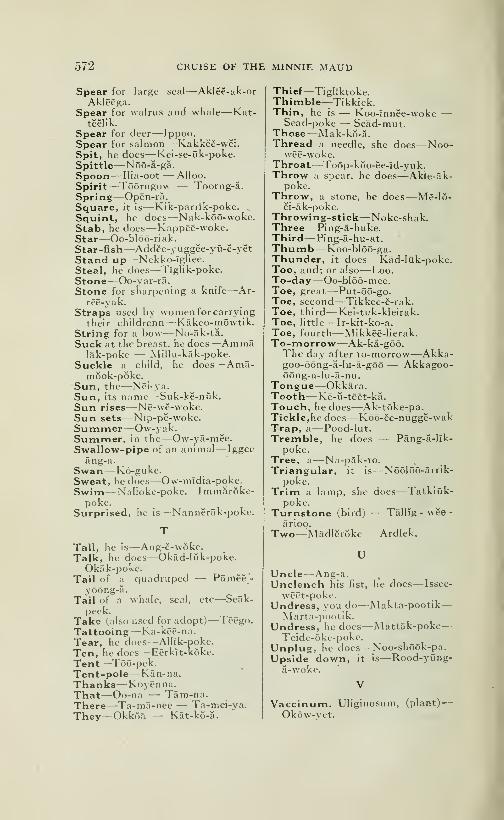
572 CRUISE OF THE MINNIE MAUD
Spear for large seal—Aklee-ak-orAklêêga.
Spear for walrus and whale—Kat-tëëlik.
Spear for deer—Ippoo.Spear for salmon
—
Kâkkëë-wëi.Spit, he does— Kei-se-uk-poke.Spittle—Nôô-â-gâ.Spoon— llia-oot — AIloo.
Spirit—Tôôrngow — Toorng-â.Spring—Opën-râ.Square, it is—Kik-parrik-poke.Squint, he does
—
Nak-kôô-wokc.Stab, he does
—
Kappëë-woke.Star—Oo-blôô-ri ak.
Star-fish—Addëe-yûggëe-yû-ë-yëtStand up—Nekko-ïgliee.
Steal, lie does
—
Tïglik-poke.
Stone—Oo-yar-râ.Stone for sharpening a knife—Ar-
rëë-yak.
Straps used by women for carrying
their childrenn
—
Kâkco-môwtik.String for a bow
—
No-âk-tâ.Suck at the breast, he does
—
Ammâlâk-poke — Millu-kak-poke.
Suckle a child, he does
—
Amâ-môok-pôke.
Sun, the
—
Nêi-j'a.
Sun, its name
—
Suk-kë-nûk.Sun rises—Nê-wë-woke.Sun sets—Nïp-pë-woke.Summer—Ow-yak.Summer, in the
—
Ow-yâ-mëe.Swallow-pipe of an animal—Iggee
âng-a.Swan—Kô-gukc.Sweat, he does
—
Ow-mîdia-poke.Swim—Nalloke-poke. Immârôke-
poke.Surprised, he is
—
Nannërâk-pokc.
Tall, he is
—
Ang-ë-w6ke.Talk, he does
—
Okâd-Iûk-poke.Okâk-pokc.
Tail of a quadruped — Pâmëë-yôông-a.
Tail of a w^hale, seal, etc—Seak-peek.
Take (also used for adopt)
—
Tcëgo.Tattooing— Ka-kêê-na.Tear, he does—Alllk-poke.
Ten, he does
—
Eërkït-kôke.
Tent—Tôô-pek.Tent-pole—Kfin-na.
Thanks—Koyênna.That—Oo-na — Tâm-na.There—Ta-mâ-nee — Ta-mei-ya.They—Okkôâ — Kât-kô-â.
Thief—Tiglïktoke.Thimble—Tikkiek.Thin, he is — Koo-înnëe-woke —
Seâd-poke — Seâd-mut.Those—Mâk-kô-â.Thread a needle, she does—Noo-
wëë-woke.Throat—Toôp-kôo-ëe-îd-yuk.Throw a spear, he does
—
Akle-âk-poke.
Throw, a stone, he does
—
Më-Iô-ëi-âk-poke.
Throwing-stick—Noke-shak.Three—Ping-a-huke.Third— Ping-a-hu-at.Thumb—Koo-blôô-ga.Thunder, it does
—
Kâd-Iûk-poke.Too, and; or also—Loo.To-day—Oo-bIô5-mee.Toe, great
—
Put-ôô-go.Toe, second
—
Tikkëë-ë-rak.Toe, third—Kei-tuk-kleirak.Toe, little— Ir-kit-ko-a.
Toe, fourth
—
Mikkëë-Iierak.To-morrow—Ak-ka-gôô.The day after to-morrow—Akka-goo-ôông-â-Iu-â-gôô— Akkagoo-ôông-a-lu-â-nu.
Tongue—Okkara.Tooth— Kë-û-tëët-kâ.Touch, he does
—
Ak-tôke-pa.Tickle, he does
—
Kôô-ëe-nûggë-wakTrap, a— Pood-lut.Tremble, he does — Pâng-â-Iïk-
pokc.Tree, a—Na-pak-to.Triangular, it is
—
Nôôlôô-ârrik-poke.
Trim a lamp, she does
—
Tatklûk-poke.
Turnstone (bird) — Tâllïg - wee
-
arioo.
Two—Mâdlërôkc — Ardlek.
U
Uncle—Ang-a.Unclench his fist, he does— Issee-
wêêt-poke.Undress, you do—Makta-pootik
—
Marta-pootik.Undress, he does—Mattak-poke
—
Tcidc-ôke-poke.Unplug, he does
—
Noo-shôôk-pa.Upside down, it is
—
Rood-yûng-a-woke.
Vaccinum. Uliginosum, (plant)-
Okow-yct.
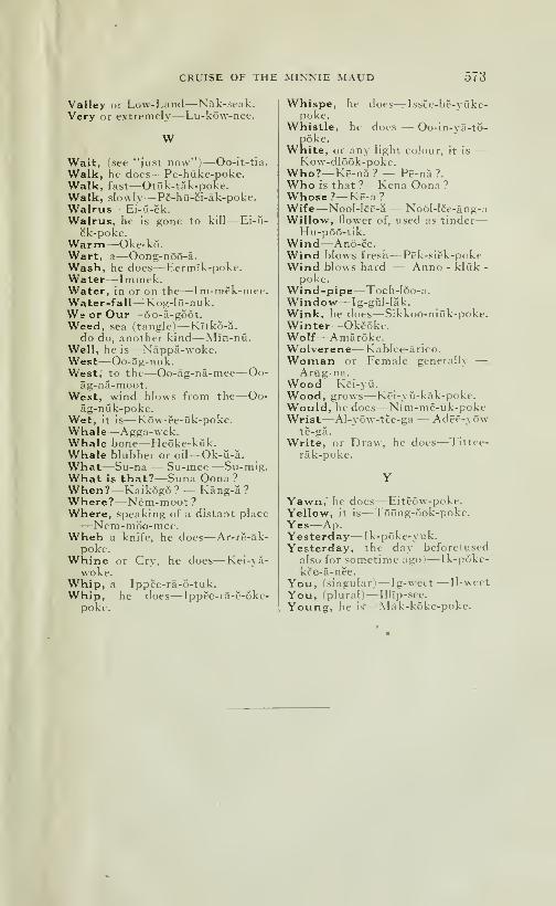
CRUISE OF THE MINNIE MAUD 573
Valley or Low-Land—Nak-seak.Very or extremely
—
Lu-kô\v-nee.
WWait, fsee "just now")—Oo-it-tia.
Walk, he does
—
Pe-hûke-poke.Walk, fast
—
Otûk-tak-poke.Walk, slowly
—
Pë-hû-ëi-âk-poke.Walrus— Ei-û-ëk.Walrus, he is gone to kill— Ei-ii-
ëk-poke.Warm—Oke-kÔ.Wart, a
—
Oông-nôô-â.Wash, he does—Eermlk-poke.Water—Immek.Water, in or on the—Im-mek-mee.Water -fall—^Kog-lO-nuk.W= or Our—-ôo-â-gôÔt.Weed, sea (tangle I—Kltko-a.
do do, another kind
—
Mîn-nii.
Well, he is
—
Nâppâ-woke.West—Oo-âg-nuk.West,' to the
—
Oo-<âg-nâ-mec—Oo-âg-nâ-moot.
West, wind blows from the—Oo-âg-nùk-poke.
Wet, it is
—
Kôw-ëe-ûk-poke.Whale—-Agga-wek.Whale bone
—
Heôke-kùk.Whale blubber or oil
—
Ok-ii-â.
What—Sû-na — Su-mee—Su-mig.What is that?—Suna Oona ?
When?—Kaikôgô ? — Kâng-â ?
Where?—Nêm-moot ?
Where, speaking of a distant place—Nêm-môo-mee.Wheb a knife, he does
—
Ar-rë-âk-pokf.
Whine or Cry, he does
—
Kei-yà-woke.
Whip, a
—
Ippëe-râ-o-tuk.Whip, he does
—
Ippëe-râ-ë-ôkc-poke.
Whispe, he does^Issce-bë-yûke-poke.
Whistle, he does — Oo-in-yâ-tô-pôke.
White, or any light colour, it is —Kow-dlôôk-poke.
Who?—Kë-nà? — Pë-nâ ?.
Who is that ?—Kcna Oona ?
Whose ?
—
Kë-a ?
Wife—Nool-lëë-â — Nôôl-lëe-âng-aWillow, flower of, used as tinder
—
Hu-pôô-tik.Wind—Anô-ëe.Wind blows fresh
—
Pëk-siëk-pokeWind blows hard — Anno - kliik -
poke.Wind -pipe—Toch-Ioo-a.Window— Ig-giil-lak.
Wink, he does
—
Sikkoo-niûk-poke.Winter—Okéôke.Wolf—Amaroke.Wolverene— Kablee-ârico.Woman or Female generally —
Arûg-na.Wood— Këi-y Ù.
Wood, grows
—
Këi-yû-kâk-poke.Would, he does
—
Nîm-më-ûk-pokeWrist—A!-yôw-tëe-ga — Adëë-yôw
të-gâ.
Write, or Draw, he does—Tittee-
râk-poke.
Yawn,' he does
—
Eitëôw-poke.Yellow, it is
—
Tôông-ook-poke.Yes—Ap.Yesterday— Ik-pôke-yuk.Yesterday, the day before(uscd
also for sometime ago)— Ik-poke-këe-â-nëe.
You, (singular!— Ig-wett — Il-weet
You, (plural)— Illlp-see.
Young, he i<— ^L^k-kôke-poke.


ë
to
o
u®
ci
<D
PQ
•Pi
Si
•Hi
^
0);
E-ti
«Hi
.s 1>
University of Toronto
library
DO NOTREMOVETHECARD
FROM
THIS
Acme Library Card Pocket
Under Pat. "Ref. Index FUe"
Made by LIBRARY BUREAU

O ooi_^_ **'=S^= iZ o"^ oUJ=^=co>=—O r^C/)^ Q. oz^ u
—1
en esiQ^=^>-l-===S5 <^
<M m otu
3^ ^< ^01Q CO