Spatiotemporal Annotation: Interaction between Standards and other Formats
Upload
khangminh22Category
view
4download
0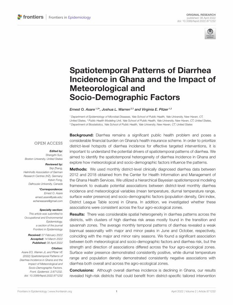
ORIGINAL RESEARCHpublished: 08 April 2022
doi: 10.3389/fepid.2022.871232
Frontiers in Epidemiology | www.frontiersin.org 1 April 2022 | Volume 2 | Article 871232
Edited by:
Shengzhi Sun,
Boston University, United States
Reviewed by:
Siqi Zhang,
Helmholtz Association of German
Research Centres (HZ), Germany
Kelvin Fong,
Dalhousie University, Canada
*Correspondence:
Ernest O. Asare
Specialty section:
This article was submitted to
Occupational and Environmental
Epidemiology,
a section of the journal
Frontiers in Epidemiology
Received: 07 February 2022
Accepted: 14 March 2022
Published: 08 April 2022
Citation:
Asare EO, Warren JL and Pitzer VE
(2022) Spatiotemporal Patterns of
Diarrhea Incidence in Ghana and the
Impact of Meteorological and
Socio-Demographic Factors.
Front. Epidemiol. 2:871232.
doi: 10.3389/fepid.2022.871232
Spatiotemporal Patterns of DiarrheaIncidence in Ghana and the Impact ofMeteorological andSocio-Demographic Factors
Ernest O. Asare 1,2*, Joshua L. Warren 2,3 and Virginia E. Pitzer 1,2
1Department of Epidemiology of Microbial Diseases, Yale School of Public Health, Yale University, New Haven, CT,
United States, 2 Public Health Modeling Unit, Yale School of Public Health, Yale University, New Haven, CT, United States,3Department of Biostatistics, Yale School of Public Health, Yale University, New Haven, CT, United States
Background: Diarrhea remains a significant public health problem and poses a
considerable financial burden on Ghana’s health insurance scheme. In order to prioritize
district-level hotspots of diarrhea incidence for effective targeted interventions, it is
important to understand the potential drivers of spatiotemporal patterns of diarrhea. We
aimed to identify the spatiotemporal heterogeneity of diarrhea incidence in Ghana and
explore how meteorological and socio-demographic factors influence the patterns.
Methods: We used monthly district-level clinically diagnosed diarrhea data between
2012 and 2018 obtained from the Center for Health Information and Management of
the Ghana Health Services. We utilized a hierarchical Bayesian spatiotemporal modeling
framework to evaluate potential associations between district-level monthly diarrhea
incidence and meteorological variables (mean temperature, diurnal temperature range,
surface water presence) and socio-demographic factors (population density, Gini index,
District League Table score) in Ghana. In addition, we investigated whether these
associations were consistent across the four agro-ecological zones.
Results: There was considerable spatial heterogeneity in diarrhea patterns across the
districts, with clusters of high diarrhea risk areas mostly found in the transition and
savannah zones. The average monthly temporal patterns of diarrhea revealed a weak
biannual seasonality with major and minor peaks in June and October, respectively,
coinciding with the major and minor rainy seasons. We found a significant association
between both meteorological and socio-demographic factors and diarrhea risk, but the
strength and direction of associations differed across the four agro-ecological zones.
Surface water presence demonstrated consistently positive, while diurnal temperature
range and population density demonstrated consistently negative associations with
diarrhea both overall and across the agro-ecological zones.
Conclusions: Although overall diarrhea incidence is declining in Ghana, our results
revealed high-risk districts that could benefit from district-specific tailored intervention

Asare et al. Diarrhea Patterns in Ghana
strategies to improve control efforts. Ghana health sector policy-makers can use these
results to assess the effectiveness of ongoing interventions at the district level and
prioritize resource allocation for diarrhea control.
Keywords: climate and diarrhea, socio-demographic factors and diarrhea, weather and diarrhea, diarrhea in
Ghana, diarrhea patterns, diarrhea modeling, diarrhea and floods
INTRODUCTION
An increase in diarrhea control strategies, particularlyimprovements in water, sanitation, and hygiene (WASH)infrastructure and improvements in access, treatment, andquality of health services, has contributed to significantreductions in diarrhea morbidity and mortality over the pastfour decades (1). For instance, diarrhea has dropped from beingthe second leading cause of global disease burden (as measuredby disability-adjusted life-years) in 1990 to the ninth leadingcause in 2020 (2). Nevertheless, diarrhea remains one of themost common preventable causes of morbidity and mortality,responsible for 1.6 and over 0.5 million deaths among all agegroups and children under 5, respectively (3). This highlights theneed to sustain current control interventions and identify noveleffective strategies, particularly in low-income settings wherediarrhea burden remains highest.
Diarrhea incidence is highly heterogeneous, both withinand between countries, exhibiting substantial spatial andtemporal variability (4–7). These variations are driven largelyby meteorological factors (8, 9), socio-economic status andWASH infrastructure (10–15), and access and quality of healthservices (16). The interaction of these factors can create spatialand temporal hotspots of diarrhea incidence. For example,Bandyopadhyay et al. (5) found a decrease in monthly rainfalland increase in temperature during the dry season wasable to delineate hotspots of diarrhea prevalence in childrenunder the age of 3 years in sub-Saharan Africa. In AnhuiProvince of China, Hao et al. (17) found a strong associationbetween socio-economic status and spatial clustering of diarrheaincidence. These studies demonstrate that the combination ofmeteorological and socio-demographic factors create differentsuitable pathways for diarrhea transmission, which are likely tobe setting-specific. Understanding and identifying hotspots andthe potential driving factors is critical to develop setting-specificcontrol strategies to reduce diarrhea burden.
In Ghana, similar to other low-income countries, diarrhea
ranks among the top ten causes of morbidity and mortality.In 2015, the estimated number of diarrhea-associated deaths
among all ages and children under 5 years were approximately3,800 and 1,700, respectively (18). In addition to the healthburden of diarrhea, there is also a significant economic burdenon both individuals and the country (19). In northern Ghana,Aikins et al. (20) estimated the treatment cost per outpatientand inpatient diarrhea to be US$3.86–4.35 and US$65.14–133.86 (based on 2003 and 2004 US dollars), respectivelydepending upon treatment regime, which is high for the low-income population. The main treatment for both inpatientsand outpatients with diarrhea includes administration of oral
rehydration solutions and antibiotics (20). Therefore, reducingthe diarrhea burden in Ghana should have both health andeconomic benefits.
A number of models have been developed to predictspatiotemporal patterns of diarrhea incidence using acombination of environmental and socio-economic factors(6, 9, 21, 22). While these models tend to provide reliableestimates of diarrhea patterns, they are often carried out overlarge spatial scales, particularly at country and state levels. Thus,it is important to accurately model the spatiotemporal diarrheapatterns at finer spatial scales to provide useful information toevaluate current control programs at the local level.
To address this, we used a hierarchical Bayesianspatiotemporal modeling framework to quantify associationsbetween meteorological and socio-demographic factors anddistrict-level diarrhea incidence in Ghana between 2012 and2018. We also investigated variations in the impact of thesefactors on diarrhea across the four agro-ecological zones in thecountry. The results can help policy-makers to identify high-riskdiarrhea districts for which improved interventions are needed.
METHODS AND DATA
Diarrhea Data and Study Area DescriptionMonthly district-level diarrhea morbidity records were obtainedfrom the Center for Health Information and Management(CHIM) of the Ghana Health Services (GHS) for 2012 to 2018.Diarrhea was clinically diagnosed, and methods of detectionand reporting were consistent across districts. Currently, Ghanaconsists of 16 regions and 260 districts. However, our dataconsist of 216 districts between 2012 and 2014 and 260 districtsbeginning in 2015. In order to use all the available data, wemerged the diarrhea data for districts that were split from theoriginal 216 in 2014. Annual district-level population estimateswere obtained from the Ghana Statistical Service (GSS). Wecalculated the monthly crude incidence of diarrhea per 10,000persons for each district by dividing the monthly diarrhea casesby the district population.
Meteorological DataWe used daily rainfall estimates from the Climate Hazardsgroup Infrared Precipitation with Stations (CHIRPS) witha spatial resolution of 0.05◦ X 0.05◦ (23). Monthly mean(Tmean), minimum (Tmin), and maximum (Tmax) 2-meter airtemperature data were obtained from the European Center forMedium-Range Weather Forecasts (ECMWF) fifth-generationreanalysis ERA5 (24), which has a spatial resolution of 0.25◦ X0.25◦. Both datasets were extracted over Ghana for the studyperiod 2012 to 2018. The daily Tmax and Tmin were used to
Frontiers in Epidemiology | www.frontiersin.org 2 April 2022 | Volume 2 | Article 871232

Asare et al. Diarrhea Patterns in Ghana
TABLE 1 | Set of fixed parameters used in the surface water presence model
(Equation 1).
Parameter Value Reference
ωmax 0.1 (30)
ωref 0.005 (30)
href (mm) 250 (30)
ρs 1.5 (30)
CN 90 (29)
E (mm) 5 (30)
Imax (mm) 250 (30)
calculate the diurnal temperature range (dtr = Tmax-Tmin),which is inversely associated with humidity. The daily dtr wasaveraged for each month. Tmean and dtr were included asexplanatory variables because they have been shown to influencethe survival of diarrheal pathogens (25, 26).
The rainfall data were used to run a surface hydrologymodel (used as a proxy for persistent flooding) developedby Asare et al. (27, 28) that predicts fractional surface waterpresence (wpre) in each grid cell at each time step. Theremaining model inputs are derived; the model equationis given by:
dωpond
dt=
2
ρhref
(
ωref
ωpond
)ρs2((
Q(
ωmax − ωpond
)
+ Pωpond
)
(
1− f)
− ωpond
(
E+ fImax))
(1)
where ωpond is the daily fractional water coverage in a grid cell,ρs is the shape factor, ωmax is the maximum water coverage,href is the reference water depth, ωref is the reference fractionalwater coverage, Imax is the maximum infiltration which iscontrolled by the scaling factor (f =
ωpond
ωmax), P is the rainfall,
E is the evaporation, and Q is estimated based on the soilconservation service curve number (SCS-CN) method (29). Thefixed model parameters are provided in Table 1. The dailymodel output is aggregated to monthly temporal resolutions.We included wpre in the model because it plays an importantrole in the concentration, transport and distribution of diarrhealpathogens (31–33).
As a preliminary analysis, we examined the Pearson’scorrelations between the meteorological factors and monthlydistrict-level diarrhea incidence.
Socio-Demographic DataWe used the Gini index (34) as a proxy for socio-economicinequality. The Gini index ranges from 0 to 100%, with thehighest values corresponding to high levels of income inequality.The district-level Gini index data were obtained from the2015 report on poverty mapping in Ghana (35), which wasderived based on the 2010 Population and Housing CensusData. We assumed constant Gini index over the study period;
therefore, this variable only captures potential spatial variationin diarrhea incidence.
We used the Ghana District League Table (DLT) score, anindex that represents the overall level of development acrossthe districts (36). The DLT index is generated by aggregatingseven key sector indicators (health, water, education, sanitation,security, governance, and child protection) into a single scoreranging from 0 to 100%. Since the DLT index is only availablefrom 2014, we used the 2014 index for 2012 and 2013.
The population density data were obtained from theWorldPop database (https://www.worldpop.org/). This griddeddataset has a spatial resolution of 1 km. The district-levelpopulation density data were estimated by averaging all the gridcell values within each district polygon.
Statistical AnalysisWe utilized a hierarchical Bayesian spatiotemporal modelingframework to quantify how meteorological and socio-demographic factors influence the spatiotemporal heterogeneityof diarrhea incidence in Ghana. The number of diarrhea casesin district k (k = 1, 2, . . . , 216) and month t (t = 1, 2, . . . , 84),Ykt , were assumed to follow a Poisson distribution with mean λktsuch that
Ykt ∼ Poisson (λkt) ,
ln (λkt) = ln (Ekt) + ρkt (2)
where ρkt and Ekt represent the log relative risk (RR) andexpected number of cases in district k in month t, respectively.The expected number of cases was calculated as the monthlymean national diarrhea incidence rate multiplied by thepopulation at risk in each district for each month.
The log relative risk, ρkt , was modeled as a function ofcovariates and random effects, such that
ρkt = β0 + β1(
wprekt)
+ β2(
dtrkt)
+ β3 (Tmeankt)
+ β4(
popdenkt)
+ β5 (Ginik) + β6 (DLTkt) + φk (3)
where β0 is the intercept; β1, β2, β3, β4, β5, β6 are the regressioncoefficients for the explanatory variables, including the surfacewater presence (wpre), diurnal temperature range (dtr), meantemperature (Tmean), population density (popden), Gini index(Gini), and District League Table (DLT) score, respectively; andφk is the spatially-correlated random effect parameter from thekth district. We considered linear terms for all covariates withoutinteractions because our focus was on the interpretability ofthe main effects. We used Pearson’s correlation test to identifypossible collinearity amongst the explanatory variables. Theassociation between each of the covariates and diarrhea incidencewas quantified in terms of RR for a one standard deviationincrease in a covariate. The RR for the ith covariate (i.e., RRi) iscalculated as exp (βi).
We modeled the spatially correlated random effects usingthe Leroux version of the conditional autoregressive model (37),
Frontiers in Epidemiology | www.frontiersin.org 3 April 2022 | Volume 2 | Article 871232

Asare et al. Diarrhea Patterns in Ghana
which is best understood conditionally such that
φk|φ−k ∼ N
(
ρ∑216
i=1 wkiφi
ρ∑216
i=1 wki + 1− ρ,
τ 2
ρ∑216
i=1 wki + 1− ρ
)
(4)
where φ−k is the complete vector of spatial random effectparameters with φk removed; wki = 1 if districts k and i sharea common border and ωki = 0 otherwise (wkk = 0 for all k bydefinition); ρ ∈ (0, 1) controls the strength of spatial correlationin the parameters with values near 1 indicating strong correlationand values near 0 suggesting independence; and τ 2 is the varianceof the random effects. This model suggests that a priori therandom effect parameter from district k is normally distributedwith the mean equal to a weighted average of its neighbors’values and variance defined as a function of the total number ofneighbors it has.
Prior DistributionsWe used weakly informative prior distributions for each ofthe unknown model parameters to allow the data to drive theinference. The priors are specified as follows: β = (β1-β6) ∼N(0,1002), σ2 ∼ InverseGamma (1.00,0.01), τ 2 ∼ InverseGamma(1.00,0.01), and ρ ∼ uniform (0, 1).
Model FittingModel parameters were estimated using a Markov chain MonteCarlo (MCMC) sampling algorithm where we used threeindependent chains. Variables were standardized prior to modelfitting for computational stability. We ran each chain for 320,000iterations and discarded the first 220,000 as burn-in prior toconvergence of the model. The remaining samples were thinnedby a factor of 10, yielding 10,000 nearly independent posteriorsamples per chain for post-processing. Convergence was assessedby Geweke z-score diagnostics (38) for the model parameters.The models were fitted to both the whole district-level data andsubsets of the data (the four agro-ecological zone: coastal, forest,transition and savannah zones) using the multi-level functionS.CARmultilevel in the CAR-Bayes package in R (39).
RESULTS
Between 2012 and 2018, the mean monthly diarrhea incidencewas 643 (range: 4–7304) per 10,000 people (Table 2). The overallaverage district-level diarrhea incidence between 2012 and 2018ranged from 80 (Akwapem South) to 2,978 (Bia West) per 10,000people. The summary descriptive statistics of the variables for theagro-ecological zones are provided in Supplementary Table S1.The average monthly temporal pattern revealed a biannualincidence of diarrhea with slight peaks in June and October(Figure 1A). There was no substantial change in themean annualtrend in the overall diarrhea incidence (Figure 1B).
The Gini index varied between 27% (Upper Manya) and 64%(Sunyani Municipal), with a strong clustering along the westernborder of the country (Table 2 and Supplementary Figure S1A).The population density varied widely across the districts, rangingfrom 9 (North Gonja) to 14,119 (Accra Metropolitan Assembly)people per km2 (Table 2 and Supplementary Figure S1B). The
TABLE 2 | Summary statistics of raw diarrhea incidence and potential explanatory
variables.
Variable Mean (SD) Range Median (Quartiles)
Diarrhea (per 10,000) 643.4 (449.2) 4.0, 7304.0 542.0 (352.0, 819.2)
dtr (◦C) 0.547 (0.301) 0.000, 1.900 0.507 (0.321, 0.738)
Tmean (◦C) 27.21 (1.796) 23.02, 34.30 27.01 (25.95, 28.13)
wpre 0.006 (0.005) 0.000, 0.023 0.006 (0.002, 0.009)
Gini index (%) 38.94 (6.118) 27.2, 64.00 37.40 (34.67, 42.27)
DLT score (%) 57.25 (11.40) 0.00, 100.00 58.68 (52.15, 64.97)
Population density
(people/km2 )
504.39 (1609.9) 8.7, 14118.8 120.5 (68.0, 265.0)
wpre, surface water presence; dtr, diurnal temperature range; Tmean, mean temperature;
DLT score, District League Table score.
DLT score varied between 0% (Asokore Mampong) and 100%(Asante Akim North) (Table 2 and Supplementary Figure S1C),with a substantial concentration of poorly developed districtsmostly found in the eastern part of the country stretchingbetween savannah and forest agro-ecological zones.
The district-level correlation coefficients between monthlydiarrhea incidence and environmental factors ranged from−0.52 to 0.48 for Tmean (Supplementary Figure S2A), −0.51to 0.37 for dtr (Supplementary Figure S2B), and −0.33 to 0.44for wpre (Supplementary Figure S2C). Tmean and dtr weremostly positively correlated with diarrhea in the southern partof the country, while positive correlations with wpre werepredominantly found in the northern part of Ghana. ThePearson’s correlation matrix did not reveal high correlationsbetween the covariates (|r| < 0.7) (Supplementary Table S2),suggesting the absence of collinearity.
For the spatiotemporal model, the Gini index, DLT score, andsurface water presence were positively associated with diarrheaincidence, while mean temperature, diurnal temperature range,and population density showed negative associations withdiarrhea incidence (Table 3). Population density had the mostsignificant impact on diarrhea; a standard deviation (SD)decrease in population density was associated with a 50%(1/0.667) increase in diarrhea incidence. This was followed bythe Gini index, for which a 1 SD increase was associated with a16% increase in diarrhea incidence. The DLT score had the leastsignificant impact on diarrhea, with 1 SD increase in DLT scoreassociated with a 0.8% increase in diarrhea. The meteorologicalvariable that showed the strongest association with diarrheawas diurnal temperature range, for which a 1 SD decrease wasassociated with a 2% increase in diarrhea incidence, whereasthe effect of surface water presence and mean temperature weresimilar but opposite in direction (a 1.4% and 1.3% increasein diarrhea incidence for a 1 SD increase or decrease in wpreand Tmean, respectively). The Geweke z-score diagnostics arelisted in Supplementary Table S3, with no obvious signs of non-convergence observed.
The socio-demographic and meteorological factors weresignificant risk factors for diarrhea across the four agro-ecological zones (Table 4). However, there were differences in
Frontiers in Epidemiology | www.frontiersin.org 4 April 2022 | Volume 2 | Article 871232

Asare et al. Diarrhea Patterns in Ghana
FIGURE 1 | Average trends of diarrhea incidence across all districts between 2012 and 2018. (A) Monthly and (B) annual trends.
TABLE 3 | Relative risk of diarrhea associated with meteorological and
socio-demographic factors for the full spatiotemporal model.
Variable RR 2.5% 97.5%
wpre 1.014 1.013 1.014
dtr 0.980 0.978 0.982
Tmean 0.987 0.986 0.988
Population density 0.667 0.659 0.673
Gini index 1.155 1.045 1.294
DLT score 1.008 1.007 1.009
The posterior median and 95% quantile-based credible intervals are given for each
covariate on the relative risk scale, with a one standard deviation change in covariate
value interpretation (see Table 2). wpre, surface water presence; dtr, diurnal temperature
range; Tmean, mean temperature; DLT score, District League Table score.
the strength and direction of associations across the differentzones. Population density showed the greatest difference inrelative risk across the agro-ecological zones; 165% (1/0.377)for the coastal zone and 4% (1/0.961) for the savannah zone.All the socio-demographic factors showed significant negativeassociations with diarrhea in the coastal zone. Surface waterpresence, diurnal temperature range and population densityexhibited consistent but opposite directions of association withdiarrhea incidence across the agro-ecological zones; surfacewater presence was positively associated with diarrhea incidence,while diurnal temperature range and population density werenegatively associated (Table 4). There was a positive associationbetween diarrhea incidence and mean temperature, except in thesavannah zone. Positive associations between diarrhea incidenceand DLT score were observed in the forest and savannah zones,
whereas negative associations were found in the coastal andtransition zones.
Spatial and temporal patterns in the modeled averagediarrhea incidence were consistent with the observed patterns(Supplementary Figures S3, S4). Figure 2 shows the posteriormedian estimates of the exponentiated spatial random effectparameters (φk), resulting in a RR interpretation. Theseparameters represent excess spatial risk of diarrhea afteradjustment for the included covariates (i.e., residual risk). TheRRs vary between 0.07 and 6.66. More than a third (38%) ofthe districts had a relative risk >1; most of the higher riskdistricts were located in the western part of the country. Asouth to north gradient increase in RR was also evident whenthe model was fitted separately for the four agro-ecologicalzones (Supplementary Figure S5). The lowest RR was present inurban districts within Accra and Kumasi, the two major cities inthe country.
DISCUSSION
Our results highlight the extent to which the spatiotemporaldistribution of diarrhea incidence in Ghana is associatedwith meteorological and socio-demographic factors. All ofthe explanatory variables we explored exhibited significantassociations with diarrhea incidence. However, therewere clear differences in the strength and direction ofassociations between these explanatory variables and diarrheaacross the four agro-ecological zones. We find that socio-demographic factors (particularly population density andGini index) rather than meteorological factors are thestrongest predictors of the spatiotemporal distribution of
Frontiers in Epidemiology | www.frontiersin.org 5 April 2022 | Volume 2 | Article 871232

Asare et al. Diarrhea Patterns in Ghana
TABLE 4 | Relative risk of diarrhea associated with meteorological and socio-demographic factors for the models fitted to each agro-ecological zone.
Variable Coastal Forest Transition Savannah
RR (95% CrI) RR (95% CrI) RR (95% CrI) RR (95% CrI)
wpre 1.021 (1.019, 1.023) 1.006 (1.004, 1.008) 1.016 (1.014, 1.017) 1.012 (1.010, 1.015)
dtr 0.973 (0.967, 0.982) 0.994 (0.991, 0.997) 0.960 (0.957, 0.963) 0.966 (0.963, 0.969)
Tmean 1.005 (1.002, 1.007) 1.009 (1.008, 1.011) 1.049 (1.047, 1.051) 0.941 (0.940, 0.943)
Population density 0.377 (0.366, 0.390) 0.868 (0.852, 0.884) 0.958 (0.946, 0.971) 0.961 (0.938, 0.983)
Gini index 0.884 (0.820, 0.934) 1.138 (1.011, 1.186) 1.203 (1.072, 1.324) 1.230 (1.182, 1.446)
DLT score 0.967 (0.965, 0.970) 1.027 (1.025, 1.029) 0.995 (0.993, 0.997) 1.017 (1.015, 1.019)
The posterior median and 95% quantile-based credible intervals (95% Crl) are shown for each covariate for the four agro-ecological zones on the relative risk scale, with a one standard
deviation change in covariate value interpretation. wpre, surface water presence; dtr, diurnal temperature range; Tmean, mean temperature; DLT score, District League Table score.
FIGURE 2 | Map of posterior median estimates of the spatial random effects.
Districts with lower than expected risk (RR <1) are in blue, while those with
excess risk (RR >1) are in red. The black bold line indicates agro-ecological
zone boundaries. CO, Coastal zone; FO, Forest zone; TR, Transition zone; SA,
Savannah zone.
diarrhea risk. The results have identified clusters of districtsin Ghana associated with a higher than expected incidence ofdiarrhea, which could inform policy-makers when planningintervention strategies.
The seemingly high incidence of diarrhea in the northern partof the country (transition and savannah zones) may be a resultof multiple factors. One possible explanation is the differentialperformance of rotavirus vaccine in Ghana, where vaccine impacthas been lower in the northern part of the country (40). Rotavirusis the leading diarrheal pathogen among children under 5 yearsof age, and children account for a high proportion of diarrhea
incidence in Ghana (41). Secondly, the low coverage of WASHinfrastructure mostly in the transition and savannah zonescould be a contributing factor. For instance, the proportion ofhouseholds without toilets (42) and that practice open defecation(43), which are important risk factors of diarrhea, are high inthe transition and savannah zones compared to the rest of thecountry, particularly in the upper East region, where we observedclusters of diarrhea risk (43). In addition, prevalence of childhoodmalnutrition is higher in the savannah zone, accounting for55% of the country’s malnutrition (44). The overall high level ofpoverty and inequality (Gini index) and low level of development(DLT score) across the districts within these two zones (36, 45)also contributed to the estimated high diarrhea risk.
The overall low relative risk of diarrhea in the coastal agro-ecological zone may be attributed to the combination of Giniindex, overall level of poverty, population density, and DLTscore. Similar to other low-income settings, there is a negativeassociation between poverty and income inequality in Ghana(46, 47). There is a sharp decrease in Gini index and increasein poverty as you move from urban toward peri-urban and ruraldistricts in Ghana.While population density is high in the coastalzone, there is also more highly developed water and sanitationinfrastructure compared to other zones. The DLT score is highestin Greater Accra region followed by Central region (both withinthe coastal zone) (36).
The direction of associations between Gini index and DLTscore covariates with diarrhea were significant and similarwith the exception of the transition zone. Both covariatescan indicate levels of inequality across the districts leadingto hotspots of diarrhea. For instance, when Gini index ishigh, the uneven distribution of wealth can lead to disparityin the level of development (DLT score) particularly relatedto household WASH infrastructure. Thus, policies aiming atreducing Gini index and increasing DLT score indicators acrossthe districts are likely to reduce the overall diarrhea burden inthe country.
Our results indicate a consistent significant negativeassociation between population density and diarrhea incidencein Ghana and across the agro-ecological zones. This findingagrees with a negative association found between cholera riskand population density (48). However, the strength of theassociation decreases substantially toward the northern part ofthe country, with about a 2.5-fold difference in the relative risk
Frontiers in Epidemiology | www.frontiersin.org 6 April 2022 | Volume 2 | Article 871232

Asare et al. Diarrhea Patterns in Ghana
of diarrhea between the coastal and savannah agro-ecologicalzones. This difference in the relative risk between these twozones can be partly explained by the relationship betweendisparity in the level of development (based on DLT score), levelof sanitation infrastructure development, and the populationgrowth rate. There is a clear substantial south-north decreasingtrend in DLT score (36). The coastal zone is densely populated(including Accra, the capital city), but has more developedwater and sanitation infrastructure and a higher DLT score,thus associating with an overall lower risk of diarrhea. On thecontrary, the savannah zone exhibits low population density,inadequate WASH infrastructure, and lower DLT scores,associating with a high diarrhea risk. The DLT score couldbe useful to identify and inform the development of effectiveinterventions to reduce diarrhea in the high-risk districts.
Generally, the relative risk of diarrhea tends to begreater in peri-urban districts compared with urban andrural districts, which agrees with previous studies (49, 50).Population spill-over from the urban districts and highlevels of rural-urban migration have led to high populationdensity in peri-urban districts. Peri-urban districts areusually characterized by inadequate sanitation facilities anda high proportion of households living in slum conditions.These slums tend to be hotspots for diarrhea. Similar highdiarrhea risk in slums compared with rural settings hasbeen found elsewhere (51, 52). Thus, improvements insanitation in peri-urban districts in Ghana will likely reduce thediarrhea burden.
We found significant positive associations between surfacewater presence (a proxy for persistent flooding) and diarrheafor the entire country and across the four agro-ecologicalzones. This consistent positive association based on a surfacehydrology model is different from studies that have reportedboth positive and negative associations between diarrhea andrainfall/flooding (8, 31–33, 53). Different rainfall regimescan have varied associations with diarrhea depending on thesurface antecedent conditions (54). Non-linear associationsbetween rainfall and diarrhea may also be due to differencesin climatic conditions and dominant diarrheal pathogensacross study areas. Our results highlight that a rainfall-drivensurface hydrology model can better account for pathogenconcentration and dilution effects, since it incorporatesthe surface antecedent conditions, thus making it a betterpredictor of diarrhea risk than rainfall alone. Despite theestimated positive associations across different climaticconditions found in Ghana, future studies should explorewhether surface water presence is an important diarrhea riskfactor across different climatic conditions and under futureclimate change.
While the effect of mean temperature on diarrhea hasbeen extensively studied, both significant positive and negativeassociations with diarrhea risk have been reported (9, 55–58).There are multiple factors that may contribute to this, includingclimatic conditions of the study region, dominant diarrhealpathogens, demographics of the study population (i.e., all ages,or restricted categories of age groups, particularly children<5 years old) and the temporal resolution of the data. In
Afghanistan, positive and negative associations with diarrheawere found with daily and annual temperatures, respectively(9). Despite the overall significant negative association betweenmean temperature and diarrhea, three (coastal, forest andtransition) out of four agro-ecological zones exhibited a positiveassociation, which may be due to the marked differencein climatic conditions between the savannah (which has aprolonged dry season with high temperatures) and the threeother zones, as well as the predominant pathogens in thedifferent regions. The impact of temperature on the survivaland replication of diarrheal pathogens differs. For instance,viral pathogen activity tends to be highest during the coolerdry season, while bacterial pathogens tend to predominateduring the warmer rainy season (25). The similarity in bothdirection and strength of association for the overall and thesavannah zone likely reflects the high diarrhea incidence inthis zone.
The diurnal temperature range showed a consistent significantnegative association with diarrhea, suggesting that highlyvariable monthly temperature fluctuations could affect diarrheaincidence in Ghana. A possible reason is that diarrhea peaksduring the rainy season, which coincides with the periodof low temperature variation. This result differs from thereported positive association between diurnal temperature rangeand childhood diarrhea in Brisbane, Australia (59), whichmay be partly due to the study population and dominantdiarrheal pathogens. Since diurnal temperature range is animportant indicator of climate change, additional studies arerequired to quantify the impact of diurnal temperature variationacross different diarrheal pathogens and age groups underfuture climates.
There are several factors that could potentially impact ourresults. First, disparities in access and proximity to healthfacilities across the districts may affect diarrhea reporting. Whilethose living in districts with readily available health facilitiesmay seek care for both mild and severe cases of diarrhea, thoseliving in districts with limited health facilitates may not seek careexcept for severe cases due to the distance. There is also thepossibility that some people attend hospitals in a different districtfrom where they live. Second, although we observed a significantassociation between Gini index and diarrhea risk, it is noteworthyto point out that the Gini index was calculated based on 2010census data; thus, not accounting for temporal changes in Giniindex may impact the strength and direction of the associationswe found. Third, our data were not stratified by age, and it ispossible that associations may differ across age groups. Childrenunder 5 years of age are the most susceptible to diarrhea. Furtherefforts should be directed at examining how heterogeneity inthis age group across the districts may influence the directionof associations between meteorological and socio-demographicfactors and diarrhea.
In summary, the burden of diarrhea in Ghana is concentratedin the western part of the country, particularly within thetransition and savannah agro-ecological zones. As most ofthe districts within these two zones exhibit poorer levels ofdevelopment (based on DLT score), future studies shouldconsider evaluating separately the impact of the indicators
Frontiers in Epidemiology | www.frontiersin.org 7 April 2022 | Volume 2 | Article 871232

Asare et al. Diarrhea Patterns in Ghana
(particularly potable water and sanitation coverage) used toestimate the DLT score on household diarrhea incidence. Ghanahealth sector policy-makers can use the DLT score to formulateappropriate control strategies aimed at prioritizing resourceallocation for diarrhea control.
DATA AVAILABILITY STATEMENT
The diarrhea data can be obtained by contacting the Centerfor Health Information and Management (CHIM) of the GhanaHealth Services. Requests to access these datasets should bedirected to Ghana Health Service, [email protected].
AUTHOR CONTRIBUTIONS
EA conceived and designed the study, performed data analysis,interpretation of findings, and wrote the paper. JW performeddata analysis, interpretation of findings, and revised themanuscript. VP performed data analysis, interpretation offindings, and revised the manuscript. All authors reviewed themanuscript and approved the final version.
FUNDING
Research reported in this publication was supported by fundingfrom the National Institutes of Health/National Institute ofAllergy and Infectious Diseases (R01AI112970 to VP). Thefunders had no role in study design, data collection and analysis,decision to publish, or preparation of the manuscript. Thecontent is solely the responsibility of the authors and does notnecessarily represent the official views of the National Institutesof Health.
ACKNOWLEDGMENTS
We thank the Ghana Health Service for providing thediarrhea data.
SUPPLEMENTARY MATERIAL
The Supplementary Material for this article can be foundonline at: https://www.frontiersin.org/articles/10.3389/fepid.2022.871232/full#supplementary-material
REFERENCES
1. Black R, Fontaine O, Lamberti L, Bhan M, Huicho L, El Arifeen S, et al.
Drivers of the reduction in childhood diarrhea mortality 1980–2015 and
interventions to eliminate preventable diarrhea deaths by 2030. J Glob Health.
(2019) 9:020801. doi: 10.7189/jogh.09.020801
2. Lopez AD, Murray CC. The global burden of disease, 1990–2020. Nat Med.
(1998) 4:1241–3. doi: 10.1038/3218
3. Bernadeta Dadonaite, Hannah Ritchie and Max Roser. Diarrheal diseases.
Available online at: https://ourworldindata.org/diarrheal-diseases (accessed:
June 30, 2021).
4. Kelly-Hope LA, Alonso WJ, Thiem VD, Anh DD, Do Gia C, Lee H, et al.
Geographical distribution and risk factors associated with enteric diseases in
Vietnam. Am J Trop Med. (2007) 76:706–12. doi: 10.4269/ajtmh.2007.76.706
5. Bandyopadhyay S, Kanji S, Wang L. The impact of rainfall and temperature
variation on diarrheal prevalence in Sub-Saharan Africa. Appl Geogr.
(2012) 33:63–72. doi: 10.1016/j.apgeog.2011.07.017
6. Thompson CN, Zelner JL, Nhu TDH, Phan MV, Le PH, Thanh HN,
et al. The impact of environmental and climatic variation on the
spatiotemporal trends of hospitalized pediatric diarrhea in Ho Chi Minh City,
Vietnam. Health Place. (2015) 35:147–54. doi: 10.1016/j.healthplace.2015.
08.001
7. Li R, Lai Y, Feng C, Dev R, Wang Y, Hao Y. Diarrhea in under 5 year-
old children in Nepal: a spatiotemporal analysis based on demographic
and health survey data. Int J Environ Res Public Health. (2020)
17:2140. doi: 10.3390/ijerph17062140
8. Lloyd SJ, Kovats RS, Armstrong BG. Global diarrhoea morbidity, weather and
climate. Climate Research. (2007) 34:119–27. doi: 10.3354/CR034119
9. Anwar MY, Warren JL, Pitzer VE. Diarrhea patterns and climate:
a spatiotemporal Bayesian hierarchical analysis of diarrheal disease in
Afghanistan. Am J Trop Med. (2019) 101:525–33. doi: 10.4269/ajtmh.18-0735
10. Boadi KO, Kuitunen M. Childhood diarrheal morbidity in the
Accra Metropolitan Area, Ghana: socio-economic, environmental
and behavioral risk determinants. J health Popul Dev Ctries. (2005)
7:15–22. doi: 10.12927/whp.2005.17646
11. Kandala NB, Magadi MA, Madise NJ. An investigation of district spatial
variations of childhood diarrhoea and fever morbidity in Malawi. Soc Sci Med.
(2006) 62:1138–52. doi: 10.1016/j.socscimed.2005.07.028
12. Clasen T, Schmidt WP, Rabie T, Roberts I, Cairncross S. Interventions to
improve water quality for preventing diarrhoea: systematic review and meta-
analysis. Bmj. (2007) 334:782. doi: 10.1136/bmj.39118.489931.BE
13. Pande S, Keyzer MA, Arouna A, Sonneveld BG. Addressing diarrhea
prevalence in the West African Middle Belt: social and geographic
dimensions in a case study for Benin. Int J Health Geogr. (2008) 7:1–
17. doi: 10.1186/1476-072X-7-17
14. Wolf J, Prüss-Ustün A, Cumming O, Bartram J, Bonjour S, Cairncross
S, et al. Systematic review: assessing the impact of drinking water
and sanitation on diarrhoeal disease in low-and middle-income settings:
systematic review and meta-regression. Trop Med Int Health. (2014) 19:928–
42. doi: 10.1111/tmi.12331
15. Sumampouw OJ, Nelwan JE, Rumayar AA. Socioeconomic factors associated
with diarrhea among under-five children in Manado Coastal Area, Indonesia.
J Glob Infect Dis. (2019) 11:140. doi: 10.4103/jgid.jgid_105_18
16. Carvajal-Vélez L, Amouzou A, Perin J, Maiga A, Tarekegn H, Akinyemi A, et
al. Diarrhea management in children under five in sub-Saharan Africa: does
the source of care matter? A Countdown Analysis BMC Public Health. (2016)
16:830. doi: 10.1186/s12889-016-3475-1
17. Hao Y, Zhang N, Wu J, Su B, Gong L, Ma W, et al. Identifying infectious
diarrhea hot spots and associated socioeconomic factors in Anhui Province,
China. Am J Trop Med. (2019) 101:549–54. doi: 10.4269/ajtmh.19-0161
18. Troeger C, Forouzanfar M, Rao PC, Khalil I, Brown A, Reiner Jr RC,
et al. Estimates of global, regional, and national morbidity, mortality,
and aetiologies of diarrhoeal diseases: a systematic analysis for the
global burden of disease study 2015. Lancet Infect Dis. (2017) 17:909–
48. doi: 10.1016/S1473-3099(17)30276-1
19. Baral R, Nonvignon J, Debellut F, Agyemang SA, Clark A, Pecenka C. Cost
of illness for childhood diarrhea in low-and middle-income countries: a
systematic review of evidence and modelled estimates. BMC Public Health.
(2020) 20:619. doi: 10.1186/s12889-020-08595-8
20. Aikins M, Armah G, Akazili J, Hodgson A. Hospital health care cost of
diarrheal disease in Northern Ghana. J Infect Dis. (2010) 202(Suppl):S126–
30. doi: 10.1086/653573
21. Chou WC, Wu JL, Wang YC, Huang H, Sung FC, Chuang
CY. Modeling the impact of climate variability on diarrhea-
associated diseases in Taiwan (1996–2007). Sci Total Environ. (2010)
409:43–51. doi: 10.1016/j.scitotenv.2010.09.001
Frontiers in Epidemiology | www.frontiersin.org 8 April 2022 | Volume 2 | Article 871232
Asare et al. Diarrhea Patterns in Ghana
22. Wangdi K, Clements AC. Spatial and temporal patterns of
diarrhoea in Bhutan 2003–2013. BMC Infect Dis. (2017)
17:507. doi: 10.1186/s12879-017-2611-6
23. Funk C, Peterson P, Landsfeld M, Pedreros D, Verdin J, Shukla S,
et al. The climate hazards infrared precipitation with stations-a new
environmental record for monitoring extremes. Sci Data. (2015) 2:1–
21. doi: 10.1038/sdata.2015.66
24. Hersbach H, Bell B, Berrisford P, Hirahara S, Horányi A, Muñoz-Sabater J,
et al. The ERA5 global reanalysis. Q J R Meteorol Soc. (2020) 146:1999–2049.
doi: 10.1002/qj.3803
25. Chao DL, Roose A, Roh M, Kotloff KL, Proctor JL. The seasonality of
diarrheal pathogens: a retrospective study of seven sites over 3 years.
PLoS Negl Trop Dis. (2019) 13:e0007211. doi: 10.1371/journal.pntd.00
07211
26. Colston JM, Zaitchik B, Kang G, Yori PP, Ahmed T, Lima A, et al.
Use of earth observation-derived hydrometeorological variables to model
and predict rotavirus infection (MAL-ED): a multisite cohort study.
Lancet Planet Health. (2019) 3:e248–58. doi: 10.1016/S2542-5196(19)3
0084-1
27. Asare EO, Tompkins AM, Bomblies A, A. regional model
for malaria vector developmental habitats evaluated using
explicit, pond-resolving surface hydrology simulations. PLoS
ONE. (2016) 11:e0150626. doi: 10.1371/journal.pone.01
50626
28. Asare E, Tompkins A, Amekudzi L, Ermert V. A breeding site
model for regional, dynamical malaria simulations evaluated using
in situ temporary ponds observations. Geospat Health. (2016) 11(1
Suppl):390. doi: 10.4081/gh.2016.390
29. USDA S. National Engineering Handbook, Section 4. Hydrology. Washington,
DC: Natural Resources Conservation Service; United States Department of
Agriculture (1972).
30. Asare EO, Amekudzi LK. Assessing climate driven malaria variability
in Ghana using a regional scale dynamical model. Climate. (2017)
5:20. doi: 10.3390/cli5010020
31. Harris AM, Chowdhury F, Begum YA, Khan AI, Faruque AS, Svennerholm
AM, et al. Shifting prevalence of major diarrheal pathogens in patients seeking
hospital care during floods in 1998, 2004, and 2007 in Dhaka, Bangladesh. Am
J Trop Med Hyg. (2008) 79:708–14. doi: 10.4269/ajtmh.2008.79.708
32. Liu Z, Zhang F, Zhang Y, Li J, Liu X, Ding G, et al. Association
between floods and infectious diarrhea and their effect modifiers in Hunan
province, China: a two-stage model. Sci Total Environ. (2018) 626:630–
7. doi: 10.1016/j.scitotenv.2018.01.130
33. Abu M, Codjoe SNA. Experience and future perceived risk of floods
and diarrheal disease in urban poor communities in Accra, Ghana.
Int J Environ Res Public Health. (2018) 15:2830. doi: 10.3390/ijerph151
22830
34. Gini C. Variabilità e mutabilità: contributo allo studio delle distribuzioni e
delle relazioni statistiche, Studi Economico-Giuridici, Facoltà di Giurisprudenza
della Regia Università di Cagliari, anno III, parte II, Cuppini, Bologna (1912).
35. GSS. Ghana poverty mapping report. Ghana Statistical Service. (2015).
36. UNICEF, Ghana Center for Democracy Development, Centre for Social Policy
Studies. Ghana District League Table. Available online at: https://cddgh.org/
category/the-district-league-table/ (accessed June 30, 2021).
37. Leroux B, Lei X, Breslow N. Estimation of disease rates in small areas: a
new mixed model for spatial dependence. In: Halloran M, Berry D, editors.
Statistical Models in Epidemiology, the Environment and Clinical Trials. New
York: Springer-Verlag; 1999. p. 135–78.
38. Geweke JF. Evaluating the accuracy of sampling-based approaches to
thecalculation of posterior moments. Federal Reserve Bank Minneapolis.
(1991) 148:169–93. doi: 10.21034/sr.148
39. Lee D. CARBayes: an R package for Bayesian spatial modeling
with conditional autoregressive priors. J Stat Softw. (2013)
55:1–24. doi: 10.18637/jss.v055.i13
40. Asare EO, Al-Mamun MA, Armah GE, Lopman BA, Parashar UD, Binka
F, et al. Modeling of rotavirus transmission dynamics and impact of
vaccination in Ghana. Vaccine. (2020) 38:4820–8. doi: 10.1016/j.vaccine.2020.
05.057
41. Enweronu-Laryea CC, Sagoe KW, Glover-Addy H, Asmah RH, Mingle
JA, Armah GE. Prevalence of severe acute rotavirus gastroenteritis and
intussusceptions in Ghanaian children under 5 years of age. J Infect Dev Ctries.
(2012) 6:148–55. doi: 10.3855/jidc.1667
42. Armah-Attoh D. World Toilet Day: eradicating open defecation still a
challenge in Ghana. Afrobarometer Dispatch No 60. (2015) Available
online at: https://afrobarometer.org/publications/ad60-world-toilet-day-
eradicating-open-defecation-still-challenge-ghana (accessed September 30,
2021).
43. World Health Organization and United Nations Children’s Fund (UNICEF).
Progress on Sanitation and Drinking Water: 2014 Update. World Health
Organization (2014). Available online at: https://apps.who.int/iris/handle/
10665/112727 (assessed June 30, 2021).
44. Novignon J, Aboagye E, Agyemang OS, Aryeetey G. Socioeconomic-
related inequalities in child malnutrition: evidence from the
Ghana multiple indicator cluster survey. Health Econ Rev. (2015)
5:1–11. doi: 10.1186/s13561-015-0072-4
45. Coulombe H. Ghana Census-Based Poverty Map: District and Sub-District
Level Results. Accra: Ghana Statistical Service (2005).
46. Burns JK, Esterhuizen T. Poverty, inequality and the treated incidence of
first-episode psychosis. Soc Psychiatry Psychiatr Epidemiol. (2008) 43:331–
5. doi: 10.1007/s00127-008-0308-2
47. Joshi S, Gebremedhin TG. A spatial analysis of poverty and income inequality
in the Appalachian region. J Rural Dev. (2012) 7:118–30. Available online at:
https://EconPapers.repec.org/RePEc:rri:wpaper:2010wp15 (accessed June 30,
2021).
48. Dunn G, Johnson GD, Balk DL, Sembajwe G. Spatially varying relationships
between risk factors and child diarrhea in West Africa, 2008–2013.
Math Popul Stud. (2020) 27:8–33. doi: 10.1080/08898480.2019.15
92638
49. Osei F, Stein A. Diarrhea morbidities in small areas: accounting
for non-stationarity in sociodemographic impacts using Bayesian
spatially varying coefficient modelling. Sci Rep. (2017) 7:1–
15. doi: 10.1038/s41598-017-10017-6
50. Osei FB, Stein A. Spatial variation and hot-spots of district level diarrhea
incidences in Ghana: 2010–2014. BMC Public Health. (2017) 17:1–
10. doi: 10.1186/s12889-017-4541-z
51. Amuyunzu-Nyamongo M, Ezeh AC, A. qualitative assessment of support
mechanisms in informal settlements of Nairobi, Kenya. J Poverty. (2005)
9:89–107. doi: 10.1300/J134v09n03_05
52. Kattula D, Francis M, Kulinkina A, Sarkar R, Mohan V, Babji S, et
al. Environmental predictors of diarrhoeal infection for rural and urban
communities in south India in children and adults. Epidemiol Infect. (2015)
143:3036–47. doi: 10.1017/S0950268814003562
53. Levy K, Woster AP, Goldstein RS, Carlton EJ. Untangling the impacts of
climate change on waterborne diseases: a systematic review of relationships
between diarrheal diseases and temperature, rainfall, flooding, and drought.
Environ Sci Technol. (2016) 50:4905–22. doi: 10.1021/acs.est.5b06186
54. Kraay AN, Man O, Levy MC, Levy K, Ionides E, Eisenberg JN. Understanding
the impact of rainfall on diarrhea: testing the concentration-dilution
hypothesis using a systematic review and meta-analysis. Environ Health
Perspect. (2020) 128:126001. doi: 10.1289/EHP6181
55. Checkley W, Epstein LD, Gilman RH, Figueroa D, Cama RI,
Patz JA, et al. Effects of EI Niño and ambient temperature
on hospital admissions for diarrhoeal diseases in Peruvian
children. Lancet. (2000) 355:442–50. doi: 10.1016/s0140-6736(00)
82010-3
56. Singh RB, Hales S, De Wet N, Raj R, Hearnden M, Weinstein P. The
influence of climate variation and change on diarrheal disease in the Pacific
Islands. Environ Health Perspect. (2001) 109:155–9. doi: 10.1289/ehp.011
09155
57. Lama JR, Seas CR, León-Barúa R, Gotuzzo E, Sack RB. Environmental
temperature, cholera, and acute diarrhoea in adults in Lima, Peru. J Health
Popul Nutr. (2004) 22 399–403. doi: 10.3329/JHPN.V22I4.289
58. Zhou X, Zhou Y, Chen R, Ma W, Deng H, Kan H. High temperature as a
risk factor for infectious diarrhea in Shanghai, China. J Epidemiol. (2013)
23:418–23. doi: 10.2188/jea.je20130012
Frontiers in Epidemiology | www.frontiersin.org 9 April 2022 | Volume 2 | Article 871232

Asare et al. Diarrhea Patterns in Ghana
59. Xu Z, Huang C, Turner LR, Su H, Qiao Z, Tong S. Is
diurnal temperature range a risk factor for childhood diarrhea?
PLoS ONE. (2013) 8:e64713. doi: 10.1371/journal.pone.
0064713
Conflict of Interest: VP is a member of the WHO Immunization and Vaccine-
related Implementation Research Advisory Committee (IVIR-AC) and has
received travel reimbursements from Merck and Pfizer for participation in
Scientific Input Engagements unrelated to the topic of this paper.
The remaining authors declare that the research was conducted in the absence of
any commercial or financial relationships that could be construed as a potential
conflict of interest.
Publisher’s Note: All claims expressed in this article are solely those of the authors
and do not necessarily represent those of their affiliated organizations, or those of
the publisher, the editors and the reviewers. Any product that may be evaluated in
this article, or claim that may be made by its manufacturer, is not guaranteed or
endorsed by the publisher.
Copyright © 2022 Asare, Warren and Pitzer. This is an open-access article
distributed under the terms of the Creative Commons Attribution License (CC BY).
The use, distribution or reproduction in other forums is permitted, provided the
original author(s) and the copyright owner(s) are credited and that the original
publication in this journal is cited, in accordance with accepted academic practice.
No use, distribution or reproduction is permitted which does not comply with these
terms.
Frontiers in Epidemiology | www.frontiersin.org 10 April 2022 | Volume 2 | Article 871232
Copyright © 2022 FDOKUMEN