South Coast Missing Linkages Project - Conservation Corridor
223
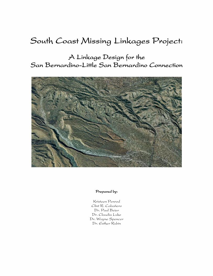
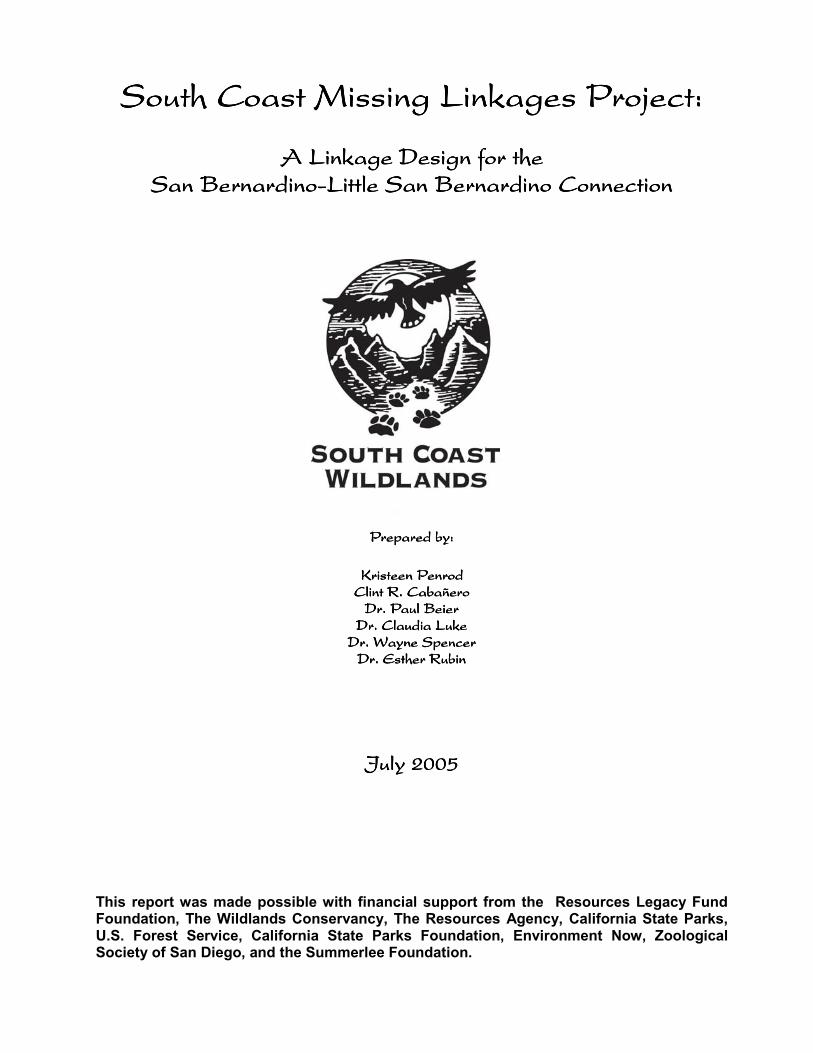
South Coast Missing Linkages Project: South Coast Missing Linkages Project: South Coast Missing Linkages Project: South Coast Missing Linkages Project: A Linkage Design for the A Linkage Design for the A Linkage Design for the A Linkage Design for the San Bernardino San Bernardino San Bernardino San Bernardino-Little San Bernardino Connection Little San Bernardino Connection Little San Bernardino Connection Little San Bernardino Connection Prepared by: Prepared by: Prepared by: Prepared by: Kristeen Penrod Clint R. Cabañero Dr. Paul Beier Dr. Claudia Luke Dr. Wayne Spencer Dr. Esther Rubin
-
Upload
khangminh22 -
Category
Documents
-
view
2 -
download
0
Transcript of South Coast Missing Linkages Project - Conservation Corridor
South Coast Missing Linkages Project:South Coast Missing Linkages Project:South Coast Missing Linkages Project:South Coast Missing Linkages Project:
A Linkage Design for the A Linkage Design for the A Linkage Design for the A Linkage Design for the San BernardinoSan BernardinoSan BernardinoSan Bernardino----Little San Bernardino ConnectionLittle San Bernardino ConnectionLittle San Bernardino ConnectionLittle San Bernardino Connection
Prepared by:Prepared by:Prepared by:Prepared by:
Kristeen Penrod Clint R. Cabañero Dr. Paul Beier Dr. Claudia Luke Dr. Wayne Spencer Dr. Esther Rubin
South Coast Missing Linkages ProjectSouth Coast Missing Linkages ProjectSouth Coast Missing Linkages ProjectSouth Coast Missing Linkages Project::::
A Linkage Design for the A Linkage Design for the A Linkage Design for the A Linkage Design for the San BernardinoSan BernardinoSan BernardinoSan Bernardino----Little San Bernardino ConnectionLittle San Bernardino ConnectionLittle San Bernardino ConnectionLittle San Bernardino Connection
Prepared by:Prepared by:Prepared by:Prepared by:
Kristeen PenrodKristeen PenrodKristeen PenrodKristeen Penrod Clint R. CabañeroClint R. CabañeroClint R. CabañeroClint R. Cabañero Dr. Paul BeierDr. Paul BeierDr. Paul BeierDr. Paul Beier Dr. Claudia LukeDr. Claudia LukeDr. Claudia LukeDr. Claudia Luke Dr. Wayne SpencerDr. Wayne SpencerDr. Wayne SpencerDr. Wayne Spencer Dr. Esther RubinDr. Esther RubinDr. Esther RubinDr. Esther Rubin
JulyJulyJulyJuly 2 2 2 2005005005005 This report was made possible with financial support from the Resources Legacy Fund Foundation, The Wildlands Conservancy, The Resources Agency, California State Parks, U.S. Forest Service, California State Parks Foundation, Environment Now, Zoological Society of San Diego, and the Summerlee Foundation.
II
Produced by South Coast Wildlands: Our mission is to protect, Produced by South Coast Wildlands: Our mission is to protect, Produced by South Coast Wildlands: Our mission is to protect, Produced by South Coast Wildlands: Our mission is to protect, connect and restore the rich natural heritage of the South Coast connect and restore the rich natural heritage of the South Coast connect and restore the rich natural heritage of the South Coast connect and restore the rich natural heritage of the South Coast Ecoregion through the establishment of a system of Ecoregion through the establishment of a system of Ecoregion through the establishment of a system of Ecoregion through the establishment of a system of connected connected connected connected wildlands.wildlands.wildlands.wildlands.
Preferred Citation: Penrod, K., C. Cabañero, P. Beier, C. Luke, W. Spencer, and E. Rubin. 2005. South Coast Missing Linkages Project: A Linkage Design for the San Bernardino-Little San Bernardino Connection. South Coast Wildlands, Idyllwild, CA. www.scwildlands.org.
III
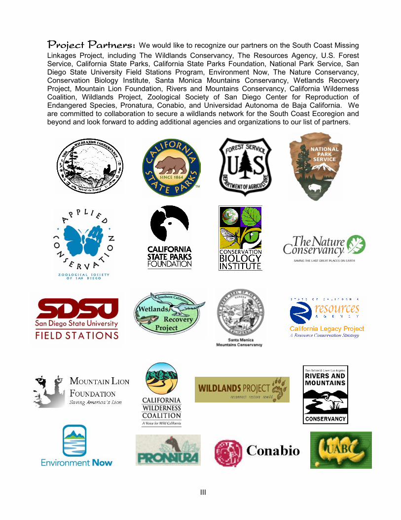
Project Partners: Project Partners: Project Partners: Project Partners: We would like to recognize our partners on the South Coast Missing
Linkages Project, including The Wildlands Conservancy, The Resources Agency, U.S. Forest Service, California State Parks, California State Parks Foundation, National Park Service, San Diego State University Field Stations Program, Environment Now, The Nature Conservancy, Conservation Biology Institute, Santa Monica Mountains Conservancy, Wetlands Recovery Project, Mountain Lion Foundation, Rivers and Mountains Conservancy, California Wilderness Coalition, Wildlands Project, Zoological Society of San Diego Center for Reproduction of Endangered Species, Pronatura, Conabio, and Universidad Autonoma de Baja California. We are committed to collaboration to secure a wildlands network for the South Coast Ecoregion and beyond and look forward to adding additional agencies and organizations to our list of partners.
IV
Table of ContentsTable of ContentsTable of ContentsTable of Contents
List of Tables & FiguresList of Tables & FiguresList of Tables & FiguresList of Tables & Figures VI
Acknowledgements Acknowledgements Acknowledgements Acknowledgements VIII
Executive SummaryExecutive SummaryExecutive SummaryExecutive Summary X
IntroductionIntroductionIntroductionIntroduction Nature Needs Room to Roam 1 Patterns of Habitat Conversion 1 A Statewide Vision 2 South Coast Missing Linkages: A Vision for the Ecoregion 2 Ecological Significance of the San Bernardino-Little San Bernardino Connection 4 Existing Conservation Investments 5
Conservation Planning ApproachConservation Planning ApproachConservation Planning ApproachConservation Planning Approach
Preface 7 Focal Species Selection 8 Landscape Permeability Analysis 8 Patch Size & Configuration Analysis 12 Minimum Linkage Width 14 Field Investigations 14 Identify Conservation Opportunities 14
Landscape Permeability AnalysesLandscape Permeability AnalysesLandscape Permeability AnalysesLandscape Permeability Analyses Landscape Permeability Analyses Summary 16 Mountain lion 17 American badger 18 Nelson’s bighorn sheep 19 Mule deer 20 Pacific kangaroo rat 21
Patch Size & Configuration AnalysesPatch Size & Configuration AnalysesPatch Size & Configuration AnalysesPatch Size & Configuration Analyses Patch Size & Configuration Analyses Summary 22 Mountain Lion 25 American Badger 27 Nelson’s Bighorn Sheep 29 Mule Deer 33 Antelope Ground Squirrel 35 Dusky-footed Woodrat 37 Merriam’s Kangaroo Rat 39 Pacific Kangaroo Rat 41 Little Pocket Mouse 43 Mountain Quail 45 Rock Wren 47 Cactus Wren 49 Wrentit 51
V
CaliforniaTreefrog 53 CoastHorned Lizard 55 Chaparral Whipsnake 57 Speckled Rattlesnake 59 Tarantula Hawk 61 Metalmark Butterfly 63 Green Hairstreak Butterfly 65 White Alder 67 Joshua Tree 69
Linkage DesignLinkage DesignLinkage DesignLinkage Design Goals of the Linkage Design 71 Description of the Linkage 72 Removing and Mitigating Barriers to Movement 79 Roads as Barriers to Upland Movement 79 Roads in the Linkage Design 80 Types of Mitigation for Roads 80 Recommended Locations for Crossing Structures on State Route 62 83 Other Recommendations Regarding Paved Roads within the Linkage Design 87 Roads as Ephemeral Barriers 88 Impediments to Streams 89 Impediments to Streams in the Linkage Design 89 Examples of Mitigation for Stream Barriers 92 Recommendations to Mitigate the Effects of Stream Barriers in the Linkage Design 93 Other Land Uses that Impede Utility of the Linkage 94 Urban Barriers to Movement 94 Urban Barriers in the Linkage Design Area 95 Examples of Mitigation for Urban Barriers 96 Recommendations for Mitigating the Effects of Urbanization in the Linkage Design Area 96 Recreation 97 Recreation in the Linkage Design Area 97 Examples of Mitigation for Recreation 97 Recommendations for Mitigating the Effects of Recreation in the Linkage Design Area 97 Land Protection & Stewardship Opportunities 98 Summary 107
Literature Cited 109
Appendices (Enclosed CD)Appendices (Enclosed CD)Appendices (Enclosed CD)Appendices (Enclosed CD) A. Workshop Participants B. Workshop Summary C. 3D Visualization of the San Bernardino-Little San Bernardino Connection
VI
List of TablesList of TablesList of TablesList of Tables
Table 1. Focal Species Selected Table 2. Focal Species Movement Criteria Table 3. Vegetation and Land Cover in the Linkage Table 4. Major Transportation Routes in the Linkage Design
List of FiguresList of FiguresList of FiguresList of Figures Figure 1. South Coast Ecoregion Figure 2. South Coast Missing Linkages Figure 3. Vegetation Types in the Linkage Planning Area Figure 4. Existing Conservation Investments in the Linkage Planning Area Figure 5. Interdisciplinary Approach Figure 6. Permeability Model Inputs Figure 7. Patch Size & Configuration Model Inputs Figure 8. Least Cost Union Displaying Species Overlap Figure 9. Least Cost Union Figure 10. Least Cost Corridor for Mountain lion Figure 11. Least Cost Corridor for American badger Figure 12. Least Cost Corridor for Nelson’s bighorn sheep Figure 13. Least Cost Corridor for Mule deer Figure 14. Least Cost Corridor for Pacific kangaroo rat Figure 15. Least Cost Union Additions & Subtractions Figure 16. Land in the Southern Branch of the Least Cost Union Eliminated Figure 17. Habitat Suitability for Mountain lion Figure 18. Potential Cores & Patches for Mountain lion Figure 19. Habitat Suitability for American badger Figure 20. Potential Cores & Patches for American badger Figure 21. Potential Habitat for Nelson’s bighorn sheep Figure 22. Potential Cores & Patches for Nelson’s bighorn sheep Figure 23. Habitat Suitability for Mule deer Figure 24. Potential Cores & Patches for Mule deer Figure 25. Habitat Suitability for Antelope ground squirrel Figure 26. Potential Cores & Patches for Antelope ground squirrel Figure 27. Habitat Suitability for Dusky-footed woodrat Figure 28. Potential Cores & Patches for Dusky-footed woodrat Figure 29. Patch Configuration for Dusky-footed woodrat Figure 30. Habitat Suitability for Merriam’s kangaroo rat Figure 31. Potential Cores & Patches for Merriam’s kangaroo rat Figure 32. Habitat Suitability for Pacific kangaroo rat Figure 33. Potential Cores & Patches for Pacific kangaroo rat Figure 34. Habitat Suitability for Little pocket mouse Figure 35. Potential Cores & Patches for Little pocket mouse Figure 36. Patch Configuration for Little pocket mouse Figure 37. Habitat Suitability for Mountain quail Figure 38. Potential Cores & Patches for Mountain quail Figure 39. Habitat Suitability for Rock wren Figure 40. Potential Cores & Patches for Rock wren Figure 41. Habitat Suitability for Cactus wren Figure 42. Potential Cores & Patches for Cactus wren Figure 43. Habitat Suitability for Wrentit
VII
Figure 44. Potential Cores & Patches for Wrentit Figure 45. Patch Configuration for Wrentit Figure 46. Potential Habitat for California treefrog Figure 47. Habitat Suitability for Coast horned lizard Figure 48. Potential Cores & Patches for Coast horned lizard Figure 49. Patch Configuration for Coast horned lizard Figure 50. Habitat Suitability for Chaparral whipsnake Figure 51. Potential Cores & Patches for Chaparral whipsnake Figure 52. Habitat Suitability for Speckled rattlesnake Figure 53. Potential Cores & Patches for Speckled rattlesnake Figure 54. Potential Habitat for Tarantula hawk Figure 55. Potential Cores & Patches for Tarantula hawk Figure 56. Potential Habitat for Metalmark butterfly Figure 57. Potential Habitat for Green Hairstreak butterfly Figure 58. Potential Habitat for White alder Figure 59. Potential Habitat for Joshua tree Figure 60. Linkage Design Figure 61. The most northerly branch of the Linkage Design Figure 62. Little Morongo Canyon Figure 63. Big Morongo Canyon Figure 64. The widest branch of the Linkage Design includes Dry Morongo Canyon Figure 65. The southern branch of the Linkage Design encompasses most of Mission Creek Figure 66. Existing Infrastructure in the Planning Area Figure 67. An example of a vegetated land bridge built to enhance movement of wildlife
populations. Figure 68. A viaduct in Slovenia built to accommodate wildlife, hydrology, and human
connectivity. Figure 69. Arched culvert on German highway, with rail for amphibians and fence for larger
animals Figure 70. Pipe culvert designed to accommodate small mammals Figure 71. Amphibian tunnels allow light and moisture into the structure Figure 72. The northern and southern bridges for Mission Creek Figure 73. Looking down State Route 62 toward the Coachella Valley Figure 74. Bridged crossing for Dry Morongo Canyon Figure 75. The concrete box culvert for Big Morongo Wash Figure 76. Looking eastward down Little Morongo Canyon under State Route 62 Figure 77. Concrete culvert in the upland route between Yucca and Morongo Valleys Figure 78. Looking up Little Morongo Canyon where it’s been channelized on the valley floor Figure 79. The riparian oasis in Big Morongo Canyon Preserve Figure 80. Illegal dumping in Big Morongo Wash
VIII
Workshop Speakers:Workshop Speakers:Workshop Speakers:Workshop Speakers: Greg Ballmer, Tri-County Conservation League; Chris Brown,
USGS Biological Resources Division; Paul Beier, Northern Arizona University; Geary Hund, formerly with California State Parks; Tim Krantz, University of Redlands; Bill LaHaye, University of Minnesota, St. Paul; Claudia Luke, San Diego State University Field Stations Program; Chet McGaugh & John Green, AMEC; Tom Scott, University of California, Riverside; and Wayne Spencer, Conservation Biology Institute.
Taxonomic WorkingTaxonomic WorkingTaxonomic WorkingTaxonomic Working----Group Participants:Group Participants:Group Participants:Group Participants: We would like to thank the following
individuals for their participation in the selection of focal species: Kelly Albert, Spirit of the Sage; Greg Ballmer, University of California-Riverside; Kent Beaman, Natural History Museum of Los Angeles County; Stephanie Bee, Bureau of Land Management (BLM); Paul Beier, Northern Arizona University; Ann Berkley, Angeles National Forest (ANF); Sean Berne, The Wildlands Conservancy; Jerry Boggs, Michael Brandman Associates; Monica Bond, Center for Biological Diversity; Erin Boydston, U.S. Geological Survey; Bill Brown, ANF; Chris Brown, United States Geological Survey; Clint Cabanero, South Coast Wildlands; Patricia Carbajales, University of Redlands; Paul Caron, CalTrans; Liz Chattin, formerly with South Coast Wildlands; Kim Clarkin, United States Forest Service; Michelle Cullens, Mountain Lion Foundation; Brendan Cummings, Center for Biological Diversity; Anne Dove, Rivers, Trails and Conservation Assistance Program; Karen Drewe, CalTrans; Sabrina Drill, UC Cooperative Extension; Paul Edelman, Santa Monica Mountains Conservancy; Brian Edwards, formerly with South Coast Wildlands; Patrick Egle, San Bernardino County; Robin Eliason, United States Forest Service; Belinda Faustinos, Rivers and Mountains Conservancy; Nancy Fuller, California State Parks; Madelyn Glickfeld, formerly with California Resources Agency; Dave Goodward, San Bernardino Valley Audubon; Elliot Graham, United States Forest Service; John Green, AMEC Earth and Environmental, Inc.; Andrea Gullo, Wildlife Corridor Conservation Authority; Scott Harris, California Department of Fish and Game; William Hayes, Loma Linda University; Marc Hoshovsky, California Resources Agency; Rachelle Huddleston-Lorton, BLM; Geary Hund, formerly with California State Parks; Dale Hutchinson, California Department of Forestry and Fire Protection; Debbie Hyde-Sato, United States Forest Service; Nina Jimerson, Michael Brandman Associates; Peter Jorris, San Bernardino Mountains Land Trust; Peter Kiriakos, Sierra Club; Robin Kobaly, Big Morongo Canyon Preserve; Eddy Konno, California Department of Fish and Game; Kate Kramer, California Department of Fish and Game; Tim Krantz, University of Redlands; Tasha LaDoux, ANF; Clem Lagrosa, ANF; Bill LaHaye, University of Minnesota, St. Paul; Shay Lawrey, County of San Bernardino; Steve Loe, San Bernardino National Forest; Claudia Luke, San Diego State University-Field Programs; Lisa Lyren, United States Geological Survey; James Malcolm, University of Redlands; Robin Maloney-Rames, California Department of Fish and Game; Chet McGaugh; AMEC Earth and Environmental, Inc.; Bettina McLeod, San Timoteo Canyon Land Coalition; Anthony Metcalf, California State University-San Bernardino; Nathan Moorhatch, AMEC Earth and Environmental, Inc.; Stephen Myers, AMEC Earth and Environmental, Inc.; Kristeen Penrod, South Coast Wildlands; Lisa Ann Pierce, Redlands Institute; Nannette Pratini, University of California-Riverside; Gordon Pratt, University of California-Riverside; Ron Pugh, United States Forest Service; Stephanie Reeder, CalTrans; Claire Schlotterbeck, Hills for Everyone; Tom Scott, University of California-Riverside; David Shapiro, formerly with The Wildlands Conservancy; Kassie Siegel, Center for Biological Diversity; Matt Slowik, San Bernardino County; Wayne Spencer, Conservation Biology Institute; Marc Stamer, United States Forest Service; Andrew Stamps, ANF; Glen Stewart, California Polytechnic University, Ponoma; Eileen Takata, North East Trees; Julie Teel, Center for Biological Diversity; Rick Thomas, San Gabriel Mountains Regional Conservancy; Rod Thornton, Redlands Institute; Luz Torres, CalTrans; Holly Vuong, ANF; Richard Wales, ANF; Andrea Warniment, formerly with South Coast Wildlands; Mike Wilcox, AMEC Earth and Environmental, Inc.; and Dee Zeller, Big Morongo Canyon Preserve.
IX
Project Steering Committee:Project Steering Committee:Project Steering Committee:Project Steering Committee: We are extremely grateful to the following individuals,
who serve on the steering committee for the South Coast Missing Linkages Project: Paul Beier (Northern Arizona University), Madelyn Glickfeld (formerly with The Resources Agency California Legacy Project), Gail Presley (California Department of Fish and Game), Therese O’Rourke (U.S. Fish & Wildlife Service, formerly with The Nature Conservancy), Kristeen Penrod (South Coast Wildlands), Rick Rayburn (California State Parks), Ray Sauvajot (National Park Service), and Tom White (U.S. Forest Service).
X
Executive SummaryExecutive SummaryExecutive SummaryExecutive Summary Habitat loss and fragmentation are the leading threats to biodiversity, both globally and in southern California. Efforts to combat these threats must focus on conserving well-connected networks of large wildland areas where natural ecological and evolutionary processes can continue operating over large spatial and temporal scales—such as top-down regulation by large predators, and natural patterns of gene flow, pollination, dispersal, energy flow, nutrient cycling, inter-specific competition, and mutualism. Adequate landscape connections will thereby allow these ecosystems to respond appropriately to natural and unnatural environmental perturbations, such as fire, flood, climate change, and invasions by alien species.
The tension between fragmentation and conservation is particularly acute in California, because our state is one of the 25 most important hotspots of biological diversity on Earth. And nowhere is the threat to connectivity more severe than in southern California—our nation’s largest urban area, and still one of its fastest urbanizing areas. But despite a half-century of rapid habitat conversion, southern California retains some large and valuable wildlands, and opportunities remain to conserve and restore a functional wildland network here.
Although embedded in one of the world’s largest metropolitan areas, Southern California’s archipelago of conserved wildlands is fundamentally one interconnected ecological system, and the goal of South Coast Missing Linkages is to keep it so. South Coast Missing Linkages is a collaborative effort among a dozen governmental and non-governmental organizations. Our aim is to develop Linkage Designs for 15 major landscape linkages to ensure a functioning wildland network for the South Coast Ecoregion, along with connections to neighboring ecoregions. The San Bernardino-Little San Bernardino Connection links the South Coast to the Mojave Desert ecoregion; it is a critical landscape connection to restore and protect.
On August 7, 2002, 86 participants representing over 44 agencies, academic institutions, land managers, land planners, conservation organizations, and community groups met to establish biological foundations for planning landscape linkages in the San Bernardino-Little San Bernardino Connection. They identified 23 focal species that are sensitive to habitat loss and fragmentation here, including 2 plants, 4 insects, 1 amphibian, 3 reptiles, 4 birds and 9 mammals. These focal species cover a broad range of habitat and movement requirements: some are widespread but require huge tracts of land to support viable populations (e.g., Nelson’s bighorn sheep, mountain lion, badger); others are species with very limited spatial requirements (e.g., coast horned lizard). Many are habitat specialists (e.g., cactus wren) and others require specific configurations of habitat elements (e.g. greenhairstreak butterfly that requires hilltopping habitat). Together, these species cover a wide array of habitats and movement needs in the region, so that planning adequate linkages for them is expected to cover connectivity needs for the ecosystems they represent. To identify potential routes between existing protected areas we conducted landscape permeability analyses for 5 focal species for which appropriate data were available. Permeability analyses model the relative cost for a species to move between protected core habitat or population areas. We defined a least-cost corridor—or best potential route—for each species, and then combined these into a Least Cost Union covering all 5 species. We then analyzed the size and configuration of suitable habitat patches within this Least Cost Union for all 23 focal species to verify that the final Linkage Design would suit the live-in or move-through habitat needs of all. Where the Least Cost Union omitted areas essential to the needs of a particular species, we expanded the Linkage Design to accommodate that species’ particular requirements to produce a final Linkage Design (Figure ES-1). We also visited priority areas in the field to identify and evaluate barriers to movement for our focal species. In this plan we suggest restoration strategies to mitigate those barriers, with special emphasis on opportunities to reduce

XI
the adverse effects of State Route 62. The ecological, educational, recreational, and spiritual values of protected wildlands in the South Coast Ecoregion are immense. Our Linkage Design for the San Bernardino-Little San Bernardino Connection represents an opportunity to protect a truly functional landscape-level connection. The cost of implementing this vision will be substantial—but the cost is small compared with the benefits. If implemented, our plan would not only permit movement of individuals and genes between the San Bernardino and Little San Bernardino Ranges, but should also conserve large-scale ecosystem processes that are essential to the continued integrity of existing conservation investments throughout the region. We hope that our biologically based and repeatable procedure will be applied in other parts of California and elsewhere to ensure continued ecosystem integrity in perpetuity.
South Coast Missing Linkages Project San Bernardino-Little San Bernardino
1
Introduction
Nature Needs Room to Roam Movement is essential to wildlife survival, whether it be the day-to-day movements of individuals seeking food, shelter, or mates, dispersal of offspring (e.g., seeds, pollen, fledglings) to new home areas, or migration of organisms to avoid seasonally unfavorable conditions (Forman 1995). Movements can lead to recolonization of unoccupied habitat after environmental disturbances, the healthy mixing of genes among populations, and the ability of organisms to respond or adapt to environmental stressors. Movements in natural environments lead to complex mosaics of ecological and genetic interactions at various spatial and temporal scales. In environments fragmented by human development, disruption of movement patterns can alter essential ecosystem functions, such as top-down regulation by large predators, gene flow, pollination and seed-dispersal, competitive or mutualistic relationships among species, resistance to invasion by alien species, energy flow, and nutrient cycling. Without the ability to move among and within natural habitats, species become more susceptible to fire, flood, disease and other environmental disturbances and show greater rates of local extinction (Soulé and Terborgh 1999). The principles of island biogeography (MacArthur and Wilson 1967), models of demographic stochasticity (Shaffer 1981, Soulé 1987), inbreeding depression (Schonewald-Cox 1983; Mills and Smouse 1994), and metapopulation theory (Levins 1970, Taylor 1990, Hanski and Gilpin 1991) all predict that isolated populations are more susceptible to extinction than connected populations. Establishing connections among natural lands has therefore long been recognized as important for sustaining natural ecological processes and biological diversity (Noss 1987, Harris and Gallagher 1989, Noss 1991, Beier and Loe 1992, Noss 1992, Beier 1993, Forman 1995, Beier and Noss 1998, Hunter 1999, Crooks and Soulé 1999, Soulé and Terborgh 1999, Penrod et al. 2001, Crooks et al. 2001, Tewksbury et al. 2002, Forman et al. 2003). Patterns of Habitat Conversion As a consequence of rapid habitat conversion to urban and agricultural uses, the South Coast Ecoregion of California (Figure 1) has become a hotspot for species at risk of extinction. California has the greatest number of threatened and endangered species in the continental U.S, representing nearly every taxonomic group, from plants and invertebrates to birds, mammals, fish, amphibians, and reptiles (Wilcove et al. 1998). In an analysis that identified “irreplaceable” places for preventing species extinctions (Stein et al. 2000), the South Coast Ecoregion stood out as one of the six most important areas in the United States (along with Hawaii, the San Francisco Bay Area, Southern Appalachians, Death Valley, and the Florida Panhandle). The ecoregion is part of the California Floristic Province, one of 25 global hotspots of biodiversity, and the only one in North America (Mittermeier et al. 1998, Mittermeier et al. 1999). A major reason for regional declines in native species is the pattern of habitat loss. Species that once moved freely through a mosaic of natural vegetation types are now confronted with a man-made labyrinth of barriers, such as roads, homes, businesses,
South Coast Missing Linkages Project San Bernardino-Little San Bernardino
2
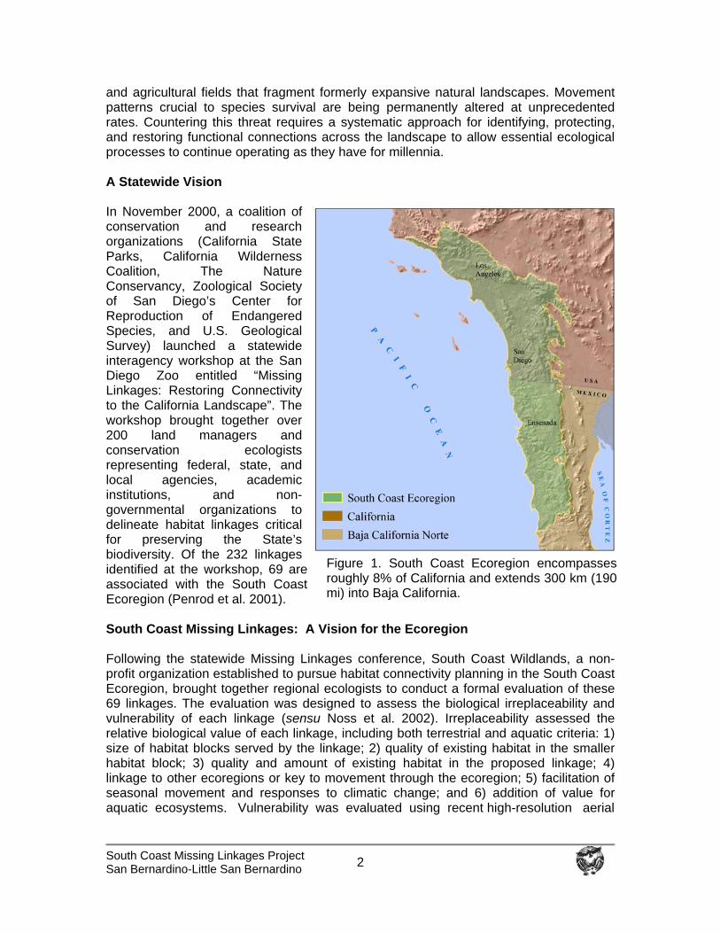
and agricultural fields that fragment formerly expansive natural landscapes. Movement patterns crucial to species survival are being permanently altered at unprecedented rates. Countering this threat requires a systematic approach for identifying, protecting, and restoring functional connections across the landscape to allow essential ecological processes to continue operating as they have for millennia. A Statewide Vision In November 2000, a coalition of conservation and research organizations (California State Parks, California Wilderness Coalition, The Nature Conservancy, Zoological Society of San Diego’s Center for Reproduction of Endangered Species, and U.S. Geological Survey) launched a statewide interagency workshop at the San Diego Zoo entitled “Missing Linkages: Restoring Connectivity to the California Landscape”. The workshop brought together over 200 land managers and conservation ecologists representing federal, state, and local agencies, academic institutions, and non-governmental organizations to delineate habitat linkages critical for preserving the State’s biodiversity. Of the 232 linkages identified at the workshop, 69 are associated with the South Coast Ecoregion (Penrod et al. 2001). South Coast Missing Linkages: A Vision for the Ecoregion Following the statewide Missing Linkages conference, South Coast Wildlands, a non-profit organization established to pursue habitat connectivity planning in the South Coast Ecoregion, brought together regional ecologists to conduct a formal evaluation of these 69 linkages. The evaluation was designed to assess the biological irreplaceability and vulnerability of each linkage (sensu Noss et al. 2002). Irreplaceability assessed the relative biological value of each linkage, including both terrestrial and aquatic criteria: 1) size of habitat blocks served by the linkage; 2) quality of existing habitat in the smaller habitat block; 3) quality and amount of existing habitat in the proposed linkage; 4) linkage to other ecoregions or key to movement through the ecoregion; 5) facilitation of seasonal movement and responses to climatic change; and 6) addition of value for aquatic ecosystems. Vulnerability was evaluated using recent high-resolution aerial
Figure 1. South Coast Ecoregion encompasses roughly 8% of California and extends 300 km (190 mi) into Baja California.

South Coast Missing Linkages Project San Bernardino-Little San Bernardino
3
Figure 2. The South Coast Missing Linkages Project addresses habitat fragmentation at a landscape scale, and the needs of a variety of species. The San Bernardino-Little San Bernardino Connection is one of 15 landscape linkages identified as irreplaceable and imminently threatened. photographs, local planning documents, and other data concerning threats of habitat loss or fragmentation in the linkage area. This process identified 15 linkages of crucial biological value that are likely to be irretrievably compromised by development projects over the next decade unless immediate conservation action occurs (Figure 2). The biological integrity of several thousand square miles of the very best southern California wildlands would be irreversibly jeopardized if these linkages were lost. Identification of these 15 priority linkages launched the South Coast Missing Linkages Project. This project is a highly collaborative effort among federal and state agencies and non-governmental organizations to identify and conserve landscape-level habitat linkages to protect essential biological and ecological processes in the South Coast Ecoregion. Partners include but are not limited to: South Coast Wildlands, The Wildlands Conservancy, The Resources Agency California Legacy Project, California State Parks, California State Parks Foundation, United States Forest Service, National Park Service, Santa Monica Mountains Conservancy, Rivers and Mountains Conservancy, Conservation Biology Institute, San Diego State University Field Stations Program, The Nature Conservancy, Southern California Wetlands Recovery Project, Environment Now, Mountain Lion Foundation, and the Zoological Society of San Diego’s
South Coast Missing Linkages Project San Bernardino-Little San Bernardino
4
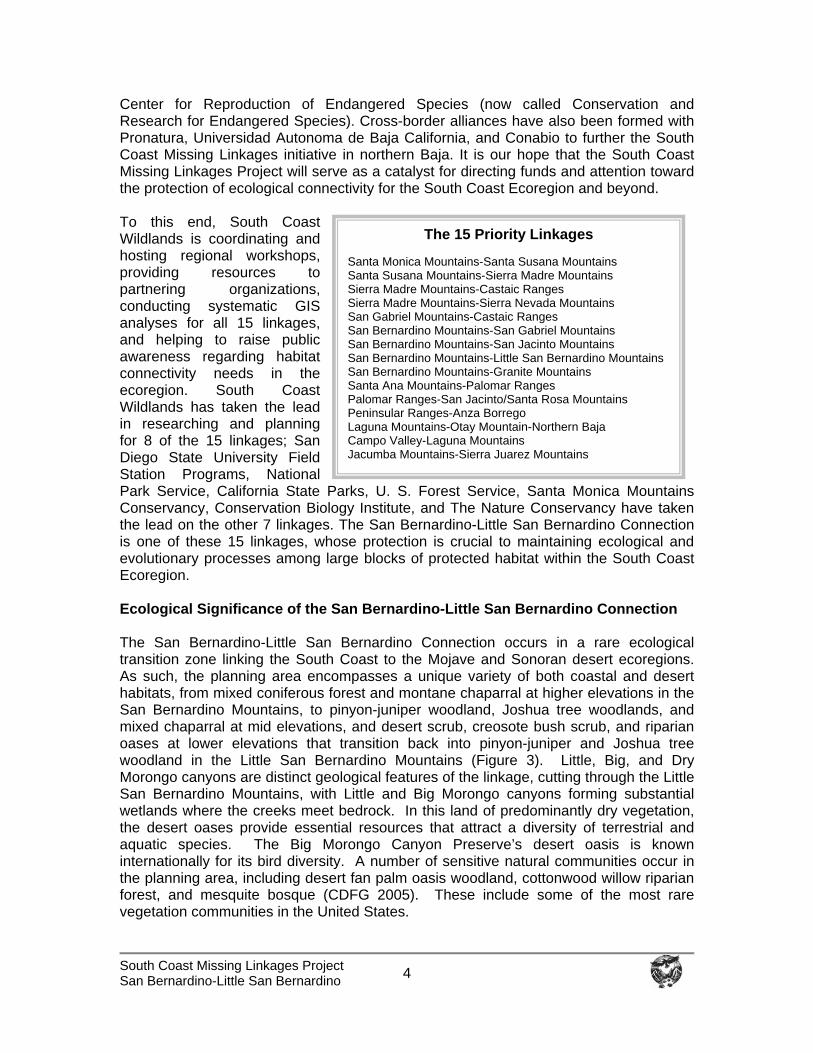
Center for Reproduction of Endangered Species (now called Conservation and Research for Endangered Species). Cross-border alliances have also been formed with Pronatura, Universidad Autonoma de Baja California, and Conabio to further the South Coast Missing Linkages initiative in northern Baja. It is our hope that the South Coast Missing Linkages Project will serve as a catalyst for directing funds and attention toward the protection of ecological connectivity for the South Coast Ecoregion and beyond. To this end, South Coast Wildlands is coordinating and hosting regional workshops, providing resources to partnering organizations, conducting systematic GIS analyses for all 15 linkages, and helping to raise public awareness regarding habitat connectivity needs in the ecoregion. South Coast Wildlands has taken the lead in researching and planning for 8 of the 15 linkages; San Diego State University Field Station Programs, National Park Service, California State Parks, U. S. Forest Service, Santa Monica Mountains Conservancy, Conservation Biology Institute, and The Nature Conservancy have taken the lead on the other 7 linkages. The San Bernardino-Little San Bernardino Connection is one of these 15 linkages, whose protection is crucial to maintaining ecological and evolutionary processes among large blocks of protected habitat within the South Coast Ecoregion. Ecological Significance of the San Bernardino-Little San Bernardino Connection The San Bernardino-Little San Bernardino Connection occurs in a rare ecological transition zone linking the South Coast to the Mojave and Sonoran desert ecoregions. As such, the planning area encompasses a unique variety of both coastal and desert habitats, from mixed coniferous forest and montane chaparral at higher elevations in the San Bernardino Mountains, to pinyon-juniper woodland, Joshua tree woodlands, and mixed chaparral at mid elevations, and desert scrub, creosote bush scrub, and riparian oases at lower elevations that transition back into pinyon-juniper and Joshua tree woodland in the Little San Bernardino Mountains (Figure 3). Little, Big, and Dry Morongo canyons are distinct geological features of the linkage, cutting through the Little San Bernardino Mountains, with Little and Big Morongo canyons forming substantial wetlands where the creeks meet bedrock. In this land of predominantly dry vegetation, the desert oases provide essential resources that attract a diversity of terrestrial and aquatic species. The Big Morongo Canyon Preserve’s desert oasis is known internationally for its bird diversity. A number of sensitive natural communities occur in the planning area, including desert fan palm oasis woodland, cottonwood willow riparian forest, and mesquite bosque (CDFG 2005). These include some of the most rare vegetation communities in the United States.
The 15 Priority Linkages
Santa Monica Mountains-Santa Susana Mountains Santa Susana Mountains-Sierra Madre Mountains Sierra Madre Mountains-Castaic Ranges Sierra Madre Mountains-Sierra Nevada Mountains San Gabriel Mountains-Castaic Ranges San Bernardino Mountains-San Gabriel Mountains San Bernardino Mountains-San Jacinto Mountains San Bernardino Mountains-Little San Bernardino Mountains San Bernardino Mountains-Granite Mountains Santa Ana Mountains-Palomar Ranges Palomar Ranges-San Jacinto/Santa Rosa Mountains Peninsular Ranges-Anza Borrego Laguna Mountains-Otay Mountain-Northern Baja Campo Valley-Laguna Mountains Jacumba Mountains-Sierra Juarez Mountains
South Coast Missing Linkages Project San Bernardino-Little San Bernardino
5
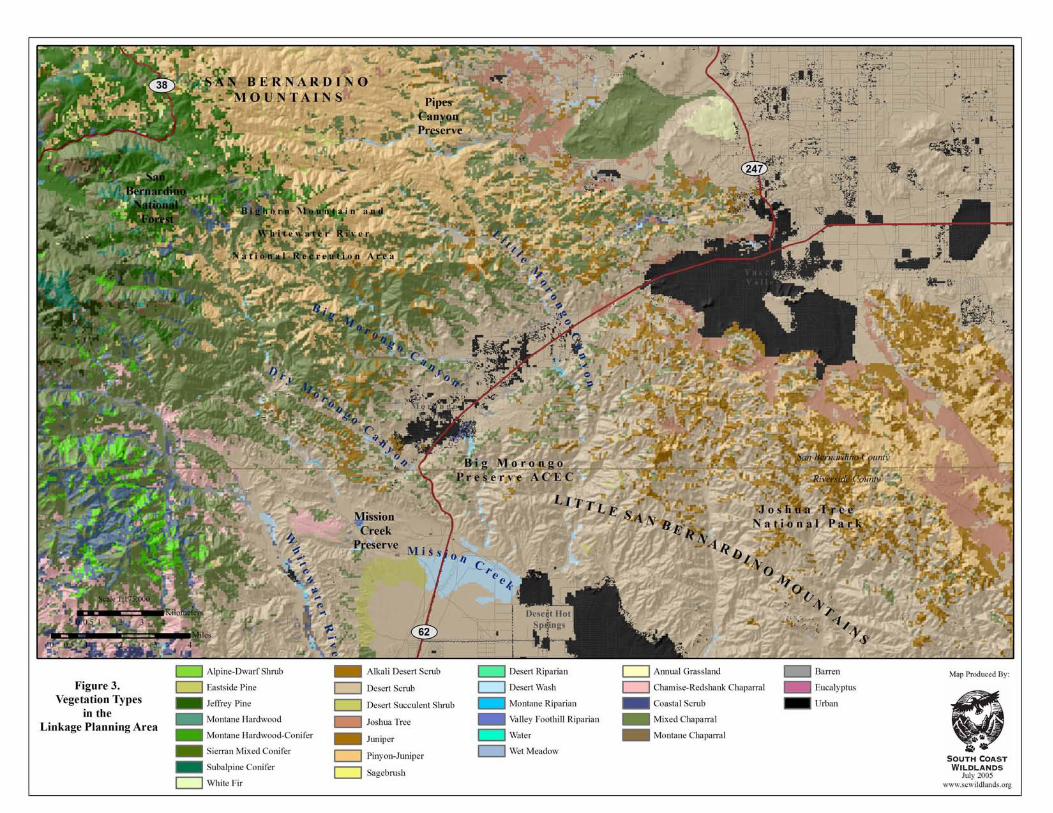
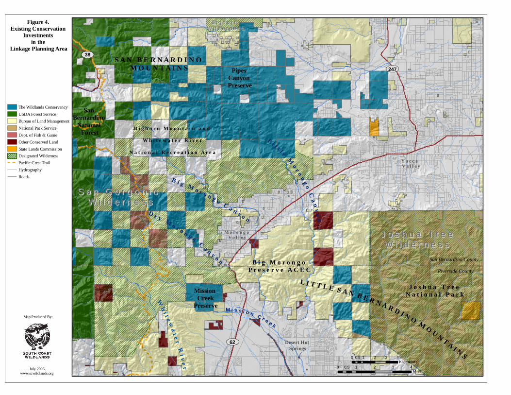
This variety of habitats support a diversity of organisms, including many species listed as endangered, threatened, or sensitive by government agencies (USFWS 1980, 1998, Coachella Valley Association of Governments [CVAG] 2004, CDFG 2005a, 2005b). A number of rare species depend on the area’s riparian oases, which provide breeding locations for many riparian birds and critical watering areas for Nelson’s bighorn sheep (Ovis canadensis nelsoni). Several riparian songbirds, such as summer tanager (Piranga rubra), yellow warbler (Dendroica petechia), and the endangered least Bell’s vireo (Vireo bellii pusillus) and yellow-billed cuckoo (Coccyzus americanus) have the potential to occur in the linkage. Sensitive reptiles that prefer drier habitats and sparser vegetative cover, such as the threatened desert tortoise (Gopherus agassizii), rosy boa (Lichanura trivirgata), northern red diamond rattlesnake (Crotalus ruber ruber), coast horned lizard (Phrynosoma coronatum blainvillei), and the endangered Coachella Valley fringe-toad lizard (Uma inornata) also have the potential to occur, as do a number of sensitive birds of prey, including Cooper’s hawk (Accipiter cooperi), golden eagle (Aquila chrysaetos), long-eared owl (Asio otus), and burrowing owl (Athene cunicularia). The planning area also provides habitat for a number of imperiled plant species, including triple-ribbed milk-vetch (Astragalus tricarinatus), Darwin’s rock cress (Arabis pulchra var. munciensis), and Little San Bernardino Mountains linanthus (Linanthus maculatus). In addition to providing habitat for rare and endangered species, the linkage provides live-in and move-through habitat for numerous native species such as American badger, mule deer, and mountain lion that may be less extinction prone but that nevertheless require extensive wildlands to thrive. Existing Conservation Investments Significant conservation investments already exist in the region (Figure 4), but the resource values they support could be irreparably harmed by loss of connections between them. This linkage connects two expansive core areas that are largely conserved within the San Bernardino National Forest and Joshua Tree National Park. Wilderness Areas (WA) occur just inside the boundaries of protected areas on either side of the linkage, as well as in the linkage itself. The San Gorgonio WA in the San Bernardino Mountains is jointly managed by the Forest Service and Bureau of Land Management (BLM). The California Wild Heritage Campaign (www.californiawild.org) has proposed an addition to the San Gorgonio WA, and the Bighorn Mountain Wilderness additions are proposed just north of this WA. The BLM Morongo and Pipes Canyon proposed WAs are just east of the Forest Service boundary and contain many springs and riparian areas that feed the Morongo Canyons. The majority of Joshua Tree National Park is designated as Wilderness (73% or 585,040 out of 794,000 acres) and occurs just within the western boundary of the park. Much of the land in the linkage has already been protected though successful conservation planning efforts undertaken by BLM, The Wildlands Conservancy (TWC), and California Department of Fish and Game, although gaps in protection remain. The majority of land in the planning area is part of the California Desert Conservation Area and BLM has designated the Morongo Basin as an Area of Critical Environmental Concern (ACEC). BLM has already acquired about a 3 km (1.86 mi) wide corridor that traverses State Route 62 and joins public land in the San Bernardino National Forest with that in Joshua Tree National Park. A vegetated land bridge has been recommended to facilitate bighorn sheep movement across the highway. This area is
J o s h u a T r e e N a t i o n a l P a r k
B i g M o r o n g o P r e s e r v e A C E C
Desert Hot Springs
Y u c c a V a l l e y
B i g h o r n M o u n t a i n a n d
W h i t e w a t e r R i v e r
N a t i o n a l R e c r e a t i o n A r e a
S A N B E R N A R D I N O M O U N T A I N S
M o r o n g o V a l l e y
Mission Creek
Preserve
Pipes Canyon Preserve
L I T T L E S A N B E R N A R D I N O M O U N T A I N S
B i g M o r o n g o C a n y o n
L i t t l e M o r o n g o C a n y o nD r y M o r o n g o C a n y o n
M i s s i o n C r e e k
W h i t e w a t e r R i v e r
San Bernardino
National Forest
San Bernardino CountyRiverside County
The Wildlands ConservancyUSDA Forest ServiceBureau of Land ManagementNational Park ServiceDept. of Fish & GameOther Conserved LandState Lands CommissionDesignated WildernessPacific Crest TrailHydrographyRoads
0 1 2 3 40.5Miles
0 1 2 3 40.5Kilometers
Map Produced By:
July 2005www.scwildlands.org
38
247
Figure 4. Existing Conservation
Investments in the
Linkage Planning Area
62
S a n G o r g o n i o W i l d e r n e s s
S a n G o r g o n i o W i l d e r n e s s
J o s h u a T r e eW i l d e r n e s s
J o s h u a T r e eW i l d e r n e s s
B i g h o r n W i l d e r n e s s
B i g h o r n W i l d e r n e s s
South Coast Missing Linkages Project San Bernardino-Little San Bernardino
6
protected as part of the Big Morongo Preserve, which is administered by BLM in cooperation with The Nature Conservancy and San Bernardino County Parks. TWC was a major partner in acquiring checkerboard sections of private land and transferring them to BLM for inclusion in the Big Morongo Preserve. The Big Morongo Preserve map indicates a desired configuration that would also provide a second upland connection just west of Yucca Valley that would include pinyon-juniper and Joshua tree woodland habitats between Joshua Tree National Park and TWC’s Pipes Canyon Preserve, which has strong linkages to the Bighorn Mountains and San Gorgonio Wilderness Areas. The Draft Environmental Impact Report and Statement for the West Mojave Plan reinforced the importance of this connection to enhance dispersal opportunities for bighorn sheep and the area is also designated as an open space corridor in the town of Yucca Valley’s general plan (USDI BLM 2003). Another Habitat Conservation Plan deals with the southern part of the linkage, the Coachella Valley Multiple Species Habitat Conservation Plan addresses the connection above the community of Desert Hot Springs near Mission Creek (CVAG 2004), just east of TWC’s Mission Creek Preserve. The value of already protected land in the region for biodiversity conservation, environmental education, outdoor recreation, and scenic beauty is immense. Southern California’s remaining wildlands form an archipelago of natural open space thrust into one of the world’s largest metropolitan area within a global hotspot of biological diversity. These wild areas are naturally interconnected; indeed, they historically functioned as one ecological system. However, recent intensive and unsustainable activities threaten to sever natural connections, forever altering the functional integrity of this remarkable natural system. The ecological, educational, recreational, and spiritual impacts of such a severance would be substantial. Certainly, maintaining and restoring functional habitat connectivity to this regionally important landscape linkage is a wise investment.
South Coast Missing Linkages San Bernardino-Little San Bernardino 7
Conservation Planning Approach
The goal of linkage conservation planning is to identify specific lands that must be conserved to maintain or restore functional connections for all species or ecological processes of interest, generally between two or more protected core habitat areas. We adopted a spatially hierarchical approach, gradually working from landscape-level processes down to the needs of individual species on the ground. The planning area encompasses habitats between the San Bernardino Mountains of San Bernardino National Forest and the Little San Bernardino Mountains of Joshua Tree National Park. We conducted various landscape analyses to identify those areas necessary to accommodate continued movement of selected focal species through this landscape. Our approach can be summarized as follows:
1) Focal Species Selection: Select focal species from diverse taxonomic groups to represent a diversity of habitat requirements and movement needs.
2) Landscape Permeability Analysis: Conduct landscape permeability analyses to
identify a zone of habitat that addresses the needs of multiple species potentially traveling through or residing in the linkage.
3) Patch Size & Configuration Analysis: Use patch size and configuration analyses
to identify the priority areas needed to maintain linkage function.
4) Field Investigations: Conduct fieldwork to ground-truth results of prioritization analyses, identify barriers, and document conservation management needs.
5) Linkage Design: Compile results of analyses and fieldwork into a comprehensive
report detailing what is required to conserve and improve linkage function.
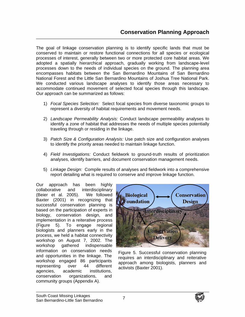
Our approach has been highly collaborative and interdisciplinary (Beier et al. 2005). We followed Baxter (2001) in recognizing that successful conservation planning is based on the participation of experts in biology, conservation design, and implementation in a reiterative process (Figure 5). To engage regional biologists and planners early in the process, we held a habitat connectivity workshop on August 7, 2002. The workshop gathered indispensable information on conservation needs and opportunities in the linkage. The workshop engaged 86 participants representing over 44 different agencies, academic institutions, conservation organizations, and community groups (Appendix A).
Figure 5. Successful conservation planning requires an interdisciplinary and reiterative approach among biologists, planners and activists (Baxter 2001).
South Coast Missing Linkages San Bernardino-Little San Bernardino 8
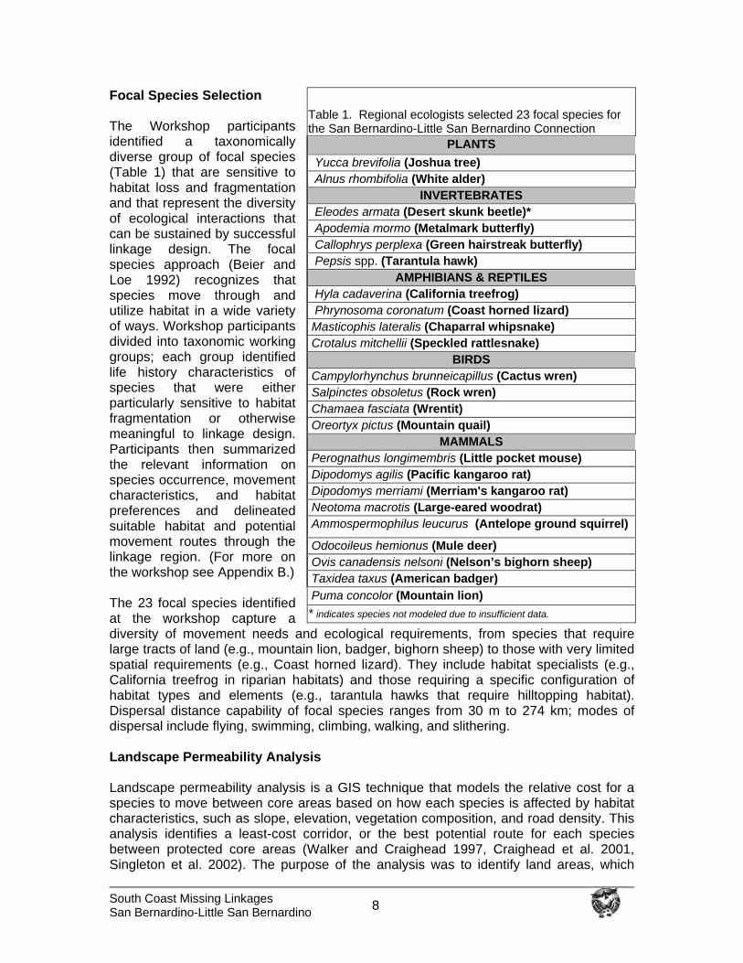
Focal Species Selection The Workshop participants identified a taxonomically diverse group of focal species (Table 1) that are sensitive to habitat loss and fragmentation and that represent the diversity of ecological interactions that can be sustained by successful linkage design. The focal species approach (Beier and Loe 1992) recognizes that species move through and utilize habitat in a wide variety of ways. Workshop participants divided into taxonomic working groups; each group identified life history characteristics of species that were either particularly sensitive to habitat fragmentation or otherwise meaningful to linkage design. Participants then summarized the relevant information on species occurrence, movement characteristics, and habitat preferences and delineated suitable habitat and potential movement routes through the linkage region. (For more on the workshop see Appendix B.) The 23 focal species identified at the workshop capture a diversity of movement needs and ecological requirements, from species that require large tracts of land (e.g., mountain lion, badger, bighorn sheep) to those with very limited spatial requirements (e.g., Coast horned lizard). They include habitat specialists (e.g., California treefrog in riparian habitats) and those requiring a specific configuration of habitat types and elements (e.g., tarantula hawks that require hilltopping habitat). Dispersal distance capability of focal species ranges from 30 m to 274 km; modes of dispersal include flying, swimming, climbing, walking, and slithering. Landscape Permeability Analysis Landscape permeability analysis is a GIS technique that models the relative cost for a species to move between core areas based on how each species is affected by habitat characteristics, such as slope, elevation, vegetation composition, and road density. This analysis identifies a least-cost corridor, or the best potential route for each species between protected core areas (Walker and Craighead 1997, Craighead et al. 2001, Singleton et al. 2002). The purpose of the analysis was to identify land areas, which
Table 1. Regional ecologists selected 23 focal species for the San Bernardino-Little San Bernardino Connection
PLANTS Yucca brevifolia (Joshua tree) Alnus rhombifolia (White alder)
INVERTEBRATES Eleodes armata (Desert skunk beetle)* Apodemia mormo (Metalmark butterfly) Callophrys perplexa (Green hairstreak butterfly) Pepsis spp. (Tarantula hawk)
AMPHIBIANS & REPTILES Hyla cadaverina (California treefrog) Phrynosoma coronatum (Coast horned lizard) Masticophis lateralis (Chaparral whipsnake) Crotalus mitchellii (Speckled rattlesnake)
BIRDS Campylorhynchus brunneicapillus (Cactus wren) Salpinctes obsoletus (Rock wren) Chamaea fasciata (Wrentit) Oreortyx pictus (Mountain quail)
MAMMALS Perognathus longimembris (Little pocket mouse) Dipodomys agilis (Pacific kangaroo rat) Dipodomys merriami (Merriam's kangaroo rat) Neotoma macrotis (Large-eared woodrat) Ammospermophilus leucurus (Antelope ground squirrel)
Odocoileus hemionus (Mule deer) Ovis canadensis nelsoni (Nelson’s bighorn sheep) Taxidea taxus (American badger) Puma concolor (Mountain lion) * indicates species not modeled due to insufficient data.
South Coast Missing Linkages San Bernardino-Little San Bernardino 9
would best accommodate all focal species living in or moving through the linkage. Species used in landscape permeability analysis must be carefully chosen, and were included in this analysis only if:
We know enough about the movement of the species to reasonably estimate the cost-weighted distance using the data layers available to our analysis.
The data layers in the analysis reflect the species’ ability to move. The species occurs in both cores (or historically did so and could be restored)
and can potentially move between cores, at least over multiple generations. The time scale of gene flow between core areas is shorter than, or not much
longer than, the time scale at which currently mapped vegetation is likely to change due to disturbance events and environmental variation (e.g. climatic changes).
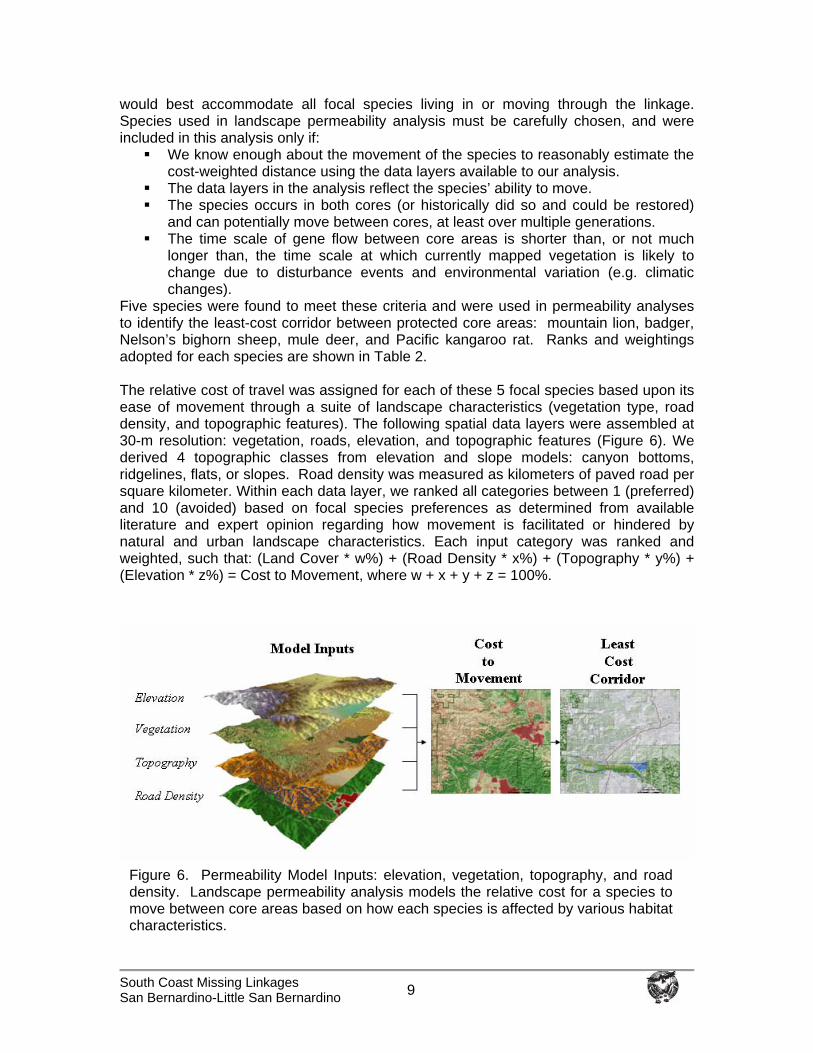
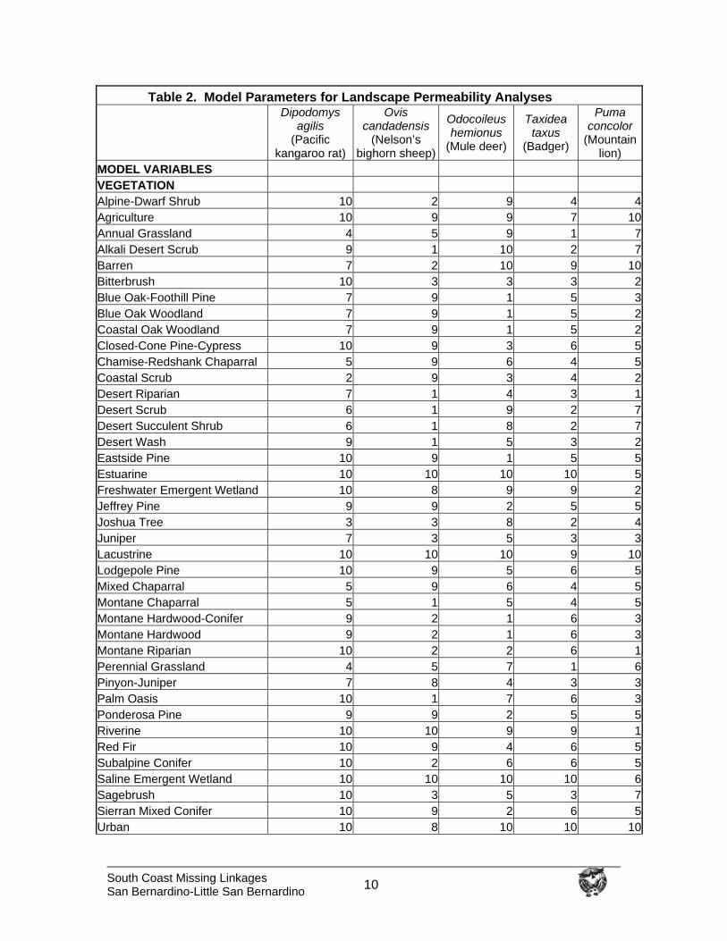
Five species were found to meet these criteria and were used in permeability analyses to identify the least-cost corridor between protected core areas: mountain lion, badger, Nelson’s bighorn sheep, mule deer, and Pacific kangaroo rat. Ranks and weightings adopted for each species are shown in Table 2. The relative cost of travel was assigned for each of these 5 focal species based upon its ease of movement through a suite of landscape characteristics (vegetation type, road density, and topographic features). The following spatial data layers were assembled at 30-m resolution: vegetation, roads, elevation, and topographic features (Figure 6). We derived 4 topographic classes from elevation and slope models: canyon bottoms, ridgelines, flats, or slopes. Road density was measured as kilometers of paved road per square kilometer. Within each data layer, we ranked all categories between 1 (preferred) and 10 (avoided) based on focal species preferences as determined from available literature and expert opinion regarding how movement is facilitated or hindered by natural and urban landscape characteristics. Each input category was ranked and weighted, such that: (Land Cover * w%) + (Road Density * x%) + (Topography * y%) + (Elevation * z%) = Cost to Movement, where w + x + y + z = 100%.
Figure 6. Permeability Model Inputs: elevation, vegetation, topography, and road density. Landscape permeability analysis models the relative cost for a species to move between core areas based on how each species is affected by various habitat characteristics.
South Coast Missing Linkages San Bernardino-Little San Bernardino 10
Table 2. Model Parameters for Landscape Permeability Analyses
Dipodomys agilis
(Pacific kangaroo rat)
Ovis candadensis
(Nelson’s bighorn sheep)
Odocoileus hemionus
(Mule deer)
Taxidea taxus
(Badger)
Puma concolor
(Mountain lion)
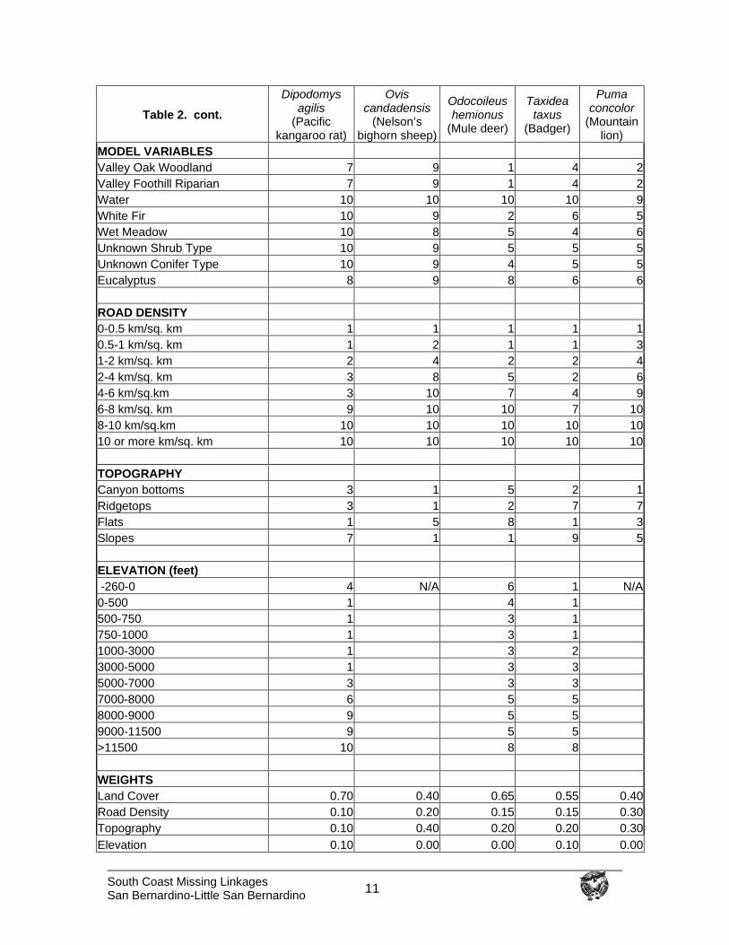
MODEL VARIABLES VEGETATION Alpine-Dwarf Shrub 10 2 9 4 4Agriculture 10 9 9 7 10Annual Grassland 4 5 9 1 7Alkali Desert Scrub 9 1 10 2 7Barren 7 2 10 9 10Bitterbrush 10 3 3 3 2Blue Oak-Foothill Pine 7 9 1 5 3Blue Oak Woodland 7 9 1 5 2Coastal Oak Woodland 7 9 1 5 2Closed-Cone Pine-Cypress 10 9 3 6 5Chamise-Redshank Chaparral 5 9 6 4 5Coastal Scrub 2 9 3 4 2Desert Riparian 7 1 4 3 1Desert Scrub 6 1 9 2 7Desert Succulent Shrub 6 1 8 2 7Desert Wash 9 1 5 3 2Eastside Pine 10 9 1 5 5Estuarine 10 10 10 10 5Freshwater Emergent Wetland 10 8 9 9 2Jeffrey Pine 9 9 2 5 5Joshua Tree 3 3 8 2 4Juniper 7 3 5 3 3Lacustrine 10 10 10 9 10Lodgepole Pine 10 9 5 6 5Mixed Chaparral 5 9 6 4 5Montane Chaparral 5 1 5 4 5Montane Hardwood-Conifer 9 2 1 6 3Montane Hardwood 9 2 1 6 3Montane Riparian 10 2 2 6 1Perennial Grassland 4 5 7 1 6Pinyon-Juniper 7 8 4 3 3Palm Oasis 10 1 7 6 3Ponderosa Pine 9 9 2 5 5Riverine 10 10 9 9 1Red Fir 10 9 4 6 5Subalpine Conifer 10 2 6 6 5Saline Emergent Wetland 10 10 10 10 6Sagebrush 10 3 5 3 7Sierran Mixed Conifer 10 9 2 6 5Urban 10 8 10 10 10
South Coast Missing Linkages San Bernardino-Little San Bernardino 11
Table 2. cont. Dipodomys
agilis (Pacific
kangaroo rat)
Ovis candadensis
(Nelson’s bighorn sheep)
Odocoileus hemionus
(Mule deer)
Taxidea taxus
(Badger)
Puma concolor
(Mountain lion)
MODEL VARIABLES Valley Oak Woodland 7 9 1 4 2Valley Foothill Riparian 7 9 1 4 2Water 10 10 10 10 9White Fir 10 9 2 6 5Wet Meadow 10 8 5 4 6Unknown Shrub Type 10 9 5 5 5Unknown Conifer Type 10 9 4 5 5Eucalyptus 8 9 8 6 6 ROAD DENSITY 0-0.5 km/sq. km 1 1 1 1 10.5-1 km/sq. km 1 2 1 1 31-2 km/sq. km 2 4 2 2 42-4 km/sq. km 3 8 5 2 64-6 km/sq.km 3 10 7 4 96-8 km/sq. km 9 10 10 7 108-10 km/sq.km 10 10 10 10 1010 or more km/sq. km 10 10 10 10 10 TOPOGRAPHY Canyon bottoms 3 1 5 2 1Ridgetops 3 1 2 7 7Flats 1 5 8 1 3Slopes 7 1 1 9 5 ELEVATION (feet) -260-0 4 N/A 6 1 N/A0-500 1 4 1 500-750 1 3 1 750-1000 1 3 1 1000-3000 1 3 2 3000-5000 1 3 3 5000-7000 3 3 3 7000-8000 6 5 5 8000-9000 9 5 5 9000-11500 9 5 5 >11500 10 8 8 WEIGHTS Land Cover 0.70 0.40 0.65 0.55 0.40Road Density 0.10 0.20 0.15 0.15 0.30Topography 0.10 0.40 0.20 0.20 0.30Elevation 0.10 0.00 0.00 0.10 0.00
South Coast Missing Linkages San Bernardino-Little San Bernardino 12
Weighting allowed the model to capture variation in the influence of each input (vegetation, road density, topography, elevation) on focal species movements. A unique cost surface was thus developed for each species. A corridor function was then performed in GIS to generate a data layer showing the relative degree of permeability between core areas. Running the permeability analysis required identifying the endpoints to be connected. Usually, these targeted endpoints are selected as medium to highly suitable habitat within protected core habitat areas (e.g., National Forests, State Parks) that needed to be connected through currently unprotected lands. However, since much of the land in the linkage was already protected (i.e., Bureau of Land Management, Department of Fish and Game, and The Wildlands Conservancy), we selected endpoints for this analysis as areas supporting medium to highly suitable habitat for each species in the San Bernardino National Forest and Joshua Tree National Park, near the far eastern and western extents of the study area. This gave the model broad latitude in interpreting functional corridors across the entire study area. For each focal species, the most permeable area of the study window was designated as the least-cost corridor. The least-cost corridor output for all 5 species was then combined to generate a Least Cost Union. The biological significance of this Union can best be described as the zone within which all 5 modeled species would encounter the least energy expenditure (i.e., preferred travel route) and the most favorable habitat as they move between targeted roadless areas. The output does not identify barriers (which were later identified through fieldwork), mortality risks, dispersal limitations or other biologically significant processes that could prevent a species from successfully reaching a core area. Rather, it identifies the best zone available for focal species movement based on the data layers used in the analyses. Patch Size & Configuration Analysis Although the Least-Cost Union identifies the best zone available for movement based on the data layers used in the analyses, it does not address whether suitable habitat in the Union occurs in large enough patches to support viable populations and whether these patches are close enough together to allow for inter-patch dispersal. We therefore conducted patch size and configuration analyses for all focal species (Table 1) and adjusted the boundaries of the Least-Cost Union where necessary to enhance the likelihood of movement. Patch size and configuration analyses are particularly important for species that require multiple generations to traverse the linkage. Many species exhibit metapopulation dynamics, whereby the long-term persistence of a local population requires connection to other populations (Hanski and Gilpin 1991). For relatively sedentary species like Pacific kangaroo rat and terrestrial insects, gene flow will occur over decades through a metapopulation. Thus, the linkage must be able to accommodate metapopulation dynamics to support ecological and evolutionary processes in the long term. A habitat suitability model formed the basis of the patch size and configuration analyses. Habitat suitability models were developed for each focal species using the literature and expert opinion. Spatial data layers used in the analysis varied by species and included: vegetation, elevation, topographic features, slope, aspect, hydrography, and soils. Using scoring and weighting schemes similar to those described in the previous section, we
South Coast Missing Linkages San Bernardino-Little San Bernardino 13
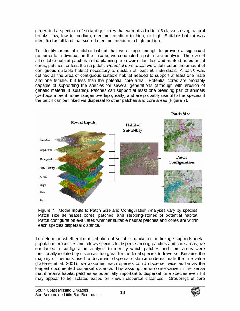
generated a spectrum of suitability scores that were divided into 5 classes using natural breaks: low, low to medium, medium, medium to high, or high. Suitable habitat was identified as all land that scored medium, medium to high, or high. To identify areas of suitable habitat that were large enough to provide a significant resource for individuals in the linkage, we conducted a patch size analysis. The size of all suitable habitat patches in the planning area were identified and marked as potential cores, patches, or less than a patch. Potential core areas were defined as the amount of contiguous suitable habitat necessary to sustain at least 50 individuals. A patch was defined as the area of contiguous suitable habitat needed to support at least one male and one female, but less than the potential core area. Potential cores are probably capable of supporting the species for several generations (although with erosion of genetic material if isolated). Patches can support at least one breeding pair of animals (perhaps more if home ranges overlap greatly) and are probably useful to the species if the patch can be linked via dispersal to other patches and core areas (Figure 7).
To determine whether the distribution of suitable habitat in the linkage supports meta-population processes and allows species to disperse among patches and core areas, we conducted a configuration analysis to identify which patches and core areas were functionally isolated by distances too great for the focal species to traverse. Because the majority of methods used to document dispersal distance underestimate the true value (LaHaye et al. 2001), we assumed each species could disperse twice as far as the longest documented dispersal distance. This assumption is conservative in the sense that it retains habitat patches as potentially important to dispersal for a species even if it may appear to be isolated based on known dispersal distances. Groupings of core
Figure 7. Model Inputs to Patch Size and Configuration Analyses vary by species. Patch size delineates cores, patches, and stepping-stones of potential habitat. Patch configuration evaluates whether suitable habitat patches and cores are within each species dispersal distance.
South Coast Missing Linkages San Bernardino-Little San Bernardino 14
areas and patches that were greater than the adopted dispersal distance from other suitable habitat were identified using a unique color. For each species we compared the configuration and extent of potential cores and patches, relative to the species dispersal ability, to evaluate whether the Least Cost Union was likely to serve the species. If necessary, we added additional habitat to help ensure that the linkage provides sufficient live-in or “move-through” habitat for the species’ needs. Minimum Linkage Width While the size and distance among habitats (addressed by patch size and configuration analyses) must be adequate to support species movement, the shape of those habitats also plays a key role. In particular, constriction points—areas where habitats have been narrowed by surrounding development—can prevent organisms from moving through the Least-Cost Union. To ensure that functional processes are protected, we imposed a minimum width of 2 km (1.2 mi) for all portions of the final Linkage Design. For a variety of species, including those we did not formally model, a wide linkage helps ensure availability of appropriate habitat, host plants (e.g., for butterflies), pollinators, and areas with low predation risk. In addition, fires and floods are part of the natural disturbance regime and a wide linkage allows for a semblance of these natural disturbances to operate with minimal constraints from adjacent urban areas. A wide linkage also enhances the ability of the biota to respond to climate change, and buffers against edge effects. Field Investigations We conducted field surveys to ground-truth existing habitat conditions, document existing barriers and potential passageways, and describe restoration opportunities. All location data were recorded using a mobile GIS/GPS with ESRI’s ArcPad. Because paved roads often present the most formidable potential barriers, biologists drove or walked each accessible section of road that transected the linkage. All types of potential crossing structures (e.g., bridge, underpass, overpass, culvert, pipe) were photo documented and measured. Data taken for each crossing included: shape; height, width, and length of the passageway; stream type, if applicable (perennial or intermittent); floor type (metal, dirt, concrete, natural); passageway construction (concrete, metal, other); visibility to other side; light level; fencing; and vegetative community within and/or adjacent to the passageway. Existing highways and crossing structures are not considered permanent landscape features. In particular, crossing structures can be added or improved during projects to widen and realign highways and interchanges. Therefore, we also identified areas where crossing structures could be improved or installed, and opportunities to restore vegetation to improve road crossings and minimize roadkills. Identify Conservation Opportunities The Linkage Design serves as the target area for linkage conservation opportunities. We provided biological and land use summaries, and identified implementation opportunities for agencies, organizations, and individuals interested in helping conserve the San Bernardino-Little San Bernardino Linkage. Biological and land use summaries include

South Coast Missing Linkages San Bernardino-Little San Bernardino 15
descriptions and maps of vegetation, land cover, roads, road crossings, and restoration opportunities. We also identified existing planning efforts addressing the conservation and use of natural resources in the planning area. Finally, we developed a flyover animation using aerial imagery, satellite imagery, and digital elevations models, which provides a visualization of the linkage from a landscape perspective (Appendix C).

South Coast Missing Linkages Project San Bernardino-Little San Bernardino
16
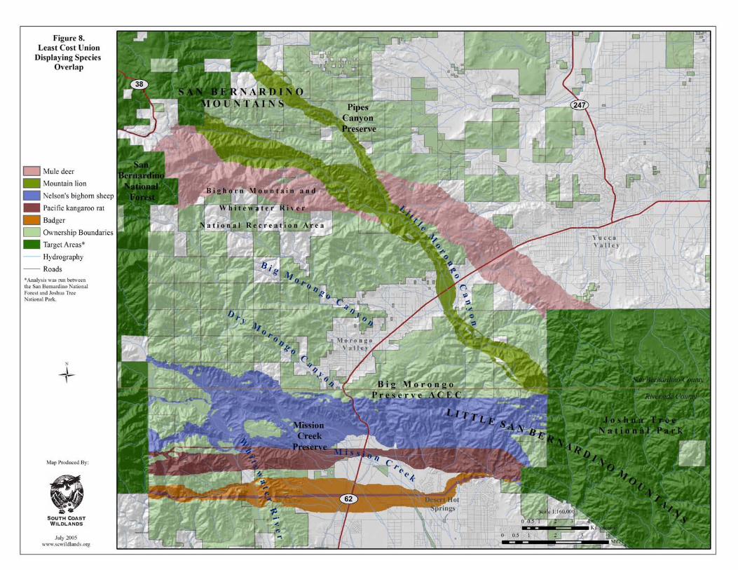
Landscape Permeability Analyses
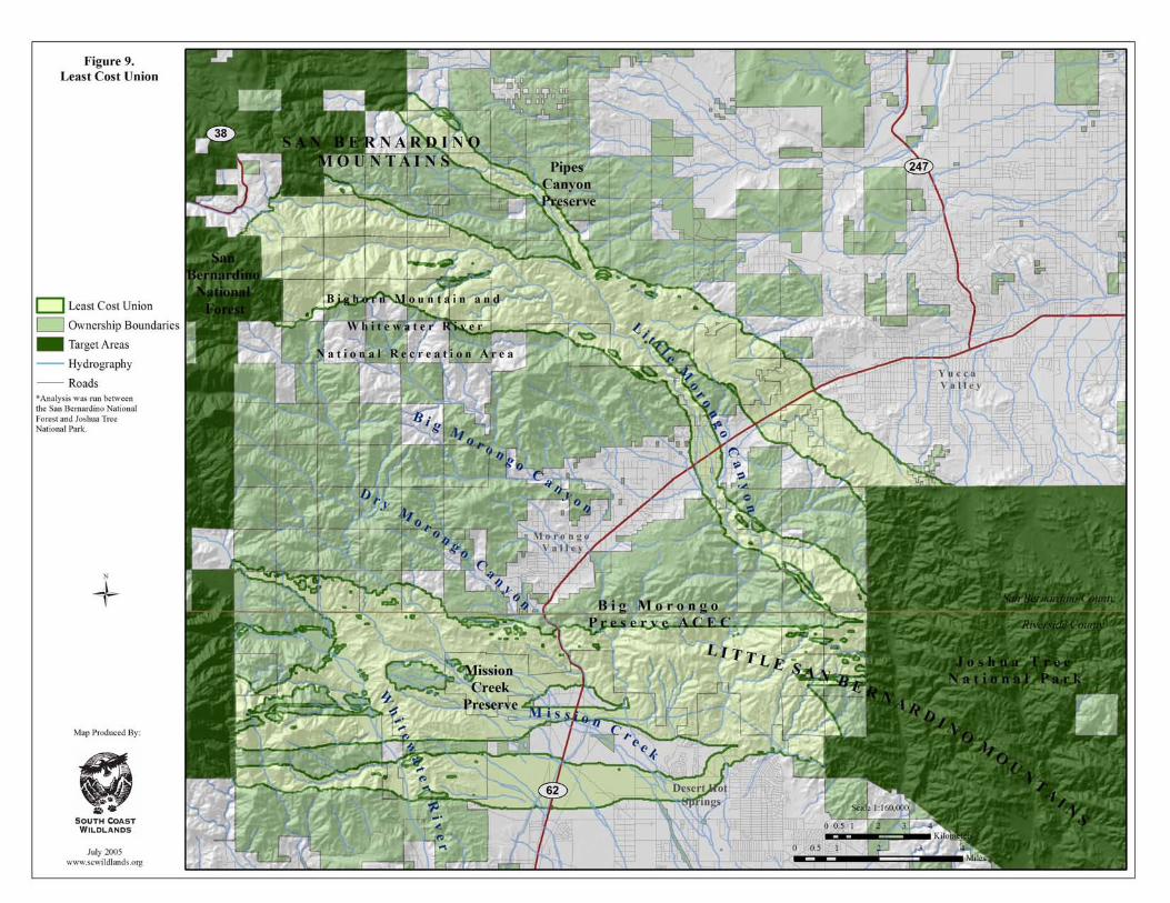
We conducted landscape permeability analyses for 5 focal species (mountain lion, American badger, Nelson’s bighorn sheep, mule deer, and Pacific kangaroo rat). The least cost corridors for these 5 species were quite distinct due to their diverse ecological and movement requirements (see following species accounts and Table 2). However, the most permeable paths for most focal species converged and overlapped considerably in the northern and central part of the linkage, with one species, American badger, diverging to generate an additional route containing their preferred habitat (Figure 8). The Least Cost Union (i.e., the union of the least cost corridors for all 5 species) stretches about 29 km (18 mi) between San Bernardino National Forest and Joshua Tree National Park. It encompasses diverse vegetation and physiographic zones to account for the needs of the focal species, including pinyon-juniper woodland, Joshua tree woodland and desert riparian habitats in and near Little Morongo Canyon, steep desert scrub topography near Dry Morongo Canyon, and the transition to gently sloping desert communities along the southern edge of these ranges (Figure 9). The several branches of the least cost union reflect the distribution of habitat for the various target species, and encompass a variety of vegetation communities and topographic features. Pinyon-juniper and Joshua tree woodland habitats dominate the upper branch of the Union, which ranges in width from about 0.5 to 5 km (0.31-3.1 mi), and includes portions of Pipes Canyon and Little Morongo Canyon west of State Route 62. The upper branch diverges to cross State Route 62 in two places, one following natural upland habitats between the communities of east Morongo Valley and Yucca Valley heading towards Burnt Mountain and Long Canyon in Joshua Tree National Park, the other crossing at Little Morongo Creek and then entering Long Canyon. The central branch of the Union also ranges in width from about 0.5 to 5 km (0.31-3.1 mi), and encompasses both riparian and upland habitats. It follows a series of ridges and valleys, including portions of Whitewater River, Mission Creek, and Dry, Big, and Little Morongo canyons. It crosses State Route 62 in the gently sloping topography of Mission Creek and in the steepest terrain along this route. The southern branch of the Union includes desert scrub and creosote scrub habitats, and ranges in width from 0.5 to 2.5 km (0.31-1.5 mi). It extends from Stubbe Canyon in the foothills of the San Bernardino Mountains through portions of Cottonwood and Whitewater canyons into the desert wash habitats of lower Mission Creek and Big Morongo Canyon Wash before entering Joshua Tree National Park. The next several pages summarize the permeability analyses for each of the 5-modeled species. For convenience, the narratives describe the most permeable paths from west to east; although our analyses, gave equal weight to movements in both directions. The following section (Patch Size and Configuration Analyses) describes how well the Least Cost Union would likely serve the needs of all focal species, including those for which we could not conduct permeability analysis. The latter analyses expanded the Least Cost Union to provide for critical live-in and/or move-through habitat for particular focal species.
South Coast Missing Linkages Project San Bernardino-Little San Bernardino
17
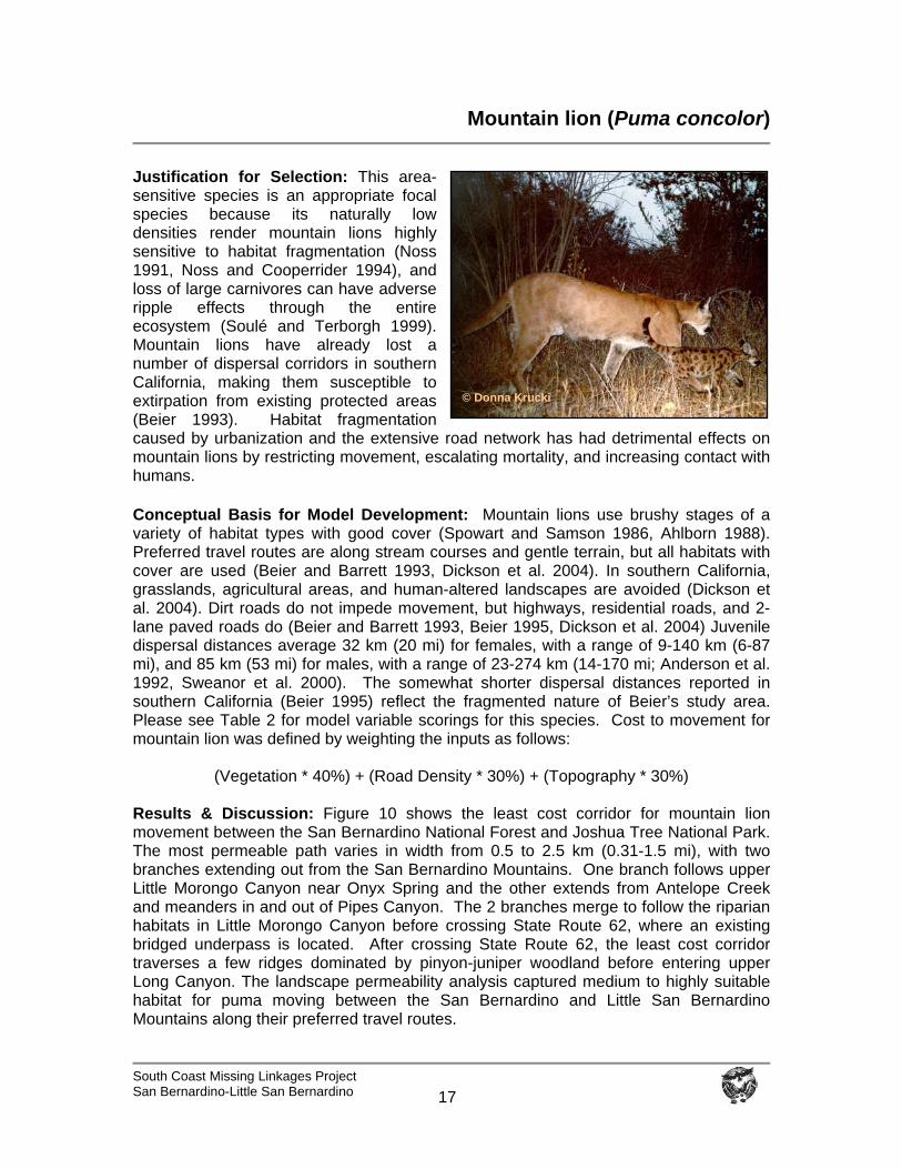
Mountain lion (Puma concolor)
Justification for Selection: This area-sensitive species is an appropriate focal species because its naturally low densities render mountain lions highly sensitive to habitat fragmentation (Noss 1991, Noss and Cooperrider 1994), and loss of large carnivores can have adverse ripple effects through the entire ecosystem (Soulé and Terborgh 1999). Mountain lions have already lost a number of dispersal corridors in southern California, making them susceptible to extirpation from existing protected areas (Beier 1993). Habitat fragmentation caused by urbanization and the extensive road network has had detrimental effects on mountain lions by restricting movement, escalating mortality, and increasing contact with humans. Conceptual Basis for Model Development: Mountain lions use brushy stages of a variety of habitat types with good cover (Spowart and Samson 1986, Ahlborn 1988). Preferred travel routes are along stream courses and gentle terrain, but all habitats with cover are used (Beier and Barrett 1993, Dickson et al. 2004). In southern California, grasslands, agricultural areas, and human-altered landscapes are avoided (Dickson et al. 2004). Dirt roads do not impede movement, but highways, residential roads, and 2-lane paved roads do (Beier and Barrett 1993, Beier 1995, Dickson et al. 2004) Juvenile dispersal distances average 32 km (20 mi) for females, with a range of 9-140 km (6-87 mi), and 85 km (53 mi) for males, with a range of 23-274 km (14-170 mi; Anderson et al. 1992, Sweanor et al. 2000). The somewhat shorter dispersal distances reported in southern California (Beier 1995) reflect the fragmented nature of Beier’s study area. Please see Table 2 for model variable scorings for this species. Cost to movement for mountain lion was defined by weighting the inputs as follows:
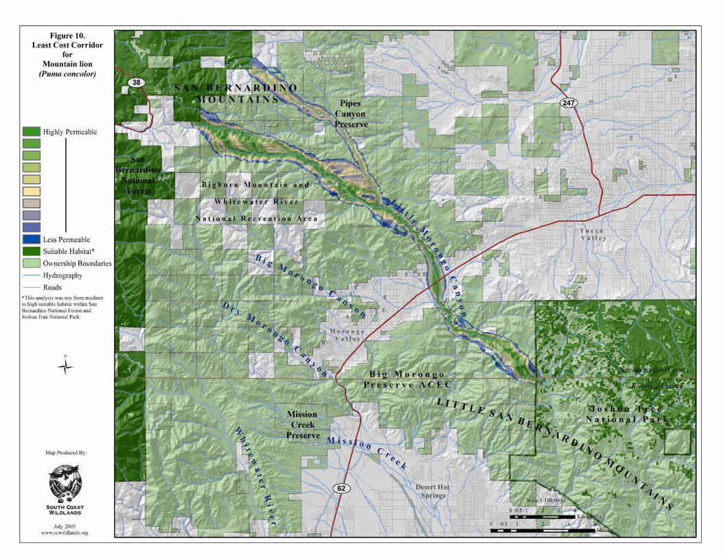
(Vegetation * 40%) + (Road Density * 30%) + (Topography * 30%) Results & Discussion: Figure 10 shows the least cost corridor for mountain lion movement between the San Bernardino National Forest and Joshua Tree National Park. The most permeable path varies in width from 0.5 to 2.5 km (0.31-1.5 mi), with two branches extending out from the San Bernardino Mountains. One branch follows upper Little Morongo Canyon near Onyx Spring and the other extends from Antelope Creek and meanders in and out of Pipes Canyon. The 2 branches merge to follow the riparian habitats in Little Morongo Canyon before crossing State Route 62, where an existing bridged underpass is located. After crossing State Route 62, the least cost corridor traverses a few ridges dominated by pinyon-juniper woodland before entering upper Long Canyon. The landscape permeability analysis captured medium to highly suitable habitat for puma moving between the San Bernardino and Little San Bernardino Mountains along their preferred travel routes.
© Donna Krucki
South Coast Missing Linkages Project San Bernardino-Little San Bernardino
18
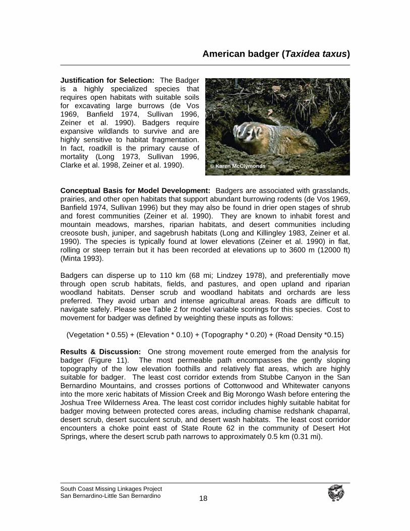
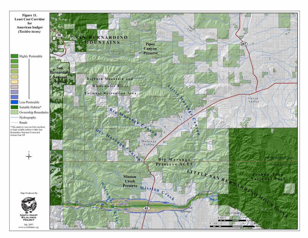
American badger (Taxidea taxus)
Justification for Selection: The Badger is a highly specialized species that requires open habitats with suitable soils for excavating large burrows (de Vos 1969, Banfield 1974, Sullivan 1996, Zeiner et al. 1990). Badgers require expansive wildlands to survive and are highly sensitive to habitat fragmentation. In fact, roadkill is the primary cause of mortality (Long 1973, Sullivan 1996, Clarke et al. 1998, Zeiner et al. 1990). Conceptual Basis for Model Development: Badgers are associated with grasslands, prairies, and other open habitats that support abundant burrowing rodents (de Vos 1969, Banfield 1974, Sullivan 1996) but they may also be found in drier open stages of shrub and forest communities (Zeiner et al. 1990). They are known to inhabit forest and mountain meadows, marshes, riparian habitats, and desert communities including creosote bush, juniper, and sagebrush habitats (Long and Killingley 1983, Zeiner et al. 1990). The species is typically found at lower elevations (Zeiner et al. 1990) in flat, rolling or steep terrain but it has been recorded at elevations up to 3600 m (12000 ft) (Minta 1993). Badgers can disperse up to 110 km (68 mi; Lindzey 1978), and preferentially move through open scrub habitats, fields, and pastures, and open upland and riparian woodland habitats. Denser scrub and woodland habitats and orchards are less preferred. They avoid urban and intense agricultural areas. Roads are difficult to navigate safely. Please see Table 2 for model variable scorings for this species. Cost to movement for badger was defined by weighting these inputs as follows:
(Vegetation * 0.55) + (Elevation * 0.10) + (Topography * 0.20) + (Road Density *0.15) Results & Discussion: One strong movement route emerged from the analysis for badger (Figure 11). The most permeable path encompasses the gently sloping topography of the low elevation foothills and relatively flat areas, which are highly suitable for badger. The least cost corridor extends from Stubbe Canyon in the San Bernardino Mountains, and crosses portions of Cottonwood and Whitewater canyons into the more xeric habitats of Mission Creek and Big Morongo Wash before entering the Joshua Tree Wilderness Area. The least cost corridor includes highly suitable habitat for badger moving between protected cores areas, including chamise redshank chaparral, desert scrub, desert succulent scrub, and desert wash habitats. The least cost corridor encounters a choke point east of State Route 62 in the community of Desert Hot Springs, where the desert scrub path narrows to approximately 0.5 km (0.31 mi).
© Karen McClymonds
South Coast Missing Linkages Project San Bernardino-Little San Bernardino
19
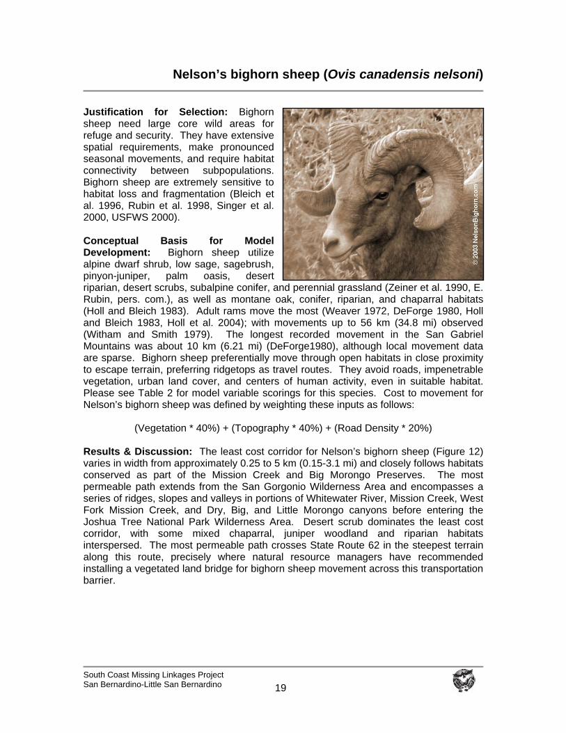
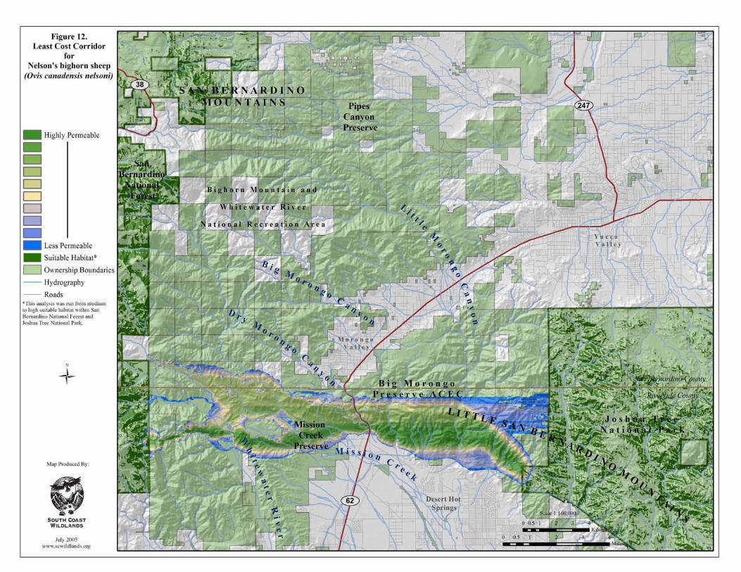
Nelson’s bighorn sheep (Ovis canadensis nelsoni)
Justification for Selection: Bighorn sheep need large core wild areas for refuge and security. They have extensive spatial requirements, make pronounced seasonal movements, and require habitat connectivity between subpopulations. Bighorn sheep are extremely sensitive to habitat loss and fragmentation (Bleich et al. 1996, Rubin et al. 1998, Singer et al. 2000, USFWS 2000). Conceptual Basis for Model Development: Bighorn sheep utilize alpine dwarf shrub, low sage, sagebrush, pinyon-juniper, palm oasis, desert riparian, desert scrubs, subalpine conifer, and perennial grassland (Zeiner et al. 1990, E. Rubin, pers. com.), as well as montane oak, conifer, riparian, and chaparral habitats (Holl and Bleich 1983). Adult rams move the most (Weaver 1972, DeForge 1980, Holl and Bleich 1983, Holl et al. 2004); with movements up to 56 km (34.8 mi) observed (Witham and Smith 1979). The longest recorded movement in the San Gabriel Mountains was about 10 km (6.21 mi) (DeForge1980), although local movement data are sparse. Bighorn sheep preferentially move through open habitats in close proximity to escape terrain, preferring ridgetops as travel routes. They avoid roads, impenetrable vegetation, urban land cover, and centers of human activity, even in suitable habitat. Please see Table 2 for model variable scorings for this species. Cost to movement for Nelson’s bighorn sheep was defined by weighting these inputs as follows:
(Vegetation * 40%) + (Topography * 40%) + (Road Density * 20%)
Results & Discussion: The least cost corridor for Nelson’s bighorn sheep (Figure 12) varies in width from approximately 0.25 to 5 km (0.15-3.1 mi) and closely follows habitats conserved as part of the Mission Creek and Big Morongo Preserves. The most permeable path extends from the San Gorgonio Wilderness Area and encompasses a series of ridges, slopes and valleys in portions of Whitewater River, Mission Creek, West Fork Mission Creek, and Dry, Big, and Little Morongo canyons before entering the Joshua Tree National Park Wilderness Area. Desert scrub dominates the least cost corridor, with some mixed chaparral, juniper woodland and riparian habitats interspersed. The most permeable path crosses State Route 62 in the steepest terrain along this route, precisely where natural resource managers have recommended installing a vegetated land bridge for bighorn sheep movement across this transportation barrier.
South Coast Missing Linkages Project San Bernardino-Little San Bernardino
20
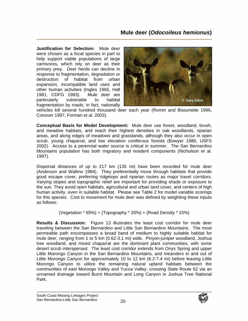
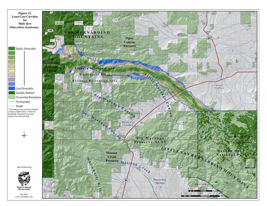
Mule deer (Odocoileus hemionus)
Justification for Selection: Mule deer were chosen as a focal species in part to help support viable populations of large carnivores, which rely on deer as their primary prey. Deer herds can decline in response to fragmentation, degradation or destruction of habitat from urban expansion, incompatible land uses and other human activities (Ingles 1965, Hall 1981, CDFG 1983). Mule deer are particularly vulnerable to habitat fragmentation by roads; in fact, nationally vehicles kill several hundred thousand deer each year (Romin and Bissonette 1996, Conover 1997, Forman et al. 2003). Conceptual Basis for Model Development: Mule deer use forest, woodland, brush, and meadow habitats, and reach their highest densities in oak woodlands, riparian areas, and along edges of meadows and grasslands, although they also occur in open scrub, young chaparral, and low elevation coniferous forests (Bowyer 1986, USFS 2002). Access to a perennial water source is critical in summer. The San Bernardino Mountains population has both migratory and resident components (Nicholson et al. 1997). Dispersal distances of up to 217 km (135 mi) have been recorded for mule deer (Anderson and Wallmo 1984). They preferentially move through habitats that provide good escape cover, preferring ridgetops and riparian routes as major travel corridors. Varying slopes and topographic relief are important for providing shade or exposure to the sun. They avoid open habitats, agricultural and urban land cover, and centers of high human activity, even in suitable habitat. Please see Table 2 for model variable scorings for this species. Cost to movement for mule deer was defined by weighting these inputs as follows:
(Vegetation * 65%) + (Topography * 20%) + (Road Density * 15%)
Results & Discussion: Figure 13 illustrates the least cost corridor for mule deer traveling between the San Bernardino and Little San Bernardino Mountains. The most permeable path encompasses a broad band of medium to highly suitable habitat for mule deer, ranging from 1 to 5 km (0.62-3.1 mi) wide. Pinyon-juniper woodland, Joshua tree woodland, and mixed chaparral are the dominant plant communities, with some desert scrub interspersed. The least cost corridor extends from Onyx Spring and upper Little Morongo Canyon in the San Bernardino Mountains, and meanders in and out of Little Morongo Canyon for approximately 10 to 12 km (6.2-7.4 mi) before leaving Little Morongo Canyon to utilize the remaining natural upland habitats between the communities of east Morongo Valley and Yucca Valley, crossing State Route 62 via an unnamed drainage toward Burnt Mountain and Long Canyon in Joshua Tree National Park.
Mike White© Gary Zahm
South Coast Missing Linkages Project San Bernardino-Little San Bernardino
21
Pacific kangaroo rat (Dipodomys agilis)
Justification for Selection: The Pacific kangaroo rat is sensitive to habitat loss and fragmentation. Kangaroo rats may cross some roads but have difficulty navigating wide roads and other barriers (e.g., freeways, agricultural fields and urban areas) and are highly susceptible to roadkill (W. Spencer pers. comm.). Barriers are likely similar to other kangaroo rats (roads, physical barriers, dense grasses, artificial light), but this species is generally more tolerant of tree or shrub cover, and probably better able to navigate through denser vegetation than some other kangaroo rat species (W. Spencer, pers. comm.). Conceptual Basis for Model Development: The Pacific kangaroo rat is associated with a variety of habitats, including coastal sage scrub, chaparral, oak woodland, pinyon-juniper woodland, desert scrub, and annual grassland (Bleich and Price 1995, W. Spencer pers. comm.). They’ve also been recorded in alluvial fan sage scrub (Price et al. 1991) and montane coniferous forests (Sullivan and Best 1997). This species prefers more open areas and is particularly abundant in ecotonal habitats (Meserve 1976, M’Closkey 1976, Price and Kramer 1984, Keeley and Keeley 1988, Price et al. 1991, Goldingay and Price 1997). This kangaroo rat tends to be more mobile than most rodents of its size, and more so than other kangaroo rats. Most information on movements and ecology are very similar to Merriam’s kangaroo rat, although with less supporting literature (W. Spencer pers. comm.). Merriam’s kangaroo rat typically remains within 1-2 territories (100 m [328 ft] or so) of their birthplace, but the species is capable of longer dispersal. Zeng and Brown (1987) recorded long-distance (= dispersal) movements in adults, concluding that these kangaroo rats are opportunistic in moving into newly available territory areas. The Pacific kangaroo rat preferentially moves through open habitat in early successional communities. They avoid roads, densely vegetated communities, and urban areas. Please see Table 2 for model variable scorings for this species. Cost to movement for Pacific kangaroo rat was defined by weighting these inputs as follows:
(Vegetation * 70%) + (Road Density * 10%) + (Topography * 10%) + (Elevation * 10%)
Results & Discussion: The most permeable path for the Pacific kangaroo rat closely follows the southern boundary of the least cost corridor for bighorn sheep, taking in the gently sloping topography of Mission Creek (Figure 14). Another, much narrow route also emerged from the analysis, following the same pathway as the least cost corridor for badger.
USGS, Biological Resource Division
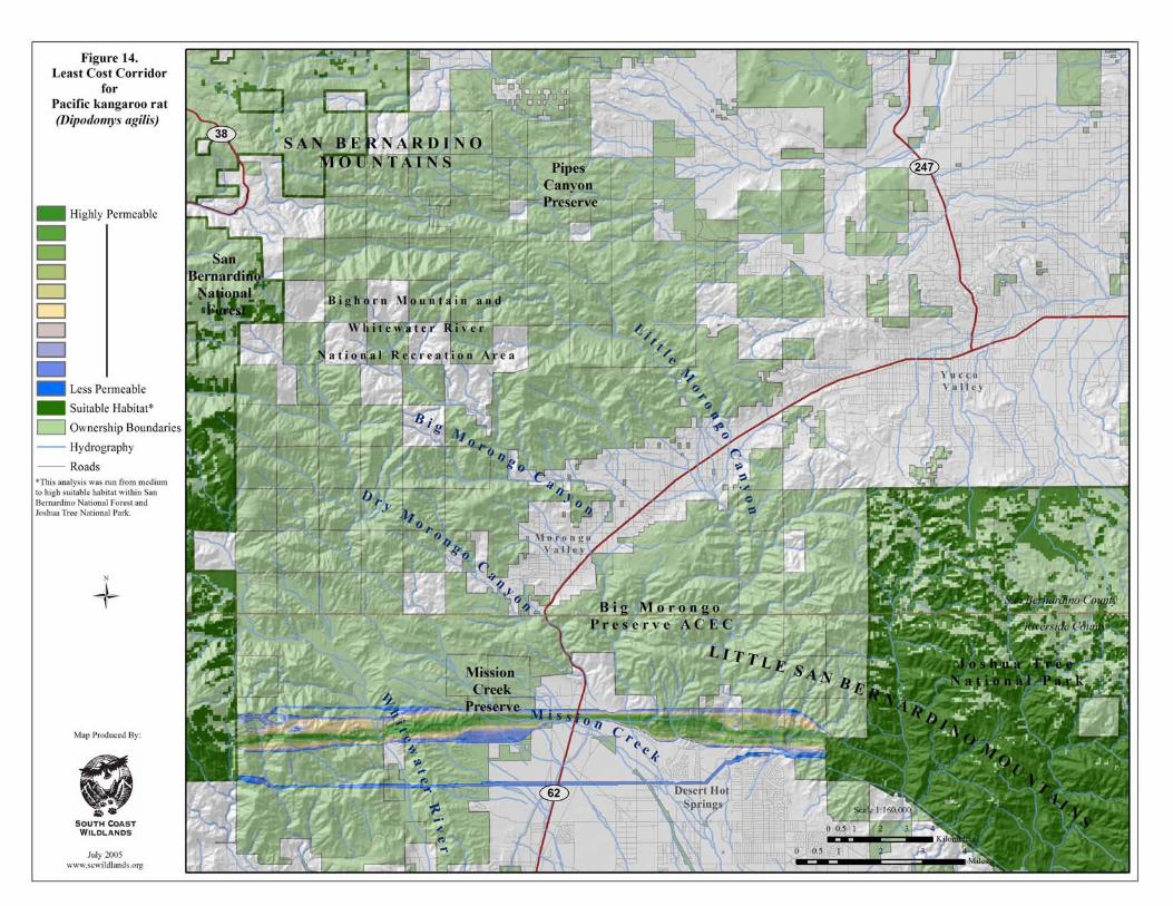

South Coast Missing Linkages Project San Bernardino-Little San Bernardino
22
Patch Size & Configuration Analyses
Although, the permeability models and Least Cost Union delineate swatches of habitat that based on model assumptions and available GIS data are best suited to facilitate species movement between core habitat areas, it does not address whether suitable habitat in the Union occurs in large enough patches to support viable populations or whether patches are close enough together to allow for inter-patch dispersal; and they are based on only 5 of the 22 focal species. We therefore perform habitat suitability; patch size and configuration analyses to evaluate the configuration and extent of potentially suitable habitat in the Least Cost Union for all 22 focal species. This helps determine whether there is sufficient habitat within the Union to support each species, and whether that habitat is distributed in a pattern that allows the species to move between patches. Specifically, the patch size and configuration analysis for all 22 focal species addresses, 1) whether the Least Cost Union provides sufficient live-in or move-through habitat to support individuals or populations of the species; 2) whether these habitat patches are within the species’ dispersal distance; 3) whether any clearly unsuitable and non-restorable habitat (e.g., developed land) should be deleted from the Union; and 4) for any species not adequately served by the Least Cost Union, whether expanding the Union to incorporate more habitat would meet the species needs. The patch size and configuration analysis does not address existing barriers to movement (such as freeways) or land use practices that may prevent species from moving through the linkage. These issues are addressed in the next section. The Least Cost Union contains suitable habitat to support either inter- or intra-generational movements between the San Bernardino and Little San Bernardino ranges for 10 of the 22 modeled focal species: Nelson’s bighorn sheep, mule deer, mountain quail, rock wren, cactus wren, speckled rattlesnake, tarantula hawk, metalmark butterfly, green hairstreak butterfly, and Joshua tree. Outputs from the patch configuration analyses suggest that habitat patches in the Union for 4 species (large-eared woodrat, little pocket mouse, wrentit, and coast horned lizard) may be isolated by distances too great to accommodate their movements. Twelve focal species appear to require additional habitat outside of the Least Cost Union for the Linkage Design to serve their movement needs: mountain lion, American badger, antelope ground squirrel, large-eared woodrat, Merriam’s kangaroo rat, Pacific kangaroo rat, little pocket mouse, wrentit, California treefrog, coast horned lizard, chaparral whipsnake, and white alder. To ensure that the Linkage Design accommodated all focal species, habitat was added to the Union in 5 general areas (Figure 15): Pipes Canyon: The upper branch of the Union, in the Burns Canyon and Pipes Canyon area, was delineated by the landscape permeability analysis for puma, but was very narrow in several locations. We therefore added habitat on either side to achieve a minimum corridor width of 2 km. Little Morongo Canyon: The branch of the Union in Little Morongo Canyon was delineated by the permeability analysis for puma, but was narrow where it crosses Morongo Valley and Highway 62. We therefore widened the linkage to a minimum width
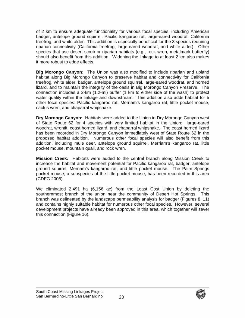
South Coast Missing Linkages Project San Bernardino-Little San Bernardino
23
of 2 km to ensure adequate functionality for various focal species, including American badger, antelope ground squirrel, Pacific kangaroo rat, large-eared woodrat, California treefrog, and white alder. This addition is especially beneficial for the 3 species requiring riparian connectivity (California treefrog, large-eared woodrat, and white alder). Other species that use desert scrub or riparian habitats (e.g., rock wren, metalmark butterfly) should also benefit from this addition. Widening the linkage to at least 2 km also makes it more robust to edge effects. Big Morongo Canyon: The Union was also modified to include riparian and upland habitat along Big Morongo Canyon to preserve habitat and connectivity for California treefrog, white alder, badger, antelope ground squirrel, large-eared woodrat, and horned lizard, and to maintain the integrity of the oasis in Big Morongo Canyon Preserve. The connection includes a 2-km (1.2-mi) buffer (1 km to either side of the wash) to protect water quality within the linkage and downstream. This addition also adds habitat for 5 other focal species: Pacific kangaroo rat, Merriam’s kangaroo rat, little pocket mouse, cactus wren, and chaparral whipsnake. Dry Morongo Canyon: Habitats were added to the Union in Dry Morongo Canyon west of State Route 62 for 4 species with very limited habitat in the Union: large-eared woodrat, wrentit, coast horned lizard, and chaparral whipsnake. The coast horned lizard has been recorded in Dry Morongo Canyon immediately west of State Route 62 in the proposed habitat addition. Numerous other focal species will also benefit from this addition, including mule deer, antelope ground squirrel, Merriam’s kangaroo rat, little pocket mouse, mountain quail, and rock wren. Mission Creek: Habitats were added to the central branch along Mission Creek to increase the habitat and movement potential for Pacific kangaroo rat, badger, antelope ground squirrel, Merriam’s kangaroo rat, and little pocket mouse. The Palm Springs pocket mouse, a subspecies of the little pocket mouse, has been recorded in this area (CDFG 2005). We eliminated 2,491 ha (6,156 ac) from the Least Cost Union by deleting the southernmost branch of the union near the community of Desert Hot Springs. This branch was delineated by the landscape permeability analysis for badger (Figures 8, 11) and contains highly suitable habitat for numerous other focal species. However, several development projects have already been approved in this area, which together will sever this connection (Figure 16).
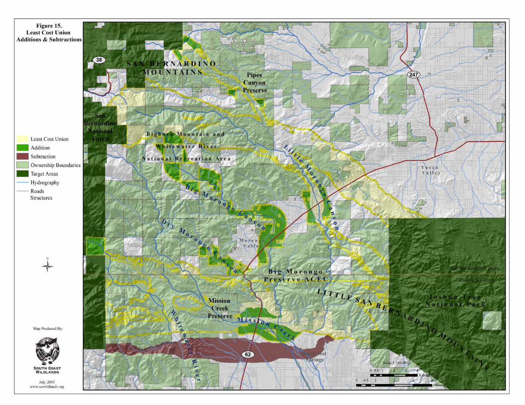

South Coast Missing Linkages San Bernardino-Little San Bernardino
This page intentionally left blank.
South Coast Missing Linkages Project San Bernardino-Little San Bernardino
24
Figure 16. Land in the southern branch of the Least Cost Union that was eliminated from the Linkage Design due to several approved development projects. The top photo shows a 0.5-km wide choke-point of natural habitat leading into Little Morongo Canyon between a golf course and the community of Desert Hot Springs. The flat land in the foreground, above Mission Lakes Drive, is a proposed development site (11.12 acres). The Little San Bernardino Mountains in the background remain conservation targets in the Linkage Design. The middle photo shows the future site of the Village at Mission Lakes development with the San Jacinto Mountains in the background. This approved project is directly south of Mission Lakes Blvd, cattycorner to the top photo. The project is scheduled to be built by spring of 2006. The bottom photo shows the Highland Falls development site west of State Route 62 and north of West Pierson Boulevard, in the vicinity of Devils Garden in the foothills of the San Bernardino Mountains. Massive grading has already commenced on this large-scale development. The net result of additions and subtractions of habitat from the Least Cost Union based on the patch size and configuration analyses was an increase of 1,446 ha (3,574 ac). The following pages summarize the analyses for each focal species.
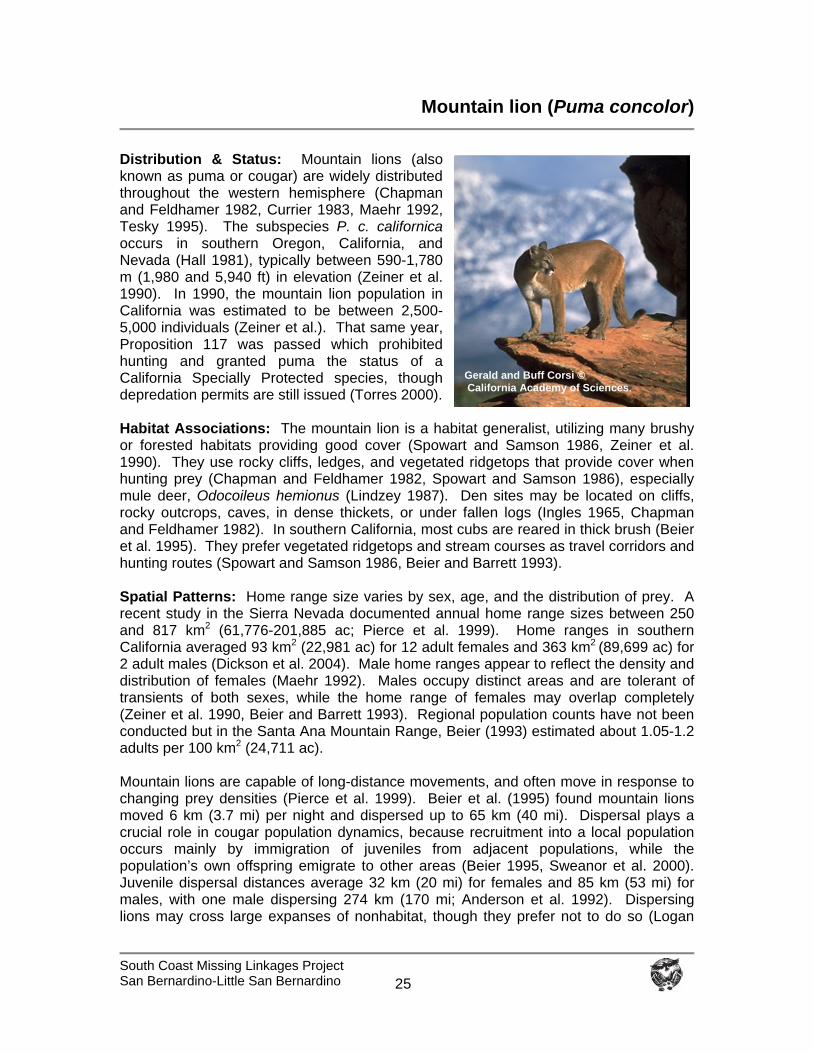
South Coast Missing Linkages Project San Bernardino-Little San Bernardino
25
Mountain lion (Puma concolor)
Distribution & Status: Mountain lions (also known as puma or cougar) are widely distributed throughout the western hemisphere (Chapman and Feldhamer 1982, Currier 1983, Maehr 1992, Tesky 1995). The subspecies P. c. californica occurs in southern Oregon, California, and Nevada (Hall 1981), typically between 590-1,780 m (1,980 and 5,940 ft) in elevation (Zeiner et al. 1990). In 1990, the mountain lion population in California was estimated to be between 2,500-5,000 individuals (Zeiner et al.). That same year, Proposition 117 was passed which prohibited hunting and granted puma the status of a California Specially Protected species, though depredation permits are still issued (Torres 2000). Habitat Associations: The mountain lion is a habitat generalist, utilizing many brushy or forested habitats providing good cover (Spowart and Samson 1986, Zeiner et al. 1990). They use rocky cliffs, ledges, and vegetated ridgetops that provide cover when hunting prey (Chapman and Feldhamer 1982, Spowart and Samson 1986), especially mule deer, Odocoileus hemionus (Lindzey 1987). Den sites may be located on cliffs, rocky outcrops, caves, in dense thickets, or under fallen logs (Ingles 1965, Chapman and Feldhamer 1982). In southern California, most cubs are reared in thick brush (Beier et al. 1995). They prefer vegetated ridgetops and stream courses as travel corridors and hunting routes (Spowart and Samson 1986, Beier and Barrett 1993). Spatial Patterns: Home range size varies by sex, age, and the distribution of prey. A recent study in the Sierra Nevada documented annual home range sizes between 250 and 817 km2 (61,776-201,885 ac; Pierce et al. 1999). Home ranges in southern California averaged 93 km2 (22,981 ac) for 12 adult females and 363 km2 (89,699 ac) for 2 adult males (Dickson et al. 2004). Male home ranges appear to reflect the density and distribution of females (Maehr 1992). Males occupy distinct areas and are tolerant of transients of both sexes, while the home range of females may overlap completely (Zeiner et al. 1990, Beier and Barrett 1993). Regional population counts have not been conducted but in the Santa Ana Mountain Range, Beier (1993) estimated about 1.05-1.2 adults per 100 km2 (24,711 ac). Mountain lions are capable of long-distance movements, and often move in response to changing prey densities (Pierce et al. 1999). Beier et al. (1995) found mountain lions moved 6 km (3.7 mi) per night and dispersed up to 65 km (40 mi). Dispersal plays a crucial role in cougar population dynamics, because recruitment into a local population occurs mainly by immigration of juveniles from adjacent populations, while the population’s own offspring emigrate to other areas (Beier 1995, Sweanor et al. 2000). Juvenile dispersal distances average 32 km (20 mi) for females and 85 km (53 mi) for males, with one male dispersing 274 km (170 mi; Anderson et al. 1992). Dispersing lions may cross large expanses of nonhabitat, though they prefer not to do so (Logan
Gerald and Buff Corsi © California Academy of Sciences.
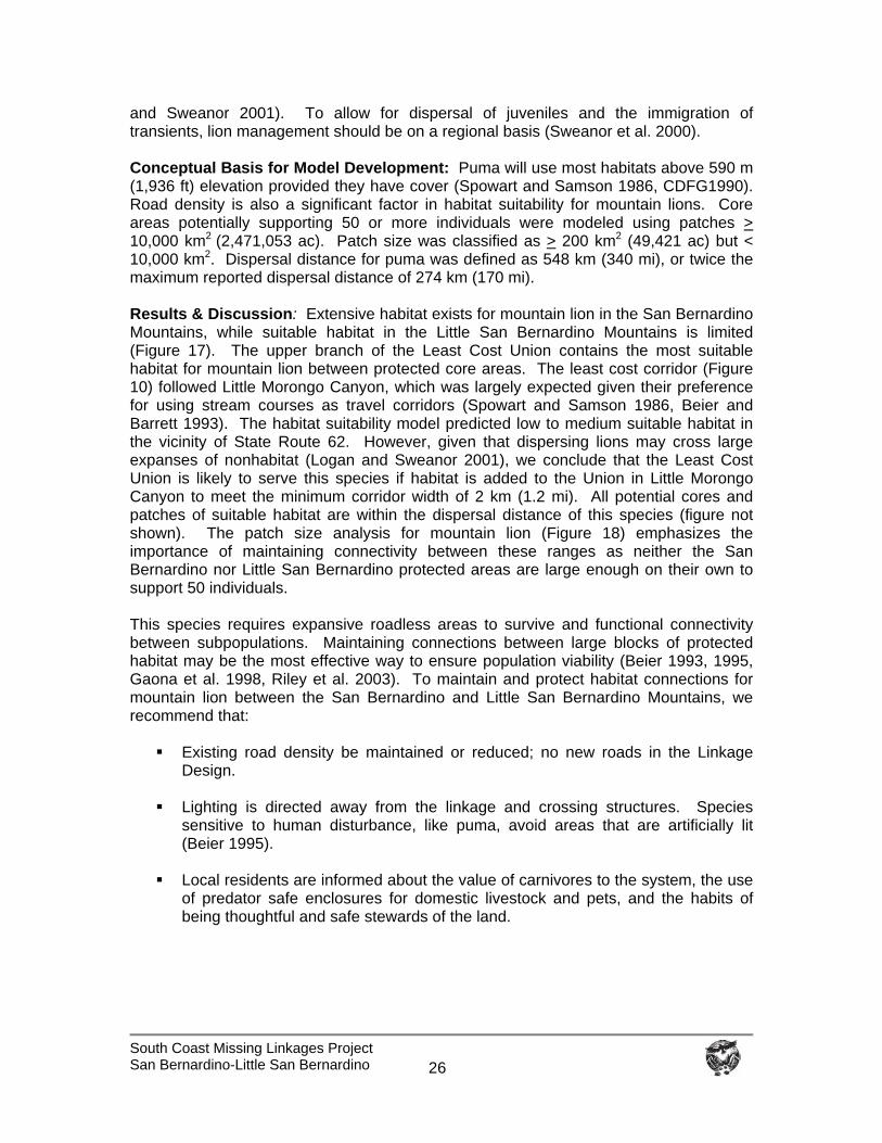
South Coast Missing Linkages Project San Bernardino-Little San Bernardino
26
and Sweanor 2001). To allow for dispersal of juveniles and the immigration of transients, lion management should be on a regional basis (Sweanor et al. 2000). Conceptual Basis for Model Development: Puma will use most habitats above 590 m (1,936 ft) elevation provided they have cover (Spowart and Samson 1986, CDFG1990). Road density is also a significant factor in habitat suitability for mountain lions. Core areas potentially supporting 50 or more individuals were modeled using patches > 10,000 km2 (2,471,053 ac). Patch size was classified as > 200 km2 (49,421 ac) but < 10,000 km2. Dispersal distance for puma was defined as 548 km (340 mi), or twice the maximum reported dispersal distance of 274 km (170 mi). Results & Discussion: Extensive habitat exists for mountain lion in the San Bernardino Mountains, while suitable habitat in the Little San Bernardino Mountains is limited (Figure 17). The upper branch of the Least Cost Union contains the most suitable habitat for mountain lion between protected core areas. The least cost corridor (Figure 10) followed Little Morongo Canyon, which was largely expected given their preference for using stream courses as travel corridors (Spowart and Samson 1986, Beier and Barrett 1993). The habitat suitability model predicted low to medium suitable habitat in the vicinity of State Route 62. However, given that dispersing lions may cross large expanses of nonhabitat (Logan and Sweanor 2001), we conclude that the Least Cost Union is likely to serve this species if habitat is added to the Union in Little Morongo Canyon to meet the minimum corridor width of 2 km (1.2 mi). All potential cores and patches of suitable habitat are within the dispersal distance of this species (figure not shown). The patch size analysis for mountain lion (Figure 18) emphasizes the importance of maintaining connectivity between these ranges as neither the San Bernardino nor Little San Bernardino protected areas are large enough on their own to support 50 individuals. This species requires expansive roadless areas to survive and functional connectivity between subpopulations. Maintaining connections between large blocks of protected habitat may be the most effective way to ensure population viability (Beier 1993, 1995, Gaona et al. 1998, Riley et al. 2003). To maintain and protect habitat connections for mountain lion between the San Bernardino and Little San Bernardino Mountains, we recommend that:
Existing road density be maintained or reduced; no new roads in the Linkage Design.
Lighting is directed away from the linkage and crossing structures. Species
sensitive to human disturbance, like puma, avoid areas that are artificially lit (Beier 1995).
Local residents are informed about the value of carnivores to the system, the use
of predator safe enclosures for domestic livestock and pets, and the habits of being thoughtful and safe stewards of the land.
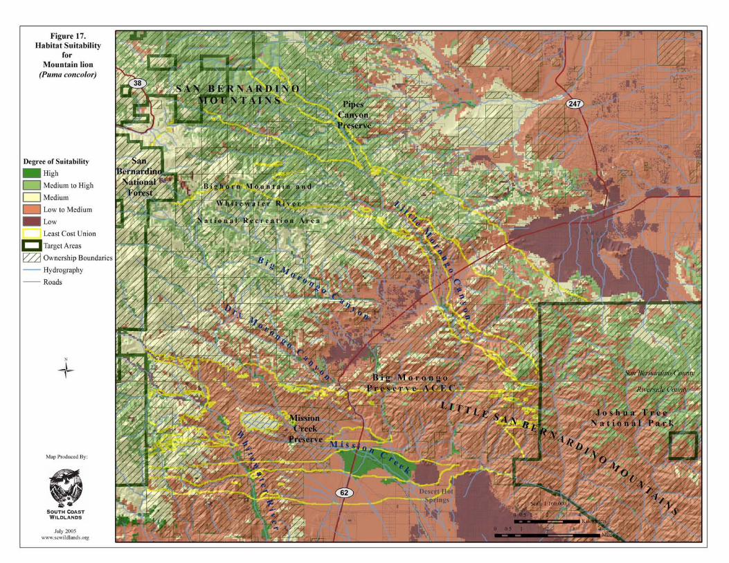
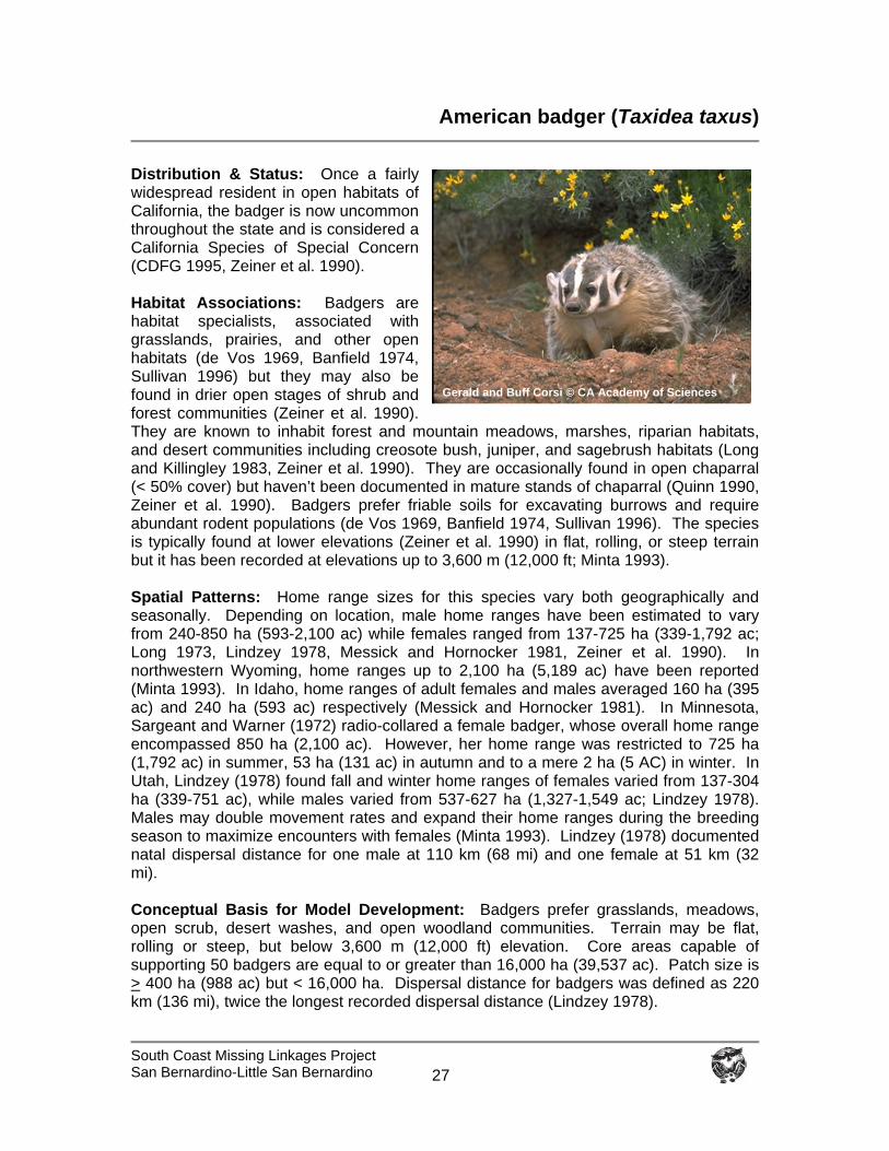
South Coast Missing Linkages Project San Bernardino-Little San Bernardino
27
American badger (Taxidea taxus)
Distribution & Status: Once a fairly widespread resident in open habitats of California, the badger is now uncommon throughout the state and is considered a California Species of Special Concern (CDFG 1995, Zeiner et al. 1990). Habitat Associations: Badgers are habitat specialists, associated with grasslands, prairies, and other open habitats (de Vos 1969, Banfield 1974, Sullivan 1996) but they may also be found in drier open stages of shrub and forest communities (Zeiner et al. 1990). They are known to inhabit forest and mountain meadows, marshes, riparian habitats, and desert communities including creosote bush, juniper, and sagebrush habitats (Long and Killingley 1983, Zeiner et al. 1990). They are occasionally found in open chaparral (< 50% cover) but haven’t been documented in mature stands of chaparral (Quinn 1990, Zeiner et al. 1990). Badgers prefer friable soils for excavating burrows and require abundant rodent populations (de Vos 1969, Banfield 1974, Sullivan 1996). The species is typically found at lower elevations (Zeiner et al. 1990) in flat, rolling, or steep terrain but it has been recorded at elevations up to 3,600 m (12,000 ft; Minta 1993). Spatial Patterns: Home range sizes for this species vary both geographically and seasonally. Depending on location, male home ranges have been estimated to vary from 240-850 ha (593-2,100 ac) while females ranged from 137-725 ha (339-1,792 ac; Long 1973, Lindzey 1978, Messick and Hornocker 1981, Zeiner et al. 1990). In northwestern Wyoming, home ranges up to 2,100 ha (5,189 ac) have been reported (Minta 1993). In Idaho, home ranges of adult females and males averaged 160 ha (395 ac) and 240 ha (593 ac) respectively (Messick and Hornocker 1981). In Minnesota, Sargeant and Warner (1972) radio-collared a female badger, whose overall home range encompassed 850 ha (2,100 ac). However, her home range was restricted to 725 ha (1,792 ac) in summer, 53 ha (131 ac) in autumn and to a mere 2 ha (5 AC) in winter. In Utah, Lindzey (1978) found fall and winter home ranges of females varied from 137-304 ha (339-751 ac), while males varied from 537-627 ha (1,327-1,549 ac; Lindzey 1978). Males may double movement rates and expand their home ranges during the breeding season to maximize encounters with females (Minta 1993). Lindzey (1978) documented natal dispersal distance for one male at 110 km (68 mi) and one female at 51 km (32 mi). Conceptual Basis for Model Development: Badgers prefer grasslands, meadows, open scrub, desert washes, and open woodland communities. Terrain may be flat, rolling or steep, but below 3,600 m (12,000 ft) elevation. Core areas capable of supporting 50 badgers are equal to or greater than 16,000 ha (39,537 ac). Patch size is > 400 ha (988 ac) but < 16,000 ha. Dispersal distance for badgers was defined as 220 km (136 mi), twice the longest recorded dispersal distance (Lindzey 1978).
Gerald and Buff Corsi © CA Academy of Sciences
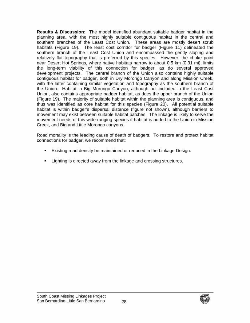
South Coast Missing Linkages Project San Bernardino-Little San Bernardino
28
Results & Discussion: The model identified abundant suitable badger habitat in the planning area, with the most highly suitable contiguous habitat in the central and southern branches of the Least Cost Union. These areas are mostly desert scrub habitats (Figure 19). The least cost corridor for badger (Figure 11) delineated the southern branch of the Least Cost Union and encompassed the gently sloping and relatively flat topography that is preferred by this species. However, the choke point near Desert Hot Springs, where native habitats narrow to about 0.5 km (0.31 mi), limits the long-term viability of this connection for badger, as do several approved development projects. The central branch of the Union also contains highly suitable contiguous habitat for badger, both in Dry Morongo Canyon and along Mission Creek, with the latter containing similar vegetation and topography as the southern branch of the Union. Habitat in Big Morongo Canyon, although not included in the Least Cost Union, also contains appropriate badger habitat, as does the upper branch of the Union (Figure 19). The majority of suitable habitat within the planning area is contiguous, and thus was identified as core habitat for this species (Figure 20). All potential suitable habitat is within badger’s dispersal distance (figure not shown), although barriers to movement may exist between suitable habitat patches. The linkage is likely to serve the movement needs of this wide-ranging species if habitat is added to the Union in Mission Creek, and Big and Little Morongo canyons. Road mortality is the leading cause of death of badgers. To restore and protect habitat connections for badger, we recommend that:
Existing road density be maintained or reduced in the Linkage Design. Lighting is directed away from the linkage and crossing structures.
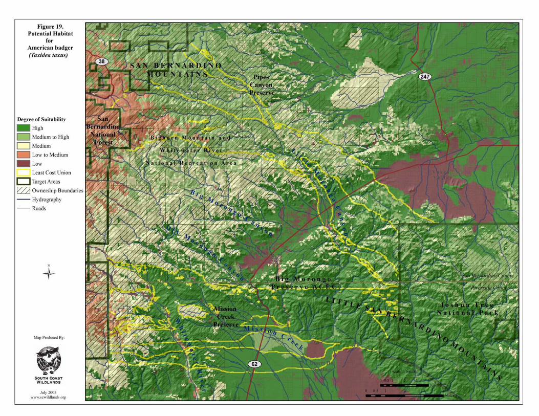
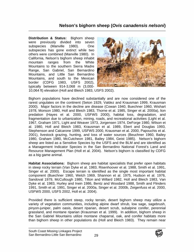
South Coast Missing Linkages Project San Bernardino-Little San Bernardino
29
Nelson’s bighorn sheep (Ovis canadensis nelsoni)
Distribution & Status: Bighorn sheep were previously divided into seven subspecies (Manville 1980). One subspecies has gone extinct while two others were combined (Manville 1980). In California, Nelson’s bighorn sheep inhabit mountain ranges from the White Mountains to the southern Sierra Madre Range, San Gabriel, San Bernardino Mountains, and Little San Bernardino Mountains, and south to the Mexican border (CDFG 1983, USFS 2002), typically between 914-3,068 m (3,000-10,064 ft) elevation (Holl and Bleich 1983, USFS 2002). Bighorn populations have declined substantially and are now considered one of the rarest ungulates on the continent (Seton 1929, Valdez and Krausman 1999, Krausman 2000). Major factors in the decline are disease (Cowan 1940, Buechner 1960, Wishart 1978, Monson 1980, Holl and Bleich 1983, Thorne et al. 1985, Singer et al. 2000a), lion predation (Hayes et al. 2000, USFWS 2000), habitat loss, degradation, and fragmentation due to urbanization, mining, roads, and recreational activities (Light et al. 1967, Graham 1971, Light and Weaver 1973, Jorgensen 1974, DeForge 1980, Wilson et al. 1980, Holl and Bleich 1983, Krausman et al. 1989, Ebert and Douglas 1993, Stephenson and Calcarone 1999, USFWS 2000, Krausman et al. 2000, Papouchis et al. 2001), livestock grazing, hunting, and loss of water sources (Beuchner 1960, Bailey 1980, Graham 1980, McCutcheon 1981, Bailey 1984, Geist 1985). Nelson’s bighorn sheep are listed as a Sensitive Species by the USFS and the BLM and are identified as a Management Indicator Species in the San Bernardino National Forest’s Land and Resource Management Plan (Holl et al. 2004). Nelson’s bighorn is classified by CDFG as a big game animal.
Habitat Associations: Bighorn sheep are habitat specialists that prefer open habitats in steep rocky terrain (Van Dyke et al. 1983, Risenhoover et al. 1988, Smith et al. 1991, Singer et al. 2000). Escape terrain is identified as the single most important habitat component (Buechner 1960, Welch 1969, Shannon et al. 1975, Hudson et al. 1976, Sandoval 1979, McCullough 1980, Tilton and Willard 1982, Holl and Bleich 1983, Van Dyke et al. 1983, Hurley and Irwin 1986, Bentz and Woodard 1988, Smith and Flinders 1991, Smith et al. 1991, Singer et al. 2000a, Singer et al. 2000b, Zeigenfuss et al. 2000, USFWS 2000, USFS 2002, Holl et al. 2004).
Provided there is sufficient steep, rocky terrain, desert bighorn sheep may utilize a variety of vegetation communities, including alpine dwarf shrub, low sage, sagebrush, pinyon-juniper, palm oasis, desert riparian, desert scrub, subalpine conifer, perennial grassland, and montane riparian (Krausman et al. 1999). In addition, bighorn sheep in the San Gabriel Mountains utilize montane chaparral, oak, and conifer habitats more than bighorn sheep in other populations do (Holl and Bleich 1983). They remain near
Photo courtesy of BLM
South Coast Missing Linkages Project San Bernardino-Little San Bernardino
30
water during summer (Leslie and Douglas 1979, Monson 1980, Wehausen 1980, Tilton and Willard 1982, Wehausen 1983, CDFG 1983) and, in the San Gabriel Mountains, use mineral licks seasonally (April to September) to supplement their dietary requirement for sodium (Holl and Bleich 1983). The young learn about escape terrain, water sources, and lambing habitat from elders (USFWS 2000, USFS 2002). Spatial Patterns: Bighorn sheep distribution is associated with mountainous habitat and proximity to escape terrain, often defined as steep and rugged slopes, which are important habitat attributes (Tilton and Willard 1982, Smith and Flinders 1991, Singer et al. 2000b). Although definitions of escape terrain vary considerably (USFWS 2000), Holl and Bleich (1983) defined escape terrain for bighorn sheep in the San Gabriel Mountains as slopes greater than 80 degrees P
Pwith rock outcrops. Holl and Bleich (1983) reported
that bighorn sheep also use slopes less than 20 degrees when crossing a canyon bottom or drinking from a stream. In some mountain ranges, bighorn sheep make seasonal movements between winter and summer ranges, spending summer at higher elevation and moving down slope in winter (USFWS 2000). Females form ewe groups and have small home ranges, while rams roam over larger areas, moving among ewe groups (Geist 1971). Nelson’s bighorn sheep in the San Gabriel Mountains were found to have fairly small home ranges: 5 ewes averaged 3.9 kmP
2P (1.5 mi P
2P), while one adult ram had a home range of 17.9 km P
2P (6.9 mi P
2P; DeForge
1980, Holl et al. 2004). Home ranges of bighorn sheep in the Peninsular Ranges were found to average 25.5 kmP
2 P(9.8 mi P
2P) for rams and 20.1 kmP
2P (7.8 mi P
2P) for ewes (DeForge
et al. 1997, USFWS 2000). Rubin et al. (2002) reported mean female home range sizes of 23.9 kmP
2P (9.2 mi P
2P) and 15 kmP
2P (5.8 mi P
2P) when using adaptive kernel and minimum
convex polygon methods, respectively, in the Peninsular Ranges. Another study, conducted in Colorado, found much larger home range sizes, with rams ranging from 9.8-54.7 kmP
2P (3.8-21.1 mi P
2P) and ewes ranging from 6.1–35.3 kmP
2P (2.4-13.6 mi P
2P; Singer et
al. 2001). The longest recorded movement of a ewe is 30 km (18.6 mi), although analyses of genetic data suggest that movement of ewes among groups is rare (USFWS 2000, USFS 2002). Bleich et al. (1996) reported one case of a ewe emigrating and reproducing in a new mountain range, while McQuivey (1978) reported 4 such movements by ewes. Genetic analyses indicated more frequent movements by males than by females (USFWS 2000, USFS 2002). A Canadian study (Blood 1963) estimated rams moved approximately 24 km (14.9 mi). Geist (1971) observed ram movements up to 35 km (21.7 mi). Witham and Smith (1979) documented a ram moving 56 km (34.8 mi). DeForge (1980) reported a ram moving approximately 10 km (6.2 mi) in the San Gabriel Mountains.
Conceptual Basis for Model Development: Numerous habitat suitability models have been developed for bighorn sheep (Buechner 1960, Hansen 1980, Holl 1982, Van Dyke et al. 1983, Risenhoover and Bailey 1985, Hurley and Irwin 1986, Bentz and Woodard 1988, Armentrout and Brigham 1988, Cunningham 1989, Smith et al. 1991, Singer et al. 2000, Zeigenfuss et al. 2000); however, applying the results of such models outside of the original study areas may result in spurious results (Andrew et al. 1999).
South Coast Missing Linkages Project San Bernardino-Little San Bernardino
31
We delineated potentially suitable habitat as escape terrain (slopes 27-85 degrees) and adjacent flat areas that were less than 300 m (984 ft) from escape terrain (Buechner 1960, Van Dyke et al. 1983, Hurley and Irwin 1986, Bentz and Woodard 1988, Singer et al. 2000b). Four other criteria were used to remove areas of unsuitable habitat from this layer: 1) areas with dense vegetation (i.e., poor visibility) (Risenhoover and Bailey 1985, Singer et al. 2000b, Zeigenfuss et al. 2000); 2) areas too far from perennial streams and springs (>3.2 km; 2 mi; Singer et al. 2000b, Zeigenfuss et al. 2000); 3) areas within 150 m (492 ft) of development (Smith et al. 1991, Singer et al. 2000b, Zeigenfuss et al. 2000); and 4) habitat patches below 1,000 m (3,218 ft) in elevation (Holl and Bleich 1983).
Core areas were delineated after Singer et al. (2000b) as areas of suitable habitat greater than or equal to 17 kmP
2P (4,201 ac). Patches were defined as U> U 3.9 kmP
2 P(963 ac)
but less than 17 kmP
2P. Dispersal distance for bighorn sheep was defined as 20 km (12
mi), twice the distance recorded for a ram in the San Gabriel Mountains.
Results & Discussion: The output provided by the habitat suitability analysis corresponds with important habitat areas identified for this species (Stephenson and Calcarone 1999, USFS 2002, NPS 2003). The central branch of the Least Cost Union was delineated by the landscape permeability analysis for bighorn sheep and captured the most suitable contiguous habitat between targeted protected areas, following protected lands secured as part of the Mission Creek and Big Morongo preserves (Figure 21). The patch size analysis identified potential core areas and patches of suitable habitat in both mountain ranges (Figure 22) that largely overlap with areas utilized by bighorn sheep. The model captured habitat in the San Bernardino Mountains, including the largest population on San Gorgonio Mountain and the Cushenbury population on the northern edge of the range in desert-facing canyons (Stephenson and Calcarone 1999, USFS 2002, S. Loe, pers. com.). The model also captured habitat used by the 3 herds in Joshua Tree National Park, including the largest herd in the Eagle Mountains at the far eastern boundary of the park, the herd that ranges through the main part of the Little San Bernardino Mountains, and the smallest herd in the Wonderland of Rocks region (NPS 2003). All potential habitat linking core areas and patches are within the species dispersal distance (figure not shown), though barriers to movement exist between areas of suitable habitat. The central branch of the Least Cost Union is likely to serve this species if a vegetated overpass is installed to facilitate bighorn sheep movement across State Route 62. Bighorn sheep avoid heavily used roads (Jorgensen 1974, Wilson et al. 1980, Krausman et al. 1989, Ebert and Douglas 1993, Rubin et al. 1998, Papouchis et al. 2001), although females will cross busy roads on rare occasions and rams cross roads more frequently (Rubin et al. 1998). MacArthur et al. (1982) concluded that well designed transportation systems could minimize disturbance to sheep (Holl and Bleich 1983). To restore and protect habitat connections for bighorn sheep moving between the San Bernardino and Little San Bernardino Mountains, we recommend that:
A vegetated overpass 200 m wide (656 ft) be installed across State Route 62. Bighorn sheep, particularly rams, are radio-collared to determine movement
patterns (Holl et al. 2004).
South Coast Missing Linkages Project San Bernardino-Little San Bernardino
32
No new roads should be constructed in occupied or potential habitat (USFWS 2001).
No new roads or trails should pass within 100 m of a mineral lick or water source
(Holl and Bleich 1983, E. Rubin pers. com.), established roads or trails should be seasonally closed (April-September).
Roads and trails that pass through known lambing areas should be closed during
the reproductive season (Holl and Bleich 1983, Papouchis et al. 2001, USFWS 2000, USFWS 2001).
Off-road vehicles be excluded from occupied and historic habitat (USFWS 2000,
USFWS 2001); closures should be enforced.
Leash laws are enforced so that dogs are under restraint at all times (USFWS 2000, USFWS 2001, Holl et al. 2004).
Forest Service, Bureau of Land Management, Fish and Game and the Counties
should continue to control feral dogs and dogs allowed to run loose from surrounding communities.
Domestic sheep and goats are prohibited within 9 miles of bighorn habitat to
reduce the potential for disease transmission (USFWS 2000, USFWS 2001, Holl et al. 2004).
The CalTIP (Californians Turn in Poachers) program’s toll free reporting number
(800-952-5400) be widely publicized (Anonymous 1984).
Critical parcels are protected through conservation agreements, acquisition, fee title agreements, etc.
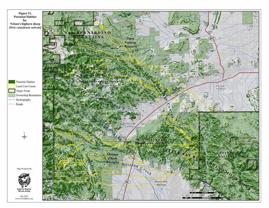
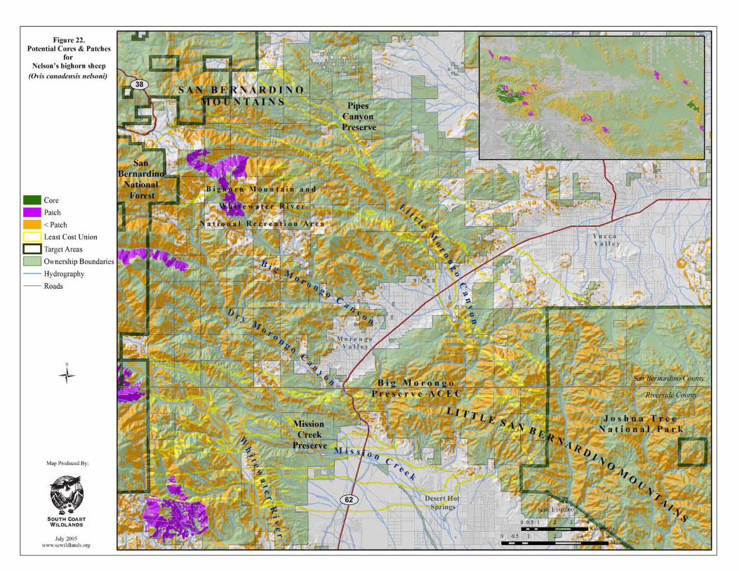
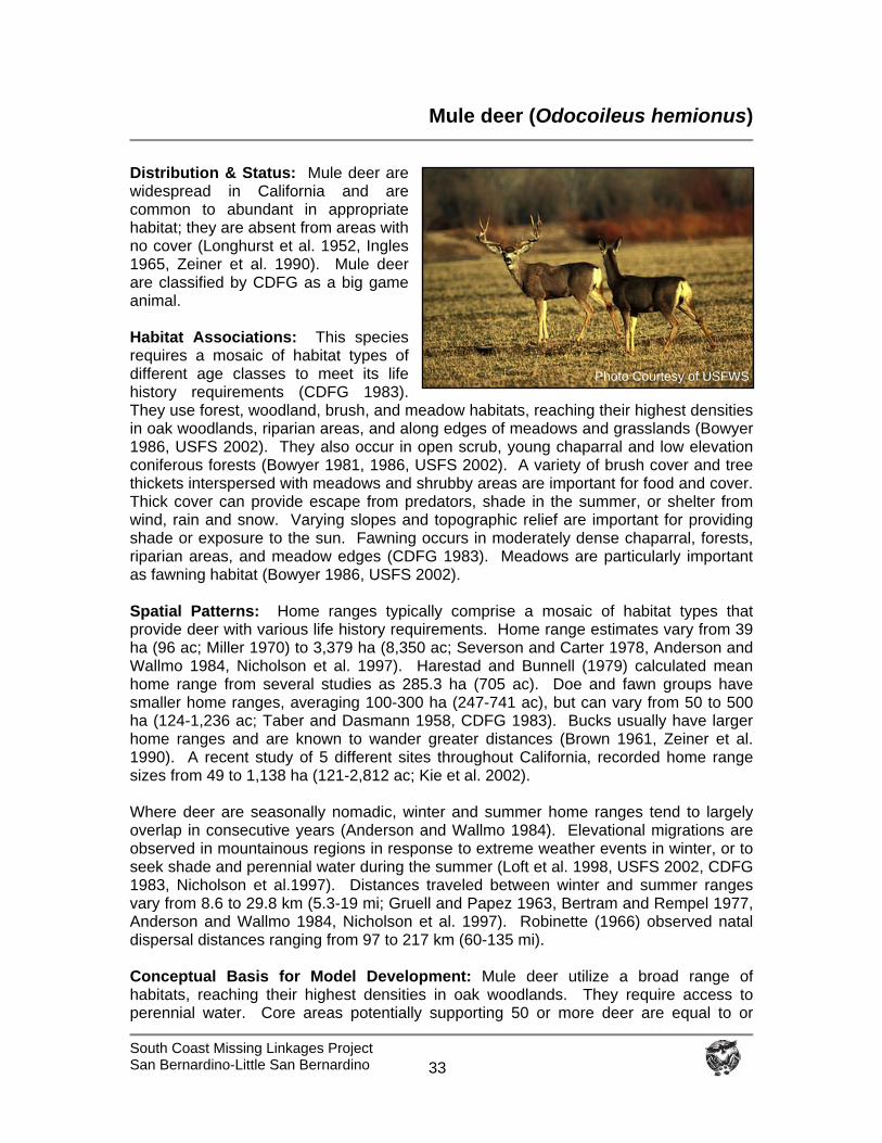
South Coast Missing Linkages Project San Bernardino-Little San Bernardino
33
Mule deer (Odocoileus hemionus)
Distribution & Status: Mule deer are widespread in California and are common to abundant in appropriate habitat; they are absent from areas with no cover (Longhurst et al. 1952, Ingles 1965, Zeiner et al. 1990). Mule deer are classified by CDFG as a big game animal. Habitat Associations: This species requires a mosaic of habitat types of different age classes to meet its life history requirements (CDFG 1983). They use forest, woodland, brush, and meadow habitats, reaching their highest densities in oak woodlands, riparian areas, and along edges of meadows and grasslands (Bowyer 1986, USFS 2002). They also occur in open scrub, young chaparral and low elevation coniferous forests (Bowyer 1981, 1986, USFS 2002). A variety of brush cover and tree thickets interspersed with meadows and shrubby areas are important for food and cover. Thick cover can provide escape from predators, shade in the summer, or shelter from wind, rain and snow. Varying slopes and topographic relief are important for providing shade or exposure to the sun. Fawning occurs in moderately dense chaparral, forests, riparian areas, and meadow edges (CDFG 1983). Meadows are particularly important as fawning habitat (Bowyer 1986, USFS 2002). Spatial Patterns: Home ranges typically comprise a mosaic of habitat types that provide deer with various life history requirements. Home range estimates vary from 39 ha (96 ac; Miller 1970) to 3,379 ha (8,350 ac; Severson and Carter 1978, Anderson and Wallmo 1984, Nicholson et al. 1997). Harestad and Bunnell (1979) calculated mean home range from several studies as 285.3 ha (705 ac). Doe and fawn groups have smaller home ranges, averaging 100-300 ha (247-741 ac), but can vary from 50 to 500 ha (124-1,236 ac; Taber and Dasmann 1958, CDFG 1983). Bucks usually have larger home ranges and are known to wander greater distances (Brown 1961, Zeiner et al. 1990). A recent study of 5 different sites throughout California, recorded home range sizes from 49 to 1,138 ha (121-2,812 ac; Kie et al. 2002). Where deer are seasonally nomadic, winter and summer home ranges tend to largely overlap in consecutive years (Anderson and Wallmo 1984). Elevational migrations are observed in mountainous regions in response to extreme weather events in winter, or to seek shade and perennial water during the summer (Loft et al. 1998, USFS 2002, CDFG 1983, Nicholson et al.1997). Distances traveled between winter and summer ranges vary from 8.6 to 29.8 km (5.3-19 mi; Gruell and Papez 1963, Bertram and Rempel 1977, Anderson and Wallmo 1984, Nicholson et al. 1997). Robinette (1966) observed natal dispersal distances ranging from 97 to 217 km (60-135 mi). Conceptual Basis for Model Development: Mule deer utilize a broad range of habitats, reaching their highest densities in oak woodlands. They require access to perennial water. Core areas potentially supporting 50 or more deer are equal to or
Photo Courtesy of USFWS
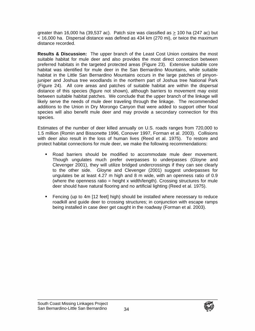
South Coast Missing Linkages Project San Bernardino-Little San Bernardino
34
greater than 16,000 ha (39,537 ac). Patch size was classified as > 100 ha (247 ac) but < 16,000 ha. Dispersal distance was defined as 434 km (270 mi), or twice the maximum distance recorded. Results & Discussion: The upper branch of the Least Cost Union contains the most suitable habitat for mule deer and also provides the most direct connection between preferred habitats in the targeted protected areas (Figure 23). Extensive suitable core habitat was identified for mule deer in the San Bernardino Mountains, while suitable habitat in the Little San Bernardino Mountains occurs in the large patches of pinyon-juniper and Joshua tree woodlands in the northern part of Joshua tree National Park (Figure 24). All core areas and patches of suitable habitat are within the dispersal distance of this species (figure not shown), although barriers to movement may exist between suitable habitat patches. We conclude that the upper branch of the linkage will likely serve the needs of mule deer traveling through the linkage. The recommended additions to the Union in Dry Morongo Canyon that were added to support other focal species will also benefit mule deer and may provide a secondary connection for this species. Estimates of the number of deer killed annually on U.S. roads ranges from 720,000 to 1.5 million (Romin and Bissonette 1996, Conover 1997, Forman et al. 2003). Collisions with deer also result in the loss of human lives (Reed et al. 1975). To restore and protect habitat connections for mule deer, we make the following recommendations:
Road barriers should be modified to accommodate mule deer movement. Though ungulates much prefer overpasses to underpasses (Gloyne and Clevenger 2001), they will utilize bridged undercrossings if they can see clearly to the other side. Gloyne and Clevenger (2001) suggest underpasses for ungulates be at least 4.27 m high and 8 m wide, with an openness ratio of 0.9 (where the openness ratio = height x width/length). Crossing structures for mule deer should have natural flooring and no artificial lighting (Reed et al. 1975).
Fencing (up to 4m [12 feet] high) should be installed where necessary to reduce
roadkill and guide deer to crossing structures; in conjunction with escape ramps being installed in case deer get caught in the roadway (Forman et al. 2003).
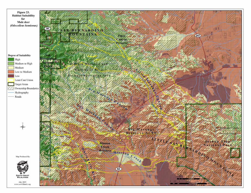
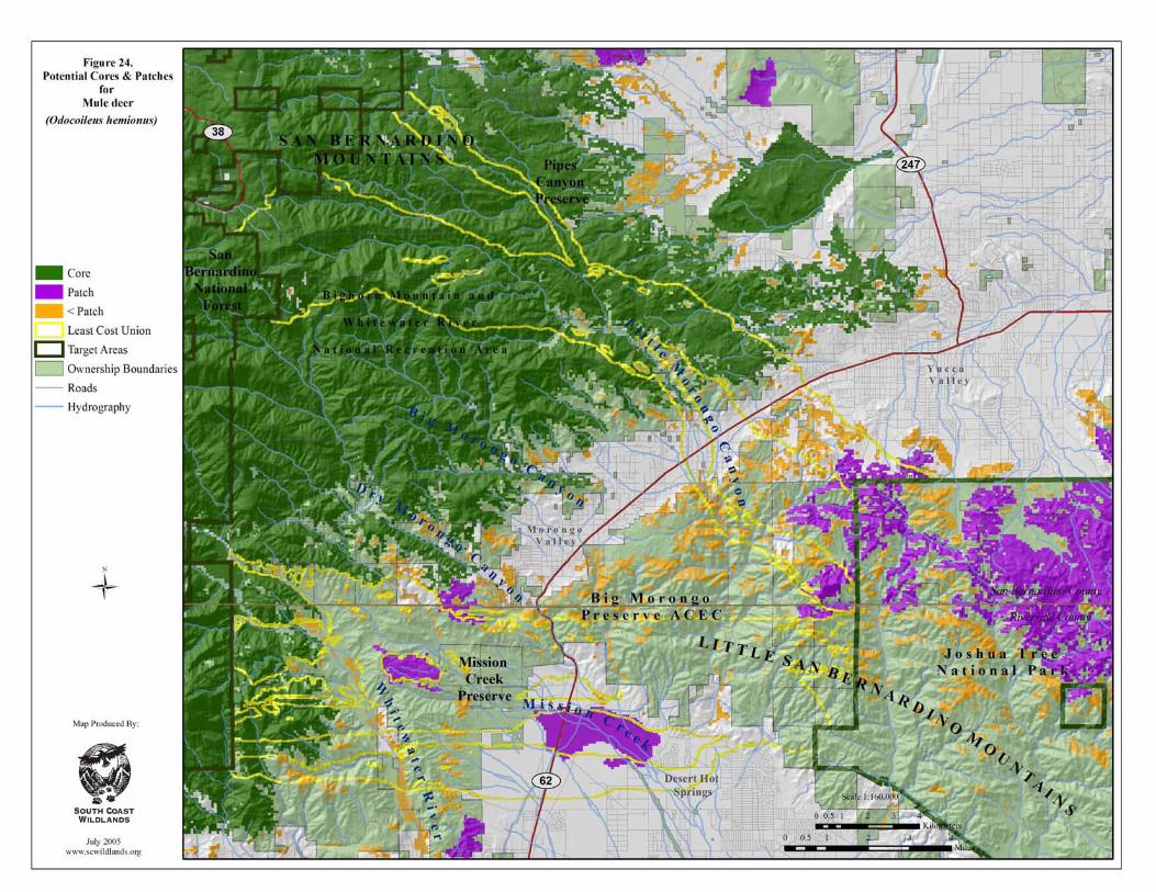
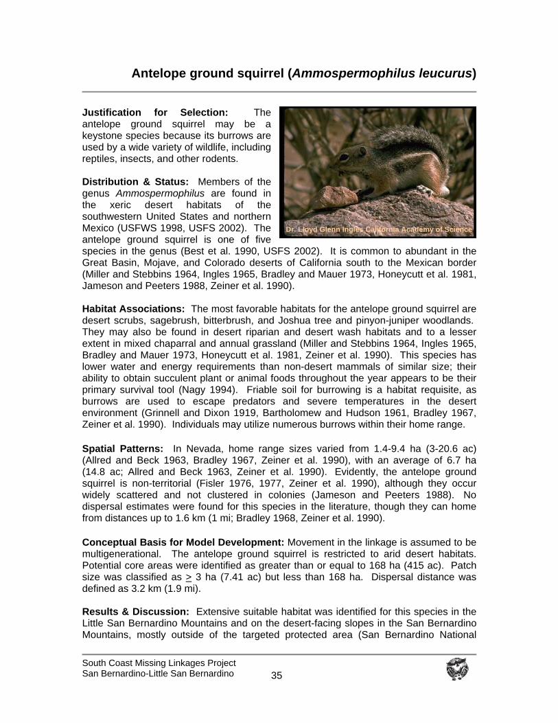
South Coast Missing Linkages Project San Bernardino-Little San Bernardino
35
Antelope ground squirrel (Ammospermophilus leucurus)
Justification for Selection: The antelope ground squirrel may be a keystone species because its burrows are used by a wide variety of wildlife, including reptiles, insects, and other rodents. Distribution & Status: Members of the genus Ammospermophilus are found in the xeric desert habitats of the southwestern United States and northern Mexico (USFWS 1998, USFS 2002). The antelope ground squirrel is one of five species in the genus (Best et al. 1990, USFS 2002). It is common to abundant in the Great Basin, Mojave, and Colorado deserts of California south to the Mexican border (Miller and Stebbins 1964, Ingles 1965, Bradley and Mauer 1973, Honeycutt et al. 1981, Jameson and Peeters 1988, Zeiner et al. 1990). Habitat Associations: The most favorable habitats for the antelope ground squirrel are desert scrubs, sagebrush, bitterbrush, and Joshua tree and pinyon-juniper woodlands. They may also be found in desert riparian and desert wash habitats and to a lesser extent in mixed chaparral and annual grassland (Miller and Stebbins 1964, Ingles 1965, Bradley and Mauer 1973, Honeycutt et al. 1981, Zeiner et al. 1990). This species has lower water and energy requirements than non-desert mammals of similar size; their ability to obtain succulent plant or animal foods throughout the year appears to be their primary survival tool (Nagy 1994). Friable soil for burrowing is a habitat requisite, as burrows are used to escape predators and severe temperatures in the desert environment (Grinnell and Dixon 1919, Bartholomew and Hudson 1961, Bradley 1967, Zeiner et al. 1990). Individuals may utilize numerous burrows within their home range.
Spatial Patterns: In Nevada, home range sizes varied from 1.4-9.4 ha (3-20.6 ac) (Allred and Beck 1963, Bradley 1967, Zeiner et al. 1990), with an average of 6.7 ha (14.8 ac; Allred and Beck 1963, Zeiner et al. 1990). Evidently, the antelope ground squirrel is non-territorial (Fisler 1976, 1977, Zeiner et al. 1990), although they occur widely scattered and not clustered in colonies (Jameson and Peeters 1988). No dispersal estimates were found for this species in the literature, though they can home from distances up to 1.6 km (1 mi; Bradley 1968, Zeiner et al. 1990).
Conceptual Basis for Model Development: Movement in the linkage is assumed to be multigenerational. The antelope ground squirrel is restricted to arid desert habitats. Potential core areas were identified as greater than or equal to 168 ha (415 ac). Patch size was classified as > 3 ha (7.41 ac) but less than 168 ha. Dispersal distance was defined as 3.2 km (1.9 mi). Results & Discussion: Extensive suitable habitat was identified for this species in the Little San Bernardino Mountains and on the desert-facing slopes in the San Bernardino Mountains, mostly outside of the targeted protected area (San Bernardino National
Dr. Lloyd Glenn Ingles California Academy of Science

South Coast Missing Linkages Project San Bernardino-Little San Bernardino
36
Forest). The Linkage Design doesn’t need to facilitate movement between targeted core areas, but it should ensure the persistence of antelope ground squirrels in the linkage to help maintain its ecological integrity. All branches of the Least Cost Union contain potentially suitable habitat for this species, with the central branch containing the most extensive and contiguous habitat (Figure 25). Although the southern branch of the Union also contains highly suitable habitat, the choke-point near Desert Hot Springs and several approved development projects threatens the viability of this connection. The majority of suitable habitat was identified as potential core areas for this species, with Little Morongo Canyon and Pipes Canyon providing a connection to extensive core habitat identified on the desert facing slopes of the San Bernardino Mountains (Figure 26). All potential cores and patches of suitable habitat are within the presumed dispersal distance for this species, although barriers to movement may exist between suitable habitat patches (figure not shown). The linkage will likely serve the needs of antelope ground squirrels if habitat is added to the Union in Mission Creek, and Big and Little Morongo canyons. The recommended additions to the Union in Dry Morongo Canyon that were added to support other focal species will also likely benefit this species. To protect and restore habitat for antelope ground squirrel, we recommend that:
Habitat is added to the Union in Mission Creek and Big Morongo Canyon to serve the needs of this species.
Crossing structures for small mammals are added fairly frequently to facilitate
movement across major roads, such as State Route 62.
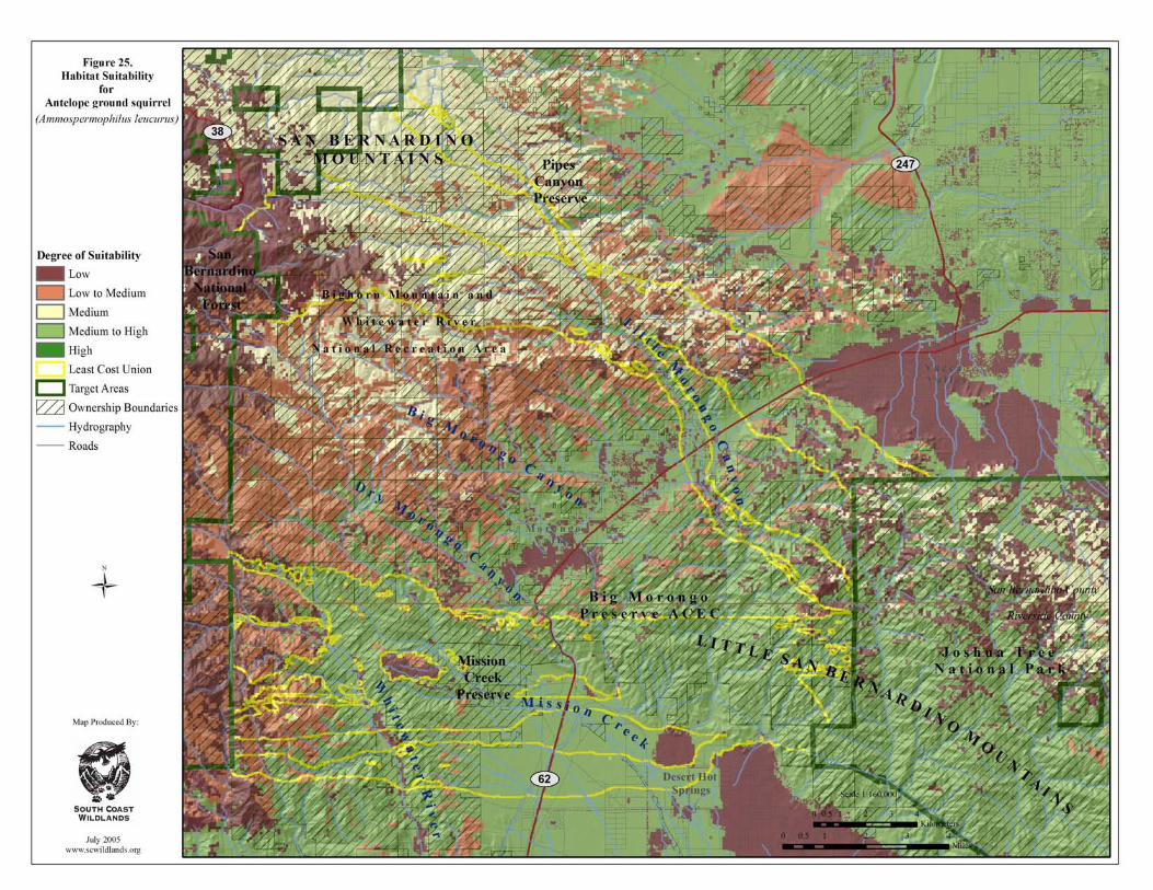
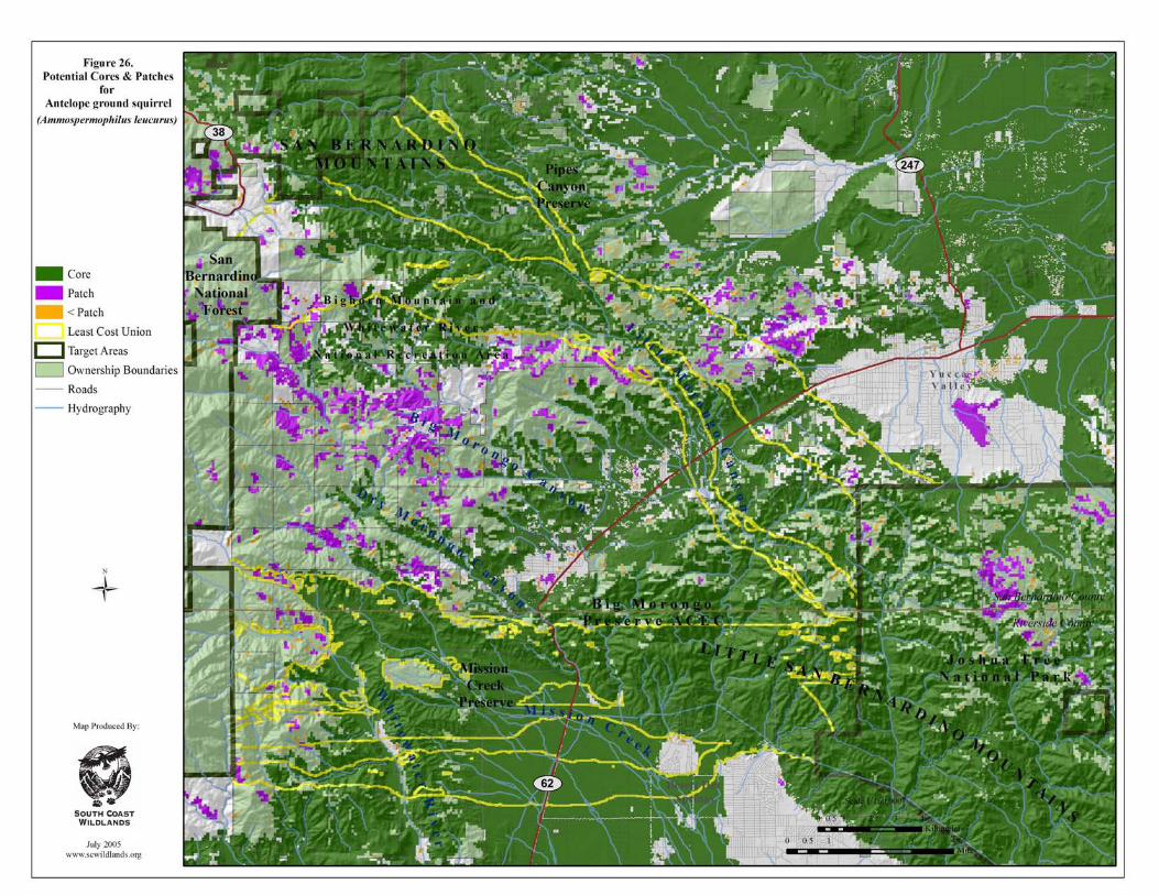
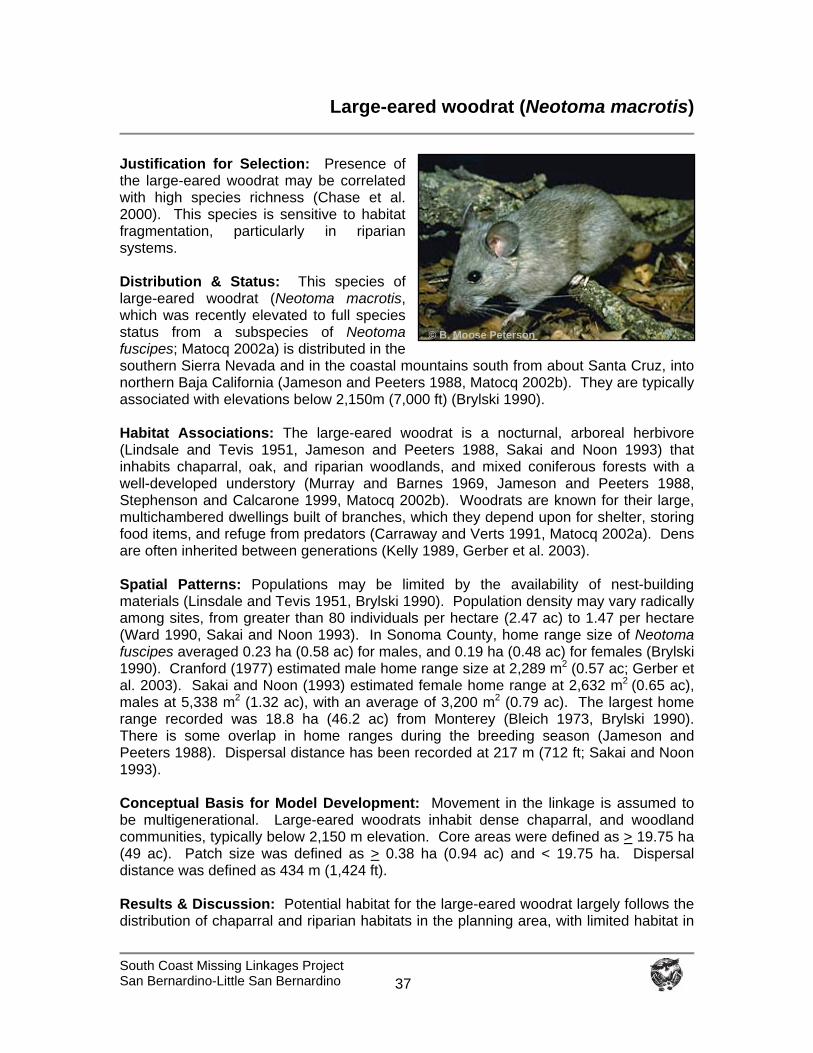
South Coast Missing Linkages Project San Bernardino-Little San Bernardino
37
Large-eared woodrat (Neotoma macrotis)
Justification for Selection: Presence of the large-eared woodrat may be correlated with high species richness (Chase et al. 2000). This species is sensitive to habitat fragmentation, particularly in riparian systems. Distribution & Status: This species of large-eared woodrat (Neotoma macrotis, which was recently elevated to full species status from a subspecies of Neotoma fuscipes; Matocq 2002a) is distributed in the southern Sierra Nevada and in the coastal mountains south from about Santa Cruz, into northern Baja California (Jameson and Peeters 1988, Matocq 2002b). They are typically associated with elevations below 2,150m (7,000 ft) (Brylski 1990). Habitat Associations: The large-eared woodrat is a nocturnal, arboreal herbivore (Lindsale and Tevis 1951, Jameson and Peeters 1988, Sakai and Noon 1993) that inhabits chaparral, oak, and riparian woodlands, and mixed coniferous forests with a well-developed understory (Murray and Barnes 1969, Jameson and Peeters 1988, Stephenson and Calcarone 1999, Matocq 2002b). Woodrats are known for their large, multichambered dwellings built of branches, which they depend upon for shelter, storing food items, and refuge from predators (Carraway and Verts 1991, Matocq 2002a). Dens are often inherited between generations (Kelly 1989, Gerber et al. 2003). Spatial Patterns: Populations may be limited by the availability of nest-building materials (Linsdale and Tevis 1951, Brylski 1990). Population density may vary radically among sites, from greater than 80 individuals per hectare (2.47 ac) to 1.47 per hectare (Ward 1990, Sakai and Noon 1993). In Sonoma County, home range size of Neotoma fuscipes averaged 0.23 ha (0.58 ac) for males, and 0.19 ha (0.48 ac) for females (Brylski 1990). Cranford (1977) estimated male home range size at 2,289 m2 (0.57 ac; Gerber et al. 2003). Sakai and Noon (1993) estimated female home range at 2,632 m2 (0.65 ac), males at 5,338 m2 (1.32 ac), with an average of 3,200 m2 (0.79 ac). The largest home range recorded was 18.8 ha (46.2 ac) from Monterey (Bleich 1973, Brylski 1990). There is some overlap in home ranges during the breeding season (Jameson and Peeters 1988). Dispersal distance has been recorded at 217 m (712 ft; Sakai and Noon 1993). Conceptual Basis for Model Development: Movement in the linkage is assumed to be multigenerational. Large-eared woodrats inhabit dense chaparral, and woodland communities, typically below 2,150 m elevation. Core areas were defined as > 19.75 ha (49 ac). Patch size was defined as > 0.38 ha (0.94 ac) and < 19.75 ha. Dispersal distance was defined as 434 m (1,424 ft). Results & Discussion: Potential habitat for the large-eared woodrat largely follows the distribution of chaparral and riparian habitats in the planning area, with limited habitat in
© B. Moose Peterson
South Coast Missing Linkages Project San Bernardino-Little San Bernardino
38
the Little San Bernardino Mountains and more extensive habitat in the San Bernardino Mountains (Figure 27). The majority of potential cores and patches identified east of State Route 62 are fairly clustered in the vicinity of the Big Morongo Canyon Preserve (Figure 28). As such, the most important possible connections for this species are the riparian habitats in Dry, Big, and Little Morongo canyons. To help ensure the viability of these connections for the woodrat, additional habitat was added to the Union in each of these canyons (Figure 15). Potential core and patches of suitable habitat identified on the desert facing slopes of the San Bernardino Mountains and in Big Morongo Preserve are within the defined dispersal distance of the woodrat, though barriers to movement may exist between suitable habitat patches. Distances between habitat patches identified in Joshua Tree National Park are too great for the species to traverse (Figure 29). The linkage is likely to serve the needs of this species for movement among populations if habitat is added to the Union in Dry, Big and Little Morongo canyons. To protect and restore habitat connectivity for this species, we recommend that:
Habitat not included in the Least Cost Union in Big and Dry Morongo canyons is added to support the needs of this species.
Road barriers be modified, where necessary, to allow woodrats to move along
riparian corridors.
Crossing structures for small mammals be placed fairly frequently to facilitate movement across major transportation routes (i.e., State Route 62).
Natural hydrological processes are maintained or restored.
Lighting is directed away from the linkage and crossing structures.
Local residents are informed about the proper use of rodenticides and pesticides
to reduce the likelihood of ingestion of these lethal substances on small mammals indigenous to the area.
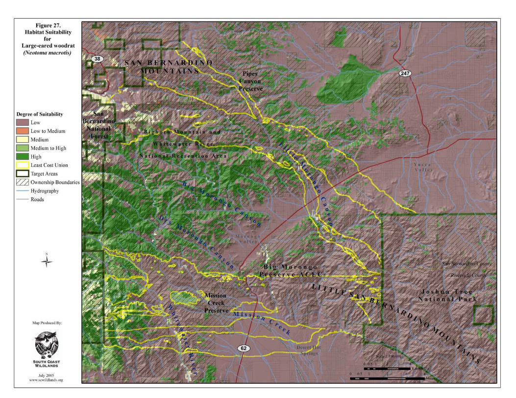
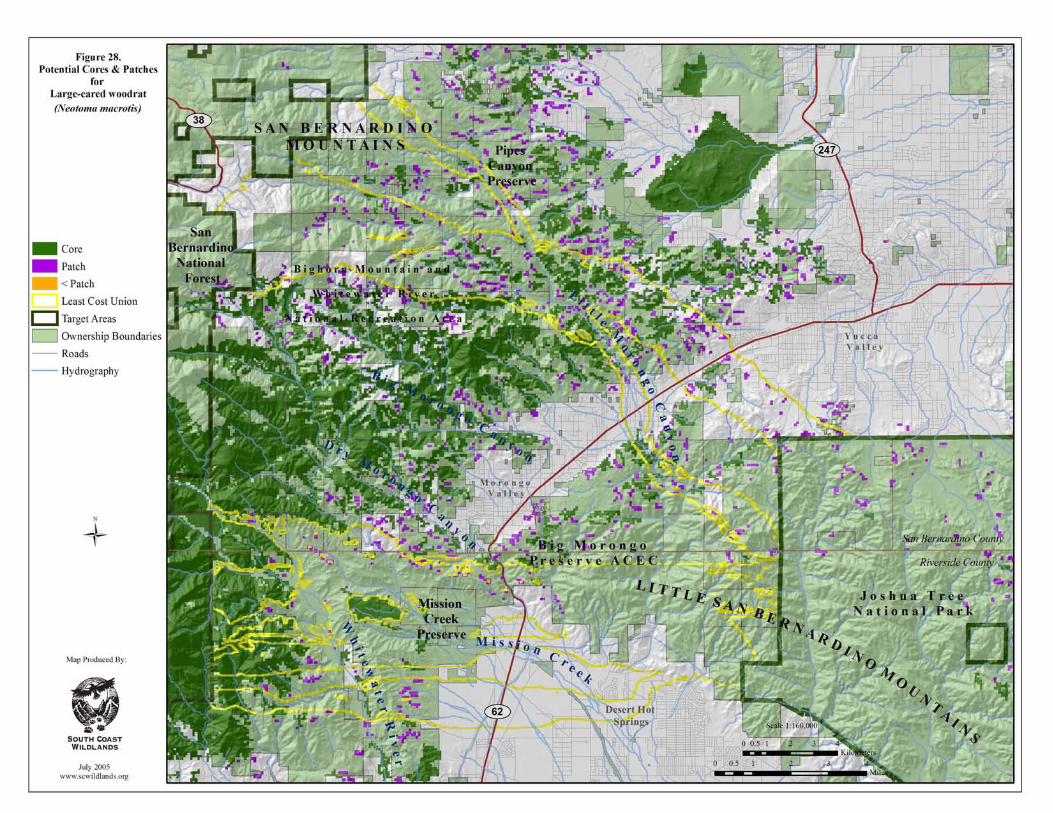

South Coast Missing Linkages San Bernardino-Little San Bernardino
This page intentionally left blank.
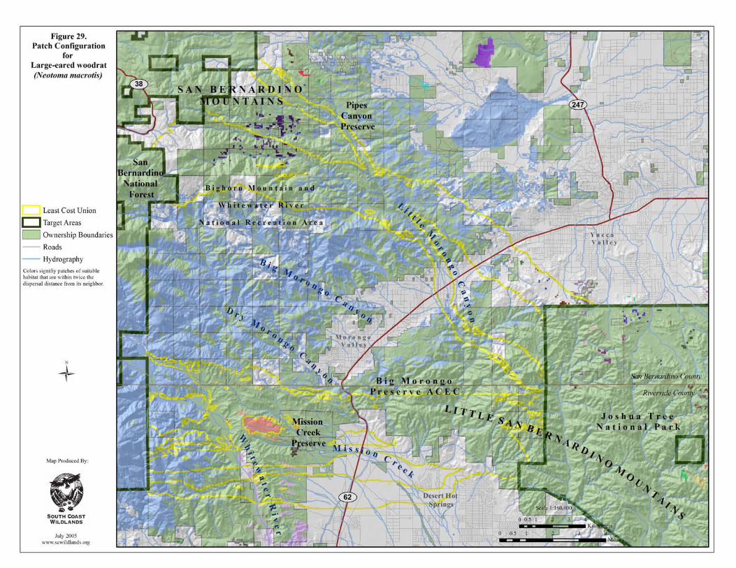
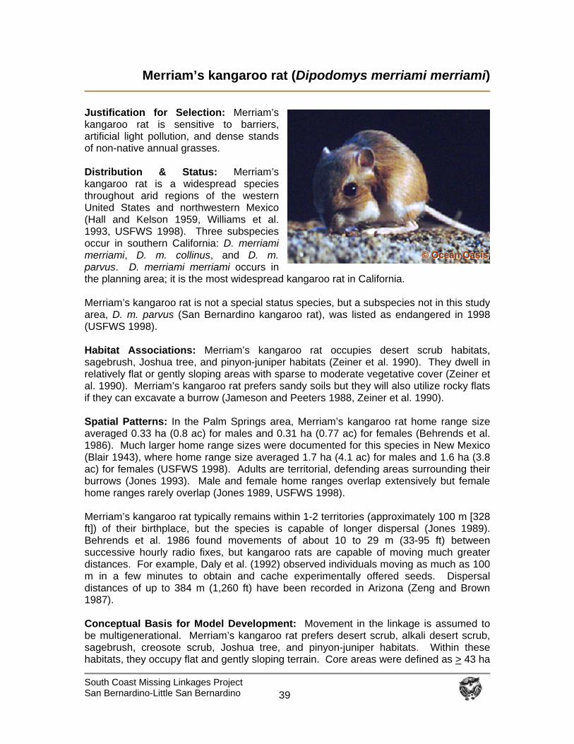
South Coast Missing Linkages Project San Bernardino-Little San Bernardino
39
Merriam’s kangaroo rat (Dipodomys merriami merriami)
Justification for Selection: Merriam’s kangaroo rat is sensitive to barriers, artificial light pollution, and dense stands of non-native annual grasses. Distribution & Status: Merriam’s kangaroo rat is a widespread species throughout arid regions of the western United States and northwestern Mexico (Hall and Kelson 1959, Williams et al. 1993, USFWS 1998). Three subspecies occur in southern California: D. merriami merriami, D. m. collinus, and D. m. parvus. D. merriami merriami occurs in the planning area; it is the most widespread kangaroo rat in California. Merriam’s kangaroo rat is not a special status species, but a subspecies not in this study area, D. m. parvus (San Bernardino kangaroo rat), was listed as endangered in 1998 (USFWS 1998). Habitat Associations: Merriam’s kangaroo rat occupies desert scrub habitats, sagebrush, Joshua tree, and pinyon-juniper habitats (Zeiner et al. 1990). They dwell in relatively flat or gently sloping areas with sparse to moderate vegetative cover (Zeiner et al. 1990). Merriam’s kangaroo rat prefers sandy soils but they will also utilize rocky flats if they can excavate a burrow (Jameson and Peeters 1988, Zeiner et al. 1990). Spatial Patterns: In the Palm Springs area, Merriam’s kangaroo rat home range size averaged 0.33 ha (0.8 ac) for males and 0.31 ha (0.77 ac) for females (Behrends et al. 1986). Much larger home range sizes were documented for this species in New Mexico (Blair 1943), where home range size averaged 1.7 ha (4.1 ac) for males and 1.6 ha (3.8 ac) for females (USFWS 1998). Adults are territorial, defending areas surrounding their burrows (Jones 1993). Male and female home ranges overlap extensively but female home ranges rarely overlap (Jones 1989, USFWS 1998). Merriam’s kangaroo rat typically remains within 1-2 territories (approximately 100 m [328 ft]) of their birthplace, but the species is capable of longer dispersal (Jones 1989). Behrends et al. 1986 found movements of about 10 to 29 m (33-95 ft) between successive hourly radio fixes, but kangaroo rats are capable of moving much greater distances. For example, Daly et al. (1992) observed individuals moving as much as 100 m in a few minutes to obtain and cache experimentally offered seeds. Dispersal distances of up to 384 m (1,260 ft) have been recorded in Arizona (Zeng and Brown 1987). Conceptual Basis for Model Development: Movement in the linkage is assumed to be multigenerational. Merriam’s kangaroo rat prefers desert scrub, alkali desert scrub, sagebrush, creosote scrub, Joshua tree, and pinyon-juniper habitats. Within these habitats, they occupy flat and gently sloping terrain. Core areas were defined as > 43 ha
©©© OOOccceeeaaannn OOOaaasssiiisss
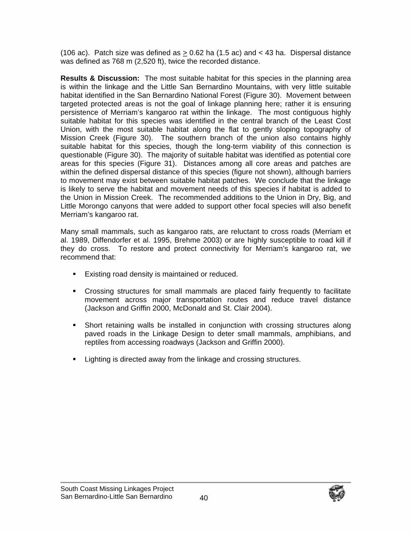
South Coast Missing Linkages Project San Bernardino-Little San Bernardino
40
(106 ac). Patch size was defined as > 0.62 ha (1.5 ac) and < 43 ha. Dispersal distance was defined as 768 m (2,520 ft), twice the recorded distance. Results & Discussion: The most suitable habitat for this species in the planning area is within the linkage and the Little San Bernardino Mountains, with very little suitable habitat identified in the San Bernardino National Forest (Figure 30). Movement between targeted protected areas is not the goal of linkage planning here; rather it is ensuring persistence of Merriam’s kangaroo rat within the linkage. The most contiguous highly suitable habitat for this species was identified in the central branch of the Least Cost Union, with the most suitable habitat along the flat to gently sloping topography of Mission Creek (Figure 30). The southern branch of the union also contains highly suitable habitat for this species, though the long-term viability of this connection is questionable (Figure 30). The majority of suitable habitat was identified as potential core areas for this species (Figure 31). Distances among all core areas and patches are within the defined dispersal distance of this species (figure not shown), although barriers to movement may exist between suitable habitat patches. We conclude that the linkage is likely to serve the habitat and movement needs of this species if habitat is added to the Union in Mission Creek. The recommended additions to the Union in Dry, Big, and Little Morongo canyons that were added to support other focal species will also benefit Merriam’s kangaroo rat. Many small mammals, such as kangaroo rats, are reluctant to cross roads (Merriam et al. 1989, Diffendorfer et al. 1995, Brehme 2003) or are highly susceptible to road kill if they do cross. To restore and protect connectivity for Merriam’s kangaroo rat, we recommend that:
Existing road density is maintained or reduced. Crossing structures for small mammals are placed fairly frequently to facilitate
movement across major transportation routes and reduce travel distance (Jackson and Griffin 2000, McDonald and St. Clair 2004).
Short retaining walls be installed in conjunction with crossing structures along
paved roads in the Linkage Design to deter small mammals, amphibians, and reptiles from accessing roadways (Jackson and Griffin 2000).
Lighting is directed away from the linkage and crossing structures.
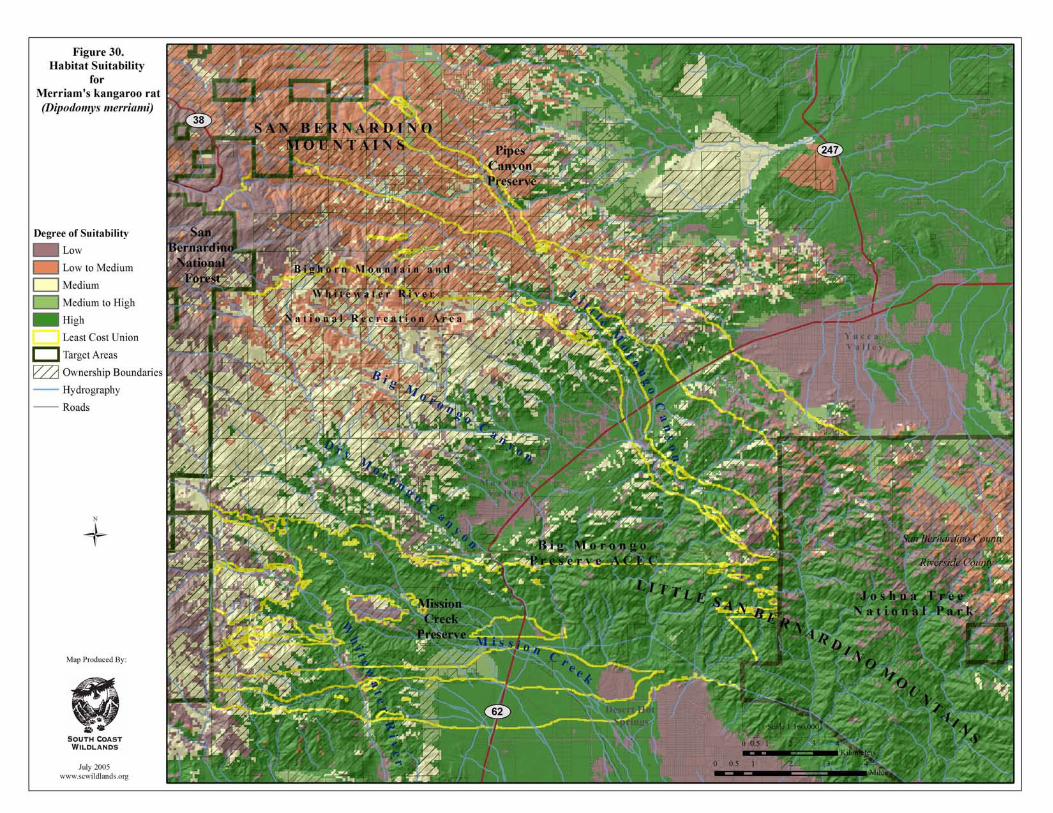
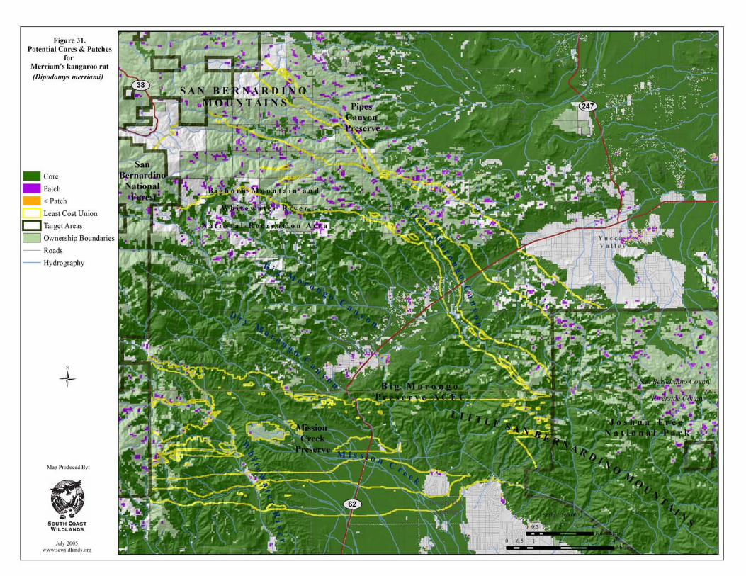
South Coast Missing Linkages Project San Bernardino-Little San Bernardino
41
Pacific kangaroo rat (Dipodomys agilis)
Distribution & Status: The Pacific kangaroo rat was recently split into 2 species, D. agilis and D. simulans (Dulzura kangaroo rat); D. agilis occurs in the planning area. The distribution of these species extends from the coastal mountains of Baja California and southern California to the Santa Barbara-San Luis Obispo county line and inland to the Tehachapi and Piute Mountains, as far north as the South Fork of the Kern River (Best 1983, Sullivan and Best 1997, Zeiner et al. 1990). They occur at elevations up to about 2,133 m (7,000 feet) in scrub and chaparral habitats (W. Spencer pers. comm.) but have been found as high as 2,250 m (7,400 ft; Zeiner et al. 1990). The Pacific kangaroo rat isn’t considered a special status species. Habitat Association: The Pacific kangaroo rat is a habitat generalist, occurring in a variety of open habitats with scattered vegetation including chaparral, oak woodland, pinyon-juniper woodland, desert scrub, and annual grassland (Bleich and Price 1995, W. Spencer pers. comm.). They have also been recorded in montane coniferous forests (Sullivan and Best 1997). They require friable soils in which to burrow (ZEINER ET AL. 1990). Goldingay and Price (1997) found them to be particularly abundant in ecotonal habitats. They increase in abundance following fires that create openings in dense vegetation (Price and Waser 1984, Price et al. 1991, W. Spencer pers. comm.). Quinn (1990) believes D. agilis to be most abundant in early succession communities that occur 2 to 5 years after fire, but smaller numbers of individuals can be found scattered in more limited openings in chaparral. Spatial Patterns: MacMillen (1964) estimated home range size of Pacific kangaroo rat from 0.1 to 0.6 ha (0.4 to 1.5 ac) with a mean of 0.3 ha (0.8 ac). Although fairly widespread and common, they seem to occur at somewhat lower densities than other kangaroo rats, perhaps due to the more patchy nature of their habitat (sparse or open areas within scrub and chaparral, versus more homogeneous desert or grassland habitats), which may be the result of chaparral and scrub habitats providing less food (seeds from annual forbs and grasses) than grasslands and deserts (W. Spencer pers. comm.). Christopher (1973) measured population densities of the Pacific kangaroo rat that ranged from 0.9 to 10.8 per ha (2.22-26.7 ac). Kangaroo rat tends to be more mobile than most rodents of their size. Little specific information is available on movements of Pacific kangaroo rat, but they are probably similar to Merriam’s kangaroo rat, which is better studied. Zeng and Brown (1987) recorded long-distance movements up to 384 m (1,260 ft) in adult Merriam’s kangaroo rats, concluding that they are opportunistic in moving into newly available habitat. However, unlike Merriam’s kangaroo rat, the Pacific kangaroo rat may disperse between
© Wayne Spencer
South Coast Missing Linkages Project San Bernardino-Little San Bernardino
42
adjacent mountain ranges via linkages, at least over multiple generations (W. Spencer pers. comm.). Conceptual Basis for Model Development: Movement between protected core areas in the linkage is multigenerational. This species prefers open vegetative communities including chaparral, desert scrub, annual grassland, oak woodland, pinyon-juniper woodland, and montane coniferous forests. They are primarily found between 800 and 2,250 m (2,625 to 7,382 ft) elevation (Sullivan and Best 1997). Core areas were defined as > 8 ha (20 ac). Patch size was defined as > 0.5 ha (1.2 ac) and < 8 ha. Dispersal distance for this species hasn’t been measured, so we used twice the dispersal distance for Merriam’s kangaroo rat (768 m; 2,520 ft). Results & Discussion: Extensive suitable habitat was identified for the Pacific kangaroo rat throughout the planning area, with the most highly suitable habitat occurring on the eastern slopes of the San Bernardino Mountains (Figure 32). All branches of the Least Cost Union contain suitable habitat for this species with the most contiguous core habitat identified in the central and southern branches (Figure 33). Fairly contiguous core habitat also occurs in Big Morongo Canyon and in the upper branch of the Union, especially in Little Morongo Canyon. The majority of cores and patches of suitable habitat are within the dispersal distance defined for this species (figure not shown), although numerous barriers to movement may exist between suitable habitat patches. We conclude that the linkage is likely to meet the needs of this species. Many small mammals are reluctant to cross roads (Merriam et al. 1989, Diffendorfer et al. 1995). To restore and protect connectivity for the Pacific kangaroo rat, we recommend that:
Crossing structures for small mammals are placed fairly frequently to facilitate movement across major transportation routes, such as State Route 62.
Short retaining walls be installed in conjunction with crossing structures along
paved roads in the Linkage Design to deter small mammals, amphibians, and reptiles from accessing roadways (Jackson and Griffin 2000).
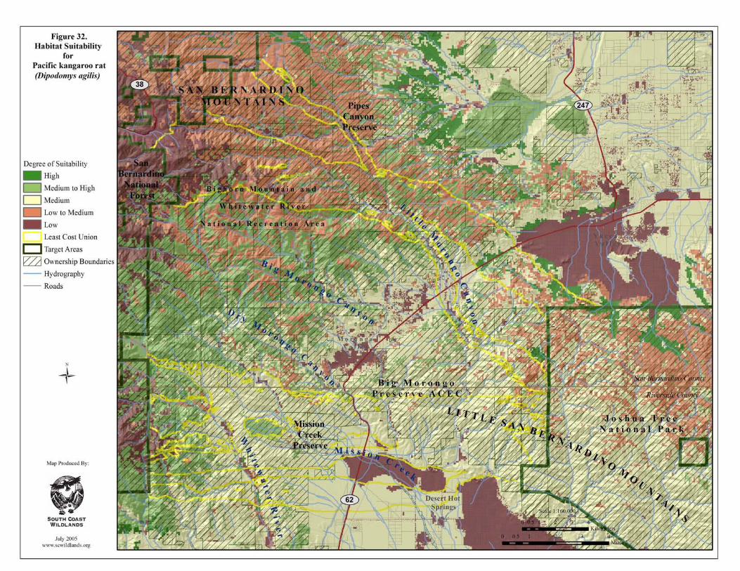
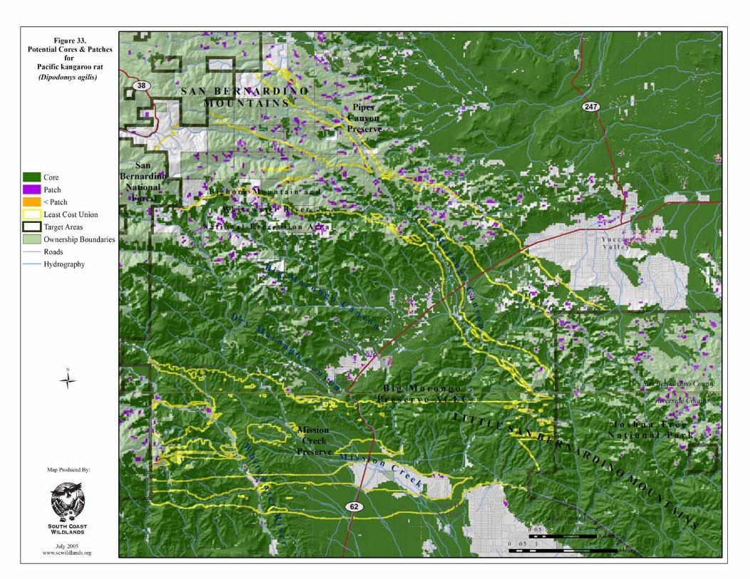
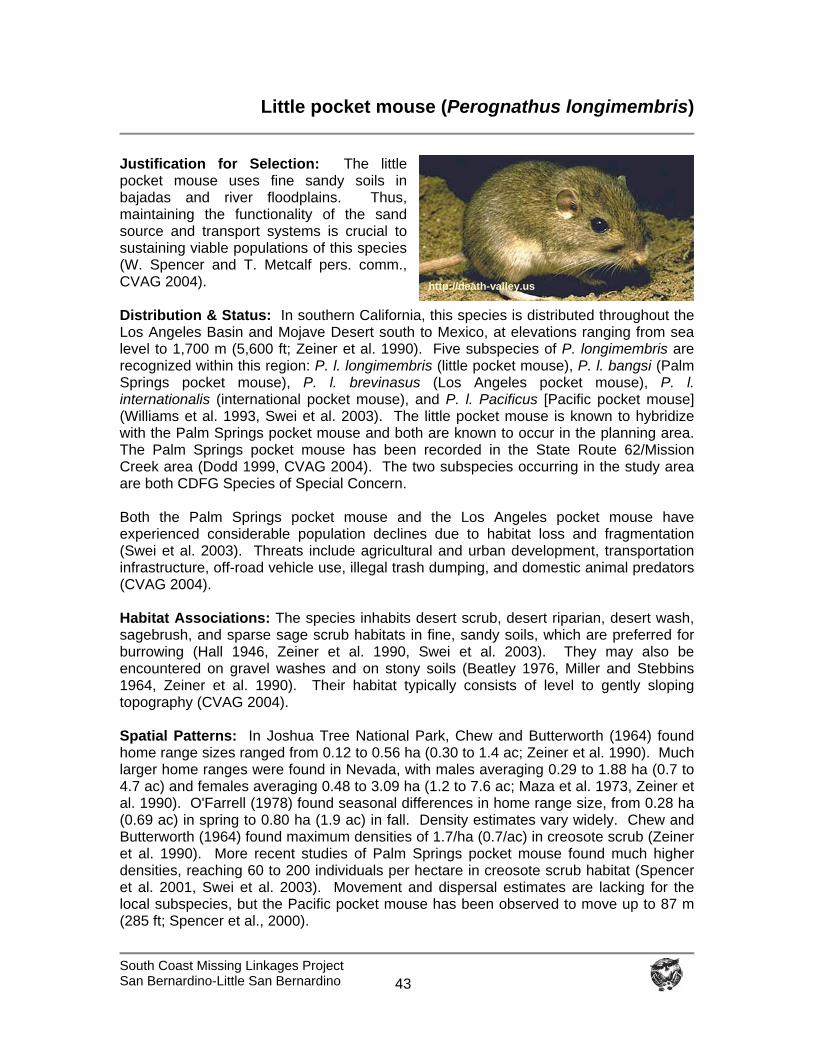
South Coast Missing Linkages Project San Bernardino-Little San Bernardino
43
Little pocket mouse (Perognathus longimembris)
Justification for Selection: The little pocket mouse uses fine sandy soils in bajadas and river floodplains. Thus, maintaining the functionality of the sand source and transport systems is crucial to sustaining viable populations of this species (W. Spencer and T. Metcalf pers. comm., CVAG 2004). Distribution & Status: In southern California, this species is distributed throughout the Los Angeles Basin and Mojave Desert south to Mexico, at elevations ranging from sea level to 1,700 m (5,600 ft; Zeiner et al. 1990). Five subspecies of P. longimembris are recognized within this region: P. l. longimembris (little pocket mouse), P. l. bangsi (Palm Springs pocket mouse), P. l. brevinasus (Los Angeles pocket mouse), P. l. internationalis (international pocket mouse), and P. l. Pacificus [Pacific pocket mouse] (Williams et al. 1993, Swei et al. 2003). The little pocket mouse is known to hybridize with the Palm Springs pocket mouse and both are known to occur in the planning area. The Palm Springs pocket mouse has been recorded in the State Route 62/Mission Creek area (Dodd 1999, CVAG 2004). The two subspecies occurring in the study area are both CDFG Species of Special Concern. Both the Palm Springs pocket mouse and the Los Angeles pocket mouse have experienced considerable population declines due to habitat loss and fragmentation (Swei et al. 2003). Threats include agricultural and urban development, transportation infrastructure, off-road vehicle use, illegal trash dumping, and domestic animal predators (CVAG 2004). Habitat Associations: The species inhabits desert scrub, desert riparian, desert wash, sagebrush, and sparse sage scrub habitats in fine, sandy soils, which are preferred for burrowing (Hall 1946, Zeiner et al. 1990, Swei et al. 2003). They may also be encountered on gravel washes and on stony soils (Beatley 1976, Miller and Stebbins 1964, Zeiner et al. 1990). Their habitat typically consists of level to gently sloping topography (CVAG 2004). Spatial Patterns: In Joshua Tree National Park, Chew and Butterworth (1964) found home range sizes ranged from 0.12 to 0.56 ha (0.30 to 1.4 ac; Zeiner et al. 1990). Much larger home ranges were found in Nevada, with males averaging 0.29 to 1.88 ha (0.7 to 4.7 ac) and females averaging 0.48 to 3.09 ha (1.2 to 7.6 ac; Maza et al. 1973, Zeiner et al. 1990). O'Farrell (1978) found seasonal differences in home range size, from 0.28 ha (0.69 ac) in spring to 0.80 ha (1.9 ac) in fall. Density estimates vary widely. Chew and Butterworth (1964) found maximum densities of 1.7/ha (0.7/ac) in creosote scrub (Zeiner et al. 1990). More recent studies of Palm Springs pocket mouse found much higher densities, reaching 60 to 200 individuals per hectare in creosote scrub habitat (Spencer et al. 2001, Swei et al. 2003). Movement and dispersal estimates are lacking for the local subspecies, but the Pacific pocket mouse has been observed to move up to 87 m (285 ft; Spencer et al., 2000).
http://death-valley.us
South Coast Missing Linkages Project San Bernardino-Little San Bernardino
44
Conceptual Basis for Model Development: Movement in the linkage is multigenerational. This species prefers sparsely vegetated communities on flat to gently sloping terrain at elevations ranging from sea level to 1,700 m (5,600 ft). Potential core areas were defined as > 8 ha (20 ac). Patch size was classified as > 0.3 ha (0.7 ac) but less than 8 ha. Dispersal distance was defined as 174 m (571 ft), twice the recorded distance of Pacific pocket mice. Results & Discussion: The most highly suitable habitat in the planning area is within the linkage, in the Little San Bernardino Mountains, and in the desert scrub habitat above the community of Yucca Valley (Figure 34). The central branch of the Least Cost Union provides the most extensive and contiguous core habitat for this species (Figure 35). The species has been recorded in the central branch of the Union near State Route 62, and near Mission Creek just east of the highway (Figures 34, 35). Distances among potential cores and patches of suitable habitat in the linkage and in the Little San Bernardino Mountains are within twice the dispersal distance, while the extensive core habitat identified above Yucca Valley is isolated by distances too great for the species to traverse (Figure 36). We conclude that the linkage is likely to serve the habitat and movement needs of this species if habitat is added to the Union in Mission Creek. Habitats added to serve other focal species in Dry, Big, and Little Morongo canyons will also benefit the little pocket mouse. Many small mammals are reluctant to cross roads (Merriam et al. 1989, Diffendorfer et al. 1995, Brehme 2003). To restore and protect connectivity for the pocket mouse, we recommend that:
Existing road density is maintained or reduced. Crossing structures for small mammals are placed fairly frequently to facilitate
movement across major transportation routes and reduce travel distance (Jackson and Griffin 2000, McDonald and St. Clair 2004).
Short retaining walls are installed in conjunction with crossing structures along
paved roads in the Linkage Design to deter small mammals, amphibians, and reptiles from accessing roadways (Jackson and Griffin 2000).
Lighting is directed away from the linkage and crossing structures.
Local residents are informed about the proper use of rodenticides and pesticides
to reduce the likelihood of ingestion of these lethal substances on small mammals indigenous to the area.
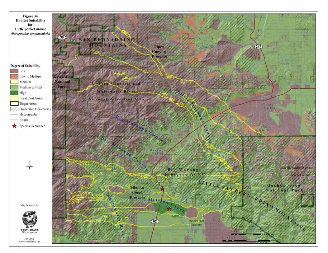
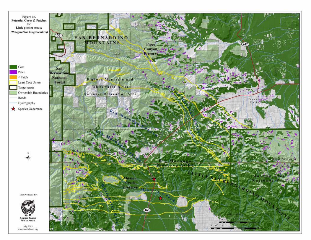

South Coast Missing Linkages San Bernardino-Little San Bernardino
This page intentionally left blank.

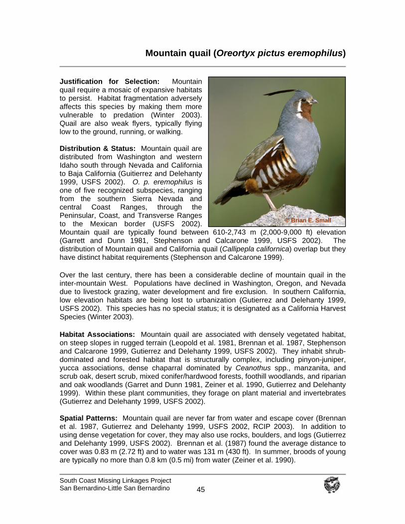
South Coast Missing Linkages Project San Bernardino-Little San Bernardino
45
Mountain quail (Oreortyx pictus eremophilus)
Justification for Selection: Mountain quail require a mosaic of expansive habitats to persist. Habitat fragmentation adversely affects this species by making them more vulnerable to predation (Winter 2003). Quail are also weak flyers, typically flying low to the ground, running, or walking. Distribution & Status: Mountain quail are distributed from Washington and western Idaho south through Nevada and California to Baja California (Guitierrez and Delehanty 1999, USFS 2002). O. p. eremophilus is one of five recognized subspecies, ranging from the southern Sierra Nevada and central Coast Ranges, through the Peninsular, Coast, and Transverse Ranges to the Mexican border (USFS 2002). Mountain quail are typically found between 610-2,743 m (2,000-9,000 ft) elevation (Garrett and Dunn 1981, Stephenson and Calcarone 1999, USFS 2002). The distribution of Mountain quail and California quail (Callipepla californica) overlap but they have distinct habitat requirements (Stephenson and Calcarone 1999).
Over the last century, there has been a considerable decline of mountain quail in the inter-mountain West. Populations have declined in Washington, Oregon, and Nevada due to livestock grazing, water development and fire exclusion. In southern California, low elevation habitats are being lost to urbanization (Gutierrez and Delehanty 1999, USFS 2002). This species has no special status; it is designated as a California Harvest Species (Winter 2003).
Habitat Associations: Mountain quail are associated with densely vegetated habitat, on steep slopes in rugged terrain (Leopold et al. 1981, Brennan et al. 1987, Stephenson and Calcarone 1999, Gutierrez and Delehanty 1999, USFS 2002). They inhabit shrub-dominated and forested habitat that is structurally complex, including pinyon-juniper, yucca associations, dense chaparral dominated by Ceanothus spp., manzanita, and scrub oak, desert scrub, mixed conifer/hardwood forests, foothill woodlands, and riparian and oak woodlands (Garret and Dunn 1981, Zeiner et al. 1990, Gutierrez and Delehanty 1999). Within these plant communities, they forage on plant material and invertebrates (Gutierrez and Delehanty 1999, USFS 2002). Spatial Patterns: Mountain quail are never far from water and escape cover (Brennan et al. 1987, Gutierrez and Delehanty 1999, USFS 2002, RCIP 2003). In addition to using dense vegetation for cover, they may also use rocks, boulders, and logs (Gutierrez and Delehanty 1999, USFS 2002). Brennan et al. (1987) found the average distance to cover was 0.83 m (2.72 ft) and to water was 131 m (430 ft). In summer, broods of young are typically no more than 0.8 km (0.5 mi) from water (Zeiner et al. 1990).
© Brian E. Small
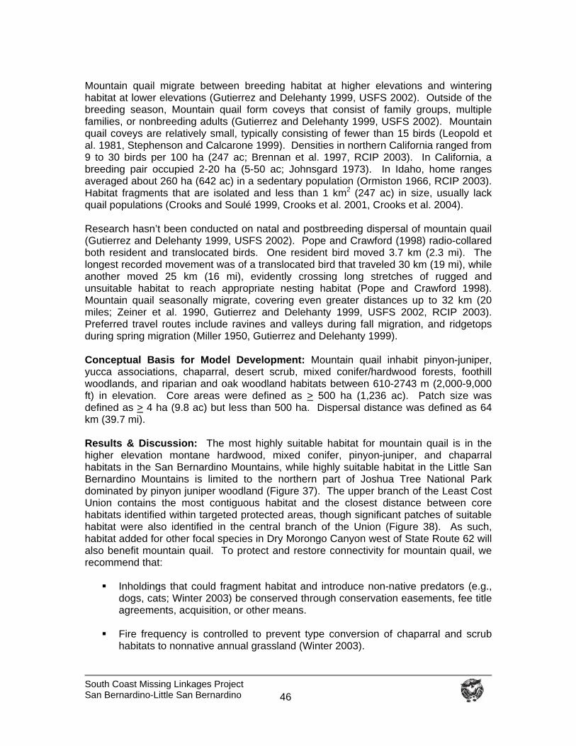
South Coast Missing Linkages Project San Bernardino-Little San Bernardino
46
Mountain quail migrate between breeding habitat at higher elevations and wintering habitat at lower elevations (Gutierrez and Delehanty 1999, USFS 2002). Outside of the breeding season, Mountain quail form coveys that consist of family groups, multiple families, or nonbreeding adults (Gutierrez and Delehanty 1999, USFS 2002). Mountain quail coveys are relatively small, typically consisting of fewer than 15 birds (Leopold et al. 1981, Stephenson and Calcarone 1999). Densities in northern California ranged from 9 to 30 birds per 100 ha (247 ac; Brennan et al. 1997, RCIP 2003). In California, a breeding pair occupied 2-20 ha (5-50 ac; Johnsgard 1973). In Idaho, home ranges averaged about 260 ha (642 ac) in a sedentary population (Ormiston 1966, RCIP 2003). Habitat fragments that are isolated and less than 1 km2 (247 ac) in size, usually lack quail populations (Crooks and Soulé 1999, Crooks et al. 2001, Crooks et al. 2004). Research hasn’t been conducted on natal and postbreeding dispersal of mountain quail (Gutierrez and Delehanty 1999, USFS 2002). Pope and Crawford (1998) radio-collared both resident and translocated birds. One resident bird moved 3.7 km (2.3 mi). The longest recorded movement was of a translocated bird that traveled 30 km (19 mi), while another moved 25 km (16 mi), evidently crossing long stretches of rugged and unsuitable habitat to reach appropriate nesting habitat (Pope and Crawford 1998). Mountain quail seasonally migrate, covering even greater distances up to 32 km (20 miles; Zeiner et al. 1990, Gutierrez and Delehanty 1999, USFS 2002, RCIP 2003). Preferred travel routes include ravines and valleys during fall migration, and ridgetops during spring migration (Miller 1950, Gutierrez and Delehanty 1999). Conceptual Basis for Model Development: Mountain quail inhabit pinyon-juniper, yucca associations, chaparral, desert scrub, mixed conifer/hardwood forests, foothill woodlands, and riparian and oak woodland habitats between 610-2743 m (2,000-9,000 ft) in elevation. Core areas were defined as > 500 ha (1,236 ac). Patch size was defined as > 4 ha (9.8 ac) but less than 500 ha. Dispersal distance was defined as 64 km (39.7 mi). Results & Discussion: The most highly suitable habitat for mountain quail is in the higher elevation montane hardwood, mixed conifer, pinyon-juniper, and chaparral habitats in the San Bernardino Mountains, while highly suitable habitat in the Little San Bernardino Mountains is limited to the northern part of Joshua Tree National Park dominated by pinyon juniper woodland (Figure 37). The upper branch of the Least Cost Union contains the most contiguous habitat and the closest distance between core habitats identified within targeted protected areas, though significant patches of suitable habitat were also identified in the central branch of the Union (Figure 38). As such, habitat added for other focal species in Dry Morongo Canyon west of State Route 62 will also benefit mountain quail. To protect and restore connectivity for mountain quail, we recommend that:
Inholdings that could fragment habitat and introduce non-native predators (e.g., dogs, cats; Winter 2003) be conserved through conservation easements, fee title agreements, acquisition, or other means.
Fire frequency is controlled to prevent type conversion of chaparral and scrub
habitats to nonnative annual grassland (Winter 2003).
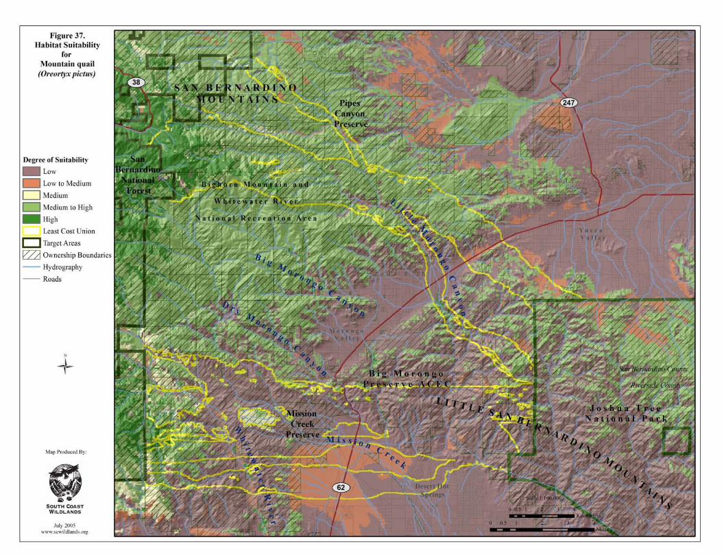
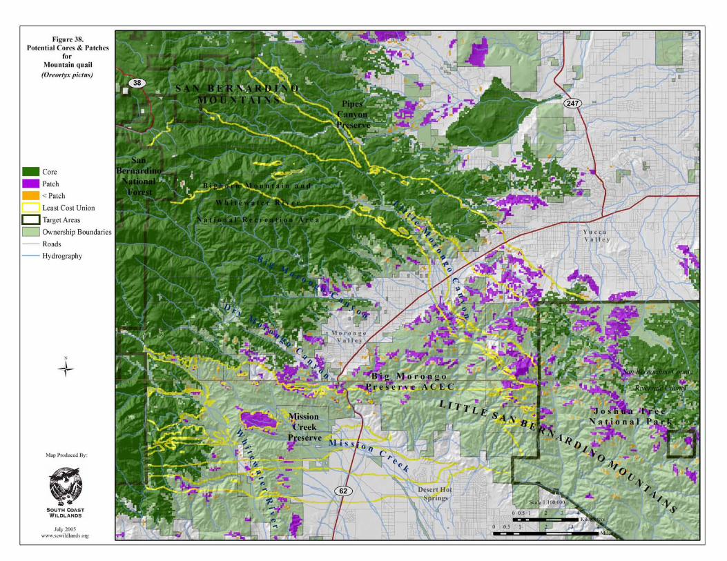
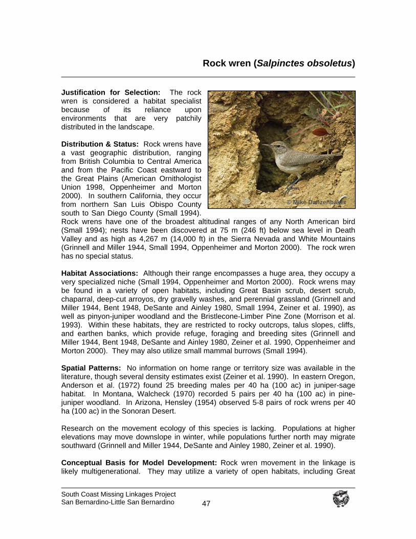
South Coast Missing Linkages Project San Bernardino-Little San Bernardino
47
Rock wren (Salpinctes obsoletus)
Justification for Selection: The rock wren is considered a habitat specialist because of its reliance upon environments that are very patchily distributed in the landscape. Distribution & Status: Rock wrens have a vast geographic distribution, ranging from British Columbia to Central America and from the Pacific Coast eastward to the Great Plains (American Ornithologist Union 1998, Oppenheimer and Morton 2000). In southern California, they occur from northern San Luis Obispo County south to San Diego County (Small 1994). Rock wrens have one of the broadest altitudinal ranges of any North American bird (Small 1994); nests have been discovered at 75 m (246 ft) below sea level in Death Valley and as high as 4,267 m (14,000 ft) in the Sierra Nevada and White Mountains (Grinnell and Miller 1944, Small 1994, Oppenheimer and Morton 2000). The rock wren has no special status. Habitat Associations: Although their range encompasses a huge area, they occupy a very specialized niche (Small 1994, Oppenheimer and Morton 2000). Rock wrens may be found in a variety of open habitats, including Great Basin scrub, desert scrub, chaparral, deep-cut arroyos, dry gravelly washes, and perennial grassland (Grinnell and Miller 1944, Bent 1948, DeSante and Ainley 1980, Small 1994, Zeiner et al. 1990), as well as pinyon-juniper woodland and the Bristlecone-Limber Pine Zone (Morrison et al. 1993). Within these habitats, they are restricted to rocky outcrops, talus slopes, cliffs, and earthen banks, which provide refuge, foraging and breeding sites (Grinnell and Miller 1944, Bent 1948, DeSante and Ainley 1980, Zeiner et al. 1990, Oppenheimer and Morton 2000). They may also utilize small mammal burrows (Small 1994). Spatial Patterns: No information on home range or territory size was available in the literature, though several density estimates exist (Zeiner et al. 1990). In eastern Oregon, Anderson et al. (1972) found 25 breeding males per 40 ha (100 ac) in juniper-sage habitat. In Montana, Walcheck (1970) recorded 5 pairs per 40 ha (100 ac) in pine-juniper woodland. In Arizona, Hensley (1954) observed 5-8 pairs of rock wrens per 40 ha (100 ac) in the Sonoran Desert. Research on the movement ecology of this species is lacking. Populations at higher elevations may move downslope in winter, while populations further north may migrate southward (Grinnell and Miller 1944, DeSante and Ainley 1980, Zeiner et al. 1990). Conceptual Basis for Model Development: Rock wren movement in the linkage is likely multigenerational. They may utilize a variety of open habitats, including Great
© Mike Danzenbaker
South Coast Missing Linkages Project San Bernardino-Little San Bernardino
48
Basin scrub, desert scrub, pinyon-juniper woodland, deep-cut arroyos, dry gravelly washes, perennial grassland, as well as rocky outcrops and barren areas within chaparral, montane hardwood conifer and mixed coniferous forests. Core areas were defined as > 290 ha (716 ac). Patch size was classified as > 3.2 ha (7.9 ac) but less than 290 ha. Dispersal distance was not estimated for this species. Results & Discussion: The habitat suitability analysis identified vast amounts of highly suitable habitat for rock wren, though the rocky outcrops preferred by this species are patchily distributed in a number of vegetation communities in the planning area (Figure 39). The central branch of the Least Cost Union contains the most contiguous highly suitable core habitat for this species (Figure 40). We believe that the linkage is likely to serve the needs of this species. To protect and maintain habitat for rock wren, we recommend discouraging rock collecting in creeks and washes, due to resulting changes in habitat structure and possible disruption of nests.
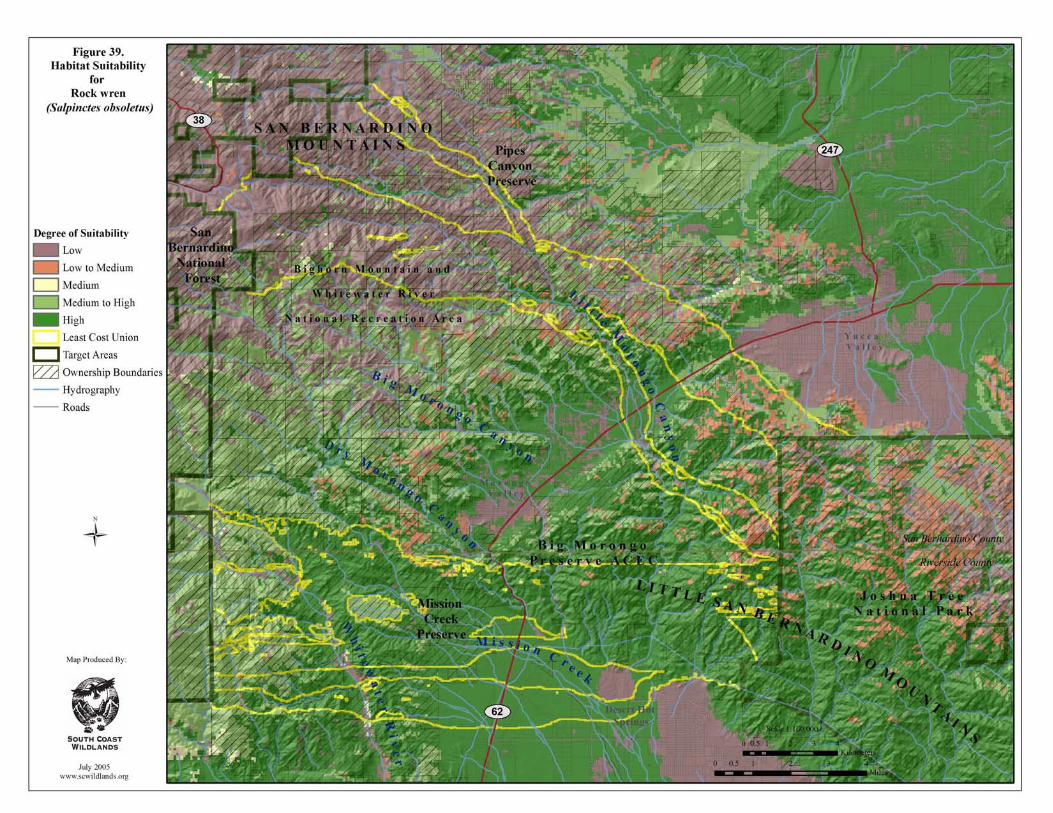
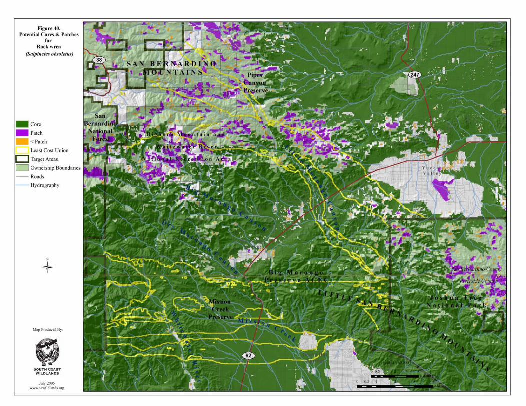
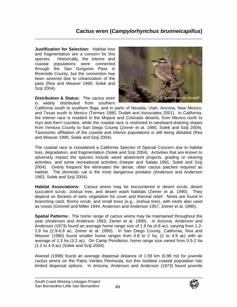
South Coast Missing Linkages Project San Bernardino-Little San Bernardino
49
Cactus wren (Campylorhynchus brunneicapillus)
Justification for Selection: Habitat loss and fragmentation are a concern for this species. Historically, the interior and coastal populations were connected through the San Gorgonio Pass in Riverside County, but the connection has been severed due to urbanization of the pass (Rea and Weaver 1990, Solek and Sziji 2004). Distribution & Status: The cactus wren is widely distributed from southern California south to southern Baja, and in parts of Nevada, Utah, Arizona, New Mexico, and Texas south to Mexico (Termes 1980, Dudek and Associates 2001). In California, the interior race is resident in the Mojave and Colorado deserts, from Mexico north to Inyo and Kern counties, while the coastal race is restricted to westward-draining slopes from Ventura County to San Diego County (Zeiner et al. 1990, Solek and Sziji 2004). Taxonomic affiliation of the coastal and interior populations is still being debated (Rea and Weaver 1990, Solek and Sziji 2004). The coastal race is considered a California Species of Special Concern due to habitat loss, degradation, and fragmentation (Solek and Sziji 2004). Activities that are known to adversely impact the species include weed abatement projects, grading or clearing activities, and some recreational activities (Harper and Salata 1991, Solek and Sziji 2004). Overly frequent fire eliminates the dense, older cactus patches required as habitat. The domestic cat is the most dangerous predator (Anderson and Anderson 1963, Solek and Sziji 2004). Habitat Associations: Cactus wrens may be encountered in desert scrub, desert succulent scrub, Joshua tree, and desert wash habitats (Zeiner et al. 1990). They depend on thickets of xeric vegetation for cover and thermal relief. Nests are found in branching cacti, thorny scrub, and small trees (e.g., Joshua tree), with nests also used as roosts (Grinnell and Miller 1944, Anderson and Anderson 1957, Zeiner et al. 1990). Spatial Patterns: The home range of cactus wrens may be maintained throughout the year (Anderson and Anderson 1963, Zeiner et al. 1990). In Arizona, Anderson and Anderson (1973) found an average home range size of 1.9 ha (4.8 ac), varying from 1.2-2.8 ha (2.9-6.9 ac; Zeiner et al. 1990). In San Diego County, California, Rea and Weaver (1990) found smaller home ranges from 0.8 to 2 ha, (2 to 4.9 ac) with an average of 1.3 ha (3.2 ac). On Camp Pendleton, home range size varied from 0.5-2 ha (1.2 to 4.9 ac) (Solek and Sziji 2004).
Atwood (1998) found an average dispersal distance of 1.59 km (0.98 mi) for juvenile cactus wrens on the Palos Verdes Peninsula, but this isolated coastal population has limited dispersal options. In Arizona, Anderson and Anderson (1973) found juvenile
© John Van de Graaff
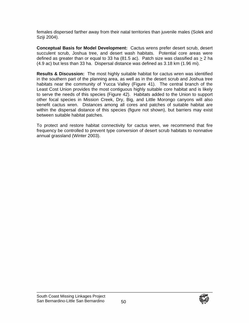
South Coast Missing Linkages Project San Bernardino-Little San Bernardino
50
females dispersed farther away from their natal territories than juvenile males (Solek and Sziji 2004).
Conceptual Basis for Model Development: Cactus wrens prefer desert scrub, desert succulent scrub, Joshua tree, and desert wash habitats. Potential core areas were defined as greater than or equal to 33 ha (81.5 ac). Patch size was classified as > 2 ha (4.9 ac) but less than 33 ha. Dispersal distance was defined as 3.18 km (1.96 mi). Results & Discussion: The most highly suitable habitat for cactus wren was identified in the southern part of the planning area, as well as in the desert scrub and Joshua tree habitats near the community of Yucca Valley (Figure 41). The central branch of the Least Cost Union provides the most contiguous highly suitable core habitat and is likely to serve the needs of this species (Figure 42). Habitats added to the Union to support other focal species in Mission Creek, Dry, Big, and Little Morongo canyons will also benefit cactus wren. Distances among all cores and patches of suitable habitat are within the dispersal distance of this species (figure not shown), but barriers may exist between suitable habitat patches. To protect and restore habitat connectivity for cactus wren, we recommend that fire frequency be controlled to prevent type conversion of desert scrub habitats to nonnative annual grassland (Winter 2003).
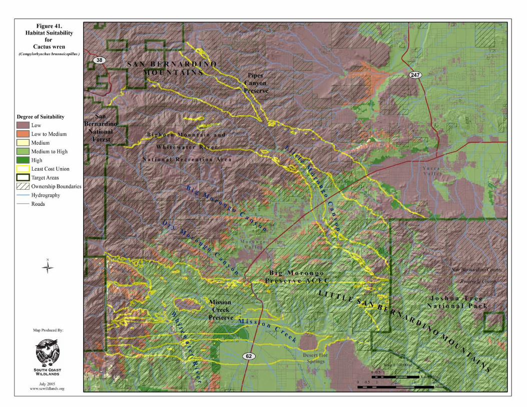
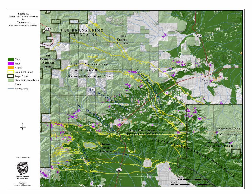
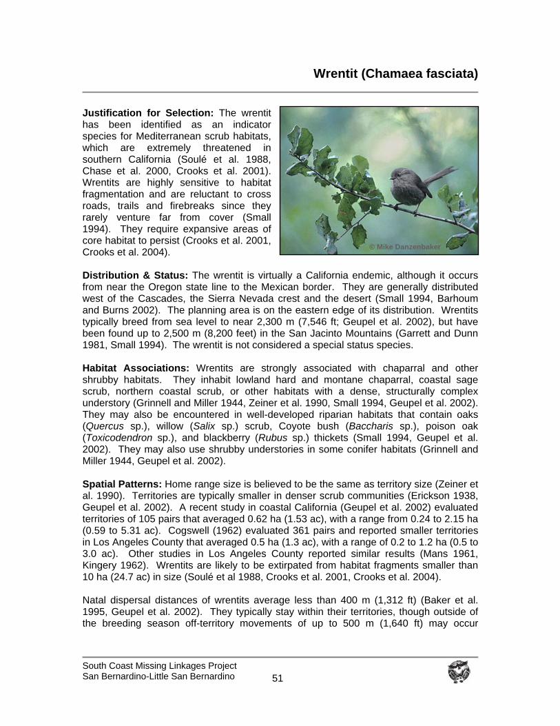
South Coast Missing Linkages Project San Bernardino-Little San Bernardino
51
Wrentit (Chamaea fasciata)
Justification for Selection: The wrentit has been identified as an indicator species for Mediterranean scrub habitats, which are extremely threatened in southern California (Soulé et al. 1988, Chase et al. 2000, Crooks et al. 2001). Wrentits are highly sensitive to habitat fragmentation and are reluctant to cross roads, trails and firebreaks since they rarely venture far from cover (Small 1994). They require expansive areas of core habitat to persist (Crooks et al. 2001, Crooks et al. 2004). Distribution & Status: The wrentit is virtually a California endemic, although it occurs from near the Oregon state line to the Mexican border. They are generally distributed west of the Cascades, the Sierra Nevada crest and the desert (Small 1994, Barhoum and Burns 2002). The planning area is on the eastern edge of its distribution. Wrentits typically breed from sea level to near 2,300 m (7,546 ft; Geupel et al. 2002), but have been found up to 2,500 m (8,200 feet) in the San Jacinto Mountains (Garrett and Dunn 1981, Small 1994). The wrentit is not considered a special status species. Habitat Associations: Wrentits are strongly associated with chaparral and other shrubby habitats. They inhabit lowland hard and montane chaparral, coastal sage scrub, northern coastal scrub, or other habitats with a dense, structurally complex understory (Grinnell and Miller 1944, Zeiner et al. 1990, Small 1994, Geupel et al. 2002). They may also be encountered in well-developed riparian habitats that contain oaks (Quercus sp.), willow (Salix sp.) scrub, Coyote bush (Baccharis sp.), poison oak (Toxicodendron sp.), and blackberry (Rubus sp.) thickets (Small 1994, Geupel et al. 2002). They may also use shrubby understories in some conifer habitats (Grinnell and Miller 1944, Geupel et al. 2002). Spatial Patterns: Home range size is believed to be the same as territory size (Zeiner et al. 1990). Territories are typically smaller in denser scrub communities (Erickson 1938, Geupel et al. 2002). A recent study in coastal California (Geupel et al. 2002) evaluated territories of 105 pairs that averaged 0.62 ha (1.53 ac), with a range from 0.24 to 2.15 ha (0.59 to 5.31 ac). Cogswell (1962) evaluated 361 pairs and reported smaller territories in Los Angeles County that averaged 0.5 ha (1.3 ac), with a range of 0.2 to 1.2 ha (0.5 to 3.0 ac). Other studies in Los Angeles County reported similar results (Mans 1961, Kingery 1962). Wrentits are likely to be extirpated from habitat fragments smaller than 10 ha (24.7 ac) in size (Soulé et al 1988, Crooks et al. 2001, Crooks et al. 2004). Natal dispersal distances of wrentits average less than 400 m (1,312 ft) (Baker et al. 1995, Geupel et al. 2002). They typically stay within their territories, though outside of the breeding season off-territory movements of up to 500 m (1,640 ft) may occur
© Mike Danzenbaker
South Coast Missing Linkages Project San Bernardino-Little San Bernardino
52
(Geupel et al. 2002). In mountainous regions, juveniles may move upslope after the breeding season (Garrett and Dunn 1981, Small 1994). . Conceptual Basis for Model Development: Movement in the linkage is likely multigenerational. The wrentit requires dense habitats with plenty of cover. They prefer chaparral and coastal sage scrub, but may also be found in other habitats with dense cover. Core areas were defined as >14 ha (34.5 ac), while patch size was classified as > 1 ha (2.47) but <14 ha. Dispersal distance was defined as 1 km (0.62 mi). Results & Discussion: The wrentit was selected to maintain linkage integrity in the transition from coastal to desert habitats. The most extensive highly suitable habitat in the planning area is in the coastal foothills and on the eastern slopes of the San Bernardino Mountains, while suitable habitat below State Route 62 is primarily limited to the mixed chaparral in Big Morongo Preserve (Figure 43). Very little core habitat was identified in the Little San Bernardino Mountains, but if habitat is added to the central branch of the Least Cost Union in Dry Morongo Canyon (Figure 15), there would be a direct connection between core areas and patches of suitable habitat (Figure 44). The majority of cores and patches of suitable habitat are within the dispersal distance defined for this species (Figure 45), although numerous barriers to movement may exist between suitable habitat patches. We conclude that the linkage is likely to serve the needs of this species for movement among populations if habitat is added to the Union in Dry Morongo Canyon. To protect and restore habitat connectivity for wrentits, we recommend that:
Inholdings that could fragment habitat and introduce non-native predators (e.g., dogs, cats; Winter 2003) be conserved through conservation easements, fee title agreements, or other means.
Fire frequency is controlled to prevent type conversion of chaparral and scrub
habitats to nonnative annual grassland (Winter 2003).
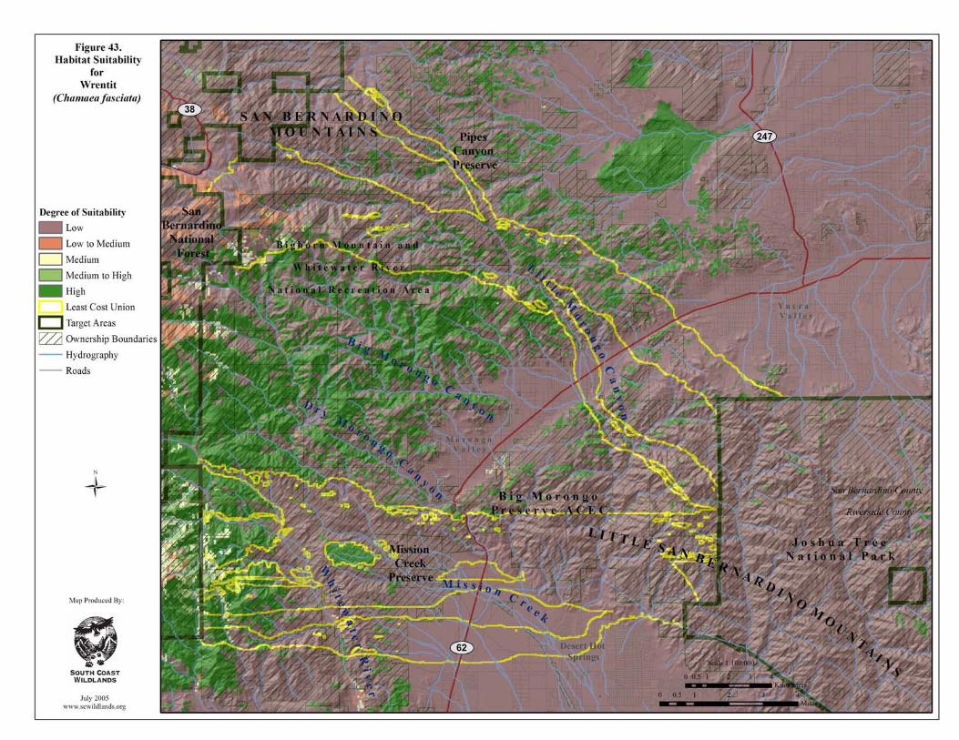
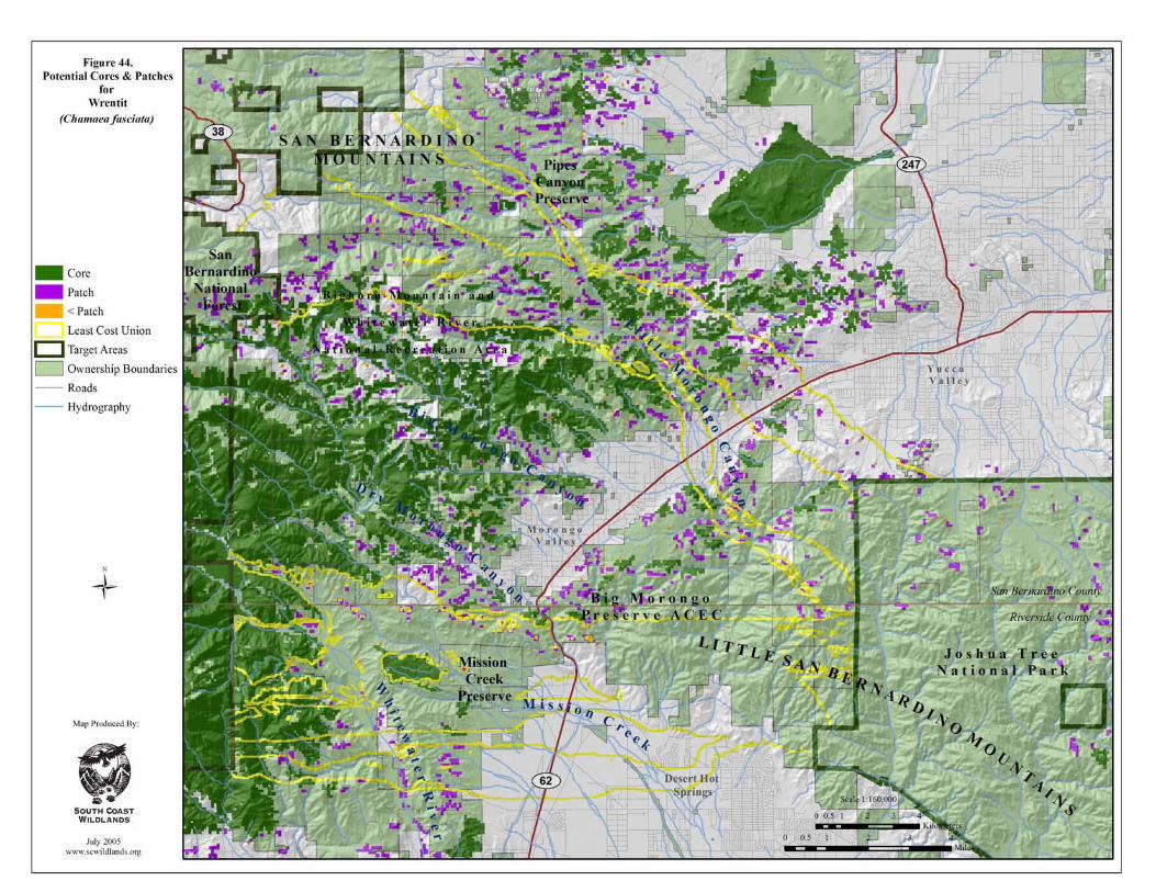
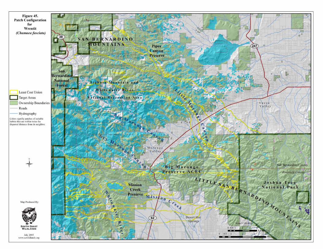
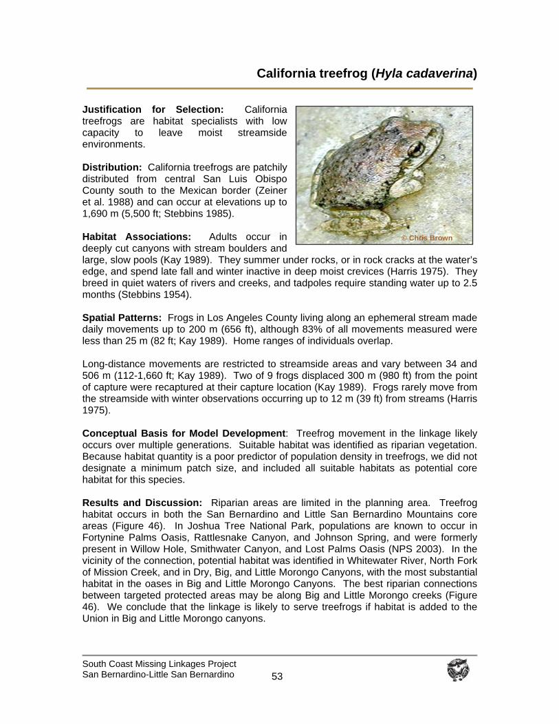
South Coast Missing Linkages Project San Bernardino-Little San Bernardino
53
California treefrog (Hyla cadaverina)
Justification for Selection: California treefrogs are habitat specialists with low capacity to leave moist streamside environments. Distribution: California treefrogs are patchily distributed from central San Luis Obispo County south to the Mexican border (Zeiner et al. 1988) and can occur at elevations up to 1,690 m (5,500 ft; Stebbins 1985). Habitat Associations: Adults occur in deeply cut canyons with stream boulders and large, slow pools (Kay 1989). They summer under rocks, or in rock cracks at the water’s edge, and spend late fall and winter inactive in deep moist crevices (Harris 1975). They breed in quiet waters of rivers and creeks, and tadpoles require standing water up to 2.5 months (Stebbins 1954). Spatial Patterns: Frogs in Los Angeles County living along an ephemeral stream made daily movements up to 200 m (656 ft), although 83% of all movements measured were less than 25 m (82 ft; Kay 1989). Home ranges of individuals overlap. Long-distance movements are restricted to streamside areas and vary between 34 and 506 m (112-1,660 ft; Kay 1989). Two of 9 frogs displaced 300 m (980 ft) from the point of capture were recaptured at their capture location (Kay 1989). Frogs rarely move from the streamside with winter observations occurring up to 12 m (39 ft) from streams (Harris 1975). Conceptual Basis for Model Development: Treefrog movement in the linkage likely occurs over multiple generations. Suitable habitat was identified as riparian vegetation. Because habitat quantity is a poor predictor of population density in treefrogs, we did not designate a minimum patch size, and included all suitable habitats as potential core habitat for this species. Results and Discussion: Riparian areas are limited in the planning area. Treefrog habitat occurs in both the San Bernardino and Little San Bernardino Mountains core areas (Figure 46). In Joshua Tree National Park, populations are known to occur in Fortynine Palms Oasis, Rattlesnake Canyon, and Johnson Spring, and were formerly present in Willow Hole, Smithwater Canyon, and Lost Palms Oasis (NPS 2003). In the vicinity of the connection, potential habitat was identified in Whitewater River, North Fork of Mission Creek, and in Dry, Big, and Little Morongo Canyons, with the most substantial habitat in the oases in Big and Little Morongo Canyons. The best riparian connections between targeted protected areas may be along Big and Little Morongo creeks (Figure 46). We conclude that the linkage is likely to serve treefrogs if habitat is added to the Union in Big and Little Morongo canyons.
© Chris Brown
South Coast Missing Linkages Project San Bernardino-Little San Bernardino
54
To restore and protect habitat connections for treefrogs between the San Bernardino and Little San Bernardino Mountains, we recommend that:
Riparian habitats (needed for breeding and movement) are restored.
Invasive species that destroy treefrog habitat (e.g., giant reed, tamarisk) or prey on tadpoles (e.g., bullfrogs and non-native fish) are eradicated or controlled.
Residents and the general public are informed about invasive species issues.
Road barriers be modified, where necessary, to allow amphibians to move along
riparian corridors.
Water quality that is compromised by runoff be restored.
Feral cattle are removed where they impact riparian resources.
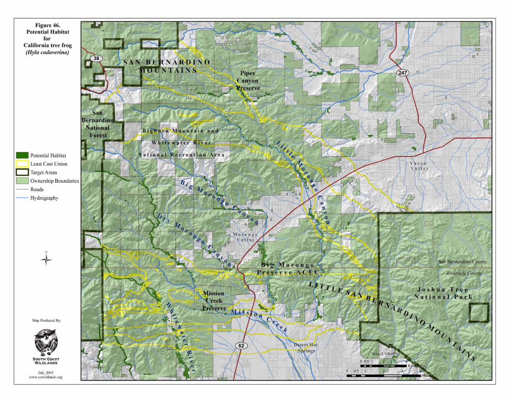
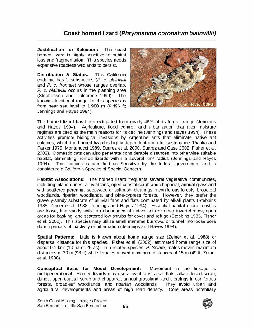
South Coast Missing Linkages Project San Bernardino-Little San Bernardino
55
Coast horned lizard (Phrynosoma coronatum blainvillii)
Justification for Selection: The coast horned lizard is highly sensitive to habitat loss and fragmentation. This species needs expansive roadless wildlands to persist. Distribution & Status: This California endemic has 2 subspecies (P. c. blainvillii and P. c. frontale) whose ranges overlap. P. c. blainvillii occurs in the planning area (Stephenson and Calcarone 1999). The known elevational range for this species is from near sea level to 1,980 m (6,496 ft; Jennings and Hayes 1994). The horned lizard has been extirpated from nearly 45% of its former range (Jennings and Hayes 1994). Agriculture, flood control, and urbanization that alter moisture regimes are cited as the main reasons for its decline (Jennings and Hayes 1994). These activities promote biological invasions by Argentine ants that eliminate native ant colonies, which the horned lizard is highly dependent upon for sustenance (Pianka and Parker 1975, Montanucci 1989, Suarez et al. 2000, Suarez and Case 2002, Fisher et al. 2002). Domestic cats can also penetrate considerable distances into otherwise suitable habitat, eliminating horned lizards within a several km² radius (Jennings and Hayes 1994). This species is identified as Sensitive by the federal government and is considered a California Species of Special Concern. Habitat Associations: The horned lizard frequents several vegetative communities, including inland dunes, alluvial fans, open coastal scrub and chaparral, annual grassland with scattered perennial seepweed or saltbush, clearings in coniferous forests, broadleaf woodlands, riparian woodlands, and pine-cypress forests. However, they prefer the gravelly-sandy substrate of alluvial fans and flats dominated by alkali plants (Stebbins 1985, Zeiner et al. 1988, Jennings and Hayes 1994). Essential habitat characteristics are loose, fine sandy soils, an abundance of native ants or other invertebrates, open areas for basking, and scattered low shrubs for cover and refuge (Stebbins 1985, Fisher et al. 2002). This species may utilize small mammal burrows, or tunnel into loose soils during periods of inactivity or hibernation (Jennings and Hayes 1994). Spatial Patterns: Little is known about home range size (Zeiner et al. 1988) or dispersal distance for this species. Fisher et al. (2002), estimated home range size of about 0.1 km2 (10 ha or 25 ac). In a related species, P. Solare, males moved maximum distances of 30 m (98 ft) while females moved maximum distances of 15 m (49 ft; Zeiner et al. 1988). Conceptual Basis for Model Development: Movement in the linkage is multigenerational. Horned lizards may use alluvial fans, alkali flats, alkali desert scrub, dunes, open coastal scrub and chaparral, annual grassland, and clearings in coniferous forests, broadleaf woodlands, and riparian woodlands. They avoid urban and agricultural developments and areas of high road density. Core areas potentially
© Tim Hovey, CDFG
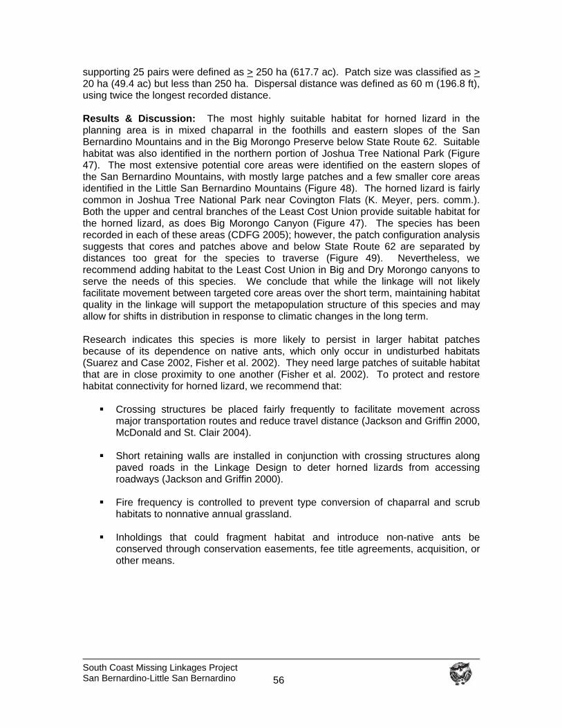
South Coast Missing Linkages Project San Bernardino-Little San Bernardino
56
supporting 25 pairs were defined as > 250 ha (617.7 ac). Patch size was classified as > 20 ha (49.4 ac) but less than 250 ha. Dispersal distance was defined as 60 m (196.8 ft), using twice the longest recorded distance. Results & Discussion: The most highly suitable habitat for horned lizard in the planning area is in mixed chaparral in the foothills and eastern slopes of the San Bernardino Mountains and in the Big Morongo Preserve below State Route 62. Suitable habitat was also identified in the northern portion of Joshua Tree National Park (Figure 47). The most extensive potential core areas were identified on the eastern slopes of the San Bernardino Mountains, with mostly large patches and a few smaller core areas identified in the Little San Bernardino Mountains (Figure 48). The horned lizard is fairly common in Joshua Tree National Park near Covington Flats (K. Meyer, pers. comm.). Both the upper and central branches of the Least Cost Union provide suitable habitat for the horned lizard, as does Big Morongo Canyon (Figure 47). The species has been recorded in each of these areas (CDFG 2005); however, the patch configuration analysis suggests that cores and patches above and below State Route 62 are separated by distances too great for the species to traverse (Figure 49). Nevertheless, we recommend adding habitat to the Least Cost Union in Big and Dry Morongo canyons to serve the needs of this species. We conclude that while the linkage will not likely facilitate movement between targeted core areas over the short term, maintaining habitat quality in the linkage will support the metapopulation structure of this species and may allow for shifts in distribution in response to climatic changes in the long term. Research indicates this species is more likely to persist in larger habitat patches because of its dependence on native ants, which only occur in undisturbed habitats (Suarez and Case 2002, Fisher et al. 2002). They need large patches of suitable habitat that are in close proximity to one another (Fisher et al. 2002). To protect and restore habitat connectivity for horned lizard, we recommend that:
Crossing structures be placed fairly frequently to facilitate movement across major transportation routes and reduce travel distance (Jackson and Griffin 2000, McDonald and St. Clair 2004).
Short retaining walls are installed in conjunction with crossing structures along
paved roads in the Linkage Design to deter horned lizards from accessing roadways (Jackson and Griffin 2000).
Fire frequency is controlled to prevent type conversion of chaparral and scrub
habitats to nonnative annual grassland.
Inholdings that could fragment habitat and introduce non-native ants be conserved through conservation easements, fee title agreements, acquisition, or other means.
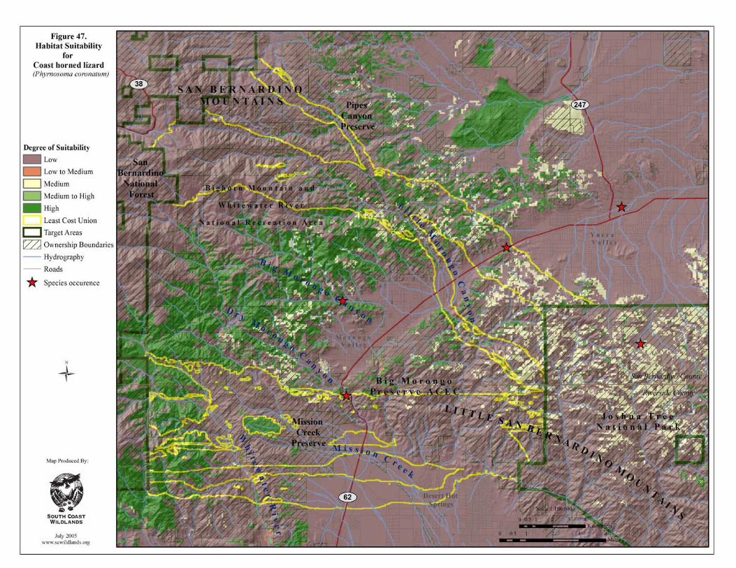
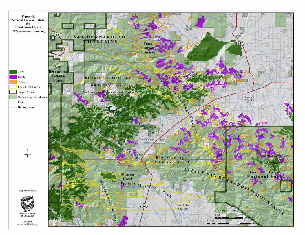

South Coast Missing Linkages San Bernardino-Little San Bernardino
This page intentionally left blank.
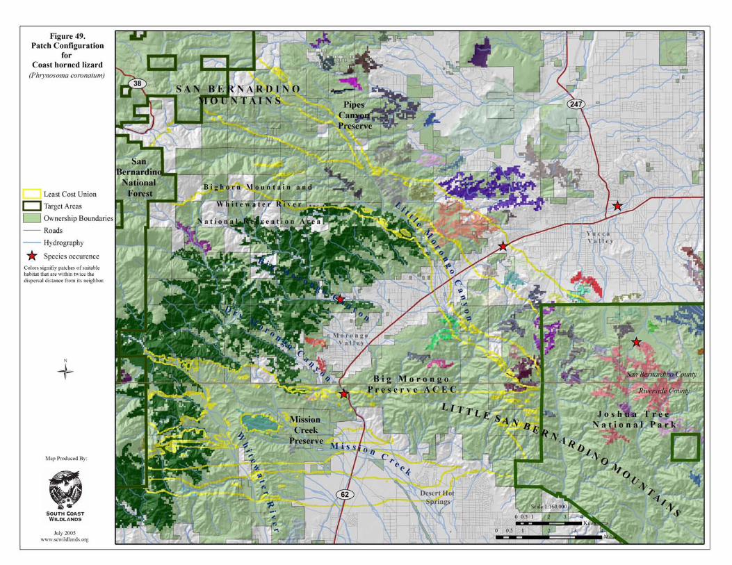
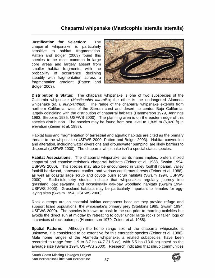
South Coast Missing Linkages Project San Bernardino-Little San Bernardino
57
Chaparral whipsnake (Masticophis lateralis lateralis)
Justification for Selection: The chaparral whipsnake is particularly sensitive to habitat fragmentation. Patten and Bolger (2003) found this species to be most common in large core areas and largely absent from smaller habitat fragments, with the probability of occurrence declining steadily with fragmentation across a fragmentation gradient (Patten and Bolger 2003). Distribution & Status: The chaparral whipsnake is one of two subspecies of the California whipsnake (Masticophis lateralis); the other is the endangered Alameda whipsnake (M. l. euryxanthus). The range of the chaparral whipsnake extends from northern California, west of the Sierran crest and desert, to central Baja California, largely coinciding with the distribution of chaparral habitats (Hammerson 1979, Jennings 1983, Stebbins 1985, USFWS 2000). The planning area is on the eastern edge of this species distribution. The species may be found from sea level to 1,835 m (6,020 ft) in elevation (Zeiner et al. 1988). Habitat loss and fragmentation of terrestrial and aquatic habitats are cited as the primary threats to the whipsnake (USFWS 2000, Patten and Bolger 2003). Habitat conversion and alteration, including water diversions and groundwater pumping, are likely barriers to dispersal (USFWS 2000). The chaparral whipsnake isn’t a special status species. Habitat Associations: The chaparral whipsnake, as its name implies, prefers mixed chaparral and chamise-redshank chaparral habitats (Zeiner et al. 1988, Swaim 1994, USFWS 2000). This species may also be encountered in valley foothill riparian, valley foothill hardwood, hardwood conifer, and various coniferous forests (Zeiner et al. 1988), as well as coastal sage scrub and coyote bush scrub habitats (Swaim 1994, USFWS 2000). Radio-telemetry studies indicate that whipsnakes regularly journey into grassland, oak savanna, and occasionally oak-bay woodland habitats (Swaim 1994, USFWS 2000). Grassland habitats may be particularly important to females for egg-laying sites (Swaim 1994, USFWS 2000). Rock outcrops are an essential habitat component because they provide refuge and support lizard populations, the whipsnake’s primary prey (Stebbins 1985, Swaim 1994, USFWS 2000). The species is known to bask in the sun prior to morning activities but avoids the direct sun at midday by retreating to cover under large rocks or fallen logs or in crevices of rock outcrops (Hammerson 1979, Zeiner et al. 1988). Spatial Patterns: Although the home range size of the chaparral whipsnake is unknown, it is considered to be extensive for this energetic species (Zeiner et al. 1988). Male home ranges of the Alameda whipsnake, a related subspecies, have been recorded to range from 1.9 to 8.7 ha (4.7-21.5 ac), with 5.5 ha (13.6 ac) noted as the average size (Swaim 1994, USFWS 2000). Research indicates that shrub communities
© Chris Brown, USGS
South Coast Missing Linkages Project San Bernardino-Little San Bernardino
58
are the focal point of home ranges, though whipsnakes make frequent excursions into adjacent habitats (Swaim 1994, USFWS 2000). Radio-telemetry data suggest most whipsnakes are within 50 m (170 ft) of scrub habitat, though distances greater than 150 m (500 ft) have been recorded (Swaim 1994, USFWS 2000). The whipsnake is a swift moving snake (Hammerson 1979). The striped whipsnake (M. t. taeniatus), an allied species, moved 3.6 km (2.24 mi) after emerging from its hibernaculum (Hirth et al. 1969), and it is likely that the chaparral whipsnake is capable of similar long distance movements (USFWS 2000). Conceptual Basis for Model Development: The chaparral whipsnake preferentially moves through mixed chaparral and chamise-redshank chaparral habitats, but it may also be encountered in other riparian, woodland, scrub, and grassland habitats below 1835 m (6,020 ft). Core areas were identified as >137.5 ha (340 ac). Patch size was defined as > 3.8 ha (9.4 ac), but less than 137.5 ha. Dispersal distance was estimated at 7.2 km (4.47 mi), or twice the longest distance recorded for an associated species. Results & Discussion: Highly suitable habitat for the chaparral whipsnake largely follows the distribution of chaparral habitats in the planning area (Figure 50). The spatial configuration of suitable habitat is fairly extensive on the slopes of the San Bernardino Mountains and extremely limited below State Route 62 in the Little San Bernardino Mountains. Potential core areas were only identified in the San Bernardino Mountains (Figure 51). The upper branch of the Least Cost Union encompasses fairly large patches of highly suitable habitat for this species, while habitat just outside of the central branch in Dry Morongo Canyon provides the closest distance between suitable habitat patches. We recommend adding habitat to the Least Cost Union in Dry Morongo Canyon to serve the needs of this species. All core areas and patches of suitable habitat are within the dispersal distance of this species (figure not shown), although barriers to movement may exist between suitable habitat patches. We conclude that the linkage is likely to serve the needs of this species for movement among populations if habitat is added to the Union in Dry Morongo Canyon. Habitats added to the Union in Big Morongo Canyon to support the needs of other focal species will also benefit the whipsnake. To protect and maintain habitat connectivity between these ranges for the whipsnake, we recommend that:
Crossing structures be placed fairly frequently to facilitate movement across major transportation routes and reduce travel distance (Jackson and Griffin 2000, McDonald and St. Clair 2004).
Fire frequency is controlled to prevent type conversion of chaparral and scrub
habitats to nonnative annual grassland.
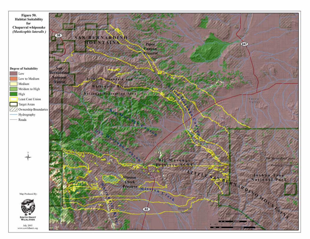
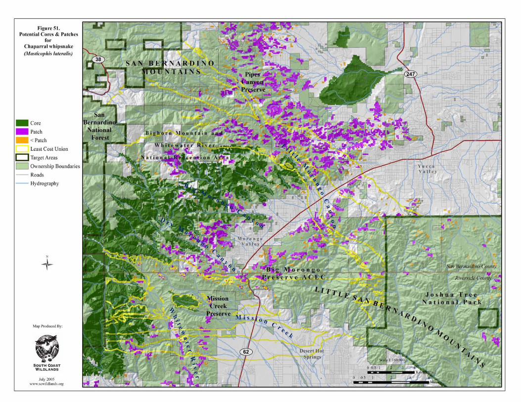
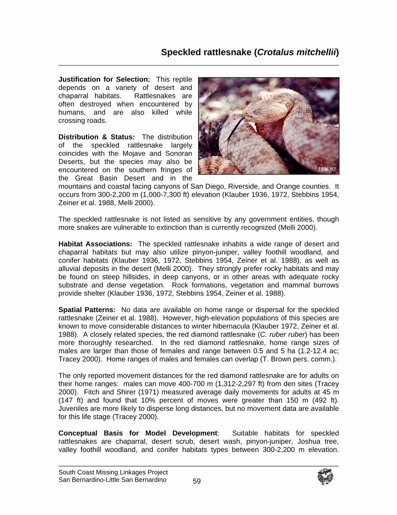
South Coast Missing Linkages Project San Bernardino-Little San Bernardino
59
Speckled rattlesnake (Crotalus mitchellii)
Justification for Selection: This reptile depends on a variety of desert and chaparral habitats. Rattlesnakes are often destroyed when encountered by humans, and are also killed while crossing roads. Distribution & Status: The distribution of the speckled rattlesnake largely coincides with the Mojave and Sonoran Deserts, but the species may also be encountered on the southern fringes of the Great Basin Desert and in the mountains and coastal facing canyons of San Diego, Riverside, and Orange counties. It occurs from 300-2,200 m (1,000-7,300 ft) elevation (Klauber 1936, 1972, Stebbins 1954, Zeiner et al. 1988, Melli 2000). The speckled rattlesnake is not listed as sensitive by any government entities, though more snakes are vulnerable to extinction than is currently recognized (Melli 2000). Habitat Associations: The speckled rattlesnake inhabits a wide range of desert and chaparral habitats but may also utilize pinyon-juniper, valley foothill woodland, and conifer habitats (Klauber 1936, 1972, Stebbins 1954, Zeiner et al. 1988), as well as alluvial deposits in the desert (Melli 2000). They strongly prefer rocky habitats and may be found on steep hillsides, in deep canyons, or in other areas with adequate rocky substrate and dense vegetation. Rock formations, vegetation and mammal burrows provide shelter (Klauber 1936, 1972, Stebbins 1954, Zeiner et al. 1988). Spatial Patterns: No data are available on home range or dispersal for the speckled rattlesnake (Zeiner et al. 1988). However, high-elevation populations of this species are known to move considerable distances to winter hibernacula (Klauber 1972, Zeiner et al. 1988). A closely related species, the red diamond rattlesnake (C. ruber ruber) has been more thoroughly researched. In the red diamond rattlesnake, home range sizes of males are larger than those of females and range between 0.5 and 5 ha (1.2-12.4 ac; Tracey 2000). Home ranges of males and females can overlap (T. Brown pers. comm.). The only reported movement distances for the red diamond rattlesnake are for adults on their home ranges: males can move 400-700 m (1,312-2,297 ft) from den sites (Tracey 2000). Fitch and Shirer (1971) measured average daily movements for adults at 45 m (147 ft) and found that 10% percent of moves were greater than 150 m (492 ft). Juveniles are more likely to disperse long distances, but no movement data are available for this life stage (Tracey 2000). Conceptual Basis for Model Development: Suitable habitats for speckled rattlesnakes are chaparral, desert scrub, desert wash, pinyon-juniper, Joshua tree, valley foothill woodland, and conifer habitats types between 300-2,200 m elevation.
South Coast Missing Linkages Project San Bernardino-Little San Bernardino
60
Core areas were defined as greater than or equal to 2.5 km2 (617 ac). Patch size was classified as > 0.10 km2 (24.7 ac) but < 2.5 km2. Dispersal distance is 1400 m (4,593 ft), or twice the maximum recorded movement for an adult red diamond rattlesnake. Results & Discussion: Suitable habitat for the speckled rattlesnake is widespread in the planning are (Figure 52). Almost all suitable habitat identified in the planning area was designated as core habitat with fairly contiguous core habitat identified in all branches of the Least Cost Union (Figure 53). This species has been recorded in the central branch of the union near upper Mission Creek, at State Route 62 near Mission Creek, along the Whitewater River, and in Joshua Tree National Park (Figures 52, 53). Despite the relatively short dispersal distance adopted for the model, rattlesnakes are able to move among habitat patches due to the relatively high levels of habitat continuity (figure not shown), though barriers to movement may exist between suitable habitat patches. We conclude the linkage is likely to serve this species. To protect and restore habitat connectivity for the speckled rattlesnake, we recommend that:
Crossing structures be placed fairly frequently to facilitate movement across major transportation routes and reduce travel distance (Jackson and Griffin 2000, McDonald and St. Clair 2004).
Fire frequency is controlled to prevent type conversion of chaparral and scrub
habitats to nonnative annual grassland.
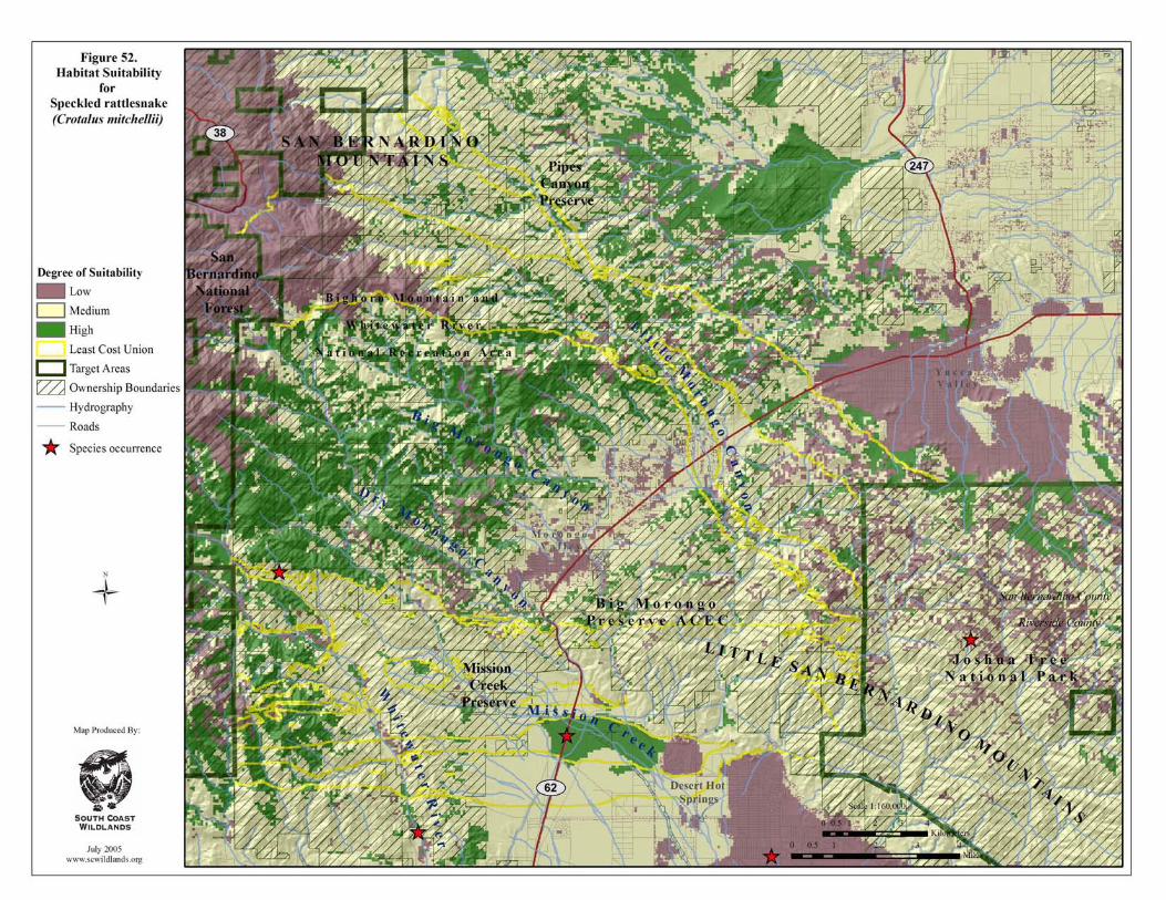
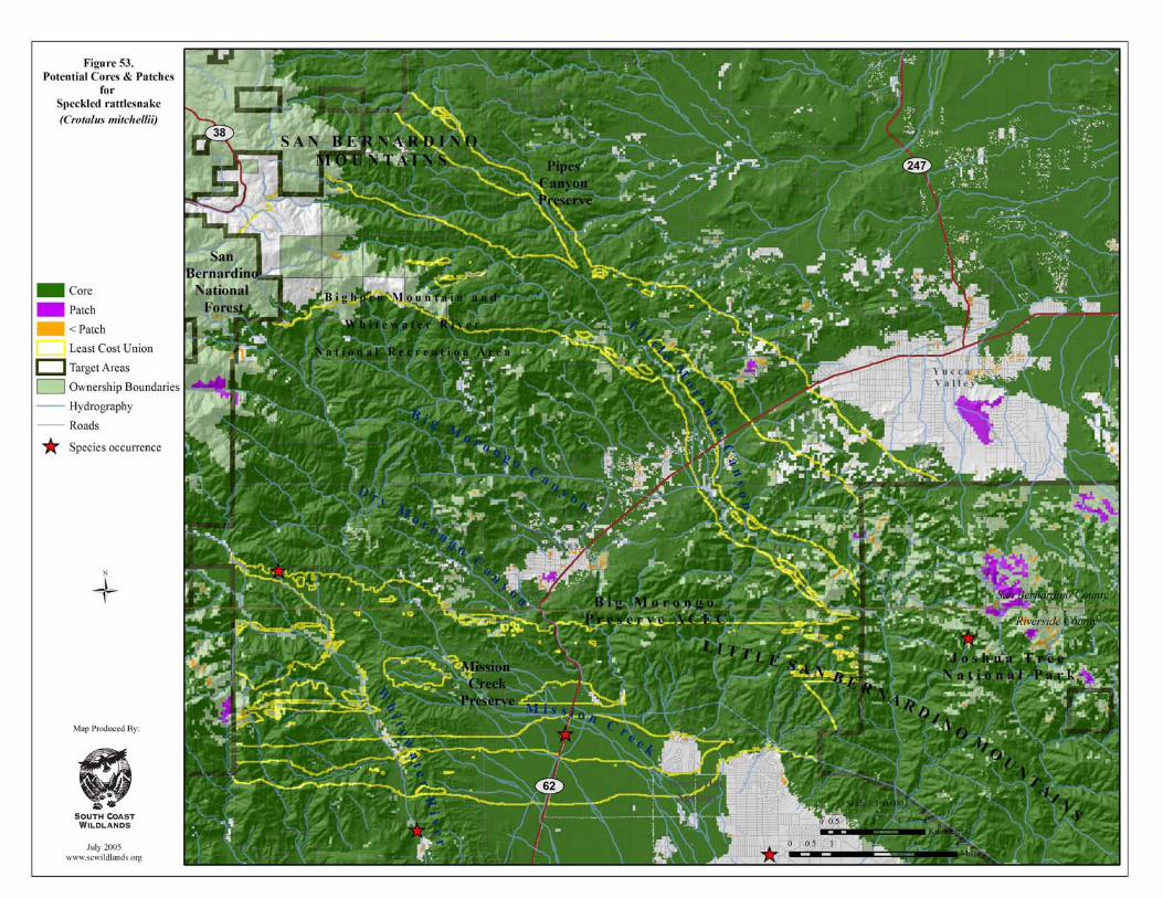
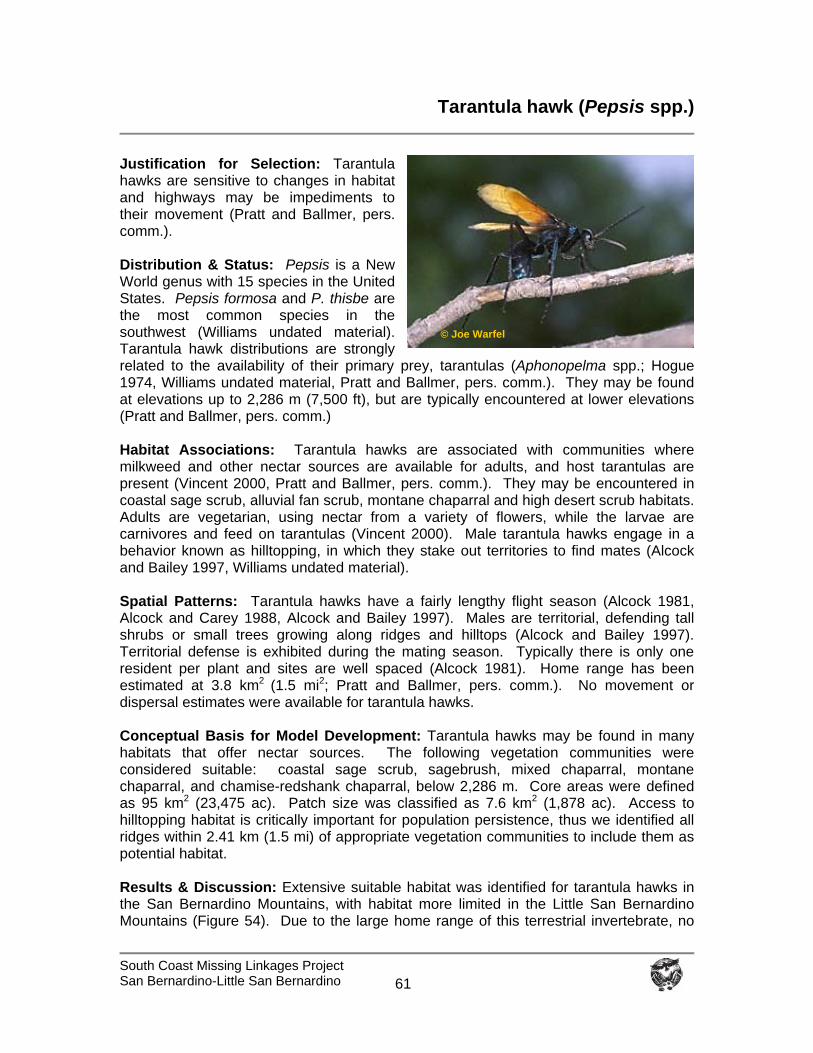
South Coast Missing Linkages Project San Bernardino-Little San Bernardino
61
Tarantula hawk (Pepsis spp.)
Justification for Selection: Tarantula hawks are sensitive to changes in habitat and highways may be impediments to their movement (Pratt and Ballmer, pers. comm.). Distribution & Status: Pepsis is a New World genus with 15 species in the United States. Pepsis formosa and P. thisbe are the most common species in the southwest (Williams undated material). Tarantula hawk distributions are strongly related to the availability of their primary prey, tarantulas (Aphonopelma spp.; Hogue 1974, Williams undated material, Pratt and Ballmer, pers. comm.). They may be found at elevations up to 2,286 m (7,500 ft), but are typically encountered at lower elevations (Pratt and Ballmer, pers. comm.) Habitat Associations: Tarantula hawks are associated with communities where milkweed and other nectar sources are available for adults, and host tarantulas are present (Vincent 2000, Pratt and Ballmer, pers. comm.). They may be encountered in coastal sage scrub, alluvial fan scrub, montane chaparral and high desert scrub habitats. Adults are vegetarian, using nectar from a variety of flowers, while the larvae are carnivores and feed on tarantulas (Vincent 2000). Male tarantula hawks engage in a behavior known as hilltopping, in which they stake out territories to find mates (Alcock and Bailey 1997, Williams undated material). Spatial Patterns: Tarantula hawks have a fairly lengthy flight season (Alcock 1981, Alcock and Carey 1988, Alcock and Bailey 1997). Males are territorial, defending tall shrubs or small trees growing along ridges and hilltops (Alcock and Bailey 1997). Territorial defense is exhibited during the mating season. Typically there is only one resident per plant and sites are well spaced (Alcock 1981). Home range has been estimated at 3.8 kmP
2 P(1.5 mi P
2P; Pratt and Ballmer, pers. comm.). No movement or
dispersal estimates were available for tarantula hawks. Conceptual Basis for Model Development: Tarantula hawks may be found in many habitats that offer nectar sources. The following vegetation communities were considered suitable: coastal sage scrub, sagebrush, mixed chaparral, montane chaparral, and chamise-redshank chaparral, below 2,286 m. Core areas were defined as 95 kmP
2P (23,475 ac). Patch size was classified as 7.6 kmP
2P (1,878 ac). Access to
hilltopping habitat is critically important for population persistence, thus we identified all ridges within 2.41 km (1.5 mi) of appropriate vegetation communities to include them as potential habitat. Results & Discussion: Extensive suitable habitat was identified for tarantula hawks in the San Bernardino Mountains, with habitat more limited in the Little San Bernardino Mountains (Figure 54). Due to the large home range of this terrestrial invertebrate, no
© Joe Warfel
South Coast Missing Linkages Project San Bernardino-Little San Bernardino
62
potential core areas were identified in the planning area, though large patches were identified on the eastern slopes of the San Bernardino Mountains (Figure 55). In the Little San Bernardino Mountains, only patches of suitable habitat that are smaller than what is required for a pair were identified by the analysis, though this species has been observed fairly frequently in Joshua Tree National Park (K. Meyer, pers. comm.). The most contiguous suitable habitat for this species was identified in the central branch of the Least Cost Union. Two individuals were observed in the riparian habitats of Little Morongo Canyon (personal observation). To restore and protect habitat connectivity for this species, we recommend that:
Nectar sources and habitat quality are maintained in the linkage. Fire frequency is controlled to prevent type conversion of chaparral and scrub
habitats to nonnative annual grassland. Access to hilltopping habitat in the linkage and core areas is maintained.
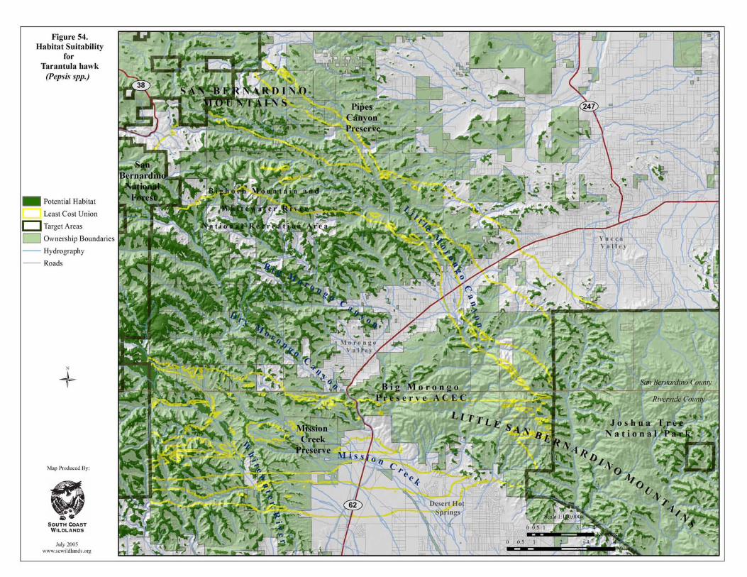
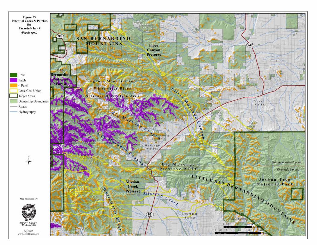
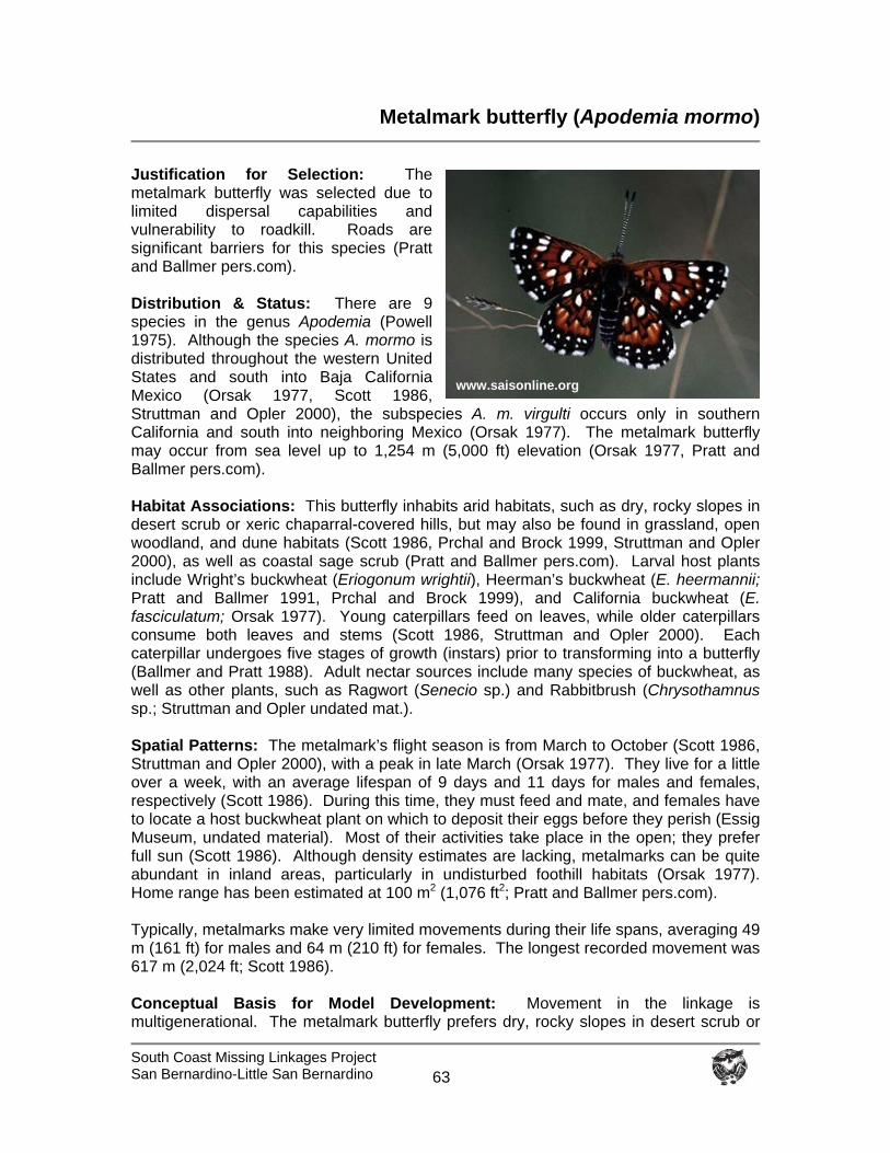
South Coast Missing Linkages Project San Bernardino-Little San Bernardino
63
Metalmark butterfly (Apodemia mormo)
Justification for Selection: The metalmark butterfly was selected due to limited dispersal capabilities and vulnerability to roadkill. Roads are significant barriers for this species (Pratt and Ballmer pers.com). Distribution & Status: There are 9 species in the genus Apodemia (Powell 1975). Although the species A. mormo is distributed throughout the western United States and south into Baja California Mexico (Orsak 1977, Scott 1986, Struttman and Opler 2000), the subspecies A. m. virgulti occurs only in southern California and south into neighboring Mexico (Orsak 1977). The metalmark butterfly may occur from sea level up to 1,254 m (5,000 ft) elevation (Orsak 1977, Pratt and Ballmer pers.com). Habitat Associations: This butterfly inhabits arid habitats, such as dry, rocky slopes in desert scrub or xeric chaparral-covered hills, but may also be found in grassland, open woodland, and dune habitats (Scott 1986, Prchal and Brock 1999, Struttman and Opler 2000), as well as coastal sage scrub (Pratt and Ballmer pers.com). Larval host plants include Wright’s buckwheat (Eriogonum wrightii), Heerman’s buckwheat (E. heermannii; Pratt and Ballmer 1991, Prchal and Brock 1999), and California buckwheat (E. fasciculatum; Orsak 1977). Young caterpillars feed on leaves, while older caterpillars consume both leaves and stems (Scott 1986, Struttman and Opler 2000). Each caterpillar undergoes five stages of growth (instars) prior to transforming into a butterfly (Ballmer and Pratt 1988). Adult nectar sources include many species of buckwheat, as well as other plants, such as Ragwort (Senecio sp.) and Rabbitbrush (Chrysothamnus sp.; Struttman and Opler undated mat.). Spatial Patterns: The metalmark’s flight season is from March to October (Scott 1986, Struttman and Opler 2000), with a peak in late March (Orsak 1977). They live for a little over a week, with an average lifespan of 9 days and 11 days for males and females, respectively (Scott 1986). During this time, they must feed and mate, and females have to locate a host buckwheat plant on which to deposit their eggs before they perish (Essig Museum, undated material). Most of their activities take place in the open; they prefer full sun (Scott 1986). Although density estimates are lacking, metalmarks can be quite abundant in inland areas, particularly in undisturbed foothill habitats (Orsak 1977). Home range has been estimated at 100 m2 (1,076 ft2; Pratt and Ballmer pers.com). Typically, metalmarks make very limited movements during their life spans, averaging 49 m (161 ft) for males and 64 m (210 ft) for females. The longest recorded movement was 617 m (2,024 ft; Scott 1986). Conceptual Basis for Model Development: Movement in the linkage is multigenerational. The metalmark butterfly prefers dry, rocky slopes in desert scrub or
www.saisonline.org

South Coast Missing Linkages Project San Bernardino-Little San Bernardino
64
chaparral, but may also be found in coastal sage scrub, grassland, open woodland, and dune habitats. Within these communities, they may be found from sea level up to 1254 m (5,000 ft) in elevation. Dispersal distance was defined as 1,234 m (4,048 ft). Results & Discussion: Suitable habitat for the metalmark butterfly is fairly widespread in the planning area (Figure 56), largely following the distribution of desert scrub and chaparral habitats. Potentially suitable habitat was captured in all branches of the Least Cost Union. The most solid connection for this species is through existing protected lands in the Big Morongo Canyon Preserve, using upland habitats between Dry Morongo Canyon and Mission Creek in the central branch of the Union (Figure 56). Fairly contiguous suitable habitat also exists in Little Morongo Canyon, from approximately 4-6 km above State Route 62 to extensive habitat identified in Joshua Tree National Park (Figure 56). Almost all potential habitat identified for this species was delineated as core habitat, and all suitable habitat patches were within the dispersal distance of this species (figures not shown), although barriers to movement may exist between suitable habitat patches. We concluded that the linkage would likely serve the needs of this species. To protect and restore habitat and connectivity for the metalmark butterfly, we recommend that:
Host plants and nectar sources, such as rabbitbrush, ragwort, and various species of buckwheat are maintained in the linkage.
Fire frequency is controlled to prevent type conversion of chaparral and scrub
habitats to nonnative annual grassland.
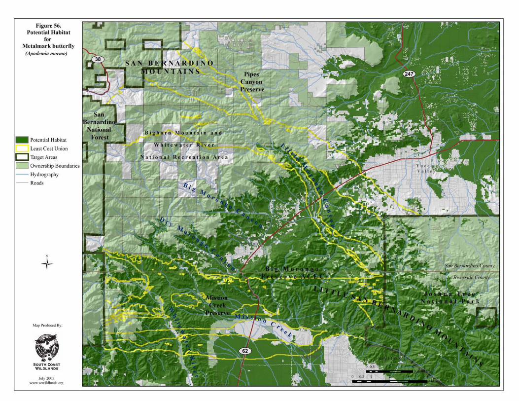
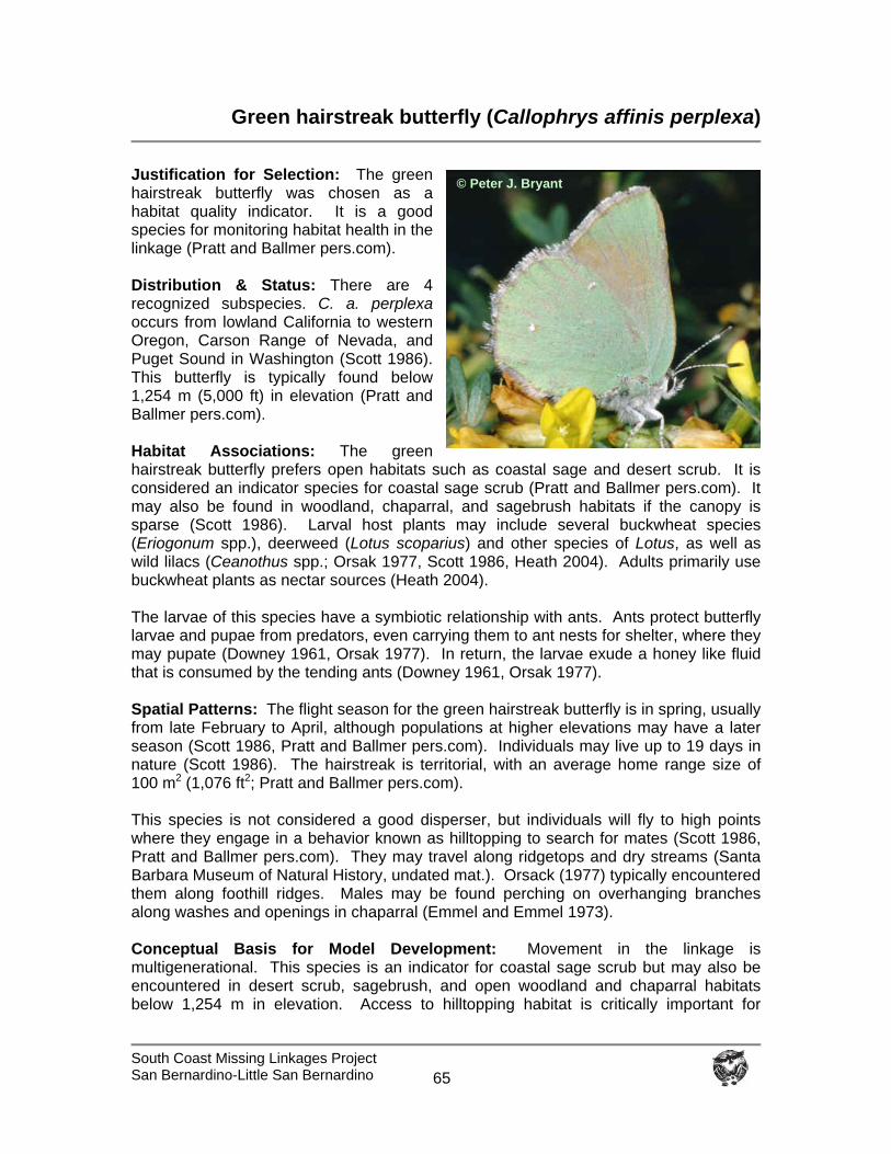
South Coast Missing Linkages Project San Bernardino-Little San Bernardino
65
Green hairstreak butterfly (Callophrys affinis perplexa)
Justification for Selection: The green hairstreak butterfly was chosen as a habitat quality indicator. It is a good species for monitoring habitat health in the linkage (Pratt and Ballmer pers.com). Distribution & Status: There are 4 recognized subspecies. C. a. perplexa occurs from lowland California to western Oregon, Carson Range of Nevada, and Puget Sound in Washington (Scott 1986). This butterfly is typically found below 1,254 m (5,000 ft) in elevation (Pratt and Ballmer pers.com). Habitat Associations: The green hairstreak butterfly prefers open habitats such as coastal sage and desert scrub. It is considered an indicator species for coastal sage scrub (Pratt and Ballmer pers.com). It may also be found in woodland, chaparral, and sagebrush habitats if the canopy is sparse (Scott 1986). Larval host plants may include several buckwheat species (Eriogonum spp.), deerweed (Lotus scoparius) and other species of Lotus, as well as wild lilacs (Ceanothus spp.; Orsak 1977, Scott 1986, Heath 2004). Adults primarily use buckwheat plants as nectar sources (Heath 2004). The larvae of this species have a symbiotic relationship with ants. Ants protect butterfly larvae and pupae from predators, even carrying them to ant nests for shelter, where they may pupate (Downey 1961, Orsak 1977). In return, the larvae exude a honey like fluid that is consumed by the tending ants (Downey 1961, Orsak 1977). Spatial Patterns: The flight season for the green hairstreak butterfly is in spring, usually from late February to April, although populations at higher elevations may have a later season (Scott 1986, Pratt and Ballmer pers.com). Individuals may live up to 19 days in nature (Scott 1986). The hairstreak is territorial, with an average home range size of 100 m2 (1,076 ft2; Pratt and Ballmer pers.com). This species is not considered a good disperser, but individuals will fly to high points where they engage in a behavior known as hilltopping to search for mates (Scott 1986, Pratt and Ballmer pers.com). They may travel along ridgetops and dry streams (Santa Barbara Museum of Natural History, undated mat.). Orsack (1977) typically encountered them along foothill ridges. Males may be found perching on overhanging branches along washes and openings in chaparral (Emmel and Emmel 1973). Conceptual Basis for Model Development: Movement in the linkage is multigenerational. This species is an indicator for coastal sage scrub but may also be encountered in desert scrub, sagebrush, and open woodland and chaparral habitats below 1,254 m in elevation. Access to hilltopping habitat is critically important for
© Peter J. Bryant
South Coast Missing Linkages Project San Bernardino-Little San Bernardino
66
population persistence, thus we identified all ridges within 100 m (328 ft) of appropriate vegetation communities to include them in potential habitat. Results & Discussion: The majority of potential habitat for the green hairstreak butterfly was identified in the coastal sage habitat along the foothills and the scrub communities of the desert (Figure 57). All branches of the Least Cost Union provide either potentially suitable habitat or hilltopping habitat for this species. Similar to the metalmark butterfly, the most direct connection for this species is through existing protected lands in the Big Morongo Canyon Preserve (Figure 57). Almost all potential habitat identified for the hairstreak was delineated as potential core areas (figure not shown). We conclude that the linkage would likely serve the needs of the green hairstreak butterfly. To protect habitat connectivity for the green hairstreak butterfly, we recommend that:
Larval host plants and nectar sources (deerweed, ceanothus, and various species of buckwheat) are maintained in the linkage.
Fire frequency is controlled to prevent type conversion of chaparral and scrub
habitats to nonnative annual grassland.
Access to hilltopping habitat is maintained in the linkage and core areas.
Native ant populations are maintained in the linkage and core areas.
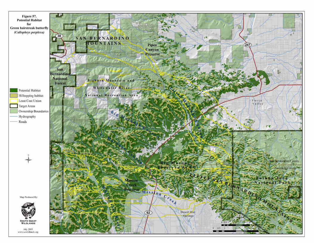
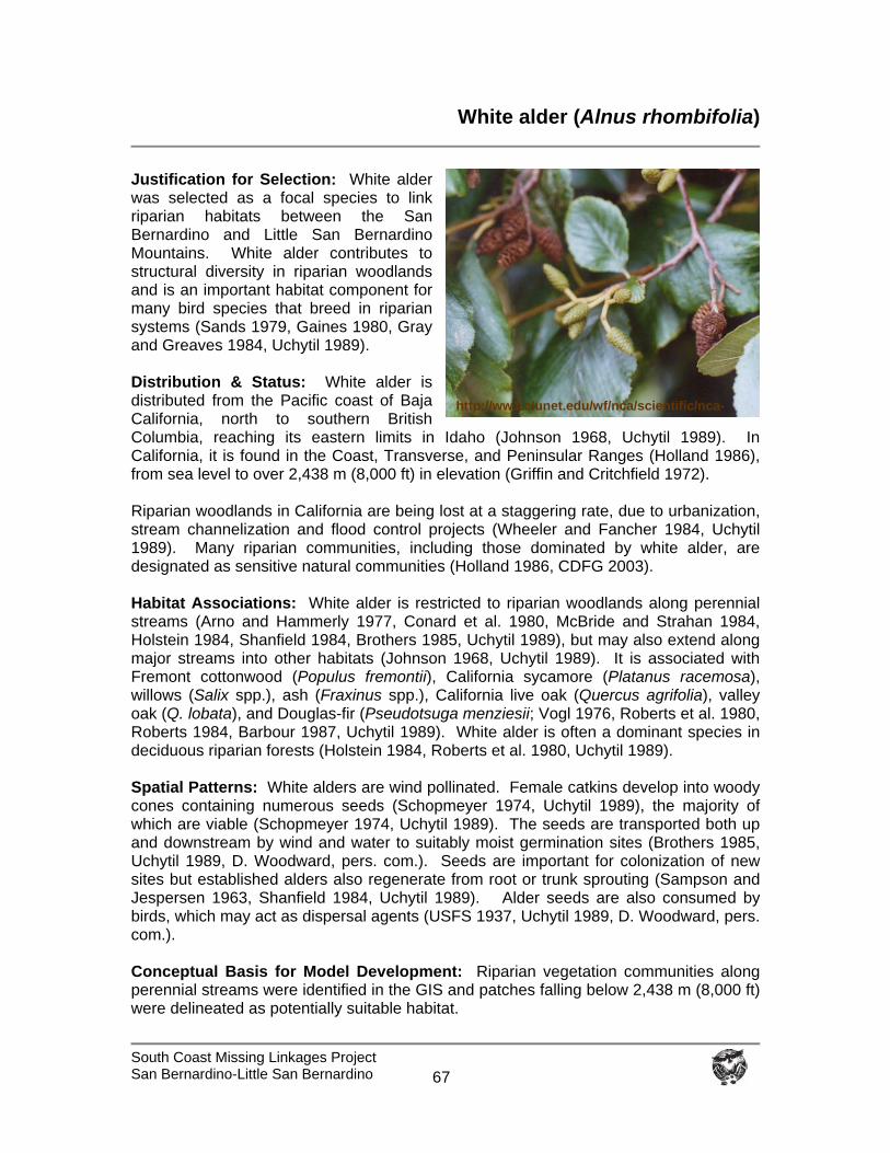
South Coast Missing Linkages Project San Bernardino-Little San Bernardino
67
White alder (Alnus rhombifolia)
Justification for Selection: White alder was selected as a focal species to link riparian habitats between the San Bernardino and Little San Bernardino Mountains. White alder contributes to structural diversity in riparian woodlands and is an important habitat component for many bird species that breed in riparian systems (Sands 1979, Gaines 1980, Gray and Greaves 1984, Uchytil 1989). Distribution & Status: White alder is distributed from the Pacific coast of Baja California, north to southern British Columbia, reaching its eastern limits in Idaho (Johnson 1968, Uchytil 1989). In California, it is found in the Coast, Transverse, and Peninsular Ranges (Holland 1986), from sea level to over 2,438 m (8,000 ft) in elevation (Griffin and Critchfield 1972). Riparian woodlands in California are being lost at a staggering rate, due to urbanization, stream channelization and flood control projects (Wheeler and Fancher 1984, Uchytil 1989). Many riparian communities, including those dominated by white alder, are designated as sensitive natural communities (Holland 1986, CDFG 2003). Habitat Associations: White alder is restricted to riparian woodlands along perennial streams (Arno and Hammerly 1977, Conard et al. 1980, McBride and Strahan 1984, Holstein 1984, Shanfield 1984, Brothers 1985, Uchytil 1989), but may also extend along major streams into other habitats (Johnson 1968, Uchytil 1989). It is associated with Fremont cottonwood (Populus fremontii), California sycamore (Platanus racemosa), willows (Salix spp.), ash (Fraxinus spp.), California live oak (Quercus agrifolia), valley oak (Q. lobata), and Douglas-fir (Pseudotsuga menziesii; Vogl 1976, Roberts et al. 1980, Roberts 1984, Barbour 1987, Uchytil 1989). White alder is often a dominant species in deciduous riparian forests (Holstein 1984, Roberts et al. 1980, Uchytil 1989). Spatial Patterns: White alders are wind pollinated. Female catkins develop into woody cones containing numerous seeds (Schopmeyer 1974, Uchytil 1989), the majority of which are viable (Schopmeyer 1974, Uchytil 1989). The seeds are transported both up and downstream by wind and water to suitably moist germination sites (Brothers 1985, Uchytil 1989, D. Woodward, pers. com.). Seeds are important for colonization of new sites but established alders also regenerate from root or trunk sprouting (Sampson and Jespersen 1963, Shanfield 1984, Uchytil 1989). Alder seeds are also consumed by birds, which may act as dispersal agents (USFS 1937, Uchytil 1989, D. Woodward, pers. com.). Conceptual Basis for Model Development: Riparian vegetation communities along perennial streams were identified in the GIS and patches falling below 2,438 m (8,000 ft) were delineated as potentially suitable habitat.
http://ww1.clunet.edu/wf/nca/scientific/nca-
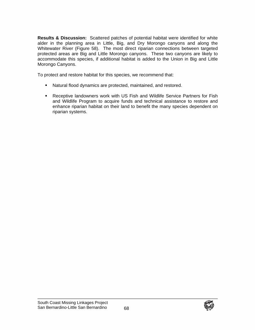
South Coast Missing Linkages Project San Bernardino-Little San Bernardino
68
Results & Discussion: Scattered patches of potential habitat were identified for white alder in the planning area in Little, Big, and Dry Morongo canyons and along the Whitewater River (Figure 58). The most direct riparian connections between targeted protected areas are Big and Little Morongo canyons. These two canyons are likely to accommodate this species, if additional habitat is added to the Union in Big and Little Morongo Canyons. To protect and restore habitat for this species, we recommend that:
Natural flood dynamics are protected, maintained, and restored.
Receptive landowners work with US Fish and Wildlife Service Partners for Fish and Wildlife Program to acquire funds and technical assistance to restore and enhance riparian habitat on their land to benefit the many species dependent on riparian systems.
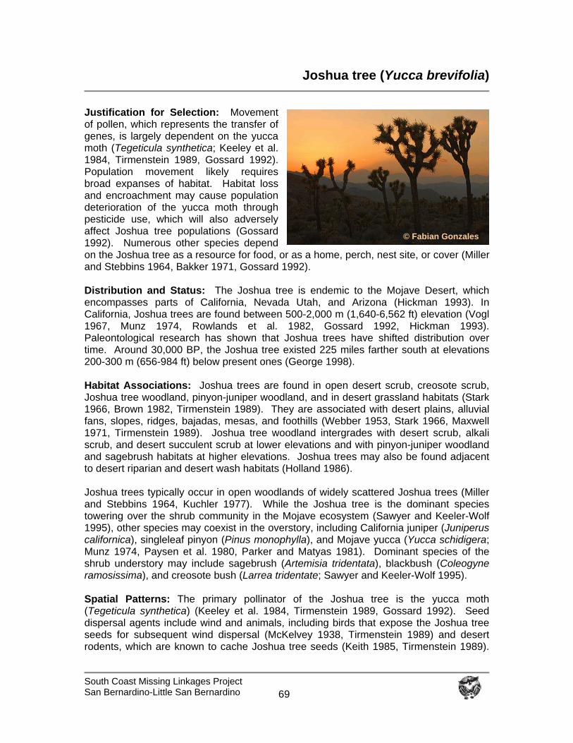
South Coast Missing Linkages Project San Bernardino-Little San Bernardino
69
Joshua tree (Yucca brevifolia)
Justification for Selection: Movement of pollen, which represents the transfer of genes, is largely dependent on the yucca moth (Tegeticula synthetica; Keeley et al. 1984, Tirmenstein 1989, Gossard 1992). Population movement likely requires broad expanses of habitat. Habitat loss and encroachment may cause population deterioration of the yucca moth through pesticide use, which will also adversely affect Joshua tree populations (Gossard 1992). Numerous other species depend on the Joshua tree as a resource for food, or as a home, perch, nest site, or cover (Miller and Stebbins 1964, Bakker 1971, Gossard 1992). Distribution and Status: The Joshua tree is endemic to the Mojave Desert, which encompasses parts of California, Nevada Utah, and Arizona (Hickman 1993). In California, Joshua trees are found between 500-2,000 m (1,640-6,562 ft) elevation (Vogl 1967, Munz 1974, Rowlands et al. 1982, Gossard 1992, Hickman 1993). Paleontological research has shown that Joshua trees have shifted distribution over time. Around 30,000 BP, the Joshua tree existed 225 miles farther south at elevations 200-300 m (656-984 ft) below present ones (George 1998). Habitat Associations: Joshua trees are found in open desert scrub, creosote scrub, Joshua tree woodland, pinyon-juniper woodland, and in desert grassland habitats (Stark 1966, Brown 1982, Tirmenstein 1989). They are associated with desert plains, alluvial fans, slopes, ridges, bajadas, mesas, and foothills (Webber 1953, Stark 1966, Maxwell 1971, Tirmenstein 1989). Joshua tree woodland intergrades with desert scrub, alkali scrub, and desert succulent scrub at lower elevations and with pinyon-juniper woodland and sagebrush habitats at higher elevations. Joshua trees may also be found adjacent to desert riparian and desert wash habitats (Holland 1986). Joshua trees typically occur in open woodlands of widely scattered Joshua trees (Miller and Stebbins 1964, Kuchler 1977). While the Joshua tree is the dominant species towering over the shrub community in the Mojave ecosystem (Sawyer and Keeler-Wolf 1995), other species may coexist in the overstory, including California juniper (Juniperus californica), singleleaf pinyon (Pinus monophylla), and Mojave yucca (Yucca schidigera; Munz 1974, Paysen et al. 1980, Parker and Matyas 1981). Dominant species of the shrub understory may include sagebrush (Artemisia tridentata), blackbush (Coleogyne ramosissima), and creosote bush (Larrea tridentate; Sawyer and Keeler-Wolf 1995). Spatial Patterns: The primary pollinator of the Joshua tree is the yucca moth (Tegeticula synthetica) (Keeley et al. 1984, Tirmenstein 1989, Gossard 1992). Seed dispersal agents include wind and animals, including birds that expose the Joshua tree seeds for subsequent wind dispersal (McKelvey 1938, Tirmenstein 1989) and desert rodents, which are known to cache Joshua tree seeds (Keith 1985, Tirmenstein 1989).
© Fabian Gonzales
South Coast Missing Linkages Project San Bernardino-Little San Bernardino
70
In some areas, vegetative reproduction is also an important mode of regeneration (McKelvey 1938, Vogl 1967, Keith 1982, Conrad 1987, Tirmenstein 1989). Conceptual Basis for Model Development: The best suitable habitat for this species in the planning area is in Joshua tree woodland, pinyon-juniper woodland, and juniper woodland habitats, between 500-2,000 m (1,640-6,562 ft) in elevation. Results: The San Bernardino National Forest is notably lacking in suitable habitat for this Mojave endemic. Potential habitat for this species extends from Pipes Canyon Preserve and Bureau of Land Management land on the desert facing slopes of the San Bernardino Mountains through the upper branch of the Least Cost Union to Joshua Tree National Park (Figure 59). Scattered Joshua trees occur to the south of the upper branch of the Union in an ecotone between the Sonoran and Mojave ecosystems. We conclude that the linkage serves to connect populations of Joshua tree in the San Bernardino Mountains to those in the Little San Bernardino Mountains. To preserve genetic connections among Joshua tree populations, we recommend that:
Research is conducted on the movement ecology of the yucca moth, the Joshua tree’s primary pollinator.
Further research is conducted to identify which small mammals cache Joshua
tree seeds in appropriate places for germination and establishment (Esque et al. 2003).
The effects of herbivores and drought on Joshua tree populations continue to be
monitored (Esque et al. 2003).
Fire frequency is controlled to prevent type conversion of Joshua tree woodlands to non-native annual grasslands. Joshua trees are slow-growing species that aren’t adapted to fire.
Collaborative management options are pursued with the Bureau of Land
Management, The Wildlands Conservancy, and National Park Service to insure the protection of Joshua tree habitats.
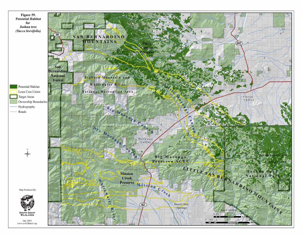

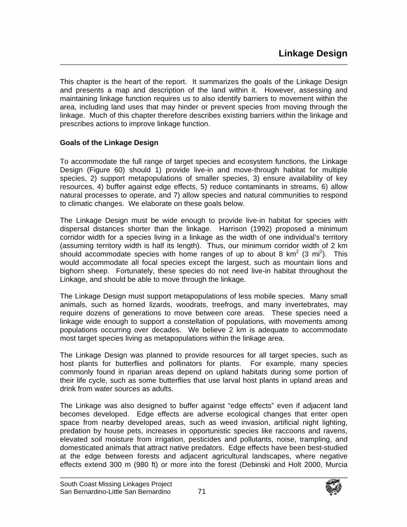
South Coast Missing Linkages Project San Bernardino-Little San Bernardino
71
Linkage Design
This chapter is the heart of the report. It summarizes the goals of the Linkage Design and presents a map and description of the land within it. However, assessing and maintaining linkage function requires us to also identify barriers to movement within the area, including land uses that may hinder or prevent species from moving through the linkage. Much of this chapter therefore describes existing barriers within the linkage and prescribes actions to improve linkage function. Goals of the Linkage Design To accommodate the full range of target species and ecosystem functions, the Linkage Design (Figure 60) should 1) provide live-in and move-through habitat for multiple species, 2) support metapopulations of smaller species, 3) ensure availability of key resources, 4) buffer against edge effects, 5) reduce contaminants in streams, 6) allow natural processes to operate, and 7) allow species and natural communities to respond to climatic changes. We elaborate on these goals below. The Linkage Design must be wide enough to provide live-in habitat for species with dispersal distances shorter than the linkage. Harrison (1992) proposed a minimum corridor width for a species living in a linkage as the width of one individual’s territory (assuming territory width is half its length). Thus, our minimum corridor width of 2 km should accommodate species with home ranges of up to about 8 km2 (3 mi2). This would accommodate all focal species except the largest, such as mountain lions and bighorn sheep. Fortunately, these species do not need live-in habitat throughout the Linkage, and should be able to move through the linkage. The Linkage Design must support metapopulations of less mobile species. Many small animals, such as horned lizards, woodrats, treefrogs, and many invertebrates, may require dozens of generations to move between core areas. These species need a linkage wide enough to support a constellation of populations, with movements among populations occurring over decades. We believe 2 km is adequate to accommodate most target species living as metapopulations within the linkage area. The Linkage Design was planned to provide resources for all target species, such as host plants for butterflies and pollinators for plants. For example, many species commonly found in riparian areas depend on upland habitats during some portion of their life cycle, such as some butterflies that use larval host plants in upland areas and drink from water sources as adults. The Linkage was also designed to buffer against “edge effects” even if adjacent land becomes developed. Edge effects are adverse ecological changes that enter open space from nearby developed areas, such as weed invasion, artificial night lighting, predation by house pets, increases in opportunistic species like raccoons and ravens, elevated soil moisture from irrigation, pesticides and pollutants, noise, trampling, and domesticated animals that attract native predators. Edge effects have been best-studied at the edge between forests and adjacent agricultural landscapes, where negative effects extend 300 m (980 ft) or more into the forest (Debinski and Holt 2000, Murcia
South Coast Missing Linkages Project San Bernardino-Little San Bernardino
72
1995) depending on forest type, years since the edge was created, and other factors (Norton 2002). The best available data on edge effects for southern California habitats include reduction in leaf-litter and declines in populations of some species of birds and mammals up to 250 m (800 ft) in coastal scrub (Kristan et al. 2003), collapse of native plant and animals communities due to the invasion of argentine ants up to 200 m (650 ft) from irrigated areas (Suarez et al. 1998), and predation by house cats which reduce small vertebrate populations 100 m (300 ft) from the edge (K. Crooks, unpublished data). Domestic cats may affect wildlife up to 300 m (980 ft) from the edge based on home range sizes reported by Hall et al. (2000).
Upland buffers are needed adjacent to riparian vegetation or other wetlands to prevent aquatic habitat degradation. Contaminants, sediments, and nutrients can reach streams from distances greater than 1 km (0.6 mi) (Maret and MacCoy 2002, Scott 2002, Naicker et al. 2001), and fish, amphibians, and aquatic invertebrates often are more sensitive to land use at watershed scales than at the scale of narrow riparian buffers (Goforth 2000, Fitzpatrick et al. 2001, Stewart et al. 2001, Wang et al. 2001, Scott 2002, Willson and Dorcas 2003). For instance, some amphibians, such as the western toad, breed in riparian communities but use adjacent uplands to meet other life history requirements. The Linkage Design must also allow natural processes of disturbance and recruitment to operate with minimal constraints from adjacent urban areas. The Linkage should be wide enough that temporary habitat impacts due to fires, floods, and other natural processes do not affect the entire linkage simultaneously. Wider linkages with broader natural communities may be more robust to changes in disturbance frequencies by human actions. Before human occupation, naturally occurring fires (due to lightning strikes) were rare in southern California (Radtke 1983). As human populations in the region soared, fire frequency has also increased dramatically (Keeley and Fotheringham 2003). Native wildlife and vegetation in the Mojave and Sonoran deserts evolved largely in the absence of fire, and thus are not very resilient to frequent or intensive fires. Slow-growing Joshua trees are particularly susceptible. It takes decades to replace Joshua trees lost in fires (NPCA 2005). In 1999, Joshua Tree National Park suffered its largest fire on record, with 14,000 acres burned in the Juniper Fire (NPCA 2005), and the Paradise Fire burned over 3,000 acres in Morongo Valley in 2005. Although fire can reduce the occurrence of exotic species in native grasslands (Teresa and Pace 1998), it can have the opposite effect in some shrubland habitats (Giessow and Zedler 1996), encouraging the invasion of non-native plants, especially when fires are too frequent. While effects of altered fire regimes in this region are somewhat unpredictable, wider linkages with broader natural communities should be more robust to these disturbances than narrow linkages. The Linkage Design must also allow species to respond to climate change. Plant and animal distributions are predicted to shift (generally northwards or upwards in elevation in California) due to global warming (Field et al. 1999). The linkage must therefore accommodate at least elevational shifts by being broad enough to cover an elevational range as well as a diversity of microhabitats that allow species to colonize new areas. Description of the Linkage Design For most species, State Route 62 is the most obvious barrier between core reserves in the San Bernardino and Little San Bernardino Mountains. BLM land abuts both sides of
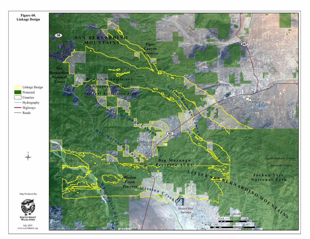
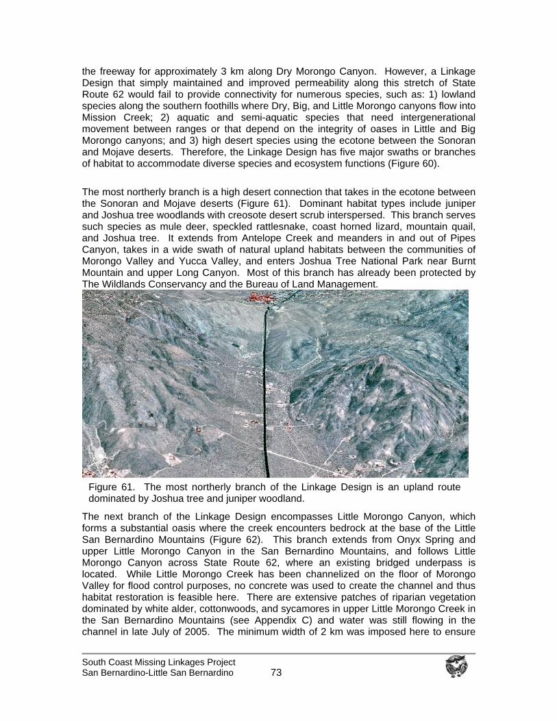
South Coast Missing Linkages Project San Bernardino-Little San Bernardino
73
the freeway for approximately 3 km along Dry Morongo Canyon. However, a Linkage Design that simply maintained and improved permeability along this stretch of State Route 62 would fail to provide connectivity for numerous species, such as: 1) lowland species along the southern foothills where Dry, Big, and Little Morongo canyons flow into Mission Creek; 2) aquatic and semi-aquatic species that need intergenerational movement between ranges or that depend on the integrity of oases in Little and Big Morongo canyons; and 3) high desert species using the ecotone between the Sonoran and Mojave deserts. Therefore, the Linkage Design has five major swaths or branches of habitat to accommodate diverse species and ecosystem functions (Figure 60). The most northerly branch is a high desert connection that takes in the ecotone between the Sonoran and Mojave deserts (Figure 61). Dominant habitat types include juniper and Joshua tree woodlands with creosote desert scrub interspersed. This branch serves such species as mule deer, speckled rattlesnake, coast horned lizard, mountain quail, and Joshua tree. It extends from Antelope Creek and meanders in and out of Pipes Canyon, takes in a wide swath of natural upland habitats between the communities of Morongo Valley and Yucca Valley, and enters Joshua Tree National Park near Burnt Mountain and upper Long Canyon. Most of this branch has already been protected by The Wildlands Conservancy and the Bureau of Land Management.
The next branch of the Linkage Design encompasses Little Morongo Canyon, which forms a substantial oasis where the creek encounters bedrock at the base of the Little San Bernardino Mountains (Figure 62). This branch extends from Onyx Spring and upper Little Morongo Canyon in the San Bernardino Mountains, and follows Little Morongo Canyon across State Route 62, where an existing bridged underpass is located. While Little Morongo Creek has been channelized on the floor of Morongo Valley for flood control purposes, no concrete was used to create the channel and thus habitat restoration is feasible here. There are extensive patches of riparian vegetation dominated by white alder, cottonwoods, and sycamores in upper Little Morongo Creek in the San Bernardino Mountains (see Appendix C) and water was still flowing in the channel in late July of 2005. The minimum width of 2 km was imposed here to ensure
Figure 61. The most northerly branch of the Linkage Design is an upland route dominated by Joshua tree and juniper woodland.
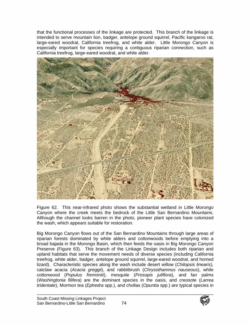
South Coast Missing Linkages Project San Bernardino-Little San Bernardino
74
that the functional processes of the linkage are protected. This branch of the linkage is intended to serve mountain lion, badger, antelope ground squirrel, Pacific kangaroo rat, large-eared woodrat, California treefrog, and white alder. Little Morongo Canyon is especially important for species requiring a contiguous riparian connection, such as California treefrog, large-eared woodrat, and white alder.
Figure 62. This near-infrared photo shows the substantial wetland in Little Morongo Canyon where the creek meets the bedrock of the Little San Bernardino Mountains. Although the channel looks barren in the photo, pioneer plant species have colonized the wash, which appears suitable for restoration. Big Morongo Canyon flows out of the San Bernardino Mountains through large areas of riparian forests dominated by white alders and cottonwoods before emptying into a broad bajada in the Morongo Basin, which then feeds the oasis in Big Morongo Canyon Preserve (Figure 63). This branch of the Linkage Design includes both riparian and upland habitats that serve the movement needs of diverse species (including California treefrog, white alder, badger, antelope ground squirrel, large-eared woodrat, and horned lizard). Characteristic species along the wash include desert willow (Chilopsis linearis), catclaw acacia (Acacia greggii), and rabbitbrush (Chrysothamnus nauseous), while cottonwood (Populus fremontii), mesquite (Prosopis juliflora), and fan palms (Washingtonia filifera) are the dominant species in the oasis, and creosote (Larrea tridentate), Mormon tea (Ephedra spp.), and chollas (Opuntia spp.) are typical species in
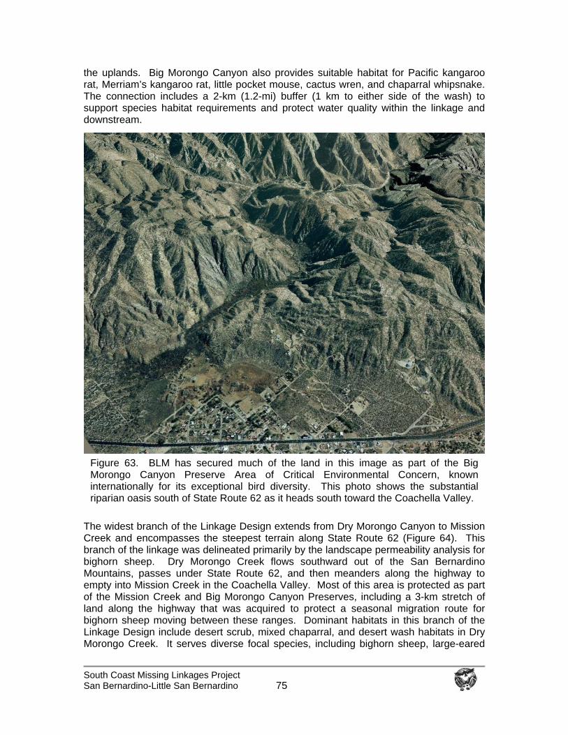
South Coast Missing Linkages Project San Bernardino-Little San Bernardino
75
the uplands. Big Morongo Canyon also provides suitable habitat for Pacific kangaroo rat, Merriam’s kangaroo rat, little pocket mouse, cactus wren, and chaparral whipsnake. The connection includes a 2-km (1.2-mi) buffer (1 km to either side of the wash) to support species habitat requirements and protect water quality within the linkage and downstream.
The widest branch of the Linkage Design extends from Dry Morongo Canyon to Mission Creek and encompasses the steepest terrain along State Route 62 (Figure 64). This branch of the linkage was delineated primarily by the landscape permeability analysis for bighorn sheep. Dry Morongo Creek flows southward out of the San Bernardino Mountains, passes under State Route 62, and then meanders along the highway to empty into Mission Creek in the Coachella Valley. Most of this area is protected as part of the Mission Creek and Big Morongo Canyon Preserves, including a 3-km stretch of land along the highway that was acquired to protect a seasonal migration route for bighorn sheep moving between these ranges. Dominant habitats in this branch of the Linkage Design include desert scrub, mixed chaparral, and desert wash habitats in Dry Morongo Creek. It serves diverse focal species, including bighorn sheep, large-eared
Figure 63. BLM has secured much of the land in this image as part of the Big Morongo Canyon Preserve Area of Critical Environmental Concern, known internationally for its exceptional bird diversity. This photo shows the substantial riparian oasis south of State Route 62 as it heads south toward the Coachella Valley.
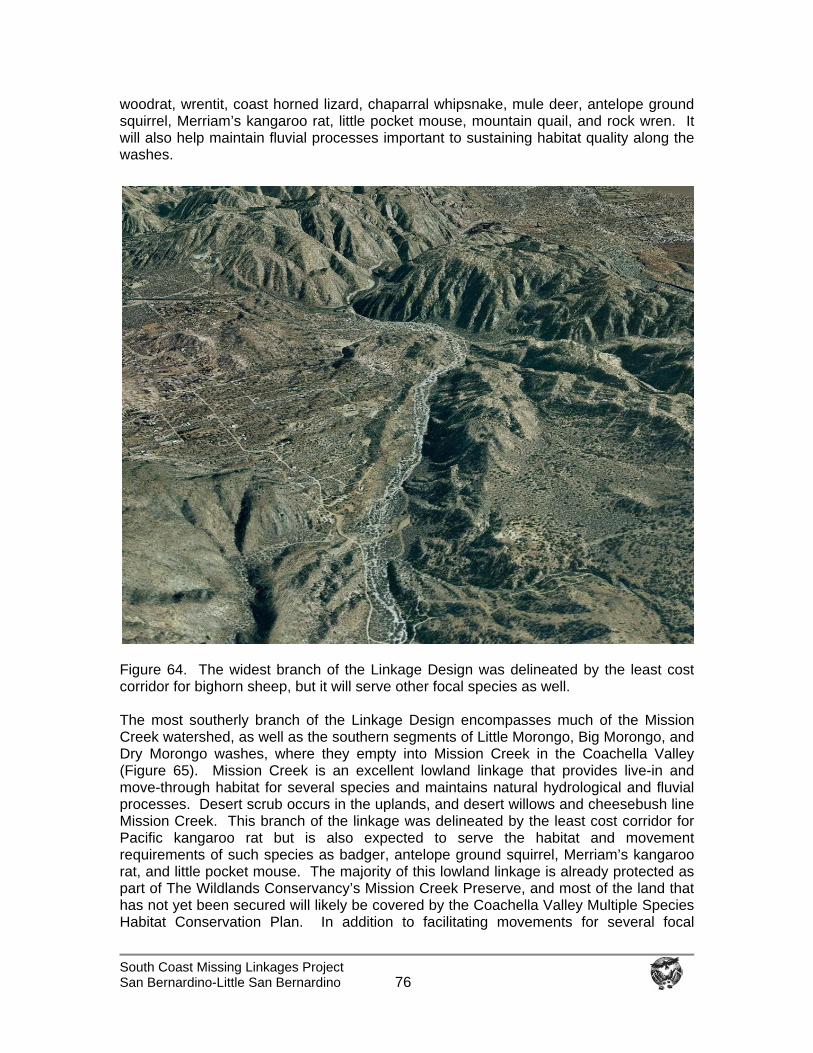
South Coast Missing Linkages Project San Bernardino-Little San Bernardino
76
woodrat, wrentit, coast horned lizard, chaparral whipsnake, mule deer, antelope ground squirrel, Merriam’s kangaroo rat, little pocket mouse, mountain quail, and rock wren. It will also help maintain fluvial processes important to sustaining habitat quality along the washes.
Figure 64. The widest branch of the Linkage Design was delineated by the least cost corridor for bighorn sheep, but it will serve other focal species as well. The most southerly branch of the Linkage Design encompasses much of the Mission Creek watershed, as well as the southern segments of Little Morongo, Big Morongo, and Dry Morongo washes, where they empty into Mission Creek in the Coachella Valley (Figure 65). Mission Creek is an excellent lowland linkage that provides live-in and move-through habitat for several species and maintains natural hydrological and fluvial processes. Desert scrub occurs in the uplands, and desert willows and cheesebush line Mission Creek. This branch of the linkage was delineated by the least cost corridor for Pacific kangaroo rat but is also expected to serve the habitat and movement requirements of such species as badger, antelope ground squirrel, Merriam’s kangaroo rat, and little pocket mouse. The majority of this lowland linkage is already protected as part of The Wildlands Conservancy’s Mission Creek Preserve, and most of the land that has not yet been secured will likely be covered by the Coachella Valley Multiple Species Habitat Conservation Plan. In addition to facilitating movements for several focal
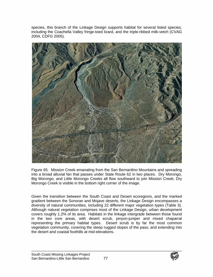
South Coast Missing Linkages Project San Bernardino-Little San Bernardino
77
species, this branch of the Linkage Design supports habitat for several listed species, including the Coachella Valley fringe-toed lizard, and the triple-ribbed milk-vetch (CVAG 2004, CDFG 2005).
Figure 65. Mission Creek emanating from the San Bernardino Mountains and spreading into a broad alluvial fan that passes under State Route 62 in two places. Dry Morongo, Big Morongo, and Little Morongo Creeks all flow southward to join Mission Creek; Dry Morongo Creek is visible in the bottom right corner of the image. Given the transition between the South Coast and Desert ecoregions, and the marked gradient between the Sonoran and Mojave deserts, the Linkage Design encompasses a diversity of natural communities, including 22 different major vegetation types (Table 3). Although natural vegetation comprises most of the Linkage Design, urban development covers roughly 1.2% of its area. Habitats in the linkage intergrade between those found in the two core areas, with desert scrub, pinyon-juniper and mixed chaparral representing the primary habitat types. Desert scrub is by far the most common vegetation community, covering the steep rugged slopes of the pass, and extending into the desert and coastal foothills at mid-elevations.
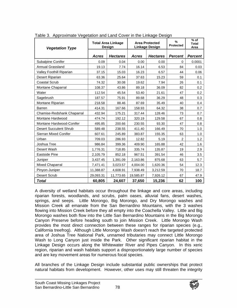
South Coast Missing Linkages Project San Bernardino-Little San Bernardino
78
Table 3. Approximate Vegetation and Land Cover in the Linkage Design
Total Area Linkage Design
Area Protected Linkage Design
% Protected
% of Total Area Vegetation Type
Acres
Hectares Acres Hectares Percent PercentSubalpine Conifer 0.09 0.04 0.00 0.00 0 0.0001 Annual Grassland 19.13 7.74 16.14 6.53 84 0.03 Valley Foothill Riparian 37.15 15.03 16.23 6.57 44 0.06 Desert Riparian 63.36 25.64 37.63 15.23 59 0.1 Coastal Scrub 74.32 30.08 19.62 7.94 26 0.1 Montane Chaparral 108.37 43.86 89.18 36.09 82 0.2 Water 112.54 45.54 53.40 21.61 47 0.2 Sagebrush 187.57 75.91 89.68 36.29 48 0.3 Montane Riparian 218.58 88.46 87.69 35.49 40 0.4 Barren 414.31 167.66 158.93 64.32 38 0.7 Chamise-Redshank Chaparral 432.94 175.21 317.44 128.46 73 0.7 Montane Hardwood 474.74 192.12 320.19 129.58 67 0.8 Montane Hardwood-Conifer 495.85 200.66 230.55 93.30 47 0.8 Desert Succulent Shrub 589.48 238.55 411.40 166.49 70 1.0 Sierran Mixed Conifer 607.61 245.89 383.87 155.35 63 1.0 Urban 709.03 286.93 12.82 5.19 2 1.2 Joshua Tree 986.84 399.36 409.90 165.88 42 1.6 Desert Wash 1,776.31 718.85 335.74 135.87 19 2.9 Eastside Pine 2,105.79 852.18 967.51 391.54 46 3.5 Juniper 3,437.45 1,391.09 2,163.86 875.68 63 5.7 Mixed Chaparral 7,471.41 3,023.57 4,004.00 1,620.36 54 12.3 Pinyon-Juniper 11,388.87 4,608.91 7,938.49 3,212.59 70 18.7 Desert Scrub 29,093.31 11,773.65 19,585.87 7,926.12 67 47.9
Total 60,805 24,607 37,650 15,236 62 100 A diversity of wetland habitats occur throughout the linkage and core areas, including riparian forests, woodlands, and scrubs, palm oases, alluvial fans, desert washes, springs, and seeps. Little Morongo, Big Morongo, and Dry Morongo washes and Mission Creek all emanate from the San Bernardino Mountains, with the 3 washes flowing into Mission Creek before they all empty into the Coachella Valley. Little and Big Morongo washes both flow into the Little San Bernardino Mountains in the Big Morongo Canyon Preserve before heading south to join Mission Creek. Little Morongo Wash provides the most direct connection between these ranges for riparian species (e.g., California treefrog). Although Little Morongo Wash doesn’t reach the targeted protected area of Joshua Tree National Park, unnamed tributaries may connect Little Morongo Wash to Long Canyon just inside the Park. Other significant riparian habitat in the Linkage Design occurs along the Whitewater River and Pipes Canyon. In this xeric region, riparian and wash habitats support a disproportionately large number of species and are key movement areas for numerous focal species. All branches of the Linkage Design include substantial public ownerships that protect natural habitats from development. However, other uses may still threaten the integrity
South Coast Missing Linkages Project San Bernardino-Little San Bernardino
79
of these habitats, and should be carefully managed on these lands. For example, use of off-road vehicles, mining, and livestock grazing can impact these habitats, especially riparian habitats. The final Linkage Design encompasses 24,607 ha (60,805 ac), of which approximately 62% (15,236 ha or 37,650 ac) currently receives some level of conservation protection, mostly in land owned by the Bureau of Land Management (Big Morongo Canyon Preserve) and The Wildlands Conservancy (Pipes Canyon Preserve and Mission Creek Preserve). The California Department of Fish and Game, State Lands Commission, and San Bernardino County Department of Parks and Recreation also administer land in the linkage. In addition, the majority of land in the Linkage Design within Riverside County will be included in the Coachella Valley Multiple Species Habitat Conservation Plan. Removing and Mitigating Barriers to Movement Four types of features impede species movements through the Linkage: roads, impediments to stream flow, residential development, and recreational activities. This section describes these impediments and suggests where and how their effects may be minimized to improve linkage function. This discussion focuses on structures to facilitate movement of terrestrial species across roads, and on structures to facilitate stream flow under roads. Although some documents refer to such structures as “corridors” or even “linkages,” we use these terms in their original sense to describe the entire area required to link the landscape and facilitate movement between large protected core areas. Crossing structures represent only small portions, or choke points, within an overall habitat linkage or movement corridor. Investing in specific crossing structures may be meaningless if other essential components of the linkage are left unprotected. Thus it is essential to keep the larger landscape context in mind when discussing existing or proposed structures to cross movement barriers, such as State Route 62. This broader context also allows awareness of a wider variety of restoration options for maintaining functional linkages. Despite the necessary emphasis on crossing structures in this section, we urge the reader keep sight of the primary goal of conserving landscape linkages to promote movement between core areas over broad spatial and temporal scales. Roads as Barriers to Upland Movement: Wildland fragmentation by roads is increasingly recognized as one of the greatest threats to biodiversity (Noss 1983, Harris 1984, Wilcox and Murphy 1985, Wilcove et al. 1986, Noss 1987, Reijnen et al. 1997, Trombulak and Frissell 2000, Forman and Deblinger 2000, Jones et al. 2000, Forman et al. 2003). Roads kill animals in vehicle collisions, create discontinuities in natural vegetation (the road itself and induced urbanization), alter animal behavior (due to noise, artificial light, human activity), promote invasion of exotic species, and pollute the environment (Lyon 1983, Noss and Cooperrider 1994, Forman and Alexander 1998). Roads also fragment populations by acting as semi-permeable to impermeable barriers for non-flying animals (e.g., insects, fish, amphibians, reptiles, and mammals) and even some flying species (e.g., butterflies and low-flying birds). Roads may even present barriers for large mammals such as bighorn sheep (Rubin et al. 1998). The resulting demographic and genetic isolation increases extinction risks for populations (Gilpin and Soulé 1986). For example Ernest et al. (2003) has documented little flow of mountain lion genes between the Santa Ana and Palomar ranges (where I-15 is the most obvious barrier), and between the Sierra Madre and Sierra Nevada (where I-5, and urbanization
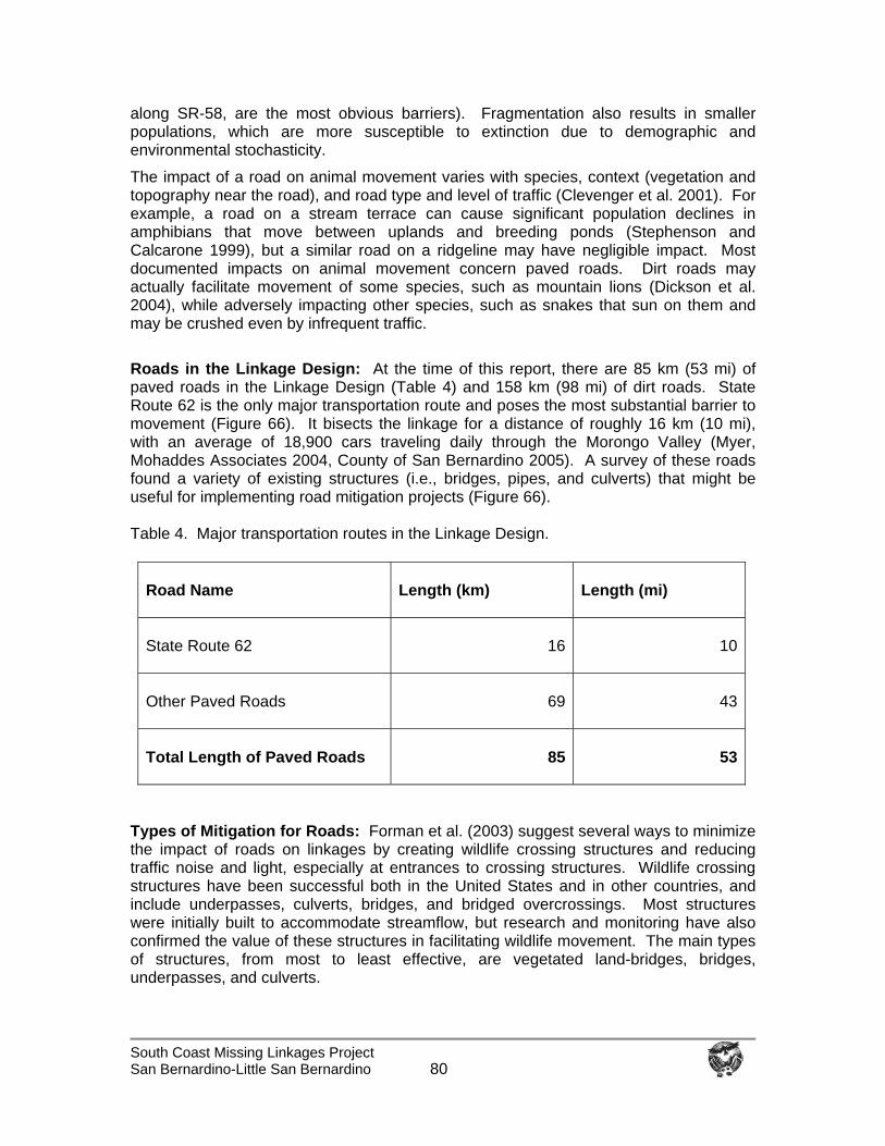
South Coast Missing Linkages Project San Bernardino-Little San Bernardino
80
along SR-58, are the most obvious barriers). Fragmentation also results in smaller populations, which are more susceptible to extinction due to demographic and environmental stochasticity.
The impact of a road on animal movement varies with species, context (vegetation and topography near the road), and road type and level of traffic (Clevenger et al. 2001). For example, a road on a stream terrace can cause significant population declines in amphibians that move between uplands and breeding ponds (Stephenson and Calcarone 1999), but a similar road on a ridgeline may have negligible impact. Most documented impacts on animal movement concern paved roads. Dirt roads may actually facilitate movement of some species, such as mountain lions (Dickson et al. 2004), while adversely impacting other species, such as snakes that sun on them and may be crushed even by infrequent traffic.
Roads in the Linkage Design: At the time of this report, there are 85 km (53 mi) of paved roads in the Linkage Design (Table 4) and 158 km (98 mi) of dirt roads. State Route 62 is the only major transportation route and poses the most substantial barrier to movement (Figure 66). It bisects the linkage for a distance of roughly 16 km (10 mi), with an average of 18,900 cars traveling daily through the Morongo Valley (Myer, Mohaddes Associates 2004, County of San Bernardino 2005). A survey of these roads found a variety of existing structures (i.e., bridges, pipes, and culverts) that might be useful for implementing road mitigation projects (Figure 66). Table 4. Major transportation routes in the Linkage Design.
Types of Mitigation for Roads: Forman et al. (2003) suggest several ways to minimize the impact of roads on linkages by creating wildlife crossing structures and reducing traffic noise and light, especially at entrances to crossing structures. Wildlife crossing structures have been successful both in the United States and in other countries, and include underpasses, culverts, bridges, and bridged overcrossings. Most structures were initially built to accommodate streamflow, but research and monitoring have also confirmed the value of these structures in facilitating wildlife movement. The main types of structures, from most to least effective, are vegetated land-bridges, bridges, underpasses, and culverts.
Road Name Length (km) Length (mi)
State Route 62 16 10
Other Paved Roads 69 43
Total Length of Paved Roads 85 53
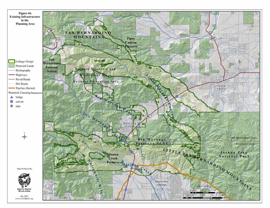
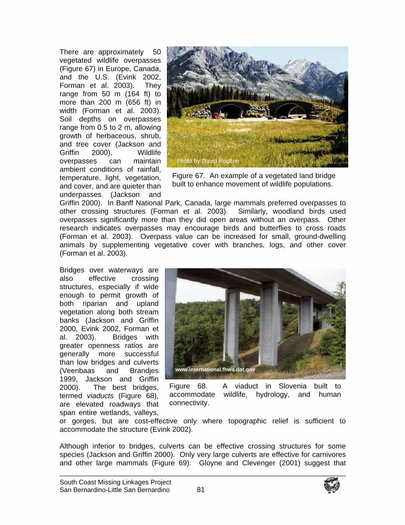
South Coast Missing Linkages Project San Bernardino-Little San Bernardino
81
There are approximately 50 vegetated wildlife overpasses (Figure 67) in Europe, Canada, and the U.S. (Evink 2002, Forman et al. 2003). They range from 50 m (164 ft) to more than 200 m (656 ft) in width (Forman et al. 2003). Soil depths on overpasses range from 0.5 to 2 m, allowing growth of herbaceous, shrub, and tree cover (Jackson and Griffin 2000). Wildlife overpasses can maintain ambient conditions of rainfall, temperature, light, vegetation, and cover, and are quieter than underpasses (Jackson and Griffin 2000). In Banff National Park, Canada, large mammals preferred overpasses to other crossing structures (Forman et al. 2003). Similarly, woodland birds used overpasses significantly more than they did open areas without an overpass. Other research indicates overpasses may encourage birds and butterflies to cross roads (Forman et al. 2003). Overpass value can be increased for small, ground-dwelling animals by supplementing vegetative cover with branches, logs, and other cover (Forman et al. 2003). Bridges over waterways are also effective crossing structures, especially if wide enough to permit growth of both riparian and upland vegetation along both stream banks (Jackson and Griffin 2000, Evink 2002, Forman et al. 2003). Bridges with greater openness ratios are generally more successful than low bridges and culverts (Veenbaas and Brandjes 1999, Jackson and Griffin 2000). The best bridges, termed viaducts (Figure 68), are elevated roadways that span entire wetlands, valleys, or gorges, but are cost-effective only where topographic relief is sufficient to accommodate the structure (Evink 2002). Although inferior to bridges, culverts can be effective crossing structures for some species (Jackson and Griffin 2000). Only very large culverts are effective for carnivores and other large mammals (Figure 69). Gloyne and Clevenger (2001) suggest that
Fred Bank, FHWA
Figure 68. A viaduct in Slovenia built to accommodate wildlife, hydrology, and human connectivity.
www.international.fhwa.dot.gov
Figure 67. An example of a vegetated land bridge built to enhance movement of wildlife populations.
Photo by David Poulton
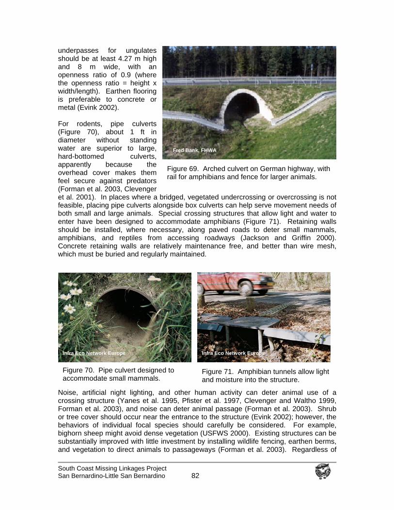
South Coast Missing Linkages Project San Bernardino-Little San Bernardino
82
underpasses for ungulates should be at least 4.27 m high and 8 m wide, with an openness ratio of 0.9 (where the openness ratio = height x width/length). Earthen flooring is preferable to concrete or metal (Evink 2002). For rodents, pipe culverts (Figure 70), about 1 ft in diameter without standing water are superior to large, hard-bottomed culverts, apparently because the overhead cover makes them feel secure against predators (Forman et al. 2003, Clevenger et al. 2001). In places where a bridged, vegetated undercrossing or overcrossing is not feasible, placing pipe culverts alongside box culverts can help serve movement needs of both small and large animals. Special crossing structures that allow light and water to enter have been designed to accommodate amphibians (Figure 71). Retaining walls should be installed, where necessary, along paved roads to deter small mammals, amphibians, and reptiles from accessing roadways (Jackson and Griffin 2000). Concrete retaining walls are relatively maintenance free, and better than wire mesh, which must be buried and regularly maintained.
Noise, artificial night lighting, and other human activity can deter animal use of a crossing structure (Yanes et al. 1995, Pfister et al. 1997, Clevenger and Waltho 1999, Forman et al. 2003), and noise can deter animal passage (Forman et al. 2003). Shrub or tree cover should occur near the entrance to the structure (Evink 2002); however, the behaviors of individual focal species should carefully be considered. For example, bighorn sheep might avoid dense vegetation (USFWS 2000). Existing structures can be substantially improved with little investment by installing wildlife fencing, earthen berms, and vegetation to direct animals to passageways (Forman et al. 2003). Regardless of
Figure 69. Arched culvert on German highway, with rail for amphibians and fence for larger animals.
Fred Bank, FHWA
Figure 70. Pipe culvert designed to accommodate small mammals.
Figure 71. Amphibian tunnels allow light and moisture into the structure.
Infra Eco Network Europe Infra Eco Network Europe
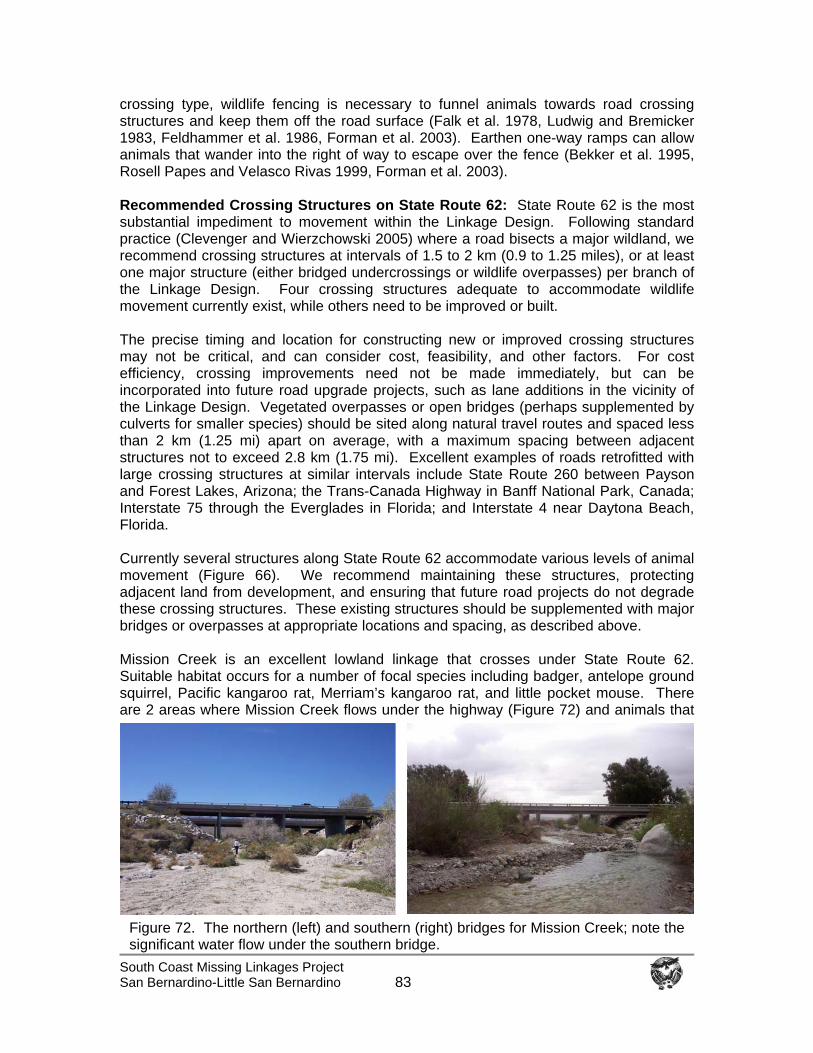
South Coast Missing Linkages Project San Bernardino-Little San Bernardino
83
crossing type, wildlife fencing is necessary to funnel animals towards road crossing structures and keep them off the road surface (Falk et al. 1978, Ludwig and Bremicker 1983, Feldhammer et al. 1986, Forman et al. 2003). Earthen one-way ramps can allow animals that wander into the right of way to escape over the fence (Bekker et al. 1995, Rosell Papes and Velasco Rivas 1999, Forman et al. 2003). Recommended Crossing Structures on State Route 62: State Route 62 is the most substantial impediment to movement within the Linkage Design. Following standard practice (Clevenger and Wierzchowski 2005) where a road bisects a major wildland, we recommend crossing structures at intervals of 1.5 to 2 km (0.9 to 1.25 miles), or at least one major structure (either bridged undercrossings or wildlife overpasses) per branch of the Linkage Design. Four crossing structures adequate to accommodate wildlife movement currently exist, while others need to be improved or built. The precise timing and location for constructing new or improved crossing structures may not be critical, and can consider cost, feasibility, and other factors. For cost efficiency, crossing improvements need not be made immediately, but can be incorporated into future road upgrade projects, such as lane additions in the vicinity of the Linkage Design. Vegetated overpasses or open bridges (perhaps supplemented by culverts for smaller species) should be sited along natural travel routes and spaced less than 2 km (1.25 mi) apart on average, with a maximum spacing between adjacent structures not to exceed 2.8 km (1.75 mi). Excellent examples of roads retrofitted with large crossing structures at similar intervals include State Route 260 between Payson and Forest Lakes, Arizona; the Trans-Canada Highway in Banff National Park, Canada; Interstate 75 through the Everglades in Florida; and Interstate 4 near Daytona Beach, Florida. Currently several structures along State Route 62 accommodate various levels of animal movement (Figure 66). We recommend maintaining these structures, protecting adjacent land from development, and ensuring that future road projects do not degrade these crossing structures. These existing structures should be supplemented with major bridges or overpasses at appropriate locations and spacing, as described above. Mission Creek is an excellent lowland linkage that crosses under State Route 62. Suitable habitat occurs for a number of focal species including badger, antelope ground squirrel, Pacific kangaroo rat, Merriam’s kangaroo rat, and little pocket mouse. There are 2 areas where Mission Creek flows under the highway (Figure 72) and animals that
Figure 72. The northern (left) and southern (right) bridges for Mission Creek; note the significant water flow under the southern bridge.
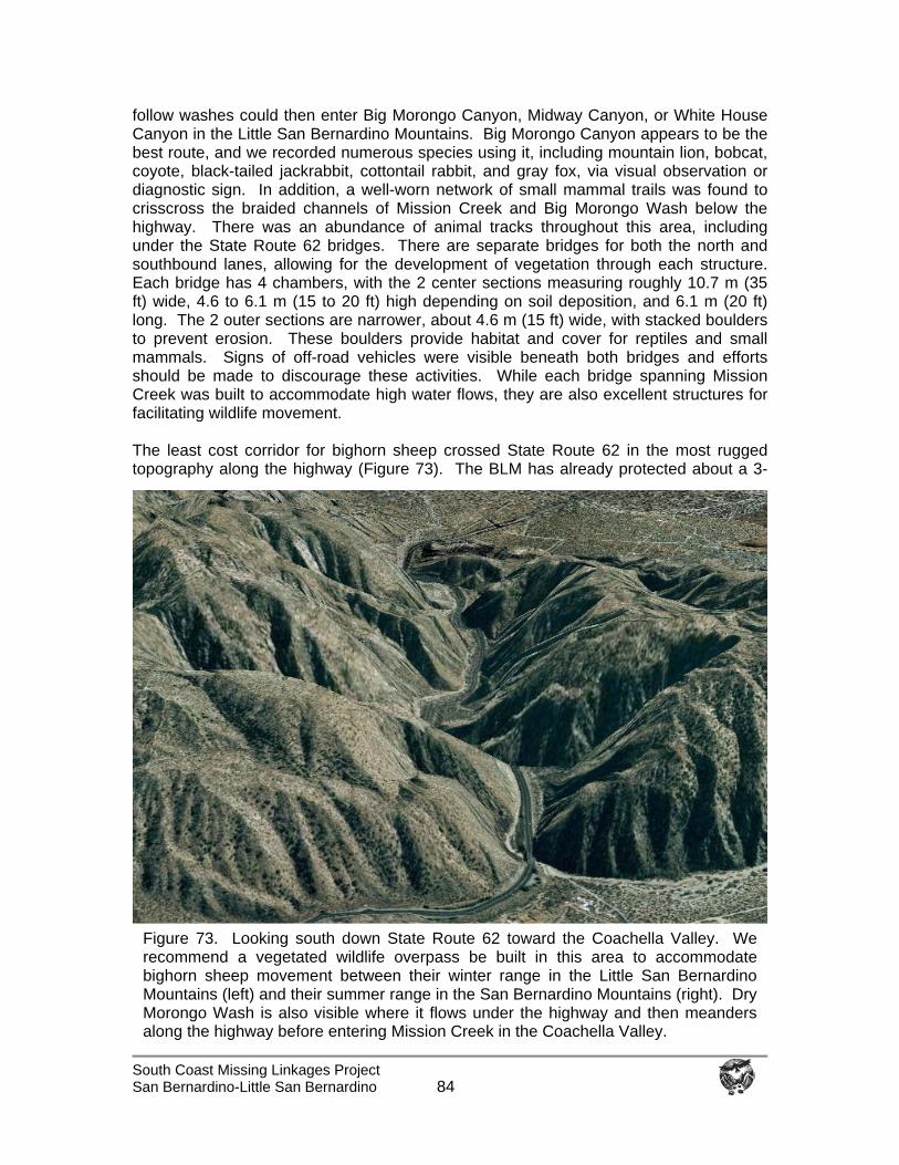
South Coast Missing Linkages Project San Bernardino-Little San Bernardino
84
follow washes could then enter Big Morongo Canyon, Midway Canyon, or White House Canyon in the Little San Bernardino Mountains. Big Morongo Canyon appears to be the best route, and we recorded numerous species using it, including mountain lion, bobcat, coyote, black-tailed jackrabbit, cottontail rabbit, and gray fox, via visual observation or diagnostic sign. In addition, a well-worn network of small mammal trails was found to crisscross the braided channels of Mission Creek and Big Morongo Wash below the highway. There was an abundance of animal tracks throughout this area, including under the State Route 62 bridges. There are separate bridges for both the north and southbound lanes, allowing for the development of vegetation through each structure. Each bridge has 4 chambers, with the 2 center sections measuring roughly 10.7 m (35 ft) wide, 4.6 to 6.1 m (15 to 20 ft) high depending on soil deposition, and 6.1 m (20 ft) long. The 2 outer sections are narrower, about 4.6 m (15 ft) wide, with stacked boulders to prevent erosion. These boulders provide habitat and cover for reptiles and small mammals. Signs of off-road vehicles were visible beneath both bridges and efforts should be made to discourage these activities. While each bridge spanning Mission Creek was built to accommodate high water flows, they are also excellent structures for facilitating wildlife movement. The least cost corridor for bighorn sheep crossed State Route 62 in the most rugged topography along the highway (Figure 73). The BLM has already protected about a 3-
Figure 73. Looking south down State Route 62 toward the Coachella Valley. We recommend a vegetated wildlife overpass be built in this area to accommodate bighorn sheep movement between their winter range in the Little San Bernardino Mountains (left) and their summer range in the San Bernardino Mountains (right). Dry Morongo Wash is also visible where it flows under the highway and then meanders along the highway before entering Mission Creek in the Coachella Valley.
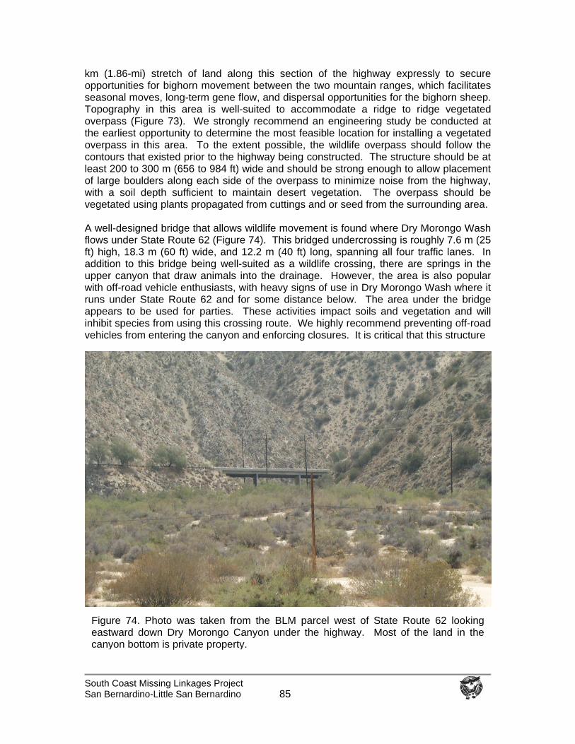
South Coast Missing Linkages Project San Bernardino-Little San Bernardino
85
km (1.86-mi) stretch of land along this section of the highway expressly to secure opportunities for bighorn movement between the two mountain ranges, which facilitates seasonal moves, long-term gene flow, and dispersal opportunities for the bighorn sheep. Topography in this area is well-suited to accommodate a ridge to ridge vegetated overpass (Figure 73). We strongly recommend an engineering study be conducted at the earliest opportunity to determine the most feasible location for installing a vegetated overpass in this area. To the extent possible, the wildlife overpass should follow the contours that existed prior to the highway being constructed. The structure should be at least 200 to 300 m (656 to 984 ft) wide and should be strong enough to allow placement of large boulders along each side of the overpass to minimize noise from the highway, with a soil depth sufficient to maintain desert vegetation. The overpass should be vegetated using plants propagated from cuttings and or seed from the surrounding area. A well-designed bridge that allows wildlife movement is found where Dry Morongo Wash flows under State Route 62 (Figure 74). This bridged undercrossing is roughly 7.6 m (25 ft) high, 18.3 m (60 ft) wide, and 12.2 m (40 ft) long, spanning all four traffic lanes. In addition to this bridge being well-suited as a wildlife crossing, there are springs in the upper canyon that draw animals into the drainage. However, the area is also popular with off-road vehicle enthusiasts, with heavy signs of use in Dry Morongo Wash where it runs under State Route 62 and for some distance below. The area under the bridge appears to be used for parties. These activities impact soils and vegetation and will inhibit species from using this crossing route. We highly recommend preventing off-road vehicles from entering the canyon and enforcing closures. It is critical that this structure
Figure 74. Photo was taken from the BLM parcel west of State Route 62 looking eastward down Dry Morongo Canyon under the highway. Most of the land in the canyon bottom is private property.
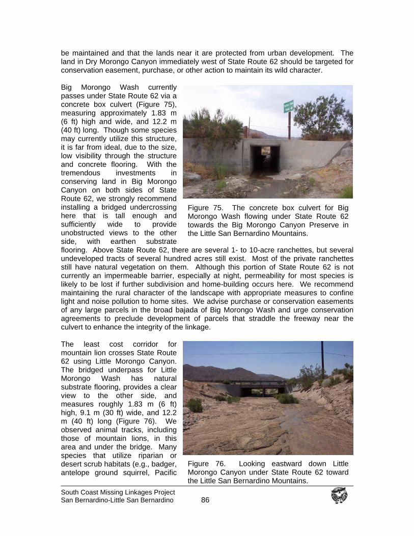
South Coast Missing Linkages Project San Bernardino-Little San Bernardino
86
be maintained and that the lands near it are protected from urban development. The land in Dry Morongo Canyon immediately west of State Route 62 should be targeted for conservation easement, purchase, or other action to maintain its wild character. Big Morongo Wash currently passes under State Route 62 via a concrete box culvert (Figure 75), measuring approximately 1.83 m (6 ft) high and wide, and 12.2 m (40 ft) long. Though some species may currently utilize this structure, it is far from ideal, due to the size, low visibility through the structure and concrete flooring. With the tremendous investments in conserving land in Big Morongo Canyon on both sides of State Route 62, we strongly recommend installing a bridged undercrossing here that is tall enough and sufficiently wide to provide unobstructed views to the other side, with earthen substrate flooring. Above State Route 62, there are several 1- to 10-acre ranchettes, but several undeveloped tracts of several hundred acres still exist. Most of the private ranchettes still have natural vegetation on them. Although this portion of State Route 62 is not currently an impermeable barrier, especially at night, permeability for most species is likely to be lost if further subdivision and home-building occurs here. We recommend maintaining the rural character of the landscape with appropriate measures to confine light and noise pollution to home sites. We advise purchase or conservation easements of any large parcels in the broad bajada of Big Morongo Wash and urge conservation agreements to preclude development of parcels that straddle the freeway near the culvert to enhance the integrity of the linkage. The least cost corridor for mountain lion crosses State Route 62 using Little Morongo Canyon. The bridged underpass for Little Morongo Wash has natural substrate flooring, provides a clear view to the other side, and measures roughly 1.83 m (6 ft) high, 9.1 m (30 ft) wide, and 12.2 m (40 ft) long (Figure 76). We observed animal tracks, including those of mountain lions, in this area and under the bridge. Many species that utilize riparian or desert scrub habitats (e.g., badger, antelope ground squirrel, Pacific
Figure 75. The concrete box culvert for BigMorongo Wash flowing under State Route 62towards the Big Morongo Canyon Preserve in the Little San Bernardino Mountains.
Figure 76. Looking eastward down Little Morongo Canyon under State Route 62 toward the Little San Bernardino Mountains.
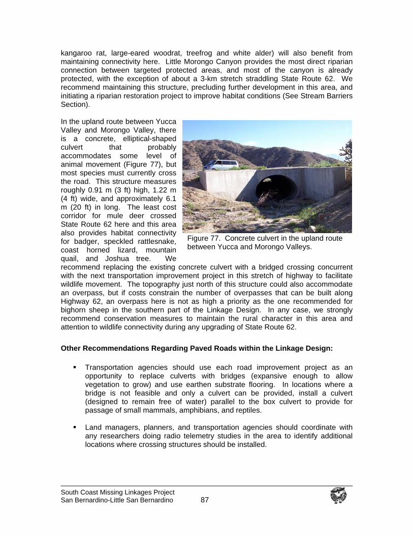
South Coast Missing Linkages Project San Bernardino-Little San Bernardino
87
kangaroo rat, large-eared woodrat, treefrog and white alder) will also benefit from maintaining connectivity here. Little Morongo Canyon provides the most direct riparian connection between targeted protected areas, and most of the canyon is already protected, with the exception of about a 3-km stretch straddling State Route 62. We recommend maintaining this structure, precluding further development in this area, and initiating a riparian restoration project to improve habitat conditions (See Stream Barriers Section). In the upland route between Yucca Valley and Morongo Valley, there is a concrete, elliptical-shaped culvert that probably accommodates some level of animal movement (Figure 77), but most species must currently cross the road. This structure measures roughly 0.91 m (3 ft) high, 1.22 m (4 ft) wide, and approximately 6.1 m (20 ft) in long. The least cost corridor for mule deer crossed State Route 62 here and this area also provides habitat connectivity for badger, speckled rattlesnake, coast horned lizard, mountain quail, and Joshua tree. We recommend replacing the existing concrete culvert with a bridged crossing concurrent with the next transportation improvement project in this stretch of highway to facilitate wildlife movement. The topography just north of this structure could also accommodate an overpass, but if costs constrain the number of overpasses that can be built along Highway 62, an overpass here is not as high a priority as the one recommended for bighorn sheep in the southern part of the Linkage Design. In any case, we strongly recommend conservation measures to maintain the rural character in this area and attention to wildlife connectivity during any upgrading of State Route 62. Other Recommendations Regarding Paved Roads within the Linkage Design:
Transportation agencies should use each road improvement project as an
opportunity to replace culverts with bridges (expansive enough to allow vegetation to grow) and use earthen substrate flooring. In locations where a bridge is not feasible and only a culvert can be provided, install a culvert (designed to remain free of water) parallel to the box culvert to provide for passage of small mammals, amphibians, and reptiles.
Land managers, planners, and transportation agencies should coordinate with
any researchers doing radio telemetry studies in the area to identify additional locations where crossing structures should be installed.
Figure 77. Concrete culvert in the upland route between Yucca and Morongo Valleys.
South Coast Missing Linkages Project San Bernardino-Little San Bernardino
88
We suggest a roadkill study as part of any future transportation improvement projects, with design of crossing structures contingent on results.
Encourage woody vegetation leading up to both sides of crossing structures to
provide cover for wildlife and to direct their movement toward the crossing structure. Work with the USFS, NPS, California Native Plant Society, local Resource Conservation District, or other non-profit organizations to restore riparian communities and vegetative cover at passageways. However, crossing structures designed primarily for bighorn sheep should not be heavily vegetated, but should mimic vegetation composition and structure of nearby bighorn sheep habitat.
Install appropriate wildlife fencing along the freeway to guide animals to crossing
structures and keep them off the highway. Install escape structures, such as earthen ramps, to allow animals to escape if they get trapped on the freeway.
Use retaining walls or fine mesh fencing to guide amphibians and reptiles to
crossing structures.
On freeways and other paved roads, minimize artificial night lighting, and direct the light onto the roadway and away from adjacent wildland.
Reduce traffic speeds and install signage to alert drivers to watch for wildlife.
Roads as Ephemeral Barriers: Structures designed for wildlife movement are increasingly common. In southern California, 26 wildlife crossing structures were installed along 22-miles of State Route 58 in the Mojave Desert specifically for desert tortoise movement (Evink 2002). In the South Coast Ecoregion, the Coal Canyon interchange on State Route 91 is now being converted, through a partnership with CalTrans, California State Parks, and Hills for Everyone, from a vehicle interchange into a wildlife underpass to facilitate movement between the Chino Hills and the Santa Ana Mountains. About 8 wildlife underpass bridges and viaducts were installed along State Route 241 in Orange County, although urbanization near this toll road has compromised their utility (Evink 2002). Elsewhere, several crossing structures, including 3 vegetated overpasses, have been built to accommodate movement across the Trans-Canada Highway in Banff National Park (Clevenger et al. 2001). In south Florida, 24 underpasses specifically designed for wildlife were constructed along 64 km (38 mi) of Interstate 75 in south Florida. The structures are readily used by endangered Florida panthers and bears, and have reduced panther and bear roadkill to zero on that route (Land et al. 2001). Almost all of these structures were retrofitted to existing highways rather than part of the original road design. This demonstrates that barrier or filter effects of existing roads are at least partially reversible with well-designed improvements.
Representatives from CalTrans have attended each of the four workshops of the South Coast Missing Linkages effort, and the agency is incorporating wildlife crossing improvements into its projects with a focus in important linkage areas. For example, CalTrans recently proposed building a wildlife overpass over SR-118, and in February 2003 CalTrans started removing pavement from the Coal Canyon interchange in Orange
South Coast Missing Linkages Project San Bernardino-Little San Bernardino
89
County and transferred the property to California State Parks expressly to allow wildlife movement between Cleveland National Forest and Chino Hills State Park. In the case of State Route 62, BLM, TWC, and NPS have been working to acquire land to allow for the movement of bighorn sheep. Implementing these recommendations will take cooperation among land managers, planners, land conservancies and other non-profits, and transportation agencies. We urge them to work together to develop a long-term coordinated plan to ensure that wildlife-crossing structures are aligned in a way that maximizes their utility to animals. We recognize that it is unrealistic to expect the crossing structures to be built at the same time. However, an overall plan will ensure that, for instance, a planned crossing structure on State Route 62 adjoins protected lands or land targeted for conservation.
Impediments to Streams Organisms moving through rugged landscapes often use riparian areas as travel routes. For example, many butterflies and frogs preferentially move along stream corridors (Orsack 1977, Kay 1989, USGS 2002). Although southwestern pond turtles are capable of overland movements of up to 0.5 km (0.3 mi) (Holland 1994), they preferentially move along stream courses (Bury 1972). Even large, mobile vertebrates, such as mountain lions, have shown preferences for moving along riparian corridors (Beier 1995, Dickson et al. 2004). For plants and animals associated with streams or riparian areas, impediments are presented by water diversions and extractions, road crossings, exotic species, water recharge basins, farming in streambeds, gravel mining, and concrete structures that stabilize stream banks and streambeds. Increased runoff can also create permanent streams in areas that were formerly ephemeral; permanent waters can support aggressive invasive species, such as bullfrogs and exotic fish that prey on native aquatic species, and giant reed that supplants native plant communities (Fisher and Crooks 2001). Impediments to Streams in the Linkage Design: The Linkage Design encompasses several connections for species associated with riparian systems. However, no single tributary provides a direct riparian connection between the two targeted protected areas. Little Morongo, Big Morongo, and Dry Morongo washes and Mission Creek all emanate from the San Bernardino Mountains, with the 3 washes flowing into Mission Creek in the Coachella Valley. Little and Big Morongo washes both flow into the Little San Bernardino Mountains in the Big Morongo Canyon Preserve before heading south to join Mission Creek. Little Morongo Wash provides the most direct connection between these ranges for aquatic and semi-aquatic species (e.g., California treefrog). Although Little Morongo Wash doesn’t reach the targeted protected area of Joshua Tree National Park, unnamed tributaries flowing from the Little San Bernardino Mountains inside the Park boundary likely connect with Little Morongo Wash. The 3 Morongo Canyons and Mission Creek are key movement areas for most riparian and terrestrial organisms. In times of high surface flows, these tributaries may provide an avenue along which aquatic and semi aquatic species journey between the San Bernardino and Little San Bernardino Mountains. Other significant riparian routes in the Linkage Design include Pipes Canyon and the Whitewater River. Today, riparian habitats are significantly
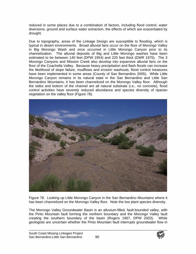
South Coast Missing Linkages Project San Bernardino-Little San Bernardino
90
reduced in some places due to a combination of factors, including flood control, water diversions, ground and surface water extraction, the effects of which are exacerbated by drought. Due to topography, areas of the Linkage Design are susceptible to flooding, which is typical in desert environments. Broad alluvial fans occur on the floor of Morongo Valley in Big Morongo Wash and once occurred in Little Morongo Canyon prior to its channelization. The alluvial deposits of Big and Little Morongo washes have been estimated to be between 140 feet (DPW 1954) and 220 feet thick (DWR 1975). The 3 Morongo Canyons and Mission Creek also develop into expansive alluvial fans on the floor of the Coachella Valley. Because heavy precipitation and flash floods can increase the likelihood of slope failure, mudflows and erosion washouts, flood control measures have been implemented in some areas (County of San Bernardino 2005). While Little Morongo Canyon remains in its natural state in the San Bernardino and Little San Bernardino Mountains, it has been channelized on the Morongo Valley floor. Although the sides and bottom of the channel are all natural substrate (i.e., no concrete), flood control activities have severely reduced abundance and species diversity of riparian vegetation on the valley floor (Figure 78).
Figure 78. Looking up Little Morongo Canyon in the San Bernardino Mountains where it has been channelized on the Morongo Valley floor. Note the low plant species diversity. The Morongo Valley Groundwater Basin is an alluvium-filled, fault-bounded valley, with the Pinto Mountain fault forming the northern boundary and the Morongo Valley fault creating the southern boundary of the basin (Rogers 1967, DPW 2003). While geologists are uncertain whether the Pinto Mountain fault interrupts groundwater flow in
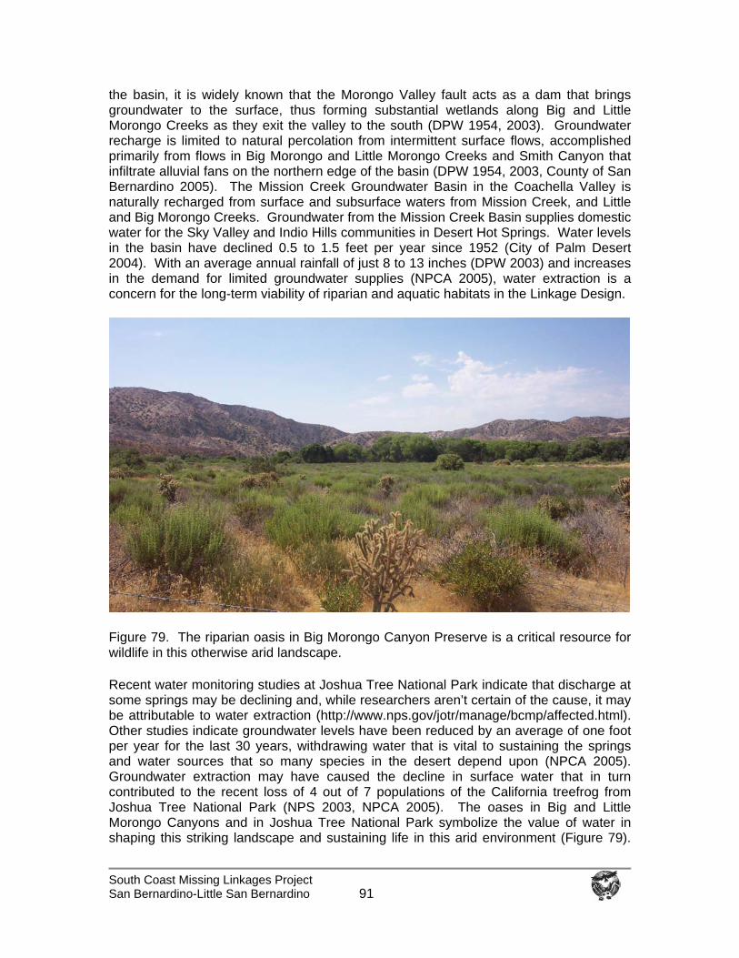
South Coast Missing Linkages Project San Bernardino-Little San Bernardino
91
the basin, it is widely known that the Morongo Valley fault acts as a dam that brings groundwater to the surface, thus forming substantial wetlands along Big and Little Morongo Creeks as they exit the valley to the south (DPW 1954, 2003). Groundwater recharge is limited to natural percolation from intermittent surface flows, accomplished primarily from flows in Big Morongo and Little Morongo Creeks and Smith Canyon that infiltrate alluvial fans on the northern edge of the basin (DPW 1954, 2003, County of San Bernardino 2005). The Mission Creek Groundwater Basin in the Coachella Valley is naturally recharged from surface and subsurface waters from Mission Creek, and Little and Big Morongo Creeks. Groundwater from the Mission Creek Basin supplies domestic water for the Sky Valley and Indio Hills communities in Desert Hot Springs. Water levels in the basin have declined 0.5 to 1.5 feet per year since 1952 (City of Palm Desert 2004). With an average annual rainfall of just 8 to 13 inches (DPW 2003) and increases in the demand for limited groundwater supplies (NPCA 2005), water extraction is a concern for the long-term viability of riparian and aquatic habitats in the Linkage Design.
Figure 79. The riparian oasis in Big Morongo Canyon Preserve is a critical resource for wildlife in this otherwise arid landscape.
Recent water monitoring studies at Joshua Tree National Park indicate that discharge at some springs may be declining and, while researchers aren’t certain of the cause, it may be attributable to water extraction (http://www.nps.gov/jotr/manage/bcmp/affected.html). Other studies indicate groundwater levels have been reduced by an average of one foot per year for the last 30 years, withdrawing water that is vital to sustaining the springs and water sources that so many species in the desert depend upon (NPCA 2005). Groundwater extraction may have caused the decline in surface water that in turn contributed to the recent loss of 4 out of 7 populations of the California treefrog from Joshua Tree National Park (NPS 2003, NPCA 2005). The oases in Big and Little Morongo Canyons and in Joshua Tree National Park symbolize the value of water in shaping this striking landscape and sustaining life in this arid environment (Figure 79).
South Coast Missing Linkages Project San Bernardino-Little San Bernardino
92
The springs and seeps are maintained by local aquifers, and without sufficient groundwater the biotic community of this remarkable natural system cannot be sustained http://www.nps.gov/jotr/manage/bcmp/affected.html).
In addition to loss of surface and groundwater, water quality is also a concern. Morongo Valley and the surrounding areas have been developed with septic tanks and leachfield systems and, although groundwater supplies in the planning area appear to be adequate, water quality is poor (County of San Bernardino 2005). Algae blooms, which are indicative of excessive nutrient levels and lower dissolved oxygen, have been reported in Joshua Tree National Park. The Park Service Water Resources Division stated that 68% of the dissolved oxygen measurements for 17 spring stations in Joshua Tree National Park from 1985 to 1997 failed to meet the EPA criterion for the protection of freshwater aquatic life (NPCA 2005). However, thus far no drainages in the Linkage Design have been listed as impaired under Section 303(d) of the Clean Water Act (USEPA 2003, http://www.ice.ucdavis.edu/wqsid/wblist.asp?region_pkey=7). Both the Morongo Valley and the Coachella Valley are located within the Colorado River Water Basin regulated by the Colorado River Regional Water Quality Control Board. If any drainages were listed as impaired in the future, these riparian stretches would be eligible for the development of intensive management plans called Total Maximum Daily Load (TMDL) plans. TMDL plans are enacted by the Regional Water Quality Control Board to determine the cause of water quality deterioration and then an implementation plan is developed to return water quality to targeted values. Invasive species also need to be addressed in the Linkage Design. Although Dry Morongo Canyon, Big Morongo Canyon, and Mission Creek are dominated by desert willow (Salix exigua), tamarisk or saltcedar (Tamarix ramosissima) has invaded each of these systems. This introduced species has escaped cultivation and invaded stream courses in the arid southwest, out-competing native plant species and forming monocultures that provide reduced habitat value to wildlife. Tamarisk can transpire at least 200 gallons of water per plant each day and will often dry up ponds and streams (Whitson et al. 2000, Baldwin et al. 2002) to the detriment of native flora and fauna. Examples of Mitigation for Stream Barriers: Few restoration projects have focused on restoring the natural dynamics of riparian systems (Bell 1997), where annual floods are a major component of ecosystem function. Many riparian plants are pioneer species that establish quickly following soil disturbance by floods (Ohmart 1994), as long as threats like invasive species are controlled and physical processes restored (e.g., by removing dams and diversions or by mimicking natural flow regimes). Continuity between upland and riparian vegetation is also important to maintaining healthy riparian communities. Many species commonly found in riparian areas depend on upland habitats during some portion of their lifecycle. Examples include butterflies that use larval host plants in upland habitat and drink water as adults and toads that summer in upland burrows. While the width of upland habitats needed beyond the stream’s edge is unknown for many species, information on the western pond turtle suggests that a 1-km (0.6-mi) upland buffer (i.e., 0.5 km to either side of the stream) (Holland 1994) is needed to sustain populations of this species. Measures to minimize development impacts on aquatic habitats often focus on establishing riparian buffer zones (Barton et al. 1985, Allan 1995, Wilson and Dorcas
South Coast Missing Linkages Project San Bernardino-Little San Bernardino
93
2003). However, although these buffers are intended to prevent erosion and filter runoff of contaminants (U.S. Environmental Protection Agency), research suggests that current regulations are inadequate to protect populations of semiaquatic reptiles and amphibians (Wilson and Dorcas 2003). Buffers must contain enough upland habitat to maintain water-quality and habitat characteristics essential to the survival of many aquatic and semiaquatic organisms (Brosofske et al.1997, Wilson and Dorcas 2003). However, maintaining riparian buffers will not suffice for some species. For example, to preserve salamander populations in headwater streams, land use must be considered at the watershed level (Wilson and Dorcas 2003). Recommendations to Mitigate the Effects of Streams Barriers in the Linkage Design: Residents of Morongo Valley have expressed support for the protection and preservation of water resources for the area’s natural areas and wildlife (County of San Bernardino 2005). To enhance species use of riparian habitat and restore riparian connections through the Linkage Design area, we recommend:
Wherever possible restore the natural historic flow regime or create a regime that provides maximum benefit for native biodiversity. Work with the USFS, NPS, BLM, CDFG, USGS, Department of Public Works, Water Districts, watershed groups, and others to investigate the historic flow regimes and develop a surface and groundwater management program to restore and recover properly functioning aquatic and riparian conditions.
Minimize the effects of road crossings in riparian zones. Coordinate with the
California Department of Transportation, USFS, NPS, BLM, and CDFG, to further evaluate existing stream crossings and upgrade culverts, Arizona crossings (in stream crossings), bridges, and roads that impede wildlife movement. Use several strategies, including information on preferred crossings, designing new culverts, retrofitting or replacing culverts, general recommendations, post construction evaluation, maintenance, and long-term assessment (Carey and Wagner 1996, NMFS 2000, Evink 2002).
Restore riparian vegetation in all drainages and upland vegetation within 1 km
(0.6 mi) of streams and rivers. This may encourage plant and animal movement and improve water quality. Non-point sources of pollution should be identified and minimized.
Discourage the construction of concrete-banked streams and other
channelization projects. Prevent invasions of non-native species. Remove exotic plants (e.g., tamarisk)
and animals (e.g., bullfrogs, African clawed frogs) from washes, streams and rivers. Work with the Biological Resources Division at USGS, USFS, NPS, BLM, CDFG, The Wildlands Conservancy and other relevant agencies and organizations to survey streams and drainages for invasive species and develop a comprehensive removal strategy.
Enforce existing regulations protecting streams and stream vegetation from
illegal diversion, alteration, manure dumping, and vegetation removal. Agencies
South Coast Missing Linkages Project San Bernardino-Little San Bernardino
94
with applicable jurisdiction include CDFG (Streambed Alteration Agreements), Army Corps of Engineers (Clean Water Act), and Native Plant Protection Act.
Prevent off-road vehicles from driving in riparian areas and washes (e.g., Dry
Morongo, Little Morongo) and enforce closures. Review existing regulations relative to linkage goals and develop additional restrictions (installation/maintenance of barriers for off-road vehicles) or recommend closures in sensitive areas.
Aggressively enforce regulations restricting farming, gravel mining, suction
dredging, and building in streams and floodplains. Increase and maintain high water quality standards. Work with the Resource
Conservation District to help establish use of Best Management Practices for rural communities in the Linkage Design and surrounding communities.
Support efficient water use and education programs that promote water
conservation (County of San Bernardino 2005).
Discourage development in flood prone areas.
Support the protection of riparian and adjacent upland habitats on private lands. Pursue cooperative programs with landowners to improve conditions in riparian and upland habitats on private land in the Linkage Design.
Other Land Uses that Impede Utility of the Linkage Land management policies in the protected areas and the linkage can have substantial impact on habitat and movements of species through the Linkage Design area. It is essential that major land-management and planning entities (e.g., USFS, BLM, NPS, The Wildlands Conservancy, Coachella Valley Association of Governments, San Bernardino County) integrate the linkage plan into their policies and regulations. Urban Barriers to Movement Urban development, unlike roads or aqueducts, creates barriers that cannot be corrected by building crossing structures. Urban and suburban areas make particularly inappropriate landscapes for movements of most plants and animals (Marzluff and Ewing 2001). In addition to direct habitat removal, urban development creates edge effects that reach well beyond the development footprint. Most terrestrial mammals that move at night will avoid areas with artificial night lighting (Beier, in press). Pet cats can significantly depress populations of small vertebrates near housing (Churcher and Lawton 1987, Crooks 1999, Hall et al. 2000). Irrigation of landscapes surrounding homes encourages the spread of argentine ant populations into natural areas, where they cause a halo of local extinctions of native ant populations extending 200 m (656 ft) into native vegetation (Suarez et al. 1998, Bolger et al. 2000). Similar affects have been documented for amphibians (Demaynadier and Hunter 1998). Habitat disturbance caused by intense human activity (e.g., off-road vehicle use, dumping, camping and gathering sites) also tends to rise in areas surrounding urban developments. Areas
South Coast Missing Linkages Project San Bernardino-Little San Bernardino
95
disturbed by human use show decreases in bird and small mammal populations (Sauvajot unpubl.). Urban Barriers in the Linkage Design Area: Urban developments comprise 1.2 % of the Linkage Design area. The growing city of Desert Hot Springs is near the southern edge of the linkage, the community of Morongo Valley is in the central part of the linkage, and the town of Yucca Valley borders the northern perimeter of the linkage area. The city of Desert Hot Springs is quickly becoming impermeable to wildlife movement due to high-density development, high traffic volume, large numbers of pets, and light and noise pollution. Yucca Valley is still a rustic town, but a massive development has been proposed that would seriously jeopardize the utility of the northern branch of the linkage and the ecological integrity of Joshua Tree National Park. If approved, the Mountain Vista Project would erect 1,300 homes just north of the Park’s boundary (i.e., south of Yucca Trail at La Contenta). This type of large-scale development is incompatible with maintaining habitat values in existing protected areas and the functionality of the linkage. While topography, habitat, water supplies and other natural constraints limit opportunities for significant population growth in Morongo Valley, residents are influencing the future of the valley by engaging in the Morongo Valley Community Plan (County of San Bernardino 2005). The priorities identified by the community are strongly linked to preserving the natural environment: 1) conservation of natural resources and scenic beauty; 2) protection of the Big Morongo Canyon Preserve; and 3) maintenance of natural desert landscape and appearance. The land use policy map identifies several important areas in the Linkage Design as Resource Conservation areas and the majority of the land is zoned as Rural Living (2.5, 5 and 10 acre lots). However, many large parcels (several hundred acres each) remain in the Linkage Design and have not been sub-divided. A few ordinances supported by the community, if strictly adhered to, are also compatible with maintaining linkage function. These include the Night Sky Ordinance, which limits street lighting to the minimum required to meet safety standards, and the Hillside Preservation Ordinance, which limits building in mountainous regions surrounding the valley. In addition, because this equestrian-oriented community values their rural lifestyle, they discourage paved roads (County of San Bernardino 2005). This type of voluntary cooperation is essential to the functionality of the linkage, to limit impacts of lighting, roads, domestic livestock, pets, and traffic on wildlife movement in the Linkage Design area. Since increased urbanization of currently undeveloped areas of the Linkage Design could seriously compromise wildland connectivity, we are delighted to see the community of Morongo Valley take such a positive stance for the environment and we hope that other communities will follow their example. Illegal dumping is a concern in areas of the Linkage Design, particularly south of State Route 62 in Big Morongo Wash, just outside the boundary of Big Morongo Canyon Preserve (Figure 80). There are old appliances, an abandoned car, and other discarded rubbish directly in the wash that may impact water quality, including both surface and groundwater. In addition, the Eagle Mountain Landfill has been proposed just outside the eastern boundary of Joshua Tree National Park. Though not in the Linkage Design, the proposed landfill would devastate 4,000 acres of defacto wilderness within one mile of the Park, generate excessive air, light, and noise pollution, and would be a magnet for scavengers such as ravens that have annihilated desert tortoise populations (NPCA 2005). The proposed Eagle Mountain Landfill would seriously degrade the ecological
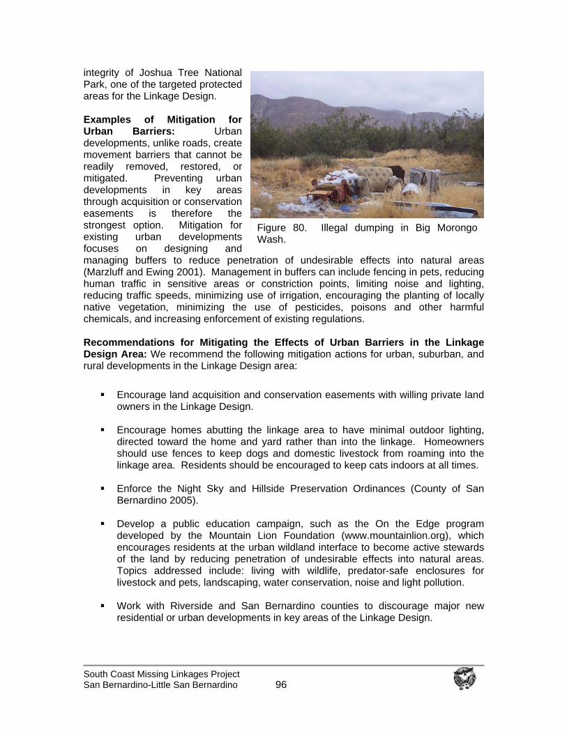
South Coast Missing Linkages Project San Bernardino-Little San Bernardino
96
integrity of Joshua Tree National Park, one of the targeted protected areas for the Linkage Design. Examples of Mitigation for Urban Barriers: Urban developments, unlike roads, create movement barriers that cannot be readily removed, restored, or mitigated. Preventing urban developments in key areas through acquisition or conservation easements is therefore the strongest option. Mitigation for existing urban developments focuses on designing and managing buffers to reduce penetration of undesirable effects into natural areas (Marzluff and Ewing 2001). Management in buffers can include fencing in pets, reducing human traffic in sensitive areas or constriction points, limiting noise and lighting, reducing traffic speeds, minimizing use of irrigation, encouraging the planting of locally native vegetation, minimizing the use of pesticides, poisons and other harmful chemicals, and increasing enforcement of existing regulations. Recommendations for Mitigating the Effects of Urban Barriers in the Linkage Design Area: We recommend the following mitigation actions for urban, suburban, and rural developments in the Linkage Design area:
Encourage land acquisition and conservation easements with willing private land owners in the Linkage Design.
Encourage homes abutting the linkage area to have minimal outdoor lighting,
directed toward the home and yard rather than into the linkage. Homeowners should use fences to keep dogs and domestic livestock from roaming into the linkage area. Residents should be encouraged to keep cats indoors at all times.
Enforce the Night Sky and Hillside Preservation Ordinances (County of San
Bernardino 2005).
Develop a public education campaign, such as the On the Edge program developed by the Mountain Lion Foundation (www.mountainlion.org), which encourages residents at the urban wildland interface to become active stewards of the land by reducing penetration of undesirable effects into natural areas. Topics addressed include: living with wildlife, predator-safe enclosures for livestock and pets, landscaping, water conservation, noise and light pollution.
Work with Riverside and San Bernardino counties to discourage major new
residential or urban developments in key areas of the Linkage Design.
Figure 80. Illegal dumping in Big Morongo Wash.
South Coast Missing Linkages Project San Bernardino-Little San Bernardino
97
If development proposals are approved, we recommend land management and regulatory agencies work with the project proponent to design fuel breaks within the project footprint.
Recreation Recreational use is not inherently incompatible with wildlife movement, although, intense recreational activities have been shown to cause significant impacts to wildlife and plants (Knight and Cole 1995). Areas with high levels of off-road vehicle use are more readily invaded by invasive plant species (Davidson and Fox 1974), accelerate erosion and reduce soil infiltration (Iverson 1980), and alter habitat use by vertebrates (Brattstrom and Bondello 1983, Nicolai and Lovich 2000). Even such relatively low-impact activities as wildlife viewing, hiking, and horse back riding have been shown to displace wildlife from nutritionally important feeding areas and prime nesting sites (Anderson 1995, Knight and Cole 1995). The increased time and energy spent avoiding humans can decrease reproductive success and make species more susceptible to disease (Knight and Cole 1995). In addition, humans, horses, and pets can carry seeds of invasive species into natural areas (Benninger 1989, Benninger-Traux et al. 1992). Recreation in the Linkage Design Area: Areas currently available for recreation in the Linkage Design include the Bureau of Land Management’s Big Morongo Canyon Preserve, San Bernardino County Parks, the Pacific Crest Trail, and The Wildlands Conservancy’s Mission Creek and Pipes Canyon Preserves. Forest Service and National Park Service lands provide a wide range of recreational opportunities, from nature-based dispersed recreational activities (e.g., hiking, bird watching) to high-density recreation in developed sites. The majority of recreational use is concentrated in developed facilities with road access. Recreational activities in the vicinity of the linkage include birding, hiking, off-road vehicle use, and a shooting area. Illegal recreational dams have been created in some areas (e.g., Big Morongo Creek) that obstruct downstream flows. Designated off-road vehicle areas occur along a power line access road managed by Southern California Edison that cuts across the lower portion of Little Morongo Canyon to Yucca Valley, and in the upper portions of Big and Little Morongo Canyons on BLM land (BLM 2003). However, unauthorized road and trail creation (i.e., hill climbs and secondary trails up several side canyons) has been so high in Little Morongo Canyon that BLM enlisted the help of San Diego State University’s Soil Ecology and Restoration Group to close off illegal routes and prevent new ones from being created to protect the area, which is a critical movement corridor, lambing area and watering area for bighorn sheep (SERG 2004). Poachers are also a serious concern, with collection for the illegal reptile trade threatening snakes, tortoise, and lizard populations (Associated Press 2005). Examples of Mitigation for Recreation: If recreational activities are effectively monitored, most negative impacts can be avoided or minimized by limiting types of use, directing recreational activities away from particular locations, sometimes only for particular seasons, and with reasonable precautions. Recommendations to Mitigate the Effects of Recreation in the Linkage Design Area: We provide the following initial recommendations to prevent or mitigate negative effects of recreation in the Linkage Design area:
South Coast Missing Linkages Project San Bernardino-Little San Bernardino
98
Monitor trail development and recreational use to provide a baseline for decisions regarding levels, types, and timing of recreational use.
Work with regional monitoring programs, such as the State’s Resource
Assessment Program, to collect information on special status species, species movements, and vegetation disturbance in areas of high recreational activity.
Enforce existing regulations on recreational use.
Work with the land management agencies and non-governmental organizations
to develop and conduct on-the-ground, multi-lingual outreach programs to recreational users on how to lessen impacts in sensitive riparian areas.
Close roads and trails that pass through known bighorn sheep lambing areas
during the reproductive season and protect critical water sources from disturbance during the summer (Holl and Bleich 1983, Papouchis et al. 2001, USFWS 2001).
Prohibit new off-road vehicle routes within bighorn sheep habitat (USFWS 2001).
Close, obliterate, and restore to natural habitat any unauthorized off-road vehicle
routes (e.g., Little Morongo, Dry Morongo) and enforce closures.
Enforce leash laws so that dogs are under restraint at all times (USFWS 2001, Holl et al. 2004).
Land Protection & Stewardship Opportunities A variety of conservation planning efforts is currently underway in the Linkage Design area. The South Coast Missing Linkages Project supports these efforts by providing information on linkages critical to achieving their conservation goals at a landscape scale. This section provides information on planning efforts, agencies, and organizations that may represent opportunities for conserving the San Bernardino – Little San Bernardino Linkage. This list is not exhaustive, but provides a starting point for persons interested in becoming involved in preserving and restoring linkage function. Bureau of Land Management: BLM sustains the health, diversity and productivity of the public lands for the use and enjoyment of present and future generations. BLM administers the Big Morongo Canyon Area of Critical Environmental Concern in the Linkage Design and has acquired about a 3-km stretch of land along State Route 62 expressly for bighorn sheep movement between the San Bernardino and Little San Bernardino Mountains. Representatives from BLM have attended each of the South Coast Missing Linkages workshops. For more information on lands administered by the BLM, visit http://www.ca.blm.gov. California Department of Fish and Game: CDFG manages California's diverse fish, wildlife, and plant resources, and the habitats upon which they depend, for their ecological values and for their use and enjoyment by the public. Acquisition dollars for CDFG projects are authorized through the Wildlife Conservation Board as part of their
South Coast Missing Linkages Project San Bernardino-Little San Bernardino
99
Concept Area Protection Plan (CAPP) process. For more information on the Department, visit their website at http://www.dfg.ca.gov. California Department of Transportation: CalTrans strives to achieve the best safety record in the nation, reduce traveler delays due to roadwork and incidents, deliver record levels of transportation system improvements, make transit a more practical travel option, and improve the efficiency of the transportation system. CalTrans representatives have attended each of the South Coast Missing Linkages workshops and have shown leadership and a willingness to improve linkage function in the most important linkage areas. CalTrans recently proposed building a wildlife overpass over SR-118. In February 2003, CalTrans started removing pavement from the Coal Canyon interchange on SR 91 in Orange County and transferred the property to California State Parks expressly to allow wildlife movement between the Santa Ana Mountains of the Cleveland National Forest and Chino Hills State Park. To find out more about the innovative plans being developed by Caltrans, visit their website at http://www.dot.ca.gov. California State Parks: California State Parks provides for the health, inspiration and education of the people of California by helping to preserve the state's extraordinary biological diversity, protecting its most valued natural and cultural resources, and creating opportunities for high-quality outdoor recreation. The Department is actively engaged in the preservation of the State’s rich biological diversity through their acquisition and restoration programs. Ensuring connections between State Park System wildlands and other protected areas is one of their highest priorities. CSP is involved in the Coal Canyon habitat connection restoration project to preserve mountain lion movement under SR 91 at the north end of the Santa Ana Mountains. CSP co-sponsored the statewide Missing Linkages conference and is a key partner in the South Coast Missing Linkages effort. For more information, visit their website at http://www.parks.ca.gov. California State Parks Foundation: The Foundation is the only statewide organization dedicated to preserving, advocating and protecting the legacy of California's State Parks. The Foundation supports environmental education, wildlife and habitat preservation, volunteerism, and sound park policy. Since its inception, the Foundation has provided over $110 million for projects and educational programs while building a statewide network of park supporters. These initiatives have helped the parks acquire more land, create more trails, restore wildlife habitat, build visitor centers, construct interpretive displays, and support family camping for underserved youth. CSPF is a partner in the South Coast Missing Linkages. For more on their exciting programs, visit www.calparks.org. California Wilderness Coalition: The California Wilderness Coalition builds support for threatened wild places on a statewide level by coordinating efforts with community leaders, businesspeople, decision-makers, local organizations, policy-makers, and activists. CWC was also a co-sponsor of the statewide Missing Linkages effort. For more information, visit them at http://www.calwild.org.
California Wild Heritage Campaign: The mission of the California Wild Heritage Campaign is to ensure the permanent protection of California's remaining wild public lands and rivers. Congresswoman Hilda Solis has introduced the Southern California
South Coast Missing Linkages Project San Bernardino-Little San Bernardino
100
Wild Heritage Act. The bill would significantly expand the National Wild and Scenic Rivers System and the National Wilderness Preservation System on federally managed public lands in Southern and Central California. A total of 13 new Wild and Scenic Rivers are included in the bill, totaling more than 312 miles, and 47 new Wilderness Areas and Wilderness Additions totaling 1,686,393 acres. The Campaign builds support for Wilderness and Wild and Scenic River protection by compiling a detailed citizen's inventory of California's remaining wild places; organizing local communities in support of those places; building a diverse, broad-based coalition; and educating the general public, government officials and the media about the importance of protecting California's wild heritage. For more information on the status of the Act, visit http://www.californiawild.org.
Coachella Valley Multiple Species Habitat Conservation Plan: The mission of the CVMSHCP is to conserve adequate habitat in an unfragmented manner to provide for the protection and security of long-term viable populations of the species that are either currently listed as threatened or endangered, are proposed for listing, or are believed by the Scientific Advisory Committee, USFWS and CDFG, to have a high probability of being proposed for listing in the future if not protected by the Plan. The Plan is intended to proactively address requirements of the state and federal endangered species acts while avoiding disruption of economic development activities. The southern branch of the Linkage Design falls within the CVMSHCP area. For more information on the plan, go to http://www.cvmshcp.org.
Coachella Valley Mountain Conservancy: The Conservancy was established by the California Legislature in 1990 to protect the mountains surrounding the Coachella Valley, from Palm Springs to the Salton Sea. The Conservancy grew out of a community-based conservation group that believed that a partnership among the local, state, and federal governments, and the public, would be the most effective vehicle to protect the Coachella Valley's splendid natural and cultural resources. In January 2000, the Conservancy's mission and territory were expanded to include acquisition of natural community conservation lands upon approval of the Coachella Valley Multiple Species Habitat Conservation Plan. To learn more, go to http://www.cvmc.ca.gov.
County of San Bernardino: San Bernardino County is in the process of a 2025 General Plan Update that consists of two phases, the first of which was completed in 2002. During Phase I, a strategic analysis of the 1989 General Plan and Environmental Impact Report (EIR) was conducted. Phase II is anticipated to be a three-year process which began in mid-2003. The County also recently (2005) completed a Morongo Valley Community Plan. To find out more about the General Plan Update, go to: www.sbcountygeneralplan.net, or visit the county’s website at http://www.co.san-bernardino.ca.us/.
Desert Protective Council: The Desert Protective Council’s mission is the protection, appreciation, and enjoyment of some of nature's most marvelous bounty: our deserts. The Council has spearheaded many hard-won successes that have resulted in the preservation of wildlife habitats and natural resources of the four great deserts of the southwest. For more information, go to http://www.dpcinc.org.
South Coast Missing Linkages Project San Bernardino-Little San Bernardino
101
Desert Tortoise Council: The Council is a private, nonprofit organization that promotes conservation of the desert tortoise in the wild in a variety of ways. They hold an annual symposium to bring together scientists, managers, and concerned people to share the latest information available on the desert tortoise and its management. For more information, go to http://www.deserttortoise.org. Endangered Habitats League: The Endangered Habitats League is dedicated to ecosystem protection and sustainable land use. EHL participates in regional planning to curtail sprawl and preserve intact rural and agricultural landscapes. It actively supports the revitalization of urban areas and the development of vibrant community centers, effective mobility, and affordable housing choices. EHL is engaged in several Natural Community Conservation Planning efforts in the region. For more information, visit them at http://www.ehleague.org.
Environment Now: Environment Now is an active leader in creating measurably effective environmental programs to protect and restore California's environment. Since its inception, the organization has focused on the preservation of California’s coasts and forests, and reduction of air pollution and urban sprawl. Environment Now uses an intelligent combination of enforcement of existing laws, and application of technology and process improvements to eliminate unsustainable practices. To find out more about their programs, visit their website at http://www.environmentnow.org
Friends of Big Morongo Canyon Preserve: Friends was organized solely for the advancement of programs at Big Morongo Canyon Preserve. The primary purpose of Friends is to enhance the wildlife viewing, protection, and educational programs, and recreation opportunities provided by the Bureau of Land Management within the Preserve. Friends provide ongoing support to the Bureau in their conservation, education, and recreation programs within Big Morongo Canyon Preserve. Friends achieve these goals by raising funds, accepting donations, recruiting volunteers, and assisting BLM in the planning, creation, and maintenance of programs and facilities at the Preserve. For more information, visit http://www.bigmorongo.org
Joshua Tree Tortoise Rescue: This non-profit organization is permitted by the State of California Department of Fish and Game to rescue and rehabilitate the threatened California Desert Tortoise. Their mission is dedicated to the survival of the desert tortoise through education and adoption programs. For more information visit http://www.desertgold.com/tort/tort.html.
Mountain Lion Foundation: The Mountain Lion Foundation works to ensure naturally sustaining populations of mountain lions. Using research, education, advocacy, legislation, and litigation, MLF works across the American West to stop unnecessary killing of mountain lions and to protect the ecosystems upon which they depend. MLF partners with groups whose mission directly impacts mountain lions and is proud to be a founding board member of South Coast Wildlands. MLF's Southern California office focuses on "Living with Lions” to reduce conflicts between people, pets and lions. MLF helps livestock owners build predator-safe enclosures, helps those suburban residents "On the Edge" understand how their personal choices may affect wildlife for miles around, as well as helps those working and playing "In the Wild" feel safer. For more information on the MLF’s programs, visit their website at http://www.mountainlion.org.
South Coast Missing Linkages Project San Bernardino-Little San Bernardino
102
National Parks Conservation Association: Their mission is to protect and enhance America’s National Park System for present and future generations. NPCA plays a crucial role in ensuring that these special places are protected in perpetuity by advocating for the national parks and the National Park Service, educating decision-makers and the public about the importance of preserving the parks, helping to convince members of Congress to uphold the laws that protect the parks, supporting new legislation that addresses threats to the parks, fighting attempts to weaken these laws in the courts, and assessing the health of the parks and park management to better inform advocacy work. NPCA recently (June 2005) completed a resource assessment for the California Desert Parks, including Joshua Tree National Park, Death Valley National Park, and the Mojave National Preserve. For more information, visit their website at http://www.npca.org.
National Park Service: The purpose of the National Park Service is "...to promote and regulate the use of the...national parks...which purpose is to conserve the scenery and the natural and historic objects and the wildlife therein and to provide for the enjoyment of the same in such manner and by such means as will leave them unimpaired for the enjoyment of future generations." NPS manages Joshua Tree National Park and is a key partner in the South Coast Missing Linkages Project. For more on the National Park Service, see http://www.nps.gov.
Pacific Crest Trail Association: The mission of the Association is to protect, preserve and promote the Pacific Crest National Scenic Trail so as to reflect its world-class significance for the enjoyment, education, and adventure of hikers and equestrians. The Association works to promote the Pacific Crest National Scenic Trail as a unique educational and recreation treasure, provide a communications link among users and land management agencies, and assist the U.S. Forest Service and other agencies in the maintenance and restoration of the Pacific Crest National Scenic Trail. The Pacific Crest Trail crosses through portions of the Linkage Design and may be helpful in directing federal funds to secure land in the linkage. To find our more about the Association, visit them at http://www.pcta.org.
Regional Water Quality Control Board: The State WQCB strives to preserve, enhance and restore the quality of California's water resources, and ensure their proper allocation and efficient use for the benefit of present and future generations. The RWQCB oversees waters in the Linkage Design area. For more information, visit their website at http://www.swrcb.ca.gov. Resource Conservation Districts (RCD): The federal district has 2 offices with responsibilities in this area: Mojave Desert RCD and the Inland Empire West RCD. This non-profit agency supports conservation of natural ecosystems through programs that reduce the effects of on-going land-use practices on the environment. A major portion of their effort is to advise residents on the management of soil, water, soil amendments and other resources used for agriculture and home gardening. RCDs are supported by state and local grants. They provide leadership in partnership efforts to help people conserve, maintain, and improve our natural resources and environment. Programs include Emergency Watershed Protection, Environmental Quality Incentives, Resource Conservation and Development, Soil Survey Programs, Soil and Water Conservation Assistance, Watershed Protection, River Basin, and Flood Operations, Wetlands Reserve and Wildlife Habitat Incentives. They do not enforce regulations but instead
South Coast Missing Linkages Project San Bernardino-Little San Bernardino
103
serve the interests of local residents and businesses. To find out more about their programs, go to http://www.carcd.org. San Bernardino Mountains Land Trust: SBMLT grew out of heightened conservation concerns in the early 1990s, when the San Bernardino National Forest faced multiple threats to its ecological integrity. This group has been involved in several successful land acquisition efforts for conservation. SBMLT has an advisory committee that assists in several areas of expertise, including legal, real estate, forestry, biology, journalism, and publications. Land trusts are critical to implementing the Linkage Design, and the SBMLT is working diligently to keep the forest intact. For more information, see http://www.lta.org/findlandtrust/CA.htm. San Bernardino Valley Audubon: Audubon members are dedicated to protecting birds, wildlife, and our shared environment. They work with policymakers in Washington, D.C., state legislatures, and local governments across the country to restore and protect our natural legacy, secure funds for vital conservation programs, and preserve key natural areas. The San Bernardino Valley Audubon Chapter has over 1600 members in San Bernardino and Riverside Counties and is actively engaged in conservation activities in the Linkage Design and surrounding areas. For more information, go to www.sbvas.org.
Santa Monica Mountains Conservancy: This state agency was created by the Legislature in 1979 and is charged with the primary responsibility for acquiring land with statewide and regional significance. Through direct action, alliances, partnerships, and joint powers authorities, the Conservancy's mission is to strategically preserve, protect, restore, and enhance treasured pieces of Southern California’s natural heritage to form an interlinking system of parks, open space, trails, and wildlife habitats that are easily accessible to the general public. The SMMC is a partner in the South Coast Missing Linkages effort. For more information on SMMC, visit them at http://www.smmc.ca.gov.
Save our Forest Association, Inc.: The Save Our Forest Association, Inc. (SOFA) was formed to stop inappropriate land exchanges within the San Bernardino National Forest, though now they work on a variety of other critical conservation issues. SOFA monitors and comments on any large development projects which affect the long term health and vitality of the forest ecosystem in the San Bernardino Mountains, including large subdivisions, water extraction, etc. They also closely monitor commercial logging, cattle grazing, and off-road vehicle use. To find out more about the association, visit their website at www.saveourforestassoc.org.
Sierra Club’s Southern California Forests Campaign: Sierra Club volunteers and staff have created the Southern California Forests Campaign to encourage public involvement in the 4 southern California Forest’s Resource Management Plan revision process. The goals of the campaign are to reduce the threats to our forests and to enjoy, protect and restore them. For more information on the Sierra Club’s campaigns, go to http://www.sierraclub.org.
South Coast Wildlands: South Coast Wildlands is a non-profit group established to create a protected network of wildlands throughout the South Coast Ecoregion and is the key administrator and coordinator of the South Coast Missing Linkages Project. For all 15 priority linkages in the Ecoregion, South Coast Wildlands supports and enhances
South Coast Missing Linkages Project San Bernardino-Little San Bernardino
104
existing efforts by providing information on regional linkages critical to achieving the conservation goals of each planning effort. For more information on SCW, visit their website at http://www.scwildlands.org.
South Coast Missing Linkages Project: SCML is a coalition of agencies, organizations and universities committed to conserving 15 priority landscape linkages in the South Coast Ecoregion. The project is administered and coordinated by South Coast Wildlands. Partners in the South Coast Missing Linkages Project include but are not limited to The Wildlands Conservancy, The Resources Agency California Legacy Project, California State Parks, California State Parks Foundation, United States Forest Service, National Park Service, Santa Monica Mountains Conservancy, Conservation Biology Institute, San Diego State University Field Station Programs, The Nature Conservancy, Environment Now, and the Zoological Society of San Diego’s Conservation and Research for Endangered Species. For more information on this ambitious regional effort, go to http://www.scwildlands.org.
The Nature Conservancy: TNC preserves the plants, animals and natural communities that represent the diversity of life on Earth by protecting the lands and waters they need to survive. TNC is a partner in the South Coast Missing Linkage Project. For more information on their activities, go to http://www.tnc.org.
The Summertree Institute: Plants of the arid southwest survive conditions that commonly defeat other life forms. In order to help the rapidly developing communities of the southwest recognize and retain their long-lived native plants, The SummerTree Institute has launched SAVING THE ANCIENTS campaign. This community awareness program is currently focused on the native plants of the Mojave and Colorado Deserts, and is designed to encourage protection and planting of long-lived southwest native plants, while improving the environment for people and wildlife. For more information on the Institute, go to http://www.summertree.org.
The Wildlands Conservancy: The Wildlands Conservancy is a non-profit, member-supported organization dedicated to land and river preservation, trail development and environmental stewardship through education. Their Save the Saints Program brings together multiple land trusts and conservancies to identify key lands for acquisition within National Forest boundaries and lands contiguous with the Forests in the Santa Ana, San Gabriel, San Jacinto, and San Bernardino Mountains. TWC has acquired thousands of acres in the Linkage Design and owns and manages Pipes Canyon and Mission Creek Preserves. TWC is a vital partner in the South Coast Missing Linkages project. For more information, please visit their website at http://www.wildlandsconservancy.org. US Army Corps of Engineers: The mission of the ACOE is to provide quality, responsive engineering services for planning, designing, building and operating water resources and other civil works projects (Navigation, Flood Control, Environmental Protection, Disaster Response, etc.). They also are engaged in watershed planning efforts that may provide opportunities for restoration of natural water flow and riparian vegetation in the linkage. For more information, go to http://www.usace.army.mil. US Fish and Wildlife Service: The U.S. Fish and Wildlife Service works to conserve, protect and enhance fish, wildlife, and plants and their habitats for the continuing benefit of the American people. The agency can provide support for prosecuting violations to
South Coast Missing Linkages Project San Bernardino-Little San Bernardino
105
the Endangered Species Act, law enforcement, permits, and funding for research on threatened and endangered species. The federal Endangered Species Act as amended (16 U.S.C. 1534) authorizes USFWS to acquire lands and waters for the conservation of fish, wildlife, or plants with the Land and Water Fund Act appropriations. The added protection provided by the Endangered Species Act may also be helpful for protecting habitat in the linkage from federal projects. For more information, visit their website at http://www.fws.gov. US Fish and Wildlife Service Partners for Fish and Wildlife Program This program supplies funds and technical assistance to landowners who want to restore and enhance wetlands, native grasslands, and other declining habitats, to benefit threatened and endangered species, migratory birds, and other wildlife. This program may be helpful in restoring habitat on private lands in the Linkage Design. For more information on this program, please go to http://partners.fws.gov. US Forest Service: The mission of the USDA Forest Service is to sustain the health, diversity, and productivity of the Nation’s forests and grasslands to meet the needs of present and future generations. The four southern California Forests (Los Padres, Angeles, San Bernardino, and Cleveland) have recently finalized their Resource Management Plans. The Final Environmental Impact Statement and Forest Plans have identified connecting the four forests to the existing network of protected lands in the region as one of the key conservation strategies for protecting biodiversity on the forests. The USFS is allocated Land and Water Conservation Funds annually, which are designed to protect recreational open space, watershed integrity, and wildlife habitat and may be a source of funds for protecting land in the planning area. The Forest Service is taking a proactive role in habitat connectivity planning in the region as a key partner in the South Coast Missing Linkages Project. For more information, go to http://www.fs.fed.us/r5/scfpr.
US Geological Survey, Biological Resources Division: The Biological Resource Division (BRD) works with others to provide the scientific understanding and technologies needed to support the sound management and conservation of our Nation's biological resources. BRD develops scientific and statistically reliable methods and protocols to assess the status and trends of the Nation's biological resources. BRD utilizes tools from the biological, physical, and social sciences to understand the causes of biological and ecological trends and to predict the ecological consequences of management practices. BRD enters into partnerships with scientific collaborators to produce high-quality scientific information and partnerships with the users of scientific information to ensure this information's relevance and application to real problems. For more information, go to http://www.biology.usgs.gov.
Wildlife Conservation Board: The Wildlife Conservation Board administers capital outlay for wildlife conservation and related public recreation for the State of California. The Wildlife Conservation Board, while a part of the California Department of Fish and Game, is a separate and independent Board with authority and funding to carry out an acquisition and development program for wildlife conservation. For more information on WCB, go to http://www.dfg.ca.gov/wcb.
Zoological Society of San Diego: The Applied Conservation Division of the Society’s research department (Conservation and Research for Endangered Species) is working
South Coast Missing Linkages Project San Bernardino-Little San Bernardino
106
to conserve natural habitats and species in southern California, as well as other parts of the world. For example, the Applied Conservation Division supports conservation of southern California ecosystems through seed banking of endangered plant species, and ongoing studies of local birds, reptiles, and mammals and their habitats. For more information on ZSSD, go to http://www.sandiegozoo.org.
South Coast Missing Linkages Project San Bernardino-Little San Bernardino 107
Summary
A Scientifically Sound Plan for Conservation Action Humans are significant agents of biogeographic change in southern California by converting native habitats to urban and agricultural uses and altering the movements of organisms, nutrients, and water through the ecosystem. The resulting fragmentation of natural landscapes threatens to impede the natural processes that support one of the world’s greatest warehouses of species diversity. This interaction between human development and biodiversity is one of the great and potentially tragic experiments of our time. It creates a unique challenge for land managers and conservation planning efforts – to mitigate massive changes to once intact ecosystems. The conservation plan for the San Bernardino-Little San Bernardino Connection addresses these challenges by seeking to influence regional patterns of development in a manner that best preserves natural landscape-level processes in the region. The prioritization of this linkage for conservation, and the demarcation of lands requiring protection within the linkage, are based on the best available conservation techniques and the expertise of biologists working in the region. This project provides a strong biological foundation and a quantifiable, repeatable, conservation design approach that can inform successful conservation action. Next Steps The San Bernardino to Little San Bernardino Mountains Linkage Design is a scientifically sound starting point for conservation implementation and evaluation. This plan can be used as a resource by regional land managers to assist them in their critical role in sustaining biodiversity and ecosystem processes. Existing conservation investments in the region are already extensive, including lands managed by the US Forest Service, National Park Service, Bureau of Land Management, California Department of Fish and Game, and the State Lands Commission. Each public property within existing protected core areas as well as the linkage itself serves a unique role in preserving some aspect of the connection. Incorporating relevant aspects of this plan into individual land management plans provides an opportunity to jointly implement a regional conservation strategy. Additional conservation action will also be needed to address transportation barriers. Recommended tools include road renovation, construction of wildlife crossings, watershed planning, habitat restoration, conservation easements, zoning, acquisition, and others. These recommendations are not exhaustive, but are meant to serve as a starting point for agencies, organizations, and individuals interested in preserving and restoring linkage function. We urge the reader to keep sight of the primary goal of conserving landscape linkages -- to promote movement between targeted core areas over broad spatial and temporal scales -- and to work within this framework to develop a wide variety of restoration options for maintaining and improving linkage function. To this end, we provided a list of organizations, agencies, and regional projects that provide opportunities for collaborative implementation.
South Coast Missing Linkages Project San Bernardino-Little San Bernardino 108
Public education and outreach is vital to the success of this effort – both to change land-use activities that threaten species existence and movement in the linkage and to generate support for the conservation effort. Public education can encourage recreational users and residents at the urban-wildland interface to become active stewards of the land and to generate a sense of place and ownership for local habitats and processes. Such voluntary cooperation is essential to preserving linkage function. The biological information, figures, and tables in this plan are ready materials for interpretive programs. We have also prepared a 3D animation (Appendix C on the enclosed CD) that provides a landscape perspective of the linkage. Successful conservation efforts are reiterative, incorporating and encouraging the collection of new biological information that can increase understanding of linkage function. We strongly support the development of a monitoring and research program to address the habitat needs of species in the Linkage Design area and their movements (of individuals and genes). The suite of predictions generated by the GIS analyses conducted in this planning effort represent hypotheses to be tested and refined by long-term monitoring programs.
The remaining wildlands in southern California form a patchwork of natural open space within one of the world’s largest metropolitan areas. Without further action, our existing protected lands will become isolated in a matrix of urban and industrial development. Ultimately the fate of the plants and animals living on these lands will be determined by the size and distribution of protected lands and surrounding development and human activities. With this linkage conservation plan, the outcome of land use changes can be altered to ensure the greatest protection for our precious natural areas at the least cost to our human endeavors. We envision a future interconnected system of natural space where our native biodiversity can thrive.
South Coast Missing Linkages Project San Bernardino-Little San Bernardino
109
Literature Cited
Ahlborn, G. 1988-1990. Mountain lion, Felis concolor. In: D.C. Zeiner, W.F. Laudenslayer Jr.,
K.E. Mayer, and M. White (eds.). California wildlife habitat relationships system. Volume III: Mammals. Sacramento: California Department of Fish and Game, California Interagency Wildlife Task Group.
Alcock, J., and W.J. Bailey. 1997. Success in territorial defense by male tarantula hawk wasps Hemipepsis ustulata: the role of residency. Ecological Entomology 22:377-383.
Alcock, J., and M. Carey. 1988. Hilltopping behavior and mating success of the tarantula hawk wasp, Hemipepsis ustulata (Hymenoptera: Pompilidae) at a high elevation peak. Journal of Natural History 22:1173-1178.
Alcock, J. 1981. Lek territoriality in a tarantula hawk wasp Hemipepsis ustulata (Hymenoptera: Pompilidae). Behavioral Ecology and Sociobiology 8:309-317.
Allan, J.D. 1995. Stream ecology: structure and function of running waters, Chapman and Hall, New York.
Allred, D.M., and D.E. Beck. 1963. Ecological distribution of some rodents at the Nevada atomic test site. Ecology 44:211-214.
American Ornithologists' Union. 1998. Check-list of North American Birds. 7th edition. American Ornithologists' Union, Washington, D. C.
Anderson, S.H. 1995. Recreational disturbance of wildlife populations. In: Wildlife and recreationists, coexistence through management and research, edited by R.L. Knight and K.J. Gutzwiller. Island Press, Washington D.C.
Anderson, A.E., D.C. Bowden, and D.M. Kattner. 1992. The puma on the Uncompahgra Plateau, Colorado. Colorado Division of Wildlife, Technical Publication 40, Denver. 116pp.
Anderson, A.E, and O.C. Wallmo. 1984. Mammalian Species: Odocoileus hemionus. The American Society of Mammalogists. No. 219, pp. 1-9.
Anderson A.H., and A. Anderson. 1973. The cactus wren. University of Arizona Press, Tucson. 226pp.
Anderson, A.H., and A. Anderson. 1963. Life history of the cactus wren. Part IV: Competition and survival. Condor 65:29-43.
Anderson A.H., and A. Anderson. 1957. Life history of the cactus wren. Part I: Winter and pre-nesting behavior. Condor 59:274-296.
Anderson, W., B. Anderson, and S. Furniss. 1972. Juniper-sage upland. Pages 986-987 in W. T. Van Velzen, ed. Thirty-sixth breeding bird census. American Birds 26:937-1006.
Andrew, N.G., V.C. Bleich, and P.V. August. 1999. Habitat selection in mountain sheep in the Sonoran desert: Implications for conservation in the United States and Mexico. California Wildlife Conservation Bulletin 12. California Department of Fish and Game, Sacramento.
Anonymous. 1984. A management plan for bighorn sheep in California. Supported by Federal Aid in Wildlife Restoration Projects W-51-R, “Big Game Investigations” and W-26-D, “Wildlife Habitat Development.”
Armentrout, D.J., and W.R. Brigham. 1988. Habitat suitability rating system for desert bighorn sheep in the Basin and Range Province. USDI Bureau of Land Management Technical Report Note 384. USDI Bureau of Land Management, Denver, Colorado.
Arno, S.F.; and R.P Hammerly. 1977. Northwest trees. Seattle, WA: The Mountaineers. 222pp.
South Coast Missing Linkages Project San Bernardino-Little San Bernardino
110
Associated Press. 2005. Rangers are stepping up their hunt for reptile and plant poachers in Joshua Tree National Park. July 18, 2005. http://www.sacbee.com/state_wire/story/13254731p-14097282c.html
Atwood, J.L. 1998. Studies of California gnatcatchers and cactus wrens in southern California. Manomet Center for Conservation Sciences and the University of California, Irvine. 42pp.
Bailey, J.A. 1984. Bighorn zoogeography: response to McCutchen, Hansen and Wehausen. Wildlife Society Bulletin 12:86-89.
Bailey, J.A. 1980. Desert Bighorn, forage competition, and zoogeography. Wildlife Society Bulletin 8:208-216.
Baker, M., N. Nur, and G.R. Geupel. 1995. Correcting biased estimates of dispersal and survival due to limited study area: theory and application using wrentits. Condor. 97:663-674.
Bakker, E. 1971. An Island Called California. University of California Press, Berkeley. 484pp. Baldwin B.G., S. Boyd, B.J. Ertter, R.W. Patterson, T.J. Rosatti, and D.H. Wilken, editors. M.
Wetherway, Managing Editor. 2002. The Jepson Desert Manual Vascular Plants of Southeastern California. University of California Press, Berkeley, Los Angeles, London. 624pp.
Ballmer, G.R., and G.F. Pratt. 1988. A survey of the last instar larvae of the Lycaenidae of California. Journal of Research on the Lepidoptera, Vol. 27, pp. 1-81.
Banfield, A.W.F. 1974. The mammals of Canada. University of Toronto Press, Toronto. Barbour, M. G. 1987. Community ecology and distribution of California hardwood forests and
woodlands. In: Plumb, T.R.; and N.H. Pillsbury, technical coordinators. Proceedings of the symposium on multiple-use management of California's hardwood resources. November 12-14, 1986; San Luis Obispo, CA. U.S. Department of Agriculture, Forest Service, Pacific Southwest Forest and Range Experiment Station, Gen. Tech. Rep. PSW-100. Berkeley, CA. pp. 18-25.
Barhoum, D.N., and K.J. Burns. 2002. Phylogenetic relationships of the wrentit based on mitochondrial cytochrome b sequences. Condor 104:740-749.
Bartholomew, G. A., and J. W. Hudson. 1961. Desert ground squirrels. Scientific American, 205:107-116.
Barton, D.R., W.D. Taylor, and R.M. Biette. 1985. Dimensions of riparian buffer strips required to maintain trout habitat in southern Ontario (Canada) streams. North American Journal of Fisheries Management 5:364-378.
Baxter, C. 2001. An integrated approach to bird conservation in the Mississippi Alluvial Valley. Keynote Address. Riparian Habitat and Floodplains Conference March 12-14, 2001, Sacramento, California.
Beatley, J.C. 1976. Rainfall and Fluctuating plant populations in relation to distributions and numbers of desert rodents in southern Nevada. Oecologia 24:21-42.
Behrends, P., M. Daly, and M.I. Wilson. 1986. Above-ground activity of Merriam’s kangaroo rat (Dipodomys merriami) in relation to sex and reproduction. Behavior 96:210-226.
Beier, P. In Press. Impact of artificial night lighting on terrestrial mammals. Invited Chapter. In T. Longcore and C. Rich, editors, Environmental consequences of artificial night lighting. Island Press.
Beier, P., K. L. Penrod, C. Luke, W. D. Spencer, and C. Cabañero. 2005. South Coast Missing Linkages: Restoring connectivity to wildlands in the largest metropolitan area in the United States. Invited Chapter In K R. Crooks and MA Sanjayan, editors, Connectivity conservation: maintaining connections for nature. Oxford University Press.
South Coast Missing Linkages Project San Bernardino-Little San Bernardino
111
Beier, P. and R.F. Noss. 1998. Do habitat corridors provide connectivity? Conservation Biology 12:1241-1252.
Beier, P. 1996. Metapopulation models, tenacious tracking, and cougar conservation. Pages 293-322 in D. R. McCullough, editor. Metapopulations and wildlife conservation. Island Press, Covelo, California.
Beier, P. 1995. Dispersal of juvenile cougars in fragmented habitats. Journal of Wildlife Management 5:228-237.
Beier, P., D. Choate, and R.H. Barrett. 1995. Movement patterns of mountain lions during different behaviors. Journal of Mammalogy 76:1056-1070.
Beier, P. and R. Barrett. 1993. The cougar in the Santa Ana Mountain Range, California. Final Report for Orange County Cooperative Mountain Lion Study.
Beier, P. 1993. Determining minimum habitat areas and habitat corridors for cougars. Conservation Biology 7:94-108.
Beier, P., and S. Loe. 1992. A checklist for evaluating impacts to wildlife movement corridors. Wildlife Society Bulletin 20:434-440.
Bekker, H., B. van den Hengel, H. van Bohmen, and H. van der Sluijs. 1995. Natuur over wegen (Nature across motorways). Ministry of Transport, Public Works and Water Management, Delft, Netherlands.
Bell, G P. 1997. Ecology and management of Arundo donax, and approaches to riparian habitat restoration in southern California. In J.H. Brock, M. Wade, P. Pysek, and D. Green: (eds.) Plant invasions: studies from North America and Europe. Backhuys Publications, Leiden, The Netherlands.
Benninger, M. C. 1989. Trail as conduits of movement for plant species in coniferous forests of Rocky Mountain National Park, Colorado. M.S. Thesis, Miami University.
Benninger-Truax, M.C., J.L. Vankat, and R.L. Schaefer. 1992. Trail corridors as habitat and conduits for movement of plant species in Rocky Mountain National Park, Colorado, USA. Landscape Ecology 6:269–278.
Bent, A.C. 1948. Life histories of North American nuthatches, wrens, thrashers, and their allies. U.S. National Museum Bulletin. 195. Washington, D.C.
Bentz, J.A., and D.M. Woodard. 1988. Vegetation characteristics and bighorn sheep use on burned and unburned areas in Alberta. Wildlife Society Bulletin 16:86-193.
Bertram, R.C., and R.D. Rempel. 1977. Migration of the North Kings deer herd. California Fish and Game 63:157-179.
Best, T.L., A.S. Titus, C.L. Lewis, and K. Caesar. 1990. Ammospermophilus nelsoni. Mammalian Species 367:1-7. Published by the American Society of Mammalogists.
Best, T.L. 1983. Intraspecific variation in the agile kangaroo rat (Dipodomys agilis). Journal of Mammalogy 64:426-436.
Beuchner, H.K. 1960. The bighorn sheep in the United States, its past, present and future. Wildlife Monographs 4.
Blair, W.F. 1943. Populations of the deer mouse and associated small mammals in the mesquite association of southern New Mexico. Contrib. Lab. Vertebrate Biology University Michigan, Vol. 21, pp. 1-40.
Bleich, V.C., J.D. Wehausen, R.R. Ramey II, and J.L. Rechel. 1996. Metapopulation theory and mountain sheep: implications for conservation. Pages 353-373 in D.R. McCullough, editor. Metapopulations and wildlife conservation. Island Press, Washington, D.C.
Bleich, V.C. 1973. Ecology of rodents at the United States Naval Weapon Station, Seal Beach, Fallbrook Annex, San Diego, California. M.A. Thesis, California State University Long Beach. 102pp.
South Coast Missing Linkages Project San Bernardino-Little San Bernardino
112
Bleich, V.C., and M.V. Price. 1995. Aggressive behavior of Dipodomys stephensi, an endangered species, and Dipodomys agilis, a sympatric congener. Journal of Mammalogy 76:646-651.
Blood, D.A. 1963. Some aspects of behavior of a bighorn herd. Canadian Field Naturalist 77:79-94.
Bolger, D.T., A.V. Suarez, K.R. Crooks, S.A. Morrison, and T.J. Case. 2000. Arthropods in urban habitat fragments in the Southern California: area, age, and edge effects. Ecological Applications 10:1230-1248.
Bowyer, R.T. 1986. Habitat selection by southern mule deer. California Fish and Game 72:153-169.
Bowyer, R.T. 1981. Management guidelines for improving southern mule deer habitat on Laguna-Morena demonstration area. USDA Forest Service, 40-9AD6-9-622.
Bradley, W.G., and R.A. Mauer. 1973. Rodents of a creosote-bush community in southern Nevada. Southwest. Naturalist 17:333-344.
Bradley, W. G. 1968. Homing in the antelope and round-tailed ground squirrels. Journal of the Arizona Academy of Science, Vol. 5, pp. 22-26.
Bradley, W. G. 1967. Home range, activity patterns, and ecology of the antelope ground squirrel in southern Nevada. Southwest. Naturalist 12:231-252.
Brattstrom, B.H., and M.C. Bondello. 1983. Effects of off-road vehicles noise on desert vertebrates. Pages 167-204 in R.H. Webb and H.G. Wilshire, editors. Environmental effects of off-road vehicles: impacts and management in arid regions. Springer-Verlag, New York.
Brehme, C.S. 2003. Responses of small terrestrial vertebrates to roads in a coastal sage scrub ecosystem. Master's Thesis, San Diego State University.
Brennan, L.A., W.M. Block, and R.J. Gutierrez. 1987. Habitat use by mountain quail in northern California. Condor 89:66-74.
Brosofske, K.D., J. Chen, R.J. Naiman, and J.R. Franklin. 1997. Harvesting effects on microclimatic gradients from small streams to uplands in western Washington. Ecological Applications 7:1188-1200.
Brothers, T.S. 1985. Riparian species distributions in relation to stream dynamics, San Gabriel River, California. Ph.D. Dissertation, University of California Los Angeles. 120pp.
Brown, D.E. 1982. Great Basin conifer woodland. In: Brown, D.E., ed. Biotic communities of the American Southwest--United States and Mexico. Desert Plants, Vol. 4, pp. 52-57.
Brown, E.R. 1961. The black-tailed deer of Washington. Washing State Game Department, Bulletin No. 13. 124pp.
Brylski, P. 1990. Dusky footed woodrat, Neotoma fuscipes. in Zeiner, D., W. Laudenslayer, and M. White, editors. California Wildlife Habitat Relationship System, California Department of Fish and Game, California Interagency Wildlife Task Group.
Bury, R.B. 1988. Habitat relationships and ecological importance of amphibians and reptiles. Pages 61-76 in K. J. Raedeke, editor. Streamside management: riparian wildlife and forestry interactions. Contribution 59 of the Institute of Forest Resources, University of Washington, Seattle, Washington, USA.
California Department of Fish and Game. 2005a. Rare Find California Natural Diversity Database.
California Department of Fish and Game, Natural Diversity Database. 2005b. Special Vascular Plants, Bryophytes, and Lichens List. Quarterly publication, Mimeo. April 2005. 88 pp.
California Department of Fish and Game. 2003. Rare Find California Natural Diversity Database.
South Coast Missing Linkages Project San Bernardino-Little San Bernardino
113
California Department of Fish and Game. 2001. Special Animals. State of California, The Resources Agency, Department of Fish and Game Wildlife Habitat Data Analysis Branch, California Natural Diversity Database, January 2001.
California Department of Fish and Game. 1995. Wildlife Gallery Mammal Index: American Badger. http://www.delta.dfg.ca.gov/gallery/badger.html.
California Department of Fish and Game. 1994. 1992 annual report on the status of California state listed threatened and endangered animals and plants. Sacramento, CA.
California Department of Fish and Game. 1983. California's Wildlife, Mammals, Mule Deer. California Wildlife Habitat Relationships System, http://www.dfg.ca.gov/whdab/M181.html
California Department of Public Works (DPW). 1954. Ground Water Occurrence and Quality, Colorado River Basin Region. Water Quality Investigations Report No. 4. 59pp.
California Department of Water Resources (DWR). 2003. California’s Groundwater Bulletin 118. Hydrologic Region Colorado River California’s Groundwater Morongo Valley Groundwater Basin Bulletin 118. Last update 10/1/03
California Department of Water Resources (DWR). 1975. California’s Ground Water. Bulletin 118.
Carey, M. and P. Wagner. 1996. Salmon passages and other wildlife activities in Washington State. Trends in addressing transportation related wildlife mortality. Proceedings of the transportation related wildlife mortality seminar FL-ER-58-96. Florida Department of Transportation, Tallahassee, Florida.
Carraway, L.J., and B.J. Verts. 1991. Neotoma fuscipes. Mammalian Species, Vol. 386, pp. 1-10.
Chapman, J.A., and G.A. Feldhamer (eds.). 1982. Wild mammals of North America. The John Hopkins University Press. Baltimore, Maryland.
Chase, M.K., W.B. Kristan III, A.J. Lynam, M.V. Price, and J.T. Rotenberry. 2000. Single species as indicators of species richness and composition in California coastal sage scrub birds and small mammals. Conservation Biology 14:474-487.
Chew, R.M., and B.B. Butterworth. 1964. Ecology of rodents in Indian Cove (Mojave Desert), Joshua Tree National Monument, California. Journal of Mammalogy 45:203-225.
Christopher, E.A. 1973. Sympatric relationships of the kangaroo rats, Dipodomys merriami and D. agilis. Journal of Mammalogy 54:317-326.
Churcher, J.B. and J.H. Lawton. 1987. Predation by domestic cats in an English village. Journal of Zoology 212:439-456.
City of Palm Desert. 2004. Comprehensive General Plan Water Resources Element. Adopted 3/15/2004.
Clevenger, A.P., and J. Wierzchowski. 2005. Maintaining and restoring connectivity in landscapes fragmented by roads. Chapter in K. R. Crooks and M. A. Sanjayan, editors. Connectivity conservation: maintaining connections for nature. Oxford University Press.
Clevenger, A.P., and N. Waltho. 1999. Dray drainage culvert use and design considerations for small-and medium-sized mammal movement across a major transportation corridor. Pp. 263-277 in G.L. Evink, P. Garrett, and D. Zeigler (eds.) Proceedings of the Third International Conference on Wildlife Ecology and Transportation. FL-ER-73-99. Florida Department of Transportation, Tallahassee, Florida.
Clevenger, A.P., B. Chruszez, and K. Gunson. 2001. Highway mitigation fencing reduces wildlife vehicle collisions. Wildlife Society Bulletin 29:646-653.
Close, C.L. and D.F. Williams. 1988. Habitat management for riparian brush rabbits and woodrats with special attention to fire and flood. Unpublished report, Endangered Species
South Coast Missing Linkages Project San Bernardino-Little San Bernardino
114
Recovery Program, Department of Biological Sciences. California State University, Stanislaus, Turlock.
Coachella Valley Association of Governments. 2004. Coachella Valley Multiple Species Habitat Conservation Plan and Natural Community Conservation Plan Public Review Draft October 15, 20004. Volume 1 The Plan. Prepared for Coachella Valley Association of Governments, prepared by Coachella Valley Mountains Conservancy.
Cogswell, H.L. 1962. Territory size in three species of chaparral birds in relation to vegetation density and structure. PhD Thesis, University of California, Berkeley. 567pp.
Conard, S.G., R.L. MacDonald, and R.F. Holland. 1980. Riparian vegetation and flora of the Sacramento Valley. In: Sands, Anne, editor. Riparian forests in California: Their ecology and conservation. Symposium proceedings May 14, 1977. University of California, Davis, Division of Agricultural Sciences, pp. 47-55.
Conover, M.R. 1997. Monetary and intangible valuation of deer in the United States. Wildlife Society Bulletin 25:298-305.
Conrad, C.E. 1987. Common shrubs of chaparral and associated ecosystems of southern California. Gen. Tech. Rep. PSW-99. Berkeley, CA: U.S. Department of Agriculture, Forest Service, Pacific Southwest Forest, and Range Experiment Station. 86pp.
County of San Bernardino. 2005. Morongo Valley Community Plan, General Plan County of San Bernardino. Draft Community Plan March 2005 – Version 3.
Cowan, I. McT. 1940. Distribution and variation in the native sheep of North America. American Midland Naturalist 24:505-580.
Craighead, A. C., E. Roberts, F. L. Craighead. 2001. Bozeman Pass Wildlife Linkage and Highway Safety Study. Prepared for American Wildlands, http://www.wildlands.org/research.html.
Cranford, J.A. 1977. Home range and habitat utilization by Neotoma fuscipes as determined by radiotelemetry. Journal of Mammalogy 58:165-172.
Crooks, K.R., A.V. Suarez, and D.T. Bolger. 2004. Avian assemblages along a gradient of urbanization in a highly fragmented landscape. Biological Conservation 115:451-462.
Crooks, K.R., A.V. Suarez, D.T. Bolger, and M.E. Soulé. 2001. Extinction and colonization of birds on habitat islands. Conservation Biology 15:pp. 159-172.
Crooks, K. 1999. Mammalian carnivores, mesopredator release, and avifaunal extinctions in a fragmented system. Ph.D. Dissertation. University of California Santa Cruz.
Crooks, K. and M. Soulé. 1999. Mesopredator release and avifaunal extinctions in a fragmented system. Nature 400:563-566.
Cunningham, S.C. 1989. Evaluation of desert bighorn sheep habitat. Pages 135-160 in R.M. Lee, editor. The desert bighorn sheep in Arizona. Arizona Game and Fish Department, Phoenix, Arizona.
Currier, M.J.P. 1983. Felis concolor. Mammalian Species No. 200, pp. 1-7. Daly, M., L.F. Jacobs, M.I. Wilson, and P.R. Behrends. 1992. Scatter-hoarding by kangaroo
rats (Dipodomys merriami) and pilferage from their caches. Behavioral Ecology 3:102-111.
Davidson, E., and M. Fox. 1974. Effects of off-road motorcycle activity on Mojave Desert vegetation and soil. Madroño 22:381-412.
Debinski, D.M., and R.D. Holt. 2000. A survey and overview of habitat fragmentation experiments. Conservation Biology 2:342-355.
DeForge, J.R., S.D. Ostermann, C.W. Willmott, K.B. Brennan, and S.G. Torres. 1997. The ecology of Peninsular bighorn sheep in the San Jacinto Mountains, California. Desert Bighorn Council Transactions, Vol. 41, pp. 8-25.
South Coast Missing Linkages Project San Bernardino-Little San Bernardino
115
DeForge, J.R. 1980. Population biology of desert bighorn sheep in the San Gabriel Mountains of California. Transactions of the Desert Bighorn Council, Vol. 24, pp. 29-32.
Demaynadier, P.G., and M.L. Hunter, Jr. 1998. Effects of silvicultural edges on the distribution and abundance of amphibians in Maine. Conservation Biology 12:340-352.
DeSante, D.F., and D.G. Ainley. 1980. The avifauna of the South Farallon Islands, California. Studies in Avian Biol. No. 4. Cooper Ornithol. Soc., Lawrence, KA. 104pp.
De Vos, A. 1969. Ecological conditions affecting the production of wild herbivorous mammals on grasslands. In: Advances in ecological research. (Publisher unknown, place of publication unknown). On file at: U.S.D.A. Forest Service, Fire Sciences Laboratory, Intermountain Research Station, Missoula, Montana.
Dickson, BG, JS Jenness, and P. Beier. 2004. Influence of vegetation, roads, and topography on cougar movement in southern California. Journal of Wildlife Management 69(1):264-276.
Diffendorfer, J.E., M.S. Gaines, and R.D. Holt. 1995. The effects of habitat fragmentation on movements of three small mammal species. Ecology 76:827-839.
Dodd, S.C. 1999. Report of the 1999 Palm Springs Pocket Mouse (Perognathus longimembris bangsi) surveys. Palm Desert, CA. Unpublished report to the Coachella Valley Association of Governments.
Downey, J.C. 1961. Myrmecophily in the Lycaenidae (Lepidoptera). Proceedings North Central Branch, Entomological Society of America. Vol. 16, pp. 14-15.
Dudek and Associates Species Accounts. 2001. Understanding the plants and animals of the Western Riverside County MSHCP: http://ecoregion.ucr.edu.
Ebert, D.W., and C.L. Douglas. 1993. Desert bighorn sheep movement and habitat use in relation to the proposed Black Canyon Bridge Project, Nevada. Final Report, U.S. Bureau of Reclamation, Boulder City, Nevada, USA.
Emmel, T.C., and J.F. Emmel. 1973. The butterflies of southern California. Natural History Museum of Los Angeles County. Science Series 26:87, 135, 137.
Erickson, M.M. 1938. Territory, annual cycle, and number in a population of wrentits (Chamaea fasciata). University California Publication Zoology, Vol. 42, pp. 247-334.
Ernest, H.B., W.M. Boyce, V.C. Bleich, B. May, S.J. Stiver, and S.G. Torres. 2003. Genetic structure of mountain lion (Puma concolor) populations in California. Conservation Genetics 4:353-366.
Esque, T.C., D.F. Haines, L.A. DeFalco, J.E. Rodgers, K.A. Goodwin, and S.J. Scoles. 2003. Mortality of adult Joshua trees (Yucca brevifolia) due to small mammal herbivory at Joshua Tree National Park, California. Prepared by U.S. Geological Survey, Western Ecological Research Center, Las Vegas Field Station and National Park Service, Point Reyes Station. Prepared for National Park Service, Great Basin Cooperative Ecosystems Studies Unit, University of Nevada, Reno.
Essig Museum. Undated material. California’s Endangered Insects, species account for Apodemia mormo langei. Online at http://essig.berkeley.edu/endins/metalmk.htm.
Evink, Gary L. 2002. Interaction between roadways and wildlife ecology. National Academy Press, Washington, D.C.
Faber, P.A., E. Keller, A. Sands, and B.M. Massey. 1989. The ecology of riparian habitats of the southern California coastal region: a community profile. Biological Report 85. U.S. Fish and Wildlife Service. Washington D.C.
Falk, N.W., H.B. Graves, and E.D. Bellis. 1978. Highway right-of-way fences as deer deterrents. Journal of Wildlife Management 42:646-650.
South Coast Missing Linkages Project San Bernardino-Little San Bernardino
116
Feldhammer, G.A., J.E. Gates, D.M. Harmon, A.J. Loranger, and K.R. Dixon. 1986. Effects of interstate highway fencing on white-tailed deer activity. Journal of Wildlife Management 50:497-503.
Field, C.B., G.C. Daily, S. Gaines, P.A. Matson, J. Melack, and N.L. Miller. 1999. Confronting climate change in California: ecological impacts on the Golden State. Union of Concerned Scientists and Ecological Society of America, Washington D.C.
Fisher, R.N., A.V. Suarez, and T.J. Case. 2002. Spatial patterns in the abundance of the coast horned lizard. Conservation Biology 16:205-215.
Fisher, R., and K. Crooks. 2001. Baseline biodiversity survey for the Tenaja Corridor and southern Santa Ana Mountains. U.S. Geological Survey Biological Resources Division and Department of Biology, San Diego State University, San Diego, California.
Fisler, G. F. 1977. Interspecific hierarchy at an artificial food source. Animal Behavior 25:240-244.
Fisler, G. F. 1976. Agonistic signals and hierarchy changes of antelope squirrels. Journal of Mammalogy 57:94-102.
Fitch, H.S. and H.W. Shirer. 1971. A radiotelemetry study of spatial relationships in some common snakes. Copeia 1971:118-128.
Fitzpatrick, F.A., B.C. Scudder, B.N. Lenz, and D.J. Sullivan. 2001. Effects of multi-scale environmental characteristics on agricultural stream biota in eastern Wisconsin. Journal of the American Water Resources Association, Vol. 37, pp.1489-1508.
Forman, R.T.T., D. Sperling, J.A. Bissonette, A.P. Clevenger, C.D. Cutshall, V.H. Dale, L. Fahrig, R. France, C.R. Goldman, K. Heanue, J.A. Jones, F.J. Swanson, T. Turrentine, and T.C. Winter. 2003. Road Ecology: Science and Solutions. Island Press, Washington, D.C.
Forman, R.T.T., and R.D. Deblinger. 2000. The ecological road-effect zone of a Massachusetts (U.S.A) suburban highway. Conservation Biology 14:36-46.
Forman, R.T.T., and L.E. Alexander. 1998. Roads and their major ecological effects. Annual Review of Ecology and Systematics 29:207-231.
Forman, R.T.T. 1995. Land Mosaics: The Ecology of Landscapes and Regions. Cambridge University Press, Cambridge, England.
Freeman, D. 1999. Programmatic Biological Assessment Peninsular Bighorn Sheep. San Jacinto Ranger District, San Bernardino National Forest. 70 pp. + Appendices.
Gaines, D.A. 1980. The valley riparian forests of California: their importance to bird populations. In: A. Sands, editor. Riparian forests in California: Their ecology and conservation: Symposium proceedings; May 14; 1977. University of California, Davis, CA: Division of Agricultural Sciences, pp. 57-85.
Gaona, P., P. Ferreras, and M. Delibes. 1998. Dynamics and viability of a metapopulation of the endangered Iberian lynx (Lynx pardinus). Ecological Monographs 68:349-370.
Garrett, K., and J. Dunn. 1981. Birds of southern California: status and distribution. Los Angeles Audubon Society. 408pp.
Geist, V. 1985. On Pleistocene bighorn sheep: some problems of adaptation, and relevance to today’s American megafauna. Wildlife Society Bulletin 13:351-359.
Geist, V. 1971. Mountain sheep-a study in behavior and evolution. Chicago, IL: University of Chicago Press.
George, J. 1998. Recruitment dynamics of Yucca brevifolia, the Joshua tree, in the Mojave Desert. University of California Los Angeles. 1998 Annual Botanical Society Meeting, Baltimore, MD.
South Coast Missing Linkages Project San Bernardino-Little San Bernardino
117
Gerber, L.R. E.W. Seabloom, R.S. Burton, and O.J. Reichman. 2003. Translocation of an imperiled woodrat population: integrating spatial and habitat patterns. Animal Conservation 6:309-316.
Geupel, G.R., G. Ballard, and M.K. Chase. 2002. California Partners in Flight (CalPIF) Coastal Scrub and Chaparral Bird Conservation Plan Species Account, Wrentit (Chamaea fasciata). June, 2002, PRBO Conservation Science (Point Reyes Bird Observatory).
Giessow, J., and P. Zedler. 1996. The effects of fire frequency and firebreaks on the abundance and species richness of exotic plant species in coastal sage scrub. California Exotic Pest Plant Council. 1996 Symposium Proceedings. Berkeley, California.
Gilpin M. E. and M. E. Soulé 1986. Minimum viable populations: processes of species extinction. Pages 19-34 in Conservation biology: the science of scarcity and diversity. M.E. Soule (ed), Sinauer Associates, Inc. Sunderland, Mass
Gloyne, C.C., and A.P. Clevenger. 2001. Cougar (Puma concolor) use of wildlife crossing structures on the Trans Canada highway in Banff National Park, Alberta. Wildlife Biology 7:117-124.
Goforth, R.R. 2000. Local and landscape-scale relations between stream communities, stream habitat and terrestrial land cover properties. Dissertation Abstracts International Part B: Science and Engineering 8:3682.
Goldingay, R.L., and M.V. Price. 1997. Influence of season and a sympatric congener on habitat use by Stephen’s kangaroo rat. Conservation Biology 11:708-717.
Gossard, G. H. 1992. The Joshua Tree: A Controversial, Contradictory Desert Centurion. Yellow Rose Publications. 112pp.
Graham, H. 1980. The impact of modern man. Pages 288-309 in G. Monson and L. Sumner, editors. The desert bighorn – its life history, ecology, and management. University of Arizona Press, Tucson, Arizona.
Graham, H. 1971. Environmental analysis procedures for bighorn in the San Gabriel Mountains. Desert Bighorn Council Transactions, Vol. 15, pp. 38-45.
Gray, M. V., and J.M. Greaves. 1984. Riparian forest as habitat for the least Bell's vireo. Pages 605-611 In: Warner, R.E. and Hendrix, K.M., eds. California riparian systems: Ecology, conservation, and productive management: Proceedings of a conference; 1981 September 17-19; Davis, CA. Berkeley, CA: University of California Press. 605-611.
Griffin, J., R. and W.B. Critchfield. 1972. The distribution of forest trees in California. Res. Pap. PSW-82. Berkeley, CA: U.S. Department of Agriculture, Forest Service, Pacific Southwest Forest and Range Experiment Station. 118pp.
Grinnell, J., and A.H. Miller. 1944. The distribution of the birds of California. Pacific Coast Avifauna No. 27, 608pp.
Grinnell, J., and J. Dixon. 1919. Natural history of the ground squirrels of California. California State Commission Horticulture Bulletin, Vol. 7, pp. 597-708.
Gruell, G.E., and N.J. Papez. 1963. Movements of mule deer in northeastern Nevada. Journal of Wildlife Management 27:414-422.
Gutierrez, R.J., and D.J. Delehanty. 1999. Mountain Quail (Oreortyx pictus). In A. Poole and F. Gill (editors), The Birds of North America, No. 457. Philadelphia, PA: The Academy of Natural Sciences and Washington, D.C.: American Ornithologists Union.
Hall, L.S., M.A. Kasparian, D. Van Vuren, and D.A. Kelt. 2000. Spatial organization and habitat use of feral cats (Felis catus L.) in Mediterranean California. Mammalia, Vol. 64, pp 19-28.
Hall, E. R. 1981. The mammals of North America. 2nd ed. Vol. 2. John Wiley and Sons. New York.
South Coast Missing Linkages Project San Bernardino-Little San Bernardino
118
Hall, E. R., and K. R. Kelson. 1959. The mammals of North America. 2 Vols. The Ronald Press, New York. 1162pp.
Hall, E.R. 1946. Mammals of Nevada. University California Press, Berkeley. 710pp. Hammerson, G.A. 1979. Thermal ecology of the striped racer, Masticophis lateralis.
Herpetologica 35:267-273. Hansen, C.G. 1980. Habitat evaluation. Pages 320-335 in G. Monson and L. Sumner, editors.
The desert bighorn – its life history, ecology, and management. University of Arizona Press, Tucson, Arizona.
Hanski, I., and M. Gilpin. 1991. Metapopulation Dynamics. Academic Press, London. Harestad, A.S., and F.L. Bunnell. 1979. Home range and body weight-a revelation. Ecology
60:389-402. Harper, B. and L. Salata. 1991. A status review of the coastal Cactus Wren. U.S. Fish and
Wildlife Service, Southern California Field Station, Laguna Niguel, California. Harris, L.D., and P.B. Gallagher. 1989. New initiatives for wildlife conservation: the need for
movement corridors. Pages 11-34 in G. Mackintosh, editor. Preserving communities and corridors. Defenders of Wildlife, Washington, D. C.
Harris, L.D. 1984. The fragmented forest: island biogeography theory and the preservation of biotic diversity. University of Chicago Press, Chicago, Illinois.
Harris, R.T. 1975. Seasonal activity and microhabitat utilization in Hyla cadaverina (Anura: Hylidae). Herpetologica 31:236-239.
Harrison, R.L. 1992. Toward a theory of inter-refuge corridor design. Conservation Biology 6:293-295.
Hayes, C., E.S. Rubin, M.C. Jorgensen, R.A. Botta, and W.M. Boyce. 2000. Mountain lion predation on bighorn sheep in the Peninsular Ranges, California. Journal of Wildlife Management 64:954–959.
Heath, F. 2004. An Introduction to Southern California Butterflies. Mountain Press Publishing Company, Missoula, MT. 279pp.
Hensley, M.M. 1954. Ecological relations of the breeding bird population of the desert biome in Arizona. Ecological Monographs 234:185-207.
Hickman, J.C. 1993. The Jepson Manual Higher Plans of California, University of California Press, Berkeley, Los Angeles, and London.
Hirth, H.F., R.C. Pendleton, A.C. King, and T.R. Downard. 1969. Dispersal of Snakes from a Hibernaculum in Northwestern Utah. Ecology 50:332–339.
Hogue, C.L. 1974. Insects of the Los Angeles Basin. Natural History Museum of Los Angeles County, Los Angeles, CA. 446pp.
Holl, S., J. Davis, C. Davis, R. Barboza, L. Konde, B. Brown, A. Stamps, K. Meyer, and S. Loe. 2004. Draft: Implementation strategy to restore the San Gabriel Mountains bighorn sheep population. California Department of Fish and Game, Los Angeles County Fish and Game Commission, and U.S.D.A. Forest Service.
Holl, S.A. and V.C. Bleich. 1983. San Gabriel mountain sheep: biological and management considerations. Unpublished report on file at the San Bernardino National Forest, San Bernardino, CA. 136pp.
Holl, S.A. 1982. Evaluation of bighorn sheep habitat. Desert Bighorn Sheep Council Transactions, Vol. 26, pp. 47-49.
Holland, D.C. 1994. The western pond turtle: habitat and history. U.S. Department of Energy, Bonneville Power Administration, Portland, Oregon.
South Coast Missing Linkages Project San Bernardino-Little San Bernardino
119
Holland, R.F. 1986. Preliminary Descriptions of the Terrestrial Natural Communities of California. State of California The Resources Agency Department of Fish and Game. 156pp.
Holstein, G. 1984. California riparian forests: deciduous islands in an evergreen sea. In: Warner, R.E. and Hendrix, K.M., eds. California riparian systems: Ecology, conservation, and productive management: Proceedings of a conference; 1981 September 17-19; Davis, CA. Berkeley, CA: University of California Press: 2-22.
Honeycutt, R. L., M. P. Moulton, J. R. Roppe, and L. Fifield. 1981. The influence of topography and vegetation on the distribution of small mammals in southwestern Utah. Southwestern Naturalist 26:295-300.
Horwitz, E.L. 1978. Our nation's wetlands: an interagency task force report. Council on Environmental Quality, Washington D.C.
Hudson, R.J., D.M. Hebert, and V.C. Brink. 1976. Occupational patterns of wildlife on a major East Kootenay winter-spring range. Journal of Range Management 29:38-43.
Hunter, R. 1999. South Coast Regional Report: California Wildlands Project Vision for Wild California. California Wilderness Coalition, Davis, California.
Hurley, K., and L.L. Irwin. 1986. Prescribed burning vs. mitigation for bighorn sheep ranges. Biennial Symposium of the Northern Wild Sheep and Goat Council, Vol. 4, pp. 298-312.
Ingles, L.G. 1965. Mammals of the Pacific states. Stanford University Press, Stanford, CA. 506pp.
Iverson, R.M. 1980. Processes of accelerated pluvial erosion on desert hillslopes modified by vehicular traffic. Earth Surface Processes 5:369-388.
Jackson, S.D. and C.R. Griffin. 2000. A Strategy for Mitigating Highway Impacts on Wildlife. Pp. 143-159 In Messmer, T.A., and B. West (eds.). Wildlife and Highways: Seeking Solutions to an Ecological and Socio-economic Dilemma. The Wildlife Society.
Jameson, Jr., E.W., and H.J. Peeters. 1988. California Mammals. University of California Press, Berkeley, Los Angeles, London. 403pp.
Jennings, M. R., and M. P. Hayes. 1994. Amphibian and reptile species of special concern in California. Final Report #8023 Submitted to the California Department of Fish and Game.
Jennings, M. R. 1983. Masticophis lateralis. Cat. Amer. Amphibians and Reptiles 343. Johnsgard, P.A. 1973. Grouse and quails of North America. University Nebraska Press,
Lincoln. 553pp. Johnson, D. 1968. Taxonomy and distribution of northwestern alders. In: Trappe, J.M.; J.F.
Franklin; R.F. Tarrant, and G.M. Hansen, eds. Biology of alder; 1967 April 14-15; Pullman, WA. Portland, OR: U. S. Department of Agriculture, Forest Service, Pacific Northwest Forest and Range Experiment Station: 9-22.
Jones, J.A., F.J. Swanson, B.C. Wemple, and K.U. Snyder. 2000. Effects of roads on hydrology, geomorphology, and disturbance patches in stream networks. Conservation Biology 14:76-85.
Jones W.T. 1993. The social systems of heteromyid rodents. Pages 575-595 In: Genoways HH and JH Brown (eds.) Biology of the Heteromyidae. The American Society of Mammalogists, Special Publication No. 10.
Jones, W.T. 1989. Dispersal distance and the range of nightly movements in Merriam’s kangaroo rats. Journal of Mammalogy 70:27-34.
Jorgensen, P. 1974. Vehicle use at a desert bighorn watering area. Transaction of the Desert Bighorn Council, Vol. 18, pp 18-24.
Kay, D.W. 1989. Movements and homing in the canyon tree frog (Hyla cadaverina). The Southwestern Naturalist 34:293-294.
South Coast Missing Linkages Project San Bernardino-Little San Bernardino
120
Keeley, J.E., and C.J. Fotheringham. 2003. Impact of past, present, and future fire regimes on North American Mediterranean shrublands. In: Fire and Climatic Change in Temperate Ecosystems of the Western Americas, edited by T.T. Veblen, W.L. Baker, G. Montenegro, and T.W. Swetnam. Springer-Verlag, New York.
Keeley, J.E, and S.C. Keeley. 1988. Chaparral. Pages 165-208 In: M.G. Barbour and W.D. Billings (eds.). North American terrestrial vegetation. Cambridge University Press, Cambridge, UK.
Keeley, J.E., and A. Meyers. 1985. Effect of heat on seed germination of southwestern Yucca species. Southwestern Naturalist 30:303-304.
Keeley, J.E.; S.C. Keeley, C.C. Swift, and J. Lee. 1984. Seed predation due to the yucca-moth symbiosis. American Midland Naturalist 112:187-191.
Keith, S.L. 1985. Forest fake. Environment Southwest, Vol. 508, pp. 15-17. Keith, S.L. 1982. A tree named Joshua. American Forests 88:40-42. Kelly. P.A. 1989. Population ecology and social organization of dusky footed woodrats. PhD
Thesis, University of California, Berkeley. Kie, J.G., Bowyer, R.T., Nicholson, M.C., Boroski, B.B., and E.R. Loft. 2002. Landscape
heterogeneity at differing scales: Effects on spatial distribution of mule deer. Ecology 83:530-544.
Kingery, H.E. 1962. Coastal chaparral. Pages 534-535 in G. A. Hall, ed. Twenty-sixth breeding bird census. Audubon Field Notes, Vol. 16, pp. 518-540.
Klauber, L.M. 1972. Rattlesnakes: their habits, life histories, and influence on mankind. 2nd edition University of California Press, Berkeley. 1533pp.
Klauber, L.M. 1936. Crotalus mitchelli, the speckled rattlesnake. Trans. San Diego Society of Natural History, Vol. 8, pp. 149-184.
Knight, R.L. and D.N. Cole. 1995. Wildlife responses to recreationists. In: R.L. Knight and K.J. Gutzwiller, eds. Wildlife and recreationists, coexistence through management and research. Island Press, Washington D.C.
Kristan, W.B. III, A.J. Lynam, M.V. Price, and J.T. Rotenberry. 2003. Alternative causes of edge-abundance relationships in birds and small mammals of California coastal sage scrub. Ecography 26:29-44.
Krausman, P.R., W. Dunn, L.K. Harris, W.W. Shaw, and W.B. Boyce. 2000. Can mountain sheep and humans coexist? International Wildlife Management Congress: (in press).
Krausman, P.R. 2000. An Introduction to restoration of bighorn sheep. Restoration Ecology, 8:3-5.
Krausman, P. R, A. V. Sandoval, and R. C. Etchberger. 1999. Natural history of desert bighorn sheep. Pages 139-191 in Mountain Sheep of North America, R. Valdez and P. R. Krausman (eds.). The University of Arizona Press, Tucson. 353pp.
Krausman, P.R., G. Long, R.F. Seegmiller, and S.G. Torres. 1989. Relationships between desert bighorn sheep and habitat in western Arizona. Wildlife Monographs 102.
Kreuper, D.J. 1992. Effects of land use on western riparian ecosystems. In: D.M. Finch and P.W. Stangel, eds. Status and Management of Migratory Birds. U.S.D.A. Forest Service General Technical Report RM-229.
Kuchler, A.W. 1977. Appendix: the map of the natural vegetation of California. Pages 909-938 in M.G. Barbour and J. Major, eds., Terrestrial vegetation of California. John Wiley and Sons, New York.
Land, D., D. Shindle, and M. Lotz. 2001. A summary of Florida panther mortality caused by vehicular collisions. Florida Fish and Wildlife Commission and Bureau of Wildlife Diversity Conservation. 7pp.
South Coast Missing Linkages Project San Bernardino-Little San Bernardino
121
LaHaye, W.S., R.J. Gutierrez, and J.R. Dunk. 2001. Natal dispersal of the spotted owl in southern California: dispersal profile of an insular population. Condor 103:691-700.
Leopold, A.S., R.J. Guitierrez, and M.T. Bronson. 1981. North American game birds and mammals. Charles Scribner’s Sons, New York. 198pp.
Leslie, D.M., Jr., and C.L. Douglas. 1979. Desert bighorn sheep of the River Mountains, Nevada. Wildlife Monographs No. 66. 56pp.
Levins, R. 1970. Extinction. Pages 77-107 in M. Gerstenhaber, ed. Some Mathematical Questions in Biology. Lectures on Mathematics in the Life Sciences, Vol. 2. American Mathematical Society, Providence, RI.
Light, J.T., F.A. Winter, and H. Graham. 1967. San Gabriel bighorn habitat management plan. USDA San Bernardino National Forest, San Bernardino, CA 32 pp + Appendices.
Light, J.T. and R. Weaver. 1973. Report on bighorn sheep habitat study in the area for which an application was made to expand the Mt. Baldy winter sports facility. USDA, San Bernardino National Forest, San Bernardino, CA 39pp.
Lindzey, F. 1987. Mountain lion. Pp. 656-668 In: M. Novak, J. Baker, M.E. Obbard, and B. Mllock, eds. Wild furbearer management and conservation in North America. Ontario Trappers Association. North Bay, Ontario.
Lindzey, F.G. 1978. Movement patterns of badgers in northwestern Utah. Journal of Wildlife Management 42:418-422.
Linsdale, J.M., and L.P. Tevis, Jr. 1951. The dusky-footed woodrat. University California Press, Berkeley, CA. 664pp.
Loft, E.R., D. Armentrout, G. Smith, D. Craig, M. Chapel, J. Willoughby, C. Rountree, T. Mansfield, S. Mastrup, and F. Hall. 1998. An assessment of mule deer and black-tailed deer habitats and population in California: with special emphasis on public lands administered by the Bureau of Land Management and the United States Forest Service. Sacramento, CA: California Department of Fish and Game, Wildlife Management Division.
Logan, K.A., and L.L. Sweanor. 2001. Desert Puma: evolutionary ecology and conservation of an enduring carnivore. Island Press, Washington, D.C.
Long, C.A. and C.A. Killingley. 1983. The badgers of the world. Charles C. Thomas Publishing, Springfield, Illinois.
Long, C.A. 1973. Taxidea taxus. Mammalian Species, Vol. 26, pp. 1-4. Longhurst, W.M., Leopold, A.S., and R.F. Dasmann. 1952. A survey of California deer herds,
their ranges and management problems. California Department of Fish and Game, Game Bulletin. No. 8. 163 pp.
Lotz, M.A., E.D. Land, and K.G. Johnson. 1996. Evaluation of state road 29 wildlife crossings. Final report, study no. 7583. Florida Game and Freshwater Fish Commission. Tallahassee, Florida. 15pp.
Ludwig, J., and T. Bremicker. 1983. Evaluation of 2.4-m fences and one-way gates for reducing deer-vehicle collisions in Minnesota. Transportation Research Record, Vol. 913, pp 19-22.
Lyon, L.J. 1983. Road density models describing habitat effectiveness for elk. Journal of Forestry 81:592-5.
MacArthur, R.A., V. Geist, and R.H. Johnson. 1982. Cardiac and behavioral responses of mountain sheep to human disturbance. Journal of Wildlife Management 46:351-358.
MacArthur, R.H., and E.O. Wilson. 1967. The Theory of Island Biogeography. Princeton University Press, Princeton, NJ.
South Coast Missing Linkages Project San Bernardino-Little San Bernardino
122
MacMillen, R. E. 1964. Population ecology, water relations and social behavior of a southern California semidesert rodent fauna. University of California Publication in Zoology, Vol. 71:1-59.
Maehr, D.S. 1992. Florida panther: Felis concolor coryi. Pages 176-189 In: S.R. Humphrey, (ed.). Rare and endangered biota of Florida. Mammals: Volume 1. Florida Game and Fresh Water Fish Commission. Naples, Florida.
Mans, M.L. 1961. Coastal chaparral. Page 514-515 in G.l.A. Hall, editor. Twenty-fifth breeding bird atlas. Audubon Field Notes, Vol. 15.
Manville, R. H. 1980. The origin and relationships of American wild sheep. Pages 1-6 in The Desert Bighorn: Its Life History, Ecology, and Management. G. Monson and L. Sumner (eds). The University of Arizona Press, Tucson. 370pp.
Maret, T. and D. MacCoy. 2002. Fish assemblages and environmental variables associated with hard-rock mining in the Coeur d’Alene River Basin, Idaho. Trans. American Fisheries Society, Vol. 131, pp. 865-884. Bethesda, Maryland.
Marzluff, J.M., and K. Ewing. 2001. Restoration of fragmented landscapes for the conservation of birds: a general framework and specific recommendations for urbanizing landscapes. Restoration Ecology. 9:280-292.
Matocq, M.D. 2002a. Phylogeographical structure and regional history of the dusky-footed woodrat, Neotoma fuscipes. Molecular Ecology 11:229-242.
Matocq, M.D. 2002b. Morphological and molecular analysis of a contact zone in the Neotoma fuscipes species complex. J. Mammal. 83:866-883.
Maxwell, C. G. 1971. The tree that is not a tree. American Forests, Vol. 77, No. 3, pp. 4-5. Maza, B.G., N.R. French, and A.P. Aschwanden. 1973. Home range dynamics in a population
of heteromyid rodents. Journal of Mammalogy 54:300-319. McBride, J.R., and J. Strahan. 1984. Fluvial processes and woodland succession along Dry
Creek, Sonoma County, California. Pages 110-119 In: Warner, R.E. and Hendrix, K.M., eds. California riparian systems: Ecology, conservation, and productive management: Proceedings of a conference; 1981 September 17-19; Davis, CA. Berkeley, CA: University of California Press.
M’Closkey, R.T. 1976. Community Structure in Sympatric Rodents. Ecology 57:728-739 McCullough, Y.B. 1980. Niche separation of seven North American ungulates on the
National Bison Range, Montana. PhD Dissertation, University of Michigan, Ann Arbor. 226pp.
McCutcheon, H.E. 1981. Desert bighorn zoogeography and adaptation in relation to historic land use. Wildlife Society Bulletin. 9:171-179.
McDonald, W. and C.C. St Clair. 2004. Elements that promote highway crossing structure use by small mammals in Banff National Park. Journal of Applied Ecology 41:82-93.
McKelvey, S.D. 1938. Yuccas of the southwestern United States: Part one. Jamaica Plains, MA: The Arnold Arboretum of Harvard University. 147pp.
McQuivey, R.P. 1978. The desert bighorn sheep of Nevada. Nevada Department of Fish and Game, Biological Bulletin No. 6, Reno, Nevada.
Melli, J. 2000. Crotalus mitchelli, Speckled Rattlesnake species account. San Diego Natural History Museum. http://www.oceanoasis.org/fieldguide/crot-mit.html
Merriam, G., M. Kozakiewicz, E. Tsuchiya, and K. Hawley. 1989. Barriers as boundaries for metapopulations and demes of Peromyscus leucopus in farm landscapes. Landscape Ecology 2:227-236.
Meserve, P.L. 1976. Food relationships of a rodent fauna in a California coastal sage scrub community. Journal of Mammalogy 57:300-319.
South Coast Missing Linkages Project San Bernardino-Little San Bernardino
123
Messick, J.P., and M.G. Hornocker. 1981. Ecology of the badger in southwestern Idaho. Wildlife Monographs 76:1-53.
Miller, E.V. 1950. The life history and management of Mountain Quail in California. Final Progress Report, Project W-19-R. Calif. Dept. of Fish and Game. Sacramento, CA.
Miller, F.L. 1970. Distribution patterns of black-tailed deer (Odocoileus hemionus columbianus) in relation to environment. Journal of Wildlife Management 51:.248-260.
Miller, A.H., and R.C. Stebbins. 1964. The lives of desert animals in Joshua Tree National Monument. University California Press, Berkeley. 452pp.
Mills, L.S., and P.E. Smouse. 1994. Demographic consequences of inbreeding in remnant populations. American Naturalist 144:412-431.
Minta, S.C. 1993. Sexual differences in spatio-temporal interaction among badgers. Oecologia 96:402-409.
Mittermeier, R.A., N. Myers, J.B. Thomsen, G.A.B. de Fonceca, and S. Olivieri. 1998. Biodiversity hotspots and major tropical wilderness areas: approaches to setting conservation priorities. Conservation Biology 12:516-520.
Mittermeier, R.A., N. Myers, and C.G. Mittermeier (eds.). 1999. Hotspots: Earth’s biologically richest and most endangered terrestrial ecosystems. CEMAX, Mexico City.
Monson, G. 1980. Distribution and abundance. Pages 40-51 in G. Monson and L. Sumner, editors. The desert bighorn sheep, its life history, ecology, and management. University of Arizona Press, Tucson, Arizona.
Montanucci, R. R. 1989. The relationship of morphology to diet in the horned lizard genus Phrynosoma. Herpetologica 45:208-216.
Morrison, M.L., L.S. Hall, J.J. Keane, A.J. Kuenzi, and J. Verner. 1993. Distribution and Abundance of birds in the White Mountains, California. Great Basin Naturalist 53:246-258.
Munz, P.A. 1974. A flora of southern California. University of California Press, Berkeley and Los Angeles, California.
Murcia, C. 1995. Edge effects in fragmented forests: implications for conservation. Trends in Ecology and Evolution 10:58-62.
Murray, K.F., and A.M. Barnes. 1969. Distribution and habitats of the woodrat Neotoma fuscipes in northeastern California. Journal of Mammalogy 50:43-48.
Myer, Mohaddes, Associates, Inc. 2004. Circulation Element EIR Transportation Study, City of Riverside.
Nagy, K.A. 1994. Seasonal Water, Energy and Food Use by Free-Living, Arid-Habitat Mammals. Australian Journal of Zoology 42:55 – 63.
Naicker, K., E. Cukrowska, and T.S. McCarthy. 2001. Acid mine drainage arising from gold mining activity in Johannesburg, South Africa and environs. Environmental Pollution, Vol.122, No.1.
National Park Service. 2003. http://www.nps.gov/jotr/nature/animals.html. National Parks Conservation Association. 2005. State of the Parks; The California Desert
Parks: Joshua Tree National Park, Death Valley National Park, Mojave National Preserve; A Resource Assessment. June 2005.
Nicholson, M.C., R.T. Bowyer, and J.G. Kie. 1997. Habitat Selection and survival of mule deer: tradeoffs associated with migration. Journal of Mammalogy 78:483-504.
Nicolai, N.C. and J.E. Lovich. 2000. Preliminary observations of the behavior of male, flat-tailed horned lizards before and after an off-highway vehicle race in California. California Fish and Game 86:208-212.
Norton, D.A. 2002. Edge effects in a lowland temperate New Zealand rainforest. DOC Science Internal Series 27. Department of Conservation, Wellington.
South Coast Missing Linkages Project San Bernardino-Little San Bernardino
124
Noss, R.F., C. Carroll, K. Vance-Borland, and G. Wuerthner. 2002. A multicriteria assessment of the irreplaceability and vulnerability of sites in the reater Yellowstone Ecosystem. Conservation Science, Inc.
Noss, R.F., and A.Y. Cooperrider. 1994. Saving nature’s legacy: protecting and restoring biodiversity. Island Press, Washington, D.C.
Noss, R. F. 1992. The Wildlands Project: Land conservation strategy. Wild Earth (Special Issue), Vol. 1, pp. 10-25.
Noss, R. F. 1991. Landscape linkages and biodiversity. Pages 27-39 In: W. E. Hudson, ed. Washington, D.C.
Noss, R. F. 1987. Protecting natural areas in fragmented landscapes. Natural Areas Journal 7:2-13.
Noss, R. F. 1983. A regional landscape approach to maintain diversity. Bioscience 33:700-706.
O'Farrell, M.J. 1978. Home range dynamics of rodents in a sagebrush community. Journal of Mammalogy 59:657-668.
Ohmart, R.D. 1994. The effects of human-induced changes on the avifauna of western riparian habitats. Studies in Avian Biology No. 15, pp. 273-285.
Oppenheimer, S.D., and M.L. Morton. 2000. Nesting habitat and incubation behavior of the rock wren. Journal of Field Ornithology 71:650-657.
Ormiston, J.H. 1966. The food habits, and movements of mountain quail in Idaho. M.S. Thesis, University Idaho, Moscow. 39pp.
Orsack, L.J. 1977. The Butterflies of Orange County, California. Center for Pathobiology Miscellaneous Publication No. 3. University of California Press, New York. 349pp.
Papouchis, C.M., F.J. Singer, and W.B. Sloan. 2001. Responses of Desert Bighorn sheep to increased human recreation. Journal of Wildlife Management 65:573-582.
Parker, I., and W.J. Matyas. 1981. CALVEG: a classification of California vegetation. U.S. Department of Agriculture, Forest Service, Regional Ecology Group, San Francisco.
Patten, M.A., and D.T. Bolger. 2003. Variation in top-down control of avian reproductive success across a fragmentation gradient. Oikos 101:479-488.
Paysen, T.E., J.A. Derby, H. Black, Jr., V.C. Bleich, and J.W. Mincks. 1980. A vegetation classification system applied to southern California. U.S. Department of Agriculture, Forest Service, Berkeley, California. General Technical Report Pacific Southwest-45.
Penrod, K., R. Hunter, and M. Merrifield. 2001. Missing Linkages: Restoring connectivity to the California landscape. California Wilderness Coalition, The Nature Conservancy, US Geological Survey, Center for Reproduction of Endangered Species, and California State Parks.
Pianka, E.R., and W.S. Parker. 1975. Ecology of horned lizards: a review with special reference to Phrynosoma platyrhinos. Copeia 1975:141-162.
Pierce, B.M., V.C. Bleich, J.D. Wehausen, and R.T Bowyer. 1999. Migratory patterns of mountain lions: implication for social regulation and conservation. Journal of Mammalogy 80:986-992.
Pfister, H., V. Keller, H. Reck and B. Georgii. 1997. Bio-ökologische Wirksamkeit von Grünbrücken über Verkehrswege. Forschung, Strassenbau und Strassenverkehrstechnik 756. Bundesministerium für Verkehr, Bonn.
Pope, M., and J. Crawford. 1998. Game Bird Research Program: Mountain Quail Research Annual Report 1998. Oregon State University.
Powell, J.A. 1975. Family Riodinidae. Pages 259-272. In: W.H. Howe, ed. The butterflies of North America. Doubleday Press, New York, NY.
South Coast Missing Linkages Project San Bernardino-Little San Bernardino
125
Pratt, G.F., and G.R. Ballmer. 1991. Three biotypes of Apodemia mormo (Riodinidae) in the Mojave Desert. Journal of the Lepidoptera Society, Vol. 45, pp. 46-57.
Prchal, S. and J. Brock. 1999. Butterflies of Coronado National Memorial: A Survey conducted 1996-1998. http://www.sasionline.org/Coronado/pages/Lycaenidae/A_mormo.html
Price, M.V., W.S. Longland, and R.L. Goldingay. 1991. Niche relationships of Dipodomys agilis and D. stephensi: Two sympatric kangaroo rats of similar size. American Midland Naturalist 126:172-186.
Price, M.V., and K.A. Kramer. 1984. On measuring microhabitat affinities with special reference to small mammals. Oikos 42:349-354.
Price, M.V., and N.M. Waser. 1984. On the relative abundance of species: postfire changes in a coastal sage scrub rodent community. Ecology 65:1161-1169.
Quinn, R.D. 1990. Habitat preferences and distribution of mammals in California chaparral. Research Paper PWS-202. Pacific Southwest Research Station, Department of Agriculture, Forest Service, Berkeley, California.
Radtke, K.W.H. 1983. Living more safely in the chaparral-urban interface. USDA Forest Service, Pacific Southwest Forest and Range Experimental Station. General Technical Report PSW-67.
Rea, A.M. and K. Weaver. 1990. The taxonomy, distribution, and status of coastal California Cactus Wrens. Western Birds 21:81-126.
Reed, D.F., T.N. Woodard, and T.M. Pojar. 1975. Behavioral response of mule deer to a highway underpass. Journal of Wildlife Management 39:361-367.
Reijnen, R., R. Foppen, and G. Veenbaas. 1997. Disturbance by traffic of breeding birds: Evaluation of the effect and considerations in planning and managing road corridors. Biodiversity and Conservation 6:567-581.
Riley, S.P.D., R.M. Sauvajot, T.K. Fuller, E.C. York, D.A. Kamradt, C. Bromley, and R.K. Wayne. 2003. Effects of urbanization and habitat fragmentation on Bobcats and coyotes in southern California. Conservation Biology 17:566-576.
Risenhoover, K.L. and J.A. Bailey. 1985. Visibility: an important factor for an indigenous, low-elevation bighorn herd in Colorado. Biennial Symposium of the Northern Wild Sheep and Goat Council, Vol. 2, pp. 18-28.
Risenhoover, K.L., J.A. Bailey, and L.A. Wakelyn. 1988. Assessing the Rocky Mountain bighorn sheep problem. Wildlife Society Bulletin 16:345-352.
Riverside County Integrated Project (RCIP). 2003. County of Riverside. Riverside County Integrated Project General Plan, October, 2003.
Roberts, R.C. 1984. The transitional nature of northwestern California riparian systems. Pages 85-91 In: R.E. Warner, and K.M. Hendrix, eds. California riparian systems: Ecology, conservation, and productive management: Proceedings of the conference. 1981 September 17-19; Davis, CA. Berkeley, CA: University of California Press.
Roberts, W.G.; Howe, J.G., and J. Major. 1980. A survey of riparian forest flora and fauna in California. Pages 3-19 In: A. Sands, ed. Riparian forests in California: Their ecology and conservation: Symposium proceedings. Davis, CA: University of California, Division of Agricultural Sciences.
Robinette, W.L. 1966. Mule deer home range and dispersal in Utah. Journal of Wildlife Management 30:335-349.
Rogers, T.H. 1967. Geologic Map of California; San Bernardino Sheet. Olaf P. Jenkins Edition. California Division of Mines and Geology. Scale 1:250:000.
Romin, L.A., and J.A. Bissonette. 1996. Deer-vehicle collisions: status of state monitoring activities and mitigation efforts. Wildlife Society Bulletin 24:276-283.
South Coast Missing Linkages Project San Bernardino-Little San Bernardino
126
Rosell Papes, C. and J.M. Velasco Rivas. 1999. Manual de prevencio I correccio dels impactes de les infrastructures viaries sobre la fauna. Departament de Medi Ambient, Numero 4. Generalitat de Catalunya. Barcelona, Spain.
Rowlands, P., H. Johnson, E. Ritter, and A. Endo. 1982. The Mojave Desert. Pages 103-162 in G.L. Bender, ed. Reference handbook on the deserts of North America. Greenwood Press, Westport, CT.
Rubin, E.S., W.M. Boyce, C.J. Stermer, and S.G. Torres. 2002. Bighorn sheep habitat use and selection near an urban environment. Biological Conservation 104:251-263.
Rubin, E.S., W.M. Boyce, M.C. Jorgensen, S.G. Torres, C.L. Hayes, C.S. O’Brien, and D.A. Jessup. 1998. Distribution and abundance of bighorn sheep in the Peninsular Ranges, California. Wildlife Society Bulletin 26:539-551.
Sakai, H.F. and B.R. Noon. 1993. Dusky-footed woodrat abundance in different aged forests in northwestern California. Journal of Wildlife Management 57:373-382.
Sampson, A.W. and B.S. Jespersen. 1963. California range brushlands and browse plants. Berkeley, CA: University of California, Division of Agricultural Sciences, California Agricultural Experiment Station, Extension Service. 162pp.
Sandoval, A.V. 1979. Preferred habitat of desert bighorn sheep in the San Andres Mountains, New Mexico. M.S. Thesis, Colorado St. University, Ft. Collins. 314pp.
Sands, A. 1979. Public involvement in riparian habitat protection: A California case history. In: Johnson, R. Roy; McCormick, J. Frank, technical coordinators. Strategies for protection and management of floodplain wetlands and other riparian ecosystems: Proc. of the symposium; 1978 December 11-13; Callaway Gardens, GA. General Technical Report WO-12. Washington, DC: U.S. Department of Agriculture, Forest Service, pp. 216-227.
Santa Barbara Museum of Natural History. Undated material. Santa Barbara Field Guides – Butterflies, species account Apodemia mormo. Online at http://www.sbnature.org/collections/invert/entom/sbbutterflies/rioapomor.htm.
Santolini, R., G. Sauli, S. Malcevschi, and F. Perco. 1997. The relationship between infrastructure and wildlife: problems, possible solutions and finished works in Italy. Pp. 202-212 In K. Canters (ed.). Habitat Fragmentation and Infrastructure, proceedings of the international conference on habitat fragmentation and the role of ecological engineering. Ministry of Transport, Public Works and Water Management, Delft, The Netherlands.
Sargeant, A.B., and D.W. Warner. 1972. Movement and denning habitats of badger. Journal of Mammalogy 53:207-210.
Sawyer, J.O., and T. Keeler-Wolf. 1995. A Manual of California Vegetation. Sacramento, CA. California Native Plant Society. 471pp.
Schonewald-Cox, C.M. 1983. Conclusions. Guidelines to management: A beginning attempt. Pages 141-145 in C.M. Schonewald-Cox, S.M. Chambers, B. MacBryde, and W.L. Thomas, eds. Genetics and Conservation: A Reference for Managing Wild Animal and Plant Populations. Benjamin/Cummings, Menlo Park, CA.
Schopmeyer, C. S. 1974. Alnus B. Ehrh. Pages 206-211 In: C.S. Schopmeyer, technical coordinator. Seeds of woody plants in the United States. Agric. Handb. 450. Washington, DC: U.S. Department of Agriculture, Forest Service.
Scott, J.A. 1986. The butterflies of North America: a natural history and field guide. Stanford University Press, Stanford, California. 583pp.
Scott, M. C. 2002. Integrating the stream and its valley: Land use change, aquatic habitat, and fish assemblages (North Carolina). Dissertation Abstracts International Part B: Science and Engineering, Vol. 63:51.
South Coast Missing Linkages Project San Bernardino-Little San Bernardino
127
Seton, E.T. 1929. The bighorn. Pages 519-573 in E.T. Seton, ed. Lives of the game animals. Volume 3, Part 2. Doubleday, Garden City, New York.
Severson, K.E., and A.V. Carter. 1978. Movements and habitat use by mule deer in the Northern Great Plains, South Dakota. Proceedings of the International Rangeland Congr., Vol. 1, pp. 466-468.
Shannon, N.H., R.J. Hudson, V.C. Brink, and W.D. Kitts. 1975. Determinants of spatial distribution of Rocky Mountain bighorn sheep. Journal of Wildlife Management 39:387-401.
Shaffer, M.L. 1981. Minimum population sizes for species conservation. BioScience 31:131-134.
Shanfield, A.N. 1984. Alder, cottonwood, and sycamore distribution and regeneration along the Nacimiento River, California. Pages 196-202 In: Warner, R.E. and Hendrix, K.M., eds. California riparian systems: Ecology, conservation, and productive management: Proceedings of a conference; 1981 September 17-19; Davis, CA. Berkeley, CA: University of California Press.
Singer, F.J., L.C. Zeigenfuss, and L. Spicer. 2001. Role of patch size, disease, and movement in rapid extinction of bighorn sheep. Conservation Biology 15:1347-1354.
Singer, F.J., V.C. Bleich, and M.A. Gudorf. 2000. Restoration of bighorn sheep metapopulations in and near western National Parks. Restoration Ecology 8:14-24.
Singer, F.J., M.E. Moses, S. Bellew, and W. Sloan. 2000. Correlates to colonizations of new patches by translocated populations of bighorn sheep. Restoration Ecology. 8:66-74.
Singleton, P.H., W.L. Gaines, and J.F. Lehmkuhl. 2002. Landscape Permeability for Large Carnivores in Washington: A Geographic Information System weighted-distance and least-cost corridor assessment. USDA Forest Service, Pacific Northwest Research Station, Research Paper PNW-RP-549.
Small, A. 1994. California Birds: Their status and distribution. Ibis Publishing Company. Vista, California. 342pp.
Smith, T.S. and J.T. Flinders. 1991. The bighorn sheep of Bear Mountain: ecological investigations and management recommendations. Utah Division of Wildlife Resources, Salt Lake City, Utah.
Smith, T.S., J.T. Flinder, and D.S. Winn. 1991. A habitat evaluation procedure for Rocky Mountain bighorn sheep in the intermountain west. Great Basin Naturalist 51:205-225.
Soil Ecology and Research Group (SERG), SDSU. 2004. Habitat restoration project in the Little Morongo Canyon Section of the Big Morongo Canyon Preserve Area of Critical Environmental Concern.
Solek, C. and L. Szijj. 2004. Cactus Wren (Campylorhynchus brunneicapillus). In The Coastal Scrub and Chaparral Bird Conservation Plan: a strategy for protecting and managing coastal scrub and chaparral habitats and associated birds in California. California Partners in Flight. http://www.prbo.org/calpif/htmldocs/scrub.html
Soulé, M.E., and J. Terborgh, editors. 1999. Continental conservation: scientific foundations of regional reserve networks. Island Press.
Soulé, M.E., D.T. Bolger, and A.C. Alberts. 1988. Reconstructed dynamics of rapid extinctions of chaparral requiring birds in urban habitat islands. Conservation Biology 2:75-92.
Soulé, M.E., ed. 1987. Viable Populations for Conservation. Cambridge University Press, Cambridge, UK.
Spencer, W.D., C. Schaefer, S. Dodd, and S.J. Montgomery. 2000a. Pacific pocket mouse studies program Phase I report: Task 1, translocation feasibility, and Task 3, dispersal characteristics. Prepared for Foothill/Eastern Transportation Corridor Agencies and U.S. Fish and Wildlife Service. January 2000.
South Coast Missing Linkages Project San Bernardino-Little San Bernardino
128
Spencer, W.D., C. Schaefer, S. Dodd, S.J. Montgomery, and H. Holland. 2000b. Pacific pocket
mouse studies program Phase II report. Task 5, translocation receiver site study, Task 6, laboratory surrogate study, and Task 7, field surrogate study. Prepared for Foothill/Eastern Transportation Corridor Agencies and U.S. Fish and Wildlife Service. May 2000.
Spencer, W.D., C. Schaefer, S. Dodd, S.J. Montgomery, and H. Holland. 2001. Pacific pocket mouse studies program Phase III report. Task 5, translocation receiver site study, Task 6, laboratory surrogate study, and Task 7, field surrogate study, and other associated studies. Prepared for Foothill/Eastern Transportation Corridor Agencies and U.S. Fish and Wildlife Service. February 2001.
Spowart, R.A. and F.B. Samson. 1986. Carnivores. Pages 475-496 In: A.Y. Cooperrider, R.J. Boyd, and H.R. Stuart (eds.). Inventory and monitoring of wildlife habitat. U.S. Department of the Interior, Bureau of Land Management, Service Center. Denver, Colorado
Stapleton, J. and E. Kiviat. 1979. Rights of birds and rights of way. American Birds 33:7-10. Stark, N. 1966. Review of highway planting information appropriate to Nevada. Bull. No. B-7.
Reno, NV: University of Nevada, College of Agriculture, Desert Research Institute. 209 p. In cooperation with Nevada State Highway Department.
Stebbins, R.C. 1985. A field guide to western reptiles and amphibians. 2nd Ed., revised. Houghton Mifflin, Boston.
Stebbins, R.C. 1954. Amphibians and Reptiles of Western North America. McGraw-Hill Book Company, Inc. New York. 536pp.
Stein, B.A., L.S. Kutner, and J.S. Adams, Eds. 2000. Precious Heritage: the status of biodiversity in the United States. Oxford University Press. 399pp.
Stephenson, J.R. and G.M. Calcarone. 1999. Southern California mountains and foothills assessment: habitat and species conservation issues. General Technical Report GTR-PSW-172. Albany, CA: Pacific Southwest Research Station, Forest Service, U.S. Department of Agriculture.
Stewart, J.S., L. Wang, J. Lyons, J.A. Horwatich, and R. Bannerman. 2001. Influences of watershed, riparian-corridor, and reach-scale characteristics on aquatic biota in agricultural watersheds. Journal of the American Water Resources Association 37:1475-1488.
Struttmann, J.M. and P.A. Opler. 2000. Species account for Apodemia mormo. In Butterflies and Skippers of North America. P.A. Opler, R.E. Stanford, H. Pavulaan, and the staff of Nearartica.com, Inc. and Northern Prairie Wildlife Research Center. Online at http://www.nearctica.com/butter/plate12/Amormo.htm
Suarez, A.V., and T.J. Case. 2002. Bottom-up effects on persistence of a specialist predator: ant invasions and horned lizards. Ecological Applications 12:291-298.
Suarez, A.V., J.Q. Richmond, and T.J. Case. 2000. Prey selection in horned lizards following the invasion of Argentine ants in southern California. Ecological Applications 10:711–725.
Suarez, A.V., D.T. Bolger, and T.J. Case. 1998. Effects of fragmentation and invasion on native ant communities in coastal southern California. Ecology 79:2041-2056.
Sullivan, J. 1996. Taxidea taxus. In: U.S. Department of Agriculture, Forest Service, Rocky Mountain Research Station, Fire Sciences Laboratory (2002, April). Fire Effects Information System, [Online]. Available: http://www.fs.fed.us/database/feis/.
Sullivan, R.N., and T.L. Best. 1997. Systematics and Morphological variation in two chromosomal forms of the agile kangaroo rat (Dipodomys agilis). Journal of Mammalogy 78:775-797.
Swaim, K.E. 1994. Aspects of the ecology of the Alameda whipsnake Masticophis lateralis euryxanthus. Masters Thesis, California State University, Hayward. 140pp.
South Coast Missing Linkages Project San Bernardino-Little San Bernardino
129
Sweanor, L.L., K.A. Logan, and M.G. Hornocker. 2000. Cougar dispersal patterns, metapopulation dynamics, and conservation. Conservation Biology 14:798-808.
Swei, A., P.V. Brylski, W.D. Spencer, S.C. Dodd, and J.L. Patton. 2003. Hierarchical genetic structure in fragmented populations of Little Pocket Mouse (Perognathus longimembris) in southern California. Conservation Genetics 4:501-514.
Taber, R.D., and R.F. Dasmann. 1958. The black-tailed deer of the chaparral. California Department of Fish and Game, Game Bulletin 8:163.
Taylor, A.D. 1990. Metapopulation structure in predator-prey systems: an overview. Ecology 71:429-433.
Teresa, S. and B.C. Pace. 1998. Planning Sustainable Conservation Projects: Large and Small-Scale Vernal Pool Preserves Pages 255-262 in: C.W. Witham, E.T. Bauder, D. Belk, W.R. Ferren Jr., and R. Ornduff (Editors). Ecology, Conservation, and Management of Vernal Pool Ecosystems – Proceedings from a 1996 Conference. California Native Plant Society, Sacramento, CA.
Termes, J. K. 1980. The Audubon Society Encyclopedia of North American Birds. Alfred A. Knopf, New York, New York. 1109pp.
Tesky, J.L. 1995. Felis concolor. In: U.S. Department of Agriculture, Forest Service, Rocky Mountain Research Station, Fire Sciences Laboratory (2002, April). Fire Effects Information System, [Online]. Available: http://www.fs.fed.us/database/feis/.
Tewksbury, J.L., D.J. Levey, N.M. Haddad, S. Sargent, J.L. Orrock, A. Weldon, B.J. Danielson, J. Brinkerhoff, E.L. Damschen, and P. Townsend. 2002. Corridors affect plants, animals, and their interactions in fragmented landscapes. PNAS, Vol. 99, No. 20, pp. 12923-12926.
Thorne, E.T., W.O. Hickey, and S.T. Stewart. 1985. Status of California and Rocky Mountain bighorn sheep in the United States. Pages 56-81 in M. Hoefs, editor. Wild sheep: distribution and management. Special report of the Northern Wild Sheep and Goat Council. Whitehorse, Yukon, Canada.
Tilton, M.E., and E.E. Willard. 1982. Winter habitat selection by mountain sheep. Journal of Wildlife Management 46:359-366.
Tirmenstein, D. 1989. Yucca brevifolia. In: U.S. Department of Agriculture, Forest Service, Rocky Mountain Research Station, Fire Sciences Laboratory (2002, April). Fire Effects Information System, [Online]. Available: http://www.fs.fed.us/database/feis/
Torres, S. 2000. Counting Cougars in California. Outdoor California, May-June. Tracey, J. 2000. Movement of red diamond rattlesnakes (Crotalus ruber ruber) in
heterogeneous landscapes in coastal Southern California. Masters Thesis. University of California, San Diego. La Jolla. California
Trombulak, S.C., and C.A. Frissell. 2000. Review of ecological effects of roads on terrestrial and aquatic communities. Conservation Biology 14:18-30.
Uchytil, R.J. 1989. Alnus rhombifolia. In: Fire Effects Information System, [Online]. U.S. Department of Agriculture, Forest Service, Rocky Mountain Research Station, Fire Sciences Laboratory (Producer). Available: http://www.fs.fed.us/database/feis/ [2004, May 22].
USDA Forest Service. 2002. Southern California Forest Plan Revision Process, Species Reports for Scientific Review.
U.S. Department of Agriculture, Forest Service. 1937. Range plant handbook. Washington, DC. 532pp.
U.S. Department of the Interior, Bureau of Land Management. 2003. Draft Environmental Impact Report and Statement for the West Mojave Plan A Habitat Conservation Plan and California Desert Conservation Area Plan Amendment Vol. 1. May 2003.
U.S. Department of the Interior, Bureau of Land Management. 2003. Western Mojave Desert
South Coast Missing Linkages Project San Bernardino-Little San Bernardino
130
Off Road Vehicle Designation Project Environmental Assessment and Draft CDCA Plan Amendment.
U.S. Environmental Protection Agency (USEPA). 2003. Watershed Assessment Tracking, and Environmental Results (WATER) Database: United States Geological Survey (USGS). 1998a. 1995 National Water-Use Data Files for California Watersheds. http://ca.water.usgs.gov/archive/waterdata/
U.S. Geological Survey. 2002. Butterflies of North America, Butterflies of California. Northern Prairie Wildlife Research Center http://www.npwrc.usgs.gov
U.S. Fish and Wildlife Service. 2001. Biological and Conference Opinions on the Continued Implementation of Land and Resource Management Plans for the Four Southern California National Forests, as Modified by New Interim Management Direction and Conservation Measures (1-6-00-F-773.2)
U.S. Fish and Wildlife Service. 2000. Recovery plan for bighorn sheep in the Peninsular Ranges, California. Portland, OR: USDI Fish and Wildlife Service.
U.S. Fish and Wildlife Service. 2000. Endangered and threatened wildlife and plants; final determination of critical habitat for the Alameda Whipsnake (Masticophis lateralis euryxanthus). Federal Register 65 (192):58933-58962.
U.S. Fish and Wildlife Service. 1998. Endangered and threatened wildlife and plants; final rule to list the San Bernardino kangaroo rat as endangered. Federal Register 63(185):51005-51017.
U.S. Fish and Wildlife Service. 1998. Draft Recovery Plan for the least Bell’s Vireo. U.S. Fish and Wildlife Service, Portland, Oregon. 139pp.
U.S. Fish and Wildlife Service. 1998. Recovery plan for the upland species of the San Joaquin Valley, California. Portland, OR.
U.S. Fish and Wildlife Service. 1980. Endangered and Threatened Wildlife and Plants; Listing as Threatened with Critical Habitat for the Coachella Valley Fringe-toed Lizard. Federal Register, Vol. 45(188):63812-63820.
Valdez, R. and P.R. Krausman. 1999. Description, distribution, and abundance of mountain sheep in North America. Pages 3-22 in R. Valdez and P.R. Krausman, editors. Mountain Sheep of North America. The University of Arizona Press, Tucson, Arizona.
Van Dyke, W.A., A. Sands, J. Yoakum, A. Polentz, and J. Blaisdell. 1983. Wildlife habitat in management rangelands – bighorn sheep. U.S. Forest Service General Technical Report, PNW-159. Pacific Northwest Forest and Range Experiment Station, Portland, Oregon.
Veenbaas, G. and J. Brandjes. 1999. Use of fauna passages along waterways under highways. In: Proceedings of the third international conference on wildlife ecology and transportation, edited by G.L. Evink, P. Garrett, and D. Zeigler. FL-ER-73-99. Florida Department of Transportation, Tallahassee, Florida.
Vincent, L. 2000. Critter Corner, species account: Tarantula Hawks. The Preservation News, October, 2000, http://staffwww.fullcoll.edu/lvincent/vinc3-99Hawk.htm.
Vogl, Richard J. 1976. An introduction to the plant communities of the Santa Ana and San Jacinto Mountains. In: Latting, June, ed. Symposium proceedings: plant communities of southern California; 1974 May 4; Fullerton, CA. Special Publication No. 2. Berkeley, CA: California Native Plant Society, pp. 77-98.
Vogl, R.J. 1967. Fire adaptations of some southern California plants. In: Proceedings, Tall Timbers fire ecology conference; 1967 November 9-10; Hoberg, California. No. 7. Tallahassee, FL: Tall Timbers Research Station, pp. 79-109.
Walcheck, K.C. 1970. Nesting bird ecology of four plant communities in the Missouri River Breaks, Montana. Wilson Bulletin 82:370-382.
South Coast Missing Linkages Project San Bernardino-Little San Bernardino
131
Walker, R. and L. Craighead. 1997. Analyzing Wildlife Movement Corridors in Montana Using GIS. ESRI User Conference Proceedings.
Wang, L., J. Lyons, P. Kanehl, and R. Bannerman. 2001. Impacts of urbanization on stream habitat and fish across multiple spatial scales. Environmental Management 28:255-266.
Ward, J.P., Jr. 1990. Spotted owl reproduction, diet, and prey abundance in northwest, California. M.S. Thesis, Humboldt State University, Arcata, CA. 70pp.
Weaver, R.A. 1972. Desert bighorn sheep in Death Valley National Monument and adjacent areas. Wildlife Management and Administrative Report 72-74. California Department of Fish and Game, Sacramento.
Webber, J.M. 1953. Yuccas of the Southwest. Agriculture Monograph No. 17. Washington, DC: U.S. Department of Agriculture, Forest Service. 97pp.
Wehausen, J.D. 1980. Sierra Nevada bighorn sheep: history and population ecology. Ph.D. Dissertation. Univ. Michigan, Ann Arbor. 240pp.
Wehausen, J.D. 1983. White Mountain bighorn sheep: an analysis of current knowledge and management alternatives. USDA, For. Serv., Inyo Nat. For. Bishop, CA. Adm. Rep., Contract No. 53-9JC9-0-32. 93pp.
Welch, R.D. 1969. Behavioral patterns of desert bighorn sheep in southcentral New Mexico. Desert Bighorn Council 13:114-129.
Wheeler, G.P., and J.M. Fancher. 1984. San Diego County riparian systems: current threats and statutory protection efforts. Pages 838-843 In: Warner, R.E. and Hendrix, K.M., eds. California riparian systems: Ecology, conservation, and productive management: Proceedings of a conference; 1981 September 17-19; Davis, CA. Berkeley, CA: University of California Press.
Whitson, T.D., L.C. Burrill, S.A. Dewey, D.W. Cudney, B.E. Nelson, R.D. Lee, and R. Parker. 2000. Weeds of the West. Published in cooperation with the Western Society of Weed Science, the Western United States Land Grant Universities Cooperative Extension Services and the University of Wyoming. Jackson, WY 628pp.
Wilcove, D.D., D. Rothstein, J. Dubow, A. Phillips, and E. Losos. 1998. Quantifying threats to imperiled species in the United States. BioScience 48:607-615.
Wilcove, D.S., C.H. McLellan, and A.P. Dobson. 1986. Habitat fragmentation in the temperate zone. Pages 879-887 In: M.E. Soulé, ed. Conservation Biology. Sinauer Associates, Sunderland, Massachusetts, USA.
Wilcox, B.A., and D.D. Murphy. 1985. Conservation Strategy: the effects of fragmentation on extinction. American Naturalist 125:879-887.
Williams, D.F., W. Tordoff III, and J.H. Harris. 1988. San Joaquin antelope squirrel (Ammospermophilus nelsoni) study – 1988. Final Report. (Contract No. 7398). Sacramento, CA: California Department of Fish and Game, Endangered Wildlife Program.
Williams, D.F., H.H. Genoways, and J.K. Braun. 1993. Taxonomy. In: Biology of the Heteromyidae (ed. Genoways and Brown), pp. 38-196. Special Publication No. 10, American Society of Mammalogists.
Williams, D. Undated material. Desert USA, species account: Tarantula Hawk. http://www.desertusa.com/mag01/sep/papr/thawk.html.
Wilson, J.D. and M.E. Dorcas. 2003. Effects of habitat disturbance on stream salamanders: Implications for buffer zones and watershed management. Conservation Biology 17: 763-771.
Wilson, L.O., J. Blaisdell, G. Welsh, R. Weaver, R. Brigham, W. Kelly, J. Yoakum, M. Hinks, J. Turner, and J. DeForge. 1980. Desert bighorn habitat requirements and management recommendations. Desert Bighorn Council Transactions, Vol. 24, pp. 1-7.
South Coast Missing Linkages Project San Bernardino-Little San Bernardino
132
Winter, K. 2003. In CALPIF (California Partners in Flight). 2003, Version 2. The Coastal Scrub and Chaparral Bird Conservation Plan: A strategy for protecting and managing Coastal Sage and Chaparral habitats and associated birds in California (J. Lovio, lead author). Point Reyes Bird Observatory http://www.prbo.org/calpif/plans.html.
Wishart, W. 1978. Bighorn sheep. Pages 161-171 in J.L. Schmidt and D.L. Gilbert, editors. Big game of North America. Stackpole Books, Harrisburg, Pennsylvania.
Witham, J.H. and E.L. Smith. 1979. Desert bighorn movement in a southwestern Arizona mountain complex. Transactions Desert Bighorn Council, Vol. 23, pp. 20-24.
Yanes, M., J.M. Velasco, and F. Suarez. 1995. Permeability of roads and railways to vertebrates: the importance of culverts. Biological Conservation 71:217-222.
Zeigenfuss, L.C., F.J. Singer, and M.A. Gudorf. 2000. Test of a modified habitat suitability model for bighorn sheep. Restoration Ecology 8:38-46.
Zeiner, D.C., W.F. Laudenslayer, and K.E. Mayer (eds.). 1988. California’s wildlife. Volume I: Amphibians and reptiles. California Statewide Wildlife Habitat Relationships System. Sacramento, CA: California Department of Fish and Game.
Zeiner, D.C., W.F. Laudenslayer, and K.E. Mayer (eds.). 1990. California’s wildlife. Volume 3: Mammals. California Statewide Wildlife Habitat Relationships System. Sacramento, CA: California Department of Fish and Game.
Zeiner, D.C., W. Laudenslayer, Jr., K. Mayer, and M. White, eds. 1990. California's wildlife. Vol. 2: Birds. California Department of Fish and Game, Sacramento, 732pp.
Zeng, Z., and J.H. Brown. 1987. Population ecology of a desert rodent: Dipodomys merriami in the Chihuahuan Desert. Ecology 68:1328-1340.

Appendices
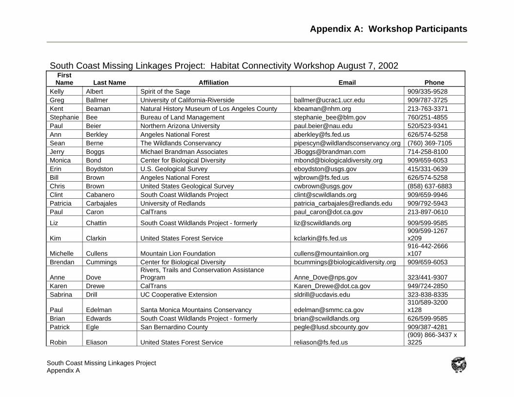
Appendix A: Workshop Participants
South Coast Missing Linkages Project Appendix A
South Coast Missing Linkages Project: Habitat Connectivity Workshop August 7, 2002 First Name Last Name Affiliation Email Phone
Kelly Albert Spirit of the Sage 909/335-9528 Greg Ballmer University of California-Riverside [email protected] 909/787-3725 Kent Beaman Natural History Museum of Los Angeles County [email protected] 213-763-3371 Stephanie Bee Bureau of Land Management [email protected] 760/251-4855 Paul Beier Northern Arizona University [email protected] 520/523-9341 Ann Berkley Angeles National Forest [email protected] 626/574-5258 Sean Berne The Wildlands Conservancy [email protected] (760) 369-7105 Jerry Boggs Michael Brandman Associates [email protected] 714-258-8100 Monica Bond Center for Biological Diversity [email protected] 909/659-6053 Erin Boydston U.S. Geological Survey [email protected] 415/331-0639 Bill Brown Angeles National Forest [email protected] 626/574-5258 Chris Brown United States Geological Survey [email protected] (858) 637-6883 Clint Cabanero South Coast Wildlands Project [email protected] 909/659-9946 Patricia Carbajales University of Redlands [email protected] 909/792-5943 Paul Caron CalTrans [email protected] 213-897-0610
Liz Chattin South Coast Wildlands Project - formerly [email protected] 909/599-9585
Kim Clarkin United States Forest Service [email protected] 909/599-1267 x209
Michelle Cullens Mountain Lion Foundation [email protected] 916-442-2666 x107
Brendan Cummings Center for Biological Diversity [email protected] 909/659-6053
Anne Dove Rivers, Trails and Conservation Assistance Program [email protected] 323/441-9307
Karen Drewe CalTrans [email protected] 949/724-2850 Sabrina Drill UC Cooperative Extension [email protected] 323-838-8335
Paul Edelman Santa Monica Mountains Conservancy [email protected] 310/589-3200 x128
Brian Edwards South Coast Wildlands Project - formerly [email protected] 626/599-9585 Patrick Egle San Bernardino County [email protected] 909/387-4281
Robin Eliason United States Forest Service [email protected] (909) 866-3437 x 3225
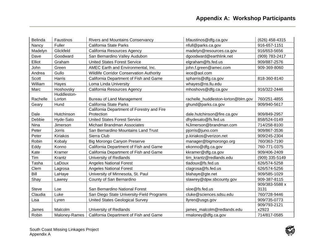
Appendix A: Workshop Participants
South Coast Missing Linkages Project Appendix A
Belinda Faustinos Rivers and Mountains Conservancy [email protected] (626) 458-4315 Nancy Fuller California State Parks [email protected] 916-657-1151 Madelyn Glickfeld California Resources Agency [email protected] 916/653-5656 Dave Goodward San Bernardino Valley Audubon [email protected] (909) 783-2417 Elliot Graham United States Forest Service [email protected] 909/887-2576 John Green AMEC Earth and Environmental, Inc. [email protected] 909-369-8060 Andrea Gullo Wildlife Corridor Conservation Authority [email protected] Scott Harris California Department of Fish and Game [email protected] 818-360-8140 William Hayes Loma Linda University [email protected] Marc Hoshovsky California Resources Agency [email protected] 916/322-2446
Rachelle Huddleston-Lorton Bureau of Land Management [email protected] 760/251-4855
Geary Hund California State Parks [email protected] 909/940-5617
Dale Hutchinson California Department of Forestry and Fire Protection [email protected] 909/849-2957
Debbie Hyde-Sato United States Forest Service [email protected] 858/524-0149 Nina Jimerson Michael Brandman Associates [email protected] 714/258-8100 Peter Jorris San Bernardino Mountains Land Trust [email protected] 909/867-3536 Peter Kiriakos Sierra Club [email protected] 909/245-2304 Robin Kobaly Big Morongo Canyon Preserve [email protected] 760/363-7190 Eddy Konno California Department of Fish and Game [email protected] 760-771-0375 Kate Kramer California Department of Fish and Game [email protected] 909/406-2409 Tim Krantz University of Redlands [email protected] (909) 335-5149 Tasha LaDoux Angeles National Forest [email protected] 626/574-5258 Clem Lagrosa Angeles National Forest [email protected] 626/574-5256 Bill LaHaye University of Minnesota, St. Paul [email protected] 909/585-1029 Shay Lawrey County of San Bernardino [email protected] 909-387-8115
Steve Loe San Bernardino National Forest [email protected] 909/383-5588 x 3131
Claudia Luke San Diego State University-Field Programs [email protected] 760/728-9446 Lisa Lyren United States Geological Survey [email protected] 909/735-0773
James Malcolm University of Redlands [email protected] 909/793-2121 x2923
Robin Maloney-Rames California Department of Fish and Game [email protected] 714/817-0585
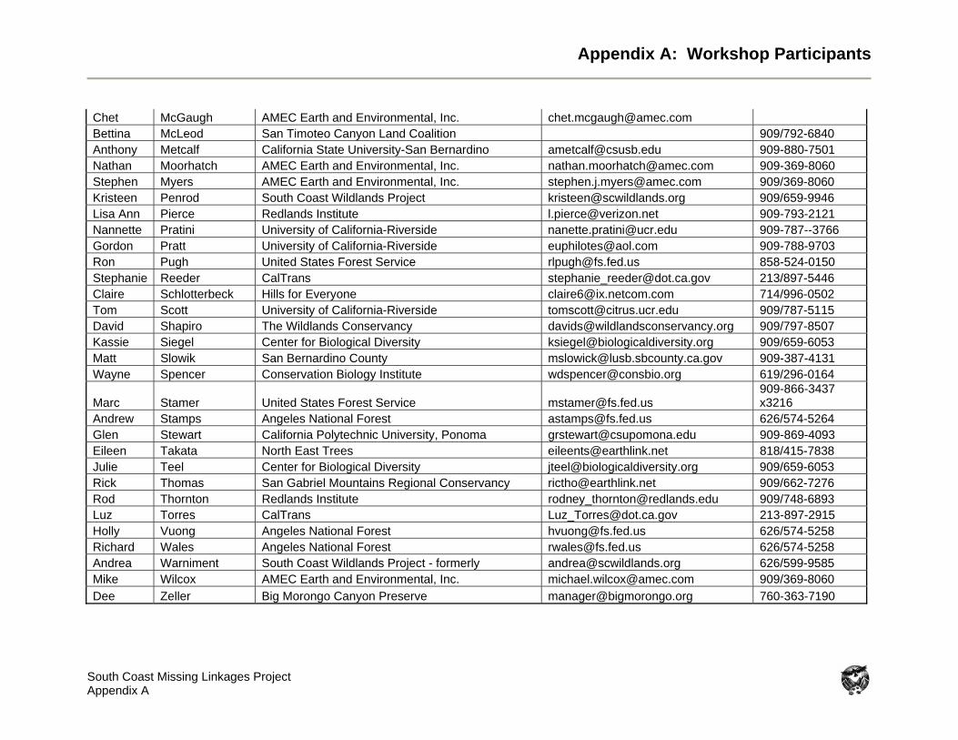
Appendix A: Workshop Participants
South Coast Missing Linkages Project Appendix A
Chet McGaugh AMEC Earth and Environmental, Inc. [email protected] Bettina McLeod San Timoteo Canyon Land Coalition 909/792-6840 Anthony Metcalf California State University-San Bernardino [email protected] 909-880-7501 Nathan Moorhatch AMEC Earth and Environmental, Inc. [email protected] 909-369-8060 Stephen Myers AMEC Earth and Environmental, Inc. [email protected] 909/369-8060 Kristeen Penrod South Coast Wildlands Project [email protected] 909/659-9946 Lisa Ann Pierce Redlands Institute [email protected] 909-793-2121 Nannette Pratini University of California-Riverside [email protected] 909-787--3766 Gordon Pratt University of California-Riverside [email protected] 909-788-9703 Ron Pugh United States Forest Service [email protected] 858-524-0150 Stephanie Reeder CalTrans [email protected] 213/897-5446 Claire Schlotterbeck Hills for Everyone [email protected] 714/996-0502 Tom Scott University of California-Riverside [email protected] 909/787-5115 David Shapiro The Wildlands Conservancy [email protected] 909/797-8507 Kassie Siegel Center for Biological Diversity [email protected] 909/659-6053 Matt Slowik San Bernardino County [email protected] 909-387-4131 Wayne Spencer Conservation Biology Institute [email protected] 619/296-0164
Marc Stamer United States Forest Service [email protected] 909-866-3437 x3216
Andrew Stamps Angeles National Forest [email protected] 626/574-5264 Glen Stewart California Polytechnic University, Ponoma [email protected] 909-869-4093 Eileen Takata North East Trees [email protected] 818/415-7838 Julie Teel Center for Biological Diversity [email protected] 909/659-6053 Rick Thomas San Gabriel Mountains Regional Conservancy [email protected] 909/662-7276 Rod Thornton Redlands Institute [email protected] 909/748-6893 Luz Torres CalTrans [email protected] 213-897-2915 Holly Vuong Angeles National Forest [email protected] 626/574-5258 Richard Wales Angeles National Forest [email protected] 626/574-5258 Andrea Warniment South Coast Wildlands Project - formerly [email protected] 626/599-9585 Mike Wilcox AMEC Earth and Environmental, Inc. [email protected] 909/369-8060 Dee Zeller Big Morongo Canyon Preserve [email protected] 760-363-7190
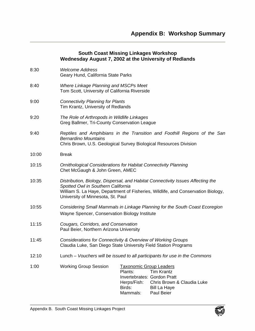
Appendix B. South Coast Missing Linkages Project
Appendix B: Workshop Summary
South Coast Missing Linkages Workshop
Wednesday August 7, 2002 at the University of Redlands 8:30 Welcome Address Geary Hund, California State Parks 8:40 Where Linkage Planning and MSCPs Meet Tom Scott, University of California Riverside 9:00 Connectivity Planning for Plants
Tim Krantz, University of Redlands 9:20 The Role of Arthropods in Wildlife Linkages
Greg Ballmer, Tri-County Conservation League 9:40 Reptiles and Amphibians in the Transition and Foothill Regions of the San
Bernardino Mountains Chris Brown, U.S. Geological Survey Biological Resources Division 10:00 Break 10:15 Ornithological Considerations for Habitat Connectivity Planning
Chet McGaugh & John Green, AMEC 10:35 Distribution, Biology, Dispersal, and Habitat Connectivity Issues Affecting the
Spotted Owl in Southern California William S. La Haye, Department of Fisheries, Wildlife, and Conservation Biology, University of Minnesota, St. Paul
10:55 Considering Small Mammals in Linkage Planning for the South Coast Ecoregion Wayne Spencer, Conservation Biology Institute
11:15 Cougars, Corridors, and Conservation Paul Beier, Northern Arizona University
11:45 Considerations for Connectivity & Overview of Working Groups
Claudia Luke, San Diego State University Field Station Programs 12:10 Lunch – Vouchers will be issued to all participants for use in the Commons 1:00 Working Group Session Taxonomic Group Leaders Plants: Tim Krantz Invertebrates: Gordon Pratt Herps/Fish: Chris Brown & Claudia Luke Birds: Bill La Haye
Mammals: Paul Beier
Appendix B. South Coast Missing Linkages Project
4:45 Closing Remarks by Kristeen Penrod, South Coast Wildlands Project 5:00 Adjourn; Please join us for a Beer & Wine Social
Workshop Summary Geary Hund, California State Parks – Welcome
Missing Linkages initiative identified 232 statewide linkages; 69 are associated with the South Coast Ecoregion; 15 most crucial are focus of collaborative planning effort coordinated by South Coast Wildlands Project; this workshop will lay the biological foundation for corridor planning between the San Bernardino Mountains and surrounding ranges (San Gabriel, Granite, Little San Bernardino, and San Jacinto Mountains)
Preservation of biodiversity in southern California will require connectivity Linkage between Santa Ana Mountains and Chino Hills was established across 91
freeway at Coal Canyon, where mountain lion established home range on both sides of freeway as documented by Paul Beier; private properties purchased and protected, and CalTrans will close the exit, remove pavement, and restore the underpass
California Floristic Province is one of 25 global biodiversity hotspots; South Coast Ecoregion is considered a “hotspot within a hotspot” deserving special attention
Scientific investigation combined with environmental advocacy can achieve landscape-level connectivity needed for nature to adapt to changes over time
Tom Scott, University of California, Riverside - Where Linkage Planning and MSCPs Meet Summary: The focus of my current research is examining biologically diverse hot spots within
the Riverside and Coachella Valley Multiple Species Conservation Plans (MSCPs). Some of the linkage areas we will be considering today are located within these MSCPs. My discussion will highlight some of the diverse species that occur in these linkage areas, and some considerations for habitat corridor planning in areas with high biological diversity.
Biography: Dr. Scott is an Adjunct Associate Professor in the Department of Earth Sciences at
the University of California, Riverside. He received his PhD at the University of California in 1987. His research focuses on wildlife conservation in fragmented and altered landscapes, including studies of wildlife movement, habitat use, and population biology in oak woodland, sage scrub, and riparian habitats; behavioral changes and adjustments in habitat use of woodland bird species in response to human activities; the conservation and management of island bird species through captive propagation, predator control, and habitat restoration.
Political mentality against southern California exists due to intense level of
development and high representation in Congress; this is land of geologic, climatic, and human superlatives; regional single family housing is worth up to $27 billion per year
Landscape disturbance began in 1940s with water availability; urban sprawl/suburbia expansion occurring in developed areas around the world; educated, politically active individuals living in Wildland-Urban Interface (WUI); can achieve conservation with local support (residents dislike rapid landscape change); about 38-48% of landscape will be converted; 100 km WUI edge in San Diego County, 2300 km in Riverside County
Appendix B. South Coast Missing Linkages Project
One acre of natural habitat in southern California more valuable for global biodiversity preservation than acre of lowland tropical rainforest; tropics are diverse, but southern California’s high level of endemism reveals unique suite of species at each location
California contains 30% of entire country’s endemic taxa, and has semitropical influence; endemics have narrow distributions due to range contraction or isolation
Multiple edges of distributions (species margins) meet in southern California, which has resulted in abundance of endemic species
High level of endemism at Baldwin Lake/ Pebble Plains, Otay Mesa, Del Mar, Vail Lake, Sierra Madre/Occidental; geologic calliope ranges from “brand new” to 9 million years old, with mountains still rising (11,000 feet but less than 2 million years old) as Pacific and North American Plates slide past each other; San Jacinto Peak is greatest vertical climb in North America (800 to 3200 m over less than seven km); incredible spatial diversity, but landscape variation is a challenge for functional linkage planning
Multiple Species Conservation Plans (MSCPs) direct land use and resource management planning; Riverside County and Western Mojave plans are being developed, and include habitat linkages between preserves; important for biologists to get involved in MSCP process, the political solution to Endangered Species Act issues; even with plans, landscape will suffer from air pollution, recreational use, and urban drool (excess runoff often supporting harmful exotic species, such as bullfrogs)
Linkages must be functional, with stated goals and measurable benefits Tim Krantz, University of Redlands – Connecting Rare Plant Communities Summary: People don’t think of plants as migrating, but they certainly do—not as individuals,
but over the span of generations. Montane plant communities migrate up and down in elevation over time between glacial and interglacial episodes, while valley species move through passes and along flood plains. Most of Southern California’s rare plant communities are characterized by restricted suitable habitats and/or limited dispersal capability. Compounding those natural limitations, habitat fragmentation, flood control measures, invasive exotic species and other developments constrain the remaining opportunities to provide connections between rare plant populations and communities.
Biography: Dr. Krantz is an Assistant Professor of Environmental Studies at the University of
Redlands; and is Director of the Salton Sea Database Program. He is a recognized authority on the flora of the San Bernardino, San Gabriel and San Jacinto Mountains and has worked extensively on endemic plants and plant communities of the region. He has worked for many years, first as an employee and later as a consultant to the Southern California National Forests, mapping endemic plant distributions; and served for six years on the San Bernardino County Planning Commission. Rare plant communities move over long-term (hundreds to thousands of years)
between glacial and interglacial episodes (fossil evidence of conifer species found in Santa Ana and San Jacinto washes); usually restricted to specific ecological conditions; poor dispersal abilities, as movement away from favorable habitat would be disadvantageous
Linkages contain montane communities (San Bernardino, San Gabriel, San Jacinto) separated by barriers/corridors (Cajon Wash, Banning Pass and Santa Ana River)
Big Bear region has extremely diverse endemic flora; plant communities include pebble plains (relic from ice age) as “islands in a sea of conifers” restricted to dense clay soils; mapped using indicator species (Bear Valley sandwort and Kennedy’s
Appendix B. South Coast Missing Linkages Project
buckwheat, an alpine plant found at 7000 ft – nearest relatives located at nearby 11,500 ft summit)
Sub-alpine meadow: clay soil with more water; associated with several endangered plants (Big Bear checkerbloom, slender-petal mustard, California dandelion)
Mapped extant locations of plant communities, forming network of preserves to protect best remnants of these unique communities; corridors over long-term provide genetic resources for plant communities to make necessary connections
Another community restricted to carbonate resources/limestone soils (includes cushion berry buckwheat and Parish’s daisy); nearest relatives in desert communities; concentrations of endemic species threatened by limestone mining, but less than 30% of mineral resource actually valuable for mining – great opportunity for conservation
Linkage areas also contain southern rubber boa, spotted owl, bald eagle, unarmored three-spine stickleback, Andrew’s marble butterfly; plant communities are animal communities, and so habitat connectivity will benefit both flora and fauna
Lowland passes/washes may act as barriers for montane species San Jacinto slender-horned spineflower and Santa Ana River woolly star are restricted
to alluvial fan sage scrub, found between mountain ranges Seven Oaks Dam on upper Santa Ana River currently prevents natural flood scour
events that maintain dynamic ecosystem; sand/gravel mining, flood control and development are fragmenting community
Shortest route not necessarily best route; easier for most species to cross fewer life zones between mountain ranges (San Timoteo Canyon, Wildwood Canyon, and Crafton Hills may link San Jacinto and San Bernardino Mountains better than Banning Pass)
Greg Ballmer, Tri-County Conservation League - The Role of Arthropods in Wildlife Linkages Summary: Arthropods are ubiquitous in all habitats and are largely responsible for maintaining
habitat quality and productivity. For arthropods, habitat fragmentation frequently leads to speciation rather than extinction. Most arthropods, by virtue of their small size, ecological specialization, high reproductive rate, and small home ranges, do not benefit directly from habitat linkages. Exceptions include arthropod species having a metapopulation structure. Also, arthropod communities benefit indirectly from habitat linkages when those linkages help to maintain populations of vertebrates, whose presence is critical to maintaining overall community structure.
Biography: Greg Ballmer earned a B.S. degree in Entomology at UCR in 1967, he then spent
three years in Thailand as a Peace Corps Volunteer entomologist in the Thai National Malaria Eradication Project. Greg returned to UCR in 1971, where he completed his M.S. degree in Entomology in 1973. Currently, Greg lives in Riverside and works as a Staff Research Associate in the Entomology Department at University of California, Riverside. Although his professional experience is primarily with agricultural pest control, Greg’s private interests include butterfly biology and systematics, arthropod habitat conservation, and overall preservation of native California habitats and biotic communities. In 1989 Greg Ballmer petitioned the US Fish and Wildlife Service to list Rhaphiomidas terminatus abdominalis (Delhi Sands Flower-loving Fly) as an Endangered Species; it received that status in 1993.
Appendix B. South Coast Missing Linkages Project
Invertebrates are primary intermediate between plant and animal biomass, and provide vital ecosystem services (food for invertebrates and small vertebrates, breakdown of organic wastes/nutrient recycling, soil aeration, pollination, vector for seed dispersal)
Habitat is combination of biotic and abiotic factors with which an organism interacts to support its growth and reproduction; organism is integral part of its habitat
Linkages allow long-term gene flow which increases functional genetic diversity of population; this helps overcome stochastic events and long-term environmental changes
Linkages allow short-term movement to escape catastrophic events, use accessory habitat and re-colonize after disturbance; arthropods occupy diversity of habitats and community types at different points in life cycles, and therefore need connectivity
Arthropods maintain habitat quality within linkage areas; habitat loss or conversion can form serious barrier to insect movement; must link small invertebrate populations to maintain gene pool and metapopulation structure
Certain arthropods may not need linkages (those that have high reproductive rate, occupy restricted or widely spaced geographic areas, are highly migratory or wind dispersed); rapid evolution/speciation can occur when populations are isolated
Vernal blue butterfly subspecies – in southern California only occurs on somewhat barren ridgetop in San Bernardino Mountains with specific buckwheat host plant – linkages will not benefit such Pleistocene relics with spotty distribution – not found in nearby appropriate locations that contain the host plant
Migratory painted lady butterfly has ephemeral populations and does not need linkages
Delhi Sands flower-loving fly, an endemic arthropod threatened by habitat fragmentation, inhabits scattered sand patches; endemic Jerusalem cricket also utilizes sandy habitat; both are capable of re-colonizing habitat from source population after disturbance
Chris Brown, USGS Biological Resources Division - Reptiles and Amphibians in the Transition and Foothill Regions of the San Bernardino Mountains Summary: The transition and foothill regions of the San Bernardino Mountains are biological
hotspots in San Bernardino County, having a unique mixture of coastal, mountain and desert herpetofauna. These areas are also important connections between the Transverse Ranges. Although much of this habitat still exists, development is encroaching on the San Bernardino Mountains, weakening these linkages, and several barriers already exist in a setting that was historically wide open. We have been studying the herpetofauna of the transverse ranges since 1995 in order to better understand the distribution and needs of the sensitive reptiles and amphibians throughout this region. Successful management of the diverse herpetofauna within these historical corridors of the Transverse Ranges must take into consideration the heterogeneous and expansive nature of the transition zones and foothills that connect the San Bernardino Mountains with outlying ranges.
Biography: Chris Brown is a biologist for the US Geological Survey, Western Ecological
Research Center. Since 1995, he has been studying the herpetofauna of southern California to support research needs of UC San Diego, San Diego State University, National Biological Survey and the USGS. His interests in herpetology have focused on distribution, status and natural history of the mountain and coastal herpetofauna of southern and Baja California.
Appendix B. South Coast Missing Linkages Project
Linkage area contains wide range of habitats; linkages from San Bernardino Mountains to surrounding ranges include coastal and desert influences, transitional belt of habitat around mountains, and montane habitats, resulting in phenomenal diversity; working group must select multiple species to represent the four different linkages - horned lizard, speckled rattlesnake, and western spadefoot toad recommended as focal species
1 turtle, 13 lizards, 19 snakes, 4 salamanders, and 7 frogs and toads inhabit planning area; (SB = San Bernardino Mountains, SG = San Gabriel Mountains, SJ = San Jacinto Mountains, LSB = Little San Bernardino Mountains, GM = Granite Mountains)
Salamanders demonstrate limited connectivity between these mountain ranges; garden slender salamander (south-facing coastal slopes; SB – SG, SJ); San Gabriel Mountain slender salamander (SB – SG); large blotch salamander (SB – SJ); Monterrey ensantina best example for species movement (gene flow) between all these ranges
Frogs and toads: western toad (SB – SG, LSB); arroyo toad (SB – SG, SJ); red spotted toad (desert slopes); spadefoot toad (little known about distribution, but recently found in foothill transition zones around SB – SG, SJ); California treefrog (fairly common in all ranges); mountain yellow-legged frog (most historical habitat lost in Santa Ana wash)
Desert tortoise on desert slopes (SB – GM, SJ); tortoises reside within linkage areas Fish: speckled dace (SB – SG), found in Cajon wash and Lytle Creek, but rather isolated Lizards: zebra-tailed lizard (SB - SJ); coast horned lizard (SB – SJ, SG, LSB); long-
nosed leopard lizard (desert transition zone; SB – SJ, SG, LSB); Gilbert skink (possibly SB – GM); western whiptail (all ranges; species variety may be result of isolation)
Snakes: glossy snake (resides within linkage areas; SB – GM, recommended focal species); ringneck snake (SB – SG); distribution largely unknown for: red racer, patch-nosed snake, lyre snake, and rosy boa (which does not like to cross even dirt roads); southwestern speckled rattlesnake (easily detectable, found throughout linkage areas, recommended as focal species, good barometer for snake movement)
Amphibian visual encounter surveys; targeted species for San Bernardino area include arroyo toad, western toad, California treefrog, Pacific treefrog, spadefoot toad; field biologists noting movement barriers (roads and dams), impacts of recreation (ATV use and illegal dumping), development impacts (light pollution, habitat and connectivity loss)
Herpetofauna biodiversity data (starting in 1999): pitfall trap arrays at 51 study sites throughout southern California; over 630 arrays (4400 buckets, 1800 snake traps, 28 km fencing); captured 46 species in 18 families; study sites have between 9-33 species
Historical perspective must consider natural history of desert and coastal species, as different forms intergrade (ex – gopher snakes at Silverwood Lake); natural gene flow should be conserved; 5 different forms of red racer in California
Chet McGaugh & John Green, AMEC – Ornithological Considerations for Habitat
Connectivity Summary: The power of flight, and the amazing dispersal and migratory abilities of birds enable
them to traverse huge expanses of unsuitable habitat. Habitat connectivity at the landscape level is not an issue for most birds. Birds resident within the linkages, or living in similar habitats adjacent to the linkages, would benefit most from the connectivity of large habitat patches. Sensitive species and ecological specialists would benefit more from conservation measures within their various habitats than from an attempt to establish linkages.
Biography: Chet McGaugh is a wildlife biologist specializing in ornithological studies. As a
consultant (currently with AMEC Earth and Environmental in Riverside) and as an avid birdwatcher, he has studied the distribution and ecology of birds in this ecoregion for 25
Appendix B. South Coast Missing Linkages Project
years. He participated in the U.S. Fish and Wildlife Service’s life history study of the California Gnatcatcher, and has conducted hundreds of surveys for sensitive bird species, including the Least Bell’s Vireo, Southwestern Willow Flycatcher, and the California Gnatcatcher. He is the compiler of the Salton Sea – North Christmas Bird Count.
Biography: John Green is a wildlife biologist specializing in ornithological studies. As a
consultant with AMEC Earth and Environmental, John specializes in the monitoring of sensitive bird populations such as the Least Bell’s Vireo. John’s many contributions to the ornithological community in this ecoregion include his acclaimed Southeastern California Rare Bird Alert, which is the Internet clearing-house for bird sightings in the region, and his participation in a valley-wide survey of Mountain Plovers in the Imperial Valley in 2002.
Many bird species are capable of easily dispersing between suitable habitats Flightless birds and those that can only fly limited distances need connectivity; California
gnatcatcher is weak flyer with poor dispersal over unsuitable habitat, and therefore is susceptible to impacts from habitat fragmentation
Diversity in flying ability and movement patterns between species No need to consider water birds or migratory species for connectivity planning Sedentary birds and birds unlikely or unwilling to disperse over large areas of unsuitable
habitat will benefit from linkages; ex – cactus wren, rock wren, scrub jay, California thrasher, wrentit, Bewick’s wren, bushtit; gene flow occurs if populations are not isolated; many birds would utilize habitat available within linkage areas, but montane species have characteristics and habitat needs distinct from birds inhabiting most of the lower elevation linkage areas; unknown whether many mountain species cross washes and desert habitat to move between the ranges
Acorn woodpecker shows seasonal movements to hospitable resource areas Band-tailed pigeon probably crosses between ranges, which allows gene flow Sensitive species that would utilize linkages include Le Conte’s thrasher, sage sparrow,
rufous-crowned sparrow, burrowing owl, and loggerhead shrike Bill LaHaye, University of Minnesota, St. Paul – Distribution, Biology, Dispersal, and habitat connectivity issues affecting the Spotted Owl in southern California. Summary: The Spotted Owl is a large avian predator that primarily inhabits older forests in
western North America. This owl is an interior forest species whose flight adaptations have been driven by the need for maneuverability in densely wooded environments. Thus in spite of having a wingspan exceeding one meter, the Spotted Owl is a weak flyer in open terrain. This may restrict the dispersal of this owl in regions lacking contiguous forest. Here I present the pertinent results of a 12-year demographic study on this species in the San Bernardino Mountains. Information will be presented on general biology, current and historic distribution, dispersal, and metapopulation aspects of the Spotted Owl in southern California.
Biography: Bill LaHaye received a Master of Science degree from Humboldt State University in
1989 and has been studying the Spotted Owl for 20 years. While he has worked on various projects studying this species in California, Arizona and New Mexico, the majority of Bill’s efforts have been in southern California. The topics of Bill’s published works include natural history, diet, demography, dispersal, and metapopulation dynamics.
Appendix B. South Coast Missing Linkages Project
Spotted owl demography research conducted in San Bernardino Mountains; owls inhabit interior forests with dense canopy and ambush prey; live in continuous forest at higher elevations, with distribution more patchy and linear at lower elevations; may have historically utilized oak woodlands; current distribution in southern California includes islands of mountaintop habitat with metapopulation becoming fragmented
Owls studied for 12 years in San Bernardino Mountains and 6 years in San Jacinto Mountains; over 95% of encountered owls were banded; no movement between mountain ranges has been documented during this study
About 850 owls banded in San Bernardino Mountains (over 300 adults and over 500 juveniles); researchers were surprised that no juvenile dispersal was observed
Wayne Spencer, Conservation Biology Institute - Considering Small Mammals in Linkage Planning for the South Coast Ecoregion Summary: For good reasons, linkage planning between major mountain ranges tends to focus
on large, wide-ranging mammals. Smaller mammals should not be ignored in these efforts, however, because they can play numerous important roles in maintaining or monitoring linkage functionality. For example, small mammals are essential prey for larger carnivores within landscape linkages, may represent ecological “keystone species,” and may be useful indicators for monitoring effects of fragmentation. Small mammals could be classified by their irreplaceability and vulnerability in assessing which may be useful indicators of linkage function, or they could be classified by their major habitat associations or ecological functions. Although a few small mammals may use inter-montane linkages to disperse from one mountain range to another, those species living completely within linkages at lower elevations may be even more important for assessing inter-montane linkages. Linkage planning should therefore consider “orthogonal linkages,” or those that follow elevational bands or drainages crossed by inter-montane linkages. For example, such rare rodents as the San Bernardino Kangaroo Rat and Palm Springs Pocket Mouse inhabit desert washes and alluvial fans that lie between adjoining montane habitats. Landscape linkages should therefore be planned to capture essential habitat for these species across their breadth while connecting between mountains on either side. Other general guidelines concerning small mammals in linkage planning include: (1) provide live-in habitat for prey species; (2) provide for natural processes like fire and erosional-depositional forces that replenish habitats; (3) provide for the full range of ecological gradients across the linkage, such as the full range of geologically sorted substrates in alluvial fans; (4) provide for upslope ecological migration in response to climate change; and (5) consider the limited dispersal tendencies of small mammals relative to dispersal barriers, such as roads and canals, and avoid creating death traps for them when designing crossings for larger species. Linkage planning should also consider ways to provide niches for habitat specialists, such as creating bat roosts in bridges or overpasses designed to accommodate wildlife movement.
Biography: Dr. Spencer is a wildlife conservation biologist who specializes in applying sound ecological science to conservation planning efforts. He has conducted numerous field studies on sensitive wildlife species, with a primary focus on rare mammals of the western U.S. Dr. Spencer has studied martens, fishers, and other carnivores in forest and taiga ecosystems, as well as rare rodent species and communities in the southwestern U.S. In the South Coast Ecoregion he has served as principal investigator for research designed to help recover the critically endangered Pacific Pocket Mouse and has worked intensively on
Appendix B. South Coast Missing Linkages Project
efforts to conserve endangered Stephens’ Kangaroo Rats, among other species. Dr. Spencer is currently serving as Editor in Chief for a book on mammals of San Diego County. He also serves as a scientific advisor on a variety of large-scale conservation planning efforts in California, including the San Diego MSCP/MHCP, and the eastern Merced County NCCP/HCP. He is increasingly being asked by state and federal wildlife agencies to help facilitate scientific input in conservation planning efforts, and to help train others in science-based conservation planning.
Most linkages designed for large mammals that must move between large habitat areas
to survive and reproduce; many smaller species will not use inter-montane linkages for movement, but rather will benefit from the protected habitat
Small mammals (especially rodents and lagomorphs) are prey for larger mammals; small mammals are more dispersal limited and habitat specialized than larger mammals
Keystone species include burrowing rodents (pocket gophers, ground squirrels and kangaroo rats) that modify soil, impact plant distribution, create habitat for other species
Micro-habitat specialists; pocket mouse subspecies adapted to slices of vegetation community or geological substrate; genetic differentiation due to geographic isolation
Conservation planning recognizes irreplaceability and vulnerability (incorporating and connecting habitat for rare endemic species with limited distributions)
For most taxa (including small mammals), linkages are not designed to move individuals of various species from one mountain range to another (many have not moved between ranges for tens of thousands of years), but rather to provide for long-term genetic exchange and adaptation; species will benefit from preserved habitat in linkages
Orthogonal linkage concept: for small mammals distributed in elevational bands in particular vegetation communities or soil strata, breadth of linkage is important; habitat located at right angle to general linkage arrows; connect both across and along linkages
Inhabitants of pinyon juniper, oak woodland, chaparral, and other lower elevation areas of linkages may be planned for (western gray squirrel, dusky-footed woodrat, chipmunk)
Different suite of species needed for each linkage; species that should be considered for planning: round-tailed ground squirrel, Mojave ground squirrel, western gray squirrel, chipmunk, San Bernardino kangaroo rat, little pocket mouse, long-tailed weasel, spotted skunk, ringtail, badger (fragmentation-affected grassland species), kit fox, dusky-footed woodrat, pinyon mouse, pocket gopher (keystone burrowing species, dispersal limited)
Plans for bat roosting structures can be incorporated into bridge and overpass structures Linkages for large mammals must provide habitat for prey base (unless function is
simply to move species across and away from roads); also, consider location of rare and endemic species to compliment linkage design
With climate change, expect upslope migration resulting from global warming; linkages should be broad enough to accommodate natural processes (flood scour and deposition, fire); capture whole environmental gradients to protect multiple specialized species
Paul Beier, Northern Arizona University – Cougars, Corridors, and Conservation Summary: Because the puma or cougar lives at low density and requires large habitat areas, it
is an appropriate umbrella species for landscape connectivity in the South Coast Ecoregion. A crucial issue, however, is whether connectivity is provided by narrow corridors through urban areas (an artificial substitute for natural landscape connectivity). In particular, corridors decrease extinction risk only if they facilitate dispersal of juveniles between mountain ranges. To address this issue, we conducted fieldwork on pumas in the Santa Ana Mountain Range, a landscape containing 3 corridors (1.5, 6, and 8 km long). Each of the 3
Appendix B. South Coast Missing Linkages Project
corridors was used by 2 or more dispersing juvenile puma. Five of 9 radio-tagged dispersers successfully found and used a corridor. The corridors in this landscape were relict strips of habitat, not designed to facilitate animal movement. Puma doubtless would be even more likely to use well-designed linkages. Puma will use corridors that lie along natural travel routes, have < 1 dwelling unit per 50 acres, have ample woody cover, lack artificial outdoor lighting, and include an overpass or underpass integrated with roadside fencing at high-speed road crossings. “If we build it, they will come.”
Biography: Paul Beier is Professor of Conservation Biology and Wildlife Ecology at Northern
Arizona University. He has worked on how landscape pattern affects puma, northern goshawk, Mexican spotted owls, white-tailed deer, and passerine birds (the latter in both West Africa and northern Arizona). He serves on the Board of Governors for the Society for Conservation Biology. A full description of his activities is available at http://www.for.nau.edu/~pb1.
Pumas exist at low density; functional connectivity needed for movement and dispersal Santa Ana Mountains study: 9 radio-collared juvenile dispersers tracked; three
corridors/habitat constrictions present, but not designed for habitat connectivity: 1. Coal Canyon (short freeway undercrossing near railroad tracks, stables, and golf
course); 3 lions attempted to cross (2 successful); M6 was premier user of corridor, crossing under freeway more than 22 times in 18 months; home range included habitat on both sides of freeway; after completion of study, surrounding properties were preserved, and CalTrans agreed to close underpass to traffic, remove asphalt, and turn over to California State Parks for restoration and use as wildlife linkage
2. Santa Ana – Palomar (longer, I15 is major impediment, patchwork of land ownership); 2 lions attempted to cross (1 successful); one lion crossed Santa Ana – Palomar linkage by walking across I15 rather than finding a safer route underneath; point of crossing was just north of border patrol/INS checkpoint; several lions were killed crossing at this same site – multiple lions are demonstrating preferred crossing site, which should be focus of planning for vegetated freeway overpass
3. Arroyo Trabuco (protected from urban areas by tall bluffs, contains dense riparian vegetation, resident deer population, darkness, water); 3 lions attempted to cross (3 successful); comfortable corridor – lions spent 2-7 days traveling through corridor
5 of 9 study animals found and successfully used one of the three corridors; sites were not designed for animal movement, which explains unsuccessful attempts
Photographic overview of potential linkage areas from field reconnaissance to demonstrate habitat opportunities; USGS map used to show the location for each photo: 1. SB-GM linkage area: one-mile-wide band with virtually no housing – great
opportunity; Grapevine Canyon has perennial water; Joshua tree woodland and creosote scrub
2. SB-SG linkage area: Cajon Wash; I15 impediment; National Forest property on both sides; potential riparian and upland connections; old route 66, railroad tracks; bridged and culvert undercrossings for I15 at four main drainages (best bridge is at Cleghorn Creek with perennial water and direct route into Lone Pine Canyon); vegetation scorched by recent wildfire; SG-Baldy Mesa secondary linkage important
3. SB-SJ linkage area: low elevation connection across San Gorgonio Pass; possible upland connection through badlands and San Timoteo Canyon; I10 and SR111 are impediments; Morongo Reservation includes upper San Gorgonio River; massive sand and gravel mining operation; development along I10 increasing impediment; many drainages/canyons in lower San Jacinto Mountains; The Wildlands Conservancy recently protected portion of Whitewater River; windfarms near I10
Appendix B. South Coast Missing Linkages Project
4. SB-LSB linkage area: SR62 main impediment; several drainages cut through Morongo Valley; Mission Creek – good bridges for movement – The Wildlands Conservancy owns portion; desert wash connectivity possible across freeway; possible need for crossing over highway; large band of undeveloped land; natural wetlands in Big and Little Morongo Wash
Claudia Luke, San Diego State University Field Station Programs – Considerations for
Connectivity & Overview of Working Group Session Summary: This presentation describes the Santa Ana – Palomar Mountains linkage to allow
workshop participants to understand purposes of focal species groups, identification of critical biological issues regarding connectivity, and qualities of species that may be particularly vulnerable to losses in connectivity.
Biography: Claudia Luke received her Ph.D. in Zoology from University of California, Berkeley in
1989. She is a Reserve Director of the Santa Margarita Ecological Reserve, an SDSU Field Station, and Adjunct Professor at San Diego State University. She is on the Board of Directors for the South Coast Wildlands Project and has been the lead over the last two years in conservation planning for the Santa Ana – Palomar Mountain linkage.
At the November 2000 Missing Linkages conference, participants determined which
areas within California needed to be connected to allow species movement South Coast Ecoregion workgroup selected criteria to prioritize linkages and connect
largest protected lands; planning efforts have progressed for the Santa Ana – Palomar Mountains linkage area - workshops have been held to select focal species
Global linkage role: preservation of biodiversity hotspot with concentration of endemic species (formed by gradients in elevation, lack of past glaciers, soil diversity)
Regional linkage role: maintenance of habitat connectivity to prevent extirpations, and considerations for climate change (warmer wetter winters and drier summers may cause extreme floods and wildfires, drier vegetation types may expand to higher elevations)
Local linkage role: connect protected parcels, considering dispersal methods of focal species, and impacts to habitat specialists, endemics, edge effects, and gene flow
Focal species approach to functional linkage planning based on Beier and Loe 1992 corridor design (choose appropriate species, evaluate movement needs, draw corridor on map, monitor); focal species are units of movement used to evaluate effectiveness of linkages; wide diversity of species necessary to maintain ecological fabric; collaborative planning effort based on biological foundation and conservation design/delivery
Choose species sensitive to fragmentation to represent linkage areas; Crooks and Soule 1999 showed that in San Diego as fragment size decreases, mid-sized carnivores increase (mesopredator release), and multiple bird species are lost; must consider associated species in planning, including keystone species important for survival of other species (ex - Yucca whipplei pollinated by specific invertebrates)
Each taxonomic working group will choose a few species, delineate movement needs, record information on natural history, distribution, habitat suitability, current land conditions, key areas for preservation and restoration; consider metapopulation dynamics so that if a species disappears due to disturbance, habitat can be re-colonized
Focal species data will be displayed on conservation design map and used to guide planning efforts; regional approach to linkages will help project to gain visibility and leverage to work with multiple agencies and organizations

South Coast Missing Linkage Project Appendix C
Appendix C: 3D Visualization
The South Coast Wildlands is in the process of producing several flyovers or 3D visualizations of the San Bernardino-Little San Bernardino Connection and other linkages throughout the South Coast Ecoregion as part of the South Coast Missing Linkages Project. The 3D Visualization provides a virtual landscape perspective of the local geography and land use in the planning area. 2002 USGS LANDSAT Thematic Mapper data was used to build a natural color composite image of this study area. INSTRUCTIONS ON VIEWING FLYOVER The flyover provided on this CD is an .mpg file (media file) which can be viewed using most popular/default movie viewing applications on your computer (e.g. Windows Media Player, Quick Time, Real One Player, etc). Simply download the .avi file “3D_Visualization.mpg” from the CD onto your computer’s hardrive. Putting the file on your computer before viewing, rather than playing it directly from the CD, will provide you with a better viewing experience since it is a large file. Double click on the file and your default movie viewing software will automatically play the flyover. If you cannot view the file, your computer may not have any movie viewing software installed. You can easily visit a number of vendors (e.g. Real One Player, Window Media Player, etc.) that provide quick and easy downloads from their websites. Please direct any comments or problems to: Clint Cabañero GIS Analyst/Programmer South Coast Wildlands [email protected]