Simple physical models for study of “super mysterious phenomena of nature” – Yamal Peninsula...
14
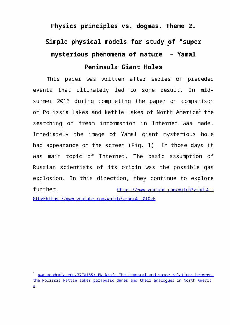
Physics principles vs. dogmas. Theme 2. Simple physical models for study of “super mysterious phenomena of nature” – Yamal Peninsula Giant Holes This paper was written after series of preceded events that ultimately led to some result. In mid- summer 2013 during completing the paper on comparison of Polissia lakes and kettle lakes of North America 1 the searching of fresh information in Internet was made. Immediately the image of Yamal giant mysterious hole had appearance on the screen (Fig. 1). In those days it was main topic of Internet. The basic assumption of Russian scientists of its origin was the possible gas explosion. In this direction, they continue to explore further. https://www.youtube.com/watch?v=bdi4_- 0tOvE https://www.youtube.com/watch?v=bdi4_-0tOvE 1 www.academia.edu/7778155/_EN_Draft_The_temporal_and_space_relations_between_ the_Polissia_kettle_lakes_parabolic_dunes_and_their_analogues_in_North_Americ a
-
Upload
independent -
Category
Documents
-
view
2 -
download
0
Transcript of Simple physical models for study of “super mysterious phenomena of nature” – Yamal Peninsula...
Physics principles vs. dogmas. Theme 2.
Simple physical models for study of “super
mysterious phenomena of nature” – Yamal
Peninsula Giant HolesThis paper was written after series of preceded
events that ultimately led to some result. In mid-
summer 2013 during completing the paper on comparison
of Polissia lakes and kettle lakes of North America1 the
searching of fresh information in Internet was made.
Immediately the image of Yamal giant mysterious hole
had appearance on the screen (Fig. 1). In those days it
was main topic of Internet. The basic assumption of
Russian scientists of its origin was the possible gas
explosion. In this direction, they continue to explore
further. https://www.youtube.com/watch?v=bdi4_-0tOvE https://www.youtube.com/watch?v=bdi4_-0tOvE
1 www.academia.edu/7778155/_EN_Draft_The_temporal_and_space_relations_between_the_Polissia_kettle_lakes_parabolic_dunes_and_their_analogues_in_North_America

Fig. 1. Oblique view of Yamal Peninsula Giant Holes
Despite the absence of traces of parapet treatment
by water streams, my assumption was that holes were
formed by vortexes. They were drilled through the ice.
I was wrong.
After following the publication this idea
immediately the comment of my friend, archaeologist
Victor Vetrov appeared. He does not question the
mechanism of initial hole formation by vortexes. But,
after analyzing of video he drew attention to the loud
noise of flowing water from the hole. This mean,
firstly, the hole reached to united underground
hydraulic system. Secondly, in permafrost conditions in
the hole formed the ice plug. Thirdly, large amounts
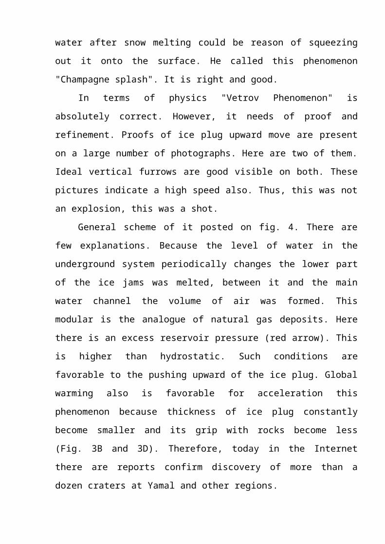
water after snow melting could be reason of squeezing
out it onto the surface. He called this phenomenon
"Champagne splash". It is right and good.
In terms of physics "Vetrov Phenomenon" is
absolutely correct. However, it needs of proof and
refinement. Proofs of ice plug upward move are present
on a large number of photographs. Here are two of them.
Ideal vertical furrows are good visible on both. These
pictures indicate a high speed also. Thus, this was not
an explosion, this was a shot.
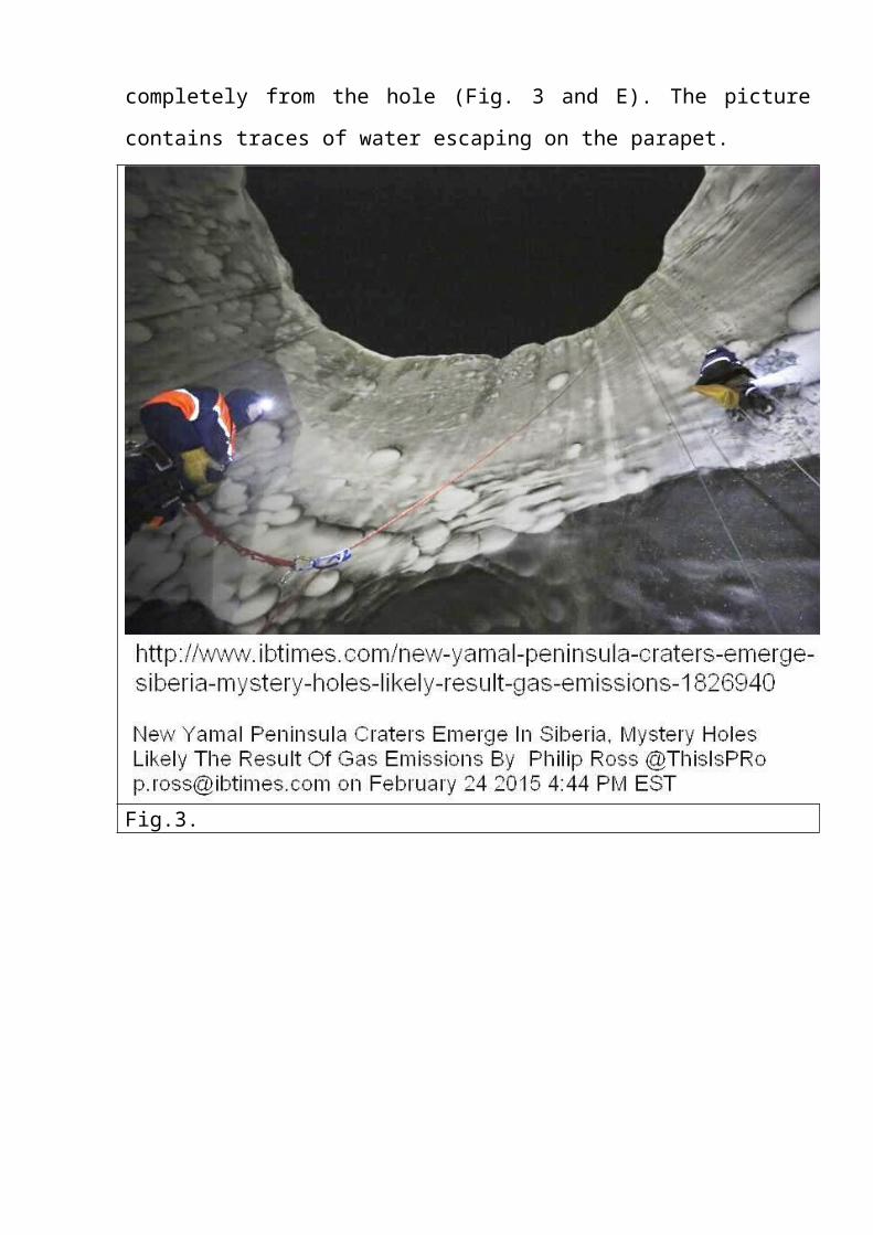
General scheme of it posted on fig. 4. There are
few explanations. Because the level of water in the
underground system periodically changes the lower part
of the ice jams was melted, between it and the main
water channel the volume of air was formed. This
modular is the analogue of natural gas deposits. Here
there is an excess reservoir pressure (red arrow). This
is higher than hydrostatic. Such conditions are
favorable to the pushing upward of the ice plug. Global
warming also is favorable for acceleration this
phenomenon because thickness of ice plug constantly
become smaller and its grip with rocks become less
(Fig. 3B and 3D). Therefore, today in the Internet
there are reports confirm discovery of more than a
dozen craters at Yamal and other regions.

Fig. 2.
One of the conditions for the successful operation
of the mechanism is leakproofness underground hydro
system at the time the shot (full or partial). In the
spring, after a long freezing this condition is
satisfied. But if the pressure reaches the threshold
value At least one of the holes is unknown. It is
obvious that during the winter freeze not only the
intake and discharging channels.
Leakage from holes, apparently, is usual process.
This can be seen in Fig. 5, 6 and 7. Some kettle lakes
are connected by a system of weak channels. In this
case, the water flows through the small holes thawed
along the ice-rock contact. In Fig. 6 and 7 we see
streams from small lakes flow into the stream from the
crater. This fact is very interesting. This is a short-
term but intensive the water emission from the hole
after the shot.
We can assume that such events are associated with
abnormal snowy winters. Unfortunately, now such
information is not available. But, photo shots by
employee of oilfield near the crater show that the
winter in 2009 was very snowy (Fig. 8-10). By visual
inspection height of compressed snow was about 5
meters. Apparently, it was an anomaly.
Revision photos travelers on Trilon River
(Keewatin, NU, Canada), show a similar phenomenon (Fig.
12 and 13). On Fig. 11 the map of the pingo location
present. One of them (Fig. 13) have photographed twice
in 2004 and 2008.
Formation of the Canadian Pingo corresponds to the
embodiment when an ice plug has not been pushed out
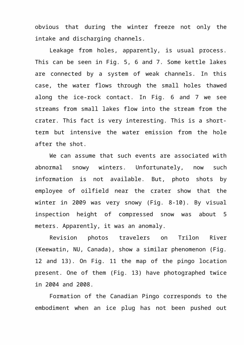
completely from the hole (Fig. 3 and E). The picture
contains traces of water escaping on the parapet.
Fig.3.
Fig. 4. General scheme of forcing out of the ice plug
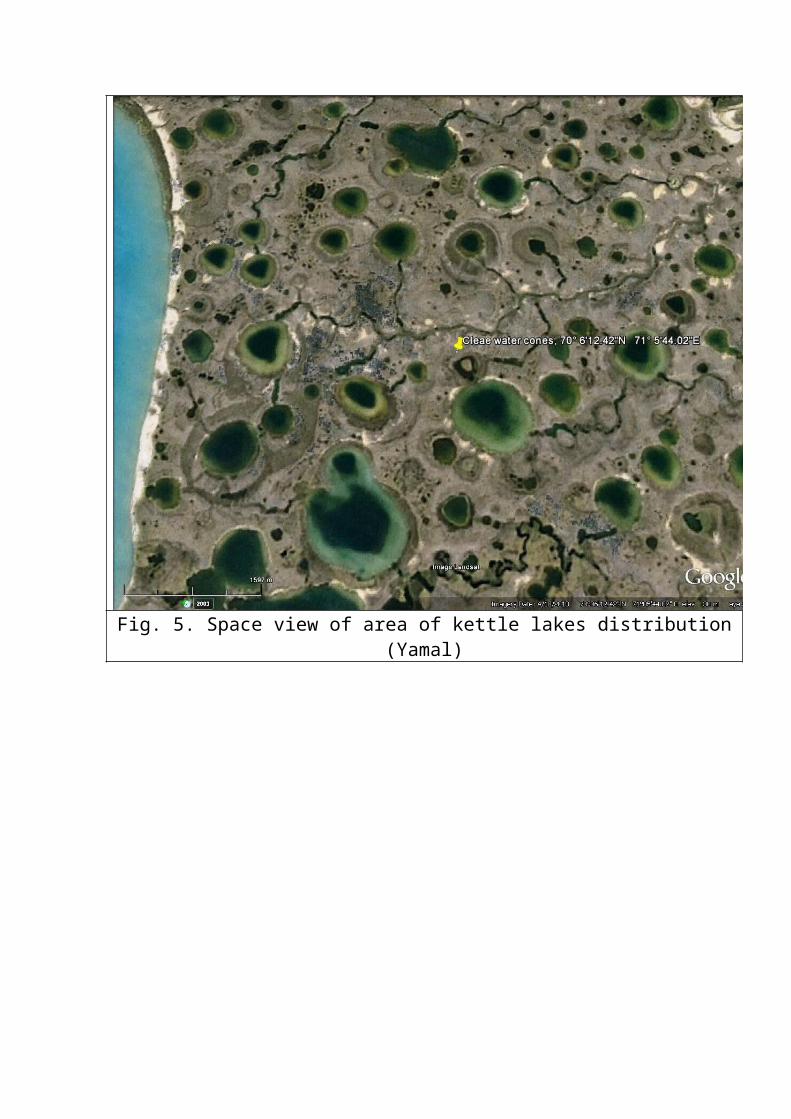
Fig. 5. Space view of area of kettle lakes distribution(Yamal)
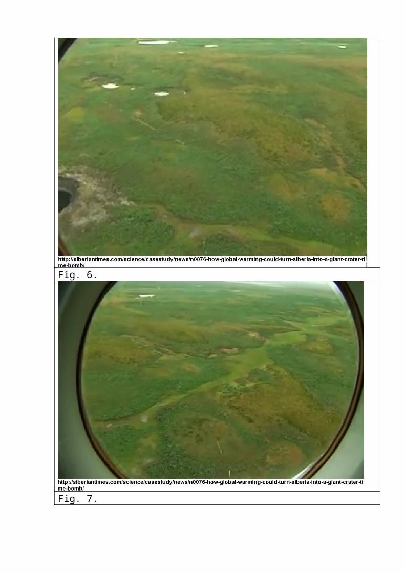
Fig. 6.
Fig. 7.
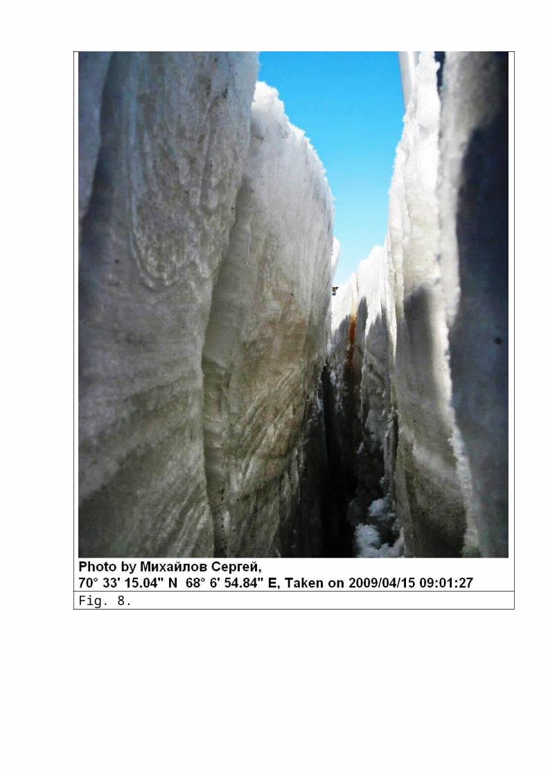
Fig. 8.
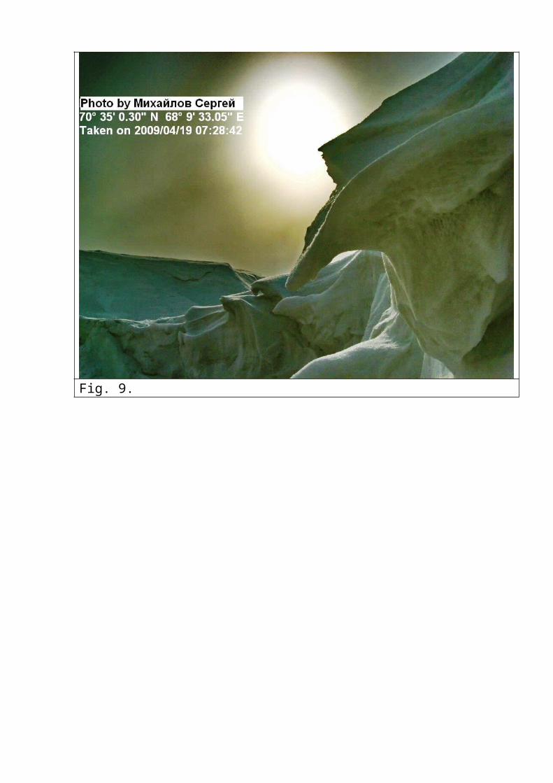
Fig. 9.
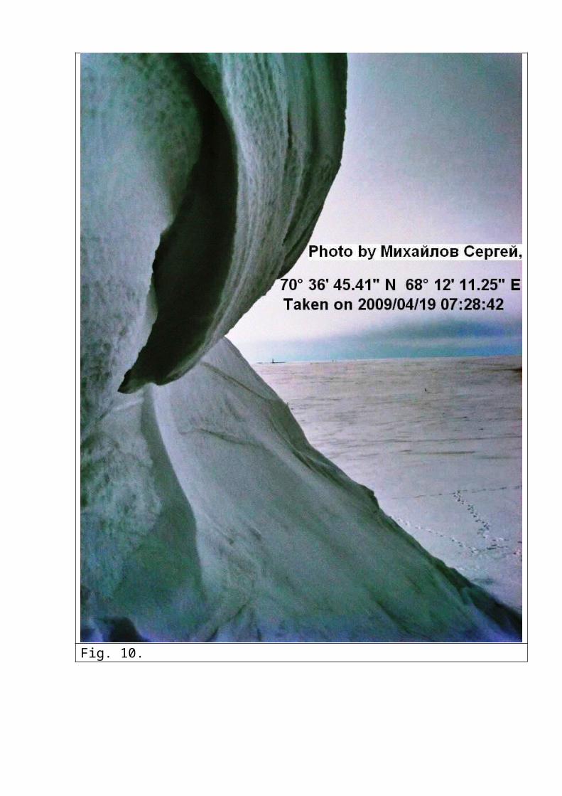
Fig. 10.
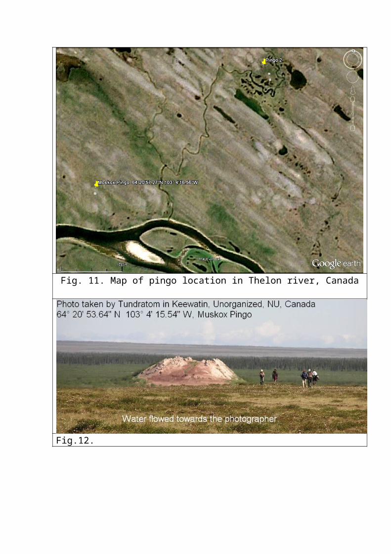
Fig. 11. Map of pingo location in Thelon river, Canada
Fig.12.
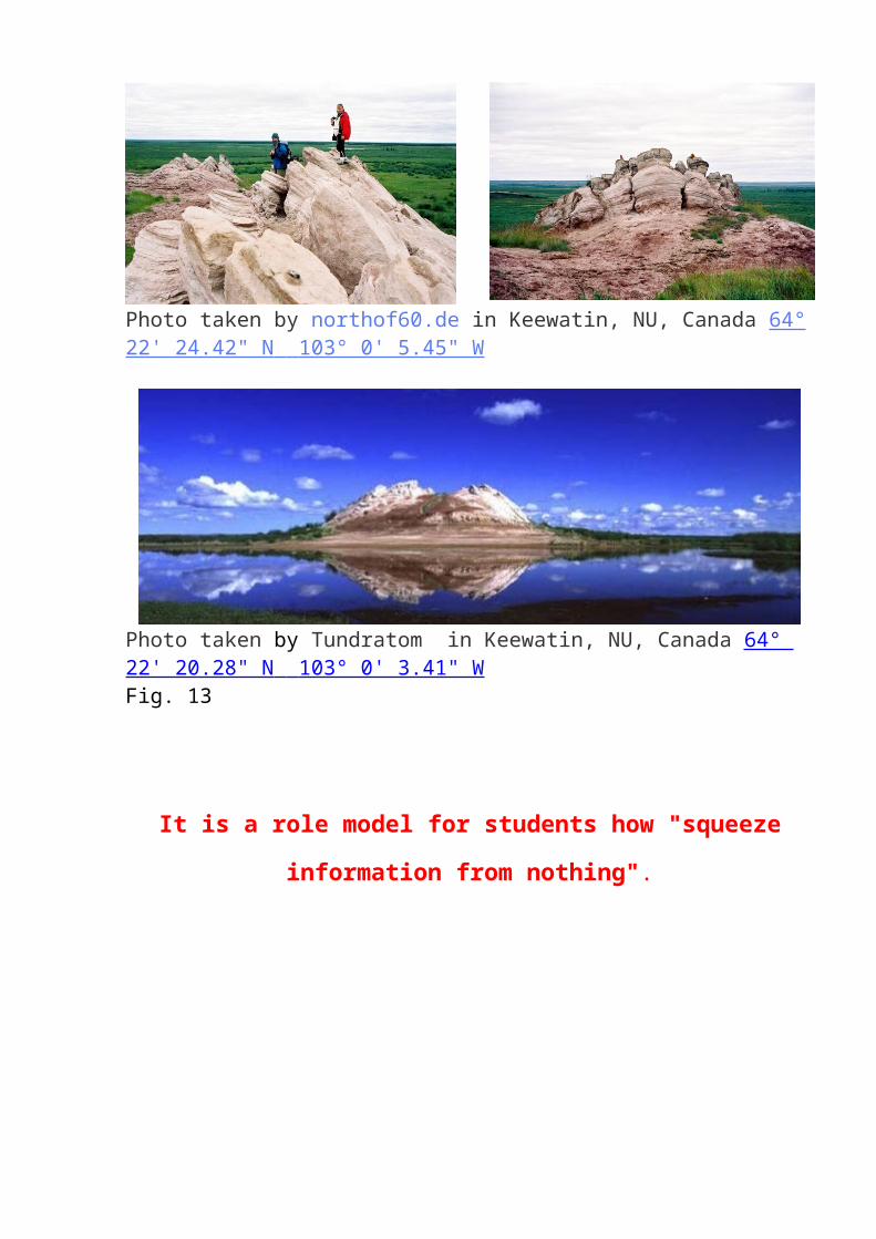
Photo taken by northof60.de in Keewatin, NU, Canada 64°22' 24.42" N 103° 0' 5.45" W
Photo taken by Tundratom in Keewatin, NU, Canada 64° 22' 20.28" N 103° 0' 3.41" W Fig. 13
It is a role model for students how "squeeze
information from nothing".