Rezoning #04-21 for Orrick Commons - (Ms. Perkins)
317
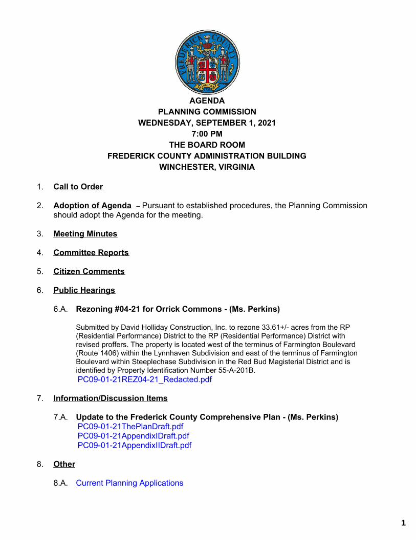
1. Call to Order 2. Adoption of Agenda – Pursuant to established procedures, the Planning Commission should adopt the Agenda for the meeting. 3. Meeting Minutes 4. Committee Reports 5. Citizen Comments 6. Public Hearings 6.A. Rezoning #04-21 for Orrick Commons - (Ms. Perkins) Submitted by David Holliday Construction, Inc. to rezone 33.61+/- acres from the RP (Residential Performance) District to the RP (Residential Performance) District with revised proffers. The property is located west of the terminus of Farmington Boulevard (Route 1406) within the Lynnhaven Subdivision and east of the terminus of Farmington Boulevard within Steeplechase Subdivision in the Red Bud Magisterial District and is identified by Property Identification Number 55-A-201B. 7. Information/Discussion Items 7.A. Update to the Frederick County Comprehensive Plan - (Ms. Perkins) 8. Other 8.A. Current Planning Applications AGENDA PLANNING COMMISSION WEDNESDAY, SEPTEMBER 1, 2021 7:00 PM THE BOARD ROOM FREDERICK COUNTY ADMINISTRATION BUILDING WINCHESTER, VIRGINIA PC09-01-21REZ04-21_Redacted.pdf PC09-01-21ThePlanDraft.pdf PC09-01-21AppendixIDraft.pdf PC09-01-21AppendixIIDraft.pdf 1
-
Upload
khangminh22 -
Category
Documents
-
view
5 -
download
0
Transcript of Rezoning #04-21 for Orrick Commons - (Ms. Perkins)
1. Call to Order
2. Adoption of Agenda – Pursuant to established procedures, the Planning Commissionshould adopt the Agenda for the meeting.
3. Meeting Minutes
4. Committee Reports
5. Citizen Comments
6. Public Hearings
6.A. Rezoning #04-21 for Orrick Commons - (Ms. Perkins)
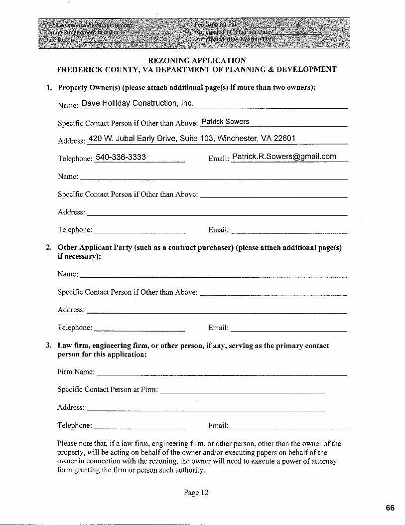
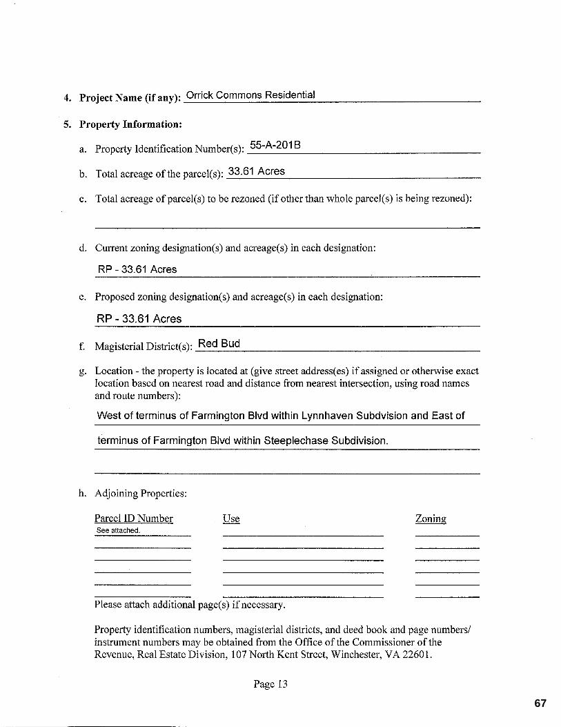
Submitted by David Holliday Construction, Inc. to rezone 33.61+/- acres from the RP(Residential Performance) District to the RP (Residential Performance) District withrevised proffers. The property is located west of the terminus of Farmington Boulevard(Route 1406) within the Lynnhaven Subdivision and east of the terminus of FarmingtonBoulevard within Steeplechase Subdivision in the Red Bud Magisterial District and isidentified by Property Identification Number 55-A-201B.
7. Information/Discussion Items
7.A. Update to the Frederick County Comprehensive Plan - (Ms. Perkins)
8. Other
8.A. Current Planning Applications
AGENDA PLANNING COMMISSION
WEDNESDAY, SEPTEMBER 1, 20217:00 PM
THE BOARD ROOMFREDERICK COUNTY ADMINISTRATION BUILDING
WINCHESTER, VIRGINIA
PC09-01-21REZ04-21_Redacted.pdf
PC09-01-21ThePlanDraft.pdfPC09-01-21AppendixIDraft.pdfPC09-01-21AppendixIIDraft.pdf
1

9. Adjourn
2
Planning CommissionAgenda Item Detail Meeting Date: September 1, 2021 Agenda Section: Public Hearings
Title: Rezoning #04-21 for Orrick Commons - (Ms. Perkins)
Attachments:PC09-01-21REZ04-21_Redacted.pdf
3
REZONING APPLICATION #04-21 ORRICK COMMONS Staff Report for the Planning Commission Prepared: August 23, 2021 Staff Contacts: Candice E. Perkins, AICP, CZA, Assistant Director
Reviewed Action Planning Commission: 09/01/21 Pending Board of Supervisors: 09/22/21 Pending PROPOSAL: To rezone 33.61+/- acres from the RP (Residential Performance) District with proffers to the RP (Residential Performance) District with revised proffers. LOCATION: The property is located south of the intersection of Senseny Road (Route 657) and Greenwood Road (Route 656), west of the terminus of Farmington Boulevard (Route 1406) within the Lynnhaven Subdivision and east of the terminus of Farmington Boulevard within the Steeplechase Subdivision. EXECUTIVE SUMMARY & STAFF CONCLUSION FOR THE 09/01/21 PLANNING COMMISSION MEETING: The subject property is part of the original Orrick Commons rezoning which was approved in 2006 for 22.06 acres of B2 (General Business) District zoning and 33.61 acres of RP (Residential Performance) District zoning. The proffers for the 33.61 acres of RP are restricted to age restricted dwelling units. This requested rezoning only pertains to the 33.61 acres zoned RP as the improvements; the B2 properties will remain subject to proffers for the 2006 rezoning. It should be noted that a separate proffer statement for the RP parcel would not impact the overall development as the proffers for the B2 zoned properties have previously been completed. The site is located within the limits of the Senseny Eastern Urban Area Land Use Plan of the 2035 Comprehensive Plan. The Plan identifies this property with a residential land use designation; the property is also within the limits of the Sewer and Water Service Area and the Urban Development Area. The existing/proposed zoning is generally consistent with the goals of the Plan. This request is seeking to revise the proffers pertaining to the dedication of park land and preservation of a pond. The 2006 rezoning proffered 3.5 acres to Frederick County as a park and a proffer that required an existing pond to be preserved within the park area. The approved proffer would allow for the park area to count towards the required open space for the age-restricted residential development. Dedication of that land would also require approval from the Applicant and Frederick County; the Applicant would most likely be the Homeowners Association depending on the ultimate timing of the request. It should be noted that this revised application does restrict the total number of units permitted on the property to a maximum of 170 units – 122 single family (detached or attached) and 48 multi-family units. The approved proffer statement allows for the maximum density which could result in up to 201 dwelling units.
A recommendation regarding this rezoning application to the Board of Supervisors would be appropriate. The Applicant should be prepared to adequately address all concerns raised by the
Planning Commission.
4
Rezoning #04-21 Orrick Commons August 23, 2021 Page 2 This report is prepared by the Frederick County Planning Staff to provide information to the Planning Commission and the Board of Supervisors to assist them in making a decision on this application. It may also be useful to others interested in this zoning matter. Unresolved issues concerning this application are noted by staff where relevant throughout this staff report.
Reviewed Action Planning Commission: 09/01/21 Pending Board of Supervisors: 09/22/21 Pending
PROPOSAL: To rezone 33.61+/- acres from the RP (Residential Performance) District with proffers to the RP (Residential Performance) District with revised proffers. LOCATION: The property is located south of the intersection of Senseny Road (Route 657) and Greenwood Road (Route 656), west of the terminus of Farmington Boulevard (Route 1406) within the Lynnhaven Subdivision and east of the terminus of Farmington Boulevard within the Steeplechase Subdivision. MAGISTERIAL DISTRICT: Red Bud PROPERTY ID NUMBERS: 55-A-201B PROPERTY ZONING: RP (Residential Performance) District PRESENT USE: Vacant ADJOINING PROPERTY ZONING & PRESENT USE: North: RP (Residential Performance) District Use: Residential
South: RA (Rural Areas) District Use: Residential East: RP (Residential Performance) District Use: Residential West: B2 (General Business) District Use: Commercial/Vacant
RP (Residential Performance) District Use: Residential
5
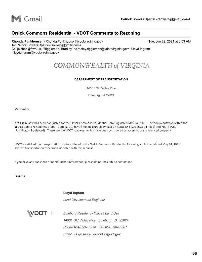
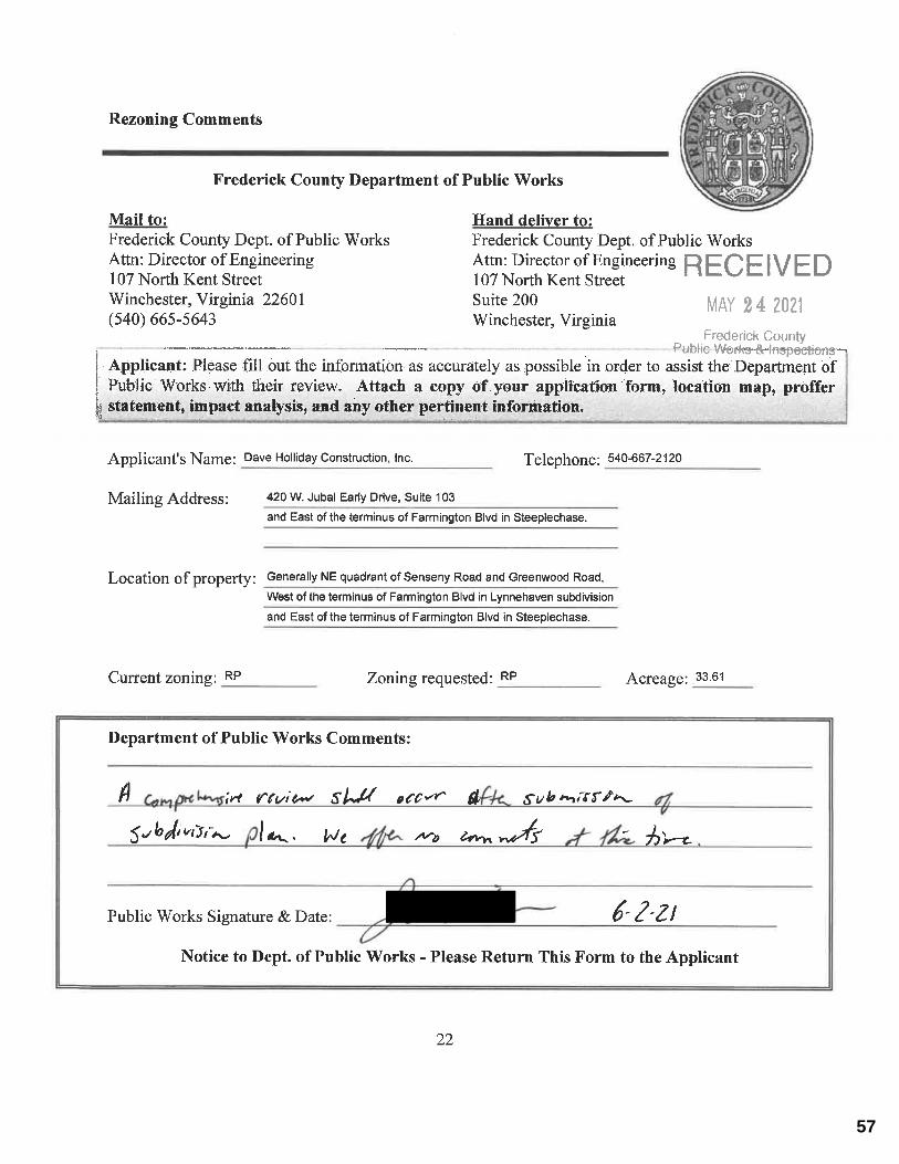
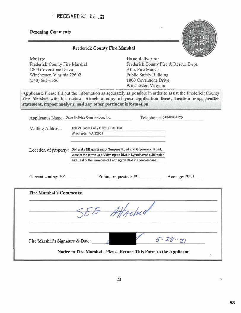
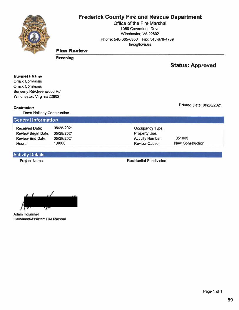
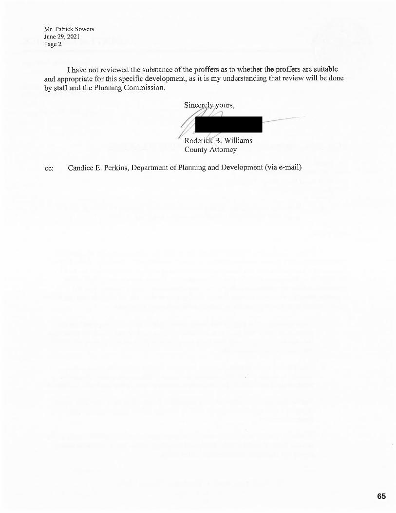
Rezoning #04-21 Orrick Commons August 23, 2021 Page 3 REVIEW EVALUATIONS: Virginia Dept. of Transportation: A VDOT review has been conducted for the Orrick Commons Residential Rezoning dated May 24, 2021. The documentation within the application to rezone this property appears to have little measurable impact on Route 656 (Greenwood Road) and Farmington Boulevard. These are the VDOT roadway which have been considered as access to the referenced property. VDOT is satisfied the transportation proffer offered in the Orrick Commons Residential Rezoning application dated May 24, 2021 address transportation concerns associate with this request. Frederick County Public Work Department: A comprehensive review should occur at the submission of subdivision plan. We offer no comments at this time. Frederick County Fire Marshall: Plan approved. Frederick County Park & Recreation Department: Parks and recreation recommends keeping the park concept, has no issue with moving the location. Proffer contribution should follow the current proffer impact model calculations. Frederick Water: Reviewed proposal dated May 5, 2021. No comment. Frederick -Winchester Service Authority: FWSA defers comments on sewer capacity and availability to Frederick Water. Frederick County Public Schools: As Orrick Commons will be retaining its age restricted status, FCPS offers no comments. County of Frederick Attorney: Please see attached comments from Roderick B. Williams, County Attorney dated June 29, 2021. Planning & Zoning: 1) Site History
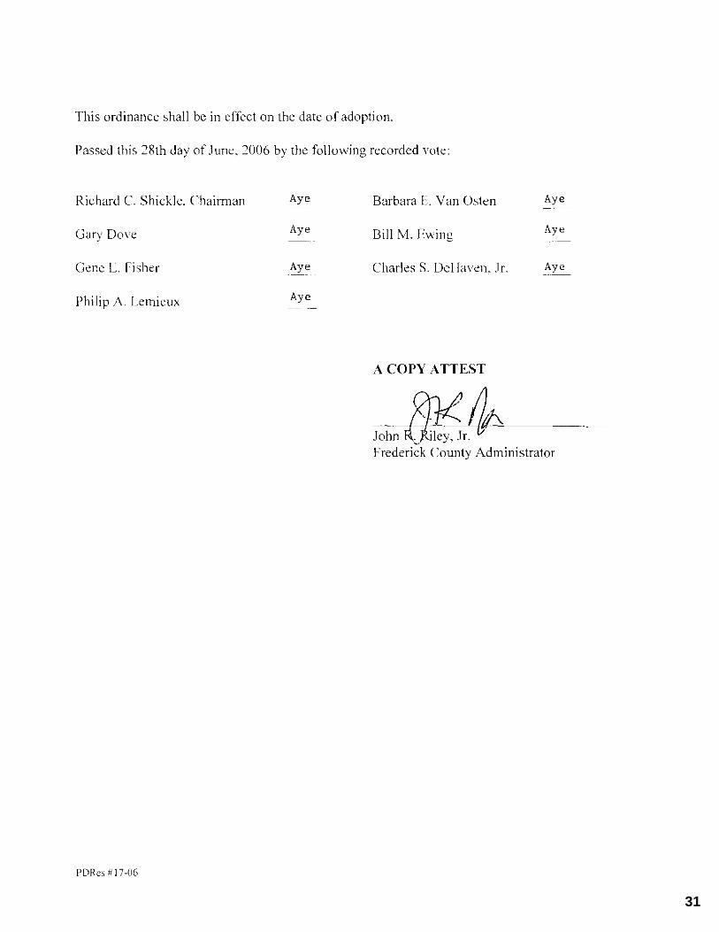
The original Frederick County Zoning Map (U.S.G.S. Stephenson Quadrangle) identifies this property as being zoned A-2 (Agriculture General). The County’s agricultural zoning districts were combined to form the RA (Rural Areas) District upon adoption of an amendment to the Frederick County Zoning Ordinance on May 10, 1989. The corresponding revision of the zoning map resulted in the re-mapping of the subject property and all other A-1 and A-2 zoned land to the RA District. On June 28, 2006, Rezoning #04-06 was approved which rezoned the property to the RP (Residential Performance) District with proffers.
6
Rezoning #04-21 Orrick Commons August 23, 2021 Page 4 2) Comprehensive Plan
The 2035 Comprehensive Plan is the guide for the future growth of Frederick County. The 2035 Comprehensive Plan is an official public document that serves as the Community's guide for making decisions regarding development, preservation, public facilities and other key components of Community life. The primary goal of this plan is to protect and improve the living environment within Frederick County. It is in essence a composition of policies used to guide the future development of Frederick County. The Area Plans, Appendix I of the 2035 Comprehensive Plan, are the primary implementation tool and will be instrumental to the future planning efforts of the County. Comprehensive Plan- Land Use The Senseny Eastern Urban Area Land Use Plan of the 2035 Comprehensive Plan provides guidance on the future development of the property. The Plan identifies this property with a residential land use designation; the property is also within the limits of the Sewer and Water Service Area and the Urban Development Area. The existing/proposed zoning is generally consistent with the goals of the Plan.
3) Proposed Proffer Amendments:
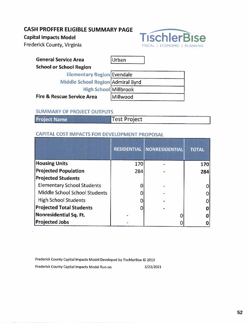
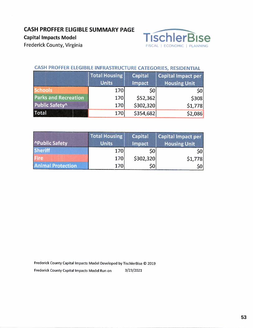
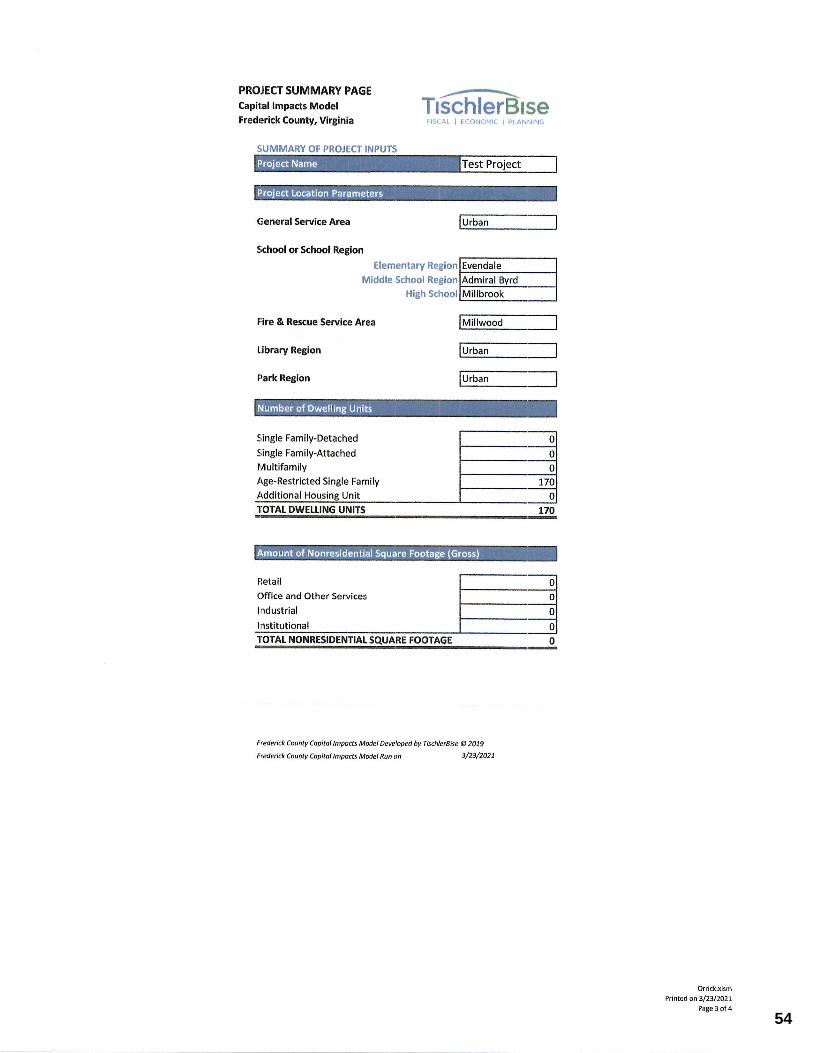
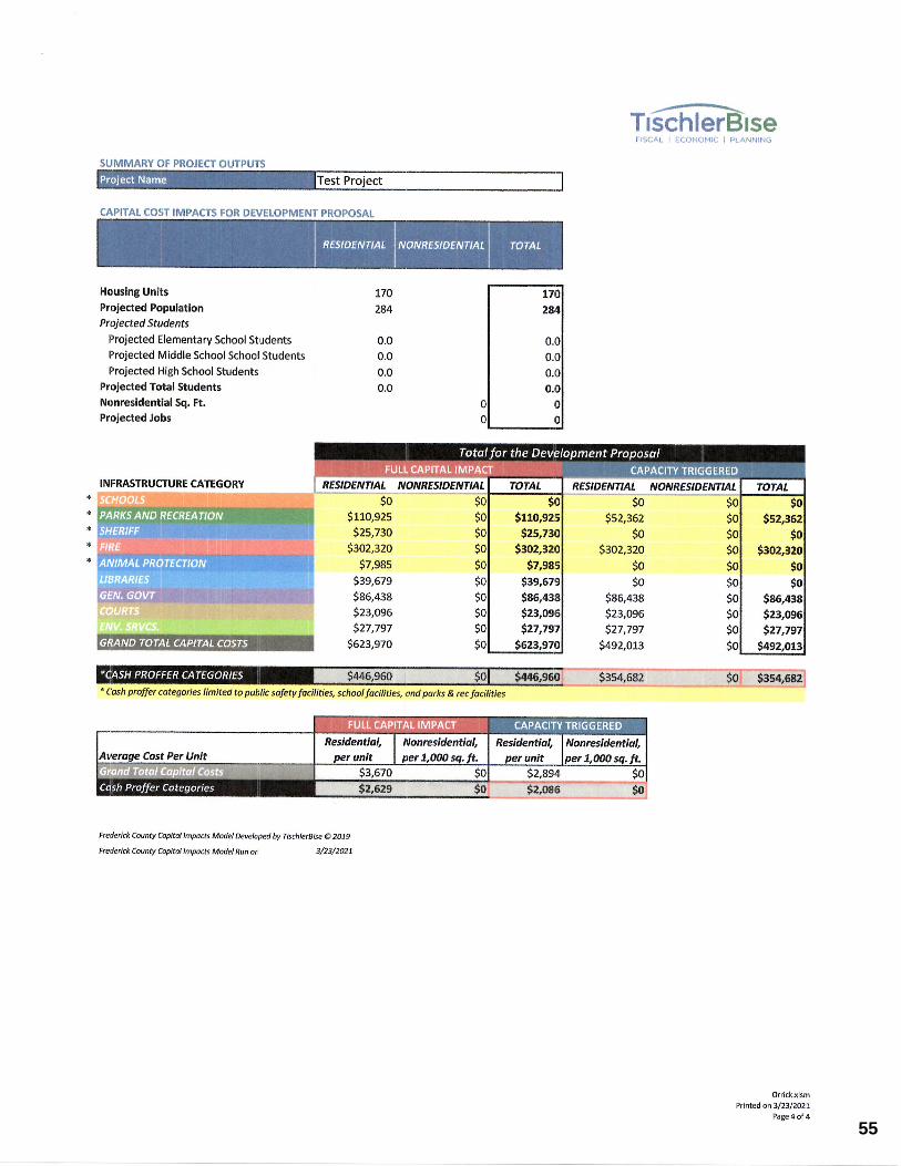
Park Area This request is seeking to revise the proffers pertaining to the dedication of park land and preservation of a pond. The 2006 rezoning proffered 3.5 acres to Frederick County as a park and a proffer that required an existing pond to be preserved within the park area. This request is seeking to revise the proffers pertaining to the dedication of park land and preservation of a pond. The 2006 rezoning proffered 3.5 acres to Frederick County as a park and a proffer that required an existing pond to be preserved within the park area. The approved proffer would allow for the park area to count towards the required open space for the age-restricted residential development. Dedication of that land would also require approval from the Applicant and Frederick County; the Applicant would most likely be the Homeowners Association depending on the ultimate timing of the request. The Frederick County Parks and Recreation in their comments, did recommend keeping the proffered park. Residential Density The proposed proffers associated with this application would restrict the total number of units permitted on the property to a maximum of 170 units – 122 single family (detached or attached) and 48 multifamily units. The approved proffer statement allows for the maximum density which could result in up to 201 dwelling units.
7
Rezoning #04-21 Orrick Commons August 23, 2021 Page 5 4) Proffer Statement:
The revised proffers associated with this rezoning application are as follows; Proffer Statement – Dated May 5, 2021, revised August 5, 2021: 1. LAND USE:
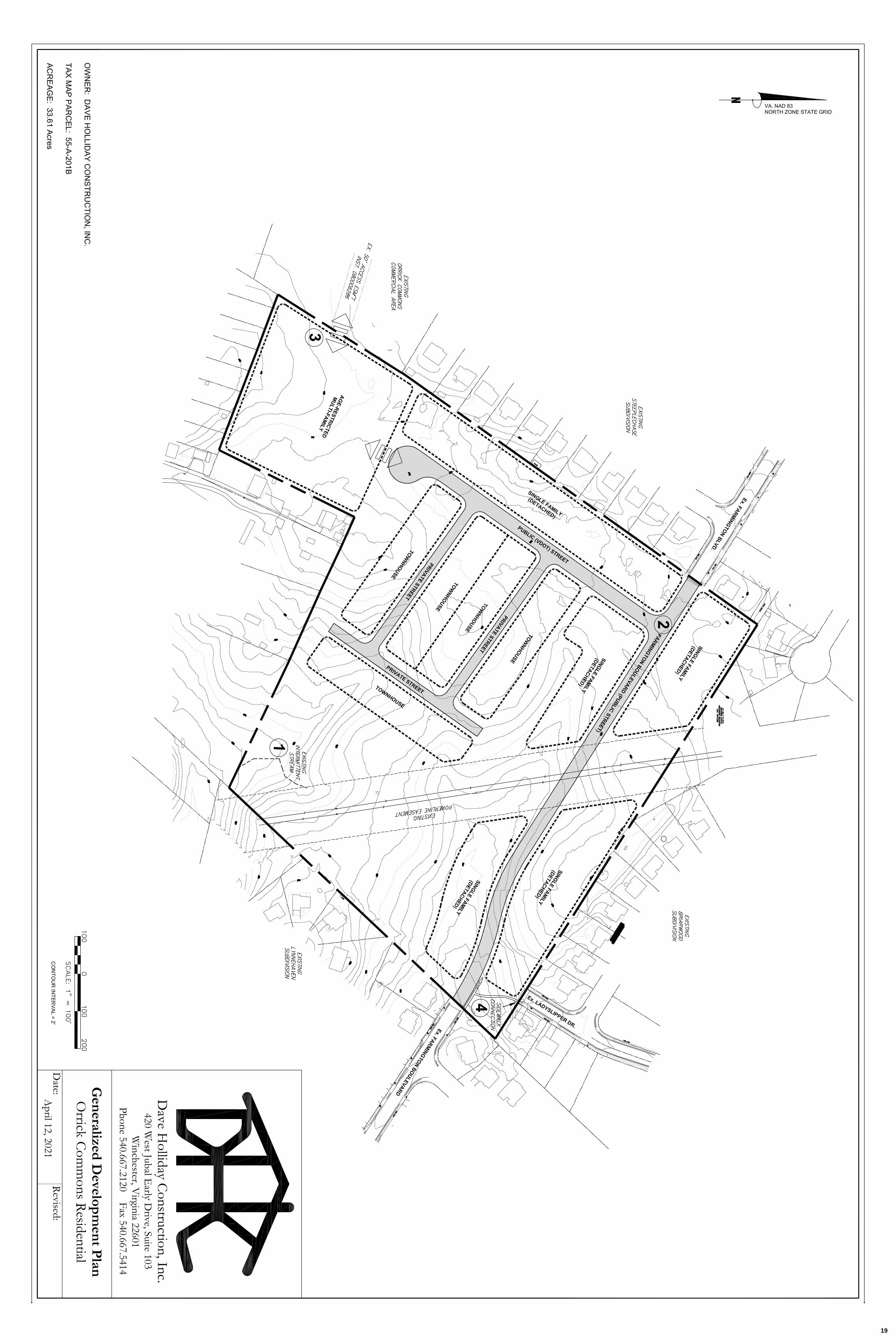
1.1 Residential development shall be provided as a mixture of single family and
multi-family units. Development of the Property shall not exceed a total of 170 dwelling units. Multi-family units shall not exceed 48 total units. The locations of the dwelling units on the Property shall be located as generally depicted on the GDP.
1.2 Except to the extent otherwise prohibited by the Virginia Fair Housing Law, the
Federal Fair Housing Law, and other applicable federal, state, or local legal requirements, all dwelling units shall be identified as “age-restricted” and shall be restricted to “housing for older persons” as defined in Va. Code Ann. § 36-96.7, or a surviving spouse not so qualifying. No persons under 19 years of age shall be permitted to be regularly domiciled or to reside permanently therein. The restriction provided for herein shall also be in the form of a restrictive covenant with respect to the residential portion of the Property, and any Homeowners’ Association created with respect thereto shall have assigned responsibility for the enforcement and administration of the said covenant.
2. CONDITIONS PRECEDENT TO THE ISSUANCE OF PERMITS AND PLAN
APPROVALS:
2.1 The Property shall be developed as one single and unified development in accordance with applicable ordinances, regulations, design standards, and this Orrick Commons Residential Proffer Statement as approved by the Board.
3. CREATION OF HOMEOWNERS’ ASSOCIATION:
3.1 The residential development shall be made subject to a homeowners’ association (hereinafter “HOA”) that shall be responsible for the ownership, maintenance and repair of all common areas, including any conservation areas that may be established in accordance herewith not dedicated to the County or others, for each area subject to their jurisdiction, and shall be provided such other responsibilities, duties, and powers as are customary for such associations or as may be required for such HOA herein.
3.2 In addition to such other duties and responsibilities as may be assigned, an HOA
shall have title to and responsibility for (i) all common open space areas, (ii) common buffer areas located outside of residential lots; (iii) common solid waste disposal program provided by a commercial collection company, (iv) responsibility for the perpetual maintenance of any street, perimeter, or road buffer areas, all of which buffer areas shall be located within easements to be granted to the HOA if platted within residential or other lots, or otherwise granted to the HOA by appropriate instrument, (v) responsibility for payment
8
Rezoning #04-21 Orrick Commons August 23, 2021 Page 6
for maintenance of streetlights, and (vi) maintenance of private streets.
4. WATER & SEWER:
4.1 The Applicant shall be responsible for connecting the Property to public water and sewer, and for constructing all facilities required for such connection. All water and sewer infrastructure shall be constructed in accordance with the requirements of Frederick Water. The cost of all water and sewer improvements will be borne by the Applicant.
5. ENVIRONMENT:
5.1 The Applicant shall preserve the existing intermittent stream channel located on
the Southeast portion of the Property. Disturbance of the stream channel shall be prohibited. (See 1 on GDP)
6. TRANSPORTATION:
6.1 Transportation improvements shall be designed and constructed consistent with
the study entitled “A Traffic Impact Analysis of the Orrick Property,” prepared by Patton Harris Rust & Associates, dated October 11, 2005 (the “TIA”). The Applicant shall privately fund all transportation improvements required of this project.
6.2 The extension of Farmington Boulevard through the project shall be designed and constructed to base pavement and bonded to final pavement prior to issuance of a certificate of occupancy for the first single family dwelling unit. Design of Farmington Boulevard shall include traffic calming measures acceptable to VDOT. (See 2 on GDP)
6.3 The Applicant shall construct an interconnected transportation network to connect the Property with the adjoining commercial property, identified as Frederick County tax map parcels 55-A-201F and 55-A-201G, for both vehicular and pedestrian traffic. Said connection shall be made in the location depicted on the GDP. (See 3 on GDP)
6.4 Concurrent with the extension of Farmington Boulevard provided by Proffer 6.2, the Applicant shall construct a sidewalk connection from Farmington Boulevard to the existing sidewalk along existing Ladyslipper Drive. (See 4 on GDP).
7. DESIGN STANDARDS
7.1 All facades of any multi-family residential structure located on the Property shall be constructed using a combination of any of the following materials: brick; stone, or simulated stone; wood; Hardishingle and/or Harditrim, or material of comparable quality; Azek Trimboards or material of comparable quality; Fypon brackets and/or cornice details; stucco; glass. Any multi-family residential building constructed on the property shall utilize a mixture of building materials in an effort to relate to the surrounding area.
7.2 Any multi-family residential structures located on the Property shall incorporate
9
Rezoning #04-21 Orrick Commons August 23, 2021 Page 7
bays and columned porches to more effectively relate to surrounding properties. 8. PARKS AND RECREATION
8.1 The Applicant shall contribute to the Board the sum of $248.00 per dwelling
unit for parks and recreation purposes, payable upon the issuance of an occupancy permit for each dwelling unit.
9. SOLID WASTE AND RECYCLING CONTAINERS
9.1 Location of solid waste and recycling containers, utility equipment storage will
be contained within fenced enclosures contained within fenced enclosures.
10. FIRE AND RESCUE
10.1 The Applicant shall contribute to the Board the sum of $166.00 per dwelling unit for fire and rescue purposes, payable upon the issuance of an occupancy permit for each dwelling unit.
11. GENERAL GOVERNMENT
11.1 The Applicant shall contribute to the Board the sum of $37.00 per dwelling unit for general government purposes, payable upon the issuance of an occupancy permit for each dwelling unit.
12. PUBLIC SAFETY
12.1 The Applicant shall contribute to the Board the sum of $76.00 per dwelling unit for public safety purposes, payable upon the issuance of an occupancy permit for each dwelling unit.
13. LIBRARY
13.1 The Applicant shall contribute to the Board the sum of $31.00 per dwelling unit for library purposes, payable upon the issuance of an occupancy permit for each dwelling unit.
14. FUTURE ROAD IMPROVEMENTS
14.1 The Applicant shall contribute to the Board the sum of $2,854.00 per dwelling unit for future improvements to Senseny Road and Greenwood Road, payable upon the issuance of an occupancy permit for each dwelling unit.
Staff Note - Monetary Proffers: With this revision, the application has retained the 2006 monetary proffers pertaining to Parks and Recreation, Fire and Rescue, General Government, Public Safety and the Library, as well as a per unit transportation proffer of $2,854.
10
BRAITHWAITESubdivision
LYNNEHAVENSubdivision
ABRAMS CHASESubdivision
H. L. PATTONSubdivision
ORRICK COMMONSSubdivision
STEEPLECHASESubdivision
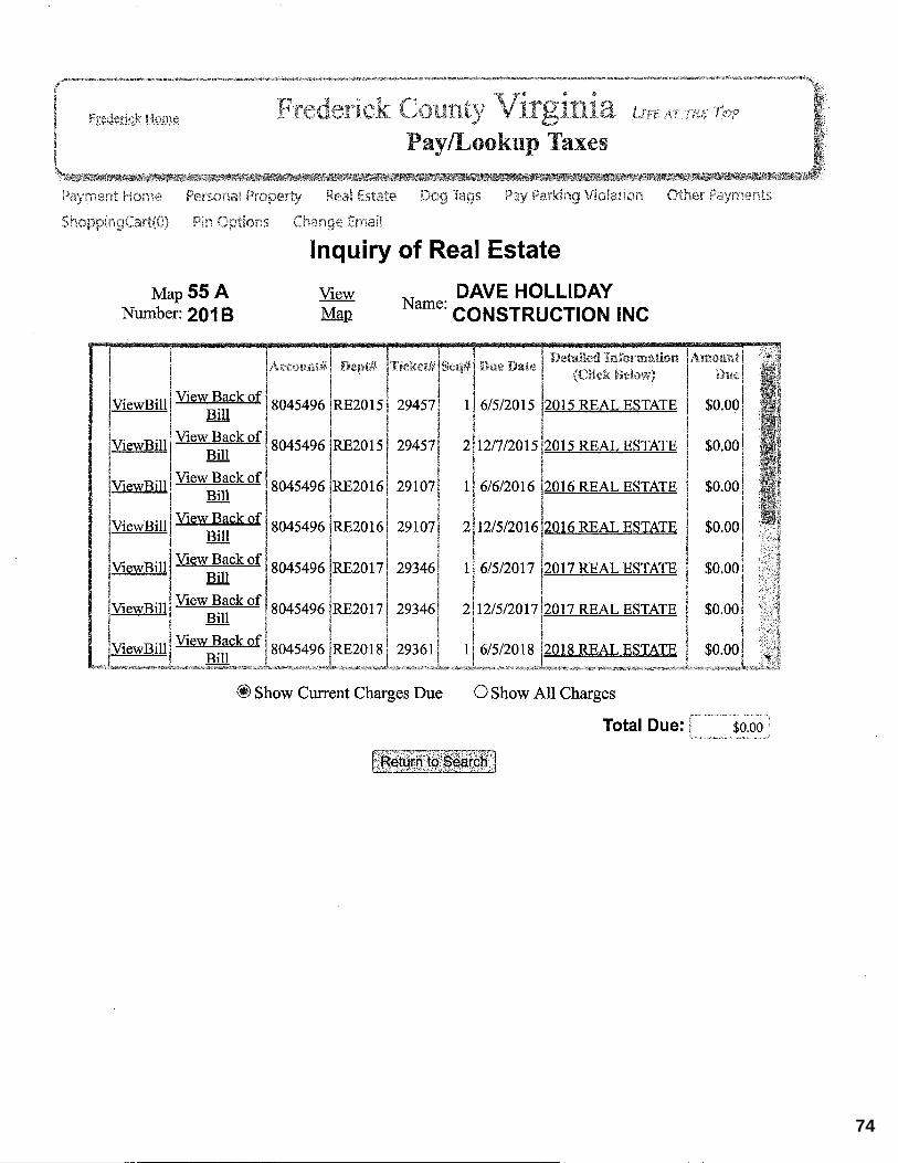
55 A 201B
123GREENWOOD
AVE 125GREENWOOD
AVE138
MALOY DR
2064SENSENY RD 2077
SENSENY RD 2100SENSENY RD
2135SENSENY RD 2147
SENSENY RD
2159SENSENY RD
2171SENSENY RD 116
AMBERFIELD CT105
PARKWOOD CIR
109PARKWOOD
CIR
2014SENSENY RD
2024SENSENY RD
2034SENSENY RD
2105SENSENY RD
2123SENSENY RD
113AMBERFIELD CT 120
AMBERFIELD CT
1994SENSENY RD
2004SENSENY RD
2055SENSENY RD
2085SENSENY RD 2097
SENSENY RD
2037SENSENY RD
2041SENSENY RD
131AMBERFIELD CT
140AMBERFIELD CT
2009SENSENY RD
2015SENSENY RD
2019SENSENY RD
2025SENSENY RD
2031SENSENY RD
1997SENSENY RD
2003SENSENY RD
2045SENSENY RD
2056SENSENY RD 113
SESAR CT111
SESAR CT109
SESAR CT
119SESAR CT
117SESAR CT
115SESAR CT
121SESAR CT
112SESAR CT
106SESAR CT
120SESAR CT 116
SESAR CT114
SESAR CT
118SESAR CT
406FARMINGTON
BLVD408
FARMINGTONBLVD
400FARMINGTON
BLVD
402FARMINGTON
BLVD
404FARMINGTON
BLVD
121ARDEYTH LN
119ARDEYTH LN
401FARMINGTON
BLVD
103KAY CT 101
KAY CT117
ARDEYTH LN
103NESCLIFFE CT
105KAY CT
100KAY CT
115ARDEYTH LN
113ARDEYTH LN 215
LADYSLIPPER DR105
NESCLIFFE CT
104KAY CT
114ARTHUR LN 111
ARDEYTH LN 130TEABERRY DR
213LADYSLIPPER DR
106KAY CT
112ARTHUR LN 109
ARDEYTH LN128
TEABERRY DR 211LADYSLIPPER DR
115ARTHUR LN 107
ARDEYTH LN
105ARDEYTH LN
122TEABERRY DR
124TEABERRY DR
127TEABERRY DR
104ARTHUR LN
111ARTHUR LN
113ARTHUR LN
104ARDEYTH LN
103ARDEYTH LN 120
TEABERRY DR 123TEABERRY DR
125TEABERRY DR
107ARTHUR LN
102ARDEYTH LN 101
ARDEYTH LN 118TEABERRY DR 119
TEABERRY DR
121TEABERRY DR 208
LADYSLIPPER DR
105ARTHUR LN
103ARTHUR LN 220
FARMINGTONBLVD
224FARMINGTON
BLVD 116TEABERRY DR
117TEABERRY DR
108BLUEBELL CT 107
BLUEBELL CT 206LADYSLIPPER DR
218FARMINGTON
BLVD 222FARMINGTON
BLVD
229FARMINGTON
BLVD231
FARMINGTONBLVD 114
TEABERRY DR
115TEABERRY DR
204LADYSLIPPER DR
105MARLISE LN
212FARMINGTON
BLVD214
FARMINGTONBLVD
225FARMINGTON
BLVD 227FARMINGTON BLVD 210
TREFOIL CT 212TREFOIL CT
214TREFOIL CT
112TEABERRY DR
113TEABERRY DR 106
BLUEBELL CT 105BLUEBELL CT
202LADYSLIPPER DR
103MARLISE LN 210
FARMINGTON BLVD
221FARMINGTON
BLVD
206TREFOIL CT
208TREFOIL CT 110
TEABERRY DR111
TEABERRY DR
103BLUEBELL CT
434LILYSWAY 436
LILYSWAY
208FARMINGTON
BLVD
215FARMINGTON
BLVD 204TREFOIL CT 213
TREFOIL CT 108TEABERRY DR
109TEABERRY DR 104
BLUEBELL CT
430LILYS WAY
432LILYSWAY
100MARLISE LN
211FARMINGTON
BLVD 213FARMINGTON
BLVD 202TREFOIL CT
207TREFOIL CT
211TREFOIL CT
106TEABERRY DR
107TEABERRY DR 102
BLUEBELL CT
100BLUEBELL CT
433LILYSWAY
435LILYS WAY
207FARMINGTON BLVD
209FARMINGTON
BLVD
314LILYSWAY 318
LILYSWAY
320LILYSWAY 201
TREFOIL CT
402LILYSWAY
404LILYSWAY 104
TEABERRY DR 105TEABERRY DR
420LILYSWAY
422LILYSWAY
429LILYSWAY 431
LILYSWAY
203FARMINGTON
BLVD205
FARMINGTONBLVD
310LILYS WAY
312LILYSWAY
406LILYSWAY
102TEABERRY DR 103
TEABERRY DR
427LILYSWAY 214
WOODROW RD
306LILYS WAY
308LILYSWAY
110TREFOIL CT
403LILYSWAY 412
LILYS WAY 101TEABERRY DR
423LILYSWAY
425LILYSWAY
210WOODROW RD
KAY CT
MALOY DR
LILYS WAY
LADY
SLIPP
ERDR
SESAR CT
BLUEBELL CTTREFOIL CT
ARTHUR LN
ARDEYT
H LN
SENSENY RD
FARMINGTON BLVD
TEABERRY DR
ApplicationParcelsSewer and Water Service Area µ
Frederick County Planning & Development107 N Kent St
Winchester, VA 22601540 - 665 - 5651
Map Created: August 16, 2021
SENSENY RD
GREENWOOD RD
WOODROW RD
CHANNING DRLILYS WAY
MALOY DR
LYNNEHAVEN DR
ROSS
MANN B
LVD
COUN
TRY P
ARK D
R
NASSAU DR
ATOKA DR
FARMINGTON BLVD
MADIGAN LN
TEABERRY DR
RENEE LN
GROCERY AVE
HAROLD CT
ARTHUR LN
0 350 700175 Feet
REZ # 04 - 21: Orrick CommonsPIN: 55 - A - 201B
Rezoning from RP to RP with Revised ProffersLocation Map
REZ #04-21
11
BRAITHWAITESubdivision
LYNNEHAVENSubdivision
ABRAMS CHASESubdivision
H. L. PATTONSubdivision
ORRICK COMMONSSubdivision
STEEPLECHASESubdivision
55 A 201B
123GREENWOOD
AVE 125GREENWOOD
AVE138
MALOY DR
2064SENSENY RD 2077
SENSENY RD 2100SENSENY RD
2135SENSENY RD 2147
SENSENY RD
2159SENSENY RD
2171SENSENY RD 116
AMBERFIELD CT105
PARKWOOD CIR
109PARKWOOD
CIR
2014SENSENY RD
2024SENSENY RD
2034SENSENY RD
2105SENSENY RD
2123SENSENY RD
113AMBERFIELD CT 120
AMBERFIELD CT
1994SENSENY RD
2004SENSENY RD
2055SENSENY RD
2085SENSENY RD 2097
SENSENY RD
2037SENSENY RD
2041SENSENY RD
131AMBERFIELD CT
140AMBERFIELD CT
2009SENSENY RD
2015SENSENY RD
2019SENSENY RD
2025SENSENY RD
2031SENSENY RD
1997SENSENY RD
2003SENSENY RD
2045SENSENY RD
2056SENSENY RD 113
SESAR CT111
SESAR CT109
SESAR CT
119SESAR CT
117SESAR CT
115SESAR CT
121SESAR CT
112SESAR CT
106SESAR CT
120SESAR CT 116
SESAR CT114
SESAR CT
118SESAR CT
406FARMINGTON
BLVD408
FARMINGTONBLVD
400FARMINGTON
BLVD
402FARMINGTON
BLVD
404FARMINGTON
BLVD
121ARDEYTH LN
119ARDEYTH LN
401FARMINGTON
BLVD
103KAY CT 101
KAY CT117
ARDEYTH LN
103NESCLIFFE CT
105KAY CT
100KAY CT
115ARDEYTH LN
113ARDEYTH LN 215
LADYSLIPPER DR105
NESCLIFFE CT
104KAY CT
114ARTHUR LN 111
ARDEYTH LN 130TEABERRY DR
213LADYSLIPPER DR
106KAY CT
112ARTHUR LN 109
ARDEYTH LN128
TEABERRY DR 211LADYSLIPPER DR
115ARTHUR LN 107
ARDEYTH LN
105ARDEYTH LN
122TEABERRY DR
124TEABERRY DR
127TEABERRY DR
104ARTHUR LN
111ARTHUR LN
113ARTHUR LN
104ARDEYTH LN
103ARDEYTH LN 120
TEABERRY DR 123TEABERRY DR
125TEABERRY DR
107ARTHUR LN
102ARDEYTH LN 101
ARDEYTH LN 118TEABERRY DR 119
TEABERRY DR
121TEABERRY DR 208
LADYSLIPPER DR
105ARTHUR LN
103ARTHUR LN 220
FARMINGTONBLVD
224FARMINGTON
BLVD 116TEABERRY DR
117TEABERRY DR
108BLUEBELL CT 107
BLUEBELL CT 206LADYSLIPPER DR
218FARMINGTON
BLVD 222FARMINGTON
BLVD
229FARMINGTON
BLVD231
FARMINGTONBLVD 114
TEABERRY DR
115TEABERRY DR
204LADYSLIPPER DR
105MARLISE LN
212FARMINGTON
BLVD214
FARMINGTONBLVD
225FARMINGTON
BLVD 227FARMINGTON BLVD 210
TREFOIL CT 212TREFOIL CT
214TREFOIL CT
112TEABERRY DR
113TEABERRY DR 106
BLUEBELL CT 105BLUEBELL CT
202LADYSLIPPER DR
103MARLISE LN 210
FARMINGTON BLVD
221FARMINGTON
BLVD
206TREFOIL CT
208TREFOIL CT 110
TEABERRY DR111
TEABERRY DR
103BLUEBELL CT
434LILYSWAY 436
LILYSWAY
208FARMINGTON
BLVD
215FARMINGTON
BLVD 204TREFOIL CT 213
TREFOIL CT 108TEABERRY DR
109TEABERRY DR 104
BLUEBELL CT
430LILYS WAY
432LILYSWAY
100MARLISE LN
211FARMINGTON
BLVD 213FARMINGTON
BLVD 202TREFOIL CT
207TREFOIL CT
211TREFOIL CT
106TEABERRY DR
107TEABERRY DR 102
BLUEBELL CT
100BLUEBELL CT
433LILYSWAY
435LILYS WAY
207FARMINGTON BLVD
209FARMINGTON
BLVD
314LILYSWAY 318
LILYSWAY
320LILYSWAY 201
TREFOIL CT
402LILYSWAY
404LILYSWAY 104
TEABERRY DR 105TEABERRY DR
420LILYSWAY
422LILYSWAY
429LILYSWAY 431
LILYSWAY
203FARMINGTON
BLVD205
FARMINGTONBLVD
310LILYS WAY
312LILYSWAY
406LILYSWAY
102TEABERRY DR 103
TEABERRY DR
427LILYSWAY 214
WOODROW RD
306LILYS WAY
308LILYSWAY
110TREFOIL CT
403LILYSWAY 412
LILYS WAY 101TEABERRY DR
423LILYSWAY
425LILYSWAY
210WOODROW RD
KAY CT
MALOY DR
LILYS WAY
LADY
SLIPP
ERDR
SESAR CT
BLUEBELL CTTREFOIL CT
ARTHUR LN
ARDEYT
H LN
SENSENY RD
FARMINGTON BLVD
TEABERRY DR
ApplicationParcelsSewer and Water Service AreaB2 (General Business District)RP (Residential Performance District) µ
Frederick County Planning & Development107 N Kent St
Winchester, VA 22601540 - 665 - 5651
Map Created: August 16, 2021
SENSENY RD
GREENWOOD RD
WOODROW RD
CHANNING DRLILYS WAY
MALOY DR
LYNNEHAVEN DR
ROSS
MANN B
LVD
COUN
TRY P
ARK D
R
NASSAU DR
ATOKA DR
FARMINGTON BLVD
MADIGAN LN
TEABERRY DR
RENEE LN
GROCERY AVE
HAROLD CT
ARTHUR LN
0 350 700175 Feet
REZ # 04 - 21: Orrick CommonsPIN: 55 - A - 201B
Rezoning from RP to RP with Revised ProffersZoning Map
REZ #04-21
12
BRAITHWAITESubdivision
LYNNEHAVENSubdivision
ABRAMS CHASESubdivision
H. L. PATTONSubdivision
ORRICK COMMONSSubdivision
STEEPLECHASESubdivision
55 A 201B
123GREENWOOD
AVE 125GREENWOOD
AVE138
MALOY DR
2064SENSENY RD 2077
SENSENY RD 2100SENSENY RD
2135SENSENY RD 2147
SENSENY RD
2159SENSENY RD
2171SENSENY RD 116
AMBERFIELD CT105
PARKWOOD CIR
109PARKWOOD
CIR
2014SENSENY RD
2024SENSENY RD
2034SENSENY RD
2105SENSENY RD
2123SENSENY RD
113AMBERFIELD CT 120
AMBERFIELD CT
1994SENSENY RD
2004SENSENY RD
2055SENSENY RD
2085SENSENY RD 2097
SENSENY RD
2037SENSENY RD
2041SENSENY RD
131AMBERFIELD CT
140AMBERFIELD CT
2009SENSENY RD
2015SENSENY RD
2019SENSENY RD
2025SENSENY RD
2031SENSENY RD
1997SENSENY RD
2003SENSENY RD
2045SENSENY RD
2056SENSENY RD 113
SESAR CT111
SESAR CT109
SESAR CT
119SESAR CT
117SESAR CT
115SESAR CT
121SESAR CT
112SESAR CT
106SESAR CT
120SESAR CT 116
SESAR CT114
SESAR CT
118SESAR CT
406FARMINGTON
BLVD408
FARMINGTONBLVD
400FARMINGTON
BLVD
402FARMINGTON
BLVD
404FARMINGTON
BLVD
121ARDEYTH LN
119ARDEYTH LN
401FARMINGTON
BLVD
103KAY CT 101
KAY CT117
ARDEYTH LN
103NESCLIFFE CT
105KAY CT
100KAY CT
115ARDEYTH LN
113ARDEYTH LN 215
LADYSLIPPER DR105
NESCLIFFE CT
104KAY CT
114ARTHUR LN 111
ARDEYTH LN 130TEABERRY DR
213LADYSLIPPER DR
106KAY CT
112ARTHUR LN 109
ARDEYTH LN128
TEABERRY DR 211LADYSLIPPER DR
115ARTHUR LN 107
ARDEYTH LN
105ARDEYTH LN
122TEABERRY DR
124TEABERRY DR
127TEABERRY DR
104ARTHUR LN
111ARTHUR LN
113ARTHUR LN
104ARDEYTH LN
103ARDEYTH LN 120
TEABERRY DR 123TEABERRY DR
125TEABERRY DR
107ARTHUR LN
102ARDEYTH LN 101
ARDEYTH LN 118TEABERRY DR 119
TEABERRY DR
121TEABERRY DR 208
LADYSLIPPER DR
105ARTHUR LN
103ARTHUR LN 220
FARMINGTONBLVD
224FARMINGTON
BLVD 116TEABERRY DR
117TEABERRY DR
108BLUEBELL CT 107
BLUEBELL CT 206LADYSLIPPER DR
218FARMINGTON
BLVD 222FARMINGTON
BLVD
229FARMINGTON
BLVD231
FARMINGTONBLVD 114
TEABERRY DR
115TEABERRY DR
204LADYSLIPPER DR
105MARLISE LN
212FARMINGTON
BLVD214
FARMINGTONBLVD
225FARMINGTON
BLVD 227FARMINGTON BLVD 210
TREFOIL CT 212TREFOIL CT
214TREFOIL CT
112TEABERRY DR
113TEABERRY DR 106
BLUEBELL CT 105BLUEBELL CT
202LADYSLIPPER DR
103MARLISE LN 210
FARMINGTON BLVD
221FARMINGTON
BLVD
206TREFOIL CT
208TREFOIL CT 110
TEABERRY DR111
TEABERRY DR
103BLUEBELL CT
434LILYSWAY 436
LILYSWAY
208FARMINGTON
BLVD
215FARMINGTON
BLVD 204TREFOIL CT 213
TREFOIL CT 108TEABERRY DR
109TEABERRY DR 104
BLUEBELL CT
430LILYS WAY
432LILYSWAY
100MARLISE LN
211FARMINGTON
BLVD 213FARMINGTON
BLVD 202TREFOIL CT
207TREFOIL CT
211TREFOIL CT
106TEABERRY DR
107TEABERRY DR 102
BLUEBELL CT
100BLUEBELL CT
433LILYSWAY
435LILYS WAY
207FARMINGTON BLVD
209FARMINGTON
BLVD
314LILYSWAY 318
LILYSWAY
320LILYSWAY 201
TREFOIL CT
402LILYSWAY
404LILYSWAY 104
TEABERRY DR 105TEABERRY DR
420LILYSWAY
422LILYSWAY
429LILYSWAY 431
LILYSWAY
203FARMINGTON
BLVD205
FARMINGTONBLVD
310LILYS WAY
312LILYSWAY
406LILYSWAY
102TEABERRY DR 103
TEABERRY DR
427LILYSWAY 214
WOODROW RD
306LILYS WAY
308LILYSWAY
110TREFOIL CT
403LILYSWAY 412
LILYS WAY 101TEABERRY DR
423LILYSWAY
425LILYSWAY
210WOODROW RD
KAY CT
MALOY DR
LILYS WAY
LADY
SLIPP
ERDR
SESAR CT
BLUEBELL CTTREFOIL CT
ARTHUR LN
ARDEYT
H LN
SENSENY RD
FARMINGTON BLVD
TEABERRY DR
ApplicationParcelsSewer and Water Service Area
Long Range Land UseUrban CenterResidential, 4 u/a µ
Frederick County Planning & Development107 N Kent St
Winchester, VA 22601540 - 665 - 5651
Map Created: August 16, 2021
SENSENY RD
GREENWOOD RD
WOODROW RD
CHANNING DRLILYS WAY
MALOY DR
LYNNEHAVEN DR
ROSS
MANN B
LVD
COUN
TRY P
ARK D
R
NASSAU DR
ATOKA DR
FARMINGTON BLVD
MADIGAN LN
TEABERRY DR
RENEE LN
GROCERY AVE
HAROLD CT
ARTHUR LN
0 350 700175 Feet
REZ # 04 - 21: Orrick CommonsPIN: 55 - A - 201B
Rezoning from RP to RP with Revised ProffersLong Range Land Use Map
REZ #04-21
13
14
15
16
17
18
19
Orrick Commons Residential Proffer Statement
Page 1 of 96
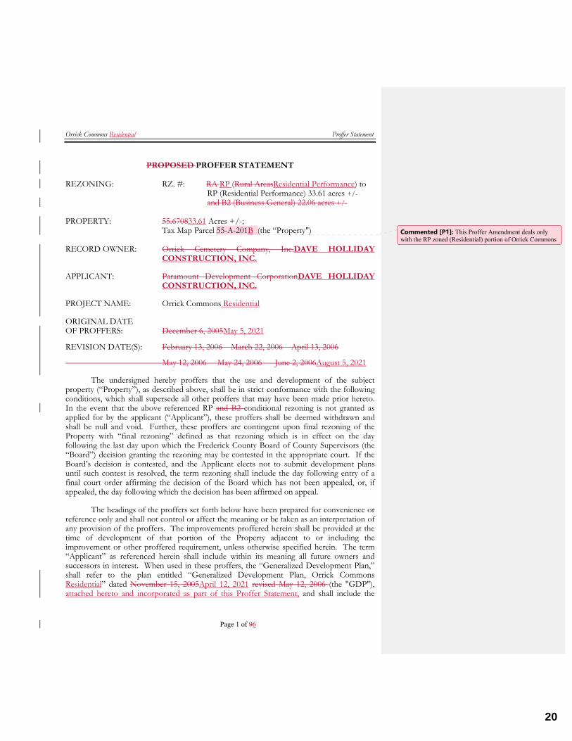
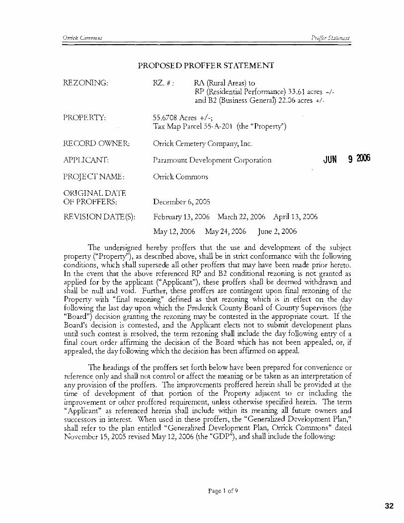
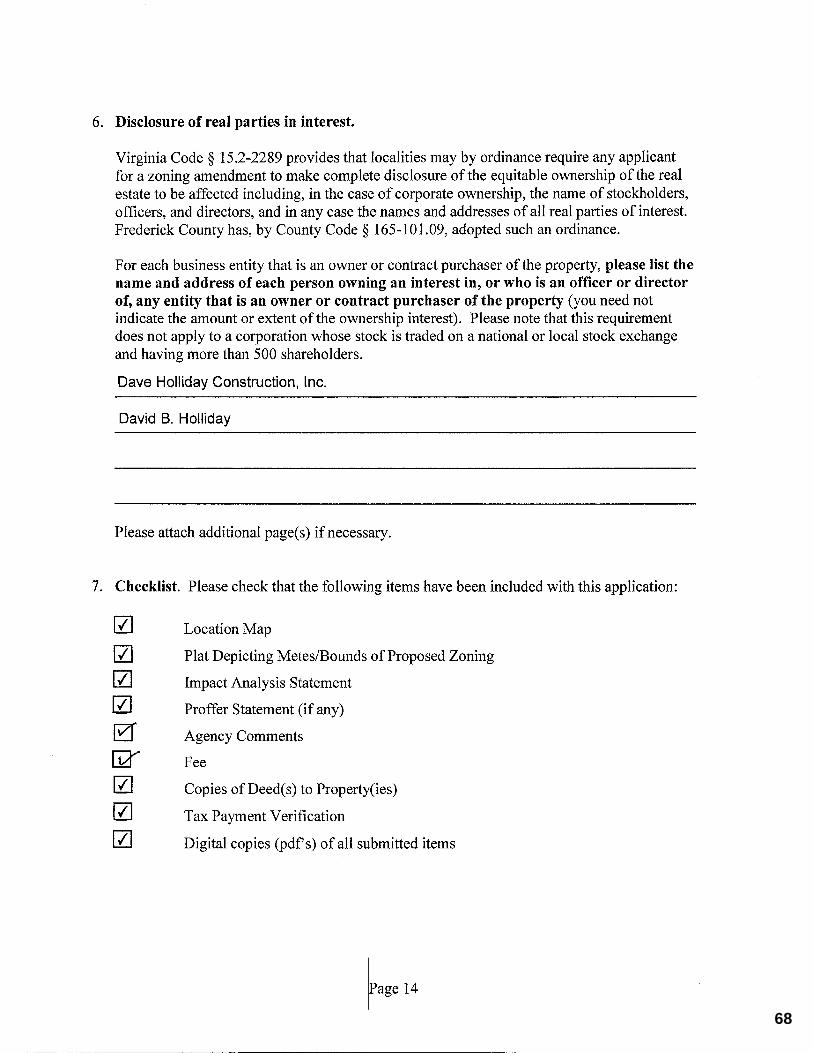
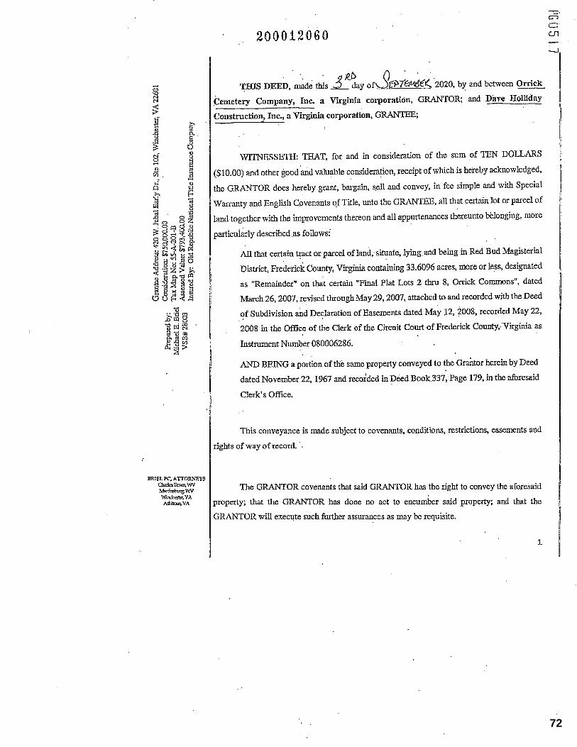
PROPOSED PROFFER STATEMENT REZONING: RZ. #: RA RP (Rural AreasResidential Performance) to RP (Residential Performance) 33.61 acres +/- and B2 (Business General) 22.06 acres +/- PROPERTY: 55.670833.61 Acres +/-; Tax Map Parcel 55-A-201B (the “Property") RECORD OWNER: Orrick Cemetery Company, Inc.DAVE HOLLIDAY
CONSTRUCTION, INC.
APPLICANT: Paramount Development CorporationDAVE HOLLIDAY CONSTRUCTION, INC.
PROJECT NAME: Orrick Commons Residential
ORIGINAL DATE OF PROFFERS: December 6, 2005May 5, 2021
REVISION DATE(S): February 13, 2006 March 22, 2006 April 13, 2006
May 12, 2006 May 24, 2006 June 2, 2006August 5, 2021
The undersigned hereby proffers that the use and development of the subject property (“Property”), as described above, shall be in strict conformance with the following conditions, which shall supersede all other proffers that may have been made prior hereto. In the event that the above referenced RP and B2 conditional rezoning is not granted as applied for by the applicant (“Applicant”), these proffers shall be deemed withdrawn and shall be null and void. Further, these proffers are contingent upon final rezoning of the Property with “final rezoning” defined as that rezoning which is in effect on the day following the last day upon which the Frederick County Board of County Supervisors (the “Board”) decision granting the rezoning may be contested in the appropriate court. If the Board’s decision is contested, and the Applicant elects not to submit development plans until such contest is resolved, the term rezoning shall include the day following entry of a final court order affirming the decision of the Board which has not been appealed, or, if appealed, the day following which the decision has been affirmed on appeal.
The headings of the proffers set forth below have been prepared for convenience or reference only and shall not control or affect the meaning or be taken as an interpretation of any provision of the proffers. The improvements proffered herein shall be provided at the time of development of that portion of the Property adjacent to or including the improvement or other proffered requirement, unless otherwise specified herein. The term “Applicant” as referenced herein shall include within its meaning all future owners and successors in interest. When used in these proffers, the “Generalized Development Plan,” shall refer to the plan entitled “Generalized Development Plan, Orrick Commons Residential” dated November 15, 2005April 12, 2021 revised May 12, 2006 (the "GDP"), attached hereto and incorporated as part of this Proffer Statement, and shall include the
Commented [P1]: This Proffer Amendment deals only with the RP zoned (Residential) portion of Orrick Commons
20
Orrick Commons Residential Proffer Statement
Page 2 of 96
following:
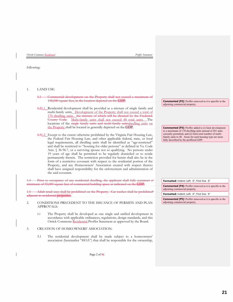
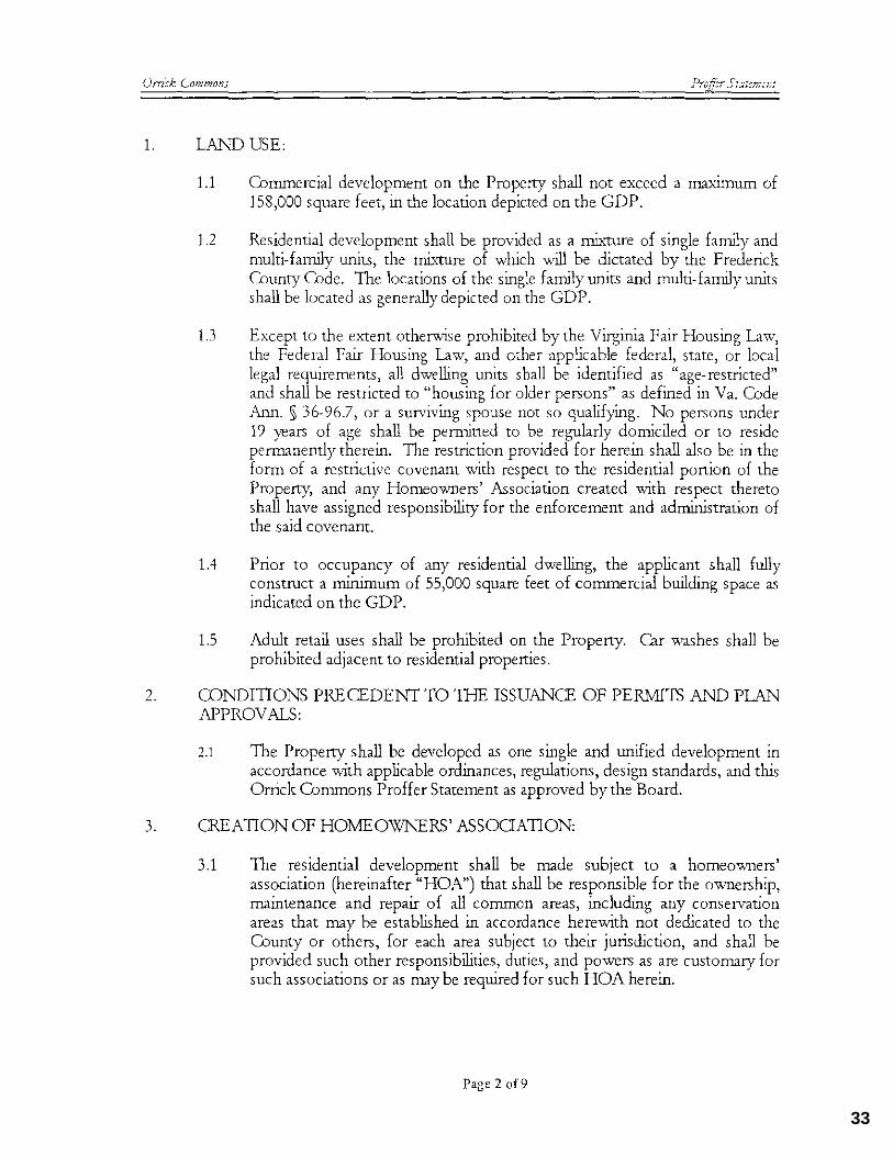
1. LAND USE:
1.1 Commercial development on the Property shall not exceed a maximum of 158,000 square feet, in the location depicted on the GDP.
1.21.1 Residential development shall be provided as a mixture of single family and
multi-family units. Development of the Property shall not exceed a total of 170 dwelling units. the mixture of which will be dictated by the Frederick County Code. Multi-family units shall not exceed 48 total units. The locations of the single family units and multi-family unitsdwelling units on the Property shall be located as generally depicted on the GDP.
1.31.2 Except to the extent otherwise prohibited by the Virginia Fair Housing Law,
the Federal Fair Housing Law, and other applicable federal, state, or local legal requirements, all dwelling units shall be identified as “age-restricted” and shall be restricted to “housing for older persons” as defined in Va. Code Ann. § 36-96.7, or a surviving spouse not so qualifying. No persons under 19 years of age shall be permitted to be regularly domiciled or to reside permanently therein. The restriction provided for herein shall also be in the form of a restrictive covenant with respect to the residential portion of the Property, and any Homeowners’ Association created with respect thereto shall have assigned responsibility for the enforcement and administration of the said covenant.
1.4 Prior to occupancy of any residential dwelling, the applicant shall fully construct a minimum of 55,000 square feet of commercial building space as indicated on the GDP. 1.5 Adult retail uses shall be prohibited on the Property. Car washes shall be prohibited adjacent to residential properties. 2. CONDITIONS PRECEDENT TO THE ISSUANCE OF PERMITS AND PLAN
APPROVALS:
2.1 The Property shall be developed as one single and unified development in accordance with applicable ordinances, regulations, design standards, and this Orrick Commons Residential Proffer Statement as approved by the Board.
3. CREATION OF HOMEOWNERS’ ASSOCIATION:
3.1 The residential development shall be made subject to a homeowners’ association (hereinafter “HOA”) that shall be responsible for the ownership,
Commented [P2]: Proffer removed as it is specific to the adjoining commercial property.
Commented [P3]: Proffer added to (i) limit development to a maximum of 170 dwelling units instead of 201 units currently permitted, and (ii) limit total number of multi-family units to 48. Areas for each housing type are more fully described by the proffered GDP.
Formatted: Indent: Left: 0", First line: 0"Commented [P4]: Proffer removed as it is specific to the adjoining commercial property.
Formatted: Indent: Left: 0", First line: 0"Commented [P5]: Proffer removed as it is specific to the adjoining commercial property.
21
Orrick Commons Residential Proffer Statement
Page 3 of 96
maintenance and repair of all common areas, including any conservation areas that may be established in accordance herewith not dedicated to the County or others, for each area subject to their jurisdiction, and shall be provided such other responsibilities, duties, and powers as are customary for such associations or as may be required for such HOA herein.
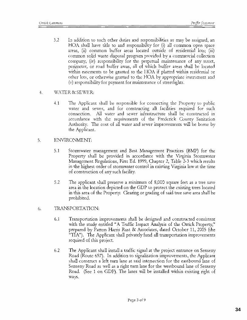
3.2 In addition to such other duties and responsibilities as may be assigned, an
HOA shall have title to and responsibility for (i) all common open space areas, (ii) common buffer areas located outside of residential lots; (iii) common solid waste disposal program provided by a commercial collection company, (iv) responsibility for the perpetual maintenance of any street, perimeter, or road buffer areas, all of which buffer areas shall be located within easements to be granted to the HOA if platted within residential or other lots, or otherwise granted to the HOA by appropriate instrument, and (v) responsibility for payment for maintenance of streetlights, and (vi) maintenance of private streets.
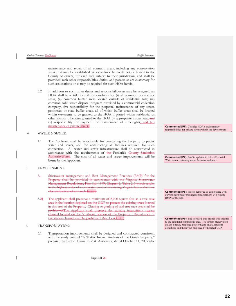
4. WATER & SEWER:
4.1 The Applicant shall be responsible for connecting the Property to public water and sewer, and for constructing all facilities required for such connection. All water and sewer infrastructure shall be constructed in accordance with the requirements of the Frederick County Sanitation AuthorityWater. The cost of all water and sewer improvements will be borne by the Applicant.
5. ENVIRONMENT:
5.1 Stormwater management and Best Management Practices (BMP) for the Property shall be provided in accordance with the Virginia Stormwater Management Regulations, First Ed. 1999, Chapter 2, Table 2-3 which results in the highest order of stormwater control in existing Virginia law at the time of construction of any such facility.
5.21 The applicant shall preserve a minimum of 8,000 square feet as a tree save
area in the location depicted on the GDP to protect the existing trees located in this area of the Property. Clearing or grading of said tree save area shall be prohibited.The Applicant shall preserve the existing intermittent stream channel located on the Southeast portion of the Property. Disturbance of the stream channel shall be prohibited. (See 1 on GDP)
6. TRANSPORTATION:
6.1 Transportation improvements shall be designed and constructed consistent with the study entitled “A Traffic Impact Analysis of the Orrick Property,” prepared by Patton Harris Rust & Associates, dated October 11, 2005 (the
Commented [P6]: Clarifies HOA’s maintenance responsibilities for private streets within the development
Commented [P7]: Proffer updated to reflect Frederick Water as current entity name for water and sewer.
Commented [P8]: Proffer removed as compliance with current stormwater management regulations will require BMP for the site.
Commented [P9]: The tree save area proffer was specific to the adjoining commercial area. The stream preservation area is a newly proposed proffer based on existing site conditions and the layout proposed by the latest GDP.
22
Orrick Commons Residential Proffer Statement
Page 4 of 96
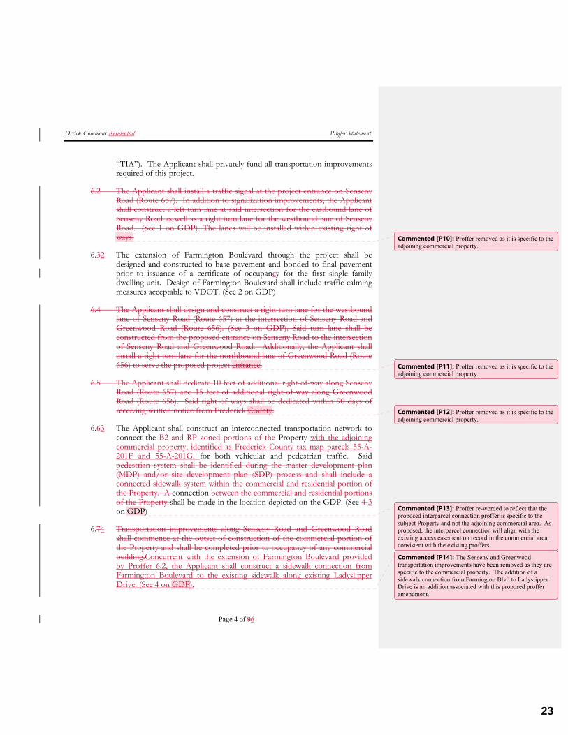
“TIA”). The Applicant shall privately fund all transportation improvements required of this project.
6.2 The Applicant shall install a traffic signal at the project entrance on Senseny Road (Route 657). In addition to signalization improvements, the Applicant shall construct a left turn lane at said intersection for the eastbound lane of Senseny Road as well as a right turn lane for the westbound lane of Senseny Road. (See 1 on GDP). The lanes will be installed within existing right of ways.
6.32 The extension of Farmington Boulevard through the project shall be designed and constructed to base pavement and bonded to final pavement prior to issuance of a certificate of occupancy for the first single family dwelling unit. Design of Farmington Boulevard shall include traffic calming measures acceptable to VDOT. (See 2 on GDP)
6.4 The Applicant shall design and construct a right turn lane for the westbound lane of Senseny Road (Route 657) at the intersection of Senseny Road and Greenwood Road (Route 656). (See 3 on GDP). Said turn lane shall be constructed from the proposed entrance on Senseny Road to the intersection of Senseny Road and Greenwood Road. Additionally, the Applicant shall install a right turn lane for the northbound lane of Greenwood Road (Route 656) to serve the proposed project entrance.
6.5 The Applicant shall dedicate 10 feet of additional right-of-way along Senseny Road (Route 657) and 15 feet of additional right-of-way along Greenwood Road (Route 656). Said right of ways shall be dedicated within 90 days of receiving written notice from Frederick County.
6.63 The Applicant shall construct an interconnected transportation network to connect the B2 and RP zoned portions of the Property with the adjoining commercial property, identified as Frederick County tax map parcels 55-A-201F and 55-A-201G, for both vehicular and pedestrian traffic. Said pedestrian system shall be identified during the master development plan (MDP) and/or site development plan (SDP) process and shall include a connected sidewalk system within the commercial and residential portion of the Property. A connection between the commercial and residential portions of the Property shall be made in the location depicted on the GDP. (See 4 3 on GDP)
6.74 Transportation improvements along Senseny Road and Greenwood Road shall commence at the outset of construction of the commercial portion of the Property and shall be completed prior to occupancy of any commercial building.Concurrent with the extension of Farmington Boulevard provided by Proffer 6.2, the Applicant shall construct a sidewalk connection from Farmington Boulevard to the existing sidewalk along existing Ladyslipper Drive. (See 4 on GDP).
Commented [P10]: Proffer removed as it is specific to the adjoining commercial property.
Commented [P11]: Proffer removed as it is specific to the adjoining commercial property.
Commented [P12]: Proffer removed as it is specific to the adjoining commercial property.
Commented [P13]: Proffer re-worded to reflect that the proposed interparcel connection proffer is specific to the subject Property and not the adjoining commercial area. As proposed, the interparcel connection will align with the existing access easement on record in the commercial area, consistent with the existing proffers.
Commented [P14]: The Senseny and Greenwood transportation improvements have been removed as they are specific to the commercial property. The addition of a sidewalk connection from Farmington Blvd to Ladyslipper Drive is an addition associated with this proposed proffer amendment.
23
Orrick Commons Residential Proffer Statement
Page 5 of 96
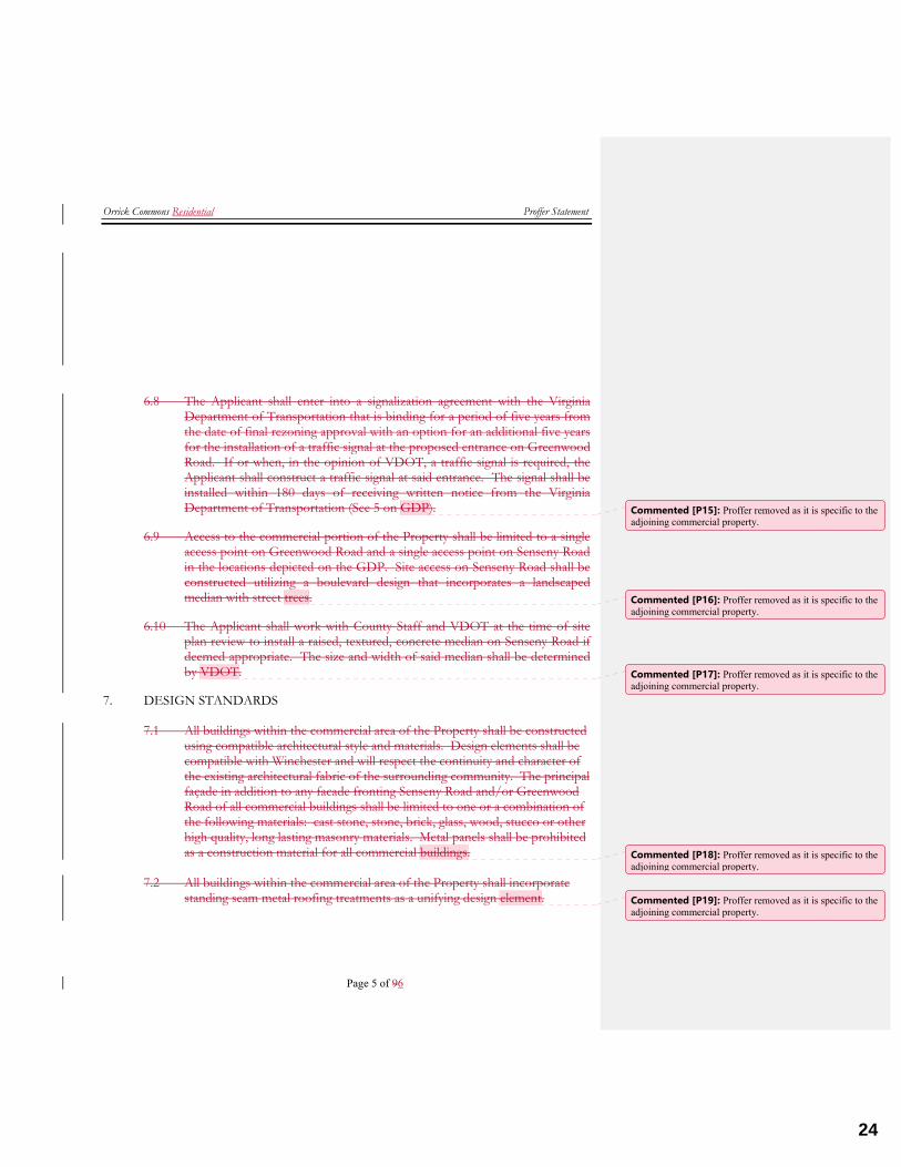
6.8 The Applicant shall enter into a signalization agreement with the Virginia Department of Transportation that is binding for a period of five years from the date of final rezoning approval with an option for an additional five years for the installation of a traffic signal at the proposed entrance on Greenwood Road. If or when, in the opinion of VDOT, a traffic signal is required, the Applicant shall construct a traffic signal at said entrance. The signal shall be installed within 180 days of receiving written notice from the Virginia Department of Transportation (See 5 on GDP).
6.9 Access to the commercial portion of the Property shall be limited to a single access point on Greenwood Road and a single access point on Senseny Road in the locations depicted on the GDP. Site access on Senseny Road shall be constructed utilizing a boulevard design that incorporates a landscaped median with street trees.
6.10 The Applicant shall work with County Staff and VDOT at the time of site plan review to install a raised, textured, concrete median on Senseny Road if deemed appropriate. The size and width of said median shall be determined by VDOT.
7. DESIGN STANDARDS
7.1 All buildings within the commercial area of the Property shall be constructed using compatible architectural style and materials. Design elements shall be compatible with Winchester and will respect the continuity and character of the existing architectural fabric of the surrounding community. The principal façade in addition to any facade fronting Senseny Road and/or Greenwood Road of all commercial buildings shall be limited to one or a combination of the following materials: cast stone, stone, brick, glass, wood, stucco or other high quality, long lasting masonry materials. Metal panels shall be prohibited as a construction material for all commercial buildings.
7.2 All buildings within the commercial area of the Property shall incorporate
standing seam metal roofing treatments as a unifying design element.
Commented [P15]: Proffer removed as it is specific to the adjoining commercial property.
Commented [P16]: Proffer removed as it is specific to the adjoining commercial property.
Commented [P17]: Proffer removed as it is specific to the adjoining commercial property.
Commented [P18]: Proffer removed as it is specific to the adjoining commercial property.
Commented [P19]: Proffer removed as it is specific to the adjoining commercial property.
24
Orrick Commons Residential Proffer Statement
Page 6 of 96
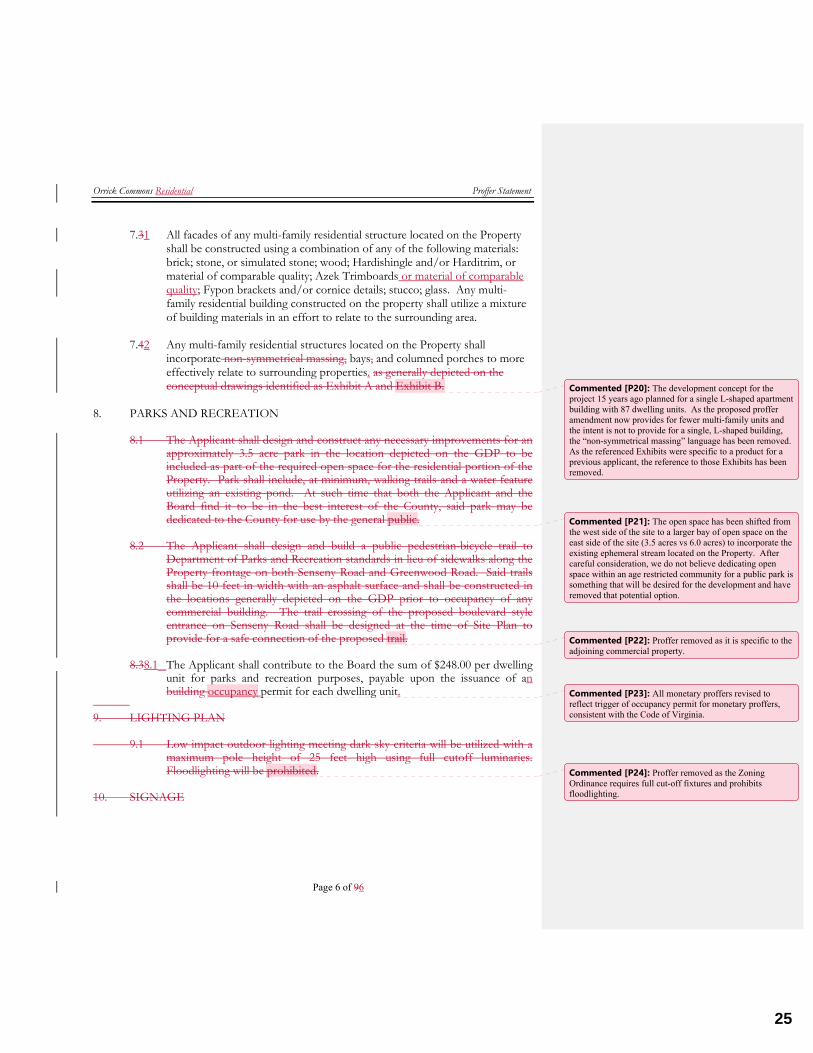
7.31 All facades of any multi-family residential structure located on the Property shall be constructed using a combination of any of the following materials: brick; stone, or simulated stone; wood; Hardishingle and/or Harditrim, or material of comparable quality; Azek Trimboards or material of comparable quality; Fypon brackets and/or cornice details; stucco; glass. Any multi-family residential building constructed on the property shall utilize a mixture of building materials in an effort to relate to the surrounding area.
7.42 Any multi-family residential structures located on the Property shall
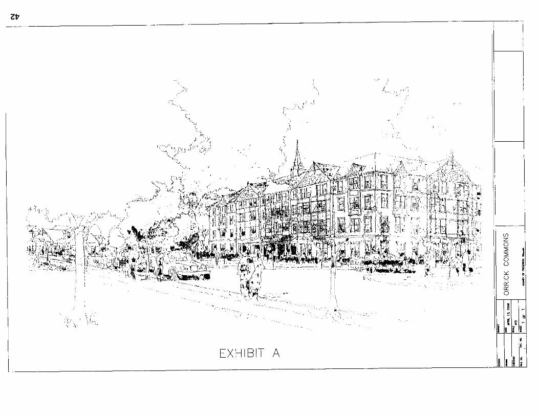
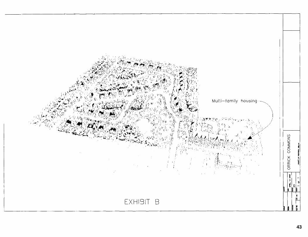
incorporate non-symmetrical massing, bays, and columned porches to more effectively relate to surrounding properties. as generally depicted on the conceptual drawings identified as Exhibit A and Exhibit B.
8. PARKS AND RECREATION
8.1 The Applicant shall design and construct any necessary improvements for an approximately 3.5 acre park in the location depicted on the GDP to be included as part of the required open space for the residential portion of the Property. Park shall include, at minimum, walking trails and a water feature utilizing an existing pond. At such time that both the Applicant and the Board find it to be in the best interest of the County, said park may be dedicated to the County for use by the general public.
8.2 The Applicant shall design and build a public pedestrian-bicycle trail to
Department of Parks and Recreation standards in lieu of sidewalks along the Property frontage on both Senseny Road and Greenwood Road. Said trails shall be 10 feet in width with an asphalt surface and shall be constructed in the locations generally depicted on the GDP prior to occupancy of any commercial building. The trail crossing of the proposed boulevard style entrance on Senseny Road shall be designed at the time of Site Plan to provide for a safe connection of the proposed trail.
8.38.1 The Applicant shall contribute to the Board the sum of $248.00 per dwelling
unit for parks and recreation purposes, payable upon the issuance of an building occupancy permit for each dwelling unit.
9. LIGHTING PLAN 9.1 Low impact outdoor lighting meeting dark sky criteria will be utilized with a
maximum pole height of 25 feet high using full cutoff luminaries. Floodlighting will be prohibited.
10. SIGNAGE
Commented [P20]: The development concept for the project 15 years ago planned for a single L-shaped apartment building with 87 dwelling units. As the proposed proffer amendment now provides for fewer multi-family units and the intent is not to provide for a single, L-shaped building, the “non-symmetrical massing” language has been removed. As the referenced Exhibits were specific to a product for a previous applicant, the reference to those Exhibits has been removed.
Commented [P21]: The open space has been shifted from the west side of the site to a larger bay of open space on the east side of the site (3.5 acres vs 6.0 acres) to incorporate the existing ephemeral stream located on the Property. After careful consideration, we do not believe dedicating open space within an age restricted community for a public park is something that will be desired for the development and have removed that potential option.
Commented [P22]: Proffer removed as it is specific to the adjoining commercial property.
Commented [P23]: All monetary proffers revised to reflect trigger of occupancy permit for monetary proffers, consistent with the Code of Virginia.
Commented [P24]: Proffer removed as the Zoning Ordinance requires full cut-off fixtures and prohibits floodlighting.
25
Orrick Commons Residential Proffer Statement
Page 7 of 96
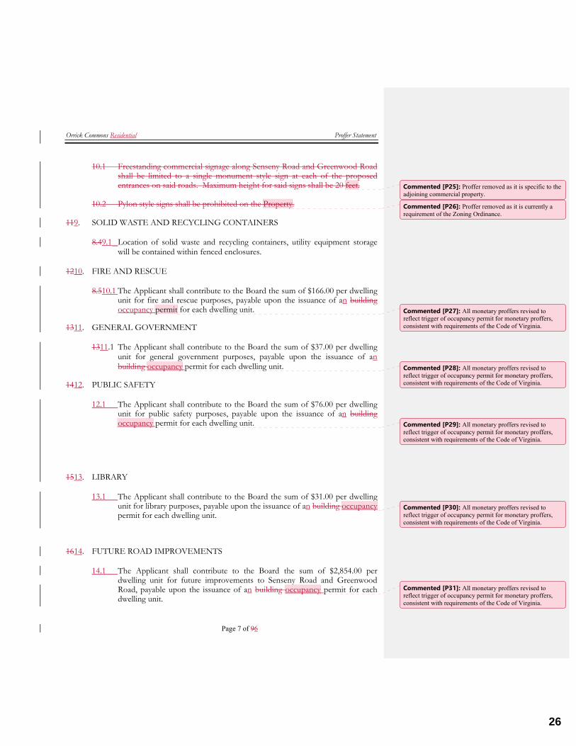
10.1 Freestanding commercial signage along Senseny Road and Greenwood Road shall be limited to a single monument style sign at each of the proposed entrances on said roads. Maximum height for said signs shall be 20 feet.
10.2 Pylon style signs shall be prohibited on the Property.
119. SOLID WASTE AND RECYCLING CONTAINERS
8.49.1 Location of solid waste and recycling containers, utility equipment storage will be contained within fenced enclosures.
1210. FIRE AND RESCUE
8.510.1 The Applicant shall contribute to the Board the sum of $166.00 per dwelling unit for fire and rescue purposes, payable upon the issuance of an building occupancy permit for each dwelling unit.
1311. GENERAL GOVERNMENT
1311.1 The Applicant shall contribute to the Board the sum of $37.00 per dwelling unit for general government purposes, payable upon the issuance of an building occupancy permit for each dwelling unit.
1412. PUBLIC SAFETY
12.1 The Applicant shall contribute to the Board the sum of $76.00 per dwelling unit for public safety purposes, payable upon the issuance of an building occupancy permit for each dwelling unit.
1513. LIBRARY
13.1 The Applicant shall contribute to the Board the sum of $31.00 per dwelling unit for library purposes, payable upon the issuance of an building occupancy permit for each dwelling unit.
1614. FUTURE ROAD IMPROVEMENTS
14.1 The Applicant shall contribute to the Board the sum of $2,854.00 per dwelling unit for future improvements to Senseny Road and Greenwood Road, payable upon the issuance of an building occupancy permit for each dwelling unit.
Commented [P25]: Proffer removed as it is specific to the adjoining commercial property.
Commented [P26]: Proffer removed as it is currently a requirement of the Zoning Ordinance.
Commented [P27]: All monetary proffers revised to reflect trigger of occupancy permit for monetary proffers, consistent with requirements of the Code of Virginia.
Commented [P28]: All monetary proffers revised to reflect trigger of occupancy permit for monetary proffers, consistent with requirements of the Code of Virginia.
Commented [P29]: All monetary proffers revised to reflect trigger of occupancy permit for monetary proffers, consistent with requirements of the Code of Virginia.
Commented [P30]: All monetary proffers revised to reflect trigger of occupancy permit for monetary proffers, consistent with requirements of the Code of Virginia.
Commented [P31]: All monetary proffers revised to reflect trigger of occupancy permit for monetary proffers, consistent with requirements of the Code of Virginia.
26
Orrick Commons Residential Proffer Statement
Page 8 of 96
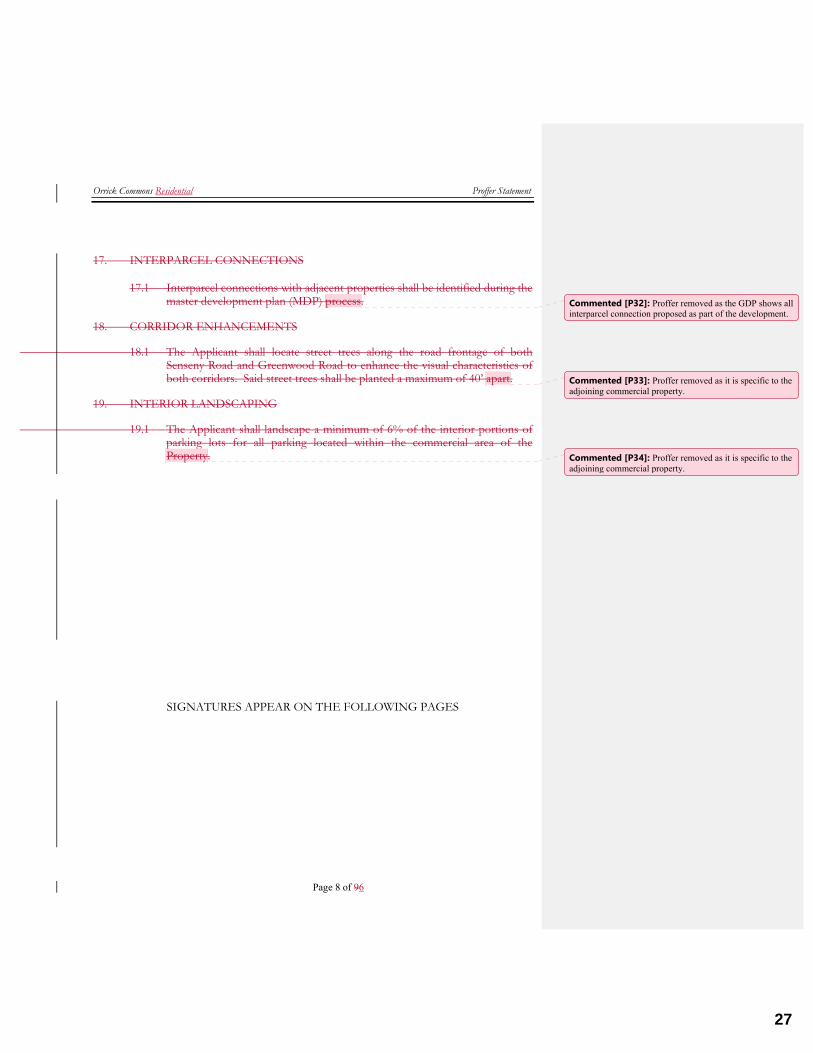
17. INTERPARCEL CONNECTIONS
17.1 Interparcel connections with adjacent properties shall be identified during the master development plan (MDP) process.
18. CORRIDOR ENHANCEMENTS
18.1 The Applicant shall locate street trees along the road frontage of both Senseny Road and Greenwood Road to enhance the visual characteristics of both corridors. Said street trees shall be planted a maximum of 40’ apart.
19. INTERIOR LANDSCAPING
19.1 The Applicant shall landscape a minimum of 6% of the interior portions of parking lots for all parking located within the commercial area of the Property.
SIGNATURES APPEAR ON THE FOLLOWING PAGES
Commented [P32]: Proffer removed as the GDP shows all interparcel connection proposed as part of the development.
Commented [P33]: Proffer removed as it is specific to the adjoining commercial property.
Commented [P34]: Proffer removed as it is specific to the adjoining commercial property.
27
Orrick Commons Residential Proffer Statement
Page 9 of 96
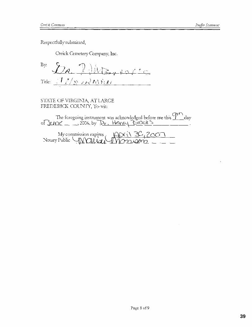
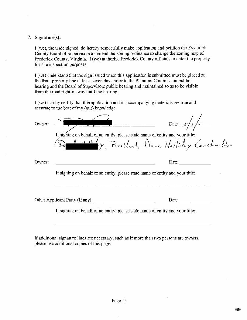
Respectfully submitted, Orrick Cemetery CompanyDave Holliday Construction, Inc. By:
Title: STATE OF VIRGINIA, AT LARGE FREDERICK COUNTY, To-wit: The foregoing instrument was acknowledged before me this day of , 20062021, by .
My commission expires Notary Public
28
Orrick Commons Residential Proffer Statement
Page 10 of 96
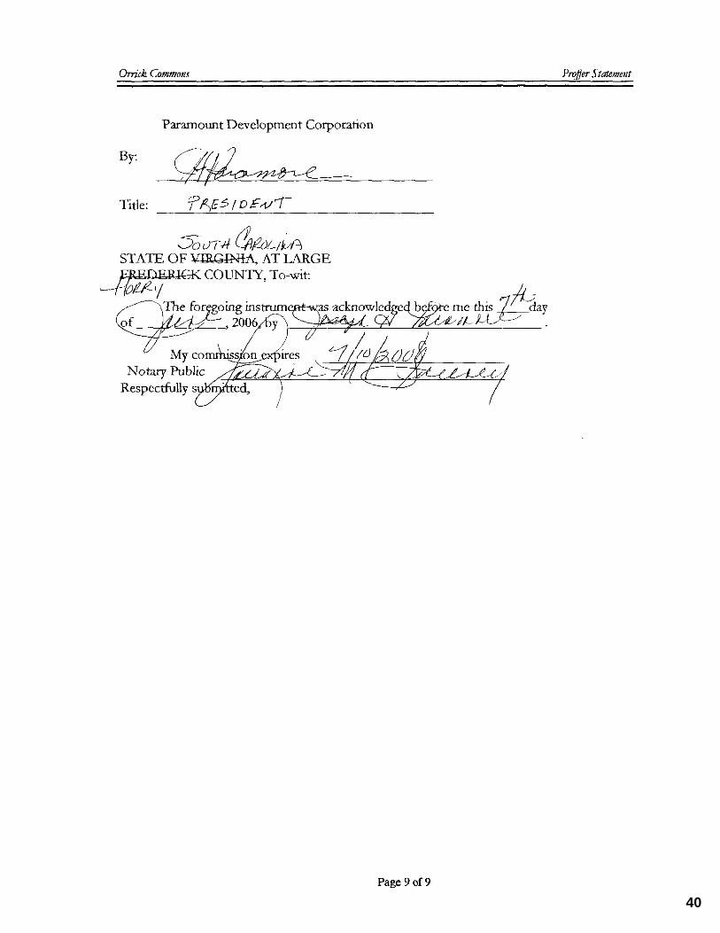
Paramount Development Corporation By:
Title: STATE OF VIRGINIA, AT LARGE FREDERICK COUNTY, To-wit: The foregoing instrument was acknowledged before me this day of , 2006, by .
My commission expires Notary Public
Respectfully submitted,
29
30
31
32
33
34
35
36
37
38
39
40

41
42
43
44
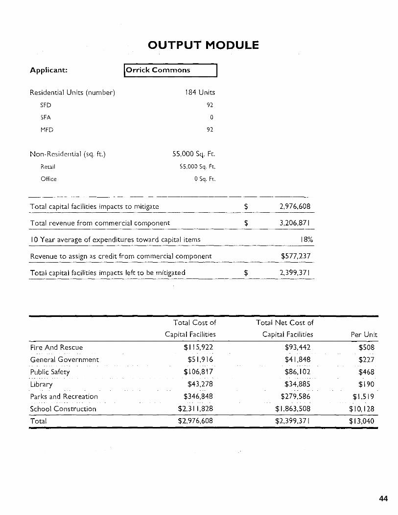
ORRICK COMMONS RESIDENTIAL
Proffer Amendment – Impact Statement – 8/6/21
Background and Summary of Proposed Revisions
On June 24, 2006, the Frederick County Board of Supervisors (the “BOS”) approved Rezoning Application 04‐06 for Orrick Commons (the “2006 Rezoning”). The Orrick Commons property is located in the NE quadrant of the intersection of Senseny Road and Greenwood Road and the 2006 Rezoning provided for 22.06 Acres of commercial and 33.61 acres of age‐restricted residential. The residential portions of the project, identified by Frederick County as tax map parcel 55‐A‐201B (the “Property”), provides for the final connection of Farmington Boulevard between the existing Lynnehaven and Steeplechase Subdivisions. This proposed proffer amendment applies only to the 33.61 acre residential area of the project, as identified on the location map attached as Exhibit A, and proposes the following primary changes to the existing approval: A. Housing Types The 2006 Rezoning permits a mixture of single family (attached and detached) as well as multifamily housing types. The 2006 Rezoning does not limit the maximum number of dwelling units permitted on the Property, so the maximum permitted currently by the RP zoning district regulations would be 201 dwelling units. The proposed proffer amendment would limit the maximum number of residential units to 170. In addition, the proposed proffer amendment provides additional detail on housing types, limiting multi‐family housing on the project to a maximum of 48 units. The proposed proffer amendment maintains the age‐restricted requirement for all dwelling units. B. Project Layout The proposed proffer amendment includes a revised Generalized Development Plan (GDP) providing additional detail for the layout of the project. As shown on the GDP, the multi‐family area of the project remains consistent with the 2006 Rezoning. Housing types for the perimeter of the site are now limited to single family detached dwellings, providing for a better transition with the existing, adjoining subdivisions. Age‐restricted townhomes would then be located internal to the site. A proffered interparcel connection between the residential area and the adjoining commercial area is also maintained. A side‐by‐side comparison of the existing and proposed GDP is provided as Exhibit B. C. Community Park/Open Space Area As shown on the existing GDP for the 2006 Rezoning, the development planned previously included a 3.5 acre open space/community park area along the eastern limits of the site. This
45
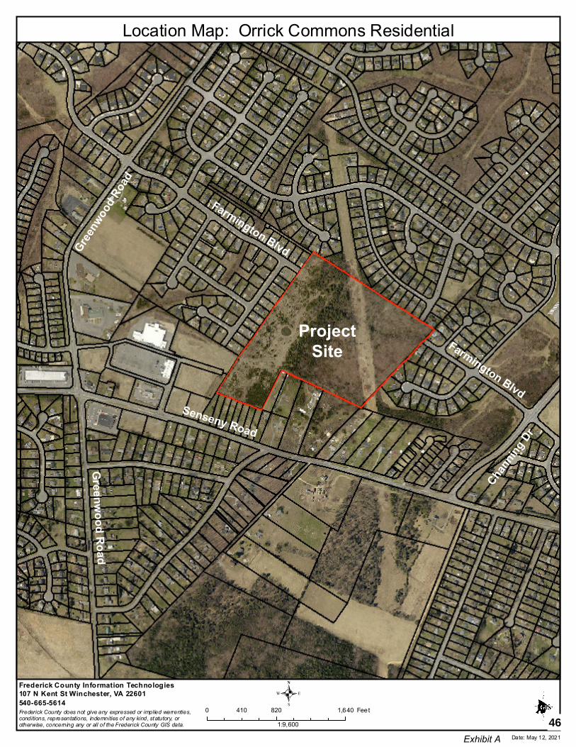
Location Map: Orrick Commons Residential
Frederick County Information Technologies107 N Kent St Winchester, VA 22601540-665-5614Frederick County does not give any expressed or implied warrenties,conditions, representations, indemnities of any kind, statutory, or otherwise, concerning any or all of the Frederick County GIS data.
.0 820 1,640410 Feet
1:9,600Date: May 12, 2021
ProjectSite
Senseny Road
Green
wood
Road
Farmington Blvd
Farmington Blvd
Chann
ing D
r
Greenw
ood Road
Exhibit A
46
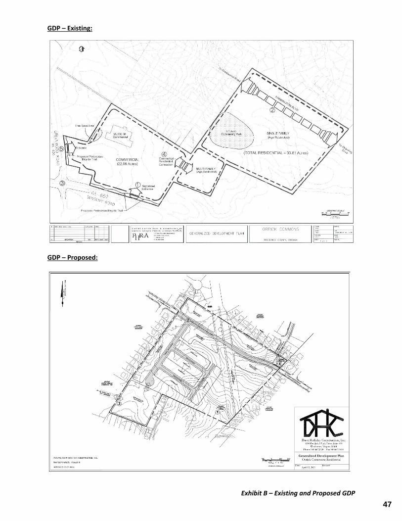
Exhibit B – Existing and Proposed GDP
GDP – Existing:
GDP – Proposed:
47
area included an existing, shallow farm pond. A wetland delineation of the site identified an existing ephemeral stream channel on the western portions of the Property. The proposed development plan, as shown on the proposed GDP, would locate a larger open space area on the western portions of the Property with the proposed proffer statement prohibiting disturbance of the stream channel. The proffer statement associated with the 2006 Rezoning provided the option, if agreed to by both Frederick County and the owner of the Property, for the open space/community park area to be dedicated to the County. With the project being age restricted, the current owner of the Property would not desire to dedicate land within the project to the County for a public park. Accordingly, that proffer has been removed. Age‐appropriate recreation amenities would be provided within the project consistent with current Zoning Ordinance requirements. With the configuration provided by the proposed GDP, the new development plan utilizes land more efficiently, allowing for additional open space with protection of the existing ephemeral stream channel and, ultimately, less impervious area and its associated impacts to stormwater management. D. Multi‐family Residential The area planned for multi‐family residential units mirrors that from the 2006 Rezoning Application, with those units located as a transition between the commercial and single family areas. In 2006, the intended development plan included a single, large building for the multi‐family units. The master development plan previously approved for the project provided for up to 87 multi‐family units. The 2006 Rezoning included a building materials palette for multi‐family units as well as elevations to depict additional requirements, such as “non‐symmetrical massing”. The 87‐unit building planned for as part of the 2006 rezoning included an “L” shape to its layout, thus the proffer for “non‐symmetrical massing”. As the proposed development plan reduces the total number of age‐restricted multi‐family units to 48, the proposed proffer statement removes the elevation exhibits and proffered “non‐symmetrical massing”, but maintains the design materials palette for the units as well as other proffered requirements associated with the 2006 Rezoning, including the requirement for bays and columned porches.
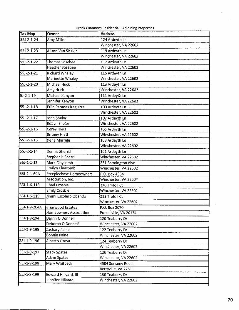
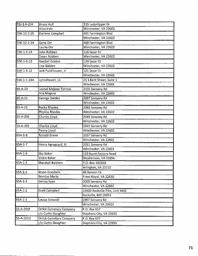
Adjoining Properties
Adjoining properties include single family detached dwellings within the Steeplechase, Briarwood Estates, and Lynnhaven subdivisions as well as single family detached dwellings fronting Senseny Road and the Orrick Commons commercial development to the west. By locating family detached and open space areas along the common boundaries with the adjoining subdivisions, the project provides for a transition from the existing adjoining subdivisions. The age‐restricted multifamily housing is located immediately adjoining the existing Orrick Commons commercial land bay serving as a transition from the commercial uses to the single family detached and attached product proposed within the Property.
48
Impacts to Community facilities The proposed proffer amendment results in a net decrease of units from those permitted by the 2006 Rezoning, so impacts to community facilities associated with this application will be unaffected or less than those approved as part of the 2006 Rezoning. The existing monetary proffers for community facilities as well as transportation improvements remain unchanged from the 2006 Rezoning. A. Public Schools The application proposes no changes to the age restricted designation for all dwelling units within the project, resulting in no impacts to public school facilities. B. Trash Service The project will utilize private refuse collection services administered by the HOA, which will result in limited impacts to the Greenwood convenience center. C. Sewer and Water Facilities The project will serve to connect the existing water mains within the Steeplechase, Briarwood Estates, and Lynnhaven subdivisions. This will provide for additional loops/redundancy within the system. For 170 dwelling units, using an average of 200 gallons per day, the expected water and sewer demands for the subdivision are 34,000 gallons per day. Sewer will be provided by connection to the existing main within the Lynnhaven subdivision, immediately adjoining the project area, which will convey sewage flows to the Opequon Wastewater Reclamation Facility. D. Traffic The project provides for the construction of Farmington Boulevard, which will finalize the connection of this planned minor collector road from Channing Drive to Greenwood Road. In addition, the proffer statement includes a monetary contribution of $2,854.00 per dwelling unit for transportation improvements within the vicinity of the site. E. Emergency Services Emergency services for the site will be provided by Greenwood Fire and Rescue. The construction of Farmington Boulevard through the site will provide for additional connectivity for emergency response vehicles serving the area. F. Stormwater The site generally flows from West to East. Stormwater design for the site will fall under the latest regulations, providing for both quantity and quality controls.
49
COUNTY of FREDERICK
Department of Planning and Development 540/ 665-5651
Fax: 540/ 665-6395
June 15, 2021 Mr. Patrick Sowers Dave Holliday Construction Inc. 420 W. Jubal Early Drive, Suite 103 Winchester, Virginia 22601 RE: Proposed Rezoning for Orrick Commons Residential Property Identification Numbers (PIN): 55-A-201B Dear Patrick, I have had the opportunity to review the draft rezoning application for Orrick Commons. This application seeks to rezone 33.61 acres from the RP (Residential Performance) District with proffers to the RP District with revised proffers. Prior to formal submission to the County, please ensure that these comments and all review agency comments are adequately addressed. At a minimum, a letter describing how each of the agencies and their comments have been addressed should be included as part of the submission.
1. Senseny Eastern Frederick Urban Area Land Use Plan. The 2035 Comprehensive Plan and the Senseny Eastern Urban Area Land Use Plan provide guidance on the future development of the property. The Plan identifies this property with a residential land use designation; the property is also within the limits of the Sewer and Water Service Area and the Urban Development Area. The existing/proposed zoning is generally consistent with the goals of the Plan.
2. Impact Statement. Provide an impact statement with this rezoning per §165-102.05.
3. Proffer 6.3. Proffer 6.3 should include the Property Identification Number for the referenced commercial property or refer to the proffer statement that applies to the referenced property.
4. Capital Impact Model. The proposed proffer statement shows the monetary proffers that were approved with the original rezoning. The rezoning does not account for the updated impacts shown in the Frederick County Capital Impact Model – please see the attached.
50
Preliminary Rezoning Comments Orrick Commons Residential June 15, 2021 Page 2
5. Transportation Comments. Please note that the transportation comments on the rezoning application from John Bishop, Assistant Director - Transportation, are being provided to you in a separate letter. Staff may also provide additional comments related to the proposed changes if warranted subject to adjustments requested by VDOT.
6. Agency Comments. Please provide appropriate agency comments from the following agencies: Virginia Department of Transportation, Frederick County Department of Public Works, Frederick County Parks and Recreation, Frederick County Fire Marshal, Frederick Water, Frederick County Transportation, and the County Attorney.
7. Fees. Based on the fees adopted by the Board of Supervisors, the rezoning fee for this application would be $13,361 based upon acreage of 33.61 acres.
All of the above comments and reviewing agency comments should be appropriately addressed before staff can accept this rezoning application. Please feel free to contact me with questions regarding this application. Sincerely,
Candice E. Perkins, AICP, CZA Assistant Director CEP/pd
51
52
53
54
55
����������� ���������� ��� ��������������������� ��� ���������������������� ������������ ����!"�� " ���#$%&'()*+,'-%&,./012(&3*24054'4)*5&26 7,/8�9,'�:;8�:<:=�)3�>?@A�BC7&?�D)304E-�F&G/0.�#H)304E-0.&G/0.15I)4J*E&I6KE?�LM4.%&H1NE2)*,.8�O$455J/I)'8�P0)(J/QO�#M0)(J/Q*0455J/I)'12(&3*24054'4)*5&268�RJ&Q(�S'50)I#JJ&Q(*4'50)I12(&3*24054'4)*5&26 �T�U��VTW���!���UW����U�X�W=Y<A=�ZJ(�[)JJ/Q�D4-/\(4'M,058�[B�::>:Y�]_�abcde�f�ghij�cklcb�mnd�occp�qaprsqtcr�ua�tmc�i lqv�waxxapd�ycdlrcpzn{�yc|aplp}�rntcr�]n~���e�����_��jmc�raqsxcptnzap�bltmlp�tmcn��{lqnzap�ta�c|apc�tmld��a�ct~�n��cnd�ta�mnkc�{l�{c�xcndsno{c�lx�nqt�ap�yastc�������ccpbaar�yanr��npr�yastc�������nxlp}tap��as{cknr�_��jmcdc�nc�tmc�ghij�anrbn~d�bmlqm�mnkc�occp�qapdlrccr�nd�nqqcdd�ta�tmc�cuccpqcr��a�ct~_��ghij�ld�dnzd�cr�tmc�tnpd�atnzap��a�cd�a�ccr�lp�tmc�i lqv�waxxapd�ycdlrcpzn{�yc|aplp}�n��{lqnzap�rntcr�]n~���e�����nrrcdd�tnpd�atnzap�qapqcpd�nddaqlntcr�bltm�tmld�c�scdt_��u�~as�mnkc�np~��scdzapd�a�pccr�ustmc�lpuaxnzape��{cndc�ra�pat�mcdltntc�ta�qaptnqt�xc_�yc}nrde� �����X������������������������ ¡���¢���¡�£¤¢ �¥�¦¡���§�©ªª¡§��«������¬¦�®°�©���±�����²¡³��«���¡�£¤¢ �±µ��¶¶·¶®²����¹º®»º°®»°¶®�«�¼�½�¹º®»¾·®»º¿À���¡�Á������»Â� ¢��Ã����»�¡¢ ¡�¡�» ���56
57
58
59
60
61
62
����������� ���������� ��� ��������������������� ���������������� !"#$%&'()�*+ ,-�.�/-)�0.�'1'&�2*�&134&�56,73�82*9:"%�;7��9$��#2*9:"%9$7��9$ <=2:>("7=+?"3�@2A:B�;7A:)���;7A:)�B !"#$%&'()�*+.�5>�C9)B79!!��79)B79!2 !"#$%&'()�*+.�/7D)�E9-FF$��E9-FF$G !"#$%&'()�*+.?2>A:)�@2A:$��B2A:$" !"#$%&'()�*+.�,H>�9�I>�:)��*%>�:) !"A2(-$+JKLMNOPQRSST�USMVNVWXYZ�[MMNOP�\SUUSVZ�]N�_�MLKNVNVW�NLZ�KW�MZLMNOLT�ZLKLaZQ�b\Jc�SddMZ�VS�OSUU VLZXefKVPZX�gKhV��iVVLf�gKhV�j Q�kMXQ�YjlJQ�jllm�YJ\SSMTNVKLSM�Sd�JKVVNVW�KVT�mn SoU VL�bMTMNOP�\SaVLh�Ja_NO�cOfSSZ&p&4�5=D�9$*�;*9��*q:)"D�$*�9.�r5��''s1&^ ]tdOoZPuvXVLwSddNOx�yz{|}}v|~�������vz�wO^x�yz{|~~~|v�zu������������������������������������������������������������������������������������������������������������������������������������������������� ������������������¡��������������¢����� ��£¤����¤���������������������¥��������������¥�������������¥���� ��������������£¡�����������������������������������������������������������¥����������� �������������������������������������������¤���������������������������¥������������������������������������������������������������¡�����������������������������¥����¥¦�������§�����������������������������������
63

64
65
66
67
68
69
70
71
72

73
74
Planning CommissionAgenda Item Detail Meeting Date: September 1, 2021 Agenda Section: Information/Discussion Items
Title: Update to the Frederick County Comprehensive Plan - (Ms. Perkins)
Attachments:PC09-01-21ThePlanDraft.pdfPC09-01-21AppendixIDraft.pdfPC09-01-21AppendixIIDraft.pdf
75
THE COMPREHENSIVE PLAN
FOR FREDERICK COUNTY
Adopted by the Frederick County Board of Supervisors – TBD
Frederick County, Virginia Life at the Top
76
FREDERICK COUNTY, VIRGINIA
THE COMPREHENSIVE PLAN FOR FREDERICK COUNTY
1
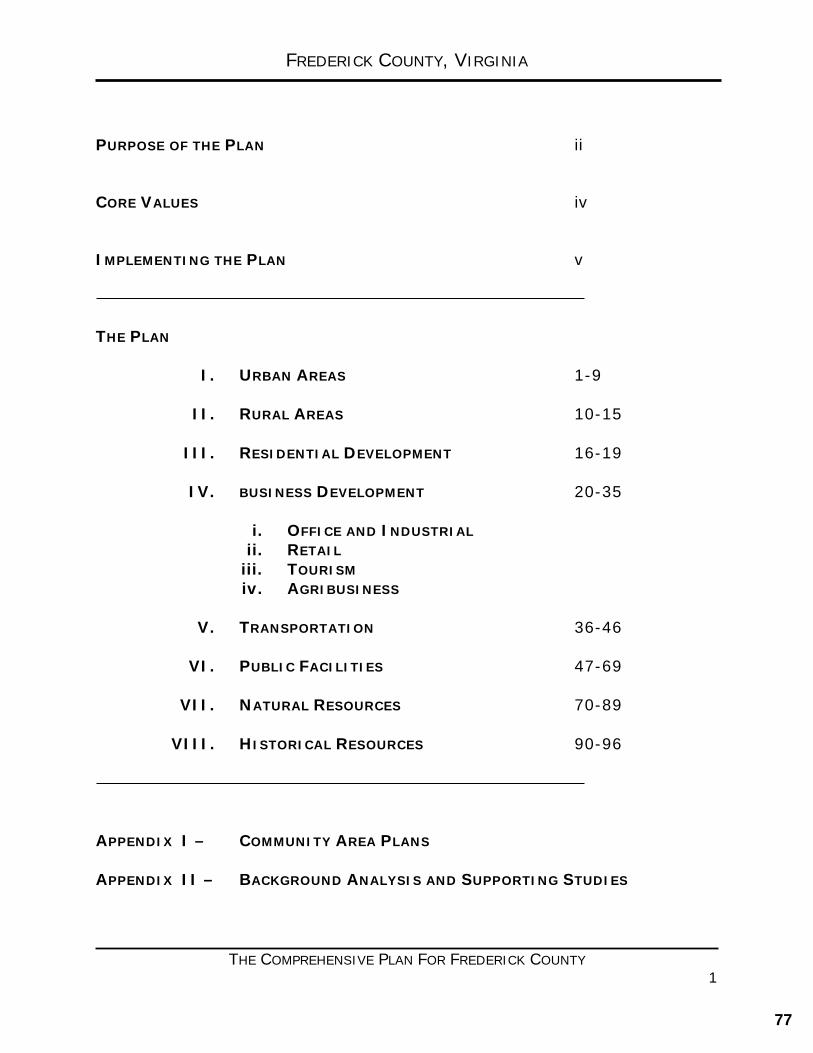
PURPOSE OF THE PLAN ii CORE VALUES iv IMPLEMENTING THE PLAN v THE PLAN
I. URBAN AREAS 1-9
II. RURAL AREAS 10-15
III. RESIDENTIAL DEVELOPMENT 16-19
IV. BUSINESS DEVELOPMENT 20-35
i. OFFICE AND INDUSTRIAL ii. RETAIL
iii. TOURISM iv. AGRIBUSINESS
V. TRANSPORTATION 36-46
VI. PUBLIC FACILITIES 47-69
VII. NATURAL RESOURCES 70-89
VIII. HISTORICAL RESOURCES 90-96 APPENDIX I – COMMUNITY AREA PLANS APPENDIX II – BACKGROUND ANALYSIS AND SUPPORTING STUDIES
77
INTRODUCTION
THE 2035 COMPREHENSIVE PLAN i
INTRODUCTION
• PURPOSE OF THE PLAN
• CORE VALUES
• THE CODE OF VIRGINIA – LEGAL BASIS FOR THE PLAN
• IMPLEMENTING THE PLAN
• COMPREHENSIVE PLAN AMENDMENTS
“THE 2035 COMPREHENSIVE PLAN IS THE GUIDE FOR THE FUTURE GROWTH OF FREDERICK
COUNTY.”
78
INTRODUCTION
THE 2035 COMPREHENSIVE PLAN ii
PURPOSE OF THE PLAN The 2035 Frederick County Comprehensive Plan (The Plan) addresses the future growth of Frederick County for its citizens, highlights its rich history, and strives to further this great community. The Plan is guided by the Vision Statement and Core Values crafted and adopted by the Frederick County Board of Supervisors. The Plan is a vital tool that provides direction for future growth, aimed at ensuring orderly well-planned development to promote, preserve and protect the health, safety, general welfare, and quality of life for the citizens and businesses of Frederick County. Comprehensive Plans are general in nature; their purpose is not to regulate, but rather to guide land use, transportation, public facilities, infrastructure, and resources decisions. The Comprehensive Plan is a living document that focuses on the next twenty years by providing guidance for development decisions. The Plan should be amended in response to new information or changes in circumstances, without straying from its underlying vision and goals. The 2035 Comprehensive Plan is the guide for the future growth of Frederick County. PUBLIC PARTNERSHIPS, INPUT, AND OUTREACH 2030, 2035 COMPREHENSIVE PLANS & THE 2021 UPDATE The 2030 Comprehensive Plan was a significant and rewarding undertaking in 2010 and 2011; this document provided a foundation for the 2035 Comprehensive Plan (update adopted in 2017) The County’s 2035 Comprehensive Plan was guided by the Frederick County Planning Commission, through the efforts of the Comprehensive Plans and Programs Committee (CPPC) and with the assistance of the BlueRibbon Panel and the Frederick County Department of Planning and Development Staff. In 2010 the County began a complete rewrite of the Plan, which was completed and adopted 2011 (2030 Comprehensive Plan). This endeavor involved public outreach meetings and collaboration with citizen volunteers who assisted with drafting new chapters. This document provided a foundation for the 2035 Comprehensive Plan (update adopted in 2017) and this 2021 update. This updated Plan was guided by the Frederick County Planning Commission, through the efforts of the Comprehensive Plans and Programs Committee (CPPC) and the Frederick County Department of Planning and Development Staff. This Plan will continue to guide the County as it seeks to implement the County’s vision as expressed by the Board of Supervisors. The public outreach for this project included: a project webpage, County social media which provided on-going updates, and traditional public input meetings and public hearings held in the June of 2016. The purpose of these meetings was to present elements of the Plan to the public for their information, and to seek additional public input and perspective. In addition to Staff, members of the Planning Commission and Board of Supervisors were in attendance to hear feedback first-hand and engage in a direct dialogue with citizens. The Comprehensive Plans and Programs Committee (CPPC) members collaborated with a large group of citizen volunteers whose goal was to update the various chapters of the Comprehensive Plan. Following an initial kick-off meeting in June 2015, the working groups met frequently throughout the winter of 2015-2016. For the 2035 Plan update, the Frederick County Sanitation Authority (FCSA) was involved to provide additional input. A series of public
79
INTRODUCTION
THE 2035 COMPREHENSIVE PLAN iii
informational and input meetings was held in June 2016 at various locations around the Community. The purpose of these meetings was to present draft elements of the Plan to the public for their information, and to seek additional public input and perspective through a facilitated discussion using targeted questions and open dialogue. In addition to Staff, members of the Planning Commission and Board of Supervisors were in attendance to hear feedback first-hand. Public feedback was also solicited throughout the update through the project page on the County website. Online, citizens and stakeholders were also able to review draft documents, maps and respond to targeted questions regarding the future of their Community. Based upon the work of all of the participants, the 2035 Comprehensive Plan was updated and presented to the Planning Commission and Board of Supervisors during a joint meeting in August 2016 and subsequently through the public hearing process in January of 2017. The updated 2035 Comprehensive Plan will continue to guide the County as it seeks to implement the County’s vision as expressed by the Board of Supervisors.
80
INTRODUCTION
THE 2035 COMPREHENSIVE PLAN iv
CORE VALUES The Frederick County Board of Supervisors provided the framework for the 2035 Comprehensive Plan. The Plan’s future focus, goals, and strategies were crafted to reflect the Vision Statement and Core Values of the Board of Supervisors, approved on December 9, 2009. Board of Supervisors Vision Statement: “Ensuring the quality of life of all Frederick County Citizens by preserving the past and planning for the future through sound fiscal management.”
Board of Supervisors Core Values:
• A government that is accountable and dedicated to providing responsible stewardship for County funds and to ensure the citizens receive the best services possible for the funds expended.
• A government concerned with long range planning that protects our rural heritage and directs its future growth through planned infrastructure.
• A government concerned with expanding commercial and industrial tax base in order to insure a viable and thriving economy.
• A government that looks to the future and implements plans to ensure that the quality of life for future generations is preserved.
• A government that emphasizes a quality education through a cooperative effort with the School Board.
• A government that recognizes the importance of maintaining a highly trained public safety program to provide efficient services and protection to County citizens.
• A government that promotes the spirit of cooperation with its regional local government partners and, in particular, the City of Winchester.
• A government unit based on honesty, trust, integrity, and respect that understands the importance of clear communication and a willingness to listen.
81
INTRODUCTION
THE 2035 COMPREHENSIVE PLAN v
THE CODE OF VIRGINIA - LEGAL BASIS FOR THE PLAN The Code of Virginia (Section 15.2-2223) requires localities to adopt a comprehensive plan for the physical development of jurisdictions. The code requires that consideration be given to existing conditions and growth trends. The purpose of a plan is to guide and accomplish a coordinated development of the jurisdiction to promote the health, safety, prosperity, and general welfare of the community. The plan should be used to protect and enhance the high quality of life our citizens enjoy today, and the probable needs of future county citizens, in order to maintain that quality of life in the foreseeable future. A comprehensive plan provides a blueprint for the future by laying out a framework for growth and development. It establishes goals, objectives, policies and implementation techniques that will provide the tools to help the decision makers guide the County’s future development. The plan coordinates transportation, utilities, schools and other public infrastructure needs with anticipated growth and development. As required by the Code, the plan must be reviewed at least every five years and may be amended as necessary.
IMPLEMENTING THE PLAN
The Plan contains chapters that focus on particular aspects of the County’s Vision for the Future. The chapters of The Plan address: Urban Areas, Rural Areas, Residential Development, Business Development, Transportation, Public Facilities, Natural Resources, and Historic Resources. The chapters of The Plan are simple, each describes where we are today and where we want to be in 2035 we see ourselves in the future. The Chapters they provide goals and strategies of implementation, and they illustrate the benefits of the implementation of this focus for the future. Each of the chapters that make up the Plan have been structured to provide goals for where we desire the Community to be in 2035 and strategies that provide guidance on how to get there. The ultimate goal is to make the Plan implementable, and by extension, achieve the Community’s vision for the future of Frederick County. In determining the focus of the Plan, the stakeholder working groups evaluated the current conditions in their area of expertise, and then looked to the future; 2035. They evaluated potential community benefits of various approaches and revised goals and strategies accordingly. Working with community partners and a variety of key stakeholders in the creation of the Plan has resulted in a well-crafted, insightful, and much improved Plan. The continued involvement of a variety of relevant community partners, key stakeholders, and the public in the future will ensure the successful implementation of the Plan. The Plan is supported by two Appendices:
82
INTRODUCTION
THE 2035 COMPREHENSIVE PLAN vi
Appendix I includes the County’s Area Plans, these area plans are the key land use planning documents which implement the policies of the Comprehensive Plan in specific, geographic areas of the County. The Area Plans, Appendix I of the 2035 Comprehensive Plan, will be a are the primary implementation tool and are will be instrumental in future planning efforts of the County. Developed over the past couple of decades, the individual Area Plans have helped to guide the growth and development of areas of the County experiencing growth pressures. In the future, the Area Plans will be used as a guide in making land use decisions that meet anticipated growth demands, assure a viable community, and maintain a high quality of life for its citizens. Appendix II provides background analysis and studies in support of The Plan. SUPPORTING PLANNING DOCUMENTS In addition to the comprehensive plan, other tools utilized to manage the County’s growth and development include, but are not limited to the Official Zoning Map, the Zoning and Subdivision Ordinances, Rezonings, Subdivision and Site Plan Regulations, and the Capital Improvement Plan (CIP). Frederick County will utilize all available planning tools. To ensure that as new areas of urban uses are established, roads and public facilities of sufficient capacity are provided to serve the new urban areas. Rezoning requests should be evaluated to determine their potential impacts on transportation and public facilities. Applicants will be expected to contribute a reasonable portion of the costs of new or expanded infrastructure needed to serve their proposed development. Costs to the County should be estimated in terms of what impact the development, which could result from the proposed rezoning, would have on public facilities and infrastructure. Such contributions can be in the form of cash, dedicated land, or constructed improvements or in any other manner consistent with the Code of Virginia.
Rezoning requests should not be approved unless the net impacts on public facilities are positive, or unless the negative impacts can be adequately mitigated through proffered contributions or other acceptable means. A request for rezoning may also be turned down even though all fiscal impacts appear to be addressed.
The Plan is also a key resource for developing the County’s Capital Improvement Plan (CIP). The CIP is a capital facilitates planning document which consists of a schedule of major capital expenditures for the County for the ensuing five years. The CIP is updated each year as projects are completed, priorities change, or new projects are added. The CIP is based on the guidelines outlined by the Comprehensive Plan and uses those guidelines to implement a balanced approach for the planning and development of capital projects. The scheduling of projects needs to be coordinated with the 2035 Comprehensive Plan. The CIP helps to guide development, and to maintain a stable financial program. The Comprehensive Plan may be used as a tool to aid in determining priorities among projects, for estimating required funding, and for scheduling projects. Adopted annually, the Capital Improvements Plan becomes a component part of the Comprehensive Plan.
83
INTRODUCTION
THE 2035 COMPREHENSIVE PLAN vii
THE CODE OF VIRGINIA The Code of Virginia requires that the Comprehensive Plan be reviewed every five years. The local Planning Commission is responsible for drafting and developing the plan, while the local governing body is required to adopt a Comprehensive Plan. The Code calls for the comprehensive plan to be drafted for the purpose of: “guiding and accomplishing a coordinated, adjusted and harmonious development of the territory which will, in accordance with present and probable future needs and resources, best promote the health, safety, morals, order, convenience, prosperity and general welfare of the inhabitants.” Frederick County meets this requirement of the Code of Virginia and, further, believes that the planning process should be a continuous and evolving effort. The Comprehensive Plan may be revisited from time to time through the Comprehensive Policy Plan Amendment process or, as directed by the Board of Supervisors, through the individual Area Plans or specific studies. Frederick County will continue to meet, and strives to exceed, those requirements of the Code of Virginia that pertain to Urban Development Areas; 15.2-2223.1. The Frederick County Board of Supervisors has reaffirmed that the 2035 Comprehensive Plan, and its supporting documents, accommodates growth in a manner consistent with the requirements for Urban Development Areas as described in the Code of Virginia. In addition, the transportation elements of the 2035 Comprehensive Plan have been reviewed by the Virginia Department of Transportation (VDOT) in accordance with 15.2-2222.1. COMPREHENSIVE PLAN AMENDMENT PROCESS The Code of Virginia, Section 15.2-2229, states that the Board of Supervisors may consider amendments to its Comprehensive Plan. If an application is determined to be inconsistent with the Comprehensive Plan, an amendment to the Comprehensive Plan may be considered. The application will be reviewed by the Planning Commission for consistency with the elements contained within the Plan. With requests to amend the Plan, applicants should demonstrate any change in land use designation, density, or intensity:
• Would benefit the public health, safety, and welfare. • Is consistent with the Goals, Objectives, and Policies of the Comprehensive Plan. • Will not be detrimental to uses of property in the immediate vicinity of the subject
property. • Has merit and value for the community as a whole. • Will result in benefits (fiscal, aesthetic, employment, etc.) that will outweigh any
significant impact of the change.
84
URBAN AREAS
THE COMPREHENSIVE PLAN FOR FREDERICK COUNTY 1
I. URBAN AREAS
85
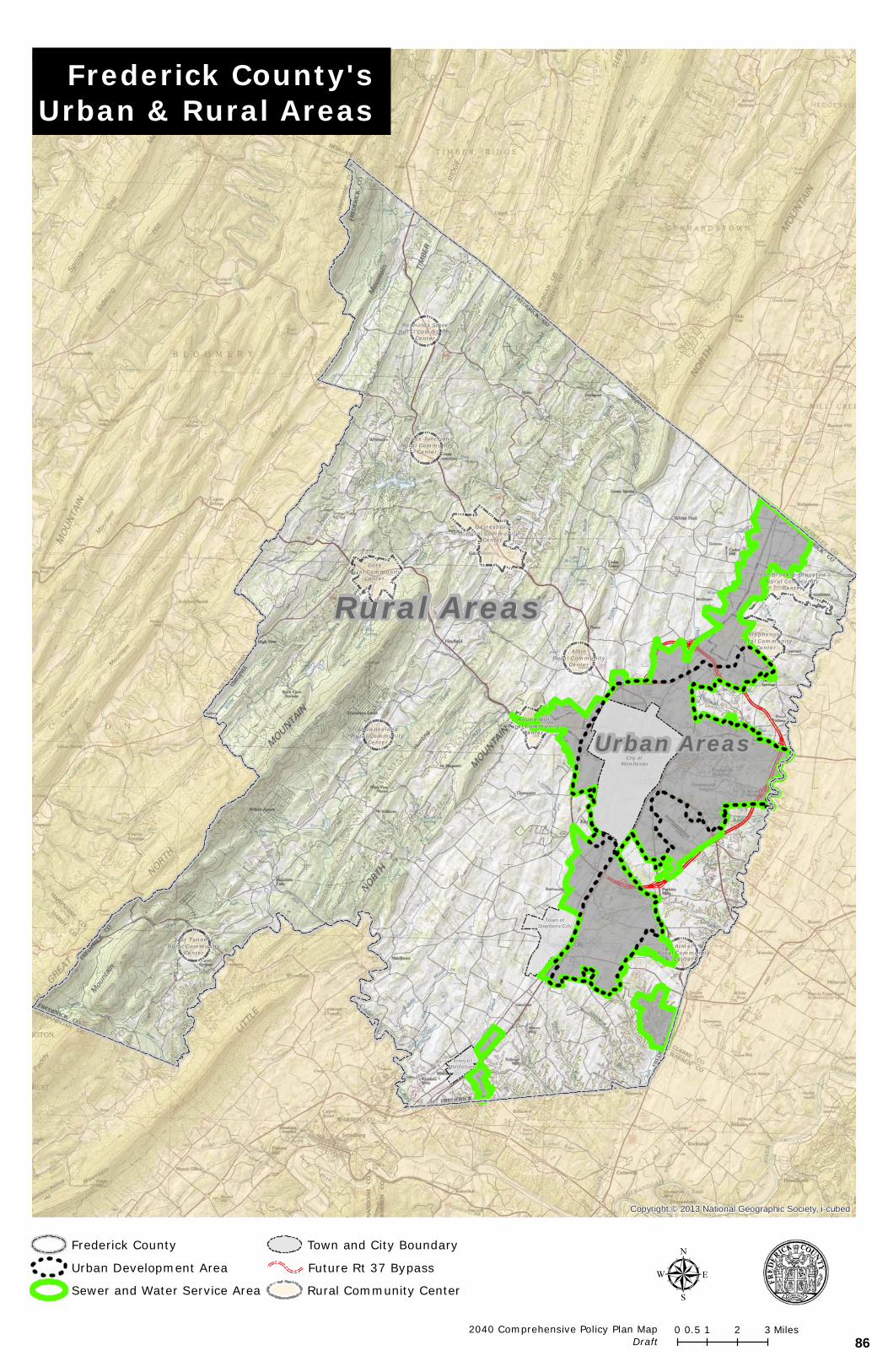
City of Winchester
Town ofStephens City
StephensonRural Community
Center
GainesboroRural Community
Center
Clear Brook & BrucetownRural Community
Center
Round HillRural Community
Center
GoreRural Community
Center
Star TanneryRural Community
Center
Cross JunctionRural Community
Center
AlbinRural Community
Center
Reynolds StoreRural Community
Center
ShawneelandRural Community
Center
ArmelRural Community
Center
Copyright:© 2013 National Geographic Society, i-cubed
0 1 2 30.5 Miles
µ
Rural Areas
Urban Areas
Frederick County
Urban Development Area
Sewer and Water Service Area
Town and City Boundary
Future Rt 37 Bypass
Rural Community Center
Frederick County'sUrban & Rural Areas
2040 Comprehensive Policy Plan MapDraft
Town ofMiddletown
86
URBAN AREAS
THE COMPREHENSIVE PLAN FOR FREDERICK COUNTY 3
URBAN AREAS CURRENT CONDITIONS
The Urban Development Area (UDA) of Frederick County includes those areas anticipated for higher intensity development which are located within the limits of the Sewer and Water Service Area (SWSA). The SWSA designates the limit of where public sewer and water could be extended. Frederick County established its initial UDA boundary in 1987. This Plan recognizes the need to direct new residential, commercial, and industrial growth into the Urban Areas and discourage growth in the Rural Areas; the UDA and SWSA provide a clear boundary between these two areas between the Urban Areas and the Rural Areas. Using the UDA and SWSA as urban growth boundaries, Frederick County seeks to focus growth in strategic areas where community facilities and public services are more readily available. It is expected that development within the UDA and SWSA will be served by public water and sewer. The UDA defines the general area in which more intensive forms of residential development will occur. Commercial, industrial, and institutional land uses are also identified within the UDA in designated areas. While the boundaries of the UDA and the SWSA are consistent in many locations, the SWSA does extend beyond the limits of the UDA to promote commercial, industrial, and institutional land uses in areas where residential land uses are not desirable. Future planned land uses are depicted in the various Area Plans which are compiled in Appendix I. These Area Plans contain both guiding text and future land use maps that provide a detailed land use guide for the designated area. The plans have been created over time, through a community planning process, and are incorporated as part of the Comprehensive Plan. The individual Area Plans make up the Eastern Frederick County Long Range Land Use Plan. Historically, Suburban development within the Urban Areas continues to be the predominant land use pattern for residential use, with an average residential density between two to four units per acre. The average gross residential density within the UDA has been between two (2) to three (3) units per acre. More recently, the densities of for new residential development in Frederick County have been increasing. The County should continually monitor the intensity and density of new development and its associated impacts. While the County will continue to see suburban-style growth, residential densities higher than those previously experienced in the UDA would be appropriate within specifically designated areas within the UDA, known as strategic growth areas (further described on page 4). identified as neighborhood villages and urban centers (further described on page 3). Frederick County established the initial UDA boundary in 1987. In 2007, recognizing the importance of utilizing urban growth boundaries such as the UDA, the Virginia General Assembly adopted legislation requiring certain larger and higher growth jurisdictions to incorporate UDA’s into their Comprehensive Plans. Frederick County continues to meet the requirements of the Code of Virginia that pertain to Urban Development Areas. The boundary of Frederick County’s UDA should be examined regularly to ensure that it is adequately sized to accommodate current and projected future growth. Policies should also be regularly reviewed to ensure that the UDA encourages a mixture of housing types. and housing types. It should be recognized that the size of the urban areas (both UDA and SWSA)
87
URBAN AREAS
THE COMPREHENSIVE PLAN FOR FREDERICK COUNTY 4
will also be affected by the ability to provide water and sewer service to accommodate future development. Historically, Frederick County has sought to achieve a balanced ratio between commercial, industrial and residential growth in terms of both available areas of land use and taxable value of the land uses. Residential development, although necessary to accommodate population growth, on average does not pay for itself. To offset this and mitigate any increased tax burdens on current residents, a fiscally balanced amount of commercial and residential development is achieved through land use planning. The target ratio for the urban area shall be 25 percent commercial and industrial land uses and within the urban areas to 75 percent residential and other land uses throughout the County as a whole. The purpose of this target is to achieve fiscal balance through land use planning. Maintaining a healthy and balanced ratio will help the County maintain its low tax rate, while continuing to enhance the services provided to residents. To encourage future development of commercial and industrial uses to help achieve the targeted ratio, Frederick County has designated certain areas solely for that are predominately planned for future commercial and industrial type uses. These include such areas as the Route 11 North corridor, Kernstown area, Round Hill, the 277 Triangle Area, and in the vicinity of the Winchester Regional Airport. FOCUS FOR THE FUTURE
The UDA Study of 2006 for Frederick County evaluated current land use patterns, comprehensive plan language, development trends, and contemporary planning practices. Using the UDA Study, The urban areas will continue to be designated for more compact and intense development patterns. The location of new and expanded public facilities, services and utilities will be focused in these areas. Improvements to the utility system, road networks, and public facilities may be required to support land development in these areas. New residential suburban development should be designed with high-quality residential standards and mitigate potential impacts. Opportunities for providing pedestrian and biking connections to existing neighborhoods should be encouraged where appropriate. Section III of this Plan provides additional policies and guidance for future residential development. The strategic growth areas, identified as neighborhood villages and urban centers shall Frederick County has identified locations which promote higher urban densities, mixed uses, and a more compact form of development. These strategic growth areas within the Urban Areas are known as Neighborhood Villages and Urban Centers. Neighborhood Villages and Urban Centers will be the building blocks of the urban fabric of Frederick County’s urban areas. Neighborhood Villages
Neighborhood villages are envisioned to be compact centers that focus and complement the surrounding neighborhoods, are walkable, designed at a human scale, and supported by existing planned road networks.
Urban Centers
Urban centers are larger than the Neighborhood Village and are envisioned to be a more intensive, walkable urban area with a larger commercial core, higher densities, and designed around some form of public space or focal point. Urban
88
URBAN AREAS
THE COMPREHENSIVE PLAN FOR FREDERICK COUNTY 5
centers should be located in close proximity to major transportation routes and intersections.
Development of these strategic growth areas would aid in attracting new skilled, creative, and entrepreneurial workers to the County. To attract new workers, the County needs to facilitate the creation of desirable, well-planned places in which they will want to reside. A variety of community choices, settings and prices needs to be fostered to accommodate a wide range of resident preferences. By fostering high quality communities centered around attractive social gathering spaces in mixed use environments, the County can attract new worker residents along with their employers. These areas should also provide for land uses that are connected by an attractive, efficient, transportation system designed for all users. Future development within the Urban Areas will be based upon the following:
• Mix and integration of a variety of uses and housing opportunities
• Increased density, walkability and connectivity
• High quality architecture, community focal points, enhanced urban design and planning
• Environmental quality
• Transportation policies for all users
The application of these development principles throughout the Urban Areas, and most importantly within strategic growth areas, seeks to ensure that the UDA of the County will be made up of walkable, mixed-use neighborhoods. These areas should feature a variety of housing choices, high quality retail, community facilities as focal points, employment opportunities, and provide for land uses that are connected by an attractive, efficient, transportation system designed for all users. The mixing of uses provides a greater choice in mobility. Further, focusing development around walkable centers affords people the opportunity to work, live, shop, and play in locations that are near each other. For any new use proposed within the urban areas, adequate roads, infrastructure, and public facilities with sufficient capacities to accommodate the new uses should be provided. Development proposals such as rezonings, are expected to identify and appropriately mitigate their impacts to ensure that they are not placing an undue burden on the community. Proposed uses should also seek to further implement the goals identified in this Plan. For any proposed rezoning to be approved, applicants will be expected to contribute a reasonable portion of the costs, relative to the scale of the development, of new or expanded public facilities and infrastructure needed to serve the proposed development. It is important that anticipated impacts of proposed developments are mitigated to ensure that they are not placing an undue burden on the community and to further implement the goals of the Comprehensive Plan. COMMUNITY BENEFITS
There are numerous benefits to the community when focusing new growth in the urban areas. The benefits of focusing new growth within the urban areas are numerous.
89
URBAN AREAS
THE COMPREHENSIVE PLAN FOR FREDERICK COUNTY 6
When residential growth occurs outside of the designated growth boundaries, such as and into the rural areas, the County has to must extend public services such as schools and emergency services further distances. These expanded service areas increase the costs of operation while decreasing efficiency effectiveness. Focused growth areas also reduce limit development pressures within the rural areas, thus thereby helping to preserve the environment and agricultural land and open spaces. promote agribusiness and tourism. Neighborhood Villages and Urban Centers Incorporating planned neighborhood villages and urban centers, which are designated for higher densities and utilize Neighborhood Design principles such as those identified in this chapter,will help to improve the sense of community and promote close knit, walkable areas communities where residents have greater opportunities to live, work, and play in the same area. The transportation systems encouraged by this plan de-emphasizes the automobile, allowing residents to walk or bike to destinations. Commercial and Industrial Dedicated areas for commercial and industrial development helps to ensure a strong tax base to provide public services and community facilities and also provide for retail opportunities for the benefit of local residents. In general, these principles are more efficient, more viable and ultimately more economical for the Community.
GOALS/STRATEGIES GOAL 1: AS FREDERICK COUNTY CONTINUES TO GROW, IT IS ESSENTIAL THAT THE VISION OF
THE COMPREHENSIVE PLAN FOR THE URBAN AREAS BE IMPLEMENTED IN ORDER TO ACCOMMODATE GROWTH IN A VIABLE MANNER. GROWTH SHOULD PRIMARILY BE FOCUSED WITHIN THE URBAN AREAS.
STRATEGIES:
• Focus new residential growth within the Urban Development Area (UDA). growth in the Urban Development Area (UDA) and Sewer and Water Service Area (SWSA).
• Monitor the size of UDA and the Sewer and Water Service Area (SWSA) to ensure appropriate land area is made available to accommodate future residential growth as well as and commercial and industrial opportunities.
• Ensure adequate water and sewer service capacity is available to accommodate new residential and commercial/industrial growth.
• Provide for various densities within the urban areas to encourage concentrated growth. while also accommodating consumer choice for a variety of housing options. Support a range of housing options in suburban areas, neighborhood villages and urban centers.
GOAL 2: PROMOTE THE NEIGHBORHOOD DESIGN PRINCIPLES AS IDENTIFIED IN THIS CHAPTER
WITHIN THE URBAN AREAS. FOR NEIGHBORHOOD VILLAGES AND URBAN CENTERS. STRATEGIES:
90
URBAN AREAS
THE COMPREHENSIVE PLAN FOR FREDERICK COUNTY 7
• Ensure land use applications incorporate the principles of Neighborhood Design
identified in this chapter where appropriate. for neighborhood villages and urban centers.
• Further develop the neighborhood village and urban center concepts which promote strategic growth areas within the urban areas. Community Area Plans could be utilized to identify potential locations for these concepts.
• Promote the location of community facilities as focal points within identified strategic growth areas. neighborhood villages and urban centers.
• Support high quality and innovative community designs within neighborhood villages and urban centers.
GOAL 3: PROVIDE FOR TRANSPORTATION OPPORTUNITIES FOR ALL USERS WITHIN THE URBAN AREAS.
STRATEGIES:
• Ensure the bicycle plan included as part of the Comprehensive Plan provides for trail facilities in the desired locations.
• Encourage new developments to provide interconnected trail networks and on street shared travel ways.
• Connect “missing links” across existing developments to the extent possible.
GOAL 4: OBTAIN 25/75 RATIO OF COMMERCIAL & INDUSTRIAL USES TO RESIDENTIAL AND
OTHER LAND USES WITHIN THE URBAN AREAS OF THE COUNTY. STRATEGIES:
• Ensure adequate services, including water and sewer infrastructure, are available to obtain target business users in a competitive market.
• Continue to work with Frederick Water to monitor the location of the SWSA and determine areas that could be modified to attract targeted users and continue to implement the Long-Range Land Use Plan.
• Monitor location of SWSA and consider expansions when necessary, to accommodate demand or a highly desirable business user, and to implement the Long-Range Land Use Plan.
• Continue to evaluate the availability of land for that will specifically accommodate desired amount of commercial and industrial land uses and incorporate sufficient acreage into Area Plans.
• Seek to attract uses that will generate the desired tax revenue and employment opportunities for the County.
91

ArmelRural Community
Center
Round HillRural Community
Center
AlbinRural Community
Center
StephensonRural Community
Center
Clear BrookRural Community
Center
Town ofStephens
City
§¦81
§¦81
§¦81
§¦81
£¤11
£¤50
£¤11
£¤522
£¤522
£¤11
¬«277
¬«277
¬«37
¬«7
¬«7¬«7
¬«37
City ofWinchester
Town ofMiddletown
Copyright:© 2013 National Geographic Society, i-cubedF0 1 20.5 Miles
Eastern Frederick CountyLong Range Land Use Plan
2040 Comprehensive Policy Plan MapDraft
Long Range Land Use Plan
Interstate BufferEnvironmentally Sensitive AreasParkNatural Resources & RecreationRecreationCommercial Recreation
Rural Area
High-Density Residential, 12-16 u/aHigh-Density Residential, 6 u/aResidential, 4 u/aNeighborhood VillageUrban CenterPlanned Unit DevelopmentMobile Home CommunityResidential
EmploymentExtractive MiningHeavy IndustrialwwwwwwwwwwwwWarehouseMixed Use Industrial \ OfficeIndustrial
B2 / B3Highway CommercialMixed Use Commercial \ OfficeMixed-UseBusiness
Landfill Support AreaAirport Support AreaSewer and Water Service AreaUrban Development AreaFuture Rt 37 Bypass
Rural Community CenterFire & RescueSchoolInstitutionalSensitive Natural Areas
92
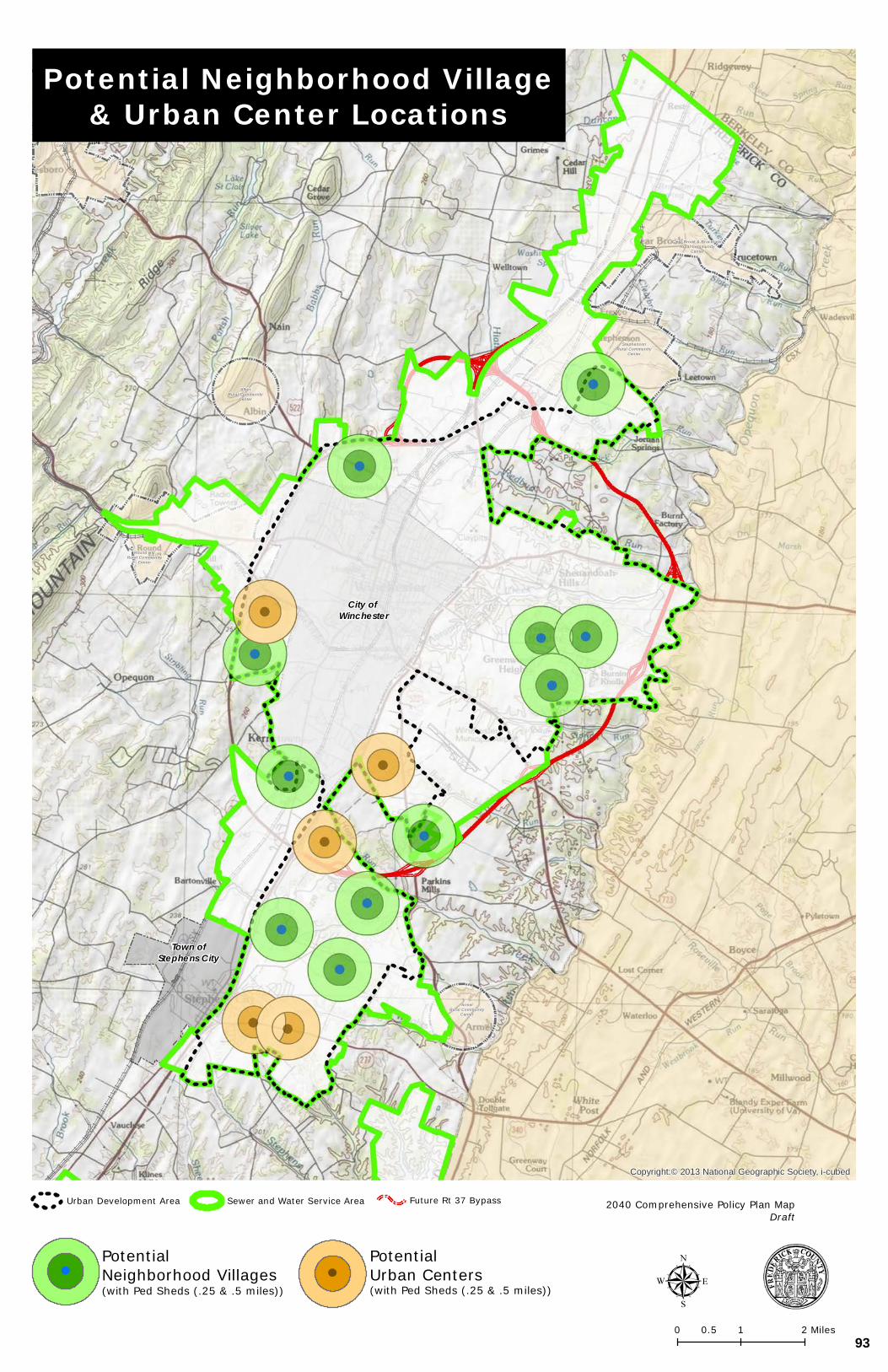
City of Winchester
Town ofStephens City
StephensonRural Community
Center
GainesboroRural Community
Center
Clear Brook & BrucetownRural Community
Center
Round HillRural Community
Center
AlbinRural Community
Center
ArmelRural Community
Center
Copyright:© 2013 National Geographic Society, i-cubed
0 1 20.5 Miles
µ
Potential Neighborhood Village& Urban Center Locations
2040 Comprehensive Policy Plan MapDraft
PotentialNeighborhood Villages(with Ped Sheds (.25 & .5 miles))
PotentialUrban Centers(with Ped Sheds (.25 & .5 miles))
Urban Development Area Future Rt 37 BypassSewer and Water Service Area
93
RURAL AREAS
THE 2035 COMPREHENSIVE PLAN 10
II. RURAL AREAS
94
RURAL AREAS
THE 2035 COMPREHENSIVE PLAN 11
RURAL AREAS CURRENT CONDITIONS
Frederick County’s rural areas provide places for agriculture, forestry, protection and preservation of natural resources, and tourism. The rural areas best exhibit the nature, beauty, view sheds, and tranquility for which Frederick County is known. The primary land uses in the rural areas are agricultural and forestal operations. Most of Frederick County’s land area is rural in character. Of the County’s 266,000 acres, approximately 243,000 acres are rural and located primarily west of Interstate 81. The remaining acreage comprises the Urban Development Area (UDA) Sewer and Water Service Area (SWSA) where the majority of the County’s future growth is planned. residential, commercial, and industrial development is focused.
Agriculture In 2017, the Federal Census of Agriculture identified 762 farms in Frederick County, with a total of 109,907 acres or approximately 41 percent of the land in the County. From 2012 to 2017, the total acreage in Frederick County farms grew by over 9,000 acres. This 9% growth in overall acreage may represent a real increase or it may be an effect of more persons reporting on their farm acreage. Forestry is another important component of the County’s agricultural economy. Managed well and logged in a sustainable manner, they provide a renewable source of income to landowners, taxes to the County, and timber products for many other users. Trees and forests provide many natural resource benefits prior to and after harvesting. The Agriculture Census showed the total percentage of land in farms comprised of woodland use as of 2017 to be 25 percent. Residential Development
The rural areas of the County have traditionally seen about 30% of the County’s new residential growth. With the exception of the County’s Rural Community Centers, further defined later in the chapter, the predominant new residential development pattern has been five (5) acre lots or two (2) acre clustered lots with dedicated preservation tracts (discussed further below). It should also be noted that the band of prime agricultural soil which runs north-southwest of Interstate 81 is the same area where a majority of new rural residential growth has been experienced.
The handling of wastewater is a key differentiating feature for development in the rural areas. Residential uses in the rural areas are served by both of which are served by individual onsite sewage disposal systems and wells. The County encourages residential development in the urban areas where services and utilities are available and where such development will not conflict with agricultural and forestal uses, conservation efforts for natural resources and other objectives for the rural area. It is the County’s policy that public infrastructure will be centralized in the urban areas. Minimizing the extension of public water and sewer infrastructure helps avoid more intense development within the rural areas.
Within the rural areas of the County there are several established village-type developments called Rural Community Centers. There are currently twelve identified Rural Community Centers. These are:
95
RURAL AREAS
THE 2035 COMPREHENSIVE PLAN 12
GORE REYNOLDS STORE
GAINESBORO ROUND HILL
ARMEL SHAWNEELAND/NORTH MOUNTAIN
STAR TANNERY WHITACRE/CROSS JUNCTION
ALBIN CLEARBROOK/BRUCETOWN
STEPHENSON WHITEHALL
These centers consist of small lot residences and commercial uses typical of a village. The Rural Areas Subcommittee recommended studying private utility systems to serve these Communities. In addition, Four of the existing centers have been identified as potential receiving areas for the Transfer of Development Rights Program. TDRs. There are currently no public water and sewer services available utility services in these communities and therefore, the use of private utility systems would need to be investigated to facilitate future growth in these communities. Of the Rural Communities, Round Hill, has a small area had plan developed which incorporates the community village area and commercial uses adjacent to U.S. 50, west of its interchange with the Route 37 By-Pass (see Appendix II – Area Plans).
Land Conservation Tools and Trends
Private property owners and farmers are truly the key land stewards in the County. These landowners have actively participated in voluntary preservation and land management programs through State, County, and non-profit organizations over the years. Approximately 22,800 acres of the County’s land is currently in some form of conservation easement or land protection program. Also, the George Washington National Forest comprises over 8,000 acres in Frederick County. Overall, approximately 30,800 acres or 12 percent of the County’s area is protected in some fashion.
Some of the management tools and incentives for the preservation of agricultural opportunities, and environmental resources are zoning and subdivision regulations, land use taxation, permanent conservation easements, purchase of development rights, transfer of development rights and Agricultural and Forestal Districts, each of which is discussed below. To deal with increasing development pressures in the Rural Areas over the last decade, the Board of Supervisors established the Rural Areas Subcommittee in 2008. This Committee was tasked with identifying growth and development trends and related issues in the Rural Areas of the County, gathering ideas to address those issues and forwarding a recommendation for resolution. The Committee’s final report, The Rural Areas Report and Recommendations was adopted by the Board of Supervisors on April 22, 2009 as a policy component of the Comprehensive Plan. One of the recommendations contained within the report was the creation of a Transfer of Development Rights (TDR) Program.
The TDR Program joined other existing land use tools available to rural landowners to preserve land in the Rural Areas, including:
• Land use taxation (local)
• Conservation easements (non-profit)
• Purchasable development rights (public)
96
RURAL AREAS
THE 2035 COMPREHENSIVE PLAN 13
Zoning and Subdivision Regulations
The Zoning and Subdivision Ordinance regulates the form of residential development seen in the rural areas today. The regulations are designed to assist in the protection and preservation of the agricultural uses and to mitigate land use conflicts between agricultural uses and appropriately limited residential development. The Zoning Ordinance takes two different approaches for subdividing land for rural development: traditional five acre lots or rural preservation (cluster) subdivisions. Both options have residential density of one house per five acres, but the preservation option allow lots as small as two acres while the remainder is conserved in a larger tract that could be utilized for agricultural purposes.
Use Value Assessment and Taxation Program
The Use Value Assessment and Taxation Program uses discounts in property tax assessments to promote and preserve agricultural, forestal, horticultural and open space lands. Use Value Assessment (also commonly known as “land use” or “land use assessment”) is a state-guided program that allows localities to tax farmland and open space land at its “use” value rather than its fair market value. This program typically reduces the real estate tax on the land by a significant amount, thus making it easier to continue a farming business. The program is voluntary to the landowner and requires only five acres to qualify under open space classification or 20 acres under the forest use classification. Rollback taxes must be paid when the property is removed from the program. Conservation Easements and Purchase of Development Rights A conservation easement is a legal agreement between a landowner and a government and a land trust or government agency that limits the use of the land by recording deed restrictions that prohibit or severely restrict further development to protect the conservation value of the property, such as farmland, watersheds, wildlife habitat, forests and/or historical lands. Each easement is unique in terms of acreage, description, use restrictions and duration. These details are negotiated between the property owner granting the easement, and the organization that will be holding the easement.
Conservation easements are typically established in perpetuity but may be established for shorter periods. The easement allows a property owner to continue to own any underlying interest in the land that is not specifically limited by the easement, to use the land within the terms and restrictions of the easement, and to sell the land or pass it on to heirs (with the easement restrictions conveying with the land). Conservation easements do not permit public access unless specifically provided. Conservation easements may be established through purchase, lease (short term), or through donation. In these easement programs, the easement is established through the voluntary cooperation or initiative of the landowner. When conservation easements are purchased as part of a broad government program, it is typically called “Purchase of Development Rights” or PDR. Purchasing “development rights” is the same as purchasing conservation easements or that portion of the “bundle of rights” that allows landowners to construct dwellings or non-farm commercial structures on the property. Thus, when a locality purchases a conservation easement from a landowner, it essentially “buys” the right to develop the land and “retires” that right by placing a permanent conservation easement on the property that restricts or
97
RURAL AREAS
THE 2035 COMPREHENSIVE PLAN 14
prohibits further non-farm development. Typically, these easement restrictions run in perpetuity.
Transfer of Development Rights
In 2010, Frederick County adopted a Transfer of Development Rights (TDR) program which allows for dwelling unit rights to be transferred from qualified parcels located in the rural areas to designated properties within the Urban Development Areas. This policy tool provides landowners within the rural areas the ability to obtain development value from their land of their farmland without having to subdivide and sell the land. The density rights from the land can be severed and utilized within the Urban Development Area where community facilities and public services can be provided more efficiently.
Agricultural and Forestal Districts
Frederick County currently has eight districts covering approximately 12,300 acres. Agricultural and Forestal Districts are voluntary rural protection zones that were established by the Commonwealth (Virginia Code § 15.2-4301), to conserve land for the production of agricultural products, timber, and the maintenance of open space as an important economic and environmental resource. By establishing a district and agreeing to continue using the property for qualifying agricultural uses, the locality and State in return agree to protect and enhance the land and not take any actions that would have a negative effect on agriculture or forestry during the term of the District.
Historically, the County has taken great care to allow residential land to co-exist with agriculture uses. Tools implemented by the County in recent years include buffering, clustering, and the promotion of Agricultural and Forestal Districts. All of these provide protections to both homeowners and farmers and enable equal use and enjoyment of the Rural Areas.
FOCUS FOR THE FUTURE
Agriculture, forestry and conservation play an important role in the environment, heritage and economy of Frederick County. Frederick County has a recognizable Rural Area where agricultural operations are promoted, natural resources are respected, and its beauty and heritage are preserved. While the County’s agriculture industry is likely to evolve into operations of a very different scale and intensity than currently seen, the County should continue to support and encourage these operations. encourage new land uses in the rural areas, including supportive uses for agriculture. Policies and ordinance changes should be considered to promote the County’s preferred uses for the rural areas, including supportive uses for agriculture, historic preservation, tourism, and strengthening land conservation initiatives. The Agribusiness section of the Business Development Chapter further promotes the evolution of agriculture in the County’s rural areas. The Rural Community Centers are focal points for the rural areas and should be examined to accommodate future residential growth. Small area plans for these communities should be studied and created, and approaches for water and sewer needs should be investigated. Rural Community Centers will continue to play a role as focal points for the Rural Areas, and small area land use plans for the centers should be created. Additionally, other types of rural residential development should take on patterns similar to these centers.
The natural landscape should be used as the background of development with a greater emphasis placed on conservation design for growth within the rural areas. The inclusion of
98
RURAL AREAS
THE 2035 COMPREHENSIVE PLAN 15
new recreational opportunities and the growth of existing ones within the rural areas are also encouraged.
COMMUNITY BENEFITS The rural areas of the County provide benefits to the community in many ways. These areas not only contribute to the identity of Frederick County, they also provide jobs, recreation, and a way of life. Preserving and protecting the rural areas of Frederick County is important not only to ensure the economic viability of agricultural and forestal operations but to also guarantee that those lands are present for the use and enjoyment of future generations.
GOALS/STRATEGIES GOAL 1: DIRECT NEW RESIDENTIAL GROWTH AWAY FROM THE RURAL AREAS,
AND CLUSTER RESIDENTIAL DEVELOPMENT THAT DOES OCCUR TO FURTHER HELP PRESERVE AGRULTURAL LAND.
STRATEGIES:
• New residential development should continue to be directed into the urban areas.
• Preserve the desired physical characteristics of the rural areas. Avoid prime soils, minimize land disturbance and grading, and minimize drainage changes.
• Maintain transition areas between radically different uses, most importantly, between
the rural and urban areas.
• Avoid, as applicable, Sensitive Natural Areas, Historic Districts, TDR sending areas, Recreational Overlays, and Agricultural and Forestal Districts.
• Continue helping property owners find ways to keep properties intact rather than subdividing.
GOAL 2: SUPPORT THE GROWTH OF THE COUNTY’S RURAL COMMUNITIES. STRATEGIES:
• Further define the boundaries for each Rural Community Center and small area land use plans for each center. These centers should remain the focal point of the rural community and their character and scale should be preserved.
• Plan for improved services within the neighborhood centers (wastewater treatment, package treatment, fire and rescue, and satellite County offices, library).
• Encourage appropriate mixes of residential, commercial and business uses within the
Rural Community Centers. GOAL 3: SUPPORT VOLUNTARY LAND PRESERVATION TOOLS AND THE LAND
USE TAX DEFERRAL PROGRAM
99
RURAL AREAS
THE 2035 COMPREHENSIVE PLAN 16
STRATEGIES:
• Support the Conservation Easement Authority (CEA) and the Purchase of Development Rights (PDR) program.
• Support the Transfer of Development Rights (TDR) Program, the Land Use Tax Deferral Program, and encourage growth of the County’s Agricultural and Forestal Districts. and Purchase of Development Rights (PDR) programs, among others.
• Promote the use of conservation easements and support the Conservation Easement Authority through the County’s Purchase of Development Rights Program.
• Participate in state grant programs to the greatest extent possible.
• Follow changes to state code that would enable new land preservation tools.
• Continue to support the work of conservation organizations in establishing and holding
conservation easements and extinguishing residential development potential.
GOAL 4: SUPPORT AGRICULTURAL OPERATIONS AND RURAL RECREATION STRATEGIES:
• Support the agricultural economy in Frederick County and adapt to evolving practices and new agricultural opportunities such as value added activities and uses on farms that are a logical extension of the agricultural use.
• Encourage conservation options that retain continuous land areas for agricultural uses; focus should be placed on areas with prime agricultural soils.
• Identify and support local, regional, and national rural recreation opportunities within the County’s rural areas.
100
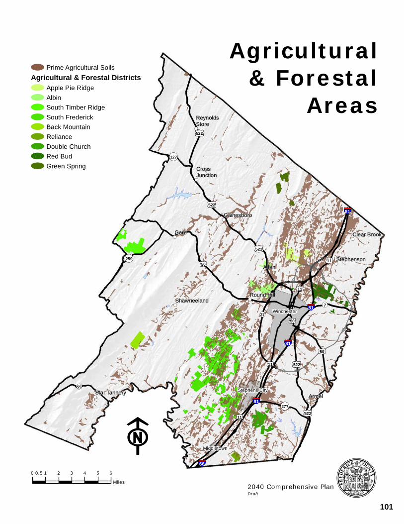
!((
!((
!((
!(( !((
!((
!((
!((
!((
!((!((
ReynoldsStore
CrossJunction
Gainesboro
Gore Clear Brook
StephensonAlbin
Round HillShawneeland
Star Tannery Armel
§¦81
§¦81
§¦81
§¦81
§¦66
£¤50
£¤522
£¤522
£¤11
£¤50
£¤522
£¤522
£¤11
£¤50
£¤11
£¤522
£¤11
Winchester
Middletown
Stephens City¬«55
¬«259
¬«277
¬«127
¬«7
¬«37
F0 1 2 3 4 5 60.5
Miles
Prime Agricultural SoilsAgricultural & Forestal Districts
Apple Pie RidgeAlbinSouth Timber RidgeSouth FrederickBack MountainRelianceDouble ChurchRed BudGreen Spring
Agricultural& Forestal
Areas
2040 Comprehensive PlanDraft
101
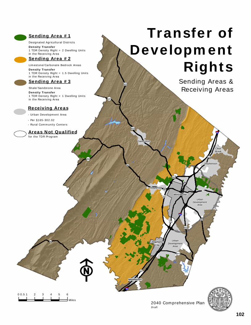
UrbanDevelopment
Area
UrbanDevelopment
Area
§¦81
§¦81
§¦66
Gainesboro
ClearBrook
Stephenson
Round Hill
£¤50
£¤522
£¤522
£¤50
£¤11
£¤50
£¤522
£¤11
£¤522
£¤11
¬«55
¬«259
¬«277
¬«127
¬«7
¬«37Winchester
Middletown
StephensCity
F
Transfer ofDevelopment
RightsSending Areas &Receiving Areas
Receiving Areas- Urban Development Area
- Per §165-302.02- Rural Community Centers
Sending Area #3Shale/Sandstone AreaDensity Transfer 1 TDR Density Right = 1 Dwelling Units in the Receiving Area
Sending Area #1Designated Agricultural DistrictsDensity Transfer 1 TDR Density Right = 2 Dwelling Units in the Receiving Area
Sending Area #2Limestone/Carbonate Bedrock AreasDensity Transfer 1 TDR Density Right = 1.5 Dwelling Unitsin the Receiving Area
Areas Not Qualifiedfor the TDR Program
0 1 2 3 4 5 60.5
Miles2040 Comprehensive PlanDraft
102
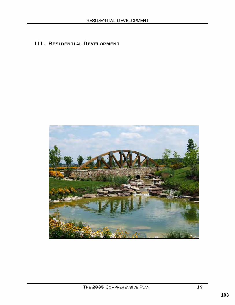
RESIDENTIAL DEVELOPMENT
THE 2035 COMPREHENSIVE PLAN 19
III. RESIDENTIAL DEVELOPMENT
103
RESIDENTIAL DEVELOPMENT
THE 2035 COMPREHENSIVE PLAN 20
RESIDENTIAL DEVELOPMENT CURRENT CONDITIONS Over the past two decades, the amount of residential development in Frederick County has continued to increase increased at a relatively consistent rate of approximately three (3) percent a year. Supporting this growth was a period of significant expansion in the County’s commercial and industrial base. According to the 2010 Census and more recent studies performed by the Economic Development Authority (EDA), Frederick County remains primarily an in-commute location. However, This Plan also acknowledges Frederick County is also home to a large population of residents that commute out of the County for employment. One of the contributors to the County’s The main contributor to the population growth was the migration of people from inside of the Washington Metropolitan Statistical Area (WMSA) to Frederick County for a higher quality of life including lower housing costs and a lower tax rate. Frederick County, because of its location and excellent access to Northern Virginia and Washington, DC, has become a desirable place to live place of choice to live for those commuters. Frederick County has also become an attractive place to live for retirees.
Frederick County’s housing stock includes a variety of homes in both suburban and rural settings. Residential opportunities exist in both the County’s Urban and Rural Areas. In recent years Frederick County has seen approximately two thirds of its new residential growth constructed in the Urban Development Area (UDA) and one third in the rural areas, including the Residential Recreational Communities (such as Lake Holiday, Lake Frederick, and Shawneeland).
The rural areas are home to the agricultural, forestal and open spaces of the County. Within the rural areas, the predominant types of residential units are single family dwellings with a density of one house per five acres. In addition to the traditional five acres lots seen in the past, dwellings at the same density can be clustered using a two-acre lot size with the remainder being preserved through a 60% preservation tract. Older The County also has a number of historic Rural Community Centers where residential uses are clustered. historic rural communities also exist throughout the rural areas and are typically found within one of the County’s Rural Community Centers. These rural community centers typically have smaller lot sizes, higher densities, and some commercial uses. Residential developments located in the Rural Areas, including Rural Community Centers are typically on private individual water and sewer systems.
The Urban Development Area (UDA) is the portion of the County which has been identified as the area where more intensive forms of residential development will occur and to accommodate the anticipated residential growth within the Community. While the UDA currently consists of primarily suburban residential types of development, with some multifamily and retirement units, particular areas have been identified to it is planned to accommodate a more intensive mix of land uses and residential housing opportunities.
The UDA is designed to accommodate increased residential densities because it is adjacent to or in the near proximity to the necessary infrastructure and public facilities. These facilities
104
RESIDENTIAL DEVELOPMENT
THE 2035 COMPREHENSIVE PLAN 21
include , such as public water and sewer, schools, emergency services, and a transportation network more capable of handling the increased trips from higher density residential uses. To further encourage residential development in the Urban rather than Rural Areas, the County adopted a Transfer of Development Rights Program (TDR) in the spring of 2010. More information on the County’s TDR Program can be found in the Rural Areas chapter of this Plan.
FOCUS FOR THE FUTURE
Future Residential growth in Frederick County is anticipated to continue increasing and expand. The County must ensure that land use policies are established to adequately direct and shape that growth. While new residential growth is expected in both the Rural and the Urban Areas, new residential growth should be focused primarily within the Urban Development Area (UDA) which is better suited to meet the needs of these new residences.
The County should continue to establish policies which result in attractive and welcoming residential neighborhoods which are able to accommodate a growing population. and expanding workforce. The County should strive to offer a variety of neighborhood and housing choices to attract younger populations that would help support a diverse and skilled workforce for the County. It is also important that housing opportunities be available to all household types and income categories. Such residential development should be comprised of a mixture of housing types and lot sizes to provide options for a range of lifestyles and incomes, such as retiree’s, millennials and younger families.
The land use policies of the Urban Areas will further guide this residential development and community growth.
COMMUNITY BENEFITS
Proactive planning efforts are essential in both the Urban and Rural Areas to ensure that the County is able to deal with its future residential growth in a cost-effective and attractive manner.
Proper planning and land use policies enable the County to identify where future residential growth should be accommodated. It enables the County to plan for and provide infrastructure and services in defined areas where they can reach the majority of the population. By directing growth and services to the urban areas, the County can develop community facilities that become focal points to the residential areas.
GOALS/STRATEGIES
GOAL1: NEW RESIDENTIAL DEVELOPMENT SHOULD BE FOCUSED WITHIN THE URBAN DEVELOPMENT AREA (UDA).
STRATEGIES:
• Guide new residential development to areas that are served by public utilities, access to transportation networks able to serve higher intensities, employment areas, schools, recreation facilities and shopping facilities.
105
RESIDENTIAL DEVELOPMENT
THE 2035 COMPREHENSIVE PLAN 22
• The Urban Development Area should allow for housing that will meet the needs
of first-time buyers, retiree’s, move-up residences, and seniors.
• Higher density residential development is encouraged in close proximity to or mixed with commercial areas to enhance walkable access to employment, shopping, and entertainment. The County’s strategic growth areas, the Urban Centers and Neighborhood Villages, are the most desirable locations for this type of development.
• Continue to monitor the supply of land designated and zoned for residential use
in the Urban Areas to ensure adequate capacity for future population growth. GOAL 2: NATURAL SYSTEMS AND, OPEN SPACES AND FOCAL POINTS SHOULD BE INCORPORATED
INTO NEW RESIDENTIAL DEVELOPMENT. STRATEGIES:
• When new development occurs in the rural areas, the rural preservation option should be encouraged as the preferred subdivision form and design to preserve natural and environmental features should be implemented.
• New residential neighborhoods will should incorporate focal points, landscaping, recreational amenities, open space amenities (active, passive, and natural), located in close proximity to all dwellings, with an emphasis on the provision of usable open space for resident use and enjoyment. that facilitate community interaction and promote a quality neighborhood development.
GOAL 3: ENCOURAGE NEW AND INNOVATIVE HOUSING CHOICES THAT ALSO ACCOMMODATE A
FULL RANGE OF AFFORDABILITY. WHICH MEET THE NEEDS OF VARIOUS AGES AND
INCOMES.
STRATEGIES:
• Residential housing types and design guidelines should be flexible to accommodate evolving demographic trends, and to ensure that housing choices are maximized.
• Ensure that adequate housing options are available to the development community through the Zoning Ordinance. Investigate additional opportunities such as new or expanded manufactured housing developments and accessory units to help expand the housing supply and help meet the County’s affordable housing needs.
• Rural Community Centers should be enhanced as viable and desirable places
to live, as they can serve an important role as a location with lower development costs, thus reducing the housing costs. Opportunities to provide water and sewer services, public or private, should be investigated.
• When water and sewer (public or private) becomes available, promote the completion of land use plans for the Rural Community Centers and provide incentives to increase the viability of these neighborhoods.
106
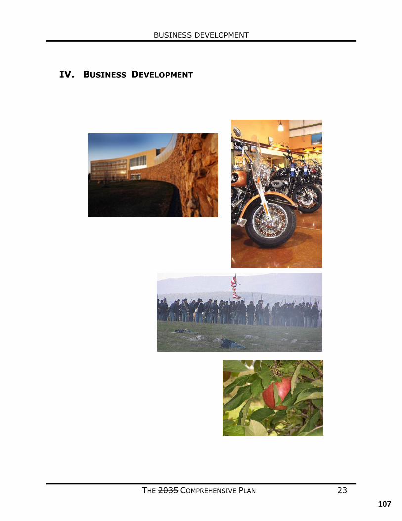
BUSINESS DEVELOPMENT
THE 2035 COMPREHENSIVE PLAN 23
IV. BUSINESS DEVELOPMENT
107
BUSINESS DEVELOPMENT
THE 2035 COMPREHENSIVE PLAN 24
INTRODUCTION The Comprehensive Plan Business Development This chapter focuses on four areas that are all integral to the economy of Frederick County. These areas are:
• OFFICE AND INDUSTRIAL
• RETAIL • TOURISM • AGRIBUSINESS
Frederick County currently has a consistent and competitive real estate tax rate in comparison to neighboring communities. Supported by a proactive Economic Development Authority (EDA), the area’s workforce has a high work ethic and a low turnover rate. Frederick The County’s attractiveness as a residential community will continue to expand our population and our opportunities for business growth. Each new residence within the Winchester-Frederick County area only generates approximately 50% of the taxes needed to offset the service burden created by the residence; the goal of planning for new business development is to attract businesses that will balance the tax base and jobs. The opportunity for local residents to have an expanded employment base affords not only an enhanced quality of life and increased income, but also results in increased local spending and therefore increased sales tax collections. CURRENT CONDITIONS Highway accessibility, proximity to major markets, an impressive skilled talent pool Our strategic geographic location, diverse business community, skilled workforce, recognized economic performance, and commitment to business are a few of Frederick County’s strategic economic cornerstones. These, in combination with outstanding public education institutions and top-ranking healthcare facilities, provide additional confidence to businesses about Frederick County’s economic environment. Multiple four-lane highways (which can reach much of the U.S./Canadian population in one day), quick access to a general airport and three international airports (Washington-Dulles International Airport, Baltimore-Washington International Airport, and Ronald Reagan Washington National Airport), and daily intermodal connection via the Virginia Inland Port are just a few of the reasons businesses like operating in Frederick County, Virginia. Geographically, Frederick County is strategically placed in the Mid-Atlantic region of the United States and along major North/South and East/West transportation routes. This is a valuable asset to companies serving the North American and European markets. In addition to the outstanding geographic reach, Frederick County employers enjoy a workforce pool of more than 200,000, with approximately 30,000 ready and available for business service and manufacturing operations. Funding programs exist to help with specific training. labor supply from a 45-minute drive-time across 10 counties in Virginia, Maryland, Pennsylvania, and West Virginia. The total labor supply is more than 340,000 professionals,
108
BUSINESS DEVELOPMENT
THE 2035 COMPREHENSIVE PLAN 25
over 90.8% of which are high school graduates (or higher); 40.1% hold an associate degree or higher. Widely recognized employers are operating in Frederick County, including HP Hood, Kraft-Heinz Foods, M&H Plastics, Navy Federal Credit Union, Rubbermaid and Thermo Fisher Scientific. A mix of manufacturing, retail, professional service, logistics, customer service, technology and entrepreneurial enterprises keep the economy strong. Our region is among the top 10% best performing metros in Virginia for capital investment and new job creation over the last decade. The County’s business community has steadily grown over the years and has been recognized for its range of offerings, proximity to major metros and its long-term appeal to some of today’s leading manufacturers, financial operations and more. With an extensive and diverse business portfolio, $326 million in capital expenditures between 2018-2020, and ongoing partnerships between the business community and educational institutions, Frederick County has consistently retained leading companies. Frederick County has also been recognized as one of the most prosperous economies in the state. In fact, the County falls within the top 10% of Virginia localities over the last decade for new capital investment and new job growth and is consistently rated a great place to operate a business. Winchester VA-WV MSA is No. 9 on Forbes’ “Best Small Places for Business and Careers” in 2019. Frederick County prides itself as a vibrant, pro-business community with an immense commitment to business. In fact, Frederick the County, Virginia, has employed a “business support at every step” approached for over 30 years. One such resource includes call-team visits to local businesses to communicate training resources and expansion assistance opportunities. The Frederick County EDA has an established track record of facilitating financial and workforce training assistance to expanding companies. an award winning, proactive model for ongoing support of our businesses for more than 30 years. Onsite visits, quarterly business forums, and assistance in locating and obtaining available workforce training funds are just a few examples of our commitment. Frederick County, Virginia’s, consistent economic success provides businesses with assurance that their investment will grow. Frederick County currently has a consistent and competitive real estate tax rate in comparison to neighboring communities. Supported by a proactive Economic Development Authority (EDA), the area’s workforce has a high work ethic and a low turnover rate. The County has a population of 82,262 and over 42,000 residents in the workforce. Of that number 89% of county residents are high school graduates and 30% hold bachelors or more advanced degrees. The largest employment sector in Frederick the County, Virginia, is Manufacturing, (5,093 6,048 workers). The next-largest sectors in the region are Transportation and Warehousing (4,197), Retail Trade (3,725 3,615 workers) and Educational Services (3,057 3,071). Sectors in Frederick County, Virginia with the highest average wage per worker are Management of Companies and Enterprises ($74,902), Mining, Quarrying, and Oil and Gas Extraction ($71,244), and Public Administration ($63,215 $71,453), Finance and Insurance ($68,960), and Utilities ($64,375). Regional sectors with the best job growth (or most moderate job losses) over the last 5 years are Transportation and Warehousing (1,980), Manufacturing (+954 jobs), Finance and
109
BUSINESS DEVELOPMENT
THE 2035 COMPREHENSIVE PLAN 26
Insurance (+693), and Retail Trade (+862). and Public Administration (+427). Over the next 10 years, employment in the Frederick County, Virginia is projected to expand by 6,618 jobs. The fastest growing sector in the region is expected to be HealthCare and Social Assistance with a +3.3% year-over-year rate of growth. The strongest forecast by number of jobs over this period is expected for Transportation and Warehousing (+1,007), Manufacturing (+744), HealthCare and Social Assistance (+655), Construction (+576) and Retail Trade (+519). Education opportunities abound in Frederick County which include has a well-respected primary education system and higher education opportunities In addition, higher education opportunities exist with a growing student base at the following establishments:
• Shenandoah University • Lord Fairfax Community College (LFCC) Laurel Ridge Community College • Old Dominion University Satellite Office at LFCC
The Community has an excellent healthcare system which is centered around the Valley Health Systems. The rate of expansion in the County has increased significantly in the last 10 years. Facilities in the Winchester-Frederick County area now include:
• Winchester Medical Center • Regional Referral Center • Level II Trauma Center • Heart and Vascular Center • Cancer Center • Diagnostic and Imaging Center • Quick Care / Urgent Care Centers • Health and Wellness Center
Frederick County provides a quality of living which is considered to be a factor in recruiting companies and maintaining a desirable workforce. The City of Winchester, with its successful downtown walking mall, is a resource for additional workforce and provides numerous retail and entertainment opportunities. FOCUS FOR THE FUTURE The Plan recognizes the changing nature of the social and economic environment and identifies potential adjustments to existing resource use. In order to maintain a desirable and competitive real estate tax rate, the County strives to achieve ratio of 25/75 between commercial/industrial (C&I) land uses and residential uses in terms of their collective taxable value. The County seeks to achieve fiscal balance through land use planning. To encourage C & I uses, Frederick County has designated certain areas solely for their potential development, these types of uses such as the Route 11 North corridor, Kernstown area, Round Hill, the Route 277 Triangle area (SoFred), and in the vicinity of the Winchester Regional Airport. Future planning efforts will continue to identify opportunities to align land uses to promote business development. COMMUNITY BENEFITS
110
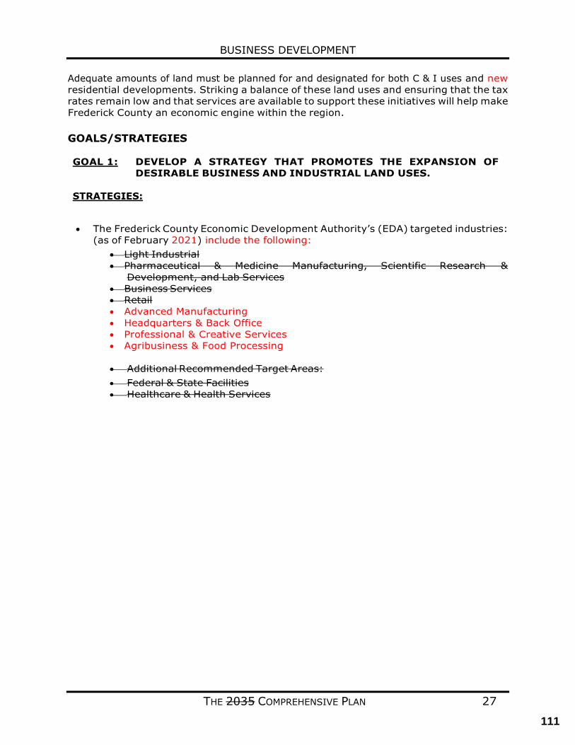
BUSINESS DEVELOPMENT
THE 2035 COMPREHENSIVE PLAN 27
Adequate amounts of land must be planned for and designated for both C & I uses and new residential developments. Striking a balance of these land uses and ensuring that the tax rates remain low and that services are available to support these initiatives will help make Frederick County an economic engine within the region. GOALS/STRATEGIES GOAL 1: DEVELOP A STRATEGY THAT PROMOTES THE EXPANSION OF
DESIRABLE BUSINESS AND INDUSTRIAL LAND USES. STRATEGIES:
• The Frederick County Economic Development Authority’s (EDA) targeted industries: (as of February 2021) include the following:
• Light Industrial • Pharmaceutical & Medicine Manufacturing, Scientific Research &
Development, and Lab Services • Business Services • Retail • Advanced Manufacturing • Headquarters & Back Office • Professional & Creative Services • Agribusiness & Food Processing
• Additional Recommended Target Areas: • Federal & State Facilities • Healthcare & Health Services
111
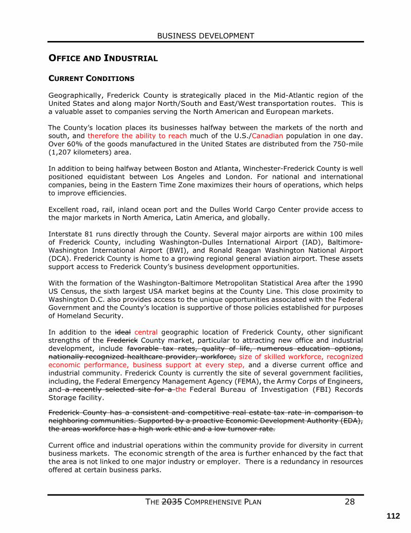
BUSINESS DEVELOPMENT
THE 2035 COMPREHENSIVE PLAN 28
OFFICE AND INDUSTRIAL CURRENT CONDITIONS Geographically, Frederick County is strategically placed in the Mid-Atlantic region of the United States and along major North/South and East/West transportation routes. This is a valuable asset to companies serving the North American and European markets. The County’s location places its businesses halfway between the markets of the north and south, and therefore the ability to reach much of the U.S./Canadian population in one day. Over 60% of the goods manufactured in the United States are distributed from the 750-mile (1,207 kilometers) area. In addition to being halfway between Boston and Atlanta, Winchester-Frederick County is well positioned equidistant between Los Angeles and London. For national and international companies, being in the Eastern Time Zone maximizes their hours of operations, which helps to improve efficiencies. Excellent road, rail, inland ocean port and the Dulles World Cargo Center provide access to the major markets in North America, Latin America, and globally. Interstate 81 runs directly through the County. Several major airports are within 100 miles of Frederick County, including Washington-Dulles International Airport (IAD), Baltimore-Washington International Airport (BWI), and Ronald Reagan Washington National Airport (DCA). Frederick County is home to a growing regional general aviation airport. These assets support access to Frederick County’s business development opportunities. With the formation of the Washington-Baltimore Metropolitan Statistical Area after the 1990 US Census, the sixth largest USA market begins at the County Line. This close proximity to Washington D.C. also provides access to the unique opportunities associated with the Federal Government and the County’s location is supportive of those policies established for purposes of Homeland Security. In addition to the ideal central geographic location of Frederick County, other significant strengths of the Frederick County market, particular to attracting new office and industrial development, include favorable tax rates, quality of life, numerous education options, nationally recognized healthcare provider, workforce, size of skilled workforce, recognized economic performance, business support at every step, and a diverse current office and industrial community. Frederick County is currently the site of several government facilities, including, the Federal Emergency Management Agency (FEMA), the Army Corps of Engineers, and a recently selected site for a the Federal Bureau of Investigation (FBI) Records Storage facility.
Frederick County has a consistent and competitive real estate tax rate in comparison to neighboring communities. Supported by a proactive Economic Development Authority (EDA), the areas workforce has a high work ethic and a low turnover rate. Current office and industrial operations within the community provide for diversity in current business markets. The economic strength of the area is further enhanced by the fact that the area is not linked to one major industry or employer. There is a redundancy in resources offered at certain business parks.
112
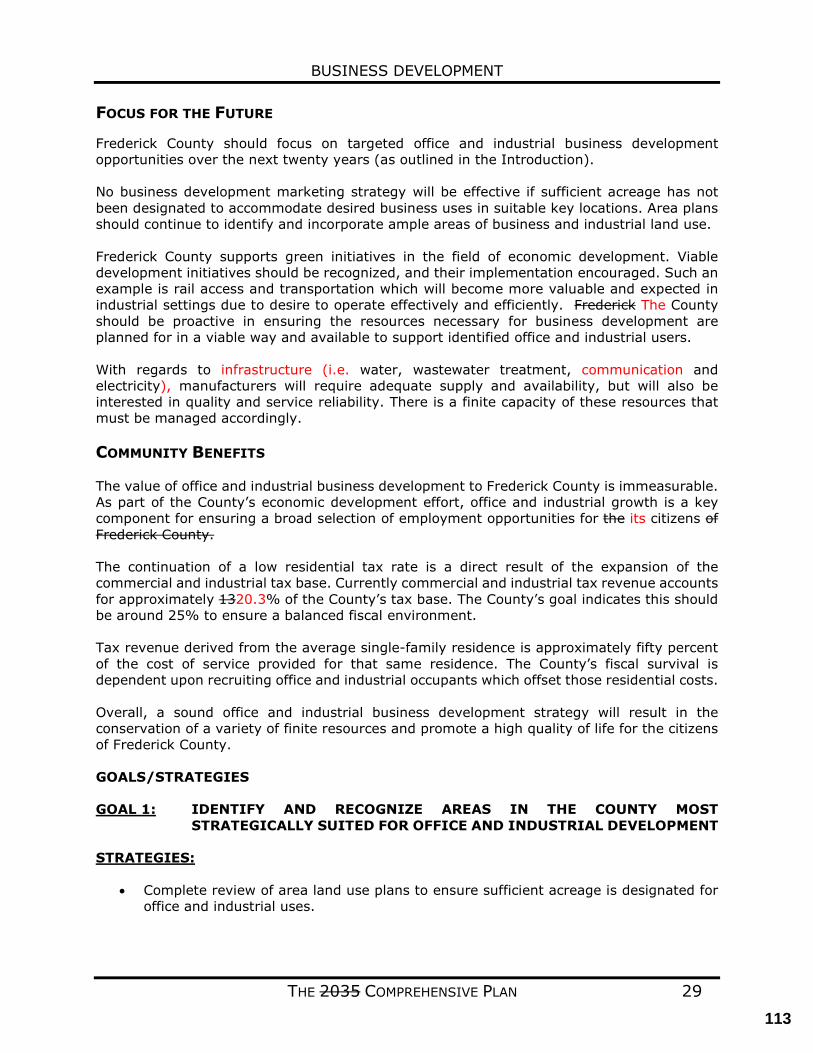
BUSINESS DEVELOPMENT
THE 2035 COMPREHENSIVE PLAN 29
FOCUS FOR THE FUTURE
Frederick County should focus on targeted office and industrial business development opportunities over the next twenty years (as outlined in the Introduction). No business development marketing strategy will be effective if sufficient acreage has not been designated to accommodate desired business uses in suitable key locations. Area plans should continue to identify and incorporate ample areas of business and industrial land use. Frederick County supports green initiatives in the field of economic development. Viable development initiatives should be recognized, and their implementation encouraged. Such an example is rail access and transportation which will become more valuable and expected in industrial settings due to desire to operate effectively and efficiently. Frederick The County should be proactive in ensuring the resources necessary for business development are planned for in a viable way and available to support identified office and industrial users. With regards to infrastructure (i.e. water, wastewater treatment, communication and electricity), manufacturers will require adequate supply and availability, but will also be interested in quality and service reliability. There is a finite capacity of these resources that must be managed accordingly. COMMUNITY BENEFITS The value of office and industrial business development to Frederick County is immeasurable. As part of the County’s economic development effort, office and industrial growth is a key component for ensuring a broad selection of employment opportunities for the its citizens of Frederick County. The continuation of a low residential tax rate is a direct result of the expansion of the commercial and industrial tax base. Currently commercial and industrial tax revenue accounts for approximately 1320.3% of the County’s tax base. The County’s goal indicates this should be around 25% to ensure a balanced fiscal environment. Tax revenue derived from the average single-family residence is approximately fifty percent of the cost of service provided for that same residence. The County’s fiscal survival is dependent upon recruiting office and industrial occupants which offset those residential costs. Overall, a sound office and industrial business development strategy will result in the conservation of a variety of finite resources and promote a high quality of life for the citizens of Frederick County. GOALS/STRATEGIES GOAL 1: IDENTIFY AND RECOGNIZE AREAS IN THE COUNTY MOST
STRATEGICALLY SUITED FOR OFFICE AND INDUSTRIAL DEVELOPMENT STRATEGIES:
• Complete review of area land use plans to ensure sufficient acreage is designated for
office and industrial uses.
113
BUSINESS DEVELOPMENT
THE 2035 COMPREHENSIVE PLAN 30
• All infrastructure, such as voice and data fiber, electric, water, wastewater, and natural gas, should be extended to areas identified for office and industrial uses and non-rural residential areas.
• The rezoning process should be examined and streamlined as appropriate in order to encourage landowners of properties identified in Area Plans (see Appendix I) to proceed with rezoning.
GOAL 2: PROACTIVELY ATTRACT DESIRED BUSINESS ENTITIES STRATEGIES:
• Review and revise the office and manufacturing zoning districts to further encourage development of targeted industries.
• Continue to examine and fund business location marketing studies that build or modify
the current business base, to help the County forward its goal of increased income for its citizens and tax value for the County.
GOAL 3: CONSIDER REGULATIONS ENCOURAGING AND/OR REQUIRING
SERVICE REDUNDANCY IN OFFICE & INDUSTRIAL AREAS STRATEGIES:
• Create incentives for industrial site developers to implement service redundancy.
114
BUSINESS DEVELOPMENT
THE 2035 COMPREHENSIVE PLAN 31
RETAIL
CURRENT CONDITIONS The retail sales potential of any geographic market is based upon a mixture of many factors, a few of which are:
• The number of households within the market. • The average disposable income of those households. • The sophistication and depth of surrounding competing markets. • The presence of a marketing effort for the area (as opposed to the marketing of an
individual venue). From a land use perspective as well as general business development, retail needs to be viewed in at least 3 parts:
• National Retail • Small Retail • Meals Away from Home
FOCUS FOR THE FUTURE
Over the next twenty years, population growth in Frederick County and its environs will continue to fuel retail development and the opening of varied retailers throughout the area. Frederick County has already taken necessary steps to prepare. The establishment of the Frederick County Economic Development Authority (EDA) is an example. A locality has little impact on the decision of the “national” retailer to locate in an area, unless the number of households in the market and the average disposable income of those households unless items #1 and #2 (above under “Current Conditions”) meet their individual business model. With a “small” retailer the driving factor is affordable available space.
Frederick County must strategically identify prime areas for commercial land use in key locations to capitalize on future commercial opportunities. In addition, Frederick County must continue to effectively market itself to the network of developers, national and regional retail trade organizations, retailers, and tenant-representation real estate agents and brokers that influence site selection decisions. While the County’s ability to attract national and regional developers and retailers to the area cannot be understated, the County must not underestimate the importance of supporting locally owned and operated developments and retail establishments. The growth of such locally owned businesses within the market’s retail mix will have a direct positive impact to the vitality of the market’s retail profile and the quality of life of local residents. COMMUNITY BENEFITS Successful growth of retail equates to an increase in sales tax revenue to support county services and capital improvements. A strong retail environment also plays a key role in the quality of life for the residents of any geographic area and thus plays an integral role in an individual family, a corporation, or other entity deciding to relocate to that area. Retail growth also equates to more jobs, both directly (with the retailers themselves) and indirectly (a strong retail environment plays a role in drawing employers to the area).
115
BUSINESS DEVELOPMENT
THE 2035 COMPREHENSIVE PLAN 32
GOALS/STRATEGIES GOAL 1: PROMOTE FREDERICK COUNTY AS A DYNAMIC, RETAIL MARKET.
STRATEGIES:
• Develop a unified marketing plan for the County.
• Strategically identify prime areas for commercial land use in key locations to capitalize on future commercial opportunities.
GOAL 2: FUTURE DEVELOPMENTS SHOULD BE OF A HIGH QUALITY. STRATEGIES:
• Promote enhanced architectural/design requirements for future retail development,
including structure appearance, landscaping, and signage. • Encourage mixed use developments for future residential and commercial
developments. • Identify regulations that may require modification to support the inclusion of a limited
retail component within residential developments.
116
BUSINESS DEVELOPMENT
THE 2035 COMPREHENSIVE PLAN 33
TOURISM
CURRENT CONDITIONS Frederick County and the surrounding areas play host every year to nationally recognized events such as the Shenandoah Apple Blossom Festival and Belle Grove Civil War living history reenactments. The area is home to the Museum of the Shenandoah Valley, the Cedar Creek and Belle Grove National Historic Park, the North-South Skirmish, various year-round live theater and performance centers, a revitalized and vibrant Old Town Winchester, and other key assets such as orchards, farm markets, historic homes, battlefields, and natural resources that bring travelers and their tourism dollars to the area. The County also supports a growing number of wineries and the potential for new craft breweries and distilleries, as well as outstanding outdoor recreational opportunities such as the Tuscarora hiking trail, an ATV trail, seasonal navigable waterways, and access to regional spots amenities such as the Appalachian Trail, Shenandoah River, and the Shenandoah National Park. As the economy improves and travel increases, it is critical that the County be poised to capitalize on the growth in travel and tourism. The Winchester – Frederick County Convention and Visitors Bureau, a city/county tourism marketing partnership, is a key component in developing the marketing strategy to attract additional visitors, and subsequent spending, to the area. The economic impact of travel and tourism reaches every citizen of Frederick County (each household pays less each year in local & state taxes due to the revenue generated by tourism) by providing employment and tax revenues. Tourism also helps to support a diverse portfolio of local events, attractions and activities and thereby contributes to the quality of life for local residents.
FOCUS FOR THE FUTURE
First impressions often set the tone for a visitor’s experience, and the great majority of travelers arrive in Frederick County through its roadways. The character of Frederick County’s entrance corridors, especially in areas adjacent to the city of Winchester, is a key factor for the visitor’s experience and their decision to stay longer and hopefully return. Enhancing the aesthetics and traffic flow of these corridors will improve visitor impressions and will benefit the quality of life for residents. Frederick County should concentrate on strengthening its ability to attract an increasing number of overnight visitors through targeted, strategic, and collaborative branding and marketing efforts that focus on visitor experiences. The ultimate goal will be to enhance the visitor experience. Agritourism Agritourism takes place on a farm or ranch and may include the opportunity to assist with the day-to-day activities associated with running the farm or to participate in the use of these lands for outdoor related events or activities. The term agritourism has also been broadened now to include wineries, breweries, and distilleries, which, combined, are the hottest trend in tourism product development in the Commonwealth. Agritourism is discussed at length in the following section of this chapter.
117
BUSINESS DEVELOPMENT
THE 2035 COMPREHENSIVE PLAN 34
GOALS/STRATEGIES GOAL 1: RECOGNIZE DIVERSIFIED LAND USE FOR TOURISM RELATED
ACTIVITIES
STRATEGIES:
• Ensure that business owners are supported in their efforts to bring tourism activities to the local consumer market
• Continue to support rural agribusiness such as breweries, wineries and distilleries.
GOAL 2: LINK THE AREA’S VISITOR ATTRACTIONS WITH A TRAIL NETWORK
THAT FACILITATES NON-VEHICULAR MOVEMENT STRATEGIES:
• Work with the Northern Shenandoah Valley Regional Commission (NSVRC) and surrounding jurisdictions to update and improve the regional bicycle and pedestrian plan, “Walking and Wheeling in the Northern Shenandoah Valley”.
• Support the Redbud Run Greenway project to provide a trail network that will link
natural areas, battlefields, including the existing five-mile trail on the Civil War Preservation Trust property, schools, and other facilities in the Redbud Run corridor.
GOAL 3: PRESERVE AND ENHANCE THE HISTORIC CHARACTER OF FREDERICK
COUNTY’S ROADWAYS STRATEGIES:
• Foster a compact community design that uses traditional building features to maintain Frederick County’s unique historic character.
• Focus development in compact centers, using Neighborhood Design guidelines, and
keeping the rural, agricultural landscape as part of the visitor experience in Frederick County.
118
BUSINESS DEVELOPMENT
THE 2035 COMPREHENSIVE PLAN 35
AGRIBUSINESS CURRENT CONDITIONS Frederick County’s rural character is a key component in its identity and one of the key aspects primary items that draw visitors and new residents to the area. Historically, these rural areas have supported a wide array of agricultural uses, which at one time was the primary industry in the County. Today those these agricultural and forestry activities not only generate roughly $33 million per year but and they preserve close to 110,000 acres of rural land. From 2012 to 2017, the total acreage in Frederick County farms grew by over 9,000 acres. While the number of farms and the amount of land dedicated to agricultural uses has declined in the last 20 years, the market value of the products produced has actually increased. ‘Farm to Table’ trends, ‘Buy Fresh, Buy Local’ initiatives and the willingness for families to invest in higher quality, locally sourced and environmentally friendly produced groceries will continue to help drive additional market growth. Agritourism continues to be a growing sector within the County’s rural areas. Agritourism is a term that is applied to activities that allow visitors to tour some or all of an operational farm, participate in the cultivation or harvest of farm products, purchase and consume products grown directly on the farm, or participate in festivals or activities related to significant agricultural seasons or events. Examples include farm tours, pick-your-own farm operations, roadside farm-stands, wineries, or fall harvest festivals. The County in recent years has also seen increasing interest in the development of utility-scale photovoltaic energy generation facilities (i.e., solar farms). Due to the large land area assemblage needed to develop these facilities, the rural areas of the County have been the primary target. Utility scale solar facilities are typically passive uses with limited impacts to the environment and the rural character. Additionally, implementation of this use can facilitate the preservation of agricultural and rural land for future use once these sites are decommissioned, although the extent to which the use removes agricultural and rural land from current use should also be considered. Utility-scale solar facilities, when located in appropriate areas, can provide opportunities for landowners to recoup value from their property without subdividing. The Code of Virginia also enables localities implementing solar facilities to tax this utility infrastructure through the machinery and tools tax or revenue-share agreements with utility operators, generating additional tax revenue beyond the land use assessment. This additional revenue can help the County offset impacts from residential development. To protect the amount of land available for agricultural use, the County provides makes a variety of tools and programs for available to landowners. The County continues to offer to allow landowners to participate in the Land Use Tax Deferral Program which allows taxpayers to apply for specially reduced assessments, such as for qualifying agricultural, horticultural, and forestry uses. Participation in one of the County’s many Agricultural and Forestal Districts is also available to County property owners. As of 2021, there were nine eight districts covering approximately 12,000 acres. Over the past few years, Frederick County has worked to implement on implementing new tools to which not only help protect the agricultural lands in the County but at the same time also help rural landowners realize economic return from their property the farmer capture value of the property without actually developing or selling the land. These programs include the Purchase of Development Rights Program and the Transfer of Development Rights
119
BUSINESS DEVELOPMENT
THE 2035 COMPREHENSIVE PLAN 36
Program. These programs are discussed further in the Rural Areas chapter. FOCUS FOR THE FUTURE Agricultural operations in Frederick County agriculture will continue to evolve. evolve in a way that is likely to be more intensive and by necessity more diverse. While this will require less acreage than traditional farming activities, activities it is expected that income from agricultural operations will increase. As such, the County should be prepared to respond to new rural related business and agricultural models including new agricultural techniques, value-added farm products, on-site events, sales, and services. These business opportunities can allow rural landowners to diversify their sources of income and engage niche agricultural and tourism markets. As such the County should focus on implementing policies that seek to prioritize the protection of these rural areas as well as streamline the process for approving the diversified land uses as described within this section. Reduction in permit fees and taxes generated from these new opportunities should be considered as well. COMMUNITY BENEFITS
Once land is converted from agricultural use it is unlikely that it will ever be reclaimed. The rural economy of Frederick County plays a significant role in the life and livelihood of its inhabitants. In addition to providing food products for the region, agriculture is a revenue generator which requires very few local services. Agriculture contributes to Frederick County’s extraordinary viewsheds while providing a living to its farmers, citizens, and a place of enjoyment for its visitors. Most importantly, an active, profitable agriculture agricultural operations reduce the amount of land converted to more intensive dense uses. Diversification of land used for the agricultural purposes not only generates notable income and drives more tourism dollars to the County, it can also offer future protection for the land from potential conversion to residential uses. GOALS/STRATEGIES GOAL1: THE COUNTY SHOULD CONTINUE TO SUPPORT ITS AGRICULTURAL
INDUSTRIES WHILE ALSO RESPONDING TO INDUSTRY CHANGES IN THE INDUSTRY.
STRATEGIES:
• Diversified uses on the farm site such as farm markets, alternative fuels, animal boarding, Pick-Your-Own operations, agritourism, vineyards, wineries, distilleries and micro-breweries and specialty crops, etc., should be encouraged to help preserve farming and agricultural uses in Frederick County.
• The Ordinances of Frederick County should be reviewed to reference and enable the full a wide range of agriculturally related activities. Care must be taken to ensure that such activities are compatible in scale, size and intensity with surrounding land uses and the rural character.
• Value added processes and support businesses should be examined for location within the Rural Area. These processes currently are permitted in the business districts.
120
BUSINESS DEVELOPMENT
THE 2035 COMPREHENSIVE PLAN 37
• Continue to allow and encourage the use of the Land Use Tax Deferral Program, Agricultural and Forestal Programs, Purchase of Development Rights Program, and the Transfer of Development Rights Program.
• Continue to regulate solar facilities through the Conditional Use Permit process to
protect adjacent properties and the agricultural/rural character of these areas.
• The County should ensure that the siting of new solar facilities do not detract from the agricultural and rural character within its rural areas and will protect agricultural and rural land for future use once decommissioned.
121
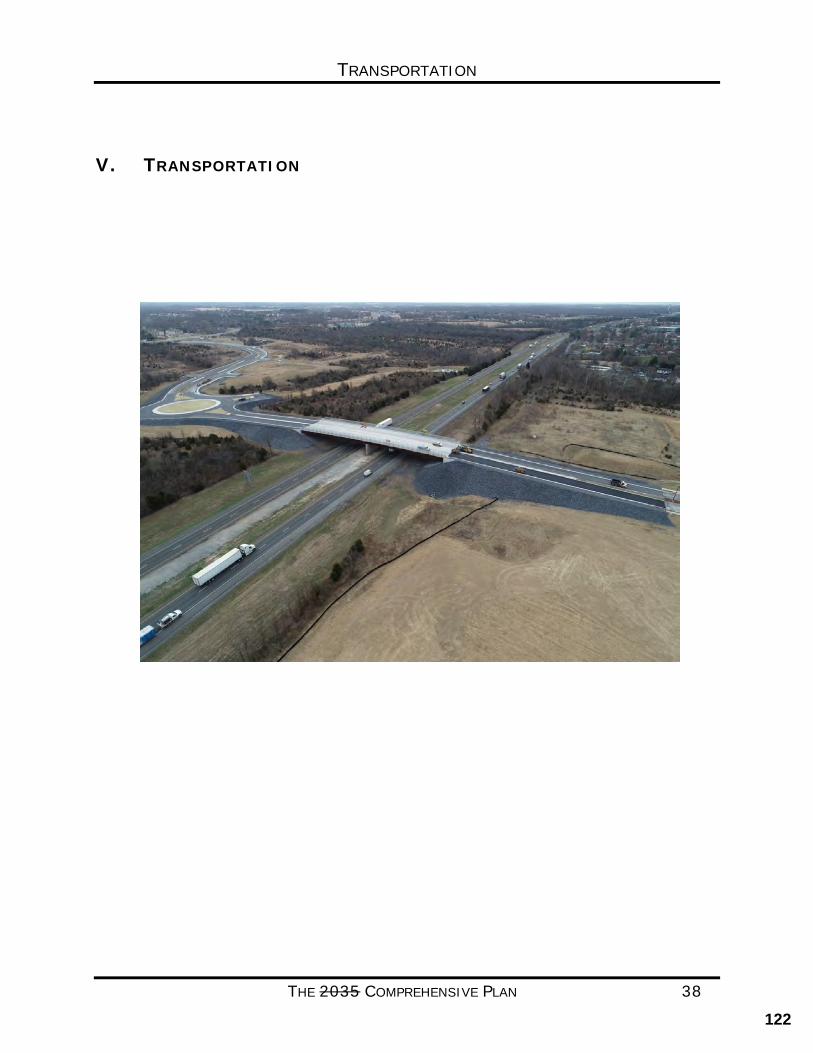
TRANSPORTATION
THE 2035 COMPREHENSIVE PLAN 38
V. TRANSPORTATION
122
TRANSPORTATION
THE 2035 COMPREHENSIVE PLAN 39
TRANSPORTATION CURRENT CONDITIONS Frederick County has grown significantly in the past two decades in both population and economic development, placing a significant demand upon the transportation system. Current County policy follows State Code guidance to ensure that new development offsets its impacts to the transportation system. A significant portion of congested roadways in the County can be linked to by-right development that does not offset its transportation impacts since it is not required by the Code of Virginia. This has had the greatest impact upon Interstate 81 and the primary highways in the County. Primary Highways include Routes 37, 522, 50, 7, 277 and 11. Based upon the most recent Virginia Department of Transportation (VDOT) data available (2016) Frederick County has 1,853 lane miles of roadway that are part of the state system. As of 2019, VDOT estimates that vehicles traveled 3,323,511 miles per day on Frederick County roadways. This is an over 200% increase since 1990. The vast majority of this travel is focused upon the Interstate and Primary systems. Planning Activities Transportation planning for Frederick County takes place in many ways. In addition to local comprehensive planning, Frederick County is a member of the WinFred Metropolitan Planning Organization. As part of that organization, the County participates in regional long range planning and has access to resources for numerous other planning studies. In addition, the County annually updates the Frederick County Interstate, Primary, and Secondary Road Plans which highlight key priorities. Finally, the County also regularly conducts small area plans such as the Northeast Land Use Plan and the 277 Triangle Land Use Plan which focus on smaller portions of the County. With the exception of a situation where the small area plan is more detailed, any discrepancy between the two plans will be resolved by the Eastern Road Plan. Urban Areas It is the County’s policy to focus future growth in the Urban Areas, within the boundaries of the Urban Development Area (UDA) and Sewer and Water Service Area (SWSA). In addition, the County has recently taken additional steps for growth within the UDA by adopting a Transfer of Development Rights (TDR) ordinance which allows by-right residential development rights to be sold by landowners in the rural areas to landowners inside the UDA. Ultimately, while this results in increased traffic in the UDA, this is still a net financial benefit to the County. This allows the County and State to focus roadway improvements within the UDA as opposed to having to expand roadways throughout the entire County. The Eastern Road Plan is the guide to roadway development/improvements in and around the urban areas. As of the year 2000 census, the urbanized portions of Frederick County, Winchester, and Stephens City area reached the population threshold (50,000) that led to the federally required creation of a Metropolitan Planning Organization (MPO). In Frederick County the
123
TRANSPORTATION
THE 2035 COMPREHENSIVE PLAN 40
MPO boundary is concentrated around the development in the eastern section, and along Route 11 to West Virginia in the north, and to Stephens City in the South. Staffed by the Northern Shenandoah Valley Regional Commission, the MPO is responsible for creating a long range transportation plan that meets air quality standards. The MPO is currently operating under the 2040 Metropolitan Transportation Plan; a planned update will be undertaken in 2021. Rural Areas Improvements to secondary roads in the more rural western portion of the County are focused on safety and maintenance as opposed to creating additional capacity. The possible exception to this would be areas where the Comprehensive Plan proposes the development of Rural Community Centers. Capacity and safety improvements to primary roadways in the rural areas will be addressed on an as needed basis. Transportation funding for improvements in Frederick County have largely been accomplished through development proffers and the VDOT Revenue Sharing Program. Whenever possible, the County uses public-private partnerships to make improvements. Key examples of this include the Crossover Blvd. connection from Route 522 to the City of Winchester over I-81, Phase I of Renaissance Drive, and Snowden Bridge Blvd from Route 11 North to Milburn Road. The County is also active in the areas of rail access funding and economic development road access funding. The Commonwealth’s role in transportation funding has been declining over the years and has now reached the point where some federal funds are being used for maintenance with very little new construction taking place. The State has been actively encouraging localities to take on maintenance of their road systems. In recent years new legislation has created additional revenue streams to fund transportation in the Commonwealth. The most important development for Frederick County has been the creation of the I-81 Authority, which provides additional gas tax revenue for projects along and related to the function of I-81. However, roadway construction and maintenance in Frederick County primarily remains the responsibility of the State and Federal Government. However, in spite of new state level funding for roads other than I-81, the VDOT Staunton District, in which Frederick County resides, continues to receive one of the lowest District Grant allocations in the state, which results in a significant backlog of critical needs projects. How the County, State, and Federal governments work together to create a long-term funding policy for transportation will have far reaching impacts on transportation systems in Frederick County.
The majority of construction in Virginia is funded through the Smart Scale Program (formerly HB2) and HB1887, which has significantly changed the process by which transportation projects will be funded within the Commonwealth. The stated purpose of the new system is to score transportation projects and remove politics from the decision making process. Based on the Commonwealth Transportation Board (CTB) adopted criteria, economic development is the most influential factor in scoring criteria for Frederick County. The County will continue to coordinate with the Economic Development Authority (EDA) to highlight the economic development importance of key roadways and improvements. During the first round of the Smart Scale Program the County was successful on a number of applications, the most significant of which was Route 277 from I-81 Exit 307 to Double Church Road which includes
124

TRANSPORTATION
THE 2035 COMPREHENSIVE PLAN 41
widening, access management for safety and a realignment of the Aylor Road intersection away from the interchange. To date, that project, now under construction, remains Frederick County’s largest funded project under the SmartScale project.
FOCUS FOR THE FUTURE In the next twenty to thirty years, it is expected that a number of key transportation milestones will be reached. The issue of long-term road construction funding must be resolved, which will allow significant transportation system improvements to move forward. Most crucial is the completion of the Route 37 Eastern bypass, which is critical for both residential and economic development traffic. Completion of this roadway has been a top priority for Frederick County for many years. The next most needed project in the County is the update of the Exit 317 Interchange, which the County has applied for through SmartScale several times at this point. The Eastern Road Plan will continue to guide road projects and will evolve to address the long-range transportation needs of the County. The County will work to ensure that development and transportation agencies routinely design and operate the entire right-of-way to enable safe access for drivers, transit users and vehicles, pedestrians, and bicyclists, as well as for older people, children, and people with disabilities. This goal aims to balance the diverse needs of all users of the public right-of-way and promote an integrated, multi-modal (or multiple modes of transportation) transportation system. Simply put, when roads in the secondary and primary system are being improved this means that the County will consider all potential users of the transportation system when making improvements or, working with development, or constructing new facilities. This goal will benefit Frederick County as it addresses important safety, health, and environmental considerations, and promotes growth and revitalization within the Community. Over time, it is expected that private transit options will begin to play a larger role in Frederick County’s transportation network. This would likely begin with demand type services for the special need’s populations, elderly, and disabled. The County has routinely supported applications for funding to the state for providers of these services through the MPO. As densities increase in the UDA and citizen preferences continue to shift, it is expected that bicycle and pedestrian accommodations will continue to increase in importance. The Frederick County School System has opened its first elementary school (Greenwood Mill Elementary) with a walk zone now opened more than one elementary school with incorporated walk zones and they plan to continue promoting of this type of school. Finally, with the growth potential of the Virginia Inland Port in Warren County, Frederick County has experienced and can expect a continuing increase in freight movement via rail and roadways. The development of the County’s transportation infrastructure should continue to address transportation improvements that will further the economic growth of the Community. This would also include future growth of the Winchester Regional Airport.
125
TRANSPORTATION
THE 2035 COMPREHENSIVE PLAN 42
COMMUNITY BENEFITS The benefits to the Community of a healthy transportation system are immeasurable. An efficient transportation system leads to communities that are less stressed, healthier, less polluted, safer, and more attractive to economic development opportunities and new residents.
A policy that creates an interconnected system of bicycle and pedestrian facilities will lead to a healthier and fitter community as well as increased home values. Removal of cars from the roadway would reduce congestion and air pollution. The mixed-use land use pattern promoted by New Urbanism and the urban center concept of this Plan further promotes these policies.
The transportation system is also a key consideration for business looking to expand or locate in a community locations. An efficient transportation system will make the County more attractive to new businesses and will also keep existing businesses from looking to locate elsewhere. In addition, continued focus on intermodal opportunities (the transfer of goods between different transportation modes such as truck to rail or air) in the area will make the County more attractive to businesses looking to take advantage of rail sidings or locations near the airport. The County’s willingness to support both road and rail access funding has already led to increased economic development interest. The result is more jobs for County citizens as well as a more valuable and diverse tax base.
As residential and commercial development continues, increasing demands will be placed upon the County’s transportation infrastructure. Challenges will continue to be placed on the County by users of Interstate 81 and commuters through the area.
The role of Frederick County is to first plan the transportation system and then work with new and existing development to preserve corridor right-of-ways and implement construction needs. It is the role of the State and Federal government along with development to fund transportation improvements necessary to ensure the future health of the County’s transportation network. The State and Federal government, as well as private development, carry the primary responsibility to fund transportation improvements necessary to ensure the future health of the County’s transportation network. However, it may be necessary to consider strategic local funding contributions in order to leverage State and Federal funds, or match and incentivize private investment.
GOALS/STRATEGIES GOAL 1: TO PROMOTE THE DEVELOPMENT OF NEW ROADWAYS AND THE
REDEVELOPMENT OF EXISTING ROADWAYS IN A MANNER THAT MAKES THEM OPEN, AVAILABLE, AND SAFE TO ALL MODES OF TRANSPORTATION.
STRATEGIES:
• Match desired form of development to roadway classification to simplify the determination of which roadways receive which treatment. That is, different types of streets for different land uses. For example, while some roadways would require a
126
TRANSPORTATION
THE 2035 COMPREHENSIVE PLAN 43
separate bicycle and pedestrian trail in order to be more accessible to bicyclists and pedestrians. In rural areas a wider shoulder section may be more appropriate.
• Work with new development and redevelopment to implement this policy and the overall transportation plan. This may require analysis and modification of the existing subdivision ordinance.
• Work cooperatively with the School Board to identify school locations that meet both
school and County goals of public access and safe walkability.
• Seek outside funding sources to fill in gaps in order to attach separate segments and create a fully interconnected system.
• Continue to monitor the County ordinances to ensure they meet the shifting needs of facility planning and VDOT standards.
GOAL 2: IMPLEMENT THE ROADWAY PRIORITIES OF THE COUNTY AS
OUTLINED ANNUALLY IN THE CAPITAL IMPROVEMENT PLAN, THE INTERSTATE, PRIMARY AND SECONDARY ROAD PLANS, AND THE EASTERN ROAD PLAN, AND PARTICULARLY ROUTE 37 EAST.
STRATEGIES:
• Work with new development and redevelopment to implement the Eastern Road Plan through construction and preservation of rights-of- way.
• Continue to work closely with VDOT, State and Federal representatives, and any other available revenue sources to increase transportation funding.
• In the absence of outside funding, continue to protect rights-of-way and move forward on planning transportation priorities.
• Coordinate with VDOT to make sure the required percentage of maintenance funds to be spent on other accommodations is used on County priorities.
• Maintain the character of the rural roadways in the County while addressing safety issues as they may arise.
GOAL 3: IMPROVE UPON EXISTING TRANSPORTATION SAFETY AND SERVICE
LEVELS IN THE COUNTY. STRATEGIES:
• Coordinate with VDOT in the scoping and review of Traffic Impact Analyses (TIA). • Analyze VDOT Access Management standards and, when needed, adopt County
standards that are stronger.
127
TRANSPORTATION
THE 2035 COMPREHENSIVE PLAN 44
• Work with new development and redevelopment to ensure that trip generation and new movements do not degrade the transportation system, increase delays, or reduce service levels.
• Create an informal working group with Staff, VDOT, and law enforcement to identify and address safety concerns with coordination to be handled by Planning and Development and the Board’s Transportation Committee (TC).
GOAL 4: KEEPING THE COST OF INDUSTRIAL PROPERTY COMPETITIVE.
WORK TO ENHANCE USE OF INTERMODAL FREIGHT MOVEMENT WHEREVER POSSIBLE.
STRATEGIES:
• Coordinate with local business to maximize the use of Economic Development Road Access funding, as well as Rail Access funding.
• Actively work with rail carriers through the Economic Development Authority to
maximize the amount of material that is shipped into and out of Frederick County via rail.
• Perform a study to discern where opportunities to bring air freight into the regional
airport may be available. • Work to encourage and maximize opportunities presented by expansion of the
Virginia Inland Port. and the new multimodal facility coming to Martinsburg, WV. • Make use of revenue sharing funds for development of industrial property when the
Board of Supervisors determines that it is in the best interest of Frederick County. • Incorporate the Airport Master Plan into the County planning efforts.
GOAL 5: IMPROVE THE BEAUTY OF TRANSPORTATION CORRIDORS AT THE
COUNTY GATEWAYS AND ALONG COMMERCIAL ROADWAYS.
STRATEGIES:
• Work with VDOT to create roadway design plans that meet standards while beautifying local gateways and commercial corridors.
• Through the Transportation Committee, develop a plan and actively promote corridor
beautification. This should include working with local institutions to create more attractive County entrances into their facilities.
128
TRANSPORTATION
THE 2035 COMPREHENSIVE PLAN 45
GOAL 6: ENSURE SAFE OPERATION OF FIRE AND RESCUE VEHICLES AND SCHOOL BUSSES.
STRATEGIES:
• Investigate the existence and potential removal of barriers between neighborhoods that lead to delays in response, particularly for the Greenwood and Millwood Companies.
• Promote the adoption of a uniform locking technology acceptable to the Fire and Rescue Department for use on gated and locked emergency access points.
• Analyze driving, road, and parking standards and actively seek the Fire and Rescue Department input for driveways and roads to ensure that all approved developments are accessible by fire equipment.
GOAL 7: PROVIDE COST-EFFECTIVE ALTERNATIVES TO AUTOMOBILE
TRAVEL AS NEEDED, FOR THE ELDERLY, DISABLED, STUDENTS, AND WORKFORCE.
STRATEGIES:
• Coordinate with existing agencies such as the Shenandoah Area Agency on Aging (SAAA) and Access Independence to secure outside funding to enhance service to the elderly and disabled in the community.
• Make use of the Winchester-Frederick Metropolitan Planning Organization (MPO) resources to identify areas of most critical need.
• Monitor existing data source updates to determine areas of growing need.
STATE CODE COMPLIANCE
The Code of Virginia, Section 15.2-2222.1, states specific requirements for the development of a transportation plan as it relates to comprehensive plans:
B.1. As part of the comprehensive plan, each locality shall develop a transportation plan that designates a system of transportation infrastructure needs and recommendations that include the designation of new and expanded transportation facilities and that support the planned development of the territory covered by the plan and shall include, as appropriate, but not be limited to, roadways, bicycle accommodations, pedestrian accommodations, railways, bridges, waterways, airports, ports, and public transportation facilities. The plan shall recognize and differentiate among a hierarchy of roads such as expressways, arterials, and collectors. In developing the plan, the locality shall take into consideration how to align transportation infrastructure and facilities with affordable, accessible housing and community services that are located within the
129
TRANSPORTATION
THE 2035 COMPREHENSIVE PLAN 46
territory in order to facilitate community integration of the elderly and persons with disabilities. The Virginia Department of Transportation shall, upon request, provide localities with technical assistance in preparing such transportation plan.
B.2. The transportation plan shall include a map that shall show road and transportation
improvements, including the cost estimates of such road and transportation improvements from the Virginia Department of Transportation, taking into account the current and future needs of residents in the locality while considering the current and future needs of the planning district within which the locality is situated.
This chapter has been reviewed by VDOT officials and has been determined to meet the requirements outlined in state code. PLANNING ASSUMPTIONS While many factors impact changes in transportation needs and patterns, the most significant factors impacting the transportation system in Frederick County are population and employment growth. Desired patterns for that growth and policies and strategies to support those patterns are outline earlier in this chapter of the Comprehensive Plan. As noted in the WinFred MPO 2040 Metropolitan Transportation Plan, population in Frederick County which was 78,305 in 2010 is expected to reach 151,408 by 2040. This is a decrease from the previously expected horizon year population of 153,945 from the 2035 plan. Employment which was 23,499 in 2010 is expected to reach 93,000 by 2040. This growth particularly the population is expected to add significant stress to the Frederick County transportation system.
NEEDS ASSUMPTIONS A number of factors aid in determining near and long term needs in the County. While the most key input in determining needs and impacts is the modeling processes undertaken through the WinFred Metropolitan Planning Organization, many factors help in determining needs such as coordination with the Virginia Department of Transportation, safety concerns, maintenance needs, citizen concerns, and economic development. Shown below are the 2040 Projected Volumes and Volume/Capacity Ratio maps from the modeling work done with the WinFred Metropolitan Planning Organization. These modeling outputs are a significant tool in determining and vetting near term as well as long range transportation needs. Some of the County’s most immediate near term needs are as follows: Route 37 Route 37 has long been the County’s top priority, and this continues to be true. The completion of the Route 37 loop around the eastern portion of the County will not only relieve congestion on numerous local routes that have become congested as the County has grown, but also offers relief on I-81 by helping to remove local trips from the interstate as well as offering an additional relief valve when there are incidents that lead to I-81 delays or closures.
130

TRANSPORTATION
THE 2035 COMPREHENSIVE PLAN 47
The segment of Route 37 that is of top priority is from I-81 exit 310 to Route 522. This segment offers important additional connectivity between I-81 and Route 522, which, in addition to significantly aiding local travel, will offer improved access to the Virginia Inland Port. This roadway is also expected to ease congestion on Route 277 and at Exit 313. I-81 Exit 313 Bridge The I-81 Exit 313 Bridge has been identified as in need of replacement by VDOT due to it reaching the end of the time where routine maintenance can adequately address bridge issues. The I-81 Exit 313 Bridge replacement has been funded by VDOT, however relatively few funds on the project allow for increased capacity. The need for significant capacity improvements at this interchange remains a priority. I-81 Exit 317 and Redbud Road There are currently two projects that are being pursued for this project at this time. The first This project would realign the northbound exit ramp of I-81 onto Route 11 to the location where Redbud Road currently intersects Route 11. This would align the interstate ramps which are currently offset and allow the removal of a signal on Route 11 north. In addition, this project would realign Redbud Road to a new intersection with Snowden Bridge Boulevard. This project is expected to aid congestion and improve safety at this area of Route 11 North as well as reduce stacking of traffic at the exit ramps. The second project, which his more costly, would implement a more long-term solution in the form of a diverging diamond interchange. With good design and planning, it is possible that the first project could be done in a way to provide nearer term relief while the County continues to pursue the larger solution for the long term without creating throwaway improvements. Route 11 North Corridor Widening Modeling of the expected development along the Route 11 North corridor indicates a need for widening and access management to the entire corridor with the corridor to become 6 lanes to Cedar Hill Road and 4 lanes to the West Virginia State line. The most immediate need is to widen from Route 37 to Old Charlestown Road. Route 11 South Route 11 South, particularly in the vicinity of Apple Valley Road, Commonwealth Court, and the interchange with Route 37 is becoming increasingly congested as surrounding area economic development has taken place.
131
TRANSPORTATION
THE 2035 COMPREHENSIVE PLAN 48
Additional near-term needs: Renaissance Drive from Prosperity Drive to Shady Elm (currently in design) Valley Mill Road Realignment (East) Valley Mill Road Realignment (West) Russell 150 Bridge over I-81 Airport Road Extension Tevis Street Extension Route 277 from Double Church Road to Warrior Drive Jubal Early Drive Extension and Interchange with Route 37 Intersection of Crestleigh Drive and Senseny Road Fox Drive/Route 522 Intersection Improvements Papermill Road/Route 522 Intersection Improvements Apple Valley Road/Route 11 Intersection Improvements Back Mountain Road Safety Improvements Route 11 at Old Charlestown Road Intersection Improvements Warrior Drive extension to Brandy Lane and Brandy Lane upgrade Route 11 From Opequon Church to the City of Winchester upgrade Sulphur Springs Road Improvements
132
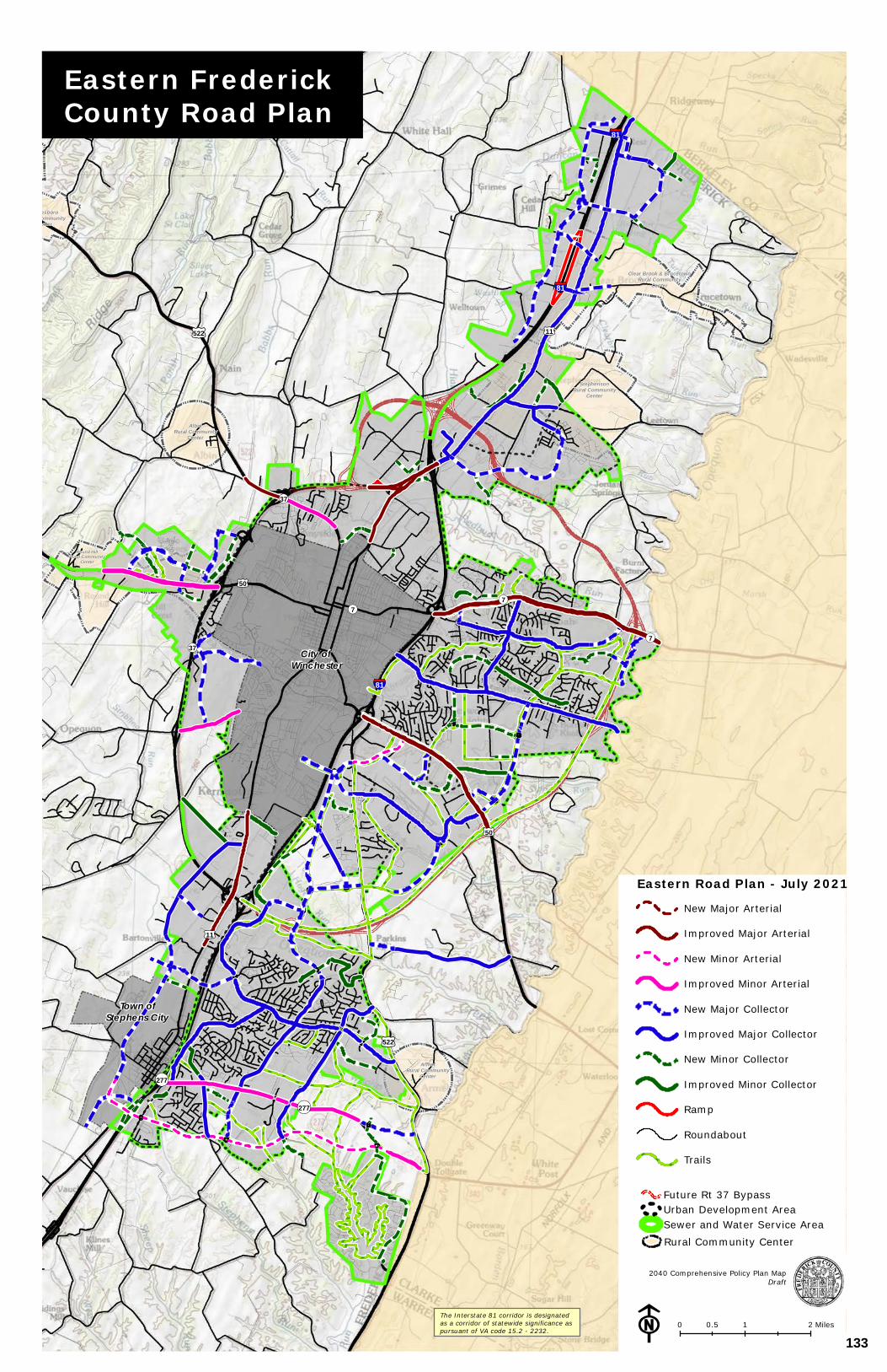
City of Winchester
Town ofStephens City
StephensonRural Community
Center
GainesboroRural Community
Center
Clear Brook & BrucetownRural Community
Center
Round HillRural Community
Center
AlbinRural Community
Center
ArmelRural Community
Center
§¦81
§¦81
§¦81
£¤50
£¤11
£¤50
£¤522
£¤522
£¤11
¬«277
¬«277
¬«37
¬«7
¬«7¬«7
¬«37
Copyright:© 2013 National Geographic Society, i-cubed
Eastern FrederickCounty Road Plan
F 0 1 20.5 MilesThe Interstate 81 corridor is designatedas a corridor of statewide significance aspursuant of VA code 15.2 - 2232.
2040 Comprehensive Policy Plan MapDraft
Eastern Road Plan - July 2021New Major Arterial
Improved Major Arterial
New Minor Arterial
Improved Minor Arterial
New Major Collector
Improved Major Collector
New Minor Collector
Improved Minor Collector
Ramp
Roundabout
Trails
Future Rt 37 Bypass
Sewer and Water Service AreaUrban Development Area
Rural Community Center
133
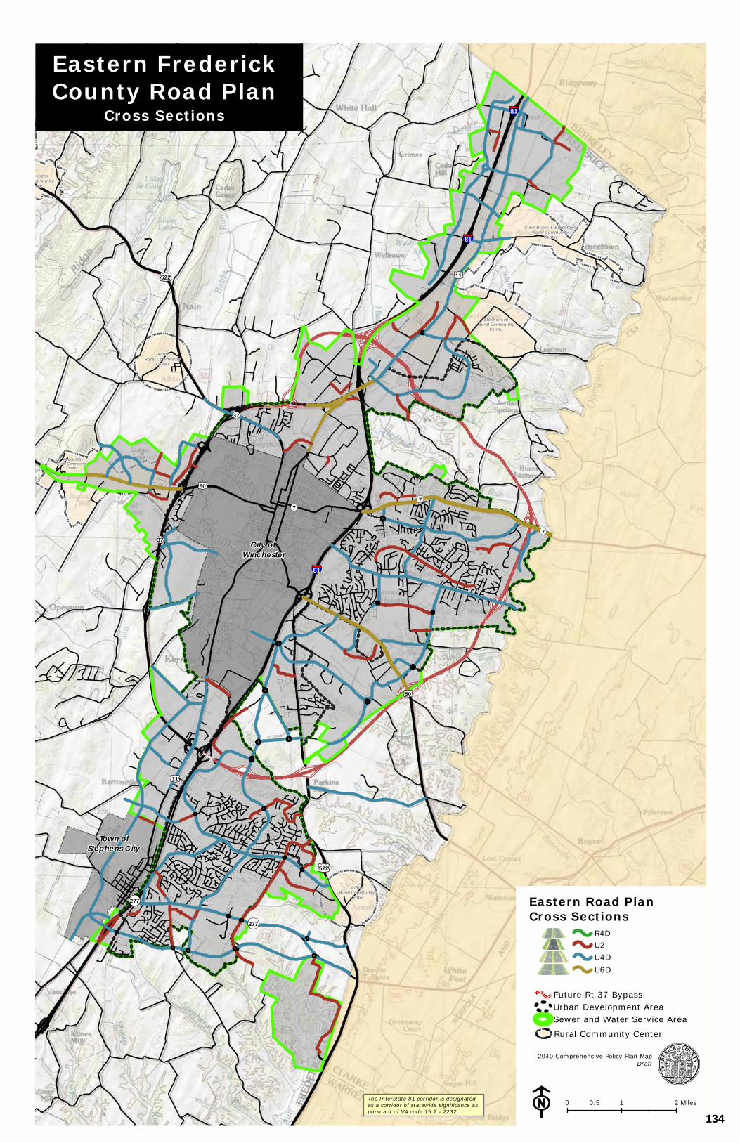
City of Winchester
Town ofStephens City
StephensonRural Community
Center
GainesboroRural Community
Center
Clear Brook & BrucetownRural Community
Center
Round HillRural Community
Center
AlbinRural Community
Center
ArmelRural Community
Center
§¦81
§¦81
§¦81
£¤50
£¤11
£¤50
£¤522
£¤522
£¤11
¬«277
¬«277
¬«37
¬«7
¬«7¬«7
¬«37
Copyright:© 2013 National Geographic Society, i-cubed
2040 Comprehensive Policy Plan MapDraft
F 0 1 20.5 MilesThe Interstate 81 corridor is designatedas a corridor of statewide significance aspursuant of VA code 15.2 - 2232.
Eastern FrederickCounty Road Plan
Cross Sections
Future Rt 37 Bypass
Sewer and Water Service AreaUrban Development Area
Rural Community Center
Eastern Road PlanCross Sections
R4DU2U4DU6D
134
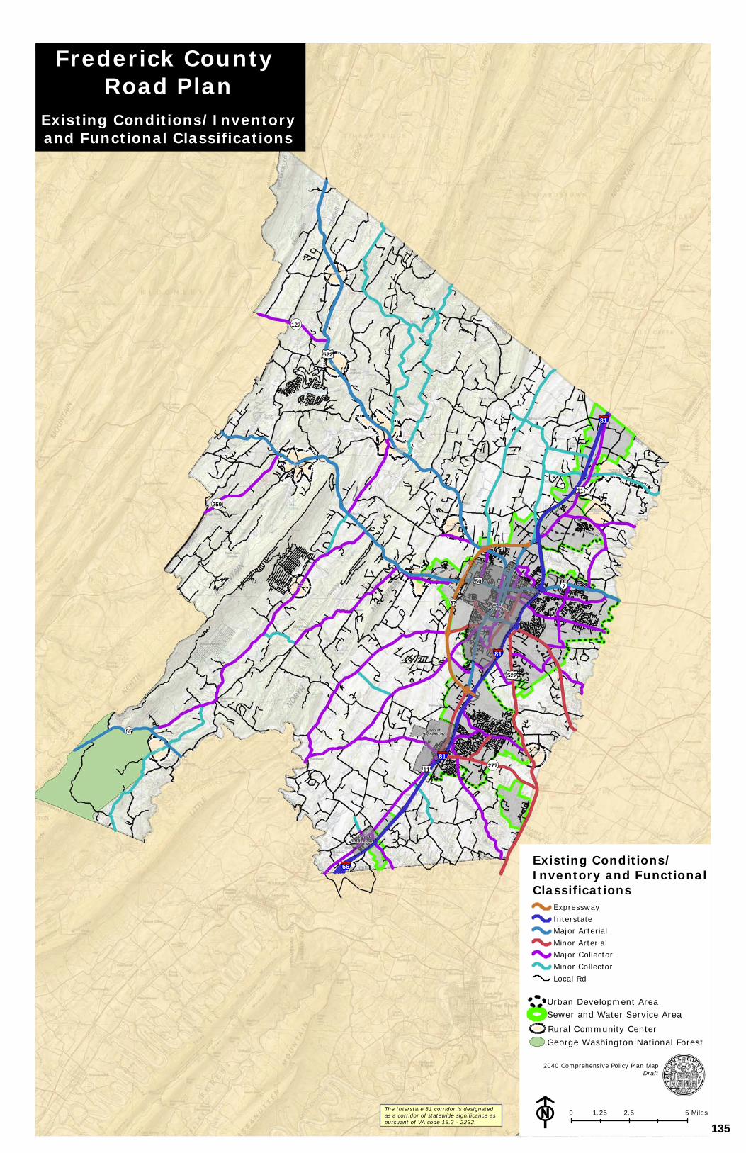
Town ofMiddletown
City of Winchester
Town ofStephens City
StephensonRural Community
Center
GainesboroRural Community
Center
Clear Brook & BrucetownRural Community
Center
Ro und HillRu ral Community
Cent er
GoreRural Community
Center
Sta r Tanne ryRural Com munity
Ce nt e r
Cross J unct ionRural Com munity
Ce nt e r
AlbinRural Community
Center
Re yno lds St o reRural Com munity
Ce nt e r
ShawneelandRural Community
Center
ArmelRural Community
Center
§¦81
§¦81
§¦81
§¦66
£¤11
£¤50
£¤522
£¤522
£¤11
¬«55
¬«259
¬«277
¬«127
¬«7
¬«37
Copyright:© 2013 National Geographic Society, i-cubed
Existing Conditions/Inventory and Functional Classifications
ExpresswayInterstateMajor ArterialMinor ArterialMajor CollectorMinor CollectorLocal Rd
The Interstate 81 corridor is designatedas a corridor of statewide significance aspursuant of VA code 15.2 - 2232.
2040 Comprehensive Policy Plan MapDraft
F
Sewer and Water Service AreaUrban Development Area
George Washington National ForestRural Community Center
Frederick County Road Plan
Existing Conditions/Inventoryand Functional Classifications
0 2.5 51.25 Miles
135
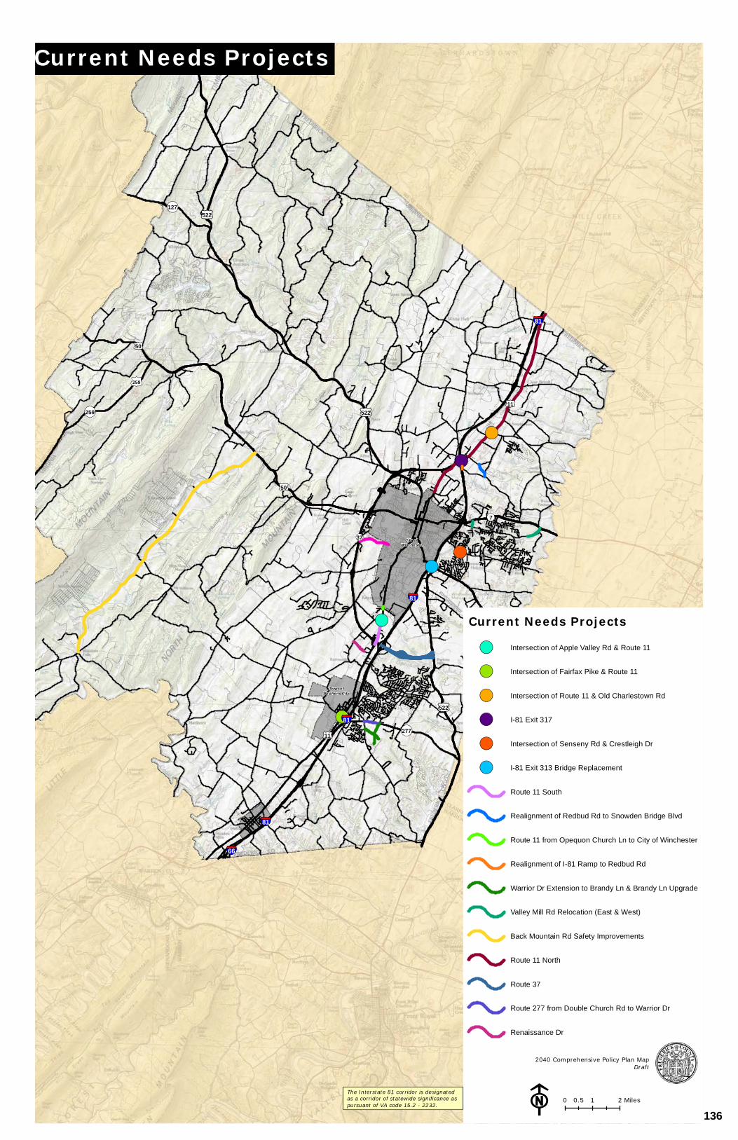
!(!(
!(
!(
!(
!(
City of Winchester
Town ofStephens City
01259
§¦81
§¦81
§¦81
§¦81
§¦66
£¤50
£¤50
£¤11
£¤50
£¤522
£¤522
£¤11
£¤522
¬«259
¬«277
¬«127
¬«7
¬«37
Copyright:© 2013 National Geographic Society, i-cubed
2040 Comprehensive Policy Plan MapDraft
F 0 1 20.5 Miles
Current Needs Projects
Current Needs Projects!( Intersection of Apple Valley Rd & Route 11
!( Intersection of Fairfax Pike & Route 11
!( Intersection of Route 11 & Old Charlestown Rd
!( I-81 Exit 317
!( Intersection of Senseny Rd & Crestleigh Dr
!( I-81 Exit 313 Bridge Replacement
Route 11 South
Realignment of Redbud Rd to Snowden Bridge Blvd
Route 11 from Opequon Church Ln to City of Winchester
Realignment of I-81 Ramp to Redbud Rd
Warrior Dr Extension to Brandy Ln & Brandy Ln Upgrade
Valley Mill Rd Relocation (East & West)
Back Mountain Rd Safety Improvements
Route 11 North
Route 37
Route 277 from Double Church Rd to Warrior Dr
Renaissance Dr
The Interstate 81 corridor is designatedas a corridor of statewide significance aspursuant of VA code 15.2 - 2232.
136

PUBLIC FACILITIES
THE 2035 COMPREHENSIVE PLAN 53
VI. PUBLIC FACILITIES
• FREDERICK COUNTY GOVERNMENT SERVICES
• FREDERICK COUNTY PUBLIC SCHOOLS
• FREDERICK COUNTY PARKS AND RECREATION
• HANDLEY REGIONAL LIBRARY
• FREDERICK COUNTY EMERGENCY SERVICES
• WINCHESTER REGIONAL AIRPORT
• FREDERICK WATER
137
PUBLIC FACILITIES
THE 2035 COMPREHENSIVE PLAN 54
PUBLIC FACILITIES
INTRODUCTION
This Chapter addresses the following County public facility providers and their focus and direction for the future. The purpose of the Public Facilities Chapter is to plan for future public facilities and infrastructure needed to serve existing and planned population growth through the efficient, safe, and accessible delivery of public services. The planning and siting of public facilities should be in a manner that will efficiently and economically serve the greatest number of residents. New facilities should be located within the County’s Urban Development Area (UDA), where future growth is desired; such facilities shall also generally be included in the Capital Improvement Plan (CIP).
Collaboration between County agencies should continue to be a priority goal in order to ensure that the investment made in the County’s community facilities will continue to provide the best possible environment for positive and vibrant community growth. Multiple use/satellite public facilities should be developed wherever such facilities would make the delivery of services more efficient. The Public Facilities Chapter is divided into several sections based on the department responsible for providing that facility or service. The sections are:
• FREDERICK COUNTY GOVERNMENT SERVICES
• FREDERICK COUNTY PUBLIC SCHOOLS (FCPS)
• FREDERICK COUNTY PARKS AND RECREATION
• HANDLEY REGIONAL LIBRARY
• FREDERICK COUNTY EMERGENCY SERVICES
• WINCHESTER REGIONAL AIRPORT
• FREDERICK WATER
• BROADBAND AND TELECOMMUNICATIONS
138
PUBLIC FACILITIES
THE 2035 COMPREHENSIVE PLAN 55
FOCUS FOR THE FUTURE Creating a sense of community through the principles of Neighborhood Design is supported through the policies contained within the Urban Area Study completed in 2006. By directing growth to the Urban Areas, through the UDA, the County can better direct services and community facilities to the citizens providing efficiency in community facilities including schools, parks, libraries and emergency services. At the same time, the County can better protect its Rural Areas and natural and cultural resources. COMMUNITY BENEFITS Public facilities, especially schools, parks and libraries, can provide focal points for walkable, mixed-use neighborhoods, intertwined with variety of housing, retail, and employment opportunities. Focusing development around walkable centers allows people to work, go to school, live, shop, and play in locations that are near each other. The location of public facilities and infrastructure and the thoughtful provisions for public spaces, recreational areas, and open spaces are essential to the creation of more walkable, livable communities. Collaboration between County agencies should continue to be a priority goal in order to ensure that the investment made in the County’s community facilities will continue to provide the best possible environment for positive and vibrant community growth.
139
PUBLIC FACILITIES
THE 2035 COMPREHENSIVE PLAN 56
FREDERICK COUNTY GOVERNMENT SERVICES CURRENT CONDITIONS Many of the County’s departments are located in the County Administration Building at 107 North Kent Street, Winchester; public safety agencies are located at the Frederick County Public Safety Center at 1080 Coverstone Drive, Winchester. The County has also recently acquired the former Sunnyside Plaza Shopping Center. This facility is planned to help meet the need for increased office space, meeting space, and governmental services in an accessible location. FOCUS FOR THE FUTURE Frederick County government shall continue to provide accessible, effective, and high-quality government services to its citizens, business owners, and community partners. Community facilities providing administrative and judicial services shall be located in urban areas which may include the County’s Urban Development Area, Sewer and Water Service Area, and/or areas identified as future Urban Centers. The County should strive to improve access to government services through a variety of creative and proactive approaches. Advances in technology should be embraced to further to advance the availability of government services. Projects aimed at enhancing the County’s ability to provide accessible, effective, and high-quality services, either by Frederick County or through partnerships with private entities should also be considered. In addition, A variety of communication methods shall be used to engage the community and promote the accessibility of those government services. The County shall strive to improve access to government services through a variety of creative and proactive approaches. This may include building new community facilities in urban areas/urban centers and through the use of technology that connects the County with the Community. COMMUNITY BENEFITS
Proper planning and land use policies enable the County to identify where future growth should be accommodated. By planning for this growth, we are better able to identify and provide for infrastructure and services in areas where they can reach the majority of the population.
Projects and proposals aimed at enhancing the County’s ability to provide accessible, effective, and high-quality government services, either by Frederick County or by private entities through allowable programs such as the Public-Private Education Facilities & Infrastructure Act (PPEA), should be considered as being consistent with the Comprehensive Plan of the County. Such community facilities shall generally be included in the Capital Improvement Plan.
140
PUBLIC FACILITIES
THE 2035 COMPREHENSIVE PLAN 57
GOALS/STRATEGIES GOAL: IMPROVE SERVICES TO CITIZENS THROUGH THE EFFICIENT PROVISIONS
OF FOR COMMUNITY FACILITIES. STRATEGIES:
• County government facilities services should be provided in a manner that ensures that all as needed to provide citizens, business owners, and community partners have with accessible government services.
• Community facilities should generally be located within urban areas which may include such as the County’s Urban Development Area, Sewer and Water Service Area, and/or areas identified as future Urban Centers.
• Community facilities should serve as community focal points.
• Collaboration between County agencies should continue to be a priority, goal as to ensure that the County can provide the best possible environment for positive and vibrant community growth. Multiple use/satellite public facilities should be developed wherever such facilities would make the delivery of services more efficient.
• Encourage collaboration with the private sector to provide integrated infrastructure in the most efficient way possible.
141
PUBLIC FACILITIES
THE 2035 COMPREHENSIVE PLAN 58
FREDERICK COUNTY PUBLIC SCHOOLS (FCPS) CURRENT CONDITIONS Frederick County Public Schools (FCPS) is the 20 22th largest of 134 132school systems in the Commonwealth of Virginia, with just serving over 13,600 13,246 students in the 2016-2017 2020-2021 school year. With over 2,300 2,100 full time employees, Frederick County Public Schools (FCPS) is one of the third largest employer in the Winchester-Frederick County area. The school district has 11 12 elementary schools, 4 middle schools, 3 high schools, 1 career & technical center, and participates in Northwest Regional Educational Programs, an alternative education center. Support facilities include the administration building, the maintenance/warehouse facility, the Transportation Facility, the Smithfield facility, and Support Facilities West. There are a total of 25 schools and support facilities operated by FCPS. In the past ten years, FCPS has constructed 4 3 new schools plus the Transportation Facility and 5 4 school additions/renovations. Residential growth continues to impact the school system as additional homes are built throughout the County. During the past several decades, the total student enrollment in the school division has increased steadily. Student enrollment has grown by 650 490 students in the past ten years. Eighty-one Seventy-four percent of the class of 2016 2020 planned to continue their education. FCPS on-time graduation rate for the 2015-16 2019-2020 school year was 93.5%, compared to the state's 91.3 92.3%. FOCUS FOR THE FUTURE
The establishment of new community facilities creates opportunities to improve the quality of the surrounding community. Schools in particular through the incorporation of Neighborhood Design can serve as the focal point for Neighborhood Villages and Urban Centers within the UDA and Rural Community Centers in the Rural Areas. Opportunities to co-locate schools with other community facilities should be sought. Several schools currently have Parks & Recreation Basic Rec programs within them. This program should be considered for new schools. Other Parks & Recreation programs could be co-located with schools. Schools should be located in existing or future neighborhoods, within walking distance and be accessible to residents. They act as neighborhood anchors and community centers. Well planned school sites, by encouraging walking and bicycling, can improve student health and academic performance and reduce traffic around schools. A good example of community-centered school planning can be found around Greenwood Mill Elementary School, the County’s 11th elementary school.
142
PUBLIC FACILITIES
THE 2035 COMPREHENSIVE PLAN 59
COMMUNITY BENEFITS
It is the mission of Frederick County Public Schools' (FCPS) vision is to be an innovate community where caring relationships and authentic learning inspire all students. ensure all students an excellent education. The school system works hard to meet the needs of all students, from those who will go to college to those who are challenged to master the most basic of life skills. FCPS fosters a culture of success and collaboration as well as a desire to constantly improve. The Frederick County Public Schools community nurtures all learners to realize their dreams and aspirations through:
• Meaningful and engaging learning experiences • A collective responsibility for continuous growth • Embracing a culture of diversity and inclusiveness • Fostering and supporting innovative ideas that challenge conventional thinking • A commitment to forward-thinking learning environments
FCPS promises each and every student learning experience grounded in high expectations, personalized to student needs and interests, tailored to inspire passion and challenge thinking, and backed by necessary learning supports today, so that each and every student is ready to pursue the dreams and opportunities of tomorrow. FCPS is a learning organization where students and staff thrive in safe, supportive, nurturing environments, motivated by a culture of continuous growth so that each and every student becomes a contributing citizen in our global society. FCPS will support students and staff through meaningful, authentic learning experiences and a focus on overall well-being by cultivating strategic, purposeful partnerships with community members, organizations, and families. FCPS will be recognized as the preferred school community for individuals who are high achieving, compassionate, committed to continuous improvement, and who are inspired and inspire others.
Frederick County Public Schools strives to be a premier school division in the Commonwealth of Virginia. Teachers and staff maintain high expectations for students so the children of Frederick County are equipped with the necessary knowledge, skills and competencies to be successful in their chosen career and life goals. There are specific programs offered by FCPS to meet the varying needs of special groups of students. In collaboration with the City of Winchester and Clarke County, FCPS provides an education for children who are emotionally disturbed or who have multiple disabilities. FCPS offers a variety of trade and industrial programs and health occupations programs designed to meet the needs of students who wish to improve their employability skills and explore different career possibilities. FCPS provides enriched and expanded instruction for students who qualify for Gifted Education, including the Mountain Vista Governor’s School. FCPS also participates in two summer programs: Performing and Visual Arts Northwest (PAVAN), a regional summer arts and culture program, and Blue Ridge Environmental Studies Regional Summer Governor’s School, which offers gifted students opportunities to work on real problems in environmental management.
143
PUBLIC FACILITIES
THE 2035 COMPREHENSIVE PLAN 60
GOALS/STRATEGIES Each local school board in Virginia is required by State Code to adopt a division wide comprehensive plan. Accordingly, the Frederick County Public Schools Division Comprehensive Plan, Inspire 2020, A Promise for Progress, is the document that governs the future direction of FCPS. Long-range school planning documents that are developed under the umbrella of the Division Comprehensive Plan include curriculum improvement plans, school improvement plans, a technology plan, enrollment projections, a capital improvement plan, and a staffing projection plan. The following policies include excerpts paraphrased from the FCPS Division Comprehensive Plan 2014-20. Please refer to that plan for the official version of these policies:
GOALS: CONSIDER THE SURROUNDING NEIGHBORHOOD VILLAGES, URBAN CENTERS, AND
RURAL COMMUNITIES; SITE LOCATION, SITE SUITABILITY, PROGRAM DESIGN, AND
THE NEEDS OF OTHER AGENCIES IN LOCATING NEW FACILITIES.
STRATEGIES:
• In evaluating potential school facility locations, consider the role of the site in building diverse, walkable communities in the UDA.
• In evaluating potential school facility locations, consider each location relative to arterial roads, planned roadways, the SWSA, the UDA, surrounding neighborhoods, floodplains, Civil War battlefields, and Agricultural and Forestal Districts. Also consider surrounding land uses, and potential environmental hazards.
• In evaluating individual candidate sites, consider each site’s zoning, planned land use, topography relative to program requirements, historical features, water features, wetlands, potential environmental hazards, geology, soil suitability, and tree cover. Also consider constraints contained in the site’s deed and plat and the potential for the presence of rare, threatened, and endangered species.
• Purchase sites that are suitable for co-locating school facilities with facilities other agencies have identified in their CIP or other studies if doing so does not interfere with FCPS’ educational mission and is a responsible use of public funds. Future school sites have the potential to be collocated with future fire and rescue stations, parks, community centers, libraries, convenience sites, and satellite offices for several County Departments. Additionally, future school sites could become part of the network of properties needed to execute the Eastern Road Plan.
144

PUBLIC FACILITIES
THE 2035 COMPREHENSIVE PLAN 61
BLANK SCHOOL MAP
145
PUBLIC FACILITIES
THE 2035 COMPREHENSIVE PLAN 62
FREDERICK COUNTY PARKS AND RECREATION
CURRENT CONDITIONS Facilities There are five classifications of parks including Mini, Neighborhood, Community, District Parks and Greenways. The classification depends on the size, service area, purpose, character, and location. The County currently owns and operates two district, one community and two neighborhood parks. Additionally, one community park is planned adjacent to the Snowden Bridge development where the County has taken possession of 25 acres of land.
The two district parks currently serve the County’s population with active and passive recreational programs and facilities. Clearbrook Park, located five miles north of Winchester on Route 11, consisting of approximately 55 acres (44 which are owned by the County) and Sherando Park, located two miles east of Stephens City on Route 277, consisting of approximately 334 acres. Rose Hill Park, a public park located 1/3 mile south of the intersection of Cedar Creek Grade and Jones Road, offers visitors the opportunity to enjoy the historic and scenic features of the museum of the Shenandoah Valley’s Rose Hill Farm. Two neighborhood parks include space at the Reynolds Store Fire Company, and the Frederick Heights subdivision near Senseny Road. These neighborhood parks consist primarily of playground equipment for young children. Master development plans were adopted for both Clearbrook and Sherando Parks which establish goals for each park, identify unmet recreational needs, provide unified facility plans, and propose a development program for each park.
Frederick County has four classifications of parks including Greenways (linear parks), Neighborhood, Community, and District Parks. The classification depends on the size, service area, purpose, character, and location of the property. The County currently has two district, two community, and three neighborhood parks. Additionally, a community park is planned on 25 acres on Old Charlestown Road in the Stonewall District and the County is beginning development of a Greenway trail along Abrams Creek in the eastern part of the County.
The two district parks, Clearbrook and Sherando, currently serve the County’s population with active and passive recreational programs and facilities. Clearbrook Park is located five miles north of Winchester on Route 11 and encompasses 44 acres of land surrounding a 3.5-acre lake. Sherando Park, located two miles east of Stephens City on Route 277, includes 334 acres of varied open and forested land and a diverse array of recreation facilities. Community parks include Rose Hill Park in the Back Creek District and Stonewall Park in the Stonewall District. Rose Hill Park is located 1/3 mile south of the intersection of Cedar Creek Grade and Jones Road offering visitors the opportunity to enjoy the historic and scenic features of the Museum of the Shenandoah Valley’s Rose Hill Farm. Stonewall Park on Stephenson Road is developed for active recreation and has five diamond ball fields for use. The three neighborhood parks include space at the Reynolds Store Fire Company, Frederick Heights Park near Senseny Road, and County owned property behind the Bowman Library where the department has constructed a walking trail around a lake and has plans to develop an amphitheater for community use. Master development plans were adopted for both
146

PUBLIC FACILITIES
THE 2035 COMPREHENSIVE PLAN 63
Clearbrook and Sherando Parks establishing a development vision for each park based on identified recreational needs.
Parks and Recreation Master Plan
The Parks and Recreation Master Plan was adopted in 2018 and outlines both long- and medium-term goals and strategies. Master Plan goals align with the Comprehensive Plan goals listed above and provide strategies and action steps for the department to pursue. The Parks and Recreation Master Plan is available on the Parks and Recreation website for reference.
FOCUS FOR THE FUTURE
In order to meet the future service demands on the County’s two district parks, the Parks and Recreation Department intends to continue implementing the improvements adopted on the Master Plans and in the Department Strategic Plan. Additionally, in support of Neighborhood Design, new parks and usable open spaces should be located within the UDA, near or at the center of Neighborhood Villages and Urban Centers or in Rural Community Centers in the Rural Area to help create more walkable, livable communities. The construction of additional trails throughout the Community is also important. Additional trails would provide residents with the ability to travel safely from their homes to schools, stores, and work or recreation areas without having to share roadways with vehicle traffic.
Frederick County is fortunate to have multiple entities providing publicly accessible land citizens can use for recreation and leisure purposes. Frederick County currently manages 431 acres of park land with almost half of those acres yet to be developed for active and passive recreation purposes. Additionally thousands of acres of publicly accessible land is provided by Federal, State, school system and non-profit entities within the borders of Frederick County, and adjoining jurisdictions allow the use of their facilities for County residents. In combination these publicly accessible lands provide an outline of current conditions from which remaining needs are determined. To meet the future service demands on the County’s two district parks, the Parks and Recreation Department intends to continue implementing the improvements adopted in the park Master Plans and in the Capital Improvement Plan. Additionally, new Neighborhood or Community Parks and usable open spaces should be located within the Urban Development Area (UDA), located near areas planned for future residential land uses, Neighborhood Villages and Urban Centers or within designated Rural Community Centers. The construction of additional trails throughout the community is also important. Trails are highly desired recreation facilities for county residents and provide the ability to travel safely from homes to schools, stores, work, or recreation areas without having to share roadways with vehicle traffic.
Frederick County is fortunate to have multiple entities providing publicly accessible land citizens can use for recreation and leisure purposes. Frederick County currently manages 430 acres of park land and 340 acres of other school and county owned properties. While new park land locations are identified, there is significant development potential on existing County
147
PUBLIC FACILITIES
THE 2035 COMPREHENSIVE PLAN 64
owned park areas as almost half of these acres are yet to be developed for recreation purposes. Frederick County is fortunate to have within its jurisdictional boundary thousands of acres of publicly accessible land provided by Federal, State, school system and non-profit entities. Additionally, adjoining jurisdictions allow Frederick County residents the use of their facilities. In combination the County and other publicly accessible lands and facilities provide the array of current conditions from which remaining needs are determined.
COMMUNITY BENEFITS The Frederick County Parks and Recreation Department is building a sense of community through people, parks, and recreational opportunities benefitting all residents. Parks and recreation activities stimulate economic activity and property values are increased by proximity to parks and through the added quality of life and sense of community. Families and organizations alike look to Frederick County Parks and Recreation to meet their leisure needs. Approximately 1.5 million recreational contact hours for youth, senior, and family programs are provided through programs offered by or facilitated through Frederick County Parks and Recreation with nearly two-thirds of Frederick County households reporting they use Parks and Recreation services and facilities in the past year. Nearly ½ million visits are counted at the two District Parks alone on an annual basis. GOALS/STRATEGIES
GOAL: CONTRIBUTE TO THE PHYSICAL, MENTAL, AND CULTURAL NEEDS OF THE COMMUNITY; ITS
ECONOMIC AND SOCIAL WELL-BEING, AND ITS SENSE OF CIVIC PRIDE AND SOCIAL
RESPONSIBILITY THROUGH THE IMPLEMENTATION OF AN INTEGRATED PLAN FOR
RECREATION PROGRAMS AND PARK FACILITIES.
STRATEGIES:
• Maintain a County-wide recreation plan which identifies recreational, park, trial, bikeway, and open space needs.
• Identify recreation needs associated with the Rural Community Centers.
• Continue to utilize State and Federal grants and loans for financing and
programming County recreational needs and especially for major capital projects. as needed pursue voter-approved bond financing for capital projects approved in the Capital Improvement Plan.
• Continue to expand our cooperative relationship with the Frederick County School
Board in jointly meeting identified County recreational needs.
• Review land development regulations to ensure that appropriate standards are provided for open space recreational facilities in new developments.
148
PUBLIC FACILITIES
THE 2035 COMPREHENSIVE PLAN 65
GOAL: TO HAVE EVERY RESIDENT OF FREDERICK COUNTY’S URBAN DEVELOPMENT AREA (UDA)
WITHIN WALKING OR BIKING DISTANCE OF A RECREATION AREA.
STRATEGIES:
• Inventory the County’s natural and environmental resources to identify appropriate locations for greenways, community and neighborhood and mini parks including connectivity consistent with the 2014 Metropolitan Planning Organization (MPO) Bicycle and Pedestrian Plan.
• Strategically locate parks in or near Neighborhood Villages and Urban Centers to
meet population-based needs. Parks should be carefully planned to respect and take advantage of natural and historic resources as well as to enhance the natural, scenic, and cultural value of the urban areas of the County.
• Ensure that development recreation and open space requirements for residential
developments are adequate.
• Actively pursue parkland in areas where publicly accessible land does not or is not anticipated to meet citizen needs.
149
PUBLIC FACILITIES
THE 2035 COMPREHENSIVE PLAN 66
BLANK PARKS MAP
150
PUBLIC FACILITIES
THE 2035 COMPREHENSIVE PLAN 67
HANDLEY LIBRARY CURRENT CONDITIONS The goal of the Handley Regional Library System is to be a resource to the communities they serve by creating connections to information and entertainment and being the center of learning. Currently the Handley Regional Library System has one library in each jurisdiction served. As population grows in Frederick County, the demand for library services also continues to increase grow. Each library in the Handley Regional Library system functions as a community center, a search engine, and a place that welcomes everyone to lifelong learning. Frederick County’s larger population and land area mean that there are Frederick County locations portions of the County that are not well served by the Winchester or Stephens City branches libraries. FOCUS FOR THE FUTURE As the residential population in Frederick County continues to grow the Library System has plans for opening new facilities. Within the next five years the Library Board plans for a future libraries to open in the Gainesboro area, Senseny/Greenwood area and the Route 522/Justus Drive area. library to open in the Gainesboro district and new libraries at Senseny and Greenwood and at Route 522 and Justice Drive are planned for the next ten years. The inclusion of small library branches that can offer delivery of materials from anywhere in the system as well as providing information and training to customers about new online services should is also being considered.
COMMUNITY BENEFIT Ideally, a new library can best serve as community centers when they are located within a walkable community, near schools, parks and retail establishments. With easy access to computer workstations, libraries are a primary source of technology services and resources to County residents, especially those who may lack such access in their homes. Ideal locations for new libraries would be within close proximity to residential uses, schools and commercial uses. GOALS/STRATEGIES GOAL: PLAN FOR GROWTH WITH THE AIM OF PROVIDING ADEQUATE LIBRARY SPACE FOR
LIBRARY USERS IN THE FUTURE. PROVIDE ADEQUATE LIBRARY SERVICES TO MEET THE
NEEDS OF THE CURRENT AND FUTURE RESIDENTS. STRATEGIES:
• The Handley Regional Library Board will review and update its long-range plan for facilities growth, using the criteria of cost, need, safety, and proximity to the greatest number of residents.
151
PUBLIC FACILITIES
THE 2035 COMPREHENSIVE PLAN 68
• Continue to monitor the growth throughout the County to determine where new library facilities are needed.
152
PUBLIC FACILITIES
THE 2035 COMPREHENSIVE PLAN 69
FREDERICK COUNTY EMERGENCY SERVICES
CURRENT CONDITIONS As residential and commercial developments continue to locate and expand in Frederick County, there will be an increased need for emergency services fire and rescue stations to provide services to protect the citizens and transient population. Emergency services are provided by The Frederick County Fire and Rescue Department, The Sheriff’s Office, and the Department of Public Safety Communications. These three departments are located at the Frederick County Public Safety Center. The ultimate goal of the fire and rescue system is to provide the most efficient fire and rescue services Countywide. Responses include, but are not limited to, emergency medical services, fire suppression, rescue, hazardous‐materials, swift water rescue, technical rescues, and natural disasters., special services and emergency management. Timely responses by emergency services personnel and equipment enable resuscitation efforts to begin in the critical minutes immediately following a cardiac related incident and also minimize fire related deaths. The Department is made up of the Operations Division, Training Division, Fire and Life Safety Division, Emergency Management Division, and the Fire Marshal’s Office.
The Fire and Rescue Department consists of eleven volunteer fire and rescue companies. The Department has career personnel assigned to all eleven stations, which are staffed 24 hours a day. Volunteer personnel staff their stations when available.
FOCUS FOR THE FUTURE
Future challenges for the Fire and Rescue Department include developing additional fire and rescue stations to meet future growth within the County and keeping up with the staffing needs to continue to provide quality and timely service to the citizens.
Planning for future fire and rescue station locations and equipment needs must be accomplished by developing a five-year strategic plan. This plan will identify future fire and rescue station sites and equipment needs based on projected service demands and response times. The plan will encourage the dedication of sites for new fire and rescue stations within the identified areas during the rezoning process.
Non-residential areas such as retail, office, and industrial areas require increased fire protection because specialized equipment is necessary to ensure safety for these land uses. Other land uses identified as target hazards continue to grow. These include land uses such as schools, nursing homes, daycare centers, and industrial facilities. These land uses have a higher risk of injury due to the specific demographics of person utilizing these facilities.
Existing road conditions, primarily those with gravel or dirt surfaces and horizontal and vertical curvatures, located outside of the county’s Urban Development Area (UDA) create longer response times. The greatest factor contributing to the need for new fire and rescue stations is the rapid population growth and increases in dwelling units within the County.
153
PUBLIC FACILITIES
THE 2035 COMPREHENSIVE PLAN 70
COMMUNITY BENEFITS
The development of new fire and rescue stations could provide an opportunity to extend satellite services provided by other County Departments and agencies. Allocation of space could be created within new fire and rescue stations for community services provided by the Sheriff’s Office, the Treasurer’s Office, the Voter Registrar’s Office, and the Commission of the Revenue’s Office, to provide the residents of Frederick County more accessible options for government services. Also, in support of Neighborhood Design, it is encouraged that the location of future facilities be located within the UDA, near Neighborhood Villages and Urban Centers or in Rural Community Centers. Locations for future facilities are encouraged within the UDA and Rural Community Centers.
GOALS/STRATEGIES
GOAL: WHEN PLANNING NEW FACILITIES, CONSIDER SITE LOCATION, SITE SUITABILITY, BUILDING DESIGN, AND CONSTRUCTION TIMING.
STRATEGIES:
• Co-locate fire and rescue stations with other County facilities and agencies for maximum efficiency.
• Construct fire and rescue stations at strategic locations throughout the County to help achieve desired response times to all emergency calls and increase the level of service. Locate fire and rescue stations with easy access to a major arterial or at an intersection of two major arteries to gain both east-west and north-south access.
• Encourage sites to be large enough to accommodate equipment storage and facilitate maneuverability, allowing equipment to either pull-through or be backed into garage bays without hindering traffic flows in the public right-of-way.
• Locate fire and rescue stations on sites of between two and five acres to allow for future expansion. Sites may be smaller when developed as part of a Neighborhood Design in an Urban Center or Neighborhood Village.
• Select and design sites to minimize the adverse impact of sirens and other noise on residential areas.
• Investigate the need for a Regional Public Safety Training Center as the demands for
public safety related training increase and existing facilities age.
• Continue working towards replacing the County’s public safety communication system.
• Where appropriate, collocate Fire and Rescue communication infrastructure on existing telecommunications towers and/or tall structures to support more efficient operations throughout the County.
154
PUBLIC FACILITIES
THE 2035 COMPREHENSIVE PLAN 71
WINCHESTER REGIONAL AIRPORT
CURRENT CONDITIONS
The Winchester Regional Airport is recognized as an important component of the County’s Business Development efforts. Therefore, the Plan designates an Airport Support Area for the Winchester Regional Airport the Winchester Regional Airport Authority has developed an Airport Support Area for inclusion in the plan. Business, Commercial, and industrial uses should be the primary land uses in the Airport Support Area; these planned land uses are further outlined in Appendix I.
The Airport Support Area is an area in which further residential rezonings will be prohibited in order to protect fly-over areas and noise sensitive areas. Conflicts between airports and residential development can be significant in growing communities. Residents of areas in the vicinity of the airport tend to oppose airport operations activities and the expansion of such operations activities because of concern for noise and fly-overs increased aircraft activity. The Airport Support Area was also established to ensure the feasibility of continued operational viability of the airport use, and support future airport expansion, and the facilitate implementation of the Comprehensive Plan and Airport Master Plan.
FOCUS FOR THE FUTURE
There is a need to continue to implement the Airport Support Area expectations. Business Commercial and industrial uses should be the primary uses in the airport support area; residential rezoning’s will be prohibited.
The Capital Improvement Plan will continue to be a key tool that will facilitate the growth and development of the airport. Remaining Key capital projects include the acquisition of land along Bufflick Road for noise abatement property and easements necessary to protect the approach and departure surfaces of the runway and future growth, relocation of the primary parallel taxiway, replacement of the main aircraft parking apron, development of the northern side of the runway, and replacement of the terminal building and construction of an aircraft wash rack. COMMUNITY BENEFITS Through the support of the Winchester Regional Airport Authority’s member jurisdictions, the Airport will continue to evolve into be a modern, first class air transportation facility that accommodates a multitude of aeronautical functions that serve the public good, supports local employers, and attracts new which will assist business development endeavors in the attraction of new industrial and commercial businesses to the region. GOALS/STRATEGIES Specific Goals and Strategies relating to the Winchester Regional Airport are contained in Chapter 4 – Business Development.
155

PUBLIC FACILITIES
THE 2035 COMPREHENSIVE PLAN 72
BLANK AIRPORT MAP
156
PUBLIC FACILITIES
THE 2035 COMPREHENSIVE PLAN 73
FREDERICK WATER COUNTY SANITATION AUTHORITY (FCSA)
CURRENT CONDITIONS The Sewer and Water Service Area (SWSA) is an important policy tool used by Frederick County to determine where public water and sewer service may be provided. The Board of Supervisors approves the location of the Urban Development Area (UDA) and SWSA boundaries through the adoption of the Comprehensive Plan and amendments thereto. As a result, properties located within the SWSA may enjoy access to public water and sewer.
Frederick Water The Frederick County Sanitation Authority (FCSA) has the primary responsibility to manage the provision of water and sewer services in Frederick County. Other public entities may serve properties within Frederick County, if approved by the Board of Supervisors; this is the case in some areas adjacent to the City of Winchester and in the vicinity of the Town of Middletown and the Town of Stephens City. The Middletown/Lord Fairfax and Middletown/Reliance Road Area Plans established Sewer and Water Service Areas (SWSA) with the express stipulation that the Frederick Water The Frederick County Sanitation Authority (FCSA) will be the party responsible for providing water and sewer in this area. This may be done in cooperation with those adjacent public entities.
Water and Sewer Services
The location of public sewer and water lines within the Urban Development Area (UDA) and SWSA determines where urban development can occur. The UDA defines the general area in which more intensive forms of residential development can occur. Commercial, industrial, and institutional land uses are also encouraged within the UDA. The SWSA is consistent with the UDA in many locations. However, the SWSA may extend beyond the UDA to promote commercial, industrial, and institutional land uses in areas where residential land uses are not desirable.
It is the clear policy of the Comprehensive Plan that extensions of sewer and water service will be within the boundaries of the UDA and SWSA. The extension service into areas outside of those boundaries will require an amendment to the Comprehensive Plan. All sewer and water mains extended shall be publicly owned.
Frederick Water The Frederick County Sanitation Authority (FCSA) has the responsibility for the treatment, transmission, and distribution of potable water and the collection and transmission conveyance of wastewater. Most of the sewer and water mains and laterals in the County are owned, operated, and maintained by the Sanitation Authority Frederick Water.
Frederick County and Frederick Water The Frederick County Sanitation Authority (FCSA) have executed a Facilities Planning Agreement which sets forth procedures for the planning of sewer and water mains in the County. The agreement includes: provisions for adopting a water and sewer facilities plan as a part of the Comprehensive Plan; specifies the location of water and sewer mains over eight inches in size; provides for review and update of the plan and for including sewer and water facilities projects in the Frederick County Capital Improvements Plan.
157
PUBLIC FACILITIES
THE 2035 COMPREHENSIVE PLAN 74
The City of Winchester owns and maintains sewer and water lines in portions of the County adjacent to the City corporate limits. Such lines have been extended into the County following a previous agreement between the City and the County, and often predate Frederick Water’s ability to provide said services. The Frederick County Board of Supervisors prefer that all future water and sewer services in the County be provided by Frederick Water.
Wastewater Facilities
The Frederick-Winchester Service Authority (FWSA) provides wastewater treatment service for Frederick Water the FCSA and the City of Winchester. The FWSA currently owns the Opequon Water Reclamation Facility, the Parkins Mill Wastewater Treatment Plant and the Crooked Run Wastewater Treatment Plant and has operational agreements with the City and Frederick Water the FCSA for wastewater treatment plant their operations. The City operates and maintains the Opequon Facility while the Frederick Water Sanitation Authority is responsible for operation and maintenance of the Parkins Mill and Crooked Run Facilities.
Treatment of wastewater generated from within the County’s Sewer and Water Service Area (SWSA) is undertaken at all plants. The Opequon Service Area is comprised of the Abrams Creek drainage area which includes the City of Winchester and adjacent drainage areas located east, west and north of the City of Winchester. The Parkins Mill Wastewater Treatment Plant serves Frederick Water Sanitation Authority customers located in the upper Opequon Creek, Wrights Run, and Stephens Run drainage areas along with the Town of Stephens City. The Crooked Run Service Area services the Lake Frederick/Shenandoah Community in southeastern Frederick County.
The Opequon Water Reclamation Facility presently has a treatment capacity of 12.6 million gallons per day. The Parkins Mill Wastewater Treatment Plant which serves the upper Stephens Run, Wrights Run, and Opequon drainage areas has a treatment capacity of 5.0 million gallons per day. In addition, the The Crooked Run Wastewater Treatment Facility opened in support of the Lake Frederick development and has an ultimate capacity of 0.626 million gallons per day, with a current treatment capacity of 0.375 0.25 million gallons per day.
Water Facilities
Frederick Water the FCSA manages a system with a water capacity of 7.42 Million Gallons per Day (MGD), with an average daily use of 5.5 6.5 MGD. Various quarries provide the majority of the system’s water supply, with an agreement with the City of Winchester supplementing the system with up to 2MGD. Two water treatment facilities are owned and operated by Frederick Water the FCSA. The James H. Diehl Water Filtration Plant, put into operation 1994, treats up to 3 million gallons of water per day. Additional pumps can increase this capacity to 5 MGD. The water sources is 3 million gallons of include ground water pumped from Frederick Water owned quarries on the west side of Stephens City, and wells at Bartonsville and Orchard View Elementary School.
The James T. Anderson Treatment Plant, opened in 2002, has an initial capacity of 4 MGD expandable to 6 MGD. The water source is a quarry in Clearbrook and nearby wells.
158
PUBLIC FACILITIES
THE 2035 COMPREHENSIVE PLAN 75
In addition, the Authority has in operation two one elevated tanks and three ground storage tanks with a total capacity of 9.5 10 million gallons of system water storage.
FOCUS FOR THE FUTURE
The Frederick County Board of Supervisors establishes the framework for where development is to occur, and Frederick Water The Frederick County Sanitation Authority (FCSA) is tasked with accommodating and serving this new development.
The Comprehensive Plan utilizes the UDA and SWSA to designate those areas that are envisioned to be developed within the next 20 years. Therefore, areas within the SWSA should be provided public water and sewer service over the next 20 years as development advances. Those areas identified with future land uses but are not presently within the SWSA are expected to develop over the next 20-40 years; public water and sewer should be planned to serve these future areas. It is the role of Frederick Water The Frederick County Sanitation Authority (FCSA) to plan for and accommodate sewer and water service to these areas of anticipated new growth and development.
Historically, the County and Frederick Water the FCSA have collaborated on long range planning efforts, and this has previously been reflected in the Comprehensive Plan. Continued cooperation and collaboration between Frederick Water the FCSA and the Board of Supervisors is necessary in implementing the 2035 Comprehensive Plan.
In addition, Frederick Water the FCSA should update its water and sanitary sewer master plans to reflect Frederick Water’s the FCSA current plans to service land inside the SWSA and to include an overview of their plans to service future land uses outside of the current SWSA boundary. Such a master plans should build upon the future water and sewer needs of the County and the Town of Stephens City, and guide the development and acquisition of water resources and wastewater treatment options. Frederick Water the FCSA should proactively identify major capital projects aimed at increasing the County’s water supply or implementing the anticipated future land use plan.
As noted in the Natural Resources Chapter of the Comprehensive Plan, water supply is critical to both the natural and built environment, and viable sources are essential for future economic development in the County. The future focus of Frederick Water the FCSA and County should continue to be to protect the water supply and to identify and secure viable sources of water for the future growth and development of the County.
COMMUNITY BENEFIT Frederick Water The Frederick County Sanitation Authority is a non-profit organization whose mission statement is to provide affordable and reliable water and wastewater service to our customers while protecting public health and the environment. The ultimate benefit to the Community is significant and noted throughout this Plan.
159
PUBLIC FACILITIES
THE 2035 COMPREHENSIVE PLAN 76
GOALS/STRATEGIES GOAL: PROTECT GROUNDWATER SOURCES AND THE AREAS THAT CONTRIBUTE RECHARGE TO
ENSURE THAT ADEQUATE WATER SUPPLIES ARE MAINTAINED, AND WORK TOWARD
DEVELOPING INCREASED WATER SUPPLIES TO MEET FUTURE NEEDS. STRATEGIES:
• Frederick County and Frederick Water The Frederick County Sanitation Authority should continue to coordinate the planning of sewer and water facilities following the procedures described by the Facilities Planning Agreement.
• The Frederick County Board of Supervisors, with the support Frederick Water The Frederick County Sanitation Authority, should work with adjacent communities to evaluate regional water supply issues. As a result, a regional water supply partnership could be formed that would combine water resources and address water supply issues as one regional entity to ensure common goals.
• Water and sewer service should be provided to service areas in the UDA and SWSA through an orderly process following the Facilities Planning Agreement and using the Capital Improvements Plan.
GOAL: FACILITIES AND SERVICES SHOULD BE CAREFULLY PLANNED TO MEET PROJECTED
NEEDS. APPROPRIATE SERVICES AND FACILITIES SHALL BE PROVIDED TO SERVE
PLANNED LAND USES AND DEVELOPMENT. STRATEGIES:
• Carefully monitor sewer and water use and develop up-to-date improvement plans for sewer and water facilities.
• Develop and maintain formal and regular relationships and procedures between the County and providers of facilities and services, including Frederick Water the Sanitation Authority, the City of Winchester, the Frederick-Winchester Service Authority, and the Towns of Middletown and Stephens City.
• Identify those areas in the SWSA that are better situated to be served with water and sewer and prioritize facility and infrastructure development to more effectively serve those areas and the SWSA.
• Any sewer or water main eight inches in diameter or larger, extended or existing within an area proposed for inclusion within the SWSA or UDA, should be dedicated as a public line to be owned and maintained by Frederick Water the FCSA or City of Winchester when appropriate.
• Plans for new facilities should be based on demand projections as derived from
population projections in the Comprehensive Plan and from future land use plans which depict the planned future land uses that will accommodate the anticipated community
160
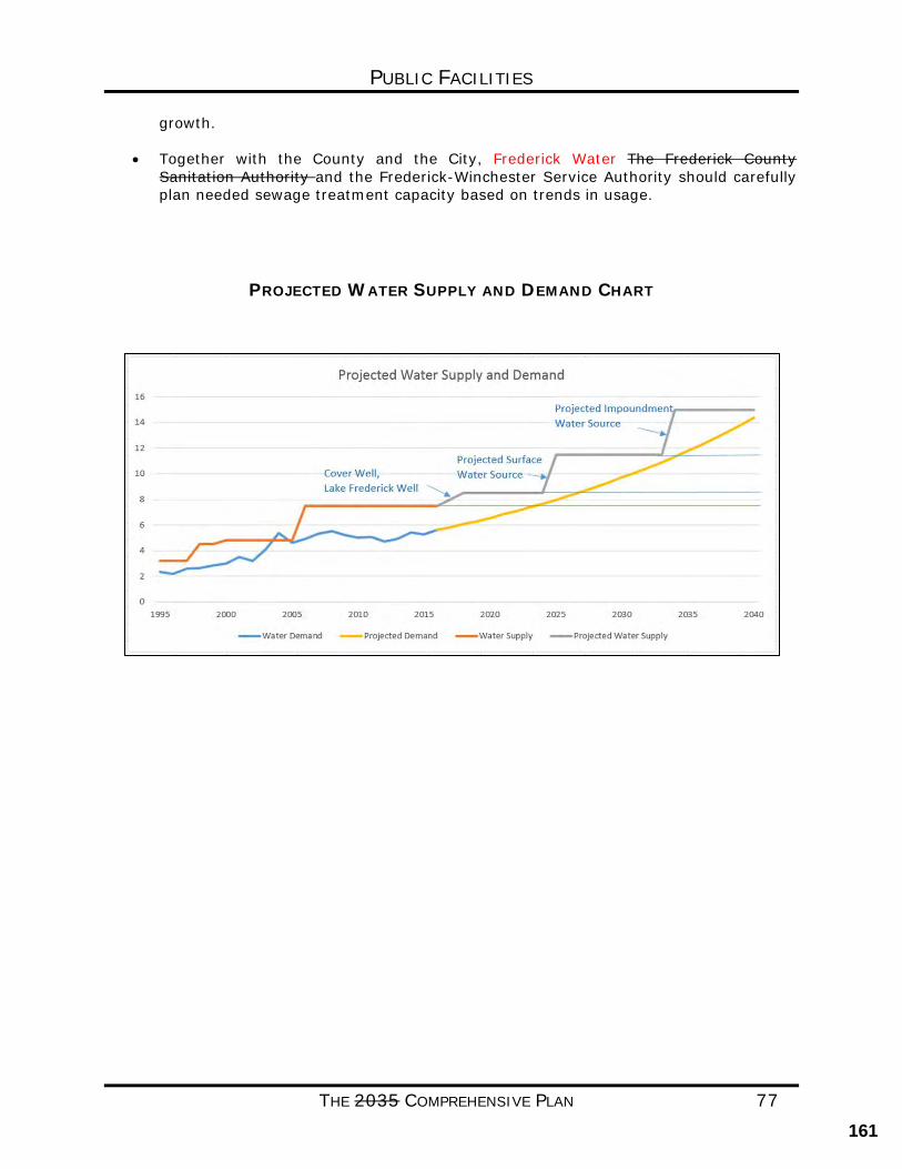
PUBLIC FACILITIES
THE 2035 COMPREHENSIVE PLAN 77
growth. • Together with the County and the City, Frederick Water The Frederick County
Sanitation Authority and the Frederick-Winchester Service Authority should carefully plan needed sewage treatment capacity based on trends in usage.
PROJECTED WATER SUPPLY AND DEMAND CHART
161
PUBLIC FACILITIES
THE 2035 COMPREHENSIVE PLAN 78
BLANK
WATER AND SEWER LINE MAP
162
PUBLIC FACILITIES
THE 2035 COMPREHENSIVE PLAN 79
BROADBAND AND TELECOMMUNICATIONS
CURRENT CONDITIONS Telecommunications continue to play a vital role in economic development and quality of life for residents of the County. The rural areas in particular have seen a shift towards greater demand from residents for access to internet service. While some areas of the County currently have access to fiber, cable, or powerline-based services, much of the County’s rural areas are not served by broadband and must rely on satellite or tower-based providers. FOCUS FOR THE FUTURE The lack of broadband service can be a constraint on the rural economy and puts households and students at a disadvantage. There are numerous challenges to bringing high speed broadband services to the rural areas of Frederick County. With over 416 square miles, Frederick County has topographic conditions that range from mountainous areas to the rolling and flatter rural areas, posing problems for cell tower provision of services. The County should study ways to match demand for internet service with availability of service in rural or underserved areas. COMMUNITY BENEFITS Access to high-speed internet is important for a variety of reasons, accessibility for school age children, residents that operate home based businesses, cellular phone service and access for new public safety communication facilities. GOALS/STRATEGIES
GOAL: PROMOTE THE DEVELOPMENT OF A HIGH-QUALITY WIRELESS TELECOMMUNICATIONS NETWORK THROUGHOUT THE COUNTY TO SERVE ITS RESIDENTS, WHILE PROTECTING THE COUNTY’S VISUAL LANDSCAPE, HISTORIC RESOURCES AND NATURAL RESOURCES.
STRATEGIES:
• Monitor broadband service coverage to ensure that as the county grows, adequate broadband services are provided to meet the needs of future residents and businesses.
• Support and facilitate the development of high-speed wired and wireless telecommunication networks, including broadband technology, to support rural businesses and residents.
• Develop a broadband policy to reflect the County’s need to have internet service speeds appropriate for educational, business, and residential purposes in all parts of the County.
163
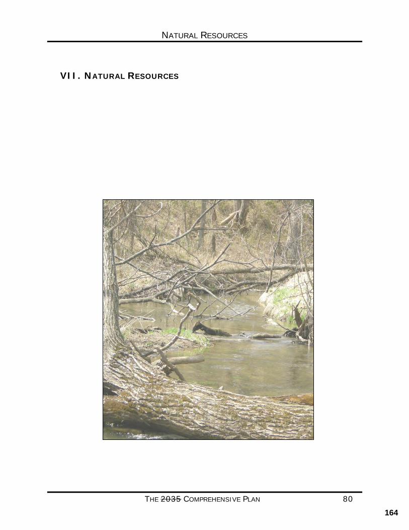
NATURAL RESOURCES
THE 2035 COMPREHENSIVE PLAN 80
VII. NATURAL RESOURCES
164
NATURAL RESOURCES
THE 2035 COMPREHENSIVE PLAN 81
NATURAL RESOURCES
CURRENT CONDITIONS
Frederick County’s natural resources and geographic location has long influenced the County’s history and settlement patterns. The last several decades has seen the community mature with a significant amount of residential and business growth. The greatest potential impact on our natural environment is the increasing population in the County which results in alteration of the land use. Conversion of land in the rural areas results in reduced open space and fragmentation of farm and forest lands. It can also disrupt natural and wildlife systems that help purify our air, recharge our groundwater and protect our local streams. Likewise, the denser growth in the UDA results in increased impervious surfaces which can impact natural resources.
The priority natural resource issues for Frederick County that are the focus of this chapter are: This chapter focuses on the following natural resources:
• Water Supply and Water Quality • Sensitive Natural Areas • Agricultural and Forestal Areas • Stormwater Management • Erosion and Sediment Control • Green Infrastructure • Habitat Fragmentation and Environmental Corridors • Light and Noise Pollution
FOCUS FOR THE FUTURE
The intent of this Chapter is to provide guidance that the future of the County’s natural resources is viable and balanced, and able to meet the needs of the present community and that of future residents. As the County continues to grow and develop we should ensure that the natural beauty is preserved, air and water qualities are protected, property values and quality of life are enhanced, and ecological diversity is maintained.
COMMUNITY BENEFITS
The preservation, maintenance and enhancement of the natural resources within Frederick County are important to the community for many reasons; they contribute to Principal are those which help support the economic wealth, health of citizens, and the vitality of the County. The protection of natural resources helps preserve the Others include the protection of the scenic quality residents and visitors enjoy, and that supports native habitat and wildlife, and maintains biodiversity.
Sound regulations on the part of the public and good practices on the part of the developer make for less costly public investment. New developments that protect the environment with quality systems present less cost to the County in the long term when maintenance may
165
NATURAL RESOURCES
THE 2035 COMPREHENSIVE PLAN 82
become a necessity. Recreational and aesthetic considerations are also part of our community resource management responsibilities.
One focus of this Plan is to ensure that applications for development address environmental issues at the earliest planning phase. Projects that include components of green infrastructure can help foster community cohesiveness by engaging residents in the planning process. This Chapter defines those areas of the County that are sensitive and need to be preserved.
WATER SUPPLY AND WATER QUALITY
WATER SUPPLY
Water supply is critical to both the natural and built environment, and viable sources are essential for future economic development in the County. There are no major rivers flowing through the County. The majority of the County contains small springs, seeps and headwater streams that contribute to three watersheds: the Opequon, Back Creek, and Cedar Creek. The County is within the larger Potomac River watershed, and ultimately the Chesapeake Bay watershed. The average flows from these streams within the County are marginal, and only Cedar Creek the Opequon Creek has been considered perused as a supplemental source with the potential for withdrawals during peak flows. Frederick Water secured the necessary permits to utilize the Opequon Creek, and the withdrawal facilities will be constructed in the near future. With the exception of water purchased from the City of Winchester, which comes from the North Fork of the Shenandoah River, the County is entirely dependent on groundwater sources and the future Opequon Creek withdrawal.
The most productive aquifers in the County are the limestone/carbonate aquifers. Ninety percent of the recharge areas for groundwater in Frederick County are located in the limestone-carbonate topography or karst areas (see map). As development continues to occur in this region it is important to consider the impacts to both groundwater recharge and the pollution of groundwater from stormwater runoff. These are complex issues that also have a connection to surface water and will be referenced further in the water quality section. Groundwater studies in conjunction the United States Geological Survey (USGS) Virginia Water Science Center should continue, and participation in a regional water authority should be investigated to ensure adequate water supplies are available for the future.
GOALS/STRATEGIES
GOAL: PROTECT GROUNDWATER SOURCES AND THE AREAS THAT CONTRIBUTE RECHARGE (OR
RESUPPLY OF WATER) TO ENSURE THAT ADEQUATE WATER SUPPLIES ARE
MAINTAINED AND CONTINUE WORK TOWARD DEVELOPING INCREASED WATER
SUPPLIES TO MEET FUTURE NEEDS.
STRATEGIES:
• Regional water supplies should be investigated.
166
NATURAL RESOURCES
THE 2035 COMPREHENSIVE PLAN 83
• Groundwater recharge areas should be identified and protected. Protecting recharge areas can be accomplished through both technology options and reduced land disturbance practices during building and construction activities.
• Water conservation and efficiency practices should be encouraged and practiced throughout the County.
• Development within the limestone/carbonate geology should be limited and optimally these areas should be placed in conservation easements or preserved through the Transfer or Purchase of Development Rights (TDR and PDR) programs.
• Support implementation strategies identified by Frederick Water’s Source
Water Protection Plan.
WATER QUALITY Land use and development activities have the potential to impact the ecological quality of streams and water bodies through the direct transport of pathogens and pollutants. Hydrologic changes can alter the character of flow in streams, resulting in alterations to stream morphology, such as increasing stream bank erosion, increased high-flow events and more critically low flows during low-flow periods.
Unlike point source pollution, which comes from a defined permitted source like industrial and sewage treatment plants, nonpoint source pollution (NPS) comes from many different and diffuse sources. NPS occurs when runoff from rainfall and snowmelt cause erosion and wash various pollutants from the land into our local waterways and potentially into our local waterways. In addition, these pollutants can also enter the groundwater via karst recharge, without the benefit of any natural filtration or dilution. This is a significant issue, as most of the surface streams and rivers in the region are dependent on groundwater recharge for their base flow, rather than surface runoff. Many of the streams/creeks in Frederick County are on the State’s impaired waterways list, and warrant future efforts to improve water quality. Volunteer efforts are underway to correct such situations.
Residential uses in the rural areas are typically served by individual onsite sewage disposal systems. (drainfields). When not properly maintained, these systems can become a source of water pollution. on-site sewage disposal systems are a potential source of water pollution when not properly maintained; Private on-site sewage disposal these systems are regulated by the Virginia Department of Health (VDH). Package treatment plant sewer systems, which are regulated by the Virginia Department of Environmental Quality (DEQ), are designed to serve more than one use particular developments. Package plants should only be allowed in areas planned for more intensive residential development, such as in the Rural Community Centers. Where such systems are allowed, they should be dedicated to a public authority or sanitary district to ensure that the facilities are properly operated.
167
NATURAL RESOURCES
THE 2035 COMPREHENSIVE PLAN 84
GOALS/STRATEGIES
GOAL: PROTECT GROUND AND SURFACE WATER QUALITY.
STRATEGIES:
• Watershed management throughout the County should encourage forested or vegetated streamside buffers to filter pollutants, stabilize stream banks and provide wildlife habitat.
• The types of onsite sewage disposal systems permitted in the County need to be managed to insure proper location, installation, operation, maintenance and inspection.
• Special emphasis should be placed on utilizing state and federal cost share
programs specifically funded to address water quality in the Opequon Creek watershed and other environmentally sensitive areas. Work with local community and non-profit organizations to promote agricultural best management practices.
168
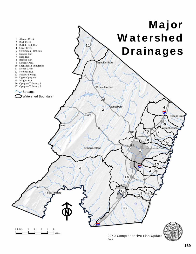
!((
!((
!((
!((!((
!((
!((
!((
!((
!((!((
11
2 6
57
178
913
314
161512
10
4
1
Reynolds Store
Cross Junction
Gainesboro
Gore Clear Brook
StephensonAlbin
Round HillShawneeland
Star TanneryArmel
¬«55
¬«259
¬«277
¬«127
¬«7
¬«37
£¤50
£¤11
£¤50
£¤522
£¤522
£¤11
§¦81
§¦66F
0 1 2 3 4 5 60.5
Miles
StreamsWatershed Boundary
MajorWatershedDrainages
2040 Comprehensive Plan UpdateDraft
1 2 3 4 5 6 7 8 91011121314151617
Abrams CreekBack CreekBuffalo Lick RunCedar CreekClearbrook - Hot RunDuncan RunHiatt RunRedbud RunSenseny AreaShenandoah TributariesSleepy CreekStephens RunSulphur SpringsUpper OpequonWrights RunOpequon Tributary 1Opequon Tributary 2
§¦81
169
NATURAL RESOURCES
THE 2035 COMPREHENSIVE PLAN 86
SENSITIVE NATURAL AREAS Sensitive natural areas encompass various resources in the County, such as floodplains, steep slopes, karst terrain, and agricultural areas. This section describes the importance of these sensitive natural areas to Frederick County. These resources are further identified and integrated into the small area land use plans contained within the Comprehensive Policy Plan.
FLOODPLAINS & DAM BREAK INUNDATION ZONES
Floodplains provide a necessary interface between land and water. Floodplains by definition store water and accommodate fluctuations in stream volume during heavy rains and can become flooded. Floodplains provide essential environmental benefits such as reducing peak flows and improving water quality. Encroachment of development into floodplains removes those benefits as well as increasing the impact on life, health and property.
Regulations to protect floodplains and waterways from disturbance are included in the County’s Zoning Ordinance.
Floodplain areas have been generally identified in studies conducted by the Federal Emergency Management Administration (FEMA). Detailed maps produced by FEMA show floodways, as well as 100 and 500-year floodplains.
The Code of Virginia requires localities to identify and study dam break inundation zones within the community and their potential impacts. A dam break inundation zone refers to the area downstream of a dam that would be inundated or otherwise directly affected by the failure of a dam. These dams (or impounding structures) are man-made structures utilized to retain or store water. When referring to inundation zones, the term includes: (i)all dams that are 25 feet or greater in height and that create an impoundment capacity of 15 acre-feet or greater, and (ii) all dams that are six feet or greater in height and that create an impoundment capacity of 50 acre-feet or greater. Dams that meet these specifications are classified as either low hazard, significant hazard or high hazard based on the impact should the dam fail. There are 11 dams in Frederick County which are permitted by the Department of Conservation and Recreation (DCR).
STEEP SLOPES
Areas of steep slopes are located throughout the County, predominately in the mountainous areas, stream valleys and drainage areas. Steep sloped areas are often susceptible to erosion. The amount that may occur varies according to the amount and intensity of precipitation, slope steepness and length, vegetated cover and the soil type and erodibility. Clearing steeply sloped areas can exacerbate erosion of soil and increase stormwater runoff resulting in increased siltation and sedimentation.
Careful consideration should be given to avoid concentrated runoff when impervious surfaces are located close to steep slopes. Minimal disturbance of natural vegetative cover, in particular forest cover should be encouraged versus replant requirements.
170
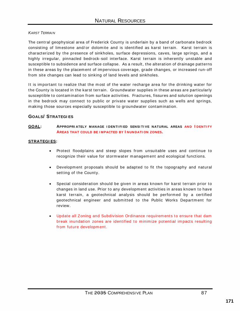
NATURAL RESOURCES
THE 2035 COMPREHENSIVE PLAN 87
KARST TERRAIN
The central geophysical area of Frederick County is underlain by a band of carbonate bedrock consisting of limestone and/or dolomite and is identified as karst terrain. Karst terrain is characterized by the presence of sinkholes, surface depressions, caves, large springs, and a highly irregular, pinnacled bedrock-soil interface. Karst terrain is inherently unstable and susceptible to subsidence and surface collapse. As a result, the alteration of drainage patterns in these areas by the placement of impervious coverage, grade changes, or increased run-off from site changes can lead to sinking of land levels and sinkholes.
It is important to realize that the most of the water recharge area for the drinking water for the County is located in the karst terrain. Groundwater supplies in these areas are particularly susceptible to contamination from surface activities. Fractures, fissures and solution openings in the bedrock may connect to public or private water supplies such as wells and springs, making those sources especially susceptible to groundwater contamination.
GOALS/STRATEGIES
GOAL: APPROPRIATELY MANAGE IDENTIFIED SENSITIVE NATURAL AREAS AND IDENTIFY
AREAS THAT COULD BE IMPACTED BY INUNDATION ZONES.
STRATEGIES:
• Protect floodplains and steep slopes from unsuitable uses and continue to recognize their value for stormwater management and ecological functions.
• Development proposals should be adapted to fit the topography and natural
setting of the County.
• Special consideration should be given in areas known for karst terrain prior to changes in land use. Prior to any development activities in areas known to have karst terrain, a geotechnical analysis should be performed by a certified geotechnical engineer and submitted to the Public Works Department for review.
• Update all Zoning and Subdivision Ordinance requirements to ensure that dam
break inundation zones are identified to minimize potential impacts resulting from future development.
171
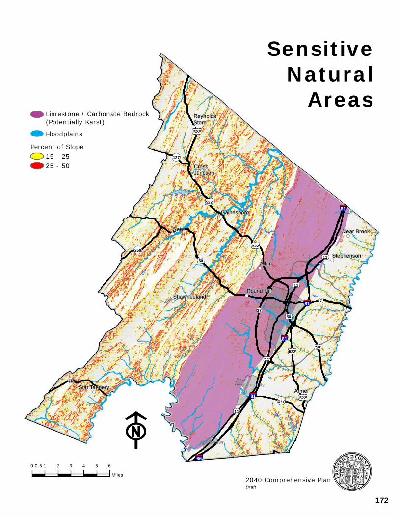
!((
!((
!((
!(( !((
!((
!((
!((
!((
!((!((
ReynoldsStore
CrossJunction
Gainesboro
Gore Clear Brook
StephensonAlbin
Round HillShawneeland
Star Tannery Armel
§¦81
§¦81
§¦81
§¦81
§¦66
£¤50
£¤522
£¤522
£¤522
£¤11
£¤50
£¤522£¤11
£¤50
£¤11
£¤522
£¤11
¬«55
¬«259
¬«277
¬«127
¬«7
¬«37 Winchester
Middletown
Stephens City
F0 1 2 3 4 5 60.5
Miles
SensitiveNatural
Areas
2040 Comprehensive PlanDraft
Floodplains
Limestone / Carbonate Bedrock(Potentially Karst)
Percent of Slope15 - 2525 - 50
172
NATURAL RESOURCES
THE 2035 COMPREHENSIVE PLAN 89
AGRICULTURAL AND FORESTAL AREAS Agricultural and forestal lands in Frederick County contribute to the natural environment as well as add to the historic rural character and scenic quality associated with the community. Agricultural lands and forests provide economic benefits related to agriculture, forestry and tourism, and require minimal County services.
Frederick County has an Agricultural and Forestal District program supported by the Code of Virginia. This program allows landowners to voluntarily enroll their lands in a district which limits development. These districts are renewed every five (5) years but property owners can request that their land be removed at any time. The County has seven separate agricultural and forestal districts which contain a total of 11,281.37 acres. The use of conservation easements for the protection of agricultural and forestry lands is increasingly becoming popular and encouraged, in addition to participation in the County’s Agricultural and Forestal Districts.
GOALS/STRATEGIES
GOAL: PROTECT AND PROMOTE FREDERICK COUNTY’S AGRICULTURAL AND FORESTAL AREAS
STRATEGIES:
• Evaluate the existing Agricultural and Forestal Districts program for effectiveness in helping preserve agricultural and forestry resources.
• Encourage and promote opportunities that support the continued use of farmlands and the consumption of locally grown products.
• Develop, promote and support voluntary measures to protect agricultural and forestry resources such as conservation easements, Purchase of Development Rights (PDR) or Transfer of Development Rights (TDR).
• In the Rural Areas, development should be directed away from soils which are well suited for agricultural production.
173
NATURAL RESOURCES
THE 2035 COMPREHENSIVE PLAN 90
EROSION AND SEDIMENT CONTROL Soils are natural resources that require proper use and conservation. Bare soil is the single greatest source of sediment which can enter waterways through erosion. In many instances, the greatest controllable source of soil erosion is through managing construction activities to reduce exposing the soil to the elements.
It is important to realize that the use of the soil be related to its suitability and limitations. Improper use may result in accelerated soil erosion, ground and surface water pollution, flooding, drainage problems, failed septic systems, construction problems and unproductive agricultural and forestal lands. The most environmentally sensible approach is to consider and adapt to soil types the planning and design of developments.
The 1987 Soil Survey of Frederick County, Virginia by the U.S. Department of Agriculture (USDA) and the Soil Conservation Service includes general and detailed soil maps, descriptions of the soils; and the suitability, limitations, and management of the soils for specified uses. The general soils map can be used to compare the suitability of large areas for general land use while the detailed soil maps along with soil unit descriptions can be used to plan and design a specific site.
The Virginia Erosion and Sediment Control Act and the Frederick County Code require that properties and waters be protected from soil erosion and sedimentation resulting from development activities. The Frederick County Public Works Department is responsible for the implementation and enforcement of these requirements.
GOALS/STRATEGIES
GOAL: INCORPORATE SOIL TYPES INTO LAND USE PLANNING FOR THE DESIGN OF
DEVELOPMENTS TO ENSURE PROPER USE OF THIS NATURAL RESOURCE AND
GUARANTEE THAT DURING DEVELOPMENT PROPER EROSION AND SEDIMENT CONTROL
MEASURES ARE MAINTAINED.
STRATEGIES:
• Vegetative cover should be encouraged as the most important physical factor influencing soil erosion. The removal of topsoil and permeable soils should be discouraged and when removed, requirements to replace the soils should be enforced.
• Developments should be planned to fit the particular topography, soils, waterways, and natural vegetation on a site to ensure that structures and grading are designed to fit the site.
• Planning that requires the smallest practical area of land be exposed for the shortest period of time (through scheduling and staging project activities) is encouraged.
174
NATURAL RESOURCES
THE 2035 COMPREHENSIVE PLAN 91
STORMWATER MANAGEMENT Urban development changes the nature of streams and drainage. Areas once woodlands or pastures that are developed with roads, parking lots, and buildings, increase the impervious area or imperviousness of the watershed. This process brings changes to the runoff characteristics of surface water, both in quantity and quality.
Stormwater management is regulated by Chapter 79 of the Code of Frederick County “Erosion and Sediment Control Ordinance” as authorized by the Virginia Erosion and Sediment Control Law of Virginia. The Department of Public Works is the agency responsible for the implementation and enforcement of the Stormwater Management Ordinance as managed by the Department of Conservation and Recreation (DCR).
Stormwater management seeks to maintain post-development runoff at pre-development levels. Where necessary, stormwater storage systems, such as detention ponds, are required to accommodate a post-development storm with a twenty-five-year frequency
Low Impact Development (LID) is an alternative to conventional stormwater management. LID is a site design strategy with the goal of maintaining or replicating the pre-development hydrologic response through the use of design techniques to create a functionally equivalent hydrologic landscape. Some of the functions include water storage, infiltration, and groundwater recharge as well as management of the volume and frequency of water discharges. Elements of LID include minimizing land disturbance, limiting impervious surfaces, and utilizing runoff reduction practices such as bioretention, permeable pavements and grass swales.
Geology is an important consideration when considering the application of LID practices. In areas of karst terrain, infiltrating LID practices must be carefully planned due to the potential for sinkhole formation. Stormwater treatment and conveyance systems should be directed away from known sinkholes to prevent expansion or possible collapse. Other geologic issues involve the presence of shale which makes infiltration difficult to impossible. While the use of LID may not replace conventional SWM controls, a combination of the two measures makes for a better overall stormwater management program.
GOALS/STRATEGIES
GOAL: ENSURE THAT STORMWATER IS MANAGED IN ACCORDANCE WITH THE COUNTY’S
EROSION AND SEDIMENT CONTROL ORDINANCE AND VIRGINIA’S STORMWATER
REQUIREMENTS, AND WORK TO IMPLEMENT LOW IMPACT DEVELOPMENT (LID)
MEASURES WHERE APPROPRIATE.
STRATEGIES:
• Encourage the use of semi-pervious or pervious surfaces and other low impact development techniques, where appropriate. Shared parking areas and reduced parking requirements for developments should be utilized to reduce impervious areas.
175
NATURAL RESOURCES
THE 2035 COMPREHENSIVE PLAN 92
• Encourage the use of bio-retention whenever possible. Large impervious areas should take advantage of bio-retention in their parking lots.
• Participate in regional efforts to integrate LID runoff reduction and pollution prevention practices in karst areas and areas with shale-derived soils.
176
NATURAL RESOURCES
THE 2035 COMPREHENSIVE PLAN 93
GREEN INFRASTRUCTURE, GREENWAYS AND TRAILS
Green infrastructure is the strategically planned and managed networks of natural lands, agricultural and forestal lands, and other open spaces. As an interconnected system, green infrastructure provides greater environmental viability, value, and function than disconnected individual resources. In both rural and urban areas, the green infrastructure concept identifies critical areas for conservation and establishes priorities for protection. It encompasses aspects like greenways, scenic areas, open spaces, biodiversity, and environmental corridors as well as naturally sensitive areas such as floodplains, karst areas and steep slopes. URBAN AND RURAL OPEN SPACE RESOURCES Open space resources in Urban Areas should be designed and created during development. Their value to the community is determined by their configuration, attributes and relationship to the surrounding areas. Urban open spaces will increase in importance as the County’s Urban Development Area (UDA) is more densely developed. Development in the Urban Areas should consider specifically designed open spaces incorporated as amenities to offset the higher densities. Wooded areas are an important resource and should be considered during planning and designing open spaces. The benefits of wooded include areas the maintenance of ground and surface water quality, groundwater recharge areas, habitat for biological resources, added oxygen to the air, and help protect environmentally sensitive areas. Urban wooded areas provide buffers and potential recreational opportunities. These areas help to preserve the natural scenery and can make the Urban Area a more attractive place to live. Rural open spaces of prime agricultural areas, forested areas, mountainous areas and stream valleys have particular value to the community; and they should be conserved. (See Agricultural and Forestal Lands above)
Inappropriate sites like prime farm land, floodplains, habitats for threatened or endangered species, wetlands and land near wetlands, land near bodies of water and designated park land should be avoided during site selection and development to reduce environmental impacts. Development should be channeled into urban areas with existing infrastructure which would help protect natural resources and that existing natural areas should be conserved and restored to provide habitats and to promote biodiversity.
GREENWAYS
Greenways are areas of open space, usually linear in nature that form networks of trails. They are often located along streams, within utility easements, and along roadways, and can serve many different purposes. They can help link people to the area’s natural, recreational and cultural resources, as well as provide a system of natural linkages for the areas wildlife to preserve biodiversity and protect habitats. When constructed along streams they can help preserve and protect buffers along the streams which can help protect biodiversity and help filter pollutants. Greenways can also provide recreational opportunities such as hiking or bicycling provide nature studies such as plant and animal behavior, as well as simply raising awareness of the environment.
177
NATURAL RESOURCES
THE 2035 COMPREHENSIVE PLAN 94
The Tuscarora Trail
The Tuscarora Trail is a 249 mile hiking trail situated generally along the mountain ranges to the west of the Shenandoah and Cumberland Valley. It connects to the Appalachian Trail (AT) in Shenandoah National Park and in Pennsylvania northeast of the town of Carlisle.
Approximately 26 miles of the Tuscarora Trail is in Frederick County (see map). Of this total, approximately 11.25 trail miles are protected by easements on private property, 3.75 trail miles are on unprotected private property and 11 trail miles are on public roads.
This trail is an important feature in the County for recreation and for the promotion of tourism. For safety reasons, the County supports the relocation of the trail off of the public roads wherever possible. The County also supports voluntary trail easements for sections of the trail on private property to insure the long-term viability of the Tuscarora Trail.
GOALS/STRATEGIES
GOAL: OPEN SPACES IN THE URBAN AND RURAL AREAS OF THE COUNTY ARE IMPORTANT AND
NEED TO BE RECOGNIZED, DELINEATED AND PROTECTED.
STRATEGIES:
• In urban areas, open spaces should be planned. All types of urban open spaces like greenways, squares, plazas, urban parks, playgrounds and street medians should be considered as part of urban development planning and implemented wherever reasonable.
• In rural areas, open spaces should be protected not only through conservation easements but also transfer development rights programs to ensure that agricultural, forested, and mountainous areas are protected.
GOAL: ESTABLISH A NETWORK OF GREENWAY TRAILS FOR CONSERVATION, RECREATION AND
TRANSPORTATION THROUGH THE URBAN AREAS OF FREDERICK COUNTY, AND LINK
WITH THE TRAILS NETWORK IN THE CITY OF WINCHESTER.
STRATEGIES:
• Work with the Parks and Recreation Department, the City of Winchester and other organizations and community stakeholders to develop a greenway network plan that highlights the area’s natural and historic resources.
• Ensure that when new developments are planned, connectivity of greenways is included through the project.
178
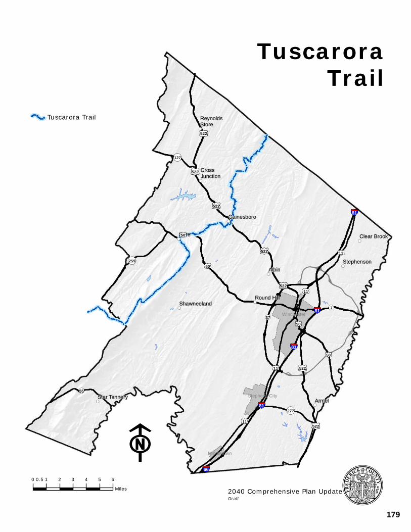
!((
!((
!((
!((!((
!((
!((
!((
!((
!((!((
ReynoldsStore
CrossJunction
Gainesboro
Gore Clear Brook
StephensonAlbin
Round HillShawneeland
Star TanneryArmel
§¦81
§¦81
§¦81
§¦81
§¦66
£¤50
£¤522
£¤522
£¤50
£¤522
£¤11
£¤50
£¤522
£¤522
£¤522£¤11
£¤50
£¤11
£¤522
£¤11
¬«55
¬«259
¬«277
¬«127
¬«7
¬«37 Winchester
Middletown
Stephens City
F0 1 2 3 4 5 60.5
Miles
Tuscarora Trail
TrailTuscarora
2040 Comprehensive Plan UpdateDraft
179
NATURAL RESOURCES
THE 2035 COMPREHENSIVE PLAN 96
HABITAT FRAGMENTATION AND ENVIRONMENTAL CORRIDORS
Habitat fragmentation reduces available wildlife areas and changes migratory pathways through environmental corridors. Past development has created small separated pockets of open space that sometimes conflict with the needs of local wildlife and their adaptability to these changes. Fragmentation can hinder the safe movement or migration of many species because it forces them to travel over roads and through developments.
GOALS/STRATEGIES
POLICY: INCREASE THE CONNECTIVITY OF NATURAL AREAS AND ENVIRONMENTAL RESOURCES
IN BOTH THE URBAN AND RURAL AREAS OF THE COUNTY TO AVOID FRAGMENTATION
OF HABITATS AND MIGRATORY PATHWAYS.
IMPLEMENTATION:
• Environmental corridors should be planned with all development activities to ensure safe movement and protection of species.
• The County should seek to reduce habitat fragmentation by maintaining large contiguous areas of forests, meadows, wetlands and streams.
• Large scale clearing of mature woodlands should be avoided during development activities.
LIGHT AND NOISE POLLUTION
LIGHT POLLUTION
Cycles of daylight and darkness have ecological consequences. Obtrusive lighting, often referred to as light pollution, obscures our view of the sky and primarily comes from inefficient and misdirected lighting sources. Misdirected lighting causes urban sky glow and glare, is a source of energy waste and can be a nuisance. Simply defined, light pollution is excess or obtrusive light created mainly by humans. Increasing development requires that care be taken to reduce unfocused emissions of light.
NOISE POLLUTION
Noise pollution is unwanted noise, often described as a displeasing sound that disrupts the activity or balance of human or animal life. The source of most forms of noise pollution is from transportation systems like vehicles, aircraft or railroads. The daily activities of the Winchester Regional Airport are an example, and it is important that land developing around the Airport is respectful of this operation. The Airport Support Area helps designate what types of uses are appropriate in these developing areas to ensure the continued operation of the Airport.
180
NATURAL RESOURCES
THE 2035 COMPREHENSIVE PLAN 97
Other sources of noise include industrial operations, highway traffic, car alarms, factory machinery and equipment, construction work, lawn care equipment, barking pets, car stereos, and power tools. Urban planning can play an important role in managing noise pollution, and the County must ensure that acceptable levels of noise are maintained. Currently the County only has maximum noise levels for industrially zoned property.
GOALS/STRATEGIES
GOAL: MINIMIZE LIGHT EMISSIONS TO THOSE NECESSARY AND CONSISTENT WITH GENERAL
SAFETY AND RECOGNIZE THE NUISANCE ASPECT OF UNFOCUSED LIGHT EMISSIONS.
STRATEGIES:
• Evaluate current lighting ordinances to assess effectiveness in reducing light pollution caused by up-lighting, excessive lighting, and glare.
• Light emissions need to be minimized to what is necessary and consistent with general safety. Recognition needs to be given to the nuisance aspect of unfocused light emission.
GOAL: MINIMIZE HUMAN EXPOSURE TO UNHEALTHY LEVELS OF NOISE.
STRATEGY:
• Ensure that with new development, people are protected from unhealthy levels of noise.
Examine types of noise generators and determine if additional ordinances are appropriate.
181
HISTORIC RESOURCES
THE 2035 COMPREHENSIVE PLAN 98
VIII. HISTORIC RESOURCES
182
HISTORIC RESOURCES
THE 2035 COMPREHENSIVE PLAN 99
HISTORIC RESOURCES CURRENT CONDITIONS Frederick County has shifted in recent years from an agrarian community to one that has seen strong residential growth and an expanding business base. As a consequence of With the development and diversification experienced over the years, landscapes in Frederick County have changed more dramatically during this period than any other. New residential communities have emerged in what were once rural areas, and architectural styles have become more uniform. However, the historic past (including sites, structures and landmarks) of Frederick County continues to play a role in the changing landscape. The Rural Landmarks Survey of Frederick County, a survey of the majority of structures built prior to 1940 in Frederick County, was completed in 1992. It documents documented over 1800 properties, concluding that many are historically significant. Archaeological sites in the County have also been inventoried. Many of the historically significant properties are recognized on the local, state, and national levels. In addition to the many structures in Frederick County, six Civil War battlefields of great national importance are located in the Frederick County and Winchester area. More than 12,000 acres of battlefield lands maintain high historic character and are enhanced by several fortifications and entrenchments. A partnership involving Winchester and Frederick County government, the Shenandoah Valley Battlefields Foundation, the Kernstown Battlefield Association, the Cedar Creek Battlefield Foundation, the North-South Skirmish, and others is underway to protect local battlefield sites and create a battlefield park network. The Historic Overlay Zoning District has been developed as an option for owners who seek to protect the historic resources on their property. This option provides a more regulated approach to the preservation of structures and may be appropriate in areas seeking to establish a historic district. Currently the County has four recognized historical districts and one National Historic Park: Newtown/Stephensburg, Opequon, Middletown, and Bartonsville, Cedar Creek Battlefield and Belle Grove National Historic Park. The County has also identified Rural Community Centers throughout the County that have a strong rural and historical character (See Rural Areas, Chapter 2). FOCUS FOR THE FUTURE The next twenty years should see the remainder of unidentified historic sites and archeological resources discovered and recorded. Sites that qualify as historic will be added to an on-going inventory. Such an inventory will include archeological surveys of properties surrounding known battlefields, encampments, trenches, and cemeteries. Heritage tourism will continue to be a strong component of Winchester-Frederick County’s tourism program. Efforts to develop the battlefield park network will be underway in
183
HISTORIC RESOURCES
THE 2035 COMPREHENSIVE PLAN 100
partnership with the Shenandoah Valley Battlefield Foundation and other community stakeholders. The economic and cultural importance of historic resources should also be promoted. In combination with historic preservation and heritage tourism efforts, the County should partner with local agencies, organizations, and other appropriate groups to provide education sessions concerning preservation methods and programs. In addition, the Historic Resources Advisory Board (HRAB), a County appointed group, should continue to coordinate with these agencies when reviewing development applications. COMMUNITY BENEFITS The value of protecting our historical resources is immeasurable; once lost, historic structures and areas cannot be replaced. They provide a sense of who we are and where we have been. Our community benefits from a balance between surviving preserved historic resources and the new development occurring in this area. A battlefield park network in Frederick County and Winchester will provide substantial economic and educational benefits and will create a much-desired avenue for heritage tourism. Battlefield parks act as a means of meeting the County’s growing need for green space and parkland by providing the opportunity for recreational facilities within the Parks and Recreation Department. Preserving battlefields and historic sites provides open spaces and scenic vistas. Incorporating trails, such as the five miles linking Route 661 to the Regency Lakes Community and Millbrook High School at the Third Battle of Winchester, complements the pedestrian and bike component of our transportation planning. Archeological sites are also important to the development of public education and heritage tourism programs as they provide a more detailed story of Frederick County’s history. GOALS/STRATEGIES GOAL: IDENTIFY AND RECOGNIZE HISTORIC RESOURCES IN THE LONG-RANGE PLANNING
EFFORTS OF THE COUNTY. STRATEGIES:
• The Historic Resources Advisory Board (HRAB) will continue to assist the Department of Planning and Development by reviewing development proposals to determine their potential impact on historic sites and surrounding areas and make recommendations regarding the mitigation of any impacts.
• Development should include a comprehensive approach to historic preservation that will result in a system of coordinated sites and battlefields dedicated or protected in a coordinated fashion, such as the Battlefield Park Network that preserves key resources sites, attracts tourists, and supports education.
184
HISTORIC RESOURCES
THE 2035 COMPREHENSIVE PLAN 101
• The Use the Rural Landmarks Survey shall continue to serve as a primary source for determining identifying historic properties and districts that qualify for official recognition.
• Update and maintain the Rural Landmarks Survey regularly in order to keep current
the inventory of structures older than fifty years.
• Develop, update, and maintain an inventory of archaeological sites and cemeteries in Frederick County.
• Archaeological surveys should be conducted prior to development, particularly any that
involve battlefield areas, homesteads, Native American encampments, and waterways. GOAL: INCREASE THE REHABILITATION, ADAPTIVE REUSE, OR RESTORATION OF HISTORIC
STRUCTURES.
STRATEGIES:
• Study, develop, and adopt methods and criteria to identify historic resources in need of preservation.
• Support the reuse and rehabilitation of historic structures to maintain character of
community, both residential and business.
• Promote incentives for private landowners to comply voluntarily with Secretary of Interior’s Standards for Rehabilitation. Incentives allowed by law for the rehabilitation, adaptive reuse, or restoration of historic structures in the Historic Overlay Zoning District should be considered.
GOAL: INCORPORATE HISTORIC RESOURCE DEVELOPMENT IN AN EFFORT TO STRENGTHEN
HERITAGE TOURISM. STRATEGIES:
• Developments should incorporate and/or convert historic properties into recreational
elements, including but not limited to pedestrian trails, parks, and museums. • Develop the Battlefield Park Network as a major heritage tourism component.
• Create dedicated pedestrian-sensitive trails, sites, and routes of interest that will not
adversely impact private property owners, as well as develop public scenic byways.
• Permit events, reenactments, tours, and exhibits to attract visitors.
185
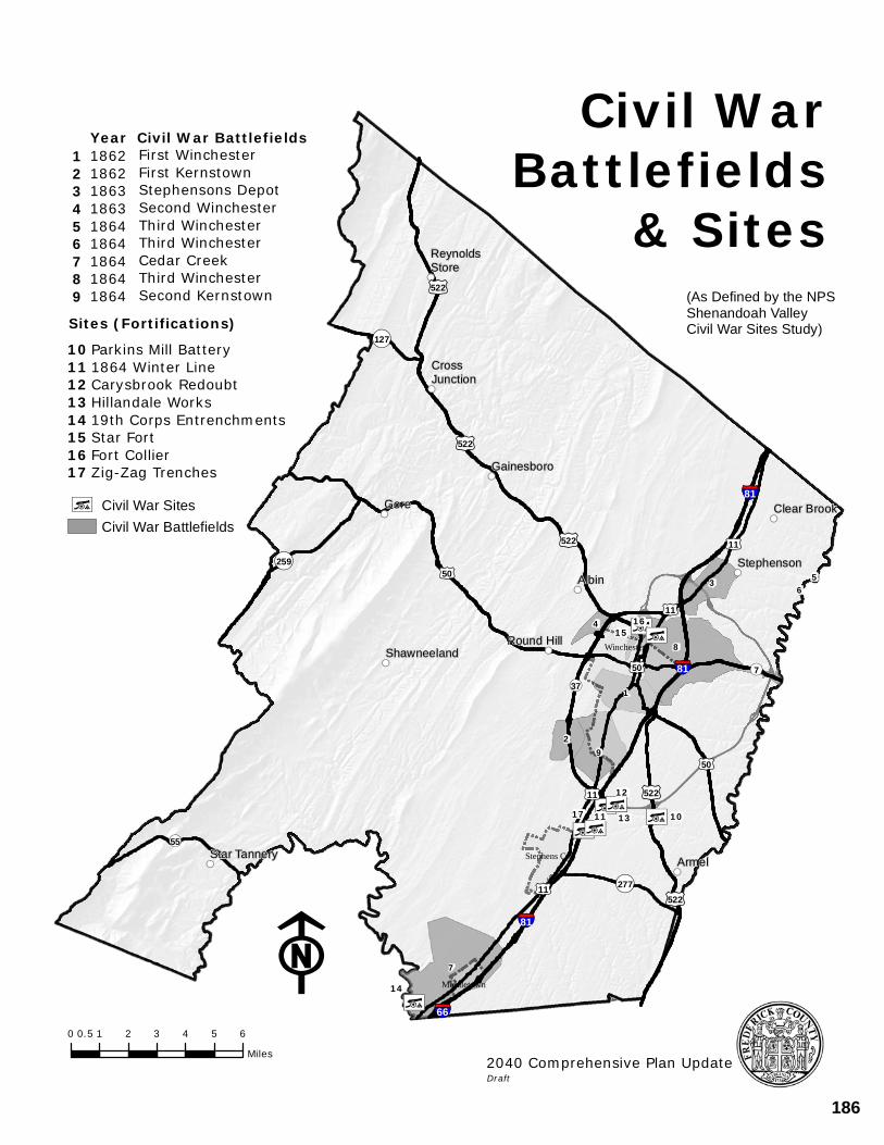
!L!L!L!L
!L
!L!L
!L
!((
!((
!((
!(( !((
!((
!((
!((
!((
!((!((
ReynoldsStore
CrossJunction
Gainesboro
Gore Clear Brook
StephensonAlbin
Round HillShawneeland
Star Tannery Armel
§¦81
§¦81
§¦81
§¦66
£¤50
£¤522
£¤522
£¤11
£¤50
£¤522
£¤522
£¤11
£¤50
£¤11
£¤522
£¤11
¬«55
¬«259
¬«277
¬«127
¬«7¬«37
1011
12
13
14
1516
17
Winchester
Middletown
Stephens City
3 56
4
7
1
8
29
F0 1 2 3 4 5 60.5
Miles
!L Civil War SitesCivil War Battlefields
Civil WarBattlefields
& Sites(As Defined by the NPS Shenandoah Valley Civil War Sites Study)
2040 Comprehensive Plan UpdateDraft
Year Civil War Battlefields186218621863186318641864186418641864
First WinchesterFirst KernstownStephensons DepotSecond WinchesterThird WinchesterThird WinchesterCedar CreekThird WinchesterSecond Kernstown
1 2 3 4 5 6 7 8 9
1011121314151617
Sites (Fortifications)Parkins Mill Battery1864 Winter LineCarysbrook RedoubtHillandale Works19th Corps EntrenchmentsStar FortFort CollierZig-Zag Trenches
186
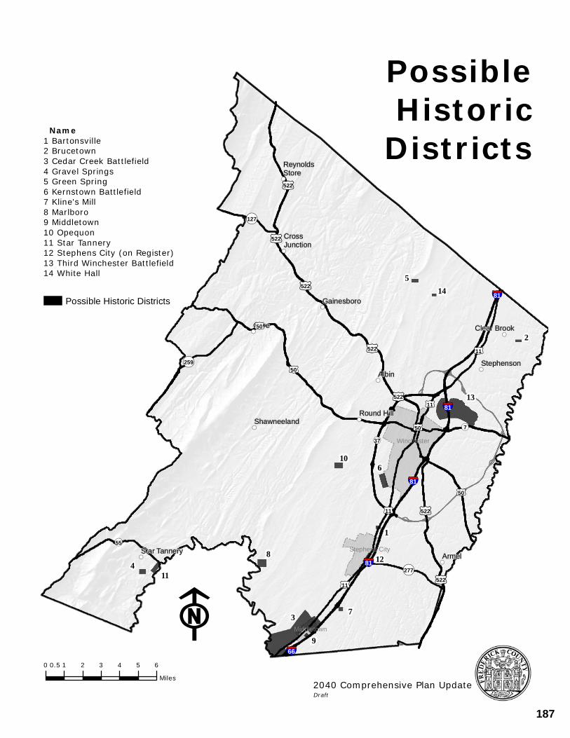
!((
!((
!((
!((!((
!((
!((
!((
!((
!((!((
3
13
9
6
8
11
10
12
5
7
2
4
1
14
ReynoldsStore
CrossJunction
Gainesboro
Gore Clear Brook
StephensonAlbin
Round HillShawneeland
Star TanneryArmel
§¦81
§¦81
§¦81
§¦81
§¦66
£¤50
£¤522
£¤522
£¤50
£¤522
£¤11
£¤50
£¤522
£¤522
£¤522
£¤11
£¤50
£¤11
£¤522
£¤11
Winchester
Middletown
Stephens City¬«55
¬«259
¬«277
¬«127
¬«7
¬«37
F0 1 2 3 4 5 60.5
Miles
Possible Historic Districts
PossibleHistoric
Districts Name1 Bartonsville2 Brucetown3 Cedar Creek Battlefield4 Gravel Springs5 Green Spring6 Kernstown Battlefield7 Kline's Mill8 Marlboro9 Middletown10 Opequon11 Star Tannery12 Stephens City (on Register)13 Third Winchester Battlefield14 White Hall
2040 Comprehensive Plan UpdateDraft
187
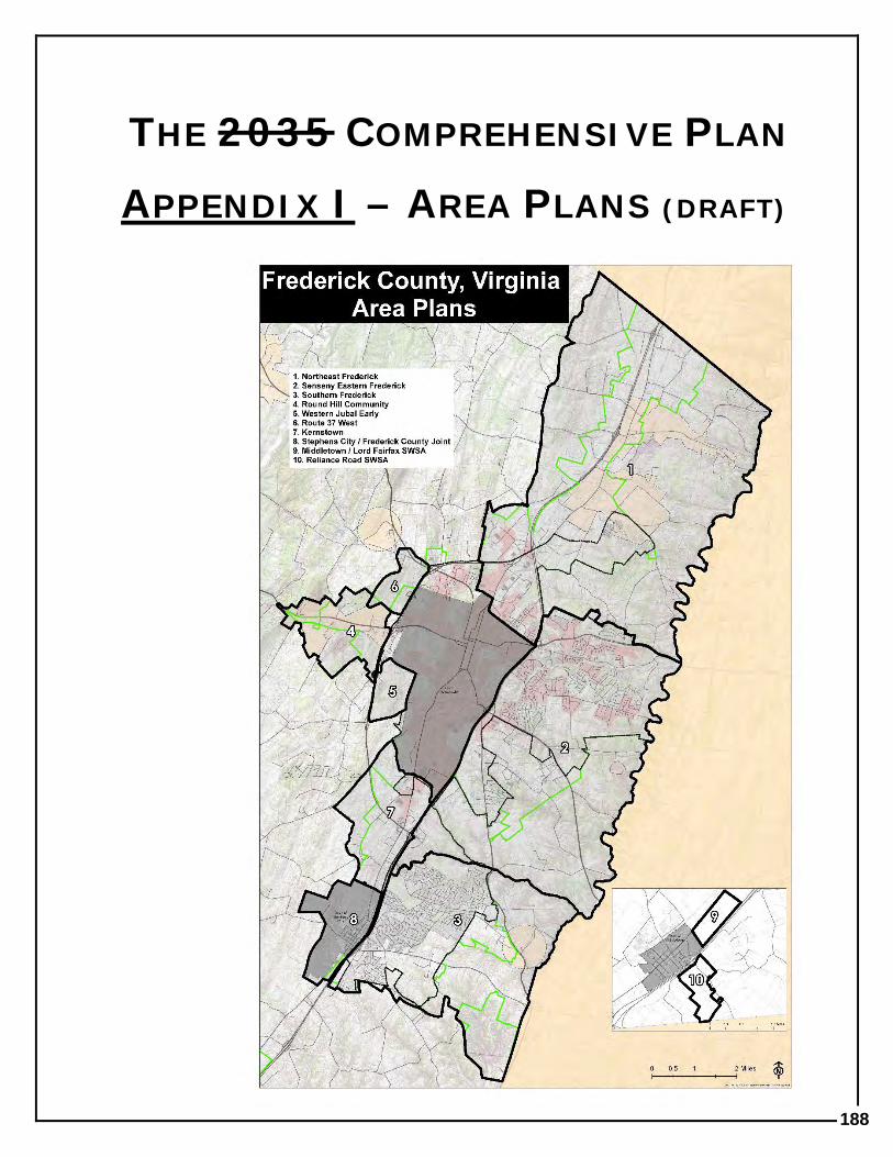
THE 2035 COMPREHENSIVE PLAN
APPENDIX I – AREA PLANS (DRAFT)
188
APPENDIX I
THE 2035 COMPREHENSIVE PLAN
AREA PLANS
• THE EASTERN FREDERICK COUNTY LONG RANGE LAND USE PLAN
• NORTHEAST FREDERICK LAND USE PLAN
• SENSENY EASTERN FREDERICK URBAN AREA PLAN
• SOUTHERN FREDERICK LAND USE PLAN
• ROUND HILL COMMUNITY LAND USE PLAN
• WESTERN JUBAL EARLY LAND USE PLAN
• ROUTE 37 WEST LAND USE PLAN
• KERNSTOWN AREA PLAN
• STEPHENS CITY/FREDERICK COUNTY JOINT LAND USE PLAN
• MIDDLETOWN/LRCC SWSA
• RELIANCE ROAD SWSA
189
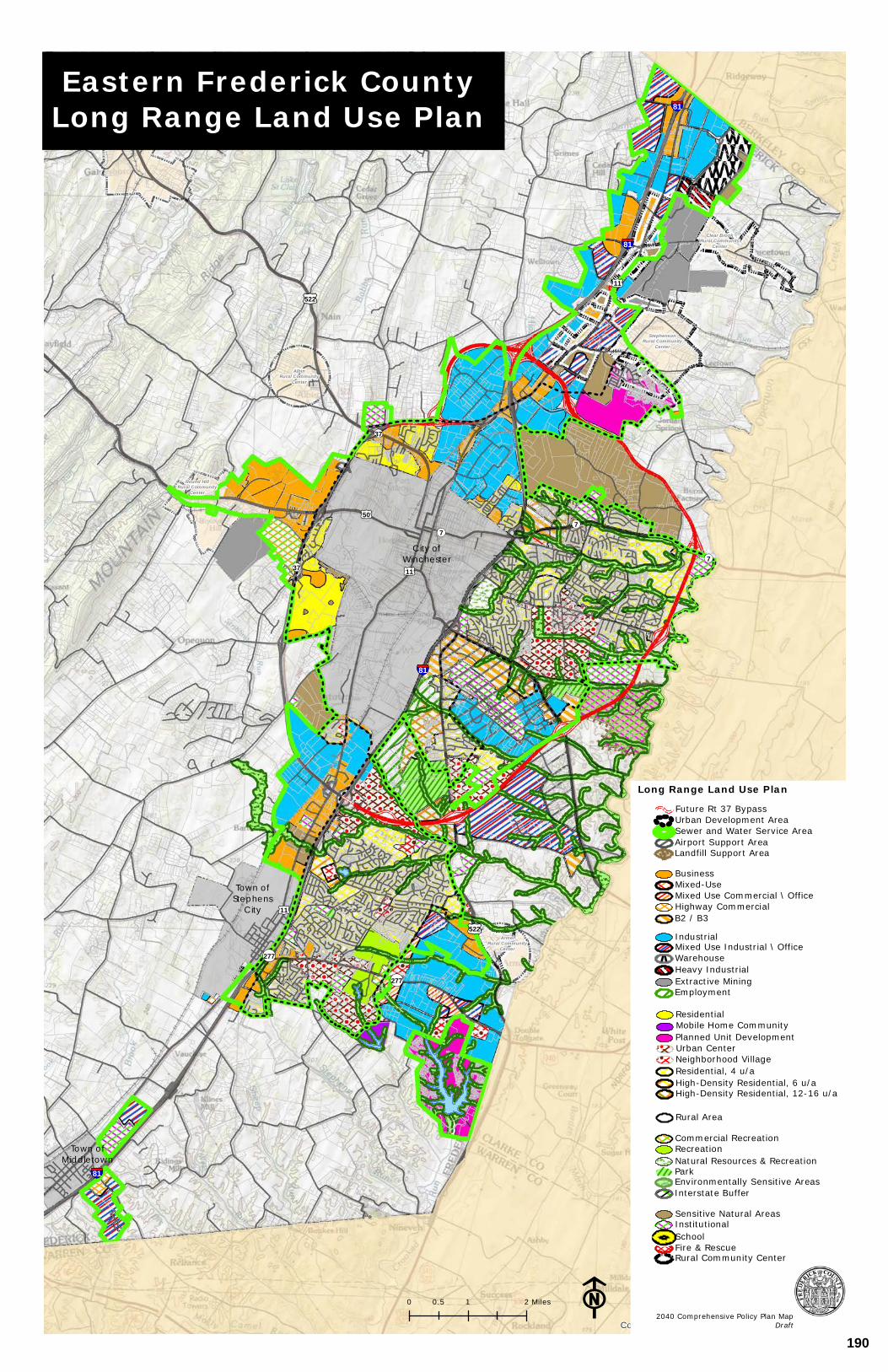
ArmelRural Community
Center
Round HillRural Community
Center
AlbinRural Community
Center
StephensonRural Community
Center
Clear BrookRural Community
Center
Town ofStephens
City
§¦81
§¦81
§¦81
§¦81
£¤11
£¤50
£¤11
£¤522
£¤522
£¤11
¬«277
¬«277
¬«37
¬«7
¬«7¬«7
¬«37
City ofWinchester
Town ofMiddletown
Copyright:© 2013 National Geographic Society, i-cubedF0 1 20.5 Miles
Eastern Frederick CountyLong Range Land Use Plan
2040 Comprehensive Policy Plan MapDraft
Long Range Land Use Plan
Interstate BufferEnvironmentally Sensitive AreasParkNatural Resources & RecreationRecreationCommercial Recreation
Rural Area
High-Density Residential, 12-16 u/aHigh-Density Residential, 6 u/aResidential, 4 u/aNeighborhood VillageUrban CenterPlanned Unit DevelopmentMobile Home CommunityResidential
EmploymentExtractive MiningHeavy IndustrialwwwwwwwwwwwwWarehouseMixed Use Industrial \ OfficeIndustrial
B2 / B3Highway CommercialMixed Use Commercial \ OfficeMixed-UseBusiness
Landfill Support AreaAirport Support AreaSewer and Water Service AreaUrban Development AreaFuture Rt 37 Bypass
Rural Community CenterFire & RescueSchoolInstitutionalSensitive Natural Areas
190
APPENDIX I - AREA PLANS
Northeast Land Use Plan 1
NORTHEAST FREDERICK LAND USE PLAN (NELUP)
- INCLUDING TEXT APPROVED WITH THE FOLLOWING AMENDMENTS: • MCCANN-SLAUGHTER AMENDMENT
Approved by the Board of Supervisors on August 13, 2014
• BLAIN AMENDMENT Approved by the Board of Supervisors on February 25, 2015
191
APPENDIX I - AREA PLANS
Northeast Land Use Plan 2
The Northeast Frederick Land Use Plan, NELUP, was approved by the Board of Supervisors on July 14th, 2011. At that time, the series of four maps detailing the Plan were approved. Text describing the Plan was not included. Subsequently, the two amendments to this plan noted above have included a text component. The text component of the plan follows.
192
APPENDIX I - AREA PLANS
Northeast Land Use Plan 3
MCCANN-SLAUGHTER AMENDMENT (BOS APPROVED AUGUST 13, 2014) The Comprehensive Plans and Programs Committee (CPPC), at their April 14, 2014 meeting, recommended that the following amendment be incorporated into the Northeast Land Use Plan: The CPPC proposed the following balanced approach as an amendment to the Northeast Land Use Plan for the McCann-Slaughter properties located near the intersection of Martinsburg Pike (Route 11) and Old Charlestown Road (Route 761). This location has historically been identified as a Sensitive Natural Area (SNA) due to the environmental and historical features on and around the site, most notably Stephenson’s Depot.
• Protection of the environmental features of the site. • Preservation of those areas identified with NSA’s and development limited to
those areas to the south of the NSA’s and south of McCann’s Road. • Utilizing McCann’s Road and other historical features, such as Milburn Road,
as features to be protected and potentially used in a manner that promotes their historical context (an extension of the historical trail system in the area).
• An O.M. (Mixed Use Office/Industrial) land use designation. • Access to be provided via a new north south road that would generally be
adjacent to the border of the Sensitive Natural Area (SNA) providing access from Old Charles Town Road to McCann’s Lane and the southern portion of the property. Ultimately, Route 37 would divide the southern portion of the property. No access would be permitted to McCann’s Lane for vehicular access to Martinsburg Pike or Milburn Road.
Subsequently, the proposal was further evaluated to determine if other elements could be incorporated into the proposed amendment that would further ensure the environmental, historical, and development resources were protected, promoted, and sensitively integrated together in this balanced amendment to the Northeast Land Use Plan. To that end, the following items should be addressed with the future development of this area.
• A buffer adjacent to McCann’s Lane that is approximately 50’ in width (from the centerline). Contained within this area; native landscape plantings and preservation of the existing hedgerows aimed at preserving this resource and its character, interpreting the historical landscape, and buffering the future development.
• A transitional buffer between the existing floodplain and future land uses that promotes environmental best management practices and buffers the historical SNA from the future land uses (landscaping, building height transitions, view sheds). This buffer may include areas of the identified environmental resources.
• The ability to include a small area of neighborhood commercial land use in support of the proposed OM land use. This would be located in the northern portion of the OM land use adjacent to the future road.
• An interpretive trail head/parking area in the northern portion of this area adjacent
193
APPENDIX I - AREA PLANS
Northeast Land Use Plan 4
to the proposed road could be incorporated into the design of the project, potentially in conjunction with a small area of neighborhood commercial. The interpretation may be reflective of the environmental and historical resources of the site and area.
• The CPPC recommended the OM land use designation extends to the center of the stream. (A subsequent evaluation of this indicated it would be more appropriate to have the edge of the ultimate floodplain be the common boundary as a floodplain is, by definition in the 2030 Comprehensive Plan, an identified Sensitive Natural Area).
• The location and design of the road should be sensitive to the environmental and historical resources and should have minimal impact.
• Historical signage consistent with currently used signage should be provided. • Historically relevant features, such as split rail fences, should be considered as a
feature of the future development. But care should be taken to ensure the character of the resource isn’t changed.
• Appropriate traffic controls should be provided on McCann’s Lane to ensure that it is used only for pedestrian and bicycle users.
In general, balance was maintained as the overarching theme of the discussion of the CPPC, and subsequently, the discussion of the ad-hoc CPPC/HRAB group.
194
APPENDIX I - AREA PLANS
Northeast Land Use Plan 5
BLAIN PROPERTIES AMENDMENT (BOS APPROVED FEBRUARY 25, 2015)
Approved language:
The area of land use northwest of Exit 321, Interstate 81, Hopewell Road, and south of Cedar Hill Road is commercial and industrial in character. In general, the north–south major collector road that has been identified and is necessary to support this area of land use serves as a boundary between the commercial and industrial land uses. Flexibility should be offered in the final balance and location of land uses. Future applications for rezoning in this area shall adequately address any potential impacts to public facilities, in particular transportation, and shall implement any necessary transportation improvements.
195
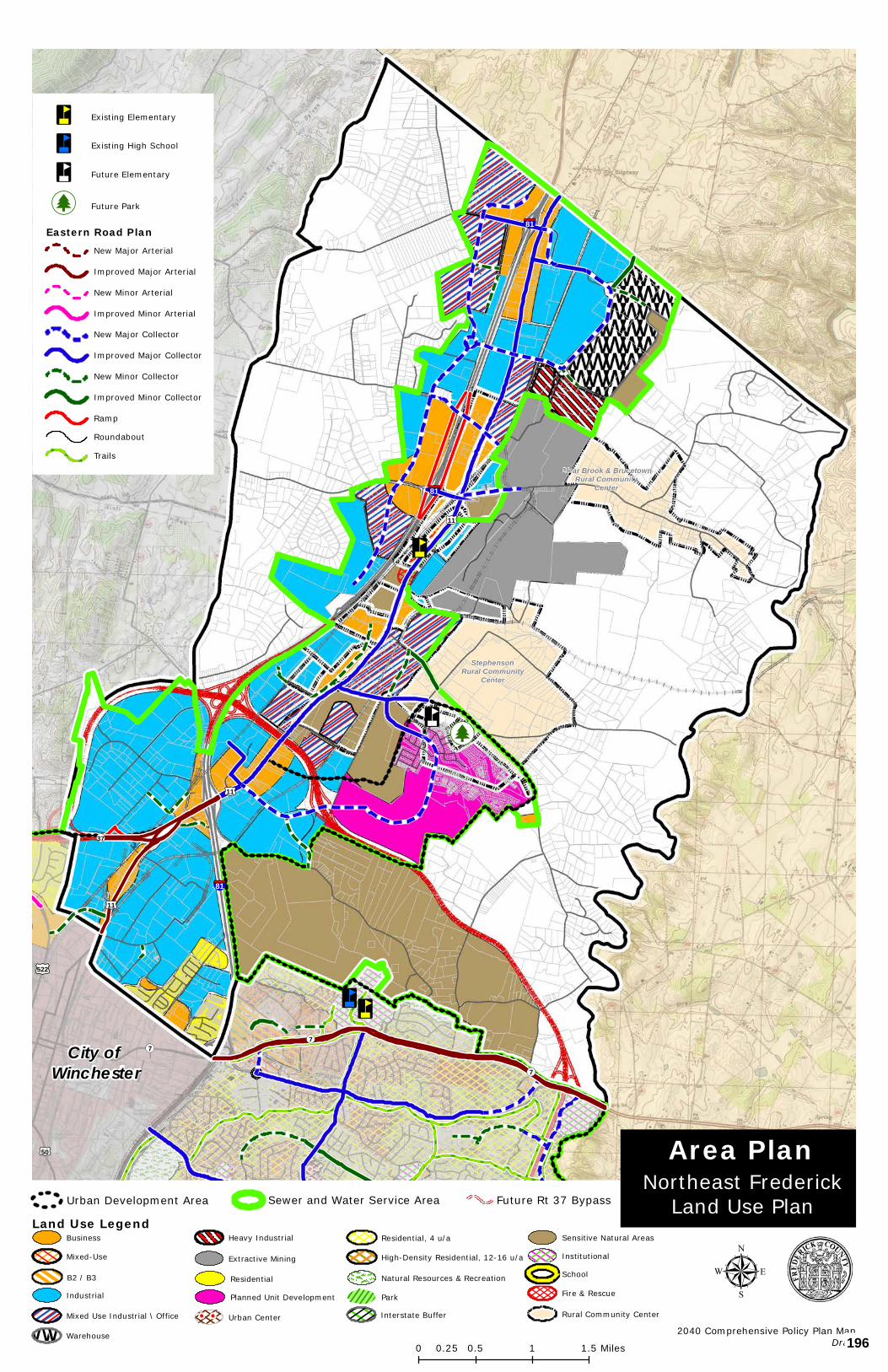
³n
³n
[j
³n³n
City of Winchester
StephensonRural Community
Center
Clear Brook & BrucetownRural Community
Center§¦81
§¦81
§¦81
£¤11
£¤50
£¤522
£¤11
£¤11
¬«7¬«7
¬«7
¬«37
Copyright:© 2013 National Geographic Society, i-cubed
0 0.5 1 1.50.25 Miles
µ
³n Existing Elementary
³n Existing High School
³n Future Elementary
[j Future Park
Eastern Road PlanNew Major Arterial
Improved Major Arterial
New Minor Arterial
Improved Minor Arterial
New Major Collector
Improved Major Collector
New Minor Collector
Improved Minor Collector
Ramp
Roundabout
Trails
Northeast FrederickLand Use Plan
Area Plan
2040 Comprehensive Policy Plan MapDraft
Urban Development Area Future Rt 37 BypassSewer and Water Service Area
Land Use Legend
Residential
Planned Unit Development
Urban Center
Business
B2 / B3
Heavy Industrial
Mixed Use Industrial \ Office
Extractive Mining
wwwwwwwwwwwwwwwwwwwwWarehouse
Industrial
Natural Resources & Recreation
Fire & Rescue
Institutional
School
Rural Community Center
Sensitive Natural Areas
Park
Interstate Buffer
High-Density Residential, 12-16 u/a
Residential, 4 u/a
Mixed-Use
196
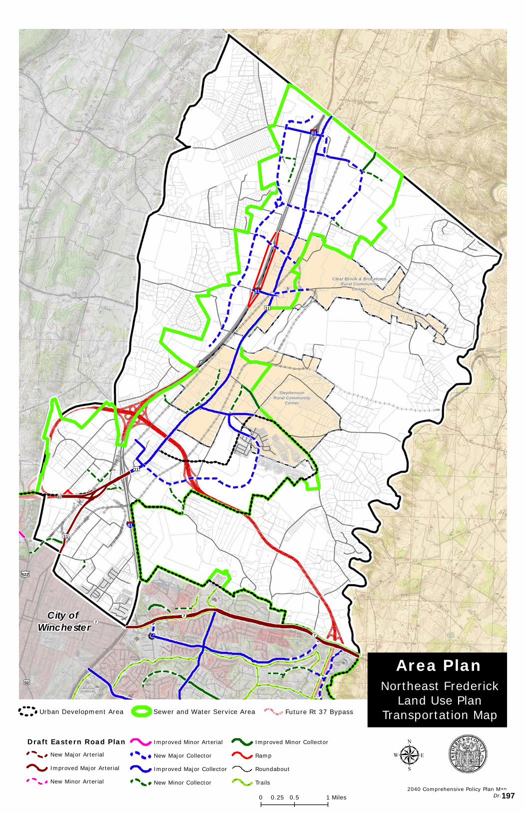
City of Winchester
StephensonRural Community
Center
Clear Brook & BrucetownRural Community
Center§¦81
§¦81
§¦81
£¤11
£¤50
£¤522
£¤11
£¤11
¬«7¬«7
¬«7
¬«37
Copyright:© 2013 National Geographic Society, i-cubed
µDraft Eastern Road Plan
New Major Arterial
Improved Major Arterial
New Minor Arterial
Improved Minor Arterial
New Major Collector
Improved Major Collector
New Minor Collector
Improved Minor Collector
Ramp
Roundabout
Trails2040 Comprehensive Policy Plan Map
Draft0 0.5 10.25 Miles
Northeast FrederickLand Use Plan
Transportation Map
Area Plan
Future Rt 37 BypassSewer and Water Service AreaUrban Development Area
197
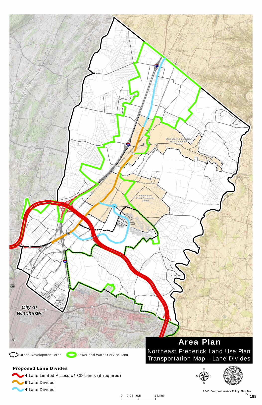
City of Winchester
StephensonRural Community
Center
Clear Brook & BrucetownRural Community
Center§¦81
§¦81
§¦81
£¤11
£¤50
£¤522
£¤11
£¤11
¬«7¬«7
¬«7
¬«37
Copyright:© 2013 National Geographic Society, i-cubed
µProposed Lane Divides
4 Lane Limited Access w/ CD Lanes (if required)
6 Lane Divided
4 Lane Divided
Northeast Frederick Land Use PlanTransportation Map - Lane Divides
Area Plan
2040 Comprehensive Policy Plan MapDraft0 0.5 10.25 Miles
Urban Development Area Sewer and Water Service Area
198
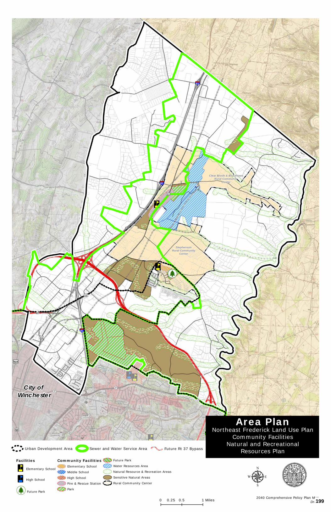
City of Winchester
StephensonRural Community
Center
Clear Brook & BrucetownRural Community
Center§¦81
§¦81
§¦81
£¤11
£¤50
£¤522
£¤11
£¤11
¬«7¬«7
¬«7
¬«37
Copyright:© 2013 National Geographic Society, i-cubed
µ
Area Plan
Facilities
³n Elementary School
³n High School
[j Future Park
Community FacilitiesElementary School
Middle School
High School
Fire & Rescue Station
Park
Future Park
Water Resources Area
Natural Resource & Recreation Areas
Sensitive Natural Areas
Rural Community Center
Northeast Frederick Land Use PlanCommunity Facilities
Natural and RecreationalResources Plan
2040 Comprehensive Policy Plan MapDraft0 0.5 10.25 Miles
Future Rt 37 BypassUrban Development Area Sewer and Water Service Area
199
APPENDIX I - AREA PLANS
Senseny/Eastern Frederick Urban Area Plan 10
SENSENY/EASTERN FREDERICK URBAN AREA PLAN
SEFUAP
200
APPENDIX I - AREA PLANS
Senseny/Eastern Frederick Urban Area Plan 11
SENSENY/EASTERN FREDERICK URBAN AREA PLAN This area is home to many families and successful businesses and contains some of the area’s most accessible natural resources, environmental features, historic resources, and public facilities. The Senseny/Eastern Frederick Urban Area Plan effort builds upon these great assets and has identified opportunities to; create new communities, integrate land use and transportation choices, address community infrastructure needs, and expand the County’s goals for economic development. A series of maps have been prepared which identify Future Land Use, Transportation, and Historical Resources, Natural Resources and Public Facilities within the study area. The Senseny/Eastern Frederick Urban Area Plan incorporates the following areas of new land use focus: the Urban Centers, the Parkins Mill Economic Development Area, Interstate and Highway Commercial at Routes 7, 50 and 522, Warrior Drive Employment and Commercial Center, and others. The above areas combine to form the County’s urban areas between the City of Winchester and Clarke County.
The study encompasses the area of the County that is generally east of the City of Winchester and Route 522, South to the Clarke County line and from Redbud Run in the north to the Opequon Creek in the south. This study area includes the Route 7 and Route 50 Business Corridor Plans which were both adopted in 1994, and the eastern portion of the Southern Frederick Land Use Plan which was adopted in 1999, generally north of the Opequon Creek. The study area includes both the Red Bud and Shawnee Magisterial Districts and a small portion of the Stonewall Magisterial District.
An Overview to Planning in Frederick County. Planning efforts, such as the Senseny Eastern Frederick Urban Area Plan, enables the community to anticipate and deal constructively with changes occurring in the community. Planning helps guide the future growth of the community and is intended to improve the public health, safety, convenience and welfare of its citizens. The Plan provides a guide for future land use and was a collaborative effort of the citizens of Frederick County, County Planning Staff, Planning Commissioners, and Board of Supervisors. However, it is the property owners who are the ones who make the decision as to whether or not to implement the Plan as it applies to their property. Future rezoning is a means of implementing the Plan. Rezonings in Frederick County have historically been initiated by the property owner, or with their consent. There is no reason to expect that this will change in the future. Therefore, it is important to remember that the Plan is a guide for the future of the community, but that the property owner is ultimately the one who controls the future use of their property.
201
APPENDIX I - AREA PLANS
Senseny/Eastern Frederick Urban Area Plan 12
LAND USE URBAN CENTERS The urban centers are envisioned to be intensive, walkable urban areas that are well integrated with the surrounding community. The urban center should be based on the principles of New Urbanism or Traditional Neighborhood Design promoted in the 2035 Comprehensive Plan. They shall contain a large commercial core, generally higher residential densities with a mix of housing types, an interconnected street system, and public open space around which the urban center is designed. Multiple uses are envisioned in single structures. Community facilities shall also provide a focal point for the urban center and surrounding community. Public spaces in the form of pocket parks, plazas, or greens shall be further integrated into the design of the urban centers. Presently, Greenwood Mill Elementary School, Admiral Byrd Middle School and Evendale Elementary School provide a focal point for community activity. In the future, these resources shall be complemented by a new high school, middle school, and elementary school which shall serve the existing and future population and be located within close proximity to the centers. These urban centers are centrally located in the study area. The commercial and residential mix of land uses shall have a strong street presence and shall relate to existing and planned road infrastructure. The mix of commercial, residential, employment, and community uses shall be linked to the surrounding area with inter-modal transportation choices and public open spaces. While the core characteristics of the urban centers are the same, each urban center is envisioned to be more individual, of a varying scale, and distinctive of their particular location. The following describes what an urban center in Frederick County may look like. The land use and/or building types could include, in addition to commercial and residential, community oriented types such as civic, religious, fraternal, or institutional uses. In the core area one may find 2 to 4 story buildings that, at the center, share party walls and front directly on the sidewalk; at the first or ground floor one will find retail and commercial uses, upper stories will have offices in some buildings and others will have apartments; and parking of cars will be on the street or in lots behind the buildings and possibly in parking decks if there is such need for structured parking. These types of structures will be readily accessible from the boulevards that serve the urban center. THE CROSSPOINTE URBAN CENTER The designated Crosspointe Urban Center provides an opportunity to enable either the currently approved project or an intensification of the proposal to allow for a greater mix of commercial and residential land uses, including residential, for a greater economic return to both the County and the property owner. The Crosspointe Urban Center is envisioned to be the most intensively developed urban center, due to its location commercial and urban of the urban centers and, at the convergence of Interstate 81, Route 37 and future Warrior Drive, is ideally located to be the most intensive. The residential densities in this area have the potential to be the highest in the County’s urban areas. Opportunities exist to further the entertainment characteristics of this area based on its location, visibility and accessibility.
202
APPENDIX I - AREA PLANS
Senseny/Eastern Frederick Urban Area Plan 13
THE GREENWOOD URBAN CENTER The designated Greenwood Urban Center provides an opportunity for a focal point for an area where most of the recent suburban residential development has occurred. The Greenwood Urban Center is envisioned to introduce a mix of uses into already developed areas in a way that builds the identity and enhances it livability. This urban center should embrace a traditional main-street feel, be pedestrian-friendly, ecologically sensitive, and architecturally distinctive, honor our region’s local heritage and look to the future by promoting urban life in a dynamic new way. This lifestyle center should be defined by tree-lined boulevards and an inviting central park area oriented around the existing historic farm house and grounds. The residential densities in the core of this area are envisioned to be in the 12-16 units per acre range, tapering off to 6 units per acre on its perimeter. Anchored in all directions by existing and proposed schools and park areas, this urban center is tailored to be the future focal point of the Senseny Road and Greenwood Road area. THE PAPER MILL ROAD PARKINS MILL URBAN CENTER/NEIGHBORHOOD VILLAGE This designated urban center provides an opportunity to introduce a mix of uses into a largely undeveloped area in a way that builds the identity and enhances the economic performance of these communities. This area is already anchored by an elementary school and middle school. Similar to the Senseny and Greenwood Urban Center, this urban center should also embrace a traditional main-street feel, be pedestrian-friendly, ecologically sensitive and architecturally distinctive, honor the area’s local heritage and promote urban life in a dynamic new way. This urban center should be defined by tree-lined boulevards and an inviting central park area oriented around the existing public facilities. The residential densities in the center of this area are envisioned to be 10-12 units per acre in the core area, tapering off to 6 units per acre on its perimeter adjacent to the existing residential land uses. RESIDENTIAL LAND USES Outside of the urban centers described above, the residential land uses in the Senseny/Eastern Frederick study area are defined in three main categories:
• R4 – these are generally reflective of our existing residential densities at approximately 4 units per acre.
• R6 – these are slightly higher residential densities at approximately 6 units per acre (this is generally attached house development).
• Higher density residential – these are generally multifamily and a mix of other housing types with densities of approximately 12-16 units per acre (this density is necessary to accommodate the anticipated growth of the County within the urban areas and is essential to support the urban center concept identified in the Comprehensive Plan and this study).
The residential land uses outside and east of Route 37 are envisioned to be rural area residential in character. Route 37, to the north and east of Route 50, may generally be
203
APPENDIX I - AREA PLANS
Senseny/Eastern Frederick Urban Area Plan 14
considered as the boundary between the urban areas and rural areas within this study area. This provides a transition area to the Opequon Creek and to the well-established rural character of adjacent Clarke County. A buffer area along and adjacent to Interstate 81 has been identified where future residential land uses are not appropriate; commercial and industrial uses are preferred. Within this buffer area, a linear trail system is promoted. The buffer area also provides for the reservation of additional right-of-way along 81 which may be necessary in the future. Noise abatement techniques should be a consideration in the Interstate 81 corridor to minimize the impact from vehicular traffic on the residents of the area. Shenandoah University’s campus extends into this portion of the County. The plan recognizes and supports Shenandoah University and the University’s presence in Frederick County, especially in and around its current location on the east side of Interstate 81 and north of Route 50. The potential exists as well as the potential for future residential uses associated with the university in the area in the form of urban residential housing in redeveloped existing commercial properties. The Airport Support Area has been bolstered with the addition of land to the south east. The Airport Support Area was established to ensure the feasibility of continued airport- associated use and future airport expansion. The Comprehensive Plan reiterates that residential land uses are not desirable in the Airport Support Area. Business and industrial uses should be the primary land use.
Other recommendations from the residential group:
• Utilize additional municipal land uses adjacent to the Frederick County Landfill as a buffer to non-compatible land uses, particularly residential.
• Provide for additional institutional opportunities in the southern part of the study area, west of Route 522.
• Consider another community college presence within this area plan. • Establish a linear park area east of existing Greenwood Road, and a new park area
west of the Justes Drive school cluster. • Supply additional locations for C & I land uses in the areas identified which are adjacent
to transportation corridors and urban centers. These include: o An area of commercial and light industrial north of Route 7, buffered by higher
density residential to the east, transitioning to existing school uses. o An area of medical office uses adjacent to and east of proposed Senseny Road
Urban Center. o An area of commercial and employment land uses with significant office space
availability north of Crosspointe Urban Center buffering into the high density residential areas.
• An area of commercial and employment land use with significant office space availability north of the Crosspointe Urban Center buffering the high density residential areas.
BUSINESS DEVELOPMENT LAND USES PARKINS MILL ECONOMIC DEVELOPMENT AREA The Parkins Mill Economic Development Area is intended to be a significant area of commercial and industrial use that is fully supportive of the Frederick County Economic Development
204
APPENDIX I - AREA PLANS
Senseny/Eastern Frederick Urban Area Plan 15
Authority’s (EDA) Winchester – Frederick County Economic Development Commission’s targeted goals and strategies. The intent of the mixed-use designation is to further enhance the County’s commercial and industrial areas and to provide focus to the County’s future regional employment centers. This area has been established to be a progressive location for economic development opportunities in eastern Frederick County. Targeted businesses include:
• Defense and Advanced Security • Life Sciences • Business Services • Assembly • Food Processing
In prominent locations, office use with a mix of flexible space is encouraged. Such areas will be the entrance to clusters of industrial and commercial space, and contain distinctive architecture and site design that is aesthetically unique and attractive. It is the intent of such areas to promote a strong positive community image. In addition, this development will support businesses that encourage viable environmental practices and community oriented operating philosophies. Residential land use is not compatible with this development and will not be permitted. INTERSTATE AND HIGHWAY COMMERCIAL AT ROUTES 7 AND 50 These areas of land use are located at highly visible locations on prominent interstate interchanges, and along the primary arterial roads that feed into the Interstate. They shall be designed specifically to accommodate and promote highway commercial land uses. Particular effort must be made to ensure that access management for the supporting transportation network is a key priority, as the function of the interstate and primary road network is of paramount importance. The site layout and building design should recognize the nature of the region and land plans should not focus on the minor use, but the comprehensive macro use. In addition, an enhanced area of buffer and landscaping shall be provided adjacent to the Interstate 81 right-of-way and its ramps. Corridor design recommendations are discussed later in this plan. WARRIOR DRIVE EMPLOYMENT AND COMMERCIAL CENTER A major employment and commercial area is proposed primarily along the west side of future Warrior Drive and adjacent to the east side of Interstate 81. This area extends east of Warrior Drive along Airport Road. This major employment area would be centered on the proposed future interchange at Interstate 81 at Papermill Road. Supported by future high density residential areas and central to proposed urban centers, this employment center will be ideally placed to capitalize on this core location. Emphasis should be placed on quality building and site design. Other recommendations from the business development group:
• New retail/service land use adjacent to the future Route 37 interchange areas with Route 522 South and Route 50 East to facilitate regional shopping opportunities.
• New retail/service land use adjacent to the future realignment of Valley Mill Road and Route 7 East.
205
APPENDIX I - AREA PLANS
Senseny/Eastern Frederick Urban Area Plan 16
• Infill retail/service land use within existing residential developments between Route 7 East and Senseny Road.
• Intensive retail and office use lie within the urban center planned between Senseny Road, Greenwood Road, Inverlee Way Extension and Channing Drive Extension. This area has been incorporated into the Senseny and Greenwood Urban Center.
• New neighborhood retail/service and office land use within the mixed-use area planned around existing public-school facilities and church facilities near Route 522 South and Justes Drive. This area has been incorporated into the Justes Drive and Evendale Urban Center.
• New employment centers are appropriate for the land between Route 522 South and Interstate 81 adjacent to the Papermill Road flyover bridge and the future Battaile Drive interchange with Interstate 81, and the future Warrior Drive extension and Tasker Road extension. New employment centers are envisioned to allow for intensive retail, office, flex-tech, and/or light industrial land use in planned business park settings. This area has been incorporated into the Warrior Drive Employment and Commercial Center.
• A new industrial park is planned between Route 522 South, Route 50 East, Parkins Mill Road, and future Route 37. This area has been incorporated into the Parkins Mill Economic Development Area.
The business development recommendations of this plan seek to implement the 2035 Comprehensive Plan by promoting the efficient utilization of existing and planned land areas and transportation networks. Further, the recommendations promote commercial, industrial, and employment land use areas to assure the County’s desired taxable value ratio of 25 percent commercial/industrial to 75 percent residential and other land use is achieved.
The Plan provides new industrial park and employment center areas to match the EDA’s Economic Development Commission’s vision for this portion of Frederick County. The plan identifies prime areas for urban center development to capitalize on future commercial and employment opportunities. In addition, areas are identified for neighborhood commercial retail use to accommodate existing residential communities. Existing commercial land uses are promoted that facilitate tourism and short-term visitor experiences and revenue growth. Specific implementation steps have been identified which would further promote business development opportunities in the Senseny/Eastern Frederick County Urban Area Plan and Frederick County in general. These include:
• The creation of a Future Land Use Revenue Incentive Program that provides property owners with the ability to sell residential density rights to keep their property available for future employment, commercial, or industrial land use as recommended by the Comprehensive Policy Plan. This program would incentivize the property owner by providing a revenue income source in the near term and future revenue income when the property is zoned for employment, commercial or industrial land use.
• Incentivize the property owner with automatic placement of the property into the Sewer and Water Service Area (SWSA) if a rezoning application is processed for future employment, commercial, or industrial land use, if adequate capacity and existing infrastructure is available.
206
APPENDIX I - AREA PLANS
Senseny/Eastern Frederick Urban Area Plan 17
• Incentivize the property owner with County endorsement of Economic Development Access (EDA) funds and/or Revenue Sharing Funds to assist in the financing of major road infrastructure needed to serve the development project. Additionally, provide for County-managed support of the major road infrastructure projects to streamline the approval process for project design and construction management.
• Incentivize the property owner through the implementation of expedited rezoning processes for future employment, commercial, or industrial land use as recommended by the Comprehensive Policy Plan.
• The creation of new Zoning Ordinance requirements that facilitate more intensive Floor to Area Ratio (FAR) and height allowances for future employment, commercial or industrial land use, especially in the urban centers.
• The County should support and partner with various athletic organizations to sponsor regional or state tournaments and events using existing facilities to promote tourism in support of existing hotels, restaurants, and attractions.
CORRIDOR DESIGN The Route 522, 50, and 7 corridor design guidelines should be reaffirmed. In addition, the following locations have been identified as priority corridor appearance and multi-modal locations:
• Route 50 between Interstate 81 and Prince Frederick Drive, to include Shenandoah University and prime commercial locations.
• Route 7 between Interstate 81 and Greenwood Road, to include Millbrook High School, Redbud Run Elementary School and prime commercial locations.
• Senseny and Greenwood Roads and Channing Drive, to include the area encompassed by the urban center and Senseny Road in its entirety.
A significant corridor appearance buffer is proposed along Route 522 similar to that established for the Route 50 West corridor in the Round Hill Land Use Plan, which consisted of a 50 foot buffer area, landscaping, and bike path. The Route 50 and 7 corridors are more urban. Sufficient right-of-way is needed and street frontage is approached differently. TRANSPORTATION In support of the new areas of land use, a transportation network has been proposed which relates to the location and context of the areas of land use, promotes multi-modal transportation choices and walkability, and furthers the efforts of the Win-Fred MPO. In this study, there is a direct nexus between transportation and land use. As noted in the Transportation Chapter of the Plan, as road projects and development or redevelopment take place, the development and associated transportation facilities should be accessible to all users. Interstate 81, Future Route 37, Route 7, Route 50, and Route 522, provide orientation for make up the County’s primary road system and provide new opportunities to create a transportation network which supports the future growth of the community in the right location, in this study area. generally inside future Route 37. Access Management is a significant consideration of this study. and is a key element of all existing and future roads. The use of frontage roads, minor collector roads, and inter parcel connections to bring traffic to common access points is key to a safe and efficient
207
APPENDIX I - AREA PLANS
Senseny/Eastern Frederick Urban Area Plan 18
transportation and reduces the need for roadway widenings and expansions to be needed as quickly. is promoted on the above roads. Access Management is also a key consideration on other all roads within the study area, but particularly along the primary and major collector roadways. ; however, within a different context. The study also proposes a new and extended major collector network supplemented by interconnected minor collector street network in support of a significant urban center and new areas of economic growth - Warrior Drive, Justes Drive, Channing Drive, Inverlee Way. The context of the collector road network is proposed to be significantly different, however, than that of Route 37, with the focus being placed on a more walkable and friendly street thoroughfare design. The change in context is based upon the classification of a road and to ensure compatibility with adjacent land uses and community goals. Particular attention should be paid to street network within the urban center. The surrounding land use, site design, and building design are features that will help create context and promote the creation of new communities, places, and focal points. Attention should also be provided to the context of the street in the immediate vicinity of existing and future schools, and the neighborhood village commercial areas to ensure that these prominent locations are safe and accessible to all modes of transportation. Bicycle and pedestrian accommodations should be fully integrated into street designs. Appropriately designed intersection accommodations should include pedestrian refuge islands and pedestrian actualized signals. More specific transportation considerations for Millbrook High School and the adjacent park areas include taking a proactive approach in creating safe interconnected routes to the park from the adjacent areas. Roundabouts should be considered as a priority preference for intersection design; roundabouts are particularly effective when used in series. Consistent application of Comprehensive Plan goals to achieve an acceptable Level of Service (LOS) on area roads and overall transportation network, LOS C or better, should be promoted. Further, efforts should be made to ensure that additional degradation of the transportation beyond an acceptable LOS shall be avoided. Consideration of future development applications within the study area should only occur when an acceptable LOS has been achieved and key elements and connections identified in this plan have been provided. Other recommendations from the transportation group:
• Emphasize the role of the State and the development community in the implementation of the planned road system.
• Use modeling to determine lane needs based upon build out of planned land uses, but consider plans of neighboring localities when making recommendations (for example Senseny Road where it enters the City of Winchester or Clarke County)
• Consider the needs of bicycle users and pedestrians in the following ways: o Continue to plan for multi-modal street deigns that will take all users into
consideration. o Within residential neighborhoods, this would mean that sidewalks be used and
cyclists share the roads. Use of striping that defines parking bays or cycling areas would be preferred.
o On collector roadways or higher, make use of separated multi-use paths at least 10 feet in width.
208
APPENDIX I - AREA PLANS
Senseny/Eastern Frederick Urban Area Plan 19
o Incorporate wide shoulders or bike lanes into roadways that have budgetary or right-of-way limitations. This would be viewed as a step toward the ultimate goal of a separated facility.
o Make use of paved shoulders with striping on rural roadways as a long term measure. Rural roadways would be defined by traffic count or as roadways outside of the UDA that are not part of the Primary System (ex. Route 50 or 522).
o Bike paths should be constructed on the same grade as the adjacent roadway. o Bike path maintenance should be addressed by adjacent property owner groups
whenever possible. • Continue to enforce improved access management with redevelopment or new
development. o This includes, but is not limited to, entrance location and spacing as well as
traffic signal location and spacing. • Roundabout use is preferred over signalization of intersections where traffic control is
needed. • Attractive median treatments (as alternative to standard grey concrete median) other
than grass or other landscaping should be considered when maintenance agreements with VDOT cannot be achieved.
o Treatments should be reasonably consistent • Street sections could be modified due to DCR changes specific to drainage
requirements.
209
APPENDIX I - AREA PLANS
Senseny/Eastern Frederick Urban Area Plan 20
NATURAL RESOURCES, HISTORIC RESOURCES, AND PUBLIC FACILITIES.
NATURAL RESOURCES
Frederick County is a community that values and protects its natural resources. Frederick County should create a green infrastructure inventory for the study area as well as the County as a whole. This inventory should guide land use and development to best preserve and protect natural resources. Developers should complete detailed environmental analysis for properties proposed for development. This information could be utilized to supplement the green infrastructure inventory. Within the Senseny/Eastern Frederick Urban Areas Plan, effort should focus on the creation of greenways, stream valley parks and stream buffers around waterways, while taking into account environmentally sensitive areas. Pedestrian facilities should be constructed that connect these features to other public facilities. Many such examples have been identified on the accompanying map. Environmental corridors should be incorporated with all development activities to ensure safe movement and protection of species and future development within the study area should take into account the natural resources located on and around their property. Businesses that utilize environmental management systems should be targeted by Frederick County. Further, developers should consider available renewable energy options with their projects. HISTORIC RESOURCES
Frederick County is a community that recognizes and protects the historic structures and sites within the study area. Possible historic districts and significant structures have been identified and recognized. Priority sites for preservation within the study area should be identified and efforts initiated to preserve those of highest need. These include Frederick Hall/Parkins Mill Battery and the historic area around Carpers Valley Road. Consideration should be given to increase the rehabilitation, adaptive reuse, or restoration of historic structures. Heritage tourism should be promoted within the study area. The Comprehensive Plan calls for the adaptive reuse of historic structures, future development applications that have historic resources on the property should incorporate the site into development. Sensitive natural areas and historic areas are shown on the land use map for the study area. By recognizing these historic sites and structures, we are implementing the policies of the Comprehensive Plan. Other recommendations from the group:
• Require archaeological surveys to be conducted prior to development, particularly any that involve battlefield areas, homesteads, American Indian encampments, and waterways.
210
APPENDIX I - AREA PLANS
Senseny/Eastern Frederick Urban Area Plan 21
• Significant structures and properties should be shown with a sensitive natural/historic designation. These NSA’s should be protected through historic districts and/or buffered from adjacent development activity.
• The historic areas around Frederick Hall/Parkins Mill Battery and the historic area around Carpers Valley Road should be considered for possible historic districts.
• Developments should incorporate and/or convert historic properties into recreational elements, including pedestrian trails, parks, and museums. Establish a linear historic greenway between Crosspointe (Hillandale, Carysbrooke, and the preservation park) and the fort (at Parkins Mill Battery), preserving the natural, recreational, and historical features and promoting accessibility.
• Create a historic gateway park to Frederick County by supporting the restoration and adaptive reuse of the Millbank House in conjunction with other preservation partners.
• The historic one-lane bridge located on Valley Mill Road should be maintained and preserved.
• Ensure connectivity of bicycle or pedestrian transportation accommodations to existing or proposed public facilities and historic resource areas.
A regional park site has been identified on Senseny Road; this site contains a potentially significant structure and one of the few remaining farming complexes within the developed area of the study area. This park should incorporate the historical farm house and contributing structure as a means to demonstrate urban agriculture.
PUBLIC FACILITIES The need for public spaces within the study area (such as schools, neighborhood parks, and regional parks) is recognized and addressed. The accompanying maps identify general locations within the Senseny/Eastern Frederick Urban Area Plan where such facilities should be accommodated in order to ensure adequate public facilities corresponding with the growth of the community.
Future school sites should be located within or near established or planned residential areas to encourage walk zones, as well as create a focus point for the community. Residential land uses that complement existing public facilities and schools are encouraged.
Utilities and infrastructure will be needed within the study to accommodate future growth. Frederick County needs to look at preserving the intent of the landowner when planning for public facilities while still meeting the needs of the community.
Other recommendations from the group:
• On any given request for development, the development community should work with
all public facility providers to determine future public facility needs based upon this plan and the established standards of the public facility providers.
• The Parks & Recreation Department should continue to evaluate the “ideal” park site rings that are within the 2035 Comprehensive Plan. Sites that are outside of the identified park rings should be considered if they meet the needs of the community.
• A regional park is envisioned within the study area. In addition, a smaller park is envisioned within the Greenwood Urban Center that should incorporate the historical farm house and contributing structure as a means to demonstrate urban agriculture.
211
APPENDIX I - AREA PLANS
Senseny/Eastern Frederick Urban Area Plan 22
• Urban parks and other public spaces should be constructed within or near communities. These parks should be open to the public and connected not only by road, but by various pedestrian facilities.
• The 42 acre parcel owned by the landfill (old landfill site) could be considered for future use as a park.
• Public access areas to the Opequon Creek should be constructed, taking into account environmentally sensitive areas.
• The bicycle and pedestrian facilities shown on the map and the 2007 Win-Fred MPO Bicycle & Pedestrian Mobility Plan WinFred MPO planning documents should be implemented.
• The 2007 Win-Fred MPO Bicycle & Pedestrian Mobility Plan should be utilized as a reference for accommodation recommendations and guidelines.
• Pedestrian facilities should be constructed that connect existing and future neighborhoods to school, park and library facilities to promote access and walkability. A trail or sidewalk should be provided along Greenwood Road.
• Support completion of a linear recreation path encompassing the Senseny Road, Abrams Creek, Channing Drive areas.
• Ensure connectivity of bicycle or pedestrian transportation accommodations to existing or proposed public facilities and historic resource areas.
• Ensure connectivity with existing or proposed bicycle or pedestrian transportation accommodations wherever possible.
• A pedestrian crossing over Route 7 in the Millbrook School area should be provided. • Handley Regional Library needs should be recognized and addressed within the study
area. A satellite library location should be provided within the study area (similar to Bowman Library) to meet this need. Frederick County Public Schools should also work with the Handley Regional Library to provide public library locations within new school locations.
• Future areas for Fire & Rescue stations have been identified on the map; development proposals in these areas should take this future need into account.
• The Airport has a 20 year Master Plan that outlines their ultimate expansion goals for this facility. Development proposals should not be considered on properties that fall within this planned expansion area. Also, development proposals considered within the Airport Support Area should not impact the current or future needs of the Airport.
• Incompatible development should be avoided near the landfill to ensure that their operations are not impacted (i.e., residential, urban, etc.). Industrial uses may be appropriate near the landfill. A landfill support area should be created around the landfill similar to the Airport Support Area. This support area should extend 1,000 feet from the boundaries of the landfill.
212
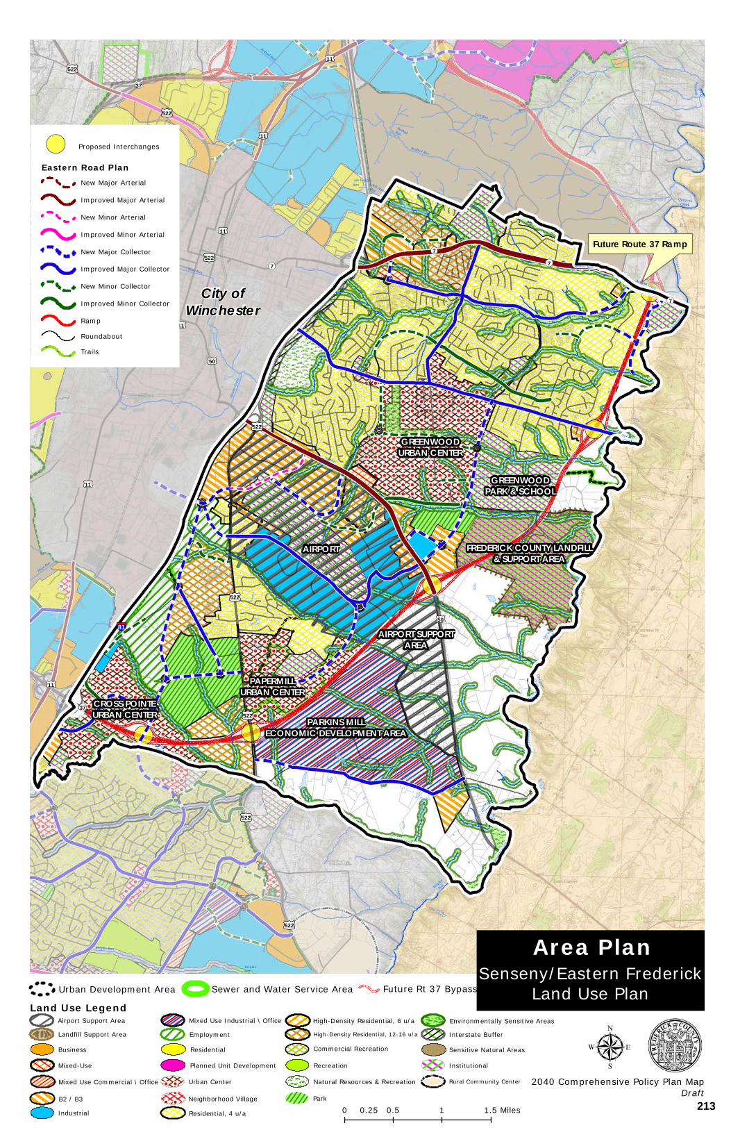
FREDERICK COUNTY LANDFILL& SUPPORT AREA
GREENWOODPARK & SCHOOL
GREENWOODURBAN CENTER
PAPERMILLURBAN CENTER
CROSS POINTEURBAN CENTER PARKINS MILL
ECONOMIC DEVELOPMENT AREA
AIRPORT
AIRPORT SUPPORTAREA
Sulpher Spring Run
Ash Hollow Run
RedbudRun
WrightsRun
Hoge Run
Redbud Run
Opequon
Creek
LickRun
Opequ
on
Creek
Opeq u
onCr
eek
OpequonCreek
Lick Run
Opeq
uon C
reek
Ash HollowRun
Town Run
Ash HollowRun
Redbud Run
SulpherSprings Run
WrightsRun
Opequon Creek
AbramsCreek
Buffalo Lick Run
Abrams
Creek
OpequonCreek
A bra msCree k
Lick Run
Ab ramsCreek
Opequo n Cr eek
Hoge Run
Buffalo Lick Run
OpequonCreek
OpequonCreek
Opeuqo n Cre ek
Abrams Creek
Opequ
on
Cree
k
Opeu qonCre e
k
Abram
s Cree
k
OpequonCreek
Opequ
onCree
k
Wrights Run
§¦81
£¤11
£¤522
£¤522
£¤522
£¤11
£¤522£¤50
£¤50
£¤11
£¤522
£¤522
£¤11
£¤11
£¤11
£¤50
£¤50
£¤522
£¤522
¬«7
¬«7 ¬«7
¬«37
¬«7
¬«37
Copyright:© 2013 National Geographic Society, i-cubed
!( Proposed Interchanges
Eastern Road PlanNew Major Arterial
Improved Major Arterial
New Minor Arterial
Improved Minor Arterial
New Major Collector
Improved Major Collector
New Minor Collector
Improved Minor Collector
Ramp
Roundabout
Trails
0 0.5 1 1.50.25 Miles
µ2040 Comprehensive Policy Plan Map
Draft
Senseny/Eastern FrederickLand Use Plan
Area PlanUrban Development Area Future Rt 37 BypassSewer and Water Service Area
Land Use Legend
Residential, 4 u/a
Environmentally Sensitive Areas
Natural Resources & Recreation
Landfill Support Area
Park
Institutional
Urban Center
Interstate Buffer
Business
B2 / B3
Mixed Use Industrial \ Office
Industrial
Mixed-Use
Mixed Use Commercial \ Office
Airport Support Area
Employment
Residential
Neighborhood Village
Planned Unit Development
High-Density Residential, 6 u/a
Sensitive Natural Areas
High-Density Residential, 12-16 u/a
Rural Community Center
Commercial Recreation
Recreation
City ofWinchester
Future Route 37 Ramp
213
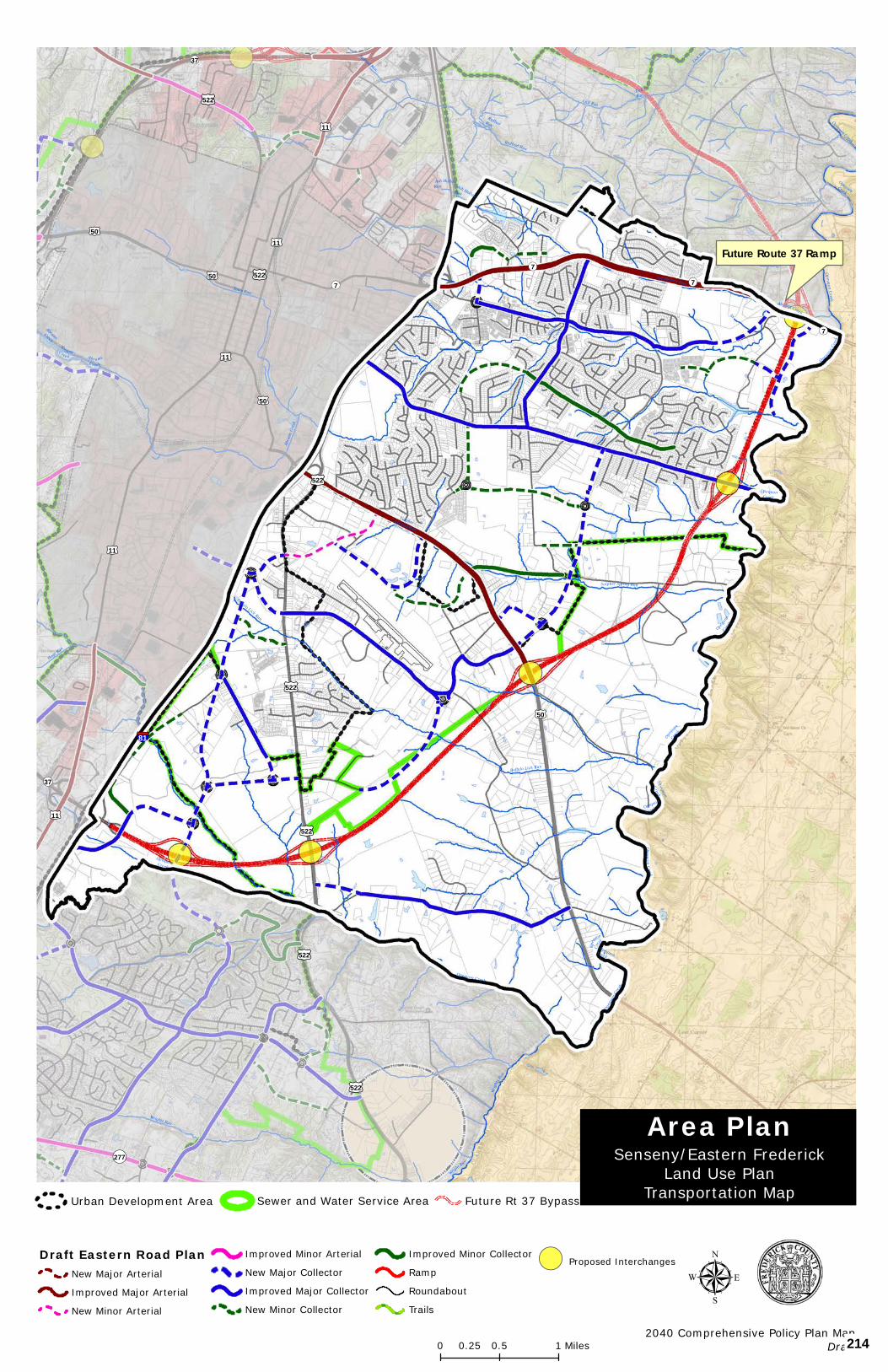
Sulpher Spring Run
Ash Hollow Run
RedbudRun
Hoge Run
Redbud Run
Opequon
Creek
Lick Run
LickRun
Opequ
on
Creek
OpequonCreek
Wrights Run
Lick Run
Opequon
Creek
Ash HollowRun
Town Run
Ash HollowRun
Redbud Run
SulpherSprings Run
Wrigh
ts Run
Opequon Creek
Buffalo Lick Run
Opequon Creek
Abrams
Creek
OpequonCreek
A bra msC ree k
AbramsCreek
Ab ra msC ree k
Opequ on C ree k
Wright Run
Hoge Run
Buffalo Lick Run
Opequon
C reek
OpequonCreek
Opeuqo n Creek
Abrams Creek
Opeq
uon
Cree
k
Opeuqon Creek
Abram
s Cree
k
OpequonCreek
Opequ
onCree
k
§¦81
£¤11
£¤522
£¤522
£¤522
£¤11
£¤522£¤50
£¤50
£¤11
£¤522
£¤11
£¤11
£¤50
£¤50
£¤522
£¤522
¬«7
¬«7
¬«7
¬«277
¬«37
¬«7
¬«37
Copyright:© 2013 National Geographic Society, i-cubed
Senseny/Eastern FrederickLand Use Plan
Transportation Map
Area Plan
µ2040 Comprehensive Policy Plan Map
Draft
Draft Eastern Road PlanNew Major Arterial
Improved Major Arterial
New Minor Arterial
Improved Minor Arterial
New Major Collector
Improved Major Collector
New Minor Collector
Improved Minor Collector
Ramp
Roundabout
Trails
!( Proposed Interchanges
0 0.5 10.25 Miles
Future Route 37 Ramp
Urban Development Area Future Rt 37 BypassSewer and Water Service Area
214
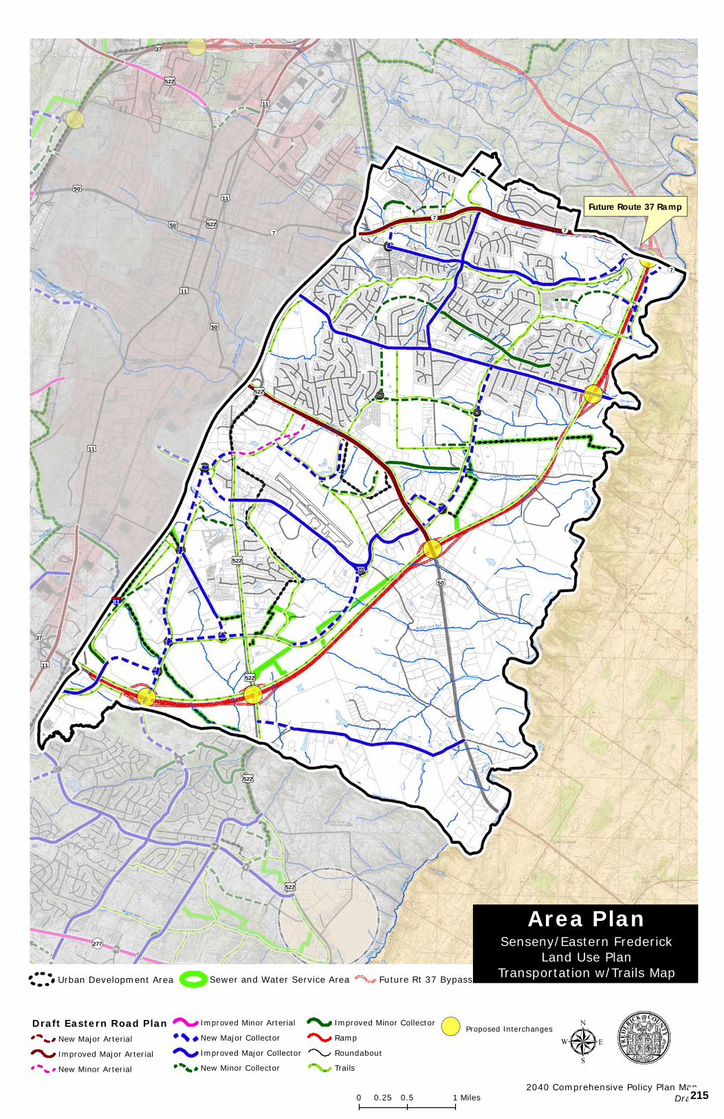
Sulpher Spring Run
Ash Hollow Run
RedbudRun
Hoge Run
Redbud Run
Opequon
Creek
Lick Run
LickRun
Opequ
on
Creek
OpequonCreek
Wrights Run
Lick Run
Opequon
Creek
Ash HollowRun
Town Run
Ash HollowRun
Redbud Run
SulpherSprings Run
Wrigh
ts Run
Opequon Creek
Buffalo Lick Run
Opequon Creek
Abrams
Creek
OpequonCreek
A bra msC ree k
AbramsCreek
Ab ra msC ree k
Opequ on C ree k
Wright Run
Hoge Run
Buffalo Lick Run
Opequon
C reek
OpequonCreek
Opeuqo n Creek
Abrams Creek
Opeq
uon
Cree
k
Opeuqon Creek
Abram
s Cree
k
OpequonCreek
Opequ
onCree
k
§¦81
£¤11
£¤522
£¤522
£¤522
£¤11
£¤522£¤50
£¤50
£¤11
£¤522
£¤11
£¤11
£¤50
£¤50
£¤522
£¤522
¬«7
¬«7
¬«7
¬«277
¬«37
¬«7
¬«37
Copyright:© 2013 National Geographic Society, i-cubed
Senseny/Eastern FrederickLand Use Plan
Transportation w/Trails Map
Area Plan
µ2040 Comprehensive Policy Plan Map
Draft
Draft Eastern Road PlanNew Major Arterial
Improved Major Arterial
New Minor Arterial
Improved Minor Arterial
New Major Collector
Improved Major Collector
New Minor Collector
Improved Minor Collector
Ramp
Roundabout
Trails
!( Proposed Interchanges
0 0.5 10.25 Miles
Urban Development Area Future Rt 37 BypassSewer and Water Service Area
Future Route 37 Ramp
215
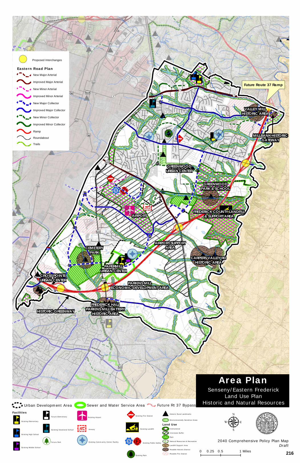
FREDERICK COUNTY LANDFILL& SUPPORT AREA
GREENWOODPARK & SCHOOL
GREENWOODURBAN CENTER
PAPERMILLURBAN CENTER
CROSS POINTEURBAN CENTER PARKINS MILL
ECONOMIC DEVELOPMENT AREA
FREDERICK HALLPARKINS MILL BATTERY
HISTORIC AREAHISTORIC GREENWAY
CARPERS VALLEY RDHISTORIC AREA
CEMETERYPARK
VALLEY MILLHISTORIC AREA
MILLBANK HISTORICGATEWAY
AIRPORT SUPPORTAREA
AIRPORT
Sulpher Spring Run
Ash Hollow Run
RedbudRun
Hoge Run
Redbud Run
Opequon
Creek
Lick Run
LickRun
Opequ
on
Creek
OpequonCreek
Wrights Run
Lick Run
Opeq
uon C
reek
Ash HollowRun
Town Run
Ash HollowRun
Redbud Run
SulpherSprings Run
Wrigh
ts Run
Opequon Creek
Buffalo Lick Run
Opequon Creek
Abrams
Creek
OpequonCreek
A bra msC ree k
AbramsCreek
Ab ra msC ree k
Opequ on C ree k
Wright Run
Hoge Run
Buffalo Lick Run
Opequ onCree k
OpequonCreek
Opeuqo n Creek
Abrams Creek
Opeq
uon
Cree
k
Opeuqon Creek
Abram
s Cree
k
OpequonCreek
Opequ
onCree
k
§¦81
£¤11
£¤522
£¤522
£¤522
£¤11
£¤522£¤50
£¤50
£¤11
£¤522
£¤11
£¤11
£¤50
£¤50
£¤522
£¤522
¬«7
¬«7
¬«7
¬«277
¬«37
¬«7
¬«37
Copyright:© 2013 National Geographic Society, i-cubed
Senseny/Eastern FrederickLand Use Plan
Historic and Natural Resources
Area Plan
µ2040 Comprehensive Policy Plan Map
Draft
!( Proposed Interchanges
Eastern Road PlanNew Major Arterial
Improved Major Arterial
New Minor Arterial
Improved Minor Arterial
New Major Collector
Improved Major Collector
New Minor Collector
Improved Minor Collector
Ramp
Roundabout
Trails
0 0.5 10.25 Miles
Urban Development Area Future Rt 37 BypassSewer and Water Service Area
Facilities
³n Existing Elementary
³n Existing High School
³n Existing Middle School
³n Future Elementary
³n Existing Vocational School
[j Future Park
!Ä Existing Airport
¥L¤ Armory
&% Existing Community Center Facility
89:s Existing Fire Station
!; Existing Landfill
!b¦© Existing Public Safety
[j Existing Park
# Historic Rural Landmarks
Environmentally Sensitive Areas
Land UseInstitutional
Interstate Buffer
Park
Natural Resources & Recreation
Landfill Support Area
Possible Historic District
Possible Fire Station
Future Route 37 Ramp
216
APPENDIX I - AREA PLANS
Southern Frederick Area Plan 27
SOUTHERN FREDERICK AREA PLAN
SOFRED
BOARD OF SUPERVISORS
APPROVED ON NOVEMBER 12, 2014
PLANNING COMMISSION
RECOMMENDED APPROVAL OCTOBER 1, 2014
ENDORSED BY THE
COMPREHENSIVE PLANS AND PROGRAMS COMMITTEE
SEPTEMBER 8, 2014
INCLUDING TEXT APPROVED WITH THE FOLLOWING AMENDMENT:
• LEONARD PROPERTY
APPROVED BY THE BOARD OF SUPERVISORS ON JANUARY 26, 2017
217

APPENDIX I - AREA PLANS
Southern Frederick Area Plan 28
SOUTHERN FREDERICK AREA PLAN The Southern Frederick Area Plan builds on the Route 277 Triangle and Urban Center Plan, consolidates the Tasker Woods Plan, and incorporates previously unplanned areas within the study boundary into a cohesive and proactive area plan. The Southern Frederick Area Plan continues to identify opportunities to create new communities, integrate land use and transportation choices, address community infrastructure needs, and expand the County’s goals for economic development.
A series of maps have been prepared which identify future land use, transportation, and natural, historical, and community facilities within the study area.
The Southern Frederick Area Plan originally promoted five main areas of new land use focus; the Sherando Center, the Route 277 Triangle; Center of Economy, Interstate Commercial at I-81 Exit 307, White Oak Woods Neighborhood Village, and Tasker Woods. In the 2014 update, several additional areas of land use focus were envisioned: Lakeside Neighborhood Village, Artrip Neighborhood Village, Warrior and Tasker Neighborhood Village, and Lake Frederick Neighborhood Village.
The above areas combine to frame the southern boundary of the County’s urban areas. In addition, Route 522 South within the study area defines the eastern boundary of the County’s urban areas. South and east of this study area; the County’s rural areas are strengthened as the primary land use designation. The Lake Frederick Sewer and Water Service Area (SWSA) is recognized in this area plan.
An overview to planning in Frederick County. Planning efforts, such as the Southern Frederick Area Plan, enable the community to anticipate and deal constructively with changes occurring in the community. Planning helps guide the future growth of the community and is intended to improve the public health, safety, convenience, and welfare of its citizens.
The Plan provides a guide for future land use and was a collaborative effort of the citizens of Frederick County, County Planning Staff, Planning Commissioners, and Board of Supervisors. However, it is the property owners who are the ones who make the decision as to whether or not to implement the Plan as it applies to their property.
Future rezoning is a means of implementing the Plan. Rezonings in Frederick County have historically been initiated by the property owner, or with their consent. There is no reason to expect that this will change in the future.
Therefore, it is important to remember that the Plan is a guide for the future of the community, but that the property owner is ultimately the one who controls the future use of their property.
218
APPENDIX I - AREA PLANS
Southern Frederick Area Plan 29
LAND USE
THE SHERANDO CENTER
The Sherando Center is envisioned to be an intensive, walkable urban area that is well integrated with the surrounding community. The center should be based on the principles of New Urbanism or Traditional Neighborhood Design promoted in the 2030 Comprehensive Plan. It shall contain a large commercial core, generally higher residential densities with a mix of housing types, an interconnected street system, and public open space around which the center is designed. Community facilities shall also provide a focal point for the center and surrounding community. Presently, Sherando High School and Sherando Park provide this function. In the future, these resources shall be complemented by a new elementary school which shall serve the existing and future population and be located within the center. Public spaces in the form of pocket parks, plazas, or greens shall be further integrated into the design of the Sherando Center.
The Sherando Center is centrally located to the community and is in the short term, respectful to the Agricultural District. The commercial and residential mix of land uses shall have a strong street presence and shall relate to existing Route 277, Warrior Drive and Double Church Road. The mix of commercial, residential, employment, and community uses shall be linked to the surrounding community with inter modal transportation choices and public open spaces.
The Sherando Center is centrally located to the community and is in the short term, respectful to the Agricultural District.
ROUTE 277 TRIANGLE - CENTERS OF ECONOMY
The Route 277 Triangle Centers of Economy is designed to be a significant area of commercial and industrial opportunity that is fully supportive of the Frederick County Economic Development Authority’s Commission’s targeted goals and strategies. The intent of the mixed-use designation is to further enhance the County’s commercial and industrial areas and to provide focus to the County’s future regional employment centers. In specific areas a mix of flexible uses, with office uses in prominent locations is encouraged. Such areas are supported by substantial areas of industrial and commercial opportunity and provide for areas that are well designed with high quality architecture and site design. It is the intent of such areas to promote a strong positive community image. Residential land uses are not envisioned in this area permitted.
LAKE FREDERICK NEIGHBORHOOD VILLAGE
The Lake Frederick Neighborhood Village serves as a focal point to the 277 Triangle Centers of Economy, and as a gateway feature for the Shenandoah/Lake Frederick community. and On a broader scale, a gateway feature for Frederick County as citizens and visitors approach the County from the east is desirable in this area. This neighborhood village should promote a strong positive community image. Residential land uses would be permitted only as an accessory component of the neighborhood village commercial land uses. Previously, a
219
APPENDIX I - AREA PLANS
Southern Frederick Area Plan 30
small area of neighborhood village commercial was identified on the south side of Route 277 in the general vicinity of the future entrance of Shenandoah and the existing Sandy’s Mobile Home Park. The 2014 update to the Plan provides for an overall greater area and greater mix of uses in this area that is reflective of a stronger desire to create a more substantial focal point for activity. This is primarily based on the growth and development of the Lake Frederick Community and the involvement of new residents from this area.
INTERSTATE COMMERCIAL @ I-81 EXIT 307
Located at a highly visible location on an prominent interstate interchange, this area of land use shall be designed specifically to accommodate and promote highway commercial land uses. Particular effort must be made to ensure that access management for the supporting transportation network is a key priority as the function of the interstate and primary road network is of paramount importance. Access to the areas of interstate commercial land uses shall be carefully designed. The building and site layout and design of the projects shall be of a high quality. In addition, an enhanced buffer and landscaping is planned area shall be provided adjacent to the Interstate 81 right-of-way, its ramps, and the new arterial road the (South Frederick Parkway), and adjacent to Route 11.
WHITE OAK WOODS NEIGHBORHOOD VILLAGE
The White Oak Woods Neighborhood Village is a neighborhood village commercial area that is proposed at White Oak Road and Route 277. This area should be which is sensitive to the existing character and scale of the location, adjacent to Sherando Park and the White Oak Campground. The orientation of this neighborhood commercial shall be to the park and adjoining street network. A new fire and rescue facility and community facility shall provide an additional focal point to this area. This facility and the commercial land uses shall be of a general scale and context similar to projects such as Creekside. High quality building and site design is a priority. Accessory residential uses are only permitted as an accessory component of the neighborhood village commercial land uses.
TASKER WOODS
The Tasker Woods area provides guidance on the future land uses for all of the land areas between Route 522, Tasker Road, and White Oak Road. An area of neighborhood village commercial is proposed between the originally proposed residential areas and Route 522, serving the Tasker Woods area. Access Management is a priority along the Route 522 corridor. An internal access road serving this area was has been provided with the Tasker Woods project; therefore, no new commercial entrances shall be permitted on Route 522. Access Management is a priority along the Route 522 corridor. A significant corridor appearance buffer is proposed along Route 522 similar to that established for Route 50 West corridor in the Round Hill Land Use Plan. This buffer should consist of a which consisted of a 50-foot landscaped buffer area, landscaping, and bike path. Accessory Residential uses are only permitted as an accessory component of the neighborhood village commercial land uses within this the Neighborhood Village area.
The area of natural resources connecting Tasker Woods with Route 522, including the existing pond shall continue to be recognized in this plan. An extension of the neighborhood
220
APPENDIX I - AREA PLANS
Southern Frederick Area Plan 31
commercial land uses may be appropriate on the east and west sides of the existing pond if a balance is achieved between protecting the environmental features and allowing compatible neighborhood commercial uses, which may also include commercial recreational uses.
In addition to the neighborhood village commercial land uses, an area of commercial land use is proposed generally north of Tasker Road – this expands on previously planned commercial uses in this area. This is an extension of the previously planned commercial area on Tasker Road. Two areas have been identified as recreational and natural resources and have been connected together in an effort to protect the existing natural resources and provide additional recreational opportunities for the Tasker Woods area.
LAKESIDE NEIGHBORHOOD VILLAGE
The Lakeside Neighborhood Village A Neighborhood Village Commercial area is proposed along Tasker Road in the Lakeside area, in the vicinity of the Bowman Lakeside Library. This small-scale commercial area is sensitive to the existing character and scale of the location, the Lakeside Library, and the adjacent lake, and the historic and natural resources in this area. The orientation of this neighborhood commercial shall be on the southern opposite side of Tasker Road, opposite to the library and lake and shall be planned with a new street network providing the framework for the new neighborhood. The Bowman Lakeside Library, is an invaluable community facility for the area shall provide a focal point for future development to this area. The commercial land uses shall be of a general scale and context similar to projects such as Creekside. High quality building and site design is a priority. Accessory Within the core area of the neighborhood village, residential uses are only permitted as an accessory component of the neighborhood village commercial land uses within the core area. An area of residential land use is proposed to surround the core neighborhood village area that shall be of a higher density than that typically found in this general area.
ARTRIP NEIGHBORHOOD VILLAGE
The Villages at Artrip contains approximately 170 acres of land designed as a neo-traditional village community. This neighborhood village was designed to provide an urban feel in what was historically a rural setting. This development was rezoned in 2006 and is anticipated to include a mix of 900 single family homes and townhouses, over 100,000 square feet of retail, as well as numerous restaurants and office space. A future elementary school is proposed in this area which will ensure that such an important community facility will provide a focal point and valuable community resource for this area of new development.
WARRIOR & TASKER NEIGHBORHOOD VILLAGE
The Warrior and Tasker Neighborhood Village A Neighborhood Village Commercial area is proposed along Warrior Drive, adjacent to the intersection of Warrior Drive and Tasker Road. This small-scale commercial area is sensitive to the existing residential character of the area, in particular the scale of the adjacent neighborhoods, yet seeks to build upon the existing commercial character of this intersection. The commercial land uses shall be of a general scale and context similar to projects such as Creekside. High quality building and
221
APPENDIX I - AREA PLANS
Southern Frederick Area Plan 32
site design is a priority. Accessory Residential uses are only permitted as an accessory component of the neighborhood village commercial land uses within the core area.
DEFINED RURAL AREAS
The Southern Frederick Area Plan has sought to further define the boundary between the rural and urban areas of the community. As noted, the above areas of proposed land use combine to frame the southern boundary of the County’s urban areas. In addition, the rural areas to the east of Route 522 south further define the boundary of the County’s urban area in this location. The plan provides enhanced recognition of Double Church Agricultural and Forestal District, which provide for a . This recognition and the location and boundaries of the proposed land uses further promote a clean clear separation between the County’s rural and urban areas.
ARMEL RURAL COMMUNITY CENTER
The general location of the Armed Armel Rural Community Center was identified in earlier versions of the Comprehensive Plan. This community center, along with several other centers, have an important as one of several rural community centers in Frederick County that have a role to play as service centers for the County’s rural areas. This identification was largely based on the historical role they played to that end.
The Southern Frederick Area Plan seeks to further define the Armel Rural Community Center and promote future consideration of this unique area; future development of this area should ensure that it remains, an area that should remain distinct from the general urban development occurring in the urban areas of the Plan. Future policies for this rural community center should reflect the particular characteristics of the center and the desires of its residents; this could be achieved through a broader effort to create small area plans for all of the County’s Rural Community Centers.
SHERANDO-LAKE FREDERICK TRAILWAY For the Southern Frederick Area Plan, it is recommended that A new multi-purpose path is envisioned to be constructed from the planned lakeside path at Lake Fredrick westward along Crooked Run, connecting into future planned land uses and ultimately intersecting with and other connecting areas to intersect with a Sherando Park path trail. This pathway surface should be consistent with that of the Sherando Park paths and trails. The new pathway will connect large segments of planned Southern Frederick trails and provide additional public to access Lake Frederick’s lakeside trails and other constructed facilities. Such an environmental and recreational resource would provide an excellent example for other recreational opportunities in the County. RESIDENTIAL DEVELOPMENT Outside of the Sherando Center and Neighborhood Villages described above, the residential land uses in the Southern Frederick study area are defined in two main categories:
222
APPENDIX I - AREA PLANS
Southern Frederick Area Plan 33
• R4 – these are generally reflective of our existing residential densities at approximately 4 units per acre.
• R6 – these are slightly higher residential densities that may fall within the 6-12 units per acre range (this is generally attached house and may also include multifamily and a mix of other housing types).
These densities are necessary to accommodate the anticipated population growth of the County, with the intent of focusing residential land uses in the urban areas. within the urban areas and are consistent with established patterns within the study area. and the densities needed to support the future residential land uses envisioned in the Plan. The residential land uses east of Route 522 South within the study area are envisioned to be rural area residential in character. Route 522 South may generally be considered as the boundary between the urban areas and rural areas within the eastern part of this study area. This provides a transition area to the Opequon Creek and Wrights Run and to the well-established rural character of adjacent Clarke County. BUSINESS DEVELOPMENT The business development section of the plan seeks to identify items that would be complementary to the Urban Areas and Residential Development, Transportation and Natural Resources, Historic Resources and Public Facilities portion of the plan. The business development section of the Plan provides recommendations that are also intended to implement the 2030 Comprehensive Plan by promoting the efficient utilization of existing and planned land areas and transportation networks. Further, the recommendations promote commercial, industrial, and employment land use areas to assure the County’s desired taxable value ratio of 25 percent commercial/industrial to 75 percent residential and other land use is achieved.
The Plan provides for new industrial park and employment center areas to match the Frederick County Economic Development Authority’s (EDA) Commission’s vision for this portion of Frederick County. The Plan identifies a prime area for mixed use development, the Sherando Center, to capitalize on future commercial and employment opportunities. In addition, areas are identified for neighborhood village commercial use, including retail, to accommodate the needs of existing residential communities. The relocation of the Exit 307 Interchange on Interstate 81 provides a significant commercial opportunity that the Plan seeks to take advantage of by identifying the interstate commercial at Exit 307 area of land use.
The business development recommendations identified desirable business types to draw to the area. Including, but not limited to:
• Light Industrial/High Tech targeted businesses
223
APPENDIX I - AREA PLANS
Southern Frederick Area Plan 34
• Lodging / Event / Dining along the Route 522 corridor and at the interstate
• Home Office (versus home based)
• Fast-Casual Dining (EG - Panera, Chipotle)
• Higher-end Dining (chain and Local businesses) as well as casual pubs and cafes
• Premium Grocery & Retail in the UDA Center area (EG - Wegman’s)
The business development group also provided the following general comments:
• All areas should be designed to promote/support pedestrian and bike access, making this a walkable community. This will decrease reliance on cars and enable residents to more readily access business and employment centers.
o To expand the pedestrian & bike access the undeveloped land zoned as Natural Resource / Flood Plain should include walking/biking trails.
• Identify ways to leverage abundant supply of natural gas in the RT 522 corridor.
• Determine if incentives to rezone to commercial uses for landowners with agricultural zoned property should be made available.
• Promote development of small parcels of land that already contain residential structures along transportation corridors for business purposes, examples of which may include doctors, dentist offices, and other professional offices. Promotion could be in the form of incentives or credits to offset the cost of site improvements and transportation improvements required by the site development.
• Restaurants and community based businesses such as dry cleaners, convenience stores, and the like, should be located close to and easily accessible by car or by foot to the areas targeted as industrial, commercial and office uses. This could also be within the Sherando Center or neighborhood village commercial areas which are located within accessible distances from these areas.
• Identify ways to draw more light manufacturing and targeted economic development businesses to the area around the FBI facility off Tasker Rd.
• The Southern Frederick County area would be a natural fit for various outdoor events and festivals, especially once the road and walking path networks have been established enhanced and more lodging and dining options are available. This type of business has a low impact on the environment and provides an external infusion of revenue.
The business development group identified several additional areas east of Route 522 South for potential modifications to the Southern Frederick Area Plan that would better promote the business development objectives of the 2030 Comprehensive Plan. However, it was determined through the facilitator group stage of this planning effort that these areas should remain rural in character.
224
APPENDIX I - AREA PLANS
Southern Frederick Area Plan 35
Specific implementation steps have been identified which would further promote business development opportunities in the Southern Frederick Area Plan and Frederick County in general. This is consistent with those identified in the Senseny/Eastern Frederick County Urban Area Plan. These include:
• The creation of a future land use revenue incentive program that could provide provides property owners with the ability to sell residential density rights to keep their property available for future employment, commercial, or industrial land use as recommended by the Comprehensive Policy Plan. This program would incentivize the property owner by providing a revenue income source in the near term and future revenue income when the property is zoned for employment, commercial or industrial land use.
• Incentivize the property owner with automatic placement of the property into the Sewer and Water Service Area (SWSA) if a rezoning application is processed for future employment, commercial, or industrial land use if capacity and existing infrastructure exists.
• Incentivize the property owner with County endorsement of Economic Development Access (EDA) funds and/or Revenue Sharing Funds Assist property owners with applying for State funding to assist in the financing of major road infrastructure needed to serve the development project. Additionally, provide for County-managed support of the major road infrastructure projects to streamline the approval process for project design and construction management.
• Incentivize the property owner through the implementation of expedited rezoning processes for future employment, commercial, or industrial land use as recommended by the Comprehensive Policy Plan.
• The creation of new Zoning Ordinance requirements that facilitate more intensive Floor to Area Ratios (FAR), and height allowances for future employment, commercial or industrial land use, especially in the urban centers.
• The County should support and partner with various athletic organizations to sponsor regional or state tournaments and events using existing facilities to promote tourism in support of existing hotels, restaurants, and attractions.
TRANSPORTATION
In support of the new areas of land use, a transportation network has been proposed which relates to the location and context of the areas of land use, promotes multi-modal transportation choices and walkability, furthers the efforts of the Win-Fred MPO, and reaffirms the planning done as part of the Route 277 Triangle Area plan. In this study there is a direct nexus between transportation and land use.
The relocation of Interstate 81, Exit 307, provides a new orientation for the County’s primary road system, and provides new opportunities to create a transportation network which supports the future growth of the community in the right locations. This area is also heavily influenced by the ongoing and future improvements to I-81 Exit 310 and the future extension of Warrior Drive. Minor modifications are proposed to the alignment of the Tasker
225
APPENDIX I - AREA PLANS
Southern Frederick Area Plan 36
Road flyover of I-81. As Warrior Drive is extended north and connection with future Route 37 is made, the current Route 37 access point with Tasker Road will be disconnected, resulting in a significant shift of traffic flows in this area.
As in all transportation elements of the Plan and area plans, all development of new roadways, development along existing roadways and upgrades to existing roadways is planned to implement bicycle and pedestrian accommodations to grow the County’s accessibility to all forms of transportation users.
Access management is a significant consideration of this study and general transportation planning in Frederick County. This concept is supportive of providing for key connections to the south. The use of frontage roads, minor collector roads, and inter parcel connections to bring traffic to common shared access points is promoted in order to improve safety and efficiency of the County transportation network.
Roundabouts will be considered as a priority preference for intersection design. Roundabouts are particularly effective when used in series and when used where intersection spacing may be an issue.
The context of the collector road network is proposed to be significantly different with the focus being placed on a more walkable and multi-modal street thoroughfare design. The change in context is based upon classification of road and to ensure compatibility with adjacent land uses and community goals. Particular attention should be paid to street network within the urban centers. The surrounding land use, site design, and building design are features that will help create context and promote the creation of new communities, places, and focal points. Attention should also be provided to the context of the street in the neighborhood village commercial areas to ensure that these prominent locations are safe and accessible to all modes of transportation. Bicycle and pedestrian accommodations should be fully integrated into street designs. Appropriately designed intersection accommodations should include pedestrian refuge islands and pedestrian actualized signals.
More specific transportation considerations for Sherando Park include taking a proactive approach in creating safe interconnected routes to the park from the adjacent areas and creating additional access points. Traffic calming across the entire frontage of Sherando Park is warranted with special attention placed on providing a safe and efficient main entrance to the park. As usage of this regional park facility continues to grow this is an increasing need.
Consistent application of Comprehensive Plan goals to achieve an acceptable Level of Service (LOC) on area roads and overall transportation network, LOC C or better, should be promoted. Further, efforts should be made to ensure that additional degradation of the transportation beyond an acceptable LOC shall be avoided. Consideration of future development applications within the study area should only occur when an acceptable LOC has been achieved and key elements and connections identified in this plan have been provided.
226
APPENDIX I - AREA PLANS
Southern Frederick Area Plan 37
The Eastern Road Plan calls for White Oak Road between Tasker Road and Route 277 to be an improved two-lane roadway. While this improvement has partially taken place for the northern portion of the roadway near Tasker Road, the southern portion of White Oak Road to the south remains a winding and narrow roadway which may be difficult and costly to improve. The area plan identifies improvements to White Oak Road in this area which may include its realignment near the Wrights Run stream crossing, passing to the east of and behind the existing residences fronting White Oak Road.
Other recommendations from the transportation group:
• Emphasize the role of the State and the development community in the implementation of the planned road system.
• Use modeling to determine lane needs based upon build out of planned land uses but consider plans of neighboring localities when making recommendations. Consider the needs of bicycle users and pedestrians in the following ways:
o Continue to plan for multi-modal street designs that take all users into consideration.
o Within residential neighborhoods, this would mean that sidewalks be used, and cyclists share the roads. Use of striping that defines parking bays or cycling areas would be preferred.
o On collector roadways or higher, make use of separated multi-use paths at least 10 feet in width.
o Incorporate wide shoulders or bike lanes into roadways that have budgetary or right-of-way limitations. This would be viewed as a step toward the ultimate goal of a separated facility.
o Make use of paved shoulders with striping on rural roadways as a long-term measure. Rural roadways would be defined by traffic count or as roadways outside of the UDA that are not part of the Primary System (ex. Route 522).
o Bike paths should be constructed on the same grade as the adjacent roadway.
o Bike path maintenance should be addressed by adjacent property owner groups whenever possible.
o Continue to enforce improved access management with redevelopment or new development. This includes, but is not limited to, entrance location and spacing as well as traffic signal location and spacing.
• Roundabout use is preferred over signalization of intersections where traffic control is needed.
• Attractive median treatments (as alternative to standard grey concrete median) other than grass or other landscaping should be considered when maintenance agreements with VDOT cannot be achieved. Treatments should be reasonably consistent.
• Street sections could be modified due to DCR changes specific to drainage requirements.
227
APPENDIX I - AREA PLANS
Southern Frederick Area Plan 38
NATURAL RESOURCES, HISTORIC RESOURCES, AND PUBLIC FACILITIES NATURAL RESOURCES Frederick County should be a community that understands, values, and protects its natural resources. The natural resources element of the Southern Frederick Area Plan should directly correlate to the Natural Resources chapter of the 2030 Comprehensive Plan. To that end, Frederick County should focus on the creation of greenways, stream valley parks, and stream buffers around waterways. Shared use trails should be constructed that connect these features to other public facilities. Consideration should also be given to creating linear parks with shared use trails along major streams, particularly the Opequon Creek, with buffering vegetation appropriate for preventing erosion, filtering pollutants, and providing wildlife habitat. Recommendations from the Natural Resources Committee are:
• Shared use trails should provide connections to other shared use trails as well as other public facilities in the study area.
• New construction within the study area should take into account the natural
resources located on and around their property. The County should ensure that when new developments are planned, that connectivity of greenways is included through the project.
• Preserve and maintain existing natural wetlands, woodlands, and grasslands to the
maximum feasible extent to provide wildlife habitats for animals and plants. Buffer wetlands and creeks using latest water management principles to promote environmental protection of those localities, stabilize stream banks, and promote such protective steps during residential development throughout the South Frederick County area.
• All types of urban open spaces like greenways, squares, plazas, urban parks,
playgrounds, and street medians should be considered as part of urban development planning and implemented wherever reasonable.
• Ensure that stormwater is managed in accordance with the County’s Erosion and
Sediment Control Ordinance and Virginia’s storm water Requirements, and work to implement Low Impact Development (LID) measures where appropriate.
• Provide for best storm water management practices at urban centers, residential
developments, and industrial areas to facilitate environmental protection.
• Protect floodplains and steep slopes from unsuitable uses and recognize their value for stormwater management and ecological functions.
• Ensure that with new development, people and wildlife are protected from unhealthy
levels of noise and light.
228
APPENDIX I - AREA PLANS
Southern Frederick Area Plan 39
HISTORIC RESOURCES
Frederick County should recognize and protect the historic structures and sites within the study area. Sensitive Natural Areas, including historic areas, are shown on the land use map for the study area. The historic element of the Southern Frederick Area Plan should directly correlate to the Historic Resources chapter of the 2030 Comprehensive Plan. To that end, the rehabilitation, adaptive reuse, or restoration of historic structures should be increased and incentivized. The Comprehensive Plan calls for the adaptive reuse of historic structures and therefore, future development applications that have historic resources on the property should incorporate those resources the site into development. Sensitive Natural Areas, including historic areas are shown on the land use map for the study area. By recognizing these historic sites and structures, the Southern Frederick Area Plan is implementing the policies of the Comprehensive Plan. Recommendations from the Historic Resources Advisory Board are:
• Significant structures and properties shown with a sensitive natural/historic designation should be buffered from adjacent development activity.
• Require archaeological surveys to be conducted prior to development, particularly any that involve battlefield areas, homesteads, Indian encampments, and waterways.
• The Rural Landmarks Survey should be updated and maintained regularly in order to
keep current the inventory of structures older than fifty years.
• There are at least six historic sites and markers in the Southern Frederick Area Plan. Those sites and markers should be buffered from adjacent development activities and preserved in their original condition whenever possible during any development or future land use planning exercises.
• The Melvin Sandy house is located immediately adjacent to Sherando Park and would
be ideal for use as an element of the park. In the event that the sites could not it cannot be included as part of the park, it would be appropriate for the site to develop in a way to protect any structures or features.; accessibility to the park is encouraged. the use on the property to develop as something which would encourage the protection of the structure and provide a use which encourages park users to utilize the property.
• Frederick County should assist property owners that want to register their properties
with the State or National Register of Historic Places.
• Increasing shared use trails throughout the study area would give emphasis to the preservation and rehabilitation of nearby historic sites and structures. Developments should be encouraged to incorporate and/or convert historic properties or sites into recreational elements, including shared use trails, parks, and museums. The Zig-Zag trenches should be preserved and connected via a linear park/trail network to the Crosspointe development.
229
APPENDIX I - AREA PLANS
Southern Frederick Area Plan 40
• Developers Development of any urban center developed in the study area should
provide for the integration, preservation, restoration, rehabilitation, or adaptive reuse of any historic structures sites located within the boundaries of the project. integrate into the center’s development plans both the preservation and prominence of historical and natural resources within the urban center boundaries such as the restoration, rehabilitation, or adaptive reuse of historic homes, churches, other buildings, Civil War site markers, Civil War earth works, significant stone outcroppings, etc.
COMMUNITY FACILITIES
The importance of need for public spaces and facilities within the study area needs to be acknowledged recognized and incorporated into future development. The public facility element of the Southern Frederick Area Plan should directly correlate to the Public Facilities chapter of the 2030 Comprehensive Plan. The public facilities element should also expand upon the existing 2030 Comprehensive Plan and ensure that opportunities for needed public facilities, which are not currently identified, are not overlooked missed. To that end, the following recommendations are offered: Recommendations from the public facilities group are:
• The development community should work with The need for future facilities for Schools, Fire & Rescue, and Parks and Recreation to determine future public facility needs should be identified in this Plan, the CIP and incorporated into development proposals as appropriate.
• A potable water tank will be needed within the study area to accommodate future growth (Lake Frederick area).
• The County should focus on the development of the north side of Sherando Park (north of Route 277).
• The 2007 Win-Fred MPO Bicycle & Pedestrian Mobility Plan should be adopted by the Board of Supervisors and pedestrian facilities shown in the plan should be constructed. This plan should also be utilized as a reference for accommodation recommendations and guidelines.
• Ensure connectivity with existing or proposed bicycle or pedestrian transportation facilities accommodations wherever possible.
• Pedestrian facilities should be constructed that connect neighborhoods to school and park facilities to promote accessibility and walkability.
• Trails should be planned and constructed that connect Sherando Park, the proposed South Frederick Parkway and Lake Frederick (see the Sherando-Lake Frederick Trailway example described in the land use section).
• A trail network should be constructed around the Lake at the Bowman Library. • Linear parks should be constructed along creeks where permissible due to
topography. • A new fire & rescue station is needed within the study area; this facility would . As
proposed, a new Fire and Rescue Facility and Community Facility shall provide an additional focal point to the White Oak Woods Neighborhood Village area.
• The 13-acre parcel owned by the Frederick County adjacent to Bass Hoover Elementary should be planned as a combined school, park and recreation facility.
• The existing schools within the study area, including Bass Hoover, Aylor, and Sherando need to be upgraded as outlined in the CIP. New schools identified in this
230
APPENDIX I - AREA PLANS
Southern Frederick Area Plan 41
Plan and in the CIP should be pursued and may be used as focal points for future community development. Existing schools should also be upgraded as identified in the CIP.
ZONING AMENDMENTS TO IMPLEMENT THE PLAN
REVISED/MORE FLEXIBLE B2 OVERLAY CONCEPT
Neighborhood Village Commercial areas are envisioned to be compact commercial centers that focus and complement the surrounding neighborhoods, are walkable and designed at a human scale, and which are supported by existing and planned road networks.
Accessory Residential uses within the neighborhood Villages are only permitted as an accessory component of the commercial land uses within the core area. However, the residential uses are allowed in a variety of configurations and are not just limited to the second and third floors of commercial buildings. They may also be located in separated buildings, again provided that they are accessory to the commercial uses. This provides a greater amount of flexibility with the residential design, while still affording the commercial land uses primary status. Previously, residential land uses were only permitted on the second floor and above commercial buildings.
TRADITIONAL NEIGHBORHOOD DESIGN ZONING CLASSIFICATION
This flexible zoning classification is intended to enable Neighborhood and Urban Village Centers, or a part thereof, to be developed.
231
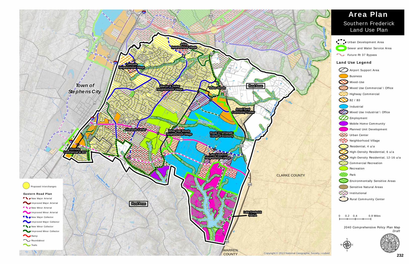
WestRun
Crooked Run
Opequon Creek
Opequon Creek
Shee
p Run
Wrights Run
Opeq
uon
Cree
k
Stephens Run
Wright Run
West Run
Wrigh
ts Ru
n
Hoge Run
CLARKE COUNTY
WARRENCOUNTY
§¦81
§¦81
§¦81
§¦81
§¦81
§¦81
£¤11
£¤11
£¤522
£¤522
£¤50
£¤522
£¤522
£¤522
£¤522
£¤11
£¤11
£¤11
£¤50
¬«277¬«277
¬«37
¬«277
¬«277
Copyright:© 2013 National Geographic Society, i-cubed
0 0.4 0.80.2 Miles
µ
!( Proposed Interchanges
Eastern Road PlanNew Major Arterial
Improved Major Arterial
New Minor Arterial
Improved Minor Arterial
New Major Collector
Improved Major Collector
New Minor Collector
Improved Minor Collector
Ramp
Roundabout
Trails
Southern FrederickLand Use Plan
Area Plan
2040 Comprehensive Policy Plan MapDraft
Sherando Center White Oak WoodsNeighborhood Village
Lake FrederickNeighborhood Village
Rural Areas
Route 277 Triangle:Center of Economy
Interstate Commercial at 307
Armel Rural Community Center
Tasker WoodsWarrior & TaskerNeighborhood Village
LakesideNeighborhood Village
Artrip Neighborhood Village
Rural Areas
Lake FrederickSWSA
Land Use Legend
Highway Commercial
Mixed Use Commercial \ Office
Mixed Use Industrial \ Office
Residential, 4 u/a
Planned Unit Development
Urban Center
Neighborhood Village
Commercial Recreation
Recreation
Institutional
Sensitive Natural Areas
Rural Community Center
Environmentally Sensitive Areas
B2 / B3
Mixed-Use
Employment
Industrial
Mobile Home Community
High-Density Residential, 12-16 u/a
High-Density Residential, 6 u/a
Park
Business
Airport Support Area
Future Rt 37 Bypass
Urban Development Area
Sewer and Water Service Area
Town ofStephens City
232
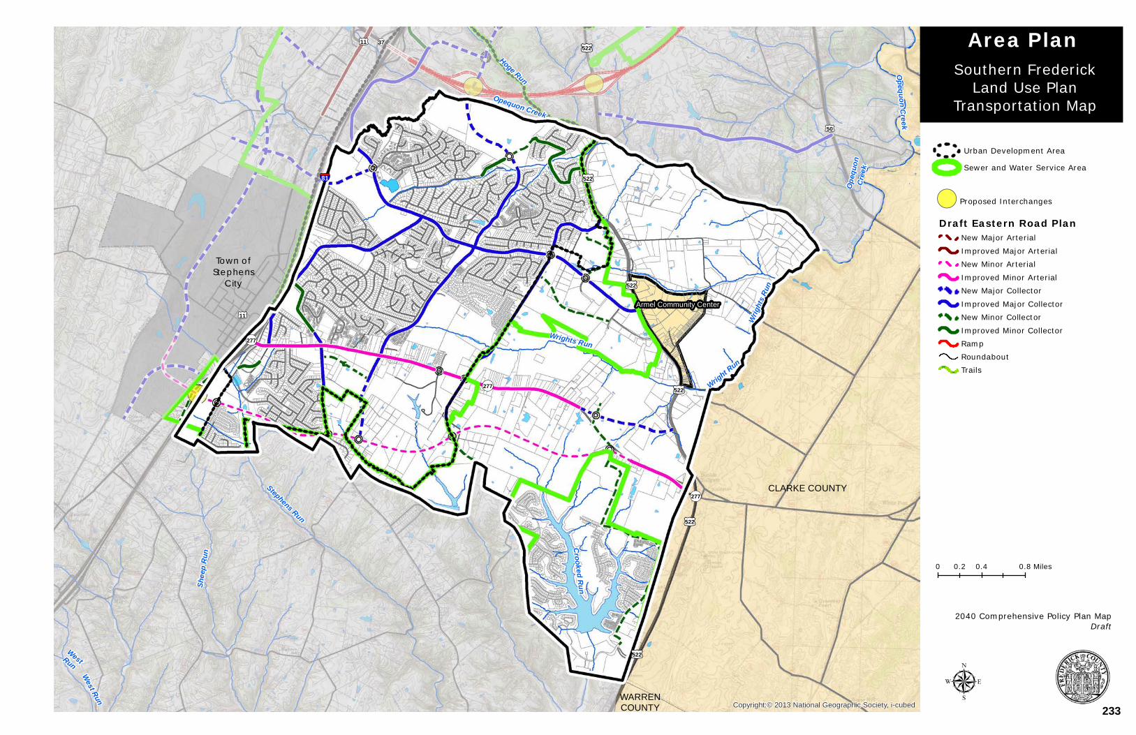
Town ofStephens
City
WestRun
Crooked Run
Opequon Creek
Opequon Creek
Shee
p Run
Wrights Run
Opeq
uon
Cree
k
Stephens Run
Wright Run
West Run
Wrigh
ts Ru
n
Hoge Run
CLARKE COUNTY
WARRENCOUNTY
§¦81
£¤11
£¤522
£¤11
£¤522
£¤522
£¤50
£¤522
£¤522
£¤522
¬«277
¬«277
¬«277
¬«37
Copyright:© 2013 National Geographic Society, i-cubed
0 0.4 0.80.2 Miles
µ
!( Proposed Interchanges
Draft Eastern Road PlanNew Major Arterial
Improved Major ArterialNew Minor Arterial
Improved Minor ArterialNew Major Collector
Improved Major CollectorNew Minor Collector
Improved Minor CollectorRampRoundaboutTrails
Southern FrederickLand Use Plan
Transportation Map
Area Plan
2040 Comprehensive Policy Plan MapDraft
Sewer and Water Service Area
Urban Development Area
Armel Community Center
233

Town ofStephens
City
WestRun
Crooked Run
Opequon Creek
Opequon Creek
Shee
p Run
Wrights Run
Opeq
uon
Cree
k
Stephens Run
Wright Run
West Run
Wrigh
ts Ru
n
Hoge Run
CLARKE COUNTY
WARRENCOUNTY
§¦81
£¤11
£¤522
£¤11
£¤522
£¤522
£¤50
£¤522
£¤522
£¤522
¬«277
¬«277
¬«277
¬«37
Copyright:© 2013 National Geographic Society, i-cubed
0 0.4 0.80.2 Miles
µ
!( Proposed Interchanges
Draft Eastern Road PlanNew Major Arterial
Improved Major ArterialNew Minor Arterial
Improved Minor ArterialNew Major Collector
Improved Major CollectorNew Minor Collector
Improved Minor CollectorRampRoundaboutTrails
Southern FrederickLand Use Plan
Transportation w/Trails Map
Area Plan
2040 Comprehensive Policy Plan MapDraft
Sewer and Water Service Area
Urban Development Area
Armel Community Center
234
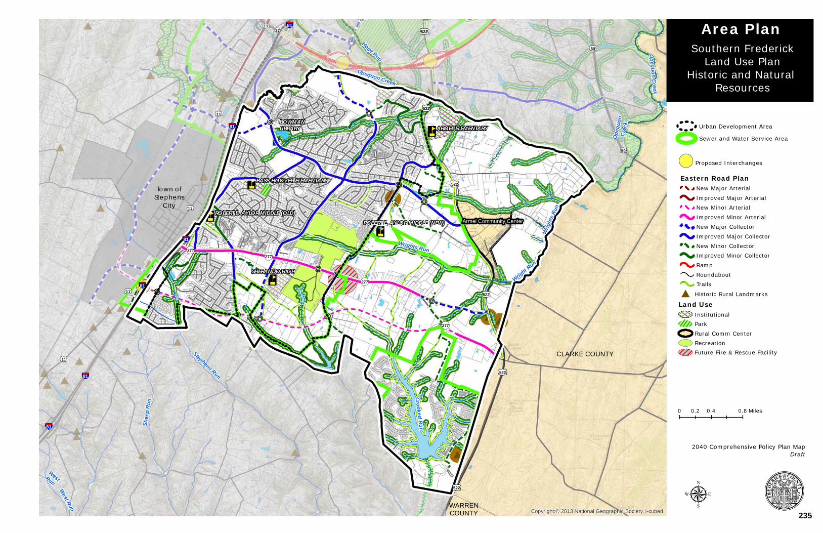
Town ofStephens
City
WestRun
Crooked Run
Opequon Creek
Opequon Creek
Shee
p Run
Wrights Run
Opeq
uon
Cree
k
Stephens Run
Wright Run
West Run
Wrigh
ts Ru
n
Hoge Run
CLARKE COUNTY
WARRENCOUNTY
BOWMANLIBRARY
SHERANDO HIGH
ARMEL ELEMENTARY
BASS-HOOVER ELEMENTARY
ROBERT E. AYLOR MIDDLE (OLD)ROBERT E. AYLOR MIDDLE (NEW)
§¦81
§¦81
§¦81
§¦81
§¦81
§¦81
£¤11
£¤11
£¤522
£¤522
£¤50
£¤522
£¤522
£¤522
£¤522
£¤11
£¤11
£¤11
£¤50
¬«277¬«277
¬«37
¬«277
¬«277
Copyright:© 2013 National Geographic Society, i-cubed
0 0.4 0.80.2 Miles
µ
!( Proposed Interchanges
Eastern Road PlanNew Major Arterial
Improved Major ArterialNew Minor Arterial
Improved Minor ArterialNew Major Collector
Improved Major CollectorNew Minor CollectorImproved Minor Collector
RampRoundaboutTrails
# Historic Rural Landmarks
Land UseInstitutionalParkRural Comm CenterRecreationFuture Fire & Rescue Facility
Southern FrederickLand Use Plan
Historic and Natural Resources
Area Plan
2040 Comprehensive Policy Plan MapDraft
Armel Community Center
Sewer and Water Service Area
Urban Development Area
235
APPENDIX I - AREA PLANS
Round Hill Community Land Use Plan 46
ROUND HILL COMMUNITY LAND USE PLAN
- INCLUDING THE RECREATION AND CONFERENCE COMMERCIAL
COMMUNITY (ROCK HARBOR) AMENDMENT
BOARD OF SUPERVISORS
Approved on November 14, 2007
(ROCK HARBOR) AMENDMENT
Approved by the Board of Supervisors on June 23, 2010
236
APPENDIX I - AREA PLANS
Round Hill Community Land Use Plan 47
GUIDING PRINCIPLES
The Round Hill Community has two distinct areas, the long established Round Hill Rural Community Center focused around Round Hill Road (Route 803) and the developing commercial area along Route 50 (Northwestern Pike). This plan encompasses both of these areas. The plan has two primary goals - first, to protect and enhance the character of the established rural community center and second, to create a vibrant, functional and well-designed commercial center. While the two areas are distinct, this plan seeks to link them by efficient roads and multi-purpose trails and sidewalks and to locate a park and other public facilities in the Round Hill Community for the benefit of both the residents and the workers.
As with previous versions of the Round Hill Community Land Use Plan, a key goal of this plan is to provide public sewer and water access for the existing residents of the Round Hill community.
LAND USE
Round Hill Rural Community Center
The core of the long established Round Hill Rural Community Center consists primarily of residences. In the past, a number of small businesses have been located in the core area, but few of these remain today. The development pattern established in the Round Hill Rural Community Center consists of both small lots along Round Hill Road, Poorhouse Road, Woodchuck Lane and other roads, and the larger lots and small farms on the periphery. Both residential patterns should continue. The farms and large lots on the periphery of the Round Hill Rural Community Center should be maintained to preserve the rural character. In order to further preserve the existing character of the area, no part of the Round Hill Rural Community Center should have high density housing.
Most residential lots in the Round Hill Rural Community Center are less than one-half acre. These residential lots contain single family detached housing on wells and septic with reduced front yard setbacks. This historic development pattern cannot be accommodated within the existing RA (Rural Areas) Zoning District, which allows one residence for every five acres and requires primary and reserve drainfield areas. A new zoning district should be created to accommodate infill development that is in character with the area. Such a district should address housing types, lot sizes and setbacks. The new zoning district should also address design standards for street trees, curb-side parking, signage, lighting and underground utilities. The new zoning district could allow for modest commercial/retail uses (with discreet signage) to serve surrounding residents.
In recent years, new residential development in Round Hill has been limited due to private health system requirements. Expansion of the Sewer and Water Service Area (SWSA) in 2006 has given the opportunity for some existing residents to connect to public water and sewer, at the property owner’s expense. Once a new zoning district is adopted to accommodate in-fill development, the County will need to re-examine the SWSA boundary to determine whether any other areas in the Round Hill Rural Community Center should be
237
APPENDIX I - AREA PLANS
Round Hill Community Land Use Plan 48
enabled to connect to public water and sewer services. Rezonings to the new district should not be allowed prior to the availability of public water and sewer.
DEVELOPING COMMERCIAL AREAS
Commercial, medical support, medical offices, educational, and public use development are important components of the Round Hill Community Land Use Plan.
Historically, highway commercial uses have located along Route 50 (Northwestern Pike). These uses include gas stations, car dealers, restaurants, and small retail establishments. Some of these uses still exist. In more recent years, Round Hill Crossing (including the large Wal-Mart center) has begun to develop on the north side of Route 50. This 70-acre site will ultimately accommodate retail, restaurant, and business development. The Winchester Medical Center – West Campus, with 102-acres to the east of Round Hill Crossing, has both a retail component along Route 50 and a medical component. The northern portion of the Medical Center’s West Campus is zoned MS (Medical Support) District. Together these two large developments have changed the nature of land development along Route 50. Large-scale commercial development is now a dominating presence in the Round Hill Community. Growth and development should be carefully planned to take advantage of the close proximity of the Winchester Medical Center.
Two distinct types of commercial development are evolving in the Round Hill Community– a general commercial area along both sides of Route 50 and a medical support and education area located on the north side of Route 50.
The general commercial areas already under development on both sides of Route 50 function as a gateway to and from the City of Winchester. Therefore, an objective of this plan is to create an attractive, functional commercial area and to prevent the creation of a typical commercial strip. Consolidated entrances are strongly encouraged to avoid multiple entrances along Route 50. Inter-parcel connections will be necessary for the small lots to develop. Standards have already been developed that will minimize the visual disruption to the Route 50 corridor (see Figure 13A). These include standards for shared entrances, inter-parcel connectors, green spaces along Route 50, screening of parking areas, screening between commercial properties and existing residences, size, number and location of signs, underground utilities, and landscaping. These standards strongly discourage individual business entrances both for aesthetic reasons as well as for transportation safety and efficiency. Major commercial establishments should connect to Route 50 at signalized intersections.
A continuation of the general commercial area is planned in the vicinity of Ward Avenue and Stonewall Drive. As this area redevelops, new developments will be expected to follow the Route 50 standards (Figure 13A) that apply to small parcels on the south side of Route 50. Consolidation of these small parcels is the key to redeveloping this area. A minor collector road, to join Round Hill Road (Route 803) and Ward Avenue, is planned to funnel traffic to two key intersections on Route 50.
238

APPENDIX I - AREA PLANS
Round Hill Community Land Use Plan 49
Figure 13A
Design Principles Encouraged for the Round Hill Route 50 Corridor
Street trees in the median, along both sides of the ditch.
Freestanding business signs – one monument style sign per development (Maximum size - 50 feet, maximum height – 12 feet).
Crosswalks at signalized intersections, with signals for pedestrians.
Interparcel connectors required between all properties planned for commercial development (even if currently zoned RA and used for residential purposes) to encourage shared entrances.
Commercial entrance spacing – Commercial entrances are strongly discouraged on Route 50. If no other alternative exists, entrance spacing - 200 feet if speed limit is 35 mph or less, 250 feet if speed limit is greater than 35 mph.
A row of evergreens in addition to the ordinance-required buffer and screening adjacent to areas planned to remain residential.
Underground utilities.
Placement of buildings close to Route 50 with landscaped parking lots in the rear.
North side of Route 50: 50-foot landscaped strip, within the landscaped strip a ten-foot asphalt bike and pedestrian trail, ornamental shrubs and street trees along Route 50.
South side of Route 50: 50-foot landscaped strip (20 feet for small tracts) within the landscaped strip a five-foot concrete pedestrian sidewalk, ornamental shrubs and street trees along Route 50.
Due to its close proximity to the Winchester Medical Center, the north side of Route 50 offers a unique opportunity to accommodate medical support, medical offices, educational, public use, and commercial uses. Therefore, the Round Hill Community Land Use Plan should provide for large campus style development of the north side of Route 50 for medical support, medical office, educational, public use, and commercial uses. A number of large open tracts of land exist in this location. The campus style development should provide for boulevard street designs, street trees, bicycle and pedestrian paths, and connectivity between development and common green space gathering areas.
In order to minimize areas of impervious surface, decked or structured parking or increased building heights may be warranted. High quality building designs and materials are expected. Small plazas at the building entrances or in the center of a group of buildings are suggested. Site design standards are expected to exceed those established for the Route 50 corridor (Figure 13A). Coordinated signage, lighting and street furniture are sought.
239
APPENDIX I - AREA PLANS
Round Hill Community Land Use Plan 50
All of the commercial areas in Round Hill should provide commercial services and employment opportunities that are accessible to the residents within the Round Hill Rural Community Center via alternative modes of transportation, such as pedestrian and bicycle facilities. Enhanced accessibility is anticipated through the connection of such areas to the existing residential areas by a network of multi-purpose trails, sidewalks and intersections with pedestrian actualized signals.
TRANSPORTATION
The County’s Eastern Road Plan and the Win-Fred Metropolitan Planning Organization (MPO) 2030 Transportation 2040 Metropolitan Transportation Plan call for Route 50 to be improved to a six-lane minor arterial road between Route 37 and Poorhouse Road (Route 654). West of Poorhouse Road, Route 50 is planned as a four-lane minor arterial. Sidewalks are planned on the south side of Route 50 and multi-purpose trails on the north side. Developments along Route 50 will be expected to incorporate these road improvements.
As noted in the Transportation Chapter of the Plan, as all road projects and development or redevelopment take place, the development and associated transportation facilities should be accessible to all users.
A north/south collector road, parallel to Route 37, is included in the Route 37 West Land Use Plan. This road is also incorporated into the County’s Eastern Road Plan with a connection back to the Winchester Medical Center interchange. A section of this road, Botanical Boulevard, is being built with the Winchester Medical Center – West Campus development on the north side of Route 50. Should properties further to the north develop, this road should could eventually connect to Route 522 (North Frederick Pike).
An east/west collector road, parallel to Route 50 is also included in the Eastern Road Plan. A section of this road, Petticoat Gap Lane, has been proffered with the Round Hill Crossing development. This road is envisioned as an urban divided four-lane cross-section that includes landscaped medians, controlled left turns, street trees, and pedestrian and bicycle facilities, to enhance transportation on the north side of Route 50. Development proposals will need to accommodate the continuation of this collector road. The location shown on the plan is general, with the precise location of the east-west collector road remaining flexible.
A new north/south major collector road is planned through the Winchester Medical Center-West Campus that will serve the West Campus and provide access to the future Route 37 interchange located north of Round Hill. While this road is envisioned as an urban divided four-lane road that includes landscaped medians as well as pedestrian and bicycle facilities subjected to projected traffic generation, it may initially be built as a two-lane road because development to the north may not occur for many years, if at all. The location shown on the plan is general, with the precise location of the north-south collector road remaining flexible.
Vehicular management access is recommended throughout the Round Hill Rural Community Center, particularly along Route 50. A six-lane arterial road should not include multiple access points. Ideally, primary vehicular access should be limited to four signalized the previously established intersections along Route 50 with additional commercial entrances
240
APPENDIX I - AREA PLANS
Round Hill Community Land Use Plan 51
planned at appropriate intervals as allowable by established access management standards to facilitate safe and efficient traffic movement.
Noted throughout this plan is the requirement for alternative modes of transportation, such as pedestrian and bicycle facilities. The plan calls for an interconnected system of multi-purpose trails and sidewalks. It is critical that these alternative modes of transportation link the entire Round Hill Rural Community Center. A future Winchester Medical Center internal road over Route 37 should provide a sidewalk and trail for bicycle and pedestrian access. At an appropriate time, the County should also encourage the extension of existing bus routes to serve the area. Ideally, bus stops should be located at all of the commercial centers.
The development of new road systems, new signalization and improvements to existing road systems are all elements of this plan. It will be the responsibility of private property owners and developers to ensure that these improvements are made. No rezonings should be approved until the County is certain As rezonings are considered, they should be evaluated to ensure that the transportation impacts of development will be mitigated and the improvements facilitate the goals of the Comprehensive Policy Plan. As with all areas of the County, Level of Service “C” should be maintained on roads adjacent to and within new developments.
ENVIRONMENT
A number of environmental features are found in the Round Hill Community. The area is dominated by two major natural features – Round Hill itself, which is west of Poorhouse Road and a north/south ridgeline. The ridgeline, west of Round Hill Crossing, is highly visible and should be sensitively developed. Ponds, streams and floodplains are present and will need to be taken into consideration so as to minimize and/or mitigate negative impacts with any future development. These natural areas provide an obvious location for a trail system.
HISTORICAL RESOURCES
Round Hill is one of the older settlements in Frederick County. The original village was located at the base of Round Hill. The community today includes a small number of eighteenth and nineteenth century dwellings. Approximately 30 late-nineteenth century and early-to-mid twentieth century houses, primarily American Foursquares and I-houses are located in the area. The mid-nineteenth century Round Hill Presbyterian Church and the early-twentieth century Round Hill School (now used as a residence) are also located in this community. Protection of these historic structures is encouraged.
PUBLIC UTILITIES
A fundamental issue for the development of Round Hill has been the provision of public water and sewer. Development of the area is dependent on the availability of appropriate infrastructure. The Sewer and Water Service Area (SWSA) has been expanded to portions of the Round Hill Rural Community Center several times in recent years. This plan does not recommend rezoning land within the Round Hill Rural Community Center for commercial development prior to the availability of central sewer and water. It is also recommended
241
APPENDIX I - AREA PLANS
Round Hill Community Land Use Plan 52
that as land is developed over time and infrastructure extended, that new developments further the goal of providing sewer and water to the core residential area of the Round Hill Rural Community. Future development should facilitate the availability of sewer and water in two ways – the sizing of utility pipes to insure capacity for all of the Round Hill Rural Community Center, and providing utility easements so that adjacent property owners have the ability to extend and connect to public water and sewer.
The Round Hill area will ultimately be served by two wastewater treatment plants. The area immediately west of Route 37, including Winchester Medical Center – West Campus and Round Hill Crossing are currently served by the Opequon Water Reclamation Facility. The transmission lines serving this facility have limited capacity. Therefore, future development south of Route 50 and also west of Round Hill Crossing are planned to be served by the Parkins Mill Wastewater Treatment Plant. Future development proposals will need to demonstrate that sufficient sewer capacity exists.
Water lines exist on Route 50 in the area of Round Hill Crossing and the Winchester Medical Center – West Campus. These water lines have sufficient capacity to provide the volume of water identified in the Round Hill Community Land Use Plan; however, they do not have sufficient pressure. To provide adequate pressure, existing line pressure will have to be boosted and water storage provided.
PUBLIC FACILITIES
Public facilities to serve new development in the Round Hill Community may be required in the future. It will be necessary for future development to provide a site for such public facilities.
PARKS
The Round Hill Community has one neighborhood park, at the Round Hill Volunteer Fire & Rescue Station. A children’s play area is maintained by the Frederick County Department of Parks and Recreation and the fire company maintains a ball field. The scope of this park could be expanded, possibly with the relocation of the fire station.
The commercial, medical support, and institutional land uses north of Route 50 should include a new park, ideally in the area of the large pond. This park would be visible from Route 50 and could serve as the visual focal point of the entire Round Hill Community. The park should be a passive recreational facility with trails, benches and outdoor eating areas. The park should be designed to serve both onsite workers and residents of the Round Hill Rural Community Center. A linear trail could also link this park to the smaller pond to the north. The Park’s trail/sidewalk network should be the interconnected trail system as described in the transportation section. Consideration should be given to establishing a trail along the ridgeline between Route 50 and Route 522 and a trail at the southern edge of the Round Hill Community to link to the Green Circle in the City of Winchester.
242
APPENDIX I - AREA PLANS
Round Hill Community Land Use Plan 53
RECREATION AND CONFERENCE COMMERCIAL COMMUNITY
Through the 2009 Comprehensive Policy Plan Amendment process, the Frederick County Board of Supervisors endorsed the evaluation of an amendment to the Comprehensive Plan to include the property that is home to the Rock Harbor Golf Course. The following land use policy, along with the updated land use map, is the resulting amendment and is known as the Rock Harbor Amendment to the Round Hill Land Use Plan.
GUIDING PRINCIPLES
The amendment to the plan has two primary goals - first, to establish a new area of land use that would specifically promote the recreational attributes of this area in conjunction with the open spaces associated with the existing Rock Harbor Golf Course, and second, to create a well-designed Conference Facility integrated with limited commercial land uses with an orientation to the Golf Course and future Route 37 interchange, and limited accessory membership residential land use to sustain the viability of the Rock Harbor Golf Course. The goals of the Plan seek to enable the development of land uses which will provide economic development, tourism, and entertainment benefits to the Community and to Frederick County, and further promote the Rock Harbor Golf Course.
The addition of Rock Harbor area to the Round Hill Land Use Plan creates a third distinct area of land use for the Round Hill Community which will join with the Community’s other two distinct areas; the long established Round Hill Rural Community Center focused around Round Hill Road (Route 803) and the developing commercial and medical support area along Route 50 (Northwestern Pike).
The Rock Harbor area of the Round Hill Land Use Plan is west of, and adjacent to, the West Jubal Early Land Use Plan. The addition of this area will promote a connectivity of land uses and access between the two important land use plans with a focus on the future West Jubal Early Interchange. This plan also encompasses the area of existing quarry operation, providing recognition to this very important area of Extractive Manufacturing and guidance with regards to future development adjacent to the quarry. Additional protections in the form of distance and buffering should be provided for any new land uses on the Rock Harbor Golf Course, particularly for any accessory membership residential land uses.
Like the other two areas, this plan seeks to link to the community by providing access to efficient roads, multi-purpose trails and sidewalks, and public water and sewer for the benefit of both the residents of this Community and those adjacent citizens who may work or recreate in the area. As with previous versions of the Round Hill Community Land Use Plan, a key goal of this plan is to provide public sewer and water access for the existing residents of the Round Hill community.
LAND USE
ROUND HILL COMMERCIAL RECREATION LAND USE
The intent of the Commercial Recreation land use designation shall be to provide for carefully planned commercially driven recreational land uses which take advantage of
243
APPENDIX I - AREA PLANS
Round Hill Community Land Use Plan 54
existing recreational amenities (36-hole golf course) and enhances the economic development opportunities of the area through conference facilities, lodging, commercial activities, and a limited amount of accessory membership residential opportunities.
Growth and development of this area should be carefully planned to take advantage of the existing commercial recreation land uses, Rock Harbor Golf Course, the close proximity of the Winchester Medical Center, and the adjacent areas of planned land use.
The Commercial Recreation land use designation is envisioned to have a balance of land uses that promote the recreational component as the primary land use. The recreational component should be located in close proximity (within one mile) of an existing Route 37 Interchange and contain a major open space component. Compatible commercial ventures such as conference facilities, lodging opportunities, restaurants, and limited accessory retail would also be appropriate in this setting. The Robinson Property shall contain only the compatible commercial ventures component of the land use designation as identified above. Development of the Robinson Property should only occur at the same time as, or in conjunction with the Rock Harbor project.
Balance of land uses
Recreational - 36-hole golf course (minimum # of holes)
Open Space – 60 percent of land area (minimum area including golf course)
Commercial – 30 percent of land area (maximum area)
This area of commercial shall include a conference facility.
Accessory membership residential – 10 percent of land area (maximum area)
The introduction of the accessory residential land uses may occur prior to the development of the commercial land uses and the Conference Facility.
It is recommended that the regulations guiding the development of the commercial recreation area promote the balance of land uses identified above that are owned and operated by the Rock Harbor Golf Course without further subdivision of the property. COMMUNITY FACILITIES
In order to promote high quality low impact design, the commercial recreation land use designation should promote energy efficient design and development, including achieving LEED certification, or certification from a similar program, as a project. Areas of impervious surface in conjunction with the development should be minimized and alternative irrigation techniques should be promoted.
Innovative water and sewer design to this project is necessary due to the limited resources available to the County. Alternative approaches with regards to water resources and reuse of water and wastewater should be provided with this project. This project should provide
244
APPENDIX I - AREA PLANS
Round Hill Community Land Use Plan 55
additional resources to the community and facilitate the provision of water and sewer resources to the Round Hill Community, in particular to the existing residents, rather than detract from the FCSA’s ability to provide these resources.
It is essential to ensure that the infrastructure and the necessary community facilities are provided in a timely and coordinated manner in order to enable the successful implementation of the land use plan. Therefore, it is expected that the commercial recreation land use application is developed with public water and sewer infrastructure and this application participates in the regional planning and infrastructure development needs of the Round Hill Community. This participation may include infrastructure improvements that exceed those generated solely by this project but are designed to advance the needs of the Round Hill Community.
DESIGN
High quality building designs and materials are expected. An objective of this plan is to create an attractive, functional commercial area and to prevent the creation of a typical commercial strip, from the perspective of a new interchange on Route 37. Unattractive development along Route 37 frontage should be avoided. From this perspective, the golf course and future conference and lodging facilities should be preserved and be the prominent features. Additional commercial and residential land uses should be avoided directly adjacent to Route 37. The recreational viewshed should be promoted with the golf course and future conference facilities highly visible. This may include a linear area of open space adjacent to Route 37 (500 feet distance). This area of open space should not be extended to the area surrounding the proposed interchange which is an area where appropriately designed development is anticipated.
TRANSPORTATION
The County’s Eastern Road Plan and the Win-Fred Metropolitan Planning Organization (MPO) 2030 2040 Metropolitan Transportation Plan calls for Route 37 Jubal Early Interchange improvement. This project has been endorsed through recent rezoning approvals. This land use plan will ultimately provide direct access to the Route 37 interchange at this location. Access to the Round Hill Community to the North is also encouraged and may be established prior to the completion of the Jubal Early Interchange if supported by an approved TIA (Transportation Impact Analysis). Notwithstanding this, the development of this property should participate in the implementation of the Route 37 interchange to the extent that it is warranted as a primary transportation focus.
A new multi-purpose trail system is planned through the Round Hill Community to serve the area and provide access and connectivity with the West Jubal Early Community. The location shown on the plan is general, with the precise location of the trail connection remaining flexible. However, access should provide a connection generally from west of Route 37 to east of Route 37 as depicted on the map. It would be preferable to have the trail connectivity located on the proposed sewer infrastructure parallel to the north of the railroad tracks. This should occur in conjunction with the construction of the interchange if possible and under the existing Abrams Creek and Rail Bridge. At a minimum, bicycle and pedestrian awareness should be incorporated into the design and signage of the
245
APPENDIX I - AREA PLANS
Round Hill Community Land Use Plan 56
interchange. Trail connectivity to West Jubal Early Land Use Plan and the City of Winchester Green Circle is very important.
IMPLEMENTATION
SWSA BOUNDARY
Preferred Alternative:
The SWSA boundary shall be modified around the boundaries of the Rock Harbor property (and the Robinson property) as identified in this map. This assumes an expectation of development with public water and sewer, as well as regional planning and participation in community facilities development will be addressed during the rezoning process. In addition, this ultimately assumes the ability of community to obtain future water and sewer resources. The SWSA boundary expansion would be the preferred alternative.
This is the approach preferred and endorsed by both the PC and the CPPC and approved by the BOS.
Outcome: The addition of approximately 265.5 acres (with Robinson) into the Sewer and Water Service Area (SWSA).
ZONING DESIGNATION
A new zoning district or overlay district could be created to accommodate such a balance of land uses and could address housing types and dimensional standards.
Preferred Alternative:
Recreation and Conference Commercial District or Overlay District – Zoning Designation specifically designed to implement this balance of land uses and associated performance standards.
This is the approach preferred and endorsed by both the PC and the CPPC and approved by the BOS.
246
£¤50£¤50
£¤50
£¤50£¤50
£¤50
¬«37
¬«37
Copyright:© 2013 National Geographic Society, i-cubed µ
0 0.25 0.50.125 Miles
Eastern Road PlanNew Major Arterial
Improved Major Arterial
New Minor Arterial
Improved Minor Arterial
New Major Collector
Improved Major Collector
New Minor Collector
Improved Minor Collector
Ramp
Roundabout
Trails
Round Hill Community Land Use Plan
Area Plan
2040 Comprehensive Policy Plan MapDraft
Sewer and Water Service Area
Urban Development Area
City ofWinchester
Land Use Legend
Rural Community Center
Sensitive Natural Areas
Commercial Recreation
Residential
Business
Extractive Mining
Round HillRural Community
Center
247
APPENDIX I - AREA PLANS
Western Jubal Early Land Use Plan 58
WESTERN JUBAL EARLY LAND USE PLAN
BOARD OF SUPERVISORS
-Approved on January 11, 2006
248
APPENDIX I - AREA PLANS
Western Jubal Early Land Use Plan 59
GUIDING PRINCIPLES
A new community of over 600 acres is planned in a portion of the County where previously there was little but farmland. The Western Jubal Early Land Use Plan details a new community that consists of approximately 600 acres. The area contains sensitive environmental features, and these will be preserved. This new community will contain both residential and commercial uses. The community will be linked by an efficient road system, multi-purpose trails and sidewalks.
LAND USE
RESIDENTIAL
The land included within the Western Jubal Early Land Use Plan (WJELUP) represents a transitional area between the City of Winchester and the rural areas of western Frederick County. The WJELUP area is distinguished by its pristine environmental resources and prime farmland soils and has, therefore, historically supported both agricultural and low-density residential land uses. Adjoining land within the City of Winchester has developed extensively with urban and suburban residential uses, most notably within the Meadow Branch, Morlyn Hills, Meadow Branch South, and Orchard Hill subdivisions. Additionally, suburban residential land use has been established within the UDA adjacent and north of the WJELUP area through the Merriman’s Chase subdivision.
The predominant land uses envisioned within the WJELUP area are urban and suburban residential uses. The residential designation is intended to continue the established land use pattern in the vicinity of the WJELUP area. As such, new residential development within the WJELUP area is expected to consist primarily of single family detached and single-family small lot units and be compatible with the design of existing residential uses on adjoining property. The gross residential density for residential developments within the WJELUP area should not exceed four dwelling units per acre.
COMMERCIAL
This plan calls for commercial uses to balance, service and complement the residential uses. Areas for commercial land use are designated along the planned route of the Jubal Early Drive extension and near the intersection of Cedar Greek Grade and Route 37. These areas are intended to provide commercial services and employment opportunities that are accessible for residents within the WJELUP area and the adjacent community via alternative modes of transportation, such as pedestrian and bicycle facilities. Enhanced accessibility is anticipated through the connection of such areas to the surrounding residential neighborhoods by a network of multi-purpose trails and sidewalks.
The commercial component is envisioned to consist of neighborhood scale commercial uses and high-end office uses. Priority will be given to neighborhood scale commercial uses as these will serve the needs of residents and create focal points for the new community. Strip commercial development is strongly discouraged. Consolidated entrances will be encouraged to avoid multiple entrances along Jubal Early Drive, Cedar Creek Grade, and the new collector road.
249
APPENDIX I - AREA PLANS
Western Jubal Early Land Use Plan 60
TRANSPORTATION
Future road networks are proposed for the WJELUP area which will link it to Jubal Early Drive, Route 37, and Cedar Creek Grade (Route 622).
The Plan and the Win-Fred Metropolitan Planning Organization (MPO) 2030 Transportation Plan 2040 Metropolitan Transportation Plan calls for the extension of Jubal Early Drive to Route 37. It calls for a new diamond interchange at Route 37 and Jubal Early Drive, with a realignment of Merrimans Lane. Extensive design work has taken place on the interchange and roadway extensions. The extension of Jubal Early Drive and the interchange at Route 37 are critical to addressing regional transportation problems. This plan, therefore, incorporates the extension of Jubal Early Drive as an east/west through road and the construction of the interchange at Route 37. The extension of Jubal Early Drive through this portion of the UDA is envisioned as an urban divided four lane cross-section that includes landscaped medians as well as pedestrian and bicycle facilities.
The MPO Plan also calls for Cedar Creek Grade to be widened to a four-lane section from the city limits to Merrimans Lane, with signalized ramps at the intersection of Cedar Creek Grade and Route 37. The Frederick County Comprehensive Policy Plan Bicycle Plan also identifies Cedar Creek Grade as a short-term destination route. Therefore, this plan incorporates improvements to Cedar Creek Grade, to a four-lane divided highway major collector road with a bicycle lane or ideally a separate bike path, and improvements to the interchange at Route 37 and Cedar Creek Grade.
A major collector road, as included in the MPO Plan, is planned to facilitate traffic movement in a north south direction to provide a connection between Jubal Early Drive and Cedar Creek Grade. This boulevard style road is envisioned as an urban divided four lane cross-section that includes landscaped medians as well as pedestrian and bicycle facilities. The location shown on the plan is general with the precise location of the north-south collector road remaining flexible.
The development of new road systems, including a new interchange at Route 37, new signalization and improvements to existing road systems are all elements of this plan. It will be the responsibility of private property owners and developers to ensure that these improvements are made. The financial responsibility will rest primarily with private property owners and developers, although they may be able to demonstrate how a partnership, possibly with the Virginia Department of Transportation (VDOT), the City and/or the County will accomplish the necessary road improvements. No rezonings should be approved until the County is certain that as always, the evaluation of rezonings should consider whether the transportation impacts of development will be mitigated.
Another critical transportation component of the WJELUP is alternative modes of transportation, such as pedestrian and bicycle facilities. This plan, therefore, calls for an interconnected system of multi-purpose trails and sidewalks in addition to those which should be included as part of roadway improvement/development. The County should also encourage the extension of existing bus routes to serve the area when timing is deemed appropriate. Ideally, future bus stops will would be located at the commercial centers and within the development.
250
APPENDIX I - AREA PLANS
Western Jubal Early Land Use Plan 61
ENVIRONMENT
The WJELUP designates environmental resources associated with the Abrams Creek corridor as Sensitive Natural Areas (SNA). These areas should be preserved through the development process with improvements limited to required road crossings and passive recreational amenities. A large sinkhole in the area has been filled and improvements to this area may also need to be restricted to required road crossings and passive recreational amenities. A conservation-oriented approach to the design of residential and commercial projects within the WJELUP area is encouraged to maximize SNA preservation. As such, the precise study and identification of SNA designated resources should occur as a critical first step in the design process for all development in the WJELUP area. Completion of this resource inventory and the delineation of preservation areas are to be followed and accommodated by layouts and engineering for building sites, lots, drainage and infrastructure. Full gross density credit will be provided for SNA designated land conserved through the development process.
A portion of the Green Circle Trail, as developed by the City of Winchester, has been constructed on the north side of the Winchester Western Railroad. The WJELUP envisions completion of this portion of the trail to Merrimans Lane. Additionally, a connector trail should be developed that extends from the existing trail to Cedar Creek Grade as an enhancement to the Green Circle Trail. The connecting trail should be located to enhance the interaction of the user with any environmental features or view sheds that are conserved through implementation of the WJELUP. The pedestrian/bicycle network developed in the WJELUP area should provide for a continuous flow from the Green Circle.
HISTORICAL RESOURCES
Two known historic houses are located within the WJELUP area. The Baker, Jacob House (750 House) is located in the northwestern corner. The Virginia Department of Historic Resources (VDHR) had determined that the Baker, Jacob House is eligible for the Virginia Landmarks Register and the State and National Register of Historic Places. Protection of this building is strongly encouraged.
One potentially significant historic structure is located in the southwestern corner of the WJELUP area. The house is identified in the Lake’s Atlas of 1885 as the Stuart Brown House and has been identified as a potentially significant property in the Frederick County Rural Landmarks Survey (#34-1239). Protection of this structure is also encouraged.
EDUCATION/PUBLIC FACILITIES
The WJELUP area contains over 600 acres, and the majority of this land is envisioned to be developed for residential uses. It is estimated that up to 2,400 dwellings could be built in the study area. This could generate up to 1,680 new students for the Frederick County School System. This number of students concentrated in such a small area is unprecedented in the western part of Frederick County. It will be incumbent upon future development within the WJELUP area to provide a site for school facilities, to mitigate the impact of the large number of school children resulting from development in the WJELUP
251
APPENDIX I - AREA PLANS
Western Jubal Early Land Use Plan 62
area. This is consistent with the Community Facilities and Services policies in the Comprehensive Policy Plan.
Any school should be sited centrally within the study area to enable the maximum number of students to walk or bike to school. Schools quickly become the focus of a new community when they are at the center of the community. The final location and alignment of any school site should remain flexible to ensure that it conforms to final engineering studies and School Board considerations.
It may also be necessary to provide other public facilities in this area to serve this new development. It would then be necessary for future development to provide a site for other public facilities to mitigate the impact of the large number of residents resulting from development in this area.
PARKS
The WJELUP area should contain a well-defined park and open space system for both active and passive recreation. Central to this open space will be the Abrams Creek corridor which should be preserved as a sensitive natural area. Neighborhood parks should also be located within the study area. As defined in the Comprehensive Policy Plan, neighborhood parks provide limited types of recreation for the entire family within easy walking distance. Examples of potential facilities in a neighborhood park include a playground, a swimming pool and tennis courts. The neighborhood parks should be located near the school and or neighborhood center and away from major streets. Also, part of the park network will be the interconnected trail system as described above.
252
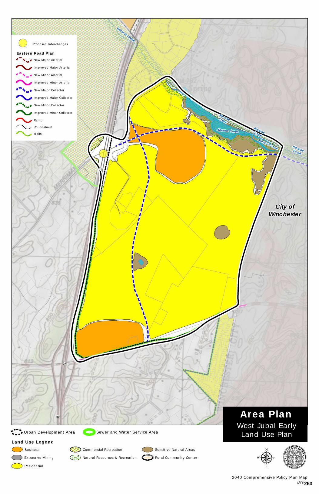
AbramsCreek
AbramsCreek
AbramsCreek
Abrams Creek
Abrams Creek
Abrams Creek
¬«37
¬«37
¬«37
Copyright:© 2013 National Geographic Society, i-cubed
µ2040 Comprehensive Policy Plan Map
Draft
West Jubal EarlyLand Use Plan
Area Plan
Land Use Legend
!( Proposed Interchanges
Eastern Road PlanNew Major Arterial
Improved Major Arterial
New Minor Arterial
Improved Minor Arterial
New Major Collector
Improved Major Collector
New Minor Collector
Improved Minor Collector
Ramp
Roundabout
Trails
City ofWinchester
Urban Development Area Sewer and Water Service Area
Business
Extractive Mining
Residential
Commercial Recreation
Natural Resources & Recreation
Sensitive Natural Areas
Rural Community Center
253
APPENDIX I - AREA PLANS
Route 37 West Land Use Plan 64
ROUTE 37 WEST LAND USE PLAN
254
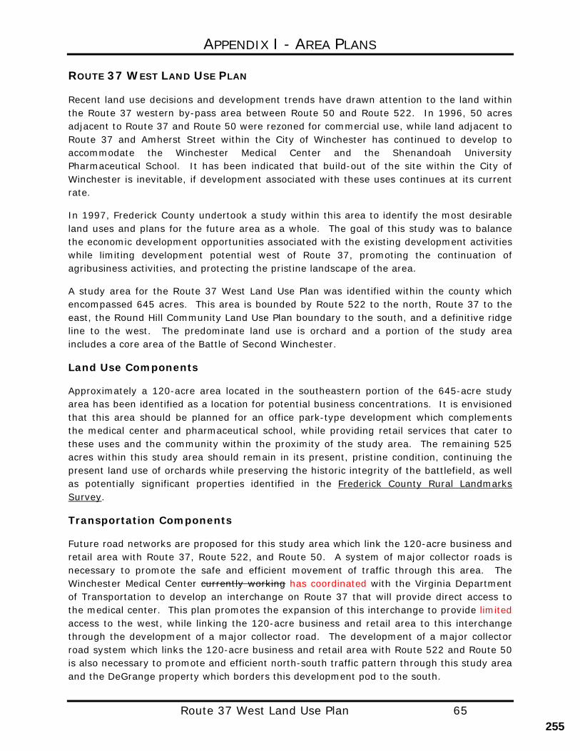
APPENDIX I - AREA PLANS
Route 37 West Land Use Plan 65
ROUTE 37 WEST LAND USE PLAN
Recent land use decisions and development trends have drawn attention to the land within the Route 37 western by-pass area between Route 50 and Route 522. In 1996, 50 acres adjacent to Route 37 and Route 50 were rezoned for commercial use, while land adjacent to Route 37 and Amherst Street within the City of Winchester has continued to develop to accommodate the Winchester Medical Center and the Shenandoah University Pharmaceutical School. It has been indicated that build-out of the site within the City of Winchester is inevitable, if development associated with these uses continues at its current rate.
In 1997, Frederick County undertook a study within this area to identify the most desirable land uses and plans for the future area as a whole. The goal of this study was to balance the economic development opportunities associated with the existing development activities while limiting development potential west of Route 37, promoting the continuation of agribusiness activities, and protecting the pristine landscape of the area.
A study area for the Route 37 West Land Use Plan was identified within the county which encompassed 645 acres. This area is bounded by Route 522 to the north, Route 37 to the east, the Round Hill Community Land Use Plan boundary to the south, and a definitive ridge line to the west. The predominate land use is orchard and a portion of the study area includes a core area of the Battle of Second Winchester.
Land Use Components
Approximately a 120-acre area located in the southeastern portion of the 645-acre study area has been identified as a location for potential business concentrations. It is envisioned that this area should be planned for an office park-type development which complements the medical center and pharmaceutical school, while providing retail services that cater to these uses and the community within the proximity of the study area. The remaining 525 acres within this study area should remain in its present, pristine condition, continuing the present land use of orchards while preserving the historic integrity of the battlefield, as well as potentially significant properties identified in the Frederick County Rural Landmarks Survey.
Transportation Components
Future road networks are proposed for this study area which link the 120-acre business and retail area with Route 37, Route 522, and Route 50. A system of major collector roads is necessary to promote the safe and efficient movement of traffic through this area. The Winchester Medical Center currently working has coordinated with the Virginia Department of Transportation to develop an interchange on Route 37 that will provide direct access to the medical center. This plan promotes the expansion of this interchange to provide limited access to the west, while linking the 120-acre business and retail area to this interchange through the development of a major collector road. The development of a major collector road system which links the 120-acre business and retail area with Route 522 and Route 50 is also necessary to promote and efficient north-south traffic pattern through this study area and the DeGrange property which borders this development pod to the south.
255
APPENDIX I - AREA PLANS
Route 37 West Land Use Plan 66
Sewer and Water Components
The Route 37 West Land Use Plan calls for the inclusion of the 120-acre business and retail area within the Frederick County Sewer and Water Service Area. This inclusion is necessary to ensure compliance with county policies regarding proposed zoning changes from rural land use to commercial land use. The extension of the Frederick County Sewer and Water Service Area has been done independently of the Frederick County Urban Development Area. Therefore, residential development is not proposed or encouraged for this study area.
256
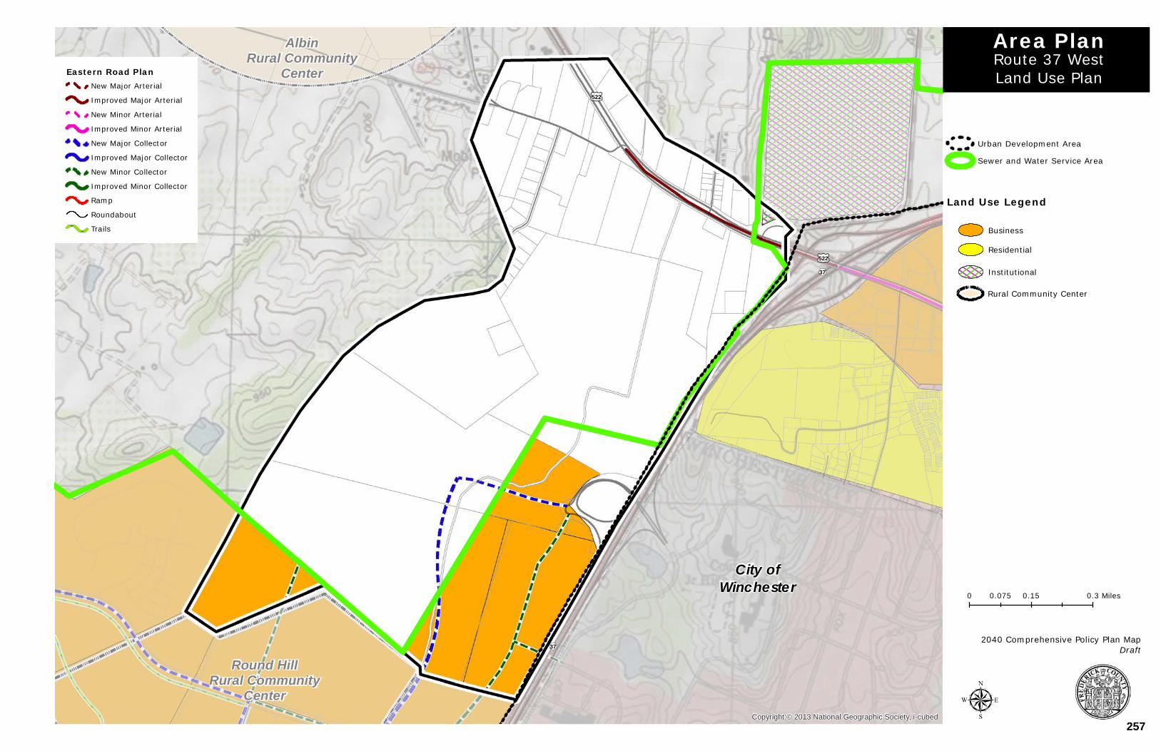
£¤522
£¤522
¬«37
¬«37
AlbinRural Community
Center
Round HillRural Community
CenterCopyright:© 2013 National Geographic Society, i-cubed
0 0.15 0.30.075 Miles
µ
Route 37 WestLand Use Plan
Area PlanEastern Road Plan
New Major Arterial
Improved Major Arterial
New Minor Arterial
Improved Minor Arterial
New Major Collector
Improved Major Collector
New Minor Collector
Improved Minor Collector
Ramp
Roundabout
Trails
2040 Comprehensive Policy Plan MapDraft
Sewer and Water Service Area
Urban Development Area
City ofWinchester
Land Use Legend
Business
Residential
Institutional
Rural Community Center
257
APPENDIX I - AREA PLANS
Kernstown Area Plan 68
KERNSTOWN AREA PLAN
BOARD OF SUPERVISORS
APPROVED ON JANUARY 26, 2017
PLANNING COMMISSION
RECOMMENDED APPROVAL JANUARY 4, 2017
258
APPENDIX I - AREA PLANS
Kernstown Area Plan 69
KERNSTOWN AREA PLAN
The Kernstown Area Plan study area is generally located along Route 11, south of the City of Winchester, north of the Town of Stephens City, and west of I-81. The Kernstown Area Plan builds on the Route 11 South Corridor Plan, and the balance of the Southern Frederick Area Plan which was adopted in 1998, by incorporating the western portion of this plan into the Kernstown Area Plan. A series of maps have been prepared which identify future land use, transportation, and natural, historical, and community facilities within the study area.
Within this plan, the Shady Elm Road area continues its economic development emphasis, the Route 11 corridor seeks to capitalize on Interstate Commercial opportunities, the industrial land uses north of Route 37 and east of Route 11 are reinforced, and the Bartonsville and Kernstown historical and cultural areas have been identified.
The Kernstown Area Plan in the vicinity of Route 37 and Interstate 81 feeds directly into the Senseny/Eastern Frederick Urban Area Plan with the Crosspointe Development. Interstate 81 improvements at the 310 Interchange, Phase 1 of which has now been completed is scheduled to commence in 2015, in this location further supports this area plan. Route 11, Valley Pike, links the Kernstown Area Plan with the City of Winchester to the north and the Town of Stephens City to the south.
The Kernstown Area Plan promotes a new area of new land use focus; the Kernstown Neighborhood Village in the Creekside area, along the west side of Route 11. This area should promote an attractive street presence along the frontage of Route 11 and reaffirm Kernstown as a distinct community, blending the old with the new, and building on the successful developments that have occurred in this area of the County.
Land Use
The goal of this area plan is to integrate the commercial and industrial (C/I) opportunities and the areas of mixed use with future transportation plans and to recognize the historical and natural resources abundant in this area plan.
Shady Elm Economic Development Area
The Shady Elm Economic Development Area is designed to be a significant area of C/I opportunity that is fully supportive of the Frederick County Economic Development Authority’s targeted goals and strategies. The intent of the industrial designation is to further enhance the County’s C/I areas and to provide focus to the County’s future regional employment centers. In specific areas a mix of flexible uses, with office uses in prominent locations is encouraged. Such areas are supported by substantial areas of C/I opportunity and provide for areas that are well designed with high quality architecture and site design. It is the intent of such areas to promote a strong positive community image.
259
APPENDIX I - AREA PLANS
Kernstown Area Plan 70
Kernstown Interstate Commercial at Exit @ 310
Located at a highly visible location on a prominent interstate interchange, this area of land use both north and south of Route 37 along Route 11, is designed specifically to accommodate and promote highway commercial land uses and commercial uses that continue to promote this area as a regional commercial center.
Particular effort must be made to ensure that access management for the supporting transportation network is a key priority as the function of the interstate and primary road network is of paramount importance. Access to the areas of interstate commercial land uses shall be carefully designed. Access Management is a priority along the Route 11 corridor.
The building and site layout and design of the projects shall be of a high quality. In addition, an enhanced buffer and landscaping area shall be provided adjacent to the Interstate 81 right-of-way, its ramps, and along the main arterial road, Route 11, the Valley Pike. A significant corridor appearance buffer is proposed along Route 11 similar to that established for Route 50 West corridor in the Round Hill Land Use Plan which consisted of a 50-foot buffer area, landscaping, and bike path. The recently developed Kernstown Commons provides an excellent example of an enhanced buffer and landscaping area along Route 11 that also includes a multi-purpose trail that serves the area.
Kernstown Industrial Area
The existing industrial land uses north of Route 37 and both east and west of Route 11 are reinforced with this area plan. Industries including Trex and H. P. Hood, are well established and should continue to be supported in this area. Additional C/I opportunity that is fully supportive of the Frederick County Economic Development Authority’s targeted goals and strategies should be promoted. The intent of the industrial designation is to further enhance the County’s C/I areas and to provide focus to the County’s regional employment centers.
Kernstown Creekside Neighborhood Village
Kernstown Creekside Neighborhood Village serves as a focal point to the Kernstown Area and as a gateway feature for this important County location. In addition, the Kernstown Creekside Area serves as a gateway into the City of Winchester, and on a broader scale, a gateway feature for this portion of Frederick County as citizens and visitors approach this portion the County from the south. This neighborhood village should promote a strong positive community image. Residential land uses would be permitted only as an accessory component of the neighborhood village commercial land uses. This area should have a strong street presence with particular attention being paid to the form of the buildings adjacent to Route 11. It is the intent of this plan to reaffirm Kernstown as a distinct community, blending the old with the new, and building on the successful developments that have occurred in this area of the County.
260
APPENDIX I - AREA PLANS
Kernstown Area Plan 71
Defined Rural Areas
The Kernstown Area Plan seeks has sought to further define the boundary between the Rural and Urban Areas of the community. As noted, the above areas of proposed land use combine to frame the western boundary of the County’s urban areas. In addition, the rural areas to the west of Shady Elm Road south of the industrial areas further define the County’s urban area in this location. The plan provides enhanced recognition of the rural residential land uses, Hedgebrook Farm, and the agricultural areas adjacent to Middle Road. This recognition and the location and boundaries of the proposed land uses further promote a clean separation between the County’s rural and urban areas. The continuation of agricultural uses west of Route 37 and Shady Elm Road will encourage the continuation of agribusiness activity and protect the integrity of the properties voluntarily placed in the South Frederick Agricultural and Forestal District.
Kernstown Battlefield and Bartonsville Sensitive Natural Areas (SNA’s)
A historic district designation or use of conservation easements is recommended for the portion of the Grim Farm, site of the Kernstown Battlefield owned by the Kernstown Battlefield Association (KBA) that is located in the County. This designation is intended to recognize the preservation of the core area of the Kernstown Battlefield. County regulations stipulate that the formation of a historic district must be accomplished through the consent of the land owner. The County continues to support the Kernstown Battlefield Association’s efforts in preserving and promoting this tremendous County resource.
A similar designation should be pursued, in conjunction with property owners, in the Bartonsville area. In addition to its historical significance, much of the Bartonsville area is also within the 100 year floodplain and would therefore be otherwise limited in terms of development potential. In Bartonsville, the rehabilitation, adaptive reuse, or restoration of historic structures should be encouraged. Future development applications that have historic resources on the property should incorporate the resources on the site into development. Any future development should be sensitive to those resources present on the site.
There are several historic sites and markers in the Kernstown Area Plan. Those sites and markers should be buffered from adjacent development activities and preserved in their original condition whenever possible during any development or land use planning.
The Springdale Flour Mill is located in the center of Bartonsville and would be ideal for use as a key element for the Bartonsville Rural Historic Area. It would be appropriate for the use on the property to develop as something which would encourage the protection of the structure and provide a use which encourages adaptive reuse users to utilize the property. Bartonsville South Perhaps the most outstanding feature of the land from Bartonsville south to the Stephens City limits is the relatively pristine state of the southern portion of the corridor. At time of writing, it remains relatively undeveloped. The majority of this segment of the study area is currently either used for agriculture or is vacant. Only two, small-scale commercial
261
APPENDIX I - AREA PLANS
Kernstown Area Plan 72
enterprises are situated in this portion of the corridor. The bigger of the two is a commercial recreational land use known as Appleland. General commercial land uses are envisioned in this area in the future. As noted, the Route 11 South corridor, in the area in and around Bartonsville, is shown as the site of a future preservation effort.
One of the significant elements of this plan is the buffering of Route 11 South. This southern section of the corridor from Stephens City, north to Bartonsville is intended to be set apart from the existing commercial development along the northern third of the corridor. The intent is that, through a combination of setbacks, vegetative screening, planting of shade trees along the edge of the right-of-way, and the provision of bike way and pedestrian access, the corridor would have a parkway-like appearance. A planted median strip is also envisioned when this section of Route 11 South becomes four-lane. Uses locating within this section of the corridor would be expected to have no direct access to Route 11 South, but rather would access a proposed east-west connector road which in turn would intersect Route 11 South.
Valley Pike Trail For the Kernstown Area Plan, it is recommended that a new multi-purpose path be constructed along the length of Valley Pike through the study area connecting areas of land use, in particular those resources identified as sensitive natural areas, and providing connections with the City of Winchester and the Town of Stephens City. This pathway should be consistent with that of the path that exists in several locations along the road today. Examples of this such a recreational resource would provide an excellent example for other opportunities in the County. In general, the goals for land use in the Kernstown Area Plan are to;
• Promote orderly development within areas impacted by new infrastructure. • Provide a balance of industrial, commercial, residential, and agricultural areas. • Promote mixed-use development in-lieu of large areas of residential. • Concentrate industrial and commercial uses near and around interstate, arterial, and
major collector interchanges and intersections. • Encourage the preservation of prime agricultural areas and the continuation of
Agricultural and Forestal Districts. Recommendations from the 2010 Win-Fred MPO Bicycle & Pedestrian Mobility Plan should be adopted by the Board of Supervisors and pedestrian facilities shown in the plan should be constructed. This plan should also be utilized as a reference for accommodation recommendations and guidelines. As noted in the Transportation Chapter of the Plan, as road projects and development or redevelopment take place, the development and associated transportation facilities should be accessible to all users. This means inclusion of bicycle and pedestrian facilities and accommodations as well as the following points:
262
APPENDIX I - AREA PLANS
Kernstown Area Plan 73
• Ensure connectivity with existing or proposed bicycle or pedestrian transportation
accommodations wherever possible. In particular, those planned or existing in the Town of Stephens City or in the City of Winchester.
• Pedestrian facilities should be constructed that connect neighborhoods to commercial
areas, employment areas and public facilities to promote access and walkability.
• Trails should be planned and constructed that connect the Kernstown area, the proposed Valley Pike Trail, and Bartonsville (see the Valley Pike Trail example described in the land use section).
• Linear parks should be constructed along creeks where permissible due to
topography. Residential Development Future residential land uses within the Kernstown Area Plan are only planned The only area of urban residential development is located within the Urban Development Area in the location identified as the Kernstown Creekside Neighborhood Village. New residential uses should complement the existing residential uses, should be generally of a higher residential density and should include a neighborhood commercial component as described in the Kernstown Creekside Neighborhood Village Land Use. It will be very important to mix residential development in this area with the right balance of commercial uses. The Kernstown Creekside Neighborhood Village should include In this area, slightly higher residential densities that may fall within the 6-12 units per acre range are envisioned (this is generally attached houses and may also include multifamily and a mix of other housing types). These densities are necessary to accommodate the anticipated growth of the County within the urban areas and are consistent with established patterns within the study area and the densities needed to support the future residential land uses envisioned in the Plan. The residential land uses west of Shady Elm Road within the study area are envisioned to remain rural area residential in character. Shady Elm Road south is may generally be considered as the boundary between the urban areas and rural areas within the western part of this study area. This provides a transition area to the Opequon Creek and to the well-established rural character of the Middle Road and Springdale Road area. Business Development The Plan identifies a prime area for industrial land uses, the Shady Elm Economic Development Area, to capitalize on future C/I employment opportunities. Existing areas of industrial development are recognized with additional development promoted. Regional commercial development opportunities are reinforced in the Kernstown Interstate commercial area. In addition, an area is identified for neighborhood village commercial use,
263
APPENDIX I - AREA PLANS
Kernstown Area Plan 74
including retail, to accommodate existing residential communities and to build upon the successful Creekside commercial project. The improvements to the Exit 310 Interchange on interstate 81 at Route 37 furthers the significant commercial opportunities that the Plan seeks to take advantage of by identifying these land uses in the Kernstown Interstate Commercial at Exit @ 310 area. of land use. Future improvements identified for this area are envisioned to continue to enhance this areas major role for commercial and industrial development. Transportation
The Plan’s Eastern Road Plan identifies several significant transportation improvements within the study area boundaries. These plans call for improvements to existing road alignments and interchanges, the relocation of existing roadways, and the construction of new road systems and interchanges. Transportation improvements to the interstate, arterial, and collector road systems will contribute to improved levels of service throughout the study area and will shape the land use patterns in the short and long term.
In support of the new areas of land use, a transportation network has been proposed which relates to the location and context of the areas of land use, promotes multi-modal transportation choices and walkability, furthers the efforts of the Win-Fred MPO, and reaffirms the planning done as part of the Route 11 South Plan and the original Southern Frederick Plan. In this study there is a direct nexus between transportation and land use.
The improvements to Interstate 81 at Exit 310, will provide an improved orientation for the County’s primary road system and provides new opportunities to create a transportation network which supports the future growth of the community in the right locations. This area is also heavily influenced by the ongoing and future improvements to Route 11 South, Shady Elm Road, and the future extension of Renaissance Drive to complete a key east-west connection south of Route 37. South of Bartonsville, in the area north of the Town of Stephens City, the road network provides for important connections into the Town and to the west to connect with the planned alignment of the Tasker Road flyover of Interstate 81.
Access Management is a significant consideration of this study and general transportation planning in Frederick County. This concept is supportive of providing for key connections to the south. The use of frontage roads, minor collector roads, and inter-parcel connections to bring traffic to shared access points and reducing the overall number of access points is promoted in order to improve safety and corridor traffic flow through the reduction of conflict points.
The context of the collector road network is proposed to be different with the focus being placed on a thoroughfare design that is accessible to all users and a more walkable environment. Particular attention should be paid to street network within the Kernstown Creekside Neighborhood Village Area to ensure that is highly walkable. The change in context in this specific location is to ensure compatibility with adjacent land uses and community goals. The surrounding land use, site design, and building design are features that will help create context and promote the improvement of this area as a focal point and
264
APPENDIX I - AREA PLANS
Kernstown Area Plan 75
as a place with more distinct character. Attention should be provided to the context of the street in the Neighborhood Village Commercial Areas to ensure that these prominent locations are safe and accessible to all modes of transportation. Bicycle and pedestrian accommodations should be fully integrated to achieve a transportation network that is open to all users. Appropriately designed intersection accommodations should include pedestrian refuge islands and pedestrian actualized signals.
In general, the road Route 11 south of Apple Valley Road will provide for a more functional street open to all users. North of Apple Valley Road, Route 11 will have a more urban scale with a character that builds upon the architecture established in the existing Creekside area.
Special attention should be paid to ensure the transportation considerations of the Town of Stephens City to the south and the City of Winchester to the north are fully coordinated.
In addition, transportation improvements in the Kernstown Battlefield area and the Bartonsville area should include taking a proactive approach in creating safe interconnected routes to the battlefield park from the adjacent areas and creating additional access points. Traffic calming across the entire frontage of Kernstown Creekside Neighborhood Village is warranted with special attention placed on providing a safe and efficient access to this mixed-use area of the community.
Consistent application of Comprehensive Plan goals to achieve an acceptable level of service on area roads and overall transportation network, level of service C or better, should be promoted. Further, efforts should be made to ensure that additional degradation of the transportation beyond an acceptable level of service shall be avoided. Consideration of future development applications within the study area should only occur when an acceptable level of service has been achieved and key elements and connections identified in this plan have been provided.
Further in-depth study should occur in the future regarding the preferred alignment of the road connections in the area immediately south and adjacent to the Bartonsville area. Consideration should be given to ensure the future road network functions adequately and is sensitive to the many constraints that exist in that general area. In particular, the Stephens City bypass, particularly in the vicinity of the CSX rail crossing should receive further study to refine the alignment to a configuration that is the most feasible and sensitive to environmental and historical considerations in the area.
Community Facilities
The need for public spaces within the study area needs to be acknowledged. Opportunities for small public spaces within the Kernstown Creekside Neighborhood Village should be pursued. The public facility element of the Kernstown Area plan should directly correlate to the Public Facilities chapter of the 2035 Comprehensive Plan. The public facilities element should also expand upon the existing 2035 Comprehensive Plan and ensure that opportunities for needed public facilities, which are not currently identified, are not missed. The development
265
APPENDIX I - AREA PLANS
Kernstown Area Plan 76
community should work with FCPS, Fire & Rescue, and Parks and Recreation to determine future public facility needs. With regards to Public Utilities, the Frederick Water County Sanitation Authority (FCSA) and the County should continue to ensure the availability of adequate water resources in conjunction with the future land uses identified in Area Plans and future development, determine the capacities of water and sewer treatment facilities and projected impacts of future land uses, and provide opportunities for expansion of water and sewage treatment facilities. Currently the City of Winchester provides service for certain areas located within this land use plan; going forward, service for new development should solely be provided by Frederick water.
266
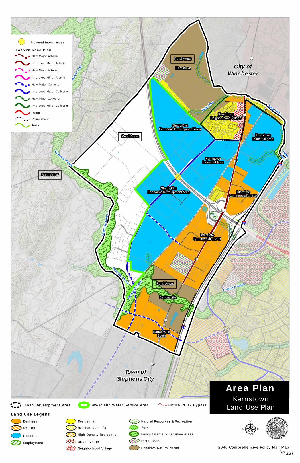
HogeRun
Opequo
n Cree
k
Opequon Creek
Hoge Run
Opequon Creek
Opequon Creek
Hoge Run
Opeq
uon C
reek
Opeq
uon C
reek
Opequon Creek
§¦81
§¦81
§¦81
£¤11
£¤11
£¤11
£¤11
£¤11
£¤11
£¤11
¬«37
¬«37
Copyright:© 2013 National Geographic Society, i-cubed
Town ofStephens City
KernstownNeighborhood Village
BartonsvilleSouth
KernstownIndustrial Area
KernstownIndustrial Area
InterstateCommercial at 310
InterstateCommercial at 310
Shady ElmEconomic Development Area
Shady ElmEconomic Development Area
Kernstown
Bartonsville
Rural Areas
Rural Areas
Rural Areas
Rural Areas
µ2040 Comprehensive Policy Plan Map
Draft
KernstownLand Use Plan
Area Plan
Land Use Legend
Industrial
EmploymentSensitive Natural Areas
Residential
Residential, 4 u/a
High-Density Residential
Urban Center
Neighborhood Village
Institutional
Natural Resources & Recreation
Environmentally Sensitive Areas
B2 / B3
Urban Development Area Future Rt 37 BypassSewer and Water Service Area
!( Proposed Interchanges
Eastern Road PlanNew Major Arterial
Improved Major Arterial
New Minor Arterial
Improved Minor Arterial
New Major Collector
Improved Major Collector
New Minor Collector
Improved Minor Collector
Ramp
Roundabout
Trails
City ofWinchester
Park
Business
267
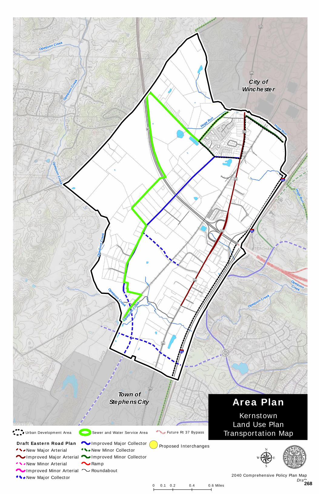
OpequonCreek
Opequo
n Cree
k
Opequon Creek
Hoge Run
Hoge Run
Opequon Creek
Opequon Creek
Hoge Run
Opeq
uon C
reek
Opeq
uon C
reek
Opequon Creek
§¦81
§¦81
§¦81
£¤11
£¤11
£¤11
£¤11
£¤11
£¤11
£¤11
£¤11
¬«37
¬«37
Copyright:© 2013 National Geographic Society, i-cubed
µ2040 Comprehensive Policy Plan Map
Draft
KernstownLand Use Plan
Transportation Map
Area Plan
0 0.2 0.4 0.60.1 Miles
Draft Eastern Road PlanNew Major ArterialImproved Major ArterialNew Minor ArterialImproved Minor ArterialNew Major Collector
Improved Major CollectorNew Minor CollectorImproved Minor CollectorRampRoundabout
!( Proposed Interchanges
Future Rt 37 BypassSewer and Water Service AreaUrban Development Area
City ofWinchester
Town ofStephens City
268
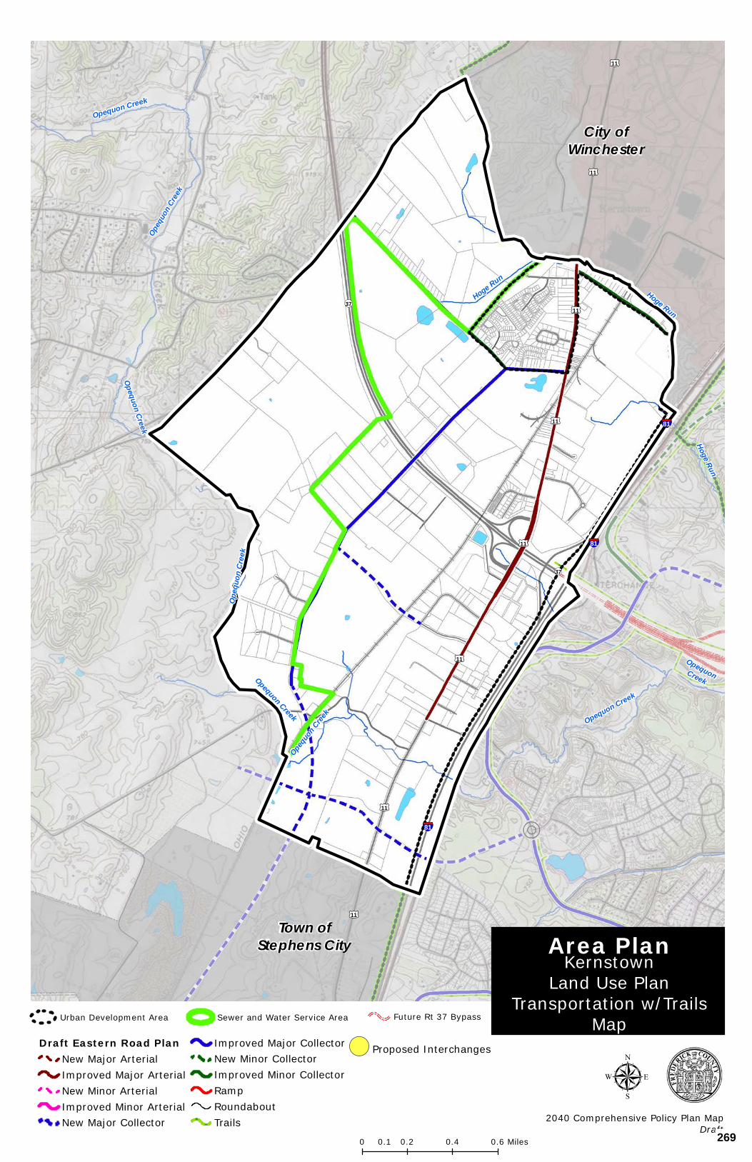
OpequonCreek
Opequo
n Cree
k
Opequon Creek
Hoge Run
Hoge Run
Opequon Creek
Opequon Creek
Hoge Run
Opeq
uon C
reek
Opeq
uon C
reek
Opequon Creek
§¦81
§¦81
§¦81
£¤11
£¤11
£¤11
£¤11
£¤11
£¤11
£¤11
£¤11
¬«37
¬«37
Copyright:© 2013 National Geographic Society, i-cubed
µ2040 Comprehensive Policy Plan Map
Draft
KernstownLand Use Plan
Transportation w/TrailsMap
Area Plan
0 0.2 0.4 0.60.1 Miles
Draft Eastern Road PlanNew Major ArterialImproved Major ArterialNew Minor ArterialImproved Minor ArterialNew Major Collector
Improved Major CollectorNew Minor CollectorImproved Minor CollectorRampRoundaboutTrails
!( Proposed Interchanges
Future Rt 37 BypassSewer and Water Service AreaUrban Development Area
City ofWinchester
Town ofStephens City
269
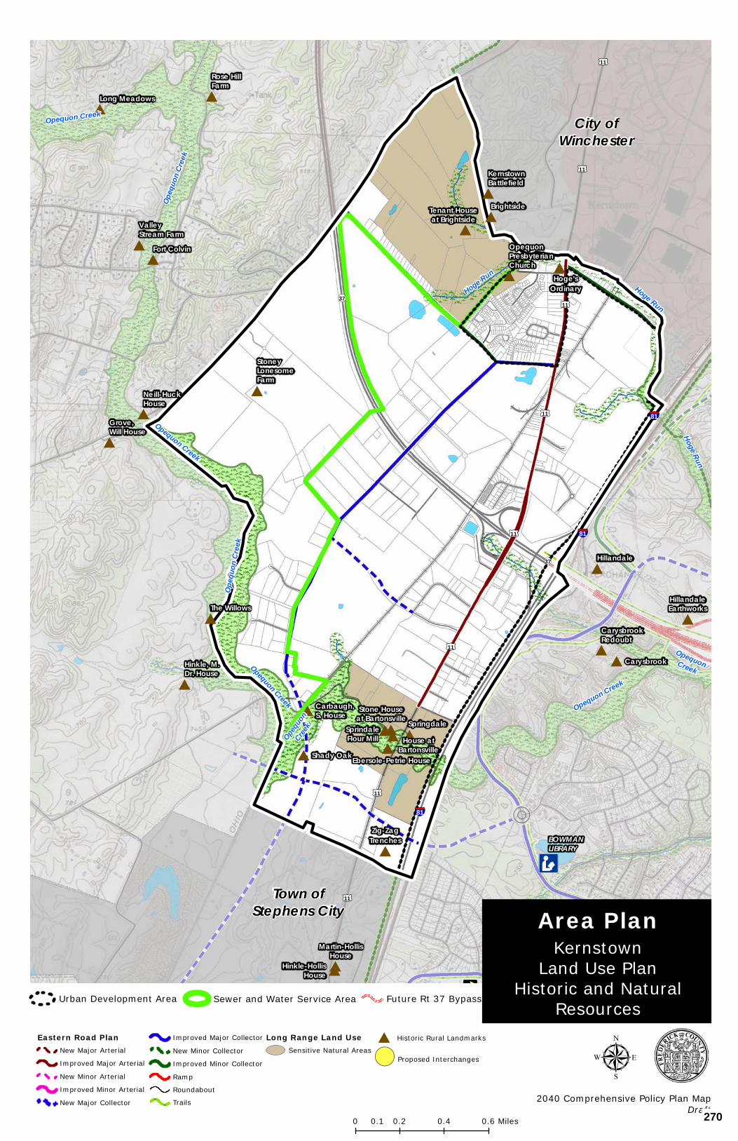
Æc
³n
#
#
#
#
#
#
#
#
#
#
#
#
#
##
#
#
#
#
#
#
#
#
#
#
#
#
#BOWMANLIBRARY
OpequonCreek
Opequo
nCree
k
Opequon Creek
Hoge Run
Hoge Run
Opequon Creek
Opequon Creek
Hoge Run
Opeq
uon C
reek
Opeq
uon C
reek
Opequon Creek
§¦81
§¦81
§¦81
£¤11
£¤11
£¤11
£¤11
£¤11
£¤11
£¤11
£¤11
¬«37
¬«37
StoneyLonesomeFarm
Long Meadows
Carbaugh,S. House
OpequonPresbyterianChurch
Hillandale
Rose HillFarm
HillandaleEarthworks
Martin-HollisHouse
Hinkle, M.Dr. House
CarysbrookRedoubt
BrightsideTenant Houseat BrightsideValley
Stream Farm
Hoge'sOrdinary
Carysbrook
KernstownBattlefield
Fort Colvin
Hinkle-HollisHouse
The Willows
Shady Oak
Neill-HuckHouse
Grove,Will House
Zig-ZagTrenches
Copyright:© 2013 National Geographic Society, i-cubed
µ2040 Comprehensive Policy Plan Map
Draft
KernstownLand Use Plan
Historic and NaturalResources
Area Plan
0 0.2 0.4 0.60.1 Miles
Eastern Road PlanNew Major Arterial
Improved Major Arterial
New Minor Arterial
Improved Minor Arterial
New Major Collector
Improved Major Collector
New Minor Collector
Improved Minor Collector
Ramp
Roundabout
Trails
Long Range Land UseSensitive Natural Areas
# Historic Rural Landmarks
!( Proposed Interchanges
Future Rt 37 BypassUrban Development Area Sewer and Water Service Area
Stone Houseat Bartonsville
SprindaleFlour Mill
Ebersole-Petrie House
House atBartonsville
Springdale
Town ofStephens City
City ofWinchester
270

APPENDIX I - AREA PLANS
Stephens City/Frederick County Joint Future Land Use Plan 81
STEPHENS CITY/FREDERICK COUNTY
JOINT FUTURE LAND USE PLAN
FOR PROPOSED ANNEXATION AREAS
-Final Draft Approved by Stephens City Town Council, February 3, 2009
-Final Map Approved by Stephens City Town Council, March 3, 2009
- Approved by Frederick County Board of Supervisors, April 8, 2009
271
APPENDIX I - AREA PLANS
Stephens City/Frederick County Joint Future Land Use Plan 82
STEPHENS CITY/FREDERICK COUNTY JOINT FUTURE LAND USE PLAN FOR PROPOSED ANNEXATION AREAS
The Town of Stephens City, Virginia, map depicts a conceptual plan for future land uses within the proposed annexation area around the Town of Stephens City. The map was originally developed by county staff working with the Stephens City town manager and was jointly adopted by Frederick County and the Town of Stephens City on July 9, 2003 and July 1, 2003, respectively. The foundation of the map is both the County’s Route 11 Corridor Plan contained within the county’s Comprehensive Policy Plan and the town’s 2001-2021 Comprehensive Plan. In 2008, the Joint Land Use Plan was updated based upon the efforts of the Joint Land Use Committee who undertook an evaluation of past and current planning activity within the area and provided guidance on a revised land use and transportation plan.
The Stephens City/Frederick County Joint Future Land Use Plan depicts a conceptual plan for future land uses within the annexation area around the Town of Stephens City. The proposed annexation area is made up of two phases. Phase I consists of a northern and southern portion comprising a total of approximately 360 acres. The northern area of Phase I is adjacent to the town’s northern boundary and extends west from I-81, across the railroad. The southern portion of this phase is situated at the town’s southwestern boundary, surrounding the Lime Kiln. Phase II of the proposed annexation area is also located south of the town. It comprises an area of roughly 350 acres lying between I-81 and the railroad and extending south to Family Drive.
Overall, the general concept of the land use plan is to allow for growth around the existing town which is compatible with the existing scale and style of Stephens City. Industrial areas are sited to make use of the rail lines while being buffered from view of Route 11 and existing or proposed residential areas.
A major collector road is shown running west of town that would function as a bypass, drawing through traffic from Route 11 and thereby out of the center of town. The “bypass” is intended to assist in reducing congestion at the Route 11 Fairfax Pike intersection. The collector road ties in with a relocated Route 277/Interstate 81 interchange to the south of the present location and to a new overpass of I-81 at an extended Tasker Road to the north. This major collector road would be fed by other new, minor collector roads as well as the existing street system. An extension of this major collector road would provide connectivity with the proposed Shady Elm Collector Road. Key gateway intersections are proposed to include roundabout intersections that will provide effectively functioning intersections with a design quality that enhances the Town.
General categories of future land uses are depicted within the proposed annexation areas by colored areas. These areas of future land use are mixed to coordinate and integrate with each other, take advantage of, and implement the transportation improvements, and relate with the existing character and context of the Town. These general land use categories are described as follows:
LIGHT INDUSTRIAL/MANUFACTURING/OFFICE:
272
APPENDIX I - AREA PLANS
Stephens City/Frederick County Joint Future Land Use Plan 83
This category is shown in blue and accounts for roughly 153 acres of the proposed annexation area. Anticipated land uses within these areas would be consistent with the county’s current M-1 zoning, including office, light manufacturing, wholesale establishments, and warehousing. This area could also be attractive to the County’s targeted economic development businesses which are proposed to be accommodated by the OM zoning classification. One area of this land use, located in the prominently visible site in the area south of the Town, adjacent to the intersection of the Western Bypass and along the Bypass, should seek to accommodate the more commercial and office components of this land use designation. Buildings should be located closer to the road than any accessory uses, including parking areas, in an effort to present a strong economic presence and attractive form of development at this community gateway.
CONSERVATION/OPEN SPACE:
These areas are shown in green and account for roughly 300 acres. The areas are located 1) along the Route 11 corridor north of, and south of, the town (depicting an area to be buffered), 2) an area of approximately 15 acres adjacent and connected to the Stephens City Western Bypass and central to this area of development to be utilized by the Town as a park or other public use, 3) an area west of the railroad around the northern quarry, and 4) a low lying area south of town and west of Route 11. The intent of these areas would be to preserve these areas from development for environmental, recreational, and/or aesthetic reasons. The rural corridor preservation buffer along the east and west sides of Route 11 could be up to a maximum 200-feet in width. An additional road efficiency buffer should be provided between any residential development and the proposed Stephens City Bypass.
INSTITUTIONAL USE:
This area is depicted with a pink checked hatch and is shown to the north on the eastern side of the Route 11 corridor. The area consists of approximately 25 acres of existing and future institutional land uses. A private school is currently located in this area. The intent of this land designation is to serve the public at large through an institutional use that might consist of school (private or public), church or non-profit organization, recreational use, or a government entity. Appropriate amenities may include dormitories, recreational or athletic fields, administration and maintenance facilities, and other similar uses that are customarily associated with this type of institutional land use.
MEDIUM DENSITY RESIDENTIAL:
These areas are depicted in yellow and are shown north of town on both sides of the Route 11 corridor. The area east of Route 11, total roughly 27 acres, is designed to complement the existing residential land uses and complete the area between Route 11 and Interstate 81. The area west of Route 11, between Route 11 and the Western Bypass and totaling roughly 40 acres, is designed to reinforce the residential character of the northern portion of the Town and integrate this residential land use into the proposed areas of Commercial and Mixed Use. The area of medium density residential south of Fairfax Pike is consistent with the residential land use approved by the Town for this property. It is the intent of this land use designation to provide for residential development at a density of approximately four units per acre. This residential development shall implement the standards of New
273
APPENDIX I - AREA PLANS
Stephens City/Frederick County Joint Future Land Use Plan 84
Urbanism and be integrated into the surrounding land uses and orientated towards the internal street network.
HIGHWAY COMMERCIAL/COMMERCIAL/OFFICE:
This area totaling approximately 135 acres is shown in orange and is located in several of the annexation areas at key intersections, but most prominently, in the area immediately west of the future relocation of Interstate 81 Interchange, west of Route 11. This area of land use is intended to provide typical highway commercial uses such as retail, restaurants, and office uses. It is located to take advantage of both the significant Interstate traffic that could be anticipated from the relocated interchange, and the local traffic that would be utilizing the local collector road network.
MIXED-USE:
This land use is identified in three locations. The first area is located north of the proposed east west collector road adjacent to the northern boundary of the Town, west of Route 11, and contains roughly 15 acres. The second area is located south of Town, west of Route 11, and adjacent to the collector street connecting the Western Bypass with Route 11. This area is also roughly 15 acres. The third area is at the western gateway to the Town, south of Fairfax Street, and encompasses the area of existing residential lots and an area of approved commercial development. This area is approximately 25 acres in size. These areas would be a mix of commercial, business, and office uses with the possibility of up to twenty-five (25) percent of the land area being available for single family attached residential land uses at a density of four units per acre. In addition, second story and above residences located above commercial land uses shall be permitted. These second story and above residential uses shall be considered bonus residential uses that do not count towards the residential density of the mixed-use area. This area of mixed-use development shall implement the standards of New Urbanism and be integrated into the surrounding land uses and orientated towards the street network.
MIXED-USE AGE-RESTRICTED:
This land use designation is identified in one location in the area north of Town and west of Route 11 and This area is contains approximately 20 acres. This area would be a mix of age-restricted residential land uses at a relatively high residential density, up to approximately 8 units per acre, and shall contain a variety of residential housing types. In addition, this area shall contain a mix of commercial, business, or office uses that would be located on a minimum of fifteen (15) percent of the site. The intent of this land use designation would be to serve active older adults in an environment that takes advantage of the unique characteristics of the Town adds value to the broader community. This area of mixed-use age restricted development shall implement the standards of New Urbanism and be integrated into the Town, the surrounding land uses, and orientated towards the street network which shall be a continuation of the Town’s grid pattern.
274
APPENDIX I - AREA PLANS
Stephens City/Frederick County Joint Future Land Use Plan 85
INFRASTRUCTURE AND COMMUNITY FACILITIES
It is essential to ensure that the infrastructure, in particular transportation infrastructure, and the necessary community facilities are provided in a timely and coordinated manner in order to enable the successful implementation of the land use plan.
The County and the Town agree that any development in implementation of the Joint Land Use Plan shall fully mitigate the impacts associated with the request and shall further the goals of the Joint Land Use Plan, the County’s Comprehensive Policy Plan, specifically with regards to transportation policy, and the Town’s Comprehensive Policy Plan. Key community infrastructure components identified in the Joint Land Use Plan, the County’s Comprehensive Policy Plan, and the Town’s Comprehensive Policy Plan shall be fully recognized and development projects shall seek to implement the community facility, transportation, and infrastructure needs of the County and the Town.
The land use designations of the Joint Land Use Plan that will form the basis for future zoning amendments were designed in coordination with the infrastructure, in particular transportation infrastructure, and the necessary community facilities. Therefore, future development applications shall address the impacts of the project and shall further the implementation of the infrastructure and community facility transportation improvements identified in the respective Comprehensive Policy Plans. This may include the design and construction of key segments of proposed roads and intersection/interchanges. Consideration of future development applications within the study area should only occur when an acceptable level of service has been achieved and key elements and connections identified in this plan have been provided.
275
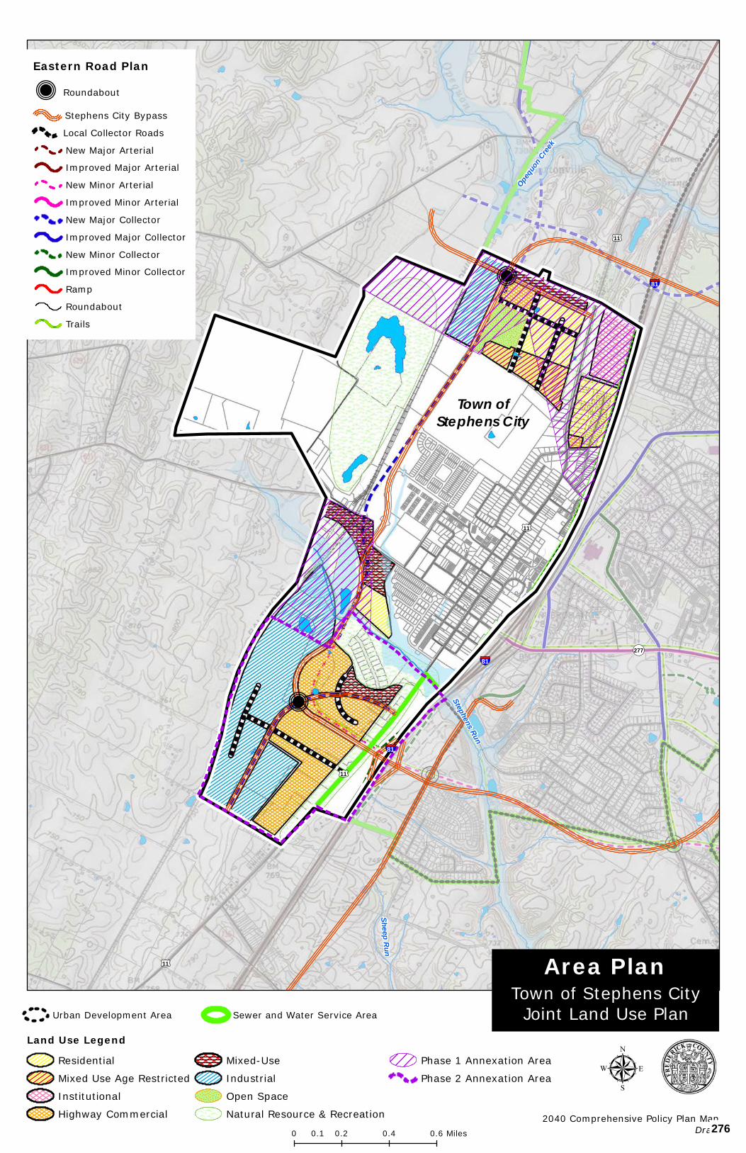
Q
Q
§¦81
§¦81
§¦81
£¤11
£¤11
£¤11
£¤11
Sheep Run
Stephens Run
Opequo
n Cree
k
¬«277
Copyright:© 2013 National Geographic Society, i-cubed
Town of Stephens CityJoint Land Use Plan
Area Plan
µ2040 Comprehensive Policy Plan Map
Draft0 0.2 0.4 0.60.1 Miles
Eastern Road Plan
Q Roundabout
Stephens City Bypass
Local Collector Roads
New Major Arterial
Improved Major Arterial
New Minor Arterial
Improved Minor Arterial
New Major Collector
Improved Major Collector
New Minor Collector
Improved Minor Collector
Ramp
Roundabout
Trails
Sewer and Water Service AreaUrban Development Area
Land Use LegendResidential
Mixed Use Age Restricted
Institutional
Highway Commercial
Mixed-Use
Industrial
Open Space
Natural Resource & Recreation
Phase 1 Annexation Area
Phase 2 Annexation Area
Town ofStephens City
276
APPENDIX I - AREA PLANS
Middletown/Lord Fairfax LRCC Sewer and Water Service Area 87
MIDDLETOWN/LORD FAIRFAX LRCC SEWER AND WATER SERVICE AREA
-INCLUDING 2014 SEWER AND WATER SERVICE AREA (SWSA) EXPANSION
BOARD OF SUPERVISORS
APPROVED ON SEPTEMBER 26, 2012
AMENDED AUGUST 13, 2014
277
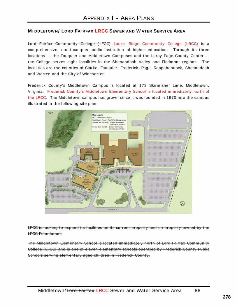
APPENDIX I - AREA PLANS
Middletown/Lord Fairfax LRCC Sewer and Water Service Area 88
MIDDLETOWN/LORD FAIRFAX LRCC SEWER AND WATER SERVICE AREA
Lord Fairfax Community College (LFCC) Laurel Ridge Community College (LRCC) is a comprehensive, multi-campus public institution of higher education. Through its three locations — the Fauquier and Middletown Campuses and the Luray-Page County Center — the College serves eight localities in the Shenandoah Valley and Piedmont regions. The localities are the counties of Clarke, Fauquier, Frederick, Page, Rappahannock, Shenandoah and Warren and the City of Winchester.
Frederick County’s Middletown Campus is located at 173 Skirmisher Lane, Middletown, Virginia. Frederick County’s Middletown Elementary School is located immediately north of the LRCC. The Middletown campus has grown since it was founded in 1970 into the campus illustrated in the following site plan.
LFCC is looking to expand its facilities on its current property and on property owned by the LFCC Foundation.
The Middletown Elementary School is located immediately north of Lord Fairfax Community College (LFCC) and is one of eleven elementary schools operated by Frederick County Public Schools serving elementary aged children in Frederick County.
278
APPENDIX I - AREA PLANS
Middletown/Lord Fairfax LRCC Sewer and Water Service Area 89
Middletown/Lord Fairfax SWSA
The Sewer and Water Service Area (SWSA) is an important policy tool used by Frederick County to determine where public water and sewer service may be provided. The Board of Supervisors approves the location of the SWSA boundaries through the adoption of the Comprehensive Plan; the 2030 Comprehensive Plan, and amendments thereto. As a result, properties located within the SWSA may enjoy access to public water and sewer if infrastructure is available.
The Middletown/Lord Fairfax LRCC SWSA has been established to enable the provision of public water and sewer in the area north of the Town of Middletown to current and future institutional land uses, including Lord Fairfax Community College (LFCC) LRCC and the Middletown Elementary School. The supporting map identifies the location of the Middletown/ Lord Fairfax LRCC SWSA boundary.
Future study of the area surrounding the Town of Middletown may identify additional properties that could be added to the Middletown/ Lord Fairfax LRCC SWSA, if deemed appropriate by the Board of Supervisors.
The Frederick Water County Sanitation Authority (FCSA) has the primary responsibility to manage the provision of water and sewer in Frederick County, and therefore, within the SWSA. In some cases, other public entities may serve properties within Frederick County, if approved by the Board of Supervisors. Lord Fairfax Community College (LFCC) LRCC currently obtains water from the City of Winchester, and public sewer service from the Town of Middletown receives their wastewater.
The Board of Supervisors, in approving this update to the area plan, expressly stated that Frederick Water the Frederick County Sanitation Authority (FCSA) will be the party responsible for providing water and sewer in this area. It is recognized that properties owned by the State of Virginia are preempted from local control by Frederick County. Frederick County and Lord Fairfax Community College (LFCC) the LRCC will continue to work collaboratively on issues related to the growth and development in this area of Frederick County. Land Use
Frederick County uses the 2030 Comprehensive Plan to guide the future land uses. The Town of Middletown’s Foresight Middletown plan, which was adopted into the Town’s Comprehensive Plan in 2005, guides the future land uses within the Town and was considered when drafting this plan.
The area encompassed by the Middletown/ Lord Fairfax LRCC SWSA is envisioned to promote the continued growth of institutional land uses that enhance the existing educational institutions, Lord Fairfax Community College (LFCC) LRCC, and the Middletown Elementary School. To that end, the plan calls for the establishment of approximately 140 acres of institutional land use that will serve the citizens of Frederick County and the broader region.
279
APPENDIX I - AREA PLANS
Middletown/Lord Fairfax LRCC Sewer and Water Service Area 90
Institutional land uses are defined as a nonprofit or quasi-public use or institution, such as a church, library, public or private school, hospital or municipally owned or operated building, structure or land used for public purposes. Institutions of higher education are defined as an educational institution whose primary purpose is to provide a collegiate or graduate education. Transportation
The Middletown/ Lord Fairfax LRCC SWSA is immediately north of the Town of Middletown and is bounded by Valley Pike (Route 11), to the west, and Interstate 81 to the east. Access to the area is via Valley Pike Interstate 81 and Exit 302. All are strong assets to the areas’ transportation network, and to the success of the institutional uses envisioned for this area. It will be important to ensure the function of this transportation network.
In rapidly growing areas, as noted in the Foresight Middletown plan, controlling and coordinating the number, design and location of new access points to major roadways is critical to maintaining the safety and capacity of the road system as traffic volumes increase. Accordingly, access to Valley Pike, Route 11, should be managed and limited. In the future, internal connections within the institutional land uses should be considered. In addition, the primary route to this area from Interstate 81 should be enhanced to safely and effectively manage the traffic and to reflect the Foresight Middletown plan as a means to create an attractive entrance to the Town and this developing area.
Consistent application of Comprehensive Plan goals to achieve an acceptable level of service on area roads and overall transportation network, level of service C or better, should be promoted. As roadways are upgraded or built, enhancements should be made to improve bicycle and pedestrian access to all properties in the area. Further, efforts should be made to ensure that additional degradation of the transportation beyond an acceptable level of service shall be avoided. Consideration of future development applications within the study area should only occur when an acceptable level of service has been achieved and key elements and connections identified in this plan have been provided.
280
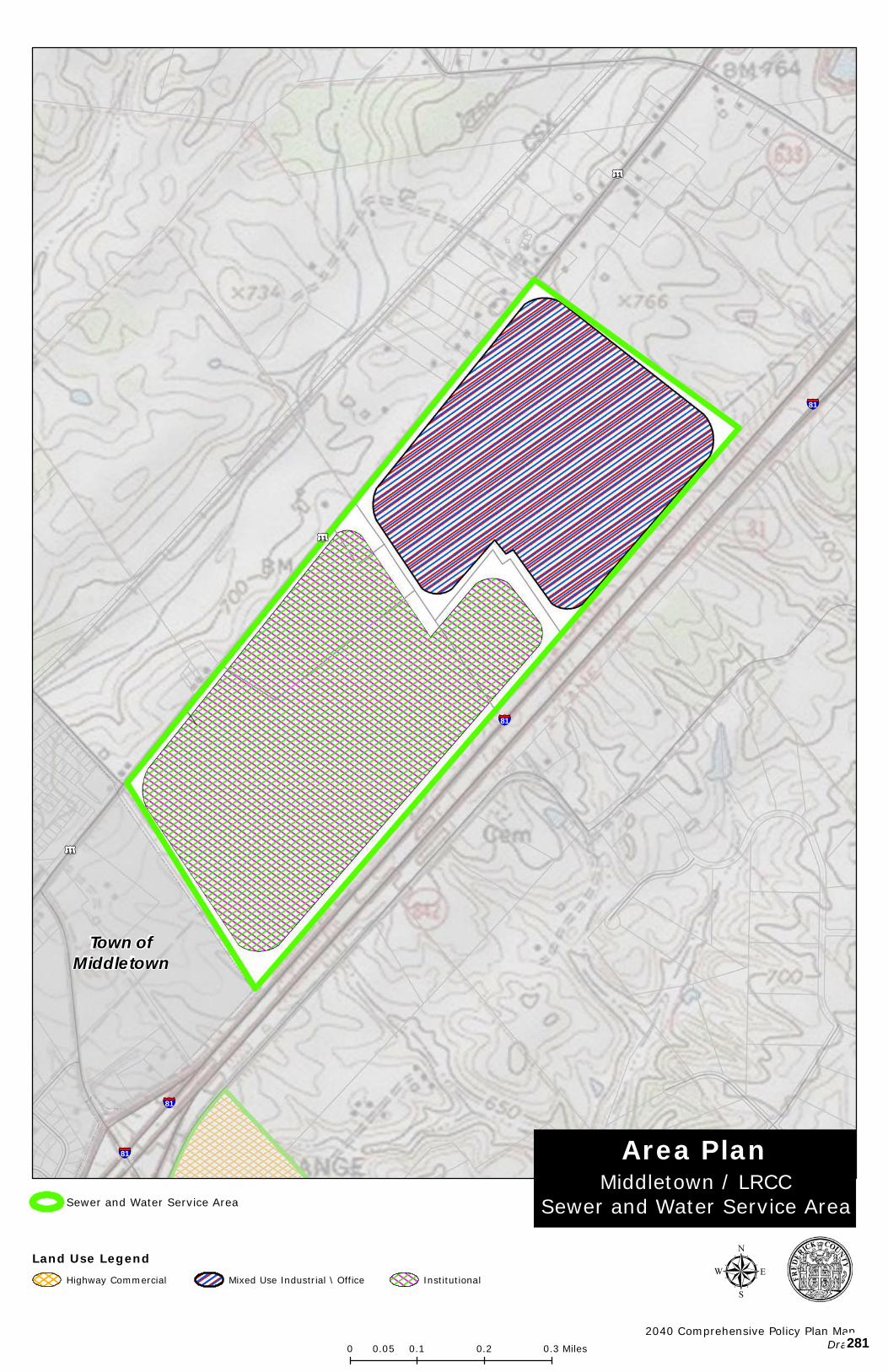
§¦81
§¦81
§¦81
§¦81
£¤11
£¤11
£¤11
Copyright:© 2013 National Geographic Society, i-cubed
Middletown / LRCCSewer and Water Service Area
Area Plan
µ2040 Comprehensive Policy Plan Map
Draft
Sewer and Water Service Area
0 0.1 0.2 0.30.05 Miles
Town ofMiddletown
Land Use LegendHighway Commercial InstitutionalMixed Use Industrial \ Office
281
APPENDIX I - AREA PLANS
Reliance Road Area Land Use Plan 92
RELIANCE ROAD AREA LAND USE PLAN
- INCLUDING 2014 SEWER AND WATER SERVICE AREA (SWSA) DESIGNATION
BOARD OF SUPERVISORS
Approved on December 14, 2011
Amended August 13, 2014
282
APPENDIX I - AREA PLANS
Reliance Road Area Land Use Plan 93
RELIANCE ROAD AREA LAND USE PLAN In spring 2010, the Town of Middletown expressed interest in expanding its boundaries to incorporate approximately 250 acres of land on the east side of I-81, Exit 302, following Reliance Road. Shortly thereafter, the Reliance Road Steering Committee (RRSC) was convened. The RRSC was composed of representatives from the Town Council and the Board of Supervisors. The RRSC met various times over the ensuing months. The Town representatives also held a community meeting and met with individual property owners within the study area to gain an understanding of the interest of the property owners in terms of the Town’s desired boundary line adjustment with the County, as well as future land use opportunities; these meetings were summarized and presented to the RRSC by Town representatives. It was noted that while approximately 37 acres of B2 General Business Zoning exists within the study area, only one site has been developed and benefits from the Town’s water and sewer system: the 2.7-acre site occupied by an existing Exxon service station.
The RRSC also evaluated the existing transportation network in addition to water and sewer availability. The RRSC considered the Foresight Middletown plan (adopted into the Town’s Comprehensive Plan in 2005), which promoted the implementation of a technology park east of the interstate. The results of these findings led to the crafting of the Reliance Road Area Land Use Plan as a means to illustrate the potential land uses, and the supporting transportation and public water and sewer for the area, to foster further discussions.
The land use plan is envisioned to guide land use decisions for an area of approximately 311 acres over the next 20 to 30 years. Recognizing the Town’s current water availability, development within the study area will initially be limited until an additional water supply is more readily available. The Board of Supervisors, in approving this update to the area plan, expressly stated that the Frederick Water County Sanitation Authority (FCSA) will be the party responsible for providing water and sewer in this area.
LAND USE
The proximity of the study area to I-81, Exit 302, enhances the opportunities for land uses that benefit from the interstate. As such, commercial and technology uses would be most beneficial at this location.
The plan calls for the establishment of approximately 44 acres of commercial uses that serve the travelling public, such as hotels, gasoline service stations, and restaurants. The commercial opportunities would be located immediately east of the interstate interchange, on the north and south sides of Reliance Road. This is also the area where public water and sewer presently serves the existing Exxon service station. These land uses could be implemented through the B2 (Business General) Zoning District.
Technology uses are envisioned both north and south of Reliance Road, covering approximately 259 acres. Based on the targeted businesses identified by the Frederick County Economic Development Authority (EDA) Winchester-Frederick County Economic Development Commission, the technology uses would include economic sectors such as:
283
APPENDIX I - AREA PLANS
Reliance Road Area Land Use Plan 94
Advanced Security, Assembly, Business Services, and Life Sciences. These land uses would be implemented through the OM (Office Manufacturing) Zoning District.
In recognition of the continuation of the agricultural and large lot residential land uses adjacent to the study area, efforts should be implemented through the rezoning and development process that mitigate and lessen the adverse impacts that the commercial and technological uses may introduce. Mitigation techniques such as 100-foot distance buffers and landscape screening would be expected. TRANSPORTATION While the existence of I-81, Exit 302, is a strong asset to the areas’ transportation network, the actual configuration of the interchange and its close proximity of Buckton Road is not conducive to accommodating future traffic demands. In order for the interchange to operate efficiently and effectively in the future, it is essential to migrate the existing intersection of Reliance and Buckton Roads further east, creating a greater separation distance from the I-81 northbound on/off ramps. Increasing this separation distance will avoid significant degradation of the interchange similar to what has occurred at Exit 307 in Stephens City. In rapidly growing areas, as noted in the Foresight Middletown Plan, controlling and coordinating the number, design and location of new access points to major roadways is critical to maintaining the safety and capacity of the road system as traffic volumes increase. Accordingly, access to Reliance Road should be managed and limited. The plan calls for limiting Reliance Road access to three points: a managed access entrance point in the vicinity of Confidence Lane, and two appropriately spaced, preferably roundabout, roundabout or signalized intersections.
As noted in the Transportation Chapter of the Plan, as road projects and development or redevelopment take place, the development and associated transportation facilities should be accessible to all users.
The initial access point onto Reliance Road would be established with the relocation of Buckton Road. A second access point onto Reliance Road would be established with the relocation of Huttle Road, to create a single intersection on Reliance Road for relocated Huttle Road and a new road servicing the southern land area.
These three Reliance Road access points would facilitate traffic movement to/from Reliance Road to the various future land uses to the north and south. It may also be appropriate to utilize a roundabout at the relocated Buckton Road intersection with Reliance Road as a means to define where the developed portion of Reliance Road ends and the rural land uses of the County begin. A similar technique was suggested by the Foresight Middletown plan as a means to create an entrance to the developed area.
Finally, the Foresight Middletown plan calls for Reliance Road within the Town limits to be a boulevard with a landscaped median; the Reliance Road Area Land Use Plan carries this design concept forward east of the interstate.
284
APPENDIX I - AREA PLANS
Reliance Road Area Land Use Plan 95
Consistent application of Comprehensive Plan goals to achieve an acceptable level of service on area roads and overall transportation network, level of service C or better, should be promoted. Further, efforts should be made to ensure that additional degradation of the transportation beyond an acceptable level of service shall be avoided. Consideration of future development applications within the study area should only occur when an acceptable level of service has been achieved and key elements and connections identified in this plan have been provided. WATER AND SEWER The Town recently completed an upgrade to its wastewater treatment facility which enables it to treat upwards of 400,000 gpd. Reflective of the slowing economy and the Town’s limited water availability, the wastewater facility is currently operating at less than 30 percent capacity; the facility is available to service future wastewater demands. Existing limitations in water availability and the conveyance lines under the interstate may hinder development in the near future. As the Town secures additional water availability, upgrades to the conveyance system could easily be undertaken.
Reflective of current water availability, the Town is positioned to dedicate up to 18,000 gpd of water to development on the east side of I-81. This available water resource could facilitate an initial expansion of the commercial land uses to include a hotel, expanded gasoline service station/convenience center, and a restaurant. Any additional commercial uses would certainly warrant additional water resources.
Development of the technology park land uses will be limited until additional water resources are identified and available. Technology uses that require limited water resources would certainly be more desirable initially, until the expanded water supply has been secured and accessible.
The Board of Supervisors, in approving the 2014 update, expressly stated that Frederick Water will be the party responsible for providing water and sewer in this area.
285
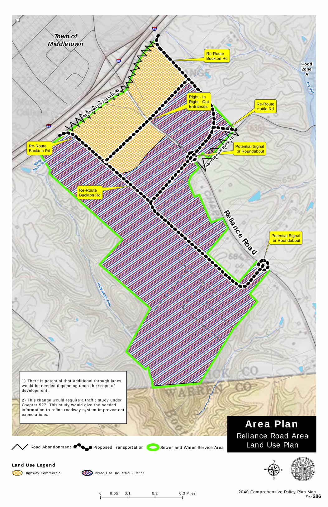
Potential Signalor Roundabout
Right - InRight - OutEntrances
Re-RouteBuckton Rd
Re-RouteBuckton Rd
Re-RouteBuckton Rd
Potential Signalor Roundabout
Re-RouteHuttle Rd
§¦81
§¦81
§¦81
FloodZone
A
£¤11Dry Run
Molly
Booth Run
Molly Booth Run
Copyright:© 2013 National Geographic Society, i-cubed
1) There is potential that additional through laneswould be needed depending upon the scope ofdevelopment.
2) This change would require a traffic study underChapter 527. This study would give the neededinformation to refine roadway system improvementexpectations.
Reliance Road
Abandon old Buckton Rd
Abandon old Huttle Rd
0 0.1 0.2 0.30.05 Miles
µ2040 Comprehensive Policy Plan Map
Draft
Reliance Road AreaLand Use Plan
Area Plan
Town ofMiddletown
Road Abandonment Proposed Transportation Sewer and Water Service Area
Land Use LegendHighway Commercial Mixed Use Industrial \ Office
286
THE FREDERICK COUNTY
COMPREHENSIVE PLAN
APPENDIX II – BACKGROUND ANALYSIS
AND SUPPORTING STUDIES
(DRAFT)
287
APPENDIX II – BACKGROUND ANALYSIS AND SUPPORTING STUDIES
THE COMPREHENSIVE PLAN - DRAFT
• HISTORICAL BACKGROUND • GEOGRAPHICAL IMPACTS • DEMOGRAPHIC ANALYSIS • ECONOMIC ANALYSIS • LAND USE ANALYSIS
288

APPENDIX II – BACKGROUND ANALYSIS AND SUPPORTING STUDIES
THE COMPREHENSIVE PLAN - DRAFT 1
HISTORICAL BACKGROUND Early European Settlement: For 12,000 years prior to English Settlement of the Shenandoah Valley, a sparse population of Native Americans lived in the area, but many more traveled through these valleys on the “Indian War Path” from New York and Pennsylvania to winter in Georgia and South Carolina. The first Europeans to come through the Shenandoah Valley were Jesuit missionaries in 1632, and the details of this wilderness area were first mapped by French explorer, Samuel de Champlain. The first private English ownership of Frederick County was the Virginia Company, which was tasked with the settlement of the Virginia Colony by King James I. Ownership of the area returned to the Crown in 1624 when the Virginia Company’s charter was revoked. In 1649, King Charles II granted seven royalist supporters the land "bounded by and within the heads" of the Potomac and Rappahannock Rivers. By 1681, Thomas, the Second Lord Culpepper, owned most of this original land grant. After he died in 1689, his daughter married Thomas, the Fifth Lord Fairfax, and later, their son Thomas, the Sixth Lord Fairfax, inherited the entire land grant. Englishmen settled the Piedmont, then pushed west by foot and horse through passes in the Blue Ridge, and many more German and Scotch-Irish settlers came down through the valleys from Philadelphia and Lancaster, Pennsylvania. Some of the earliest settlers of this area were Quakers who built the Hopewell Friends Meeting House, which still stands near Clearbrook and is listed on the National Register of Historic Places. These settlers were attracted by the fertile soils and the abundant forest and water resources. Initial Settlement and Organization: The Colonial government of Virginia wanted this wilderness settled as quickly as possible, as a buffer against the Native Americans; but Robert "King" Carter, Lord Fairfax's agent, was settling Fairfax's land slowly in large plantations. The government of Virginia had chartered counties in the Fairfax land grant as settlement spread up the Northern Neck and west. Virginia argued that Fairfax's land grant ended at the Blue Ridge and began granting up to 1,000 acres each to settler families west of the Blue Ridge. Abraham Hollingsworth settled near the site of Abrams Delight, now located within the Winchester City limits, in about 1729. Owen Thomas and Jeremiah Smith came to Back Creek in 1730 and settled on 806 acres granted in Thomas' name. Smith left and returned with a wife before 1741. His log cabin is now part of a house west of Back Creek and south of Route 50. In 1732, Jost Hite settled 16 families on his 5,000 acre "grant" and built Hite's Fort at Bartonsville, located on Route 11, approximately two miles south of Winchester. The “Indian Path” became the Great Wagon Road to Philadelphia and Native Americans were dispossessed westward by treaty and force of arms. Frederick County was created from western Orange County by the House of Burgesses on December 21, 1738, and was named after Frederick Louis, the Prince of Wales and son of King George II, and originally spanned from the Blue Ridge Mountains to current day Ohio. In 1744, James Wood, County Surveyor for Orange County, platted a town at the County seat, which he named Winchester, after his birthplace. It consisted of 26 half-acre lots and three streets within 1300 acres, which he
289
APPENDIX II – BACKGROUND ANALYSIS AND SUPPORTING STUDIES
THE COMPREHENSIVE PLAN - DRAFT 2
claimed as wilderness land owned by Virginia. Those streets are now Loudoun, Boscawen, and Cameron. Winchester was officially chartered in 1752. County government in Virginia was originally by self-perpetuating courts. Frederick County's Court was proclaimed and organized in 1743, and its officials took their oaths of office on November 11th of that year. The Frederick County Court first met at the surveying office of its clerk, James Wood, at the site on which he later built his estate, Glen Burnie.
By the mid-1740s, the Frederick County Court had acknowledged that Lord Fairfax's land grant did include Frederick County, despite previous arguments that the Fairfax lands ended at the Blue Ridge Mountains. At the age of 16, George Washington was a member of a surveying party that came to Frederick County for Lord Fairfax in 1748. In 1749, Lord Fairfax moved to Frederick County and built his home, Greenway Court, at White Post, in present-day Clarke County. He accepted Wood's 1,300 acre claim and other additional lots at Winchester. Eventually, 11 other counties would be created from the 3,824 square miles included in the original Frederick County. George Washington maintained a relationship with Winchester and Frederick County during and after his surveying expedition for Lord Fairfax. Early during those years, Washington operated his surveying office in Winchester and oversaw the construction of Fort Loudoun. Washington’s first elected office was as a representative of Frederick County in the House of Burgesses 1758. He served in this post for 15 years.
During the French and Indian War, he was given a Commission by Governor Dinwiddie of Virginia and was later promoted to Commander in Chief of the colonial forces with headquarters in Winchester. The location of the headquarters for the western campaign helped to stimulate growth in Winchester throughout the French and Indian War which in turn led to improvements along trade/travel roads, the creation of additional lots in Winchester, and the formation of Stephensburg, which is now Stephens City. The American Revolution in Frederick County: Although there were no battles or military engagements in Frederick County during the Revolutionary War, the area was very important in the effort. Prior to the drafting of the Declaration of Independence, a group of protesters met in Winchester to protest King George’s taxes on the colonies. They drafted the Frederick County Resolves and promised not to purchase English wares until their grievances were resolved. During the war, General Daniel Morgan, who lived in eastern Frederick County (now Clarke County), and his "Long Rifles" played a prominent role in many battles of the Revolutionary War, including the Battle at Cowpens in South Carolina. His regiment of expert riflemen was one of two from Virginia. Several local citizens furnished the troops with food and supplies, including Isaac Zane Jr. who supplied the army with ammunition made at his ironworks in Marlboro. Many prisoners captured during the War were held in Winchester and Frederick County. By 1779, the number of British prisoners held in Winchester had increased beyond the capacity of the
The original Frederick County has since been divided into the
following Counties*: In Virginia: Dunmore (now Shenandoah) - 1772 Page – 1831 Warren – 1836 Clarke – 1836 In West Virginia: Hampshire – 1753 Berkeley – 1772 Hardy – 1776 Jefferson – 1801 Morgan – 1820 Mineral – 1866 Grant – 1866 *from “Frederick County, Virginia: History through Architecture” by Maral S. Kalbian
290
APPENDIX II – BACKGROUND ANALYSIS AND SUPPORTING STUDIES
THE COMPREHENSIVE PLAN - DRAFT 3
existing prison and a larger one was built. A barracks was built four miles west of Winchester to hold these prisoners whose number had increased to 1,600 by the year 1781. After the Revolution, the trade routes established during the French and Indian War continued to develop and provide avenues for trade between farmers in Frederick County and those in Eastern Virginia. Winchester grew as a travel and commercial hub in Western Virginia. Early National Period: During the late eighteenth and early nineteenth centuries, life in Frederick County centered on small family farms and transportation and trade routes. By the 1770s, the Indian Warpath through Frederick County had transformed into the Great Wagon Road and forms what is now US Route 11. In addition to Route 11, other major roads were established through Winchester including what are now Route 50 West, 522 South, and Route 7 East. These four major roads provided avenues of transportation and made trade possible across the state of Virginia as well as major cities North and South of Virginia. As a result, Winchester and the surrounding area grew in terms of residential occupants and commercial occupants. Economic life was centered around Winchester and other local towns including Stephens City, Middletown, Kernstown, Gainesboro and Gore, which remain centers of economic and community growth today. The number of craftsmen and merchants in these towns was large and diverse. The strongest influence on the local economy was the Great Wagon Road which carried settlers and travelers from Philadelphia, south through the Valley and to the west. Activity associated with this road made Winchester one of the largest towns in western Virginia. Farming in this region focused on several main crops which grew well in the soils of the area. During this period, wheat production became the center of the local economy, along with cattle farming, and by 1810, Frederick County was one of the largest producers of wheat in Virginia. Economic growth in the area was predominantly encouraged by agricultural activities and their industrial counterparts, such as milling and transporting of the locally grown products. By 1820, there were 54 grain mills in Frederick County along with numerous sawmills, tanneries, and other business activities. Growth in the area continued into the mid-nineteenth century, when the County was faced with Civil War and the turbulence that this area felt as a consequence of its location at the crossroads of many major roads and railroads. The American Civil War: In the early to mid-nineteenth century, issues were brewing in Frederick County which mirrored those across the Nation. As agriculture developed in the County, a clear division formed areas east of the Opequon (current day Clarke County), where slave labor constituted most of the population and areas west of the Opequon, where small family-owned farms were the agricultural trend. In 1836, Clarke County split from Frederick County, largely over this issue. During the Civil War, Frederick County played a significant role, primarily due to its location at the intersection of many major roads. The northern Shenandoah Valley supplied food,
291
APPENDIX II – BACKGROUND ANALYSIS AND SUPPORTING STUDIES
THE COMPREHENSIVE PLAN - DRAFT 4
livestock, horses, and soldiers to the Confederacy. The Valley was also important because of its strategic location in relation to Washington D.C. The town of Winchester changed hands about 70 times during the course of the war, an average of once every three weeks, for four years. Major local battles included the First Battle of Kernstown in March of 1862, during which General Stonewall Jackson suffered his only tactical defeat during the Valley Campaign. However, Jackson did succeed in keeping Union troops in the Valley from leaving to reinforce McClellan on the peninsula. This was the first major encounter of the War in this area. In May of 1862, Jackson's army defeated the Union troops at the First Battle of Winchester. In the Second Battle of Winchester in 1863, Confederate troops successfully attacked and defeated Union troops occupying forts on the western side of Winchester. The most critical effort of the campaign was the battle at Stephenson’s Depot and a portion of the battlefield remains intact today. Union troops were again defeated at the second battle of Kernstown in 1864.
At the Third Battle of Winchester, General Philip Sheridan's Union troops successfully attacked Confederate troops at Winchester. With the high numbers of losses on both sides, a new war of attrition began in the Valley from which the southern forces would never recover. For three weeks in 1864, Sheridan's troops undertook the infamous "Burning" to end Confederate strength in the Valley. Virginia's richest valley was left desolate. In October of 1864, Jubal Early's Confederate troops were entrenched south of Cedar Creek. General Sheridan’s Union troops were encamped just north of Cedar Creek. A surprise attack by the Confederates drove the Union troops to the north. General Sheridan, arriving from Winchester upon hearing of the attack, rallied his troops and launched a massive counterattack which drove
Early’s troops back across Cedar Creek. The Confederate defeat at the Battle of Cedar Creek meant the loss of Confederate control of the crucial Shenandoah Valley for the remainder of the war. Thomas Bucannan Read wrote a poem, “Sheridan’s Ride,” to memorialize the general’s horseback dash from Winchester to the battlefield. This Union victory, in combination with General Sherman’s victory in Georgia, helped to secure President Lincoln’s reelection. The Civil War took both a physical and economic toll on Frederick County and the surrounding area. As the primary “breadbasket” of Virginia, the Shenandoah Valley was affected more by the Civil War than any other war fought on American soil.
Belle Grove and Cedar Creek Battlefield National Historic Park:
In 2002, the National Park Service created the Belle Grove and Cedar Creek Battlefield National Historic Park to protect the integrity of this important battle of the Civil War. All park land remains under the operation of the Cedar Creek Battlefield Foundation and the Belle Grove Plantation or private ownership. The Battlefield Foundation sponsors reenactments of the Battle of Cedar Creek and other battles of importance throughout the year. Belle Grove operates as a historic house museum and guided tours are available.
292
APPENDIX II – BACKGROUND ANALYSIS AND SUPPORTING STUDIES
THE COMPREHENSIVE PLAN - DRAFT 5
Reconstruction: Through six major battles and countless minor skirmishes, the Civil War brought much destruction to Frederick County. Many farms, mills, and dwellings were damaged or destroyed by the cannon fire from the battlefields or by soldiers raiding for food and supplies. The county's economic productivity was greatly reduced. This period was characterized by a slow economic recovery, but by the 1880s, economic stability gradually returned. After the war, previous economic activities resumed, and new activities began. New businesses included the emergence of apple production, tanning, dairying, machinery production, and the shipping industry. These new avenues of commercial growth allowed the county’s economy to rebound at a steady rate and by the 1880s, some of the county’s agricultural crop production had returned to pre-war levels. By 1890, Frederick County had 37 mills, eight woolen factories, a steam elevator, two iron foundries, four glove factories, a boot and shoe factory, ten broom factories, four tanneries, a large paper mill, three newspapers, a book bindery, eight cigar factories, three marble yards, and two furniture factories. There was also a tremendous building boom in the county between 1880-1900. In addition to new construction, older structures were often enlarged and updated using modern building techniques and styles. This growth occurred in both rural areas and in small communities that had previously developed in the 18th and 19th centuries. New communities were also formed as a result of newer, more advanced transportation systems. Among the communities that experienced growth during this period were Meadow Mills, Hayfield, Gore, Mountain Falls, Mount Williams, Gravel Springs, Gainesboro, Albin, Brucetown, White Hall, and Armel. Centers of African American culture also developed during this period as a result of the segregation which followed the end of the Civil War. Communities such as Cedar Hill, Freetown, and Leetown became centers of the African American culture in Frederick County. To mediate the impact of segregation on daily activities, these communities developed public buildings and facilities such as schools and churches, for their own use.
293
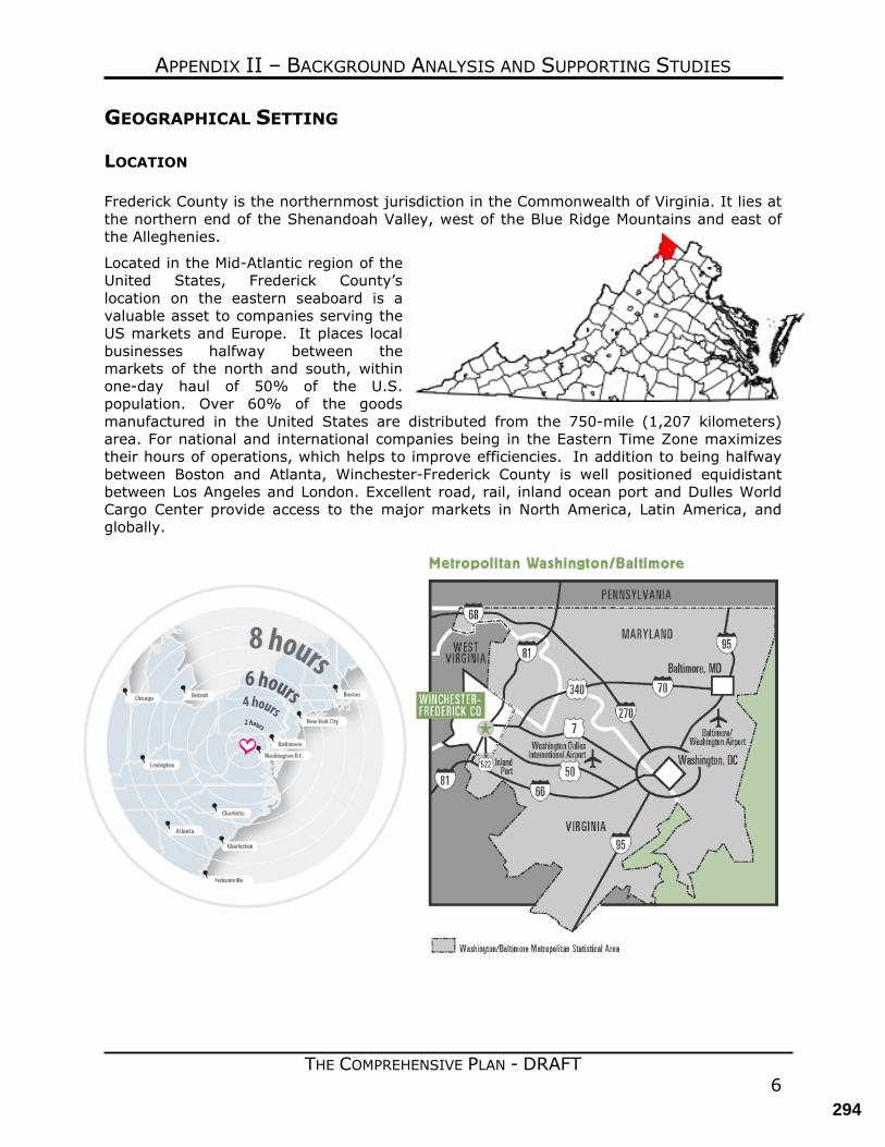
APPENDIX II – BACKGROUND ANALYSIS AND SUPPORTING STUDIES
THE COMPREHENSIVE PLAN - DRAFT 6
GEOGRAPHICAL SETTING LOCATION Frederick County is the northernmost jurisdiction in the Commonwealth of Virginia. It lies at the northern end of the Shenandoah Valley, west of the Blue Ridge Mountains and east of the Alleghenies.
Located in the Mid-Atlantic region of the United States, Frederick County’s location on the eastern seaboard is a valuable asset to companies serving the US markets and Europe. It places local businesses halfway between the markets of the north and south, within one-day haul of 50% of the U.S. population. Over 60% of the goods manufactured in the United States are distributed from the 750-mile (1,207 kilometers) area. For national and international companies being in the Eastern Time Zone maximizes their hours of operations, which helps to improve efficiencies. In addition to being halfway between Boston and Atlanta, Winchester-Frederick County is well positioned equidistant between Los Angeles and London. Excellent road, rail, inland ocean port and Dulles World Cargo Center provide access to the major markets in North America, Latin America, and globally.
294
APPENDIX II – BACKGROUND ANALYSIS AND SUPPORTING STUDIES
THE COMPREHENSIVE PLAN - DRAFT 7
TOPOGRAPHY Generally, the topography of Frederick County is characterized by the rolling Shenandoah Valley, 8 to 10 miles wide and on its west flank, mountains, ridges and valleys of the Appalachian system. Frederick County and the City of Winchester comprise 425 square miles; the City of Winchester occupies 9.23 square miles within the County’s boundaries. The average altitude of the broad valley is about 700 feet and that of the ridgetops and mountaintops is about 1,950 feet. The most prominent mountains are along the Virginia-West Virginia boundary, with Pinnacle Knob (2,844 feet) the highest point in the County. The lowest point in the County is about 500 feet. Handley Library, in the center of Winchester, is at 714 feet. Three aspects of the topography provide the area with a highly favorable visual environment. The Blue Ridge Mountains on the east serve both as a barrier to overly ambitious development from the Mid-Atlantic metropolitan area and provide a backdrop to a verdant landscape of farms and orchards. The easy rolling topography also provides character but is not an impediment to development. The easily traversed Valley and the fabled Shenandoah River defined the outstanding network of modern transportation providing easy accessibility to the most important North American cities. GEOPHYSICAL CHARACTERISTICS The County has three geophysical areas as shown on the Physical Characteristics and Geologic Formations map. The eastern area of the County is underlain by the Martinsburg shale which consists of a band running north-south along the length of the County, generally east of Interstate 81. It consists of broad, level ridges separated by steep stream valleys. The soils derived from the shales tend to be thin, poorly fertile, and have high seasonal water tables. The soils are highly compacted and not well suited for intensive agriculture or onsite sewage disposal systems. Primarily the historical use of this land is pasture and has in recent years been developed for residential and urban uses. Substantial suburban development served by public water and sewer is located within this area. The central area is located between Interstate 81 and Little North Mountain. It consists of a band approximately five miles wide that also trends southwest to northeast, is underlain by limestone/carbonate bedrock, and displays gently rolling karst topography. This area contains the bulk of the prime agricultural soils in the County and supports apple and other fruit production, beef cattle operations, and some crop production, primarily hay and corn. The western area is the Ridge and Valley which is underlain by a variety of shale, sandstone, and limestone formations. This mostly forested area consists of alternating valleys and ridges that run southwest to northeast. The western area is the Ridge and Valley which is underlain by a variety of shale, sandstone, and limestone formations. This mostly forested area consists of alternating valleys and ridges that run southwest to northeast. Ridges are often very steep and are the highest elevations in the County. Some stress fractures are present along the fold lines of the highly folded vertical beds. The vertical bedrock layers provide a barrier to most groundwater movement across the beds. Groundwater moves laterally along the folded bedrock, with little movement through the fold system.
295
APPENDIX II – BACKGROUND ANALYSIS AND SUPPORTING STUDIES
THE COMPREHENSIVE PLAN - DRAFT 8
These three geographic regions can be further divided into four distinct drainage areas. The southern third of the county drains towards the south and east to Cedar Creek and Stephens Run is in the Shenandoah River basin. The northern two-thirds of the County are divided north-south by Apple Pie Ridge, Round Hill and Little North Mountain forming the boundary between the Back Creek and Opequon Creek watersheds. These areas drain toward the north and the east, respectively, and are in the Potomac River Basin. The limestone-carbonate geology drains to the east, but includes random flow patterns throughout this topography, including some areas that are internally drained. Drainage areas provide a good basis for planning sewer and water service areas through gravity flow design. The movement of public sewage flow between the limestone-carbonate and the Ridge and Valley area requires pumping. Regional geophysical characteristics influence suitability for more intensive forms of development. Urban development is predominant in the eastern shale belt and uses public sewer and water facilities. Rural residential development is predominantly in the limestone belt west of Winchester, Interstate 81 and Route 37. Despite the presence of prime soils, agricultural land use in this area has decreased due to development pressures. The relatively steep areas in the western portions of the County remain rural; however, development is increasing. CLIMATE There are four distinct seasons. Few days fall near zero. Nine years in ten will have growing seasons from 148 to 219 days, depending on daily minimum temperature. The average number of growing degree days is 6,989.4, and the latest freeze (one year in ten; 28o or lower) is April 15th. Only two years in ten will have extreme temperatures of more than 103o or less than -10o F.
Average January temperature 31oF
Average July temperature 86oF
Average annual precipitation 37.56" inches
Average annual snowfall 22.5" inches
296
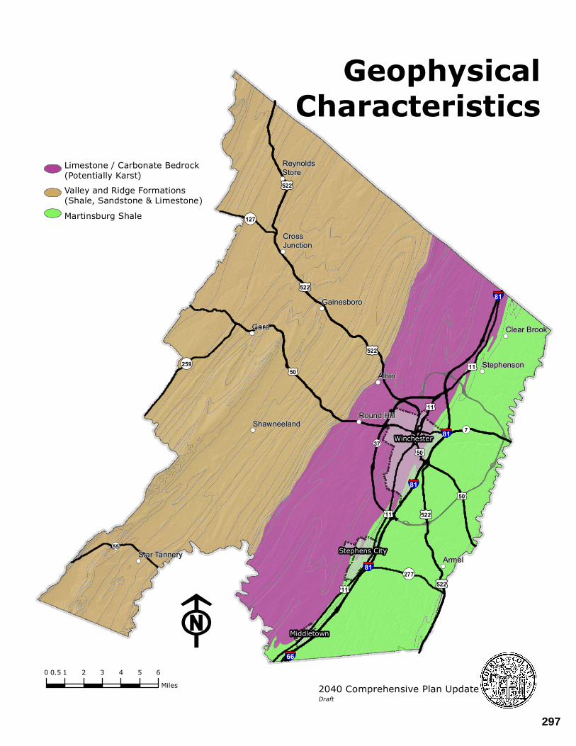
!((
!((
!((
!(( !((
!((
!((
!((
!((
!((!((
ReynoldsStore
CrossJunction
Gainesboro
Gore Clear Brook
StephensonAlbin
Round HillShawneeland
Star Tannery Armel
§¦81
§¦81
§¦81
§¦81
§¦66
£¤50
£¤522
£¤522
£¤11
£¤50
£¤522
£¤522
£¤11
£¤50
£¤11
£¤522
£¤11
¬«55
¬«259
¬«277
¬«127
¬«7
¬«37 Winchester
Middletown
Stephens City
F0 1 2 3 4 5 60.5
Miles
GeophysicalCharacteristics
Limestone / Carbonate Bedrock(Potentially Karst)
Valley and Ridge Formations(Shale, Sandstone & Limestone)
Martinsburg Shale
2040 Comprehensive Plan UpdateDraft
297

APPENDIX II – BACKGROUND ANALYSIS AND SUPPORTING STUDIES
THE COMPREHENSIVE PLAN - DRAFT 10
DEMOGRAPHIC AND TREND ANALYSIS OVERVIEW Demographic information is an important component in planning for future needs and services of the community. It is important to understand the state of the county today, what has shaped it through the years, and how it is likely to change over time. Demographic data is gathered from a range of Federal, State and local agencies. While the U.S. decennial census is the best-known survey method, the American Community Survey (ACS) and the Weldon Cooper Center for Public Service at the University of Virginia (Weldon Cooper Center) are also significant resources. The ACS is an ongoing nationwide survey conducted by the U.S. Census Bureau that collects annual data such as age, sex, race, family and relationships, income, and housing for jurisdictions with population above 65,000. The Weldon Cooper Center develops and releases the official population estimates for Virginia, its counties, and independent cities every year between decennial censuses. This section provides general information regarding historical, current, and projected populations, income, education, age, and diversity. HISTORICAL POPULATION Over the past three decades, Frederick County has experienced significant population growth. Between 1980 and 1990, the County saw a 40 percent increase in its population. Between 1990-2000 and 2000-2010, the County’s population continued to grow but at a slower rate of 24% and 32% respectively. Since 2010 Frederick County has grown by 14.7 percent, more than double the state average growth of 7.3 percent for the same period.
Source: Weldon Cooper Center for Public Service: July 1, 2020 Population Estimates for Virginia and its Counties and Cities (January 29, 2021)
Frederick County Population by Decade 1960-2020
12,94124,107
34,15047,723
59,209
78,30589,790
0
20,000
40,000
60,000
80,000
100,000
1960 1970 1980 1990 2000 2010 2020
298
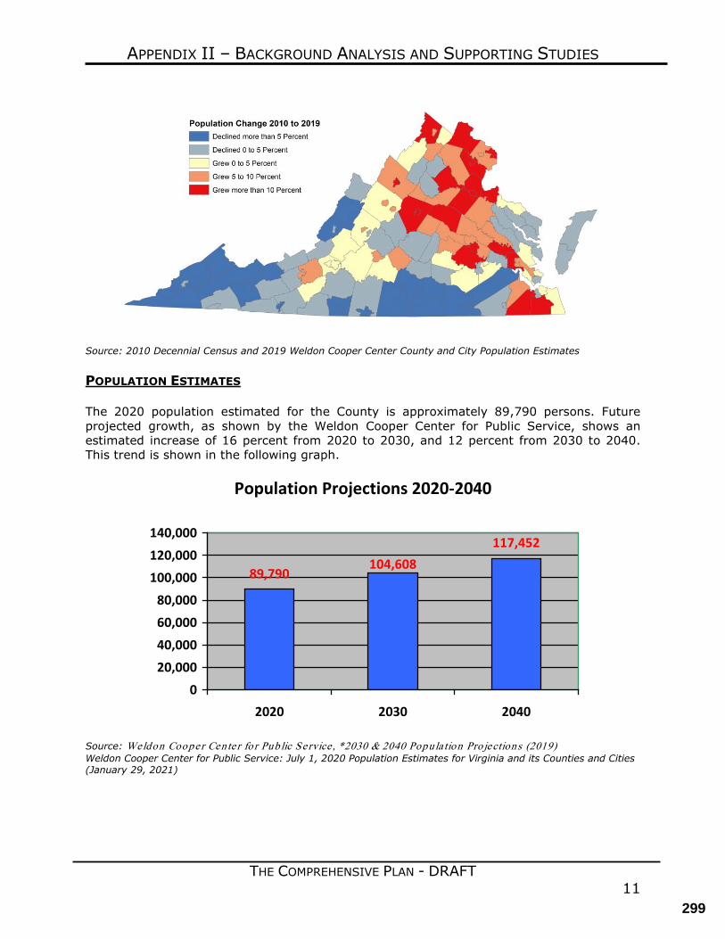
APPENDIX II – BACKGROUND ANALYSIS AND SUPPORTING STUDIES
THE COMPREHENSIVE PLAN - DRAFT 11
Source: 2010 Decennial Census and 2019 Weldon Cooper Center County and City Population Estimates POPULATION ESTIMATES The 2020 population estimated for the County is approximately 89,790 persons. Future projected growth, as shown by the Weldon Cooper Center for Public Service, shows an estimated increase of 16 percent from 2020 to 2030, and 12 percent from 2030 to 2040. This trend is shown in the following graph.
Population Projections 2020-2040
117,452104,608
89,790
0
20,00040,000
60,00080,000
100,000120,000140,000
2020 2030 2040
Source: Weldon Cooper Cente r fo r Public Service , *2030 & 2040 Popula tion Pro jections (2019) Weldon Cooper Center for Public Service: July 1, 2020 Population Estimates for Virginia and its Counties and Cities (January 29, 2021)
299
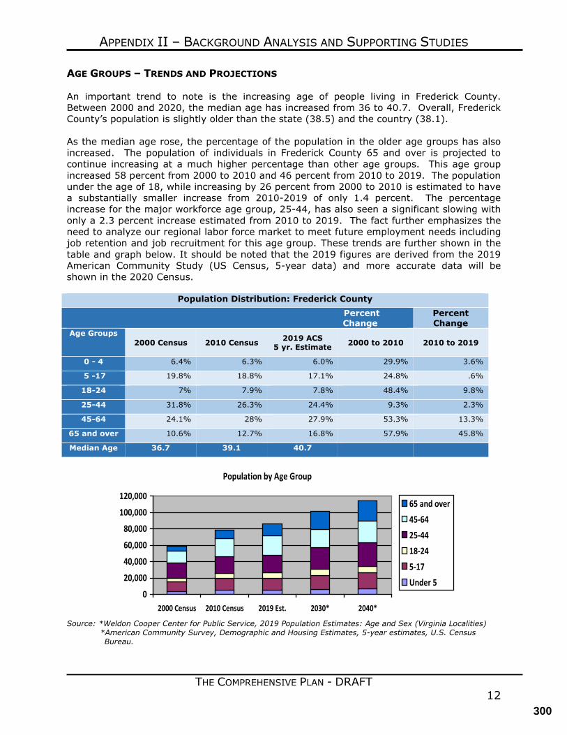
APPENDIX II – BACKGROUND ANALYSIS AND SUPPORTING STUDIES
THE COMPREHENSIVE PLAN - DRAFT 12
AGE GROUPS – TRENDS AND PROJECTIONS An important trend to note is the increasing age of people living in Frederick County. Between 2000 and 2020, the median age has increased from 36 to 40.7. Overall, Frederick County’s population is slightly older than the state (38.5) and the country (38.1). As the median age rose, the percentage of the population in the older age groups has also increased. The population of individuals in Frederick County 65 and over is projected to continue increasing at a much higher percentage than other age groups. This age group increased 58 percent from 2000 to 2010 and 46 percent from 2010 to 2019. The population under the age of 18, while increasing by 26 percent from 2000 to 2010 is estimated to have a substantially smaller increase from 2010-2019 of only 1.4 percent. The percentage increase for the major workforce age group, 25-44, has also seen a significant slowing with only a 2.3 percent increase estimated from 2010 to 2019. The fact further emphasizes the need to analyze our regional labor force market to meet future employment needs including job retention and job recruitment for this age group. These trends are further shown in the table and graph below. It should be noted that the 2019 figures are derived from the 2019 American Community Study (US Census, 5-year data) and more accurate data will be shown in the 2020 Census.
Population Distribution: Frederick County Percent Change
Percent Change
Age Groups 2000 Census 2010 Census 2019 ACS
5 yr. Estimate 2000 to 2010 2010 to 2019
0 - 4 6.4% 6.3% 6.0% 29.9% 3.6%
5 -17 19.8% 18.8% 17.1% 24.8% .6%
18-24 7% 7.9% 7.8% 48.4% 9.8%
25-44 31.8% 26.3% 24.4% 9.3% 2.3%
45-64 24.1% 28% 27.9% 53.3% 13.3%
65 and over 10.6% 12.7% 16.8% 57.9% 45.8%
Median Age 36.7 39.1 40.7
Population by Age Group
0
20,000
40,000
60,000
80,000
100,000
120,000
2000 Census 2010 Census 2019 Est. 2030* 2040*
65 and over45-6425-4418-245-17Under 5
Source: *Weldon Cooper Center for Public Service, 2019 Population Estimates: Age and Sex (Virginia Localities)
*American Community Survey, Demographic and Housing Estimates, 5-year estimates, U.S. Census Bureau.
300
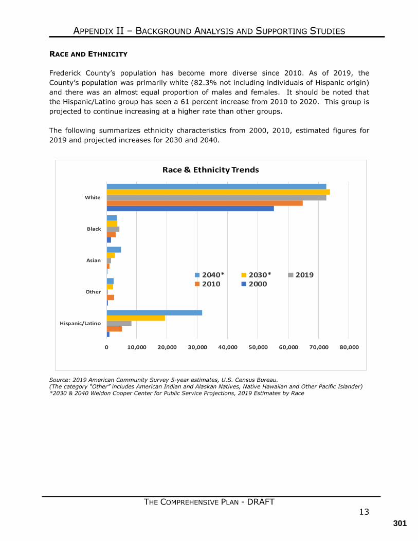
APPENDIX II – BACKGROUND ANALYSIS AND SUPPORTING STUDIES
THE COMPREHENSIVE PLAN - DRAFT 13
RACE AND ETHNICITY Frederick County’s population has become more diverse since 2010. As of 2019, the County’s population was primarily white (82.3% not including individuals of Hispanic origin) and there was an almost equal proportion of males and females. It should be noted that the Hispanic/Latino group has seen a 61 percent increase from 2010 to 2020. This group is projected to continue increasing at a higher rate than other groups. The following summarizes ethnicity characteristics from 2000, 2010, estimated figures for 2019 and projected increases for 2030 and 2040.
Source: 2019 American Community Survey 5-year estimates, U.S. Census Bureau. (The category “Other” includes American Indian and Alaskan Natives, Native Hawaiian and Other Pacific Islander) *2030 & 2040 Weldon Cooper Center for Public Service Projections, 2019 Estimates by Race
0 10,000 20,000 30,000 40,000 50,000 60,000 70,000 80,000
Hispanic/Latino
Other
Asian
Black
White
Race & Ethnicity Trends
2040* 2030* 20192010 2000
301
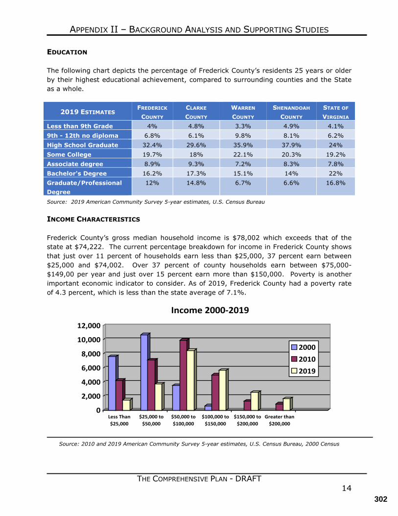
APPENDIX II – BACKGROUND ANALYSIS AND SUPPORTING STUDIES
THE COMPREHENSIVE PLAN - DRAFT 14
EDUCATION The following chart depicts the percentage of Frederick County’s residents 25 years or older by their highest educational achievement, compared to surrounding counties and the State as a whole.
2019 ESTIMATES FREDERICK COUNTY
CLARKE COUNTY
WARREN
COUNTY SHENANDOAH
COUNTY STATE OF
VIRGINIA Less than 9th Grade 4% 4.8% 3.3% 4.9% 4.1% 9th - 12th no diploma 6.8% 6.1% 9.8% 8.1% 6.2% High School Graduate 32.4% 29.6% 35.9% 37.9% 24% Some College 19.7% 18% 22.1% 20.3% 19.2% Associate degree 8.9% 9.3% 7.2% 8.3% 7.8% Bachelor's Degree 16.2% 17.3% 15.1% 14% 22% Graduate/Professional Degree
12% 14.8% 6.7% 6.6% 16.8%
Source: 2019 American Community Survey 5-year estimates, U.S. Census Bureau INCOME CHARACTERISTICS Frederick County’s gross median household income is $78,002 which exceeds that of the state at $74,222. The current percentage breakdown for income in Frederick County shows that just over 11 percent of households earn less than $25,000, 37 percent earn between $25,000 and $74,002. Over 37 percent of county households earn between $75,000-$149,00 per year and just over 15 percent earn more than $150,000. Poverty is another important economic indicator to consider. As of 2019, Frederick County had a poverty rate of 4.3 percent, which is less than the state average of 7.1%.
0
2,000
4,000
6,000
8,000
10,000
12,000
Less Than$25,000
$25,000 to$50,000
$50,000 to$100,000
$100,000 to$150,000
$150,000 to$200,000
Greater than$200,000
Income 2000-2019
200020102019
Source: 2010 and 2019 American Community Survey 5-year estimates, U.S. Census Bureau, 2000 Census
302
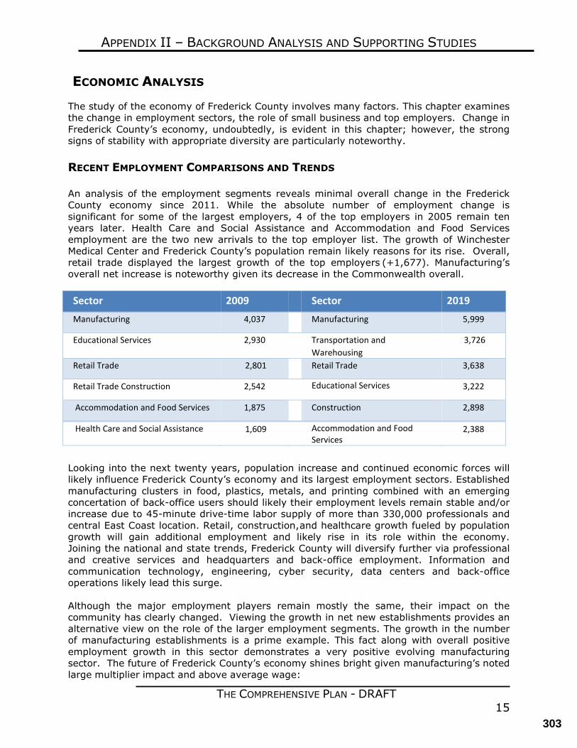
THE COMPREHENSIVE PLAN - DRAFT 15
APPENDIX II – BACKGROUND ANALYSIS AND SUPPORTING STUDIES
ECONOMIC ANALYSIS The study of the economy of Frederick County involves many factors. This chapter examines the change in employment sectors, the role of small business and top employers. Change in Frederick County’s economy, undoubtedly, is evident in this chapter; however, the strong signs of stability with appropriate diversity are particularly noteworthy. RECENT EMPLOYMENT COMPARISONS AND TRENDS An analysis of the employment segments reveals minimal overall change in the Frederick County economy since 2011. While the absolute number of employment change is significant for some of the largest employers, 4 of the top employers in 2005 remain ten years later. Health Care and Social Assistance and Accommodation and Food Services employment are the two new arrivals to the top employer list. The growth of Winchester Medical Center and Frederick County’s population remain likely reasons for its rise. Overall, retail trade displayed the largest growth of the top employers (+1,677). Manufacturing’s overall net increase is noteworthy given its decrease in the Commonwealth overall. Sector 2009 Sector 2019 Manufacturing 4,037 Manufacturing 5,999
Educational Services 2,930 Transportation and Warehousing
3,726
Retail Trade 2,801 Retail Trade 3,638
Retail Trade Construction 2,542 Educational Services 3,222
Accommodation and Food Services 1,875 Construction 2,898
Health Care and Social Assistance 1,609 Accommodation and Food Services
2,388
Looking into the next twenty years, population increase and continued economic forces will likely influence Frederick County’s economy and its largest employment sectors. Established manufacturing clusters in food, plastics, metals, and printing combined with an emerging concertation of back-office users should likely their employment levels remain stable and/or increase due to 45-minute drive-time labor supply of more than 330,000 professionals and central East Coast location. Retail, construction, and healthcare growth fueled by population growth will gain additional employment and likely rise in its role within the economy. Joining the national and state trends, Frederick County will diversify further via professional and creative services and headquarters and back-office employment. Information and communication technology, engineering, cyber security, data centers and back-office operations likely lead this surge. Although the major employment players remain mostly the same, their impact on the community has clearly changed. Viewing the growth in net new establishments provides an alternative view on the role of the larger employment segments. The growth in the number of manufacturing establishments is a prime example. This fact along with overall positive employment growth in this sector demonstrates a very positive evolving manufacturing sector. The future of Frederick County’s economy shines bright given manufacturing’s noted large multiplier impact and above average wage:
303
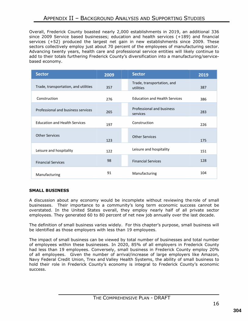
THE COMPREHENSIVE PLAN - DRAFT 16
APPENDIX II – BACKGROUND ANALYSIS AND SUPPORTING STUDIES
Overall, Frederick County boasted nearly 2,000 establishments in 2019, an additional 336 since 2009 Service based businesses; education and health services (+189) and financial services (+52) produced the largest net gain in new establishments since 2009. These sectors collectively employ just about 70 percent of the employees of manufacturing sector. Advancing twenty years, health care and professional service entities will likely continue to add to their totals furthering Frederick County’s diversification into a manufacturing/service-based economy.
SMALL BUSINESS A discussion about any economy would be incomplete without reviewing the role of small businesses. Their importance to a community’s long term economic success cannot be overstated. In the United States overall, they employ nearly half of all private sector employees. They generated 60 to 80 percent of net new job annually over the last decade. The definition of small business varies widely. For this chapter’s purpose, small business will be identified as those employers with less than 19 employees. The impact of small business can be viewed by total number of businesses and total number of employees within these businesses. In 2020, 85% of all employers in Frederick County had less than 19 employees. Conversely, small business in Frederick County employ 20% of all employees. Given the number of arrival/increase of large employers like Amazon, Navy Federal Credit Union, Trex and Valley Health Systems, the ability of small business to hold their role in Frederick County’s economy is integral to Frederick County’s economic success.
Sector 2009 Sector 2019
Trade, transportation, and utilities
357 Trade, transportation, and utilities
387
Construction
276 Education and Health Services
386
Professional and business services
265 Professional and business services
283
Education and Health Services
197 Construction
226
Other Services
123 Other Services
175
Leisure and hospitality
122 Leisure and hospitality
151
Financial Services 98 Financial Services 128
Manufacturing 91 Manufacturing 104
304
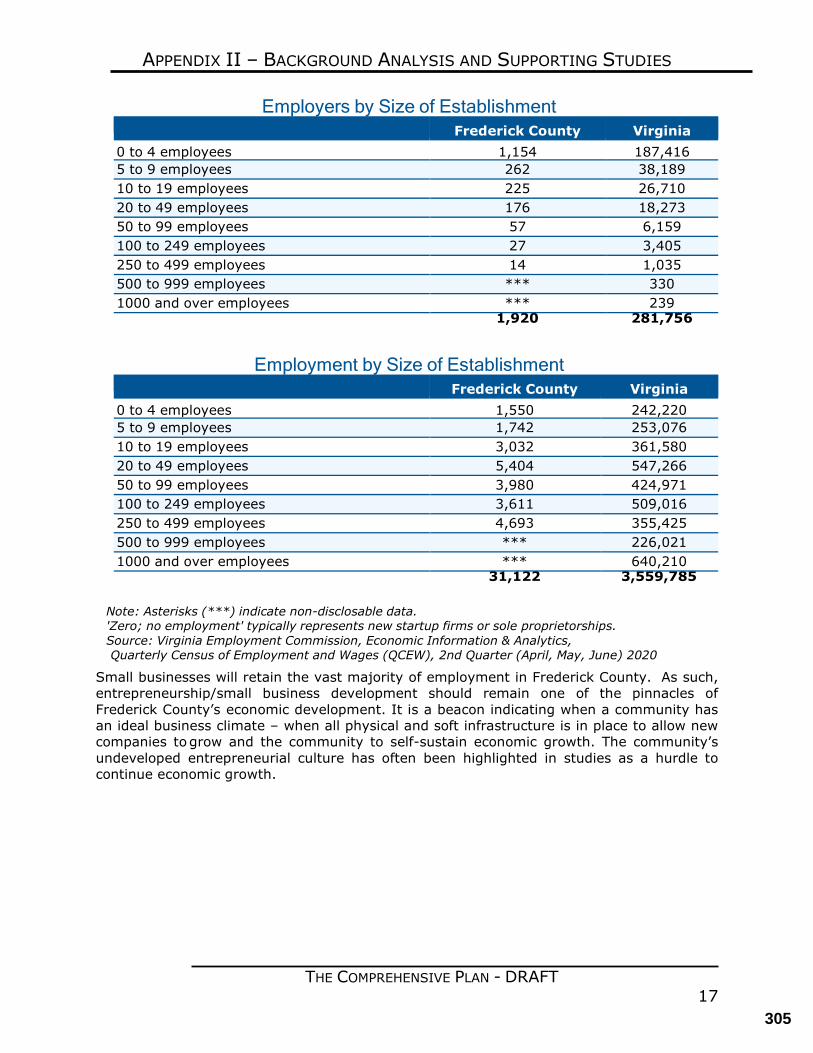
THE COMPREHENSIVE PLAN - DRAFT 17
APPENDIX II – BACKGROUND ANALYSIS AND SUPPORTING STUDIES
Employers by Size of Establishment Frederick County Virginia 0 to 4 employees 1,154 187,416 5 to 9 employees 262 38,189 10 to 19 employees 225 26,710 20 to 49 employees 176 18,273 50 to 99 employees 57 6,159 100 to 249 employees 27 3,405 250 to 499 employees 14 1,035 500 to 999 employees *** 330 1000 and over employees *** 239 1,920 281,756
Employment by Size of Establishment
Frederick County Virginia 0 to 4 employees 1,550 242,220 5 to 9 employees 1,742 253,076 10 to 19 employees 3,032 361,580 20 to 49 employees 5,404 547,266 50 to 99 employees 3,980 424,971 100 to 249 employees 3,611 509,016 250 to 499 employees 4,693 355,425 500 to 999 employees *** 226,021 1000 and over employees *** 640,210 31,122 3,559,785
Note: Asterisks (***) indicate non-disclosable data. 'Zero; no employment' typically represents new startup firms or sole proprietorships. Source: Virginia Employment Commission, Economic Information & Analytics, Quarterly Census of Employment and Wages (QCEW), 2nd Quarter (April, May, June) 2020
Small businesses will retain the vast majority of employment in Frederick County. As such, entrepreneurship/small business development should remain one of the pinnacles of Frederick County’s economic development. It is a beacon indicating when a community has an ideal business climate – when all physical and soft infrastructure is in place to allow new companies to grow and the community to self-sustain economic growth. The community’s undeveloped entrepreneurial culture has often been highlighted in studies as a hurdle to continue economic growth.
305
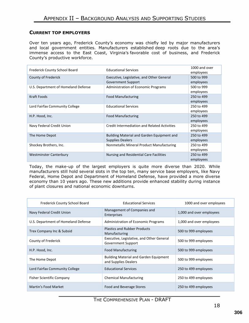
THE COMPREHENSIVE PLAN - DRAFT 18
APPENDIX II – BACKGROUND ANALYSIS AND SUPPORTING STUDIES
CURRENT TOP EMPLOYERS
Over ten years ago, Frederick County’s economy was chiefly led by major manufacturers and local government entities. Manufacturers established deep roots due to the area’s immense access to the East Coast, Virginia’s favorable cost of business, and Frederick County’s productive workforce.
Frederick County School Board Educational Services 1000 and over employees
County of Frederick Executive, Legislative, and Other General Government Support
500 to 999 employees
U.S. Department of Homeland Defense Administration of Economic Programs 500 to 999 employees
Kraft Foods Food Manufacturing 250 to 499 employees
Lord Fairfax Community College Educational Services 250 to 499 employees
H.P. Hood, Inc. Food Manufacturing 250 to 499 employees
Navy Federal Credit Union Credit Intermediation and Related Activities 250 to 499 employees
The Home Depot Building Material and Garden Equipment and Supplies Dealers
250 to 499 employees
Shockey Brothers, Inc. Nonmetallic Mineral Product Manufacturing 250 to 499 employees
Westminster Canterbury Nursing and Residential Care Facilities 250 to 499 employees
Today, the make-up of the largest employers is quite more diverse than 2020. While manufacturers still hold several slots in the top ten, many service base employers, like Navy Federal, Home Depot and Department of Homeland Defense, have provided a more diverse economy than 10 years ago. These new additions provide enhanced stability during instance of plant closures and national economic downturns.
Frederick County School Board Educational Services 1000 and over employees
Navy Federal Credit Union Management of Companies and Enterprises 1,000 and over employees
U.S. Department of Homeland Defense Administration of Economic Programs 1,000 and over employees
Trex Company Inc & Subsid Plastics and Rubber Products Manufacturing 500 to 999 employees
County of Frederick Executive, Legislative, and Other General Government Support 500 to 999 employees
H.P. Hood, Inc. Food Manufacturing 500 to 999 employees
The Home Depot Building Material and Garden Equipment and Supplies Dealers 500 to 999 employees
Lord Fairfax Community College Educational Services 250 to 499 employees
Fisher Scientific Company Chemical Manufacturing 250 to 499 employees
Martin's Food Market Food and Beverage Stores 250 to 499 employees
306
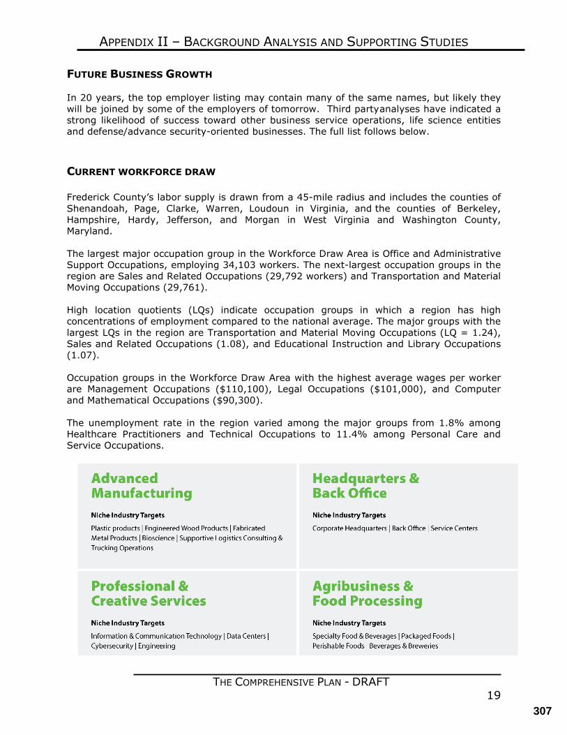
THE COMPREHENSIVE PLAN - DRAFT 19
APPENDIX II – BACKGROUND ANALYSIS AND SUPPORTING STUDIES
FUTURE BUSINESS GROWTH
In 20 years, the top employer listing may contain many of the same names, but likely they will be joined by some of the employers of tomorrow. Third party analyses have indicated a strong likelihood of success toward other business service operations, life science entities and defense/advance security-oriented businesses. The full list follows below.
CURRENT WORKFORCE DRAW Frederick County’s labor supply is drawn from a 45-mile radius and includes the counties of Shenandoah, Page, Clarke, Warren, Loudoun in Virginia, and the counties of Berkeley, Hampshire, Hardy, Jefferson, and Morgan in West Virginia and Washington County, Maryland. The largest major occupation group in the Workforce Draw Area is Office and Administrative Support Occupations, employing 34,103 workers. The next-largest occupation groups in the region are Sales and Related Occupations (29,792 workers) and Transportation and Material Moving Occupations (29,761). High location quotients (LQs) indicate occupation groups in which a region has high concentrations of employment compared to the national average. The major groups with the largest LQs in the region are Transportation and Material Moving Occupations (LQ = 1.24), Sales and Related Occupations (1.08), and Educational Instruction and Library Occupations (1.07). Occupation groups in the Workforce Draw Area with the highest average wages per worker are Management Occupations ($110,100), Legal Occupations ($101,000), and Computer and Mathematical Occupations ($90,300). The unemployment rate in the region varied among the major groups from 1.8% among Healthcare Practitioners and Technical Occupations to 11.4% among Personal Care and Service Occupations.
307
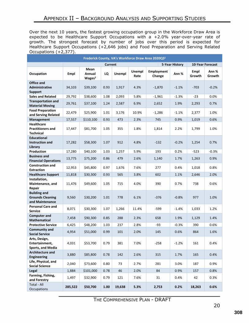
THE COMPREHENSIVE PLAN - DRAFT 20
APPENDIX II – BACKGROUND ANALYSIS AND SUPPORTING STUDIES
Over the next 10 years, the fastest growing occupation group in the Workforce Draw Area is expected to be Healthcare Support Occupations with a +2.0% year-over-year rate of growth. The strongest forecast by number of jobs over this period is expected for Healthcare Support Occupations (+2,646 jobs) and Food Preparation and Serving Related Occupations (+2,377).
Frederick County, VA’s Workforce Draw Area 2020Q31
Current 5-Year History 10-Year Forecast
Occupation Empl Mean
Annual Wages2
LQ Unempl Unempl Rate
Employment Change Ann % Empl
Growth Ann %
Growth
Office and Administrative Support
34,103 $39,100 0.93 1,917 4.3% -1,870 -1.1% -703 -0.2%
Sales and Related 29,792 $38,600 1.08 2,093 5.8% -1,961 -1.3% -23 0.0% Transportation and Material Moving 29,761 $37,100 1.24 2,587 6.9% 2,652 1.9% 2,293 0.7%
Food Preparation and Serving Related 22,479 $25,900 1.01 3,176 10.9% -1,286 -1.1% 2,377 1.0%
Management 17,557 $110,100 0.93 473 2.3% 745 0.9% 1,019 0.6% Healthcare Practitioners and Technical
17,447 $81,700 1.05 355 1.8% 1,814 2.2% 1,799 1.0%
Educational Instruction and Library
17,282 $58,300 1.07 912 4.8% -132 -0.2% 1,254 0.7%
Production 17,280 $40,100 1.03 1,257 5.9% 193 0.2% -523 -0.3% Business and Financial Operations 13,775 $75,200 0.86 479 2.6% 1,140 1.7% 1,263 0.9%
Construction and Extraction 12,953 $45,800 0.97 1,676 7.6% 277 0.4% 1,018 0.8%
Healthcare Support 11,818 $30,300 0.93 565 3.8% 602 1.1% 2,646 2.0% Installation, Maintenance, and Repair
11,476 $49,600 1.05 715 4.0% 390 0.7% 738 0.6%
Building and Grounds Cleaning and Maintenance
9,560 $30,200 1.01 778 6.1% -376 -0.8% 977 1.0%
Personal Care and Service 8,071 $30,300 1.07 1,266 11.4% -599 -1.4% 1,033 1.2%
Computer and Mathematical 7,458 $90,300 0.85 288 2.3% 658 1.9% 1,129 1.4%
Protective Service 6,425 $48,200 1.03 237 2.8% -93 -0.3% 390 0.6% Community and Social Service 4,954 $51,000 0.99 101 2.0% 145 0.6% 864 1.6%
Arts, Design, Entertainment, Sports, and Media
4,031 $53,700 0.79 381 7.0% -258 -1.2% 161 0.4%
Architecture and Engineering 3,880 $85,800 0.78 142 2.6% 315 1.7% 165 0.4%
Life, Physical, and Social Science 2,040 $73,600 0.80 73 2.7% 281 3.0% 187 0.9%
Legal 1,884 $101,000 0.78 46 2.0% 84 0.9% 157 0.8% Farming, Fishing, and Forestry 1,497 $32,900 0.79 121 7.6% 31 0.4% 42 0.3%
Total - All Occupations 285,522 $50,700 1.00 19,638 5.3% 2,753 0.2% 18,263 0.6%
308
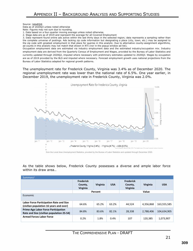
THE COMPREHENSIVE PLAN - DRAFT 21
APPENDIX II – BACKGROUND ANALYSIS AND SUPPORTING STUDIES
Source: JobsEQ® Data as of 2020Q3 unless noted otherwise Note: Figures may not sum due to rounding. 1. Data based on a four-quarter moving average unless noted otherwise. 2. Wage data are as of 2019 and represent the average for all Covered Employment 3. Data represent found online ads active within the last thirty days in the selected region; data represents a sampling rather than the complete universe of postings. Ads lacking zip code information but designating a place (city, town, etc.) may be assigned to the zip code with greatest employment in that place for queries in this analytic. Due to alternative county-assignment algorithms, ad counts in this analytic may not match that shown in RTI (nor in the popup window ad list). Occupation employment data are estimated via industry employment data and the estimated industry/occupation mix. Industry employment data are derived from the Quarterly Census of Employment and Wages, provided by the Bureau of Labor Statistics and currently updated through 2020Q2, imputed where necessary with preliminary estimates updated to 2020Q3. Wages by occupation are as of 2019 provided by the BLS and imputed where necessary. Forecast employment growth uses national projections from the Bureau of Labor Statistics adapted for regional growth patterns.
The unemployment rate for Frederick County, Virginia was 3.4% as of December 2020. The regional unemployment rate was lower than the national rate of 6.5%. One year earlier, in December 2019, the unemployment rate in Frederick County, Virginia was 2.0%.
Unemployment rate data are from the Local Area Unemployment Statistics, provided by the Bureau of Labor Statistics and updated through December 2020.
As the table shows below, Frederick County possesses a diverse and ample labor force within its draw area.. Summary1
Frederick County, Virginia
Virginia USA Frederick County, Virginia
Virginia USA
Percent Value Economic Labor Force Participation Rate and Size (civilian population 16 years and over) 64.6% 65.2% 63.2% 44,524 4,356,868 163,555,585
Prime-Age Labor Force Participation Rate and Size (civilian population 25-54) 84.8% 83.6% 82.1% 28,338 2,788,406 104,634,905
Armed Forces Labor Force 0.2% 1.8% 0.4% 107 120,385 1,073,907
309
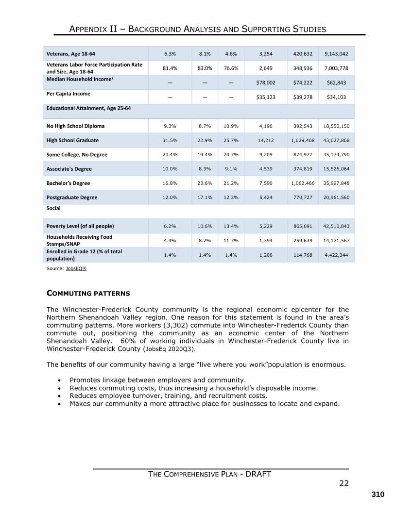
THE COMPREHENSIVE PLAN - DRAFT 22
APPENDIX II – BACKGROUND ANALYSIS AND SUPPORTING STUDIES
Veterans, Age 18-64 6.3% 8.1% 4.6% 3,254 420,632 9,143,042
Veterans Labor Force Participation Rate and Size, Age 18-64 81.4% 83.0% 76.6% 2,649 348,936 7,003,778
Median Household Income2
— — — $78,002 $74,222 $62,843
Per Capita Income — — — $35,123 $39,278 $34,103
Educational Attainment, Age 25-64
No High School Diploma 9.3% 8.7% 10.9% 4,196 392,543 18,550,150
High School Graduate 31.5% 22.9% 25.7% 14,212 1,029,408 43,627,868
Some College, No Degree 20.4% 19.4% 20.7% 9,209 874,977 35,174,790
Associate's Degree 10.0% 8.3% 9.1% 4,539 374,819 15,526,064
Bachelor's Degree 16.8% 23.6% 21.2% 7,590 1,062,466 35,997,848
Postgraduate Degree 12.0% 17.1% 12.3% 5,424 770,727 20,961,560
Social
Poverty Level (of all people) 6.2% 10.6% 13.4% 5,229 865,691 42,510,843
Households Receiving Food Stamps/SNAP
4.4% 8.2% 11.7% 1,394 259,639 14,171,567
Enrolled in Grade 12 (% of total population)
1.4% 1.4% 1.4% 1,206 114,768 4,422,344
Source: JobsEQ® COMMUTING PATTERNS
The Winchester-Frederick County community is the regional economic epicenter for the Northern Shenandoah Valley region. One reason for this statement is found in the area’s commuting patterns. More workers (3,302) commute into Winchester-Frederick County than commute out, positioning the community as an economic center of the Northern Shenandoah Valley. 60% of working individuals in Winchester-Frederick County live in Winchester-Frederick County (JobsEq 2020Q3). The benefits of our community having a large “live where you work” population is enormous.
• Promotes linkage between employers and community. • Reduces commuting costs, thus increasing a household’s disposable income. • Reduces employee turnover, training, and recruitment costs. • Makes our community a more attractive place for businesses to locate and expand.
310
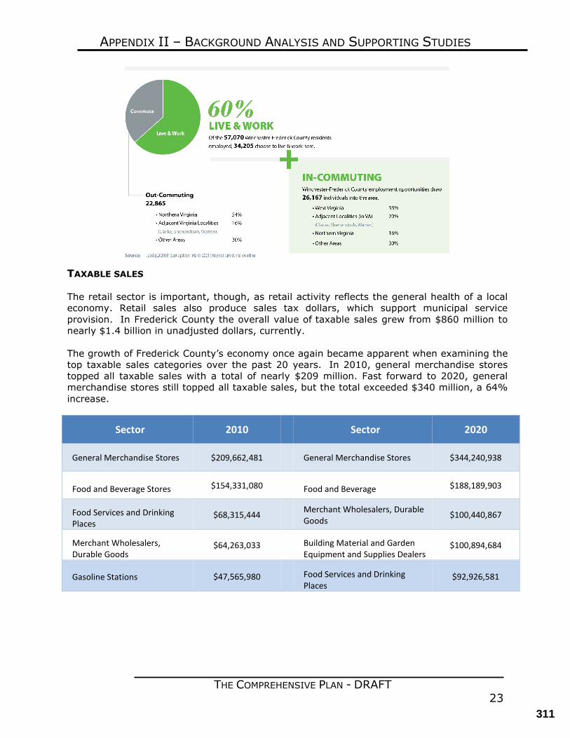
THE COMPREHENSIVE PLAN - DRAFT 23
APPENDIX II – BACKGROUND ANALYSIS AND SUPPORTING STUDIES
TAXABLE SALES
The retail sector is important, though, as retail activity reflects the general health of a local economy. Retail sales also produce sales tax dollars, which support municipal service provision. In Frederick County the overall value of taxable sales grew from $860 million to nearly $1.4 billion in unadjusted dollars, currently. The growth of Frederick County’s economy once again became apparent when examining the top taxable sales categories over the past 20 years. In 2010, general merchandise stores topped all taxable sales with a total of nearly $209 million. Fast forward to 2020, general merchandise stores still topped all taxable sales, but the total exceeded $340 million, a 64% increase.
Sector 2010 Sector 2020
General Merchandise Stores $209,662,481
General Merchandise Stores $344,240,938
Food and Beverage Stores $154,331,080
Food and Beverage $188,189,903
Food Services and Drinking Places
$68,315,444 Merchant Wholesalers, Durable
Goods $100,440,867
Merchant Wholesalers, Durable Goods
$64,263,033
Building Material and Garden Equipment and Supplies Dealers
$100,894,684
Gasoline Stations $47,565,980
Food Services and Drinking Places
$92,926,581
311
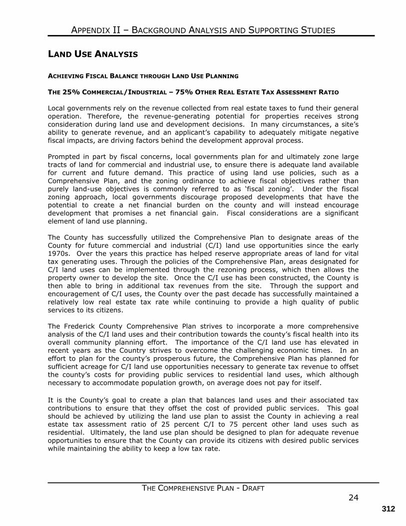
APPENDIX II – BACKGROUND ANALYSIS AND SUPPORTING STUDIES
THE COMPREHENSIVE PLAN - DRAFT 24
LAND USE ANALYSIS ACHIEVING FISCAL BALANCE THROUGH LAND USE PLANNING THE 25% COMMERCIAL/INDUSTRIAL – 75% OTHER REAL ESTATE TAX ASSESSMENT RATIO Local governments rely on the revenue collected from real estate taxes to fund their general operation. Therefore, the revenue-generating potential for properties receives strong consideration during land use and development decisions. In many circumstances, a site’s ability to generate revenue, and an applicant’s capability to adequately mitigate negative fiscal impacts, are driving factors behind the development approval process. Prompted in part by fiscal concerns, local governments plan for and ultimately zone large tracts of land for commercial and industrial use, to ensure there is adequate land available for current and future demand. This practice of using land use policies, such as a Comprehensive Plan, and the zoning ordinance to achieve fiscal objectives rather than purely land-use objectives is commonly referred to as ‘fiscal zoning’. Under the fiscal zoning approach, local governments discourage proposed developments that have the potential to create a net financial burden on the county and will instead encourage development that promises a net financial gain. Fiscal considerations are a significant element of land use planning. The County has successfully utilized the Comprehensive Plan to designate areas of the County for future commercial and industrial (C/I) land use opportunities since the early 1970s. Over the years this practice has helped reserve appropriate areas of land for vital tax generating uses. Through the policies of the Comprehensive Plan, areas designated for C/I land uses can be implemented through the rezoning process, which then allows the property owner to develop the site. Once the C/I use has been constructed, the County is then able to bring in additional tax revenues from the site. Through the support and encouragement of C/I uses, the County over the past decade has successfully maintained a relatively low real estate tax rate while continuing to provide a high quality of public services to its citizens. The Frederick County Comprehensive Plan strives to incorporate a more comprehensive analysis of the C/I land uses and their contribution towards the county’s fiscal health into its overall community planning effort. The importance of the C/I land use has elevated in recent years as the Country strives to overcome the challenging economic times. In an effort to plan for the county’s prosperous future, the Comprehensive Plan has planned for sufficient acreage for C/I land use opportunities necessary to generate tax revenue to offset the county’s costs for providing public services to residential land uses, which although necessary to accommodate population growth, on average does not pay for itself. It is the County’s goal to create a plan that balances land uses and their associated tax contributions to ensure that they offset the cost of provided public services. This goal should be achieved by utilizing the land use plan to assist the County in achieving a real estate tax assessment ratio of 25 percent C/I to 75 percent other land uses such as residential. Ultimately, the land use plan should be designed to plan for adequate revenue opportunities to ensure that the County can provide its citizens with desired public services while maintaining the ability to keep a low tax rate.
312
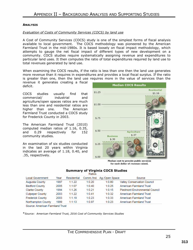
APPENDIX II – BACKGROUND ANALYSIS AND SUPPORTING STUDIES
THE COMPREHENSIVE PLAN - DRAFT 25
ANALYSIS Evaluation of Costs of Community Services (COCS) by land use A Cost of Community Services (COCS) study is one of the simplest forms of fiscal analysis available to local government. The COCS methodology was pioneered by the American Farmland Trust in the mid-1980s. It is based loosely on fiscal impact methodology, which attempts to gauge the net fiscal impact of different types of new development on a community. COCS studies require systematically assigning revenue and expenditures to particular land uses. It then computes the ratio of total expenditures required by land use to total revenues generated by land use. When examining the COCS results, if the ratio is less than one then the land use generates more revenue than it requires in expenditures and provides a local fiscal surplus. If the ratio is greater than one, then the land use requires more in the value of services than the revenue it generates creating a fiscal deficit. COCS studies usually find that commercial/ industrial and agriculture/open spaces ratios are much less than one and residential ratios are higher than one. The American Farmland Trust conducted a COCS study for Frederick County in 2003. The American Farmland Trust (2010) computed median ratios of 1.16, 0.35, and 0.29 respectively for 152 community studies. An examination of six studies conducted in the last 20 years within Virginia indicates an average of 1.18, 0.40, and .35, respectively.
Summary of Virginia COCS Studies
*Source: American Farmland Trust, 2016 Cost of Community Services Studies
313
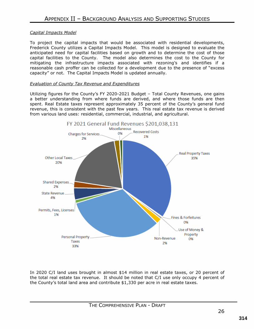
APPENDIX II – BACKGROUND ANALYSIS AND SUPPORTING STUDIES
THE COMPREHENSIVE PLAN - DRAFT 26
Capital Impacts Model To project the capital impacts that would be associated with residential developments, Frederick County utilizes a Capital Impacts Model. This model is designed to evaluate the anticipated need for capital facilities based on growth and to determine the cost of those capital facilities to the County. The model also determines the cost to the County for mitigating the infrastructure impacts associated with rezoning’s and identifies if a reasonable cash proffer can be collected for a development due to the presence of “excess capacity” or not. The Capital Impacts Model is updated annually. Evaluation of County Tax Revenue and Expenditures Utilizing figures for the County’s FY 2020-2021 Budget – Total County Revenues, one gains a better understanding from where funds are derived, and where those funds are then spent. Real Estate taxes represent approximately 35 percent of the County’s general fund revenue, this is consistent with the past few years. This real estate tax revenue is derived from various land uses: residential, commercial, industrial, and agricultural.
In 2020 C/I land uses brought in almost $14 million in real estate taxes, or 20 percent of the total real estate tax revenue. It should be noted that C/I use only occupy 4 percent of the County’s total land area and contribute $1,330 per acre in real estate taxes.
314
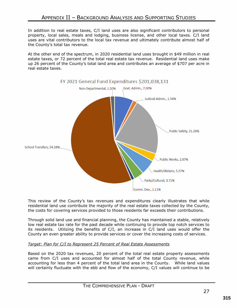
APPENDIX II – BACKGROUND ANALYSIS AND SUPPORTING STUDIES
THE COMPREHENSIVE PLAN - DRAFT 27
In addition to real estate taxes, C/I land uses are also significant contributors to personal property, local sales, meals and lodging, business license, and other local taxes. C/I land uses are vital contributors to the local tax revenue and ultimately contribute almost half of the County’s total tax revenue. At the other end of the spectrum, in 2020 residential land uses brought in $49 million in real estate taxes, or 72 percent of the total real estate tax revenue. Residential land uses make up 26 percent of the County’s total land area and contributes an average of $707 per acre in real estate taxes.
This review of the County’s tax revenues and expenditures clearly illustrates that while residential land use contribute the majority of the real estate taxes collected by the County, the costs for covering services provided to those residents far exceeds their contributions. Through solid land use and financial planning, the County has maintained a stable, relatively low real estate tax rate for the past decade while continuing to provide top notch services to its residents. Utilizing the benefits of C/I, an increase in C/I land uses would offer the County an even greater ability to provide services or cover the increasing costs of services. Target: Plan for C/I to Represent 25 Percent of Real Estate Assessments Based on the 2020 tax revenues, 20 percent of the total real estate property assessments came from C/I uses and accounted for almost half of the total County revenue, while accounting for less than 4 percent of the total land area in the County. While land values will certainly fluctuate with the ebb and flow of the economy, C/I values will continue to be
315
APPENDIX II – BACKGROUND ANALYSIS AND SUPPORTING STUDIES
THE COMPREHENSIVE PLAN - DRAFT 28
significant contributors to the county’s tax base and more importantly, C/I tax contributions will offset the residential land use cost for services. The Comprehensive Plan strives to achieve a balance of land uses to achieve the target policy of ensuring that 25 percent of the projected assessments will be from C/I land uses. The Plan also incorporates opportunities for mixed use developments and single-family residential uses. The policy of directing residential growth into the UDA also promotes a more efficient use of land and community services, ultimately offering additional cost savings to the county. Opportunities for mixed use developments offer additional revenues to address the demands for services generated by the residential uses. These projects include an appropriate mix of commercial, office, and residential development. They provide an efficient development pattern that can foster economic development, provide diversity in land use, and reduce the number and the length of automobile trips. These mixed uses projects are encouraged in appropriate locations in the Comprehensive Plan. CONCLUSION The land use designations and policies contained within the Comprehensive Plan accommodate the goal of providing 25 percent C/I land uses to 75 percent Other land uses. Maintaining a healthy C/I ratio will help the County maintain its current tax rates while continuing to enhance the services provided the residents. To reinforce a sound policy basis that balances land use planning and fiscal policies, the ratio of 25/75 between C/I and other land uses in terms of available land areas and taxable value of the land uses shall be the established benchmark. This policy shall dictate that at least 25 percent of the taxable land value (land plus improvement value) in the County should contain C/I land uses, and conversely that no more than 75 percent of the taxable land area should be for uses other than C/I land. By achieving this policy goal, the County will ensure that taxable land values equate to the projected expenditures.
316
Planning CommissionAgenda Item Detail Meeting Date: September 1, 2021 Agenda Section: Other
Title: Current Planning Applications
Attachments:
317