Proceedings of the Workshop on Biosphere Reserves and ...
197
PROCEEDINGS of the Workshop on Biosphere Reserves and Other Protected Areas for Sustainable Development of Small Caribbean Islands May 10-12,1983 Caneel Bay, St John, U.S. Virgin Islands
-
Upload
khangminh22 -
Category
Documents
-
view
2 -
download
0
Transcript of Proceedings of the Workshop on Biosphere Reserves and ...

PROCEEDINGS of the Workshop on Biosphere Reserves and Other Protected Areas for Sustainable Development of Small Caribbean Islands
May 10-12,1983
Caneel Bay, St John, U.S. Virgin Islands
Citation:
Wood, Jim (ed.). 1984. Proceedings of the Workshop on Biosphere Reserves and Other Protected Areas for Sustainable Development of Small Caribbean Islands, May 10-12, 1983, Virgin Islands National Park, Caneel Bay, St. John, U.S. Virgin Islands. U.S. Department of the Interior, National Park Service, Southeast Regional Office, Atlanta, Georgia 30303. 190 pp.
Editor's Note:
This publication contains papers that report on the natural resources of small Caribbean islands in the Lesser Antillean region. They are not to be quoted or reprinted without prior permission from the authors.
Additional copies of this publication can be obtained by writing:
National Park Service Southeast Regional Office 75 Spring Street, S.W.
Atlanta, Georgia 30303
PROCEEDINGS OF THE WORKSHOP ON BIOSPHERE RESERVES AND OTHER PROTECTED AREAS FOR SUSTAINABLE DEVELOPMENT OF SMALL CARIBBEAN ISLANDS
May 10-12, 1983 Virgin Islands National Park
Caneel Bay, St. John, U.S. Virgin Islands
Sponsored by:
Caribbean Conservation Association UNESCO Man and the Biosphere Programme
U.S. National Park Service
Compiled and Edited by Jim Wood Production Assistant: Bobbie Estes
U.S. Department of the Interior National Park Service
Southeast Regional Office 75 Spring Street, S.W.
Atlanta, Georgia 30303
Virgin Islands National Park P.O. Box 7789 Charlotte Amalie
St. Thomas, U.S. Virgin Islands 00801
FOREWORD
These Proceedings provide a record of the "Workshop on Biosphere Reserves and Other Protected Areas for Sustainable Development of Small Caribbean Islands," held on May 10-12, 1983, at Caneel Bay, within Virgin Islands National Park, St. John, U.S. Virgin Islands.
The workshop focused on the conservation and sustainable development of small Caribbean Islands, and explored possibilities for future action to establish and use protected areas to improve the standard of ecosystem management and the quality of life of the people of the region. Its specific objectives were:
(1) To explore the role of biosphere reserves and other protected areas in stimulating and sustaining development of small Caribbean islands;
(2) To assess the status of information on significant ecological resources and to evaluate the present coverage of protected areas;
(3) To review the mechanisms, programs, and sources of support at the island, regional, and international levels for establishing and managing biosphere reserves and other protected areas; and
(4) To identify initiatives of common interest relating to the selection, management, and use of biosphere reserves and other protected areas to enhance ecosystem management skills and support the integrated development of the region and conservation of its biological diversity.
The workshop was sponsored by the U.S. National Park Service, the Caribbean Conservation Association, and the United Nations Educational, Scientific, and Cultural Organization (UNESCO) and its Man and the Biosphere (MAB) Program. This documentation of the workshop has been prepared with the hope that it will promote interest in the role of protected areas In conserving the ecosystems of the developing region and improving the well-being of its people.
Jim Wood Editor of Proceedings U.S. National Park Service
i

CONTENTS
Opening Presentations
BASIS FOR THE SELECTION OF A SYSTEM OF PROTECTED AREAS IN THE LESSER ANTILLES Allen D. Putney 1
MULTIPLE-SITE BIOSPHERE RESERVES FOR BETTER MANAGEMENT
OF REGIONAL ECOSYSTEMS William P. Gregg, Jr 12
UNESCO'S PROTECTED AREAS PROGRAMME Bernd von Droste 20
IUCN AND CONSERVATION IN THE CARIBBEAN:
INTERNATIONAL CONVENTIONS Sylvia Guignard 31
Country Summaries
ANGUILLA Leslie V. Richardson 38
BARBADOS Cynthia Wilson 44
BONAIRE AND CURACAO Walter L. Bakhuis 53
GRENADA - - Brian J. Hudson and Charles H. Francis . . . 67
GUADELOUPE Jacques Portecop 73
MARTINIQUE Jacques Portecop 82
MONTSERRAT Franklin Margetson 94
ST. KITTS - NEVIS Victor 0. Williams 98
ST. LUCIA Mervin C. Williams 110
ST. VINCENT AND THE GRENADINES Bent ley Brown 119
BRITISH VIRGIN ISLANDS Louis Walters 124
UNITED STATES VIRGIN ISLANDS - - Ralf H. Boulon, Jr 128
RELEVANT WORK AT THE UNIVERSITY OF THE WEST INDIES,
CAVE HILL CAMPUS Euna A. Moore 133
Rapporteurs' Reports
DAY 1 (Tuesday, 10 May) 137
DAY 2 (Wednesday, 11 May) 146
DAY 3 (Thursday, 12 May) 150
ii
Summaries of the Three Working Groups
CRITICAL ISSUES 155
CORE ZONES 157
MULTIPLE-USE ZONES 158
RECOMMENDATIONS OF THE WORKSHOP 160
LIST OF PARTICIPANTS 164
APPENDICES
World Heritage List 172
Convention on Wetlands of International Importance,
Especially as Waterfowl Habitat (Ramsar List) 178
Convention on International Trade in Endangered Species
of Wild Fauna and Flora (List of Parties) 180
WWF/IUCN Projects in the Wider Caribbean 182
List of Biosphere Reserves by Country 184
iii
BASIS FOR THE SELECTION OF A SYSTEM OF PROTECTED AREAS IN THE LESSER ANTILLES
1 Allen D. Putney
Abstract: Data identifying, by major life zone, the remaining natural areas of the Lesser Antillean Biogeographic Province provide the basis for selecting potential areas for a system of protected areas representative of the region. Particular attention is focused on the criteria for Biosphere Reserves and World Heritage Sites and areas best suited to meet these criteria.
Additional Keywords: Biological diversity, biosphere reserves, Caribbean, ecosystem conservation, integrated development, natural resource management.
As humankind strives to bring the blessings of food, shelter, health, and education to increasing numbers, it has become apparent that human wants and needs must be balanced with the productive capacity of the earth's natural resources. If through lack of foresight or selfishness, we abuse these resources or use them beyond sustainable levels, then the well-being of future generations will be sacrificed.
The productive capacity of the earth is not uniform. Each natural region of the world, or Biogeographic Province, has particular capacities and limitations that make it different from any other. Within every region as well there is a remarkable degree of natural diversity, which is complemented by the varied needs, conditions, knowledge, and abilities of their local human communities. If we are to realize the full potential of the earth's great variety of human and natural resources, then we must study and document these different capacities and limitations. By sharing this information, we can use it to manage natural resources for maximum long-term benefits to society.
UNESCO's Man and the Biosphere Program provides an international framework for documenting and sharing this information. A part of this program is the project relating to Biosphere Reserves. This project provides a structure to identify the different natural regions of the world as well as the specific ecological zone within each region, and to manage representative areas within each ecological zone. These representative areas, or Biosphere Reserves, can then serve as laboratories and schoolrooms for understanding all the potentials and limitations of the natural and human systems of that region and zone. Systematic documentation and diffusion of this information can allow us to share local knowledge with others in similar ecological zones world-wide. Synthesis of the knowledge then provides the basis for teaching the management of natural resources based on the characteristics of particular ecological zones.
The objectives for World Heritage Sites, another UNESCO Program, are somewhat different. This program provides an international framework for
1 Associate Research Scientist, Wildland Management Center, University of
Michigan, and Program Coordinator, Eastern Caribbean Natural Area Management Program (ECNAMP)
1
conserving the most outstanding manifestations of the world's natural and cultural heritage. As development pressures alter the natural world and encroach upon the richest examples of our cultural history, the need for specific protective measures increases.
Both these programs, the Biosphere Reserves and World Heritage Sites, provide international structures for sharing knowledge and experiences among countries and regions of the world. These structures are particularly needed in the Lesser Antillean region, which has been divided by linguistic, cultural, institutional, and political barriers since the arrival of the first European colonists over 400 years ago. In few places is there as great a need to find a way to share knowledge and experiences concerning natural resources and human use systems among many diverse groups. Resource management knowledge gained from experience in the Lesser Antillean region may also be relevant to other tropical oceanic island systems scattered around the globe.
However, establishing Bioshpere Reserves and World Heritage Sites within the region which will truly meet their objectives is no easy task. It will require looking carefully at the criteria involved in the selection of these sites as well as the specific physical areas and human and institutional resources available to meet these criteria. A recently completed survey of conservation priorities in the Lesser Antilles, and other related work by the Eastern Caribbean Natural Area Management Program (ECNAMP) provides some of the needed data.
SURVEY OF CONSERVATION PRIORITIES IN THE LESSER ANTILLES
ECNAMP, a cooperative program of the Caribbean Conservation Association and the Wild land Management Center of the University of Michigan, carried out the survey of conservation priorities in the Lesser Antilles during the period 1978-1982. The survey was designed to provide the CCA with the information needed to devise a logical, systematic, and effective strategy for conservation action in the region. The major outputs of the survey included a general report on the results and conclusions of the project, and a series of data atlases for the 25 islands or island groups of the region. Each atlas consisted of 18 different maps summarizing habitat, socio-economic, and legal data.
The methods of the survey were as follows:
1) Gathering, compiling, and presenting basic data on the bio-physical aspects of natural ecosystems and the socio-economic aspects of human systems.
2) Verifying and supplementing the data in the field.
3) Analyzing and synthesizing the data.
4) Determining priorities for conservation action by reference to mapped data, field experience, and information on already protected areas and species.
By analyzing the data, the largest remaining areas of relatively unaltered ecosystems within the region were identified. The three largest examples of each life zone are summarized in Table 1. Areas included in existing parks and
2

protected areas are also indicated. A region-wide system of parks and protected areas that would be truly representative of all ecosystems might include the proposed National Park on Guadeloupe, major portions of the island and surrounding waters of Barbuda, the South-east Peninsula of St. Kitts, and major portions of Anegada and surrounding waters in the British Virgin Islands.
It should be emphasized that the data base used has a number of limitations to its usefulness. There was no standard information source or classification scheme used. Therefore, much of the data had to be interpreted to fit the standard categories of the atlas maps. Because there presently is no uniform system for mapping life zones or ecological zones in the region, a generalized scheme had to be used and the information from each island fitted to it. Little original research was carried out; so the accuracy of the data is dependent on the original source.
The atlases might not be very useful for predicting the environmental impacts of proposed alterations on a specific site, or for any use that relies on precise data for a relatively small area. But for selecting a system of representative parks and protected areas, which does not require precise data, the atlases can be extremely helpful.
More detailed information on the survey, and on its methods and conclusions, can be found in the Final Report on the project (Putney 1982).
EDUCATIONAL AND RESEARCH FACILITIES
In selecting potential areas for inclusion in Biosphere Reserves, it is important to take into account existing educational and research facilities in the region.
There are three degree-granting institutions of higher education in the Lesser Antillean Biogeographic Province; the College of the Virgin Islands in St. Thomas; the centre Universitaire des Antilles et de la Guyanne, Fouillole Campus in Guadeloupe; and the University of the West Indies, Cave Hill campus in Barbados. There are also biological research laboratories at Lameshur Bay, St. John (Caribbean Research Institute, College of the Virgin Islands); Teague Bay, St. Croix (West Indies Laboratory, Fairleigh Dickinson University); Petit Bourg, Guadeloupe (Centre des Recherches Agronomiques, Station de Zoologie et Lutte Biologique); and at St. James, Barbados (Bellairs Research Institute, McGill University) .
SELECTION OF BIOSPHERE RESERVES
In determining the criteria for selection of Biosphere Reserves in the region, it should be remembered that to date most of the work on Biosphere Reserves has been done in continental countries. Guidelines and criteria have been derived from this work and presented in a document that discusses Biosphere Reserves in relation to other categories of protected areas (IUCN 1979). In order to fit this concept of Biosphere Reserves to the case of the
3

Table 1 - - Largest remaining contiguous areas of relatively unaltered ecosystems (approximations based on available information)
TERRESTRIAL LIFE ZONES
Mangrove
Eastern Central Grand Cul-de-sac Marin Guadeloupe Fort-de-France Bay Martinique Codrington Lagoon Barbuda
2,800 ha. 2,200 900
Littoral Vegetation
East Coast East Coast Northeastern Coast
Dominica S t . Lucia Mar t in ique
60 km. 40 30
Cactus Scrub
Lowlands Southwest Eastern Lowlands
Barbuda Ant igua Anegada
4,100 h a . 1,300 1,200 ?
Dry Woodlands
Eastern Central Central Northern Grand Terre
St. Martin Anegada Guadeloupe
1,900 h a . 1,200 1,000 ?
Moist Fores t
Southern C e n t r a l C e n t r a l
Dominica Guadeloupe Mart in ique
5,100 ha . 1,300 1,300
Rain Fores t
C e n t r a l C e n t r a l P i ton du Carbe/Mount Pe lee
Guadeloupe Dominica Mart in ique
12,300 ha . 9,200 p 9,000
Cloud Fores t
Morne Troi6 P i t o n s C e n t r a l Mount Misery
Dominica S t . Vincent S t . K i t t s
4,600 ha . p 3,200 1,400
4

Table 1 (continued)
Salt Ponds
IMPORTANT MARINE HABITATS
Great Salt Pond Flamingo Pond Etang des Salines
St. Martin Anegada Martinique
470 ha. 410 240
Seagrass Beds
Southwestern Shelf Northwestern Shelf Grand Cul-de-Sac Marin
Barbuda St. Martin Guadeloupe
19,800 ha. 11,600 6,700
Living Reefs
Southeastern Coast Northern, Eastern, and Southern Reefs Horseshoe Reef
Martinique Barbuda Anegada
84 km. 77 p 63
? Estimate based on incomplete data P Existing protected area
5

Lesser Antillean region, we must take into account its rather particular characteristics and needs, which make it different from continental regions.
These peculiarities of the Lesser Antilles are complex and inter-related. The following are some of the most important:
1) Compared with other tropical areas, natural diversity is not particularly high, but cultural, institutional, and political diversity is pronounced.
2) The small sizes of the individual territories and nations make it difficult for the Governments of the region to meet the training and support requirements of technical specialists and research programs on a national basis .
3) The relatively unaltered natural areas that could potentially form the core zone of Biosphere Reserves are often not contiguous but scattered over several islands. Only the largest islands of the Lesser Antilles, Guadeloupe and Martinique, come close to having natural areas of all the major life zones of the region.
4) The islands of the Lesser Antilles are some of the most densely populated areas in the Western Hemisphere. The limited physical space and natural resources of these islands intensify the pressures and the potential impacts of development on critical natural areas.
Given these unique characteristics, it is imperative that the selection and design of Biosphere Reserves in the region meet the following criteria:
1) Representativeness: Areas selected should be representative of both the natural ecological systems and human institutional systems of the region.
2) Sharing of Human Resources: Areas selected should encourage the shared use of the scarce higher education, research, and training facilities and personnel of the region.
3) Multiple Zones: Areas selected should include the full spectrum of potential zones to achieve all Biosphere Reserve functions: core zone to protect natural ecosystems and genetic diversity; traditional use zone to study and document traditional use patterns; experimental zone for manipulative research on resource utilization; and rehabilitation zone to study techniques for restoration of degraded ecosystems.
4) Multi-Island Design: Areas selected should incorporate as many islands as possible to provide a framework for cooperation in solving the major practical problems of natural resource management in the islands.
5) Local Involvement: Areas selected should have the potential to involve local communities in research, study, and education programs as a means of improving livelihoods and sharing experiences among different communit ies.
6

The implications of using these criteria are far-reaching. For example, multi-island Biosphere Reserves will probably involve two or more national jurisdictions. Selections of sites and establishment of such a Reserve will require lengthy and close cooperation among interested islands and among the different parties involved within each island (Government, educational and research institutions, non-governmental organizations, and local communities). Actual management of such a Reserve would have to be by multi-sectorial and multi-national committees. All decisions would require the official sanction of the Governments involved. While such procedures are delicate and time-consuming, they can foster better integration of human resources among islands, and lead to a structure that addresses the critical issue of natural resource management for sustained development.
We will now look at two basic approaches to the selection of Biosphere Reserves: regional and sub-regional. With the regional approach, a single Lesser Antillean Biosphere Reserve with various sub-components would be selected. With the sub-regional approach, Biosphere Reserves representative of portions of the region would be considered. Perhaps a Virgin Islands Biosphere Reserve, a Leeward Islands Biosphere Reserve, and a Windward Islands Biosphere Reserve would be appropriate within this context.
Of the five criteria mentioned earlier, two, representativeness and multiple zones, are important considerations for selecting areas for Biosphere Reserves. The other three, sharing of human resources, multi-island design, and local involvement, are more functions of the design of these Reserves. Almost any combination of major sites could meet these three criteria. Several combinations of areas also meet the more selective criteria of representativeness and multiple zones. Table 2 gives examples of some potential Biosphere Reserves that would meet all five criteria.
The first part of Table 2 uses an example of a group of areas that would fulfull the criteria based on a regional approach. In this example, a Lesser Antilles Biosphere Reserve composed of the Virgin Islands National Park and surrounding areas on St. John; the proposed National Park and surrounding area of Guadeloupe; portions of Anegada and surrounding waters of the British Virgin Islands; and the National Park and surroundings on Sint Maarten are shown.
The second part of Table 2 shows an example of a set of areas suitable for the establishment of sub-regional Biosphere Reserves. A Virgin Islands Biosphere Reserve that would meet minimum criteria might be composed of the Virgin Islands National Park and surroundings on St. John and Anegada and surrounding waters in the British Virgin Islands. The Leeward Islands Biosphere Reserve might include the proposed National Park and surroundings on Guadeloupe, portions of Barbuda and surrounding waters, and the National Park and surroundings on Sint Maarten. The Windward Islands Biosphere Reserve could consist of the area around Mount Pelee in Martinique, the Levera area of Grenada, and the Southeast Peninsula of Martinique. It should be emphasized strongly that these are only examples of the areas that might be considered. Reference to Figure 1 will show that there are many other areas that could be considered, and indeed should be considered, for inclusion under the criteria.
7

Table 2.— Examples of areas tha t f i t the c r i t e r i a suggested for Biosphere Reserves in the Lesser Ant i l lean Biogeographical Province.
AREA
V i r g i n U i m d i r U l i c i . a l Park »ntl ( u f f o u n d l . - . j
• r a t a
Pro j -oaad N a t i o n a l Park
and a u r r o u n d l n g i f t t ,
G u a d a l o u p a
An t gad a
Stnl M i i i l i n N a t i o n a l
Park and auf roundlnga
Regional Approach
NATURAL REPRESENTATIVENESS
LMior a l Woodland
O
o
o
Caclua Scrub
•
O
•
on Woodland
•
o
•
o
Uola t F Of * I !
•
•
Rain Foraat
•
Cloud f a r m
•
Mangr ova
o
•
o
o
Salt Pand
•
o
•
S a a g r a a t • ad
O
•
o
C o n l R t n l
o
•
•
o
REPRESENTATIVENESS OF INSTITUTIONAL APPROACHES
English
•
f r a n c h
•
Outctl
•
US
•
ZONE POTENTIAL
C a i a
•
•
•
o
Tod. Uo
•
•
•
o
(«».
0
0
•
o
Atfiab.
•
•
•
o
VIRGIN ISt ANDS
Virgin W a n d s N a t i o n a l
Park and aur r o n n d l n g «
Ant g a d *
o •
a>
•
•
•
LEEWARD ISLANDS
Proposod N a t i o n a l Park and aur roundlnga ,
Guada loupa
Barbuda
Sui t U a a r i a n
WINDWARD ISLANDS
U t . P a l t * . MarHnlqua
Lavara A r e a , Granada
S o u t h t a t t Pan lnauta .
Uar t in lqua
— . • • - — •.— •••.
o
o
O
•
o
•
o
•
NA
NA
NA
NA
• •
o
o
•
•
•
•
•
•
•
•
• •
o
o
•
•
o
0
•
Subregionat Approa
•
•
o
o
o
•
o •
•
•
•
o
• 0
0
•
ch
•
NA
NA
NA
NA
• •
•
•
•
o
NA •
•
0
•
•
•
NA
NA
NA
NA
NA
NA
•
o
0
•
•
o
o
•
•
0
0
•
o
•
•
•
•
0
o
•
o
•
a>
o
•
•
o a> Relatively Large Area
Q Medium lo Small Area
NA - Nol Applicable
00
SELECTION OF WORLD HERITAGE SITES
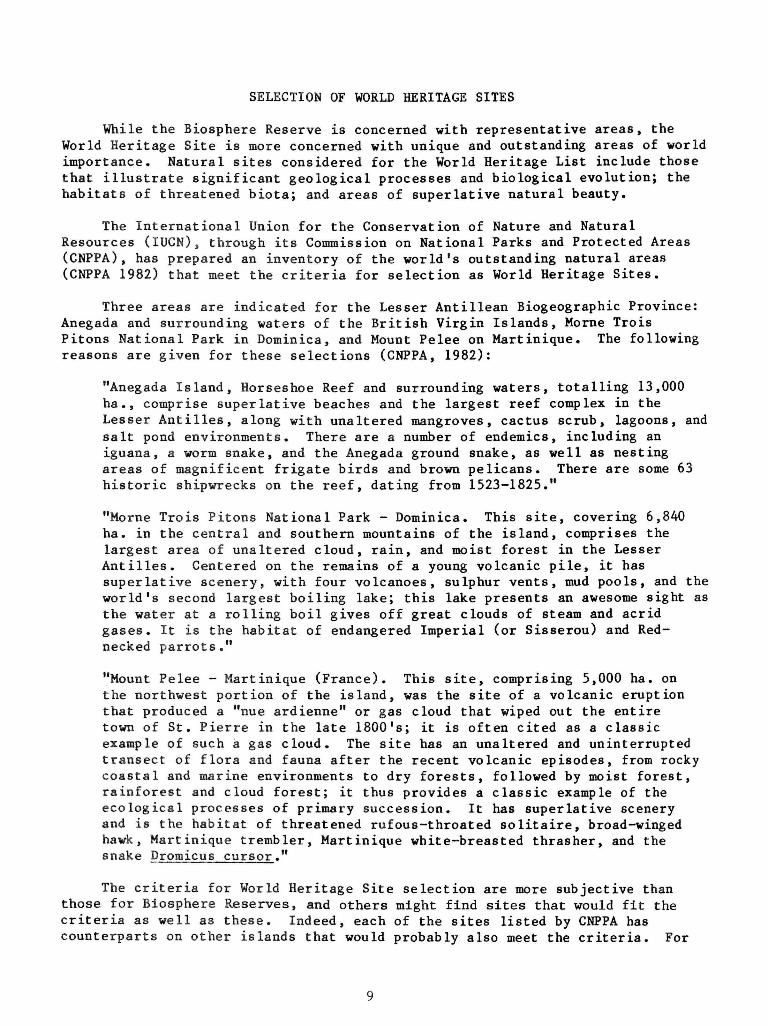
While the Biosphere Reserve is concerned with representative areas, the World Heritage Site is more concerned with unique and outstanding areas of world importance. Natural sites considered for the World Heritage List include those that illustrate significant geological processes and biological evolution; the habitats of threatened biota; and areas of superlative natural beauty.
The International Union for the Conservation of Nature and Natural Resources (IUCN), through its Commission on National Parks and Protected Areas (CNPPA) , has prepared an inventory of the world's outstanding natural areas (CNPPA 1982) that meet the criteria for selection as World Heritage Sites.
Three areas are indicated for the Lesser Antillean Biogeographic Province: Anegada and surrounding waters of the British Virgin Islands, Morne Trois Pitons National Park in Dominica, and Mount Pelee on Martinique. The following reasons are given for these selections (CNPPA, 1982):
"Anegada Island, Horseshoe Reef and surrounding waters, totalling 13,000 ha., comprise superlative beaches and the largest reef complex in the Lesser Antilles, along with unaltered mangroves, cactus scrub, lagoons, and salt pond environments. There are a number of endemics, including an iguana, a worm snake, and the Anegada ground snake, as well as nesting areas of magnificent frigate birds and brown pelicans. There are some 63 historic shipwrecks on the reef, dating from 1523-1825."
"Morne Trois Pitons National Park - Dominica. This site, covering 6,840 ha. in the central and southern mountains of the island, comprises the largest area of unaltered cloud, rain, and moist forest in the Lesser Antilles. Centered on the remains of a young volcanic pile, it has superlative scenery, with four volcanoes, sulphur vents, mud pools, and the world's second largest boiling lake; this lake presents an awesome sight as the water at a rolling boil gives off great clouds of steam and acrid gases. It is the habitat of endangered Imperial (or Sisserou) and Rednecked parrots."
"Mount Pelee - Martinique (France). This site, comprising 5,000 ha. on the northwest portion of the island, was the site of a volcanic eruption that produced a "nue ardienne" or gas cloud that wiped out the entire town of St. Pierre in the late 1800's; it is often cited as a classic example of such a gas cloud. The site has an unaltered and uninterrupted transect of flora and fauna after the recent volcanic episodes, from rocky coastal and marine environments to dry forests, followed by moist forest, rainforest and cloud forest; it thus provides a classic example of the ecological processes of primary succession. It has superlative scenery and is the habitat of threatened rufous-throated solitaire, broad-winged hawk, Martinique trembler, Martinique white-breasted thrasher, and the snake Dromicus cursor."
The criteria for World Heritage Site selection are more subjective than those for Biosphere Reserves, and others might find sites that would fit the criteria as well as these. Indeed, each of the sites listed by CNPPA has counterparts on other islands that would probably also meet the criteria. For
9

example, Barbuda might very well qualify for the same reasons as Anegada, the Soufriere area of Guadeloupe is quite similar to Morne Trois Pitons, and the Soufriere area of St. Vincent could meet criteria like that used for Mount Pelee in Martinique. Thus, each island must carefully consider its own superlative natural areas should they wish to nominate them for inclusion in the World Heritage List under the World Heritage Convention.
SUMMARY OF POINTS FOR DISCUSSION
The purpose of this paper has been to present background information and suggested criteria for selecting areas for the creation and establishment of Biosphere Reserves and World Heritage Sites in the Lesser Antillean Biogeographic. Province. A number of factors which make this region unique were listed, and particular criteria for the selection of Biosphere Reserves in this region suggested. These preliminary ideas have been put forward as starting points for discussions during the workshop.
In summary, the major questions raised in this paper are:
1) Five criteria relating to representativeness, sharing human resources, multiple zones, multi-island design, and local involvement have been advanced for the selection of Biosphere Reserves in the region. Are these adequate and are there other criteria that might be useful?
2) Two general approaches to selecting Biosphere Reserves have been mentioned: regional and sub-regional. Which would best serve the needs of the region, or would another approach be more useful?
3) Some examples of areas that might be included in Biosphere Reserves have been given for both general approaches. Would there be interest on the part of these or other islands in discussing the possible establishment of multi-island Biosphere Reserves? If so, can we work out specific mechanisms to initiate the task?
4) The criteria for selecting World Heritage Sites have been briefly stated and the sites recommended by CNPPA of IUCN listed and described. Are these the best sites, or should others be recommended?
CONCLUSION
Parks and protected areas have an important place in the integrated development of the Lesser Antilles. However, hampered by a lack of trained resource managers and limited financial resources, few of the islands are in a position to push forward with natural resource management in general, and the establishment and management of protected areas in particular, without cooperation with other islands and regional and international programs. The Biosphere Reserve concept and the World Heritage Convention provide international frameworks for this cooperation and assistance.
Through collaborative efforts, and the willingness of international, regional, and bilateral organizations to focus their assistance on these areas,
10

the Biosphere Reserves and World Heritage Sites of the region could serve as focal points for effective support to the management of natural resources critical to development, through research, education, training, and technical and financial assistance.
I hope that this workshop will provide the impetus needed to initiate these collaborative efforts, and that the discussions will lead to the development of a concrete and practical action plan.
LITERATURE CITED
Commission on National Parks and Protected Areas (CNPPA). 1982. The world's greatest natural areas; an indicative inventory of natural sites of World Heritage quality. International Union for Conservation of Nature and Natural Resources, Gland, Switzerland.
International Union for Conservation of Nature and Natural Resources (IUCN). 1979. The biosphere reserve and its relationship to other protected areas. IUCN, Morges, Switzerland.
Putney, Allen D. 1982. Survey of conservation priorities in the Lesser Antilles, Final Report. Caribbean Conservation Association, Caribbean Environment, Technical Paper No. 1. Available from Eastern Caribbean Natural Area Management Program, West Indies Laboratory, Teague Bay, Christiansted, St. Croix, U. S. Virgin Islands 00820.
11
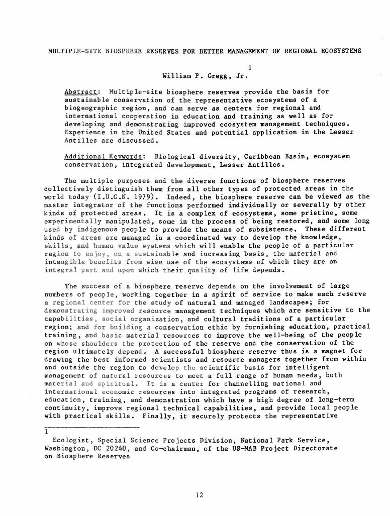
MULTIPLE-SITE BIOSPHERE RESERVES FOR BETTER MANAGEMENT OF REGIONAL ECOSYSTEMS
1 William P. Gregg, Jr.
Abstract: Multiple-site biosphere reserves provide the basis for sustainable conservation of the representative ecosystems of a biogeographic region, and can serve as centers for regional and international cooperation in education and training as well as for developing and demonstrating improved ecosystem management techniques. Experience in the United States and potential application in the Lesser Antilles are discussed.
Additional Keywords: Biological diversity, Caribbean Basin, ecosystem conservation, integrated development, Lesser Antilles.
The multiple purposes and the diverse functions of biosphere reserves collectively distinguish them from all other types of protected areas in the world today (I.U.C.N. 1979). Indeed, the biosphere reserve can be viewed as the master integrator of the functions performed individually or severally by other kinds of protected areas. It is a complex of ecosystems, 6ome pristine, some experimentally manipulated, some in the process of being restored, and some long used by indigenous people to provide the means of subsistence. These different kinds of areas are managed in a coordinated way to develop the knowledge, skills, and human value systems which will enable the people of a particular region to enjoy, on a sustainable and increasing basis, the material and intangible benefits from wise use of the ecosystems of which they are an integral part and upon which their quality of life depends.
The success of a biosphere reserve depends on the involvement of large numbers of people, working together in a spirit of service to make each reserve a regional center for the study of natural and managed landscapes; for demonstrating improved resource management techniques which are sensitive to the capabilities, social organization, and cultural traditions of a particular region; and for building a conservation ethic by furnishing education, practical training, and basic material resources to improve the well-being of the people on whose shoulders the protection of the reserve and the conservation of the region ultimately depend. A successful biosphere reserve thu6 i6 a magnet for drawing the best informed scientists and resource managers together from within and outside the region to develop the scientific basis for intelligent management of natural resources to meet a full range of human needs, both material and spiritual. It is a center for channelling national and international economic resources into integrated programs of research, education, training, and demonstration which have a high degree of long-term continuity, improve regional technical capabilities, and provide local people with practical skills. Finally, it securely protects the representative
1 Ecologist, Special Science Projects Division, National Park Service,
Washington, DC 20240, and Co-chairman, of the US-MAB Project Directorate on Biosphere Reserves
12

ecosystems of one of the world's major biogeographic regions through informed administration and the help of local people as a scientific and genetic legacy to future generations and for the continuing renewal of the human spirit.
It is safe to say that few of the existing 225 biosphere reserves in 62 countries (January 1983 data) are successfully performing all of these functions. This is just as true in the United States as in other parts of the world. The problem stems from the fact that the biosphere reserve concept, barely a decade old, is still evolving and that, until now, the primary emphasis has been on designating sites to build national and global networks rather than on developing the multiple functions of biosphere reserves. I believe however, that now, seven years after the first biosphere reserves were designated in 1976, the network has reached a critical mass which ensures its continued growth and an increasingly important role in global conservation. It is necessary today to direct our attention toward the functions of individual reserves and the global network as a whole, to make them a vital force in ecosystem conservation, regional and international cooperation, and, in so doing, a force for social and economic stability on the planet.
A key function of a biosphere reserve, on which all other functions depend, is protection of the representative ecosystems of a particular biogeographic region. For this reason, it is important to include sites where the administrator has both the legal authority and the intention to provide secure protection. This is essential in the case of sites to be used as biosphere reserve core zones for baseline studies. It is also essential for other sites used for experimental research and demonstration activities which are expected to continue into the indefinite future. Without such protection, a biosphere reserve cannot be designated. Even if designation were possible, an inadequately protected area would be unlikely to develop as a major center for ecosystem studies because the value of scientific data bases, and the cumulative investment they represent, could be compromised at any time.
In the United States, securely protected sites are available in many, and in some cases all, of the ecosystems represented in the country's major biogeographic regions. It has generally not been necessary to create a new legal framework for establishing and managing biosphere reserves because the designations can be applied to preexisting protected areas where the administrators have adequate legal authority to provide protection. This is not the case in many countries where the legal basis for protecting natural areas is still being developed. At first glance, this may seem to be a disadvantage, but in actuality the lack of legal infrastructure presents an exceptional opportunity to establish the biosphere reserve as a legal conservation unit in its own right as well as the legal basis for carrying out its multiple functions. A few countries, such as Mexico and Honduras, have accomplished this by legally establishing individual biosphere reserves. India has gone still farther and is presently developing legislation for a national system of biosphere reserves. Such legislative opportunities may someday be available in the United States, but the large number of legally established protected area systems precludes this at present, and obliges us to build our biosphere reserve network using existing protected areas.
13

Because there are large numbers of legally protected sites in the United States, it has been possible to create in a relatively few years a large biosphere reserve network, which now contains 40 units. At least one biosphere reserve is located in 17 of the country's 20 biogeographic regions. Unfortunately, these sites rarely accommodate all of the biosphere reserve functions because most are managed for specific purposes under policies which prohibit carrying out many activities. For example, it would be impossible to demonstrate forest management techniques in a national park biosphere reserve, just as it would be impossible to set aside a large core area for baseline studies in an experimental forest biosphere reserve, even though both are appropriate uses. During the past several years, the United States has taken a number of steps to build functional biosphere reserves, given the limitations of individual sites.
DEVELOPMENT OF THE BIOSPHERE RESERVE CONCEPT IN THE UNITED STATES
An important recent step in the development of the U. S. biosphere reserve network was the formulation of a systematic process for selecting biosphere reserves (Fernald and others, 1981). The process relies on ad hoc panels of authorities on the ecosystems, protected areas, and resource management problems in a particular biogeographic province. Each panel is responsible for (1) delineating the boundaries of the province and, if necessary, subregions to be used for selecting biosphere reserves; (2) identifying the ecosystems representative of the province or subregion; (3) developing a list of biological, physical, cultural, institutional, and other factors to be used for describing and comparing candidate sites; (4) identifying and describing candidate sites and groups of sites; (5) rating these sites against the essential UNESCO selection criteria; and (6) recommending sites to be nominated by the United States, following approval of their administrators, for designation by UNESCO as biosphere reserves. The process specifically allows for the nomination of biosphere reserves containing multiple sites in cases where a qualifying single site in a particular province or subregion cannot be found. Since the process was adopted in 1981, selection panels have invariably been unable to find single sites which include all the representative ecosystems of a province cr subregion and which permit all of the biosphere reserve functions to be carried out. The panels which have completed their work so far have therefore always recommended the nomination of multiple-site biosphere reserves .
The concept of multiple-site biosphere reserves has evolved gradually and is now becoming the basis for establishing biosphere reserves in the United States. From the very beginning, the United States made an attempt to pair large undisturbed natural areas with experimental research areas in the same biogeographic province (Franklin 1977). This effort was reflected in the official 1976 designations, which included nominally paired biosphere reserves, all federally administered, in six provinces. Subsequently, the cluster concept emerged.
The cluster concept envisioned continuing cooperation among the biosphere reserve sites in the same province or subregion to solve renewable resource management problems of regional concern (Johnson and Bratton 1978). The Great Smoky Mountains National Park and Coweeta Experimental Forest Biosphere Reserves
14
in the southern Appalachian Mountains, which originated the concept, have, in fact, provided the catalyst for interinstitutional collaboration on regional problems which is without precedent anywhere in the United States biosphere reserve network. Both reserves have large interdisciplinary research and training programs, and are used extensively for studies by investigators from many universities in the region. The rate of volunteerism is high, with the Great Smoky Mountains reserve reporting more than 13,000 hours donated in 1982 by volunteers assisting on scientific studies.
This reserve sponsors an annual conference bringing specialists from throughout the region to present their research findings and exchange information and ideas on regional problems. In addition, a research and resources management cooperative involving four Federal agencies and six universities has been formed to carry out studies which provide new perspective on problems of interest to the participating agencies which provide the funding. During the past few years, the cooperative has studied such diverse problems as the management of exotic animals and the control of forest insect infestations, and has developed a comprehensive history of scientific studies for the Great Smoky Mountains reserve—a project involving 95 scientists in its preparation (McCrone and others, 1982). It is worth noting that this novel institution provided the model for establishing a similar cooperative here in the Virgin Islands to help support the management of the Virgin Islands National Park.
The cluster concept was originally focused on linking separately designated biosphere reserves under different administrators, which carry out complementary programs in the same type of ecosystem. In 1981, the concept was expanded to accommodate the designation of multiple sites containing different ecosystems as a single biosphere reserve. The prototype was the 12-site Big Thicket Biosphere Reserve, administered by the National Park Service in east Texas to protect some of the last remaining examples of the diverse ecological communities of the western part of the Gulf Coastal Plain.
This year, the cluster concept was expanded still further in the new biosphere reserves just designated by the MAB Bureau on the basis of the recommendations of ad hoc selection panels. Unlike traditional biosphere reserves which bear the name of an administrative unit, such as a national park, the new biosphere reserves bear the name of a biogeographic subregion, notably, the South Atlantic Coastal Plain, the Central Gulf Coastal Plain, and the California Coast Ranges. Each biosphere reserve will eventually contain multiple sites including all of the representative ecosystems, usually numbering six to ten, within the subregion, as well as opportunities for carrying out all of the reserve's functions. However, none of the new reserves is fully complete because it was not possible to nominate sites including every ecosystem and site6 suitable for every function. This was because information was insufficient to evaluate certain candidate sites, because protected sites were not yet available in some ecosystems, and because administrators did not always endorse the nominations. Such sites will be recommended later for addition when conditions permit. It deserves mention that, in the case of the California Coast Ranges Biosphere Reserve, the reserve is nearly complete. It contains all but one of the region's characteristic ecosystems and is already carrying out, in varying degrees, programs in ecological monitoring, experimental research, watershed rehabilitation, environmental education, and student training (Gregg 1982).
15

The emerging concept of the biosphere reserve is thus one of a dynamic, multiple-purpose conservation network which is built gradually, systematically, and opportunistically within a province or subregion until it includes all of its representative ecosystems and can carry out all of the interrelated functions required to support sustainable conservation and integrated development of these ecosystems. By establishing biosphere reserves on a biogeographic basis, the reserves serve as symbolic integrators of complementary land management units, unifying them in a manner not achievable by other means.
This symbolic unity can become a catalyst for cooperation and communication, and for developing institutions and programs, such as those established in the Southern Appalachians, and programs to maintain the region's renewable resources and improve the quality of life for its people.
The United States is now carrying out joint biosphere reserve selection activities with Canada in the Sitkan biogeographic province of southeastern Alaska and British Columbia, and the prospect for establishing one or more biogeographically-based reserves containing sites in both countries is promising.
APPLICATIONS IN THE LESSER ANTILLES
Here in the Lesser Antilles, it is not difficult to envision the application of the multi-site concept in new and exciting ways. The diverse terrestrial and marine ecosystems of the eastern Caribbean, in concert with the different cultural histories and land use traditions of the region, present exceptional opportunities for building multiple-site biosphere reserves to meet the needs of individual islands and the region as a whole. A history of inter-island cooperation, and the well-established linkages with developed nations, create a climate in which the coordinated activities so necessary to a successful biosphere reserve might be planned and initiated within a relatively short time.
The dedication of the Virgin Islands National Park as a biosphere reserve could be viewed as an isolated event, with benefits accruing primarily in the park and its near vicinity. However, it is my hope, and the hope of the US National MAB program and the National Park Service, that the dedication will mark the beginning of a process which will ultimately lead to the establishment of a dynamic, well-coordinated network of functionally integrated sites for protection and sustainable development of the region's ecosystems, and the betterment of its people.
To contribute toward this goal, the National Park Service will soon be finishing construction of an international research station in the park which will provide basic accommodations, laboratory and storage facilities, and conference space for scientists from throughout the region—a place to pool scientific capabilities for effective conservation of the region's natural ecosystems and biological diversity. We are also significantly upgrading our support for research activities, which should have important benefits for both the park and the region. This year, we will be preparing detailed vegetation and land use maps for St. John and nearby areas using the latest techniques in computer processing of digital imagery, to provide basic information needed for planning and natural resource management. We will also be initiating a cooperative study
16

involving scientists from the United States and the British Virgin Islands to evaluate the effects of land-based sedimentation and pollution of nearshore coral reefs, and to give us better methods for dealing with this major regional problem. We will also begin studies of the Virgin Islands fisheries to help maintain their productivity and diversity. Through the newly established Virgin Islands Resource Management Cooperative, we are funding preparation of a comprehensive history of scientific activities in the Virgin Islands, which will bring together information—much of it unpublished—from United States, Caribbean, and European sources. The work is part of a reference series for U.S. biosphere reserves to provide basic information for orientation of reserve personnel, developing scientific and management programs, and fostering communication and cooperation at all levels.
These are important steps which reflect our commitment to protect Virgin Islands National Park and encourage its use for baseline ecological monitoring and research, for restoration of marine ecosystems and the terrestrial ecosystems of a low volcanic island. However, the ecosystem it contains and the policies which govern its use prevent the park from carrying out all of the functions of a biosphere reserve. It cannot protect all of the representative natural ecosystems of the eastern Caribbean because many of these, such as rainforests and cloud forests, do not occur on St. John. In addition, the existing landscape has been so modified both physically and biologically by human disturbance that the mature ecological communities which eventually develop may be more unique than representative. Although the park can provide an important channel for the transfer of many technologies to the region, it cannot perform many of the educational, training and demonstration functions to improve the skills of local people and the production of renewable resource commodities under the diverse cultural traditions and social structures existing in the eastern Caribbean. Although it has much to contribute, the park is incomplete as a biosphere reserve. Indeed, the realization of the biosphere reserve concept in the Lesser Antilles will require the coordinated use of many ecologically, culturally, and functionally complementary sites located on several to many islands in the region. To build such a reserve requires institutional mechanisms for establishing, protecting, and administering sites on individual islands as well as for coordinating activities on a regional basis. Given the large number of different political entities in the Lesser Antilles, the task should be both challenging and, if successful, immensely rewarding .
The first step in building a multiple-site biosphere reserve is the identification and evaluation of candidate sites, and the development of recommended nominations of the most qualified sites for consideration by individual island governments. In a recent survey, the Caribbean Conservation Association (CCA) has identified the representative terrestrial and marine ecosystems of the region, the locations of relatively unaltered examples of these ecosystems, and the economically and biologically significant renewable resources of each island (Putney 1982). Although preliminary, the survey and the recommended priorities provide a valuable resource for selection of the most qualified biosphere reserve "core zone" sites. What is lacking is a basic reference on the cultural diversity of the region, on variations in traditional land uses, on major environmental and land use problems and where they occur, on institutional and management capabilities, and on past and present applied research, educational, training, and demonstration activities—in other words,
17
information to help identify the best places for carrying out the extensive functions of the biosphere reserve. The papers prepared by island representatives, and the discussions at this workshop, should provide a preliminary summarization of much of this information. I believe that CCA, through an interdisciplinary ad hoc selection committee, could readily obtain and synthesize the information needed to select the most qualified biosphere reserve sites. If adequate protection were not already assured, the Committee could recommend appropriate approaches. In this manner, the Committee's report could provide an important incentive for individual islands to give priority attention to protecting particular areas so they could be included in the biosphere reserve.
Following designation of two or more complementary sites to form a multiple-site biosphere reserve, a regional committee or similar institutional mechanism for coordinating activities would be required. Reserve site administrators, knowledgeable scientists and management specialists, and personnel from governmental agencies and nongovernmental organizations with a particular interest in the reserve's program would all play an active role in this institution. A coordinating committee established under the aegis of MAB, with a small administrative secretariat collectively funded by the committee participants and housed at a regional university or other institution, is a possible approach. The committee would meet on a regular basis to review the reserve's accomplishments, identify areas of cooperation, and provide (through the Secretariat) a channel for receiving funds for reserve projects from regional and outside sources.
At the level of the individual site the establishment of a coordinating body would enable the national government, the scientific community, and local populations to cooperate in planning the use of the individual sites. Mexico's highly successful Mapimi Biosphere Reserve relies heavily on legally constituted associations to build involvement and an atmosphere of mutual trust among those who use and benefit from the reserve (Halffter 1981). Interdisciplinary technical support institutions involving universities and government agencies, such as the recently established Virgin Islands Resource Management Cooperative, could also be developed to plan and carry out studies on problems of interest in particular sites or groups of sites. The coordination of activities in biosphere reserve sites on particular islands would be an appropriate function of national MAB committees. As such committees have not yet been established by the independent island nations of the eastern Caribbean, the development of a regional biosphere reserve could serve as an important catalyst for stimulating formal regional involvement in the global MAB program.
In conclusion, I would like to propose that the Virgin Islands National Park be considered as the first unit of a multiple-site Biosphere Reserve to bear the name of a biogeographic region, such as the Lesser Antilles, and that the islands of the eastern Caribbean build the reserve as a joint venture to attract the resources and develop the capabilities needed to protect the region's ecosystems and use them on a sustainable basis for the benefit of its people. We have the opportunity, through this workshop, to plow new ground by making the biosphere reserve a force for international cooperation, stability, and progress, and for fostering dedication to conserving the ecosystems of one of the world's most culturally diverse island archipelagos.
18
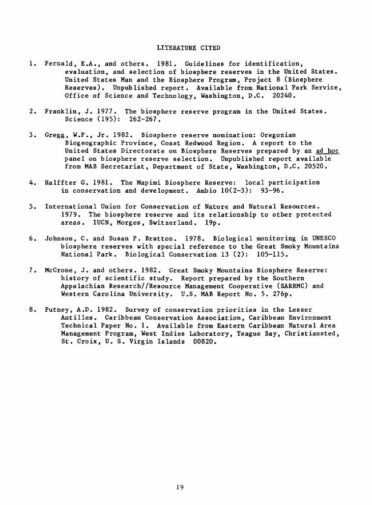
LITERATURE CITED
1. Fernald, E.A., and others. 1981. Guidelines for identification, evaluation, and selection of biosphere reserves in the United States. United States Man and the Biosphere Program, Project 8 (Biosphere Reserves). Unpublished report. Available from National Park Service, Office of Science and Technology, Washington, D.C. 20240.
2. Franklin, J. 1977. The biosphere reserve program in the United States. Science (195): 262-267.
3. Gregg, W.P., Jr. 1982. Biosphere reserve nomination: Oregonian Biogeographic Province, Coast Redwood Region. A report to the United States Directorate on Biosphere Reserves prepared by an ad hoc panel on biosphere reserve selection. Unpublished report available from MAB Secretariat, Department of State, Washington, D.C. 20520.
4. Halffter G. 1981. The Mapimi Biosphere Reserve: local participation in conservation and development. Ambio 10(2-3): 93-96.
5. International Union for Conservation of Nature and Natural Resources. 1979. The biosphere reserve and its relationship to other protected areas. IUCN, Morges, Switzerland. 19p.
6. Johnson, C. and Susan P. Bratton. 1978. Biological monitoring in UNESCO biosphere reserves with special reference to the Great Smoky Mountains National Park. Biological Conservation 13 (2): 105-115.
7. McCrone, J. and others. 1982. Great Smoky Mountains Biosphere Reserve: history of scientific study. Report prepared by the Southern Appalachian Research//Resource Management Cooperative (SARRMC) and Western Carolina University. U.S. MAB Report No. 5. 276p.
8. Putney, A.D. 1982. Survey of conservation priorities in the Lesser Antilles. Caribbean Conservation Association, Caribbean Environment Technical Paper No. 1. Available from Eastern Caribbean Natural Area Management Program, West Indies Laboratory, Teague Bay, Christiansted, St. Croix, U. S. Virgin Islands 00820.
19
UNESCO'S PROTECTED AREAS PROGRAMME
1 Bernd von Droste
Introduction
The last decade has seen the birth of several initiatives concerned with the protection of the natural or semi-natural environment of areas judged to be of international importance. This concern is in marked contrast to the earlier pattern of nature conservation in which the selection of national parks or other protected areas was made strictly on the basis of a framework describing the national resources and where any international element was generally accidental.
Since 1970 the situation has considerably changed in that a number of international legal instruments have been adopted for internationally coordinating efforts in the field of natural heritage conservation and the launching of international programs for enhancing the conservation and management of natural resources. Thus in 1970 the Man and Biosphere Programme (MAB) was officially launched at the 16th Session of the General Conference of UNESCO. The broad outlines of the program were established in 1971, among them MAB Project 8 entitled "Conservation of Natural Areas and of the Genetic Material They Contain" and Biosphere Reserves, MAB Project 1, "Ecological Efforts of Increasing Human Activities on Tropical and Sub-tropical Forest Ecosystems," and Project 7, "Ecology and Rational Use of Island Ecosystems."
In 1971 the Convention on Wetlands of International Importance, Especially as Waterfowl Habitat was adopted by the International Conference on the Conservation of Wetlands and Waterfowl at Ramsar, Iran, for which UNESCO accepted to be the depositary and IUCN to provide the Secretariat for the management of the Convention.
In 1972, the same year that the United Nations Conference on the Human Environment was held in Stockholm, the Convention Concerning the Protection of the World Cultural and Natural Heritage was adopted by the UNESCO General Conference on its 17th Session. For this Convention, UNESCO is not only the depositary but also provides the Secretariat. IUCN has been one of the initiators of this Convention and assists the World Heritage Committee in an advisory function in the identification of natural properties which qualify for the World Heritage List. The two above-mentioned legal instruments and the Inter-Governmental MAB Programme are three major areas in which UNESCO helps to implement the World Conservation Strategy, which was launched in 1980 by the members of the Ecosystems Conservation Group (UNEP, FAO, UNESCO, IUCN) and the World Wildlife Fund.
1 Divis ion of Eco log ica l S c i e n c e s , UNESCO-MAB/WorId Her i tage S e c r e t a r i a t ,
P a r i s , France
20

The Ramsar Convention
The Convention on Wetlands of International Importance, Especially as Waterfowl Habitat was adopted at Ramsar, Iran, on 2 February 1971. As of today, 36 States have become Contracting Parties and more than 200 wetlands covering about six million hectares have been designated by Contracting Parties for inclusion in the List of Wetlands of International Importance, the so-called Ramsar List.
The Ramsar Convention is unique in being the only world-wide treaty so far concluded for the purpose of preserving certain types of ecosystems, in this case wetlands, together with the species, in particular migratory waterfowl species, that are ecologically dependent on these ecosystems.
The Wetlands Convention at present lacks force, requiring only that States select at least one wetland for conservation, but not providing criteria to guide selection, guidelines for management, or adequate safeguards against delisting a wetland once selected. Experience has shown that an international conservation convention must have a secretariat and financial mechanism to be effective, but the Wetlands Convention lacks both.
At present, efforts are being undertaken to revise the Convention to make it an important force for the protection of coastal and other wetlands essential for supporting fisheries (as well as for supporting waterfowl, which is the chief concern of the Convention at present.)
So far, only one Latin American country, Chile, and one North American country, Canada, are Contracting Parties to the Convention.
The World Heritage Convention
The International Convention for the Protection of the World's Cultural and Natural Heritage ("World Heritage Convention") was adopted by the General Conference of UNESCO in 1972.
The principle of international cooperation in safeguarding the cultural and natural heritage of mankind is not new. What the 1972 Convention provides, for the first time, is a permanent framework — legal, administrative and financial — for such cooperation.
It also makes a significant innovation in linking together what were traditionally regarded as two quite different sectors: the protection of the cultural and of the natural heritage. And it introduces the specific notion of a "world heritage" whose importance transcends all political or geographical boundaries.
The World Heritage Convention came into force in December 1975, after twenty UNESCO Member States had adhered to it. As of today, the number of States Parties has grown to 73. The process of identifying those cultural and natural sites which qualify for protection under the Convention has started, and technical assistance through the World Heritage Fund has already been provided to a number of States Parties.
21

So far, 136 natural and cultural properties of outstanding universal value have been designated in the World Heritage List by decision of the World Heritage Committee. Out of these, only 44 properties are natural sites or are mixed cultural/natural properties. UNESCO hopes to rectify this imbalance between natural and cultural properties on the World Heritage List with the help of IUCN, particularly its Commission for National Parks and Protected Areas which plays an advisory role in the implementation of the Convention.
The Convention has made good progress in North, Central and South America. States parties from these regions are in alphabetical order: Argentina, Bolivia, Brazil, Canada, Chile, Costa Rica, Cuba, Eduador, Guatemala, Ghana, Haiti, Honduras, Nicaragua, Panama, Peru and the United States of America.
The following natural and natural/cultural properties have been identified in the World Heritage List:
Argentina
Canada
Canada/USA
Los Glaciares
Nahanni National Park Dinosaur Provincial Park Burgess Shale Site
Kluane National Park/ Wrangell - St. Elias National Monument
Ecuador
Guatemala
Galapagos Islands
Tikal National Park
Honduras Maya Site of Copan Rio Platano Biosphere Reserve
Panama Darien National Park
United States Mesa Verde National Park of America Yellowstone National Park
Grand Canyon National Park Everglades National Park Redwood National Park Mammoth Cave National Park Olympic National Park
New nominations under examination are World Buffalo National Park, Canada; The Amistad, Costa Rica; and Great Smoky Mountains National Park, USA.
Important gaps, however, still exist for the Lesser Antilles, both in terms of evidence of States to the World Heritage Convention and in terms of properties on the World Heritage List.
According to the indicative inventory of natural sites produced by ICUN's Commission of National Parks and Protected Areas (CNPPA) for the World Heritage Committee, three natural sites located in the Lesser Antilles biogeographical region would qualify for the World Heritage List. They are:
22

1. Mount Pele
Country: Martinique (France)
Universal significance: This site, comprising 5,000 ha on the northwest portion of the island, was the site of a volcanic eruption that produced a "nue ardienne" or gas cloud that wiped out the entire town of St. Pierre in the late 1800s; it is often cited as a classic example of such a gas cloud. The site has an unaltered and uninterrupted transect of flora and fauna after the recent volcanic episodes, from rocky coastal and marine environments to dry forest, followed by moist forest, rain forest and cloud forest; it thus provides a classic example of the eological process of primary succession. It has superlative scenery and is the habitat of threatened rufous-throated solitaire, broad-winged hawk, Martinique trembler, Martinique white-breasted thrasher, and the snake Dromicus cursor.
2. Morne Trois Pitons National Park
Country: Dominica
Universa l s i g n i f i c a n c e : This s i t e , covering 6,840 ha in the c e n t r a l and southern mountains of the i s l a n d , comprises the l a r g e s t a rea of una l t e r ed cloud, r a i n , and moist f o r e s t in the Lesser A n t i l l e s . Centered on the remains of a young vo l can i c p i l e , i t has s u p e r l a t i v e scene ry , wi th four vo lcanoes , sulphur v e n t s , mud p o o l s , and the w o r l d ' s second l a r g e s t b o i l i n g l ake ; t h i s lake p r e s e n t s an awesome s i g h t as the water a t a r o l l i n g b o i l g ives off g rea t clouds of steam and a c r i d g a s e s . I t i s the h a b i t a t of endangered Imper ia l (or Sisserou) and Red-necked p a r r o t s .
3. Anegada Island and Surrounding Waters
Country: British Virgin Islands (U.K.)
Universal significance: Anegada Island, Horseshoe Reef and surrounding waters, totalling 13,000 ha, comprise superlative beaches and the largest reef complex in the Lesser Antilles, along with unaltered mangroves, cactus scrub, lagoons, and salt pond environments. There are a number of endemics, including an iguana, a worm snake, and the Anegada ground snake as well as nesting areas of magnificent frigate birds and brown pelicans. There are some 63 historic shipwrecks on the reef, dating from 1523 - 1825.
It should be mentioned that this inventory is not meant to be exhaustive or definitive, nor is it meant to replace natural or regional inventories; it is in no way limiting on any government, nor does it imply any opinions whatsoever of the World Heritage Committee. As it is only indicative, the World Heritage Committee may make new suggestions reflecting a growing knowledge of the World's Natural Heritage. So, all comments and criticisms will be most welcome.
The Convention opens to States Parties possibilities of technical cooperation to support their own efforts to preserve their cultural and natural heritage. Cooperation can take a number of forms:
23

1. Preparatory assistance for the elaboration of nominations to the World Heritage list;
2. Preparatory assistance for drawing up large-scale requests for technical cooperation;
3. Preparatory assistance for drawing up inventories of cultural and/or natural properties suitable for inclusion in the World Heritage list;
4. Emergency assistance for properties included in the World Heritage List or potentially suitable for inclusion therein, which are in imminent danger of important damage or destruction;
5. Conservation measures for properties included in the World Heritage List or considered suitable for inclusion;
6. Fellowships for training in conservation methods and techniques; and
7. Assistance to national or regional training centers.
A number of Latin American States Parties to the Convention have already benefited from international assistance financed out of the World Heritage Fund.
No doubt, the system of international cooperation established under the World Heritage Convention makes this international instrument very attractive to developing Latin American countries.
The International Network of Biosphere Reserves
The biosphere reserve concept was introduced in 1971 by UNESCO's MAB Programme.
Biosphere reserves form an international network of protected areas in which an integrated concept of conservation is being developed, combining the preservation of ecological and genetic diversity with research, environmental monitoring, education and training.
Biosphere reserves are selected as representative examples of the world's major ecosystems. Generally speaking, they are made up of a strictly protected central or core zone surrounded by a larger buffer zone where both experimental and manipulative research, as well as traditional land use, are carried out.
Particular emphasis is given to cooperation and participation of the local population, thus ensuring a stronger social acceptance of conservation activities. Biosphere reserves also provide a framework for international cooperation in research on comparable ecosystems and in finding practical solutions to similar environmental problems.
Experience since the establishment of the first biosphere reserve in 1976 has shown that pragmatism is necessary in implementing MAB Project 8 on a national and regional level.
24

1. Preparatory Assistance
Year Approved State Party Form of Assistance
1979 Honduras Expert to prepare a technical cooperation request for Copan
1980 Guatemala Joint 6-week mission of one ecologist and one expert in stone, wood and stucco conservation to prepare management plan for Tikal National Park
1982 Honduras Financial contribution to the preparation, publication and distribution of the management plan for Copan Historical Monument
1982 Peru One consultant to draw up an indicative list of properties which could be nominated for inscription in the World Heritage List
25

2. Training
Year Approved State Party Type and Duration of Training
1982 Panama 20 m fellowship in natural resource management
1979 Ecuador Financial assistance to training seminar for Galapagos Islands
1982 Costa Rica In situ training of wardens of La Amistad Reserve
1982 Ecuador Financial contribution to a training course organized by the Charles Darwin Foundation (Galapagos)
1983 Argentina Financial contribution to a training seminar
26
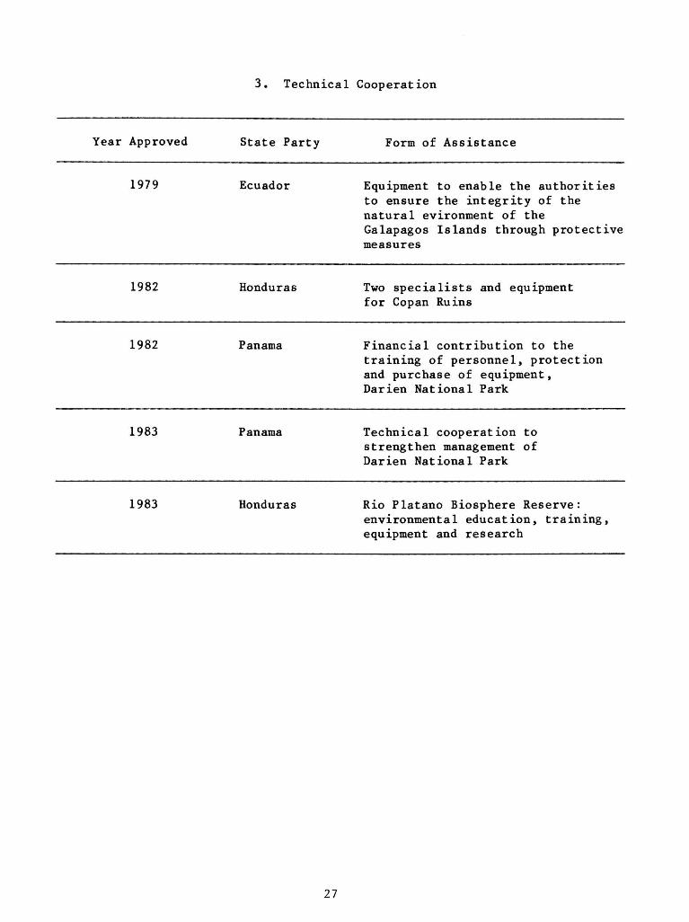
3. Technical Cooperation
Year Approved State Party Form of Assistance
1979 Ecuador Equipment to enable the authorities to ensure the integrity of the natural evironment of the Galapagos Islands through protective measures
1982 Honduras Two specialists and equipment for Copan Ruins
1982 Panama Financial contribution to the training of personnel, protection and purchase of equipment, Darien National Park
1983 Panama Technical cooperation to strengthen management of Darien National Park
1983 Honduras Rio Platano Biosphere Reserve: environmental education, training, equipment and research
27
Although a variety of approaches are being taken, the following major elements form a regular part of the biosphere reserve concept. These are somewhat different in emphasis to other national conservation programs, but they complement them:
1. Emphasis upon use of natural areas in research, including the kind which provides an improved scientific base for conservation.
2. Emphasis upon conservation of ecosystems, rather than upon conservation of individual species.
3. Emphasis upon providing sites for long-term, continuous research and monitoring.
4. Choice of sites for representativeness, rather than for uniqueness.
5. Provision of an international framework for cooperation among nations in conservation and research, this framework being UNESCO's Intergovernmental MAB Programme.
Fortunately, the biosphere reserve concept has considerable flexibility and can readily be adapted to meet the specific needs of different regions of the world. For example, in selecting areas for designation as biosphere reserves, some countries have emphasized the conservation aspects of MAB Project 8, while others have emphasized research. Furthermore, the largest and best potential sites for conservation purposes are often remote from scientific institutions and separated from their research sites. To accommodate this, the concept has been developed of a biosphere reserve cluster, composed of a central conservation reserve (the core), associated where available with a contiguous buffer zone and with nearby experimental reserves, each of which may provide for the needs of manipulative research. Such a cluster of separate reserves with different conservation and research objectives can be a6 successful in fulfilling the goals of a biosphere reserve as one in which all the zones are contiguous. The cluster concept has been further developed by the United States MAB as a unifying concept on a biogeographical province basis.
A good example for this new biogeographical biosphere reserve cluster approach is given by the California Coast Ranges Biosphere Resrve which consists of a multiple site biosphere reserve collectively representing the ecosystems of the Pacific coastal range of California. This biospheere reserve is constituted of three complexes. The northern unit complex is made up of Redwood National Park (also a World Heritage site) and three other state parks; the central unit complex which consists of three continguous protected areas representing mixed evergreens - Douglas Fir forests typical for the central coastal region of California; and the southern unit complex which protects natural stands of redwoods at their southern-most limit. Together, the whole biosphere reserve, as constituted so far, brings together protected areas owned and managed by eight different administrations, including three federal agencies, two state agencies and one private organization, the Nature Conservancy.
As of August 1983, 226 biosphere reserves have been designated by the Director General of UNESCO, encompassing a total area of about 115 million hectares. They
28
are located in 62 countries and cover about half of the world's terrestrial biogeographical provinces as identified under the Udvardy (1975) classification.
A most important characteristic of biosphere reserves is that they form an international network in which the international character is ensured by the exchange of information and personnel. The MAB Secretariat at UNESCO provides coordinating services for the network and furnishes catalytic support. Thus, with the help of the international MAB structure (networks of field projects and biosphere reserves, MAB National Committees in 105 countries) conservation, research and training activities in comparable zones are linked up.
Examples of ecologically-based biosphere reserve networks are:
1. The Tropical Biosphere Reserve Network with about 25 biosphere reserves .
2. The emerging Biosphere Reserve Network for Arid Zones, including project sites in Mali, Chile and Pakistan for which support is provided by UNEP.
3. The Biosphere Reserve Network for Temperate Mixed Forests, with a pilot project on biological monitoring jointly carried out with UNEP/GEMS and WOMO at the Torres del Paine Biosphere Reserve in Chile, the Great Smoky Mountains Biosphere Reserve in the USA and the Berezinsky Biosphere Reserve in the USSR.
4. The Wetland Biosphere Reserve Network which also consists of a number of World Heritage sites, such as Ichkeul National Park, Tunisia; Everglades National Park, USA; El Coto Donana, Spain; and the Camargue, France.
A challenging idea would be to foster cooperation between 6mall island biosphere reserves within comparative ecological zones. For tropical and subtropical regions, such networks could be based on such biosphere reserves as Komodo Islands, Indonesia; the Atoll de Taiaro, French Polynesia; Malindi-Watamu, Kenya; Macchabee/Bel Ombre, Mauritius; and Virgin Islands National Park, USA.
Such a network offers an exceptional opportunity to study, under relatively controlled conditions, the entire spectrum of ecological, economic, and social factors that influence man's relationship with the biosphere.
The First International Biosphere Reserve Congress in Minsk, USSR, 26 September to 2 October 1983, will offer an unique opportunity to review the present state of implementation of the International Biosphere Reserve Network and to draw up future plans to overcome shortcomings. Already today, the International Biosphere Reserve Network is recognized as the world's foremost important global system for conservation/research. It should continue to expand in a systematic and internationally coordinated manner in order to conserve genetic materials and maintain ecological stability for generations yet to come.
29
Relationship between Biosphere Reserves and World Heritage Sites
Biosphere reserves qualify only in exceptional cases as World Heritage sites since these two categories of protected areas have different characteristics. One major difference between biosphere reserves and World Heritage sites is that biosphere reserves are established in order to preserve ecosystems representative of the world's terrestrial and aquatic biomes and their subdivisions, whereas World Heritage sites serve the protection of outstanding cultural and natural properties of universal importance.
Therefore, World Heritage sites must fulfill criteria of uniqueness and universal value, and biosphere reserves must meet criteria of representativeness and naturalness. Biosphere reserves, are, in fact, distinct from any other category of protected areas. Other protected areas may have conservation, research or education and training as their prime purpose, while biosphere reserves depend upon having a combination of all three. Biosphere reserves are at the heart of the MAB Programme, of which they form an integral part, by focusing on the relationship between man and the biosphere, on natural ecosystem conservation and research. They are linked to other MAB Project areas and are internationally coordinated by the intergovernmental structure of MAB.
This considerable difference between World Heritage sites, other protected areas and biosphere reserves does not exclude, however, that part or the whole of protected areas of other categories which may be included in a biosphere reserve provided that they meet the criteria for inclusion in the biosphere reserve network. Also the opposite is true, namely that some of the biosphere reserves with unique characteristics qualify as World Heritage sites. The inclusion of such biosphere reserves in the World Heritage sites should be pursued for several reasons, such as their enhanced protection under the stipulations of the World Heritage Convention and possible financing of urgently needed conservation measures out of the World Heritage Fund.
30

IUCN AND CONSERVATION IN THE CARIBBEAN: INTERNATIONAL CONVENTIONS
S y l v i a Gu igna rd
P reamble
Through the exploitation of natural resources, modern civilization has brought major improvements in the quality of human life throughout the world. Yet the way in which these resources are exploited also threatens modern civilization unless ways and means can be found to ensure that the human use of living resources can be sustained.
The International Union for Conservation of Nature and Natural Resources (IUCN) launched, in 1980, a radical new approach to the relationship between development of resources and their conservation. Defining conservation as the management of human use of the biosphere so that it may yield the greatest sustainable benefit to present generations, the World Conservation Strategy outlines the steps that are required to ensure that humanity prospers on our fragile planet.
IUCN was established 35 years ago as an independent, international conservation organization, with the aim to promote and carry out scientifically-based action for conservation.
The Union now has over 500 members, including States, government agencies and non-governmental organizations. Membership from the Caribbean stands at over 30, not including participation from the United States, France, Netherlands and the United Kingdom.
IUCN maintains close working relations with the United Nations system, in particular with the United Nations Environment Programme (UNEP), the United Nations Educational, Scientific and Cultural Organization (UNESCO), and the Food and Agriculture Organization (FAO). The World Wildlife Fund (WWF) and UNEP are IUCN's closest collaborators. Their special relationship is well illustrated by their cooperation in the development of the World Conservation Strategy.
The preparation and promotion of the World Conservation Strategy is an excellent example of how IUCN works. The Union was able to play a unique role in bringing governments and private individuals together to produce a creative new approach to conservation by drawing on:
its technical Commissions on Ecology, Education, Species Survival, Environmental Planning, National Parks and Protected Areas, and Environmental Policy, Law and Administration;
- its major partners — UNEP, WWF, UNESCO, and FAO;
and its membership network of governments, government agencies, and non-governmental conservation organizations.
WWF/IUCN Project Manager, International and the Americas, Gland, Switzerland
31
In order to further stimulate the implementation of the World Conservation Strategy, IUCN established the Conservation for Development Centre in 1981. Its terms of reference are to obtain tangible, sustainable benefits for mankind, with concentration on the poorest communities, through the application of practical conservation principles, development and implementation of environmental management plans and strategies, education and training, institution building, development of policy and legislation, and environmental impact assessment.
IUCN and International Conservation
Mission Statement. IUCN's mission is to provide international leadership for the sustained-use management of living natural resources, through monitoring the status of key living resources, assessing conservation priorities, and promoting appropriate science-based action directly or through its international network of members, scientists and other experts. The framework for IUCN's action is provided by the World Conservation Strategy and the Union's activities are directed toward its implementation.
IUCN's Role in International Conservation. Through its unique membership mix of governments, government agencies and non-governmental conservation organizations, supported by six technical commissions (education, ecology, species survival, national parks and protected areas, environmental planning, and policy, law, and administration), IUCN is able to provide a focal point for coordinating and stimulating the efforts of the forces engaged in the conservation of nature and natural resources toward attaining the major objectives decided upon by IUCN's General Assembly.
IUCN identifies issues and problems of global concern, promotes a reasoned consensus response to them, sets benchmarks for the design and performance of practical conservation tasks arising from that response, circulates relevant information to and from all involved in those tasks, and channels funds, skills and influence toward ensuring that conservation projects and programs are both effective and lead by example onto further work, realistic legislation and greater public consciousness of the conservation imperative.
In order to secure the natural resource base which will allow for a sustainable relationship between man and his living environment, IUCN draws on its commissions and other experts to provide policy, managerial, and program expertise; project development; evaluation of conservation and development programs; conservation data; mobilization of public support; and a forum for exchanging and developing joint strategies, information and ideas.
Of particular importance is IUCN's ability as a non-political scientific organization to promote regional cooperation. Through its links with regional conventions, regional groupings of nations (such as ASEAN), the UNEP Regional Seas Programme, its system of Regional Councillors, regional meetings of commissions, working groups, and a series of additional mechanisms, IUCN is uniquely placed to play a catalytic and service role at the regional level.
32

In line with IUCN's Conservation Programme for Sustainable Development, and its continuing responsibility towards conservation in different areas of the world, IUCN considers the Caribbean Region as an area of special interest. At present more than 30 projects which have been developed with IUCN support are undertaken in different countries and territories of the region. A special project orientated towards strengthening regional non-governmental organization capability to promote conservation in the Wider Caribbean, for example, has enjoyed substantial support from IUCN.
In cooperation with UNEP, IUCN has produced "A Strategy for the Conservation of Living Marine Resources and Processes in the Caribbean Region" together with a Caribbean Data Atlas. These activities are a contribution to the Caribbean Action Plan.
WORLD CONSERVATION TREATIES
"Prime responsibility for conservation achievement lies at the national level. However, some living resources can be conserved only by international action." This statement of the World Conservation Strategy is based on the recognition that many living resources are shared, that many living resources occur temporarily or permanently in areas beyond national jurisdiction, and that living resources in one state may be affected by activities carried out in another.
International action can take as many forms as political will allows. The most formal, and perhaps the most important, form of such action is the development of international treaties. There are presently over forty multilateral treaties concerned with living resources and many more which indirectly affect them since numerous treaties with an environmental component often contribute to habitat conservation.
At the global level, four treaties are of particular importance for living resources conservation. Two deal with species and two with ecosystems. They tackle major conservation items which can only be resolved by global coordinated action: international trade in species and the conservation of migratory animals, wetland ecosystems and globally important ecosystems and sites. Short of a global convention for the conservation of species and ecosystems, these instruments constitute an important cornerstone of international conservation law.
These conventions can only achieve their aims if as many countries of the world as possible join them as Parties and work together for successful implementation.
THE CONVENTION ON WETLANDS OF INTERNATIONAL IMPORTANCE ESPECIALLY AS WATERFOWL HABITAT (RAMSAR)
History
The Convention on Wet Lands of International Importance Especially as Waterfowl Habitat was adopted on 2 February 1971 at a diplomatic conference held in Ramsar, Iran, following a series of international conferences and technical meetings mainly held under the auspices of the International Waterfowl Research Bureau. The Convention entered into force on 21 December 1975.
33

What is the treaty about?
The objectives of the Convention are to stem the loss of wetlands and to ensure the conservation of wetlands for their importance in ecological processes as well as their rich fauna and flora.
What are its main provisions?
In order to achieve its objectives, the Convention provides for general obligations relating to the conservation of wetlands throughout the territory of Contracting Parties and for specific obligations relating to wetlands which have been included in a List of Wetlands of International Importance.
What are the benefits of joining?
International cooperation is requisite for the establishment of a network of protected wetland sites. The convention consequently provides a framework for information exchange between governments and for a forum in which the Contracting Parties might consider coordinated action. In Recommendation 1.2 of the First Meeting of the Conference of the Parties to the Convention (Cagliari, November 1980), the Parties have also pledged to make special efforts to assist developing countries to contribute to the Convention and to its activities, including support for appropriate training programmes.
What are the obligations of Parties?
The main obligation of the Convention is for each Contracting Party to designate at least one wetland of international importance for inclusion in the List. Under their general obligations, Contracting Parties are required to formulate and implement their planning to promote, as far as possible, the wise use of wetlands in their territory and to establish nature reserves on wetlands and provide adequately for their wardening. Recommendation 1.8 of the First Meeting of the Conference of the Parties to the Convention recommended the consideration of amending the Convention for, among other points, to provide authority for the Conference of the Parties to adopt financial provisions for the Convention, and Recommendation 1.10 from that Conference called upon Contracting Parties to make voluntary contributions toward the costs of interim secretariat arrangements.
Who provides the secretariat?
The Convention provides that IUCN shall perform continuing bureau duties. The First Meeting of the Conference of the Parties to the Convention recognized in its Recommendation 1.10 that the effective promotion and implementation of the Convention required the provision of an adequately funded, small, permanent secretariat and called for steps to be taken to amend the Convention to that effect.
34

How can a country .join?
Any Member State of the United Nations, one of its specialized agencies, the IAEA or a Party to the Statute of the International Court of Justice may become a Party to the Convention by either (a) signature without reservation as to ratification, (b) signature subject to ratification followed by ratification, or (c) accession. Signatures or instruments of ratification or accession are to be deposited with the Director-General of UNESCO in Paris, France.
List of Contracting Parties attached (in Appendix).
WORLD HERITAGE CONVENTION
History
The Convention for the Protection of the World Cultural and Natural Heritage was adopted on 23 November 1972 by the General Conference of UNESCO, after drafts were endorsed by the UN Conference on the Human Environment (Stockholm, 1972) by the Second World Conference on National Parks (Grand Teton National Park, 1972). The Convention entered into force on 17 December 1975.
What is the treaty about?
The objective of the Convention is to ensure support by the international community for world heritage sites (natural or man-made) which are recognized as being held in trust by nations for mankind.
What are its main provisions?
Natural and cultural sites identified by states and recorded on a World Heritage List by decision of a committee are provided special protection through specified national measures, with the possibility of international financial and technical assistance through a World Heritage Fund.
What are the benefits of joining?
Outstanding cultural and natural properties of a country are given international recognition by the World Heritage List. They become eligible for significant international funding and technical assistance for conservation purposes.
What are the obligations of Parties?
States having designated cultural or natural sites on the World Heritage List must take specified measures for their conservation. Obligations under the Convention also include the payment of compulsory dues amounting to one percent of the annual dues to UNESCO, besides voluntary contributions to the World Heritage Fund.
35

Who provides the secretariat?
The secretariat of the Convention is provided by UNESCO, Place de Fontenoy, 75 700 Paris, France. Technical advice on the natural sites is provided by IUCN, and technical advice on cultural sites is provided by the International Council for Monuments and Sites (ICOMOS).
How can a country join?
Member States of UNESCO may become Parties by depositing an instrument of ratification or acceptance, and all other states by depositing an instrument of accession, with the Director General of UNESCO in Paris, France.
List of Contracting Parties attached (in Appendix).
THE CONVENTION OF INTERNATIONAL TRADE IN ENDANGERED SPECIES OF WILD FAUNA AND FLORA (CITES)
History
The Convention of International Trade in Endangered Species of Wild Fauna and Flora (CITES) was adopted on 3 March 1973 by a diplomatic conference held in Washington, D.C., after extensive preparatory work especially by the IUCN, and in response to a specific recommendation of the United Nations 1972 Stockholm Conference on the Human Environment. The Convention entered into force on 1 July 1975.
What is the treaty about?
The aim of the Convention is to establish world-wide controls over trade in endangered wildlife and wildlife products - in recognition of the fact that unrestricted commerical exploitation is one of the major threats to the survival of species.
What are its main provisions?
For this purpose, more than 2,000 endangered species of wild animals and plants are listed in three appendices to the Convention. Depending on their agreed degree of protection, the export and import of live specimens, and of parts or derivatives, is either prohibited or subjected to uniform licensing requirements recognized by all member countries. Each party to the Convention has designated national management authorities and scientific authorities in charge of administering the licensing system, in direct cooperation with their foreign counterparts.
What are the benefits of joining?
Governmental efforts to protect endangered wildlife species which are traded worldwide can be effective only if there is close cooperation between exporting and importing countries. CITES provides them with up-to-date information and with a direct communications network linking national enforcement agencies. Technical assistance is available for the training of personnel, and identification aids and other materials are made available to facilitate implementation of the Convention.
36
What are the obligations of Parties?
Parties to CITES are expected to ensure proper enforcement by their national authorities, to submit periodic reports on implementation and to contribute to the special Trust Fund established for financing the costs of meetings and of the international secretariat. Contributions are based on the percentage rates of the official United Nations scale.
Who provides the secretariat?
The CITES S e c r e t a r i a t i s admin i s te red by the IUCN on behal f of the United Nations Environment Programme (UNEP) a t the IUCN headqua r t e r s (Avenue du Mont-Blanc, CH-1196 Gland, S w i t z e r l a n d ) , wi th funding from the P a r t i e s provided through a s p e c i a l United Nations Trust Fund.
How can a country join?
Instruments of ratification (for countries having signed before 1 July 1975) or of accession to CITES (for all other countries) shall be deposited with the Swiss Federal Department of Foreign Affairs in Berne, Switzerland.
List of Parties attached (in Appendix).
37

COUNTRY SUMMARY FOR ANGUILLA
1 Leslie V. Richardson
Background
Anguilla is one of the smallest inhabited, English-speaking islands in the British Leeward Islands. The territory of Anguilla includes a few cays, such as Scrub Island, Dog Island, Upper and Lower Prickly Pear Cays, Sandy Island and Sombero Island. Anguilla is about 16 miles long and 3 miles wide at its widest point. It is approximately 35 sq. miles in area and is situated at approximately 18 degrees north latitude and 63 degrees west longitude and lies between the Atlantic Ocean and the Caribbean Sea. The island shares a common submarine shelf with its closest neighbor of St. Martin/St. Maarten. The shelf is 582nm2.
Unlike most of her neighboring islands, Anguilla is very flat. Its highest point is at Crocus Hill, just over 213 ft. above sea level. There are no surface streams, but there are over 22 ponds of which only two are mainly salt-producing and another pond is presently utilized for experimental work in shrimp production. The island is basically of limestone formation, covering some forms of volcanic rocks.
The last census which was carried out in 1974 revealed that the population was 6,519 persons. However, more recent data shows that the population is just over 8,000 persons. The life expectancy in 1974 was estimated at 65 years for men and 69 years for women and more than half the population at the time was under 16 years of age.
The leading economic activities at present are construction, tourism, and fishing (mainly for lobsters, conchs, and white fish). The harvesting of salt and subsistence farming are carried out on a small scale. However, salt production and agriculture are normally affected by adverse weather conditons.
Major Problems With Respect to the Management of Natural Resources
There are three major problems affecting the management of natural resources:
1. Exploitation of the fishing resources due to the lack of sufficient patrol vessels. Foreign fishing trawlers and other fishing crafts are constantly encountered fishing in Anguilla'8 territorial waters.
2. Loss of agricultural lands due to tourism development and other commercial usage.
1 Agriculture and Fisheries Officer, The Valley, Anguilla
38

3. Impairment of tourist attractions. The constant removal of sand from the beaches for construction of homes, hotels and other buildings is causing some problems to the scenic beauty, as well as contributing to the erosion of the beaches. In addition, several of the natural coral reefs are being damaged by anchors and fishing guns.
Government Policy
The government's policy is to protect the natural scenic areas such as beaches, historical sites and marine life from further damage through proper use of those resources. The government is concerned about the management of the marine resources and therefore has acquired the services of a Marine Biologist to advise on the setting up of Marine Parks. The government's policy is to educate the public on conservation measures or strategy in order to reduce or prevent further depletion and degradation of the natural resources. The government will be prepared to enforce legislation to protect the marine life in Anguilla's territorial waters.
Importance of Natural Resources
The Government of Anguilla has recently been focusing on tourism as the main economic industry for the island; hence the natural white sandy beaches and the aesthetic coral reefs, clear water and offshore cays will all serve as attractions for the development of the tourism industry, particularly for the tourists' interest in scuba diving and snorkeling.
The establishment of marine parks will result in additional enhancement and protection of marine life in the established parks. There is some wildlife on the island of Anguilla, such as the iguana and other species of reptiles, and wading birds and ducks. However, there is no indication that these are being exploited.
Natural Resource Uses
Through different forms of incentives, the government is attempting to encourage farmers to continue cultivation of the arable lands and to develop livestock and poultry production.
The government is establishing rules and regulations for the protection of the fishing and lobster industries. Spear fishing is not encouraged and local fishermen are urged not to use half-inch mesh wire for the making of fish traps. A closed season period is enforced from the 1st of June to the 30th of September each year for the protection of turtles. Removing spawning lobsters from the sea for sale is also prohibited.
39

Proposed Marine Parks
In order to conserve the reef fauna and reduce and prevent serious conflicts of interest between the fishing and tourism industries, the government is in the process of establishing Marine Parks.
The Marine Parks will help to maintain the quality of the natural coral reefs before they are over-fished or before the reefs are seriously damaged by improper fishing methods. Permits will be issued to individuals or tour groups to enter the marine parks. However, strict control will be observed in regard to the trapping of live fish and other forms of life within the parks. Limitations will be imposed on the duration of visits, and the removal of eggs, turtles, etc. during the laying season will be prohibited.
40
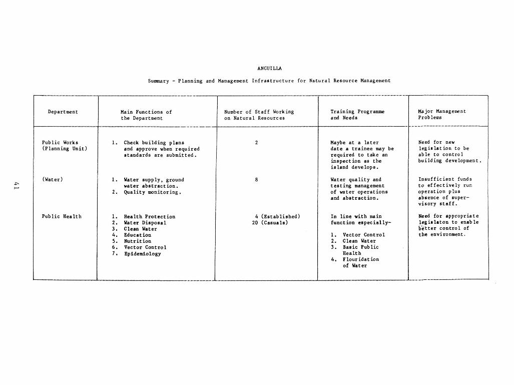
ANGUILLA
Summary - Planning and Management Infrastructure for Natural Resource Management
Department
Public Works (Planning Unit)
(Water)
Public Health
Main Functions of the Department
1. Check building plans and approve vhen required standards are submitted.
1. Water supply, ground water abstraction.
2. Quality monitoring.
1. Health Protection 2. Water Disposal 3. Clean Water 4. Education 5. Nutrition 6. Vector Control 7. Epidemiology
Number of Staff Working on Natural Resources
2
8
4 (Established) 20 (Casuals)
Training Programme and Needs
Maybe at a later date a trainee may be required to take an inspection as the island develops.
Water quality and testing management of water operations and abstraction.
In line -with main function especially-
1. Vector Control 2. Clean Water 3. Basic Public
Health 4. Flouridation
of Water
Major Management Problems
Need for new legislation to be able to control building development.
Insufficient funds to effectively run operation plus absence of supervisory staff.
Need for appropriate leg is la ton to enable better control of the environment.
r—i

ANGUILLA
Summary - Planning and Management Infrastructure for Natural Resource Management
•c-
Department
Lands and Survey
Main Functions of the Department
1. Preparation and maintenance of registers of ownership of land and records which support the registers .
2. Administration of Crown Lands
3. Establishment and maintenance of survey control and records.
4. Surveys of Crown and private lands
3. Preparation and maintenance of valuation roll and valuation of land.
6. "Physical Planning".
Number of Staff Working on Natural Resources
6 (Established) 3 (Casuals)
Training Programme and Needs
1. Surveying Diploma Course
2. Physical Planners Course
3. Middle Management Course for Director
4. Draftman's Course
j
Major Management Problems
1. Inadequately trained staff
2. Lack of total cooperation between Departments resulting in duplication of efforts at times

ANGUILLA
Summary - Planning and Management Infrastructure for Natural Resource Management
4> LO
Department
Agr icu l ture and F i s h e r i e s
Main Functions of the Department
1. Introducing various crops that can be adaptable to the i s l a n d .
2 . Protec t ion of marine l i f e .
3 . Providing stud s e r v i c e s in order to e s t a b l i s h b e t t e r breeds of an imals .
4 . Providing farmers and fishermen with mater ia l as w e l l as information for increas ing product ion.
Number of Staff Working on Natural Resources
7 (Es tab l i shed) 10 (Casuals)
Training Programme and Needs
Increase tra in ing for s t a f f in management s k i l l s in s o i l and water conservat ion , management of marine park6 and f i s h e r i e s .
I
Major Management Problems
Need for b e t t e r management s k i l l in dry farming systems and i n t e n s i v e r a i s i n g of goats and sheep. There i s a greater need for cooperat ion between government departments for environmental management.

COUNTRY SUMMARY FOR BARBADOS
1 Cynthia Wilson
Major Characteristics
Barbados is the eastern-most island in the Caribbean chain, with an area of approximately 166 square miles (33.5 km long by 22.5 km wide). It is bounded by some 92 km of coastline.
Geologically, the island lies on a foundation of Tertiary rocks roughly 60 million years old. Over most of the island this foundation is covered by a much younger capping rock of coral limestone, laid down in the form of a reef during the past centuries. In the Scotland district the older Tertiary rocks are exposed at the surface, and it is their very different characteristics which have given this region such a strongly contrasting and distinctive landscape.
The dominant feature of the Scotland district is the limestone cliff which forms the top edge of the escarpment enclosing it. This area is known as Hackleton's Cliff and represents the highest point of the coral cap which is up to 300 ft. thick in some parts. The continual erosion of the cliff face has led to the accumulation of a scree of dislodged rocks at its base.
The main rocks found in this area are mixed deposits of sandstone, marls, shales and clay. The Joes River muds are a dark grey rock composed principally of a silt-like material which is very susceptible to erosion when wet. Another series of rocks is the Oceanic formation. These are light colored, sometimes chalk-white rock and outcrops at the upper levels of the escarpment and the coast. At the lower levels of the river basins there are extensive alluvial deposits of mixed silts, sands and gravels, while sand dunes and low sand hills are well established behind some of the east coast beaches.
For the main part, the island is relatively flat with gentle slopes rising at the highest point in St. Andrew (part of the Scotland disrict) at Mount Hillaby, which is 1,116 ft above sea level.
Although there are some local differences, the climate is relatively uniform. Temperatures range from 22 degrees C - 28 degrees C, seldom falling below 20 degrees C or rising above 31 degrees C. The average annual rainfall is 1250 mm at sea level and 1650 mm at the highest elevations.
The natural vegetation over most of the island would be drought-tolerant forest and shrubs, developing into tropical forest in the moister, sheltered regions. Sea cliff, sand and swamp conditions would support specially adapted plants. At
1 Administrative Assistant, Ministry of Housing and Lands, Christ Church, Barbados, West Indies
44
present the relict forest is restricted to the gullies and under-cliff areas, while the swamp conditions are greatly depleted.
Forest clearance in the 17th Century, and the intensive cultivation which followed, has profoundly affected the appearance of the island. Sugar cane has been the prevailing crop over most of the island and still accounts for the major portion of land in agricultural use. Tree cover is severely limited to garden plots, "rab land," gullies, some stretches of coast, and parts of the Scotland district. The built environment, especially housing, is a major feature of Barbados' landscape.
There is not an abundance of marine life in the waters around Barbados. The main marine resources are sea eggs (urchins), queen or giant conch, spiny lobster, black coral, and flying fish; there is also a small seasonal fishing industry which is growing in importance. The white sandy beaches surrounding most of the island are also a major tourist attraction. There are some diving sites, especially on the west coast, and a marine park at Folkestone, St. James.
The figures from the 1980 census are not yet available. The latest available figures relate to 1978 when the population was estimated at 253,100; the rate of population growth was 0.9%. It was projected that the 1980 figures would be 257,100, made up of 123,700 males and 133,400 females.
The Barbados economy is highly open and externally dependent. The main economic activities are agriculture, tourism, industry, export-oriented manufacturing, oil exploration, construction and the public sector.
During the past year a weak demand for tourist services, falling sugar prices and high interest rates all had unfavorable effects on the economy. Tourist arrivals declined still further, and the lowest sugar prices in four years coincided with the island's smallest crop since 1974.
The continuing weakness of regional economics also aggravated Barbados' economic difficulties. There was little growth in any of the regional economics and output of major commodities declined futher. Consequently, balance of payments problems worsened, leading to a slowdown in intra-regional trade and settlements.
Unemployment remains a major problem. Retrenchment within the public sector and a virtual freeze on employment in the private sector pushed the level of unemployment to 15% of the labor force for the period April - June 1982.
Major Problems with Respect to the Management of Natural Resources
In my view the three major problems are beach erosion, the threat of a major oil spill and the loss of agricultural land to industry and urbanization.
1. Beach Erosion - At present there is a real problem, especially as it relates to tourism. There is a great concentration of tourist accommodations and facilities on the south and west coasts of the island. Many of these are built close to the high tide mark, and so the erosional trend is of very great
45

concern. The high tide mark is retreating inland on the west coast at the rate of approximately 0.5 m per year.
As a result of the severity of this problem, the Government has now instituted a study on Coastal Conservation with the assistance of the Inter-American Development Bank. This study commenced in February 1982, and is being conducted by a Canadian firm. The terms of reference for the study are:
— To survey in a general way the nature and possible causes of the problem of erosion and/or accretion along the coastline and beaches of the island.
— To examine the viable alternatives for protecting the west and south coasts and beaches from the technical and economic standpoints .
— To identify and quantify the economic benefits and costs of each alternative solution.
— To develop terms of reference for carrying out a feasibility study and recommend institutional measures that may be currently executed; and
— To strengthen the institutional capability of the Environmental Division of the Ministry of Housing and Lands to carry out its environmental functions, including the maintenance and management of the coastline and beaches more efficiently.
The view has been expressed that the main cause of the current erosion problems which are being experienced has been the erection of structures too near to, or even in, the sea. Indiscriminate building of sea defenses has also contributed to the problem, since when one landowner tries to protect his/her property, inevitably problems are created for the adjacent properties, and these owners then erect their own defenses, thus magnifying the problems.
2. The Threat of a Major Oil Spill - This is an ever-present danger, given the large volume of the world's oil trade which is transported through the area. So far we have been spared a major disaster, but there is no telling when one will occur. A major accident could wipe out the island's marine life and do irreparable damage to the tourist industry, on which the island is heavily dependent. The existing resources of Barbados are not geared towards the containment or dispersal of a major spill, and so most of the expertise would have to be provided from outside the region.
There have been a few minor oil spills which have reached land, and these have so far been dealt with by the National Conservation Commission and the Barbados Coast Guard. There has been a seminar recently in Barbados conducted by the IMCO on the subject of oil spills and the response of various government agencies. The Ministry of Health is the coordinating agency for the oil spill task force, and convenes periodic meetings to discuss the subject.
3. Loss of Agricultural Land to Industry and Urbanization - In an island the size of Barbados with a population of a quarter-million and one of the
46

highest population densities in the world, it is inevitable that there are land use problems. In recent years industry and urbanization have taken a heavy toll on agricultural land.
There has been indiscriminate cutting up of some of the best agricultural land for housing and other uses. This led the government some years ago to try to stem this practice by greater town planning control over applications and the restrictions of sub-division of agricultural land.
The chronic shortage of land and the need for improved housing conditions for large masses of the population has led to a sky-rocketing of real estate values over the last 5-10 years. Another problem relating to land is the aversion of most of the younger generation to agriculture in any form. This has resulted in many acres of agricultural land going out of production, while food imports remain one of the largest items of our expenditure.
Government Policy
Successive governments have always set a high priority on the conservation of the island's natural resources. The Parks and Beaches Commission was established by an act of Parliament in 1970. Its powers are related to the maintenance and control of the island's parks and beaches and other recreational areas. The Caves Authority was set up in 1977 to supervise the developmental work on the Harrisons Cave in St. Thomas, one of the central parishes of the Island. On completion of the development of the cave, a new body, the National Conservation Commission, was established in 1982 to amalgamate the functions and powers of both the Parks and Beaches Commission and the Caves Authority.
The functions of the National Conservation Commission are:
— To conserve the natural beauty, topographic features, historic buildings, sites and monuments of Barbados;
— To remove from any beach, public park, cave, public garden or from the access thereto, any derelict object;
— To control, maintain and develop the public parks, public gardens, beaches and caves of Barbados;
— To maintain public access to, and to provide a lifeguard service at such of the beaches of Barbados as it thinks fit;
— To secure the observance of sanitary and cleanly conditions and practices at and in respect of the public parks, public gardens, beaches and caves in Barbados and such other sites, buildings or monuments of national interest as the Minister may designate;
— To maintain and assist in maintaining, to such extent as the Minister directs, existing and future beach facilities;
47
— To advise the Minister on
(a) the construction of beach and ancillary recreational facilities,
(b) the control of the construction in any park, public garden or on any beach of huts, booths, tents, sheds, stands, stalls, bath-houses, shops (whether fixed or movable),
(c) the removal of coral from the ocean bed or any other thing the removal of which might cause the encroachment of the sea, and
(d) such other matters relating to the public parks, public gardens, beaches and caves of Barbados, including matters pertaining to beach control and the protection of the sea-coast of Barbados from erosion or encroachment by the sea, as the Minister may refer to it for advice.
— To control, conserve and develop caves;
— To enter into written agreements with owners or occupiers of land for the right of access to and the right to control, conserve and develop any cave; and
— Generally to carry out this Act, together with such other functions as may be conferred upon it by the Minister for the purpose of this Act or by any other enactment.
A stated policy of the present government is the establishment of a major new park comprising the present Graeme Hall Swamp in Christ Church. This park will include a bird sanctuary for the thousands of cattle egrets which have now made their home there. It will contain virtually the only lake in Barbados and will cover over 50 acres of natural vegetation, waterways and recreational facilities so crafted as not to disturb the area's natural features. This project has been delayed because of the present economic situation, but it is hoped that it will be developed as soon as the situation improves.
Importance of Natural Resources to National Development
With the decline in earnings from the sugar industry in recent years, tourism has assumed an increasingly important role in the economy. Although agriculture has lost some of its importance in recent years, it is still one of the island's major sources of revenue. Agricultural earnings are, however, subject to the vagaries of weather, world prices, and the uncertainty of overseas markets. The problems of scarcity and glut are also very real.
In the present situation the island's natural resources are becoming even more important to national development. If tourism is to thrive and
48

develop, all our resources must be used to the best advantage, since our natural resources are our main attraction.
The island's most important parks and recreational areas are all under the control of the National Conservation Commission, and fees paid by visitors form a part of the Commission's thin revenue. A significant portion of this is derived from tourists.
The island has no major natural forests. There are a few wooded areas to be found in various parts of the country, but forestry plays no real role in the island's economy. The paucity of animal life in Barbados is also generally recognized. The largest mammals are the widespread African green monkey, the mongoose, and the much less frequently-seen hare. Both the monkey and mongoose are treated as pests by farmers, but are of considerable interest to tourists.
Recent research suggests that the monkey population is currently about 5,000. There are about 26 resident bird species in Barbados. There is also a fair number of migrant species. With the exception of the yellow warbler, which is restricted in its nesting site to the small remaining areas of mangrove swamp, and the coot, none of the resident species appears to be in a very vulnerable position.
Major Characteristics of Natural Resource Uses
The main use of the natural resources of the island are for enjoyment and relaxation. There are a number of scenic spots which do not fit the IUCN description of protected areas, but which are nevertheless widely used as recreation areas by locals and visitors alike. Most of these areas are under the control of the National Conservation Commission.
The main areas which fall into this category are Farley Hill National Park, Folkestone Marine Park, Barclays Park on the East Coast Road (which is a favorite picnic spot), Bath Beach in St. John, the Animal Flower Cave, St. Lucy Ashford Bird Park, Codrington College, Bathsheba, Morgan Lewis (a site which has been restored by the Barbados National Trust) and signal station at Gun Hill (former military barracks which afford a commanding view of a major portion of the island). The most recent addition to the island's attractions is Harrisons Cave, St. Thomas, which is rapidly gaining a reputation as one of the most beautiful caves in the world. Most of these attractions are free, while a few receive income from entrance or parking fees .
As stated before, the forest plays no real role in the country's economy. The fishing industry is seasonal and is mainly used as a dietary supplement. There is no export market for local fish. Agriculture is mainly export-oriented, as in the case of sugar cane, but is rapidly beoming diversified as there is a great need to seek alternative crops since sugar is not as viable as it once was.
49

Summary of Planning and Management Infrastructure for Natural Resource Management
The main agencies concerned with natural resource management are the National Conservation Commission, a statutory body under the control of the Ministry of Housing and Lands; the Barbados Water Authority, another statutory body; the fisheries division of the Ministry of Agriculture; the Engineering Unit of the Ministry of Health; and the Barbados National Trust, A summary of the functions of each of these agencies is shown in the accompanying table.
Additions and Corrections to IUCN Description of Protected Areas in Barbados
Parks and Reserves Legislation - National Conservation Commission Act 1982
Parks and Reserves Administration: The National Conservation Commission which is an amalgamation of the former Parks and Beaches Commission and Caves Authority.
Address: National Conservation Commission Codrington House, ST. MICHAEL
Protected Areas: Harrisons Cave, St. Thomas
Proposed Parks and Protected Areas
1. Northeast Coastline
(a) The areas stretching from Archers Bay, St. Lucy on the north coast of the island to Ragged Point, St. Philip on the east coast.
(b) 5,000 hectares.
(c) Government has commissioned a study of the desirability of setting up this park. A United Kingdom Technical Assistance Officer, our N. Pennington prepared a report on the proposal and this is currently under study.
(d) The area is at present privately owned by a number of small holders. It is primarily under cultivation or "rab" land. It is not very densely populated.
?. Graeme Hall Swamp Park
(a) This area has the only natural lake in Barbados on an area of approximately 50 acres. It is a mangrove swamp and is a natural habitat for local and migrant birds.
(b) 50 acres
50

(c) Government in the 1981 party manifesto.
(d) At present the area is privately owned and is used mainly as a habitat for birds. There are also some fish in the lake, and some fishing is done. There are also large numbers of crabs in the area.
References: National Park Report - M. Pennington
Economic Review September 1982 - Central Bank
Barbados Development Plan 1979-82
Barbados Labour Party Manifesto 1981
51

BARBADOS
Summary - Planning and Management Infrastructure for Natural Resource Management
Department
National Conservation Commission
Barbados Water Authority
Fisheries Division
Ministry of Health (Environmental Engineering Unit)
Barbados National Trust (Voluntary Organization)
Main Functions
Maintenance of parks, beaches, caves, & other recreational areas.
Maintenance of pure water to the island.
Upgrading the fishing industry; provision of facilities for fishermen.
Maintenance of health standards by supervising construction of new buildings and inspection of existing ones.
Upkeep and listing of buildings of architectural or historic interest.
Main Staff Staff Employed
Wardens, Rangers, Lifeguards, Laborers
Engineers, Technicians, Laborers
Fisheries Officers
Environmental Engineers
Volunteers
Training Programs and Needs
Personal Relations Supervision
Training in inspection procedures
Major Management Problems
j
Dealing with vandalism, beach vendors, etc.

BONAIRE AND CURACAO COUNTRY SUMMARIES
Walter L. Bakhuis
Background
Of the six islands of the Netherlands Antilles, only Bonaire and Curacao have protected areas (national parks). The natural resources of these two islands include finfish (Curacao: catch/year + 850 tons; Bonaire: + 160 tons) and limited agriculture. In terms of demography, the island of Curacao is 180 square miles in size and has a population of 165,000; the island of Bonaire is 112 square miles in area and has 9,200 inhabitants.
The leading economic activities in Curacao are oil refining and tourism. In addition, Curacao has one of the largest bunkering ports in the world, with an oil terminal that gives the island the largest non-military dry dock in the hemisphere.
On Bonaire tourism is the most important industry. There is an oil terminal and a salt factory on the island.
Three Major Problems
1. Lack of regulations on ground water management (Curacao).
2. Loss of agricultural land to industry and urbanization.
3. Loss of wildlife, even in natural parks.
Government Policy
Two foundations, STINAPA (Netherlands Antilles National Parks Foundation) and CARMABI (Caribbean Marine Biological Institute, an institute for research on behalf of nature management) are subsidized by the local governments and the Dutch government, as well as by private funds, e.g. the World Wildlife Fund of the Netherlands. Whenever tourist industry stimulation is involved, the local governments are very helpful (e.g. in providing wages for park personnel) . However, the contribution of the police corps in the control of poaching, both in the sea (e.g. spearfishing) and on land (e.g. deer hunting), is almost nil. For political reasons the government of Curacao, up until now, has been against the idea of keeping the introduced goats out of the national park.
1 Director, Caribbean Marine Biological Institue (CARMABI) and Netherlands Antilles National Parks Foundation (STINAPA), Curacao, Netherlands Antilles
53

Importance of Natural Resources
Due to the world-wide recession, tourism has slowed down. On Bonaire, the number of scuba diving and snorkeling tourists has increased due to the establishment of the Bonaire Marine Park. By enhancement of the attractiveness of the land and underwater parks in Bonaire and Curacao, we hope to attract more nature-minded tourists. The local governments are showing much interest in further development of agriculture and long-line fishery. The possibilities for wildlife exploitation through rational management are being studied by the local governments (queen conch) and CARMABI (green iguana) .
Natural Resource Uses
Through protective measures the governments are stimulating agriculture. However, the local production will always remain much smaller than the demand. The coastal fishery has some importance, but further expansion is not possible due to overexploitation. Only four persons have permits for aquarium trade in Curacao, so the danger of overexploitating aquarium reef fishes is small. In Bonaire aquarium trade is not practiced. Spear-fishing is forbidden by law on both islands, but on Curacao there is no control. Consequently, coral reef fishes reach bigger sizes in Bonaire, while on Curacao lobsters have been decimated on the south coast. The turtles and the endemic subspecies of the "protected" white-tailed deer (Curacao: Odocoileus gymnotis curassavicus) are highly endangered by overexploitation, but the parrot (Bonaire: Amazona barbadensis rothschildi), black coral (used as jewelry) and the tree Tabebuia billbergii (used for ornamental tables, etc.) are not yet endangered.
54

Planning and Management Infrastructure
Members of Members of Board of Committee/ Park Other Directors Director Manager Personnel
Institution
STINAPA 13 (1) (1)
Washington-Slagbaai National Park (Bon.)
Christoffel National Park (Cur.)
Flamingo Sanctuary
Bonaire Marine Park
Curacao Underwater Park
CARMABI 12
( ) planned
STINAPA manages the four above-mentioned parks. The administrative tasks are done by CARMABI personnel and volunteers. CARMABI is a foundation with an institute which has the task to do research on behalf of terrestrial and marine nature management in the Netherlands Antilles. STINAPA benefits from the research results.
The marine park manager of Bonaire has been trained by an expert in service of the Dutch government, who is now also training the future underwater park manager of Curacao. Major management problems include poaching and overgrazing by goats and lack of personnel for public education and enforcement.
55
7 3
9 1 3
5
1 1
1 1
9 1
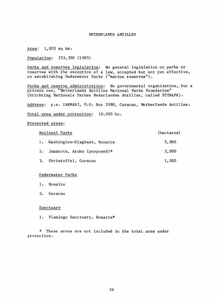
NETHERLANDS ANTILLES
A r e a : 1,020 sq km.
Population: 253,300 (1983)
Parks and reserves legislation: No general legislation on parks or reserves with the exception of a law, accepted but not yet effective, on establishing Underwater Parks ("marine reserves").
Parks and reserve administration: No governmental organization, but a private one, "Netherlands Antilles National Parks Foundation" (Stichting Nationale Parken Nederlandse Antillen, called STINAPA).
Address: p.a. CARMABI, P.O. Box 2090, Curacao, Netherlands Antilles.
Total area under protection: 10,000 ha.
Protected areas:
National Parks (hectares)
1. Washington-Slagbaa i , Bonaire 5,900
2. Jamanota, Aruba (proposed)* 3,000
3 . C h r i s t o f f e l , Curacao 1,500
Underwater Parks
1. Bonaire
2. Curacao
Sanctuary
1. Flamingo Sanctuary, Bonaire*
* These areas are not included in the total area under protection.
56

Washington-Slagbaai National Park
Management Category: II (National Park).
Biogeographical Province: 8.17.4 (Venezuelan Dry Forest).
Legal Protection: Total
Date established: May 1969, enlarged in September 1977.
Geographical location: Northwest tip of Bonaire; 12 17'N, 68 23'W.
Altitude: Sea level up to 241 m.
Area: 5900 ha (400 ha having been added in 1977).
Land tenure: One part owned by the Government but managed by STINAPA, the other part owned and managed by STINAPA.
Physical features: In the northeast, north, west and southwest bordered by the sea, in the south by the Oil Terminal BOPEC, and in the east by privately-owned land. The coastal fringe is of coral limestone, the central part volcanic (Upper Cretaceous). There are several large landlocked bays (good feeding grounds for flamingos and wading birds) . An old Plantation House in dilapidated state can be found at the Boca of Slagbaai. The wet season is October to January, and annual rainfall is 532 mm. Mean temperature is 27.6 C, mean maximum 31.2 C and mean minimum 24.2 C.
Vegetation: Saltflat vegetation: mangroves. Batis maritima and Suriana maritima. Limestone plateau: Metopium brownei and Coccoloba swartsii. Washikemba formation vegetation: Haematoxylon brasiletto, Opuntia wentiana, Opuntia curassavica (endemic), Croton flavens, Acacia tortuosa, Prosopis juli-flora and candle cacti (one endemic species)•
Noteworthy fauna: This park is a refuge for the yellow-shouldered parrot (Amazona barbadensis rothschildi), the brown-throated parakeet (Aratinga pertinax xanthogenius) and the pearly-eyed thrasher (Margarops fuscatus bonairensis). All are endemic, but there is some query as to whether rothschildi is a valid sub-species of Amazona. Other fauna include Phalacrocorax olivaceus, common noddy Anous stolidous, Sula leucogaster, 7 lizard species (2 of them endemic) and about 30 landsnail species (half of which are endemic). The supersaline landlocked bays are feeding grounds for flamingos (Phoenicopteridae), herons (Ardeidae), stilts (Recurvirostridae), wading birds, terns (Laridae), etc. The coral reefs along the coast are of exceptional beauty.
Zoning: In 40% of the park area goats are present (about 1 per ha) ; in the other part there are a few goats (about 1 per 10 ha).
57

Disturbances or deficiencies: Poaching of goats (no problem for the park!), iguanas and — worst of all — many juveniles of the parrot Amazona barbadensis rothschildi (which are sold for $50).
Scientific research: Parrot research Amazona barbadensis rothschildi.
Special scientific facilities: Facilities of Karpata including small laboratory, dormitory and cars.
Principal reference material; Field Guide National Park Washington, Bonaire, (1979), STINAPA Series No. 9.
Staff: 4 park rangers
Budget: US $20,000 per year.
Local Park or reserve administration: The Park Board of STINAPA
Name of CNPPA Coordinator: Allen D. Putney
Information dated: May 1983
58
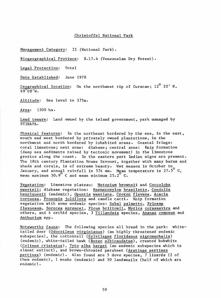
Christoffel National Park
Management Category: II (National Park).
Biogeographical Province: 8.17.4 (Venezuelan Dry Forest).
Legal Protection: Total
Date Established: June 1978
Geographical location: On the northwest tip of Curacao; 12 20' N, 69U08'W.
Altitude: Sea level to 375m.
Area: 1500 ha.
Land tenure: Land owned by the island government, park managed by STINAPA.
Physical features: In the northeast bordered by the sea, in the east, south and west bordered by privately owned plantations, in the northwest and north bordered by inhabited areas. Coastal fringe: coral limestone; next zone: diabase; central zone: Knip formation (deep sea sediments raised by tectonic movement) in the limestone grottos along the coast. In the eastern part Indian signs are present. The 18th century Plantation House Savonet, together with many barns and sheds and corals, is of extreme beauty. Wet season is October to January, and annual rainfall is 574 mm. Mean temperature is 27.5 C, mean maximum 30.9 C and mean minimum 25.2 C.
Vegetation: Limestone plateau: Metopium browneii and Coccoloba swartsii; diabase vegetation: Haematoxylon brasiletto, Condolia henriquezii (endemic), Opuntia wentiana, Croton flavens, Acacia tortuosa, Prosopis juliflora and candle cacti. Knip formation vegetation with some endemic species: Sabal palmetto, Xylosma flexuosum, Sorocea spreucei, Ficus brittonii, Myrica curassavica and others, and 4 orchid species, 3 Tillandsia species, Ananas comosus and Anthurium spp.
Noteworthy fauna: The following species all breed in the park: white-tailed deer (Odocoileus virginianus) (an highly threatened endemic subspecies), the cottontail (Sylvilagus floridanus nigronuchalis) (endemic), white-tailed hawk (Buteo albicaudatus), crested bobwhite (Colinus cristatus), Tyto alba bargei (an endemic subspecies which is almost extinct), and brown-throated parakeet (Aratinga pertinax pertinax) (endemic). Also found are 5 dove species, 7 lizards (2 of them endemic), 1 snake (endemic) and 30 landsnails (half of which are endemic).
59

Zoning: 11 small areas are fenced off against goats, for a natural reforestation experiment.
Disturbances or deficiencies: Picking of plants, especially orchids (mostly by Europeans), roaming of introduced goats and poaching of deer and iguanas by local people.
Scientific research: 1) Natural reforestation experiment (in areas fenced off from goats); 2) Study of the plague of the (introduced) rubber vine (Cryptos tegia grandiflora); 3) Quantitative study of the influence of goats on the vegetation; 4) Iguana management; 5) Deer survey.
Special scientific facilities: Facilities of the Caribbean Marine Biological Institute (CAKMABI), Curacao, including laboratory, dormitory, library, cars, etc.
Principal reference material: Stoffers, A.L. (1956). The vegetation of the Netherlands Antilles. Studies Flora Curacao no. 1, Utrecht.
Stoffers, A.L. (1962). The Flora of the Netherlands Antilles, Vol. 1, Annual reports of STINAPA, published in the "STINAPA" series.
Staff: One manager (Dick Hoogerwerf) and 3 park rangers.
Budget: US $75,000 per year.
Local Park or reserve administration: Mr. Dick Hoogerwerf and a park Board of STINAPA. '" ' " "
Name of CNPPA Coordinator: Allen D. Putney.
Information Dated: May 1983
60
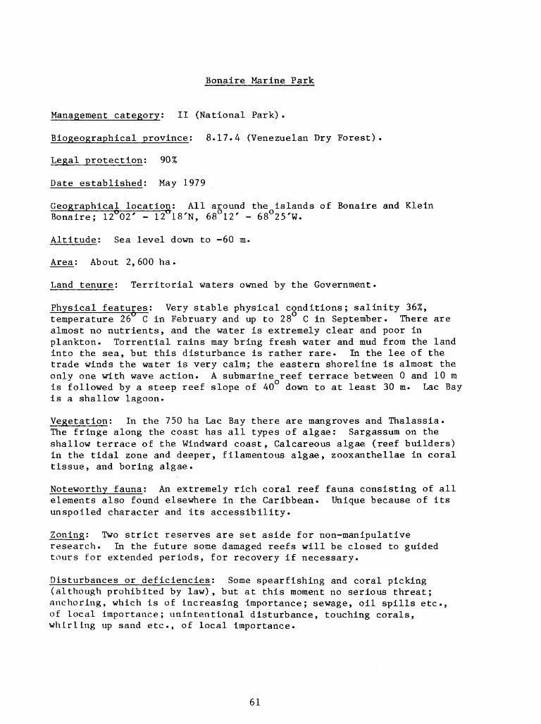
Bonaire Marine Park
Management category: II (National Park).
Biogeographical province: 8.17.4 (Venezuelan Dry Forest).
Legal protection: 90%
Date established: May 1979
Geographical location: All around the islands of Bonaire and Klein Bonaire; 12"02' - 12°18'N, 68°12' - 68°25'W.
Altitude: Sea level down to -60 m.
Area: About 2,600 ha.
Land tenure: Territorial waters owned by the Government.
Physical features: Very stable physical conditions; salinity 36%, temperature 26 C in February and up to 28 C in September. There are almost no nutrients, and the water is extremely clear and poor in plankton. Torrential rains may bring fresh water and mud from the land into the sea, but this disturbance is rather rare. In the lee of the trade winds the water is very calm; the eastern shoreline is almost the only one with wave action. A submarine reef terrace between 0 and 10 m is followed by a steep reef slope of 40 down to at least 30 m. Lac Bay is a shallow lagoon.
Vegetation: In the 750 ha Lac Bay there are mangroves and Thalassia. The fringe along the coast has all types of algae: Sargassum on the shallow terrace of the Windward coast, Calcareous algae (reef builders) in the tidal zone and deeper, filamentous algae, zooxanthellae in coral tissue, and boring algae.
Noteworthy fauna: An extremely rich coral reef fauna consisting of all elements also found elsewhere in the Caribbean. Unique because of its unspoiled character and its accessibility.
Zoning: Two strict reserves are set aside for non-manipulative research. In the future some damaged reefs will be closed to guided tours for extended periods, for recovery if necessary.
Disturbances or deficiencies: Some spearfishing and coral picking (although prohibited by law), but at this moment no serious threat; anchoring, which is of increasing importance; sewage, oil spills etc, of local importance; unintentional disturbance, touching corals, whirl Lug up sand etc., of local importance.
61
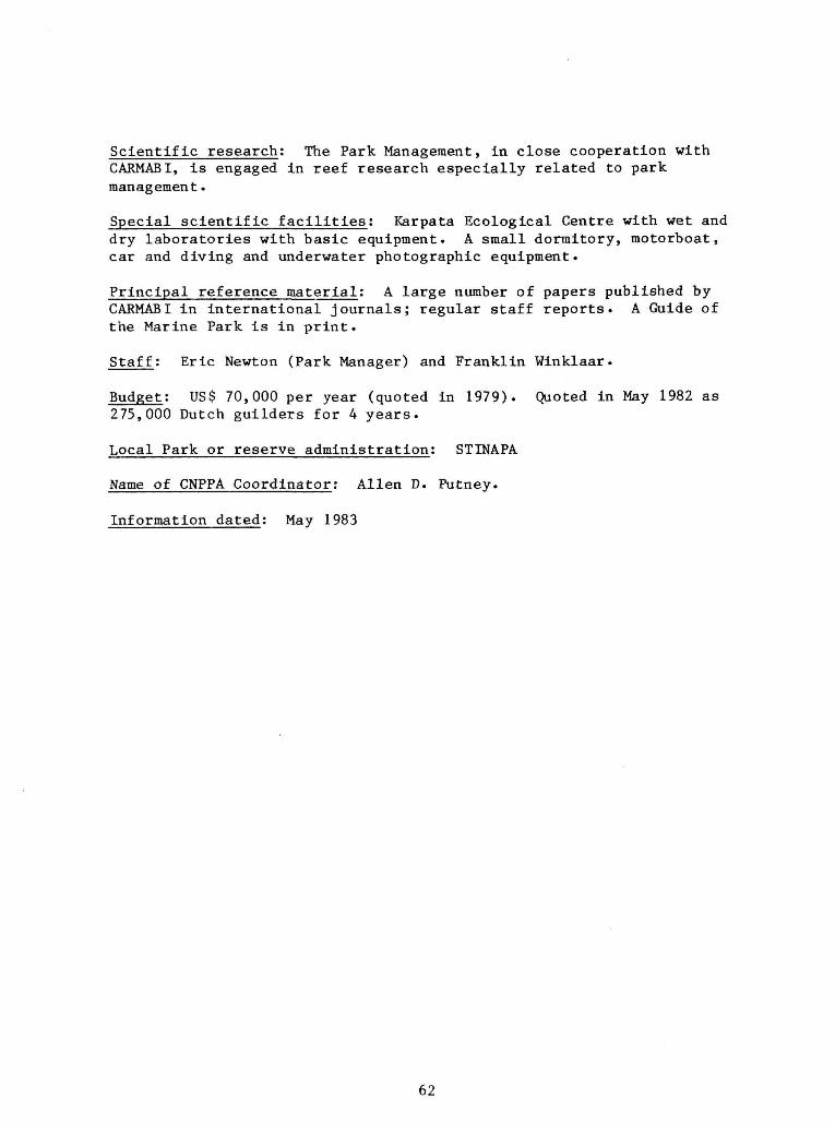
Scientific research: The Park Management, in close cooperation with CARMABI, is engaged in reef research especially related to park management.
Special scientific facilities: Karpata Ecological Centre with wet and dry laboratories with basic equipment. A small dormitory, motorboat, car and diving and underwater photographic equipment.
Principal reference material: A large number of papers published by CARMABI in international journals; regular staff reports. A Guide of the Marine Park is in print.
Staff: Eric Newton (Park Manager) and Franklin Winklaar.
Budget: US$ 70,000 per year (quoted in 1979). Quoted in May 1982 as 275,000 Dutch guilders for 4 years.
Local Park or reserve administration: STINAPA
Name of CNPPA Coordinator: Allen D. Putney.
Information dated: May 1983
62
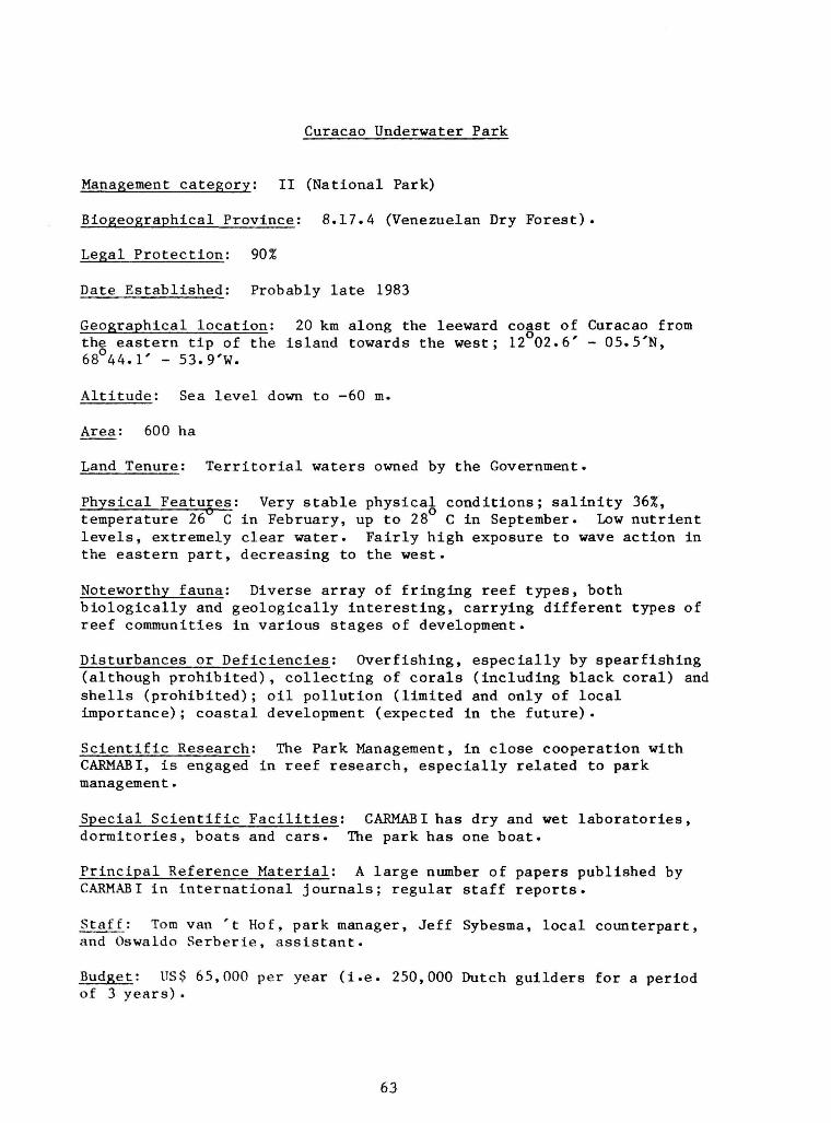
Curacao Underwater Park
Management category: II (National Park)
Biogeographical Province: 8.17.4 (Venezuelan Dry Forest).
Legal Protection: 90%
Date Established: Probably late 1983
Geographical location: 20 km along the leeward coast of Curacao from the eastern tip of the island towards the west; 12 02.6' - 05.5'N, 68 44.1' - 53.9'W.
Altitude: Sea level down to -60 m.
Area: 600 ha
Land Tenure: Territorial waters owned by the Government.
Physical Features: Very stable physical conditions; salinity 36%, temperature 26 C in February, up to 28 C in September. Low nutrient levels, extremely clear water. Fairly high exposure to wave action in the eastern part, decreasing to the west.
Noteworthy fauna: Diverse array of fringing reef types, both biologically and geologically interesting, carrying different types of reef communities in various stages of development.
Disturbances or Deficiencies: Overfishing, especially by spearfishing (although prohibited), collecting of corals (including black coral) and shells (prohibited); oil pollution (limited and only of local importance); coastal development (expected in the future).
Scientific Research: The Park Management, in close cooperation with CARMABI, is engaged in reef research, especially related to park management.
Special Scientific Facilities: CAJRMABI has dry and wet laboratories, dormitories, boats and cars. The park has one boat.
Principal Reference Material: A large number of papers published by CARMABI in international journals; regular staff reports.
Staff: Tom van 't Hof, park manager, Jeff Sybesma, local counterpart, and Oswaldo Serberie, assistant.
Budget: US$ 65,000 per year (i.e. 250,000 Dutch guilders for a period of 3 years) .
63

Local Park or Reserve Administration: STINAPA
Name of CNPPA Coordinator: Allen D. Putney
Information Dated: May 1983
64

Flamingo Sanctuary
Management category: IV (Wildlife Sanctuary).
Biogeographical Province: 8.17.4 (Venezuelan Dry Forest).
Legal Protection: Total
Date established: November 1969
Geographical location: At the southern tip of Bonaire; 12 02'30"N, 68 15'W.
Altitude: Sea level.
Area: 55 ha.
Land tenure: Owned by International Salt Co. (AISCO) and supervised by the Flamingo Sanctuary Board, p.a. AISCO, Bonaire.
Physical features: Formerly part of the vast Pekelmeer but, since 1969, surrounded by the Solar Salt Works of AISCO. By means of a dike around the area and a pump, the water in the Sanctuary can be drained and kept at a certain level. Soil consists of coral debris, coral sand and mud.
Vegetation: Almost barren. Under water is a sparse algal vegetation in and on top of the muddy bottom. In the dry parts there is no visible vegetation.
Noteworthy fauna: One of the four breeding sites left in the Caribbean for the red flamingo, Phoenicopterus ruber ruber. The number of breeding pairs varies widely; there have been years without any breeding (1944-1950), but there are also years when 2150 breeding pairs are present. The average may be about 1000 pairs per breeding season.
Zoning: None
Disturbances or deficiencies: Overflying sport planes (although prohibited by law) in the breeding season, resulting in the birds leaving their nests, often without returning. Intruders, sometimes poachers, but mostly photographers and ornithologists (!) also disturb breeding, resulting in unhatched eggs and starving juveniles.
Scientific research: Since 1959, there has been regular scientific research, first by Jan Rooth, and since 1975 also by Bart de Boer, on food habits, availability of foods, migration, breeding behavior, mortality, etc. Since 1982 Brother Candidus monitors migration and breeding activities.
65
Special scientific facilities: None. No visitors or scientists are allowed to enter the Sanctuary during the months when the flamingos are breeding.
Principal reference material: de Boer, B.A. (1979). Flamingos on Bonaire and in Venezuela (STINAPA Documentation Series no. 3).
Rooth, J. (1965). The flamingos on Bonaire. Utrecht.
Rooth, J. (1976). Ecological aspects of the flamingos on Bonaire (STINAPA Documentation Series no. 11).
Staff: Rene Hakkenberg (Manager of AISCO) controls the Sanctuary.
Budget: About US$ 4,000 per year.
Local Park or reserve administration: Mr. Hakkenberg, AISCO.
Name of CNPPA Coordinator: Allen D. Putney.
Information dated : May 1983
66

COUNTRY SUMMARY FOR GRENADA
1 2 Brian J. Hudson and Charles H. Francis
Natural Resources. Demography, and Economy
The State of Grenada, comprising the islands of Grenada, Carriacou, Petite Martinique and a number of islets, is 344 sq. km. or 133 sq. miles in area. Its geological composition is mainly volcanic. There is abundant evidence of recent volcanism, including numerous volcanic craters, and the submarine volcano of Kick 'em Jenny off the north coast has been active within living memory. Some sedimentary rocks occur, notably limestone on Carriacou.
The deeply dissected mountainous terrain rises to 840 m. (2757 ft.) on Mount St. Catherine, an extinct or dormant volcano. Flat or gently sloping land is very scarce indeed, about 70Z of the island of Grenada having slopes exceeding 20 degrees. Carriacou is rather less rugged, but is more seriously eroded and suffers from lack of moisture in the topsoil.
The coast is varied, with cliffs, sheltered inlets, sandy beaches, coral reefs, mangrove swamps (now much depleted) and seagrass beds.
The wildlife of Grenada includes the green monkey, turtle, manicou and tatoo.
There are no important minerals apart from aggregate material and beach and river sand used in construction, and forest resources are limited.
Most of Grenada proper is quite well watered, rainfall generally being in the range of 130-400 cm. + (c. 50 - 150 inches +) per annum, but water shortages occur in the dry season. Hurricanes occur very infrequently, but rainstorms cause occasional severe damage.
Grenada's generally pleasant climate, with temperatures usually around 30 degrees C, together with superb beaches and exceptionally beautiful scenery combine to make the country particularly suitable for tourism which has great potential for development.
Even at its present low level of development, tourism plays an important role in the Grenadian economy. The other leading economic activities are in agriculture for export, notably nutmeg and other spices, banana and cocoa, as well as other tree crops. Sugar cane cultivation and fisheries are also important. There is a
1 Lecturer, Department of Geography, University of the West Indies, Mona, Jamaica, and Physical Planning Adviser, Ministry of Planning, St. George's, Grenada
2 Land Use Officer, Land and Water Resource Management, Ministry of Agriculture, St. George's, Grenada
67
small, but expanding manufacturing sector, including the production of garments. Agro-industry, based on local produce, has expanded considerably in recent years, and the new International Airport, due for completion in 1984, is expected to boost the Grenadian economy considerably, especially in the field of tourism.
Grenada's population totals about 110,000, giving an average density of nearly 320 people per sq. km. or about 825 per sq. mile. Settlement is widely, but unevenly, distributed, apart from the relatively uninhabited higher central areas. The main concentration of population occurs in the southwest of Grenada around St. George's, the chief capital and chief port. In this area are the main industrial and tourism zones.
Forests
Some of the most striking features of the relief of Grenada are seen at the three lakes of Grand Etang, Levera Pond and Lake Antoine, the latter set in an almost perfect circular ash crater in the northeast. Grenada has many permanent rivers and streams flowing radially from the central ridge down steep boulder-strewn courses to the coasts. The largest of these, the Great River (which is in watershed No. 29) has along its lower course near Grenville, on the east coast of the island, the only considerable alluvial flat in the island.
Most of Grenada was covered at one time by forests of one type or another. Beard (1944) stated that four types of rain forest can be distinquished in Grenada - Lower Mountain Rain Forest, Montane Rain Forest, Elfin Woodland and Palm Brake - and that they are determined by the factor of increasing exposure to wind. Lower Montane Rain Forest, the tallest type, is only found in sheltered valleys and basins; the other types in order mentioned reflecting increasing exposure. Only lower Montane Rain Forest has trees large enough to produce economic timber. Much of the main axial ridge and higher subsidiary ridges is in forest of one of these four types. There is little forest on the lower slopes or in the valleys which have been cleared for agriculture for many years.
The drier northeast and southwest Corners of the island show relics of deciduous seasonal forest and thorn woodland and cactus scrub with decreasing rainfall, but most of these areas today show poor thorn scrub or thorn savannah with many acacia or logwood trees.
There is very little true forest remaining except in the mountains on Crown Lands or in the higher parts of some large estates. There are some very small areas planted with timber trees, but they are too small and too few to be of much importance. Grand Etang Forest Reserve, which has an area of 1,544 ha., is the largest expanse of forest in Grenada.
Major Problems
Probably the major problem with respect to the management of Grenada's natural resources is the extremely limited land area, especially land which can be readily developed for agricultural or building purposes. Most of the land is
68
steep and prone to erosion if not used with proper care. Carriacou, despite its less rugged topography, has suffered most from erosion largely because of poor farming practices, including uncontrolled grazing in the "lego" season.
The severe shortage of land for any kind of development has led to some loss of agricultural areas through urban expansion, including residential, industrial and tourism development; but areas of under-utilized agricultural land also exist, and measures are being implemented to ensure fuller use of these.
Another problem which, in part, reflects the country's limited land area and high population density is that of waste disposal, both solid and liquid. Garbage is dumped at various sites around the coast, on or near the shore or in coastal swamps to the detriment of the environment, and only part of the capital, St. George's, has a piped sewerage system. This system, however, is over 50 years old and the sewage is pumped untreated into the sea. Septic tanks, pits and buckets, and (for hotels) small treatment systems are used outside central St. George's. As a consequence, ground and water pollution is an ever-present threat.
Pollution of the beaches constitutes a potential impairment of one of Grenada's major tourist attractions. Beaches are also threatened by sand removal for construction purposes, while in a very few areas poorly designed development has marred the attractiveness of the landscape.
Other tourist attractions which are threatened include Grenada's heritage of historic buildings and sites, many of which have suffered from neglect or inappropriate development. Of particular importance is the old town of St. George's, widely recognized as one of Grenada's main tourist sites. Here attractive 18th and 19th century brick and stone buildings, roofed with characteristic fish-scale tiles, cluster around the picturesque harbour, but the replacement of the clay tiles with galvanized metal sheets, and unsympathetic alterations to the facades, including the painting of brickwork, are among the serious threats to the character of the town.
Government Policy
The determination of the People's Revolutionary Government to promote the development of Grenada in a way which is consistent with sound environmental principles is illustrated by its decision in 1982, to form an all-embracing national conservation organization. This body, the Environmental Conservation Council, was officially launched on 5 April 1983. As stated in its constitution, the aims of this council are to advise generally on the environment and its amenity, and in particular on ways of conserving and developing Grenada's soil, water, forest and marine resources, as well as buildings and sites of historical or archaeological interest. The Council is to encourage environmntal education and advise on policies and legislation to protect the environment. In pursuance of these aims the Council "shall endeavour to stimulate community action."
Importance of Natural Resources to National Development
With its economy based mainly on agriculture, agro-industry and tourism, Grenada's natural resources of fertile soil, favourable tropical climate, good
69

water supplies, landscape beauty and superb beaches are of fundamental importance. Forest and marine resources are also important to Grenada's nat iona1 development.
The Grand Etang Forest Reserve in the center of Grenada combines the functions of watershed protection and wildlife and landscape conservation with commercial timber production. The volcanic crater lake is a well-known tourist attraction, and the nearby mountains, with their historical associations with the Fedon's Rebellion of 1795, appeal to the hiker.
Characteristics of Natural Resouce Uses
While there is evidence of official concern for Grenada's natural resources since colonial times and shortly after the country's independence (e.g. the establishment of Grand Etang Forest Reserve in 1910 and the Beach Protection Ordinance in 1955), it is probably true to say that, until very recently, the attitude to natural resoures has been characterized by exploitation with little regard for overall national development or for future generations of Grenadians. The degraded environment of Carriacou, in particular, testifies to this.
Although bad practices continue (e.g. inappropriate cultivation on steep slopes, burning of vegetation cover, beach sand removal, destruction of mangrove swamps), there are signs of growing concern among Government officials and members of the private sector for the conservation of Grenada's natural resources. Natural resource development is now being undertaken with an increasing awareness of the need to achieve maximum sustainable use.
Recent major thrusts for natural resource use include Government measures to improve agricultural, forestry and fisheries techniques; schemes for harnessing rivers for both water and electricity supplies; investigations and experiments in the field of alternative energy sources (e.g. biogas, geothermal, wind and solar energy - the new Point Salines lighthouse is solar powered); and plans for the rapid expansion of tourism based on Grenada's climate, beaches and landscape, and the heritage of historical buildings and sites.
The proposed Levera National Park scheme combines wildlife and landscape conservation with tourism, agriculture, fisheries and forestry (possibly associated with controlled charcoal production), and might serve as a model for ecodevelopment on a much wider scale. Here, as elsewhere in Grenada's development, public involvement in decision-making and management is to be a characteristic feature.
Planning and Management Infrastructure for Natural Resource Management
A. Departments and Main Functions
1. Environmental Conservation Council
Comprising representatives of ministries, departments and other bodies whose functions involve aspects of environmental management.
70
Function: To coordinate and reinforce the environmental management functions of the various bodies.
2. Physical Planning Unit
Ministry of Planning
Functions: Land use planning, development control, environmental management. Secretariat of the Environmental Conservation Council and of the Land Development Control Authority.
3. Land and Water Resource Division
Ministry of Agriculture
Functions: Agricultural land use planning, land use capability classification, soil survey and mapping, soil and water conservation programming and agricultural irrigation.
4. Environmental Health Services Division
Ministry of Health
Functions: Solid and liquid waste disposal, vector and rodent control, etc.
5. National Science & Technology Council
Functions: To make recommendations for the establishment of science and technology planning, transfer of compatible technology, stimulation of indigenous technology and environmental conservation, initiation, co-ordination, monitoring and evaluation of science and technology projects, etc.
6. Forestry Development Cooperation
Functions: Permanent preservation of forests where necessary for the prevention of soil erosion and protection of water catchment areas, the protection of wildlife, selected felling and re-forestation with high yield, fast-growing species, and general management of the reserve to provide maximum protection on the basis of sustained yield.
B. Staff Working on Natural Resources
The bodies listed above employ staff with expertise in various aspects of natural resource management, including agricultural and forestry experts and geographers, some with university and post-graduate training in specialist fields. The number of qualified staff is inadequate, however.
71

C. Training Program and Needs
There is a lack of training programs in the field of natural resource management in Grenada. This is one of many different areas for which Grenada has need for trained personnel. The demand might be met by local and/or overseas training programs, but this will probably require international assistance.
D. Major Management Problems
Perhaps the main problem is the lack of communication and coordination between the different bodies involved in natural resource development and management. The Environmental Conservation Council has been established to help resolve this problem.
Other problems include the shortage of suitably qualified professional staff and the general lack of public awareness of environmental problems. There is a need for widespread environmental educaton at all levels.
Proposed Parks and Protected Areas
Name: Levera National Park or Levera National Monument
Location: Levera Pond and surrounding area (including three offshore islands) on the northeast coast of Grenada, about 3km (2 miles) east of Sauteurs.
o o 12 13' N; 61 37' W
Approximate size: c. 8 sq. km (c. 3 sq m)
This may be doubled if the Lake Antoine area is included.
Proposed by: The Ministry of Agriculture and the Eastern Caribbean Natural Area Management Program.
Present status: No special protective legislation has yet been introduced but strict development control in this area is proposed. Land owership is divided between the Government and private owners. Small farming, fishing, and charcoal burning are practiced in the area. Levera Pond and the surrounding mangroves are important for wildlife, especially birds. The beaches attract visitors, both local and overseas.
72
COUNTRY SUMMARY FOR GUADELOUPE
1 Jacques Portecop
Background
The archipelago of Guadeloupe is located at 16 31' north latitude and 61 11' west longitude. It is composed of nine volcanic and sedimental islands: Basse-Terre, Grande-Terre, Marie-Galante, the Saintes, Desirade, Petite-Terre, Tintamarre, Saint-Martin and Saint-Barths.
The archipelago's surface area is 1705 square km. Its culminant (highest) point is La Soufriere, 1467 m. above sea level.
Guadeloupe has an insular tropical climate characterized by a lot of rain, especially at the summits of the Basse-Terre area.
Its natural, resources are numerous and include, at the terrestrial level, the deciduous seasonal forest, the evergreen-semi-evergreen forest, the rain forest, and the montane forest. The mangrove woodland is the transition between the terrestrial world and the marine one; coral reefs and Thalassia beds can be found there, just as in the other islands.
Mineral resources are inexistent. However, there is an important hydrographic network as well as a workable geothermics activity in the Basse-Terre area and in Bouillante.
In 1982, there were 328,000 inhabitants, which represents a perceptible increase over the 1975 population census (324,530).
The two main cities are Basse-Terre (pop. 13,655) and Pointe-a-Pitre (pop. 25,420). They are characterized by their administrative and commercial roles, respectively.
The leading economic activities of the archipelago are, for the primary sector, sugar cane agriculture, banana agriculture, market-gardening, food production and cattle-breeding. An agro-industry with the production of sugar and rum and some small food-processing industries are also present.
Tourism is now a growing industry.
Three Main Problems
Deforestation. There are two main sectors in the Guadeloupe forest: the domanial property which belongs to the state and the private one which belongs to private individuals. It is especially the domanial sector which is being developed by the National Forest Service Office (O.N.F.).
1 Universite Antilles-Guyane, U.E.R. Sciences, Pointe-a-Pitre, Guadeloupe
73
The island's forestry directives are in a handbook whose title is "L'Amenageraent de la foret soumise de Guadeloupe" (the Guadeloupe domanial forest management 1979-1990). Throughout the handbook, objectives are precisely written out; it is also said that the most interesting areas of the forest are protected.
The nation's forestry objectives include:
— A role of protection, allowing the forest to provide for wood production (mahogany: Swietenia macrophylla).
— A function of biological conservation, making possible the safeguard of animal and plant species.
— A social function, making possible pedagogical and recreational activities.
In order to reach these objectives, the domanial forest has been delimited into a series of managements that mainly take into account natural conditions, and for which a prior object has been set. These are:
— A first series for "protection," consisting of 15,000 ha of evergreen-rain forest. It represents more than half of the domanial forest.
— A second series for "transformation" which is 8,000 ha. It is reserved for wood production. Natural resources that have been impoverished in species will undergo a process of enrichment.
— A third series for "selective enrichment" which is 500 ha; devoted to the selection of "Laurier rose montagne" (Podocarpus coriaceus).
— A fourth series for "natural enrichment" which is 4,500 ha and has a mixed function: that of protection and enrichment for production.
Impairment of tourist attractions. Particular attention has been drawn on the impairment of tourist attractions in Guadeloupe. The inventory of impairment caused to beaches has been seriously drawn up by the O.N.F. upon which depend the forests and coasts. Proposals for managements have been made, and managements have been achieved on beaches (parking areas, picnic areas). As far as cliffs are concerned, paths and managements panoramas have been delimited.
Historic sites at Fort St. Charles and Fort Fleur d'Epee have been restored and are the objects of cultural entertainment.
Loss of wildlife. The loss of wildlife has called the growing attention of the Prefecture offices (Department for the Environment) and of the Regional Delegation for Architecture and Environment (D.R.A.E.).
74

The marine fauna is protected by the March 26, 1979 decree no. 79.6. A list of the species in danger of extinction has been drawn. This list includes:
— 36 terrestrial species, including the grass snake, iguana, raccoon, agouti and most of the bird species.
— 92 marine species, including the water turtle, shells and marine fishes.
These species are the object of four types of protection:
1. Total protection.
2. Protection from trading.
3. Protection defined by the Prefecture.
4. Regulations concerning hunting and fishing have been especially defined.
Regulations Protecting the Natural Resources
The French government regulations concerning the protection of natural resources in Guadeloupe are as follows:
1. The July 22, 1960 decree no. 60.708, relative to the creation of national parks.
It is reinforced by bill no. 61.1195 of October 31, 1961, relative to national parks. It Is modified by bill no. 77.1141 of October 12, 1977.
This decree ensures, in these parks, the conservation of the fauna, flora, subsoil, atmosphere, waters and, generally speaking, the environment from all effects of natural impairment. The decree also preserves the park from all artificial interferences that could alter its aspects, its different components and its evolution.
2. The October 24, 1975 decree no. 75.983, relative to the regional and natural parks; it extends its protection to more restricted and natural zones.
3. The July 10, 1976 decree no. 76.620, relative to the protection of nature. It is modified by bill no. 76.1286 of December 31, 1977. The latter decree ensures the protection of the fauna and flora, that of pets, the management of natural zones in natural reserves, and the protection of wooded spaces.
4. The October 12, 1977 decree no. 77.1141, used for the application of article 2 of bill no. 76.620 of July 10, 1976, relative to the protection of nature.
75
5. The December 25, 1977 decree no. 77.1928, relative to natural reserves. It reinforces the protection of the flora and fauna.
6. The August 25, 1979 decree no. 79.716, approving the directive of national management relative to the protection and management of the coastline.
7. The memorandum of August 26, 1980, relative to the use of domanial land on the coastline, in the overseas departments.
These decrees ensure the protection of the biotypes in Guadeloupe which are becoming more and more in danger of extinction.
Importance of Natural Resources
In Guadeloupe, natural resources correspond to the following activities:
Agriculture. It has been defined in 1980 by the following statistics:
Useful agricultural surface area: 65,182 ha, representing 37% of Guadeloupe's surface area.
Agricultural surface area used: 57,385 ha
Waste and fallow land : 7,166 ha
Buildings and yards : 630 ha
According to the agricultural surface area utilized, the main crops are:
Sugar cane : 20,992 ha
Savannahs : 20, 744 ha
Bananas : 8,470 ha
Truck-gardening: 4,755 ha
Orchards : 546 ha
Forests. In 1977, woods and forests occupied 70,000 ha of the land in Guadeloupe; but the potential exploitable forestry area corresponds to 13,000 ha of domanial forest.
Fishing. The importance of fishing may be evaluated according to the number of fishermen and fishing boats. In 1980, the number of fishermen was 885; in 1981, it increased to 1,024. The number of fishing boats also increased, from 1,581 in 1980 to 1,740 in 1981.
Parks. As far as parks are concerned, the natural potentialities of Guadeloupe are interesting. On the islands of Basse-Terre and Grande-Terre, it's likely to find various biotypes that may be classified in a park.
76

The forest types are numerous and the richness of their flora is interesting:
— Limestone or volcanic sandbeaches (Ipomoea pes capraea - Hippomane mancinella) in some areas, and especially in Deshaies, a coastline xerophytic rain forest, well preserved (Lithophila muscoides - Strumpfia maritima).
— The mangrove woodland of the Grand and Petit Cul-de-Sac Marin (Rhizophora mangle - Avicennia germinans prolonged by swamp forests with Pterocarpus officinalis).
— Deciduous seasonal forest above the limestone of Grande-Terre and Marie-Galante with Bursera simaruba, Canella wintera, on the volcanic stones of the leeward coast in Basse-Terre (Bursera simaruba - Piscidia carthagenensis, altering into thorn woodland and Cactus scrub with Acacia farnesiana - Cephalocereus nobilis - Melocactus intortus).
— The dense evergreen and semi-evergreen and rain forests of Basse-Terre with sumptuous trees (Dacryodes excelsa - Sloana massoni) and multiple aerial roots (Symphonla globulifera). It is rich in ferns and epiphytes.
— Elfin woodlands and savannah in high elevations (Charianthus alpinus -Pitcairnia bifrons) . They are great, especially because their yellow and orange colors line the soil of the Soufriere cliffs.
— Coral reefs can easily be seen in the Grand Cul-de-Sac Marin and the Malendure area on the leeward coast of Basse-Terre.
— Volcanisra is a dynamic phenomenon at La Soufriere, with its boiling and sulfuric waters, craters, and fumaroles.
— Historic and archaeological sites exist on the different islands.
Tourism. In Guadeloupe, touristic potentialities depend upon the above natural elements. The available hotel infrastructure was 3,362 rooms in 1981. It can be detailed into 1,674 rooms for high standard and luxurious hotels, 585 rooms for average standard hotels, 523 rooms for non-official hotels, 453 rooms for the Club Mediterranean and 130 other hotel rooms.
Wildlife resources. Wildlife resources are provided by biotypes:
The Flora: The evaluation of the fern and flowering plant flora, done by Stehle (1948), revealed 298 fern species and 1,717 flowering plant species, among which 86 are endemic.
The best represented endemic species are the Piperaceae, Myrtaceae, Asteraceae and Leguminoseae.
Nowadays, the above figures have perceptibly changed, with a study on ferns done by Proctor (1977) and one on flowering plants done by Fournet (1978).
77
The Fauna: As a whole, it is linked to the insular characteristics and is not very well provided, especially in large-size species.
The interesting or endemic animal species of the archipelago are:
Mammals : Raccoons : Procyon minor Agoutis : Dasyprocta noblei
Reptiles : Grass snakes or Couress: Dromiceus and Alsophis Iguanas: Iguana iguana (L)
Iguana delicatissima (L) Molokoy or Water turtle: Pseudemys stetjenegeri
Pelosus subniger
Endemic birds: Forest thrust: Cichlerminia lherminieri lherminieri (Lafresnaye)
Plumberus warblet: Dandroica plumbea (Lawrence) Guadeloupe woodpecker: Melanerpes L'herminieri
(Lesson) Clapper Rail: Ralus longirostris manglecola
(Dauforth)
Insects: Rhinoceros beetle: Dynastes hercules
Natural Resource Use
Agriculture. The agricultural production corresponding to the utilized agricultural surface area, presents a variety that can be verified in tons, through statistics provided over the past years (1980-1981):
— Sugar cane declined from 1,004,000 tons in 1980 to 830,000 tons in 1981.
-- The banana output grew from 83,000 tons in 1980 to 143,000 in 1981, a perceptible increase.
— Fruit output decreased from 8,700 tons to 6,700 tons.
Conversely, food production and market-gardening grew from 26,400 tons (1980) to 32,000 tons (1981). Cattle-breeding has a stable production, with 6,800 tons in 1930 and 6,400 tons in 1981.
This agricultural production is largely below the island's potential and requires adequate solutions.
Forestry. Forest exploitation still remains limited, for according to the plan of possible forestry lands exploitable, 8,300 ha can be exploited. However, topographic and road restraints, as well as wood enterprises, have very little importance and are hardly encouraging.
78

Fishing • The sea resources are in a difficult situation because of overfishing achieved by archaic methods (too small net meshes and too frequent fishing done in the same area). Production is low, as follows:
Fish: benthic fishing: 6.54 tons; pelagic fishing: 1,475 tons; crustacean fishing: 120 tons; shell-fishing: 300 tons; turtle fishing: 20 tons. Guadeloupe fishing provides 2/3 of the local fish consumption.
Tourism. The island's tourism has developed along the coastline with too many hotel structures that are not adapted to the landscape. There is a need to develop the island's tourism potential in the interior and mountain sectors. It is also necessary to develop hotel structures more adapted to the landscape.
Parks. In terms of parks, there are genuine potentials which are only partly exploited. Total exploitation requires a more effective emphasis and needs to be taken over by an administrative structure that is more adapted to its regional or national natural park vocation.
Wildlife. One of the characteristics of wildlife is that the public pays very little attention to it. Despite the legislation for protection, there is a need to educate the public about wildlife values, for the island's wildlife is not always respected.
79
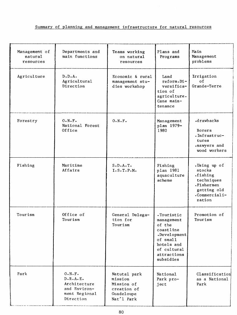
Summary of planning and management Infrastructure for natural resources
Management of natural resources
Agriculture
Forestry
Fishing
Tourism
Park
Departments and main functions
D.D.A. Agricultural Direction
O.N.F. National Forest Office
Maritime Affairs
Office of Tourism
O.N.F. D.R.A.E. Architecture and Environment Regional Direction
-.. - - . .
Teams working on natural resources
Economic & rural management studies workshop
O.N.F.
S.D.A.T. I.S.T.P.M.
General Delegation for Tourism
Natutal park mission Mission of creation of Guadeloupe Nat'l Park
Plans and Programs
Land reform.Diversifica
tion of agriculture. Cane maintenance
Management plan 1979-1980
Fishing plan 1981 aquaculture scheme
.Touristic management of the coastline .Development of small hotels and of cultural attractions subsidies
National Park project
Main Management problems
1 Irrigation j
of Grande-Terre
• drawbacks
Borers .Infrastructures .sawyers and wood workers
! .Using up of stocks .fishing techniques •Fishermen getting old •Commercialization
Promotion of Tourism
Classification as a National Park
80
Review of IUCN description of parks and protected areas.
Actually there is a Natural Park in Guadeloupe which is located only in Basse-Terre.
Proposed parks and protected areas:
Name: Guadeloupe National Park
Location and size:
Central part, south of Basse-Terre 17,660 ha Marine parts, West coast (Ilet Fajou) 150 ha
Grand Cul-de-Sac Marin 4,700 ha (Grande-Terre)
TOTAL 22,510 ha
Proposed by whom: Department of Guadeloupe
Present status of area: Public and private land.
Name: Reserve of North Mammelles
Location: Central part of Basse-Terre
Approximate size: 3,000 ha
Proposed by whom: Department of Guadeloupe
Present status of area: Public
Name: Reserve of Beaujendre-Village
Location: West Basse-Terre
Approximate size: 600 ha
Proposed by whom: Department of Guadeloupe
Present status of area: Public and private
81

COUNTRY SUMMARY FOR MARTINIQUE
Jacques Portecop
Background
o * o ' The island of Martinique is located at 14 36 north latitude and 62 34 west longitude. Its main part is volcanic, except for the southeast point which is sedimentary limestone. The island's surface area is 1,100 square km. and the relief is rather mountainous in the north, culminating with Montagne Pelee at 1,397 m.
Martinique has an insular tropical climate characterized by a lot of rain, especially at the tops of Montagne Pelee.
Its natural resources are numerous and include, at the terrestrial level, the deciduous seasonal forest, the semi-evergreen and evergreen seasonal forest, the rain forest, and the montane forest. The mangrove woodland is the transition between the terrestrial world and the marine one; coral reef beds are found especially in the eastern part of the island and Thalassia beds to the south.
Mineral resources are inexistent, but there is an important hydrographic network.
In 1982, there were 334,823 inhabitants, which represents a perceptible increase compared to the 1974 population census (328,566).
The largest city is Fort-de-France, with a population of 176,749 (1982). It is characterized by important administrative, commercial and industrial roles. The two other main cities are Trinite (pop. 73,488) and Marin (pop. 78,329) where administrative activities are dominant.
The leading economic activities of the island are, for the primary sector, banana agriculture, sugar cane agriculture, pineapple agriculture, market-gardening, food production, fruit production and cattle breeding. The island's agro-industry, with its production of sugar and rum, are complemented by fruit preserving and other small food processing industries. Tourism is now a growing industry.
Three Major Problems
Deforestation. There are two main sectors in the Martinique forest: the domanial property which belongs to the state and the private one which belongs to private individuals. It is especially the domanial sector which has been developed according to a "forest management plan" by the National Forest Service Office since 1975.
Universite Antilles-Guyane, U.E.R. Sciences, Pointe-a-Pitre, Guadeloupe
82
The 12,810 ha domanial sector is divided as follows:
1. "Out management" sector: 5,500 ha where any one management
is permitted.
Montagne Pelee area: 2,300 ha
Mangrove woodlands: 2,500 ha
Littoral zone "50 pas geometriques": 700 ha
2. Management sector: 7,310 ha
South Forest: 210 ha: Improvement by plantation
"Pitons du Carbet" mountain: 7,100 ha: This mountain is managed as follows:
1. "Serie hors cadre": 2,500 ha: Entire protection of the mountain areas•
2. "Serie normale": 4,750 ha: Rest area for deferred intervention: 2, 000 ha
3. Amelioration area by regeneration: 800 ha: in wild Fiddlewood: Chimarrhis cymosa; Whitewood: Simaruba amara; Laurees: Ocotea sp.; Candlewood: Dacyodes excelsa.
4. Amelioration area by various plantation species: 950 ha, most particularly for the Brazilian mahogany: Swietenia macrophylla.
Degradation of tourist attrations. Special attention has been drawn on the degradation of beaches in the south of Martinique. Parking areas and picnic areas serve to limit access to the sensitive zones of the beaches.
Loss of wildlife. Administrative measures have been taken in the French regulation frame-work. A list of protected flora and fauna was established according to Prefectoral decrees by the Regional Delegation for Architecture and Environment (D.R.A.E.). Hunting and fishing are now being regulated more and more precisely, especially for the opening and closing dates for birds, in function to the species biology.
Fishing: Prefectoral decree of March 19, 1983, about fishing, purchase, sailing and turtle trades.
Hunting: Ministry decree of September 4, 1975, about hunting policy.
83

Regulations Protecting the Natural Resources
The French government regulations, in terras of the protection of natural resources in Martinique, are as follows:
1. The July 22, 1960 decree no. 60.708, relative to the creation of national parks. It is reinforced by bill no. 61.1195 of October 31, 1961, relative to national parks. It is modified by bill no. 77.1141 of October 12, 1977. This decree ensures the conservation of the fauna, flora, subsoil, atmosphere, waters, and generally the entire environment from all effects of impairment. The decree also preserves the park from all artificial interferences that could alter its aspect, its different components and its evolution.
2. The October 24, 1975 decree no. 75.983, relative to the regional and natural parks; it extends its protection to more restricted and natural zones.
3. The July 10, 1976 decree no. 76.620, relative to the protection of nature. It is modified by bill no. 76.1286 of December 31, 1977 which ensures the protection of the fauna and flora, the management of natural reserves in natural zones and the protection of wooded spaces.
4. The October 12, 1977 decree no. 77.1141, used for the application of article 2 of bill no. 76.629 of July 10, 1976, relative to the protection of nature. It adds precision to the clauses of application of the "study of impact" which is indispensable to the projects on the management of nature.
5. The December 25, 1977 decree no. 77.1928, relative to natural reserves. It reinforces the protection of the flora and fauna.
6. The August 25, 1979 decree no. 79.7716, approving the directives of national management relative to the protection and management of the coastline.
7. The memorandum of August 26, 1980, relative to the use of domanial land on the coastline, in the overseas departments.
These decrees ensure the protection of the biotypes in Martinique which are becoming more and more in danger of extinction.
Importance of Natural Resources
In Martinique, natural resources correspond to the following activities:
Agriculture. Martinique's agriculture has been defined in 1980 by the following statistics:
Useful agricultural surface area : 63,200 ha Agricultural surface area used : 53,678 ha
. Waste and fallow land : 9,000 ha
. Building and Yards : 1,000 ha
84

Based on the agricultural surface area utilized, the main crops are:
Bananas : 9,655 ha Sugar cane : 9,655 ha Pineapple : 335 ha Truck-gardening : 5,600 ha Orchards : 1,200 ha
Forests. In 1975, woods and forests occupied 30,000 ha or about 27 per cent of the Martinique territory. The domanial forest occupied 12,810 ha or about 10 per cent of the island.
Fishing. The importance of fishing may be evaluated according to the number of fishermen and fishing boars in 1977 and 1980, respectively:
Fishermen : 1,079 and 1,045 Fishing boars : 1,012 and 969
Parks. Martinique has a Regional Natural Park that includes the main natural resources of the island. It is located in the northwest, the south and in the peninsula of Caravelle at the northeast of the island.
The biotypes are numerous to the sea and in the surrounding mountain summits. The beaches are located especially in the south, east and northeast. At Ste. Anne in the south, there is a good protected littoral woodland with Ipomoea pes capreae - Hippomane mancinella.
Northeast of Fort-de-France there is a mangrove woodland with wind effect: Pitcairnia angustifolia - Erythalis fruticosa.
The Bale of Fort-de-France has a mangrove woodland with Rhizophora mangle - Avicennia germinans.
The south has a deciduous seasonal forest with Tabebuia pallida -Bursera simaruba and a thorn woodland with Acacia farnesiana -Haematoxylon campechianum.
The central part of the island has semi-evergreen and evergreen seasonal forests with Inga laurina - Cordia sulcata.
The Pi ton du Carbet, Morne Jacob and Montagne Pelee mountain peaks have volcanic rain forest with Dacryodes excelsa - Sloanea dentata.
The Klfin woodlands and savannahs in the high elevations, with Didymopanax attenuatum - Charianthus nodosus - Guzmania plumieri -Pitcairnia spicata, are interesting vegetation associations.
Coral reefs are found in the southeast, particularly in the Baie des Anglais and the Caravelle peninsula.
The geological sites with the "Savane des Petrifications," the historic volcanism with the "Montagne Pelee," and the archeological and historical sites are very important elements of the Natural Regional Park.
85

Tourism. The island's tourism potential depends upon the above natural elements. The available hotel infrastructure was 2,319 rooms in 1981. It can be detailed into 1,272 rooms for high standard and luxurious hotels, 591 rooms for average standard hotels, 156 rooms for non-official hotels, and 300 rooms for the Club Mediterranean.
Wildlife resources. The wildlife resources of Martinique are provided by numerous biotypes, as follows:
Flora: An evaluation of ferns and flowering plants conducted by Stehle (1948) revealed 254 fern species and 1,544 flowering plants for a total of 1,798 species. Among them are 58 endemic species. Recent studies by J. Fournet (1978) and G. R. Proctor (1977) have increased the number of flowering plants and ferns to 2,676 species.
The best represented families are the Piperaceae, Compositae, and Sapotaceae.
Fauna: As a whole, the island's fauna is linked to the insular characteristics and is not very well provided, especially in large-size species.
The interesting or endemic animal species of the island are as follows:
Mammals: Opossum: Didelphis marsupialis insularis J. A. Allen
Reptiles: Trigonocephale snake: Bothrops lanceolatus (L.)
Iguana: Iguana delicatissima (Laurent!) Iguana iguana (L.)
Anolis: Anolis roquet roquet (L.)
Green Turtle: Chelonia mydas
Hawkshill Turtle: Eretmochelys imbricata
Leatherback: Dermochelys coriacea
Endemic birds:
White-breasted Thasher: Ramphocinclus b. brachyurus (Vieillot)
Rufus-throated Solitaire: Myadestes g. genibardis
(Swainson)
Martinique Oriole: Icterus bonana (L.)
Osprey: Pandion haliaetus carolinensis (Gmelin)
Broad-winged Hawk: Buteo platyptenuis rivieri (Verrill)
86

Mangrove Cuckoo: Coccyzus minor vincentis (Clark)
Blue-headed Hummingbird: Cyanophaia bicolor (Gm.)
Banaquit: Coereba flaveola martinicana (Reichenbah)
Spiders: Tarantula: Avicularia versicolor (L.)
Natural Resource Use
Agriculture. The island's agricultural production, corresponding to the utilized agricultural surface area, presents a variety that can be verified in tons through statistics provided over the past two years (1980 - 1981):
Sugar cane: 228,338 (80) 243,000 (81)
Banana: 114,000 (80) 187,000 (81)
Pineapple: 17,000 (80) 18,002 (81)
Truck-gardening: 49,700 (80) 52,500 (81)
Orchards: 7,000 (80) 7,300 (81)
Breeding: 5,800 (80) 6,000 (81)
These agricultural productions, although growing, are below the island's potential•
Forestry: Forest production, with regard to the 12,810 ha of the domanial forest, was 6,000 m in 1980. This is small compared to the amount imported (40,000 m ). Knowing there is 200 ha of forest available for planting to achieve the island's needs, it must be utilized within the framework of a protected forest considering the topographic restraints which limit its exploitation.
Fishing. The sea resources of Martinique are in a difficult situation because of overfishing achieved by archaic methods (too small meshes and too frequent fishing done in the same area) . Thus the production is low but growing: 3,300 tons in 1979 to 3,600 tons in 1980. This is not sufficient because the imports are strong: 4,558 tons in 1979 to 3,831 tons in 1980.
Tourism. The total number of nights provided for hotel guests increased from 729,000 in 1980 to 745,000 in 1981. The number of hotel guests also increased, from 139,000 in 1980 to 141,000 in 1981. However, the occupancy rate declined from 55.8% in 1980 to 49.6% in 1981. This means there are too many hotel rooms relative to the demand.
In addition, the island's tourist accomodations are concentrated along the seashore. There are no accomodations in the interior.
Parks. The island's park potentials are now actually growing, especially with the installation of the Park staff in the new Tivoli building in Fort-de-France.
87
Wildlife. One of the characteristics of wildlife is that the public pays very little attention to it. Despite the legislation for protection, there is a need to educate the public about wildlife values, for wildlife is not always respected.
88

Summary of planning and management infrastructure for natural resource management
Natural resources
Departments and
main functions
Staff working on natural resources
Training pro-gramms and needs
Major management problems
Agriculture D.D.A. Agriculture Departmental Direction
A.D.E.A.P. Economic studies and rural management workshop
Rural engineering
Sugar cane throw again culture
Diversification of culture
South irrigation
South irrigation
Sugar cane
Throw again culture
Forestry O.N.F. National Forest Office
O.N.F. Management Forest Plan 1976-1985
Insufficient roads. Difficult access in relation to soil nature and difficult relief• Frequent and vigorous rains
Fishing Maritime Affairs
S.D.A.T. I.S.T.P.M.
Fishing Plan 1981
Us ing up o f the stock
Scientific and Technical Institute for Fishing and Sea
Aquaculture Plan
Fishing techniques
Fishermen getting old
Commercialization
89

Tourism Office of Tourism
General Delegation for
Development of small hotels and cultural animation
Promotion of Tourism
Park Natural Regional Park
D.R.A.E.
A r c h i t e c t u r e and Environment
Na tu ra l management s e r v i c e
Houses Park r e a l i z a t i o n -Botan ica l house-Fores t house - Sea house - Gaoule house•
- water - Mangrove protection
90

91
Review of I.U.C.N. description of parks and protected areas.
PARC NATUREL REGIONAL DE LA MARTINIQUE
Management category : (Regional Park)
Biogeographical province : 8.41.13 (Lesser Antillean)
Legal protection : Decree of 24 October 1975. Ministry Arret 24 August 1976.
Geographical location : Northwest and major southern part of island of Martinique 14°45'N 61°05'W 14 30'N 60°55'W
Altitude : 1,397 m
Area : 70,143 ha
Land tenure : Predominantly public land
Physical features : Volcanic formation with historic volcano of Montagne Pelee (1,397 m). Little sedimentary formation in the south east part.
The marine formation include Fort-de-France mangrove bay and southeast coral reef formations, sea grass bed.
Vegetation : Elfin woodland, Palm brake on higher mountains; rain forest, mesophytic and xerophytic forest covering most of the central part of the park. Mesophytic and xerophytic forest and scrub woodland in the South Mangrove in the Fort-de-France Bay and little South Bay.
Noteworthy fauna
Mammals: Opossum: Didelphis marsupialis insularis J.A. Allen Trigonocephale: Botrops lanceolatus (L.) Iguana: Iguana delicatissima (Laurent!)
Iguana iguana (L.) Anolis: Anolis roquet roquet (L.) Green Turtle: Chelonia mydas Hawksbill Turtle: Eretmochelys imbricata Leatherback: Dermochelys coriacea White-breasted trembler: Ramphocinclus b. brachyurus
(Vieillot) Rufous-throated Solitaire: Myadestes g. genibardis
(Swainson) Martinique Oriole: Icterus bonana (L.) Osprey: Pandion haliaetus carolinensis (Gmelin) Broad-winged Hawk: Buteo platyptenuis rivieri (Verrill)

92
Mangrove Cuckoo: Coccyzus minor vincentis (Clark) Blue-Headed Hummingbird: Cyanophaia bicolor (Gm..) Banaquit: Coereba flaveola martinicana
(Reichenback) Tarantula: Avicularia versicolor (L.)
Zoning : Natural Reserve, Domanial Forest, protected fragile zone, reception zone, Natural vocation confirm, agropastoral activity zone.
Disturbances or Deficiencies : Garbage dumps in the mangrove swamp and on park roads. Pollution from agriculture (the sugar cane industry affecting the river's water.
Scientific research : Research under way: I.N.R.A. - U.A.G. Museum d'Histoire Naturelle de Paris -I.S.T.P.M. and isolated scientific coordination by a Scientific Council of the Pare Naturel Regional.
Special scientific facilities: Institute National de la Recherce Agronomique (National Institute
for Agronomical Research) . U.A.G. (Universite of Antilles-Guyane) Institute Scientifique et Technique des Peches Maritimes (I.S.T.P.M.), Robert (Martinique).
Principal reference material : FOURNET J. (1978). Flore des Antilles Francaises.
I.N.R.A.
PINCHON. Les Oiseaux (1963). Les Papillons (1969). Quelques aspects
de la Nature (1967).
BENIT0-ESPINAL. 1979. La Flore, la Faune. Antilles d'Hier et d'Aujourd'hui.
PORTECOP J. 1978. Phytogeographie, cartographie, ecologique et amenagement dans une ile tropicale. Le cas de la Martinique.
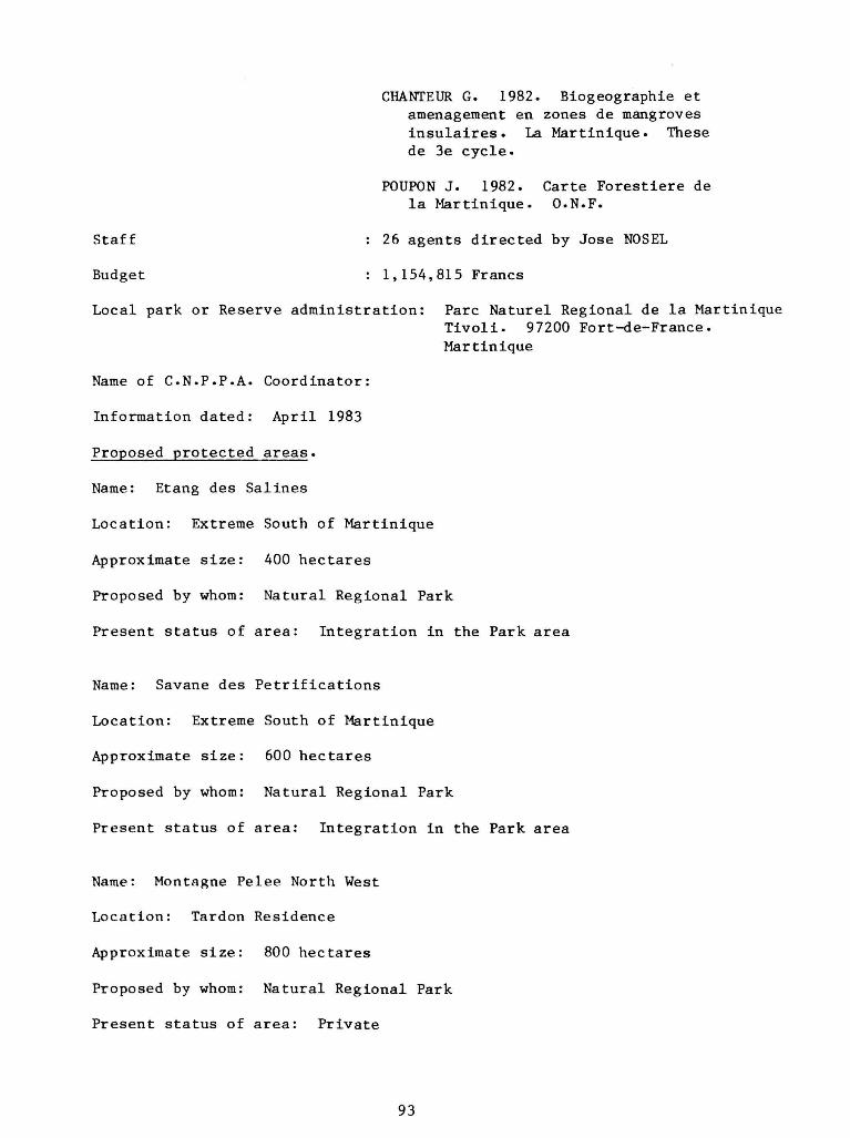
CHANTEUR G. 1982. Biogeographie et amenagement en zones de mangroves insulaires. La Martinique. These de 3e cycle.
POUPON J. 1982. Carte Forestiere de la Martinique. O.N.F.
Staff : 26 agents directed by Jose NOSEL
Budget : 1,154,815 Francs
Local park or Reserve administration: Pare Naturel Regional de la Martinique
Tivoli. 97200 Fort-de-France. Martinique
Name of C.N.P.P.A. Coordinator:
Information dated: April 1983
Proposed protected areas.
Name: Etang des Salines
Location: Extreme South of Martinique
Approximate size: 400 hectares
Proposed by whom: Natural Regional Park
Present status of area: Integration in the Park area
Name: Savane des Petrifications
Location: Extreme South of Martinique
Approximate size: 600 hectares
Proposed by whom: Natural Regional Park
Present status of area: Integration in the Park area
Name: Montagne Pelee North West
Location: Tardon Residence
Approximate size: 800 hectares
Proposed by whom: Natural Regional Park
Present status of area: Private
93

COUNTRY SUMMARY FOR MONTSERRAT
1 Franklin Margetson
Background
Montserrat is an island of the western or inner group of the double strand of islands extending from the eastern coast of Puerto Rico southwards to the northern coast of South America. Formed from submarine volcanoes during the late Oligocene Period, the 39 1/2 square-mile island's rough topography is dominated by seven mountain masses, highest of which rises to 3,000 ft. The radial drainage patterns of these hills and mountains give rise to a pattern of deep gorges and temporary streams known as ghants, which are the scene of violent erosion during the rainy season, usually the latter part of the year. Rainfall varies with the altitude, from 60 inches per year in the coastal areas to about 100 inches for the highest elevations. Vegetation follows the rainfall distribution, from cactus and shrub in the exposed coastal areas to dense native vegetation above the 1500 ft. contour which is protected by its inaccessibility as well as by law. The rugged terrain of the island is accentuated by a coastline of truncated spurs and hanging valleys.
Natural Resources
The forests have in the past yielded timber for furniture, boat and housebuilding, but the quantity and quality have never supported a sustainable export trade.
Agriculture has seen many changes and is currently dominated by sugar, tobacco, limes, sea island cotton, and vegetables. With the acreage of agricultural lands diminishing, fruits, vegetables, and other "provisions" for local consumption dominate the arable areas. Non-intensive livestock farming is scattered throughout the island. Retiree housing has partially replaced traditional agriculture in several parts of the island.
Plymouth, the main town, is situated on the southwest coast and is connected by good roads to the north, south, and east of the island. A new road between the north and the east (airport area) is being completed.
The rugged terrestrial environment, inimical to the development of mechanized agriculture, matches the deep marine environment where the depth of the sea bed and the paucity of sea grass, coral, and coastal wetlands limits the development of artisanal fisheries.
1 Vice-President, Montserrat National Trust, Plymouth, Montserrat
94

Leading Economic Activities
In terms of the distribution of the working population, the leading economic activities are ranked as follows:
Commerce - 43% Construction - 15% Wholesale/Retail, Restuarants/Bars/Hotels - 13% Agriculture, forestry, and fishing - 10% Manufacturing - 10% Transportation, storage, and communications - 5% Electricity, gas, and water - 2% Mining, quarrying, and miscellaneous - 1%
Montserrat's total trade (1981) amounted to $6 million (EC$) in exports and $51 million (EC$) in imports. The island's $45 million trade deficit is probably made up by:
Tourism - $15 million Remittances - $15 million Goods/Services not exported - $15 million
Three Major Problems
1. Relatively low financial and technical input into the productive sector.
2. Deforestation during the 1940's and exploitation of artisanal fisheries during the 1950's. General lack of concern for soil, water, vegetation, wildlife, and fishery conservation priorities.
3. Conflict betweem individual and national needs and overall conservation needs .
Government Policy
Apart from the concerns and programs manifested from time to time by the individual Government departments (Lands, Agriculture, Forestry, Fisheries, Tourism, and Health), there is regretably no coordinated policy on conservation. Any measures implemented tend to be remedial rather than preventive.
The Government has, however, from time to time supported programs initiated by the Montserrat National Trust and the Caribbean Conservation Association (CCA). Montserrat is one of 15 Caribbean government members of the CCA.
Importance of Natural Resources to National Development
Agricultural land. Approximately 5,000 - 7,000 acres (maximum) are currently available for agriculture. Output has declined because of deterioration of land and loss of overseas markets. The agricultural sector is historically and sociologically important.
Forestry. Forestry is of minor importance economically. Recent attempts have been made to establish multi-objective reforestation.
95

Fisheries. Artisanal fishing provides a valuable source of protein for the local people, but the supply is far short of the demand.
Parks. A parks system has been proposed by the Montserrat National Trust to incorporate education, recreation, and tourism along with conservation of the soils, water, wildlife, etc.
Tourism. The island's tourism consists mainly of retiree homes. Construction of these homes, as well as an offshore medical school, has boosted tourism earnings which now account for about 25% of the island's GDP.
Wildlife Resources. Montserrat's few species include the mountain chicken, iguana, agouti, grass snake, oriole, and other birds. Legislation now protects some birds; the Foxes Bay Bird Sanctuary (15 acres) was established in 1980 and is managed by the Montserrat National Trust.
Lands. The National Physical Plan that was proposed in 1975 has been only partly adopted. A land registration project has listed the owership of much of the land.
Mining. Local stone, aggregate, and beach sand is U6ed for road and house construction. Ghant sand is occasionally available following erosion.
Natural Resource Use
The natural resources have been conserved to some extent, not because of any conscious plan, but because the island's low population and dependence on imports have prevented excessive pressures being placed on the natural environment. These two factors, while being negative in a sense, have at least spared the island from excessive exploitation and degradation.
It is hoped that any programs which encourage greater self-sufficiency will also have a heavy environmental education component.
Proposed Parks and Protected Areas
The Montserrat National Trust has promoted the concept of a Montserrat National Park, but no significant changes or actions have resulted since its October 1979 listing. Proposals now include an archeological site at Gazways Plantation.
96

MONTSERRAT
Summary - Planning and Management Infrastructure for Natural Resource Development
DEPARTMENT
Lands & Surveys
Land Development Authority
Agriculture
Forestry and Wildlife
Fisheries
Tourism
Parks
MAIN FUNCTIONS
Overall land utilization Control of building placement and standards
Distribution and management of agricultural land
Providing services to farming sector
Control use of timber and wildlife resources
Providing services to fisheries sub-sector
Promotion of Montserrat as tourist destination, promoting natural environment
Promotion of concept and value of National Parks
MAIN STAFF STAFF EMPLOYED
Surveyors
Manager and field staff
Director Agriculture Officers Extension Officers
Forestry Officer Forest Rangers
Fishery Officer
Director of Tourism
Council of Montserrat National Trust (voluntary)
TRAIHING PROGRAMS AND NEEDS
Physical planning
Surveying and soil Conservat ion
Upgrading of services and equipment
Multiple use Watershed management
Equipment and Technology for hatching migratory species
Promotion Promotional literature
Public awareness programme
MAJOR MANAGEMENT PROBLEMS
Land acquisition

ST. KITTS - NEVIS
Country Summary
1 Victor 0. Williams
Introduction
Caribbean islands both small and large are beginning to experience critical strain on their limited resources brought about by increasing population pressures. The present economic conditions that grip the Caribbean and the world at large make it vitally necessary for all countries to take stock of their natural resources and prepare appropriate management programs for them to give upcoming generations a fighting chance of survival.
This paper presents an overview of the natural resources of St. Kitts and Nevis, their characteristics, use and present management problems.
Background
The natural resources found in St. Kitts-Nevis are both terrestrial and marine and are as follows:
Agricultural Lands. In St. Kitts, approximately 19,000 acres or 43% of all lands can be regarded as agricultural land. Of this 19,000 acres, 2,000 acres are privately farmed and the remaining 17,000 acres are under the Government's responsibility. It would be safe to say that 78% of the agricultural lands are being utilized. Sugar cane occupies 12,000 acres with an average yearly yield of over 30,000 tons. Food crops occupy just over 3,000 acres and yield in excess of 200,000 lbs of food which includes peanuts, plaintains, bananas, pineapples, avocadoes, breadfruits, breadnuts, citrus, coffee, mangoes, etc.
A land capability study indicates that Nevis has just over 17,000 acres of good to fair agricultural lands. The Government owns approximately 5,500 acres of this land on which livestock raising activities take place as well as cotton growing. Most of the privately owned agricultural land holdings are between 0 to 5 acres. Food cropping and small stock raising are the main activities on these holdings.
Forests. Forests take up 11,000 acres or 27.3% of the land in St. Kitts. The rain forest has a closed canopy 100-120 ft. above ground, formed by an upper story of tall trees. The elfin woodland is above the rain forest and has a low tangled growth normally 10 ft to 15 ft in height and contains mosses. The evergreen forest is located 800 ft to 1.500 ft above sea level and is, in some areas, under cultivation. Trees are between 50 ft to 60 ft in height and hardly exceed 3 ft in girth. From this forest, most of the timber for charcoal burning is cut. The Palm Forest covers all mountains in St. Kitts above the 1,200 ft contour and the dominant palm is the mountain cabbage palm.
Physical Planning Officer, Planning Unit, St. Kitts - Nevis, Basseterre, St. Kitts, West Indies
98

Generally, the forest is in fairly good condition with charcoal burning being the biggest threat to the forest- Nevis has a forest in its central portion similar in some respects to the forests of St. Kitts. Four thousand eight hundred acres are under forest. Loss of trees in the forest occur because of an increase in charcoal burning. The flora of both forests Is a natural attraction.
Buildings and Sites of Historical and Architectural Interest. Both islands possess buildings and sites of historical and architectural interest. Most buildings of historical and/or architectural interest are located in the towns of Basseterre, Charlestown, Sandy Point and Old Road. Many of the estate great houses at the estate yards are of interest as well. Some of the major buildings of interest are: The Bath House, Fig Tree Church, Montpelier, Eden Brown, Cottle Church, St. Thomas Anglican Church, Middle Island Church, Fair View Inn, St. Georges Anglican Church, Fountain Great House, the Glenn, and St. Peters Anglican Church. Sites of historical and/or architectural interest are also plentiful. The forts located around both islands are of interest as well. The fort that could be considered as possessing greatest value is Brimstone Hill Fortress, located in St. Kitts. It has been labelled "the Gibraltar of the West Indies." Erected in the late 17th century and used until the 1850's, this fortification in contemporary times has become a central attraction for visitors. Preservation of these buildings and sites poses a problem because of the amount of money involved. Budgetary constraints prevent the Government from contributing any significant sum of money to the upkeep of privately owned buildings and sites of historical and architectural interest.
Wildlife. The wildlife in both islands is found in the forest, woodlands, sugar belt, wetlands and beaches. This wildlife includes over twenty species of birds, such as the Great Egret, Caribbean Coot Pigeon, Fulvons Tree Duck and Sandpiper, to name a few. Animal wildlife includes the mongoose which was brought to the State to eliminate the grass snakes and having done so, now attack and eat chickens. There are also rodents and over 50,000 green vervet monkeys found in almost all hills and these have proved to be a menace to small farmers cultivating on the slopes. In addition, there is also a small quantity of deer. Some wildlife (monkeys in particular) are constantly hunted for research purposes and also because of the drugs which can be produced from their organs. Experts indicate that the monkey stock could absorb the present level of hunting.
Water. Both surface and ground water are available to the consumers of the twin State. The system in St. Kitts which supplies Basseterre and the settlements around the island is connected to six surface water sources. However, much of this system is becoming defective and deficient both in terms of storage capacity and distribution. There is practically no treatment of water as the surface water drawn from the springs is of good quality, except during the rainy season when the turbidity is high. The St. Kitts system is augmented marginally by ground water wells. The total supply from the system is about 2.2 million gallons per day, which gives a gross supply of about 47 gallons per head per day.
99

Nevis has a more serious water problem. The present system is inadequate to meet current demands. The supply consists of both ground and surface water and is intermitted. An estimate of the total is approximately 0.3 million gallons per day or about 25 gallons per head per day.
Sodium Chloride. Also known as common salt, this mineral is found mostly in the southeastern peninsula of St. Kitts in five salt ponds. Once a thriving small salt industry existed, but with the change of land ownership came a gradual decline of the industry. Salt was sold to the Trinidadian Oil Refineries for use in the oil refining process. The market for salt still exists and salt production can easily exceed 30,000 tons per year; however, to date the industry has not been revived.
Clay. Clay is found in large quantities in Nevis at New Castle, Potworks and Bricklin. The pottery industry exists on a cottage industry basis. A variety of items are made for use in the garden and kitchen, such as flower pots and coal pots. Present levels of clay mining would not create any immediate depletion of clay deposits.
Wind. The northeast trade winds constantly sweep the islands and the potential for generating energy through wind power is quite real. In the earlier days up to the turn of the 20th century, wind power was frequently used.
Sun. Constant daytime temperatures in excess of 85 F make sun-generated energy a likely possibility. For example, solar ponds for water heating have great potential for use in group unit developments such as condominiums and hotels. Already they are being introduced to new developments.
Wetlands. Wetlands and ponds constitute more than 600 acres in St. Kitts and serve as habitat for wildlife, especially bird life, and have high conservation value. The wetlands of St. Kitts are found mostly in the southeastern section of the islands at the salt ponds, but there is also the Great Heed Pond at Conaree which has a thriving wildlife and mangroves. Nevis has four wetlands — Cotton Ground, Pinneys, Hurricane Hill and the Bogs at Bath. All areas contain thriving wildlife.
Beaches. The better beaches of St. Kitts are located on the southeastern peninsula, most of which are hardly used because of Inaccessibility, except for the north and south Frigate Bay beaches which are fairly well used. There is a total of 17.5 miles of beach with the longest uninterrupted stretch of beach located from Cayon to south Frigate Bay (3.25 miles). The sand texture ranges from fine to medium and the reefs act as a protection for the beaches.
Nevis generally has better beaches than St. Kitts. The total mileage of beaches is 11.2, with the longest beach stretching from Pinneys Bay to Cades Bay (3.3 miles). The waters of all beaches are clean and generally shallow and excellent for bathing or skin diving.
100

Fisheries and Coral Reefs. The sea around the islands contains many coral reefs and sea grass beds- Nevis has large areas of sea grass beds off its southern, northern and eastern coastlines. St. Kitts, on the other hand, has smaller sea grass beds which are located in the southeastern peninsula. Coral reef systems are found in large quantities off the southwestern coastlines of both islands. Patches of coral reefs are scattered around both islands as well. The coral-covered shoals and the well-developed bank barrier reef systems along with the sea grass beds provide ideal habitat for sea life and consequently are ideal fishing grounds.
Some classification of commercial fish caught are as follows: albacore -black fin, brim - deep water snapper, tenpounder - bonefish, shellfish, horse-eye crevalle, and greenback - blue runner and silk.
The dominant types of fish caught are on the west coast and include garfish, ballyhoo, bonito and sprats. On the windward side, there are groupers, silk, crevalle, shark, garfish and jacks. Lobsters and conch can be found at most sea grass beds but are more plentiful just off the southeastern peninsula in 30-40 ft depth water. Turtles found in the waters around the island include the green turtle, the leather back and the hawksbill. The green turtle and hawksbill species are in more abundance than the leather backs and are found from Sandy Point around the north end past Dieppe Bay. They are also found in Mosquito Bay and Sand Bank Bay.
Demography
Between 1970 and 1980, the population for St- Kitts and Nevis dropped from 45,367 to 44,404, representing a 2.1% reduction. Out-migration has been the major contributing factor for this population decline. On examining each island in turn, it is observed that the population in St. Kitts has increased, whereas the population in Nevis has decreased. The population of St. Kitts was 34,227 in 1970 and rose by 2.6% to 35,104 in 1980. Nevis, on the other hand, had a population of 11,140 in 1970 but experienced a dramatic drop by 16.5% to 9,300 in 1980.
The population growth rate for both islands between 1970 and 1980 is 0.2%.
Leading Economic Activities
Sugar remains the main base of the economy and production has remained at a level about 30,000 tons of sugar per harvest. The average sugar receipts over the last four years have been in excess of EC $30 million. Sugar will continue to play a dominant role in the country's economy for quite a few years to come. However, the value of the pound sterling and the world price for sugar will continue to affect the total sugar receipts. Sugar along with molasses makes up approximately 70% of the country's domestic export and over 17.5% of the GDP (1980).
Industry also plays an important role in the economy. There are approximately 28 manufacturing businesses in the country which produce garments, textiles, shoes, electrical components, data processing, beverages, etc. Manufacturing activities employ close to 3,000 persons and occupy about 7.9% of the GDP (1980), and has grown at a rate of 9.4% per annum between 1977 and 1980.
101

Tourism is one of the economic activities that has begun to receive higher priority during the last few years. An increase in the number of charter flights to the State has occurred. The number of cruise ships docking at the Port has also increased. Frigate Bay is designated as the area for concentrated tourism development.
Problems Related to Management of Natural Resources
Loss of Agricultural Land to Urbanization. Most of the agricultural land that has been lost to urbanization has been lost around Basseterre because of its relatively fast rate of growth. There is also evidence of the loss of agricultural lands to housing in the rural areas, but this loss is not of any great significance.
The activity that is in direct competition with agriculture is housing and this has resulted for over 80% of the agricultural land that has been lost.
With the passing of the Slum Clearance and Housing Act in the 1940's came the establishment of the Central Housing and Planning Authority (CHA). During the 1950's, the CHA was involved in establishing new housing areas with the objective of upgrading settlement conditions and eliminating slum conditions. Projects such as Lodge, Molineau, Saddlers, Cayon and Mansion were established, causing some loss of agricultural lands. Private developers also became interested in establishing residential developments, resulting in further loss of agricultural land.
Each decade saw the loss of more and more agricultural land due to further housing developments. The table below shows the amount of agriculture land that was lost each decade due to the establishment of new housing areas.
Decade Housing Areas - St. Kitts Acreage
1950-1960 Greenlands, Bird Hock, Cayon Project, Saddlers Project, Molineux Project, Mansion Project, Trinity 65
1961-1970 Pond Site, New Pond Site, Pond's Pasture, College Housing, Lamberts, Wades Gardens 110
1971-1980 College Housing Extension, Bird Rock Extension, Harbour View, Suncrest 45
TOTAL LAND LOST BETWEEN 1940 to 1980 220
In addition to housing activity, industrial activity and developmental projects such as the Airport Runway have also caused a reduction in agricultural land.
102

An analysis of Basseterre land use indicates that should residential growth continue at its present rate and should present concepts and practices towards housing continue, then within ten years, there will be no residential land remaining in Basseterre. It would become necessary to resort to using the good agricultural lands that surround this urban center.
The use of the present agricultural lands for housing and other developmental activities is inevitable. However, it is important to delay, for as long as possible, the change of land from agriculture to housing. This is possible by introducing new housing practices and concepts. By applying new measures the limited housing land would be more effectively used and in addition the policy makers would gain additional time to restructure agricultural policy. The sugar industry needs approximately 12,000 acres to continue sugar production at an economically viable level. With full irrigation, approximately 8,000 acres are needed to maintain the present production level. However, to introduce full irrigation would be an expensive venture and by necessity has to be done in phases. As more sugar land is put under irrigation, the amount of land for alternative uses would increase and it can be expected that other agriculture, housing and industry would dominate the use of this available land.
Exploitation of Fisheries Resources. The waters around the islands have their fair share of fish and local fishermen make full use of the fishing grounds. Preliminary observations indicate that most of the inshore reefs are over-exploited. It will be difficult for natural fish stock recovery to occur to a level where yields can be sustained, without the introduction of appropriate conservation measures.
There is a small submarine shelf which can be viewed as important because of the large amount of fish living there. This shelf is shared by St. Kitts, Nevis and neighboring islands.
In particular, the spring lobster and queen conch are over-exploited and effective management must be introduced to sustain and hopefully improve present stocks and also identify, establish and protect breeding sanctuaries.
Sand Utilization. With an increase in the development growth rate, the demand for sand in construction activities has increased as well. The two kinds of sand used are ghaut sand for structural work and beach sand for decorative work.
Ghaut sand, as the name implies, is taken from the small ghauts which run seasonally, bringing down coarse sand which is normally silt-free and good for structural work. The block-making factory is the major user of this type of sand. A sand shortage is now developing because of two reasons. First, the rains that normally bring down the sands have not fallen in the expected quantity, thus causing a shortage of sand and haulers have resorted to digging deeper into the ghauts and hauling silt-filled sand. Second, more and more truckers are becoming involved in sand hauling to supply the developments under construction and the same
103
limited sand areas are being exploited. The National Agricultural Corporation, which is responsible for the ghauts and the ghaut sands, has tried to monitor and co-ordinate ghaut sand utilization but to no avail. The sand haulers pay no attention to the requests from NACO and indiscriminate use of sand takes place.
Beach sand, used for decorative and water-proofing purposes on buildings, is also being over-exploited. Sand haulers are hauling sand from areas without due regard to the damage being caused. Sand has been removed from the better beaches, leaving gaping cavities in the beaches.
It is recognized that building construction must go on if the national development process is to continue. It is further recognized that both structural and decorative sand will be used. However, effective management of this vital resource must be seriously considered.
Government Policy
This State, like most of the other small Caribbean states, does not have an up-to-date written policy statement on the conservation of natural resources. This does not mean that there is not a consciousness for natural resource conservation. The State is becoming increasingly concerned and aware of the need to conserve natural resources. The Government, through its Planning Unit and other key departments, is developing guidelines and eventually regulations will follow for the conservation of natural resources. Already, due consideration to natural resource conservation is being made in the development planning process carried out by the Planning Unit.
Importance of Natural Resources to National Development
Agriculture is the most important natural resource and it will continue for quite some time to play the major role in national development. The focus in agriculture will be on sugar production along with agricultural diversification. Complementing agriculture will be tourism which would be using, as much as possible, local products from the agricultural sector. The limited lands, ideal for tourism, will be effectively used with the objective of creating harmonious development.
Fisheries also has an important role to play in national development. It is recognized that the waters around the islands have great and prolonged economic potential. With appropriate management of this resource, it would be possible to completely supply the local market with sea food thus eliminating the need for importation of sea food and consequently there will be a savings of foreign exchange.
The possibilities for the forest to play an important part in national development is real. A limited and very carefully monitored and managed charcoal industry can be further developed. A bamboo industry can prove to be useful, especially for the manufacture of local furniture. Bamboo is also an effective means of soil erosion control.
Natural resources such as wildlife, parks and buildings and sites of historical and architectural interest will all complement the tourism industry.
104

Proposed Parks and Protected Areas
To date there is no area proposed for a park. At one point in time it was felt that the southeastern peninsula of St. Kitts could be made into a national park. However, with over 95% of the land privately owned, there would have been a problem of land acquisition. In addition, some of the owners have prepared development proposals for their sections of the area. In the final analysis it has been proposed that sections of the peninsula be regarded as protected areas.
There are a few proposed protected areas and these are as follows:
1. Brimstone Hill Fortress
Located ten miles from Basseterre between Sandy Point and Half Way Tree settlements, the actual site and its immediate surroundings occupy over 100 acres. The proposal to make this site a protected area is a joint effort between the Society for the Kestoration of Brimstone Hill and the Government. Presently, the area is under the responsibility of the Brimstone Hill Society. Located on the site is one of the most famous fortresses in the Caribbean. The lower section of the hill upon which the fortress stands is the habitat for some wildlife, mainly the green vervet monkey which attracts a great deal of attention.
2. Pall Mall Square Area
Located in the central area of Basseterre and approximately eight acres in size, the proposal to protect this area has been made by the Planning Unit. The area is comprised of a square surrounded by buildings of historical and architectural interest. The square is public property but most of the surrounding buildings are owned and managed privately. Buildings in this area were rebuilt after the fire of 1867 and have both French and British architectural influence.
3> Wetlands
An area of wetlands, in particular, is being considered as a protected area. It is the Great Heeds pond, located at Conaree in St. Kitts, approximately 45 acres in size. The proposal to have the Great Heeds pond as a protected area is being made by the Planning Unit. Great Heeds is public property and is a thriving habitat for wildlife, especially migratory birds.
4. Buildings
Scattered around both islands are buildings of significant historical and architectural value. Surveys of these buildings have been carried out and those buildings that have been rated as possessing very high and high historical and architectural value are earmarked for protection. The proposal to protect these buildings has been made by the Planning Unit.
105

5. Coral Reefs
Worth mentioning is the proposal being prepared by the Fisheries Division to earmark certain fish habitats as protected areas- The main objective of this proposal would be to ensure that some of the breeding areas be protected from exploitation and as a result maintain a satisfactory fish stock. The breeding grounds will be located mostly in the southeastern peninsula.
106

PLANNING AND MANAGEMENT INFRASTRUCTURE FOR NATURAL RESOURCE MANAGEMENT
ST. KITTS - NEVIS
Resource
1. Agriculture
2. Forest
3. Buildings and sites of historical and architectural interest
Ministry
Ministry of Agriculture, Lands, Housing, Labour and Tourism (ALHLT)
Ministry of ALHLT
Ministry of Development and Planning
Department Statutory Body or Public Corp.
NACO SSMC Agriculture Department
Agriculture Department
Planning Unit
Staff Working on Natural Resource
4,206
10
3
Training Programme and Needs
On-going training program of workshops and seminars organized to introduce new practices. Six months to two year courses to train staff in specialized areas. Training in various areas of sugar production. Need for increase in the number of trained agricultural officers for agricultural diversion program.
No present ongoing training programs. CDB with USAID funds to prepare a training program. Need for increase in the number of trained forest rangers.
Incorporated into workshop, seminars and conferences on the environment. Need for special training in building and site conservation.
Management Problems
Loss of agricultural lands to other uses . Soil degradation and consequent reduction in agricultural productivity. Soil erosion due to hillside cultivation. Unauthorized setting up of holdings at unappropriate locations causing threats to forest and watershed areas.
Inadequate monitoring of forest area. Uncontrolled burning of forest trees for charcoal industry. Sedimentation of ghauts and streams. Forest clearing for hillside cultivation and threat to watershed area.
No regulations in existence to deal with preserving the build ings and sites . Deterioration of buildings and sites due to inadequate maintenance. Changes in external appearance of special buildings by private owners.
o

Resource
4. Wildlife
5. Water
6. Salt
7. Clay
8. Wind
Ministry
Ministry of ALHLT
Ministry of Communication, Works & Public Utilities (CWPU)
Ministry of ALHLT
Ministry of ALHLT
Ministry of CWPU
Department Statutory Body or Public Corp.
Agriculture Department
Water Department
Agriculture Department
Craft Development Board
Electricity Department
Staff Working on Natural Resource
10
62
2
8
Training Programme and Needs
No ongoing training programs. Need for special training to determine wildlife stocks and coordinate wildlife hunting.
Caribbean Basin Water Management Program provides training for Water Department workers.
No ongoing training program.
On-the-job training carried out. Six weeks course in pottery skills for two officers. Need for increased number of trained persons in pottery skills.
Ongoing program of workshops and seminars• Training needed in alternative energy sources.
Management Problems
Inadequate monitoring of wildlife hunting. Diminishing of wildlife habitats.
Inadequate storage capacity for surface water storage. Threat to watershed areas brought about by unauthorized forest clearing.
Under-utilization of resource and lack of management.
No major management problems
Under-utilization of resource
I-' o 00

Resource
9. Sun
10. Wetlands
11. Beaches
12. Fisheries and Coral Reefs
Ministry
Ministry of CWPU
Ministry of ALHLT
Ministry of ALHLT
Ministry of ALHLT
Department Statutory Body or Public Corp.
Electricity Department
Agriculture Department
NACO Health Dept. Public Works Dept.
Fisheries Division
Staff Working on Natural Resource
2
3
6
5
Training Programme and Needs
Ongoing training programme of workshops and seminars. Further training needed on alternative energy sources.
No ongoing training programme. Need to incorporate wetland management into an overall environmental planning training.
No ongoing training programme. Need for training in beach management and effects of development on beaches•
Ongoing programme of seminars and workshops• Need for an increase in number of trained fisheries officers.
Management Problems
Under-utilization of resource
Inadequate monitoring and protection of wetland areas.
Inadequate monitoring and protection of beaches
Over-exploitation of fisheries resource at inshore reefs . Inadequate monitoring of fish size caught•
I—• o
COUNTRY SUMMARY FOR ST. LUCIA
Mervin C. Williams
Background
St. Lucia is an island within the windward group of the Lesser Antilles. It has a total land area of 238 square miles and a population of 120,300 (1980 estimate). The island is mountainous, mainly volcanic in origin, with the rugged relief broken by a small plain in the south and by low, older hills in the north.
The natural resources of the island have been, for convenience, divided into the following groups:
- The land - Landscape quality - Water resources - Mineral resources
- Marine and coastal resources - Energy resources - Forestry resources
The two most important characteristics of all of the island's natural resources are (1) their limited availability and (2) their fragility.
A brief review of available statistics highlights these characteristics. For example, of a total land area of 152,200 acres, less than 10% has slopes of less than 5% and a mere 2.6% is classified as Agricultural Land Capability Class I.
Economically, the island's population depends on agriculture (including forestry and fisheries) for some 30% of total employment and 60% of foreign exchange earnings. Tourism represents a sector that grew rapidly during the 1970s, along with manufacturing and construction; these now comprise the "modern" sectors of the economy.
Major Problems in Natural Resource Management
The Government of St. Lucia is presently preparing a document that comprehensively reviews the issues of natural resource use and outlines policies at the national level. All available indicators show that the fundamental problem of natural resource management relates to resolving the conflicting demands of various users of limited and fragile resources. Specific problems include:
1. The loss of agricultural land to industry, tourism and urbanization;
2. Continued deforestation;
1 Environmental Planning Officer, Central Planning Unit, Ministry of Finance and Planning, St. Lucia National Trust, Castries, St. Lucia, West Indies
110

3. Impairment and degradation of natural scenic features and other potential tourist attractions (beaches), etc.; and
4. Providing for the existing needs of domestic users of natural resources, e.g. fishermen, while ensuring that these resources are conserved against rampant exploitation.
Government Policies
The Government's po l ic ies on natura l resource conservation are most c lear ly and concisely expressed in the Policy Objectives of the Development Strategy contained in the St . Lucia National Plan (1977).
A. Fundamental Strategic Objective
One of the three fundamental strategic objectives states: "Conservation of natural resources."
B. Conservation
"A critical factor in developing agricultural potential is the conservation of natural resources which are continuously threatened through uncontrolled exploitation. Government is acutely aware of the extent to which the Island depends upon such conservation for continuity of water supply and preservation of soil quality."
C. Agricultural Policy Objective No. 4
"Efficiency in the use of land, water and other natural resources through the promotion of improved systems of production."
D. Agricultural Policy Objective No. 5
"Conservation of land, water and indigenous plant and animal resources."
E. Industry Policy Objective No. 4
"Optimum utilization of raw materials and natural resources."
F. Tourism Policy Objective No. 5
"Optimisation of land use through concentration of tourist activity in selected areas of the island."
G. Tourism Policy Objective No. 6
"Identification, development and protection of environmental attractions."
Overall, the Government's policies are directed at maximizing the earning capacity of the major sectors and activities which draw down natural resources.
Ill
At the same time, a commitment to the continuity of resource use in the future has been reflected in the establishment of the institutional supports required to implement such a balanced approach. Thus, recent years have witnessed a commitment to up-grading the Environmental Planning Section (Central Planning Unit), the establishment of a new Environmental Commission, the creation of a fully-staffed Fisheries Management Unit, continued support to the National Trust and establishment of a Parks and Recreation Commission.
Importance of Natural Resources
All the island's natural resources perform crucial roles in facilitating the achievement of national development goals and objectives. Despite attempts to diversify away from agriculture, that sector still employed 40% of the work force in 1977. In 1981, agriculture contributed EC$ 50.7 million (at current factor cost) or 16.8% of GDP. The value of the 1981 fish catch was estimated at $45.0 million.
Similarly, the development of the island's natural and cultural attractions are seen as critical to the expansion of the tourist industry. Thus, the number of visitors reached an estimated 151,992 in 1980 and spent US $35.0 million.
Major Characteristics of Natural Resource Uses
Agriculture. Despite its importance to the economy, prime agricultural land is extremely limited. Further, the structure of resource use is one of extreme dualism. For example, 10,000 farms occupy less than 24% of the total agricultural acreage, while a mere handful of farms (0.6%) occupy 53% of agricultural lands.
Production is for domestic consumption and export. It is mono-cultural, with bananas being the dominant crop.
Forestry and Fisheries. These two sectors are plagued by similar problems. These relate to (a) the lack of scientific assessments of resource potential and (b) an overall management plan. This weakness is now being corrected for forestry.
Forestry operations are generally low-scale, yet there is a large but undetermined amount of illegal felling in the forest reserves as part of slash-and-burn agriculture.
Fishing remains largely traditional in its technology and marketing structures.
Tourism. Tourism is largely oriented towards the foreign visitor market. The various tourist establishments (hotels, etc.) do not manifest much interest in environmental quality. Indeed, from available evidence, the sector appears intent on "killing the goose that lays the golden egg." Impacts include:
- Alteration of coastal configurations and beach profiles; - Discharge of untreated sewage wastes; - Removal of beach sand for construction or other purposes; - Destruction of wetlands and mangroves; - Construction of large hotels in areas of high scenic value; and
112
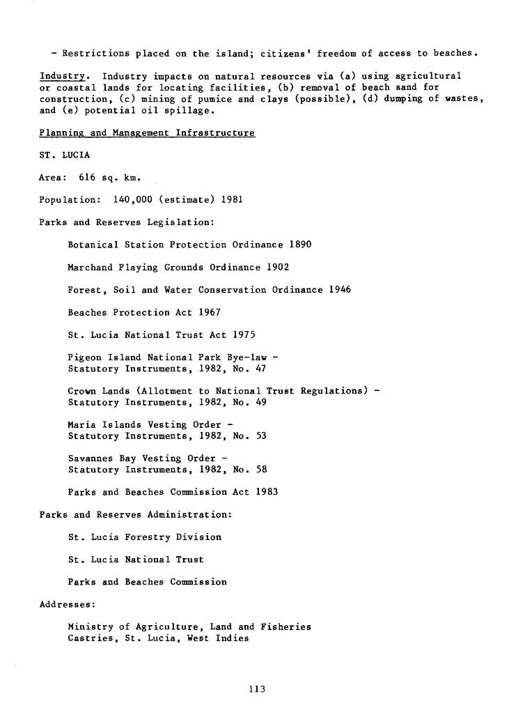
- Restrictions placed on the island; citizens' freedom of access to beaches.
Industry. Industry impacts on natural resources via (a) using agricultural or coastal lands for locating facilities, (b) removal of beach sand for construction, (c) mining of pumice and clays (possible), (d) dumping of wastes, and (e) potential oil spillage.
Planning and Management Infrastructure
ST. LUCIA
Area: 616 sq. km.
Population: 140,000 (estimate) 1981
Parks and Reserves Legislation:
Botanical Station Protection Ordinance 1890
Marchand Playing Grounds Ordinance 1902
Forest, Soil and Water Conservation Ordinance 1946
Beaches Protection Act 1967
St. Lucia National Trust Act 1975
Pigeon Island National Park Bye-law -Statutory Instruments, 1982, No. 47
Crown Lands (Allotment to National Trust Regulations) -Statutory Instruments, 1982, No. 49
Maria Islands Vesting Order -Statutory Instruments, 1982, No. 53
Savannes Bay Vesting Order -Statutory Instruments, 1982, No. 58
Parks and Beaches Commission Act 1983
Parks and Reserves Administration:
St. Lucia Forestry Division
St. Lucia National Trust
Parks and Beaches Commission
Addresses:
Ministry of Agriculture, Land and Fisheries Castries, St. Lucia, West Indies
113

St. Lucia National Trust P. 0. Box 525 Castries, St. Lucia, West Indies
Total Area Under Protection: 2132 ha
Protected Areas:
Nature Reserves:
1. Central Forest 1600 ha 2. Maria Islands Nature Reserve 12 ha 3. Pigeon Island National Park 20 ha 4. Savannes Bay Mangrove Area 500 ha
Forest Reserves:
1. Castries Water Works* 1208 ha 2. Quilesse* 854 ha 3. Vottier Estate* 200 ha 4. De Soula Estae* 108 ha
5. Dennery Water Works* 148 ha
* These areas are not included under the total area under protection.
Proposed Reserves:
1 . Moule-a-chique 300 ha 2 . Marigot 25 ha 3. Dennery Knob 700 ha 4. River Doree Canyon 10 ha
5. Vierge Point 30 ha
Protected Areas — Nature Reserves
1. Central Forest
Management Category: Managed Forest Reserve
Biogeographical Province: 8.41.13 (Lesser Antillean)
Legal Protection: Total
Date Established: 1980
Geographical Location: Central portion of island
Altitude: 350 - 800 km
Area: 1600 ha
Land Tenure: Government-owned
114
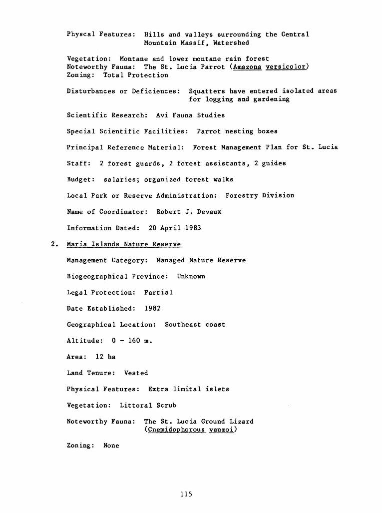
Physcal Features: Hills and valleys surrounding the Central Mountain Massif, Watershed
Vegetation: Montane and lower montane rain forest Noteworthy Fauna: The St. Lucia Parrot (Amazona versicolor) Zoning: Total Protection
Disturbances or Deficiences: Squatters have entered isolated areas
for logging and gardening
Scientific Research: Avi Fauna Studies
Special Scientific Facilities: Parrot nesting boxes
Principal Reference Material: Forest Management Plan for St. Lucia
Staff: 2 forest guards, 2 forest assistants, 2 guides
Budget: salaries; organized forest walks
Local Park or Reserve Administration: Forestry Division
Name of Coordinator: Robert J. Devaux
Information Dated: 20 April 1983
2. Maria Islands Nature Reserve
Management Category: Managed Nature Reserve
Biogeographical Province: Unknown
Legal Protection: Partial
Date Established: 1982
Geographical Location: Southeast coast
Altitude: 0 - 160 m.
Area: 12 ha
Land Tenure: Vested
Physical Features: Extra limital islets
Vegetation: Littoral Scrub
Noteworthy Fauna: The St. Lucia Ground Lizard (Cnemidophorous vanzoi)
Zoning: None
115

Disturbances or Deficiencies: Foragers have cleared small
sections of vegetation
Scientific Research: Faunal and floral studies
Special Scientific Facilities: None
Principal Reference Material: Southeast Coast Area Management
Report
Staff: 1 Ranger (proposed)
Budget: Salaries; organized tours (proposed)
Local Park & Reserve Administration: St. Lucia National Trust
Name of Coordinator: Robert J. Devaux
Information Dated: 20 April 1983
3. Pigeon Island National Park
Management Category: National Historic Park
Biogeographical Province: Unknown
Legal Protection: Total
Date Established: 1982
Geographical Location: Northwest coast
Altitude: 0 - 120 m.
Area: 20 ha
Land Tenure: Long-term lease
Physical Features: Island joined by a causeway to the mainland
Vegetation: Littoral scrub and introduced exotics
Noteworthy Fauna: The Frigate Bird (Fregata magnificens)
Zoning: Non-residential
Disturances or Deficiencies: Altered vegetat ion; a l tered currents
Sc ient i f ic Research: Current s tud ies , beach prof i le studies
Special Sc ient i f ic F a c i l i t i e s : None
116

Principal Reference Material: Report on the erosion problem at
Pigeon Island
Staff - 15
Budget: Salaries; gate receipts
Local Park & Reserve Administration: St. Lucia National Trust
Name of Coordinator: Robert J. Devaux
Information Dated: 20 April 1983
4. Savannes Bay Mangrove Area
Management Category: Nature area
Biogeographical Province: Unknown
Legal Protection: None
Date Established: 1982
Geographical Location: Southeast coast
Altitude: 0-12 m.
Area: 500 ha
Land Tenure: Vested
Physical Features: I n t r a - t i d a l mangrove lagoon
Vegetation: Mangrove
Noteworthy Fauna: Catt le egret (Bubulcus ib i s )
Zoning: None
Disturbances or Deficiencies: Farmers have cleared the upper edge
of mangrove
Scientific Research: Fisheries
Special Scientific Facilities: None
Principal Reference Material: Southeast coast area management
report
Staff: None
Budget: None
117

Local Park & Reserve Administration: St. Lucia National Trust
Name of Coordinator: Robert J. Devaux
Information Dated: 20 April 1983
118
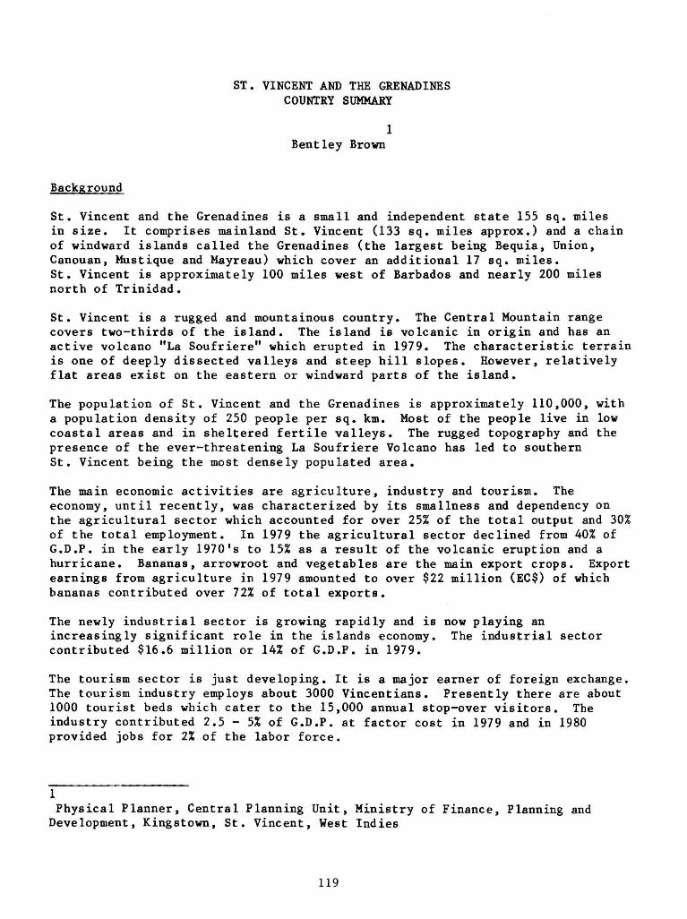
ST. VINCENT AND THE GRENADINES COUNTRY SUMMARY
1 Bent ley Brown
Background
St. Vincent and the Grenadines is a small and independent state 155 sq. miles in size. It comprises mainland St. Vincent (133 sq. miles approx.) and a chain of windward islands called the Grenadines (the largest being Bequia, Union, Canouan, Mustique and Mayreau) which cover an additional 17 sq. miles. St. Vincent is approximately 100 miles west of Barbados and nearly 200 miles north of Trinidad.
St. Vincent is a rugged and mountainous country. The Central Mountain range covers two-thirds of the island. The island is volcanic in origin and has an active volcano "La Soufriere" which erupted in 1979. The characteristic terrain is one of deeply dissected valleys and steep hill slopes. However, relatively flat areas exist on the eastern or windward parts of the island.
The population of St. Vincent and the Grenadines is approximately 110,000, with a population density of 250 people per sq. km. Most of the people live in low coastal areas and in sheltered fertile valleys. The rugged topography and the presence of the ever-threatening La Soufriere Volcano has led to southern St. Vincent being the most densely populated area.
The main economic activities are agriculture, industry and tourism. The economy, until recently, was characterized by its smallness and dependency on the agricultural sector which accounted for over 25% of the total output and 30% of the total employment. In 1979 the agricultural sector declined from 40% of G.D.P. in the early 1970's to 15% as a result of the volcanic eruption and a hurricane. Bananas, arrowroot and vegetables are the main export crops. Export earnings from agriculture in 1979 amounted to over $22 million (EC$) of which bananas contributed over 72% of total exports.
The newly industrial sector is growing rapidly and is now playing an increasingly significant role in the islands economy. The industrial sector contributed $16.6 million or 14% of G.D.P. in 1979.
The tourism sector is just developing. It is a major earner of foreign exchange. The tourism industry employs about 3000 Vincentians. Presently there are about 1000 tourist beds which cater to the 15,000 annual stop-over visitors. The industry contributed 2.5 - 5% of G.D.P. at factor cost in 1979 and in 1980 provided jobs for 2% of the labor force.
1 Physical Planner, Central Planning Unit, Ministry of Finance, Planning and Development, Kingstown, St. Vincent, West Indies
119

Major_Problems with respect to the Management of Natural Resources
1. Watershed management
2. Coastal management
3. Deforestation
Government Policy with respect to the Conservation of Natural Resources
For the process of development to take place, man must exploit the natural resources of the earth. The very act of exploiting the resources leads to a depletion or degradation of the resources. Man is therefore forced to exploit and utilize the earth's resources but is yet to prevent their depletion and degradation. This can only be done through resource conservation which involves proper planning and proper management of resources. In small ecosystems like St. Vincent, the problem of exploiting resources while at the same time lessening the impacts related to resource exploitation must be seriously tackled. The conservation strategy of the Government of St. Vincent and the Grenadines should therefore be oriented to allow for the development of the country through rational natural resource use.
The Government of St. Vincent and the Grenadines recognizes that the small size of the state demands proper ecomanagement, for there is virtually no room for ecological mistakes in the management of small island states. The Government is also aware that rational decision-making in land use planning and wise control over the physical environment will have a demonstrably beneficial effect on the performance of the economy and the quality of social life. The Government's strategy is therefore aimed at the proper utilization and management of resources and the protection and preservation of resources which are in scare supply. This strategy is being carried out through the execution of remedial and preventative actions to ensure the preservation of threatened areas of the environment. Special attention is therefore placed on water catchment areas, forests, soil erosion, land use planning, beaches and coral reefs, and the preservation of historical and geologic sites.
Importance of Natural Resources
St. Vincent's natural resources are crucial to efforts at securing a high level of economic development for its people. St. Vincent must develop and exploit its own resources (both physical and human) if the process of development is to be achieved. Indeed, it is the quality and quantity of the natural resource base, that will determine the level of development. Lacking known valuable mineral wealth and possessing fertile soils and favorable climate, St. Vincent has been forced to develop its agricultural potentials. The impotance of the soils and agriculture can be seen in the fact that 40Z of the total land areas is used for agriculture, and 40% of the labor force is employed in this sector which has historically been the mainstay of the economy.
120

Forestry is important to the nation's future development. Although it does not currently bring in large revenues as agriculture, it provides sound ecological balance to help the national development process. The small sums raised from timber production and the role of forest trees in climate moderation, soil conservation, water conservation, wildlife conservation and recreation for the community establishes forestry as an essential natural resource for development. If the forest cover is removed, the catastrophic results with their multiplier effects will remove the crucial role of forestry in national development.
Fisheries is important in national development although the fishing potentials are not fully tapped. Historically the tendency has been to exploit the land-based resources with little marine-based development. Fishery provides a livelihood for over 2000 people in St. Vincent and the Grenadines. In 1978 St. Vincent and the Grenadines earned over $1 million (EC$) from fishing.
Tourism is an industry which is just developing. It is one of the three pillars on which the Government hopes to achieve high levels of economic growth. It is a high revenue earner for the Government of St. Vincent and the Grenadines.
The Government of St. Vincent and the Grenadines is concerned about wildlife resources. Various legislations exist to ensure wildlife preservation. Presently, attempts are being made to preserve the St. Vincent Parrot (Amazona guildingui), which is an endangered species, by the establishment of a Parrot Aviary.
Although no area has been declared as a "park" or reserve, the Government has recognized the need for special protection and conservation of special areas in St. Vincent (especially lands above 1000') and is managing these sensitive areas so as to avoid ecological catastrophe. The central area of St. Vincent with lands above 1000 ft. and Kings Hill are examples of these special areas.
Characteristics of Natural Resource Uses
Agriculture is of the private 6mall farm type although there are a few large estates. Over 45% of the farmers own lands under 1 acre in size and over 90% of the farmers own lands under 10 acres in size. Production is mainly for subsistence on small farms but a few small crops are grown for export. Farming methods are primitive with the hoe and cutlass being the major implements. Farmers tend to be traditional in farming methods but there is an increasing tendency toward the use of fertilizers and other chemicals .
Forestry is of little commercial value and most of the existing forests are preserved for ecological reasons.
Fishing is of the traditional type with seines, nets, fish pots and small local boats being the major fishing gear. More fishermen are using outboard engines, but technology and fishing methods have remained unchanged for decades.
121

Tourism is of the small guest house type in St. Vincent. In the Grenadines there are a few small island tourist resorts. Most hotels are under 20 rooms in size and cater mainly to European and North American tourists.
Proposed Parks and Protected Areas
In St. Vincent and the Grenadines, various Government Departments and the St. Vincent National Trust have been suggesting that all watershed and water catchment areas be declared as Parks and Protected areas. To date, however, no positive plans have been taken toward this goal.
122

ST. VINCENT AND THE GRENADINES
Summary - Planning and Management Infrastructure for Natural Resource Development
i—• NO CO
Department
Ministry of Agriculture
Central Planning Unit
Public Health Department
Main Functions of the Department
Management of soils, agriculture, forestry, wildlife, fishery, beaches, state lands.
Physical planning and development control
Environmental sanitation
Number of Staff Working on Natural Resources
90
8
30
Training Programme and needs
Greater trained personnel in management of soils, forestry, fisheries.
Need for greater trained personnel in Physical Planning
Need for greater trained personnel
Major Management Problems
1. Need for better coordination within Ministry and with other Government Departments responsible for environmental management.
2. Need for better legislation and enforcement of existing legislation.
3. Bigger and better trained staff required.
4. Need to develop environmental awareness programs.

BRITISH VIRGIN ISLANDS COUNTRY SUMMARY
1 Louis Walters
Background
The multi-island territory of the British Virgin Islands (BVI) is situated at the northernmost end of the Lesser Antilles and has a total land area of some 59 square miles. The islands are dominated by steep sloping hills that are fringed by narrow valleys and sparse mangroves. The heights of these hills range from 1,710 feet on Tortola to 26 feet on Anegada. The soils of the BVI can be grouped in the spectrum that ranges from sand to clay, but most of these soils are classified as light textured and thus have limited water-holding capacities. This factor, combined with an erratic rainfall and a forest cover insufficient to retard the erosion of vital topsoil from the steep slopes of the islands, forms a major deterrent to high agricultural production.
The BVI boasts a great variety of important marine resources. These include many fine secluded beaches, mangroves, safe anchorages, sea grass beds, coral reefs, historical wrecks and ideal sailing waters. The intactness and profusion of living coral colonies that are still teeming with an abundance of most of the tropical sea water fish species, compares favorably with most of the other heavily used areas in the Caribbean. The exploration of the commerical fish species of the BVI has so far been predominantly via the traditional methods of the last century.
The 1980 census of the BVI indicated that the territory's population is about 12,000 persons. The majority of the workforce is employed in the tourism industry v?hich is by far the leading economic activity of the BVI.
Three Major Problems
The three major problems with respect to the management of the natural resources in the BVI are:
1. Legislative implementation;
2. Deforestation; and
3. Impairment of tourist attractions.
There are many pieces of legislation that were enacted by the BVI Legislative Council to address the question of natural resources management. These include:
1 Permanent Secretary, Ministry of Natural Resources and the Environment, Tortola, British Virgin Islands
124

The Protection of Trees and Conservation of Soil and Water Ordinance (cap 86);
The National Parks Ordinance 1961 (29/1961);
The Wild Birds Protection Ordinance (cap 98);
The Endangered Animals and Plants Ordinance (4/1976);
The Salt Ponds Ordinance (cap 218) (4/2177);
The Beach Protection Ordinance (cap 218) (4/2115);
The Marine Parks and Protected Areas Ordinance (8/1979);
The Mining Ordinance (10/1980); and
The Fisheries Ordinance (18/1979).
The major deterrents to the implementation of some of the foregone pieces of legislation are the lack of trained personnel and the fact that some provisions of those acts may be in conflict with the traditional uses of a particular resource.
The grazing of livestock is usually practiced on the steep slopes and hilltops, thus necessitating continuous clearing of the tree cover that is so vital in the water storage capacity of the soil. Bare hilltops and slopes are thus the prime sources of the terrigenous sediments that occasionally discolor the coastal waters.
The destruction of the forest on the hilltops and slopes also impairs the scenic attractiveness of the landscape. The increase in diving and snorkeling visitors to the easily accessible coral reefs are beginning to take their toll. Boat anchors and perhaps spear fishing are also contributing to the impairment of the once-pristine coral reef systems.
Government Policy
The passage of the Marine Parks and Protected Areas Ordinance No. 8 of 1979, and the government's acceptance in principle of the proposed "Marine Parks System Plan" marked the beginning of the formulation of government's policy to integrate conservation with the development of the BVI's natural resources.
Importance of Natural Resources
Tourism is the leading industry of the BVI; it is divided into two sub-sections: hotel tourism and charterboat tourism. Tourism contributed more than 30% of the G.D.P. in 1979.
Agriculture has been displaced by tourism in the last fifteen years, but The National Parks Trust is the chief agency currently involved in wildlife resources protection and re-forestation.
125
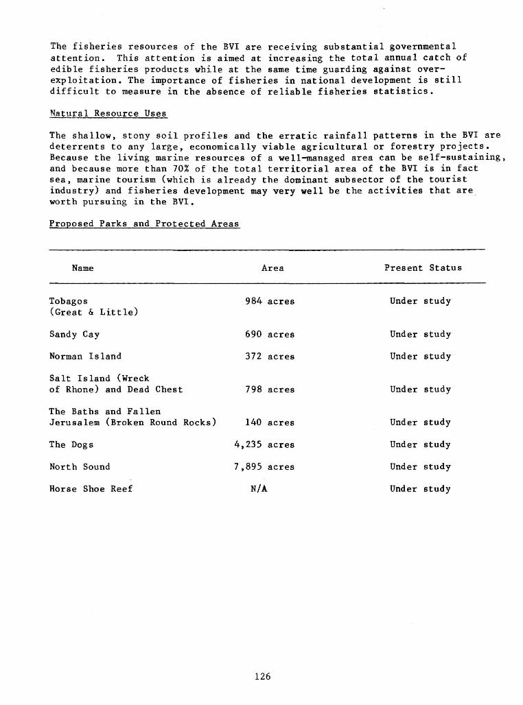
The fisheries resources of the BVI are receiving substantial governmental attention. This attention is aimed at increasing the total annual catch of edible fisheries products while at the same time guarding against over-exploitation. The importance of fisheries in national development is still difficult to measure in the absence of reliable fisheries statistics.
Natural Resource Uses
The shallow, stony soil profiles and the erratic rainfall patterns in the BVI are deterrents to any large, economically viable agricultural or forestry projects. Because the living marine resources of a well-managed area can be self-sustaining, and because more than 70% of the total territorial area of the BVI is in fact sea, marine tourism (which is already the dominant subsector of the tourist industry) and fisheries development may very well be the activities that are worth pursuing in the BVI.
Proposed Parks and Protected Areas
Name Area Present Status
Tobagos 984 acres Under study (Great & Little)
Sandy Cay 690 acres Under study
Norman Island 372 acres Under study
Salt Island (Wreck
of Rhone) and Dead Chest 798 acres Under study
The Baths and Fallen
Jerusalem (Broken Round Rocks) 140 acres Under study
The Dogs 4,235 acres Under study
North Sound 7,895 acres Under study
Horse Shoe Reef N/A Under study
126

BRITISH VIRGIN ISLANDS
Summary - Planning and Management Infrastructure for Natural Resources Management
Department Main Functions Main Staff Employed
Training Programs and Needs
Major Management Problems
Chief Minister, Ministry
Responsibility Physical Planning
Permanent Secretary and Administrative Officer
Town and Country Planning Department
Physical Planning Planning Inspector Town Planner and Planner
Lack of sound legislation and personnel
Ministry of Natural Resources
Agriculture Department
Agriculture, Enviroment, National Parks
Forestry, Fisheries
2 Administrative Officers
Chief Agricultural Officer Fishery Officer
Ministry of Social Services
Public and Environmental Health
2 Public Health Officers Health Education Officer
Attorney General Legislation and enforcement Legal Assistant

UNITED STATES VIRGIN ISLANDS COUNTRY SUMMARY
1 Ralf H. Boulon, Jr.
Background
The United States Virgin Islands are part of an arc of islands stretching from Florida to Venezuela. They are approximately 1,850 km east-southeast of Miami, 65-130 km east and southeast of Puerto Rico, and 885 km north of Venezuela.
There are three main islands — St. Croix, St. Thomas, and St. John — and about 90 small islands and cays. The latter do not contribute much to the total land mass — only 4% of the total 21,800 hectares (140 square miles), but they make an invaluable contribution to the aesthetics, biological diversity, and protection of the main islands from the sea and wind.
St. Thomas and St. John (and Puerto Rico and the British Virgin Islands) are on the same submerged bank which divides the Atlantic Ocean from the Caribbean Sea. To the south, separated from its sister islands by a 64 km-wide expanse of water and a submarine trench more than 4,000 m deep, is St. Croix, on its own submerged bank and completely within the Caribbean Sea. All three main islands are longer in the east-west direction.
St. Croix, the longest, has 113 km of shoreline and an area of 21,800 hectares (84 square miles). It is 37 km long and 10 km wide at the western end. The eastern end narrows to Point Udall, the easternmost U.S. soil in the western hemisphere. A low mountain range extends along most of the northern part of St. Croix, from the northwest corner to and including most of the narrower eastern third of the island. The highest point is Mount Eagle, 355 m above sea level, in the west-central part of the range.
The southwest and south-central parts of St. Croix are relatively flat. Over half the island has slopes of less than 10%. St. Croix is noted for its many "sugar mills," the limestone structures that once housed wind-driven machinery for crushing the juice from sugarcane.
General terrain and vegetation vary from the rolling hills covered with cactus and thorn-scrub on the windswept east end to large areas of grass, pasture land, and, in the west end, a moist forest (not a true "rain forest" as it is sometimes called). There are several large saltponds and over 200 freshwater ponds, mostly man-made.
The coastline is notable for its variety: steep bluffs in the east and northwest, an extensive sandy beach in the southwest, many pocket beaches and
1 Acting Director, Division of Fish and Wildlife, Department of Conservation and Cultural Affairs, St. Thomas, U.S. Virgin Islands
128

shallow bays, and a coastal plain along much of the south shore, which once had a large mangrove lagoon — now converted to deepwater ports and industrial refining. Coral reefs fringe much of the eastern half of the island and protect the small harbor on the north shore.
St. Thomas, the seat of government, is 19 km long, 5 km across at its widest point, and has an area of 8,300 hectares (32 square miles). There are 85 km of coastline, with large expanses of steep rocky shoreline, a large mangrove lagoon, a well-protected harbor visited by many cruise ships, and many small to medium-sized sandy beaches. St. Thomas is noted for its steep terrain: more than 70% of the island has slopes exceeding 20%. The highest point is 472 m above sea level.
General vegetation varies from the scrub of the rather dry east end to cooler and quite lush central mountain tops where tree ferns once grew naturally. Parts of the north slopes have been terraced for growing vegetables. There are only a few salt and freshwater ponds.
St. John, 5 km east of St. Thomas, is the smallest of the three main islands. It is about 14 km long, 8 km wide, and has an area of 5,200 hectares (20 square miles). About 60% of the island is a national park. The coastline is 80 km long and mostly rugged. There is a small but well-protected harbor at the west end, a large harbor in the southeast used by boats as a "hurricane hole" for protection, and a number of sandy beaches and shallow bays. There are very few ponds.
St. John is generally steeper than St.Thomas, with 80% of the island having slopes of 20% or more. The highest point is 389 m above sea level.
The population of the U.S. Virgin Islands has almost tripled, from 32,099 in 1960 to 95,930 in the 1980 census, when the breakdown was:
St. Croix 49,280
St. Thomas 44,170
St. John 2,480
The leading economic activity in the U. S. Virgin Islands is the tourist industry. This industry supports a large hotel, taxi and boating associations, as well as a vast score of small businesses. In 1980, these islands were visited by almost a million tourists - almost ten times the number of people who live here. This rapid growth and influx of people and industry has had a marked effect on the local flora and fauna. Other leading economic activities include rum production revenues to the local government and strong federal subsidies to many government activities.
Three Major Problems
Three major problems with respect to the management of the U.S. Virgin Islands' natural resources include:
1. Loss of open land due to population increase and resultant dispersed construction activities;
129
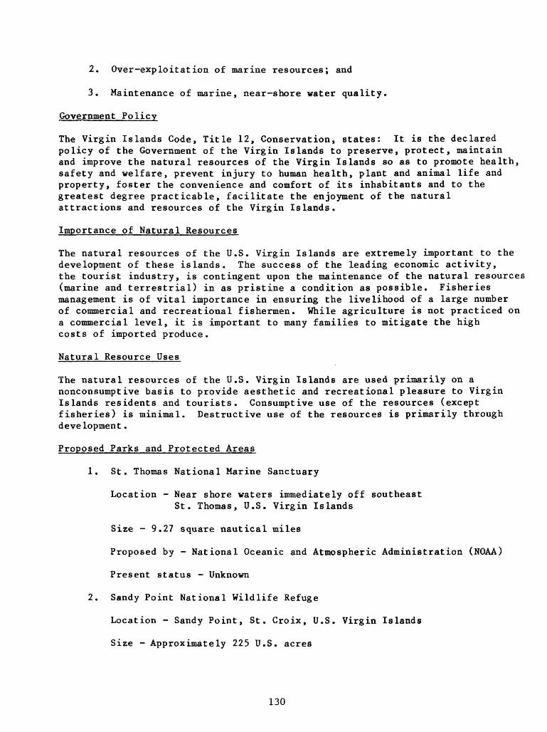
2. Over-exploitation of marine resources; and
3. Maintenance of marine, near-shore water quality.
Government Policy
The Virgin Islands Code, Title 12, Conservation, states: It is the declared policy of the Government of the Virgin Islands to preserve, protect, maintain and improve the natural resources of the Virgin Islands so as to promote health, safety and welfare, prevent injury to human health, plant and animal life and property, foster the convenience and comfort of its inhabitants and to the greatest degree practicable, facilitate the enjoyment of the natural attractions and resources of the Virgin Islands.
Importance of Natural Resources
The natural resources of the U.S. Virgin Islands are extremely important to the development of these islands. The success of the leading economic activity, the tourist industry, is contingent upon the maintenance of the natural resources (marine and terrestrial) in as pristine a condition as possible. Fisheries management is of vital importance in ensuring the livelihood of a large number of commercial and recreational fishermen. While agriculture is not practiced on a commercial level, it is important to many families to mitigate the high costs of imported produce.
Natural Resource Uses
The natural resources of the U.S. Virgin Islands are used primarily on a nonconsumptive basis to provide aesthetic and recreational pleasure to Virgin Islands residents and tourists. Consumptive use of the resources (except fisheries) is minimal. Destructive use of the resources is primarily through development.
Proposed Parks and Protected Areas
1. St. Thomas National Marine Sanctuary
Location - Near shore waters immediately off southeast St. Thomas, U.S. Virgin Islands
Size - 9.27 square nautical miles
Proposed by - National Oceanic and Atmospheric Administration (NOAA)
Present status - Unknown
2. Sandy Point National Wildlife Refuge
Location - Sandy Point, St. Croix, U.S. Virgin Islands
Size - Approximately 225 U.S. acres
130

Proposed by - U.S. Department of the Interior, Fish and Wildlife Service
Present status - under appraisal
131

UNITED STATES VIRGIN ISLANDS
Summary - Planning and Management Infrastructure for Natural Resources Management
H-•
N3
Agency Unit Functions No. Staff Working On Natural Resources
Training Programs and Needs
Major Management Problems
Department of
Conservation and
Cultural Affairs
Division of Natural Resources Management
Monitoring of air and water quality levels. Regulation of pesticides. Permitting of solid waste, air and water pollutant discharges.
St. Croix - 10 St. Thomas - 10
No in-house programs. Need for training programs is apparent.
Division of Fish and Wildlife
Research and survey activities leading to the formulation of management plans for V.I. living resourcea.
St. Croix - 5 St. Thomas - 13
None - Statistical training needed
Division of Coastal Zone Management
Management of the first tier of the coastal zone relative to development activities within this tier as dictated by the Coastal Zone Management Act
St. Croix - 5 St. Thomas - 5
None
Bureau of Environmental Enforcement
Enforcement of all conservation related laws. Boating registration and safety.
Basic training in all areas of conservation laws.
Lack of adequately trained personnel in certain areas.
Infraction of fish and wildlife laws and their effects on research and survey activities.
Enforcement of erosion control regulations due to limited staff and severely curtailed budget.
Infractions of boating and fishing regulations
U.S. Dept. of
I n t e r i o r , National Park Service
Virgin Is lands To conserve the natural and National Park c u l t u r a l resourcea of the Park
and provide for the enjoyment of v i s i t o r s to the Park.
F u l l in-house t ra in ing in a l l a spec t s of NTS a c t i v i t i e s . Need fori tra in ing in in t r o p i c a l ecosystems
Inadequate data b a s e s , p a r t i c u l a r l y with regard to t e r r e s t r i a l v e g e t a t i o n
S t . Croix - 7 S t . Thomas - 8
S t . Croix - 5 S t . John - 9
Plus Overseers - 3

RELEVANT WORK AT THE UNIVERSITY OF THE WEST INDIES, CAVE HILL CAMPUS
1 Euna A. Moore
Background
The Biology Department of the University of the West Indies, Cave Hill Campus, offers two final year courses, the first of which is entitled "Applied Aquatic Ecology." Despite its title, this is really a fisheries biology course and is synopsised as follows:
Fisheries Biology: Survey of diversity of fisheries situations; importance and potential of fishery resources. Estimates of abundance, population structure, productivity and yield. Effects of exploitation -ecological and genetic. An ecosystem approach to multispecies fisheries dynamics. Aquaculture: Techniques and organisms currently used. Biological criteria for potential cultivars. Genetic manipulation of aquaculture stocks.
The second course of the required specification is called "Marine Biology" and treats the marine environment as a complex integrated life resource, both for direct biological production and indirectly as a life-supporting reservoir, e.g. in producing oxygen, cleansing land-polluted air, etc. Within this framework specific marine and interfacial resources are treated, e.g. coral reefs, beaches, mangrove forests.
The total number of students listed for both courses in the present year is 14, though some of them have concurrent registration. These numbers have grown gradually from 4 in the first year of establishment.
At present, all postgraduate degree programs are by research only and many of the individual projects are concerned with the assessment of biological potential and ecology of individual species. Some studies nearing completion include the fisheries biology of the sea urchin, Tripneustes ventricosies; the aquaculture potential of the bivalve mollusc, Brachidontes modiolus; the fisheries biology of flying fish, Hirundicthyes affinis and dolphin fish, Coryphaena hippuris; and the aquaculture potential of Gracilaria spp. (seaweeds) in Barbados. All of the above are thesis topics, two at the Doctoral level and three at the Masters.
The present academic structure of the department allows for considerable extension of this type of natural resource assessment.
1 Department of Biology, University of the West Indies, Barbados, West Indies
133

Planned and/or Ongoing Projects
The strong interest in aquaculture noted above has elicited monetary support for two other projects, one in marine shrimp farming and the other (in association with the Ministry of Agriculture) in pond farming of Tilapia spp. and carp as starting cultivars for prospective table fish.
Departmental interest has also been engaged in the possibility of setting up a Tilapia rearing pond as a part of a recycling project wherein the refuse from a pig farm is converted to biogas, and the sludge from the gas production is fed to species of small Tilapia which will, in turn, be converted to fish meal for feeding the pigs. This latter project is under the aegis of a regional funding agency and departmental input will be at the fish farming level. There is also the scientific prospect of development of a suitable binder for the fish product, incorporating other local products such as seaweeds. If the biochemical expertise can be localized, then the possibility of the cage rearing of fish like the dolphin becomes quite feasible and could be cost-effective.
Training Needs
An outstanding feature of the program described above is their single-discipline nature. However, while the Information gained will contribute much to the eecological-management aspect, the economic management component is lacking. There is therefore need for a multi-disciplinary approach to resource studies and the evolution of management strategies that embrace the ecological and economical, as well as the sociological and legal.
The recent adoption of the Law of the Sea Convention (UNCLOS) by the United Nations has utmost significance for small island states such as those in the Caribbean archipelago, whose territorial rights (as recognized by this Convention) are often overlapping and require exercise of the finer points of the law. Of greater significance is the fact that these states have neither the skilled human, technological, nor financial resources to mount exploitative activities or research programs into their natural inheritance. Of even greater significance is the fact that the UNCLOS includes a statute of limitations by which the more technologically advantaged territories can exploit these resources after the lapse of the time stipulated.
Possibly of the greatest significance is the fact that the most technologically advanced nations, even after delaying adoption of UNCLOS for an extraordinarily long time and having managed to include caveats that greatly increase their advantages, have refrained from signing the document. In the meantime, the technology for remote sensing has developed considerably and the question of the sovereignity of information on resource disposition has not been broached.
134
The training needs as dictated by these circumstances are as follows:
1. Ground truthing assessment techniques for natural resources, diving, underwater photography, and use of other underwater equipment.
2. Mapping and other methods of reporting on resources.
3. Rapid development of skills in the transformation and interpretation of remote sensed data.
4. Computer manipulation skills to deal with the large masses of data derived from satellite technology.
5. As data obtained at all the foregoing levels must be interpreted and refined, skills at the various levels of this terraced paradigm must also be provided.
6. There must be several skilled persons at the apex of this paradigm capable of interdigitating data so derived with other areas of consideration in the developmental process. They must also be capable of interfacing with the infrastructural and political planners.
Institutional Capacity Development
With all the foregoing in mind, the Cave Hill Campus of the University of the West Indies has been endeavoring to establish a "Center for Environmental and Resource Management Studies." The program has, as primary objectives, training in the following areas:
1. To institute short-term awareness programs aimed at sensitising decision-makers of the critical need for environmental considerations when formulating industrial or other types of infrastructural development plans.
2. To improve the capabilities of these decision-makers in identifying the types of information required for proper assessment of projects and to identify ready sources of information.
3. To provide the required skills as set out in the Training Needs section (mentioned above).
4. By the establishment of multifaceted research programs, to provide the coordinated information base for the various identified resources. Starting points of focus will be those resources which are presently being developed and have shown signs of environmental stress.
5. To cooperate with other organizations with environmental concern in order to promote public awareness of these concerns and to sensitise individuals as to the part each person must play in this conservation effort.
6. To establish a regional information center for resources and development projects.
135
After some three years of deliberations, the organizing committee for this center has determined that it will be impossible to mount the entire program all at once. However, every effort is being made to start the new academic year with (4) above, i.e. a unit to initiate and develop some research programs as described therein. Two projects under consideration for this purpose are (a) land use in some eastern Caribbean states —historical, legal, economic and sociological aspects; and (b) the Law of the Sea as it applies to eastern Caribbean states in respect of two resources, one of which will be the fishery industry based on migratory fishes.
To this end, a coordinator is now being appointed with primary duties of activating the project and seeking funding to develop the full program.
136
RAPPORTEUR'S REPORT - DAY 1 (TUESDAY, 10 MAY)
Chairman: G. Jay Gogue Rapporteur: Euna Moore
Call to Order
From the chair, G. Jay Gogue, Chief Scientist of the National Park Service, Southeast Region, called the session to order and drew attention to the objectives of the workshop as set out in the preface to the program.
Welcome
The participants in the workshop were then welcomed, first by Noel Pachta, Superintendent, Virgin Islands National Park, who gave a brief description of the extent of the park and offered the services of his organization for the duration of the Workshop. Next, Michael Glennie, Vice-President and General Manager of Caneel Bay, spoke on behalf of Caneel Bay and of Mr. Lawrence Rockefeller, by whose initiative this National Park had been established. Caneel Bay was also the venue of a meeting at which the Caribbean Conservation Association (CCA) had been founded. Glennie emphasized the good relationships that have been maintained with the CCA ever since.
The session was formally opened by Mr. C. Morales, Assistant to the Governor of the Virgin Islands. He extended a cordial welcome on behalf of Governor Juan Luis and Lieutenant Governor Julio Brady of the U.S. Virgin Islands and expressed pleasure that St. John had been chosen as the site of this important workshop. He wished for fruitful outcome to the deliberations.
Keynote Address
The keynote address was delivered by Franklin Margetson, President, CCA. He outlined, as a framework for his speech, the aggressive development programs being pursued as perceived economic strategies for the latter part of the 20th century. Within this framework must be viewed the small fragile island environments of the Lesser Antilles, which, because of their recent colonial history, are unprepared to cope with rapid development and the need for the islands to "grow up" fast in order to survive and meet the challenges of preparing for the 21st century. He saw the CCA effort as the mechanism for making this process as gentle as possible.
Margetson noted that the role of the politician and the person with environmental concerns also has to be considered. These two positions are not easily reconcilable; the politician must deal with the daily and short-term needs of his constituents as well as the demands for political survival, whereas the environmentalist must deal with the survival of people as a whole, and his constituents are the children of the future.
While admittedly being new to "Biosphere" activity, Margetson felt instinctively that the role of the CCA is to ensure and underscore the importance of conservation for survival and that urgent action needs to be taken because of the fragility and limitations of the island states. He was also
137
convinced that our survival depends on that of the ecosystem and our foresight in maintaining its health.
In discharge of this commitment the CCA has managed, through its membership structure and the support of its members, to gain regional and extra-regional recognition and has helped establish a level of regional unity, despite differences in geography, economies and politics. In this context, he paid tribute to Dr. Ed Towle, CCA's first president, whose foresight and hard work helped launch CCA and whose support continues unabated.
Margetson also pinpointed some events of recent times that indicate the growing awareness in the region of the problems to be tackled and the steps being taken to address these problems. Among these are the signing of:
- - The Cartagena document for protection of the environment.
- - The protocol for combating oil pollution in the region.
These are extensions of the May 1981 Caribbean Action Plan, CCA's
contribution to which was a resolution calling for identification of areas for protection of ecosystems, and for wildlife reserves to be set up. These are contained in C.E.P. items 5 and 6.
No. 5 calls for the survey of potential areas for National Parks and Marine Reserves that could serve as tourism resources, and at the same time protect fragile ecosystems and areas of scientific interest.
No. 6 urges development of regional and sub-regional networks of coastal, marine and terrestrial protected areas, so as to help maintain the living natural resources vital to development; to further existing efforts and agreements involving countries of the region, development of co-operative activities for the protection of endangered and threatened species so as to help maintain the region's wealth of genetic resources; and the harmonization of national policies for the management of wildlife, genetic resources, and natural habitats.
Finally, Margetson stated that the CCA remains a willing servant to the cause of regional survival. One area of practical involvement is in the Eastern Caribbean Natural Area Management Program, whose field operations are under the management of Allen D. Putney.
Role of Biosphere Reserves
The next three speakers sought to outline and clarify the multiple roles of Biosphere Reserves and other protected areas.
Bernd von Droste, MAB and World Heritage Programme Specialist from the Division of Ecological Sciences, UNESCO, Paris, France, informed the group that UNESCO's Protected Areas Programme consists of:
138
The Ramsar Convention (1970).
- - World Heritage Convention (1972).
- - The MAB Programme/Biosphere Reserve Network.
Work in these areas is carried out in conjunction with the International Union for the Conservation of Nature and Natural Resources (IUCN) and the program is mainly for research and training.
From the Ramsar (Wetlands) Convention the output has been the Ramsar list of more than 220 wetland areas comprising more than six (6) million hectares in thirty-six (36) party states. Beyond this not much has been achieved because of:
- - Lack of forcefulness;
- - No funds for Secretariat;
- - Lack of international assistance;
- - Lack of attractiveness to developing countries, the threat to wetlands not being officially recognized; and
- - Some language problems.
The future of the Ramsar Convention, he said, must lie in the upgrading of its effectiveness through services and diplomatic conferences, e.g., the Technican Conference to he held in May 1984.
The World Heritage outputs include:
- - The World Heritage Endangered List.
- - The World Heritage Listings which comprise both natural and cultural properties. Some of these have already become endangered and may be transferred to that list once the concerned state parties make the request. There are seventy (70) contributing state part ies.
- - Public Information.
- - International Assistance in preparing the nomination of properties
to the World Heritage List.
The World Heritage organizational structure encompasses:
1. The World Heritage Committee;
2. The World Heritage Bureau;
139

3. Advisory bodies;
4. The Secretariat; and
5. The World Heritage Fund, composed of both compulsory and voluntary contributions.
On a global level the organization also considers the distribution of natural and cultural heritage and is involved in setting out the framework for international cooperation.
How does a property accede to the World Heritage List? According to von Droste, first, the state must become a member of the organization. It may then receive the organization's assistance in preparing the nomination form. Evaluation of the property proceeds in the calendar year following submission of the nomination.
The following are World Heritage criteria—at least one of which must be met:
1. Outstanding example of the major stages of the earth's evolutionary history (fossil beds, geological sites, etc.).
2. Outstanding example of ongoing geological processes, biological evolution and man's interaction with his natural environment (volcanoes, tropical rain forest, terrace agriculture, etc.).
3. Superlative natural phenomena, formations and features or areas of exceptional natural beauty.
4. Contain eminent natural habitats where threatened species of animals or plants of outstanding universal value can survive.
The Technical Cooperation Plan offers help in preparatory assistance, individual fellowships, group training, support to regional training centers, technical assistance in developing a World Heritage site to the monetary value of about $20,000, and also emergency assistance in case of natural disasters.
The IUCN has prepared an "Indicative List" which is still open to suggestions. Three properties from the Lesser Antilles on this list are:
- - Mt. Pele in Martinique.
- - Morne Trois Pitons in the Commonwealth of Dominica.
- - Portions of Anegada, British Virgin Islands.
140

Von Droste claimed that the concept of Biosphere Reserves is one of the most challenging approaches to natural resource management in recent decades. The bold goal is to promote a balanced relationship between people and the environment. One of its objectives is to develop cooperation in small island territories such as those in the Caribbean, e.g., a network of marine coastal reserves.
Further, the Biosphere Reserve Network is an integrated concept of conservation that combines ecosystems conservation, environmental research/monitoring, training, and environmental education - - with its overall goal being the social acceptance of conservation as a part of development. It provides international cooperation for in situ conservation of genetic diversity and facilitates international cooperation in research on comparable ecosystems.
The Biosphere Reserve networks provide the aegis for a great variety of cooperative linkages, both in terms of the types of ecosystems and biogeographical regions, and in the social dimension, N - S and S - S. Along these axes can occur exchange of information, exchange of personnel, and catalytic inputs. A Biosphere Reserve was diagrammatically represented as consisting of a core, a buffer and a fringe zone. The system may not be closed, or homogeneous, but could consist of contiguous or disjunct elements forming a biogeographical cluster or open system.
Finally, von Droste suggested that for small island states such as the Lesser Antilles, the biogeographical approach to Biosphere Reserves might be more feasible. He noted that MAB Project 7 will consider the impact of migration and exotic plants on island ecosystems, but also aims to achieve the management of island resources by island populations. One example of a MAB 7 project is the study of population development and the environment in the Eastern Caribbean.
The second speaker, Craig MacFarland, head of the Wildlands and Watershed Program, stated that the Biosphere Reserve concept is innovative in that it:
- - Emphasizes balanced relationship between people and resources;
- - Provides a managerial and institutional framework;
- - Allows bridging of traditional barriers in institutions and disciplines;
- - Provides linkage of protected areas to surrounding communities, lands and waters;
- - Provides for the study and demonstration of viable options for land and water resource use;
- - Monitors the trends and impacts of development and management;
141
- - By extension provides guidelines and alternatives for change in education and training; and also
- - Protects key ecological processes and genetic resources.
In practice, however, the Biosphere Reserve concept has low impact and is lagging in the implementation of its objectives for many reasons, among which are:
- - Resistance in many regions and countries to the duplication of effort, there being failure to recognize the essential difference in the Biosphere Reserve concept;
- - The mere citation of "Biosphere Reserve" in a country is sometimes seen only as a label of recognition and not as a new management approach;
- - Failure of the cooperative effort among the various institutions required to collaborate in management; and
- - In general, lack of precise definition of the Biosphere Reserve concept and its characteristics.
MacFarland noted that as a result of this experience and history, more precise and definitive characteristics are being evolved, the sum effect of which is to make the program more people-oriented and to give its projects a higher relief profile and a stronger demonstration effect. One of these points of the new profile is that the program should, where possible, allow for rehabilitative or restorative programs for environments totally or partially altered by inappropriate use.
MacFarland pointed out some new thoughts on the spatial organization of the Biosphere Reserve and how it should function. In the new proposed objectives the conservation principle is focused on representative samples of ecosystems (ecological zones and biomes) which are ecologically auto-sustainable with adequate legal and political guarantees. Also brought into sharper focus by these proposed new articles of definition is the cultural function and use of these reserves.
The third speaker, William P. Gregg, Co-Chairman of the United States MAB Project Directorate on Biosphere Reserves, offered his experiences with respect to the development of MAB projects for possible extrapolation to the eastern Caribbean area.
He recognized the area as a complex of ecosystems in various stages of history and usage and emphasized that any Biosphere Reserve project should be aimed at sustained and increased use for improvement of the quality of life for the people of the islands. In this context., the building of a conservation ethic is of primary importance.
From his experience in the continental United States and elsewhere, Gregg stated that it is obviously difficult to find all the characteristics of a Biosphere Reserve in any one place, and this would be more the case in small oceanic islands. Hence he advocated the cluster concept—the
142
selection of multiple sites to meet all the criteria. As an example, he outlined the development plans of the National Park Service in the United States Virgin Islands, which include the completion of a research and conference center and other objectives. He further suggested that the Virgin Islands National Park be the first unit of a larger Biosphere Reserve concept for the Lesser Antillean area.
Selection and Management of Protected Areas in the Lesser Antilles
The next speaker, Allen D. Putney, Director, Eastern Caribbean National Area Management Program (ECNAMP), set out to give the specifics of the case for the Lesser Antilles. He defined the problem as the coincident dual and correlated pressure of population and development needs on a narrow base of natural resources.
As a first step in addressing the problem, a survey of natural resources and human impacts was conducted. Since the information base was extremely thin, it wa6 necessary to establish new reference points and standards for treatment of data collected.
First, a set of maps was prepared. The analyzed data has helped to identify the remaining natural areas or life zones. The region, Putney said, is characterized by:
- - Relatively low biological diversity as compared with other tropical
areas;
- - Very high cultural, political and educational diversity;
- - Wide dispersion of a particular type zone; and
- - High population density supported by scarce resources. The question was posed as to whether special characteristics must be developed for a Biosphere Reserve in this area and whether representativeness needed to be redefined to give human institutional diversity more emphasis. Putney made the following suggestions:
1. That the spatial organization of the Biosphere Reserve should consist of (a) a core zone, (b) a traditional use zone (that which has become stable), (c) an experimental zone, and (d) a restoration zone;
2. That a multi-island design should be considered with the hope that cooperation would be forthcoming; and
3. That there must be strong local involvement and the proposed schemes should deal with the real problems of the people, not the more esoteric problems as perceived by the scientist.
143
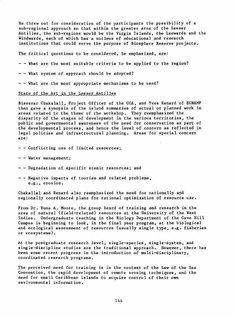
He threw out for consideration of the participants the possibility of a sub-regional approach so that within the greater area of the Lesser Antilles, the 6ub-regions would be the Virgin Islands, the Leewards and the Windwards, each of which has a nucleus of educational and research institutions that could serve the purpose of Biosphere Reserve projects.
The critical questions to be considered, he emphasized, are:
- - What are the most suitable criteria to be applied to the region?
- - What system of approach should be adopted?
- - What are the most appropriate mechanisms to be used?
State of the Art in the Lesser Antilles
Bisessar Chakalall, Project Officer of the CCA, and Yves Renard of ECNAMP then gave a synopsis of the island summaries of actual or planned work in areas related to the theme of the workshop. They reemphasized the disparity of the stages of development in the various territories, the public and governmental awareness of the need for conservation as part of the developmental process, and hence the level of concern as reflected in legal policies and infrastructural planning. Areas for special concern are:
- - Conflicting use of limited resources;
- - Water management;
- - Degradation of specific scenic resources; and
- - Negative impacts of tourism and related problems, e.g., erosion.
Chakallal and Renard also reemphasized the need for nationally and regionally coordinated plans for rational optimization of resource use.
From Dr. Euna A. Moore, the group heard of training and research in the area of natural (field-related) resources at the University of the West Indies. Undergraduate teaching in the Biology Department of the Cave Hill Campus is beginning to look, in the final year program, at the biological and ecological assessment of resources (usually single type, e.g. fisheries or ecosystems).
At the postgraduate research level, single-species, single-system, and single-discipline studies are the traditional approach. However, there has been some recent progress in the introduction of multi-disciplinary, coordinated research programs.
The perceived need for training is in the context of the Law of the Sea Convention, the rapid development of remote sensing techniques, and the need for small Caribbean islands to acquire control of their own environmental information.
144

Summary
The essential points often stated during the first day of the workshop were concerned with the following:
1. The small size and fragility of the ecosystem resources of the island states of the eastern Caribbean.
2. The considerable coincident and correlated pressures of population and developmental needs on this narrow resource base.
3. The need to realize and accept the "Conservation for Development" concept.
4. The considerable biogeographical, cultural, political and economic diversity of the region and the disparity of the stages of development in the various territories, and public and government awareness of the need for conservation. Areas of special concern include the conflicting use of limited resources and the irreversible degradation of small scenic resources.
5. The over-riding need for cooperative efforts and for nationally and regionally coordinated strategies for the rational optimization of resource use .
6. Regional and international organizations, such as CCA and UNESCO's Man and the Biosphere Program, emphasize the need for safeguarding the natural and genetic resources of the region as a prerequisite for the survival of the people, and the wise use of these resources for the enhancement of their material and spiritual welfare.
7. It is urgent that the planning, training and public education processes be established now and be pursued with vigor.
Arising out of these concerns and the other deliberations of the workshop, tentative concepts for regional Biosphere Reserves were offered.
145

RAPPORTEUR'S REPORT — DAY 2 (WEDNESDAY, 11 MAY)
Chairman: Allen Putney Rapporteur: Mervin C. Williams
Introduction
The day's work was divided into three sessions:
(1) A work session on the concept of Biosphere Reserves and other protected areas, with special reference to the Lesser Antilles;
(2) A session exploring the opportunities for regional cooperation in the establishment and use of Biosphere Reserves in the Lesser Antilles; and
(3) A review of the role of IUCN/WWF in conservation work in the region, by Sylvia Guignard.
Session One
Bernd von Droste (UNESCO, Paris) set the background for later discussion by reviewing the major objectives and characteristics of the Biosphere Reserve and World Heritage Site concepts. This was done by outlining the major issues and concerns raised by the speakers of the first day's program.
He commenced by reviewing the main conservation problems and issues outlined by Franklin Margetson. In particular, he highlighted the Caribbean Action Plan and the recent decision to prepare a "Protocol for Establishing Protected Areas." This was put in the context of other regional and sub-regional cooperative efforts.
The World Heritage Convention was reviewed and its relationship with the Biosphere Reserve concept outlined. Similarly, von Droste reviewed Craig MacFarland's presentation of the Biosphere Reserve concept, emphasizing its innovative character, the changing emphases in the concept, and the fact that it represents a new approach to management. He noted William Gregg's "Cluster Concept" and briefly touched on its strengths and weaknesses in terms of applicability to the Lesser Antilles.
Finally, the Virgin Islands Biosphere Reserve was reviewed. Allen Putney's outline of the results of CCA/ECNAMP's survey of conservation priorities in the Lesser Antilles was noted. Special reference was made to Putney's conclusion that two basic approaches for implementation presented themselves, i.e., a regional and a sub-regional approach.
Von Droste noted that basic issues were concerned with the adequacy of the criteria for site selection; the determination of the best approach for implementation; the required mechanisms for action; and the adoption of an Action Plan. He noted the existence of the Caribbean Action Plan and pointed to the strengths of a "Lesser Antilles Biosphere Reserve Network" as a preferred approach.
146
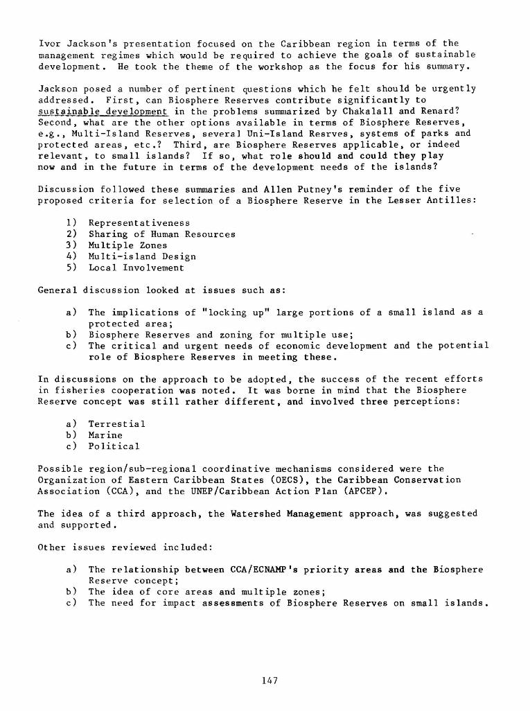
Ivor Jackson's presentation focused on the Caribbean region in terms of the management regimes which would be required to achieve the goals of sustainable development. He took the theme of the workshop as the focus for his summary.
Jackson posed a number of pertinent questions which he felt should be urgently addressed. First, can Biosphere Reserves contribute significantly to sustainable development in the problems summarized by Chakalall and Renard? Second, what are the other options available in terms of Biosphere Reserves, e.g., Multi-Island Reserves, several Uni-Island Resrves, systems of parks and protected areas, etc.? Third, are Biosphere Reserves applicable, or indeed relevant, to small islands? If so, what role should and could they play now and in the future in terms of the development needs of the islands?
Discussion followed these summaries and Allen Putney's reminder of the five proposed criteria for selection of a Biosphere Reserve in the Lesser Antilles:
1) Representativeness 2) Sharing of Human Resources 3) Multiple Zones 4) Multi-island Design 5) Local Involvement
General discussion looked at issues such as:
a) The implications of "locking up" large portions of a small island as a protected area;
b) Biosphere Reserves and zoning for multiple use; c) The critical and urgent needs of economic development and the potential
role of Biosphere Reserves in meeting these.
In discussions on the approach to be adopted, the success of the recent efforts in fisheries cooperation was noted. It was borne in mind that the Biosphere Reserve concept was still rather different, and involved three perceptions:
a) Terrestial b) Marine c) Political
Possible region/sub-regional coordinative mechanisms considered were the Organization of Eastern Caribbean States (OECS), the Caribbean Conservation Association (CCA), and the UNEP/Caribbean Action Plan (APCEP).
The idea of a third approach, the Watershed Management approach, was suggested and supported .
Other issues reviewed included:
a) The relationship between CCA/ECNAMP's priority areas and the Biosphere Reserve concept;
b) The idea of core areas and multiple zones; c) The need for impact assessments of Biosphere Reserves on small islands.
147
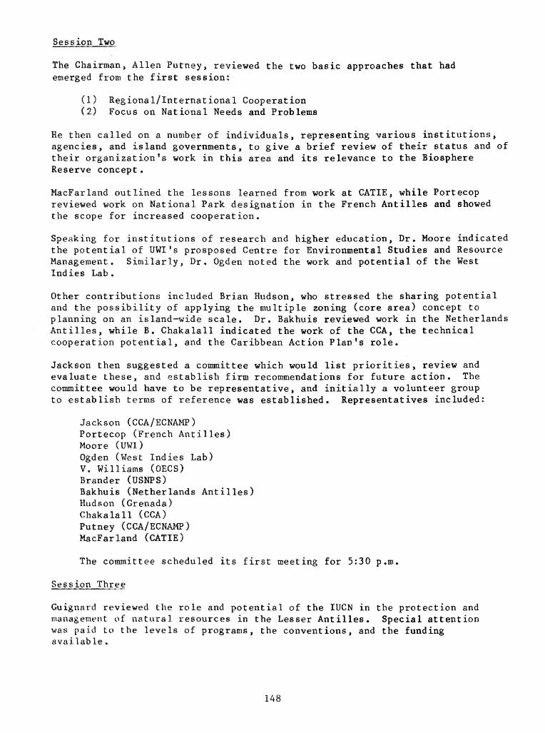
Session Two
The Chairman, Allen Putney, reviewed the two basic approaches that had emerged from the first session:
(1) Regional/International Cooperation (2) Focus on National Needs and Problems
He then called on a number of individuals, representing various institutions, agencies, and island governments, to give a brief review of their status and of their organization's work in this area and its relevance to the Biosphere Reserve concept .
MacFarland outlined the lessons learned from work at CATIE, while Portecop reviewed work on National Park designation in the French Antilles and showed the scope for increased cooperation.
Speaking for institutions of research and higher education, Dr. Moore indicated the potential of UWI's prosposed Centre for Environmental Studies and Resource Management. Similarly, Dr. Ogden noted the work and potential of the West Indies Lab.
Other contributions included Brian Hudson, who stressed the sharing potential and the possibility of applying the multiple zoning (core area) concept to planning on an island-wide scale. Dr. Bakhuis reviewed work in the Netherlands Antilles, while B. Chakalall indicated the work of the CCA, the technical cooperation potential, and the Caribbean Action Plan's role.
Jackson then suggested a committee which would list priorities, review and evaluate these, and establish firm recommendations for future action. The committee would have to be representative, and initially a volunteer group to establish terms of reference was established. Representatives included:
Jackson (CCA/ECNAMP) Portecop (French Antilles) Moore (UWI) Ogden (West Indies Lab) V. Williams (OECS) Brander (USNPS) Bakhuis (Netherlands Antilles) Hudson (Grenada) Chakalall (CCA) Putney (CCA/ECNAMP) MacFarland (CATIE)
The committee scheduled its first meeting for 5:30 p.m.
Session Three
Guignard reviewed the role and potential of the IUCN in the protection and management of natural resources in the Lesser Antilles. Special attention was paid to the levels of programs, the conventions, and the funding available.
148

The discussion which followed indicated that funding could become available for taking the regional /sub-regional Biosphere Reserve program a step further to implementation.
149
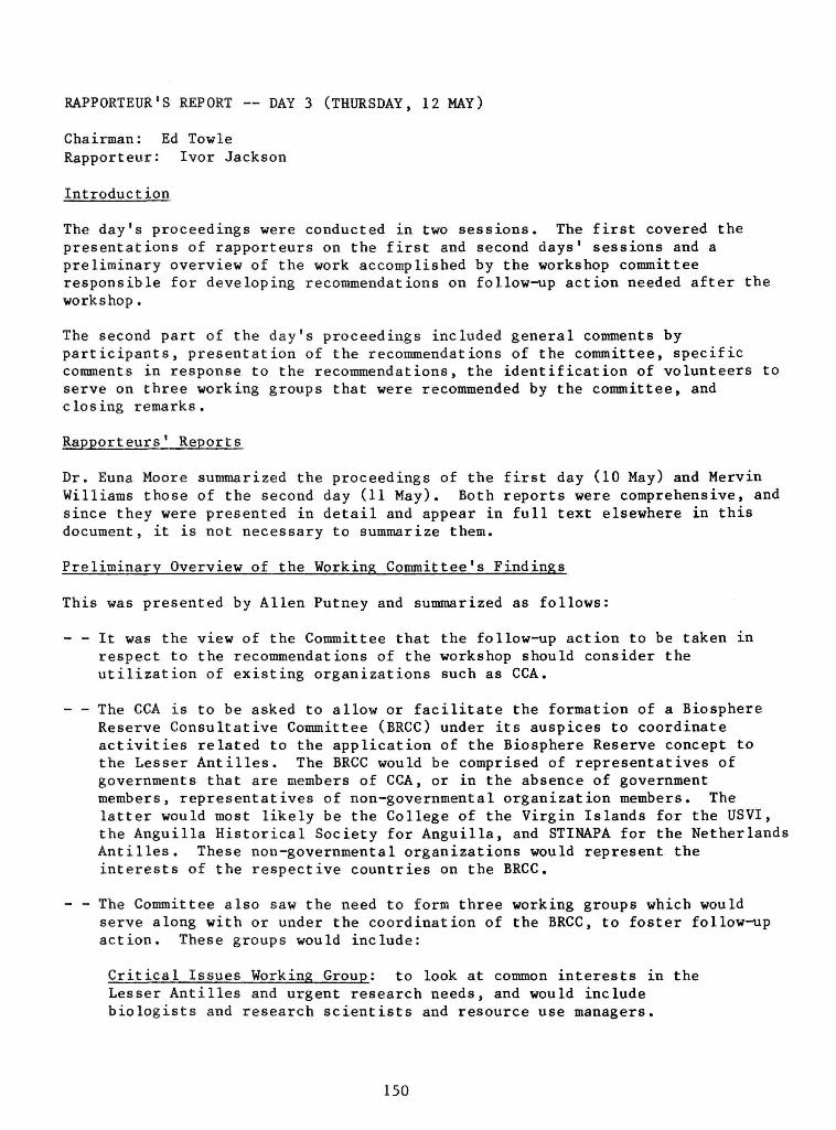
RAPPORTEUR'S REPORT — DAY 3 (THURSDAY, 12 MAY)
Chairman: Ed Towle Rapporteur: Ivor Jackson
Introduction
The day's proceedings were conducted in two sessions. The first covered the presentations of rapporteurs on the first and second days' sessions and a preliminary overview of the work accomplished by the workshop committee responsible for developing recommendations on follow-up action needed after the workshop .
The second part of the day's proceedings included general comments by participants, presentation of the recommendations of the committee, specific comments in response to the recommendations, the identification of volunteers to serve on three working groups that were recommended by the committee, and closing remarks.
Rapporteurs' Reports
Dr. Euna Moore summarized the proceedings of the first day (10 May) and Mervin Williams those of the second day (11 May). Both reports were comprehensive, and since they were presented in detail and appear in full text elsewhere in this document, it is not necessary to summarize them.
Preliminary Overview of the Working Committee's Findings
This was presented by Allen Putney and summarized as follows:
- - It was the view of the Committee that the follow-up action to be taken in respect to the recommendations of the workshop should consider the utilization of existing organizations such as CCA.
- - The CCA is to be asked to allow or facilitate the formation of a Biosphere Reserve Consultative Committee (BRCC) under its auspices to coordinate activities related to the application of the Biosphere Reserve concept to the Lesser Antilles. The BRCC would be comprised of representatives of governments that are members of CCA, or in the absence of government members, representatives of non-governmental organization members. The latter would most likely be the College of the Virgin Islands for the USVI, the Anguilla Historical Society for Anguilla, and STINAPA for the Netherlands Antilles. These non-governmental organizations would represent the interests of the respective countries on the BRCC.
- - The Committee also saw the need to form three working groups which would serve along with or under the coordination of the BRCC, to foster follow-up action. These groups would include:
Critical Issues Working Group: to look at common interests in the Lesser Antilles and urgent research needs, and would include biologists and research scientists and resource use managers.
150

Core Working Group: to investigate and perhaps identify possible areas within the Lesser Antilles that could represent the core of any B.R. that would be established. The committee suggested four islands with possible candidate sites which, if considered together, would cover all the life zones in the region. These islands are Guadeloupe, Sint Maarten, St. Kitts, and Anegada.
Multiple Use Working Group: to identify criteria for the selection of multiple use areas and for the identification of such areas that would complement the core areas of a possible Biosphere Reserve. It was the view of the committee that each working group should, in addition to the responsibilities outlined, communicate with the Lesser Antillean governments to secure agreement, where possible, on their conclusions or recommendations.
General Discussions
This session was started by the Chairman's recognition of the presence of Dr. Jack Dammann who was referred to as being the only person present at the workshop that participated in a 1966 meeting at Caneel Bay during which the CCA was formed and opportunities for regional cooperation in conservation identified. Mr. Dammann was asked to make general comments in view of his experience and long association with regional conservation efforts. His comments covered three main points:
- - That the communication between island representatives who attend meetings, workshops, or conferences was inadequate at the national level and as a result, the transfer of ideas, concepts, and technologies was hindered.
- - That most such meetings fail to identify a "budgetary process" or methods to secure funding, so reducing the chances of effective implementation of ideas and programs.
- - That the Biosphere Reserve program has the potential of securing funds and supporting economic development and so could be used by island representatives as a leverage in obtaining positive response from politicians to conservation programs.
Victor Williams supported, in particular, the third point, and Mervin Williams reinforced the claim that practical approaches should be used in using parks and protected areas (including Biosphere Reserves) as mechanisms for addressing regional problems. In this regard, he said that more attention should have been paid to the country summaries during the workshop, because they provided clues to the issues and problems that parks and protected areas could meaningfully address in the Lesser Antilles.
Brian Hudson suggested that governments of the Lesser Antilles could in some cases respond to non-economic recommendations as well and would most likely respond favorably to the idea of conserving areas that are regionally or internationally important.
Work Committee Recommendations
Eleven recommendations made by the committee were presented by Allen Putney. These recommendations are addressed specifically to governments or
151
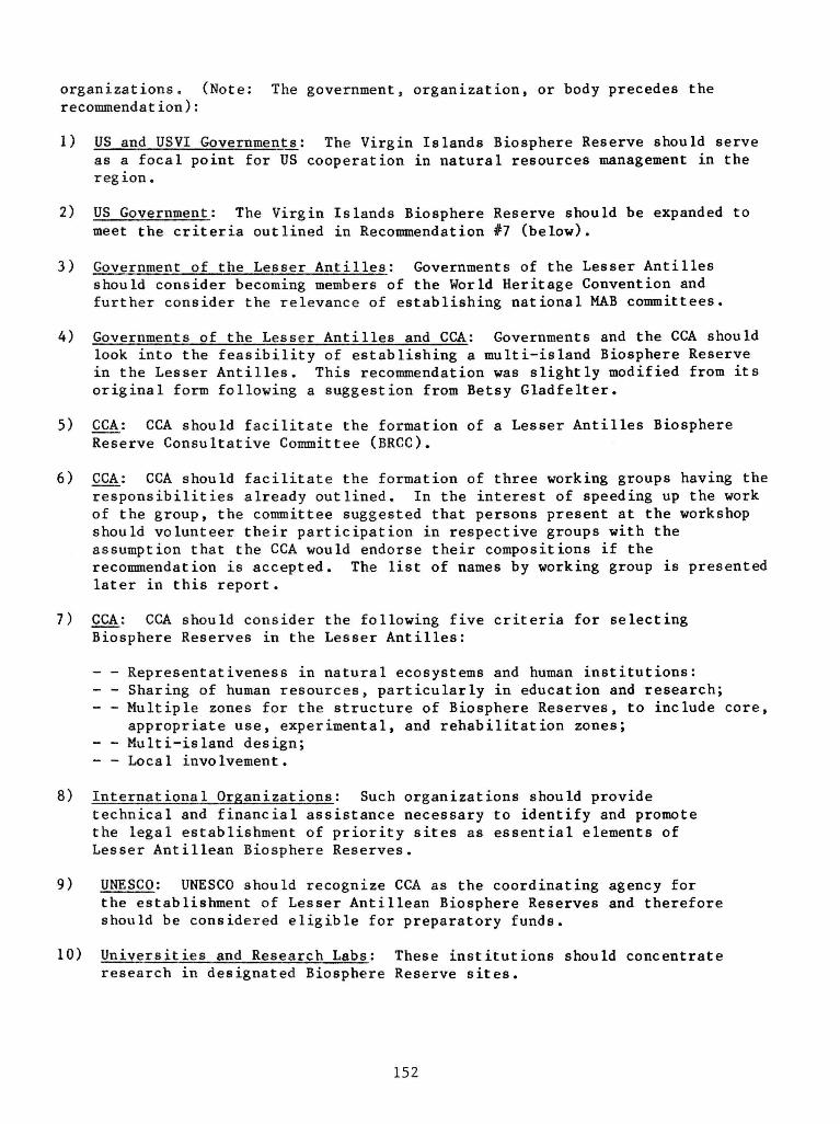
organizations. (Note: The government, organization, or body precedes the recommendat ion):
1) US and USVI Governments: The Virgin Islands Biosphere Reserve should serve as a focal point for US cooperation in natural resources management in the region.
2) US Government: The Virgin Islands Biosphere Reserve should be expanded to meet the criteria outlined in Recommendation #7 (below).
3) Government of the Lesser Antilles: Governments of the Lesser Antilles should consider becoming members of the World Heritage Convention and further consider the relevance of establishing national MAB committees.
4) Governments of the Lesser Antilles and CCA: Governments and the CCA should look into the feasibility of establishing a multi-island Biosphere Reserve in the Lesser Antilles. This recommendation was slightly modified from its original form following a suggestion from Betsy Gladfelter.
5) CCA: CCA should facilitate the formation of a Lesser Antilles Biosphere Reserve Consultative Committee (BRCC).
6) CCA: CCA should facilitate the formation of three working groups having the responsibilities already outlined. In the interest of speeding up the work of the group, the committee suggested that persons present at the workshop should volunteer their participation in respective groups with the assumption that the CCA would endorse their compositions if the recommendation is accepted. The list of names by working group is presented later in this report .
7) CCA: CCA should consider the following five criteria for selecting Biosphere Reserves in the Lesser Antilles:
- - Representativeness in natural ecosystems and human institutions: - - Sharing of human resources, particularly in education and research; - - Multiple zones for the structure of Biosphere Reserves, to include core,
appropriate use, experimental, and rehabilitation zones; - - Multi- island design; - - Local involvement .
8) International Organizations: Such organizations should provide technical and financial assistance necessary to identify and promote the legal establishment of priority sites as essential elements of Lesser Antillean Biosphere Reserves.
9) UNESCO: UNESCO should recognize CCA as the coordinating agency for the establishment of Lesser Antillean Biosphere Reserves and therefore should be considered eligible for preparatory funds.
10) Universities and Research Labs: These institutions should concentrate research in designated Biosphere Reserve sites.
152

11) British Virgin Islands, French, and Dominican Governments: The core areas working group should consider approaching these Governments to secure the nomination of portions of Anegada, Mount Pelee, and Morne Trois Pitons National Park as World Heritage Sites. This recommendation was slightly modified from its original form following a suggestion by Yves Renard.
Specific Comments on the Recommendations
The initial comment on the recommendations was made by Bernd von Droste who expressed pleasure with the recommendations made and said that he felt catalytic funds could be provided to the CCA by UNESCO in respect of Recommendation #9. He also felt that Lesser Antillean governments should be encouraged to become parties to the conventions related to Biosphere Reserves and World Heritage sites and mechanisms should be found to assure local participation in the process of identification and establishment.
The other comments on the recommendations were:
- - Yves Renard said that the recommendations assumed that Biosphere Reserves are applicable for the Lesser Antilles and would indeed work in the region. However, this is not known for sure at this point, even though most persons are responsive to the concept. More research and general groundwork is needed before the usefulness of the Biosphere Reserves to the Lesser Antilles is known with any degree of certainty and as such no haste should be exercised in trying to establish Biosphere Reserves in the region.
- - Allen Putney said that he viewed Biosphere Reserves as a mechanism for cooperation and as a result the recommendations addressed to Governments should be viewed as solicitations of support to pursue exploration of the application of the concept.
- - Yves Renard replied that thorough exploration of the concept's applicability to the Lesser Antilles should be pursued before attempts made at implementation.
- - Ivor Jackson suggested that two steps should be considered in respect of Biosphere Reserves and the Lesser Antilles. First, recommendations dealing with exploration of the concept should be acted on, after which the CCA through the proper forum could determine the feasibility of Biosphere Reserves in the region. If the findings are positive, then the next step would involve action on recommendations that seek the cooperation and support of involved Governments and international organizations.
The discussion ended with the acknowledgement that these comments would help to guide follow-up action in respect to the recommendations.
Volunteers to the Working Groups
The following persons volunteered their services on the three working groups:
153

Critical Issues W. Bakhuis J. Ogden B. Gladfelter E. Moore (in absentia) W. Gregg R. Boulon J. Portecop
Core Areas A. Putney R. Norton V. Williams C. Wilson
Multiple Uses Y. Renard M. Williams L. Richardson R. Brander
It was decided that the working groups would meet in the afternoon and agree on their respective terms of reference and activities to be pursued in the months ahead.
Closing Remarks
The workshop was officially closed with remarks by Bisessar Chakalall, who stated the event was intrumental in starting dialogue on the role of Biosphere Reserves in the Lesser Antilles. He saw this dialogue as providing support in the long run to the development of the Lesser Antilles.
He further stated that a seminal point stressed in the workshop was the need to find a "shoe that fits" and in this respect follow-up action should focus on mechanisms that could further the integration of conservation and development in the region.
He then went on to thank the USNPS, USMAB, CCA, Caneel Bay, UNESCO, organizers and guides of the field trips, island, regional, and international participants, chairpersons and rapporteurs and the TV crew for their various contributions in making the workshop possible and worthwhile.
154

SUMMARY OF THE MEETING OF THE WORKING GROUP ON CRITICAL ISSUES 12 May 1983
Present:
W. Bakhuis, CARMABI, Curacao R. Boulon, Fish and Wildlife, USVI B. Brown, Planning, St. Vincent E. Gladfelter, West Indies Lab, USVI W. Gregg, MAB, Washington, D.C. B. Hudson, Planning, Grenada J. Portecop, UAG, Guadeloupe B. Chakalall, CCA, Barbados J. Gogue, NPS, Atlanta
The group discussed what trends or problems would "drive the function of a Biosphere Reserve" to meet future needs in the Lesser Antilles.
—What management areas are most critical? —What skills must be developed to meet predicted needs?
The group then decided to state major problems of the region as the members perceive them (we decided not to classify these at this point but merely to list them):
Fresh water supply — rain and groundwater Mangroves P e s t i c i d e s Watersheds Sol id and l i q u i d waste d i s p o s a l Landscape d is f igurement S o i l e ros ion Beach d e s t r u c t i o n Impact of tour i sm D e f o r e s t a t i o n Noise p o l l u t i o n Sub-optimal a g r i c u l t u r e Urban sprawl I r r a t i o n a l s e t t l emen t p a t t e r n s Coral r e e f s Interference of ecosystem interactions Unenip loyment Public health Rodents Hunting and poaching Exotic species Information, acquisition and management Oil spills and pollution Energy sources Natural disasters Cultural and natural heritage
155

Human perceptions of the environment Changes in b iological d ivers i ty (gene pools) Wildlife management Impact of technological advances Loss of traditional architecture
It was decided that one member (Gladfelter) would prepare a form listing CRITICAL AREAS with a PRIORITY rating scale similar to the Nature Conservancy form for species. This form would be distributed to citizens of the Lesser Antilles who represent a number of viewpoints:
—Fishermen —Farmers —Land owners —Government employees —Politicians, etc.
with a code so that we would know the "viewpoint" of the respondent. Distribution of the form would be through Chakalall and the CCA.
The information gathered would be used to compile a list of CRITICAL ISSUES common to a number of Lesser Antillean islands for use in planning site and type of Biospnhere Reserve most appropriate for the region.
Timetable
Formulation of questionnaire September 1983
Comments from committee members on November 1983
quest ionnaire
Distribution of questionaire January 198A
Collection of responses March 1984
Preparation of summary June 1984
156

SUMMARY OF THE MEETING OF THE WORKING GROUP ON CORE ZONES 12 May 1983
Present:
A. Putney, ECNAMP, St. Croix V. Williams, Planning, St. Kitts/Nevis C. Wilson, Housing and Lands, Barbados
The group felt that because of its reduced number it was not in a position to work effectively. It also noted that the topic requires a relatively good knowledge of the various physical areas that would be considered on each island, and that only the consultants of ECNAMP have that knowledge. It was therefore felt that ECNAMP should be made responsible for recommending the system of representative core areas to the Biosphere Reserve Consultative Committee, based on the Survey of Conservation Priorities in the Lesser Antilles, the paper presented by Putney at the workshop, and subsequent discussions during the workshop.
157

SUMMARY OF THE MEETING OF THE WORKING GROUP ON APPROPRIATE MULTIPLE-USE ZONES 12 May 1983
Present:
B. Brander, Virgin Islands National Park F. Margetson, CCA, Montserrat C. MacFarland, CATIE, Costa Rica Y. Renard, ECNAMP, Saint Lucia L. Richardson, Government of Anguilla M. Williams, Government of Saint Lucia
I. The working Group was given the task to explore questions related to the "Rehabilitation Zones" of Biosphere Reserves in the Lesser Antillean context.
II. On the general concept of Biosphere Reserves, the Working Group noted that Biosphere Reserves should neither be seen as a "new international label" for protected areas nor as a means to better integrate existing or proposed protected areas within their surrounding environments.
III. The process initiated on the concept of Biosphere Reserves should rather be based on needs which have been identified as follows:
At the island level:
- to evaluate, experiment and compare forms of resource uses in order to identify and support alternatives for sustainable development and the optimization of resource use in the region.
At the regional level:
- to provide lessons and guidelines derived from the experience of other countries and islands in the region;
- to facilitate the sharing of human resources and experience with regards to research, training, education and management in the field of natural resources;
- to ensure that gaps occurring in certain islands could be filled by examples and areas in other neighboring territories.
IV. The functions of the "non-core" zones should be as follows:
a. Research on patterns of resource uses that appear to be appropriate and in balance; this research will focus on all ecological, economic, social and cultural aspects of resource use, and will place them into their historical context; it will also take into account the external factors that influence the system concerned, as well as the impacts of the activities on other areas and resources (Appropriate Use Zone);
158

b. Management for the protection, support and/or evolution of the human and natural systems within the area, for the maintenance of their sustain-bility (Appropriate Use Zone);
c. Action for the rehabilitation of degraded areas and resources (Rehabilitation Zone);
d. Training and education through the demonstration of appropriate and inappropriate uses (including "passive uses") as well as on the rehabilitation objectives and methods (All Zones).
Note: for the fulfillment of the objectives within the Appropriate Use Zones, it is necessary that research activities result in the identification of trends and projections for the future.
V. The criteria for selection of the sites have been identified as follows:
a. Existence of forms of appropriate uses occurring within coherent natural and human systems;
b. Representativity of past and present major systems/each life zone;
c. Existence of comparable Core Zone/area in relatively natural state.
Note: Criteria should also be reversed for application to Core Zones: existence of similar area under appropriate use within the Biosphere Reserve.
d. Accessibility of site for demonstration; diversity of scientific and educational value.
VI. Follow-up. The Working Group should be given responsibility and means to detail the functions and criteria for these Zones, and to develop:
Criteria for the definition of "appropriate uses" (see V-a above).
- A typology of the major systems/each life zone (see V-b above).
159
RECOMMENDATIONS
WORKSHOP ON BIOSPHERE RESERVES AND OTHER PROTECTED AREAS FOR SUSTAINABLE DEVELOPMENT OF SMALL CARIBBEAN ISLANDS
Caneel Bay, St. John, U.S. Virgin Islands, 10-12 May 1983
The "Workshop on Biosphere Reserves and Other Protected Areas for Sustainable Development of Small Caribbean Islands" met at Caneel Bay, St. John, U.S. Virgin Islands, May 10-12, 1983. Participants included scientists, educators, resource managers, and physical planners from the Lesser Antilles, as well as representatives from interested international, regional, and U.S. organizations. The workshop provided an opportunity to discuss the vital role of protected areas in development, and especially the potential contributions that could be made by UNESCO's Biosphere Reserve Project.
During the workshop, it was recognized that sustainable development depends on the interplay of many forces. The wants and needs of the region's people must be balanced with the productive capacity of the region's resources. If through lack of foresight, we abuse these resources or use them beyond sustainable levels, the well-being of future generations will be sacrificed.
In the Lesser Antillean region, the diversity of natural ecosystems is complemented by a diversity in the needs, conditions, value systems, knowledge, and abilities of local communities. If we are to realize the full potential of the region's variety of natural and human resources, then we must study and document the different capacities and limitations of these resources. By sharing this information and experience, we can more effectively manage natural resources for maximum long-term benefits to society. There is special concern in the region for improving the standard of living; creating employment opportunities; stimulating social, cultural, and educational activities; and attaining social and political harmony.
UNESCO's Man and the Biosphere Program, especially its project on Biosphere Reserves, provides an international framework for documenting and sharing this information. Through this program, representative areas can form elements of a Biosphere Reserve in the region which will serve as laboratories and educational centers for understanding the potential and limitations of the natural and human resources of the region. Systematic documentation and diffusion of this information could allow us to share local knowledge with others in similar ecological zones world-wide. Synthesis of the knowledge would then provide the basis for teaching the management of natural resources based on the particular characteristics of the region.
After discussing the potentials of the UNESCO Biosphere Reserve Project and the characteristics and needs of the region, the participants of the workshop agreed on the need to determine the feasibility of establishing
160

and managing a system of sites as a single or several Biosphere Reserve(s) representative of the region. To bring this idea to fruition, the workshop participants made the following specific recommendations which together form a coherent plan of action:
1. Recommendations to International Organizations
1.1 Being acutely aware of the difficulties of coordinating activities among the governments of the various nations and territories of the region, it is recommended that the Caribbean Conservation Association (CCA) be recognized by international organizations as the coordinating agency for the feasibility stage of establishing a single or several Biosphere Reserve(s) in the Lesser Antilles.
1.2 Recognizing the diverse nature of the ecological, cultural, and political systems of the Lesser Antillean Biogeographic Province (sensu Udvardy), as well as the need for regional cooperation in establishing and developing a multi-island Biosphere Reserve or Reserves, it is recommended that international organizations provide the technical and financial support necessary to assist the CCA in determining the feasibility of establishing a Biosphere Reserve or Reserves representative of the Lesser Antilles.
2. Recommendations to the Caribbean Conservation Association (CCA)
2.1 Noting that the CCA has over a decade and a half of experience in promoting conservation in the region, and that all the islands and territories have membership of one kind or another in the organization, it is recommended that CCA form a Consultative Committee for investigating the feasisility of establishing a Lesser Antillean Biosphere Reserve or Reserves. Such a committee would be made up of the government representatives to the CCA in the cases of government members, and by designated organizational members in the cases of islands which are not government members.
2.2 Noting the many separate tasks that will have to be carried out to determine the feasibility of forming a multi-island Lesser Antilles Biosphere Reserve or Reserves, it is recommended that the CCA establish working groups to advise the full committee on:
a. Critical environmental issues related to development, and corresponding research needs, which are now or shortly will be facing the islands of the region;
b. Sites which potentially could form the core zones of a regional Biosphere Reserve or Reserves, and
161

c. Criteria for defining appropriate use zones for pairing with core zones, and specific sites which might fit these criteria for inclusion in a potential Lesser Antilles Biosphere Reserve or Reserves .
2.3 Being aware of the very special characteristics and needs of the Lesser Antilles, it is recommended that the CCA Consultative Committee use the following criteria in recommending specific sites for inclusion:
a. Core and appropriate use areas should be representative of the natural marine and terrestrial ecosystems and human institutions and traditions of the region.
b. Areas should be selected so as to encourage to the utmost the sharing of human resources of the region, especially the technical and scientific capabilities of the educational and research institutions.
c. Areas to be included should include the full spectrum of zones recommended for a Biosphere Reserve. This would encompass a core zone to conserve the natural diversity and genetic resources of the region, appropriate use zones to study and document sound resource utilization patterns, experimental zones to study and document new approaches to resource utilization, and rehabilitation zones to experiment with techniques to restore degraded ecosystems.
d. Areas selected should include several islands in order to facilitate sharing of human resources and institutional capabilities.
e. Approaches used for the preparatory phase and subsequent management should maximize local involvement so that activities meet the real needs of local communities and help to solve their most pressing problems.
3. Recommendations to Governments of the Region
3.1 Recognizing the need for and utility of a regional approach to research, training, and extension in natural resource management, it is recommended that the Governments of the region work with the CCA to determine the feasibility of a Lesser Antilles Biosphere Reserve or Reserves comprised of a network of areas on several islands.
3.2 Noting the utility of international programs for standardizing approaches, facilitating the identification and application of external financial and technical resources, and for sharing resources available within the region, governments of the region are urged to become members of the World Heritage Convention and to participate in UNESCO's Man and the Biosphere Program.
162
3.3 Cognizant of the prestige, international interest in, and potential financial and technical resources for the establishment and management of World Heritage Sites, the Governments of the British Virgin Islands, Dominica, and Martinique are urged to take note of the "Indicative Inventory of Natural Sites of World Heritage Quality" recently published by the Commission on National Parks and Protected Areas of the International Union for Conservation of Nature and Natural Resources, which includes important areas of their islands.
3.4 Mindful that the Government of the United States has taken the first step in establishing a Biosphere Reserve in the Lesser Antilles by dedicating the Virgin Islands National Park as a Biosphere Reserve, it is recommended that the Virgin Islands Biosphere Reserve serve as a focal point for U.S. cooperation in natural resource management in the region; and further, that the Virgin Islands Biosphere Reserve be expanded to include as many of the potential zones listed under recommendation 2.3 as possible.
4. Recommendation to Universities and Research Laboratories
Recognizing the important contribution of universities and research laboratories in carrying out the education, training, research, and documentation functions of a Biosphere Reserve, it is recommended that the research and educational institutions of the region take an active part in establishing and managing a multi-island Biosphere Reserve or Reserves in the region, and that they, when possible, concentrate their field activities within designated areas of Biosphere Reserves.
5 . Expression of thanks
Recognizing the complex planning and organization involved in the preparation and running of the workshop, the important efforts of members of the organizing committee, the excellent facilities made available for participants to enjoy and appreciate the nature and culture of the host island; the participants of the Workshop on Biosphere Reserves and Other Protected Areas for Sustainable Development of Small Caribbean Islands wish to record their warmest appreciation and thanks to the Caribbean Conservation Association, the UNESCO Man and the Biosphere Program, the World Heritage Committee and the National Park Service (U.S.) for their outstanding work in organizing, financing, and implementing the workshop; and the Caneel Bay Plantation and its employees for the hospitality and assistance provided to us .
163

LIST OF PARTICIPANTS VIRGIN ISLANDS MAB WORKSHOP
May 1983
Dr. Walter L. Bakhuis CARMABI/STINAPA P.O. Box 2090 Curacao Netherlands Antilles Tel. 24242/24705
Ralf H. Boulon, Jr., Acting Director Division of Fish and Wildlife Department of Conservation and Cultural Affairs 101 Estate Nazareth St. Thomas, U.S. Virgin Islands 00802 Tel. 809-775-3620
Dr. Robert B. Brander Research Biologist Virgin Islands National Park P.O. Box 7789, Charlotte Amalie St. Thomas, U.S. Virgin Islands 00801 Tel. 809-775-2050
Bentley Brown Central Planning Unit Ministry of Finance, Planning and Development P.O. Box 608 Kingstown, St. Vincent, West Indies Tel. 71746
Bill Burley The Nature Conservancy 1785 Massachusetts Avenue, N.W. Washington, D.C. 20036 U.S.A.
Bisessar Chakalall Project Officer Caribbean Conservation Association Savannah Lodge, The Garrison St. Michael, Barbados, West Indies Tel. 69635, 65373
Bruce E. Coblentz Oregon State University Corvallis, Oregon 97331 U.S.A.
164
List of Participants (cont'd)
Arthur E. Dammann Box 56 Cruz Bay St. John, U.S. Virgin Islands 00830 Tel. 809-776-6666
Dr. Bernd von Droste UNESCO MAB/World Heritage Secretariat Division of Ecological Sciences 7 Place de Fontenoy 75007 Paris, France Tel. 577-1610, ext. 61-34
John J. Earhart Yale School of Forestry 205 Prospect Street New Haven, Connecticut 06511 U.S.A.
Bobbie Estes National Park Service Southeast Regional Office 75 Spring Street, S.W. Atlanta, Georgia 30303 U.S.A.
Charles H. Francis Agricultural Land Use Planner Ministry of Agriculture Botanical Gardens, Tanteen St. George's, Grenada, West Indies Tel. 4376-Office, 3595-Home
Sean Furniss Caribbean Islands National Wildlife Refuge P.O. Box 510 Boqueron, Puerto Rico 00622 Tel. 809-851-3637
Tighe Geoghegan, ECNAMP c/o West Indies Laboratory league Bay, Christiansted St. Croix, U.S. Virgin Islands 00820 Tel. 809-773-5854
Bob Gilmore U.S. Fish and Wildlife Service Washington, D.C. U.S.A. Tel. 202-343-4717
165

List of Participants (cont'd)
Elizabeth Gladfelter West Indies Laboratory Teague Bay, Christiansted St. Croix, U.S. Virgin Islands 00820 Tel. 809-773-3339
Dr. G. Jay Gogue Regional Chief Scientist National Park Service Southeast Regional Office 75 Spring Street, S.W. Atlanta, Georgia 30303 U.S.A. Tel. 404-221-3643
William P. Gregg, Jr. Special Science Projects Division National Park Service 1100 L Street, N.W. Washington, D.C. 20240 U.S.A. Tel. 202-343-8115
Sylvia Guignard WWF/IUCN Project Manager International and the Americas Avenue du Mont-Blanc 1196 Gland, Switzerland Tel. 022/64 71 81
Arnold R. Highfield Associate Professor, Editor Virgin Islands Bibliography College of the Virgin Islands P.O. Box 84, Kingshill St. Croix, U.S. Virgin Islands 00850 Tel. 709-778-1620
Brian Hudson Physical Planning Unit (until August) Ministry of Planning St. George's Grenada, West Indies Tel. 2971
Department of Geography (after August) University of the West Indies Mona, Kingston 7, Jamaica
166

List of Participants (cont'd)
Ivor Jackson c/o Antillean Developers, Ltd Jardine Court, St. Mary's Street St. Johns, Antigua, West Indies Tel. 809-462-4576
Walter I. Knausenberger Program Leader, Natural Resources Associate Editor, Virgin Islands Bibliography College of the Virgin Islands P.O. Box L, Kingshill St. Croix, U.S. Virgin Islands 00850 Tel. 809-778-0246, ext. 25
Edward Lindelof Marine Sanctuaries NOAA/OCRM 23300 Whitehouse Street, N.W. Washington, D.C. U.S.A.
Craig MacFarland Head, Wildlands and Watershed Program Tropical Agricultural Research and Training Center (CATIE) Turrialba, Costa Rica Tel. 56-64-31, ext. 285 Home 56-10-16
Franklin Margetson P.O. Box 54 Plymouth, Montserrat Tel. 2776/2800, 2008-Home
John McCrone Dean, School of Arts and Sciences Western Carolina University Cullowhee, North Carolina 28703 U.S.A. Tel. 704-227-7436
Dr. Euna A. Moore Department of Biology University of the West Indies P.O. Box 64 Barbados, West Indies Tel. 809-425-1310, ext. 340/341
167
List of Participants (cont'd)
Robert L. Norton Wildlife Biologist/Div. Fish and Wildlife P.O. Box 243 Cruz Bay Nazareth, St. Thomas, U.S. Virgin Islands 00802 Tel. 809-775-3620
Dr. John C. Ogden West Indies Laboratory Fairleigh Dickinson University Teague Bay, Christiansted St. Croix, U.S. Virgin Islands 00820 Tel. 809-773-5854
Noel J. Pachta Superintendent Virgin Islands National Park P.O. Box 7789 Charlotte Amalie St. Thomas, U.S. Virgin Islands Tel. 809-775-2050
Dr. Jacques Portecop Universite Antilles-Guyane U.E.R. Sciences BP 592 Pointe-a-Pitre, Guadeloupe 97167 Tel. 85-00-15, 82-59-44 Laboratory
Allen D. Putney Program Coordinator, ECNAMP c/o West Indies Laboratory Teague Bay, St. Croix, U.S. Virgin Islands 00820 Tel. 809-773-5854
Yves Renard ECNAMP La Batterie Laborie, St. Lucia, West Indies Tel. 809-454-6878
Leslie V. Richardson Agriculture and Fisheries Officer The Valley, Anguilla Tel. 2625
168

List of Participants (cont'd)
Dr. Edward L. Towle President, Island Resources Foundation Red Hook Center, Box 33 St. Thomas, U.S. Virgin Islands 00802 Tel. 775-3225
Louis Walters Ministry of Natural Resources and the Environment Tortola, British Virgin Islands Tel. 43469 or 43401, ext. 40
Mervin C. Williams Environmental Planning Officer Central Planning Unit P.O. Box 709 Castries, St. Lucia, West Indies Tel. (809-45) 23781/23782 Tel. PM SLU 6243 LC
Victor 0. Williams Physical Planning Officer Planning Unit P.O. Box 186 Basseterre, St. Kitts, West Indies Tel. 465-2612, ext. 12
Cynthia Wilson Administrative Assistant Ministry of Housing and Lands Marine House, Hastings Christ Church, Barbados, West Indies Tel. 809-427-5420
Jim Wood Science Editor National Park Service Southeast Regional Office 75 Spring Street, S.W. Atlanta, Georgia 30303 U.S.A. Tel. 404-221-3643
Gary B. Wetterberg Division of International Park Affairs National Park Service Washington, D.C. 20240 U.S.A. Tel. 202-343-7063
169

APPENDICES
171

WORLD HERITAGE LIST
172
AFGHANISTAN (Ratification 20 March 1979) No sites inscribed
ALGERIA (Ratification 24 June 1974) Al Qal'a of Beni Hammad Cultural 1980 Djemila Cultural 1982 M'Zab Valley Cultural 1982 Tassili N'Ajjer Natural 1982 Timgad Cultural 1982 Tipasa Cultural 1982
ARGENTINA (Acceptance 23 August 1978) Los Glaciares National Park Natural 1981
AUSTRALIA (Ratification 22 August 1974) Great Barrier Reef Natural 1981 Kakadu National Park Cultural/Natural 1981 Willandra Lakes Region Cultural/Natural 1981 Lord Howe Island Group Natural 1982 Western Tasmania Wilderness
National Parks Natural 1982
BENIN (Ratification 14 June 1982) No sites inscribed
BOLIVIA (Ratification 4 October 1976) No sites inscribed
BRAZIL (Acceptance 1 September 1977) Historic Town of Ouro Preto Cultural 1980 Historic Centre of the Town
of Olinda Cultural 1982
BULGARIA (Acceptance 7 March 1974)
Boyana Church Cultural 1979 Horseman of Madara Cultural 1979 Rock-hewn churches of Ivanovo Cultural 1979 Thracian tomb of Kasanlak Cultural 1979
BURUNDI (Ratification 19 May 1982) No sites inscribed
CAMEROON (Ratification 7 December 1982) No sites inscribed
CANADA (Acceptance 23 July 1976) L'Anse aux Meadows NHP Cultural 1978 Nahanni National Park Natural 1978 Dinosaur Provincial Park Natural 1979 Burgess Shale Site Natural 1980 Anthony Island Cultural 1981 Head-Smashed-In Bison Jump Complex Cultural 1981
CANADA/UNITED STATES OF AMERICA Kluane-Wrangell/St Elias
National Park Natural 1979
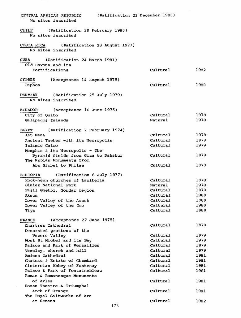
CENTRAL AFRICAN REPUBLIC (Ratification 22 December 1980) No sites inscribed
CHILE (Ratification 20 February 1980) No sites inscribed
COSTA RICA (Ratification 23 August 1977) No sites inscribed
CUBA (Ratification 24 March 1981) Old Havana and its
Fortifications Cultural 1982
CYPRUS (Acceptance 14 August 1975) Paphos Cultural 1980
DENMARK (Ratification 25 July 1979) No sites inscribed
ECUADOR (Acceptance 16 June 1975) City of Quito Cultural 1978 Galapagos Islands Natural 1978
EGYPT (Ratification 7 February 1974)
Abu Mena Cultural 1978 Ancient Thebes with its Necropolis Cultural 1979 Islamic Cairo Cultural 1979 Memphis & its Necropolis - The
Pyramid fields from Giza to Dahshur Cultural 1979 The Nubian Monuments from
Abu Simbel to Philae Cultural 1979
ETHIOPIA (Ratification 6 July 1977)
Rock-hewn churches of Lazibella Cultural 1978 Simien National Park Natural 1978 Fasil Ghebbi, Gondar region Cultural 1979 Aksum Cultural 1980 Lower Valley of the Awash Cultural 1980 Lower Valley of the Omo Cultural 1980 Tiya Cultural 1980
FRANCE (Acceptance 27 June 1975)
Chartres Cathedral Cultural 1979 Decorated grottoes of the
Vezere Valley Cultural 1979 Mont St Michel and its Bay Cultural 1979 Palace and Park of Versailles Cultural 1979 Vezelay, church and hill Cultural 1979 Amiens Cathedral Cultural 1981 Chateau & Estate of Chambard Cultural 1981 Cistercian Abbey of Fontenay Cultural 1981 Palace & Park of Fontainebleau Cultural 1981 Roman & Romanesque Monuments
of Aries Cultural 1981 Roman Theatre & Triumphal
Arch of Orange Cultural 1981 The Royal Saltworks of Arc
et Senans Cultural 1982 173
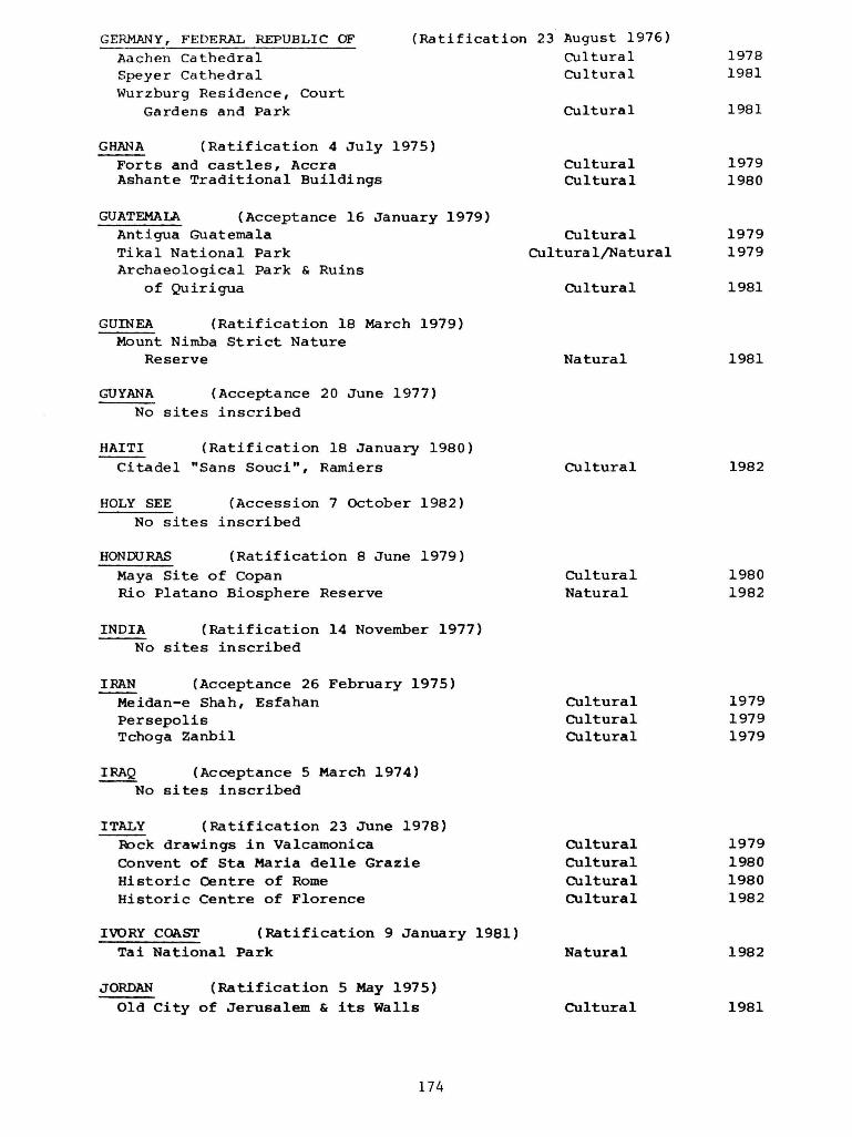
174
GERMANY, FEDERAL REPUBLIC OF (Ratification 23 August 1976) Aachen Cathedral Cultural 1978
Speyer Cathedral Cultural 1981 Wurzburg Residence, Court
Gardens and Park Cultural 1981
GHANA (Ratification 4 July 1975) Forts and castles, Accra Cultural 1979 Ashante Traditional Buildings Cultural 1980
GUATEMALA (Acceptance 16 January 1979) Antigua Guatemala Cultural 1979 Tikal National Park Cultural/Natural 1979 Archaeological Park & Ruins
of Quirigua Cultural 1981
GUINEA (Ratification 18 March 1979) Mount Nimba Strict Nature
Reserve Natural 1981
GUYANA (Acceptance 20 June 1977) No sites inscribed
HAITI (Ratification 18 January 1980)
Citadel "Sans Souci", Ramiers Cultural 1982
HOLY SEE (Accession 7 October 1982) No sites inscribed
HONDURAS (Ratification 8 June 1979) Maya Site of Copan Cultural 1980 Rio Platano Biosphere Reserve Natural 1982
INDIA (Ratification 14 November 1977) No sites inscribed
IRAN (Acceptance 26 February 1975) Meidan-e Shah, Esfahan Cultural 1979 Persepolis Cultural 1979 Tchoga Zanbil Cultural 1979
IRAQ (Acceptance 5 March 1974) No sites inscribed
ITALY (Ratification 23 June 1978) Rock drawings in Valcamonica Cultural 1979 Convent of Sta Maria delle Grazie Cultural 1980 Historic Centre of Rome Cultural 1980 Historic Centre of Florence Cultural 1982
IVORY COAST (Ratification 9 January 1981) Tai National Park Natural 1982
JORDAN (Ratification 5 May 1975)
Old City of Jerusalem & its Walls Cultural 1981

175
LIBYA (Ratification 13 October 1978) Archaeological Site of Cyrene Cultural 1982 Archaeological Site of Leptis Magna Cultural 1982 Archaeological Site of Sabratha Cultural 1982
MALAWI (Ratification 5 January 198 2) No sites inscribed
MALI (Acceptance 5 April 1977)
No sites inscribed
MALTA (Acceptance 14 November 1978) City of Valetta Cultural 1980 Ggantija Temples Cultural 1980 Hal Saflieni Hypogeum Cultural 1980
MAURITANIA (Ratification 2 March 1981) No sites inscribed
MONACO (Ratification 7 November 1978) No sites inscribed
MOROCCO (Ratification 28 October 1975) Medina of Fez Cultural 1981
MOZAMBIQUE (Ratification 27 November 1982) No sites inscribed
NEPAL (Acceptance 20 June 1978) Kathmandu Valley Cultural 1979 Sagarmatha National Park Natural 1979
NICARAGUA (Acceptance 17 December 1979) No sites inscribed
NIGER (Acceptance 23 December 1974) No sites inscribed
NIGERIA (Ratification 23 October 1974) No sites inscribed
NORWAY (Ratification 12 May 1977) Bryggen Cultural 1979 Urnes Stave Church Cultural 1979 Roros Cultural 1980
OMAN (Acceptance 6 October 1981) No sites inscribed
PAKISTAN (Ratification 23 July 1976) Archaeological Ruins at Moenjodaro Cultural 1980 Buddhist Ruins, Takht-i-Bahi
& Sahr-i-Bahlol City Cultural 1980 Taxila Cultural 1980 Fort & Shalamar Gardens in Lahore Cultural 1981 Historical Ruins of Thatta Cultural 1981
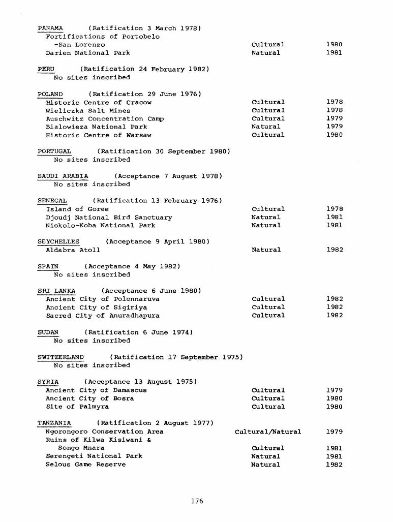
176
PANAMA (Ratification 3 March 1978) Fortifications of Portobelo
-San Lorenzo Cultural 1980 Darien National Park Natural 1981
PERU (Ratification 24 February 1982) No sites inscribed
POLAND (Ratification 29 June 1976) Historic Centre of Cracow Cultural 1978 Wieliczka Salt Mines Cultural 1978 Auschwitz Concentration Camp Cultural 1979 Bialowieza National Park Natural 1979 Historic Centre of Warsaw Cultural 1980
PORTUGAL (Ratification 30 September 1980) No sites inscribed
SAUDI ARABIA (Acceptance 7 August 1978) No sites inscribed
SENEGAL (Ratification 13 February 1976) Island of Goree Cultural 1978 Djoudj National Bird Sanctuary Natural 1981 Niokolo-Koba National Park Natural 1981
SEYCHELLES (Acceptance 9 April 1980) Aldabra Atoll Natural 1982
SPAIN (Acceptance 4 May 1982) No sites inscribed
SRI LANKA (Acceptance 6 June 1980) Ancient City of Polonnaruva Cultural 1982 Ancient City of Sigiriya Cultural 1982 Sacred City of Anuradhapura Cultural 1982
SUDAN (Ratification 6 June 1974) No sites inscribed
SWITZERLAND (Ratification 17 September 1975) No sites inscribed
SYRIA (Acceptance 13 August 1975) Ancient City of Damascus Cultural 1979 Ancient City of Basra Cultural 1980 Site of Palmyra Cultural 1980
TANZANIA (Ratification 2 August 1977) Ngorongoro Conservation Area Cultural/Natural 1979 Ruins of Kilwa Kisiwani &
Songo Mnara Cultural 1981 Serengeti National Park Natural 1981 Selous Game Reserve Natural 1982
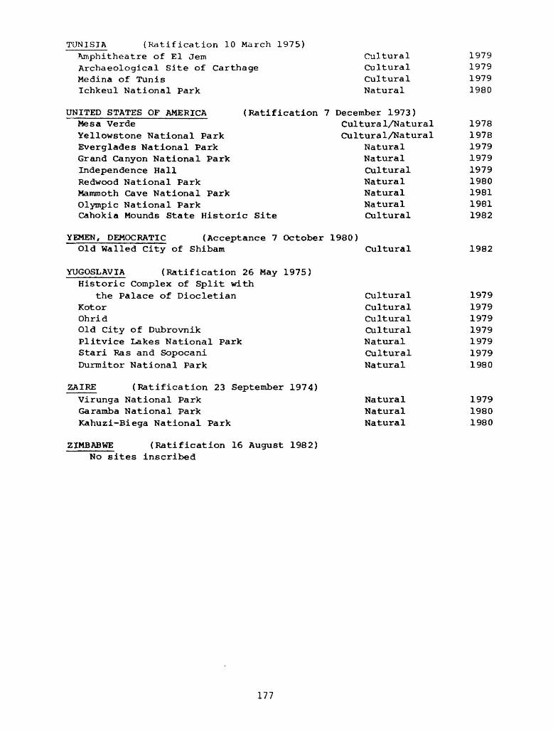
177
TUNISIA (Ratification 10 March 1975) Amphitheatre of El Jem Cultural 1979 Archaeological Site of Carthage Cultural 1979 Medina of Tunis Cultural 1979 Ichkeul National Park Natural 1980
UNITED STATES OF AMERICA (Ratification 7 December 1973) Mesa Verde " Cultural/Natural 1978 Yellowstone National Park Cultural/Natural 1978 Everglades National Park Natural 1979 Grand Canyon National Park Natural 1979 Independence Hall Cultural 1979 Redwood National Park Natural 1980 Mammoth Cave National Park Natural 1981 Olympic National Park Natural 1981 Cahokia Mounds State Historic Site Cultural 1982
YEMEN, DEMOCRATIC (Acceptance 7 October 1980) Old Walled City of Shibam Cultural 1982
YUGOSLAVIA (Ratification 26 May 1975) Historic Complex of Split with
the Palace of Diocletian Cultural 1979 Kotor Cultural 1979 Ohrid Cultural 1979 Old City of Dubrovnik Cultural 1979 Plitvice Lakes National Park Natural 1979 Stari Ras and Sopocani Cultural 1979 Durmitor National Park Natural 1980
ZAIRE (Ratification 23 September 1974)
Virunga National Park Natural 1979 Garamba National Park Natural 1980 Kahuzi-Biega National Park Natural 1980
ZIMBABWE (Ratification 16 August 1982) No sites inscribed
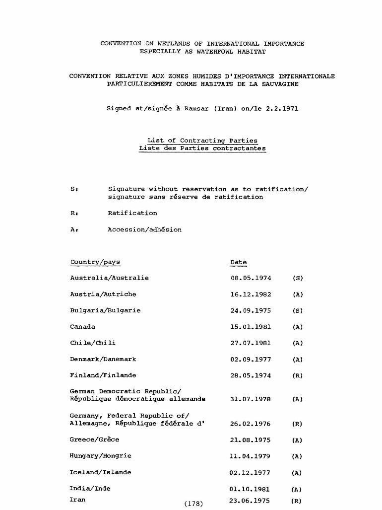
CONVENTION ON WETLANDS OF INTERNATIONAL IMPORTANCE ESPECIALLY AS WATERFOWL HABITAT
CONVENTION RELATIVE AUX ZONES HUMIDES D•IMPORTANCE INTERNATIONALE PARTICULIEREMENT COMME HABITATS DE LA SAUVAGINE
S i g n e d a t / s i g n e e a Ramsar ( I r a n ) o n / l e 2 . 2 . 1 9 7 1
L i s t of C o n t r a c t i n g P a r t i e s L i s t e d e s P a r t i e s c o n t r a c t a n t e s
Si S i g n a t u r e w i t h o u t r e s e r v a t i o n a s t o r a t i f i c a t i o n /
s i g n a t u r e s a n s r e s e r v e de r a t i f i c a t i o n
Ri R a t i f i c a t i o n
Ai A c c e s s i o n / a d h e ' s i o n
C o u n t r y / p a y s D a t e
A u s t r a l i a / A u s t r a l i e 0 8 . 0 5 . 1 9 7 4 (S)
A u s t r i a / A u t r i c h e 1 6 . 1 2 . 1 9 8 2 (A)
B u l g a r i a / B u l g a r i e 2 4 . 0 9 . 1 9 7 5 (S)
C a n a d a 1 5 . 0 1 . 1 9 8 1 (A)
C h i l e / C h i l i 2 7 . 0 7 . 1 9 8 1 (A)
Denmark/Danemark 0 2 . 0 9 . 1 9 7 7 (A)
F i n l a n d / F i n l a n d e 2 8 . 0 5 . 1 9 7 4 (R)
German D e m o c r a t i c R e p u b l i c / R e p u b l i q u e d e m o c r a t i q u e a l l e m a n d e 3 1 . 0 7 . 1 9 7 8 (A)
Germany , F e d e r a l R e p u b l i c o f /
A l l e m a g n e , R e p u b l i q u e f e d e r a l e d ' 2 6 . 0 2 . 1 9 7 6 (R)
G r e e c e / G r e c e 2 1 . 0 8 . 1 9 7 5 (A)
H u n g a r y / H o n g r i e 1 1 . 0 4 . 1 9 7 9 (A)
I c e l a n d / I s l a n d e 0 2 . 1 2 . 1 9 7 7 (A)
I n d i a / I n d e 0 1 . 1 0 . 1 9 8 1 (A)
I r a n 2 3 . 0 6 . 1 9 7 5 (R)

Italy/Italie 14.12.1976 (R)
Japan/Japon 17.06.1980 (A)
Jordan/Jordanie 10.01.1977 (A)
Mauritania/Mauritanie 22.10.1982 (A)
Morocco/Haroc 20.06.1980 (A)
Netherlands/Pays-Bas 23.05.1980 (R)
New Zealand/Nouvelle-Zelande 13.08.1976 (S)
Norway/Norvege 09.07.1974 (S)
Pakistan 23.07.1976 (R)
Poland/Pologne 22.11.1977 (A)
Portugal 24.11.1980 (R)
Senegal/Sen6gal 11.07.1977 (A)
South Africa/Afrique du Sud 12.03.1975 (S)
Spain/Espagne 04.05.1982 (A)
Sweden/Suede 05.12.1974 (S)
Switzerland/Suisse 16.01.1976 (R)
Tunisia/Tunisie 24.11.1980 (A)
Union of Soviet Socialist Republics/
Union des Republiques socialistes sovietiques 11.10.1976 (R)
United Kingdom of Great Britain and Northern Ire1and/Royaume-Uni de Grande-Bretagne et d'Irlande du Nord 05.01.1976 (R)
Yugoslav!a/Yougoslavie 28.03.1977 (A)
January 1983 0005r
179

CONVENTION ON INTERNATIONAL TRADE IN ENDANGERED SPECIES OF WILD FAUNA AND FLORA
CONVENCION SOBRE EL COMERCIO INTERNACIONAL DE ESPECIES AMENAZADAS DE FAUNA Y FLORA SILVESTRES
CONVENTION SUR LE COMMERCE INTERNATIONAL DES ESPECES DE FAUNE ET DE FLORE SAUVAGES MENACEES D'EXTINCTION
L i s t of P a r t i e s L i s t a de l a s P a r t e s
L i s t e d e s P a r t i e s
(R) R a t i f i c a t i o n / R a t i f i c a c i 6 n (A) A c c e s s i o n / A d h e s i 6 n / A d h 6 s i o n (Ap) A p p r o v a l / A p r o b a c i 6 n / A p p r o b a t i o n (Ac) A c c e p t a n c e / A c e p t a c i 6 n / A c c e p t a t i o n
S t a t e / E s t a d o / E t a t D a t e / F e c h a
A r g e n t i n a / A r g e n t i n e 0 8 . 0 1 . 1 9 8 1 (R) A u s t r a l i a / A u s t r a l i e 2 9 . 0 7 . 1 9 7 6 (R) A u s t r i a / A u t r i c h e 2 7 . 0 1 . 1 9 8 2 (A) Bahamas 2 0 . 0 6 . 1 9 7 9 (A) B a n g l a d e s h 2 0 . 1 1 . 1 9 8 1 (R) B o l i v i a / B o l i v i e 0 6 . 0 7 . 1 9 7 9 (R) B o t s w a n a 1 4 . 1 1 . 1 9 7 7 (A) B r a z i l / B r a s i l / B r e ' s i l 0 6 . 0 8 . 1 9 7 5 (R) Cameroon, U n i t e d R e p u b l i c o f / C a m e r u n , R e p u b l i c a
U n i d a d e / C a m e r o u n , R e p u b l i q u e - U n i e du 0 5 . 0 6 . 1 9 8 1 (A) C a n a d a / C a n a d a 1 0 . 0 4 . 1 9 7 5 (R) C e n t r a l A f r i c a n R e p u b l i c / R e p u b l i c a C e n t r o a f r i c a n a /
R e p u b l i q u e c e n t r a f r i c a i n e 2 7 . 0 8 . 1 9 8 0 (A) C h i l e / C h i l i 1 4 . 0 2 . 1 9 7 5 (R) C h i n a / C h i n e 0 8 . 0 1 . 1 9 8 1 (A) C o l o m b i a / C o l o m b i e 3 1 . 0 8 . 1 9 8 1 (R) Congo 3 1 . 0 1 . 1 9 8 3 (A) C o s t a R i c a 3 0 . 0 6 . 1 9 7 5 (R) C y p r u s / C h i p r e / C h y p r e 1 8 . 1 0 . 1 9 7 4 (R) Denmark /Dinamarca /Danemark 2 6 . 0 7 . 1 9 7 7 (R) E c u a d o r / E q u a t e u r 1 1 . 0 2 . 1 9 7 5 (R) Egyp t A g i p t o / E g y p t e 0 4 . 0 1 . 1 9 7 8 (A) F i n l a n d / F i n l a n d i a / F i n l a n d e 1 0 . 0 5 . 1 9 7 6 (A) F r a n c e / F r a n c i a 1 1 . 0 5 . 1 9 7 8 (Ap) Gambia /Gambie 2 6 . 0 8 . 1 9 7 7 (A) German D e m o c r a t i c R e p u b l i c / R e p u b l i c a D e m o c r a t i c a
A l e m a n a / R e p u b l i q u e d e m o c r a t i q u e a l l e m a n d e 0 9 . 1 0 . 1 9 7 5 (A) Germany, F e d e r a l R e p u b l i c o f / A l e m a n i a , R e p u b l i c a
F e d e r a l d e / A H e m a g n e , R e p u b l i q u e f e d e r a l e d* 2 2 . 0 3 . 1 9 7 6 (R) Ghana 1 4 . 1 1 . 1 9 7 5 (R) G u a t e m a l a 0 7 . 1 1 . 1 9 7 9 (R) G u i n e a / G u i n e e 2 1 . 0 9 . 1 9 8 1 (A) Guyana /Guyane 2 7 . 0 5 . 1 9 7 7 (A) I n d i a / I n d e 2 0 . 0 7 . 1 9 7 6 (R) I n d o n e s i a / I n d o n e s i e (180) 2 8 . 1 2 . 1 9 7 8 (A)

I r a n / I r a n 0 3 . 0 8 . 1 9 7 6 (R) I s r a e l / I s r a e l 1 8 . 1 2 . 1 9 7 9 (R) I t a l y / I t a l i a / I t a l i e 0 2 . 1 0 . 1 9 7 9 (R) Japan/Japon/Japon 0 6 . 0 8 . 1 9 8 0 (Ac) J o r d a n / J o r d a n i a / J o r d a n i e 1 4 . 1 2 . 1 9 7 8 (A) Kenya 1 3 . 1 2 . 1 9 7 8 (R) L i b e r i a / L i b e r i a 1 1 . 0 3 . 1 9 8 1 (A) L i e c h t e n s t e i n 3 0 . 1 1 . 1 9 7 9 (A) Madagascar 2 0 . 0 8 . 1 9 7 5 (R) Malawi 0 5 . 0 2 . 1 9 8 2 (A) M a l a y s i a / M a l a s i a / M a l a i s i e 2 0 . 1 0 . 1 9 7 7 (A) M a u r i t i u s / M a u r i c i o / M a u r i c e 2 8 . 0 4 . 1 9 7 5 (R) Monaco/Monaco 1 9 . 0 4 . 1 9 7 8 (A) Morocco/Marruecos/Maroc 1 6 . 1 0 . 1 9 7 5 (R) Mozambique 2 5 . 0 3 . 1 9 8 1 (A) N e p a l / N e p a l 1 8 . 0 6 . 1 9 7 5 (A) Nicaragua 0 6 . 0 8 . 1 9 7 7 (A) N i g e r / N i g e r 0 8 . 0 9 . 1 9 7 5 (R) N i g e r i a / N i g e r i a 0 9 . 0 5 . 1 9 7 4 (R) Norway/Noruega/Norvege 2 7 . 0 7 . 1 9 7 6 (R) P a k i s t a n / P a k i s t a n 2 0 . 0 4 . 1 9 7 6 (A) Panama/Panama 1 7 . 0 8 . 1 9 7 8 (R) Papua New Guinea/Papua Nueva G u i n e a /
P a p o u a s i e - N o u v e l l e - G u i n e e 1 2 . 1 2 . 1 9 7 5 (A) Paraguay 1 5 . 1 1 . 1 9 7 6 (R) Peru/PerG/Perou 2 7 . 0 6 . 1 9 7 5 (R) P h i l i p p i n e s / F i l i p i n a s 1 8 . 0 8 . 1 9 8 1 (R) P o r t u g a l 1 1 . 1 2 . 1 9 8 0 (R) Rwanda 2 0 . 1 0 . 1 9 8 0 (A) S a i n t L u c i a / S a i n t e L u c i e / S a n t a Lucia 1 5 . 1 2 . 1 9 8 2 (A) S e n e g a l / S e n e g a l 0 5 . 0 8 . 1 9 7 7 (A) S e y c h e l l e s 0 8 . 0 2 . 1 9 7 7 (A) South A f r i c a / S u d a f r i c a / A f r i q u e du Sud 1 5 . 0 7 . 1 9 7 5 (R) S r i Lanka 0 4 . 0 5 . 1 9 7 9 (A) Sudan/Soudan/Sudan 2 6 . 1 0 . 1 9 8 2 (R) Suriname 1 7 . 1 1 . 1 9 8 0 (A) Sweden /Suec ia /Suede 2 0 . 0 8 . 1 9 7 4 (R) S w i t z e r l a n d / S u i z a / S u i s s e 0 9 . 0 7 . 1 9 7 4 (R) Tanzania , U n i t e d Republ ic o f / T a n z a n i a , R e p u b l i c s
Unida d e / T a n z a n i e , Republ ique-Unie de 2 9 . 1 1 . 1 9 7 9 (R) T h a i l a n d / T a i l a n d i a / T h a i ' l a n d e 2 1 . 0 1 . 1 9 8 3 (R) Togo 2 3 . 1 0 . 1 9 7 8 (R) T u n i s i a / T G n e z / T u n i s i e 1 0 . 0 7 . 1 9 7 4 (R) Union of S o v i e t S o c i a l i s t R e p u b l i c s / U n i S n de
RepGblicas S o c i a l i s t a s S o v i e t i c a s / U n i o n des Republ iques s o c i a l i s t e s s o v i e t i q u e s 0 9 . 0 9 . 1 9 7 6 (R)
Uni ted Arab B n i r a t e s / E m i r a t o s Arabes U n i d o s / Emirats a r a b e s u n i s 2 0 . 1 1 . 1 9 7 4 (A)
Uni ted Kingdom of Great B r i t a i n and Northern I r e l a n d / R e i n o Unido de Gran Bretana e I r l a n d a d e l Norte/Royaume-Uni de Grande-Bretagne e t d ' I r l a n d e du Nord 0 2 . 0 8 . 1 9 7 6 (R)
Uni ted S t a t e s o f Amer ica /Es tados Unidos de A m e r i c a / E t a t s - U n i s d'Amerique 1 4 . 0 1 . 1 9 7 4 (R)
Uruguay 0 2 . 0 4 . 1 9 7 5 (R) Venezue la 2 4 . 1 0 . 1 9 7 7 (R) Z a i r e / Z a i r e 2 0 . 0 7 . 1 9 7 6 (A) Zambia/Zambie 2 4 . 1 1 . 1 9 8 0 (A) Zimbabwe 1 9 . 0 5 . 1 9 8 1 (A)
1.2.83 0005r
181

WWF/IUCN Projects in the Wider Caribbean
Belize Establishment, Planning, Protection and
Management of Half Moon Caye Natural Monument
Belize Moreleti's Crocodile
Belize Implementation of National Conservation Strategy
Caribbean Marine conservation
Caribbean Bonaire Underwater Park
Caribbean Ecology and conservation of the Caribbean Hawksbill Caribbean Promotion of Implementation of Caribbean Conservation
Strategy
Caribbean Sargassum Raft Reconnaissance
Caribbean Curagao Underwater Park
Caribbean Marine Resources Management
Caribbean Conservation and Development, Maria Islands, St. Lucia
Caribbean Development of an Integrated Conservation Programme
Caribbean Coral Reef Management
Caribbean Support to Natural Area Management
Costa Rica Olive Ridley Sea Turtle Conservation
Costa Rica Consolidation of National Parks System
Costa Rica Development of Amistad National Park
Costa Rica Wildlife Guides for National Parks
Dominica Cabrits NP
Dominican Rep. Crocodiles
E. Caribbean Support for Natural Resource Specialist
El Salvador Conservation education
El Salvador Barra de Santiago National Park and Wildlife Reserve
182

- 2 -
Honduras Mosquitia Area Survey
Jamaica Development and Management of a Marine NP system
Latin America Fellowship Support for Training of
and the Wildlife and Parks Personnel Caribbean
Nicaragua Survey and Planning of Bosawas Wildlife Area
Panama Darien NP
St. Lucia Establishment of a Parrot Res.
Surinam Support for conservation activities affecting tropical rainforests
Surinam Operation Headstart, Green Sea Turtle Population
May 1983 0005r
183

List of Biosphere Reserves by country
184
Area Year (ha) L i s t e d
ARGENTINA Reserva de l a B i o s f e r a "San G u i l l e r m o " 981,460 1980 Reserva N a t u r a l de Vida S i l v e s t r e "Laguna Blanca" 770,000 1982
AUSTRALIA Danggali Conservation Park 253,230 1976 The Unnamed Conservation Park of South Australia 2,132,600 1977 Prince Regent River Nature Reserve 633,825 1977 Kosciusko National Park 625,525 1977 Southwest National Park 403,240 1977 Fitzgerald River National Park 242,727 1977 Uluru (Ayers Rock-Mount Olga) National Park 132,550 1977 Hattah-Kulkyne NP & Murray-Kulkyne Park 49,550 1977 Croajingolong 101,000' 1977 Yathong Nature Reserve 87,698 1977 Macquarie Island Nature Reserve 12,343 1977 Wilson's Promontory National Park 49,000 1981
AUSTRIA Neusiedler See-Osterreichischer Teil 25,000 1977 Gurgler Kamm 1,500 1977 Lobau Reserve 1,000 1977 Gossenkollesee 100 1977
BOLIVIA Reserva Biologica de Ulla Ulla 200,000 1977 Parque Nacional Pilon-Lagas 100,000 1977
BULGARIA Pare n a t i o n a l S t e n e t o 1,865 1977 Reserve Djendema 1,775 1977 Reserve M a r i t c h i n i e z e r a 1,510 1977 Reserve P a r a n g a l i t z a 1,509 1977 Reserve Baevi doupki 1,449 1977 Reserve B o a t i n e 1,228 1977 Reserve Doupkata 1,210 1977 Reserve Koupena 962 1977 Reserve B i s t r i c h k o B r a n i c h t e 943 1977 Reserve Tchouprene 936 1977 Reserve T s a r i t c h i n a 616 1977 Reserve S reba rna 600 1977 Reserve M a n t a r i t z a 576 1977 Reserve Ouzounbodjak 575 1977 Reserve Tche rvena t a s t e n a 571 1977 Reserve Kamtchia 556 1977 Reserve A l ibo touch 530 1977
BYELORUSSIAN S.S.R.
Berezinsky Reserve 76,201 1978

185
CAMEROON P a r e N a t i o n a l de Waza 1 7 0 , 0 0 0 1979 R e s e r v e f o r e s t i e r e e t d e f a u n e du Dja 5 0 0 , 0 0 0 1981 P a r e N a t i o n a l de l a Benoue 1 8 0 , 0 0 0 1981
CANADA Mont S t H i l a i r e 5 , 5 5 0 1978 W a t e r t o n L a k e s N a t i o n a l P a r k 5 2 , 5 9 7 1979
CENTRAL AFRICAN REPUBLIC B a s s e - L o b a y e F o r e s t 1 8 , 2 0 0 1977 Bamingrui B a n g o r a n C o n s e r v a t i o n A r e a 1 , 6 2 2 , 0 0 0 1979
CHILE P a r q u e N a c i o n a l J u a n F e r n a n d e z 1 8 , 3 0 0 1977 P a r q u e N a c i o n a l F r a y J o r g e 9 , 8 4 5 1977 T o r r e s d e l P a i n e N a t i o n a l P a r k 1 6 3 , 0 0 0 1978 L a g u n a San R a f a e l NP ( i n c l . E l G u a y a n e c o NP) 1 , 3 8 0 , 6 1 3 1979 P a r q u e N a c i o n a l L a u c a 5 2 0 , 0 0 0 1 9 8 1 R e s e r v a d e l a B i o s f e r a " A r a u c a r i a s " 8 1 , 0 0 0 1983
CHINA Changbai Nature Reserve 217,235 1979 Wolung Nature Reserve 207,210 1979 Dinghu Nature Reserve 1,200 1979
COLOMBIA El Tuparro Nature Reserve 928,125 1979 Cinturon Andino Cluster Biosphere Reserve 855,000 1979 Sierra Nevada de Santa Marta (incl. Tayrona NP) 731,250 1979
CONGO
Pare National d'Odzala 110,000 1-977
COSTA RICA
Reserva de la B i o s f e r a de l a Amistad 500,000 1982
CZECHOSLOVAKIA
T r e b o n B a s i n R e s e r v e 7 0 , 0 0 0 1977 K r i v o k l a t s k o R e s e r v e 6 2 , 7 9 2 1977 S l o v a k K a r s t R e s e r v e 3 6 , 1 0 0 1977
DENMARK - G r e e n l a n d
N o r t h e a s t G r e e n l a n d N a t i o n a l P a r k 7 0 , 0 0 0 , 0 0 0 1977
EGYPT Oroayed E x p e r i m e n t a l R e s e a r c h Area 1 ,000 1981
FRANCE
R e s e r v e N a t i o n a l e de Camargue 1 3 , 1 1 7 1977 F o r e t D o m a n i a l e du F a n g o 6 , 4 1 0 1977 A t o l l de T a i a r o 2 , 0 0 0 1977
GABON
Reserve naturelle integrale d'Ipassa-Makokou 15,000 1983
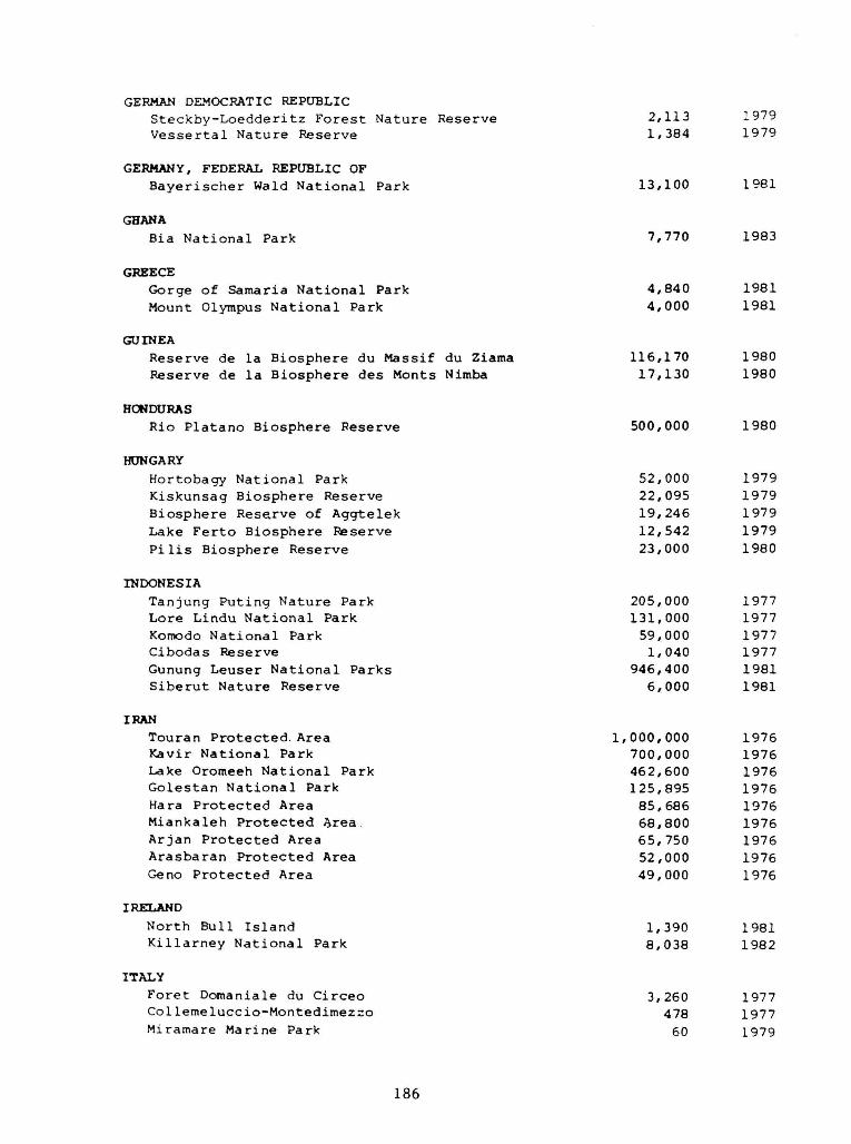
186
GERMAN DEMOCRATIC REPUBLIC Steckby-Loedderitz Forest Nature Reserve 2,113 1979 Vessertal Nature Reserve 1,384 1979
GERMANY, FEDERAL REPUBLIC OF Bayerischer Wald National Park 13,100 1981
GHANA Bia National Park 7,770 1983
GREECE Gorge of Samaria N a t i o n a l Park 4 ,840 1981 Mount Olympus N a t i o n a l Park 4 ,000 1981
GUINEA Reserve de la B iosphe re du Massif du Ziama 116,170 1980 Reserve de l a B i o s p h e r e des Monts Nimba 17,130 1980
HONDURAS Rio P l a t a n o B iosphe re Reserve 500,000 1980
HUNGARY Hortobagy N a t i o n a l Park 52,000 1979 Kiskunsag B iosphe re Reserve 22,095 1979 B i o s p h e r e Reserve of Aggte lek 19 ,246 1979 Lake F e r t o B iosphe re Reserve 12,542 1979 Pi l i s B iosphe re Reserve 23,000 1980
INDONESIA Tanjung P u t i n g Na tu re Park 205,000 1977 Lore Lindu N a t i o n a l Park 131,000 1977 Komodo N a t i o n a l Park 59,000 1977 Cibodas Reserve 1,040 1977 Gunung Leuse r N a t i o n a l Parks 946,400 1981 S i b e r u t Na tu re Reserve 6 ,000 1981
IRAN Touran P r o t e c t e d Area 1 ,000,000 1976 Kavir N a t i o n a l Park 700,000 1976 Lake Oromeeh N a t i o n a l Park 462,600 1976 G o l e s t a n N a t i o n a l Park 125,895 1976 Hara P r o t e c t e d Area 85 ,686 1976 Miankaleh P r o t e c t e d ^ rea 68,800 1976 Arjan P r o t e c t e d Area 65,750 1976 Arasbaran P r o t e c t e d Area 52,000 1976 Geno P r o t e c t e d Area 49,000 1976
IRELAND
North Bul l I s l a n d 1,390 1981 K i l l a r n e y N a t i o n a l Park 8 ,038 1982
ITALY F o r e t Domaniale du C i r c e o 3,260 1977 Col l emelucc io -Monted imezzo 478 1977 Miramare Marine Park 60 1979

187
IVORY COAST P a r e N a t i o n a l de T a i 3 3 0 , 0 0 0 1977 P a r e n a t i o n a l d e l a Comoe 1 , 1 5 0 , 0 0 0 1 9 8 3
JAPAN Mount H a k u s a n 4 8 , 0 0 0 1980 Mount O d a i g a h a r a & Mount Omine 3 6 , 0 0 0 1980 Y a k u s h i m a I s l a n d 1 9 , 0 0 0 1980 S h i g a H i g h l a n d 1 3 , 0 0 0 1980
KENYA Mount K u l a l B i o s p h e r e R e s e r v e 7 0 0 , 0 0 0 1978 Mount Kenya B i o s p h e r e R e s e r v e 7 1 , 7 5 9 1978 M a l i n d i - W a t a m u B i o s p h e r e R e s e r v e 1 9 , 6 0 0 1979 K i u n g a M a r i n e N a t i o n a l R e s e r v e 6 0 , 0 0 0 1980
KOREA, REPUBLIC OF M t . S o r a k B i o s p h e r e R e s e r v e 3 7 , 4 3 0 1982
MALI Pare National de la Boucle du Baoule (etc) 771,000 1982
MAURITIUS M a c c h a b e e / B e l Ombre N a t u r e R e s e r v e 3 , 5 9 4 1977
MEXICO Reserva de Mapimi 100,000 1977 Reserva de la Michilia 42,000 1977
Montes Azules 331,200 1979
NIGERIA
Omo Reserve 460 1977
NORWAY - Svalbard and Jan Mayen Islands
Northeast Svalbard Nature Reserve 1,555,000 1976
PAKISTAN
Lai Sohara National Park 31,355 1977
PANAMA
D a r i e n N a t i o n a l P a r k 5 7 5 , 0 0 0 1983
PERU R e s e r v a d e l Manu 1 , 8 8 1 , 2 0 0 1977 R e s e r v a d e l N o r o e s t e 2 2 6 , 3 0 0 1977 R e s e r v a d e H u a s c a r a n 5 9 , 2 3 9 1977
PHILIPPINES
P u e r t o G a l e r a B i o s p h e r e R e s e r v e 2 3 , 5 2 5 1977
POLAND S l o w i n s k i N a t i o n a l P a r k 1 8 , 0 6 9 1976 B i a l o w i e r a N a t i o n a l P a r k 5 , 0 6 9 1976 B a b i a Gora N a t i o n a l P a r k 1 , 7 2 8 1976 L u k n a j n o Lake R e s e r v e 710 1976

188
PORTUGAL P a u l do B o q u i l o b o 395 1981
ROMANIA R e t e z a t N a t i o n a l P a r k 2 0 , 0 0 0 1979 R o s c a - L e t e a R e s e r v e 1 8 , 1 4 5 1979 P i e t r o s u Mare N a t u r e R e s e r v e 3 , 0 6 8 1979
RWANDA Pare national des Volcans 15,065 1983
SENEGAL Foret classee de Samba Dia 756 1979 Delta du Sine Saloum 180,000 1980 Pare National du Niokolo-Koba 913,000 1981
SPAIN Reserva de Ordesa-Vinamala 51,396 1977 Reserva de Grazalema 32,210 1977 Parque Natural del Montseny 17,372 1978 Reserva de la Biosfera de Donana 77,260 1980 Reserva de la Biosfera de la Mancha Humeda 25,000 1980 Las Sierras de Cazorla y Segura Biosphere Reserve 190,000 1983 Reserva de la Biosfera de las Marismas del Odiel 8,728 1983 Reserva de la Biosfera del Canal y los'Tiles 511 1983
SRI LANKA Hurulu Forest Reserve 512 1977 Sinharaja Forest Reserve 8,900 1978
SUDAN Radom National Park 1,250,970 1979 Dinder National Park 650,000 1979
SWITZERLAND P a r e N a t i o n a l S u i s s e 1 6 , 8 7 0 1979
TANZANIA, UNITED REPUBLIC OF
S e r e n g e t i NP & N g o r o n g o r o C o n s e r v a t i o n A r e a 2 , 3 0 5 , 0 0 0 1 9 8 1 L a k e M a n y a r a N a t i o n a l P a r k 3 2 , 9 0 0 1 9 8 1
THAILAND S a k a e r a t E n v i r o n m e n t a l R e s e a r c h S t a t i o n 7 , 2 0 0 1976 Mae S a - K o g Ma R e s e r v e 1 4 , 2 0 0 1977 Hauy Tak Teak R e s e r v e 4 , 7 0 0 1977
TUNISIA P a r e N a t i o n a l de D j e b e l Bou-Hedma 1 1 , 6 2 5 1977 P a r e N a t i o n a l de l ' I c h k e u l 1 0 , 7 7 0 1977 P a r e N a t i o n a l de D j e b e l Chambi 6 , 0 0 0 1977 P a r e N a t i o n a l d e s l i e s Zembra e t Z e m b r e t t a 4 , 0 3 0 1977
UGANDA
R u w e n z o r i N a t i o n a l P a r k 2 2 0 , 0 0 0 1979

189
UNION OF SOVIET SOCIALIST REPUBLICS S i k h o t e - A l i n Reserve 340,200 1978 Caucas ian Reserve 263,500 1978 Repetek Reserve 34,600 1978 Sa ry -Che lek Reserve 23 ,868 1978 P r i o k o s k o - T e r r a s n y Reserve 4 ,945 1978 Cen t ra l -Chernozem Reserve 4 ,795 1978
UNITED KINGDOM I s l e of Rhum N a t i o n a l N a t u r e Reserve 10,560 1976 Moor House-Upper T e e s d a l e B i o s p h e r e Reserve 7 ,399 1976 C a e r l a v e r o c k N a t i o n a l Na tu re Reserve 5 ,501 1976 Nor th Nor fo lk Coast B i o s p h e r e Reserve 5,497 1976 Beinn Eighe N a t i o n a l N a t u r e Reserve 4,800 1976 S i l v e r F lowe-Merr ick K e l l s B i o s p h e r e Reserve 3,088 1976 Ca i rnsmore of F l e e t N a t i o n a l Na tu re Reserve 1,922 1976 Loch D r u i d i b e g N a t i o n a l N a t u r e Reserve 1,658 1976 Dyfi N a t i o n a l Na tu re Reserve 1,589 1976 St Kilda Nat iona l N a t u r e Reserve 842 1976 Braunton Burrows N a t i o n a l Na tu re Reserve 596 1976 C l a i s h Moss N a t i o n a l N a t u r e Reserve 480 1977 Taynish N a t i o n a l Na tu re Reserve 326 1977
UNITED STATES Noatak N a t i o n a l A r c t i c Range 3 ,035 ,200 1976 A l e u t i a n I s l a n d s N a t i o n a l W i l d l i f e Refuge 1 ,100,940 1976 Ye l lows tone N a t i o n a l Park 898,349 1976 Dena l i N a t i o n a l Park and B i o s p h e r e Reserve 782,000 1976 E v e r g l a d e s NP ( i n c l . F t . J e f f e r s o n NM) 585,867 1976 G l a c i e r N a t i o n a l Park 410,058 1976 Olympic N a t i o n a l Park 363,379 1976 S e q u o i a - K i n g s Canyon N a t i o n a l Parks 343,000 1976 Big Bend N a t i o n a l Park 283,247 1976 Grea t Smoky Mountains N a t i o n a l Park 208 ,403 1976 Organ P ipe Cac tus N a t i o n a l Monument 133,278 1976 Beaver Creek E x p e r i m e n t a l Watershed 111,300 1976 Rocky Mountain N a t i o n a l Park 106,710 1976 Three S i s t e r s W i l d e r n e s s 80 ,900 1976 J o r n a d a E x p e r i m e n t a l Range 78,297 1976 D e s e r t E x p e r i m e n t a l Range 22 ,513 1976 L u q u i l l o E x p e r i m e n t a l F o r e s t (Car ibbean NF) 11 ,340 1976 F r a s e r E x p e r i m e n t a l F o r e s t 9 ,328 1976 Channel I s l a n d s N a t i o n a l Monument 7,448 1976 Cascade Head E x p t . F o r e s t & S c e n i c Research Area 7 ,051 1976 San Dimas E x p e r i m e n t a l F o r e s t 6 ,947 1976 C e n t r a l P l a i n s E x p e r i m e n t a l Range (CPER) 6,210 1976 V i r g i n I s l a n d s N a t i o n a l Park 6,127 1976 H . J . Andrews E x p e r i m e n t a l F o r e s t 6 ,100 1976 Hubbard Brook E x p e r i m e n t a l F o r e s t 3,076 1976 Coram E x p e r i m e n t a l F o r e s t ( i n c l . Coram NA) 3 ,019 1976 Coweeta Hydro log i c L a b o r a t o r y 2,185 1976 San J o a q u i n E x p e r i m e n t a l Range 1,832 1976 S t a n i s l a u s - T u o l u m n e Exper imen ta l F o r e s t 607 1976 The V i r g i n i a Coast Reserve 13,511 1979 The U n i v e r s i t y of Michigan B i o l o g i c a l S t a t i o n 4 ,048 1979 Konza P r a i r i e Research N a t u r a l Area 3,486 1979

Niwot Ridge Biosphere Reserve 1,200 1979 I s l e Royale N a t i o n a l Park 215,740 1980 Hawaii I s l a n d s B iosphe re Reserve 104,396 1980 Big T h i c k e t N a t i o n a l P r e s e r v e 34 ,217 1981 Guanica Commonwealth F o r e s t Reserve 4 ,006 1981 South A t l a n t i c C o a s t a l P l a i n B i o s p h e r e Rese rve 444 ,335 1983 C e n t r a l Gulf C o a s t a l P l a i n B iosphe re Reserve 72 ,964 1983 C a l i f o r n i a Coas t Ranges B i o s p h e r e Reserve 59 ,284 1983
URUGUAY
Banados del Este 200,000 1976
YUGOSLAVIA Reserve Ecologique du Bassin de la Riviere Tara 200,000 1976 The Velebit Mountain 150,000 1977
ZAIRE Reserve Floristigue de Yangambi 250,000 1976 Forest Reserve de Luki 33,000 1979 Vallee de la Lufira 14,700 1982
190

(Map courtesy Allen D. Putney)
As the Nation's principal conservation agency, the Department of the Interior has responsibility for most of our nationally owned public lands and natural resources. This includes fostering the wisest use of our land and water resources, protecting our fish and wildlife, preserving the environment and cultural value of our national parks and historical places, and providing for the enjoyment of life through outdoor recreation. The Department assesses our energy and mineral resources and works to assure that their development is in the best interests of all our people. The Department also has a major responsibility for American Indian reservation communities and for people who live in island territories under U.S. administration.
U.S. DEPARTMENT OF THE INTERIOR NATIONAL PARK SERVICE
SOUTHEAST REGIONAL OFFICE 75 SPRING ST., S.W.
ATLANTA, GEORGIA 30303
POSTAGE AND FEES PAID
U. S. DEPARTMENT OF THE INTERIOR
INT-417
O F F I C I A L BUSINESS P E N A L T Y FOR P R I V A T E USE $300