California Underwater Parks and Reserves, 2000 DRAFT Plan
48
CALIFORNIA UNDERWATER PARKS AND RESERVES 2000 DRAFT PLAN March 1997 by W. James Barry, Ph.D. Senior State Park Ecologist ‘F Ahd 4 ‘r JphnWFoster ‘‘ " Senior State Arbhâ’e&ógist*
Transcript of California Underwater Parks and Reserves, 2000 DRAFT Plan

CALIFORNIA
UNDERWATER PARKS AND RESERVES
2000
DRAFT PLAN
March 1997
by
W. James Barry, Ph.D.
Senior State Park Ecologist
‘F
Ahd4 ‘r
JphnWFoster ‘‘ "
Senior State Arbhâ’e&ógist*


TABLE OF CONTENTS
INTRODUCTION 1NATURAL HERITAGE FEATURES 4
CULTURAL HERITAGE FEATURES 6RECREATIONAL FEATURES 9
Scenic Values 9RecreatonaI Values 10Recreation Demand 11
OUTLINE OF ACTIONS 13SUMMARY 13
APPENDIX AStatus of Existing Underwater Units of the StatePark System 14
APPENDIX BUnderwater Areas Proposed for Study andPotential Inclusion into the State Park System 15
APPENDP CHierarphical Marine cologicalClassification of Galifornia with Listings of UpØerwaterState Park System Units and Proposed Additions 16
Areas with Special Dpsignations in the Oregonian MarineEcological Region 16
Areas with Special Dsiqnation in the NorthernCalifornian Marine Ecological Region 17
Areas witj Special Designations in the Southern-BajaCalifornian Marine 18
APP.END.IX C-i California Marine Areas with SpecialDesignations 20
APPENDIX DMatrices of Californip Underwater Projectsand Natural, Cultural and Recreational Features 28APPENDIX EAvailablQ Taxa Lists for CaliforniaUnderwater Parks andReserves and Some Proposed Additions 33
LIST OF FIGURES
Figure 1. Terrestrial and marine ecological regions of

California . 3
II
INTROpUCTION
Point Lobos State Reserve became the first marine protected area in the
Nation on July 1, 1960. Fee transfer of 750 acres of submerged lands were
annexed to the terrestrial portion of the reserve. John Pennecamp Corai
Reef State Park, in the Florida Keys, was established in 1962. Later Buck
Reef National Monument was established in the Virgin islands.
California Department of Parks and Recreation DPR Underwater Parks
Program was established by Director William Penn Mott, Jr in 1968. He
appointed a scientific and industry represented panel - the California
Advisory Board for Underwater Parks and Reserves. The boards mission
was to identify outstanding and representative examples of underwater
ecosystems both marine and inland waters and to recommend
management methods for both preservation and recreational use.
The Board has investigated numerous sites and has made recommendations
for inclusion to the State Park System SPS of suitable areas. Early
additions include underwater extensions of Russian Gulch, MacKerricher,
Van Damme, Salt Point, Julia Pleiffer Burns State Parks, Fort Ross State
Historic Park, Sonoma Coast and Doheny State Beaches 1970. Currently
15 of the 264 units of the SPS include contiguous underwater portions
totalling around 54,000 acres. Most are managed by DPR with 49 year
leases from State Lands Commission. DPR has avoided stand - alone
underwater park units due to difficulty in staffing and protection.
Gaps in the underwater component of the California State Park System are

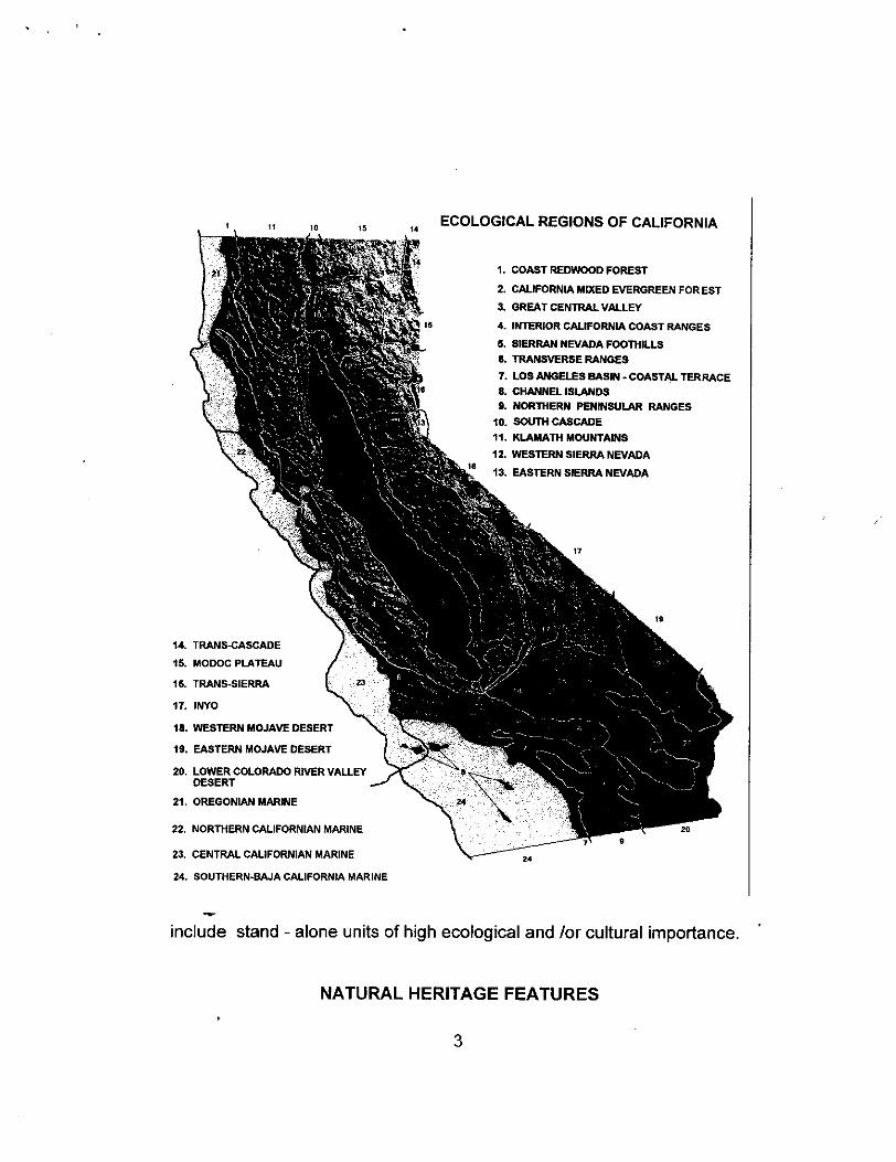
evident in several regions of the State. To access deficiencies in biological
diversity we have divided the State into "Ecological Regions" Figure 1.
Ecological regions are the basis for natural heritage planning of the State
Park System Sec. 5019.53 of the California Public Resources Code. The
marine ecological regions are the focus of this plan; however terrestrial
ecological regions are utilized for non-marine underwater analysis. For more
information on ecological regions refer to "Ecological Regions of California"
a document which was prepared for the Interagency Natural Areas
Coordinating Council" and to the 1:1 million scale map available the
California Natural Diversity Data Base Geographic Information System.
Offshore cultural heritage features include both prehistoric sites and artifacts
as well as historical features such as shipwrecks. Many coastal
archeological sites have been inundated as the sea level rose after the last
ice age. However very few of these sites have been identified due to the
difficulties in relocation.
Recreational features often relate to areas of high natural diversity as these
areas tend to be most attractive. Ship wreak sites are also popular with
divers. Safe diving access is an issue to be addressed in this plan; facility
development for skin and SCUBA divers is also important to the diving
public. Interpretation of cultural and natural features is important to
achieving the missions of the Department. interpretation is an important
product of research; as it informs the public of their California Heritage.
More than 25 marine additions and several freshwater additions are
currently under consideration for inclusion into the State Park System; these
2
ECOLOGICAL REGIONS OF CALIFORNIA
1. COAST REDWOOD FOREST
2. CALIFORNIA MIXED EVERGREEN FOR EST3. GREAT CENTRAL VALLEY
4. INTERIOR CALIFORNIA COAST RANGES
5. SIERRAN NEVADA FOOThILLS6. TRANSVERSE RANGES
7. LOS ANGELES BASIN. COASTAL TERRACE8. CHANNEL ISLANDS9. NORThERN PENINSULAR RANGES
10. SOUTh CASCADE11. KLAMATH MOUNTAINS12. WESTERN SIERRA NEVADA
13. EASTERN SIERRA NEVADA
2
I.1
.I.
C’14. TRANS-CASCADE
15. MODOC PLATEAU
16. TRANS-SIERRA
17. INYO
18. WESTERN MOJAVE DESERT
19. EASTERN MOJAVE DESERT
20. LOWER COLORADO RIVER VALLEYDESERT
21. OREGONIAN MARINE
24. SOUTHERN-BAJA CALIFORNIA MARINE
include stand - alone units of high ecological and for cultural importance.
NATURAL HERITAGE FEATURES
I6
-I
22. NORThERN CALIFORNIAN MARINE
23. CENTRAL CALIFORNIAN MARINE
*.1-3’
24
3
The four marine ecological regions are delineated in Figure 1. The northern
Oregonian Ecological Region north of Cape MendeCino and the Channel
islands of the Southern-Baja Californian Ecological Region are not
represented in the State Park System. The major reason for the total lack
of underwater park units in the northern Oregonian Ecological Region is the
lack of recreational diving opportunities in this part of the region. Seas are
normally heavy and visibility is usually very poor. On the other hand some
of the worlds best diving is adjacent to the Channel islands. The deficiency
in underwater park units around the Channel Islands is due to an unwritten
policy that the Department of Parks and Recreation has followed; that is,
underwatet units are npt to be established without a terrestrial component.
This policy needs to be re-evaluated if we are to protect the biological
diversity of marine ecosystems found in State Waters.
The establishment of underwater units in the State Park System requires
petitioning the State Lands Commission for long term leases of tracts of
submerged lands. These leases require some utilization of the land, which
usually implies recreational use, i.e. SCUBA diving opportunities; or
interpretive use; the Commission has been somewhat reluctant to lease land
strictly for preservation purposes. We have taken the approach that these
leases are in partnership with the State Lands Commission and inform the
public of this in our interpretive programs. Fee title transfer has only
occurred at Point Lobos State Reserve and legislatively at Mono Lake Tufa
State Reserve. All other underwater areas are leased from State Lands
Commission. These leases usually are for fifty years; if DPR does not show
active management by the end of the lease, it may not be renewed. Leases
4
may allow State Lands Commission to utilize the resources of the
submerged areas i.e. offshore oil and mining are still possible under the
terms of some leases. To date, the process has been long and cumbersome;
a project by project approach. It may be more feasible to approach the
commission with a well conceived plan for rounding out the deficiencies in
the system. The protection of natural features in marine environments is
more complex than on land. The California Department of Fish and Game
has statutory authority over living marine resources; therefore the Fish and
Game Commission must approve any protection of living marine resources
that we may propose. Regulations of take are specific for each "Ecological
Reserve" in the Fish and Game Code; these regulations are set by the
commission. Regulations effecting commercial fishing are established by the
legislature and enforced by the Department of Fish and Game. If DPR
wishes to protect living marine resources found in underwater units,
"ecological reserve" classification must be superimposed on the DPR
classification. The question of authority is further complicated by the State
Water Quality Control Board’s jurisdiction over the water collum; a number
of years ago they established "Areas of Special Biological Significance"
ASBS along the California Coast - many are adjacent to coastal units and
most of DPR underwater units fall into this category. Basically this
classification protects against point source pollution.
With all the overlaying classifications necessary to protect the biodiversity of
marj,pe ecosystems, it appears that the most efficient and timely process is
legislative. However, this action plan should be prepared in a manor that can
be applied either to State Lands and Fish and Game Commissions Actions,
as well as the State Water Quality Control Board.
5

CULTURAL HERITAGE FEATURES
Although formal exploration has only recently begun, two basic types of
cultural sites have been located in the underwater environment of California.
They are Native American archaeological sites and objects, and historic-erashipwrecks, cargo spills or landing sites.
Our state has a rich and varied maritime history. Native California peoples
lived in large, settled villages along the Pacific coastline for many centuries
before European contact. In some areas, such as along the Santa Barbara
Channel and San Francisco Bay, these villages developed a highly
sophisticated technology, with widespread trade using native watercraft.
Boat construction reached its highest development in California among the
Chumash. Their plank canoe, called a tomol, impressed early explorers of
the California coast for its versatility and seaworthiness. Recent dating of
middens on San Clemente Island some 60 miles offshore has documented
an ancient maritime culture dating back some 8,000 years. California
coastal groups were technologically advanced and highly organized. Trading
expeditions from the mainland were common to the Channel Islands to
obtain steatite for soapstone bowls and effigy figurines. The result of this
prehistoric seafaring is being recorded by underwater archaeologists in
quantities of artifacts recovered and preserved from the offshore areas. At
least 25 individual sites have been reported between Ventura Beach and
Point Conception. A recent exploration of Goleta State Beach yielded six
stone bowls in one dive. Many other similar sites no doubt await discovery.
The lakes and rivers of California also contain valuable prehistoric sites. Fish
6
traps at Ahjumawi Lava Springs Slate Park demonstrate the systematic
management and harvest of suckers by native people. Submerged bedrock
mortars in Emerald Bay await dating and interpretation. Other submerged
sites and preserved prehistoric watercraft have been reported in rivers and
lakes.
The rise in sea level overthe past 10,000 years has resulted in submergence
of many archeological sites. One well known area at the edge of the La Jollasubmarine canyon has yielded more than 2,000 stone bowls, from depths
ranging up to 80 feet. This site is a submerged village, dated by
archaeologists at 4,000 to 5,000 years old. A great deal of information on
sea level change and the ancient cultures that first colonized California can
be learnedat such sites.
The first recorded European vessels to visit California were Cabrillo’s
caravels, Victoria and Salvador, which cautiously made their way up the
Pacific coast in 1542. Twenty-three years later, the first galleon made a
trans-Pacific crossing, and opened the Manila route to be followed for the
next 250 years. California’s first recorded shipwreck is that of the San
Aupustin, which was driven ashore in 1595 at Drake’s Bay. Since then,
thousands of vessels have been lost in our waters. These ships, their
cargoes, and the mooring systems which restrained them are the physical
remains of a rich maritime legacy in California.
Discovery of the remains of an 1850 Baltimore clipper has sparked
tremendous interest in the early history of Mendocino county. The Frolic,
wrecked near Caspar, was carrying a cargo of trade goods to gold rush
7

California. The artifacts provide a glimpse of the flurry of activity that brought
people and goods from all over the world to the golden state. Silver tinder
boxes, oyster shell window glass and Chinese porcelains have been
recovered and exhibited. The wreck site remains an impressive historical
feature.
Gold rush shipwrecks have also been recently documented in the
Sacramento River within Old Sacramento SHP. The LaGrange and Sterling,
former sailing vessels that carried pioneers around the horn to the California
gold fields in 1849, ended their days tied to the Sacramento levee. They
sank into the mud only to reappear a century and a half later at the foot of
the present flood wall. Examples of their timbers and contents have been
preserved by underwater archaeologists.
Historic shipwreck sites, artifacts, and associated maritime features will be
evaluated on an individual basis to determine their significance to California
history. Important resources of statewide significance will be proposed for
underwater park status in order to protect and interpret them. in this way, a
record of California’s maritime heritage can be made available for the
enjoyment of present and future generations.
8
RECREATIONAL FEATURES
Scenic Values
The underwater world has many of the scenic values found in terrestrial
elements. However, seascapes are not comparable to terrestrial
landscapes, because underwater visibility is generally less than 100 feet.
The brilliant colors and extreme diversity of life and motion within a small
underwater area, however, provide as much, if not more, variety than found
in a terrestrial viewshed.
The underwater world holds vast contrasts in forms, motions, colors, light,
and clarity of space. Forms vary from vertical rock wails to flat sandy
bottoms. Motions range from kelp waving, in the surge caused by wave
energy, to the still, black waters of estuaries.
Colors vary from dull and monotonous to kaleidoscope like, with vivid colors
of every shade and hues, brought together in endless patterns. Fish, in
schools or solitary, quick or sluggish, are part of the never-ending contrast
of physical elements and life forms.
Water is characteristically clear in some areas, while other areas are always
murky, or of high refractivity which reduces visibility. Clear water is generally
preferred for recreational diving, but water clarity is not important to
preservation projects.
9

Recreational Values
The recreational aspect of diving is almost as diverse as the backgrounds of
the divers. Most divers never have been, nor do they intend to become,
professional divers. The main interest of the estimated three million active
self-contained underwater breathing apparatus scuba divers in the nation,
and the 400,000 in California, is recreation.
The first steps to becoming a scuba diver is usually snorkeling, which
provides a view of the underwater world from the surface, along with brief
excursions into shallow depths, From this point, many people advance to
scuba lessons and equipment. The ability of the diver to stay underwater is
greatly extended, and the pursuit of underwater recreation or hobbies begins
in earnest.
Some people dive just for the enjoyment of sightseeing and entering a newenvironment, or the sheer pleasure of a new experience. 1-lowever, this
attraction usually wears off, and divers find new underwater interests. Divers
may branch into photography or behavioral studies of marine organisms.
Underwater "fishing" for clams, lobster, abalone, or fish may become a
recreational pursuit. Divers may collect shells or geological specimens,
investigate caves or wrecks, or study underwater archeology.
The array of underwater activities by scuba divers is still expanding.
Providing divers and non-divers access to and interpretation of underwater
10

environments will give them a better Understanding of its importance, fragile
nature, and beauty, and will be a major part of this program.
Recreation Demand
Proximity to large urban populations is important to frequently serve a great
number of people. A large segment of the public appreciates the ocean, and
will use underwater units, if not as scuba divers, then as skin divers or as
enthusiastic visitors to interpretive programs held in visitor centers and or in
intertidal wading areas on land.
There is little doubt that the underwater units of the State Park System will
continue to receive increasing visitor use. Nationwide studies indicated that
44 percent of the people who engage in outdoor recreation prefer
water-based activities over all others ORRRC 1962. In 1983, there were
about 400,000 active, certified scuba divers in California. This is about 13
percent of the nation’s total. There are approximately 12,000 new,
entry-level divers in California each year. In 1977, 5,000 divers used Point
Lobos State Reserve, while another 10,000 dove in adjacent waters. An
estimated 30,000 divers use Salt Point State Park each year. One thousand
scuba divers annually use the specially designed underwater area developed
at Lake Perris State Recreational Area An uncounted number of divers use
many other units of the State Park System.
Based on an annual survey by the Diving Equipment Manufacturers’
Association, Californians spent approximately $35,000,000 on skin and
scuba diving equipment in 1983. An equal amount is spent on related
services such as training boat trips, tours, and transportation to and from
11
dive sites.
Based on rough data obtained by a household survey done by the Stanford
Research Institute for this department in 1978, 400,000 people participated
in recreational skin and scuba diving activities during June, July, and August
of 1978. All these statistics are outdated but give an idea of the importance
of this recreational activity in California
12
RECOMMENDATIONS
A. Continue evaluations of proposed underwater units for inclusion in tothe State Park System
B. Prepare a gap analysis of underwater natural and cultural diversity
C. Identify deficiencies in natural diversity, cultural diversity andrecreational opportunities
D. Prepare updated underwater parks and reserves plan
E. Formulate partnerships Federal, State, Local Agencies, and PrivateIndustries and Foundations
F. Petition State Lands Commission for land transfers or long termleases of areas identified in the underwater parks and reserves plan
G. Petition Fish and Game Commission for Ecological Reserve statuswhere necessary
H. Petition California Water Board for Areas of Special BiologicalSignificance where necessary
I. Prepare legislation for the establishment of an underwater componentof the State Park System.
SUMMARY
The current status of State Park System underwater activities is summarizedin Appendices A and B. Appendix C is a coarse filtered gap analysis ofdeficiencies by marine ecological regions. This document is preliminary, asare the proposed actions. Input from all interested parties is welcomed.
13

APPENDIX ASTATUS OF EXISTING UNDERWATER UNITS OF THE STATE PARK SYSTEM
March, 1995
UNDERWATER UNIT LOCATION ACRE- COMMENTSAGE
Point Lobos SR Monterey Peninsula 775 High biological diversity, very scenic, shore and boat accesshas SR protection; beginning to advanced divers
Salt Point SP Sonoma Coast 940 High biological diversity; Gerstle Cove Ecological Reserve;consider a NP for northern portion of unit; intermediate toadvanced divers. Reported shipwrecks
J. P. Burns SP Big Sur Coast 1600 High diversity, very scenic, NP recommended for SmugglersCove area; advanced divers only
Mackerricher SP Mendocino Coast 454 High-medium biological diversity, exposed coast, NPrecommended, advanced divers only - shore access
Russian Gulch 5P Mendocino Coast 47 High diversity exposed coast with protected coves, NPrecommended, beginning to advanced divers; shore access
Van Damme SP Mendocino Coast 20 High diversity exposed coast with protected covers! NPreconinended, beginning to advanced divers; shore access
Manchester SP Mendocino Coast 3657 Low diversity sandy beach; poor access. Extremely highArena Rock Marine NP [Point Arena] 500 biologIcal diversity; extremely exposed; advanced divers only
boat access only. Shipwrecks located within NP
Fort Ross SHP sonoma coast 90 Shipwrecks, high biological diversity, unique marinecommunities; cove and exposed coast. Intermediate -
advanced divers, shore access, CP recommended. Needsexpanded area
Crystal Cove SP Orange Coast 1150 Rocky reefs and kelp beds, high diversity beginning-advancedivers; shore access; NP recommended for rocky reefs
Lake Perris SRA Riverside County ?? Sewer pipes put down for divers to swim through - fewInland Reservoir resource values - beginner divers; consider declassification
Mono Lake Tufa SR Mono County 40.000± Unique hyper-saline environment divers can see underwaterformation of tufa towers - intermediate-advanced divers-shorand boat access
San Elijo & Cardiff SBs San Diego Coast 545 Medium diversity, rock reefs & kelp beds, potentially higharchaeological values. CP may be recommended
DL. Bliss/Emerald Bay SPs Lake Tahoe west 980 High visibility, low diversity, but highly scenic. Sunken foresshore and 4,000 year old snags. Archaeological values CP & NP
recommended
Doheny SB Orange Coast 192 Intermediate to advanced divers, resource valuesundetermined
Benicia SRA Solano County Tidal fiats and Shipwrecks. Needs further evaluation
Old Sacramento SHP Sacramento Gold rush shipwrecks and artifacts
14

APPENDIX BUNDERWATER AREAS PROPOSED FOR STUDY AND POTENTIAL INCLUSION INTOTHE STATE PARK SYSTEM MARCH, 1995.
ACRE- COMMENTS All these require lease or landtransfer from StUNDERWATERUNIT LOCATION AGE Lands Comm.
Leo Carrillo SB Los Angeles Coast Deep water coral beds and kelp beds, high diversity, deepwater coral not protected elsewhere
Big Lagoon Humboldt Coast Estuarine Ecosystem, native cutthroat trout spawning habita
Sonoma Coast SB Sonoma Coast 667 Exposed Coast Duncans Landing. Consider a NP,intermediate to advanced divers
Ano Nuevo SR Santa Cruz Coast Outstanding marine mammal rookery, diving not advised.Interpretation of marine environment stressed.
Jedediah Smith SP Del Norte County Excellent river to interpret river ecology to the public. Notnecessarily for divers. Primary objective is to interpret riverecology to public; NP recommended.
Royal Palms SB Los Angeles Coast Underwater Hot Springs, chemotropic bacteria cover kelp witred fibers; NP recommended
Sinkyone Wilderness SP Mendocino Coast Northern most giant kelp beds, underwater wilderness andNP’s recommends
Point Dume SR Los Angeles Coast Medium diversity, shark habitat?; needs further study
Cannery Row Monterey Coast Excellent beginner diving area, DPR may pick up Coast Guar- land just down coast; underwater park with NP recommended
require further study
Jug Handle SR Mendocino Coast High ecological diversity, very exposed, advanced divers onlyExtension of SR recommended
Westport Union Landing SB Mendocino Coast Tide pools, small coves, high biological diversity, advanceddivers only; NP recommended
Santa Catalina Los Angeles Count Underwater Caves & LittleFarnsworth Bank shipwreck, underwater restrictions,Fisherman’s cove NP and CP recommended - Has mostpotential of all projects to fill a deficiency
Frolic Shipwreck Site 1850 Mendocino Coast Pt. Cabrillo; CP recommended
Reading Rock Del Node Coast High biological diversity, poor visibility, extremely exposed-boat access only SR classification recommended
Greenwood SB Mendocino Coast High biological diversity, protected coastline; NPrecommended
Ahjumawi Lava Springs SP Shasta County Pit River Drainage springs have large trout & Western SuckeIndian fish traps, artifacts in ponds; NP & CP recommended
Asiloir SB Monterey County High biological diversity, extremely exposed coastlineintermediate to advanced divers, depending on sea condition- NP recommended
Pales Verdes Stone Arch Site Los Angeles Count High archaeological value and recreational potential; CPrecommended
Stillwater Cove Mendocino Coast Protected cove, in an otherwise exposed coastlineintermediate to advanced divers; Values undetermined;require further study
15

APPENDIX C
HIERARCHICAL MARINE ECOLOGICAL CLASSIFICATION OF CALIFORNIA WITH
LISTINGS OF UNDERWATER STATE PARK SYSTEM UNITS AND PROPOSED
ADDITIONS.
Pacific Marine Ecological Realm - Total Pacific OceanBiogeographicalRealmsof Udvardy,1975
North Pacific Basin EcologicalDomain - North Pacific OceanDomainsofBailey, 1981;and/orBiogeographicalProvincesofUdvardy,1975;TemperateNorth PacificofRay, 1975
BorealNearshoreMarine EcologicalRegime- Aleutian Is. to Point ConceptionRegimesof Bailey, 1981; and/orBiogeographicalProvincesof Udvardy, 1975;Boreal Zone of Hedgpeth, 1957; Columbian Biotic Province of Ray, 1975Accordingto Abbott and Hollenberg1976, the most dramatictemperatureandbiological changeoccursat Point Conception. The temperatureusually remainsabove18 degreesto thesouthand below 18 degreesto thenorth.
OregonianMarine Ecological Province -- Point Conceptionto CapeFlattery,Washington Provincesof Bailey, 1981; and/orBiogeographicalProvincesof Udvardy, 1975
OregonianMarineEcologicalRegionEcologicalRegionsof theCaliforniaPublic ResourcesCode, Sec.5019.53 and/orEcoregionsof Bailey, 1978; OregonianSubdivisionof Hedgepth,1957
The OregonianMarineEcologicalRegionis bound on the north by CapeFlattery, Washington.Seawardit includesthecontinentalshelfwhichgenerallyextendsto thesouth. Thecoastalboundaryis the supralittoral zone of the Washington,Oregonand Northern California Coastfrom CapeFlatterysouthwardto PointArena,MendocinoCounty.The 10 meterdepthtemperaturesrangefromaround8.5 degreesC in thenorth, during JanuarythroughMarch, to a high of 16 degreesin thesouthin OctoberthroughDecember.Theentireregion is 12.5 to 175 degreesin July, August,andSeptember.
Areaswith UndenvaterDesignationsin the OregonianMarineEcologicalRegion
Undenvater Units
ReddingRock ProposedPoint St. GeorgeProposedTrinidad StateBeachProposedSinkyoneWildernessStateParkProposedWestportUnion LandingStateBeachProposedMacKerricherStateParkJug HandleStateReserveProposed
16
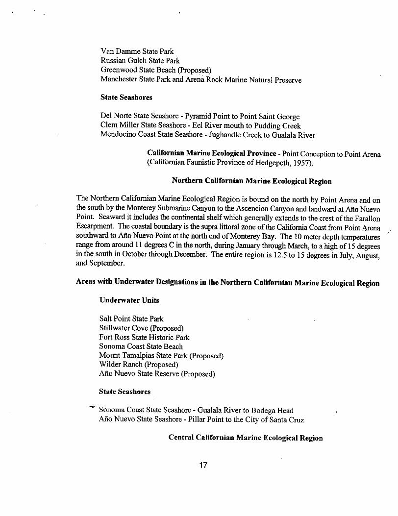
Van DammeStateParkRussianGulch StateParkGreenwoodStateBeachProposedManchesterStateParkandArenaRock MarineNaturalPreserve
StateSeashores
Del NoPeStateSeashore- PyramidPoint to Point SaintGeorgeClem Miller StateSeashore- Eel River mouthto PuddingCreekMendocinoCoastStateSeashore- JughandleCreekto GualalaRiver
CalifornianMarineEcologicalProvince- Point Conceptionto Point ArenaCalifornianFaunisticProvinceof Hedgepeth,1957.
NorthernCalifornianMarineEcologicalRegion
TheNorthernCalifornianMarineEcologicalRegionis boundon thenorth by Point Arenaandonthesouthby theMontereySubmarineCanyonto theAseencionCanyonandlandwardatMo NuevoPoint. Seawardit includesthecontinentalshelfwhich generallyextendsto thecrestoftheFarallonEscarpment.The coastalboundaryis thesupralittoral zoneofthe CaliforniaCoastfrom PointArenasouthwardto Mo NuevoPointat thenorth endof MontereyBay. The 10 meterdepthtemperaturesrangefrom around11 degreesC in thenorth,during JanuarythroughMarch, to a high of 15 degreesin thesouthin OctoberthroughDecember.Theentireregionis 12.5 to 15 degreesin July, August,andSeptember.
Areaswith UnderwaterDesignationsin theNorthernCalifornianMarineEcologicalRegion
UnderwaterUnits
SaltPoint StateParkStillwaterCoveProposedFort RossStateHistoric ParkSonomaCoastStateBeachMount TamalpiasStateParkProposedWilder RanchProposedAno NuevoStateReserveProposed
StateSeashores
SonomaCoastStateSeashore- GualalaRiverto BodegaHeadAflo NuevoStateSeashore- Pillar Point to theCity of SantaCruz
Central Californian Marine Ecological Region
17


TheCentralCalifornianMarineEcologicalRegionis boundon thenorth by theMontereySubmarineCanyonandon thesouthby PointConception.Seawardit includesthecontinentalshelf. The coastalboundaryis the supralittoral zone of the California Coastfrom Mo Nuevo Point, SantaCruzCounty southwardto PointConception.Prom PointConceptionthesouthernseawardboundarycutsbetweenSantaRosaand SantaCruz Islandsto theshoreline of the latter. SantaRosaand SanMiguel IslandsreceivecoldernortherncurrentstheCaliforniaCurrentandthereforeareincludedin theCentral CaliforniaMarineEcologicalRegionwhile all theotherChannelIslandsare withintheSouthern- BajaCaliforniaMarineEcologicalRegion. The10 meterdepthtemperaturesrangefrom around12 degreesC in thenorth,during JanuarythroughMarch,to a highof 15 degreesin thesouthin OctoberthroughDecember.The entireregionis 15 degreesin July, August,andSeptember.
Areas with Underwater Designationsin the Central Californian MarineEcologicalRegion
UnderwaterUnits
AsilamarStateBeachProposed>CanneryRow ProposedPoint Lobos StateReserveGarrapataStateParkProposedPoint SurProposedJuliaPfeifferBurns StateParkJohnLittle StateReserveProposedHearstSan SimeonStateBeachProposedMono Bay StateParkProposedMontanade Oro StateParkProposed.DinosaurPoint Proposed
StateSeashores
Big SurStateSeashoreProposedSanLuis ObispoStateSeashore- Cayucosto Lion’s Head
TemperateMarine EcologicalDivision - CaboSan Lucus to PointConceptionTemperateZone of Hedgpeth,1957
Baja Californian Marine Ecological Province - PuntaEugenia to Point Conception Lower Californian FaunalProvinceof Hedgepth, 1957; CalifornianBiotic ProvinceofRay, 1975.
Southern-Baja Californian Marine EcologicalRegionSouthernCalifornia Bite of SCCWRP,1973.
18

The Southern-BajaCalifornianMarine EcologicalReserveextendssouthwardfromPoint Conception,but it extendssouth east,acrossthe SantaBarbaraChannelthensouthwardbetweenSantaRosaand SantaCruzIslandsat thewestshoreof thelatter.It then extendssouthwestto the edge of the continental shelfwhere it extends
southwardalong the outeredgeof the continentalshelfto CaboColnett wheretheCalifornia currentmeetsthe land at 90 degreesand is deflectedboth north andsouthward along the coastline.Warm currents from off Baja California movenorthward and meet the California Current at Point Conception.The 10 metertemperaturesvary from a low of around 14 degreesC in the north, during JanuarythroughMarch, to a high of 20 degreesfor thewhole regionin April, May and June.
Areaswith UnderwaterDesignationsin theSouthern-BajaCalifornianMarineEcologicalRegion
UnderwaterUnits
GaviotaStateParkProposedNaplesReefProposedLeo Carrilo StateParkProposedPoint Dume StateReserveProposedRoyal PalmsStateBeachProposedSantaRosa-SantaCruz IslandsProposedone mile perimeterwhich is StateLandsSantaCatalinaIslandProposedCrystalCoveStateParkDohenyStateBeachSan OnofreStateBeachProposedSanElijo StateBeachCardiffStateBeachSanNicolasIslandProposedSan ClementeIslandProposed
StateSeashores
SantaBarbaraCoastStateSeashore- Gaviotato Las LlagasCanyonPoint Mugu StateSeashore- OrmondBeachto SanNicholasCanyonCapistranoCoastStateSeashore- NewportBeachto SanMateo PointSan DiegoCoastStateSeashore- San OnofreStateBeachto La Jolla
19

APPENDIX C-I
CALIFORNIA MARINE AREAS WITH SPECIAL DESIGNATIONS
Areas with Special Designations in the Oregonian Marine EcologicalRegion
MarineReserves California Dept. of Fish andGame
Point Cabrillo Reserve Mendocino Co.
EcologicalReserves California Dept. of Fish and Game
King Range Punta GordaOffshore Rocks and Pinnacles All Coastal Counties
CaliforniaLegislative Refuges California Dept. of FishandGame
none
Areasof Special Biological Significance California Water QualityControlBoard & Environmental ProtectionAgency
Redwoods National Park Includes Del Norte Coast Redwoods, PrairieCreek Redwoods and Humboldt Lagoons State ParksKelp Beds at Trinidad Head Humboldt Co.King Range National Conservation Area Humboldt andMendocino Cos.Pygmy Forest Ecological Staircase Jug Handle State ReserveMendocino Co.
UnderwaterParks and Reserves California Department of Parks andRecreation
MacKerricher State ParkVan Damme State ParkRussian Gulch State ParkManchester State Park and Arena Rock Marine Natural Preserve
StateSeashores California Department of Parks aridRecreation
Del Norte State Seashore
20
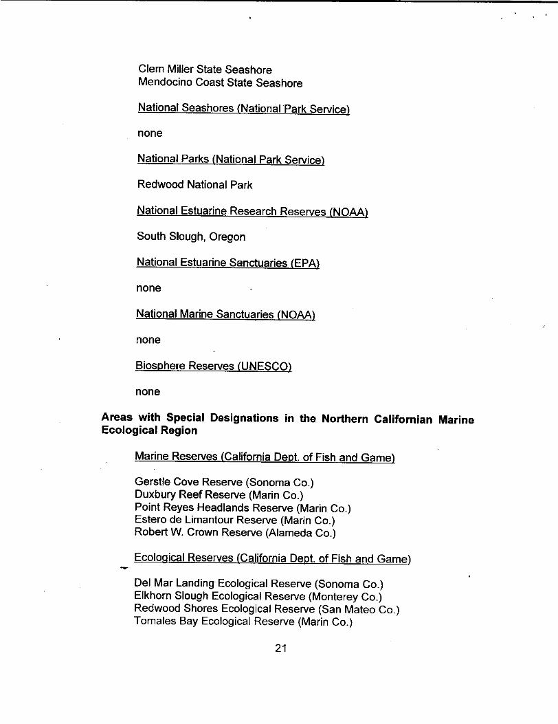
Clem Miller State SeashoreMendocino Coast State Seashore
NationalSeashores NationalPark Service
none
NationalParks National ParkService
Redwood National Park
NationalEstuarine Research Reserves NOAA
South Slough, Oregon
NationalEstuarine Sanctuaries EPA
none
NationalMarine Sanctuaries NOAA
none
BiosphereReservesUNESCO
none
Areas with Special Designations in the Northern Californian MarineEcological Region
MarineReserves California Dept. of Fish and Game
Gerstie Cove Reserve Sonoma Co.Duxbury Reef Reserve Mann Co.Point Reyes Headlands Reserve Mann Co.Estero de Limantour Reserve Mann Co.Robert W. Crown Reserve Alameda Co.
EcologicalReserves California Dept. of Fish andGame
Del Mar Landing Ecological Reserve Sonoma Co.Elkhorn Slough Ecological Reserve Monterey Co.Redwood Shores Ecological Reserve San Mateo Co.Tomales Bay Ecological Reserve Mann Co.
21

Offshore Rocks and Pinnacles All Coastal CountiesCaliforniaLegislative Refuges California Dept. of Fish and
Game
Bodega Marine Life Refuge Sonoma Co.James V. Fitzgerald Marine Life Refuge San Mateo Co.
Areasof Special Biological Significance CaliforniaWater QualityControlBoard & Environmental ProtectionAgency
Kelp Beds at Saunders Reef Mendocino Co.Del Mar Landing Ecological Reserve Sonoma Co.Gerstle Cove Sonoma Co.Bodega Marine Life Refuge Sonoma Co.Point Reyes Headland Reserve and Extension Mann Co.Duxhury Reef Reserve and Extension Marin Co.Bird Rock Mann Co.Double Point Marin Co.Farallon Island San Francisco Co.James V. Fitzgerald Marine Reserve San Mateo Co.AnoNuevo Point and Island San Mateo Co.
UnderwaterParks and Reserves California Department of ParksandRecreation
Salt Point State ParkFort Ross State Historical ParkSonoma Coast State Beach
StateSeashores California Department of Parks andRecreation
Sonoma Coast State SeashoreAlSo Nuevo State Seashore
NationalSeashores National ParkService
Point Ryes National Seashore
NationalResearch Natural Area National ParkService
Point Ryes Headlands National Research Natural Area
NationalEstuanine Research ReservesNOAA
22

Elkhom Slough National Estuanine Research Reserve
NationalEstuarine Sanctuaries EPA
San Francisco Bay/San Juaquin Delta National Estuarine Sanctuary
NationalMarine SanctuariesNOAA
Gulf of the Farallones National Marine SanctuaryCordell Bank National Marine SanctuaryMonterey Bay National Marine Sanctuary Northern Portion
StateSeashores California Department of Parks andRecreation
Sonoma Coast State SeashoreAlSo Nuevo State Seashore
NationalSeashores National ParkService
Point Ryes National Seashore
NationalEstuaritie Research ReservesNOAA
Elkhorn Slough National Estuarine Research Reserve
NationalEstuarine SanctuariesEPA
San Francisco Bay/San Juaquin Delta National Estuarine Sanctuary
NationalMarine SanctuariesNOAA
Gulf of the Farallones National Marine SanctuaryCordeD Bank National Marine Sanctuary
BiosphereReservesUNESCO
Golden Gate Biosphere Reserve formerly Central California CoastBiosphere Reserve - The Biosphere Reserve includes the Gulf of theFarallones and Cordell Bank National Marine Sanctuaries.
Areas with Special Designations in the Central Californian MarineEcological Region
23
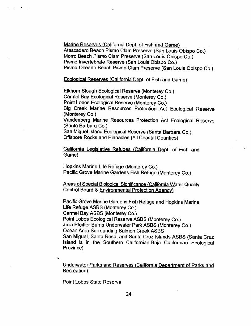
MarineReserves California Dept.of Fish and GameAtascadero Beach Pismo Clam Preserve San Louis Obispo Co.Morro Beach Pismo Clam Preserve San Louis Obispo Co.Pismo Invertebrate Reserve San Louis Obispo Co.Pismo-Oceano Beach Pismo Clam Preserve San Louis Obispo Co.
EcologicalReserves California Dept. of Fish andGame
Elkhorn Slough Ecological Reserve Monterey Co.Cannel Bay Ecological Reserve Monterey Co.Point Lobos Ecological Reserve Monterey Co.Big Creek Marine Resources Protection Act Ecological ReserveMonterey Co.Vandenberg Marine Resources Protection Act Ecological ReserveSanta Barbara Co.San Miguel Island Ecological Reserve Santa Barbara Co.Offshore Rocks and Pinnacles All Coastal Counties
CaliforniaLegislative Refuges California Dept. of FishandGame
Hopkins Marine Life Refuge Monterey Co.Pacific Grove Marine Gardens Fish Refuge Monterey Co.
Areasof Special Biological Significance California Water QualityControlBoard & Environmental Protection Agency
Pacific Grove Marine Gardens Fish Refuge and Hopkins MarineLife Refuge ASBS Monterey Co.Cannel Bay ASBS Monterey Co.Point Lobos Ecological Reserve ASBS Monterey Co.Julia Pfeiffer Burns Underwater Park ASBS Monterey Co.Ocean Area Surrounding Salmon Creek ASBSSan Miguel, Santa Rosa, and Santa Cruz Islands ASBS Santa CruzIsland is in the Southern Californian-Baja Californian EcologicalProvince
UnderwaterParks and Reserves California Department of Parks andRecreation
Point Lobos State Reserve
24

Julia Pfeiffer Burns State Park
StateSeashores California Department of Parks andRecreation
San Luis Obispo State SeashoreNationalSeashores National ParkService
N one
NationalEstuarine Research ReservesNOAA
Elkhorn Slough National Estuanine Research Reserve
NationalEstuarine SanctuariesEPA
Morro Bay National Estuarine Sanctuary
NationalMarine Sanctuaries NOAA
Monterey Bay National Marine Sanctuary Southern PortionChannel Islands National Marine Sanctuary western portion
BiosphereReservesUNESCO
Channel Islands Biosphere Reserve western portion
Areas with Special Designations in the Southern-Baja Californian MarineEcological Region
CityUnderwater Parks
San Diego - La Jolla City Underwater Park
University of California Natural Reserve System
Scripps Coast Reserve
Marine Reserves California Dept. of Fish andGame
Lover’s Cove Reserve, Catalina Island Los Angeles Co.Point Loma Reserve San Diego Co.
25

EcologicalReserves California Dept. of Fish andGame
Anacapa Island Ecological Reserve Ventura Co.Big Sycamore Canyon Marihe Resource Protection Act EcologicalReserve Ventura CoSanta Barbara Island Ecological Reserve Santa Barbara Co.Abalone Cove Ecological Reserve Los Angeles Co.Farnsworth Bank Ecological Reserve Los Angeles Co.Bolsa Chica Ecological Reserve Orange Co.Upper Newport Bay Ecological Reserve Orange Co.Heisler Park Ecological Reserve Orange Co.San Elijo Lagoon Ecological Reserve San Diego Co.Batiquitos Lagoon Ecological Reserve San Diego Co.San Dieguito Lagoon Ecological Reserve San Diego Co.San Diego-La Jolla Ecological Reserve San Diego Co.Offshore Rocks and Pinnacles All Coastal Counties
CaliforniaLegislative Refuges California Dept. of Fish andGame
Point Fermin Marine Life Refuge Los Angeles Co.Catalina Marine Science Center Marine Life Refuge Los Angeles Co.Newport Beach Marine Life Refuge Orange Co.Irvine Coast Marine Life Refuge Orange Co.Laguna Beach Marine Life Refuge Orange Co.South Laguna Beach Marine Life Refuge Orange Co.Niguel Marine Life Refuge Orange Co.Dana Point Marine Life Refuge Orange Co.Doheny Beach Marine Life Refuge Orange Co.City of Encinitas Marine Life Refuge San Diego Co.San Diego Marine Life Refuge San Diego Co.
Areasof Special Biological Significance California Water QualityControlBoard & Environmental Protection Agency
San Miguel, Santa Rosa, and Santa Cruz Islands ASBS San Migueland Santa Rosa Islands are in the Central Californian EcologicalProvinceSan Nicolas Island and Begg Rock ASBS Santa Barbara Co.Santa Barbara Island, Santa Barbara County and Anacapa IslandASBS Santa Barbara and Ventura Cos.Mugu Lagoon to Latigo Point ASBS Ventura and Los Angeles Cos.Santa Catalina Island - Subarea One, Isthmus Cove to Catalina HeadASBS Los Angeles Co.Santa Catalina Island - Subarea Two, North End of Little Harbor to Ben
26
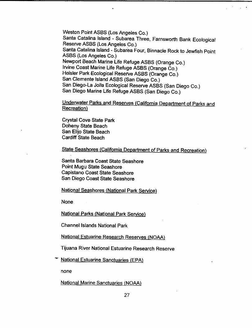
Weston Point ASBS Los Angeles Co.Santa Catalina Island - Subarea Three, Farnsworth Bank EcologicalReserve ASBS Los Angeles Co.Santa Catalina Island - Subarea Four, Binnacle Rock to Jewfish PointASBS Los Angeles Co.Newport Beach Marine Life Refuge ASBS Orange Co.Irvine Coast Marine Life Refuge ASBS Orange Co.Heisler Park Ecological Reserve ASBS Orange Co.San Clemente Island ASBS San Diego Co.San Diego-La Jolla Ecological Reserve ASBS San Diego Co.San Diego Marine Life Refuge ASBS San Diego Co.
UnderwaterParks and Reserves California Department of Parks andRecreation
Crystal Cove State ParkDoheny State BeachSan Elijo State BeachCardiff State Beach
StateSeashores California Department of Parks andRecreation
Santa Barbara Coast State SeashorePoint Mugu State SeashoreCapistano Coast State SeashoreSan Diego Coast State Seashore
NationalSeashores National ParkService
None
NationalParks National ParkService
Channel Islands National Park
NationalEstuarine Research Reserves NOAA
Tijuana River National Estuarine Research Reserve
NationalEstuarine Sanctuaries EPA
none
NationalMarine SanctuariesNOAA
27

Channel Islands National Marine Sanctuary
NationalMonument National ParkService
Cabrillo National MonumentBiosphereReservesUNESCO
Channel Islands Biosphere Reserve
28
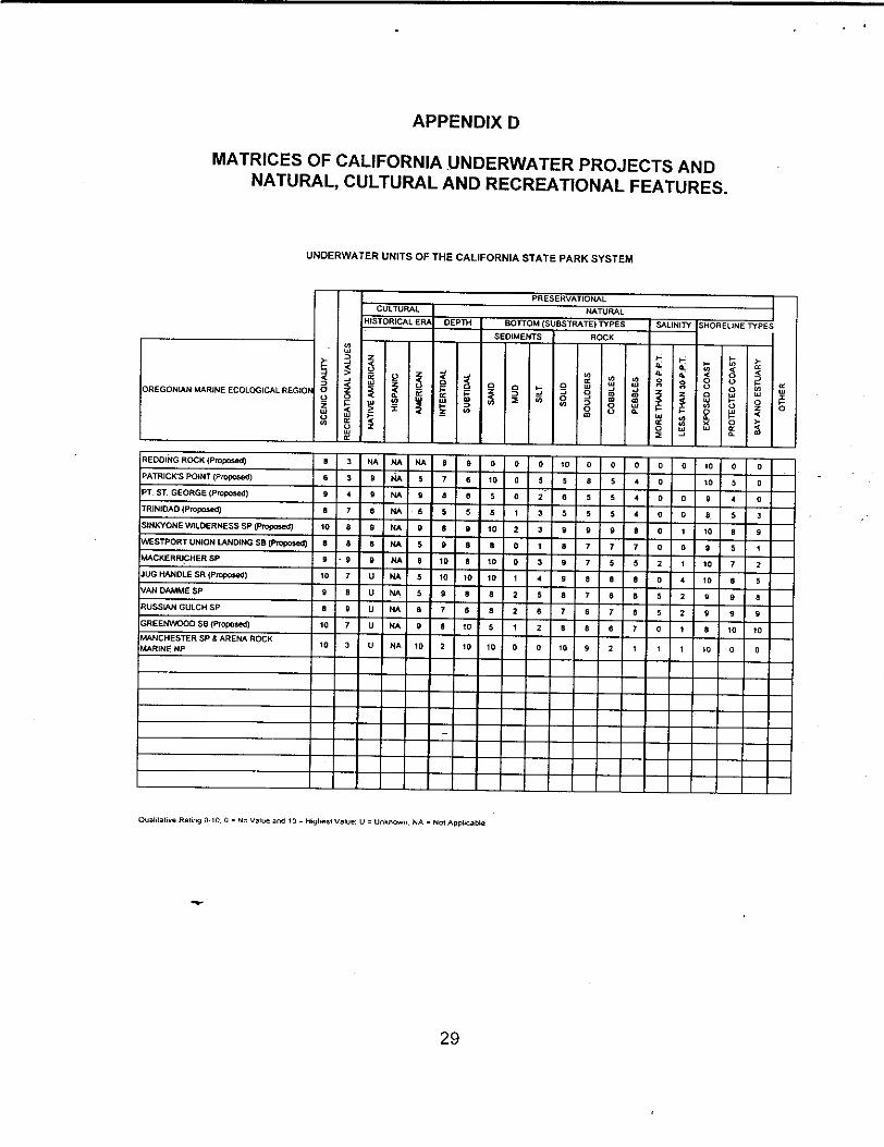
APPENDIX D
MATRICES OF CALIFORNIA UNDERWATER PROJECTS ANDNATURAL, CULTURAL AND RECREATIONAL FEATURES.
UNDERWATER UNITS OF THE CALIFORNIA STATE PARK SYSTEM
PRESERVATIONAL
CULTURAL NATURALHISTORICAL ERA DEPTH BOTTOM SUBSTRATE TYPES SALINITY SHORELINE TYPES
SEDIMENTS ROCKC,Li
z - -0,ø
Z ..j LI 0. 0‘0 ‘1 0 o0 < W o - 0 U ‘Si vs I.
OREGONLANMARINEECOLOCICALREGIOP 0 Z 2 = .j 0 2 z a0 0 w W 2 to 0 ‘ C LU
"80 U 40 z 00 0. 0
R U o 0-‘0 ‘C
OwwLi 2 -J
REDDINQR0CKPr0p0sat 0 3 NA NA NA a 9 0 0 0 10 0 0 0 0 0 ‘0 0 0
PATRICKSPOINTPr000sed 6 3 9 NA 5 7 6 ‘0 0 5 5 8 5 4 0 10 5 0
PTST.GEORGEProposed 9 4 9 NA 9 a S 5 0 2 6 5 5 4 0 0 9 4 0
TRINIDADProposad S 7 5 NA 5 5 5 5 I 3 5 5 5 4 0 0 8 S 3
SINKYONEW1LDERNESSSPProposed 10 a 9 NA 9 8 9 10 2 3 9 9 9 a 0 I 10 a 9
WESTP0RTUNI0NLANOINGSBPo0gose 5 8 5 NA 5 9 S a 0 I a 7 7 7 0 0 a 5 I
MACKERRICHERSP 9 .9 9 fl a ID a 10 0 3 9 7 5 5 2 I 10 7 2
JUGHANDLESRPIOposd 10 7 U NA 5 10 10 10 1 4 9 a a a 0 4 10 a sVANDAMMESP 9 a U NA 5 9 5 5 2 5 6 7 6 6 5 2 9 9 aRUSSIANGULCHSP 0 9 U NA 6 7 6 6 2 6 7 6 7 6 5 2 9 9 9
GREENW000SBProposed 10 7 U NA 9 6 tO 5 I 2 S a e 7 0 1 S ¶0 10
PJMLNCHESTERSP&ARENAROCK io 3 U NA ID 2 10 10 0 0 ¶0 9 2 I I I ¶0 0 0
OuaLIaI,ue RaIl,.9 0-0.0° No Value and ID = H.ghesI Value: U o tJnknoun: NA = NOI AppLcable
29

UNDERWATER UNITS OF THE CALIFORNIA STATE PARK SYSTEM
00z0
Si
PRESERVATIONAS.
0C0
00.5<
LAXE .
OLSLISSSP 10 ¶0 U 0 10 NA NA 10 I I 10 sO sO ID S ‘0 10 5
:MER.ALDBAYSP 10 10 U 0 10 NA NA S 1. S g 9 6 5 S LI
AONOLAKEThFA 10 ¶0 U 0 5 NA NA 9 2 2 10 5 5 10 10 5 5 2
LMCIPERR,SSRA I 2 U 0 U NA NA 5 5 10 0 0 0 0 I 0 5 I
RNtR
IEDEDINISI4IThSP 8 2 U 0 U NA NA S I I 0 10 10 ID 0 IC NA NA NA
OLDSACRMAOSTDSI I ¶ U 2 ¶0 NA NA I 5 50 0 0 0 0 2 NA NA NA
NA$MVbIL&VASPRI$GSSP 5 5 10 0 4 NA NA 6 3 I S 0 ‘0 9 0 S NA NA NA I0
0I.aSAIN. RaIl,9 0-500 = No V.ksa and 10. HireR Vet., U° Ur*i°Cw° NA = Nd AePACAtISFa,J,oIS SPtQS
INL,M40 CALIFORNIA AOUATIC ECOLOGICALREGION
CULTURAL NATURAL
I4SSTORICAL E DEPTh SOTTOM SUBSTRATE TYPES SAUNITY SHORELINE
SEDSJENTS ROCK
U
toII 0 *. 9 ‘SI
0
=0B
4,
B
U
4,‘SIBdi0.to
S.
LiS03
LI
U0
U
0S
=
0
aI
0
30

UNDERWATER UNITS OF THE CALIFORNIA STATE PARK SYSTEM
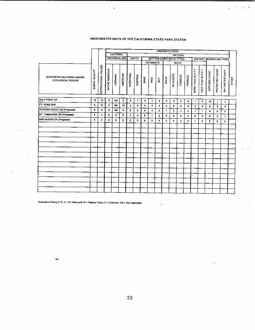
Qualitative Rating 0-10:0 = ND Value and 10 = H.Qhest Veaut: U Unkaown: NA = Not Applicable
Mare,. Did SPOflQS wt purple salphor bacteria
e.
PRESERVATIOMAL
SOUTHERN=BAJA CALIFORNIA MARINEECOLOGICAL REGION
CULTURAL NATURAL
HISTORICAL ERA DEPTH BOTTOM SUBSTRATE TYPES SALINITY SHORELINE TYPES
SEDIMENTS ROCK
=a0ILiU4
COSi
0
ULi
Ua 0
S.L0I
ICUa S
I
0
to=LI
LILi0
=0to
0 -=3
LI‘Si
Bto0U
COLi
totoLi0.
I.:aa
I
LiS03
0.
0.0
I-COLILi
-LI40U0LULI00.‘CLi
LIC000diULi
0aS.
0-SC=LI
0I-C0-4to
a
I-0
GAVIOTA SP-TRESSELSAREA Proposed 7 5 U U 5 3 7 9 2 4 3 2 4 3 0 0 4 0 2
REPUGIOSB.TAJIGUASAREAPfOposed 0 9 U U U S S 9 1 3 6 2 3 3 0 0 3 0 0
LEOCARRIL050MEAPropoaed 0 0 U U U 5 7 5 1 3 6 4 7 S 0 0 7 7 5
POIHTDUMESRPropoa8d 5 3 U U U 4 6 9 0 4 S 3 4 I 0 0 66 0
ROYALPALMSSBPrOpoaed 9 S U U S S 7 5 3 5 7 5 5 4 1 0 7 5 I I0
SMITA cATALINA ISLM4DPropofld ¶0 ¶0 U U 5 0 10 9 I 3 10 0 S 5 0 0 ID 9 10
CRYSTALCOVESP 7 8 U U 5 7 7 7 3 4 7 5 3 5 0 0 5 6 5
DOHENYSB 5 7 U U U 2 55 4 5 2 3 2 3 0 0 ElI
SAIONOFRESBPrOpOSod S S U U 5 7 7 S 2 3 5 4 S 2 I I S 3 3
SMIELIJOSB S S ID U U 4 5 7 3 4 3 3 4 3 0 0 5 5 1
CAROIFFSB S 6 ¶0 U U 4 5 7 3 4 3 3 4 3 0 0 6 S I
SAP4HICHOLASISLANDPrOpOsed ID ¶0 U U U 9 10 s I 2 S 9 5 S 0 0 IC 9 5
SANCLEMENTEISLANDPIOPOU4 10 ¶0 U U 4 S 103 2 3 10 10 7 7 0 0 ID ID S
31

UNDERWATER UNITS OF THE CALIFORNIA STATE PARK SYSTEM
QualItative RatIng 0-50:0 = No Value and 10 = Highest ValUe; U UnAnown: MA = Nos Applicable
0
PRESERVATIONAL
=00ILi04,
CENTRAL CALIFORNLA MARINEECOLOGICAL REGION
CULTURAL NATURALHISTORICAl. ElLA DEPTH BOTTOM SUBSTRATE TYPES SALINITY SHORELINE TYPES
SEDIMENTS ROCK
LILi
0
WE
I
SIU
0
0=C0
-CI
0=2
a4
4,SIiiaa=0to
0a0CO
LILiatoto00
LILiatotoLiS.
HS.S.
IHS.S.
0U0LiLI00.SC‘Si
3.
0‘U0I
0
SLi
0
ASILOM.ARSBPrOpOsed 5 5 U U U 9 9 10 0 2 9 9 9 ID 0 0 ¶0 4 I
POINTLOBOSSR ID ¶0 7 U 7 ¶0 ID ID I 4 ID 10 10 9 0 0 ¶0 9 5
POINTSURPrOpos.d 7 4 U U 8 7 8 S 0 2 ¶0 ID 7 8 0 0 ID 6 4
JULIAPFEIFFERBURNSSP Ia 3 U U S 6 ID 10 0 S ¶0 ID 10 ID 0 0 S 7 6
JOIINLITT1.ESRPropoSed U 2 U U U U U U U U U U U U 0 0 8 U U
HCARSTSANSIMEONS0POPOS.d U S 7 U S 4 U 3 3 8 4 5 4 3 0 0 5 9 S
MORROSAYSPProposed 6 6 U 7 7 8 8 ID 10 10 I -I I I 5 5 S S ¶0
MONTANADEOROSPPrOPOSed 6 S 6 6 5 9 5 7 1 4 9 7 8 7 0 0 9 4 5
OINOSAURPOINTPropOE8d 4 5 U U 5 3 8 8 I 2 8 5 I I 0 D 4 6 3
32
UNDERWATER UNITS OF THE CALIFORNIA STATE PARK SYSTEM
COISa
0
S0LiS
SAI.TPOINTSP 10 ID 9 NA 6 5 7 9 2 3 9 9 9 9 I 0 ‘0 7 2
FT,ROSSSI-OP 6 ID 9 NA ID 2 6 S 3 4 6 S 5 6 2 0 8 8 9
SON0M.ACOASTSBPropose. 6 9 9 NA 5 6 6 8 4 5 7 5 4 4 I 1 9 6 5
MT.TAMALPAISSPPr0p0$e 5 4 U U S 4 4 6 I 3 8 9 5 5 0 0 9 2 I
"NONUEVOSRPropos.d 5 2 U U 6 3 5 S 2 S 3 4 3 3 I 0 8 S 4
Qualitalive Rating 0-100 = Ho Value end 10° Highest iaIue. U = Unknown: NA = Not Applicable
PRESERVATIOHAL
NORTHERN CALIFORNIA MARINEECOLOGICAL REGION
CULTURAL NATURAL
HISTORICAL ERA DEPTH BOTTOM SUBSTRATE TYPES SALINITY SHOREUNE TYPES
SEDIMENTS ROCK
=0UIISa0CO
z-CUS 0
I
LII
I
S SIL
I I 0=I
LISlii0=0to
aCO
LILiatoto0U
0
0LI
4,SitotoLi0.
0.a0
I
03
00.0
I
Ii,C0U0‘SiCO00.
LI-C0U0Li
0Li
0S0.
3.S-C=LILi0I-C3.
SLiI
0
33
APPENDIX E
AVAILABLE TAXA LISTS FOR CALIFORNIA UNDERWATER PARKS ANDRESERVES
AND SOME PROPOSED ADDITIONS
MENDOCINO - SONOMA COAST STATE PARK UNITS MARINE LIFE TAXALISTS. 1991. John 0. DeMartini
Westport-Union Landing State BeachMacKerricher State ParkJughandle StateReserveCasparHeadlands State BeachCasparHeadlandsStateReserveRussianGulch StateParkMendocino Headlands State ParkVan Damme StateParkGreenwood Creek ProjectManchester StateBeachArena Rock Marine Natural PreserveSchoonerGulch ProjectSalt Point StatePark
PointArenaArea ecological evaluation. 1974 W. James Barry
Mendocino Headlands StatePark Environmental Data Statement. 1975. W.James Barry and John D. DeMartini.
Mount Tamalpias State Park BaselineDescription of Marine EnvironmentsAround Lone Tree Landslide, from the Fall of 1990. Brenda Konar, JohnOliver, Peter Slattery,James Oakden, Cassandra Roberts, Allen Andrews andPhilip Bairrington.
Point Lobos StateReserveSubtidalResource Inventory. 1977. John D. DeMartini andW. James Barry.
GarrapataStatePark Biological Surveyof Subtidal Marine Communities.Am9t. Wagner,Kimberly S. Burdett and John S. Oliver
Andrew Molera State Park Biological Survey of Subtidal MarineCommunities. Amy L. Wagner, Kimberly S. Burdett and John S. Oliver
34

Julia Pfeiffer Burns State Park Biological Survey of Subtidal MarineCommunities. Amy L. Wagner, Kimberly S. Burdeff and John S. Oliver
Julia Pfeiffer Burns Area of Special Biological Significance ReconnaissanceSurvey. 1979. Craig P. Seltenrich, John D. DeMartini and W. James Barry
Leo Carrillo State Beach Marine Resources Inventory. 1992. Raymond A.Wells, Rimmon C. Fay, Chuck Cleeves and Rosi Dagit
Crystal Cove State Park UnderwaterResearch Project. 1987. Joseph J.Valencic
San Elijo State Beach Reef 1983. Dan Gotshall, and John DeMartini
35
References
Abbott, Isabella A. and George J. Hollenberg. 1976. Marine algae ofCalifornia. Stanford Universit9 Press. 827 p.
Bailey, Robert C. 1978. Description of the ecoregions of the United States.U.S. Department of Agriculture, Misc. PubI. No. 1391. 77 p.
Bailey, Robert C. 1981. Assisted by Charles T. Cushwa Ecoregions of NorthAmerica. 1:12,000,000 Map. U.S. Forest Service and U.S. Fish andWildlife Service. Washington D. C.
Barry, W. James. 1974. Ecological evaluation of the proposed Point Arenaunit of the State Park System. State of California, The ResourcesAgency, Department of Parks and Recreation. Sacramento. 17 p.
Barry, W. James. 1991. Ecological Regions of California. Interagency NaturalAreas Coordinating Committee, State of California, The ResourcesAgency, Department of Parks and Recreation. Sacramento. 67 p.
Barry, W. James, John W. Foster and Kenneth W. Collier. 1995. Californiaunderwater parks and reserves action plan. State of California, TheResources Agency, Department of Parks and Recreation. Sacramento.34 p.
Collier, Ken. 1984. California State Park System underwater parks masterplan. State of California, The Resources Agency, Department of ParksandRecreation.Sacramento 32 p.
DeMartini, John D. and W. James Barry. 1977. A subtidal resource inventoryfor Point Lobos State Reserve. State of California, The ResourcesAgency, Department of Parks and Recreation. Sacramento. 51 p.
Hedgpeth, Joel W. 1957. Marine biogeography. Memoir 67, Vol. 1, pp.358-382. Geological Society of America.
North, Wheeler J.1976. Underwater California. California Natural HistoryGuides: 39. University of California Press, Berkeley and Los Angeles.276 p.
Outdoor Recreation Resources Review Commission. 1962. A multi-volumereport to the commission. Washington, D.C., U.S. Gov. Prin. Office.
35

SCCWRP. 1973. The ecology of southern California bight; Implications forwater quality management. Three-year report of the SouthernCalifornia Coastal Water Research Project, El Segundo, California. 531p.
Udvardy, Miklos, D. F. 1975. A classification of the biogeographical provincesof the world. Internat. Union Conserv. Nature and Natural ResourcesICUN. Morges, Switzerland. Occas. Pap. 18:1-48.
Ray, C. Carleton, 1975. A preliminary classification of coastal and marineenvironments. Intemat. Union Conserv. Nature and Natural ResourcesICUN. Morges, Switzerland. Occas. Pap. 14.
Wallace, Orthello L.. 1971. Establishing underwater parks worldwide. Officeof the National Science Studies, National Park Service. Washington,D.C., U.S. Coy. Prin. Office.
36

UNDERWATER UNITS OF THE cALIFORNIA STATE PARK SYSTEM
PRESERVATIONAA.
LAKE
D.LBLI$$5p 10 10 U 0 10 NA NA 10 I 1 10 10 10 10 9 10 10 5
EMERALDBAYSP 10 10 U 0 10 NA NA 8 2 3 8 9 9 8 8 1 5 10
MONOI.AKETUFASR 10 10 U 0 8 NA NA 9 2 2 10 5 5 10 ID 5 5 2
I RESERVOIR
LAXEPERRISSRA 1 2 U 0 U NA NA 8 5 10 0 0 0 0 1 0 5 1
RIVER
JEDEDIAHSMIThSP 8 2 U 0 U NA NA 8 I 1 8 10 10 10 0 10 NA NA NA
OLDSACRAMENTOSHP I I U 2 10 NA NA 1 8 10 0 0 0 0 2 1 NA NA NA
AHJUMAW1LAVASPRINGSSP 5 5 10 0 4 NA NA 6 3 1 9 10 10 9 0 8 NA NA NA 10
4INLAND CAUFORNIA AQUATIC ECOLOGICAL
REGION
CULTURAL NATURALHISTORICAL ERA DEPTH BOTTOM SUBSTRATE TYPES SALINITY SHORELINETYPES
SEDIMENTS ROCK‘a
0
Lur
‘a
0
Cl,
0o -‘Cl,
0
00
0w-S
w0.
0.0.
Cl,C000Lu00
UI
I0.0.
Qualitative Rating 0.10; 0 = No Value and 10 Fllgtlest Value; U = Unknown; NA Not ApplicableFreshwaterspring,

UNDERWATER UNITS OF THE CALIFORNIA STATE PARK SYSTEM
aCzUICCl,
4SOLJTHERN.BAJA CALIFORNIA MARINE
ECOLOGICAL REGION
PRESERVATIONAL
CULTURAL NATURALHISTORICAL ERA DEPTH BOTTOM SUBSTRATE TYPES SALINITY SHORELINE TYPES
SEDIMENTS ROCK0w
z
ILu
=
0=
0,I
2C0I I I 0
‘a
0
0L0
‘a
Lu000en
0Lu
enen0C
0Lu‘aenLua.
I-0.0.0C.,=
LuI0
0.
0C.,
=Co‘aLu
Co
00UI‘a00.
w
‘a
00wI0Lu
0I0.
I0
Cl,Lu02C
en
ILu
0
GAVIOTASP.TRESSELSAREAProposed 7 8 U U 5 3 7 9 2 4 5 2 4 3 0 0 4 8 2
REFUGIOSB.TAJIGUASAREAPropo$ed 8 9 U U U 6 8 9 I 3 6 2 3 3 0 0 3 8 0
LEOCARRILOSBAREAProposed 8 8 U U U 5 7 8 1 3 6 4 7 5 0 0 7 7 5POINTDUMESRProposed 5 3 U U U 4 6 9 0 4 5 3 4 1 0 0 8 6 0
ROYALPALMSSBProposed 9 8 U U 5 6 7 6 3 5 7 5 5 4 1 0 7 6 1 10’
SANTACATAUNAISLANDProposed 10 10 U U 8 9 10 9 1 3 10 9 B 5 0 0 10 9 10
CRYSTALCOVESP 7 8 U U 5 7 7 7 3 4 7 5 3 5 0 0 8 6 5
DOHENYSB 5 7 U U U 2 5 5 4 5 2 3 2 3 0 0 6 7 1
SANONOFRESBProposed 6 8 U U 5 7 7 9 2 3 5 4 6 2 I 1 8 3 3
SANELIJOSB 5 6 10 U U 4 5 7 3 4 3 3 4 3 0 0 6 5 1
CARDIFF SB 5 6 10 U U 4 5 7 3 4 3 3 4 3 0 0 6 5 1
SANNICHOLASISLANDProposad 10 10 U U U 9 10 9 1 2 9 9 6 8 0 0 ID 9 5
SANCLEMENTEISLANDProposed 10 10 U U 4 9 10 9 2 3 10 10 7 7 0 0 10 10 9
Qualitative Rating 0.10; 0 = No Value and 10 = Highest Value; U = Unknown; NA = Not ApplicableMarine hot springs with purple sulphur bacteria
UNDERWATER UNITS OF THE CALIFORNIA 5TATE PARK SYSTEM
PRESERVATIONAL
ASILOMARSBProposed 8 5 U U U 9 9 10 0 2 9 9 9 10 0 0 10 4 1
POINTLOBOSSR 10 ID 7 U 7 10 10 IC I 4 10 10 10 9 0 0 ID 9 5
POINTSURProposed 7 4 U U 6 7 8 6 0 2 10 10 7 8 0 0 10 6 4
JUUAPFEIFFERBURNSSP 10 3 U U 8 6 10 10 0 5 10 10 10 10 0 0 8 7 5
JOHNLJTTLESRProposed U 2 U U U U U U U U U U U U 0 0 8 U U
HEARST SAN SIMEON SB Proposed U 8 7 U 8 4 U 6 3 8 4 5 4 3 0 0 5 9 5
MORROBAYSPProposed 6 6 U 7 7 8 8 ID ID 10 I I 1 1 5 5 5 5 10
MONTANADEOROSPProPosed 8 8 6 8 5 9 8 7 1 4 9 7 8 7 0 0 9 4
DINOSAURPOINTProposed 4 5 U U 5 3 8 8 I 2 8 5 I 1 0 0 4 6 3
4
CENTRAL CALIFORNIA MARINEECOLOGICAL REGION
CULTURAL NATURAL
HISTORICAL ERA DEPTH BOTTOM SUBSTRATE TYPES SALINITY SHORELINE TYPES
SEDIMENTS ROCK0Lu
I
=
I0I
0z 0 F00
0
0U
0,ILu0
00en
0wenen00
‘aLuenenLu0.
0.
00
0.
0
IU
0C
0
0.
0C/Lu
0=
ILu
0
Qualitative Rating 0-10; 0 = No Value and 10 = Highest Value; U = Unknown; NA = Not Applicable

UNDERWATER UNITS OF THE CALIFORNIA STATE PARK SYSTEM
REDDINGROCKProposed 8 3 NA NA NA 8 9 0 0 0 10 0 0 0 0 0 10 0 0
PATRICKSPOINTProposed 8 3 9 NA 5 7 6 10 0 5 5 8 5 4 0 10 5 0
PT.ST.GEORGEProposed 9 4 9 NA 9 8 6 5 0 2 6 5 5 4 0 a 9 4 0
TRINIDADProposed 8 7 6 NA 5 5 5 5 1 3 5 5 5 4 0 0 8 5 3
SINKYONEWILDERNESSSPProposed 10 8 9 NA 9 8 9 10 2 3 9 9 9 8 0 1 10 8 9
WESTPORTUNIONLANDINGSBProposed 8 8 8 NA 5 9 8 8 0 1 8 7 7 7 0 0 9 5 I
MACKERRICHERSP 9 9 9 NA 8 10 8 10 0 3 9 7 5 $ 2 1 10 7 2
JUGHANDLESRProposed ID 7 U NA 5 10 ID 10 1 4 9 8 8 B 0 4 10 8 5
VANDAMMESP 9 8 U NA 5 9 8 8 2 5 8 7 8 6 5 2 9 9 8
RUSSIANGULCHSP 8 9 U NA 6 7 6 8 2 6 7 6 7 6 5 2 9 9 9
GREENWOODSBProposed 10 7 U NA 9 8 10 5 I 2 8 8 6 7 0 I 8 10 10
ICltANCHESTERSP&ARENAROCK 10 3 U NA IC 2 ID 10 0 0 10 9 2 1 1 1 ID 0 0
4
OREGONIAN I#LRINE ECOLOGICAL REGION
PR ESt KVATI0NAL
CULTURAL NATURAL
HISTORICAL ERA DEPTH BOTTOM SUBSTRATE TYPES SALINITY SHORELINE TYPESSEDIMENTS ROCK
0w0 =
ILu
0z
‘a=
II
=
ILu
pen‘a
0= 0 I-.
‘a
‘aIUI0
00en
‘aUI-JenenLu0.
0Lu
enen00
0-J0‘a
C.0.0
0.0.a
I-.‘a
00LuCo00.
00
0
0I0. I I
Qualitative Rating 0.10; 0 = No Value and ID = Highest Value; U = Unknown; NA = Not ApplIcable
UNDERWATER UNITS OF THE CALIFORNIA STATE PARK SYSTEM
PRESERVATIONALCULTURAL NATURAL
HISTORICAL ERA DEPTH BOTTOM SUBSTRATE TYPES SALINITY SHORELINE TYPES
SEDIMENTS ROCK‘aLu
‘. >.0 = 0. I4C0;0> 0 0 0 0 I-
NORTHERN CALIFORNIA MARINE Lu 0 I-Ui C’
‘a w0 . j C ‘a = z W =
ECOLOGICALREGION a 0 -J en en 0 p
w ‘a >.I ‘aowLuI
SALTPOINTSP 10 ID 9 NA 6 8 7 9 2 3 9 9 9 9 I 0 10 7 2
FT.ROSSSHP 8 IC 9 NA 10 2 6 8 3 4 6 8 6 6 2 0 8 8 9
SONOMACOASTSBProposed 6 9 NA 5 6 6 6 4 5 7 5 4 4 1 1 9 6 5
MT.TAMALPAISSPProposed 5 4 U U 8 4 4 6 1 3 8 9 5 5 0 0 9 2 1
ANONUEVOSRProposed 5 2 U U 5 3 5 8 2 5 3 4 3 3 1 0 8 8 4
Qualrtative Rating 0-10; 0 = No Value and ID = Highest Value; U = Unknown; NA = Not Applicable