Outline - ViaTech AS
42
Outline ❑ ViaTech Company Introduction ❑ About ViaPPS (Pavement Profile Scanner) ❑ ViaPPS Deliverables as per MoT Specifications ❑ Major Clientele - ViaPPS
-
Upload
khangminh22 -
Category
Documents
-
view
0 -
download
0
Transcript of Outline - ViaTech AS
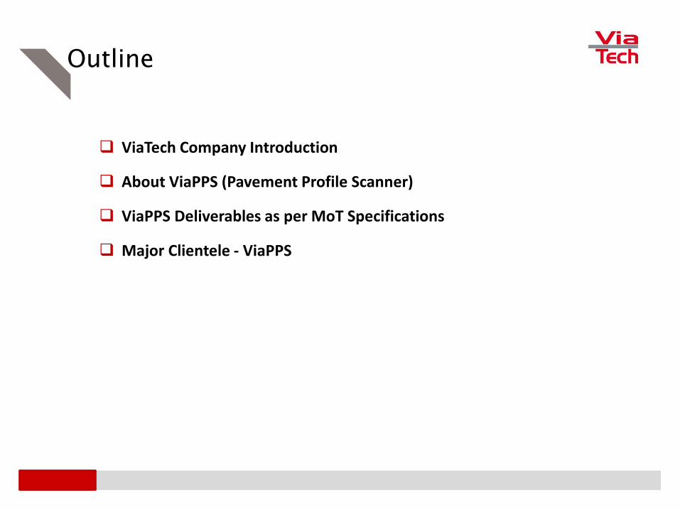
Outline
❑ ViaTech Company Introduction
❑ About ViaPPS (Pavement Profile Scanner)
❑ ViaPPS Deliverables as per MoT Specifications
❑ Major Clientele - ViaPPS

Company Introduction..

About ViaTech
The Journey So Far….
Founded in 1997
Norwegian Company based out of Kongsberg
An employees owned company
Having more than 150+ year of experience in R&D
Approved CEN/TS -15901-14
Global Presence

About ViaTech
Solution Range Industry Spread Partner Network
Laser Scan Technology
Control Systems
Design of Electronics
Mathematical Modelling
Embedded Systems
Software Development
Transportation
Defense
Maritime
Paper / Process Control Systems
Airports
Phone Communication
Asia
India
Philippians
Thailand
Vietnam
Indonesia
EuropePoland
Central & South
America Chile
United Kingdom
Mexico
China

About ViaTech
Via3DMapper
ViaPPS
Our Products
ViaFriction - Highways

About ViaPPS (Pavement Profile Scanner)

ViaPPS
Pavement Profile Scanner (ViaPPS)

ViaPPS
Component of ViaPPS
Laser Scanner Z+F POS LV from Applanix Ladybug Camera & Sensors
Range – 119mRotation Speed 200 RPSField of View 360°
Compact & Integrated SystemSupport Multiple IMU’s

ViaPPS
– Longitudinal and transversal profile
– Rut depth, rut area and rut area volume
– Crossfall & Crossfall Requirement, curve radius
– Longitudinal deflection/Bumps
– IRI and MPD
– Width of the lane Bad joints of the asphalt / Concrete
– Crack and Potholes parameters
– Tunnel/Bridge profile including height
– 3D data to external standard format such as xyzi, las/laz
– WEB interface and 360 photo integration
ViaPPS Performs / Captures Following Parameters

ViaPPS
3D Point Cloud Data Rut Depth ViaPPS Analyser Rut Depth
Surface Defect Capture Generation of Maps & Reports Integration with Orbit GT
Reports Generated by ViaPPS

ViaPPS
❑ High speed data collection (from 40 km / hour – 120 km / hour) with automated data processing and report
generation
❑ High accuracy point cloud data (3cm – 5cm after post processing)
❑ Captures corridor data which can be used for other applications (project planning in case of road widening ,
asset mapping, 3D city modelling, route alignment of optic fibre cable etc)
❑ Used for checking the quality of new highways constructions
❑ Used in planning of road maintenance schedule by generating BOM from road data bank through Pavement
Management Systems
❑ Can categorizes the maintenance schedule preferences as per pavement condition
❑ Can be used in airports for Pavement condition mapping and PCI generation
❑ Used in Budget allocations
❑ Can be further integrated with Bridge Management, Tunnel / Facilities Management System and Works /
Contract Management Systems
Main Application / Features of ViaPPS

ViaPPS Deliverables as per MoT
Specifications

Road Inventory Data

Road Inventory Data – Location Reference Post
Field Remarks
NH Number Manually
LRP Name Manually
Chainage Manually
Latitude Through the system
Longitude Through the system
Survey Date Through the system
Old NH Number Manually
Section Code Manually

Road Inventory Data – Carriageway, Road and Pavement Type
Deliverables
Point Cloud Data
Photographs in image format
Point Cloud Data ForCarriageway and Road Type
3D Panoramic View for Carriageway and Road Type
Pavement Type -Concrete
Pavement Type -Asphalt
Sensors Used
Z+F Scanner
ViaPhoto
3D Panoramic Photos (Ladybug)
Applanix LV 220
Output Expected –Carriageway Type
Divided
Undivided
Output Expected –Road Type
1 /2 /4/6 Lane
Intermediate Lane
Output Expected –Pavement Type
Asphalt
Cement Concrete

Road Inventory Data – Pavement Width, Shoulder Type and Width
Deliverables
Point Cloud Data
Photographs in image format
Pavement Width on Point Cloud data in ViaPPS
Desktop
Shoulder Type - Paved
Pavement Width Measurement Measures Shoulder
Width in ViaPPSDesktop
Sensors Used
Z+F Scanner
ViaPhoto
3D Panoramic Photos (Ladybug)
Applanix LV 220
Output Expected –Pavement Width
Width In Meters
Output Expected –Shoulder Type
None
Paved
Gravel
Earth
Output Expected –Shoulder Width
Width In Meters

Road Inventory Data – Topography, Cross Section and Drain Type
Deliverables
Point Cloud Data
Photographs in image format
Topography - Flat Topography - Hilly
Road Profile / Cross Section
Drain Type
Sensors Used
Z+F Scanner
ViaPhoto
3D Panoramic Photos (Ladybug)
Applanix LV 220
Output Expected –Topography
Flat
Rolling
Hilly
Output Expected –Cross Section Types
Cut / Fill
Cut and Fill
Level
Output Expected –Drain Type
Open Unlined
Open Lined
Covered Line
No drain

Road Inventory Data – Median Opening, Right of Way and Pavement Composition
Deliverables
Point Cloud Data
Photographs in image format
Median Types Median Types
Right of Way - Width Pavement Composition
Sensors Used
Z+F Scanner
ViaPhoto
3D Panoramic Photos (Ladybug)
Applanix LV 220
Output Expected – Media Opening
Raised / Depressed
Barrier
None
Output Expected – Right of Way
ROW width in meters
Output Expected – Pavement Composition
Pavement Type
Pavement Thickness
Year of Construction
Latitude -Longitude

Road Inventory Data – Carriageway Furniture, Wayside Amenities, Land Use
Deliverables
Point Cloud Data
Photographs in image format
Carriageway Furniture Wayside Amenities
Carriageway Furnitures Landuse
Sensors Used
Z+F Scanner
ViaPhoto
3D Panoramic Photos (Ladybug)
Applanix LV 220
Output Expected – Carriageway Furniture
Crash Barriers
Sign / Street Lights
Kms Stone
Output Expected – Wayside Amenities
Bus Shelters / Culverts / Toll plaza
Restaurant / Rest Rooms / Toilets etc
Output Expected – Landuse
Residential / Commercia
Industrial / Agriculture
Water Bodies
Mixed

Road Condition Data

Visual Condition
Deliverables
Point Cloud Data
Photographs in image format
Point Cloud Data3D Panoramic View I
3D Panoramic View II
View From ViaPhoto
Sensors Used
Z+F Scanner
ViaPhoto
3D Panoramic Photos (Ladybug)
Applanix LV 220
VelodyneSensors (optional)
Pavement Facing Camera (Optional)

Visual Condition Data– Raveling
Sensors Used
Z+F Scanner
ViaPhoto
3D Panoramic Photos (Ladybug)
Applanix LV 220
VelodyneSensors (optional)
Pavement Facing Camera (Optional)
Deliverables
Point Cloud Data
Photographs in image format
Homogeneity Diagrams
ViaPPS Desktop Algorithms
Point Cloud Data
3D Panoramic View
ViaPhoto
Homogeneity
Output Expected
Very Poor >30%
Poor (11-30%)
Fair (6-10%)
Good (1-5%)
Very Good (0%)

Visual Condition Data– Potholes
Sensors Used
Z+F Scanner
ViaPhoto
3D Panoramic Photos (Ladybug)
Applanix LV 220
VelodyneSensors (optional)
Pavement Facing Camera (Optional)
Point Cloud Data3D Panoramic
View
Surface Defects
Output Expected
Very Poor (>5)
Poor (3-5)
Fair (2)
Good (1)
Very Good (0)
Deliverables
Point Cloud Data
Photographs in image format
Homogeneity Diagrams
ViaPPS Desktop Algorithms
Homogeneity

Visual Condition Data– Edge Break
Sensors Used
Z+F Scanner
ViaPhoto
3D Panoramic Photos (Ladybug)
Applanix LV 220
VelodyneSensors (optional)
Pavement Facing Camera (Optional)
Deliverables
Point Cloud Data
Photographs in image format
Homogeneity Diagrams
ViaPPS Desktop Algorithms
Point Cloud Data3D Panoramic
View
Road Defects
Output Expected
Very Poor (>5 sq.m)
Poor (1-5 sq.m)
Fair (0.5-1 sq.m)
Good (0-0.5 sq.m)
Very Good (0 sq.m)
Homogeneity

Visual Condition Data– Cracking
Sensors Used
Z+F Scanner
ViaPhoto
3D Panoramic Photos (Ladybug)
Applanix LV 220
VelodyneSensors (optional)
Pavement Facing Camera (Optional)
Deliverables
Point Cloud Data
Photographs in image format
Homogeneity Diagrams
ViaPPS Desktop Algorithms
Point Cloud Data
3D Panoramic View
Road Defects Homogeneity
Output Expected
Very Poor >30%
Poor (21-30%)
Fair (10-20%)
Good (1-10%)
Very Good (<1%)

Visual Condition Data– Disintegration
Sensors Used
Z+F Scanner
ViaPhoto
3D Panoramic Photos (Ladybug)
Applanix LV 220
VelodyneSensors (optional)
Pavement Facing Camera (Optional)
Deliverables
Point Cloud Data
Photographs in image format
Homogeneity Diagrams
ViaPPS Desktop Algorithms
Distribution based on Deviation
3D Panoramic View
Homogeneity With Standard Deviation
Output Expected
Very Poor >50%
Poor (20-50%)
Fair (10-20%)
Good (1-10%)
Very Good (<1%)

Visual Condition Data– Depression
Sensors Used
Z+F Scanner
ViaPhoto
3D Panoramic Photos (Ladybug)
Applanix LV 220
VelodyneSensors (optional)
Pavement Facing Camera (Optional)
Deliverables
Point Cloud Data
Photographs in image format
Homogeneity Diagrams
ViaPPS Desktop Algorithms
Road Profile (Transverse)
3D Panoramic View
Longitudinal Profile
Output Expected
Very Poor >5%
Poor (3-5%)
Fair (1-2%)
Good (0-1%)
Very Good (0)

Visual Condition Data– Bleeding
Sensors Used
Z+F Scanner
ViaPhoto
3D Panoramic Photos (Ladybug)
Applanix LV 220
VelodyneSensors (optional)
Pavement Facing Camera (Optional)
Deliverables
Point Cloud Data
Photographs in image format
Homogeneity Diagrams
ViaPPS Desktop Algorithms
Point Cloud Data 3D Panoramic View
Homogeneity With Standard Deviation
Output Expected
Very Poor >50%
Poor (20-50%)
Fair (10-20%)
Good (1-10%)
Very Good (<1%)

Visual Condition Data– Patching
Sensors Used
Z+F Scanner
ViaPhoto
3D Panoramic Photos (Ladybug)
Applanix LV 220
VelodyneSensors (optional)
Pavement Facing Camera (Optional)
Deliverables
Point Cloud Data
Photographs in image format
Homogeneity Diagrams
ViaPPS Desktop Algorithms
Point Cloud Data ViaPhoto
Homogeneity
Output Expected
Very Poor >30%
Poor (16-30%)
Fair (6-15%)
Good (2-5%)
Very Good (<2%)

Visual Condition Data– Drain Condition
Sensors Used
Z+F Scanner
ViaPhoto
3D Panoramic Photos (Ladybug)
Applanix LV 220
VelodyneSensors (optional)
Pavement Facing Camera (Optional)
Deliverables
Point Cloud Data
Photographs in image format
Homogeneity Diagrams
ViaPPS Desktop Algorithms
Point Cloud Data
3D Panoramic View
Homogeneity
Output Expected
Poor
Fair
Good
3D Panoramic View

Visual Condition Data– Shoulder Condition
Sensors Used
Z+F Scanner
ViaPhoto
3D Panoramic Photos (Ladybug)
Applanix LV 220
VelodyneSensors (optional)
Pavement Facing Camera (Optional)
Deliverables
Point Cloud Data
Photographs in image format
Homogeneity Diagrams
ViaPPS Desktop Algorithms
3D Panoramic View
Output Expected
Poor
Fair
Good
3D Panoramic View
3D Panoramic View
3D Panoramic View

Roughness (IRI)
Sensors Used
Z+F Scanner
Applanix LV 220
IRI+
Pavement Facing Camera (Optional)
Deliverables
Point Cloud Data
Roughness (IRI) and Average IRI over a span
Mean Profile Depth (MPD) and Average MPD over a span
Speed of Vehicle
Output Expected
IRI at Left Wheel
IRI at Right Wheel
Average IRI
Speed
Latitude / Longitude
Roughness (IRI)
Average Roughness (IRI) over 100m

Rutting
Sensors Used
Z+F Scanner
Applanix LV 220
IRI+
Pavement Facing Camera (Optional)
Deliverables
Point Cloud Data
Rut Depth -Right and Average Rut Depth over a span
Rut Depth -Right and Average Rut Depth over a span
Speed of Vehicle
Output Expected
Rutting Left
Rutting Right
Rutting Average
Speed
Latitude / Longitude
Rut Depth and Average Rut Depth on Left
Rut Depth and Average Rut Depth on Right

Texture Depth (MPD)
Sensors Used
Z+F Scanner
Applanix LV 220
IRI+
Pavement Facing Camera (Optional)
Deliverables
Point Cloud Data
Roughness (IRI) and Average IRI over a span
Mean Profile Depth (MPD) and Average MPD over a span
Speed of Vehicle
Output Expected
Texture Depth at Left Wheel
Texture Depth at Right Wheel
Average Texture Depth
Speed
Latitude / Longitude
Mean Profile Depth (MPD)
Mean Profile Depth (MPD) over 100m

Skid Resistance (Friction)
Deliverables
Speed of Vehicle
Latitude / Longitude
Name /NH No Nomenclature
Friction Coefficient
Output Expected
NH / Lane No
Texture Depth at Right Wheel
Skid Left / Right / Average
Speed
Latitude / Longitude
Single Wheel
ViaFriction Reports
ViaFriction SystemTwo Wheel
Variable Slip Measurement
Sample Friction Report

Other Deliverables
Tunnels With Different Surfaces Road Edge &
Markings
Manholes
Export to 3rd party Point Cloud data software’s

Other Deliverables
Standard Deviation Chart
Crossfall
Curve Radius Color Coding Defects on Map

Major Clientele

Major Clientele (ViaPPS)
❑ Norwegian Public Road Administration, Norway
❑ Asfalt Technical Institute, Norway
❑ Terratec, Norway
❑ Teed, Estonia
❑ Innova 3, Mexico
❑ Vectura, Sweden
❑ CTC Builders and Suppliers, Philippines
❑ Ceinsys, India

Challenges & Offerings
▪ Need Fast and accurate Mapping of road pavement and assets
▪ Can Map around 300 kms per day in single vehicle
▪ Survey challenges in heavy traffic
▪ Mapping can be done at less peak hours / nighttime
▪ Different surveys needed for pavement conditions, road assets and safety parameters
▪ Can be carried out together in single combined vehicle
▪ Data available in different patches
▪ Creation of National road data bank ensures data to be present in centralized system
▪ Monitoring of construction quality and budgeting is person dependent (traditional methods)
▪ Process to automated by introducing transparency in the system
▪ Presentation of financial losses
▪ Road condition forecasting to be done by PMS
▪ System maintenance
▪ Entire operations can be maintained till handholding
▪ Road safety in lieu of increased average speed on highways
▪ Period measurement of friction parameters highlights problematic patches which are suspectable for skidding

Company credentials
❑ Inhouse developed technology for pavement and friction scanning
❑ Method included in Norwegian Public Road Authority Manual for its application
❑ Entire road maintenance for Norway is done by ViaTech’s Solution
❑ Using this technology NPRA measures around 100,000 R-km of road each annum since last 10 years
❑ Software can be upgraded as per local requirements (upgraded each year)
❑ In Norway budget of $US 800m is approved based on reports generated by this systems (cost of using this systems (including operations) < 0.5% of budget)
❑ On lines of Norway, working extensively in Poland as a technology partner to highway authorities
❑ Have sold units in various countries such as Norway, Denmark, Poland, Sweden, Italy, Mexico, India, Philippians etc.