OGC APIs – An Introduction - INSPIRE
13
® OGC APIs – An Introduction Gobe Hobona Director of Product Management, Standards Copyright © 2020 Open Geospatial Consortium INSPIRE virtual conference : 2020-06-08 #OGCAPI
-
Upload
khangminh22 -
Category
Documents
-
view
2 -
download
0
Transcript of OGC APIs – An Introduction - INSPIRE

®
OGC APIs – An Introduction
Gobe HobonaDirector of Product Management, Standards
Copyright © 2020 Open Geospatial Consortium INSPIRE virtual conference : 2020-06-08
#OGCAPI

OGC®
‘Why’ OGC APIs
APIs are a popular, effective method for rapid software development
API variations degrade interoperability
Open Standards provide interoperability of independent implementations
OGC APIs will improve interoperability between Web APIs
Start planning now for transitioning operational systems to OGC APIs
Copyright © 2020 Open Geospatial Consortium
OGC®
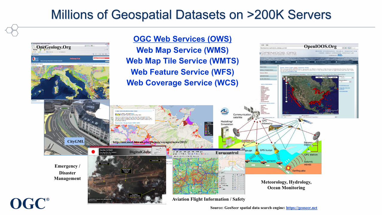
OGC Web Services (OWS)Web Map Service (WMS)
Web Map Tile Service (WMTS)Web Feature Service (WFS)
Web Coverage Service (WCS)
Emergency / Disaster
Management
Millions of Geospatial Datasets on >200K Servers
Eurocontrol
OneGeology.Org
CityGML
Aviation Flight Information / Safety
DigitalGlobe
Meteorology, Hydrology, Ocean Monitoring
http://oos.soest.hawaii.edu/pacioos/voyager/news/2013/
OpenIOOS.Org
Source: GeoSeer spatial data search engine: https://geoseer.net

OGC®
OWS and API Innovation
• OGC is advancing new standards while simultaneously maintaining the OGC Standards Baseline
• The OGC API approach is based on technologies that did not exist during development of initial OGC Web Services (OWS)
• OGC will continue to maintain the approved OWS Standards
OGC®
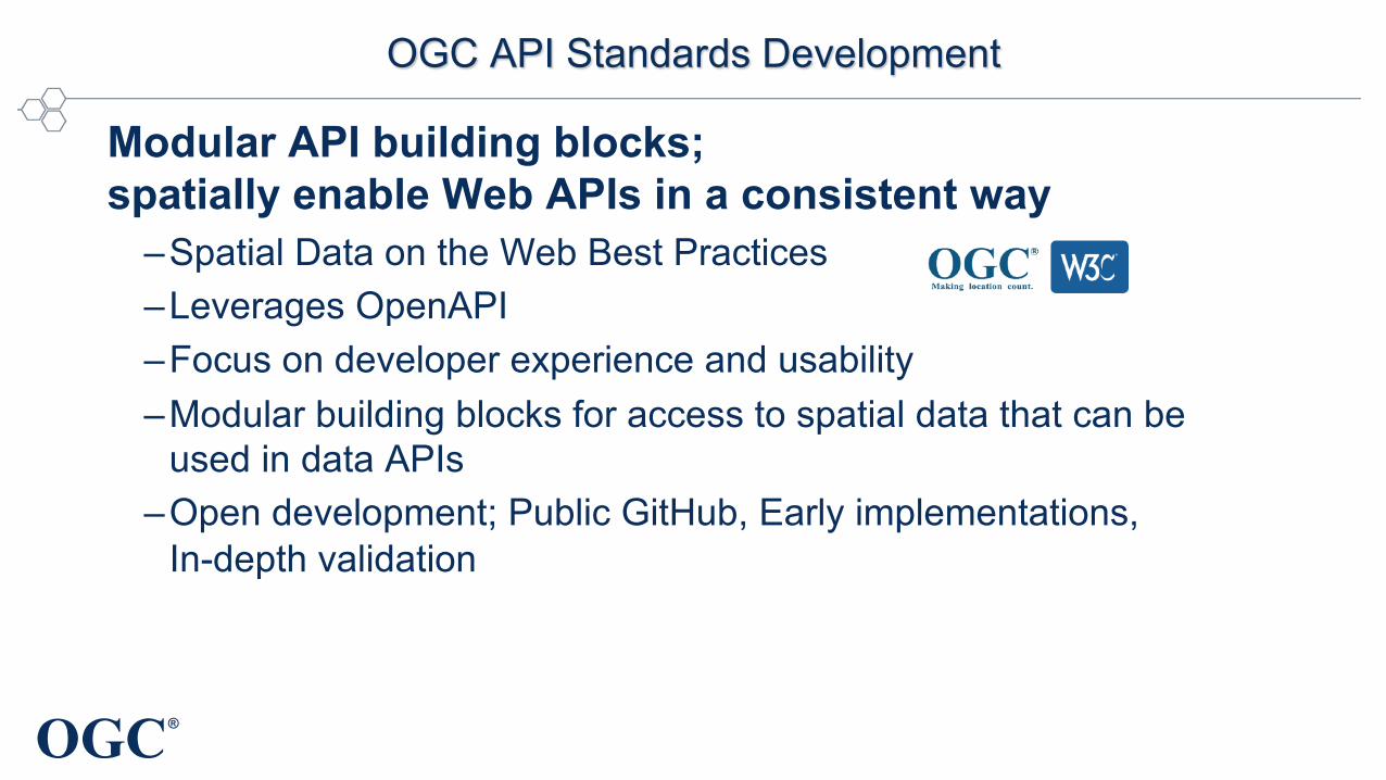
OGC API Standards Development
Modular API building blocks; spatially enable Web APIs in a consistent way
–Spatial Data on the Web Best Practices
–Leverages OpenAPI
–Focus on developer experience and usability
–Modular building blocks for access to spatial data that can be
used in data APIs
–Open development; Public GitHub, Early implementations,
In-depth validation
OGC®
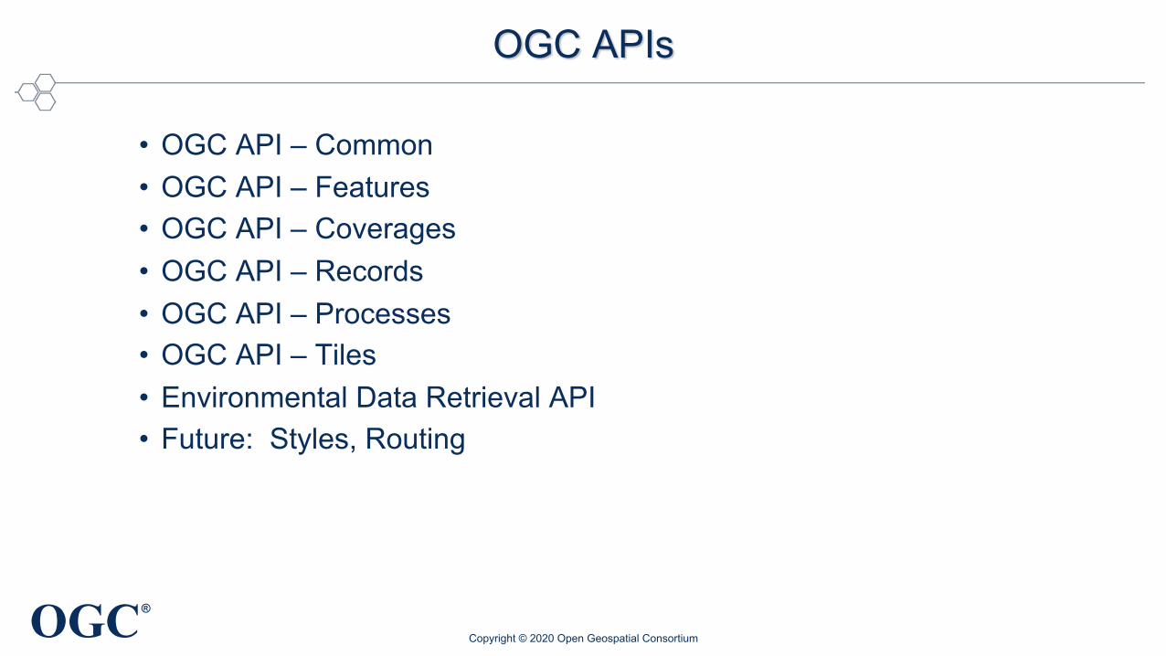
OGC APIs
• OGC API – Common• OGC API – Features• OGC API – Coverages • OGC API – Records• OGC API – Processes• OGC API – Tiles• Environmental Data Retrieval API• Future: Styles, Routing
Copyright © 2020 Open Geospatial Consortium

OGC®
All defined in OpenAPI
Copyright © 2020 Open Geospatial Consortium
OGC®
OGC®
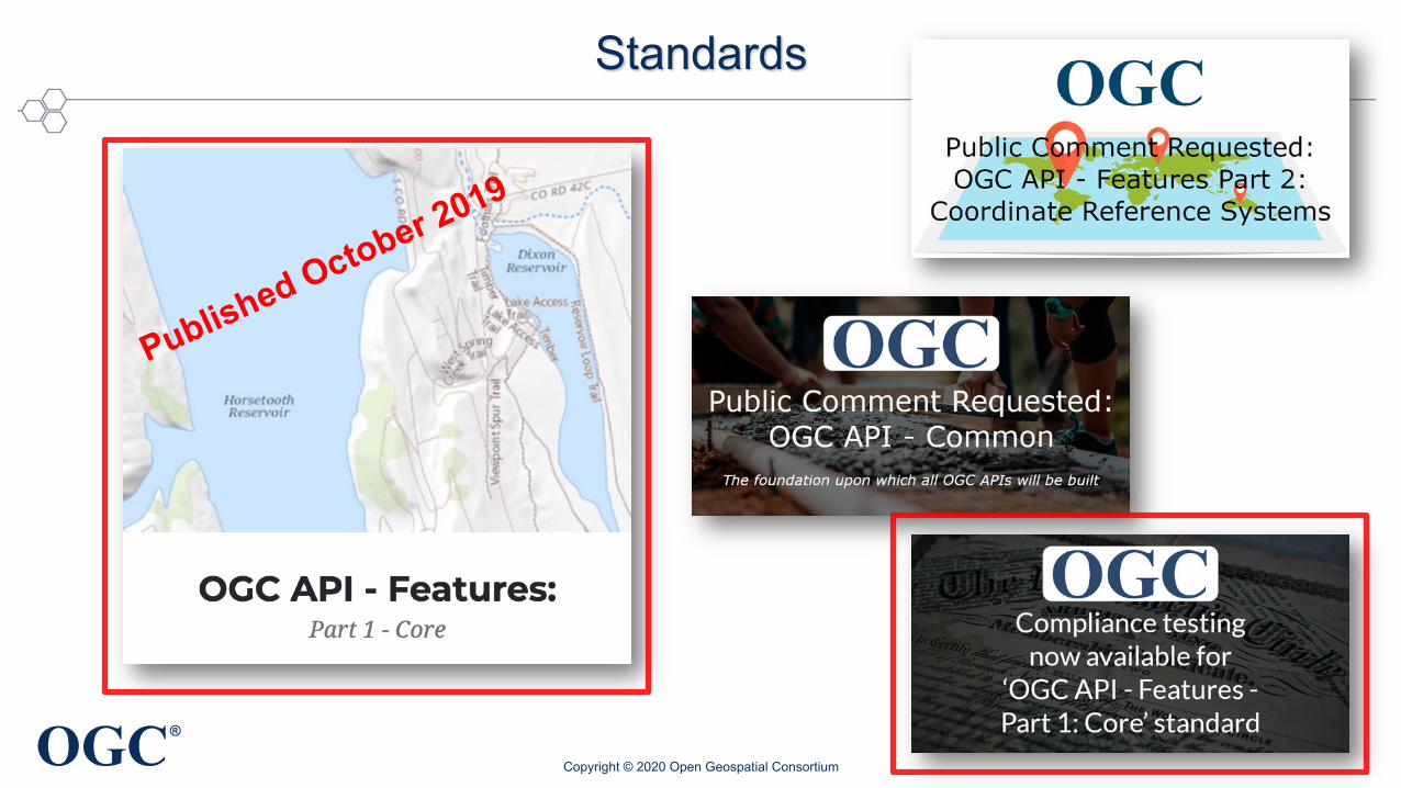
Standards
Copyright © 2020 Open Geospatial Consortium
Published October 2019
OGC®
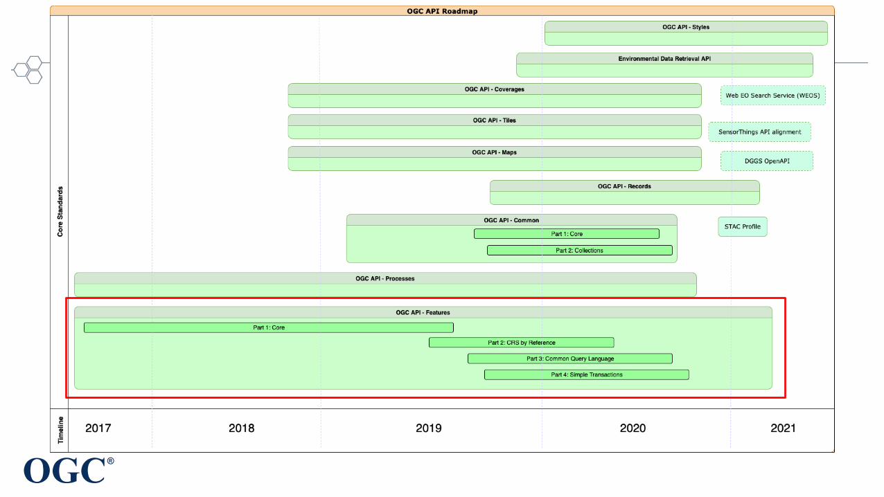
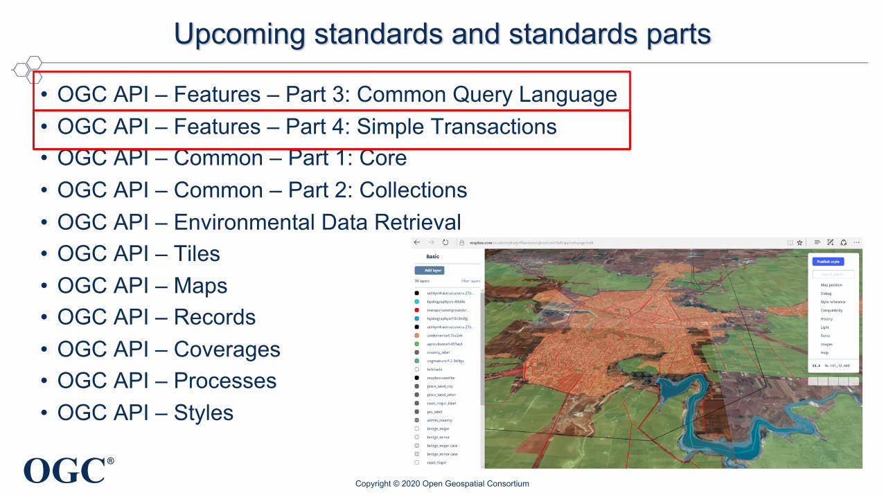
Upcoming standards and standards parts
• OGC API – Features – Part 3: Common Query Language• OGC API – Features – Part 4: Simple Transactions• OGC API – Common – Part 1: Core• OGC API – Common – Part 2: Collections• OGC API – Environmental Data Retrieval• OGC API – Tiles• OGC API – Maps• OGC API – Records• OGC API – Coverages• OGC API – Processes• OGC API – Styles
Copyright © 2020 Open Geospatial Consortium

OGC®
Sprints, Hackathons, Pilots, Testbeds and Innovation
• OGC API Hackathon: June 2019• ESIP and OGC Coverage Processing and Analysis Sprint: January 2020• Environmental Data Retrieval API Sprint: March 2020• OGC API – Tiles Sprint: April 2020• STAC and OGC API - Features and Catalogues Sprint: December 2019• Routing Pilot• Vector Tiles Pilot• Testbed 15 – APIs for Styles, Maps and Tiles• 3D Data Container and Tiles Pilot• Testbed-16 – OpenAPI eng., SWIM, DGGS• … and many more
Copyright © 2020 Open Geospatial Consortium
OGC®
Summary
• OGC API standards will be key for rapid cross-community integration of the ever-growing body of Web APIs offering geospatial information
• OWS standards, which are broadly and globally implemented, will continue to be maintained
• Organizations should start planning now for transitioning operational systems to OGC APIs
Copyright © 2020 Open Geospatial Consortium

OGC®
Get Involved
• Are you interested in getting involved in OGC API standardization and adoption?
Talk to us
https://ogcapi.ogc.org
Copyright © 2020 Open Geospatial Consortium
#OGCAPI