Ocean Drilling Program Final Technical Report
68
Gr reenl l and p Eu urope e e Afr ric a So ut t h Amer ric A A a Atlantic Ocean 657- -65 9 660-661 662-663 664- 668 79 79 688 - 688 689-690 691-693 694 695-697 732-735 897-901 907 908-909 910-912 913 91 9 4-919 920-924 925- 929 957 96 6 96 3-964 4 9 96 5-96 8 96 9- 97 1 3 972-97 3 3 991-997 9 9 1065-1070 1088 1089 1090 1091-1092 1093 1094 11 139 648-649 70 05-706 707-71 1 1 93 0- 94 94 4 4 4 4 6 6 6 6 6 947- - 94 4 9 9 950-952 953-956 6 6 980-981 982 983-984 985 986 987 1044- 1048 1054- 1062 1063-1064 1075-1 - 077 107 78-1079 1080 1081-1 - 083 1084 1085 1086 1087 1104-1106 7 7-6 6 7 8,896 6 1276-1277 418 637-641 642-644 64 6 6 5 646 647 669- 670 395 107 4 67 6 7 1- 1 1 1 67 6 6 698-700 701 702 703-704 72 0-7 73 1 2-906 6 959-962 97 9 976-979 9 88 9 988 989-99 9 0 0 10 0 02 97 1 1098-1 98 8 099 1100 10 1 1 1 1 00 0 0 0 0 01 1102-110 11 10 1 1 1 1 3 00 00 0 1 1 1 958 1257-1261 1262-1267 1268-1275 -12 40 2 Ocean Drilling Program Final Technical Report – 20 0 20 0 20 6,591 6 6 6 6,5 5 6 66 6 6 6 6 6 6 6 6 6 6 6 6 6 6 6 6 6 6 69 9 6 1,797 79 97 7 1,797 222,430 2 222,430 ho hol les drilled d dri ille ed dri ille ed drilled es s it tes s s t ited vis site te e s operations operation days d meters of core rs of core recovered recovered ears of y yea r ar ar a y rilling operations ra t t at r tio t d dri i l drilling operation p 376 6 6 3 37 76 6 376 holes ho ole s logged lo ogg
-
Upload
khangminh22 -
Category
Documents
-
view
1 -
download
0
Transcript of Ocean Drilling Program Final Technical Report
Grreenlland
pEuuropeee
Afrrica
Soutth
AmerricAA a Atlantic
Ocean
657--6599
660-661
662-663
664-668
7979 688-688
689-690
691-693
694
695-697
732-735
897-901
907
908-909
910-912
913
91999 4-919
920-924
925-929
957966 963-9644
9965-968
969-971
3972-97333991-997
99999
1065-1070
1088
1089
10901091-1092
1093
1094
11139
648-649
7005-70666
707-7111111
930-94944444444444444466666666666666
947--949449499 99
950-952953-95666
980-981
982
983-984
985
986
987
1044-1048
1054-1062
1063-1064
1075-1- 077
10778-1079
1080
1081-1- 083
10841085
10861087 1104-1106
77-6678,8966
1276-1277
418
637-641
642-644
6466 5
646
647
669- 670 3951074
676776676671-111 676 6
698-700701
702703-704
7720-7731
2-9066
959-962
97797997
976-9799
889988
989-999 0
010002
97 11098-1988 099
110010111111 000000011102-110111101111 3
0000000 111
958
1257-1261
1262-1267
1268-1275
-1240
2
OceanDrilling Program
Final Technical Report
–
20020020
6,5916666,5556
666666666666666666666666666666666666666666666666666996
1,797799771,797
222,4302222222,430
hoholles drilledddriilleeddriilleeddrilled
essittessstitedvissitetees
operationsoperationdaysd
meters of corers of corerecoveredrecovered
ears of yyearararayrilling operationsrattatrr tiotddriildrilling operationp
37666337766337337376holes hoolesloggedloogg

Ocean Drilling Program
Final Technical Report 1983 – 2007
Consortium for Ocean Leadership, Inc.
Lamont-Doherty Earth Observatoryof Columbia University
Texas A&M University
National Science Foundation Contracts ODP83-17349 and OCE93-08410
Table of Contents 6 Executive Summary
8 OceanDrillingProgramAdministration10 ScientificResults10 EngineeringandScienceOperations11 Samples,Data,andPublications13 Outreach
14 Program Administration16 AdministrativeStructure19 ScientificDirection22 ProgramManagement
30 Scientific Results
40 Engineering and Science Operations42 GeneralInformation43 Drilling,Coring,andLoggingStatistics43 OperationalandLaboratoryAdvancements49 SafetyandEnvironment50 DocumentationandTraining
52 Samples, Data, and Publications54 CoreCurationandRepositoryManagement54 ScientificDatabases56 ReportsandPublications58 BibliographicDatabases
60 Out reach62 OutreachActivities64 OutreachProducts
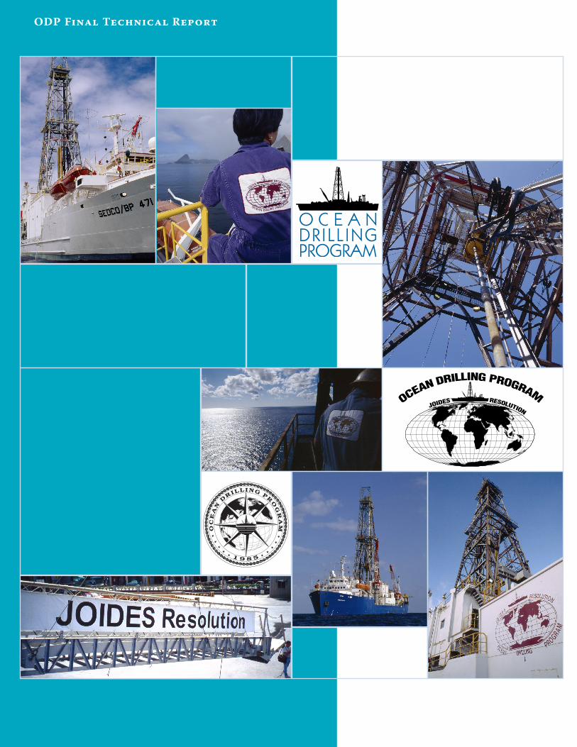
ODP Final Technical Report
1 9 8 5
★★
★★
★O
CE
AN
DRILLING
PR
OG
RA
M★
★★
★★
Executive Summary
�
ODP Final Technical Report
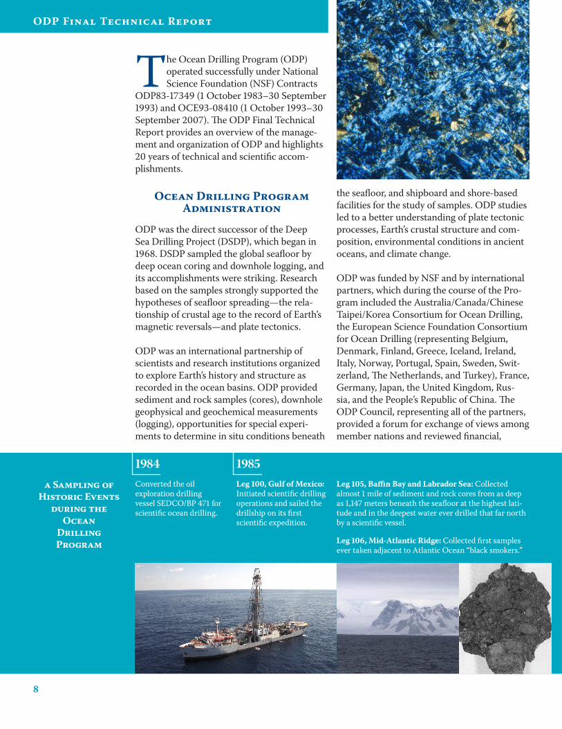
The Ocean Drilling Program (ODP) operated successfully under National Science Foundation (NSF) Contracts
ODP83-17349 (1 October 1983–30 September 1993) and OCE93-08410 (1 October 1993–30 September 2007). The ODP Final Technical Report provides an overview of the manage-ment and organization of ODP and highlights 20 years of technical and scientific accom-plishments.
Ocean Drilling Program Administration
ODP was the direct successor of the Deep Sea Drilling Project (DSDP), which began in 1968. DSDP sampled the global seafloor by deep ocean coring and downhole logging, and its accomplishments were striking. Research based on the samples strongly supported the hypotheses of seafloor spreading—the rela-tionship of crustal age to the record of Earth’s magnetic reversals—and plate tectonics.
ODP was an international partnership of scientists and research institutions organized to explore Earth’s history and structure as recorded in the ocean basins. ODP provided sediment and rock samples (cores), downhole geophysical and geochemical measurements (logging), opportunities for special experi-ments to determine in situ conditions beneath
the seafloor, and shipboard and shore-based facilities for the study of samples. ODP studies led to a better understanding of plate tectonic processes, Earth’s crustal structure and com-position, environmental conditions in ancient oceans, and climate change.
ODP was funded by NSF and by international partners, which during the course of the Pro-gram included the Australia/Canada/Chinese Taipei/Korea Consortium for Ocean Drilling, the European Science Foundation Consortium for Ocean Drilling (representing Belgium, Denmark, Finland, Greece, Iceland, Ireland, Italy, Norway, Portugal, Spain, Sweden, Swit-zerland, The Netherlands, and Turkey), France, Germany, Japan, the United Kingdom, Rus-sia, and the People’s Republic of China. The ODP Council, representing all of the partners, provided a forum for exchange of views among member nations and reviewed financial,
Leg 100, Gulf of Mexico: Initiated scientific drilling operations and sailed the drillship on its first scientific expedition.
Leg 105, Baffin Bay and Labrador Sea: Collected almost 1 mile of sediment and rock cores from as deep as 1,147 meters beneath the seafloor at the highest lati-tude and in the deepest water ever drilled that far north by a scientific vessel.
Leg 106, Mid-Atlantic Ridge: Collected first samples ever taken adjacent to Atlantic Ocean “black smokers.”
Converted the oil exploration drilling vessel SEDCO/BP 471 for scientific ocean drilling.
1984 1985a Sampling of
Historic Events during the
Ocean Drilling Program
�
Executive Summary
managerial, and other matters regarding the overall support of ODP.
Joint Oceanographic Institutions, Inc. (JOI), now known as the Consortium for Ocean Leadership, Inc., provided central manage-ment and, through subcontractors, the full array of services at sea and on land for ODP. Texas A&M University (TAMU) served as Science Operator, and the Borehole Research Group (BRG) at Lamont-Doherty Earth Observatory (LDEO) of Columbia University provided logging and other wireline services. LDEO also provided Site Survey Data Bank services. JOI’s responsibilities as Program Manager also included management or sup-port of a number of Program-related activities, including the Joint Oceanographic Institutions for Deep Earth Sampling (JOIDES) Science Advisory Structure (SAS) for ODP through the JOIDES office. Additionally, under a sepa-rate contract, JOI managed the U.S. Science Support Program (USSSP), which supported U.S. scientists’ participation in ODP and car-ried out much of the Program’s educational outreach efforts (e.g., Distinguished Lecture Series, Schlanger Fellowships, etc.).
Scientific direction for ODP was provided by JOIDES, an international organization of advisory committees and panels that pro-vided planning and program advice regarding
science goals and objectives, facilities, sci-entific personnel, and operating procedures. Long-range planning for the Program was conducted utilizing reports generated from the 1981 and 1987 Conferences on Scientific Ocean Drilling (COSOD) and 1993 U.S. Com-mittee on Post-1998 Ocean Drilling (COM-POST) meeting, 1990 and 1996 ODP Long Range Plans, 65 Predrilling Workshops held between 1985 and 2003, and recommenda-tions that were provided every 3–5 years by a panel of experts called the Performance Evalu-ation Committee (PEC).
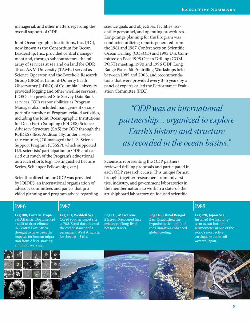
Leg 10�, Eastern Tropi-cal Atlantic: Documented a shift to drier climate in Central East Africa thought to have been the impetus for human migra-tion from Africa starting 2 million years ago.
Leg 113, Weddell Sea: Cored southernmost site at 70.8°S and documented the establishment of a permanent West Antarctic ice sheet at ~5 Ma.
Leg 115, Mascarene Plateau: Recovered first evidence of long-lived hotspot tracks.
Leg 116, Distal Bengal Fan: Established the hypothesis that uplift of the Himalayas enhanced global cooling.
Leg 12�, Japan Sea: Installed the first long-term ocean-bottom seismometer in one of the world’s most active earthquake zones, off western Japan.
19871986 1989
“ODP was an international partnership… organized to explore
Earth’s history and structure as recorded in the ocean basins.”
Scientists representing the ODP partners reviewed drilling proposals and participated in each ODP research cruise. This unique format brought together researchers from universi-ties, industry, and government laboratories in the member nations to work in a state-of-the-art shipboard laboratory on focused scientific
10
ODP Final Technical Report
goals. Students also participated in drilling cruises, working with some of the world’s lead-ing scientists and becoming part of the intel-lectual fabric essential for future advances in the earth sciences.
Scientific Results
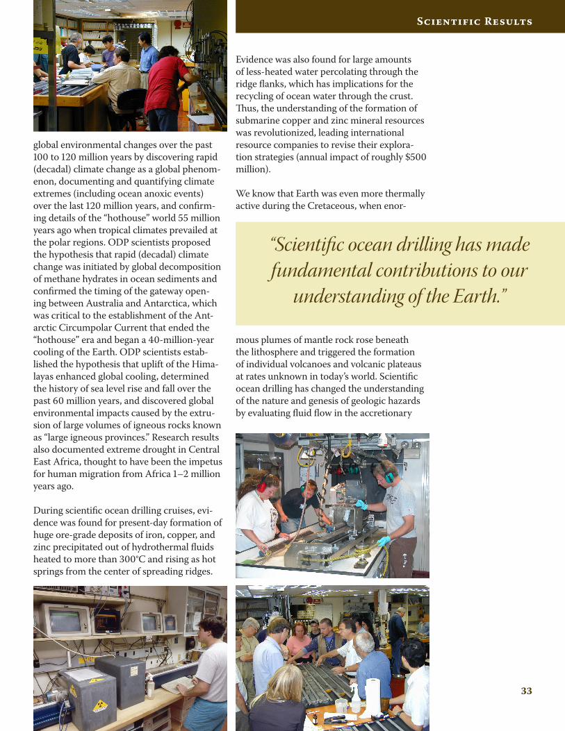
Scientific ocean drilling has made fundamen-tal contributions to our understanding of the Earth. For instance, we now know that the paradigm of plate tectonics offers tremen-dous new insights into the way Earth works, including a better understanding of natural hazards such as earthquakes and volcanoes. Studies of marine sediments have resulted in a much better understanding of natural climatic variability, and we are beginning to learn how to factor global change into planning for the future. Evidence was found during scientific ocean drilling cruises for present-day forma-
tion of huge ore-grade deposits of iron, copper, and zinc precipitated out of hydrothermal fluids heated to more than 300°C and rising as hot springs from the center of spreading ridges as well as evidence for large amounts of less-heated water percolating through the ridge flanks, which has implications for the recycling of ocean water through the crust. Earth was even more thermally active during the Creta-ceous, when enormous plumes of mantle rock rose beneath the lithosphere and triggered the formation of individual volcanoes and volcanic plateaus at rates unknown in today’s world. We have confirmed that large volumes of natu-ral gas (methane) are frozen within deep-sea marine sediments as gas hydrates, and we have produced quantitative measurements of the amount of inert gas hydrate and gas offshore South Carolina. From our results, it also appears that the oceanic crust is home to an unforeseen microbial community called the deep biosphere, whose concentration is small but, because oceanic crust is the most abun-dant rock sequence on Earth, may contain a significant fraction of Earth’s biomass.
Engineering and Science Operations
With the combination of a unique research vessel, dedicated staff at ODP-supported insti-tutions, and scientific participants worldwide,
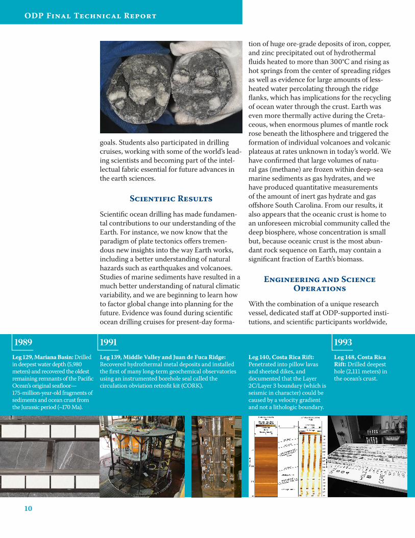
Leg 12�, Mariana Basin: Drilled in deepest water depth (5,980 meters) and recovered the oldest remaining remnants of the Pacific Ocean’s original seafloor— 175-million-year-old fragments of sediments and ocean crust from the Jurassic period (~170 Ma).
Leg 13�, Middle Valley and Juan de Fuca Ridge: Recovered hydrothermal metal deposits and installed the first of many long-term geochemical observatories using an instrumented borehole seal called the circulation obviation retrofit kit (CORK).
Leg 140, Costa Rica Rift: Penetrated into pillow lavas and sheeted dikes, and documented that the Layer 2C/Layer 3 boundary (which is seismic in character) could be caused by a velocity gradient and not a lithologic boundary.
Leg 14�, Costa Rica Rift: Drilled deepest hole (2,111 meters) in the ocean’s crust.
1991 19931989
11
Executive Summary
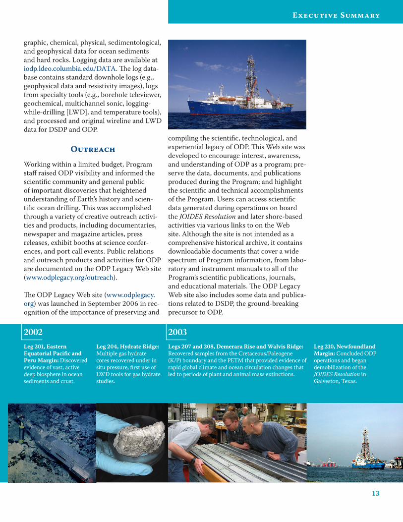
ODP conducted cutting-edge exploration from January 1985 through September 2003. Dur-ing this time, more than 2,600 international scientists sailed on more than 110 cruises on board the JOIDES Resolution, a 469-foot-long and 68.9-foot-wide research vessel named after James Cook’s flagship of two centuries ago, the HMS Resolution.
ODP often drilled into environments of enor-mous pressure, elevated temperatures, and chemical toxicity. Scientific advancements in these environments were made possible by breakthroughs in ODP technology, including the development of many drilling tools and techniques, as ODP was the first organiza-tion to drill into such deepwater and hostile environments. Additionally, developments in sediment analysis, analytical instruments, age models, seafloor observatories, and measure-ment of in situ conditions along with soft-ware development and joint ventures entered into by ODP in conjunction with industrial partners helped advance our understanding of Earth’s structure and evolution.
Samples, Data, and Publications
Each recovered core provides unique and valuable information regarding Earth’s his-tory and processes. Samples of subseafloor
sediments and rocks collected during ODP are indispensable to scientists expanding mankind’s knowledge of environmental change, earthquake genesis, volcanic pro-cesses, evolution of life, and other scientific questions.
Cores collected during the Program were stored at shore-based core repositories in the United States (Texas A&M University, Scripps Institution of Oceanography, and Lamont-Doherty Earth Observatory of Columbia University) and Germany (Univer-sity of Bremen), providing the international scientific community with access to the core collection as well as sediment and rock samples for further research. Additionally, micropaleontological reference centers estab-lished on four continents and hosted by more than a dozen major institutions around the
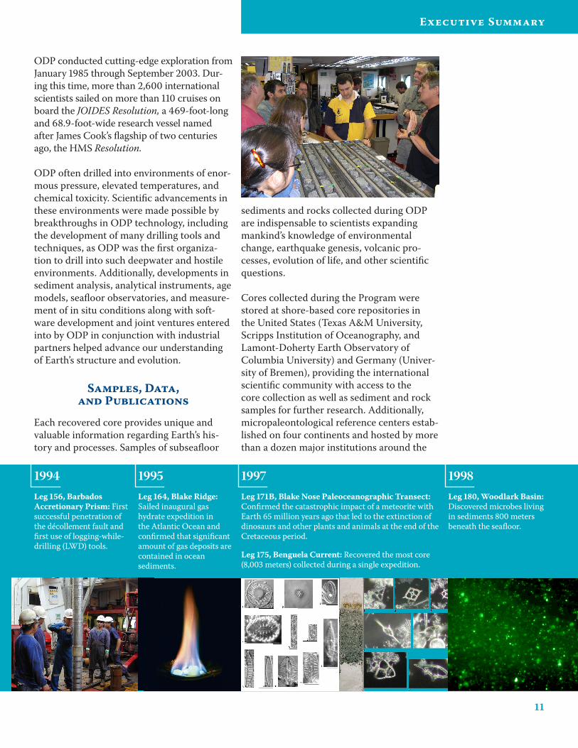
Leg 164, Blake Ridge: Sailed inaugural gas hydrate expedition in the Atlantic Ocean and confirmed that significant amount of gas deposits are contained in ocean sediments.
Leg 171B, Blake Nose Paleoceanographic Transect: Confirmed the catastrophic impact of a meteorite with Earth 65 million years ago that led to the extinction of dinosaurs and other plants and animals at the end of the Cretaceous period.
Leg 175, Benguela Current: Recovered the most core (8,003 meters) collected during a single expedition.
1995 19971994Leg 156, Barbados Accretionary Prism: First successful penetration of the décollement fault and first use of logging-while-drilling (LWD) tools.
Leg 1�0, Woodlark Basin: Discovered microbes living in sediments 800 meters beneath the seafloor.
1998
12
ODP Final Technical Report
world provided scientists the opportunity to examine, describe, and photograph microfos-sils of various geological ages and provenance (iodp.tamu.edu/curation/mrc/institutions.html).
The Initial Reports and Scientific Results vol-umes of the Proceedings of the Ocean Drilling Program were published to summarize the scientific and/or technical accomplishments of each cruise. This publication series includes predrilling geological and geophysical site sur-veys, leg objectives, planning documentation, core records, physical and geochemical mea-surements, logging data, core photographs, paleontology and petrological reports, scien-tific research results, and syntheses. Near the conclusion of the Program, all ODP printed publications were digitized and made available online (www.odplegacy.org/samples_data/ publications.html).
The results of research based on ODP data have been published openly in leading scien-tific journals as well as in the Proceedings of the Ocean Drilling Program. The Ocean Drill-ing Citation Database (iodp.tamu.edu/ publications/citations/database.html) serves as a comprehensive reference to all scien-tific drilling publications. Covering research spanning from 1969 to the present, it con-tains more than 22,500 citations related to the Ocean Drilling Program and its related programs DSDP and the Integrated Ocean Drilling Program (IODP). Two volumes of abstract collections, ODP’s Greatest Hits, published in November 1997, and ODP High-lights, published in December 2004, illustrate the rich diversity of the international scien-tific community’s accomplishments through ODP (www.odplegacy.org/science_results/ highlights.html).
ODP scientific data are housed in data-bases that are accessible online, allowing easy retrieval for users worldwide. The core data, which are housed in a relational data-base called Janus, are available at iodp.tamu.edu/database/index.html and are also archived by the National Geophysical Data Center in Boulder, Colorado. Janus contains 450 tables of ODP’s marine geoscience data that were collected on board the drillship JOIDES Reso-lution, including paleontological, lithostrati-
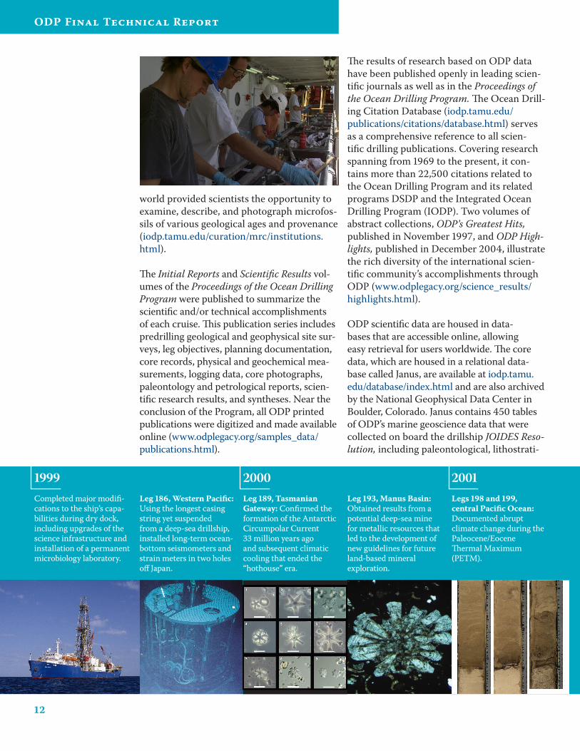
Completed major modifi-cations to the ship’s capa-bilities during dry dock, including upgrades of the science infrastructure and installation of a permanent microbiology laboratory.
Leg 1�6, Western Pacific: Using the longest casing string yet suspended from a deep-sea drillship, installed long-term ocean-bottom seismometers and strain meters in two holes off Japan.
Leg 1��, Tasmanian Gateway: Confirmed the formation of the Antarctic Circumpolar Current 33 million years ago and subsequent climatic cooling that ended the “hothouse” era.
Leg 1�3, Manus Basin: Obtained results from a potential deep-sea mine for metallic resources that led to the development of new guidelines for future land-based mineral exploration.
Legs 1�� and 1��, central Pacific Ocean: Documented abrupt climate change during the Paleocene/Eocene Thermal Maximum (PETM).
1999 2000 2001
13
Executive Summary
graphic, chemical, physical, sedimentological, and geophysical data for ocean sediments and hard rocks. Logging data are available at iodp.ldeo.columbia.edu/DATA. The log data-base contains standard downhole logs (e.g., geophysical data and resistivity images), logs from specialty tools (e.g., borehole televiewer, geochemical, multichannel sonic, logging-while-drilling [LWD], and temperature tools), and processed and original wireline and LWD data for DSDP and ODP.
Outreach
Working within a limited budget, Program staff raised ODP visibility and informed the scientific community and general public of important discoveries that heightened understanding of Earth’s history and scien-tific ocean drilling. This was accomplished through a variety of creative outreach activi-ties and products, including documentaries, newspaper and magazine articles, press releases, exhibit booths at science confer-ences, and port call events. Public relations and outreach products and activities for ODP are documented on the ODP Legacy Web site (www.odplegacy.org/outreach).
The ODP Legacy Web site (www.odplegacy.org) was launched in September 2006 in rec-ognition of the importance of preserving and
compiling the scientific, technological, and experiential legacy of ODP. This Web site was developed to encourage interest, awareness, and understanding of ODP as a program; pre-serve the data, documents, and publications produced during the Program; and highlight the scientific and technical accomplishments of the Program. Users can access scientific data generated during operations on board the JOIDES Resolution and later shore-based activities via various links to on the Web site. Although the site is not intended as a comprehensive historical archive, it contains downloadable documents that cover a wide spectrum of Program information, from labo-ratory and instrument manuals to all of the Program’s scientific publications, journals, and educational materials. The ODP Legacy Web site also includes some data and publica-tions related to DSDP, the ground-breaking precursor to ODP.
Leg 201, Eastern Equatorial Pacific and Peru Margin: Discovered evidence of vast, active deep biosphere in ocean sediments and crust.
Legs 207 and 20�, Demerara Rise and Walvis Ridge: Recovered samples from the Cretaceous/Paleogene (K/P) boundary and the PETM that provided evidence of rapid global climate and ocean circulation changes that led to periods of plant and animal mass extinctions.
Leg 210, Newfoundland Margin: Concluded ODP operations and began demobilization of the JOIDES Resolution in Galveston, Texas.
2002 2003Leg 204, Hydrate Ridge: Multiple gas hydrate cores recovered under in situ pressure, first use of LWD tools for gas hydrate studies.
ODP Final Technical Report
Program Administration
16
ODP Final Technical Report
Administrative Structure
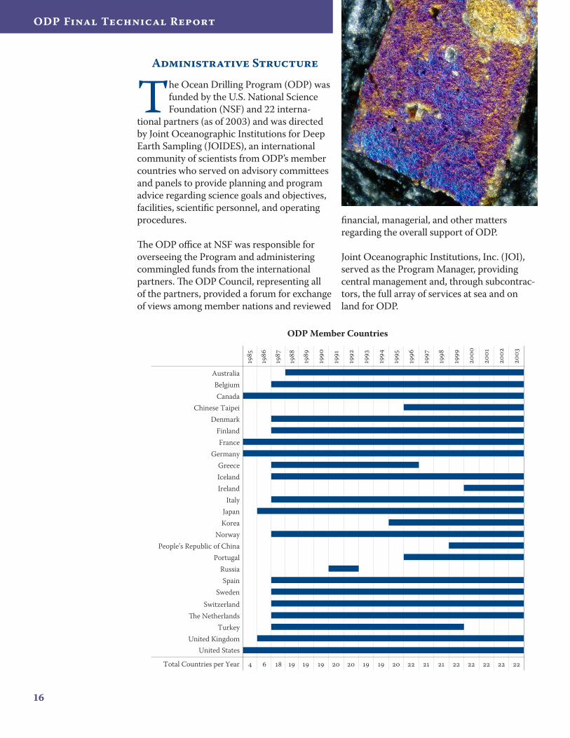
The Ocean Drilling Program (ODP) was funded by the U.S. National Science Foundation (NSF) and 22 interna-
tional partners (as of 2003) and was directed by Joint Oceanographic Institutions for Deep Earth Sampling (JOIDES), an international community of scientists from ODP’s member countries who served on advisory committees and panels to provide planning and program advice regarding science goals and objectives, facilities, scientific personnel, and operating procedures.
The ODP office at NSF was responsible for overseeing the Program and administering commingled funds from the international partners. The ODP Council, representing all of the partners, provided a forum for exchange of views among member nations and reviewed
financial, managerial, and other matters regarding the overall support of ODP.
Joint Oceanographic Institutions, Inc. (JOI), served as the Program Manager, providing central management and, through subcontrac-tors, the full array of services at sea and on land for ODP.
AustraliaBelgiumCanada
Chinese TaipeiDenmark
Germany
FinlandFrance
GreeceIcelandIreland
ItalyJapanKorea
NorwayPeople’s Republic of China
Portugal
SpainSweden
SwitzerlandThe Netherlands
TurkeyUnited Kingdom
United States
Total Countries per Year
ODP Member Countries
Russia
17
Program Administration
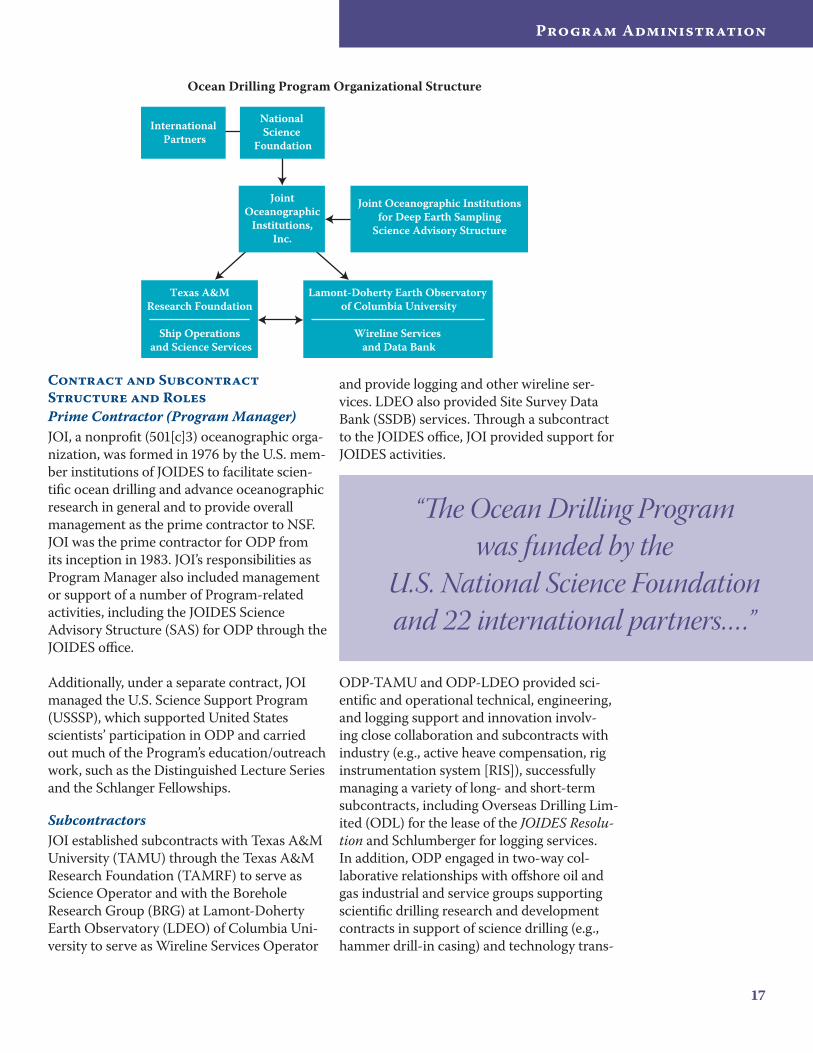
Contract and Subcontract Structure and RolesPrime Contractor (Program Manager)JOI, a nonprofit (501[c]3) oceanographic orga-nization, was formed in 1976 by the U.S. mem-ber institutions of JOIDES to facilitate scien-tific ocean drilling and advance oceanographic research in general and to provide overall management as the prime contractor to NSF. JOI was the prime contractor for ODP from its inception in 1983. JOI’s responsibilities as Program Manager also included management or support of a number of Program-related activities, including the JOIDES Science Advisory Structure (SAS) for ODP through the JOIDES office.
Additionally, under a separate contract, JOI managed the U.S. Science Support Program (USSSP), which supported United States scientists’ participation in ODP and carried out much of the Program’s education/outreach work, such as the Distinguished Lecture Series and the Schlanger Fellowships.
SubcontractorsJOI established subcontracts with Texas A&M University (TAMU) through the Texas A&M Research Foundation (TAMRF) to serve as Science Operator and with the Borehole Research Group (BRG) at Lamont-Doherty Earth Observatory (LDEO) of Columbia Uni-versity to serve as Wireline Services Operator
and provide logging and other wireline ser-vices. LDEO also provided Site Survey Data Bank (SSDB) services. Through a subcontract to the JOIDES office, JOI provided support for JOIDES activities.
ODP-TAMU and ODP-LDEO provided sci-entific and operational technical, engineering, and logging support and innovation involv-ing close collaboration and subcontracts with industry (e.g., active heave compensation, rig instrumentation system [RIS]), successfully managing a variety of long- and short-term subcontracts, including Overseas Drilling Lim-ited (ODL) for the lease of the JOIDES Resolu-tion and Schlumberger for logging services. In addition, ODP engaged in two-way col-laborative relationships with offshore oil and gas industrial and service groups supporting scientific drilling research and development contracts in support of science drilling (e.g., hammer drill-in casing) and technology trans-
International Partners
National Science
Foundation
JointOceanographic
Institutions,Inc.
Texas A&M Research Foundation
Ship Operations and Science Services
Ocean Drilling Program Organizational Structure
Lamont-Doherty Earth Observatory of Columbia University
Wireline Services and Data Bank
Joint Oceanographic Institutionsfor Deep Earth Sampling
Science Advisory Structure
“The Ocean Drilling Program was funded by the
U.S. National Science Foundation and 22 international partners… .”
1�
ODP Final Technical Report
fer from scientific drilling to the industrial sector (e.g., Fugro hydraulic piston corer).
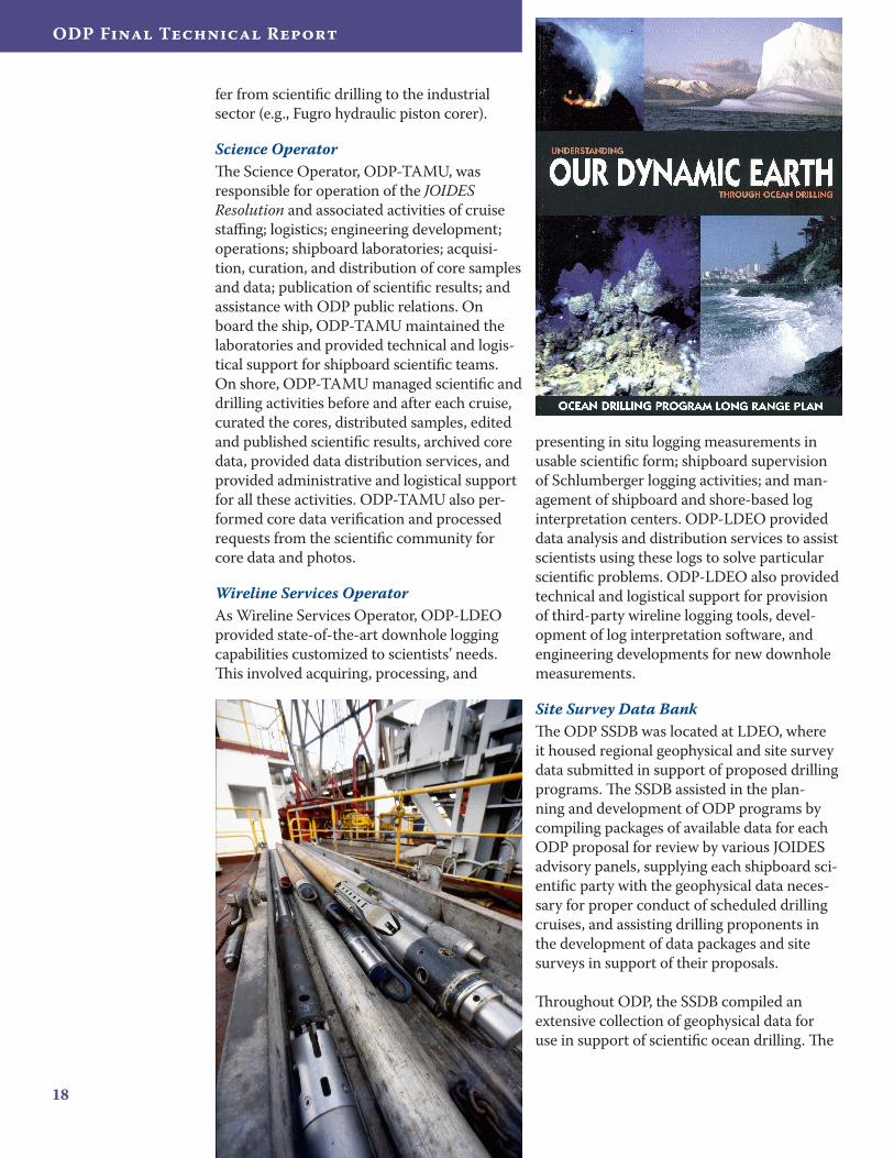
Science OperatorThe Science Operator, ODP-TAMU, was responsible for operation of the JOIDES Resolution and associated activities of cruise staffing; logistics; engineering development; operations; shipboard laboratories; acquisi-tion, curation, and distribution of core samples and data; publication of scientific results; and assistance with ODP public relations. On board the ship, ODP-TAMU maintained the laboratories and provided technical and logis-tical support for shipboard scientific teams. On shore, ODP-TAMU managed scientific and drilling activities before and after each cruise, curated the cores, distributed samples, edited and published scientific results, archived core data, provided data distribution services, and provided administrative and logistical support for all these activities. ODP-TAMU also per-formed core data verification and processed requests from the scientific community for core data and photos.
Wireline Services OperatorAs Wireline Services Operator, ODP-LDEO provided state-of-the-art downhole logging capabilities customized to scientists’ needs. This involved acquiring, processing, and
presenting in situ logging measurements in usable scientific form; shipboard supervision of Schlumberger logging activities; and man-agement of shipboard and shore-based log interpretation centers. ODP-LDEO provided data analysis and distribution services to assist scientists using these logs to solve particular scientific problems. ODP-LDEO also provided technical and logistical support for provision of third-party wireline logging tools, devel-opment of log interpretation software, and engineering developments for new downhole measurements.
Site Survey Data BankThe ODP SSDB was located at LDEO, where it housed regional geophysical and site survey data submitted in support of proposed drilling programs. The SSDB assisted in the plan-ning and development of ODP programs by compiling packages of available data for each ODP proposal for review by various JOIDES advisory panels, supplying each shipboard sci-entific party with the geophysical data neces-sary for proper conduct of scheduled drilling cruises, and assisting drilling proponents in the development of data packages and site surveys in support of their proposals.
Throughout ODP, the SSDB compiled an extensive collection of geophysical data for use in support of scientific ocean drilling. The
1�
Program Administration
SSDB also developed visualization tools to assist in management and review of data dur-ing the transition from paper submissions to electronic data submissions. The data archive and management tools were transferred to the IODP SSDB.
JOIDES OfficeThe JOIDES office, under the direction of the Chair of the JOIDES Scientific Committee (SCICOM), was responsible for coordinating all the advisory committees and panels within the JOIDES SAS. This office also integrated advice from the panel substructure in a man-ner suitable for policy decisions by the JOIDES Executive Committee (EXCOM). The JOIDES Office also produced the JOIDES Journal
(www.odplegacy.org/program_admin/joides_journal.html) to keep the scientific community informed of planning for the drilling program and to summarize Program activities.
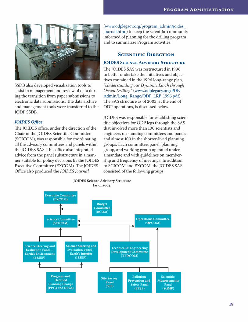
Scientific DirectionJOIDES Science Advisory StructureThe JOIDES SAS was restructured in 1996 to better undertake the initiatives and objec-tives contained in the 1996 long-range plan, “Understanding our Dynamic Earth through Ocean Drilling” (www.odplegacy.org/PDF/Admin/Long_Range/ODP_LRP_1996.pdf). The SAS structure as of 2003, at the end of ODP operations, is discussed below.
JOIDES was responsible for establishing scien-tific objectives for ODP legs through the SAS that involved more than 100 scientists and engineers on standing committees and panels and almost 100 in the shorter-lived planning groups. Each committee, panel, planning group, and working group operated under a mandate and with guidelines on member-ship and frequency of meetings. In addition to SCICOM and EXCOM, the JOIDES SAS consisted of the following groups:
Science Committee(SCICOM)
Technical & EngineeringDevelopment Committee
(TEDCOM)
Science Steering andEvaluation Panel—
Earth’s Interior(ISSEP)
BudgetCommittee
(BCOM)
Operations Committee(OPCOM)
Scientific Measurements
Panel(SciMP)
Pollution Prevention and
Safety Panel(PPSP)
Site Survey Panel(SSP)
Program and Detailed
Planning Groups(PPGs and DPGs)
Executive Committee(EXCOM)
JOIDES Science Advisory Structure(as of )
Science Steering andEvaluation Panel—
Earth’s Environment(ESSEP)
20
ODP Final Technical Report
The Budget Committee (BCOM), a subcommittee of EXCOM, which was responsible for overseeing and reviewing ODP Program Plans and budgets.
The Operations Committee (OPCOM), created as a subcommittee of SCICOM, which dealt with operational issues, such as ship scheduling, technological development, and scientific measurements.
Two Science Steering and Evaluation Panels (SSEPs)—the Dynamics of Earth’s Environment SSEP and the Dynamics of Earth’s Interior SSEP—which provided SCICOM with evaluations of high-priority drilling proposals and advice on longer-term thematic development.
The Site Survey Panel (SSP), which assessed the adequacy of survey data for proposed drilling targets and assisted in the international coordination and implementation of additional site surveys.
The Pollution Prevention and Safety Panel (PPSP), which gave independent advice to OPCOM and to ODP on potential safety and pollution hazards that might exist because of general and specific geologic circumstances of proposed drill sites and advised proponents and Co-Chief Scientists on safe site selection.
The Scientific Measurements Panel (SciMP), which contributed information and advice on handling of ODP samples and data and on methods and techniques used for all shipboard and downhole measurements and experiments.
The Technology and Engineering Development Committee (TEDCOM), which provided long-term technological advice to SCICOM and OPCOM on drilling tools and techniques required to meet the objectives of planned drill holes, provided a forum for the exchange of ideas and information between ODP and the commercial drilling industry, and also
•
•
•
•
•
•
•
identified and monitored the development of drilling tools and techniques needed to meet the objectives of the long-range plan.
Ad hoc Detailed Planning Groups (DPGs), which were short-lived groups formed by SCICOM that met only once or twice for more intensive study of certain aspects of planning.
Program Planning Groups (PPGs), which developed plans to address new ODP initiatives or to define new technological strategies and played a vital role in promoting high-priority scientific objectives in areas where proposals were lacking and in fostering communication and collaboration between ODP and other international geoscience programs.
Working Groups, which were short-lived groups formed by SCICOM with the purpose of taking ideas originating from workshops or topics discussed at SAS panel meetings and developing possible models/strategies and recommendations for the assigned topic.
Mandates for these groups and minutes for meetings of many of these groups are available on the ODP Legacy Web site (www.odplegacy.org/program_admin/sas.html).
•
•
•
Heave Compensator stopsHeave Compensator stopsDrillingDrilling
VerticalDisplacement (bottom)
Heave (surface)
VerticalDisplacement (bottom)
Heave (surface)
JOIDESJournal
Joint Oceanographic Institutions for Deep Earth SamplingJoint Oceanographic Institutions for Deep Earth Sampling
Vol. 26 No. 2-2000
Preliminary Results from
Leg 188 Drilling in Prydz
Bay Antarctica
The Opening of the Tasma-
nian Gateway: Results of
Leg 189
Deformation and Fluid
Flow Processes:
ODP Leg 190
Ship Heave Effects:
Observations from Legs
185 and 188
Core-Log Integration Plat-
form Update (SAGAN)
Excerpts from the Final
Report of JOIDES Gas
Hydrate Program
Planning Group
21
Program Administration
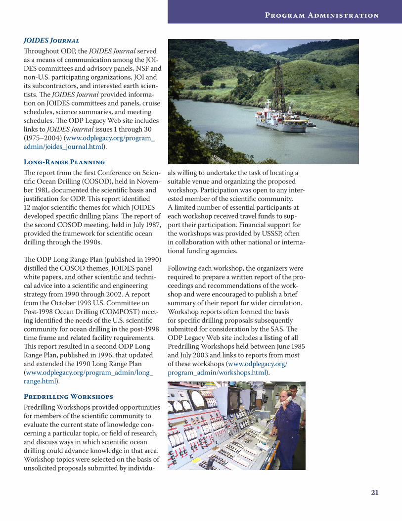
JOIDES JournalThroughout ODP, the JOIDES Journal served as a means of communication among the JOI-DES committees and advisory panels, NSF and non-U.S. participating organizations, JOI and its subcontractors, and interested earth scien-tists. The JOIDES Journal provided informa-tion on JOIDES committees and panels, cruise schedules, science summaries, and meeting schedules. The ODP Legacy Web site includes links to JOIDES Journal issues 1 through 30 (1975–2004) (www.odplegacy.org/program_admin/joides_journal.html).
Long-Range PlanningThe report from the first Conference on Scien-tific Ocean Drilling (COSOD), held in Novem-ber 1981, documented the scientific basis and justification for ODP. This report identified 12 major scientific themes for which JOIDES developed specific drilling plans. The report of the second COSOD meeting, held in July 1987, provided the framework for scientific ocean drilling through the 1990s.
The ODP Long Range Plan (published in 1990) distilled the COSOD themes, JOIDES panel white papers, and other scientific and techni-cal advice into a scientific and engineering strategy from 1990 through 2002. A report from the October 1993 U.S. Committee on Post-1998 Ocean Drilling (COMPOST) meet-ing identified the needs of the U.S. scientific community for ocean drilling in the post-1998 time frame and related facility requirements. This report resulted in a second ODP Long Range Plan, published in 1996, that updated and extended the 1990 Long Range Plan (www.odplegacy.org/program_admin/long_range.html).
Predrilling WorkshopsPredrilling Workshops provided opportunities for members of the scientific community to evaluate the current state of knowledge con-cerning a particular topic, or field of research, and discuss ways in which scientific ocean drilling could advance knowledge in that area. Workshop topics were selected on the basis of unsolicited proposals submitted by individu-
als willing to undertake the task of locating a suitable venue and organizing the proposed workshop. Participation was open to any inter-ested member of the scientific community. A limited number of essential participants at each workshop received travel funds to sup-port their participation. Financial support for the workshops was provided by USSSP, often in collaboration with other national or interna-tional funding agencies.
Following each workshop, the organizers were required to prepare a written report of the pro-ceedings and recommendations of the work-shop and were encouraged to publish a brief summary of their report for wider circulation. Workshop reports often formed the basis for specific drilling proposals subsequently submitted for consideration by the SAS. The ODP Legacy Web site includes a listing of all Predrilling Workshops held between June 1985 and July 2003 and links to reports from most of these workshops (www.odplegacy.org/ program_admin/workshops.html).
22
ODP Final Technical Report
Program EvaluationBeginning in 1985, ODP was evaluated every 3–5 years by a panel of experts, the Perfor-mance Evaluation Committee (PEC), and recommendations were disseminated in their reports (www.odplegacy.org/program_admin/evaluation.html). Committee members were appointed by JOI on the advice of JOIDES, NSF, and other experts in geology, geophysics, ocean drilling, and logging technology.
PEC evaluations provided valuable feed-back regarding the effectiveness of JOI pro-gram management and the performance of ODP-TAMU and ODP-LDEO and indicated whether the program was meeting its sci-entific goals. The evaluations also produced data or verified results that could be used for public relations and ODP promotion in the community. Recommendations and informa-tion obtained from PEC evaluations were not only used to improve ODP during the life of the Program but also served to determine what lessons were learned and what modifica-tions (e.g., legacy preservation, overarching education and outreach plans, etc.) should be addressed for IODP, the successor program to ODP.
Program ManagementODP Policy ManualODP was managed and operated under poli-cies and guidelines outlined in the ODP Policy Manual. The last revision of the manual (2003) is available on the ODP Legacy Web site (www.odplegacy.org/program_admin/policies.html).
Program PlansODP work was carried out in accordance with annual and multiyear Program Plans developed by JOI, ODP-TAMU, and ODP-LDEO in consultation with the NSF Program Officer and approved in writing by the NSF Contracting Officer. Program Plans addressed programmatic goals; scheduled activities; scheduled ship operations, staffing, and orga-nizational plans; budgets; scientific objectives defined by JOIDES; and major planning and
review activities. Preparations for each annual Program Plan started a year in advance; the program plan was submitted to NSF a few months before the start of the fiscal year.
Leg PlanningAfter the SAS accepted a scientific ocean drilling proposal for incorporation into the drilling schedule, substantial preparations were required to ensure successful execution of the proposed program (www.odplegacy.org/program_admin/leg_planning.html). Some programs required multiple cruises for completion of the scientific objectives. Each individual cruise was referred to as a “leg” and had its own technical crew and shipboard sci-entific party. Leg planning was a collaborative effort involving the Science Operator, Wire-line Services Operator, Co-Chief Scientists, and Drilling Contractor. The major tasks that had to be accomplished before the JOIDES Resolution sailed and the time frame during which these tasks had to be accomplished are described below. The detail, complexity, and level of effort required to plan a leg varied significantly depending on the location and the scientific and operational complexity of the proposed program.
12–18 Months PrecruiseWith input from the Science and Wireline Ser-vices Operators, OPCOM developed the ship schedule at least a year in advance. The sched-ule was constructed from the list of proposals approved for future ocean drilling, taking into account any priorities established by JOIDES. The Science Operator provided OPCOM with estimates of the ship time required for each proposal and identified operational issues
23
Program Administration
(both engineering and weather) and pos-sible port calls. The ship schedule was then constructed to maximize on-site time and minimize travel time between sites or to and from port. Proposals that did not require a full 2-month ODP leg were combined to maxi-mize efficient use of ship time and to allow the Drilling Contractor to maintain a regular crew rotation.
9–12 Months PrecruiseSpecial engineering/equipment needs and clearance requirements for operations in national waters of non-U.S. coastal states were identified. A detailed operations schedule was prepared, refining the preliminary time and material estimates in accordance with more specific plans for the leg.
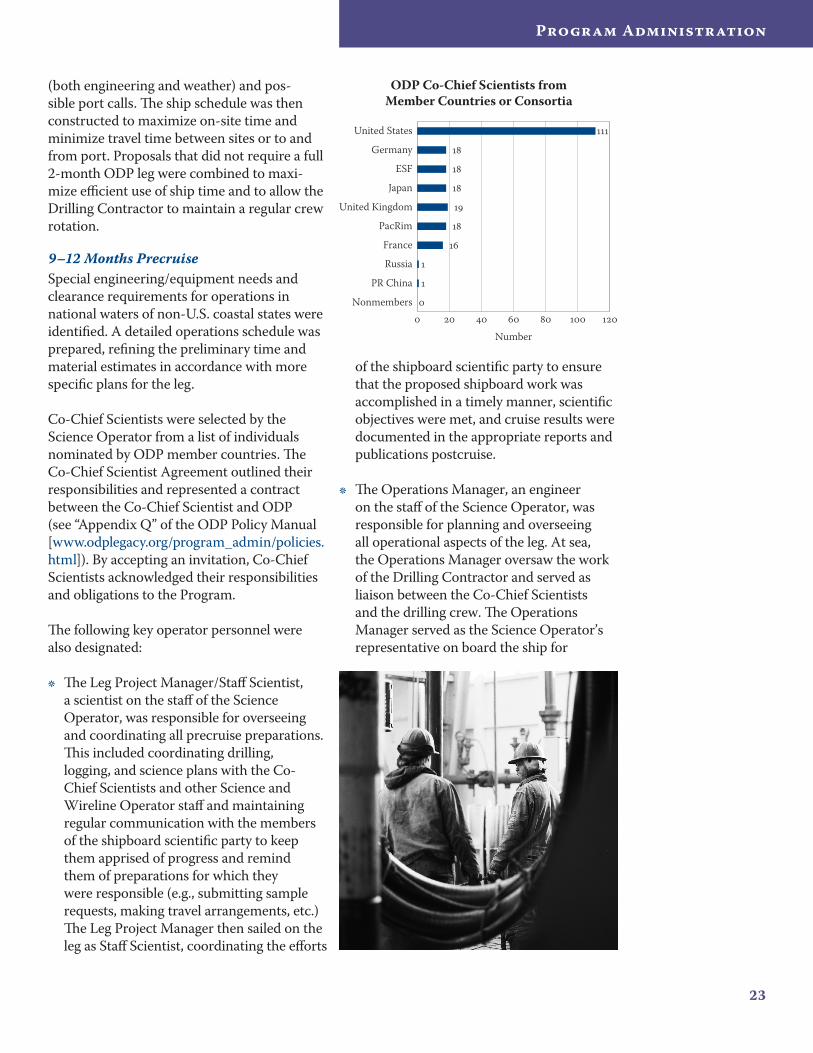
Co-Chief Scientists were selected by the Science Operator from a list of individuals nominated by ODP member countries. The Co-Chief Scientist Agreement outlined their responsibilities and represented a contract between the Co-Chief Scientist and ODP (see “Appendix Q” of the ODP Policy Manual [www.odplegacy.org/program_admin/policies.html]). By accepting an invitation, Co-Chief Scientists acknowledged their responsibilities and obligations to the Program.
The following key operator personnel were also designated:
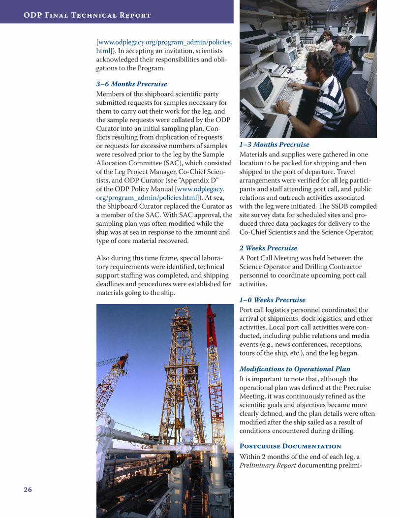
The Leg Project Manager/Staff Scientist, a scientist on the staff of the Science Operator, was responsible for overseeing and coordinating all precruise preparations. This included coordinating drilling, logging, and science plans with the Co-Chief Scientists and other Science and Wireline Operator staff and maintaining regular communication with the members of the shipboard scientific party to keep them apprised of progress and remind them of preparations for which they were responsible (e.g., submitting sample requests, making travel arrangements, etc.) The Leg Project Manager then sailed on the leg as Staff Scientist, coordinating the efforts
•
of the shipboard scientific party to ensure that the proposed shipboard work was accomplished in a timely manner, scientific objectives were met, and cruise results were documented in the appropriate reports and publications postcruise.
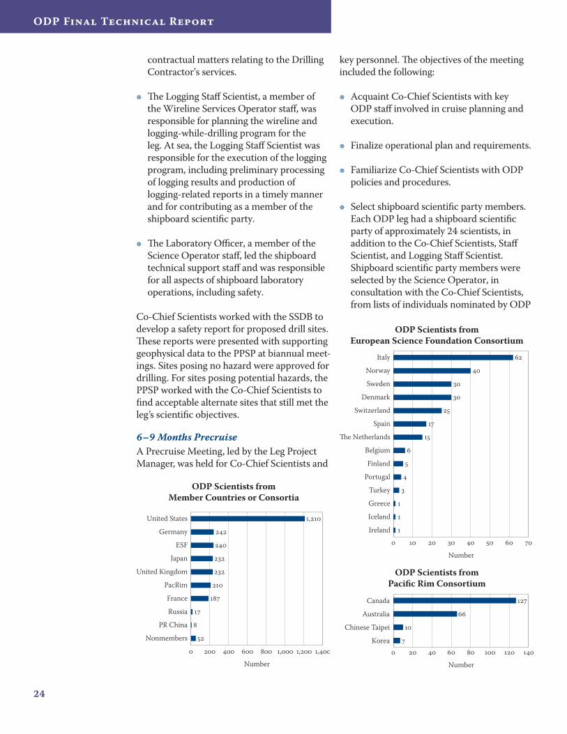
The Operations Manager, an engineer on the staff of the Science Operator, was responsible for planning and overseeing all operational aspects of the leg. At sea, the Operations Manager oversaw the work of the Drilling Contractor and served as liaison between the Co-Chief Scientists and the drilling crew. The Operations Manager served as the Science Operator’s representative on board the ship for
•
ODP Co-Chief Scientists from Member Countries or Consortia
Nonmembers
PR China
Russia
France
PacRim
United Kingdom
Japan
ESF
Germany
United States
Number
24
ODP Final Technical Report
contractual matters relating to the Drilling Contractor’s services.
The Logging Staff Scientist, a member of the Wireline Services Operator staff, was responsible for planning the wireline and logging-while-drilling program for the leg. At sea, the Logging Staff Scientist was responsible for the execution of the logging program, including preliminary processing of logging results and production of logging-related reports in a timely manner and for contributing as a member of the shipboard scientific party.
The Laboratory Officer, a member of the Science Operator staff, led the shipboard technical support staff and was responsible for all aspects of shipboard laboratory operations, including safety.
Co-Chief Scientists worked with the SSDB to develop a safety report for proposed drill sites. These reports were presented with supporting geophysical data to the PPSP at biannual meet-ings. Sites posing no hazard were approved for drilling. For sites posing potential hazards, the PPSP worked with the Co-Chief Scientists to find acceptable alternate sites that still met the leg’s scientific objectives.
6–9 Months PrecruiseA Precruise Meeting, led by the Leg Project Manager, was held for Co-Chief Scientists and
•
•
key personnel. The objectives of the meeting included the following:
Acquaint Co-Chief Scientists with key ODP staff involved in cruise planning and execution.
Finalize operational plan and requirements.
Familiarize Co-Chief Scientists with ODP policies and procedures.
Select shipboard scientific party members. Each ODP leg had a shipboard scientific party of approximately 24 scientists, in addition to the Co-Chief Scientists, Staff Scientist, and Logging Staff Scientist. Shipboard scientific party members were selected by the Science Operator, in consultation with the Co-Chief Scientists, from lists of individuals nominated by ODP
•
•
•
•
ODP Scientists from European Science Foundation Consortium
Ireland
Iceland
Greece
Turkey
Portugal
Finland
Belgium
The Netherlands
Spain
Switzerland
Denmark
Sweden
Norway
Italy
Number
ODP Scientists from Pacific Rim Consortium
Korea
Chinese Taipei
Australia
Canada
Number
ODP Scientists from Member Countries or Consortia
Nonmembers
PR China
Russia
France
PacRim
United Kingdom
Japan
ESF
Germany
United States
, , ,
,
Number
25
Program Administration
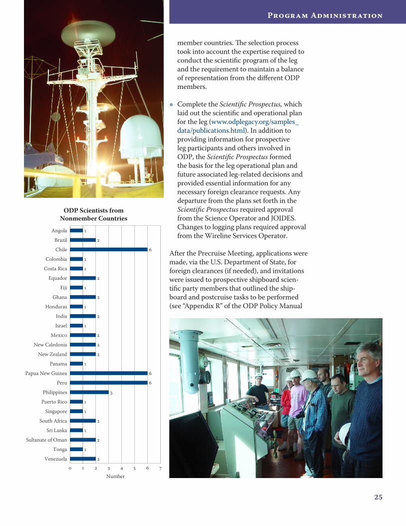
member countries. The selection process took into account the expertise required to conduct the scientific program of the leg and the requirement to maintain a balance of representation from the different ODP members.
Complete the Scientific Prospectus, which laid out the scientific and operational plan for the leg (www.odplegacy.org/samples_data/publications.html). In addition to providing information for prospective leg participants and others involved in ODP, the Scientific Prospectus formed the basis for the leg operational plan and future associated leg-related decisions and provided essential information for any necessary foreign clearance requests. Any departure from the plans set forth in the Scientific Prospectus required approval from the Science Operator and JOIDES. Changes to logging plans required approval from the Wireline Services Operator.
After the Precruise Meeting, applications were made, via the U.S. Department of State, for foreign clearances (if needed), and invitations were issued to prospective shipboard scien-tific party members that outlined the ship-board and postcruise tasks to be performed (see “Appendix R” of the ODP Policy Manual
•
ODP Scientists from Nonmember Countries
Venezuela
Tonga
Sultanate of Oman
Sri Lanka
South Africa
Singapore
Puerto Rico
Philippines
Peru
Papua New Guinea
Panama
New Zealand
New Caledonia
Mexico
Israel
India
Honduras
Ghana
Fiji
Equador
Costa Rica
Colombia
Chile
Brazil
Angola
Number
26
ODP Final Technical Report
[www.odplegacy.org/program_admin/policies.html]). In accepting an invitation, scientists acknowledged their responsibilities and obli-gations to the Program.
3–6 Months PrecruiseMembers of the shipboard scientific party submitted requests for samples necessary for them to carry out their work for the leg, and the sample requests were collated by the ODP Curator into an initial sampling plan. Con-flicts resulting from duplication of requests or requests for excessive numbers of samples were resolved prior to the leg by the Sample Allocation Committee (SAC), which consisted of the Leg Project Manager, Co-Chief Scien-tists, and ODP Curator (see “Appendix D” of the ODP Policy Manual [www.odplegacy.org/program_admin/policies.html]). At sea, the Shipboard Curator replaced the Curator as a member of the SAC. With SAC approval, the sampling plan was often modified while the ship was at sea in response to the amount and type of core material recovered.
Also during this time frame, special labora-tory requirements were identified, technical support staffing was completed, and shipping deadlines and procedures were established for materials going to the ship.
1–3 Months PrecruiseMaterials and supplies were gathered in one location to be packed for shipping and then shipped to the port of departure. Travel arrangements were verified for all leg partici-pants and staff attending port call, and public relations and outreach activities associated with the leg were initiated. The SSDB compiled site survey data for scheduled sites and pro-duced three data packages for delivery to the Co-Chief Scientists and the Science Operator.
2 Weeks PrecruiseA Port Call Meeting was held between the Science Operator and Drilling Contractor personnel to coordinate upcoming port call activities.
1–0 Weeks PrecruisePort call logistics personnel coordinated the arrival of shipments, dock logistics, and other activities. Local port call activities were con-ducted, including public relations and media events (e.g., news conferences, receptions, tours of the ship, etc.), and the leg began.
Modifications to Operational PlanIt is important to note that, although the operational plan was defined at the Precruise Meeting, it was continuously refined as the scientific goals and objectives became more clearly defined, and the plan details were often modified after the ship sailed as a result of conditions encountered during drilling.
Postcruise DocumentationWithin 2 months of the end of each leg, a Preliminary Report documenting prelimi-
27
Program Administration
nary scientific and operational results from the leg was published (www.odplegacy.org/samples_data/publications.html). In addition, the shipboard scientific party received a paper copy of the initial draft of the Proceedings of the Ocean Drilling Program, Initial Reports volume that contained scientific and engineer-ing results from the ODP leg. This content was then edited and formatted by the ODP Publication Services staff in preparation for a meeting that was held 3–5 months postcruise at ODP-TAMU. During this weeklong meet-ing, the Co-Chief Scientists, Staff Scientists, and members of the shipboard scientific party finalized the content of the Initial Reports volume. The volume was published 1 year postcruise (www.odplegacy.org/samples_data/publications.html).
Scientists were required to conduct personal postcruise research after the end of each leg. A second Postcruise Meeting was held 12–24 months after the leg to provide an opportu-nity for the entire shipboard scientific party to share the results of their work. Also during the meeting, a list of all leg-related publica-tions was generated. The Co-Chief Scientists and Staff Scientist were responsible for staying
abreast of the work carried out postcruise and for carrying out Editorial Review Board duties. This included working with ODP Publica-tion Services staff members who coordinated peer review of contributions to the Scientific Results volume and monitored manuscript submissions to other journals. The Scientific Results volume was initially published 3 years postcruise (Legs 101–163) and subsequently published 4 years postcruise (www.odplegacy.org/samples_data/publications.html).
In addition to the Proceedings series, post-cruise documentation included detailed labo-ratory and tool manuals, technical reports, and other legacy documents that were produced during the life span of the Program.
Contractual and Financial AccountabilityJOI consistently received top marks from NSF in annual performance evaluations for delivery
“…ODP managed to continuously and consistently serve the needs of individual
scientists and the scientific objectives of ODP cruises… .”
2�
ODP Final Technical Report
of the full range of ODP services. Annual and triannual audits of JOI’s financial records for compliance with U.S. Office of Management and Budget (OMB) Circular 133 identified only 0.0003% in disallowed costs over the past 5 years. Audits of ODP-LDEO identified no disallowed costs since 1989, and audits of ODP-TAMU disallowed only 0.0008% of expenditures to date.
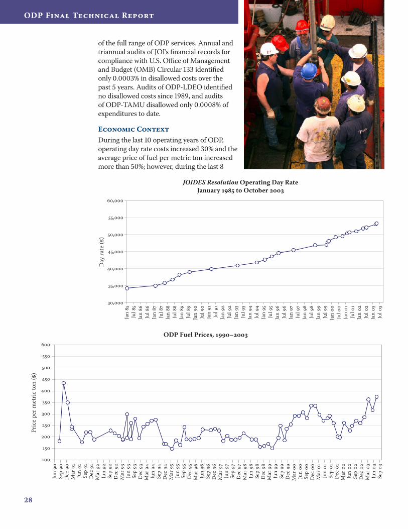
Economic ContextDuring the last 10 operating years of ODP, operating day rate costs increased 30% and the average price of fuel per metric ton increased more than 50%; however, during the last 8
ODP Fuel Prices, –
Jun
Se
p
Dec
Mar
Jun
Se
p
Dec
Mar
Jun
Se
p
Dec
Mar
Jun
Se
p
Dec
Mar
Jun
Se
p
Dec
Mar
Jun
Se
p
Dec
Mar
Jun
Se
p
Dec
Mar
Jun
Se
p
Dec
Mar
Jun
Se
p
Dec
Mar
Jun
Se
p
Dec
Mar
Jun
Se
p
Dec
Mar
Jun
Se
p
Dec
Mar
Jun
Se
p
Dec
Mar
Jun
Se
p
Pric
e pe
r met
ric to
n (
)
JOIDES Resolution Operating Day RateJanuary to October
,
,
,
,
,
,
,
Jan
Ju
l
Jan
Ju
l
Jan
Ju
l
Jan
Ju
l
Jan
Ju
l
Jan
Ju
l
Jan
Ju
l
Jan
Ju
l
Jan
Ju
l
Jan
Ju
l
Jan
Ju
l
Jan
Ju
l
Jan
Ju
l
Jan
Ju
l
Jan
Ju
l
Jan
Ju
l
Jan
Ju
l
Jan
Ju
l
Jan
Ju
l
Day
rate
()
2�
Program Administration
Cruise Evaluation Quotes
“It is an amazing experience to be able to walk on to a ship and carry out a scientific program that
is technically very complex… . The overall reliability of the operation (on the rig floor and in the labs)
is something that ODP can be proud of.”
•
“I am very impressed with the management of technology on board
from the active heave compensator (extraordinary piece of technology) to the laboratories.”
•
“I am impressed with the improvements to the ship and her capabilities since the last time I sailed. When last
I sailed, the idea of a Janus database was just a gleam in the eye! After my 5th leg, I am still in awe of the sheer professionalism of the whole undertaking. Given the technical challenges that were met on this leg, I have
to say that the ship and crew did an excellent job making sure that we achieved as much as possible.”
•
“Shore-based friendships and collaborations have definitely stemmed from this cruise and will certainly last a lifetime. A week’s worth of work is accomplished
in one 24-hour period, so it is absolutely necessary to be out here with as many resources as possible.
I think ODP has accomplished that… .”
•
“I found the general organization on board particularly impressive—it is practically perfect.”
•
“The techs are a really knowledgeable group of people without whom the quality of science on this ship
would certainly deteriorate.”
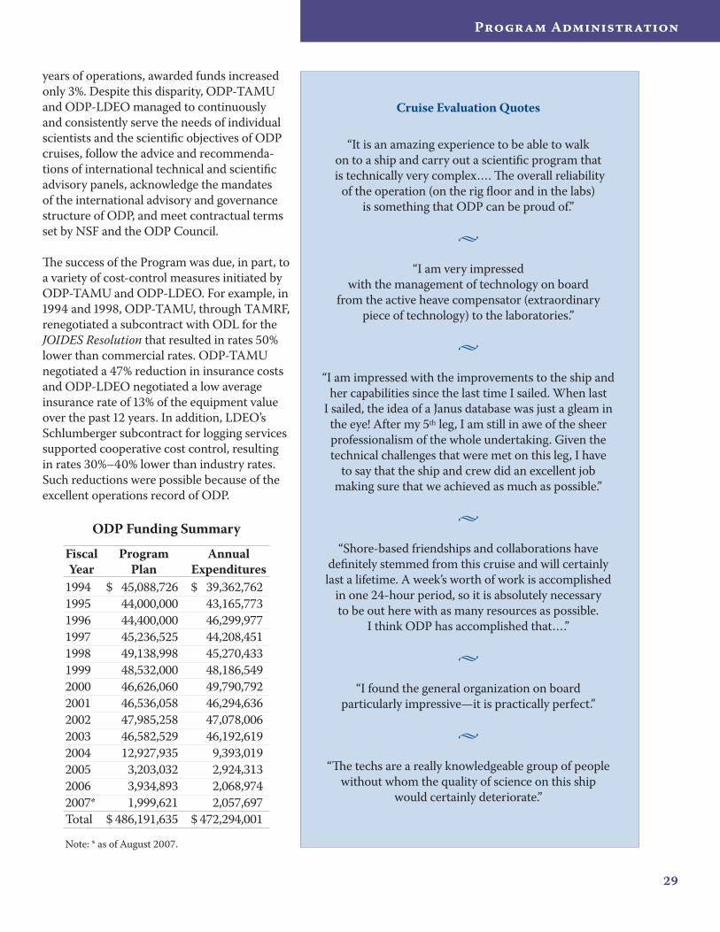
ODP Funding Summary
Fiscal Year
Program Plan
Annual Expenditures
1994 $ 45,088,726 $ 39,362,7621995 44,000,000 43,165,7731996 44,400,000 46,299,9771997 45,236,525 44,208,4511998 49,138,998 45,270,4331999 48,532,000 48,186,5492000 46,626,060 49,790,7922001 46,536,058 46,294,6362002 47,985,258 47,078,0062003 46,582,529 46,192,6192004 12,927,935 9,393,0192005 3,203,032 2,924,3132006 3,934,893 2,068,9742007* 1,999,621 2,057,697Total $ 486,191,635 $ 472,294,001
Note: * as of August 2007.
years of operations, awarded funds increased only 3%. Despite this disparity, ODP-TAMU and ODP-LDEO managed to continuously and consistently serve the needs of individual scientists and the scientific objectives of ODP cruises, follow the advice and recommenda-tions of international technical and scientific advisory panels, acknowledge the mandates of the international advisory and governance structure of ODP, and meet contractual terms set by NSF and the ODP Council.
The success of the Program was due, in part, to a variety of cost-control measures initiated by ODP-TAMU and ODP-LDEO. For example, in 1994 and 1998, ODP-TAMU, through TAMRF, renegotiated a subcontract with ODL for the JOIDES Resolution that resulted in rates 50% lower than commercial rates. ODP-TAMU negotiated a 47% reduction in insurance costs and ODP-LDEO negotiated a low average insurance rate of 13% of the equipment value over the past 12 years. In addition, LDEO’s Schlumberger subcontract for logging services supported cooperative cost control, resulting in rates 30%–40% lower than industry rates. Such reductions were possible because of the excellent operations record of ODP.
ODP Final Technical Report
Scientific Results
32
ODP Final Technical Report
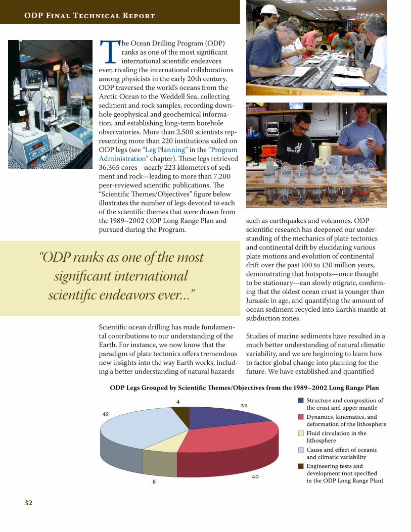
The Ocean Drilling Program (ODP) ranks as one of the most significant international scientific endeavors
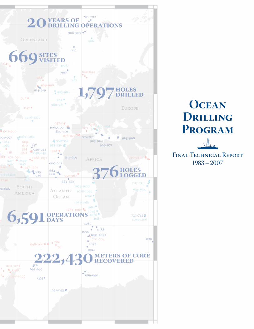
ever, rivaling the international collaborations among physicists in the early 20th century. ODP traversed the world’s oceans from the Arctic Ocean to the Weddell Sea, collecting sediment and rock samples, recording down-hole geophysical and geochemical informa-tion, and establishing long-term borehole observatories. More than 2,500 scientists rep-resenting more than 220 institutions sailed on ODP legs (see “Leg Planning” in the “Program Administration” chapter). These legs retrieved 36,365 cores—nearly 223 kilometers of sedi-ment and rock—leading to more than 7,200 peer-reviewed scientific publications. The “Scientific Themes/Objectives” figure below illustrates the number of legs devoted to each of the scientific themes that were drawn from the 1989–2002 ODP Long Range Plan and pursued during the Program.
Scientific ocean drilling has made fundamen-tal contributions to our understanding of the Earth. For instance, we now know that the paradigm of plate tectonics offers tremendous new insights into the way Earth works, includ-ing a better understanding of natural hazards
such as earthquakes and volcanoes. ODP scientific research has deepened our under-standing of the mechanics of plate tectonics and continental drift by elucidating various plate motions and evolution of continental drift over the past 100 to 120 million years, demonstrating that hotspots—once thought to be stationary—can slowly migrate, confirm-ing that the oldest ocean crust is younger than Jurassic in age, and quantifying the amount of ocean sediment recycled into Earth’s mantle at subduction zones.
Studies of marine sediments have resulted in a much better understanding of natural climatic variability, and we are beginning to learn how to factor global change into planning for the future. We have established and quantified
ODP Legs Grouped by Scientific Themes/Objectives from the 1989–2002 Long Range Plan
Structure and composition ofthe crust and upper mantleDynamics, kinematics, and deformation of the lithosphereFluid circulation in thelithosphereCause and effect of oceanicand climatic variabilityEngineering tests and development (not specified in the ODP Long Range Plan)
“ODP ranks as one of the most significant international
scientific endeavors ever…”
33
Scientific Results
global environmental changes over the past 100 to 120 million years by discovering rapid (decadal) climate change as a global phenom-enon, documenting and quantifying climate extremes (including ocean anoxic events) over the last 120 million years, and confirm-ing details of the “hothouse” world 55 million years ago when tropical climates prevailed at the polar regions. ODP scientists proposed the hypothesis that rapid (decadal) climate change was initiated by global decomposition of methane hydrates in ocean sediments and confirmed the timing of the gateway open-ing between Australia and Antarctica, which was critical to the establishment of the Ant-arctic Circumpolar Current that ended the “hothouse” era and began a 40-million-year cooling of the Earth. ODP scientists estab-lished the hypothesis that uplift of the Hima-layas enhanced global cooling, determined the history of sea level rise and fall over the past 60 million years, and discovered global environmental impacts caused by the extru-sion of large volumes of igneous rocks known as “large igneous provinces.” Research results also documented extreme drought in Central East Africa, thought to have been the impetus for human migration from Africa 1–2 million years ago.
During scientific ocean drilling cruises, evi-dence was found for present-day formation of huge ore-grade deposits of iron, copper, and zinc precipitated out of hydrothermal fluids heated to more than 300°C and rising as hot springs from the center of spreading ridges.
Evidence was also found for large amounts of less-heated water percolating through the ridge flanks, which has implications for the recycling of ocean water through the crust. Thus, the understanding of the formation of submarine copper and zinc mineral resources was revolutionized, leading international resource companies to revise their explora-tion strategies (annual impact of roughly $500 million).
We know that Earth was even more thermally active during the Cretaceous, when enor-
“Scientific ocean drilling has made fundamental contributions to our
understanding of the Earth.”
mous plumes of mantle rock rose beneath the lithosphere and triggered the formation of individual volcanoes and volcanic plateaus at rates unknown in today’s world. Scientific ocean drilling has changed the understanding of the nature and genesis of geologic hazards by evaluating fluid flow in the accretionary
34
ODP Final Technical Report
sediments in subduction zones and elucidating the role of water in subduction zone earth-quakes, determining the significance of mud volcanoes in subduction zone dehydration and the connection of dehydration to earthquakes and explosive volcanoes, and discovering the existence and cause of major undersea landslides of sufficient size to generate large tsunamis. With an eye toward the future, ODP established seafloor observatories to monitor earthquakes, tsunamis, and fluid flow in ocean sediments and crust.
Results from scientific ocean drilling research have confirmed that large volumes of natu-ral gas (methane) are frozen within deep-sea marine sediments as gas hydrates and have produced quantitative measurements of the amount of inert gas hydrate and gas off-shore South Carolina. ODP has determined the nature of chemosynthetic communities associated with methane hydrates in ocean sediments, documented the vertical and horizontal distribution of methane hydrates in ocean sediments, and acquired the necessary core and downhole data at key sites to quantify
the volume of gas (and carbon) and infer the size of the global methane hydrate reservoir in ocean sediments.
Scientific ocean drilling research confirmed the catastrophic impact of a meteorite with Earth 65 million years ago that led to the extinction of dinosaurs and other plants and animals at the end of the Cretaceous Period. Drilling research also determined that the oce-anic crust is home to an unforeseen microbial community called the deep biosphere, whose
35
Scientific Results
concentration is small but, because oceanic crust is the most abundant rock sequence on Earth, may contain a significant fraction of Earth’s biomass.
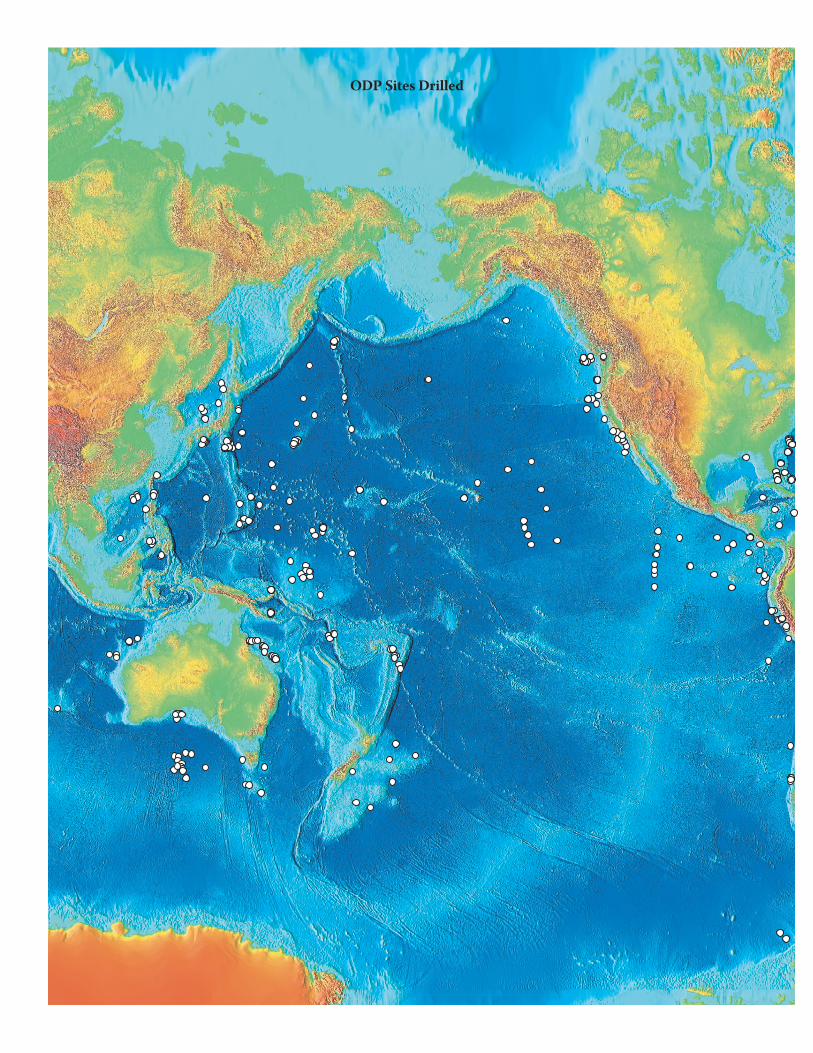
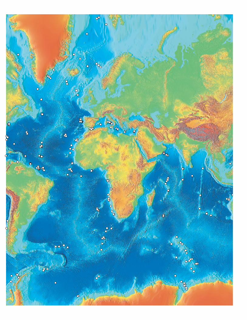
These fundamental contributions to our understanding of the Earth have simultane-ously shown how little we know of the sedi-ment and rock under the oceans. The follow-ing map of ODP drilled sites reveals how much of the ocean floor remains to be explored—how much more there is to discover. For the past 30 years, scientific ocean drilling has been the inward-looking “telescope” for the inte-grated study of how Earth works as a dynamic planet. ODP experience has shown that future studies will bring more startling and unex-pected discoveries than we could ever have expected.
“ODP experience has shown that future studies will bring more
startling and unexpected discoveries than we could ever have expected.”
36
ODP Final Technical Report
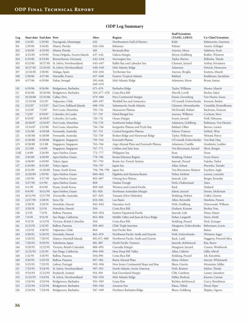
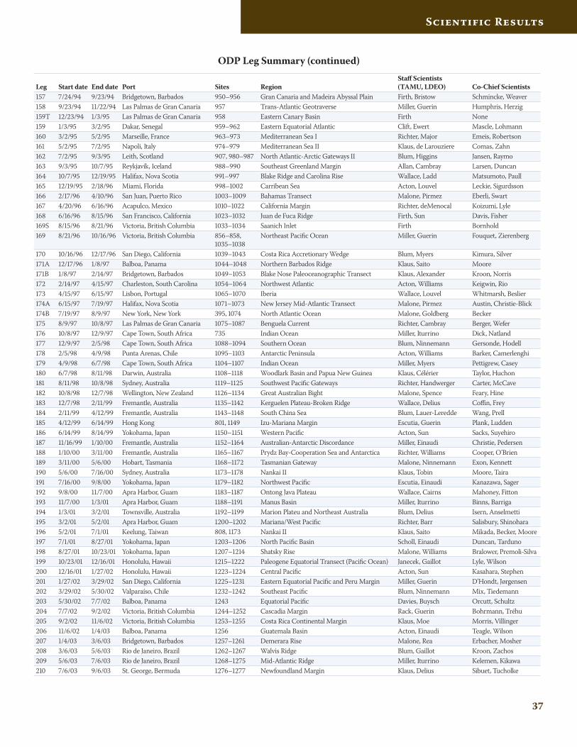
Leg Start date End date Port Sites Region Staff Scientists (TAMU, LDEO) Co-Chief Scientists
100 1/11/85 1/29/85 Pascagoula, Mississippi 625 Northeastern Gulf of Mexico Kidd Rabinowitz, Garrison 101 1/29/85 3/14/85 Miami, Florida 626–636 Bahamas Palmer Austin, Schlager102 3/14/85 4/25/85 Miami, Florida 418 Bermuda Rise Auroux, Moos Salisbury, Scott103 4/25/85 6/19/85 Ponta Delgada, Azores Islands 637–641 Galicia Margin Meyer, Goldberg Boillot, Winterer104 6/19/85 8/23/85 Bremerhaven, Germany 642–644 Norwegian Sea Taylor, Barton Eldholm, Thiede105 8/23/85 10/27/85 St. John’s, Newfoundland 645–647 Baffin Bay and Labrador Sea Clement, Jarrard Arthur, Srivastava106 10/27/85 12/26/85 St. John’s, Newfoundland 648–649 Mid-Atlantic Ridge Adamson Detrick, Honnorez107 12/26/85 2/18/86 Malaga, Spain 650–656 Tyrrhenian Sea Auroux, Broglia Kastens, Mascle108 2/18/86 4/17/86 Marseille, France 657–668 Eastern Tropical Atlantic Baldauf Ruddiman, Sarnthein109 4/17/86 6/19/86 Dakar, Senegal 395, 648,
669–670Mid-Atlantic Ridge Adamson, Moos Bryan, Juteau
110 6/19/86 8/16/86 Bridgetown, Barbados 671–676 Barbados Ridge Taylor, Williams Moore, Mascle111 8/16/86 10/20/86 Bridgetown, Barbados 504, 677–678 Costa Rica Rift Merrill, Lovell Becker, Sakai112 10/20/86 12/25/86 Callao, Peru 679–688 Peru Continental Margin Emeis, Greenberg Von Huene, Suess113 12/25/86 3/11/87 Valparaíso, Chile 689–697 Weddell Sea and Antarctica O’Connell, Golovchenko Kennett, Barker114 3/11/87 5/13/87 East Cove, Falkland Islands 698–704 Subantarctic South Atlantic Clement, Mwenifumbo Ciesielski, Kristoffersen115 5/13/87 7/2/87 Port Louis, Mauritius 705–716 Mascarene Plateau McDonald, Hobart Backman, Duncan116 7/2/87 8/19/87 Colombo, Sri Lanka 717–719 Distal Bengal Fan Auroux, Williams Cochran, Stow117 8/19/87 10/18/87 Colombo, Sri Lanka 720–731 Oman Margin Emeis, Jarrard Prell, Niitsuma118 10/18/87 12/14/87 Port Louis, Mauritius 732–735 Southwest Indian Ridge Adamson, Goldberg Robinson, Von Herzen119 12/14/87 2/21/88 Port Louis, Mauritius 736–746 Kerguelen Plateau and Prydz Bay Baldauf, Ollier Barron, Larsen120 2/21/88 4/30/88 Fremantle, Australia 747–751 Central Kerguelen Plateau Palmer, Pratson Schlich, Wise121 4/30/88 6/28/88 Fremantle, Australia 752–758 Broken Ridge and Ninetyeast Ridge Taylor, Wilkinson Weissel, Peirce122 6/28/88 8/28/88 Singapore, Singapore 759–764 Exmouth Plateau O’Connell, Golovchenko Von Rad, Haq123 8/28/88 11/1/88 Singapore, Singapore 765–766 Argo Abyssal Plain and Exmouth Plateau Adamson, Castillo Gradstein, Ludden124 11/1/88 1/4/89 Singapore, Singapore 767–771 Celebes and Sulu Seas Von Breymann, Jarrard Silver, Rangin124E 1/4/89 2/16/89 Apra Harbor, Guam 772–777 Philippine Sea Rose None125 2/16/89 4/18/89 Apra Harbor, Guam 778–786 Bonin/Mariana Region Stokking, Hobart Fryer, Pearce126 4/18/89 6/19/89 Tokyo, Japan 787–793 Bonin Arc-Trench System Janecek, Pezard Fujioka, Taylor127 6/19/89 8/21/89 Tokyo, Japan 794–797 Japan Sea Allan, Schaar Pisciotto, Tamaki128 8/21/89 11/20/89 Pusan, South Korea 794, 798–799 Japan Sea Von Breymann, Bristow Suyehiro, Ingle129 11/20/89 1/19/90 Apra Harbor, Guam 800–802 Pigafetta and Mariana Basins Fisher, Molinie Larson, Lancelot130 1/19/90 3/27/90 Apra Harbor, Guam 803–807 Ontong Java Plateau Janecek, Lyle Berger, Kroenke131 3/27/90 6/1/90 Apra Harbor, Guam 808 Nankai Trough Firth, Chabernaud Taira132 6/1/90 8/4/90 Pusan, South Korea 809–810 Western and Central Pacific Rack Natland133 8/4/90 10/11/90 Apra Harbor, Guam 811–826 Northeast Australian Margin Julson, Jarrard Davies, McKenzie134 10/11/90 12/17/90 Townsville, Australia 827–833 Vanuatu (New Hebrides) Stokking, Hobart Collot, Greene135 12/17/90 2/28/91 Suva, Fiji 834–841 Lau Basin Allan, Reynolds Hawkins, Parson136 2/28/91 3/20/91 Honolulu, Hawaii 842–843 Hawaiian Arch Firth, Goldberg Dziewonski, Wilkens137 3/20/91 5/1/91 Honolulu, Hawaii 504 Costa Rica Rift Graham, Kramer Becker, Foss138 5/1/91 7/4/91 Balboa, Panama 844–854 Eastern Equatorial Pacific Janecek, Lyle Pisias, Mayer139 7/4/91 9/11/91 San Diego, California 855–858 Middle Valley and Juan de Fuca Ridge Fisher, Langseth Davis, Mottl140 9/11/91 11/12/91 Victoria, British Columbia 504 Costa Rica Rift Stokking, Pezard Dick, Erzinger141 11/12/91 1/12/92 Balboa, Panama 859–863 Chile Triple Junction Musgrave, Golovchenko Behrmann, Lewis142 1/12/92 3/18/92 Valparaíso, Chile 864 East Pacific Rise Allan Batiza143 3/18/92 5/20/92 Honolulu, Hawaii 865–870 Northwest Pacific Atolls and Guyots Firth, Golovchenko Winterer, Sager144 5/20/92 7/20/92 Majuro, Marshall Islands 801, 871–880 Northwest Pacific Atolls and Guyots Rack, Ladd Haggerty, Premoli-Silva145 7/20/92 9/20/92 Yokohama, Japan 881–887 North Pacific Transect Janecek, deMenocal Rea, Basov146 9/20/92 11/22/92 Victoria, British Columbia 888–893 Cascadia Margin Musgrave, Jarrard Carson, Westbrook147 11/22/92 1/21/93 San Diego, California 894–895 Hess Deep Rift Valley Allan, Célérier Gillis, Mévél148 1/21/93 3/10/93 Balboa, Panama 504, 896 Costa Rica Rift Stokking, Pezard Alt, Kinoshita149 3/10/93 5/25/93 Balboa, Panama 897–901 Iberia Abyssal Plain Klaus, Hobart Sawyer, Whitmarsh150 5/25/93 7/25/93 Lisbon, Portugal 902–906 New Jersey Continental Slope and Rise Blum, Guerin Mountain, Miller151 7/25/93 9/24/93 St. John’s, Newfoundland 907–913 North Atlantic-Arctic Gateway Firth, Bristow Myhre, Thiede152 9/24/93 11/22/93 Reykjavík, Iceland 914–919 East Greenland Margin Clift, Cambray Larsen, Saunders153 11/22/93 1/24/94 St. John’s, Newfoundland 920–924 Mid-Atlantic Ridge Miller, Rodway Karson, Cannat154 1/24/94 3/25/94 Bridgetown, Barbados 925–929 Ceara Rise Richter, deMenocal Curry, Shackleton155 3/25/94 5/25/94 Bridgetown, Barbados 930–946 Amazon Fan Klaus, Thibal Flood, Piper156 5/24/94 7/24/94 Bridgetown, Barbados 947–949 Northern Barbados Ridge Blum, Goldberg Shipley, Ogawa
ODP Leg Summary
37
Scientific Results
Leg Start date End date Port Sites Region Staff Scientists (TAMU, LDEO) Co-Chief Scientists
157 7/24/94 9/23/94 Bridgetown, Barbados 950–956 Gran Canaria and Madeira Abyssal Plain Firth, Bristow Schmincke, Weaver158 9/23/94 11/22/94 Las Palmas de Gran Canaria 957 Trans-Atlantic Geotraverse Miller, Guerin Humphris, Herzig159T 12/23/94 1/3/95 Las Palmas de Gran Canaria 958 Eastern Canary Basin Firth None159 1/3/95 3/2/95 Dakar, Senegal 959–962 Eastern Equatorial Atlantic Clift, Ewert Mascle, Lohmann160 3/2/95 5/2/95 Marseille, France 963–973 Mediterranean Sea I Richter, Major Emeis, Robertson161 5/2/95 7/2/95 Napoli, Italy 974–979 Mediterranean Sea II Klaus, de Larouziere Comas, Zahn162 7/2/95 9/3/95 Leith, Scotland 907, 980–987 North Atlantic-Arctic Gateways II Blum, Higgins Jansen, Raymo163 9/3/95 10/7/95 Reykjavík, Iceland 988–990 Southeast Greenland Margin Allan, Cambray Larsen, Duncan164 10/7/95 12/19/95 Halifax, Nova Scotia 991–997 Blake Ridge and Carolina Rise Wallace, Ladd Matsumoto, Paull165 12/19/95 2/18/96 Miami, Florida 998–1002 Carribean Sea Acton, Louvel Leckie, Sigurdsson166 2/17/96 4/10/96 San Juan, Puerto Rico 1003–1009 Bahamas Transect Malone, Pirmez Eberli, Swart167 4/20/96 6/16/96 Acapulco, Mexico 1010–1022 California Margin Richter, deMenocal Koizumi, Lyle168 6/16/96 8/15/96 San Francisco, California 1023–1032 Juan de Fuca Ridge Firth, Sun Davis, Fisher169S 8/15/96 8/21/96 Victoria, British Columbia 1033–1034 Saanich Inlet Firth Bornhold169 8/21/96 10/16/96 Victoria, British Columbia 856–858,
1035–1038Northeast Pacific Ocean Miller, Guerin Fouquet, Zierenberg
170 10/16/96 12/17/96 San Diego, California 1039–1043 Costa Rica Accretionary Wedge Blum, Myers Kimura, Silver171A 12/17/96 1/8/97 Balboa, Panama 1044–1048 Northern Barbados Ridge Klaus, Saito Moore171B 1/8/97 2/14/97 Bridgetown, Barbados 1049–1053 Blake Nose Paleoceanographic Transect Klaus, Alexander Kroon, Norris172 2/14/97 4/15/97 Charleston, South Carolina 1054–1064 Northwest Atlantic Acton, Williams Keigwin, Rio173 4/15/97 6/15/97 Lisbon, Portugal 1065–1070 Iberia Wallace, Louvel Whitmarsh, Beslier174A 6/15/97 7/19/97 Halifax, Nova Scotia 1071–1073 New Jersey Mid-Atlantic Transect Malone, Pirmez Austin, Christie-Blick174B 7/19/97 8/9/97 New York, New York 395, 1074 North Atlantic Ocean Malone, Goldberg Becker175 8/9/97 10/8/97 Las Palmas de Gran Canaria 1075–1087 Benguela Current Richter, Cambray Berger, Wefer176 10/8/97 12/9/97 Cape Town, South Africa 735 Indian Ocean Miller, Iturrino Dick, Natland177 12/9/97 2/5/98 Cape Town, South Africa 1088–1094 Southern Ocean Blum, Ninnemann Gersonde, Hodell178 2/5/98 4/9/98 Punta Arenas, Chile 1095–1103 Antarctic Peninsula Acton, Williams Barker, Camerlenghi179 4/9/98 6/7/98 Cape Town, South Africa 1104–1107 Indian Ocean Miller, Myers Pettigrew, Casey180 6/7/98 8/11/98 Darwin, Australia 1108–1118 Woodlark Basin and Papua New Guinea Klaus, Célérier Taylor, Huchon181 8/11/98 10/8/98 Sydney, Australia 1119–1125 Southwest Pacific Gateways Richter, Handwerger Carter, McCave182 10/8/98 12/7/98 Wellington, New Zealand 1126–1134 Great Australian Bight Malone, Spence Feary, Hine183 12/7/98 2/11/99 Fremantle, Australia 1135–1142 Kerguelen Plateau-Broken Ridge Wallace, Delius Coffin, Frey184 2/11/99 4/12/99 Fremantle, Australia 1143–1148 South China Sea Blum, Lauer-Leredde Wang, Prell185 4/12/99 6/14/99 Hong Kong 801, 1149 Izu-Mariana Margin Escutia, Guerin Plank, Ludden186 6/14/99 8/14/99 Yokohama, Japan 1150–1151 Western Pacific Acton, Sun Sacks, Suyehiro187 11/16/99 1/10/00 Fremantle, Australia 1152–1164 Australian-Antarctic Discordance Miller, Einaudi Christie, Pedersen188 1/10/00 3/11/00 Fremantle, Australia 1165–1167 Prydz Bay-Cooperation Sea and Antarctica Richter, Williams Cooper, O’Brien189 3/11/00 5/6/00 Hobart, Tasmania 1168–1172 Tasmanian Gateway Malone, Ninnemann Exon, Kennett190 5/6/00 7/16/00 Sydney, Australia 1173–1178 Nankai II Klaus, Tobin Moore, Taira191 7/16/00 9/8/00 Yokohama, Japan 1179–1182 Northwest Pacific Escutia, Einaudi Kanazawa, Sager192 9/8/00 11/7/00 Apra Harbor, Guam 1183–1187 Ontong Java Plateau Wallace, Cairns Mahoney, Fitton193 11/7/00 1/3/01 Apra Harbor, Guam 1188–1191 Manus Basin Miller, Iturrino Binns, Barriga194 1/3/01 3/2/01 Townsville, Australia 1192–1199 Marion Plateu and Northeast Australia Blum, Delius Isern, Anselmetti195 3/2/01 5/2/01 Apra Harbor, Guam 1200–1202 Mariana/West Pacific Richter, Barr Salisbury, Shinohara196 5/2/01 7/1/01 Keelung, Taiwan 808, 1173 Nankai II Klaus, Saito Mikada, Becker, Moore197 7/1/01 8/27/01 Yokohama, Japan 1203–1206 North Pacific Basin Scholl, Einaudi Duncan, Tarduno198 8/27/01 10/23/01 Yokohama, Japan 1207–1214 Shatsky Rise Malone, Williams Bralower, Premoli-Silva199 10/23/01 12/16/01 Honolulu, Hawaii 1215–1222 Paleogene Equatorial Transect (Pacific Ocean) Janecek, Gaillot Lyle, Wilson200 12/16/01 1/27/02 Honolulu, Hawaii 1223–1224 Central Pacific Acton, Sun Kasahara, Stephen201 1/27/02 3/29/02 San Diego, California 1225–1231 Eastern Equatorial Pacific and Peru Margin Miller, Guerin D’Hondt, Jørgensen202 3/29/02 5/30/02 Valparaíso, Chile 1232–1242 Southeast Pacific Blum, Ninnemann Mix, Tiedemann203 5/30/02 7/7/02 Balboa, Panama 1243 Equatorial Pacific Davies, Buysch Orcutt, Schultz204 7/7/02 9/2/02 Victoria, British Columbia 1244–1252 Cascadia Margin Rack, Guerin Bohrmann, Tréhu205 9/2/02 11/6/02 Victoria, British Columbia 1253–1255 Costa Rica Continental Margin Klaus, Moe Morris, Villinger206 11/6/02 1/4/03 Balboa, Panama 1256 Guatemala Basin Acton, Einaudi Teagle, Wilson207 1/4/03 3/6/03 Bridgetown, Barbados 1257–1261 Demerara Rise Malone, Rea Erbacher, Mosher208 3/6/03 5/6/03 Rio de Janeiro, Brazil 1262–1267 Walvis Ridge Blum, Gaillot Kroon, Zachos209 5/6/03 7/6/03 Rio de Janeiro, Brazil 1268–1275 Mid-Atlantic Ridge Miller, Iturrino Kelemen, Kikawa210 7/6/03 9/6/03 St. George, Bermuda 1276–1277 Newfoundland Margin Klaus, Delius Sibuet, Tucholke
ODP Leg Summary (continued)
°
ODP Sites Drilled
ODP Final Technical Report
Engineering and Science Operations
42
ODP Final Technical Report
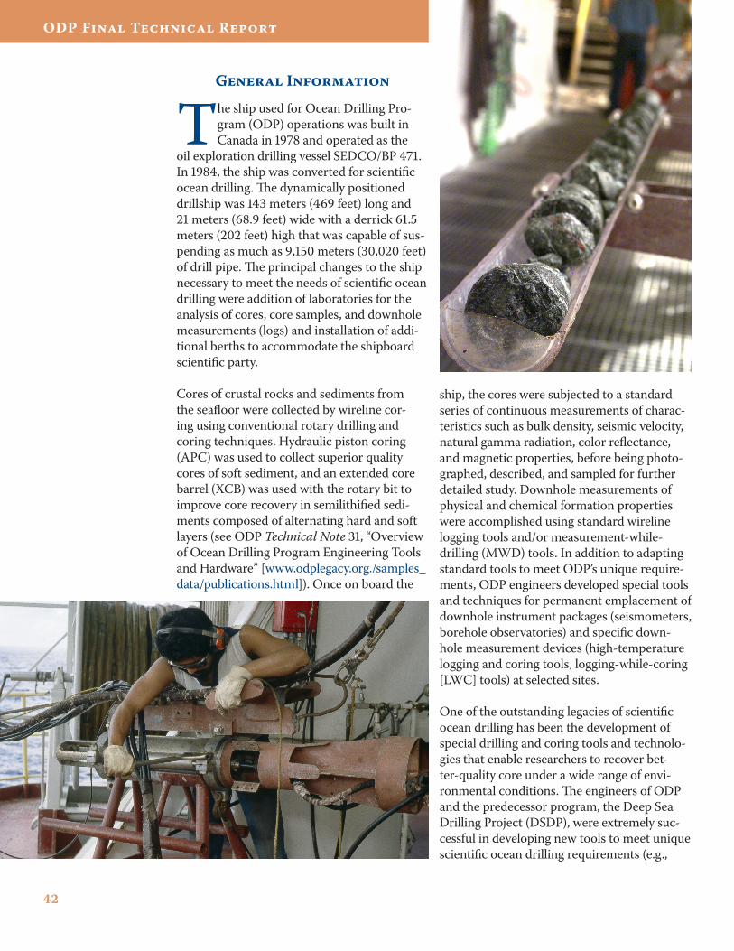
General Information
The ship used for Ocean Drilling Pro-gram (ODP) operations was built in Canada in 1978 and operated as the
oil exploration drilling vessel SEDCO/BP 471. In 1984, the ship was converted for scientific ocean drilling. The dynamically positioned drillship was 143 meters (469 feet) long and 21 meters (68.9 feet) wide with a derrick 61.5 meters (202 feet) high that was capable of sus-pending as much as 9,150 meters (30,020 feet) of drill pipe. The principal changes to the ship necessary to meet the needs of scientific ocean drilling were addition of laboratories for the analysis of cores, core samples, and downhole measurements (logs) and installation of addi-tional berths to accommodate the shipboard scientific party.
Cores of crustal rocks and sediments from the seafloor were collected by wireline cor-ing using conventional rotary drilling and coring techniques. Hydraulic piston coring (APC) was used to collect superior quality cores of soft sediment, and an extended core barrel (XCB) was used with the rotary bit to improve core recovery in semilithified sedi-ments composed of alternating hard and soft layers (see ODP Technical Note 31, “Overview of Ocean Drilling Program Engineering Tools and Hardware” [www.odplegacy.org./samples_data/publications.html]). Once on board the
ship, the cores were subjected to a standard series of continuous measurements of charac-teristics such as bulk density, seismic velocity, natural gamma radiation, color reflectance, and magnetic properties, before being photo-graphed, described, and sampled for further detailed study. Downhole measurements of physical and chemical formation properties were accomplished using standard wireline logging tools and/or measurement-while-drilling (MWD) tools. In addition to adapting standard tools to meet ODP’s unique require-ments, ODP engineers developed special tools and techniques for permanent emplacement of downhole instrument packages (seismometers, borehole observatories) and specific down-hole measurement devices (high-temperature logging and coring tools, logging-while-coring [LWC] tools) at selected sites.
One of the outstanding legacies of scientific ocean drilling has been the development of special drilling and coring tools and technolo-gies that enable researchers to recover bet-ter-quality core under a wide range of envi-ronmental conditions. The engineers of ODP and the predecessor program, the Deep Sea Drilling Project (DSDP), were extremely suc-cessful in developing new tools to meet unique scientific ocean drilling requirements (e.g.,
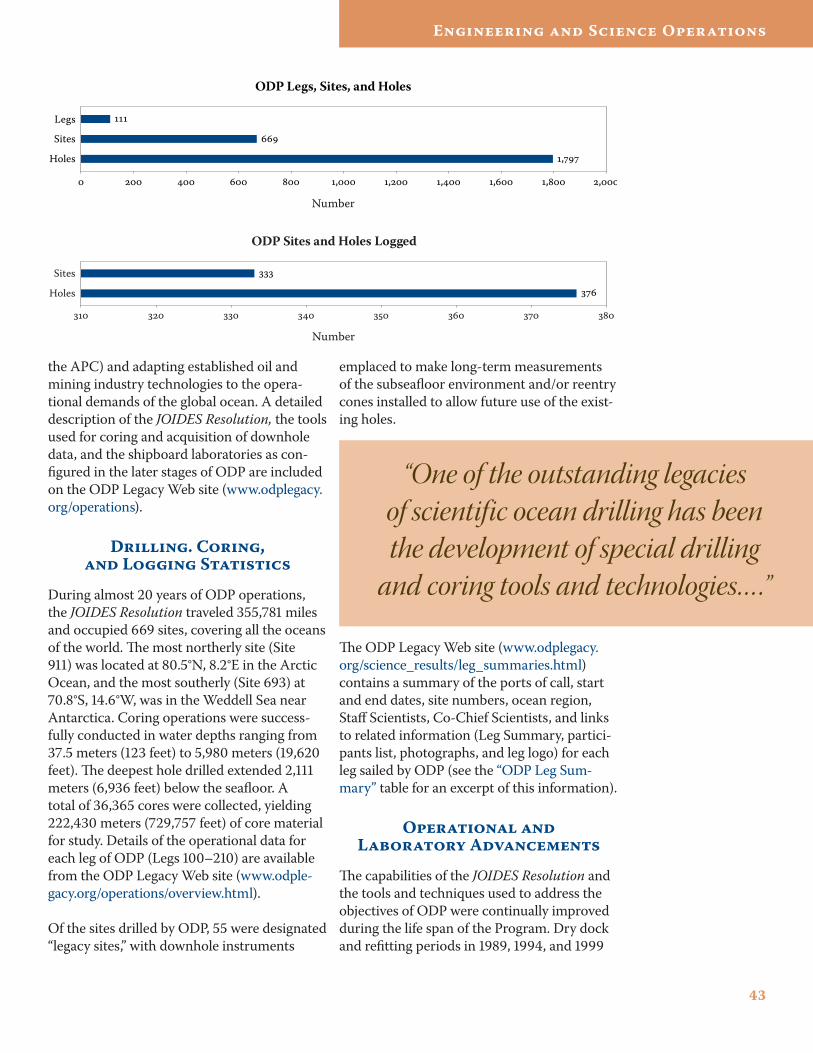
43
Engineering and Science Operations
the APC) and adapting established oil and mining industry technologies to the opera-tional demands of the global ocean. A detailed description of the JOIDES Resolution, the tools used for coring and acquisition of downhole data, and the shipboard laboratories as con-figured in the later stages of ODP are included on the ODP Legacy Web site (www.odplegacy.org/operations).
Drilling. Coring, and Logging Statistics
During almost 20 years of ODP operations, the JOIDES Resolution traveled 355,781 miles and occupied 669 sites, covering all the oceans of the world. The most northerly site (Site 911) was located at 80.5°N, 8.2°E in the Arctic Ocean, and the most southerly (Site 693) at 70.8°S, 14.6°W, was in the Weddell Sea near Antarctica. Coring operations were success-fully conducted in water depths ranging from 37.5 meters (123 feet) to 5,980 meters (19,620 feet). The deepest hole drilled extended 2,111 meters (6,936 feet) below the seafloor. A total of 36,365 cores were collected, yielding 222,430 meters (729,757 feet) of core material for study. Details of the operational data for each leg of ODP (Legs 100–210) are available from the ODP Legacy Web site (www.odple-gacy.org/operations/overview.html).
Of the sites drilled by ODP, 55 were designated “legacy sites,” with downhole instruments
emplaced to make long-term measurements of the subseafloor environment and/or reentry cones installed to allow future use of the exist-ing holes.
The ODP Legacy Web site (www.odplegacy.org/science_results/leg_summaries.html) contains a summary of the ports of call, start and end dates, site numbers, ocean region, Staff Scientists, Co-Chief Scientists, and links to related information (Leg Summary, partici-pants list, photographs, and leg logo) for each leg sailed by ODP (see the “ODP Leg Sum-mary” table for an excerpt of this information).
Operational and Laboratory Advancements
The capabilities of the JOIDES Resolution and the tools and techniques used to address the objectives of ODP were continually improved during the life span of the Program. Dry dock and refitting periods in 1989, 1994, and 1999
,
, , , , , ,
Legs
Sites
Holes
ODP Legs, Sites, and Holes
ODP Sites and Holes Logged
Holes
Sites
Number
Number
“One of the outstanding legacies of scientific ocean drilling has been the development of special drilling
and coring tools and technologies… .”
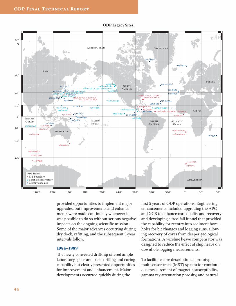
44
ODP Final Technical Report
provided opportunities to implement major upgrades, but improvements and enhance-ments were made continually whenever it was possible to do so without serious negative impacts on the ongoing scientific mission. Some of the major advances occurring during dry dock, refitting, and the subsequent 5-year intervals follow.
1��4–1���The newly converted drillship offered ample laboratory space and basic drilling and coring capability but clearly presented opportunities for improvement and enhancement. Major developments occurred quickly during the
first 5 years of ODP operations. Engineering enhancements included upgrading the APC and XCB to enhance core quality and recovery and developing a free-fall funnel that provided the capability for reentry into sediment bore-holes for bit changes and logging runs, allow-ing recovery of cores from deeper geological formations. A wireline heave compensator was designed to reduce the effect of ship heave on downhole logging measurements.
To facilitate core description, a prototype multisensor track (MST) system for continu-ous measurement of magnetic susceptibility, gamma ray attenuation porosity, and natural
°E ° ° ° ° ° ° ° ° ° ° °
-°
-°
-°
°
°
°
°
° N
G
E
A
SA
NA
A
A
A
IO P
OA
O
A O
//
/
/
/
//
/ /
//,
/,,,, ,,,,,
/
/
/,,,, ,,,,
/,,,,,
/,/,
/
/,/
/
/
/,
/,,,
/
/,/
//
/,
/
/
/,
/
/
/
/
/
/
/
/
/,/
/
/,
/
/
//
/
ODP Holes: K/T boundary Borehole observatory Reentry cone use
/
/,
/
/
/
ODP Legacy Sites
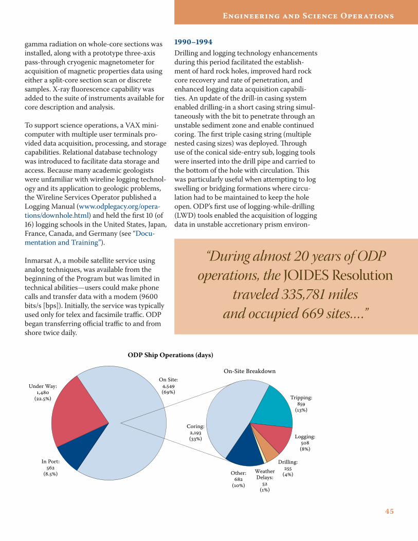
45
Engineering and Science Operations
gamma radiation on whole-core sections was installed, along with a prototype three-axis pass-through cryogenic magnetometer for acquisition of magnetic properties data using either a split-core section scan or discrete samples. X-ray fluorescence capability was added to the suite of instruments available for core description and analysis.
To support science operations, a VAX mini-computer with multiple user terminals pro-vided data acquisition, processing, and storage capabilities. Relational database technology was introduced to facilitate data storage and access. Because many academic geologists were unfamiliar with wireline logging technol-ogy and its application to geologic problems, the Wireline Services Operator published a Logging Manual (www.odplegacy.org/opera-tions/downhole.html) and held the first 10 (of 16) logging schools in the United States, Japan, France, Canada, and Germany (see “Docu-mentation and Training”).
Inmarsat A, a mobile satellite service using analog techniques, was available from the beginning of the Program but was limited in technical abilities—users could make phone calls and transfer data with a modem (9600 bits/s [bps]). Initially, the service was typically used only for telex and facsimile traffic. ODP began transferring official traffic to and from shore twice daily.
1��0–1��4Drilling and logging technology enhancements during this period facilitated the establish-ment of hard rock holes, improved hard rock core recovery and rate of penetration, and enhanced logging data acquisition capabili-ties. An update of the drill-in casing system enabled drilling-in a short casing string simul-taneously with the bit to penetrate through an unstable sediment zone and enable continued coring. The first triple casing string (multiple nested casing sizes) was deployed. Through use of the conical side-entry sub, logging tools were inserted into the drill pipe and carried to the bottom of the hole with circulation. This was particularly useful when attempting to log swelling or bridging formations where circu-lation had to be maintained to keep the hole open. ODP’s first use of logging-while-drilling (LWD) tools enabled the acquisition of logging data in unstable accretionary prism environ-
Tripping:
()
ODP Ship Operations (days)
Under Way:,
(.)
In Port:
(.)
On Site:,()
On-Site Breakdown
Logging:()
Drilling:
()WeatherDelays:
()
Other:
()
Coring:,()
“During almost 20 years of ODP operations, the JOIDES Resolution
traveled 335,781 miles and occupied 669 sites… .”
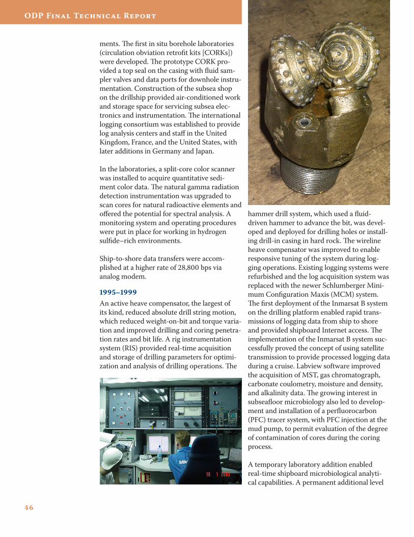
46
ODP Final Technical Report
ments. The first in situ borehole laboratories (circulation obviation retrofit kits [CORKs]) were developed. The prototype CORK pro-vided a top seal on the casing with fluid sam-pler valves and data ports for downhole instru-mentation. Construction of the subsea shop on the drillship provided air-conditioned work and storage space for servicing subsea elec-tronics and instrumentation. The international logging consortium was established to provide log analysis centers and staff in the United Kingdom, France, and the United States, with later additions in Germany and Japan.
In the laboratories, a split-core color scanner was installed to acquire quantitative sedi-ment color data. The natural gamma radiation detection instrumentation was upgraded to scan cores for natural radioactive elements and offered the potential for spectral analysis. A monitoring system and operating procedures were put in place for working in hydrogen sulfide–rich environments.
Ship-to-shore data transfers were accom-plished at a higher rate of 28,800 bps via analog modem.
1��5–1���An active heave compensator, the largest of its kind, reduced absolute drill string motion, which reduced weight-on-bit and torque varia-tion and improved drilling and coring penetra-tion rates and bit life. A rig instrumentation system (RIS) provided real-time acquisition and storage of drilling parameters for optimi-zation and analysis of drilling operations. The
hammer drill system, which used a fluid-driven hammer to advance the bit, was devel-oped and deployed for drilling holes or install-ing drill-in casing in hard rock. The wireline heave compensator was improved to enable responsive tuning of the system during log-ging operations. Existing logging systems were refurbished and the log acquisition system was replaced with the newer Schlumberger Mini-mum Configuration Maxis (MCM) system. The first deployment of the Inmarsat B system on the drilling platform enabled rapid trans-missions of logging data from ship to shore and provided shipboard Internet access. The implementation of the Inmarsat B system suc-cessfully proved the concept of using satellite transmission to provide processed logging data during a cruise. Labview software improved the acquisition of MST, gas chromatograph, carbonate coulometry, moisture and density, and alkalinity data. The growing interest in subseafloor microbiology also led to develop-ment and installation of a perfluorocarbon (PFC) tracer system, with PFC injection at the mud pump, to permit evaluation of the degree of contamination of cores during the coring process.
A temporary laboratory addition enabled real-time shipboard microbiological analyti-cal capabilities. A permanent additional level
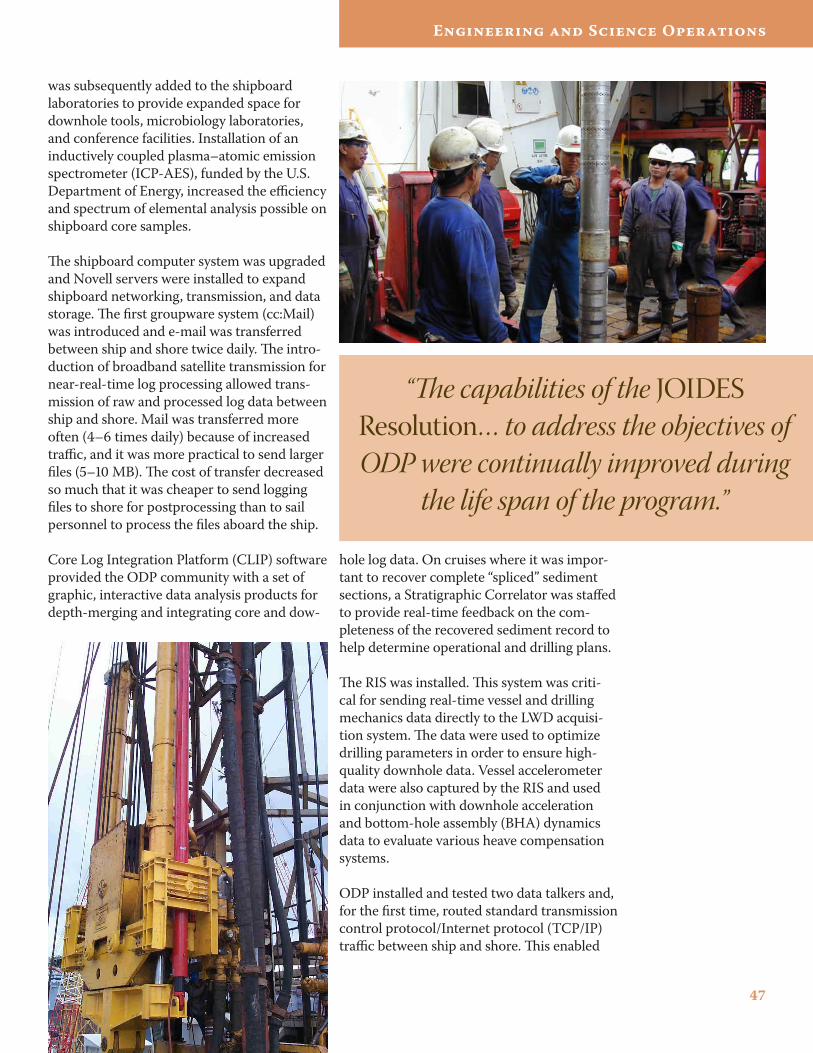
47
Engineering and Science Operations
was subsequently added to the shipboard laboratories to provide expanded space for downhole tools, microbiology laboratories, and conference facilities. Installation of an inductively coupled plasma–atomic emission spectrometer (ICP-AES), funded by the U.S. Department of Energy, increased the efficiency and spectrum of elemental analysis possible on shipboard core samples.
The shipboard computer system was upgraded and Novell servers were installed to expand shipboard networking, transmission, and data storage. The first groupware system (cc:Mail) was introduced and e-mail was transferred between ship and shore twice daily. The intro-duction of broadband satellite transmission for near-real-time log processing allowed trans-mission of raw and processed log data between ship and shore. Mail was transferred more often (4–6 times daily) because of increased traffic, and it was more practical to send larger files (5–10 MB). The cost of transfer decreased so much that it was cheaper to send logging files to shore for postprocessing than to sail personnel to process the files aboard the ship.
Core Log Integration Platform (CLIP) software provided the ODP community with a set of graphic, interactive data analysis products for depth-merging and integrating core and dow-
hole log data. On cruises where it was impor-tant to recover complete “spliced” sediment sections, a Stratigraphic Correlator was staffed to provide real-time feedback on the com-pleteness of the recovered sediment record to help determine operational and drilling plans.
The RIS was installed. This system was criti-cal for sending real-time vessel and drilling mechanics data directly to the LWD acquisi-tion system. The data were used to optimize drilling parameters in order to ensure high-quality downhole data. Vessel accelerometer data were also captured by the RIS and used in conjunction with downhole acceleration and bottom-hole assembly (BHA) dynamics data to evaluate various heave compensation systems.
ODP installed and tested two data talkers and, for the first time, routed standard transmission control protocol/Internet protocol (TCP/IP) traffic between ship and shore. This enabled
“The capabilities of the JOIDES Resolution… to address the objectives of ODP were continually improved during
the life span of the program.”
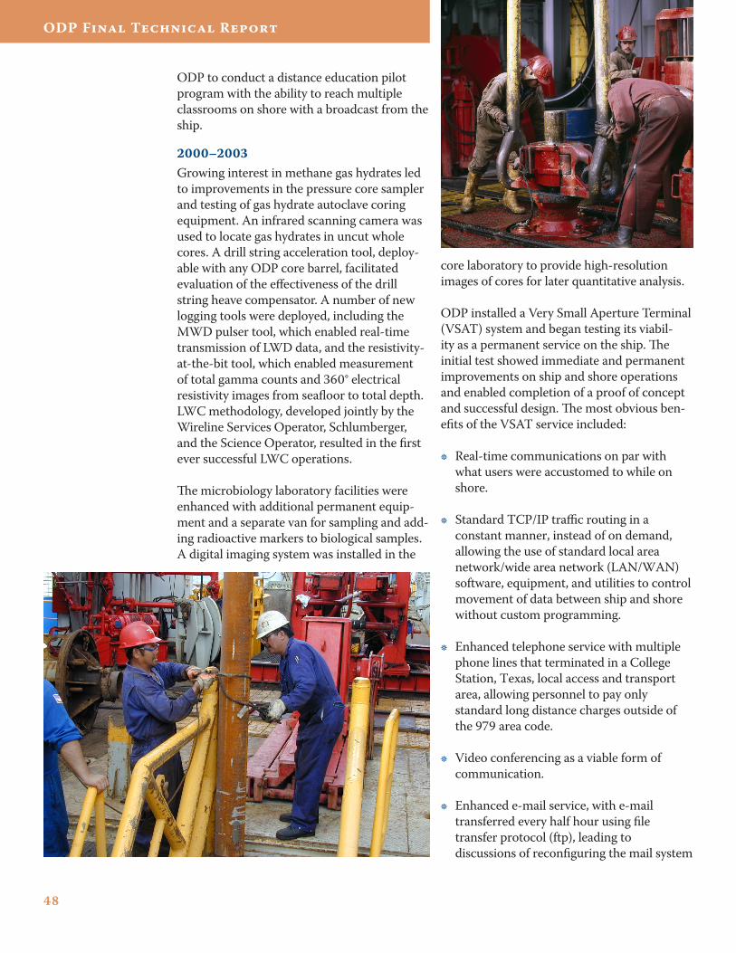
4�
ODP Final Technical Report
ODP to conduct a distance education pilot program with the ability to reach multiple classrooms on shore with a broadcast from the ship.
2000–2003Growing interest in methane gas hydrates led to improvements in the pressure core sampler and testing of gas hydrate autoclave coring equipment. An infrared scanning camera was used to locate gas hydrates in uncut whole cores. A drill string acceleration tool, deploy-able with any ODP core barrel, facilitated evaluation of the effectiveness of the drill string heave compensator. A number of new logging tools were deployed, including the MWD pulser tool, which enabled real-time transmission of LWD data, and the resistivity-at-the-bit tool, which enabled measurement of total gamma counts and 360° electrical resistivity images from seafloor to total depth. LWC methodology, developed jointly by the Wireline Services Operator, Schlumberger, and the Science Operator, resulted in the first ever successful LWC operations.
The microbiology laboratory facilities were enhanced with additional permanent equip-ment and a separate van for sampling and add-ing radioactive markers to biological samples. A digital imaging system was installed in the
core laboratory to provide high-resolution images of cores for later quantitative analysis.
ODP installed a Very Small Aperture Terminal (VSAT) system and began testing its viabil-ity as a permanent service on the ship. The initial test showed immediate and permanent improvements on ship and shore operations and enabled completion of a proof of concept and successful design. The most obvious ben-efits of the VSAT service included:
Real-time communications on par with what users were accustomed to while on shore.
Standard TCP/IP traffic routing in a constant manner, instead of on demand, allowing the use of standard local area network/wide area network (LAN/WAN) software, equipment, and utilities to control movement of data between ship and shore without custom programming.
Enhanced telephone service with multiple phone lines that terminated in a College Station, Texas, local access and transport area, allowing personnel to pay only standard long distance charges outside of the 979 area code.
Video conferencing as a viable form of communication.
Enhanced e-mail service, with e-mail transferred every half hour using file transfer protocol (ftp), leading to discussions of reconfiguring the mail system
•
•
•
•
•
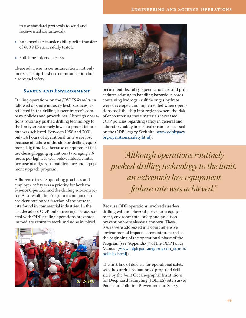
4�
Engineering and Science Operations
to use standard protocols to send and receive mail continuously.
Enhanced file transfer ability, with transfers of 600 MB successfully tested.
Full-time Internet access.
These advances in communications not only increased ship-to-shore communication but also vessel safety.
Safety and Environment
Drilling operations on the JOIDES Resolution followed offshore industry best practices, as reflected in the drilling subcontractor’s com-pany policies and procedures. Although opera-tions routinely pushed drilling technology to the limit, an extremely low equipment failure rate was achieved. Between 1998 and 2001, only 54 hours of operational time were lost because of failure of the ship or drilling equip-ment. Rig time lost because of equipment fail-ure during logging operations (averaging 2.6 hours per leg) was well below industry rates because of a rigorous maintenance and equip-ment upgrade program.
Adherence to safe operating practices and employee safety was a priority for both the Science Operator and the drilling subcontrac-tor. As a result, the Program maintained an accident rate only a fraction of the average rate found in commercial industries. In the last decade of ODP, only three injuries associ-ated with ODP drilling operations prevented immediate return to work and none involved
•
•
permanent disability. Specific policies and pro-cedures relating to handling hazardous cores containing hydrogen sulfide or gas hydrate were developed and implemented when opera-tions took the ship into regions where the risk of encountering these materials increased. ODP policies regarding safety in general and laboratory safety in particular can be accessed on the ODP Legacy Web site (www.odplegacy.org/operations/safety.html).
“Although operations routinely pushed drilling technology to the limit,
an extremely low equipment failure rate was achieved.”
Because ODP operations involved riserless drilling with no blowout prevention equip-ment, environmental safety and pollution prevention were always a concern. These issues were addressed in a comprehensive environmental impact statement prepared at the beginning of the operational phase of the Program (see “Appendix J” of the ODP Policy Manual [www.odplegacy.org/program_admin/policies.html]).
The first line of defense for operational safety was the careful evaluation of proposed drill sites by the Joint Oceanographic Institutions for Deep Earth Sampling (JOIDES) Site Survey Panel and Pollution Prevention and Safety
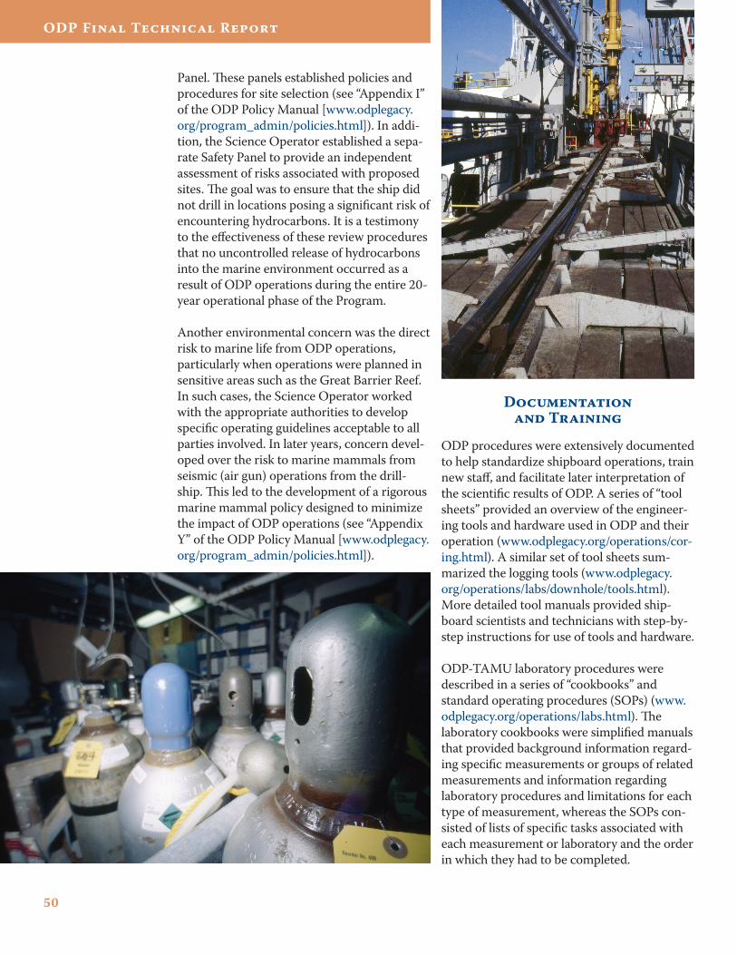
50
ODP Final Technical Report
Panel. These panels established policies and procedures for site selection (see “Appendix I” of the ODP Policy Manual [www.odplegacy.org/program_admin/policies.html]). In addi-tion, the Science Operator established a sepa-rate Safety Panel to provide an independent assessment of risks associated with proposed sites. The goal was to ensure that the ship did not drill in locations posing a significant risk of encountering hydrocarbons. It is a testimony to the effectiveness of these review procedures that no uncontrolled release of hydrocarbons into the marine environment occurred as a result of ODP operations during the entire 20-year operational phase of the Program.
Another environmental concern was the direct risk to marine life from ODP operations, particularly when operations were planned in sensitive areas such as the Great Barrier Reef. In such cases, the Science Operator worked with the appropriate authorities to develop specific operating guidelines acceptable to all parties involved. In later years, concern devel-oped over the risk to marine mammals from seismic (air gun) operations from the drill-ship. This led to the development of a rigorous marine mammal policy designed to minimize the impact of ODP operations (see “Appendix Y” of the ODP Policy Manual [www.odplegacy.org/program_admin/policies.html]).
Documentation and Training
ODP procedures were extensively documented to help standardize shipboard operations, train new staff, and facilitate later interpretation of the scientific results of ODP. A series of “tool sheets” provided an overview of the engineer-ing tools and hardware used in ODP and their operation (www.odplegacy.org/operations/cor-ing.html). A similar set of tool sheets sum-marized the logging tools (www.odplegacy.org/operations/labs/downhole/tools.html). More detailed tool manuals provided ship-board scientists and technicians with step-by-step instructions for use of tools and hardware.
ODP-TAMU laboratory procedures were described in a series of “cookbooks” and standard operating procedures (SOPs) (www.odplegacy.org/operations/labs.html). The laboratory cookbooks were simplified manuals that provided background information regard-ing specific measurements or groups of related measurements and information regarding laboratory procedures and limitations for each type of measurement, whereas the SOPs con-sisted of lists of specific tasks associated with each measurement or laboratory and the order in which they had to be completed.
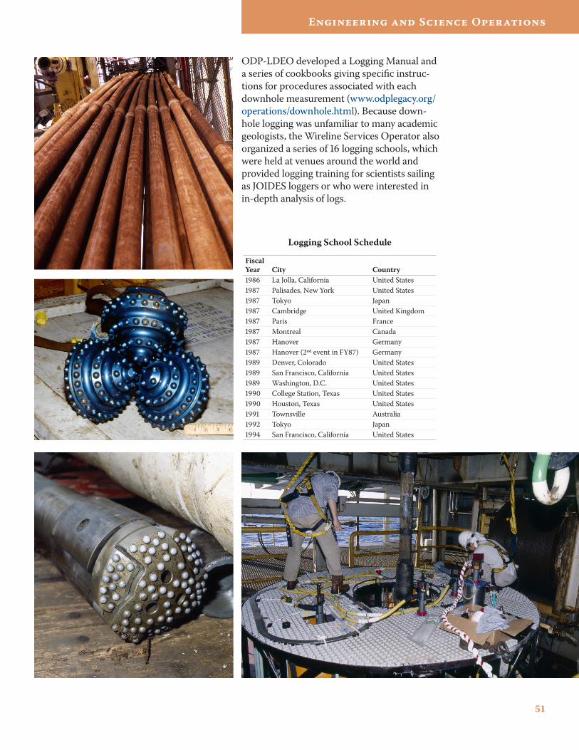
51
Engineering and Science Operations
ODP-LDEO developed a Logging Manual and a series of cookbooks giving specific instruc-tions for procedures associated with each downhole measurement (www.odplegacy.org/operations/downhole.html). Because down-hole logging was unfamiliar to many academic geologists, the Wireline Services Operator also organized a series of 16 logging schools, which were held at venues around the world and provided logging training for scientists sailing as JOIDES loggers or who were interested in in-depth analysis of logs.
Logging School Schedule
Fiscal Year City Country1986 La Jolla, California United States1987 Palisades, New York United States1987 Tokyo Japan1987 Cambridge United Kingdom1987 Paris France1987 Montreal Canada1987 Hanover Germany1987 Hanover (2ⁿd event in FY87) Germany1989 Denver, Colorado United States1989 San Francisco, California United States1989 Washington, D.C. United States1990 College Station, Texas United States1990 Houston, Texas United States1991 Townsville Australia1992 Tokyo Japan1994 San Francisco, California United States
ODP Final Technical Report
Samples, Data, and Publications
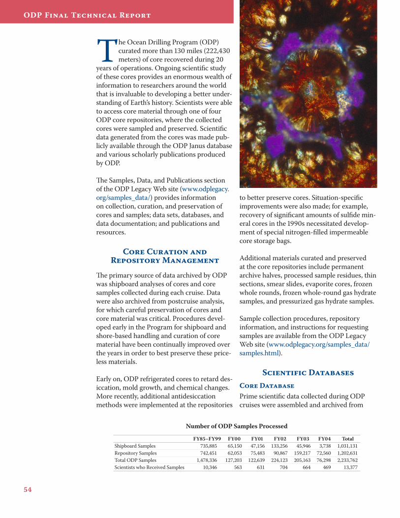
54
ODP Final Technical Report
The Ocean Drilling Program (ODP) curated more than 130 miles (222,430 meters) of core recovered during 20
years of operations. Ongoing scientific study of these cores provides an enormous wealth of information to researchers around the world that is invaluable to developing a better under-standing of Earth’s history. Scientists were able to access core material through one of four ODP core repositories, where the collected cores were sampled and preserved. Scientific data generated from the cores was made pub-licly available through the ODP Janus database and various scholarly publications produced by ODP.
The Samples, Data, and Publications section of the ODP Legacy Web site (www.odplegacy.org/samples_data/) provides information on collection, curation, and preservation of cores and samples; data sets, databases, and data documentation; and publications and resources.
Core Curation and Repository Management
The primary source of data archived by ODP was shipboard analyses of cores and core samples collected during each cruise. Data were also archived from postcruise analysis, for which careful preservation of cores and core material was critical. Procedures devel-oped early in the Program for shipboard and shore-based handling and curation of core material have been continually improved over the years in order to best preserve these price-less materials.
Early on, ODP refrigerated cores to retard des-iccation, mold growth, and chemical changes. More recently, additional antidesiccation methods were implemented at the repositories
to better preserve cores. Situation-specific improvements were also made; for example, recovery of significant amounts of sulfide min-eral cores in the 1990s necessitated develop-ment of special nitrogen-filled impermeable core storage bags.
Additional materials curated and preserved at the core repositories include permanent archive halves, processed sample residues, thin sections, smear slides, evaporite cores, frozen whole rounds, frozen whole-round gas hydrate samples, and pressurized gas hydrate samples.
Sample collection procedures, repository information, and instructions for requesting samples are available from the ODP Legacy Web site (www.odplegacy.org/samples_data/samples.html).
Scientific DatabasesCore DatabasePrime scientific data collected during ODP cruises were assembled and archived from
Number of ODP Samples Processed
FY85–FY99 FY00 FY01 FY02 FY03 FY04 TotalShipboard Samples 735,885 65,150 47,156 133,256 45,946 3,738 1,031,131Repository Samples 742,451 62,053 75,483 90,867 159,217 72,560 1,202,631Total ODP Samples 1,478,336 127,203 122,639 224,123 205,163 76,298 2,233,762Scientists who Received Samples 10,346 563 631 704 664 469 13,377
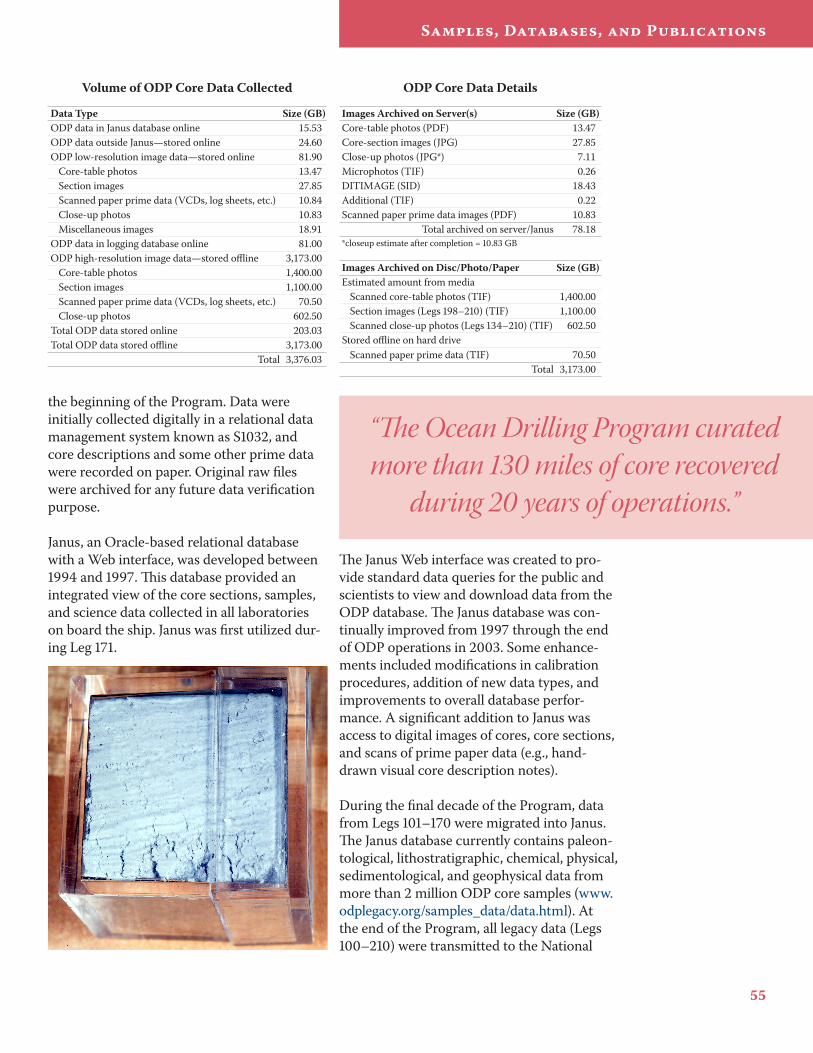
55
Samples, Databases, and Publications
the beginning of the Program. Data were initially collected digitally in a relational data management system known as S1032, and core descriptions and some other prime data were recorded on paper. Original raw files were archived for any future data verification purpose.
Janus, an Oracle-based relational database with a Web interface, was developed between 1994 and 1997. This database provided an integrated view of the core sections, samples, and science data collected in all laboratories on board the ship. Janus was first utilized dur-ing Leg 171.
The Janus Web interface was created to pro-vide standard data queries for the public and scientists to view and download data from the ODP database. The Janus database was con-tinually improved from 1997 through the end of ODP operations in 2003. Some enhance-ments included modifications in calibration procedures, addition of new data types, and improvements to overall database perfor-mance. A significant addition to Janus was access to digital images of cores, core sections, and scans of prime paper data (e.g., hand-drawn visual core description notes).
During the final decade of the Program, data from Legs 101–170 were migrated into Janus. The Janus database currently contains paleon-tological, lithostratigraphic, chemical, physical, sedimentological, and geophysical data from more than 2 million ODP core samples (www.odplegacy.org/samples_data/data.html). At the end of the Program, all legacy data (Legs 100–210) were transmitted to the National
ODP Core Data Details
Images Archived on Server(s) Size (GB)Core-table photos (PDF) 13.47Core-section images (JPG) 27.85Close-up photos (JPG*) 7.11Microphotos (TIF) 0.26DITIMAGE (SID) 18.43Additional (TIF) 0.22Scanned paper prime data images (PDF) 10.83
Total archived on server/Janus 78.18*closeup estimate after completion = 10.83 GB
Images Archived on Disc/Photo/Paper Size (GB)Estimated amount from media
Scanned core-table photos (TIF) 1,400.00Section images (Legs 198–210) (TIF) 1,100.00Scanned close-up photos (Legs 134–210) (TIF) 602.50
Stored offline on hard driveScanned paper prime data (TIF) 70.50
Total 3,173.00
Volume of ODP Core Data Collected
Data Type Size (GB)ODP data in Janus database online 15.53ODP data outside Janus—stored online 24.60ODP low-resolution image data—stored online 81.90
Core-table photos 13.47Section images 27.85Scanned paper prime data (VCDs, log sheets, etc.) 10.84Close-up photos 10.83Miscellaneous images 18.91
ODP data in logging database online 81.00ODP high-resolution image data—stored offline 3,173.00
Core-table photos 1,400.00Section images 1,100.00Scanned paper prime data (VCDs, log sheets, etc.) 70.50Close-up photos 602.50
Total ODP data stored online 203.03Total ODP data stored offline 3,173.00
Total 3,376.03
“The Ocean Drilling Program curated more than 130 miles of core recovered
during 20 years of operations.”
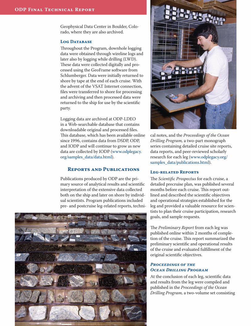
56
ODP Final Technical Report
Geophysical Data Center in Boulder, Colo-rado, where they are also archived.
Log DatabaseThroughout the Program, downhole logging data were obtained through wireline logs and later also by logging while drilling (LWD). These data were collected digitally and pro-cessed using the GeoFrame software from Schlumberger. Data were initially returned to shore by tape at the end of each cruise. With the advent of the VSAT Internet connection, files were transferred to shore for processing and archiving and then processed data were returned to the ship for use by the scientific party.
Logging data are archived at ODP-LDEO in a Web-searchable database that contains downloadable original and processed files. This database, which has been available online since 1996, contains data from DSDP, ODP, and IODP and will continue to grow as new data are collected by IODP (www.odplegacy.org/samples_data/data.html).
Reports and Publications
Publications produced by ODP are the pri-mary source of analytical results and scientific interpretation of the extensive data collected both on the ship and later on shore by individ-ual scientists. Program publications included pre- and postcruise leg-related reports, techni-
cal notes, and the Proceedings of the Ocean Drilling Program, a two-part monograph series containing detailed cruise site reports, data reports, and peer-reviewed scholarly research for each leg (www.odplegacy.org/samples_data/publications.html).
Leg-related ReportsThe Scientific Prospectus for each cruise, a detailed precruise plan, was published several months before each cruise. This report out-lined and described the scientific objectives and operational strategies established for the leg and provided a valuable resource for scien-tists to plan their cruise participation, research goals, and sample requests.
The Preliminary Report from each leg was published online within 2 months of comple-tion of the cruise. This report summarized the preliminary scientific and operational results of the cruise and evaluated fulfillment of the original scientific objectives.
Proceedings of the Ocean Drilling ProgramAt the conclusion of each leg, scientific data and results from the leg were compiled and published in the Proceedings of the Ocean Drilling Program, a two-volume set consisting
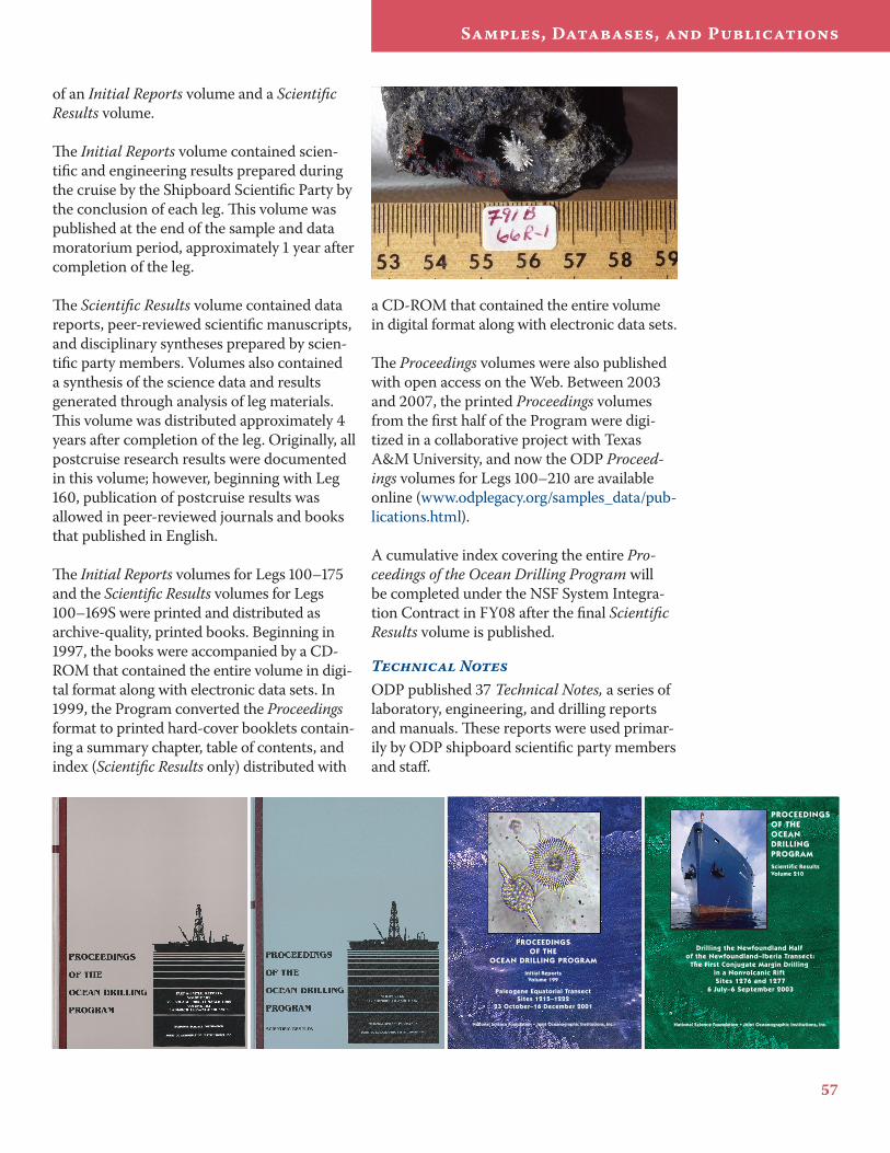
57
Samples, Databases, and Publications
of an Initial Reports volume and a Scientific Results volume.
The Initial Reports volume contained scien-tific and engineering results prepared during the cruise by the Shipboard Scientific Party by the conclusion of each leg. This volume was published at the end of the sample and data moratorium period, approximately 1 year after completion of the leg.
The Scientific Results volume contained data reports, peer-reviewed scientific manuscripts, and disciplinary syntheses prepared by scien-tific party members. Volumes also contained a synthesis of the science data and results generated through analysis of leg materials. This volume was distributed approximately 4 years after completion of the leg. Originally, all postcruise research results were documented in this volume; however, beginning with Leg 160, publication of postcruise results was allowed in peer-reviewed journals and books that published in English.
The Initial Reports volumes for Legs 100–175 and the Scientific Results volumes for Legs 100–169S were printed and distributed as archive-quality, printed books. Beginning in 1997, the books were accompanied by a CD-ROM that contained the entire volume in digi-tal format along with electronic data sets. In 1999, the Program converted the Proceedings format to printed hard-cover booklets contain-ing a summary chapter, table of contents, and index (Scientific Results only) distributed with
a CD-ROM that contained the entire volume in digital format along with electronic data sets.
The Proceedings volumes were also published with open access on the Web. Between 2003 and 2007, the printed Proceedings volumes from the first half of the Program were digi-tized in a collaborative project with Texas A&M University, and now the ODP Proceed-ings volumes for Legs 100–210 are available online (www.odplegacy.org/samples_data/pub-lications.html).
A cumulative index covering the entire Pro-ceedings of the Ocean Drilling Program will be completed under the NSF System Integra-tion Contract in FY08 after the final Scientific Results volume is published.
Technical NotesODP published 37 Technical Notes, a series of laboratory, engineering, and drilling reports and manuals. These reports were used primar-ily by ODP shipboard scientific party members and staff.
O C E A N DRILLING PROGRAM ISSN 0884-5891
Texas A&M University, Science Operator
Drilling the Newfoundland Half
of the Newfoundland–Iberia Transect: The First Conjugate Margin Drilling
in a Nonvolcanic Rift Sites 1276 and 1277
6 July–6 September 2003
National Science Foundation • Joint Oceanographic Institutions, Inc.
Proceed
ings of the O
cean Drilling Pro
gram • Scientific Results 210 • 2007
PROCEEDINGSOF THEOCEAN DRILLING PROGRAMScientific ResultsVolume 210
O C E A NDRILLINGPROGRAMISSN 0884-5883
Texas A&M University, Science Operator
Proceed
ings of the O
cean Drilling Pro
gram • Initial Rep
orts 199 • 2002
PROCEEDINGSOF THE
OCEAN DRILLING PROGRAM
Initial ReportsVolume 199
Paleogene Equatorial TransectSites 1215–1222
23 October–16 December 2001
National Science Foundation • Joint Oceanographic Institutions, Inc.
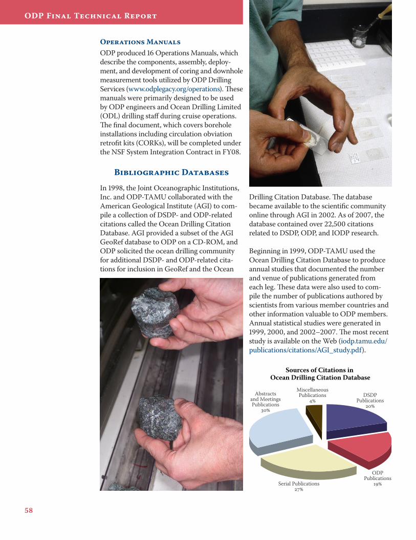
5�
ODP Final Technical Report
Operations ManualsODP produced 16 Operations Manuals, which describe the components, assembly, deploy-ment, and development of coring and downhole measurement tools utilized by ODP Drilling Services (www.odplegacy.org/operations). These manuals were primarily designed to be used by ODP engineers and Ocean Drilling Limited (ODL) drilling staff during cruise operations. The final document, which covers borehole installations including circulation obviation retrofit kits (CORKs), will be completed under the NSF System Integration Contract in FY08.
Bibliographic Databases
In 1998, the Joint Oceanographic Institutions, Inc. and ODP-TAMU collaborated with the American Geological Institute (AGI) to com-pile a collection of DSDP- and ODP-related citations called the Ocean Drilling Citation Database. AGI provided a subset of the AGI GeoRef database to ODP on a CD-ROM, and ODP solicited the ocean drilling community for additional DSDP- and ODP-related cita-tions for inclusion in GeoRef and the Ocean
Drilling Citation Database. The database became available to the scientific community online through AGI in 2002. As of 2007, the database contained over 22,500 citations related to DSDP, ODP, and IODP research.
Beginning in 1999, ODP-TAMU used the Ocean Drilling Citation Database to produce annual studies that documented the number and venue of publications generated from each leg. These data were also used to com-pile the number of publications authored by scientists from various member countries and other information valuable to ODP members. Annual statistical studies were generated in 1999, 2000, and 2002–2007. The most recent study is available on the Web (iodp.tamu.edu/publications/citations/AGI_study.pdf).
Abstractsand MeetingsPublications
MiscellaneousPublications
DSDP
Publications
ODPPublications
Serial Publications
Sources of Citations in Ocean Drilling Citation Database
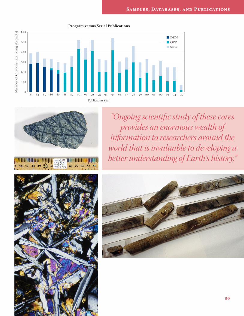
59
Samples, Databases, and Publications
Program versus Serial Publications
Publication Year
Num
ber o
f Cita
tions
(exc
ludi
ng ab
stra
cts)
DSDPODPSerial
“Ongoing scientific study of these cores provides an enormous wealth of
information to researchers around the world that is invaluable to developing a better understanding of Earth’s history.”
ODP Final Technical Report
Out reach
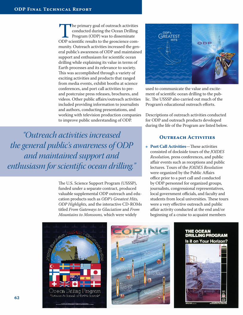
62
ODP Final Technical Report
The primary goal of outreach activities conducted during the Ocean Drilling Program (ODP) was to disseminate
ODP scientific results to the geoscience com-munity. Outreach activities increased the gen-eral public’s awareness of ODP and maintained support and enthusiasm for scientific ocean drilling while explaining its value in terms of Earth processes and its relevance to society. This was accomplished through a variety of exciting activities and products that ranged from media events, exhibit booths at science conferences, and port call activities to pre- and postcruise press releases, brochures, and videos. Other public affairs/outreach activities included providing information to journalists and authors, conducting presentations, and working with television production companies to improve public understanding of ODP.
used to communicate the value and excite-ment of scientific ocean drilling to the pub-lic. The USSSP also carried out much of the Program’s educational outreach efforts.
Descriptions of outreach activities conducted for ODP and outreach products developed during the life of the Program are listed below.
Outreach Activities
Port Call Activities—These activities consisted of dockside tours of the JOIDES Resolution, press conferences, and public affair events such as receptions and public lectures. Tours of the JOIDES Resolution were organized by the Public Affairs office prior to a port call and conducted by ODP personnel for organized groups, journalists, congressional representatives, local government officials, and faculty and students from local universities. These tours were a very effective outreach and public affair activity conducted at the end and/or beginning of a cruise to acquaint members
•
“Outreach activities increased the general public’s awareness of ODP
and maintained support and enthusiasm for scientific ocean drilling.”
The U.S. Science Support Program (USSSP), funded under a separate contract, produced valuable supplemental ODP outreach and edu-cation products such as ODP’s Greatest Hits, ODP Highlights, and the interactive CD-ROMs titled From Gateways to Glaciation and From Mountains to Monsoons, which were widely
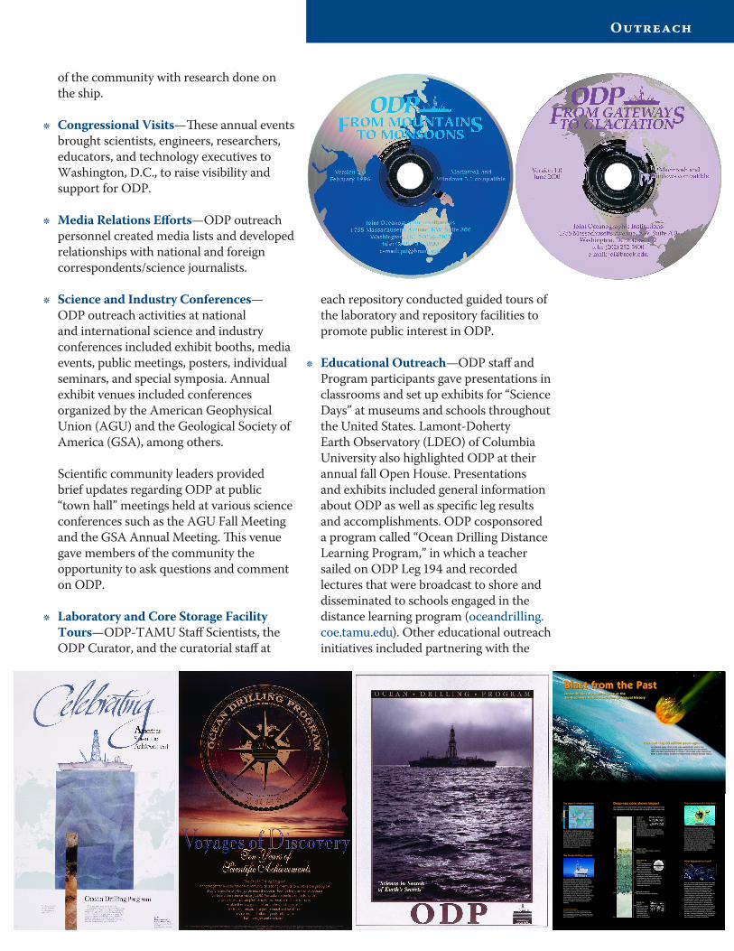
63
Outreach
of the community with research done on the ship.
Congressional Visits—These annual events brought scientists, engineers, researchers, educators, and technology executives to Washington, D.C., to raise visibility and support for ODP.
Media Relations Efforts—ODP outreach personnel created media lists and developed relationships with national and foreign correspondents/science journalists.
Science and Industry Conferences—ODP outreach activities at national and international science and industry conferences included exhibit booths, media events, public meetings, posters, individual seminars, and special symposia. Annual exhibit venues included conferences organized by the American Geophysical Union (AGU) and the Geological Society of America (GSA), among others. Scientific community leaders provided brief updates regarding ODP at public “town hall” meetings held at various science conferences such as the AGU Fall Meeting and the GSA Annual Meeting. This venue gave members of the community the opportunity to ask questions and comment on ODP.
Laboratory and Core Storage Facility Tours—ODP-TAMU Staff Scientists, the ODP Curator, and the curatorial staff at
•
•
•
•
65.0
65.1
Mill
ions
of
year
s ag
o
0
65
251
543
Drill Site
Ceno
zoic
Mes
ozo
icPa
leo
zoic
Impact Site
Equator
Outline ofmodern daycontinents
Continentsas they were 65 million years ago
FIREBALL LAYER:Contains dust and ash fallout from theasteroid impact.
EFFECTS OF THEIMPACT:Ejecta including tektites– glassy spherules con-densed from the hotvapor cloud producedby the asteroid impact– are found in this layerof the core. Debris thrown into theatmosphere by the impact rained downon the Earth for days to months after theevent. The impact and ensuing globalclimatic changes devastated life. In theocean, 95 percent of the free-floatingforaminifera died out.
MOMENT OF IMPACT:K/T (Cretaceous/Tertiary) Boundary
BEFORE THEIMPACT:This layer containsmicrofossils of thelarge and ornateforaminifera thatflourished in theoceans during thetime of the dinosaurs.
An asteroid nearly 10 km (6 mi) wide slammed into what is nowMexico’s Yucatan Peninsula and blasted debris into the atmosphere.When the dust cloud settled, a 177 km (110 mi) wide crater scarred theEarth. A large number of marine and terrestrial creatures became extinct.
One bad day, 65 million years ago...One bad day, 65 million years ago...
The impact: where and when
The drillship, JOIDES Resolution, recovered asediment core from the seafloor 563 km (350 mi)east of modern day Florida at a water depth of2,658 m (8,860 ft). This core was recovered 2,011km (1,250 mi) from the now-buried impact crater.It contains a detailed history of the asteroidimpact and its effects on the Earth. The mapabove shows the shape and location of thecontinents as they were 65 million years agowhen the impact occurred.
The Ocean Drilling Program (ODP) is an inter-national partnership of scientists and researchinstitutions organized to explore the evolutionand structure of the Earth. The program’sresearch vessel, JOIDES Resolution, has traversedthe world’s oceans since 1985 collectingcylindrical cores of sediment and rock from theseafloor. By studying the cores and loweringinstruments into the drill holes to study thesurrounding seafloor, ODP scientists gain a betterunderstanding of Earth’s past, present, andfuture. ODP is sponsored by the U.S. NationalScience Foundation and ODP internationalmembers.
The Ocean Drilling Program
Foraminifera are single-celled organisms thathave inhabited the oceans for over 500 millionyears. They come in many shapes and sizes. Thisliving, free-floating foraminifera from the Carib-bean has just captured its next meal. When theorganism dies, its spiny shell will be preserved onthe seafloor as a microfossil. Their abundance,wide distribution, and sensitivity to environmentalvariations make the foraminifera indicators of pastclimate change. By studying foraminiferamicrofossils scientists can better understandancient organisms, environmental conditions,and dramatic events in Earth’s history.
Tiny creatures tell a big story
How do we know that the extinction in the oceanalso occurred on land? Scientists have recoveredcontinental cores containing iridium, shockedquartz, and soot from global wildfires thatcoincide with the mass extinction at sea. Thisevidence allows scientists to visualize whatconditions must have been like on land. After theasteroid impact, a searing vapor cloud spednorthward. Within minutes, the North Americancontinent was in flames. The rain of burningdebris from the impact caused wildfires andturned most of the land into a “global broiler.”Super hurricane-force winds scoured the Earth.Ash, soot, and debris darkened the skies causingsub-freezing temperatures over most of the landsurface for weeks to months after the impact.Many species were extinguished by the blast fromthe past, including Triceratops. Small mammals likethe ones in the foreground survived. This pivotalevent changed the course of evolution.
What happened on land?
This sediment core recovered by the Ocean Drilling Program recordsthe cataclysmic event that changed life on Earth 65 million years ago.
Deep-sea core shows impact
AFTER THEIMPACT:Only tiny, lessornate forami-nifera microfossilsare found in thislayer; a few newspecies have evolved. Notice the tremen-dous difference in size between the forami-nifera microfossils shown here compared tothose from before the impact.
Blast from the PastBlast from the PastOcean Drilling Program science at theSmithsonian’s National Museum of Natural HistoryOcean Drilling Program science at theSmithsonian’s National Museum of Natural History
Mill
ions
of
year
s ag
o
64.9
John Beck, O
DP/TA
MU
Brian Hub
er, NM
NH
, Smithso
nian Inst.Brian H
uber, N
MN
H, Sm
ithsonian Inst.
Brian Hub
er, NM
NH
, Smithso
nian Inst.
For more informationVisit these web sites: www.nmnh.si.edu/paleo/blast andwww.oceandrilling.org. Or contact: Ocean Drilling Program,Joint Oceanographic Institutions, 1755 Massachusetts Avenue,NW, Suite 800, Washington, DC 20036-2102, USA; (202) 232-3900; [email protected].
Christop
h Hem
leben, U
niversity of Tueb
ingen©
Mary Parrish, N
MN
H, Sm
ithsonian Institutio
n
each repository conducted guided tours of the laboratory and repository facilities to promote public interest in ODP.
Educational Outreach—ODP staff and Program participants gave presentations in classrooms and set up exhibits for “Science Days” at museums and schools throughout the United States. Lamont-Doherty Earth Observatory (LDEO) of Columbia University also highlighted ODP at their annual fall Open House. Presentations and exhibits included general information about ODP as well as specific leg results and accomplishments. ODP cosponsored a program called “Ocean Drilling Distance Learning Program,” in which a teacher sailed on ODP Leg 194 and recorded lectures that were broadcast to shore and disseminated to schools engaged in the distance learning program (oceandrilling.coe.tamu.edu). Other educational outreach initiatives included partnering with the
•
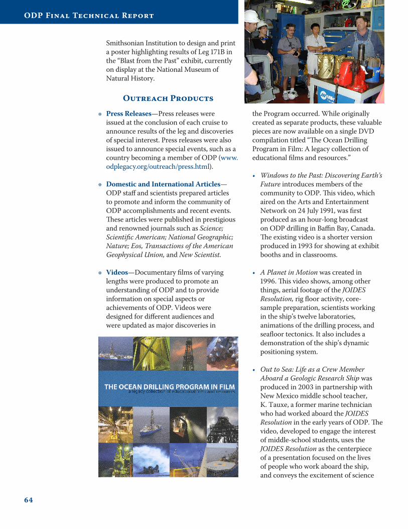
64
ODP Final Technical Report
Smithsonian Institution to design and print a poster highlighting results of Leg 171B in the “Blast from the Past” exhibit, currently on display at the National Museum of Natural History.
Outreach Products
Press Releases—Press releases were issued at the conclusion of each cruise to announce results of the leg and discoveries of special interest. Press releases were also issued to announce special events, such as a country becoming a member of ODP (www.odplegacy.org/outreach/press.html).
Domestic and International Articles—ODP staff and scientists prepared articles to promote and inform the community of ODP accomplishments and recent events. These articles were published in prestigious and renowned journals such as Science; Scientific American; National Geographic; Nature; Eos, Transactions of the American Geophysical Union, and New Scientist.
Videos—Documentary films of varying lengths were produced to promote an understanding of ODP and to provide information on special aspects or achievements of ODP. Videos were designed for different audiences and were updated as major discoveries in
•
•
•
the Program occurred. While originally created as separate products, these valuable pieces are now available on a single DVD compilation titled “The Ocean Drilling Program in Film: A legacy collection of educational films and resources.”
Windows to the Past: Discovering Earth’s Future introduces members of the community to ODP. This video, which aired on the Arts and Entertainment Network on 24 July 1991, was first produced as an hour-long broadcast on ODP drilling in Baffin Bay, Canada. The existing video is a shorter version produced in 1993 for showing at exhibit booths and in classrooms.
A Planet in Motion was created in 1996. This video shows, among other things, aerial footage of the JOIDES Resolution, rig floor activity, core-sample preparation, scientists working in the ship’s twelve laboratories, animations of the drilling process, and seafloor tectonics. It also includes a demonstration of the ship’s dynamic positioning system.
Out to Sea: Life as a Crew Member Aboard a Geologic Research Ship was produced in 2003 in partnership with New Mexico middle school teacher, K. Tauxe, a former marine technician who had worked aboard the JOIDES Resolution in the early years of ODP. The video, developed to engage the interest of middle-school students, uses the JOIDES Resolution as the centerpiece of a presentation focused on the lives of people who work aboard the ship, and conveys the excitement of science
•
•
•
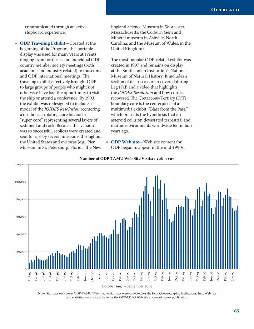
65
Outreach
communicated through an active shipboard experience.
ODP Traveling Exhibit—Created at the beginning of the Program, this portable display was used for many years at events ranging from port calls and individual ODP country member society meetings (both academic and industry related) to museums and ODP international meetings. The traveling exhibit effectively brought ODP to large groups of people who might not otherwise have had the opportunity to visit the ship or attend a conference. By 1993, the exhibit was redesigned to include a model of the JOIDES Resolution reentering a drillhole, a rotating core bit, and a “super core” representing several layers of sediment and rock. Because this version was so successful, replicas were created and sent for use by several museums throughout the United States and overseas (e.g., Pier Museum in St. Petersburg, Florida; the New
•
England Science Museum in Worcester, Massachusetts; the Colburn Gem and Mineral museum in Ashville, North Carolina; and the Museum of Wales, in the United Kingdom). The most popular ODP-related exhibit was created in 1997 and remains on display at the Smithsonian Institution’s National Museum of Natural History. It includes a section of deep-sea core recovered during Leg 171B and a video that highlights the JOIDES Resolution and how core is recovered. The Cretaceous/Tertiary (K/T) boundary core is the centerpiece of a multimedia exhibit, “Blast from the Past,” which presents the hypothesis that an asteroid collision devastated terrestrial and marine environments worldwide 65 million years ago.
ODP Web site—Web site content for ODP began to appear in the mid-1990s,
•
,
,
,
,
,
,
Oct
Feb
Jun
Oct
Feb
Jun
Oct
Feb
Jun
Oct
Feb
Jun
Oct
Feb
Jun
Oct
Feb
Jun
Oct
Feb
Jun
Oct
Feb
Jun
Oct
Feb
Jun
Oct
Feb
Jun
October – September
Number of ODP-TAMU Web Site Visits: –
Note: Statistics only cover ODP-TAMU Web site; no statistics were collected for the Joint Oceanographic Institutions, Inc., Web site and statistics were not available for the ODP-LDEO Web site at time of report publication.
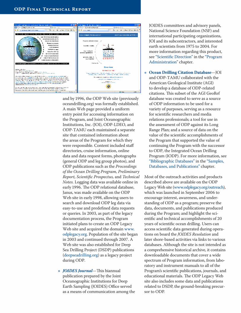
and by 1996, the ODP Web site (previously oceandrilling.org) was formally established. A main Web page provided a uniform entry point for accessing information on the Program, and Joint Oceanographic Institutions, Inc. (JOI), ODP-LDEO, and ODP-TAMU each maintained a separate site that contained information about the areas of the Program for which they were responsible. Content included staff directories, cruise information, online data and data request forms, photographs (general ODP and leg group photos), and ODP publications such as the Proceedings of the Ocean Drilling Program, Preliminary Report, Scientific Prospectus, and Technical Notes. Logging data was available online in early 1996. The ODP relational database, Janus, was made available on the ODP Web site in early 1998, allowing users to search and download ODP leg data via easy-to-use and predefined data requests or queries. In 2003, as part of the legacy documentation process, the Program initiated plans to create an ODP Legacy Web site and acquired the domain www.odplegacy.org. Population of the site began in 2003 and continued through 2007. A Web site was also established for Deep Sea Drilling Project (DSDP) publications (deepseadrilling.org) as a legacy project during ODP.
JOIDES Journal—This biannual publication prepared by the Joint Oceanographic Institutions for Deep Earth Sampling (JOIDES) Office served as a means of communication among the
•
JOIDES committees and advisory panels, National Science Foundation (NSF) and international participating organizations, JOI and its subcontractors, and interested earth scientists from 1975 to 2004. For more information regarding this product, see “Scientific Direction” in the “Program Administration” chapter.
Ocean Drilling Citation Database—JOI and ODP-TAMU collaborated with the American Geological Institute (AGI) to develop a database of ODP-related citations. This subset of the AGI GeoRef database was created to serve as a source of ODP information to be used for a variety of purposes, serving as a resource for scientific researchers and media relations professionals; a tool for use in the assessment of ODP against its Long Range Plan; and a source of data on the value of the scientific accomplishments of the Program that supported the value of continuing the Program with the successor to ODP, the Integrated Ocean Drilling Program (IODP). For more information, see “Bibliographic Databases” in the “Samples, Databases, and Publications” chapter.
Most of the outreach activities and products described above are available on the ODP Legacy Web site (www.odplegacy.org/outreach), which was launched in September 2006 to encourage interest, awareness, and under-standing of ODP as a program; preserve the data, documents, and publications produced during the Program; and highlight the sci-entific and technical accomplishments of 20 years of scientific ocean drilling. Users can access scientific data generated during opera-tions on board the JOIDES Resolution and later shore-based activities via links to various databases. Although the site is not intended as a comprehensive historical archive, it contains downloadable documents that cover a wide spectrum of Program information, from labo-ratory and instrument manuals to all of the Program’s scientific publications, journals, and educational materials. The ODP Legacy Web site also includes some data and publications related to DSDP, the ground-breaking precur-sor to ODP.
•
ODP Final Technical Report
Eternal sunrise, eternal dawn and gloaming, on sea and continents and islands, each in its turn, as the round earth rolls.
—John Muir
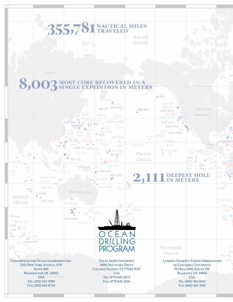
NoNNor
AmericAAmeriica
Asiaa
Auustraalia
Antarcctica
Indian
Ocean
Pacific
Oceaaan
Arctic
Ocean
Southern
Ocean
6767
752-755756
757
758
767-6 771
3-775
776-777
79797 8-8--88 79797 99
8288 7-833
871-1 877
878
879-8808
881 882-884885-886
7
894-895
9
9009009909
1010-1015
1016-10171018-1022
1023-1032
0103939-10433
1108-111888-0088088080808888888 11111 8
1135-1131 6
1137
1138
1140
1141-1142
<1139
1152-1164
1243
626-6
712-713
714-7177 4 7 6
736-737
738
73739999-747433
744
745-747 6
765-766
800
801
802
810
811--818
819-826
842-843
844-845
846
844477848-851
852-854
855-858
859-863
1010111111111111010101
1037-1038
1107
1126-1131 4
11499
11500-1151
1168
1169-1171
1172
1179
1180-1181 2
1183-1187
5044,44444444 67
1203
1204
1205
1206
1223
1224
12121255255
124444 -52251255
62626
717-719
747
748-751
759-761,764
762-763
778-781
782-786
79 -4--797 7
803-80777
834-848 1
864
865
866-868
869-88 70
888-890
891-892
893
11
1095
1096
109
110
1119
1120
1121
1122
1123
1124
1121 5
998-11000
1165
6611666
1167
1192-1199
12000
1201
02
1207-1208
1209-1214
1215
1216
1218-1222
1217
1225
1226
1227-212231
12321233
1234-121235
1236
1237
111111112111111 38-
1241-11241256
2,11122 1111111111111111111111111111112,111
888,00003388,0000338,003
355,781333333 5,781
Consortium for Ocean Leadership, Inc.
New York Avenue, NW
Suite
Washington DC
USA
Tel: () -
Fax: () -
Lamont-Doherty Earth Observatory
of Columbia University
PO Box , Route W
Palisades NY
USA
Tel: () -
Fax: () -
Texas A&M University
Discovery Drive
College Station TX -
USA
Tel: () -
Fax: () -
deepest hole d sin metersii t
nautical milesltraveledd
ecovered in amostt coore recccccovovere n annn most core recoverexpedition in meterssiinglle eexpeed tionnn m tterrssiinglle eexpee tdede ootii nsingle expedition in meters