marshfield sewer service area plan 2040
121
Prepared with the assistance of the North Central Wisconsin Regional Planning Commission
-
Upload
khangminh22 -
Category
Documents
-
view
1 -
download
0
Transcript of marshfield sewer service area plan 2040

Prepared with the assistance of the North Central Wisconsin Regional Planning Commission

MARSHFIELD SEWER SERVICE AREA PLAN 2040
prepared for:
City of Marshfield
by:
North Central Wisconsin Regional Planning Commission
adopted by:
City of Marshfield Common Council
on:
February 23, 2021 ______________________________________________________________________ This Plan was prepared at the request and under the supervision of the City of Marshfield by the North Central Wisconsin Regional Planning Commission (NCWRPC). For more information, contact: NORTH CENTRAL WISCONSIN REGIONAL PLANNING COMMISSION 210 McCLELLAN STREET, SUITE 210 WAUSAU, WI 54403 Telephone: 715-849-5510 FAX: 715-849-5110 email: [email protected]
www.ncwrpc.org

MARSHFIELD SEWER SERVICE AREA PLAN NCWRPC i
TABLE OF CONTENTS
PAGE SECTION 1 INTRODUCTION 1 1.1 Purpose 1 1.2 Description of the Study Area 2 1.3 Reasons for Update to 2010-2030 SSA Plan 2 1.4 Federal and State Legislative Framework 2 1.5 Water Quality Management Roles and Responsibilities 3 1.6 Interrelationships Between the SSA Plan, the Facilities Plan and the Wisconsin River Watershed Plans 4 1.6.1 Watershed Plans 5 1.6.2 Facilities Plans 6 1.6.3 Sewer Service Area Plans 6 1.7 Guidelines for Preparation of the SSA Plan 6 1.8 Overview of Planning Process and Public Involvement 7 SECTION 2 LOCAL PLANS FOR WASTEWATER FACILITIES 10 2.1 Background on Facilities Plans 10 2.2 Existing Wastewater Treatment & Collection Systems 10 2.2.1 City of Marshfield Collection and Treatment System 10 2.2.2 Village of Hewitt Collection and Treatment System 12 2.2.3 Disposal of Septage in Municipal Sewage Systems 13 2.2.4 Summary of the Conclusions and Recommendations of the Local Facilities Plans 15 SECTION 3 AREAWIDE WATER QUALITY MANAGEMENT PLANNING, WATERSHED PLANS AND WATER QUALITY CONDITIONS 16 3.1 Background on AWQMP Planning 16 3.2 Mill Creek Watershed Plan Conclusions and Recommendations 17 3.3 Wisconsin River Total Maximum Daily Load (TMDL) 18 3.4 Discussion of Water Conditions in Marshfield Area 20 SECTION 4 PLANNING AREA GROWTH PROJECTIONS 22 4.1 Introduction 22 4.2 Growth Assumptions 22

MARSHFIELD SEWER SERVICE AREA PLAN NCWRPC ii
4.3 Historical Population Growth 23 4.3.1 City of Marshfield 24 4.3.2 Village of Hewitt 24 4.3.3 Town of Cameron 24 4.3.4 Town of Lincoln 25 4.3.5 Town of Marshfield 25 4.3.6 Town of McMillan 25 4.3.7 Town of Spencer 25 4.4 Population Projections 26 4.4.1 City of Marshfield Population Projections 26 4.4.2 Village of Hewitt Population Projections 26 4.4.3 Town Population Projections 27 4.5 Urban Area Land Use Projections 27 4.5.1 Introduction 27 4.5.2 Urban Area Land Requirements 28 4.5.3 Residential Land Requirements 29 4.5.4 Commercial and Industrial Land Requirements 31 4.5.5 Public Park and Outdoor Recreation Needs 31 4.5.6 Public and Institutional Land Requirements 32 4.5.7 Right-of-Way Land Requirements 32 4.5.8 Allowance for Market Factors 32 4.5.9 Infill and Redevelopment of Vacant Lands 33 4.5.10 Total Urban Area Land Requirements 33 4.5.11 Effect of DOA Decision on Population Projection 34 SECTION 5 ENVIRONMENTALLY SENSITIVE AREAS 36 5.1 Introduction 36 5.2 Floodway 38 5.3 Wetlands 39 5.4 Steep Slopes / Highly Erodible Soils 41 5.5 Parks and Greenways 41 5.6 Wellhead Recharge Areas 42 5.7 Composite Environmentally Sensitive Areas Map 42 5.8 Protection of Environmentally Sensitive Areas 43 SECTION 6 URBAN AREA COMPREHENSIVE PLANS 45 6.1 Introduction 45 6.2 City of Marshfield Comprehensive Plan 45 6.3 Village of Hewitt Comprehensive Plan 47 6.4 Town of Cameron Comprehensive Plan 47 6.5 Town of Lincoln Comprehensive Plan 48 6.6 Town of Marshfield Comprehensive Plan 49
MARSHFIELD SEWER SERVICE AREA PLAN NCWRPC iii
6.7 Town of McMillan Comprehensive Plan 49 6.8 Town of Spencer Comprehensive Plan 50 6.9 North Central Wisconsin Regional Planning Commission Regional Comprehensive Plan 51 SECTION 7 GOALS, OBJECTIVES AND POLICIES OF THE SEWER SERVICE AREA PLAN 52 7.1 Introduction 52 7.2 Goals, Objectives and Policies 52 SECTION 8 SEWER SERVICE AREA BOUNDARY PLAN 57 8.1 Introduction 57 8.2 Plans for Municipal Sewage Treatment Facilities 57 8.3 Plans for Areawide Water Quality Management 57 8.4 Plans for Community Growth and Development 58 8.5 Sewer Service Area Boundary Map 58 SECTION 9 SEWER SERVICE AREA PLAN ADMINISTRATION 61 9.1 Introduction 61 9.2 Sewer Extension Review Process 61 9.2.1 Wellhead Protection Review Process 63 9.3 Review of Plumbing Plans Submitted for State Approval 65 9.4 Other Reviews 65 9.5 Amendment Process 66 9.5.1 Introduction 66 9.5.2 Amendment Standards 67 9.5.3 Amendment Procedures 68 9.6 Appeals 72 9.7 Plan Update 72 List of Maps 1 Study Area 8 2 Water Quality Plan Relationships 9 3 Environmentally Sensitive Areas 44 4 Sewer Service Area Map 60

MARSHFIELD SEWER SERVICE AREA PLAN NCWRPC iv
List of Figures 1 WRB Total Maximum Daily Load (TMDL) 19 2 Wood County Sewer Extension Review Flowchart 62 List of Tables 1 Capacity/Loading Info. Marshfield Treatment Plant 12 2 Pop. Trends 1960-2019 Marshfield and Surrounding 24 3 Marshfield Selected Pop. Projection Summary 26 4 Hewitt Selected Pop. Projection Summary 27 5 Marshfield Area Towns Pop. Projection Summary 27 6 Projected Change in Ave. Persons Per Household 29 7 Average Residential Development Density 30 8 Projected Sewered Land Area Needs for 2040 34 8B Revised Sewered Land Area Needs for 2040 35 9 Environmentally Sensitive Area (ESA) Guidelines 38 10 Sewer Service Area Boundary Profile 59 Appendix A. DOA Correspondence on Population Projection B. Area Future Land Use Plan Maps C. SSA Amendment Process Flow Charts (Wood County) D. Plan Adoption and Approval

MARSHFIELD SEWER SERVICE AREA PLAN NCWRPC 1
SECTION 1.0 INTRODUCTION 1.1 PURPOSE This plan updates and supersedes the 2030 Marshfield Sewer Service Area Plan, which is a formal element of Wisconsin's Areawide Water Quality Management Plan (AWQMP) for the Wisconsin River Basin. This plan was prepared by the North Central Wisconsin Regional Planning Commission (NCWRPC) with the support of the City of Marshfield and the Wisconsin Department of Natural Resources (WDNR). This plan delineates the 20-year sewer service boundary for the City of Marshfield and lists the institutional structures, policies and procedures to implement the Sewer Service Area Plan. The sewer service boundary identifies the geographic land area within which sanitary sewer service is acceptable, including delineation of environmentally sensitive areas to be excluded from sewered development to protect water quality, and intergovernmental jurisdictional issues and processes to enable cost-effective sewer service through the year 2040. In addition to delineating a sewer service boundary, the Sewer Service Area Plan provides a framework for future planning at each individual municipal level. The data, trends, projections and findings developed in this Plan are consistent with the community plans for the City of Marshfield, the Village of Hewitt, and the Towns of Cameron, Lincoln, Marshfield, McMillan and Spencer. The goals and policies updated during this planning process update and supersede those of the previous sewer service area plan and are to be used in the development of local policies concerning land use within these communities. The Sewer Service Area Plan:
establishes the geographic boundaries for possible sanitary sewer service to the year 2040;
updates the existing institutional structure and processes for reviewing boundary and plan amendments and for conducting conformance reviews for sewer extensions at the local level;
serves as a framework for community land development decisions; identifies environmentally sensitive areas (ESA) excluded from publicly
sewered development to protect water quality in accordance with federal law and state statutes and administrative code. ESA delineations influence community development patterns, directing growth outside of these areas to protect water quality. Preserving environmental amenities also enhances and builds upon existing social, cultural and economic value in local communities.

MARSHFIELD SEWER SERVICE AREA PLAN NCWRPC 2
is a formal element of Wisconsin's Areawide Water Quality Management Plan and its implementation is therefore required to be in conformance with the state's water quality management plans and Wisconsin River Total Maximum Daily Load (TMDL) documents and implementation plans.
1.2 DESCRIPTION OF THE STUDY AREA The planning area for the Marshfield 2040 Sewer Service Area Plan is shown in Map 1. This area includes the communities with public sewer systems, the City of Marshfield and the Village of Hewitt, along with the surrounding communities into which sewer sevice might be extended over the 20-year time horizon of the plan. These communities include the Towns of Spencer, McMillan, Marshfield, Cameron, and Lincoln. All of the communities lie within Wood County with the exceptions of part of the City that extends into Marathon County and McMillan and Spencer, which are also in Marathon County. The planning area identifies the area of study for data collection and mapping. An understanding of the growth and development trends affecting the surrounding communities is necessary for a good planning process. 1.3 REASONS FOR AN UPDATE TO THE 2010-2030 SEWER SERVICE AREA PLAN The City has not had any plan amendments since the last sewer service area plan update 10 years ago. However, during these 10 years, growth has infilled areas available for development within the service area. And growth has been increasing. Single and two-family home starts have been higher than the 10-year average each of the last 3 years, and new multifamily developments will have added over 300 additional dwelling units by buildout in 2021. Employment within the City has also been increasing with a number of businesses and industries undergoing significant expansions in recent years. Industrial space available for development has been shrinking. At the same time, the City has seen an increase in inquiries from industries looking to locate within the City. In response, the City has been working to expand its industrial park and be prepared to accommodate potential development. Updating the sewer service area plan is part of that effort. 1.4 FEDERAL AND STATE LEGISLATIVE FRAMEWORK Federal legislation for areawide water quality planning was enacted under the Federal Water Pollution Control Act Amendment of 1972 (Public Law 92-500), commonly known as the Clean Water Act and subsequent amendments in 1977

MARSHFIELD SEWER SERVICE AREA PLAN NCWRPC 3
and 1987. These Acts set the framework for state and national water quality management programs with the goal of making the nation's waters safe for fish and aquatic life uses, recreational use, and human consumption (e.g., fishable, swimmable and drinkable). Congress mandated that this goal be achieved through a comprehensive program of water quality planning, municipal wastewater treatment facilities, and a national discharge permit program for municipal and industrial wastewater discharges. A key section of the Act(s) requires the preparation and implementation of Areawide Water Quality Management Plans. Pursuant to these congressional mandates, the Wisconsin Legislature created chapters 281.11, 281.12 and 283.83 of the Wisconsin Statutes which gives the Wisconsin Department of Natural Resources (WDNR) the state-level authority to act in the role of a delegated agency for the USEPA in the implementation of the Clean Water Act. Under this authority, Chapter NR121 of the Wisconsin Administrative Code was established specifying the policies, procedures and requirements for Wisconsin's Areawide Water Quality Management Plan program. Under this framework, the USEPA together with the state of Wisconsin, has designated three water quality planning areas: Dane County, the seven county Southeastern Wisconsin Regional Planning Area, and the Fox Valley Water Quality Planning Area. Within these "designated planning areas" every community with sanitary sewer is required to participate in sewer service area planning. Outside of these heavily populated metropolitan areas, there are 26 "undesignated" sewer service areas with populations over 10,000. In the Central Wisconsin River Basin, sewer service area planning is conducted by Marshfield, Merrill, Stevens Point, Wausau and Wisconsin Rapids. All plans (often referred to as 208 or sewer service area (SSA) plans) developed under this program must be approved by the WDNR and certified as amendments to the state's AWQMP through formal action by USEPA. 1.5 WATER QUALITY MANAGEMENT PLANNING ROLES AND RESPONSIBILITIES Under NR 121.03 (8) "designated management agency" means any agency in an areawide water quality management plan having responsibility for implementing specific plan recommendations or duties. This may be done through direct activities of the designated management agency or through delegation to other agencies or units of government. Within the context of the Marshfield Sewer Service Area Plan, the following agencies are involved: City of Marshfield - serves as the designated management agency for the purpose of water quality management planning. The City Plan Commission

MARSHFIELD SEWER SERVICE AREA PLAN NCWRPC 4
provides primary oversight of Sewer Service Area Plan administration; however, the Common Council has final approval authority. City staff from the Public Works and Development Services departments share administrative duties in support of the Plan Commission and Council. Marshfield Sewer Service Area Policy Advisory Committee (PAC) - is made up of representatives from the City, the Village of Hewitt and the surrounding towns, including: Cameron, Lincoln, Marshfield, McMillan and Spencer. The PAC provided oversight on the development of the original Sewer Service Area Plan, and continues to act on recommendations for boundary amendments that increase the overall size of the sewer service area (Type II), other plan amendments (non-boundary) and plan updates. Membership and voting is based on population with the City holding six votes and the other communities holding one each. Wood County Planning and Zoning Department - acts as the administrative agent for the Sewer Service Area Plan implementation. Responsibilities include reviewing proposed sewer extensions for plan compliance and providing recommendations regarding service area amendments. The County department also handles this role for the Wisconsin Rapids Sewer Service Area. North Central Wisconsin Regional Planning Commission (NCWRPC) - conducts plan update development processes for the sewer service area plan. Acts as a neutral third party in coordinating between the City of Marshfield, the surrounding communities and Wood County. 1.6 INTERRELATIONSHIPS: SEWER SERVICE AREA PLANS, FACILITIES PLANS,
WISCONSIN RIVER WATERSHED PLANS In Wisconsin, the WDNR is the delegated agency for Clean Water Act implementation. WDNR implements water quality programs in part through the Areawide Water Quality Management Plan (AWQMP) Framework, which is a compilation of guidance and programs to implement the Clean Water Act. Certain elements have individual processes that are automatically certified as part of the state's AWQMP, and other elements are transmitted in annual letters from the WDNR to the USEPA as formal updates to the state's AWQMP. This process varies in terms of public participation, time frames and procedures. All elements are connected, and the Agency strives for consistency and continuity of programs for quality resource management. Federal regulations (40 CFR 130.6) require that the AWQMP Programs address the following elements:

MARSHFIELD SEWER SERVICE AREA PLAN NCWRPC 5
1. Total maximum daily loads—learn more about TMDLs.
(https://dnr.wi.gov/topic/tmdls/) 2. Effluent limitations—effluent limits are covered under the WPDES program
administered by WDNR. (https://dnr.wi.gov/topic/Wastewater/DischargeTypes.html) 3. Municipal and industrial waste treatment—see DNR’s Wastewater
Program for more information. (https://dnr.wi.gov/topic/wastewater/) 4. Nonpoint source management and control—learn more about DNR’s
Nonpoint Source Pollution Program. (https://dnr.wi.gov/topic/Nonpoint/aboutNPSprogram.html)
5. Management agencies—see information about applicable laws, policies, guidance, and memoranda of agreement/understanding. [Regional Planning Agency and local SSA Planning]. (https://dnr.wi.gov/topic/SurfaceWater/planning/ssaplanning.html)
6. Implementation measures—DNR implements various measures to carry out the AWQMP within the individual water quality programs. (https://dnr.wi.gov/topic/SurfaceWater/index.html)
7. Dredge or fill program—DNR certifies dredge and fill permits (issued by the US Army Corps of Engineers) through its §401 certification program.
8. Ground water—visit DEQ’s Ground Water Program for more information. (https://dnr.wi.gov/topic/Groundwater/index.html)
9. Watershed plans—learn more about assessments and surface water planning. (https://dnr.wi.gov/topic/surfacewater/wqmplanning.html)
These elements are addressed in numerous programs that span WDNR's water division. Additional components of the state's AWQMP include integrated reports, administrative rules, surface water monitoring and assessment programs, water quality standards and wastewater treatment programs. Locally, these elements are reflected through a variety of planning requirements, including: watershed plans, facilities plans and sewer service area plans. The relationships between these plans within Central Wisconsin is described below and illustrated in Map 2. 1.6.1 WATERSHED PLANS The Central Wisconsin River Basin is one of 32 major river basins in the State. The basin is comprised of the watersheds for each of the tributaries that drain into the Wisconsin River. Watershed plan development is on-going around the state in the highest priority areas based on the levels of water quality impairment. The primary purpose of watershed plans is as a management guide for federal, state and local actions such as grant awards, conditions for waste treatment discharge permits and identification of specific local planning and action recommendations.

MARSHFIELD SEWER SERVICE AREA PLAN NCWRPC 6
1.6.2 FACILITIES PLANS In contrast with the regional character of watershed plans, the facilities plans are limited to a local area within a major river basin. The facilities plans deal with the planning and preliminary design related to the construction of municipal sewage treatment plants. Through a systematic evaluation of alternatives, the facilities plan is intended to assure that only cost-effective and environmentally sound treatment facilities are constructed. 1.6.3 SEWER SERVICE AREA PLANS The Sewer Service Area Plan is also a local area plan that outlines procedures, land areas and decision criteria for ensuring cost-effective provision of public sanitary sewer. Unlike the facilities plan, which is a 50-year time horizon and an engineering plan for the treatment plant and collection system, the Sewer Service Area Plan identifies land areas projected for development with public sewer based on population projections, community growth trends and natural resource constraints. 1.7 GUIDELINES FOR PREPARATION OF THE SEWER SERVICE AREA PLAN 1) The Sewer Service Area Plan shall be consistent with the requirements of
Wisconsin Administrative Code NR121 "Areawide Water Quality Management Plans".
2) The Plan shall be generally consistent with the land use policies and
recommendations of locally adopted comprehensive plans. 3) The Marshfield Sewer Service Area Policy Advisory Committee shall
oversee the development of the Plan and be responsible for all public policy aspects of the Plan.
4) Opportunities for public participation, including a public hearing per
NR121.08, will be provided as part of the development of the Sewer Service Area Plan.
5) Wood County Planning and Zoning will serve as the designated agent for
administration of sewer extension reviews and sewer service area amendments.

MARSHFIELD SEWER SERVICE AREA PLAN NCWRPC 7
1.8 OVERVIEW OF PLANNING PROCESS AND PUBLIC INVOLVEMENT This Sewer Service Area Plan update was conducted by the North Central Wisconsin Regional Planning Commission (NCWRPC) in conjunction with the City of Marshfield. Development was overseen by the Marshfield Sewer Service Area Policy Advisory Committee (PAC) which is made up of duly designated representatives of each community in the service area, as follows:
Tom Buttke, City of Marshfield Quentin Rosandich, City of Marshfield Bryce Hembrook, City of Marshfield Josh Miller, City of Marshfield Tom Turchi, City of Marshfield Sam Warp, City of Marshfield Marlene Stueland, Village of Hewitt John Damrau, Town of Cameron Josh Mauritz, Town of Lincoln Al Breu, Town of Marshfield Debbie Derfus, Town of McMillan Dennis Gonnering, Town of Spencer
The process involved planning meetings between the NCWRPC, key city departments and Wood County to develop a package of update proposals. The package was presented to the Marshfield Sewer Service Area Policy Advisory Committee for review and approval. The City of Marshfield Plan Commission also held a formal public hearing on the proposed plan. The PAC meetings and the public hearings were open to the public and posted per the City of Marshfield's standard notice procedures. The final plan adoption process involved the City moving the plan through Plan Commission to full Council at regularly scheduled, open and noticed meetings. The list of meetings is a follows: February 18, 2020 Staff City of Marshfield April 27, 2020 Staff City of Marshfield June 24, 2020 Staff City of Marshfield August 31, 2020 Staff City of Marshfield October 22, 2020 Policy Advisory Committee November 17, 2020 City Plan Commission PUBLIC HEARING February 23, 2021 City Council ADOPTION Process documentation can be found in Appendix D.

Marathon County
Wood County
Village of Spencer
Town of Spencer Town of McMillan
Town of Lincoln
City ofMarshfield
Town ofCameron
Town ofMarshfield
Village ofHewitt
Cla
rk C
ount
y
¶This map is neither a legally recorded map nor a surveyand is not intended to be used as one. This drawing isa compilation of records, information and data used forreference purposes only. NCWRPC is not responsible forany inaccuracies herein contained.
Map 1Marshfield Sewer Service Area
Study Area
210 McClellan Street, Suite 210, Wausau, Wisconsin 54403(715) 849-5510 www.ncwrpc.org
Prepared by:
North CentralWisconsin RegionalPlanning CommissionNCWRPC

&!
&
&
!
!
&!
&!
Clark
Dane
Polk
Vilas
Grant
Iron
Bayfield
Rusk
Sawyer
Oneida
Marathon
Sauk
Forest
Taylor
Douglas
Iowa
Dunn
Marinette
Rock
Oconto
Wood
Dodge
Barron Lincoln
Burnett
Jackson
Ashland
Monroe
VernonJuneau
Portage
Chippewa
Buffalo
Adams
Shawano
Langlade
Door
Green
Pierce
St Croix
Washburn
Brown
Columbia
Waupaca
Lafayette
RichlandCrawford
Jefferson
Waushara
Walworth
Eau Claire
Fond du Lac
Outagamie
Florence
Manitowoc
Waukesha
Winne-bago
Racine
Calumet
La CrosseMarqu-
ette Sheboy-gan
Kenosha
Menom-inee
Tremp-ealeau
Pepin
Wash-ington
Kewa-unee
GreenLake
Oza
ukee
Mil-wau-kee
Price
Merrill
Wausau
Marshfield
StevensPoint
WisconsinRapids
Mill Creek
Wiscon
s inRiv
er
¶This map is neither a legally recorded map nor a surveyand is not intended to be used as one. This drawing isa compilation of records, information and data used forreference purposes only. NCWRPC is not responsible forany inaccuracies herein contained.
0 20 40 60 8010Miles
County Boundaries
Map 2Water Quality
Plan Relationships
210 McClellan Street, Suite 210, Wausau, Wisconsin 54403(715) 849-5510 www.ncwrpc.org
Prepared by:
North CentralWisconsin RegionalPlanning CommissionNCWRPC
Central Wisconsin River Basin Planning Area
Sewer Service Area Plans&
! Facilities plans for municipalwastewater treatment

MARSHFIELD SEWER SERVICE AREA PLAN NCWRPC 10
SECTION 2.0 LOCAL PLANS FOR WASTEWATER FACILITIES 2.1 BACKGROUND ON FACILITIES PLANS A local wastewater facilities plan (often referred to as a 201 plan) identifies the facilities, programs, operational improvements, and policies necessary to meet the regulatory framework and permitting requirements. The WDNR regulates municipal (and industrial) operations discharging wastewater to surface water or groundwater through the Wisconsin Pollutant Discharge Elimination System (WPDES) permit program. State statutes that apply to facilities planning and operation include: Chapter 227 on Administrative Procedure and Review, Chapter 281 on Water and Sewage and Chapter 283 on Pollution Discharge Elimination. In addition, a variety of rules have been promulgated into Wisconsin Administrative Code by the WDNR to implement these statutes. Plans for wastewater treatment facilities must be reviewed and approved by the WDNR. Section 281.41, Wis. Stats. requires WDNR review of municipal and industrial treatment plant construction plans as well as related monitoring systems and groundwater monitoring wells. Marshfield's current facilities plan was prepared in 1997 by Strand Associates Inc. under the title, Cost-Effective Analysis and Environmental Information Document: City of Marshfield, WI Wastewater Utility. Hewitt's facilities plan was prepared by Perry-Carrington Engineering Corporation in 1992 and titled, Village of Hewitt Facilities Plan for Wastewater Treatment Plant. Much of the planning data that is found in the facilities plans is applicable and was used in the preparation of this Sewer Service Area Plan. 2.2 EXISTING WASTEWATER TREATMENT AND COLLECTION SYSTEMS The City of Marshfield and the Village of Hewitt are the only municipal wastewater treatment facilities in the study area. The wastewater collection and treatment systems for the City of Marshfield and Village of Hewitt are described below. The City's current treatment plant came on-line in April of 2000. The Village opened its current plant in 1994. 2.2.1 CITY OF MARSHFIELD COLLECTION AND TREATMENT SYSTEM The City of Marshfield maintains a collection and conveyance system that includes four pumping stations, various force mains and about 140 miles of sanitary sewer line, including the new interceptor sewer installed with the Highway 10 re-route. Some sewers in the City are believed to date back to the

MARSHFIELD SEWER SERVICE AREA PLAN NCWRPC 11
1880s. Marshfield's collection system has historically had a high rate of infiltration and inflow (I/I) and has had problems with backups, overflows and bypasses of untreated wastewater during weather related peak flow events. The City has actively addressed I/I removal since the early 1970s through extensive investigation and rehabilitation. Over the last 20 years, the City has invested significantly in improving the collection system and is now dealing with deterioration in a systematic way. As a result, back-ups and flooding issues have largely been controlled. The City of Marshfield began operation of a sanitary sewer collection system in 1880 along with settling and digestion of solids in the wastewater. During the 1920s, additional solids settling and digestion facilities were added. In the 1930s, wastewater treatment facilities were centralized and enhanced to include primary clarification and a trickling filter. In the late 1940s, the municipal treatment facilities were relocated to the immediate past site. That facility included comminution, pumping, pre-aeration, primary clarification, biological treatment by trickling filters, anaerobic sludge digestion and sludge storage. A major expansion to that facility took place in the early 1970s when grit removal, activated sludge facilities (aeration tanks and final clarifiers) and biological sludge handling facilities were constructed. Tertiary treatment sand filters were added in the mid-1980s along with miscellaneous other improvements. This plant was retired during preparation of original SSA Plan. The facilities plan reviewed a number of alternatives to address system deficiencies and meet projected wastewater infrastructure needs. The recommended alternative was the New Site Alternative, new plant at new site. This alternative was determined to be the most overall cost-effective based on initial cost, operation & maintenance costs, and other non-monetary factors. The new facility came on-line in April 2000 with subsequent closure and abandonment of the previous site. Wastewater is conveyed via a gravity interceptor to the current site about two miles southeast of the previous plant. The interceptor eliminated the need for the 29th Street Pumping Station and allows areas in the southeast part of the City to be served by gravity rather than requiring a pumping station and force main. The current facilities consist of three influent screw pumps, each with a capacity of pumping 15 MGD. After being pumped by the influent pumps, the wastewater proceeds through a fine 1/8 inch screening system to remove debris and organics. The debris proceeds through a wash press before being disposed

MARSHFIELD SEWER SERVICE AREA PLAN NCWRPC 12
of as solids waste. Organics and food matter are further removed in a 2.75 MG oxidation activated sludge process tank. Further solids are settled from the wastewater in a 881,000 gallon clarifier. The fully treated wastewater then flows through a 2,000 foot channel where it intersects with and is discharged to Mill Creek. Excess solids are thickened on a three meter gravity belt thickener and pumped to two biosolids storage tanks each holding over 2 million gallons. Currently (at the time of this update), the plant is operating at about 60% capacity and handles peaks without issue. Design criteria for the Marshfield Wastewater Treatment Plant are shown in Table 1.
TABLE 1: Capacity/Loading Information - Marshfield Treatment Plant
FLOW: Average Design Flow-
Peak Instantaneous Flow-
4.63 MGD 28 MGD
LOADING: Biochemical Oxygen Demand (BOD)-
Total Suspended Solids (TSS)- Total Kjeldahl Nitrogen (TKN)-
Phosphorus (P)-
11,000 lb/day 11,000 lb/day 1,550 lb/day 350 lb/day
EFFLUENT LIMITS: Carbonaceous BOD-
TSS- Dissolved Oxygen-
pH-
16 mg/L monthly average 20 mg/L monthly average 4.0 mg/L daily minimum 6-9 s.u.
Source: City of Marshfield 2020. 2.2.2 VILLAGE OF HEWITT COLLECTION AND TREATMENT SYSTEM In 1970, the Village of Hewitt constructed a sanitary sewer collection system and a two cell, clay-lined stabilization pond wastewater treatment facility, with effluent discharging to Mill Creek. The collection system currently consists of approximately 25,400 feet of gravity sewer, 6,900 feet of force main, and six lift stations. By 1985, the Village had reached the plant's design population of 500 persons, and the plant began having difficulty meeting discharge limits. An aeration system was added to the existing ponds. By 1991, wastewater flow had again reached the capacity of the facility, and it was discovered that the

MARSHFIELD SEWER SERVICE AREA PLAN NCWRPC 13
facility itself was a potential groundwater contamination problem due to minimal separation between the pond bottom and the water table. The facilities plan recommended a new treatment plant on a new site as the most cost-effective solution. The "new" facility began operation in 1994, south of the Village near the original plant, which was then abandoned per WDNR requirements. The project included new force main and rehabilitation of all lift stations. The I/I was determined to be not excessive. An oxidation ditch type wastewater treatment system was installed. Treatment components include an automatically cleaned bar screen, grit removal, oxidation ditch with aerators, secondary clarifier, and sludge holding tank. Effluent disinfection is included in the design should it eventually be needed, however, it is not currently required. The oxidation ditch treatment system is an extended aeration activated sludge process. Long slender concrete channels are used as continuous loop reactors to biologically treat wastewater. Water depth is normally 7 to 10 feet with horizontal velocity, oxygen and mixing supplied by surface aerators. Ditch effluent flows to a clarifier where solids are removed. The removed solids are recycled to the ditch or disposed on farmlands. Effluent discharge continues to be at Mill Creek. The projected future population and loadings that this plant has been designed to accommodate are as follows: 113,500 gpd average daily flow; 148,000 gpd wet weather daily flow rate; 250,000 gpd peak daily flow rate; 170 lb/day BOD loading; and 200 lb/day suspended solids loading. Currently (at the time of this update), the plant is operating at about half capacity with no problems. 2.2.3 DISPOSAL OF SEPTAGE IN MUNICIPAL SEWAGE SYSTEMS According to state regulations, a municipal sewage system must accept and treat septage from a licensed disposer between November 15 and April 15 and is required to provide adequate facilities for the introduction of septage into the sewage system. The system may, but is not required to accept septage at others times during the year. Land spreading, according to state regulations and guidelines, is another option for disposal of septage (not negated by the regulations on disposal of septage in municipal systems). Licensed disposers may apply to the municipal system for permission, annually, per state regulations. The system will prepare a disposal plan for each approved applicant with terms and conditions including reasonable fees, again per state regulations. In Marshfield's case they simply pay a license fee, show proof of insurance, and log the source(s) of the wastewater. They are then billed for each load discharged.

MARSHFIELD SEWER SERVICE AREA PLAN NCWRPC 14
Other exceptions to the requirement to accept septage include cases where system capacity would be exceeded or any applicable limitations, standards or other legal requirements would be violated; the septage is not compatible with the system; or the disposer fails to comply with their disposal plan or other disposal rules promulgated by the system. Subject to the above, the system is required to accept, treat and dispose of the septage that is generated within its sewer service area and holding tank wastewater that is generated outside the sewer service area but inside or equal to the facility planning area (established in the facilities plan). If the system is unable to accommodate all requests for acceptance of septage, state regulations establish the following priority system: 1) Wastes from existing or new holding and septic tanks within the sewer
service area and holding tanks within the system's holding tank service area (which may be established by ordinance per state regulations).
2) Wastes from existing holding tanks for residential or commercial
establishments outside the sewer service area and holding tank service area but inside the facility planning area where the holding tank was installed to replace an inadequate private sewerage system.
3) Wastes from existing septic tanks and holding tanks that were installed not
as a replacement to an inadequate sewer system for residential or commercial establishments outside the sewer service and holding tank service areas but inside the facility's planning area.
4) Wastes from new or existing septic and holding tanks for residential or
commercial establishments outside the facility planning area. Disposers may apply to and negotiate disposal plans with systems outside the area where the septage is collected. Locations for land spreading are also at the option of the disposer, subject to County and state licensing and regulation. Cities, villages or towns may not prohibit or regulate disposal of septage on land if that disposal complies with the County and state rules. However, for land disposal on a site where soil, geologic or other conditions may result in an increased probability of groundwater contamination, the department may require additional treatment prior to discharge to that site.

MARSHFIELD SEWER SERVICE AREA PLAN NCWRPC 15
2.2.4 SUMMARY OF CONCLUSIONS AND RECOMMENDATIONS OF THE LOCAL FACILITIES PLANS
Each facility plan evaluated several treatment alternatives and recommended the most cost-effective alternative with minimal environmental impact on the planning area. The selected alternatives have addressed system deficiencies and increased capacity for both the City and the Village. The Marshfield facilities plan concluded that the "new" plant will improve water quality through improved effluent quality and elimination of overflows and bypasses of untreated wastewater. Similarly, the Hewitt plan concluded that the "new" plant would produce a better quality effluent than its predecessor, thus resulting in improved water quality in the receiving stream, Mill Creek. One alternative considered in the Hewitt facilities plan, notable from an areawide sewer service planning standpoint, was regionalization or connection to the City of Marshfield treatment plant. Regionalization was shown to have the least environmental impacts, however, documentation in the plan, including correspondence from the WDNR and the City show strong opposition on both sides to regionalization. These political and social adverse impacts were significant enough that the WDNR determined that regionalization could not be considered a feasible alternative and backed down from requiring it. Today, the Marshfield plant is performing well. The City is working to meet new effluent limits that are coming on-line, however, compliance is not anticipated to be a problem. The Village of Hewitt is also working to address the new limits and is currently doing chemical addition trials. Regionalization options were again evaluated, however, the Village has selected to continue to maintain its own facilities.

MARSHFIELD SEWER SERVICE AREA PLAN NCWRPC 16
SECTION 3.0 AREAWIDE WATER QUALITY MANAGEMENT PLANNING, WATERSHED PLANS AND WATER QUALITY CONDITIONS
3.1 BACKGROUND ON AREAWIDE WATER QUALITY MANAGEMENT PLANNING WDNR is required by section 303(e) of the Clean Water Act to develop a Continuing Planning Process (CPP). The CPP may be described as an umbrella that coordinates all aspects of water pollution control to help ensure the states maintain progress toward protecting and preserving water quality. The state CPP is a description of the state's water quality management and planning activities, providing references to technical documents and sources that explain water quality programs in greater detail. The CPP describes ongoing processes and planning requirements of the state’s Areawide Water Quality Management Plan (AWQMP). The AWQMP is not a single plan or document but rather a compilation of the guidance and programs that DNR uses to implement Clean Water Act requirements. The AWQMP Program provides a structure and foundation on which implementation activities are attached, including Sewer Service Area Plans, Wastewater Facility Plans, permits for effluent limits, stomwater plans and other projects funded through CWA monies, as well as watershed plans, which identify the condition of water and recommendations for management actions. Watershed Plans (formerly called "Basin Plans") document and summarize the condition of health of water resources within the area. Watershed plans incorporate information on current and changing land use, population change, water resource potential and assessments of current conditions based on biological, physical and chemical data compared to established water quality standards and thresholds. Watershed plans identify ecological restoration and remediation priorities and goals of the waters and watersheds and provide recommendations for specific management actions including rivers, lakes, nonpoint source grants, monitoring, and additional management actions. Watershed plans are updated on a rotating basis, with a higher priority, targeted focus on areas with known issues related to restoration, protection or management. The CPP encompasses the broad picture of how decisions are made, how programs relate, and how the public is involved. Wisconsin's AWQMP concerns how programs are implemented, particularly within a specific basin or watershed - through monitoring, assessments, grants, and more. Watershed plans apply the rules, programs, guidance, and identify opportunities for

MARSHFIELD SEWER SERVICE AREA PLAN NCWRPC 17
management actions at a catchment (basin/watershed) and water level (stream, lake, etc.). 3.2 MILL CREEK WATERSHED PLAN CONCLUSIONS AND RECOMMENDATIONS Mill Creek is a 47-mile tributary of the Wisconsin River. The stream originates in the City of Marshfield and has minimal streamflow in the upper reaches. The Marshfield WWTP discharges to the headwaters of Mill Creek and contributes more than 90% of the streamflow at the point of discharge. The upper 14 miles of the stream is listed in NR 104 as a Limited Aquatic Life variance stream and the lower 33 miles is classified as Fish and Aquatic life waters. Mill Creek is also listed as an impaired waterbody on EPA’s 303d list for phosphorus and low dissolved oxygen, which required the Department to develop a TMDL for the stream. The stream is impacted by stormwater run-off from Marshfield, sedimentation, barnyard and cropland run-off, flashy streamflow, channel ditching, streambank erosion, ammonia toxicity and nutrient enrichment. Large volumes of stormwater scour streambeds, erode streamsbanks, and carry sediment, nutrients, and other pollutants to surface waters. Water sample results suggest there is a significant organic loading to the stream. Mill Creek is affected by animal waste run-off, particularly in the lower sections of the watershed where livestock density is high. Multiple point source discharges to Mill Creek occur in the upper one half of the watershed The Mill Creek Nonpoint Source Watershed Implementation Plan was developed by the Wood and Portage county Land & Water Conservation Departments in 2019. Due to the impairments of the Wisconsin River, a TMDL (Total Maximum Daily Load) was developed for the Wisconsin River and its tributaries. The purpose of the Mill Creek Watershed Plan is to develop implementation projects to help the Mill Creek watershed to meet the requirements of the TMDL. The Plan identifies a number of challenges facing the watershed. Wetlands and natural areas in the watershed have been cleared and drained for development and to increase agricultural production in this area. Recent high land values and rental rates due to competition with urban development and farm expansion in this watershed have exacerbated the amount of natural areas lost. A focus on maximum production of agricultural land and urban development combined with a lack of awareness of the need for conservation practices and sustainable management of land for agriculture and development in this area has led to significant sediment and nutrient loading to the Mill Creek.

MARSHFIELD SEWER SERVICE AREA PLAN NCWRPC 18
Increased drainage, flooding and lack of native riparian vegetation has led to significant erosion of streambanks during high flow periods. Moderate to very severe streambank erosion was found to be occurring along the majority of the main stem and tributaries of Mill Creek as well as along other unnamed tributaries to the Mill Creek. Sediment loading estimates based on field inventory of streambank erosion was significantly higher than what was estimated by watershed modeling. To address these challenges, goals for the Mill Creek Watershed Plan were outlined as follows:
1. Improve surface water quality to meet the TMDL limits for total phosphorus and sediment.
2. Increase citizens’ awareness of water quality issues and active participation in stewardship of the watershed.
3. Reduce runoff volume and flood levels during peak storm events. 4. Improve streambank stability and reduce amount of streambank
degradation. 5. Protect and restore fish and wildlife habitat.
Implementation recommendations within the Mill Creek Watershed Plan include best management practices (BMPs) and education and information (E&I) categories. BMP recommendations include: farming procedures & management, vegetative buffers, wetlands restoration, grassed/lined waterways, streambank restoration, water & sediment control basins, grade stabilization, critical area planting, heavy use area protection, and marginal land retirement. E&I recommendations include:
Provide educational workshops and tours on how to implement best management practices.
Engage landowners in planning and implementing conservation on their land and by providing information on the technical tools and financial support available to them.
Provide information on water quality and conservation practices to landowners in the watershed area.
Newsletters and/or webpage with watershed project updates and other pertinent conservation related information.
3.3 WISCONSIN RIVER TOTAL MAXIMUM DAILY LOAD (TMDL) In recent years, the Wisconsin Department of Natural Resources' efforts in planning for and managing water quality within the Wisconsin River basin have revolved around the development of a total maximum daily load or TMDL. The Wisconsin River TMDL study area applies to a large area from the river’s

MARSHFIELD SEWER SERVICE AREA PLAN NCWRPC 19
headwaters in Vilas County to Lake Wisconsin in Columbia County, covering 9,156 square miles – approximately 15 percent of the state. TMDLs were created by the Clean Water Act in the 1970s, but were not implemented or enforced by EPA until the late 1990s when a string of lawsuits challenged EPA's inaction. The Wisconsin River TMDL process began in 2009 with an extensive water quality monitoring process throughout the watershed to provide data for detailed watershed and reservoir model development. A TMDL is the amount of a pollutant that can be discharged into a waterway and still meet water quality standards. In the Wisconsin River Basin, the TMDL will include the total amount of phosphorus and suspended solids that can be discharged into the river, its tributaries and reservoirs, and still meet water quality standards. Under existing conditions, many reservoirs and tributaries in the Wisconsin River do not meet water quality standards due to excess pollutant loads, meaning they are not suitable for their designated uses, such as fishing, wildlife habitat, and/or recreational activities such as boating and swimming. The TMDL concept is illustrated in Figure 1.
FIGURE 1

MARSHFIELD SEWER SERVICE AREA PLAN NCWRPC 20
From the modeling, all point source dischargers within the watershed will receive a waste load allocation. Municipalities will be affected on two fronts: storm water and waste water discharge. Each community will have to work out an implementation plan on how it might best achieve it limits, which will then be incorporated into its discharge permits. Implementation will be phased over a number of permit cycles. The TMDL study and implementation plan provides a framework and prioritizes resources for water quality improvement in the Wisconsin River Basin by determining: the magnitude of the existing pollutant load; what the contribution is from each pollution source; how much pollution needs to be reduced by in order for each waterway to meet water quality standards and achieve their designated uses (fishing, recreation, habitat etc.); and how the needed pollutant load reductions will be achieved for each waterway. 3.4 DISCUSSION OF WATER RESOURCE CONDITIONS IN THE MARSHFIELD AREA Marshfield's municipal wells are shallow (only 50 to 90 feet deep) and exist in sand and gravel deposits within narrow bedrock channels. Domestic and farm supply wells in the surrounding towns and village are low yielding wells drilled into fractured bedrock. Top soil consists of 8 to 10 feet of tight clay soils, which limits recharge. The shallow depth to groundwater and fractured bedrock aquifers leave the water supply in the Marshfield area susceptible to contamination by microbes and other contaminant sources. Low levels of nitrate and volatile organic compounds have been found in the Marshfield water supply as shown in various water quality reports over time. As a result of these conditions, the Village of Hewitt, which relies on individual wells rather than a municipal supply, has recently had to turn down a number proposed new residential developments due to concerns about limited water quantity and poor water quality. In the surrounding town areas, large lot sizes and distances between residential units tend to minimize these issues. Due to the agricultural nature of the Marshfield area, the primary sources of surface water pollutants include: 1) polluted runoff from agricultural operations, 2) sediment from cropland erosion, and 3) runoff from winter-spread manure. Streambank erosion is also a significant issue. Such factors resulted in the Upper Yellow River Watershed being selected for a Priority Watershed project in 1994 to reduce the amount of pollutants reaching the surface water and groundwater within the watershed. The other notable surface water issue in the area is the impaired water (EPA 303d) listing of certain sections of Mill Creek which suffer from low dissolved

MARSHFIELD SEWER SERVICE AREA PLAN NCWRPC 21
oxygen and is impacted by stormwater runoff, sedimentation, agricultural runoff, flashy stream flow, streambank erosion, and nutrient enrichment. As noted in Section 2, Mill Creek is the receiving water for treated effluent from both the City of Marshfield and Village of Hewitt waste water treatment plants.

MARSHFIELD SEWER SERVICE AREA PLAN NCWRPC 22
SECTION 4.0 PLANNING AREA GROWTH PROJECTIONS 4.1 INTRODUCTION Delineation of a year 2040 sewer service area requires the development of a series of assumptions and projections concerning population growth of the Marshfield Area, average household size, number of households, development densities, and a plan of projected land use patterns. All assumptions and projections utilized within this plan report are consistent with population figures from the Wisconsin Department of Administration. 4.2 GROWTH ASSUMPTIONS Because planning for 20 years into the future cannot be based upon an absolute degree of certainty, it is important that there be a general consensus about the assumed future conditions from which planning projections are made. Changing development goals and policies within each of the area municipalities could require changes in the assumptions over the term of the planning period. The following growth assumptions serve as the basis for the projections found in Section 4.4. In addition, the historical population growth examined in Section 4.3 serves as important underpinning data to the municipal and area projections. 1) The Marshfield area will remain a hub for growth within central Wisconsin. 2) Statewide population trends have been toward decentralization to the
outer ring around the core city. This has created a diffuse kind of "bedroom community", building up in the rural area surrounding the City of Marshfield.
3) Wisconsin annexation statutes will continue to be a barrier to the physical
expansion of the urban area's incorporated municipalities. 4) The physical setting and national recognition (i.e: Bizjournal and other
publications) of the Marshfield area will continue to attract population and businesses.
5) Expansion of Highway 10 has spurred growth in the community,
particularly on the south side (industrial and business parks), and facilitated commuting to other employment centers such as Stevens Point or Wisconsin Rapids thereby enabling people to maintain residence in the Marshfield area.

MARSHFIELD SEWER SERVICE AREA PLAN NCWRPC 23
6) Marshfield will continue to support growth in specialized industries such as
research, dairy/food processing, wood products, distribution, metal fabrication (stainless steel), and other manufacturing industries.
7) The Marshfield Clinic will remain a very strong base for urban area growth. 8) There will be enough jobs created in the Marshfield area to provide a
basis for population growth. 9) Local units of government in the Marshfield area will be receptive to
growth contingent upon reasonable standards, regulations, and financial feasibility.
10) Marshfield will continue to provide a satisfactory level of public services
and cultural and environmental amenities. 4.3 HISTORICAL POPULATION GROWTH Wood County has been a steadily urbanizing county with the growth of the Marshfield and Wisconsin Rapids urban areas. Historically, the growth of the Marshfield urban area has been a major portion of the overall growth of the County. The population of Marshfield has increased by 38 percent from 1960 to present with significant expansion in the 1960's and 1970's. The nineties were the only period to end with a net loss, however growth has rebounded and continued to trend positive since that time. When one looks only at Marshfield's population growth, the degree of urban area growth is not truly evident. The areas adjacent to the City of Marshfield have also experienced significant increase in population. The townships of Cameron, Lincoln, Marshfield, McMillan and Spencer, and the village of Hewitt have seen a combined population growth of 63% over this same period (1960 to present). This increase in population surrounding the City has fueled expansion of commercial and industrial areas within the City.

MARSHFIELD SEWER SERVICE AREA PLAN NCWRPC 24
TABLE 2: Population Trends 1960 - 2020 Marshfield And Surrounding Communities City of Marshfield V. of Hewitt T. of Cameron T. of Lincoln T. Marshfield T. of McMillan T. of Spencer
Year Pop. % Change
Pop. % Change
Pop. % Change
Pop. % Change
Pop. % Change
Pop. % Change
Pop. % Change
1960 14,153 0 286 1,241 977 1,209 806
1970 15,619 10.4 211 100.0 503 75.9 1,232 -0.7 845 -13.5 1,255 3.8 972 20.6
1980 18,290 17.1 470 122.7 590 17.3 1,269 3.0 784 -7.2 1,433 14.2 989 1.7
1990 19,293 5.5 595 26.6 522 -11.5 1,429 12.6 767 -2.2 1,697 18.4 1,036 4.8
2000 18,800 -2.6 670 12.6 510 -2.3 1,554 8.7 811 5.7 1,790 5.5 1,341 29.4
2010 19,118 1.7 828 23.6 511 0.2 1,564 0.6 764 -5.4 1,968 9.9 1,581 17.9
2020 19,478 1.9 841 1.6 474 -7.2 1,599 2.2 788 3.1 2,043 3.8 1,640 3.7
Source: U.S. Census & WisDOA 4.3.1 CITY OF MARSHFIELD The City of Marshfield has seen steady growth for most of the past 60 years. The 2000 Census marked the first time in recent history in which the City population decreased. However, current estimates indicate that the population is again growing with 360 new residents since the 2010 Census. According to Wisconsin Department of Administration estimates, as of 2020, the City's population was 19,478. Much of this growth is attributable to the expansion of the medical services industry, as well as research, manufacturing, dairy food processing, wood products, distribution, and metal fabrication industries. However, it is difficult to determine how much of the growth is being captured by the surrounding communities. 4.3.2 VILLAGE OF HEWITT The Village of Hewitt experienced significant growth since its incorporation, growing 123 % in the 1970's. Since then, growth has remained relatively strong with an increase of 26.6 % between 1980 and 1990. During the1990's, the growth rate tapered slightly to 12.6 % and rebounded back to 23.6% through 2010. Since then growth has dropped off significantly due in part to a lack of a municipal water system which has hampered the potential for further growth. 4.3.3 TOWN OF CAMERON Between 1960 and 1970, Cameron experienced a 75.9 % increase in population. There was continued growth between 1970 and 1980 of 17.3 %, but then population declined 11.5 % during the 1980's and another 2.3 % in the 1990's.

MARSHFIELD SEWER SERVICE AREA PLAN NCWRPC 25
Population rebounded slightly by 0.2 %, by 2010 but then continued its decline, by another 7.2 % to 2020. Because of the Town's small geographic area (1/4 of a "normal" township) and the fact that it is bordered by industrial development to the north and commercial to the east, the Town may have a disadvantage in drawing residential growth that typically seeks a buffer from traffic and noise. Cameron may be more attractive to additional commercial and industrial development due to its location. 4.3.4 TOWN OF LINCOLN The Town of Lincoln posted a net loss of population from 1960 to 1970, but rebounded slowly during the 1970's. The 1980's saw a "boom" in the Town with a 12.6 % increase in population. The Town continued to exhibit this stronger growth posting another 8.7 % increase in the 1990's but has slowed since then posting increases of 0.6 % through 2010 and 2.2 % between 2010 and 2020. Residential development has concentrated to the north and northeast toward the City of Marshfield. 4.3.5 TOWN OF MARSHFIELD The Town of Marshfield has experienced a declining population for much of the last 60 years, declining 21.5 % from 1960 to 1990. A significant chunk of this decrease occurred in the 1960's when the Village of Hewitt incorporated. The 1990's saw a reversal of this trend for the Town, which posted growth of 5.7 % for the decade, however, population was again on the decline, by 5.4 %, between 2000 and 2010. SInce 2010, the Town has again recovered slightly with an increase of 3.1 %. 4.3.6 TOWN OF MCMILLAN The Town of McMillan had an 18.9 % increase in population from 1960 to 1980. The Town maintained this strong growth with another 18.4 % increase in the 1980's. Much of this growth occurred in developing residential areas north of the City of Marshfield. The Town's growth has continued with a 5.5 % increase posted in the 1990's, 9.9 % in the 2000's and 3.8% from 2010 to 2020. 4.3.7 TOWN OF SPENCER The Town of Spencer's growth rate tapered off significantly in the 1970's and 1980's after increasing by 20.6 % during the 1960's. Spencer's growth then jumped to nearly 30 % for the 1990's, and it has remained strong posting a 17.9 % increase between 2000 and 2010 and 3.7 % from 2010 to 2020. Spencer is likely

MARSHFIELD SEWER SERVICE AREA PLAN NCWRPC 26
somewhat influenced by major employers in the Village of Spencer six miles northwest, however a significant amount of this growth is likely attributable to wider employment opportunities in Marshfield. 4.4 POPULATION PROJECTIONS 4.4.1 CITY OF MARSHFIELD POPULATION PROJECTIONS Sewer service area plans are required to account for growth over a twenty-year period. For sewer service area planning purposes, population forecasts are required to be consistent with figures from the Wisconsin Department of Administration. However, these official figures show a significant decline through 2040. Since the current 2020 population is notably higher than the state's 2020 projection, and since current conditions seem to indicate growth for the City moving forward, the NCWRPC prepared an alternative projection. Both projections are compared in Table 3.
TABLE 3: City of Marshfield 2040 Population Projection Summary by Five-Year Intervals
2020 2025 2030 2035 2040
City - DOA Projection
18,975 18,930 18,785 18,585 18,030
City - RPC Projection
n/a 19,490 19,665 19,842 20,021
Source: WisDOA 2013 & NCWRPC 2020. 4.4.2 VILLAGE OF HEWITT POPULATION PROJECTION The Village of Hewitt is projected to expand by an additional 74 people by the end of the planning period for a total year 2040 population of 915. Table 4 provides a population projection summary by five-year intervals for the Village based on the population figures from WisDOA. However, with the current water resource situation, growth is not expected to be able to continue at this rate.

MARSHFIELD SEWER SERVICE AREA PLAN NCWRPC 27
TABLE 4: Village of Hewitt 2040 Population Projection Summary by Five-Year Intervals
2020 2025 2030 2035 2040
Village of Hewitt
860 885 900 920 915
Source: WisDOA 2013. 4.4.3 TOWN POPULATION PROJECTIONS The five towns surrounding the City of Marshfield are projected to increase an additional 621 by the close of the twenty-year planning cycle for a total year 2040 population for all towns of 7,165. This is a 9.5 % increase over the 2020 population. Table 5 provides a population projection summary by five-year intervals for each town based on the projection figures from WisDOA.
TABLE 5: Marshfield Area Towns Population Projection Summary
by Five Year Intervals
Town of: 2020 2025 2030 2035 2040
Cameron 465 450 430 410 385
Lincoln 1,600 1,620 1,640 1,645 1,615
Marshfield 760 760 750 740 720
McMillan 2,125 2,215 2,290 2,335 2,365
Spencer 1,760 1, 860 1,955 2,030 2, 080 Source: WisDOA 2013.
4.5 URBAN AREA LAND USE PROJECTIONS 4.5.1 INTRODUCTION Precise projections of the future land use requirements of an urban area are often difficult to determine because of continually changing conditions, and the fact that land area needs of an urban area are satisfied in large part by lands throughout the County. The Sewer Service Area Plan recognizes that the primary determinants of land needs on a long-range basis are subject to significant change that will certainly happen over time, and that such change cannot be accurately accounted for.

MARSHFIELD SEWER SERVICE AREA PLAN NCWRPC 28
Such determinants include private sector decisions that determine the market for doing business in the urban area, technological and economic factors which may increase or decrease land needs for certain uses, governmental policy and regulation, energy factors and continually changing cultural preferences for styles of working and living. For example, the overall growth projection for the Marshfield Area would be reduced if an energy crisis would make it more necessary to live and do business in metropolitan areas, as opposed to the current preferences to live and do business in small cities and rural areas. This Plan contains projections of the acreage of lands within the urban area judged necessary for and having "potential" for commercial, industrial and residential uses, and which have a reasonable likelihood of development according to current trends and economic outlooks. While these projections are not based exclusively upon future population, they nevertheless were developed with future population needs in mind. In doing this, the projected quantities of land required to meet the needs of the urban area include excess lands beyond actual need. The excess lands are provided to account for the reality that in a free market economy there is expected to be flexibility of choice of building sites when purchasing land for development. This is necessary to avoid excessively high prices which would be caused by unreasonable limitations on land availability. This "market factor" is further discussed later in this section. Planning for an adequate supply of developable land operates within the overall philosophy that restricting development of certain lands for public interest purposes such as environmental and agricultural protection is necessary and desirable. The land use projections and recommendations in this report acknowledge and attempt to serve this overall land use planning philosophy. 4.5.2 URBAN AREA LAND REQUIREMENTS This Plan recognizes that the actual level of development may vary from the projections shown. The projection figures are intended to be indicators of the nature and intensity of future development, and as such the specific figures themselves do not represent any official or final level of acceptance. The projected quantities of future land uses are generally based upon the following factors: 1) Future land use plans within adopted community comprehensive plans, 2) Land use planning principles and locational criteria, 3) Natural land capabilities,

MARSHFIELD SEWER SERVICE AREA PLAN NCWRPC 29
4) Potential and likelihood of public utility extensions, 5) Degree of access and potential for improvement, 6) Availability and use of lands, and 7) Local governmental and citizen goals and values already known to exist
or emerging in certain areas. 4.5.3 RESIDENTIAL LAND REQUIREMENTS 4.5.3A AVERAGE HOUSEHOLD SIZE Projections of the average number of persons per household are an important variable in estimating the amount of additional land that will be needed for residential purposes. On the national level, the population per household has steadily declined since the 1960's, while the country's total population has increased. The decline in household size is reflected in the large increase in the nation's housing stock. On a community level, changes in average number of persons per household are influenced by national trends, but even more so by the mix of housing types and the age and cost of the community's housing stock. The factors that influence household size on a community basis make these projections difficult, however, such projections remain necessary to determine the amount of residential land consumption during the planning period.
TABLE 6: Projected Change in Average Persons Per Household for Marshfield Area 2010 to 2040
2010 2015 2020 2025 2030 2035 2040
State of Wisconsin
2.43
2.38 (-2.06%)
2.35 (-1.26%)
2.32 (-1.28%)
2.30 (-0.86%)
2.28 (-0.87%)
2.26 (-0.88%)
C. Marshfield 2.14 2.10 2.07 2.04 2.03 2.01 1.99
V. Hewitt 2.69 2.63 2.60 2.57 2.55 2.52 2.50
T. Cameron 2.47 2. 42 2.39 2.36 2.34 2.32 2.30
T. Lincoln 2.66 2.61 2.57 2.54 2.52 2.50 2.47
T. Marshfield 2.68 2.62 2. 59 2.56 2.54 2.51 2.49
T. McMillan 2.78 2.72 2.69 2.65 2.63 2.61 2.59
T. Spencer 2.86 2.80 2.77 2.73 2.71 2.68 2.66
Source: US Bureau of Census, 2010; WisDOA, 2013; and NCWRPC, 2020.

MARSHFIELD SEWER SERVICE AREA PLAN NCWRPC 30
The projections shown in Table 6 were developed for the Marshfield urban area and are based on projections for the state by the Department of Administration. The average household size for each community in the urban area was projected from 2010 to the year 2040 by applying the rate of household decline projected for the state to each of the Community's 2010 household size. 4.5.3B AVERAGE DEVELOPMENT DENSITY Projecting future development density is another important variable in determining residential land needs. Table 7 shows the densities at which the level current development has occurred through 2019 for each community in the planning area. These densities were determined using land areas calculated through the NCWRPC project geographic information system (GIS) database, the WisDOA 2019 population estimates, and the above persons per household data. The average residential population density provided by the service area is calculated to be 7.87 persons per residential acre with the overall population density at 2.18 persons per acre. This density converts to a residential development density of 3.8 housing units per acre (1.1 hu/ac.overall) based on the estimated average household size for Marshfield. This density is significantly higher than the average density of unsewered parts of the planning area, also illustrated in Table 7. The higher density level is needed for cost-effective sewer service.
TABLE 7: Average Residential Development Density of the Urban Area, 2019
Community Overall Average Population Density (persons per acre)
Average Residential Population Density (persons/residential acre)
Average Residential Development Density (housing units per res. acre)
City of Marshfield 2.18 7.87 3.80
Village of Hewitt 1.42 5.12 1. 97
Town of Cameron 0.11 1.63 0.68
Town of Lincoln 0.07 1.85 0.72
Town of Marshfield 0.08 1.74 0.67
Town of McMillan 0.09 1.26 0. 47
Town of Spencer 0.08 1.42 0.55 Source: NCWRPC, 2020.

MARSHFIELD SEWER SERVICE AREA PLAN NCWRPC 31
4.5.3C RESIDENTIAL LAND REQUIREMENTS An estimated 93 additional residential acres should be required to meet the needs of the urban area population by the year 2040. This is determined by dividing the projected population growth from 2020 to 2040 (543) by the projected persons per household (1.99) to arrive at the estimated number of new households (273) required to meet the additional need. The number of additional housing units is then divided by the estimated development density of 3.8 units per acre to determine the additional acreage of residential land that will require sewer service (72). 4.5.4 COMMERCIAL AND INDUSTRIAL LAND REQUIREMENTS Commercial and industrial growth are important determinants of land requirements in the urban area. Labor force figures for Marshfield were obtained from the U.S. Census Bureau's Local Employment Dynamics (LED) website. This data shows an average annual growth in employment of 0.82%. Between 2012 and 2017, the number of jobs in Marshfield increased from 18,689 to 19,458. Total employment will therefore be expected to increase by 3,538 jobs by 2040. The LED data indicates that 16% of this employment is goods producing (industrial) and 84% trade and other services (commercial). This ratio breaks down the estimated employment to 566 additional industrial workers and 2,972 new commercial employees. These employment estimates were used in conjunction with NCWRPC estimated employment densities (number of employees per acre) for commercial (20.66) and industrial (4.36) land use types to determine acreage needs for future employment. Thus, an estimate of 274 additional commercial (144) and industrial (130) acres for the urban area is anticipated by the year 2040. These figures are generally consistent with the City's comprehensive plan. 4.5.5 PUBLIC PARK AND OUTDOOR RECREATION NEEDS Park and outdoor recreation needs can constitute a significant portion of land within the future urban area. The recommended standard used by the NCWRPC in figuring park needs is 10.5 acres per 1,000 population. This standard is not intended to include specialized outdoor recreational facilities such as nature reserves, hunting grounds, public utility lands, golf courses, athletic fields, private facilities or school lands. The above standard may be conservative in

MARSHFIELD SEWER SERVICE AREA PLAN NCWRPC 32
meeting current and future needs. The following formula summarizes the public parkland needs of the City for the planning period to 2040: Population increase 2020-2040 = 543 x 10.5 acres / 1,000 Population = 6 additional acres needed by 2040. 4.5.6 PUBLIC AND INSTITUTIONAL LAND REQUIREMENTS Public and institutional use of land is typically a smaller but important element of an urban area. In some cases public land consumption may be more significant such as the location of the county seat or a heavy federal government presence. Typically, this category of land use includes things like: government services, schools, utilities, and churches among others. An estimated 28 net acres will be required to meet the needs of the urban area population by the year 2040. This projection is based on the existing level of service in terms of the land area devoted to public and institutional uses per person in the community. 4.5.7 RIGHT-OF-WAY LAND REQUIREMENTS The space consumed for the transportation facilities which we use to access all the land types discussed above is often overlooked when doing acreage allocation for land use needs. Although modern planning practice is often recommending that communities shift to "neo-traditional" standards including narrower streets, right-of-way can still consume significant amounts of land which must be accounted for because other "hard" development should not locate within these reserved areas. Right-of-way consumes as much as 25 percent of the developed land area of communities in Wisconsin. In Marshfield, the GIS database indicates that right-of-way area amounts to about 16 percent, which will be assumed to remain constant over the planning period. Thus, the estimate for additional land needed for right-of-way totals 64 acres through 2040 based on the acreage allocated for other land uses specified above. 4.5.8 ALLOWANCE FOR MARKET FACTORS As stated earlier, the philosophy of this Plan is to provide additional lands beyond the net needs of the urban area to provide flexibility and choice in development sites. To accommodate factors beyond the control of local government which render lands unavailable for development, a market factor of 3 has been provided. This factor was based on the projected future land

MARSHFIELD SEWER SERVICE AREA PLAN NCWRPC 33
area needs and a cursory review of undeveloped lands in and around the urban area, as well as the likelihood that a given piece of property will be available for development at any given time. Current projections (on which the allocation of area expected to require sewer service in the future are based) reflect development conditions that are significantly curtailed due to the economic downturn. Within the long-range, 20-year, planning horizon of this Sewer Service Area Plan, economic recovery and improved development conditions are anticipated. Resulting growth is anticipated to exceed the current projections in the long-term. This market factor allowance is necessary to accommodate this development and provide flexibility and choice in siting. In addition, the original sewer service area was deemed too restrictive by state and local officials. The market factor selected for this update is expanded to address that concern. The market factor makes available an additional 1,332 acres over the actual net need within the year 2040 sewer service area to accommodate market decisions. While not all of this additional acreage would be expected to be developed during the planning period, it is anticipated that this acreage will provide additional opportunities for development in the event of other lands being kept off the real estate market. 4.5.9 INFILL AND REDEVELOPMENT OF VACANT LANDS A certain amount of undeveloped land exists within the current corporate limits of the City of Marshfield. This Plan recognizes that infill development is good public policy and establishes goals and objectives to achieve infill. There is a clear cost effectiveness advantage to infill development that has infrastructure like sewer and water lines already installed. Developable areas already served by urban utilities and services are included in the acreage allocated to the sewer service area. These areas may have been by-passed by development or be available for redevelopment like brownfields. Sites that are developed, but vacant and available for possible reuse/redevelopment were not inventoried for this Plan. However, the number of sites of this type is considered low, as Marshfield has a good history of reuse. 4.5.10 TOTAL URBAN AREA LAND REQUIREMENTS The estimated land needs in the year 2040 for the Marshfield Urban Area are

MARSHFIELD SEWER SERVICE AREA PLAN NCWRPC 34
projected to be 1,776 acres less the infill goal of 100 acres for a total need of 1,676 additional acres. This acreage will consist of the following land use needs shown in Table 8.
TABLE 8: Projected Sewered Land Area Needs for Marshfield in Year 2040
Land Use Net Acreage Demand
Market Factor Total Acreage Demand
Residential 72 Acres 216 Acres 288 Acres Commercial 144 Acres 432 Acres 576 Acres Industrial 130 Acres 390 Acres 520 Acres Recreation 6 Acres 18 Acres 24 Acres Institutional 28 Acres 84 Acres 112 Acres ROW 64 Acres 192 Acres 256 Acres
Subtotal 444 Acres 1,332 Acres 1,776 Acres Less Infill -100 Acres - 100 Acres
Totals 344 Acres 1,332 Acres 1,676 Acres Source: NCWRPC, 2020.
These estimated land needs are generally consistent with the City of Marshfield Comprehensive Plan. They have been updated for 2020 and incorporate modified methodologies for commercial acreage allocation and market factor assignment. 4.5.11 EFFECT OF DOA DECISION ON POPULATION PROJECTION Wisconsin's "current" official population projections are somewhat dated, having originated in 2013 based on 2010 Census information. These projections show a drastic decline in the population of the City of Marshfield by the year 2040 which seems to be in conflict with the state's official population estimate figures. Those estimates show the City steadily growing for at least the last five years. In fact, the official 2020 population estimate exceeds the state's projection for 2020 by over 500. Based on those estimate figures, the NCWRPC prepared its standard planning level population projection which results in a slight increase in anticipated population for the City. This would allow the City to maintain the size of its sewer service area. Both the NCWRPC and the City of Marshfield believe this alternative projection to be reasonable based on a number of observations:

MARSHFIELD SEWER SERVICE AREA PLAN NCWRPC 35
Marshfield maintains strong quality of life factors, including access to world-
class health care facilities that will continue to attract a broad range of people across all age groups.
Marshfield continues to see a boom in employment with significant
expansions of a diverse range of businesses and industries, and the City continues to field inquiries for industries looking to locate within the City.
Growth projected for the surrounding rural area will be diverted into the
City due to water quality and wastewater disposal issues.
To support this growth, the City has implemented a number of programs to encourage and assist these new workers in finding residences within the City rather than one of the neighboring communities. These programs have led to single and two-family home starts higher than the 10-year average each of the last 3 years, and new multifamily developments will have added over 300 additional dwelling units by buildout in 2021.
The NCWRPC presented this alternative projection to the Wisconsin Department of Administration, which declined to provide its concurrence. Correspondence related to the request and WisDOA's response can be found in Appendix A. The effect of this decision is to negate that portion of the sewer service area allocation based on population growth; see Table 8B for the resulting Sewered Land Area Needs. The end result is a reduction of 504 acres of sewer service area allocation for the City of Marshfield through 2040.
TABLE 8B: Revised Sewered Land Area Needs for Marshfield in Year 2040
Land Use Net Acreage Demand
Market Factor Total Acreage Demand
Residential 0 Acres 0 Acres 0 Acres Commercial 144 Acres 432 Acres 576 Acres Industrial 130 Acres 390 Acres 520 Acres Recreation 0 Acres 0 Acres 0 Acres Institutional 0 Acres 0 Acres 0 Acres ROW 44 Acres 132 Acres 176 Acres
Subtotal 318 Acres 954 Acres 1,272 Acres Less Infill -100 Acres - 100 Acres
Totals 218 Acres 954 Acres 1,172 Acres Source: NCWRPC, 2020.

MARSHFIELD SEWER SERVICE AREA PLAN NCWRPC 36
5.0 ENVIRONMENTALLY SENSITIVE AREAS 5.1 INTRODUCTION Delineating environmentally sensitive areas is one of the most important components of a sewer service area plan. These areas need to be protected in order to protect water quality. According to Administrative Code NR 121 provisions, "Major areas unsuitable for the installation of waste treatment systems because of physical or environmental constraints are to be excluded from the service area. Areas to be considered for exclusion from the sewer service area because of the potential for adverse impacts on the quality of the waters of the state from both point and nonpoint sources of pollution include but are not limited to wetlands, shorelands, floodways and floodplains, steep slopes, highly erodible soils and other limiting soil types, groundwater protection areas, and other such physical constraints." Environmentally sensitive areas are defined, generally, as those areas that are unsuitable for sewered development because of the potential significant adverse impact upon water quality (see NR 121.05(1)(g)2.c.). The sewer service area is that area presently served or anticipated to be served by a sewage treatment system within a sewer service area plan's 20-year planning period. Technically, the sewer service area does not include environmentally sensitive areas, which are delineated separately and do not count in acreage allocations for sewered development. The Plan uses the term "environmentally sensitive areas" rather than "environmental corridors" primarily due to the inconsistent use of the term "environmental corridors" across the state. Additionally, "environmental corridors" implies the need for the subject resource to be linear or contiguous within the sewer service area, however, such contiguity is not required for an area to be sensitive and in need of protection under NR121 for maintenance of water quality. While it is true that many environmentally sensitive areas are associated with streams; many wetlands, steep slopes and groundwater protection areas are not necessarily linear. A community may decide to include as "environmental corridors" areas other than those considered environmentally sensitive for water quality. Parks, woodlands and other green spaces can be added to the environmentally sensitive areas component of a sewer service area plan. In this way, the sewer service area planning process helps guide local growth within the myriad planning processes and multi-level authorities involved in development. This

MARSHFIELD SEWER SERVICE AREA PLAN NCWRPC 37
integration can help to avoid negative impacts on water resources locally and regionally. However, local communities should supplement the delineation of environmentally sensitive areas with local or regional protections, such as conservancy zoning or wellhead protection programming. A sewer service plan regulates only sewered development. Its authority does not prohibit unsewered development from occurring in environmentally sensitive areas (although these areas may be regulated by the U.S. Army Corps of Engineers or other agencies). A proposal that would encroach on land under the environmentally sensitive area designation to allow sewered development may require a Clean Water Act Section 404 permit or a Wisconsin Statutes Chapter 30 permit and water quality certification for compliance with NR103, or other permits in order to protect water quality. To install new sewer lines, a community needs a sewer extension "conformance letter" from the water quality planning agency, sometimes referred to as the water quality management (WQM) letter. The agency needs to determine that the proposed development lies within the sewer service area, but not within an environmentally sensitive area. The environmentally sensitive areas shown on the sewer service area maps are a representation of the conditions at the time of map preparation, using the best available data. The maps do not reflect field survey work that specific development proposals require. The presence and location of navigable waters, floodways, wetlands and similar site features must be verified by field survey, and applicable permits must be obtained prior to any land disturbing activity. Verification may be required by the WDNR for water quality certification purposes before approving any sewer extension or SSA amendment. Site inspection takes precedence over the sewer service area map. Environmentally sensitive area delineations sometimes include features that are not water quality related, so not every sensitive area development proposal will require a permit. The remaining entries of this section discuss in detail the elements that comprise the environmentally sensitive area for purposes of this sewer service area plan. Table 9, below, provides a "quick reference" summary of the guidelines for environmentally sensitive area designation.

MARSHFIELD SEWER SERVICE AREA PLAN NCWRPC 38
TABLE 9: ENVIRONMENTALLY SENSITIVE AREA (ESA) GUIDELINES
Element Applicable Features Delineation Guide
PRIMARY ESAs - NO SEWER SERVICE ENCROACHMENT PERMITTED
FLOODWAY Waterways delineated in WDNR Surface Water Data Viewer
Channel of stream and the adjoining area required to carry flood flows associated with the regional flood (NR116.03, Wis. Adm. Code)
WETLANDS Wetlands delineated on WI Wetland Inventory Maps
Buffer 25'
STEEP SLOPES Areas of Slope 12% or Greater
General Area of Slope
PARKS and GREENWAYS
Select Municipal Parks, Greenways, Conservancy Areas, and Stormwater Mgmt Facilities
Area of natural features or open space that may include one or more parcels or parts of parcels
CONDITIONAL ESA - SEWER SERVICE PERMITTED PER CONDITIONS
WELLHEAD PROTECTION AREAS
Municipal Wellhead Locations
Wellhead Protection District Boundaries
Source: NCWRPC, 2020. 5.2 FLOODWAY The floodplain is the land calculated to be covered by floodwater during the 100-year flood. The floodplain includes the floodway and the flood fringe. The floodway is the channel of the river or stream and those portions of the floodplain adjoining the channel required to carry and discharge the flood waters or flood flows associated with the 100-year flood (see NR 116.03 Wis. Adm. Code). Local, state and federal regulations control development in floodplain areas.

MARSHFIELD SEWER SERVICE AREA PLAN NCWRPC 39
Most development is not allowed within the floodway. Development can occur within the flood fringe with appropriate flood proofing measures. The added expense of developing in the flood fringe versus other upland areas will control the rate and extent of floodplain development. To prevent development in a high hazard area, floodways should be excluded from sewer service areas. The Department of Natural Resources will not approve any sewer service area plan or amendment that is not consistent with an approved floodplain zoning ordinance or which allows new service to new development in the floodway. Plans or amendments which would result in a reduction of storm or flood water conveyance or storage capacity should be denied unless remedial actions which conform to NR 116 are identified and approved prior. When there is an existing, lawful development within the floodway, a plan or amendment may include the development within the boundaries of the proposed service area. Lands officially determined to be out of the mapped floodway should be considered removed from the ESA unless other factors dictate. These areas are typically documented with a Letter of Map Revision (LOMR) or Letter of Map Amendment (LOMA) issued by FEMA. The FEMA DFIRM, or Digital Flood Insurance Rate Map, data was used in conjunction with WDNR Surface Water Data Viewer data rectified to current (2015-2018) digital orthophotograpy to map the floodway as part of the environmentally sensitive area for this Plan. FEMA completed an update of the flood mapping for Wood and Marathon County in 2010. There are several streams in and around the Marshfield study area. The major river is the East Branch of the Yellow River west of Marshfield in Wood and Marathon Counties. This river drains into the Wisconsin River to the east. The Yellow River itself forms part of the extreme western boundary line of the study area. There are also four streams in the area: Beaver Creek, Mill Creek, Scheuer Creek and Squaw Creek. Mill Creek heads at the Wildwood Park, Marshfield. Squaw and Scheuer Creeks also have their headwaters within the study area. 5.3 WETLANDS Although wetlands are often associated with waterbodies, especially shoreland wetlands which are very ecologically important, many wetland areas may not be directly related to a lake or stream. Many wetlands occur in the study area that range in size from less than two acres to several thousand acres. The largest wetland in the area is McMillan Marsh (about 6,500 acres) north of Marshfield in

MARSHFIELD SEWER SERVICE AREA PLAN NCWRPC 40
Marathon County. McMillan Marsh is also a designated wildlife area. The Department of Natural Resources' Wisconsin Wetland Inventory Map is the primary source used to determine wetland locations. According to these inventory maps, most wetlands in the study area are emergent/wet meadow type with persistent vegetation and wet soil, palustrine hydrology. A few of the wetland areas are scrub/shrub, with broad-leaved deciduous vegetation and wet soil, palustrine hydrology. Finally, some wetlands are forested with broad-leaved deciduous vegetation, and wet soil palustrine hydrology. In the eastern part of the study area there are a number of wetlands associated with several streams. There is a high quality wetland associated with Mill Creek north of U.S. Highway 10. It is an emergent wetland with a broad floodplain. Wildlife values for the wetland are high for migratory waterfowl. There are emergent and shrub wetlands with moderate wildlife values associated with Squaw Creek. Further to the north and east there are wetlands associated with Scheuer Creek that have high wildlife values. In the western part of the study area there are numerous wetlands associated with streams and drainage ways. Many contain high quality wildlife and fisheries habitat, especially those associated with the East Branch of the Yellow River and its tributaries. Wetlands are areas where water is at, near or above the land surface long enough to be capable of supporting aquatic or hydrophytic vegetation and having soils indicative of wet conditions (see NR 103 Wis. Adm. Code). Hydric soils, identified in Soil Survey reports for Marathon and Wood Counties prepared by what is now known as the Natural Resource Conservation Service, were not specifically mapped as part of this planning effort; however, spot checking specific soil types indicate that the wetland and floodway areas already mapped as part of the environmentally sensitive area contain virtually all identified hydric soil types. Local, state and federal regulations control development activities in wetland areas regardless of their status as environmentally sensitive areas within the SSA Plan. Wetlands identified in the Wisconsin Wetlands Inventory are the basis for mapping wetland areas as part of the environmentally sensitive area designation in the SSA Plan. However, field survey may be required to verify physical boundaries. These ESA mapped wetlands are buffered 25 feet from the outer boundary shown on the Wetland Inventory maps in order to help maintain the functional integrity of each wetland area. These lands are designated environmentally sensitive areas within the SSA Plan, where sanitary sewer service is prohibited.

MARSHFIELD SEWER SERVICE AREA PLAN NCWRPC 41
5.4 STEEP SLOPES / HIGHLY ERODIBLE SOILS This category is defined as any slope or gradient equal to or greater than 12 percent. In general, slopes equal to or greater than 12 percent, regardless of soil type, and which are near surface waters, must be excluded from sewer service areas. Steep slopes in combination with other environmental features should also be considered for designation as an environmentally sensitive area. Where a construction erosion control ordinance exists, sewer service area plans or amendments should be consistent with those slope restrictions. Development on slopes resulting in direct runoff into a body of water should be prohibited or mitigation measures required to protect water quality. Glacial land forms are the dominant features within the study area, and most soils were derived from till according to Marathon and Wood County Soil Surveys. The major non-wetland soil types found in the planning area are sandy loam and silt loam soils developed from glacial till or moraine deposits, including Marshfield silt loam 0 to 3 percent slope, Santiago silt loam 2 to 6 percent slope, and Withee silt loam 2 to 6 percent slope. Gently rolling hills characterize the topography of the area. Elevations range from 1,175 feet above sea level near Beaver Creek south of Marshfield to 1,358 feet just north of the City. Areas of steep slope identified for inclusion in the environmentally sensitive area of the sewer service area plan were determined using the U.S. Geological Survey's Digital Elevation Model (DEM) derived from 1:24,000 contours. These were crossed checked against locally derived contours from LIDAR data. 5.5 PARKS AND GREENWAYS Community park lands come in a variety of parks, greenways and other open space. These types of areas are typically included when a community chooses to put together an environmental corridors system, however, caution should be exercised when designating public park lands as environmentally sensitive areas. In terms of sewer service area planning, many parks have sewered facilities, or the community may want them to have sewered facilities in the future. Potential future park sites may be candidates for environmentally sensitive designation to help protect them until needed, however, these sites should be "officially mapped". Some municipal stormwater management facilities (basins, swales, etc.) are counted as open space and are often designated due to their water quality protection aspects. For this plan, the following parks and greenways are being designated as

MARSHFIELD SEWER SERVICE AREA PLAN NCWRPC 42
environmentally sensitive areas:
Conner Park Meadowbrook Greenway Northeast Greenway Pleasant Valley Greenway Southeast Greenway Municipal Stormwater Detention/Retention Ponds Wildwood Natural Area South Well Field
5.6 WELLHEAD PROTECTION AREAS (Conditional) In Marshfield, as with much of Wisconsin, municipal wells draw water from groundwater aquifers. Thousands of people depend on the safety of this water supply. Since sewer service area planning is all about water quality, it only makes sense that such plans address the protection of these municipal groundwater sources. The City of Marshfield obtains its municipal water supply from seven well fields, which pump ground water from sand and gravel units deposited in pre-glacial bedrock channels. While ground water quality from these wells is generally good, ground water from sand and gravel units is particularly susceptible to contamination. At this time, the City's water supply receives only minimal treatment. In order to protect the City's water supplies, the City has established Wellhead Protection Zones surrounding the immediate surface and subsurface area around each well. Often, there may be no other environmentally limiting factors associated with much of the land in these wellhead areas. In this case, such lands may be perfectly suitable for uses which pose low risk to ground water supplies. For purposes of this Plan, municipal wellhead protection areas are defined as "Conditional" Environmentally Sensitive Areas which, unlike "Primary" Areas, permit certain sewered development that present low potential for contaminating ground water and meet certain review conditions as specified in Section 9.2.1. 5.7 COMPOSITE ENVIRONMENTALLY SENSITIVE AREAS MAP The environmentally sensitive areas shown on the sewer service area maps are a

MARSHFIELD SEWER SERVICE AREA PLAN NCWRPC 43
representation of the conditions at the time of map preparation, using the best available data, see Map 3. The map does not reflect field survey work that specific development proposals require. The presence and location of wetlands, navigable waters, floodway, and similar site features may require verification by field survey and applicable permits must be obtained prior to any land disturbing activity, preferably before a review is submitted to the WDNR for approval. WDNR staff will evaluate the navigability of any streams involved and whether or not a water quality certification is needed before promulgating an administrative decision. In the event of questions or controversy regarding an environmentally sensitive area delineation on a specific site, the WDNR water resource planner or rivers and regulations administrator should participate in field work with the water quality planning agency, Army Corps of Engineers and city, county, or WDNR zoning administration staff as appropriate. The findings of a site inspection takes precedence over the sewer service area map(s). 5.8 PROTECTION OF ENVIRONMENTALLY SENSITIVE AREAS Protecting water quality is one of the primary functions of a sewer service area plan. Surface water, including lakes, streams and their associated shorelands and floodplains, wetlands and groundwater are protected by a layered system of regulations and programs at all three levels of government: local, state and federal. The sewer service area plan does not supersede any existing or future regulations or requirements that are applicable to any environmentally sensitive area. A proposed sewered development is still responsible for meeting all legal requirements and obtaining all necessary permits, as well as, compliance with the sewer service area plan. Sewer extensions will not be approved for development of environmentally sensitive areas identified within this Plan, however, they may be allowed to cross certain sensitive areas with the appropriate permits if necessary to facilitate development adjacent to these areas. Best management practices, or BMPs, are encouraged and sometimes mandated to minimize degradation or loss of a resource through a variety of techniques to reduce the impact of construction and development on the natural environment.

¡¢10
"ÿH
"ÿA
³±BB
"ÿH
"ÿB
"ÿH
"·13
"ÿE
"·13
"ÿY
"ÿY
"ÿA
"ÿA
"·97
STAD
T R
D
CTY TK BB W HERITAGE DR
YELLOW RIVER RD
S LI
NC
OLN
AV
E
E 29TH ST
S C
EN
TRA
L AV
E
W MCMILLAN ST
N G
ALV
IN A
VE
W ADLER RD
WESTBY RD
W IVES ST
WR
EN
RD
TROUT DR
S H
UM
E AV
E
MARSHFIELD RD
AIRPORT RD
N L
INC
OLN
AV
E
S G
ALV
IN A
VE
S C
HE
RR
Y AV
E
SOO
LA
FIR ST
CR
AFT
CT
RO
BER
TA L
A
E YELLOWSTONE DR
PHEASANT LA
EVERGREEN ST
CORPORATE DR
MIL
LIN
G L
AAIRPORT LA
E 34TH ST
HASELBY LA
S H
OLL
Y AV
E
CA
MER
ON
LA
AMBERDR
DE
VIN
E D
R
PORP CT
E 24TH ST
W 29TH ST
SUN
SET
DR
WE
ILE
R W
AY
MARATHON ST
BEAR LN
BRO
OK
VIEW
CT
RA
INB
OW
RID
GE
RD
HEMLOCK ST
COMMERCE DR
WR
EN
RD
W 1
1TH
ST
W 29TH ST
PINE LA
CTY
TK
B
GAL
VIN
AV
MANN RD
E MCMILLAN ST
MANN ST SAWYER CREEK RD
W VETERANS PKWY
POPP AV
N L
INC
OLN
AV
SAIN
T JO
SEPH
AV
N CEN
TRAL A
V
N P
EAC
H A
V
PENNY LN
MC
MIL
LAN
MA
RS
H L
N HATIMAR LN
RED HAWK LN
ASH ST
ZYG ST
SCHEUER CREEK RD
MEA
DO
W A
V
MO
NTG
OM
ER
Y AV
N H
UM
E A
V
SWALLOWTAIL LN
DRAGONFLY RDFR
EY C
T
PHEA
SAN
T R
UN
DR
WILDERNESS VIEW DR
WINTERBERRY CIR
VILL
A R
UH
E C
T
W MANN ST
LUM
EN
CT
N F
REY
AV
HERITAGE DR
Town of Lincoln Town of Marshfield
City of Marshfield
Tow
n of
Cam
eron
Village ofHewitt
Tow
n of
Lin
coln
City
of M
arsh
field
Town of Mc Millan
Tow
n of
Mc M
illan
Tow
n of
Spe
ncer
Town of Spencer
Tow
n of
Lin
coln
Town of Cameron
Tow
n of
Cam
eron
Tow
n of
Mar
shfie
ldTo
wn
of M
arsh
field
City
of M
arsh
field
City of Marshfield
This map is neither a legally recorded map nor a surveyand is not intended to be used as one. This drawing isa compilation of records, information and data used forreference purposes only. NCWRPC is not responsible forany inaccuracies herein contained.
Source: WI DNR, NCWRPC, City of MarshfieldNote - The exact environmentally sensitive areasmust be located through a field survey by Army Corpsand/or WI DNR staff.
0 0.45 0.9 1.350.225
Miles
±Minor Civil DivisionsUS HighwaysState HighwaysCounty HighwaysLocal RoadsSSA Boundary
PrimaryArea of Steep SlopesWetlands with 25 ft. bufferFloodwayGreenways
ConditionalWellhead Protection AreasWellhead Recharge (Advisory)
Map 3EnvironmentallySensitive Areas
210 McClellan Street, Suite 210, Wausau, Wisconsin 54403(715) 849-5510 www.ncwrpc.org
Prepared by:
North CentralWisconsin RegionalPlanning CommissionNCWRPC

MARSHFIELD SEWER SERVICE AREA PLAN NCWRPC 45
6.0 URBAN AREA COMPREHENSIVE PLANS 6.1 INTRODUCTION Under current state law, for a community's plan to carry any legal weight it must be a comprehensive plan as defined in the statute. As a result most communities have done or are in the process of comprehensive planning. Such is the case in the Marshfield area. A review and analysis of the completed plans and planning efforts in progress for the participating municipalities within the study area is an essential element in the development of the Marshfield Sewer Service Area Plan. Consideration of the individual community’s comprehensive plans assisted in the development of a Sewer Service Area Plan that safeguards area water quality while being consistent and compatible with the community’s view of future development. Likewise, study area communities should develop future plans or updates that are consistent with the goals and objective of this Sewer Service Area Plan. Currently, the City of Marshfield, Village of Hewitt and the Towns of Cameron, Lincoln, Marshfield, McMillan and Spencer have adopted comprehensive plans. The Town of McMillan was in the early stages of a comprehensive plan update as of this writing. This section, along with the plan maps in Appendix B, provides an overview of the comprehensive plans and planning efforts of the study area communities available at the time of developing the Marshfield Sewer Service Area Plan. Included in each overview are important points of consistency between the local plan and the Sewer Service Area Plan. The individual plans should be consulted directly for additional detail on specific land use issues in any of the communities in this study area. Sewerage facilities are an important part of an interactive system of land use and development. These facilities are influenced by the pattern of development and exert a strong force in determining that pattern. The following sections discuss the locally adopted plans which represent the desired development patterns of the urban area communities. These plans will guide the urban area's future growth and will assist local engineers and consultants in designing sewer systems to accommodate expected growth. In addition, the plans indicate which areas are not viewed as primary growth zones within the Marshfield urban area. 6.2 CITY OF MARSHFIELD COMPREHENSIVE PLAN The City of Marshfield’s current comprehensive plan was adopted by the City Council in 2017 and references the sewer service area plan extensively. This

MARSHFIELD SEWER SERVICE AREA PLAN NCWRPC 46
Sewer Service Area Plan is consistent with the stated goals, objectives and policies of the city plan, specifically to "Protect Environmentally Sensitive Areas from potential impacts of new development." (Goal 9-9); and to "Coordinate future development and redevelopment projects with the availability of existing or planned public utilities and facilities." (Goal 6-2, Objective 1); among others. Under the Intergovernmental Cooperation chapter goals and objectives, items such as "Work cooperatively with surrounding governments and non-government entities in the area" (Goal 8-1) and "Protect sensitive environmental features in areas where development is not planned" (Goal 8-2, Objective 6), show coherence with the Sewer Service Area Plan. However, the City does not currently exercise extraterritorial controls other than plat review. The City's annexation policy as stated in the municipal code is, generally, not to extend sewer service to properties outside the corporate limits of the City. Further, any annexation must be determined to be feasible from a public service standpoint, including sewer service. The comprehensive plan's Land Use is of the traditional mixed urban use type with a central business district (CBD) surrounded by predominately residential use with areas of commercial and industrial uses. Increase in commercial use is anticipated on the main arterial streets, Central Avenue, S.T.H. "13", and S.T.H. "97" with areas of development toward the outer limits of the City. Transition commercial areas where use is converting from residential to commercial are located between these outer limit commercial areas and the CBD. Industrial use is concentrated in the southern and southeastern portions of the City. The primary industrial districts are the East Side Industrial Park and Yellowstone Industrial Park with other manufacturing and distributing companies located in close proximity. An Air Business Park is located on the south side of the City near the Marshfield Airport. The Mill Creek Business Park is located on Heritage Drive on the city’s far south side. The comprehensive plan Natural, Cultural and Agricultural Resources chapter calls for the protection of the City’s groundwater, natural resources and greenways, and the water quality of the community, stream corridors, and downstream surface waters. The City has a revised and updated stormwater and erosion control ordinance. The City Plan is implemented through zoning, subdivision and other ordinances and programs. The zoning ordinance is a standard code with a variety of residential districts that provide for urban level densities. Although, "low-density" zoning districts are available, the comprehensive plan recommends a variety of mixed use and innovative infill concepts. The subdivision ordinance has provisions requiring land suitability for development, parkland dedication, and

MARSHFIELD SEWER SERVICE AREA PLAN NCWRPC 47
layout of both sanitary and storm sewer. The comprehensive plan recommends updating a number of these ordinances. The City has implemented cooperative boundary plans with the Towns of Cameron and McMillian. The agreement with McMillan was still in effect at the time of this SSA Plan development, but the Cameron agreement had lapsed. Land use recommendations from these boundary plans have been incorporated into the Comprehensive Plan. 6.3 VILLAGE OF HEWITT COMPREHENSIVE PLAN The Village of Hewitt comprehensive plan was adopted in 2012 with the assistance of the Wood County Planning & Zoning Department. The Village has adequate available land within its boundaries and sufficient capacity at its wastewater treatment facility. However, the Village has no public water supply and no plans to build one, so water must be obtained via individual private wells. Due to low yielding well conditions in the area, the Village must carefully manage growth to ensure adequate groundwater availability for the future. Land uses that potentially could consume large amounts of water such as commercial or industrial operations likely will not be able to locate in the village. As a result, Hewitt's plan focuses on maintaining its bedroom community status with Marshfield with residential growth tied to the groundwater supply. The existing land use is primarily residential, and the Village does have zoning. No extraterritorial controls are utilized at this time, and no annexation is expected. Hewitt has no construction site erosion control or stormwater management ordinances, nor any boundary agreements at this time. The Sewer Service Area Plan is consistent with the Village of Hewitt Comprehensive Plan objectives such as "Remain active with the Marshfield sewer service area planning group to accommodate current wastewater treatment needs, as well as future needs" (Intergovernmental Cooperation element) and "Encourage development to take place in areas where natural resources will be minimally impacted" (Natural Resources element). The Village Comprehensive Plan makes a number of references to the Sewer Service Area Plan. 6.4 TOWN OF CAMERON COMPREHENSIVE PLAN The Town of Cameron comprehensive plan was adopted by the Town Board in 2007. Preparation of the plan was assisted by the Wood County Planning & Zoning Office. The Town also has its own zoning ordinance in effect. The Town

MARSHFIELD SEWER SERVICE AREA PLAN NCWRPC 48
Plan recognizes the impact and influence that the City of Marshfield has and will have on the Town’s land use. The principle example of this is the annexation by the City to create the Mill Creek Business Park out of an area of the Town planned for large lot residential. The Mill Creek annexation and the Highway 10 re-routing were driving influences on the Town's decision to enter into a Cooperative Boundary Plan and Agreement with the City. In 2015, the last portion of the Boundary Plan expired, causing a large area of land to be detached from the Town and attached to the City. At that point, the Joint Plan Commission also dissolved. This attachment cleaned up the City’s south central boundary with the Town. Under the agreement, Highway 10 was used as a reference point for growth with higher density development being encouraged north of the highway and preservation of rural character and agricultural lands to the south of the highway. At the same time, acknowledgment of added growth pressures due to increased access created by highway development is recognized within the plan. A significant land use and water quality issue identified by the plan is related to the high percentage of holding tanks within the Town due to the poor soil drainage and relatively high ground water. The plan encourages higher density development to locate closer to the city limits to allow for possible expansion of sewer lines or cooperative sewerage districts. This higher density in the northern part of the Town was also seen as encouraging preservation of rural character and farmland in the southern sections of the Town. The goals of the Sewer Service Area Plan are consistent with the policies in the Town of Cameron’s comprehensive plan. For example, polices under the Housing element include: "Zone areas for residential development where public sewer and water can serve higher densities in the future if problems arise with regard to groundwater quality or quantity"; and "Work with City of Marshfield to promote planned development in the service area of the Marshfield Sewer Service Area Plan." The Comprehensive Plan references the Sewer Service Area Plan. 6.5 TOWN OF LINCOLN COMPREHENSIVE PLAN The comprehensive plan for the Town of Lincoln was prepared in 2019 with assistance from the Wood County Planning & Zoning Office. The Town also has its own general zoning ordinance in effect. Many of the issues identified within the Town of Lincoln comprehensive plan are similar in nature to the Town of Cameron plan. However, the Town has not entered into any cooperative

MARSHFIELD SEWER SERVICE AREA PLAN NCWRPC 49
boundary agreements. The Plan indicates that: "Additional demand for more housing in the town can create a conflict in preserving both the natural water resources and providing for the housing needs of those wishing to locate in the town. In Lincoln, the great majority of on-site sewage systems installed are holding tanks due to poor soil drainage or relatively high ground water. Holding tanks are considered a system of last resort. If demand for land for residential development increases, other considerations of town officials could include encouraging development to locate near Marshfield to allow for future expansion of sewer lines". The Sewer Service Area Plan goals are consistent with the goals and objectives of the Town’s plan. These Town goals and objectives include: "Protect Environmentally Sensitive Areas (ESAs) from unsuitable development to avoid potential adverse impacts on the natural environment of the town, Discourage scattered development, and Cooperate and communicate with the City of Marshfield to minimize future land use issues" (Land Use element). The Comprehensive Plan makes a number of references to the Sewer Service Area Plan. 6.6 TOWN OF MARSHFIELD COMPREHENSIVE PLAN The Town of Marshfield adopted its comprehensive plan in 2012 with the assistance of the Wood County Planning & Zoning Department. The Sewer Service Area Plan goals are consistent with the goals and policies of the Town's Plan, which include: "Establish residential zoning in areas where higher densities can be served by public sewer and water in the future in case problems arise with regard to groundwater quality or quantity, and Be an active participant in the planning process when the Marshfield Sewer Service Area Plan is updated and work with the City of Marshfield to promote planned development in the service area of that plan" (Housing element), as well as "Encourage residential development in areas that will not have a negative environmental impact on the area’s groundwater, surface water" (Land Use element). The Sewer Service Area Plan is referenced in the Town Plan. The Town of Marshfield has its own zoning ordinance. The minimum residential lot size without sewer service is 1.5 acres. The Town has not entered into any cooperative boundary agreements. 6.7 TOWN OF MCMILLAN COMPREHENSIVE PLAN The Town of McMillan comprehensive plan was adopted by the Town Board in

MARSHFIELD SEWER SERVICE AREA PLAN NCWRPC 50
October of 2005 and was prepared with the assistance of the Marathon County Planning Department as part of a countywide planning effort, however, it should be noted that at the time of this writing, the Town was kicking off a new planning process to update its plan. The Town is under Marathon County Zoning with a two-acre minimum lot size and has its own subdivision ordinance in effect. Like Cameron, the Town of McMillian has entered into a Cooperative Boundary Plan and Agreement with the City. Set to expire in 2023, the agreement identifies no-contest areas and joint planning areas for which the communities will jointly develop plans for growth. The comprehensive plan indicates that septic system failures have been a problem. As is the case with Cameron and Lincoln, soil conditions in the Town are not conducive to conventional type septic systems. Holding tanks are commonly used. As a result the Town plan looks to maintaining larger lot size requirements in order to provide space requirements for non-holding tank systems where soil conditions and new technologies allow. The Sewer Service Area Plan goals are consistent with the goals and policies of the Town’s plan. These Town goals and policies include "active coordination with the City of Marshfield on future boundary issues" and "encouraging future growth and development to occur contiguous or in close proximity to existing services and development" under the Land Use element, as well as "manage fringe development around the City" under the Intergovernmental Cooperation element. 6.8 TOWN OF SPENCER COMPREHENSIVE PLAN The Town of Spencer comprehensive plan was adopted by the Town Board in October of 2017 and was prepared with the assistance of the NCWRPC. The Town is under Marathon County Zoning, with a minimum rural residential lot size of 40,000 sq. ft., but has its own subdivision ordinance. Town of Spencer has no boundary agreement with the City of Marshfield. The Sewer Service Area Plan goals are generally consistent with the goals and policies of the Town’s plan. For example, under the Natural Resources element, there are the following policies "Discourage development from occurring in and around sensitive environmental areas, including floodplains, wetlands, and steep slopes to reduce impacts to natural resources and natural hazards that negatively affect human health and property" and "Encourage future growth and development to locate in close proximity to existing developed areas to minimize the impacts on natural resources and lower the cost of providing services to these developments."

MARSHFIELD SEWER SERVICE AREA PLAN NCWRPC 51
6.9 NORTH CENTRAL WISCONSIN REGIONAL PLANNING COMMISSION REGIONAL
COMPREHENSIVE PLAN The Regional Livability Plan (RLP) was prepared by the NCWRPC staff and adopted by the Commission in April of 2015 to replace the previous Regional Comprehensive Plan. The RLP was prepared under the authority of s.66.0309 and is intended to provide long-range policy direction for guiding growth, development and redevelopment in north central Wisconsin and for making public and private investment decisions in the Region. The RLP does not specify details of local development plans. The Sewer Service Area Plan is consistent with the following RLP goals and objectives:
Preserve and protect the region's landscape, environmental resources, and sensitive lands while encouraging healthy communities.
Encourage land use policies that minimize negative environmental
impacts from development.
Protect natural landscapes and ecosystems in the Region and increase the percentage of land cover [in] wetlands, forestlands, agricultural and open space.
Protect sensitive lands from overdevelopment.
Manage and reduce vacant land and structures.
Reuse vacant land and structures in innovative ways.

MARSHFIELD SEWER SERVICE AREA PLAN NCWRPC 52
SECTION 7.0 GOALS, OBJECTIVES & POLICIES OF THE SSA PLAN 7.1 INTRODUCTION One of the most important steps in developing an urban area sewer service plan is to establish some overall goals and policy objectives to guide the development and implementation of the Plan. The goals and policies presented in the previous, 2010, Sewer Service Area Plan were reviewed and updated by the planning team and Policy Advisory Committee. The following goals and policies constitute the adopted guidelines for making decisions related to the implementation of the Sewer Service Area Plan through the following actions: 1) Establishment of boundaries for the 20 year sewer service area, 2) Review of sewer extension requests, 3) Review of Sewer Service Area Plan Amendments, and 4) Other reviews related to sewer service. 7.2 GOALS, OBJECTIVES AND POLICIES GOAL I) Provide and maintain public utilities and services which efficiently
meet the needs of each community while protecting water resources and the quality of the environment.
OBJECTIVE I.1) Make maximum use of the existing facilities. POLICIES: I.1.1) Where compatible with community plans and other
community policies, sanitary sewer extensions into areas in proximity to existing development will be given high priority, while extensions which may cause leap-frog or sprawl development will be discouraged.
I.1.2) Encourage increased density of development through
local land use regulations. I.1.3) Provide sufficient land area for higher density
development through zoning.

MARSHFIELD SEWER SERVICE AREA PLAN NCWRPC 53
OBJECTIVE I.2) Develop efficient water, sewer, flood control, and solid waste facilities in such a way as to protect the quality of the environment, particularly surface and groundwater resources.
POLICIES: I.2.1) Environmentally sensitive open space and unique
natural areas should be preserved and not used for urban development.
I.2.2) Proposed developments should include areas which set
aside open space for recreation, storm water retention, and natural drainage ways for storm water run-off.
I.2.3) Local units of government should work together on
comprehensive stormwater management planning to identify stormwater management needs in the planning area. Stormwater control ordinances that address both water quality and quantity should be adopted by all local units.
OBJECTIVE I.3) Control the development of areas where environmental sensitivity indicates that development should not take place.
POLICIES: I.3.1) Urban development should be directed to land suitable
for development and discouraged on unsuitable land, such as floodways, wetlands, steep slopes, greenways, and wellhead protection areas.
I.3.2) Subdivision plat designs which do not provide adequate
means of protecting future residents from problems associated with drainage and steep slopes should be rejected. In addition, developers should be required to submit detailed plans for adequately draining such areas.
I.3.3) Certain shoreland, floodplain, wetland, greenway and
other potentially sensitive areas will be zoned for recreation or conservation uses.
I.3.4) Sewer extensions will not be approved for development
in Primary Environmentally Sensitive Areas identified in the Sewer Service Area Plan, subject to field survey. However, it

MARSHFIELD SEWER SERVICE AREA PLAN NCWRPC 54
may be allowed to cross certain sensitive areas with the appropriate permits to facilitate development adjacent to these areas.
GOAL II) Guide the future development of the City of Marshfield within the
defined sewer service limits in an efficient, sequential, orderly, and compatible manner.
OBJECTIVE II.1) Extend sewer services only to those areas where
demand exists and only within the sewer service area. POLICIES: II.1.1) Extensions will not be made beyond the 20 year sewer
service area unless the Plan is amended. II.1.2) Sewers may not be extended beyond the sewer service
area, however, they should be sized to accommodate future development that may occur outside of the service area in the future. It should be noted that interceptor sizing is not a factor in the local review process. Interceptor sizing is based on code specifications.
II.1.3) Public utilities and services will be extended to
development areas on a cost effective basis. II.1.4) Development in the sewer service area is limited to areas
that have adequate public utilities and services or that have adequate services and are physically designed to accommodate higher density development when public utilities become available.
OBJECTIVE II.2) Provide sufficient land area in which the future
development of the City can be accommodated. POLICIES: II.2.1) The Sewer Service Area Plan should be reviewed and
updated as necessary at least every five years to accommodate changing growth and development trends.
II.2.2) A "market factor" will be incorporated into planned
sewer service area acreage allocation to allow flexibility of choice among competing sites for over-priced properties, properties not being made available to the market, or buyer fancy.

MARSHFIELD SEWER SERVICE AREA PLAN NCWRPC 55
OBJECTIVE II.3) Encourage utilization of vacant land within the City that is already provided with urban services.
POLICIES: II.3.1) Direct infill development and redevelopment toward
areas that do not require upgrading existing public facilities. II.3.2) Future urban development should be encouraged to
infill vacant developable lands within existing corporate limits and then staged outward adjacent to existing urban level development.
GOAL III) Encourage future development, occurring outside the sewer service
limits, to locate in an efficient, orderly, and compatible manner. OBJECTIVE III.1) Encourage development that is consistent with city,
village, town and county plans. POLICIES: III.1.1) Planning should be done on an area-wide basis by the
representatives of the local governing units. III.1.2) Efforts should be made to emphasize the benefits from
new development to the entire urban area, not just each separate governmental entity; and to increase intergovernmental cooperation.
III.1.3) Review of proposed development of area-wide
significance should have input from all involved units in the urban area.
III.1.4) Sewer service extensions will be used as a tool to
implement community plans by directing growth into the most desirable areas.
OBJECTIVE III.2) Encourage industrial development to locate on sites
having necessary public services. POLICIES: III.2.1) New industrial developments should be contiguous with
existing development. III.2.2) The location of new industry should follow land use plans
so that public utilities such as sewers and streets can be properly sized when constructed to provide adequate service.

MARSHFIELD SEWER SERVICE AREA PLAN NCWRPC 56
III.2.3) New industrial development sites within the urban service area should not be created unless the development on those sites is served with public sewer and water facilities.
OBJECTIVE III.3) Encourage the utilization of existing commercial districts
as the primary trade area before expanding to new areas. POLICIES: III.3.1) Limit commercial development to those areas indicated
in the community plans. III.3.2) Discourage unplanned commercial uses and strip-type
commercial development along streets and highways through local zoning ordinances.
III.3.3) New commercial development sites within the urban
service area should not be created unless the development on those sites is served with public sewer and water facilities.
OBJECTIVE III.4) Work with the towns in the Marshfield planning area, the
Village of Hewitt and Wood County to develop and adopt local development plans that are mutually consistent and compatible.
POLICIES: III.4.1) Planning by municipalities should avoid duplication of
public facilities and services. III.4.2) Planning at all levels should embrace water quality
protection by delineating environmentally sensitive areas within which development is prohibited.
GOAL IV) Promote higher density development. OBJECTIVE IV.1) Minimize problems associated with large lot rural
subdivisions locating in the sewer service limits. POLICIES IV.1.1) Rural residential development within the sewer service
area should be planned to accommodate future urban densities and urban services.
IV.1.2) Surveys and subdivision plats creating new residential
development sites within the sewer service limits should be discouraged unless arrangements are made for future provision of urban services including sanitary sewer and water.

MARSHFIELD SEWER SERVICE AREA PLAN NCWRPC 57
SECTION 8.0 MARSHFIELD SEWER SERVICE AREA BOUNDARY PLAN 8.1 INTRODUCTION This section ties together the previous sections of this report to establish the Marshfield Sewer Service Area boundary. This official boundary is depicted in the Sewer Service Area Boundary Map, see Map 4. This boundary is administered according to the procedures and criteria outlined in Section 9 of this report. 8.2 PLANS FOR MUNICIPAL SEWAGE TREATMENT FACILITIES This Sewer Service Area Plan incorporates by reference the selected plans for municipal waste treatment approved for the City of Marshfield in the 1997 Cost-Effective Analysis and Environmental Information Document: City of Marshfield, WI Wastewater Utility and for the Village of Hewitt in the 1992 Village of Hewitt Facilities Plan for Wastewater Treatment Plant (See Section 2). In Marshfield, the selected plan provided for the most cost-effective treatment alternative when all economic, social and environmental costs where considered. The recommended facility was constructed and came on-line in April 2000. In Hewitt, the selected alternative has been in operation since 1994. In addition, each treatment plan was supported by the results of the public participation phase of each facilities plan study. Future facilities planning efforts should be reviewed by the Sewer Service Area Policy Advisory Committee to coordinate cost-effective, long-range sewer service. 8.3 PLANS AREAWIDE WATER QUALITY MANAGEMENT The Sewer Service Area Plan is a formal element of the Wisconsin Areawide Water Quality Management Plan (See Section 3). As such, this plan update must be approved by the WDNR and certified as an amendment to the state's AWQMP through action by the US EPA. The AWQMP is not a single plan or document but rather a compilation of the guidance and programs that DNR uses to implement Clean Water Act requirements. The AWQMP Program provides a structure and foundation on which implementation activities are attached, including Sewer Service Area Plans. The Sewer Service Area Plan is an aspect of water pollution control that helps ensure the state maintains progress toward protecting and preserving water quality within the Wisconsin River Basin and its sub-watersheds.

MARSHFIELD SEWER SERVICE AREA PLAN NCWRPC 58
8.4 PLANS FOR COMMUNITY GROWTH AND DEVELOPMENT The growth projections developed in Section 4 of this report determine what size the sewer service area should be to accommodate this growth in the most cost-effective manner. The environmentally sensitive areas identified in Section 5 determine where development should be prohibited to protect water quality: the primary goal of this Plan. The land use elements of the comprehensive plans discussed in Section 6 for the various communities in the urban area are used in conjunction with the environmentally sensitive areas to help determine where the sewer service area boundary lines should be drawn. The goals of this Plan, as spelled out in Section 7, should be consistent with the local comprehensive plans in calling for orderly growth that protects environmentally sensitive areas and water quality. Future amendments of this Plan should take into account any new community planning efforts, including joint planning activities between the City and adjacent towns. Communities in the Marshfield area should incorporate and support the goals and objectives from Section 7 of the Sewer Service Area Plan in their future comprehensive planning efforts. 8.5 SEWER SERVICE AREA BOUNDARY MAP The designation of a sewer service boundary is a major element of the overall planning process of this Sewer Service Area Plan. The boundary takes into account the projections of future population, land demands, environmentally sensitive areas, and input on the part of elected officials represented on the Policy Advisory Committee. The sewer service area designated on the Boundary Map, see Map 4, in this section provides for the projected land needs of the Marshfield Sewer Service Area to the year 2040 as identified in Section 4. A general profile of the boundary area is shown in Table 10. The boundary excludes environmentally sensitive areas to prohibit them from sewered development in order to protect water quality. The Sewer Service Area can be amended to reflect changes in growth needs within the urban area. The boundary amendment procedures are located in Section 9 of this report. Additionally, the Sewer Service Area can be reevaluated periodically for a plan update. Update cycles are typically 5 to 10 years. Inclusion of lands within the Sewer Service Area does not imply that all of those

MARSHFIELD SEWER SERVICE AREA PLAN NCWRPC 59
lands will be developed with sanitary sewer by the year 2040. Many factors including market demand, land availability for sale, accessibility, and political decision making will ultimately determine the amount of land which is sewered by the end of the planning period.
TABLE 10: Sewer Service Area Boundary Profile
Total Area (Acres)
ESA Area (Acres)
Developed/Served Area (Acres)
Available Area (Acres)
2000 9,275.79 1,042.20 6,509.59 1,724.00
2011 9,571.88 1,035.00 6,877.74 1,659.14
2020 9,601.94 1,046.87 7,386.17 1,168.51
Source: NCWRPC 2020.
Overall total sewer service area has increased only slightly (just over 30 acres or just over one-quarter %) since the last boundary update was established in 2011. City growth in residential, commercial and industrial areas has expanded the developed area within the sewer service area while the expansion of area available for new development within the boundary has been curtailed in order meet the new, reduced acreage allocation that resulted from WisDOA's negative population projection. The sewer service area as established by this 2020 planning process is shown in Map 4. Table 10 provides a summary profile of the new sewer service area compared to previous plan versions. The 2020 Marshfield Sewer Service Area is within 1% of the current acreage allocation of 1,172 acres (See Section 4.5).

THIS PAGE LEFT BLANK, INTENTIONALLY.

¡¢10
"ÿH
³±BB
"ÿH
"ÿB
"ÿH
"·13
"ÿE
"·13
"ÿY
"ÿY
"ÿA
"ÿA
"·97
STAD
T R
D
CTY TK BB W HERITAGE DR
S LI
NC
OLN
AVE
E 29TH ST
S C
ENTR
AL A
VE
W MCMILLAN ST
N G
ALVI
N A
VE
W ADLER RD
WESTBY RD
W IVES ST
WR
EN R
D
TROUT DR
S H
UM
E AV
E
MARSHFIELD RD
AIRPORT RD
N L
INC
OLN
AVE
S G
ALVI
N A
VE
S C
HER
RY A
VE
CR
AFT
CT
RO
BER
TA L
A
E YELLOWSTONE DR
PHEASANT LA
CORPORATE DR
MIL
LIN
G L
A
AIRPORT LA
E 34TH ST
HASELBY LA
S H
OLL
Y AV
E
CAM
ERO
N L
A
AMBERDR
DEV
INE
DR
PORP CT
E 24TH ST
W 29TH ST
SUN
SET
DR
WEI
LER
WAY
MARATHON ST
BEAR LN
BRO
OKV
IEW
CT
HEMLOCK ST
COMMERCE DR
WR
EN R
D
W 1
1TH
ST
W 29TH ST
CTY
TK
B
GAL
VIN
AV
E MCMILLAN ST
MANN ST
W VETERANS PKWY
POPP AV
N L
INC
OLN
AV
SAIN
T JO
SEPH
AV
N CE
NTRA
L AV
N P
EAC
H A
V
PENNY LN
MC
MIL
LAN
MAR
SH L
N HATIMAR LN
RED HAWK LN
ASH ST
ZYG ST
SCHEUER CREEK RD
MEA
DO
W A
V
MO
NTG
OM
ERY
AV
N H
UM
E AV
SWALLOWTAIL LN
DRAGONFLY RD
FREY
CT
PHEA
SAN
T R
UN
DR
WILDERNESS VIEW DR
WINTERBERRY CIR
VILL
A R
UH
E C
T
W MANN ST
LUM
EN C
T
N F
REY
AV
HERITAGE DR
Town of Marshfield
City of Marshfield
Town
of C
amer
on
Village ofHewitt
Town
of L
inco
ln
City
of M
arsh
field
Town of Mc Millan
Town
of M
c Mill
anTo
wn o
f Spe
ncer
Town
of L
inco
ln
Town of Cameron
Town
of C
amer
onTo
wn o
f Mar
shfie
ldTo
wn o
f Mar
shfie
ld
City
of M
arsh
field
City of Marshfield
This map is neither a legally recorded map nor a surveyand is not intended to be used as one. This drawing isa compilation of records, information and data used forreference purposes only. NCWRPC is not responsible forany inaccuracies herein contained.
Source: WI DNR, NCWRPC, City of MarshfieldNote - The exact environmentally sensitive areasmust be located through a field survey by Army Corpsand/or WI DNR staff.
210 McClellan Street, Suite 210, Wausau, Wisconsin 54403(715) 849-5510 www.ncwrpc.org
Prepared by:
North CentralWisconsin RegionalPlanning CommissionNCWRPC
0 0.4 0.8 1.20.2
Miles
±US Highways
State Highways
County Highways
Local Roads
SSA Boundary
Primary ESA
Sewer Service StatusDeveloped/Served Areas
Future Service Areas
Map 4Marshfield Sewer Service
Area Boundary Map


MARSHFIELD SEWER SERVICE AREA PLAN NCWRPC 61
SECTION 9.0 SEWER SERVICE AREA PLAN ADMINISTRATION 9.1 INTRODUCTION The purpose of this section is to establish simple, complete guidelines for putting the Plan to use. Specific topics addressed in this section include the local review of sewage treatment facility proposals, how the Plan can be amended and by whom, and when and how the Plan will be subject to comprehensive updating processes. The Wood County Planning & Zoning Department has agreed to act as a neutral third-party, designated agent for the administrative procedures for this Plan. Minor updates have been made throughout the following procedures to make them functionally consistent with the Wisconsin Rapids SSA Plan, also handled by Wood County, to facilitate administration by County Staff. 9.2 SEWER EXTENSION REVIEW PROCESS This process is triggered by a sewer extension project or other development project within the Marshfield sewer service area boundary that includes sanitary sewer requiring permits from the Department of Natural Resources or the Department of Safety and Professional Services. Proposed projects not requiring review under s.281.41 Wis. Stats., NR 108 Wis. Adm. Code or SPS 382 Wis. Adm. Code are not subject to sewer extension review under this Plan. This Plan provides the necessary guidelines for local review of applications for extension of sanitary sewers in the City of Marshfield sewer service area. The local review will be conducted to determine whether or not the proposed sewer extension is in conformance with the approved Plan. NR 110, Wis. Adm. Code, requires that all facility plans and all plans and specifications for reviewable projects, including sewer extensions, must be in conformance with the sewer service area plan. The determination will focus on the location of the proposed extension and any primary environmentally sensitive areas (ESAs); that is, does the extension go beyond the established sewer service area boundary and does it violate an ESA? Note that a sewer line may actually cross a primary ESA if there are no other feasible options for avoiding it, but the proposed sewered development must not be in the primary ESA. The following paragraphs outline the local review process (see also Figure 2): 1) The Applicant submits a written request (letter or email) and simple plan
map of the proposed sewer extension and the immediate and ultimate service area for the proposed extension to the Wood County Planning & Zoning Office along with the County review fee. The submittal shall also include a brief description of size, beginning and ending points and type

Wood County Planning & Zoning Department
Sewer Extension Review Process
Review request submitted to the Wood County
Planning and Zoning Department
Proposal is reviewed by County Planner
Within 15 days
Sewer extension in conformance
with Sewer Service Area Plan
Sewer extension NOT in conformance
with Sewer Service Area Plan
Approval letter issued
(WQM Review – 208 Compliance Letter)
Sewer extension plans and approval
letter sent to DNR by applicant
Please contact the Wood County Planning & Zoning Department at (715) 421-8466 with any questions.
Letter of non-conformance
issued
Applicant wishes to pursue
sewer extension
Applicant does not wish to
pursue sewer extension
No action Applicant may submit a petition
for a plan amendment
(Type I or II)
dlandeau
Text Box
FIGURE 2

MARSHFIELD SEWER SERVICE AREA PLAN NCWRPC 63
of structures to be served. To avoid unnecessary project delays, this submittal should be made early in the planning process, prior to completing detailed plans and specifications for the project. Submitting the plans early will insure that local review is made prior to submittal of the plans to the State and that costly detailed sewer design and specification documents are not prepared for areas that do not conform to the Sewer Service Area Plan and are subsequently rejected by the State.
2) The staff of the Wood County Planning & Zoning Office will review all
submissions and will provide the Applicant with a review letter (aka 208 Conformance Letter) within 15 days of receipt of the review fee. If the proposed sewer extension is in conformance with the Plan, the letter from the County Planning Office should be attached to the sewer extension plans which are submitted to the State by the applicant.
3) If the proposed sewer extension is not in conformance with the Plan or if
there are questions about consistency, the Applicant will be notified by letter from the Wood County Planning & Zoning Office within 15 working days after receipt of the proposal.
4) If the proposed extension is not in conformance with the approved Plan,
the Applicant should determine if it wishes to further pursue the sewer extension proposal. If not, no further action is necessary.
5) If the proposal is to be pursued, the Sewer Service Area Plan must be
amended in order for the proposed extension to be in conformance. The process for amending the Plan is contained in Section 9.5, below. With the approval of the appropriate amendment, the Wood County Planning & Zoning Office may issue the letter of conformance for the sewer extension.
6) Sewer extension requests denied by the Wood County Planning & Zoning
Office may be "appealed" by resubmitting the request directly to the Department of Natural Resources.
Section 9.2.1 WELLHEAD PROTECTION REVIEW PROCESS Map 3 shows the Wellhead Protection Areas for the City's municipal wells. These areas are designated as "conditional" environmentally sensitive areas. Sanitary sewer service may be extended into these areas consistent with City zoning, as in many cases it may be more beneficial to serve these areas with sewer rather than with holding tanks or drain fields.

MARSHFIELD SEWER SERVICE AREA PLAN NCWRPC 64
The Sewer Service Area Plan should be used as a tool to assist in providing public utilities and services which efficiently meet the needs of each community while protecting water resources and the quality of the environment. To that end, it is recommended that future development within the wellhead protection areas for the municipal wells be monitored. Development in these areas will be reviewed by the Development Services Department in consultation with Marshfield Utilities. Permitted uses are dictated by the City of Marshfield's Zoning Ordinance. The following types of development in these areas should be evaluated on a case-by-case basis to determine if the development poses a threat to the quality of the water by Marshfield Utilities. Careful consideration should be given when development takes place within the wellhead recharge area, also shown on Map 3. The City of Marshfield Zoning Ordinance provisions ultimately control. 1. Asphalt products manufacturing plants
2. Automobile car washes 3. Automobile service stations 4. Building materials and product sales 5. Cemeteries 6. Chemical storage, sale, processing or manufacturing plants 7. Dry cleaning establishments 8. Electronic circuit assembly plants 9. Electroplating plants 10. Exterminating shops 11. Agriculture chemical manufacturing, distributing, or storage plants 12. Foundries and forge plants 13. Garages-for repair and servicing of motor vehicles, including body
repair, painting or engine rebuilding 14. Highway salt storage areas
15. Industrial liquid waste storage areas 16. Junkyards and auto graveyards 17. Landfills
18. Metal reduction and refinement plants 19. Mining operations (gravel pits) 20. Motor and machinery service and assembly shops
21. Paint products manufacturing 22. Petroleum products storage or processing 23. Plastics manufacturing 24. Printing and publishing establishments 25. Pulp and paper manufacturing 26. Trucking terminals 27. Dairy or cheese processing plants

MARSHFIELD SEWER SERVICE AREA PLAN NCWRPC 65
28. Feedlots and manure storage facilities 29. Photography studios, including the development of film and pictures 30. Private on-site sewage disposal systems where sanitary sewer already exists 31. Other uses/conditions as may be determined by City zoning and well head protection ordinances. It may be possible that certain development could be operated in an environmentally sound manner with special material storage, handling, and monitoring practices. While the listed industries should be scrutinized closely, we recommend that any proposed industry be evaluated for their potential to contaminate ground water. These requirements are not intended to be needless burdens or restrictions on any particular industry. Rather, they reflect the level of care necessary to protect the availability of a critical resource for the community. Careless handling of industrial chemicals in sensitive areas can do irreparable harm to the aquifer. This can result in serious damage to the health and vitality of the local economy and create a substantial financial liability to the industry at fault. These requirements should be viewed as protection for the industries as well as protection of the aquifer. 9.3 REVIEW OF PLUMBING PLANS SUBMITTED FOR STATE APPROVAL Plumbing plans for certain types of plumbing installations require a conformance letter under Wisconsin Administrative Code Chapter SPS 382.20(4)(b)2.a. Before the Department of Safety and Professional Services can approve the plumbing plans, the contractor needs a conformance letter from the water quality planning agency (Wood County Planning & Zoning Office) stating that the proposed structure is within the sewer service area but not within a primary environmentally sensitive area. The review procedure for such plumbing plans follows the same outline as for sewer extensions, above. 9.4 OTHER REVIEWS From time to time, the Department of Natural Resources or other state agency may request / require review of various activities related to sewer service, but not specifically identified within this Plan. These reviews should parallel procedures established in this Section. If it is determined that the requested review does not fit within guidelines of this plan, the Marshfield Sewer Service Area Policy Advisory Committee (PAC) should meet to discuss and make a

MARSHFIELD SEWER SERVICE AREA PLAN NCWRPC 66
recommendation. 9.5 AMENDMENT PROCESS 9.5.1 INTRODUCTION The purpose of this section is to detail the process to be followed by the Sewer Service Area Policy Advisory Committee (PAC) in amending this Plan, a process which is essential for maintaining a service area which is in the best interest of the communities in the Marshfield area and in the best interest of the area’s water quality. Amendments will provide communities and private developers with the needed flexibility to incorporate unanticipated community growth, additional technical data, changing community trends and continuous public input into the sewer service area planning process. The Wood County Planning & Zoning Office will administer the amendment process (County review fees may apply), and the City of Marshfield will maintain the records of boundary amendments and incorporate those amendments on the service area map and in the text of the Plan during the updating process. There are two types of amendments that can be used to modify the service area boundaries. The first, a “Type I Amendment”, involves a situation where the service boundary is changed, but the service area acreage is not increased. Under these circumstances, the administrative procedure for acting on the local service area boundary changes would be similar to that used for local zoning ordinance amendments with input from the surrounding / affected communities. The second type of boundary amendment, a “Type II Amendment”, would increase the service area acreage. The primary justification for a Type II Boundary Amendment is for unanticipated new population growth or large commercial/industrial development to be served by sanitary sewers above that which was projected in the Plan. In all likelihood, if the Plan is updated every five years, there will not be any amendment of this type. However, if there is a need for this type of amendment, the Sewer Service Area Policy Advisory Committee (PAC) would hear and take action on the proposed boundary expansion. Both types of amendment procedures were developed to provide a fair and reasonable means of reviewing service area boundary changes. These procedures include public notice, public hearings and public records of the hearing proceedings.

MARSHFIELD SEWER SERVICE AREA PLAN NCWRPC 67
Service area boundary amendment standards were established to provide a broad framework for analyzing the merits of proposed amendments and to identify basic parameters for the two types of amendments. These amendment standards are presented below and the detailed procedures for both types of amendment follow. 9.5.2 AMENDMENT STANDARDS In order to provide an equitable and uniform basis for revising the sewer service boundaries, all proposed boundary amendments should meet standards 1 through 3 below, as well as standard 4 (Type I)or 5 (Type II). Annexations or detachments of territory, as defined in Chapter 66, Wis. Stats., within the boundaries of the sewer service area do not constitute amendments to the service boundaries and are therefore not subject to the amendment procedures. 1) There will be minimal adverse impacts on water quality as a result of
development stimulated by the amendment. 2) Existing or planned sewage facilities and interceptors must have sufficient
capacity to treat the projected wastewater flows generated by the added territory.
3) The boundary amendment must be in general conformance with
adopted County or local community development or land use plans and the established goals and objectives of this Plan.
4) The configuration of sewer service area boundaries may be modified
provided there is no increase in the total acreage projected in the Plan for the service area (Type I)and modifications of the boundary promote cost-effective, orderly and a logical extension of sewered development. This type of amendment would most likely occur where development in a particular location abuts the current limits of the service area; a developer or municipality proposes an additional development beyond this boundary in conformance with adopted County or local plans; and there are adequate existing or planned sewer facilities to serve the needs of the area added. Since this type of boundary amendment does not involve an increase in the total service area acreage, an area which is equal to the amount of land added must be removed from the service area.
5) The established acreage of the service area may be increased by
amending the service boundary (Type II) only when it can be demonstrated to meet one of the following criteria:

MARSHFIELD SEWER SERVICE AREA PLAN NCWRPC 68
A. There is a documented need for a sanitary sewer collection system
for areas of existing development.
B. There is a documented need for sanitary sewer to serve a proposed unique facility or development.
C. There is a documented need for flexibility to accommodate
unanticipated short-term development required for reasonable community growth that is consistent with adopted community plans.
D. An environmentally sensitive area is re-designated provided there
are no significant adverse water quality impacts.
E. There is an error in the maps, data, projections or allocations of the adopted Plan.
9.5.3 AMENDMENT PROCEDURES 9.5.3A TYPE I AMENDMENT Amendment of service area boundaries without increasing the land area within the sewer service area boundary. For every acre added to the service area, an area of equal size is removed. For this type of change, the following procedures should be used (see also flowchart in Appendix C): 1) A petition to include or exclude a particular area is filed with the Wood
County Planning & Zoning Office, along with required review fees. The petition should include:
A. A map showing the location of the property with reference to the
existing sewer service area boundary; B. General development plans for the area including land use
proposals, environmentally sensitive areas to be excluded, and a preliminary timetable for implementing the development plan;
C. Estimates of existing and anticipated population, wastewater generation and means of collection from the area; and
D. Other information deemed relevant to the application to help reviewers make a determination.
2) The Wood County Planning & Zoning Office refers the petition to the

MARSHFIELD SEWER SERVICE AREA PLAN NCWRPC 69
affected communities for review and comment. 3) If the petition proposes an addition to the sewer service area, County
Planning, working with the City, shall propose an area of equal size for removal. Any affected community shall be asked for review and comment. Generally, land recommended for removal from the service area will have a low potential for development in the near future because of recent development trends in the community, inadequate urban services, unique environmental features, or poor site conditions due to slopes, soils or groundwater.
4) Within 60 days of the filing of the petition, the City Plan Commission, holds
a public hearing and makes a recommendation on the proposed amendment following publication of a Class I Notice in accordance with Chapter 985, Wis. Stats. and including notification submitted to the surrounding affected communities. In formulating a recommendation, the Commission should consider:
A. testimony received at the public hearing; B. comments from other local communities and the WDNR;
C. information on the impact the amendment would have on sewer line and treatment plant capacity, water supply facilities and other needed services;
D. conformance with community plans; E. development trends in the area; F. features of the physical environment; and
G. conformance with the adopted Sewer Service Area Plan goals and objectives and the amendment standards.
A record of the public hearing proceedings and testimony shall be kept by the Plan Commission and a copy forwarded to the Wood County Planning & Zoning Office. 5) Following the public hearing, the recommendations of the Plan
Commission, other local communities, and agencies should be submitted to the City Council.
6) The Council shall review the recommendations and take final action on
the amendment. All or any part of the petitioned land may be added to the service area.
7) Amendments approved by the City shall be submitted to the Wood
County Planning and Zoning Office within 30 days of approval. The

MARSHFIELD SEWER SERVICE AREA PLAN NCWRPC 70
County Planning Director shall transmit the amendment to the WDNR for final approval. (Exception reviews under the provisions of paragraph 9 of this subsection, below.)
8) The WDNR will review the amendment and notify the City and the County
Planning Director of their decision. If the WDNR rejects the amendment, the City may appeal the decision under Section 9.6, below.
9) Where the proposal for a Type I amendment is to add an area of 10 acres
or less in size and to remove an area of equal size, and neither the are to be added or removed contain any ESA lands, the final decision to approve the amendment may be made by the City Plan Commission. These amendments do not require WDNR review and approval, but formal notification, including a map and background information, will be forwarded to the WDNR.
9.5.3B TYPE II AMENDMENT Amend service area boundary and increase the total service area acreage. It is anticipated that Type II Amendments will be relatively infrequent because the sewer service area boundaries will be periodically re-evaluated during the Plan update process. This update will, among other things, propose modifications to the service boundary based upon unanticipated growth occurrences. The following procedure should be used for a Type II Amendment (see also flowchart in Appendix C): 1) The City submits a petition to expand its service area acreage to the
Sewer Service Area Policy Advisory Committee (PAC) via the Wood County Planning & Zoning Office. The petition should:
A. include a map showing the location of the properties in question
and any environmentally sensitive areas to be excluded, with reference to the existing sewer service area boundary;
B. compare the population projections of the Plan with actual population increases in the community;
C. compare vacant land projections in the Plan with the actual amount of land vacant and anticipated population in the amendment area;
D. provide data on the current development density of the community; and
E. supply information on the capacity of existing sewer lines and treatment facilities to serve the area.

MARSHFIELD SEWER SERVICE AREA PLAN NCWRPC 71
The Wood County Planning & Zoning Office shall review the petition and
related information and also submit the petition to the WDNR for review and comment.
2) Within 60 days after receiving the petition, the Sewer Service Area Policy
Advisory Committee (PAC), holds a public hearing and makes a recommendation on the proposed amendment following publication of a Class I Notice in accordance with Chapter 985, Wis. Stats. In formulating a recommendation, the Committee should consider:
A. testimony received at the public hearing;
B. comments from other local communities, Wood County Planning and Zoning and the WDNR;
C. information on the impact the amendment would have on sewer line and treatment plant capacity, water supply facilities and other needed services;
D. conformance with community plans; E. development trends in the area; F. features of the physical environment; and
G. conformance with the adopted Sewer Service Area Plan goals and objectives and the amendment standards.
A record of the public hearing proceedings and testimony shall be kept by the Wood County Planning and Zoning Office.
3) The recommendation of the Sewer Service Area Policy Advisory Committee (PAC) is submitted to the Marshfield City Plan Commission for review and comment. The petition recommendation and Plan Commission comments are to be submitted to the City Council following the Plan Commission meeting.
4) The Council shall review the recommendations and take final action on
the amendment. All or any part of the petitioned land may be added to the service area by the City Council.
5) Amendments approved by the City shall be submitted to the Wood
County Planning and Zoning Office within 30 days of approval. The County Planning Director shall transmit the amendment to the WDNR for final approval.
6) The WDNR will review the amendment and notify the City and the Wood
County Planning Director of their decision. If the WDNR rejects the

MARSHFIELD SEWER SERVICE AREA PLAN NCWRPC 72
amendment, the City may appeal the decision under Section 9.6, below. 9.5.3C OTHER PLAN AMENDMENTS Except for sewer service area boundary changes which follow the specific procedures above, any other amendments to this Plan will require approval of the Sewer Service Area Policy Advisory Committee (PAC). Proposed amendments should be submitted to members of the Sewer Service Area Policy Committee at least one week prior to the meeting at which action on the amendment is expected to be taken. Amendments approved by the Committee will be transmitted by the Wood County Planning & Zoning Office to the WDNR for review and final approval. 9.6 APPEALS Any person aggrieved by a Department of Natural Resources water quality management plan decision has the right to file a judicial appeal of the decision. Wisconsin Statutes and Administrative Code establish time periods within which requests to review department decisions must be filed. For judicial review of a decision pursuant to s.227.52 and 227.53, Wisconsin Statutes, a petition for review must be filed with the appropriate circuit court within 30 days after service of the decision. The respondent in an action for judicial appeal is the WDNR. 9.7 PLAN UPDATE Sewer service area plans should be have a comprehensive review by the Sewer Service Area Policy Advisory Committee (PAC) every five years. If it is determined that a major update is required, the update should include the following as a minimum:
A review and update of population and the demographic projections.
A review of population densities, household size changes and urban development trends in the area.
The impact of major land use changes or developments in the urban area
should be assessed.
A review of any significant changes to environmentally important lands in the area.

MARSHFIELD SEWER SERVICE AREA PLAN NCWRPC 73
Revisions to the goals and objectives of the Plan to reflect changing conditions, trends and socio-economic atmosphere.
A brief description of relevant events occurring during the preceding
years which impact on area-wide water quality management planning.
A brief description of any amendments to the Plan and service area boundaries made since the last update.
A revised service area boundary extended to accommodate the urban
area’s anticipated population.
A review of changes in the institutional structure for Plan review and implementation.

APPENDIX A MARSHFIELD SEWER SERVICE AREA PLAN
DOA Correspondence on Population Projection

Subject: RE: Popula on Projec on RequestFrom: "Barroilhet, Dan - DOA" <[email protected]>Date: 6/16/2020, 6:16 PMTo: Darryl Landeau <[email protected]>CC: "Miller, Josh" <[email protected]>, "Young, Jim G - DOA"<[email protected]>, "Vick, Dawn - DOA" <[email protected]>
Hello Messers Landeau and Miller,
The Demographic Services Center has reviewed both rounds of emails, their a achments, and other relevantinforma on. A er careful considera on, the Demographic Services Center finds insufficient evidence to issue analterna ve popula on projec on.
Please consider each component of popula on change independently. The first a achment shows natural change(births minus deaths). For births, consider two factors: (1) Over the next five to ten years, many baby boomers’children (the milder baby bump) will move from higher-fer lity age groups to lower-fer lity age groups, leading tofewer people in higher-fer lity age groups. (2) For decades, fer lity rates (the number of children the average womanhas over her life me) have been falling, compounding the decrease in females in higher-fer lity age groups; recenthistory suggests that this trend is more likely to level off or accelerate than reverse itself.
The second half of the births-minus-deaths math has more to do with baby boomers moving from low-mortality agegroups to higher-mortality age groups. When baby boomers reached school age, many school buildings were built toaccommodate them. When they entered the labor force, unemployment rates rose as the labor market struggled tofind work for so many people all at once. Some demographers have used the image of the snake that swallowed acri er and you can see the bump moving through its body – comparing that bump to the baby boomers’dispropor onate impact on natural demographic processes. Unless the 65-and-over age groups becomes a muchlower-mortality age groups, death numbers are likely to increase for many years to come. (This analysis would notbecome more oriented toward popula on increase if it considered deaths caused by COVID-19 or people who diedpreventable deaths because they did not want to go to medical facili es where the virus might be present.)
Net migra on (in-movers minus out-movers) is the second component of popula on change. One way to gauge netmigra on is to review Internal Revenue Service data. (Admi edly, there could be some residents who appear on notax return as filers or dependents, so the IRS count of “exemp ons” is far from comprehensive, but it is a larger samplethan almost any other data set.) When the IRS data refers 2004-05 inflows, it counts the people who showed up inWood county in 2005 who had not showed up in Wood County in 2004. (For ou lows, the reverse is true.) IRS datawould suggest that Wood County has few years with posi ve net migra on (more in-movers than out-movers) andthose rare posi ve net migra on years have smaller posi ve numbers while the more-common nega ve net migra onyears have larger nega ve numbers.
Given the evidence submi ed and other materials considered, the Demographic Services Center declines to issue analterna ve popula on projec on for the City of Marshfield. Please let us know if we can be of further assistance.Respec ully,
Dan BarroilhetDemographer, Research AnalystDivision of Intergovernmental Rela onsWI Dept. of Administra on(608) 266-1755h ps://doa.wi.gov/demographics
RE: Population Projection Request imap://imap.gmail.com:993/fetch>UID>/[Gmail]/All Mail>206246...
1 of 5 8/30/2020, 8:38 PM

-----Original Message-----From: Darryl Landeau <[email protected]>Sent: Monday, June 15, 2020 12:35 PMTo: Barroilhet, Dan - DOA <[email protected]>Cc: Miller, Josh <[email protected]>Subject: Re: Popula on Projec on Request
Gree ngs Mr. Barroilhet:
Thank you for looking at our alterna ve popula on projec on for the City of Marshfield. We can certainly find li lefault with your analysis. However, as I look it over, along with the other planning work we are doing in the City, I havea few observa ons come to mind that might have the poten al to impact the analysis.
You make reference to "forces driving strong posi ve growth", however, I believe we are not talking about a strongrate of growth, but rather a very weak one of only 0.18% per year. The factors you cite are likely responsible forrestraining the growth rate to this low level.
I would point out that Marshfield's health care system is large and diverse, so while I am not sure how the level ofcontribu on would be por oned out, it is home to a major children's hospital. If that has any bearing in reference toyour men on of a focus on younger pa ents.
I also feel that if what you say is true with regard to the future of the health care industry, then one would an cipatethat Marshfield's medical complex within the City would become a greater focus for the provision of health services asthe system contracts satellite facili es and directs more of those pa ents to its main campus with its concentra on ofmedical infrastructure, thereby so ening the impact on Marshfield itself.
In addi on, I was only presen ng projected growth for the City itself. In fact, we do an cipate that a significantnumber of people drawn to the Marshfield area will choose to se le in the surrounding towns outside the city limits. This will cause the surrounding area to grow at an even higher rate than the City. Those surrounding towns shouldgrow by at least 668 people overall which is a 9% increase from2019 to 2040. This is an annual growth rate of approximately 0.42% per year compared to the 0.18% for the City itself.
I might also note, however, that the surrounding rural areas have water quality and wastewater disposal issues thatmay ul mately divert some of their an cipated growth into the City.
Marshfield's health care industry has certainly contributed to the City's posi ve growth, and while Marshfield may bebest known for its medical complex, it is also home to a number of other growing industries, including research,dairy/food processing, wood products, distribu on, metal fabrica on, and other manufacturing industries. Currently,the City is looking to increase the available area in its industrial park in response to a number of inquiries fromindustries looking to locate in the City. Some of the businesses and industries that have had major expansions inrecent years include: Hastrieter Industries, WOW Logis cs, Packaging Corpora on of America, Innova ve Machine,Dental Cra ers, Custom Fabrica ng and Quality Tank Solu ons.
To support this growth, the City has implemented a number of programs to encourage and assist these new workers infinding residences within the City of Marshfield rather than one of the neighboring communi es. In 2018, the Citycommissioned a housing study which has provided a be er understanding of how the Marshfield Area housing marketworks and where the gaps and opportuni es exist. The programs the City has implemented have led to single andtwo-family home starts higher than the 10-year average each of the last 3 years, and new mul family developmentswill have added over 300 addi onal dwelling units by buildout in 2021.
In these developments, the City sees growth, and it is doing everything in its power to facilitate that growth. TheNCWRPC supports the City's posi on that it will con nue to see a very gradual, posi ve growth moving forward. Wehope that the factors we've iden fied here will open the door to your considera on of the possibility that Marshfield
RE: Population Projection Request imap://imap.gmail.com:993/fetch>UID>/[Gmail]/All Mail>206246...
2 of 5 8/30/2020, 8:38 PM

might be able to generate posi ve popula on change despite the demographic forces working against it in order tosign-off on the alterna ve popula on projec on.
Thank you for your further considera on of this ma er. If you have any ques ons, please let me know.
-Darryl.
On 5/11/2020 2:49 PM, Barroilhet, Dan - DOA wrote:> Hello Mr. Landeau,>> I have reviewed your request to review DOA's original City of Marshfield popula on projec on and I have reviewedMarshfield's alterna ve City of Marshfield popula on projec on. It is not necessary to submit a signed document.>> Popula on change has two components: natural change (births minus> deaths) and net migra on (in-movers minus out-movers). Wisconsin's> natural change picture will probably be dominated by three trends. > (1) Wisconsin is rich in baby boomers, who will be moving into> high-mortality age groups between now and 2040. (2) Baby boomers'> children will move out of high-fer lity age groups, so there will be> fewer people in age groups typically associated with childbearing. > (3) Since the late 1980s or early 1990s, Wisconsin fer lity rates> have been decreasing, meaning fewer children per woman. In central> Wisconsin, natural change is not likely to give popula on change a> big posi ve boost and may actually be a nega ve force. (The> analysis changes if Marshfield hosts a large-and-mushrooming Amish or> Mormon popula on that DOA missed.)>> Net migra on o en shi s much more swi ly with much less warning> (see places like Detroit where a single industry loomed large). In> the early 2000s, the oldest baby boomers were moving in to their early> re rement years and Marshfield's healthcare industry probably> contributed to posi ve net in-migra on. Between now and 2040 a few> things seem somewhat likely. (1) Older baby boomers will pay for less> healthcare because they have died or exhausted their savings. (2) As> smaller numbers of younger, lower-paid workers move into the> workforce, larger numbers of older, higher-paid workers move out of> the workforce; with less money coming into Medicare and Social> Security, demand for paid health care so ens. (3) The forces driving> strong posi ve net migra on into Marshfield may so en, causing less> posi ve net migra on, or possibly nega ve net migra on. (The> analysis changes if Marshfield's healthcare providers focused> almost-exclusively on younger pa ents.)>> Perhaps I am mistaken about older popula ons facing higher mortality rates and lower fer lity rates. Perhaps I amwrong about healthcare contribu ng to Marshfield's prior posi ve net migra on and wrong about healthcare's futurecontribu ons being less-posi ve (or nega ve). I am more than happy to admit my mistake(s). Before I approve thealterna ve popula on projec on, I'd like to see some evidence of my error(s). Could you provide some datasugges ng that future natural change and future net migra on will generate the straight-line posi ve popula onchange in your proposed popula on projec on? Could you provide some data sugges ng that most (or all) the peoplewho move to the Marshfield area in the future will rent or buy within Marshfield's city limits, rather than commu ngin from nearby communi es?>> Dan Barroilhet
RE: Population Projection Request imap://imap.gmail.com:993/fetch>UID>/[Gmail]/All Mail>206246...
3 of 5 8/30/2020, 8:38 PM

> Demographer, Research Analyst> Division of Intergovernmental Rela ons WI Dept. of Administra on> (608) 266-1755> h ps://doa.wi.gov/demographics>>> -----Original Message-----> From: Darryl Landeau <[email protected]>> Sent: Monday, May 11, 2020 12:00 PM> To: Barroilhet, Dan - DOA <[email protected]>> Cc: Miller, Josh <[email protected]>> Subject: Popula on Projec on Request>> Gree ngs Mr. Barroilhet:>> Please see the a ached le er outlining a request to review popula on projec ons for the City of Marshfield. Unfortunately, working from home like many of us are right now, I haven't had the opportunity to get into the office toscan an actual signed document. If this something that you would need, please let me know. I am sure I can get overto my office at some point, but I wanted to get this item into the hopper if I could.>> If you have any ques ons regarding this request, please let me know,>> Thank you,>> -Darryl.>> --> Darryl L. Landeau, AICP - Senior Planner North Central WI Regional Planning Commission (NCWRPC)> 210 McClellan Street, Suite 210> Wausau, WI 54403> ph: (715) 849-5510 ext. 308> email: [email protected]> homepage: h p://secure-web.cisco.com/1-Y5Cl6fEds9L6d8Gx2dIvx7yYvJaPvAjQeyzEh_uN1LFT4hwD_T7hwvdsT8HxndBb-YNpRwbVrlXBRPm-NW7BHKPiDSXnWG6O-pmCJe50SQmtPdeUdRc7iaCIxPVEmHxnQfUbwCZ46Kp_vk2QUJ6FBvSLA471f8eIv_9FYUUS01x7wv7J4D8I6DJg5g2OyOwyYiiBT_yf5Z3QGzbTngCWhu/h p%3A%2F%2Fwww.ncwrpc.org>--Darryl L. Landeau, AICP - Senior PlannerNorth Central WI Regional Planning Commission (NCWRPC)210 McClellan Street, Suite 210Wausau, WI 54403ph: (715) 849-5510 ext. 308email: [email protected]: h p://secure-web.cisco.com/10S_MfAs5VRgAE1wEhtZLR_lyDu1unbiIL3PVsmySI4bx2HLAB62cB0e6fq9AtTBnayXPTKeq0xgRw1h0TMNL5jyqGDDNHjeRbhD4q-_p1jr28jzAuBLYBDDkUMYyy4cvqQfSJ87hE3F4rO4e13BQlMBHKWu--H2snfvhSH2myGFfN87IEVNIS9aq57LVd1eHc7wzvn63HsMDohaytaji_JrMoV9sO6XUVsxaVyTtTzV3Ja9VYGuAs89OnzDyNO9DuDY8GruIfy3/h p%3A%2F%2Fwww.ncwrpc.org
RE: Population Projection Request imap://imap.gmail.com:993/fetch>UID>/[Gmail]/All Mail>206246...
4 of 5 8/30/2020, 8:38 PM

Attachments:
Wood County Natural Change Components 1990-2018.pdf 57.1 KB
Wood County Net Migra on 2004-2005 through 2017-2018.pdf 95.7 KB
RE: Population Projection Request imap://imap.gmail.com:993/fetch>UID>/[Gmail]/All Mail>206246...
5 of 5 8/30/2020, 8:38 PM


Net Flow
GrossInflowandGrossOutflow

NORTH CENTRAL WISCONSIN REGIONAL PLANNING COMMISSION 210 McClellan Street, Suite 210, Wausau, Wisconsin 54403 Telephone: (715) 849-5510 Fax: (715) 849-5110 Web Page: www.ncwrpc.org Email: [email protected] SERVING ADAMS, FOREST, JUNEAU, LANGLADE, LINCOLN, MARATHON, ONEIDA, PORTAGE, VILAS AND WOOD COUNTIES
N:\DARRYL\WOOD\MARSHFIELDSSA_NEW\REQUEST2DOA.DOCX
PROVIDING ECONOMIC DEVELOPMENT, GEOGRAPHIC INFORMATION SYSTEMS, INTERGOVERNMENTAL COORDINATION, LAND USE PLANNING AND TRANSPORTATION ASSISTANCE SINCE 1973.
May 11, 2020 Dan Barroilhet, Projections Lead WisDOA Demographic Services Center P.O. Box 8944 Madison, WI 53707-8944 Greetings Mr. Barroilhet: I am currently working with the City of Marshfield to update its Sewer Service Area Plan. These plans attempt to provide for orderly expansion of municipal sewer systems. Development of sewer service area plans is regulated by the Wisconsin Department of Natural Resources through various guidance and Administrative Codes. One of these requirements is that the allocation of new areas for the expansion of sewer service be based on population projections developed by the Department of Administration, or on alternative projections that DOA concurs with.
As you know, the current state population projections are 2013 vintage. According to these projections, Marshfield is anticipated to have a population of 18,030 in 2040. However, this is well below the current official state population estimate of 19,316 for 2019. A look at the annual estimates over time reveals a steady positive trend.
Based on these estimates and other indicators that suggest the City is growing, the City of Marshfield asked that I formally request that the Wisconsin Department of Administration review and approve an alternative population projection for Sewer Service Area planning purposes based on the trend reflected in its estimates. The City anticipates that it will certainly continue to grow and does not want to establish a 10-year sewer service area plan that sets back its development potential.
Here at the NCWRPC we typically use a basic, straight-line continuation of trends to project population change when needed. This alternative projection takes the five-year growth rate of 0.9% from 2014 to 2019 and applies it to the 2019 official population estimate in five-year intervals out to the 2040 plan year for this sewer service area plan, as shown in the table below.

City of Marshfield Population Projection Summary by Five-Year Intervals
2019* 2024 2029 2034 2039
City of Marshfield
19,316 19,490 19,665 19,842 20,021
Source: *Wisconsin DOA Estimate and NCWRPC.
On behalf of the City of Marshfield, I respectfully request that the Wisconsin Department of Administration Demographic Services Center consider this request for concurrence with the proposed alternative population projection and that a decision be submitted in writing for documentation within our report. I can be reached for questions at 715-849-5510 ext. 308 or at [email protected].
Respectfully,
Darryl L. Landeau Darryl L. Landeau, AICP Senior Planner
cc: Josh Miller, City of Marshfield

APPENDIX B MARSHFIELD SEWER SERVICE AREA PLAN
Area Future Land Use Plan Maps

Becker Rd
Centr
al Av
e
Veterans Pkwy
29th St
14th St
McMillan St
Adler Rd
Linco
ln Av
e
Galvi
n Ave
Wood County
Marathon County
")Y
")H
")BB
")B
")Y
")A
£¤10
!$80
!$97
!$13
!$13
!$13
")H
")AAA
")E
MCMILLAN
MARSHFIELD
CAMERON
SPENCER
LINCOLN
Future Land Use - Map 9.7City of Marshfield - 2017 Comprehensive Plan5/24/2017 ¯ 0 10.5
MilesSources: City of Marshfield GIS Dept.
LegendCounty Boundary
Future Land UseLow Density ResidentialMedium Density ResidentialHigh Density ResidentialNew Neighborhood Mixed UseTransitional Mixed UseDowntown Mixed UseGeneral CommercialEmployment Retail Mixed UseGeneral IndustrialGeneral InstitutionalParksEnvironmental Corridor
City Boundary

54 Land Use
"ÿC
"ÿV
"·13
"ÿF
"ÿF
"ÿC"·98
"·13
W Mann Rd
Eagl
e R
d
W 26th Rd
Fair
Hav
en A
v
Karau Av
Linc
oln
Av
Hanson Rd
Lincoln Spencer Rd
Eau Pleine Rd
Hayward Rd
N F
rey
Av
Beeb
ee R
d
Hoff Rd
Plea
sant
Rd
Rob
in R
d
E 26th Rd
Schm
idt R
d
Map
le L
n
Ecke
s R
d
Hoops Rd Swamp Rd
Red
fox
Run
Andr
ews
Rd
N Lasalle St
Mann Rd
Woo
dsvi
ew R
d
Krohn Rd
S Fo
rd D
r
Oel
rich
Rd
Jenny Ln
E Hayward Dr
Kilty
Dr
N F
rey
Av
Eau Pleine Rd EAU PLEINE RD
N F
rey
Av
Karau Av
Endreas Ln
HeritageRidge Rd
SpringMeadow DrS i l
ent D
r
Casey AvWoodridge Dr
Woodside Dr
Cen
ter D
r
Kar au AvNeville Rd
Dexter DrEagl
e R
d
Hanson Rd
Lor ene
Dr
Villa
Ruh
eN Frey Av
W 26th Rd Sun
Rid
g eD
r
W Mann Rd
Purdy Ln
Oak
Brook
Ct
Oak
B roo k
Dr
Slop
ing
Mea
dow
Rd
Tanner Dr
Little Eau Pleine River
Little Eau Ple ine River
Carlson Creek
McMillan Resevoir
East Branch Yellow River
East Br anch Yellow River
Village ofSpencer
City ofMarshfield
Wood County
Cla
rk C
oun
ty
Wood County
Cla
rk C
oun
tyT
own
of
Mc
Milla
nT
own
of
Mc
Milla
n
Town of BrightonTown of Brighton
North CentralWisconsin RegionalPlanning Commission
210 McClellan St., Suite 210, Wausau, WI 54403715-849-5510 - [email protected] - www.ncwrpc.org
NCWRPCThis map is neither a legally recorded map nor a surveyand is not intended to be used as one. This drawing isa compilation of records, information and data used forreference purposes only. NCWRPC is not responsible forany inaccuracies herein contained.
Source: WI DNR, NCWRPC, Marathon Co
0 0.45 0.9 1.350.225Miles
¶
Town of SpencerMarathon County, Wisconsin
Map 7Future Land Use Plan
LegendMinor Civil DivisionsParcelsRailroadUS HighwayState HighwaysCounty HighwaysLocal Roads
Agricultural AreasCommercialGovernmental / Public / InstitutionalIndustrialMulti-Family ResidentialOpen Lands
Outdoor RecreationResidentialTransportationWaterWoodlands

SPRU
CE ST
FIR ST
TURT
LE RI
DGE R
D
FELT
ON LN
DAVI
S LN
E
ZIMMERMAN RD
ER ST
GILE
AD CT
W
ILLOW ST
COUNTY ROAD E
STATE HIGHWAY 97
CHER
RY ST
BIRC
H ST
MANN
ST
PINE S
T
ELM
ST
COUN
TY RO
AD C
ST
AT
E
HI
GH
WA
Y
97
EAU
PLEI
NE ST
EAU
PLEI
NE ST
MARS
H ST
BIRC
H ST
COUN
TY RO
AD C
COUN
TY RO
AD C
PARK
ST
COUNTY ROAD EEL
M ST
COUNTYROADE
ST
HIGHWAY T
COUNTY ROAD AAA
MEAD
O
EAU
PLEI
NE ST
ZYG
ST
OLD
N RD
MANN
ST
CA
LLA
WA
Y
DR
LINCOLN AV
R U
S
ELM MA
N
DAY AV
STAADT AV
DRAKE AV DRAKE AV
E MCM
ILLA
N ST
STAADT AV
MANN
STFOX LN
STAADT AV
MEADOW AV
WIN
TERB
ERRY
CIR
WILLIAMS DR
CHERNEY AV
MEADOW AV
SAINT JOSEPH AV
LINCOLN AV
RED
HAW
K LN
CA
N
D L E W O
OD
CT
ED
GE
WO
OD
LN
DEERRUNAV
HAMUS DR
ASH
ST NCENT
RAL
AV
KLOEHN AV
SAINT JOSEPH AV
YOUNG AV
GALVIN AV GALVIN AV
LINCOLN AV
E MCM
ILLA
N ST
CAY
MA
N
TU
RTL
E RD
RUBY
LN
PENN
Y LN
PENNY CT
ELD
MC M
ILLA
N
Figu
re 3
-1
Futu
re L
and
Use
MC
MIL
LA
NM
ap D
evel
oped
by
Mar
atho
n C
ount
y C
PZ &
GIS
200
5In
dica
tes
othe
r Mun
icip
ality
Sing
le F
amily
Res
iden
tial
Mul
ti-Fa
mily
Res
iden
tial
Agr
icul
ture
Res
iden
tial
Res
iden
tial E
stat
e
Pote
ntia
l Res
iden
tial
Com
mer
cial
Con
serv
ancy
Exc
lusi
ve A
gric
ultu
re
Gen
eral
Agr
icul
ture
Hea
vy In
dust
rial
Lig
ht In
dust
rial
Rec
reat
iona
l
Tra
nspo
rtatio
n

Town of Marshfield Comprehensive Plan Page 92
Figure 24. Future Land Use Map - 2030

70
Map 8-4

Town of Cameron Comprehensive Plan 53
Figure LU-3FUTURE LAND USE
Town of CameronWood County
Co
Rd
A
WIH
wy
13/U
SH
wy
10
U S Hwy 10
LIN
CO
LN
MILL CREEK
Co Rd BB WA
SH
ING
TO
N
KLONDIKE
FR
ED
ER
ICK
CE
DA
R
WOLFF
U S Hwy 10
BB
20 21
2829
3332
19
30
31
Source: USDA Natural Resources Conservation Service.Wood County Planning & Zoning Office
October, 2006
N
Future Land Use - 2025
Agriculture
Low Density Residential
High Density Residential
Commercial
Industrial
Public Facilities
Utilities
Transportation
Environmental Corridor
DRAFT
DRAFT
DRAFT

Town of Lincoln Comprehensive Plan - 2019
Land Use Element Page | 113
Map 14: Future Land Use Map

APPENDIX C MARSHFIELD SEWER SERVICE AREA PLAN
SSA Amendment Process Flow Charts (Wood County)


APPENDIX D MARSHFIELD SEWER SERVICE AREA PLAN
Plan Adoption and Approval

Marshfield Sewer Service Area Plan Policy Advisory Committee Meeting
Thursday, October 22, 2020 2nd Street Community Center, 211 E 2nd Street, Drendel Room
10:00 a.m.
1. Welcome and Introductions
2. Review of Sewer Service Area Planning Regulations and Requirements
3. Discuss Update of Marshfield Sewer Service Area Plan
4. Consider Approval of Marshfield Sewer Service Area Plan for Submission to
WDNR
5. Adjourn Posted this 13th day of October, 2020 by 4:30 PM by Josh Miller, Development Services Director
NOTICE It is possible that members of and possibly a quorum of other governmental bodies of the municipality may be in attendance at the above-stated meeting to gather information; no action will be taken by any governmental body at the above-stated meeting other than the governmental body specifically referred to above in this notice Upon reasonable notice, efforts will be made to accommodate the needs of disabled individuals through appropriate aids and services. For additional information or to request this service, contact Deb M. Hall, City Clerk, at 207 West 6th Street or by calling (715) 384-3636.
CITY OF MARSHFIELD
MEETING NOTICE
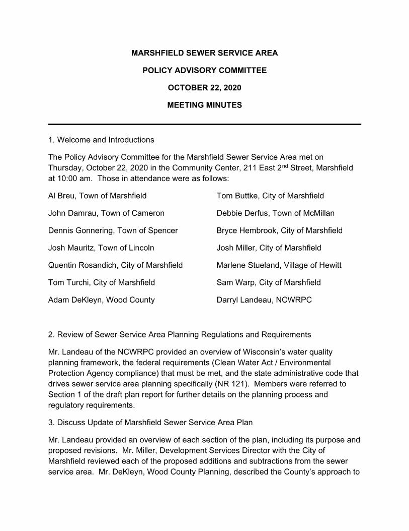
MARSHFIELD SEWER SERVICE AREA
POLICY ADVISORY COMMITTEE
OCTOBER 22, 2020
MEETING MINUTES
1. Welcome and Introductions
The Policy Advisory Committee for the Marshfield Sewer Service Area met on Thursday, October 22, 2020 in the Community Center, 211 East 2nd Street, Marshfield at 10:00 am. Those in attendance were as follows:
Al Breu, Town of Marshfield Tom Buttke, City of Marshfield
John Damrau, Town of Cameron Debbie Derfus, Town of McMillan
Dennis Gonnering, Town of Spencer Bryce Hembrook, City of Marshfield
Josh Mauritz, Town of Lincoln Josh Miller, City of Marshfield
Quentin Rosandich, City of Marshfield Marlene Stueland, Village of Hewitt
Tom Turchi, City of Marshfield Sam Warp, City of Marshfield
Adam DeKleyn, Wood County Darryl Landeau, NCWRPC
2. Review of Sewer Service Area Planning Regulations and Requirements
Mr. Landeau of the NCWRPC provided an overview of Wisconsin’s water quality planning framework, the federal requirements (Clean Water Act / Environmental Protection Agency compliance) that must be met, and the state administrative code that drives sewer service area planning specifically (NR 121). Members were referred to Section 1 of the draft plan report for further details on the planning process and regulatory requirements.
3. Discuss Update of Marshfield Sewer Service Area Plan
Mr. Landeau provided an overview of each section of the plan, including its purpose and proposed revisions. Mr. Miller, Development Services Director with the City of Marshfield reviewed each of the proposed additions and subtractions from the sewer service area. Mr. DeKleyn, Wood County Planning, described the County’s approach to

sewer extension reviews. There was open discussion by committee members during which the following comments and suggestions were made:
Mr. Damrau, Town of Cameron, noted that Mill Creek Industrial Park which is on Heritage Drive was incorrectly described as being located on Highway 10.
Mr. Miller noted that some of the City’s wellhead protection areas were not identified on the map.
Ms. Stueland, Village of Hewitt, discussed the Village’s water supply and asked for some revisions in how it was characterized in the report.
Mr. Breu, Town of Marshfield, echoed reservations about the official population projections stating that new home construction in the Town indicates population growth while the state numbers show the Town declining.
Mr. Miller suggested some minor wording clarification in the goals. Ms. Stueland asked for some clarification that the sewer extension review
process applied to the mapped sewer service area and does not include the Village.
Mr. Damrau pointed out that the Town of Cameron comprehensive plan map was dated and did not accurately reflect the current alignment of Highway 10
4. Consider Approval of the Marshfield Sewer Service Area Plan Update for Submission to WDNR
Motion by Mr. Brue, Town of Marshfield, seconded by Ms. Derfus, Town of McMillan, to submit plan with discussed clarifications to WDNR. Passed with all in favor.
5. Adjourn
Motion by Ms. Derfus, Town of Marshfield, seconded by Mr. Damrau, Town of Cameron to adjourn meeting at 11:15 am. Passed with all in favor.

Plan Commission
City of Marshfield, Wisconsin Tuesday, November 17, 2020
Council Chambers, City Hall, 207 West 6th Street 7:00 p.m.
If you have questions or wish to provide input on this matter, please call Bryce Hembrook at 715-486-2074 or e-mail [email protected], send a letter to the Development Services Department located at 207 W 6th Street, or appear in person at this meeting. If you plan to attend the meeting, please contact Bryce Hembrook at least 24 hours prior to the meeting, so that we can plan accordingly for proper social distancing.
1. Call to Order. – Mayor McManus – Chairperson
2. Roll Call. – Secretary Miller.
3. Approval of Minutes – October 20, 2020 Meeting.
4. Citizen Comments.
5. Conditional Use Request by Jeffrey Kolpanen to allow for an exception to exceed the maximum residential accessory building
square footage limit, with the total area for the parcel exceeding 1,200 square feet, located at 904 South Schmidt Avenue (parcel 33-04970), zoned “SR-2” Single-Family Residential.
6. Presenter: Emmett Simkowski, Associate Planner Public Hearing Required
7. Conditional Use Request by Gary Schallock, representing Obrien Automotive, to allow for vehicle sales at the existing automotive repair shop, located at 402 North Central Avenue (parcel 33-00309), zoned “UMU” Urban Mixed Use. Presenter: Emmett Simkowski, Associate Planner Public Hearing Required
8. Conditional Use Request by Patrick Sherman, representing the Villas at Marshfield, to allow an apartment land use in the peripheral campus area on the UW-Stevens Point at Marshfield (formerly known as the UW-Wisconsin-Marshfield/Wood County) campus and to allow non-students to reside in the existing student housing complex, located at 2313 West 5th Street (parcel 33-04329D), zoned “CD” Campus Development district. Presenter: Bryce Hembrook, City Planner
9. Review and approval of the proposed City of Marshfield Sewer Service Area Plan 2020-2040 which will update and revise a twenty-year boundary to control sewered development and protect water quality within parts of the Towns of Cameron, Lincoln, Marshfield, McMillan and Spencer, surrounding the City of Marshfield. Presenter: Darryl Landeau, North Central Wisconsin Regional Planning Commission (NCWRPC) Public Hearing Required
10. Items for Future Agendas.
11. Staff Updates.
12. Adjourn.
Posted this 12th day of November, 2020 by 4:30 PM by Bryce Hembrook, City Planner. For additional information regarding items on the agenda, please contact Bryce Hembrook, City Planner at 715.486.2074. This meeting can be viewed “LIVE” on the City of Marshfield website at www.ci.marshfield.wi.us, City of Marshfield Facebook page at www.facebook.com/CityofMarshfieldWI/ and on Charter Cable Channel 991. The meeting is also archived on the City of Marshfield’s YouTube Channel and Facebook Page located on the City website at www.ci.marshfield.wi.us and replayed the following day and throughout the week on Charter Cable Channel 991. Please see your cable listing for the City Government Channel at http://ci.marshfield.wi.us/departments/communications/index.php
NOTE ********************************************************************************************************************************** It is possible that members of and possibly a quorum of other governmental bodies of the municipality may be in attendance at the above-stated meeting to gather information; no action will be taken by any governmental body at the above-stated meeting other than the governmental body specifically referred to above in this notice. ********************************************************************************************************************************** Upon reasonable notice, efforts will be made to accommodate the needs of disabled individuals through appropriate aids and services. For additional Information or to request this service, contact the Public Works Department at 207 W. 6th Street or by calling (715) 387-8424. **********************************************************************************************************************************
CITY OF MARSHFIELD
MEETING NOTICE

1 PC Meeting 11/17/2020
CITY PLAN COMMISSION NOVEMBER 17, 2020
PRESENT: Mayor Bob McManus, John Kaprelian, Alderperson Quentin Rosandich, Bill
Penker, Steve Okonek, Kathy Banks, Ken Wood ABSENT: OTHERS: Emmett Simkowski, Associate Planner; Bryce Hembrook, City Planner; Josh
Miller, Development Services Director; and others Chairman McManus called the meeting to order at 7:00 p.m. in the City Hall Council Chambers. PC20-50 Rosandich moved and Banks seconded the motion to approve the minutes of October 20, 2020 Plan Commission meeting. Motion carried. Citizen Comments None. PUBLIC HEARING – Conditional Use Request by Jeffrey Kolpanen to allow for an exception to exceed the maximum residential accessory building square footage limit, with the total area for the parcel exceeding 1,200 square feet, located at 904 South Schmidt Avenue (parcel 33-04970), zoned “SR-2” Single-Family Residential. Emmett Simkowski presented this item. Public Comments: None. Discussion: None. PC20-51 Penker moved and Wood seconded the motion to approve the Conditional Use Request by Jeffrey Kolpanen to allow for an exception to exceed the maximum residential accessory building square footage limit, with the total area exceeding 1,200 square feet, located at 904 South Schmidt Avenue (33-04970), zoned “SR-2” Single-Family Residential
1. The property is permitted to have a total of 1,377 square feet of accessory space and if a zoning code change is approved in a less restrictive manner regarding the allowed gross floor area of accessory structures, this permit shall be void.
2. Minor site changes may be administratively approved as long as the changes do not result in the development becoming non-compliant with this conditional use permit and/or other code requirements.
Motion carried. PUBLIC HEARING – Conditional Use Request by Gary Schallock representing O’Brien Automotive to allow for vehicle sales to an existing automotive repair shop, in the “UMU” Urban Mixed-Use zoning district, located at 402 North Central Avenue (parcel 33-00309). Emmett Simkowski presented this item. Public Comments: None.

2 PC Meeting 11/17/2020
Discussion: Rosandich asked about concerns about additional traffic. Simkowski said there would be limited changes to the traffic pattern so it wasn’t a concern. PC20-52 Banks moved and Wood seconded the motion to approve the Conditional Use Request by Gary Schallock representing O’Brien Automotive to allow for vehicle sales to an existing automotive repair shop, in the “UMU” Urban Mixed-Use zoning district, located at 402 North Central Avenue (parcel 33-00309) with the following conditions.
1. No more than 6 vehicles shall be listed for sale on the premise at a given time. 2. Minor site plan changes may be approved administratively, provided they do not need
additional exceptions from the Zoning Code, or from any conditions approved with this Conditional Use permit.
Motion carried. Mayor McManus, Kaprelian, and Rosandich announced a conflict of interest in the next agenda item and notify they will not take part in the discussion/decision and move to sit in the audience. Miller also stated he had a conflict of interest and noted he will also not participate in the discussion. Hembrook took nominations for presiding officer. Banks nominated Penker for presiding officer. There being no further nominations Hembrook declared the nominations closed and entertained motion to cast a unanimous ballot for Penker as presiding officer. PC20-53 Banks moved and Wood seconded the motion to cast a unanimous ballot for Penker as presiding officer. Roll call vote; ayes – 4; no – 0 Motion carried. Penker took over as presiding officer and read the agenda item. Conditional Use Request by Patrick Sherman, representing the Villas at Marshfield, to allow an apartment land use in the peripheral campus area on the UW-Stevens Point at Marshfield (formerly known as the UW-Wisconsin-Marshfield/Wood County) campus and to allow non-students to reside in the existing student housing complex, located at 2313 West 5th Street (parcel 33-04329D), zoned “CD” Campus Development district. Hembrook introduced the item and invited Pat Sherman to present. Discussion: Sherman gave a presentation in a response to questions by the Plan Commission at the October meeting. Okonek asked what would happen if the Villas wasn’t able to have the general public? Pat Sherman said it wouldn’t be sustainable at this time. In 12 months, that might work. Long-term leases aren’t signed with the general public. Students have the priority.

3 PC Meeting 11/17/2020
Banks asked why they were down to only 7 medical professionals. Pat Sherman said that it ebbs and flows. It’s more of a seasonal thing. In the summer, it’s a much higher number. Hembrook reviewed the amendments to the staff report. The applicant is looking for a temporary Conditional Use Permit instead of a permanent basis. Staff originally recommended denying the request based on a permanent approval. He stated the Campus Master Plan would need to be updated in 2022. We would recommend the temporary request until the Campus Master Plan is updated. PC20-54 Banks moved and Okonek seconded the motion to approve the Conditional Use Request by Patrick Sherman, representing the Villas at Marshfield, to allow a temporary apartment land use in the peripheral campus area on the UW-Stevens Point at Marshfield (formerly known as the UW-Wisconsin-Marshfield/Wood County) campus and to allow non-students to reside in the existing student housing complex, located at 2313 West 5th Street (parcel 33-04329D), zoned “CD” Campus Development district with the following conditions:
1. The temporary conditional use permit will expire on September 1, 2022. The applicant may request to renew the request or amend the campus master plan.
2. The applicant shall send a quarterly report to city staff informing them about occupancy levels, new leases to non-students, any issues involving non-students, and other items requested by staff.
3. No more than 24 non-student individuals may reside in the complex. Roll call vote; ayes – 4; no – 0 Motion Carried. The meeting was turned over to the Mayor and members and staff return to their seats. PUBLIC HEARING – Review and approval of the proposed City of Marshfield Sewer Service Area Plan 2020-2040 which will update and revise a twenty-year boundary to control sewered development and protect water quality within parts of the Towns of Cameron, Lincoln, Marshfield, McMillan and Spencer, surrounding the City of Marshfield. Miller introduced the item and turned the presentation over to Darryl Landeau, North Central Wisconsin Regional Planning Commission (NCWRPC) to present the plan. Miller then highlighted the proposed changes to the proposed Sewer Service Area boundary. Public Comments: None. Discussion: None. PC20-55 Wood moved and Penker seconded the motion to approve the updated Marshfield Sewer Service Area Plan and refer the Resolution to the Common Council for consideration. Motion carried. Items for Future Agendas: Miller stated that staff continues to work on the updates to the Zoning Code. Additionally, staff is also working on an update to the Building Code, but that would not be reviewed by the Plan Commission.

4 PC Meeting 11/17/2020
Staff Updates: Miller stated that the City will be implementing a new building permit software at the beginning of the 2021. Mayor McManus has declared an emergency order and some municipal facilities including City Hall and the Library will be closed to the public. Municipal Court and City meetings are planned to continue at City Hall. With no other business before the Commission, Okonek moved and Rosandich seconded to adjourn the meeting at 7:53 p.m. Respectfully submitted,
Josh Miller, Secretary CITY PLAN COMMISSION

February 4, 2021 DNR Project No: MF010 Darryl L. Landeau, AICP North Central Wisconsin Regional Planning Commission (NCWRPC) 210 McClellan Street, Suite 210 Wausau, Wisconsin 54403 Subject: WDNR Administrative Decision for the City of Marshfield SSA Plan Update 2020-2040 Dear Mr. Landeau, We have completed our review of the subject sewer service area plan update for the City of Marshfield (2020-2040) received on November 23, 2020. This 2040 Sewer Service Area update was reviewed and accepted by City of Marshfield on November 17, 2020. WDNR approves this Sewer Service Area Plan Update. Statewide AWQM Plan Amendment This plan update is a formal update to the state’s Areawide Water Quality Management Plan and will be sent to the US Environmental Protection Agency to meet the requirements of the Clean Water Act of 1987 (Public Law 92-500 as amended by Public Law 95-217) and outlined in the federal regulations 40 CFR, Part 35. This review is an integrated analysis action under s. NR 150.20 (2) (a) 3, Wis. Adm. Code. By means of this review, the Department has complied with ch. NR 150, Wis. Adm. Code, and with s. 1.11, Stats. The approval of this sewer service area amendment does not constitute approval of any other required local, state, or federal permit for sewer construction or associated land development activities. Appeal Rights: Wisconsin statutes and administrative rules establish time periods within which requests to review Department decisions must be filed. For judicial review of a decision pursuant to sections 227.52 and 227.53, Wis. Stats., a party has 30 days after the decision is mailed, or otherwise served by the Department, to file a petition with the appropriate circuit court and serve the petition on the Department. Such a petition for judicial review must name the Department of Natural Resources as the respondent. To request a contested case hearing pursuant to section 227.42, Wis. Stats., a party has 30 days after the decision is mailed, or otherwise served by the Department, to serve a petition for hearing on the Secretary of the Department of Natural Resources. All requests for contested case hearings must be made in accordance with section NR 2.05(5), Wis. Adm. Code, and served on the Secretary in accordance with section NR 2.03, Wis. Adm. Code. The filing of a request for a contested case hearing does not extend the 30-day period for filing a petition for judicial review. Sincerely,
Timothy R. Asplund Monitoring Section Chief Bureau of Water Quality Division of Environmental Management
Tony Evers, Governor Preston D. Cole, Secretary
Telephone 608-266-2621 Toll Free 1-888-936-7463
TTY Access via relay - 711
State of Wisconsin DEPARTMENT OF NATURAL RESOURCES 101 S. Webster Street Box 7921 Madison WI 53707-7921
dnr.wi.gov wisconsin.gov

Page 2
cc: Lisa Helmuth, Water Resources Specialist, DNR Matt Droese, Wastewater Engineer, DNR Ashley Brechlin, Facility Plan Review Engineer, DNR Mark Hazuga, West District Water Resources Supervisor, DNR Scott Provost, Water Quality Biologist, West District, DNR Geisa Thielen, West District Wastewater Supervisor, DNR Josh Miller, City of Marshfield

We appreciate your interest in the City of Marshfield. Item “C” on the agenda (below) gives you an opportunity to provide comments to the Mayor and Council. If you plan to attend in person, please contact Steve Barg, City Administrator at 715-486-2003 or [email protected] by noon on Tuesday, February 23rd, so that we can plan for appropriate social distancing. Thank you! .
COMMON COUNCIL
CITY OF MARSHFIELD, WISCONSIN TUESDAY, FEBRUARY 23, 2021
207 WEST 6TH STREET 6:00 P.M.
A. Call to Order/Roll Call – Bob McManus, Mayor
B. Pledge of Allegiance
C. Public Comment Period/Correspondence At this time, the Mayor will recognize members of the public who have indicated their desire to address the Council. Upon recognition by the Mayor, persons may address the Council, first stating their name and address. The Council may act on emergency matters introduced by members of the public.
D. Approval of Minutes: February 9, 2021
E. Staff Updates
F. Mayor’s Comments (For Informational Purposes Only)
1. Employee Recognitions: • Christine Zupanc, Police Department, 3/5/2001, 20 years
G. Council Comments (For Informational Purposes Only)
H. Reports from Commissions, Boards, and Committees
I. Consent Agenda:
1. Meeting minutes/reports a. University Commission (November 12, 2020) b. Economic Development Board (February 4, 2021) c. Marshfield Utilities Commission (February 8, 2021)
1. Job Order #14159 (overhead rebuild on Rondevoo Road – $46,495) d. Fire and Police Commission (February 10, 2021) e. Board of Public Works (February 15, 2021)
1. Purchase of new street sweeper 2. Final assessments for Cleveland Street reconstruction project
f. Judiciary and License Committee (February 16, 2021) g. Finance, Budget and Personnel Committee (February 16, 2021)
CITY OF MARSHFIELD
MEETING NOTICE

COMMON COUNCIL AGENDA FEBRUARY 23, 2021
2
1. Revised Policy No. 4.900 (Debt Management) 2. Interest rate for 2021 special assessment installment payments
h. Plan Commission (February 16, 2021) Recommended Action: Receive/place on file, approving recommended actions
J. Action on items removed from the consent agenda, if any
K. First reading of Ordinance No. 1450 – request to rezone property at 907 North Hume Avenue (parcel 33-05310) from “TR-6” (Two-Family Residential) to “MR-12” (Multi-Family Residential). Presented by Bryce Hembrook, City Planner Recommended Action: None at this time unless the rules are suspended; set
for second reading/adoption on March 9th
L. First reading of Ordinance No. 1451 – request to rezone portions of several parcels (33-03542E, 33-03543, 33-03526) from “SR-3” (Single-Family Residential) to “GI” (General Industrial). These parcels are proposed to be combined with the parcel in which the Marshfield Utilities building is located at 2000 South Central Avenue. Presented by Bryce Hembrook, City Planner Recommended Action: None at this time unless the rules are suspended; set
for second reading/adoption on March 9th
M. Request to approve Resolution No. 2021-09, adopting 2020-2040 City of Marshfield Sewer Service Area Plan. Presented by Josh Miller, Development Services Director
Recommended Action: Approve Resolution No. 2021-09
N. Review of process/procedures and establishing a date/time for a hearing regarding
the complaint made against Mayor McManus. Introduction by Tom Witzel, Council President; presentation by James Kalny, attorney with Davis & Kuelthau S.C.
Recommended Action: Establish date and time for the hearing
O. Adjourn to closed session under Wisconsin Statutes Chapter 19.85(1)(e) “Deliberating or negotiating the purchasing of public properties, the investing of public funds, or conducting other specific public business, whenever competitive or bargaining reasons are involved.”
• Discuss executing Offer to Purchase for land adjacent to TIF District #7 AND
Closed session under Wisconsin Statutes Chapter 19.85(1)(f), “Considering financial, medical, social or personal histories or disciplinary data of specific persons, preliminary consideration of specific personnel problems or the investigation of charges against specific persons except where par. (b) applies which, if discussed in public, would be likely to have a substantial adverse effect upon the reputation of any person referred to in such histories or data, or involved in such problems or investigations”; and 19.85(1)(g), “Conferring with legal counsel for the governmental body who is rendering oral or written advice concerning strategy to be adopted by the body with respect to litigation in which it is or is likely to become involved.”
• Review of a current Municipal Court matter for consideration of substitution of counsel
AND

COMMON COUNCIL AGENDA FEBRUARY 23, 2021
3
Closed session under Wisconsin Statutes Chapter 19.85(1)(g) “Conferring with legal counsel for the governmental body who is rendering oral or written advice concerning strategy to be adopted by the body with respect to litigation in which it is or is likely to become involved.”
• Update on litigation involving Tri-Media, LLC • Update on employment law matters involving police department
P. Reconvene in open session
Q. Action on matters discussed in closed session, if appropriate
R. Suggested items for future agendas
S. Adjournment
Posted this day February 19, 2021 at 2:00 p.m. by Jessica Schiferl, Deputy Clerk
NOTICE It is possible that members of and possibly a quorum of other governmental bodies of the municipality may be in attendance at the above-stated meeting to gather information; no action will be taken by any governmental body at the above-stated meeting other than the governmental body specifically referred to above in this notice. Upon reasonable notice, efforts will be made to accommodate the needs of disabled individuals through appropriate aids and services. For additional information or to request this service, contact Deb M. Hall, City Clerk, at 207 West 6th Street or by calling (715) 384-3636.
This meeting can be viewed “LIVE” on the City of Marshfield website at www.ci.marshfield.wi.us , City of Marshfield Facebook page at www.facebook.com/CityofMarshfieldWI/ and on Charter Cable Channel 991. The meeting is also archived on the City of Marshfield’s YouTube Channel and Facebook Page located on the City website at www.ci.marshfield.wi.us and replayed the following day and throughout the week on Charter Cable Channel 991. Please see your cable listing for the City Government Channel at http://ci.marshfield.wi.us/departments/communications/index.php
If you plan to attend in person, please contact 715-486-2003 or [email protected] by noon on Tuesday, February 23rd, so that we can plan accordingly for appropriate social distancing.

FEBRUARY 23, 2021 Regular meeting of the Common Council was called to order by Mayor McManus at 6:00 p.m., in the Council Chambers, City Hall. PRESENT: Mike Feirer, Nick Poeschel, Quentin Rosandich, Ken Bargender, Ed Wagner, Tom Witzel, Adam Fischer, Rebecca Spiros, Tom Buttke, and Peter Hendler. ABSENT: None The flag was saluted and the pledge given. PUBLIC COMMENT PERIOD
Bill Penker, 600 Sycamore Ave. – a follow up to statements made at the meeting on February 9 by concerned citizens, Commissioner Meyers and Alderperson Spiros. This year and last we have seen and heard individuals focused on issues related to the Police Department and the Board of Police and Fire Commissioners who use the citizens comment period to express their views and concerns. Whether observers support the expressions, reject them, or remain neutral, I suggest we should commend the individuals. Rather than sitting in a public or private gathering place and venting, they came here, put forth their views, put forth their concerns and placed a name and face with them. Few people have done so in the past and he know this from years of experience at the podium. It is good to see others step forward. In addition, you deserve to be commended for the manner in which you receive citizen comments. When discussing our Board of Police and Fire Commissioners, it is important to note that it is an independent body. A founding principle behind boards of police and fire commissioners was the intent to remove political influence from among other duties the organization and supervision of the departments and the prescribing of rules and regulations for their control and management. The body is not a political football to be tossed about by various players. Last, let’s consider this piece of yellow tape. Let’s also consider the ongoing legal issues as they might be seen by observers outside of this room. Let’s rephrase a significant statement made by Alderperson Spiros about those issues. Very simple, stay behind the tape. Let those on the inside, there are many people on the inside, do their jobs with procedure and due process. Or, to borrow from John Salka, a retired FDNY Battalion Chief, author and consultant, when looking at a fire scene, and some might suggest you are at a fire scene, who has the three-dimensional view. Is it you who is inside the tape or is it someone who is outside of it. He would suggest it’s you.
CC21-029 Motion by Feirer, second by Bargender to approve the minutes of the Common Council meeting of February 9, 2021. Ayes - 10 Motion carried STAFF UPDATES
Nicholas Kumm, Marshfield Utilities – the bond sale was completed on Thursday and the results were favorable. The overall interest rate was approximately 1.53%. This is a considerable savings. The overall payment will be reduced about 1.4 million dollars. Also, this summer the Hume Water Reservoir is scheduled for repainting. It is typically repainted every 20-25 years. Given the size and location, they are exploring alternatives besides just the logo being painted on it. If you have suggestions, please direct them to Marshfield Utilities.

Council Minutes (cont.) Page 2
MAYOR’S COMMENTS Employee Recognition
o Christine Zupanc, 3/5/2001, 20 years He wished Alderperson Hendler a Happy Birthday
COUNCIL COMMENTS
None
REPORTS FROM COMMISSIONS, BOARDS AND COMMITTEES
None CONSENT AGENDA CC21-030 Motion by Hendler, second by Wagner to receive and place on file, approving all recommended actions for the items listed on the consent agenda. Meeting Minutes/Reports: University Commission of November 12, 2020; Economic Development Board of February 4, 2021; Marshfield Utilities Commission of February 8, 2021 (1. Job order #14159, overhead rebuild on Rondevoo Road - $46,495); Fire and Police Commission of February 10, 2021; Board of Public Works of February 15, 2021 (1. Purchase of new street sweeper. 2. Final assessments for Cleveland Street reconstruction project); Judiciary and License Committee of February 16, 2021; Finance, Budget and Personnel Committee of February 16, 2021 (1. Revised policy No. 4.900, Debt Management 2. Interest rate for 2021 special assessment installment payments); Plan Commission of February 16, 2021. Ayes - 10 Motion carried No items were removed from the consent agenda. First reading of Ordinance No. 1450 – request to rezone property at 907 North Hume Avenue (parcel 33-05310) from “TR-6” (Two-Family Residential) to “MR-12” (Multi-Family Residential). First reading of Ordinance No. 1451 – request to rezone portions of several parcels (33-03542E, 33-03543, 33-03526) from “SR-3” (Single-Family Residential) to “GI” (General Industrial). These parcels are proposed to be combined with the parcel in which the Marshfield Utilities building is located at 2000 South Central Avenue. CC21-031 Motion by Buttke, second by Fischer to approve Resolution No. 2021-09, a resolution adopting 2020-2040 City of Marshfield Sewer Service Area Plan. Ayes - 10 Motion carried Mayor McManus recused himself and Council President Witzel assumed the chair at 6:27 p.m. CC21-032 Motion by Wagner, second by Fischer to formally appoint Mr. Kalny as the City’s legal representative in the matter with Mayor McManus, have Mr. Kalny set the dates and serve the notices as appropriate. Ayes – 10 Motion carried

Council Minutes (cont.) Page 3
CC21-033 Motion by Fischer, second by Wagner to set the dates of the hearing in the matter of Mayor McManus for March 19 and 22, 2021. Ayes – 10 Motion carried Mayor McManus resumed the chair at 7:10 p.m. CC21-034 Motion by Wagner, second by Fischer to go into closed session pursuant to Wisconsin Statutes Chapter 19.85(1)(e) “Deliberating or negotiating the purchasing of public properties, the investing of public funds, or conducting other specific public business, whenever competitive or bargaining reasons are involved.”
Discuss executing Offer to Purchase for land adjacent to TIF District #7 AND
Closed session under Wisconsin Statutes Chapter 19.85(1)(f), “Considering financial, medical, social or personal histories or disciplinary data of specific persons, preliminary consideration of specific personnel problems or the investigation of charges against specific persons except where par. (b) applies which, if discussed in public, would be likely to have a substantial adverse effect upon the reputation of any person referred to in such histories or data, or involved in such problems or investigations”; and 19.85(1)(g), “Conferring with legal counsel for the governmental body who is rendering oral or written advice concerning strategy to be adopted by the body with respect to litigation in which it is or is likely to become involved.”
Review of a current Municipal Court matter for consideration of substation of counsel AND
Closed session under Wisconsin Statutes Chapter 19.85(1)(g) “Conferring with legal counsel for the governmental body who is rendering oral or written advice concerning strategy to be adopted by the body with respect to litigation in which it is or is likely to become involved.”
Update on litigation involving Tri-Media, LLC Update on employment law matters involving police department
Roll call vote, all ayes. (Time: 7:12 p.m.) Motion carried Present in closed session: Alderpersons Feirer, Poeschel, Rosandich, Bargender, Wagner, Witzel, Fischer, Spiros, Buttke and Hendler, City Administrator Barg, City Attorney Wolfgram and City Staff (Josh Miller and Jessica Schiferl) Josh Miller left the closed session at 7:27 p.m. CC21-035 Motion by Spiros, second by Feirer to return to open session. Roll call vote, all ayes. (Time: 9:38 p.m.) Motion carried CC21-036 Motion by Fischer, second by Buttke to authorize appropriate city staff to execute an Option to Purchase land adjacent to TIF District #7, subject to the creation of TIF District #12 having been completed. Ayes - 10 Motion carried CC21-037 Motion by Witzel, second by Poeschel to approve substitution of outside legal counsel for the City Attorney in a Municipal Court matter. Ayes – 9; Nay -1 (Fischer) Motion carried

Council Minutes (cont.) Page 4
CC21-038 Motion by Wagner, second by Buttke to authorize the execution of a settlement agreement with Tri-Media, LLC. Ayes - 10 Motion carried CC21-039 Motion by Fischer, second by Hendler to direct City Administrator Barg to determine the capacity of Council Chamber, enforce the capacity limit during the upcoming hearings and direct the City of Marshfield Communication Department to videotape the hearing for record keeping purposes but not for live streaming or broadcasting on television. Ayes – 7; Nays – 3 (Poeschel, Wagner, Witzel) Motion carried Future Agenda Items
None Motion by Wagner, second by Rosandich to adjourn the meeting at 9:44 p.m. Motion carried Respectfully submitted, Jessica Schiferl Deputy Clerk