Integration Sewer Televising GIS and Maintenance
26
Sewer Televising -Cityworks CCTV Reader and ArcGIS 2013 CEAM Brooklyn Center, MN January 13, 2013 Rebecca Blue Integration Sewer Televising GIS and Maintenance
-
Upload
khangminh22 -
Category
Documents
-
view
1 -
download
0
Transcript of Integration Sewer Televising GIS and Maintenance

Sewer Televising -Cityworks CCTV Reader and ArcGIS
2013 CEAM
Brooklyn Center, MN
January 13, 2013
Rebecca Blue
Integration Sewer Televising
GIS and Maintenance
MCES I/I Reduction-Surcharge Program – The Motivator

Explain I/I 101 to them.
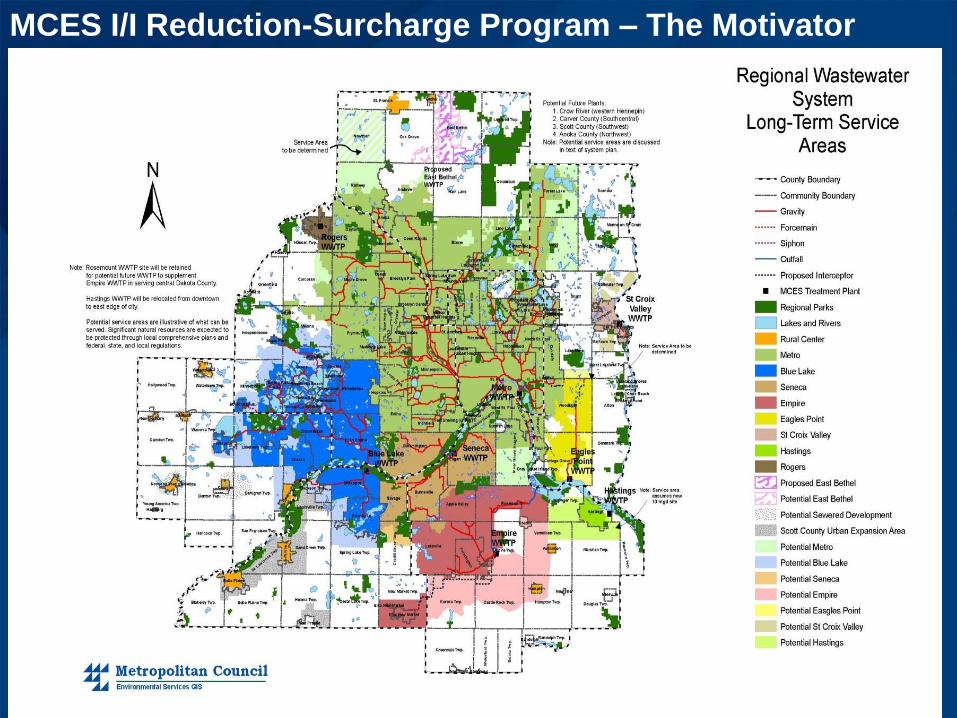
Investigative
Techniques. • Flow Monitoring-Temp Meters **
• Smoke Testing **
• Dye Water Flooding *
• Closed Circuit TV Inspections **
• System Modeling *
• Property Inspections **
• Foundation Drain Testing *
• Manhole Inspections**
• ** ArcGIS\Cityworks used for Inspections and reporting. Crystal Reports and accompanying maps
• *ArcGIS Used

Efficient /Effective Process to Organize All Inspection Information
For Timely and Productive Analysis

Develop Pilot Project to Integrate CCTV with Cityworks and
ArcGIS
Produce results measured in saving of money, time and to develop process that is repeatable
(Multi-Year Program)

Previous Inspection Process
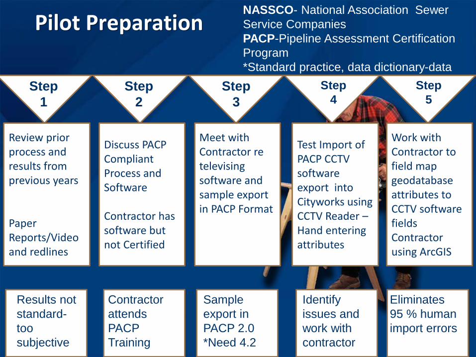
Pilot Preparation
Review prior process and results from previous years Paper Reports/Video and redlines
Discuss PACP Compliant Process and Software Contractor has software but not Certified
Meet with Contractor re televising software and sample export in PACP Format
Test Import of PACP CCTV software export into Cityworks using CCTV Reader – Hand entering attributes
Work with Contractor to field map geodatabase attributes to CCTV software fields Contractor using ArcGIS
Step
1
Step
2
Step
3
Step
4
Step
5
Results not
standard-
too
subjective
Contractor
attends
PACP
Training
Sample
export in
PACP 2.0
*Need 4.2
Identify
issues and
work with
contractor
Eliminates
95 % human
import errors
NASSCO- National Association Sewer
Service Companies
PACP-Pipeline Assessment Certification
Program
*Standard practice, data dictionary-data
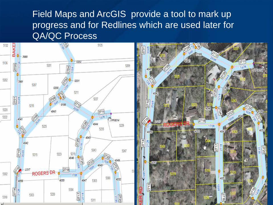
Field Maps and ArcGIS provide a tool to mark up
progress and for Redlines which are used later for
QA/QC Process

Contractor provides-
NASSCO Exchange Inspection Data
MPEG and Still Photos on External
Hard drive
Facility ID is used as Pipe
ID to tie inspections back to
ArcGIS
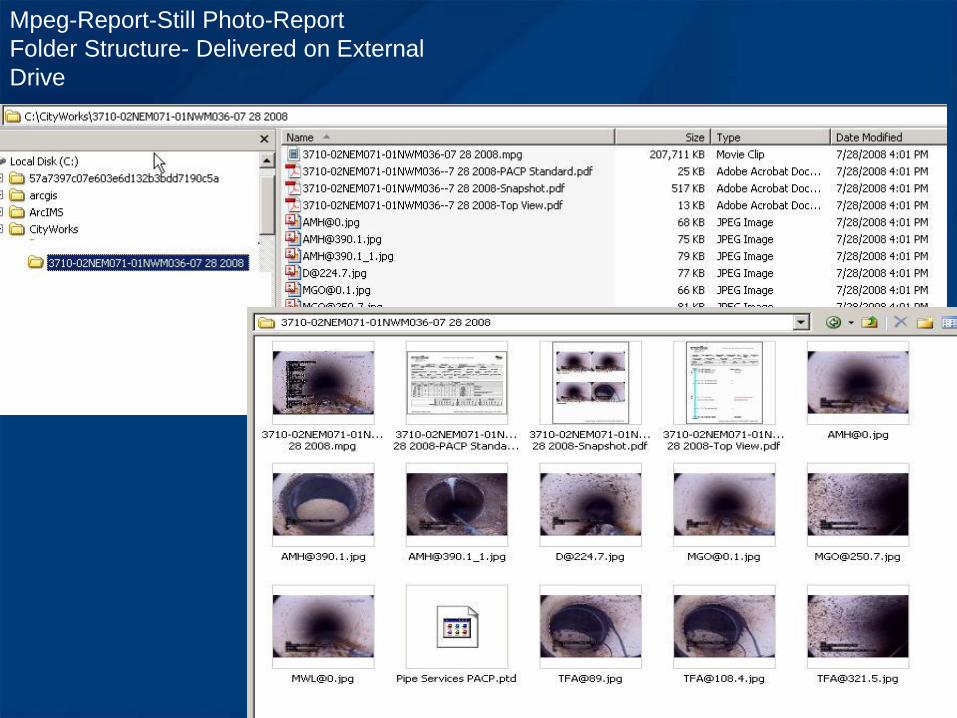
Mpeg-Report-Still Photo-Report
Folder Structure- Delivered on External
Drive

Import of NASCCO Exchange
Inspection Data Into Cityworks
CCTV Reader
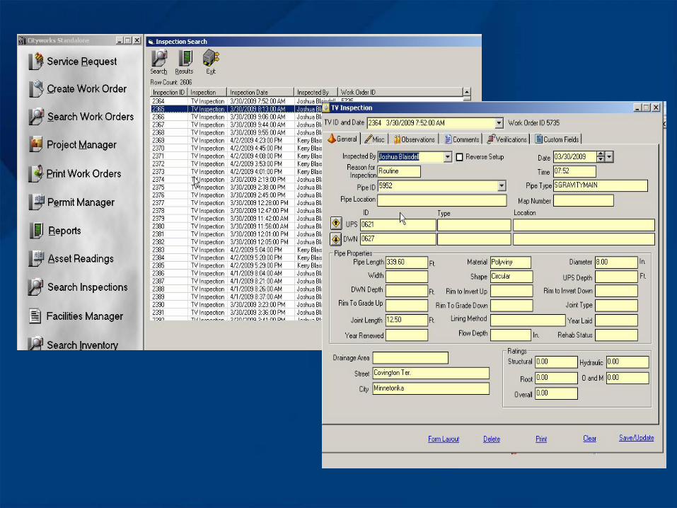
Review Results in Cityworks
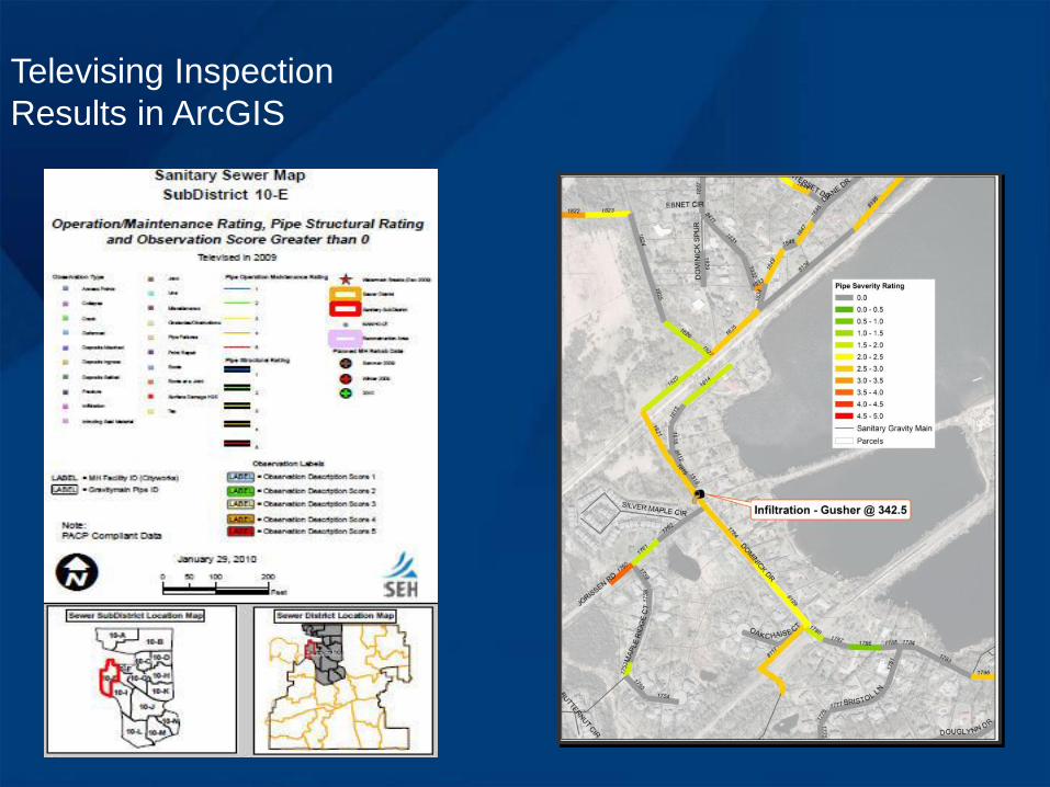
Televising Inspection
Results in ArcGIS

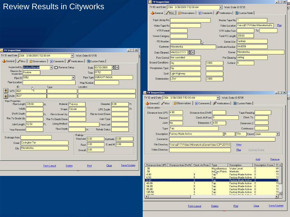
Review Results in Cityworks

Dye-water testing


Results used by Engineering and Public
Works to identify Street Project Utility
Needs

Manhole Inspection Program

New GIS Tools Combined with Inspection Information - Heat
Map – Infrastructure Rehab Planning

What’s Next ? 2013
More Mobile

2013 Deployment of Cityworks Server Web
GIS Applications and Going Mobile
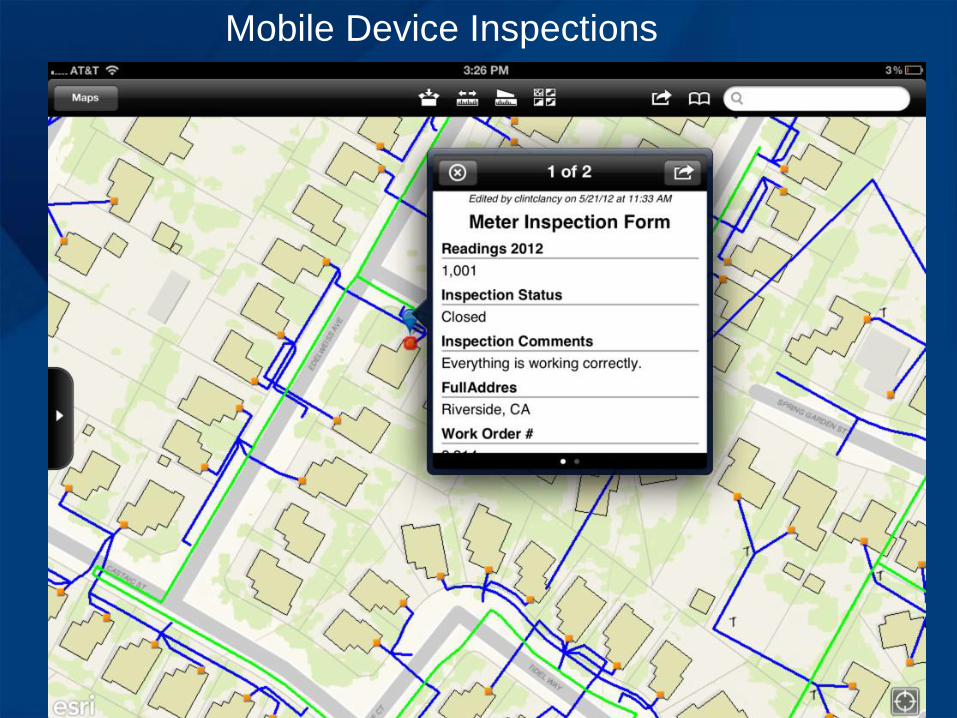
Mobile Device Inspections