
ALKALI SILICA REACTIONS IN CONCRETE STRUCTURES OF WATER RESOURCES SECTOR
Upload
independentCategory
view
4download
0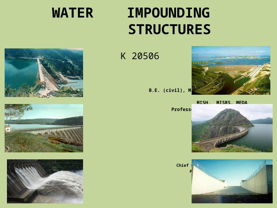
WATER IMPOUNDING STRUCTURES
VILAS B JOSHI B.E. (civil), M. S. (Ocean Engg, UH,
USA) MISH, MISRS, MEDA Professor of Civil
Engineering BVUCOEP Pune 411043
Chief Research Officer (RETD) Ports & Harbour Division CW & PRS Pune 24
2/6/2013 1
K 20506
TEACHING SCHEME EXAMINATION SCHEMELectures : 04 Hrs/week Theory : 60 Marks
Duration : 03 HoursUnit Test : 20 Marks
K20506: WATER IMPOUNDING STRUCTURESUNIT TEST I
Unit-I (8 Hours)Concrete Dams: Forces acting on a gravity dam,
earthquake force-pseudostatic and dynamic response approach, load
classification, stabilityanalysis, distribution of shear and normal
stresses, principal stresses.
Unit-II (08 Hours)Stress concentration around opening, foundation
treatment, use ofcolgrout masonry in gravity dams, Roller
Compacted Concrete Dams:Materials for R.C.C mixture, design concepts,
construction methods,advantages.
Unit-III (08 Hours)Earth Dam: Cross section of earth dam, Seepage
through dam and itsfoundation, stability analysis for sudden draw
down condition and steadyseepage condition, construction condition.
UNIT TEST IIUnit-IV (08 Hours)
Seismic effects, pore pressure, protection of upstream and down stream
slopes, design of filters. Rock fill Dams: Relevant rock fill characteristic,
general design principles, method of construction and compaction.
Unit-V (08 Hours)Spill ways: Determination of capacity, types of
spillways, ogee, siphon,chute, side, shaft, their hydraulic design, crest
profile, energy dissipatersand divide walls.
Unit-VI (08 Hours)Spillway gates:
automatic gates. Instrumentation in Dams: necessity, measurements and
their purpose, planning of installation of instruments.

10/14/22 4
Please switch off me during lecture .
2/6/2013 5
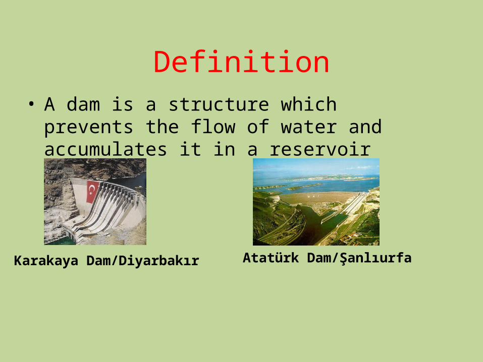
Definition• A dam is a structure which prevents the flow of water and accumulates it in a reservoir
Karakaya Dam/Diyarbakır Atatürk Dam/Şanlıurfa

Needs for Dam Construction
1. Drinking and domestic water supply2. Flood control3. Irrigation4. Industrial water supply5. Hydroelectric energy production6. Retention and control of sediments and Inland navigation, Improvement of
water quality, Fish Farming, Recreation facilities
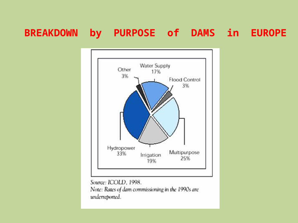
BREAKDOWN by PURPOSE of DAMS in EUROPE

CLASSIFICATION OF DAMS
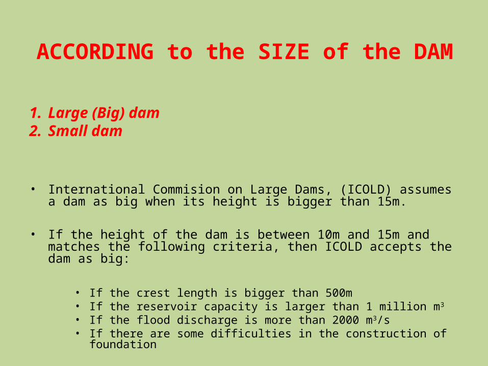
ACCORDING to the SIZE of the DAM
1. Large (Big) dam2. Small dam
• International Commision on Large Dams, (ICOLD) assumes a dam as big when its height is bigger than 15m.
• If the height of the dam is between 10m and 15m and matches the following criteria, then ICOLD accepts the dam as big:
• If the crest length is bigger than 500m• If the reservoir capacity is larger than 1 million m3
• If the flood discharge is more than 2000 m3/s• If there are some difficulties in the construction of
foundation
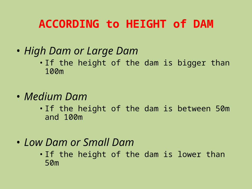
ACCORDING to HEIGHT of DAM
• High Dam or Large Dam•If the height of the dam is bigger than 100m
• Medium Dam•If the height of the dam is between 50m and 100m
• Low Dam or Small Dam•If the height of the dam is lower than 50m
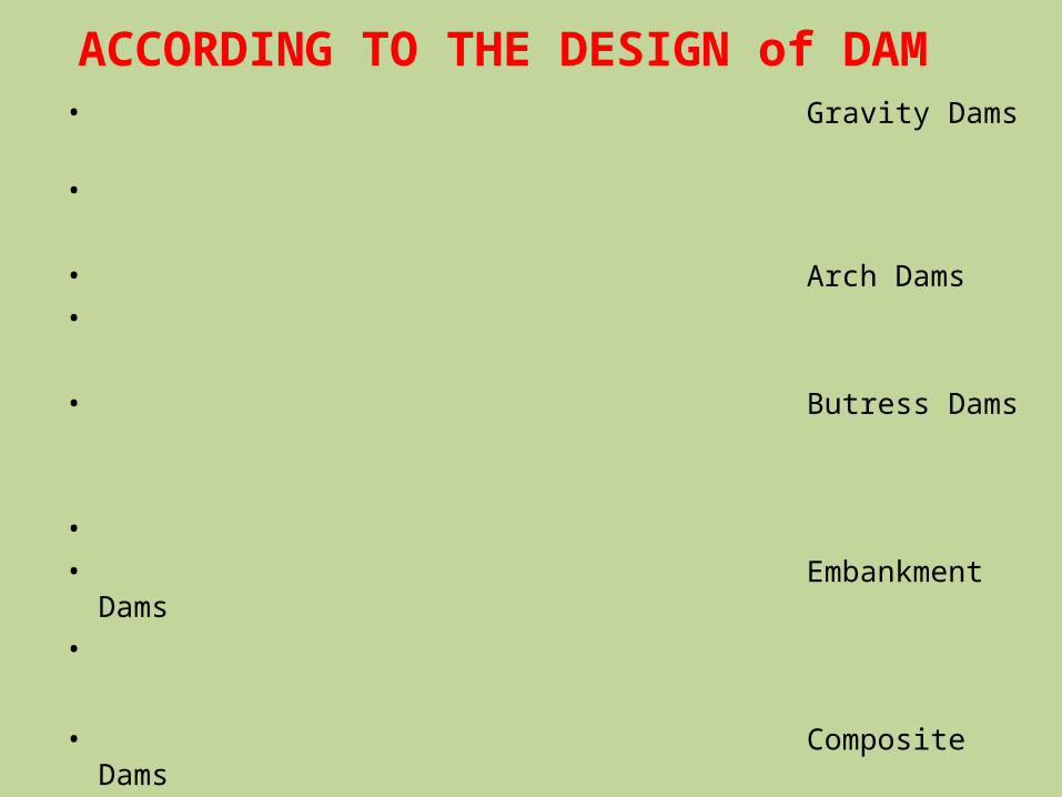
ACCORDING TO THE DESIGN of DAM • Gravity Dams
• • Arch Dams • • Butress Dams
• • Embankment Dams
•
• Composite Dams
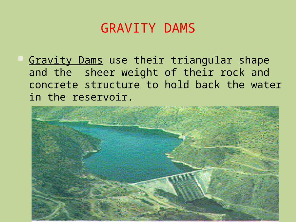
GRAVITY DAMS
Gravity Dams use their triangular shape and the sheer weight of their rock and concrete structure to hold back the water in the reservoir.
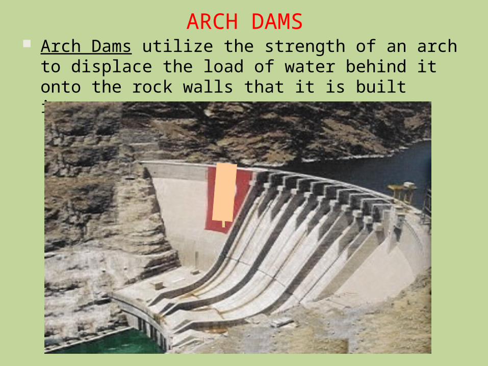
ARCH DAMS Arch Dams utilize the strength of an arch to displace the load of water behind it onto the rock walls that it is built into.
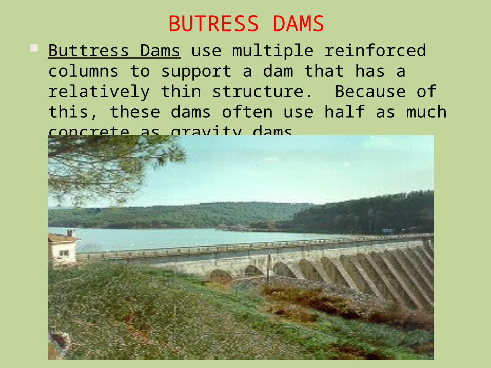
BUTRESS DAMS Buttress Dams use multiple reinforced columns to support a dam that has a relatively thin structure. Because of this, these dams often use half as much concrete as gravity dams
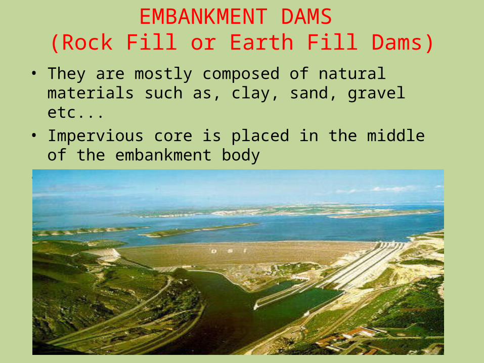
EMBANKMENT DAMS (Rock Fill or Earth Fill Dams)
• They are mostly composed of natural materials such as, clay, sand, gravel etc...
• Impervious core is placed in the middle of the embankment body
• Generally riprap is used to control erosion
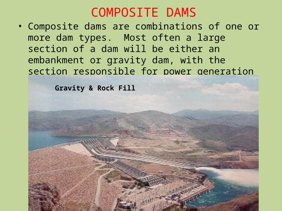
COMPOSITE DAMS• Composite dams are combinations of one or more dam types. Most often a large section of a dam will be either an embankment or gravity dam, with the section responsible for power generation being a buttress or arch.Gravity & Rock Fill

ENGINEERING & GEOLOGICAL STUDIES for
DAM CONSTRUCTION
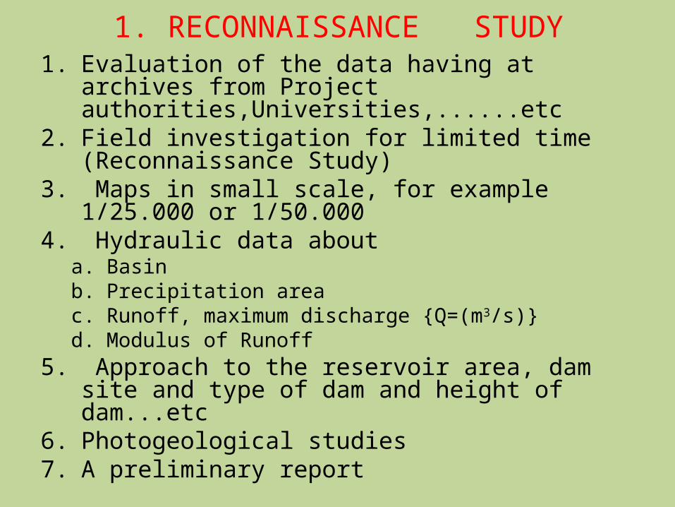
1. RECONNAISSANCE STUDY1. Evaluation of the data having at
archives from Project authorities,Universities,......etc
2. Field investigation for limited time (Reconnaissance Study)
3. Maps in small scale, for example 1/25.000 or 1/50.000
4. Hydraulic data abouta. Basinb. Precipitation areac. Runoff, maximum discharge {Q=(m3/s)}d. Modulus of Runoff
5. Approach to the reservoir area, dam site and type of dam and height of dam...etc
6. Photogeological studies7. A preliminary report
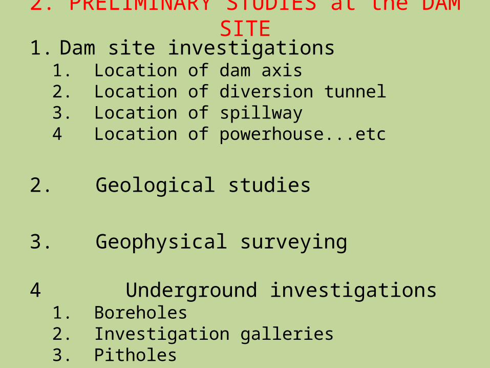
2. PRELIMINARY STUDIES at the DAM SITE
1. Dam site investigations1. Location of dam axis2. Location of diversion tunnel3. Location of spillway4 Location of powerhouse...etc
2. Geological studies
3. Geophysical surveying
4 Underground investigations1. Boreholes2. Investigation galleries3. Pitholes

5 Slope stability investigations
6. Earthquake hazard & risk analysis
7. Environmental studies
8. Leakage possibilities from reservoir area
9. Leakage possibilities from dam site
10.Erosion, sedimentation & siltation
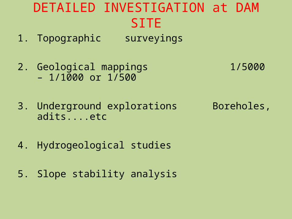
DETAILED INVESTIGATION at DAM SITE
1. Topographic surveyings
2. Geological mappings 1/5000 – 1/1000 or 1/500
3. Underground explorations Boreholes, adits....etc
4. Hydrogeological studies
5. Slope stability analysis
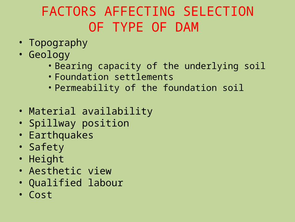
FACTORS AFFECTING SELECTION OF TYPE OF DAM
• Topography• Geology
• Bearing capacity of the underlying soil• Foundation settlements• Permeability of the foundation soil
• Material availability• Spillway position• Earthquakes• Safety• Height• Aesthetic view• Qualified labour• Cost
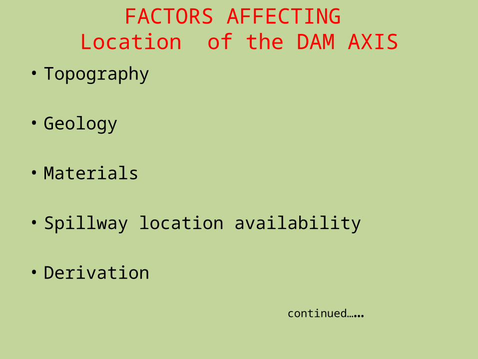
FACTORS AFFECTING Location of the DAM AXIS
• Topography
• Geology
• Materials
• Spillway location availability
• Derivation continued……
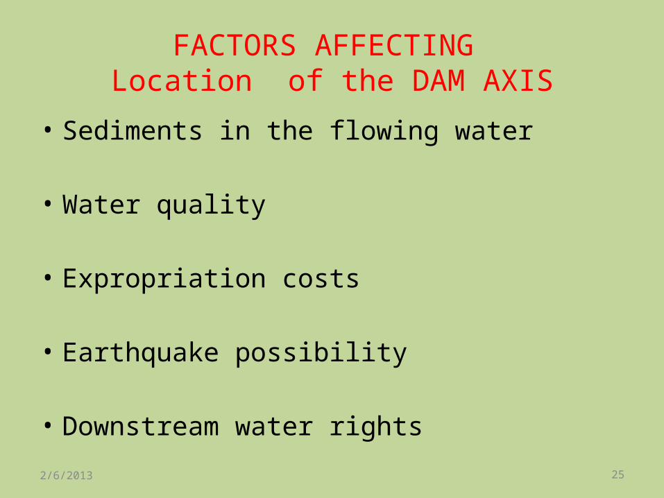
FACTORS AFFECTING Location of the DAM AXIS
• Sediments in the flowing water
• Water quality
• Expropriation costs
• Earthquake possibility
• Downstream water rights2/6/2013 25
IMPORTANT DAMS IN INDIA
Tehri Dam is a multi-purpose rock and earth-fill embankment dam on the Bhagirathi River near Tehri in Uttarakhand, India.
It is the primary dam of the Tehri Hydro Development Corporation Ltd. and the Tehri hydroelectric complex.
The dam is a 260 metres (850 ft) high rock and earth-fill embankment dam. Its length is 575 metres (1,886 ft), crest width 20 metres (66 ft), and base width 1,128 metres (3,701 ft).
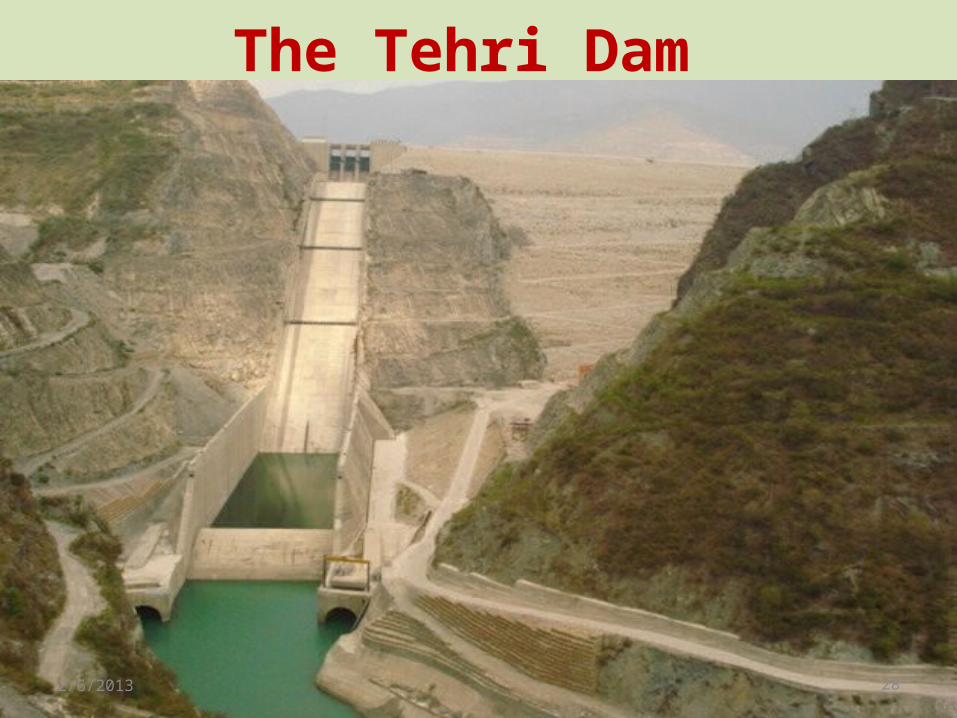
The Tehri Dam
2/6/2013 28
•Kerala Government has long been demanding construction of a new dam in Mullaperiyar on the Kerala-Tamil Nadu border. Many believe that the existing 116-year-old dam could pose safety hazard.
•While the matter rests with the apex court, we look at some of India’s biggest and most famous dams, hailed by Pandit Jawaharlal Nehru as ‘The Temples of a Resurgent India’. 2/6/2013 29
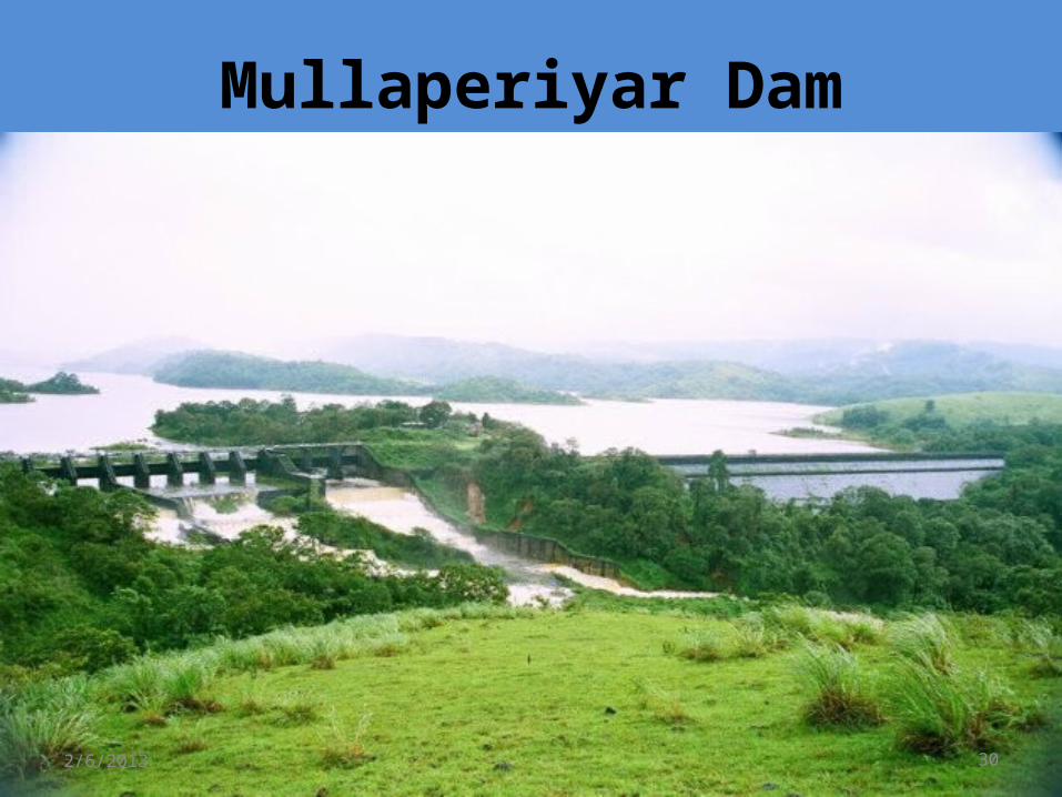
Mullaperiyar Dam
2/6/2013 30
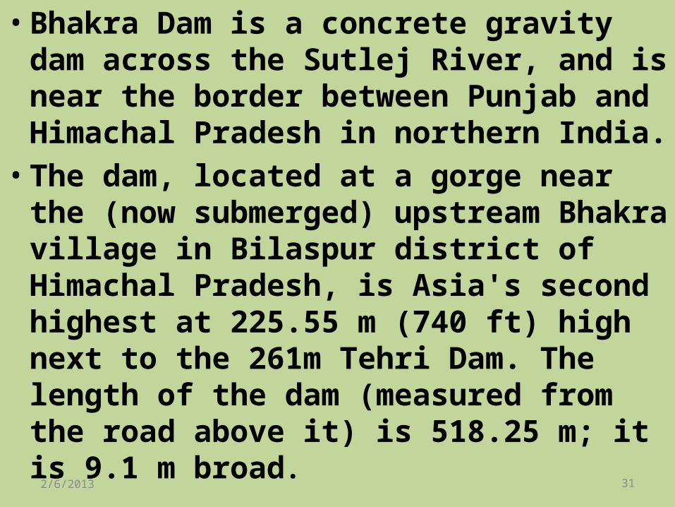
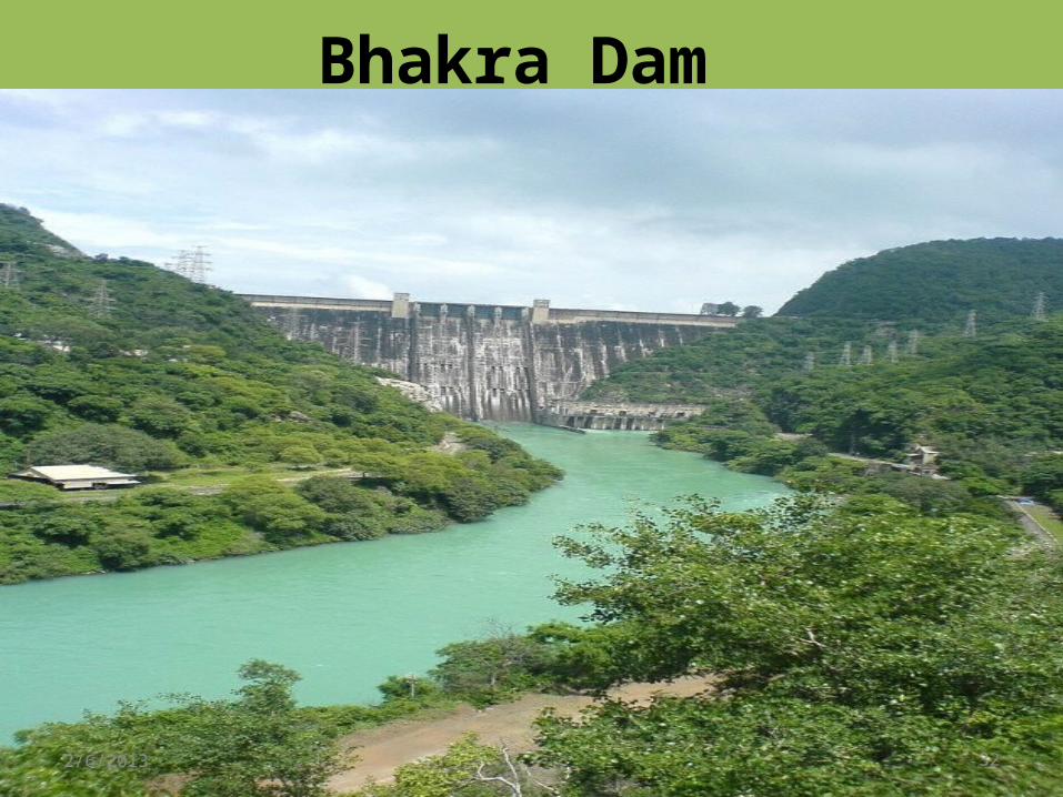
•Bhakra Dam is a concrete gravity dam across the Sutlej River, and is near the border between Punjab and Himachal Pradesh in northern India.
•The dam, located at a gorge near the (now submerged) upstream Bhakra village in Bilaspur district of Himachal Pradesh, is Asia's second highest at 225.55 m (740 ft) high next to the 261m Tehri Dam. The length of the dam (measured from the road above it) is 518.25 m; it is 9.1 m broad. 2/6/2013 31
Bhakra Dam
2/6/2013 32
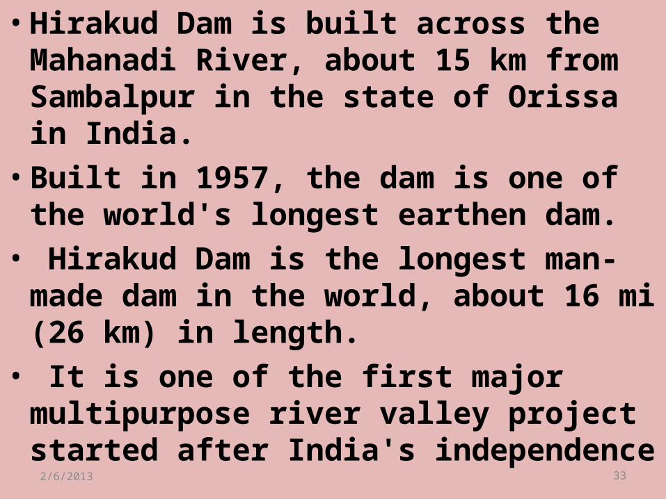
•Hirakud Dam is built across the Mahanadi River, about 15 km from Sambalpur in the state of Orissa in India.
•Built in 1957, the dam is one of the world's longest earthen dam.
• Hirakud Dam is the longest man-made dam in the world, about 16 mi (26 km) in length.
• It is one of the first major multipurpose river valley project started after India's independence2/6/2013 33
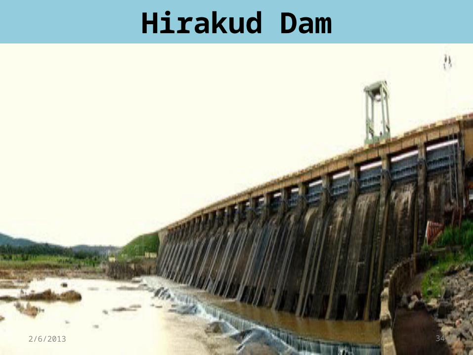
Hirakud Dam
2/6/2013 34
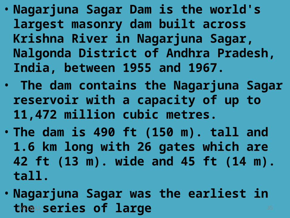
• Nagarjuna Sagar Dam is the world's largest masonry dam built across Krishna River in Nagarjuna Sagar, Nalgonda District of Andhra Pradesh, India, between 1955 and 1967.
• The dam contains the Nagarjuna Sagar reservoir with a capacity of up to 11,472 million cubic metres.
• The dam is 490 ft (150 m). tall and 1.6 km long with 26 gates which are 42 ft (13 m). wide and 45 ft (14 m). tall.
• Nagarjuna Sagar was the earliest in the series of large 2/6/2013 35
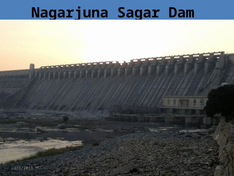
Nagarjuna Sagar Dam
2/6/2013 36
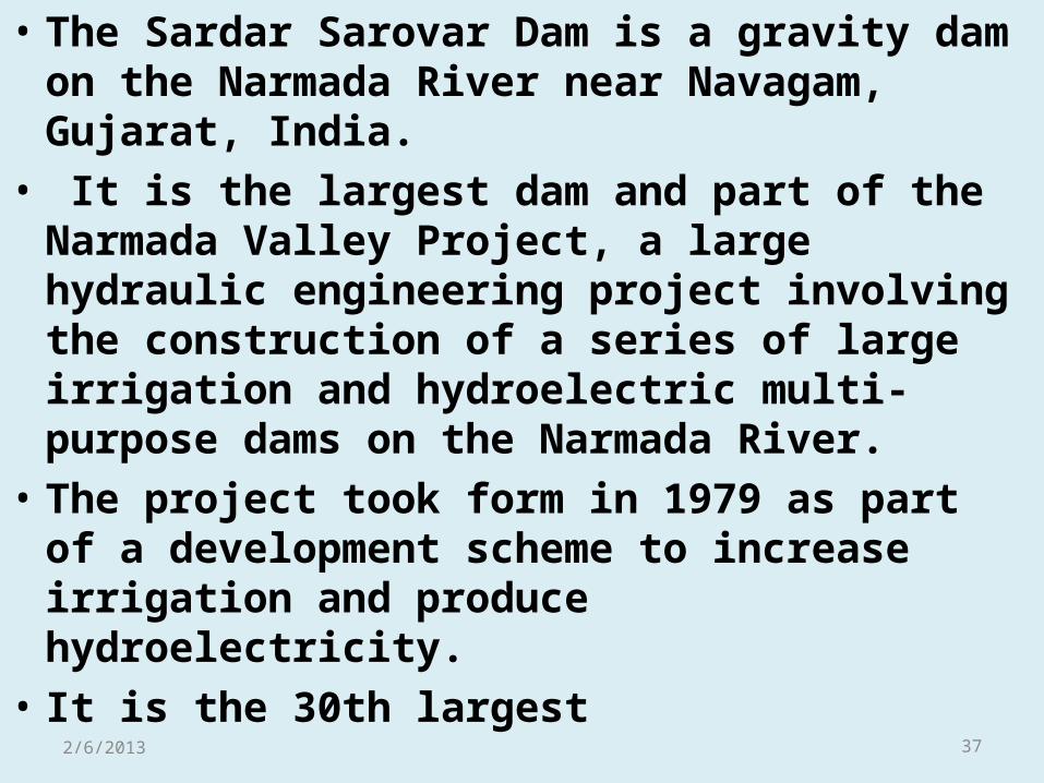
• The Sardar Sarovar Dam is a gravity dam on the Narmada River near Navagam, Gujarat, India.
• It is the largest dam and part of the Narmada Valley Project, a large hydraulic engineering project involving the construction of a series of large irrigation and hydroelectric multi-purpose dams on the Narmada River.
• The project took form in 1979 as part of a development scheme to increase irrigation and produce hydroelectricity.
• It is the 30th largest 2/6/2013 37
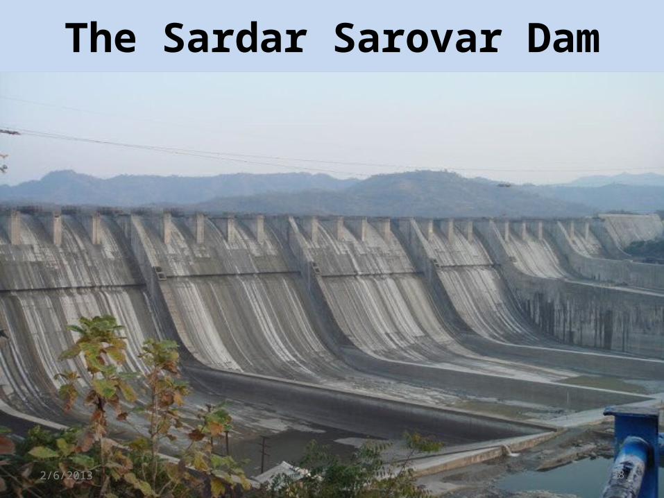
The Sardar Sarovar Dam
2/6/2013 38
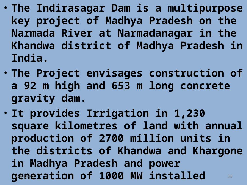
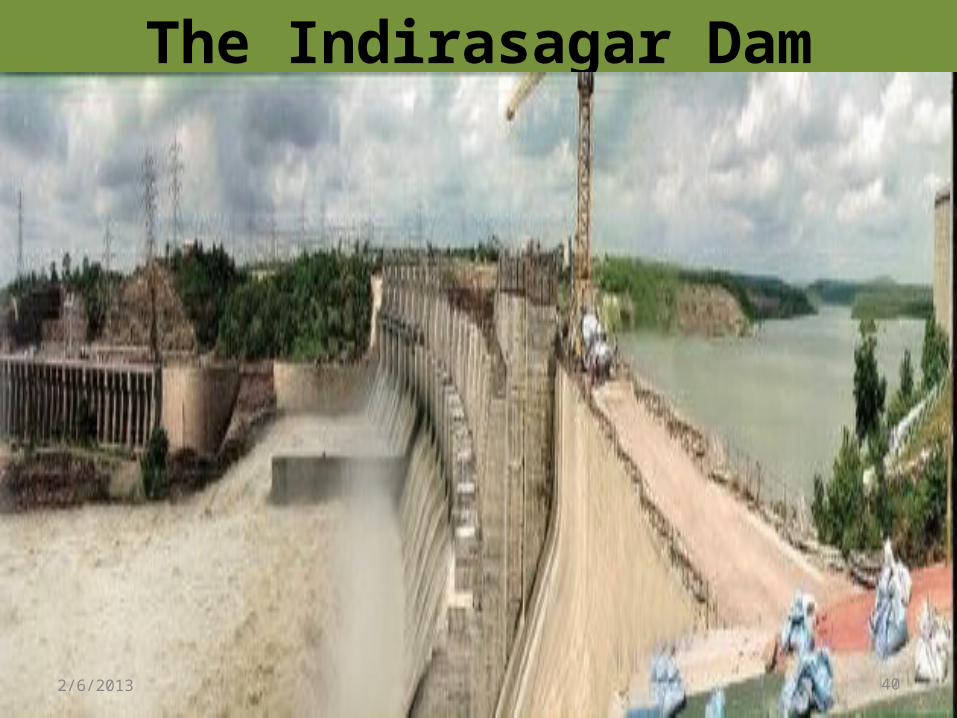
• The Indirasagar Dam is a multipurpose key project of Madhya Pradesh on the Narmada River at Narmadanagar in the Khandwa district of Madhya Pradesh in India.
• The Project envisages construction of a 92 m high and 653 m long concrete gravity dam.
• It provides Irrigation in 1,230 square kilometres of land with annual production of 2700 million units in the districts of Khandwa and Khargone in Madhya Pradesh and power generation of 1000 MW installed 2/6/2013 39
The Indirasagar Dam
2/6/2013 40
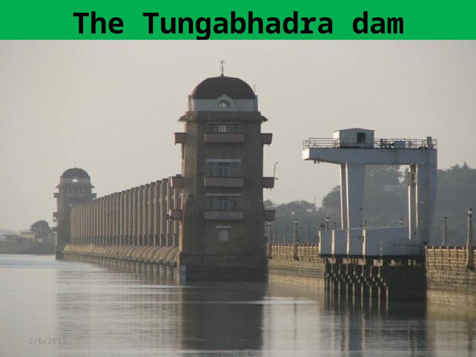
• The Tungabhadra dam is constructed across the Tungabhadra River, a tributary of the Krishna River.
• The dam is located near the town of Hospet in Karnataka.
• The dam creates the biggest reservoir on the Tungabhadra River with 101 thousand million cubic feet (tmc) of gross storage capacity at full reservoir level (FRL) 498 m MSL, and a water spread area of 378 square kilometres.
• The dam is 49.5 meters high above its deepest foundation2/6/2013 41
The Tungabhadra dam
2/6/2013 42
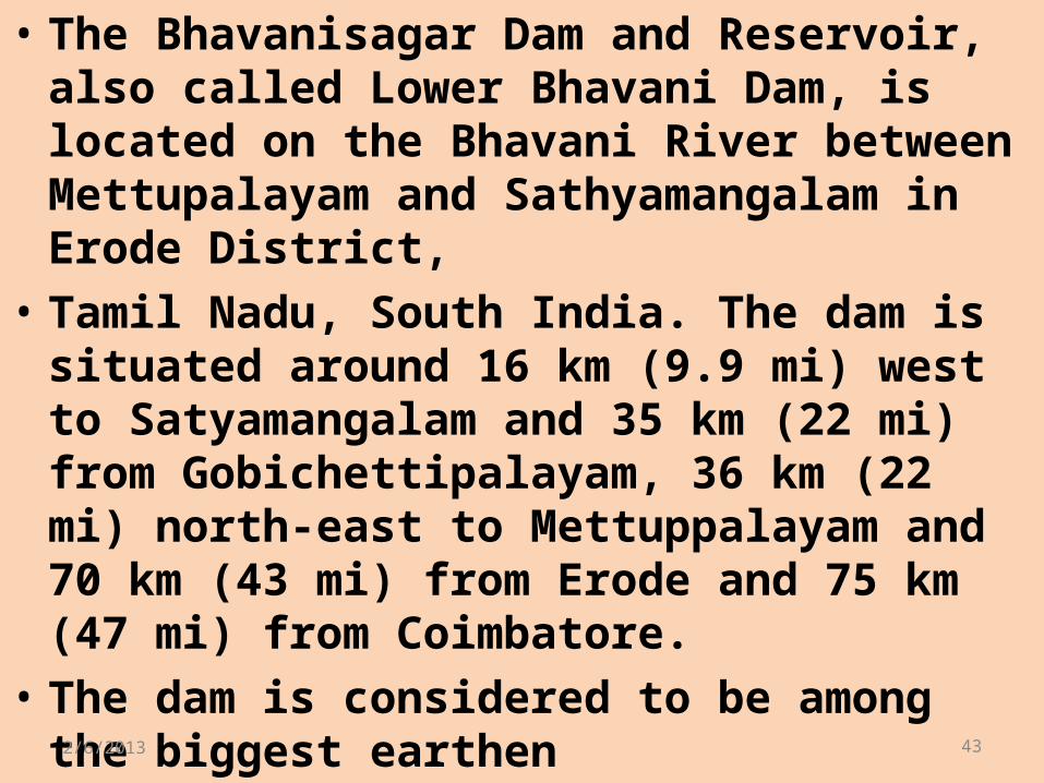
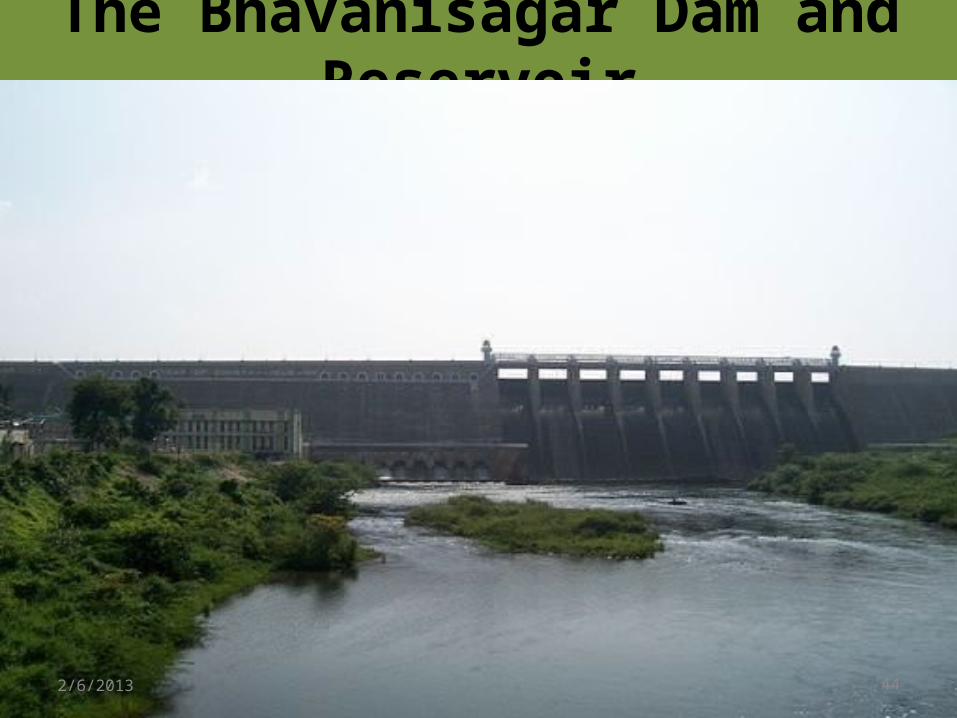
• The Bhavanisagar Dam and Reservoir, also called Lower Bhavani Dam, is located on the Bhavani River between Mettupalayam and Sathyamangalam in Erode District,
• Tamil Nadu, South India. The dam is situated around 16 km (9.9 mi) west to Satyamangalam and 35 km (22 mi) from Gobichettipalayam, 36 km (22 mi) north-east to Mettuppalayam and 70 km (43 mi) from Erode and 75 km (47 mi) from Coimbatore.
• The dam is considered to be among the biggest earthen 2/6/2013 43
The Bhavanisagar Dam and Reservoir
2/6/2013 44
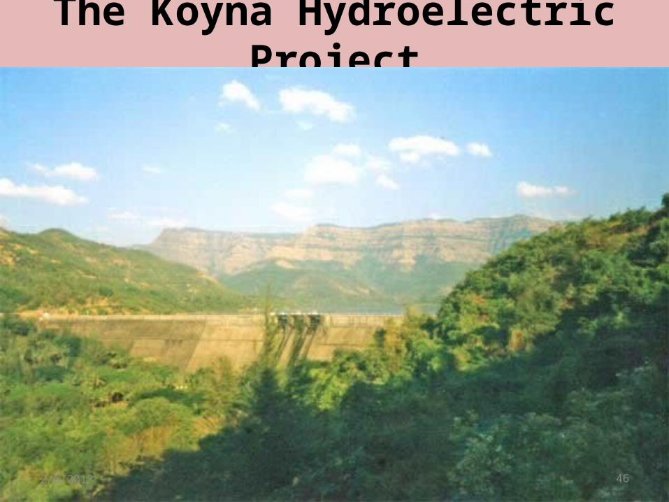
• The Koyna Hydroelectric Project is the largest completed hydroelectric power plant of India It is a complex project consisting of total four dams with the largest Dam built on Koyna River known as Koyna Dam hence the name Koyna Hydroelectric project.
• The total Installed capacity of the project is 1,920 MW. The project consists of 4 stages of power generation.
• Due to the project's electricity generating potential the Koyna River is considered as 2/6/2013 45
The Koyna Hydroelectric Project
2/6/2013 46
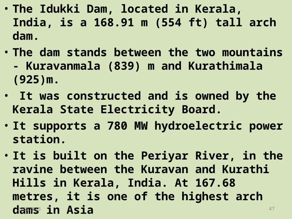
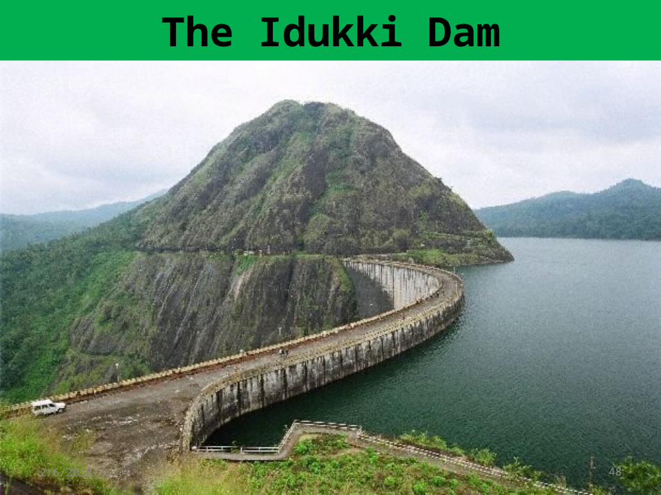
• The Idukki Dam, located in Kerala, India, is a 168.91 m (554 ft) tall arch dam.
• The dam stands between the two mountains - Kuravanmala (839) m and Kurathimala (925)m.
• It was constructed and is owned by the Kerala State Electricity Board.
• It supports a 780 MW hydroelectric power station.
• It is built on the Periyar River, in the ravine between the Kuravan and Kurathi Hills in Kerala, India. At 167.68 metres, it is one of the highest arch dams in Asia 2/6/2013 47
The Idukki Dam
2/6/2013 48
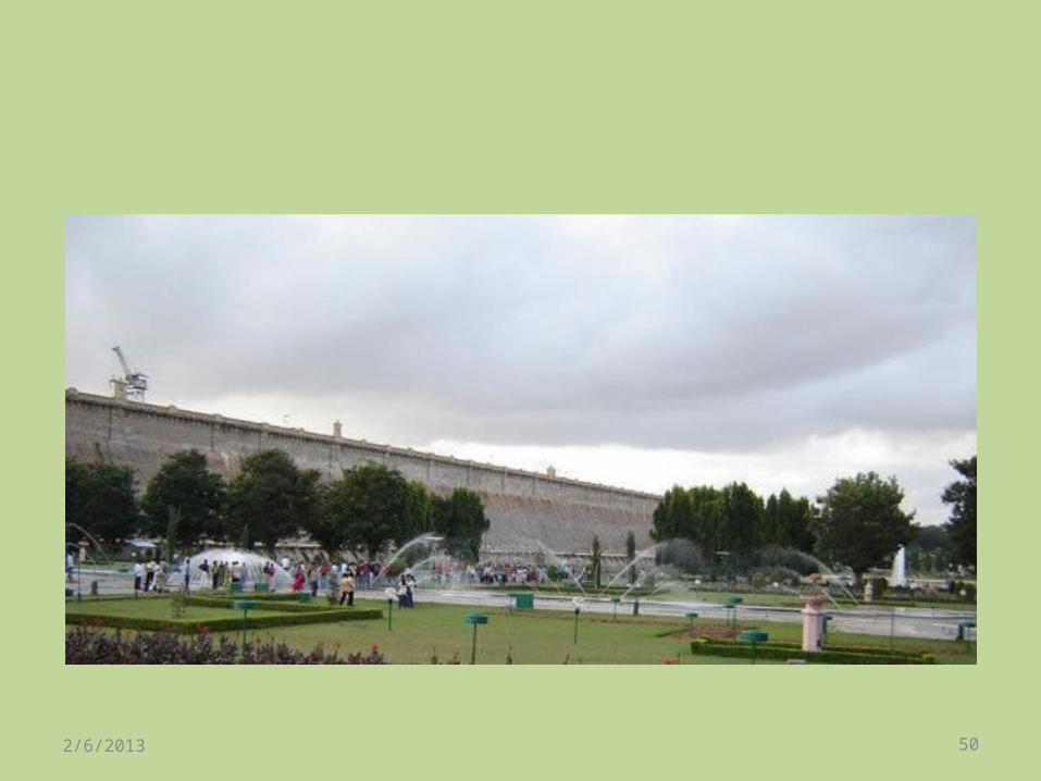
•Krishna Raja Sagara, also popularly known as KRS, is the name of both a lake and the dam that causes it.
•Sir. Mokshagundam Visvesvarayya served as the chief engineer during the construction of this dam.
• The dam is named for the then ruler of the Mysore Kingdom, Krishnaraja Wodeyar IV2/6/2013 49
2/6/2013 50
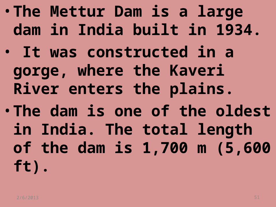
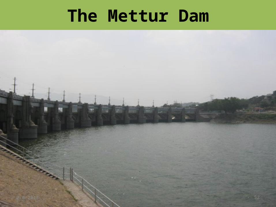
•The Mettur Dam is a large dam in India built in 1934.
• It was constructed in a gorge, where the Kaveri River enters the plains.
•The dam is one of the oldest in India. The total length of the dam is 1,700 m (5,600 ft).2/6/2013 51
The Mettur Dam
2/6/2013 52
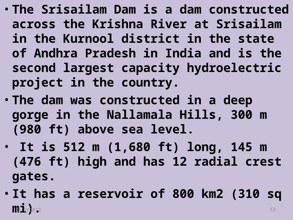
•The Srisailam Dam is a dam constructed across the Krishna River at Srisailam in the Kurnool district in the state of Andhra Pradesh in India and is the second largest capacity hydroelectric project in the country.
•The dam was constructed in a deep gorge in the Nallamala Hills, 300 m (980 ft) above sea level.
• It is 512 m (1,680 ft) long, 145 m (476 ft) high and has 12 radial crest gates.
•It has a reservoir of 800 km2 (310 sq mi).2/6/2013 53
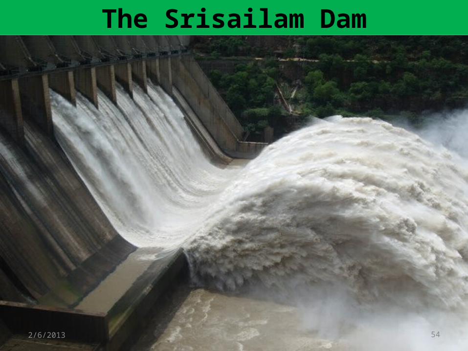
The Srisailam Dam
2/6/2013 54

ENVIRONMENTAL IMPACTS OF DAMS
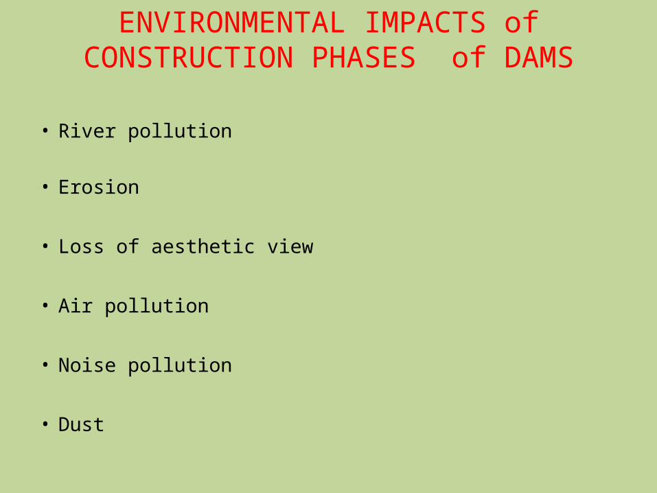
ENVIRONMENTAL IMPACTS of CONSTRUCTION PHASES of DAMS
• River pollution
• Erosion
• Loss of aesthetic view
• Air pollution
• Noise pollution
• Dust
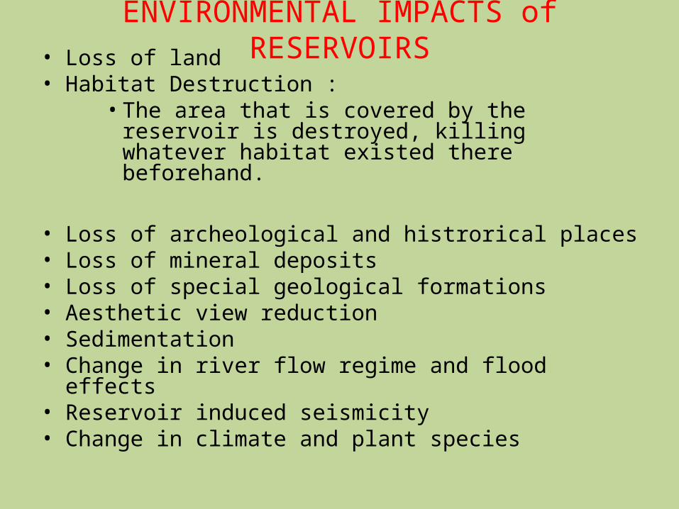
ENVIRONMENTAL IMPACTS of RESERVOIRS• Loss of land
• Habitat Destruction :•The area that is covered by the reservoir is destroyed, killing whatever habitat existed there beforehand.
• Loss of archeological and histrorical places• Loss of mineral deposits• Loss of special geological formations• Aesthetic view reduction• Sedimentation• Change in river flow regime and flood effects
• Reservoir induced seismicity• Change in climate and plant species
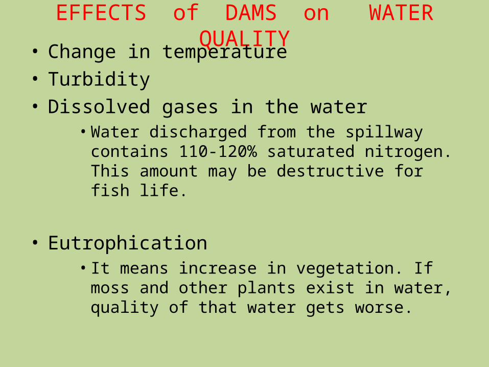
EFFECTS of DAMS on WATER QUALITY• Change in temperature
• Turbidity• Dissolved gases in the water
•Water discharged from the spillway contains 110-120% saturated nitrogen. This amount may be destructive for fish life.
• Eutrophication•It means increase in vegetation. If moss and other plants exist in water, quality of that water gets worse.

Thanks for Silenthearing !!!.........
10/14/22 59

BE FRESH WITH ME !!!!!
10/14/22 60

10/14/22 61
Sir, Sir !!
Please DON’T leave me here alone.
Users Friendly PENDRIVE

Thank u !!!
10/14/22 62
Thank U !!!

2/6/2013 63

2/6/2013 64

2/6/2013 65

Thank u all
!!!

10/14/22 67
HAVE A TEA BREAK Please !!!
Copyright © 2022 FDOKUMEN