Integrated Coastal Planning Maps - platform for Coastal Spatial Planning
35
[Integrated Coastal Planning Maps: an approach to devise the integrated coastal zone planning and management in Kiribati For the Applied Coastal System Dynamics Project Assessment Paper By Riibeta Abeta, ID: 1044137 University of the Sunshine Coast, Australia May 2009
-
Upload
independent -
Category
Documents
-
view
1 -
download
0
Transcript of Integrated Coastal Planning Maps - platform for Coastal Spatial Planning
[Integrated Coastal Planning Maps:
an approach to devise the integrated coastal zone planning
and management in Kiribati
For the Applied Coastal System Dynamics Project Assessment Paper
By Riibeta Abeta, ID: 1044137
University of the Sunshine Coast, Australia
May 2009
i
Synthesis Professional Report
This synthesis report is based on a research paper undertaken as part of an Applied Coastal
System Dynamics course assessment project. This report provides an integrated overview of
the usefulness of coastal planning maps for effective coastal program schemes, including other
inter-linked opportunities in Kiribati.
Coastal planning Maps are useful pre-requisite platforms to integrated coastal zone
management (ICZM).
The coastal zone is a dynamic and complex environment. The coastal issues and problems
usually arrive from multiple sources and tend to affect each other. Therefore, managing the
issues and problems requires not only an ad hoc approach but an integrated approach where all
intricate characteristics are considered in a continuum. The representation of all characteristics
of the coastal zone on visual coastal planning maps will aid the understanding of this
complexity. Since the integrated coastal management approach is a continuous and dynamic
process by which decisions are made for developments, sustainable use and protection of the
coastal resource, coastal planning maps serve as the perfect platform to inform this approach.
Therefore, the coastal planning maps are fundamental for a transitional move to the ICZM
approach. Hence, the ICZM stands to be the most appropriate approach to managing the coastal
regions of these research study sites in Kiribati. This is because chronic and complex coastal
issues and problems were evident in those sites.
The integration, the inseparable nature of the coastal planning and management is
essential for the ICZM approach.
The setting of the government institutions, interests and responsibilities tend to differ in the
coastal zones causing fragmentation of practices in addressing coastal issues and problems.
This arrangement is often not successful in managing the complex nature of the coastal
environment. This is also very similar in the study sites. However, the research found that for
an integrated coastal management approach to be successful, a strong linkage between coastal
planning, management, monitoring and the institutional integration is required. This will
enable integrated consideration and diagnosis of the issues and problems in a continuum
manner. Therefore, the interfacing and integration of different sectors, different levels of
government, different disciplines is to be encouraged to allow collaboration and coordination
under a defined integrated coastal zone management framework.

ii
Designing and implementing mixed coastal planning systems can be successful.
The research paper provides two types of coastal planning maps of different scales, i.e. South
Tarawa as the regional level planning plan and Bikenibeu village for the local level integrated
plan. From the research, it was found that the coastal issues and problems cut across
jurisdiction with different scales and magnitude. This implies that addressing these issues and
problems should involve a wide range of stakeholders. Therefore, the coastal planning maps
allow flexible utility to an integrated coastal program at the regional level for South Tarawa and
at the local level for Bikenibeu village. However, it is also crucial that these detail planning
systems is linked to a broader strategic coastal plan.
Integrated Coastal Zone Management and Planning can assist to reduce vulnerability to
sea level rise and natural hazards.
The coastal planning maps provide baseline information on the physical coastal processes and
socio-economic features of the study site. An understanding on these existing structures is
fundamental and enriches the vulnerability adaptation assessments to climate variability and
climate change. Vulnerable areas could be easily identified with proper adaptation responses
towards projected changes induced by climate variability and climate change in the longer term.
The coastal areas and economically important features will also be adequately protected from
anticipated events of natural disasters. Therefore, the ICZM also impose opportunities and
values alongside managing other coastal issues and problems.
Effective Coastal planning has a pivotal role to sustainable development of Kiribati.
The ICZM scheme is in line with the principle of sustainable development including the
precautionary principle and the inter-generational equity. Noting that most of the economic
activities fall on the coastal zones, the approach of ICZM will ensure a long term vision to plan
for the present and the future uses of the coastal zone areas for aquaculture, eco-tourism and
it’s finite resources. The economic benefits obtained from the sustainable use of the coastal
zone will be maximised. The ICZM approach will ensure the protection of the ecological base of
coastal and marine resources which provide fundamental services to support the community
welfare and the economy.

iii
Preamble
“Of the six billion people alive today an estimated 1.7 billion or 38% of the global population is
estimated to live within 150 km of the coast” (Alder 2005). The majority of the population and
developments on small islands reside in almost a completely coastal defined area. This is
particularly true in atoll countries like Kiribati.
The study site proposed for the assessment in ENS725 will be in Kiribati, and is structured in
three scales which are the primary, secondary and tertiary compartments. The primary cell will
encompass the whole island of Tarawa; while the secondary cell will be South Tarawa and lastly
Bikenibeu village serves as the tertiary cell.
This preamble will provide a situational analysis of the afore-mentioned sites based on
literature review, local knowledge and Goggle earth observation.
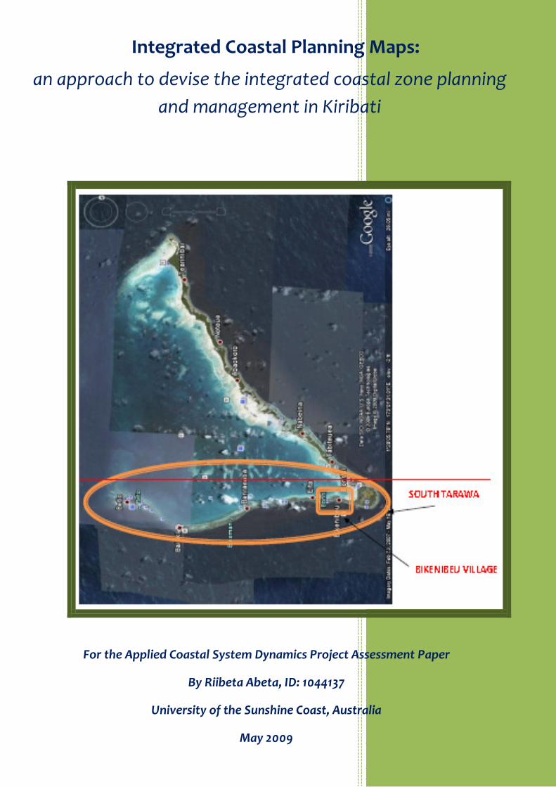
South Tarawa is a typical atoll island with strand of islets, narrow in land size, a large lagoon in
the middle and elevation not more than 3 meters and width of between 350-450m (He 2001).
South Tarawa is located at approximately latitude 1°22'47" N, longitude 173°09'06" E
(http://en.wikipedia.org/wiki/Tarawa_Atoll), north of the equator in the Pacific Ocean.

iv
Figure 1: Map of Tarawa showing study sites
SOUTH TARAWA
NORTH TARAWA
Source: Goggle earth map

v
South Tarawa, 490km2 land area and approx 30km of coast (Hosoi 1995) is the capital of the
Republic of Kiribati, it is now transformed into a single crowded island through causeway
construction joining all islets. South Tarawa comprises the main administrative, commercial
and residential towns or villages of the entire atoll island system.
Numerous technical studies have been undertaken in the past on South Tarawa, focussing at
long-shore drift, shoreline changes, sediment transport and budget, erosion and accretion and
anthropogenic influences. (SOPAC 2005). The lagoon and ocean represent the magnitude and
complexities of the physical coastal processes and have varying influences on the coastline of
the Tarawa’s atoll system.
Climate parameters are important drivers of the physical processes at the atoll. Due to Kiribati’s
geographical location, the climate is greatly influenced by the large scale regional ocean-
atmospheric circulating systems known as the Inter-Tropical Convergence Zone (ITCZ) and
Equatorial Doldrums’ Belt. (Burgess 1987). However, the El Nino Southern Oscillation (ENSO)
also affects the longer term pattern of the Kiribati climate.
In effect, Kiribati has two weather patterns through-out the year, and they are i) wet season and
ii) dry season. The wet season runs from December to May and characterises a situation when
the ITCZ is closest to Kiribati bringing extensive rain and highly variable wind patterns. The dry
season occurs from April to November and is typically a calm season with moderate wind.
(Burgess 1987)
These weather patterns are important to understand fully as they determine the regional and
site-specific physical coastal processes such as winds, currents, and waves. Under the climate
variability and change projection, it is highly likely that extreme high sea levels, air
temperatures and winds are likely to occur in the coming decades in Kiribati. (Hay, JE 2006)
Wind patterns in Kiribati are predominantly easterly trade winds, though their direction
changes under the influences of large scale ocean-atmospheric systems like ITCZ or ENSO
(Biribo 2008).
A study of the bathymetry and flow rates of currents in the Tarawa lagoon showed that there is
a high flow rate of tidal currents (Biribo 2008). This tidal pattern is also significant when
considering coastal processes at the study site.

vi
The intensity of rainfall may have influences on flooding in a closed lagoon condition therefore
increases possibilities of swells and waves overtopping in some islands of Kiribati. However,
very little information was available in the literature on the direct influence of rainfall to the
coastal processes of atoll countries.
Wave behaviour is among the most complex and common coastal drivers in the atoll island
systems including the study site. The ocean side of atolls are usually exposed to high energy
waves which tend to carry energy towards the coastline. Wind generated waves and currents
are common in the atoll islands and in the study site as well. These processes are known to be
an important source of energy transporting sediments from the reefs to the coastline and within
the coastline of the atoll islands through longshore drift. Many studies in Tarawa (Solomon
1997) have been undertaken showing evidence of waves and currents workings in South
Tarawa.
Shoaling is the process of beach set-up or set-down or sediment movements accumulating in
areas of convergence where there is no water movements (Solomon 1997). Solomon further
mentioned that Betio, an islet of South Tarawa was built as part of a shoaling process. This was
further confirmed by latter studies (Solomon 1997) where, they mentioned that the coastline of
this islet was highly dynamic and has been continuously eroded and accreted over the years.
The relationship between the climate change, climate variability phenomena, regional decadal
ocean-atmospheric systems and local coastal drivers are extremely crucial to engulf as they
intricately underpin the resultant effects at the coastal zone environments, despite additional
shocks from human induced developments.
Atolls like Tarawa derive its sediment budget from biological remains (M, E 1999) (Biribo
unpublished) This was shown in the composition of their sediment budget with large amounts
of algae remains and forams, shells found in the above mentioned study. The behaviours of
marine organisms like parrot fish, burrowers, through the process of bio-erosion contribute to
the sediment budget of atoll islands (Scoffin 1980). This is an important element as marine bio-
diversity was abundant in the study sites.
Coral reefs surrounding atoll islands, including Tarawa provides the reservoir for major
carbonate sources of the sediment budget of coral atolls. In addition, the reefs also act as buffer
of atolls’ shoreline from high energy waves dissipating as they approach the shores according to
Ebrahim (1991).

vii
In shallow lagoons with mudflats common in the study site; seagrasses can be found. This
ecosystem upholds the fine sediments of the mudflats and maintains turbidity of the water
column, thereby sheltering coral reefs from smothering. Seagrasses also provide habitats for
marine carbonate organisms which are useful for the sediment budget of the atolls.
In certain places of South Tarawa atoll particularly lagoon water areas, mangrove plants can be
found. This ecosystem provides natural protection to the coastline of the small land size atolls
from storms and high energy waves (Scoffin 1980). Usually, this spot is very stable in terms of
erosion and accretion.
These biological features are common in the study site as well, albeit several portions of them
have been destructed due to human interventions.
The study site is an interesting and complex atoll system with large evidence of human
developments interacting with their natural coastal resources system. The population density
of South Tarawa is 2558 person per km2, which is considerably high (Kiribati 2005 Census
2007). The population is increasing at a rate of 1.8% with the natural environment adapting
and thriving in a most intricate manner providing services to the heavy population capacity.
Since the island serves as the capital of Kiribati, most commercial and social activities occur on
the island with several places already crowded. Therefore, all sorts of economic activities
ranging from fisheries, services, infrastructure like ports, industries, off-shore infrastructures,
roads, commercial towns, and airports and residential/government buildings converged on the
island. In the figure below, it can noted that Kiribati had very minimal economic activities but
the “other” which comprised of infrastructures, services took the greatest percentage and this is
more prominent in Tarawa, which is the study site.

viii
Figure 2: Contribution of some key economic sectors to the national economy in 2005
Source: (Hay, EaO, K 2006)
Due to the pressing need for infrastructure services and settlement on a limited land, several
poorly designed coastal defences like causeways, seawalls, land reclamation can be found along
the island’s coastline, including heavy sand mining disturbing the natural sediment movements
altering the pattern of coastal processes. This leads to a more complex and instability
movement of the island’s shoreline.
Being small, most societies in Kiribati and including the study sites are peaceful and intimate.
Usually, the elders play significant role in the day-to-day decision-making of each family unit in
Kiribati. The village and church communities are very influential and powerful bodies,
particularly in large scale developments and solving community or national level conflicts. At
times of crisis or natural disasters, community leaders usually took initiatives to mobilise
community-based and voluntary assistance to the affected communities. This is an important
cultural norm instituted in Kiribati and the study site. The other cultural aspect which is critical
in coastal issues is the flexibility of land tenure system. In several of the islands, indigenous
people posses lands passed on from their fore-fathers, however, elders in the community
cooperate and consult each other in an informal decision making manner and can designate
land plots within their village for specific emergency purposes.
In South Tarawa, the Government lease land from indigenous land-owners and then sublease
them for commercial, residential, industrial purposes. In this manner, control of the entire
island land tenure and coastal system was decentralised and each entity sitting on sub-lease
ix
land plots take full charge of that land. Though, the issues and conflicts are governed under the
normal national legislation and procedures.
Apparently, in Kiribati and Tarawa, there is no such instrument as a coastal zone management
policy. Coastal issues and problems are dealt with, in a reactive and ad hoc mode by various
government departments. Therefore, the institutional arrangement and formal decision making
process regarding coastal issues in Kiribati is fragmented, piece-meal and usually inefficient in
its implementation (Kench 2005).
As alluded earlier, coastal management issues was managed by the Foreshore and land
reclamation act. This Act retains the ability to designate uses of foreshore areas through a
working committee (Foreshore and Land Reclamation Act 1998) and also stipulates that
foreshore zone of all lands is the property of the Government. However, the boundary of the
foreshore zone was often disputed by landowners.
The Land Use Planning Act was instrumental in properly allocating uses and standards for
government owned lands (AN ACT TO AMEND THE LAND PLANNING ORDINANCE 2000).
The Environment Act through it EIA process, filter out potential environmental impacts and
risks from any prescribed developments intended to be carried out in the country (Ac Act to
amend the Environment Act 1999 2007). This Act was also useful in preserving crucial natural
ecosystems such as coral reefs, mangroves and enforcement of illegal aggregate mining
activities. The climate change study team is dealing with vulnerabilities adaptation assessments
on sectors including coastal zone.
There is also a national Disaster Act but the function of this legislation was more reactive to
immediate crisis and risks and does not operate proactively on a day-to-day basis (Disaster Act
1998).
There are also voluntary activities on mangrove replanting by the youth communities going on
in South Tarawa. This is very useful in preserving these important ecosystems.
Recently, there has been a number of studies moving in a direction of investigating possible
coastal protection approaches, suggested institutional arrangements and decision making
processes for an integrated coastal zone management (Kay 2007a).
The Kiribati Development Plan 2008-2011, was also supportive of coastal management issues
and stated under one of its priority policy area the need to monitor and protect the coastal zone
x
(Kiribati Development Plan 2008-2011 2008). Though, the specificity of how this will be
undertaken effectively was still not fully understood at the national level.
In the Bikenibeu study site, efficient communication and decision making process in the form of
community based governing system was well established in the villages. The church
community of different denominations functioned separately in their respective meeting areas
within the study site all year round. The majority of the elders, women and youth in this site,
like other villages of islands respects honorary to the decisions and direction of their own
community organisation.
However, the priorities of these community organisations are more religious-oriented and they
usually pursue their own developments. Unfortunately, little is known by the community
members on the environment conservation or impacts of developments on their coastal
environment.
The population census in 2005 indicated that the population for Kiribati is increasing at the rate
of 1.8% compared to the 2000 census. Projections of the population using a medium population
scenario (i.e. medium fertility and medium net migration) stated that the population can reach
101,000 in 2010 and 130,000 in the year 2025 (Kiribati 2005 Census 2007).
The size and density of the population has a direct impact on the environment including needs
for higher demand on the ecosystem. On areas with high population densities particularly in
South Tarawa, one would expect more pressures on the coastal zone environment as the
population is either competing for the needed services on the exhaustible environment. This
will interfere with existing processes of the environment and coastal zone thru heavy and
destructive development interventions.
Climate change is an additional factor that can influence the coastal zone environment. There is
a degree of uncertainty in the scientific knowledge of climate change but it is certain that it
going to eventuate sometimes in the unknown future. The forecasting of the magnitude and
intensity in the future is also still uncertain, making decision making even more difficult with
regard to which approach and options to begin with. In addition, there is a challenge in choosing
current coastal adaptive plans that are compatible with projected climate change effects and
infer ‘no regrets’ sentiments without climate change.
Recalling the complexity of the coastal zone management and the population and climate
change projection, the ideology of integrated coastal zone management seemed to be the most
favourable approach to go. The ICZM intertwine the bio-physical factors, socio-economic

xi
aspects and considerations of future phenomena like climate change and population projection
in a continuum and effective decision making process.
There are bands of opportunities attached to this approach, for instance effective assessment of
the coastal zone impacts and added values adaptation to climate change. However, this is not
easy to achieve and will require collaboration, cooperation, provision of tools, strategies, plans,
knowledge and awareness, Also required will be effective institutional and decision-making
arrangements and complimentary communal and political commitments and support.
The research in this exercise will investigate ways to facilitate the process of the integrated
coastal zone management with a view to be useful for addressing issues of the coastal zone
systems.

xii
Executive Summary
This research paper intends to characterise the dynamics and complexity of the coastal zone
system through provision of the coastal planning maps representing all essential features.
It is also the intention of this research that the maps should assist the enhanced understanding
regarding the interconnected factors within the coastal zone. This anticipated established
understanding would be instrumental to addressing the intricate and multiple coastal issues
and problems in a particular region or site.
The sites chosen for the research are South Tarawa and a village of South Tarawa which is
Bikenibeu. The rationale behind the selection of the sites was to have an opportunity to develop
coastal planning maps of different scales. The South Tarawa will represent the regional scale
while Bikenibeu village represents the local scale.
From the Preamble and the literature (refer to section 2.0), both of the study sites were already
pressured by intensive coastal developments; with all kinds of coastal issues and problems
visible at the study sites. The review of the existing governing systems has shown that it was
fragmented and ineffective. Different institutions, policies and legislations were mandated to
address specific coastal problems with minimal coordination of their measures. The study sites
also have numerous technical studies on physical coastal processes driven mostly by different
objectives. While these studies recommended remedy actions and the need for integrated
coastal management approach, there has not been any serious consideration of those
recommendations to date.
The maps in this research developed by Google earth have limited features, though they provide
a scoping medium to the future integrated coastal zone management approach in Kiribati. The
maps require modifications to include sea level rise risk zones, contours, bathymetric data, and
to translate the coastal planning maps features into geo-rectified GIS layers.
These maps should be part of the integrated coastal framework and mainstreamed into an
established institution managing the framework. The performance of such an implemented
framework must be measured and evaluated to achieve a better measure.

xiii
Table of Contents
Synthesis Professional Report .................................................................................................................. i
Preamble ................................................................................................................................................ iii
Executive Summary ............................................................................................................................... xii
1.0 Introduction ................................................................................................................................ 1
2.0 Literature Review ........................................................................................................................ 2
3.0 Description of methods .............................................................................................................. 3
3.1 Characterising the elements and features of the coastal planning maps .............................. 3
3.2 Boundaries of the coastal planning maps for each of the two study sties ............................. 3
3.3 The physical environment features and construction of physical coastal planning maps ..... 3
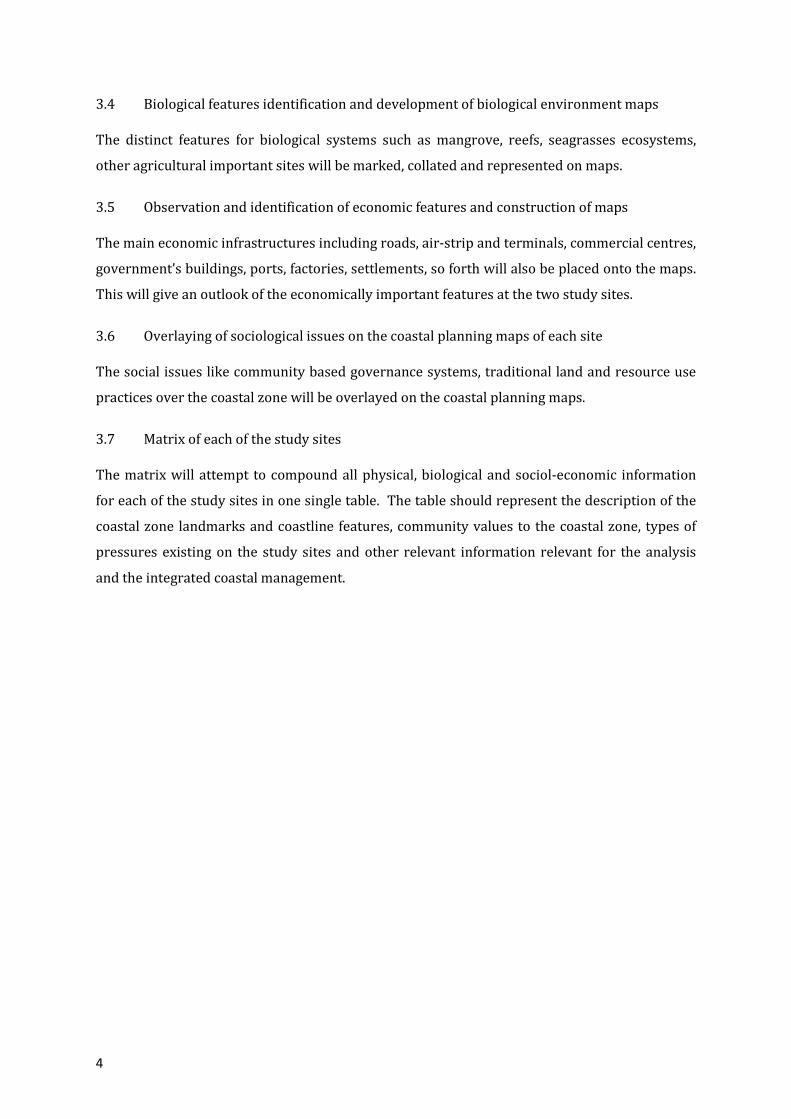
3.4 Biological features identification and development of biological environment maps ........... 4
3.5 Observation and identification of economic features and construction of maps .................. 4
3.6 Overlaying of sociological issues on the coastal planning maps of each site ......................... 4
3.7 Matrix of each of the study sites ............................................................................................ 4
4.0 Results: Coastal Planning Maps .................................................................................................. 5
Matrix of each study sites compartment .............................................................................................. 13
Discussion.............................................................................................................................................. 15
6.0 Conclusions ............................................................................................................................... 17
7.0 Recommendations and the way forward ................................................................................. 18
References ............................................................................................................................................ 19

xiv
List of Tables and Figures
Figure 1: Map of Tarawa showing study sites .................................................................................... iv
Figure 2: Contribution of some key economic sectors to the national economy in 2005 ............ viii
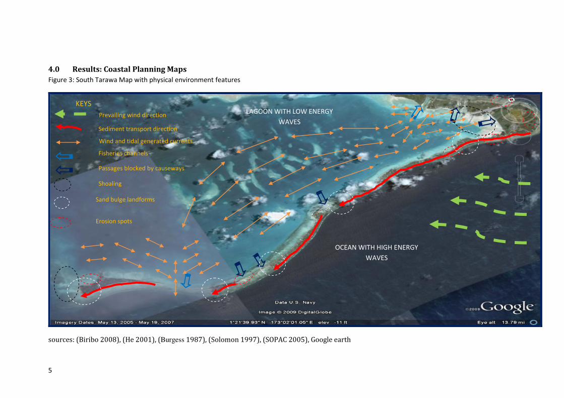
Figure 3: South Tarawa Map with physical environment features ......................................................... 5
Figure 4: South Tarawa Map with biological environment features ...................................................... 6
Figure 5: South Tarawa Map with economic features ............................................................................ 7
Figure 6: South Tarawa Map with sociological features ......................................................................... 8
Figure 7: Bikenibeu Map with physical environment features ............................................................... 9
Figure 8: Bikenibeu Map with biological environment features .......................................................... 10
Figure 9: Bikenibeu Map with economic features ................................................................................ 11
Figure 10: Bikenibeu Map with sociological features ........................................................................... 12
Table 1: The integrated coastal planning information matrix for South Tarawa ................................. 13
Table 2: The integrated coastal planning information matrix for Bikenibeu ........................................ 14

1
1.0 Introduction
This research paper recognises that the management of the coastal zone issues is complex
because it involves a composite of problems and sources. This is particularly apparent in the
proposed study sites of the research paper which is South Tarawa, Kiribati and one village of the
capital island, Bikenibeu.
According to (Creary 2003), “Integrated coastal zone management (ICZM) is a continuous,
interactive, adaptive, participatory, consensus-building process comprised of a related set of tasks,
all of which must be carried out to achieve a desired set of goals and objectives specified in a given
time.”
It is of the view of this research paper that the ICZM is a suitable practice to counteract and
softens the current coastal zone issues in Kiribati.
Therefore, the research paper will investigates existing gaps and formulate underpinning
substructures needed for the urgent implementation of the most relevant ICZM approach in
Kiribati.
The methodologies for the above undertakings is provided and simplified in section 3.0 so that
replication of similar exercise can be followed and/or improved to other sites or for similar
undertakings. The approach taken in this research as a turning point to ICZM in Kiribati is to
collate all relevant information of the two study sites necessary for ICZM and overlay them on
visual coastal planning maps. The information can be classified into physical environment,
biological environment, economic features, sociological features and other necessary issues.
These maps will then be translated into a matrix information package which can be used
interactively in any level of decision making processes.
Assumptions on the utility of the coastal planning maps will be provided in section 4.0. The
existing response practices to coastal problems, barriers and additional requirements to
advocating the ICZM approach will also be discussed. This research noted that the findings of
this research may not provide all the answers for a transition shift to ICZM in Kiribati.
Nevertheless, the fundamental aspiration of this research paper is to initiate the process of the
integrated coastal zone management approach; through provision of integrated coastal
planning maps and provides the recommendations.

2
2.0 Literature Review
The context for Integrated Coastal Zone Management (ICZM) in Kiribati and in the Pacific region
is still premature (Kay 2007a). The Secretariat of the Pacific Environment Programme (SPREP)
through the International Waters Program had attempted to encourage recognition and
implementation of the ICZM in the pacific region; however it was apparently entangled with the
integrated watersheds management and other pressing priorities (SOPAC 2003). To date, there
has not been any documentation of lessons from the pacific islands authorities based on the
ICZM practices or experiences. However, a number of lessons on coastal management deriving
from community-based initiatives are available (SOPAC 2003) .
ICZM in the Caribbean region had progressed well (M, L 1998). Several of the Caribbean island
countries had formulated and implemented Integrated Coastal Zone Management practices. It
was mentioned by Creary (2003), that various form of gradual commitments had to be subdued
in order to successfully set for the context of ICZM in the Caribbean countries. These include
policy and institutional reforms, vertical and horizontal integration of responsibilities and wider
community consultation process.
According to Banica (draft), the ICZM require basic information like physical environment,
biological environment, economic conditions, sociological features and issues to be overlaid
together or considered in an inter-active and adaptive management system.
This information was readily available in several countries including Kiribati through past
technical studies (Biribo 2008). However, integration and consideration of the information
together in a coordinated management regime has never taken place due to considerable
reasons. One of the fundamental reasons for this ICZM loop-hole, despite financial and
institutional capacity constraints, is the fear of responsibility abdication to each institution since
the mechanics of ICZM involves cross-sectoral approach. Another underlying drawback for
ICZM in Kiribati is the complexity of delineating the ICZM boundaries.
The ICZM approach will addresses coastal problems effectively, which usually have multiple
impacts arriving from different sources. This approach will ensure maximum economic
benefits, reduce vulnerability, maintain ecological and life support services and moreover could
overcome the fragmentation inherent in both sectoral management and splits in jurisdiction
among levels of sectors (Knecht 1998).
This is in line with the rational of this research project and will initially attempt to progress
steps and favourable ingredients to demonstrate that ICZM is possible and practical in Kiribati.

3
3.0 Description of methods
This research project will use Google earth tool to formulate coastal planning maps.
This method adopts the coastal planning principles described by (Alder 2005) for different
levels of planning. The South Tarawa coastal planning map will be used for the integrated
regional plans while Bikenibeu village coastal map will feed to the integrated local level plans.
The following are description of the methods undertaken in this exercise.
3.1 Characterising the elements and features of the coastal planning maps
The main features of the coastal planning maps will includes, the physical environment (i.e.
coastal drivers, sediment transport, landforms, and meteorological data), the biological
environment (such as reefs, mangroves, mudflats, aquaculture ponds), economic and social
features will be factored separately in each map of the study sites respectively. Therefore these
elements form the basis for coastal planning maps.
3.2 Boundaries of the coastal planning maps for each of the two study sties
The processes of demarcation of boundaries where the coverage of management will be
imposed require stakeholder consultation and must also be consistent with the implied policies
and legislation. In this exercise, the boundaries of the coastal zone adopt the concept by
(Knecht 1998) where the coastal area should consists of inland areas, coastal lands, coastal
waters and offshore waters. However boundaries of these coastal planning maps must be
guided by the integrated coastal zone management framework after stakeholders’ consultation.
Therefore, the boundaries of these maps are subject to further modification and endorsement.
The extent of the coastal zone belt to be covered in this crucial exercise will extend from Betio to
Bonriki including immediate inter-tidal reef zone of the lagoon and ocean side for the South
Tarawa site. While for the Bikenibeu village site, it will exclusively include the whole village and
its coastal waters as well.
3.3 The physical environment features and construction of physical coastal planning maps
The physical environment features as identified from previous technical studies will be
revisited and collated onto a single map for the two study sites. The prominent coastal
processes including climate drivers on the island and at the village will be clearly highlighted
onto maps. This will be aided through Google talk observation.
4
3.4 Biological features identification and development of biological environment maps
The distinct features for biological systems such as mangrove, reefs, seagrasses ecosystems,
other agricultural important sites will be marked, collated and represented on maps.
3.5 Observation and identification of economic features and construction of maps
The main economic infrastructures including roads, air-strip and terminals, commercial centres,
government’s buildings, ports, factories, settlements, so forth will also be placed onto the maps.
This will give an outlook of the economically important features at the two study sites.
3.6 Overlaying of sociological issues on the coastal planning maps of each site
The social issues like community based governance systems, traditional land and resource use
practices over the coastal zone will be overlayed on the coastal planning maps.
3.7 Matrix of each of the study sites
The matrix will attempt to compound all physical, biological and sociol-economic information
for each of the study sites in one single table. The table should represent the description of the
coastal zone landmarks and coastline features, community values to the coastal zone, types of
pressures existing on the study sites and other relevant information relevant for the analysis
and the integrated coastal management.
5
4.0 Results: Coastal Planning Maps
Figure 3: South Tarawa Map with physical environment features
sources: (Biribo 2008), (He 2001), (Burgess 1987), (Solomon 1997), (SOPAC 2005), Google earth
Prevailing wind direction
Sediment transport direction
Wind and tidal generated currents
Fisheries channels
Passages blocked by causeways
Shoaling
Sand bulge landforms
Erosion spots
LAGOON WITH LOW ENERGY
WAVES
OCEAN WITH HIGH ENERGY
WAVES
KEYS

6
Figure 4: South Tarawa Map with biological environment features
Source: (E 2000), (Hay, EaO, K 2006), (Biribo unpublished), Google earth
Reefs ecosystem
Fisheries ponds
Seagrass/mudflat ecosystem
Mangrove ecosystem
KEYS

7
Figure 5: South Tarawa Map with economic features
Source: (Hay, EaO, K 2006), (Tererei Abete Reema 2002) Google earth
Landfills for waste
Towns and Villages
Airstrip and Terminal building
Towns and Villages
Education Institutions
Major Hospitals
Government and Commercial buildings
Parliament Complex
Wharf and Port
Sealed road
KEYS
Causeways

8
Figure 6: South Tarawa Map with sociological features
Source: (Kiribati 2005 Census 2007), (Tererei Abete Reema 2002)
91 people
12,509 people
2,011 people
3,939 people
2,766 people
803 people
2,119 people
1,688 people
2,299 people
6,170 people
Fisheries/gleaning
Seawalls, dumping, boat ramps
Population in each village
Recreational spots
KEYS

9
Figure 7: Bikenibeu Map with physical environment features
Sources:(Biribo 2008), (He 2001), (Burgess 1987), (Solomon 1997), (SOPAC 2005), Google earth
LAGOON WITH LOW ENERGY
WAVES AND INCOMING
AND OUTCGOING TIDES
OCEAN WITH HIGH ENERGY
WAVES AND INCOMING
AND OUTCGOING TIDES
Prevailing wind direction
Sediment transport direction
Wind currents direction
Beach-rock-structures
Erosion spots
Man-made coastal structures
KEYS
Sediment transport direction

10
Figure 8: Bikenibeu Map with biological environment features
Source: (E 2000), (Hay, EaO, K 2006), (Biribo unpublished), Google earth
Reefs ecosystem
Seagrass ecosystem
Agriculture nursery
Keys

11
Figure 9: Bikenibeu Map with economic features
Source: (Hay, EaO, K 2006), (Tererei Abete Reema 2002) Google earth
Education institutions
Commercial centres
Hospital and Clinics
Government Offices
Sealed road
Settlements
Key
Landfill for waste

12
Figure 10: Bikenibeu Map with sociological features
Source: (Hay, EaO, K 2006), (Tererei Abete Reema 2002) Google earth
Demographic information: Bik Village
Total population: 6,170
Male: 2,969 Female: 3,201
Fisheries and gleaning practices
Beach mining, boat ramp, channels, dumping
Church centres influencing coastal decisions
KEYS

13
Matrix of each study sites compartment
Table 1: The integrated coastal planning information matrix for South Tarawa
South Tarawa compartment
Community Use
- Residential (Private and Government) activities
- Commercial activities
- seawall and land reclamation activities
- Waste disposal activities
- Subsistence activities (fisheries)
- Commercial fisheries and aquaculture
- Recreational activities (camping, picnics)
Coastline Description
The coastline of South Tarawa is very complex and
dynamic. The length of the coast consists of exposed
beach with beach rock formation at several spots.
Shoaling and accretion is also evident in some parts of
the island coast. There are also severely eroded and
inundated areas.
Values
- Marine life habitats
- Groundwater reservoir recharge
- Dissipative barriers to erosive forces
- Habitats for culturally important plants
- Aggregates sources
- Recreational amenities
- Cultural heritages
- Wetlands
- Commercial and residential settlings
Pressures
- High population density (over-crowding)
- Intense coastal developments
- Improper coastal designs
- Dredging for aggregates
- Illegal beach mining
- Access impacts (wharf, channels, boat ramps)
- Storm and flood effects
- Sea level rise
- Storm surge
- Invasive species
- Land clearing
- Land pollution
- Marine pollution
- Intensive fishing and gleaning
- Using of destructive fishing methods and gears
Other issues:
The entire coastline of South Tarawa is very dynamic and consists of natural exposed beach, beach rocks to man-
made engineered coasts like causeways, seawalls. The coastal water is very rich in marine biological diversity and a
potential source for the population livelihood and complex coastal process system. Poorly designed and engineered
coastal structures have lead to severe damages on the coastal system. There is evidence of waves overtopping and
inundation in several corners of the island. The coastal issues are complex and hard to address and require an
integrated manner.

14
Table 2: The integrated coastal planning information matrix for Bikenibeu
Bikenibeu Village compartment
Community Use
- Residential and commercial activity
- Fisheries and Gleaning
- Waste dumping
- Sources for aggregates
- Channels for access
- Pigsties spots
- Reclamation and seawall
- Sources for handicraft articles (shells, etc)
Coastline Description
The coast of Bikenibeu village consist of exposed beach at
the lagoon side, and wave-dominated beach with pockets
of beach rocks at the ocean side. There is evidence of
wash over by wave overtopping at the ocean side and
inundation at the lagoon side.
Values
- Local groundwater recharge sources
- Biological diversity
- Marine biological diversity
- Habitat for native and culturally important
plants
- Nutrient sink
- Sediment sink and source
Pressures
- Overcrowding
- High population growth and density
- Intensive coastal developments
- Improper coastal designs
- Illegal beach mining
- Domestic dumping
- Marine pollution
- Sea level rise
- Storm surges
- Inundation
- Storms effects
- Land clearing
- Access impacts for channels, fishing boats, etc
Other issues:
There is evidence of disturbance of the bikenibeu village coastline by man-made groynes, land reclamations, seawalls,
fisheries channels. It’s also important to note that the coastal zone is an important source for biological diversity of
marine life. The activities, population on the island is extremely high. The coastal areas are mostly low-lying. The
coastal water near the site is rich in coral reefs and marine diversity. The community could play such an important
role in the management of the coastal zone area. However, this would require an understanding and appreciate of the
roles and functions of the coastal zone system.

15
Discussion
The results presents two scales of coastal planning maps which are i) the regional level or
secondary compartment level for South Tarawa and ii) the local level or tertiary level
compartment. The matrix for each compartment sites aggregates all information of the coastal
planning maps.
The results exhibited a plethora of coastal zone information ranging from physical environment,
biological environment, sociological features and economic features of the study sites. These
coastal planning maps represent the dynamics of the coastal zone area superimposed by the
complexity of issues and problems from the settling intense population.
The coastal planning map in Figure 3 indicated that the level of residential, domestic and
economic activities on the coastal areas of the island is extremely intensive. As in figure 4, the
population for villages across the island capital is very high for a limited land space.
Figure 1 describes distinct features of the physical environment and in particular the coastal
processes and morphologic features surrounding the island. This information should assist
planners with the locality and design of their developments along the coastal area.
The historical resource use pattern of coastal zone resources for the community which include
waste dumping, channelling, and poorly designed seawalls implies that the community are not
well informed on the dynamics of the coastal zone area portrayed in figure 1. These existing
developments could influence the direction and disrupts the physical environment processes
like sediment transport affecting other spots within the coastal zone area.
From figure 4, it was shown that the population depended on the coastal zone features like reefs
and mudflat for their livelihood. The state of these important coastal features could be directly
affected by other associated factors such as economic activities, coastal defence constructions
within the coastal zone. This is because, for instance, economic activities may produce
contaminants which could be leached out into the lagoon or the ocean harming and destroying
the invaluable biological coastal features.
This reinforces the fact that managing the coastal zone is complex as it contains multiple
problems and sources inter-linked together.
In Kiribati, management of the coastal zone characteristics such as reefs, foreshore, coastal
developments e.g. land reclamation, and resource use pattern of the public is administered
independently by different government agencies.

16
From the analysis of the results, it was evident that this ad hoc approach of management by the
respective institutions does not collaborate together and operated independently. This had
resulted in the numerous poorly planned coastal developments and chronic coastal problems
like pollution, severe erosion, and so forth on the study site.
At the local Bikenibeu village, community governance system, despite national operatives was
the most influential decision making body to any sort of coastal activity within their
jurisdictions. From figure 8, there are two existing form of similar church community exits on
the village. The decisions of the governing systems of these two churches could direct the
activity of the entire population residing on the village. The absence of knowledge on the values
and inter-linkages of the coastal zone features is the underlying problem to their contribution to
the coastal zone problems.
From this research, it has shown that an understanding of the array of the coastal zone
information could inform effective decision making (both at the national and local level) for
managing the coastal zone areas in the study sites.
From the results, coastal planning maps only represent the major pillars of the integrated
coastal planning i.e. physical environment, biological environment, and socio-economic
information. The maps also do not overlay detailed bathymetric information, contours of the
island, risk zones (erosion and inundation areas) according to sea level scenarios and
projections and other detailed economic and socio features. This is because of the limitation of
the tool limitation employed in this exercise which is the Google earth. Representation of the
missing information will add more to the integrity of the coastal planning maps. In addition,
since the maps are generated from Google earth they have not been rectified or set to scale for
accurate measurements or positioning purposes.
Table 1 and 2 represents the coastal zone information of the two study sites. The matrix
contains brief information on the description of the coastline morphology, coastal zone
resources uses by the community, and the current pressures on the coastal zone either
anthropogenic or natural. From these matrices, the coastal zone is invaluable resource for the
community, and its activities. However the pressures are prominent and could override the
significance of the coastal zone values. Therefore, the physical coastal drivers and biological
features of the coastal zone must be well understood to assist planning of developments.

17
6.0 Conclusions
Due to the limited land size of the study sites, coupled with the increasing rate of urbanisation
and improper planning; the coastal zone had been intensely developed. The developments
could undermine the values of the coastal zone essential for the community welfare and
economic development.
The coastal integrated planning maps and the matrices as in the results provide the baseline
information for all essential elements of the coastal zone; and also as important tools to improve
the management of the coastal zone. This is because the maps and matrices enable the holistic
consideration of the interconnected features and issues of the coastal zone.
However, these coastal planning maps would not be as effectively utilised as anticipated unless
they are recognised as part of a defined integrated coastal management (ICZM) framework.
To date, the integrated management approach for the coastal zone has never been accomplished
and implemented in both of the study sites.
The coastal planning maps could be used to improve the decision making of the two levels of
government systems at the national and the community level on the management of the coastal
zone. As a result of this, effective management measures to address the coastal zone problems
could be designed and implemented.
Depending on several factors which may trigger the need for an integrated coastal management
approach in Kiribati; this research concluded that
• The coastal planning maps and matrices are important sub-structures to the integrated
coastal zone management framework
• The integrated coastal zone management is the most appropriate approach in Kiribati to
address the current chronic and multiple sources of coastal problems requiring
immediate implementation
• The integrated coastal zone management practice would require numerous institutional
integration, reforms and adequate capacity.

18
7.0 Recommendations and the way forward
Based on section 5.0 and 6.0, this research recommends the following measures as ways
forward to fast tracking the immediate implementation of the integrated coastal zone
management approach in Kiribati.
1.0 Public awareness and science-management integration
• Public campaigns and awareness raising on the functions and advantages of the
integrated coastal zone management approach must be increased and
maintained
• Mechanisms to increase exchange and communication between scientists and
managers or administrators within the government institutions must be
accomplished to attain an appreciation and the recognition of the important role
of the coastal zone features and the integrated coastal zone management
approach to managing the intricate coastal issues and problems.
2.0 Improvements to the Coastal planning maps
• Delineating and digitisation of the defined physical, biological, social and
economic environment features into respective GIS layers compatible to geo-
rectified GIS maps
• Risk zones (erosion and inundation) of sea level rise of different scenarios and
timeframes must also be part of the coastal planning maps
• Land contours and bathymetry data maps for South Tarawa and other outer-
island must be collated and form part of the coastal planning maps
• Boundary of a coastal zone to be managed must be defined and consulted with
stakeholders prior to the implementation of management measures.
3.0 Formulation of the National Integrated Coastal Zone Management Framework
• A study must be commissioned as soon as possible to identify the barriers to the
implementation of the ICZM approach in Kiribati, recommend and formulate the
appropriate ICZM framework (national or local), pilot its implementation and
evaluate its performances against measurable indicators.

19
References
A Banica, JB, M Kosiek draft, Integrated Coastal Zone management: a framework to tackle
environmental issues, Center for Environmental studies, Danish.
Ac Act to amend the Environment Act 1999, 2007, Government of Kiribati, Tarawa.
AN ACT TO AMEND THE LAND PLANNING ORDINANCE, 2000, Government of Kiribati, Tarawa.
Alder, RKJ 2005, Coastal Planning and management, 2nd edition edn, Taylor and Francis Group,
London.
Biribo, N 2008, 'Analyses of spatial and multi-temporal coastal changes of
selected sites in Tarawa, Kiribati', Research in Coastal studies thesis, Master of Science
thesis, University of the South Pacific.
—— unpublished, 'Composition of carbonate sediment for Betio and Marenanuka islets', University
of the South Pacific.
Burgess, SM 1987, Climate and weather of Western Kiribati, New Zealand Meterological Service,
Wellington, NZ.
Creary, M 2003, Methodologies, Tools and Best practices for Managing Information for Decision-
Making on Sustainable Development in the Caribbean SIDS, Centre for Environment and
Development, Kingston.
Disaster Act, 1998, Government of Kiribati, Tarawa.
E, L 2000, Coral Reef benthic surveys of Tarawa and Abaiang Atolls, Republic of Kiribati, SOPAC, Suva.
Foreshore and Land Reclamation Act, 1998, Government of Kiribati, Tarawa.
Hay, EaO, K 2006, Kiribati Country Environmental Analysis: Integrating environmental considerations
in economic and development planning processes, ADB.
Hay, JE 2006, Climate Risk Profile for Kiribati, John E Hay & Associates Ltd, Wellington, New Zealand.
He, C 2001, ASSESSMENT OF THE VULNERABILITY OF BAIRIKI AND BIKENIBEU, SOUTH TARAWA, KIRIBATI,
TO ACCELERATED SEA-LEVEL RISE, SOPAC Secretariat, Suva, Fiji.
Hosoi, FDa 1995, Coastal erosioin in South Tarawa, Kiribati, SOPAC, Suva.
http://en.wikipedia.org/wiki/Tarawa_Atoll.
Kay, R 2007a, Towards an Integrated Decision Making Process for Climate Change Adaptation: A
Review of Existing Processes and Suggestions for Future Approaches for Kiribati., Kiribati Adaptation
Project, Government of Kiribati, Tarawa.
Kench, P 2005, Coastal Protection Measures Report, Kiribati Adaptation Project, Kirbati Government,
Tarawa. Kiribati.

20
NS Office 2007, Kiribati 2005 Census, vol. 2.
2008, Kiribati Development Plan 2008-2011, Government of Kiribati.
Knecht, BC-SaRW (ed.) 1998, Integrated Coastal and Ocean Management: Concepts and Practices,
Island Press, Washington.
M, E 1999, 'Carbonate Sedimentation and Recent influence of Human activity on Tarawa atoll,
Republic of Kiribati', Doctor of Philosophy thesis, Victoria University.
M, L 1998, Coastal and Marine Resource Management in Latin America and the Carribean, Inter-
American Development Bank.
Scoffin, TPS, C.W, Boucher, D, Frydl, P., Hawkins, C.M., Hunter, I.G and MacGeachy, J. K., 1980,
'Calcium carbonate budget of a fringing reef on the west coast of Barbados', Bulletin of Marine
Science, vol. 30, pp. 475-508.
Solomon, S 1997, Assessment of the vulnerability of betio, SOPAC, Suva.
SOPAC 2003, Coastal Zone Management options in the Pacific Island Region: issues for improved
harmonisation and implementation, SOPAC, Suva.
—— 2005, An assessment of coastal processes, impacts, erosion mitigation
options and beach mining SOPAC, Suva.
EaC Division 2002, Kiribati State of the Environment Report, by Tererei Abete Reema, ea, Republic of
Kiribati.