Himalayan Jal Sanskriti - IRC Wash
72
Surviva Lessons Himalayan Jal Sanskriti
-
Upload
khangminh22 -
Category
Documents
-
view
17 -
download
0
Transcript of Himalayan Jal Sanskriti - IRC Wash

SurvivaLessons
Himalayan Jal Sanskriti

The text is written by Ravi Chopra, with significant inputs from Puran Bisht, Ashutosh Upadhyay, U C Pan.de,B S Malhan, M S Vani, Rohit Asthana, Rakesh Agarwal, Rishiraj Das, Ramesh Pahari and Pushpa Juyal,
Photographs: Devraj Agarwal, Jai Mitra Bisht, Rakesh Agarwal, Dinesh Sharma and Ravi Chopra
Illustrations and Graphic Design: Shalini Sinha
Peoples' Science Institute252 Vasant Vihar, Phase I, Dehra Dooo 248 006
You are free to reproduce text from this monograph. It will encourage, us if you acknowledge the source.
First Print: May 2003, 1000 copiesPrice Rs. 200 (SAARC region), US$ 10 elsewherePublished with the financial support of The Ford Foundation, New Delhi
Printed by Narendra Bhola at Sterling Preferred Printing, New Delhi, India.

Survital••111wm
Himalayan Jal Sanskrit!

The central western Himalayan states of Himachal Pradesh andUttarakhand have a glorious tradition of water harvesting. The localpopulation uses a large number of traditional structures even today,hundreds of years after their construction, while newly built water supplysystems become dysfunctional in a few years.
The present monograph highlights the features of a variety of waterharvesting structures found in this region. The monograph is in two parts.The first part is an essay. The second part gives pictorial glimpses of waterharvesting traditions.
Traditionally, local communities exercised rights of ownership, use andmanagement over their natural resources. They devised a variety ofmanagement systems suited to their own specific situations.
Sanskar (precepts and rites), sanskriti (culture and customary practices) andniti (state policy and administration) were the base of water harvestingsystems and their longevity. Individual dharma and social customs were thenecessary conditions for sustaining these traditions, while local autonomy inresource management was the critical sufficient condition.Colonial governments eliminated traditional rights and powers of localcommunities in their territories of Himachal Pradesh and Uttarakhand.They chose to make state powers supreme. The transformation of nitialienated the local communities from their resources and eroded the relatedsanskar and samkriti. The basic approach after independence has been toadopt, expand and amend the colonial, legal and administrative framework.The decline of tradition has continued.
Practical steps to build on the living traditions of the central westernHimalayan region are outlined in a concluding section of the essay.

•IIIHi
L ' : l :
India lies in the monsoon belt of the globe. Rain and snow
fall over a period of less than a third of the year. Over
millenia, communities all across the country learnt to collect
rainwater, store it and husband it to last: for the rest of the
year. And thus, a fantastic water-harvesting civilization took
shape in India.
The central-western Himalayan region, comprising of
•Uttarakhand* and Himachal Pradesh, was no exception to
the nation's water-harvesting traditions. The tremendous
geological and ecological, diversities in this Himalayan region
led to a glorious profusion of water harvesting structures like
naulas, baoris, nauns, dharas, panihars, chharedus, khals, chaals
and ktuitris (See Table 1). They stored rainwater that flowed
down hillsides, percolated through rocks and emerged as
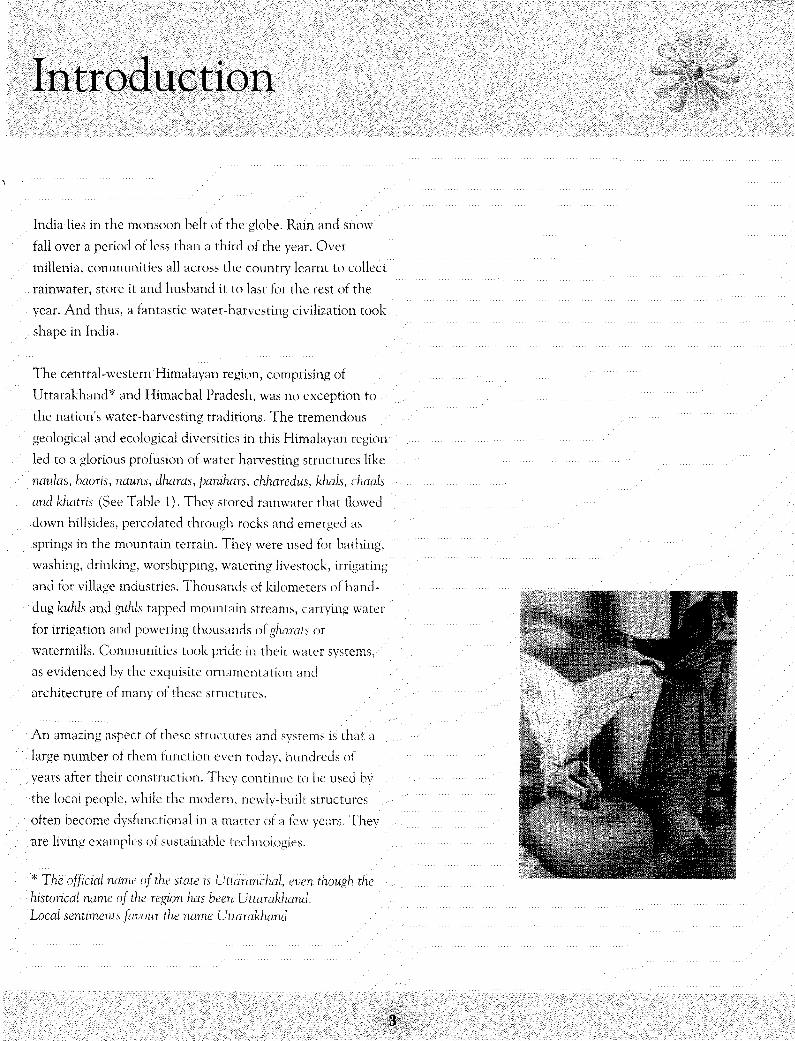
springs in the mountain terrain. They were used for bathing,
washing, drinking, worshipping, watering livestock, irrigating
and for village industries. Thousands of kilometers of hand-
dug kuhls and guhls tapped mountain streams, carrying water
for irrigation and powering thousands of gharats or
watermills. Communities took pride in their water systems,
as evidenced by the exquisite ornamentation and
architecture of many of these structures.
An amazing aspect of these structures and systems is that: a
large number of them function even today, hundreds of
years after their construction. They continue to be used by
the local people, while the modern, newly-built structures
often become dysfunctional in a matter of a few years. 'They
are living examples of sustainable technologies.
* The official name of the state is Uttaranchal, even though thehistorical name of the region has been Uttarakhand.Local sentiments favour the name Uttarakhand.

Water Harvesting Traditions
Water harvesting refers to the collection, storage and utilization of all locallyavailable water, including precipitation, surface runoff, snow-melt, lakes, pondsand groundwater, as springs and wells, but excluding pumped up groundwater.
Traditionally, water for household use was obtained from springs, flowingmountain streams or man-made rainwater harvesting structures. Open waterbodies, like ponds, masonry tanks, chappris or chaak provided water for animals,irrigation and for washing purposes. For human consumption, people preferred to(i) harvest: underground seepages in baoris or khatris (Himachal Pradesh) andnaulas (Uttarakhand), or (ii) tap springs through dharas (Uttarakhand) or.panihars/chharedus (Himachal Pradesh). Irrigation was based on diverting waterfrom a mountain stream into a channel laid across the contours of a mountain tocarry water to terraced fields. All of these structures were usually commonproperty resources. They were largely owned, used and maintained by localcommunities.
The variety of water harvesting structures arose from the ecological and geologicaldiversities of the region. Some of them were originally constructed by local rulers,feudal lords, or by well-to-do families in the community, but most belonged to thecommunity. There was minimal state intervention in water rights or management.ement.This section describes various types of Structures, their management systems andcurrent status.
Table 1: Traditional, water harvesting 'Structure's in the central-western Himalayas
•"••• 'ill W^9^KM&^i^^S^S^^MIM&S§^S.
targe^Manis^

Chaals, Khals, Chappris,Talaais, Chuptyctulas and Simars
A variety of natural formations or depressions in the mountain.areas'are used forrainwater harvesting. The most common are chaals or kiwis. Chaals are usuallyfound along mountain ridge tops, in the saddle between two adjacent crests. Theywere formed in the past by the glacial action of snowmelt, resulting in theformation of small lakes or ponds with a relatively thick soil bed. Khals (lakes) arelarger and can store several thousand cubic metres of water. The water caters tothe needs of people and their livestock. It also seeps through pore spaces, fissuresand fractures in the underlying rock to recharge springs at lower elevations. InPauri district alone, 70 well-known khals have been enumerated.
•"Chappris, in Himachal Pradesh, are usually shallow dug ponds without any masonrywork. They are mostly used for livestock and irrigation needs. They are located onthe hillsides where the slope tends to flatten out. A grand chappri can be seen on ahillock in Pirthan village, overlooking the backwaters of the Bhakra dam inBilaspur district. It was constructed about: one hundred years ago, according to thevillagers. It is a big rectangular structure with nine steps leading to the water. Ahuge peepal tree and a mango tree grow on opposite sides. "Until 15 years ago,when there were no taps in the village, everyone was completely dependent on this
,chappri" says Nikka Ram, 70, of Pirthan. Now the 40 households of the village usethis structure only in times of crises and only then is it cleaned.
Other natural rainwater harvesting structures include chupty'aulds and simars. Theformer are rudimentary structures, found in the high-altitude areas ofUttarakhand, which collect, water from springs or where it oozes out: of the earth.They are normally used as watering holes for animals, and occasionally for humanuse. Wild animals and birds depend on these structures as well. Simars, on theother hand, are natural features: water-logged flat lands. High quality crops likebasmati rice or medicinal plants and herbs, are sometimes grown in simars.
Ndulas ..,.••' • ' ....••••••• •
• Ndulas, sometimes also called baoris,are shallow, four-sided stepped wells. Theyare characteristically found in those parts of the Middle Himalayan region whichoften face water shortages. In Uttarakhand, naulas are more commonly found inKumaon than in Garhwal. They are designed to collect water from subterraneanseepages or springs and are used to meet domestic water needs by the local,communities.

Most rmutas have a similar basic design. The well is constructed in the form of aninverted trapezoid. The lowest: step usually outlines an area of lft x lft, whichincreases to about: 8ft: x 8ft at the top. The well is walled on three sides andcovered with a roof of stone slabs. Water may seep in from fissures in the steps orthe base. Sometimes the source may be one to five meters away and water may beled into the well by a channel or a pipe. The drainage is usually designed so thatthe source is not: contaminated by any of the well's uses. Animals are preventedfrom entering the tank area.
T h e structure ofnaulas can vary considerably. Some naulas are massive and ornatestructures, with rooms and platforms for bathing and washing clothes. Elaboratedrainage systems keep the source water clean. Other structures might be just basicstep wells, made of locally available materials and surrounded by trees. Usually,wells in villages are of the latter type, while those built by local rulers or in townsare of the former type. In his Gazetteer, Atkinson mentions that:(Naulm) "in most: of the region are covered reservoirs only. Some have been built:by ex-rulers and exhibit: architectural features. There is a pillared veranda aroundthem.. Sculptures have been engraved for the interior decoration. Because theconstruction of baoris is considered honourable, therefore, these kinds of structurescan be found in the neighbourhood of almost all villages and along the side of mainhighways."
r , . .,--...!•'
. - • • • . » •
::th:a t :'a^
: water :Soute^
/intervehifig ^spacfe:^raisedplalfow
dtsin:^
a^
(1995) Experience; ^
The most amazing aspect of Kumaon's naulas is their longevity. Many of them arcstill in use today and are symbols of a sustainable technology. Perhaps the oldestfunctioning naula is the Badrinath\i-ka-naula, c. 7th century A.D. Other importantones are jahnvi naula (c.1263 A.D.) in Gangolihat, Vntan-ka-naula (14th or 15thcentury) in Champawat district and the Syunrakot• naula (14th or 15th century),the oldest one in Almora district.
••Almora city became the capital of the Chand dynasty in 1563 A.D. It: has beensaid that at one time it had 360 naulas. However, there is no recorded data to•authenticate this number. A recent: study has identified 99 springs in and aroundAlmora, of which 69 are functional today. Almora's better known naulas includethe Kapina, Champa, Dhara, Hathi, Khazanehi, Dugalkhola, Malla and Baleshwar•naulas.
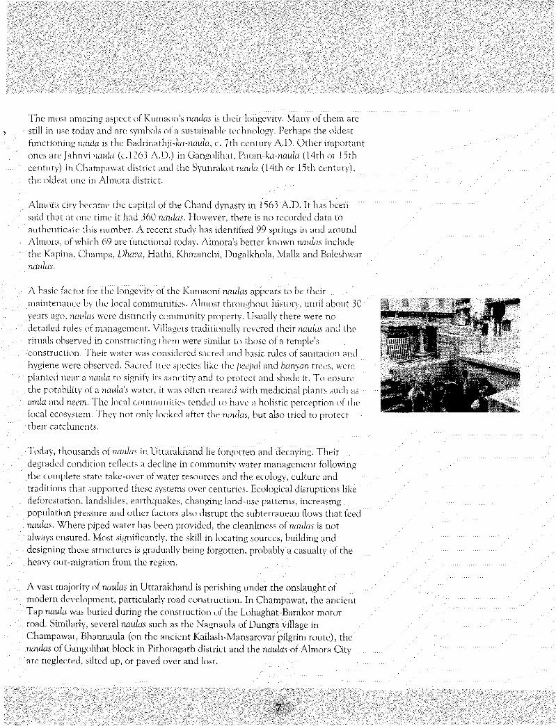
A baste factor for the longevity of the Kumaoni naulas appears to be theirmaintenance by the local communities. Almost throughout: history, until about .30years ago, naulas were distinctly community property. Usually there were nodetailed rules of management. Villagers traditionally revered their naulas and therituals observed in constructing them were similar to those of a temple'sconstruction. Their water was considered sacred and basic rules of sanitation andhygiene were observed. Sacred tree species like the peepal and banyan trees, were:planted near a naula to signify its sanctity and to protect and shade it. To ensurethe potability of a naula's water, it was often treated with medicinal plants such asarrda and neem. The local communities tended to have a holistic perception of thelocal ecosystem. "They not only looked after the naulas, but also tried to protecttheir catchments.
Today, thousands of naulas in Uttarakhancl lie forgotten and decaying. Theirdegraded condition reflects a decline in community water management following.the complete state take-over of water resources and the ecology, culture andtraditions that supported these systems over centuries. Ecological disruptions likedeforestation, landslides, earthquakes, changing land-use patterns, increasingpopulation pressure and other factors also disrupt the subterranean flows that feed
.'naulas. Where piped water has been provided, the cleanliness of naulas is notalways ensured. Most: significantly, the skill in locating sources, building anddesigning these structures is gradually being forgotten, probably a casualty of theheavy out-migration from the region.
A vast majority of naulas in Uttarakhand is perishing under the onslaught: ofmodern development, particularly road construction. In Champawat, the ancientTap naula was buried during the construction of the Lohaghat-Barakot motorroad. Similarly, several naulas such as the Nagnaula of Dungra village inChampawat, Bhamiaula (on the ancient Kailash-Mansarovar pilgrim route), thenaulas of Gangolihat block in Pithoragarh district and the naulas of Almora Cityare neglected, silted up, or paved over and lost.
The Historic Naulas of Kumaon
In Kumaon, historic naulds are found near old towns and settlements, like Champawat, which was the capital of the erstwhile Kumaonstate, in Gangolihat, Almora, Dwarahat and Pithoragarh, and the Katyur valley. Many of them still serve the populations of these townsand cities, especially when piped water supplies fail. While village communities built simple basic structures to meet their daily needs,local rulers, their courtiers and wealthy families in the region built elaborate structures in towns and highways particularly on importantpilgrim routes like the Kailash-Mansarovar route. Almora, once the capital of the Chand dynasty, is a city of naulas. Of its 69 naulas thatare still used, the more well-known include the Kapina, Champa, Dhara, Hathi, Khasanehi, Dugalkhola, Malla and Baleshwar naulas.
The historic value of a rumla is usually related to its age, architecture or religious aspects. The oldest naula in Kumaon appears to he theBadrnar.hji-ka-ntfu!a in Gadser village of Bageshwar district. In the 7th century A.D., the Katyuri kings established Garur-Baijnath as thecapital of their kingdom. To commemorate this event a temple to Lord Badrinath and a nuala near it, were built. It still exists.
jahnvi nauki (c 1263 A.D.) in Gangolihat town was built by Raja Ramehandra Dev for use by worshippers of the nearby Kali temple. Itswater supply has reduced due to the disturbance of its catchment as Gangolihat town has grown. But it has been cleansed and restoredfor use by the Archaeological Survey of India, Syunrakot-fcd-nauk, the oldest in Almora district and Patan-fea-rwuia in Champawat bothdate back to between the 14rh and 15th centuries.
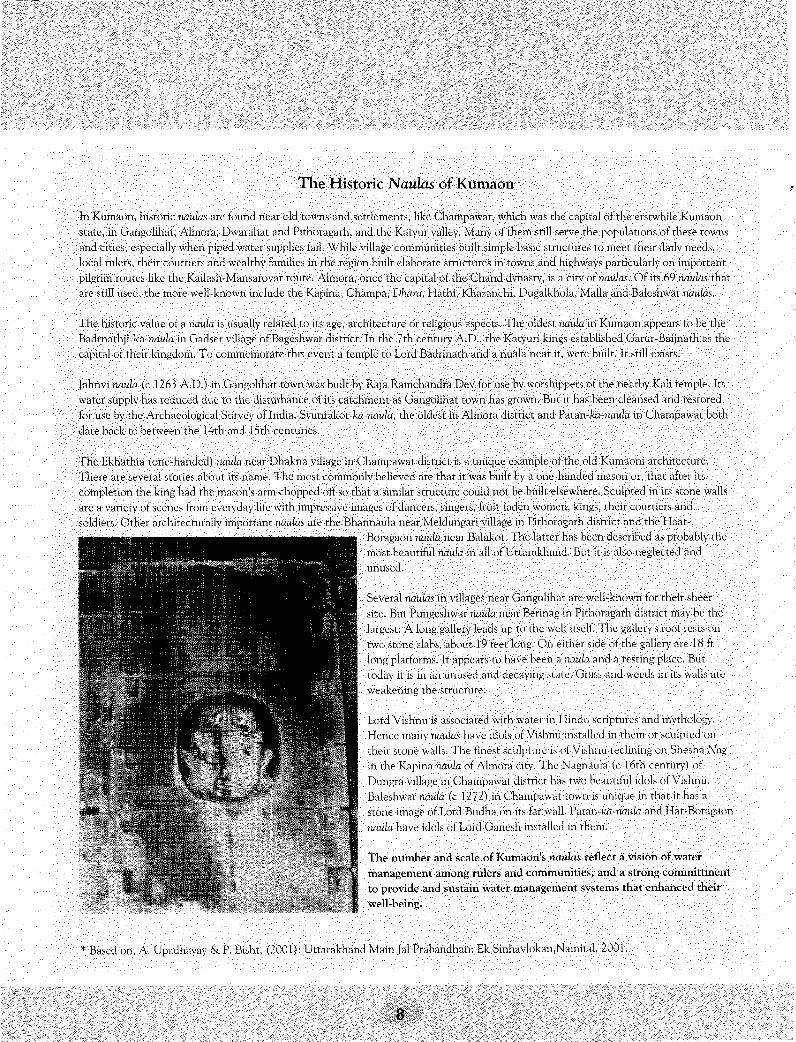
The Ekhathia (one-handed) mxula near Dhakna village in Champawat district is a unique example of the old Kumaoni architecture.There are several Stories about its name. The most commonly believed arc that it was built by a one-handed mason or, that after itscompletion the king had the mason's arm chopped off so that a similar structure could not be built elsewhere. Sculpted in its Stone wallsare a variety of scenes from everyday life with impressive images of dancers, singers, fruit-laden women, kings, their courtiers andsoldiers. Other architecturally important naulas are the Bhannaula near Meldungari village in Pithoragarh district and the Haat-
Boragaon naula near Balakot. The latter has been described as probably themost beautiful naula in all of Uttarakhand. But it is also neglected andunused.
Several naulas in villages near Gangolihat are well-known for their sheersize. But Pungeshwar naula near Berinag in Pithoragarh district may be thelargest. A long gallery leads up to the well itself. The gallery's roof rests ontwo stone slabs, about 19 feet long. On either side of the gallery are 18 ftlong platforms. It appears to have been a iiaula and a resting place. Buttoday it is in an unused and decaying state. Grass and weeds in its walls areweakening the structure.
Lord Vishnu is associated with water in Hindu scriptures and mythology.Hence many rwuia.s have idols of Vishnu installed in them or sculpted ontheir stone walls. The finest sculpture is of Vishnu reclining on Shesha Nagin the Kapina naula of Almora city. The Nagnaula (c 16th century) ofDungra village in Champawat district has two beautiful idols of Vishnu.Baleshwar riaula (c 1272) in Champawat town is unique in that it has astone image of Lord Budha on its far wall. Patan-ka-rww/a and Hat-Boragaonnaula have idols of Lord Ganesh installed in them.
The number and scale of Kumaon's naulas reflect a vision of watermanagement among rulers and communities, and a strong committmentto provide and sustain water management systems that enhanced theirwell-being.
'• Based on, A. Upadhayay & P. Bisht, (2001): Uttarakhand Main Jal Prabandhan: Ek Sinhavlokan.Nainital, 2001.

Yet, faced by the threat of declining reliable water sources, some communities''have made efforts to renovate and revive their naulas. In 1958, the residents ofMeldungri village renovated a historic, naukt. It is heavily used today. (But, itappears that dalits are not allowed to use it. They have to use water from twonearby dharas.) A beautiful naula in Tharkot appears to have been reconstructedfrom the remains of a damaged temple. The local villagers use it. and maintain it.
Baoris and NaunsBaoris are shallow step wells: the naulas of Himachal Pradesh. The bigger onesmeasure about 5m x 5m at the top while the smaller ones, called baoru, maymeasure just 2m x 2m. Very large baoris are called nauns. While water from baorisis used for all domestic purposes, nauns arc mainly used for bathing and washingclothes. Platforms may be built outside a naun for washing purposes. Baoris areusually covered structures, but nauns are uncovered. Maoris are walled to keepanimals out and also to prevent unclean water from entering it. A trough issometimes provided outside a baori for animals to drink water from.
Himachal's Baoris
Mandi district is to baoris, what: Almora is to naulas. The town of Mandi, the headquarters of the erstwhile Mandi State, has elaboratetemples, exquisite baoris and big rutuns. The most important baori in Mandi town is the Shiva baori that look's like y temple. An elaboratelycarved door leads to rhe well. Lord Ganesh sits in rhc middle ol the gate flanked by two yakslias. Its roof is shaped like a lotus. People usethe water which flows out of the baori through a pipe.
Rani-ki-/«on was built at the instance of the Queen of Raja Lakshman Sen about 300 years ago. It islocated on I he Myndi-Sundcrnagar road, about 5 km from Mandi town. It lias a big well about 5m x5m at the top and with 1 I steps. Idols of Varuna, Mahasu, Gauesh and a ShivaHnga adorn it. Waterflows otitside through a pipe and is regularly used by the local people. Other important baoris in Mandidistrict include rhe Kaldo baori in Kalar village, Tandu baori on the Mandi-Pnrhankot highway, thesmall Guphi baori in Tandu village, Nage.hahi baori near Harabag village and the Gummri baori inGumma village.
Raja Ki'iram Chand built a large baori in Jubhal town, the seat: of l.he jubbal State in Shimla district,about 300 years ago. It. is a big well, measuring about 5m x 5tn with 13 steps. A huge idol of Nandi, theattendant bull ol Shiva, sits in rhe writer while idols of many deifies lie around it. Its water falls outsidethrough a marble fountain in the --bapc of'n cow's mouth. Its dean water is used lor drinking purpose.-..The iVUmidpai Council looks after the hum.
NimiauJ village of Kullii disl Ha oiwe known as the Kasbi ol the mountains had sown large baoris unclseven small i mes .serving ncven castes in the village. Now onh I out big ones survive. The mi >sl impotMr.r h • hi: Chmidi buim located nc\ilo ilie Chandi temple, Irs water is clean and is used by the villagers. The I.nreha btJoii on Hie other hnna I hough regarded as built hv thePandavas, lies neglected and in ruiiis.
i n B i ' i s s p u r t i i s v i i c l . ^ e v - , ' , : ! b<.!.<>rts \w-\~c C o n s i T i i v l e d a l t h e i n i t i a t i v e o f l o c a l w o m e n . T h e s e i n f l i i d i : t ' l u : .'
iTh": B a i i i u h i . n ' r i , a ^ o ' j t 2 k m . n v n y ivc-i~\ ' J i r - n ' - i . i n I. . ' h n n d i ' i i h i v i i l a . g e o f 1 i r i m i r p i i f J i s i n c i , t h e r e i s ,-> j . i r g e
n a l i i c i i '.. ' h n n d i ' i i h : . l . o . v a i p e o p l e c i a i m i h - : \ '•})'/ h . s d 1 0 1 h j o r i s b u i l t i n t i l e v e g i i T i .
P i d a i r r i b a o r i I n H i i i n i i \ 1 i h ' ^ e a n d
i ? . *ri -JV-M w a s h i i i h b y a, v . . l a t . i n
!o G.-ngloh-Jw.rohi •-•illagi-ti of Bikispur iiisi-ri'.:r, despite ihe provision ol' ] Viand pump^ anrl 1 smnd po^t1-. |v . -p le fetch sparkling clear, wa
from ihcii foe:1! baori to cook and rkuin. "'Tiiere arc iinwi-ivten rules rh;if CAClAOiie iitHow.s,'1 says n rnhmi i .Vi i 76. A b a m b o o ittx: in i- s
vicinity ,md idols in t h e buori's walls indicate its hal lowed s ta tus and explains its cleanliness, '\rui ihai. is how fhe t radi t ion endures .
Baoris and naum are largely found in the Outer Himalayan region, where there ismoderate rainfall. This includes the districts of Shimla, Mandi, Kangra, Hamirpur,Bilaspur, and the northern part of Solan district. Sandstone rocks in these areaslend to retain water, which then seeps out through faults and fracture zones.
The majority of village baoris has been built by local communities and are verysimple structures. Some built at: the initiatives of rulers and influential communitymembers, had elaborate structures. Though many baoris are said to be severalhundred years old, the practice of constructing them appears to have continuedthrough the twentieth century. Many of the latter arc built in memory of departedelders or to earn spiritual merit. There are several such examples in Solan district,like the two big baoris in Subathu town or the Byos baori in Jagjitnagar grampanchayat, built by Gyan 'Devi in 1961, in memory of her husband.
In general, there are no well-defined rules of water management related to baorisand naum. Caste discrimination, however, appears to be a common feature. Inmany locations, there arc separate baoris for people of upper and lower castes. Theones for the lower castes are usually smaller and unadorned structures bycomparison, Most: baoris do, however, have a hallowed status. This is evident fromthe planting of pecpal and banyan trees that have religious significance and thecarving or installation of idols of local deities in the walls of the baoris.
The sanctity of baoris has eroded in recent decades with piped water supply beingprovided by the Irrigation & Public Health department. Care and maintenance isirregular and a large number arc in a decrepit state. "We have ruined our baoris/1
'laments Balwant: Singh, 58, of Kolhada village in Shimla district, where four out erfseven haoris have gone dry. . ..'
There are, however, several exam.pi.es of people preferring to drink water from . : .,their baoris, rather than. from, piped water supplies. In Khajret village, Solan .••;'•
..district, the residents continue to use water from a local baori even though, a.waterlift scheme has been providing water since 1988. Jassi Ram, an elder of the village .explains this preference saying, "We don't consider water stored in closed tanks asbeing healthy. Open water which is in contact: with' air is better." ...... .• . , ..,..'.
• People tend to clean"Maoris'in'the'summer when piped water supply often fails." •••Thus paradoxically, the shortcomings of the. II'H department keep the •tradition-'o l i v e , • . ' ... .••• •.. .•'"
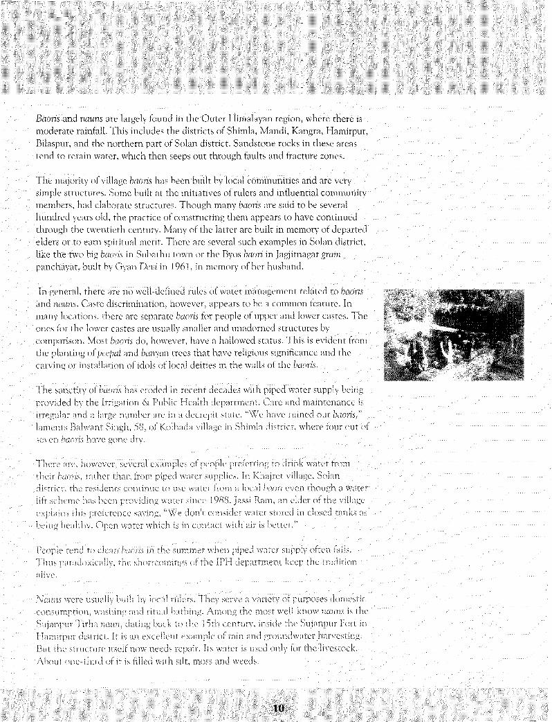
'Nauru were'usually built: by local rulers. They serve a Variety of purposes domestic'••consumption, washing and ritual bathing. Among the most well-know riauns is theSujanpur Tirha naun, dating back to the 1 5th century, inside the Sujanpur Fort inHamirpur district:. It: is an excellent example of rain and groundwater harvesting.But: the structure itself now needs repair. Its water is used only for the livestock.About: one-third of it is filled with silt, moss and weeds. . ...,. . . . . . . . .
10

The Guptganga ruiun is part of the Guptkashi Dham in Kangra town. It: is also alarge structure measuring about 30m x 25m x 2m. Though legend has it thatArjuna struck an arrow into the ground here to start the water flowing, historyattributes its construction to the Mughal Emperor Shahjahan in the 17th century."People come here for holy dips on auspicious days like Makar Sankranti andBakakhi," says Kashmir Singh Rana, President, H.P. Temple Trust Committee. Itscleaning is organized on a fortnightly basis by the temple trust.
The Jinh ruiun is a large stone structure about 25m x 20m x 10m in Jinh village ofHamirpur district. It is fed from, a perennial spring whose outlet is shaped in theform of nag devux. It is said to have been built by Raja Sansar Chand Katoch ofSujanpur more than 200 years ago. Its cleaning is a massive job and is done aboutonce in a few decades. Besides ritual bathing, its water is also used to irrigate about10 ha downstream.
Dharas, Mungurus
A common source of drinking water in Uttarakhand is the dhara or munguru. It: isessentially a drinking water fountain. Water from springs or subterranean sourcesis channeled out: through carved outlets. The latter are often in the shape of eithera simple pipe, figures of women with water pitchers or animal facemasks. Theshape of the outlet is such that even with low water pressure, water can be easilydrunk. The degree of detail and ornamentation of a dhara varies according to thestatus of the builder. Dharas often bear inscriptions paying tributes to the rulers.
There are three types of dharas, depending on their height above the ground. Ifone can drink from a dhara while standing straight, it: is called a sirpatia dhara.These dharas are sometimes decorated with facemasks of animals like cows, lions,elephants, snakes or crocodiles. If one has to bend over to drink from one's handor to fill a container to drink from the dhara, then it is called a mudpatia dhara.These dharas also have animal facemasks or simple pipe structures. The third type.ot dhara is a seasonal one. During the monsoon season, wooden spouts or broadleaves are stuck in the path of a flowing spring or seepage to create them. Theyare called patvinyan dharas. Often one has to sit on the ground to drink water fromthem.
Dharas are evenly distributed in Uttarakhand, from mountain crests to the valleys.They are also found in old towns and cities. The main road of Pauri is called DharaBazaar, after an ancient dhara that: has now dried up. It used to be a major sourceof water for the town and fed a system of guhls and canals. Water flowing fromdharas is usually fit for human consumption and other household uses since thesource is either a spring or subterranean seepages. Dharas can also be used forother purposes. In Bhotia villages, special dharas were made for cleaning wool.

Sometimes their water is stored in tanks for human and livestock use. Dharas withlarge flows are used for irrigation.
Many urban and rural settlements' still depend on dharas for a secure supply ofwater. Two dharas, Parda dhara and Sipahi dhara supply water to a large populationin Nainital. In Gopeshwar, a perennial dhara near a Shiva temple supplies water tothe city. Ghunsera, Nakuleshwar (Panchd/wa), Berinag, Devalthal, Chopta, Thai,Harinanda, Kantheshwar Mahadev of Pithoragarh district and Naini, Jainti andTrinetreshwar of Almora arc all places with ancient dharas. Tharkot village, near
"Pithoragarh, has several old dharas, which provide the village with water. Thesedharas are beautifully carved and ornamented, one example having several deitiesand an idol of a woman carrying a pot from which the water emerges.
'Dharas, however, are very sensitive to environmental disturbances and geologicalactivity. .In the Garhkot watershed of Tehri Garhwal district, an old perennialdhara called Amm-ka-dhara dried up after the 1991 Uttarkashi earthquake.Deforestation and the associated reductions in groundwater storage and waterretention capacities also affect dharas. The loss of this resource can have a severeimpact on the local community. Pauri, having lost its ancient dhara, is now awater-starved town.
Panihars, Nahuns and Chharedus
A pa.nih.ar is a cistern in which water flows from a spring or a diversion of a stream.It is most commonly found in the Ravi, Pangi and Chenab valleys of Charnbadistrict in Himachal Pradesh. They were constructed as an ancestor worship ritual.It: was believed, "that: the dead acquire[d| pun or merit from the pious act: of theliving, and [were] thereby enabled to rejoin their ancestors."
The common pdhihur usually had an image of the deceased person roughly cut into thestone slab. But those constructed by local rulers and wealthy zarnindars were ornatelycarved with images of gods, goddesses, and common people. They bear elaborateinscriptions which are important sources of the history of the local region since theyare dated. The Chamba Gazetteer (1904) makes a special reference to such fountainstones at Churah, Pangi, Sai, Naghai,Dt'w'-Kothi and Mul-kihar. The last named had"thirty stanzas in excellent: Sanskrit" describing "the genealogy of the local Rana andthe circumstances under which the cistern was constructed." The oldest fountainstone dates back to the start of the twelfth century A.D.Nahuns are larger water fountains seen in the Pangi and Chenab valleys, up toKishtwar in Jammu. They were great feats of human labour as evident from thefollowing description:"The nahuns are usually square or oblong in shape, closed in at the sides and back,but open in front. The floor is formed of two massive stone beams, reaching from
i i i

side to side in front find behind, and over these flat: slabs are laid, diagonallyoverlapping one another. The larger slabs are as much as 20 feet long, three feet,broad, and two feet: thick; in the smaller nahuns they range from six to twelve feet:in length. The stone spouts are in the back wall and may be as many as ten innumber. The most massive nahuns arc found in the Bhutna Nala in Padar but theyhave no inscriptions. The handling of such immense blocks of stone must havebeen a work of great difficulty. They had first: to be quarried and dressed, and thendragged to the site of the fountain, which may have been some considerabledistance away, and the drag-holes may still be seen in the ends of the stone. Asmany as 100 men were sometimes required for this purpose, and occasionally eventhe women had to be requisitioned. The erection of a panihar or nahun wasregarded as an important and auspicious occasion and was accompanied by certainreligious rites; all who assisted being entertained at the expense of the builder. Inmost cases, as appears from the inscriptions, they were the work of the Ranas or ofwealthy zamindars. Some are still in a fair state of preservation, but most of themare now in ruins."
Chharedus are spring fountains found in the Kangra valley and are essentially usedfor bathing. The spring water falls through a carved stone. A rectangular enclosurewith a drain is constructed around it. The outflow goes to the fields through anearthen channel. Women also fetch water from the chharedu for domestic uses.
A chharedu inside a temple in Ghugghar village, about 5km from Palampur town,provides sparkling clean water from a kuhl. Images of Buddha, Vishnu andLakshmi on Sheshnag are carved on its walls. A bamboo grove and a peepal treegrow in the vicinity. Near the temple is a funeral platform. Water from thechharedu is used by the local people for domestic, purposes and for ritual bathingafter funerals.
On the outskirts of Palampur town, an old chharedu has been crowded out by thetown's urban sprawl. The spring feeding it has been diverted to save thefoundations of newly built houses. "Nobody needs the chluiredu these days. Peoplehave modern baths with hot water in their homes now," says Sudarshan Katoch, alocal shopkeeper. With the mountain regions expected to see a massive wave ofurbanization in the 21st century, his statement sounds like an ill-omen for thetraditional water-harvesting structures that: still dot the region's landscape.
Guhls/Kuhls
Archaeological excavations reveal that terraced agriculture has been practiced inthe central Himalayas for a thousand years or more. The problem of irrigating theterraces has historically been resolved by diverting water from nearby mountainstreams through channels known as guhh in Uttarakhand and kuhh in HimachalPradesh. These are small gravity flow irrigation channels that gently traverse the

contours of a mountain slope. Though guhh are primarily meant for irrigation,some also provide hydropower for gharats (water mills) or for turning potters'wheels or water for domestic uses other than for drinking.
Guhh have traditionally been farmer managed irrigations systems (FMIS). But.'.:after Independence, an increasing number of guhh in Uttarakhand and Himachalhave been taken over by state government: agencies. Their importance formountain irrigation can be recognized from the extent of the area irrigated bythem. Kuhh irrigated about 84 per cent of the net irrigated area in HimachalPradesh in 1994-95, of which almost half the area is irrigated by FMIS. In themountain districts of Chamoli, Uttarkashi, Tehri Garhwal, Almora andPithoragarh, guhh accounted for about 62% of the total net: irrigated area in thestate in 1993-94.
Traditional FMIS in Himachal Pradesh and Uttarakhand had a highly formalizedsystem of management. British administrators recorded water rights during therevenue assessment exercises called Settlements, undertaken in the 19th and theearly 20th centuries. The Riwaz-i-abpashi are a unique and comprehensive form ofrecorded water rights of farmers in HP. All FMIS, however, do not have a formalmanagement system. This is especially true of those areas that were ruled by localfeudal lords.
Some Well-known FMIS
Soon after the British acquired the territories of Kahgra district and Kumaun inthe early part of the 19th century, they took note of the highly evolved FMIS inthese regions. In Kangra, some of the kuhh were large systems built by formerrulers and their courtiers. They were expensive and designed to last, with lined'canals and sometimes with permanent diversion structures at the head. User-builtsystems on the other hand were short, typical lengths being a few hundred meters,with narrow and unlined channels. As Barnes wrote about: Kangra's kuhh in hisSettlement Report (1855):
.."Most of these canals have been projected by the people themselves; the larger •ones;1 which' supplywater to four or live villages, are generally the work of individuals, the relatives or connections ofancient rajas .... The peculiarity of the canals is that they are managed entirely by the people,without any assistance from government. The people maintain an organized staff of officers, usuallyone for every village, to patrol along the canal course to prevent theft, stop leakage and to distributethe water. Every village has its own code of rules."
Rulers of Kangra's Katoch dynasty,.or their nobles, may have sponsored the'construction of the big irrigation systems in Kangra during the pre-colonial times17th century to the early 19th century. Most: kuhh are named after the stream orvillage of origin. But some of the big kuhh were named after the nobles who
14

This legendary guhb^:(i^25'l642), MadhiiSinglj, with the help of the other villagers; dug a;100|ffl tunnel through hard rock to bring the waters ; ot ;:CharidrabK^
•which lie was anointed by a goddess to undertakecommunity joined him. It ;was a truly cou
•Earlier,theMaletlia guhl: was aft: FWIS. Villagers formed a committee tbmaiiage it every month. I t appointed a ;; pe f so t i known as kullalu to'•supervise1 the distribution (>f water, He was idsd responsible for nTObilizingv::' repair any d a n ^ : " : : : : : : :
••/V'Today, morethari:350years':after:its creation, Maletha'sgu•/•••a synlbol of prosperity. Though it is now owned by thestate, the villagers are actively involvedin its operation. Itirrigates about 125 acres.
: The: main crops grown are wheat,paddy, pulses and vegetables.Theyillageis self-sufficient in grains and vegetables; Each year an annualritual is held at the temple Hear the site of the diversi6tt:weif,:;beforest{(riing work on its construction.: ;:;: : :. :: / : : : : ;
sponsored them, like the Kripalchand kuhl, Mian Fatehchand kuhl, MianKimanchand kuhl, Gyanchand kuhl or the Sujan Singh kuhl. The Kripalchand kuhlis almost 30 km long. It is designed to serve an area of more than 2400 ha andcarry a peak flow of 2 cumecs (2000 Ips). This kuhl diverts water from the NeugalKhad (stream), a perennial stream near Palampur which originates from the snow-clad Dhauladhar range. Today 39 kuhh from Neugal Khad irrigate about 5000 hain the 85 sq km (8500 ha) Neugal basin. Dai-di-kuhl has its diversion weir just afew meters upstream from the Kripalchand kuhl. It was built by the daughter ofRaja Sansar Chand.
The legendary guhl in Maletha village of Tehri Garhwal district is perhaps themost well -known guhl in Uttarakhand (See box: The Legend of Maletha Guhl). Itwas built by digging a 100 m tunnel through hard rock about 3.50 m from itsdiversion point. The Katyuri kings (9th to 15th century A.D.) built tunnels at:several places in Uttarakhand to provide water for otherwise dry villages. Suchtunnels can be seen at Lakhanpur, Fatal Bhubneshwar, Jakh,L")evalgarh andChandpur even today.
A cluster of 31 small guhls take off from the 15 km long perennial Mansari Nalaand its feeder streams in Almora district. They irrigate an area of 90 ha in eight:gram sabhas. These guhls are typical of traditional FMIS. Nine guhls in TalkBaigaini gram sabha in the same cluster are said to be more than 400 years old,though there is no record of their age. Other well-known guhk in Uttarakhandinclude the ones in Ladyura-Bayala Khalsa gram sabhas and at Sheraghat: in theSaryu valley. They have innovative water management systems (See box:Managing Irrigation Water).The construction elements of a guhl are very basic. A traditional guhl starts offwith a temporary diversion structure in a stream bed. It has a dug-out earthenmain channel about a few hundred meters to a few kilometers long -- followed by

numerous distribution points and field channels. Their engineering simplicity andthe use of locally available materials enabled village communities to constructthousands of guhh in the central-western Himalayas. The 1915 Settlement: Reportof Kangra district recorded 715 kuhls irrigating multiple villages and over 2500kuhls that: serviced one village each. Beckett's Settlement Report (1863-1873) forthe area that: constitutes the present Kumaun division of Uttarakhand recorded anirrigated area of 12655 ha.
Unlike the present state-built: irrigation systems, which are essentially engineeringexercises, traditional guhl designs incorporated principles of hydraulics, materialsengineering and aspects related to water distribution, operation and maintenance.The design, of a system's diversion weir was often based on the manner in whichthe water was to be shared by different: systems on the same stream. Thiscomprehensive approach to design enabled a large number of systems to stand thetest of time.
Diversion structures in the parent stream were temporary, semi-permanent orpermanent. Temporary diversion weirs were preferred because annual flood flowscould be extremely high and destructive, especially in the event of a cloudburst."In fact, in most cases it would be technically inadvisable to build a permanentweir for hill irrigation systems," says Pande. Permanent weirs are too expensive formost communities.
Temporary diversion structures were built using locally available materials likeboulders, brushwood, logs or tree branches. Riwaz-i-abpashi rules often specify thedesign of a diversion weir in the case of multiple kuhls on a single stream.Upstream structures are made, porous enough so that water can flow through thestructure with minimum hindrance to downstream kuhls. Upstream diversion wallsmay use boulders, shingle and sand, while clayey earth and grass may plug leaks indownstream structures. Such structures are inexpensive and easily repaired afterthey are damaged by floods. Traditionally, farmers volunteered their labour forsuch purposes.
A variety of outlet devices are used to release and regulate water from the mainchannel to the field channels. Typically, a farmer floods his/her field and thenremoves a stone plug at the outside edge of the field so that water can flow to thenext terrace below. The excess water drains back into the guhl at: the lowest pointand the guhl itself joins the main stream.
16

Management Systems
The management system gravity flow irrigation systems (GFIS) vary from those with noformal institutions or rules to those with highly formalized institutions, written recordsof water rights and devices for regulating water flows. For most traditional FMIS, thewater rights of individuals users are known, even if they are not formally recorded. Inthe absence of formal records, however, might is often right.
In Himachal Pradesh, water rights and management rules have been recorded in theRiwaz-i-abpashi - the register of irrigation customs. In the earlier British-ruled territorieslike Kangra, a register was maintained at the sub-district (tehsil) level and another at:the village level, as part of the village revenue records. The sub-district registerrecorded the customs for specific, kuhh. The village revenue records referred to theirrigation rights within the village or its hamlets. These rights were legally enforceable.The erstwhile princely states also established legally enforceable rights. But. in areasruled by feudal lords, such customs or rules did not exist. In the British-ruled Kumaunregion, irrigation customs were mentioned in hukumnama (orders), ikrarnama(agreements) and in the wazih-ul-arz (record of rights) of each village as part of theSettlement exercise. Though the Riwaz-i-abpmhi contents of different: kuhh differ, atypical record gives the history of the kuhl, the list of villages and farmers served andtheir rights, water distribution rules, the type of diversion structure, operation andmaintenance procedures, penalties for non-participation in these chores and finallysignatures of the beneficiaries affirming the veracity of the record. These records havelegal validity in Himachal Pradesh, even today.
Since most FMIS irrigate the fields of a number of farmers and sometimes stretch acrossseveral villages, a variety of systems have been devised for managing the distribution ofwater, operation and maintenance of the system. (See box: Managing Irrigation Water)The two main challenges in water distribution are: how to achieve an equitabledistribution of water among the users of the system, and how to balance the use ofwater between different guhh that draw water from the same stream. Upstream usersand those who are close to the head of a system are generally likely to receive a greaterflow than users at. the tail end. The challenge of water distribution is made moredifficult by the fact that the maximum demand for water arises when the availability ofwater in the system is the lowest.
The maintenance and repair of an FMIS is a collective affair. Thus rights also entailresponsibilities. All users are expected to participate in operation, maintenance andcleaning chores. For example, the maximum demand for most systems is during thepreparation of the nursery for the paddy crop and it's sowing March to end-May.Though such participation is not always to an equal extent for all users, there is littlescope for free-riding. A general rule appears to be that the tail end village (s) isresponsible for repair and maintenance of the main channel. Non-participation leads toa cash penalty, non-payment of which can lead to cutting off of the water supply orimposition of social sanctions.
^
^
fo Bayala ••Khalsa;the:li1dyu^^Stti lWhichfflakes decisions ;D^^
iwernbefs of the • 1 O^pefsort 5 1 ^ ^f r e i m a d t b ^ ^
dyUray':tiTefe':fc':aK:ate ^
sdmiti appoints a c te io^/and preventing cattle•frOiTi'danVagin^iis^fei$:paid;tess;tl^^^
fer!ng:With::ttepersbh feilsto addressthiscOiriplain^^
til^
itKqi"agatb^istrict^f^
:a^tegai'doc;UiWferii^
::t6
^ya'ilab11ity;;6ffe)ri
h h : : h e y : h
rState;aiid:3Baf^^^
^ ^ ^ ^

Though complex arrangements exist in many traditional FMIS to ensure fairnessin. water sharing, it would be incorrect to say that water sharing in all such systemsis equitable. In fact, in systems that: service multiple villages this is rarely the case.In many villages the water sharing is highly skewed in favour of upper-castefarmers, to the detriment of the schedule caste cultivators. Rural families headedby women also report difficulties in getting their rightful share of irrigation water.
Once the water distribution rules are negotiated, FMIS often appoint an individual- a kohli, abpashi or a chowkidar - or individuals to operate the system on a day-to-day basis. The kohli is mainly responsible for organizing labour and materials forrepair and maintenance of the diversion structure and the main channel of a kuhl.He is usually not responsible for maintenance of the secondary and tertiarychannels at the village level. 1le also supervises the distribution of water inaccordance with the accepted rules. Traditionally, the kohli was an authority figurein Himachal Pradesh who also resolved conflicts between irrigators. In addition heconducted religious rituals at the start of a cropping season propitiating the localdevta, devi or pir for a successful harvest. This reinforced his authority. The kohli'sposition was often inherited.
In recent years the role and authority of the kohli has been eroded due to theimpact of non-farm employment or state intervention in the management of anirrigation system. State agencies often appoint a beldaar in place of a kohli orabpashi. The beldaar generally feels more responsible to the departmental hierarchythan the villagers. Non-farm employment reduces the availability of labour in thevillage. At the same time, the reduced dependence on agriculture of families withoff-farm incomes, enables them to defy the demands of the kohlis for voluntarylabour, or paying penalties without disputing the kohli's authority.
Current Status
The role of farmers in managing irrigation systems and the accompanyingtraditions are undergoing major changes. State intervention in irrigation and thedecreasing dependence on agriculture in rural areas are the main driving forces forthese changes. These two factors comprehensively reflect the impact of variousecological, social, economic, political and technological changes taking place inthe central-western Himalayas.
State intervention to increase irrigation facilities became a cbrnerstone of plannedeconomic development after Independence. At the local level in HimachalPradesh and Uttarakhand, deforestation leading to drying up of springs andstreams, and the raised aspirations of farmers, have led to demands for moreirrigation facilities. Political leaders and parties lobby for irrigation projects in theirconstituencies as a reward or allurement for support. Consequently, government
I1,*'
investment in irrigation and its administration have expanded rapidly in HimaehalPradesh and Uttarakhand to the detriment of FMIS.
State Actions for expanding irrigation facilities have included (i) construction ofnew irrigation projects (ii) renovation and modernization of traditional FMIS and(iii) expansion of the administrative structure to undertake operation andmaintenance of the new and renovated systems. To obtain unhindered access towater sources for irrigation and other needs, the state enacted new laws andmodified old ones, empowering and enabling it to alter and even abolishownership, control and rights of the local communities to these sources.
More often"than not, the state's intervention in irrigation is based on its legal andfinancial muscle. In II. P., however, the farmers' rights as recorded in the Riwaz-i-abpashi have restrained the government from initiating many projects that wouldtransgress existing rights. In the erstwhile U.P.hills (present Uttarakhand state),though the irrigators' traditional rights were abolished in 1975 after the passage ofthe Kumaun and Garhwal Water (Collection, Retention and Distribution) Act,U.P. state chose not: to enforce its provisions very vigorously. By using streamwaters for domestic water supply schemes, the state has in practice eroded therights of downstream guhl irrigators. Farmers fiercely oppose state projects wherethey perceive violation of their water rights, or a reduction in their share of water.
Several well-known kuhls in Kangra district, including the well-knownKripalchand, Dai-di-Jcu/i/. and Fatehchand kuhls, have been taken over by the stateand have been working less efficiently thereafter. In the case of the Kripalchandkuhl the irrigated area has dropped significantly. There is little involvement of theusers in planning, implementation of die project and its maintenance. Theyoftendo not pay the irrigation dues after such takeovers. They claim that payingseparately for the water is a case of double 'jeopardy' since they already pay ahigher land tax.
There are examples of FMIS schemes that have been taken over by the state•have worked well. In. such cases the state intervention has led to actual andperceived increases in the water supply and does not affect the traditionalarrangements for water distribution and the water rights.
State managed irrigation channels arc expensive in terms of capital andoperational costs. "Government departments seem to chase the illusive andunattainable ideal of permanency in a system," explains U.C. Pande. But theHimalayan region being geologically unstable, damages are frequent particularlyduring the monsoon season when farming activity is at its peak and repairs have tohe urgently undertaken. In traditional FMIS, the irrigators could themselvesundertake the repairs because they used locally available materials to construct thesystem. Now the new and renovated channels are more expensive to maintain.Developmental funds are limited and the sanction procedures are tedious. This
20

delays repairs, leading to loss of production. Often there is no significant increasein production, as a result of slate intervention.
Comparisons of the performance, productivity and costs of FMIS and state-runsystems indicate that: the FMIS provide more irrigation turns for the wheat andpaddy crops and result: in higher productivities in general, but the costs to theirrigators arc often lower in the state-run systems.
Non-farm employment (NFE) in recent, years lias seriously affected (liemanagement of traditional FMIS. NFE opportunities, particularly for rural males,have changed the traditional occupation structures in the villages. When a family'sreliance shifts from agriculture to an off-farm source of income, its incentive toparticipate in the traditional voluntary chores required to maintain commonproperty resources decreases. This reduces the supply of voluntary labour forcommunitarian tasks like the management: and maintenance of kuhh. Traditionalsanctions against such households are less effective, thereby eroding local normsand authority, e.g., that of the kohli. Families that are headed by women when themale head is away have difficulty in obtaining their rightful share of water. Inter-family disputes erupt on the return of the male(s), reducing the community's unitythat: is so essential for managing common property resources like guhh. If schedulecaste families have access to NFE, they are less likely to be pliant: participants inunequal water sharing arrangements.
NFE. also has a cultural dimension. Government or office jobs are considered tohave a higher status than that: of farmers in rural areas. These days rural youthhave their minds set: on getting a government or an office job. They are not willingto toil on their farms. With better education and the increasing share of non-farmeconomy in the national economy, the potential for obtaining off-farmemployment is growing rapidly. This is severely straining the traditional systems ofmanaging common property resources, including guhh.
Conclusion
The inherent technological simplicity of gravitation flow irrigation systems makesthem the preferred irrigation option in mountain areas. But social, economic,political, administrative, ecological and technological changes are alteringmountain societies. While these changes are severely straining the traditionalirrigation management systems, the alternative of state take-over does not: appearto be adequate either. The foregoing review makes it clear that traditionally therehave been a variety of management systems, each responding to the specificcomplexities of its own situation. These innovations arose from the autonomy thatlocal communities had in natural resource management.

The Sustenance of Tradition
The most retnarkable feature of India's water harvesting traditions is theirlongevity. Many naulas, baori, dharas, chharedus, guhls and kuhk in use today arehundreds of years old, clearly a very high degree of sustainability. These traditionswere sustained over time by sanskar (precepts and rites), sanshriti (culture andcustomary practices) and niti (state policy and administration).
Scriptural PreceptsPerhaps the core value that sustained water related traditions was one thai:
declared water to be sacred. In the Srimad Bhagwat, Lord Krishna, an incarnationof Vishnu - says that water is his home.
The implication is that water bodies, like temples, are sacred.
3TTT
"From times immemorial, I have myself named water as N;1r.Since (my) home (aayan) is in this nar, I am named Narayan."
Reverence for rivers is clear from Bhishma's pronouncement in the Mahabharat
"O, King ! all rivers are mothers of the world; they yield great benefitsI am not aware of any one else capable of bestowing such benefits."
Personal rules of water use, codified in Mariusrnriti,led to sustaining the purity of water bodies:
"Polluting substances like excreta, urine, spit or bloodshould never be released in water."
The Brihatsamhita On the other hand offers advice onhow to clean polluted water:
"If water becomes polluted, bitter or salty,it should he cleaned by mixing a powder of \
collyrium (kohl), the grass aruiropogon nuricatum, arnla, etc."
To minimise the miseries of floods, the NaradiydPurand defined practicalrules onhow far settlements had to be located from river banks, in the plains.
22

Jl<=yRlHRd4 3 "qftrT: J N y ^ II
"The bank of a river stretches 1.50 hand measures (roughly 70m)from the river bed. The area lying within one yojana (about 14.5 km.) from.
the bank is the river's regime."
The Naradiya Purana forbade dwelling in the river bed zone or in the river banks,permitting it only in t:he river plain. The modern flood plain zoning which defines
a prohibited zone, a restricted zone and a warning 2one is onlya new version of this ancient wisdom.
The Agra Purana recommended the construction ofwater bodies as an act of worship:
"Along with the worship of Vishnu and Varun, water reservoirsshould be constructed."
Customary Practices
Local cultural practices and customs evolved out of the scriptural precepts. Thesanctity of water was often symbolized by the presence of trees like peepal andbanyan, both of which were considered sacred, at the edge of a water body. Idolsand images of Vishnu, and other gods and goddesses were usually installed in waterharvesting structures like naulas and baoris. Temples of local gods or goddesseswere constructed near guhh. The structures were thus accorded the reverence dueto temples.
Rituals and festivals sustained the spirit of reverence. Even today, a new Kurria'u'nibride on first reaching her husband's home offers a ritual prayer at the villagenauki. At the Maletha guhl every year, before constructing the diversion weir, a 50kg pancake of wheat flour and gur is baked on site and offered as prasad to theguhh goddess at her nearby temple. A piece of the prasad is given to eachhousehold who then have to send at least one member for constructing the weir.Once these rites are over, the villagers go to a nearby forest to select a suitable treetrunk which is used for the temporary diversion structure. The BaisaUii festival inHimachal Pradesh is an occasion when people clean their local baoris, in time forthe hot summer months. Says Jagdish Chand, ward member of the Ganglauj grampanchayat, "One day before Baisaklii, we do a special cleansing of our baori. Somesweet: dish is prepared and distributed among the people as prasad."

Common people, the elite and rulers, undertook the construction of waterharvesting structures. They were built not just: to meet a need, but also because itwas considered to be an act of piety or merit. Some examples from Solan districthave been cited earlier. Childless couples built the Kunnu and Nai baoris inNirmand village of Kullu district so that their wish to have children could befulfilled. Islam also recognized the importance of water, and said that free water forall was a birthright. The construction of public water facilities was thus encouragedby most rulers with incentives like tax rebates.
Rivers symbolize divine life-giving forces and ritual bathing in rivers, forpurification, and the use of water in religious ceremonies has been a part, of Hinduculture for millennia. In recent years millions of people have taken purificationdips in the Ganga river at Haridwar during the Kumbh and Ardh KumWt melas.Many temples have kunds or tanks attached to them, e.g., the Guptganga tank atthe Guptkashi Dham in Kangra and the Jahnvi naula in Gangolihat. Ritual bathingin such tanks by large assemblages are common in Himachal Pradesh during theBaisakhi festival.
Ecological principles as guidelines for water resources development wereenunciated in ancient: texts like Kautilya's Arthashastra and Kashyapa's treatise onagriculture. The Manusmriti, and several sutras and shastras containrecommendations on water management policies, the enforcement of rights andduties pertaining to water and descriptions of water management practices.
Kashyapa defined five principles of water resource development. These aresummarized below with examples of their practical application in the mountainregion.
1. Water resources should be developed at the source or Udgdmsthana of a river.These sources are sacred, and temples should be constructed at the source toprotect it. In the central Himalayan region, this is true for the sources ofmany rivers and streams. The Gangotri and Yamunotri temples near theorigins of the Ganga and Yamuna rivers are obvious examples. But there archundreds of small temples dedicated to local deities, at the origins of smallstreams throughout the middle Himalayan region, e.g., the Chandrahadnitemple in Anjanisain in Tehri-Garhwal, dedicated to Bhuvaneshwari.Devi, islocated at the source of a small stream called Chandrabhaga.
2. There should be minimal obstruction to the natural flow of water (Nyimatam-Gati-Avarodh), There was an understanding of the importance of thehydrological cycle.
3. The Suvama Madhya or Golden Mean: This principle refers to therelationship between the development of water harvesting and managementstructures and the economic, social, and organizational competence of thewater users. In essence, this principle recommended optimal rather thanmaximal development of water resources, balancing the needs and abilities of
24

the users. Upstream diversion weirs on streams from which a number of GFISchannels took off, were usually temporary and porous so that the flow todownstream systems would be only minimally affected.
4- While managing water resources, their ecology should be understood.Kashyapa refers to the interdependence of water, forests, land and biota. Inaccordance with this principle, sacred groves were established at the
...headwaters, confluence points and mid-regions of a watershed. Major riverslike the Eastern and Western Nayar, and the Ramganga emerge from theDoodhatoli range in Pauri-Garhwal. It also has some of the most well-preserved forests in the region. Sacred groves in the middle Himalayas arethe recharge zones of many springs. To preserve the forests, springs andwildlife, local traditions enforced strict rules that not only forbid lopping orfelling of trees, but also wearing shoes or brightly coloured clothes in sacredgroves to maintain purity and to avoid disturbing the animals. Thedevelopment of small-scale water harvesting structures interspersed withthese groves was essential to the maintenance of ecological balance and thesustainability of the water source.
5. Participation and self-determination (Sahabhag, Swabhava and Sanskara) arealso important elements of water resources development. Different socialgroups played essential and different roles. The king was responsible forcommissioning and financing water projects, fixing water rates and collectinguser fees. The brahmins were responsible for supervision and advising theking on projects. The construction and maintenance of systems was to bedone by village communities collectively, including the allocation of rightsand responsibilities to specific, groups and water users.
Laws and Administration
India's traditional legal administration was a set Of parallel systems instead of ahierarchical one, with each level enjoying a high degree of autonomy. Local lawswere not overruled by other "higher" institutions or political bodies. Systems atdifferent levels constantly interacted and affected each other.
Traditional Indian law was derived from diiarrna, custom and royal order, asopposed to statute, precedent and doctrine, which underlie the modern legalsystem. In the legal context, dliarma could be defined as "a code of conductsupported by the general conscience of the people." The rule ofdharma becamelaw only after it entered into social behaviour and was accepted by the generalpopulation as a customary rule. Thus, custom represented a special body of lawsand rules which regulated the behaviour of different social and economic groups.It evolved as a holistic approach from relationships between individuals, society,the state, nature, religion and many other elements of human existence in theworld. The role of a ruler was to maintain social order, and promote peace,

security ant! prosperity for the subjects. /
Dharma had legal authority and judges were called Dharmastas or "upholders ofdharma," Custom was sustained by dharma and the king. Though a king had thepower to pass royal orders, dharma and custom were usually inviolable. The rulercould intervene in the domains of dharma and custom only to prevent discontentand disorder. Under Islamic law, there was a pluralistic judiciary, with a hierarchical,organization of courts, but there was little interference in the functioning of lowercourts, and Hindu law was preserved and applied by Muslim rulers.
The administrative and political framework supported community management ofnatural resources. They were granted a large degree of autonomy. In the absence ofstate intervention, villages and rural society were primarily governed by custom andtradition. Very limited taxes were imposed on agriculture and resource use, and thestate largely recognized the rights of local communities to independently manage,allocate and use their agricultural land, forests and water.
In the realm of law enforcement, there were penalties and punishments for themisuse or pollution of water. The dharmasutra of Apastamba, a treatise on civil aridcriminal law, the Manusmriti and the Vishnusutras all refer to punishments forstealing water, the destruction of embankments, tanks, ponds, lakes or rivers, andthe pollution of any water body. The Vishnusutras even recommend Capitalpunishment: for the destruction of embankments, and heavy fines for the misuse ofpublic tanks. Kautilya's Arthashaslra mentions a detailed system of penalties forfailure to maintain waterworks.
But the system also had severe inequities built into it. A common negative feature toall types of resource use was that social structure, caste, lineage and clan networkswere major determinants of resource use. Inter-caste relations and customsmaintained the interdependence and cohesion of social hierarchy, and shaped fightsand duties of different groups with respect to natural resources. In the remote area ofLahaul-Spiti, the role of the social hierarchy is still distinctly preserved by thedominance of the badaghars in the share of irrigation water. Cases where schedulecaste communities are denied access to certain water sources are common in thecentral Himalayas.
Local, communities built a variety of Water harvesting structures based Oh theirexperiential knowledge and designed them to fulfill their needs. They did so partlybecause no one else, not even the ruler, was likely to do so and partly because theyhad the ownership, control and rights to their local resources according to traditionallaw. This brief review makes it evident that once these structures were built, theywere sustained for centuries by sanskar, sanskriti and niti. The authority of individualdharma and social custom alone would not have been enough. It was supported by anadministrative framework that recognized the ownership, control and rights of localcommunities over their natural resource base.

The Erosion of Tradition
India's colonial and post-colonial governments systematically and almostcompletely transformed the niti the legal and administrative framework that hadsustained the traditions of natural resource conservation. This transformationalienated communities from their resource base and eroded the related sanskar andsanskriti.
Colonial Water PoliciesTraditionally, natural resource use and management in India were governed bylocal customary rules. In principle, rulers had authority over all the land in theirstates but its exercise was nominal. The rulers did not generally exploit forests andwater for commercial purposes. Local communities exercised rights of ownershipfind use, and powers of management over their natural resources.
The primary purpose of British colonial rule in the Indian sub-continent was tomaximize the extraction of wealth. Water laws drafted by the British subservedthis overarching purpose. To ensure the sustained extraction of maximum, revenuefrom water resources, they gradually established the state's monopoly over allwater resources. The British governments legislated laws to acquire a range ofpowers to tax, collect, distribute and adjudicate over all wafer resources, almosttotally transforming the traditional ownership, use and management systems (Seebox: Sovereign Powers). Some existing rights continued to be recognized Co notonly avoid unrest and disorder, but: also increase agricultural production and staterevenue.
The colonial rulers made territorial laws, which included natural resourcemanagement acts common to all subjects. At the same time, however, they leftpersonal laws under the purview of the various religious communities. The effectwas to separate natural resource use and management practices from customarysocial behaviour, religious precepts or ethical values. Colonial natural resourcemanagement laws gave precedence to private and state property rights overcommon property rights and related management practices. Natural resourcemanagement, administration was not only centralized but it was separated intodifferent departments, breaking the traditional Indian inter-linkages of land,forests and water. Nowhere was the impact of this de-linking as critical as in theHimalayan region, where deforestation and monocultures enhanced surfacerunoff, reduced recharge of springs and increased slope instability, severely
-affecting wafer availability. The links between rights over resource use and dutiestowards their preservation were also gradually eroded.
Uttarakhand: Soon after a large part: of today's Uttarakhand became a Britishterritory, known as Kumaun and British Garhwal, their officials set aboutcompiling land records, related resource rights and village customs. The landrecords were compiled as a tool for tax collection. The records of existing rightsand custom were used to settle disputes relating to land and water.

':to
6 f . t h ^
, :tolls' :and.^U^: : ; 3 ^ P c > W e r t o . ' r e d i s t r i b u t e ' t h e w a t e r s u p p l y o f . d i s t r i c t s ' : : ' : : • • ; ' / , : : ' ; : ' / V : ' - v . ; • ' • ' • • • V V ' V • " • • ' • • • ; • • • ' : •'.•'- :':'.::'.:-:/:':'::/ ^:.:/;":'-';:• : v v . ; - ^ i ' : - : V - : • . : ' : : ^ • : ' - ; ' : - ' : . ' - : : ' : ' v . : - ' : ' - ' . V : ' / • •-•'.: ::••:'- : ' - V : : : : ' : ' : ' - : • ' : : : : : : ' - : • ^ : ••':.•• \ V . \ : ' - • • • ; • . • / • • . : / / • • : : ; . : : : : • ' . ' . : - V - • . : : - v . - ' . : : ' ; \ : ' . : : :•• V
;4-Powers to to^:.:5.:.PoweTS'of;plarmirig.and implement:fcl\ywers of entry : ^
whether government orprivate. • • • • • . . . . , • • • • . . . • • • • • . . . • . • • • • • : . • • • • • : • • • • • • • • • • • • • - • • . . . • • . . • • • • • • • : • • • • : • • • : . • . • • : • • • • • • • . • • • • • • • • : • . • : • • : : : . • • . • • : . . • . : • • • • : • : • . • . • , • • . . • . • • . • . • . • . • : : : • : . • . • . • • • : • • • • • • . • • • • • • • • • • • . : • • • . • : : : ; : ; : : • : • • ; . • • •
7. Powers to remove obstructions to construction, etc.8. Regulation ot rbe distribution ot water in government as well as private canals and other systems.9. Prohibiting activities, which disrupt construction, etc. of canals and other systems.10. Prohibition of construction of canals and other systems by private persons without permission.11. Powers to enhance rent of land; determine compensation.12. Powers ro order the transfer ot land and watercourses by owners upon payment of compensation.1.3. Powers to recover cosis and rates from beneficiaries.14. Powers to enforce the payment ol rent.1.5. Powers for requisitioning of 'customary' labour in special circumstances, or commuting labour into tax..16. Powers to define offences and sanctions.17.Powers to affect closure of canals, and impose other sanctions for offences committed or for disobedience to orders.18. Powers to settle disputes.19. Recording of rights.20. Powers to take over management of private canals.21. Powers to acquire private canals.22. Powers to determine limits of irrigation in private canals.23. Powers to determine the amount and character of water rates.24. Powers to regulate the construction and use of water mills.25. Powers to override recorded rights in scheduled canals restrict, suspend or extinguish rights.
* M.S.Vani & R.Asthana (1996): Law and Custom In Water Resources Administration: A Case Study of U.P.I Iimalayas, DevelopmentCentre For Alternative Policies, New Delhi.
In 1842, gfuirats, or water mills, were first assessed to collect rent functioning onlyunder license. It. also established the principle of state sovereignty over waterresources. Later, the British began to collect revenue from irrigated land butpermitted the villagers to construct and maintain irrigation channels. Throughout•the 1.9th century, the colonial authorities, while making secure their sovereignpower over all water resources, recognized local water rights to encouragecontinued local investment, in water resource development. Farmers continued to'develop new irrigation systems and maintain old ones while millers repaired theirwater mills or installed new ones. When necessary, the state limited or abolished "'such local rights.
In the 19th century, the colonial government did not enact any specific legislationfor water in the Uttarakhand region. Uttarakhand's special character wasrecognized by enacting the Scheduled Districts Act in 1874 which permittedspecial rules of governance to be drafted for the region. But the Kumaon Water
28

Rules 1917, statutorily transferred ownership of water resources to the state. TheRules state that "waters of all rivers, natural streams and of all lakes, natural pondsand other collections of still waters within the hill tract of Kumaon division werethe property of, and subject ro the control of the state." They made writtenpermission a pre-requisite for construction of guhls. The 1917 Rules separatedcustomary water rights from similar rights to land and forests, as well as family law,contrary to the holistic traditional natural resource management approach.Rights were separated from duties, overturning another fundamental tenet oftraditional law.
The Kumaun Water Rules (1917) were modified in 1930. The modified Rules(1930) empowered various district officials to object to irrigation channels if theywere likely to damage a forest, area, a road or other public, works.
Himaehal Pradesh: The first state intervention in local water resourcesmanagement systems in the British governed territories of the present HimachalPradesh, may have been the alteration of the ownership of kuhls in the process ofrecording water rights during the Settlement exercises. The Kiwaz-i-abpashi of thelarge systems built earlier by ruling elites identified the irrigators as co-proprietors.The name of the builder was not recorded as the owner. This change may have ledto loss of revenue for the earlier builder-owners' families who may have thenabandoned their supervisory and maintenance roles. The following comment fromthe end of the 19th century supports this possibility:"The management of the kuhl is yearly becoming difficult. In former times thehohlis, or distributors of water, were appointed by the Rajas and got certain dues.Now they are appointed by the rights-holders and there is not infrequentlydifficulty in getting them to agree. The Revenue authorities are not supposed tohave any power in interference but the people still come to them and it isnecessary to tender advance to the different parties if not to pass orders."
Most of the present state of Himachal Pradesh was governed as a part of BritishPunjab. This region was affected by two important laws: (i) The Northern IndiaCanals and Drainage Act 1873 and (ii) the Punjab Minor Canals Act of 190.5.These statutes affirmed the sovereign rights of the state over water resources,empowered it to acquire private rights and regulate private irrigation works, andcentralized administration of water through an irrigation bureaucracy.
The colonial rulers almost completely eliminated the traditional rights andpowers of local communities in their territories of Himachal Pradesh andUttarakhand. Only state and individual rights were recognized. The seconddistinctive feature of all the colonial water regulations in this region was thatthey did not apply to drinking water resources. As a result, villagecommunities continued to look after their naulas, baoris, dharas, and otherwater harvesting structures, used to obtain water for domestic use, withoutany sense of alienation.

Post-Independence Water Policies
Water management for food production was a high priority for •independent India'spolicy makers. The country also adopted a centralized model of planned economic,development and governance. This led to a highly centralized approach to waterresource management with a primary focus on the construction of big clams andlarge irrigation systems. Later, groundwater exploitation, for irrigation, became asecondary locus oi water resources development.
Thus the governments of independent: India totally ignored the nation's richheritage of water resources harvesting and management by local communities. Thebasic approach, of the Indian. State was to adopt, expand, and amend the coloniallegal and administrative framework. The colonial laws were rarely repealed norwere bureaucracies abolished. The most dramatic changes were made during theEmergency period (June 1975-March 1977) when several states passed legislation•affirming the states'total ownership of water resources.
To reinvigoratc the third tier of government, i.e., local bodies in rural and urbanareas, the Union government enacted the 7.3rd and 74th ConstitutionalAmendments in 1992. In addition to various mandatory directions regarding theterm of office, elections and finances, the 7.3rd Amendment recommended 29subjects including drinking water supply, minor irrigation, water management andwatershed development to be transferred to Gram Panchayats. These enactmentsrequire all state governments to amend existing local self-government related lawsso that they are in consonance with the constitutional amendments. Ut.tarakhandis still to enact its legislation for the purpose.
Uttarakhand: The Kumaun and Uttarakhand Zarrdndari Abolition Act (KU2A)•of 1950 conferred the ownership of naulas, naulis, baoris, chaals, etc on the••person(s) to whom the land belonged. It also empowered gram sabhas or otherlocal authorities to manage state-owned water sources.
In 1975, for the first time, the U.P. government took upon itself the responsibilityto provide water supply for domestic use. Along with the U.P. Water Supply andSewerage Act, it passed the draconian Kumaun and Garhwal (Collection,Retention and Distribution) Act 197.5 which covered the mountain areas ofUttarakhand, but excluded the terai and hhabar regions. It terminated allindividual and customary rights and brought all water sources under state control.Prior permission in writing became necessary to establish any irrigation system.
In the first two decades after Independence, individuals and communities createdsmall irrigation systems under the community development programme.Thereafter the irrigation bureaucracy spread itself in Uttarakhand, with theestablishment of the Irrigation Department and the Minor Irrigation Department.The collapse of the community development programme and the heavy out-
30

migration of men from the region left the local communities without adequateresources to invest in new irrigation works. They now looked to the rapidlyexpanding irrigation departments to do so. The staff and the budgets of theirrigation departments grew enormously but the irrigated area in the mountainsdid not: increase proportionately.The Kumaun and Garhwal Water Act (1975) and the U.P.Water Supply andSewerage Act (1975) represent the current state policy on water resources. Theformer legislation abolishes all rights except state rights. It thus contravenes earlieracts, e.g., KUZA(1950) and some forest: laws, that: continue to recognize individualand community water rights. By separating laws on different water uses, the statehas abandoned the traditional integrated approach to natural resourcemanagement. In fact, there is no inter-sectoral coordination of water resources.Conflict resolution over water has been centralized. Such conflicts have becomepervasive and endless. The alienation of the users from their water resources isnearly complete, leading to a rapid deterioration of the traditional waterharvesting structures.
di»0ina; | :^
a i i c l ^
: • Kuriiabri & IMarakftarid Ztitiimdim Abolition Act; i960;:
^
sGon1ce^oia
i::& &A^G P ^ G A P ; , : . N e ^
•!•
Himachal Pradesh: The most significant post-independence water act in the state isthe Himachal Pradesh Minor Canals Act of 1976. It recognizes government andprivate irrigation systems and lists them separately in Schedules I and II respectively.It empowers the government: to notify any natural source of water and constructcanals from such notified sources. Any one else wanting to do so requires a writtenprior permission from the government. The Act gives powers to the government tocontrol or manage Schedule II (private) irrigation systems with or without theconsent of the owners. In effect, the government has equal control over Schedule Iand II systems. The rights of irrigators in Schedule I canals are limited to receivingcompensation for any damages caused by the state's actions,, but they have no right:to an assured supply of water. They have to pay water rates as well as enhanced landrevenue. Practically, therefore, the state's control over the irrigation systems is total.
The Himachal Pradesh Panchayati Raj Act: (1994) and the Himachal Pradesh '.Municipalities Act (1994) are amended versions of earlier legislations on the subject.The former holds the Gram Panchayats responsible for maintaining domestic watersupply systems to the extent that their finances permit. They are also responsible formaintaining and operating those minor irrigation systems that the state governmenthas transferred to the Gram Panchayats. While substantial taxation, judicial andadministrative powers for Gram Panchayats are envisaged under the Act, theycannot exercise them unless the works themselves are transferred to the Panchayats.
In the erstwhile U.P. hill districts (Uttarakhand) and Himachal Pradesh successivestate governments took the responsibility for supplying water for domesticconsumption according to national norms. From the mid-1970s onwards anextensive administrative structure and network of piped water supply systems wasestablished in both the states. Local communities shorn of their ownership andrights over local water resources became dependent on the government departmentsand began to neglect their traditional water structures. But the frequent failures ofthe official agencies to ensure adequate and regular supplies are forcing manycommunities to fall back on their traditional water bodies. ;.•
• ' C o n c l u s i o n . . • • • ' • • • • " . . • . . . . . . . . . . . . . . . . • • • • • • • • / • • • • • • • • " " • • • • " , • • • • • • • " ' y ' / / • ' . • • ' . • • ; " '
Legal and administrative changes during the colonial, and post-colonial periods havegradually but systematically replaced community management of water resourceswith state management. Despite massive investments in the physical andadministrative structures after Independence, the increase in the amount: andreliability of water supplies for domestic use and irrigation has not. been significant orin keeping with the norms. At the same time, there has been a steady decline in thefunctioning and maintenance of the traditional water management structures andsystems. But despite the weakened condition of the traditional structures, manymountain communities consider their functioning sources to be more reliable thanthe newly installed government systems.
• 3 1 :
Sliiii:
The longevity of the traditional water harvesting structures is proof that: they aresustainable technologies. This review makes it clear that what has sustained themis not: just their engineering, but sanskar, sanskriti and niti. Individual dharma, andsocial custom were the necessary conditions, but: the autonomy of localcommunities to manage their own resources was the critical sufficient: conditionfor the sustenance of the traditions of resource management.
In terms of action, the first: step is to enumerate the water bodies, structures andsystems, to find out which are still functioning and which are not. Traditionalwater harvesting structures, wherever they are still in use, need to be renovated,restored and protected. Many exist in remote areas where government structureshardly reach and barely survive when they do reach. They may still continue tofunction for a few more centuries, if the revival takes into account basic, ecologicalprinciples, like the ones defined by Kashyapa.
Life and civilizations are dynamic: they have beginnings arid ends. Traditions toohave finite life spans. There is no need to hang on to traditions simply to maintainthem. But traditions that serve useful functions, and the knowledge associatedwith them, need to be preserved and built: upon. The second step, therefore, is toupgrade useful traditional water technologies. Some of them can be used as theyare, e.g., chaals,or talaais can be dug to harvest rainwater and surface runoff. If theshallow naulas and baoris, however, are no longer adequate, deeper structures canbe made by using the same principles of tapping subsurface flows. Kashyapa'sadvice to intersperse sacred groves and water harvesting structures - the modernwatershed development concept - is an excellent, basis for dispersed utilization ofnatural resources.
Besides these physical works, there is a critical need to reinculcate the sanskars,particularly the reverence for water, to revive the sanskriti of yore and to restorelocal autonomy to sustain the built resources. People and policy makers mustrealize that: no government department can match the creative minds andexperiences of tens of thousands of local communities. People have to learn toagain take initiatives and reduce their dependence on the government.Administrators need to give up the belief that they know best. Traditionalmanagement systems need to be upgraded too, particularly in the changed socialcontext. Women perform a major share of agricultural operations and fetchdomestic water supplies in the mountain areas. They need to.be actively involvedin the management of water resources, along with socially weaker communities.
The Panchayati Raj and the urban local bodies constitutional amendments offeropportunities to move away from choosing between government or privateindividual or corporate ownership of resources, by considering local communitiesas an option. These amendments can be the basis for restoring ownership, controland management, of water resources to local communities. But it will not: be easyto do so. Other state and national laws will have to be amended. It is also true that

local communities are not very united today. Communities that have sharp socialantagonisms or that are weakened by migration find it difficult to manage theirresources. But the experiences reviewed earlier show that communities do devisesolutions to resolve their own specific problems.
Finally, we must learn to use the eternal principles of nature, hidden in Ourtraditions, to prepare for future challenges. Urbanization will perhaps be the most:significant change that will take place in the mountain regions in the comingdecades. There will be massive out-migration from rural to urban areas within themountain states. Many rural areas of today will become urban centers, ascommerce, government and tourism expand. Tourism and transportationneedswill lead to a major expansion of road networks. How will we cultivate or irrigatesmall terraced fields when labour in rural areas becomes scarce? Should we becometotally dependent on market forces and produce fruits to exchange for food grains?Should we look for communitarian approaches to cultivation? Should we takeanother look at innovations like the hara system? Shall we let tourism becomeanother necessary evil, or shall we preserve our natural resources in all theirsplendour - to attract tourists and make tourism a positive good? Who will answerthese questions? A handful of decision-makers or the thousands of communities?Shall we let a thousand flowers bloom?
The Wisdom of ouf traditions has a lot to teach us. Are we ready to learn?
34

iiiiiii
35

Sacred Water
Water is sacred. This basic value has
sustained many water harvesting structures.
They are often sanctified with the images,
idols and carvings of Vishnu who, as
Narayan dwelt in water, Varun the rain god,
and other deities. The structures were thus
treated like temples. The sanctity of water
bodies was often symbolized by planting
sacred peepal and banyan trees nearby. The
pictures on these two pages show
representations of Vishnu from various
water harvesting structures in Uttarakhand
and Himachal.
Ambika baori, Nirmand, district Kullu (H.P.)
Lord Vishnu in 'stciiie,Sumari, district Paufi GarhWal

Nag naula, village Dungra,district Champawat
Bhagsunag, near Dharamsafa
Kapina naula, Alm6ra
37
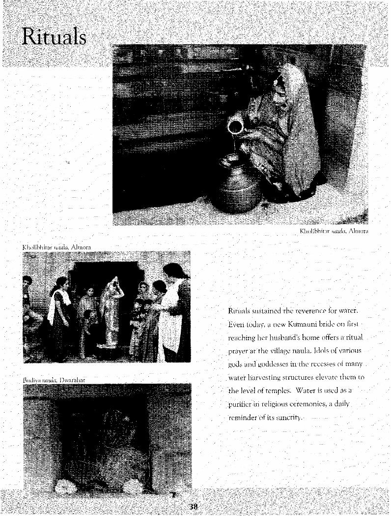
Rituals
Kholibhirnr riaiila, Almora
Kholibhitar naula, Almora
Rituals sustained the reverence for water.
Even today, a new Kumauni bride on first
reaching her husband's home offers a ritual
prayer at the village naula. Idols of various
gods and goddesses in the recesses of many
Water harvesting structures elevate them to
the level of temples. Water is used as a
'purifier in religious ceremonies, a daily
reminder of its sanctity.
38
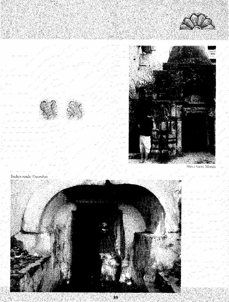
Shiva baori, Mandi
Budiya naula, Dwarahat
39

Historic Baoris
Kfifmarid village of Kullu district once
known as the Kashi of the mountains
had seven large baoris and seven small
ones serving seven castes in the village.
Now only four big ones survive, one of
which is the Lateba baori. Local legend
says that it was built by the Pandavas.
During their 13 years in exile, the new
moon rarely rose on a Monday. On the
first Somvati Amavasya, the Pandavas
wanted to take a dip in the holy Ganga
at Haridwar. Since that was not possible,
the mighty Bhima produced water here.
Today the baori lies neglected.
Lateba baori
Lateba baori
40

Shiva baori, Mandi
Mand i, the headquarters of the erstwhile
Mandi State, has elaborate temples, beautiful
baoris and big naum. A former Queen of
Sundernagar built the Shiva 'baori located
near the Maha Mrityunjaya temple. The
baori itself looks like a huge temple. An
elaborately carved door'leads to the well
which is crowned with a lotus-shaped roof.
Ganesha sits in the middle of the gate flanked
by two yakshas. A surrounding gallery houses
many beautifully -carved idols and there are
three small recesses with Varun gracing the
middle one. Worshippers take water for the
Mrityunjaya temple from this baori.
Shiva baori, Mandi
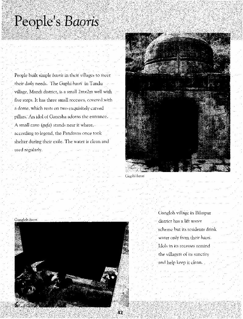
People's Baoris
People built simple baoris in their villages to meet
their daily needs. The Guphi haofi in Tandu
village, Mandi district, is a small 2mx2m well with
five steps, it has three small recesses, covered with
a dome, which rests on two exquisitely carved
pillars. An idol of Ganesha adorns the entrance.
A small cave (gufa) stands near it where,
according to legend, the Pandavas once took
shelter during their exile. The water is clean and
used regularly.
Guphi baori
Gangloh baori
Gangloh village in Bilaspur
district has a lift water
scheme but. its residents drink
water only from their baori.
Idols in its recesses remind
the villagers of its sanctity
and help keep it clean.
42

A Shiva temple in Bachhretu
village, Bilaspur district, has a
large shallow noun about
6mx6mx2m. The local people
regard its water to be as pure as
Gangajal and cleanse
themselves with it before
offering prayers at the temple.
Households from nearby villages
use its water for domestic
purposes and for irrigating a few
hectares. The temple trust
ensures its cleaning, about once
a week. A. grove of banyan,
peepal and mango trees
surrounds the area.
Bachhretu baori
43

Rulers' Baoris
Jubbal baori
Rulers of erstwhile kingdoms in Himachal and their
nobles often built large water harvesting structures in
important: towns and on pilgrim routes. Almost 300
years ago, Raja Karam Chand built an exquisite baori in
Jubbal, Shimla district. It is a big well measuring 5mx5m
at the top, with 13 steps. Its walls are adorned by figures
of many deities. In the center of the well is a huge idol
of Nandi, the attendant bull of Lord Shiva. Two large
idols of Mahasu, the local deity, are installed on either
side of the gate. The water is clean and used for
drinking. It flows out through a marble fountain shaped
in the form of a cow's head. The Municipal Council
looks after the baori.
HIS

Tandu haori
Jeeva Nanda Padha, a minister of the
Mandi State about 120 years ago, built
Vaziraan-di-baori on the Mandi-
Pathankot highway about 10 km from
Mandi city. Eleven steps lead to the base.
An elaborate dome on its top rests on
pillars, which define three arches. One
pillar is exquisitely carved on all sides.
There are three recesses, with the idol of
Varun occupying the middle. The master
mason, Loharu Ram, was a known expert
in making baoris.
45
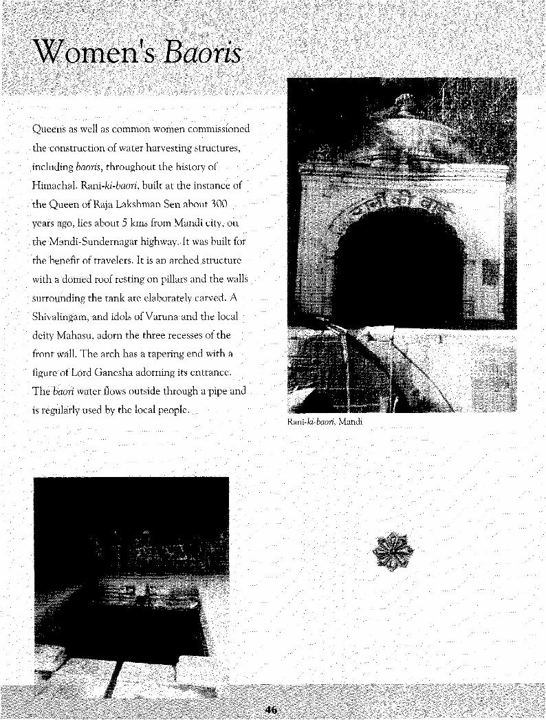
Queens as well as common women commissioned
the construction of water harvesting structures,
including baoris, throughout the history of
Himachal. Rani-ki-baori, built at the instance of
the Queen of Raja Lakshman Sen about 300
years ago, lies about 5 kms from Mandi city, on
the Mandi-Sundernagar highway. It was built for
the benefit of travelers. It is an arched structure
with a domed roof resting on pillars and the walls
surrounding the tank are elaborately carved. A
Shivalingam, and idols of Varuna and the local
deity Mahasu, adorn the three recesses of the
front wall. The arch has a tapering end with a
figure of Lord Ganesha adorning its entrance.
The bdori Water flows outside through a pipe and
is regularly used by the local people.Ram-ki-baori, Mandi
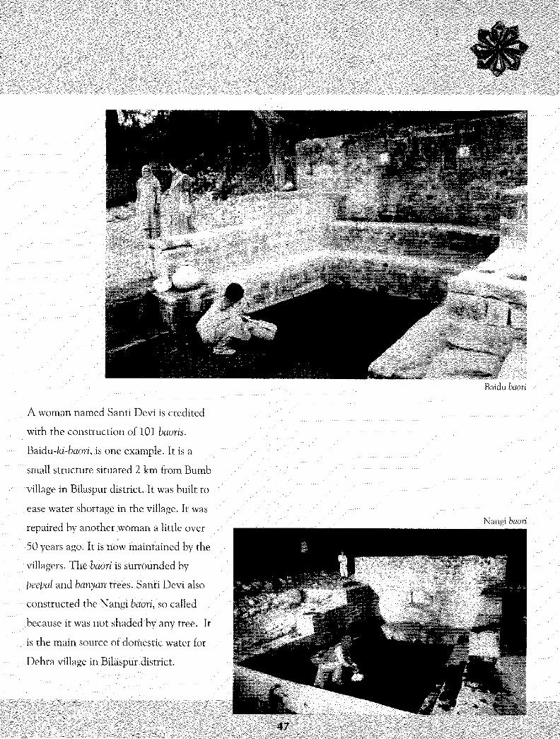
Baidu
A woman named Santi Devi is credited
with the construction of 101 baoris.
Baidu-ki-baori, is one example. It: is a
small structure situated 2 km from Bumb
village in Bilaspur district. It was built to
ease water shortage in the village. It was
repaired by another woman a little over
50 years ago. It is now maintained by the
villagers. 1'he baori is surrounded by
peeped and banyan trees. Sahti Devi also
constructed the Nangi baori, so called
because it was •not shaded by any tree. It
is the main source of dorhestic water for
Dehra village in Bilaspur district.
Nahgi baori
47'

Nauns
Mandi-ka-mnin
Just below the Shiva baori in Mandi is the grand Mandi
naun. It is a deep rectangular structure. Its architectural
splendour is a sight to behold. Local people date its
•construction to about the same time as the Shiva baori.
L48

Rulers of the former princely states
built many nouns in Himachal. The
more famous ones include one inside
the Sujanpur fort and Raja Sansar
Chand's naun in Jeehii village of
Hamirpur district.
Sujanpur fort
Jeehn naun
49

Talaabs and Chapprisi'V1'1.1'.1 . •i.a...-...'..
.' :-> ,:;\\-.: :
l m : a -*.*..'ih*i\t//^'mtJxrj:b:tjMl$:'i$lii$W ^. . :. :."1' '! '• •'" '!" ! . . ! ! .'''/'i".viM:."' x : . . .' ' . . ' ' ' '
Masroor la!aab, district Kangra
Masroor pond lies in front of the imposing rock-cut temples at Masroor,
Kangra district. It was built in the early 8th century and measures
about 25mx50m. Rulers of the Lajandhara kingdom who made Masroor
their capital when they withdrew from the plains probably constructed
the temple complex, hewn Out of a single rock. Many fallen idols are
strewn around carelessly along its eastern wall, probably a result of the
Kangra earthquake (1905) .Earlier, people used its water for domestic
purposes* but now they use it only for their animals.
The Guptgahgataiaab inside the Guptkashidham in Kangra city has
sparkling clean water. It was built by Shah Jahan in the 17th century.
It is now looked after by the temple trust.
50

A large chappri can be seen on a hillock in
Pirthan village overlooking the backwaters
of the Bhakra dam in Bilaspur district. It is
about 100 years old according to local
villagers. Nine steps lead to the water of
this large rectangular structure. The walls
and steps are of relatively recent vintage.
A huge peepal tree and a mango tree grow
on opposite sides. Now it is used only in
times of crisis when tap water supply fails.Pirthan chappri,, Bilaspur district
51

Temple Tanks
• • i i S ' S - i ' 1 ' : ' ! • ) " > •'. • : • ••' •• •• <•
Bhagsu Nag
Bhagsu
Bhagsu Nag is a famous pilgrimage and
tourist spot about 2 kms past Mcleodgarvj in
Kangra district. It boasts of a four-tiered tank
believed to be a few hundred years old. The
topmost tank is covered. The next one
receives Water through huge inlets carved in
the shape of lions' mouths. This feeds the
middle tank, again through three inlets of a
similar design and this likewise feeds the
largest tank at the bottom. An idol stands in
the recess in the middle of the wall on the
northern side of the second tank. People
bathe in its warm waters during winter and
also use it for drinking.
I l l

The kund at Giri Ganga near Khara Patthar in
Shimla district, is a perfect example of
Kasbyapa's advice to intersperse water bodies
and sacred groves. Legend has it that the
kamandal of a rishi fell here and a stream
(Ganga) emerged. Hence the name. Raja
Karam Chand built the tank and the temple
about 300 years ago. A thick stream of water
falls from an animal's head carved in stone.
The water is used for cleansing by
worshippers. The stream's water is also used
in neighbouring villages.
Giri'Ganga
Gin Ganga
53

Ancient Naulas
Ba'driri athji-foz-nau/a arid the
nearby temple, c. 7th century,
in Gadser village of Bageshwar
district is about the oldest riaula
in Kumaun. The Katyuri kings
built them to commemorate the
establishment of their kingdom's
capital at Garur-Baijnath. The
Jahnvi naula in Gangolihat and
the Baleshwar naula in
Champawat belong to the 13th
century. The former has an
image of Vishnu on its walls.
The Baleshwar naula is the only
one with an image of Buddha.
Baleshwar
Badrinathji-fefl-naula
Baleshwarnaula
'•'' ' • i
54
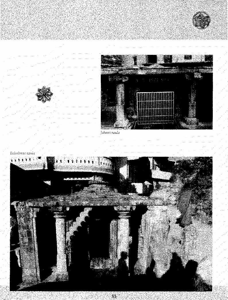
Jahnvi riaula
Baleshwnr naula
ill

High and Mighty
Arririt kund, located inside the
Tuhgnath temple complex at
a height of about 12000 ft
above sea level, may be the
highest water harvesting
structure in Uttarakhand.
Water from the nearby Akash
Kamini river was led into the
kund through two dharas
shaped as heads of an
elephant and a cow. It has a
corrugated sheet roof that was
installed in 1957.
Tun.urwth
56

•Pungeshwar naula near Berinag in
Pithoragarh district may be the largest
naula in Kumaun. A long gallery leads up
to the well itself. The gallery's roof rests on
two stone slabs about 19 feet long. On
either side of the gallery are 18 foot long
platforms. It appears to have been a naula
and a resting place.j;i\,
Pungeshwar naula, district Pithoragarh
Pungeshwar naula
Sit:.
57
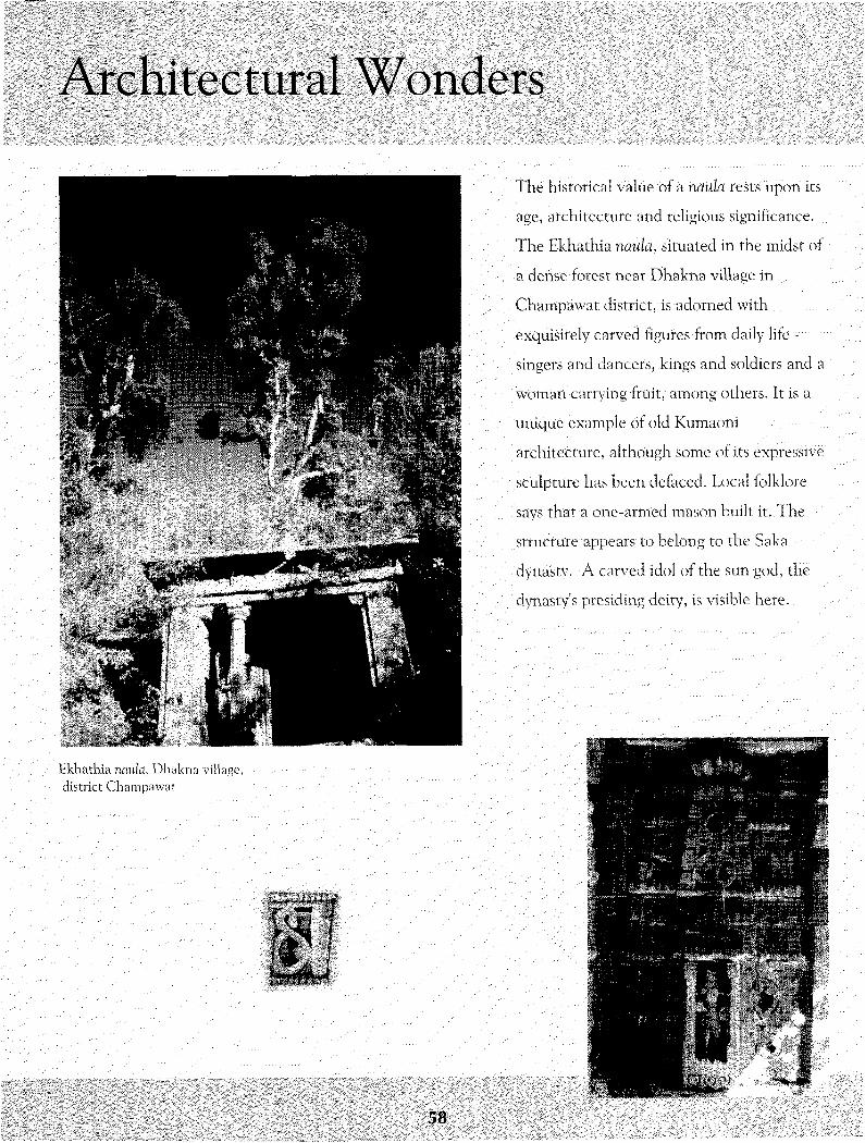
Architectural Wonders
11*:.: • %*^i
. f,.: . i ^ *&:•
, - S g i •••;• *
Ekhathia nauh, Dliaknadistrict Cjhampawai
The historical value of a rtiiula tests upon its
age, architecture and religious significance.
The Bkhathia nauta, situated in the midst of
a dense forest near Dhakna village in
Champawat district, is adorned with
exquisitely carved, figures from daily life ~
singers and dancers, kings and soldiers and a
woman carrying fruit, among others. It is a
unique example of old Kumaoni
architecture, although some of its expressive
sculpture has been defaced. Local folklore
says that a one-armed mason built it..The
structure appears to belong to the Saka
dynasty. A carved idol of the sun god, the
dynasty's presiding deity, is visible here.
••«c
58

Bali kund
Bah kund in Narayan Koti village,
Rudraprayag district, is architecturally
perhaps the most magnificent water
harvesting structure in Uttarakhand.
The entrance is through an impressive
stone arch. The walls of the portal and
the interior kund are covered with
eroded but exquisite engravings in
sandstone. Images of gods, goddesses
and mortals display Mongoloid features,
indicating that, they were probably
made by migrant Tibetan sculptors,
when trade across the border was open.
The structure is managed by the ASI.
Its staff thinks that the kund was used
by former queens who lived in the
nearby Navling Fort.
Bah kund, Narayan Koti village, district Rudraprayag
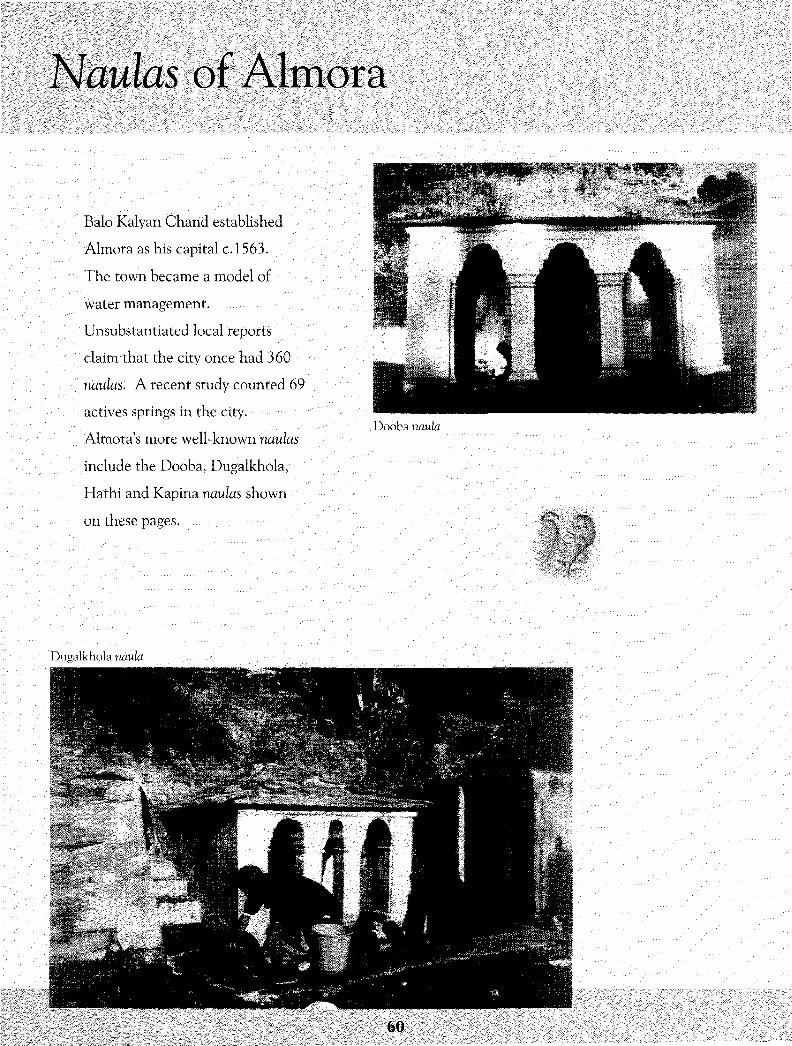
Naulas of Almora
Balo Kalyan Chand established
Almora as his capital c.1563.
The town became a model of
water management.
Unsubstantiated local reports
claim that the city once had 360
naulas. A recent study counted 69
actives springs in the city.
Almora's more well-known naulas
include the Dooba, Dugalkhola,
Hathi and Kapina naulas shown
on these pages.
Dooba naula
Dugalkhola naula
60
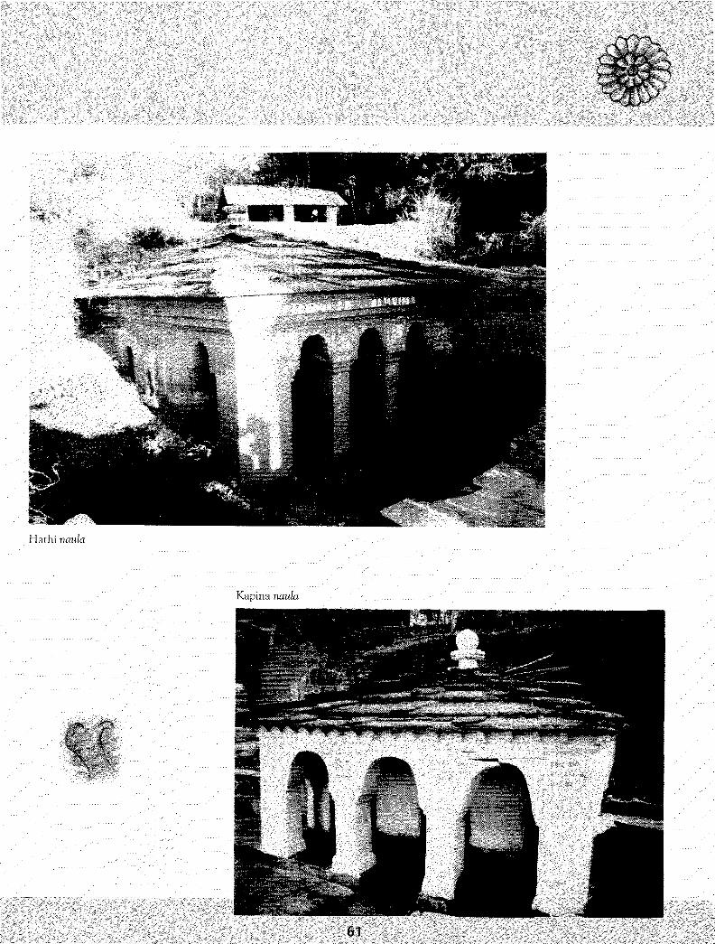
Hathi naula
Kapina naula
61

Gupikashi
Dharas are ubiquitous sources of drinking
water in the central western Himalayas.
The Ganga-Yamuna dharas in the
Vishwanath temple complex in Guptkashi
are made of brass in the shape of an
elephant's (Yamuna) and a cow's (Ganga)
head. These dharas empty their water into
a kund where worshippers at the temple
can cleanse themselves. The local people
regard bathing under them equivalent to
bathing in the Ganga or Yamuna river.
The Ganga dhara bears the date Shakya
Samvat 163 2 and the Yamuna dhara is
dated Shakya Safrivat 1664.
Mil

Narayan Kori dlwras, Narayan Kofi village',disiricl Rudraprayag
Dhara bazaar in the town of
Pauri is named after an
ancient dhara which once
supplied water to Pauri village
for domestic use and
irrigation. An inscription on a
column suggests that a local
king may have installed the
dhara to celebrate" a military
victory. The dhara is now dry
and Pauri routinely faces
water shortages.
Pauri dliara
Two stone dharas feed the kund at
the Navgraha group of temples in
Narayan .Kofi village. This group
of temples was excavated in the
early 1920s. In the past, pilgrims
on route to Kedarnath. stopped
here to bathe and then moved on
foot to Kedarnath. The kund is
lined with dressed stones. The
local people use the water from
the dharas for drinking and other
domestic purposes.
63

evim
Gauri hand
Gauri kund is a renovated naula near the Lakshmi Nar ay an temple in
Sumadi village, Pauri district. It was renovated about 15 years ago, though
the original naula may have been constructed in the 16th century.
The inside back wall has a beautiful image of Lord Vishnu reclining on
Sheshnag carved in stone. Along the walls finely chiseled lace work in stone
is also visible. Many Sumadi residents prefer to use its water rather than
rely on the piped water supply. Rules of usage are enforced in an attempt to
preserve the naula.
64
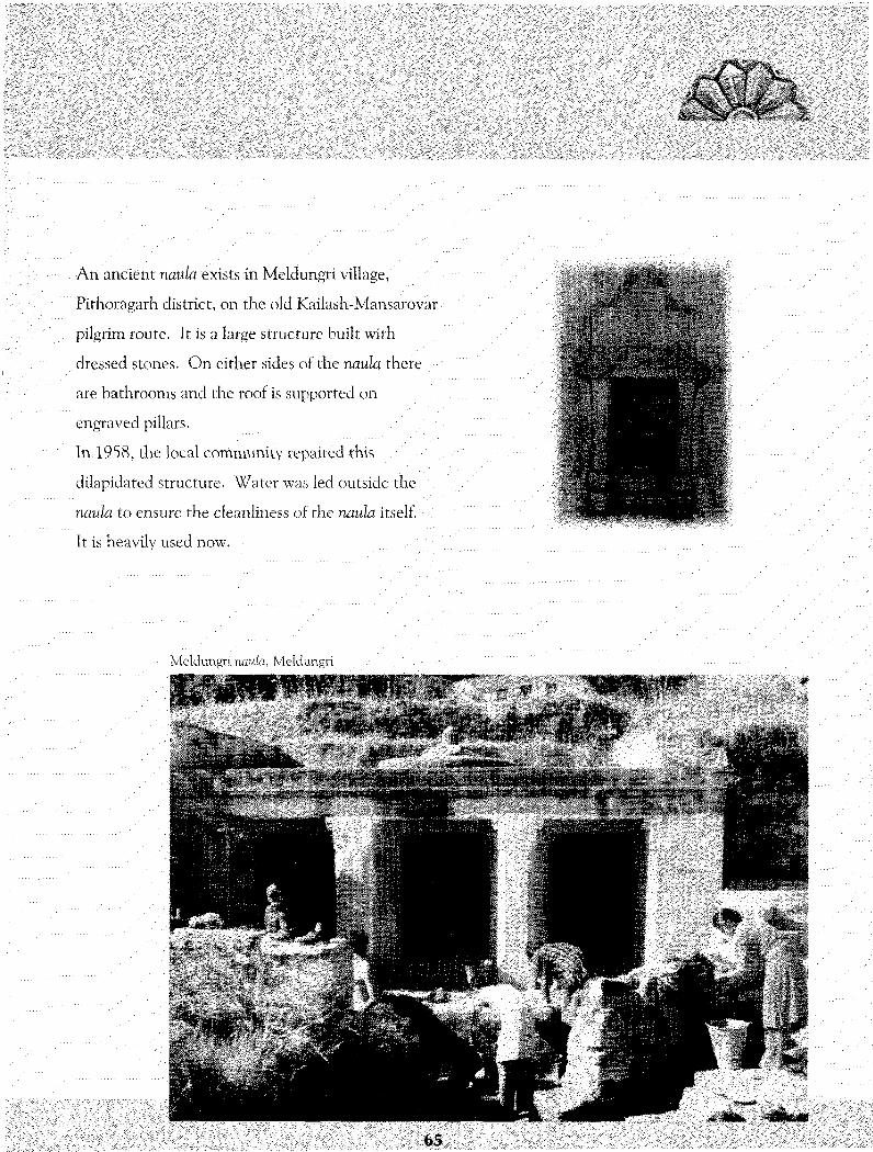
lillH
An ancient naula exists in Meldungri village,
Pithoragarh district, on the old Kailash-Mansarovar
pilgrim route. It is a large structure built with
dressed stones. On either sides of the naula there
are bathrooms and the roof is supported on
engraved pillars.
In. 195 8, the loca 1 community repaired this
dilapidated structure. Water was led outside the
naula to ensure the cleanliness of the naula itself.
It is heavily used now.
Meldungri naula, Meldungri
l l l l l l l

References r
1. A, Agrawal&S.Narain: Dying Wisdom, Centre for 'Science & Environment, New* Delhi, 1997.
2. R. Ahal & SRDA: The Lower Baijnath Kuhl, 1995 (mimeo).
3. Anon: Gazetteer Of The Chamba State 1904, Punjab States Gazetteer v XXII A, Indus Publishing Co. , New Delhi,1996. (Reprint)
4- E. T. Atkinson: The Himalayan Gazetteer, v3 part 1, Natraj Publishers, Dehra Doon, 1996.
5. ]. M. Baker: Common Property Resource 'Theory and the Kuhl Irrigation Systems ofHimaclwil Pradesh, India, Human Organization, v. 56, n. 2, 1997.
6. G. C. Barnes: Report of the Settlement in the District of Kangra in the Trans-Siitlej States, Chronicle Press,Lahore; as cited in E. W. Coward, Jr. (1990).
7. E. Bon: "Common Property Resources: Two case studies", EPW, July 15,2000.
8. R. Chand: "Role of Water Rights in Farmer-Managed Hill Irrigation Systems", EPW, March 26, 1994.
9. B. Chandra: The Rise and Growth of Economic Nationalism in India, People's Publishing House, New Delhi, 1991.
10. E.'W. Coward, Jr.- Property Rights and Network Order: The Case of Irrigation Works in the Western Hirrudayas, Human Organization, v. 49, n. 1,1990.
11. DCAP: Legal Framework For Rural Water Supply (Drinking Water and Irrigation) In Himachal Pradesh,Development Centre for Alternative Policies, New Delhi, 1996.
12. GoHP: Statistical Outline Himachal Pradesh, Economic & Statistics Dept., GoHP, Shimla, 1996.
13. GoHP: Annual Plan 2000-2001, Planning Dept. , GoHP, Shimla, 2000. V
14. A.. Joshi, P. S. Garia & I. Hasnain: Uttarakhand Update, Kanishka Publishers, New Delhi, 1999.
15. R. Kumar, D. Sen and R. Chopra: "GuMs: A Traditional Irrigation System In Gathwal", in Traditional Water Management, B. C. Barah (Ed.), 1994
16. IX K. Mishra: Living with the Politics of Floodsffhe Mystery of Flood Control, People's Science Institute, Dehra Doon, 2002.
17. U . C Pande: State and Farmer Managed Irrigation Systems in district Almora in UP Hills 1989-91,Water &Land Management Institute, New Delhi, 1991.
18. U. C. Pande: Design By Experience, Joginder Sain &. Bros, New Delhi, 1995.
19. P . C Pant: Parvatiya]al Srot, Shree Almora Book Depot, Almora, 1995.
20. V.Pafanjpye: Preliminary look at ARUN 111 in the Light of Tehri Experience, Water Nepal,4 (1),1994.
21. S. Radhakrishnan: The Heart of Hindustan, Madras, 1936.
22. P. 'Rautela: Water Resources In The Himalayas: Harvesting, Tradition and Change , Concept Publishing Co. , New Delhi, 2000.
23. j . S. Samra, V. N. Sharda & A. K. Sikka : Water Harvesting and Recycling Indian Experiences, Central Soil & Water Conservation Research &.
Training Institute (CSWCRTI), Dehra Doon, 2002.
24. B. Sharma, A. K. Lai and T. Singh: "Rainwater Harvesting Structures A solution for water crisis in the Himalayas: A case from Ir Gad
microwatershed in Pauri district:, Garhwal Himalaya", Paper presented at a workshop on Futuristic Model Habitat, Pauri, 1997.
25. A. Upadhyay & P. Bisht: "UttarakliandhAdnJalPrabandhan: EkXinluwlokan", Nairii Tal,'200L (in Hindi)
26. M. S- Vani: "Customaty Law and Modern Governance of Natural Resources in India: Conflicts, Prospects for Accord and Strategies", Development
Centre for Alternative Policies, New Delhi, 2002.
27. M. S. Vani &.R. Asthana: Law and Custom in Water Resources Administration: A case Study of U. P. Himalayas, Development Centre For
Alternative Policies, New Delhi, 1996.
28. M. S. Vani & R. Asthana (2000): "Water Rights, Law and Policy in Uttararichal; Empowered State and Eroded Public Rights", in Water in Kumaon:
Ecology, Value and Rights, G. K. Kadekodi, K. S. R. Murthy & Kireet Kumar (Eds), Gyanodaya Prakashan, Nainital, Ch-9.
29. M. S. Vani & R. Asthana: Water Resources Management Through Watershed Approach - Legal Framework for Uttaranchal State, A Concept Paper,
DCAP, New Delhi, undated.
66

5 f t
Peoples' Science Institute (PSI) is a nonprofit public interest research and development orgarmation.It has active research, development and technical support programmes in water resources management,
environmental quality monitoring and disaster mitigation and response.
Two new disciplines urban development planning and policy analysis are being added.

Sanskur (precepts and rites), sumkriti
(culture mul customary practices) and
niti (state policy and administration)
sustained traditional water harvesting
structures and management sysrenus
in llw central and western Himalayas
lor centuries.
Individual dlumnii and social customs
were the necessary conditions lor
sustaining these traditions.
Local autonomy in resource
management was the critical
surticieni condition.
I j.;^;'1-":.- B Peoples' Science Institute-v1?;-;
PSIJ - i : W I M I I I X'ili.n. r ! i - . ^ - 1 . i V l i n i 1 \K»I I
li1!.: l O l ^ i - 7 7 >s VK lib ^641 ' Hinnil: pMihlooiv. ' sii