Hazard I. Volume 1 : fire hazard assessment method - GovInfo
Upload
khangminh22Category
view
1download
0
Modern Environmental Science and Engineering (ISSN 2333-2581) November 2015, Volume 1, No. 5, pp. 255-268 Doi:10.15341/mese(2333-2581)/05.01.2015/007 Academic Star Publishing Company, 2015 www.academicstar.us
Hazard Vulnerability Risk Assessment of District Gilgit,
Gilgit-Baltistan, Pakistan
Farasat Ali1, Babar Khan1, Garee Khan1, Yawar Abbas2, Ejaz Hussain1, Ambar Masud3, Karim Akber1 and Rizwan
Karim4
1. World Wide Fund for Nature Pakistan, Gilgit, Gilgit-Baltistan, Pakistan
2. Department of Earth and Environmental Sciences, Bahria University, Islamabad, Pakistan
3. United Nation Development Programme, Pakistan
4. Department of Forestry & Range Management, PMAS-Arid Agriculture University, Rawalpindi, Pakistan
Abstract: Gilgit-Baltistan of Pakistan in general and district Gilgit in specific vulnerable for climate induce hydro-metrological hazards and its impacts. The community based hazard vulnerability risk assessment study recorded key climate change induced hydro-metrological hazards, vulnerabilities and capacities in district Gilgit. The study documented major hazards included floods (flash floods), prolong droughts, heavy rainfalls/ snowfalls, clouds bursts, avalanches, landslides, river bank erosion and epidemics. Prioritization or ranking wise floods are more frequent in the study area. The total settlement area of the district is 136.436 Sq.Km out of which 15.67354 Sq.Km is considered to high vulnerable for floods and other hazards.
They are vulnerable in terms of critical facilities, livelihoods options, ecological resources, motivationally and organizationally extreme events. Capacity of the local community and district Government is weak like lack of knowledge, resources and skills and this study provide local viable options to reduced risks from natural events.
Key words: hazard vulnerability risk assessment, hydro-metrological hazards, critical facilities, vulnerability, high frequent, motivational vulnerability
1. Introduction
Hazard vulnerability risk assessment (HVRA)
studies examine the hazards that may impact a
community and the risk that each hazard event poses to
the community as a whole and to vulnerable elements
of the community [1]. HVRA is a critical part of every
emergency programme (Provincial emergency
programme, 2004) [2]. The hazard vulnerability risk
assessment is crucial for emergency preparedness,
immediate response, mitigation planning and long term
recovery from disasters [3]. The benefit of the
vulnerability integrated hazard risk assessment
Corresponding author: Farasat Ali, MS Environmental
Sciences, World Wide Fund for Nature Pakistan; research areas/interests: climate change. E-mail: [email protected].
approach is that it allows abroad collection of potential
risk factors to be explored [4]. Vulnerability and hazard
risk assessment variedly undertaken worldwide,
however, the common factors for vulnerability, raking,
index, etc are relatively inverse to what parameters are
used in human development index thus , better human
development index is indicative of higher coping
capacity and low vulnerability [5]. Hazard,
vulnerability and risk are correlated to understand past
losses and susceptibility to future losses [6-8]. The
term hazard refers to a dangerous phenomenon,
substance, human activity or condition that may cause
loss of life, injury or other health impacts, property
damage, loss of life, injury or other health impacts,
property damage, loss of livelihoods and services,
social and economic disruption, or environmental
Hazard Vulnerability Risk Assessment of District Gilgit, Gilgit-Baltistan, Pakistan
256
damage (United Nations, international strategy for
disaster reduction ) [9]. Vulnerability refers as the
degree of fragility of person, a group, a community or
an area towards defined hazard. Vulnerability is set of
conditions and processes resulting from physical,
social, economic and environmental factors that
increase the susceptibility of a community to the
impact of hazard (The ESPON Hazard project (2003, p.
19) [10]. Vulnerability is an essential part of hazards
and risk research and refers to the susceptibility of
people, communities or regions to natural or
technological hazards [11]. While risk define as
expectation value of losses (Death, injuries, property,
etc that would be caused by a hazard, Disaster risk can
be seen as a function of the hazard, exposure and
vulnerability as follow (Asian disaster reduction center,
2005). Pakistan is one of the most natural disaster
prone countries in the world [12]. Hydro-metrological
hazards particularly heavy rain falls induce flash floods
are permanent feature of the Pakistan [13-15]. All
provinces of Pakistan including Gilgit-Baltistan are
vulnerable to geo-hydro metrological disasters [16, 17].
The unique geography and environmental conditions of
Gilgit-Baltistan increased vulnerability of the area in
the country [18-20].
2. Methodology
2.1 Study Area
District Gilgit is strategically the most important
district and the capital of the Gilgit-Baltistan. The area
lies on N 35°55' 0” and E 74°18' 0” and bounded by
Hunza-Nagar to the north; Skardu, Astore and Diamer
to the south; and Ghizer District to the west. The total
covered area of district is 38,000 square kilometers
(14,700 sq mi) [21]. The region is significantly
mountainous and lying on the foothills of the
Karakoram Mountains with an average altitude of
1,500 meters (4,900 ft). It is drained by the Indus River,
which rises in the neighboring regions of Ladakh and
Baltistan. Average annual rain fall recorded 120 to 240
millimeters (4.7 to 9.4 Inc). The piercing sunrays may
raise the temperature up to 40°C (104°F), yet it is
always cool in the shade. As a result of this extremity in
the weather, landslides and avalanches are frequent in
the area.
Fig.1 Union councils Map of District, Gilgit

Hazard Vulnerability Risk Assessment of District Gilgit, Gilgit-Baltistan, Pakistan
257
2.2 Assessment Methods
The hazard vulnerability risk assessment (HVRA) is
a step by step process that enables an HRVA
committee chair, and a small working group, to
complete a hazard, risk and vulnerability analysis
(Provincial emergency programme, 2004) [2]. This
community based HVRA was conducted in three steps,
i.e., identification of hydro-metrological hazards,
assessing the vulnerabilities and documented the
capacities, community basedhazard assessment is the
identification, list down and description of nature of
hazards in terms of its recurrence, reasonability,
location, possibility of early warning and general
knowledge of the people about the hazard. It is further
divided into two steps; the hazard identification and
hazard analysis [22]. Agree that Hazard mapping of
risk area from natural hazards and disasters are
valuable information and communication tools. We
used various tools such as hazard maps (developed
through arc GIS 9.3), historical profile and hazard
matrix to identify and assess the hazards. Coburn et al.
(1994) [23] added as Vulnerability is the measure of
how the element at risk in a geographic region would
be damaged if they experience same level of hazard.
Community based Vulnerability Assessment is the
identification of what elements are at risk and why
(refer to unsafe conditions, dynamic pressures and root
causes).Vulnerabilities are future divided as physical,
social, attitudinal and economic. We used hazard maps,
transect walk, seasonal calendar, livelihood analysis,
Venn diagram, semi structured interviews, problem
tree and ranking as tools to assess the vulnerabilities
with in the district. Community based Capacity
Assessment is what people’s coping strategies are;
what resources are still available; who has access and
control over these resources? Capacities are further
classified into physical, social, attitudinal and
economic capacities. Hazard map, historical profile,
seasonal calendar, gendered resource mapping, focus
group discussion, livelihood/coping analysis,
institutional and social network analysis were used as
tools for capacity assessment, In addition of Microsoft
Excel for statistical analysis and arc GIS 9.2 for
hazards mapping and other.
3. Results and Discussions
3.1 Hazard Identification
Based on the hazard maps (Fig. 2), personal
observations, community response and historic profile;
floods, landslides, river bank erosion and avalanches
are the major hazards in the district Gilgit, associated
with water and weather changes pattern. Besides these;
droughts, cold spells and epidemics are some other
hazards, observed and identified by the community. A
brief description of each is as under.
Fig.1 Hazard Map of Study Area

258
3.2 Floods
Floods ar
Pakistan is
Hydro-metro
identificatio
is the major
area and is o
flood, glacia
According t
geographic l
origin of su
triggered by
According to
of study
which15.673
for floods.
major flood
Fig.3 BehavDiscussions
3.3 Landslid
Landslide
hazards. In
increased to
distribution
4.89% of the
Hazard V
re permanent
s highly v
ological ev
n and assessm
r hydro-metr
of various kin
al lake outbur
to the histor
location of th
uch floods b
y increased t
o the hazard
area is
354Sq.Kmis
Amongst the
d area,.3846s
vior of Major I
des
es are among
n last few d
o asses’ land
to be describ
e natural disa
Vulnerability
t feature of P
vulnerable f
vents [24].
ment process
rological haz
ds, the cloud
rst floods and
ric profile, o
e district, hea
but river flo
temperatures
map, the tota
136.436
considered to
e twelve uni
sq.kmlies be
Identified Haz
g the most h
decades atte
slides hazard
bed [25]. Lan
asters that imp
Flood, Freqency(Times
, 2.3
Landslidequencmes), 7
Erosquen
e
B
Risk Assessm
Pakistan [13-
for floods
The ha
shows that f
zard in the st
burst flood, f
d the river fl
observations
avy rain fall is
oods are mo
in the summ
al settlement
Sq.Kmout
o high vulner
ion councils,
tween Jutal
zards as Perce
hazardous nat
ention has b
ds and its sp
ndslides signi
pacted worldw
qus)
Flood, Spd (on se
(minutes7
de, Frcy(Ti7.01
Landpee
s(minu
ion, Frency(Tims), 1
E
(
BEHAVOUR
ment of Distr
-15].
and
azard
flood
tudy
flash
ood.
and
s the
ostly
mer.
area
of
rable
the
and
Jag
Nal
very
27
eva
unio
Dam
and
The
and
110
rive
Sha
and
cau
com
few
ived by the Co
tural
been
atial
ified
wide
dur
seco
seco
inte
com
tim
peeet) ), 2
Flood,Impa
(Kanaldslide, Sed (on set) utes), 8.07
La
(K
Erosion, Speed (on set)
(minutes), 27
OF MAJORHAZARDS
rict Gilgit, Gilg
ot but most
ltar, Jutial, an
y near to settl
minutes, giv
acuate them-s
on councils,
mot have floo
d half hou,thu
e frequency o
d usually from
0 flood points
ers and cha
arot-Shakyot
d 15 are in No
use more dam
mmunity and
w decades wer
ommunity, His
ing years 19
ond major H
ondary hazar
ense snow
mmunity obse
es a year an
, Area acted l), 744
Floo
(Ho
andslide, Area
Impacted Kanal), 124.
5
Erosion, Area Impacted (Kanal), 221
6
R IDENTIFIE
git-Baltistan,
vulnerable a
nd Jaglot Goro
lements and a
ves the comm
elves. As com
Haramosh, S
ods but the av
s causing less
of floods is u
m end of June
in the whole
annels. Amo
over an exten
omal which c
mage to the
d historical p
re 1980, 1994
storical Profile
990 to 2005
azard in the d
rd of heavy
fall in win
ervations, the
nd usually s
od, Duration
ours), 1.5
Landslide, Duration
(Hours), 2.5
Erosion, Duation
(Hours), 27
ED
Flood
Landsle
Pakistan
are, Sakarko
ow. The flood
average speed
munity very
mpare to abov
Sai Jaglot, ch
verage speed
s harm to the
sually 2 to 3
e to mid Augu
district inclu
ongst them
nded area, 16
covered less
settlements.A
profile; sever
4, 1996 and 2
e, Personal Ob
[26]. Land s
district and tr
rainfall in
nter. Accord
e average freq
stays for 1 h
ur
70
id
ie, Konadas,
d Nullahs are
d on set is just
little time to
ve mentioned
harkorcot and
on set is one
communities
times a year
ust. There are
uding Nullahs
21 are in
in Municipal
area and this
According to
floods over
2010.
bservation and
sliding is the
riggered as a
summer and
ding to the
quency is 5-6
hour. In this
,
e
t
o
d
d
e
s.
r
e
s,
n
l
s
o
r
d
e
a
d
e
6
s

Hazard Vulnerability Risk Assessment of District Gilgit, Gilgit-Baltistan, Pakistan
259
duration it usually cause harm to homes especially in
Sakarkoie and even to human lives in Kargha and
Naltar valleys. Social forestry, agricultural land and
cattle sheds are under threat of landslides in all most all
the union councils. The hazard map shows 23 potential
landslides points in the whole district with 4 in
Sharot-Shakyot and Haramosh and 3 in each of
municipal area, Bagrot and Charkorcot. The average
speed on set for landslide is every short, i.e., 8.07
minutes. The landslide point in Naiko Gilgit is highly
threatening as the speed on set is just 02 minutes and
average duration is 1 hour and as a result of 2010 rain it
caused damage to 07 houses (Muhammad Ismail from
Naikoi). The landslides in Naltar and Jutial Nullah are
also very potential and even can enter the homes in
Naltar but in case of Jutial the speed on set is 30
minutes and the plantation on its way gets damaged but
serves as barrier to reduce the harm to homes, cattle
sheds and human lives (Sher Nadeer from Jutial).
Fig.4 Potential Land Sliding Map of the Area
3.4 River Bank and Nullah Erosion
Soil erosion is serious problem of Pakistan due to
deforestation, overgrazing and improper land use [27].
Lack of watershed management ultimate contribute
large amount of eroded load in major rivers of the
world, 13 major rivers of the world annually caring
5.8 billions tones of sediments load including Indus
river which annual caring load is 435 millions tones
consider as third largest sediments caring river [28].
Highest rate of erosion is recorded between Indus
watershed and Terbela upstream side, it is estimate that
5, 00, 000 tones of sediments contribution per day by
Indus and the dam has lost about 35% of its reservoir
capacity within twenty four years. Similarly, Warsak
and Khushdil Khan Reservoirs have almost silted up
[29]. River bank erosion triggered as a secondary
hazard of floods and increase in summer due to heavy
melting of glaciers from upper Indus river basin. The
erosion rate depends on volume of water and is usually
very high from June- September in the study areas. An
average of 2216 Kanal is ruined every year as a result
of erosion especially along the banks of Shrot, Shakyot,
Bargo, Thingee, Hanzal, Baseen, Sakarkoie and
Konadas by the Ghizer River (Fazul-u-Rehman from
Konadas). Erosion to the agricultural land is very high
in Sakwar and Naltar as result of flow of Nallah water

Hazard Vulnerability Risk Assessment of District Gilgit, Gilgit-Baltistan, Pakistan
260
in high volume and speed (Muhammad Tahir from
Sakwar).
3.5 Avalanches
Avalanche is again a major identified hydro
-metrological hazard in the district. It usually occurs in
winter when there is heavy snow fall and frequency
could be 5-7 times such as in Naltar. The speed on set is
just few seconds to few minutes (Akbar Hussain,
Naltar). According to the hazard map there are 10
avalanche points in the district with 01 in Sharot, 01 in
Haramosh, 02 in Bagrot and 06 in Naltar, covering an
area of 1.8601sq.km. The potential avalanches usually
cause a huge damage to natural forest and cultivable
land in Naltar (Garee Khan, GIS expert).
Fig.5 Avalanches Areas
3.6 Epidemics
Communities have also identified epidemics as a
secondary hazard of floods and cold spells. The
hazards usually occur after heavy rain fall, floods and
especially in winter when the temperature reduces
below normal. The diseases include gastro intestinal
diseases, eye infections and skin problems (Haider
Abbass from Nomal). As a result of rain, the drinking
water sources such as channels in Kargha Naltar,
Oshikhandas and Bagrot gets contaminated and leads
to the water born diseases. In 2010 many children
suffered from Diarrhea and eye infections in IDP
camps in Nomal and Jutal because of unhealthy
hygienic conditions and polluted water
(Rasheed-u-Din, DDMA). Such diseases usually
remain for one week to twenty days but get prolonged
when the access to health facilities is limited or
unavailable (Muhammad Ali, Haramosh).
3.7 Droughts
Today globe is facing the impacts of abrupt climatic
changes like El-Nino heavy rainfalls, and conversely
drought, poor crop yield and starvation in those areas
which accustomed to more rains. Drought is a normal,
recurrent feature of the climate although many
incorrectly considered it as a rare and random event
[30]. During recent past (1998-2001) Pakistan has
faced one of the worst droughts of its history due to
extremely low rainfall [31]. Drought is also identified
as hydro- metrological hazard in the district which
trigger as a result of less rain fall or no rainfall. The

Hazard Vulnerability Risk Assessment of District Gilgit, Gilgit-Baltistan, Pakistan
261
frequency is usually 10-15 years and average duration
is 03-04 years. The droughts usually cause damage to
agricultural land thus leading to economic downfall of
communities.
3.8 Vulnerability Assessment
The statement of the vulnerability is a communal
circumstances, a measure of societal resistance or
resilience to hazards [6, 32]. Vulnerability define as a
set conditions and processes resulting from physical ,
social, environment and economical factors, which
increase the susceptibility of a community to the
impact of the hazards (ISDR, 2004). Generally, the
vulnerability of a system against a certain hazard is not
easily assessed. Three routes for the assessment can be
distinguished as economic vulnerability, social
vulnerability and cultural vulnerability [33]. There are
three major dimensions of vulnerability included
economic, social and ecological [11]. In this study
vulnerability is classified as physical, including
infrastructure; economical, mainly about the livelihood
sources; ecological which covers important aspects of
environment fragility, organizational and motivational.
The degree of vulnerability is categorized as high,
medium and low risk.
3.9 Physical Vulnerability
Social vulnerability as a complex set of properties
that includes a person initial wellbeing, livelihoods and
resilience, self protection, social protection and social
and political networks and institutions [34]. Social
vulnerability as“a multidimensional concept that help
identify those properties and experience of the
community (and individuals) that enable to respond
and recover from natural hazards” [34]. The key
critical facilities identified by the community within
the district are hospitals, mosques, major water supply
systems, electric supply, markets, shops,
communication facilities, homes, bridges and roads.
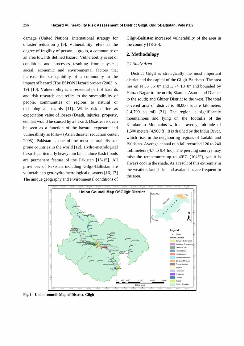
Risk to the facilities in the below graph are indicated by
various colors H = High, M= medium and L = Low. It
was found that almost 98% of the schools, in the
selected union councils are under government system
and out of which 21% are at high risk of getting
damaged mostly by flood and some by landslides.
Usually the schools are bit away from the flood points
in all most all the union councils accept for the primary
school in Kargha, 02 primary schools in Cheera Bagrot,
primary school in Oshikhandas, 03 primary schools in
Jaglot Gilgit,02 middle schools in Minawar-Sakwar,
primary school in Naltar Paeen and primary school in
Nomal. There is only one university in the district i.e
the KIU but is at high risk of flood in the hunza and
Gilgit River, similarly the women degree college at
river view road is also at risk of high level flood in
Gilgit river but the high level wall may protect the
building from getting damaged (Community response
and personal observations). There are 37 health units in
the study area. Including 10 hospital and 27
dispensaries and out of that 03 main hospital, i.e., Aga
Health Centre in Cheenar Bagh, Vision International
Hospital and Kashorte hospital are at high risk of flood
either in Hunza or Ghizer River. Collectively 27% are
at high risk, 27% at medium and 46% are low risk. A
total of 258 mosques were recorded during the survey,
including few Imam Bargahs and Jamat Khanas out of
which 22% are at high risk, 21% at medium and 57%
are at low risk. The water supply systems include
pipelines and water channels, being given by
government and Aga Khan Planning and Building
Services of Pakistan (AKPBSP). Out of 81 recoded
systems, 54% are at high risk of floods and landslides
such as 06 in Sai Jaglot, 03 main waters supply systems
in Gilgit town, 06 in Datochee Bagrot, 05 in
Nomal-Nalter and 05 in Jaglot Gorow. The electric
supply systems include hydel power stations and the
distribution lines. According to the community and
past experience the distributions lines get damaged in
all most all the union councils, in one or the other ways
but the major hydel power stations such as the Nalter,
Jaglot-Gorwo and Kargha are at high risk of floods and
landslides. In 2010 flood, out of 07 hydel power
262
stations, 04
Gorow powe
Sha, Tehsild
small shop
communicat
are at low ris
system is m
could face a
floods or lan
BISP the tot
and the HVR
in the selec
makes 77%
are at high ri
area, Jaglot-
Besides this,
Fig.6 Level Risk and Gre
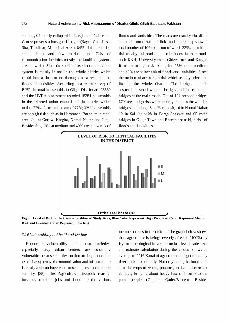
3.10 Vulnera
Economic
especially
vulnerable b
extensive sy
is costly and
stability [3
business, to
Hazard V
totally collap
er stations go
dar, Municipa
ps and few
tion facilities
sk. Since the
mostly in use
a little or no
ndslides. Acc
tal household
RA assessme
cted union co
of the total so
isk such as in
-Gorow, Kar
, 19% at medi
of Risk to theeenish Color R
ability to Live
c vulnerabil
large urban
because the
ystems of com
d can have va
5]. The Ag
ourism, jobs
Vulnerability
psed in Kargh
ot damaged (S
al Area). 84%
w markets
s mostly the
satellite based
e in the who
o damages a
cording to a
ds in Gilgit-D
ent recoded 1
ouncils of th
o out of 77%;
n Haramosh, B
gha, Nomal-N
ium and 49%
e Critical faciliRepresent Low
elihood Optio
lity admit
n centers,
destruction o
mmunication a
ast consequen
griculture, li
and labor
LE
Risk Assessm
ha and Nalter
Sayed Ghaieb
% of the recor
and 72%
landline syst
d communica
ole district w
s a result of
recent surve
District are 23
8284 househ
he district w
; 32% househ
Bargo, munic
Nalter and Ju
% are at low ris
ities of Study ARisk
ons
that socie
are espec
of important
and infrastruc
nces on econo
vestock rear
are the var
Crit
EVEL OF RISIN
ment of Distr
r and
b Ali
rded
of
tems
ation
which
f the
ey of
3569
holds
which
holds
cipal
utal.
sk of
floo
as m
tota
risk
such
Roa
and
the
life
susp
brid
67%
brid
10
brid
floo
Area, Blue Col
eties,
ially
and
cture
omic
ring,
rious
inco
that
Hyd
app
ave
rive
also
dam
poo
tical Faciilites
SK TO CRITN THE DISTR
rict Gilgit, Gilg
ods and lands
metal, non m
al number of 1
k usually link
h KKH, Uni
ad are at high
d 42% are at l
main road ar
in the w
pension, sma
dges at the m
% are at high r
dges including
in Sai Jaglo
dges in Gilgit
ods and lands
lor Represent
ome sources
t, agriculture
dro-metrolog
proximate cal
erage of 2216
er bank erosio
o the crops o
mage, bringin
or people
at risk
TICAL FACIRICT
git-Baltistan,
slides. The ro
metal and link
109 roads out
roads but als
versity road,
h risk. Along
ow risk of flo
re at high risk
whole district
all wooden b
main roads. Ou
risk which m
g 18 on Haram
ot,08 in Barg
t Town and B
slides.
High Risk, Re
in the district
is being sev
gical hazards f
lculation duri
Kanal of agri
on only. Not
of wheat, pota
ng about heav
(Ghulam Q
LITES
H
M
L
Pakistan
oads are usua
k roads and s
t of which 33
so includes th
Ghizer road
gside 25% ar
oods and land
k which usua
t. The brid
bridges and t
ut of 104 rec
ainly include
mosh, 16 in N
go-Shakyot a
Baseen are at
ed Color Repr
t. The graph
verely affecte
from last few
ing the proce
iculture land
only the agri
atoes, maize
vy lose of in
Qader,Baseen
ally classified
study showed
% are at high
he main roads
d and Kargha
re at medium
dslides. Since
lly seizes the
dges include
the cemented
ceded bridges
s the wooden
Nomal-Naltar
and 05 main
t high risk of
esent Medium
below shows
ed (100%) by
w decades. An
ess shows an
get ruined by
icultural land
and corn get
ncome to the
n). Besides
d
d
h
s
a
m
e
e
e
d
s
n
r,
n
f
m
s
y
n
n
y
d
t
e
s
agriculture,
risk, i.e., 7
usually kill
Haramosh,
(Sabeer Hu
cattle die be
floods (Abb
the district is
good portion
Fig.7 Level Greenish Col
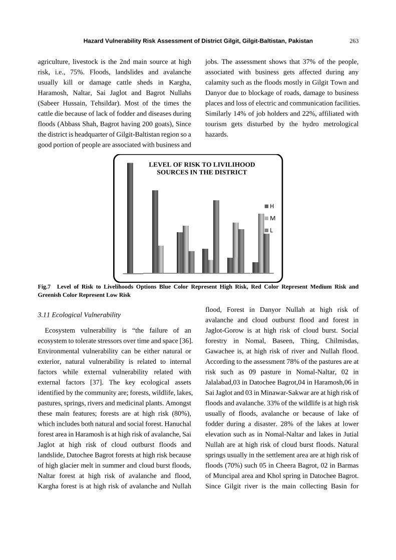
3.11 Ecolog
Ecosystem
ecosystem to
Environmen
exterior, na
factors whi
external fac
identified by
pastures, spr
these main
which includ
forest area in
Jaglot at h
landslide, D
of high glac
Naltar fores
Kargha fore
Hazard V
livestock is
75%. Floods
l or damag
Naltar, Sai
ssain, Tehsil
cause of lack
ass Shah, Ba
s headquarter
n of people ar
of Risk to Lor Represent L
gical Vulnerab
m vulnerabil
o tolerate stre
ntal vulnerabi
atural vulnera
ile external
ctors [37].
y the commun
rings, rivers a
features; for
des both natur
n Haramosh i
high risk of
atochee Bagr
ier melt in su
st at high ri
est is at high
Vulnerability
the 2nd mai
s, landslides
ge cattle sh
Jaglot and
ldar). Most o
k of fodder an
agrot having 2
r of Gilgit-Bal
re associated w
Livelihoods OpLow Risk
bility
lity is “the
essors over tim
ility can be
ability is rel
vulnerabilit
The key e
nity are; fores
and medicinal
rests are at h
ral and social
s at high risk
f cloud outb
rot forests at h
ummer and cl
isk of avala
risk of avala
Risk Assessm
in source at h
and avalan
heds in Kar
Bagrot Nul
of the times
nd diseases du
200 goats), S
ltistan region
with business
ptions Blue Co
e failure of
me and space
either natura
lated to inte
ty related w
ecological as
sts, wildlife, l
l plants. Amo
high risk (80
l forest. Hanu
of avalanche
burst floods
high risk bec
loud burst flo
anche and fl
anche and Nu
LEVEL OFSOURC
ment of Distr
high
nche
rgha,
llahs
the
uring
Since
n so a
s and
jobs
asso
cala
Dan
plac
Sim
tour
haz
olor Represen
f an
[36].
al or
ernal
with
ssets
akes,
ongst
0%),
uchal
, Sai
and
ause
oods,
ood,
ullah
floo
ava
Jag
fore
Gaw
Acc
risk
Jala
Sai
floo
usu
fod
elev
Nul
spri
floo
of M
Sin
F RISK TO LCES IN THE
rict Gilgit, Gilg
s. The assess
ociated with
amity such as
nyor due to b
ces and loss o
milarly 14% o
rism gets d
zards.
t High Risk,
od, Forest i
alanche and
lot-Gorow is
estry in No
wachee is, at
cording to the
k such as 0
alabad,03 in D
Jaglot and 03
ods and avala
ually of flood
der during a
vation such a
llah are at hi
ings usually i
ods (70%) su
Muncipal area
ce Gilgit riv
LIVILIHOODDISTRICT
git-Baltistan,
sment shows
h business g
s the floods m
blockage of r
of electric and
of job holders
disturbed by
Red Color Re
in Danyor N
cloud outbu
s at high ris
omal, Basee
t high risk o
e assessment
09 pasture i
Datochee Bag
3 in Minawar-
nche. 33% of
ds, avalanch
a disaster. 28
as in Nomal-N
igh risk of cl
in the settlem
uch 05 in Che
a and Khol sp
ver is the m
D
H
M
L
Pakistan
that 37% of
gets affected
mostly in Gilg
roads, damag
d communica
s and 22%, a
the hydro
epresent Medi
Nullah at h
urst flood an
sk of cloud b
en, Thing,
f river and N
78% of the p
in Nomal-N
grot,04 in Ha
-Sakwar are a
f the wildlife i
e or because
8% of the la
Naltar and la
loud burst flo
ent area are a
eera Bagrot, 0
pring in Dato
main collectin
263
f the people,
during any
git Town and
e to business
tion facilities
ffiliated with
metrological
ium Risk and
high risk of
nd forest in
burst. Social
Chilmisdas,
Nullah flood.
astures are at
Naltar, 02 in
ramosh,06 in
at high risk of
is at high risk
e of lake of
kes at lower
akes in Jutial
oods. Natural
at high risk of
02 in Barmas
ochee Bagrot.
ng Basin for
3
,
y
d
s
s.
h
l
d
f
n
l
,
.
t
n
n
f
k
f
r
l
l
f
s
.
r

Hazard Vulnerability Risk Assessment of District Gilgit, Gilgit-Baltistan, Pakistan
264
Hunza, Ghizer and Shayok river so the flood in any of
these rivers also cause huge flood in Gilgit river
causing dame to the river ecosystem. Out of the study
areas 33% responded that the medicinal plants are at
high risk such in Naltar, Kargha, Haramosh and Sai
Jaglot.
Fig. 8Vulnerable Forest Patches
3.12 Organizational Vulnerability
Vein diagram method was used to assess the
organization vulnerability in the study area and it
shows that Aga Khan Rural support Programmeis
major player for socio economic development in few
selected sites of district Gilgit. Out of 16 study sites
only 05 have village emergency response teams such as
Danyor, Nomal Naltar, Bagrot, Municipal Area and
Jalalabad, formed by FOCUS Humanitarian assistance
Pakistan and WWF-Pakistan. 05 of the study areas, i.e.,
Bargo, Danyor, Zulfiqarabad in Muncipal Area,
Oshikhandas Das and Nomal have VOs and WOs,
formed by AKRSP. Besides this Haramosh, Jalalabad
and have Bagort their development and conservation
committees. Community of Naltar-Nomal,
Minawar-Sakwar, Kargha, Jaglot Gorow are attached
with NAPWD because of the constant electric supply
systems and their jobs. After the flood of 2010 most of
the study areas are developing linkages with
Gilgit-Baltistan disaster management authority and
FOCUS-Pakistan (Rasheed, GBDMA). The overall
result shows that the communities in the study area are
not highly vulnerable in terms of organization but the
linkages with various development and other
organizations working for DRM, is bit weak
3.13 Motivational Vulnerability
Only two types of questions were asked to assess the
motivational vulnerability of the people, i.e., is any
kind of hydro metrological hazard a risk or opportunity
for them. 99% of the respondents were of the view that,
they are totally risk for them as they affect their lives
and livelihoods but 1% think that, hazards are also
opportunity for them. The flood of 2010 in Sakwar left
fertile soil on agriculture land that could play role in
agricultural productivity the next year (Muhammad
Tahir, Sakwar). After the flood in 2010 a lot of poor
people got free food items as a relief from FOCUS,
GBDMA and UNDP, which other wide is very difficult
for the communities in Kargha to store for the harsh
winters. Many people have lost their kacha homes in
Naltar and Kargha and they are about to get
compensation for the loss and they would be able to
build new ho
Rehman, Ka
3.14 Capaci
(1) Physic
It was dif
land as a p
collectively
people have
a difficult
government
mosques (5
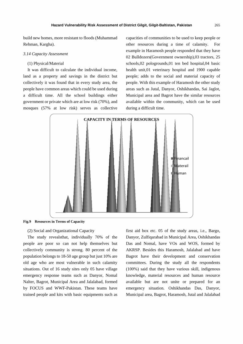
Fig.9 Resou
(2) Social
The stud
people are
collectively
population b
old age wh
situations. O
emergency
Nalter, Bagr
by FOCUS
trained peop
Hazard V
omes, more re
argha).
ity Assessmen
cal/Material
fficult to calc
property and
it was found
common are
time. All t
or private wh
57% at low
urces in Terms
l and Organiz
dy revealstha
poor so ca
community
belongs to 18-
ho are most
Out of 16 stu
response tea
rot, Municipa
and WWF-
ple and kits w
Vulnerability
esistant to flo
nt
culate the in
d savings in
d that in ever
as which cou
the school
hich are at low
w risk) serve
of Capacity
zational Capa
at, individual
an not help
is strong. 80
-50 age group
vulnerable i
udy sites only
ams such as
al Area and J
-Pakistan. Th
with basic equ
CA
Risk Assessm
oods (Muham
dividual inco
the district
ry study area,
uld be used du
buildings ei
w risk (70%),
es as collec
acity
lly 70% of
themselves
0 percent of
p but just 10%
in such calam
y 05 have vil
Danyor, No
Jalalabad, for
hese teams h
uipments suc
APACITY IN
ment of Distr
mmad
ome,
but
, the
uring
ither
, and
ctive
cap
othe
exa
02 B
sch
hea
peo
peo
area
Mu
ava
dur
the
but
f the
% are
mity
llage
omal
rmed
have
ch as
first
Dan
Das
AK
Bag
com
(10
kno
ava
eme
Mu
N TERMS OF
rict Gilgit, Gilg
acities of com
er resources
ample in Hara
Bulldozers(G
ools,02 polo
alth unit,01 v
ople; adds to
ople. With this
as such as Ju
unicipal area
ailable within
ing a difficul
t aid box etc
nyor, Zulfiqar
s and Noma
KRSP. Beside
grot have th
mmittees. Du
0%) said tha
owledge, mat
ailable but a
ergency situ
unicipal area,
F RESOURC
git-Baltistan,
mmunities to
during a t
amosh people
Government o
grounds,01 t
veterinary ho
o the social
s example of
utal, Danyor,
and Bagrot h
n the commu
lt time.
c. 05 of the
rabad in Mun
al, have VOs
es this Haram
heir develop
uring the stu
at they have
terial resourc
are not uni
uation. Oshi
Bagrot, Hara
CES
F
M
H
Pakistan
be used to ke
time of cal
e responded th
ownership),03
ten bed hosp
ospital and 1
and material
Haramosh th
Oshikhanda
have the simi
unity, which
study areas,
nicipal Area,
s and WOS
mosh, Jalalab
pment and
udy all the
various skill
ces and hum
ite or prepa
ikhandas D
amosh, Jutal a
Financail
Materail
Human
265
eep people or
amity. For
hat they have
3 tractors, 25
pital,04 basic
1900 capable
l capacity of
he other study
s, Sai Jaglot,
ilar resources
can be used
, i.e., Bargo,
Oshikhandas
, formed by
bad and have
conservation
respondents
l, indigenous
man resource
ared for an
as, Danyor,
and Jalalabad
5
r
r
e
5
c
e
f
y
,
s
d
,
s
y
e
n
s
s
e
n
,
d
Hazard Vulnerability Risk Assessment of District Gilgit, Gilgit-Baltistan, Pakistan
266
have Ismaili and Imamia scouts and volunteers, adding
to their human capacity. Most of the communities in
the study area are very attached to AKRSP,NAPWD,
GB education department, GBDMA and FOUS but
have weak relations with Animal Husbandry, police,
AKPBSP, etc.(Veen Diagram, Annexure 2).
4. Conclusion
ThroughHVRA process, it was concluded that, flood,
river bank and Nullahs erosion, land sliding and
avalanches are the major hydro metrological hazards,
in the district. Amongst them floods and landslides are
more damaging to livelihood sources, infrastructure
and to the ecological assets such as the forest. River
and Nullah erosion are also main hazard but can cause
more damage to agricultural land. Avalanche has a
major impact on ecological assets such as forest and
pastures. In terms of physical vulnerability such as
infrastructure, the overall percentage is low but
individually; bridges, water supply systems, electric
supply systems and communication facilities are at
high risk. The major electric hydel power stations at
Naltar, Kargha and Gorow are at high risk it is because
the source is water and this can hinder not only power
supply to the homes and other facilities but impacts
business, hoteling, jobs and other activities. Similarly
the water supply systems such as the ones in Gilgit
town, Sai Jaglot and other study areas are at high risk
because the source is either spring or glacier water and
the flood or land sliding in any of these locations
disrupts the systems. 21% of the schools are at risk but
amongst them approximately 99% of primary schools
are in this category and 21% of mosques are at high risk,
although the percentage is low in terms of total but
most of the kids and old age people are vulnerable
because children are enrolled in primary schools and
old age people mostly go to the mosques. Similarly the
main roads i.e. KKH, Kargha road, Naltar road and
University road are at high risk of floods as they lie
along the major rivers, Hunza, Ghizer and Gilgit so
damage to these critical facilities disrupt the whole
system of Gilgit-Baltistan region as the district is the
headquarter of province. Amongst the critical facilities,
forests either natural or social, is at high risk, which
serves as natural barriers to minimize the risk or harm
to human lives and their property, which in one way is
good but if a lot of plants get uprooted, the area
becomes more prone and vulnerable and also the forest
ecosystem gets weak. Majority of the people consider
hazards as risk for themselves, as they have a major
impact on agriculture, which is the main livelihood
source of people so are motivationally and
economically vulnerable but with the major events
such as the flood of 2010, few people have started
realizing that, the hazards are an opportunity as well,
especially for poor when they get compensation or loss
and relief items of food and fuel. Because of the strong
relationship of communities with AKRSP for socio
economic development they have sense of institutional
development in the form of VOs and WOs (most of
which are non functional) but the platform is available
and based on that FOCUS and WWF-Pakistan have
formed VERT and SERT teams. Individually people
are socially vulnerable as most of them are poor but
collectively they have capacities such as the buildings,
vehicles, oil and food depots, polo grounds, volunteers
and skilled people but still they have not become unite
to work for disaster preparedness and management, at
community level. They communities also have
indigenous knowledge of climate change risk reduction
such as the local early warnings systems, food storage
and local homes but with advent of modernization
people are giving up the knowledge which is really
important to document and use.
Acknowledgement
This research work was conducted Under Regional
Climate Risk Reduction Project in Himalayas,
financial supported by United Nation Development
Programme Bureau of crisis Prevention and recovery
and Disaster Preparedness European Commission on
Humanitarian Organization and implementing partner
Hazard Vulnerability Risk Assessment of District Gilgit, Gilgit-Baltistan, Pakistan
267
was World Wide fund for Nature Pakistan. The
authors wish to thank World Wide Fund for Nature
Pakistan, Gilgit-Baltistan supporting staff members for
their kind support and help during field studies. We
offer our warmest gratitude and heartiest appreciation
to the communities of the district Gilgit for their
contribution of the time and knowledge through
participation in the consultative sessions and meetings.
Special thanks to Dr. Ejaz Ahmed and Ambar Musud
for their sagacious suggestions, comments and
guidance throughout the endeavor.
References
[1] EmergeX Planning Inc, Hazard risk and vulnerability assessment regional district of Nanaimo(UN Published), Final Report, EmergeX Planning Inc. 1202-700 West Pender Street Vancouver, British Columbia, Canada, 2006, p. 1.
[2] Ministry of public safety and solicitor General, Provisional Emergency Programme, British Colombia Hazard, risk and vulnerability analysis tool kit, 2004, p. 2-1.
[3] Birkmann J., Measuring Vulnerability to Natural Hazards-Towards Disaster-Resilient Societies, UNU-Press, Tokyo, New York, 2006.
[4] Turner II B. L., Kasperson R. E. and Matson P. A. et al., A frame work for vulnerability analysis in sustainability science, in: Proceedings of the National Academics of Sciences USA, 2006, pp. 8074-8079.
[5] Anil K. Gupta, Sreeja S. Nair and Vinaly K. Seghgal, Hydro-metrological Disasters and climate change: Conceptual issues and a data needs for integrating adoption into environment-development framework, e-journal Earth Science India 2 (2009) (II) 130.
[6] Blaikie P., Cannon T., Davis I. and Wisher B., At Risk: Natural Hazards, People’s Vulnerability, and Disaster, New York, Rout-ledge, 1994.
[7] Cutter S. L., Vulnerability to Environment Hazards, Progress in Human Geography, 1996a, pp. 20, 529.
[8] Cutter S. L., Societal response to environmental hazards, int. soc. Sci. J. 48 (1996b) 525-537.
[9] UNISDR, Terminology on reduction, accessed 23-09-2011, available online at: http://www.unisdr.org/ eng/terminology/termionology-2009 -eng.html.
[10] ESPON Hazards Project 2003, The spatial effects and management of natural and technological hazards in general and in relation to climate change, Ist interim Report, March 2003.
[11] Kumpulainen S., Vulnerability concept in hazard and risk assessment: Natural and technological hazards and risks affecting the spatial development of the European regions, Geological Survey of Finland, special paper 42, 2006, pp. 65-74.
[12] Ahmad F., A study of glaciological and hydrological problems of Hanza Valley and River Indus between Besham and Thokot (unpublished), Filed Report, Department of Geography, University of the Punjab, Lahore, Pakistan, 1990.
[13] Dales G. F., Civilization and floods in the Indus Valley, Expedition 7 (1965) (4) 10-19.
[14] Snelgrove A. K., Geohydrology of the Indus River, West Pakistan, Sindh University Press, Hyderabad, Pakistan,1967.
[15] Ward R., Floods: A Geographical Perspective, The Macmillan Press Ltd., London, 1978.
[16] Ghauri M. I. K., Relation between floods and cyclones in West Pakistan, Geografia 2 (1963) (2) 123-126.
[17] Gazdar M. N., Environmental Crisis in Pakistan, The Open Press, Kuala Lumpur, 1987.
[18] Ahmad F., Kazi S. and Abbasi A. A., Evolution of drainage in the Indus Plain, Pakistan Geogr. Rev. 15 (1960) (2) 38-49.
[19] Karpov A. V. and Nebolsine R., West Pakistan and the Indus Valley, Indus 5 (1964) (1) 5-32.
[20] Ahmad F., Evolution and changes in Indus River system, in: 8th All Pakistan Geographical Conference, 7-10 April 1996, Peshawar, Pakistan.
[21] Ali M., Atlas of northern areas, Map-1. Geography Department, Government Postgraduate College, Gilgit, 2000.
[22] Cannon T., Blaikie P., Davis I. and Wisner B., At Risk: Natural Hazards, People’s Vulnerability, and Disasters, Rutledge, London, 1994, pp. 124-145.
[23] Coburn A. W., Sspence R. J. and Pomonis A., Vulnerability and Risk Assessment, Cambridge Architectural Research Limited, Cambridge, UK,1994.
[24] Ahmad F., Kazmi S. F. and Pervez T., Human response to hydro-meteorological disasters: A Case study of the 2010 flash floods in Pakistan, Journal of Geography and Regional Planning 4 (2011) (9) 518-524.
[25] G. Metternicht, L. Hurni and R. Gogu, Remote sensing of landslides: An analysis of the potential contribution to geo-spatial systems for hazard assessment in mountainous environments, Remote Sensing of Environment 98 (2005) 284, 303.
[26] D. P. Kanungo, M. K. Arora, S. Sarkar and R. P. Gupta, A comparative study of conventional, ANN black box, fuzzy and combined neural and fuzzy weighting procedures for Landslide susceptibility zonation in Darjeeling Himalayas, Engineering Geology 85 (2006) 347, 366.

Hazard Vulnerability Risk Assessment of District Gilgit, Gilgit-Baltistan, Pakistan
268
[27] A. Nasir, Uchida Kazunori, M. Shafiq and M. Khan, Monitoring soil erosion in a mountainous watershed under high rainfall zone in Pakistan, J. Rural Environ. Eng. 43 (2002) 23-30.
[28] Belaud G., Khan A. K. and G. Nabi, Sediment behaviour of Sangro distributery, Mirpurkhas sub-division, Sindh, International Irrigation Management Institute (IIMI) Report No. R-50, 1998, p. 69.
[29] Ashraf M., Fayyaz-ul-Hassan and M. A. Khan, Sustainable environment management: Impact of agriculture, J. Sci., Tech. Develop. 19 (2000) (4) 51-57.
[30] Wihite D. A., Drought Encyclopedia of Earth System Science, Academic Press, San Diego, California, 1992, pp. 81-92.
[31] Chaudhry Q. Z., History’s worst drought hit Pakistan, Farming Outlook, July-September 2001; Soil, Agriculture, Fertilizer & Environmental (SAFE) Foundation, Pakistan, EFB, 2002; Policy Document on Drought Preparedness and Crisis, 2001.
[32] Hewitt K., Regions of Risk: A Geographical Introduction to Disasters, Essex, U.K.: Longman, 1997.
[33] Pistrika A. and Tsakiris G., Flood risk assessment: A methodological framework, Water Resource Management: New Approaches and Technological, European Water Resources Association Chania, crete-Grece, 14-16 June, 2007.
[34] Cannon T., Twigg J. and Rowell J., Social vulnerability, sustainable livelihoods and disasters, Report to DFID Conflict and Humanitarian Assistance Department (CHAD) and Sustainable Livelihood Support Office, 2003.
[35] Comfort L., Wisner B., Cutter S., Pulwarty R., Hewitt K., Oliver-Smith A., Wiener J., Fordham M., Peacock W. and Krimgold F., Reframing disaster policy: The global evolution of vulnerable communities, Environmental Hazards 1 (1999) 39-44.
[36] Williams L. and Kaputska L., Ecosystem vulnerability: A complex interface with technical components, Environmental Toxicology and Chemistry 19 (2000) (4) 1055-1058.
Copyright © 2022 FDOKUMEN