
Harappan hydro-engineering and water management
71
R.S. Bisht R.S.Bisht Harappan Hydro-Engineering and Water Management R.S. Bisht At ICTS Mini Workshop : FUTURE OF THE PAST November 22 th to 26 th , 2011, Manglore
-
Upload
khangminh22 -
Category
Documents
-
view
0 -
download
0
Transcript of Harappan hydro-engineering and water management

R.S. Bisht
R.S.Bisht
Harappan Hydro-Engineering and Water
Management
R.S. Bisht
At ICTS Mini Workshop : FUTURE OF THE PAST November 22th to 26th , 2011, Manglore

I - Cultural Geography of Protohistoric India
1
2
3 1. Indus System 2. Ganga System 3. Peninsular India
Shortagai

Weather
Systems
Winter
cyclonic
Summer
monsoon
Winter Monsoon

I - Cultural Geography of the Harappan Civilization
• 1– Indus System
–Largely the area of first urbanization
–Hence best studied

• 2 – Ganga System – Mesolithic origins in Vindhyan belt
– Rapid expansion into Ganga plain
– Evidence of animal hunting , gathering and later
animal herding
– Followed by Neolithic
– In all, water bodies – relict channels, ox-bow lakes and surface water lakes – played the role of utmost significance.

• 3 – Peninsular India
– Least studied region
– Fresh research is gathering momentum regarding Mesolithic and Neolithic with consideration of water proximity
– Megalithic settlements, beginning in protohistoric times, were near water bodies

• Primarily germane to proposed study is the Indus system involving north-western South Asia (Cultural India -- undivided)

• Geology, Geography & Drainage Pattern, Climate, Flora, Fauna: Present
• General palaeo-environmental profile Culturally, divisible into
1. North Baluchistan (part NWFP included) 2. South Baluchistan 3. Sindh Kohistan 4. Indus Plain (Ghaggar-Hakra, upper Ganga plain
included) 5. Kachchh, North Gujarat, Saurashtra 6. South Gujarat, Tapti Valley, and beyond 7. Northern (and southern) Afghanistan
II – Natural Setting of North- Western India
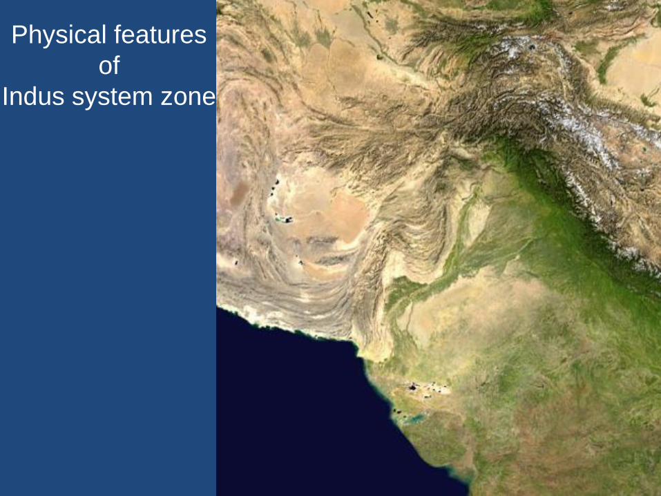
Physical features
of
Indus system zone

• Common features of N & S Baluchistan, Kohistan)
• Mountainous region with largely barren hills and deep valleys with narrow alluvial plains
• Sparse vegetation
• Pasturelands
• Outside summer precipitation
• Winter precipitation diminishing from west to east
• Useful rocks and minerals
• Chagai hills rich in copper & other minerals (lapis lazuli ?)
(lapis mines of north Afghanistan)

Indus Plain (Ghaggar-Hakra, upper Ganga plain included)
• Indus plain in Sindh
• Punjab plain from Indus to Sutlej
• Indo-Gangetic divide from Sutlej to Yamuna
• Sarasvati (Ghaggar-Hakra) plains : E. Panjab,
Haryana, N. Rajasthan and Bahawalpur desert
• Upper Ganga plain in Wn. UP (bet. 100 and 500
MSL)

• Kachchh & Saurashtra – Undulating landscape : rocks, hills, monsoon
channels, fertile coastal plains and pockets of arable land
– No perennial source of surface water
– Sits on the summer monsoon belt, rainfall increases from east to west
– Marked by inadequate rainfall
– Largely outside winter precipitation
– Good pasturelands
– Variable groundwater reserves in quality & volume
– Some forested areas in Saurashtra while Kachchh is poor
– Long coastline- a boon

• North Gujarat
–Semi-arid in character
–Extensive alluvial plain covered with sand
dunes
–Ephemeral monsoon channels
–Not lived-in area in 3rd millennium BCE ,
rather used as pasturelands by Itinerant
pastorals

• South Gujarat
–Rich in alluvial plains
–Rich in monsoon rains
–Good coastline
–Hilly flanks rich in forests and useful
semi-precious stones and rocks
–But occupied only towards the fag end
of Harappan hegemony

TAPTI & PRAVARA-GODAVARI VALLEYS
• Fertile riverine plains in Deccan Landscape
• Rich in forests
• Rich in semi-precious stones
• Rich in pasturelands
• Occupied first by Savalda Culture people
• Arrival of Harappans in Late Mature and later
phases (Daimabad & several sites in Tapti Valley)

Harappans excelled in raising water structures of a wide variety and were the first to exploit ground water by sinking a well– an architectural marvel
The dock at Lothal and the great bath, toilets, sanitary drainage and, of course, numerous private and public wells at Mohenjo-daro are often cited as eloquent examples of the Harappan hydraulic structures
To these are now added the dams, interconnected chain of reservoirs besides some novel features at Dholavira
While the Harappans rapidly attained phenomenal excellence, they benefited from the experience of their

While the Harappans rapidly attained phenomenal excellence,
they benefited from the experience of their predecessors
Harappania was by and large is arid and semi-arid region with summer
precipitation ranging from 700 mm to 100 mm per annum with
decrease from east to west while winter precipitation from 200 to 50 or
less mm from west to east, and summer temp. soaring above 40
degree Celsius
Very active wet phase lasting from 8000 BP to 3000 BP was over and
precipitation, both summer and winter, settled down to what prevails
now
Water exploitation and management should have been of great
concern for a developing and developed urban civilization that the
Harappans created
There was a history behind.

III – Beginning of Agriculture
• Best and comprehensive archaeological evidence comes from Mehrgarh of Aceramic phase around 7000 BCE
• Progressive domestication of animals besides cultivation of three varieties of wheat and two those of barley
• Cotton (Gossypium sp.) occurs in the latest level

III – Beginning of Agriculture
• Period II is characterized by
– Sphaerococcoid wheat and barley were introducued
– Particularly, wheat, i.e. Triticum sphaeorococcum, reportedly required some artificial irrigation
– Cotton crop also requires irrigation for better yield
– Irrigation aspect is most significant although archaeological evidence remains to be found

• Period IV ( early 4th millennium BCE has evidenced a 40 m ditch to the south of the settlement is interpreted as an irrigation canal
• Introduction of grape cultivation, which may require watering, during the same period is also important to note.
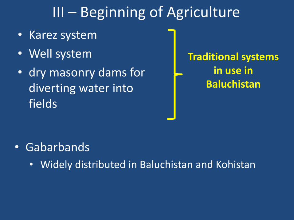
III – Beginning of Agriculture
• Karez system
• Well system
• dry masonry dams for diverting water into fields
Traditional systems in use in
Baluchistan
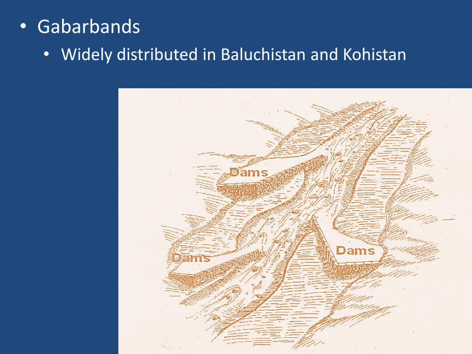
• Gabarbands
• Widely distributed in Baluchistan and Kohistan
• Gabarbands
• Widely distributed in Baluchistan and Kohistan

Purposes of gabarbands, artificial dams for:
(i) holding water for releasing it to irrigate fields lying at
lower gradients;
(ii) diverting flood waters into fields for irrigation or
moistening earth before sowing;
(iii) making contour terraces for depositing moist soil ;
(iv) creating artificial terraced fields of alluvial soil along a
stream with the aid of flood water;
(V) And also conducting spring water into fields .


V - Mohenjo-daro – Stupa Mound
with Great Bath

Mohenjo-daro – Great Bath
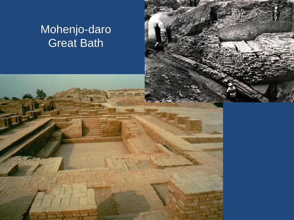
Mohenjo-daro
Great Bath
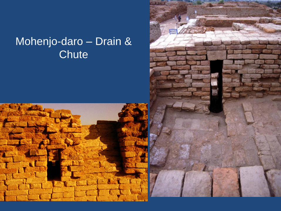
Mohenjo-daro – Drain &
Chute

Mohenjo-daro –
Drains

Mohenjo-daro – System of corbelling
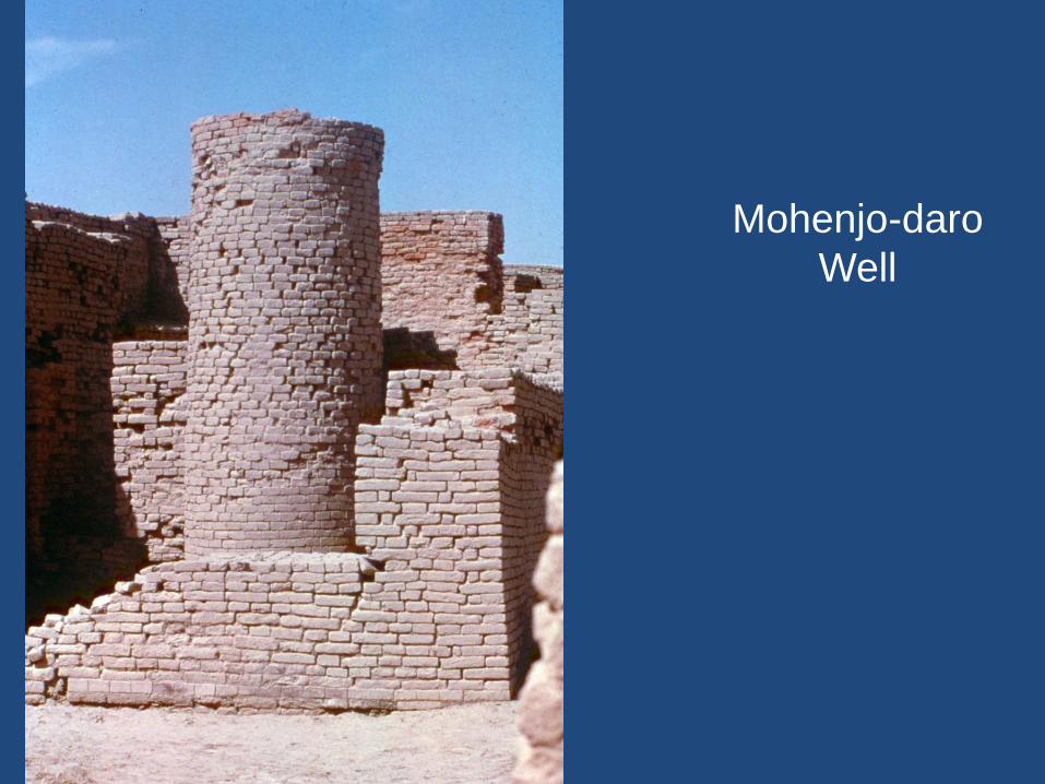
Mohenjo-daro
Well

Mohenjo-daro – Wells

Mohenjo-daro – Well Patterns
?
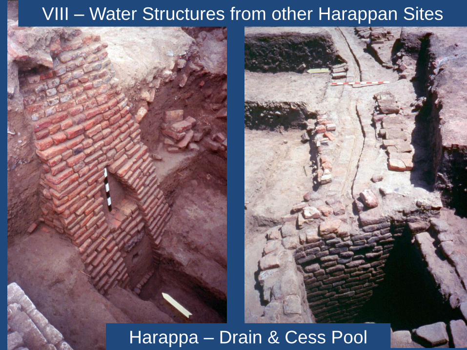
Harappa – Drain & Cess Pool
VIII – Water Structures from other Harappan Sites

VI - Lothal – Location of water bodies

Lothal – Location of water bodies

Lothal – Dockyard
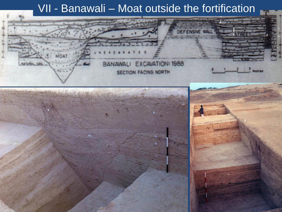
VII - Banawali – Moat outside the fortification

Banawali – Drain in the fortification
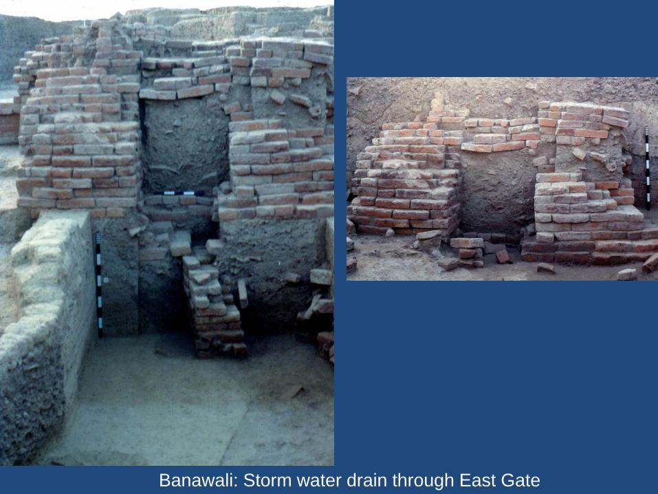
Banawali: Storm water drain through East Gate

Banawali: Well
Banawali: Bathing Platform

Kalibangan – Well
construction – a style

Google Earth image of Khadir Island
IV - Water Harnessing Technology
and Management at Dholavira
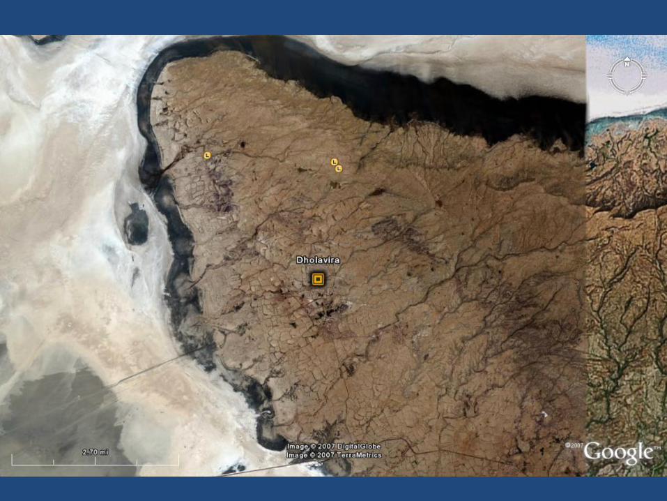
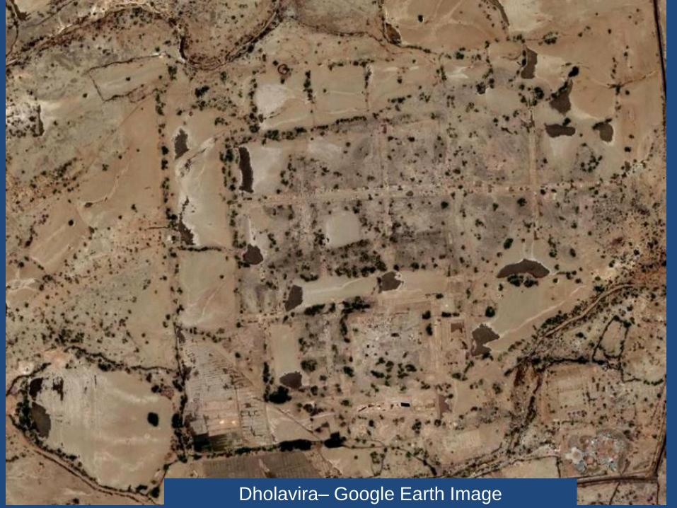
Dholavira– Google Earth Image

Dholavira– Artistic Reconstruction


Dholavira– Remnants of
Stone Dam across the
Manhar

Dholavira– Manhar flooded during a rainstorm

Dholavira– The flooded Manhar and Mansar
were dammed to create a series of water
reservoirs within city walls

Dholavira– Eastern
Reservoir-Located to the
east of Castle
Rock-cut step well in the
eastern reservoir


Dholavira– Eastern
Reservoir-Located to the
east of Castle
Rock-cut step well in the
eastern reservoir

Dholavira– Northern Embankment of Eastern Reservoir

Dholavira– Southern
Reservoir-Located to the
south of Castle
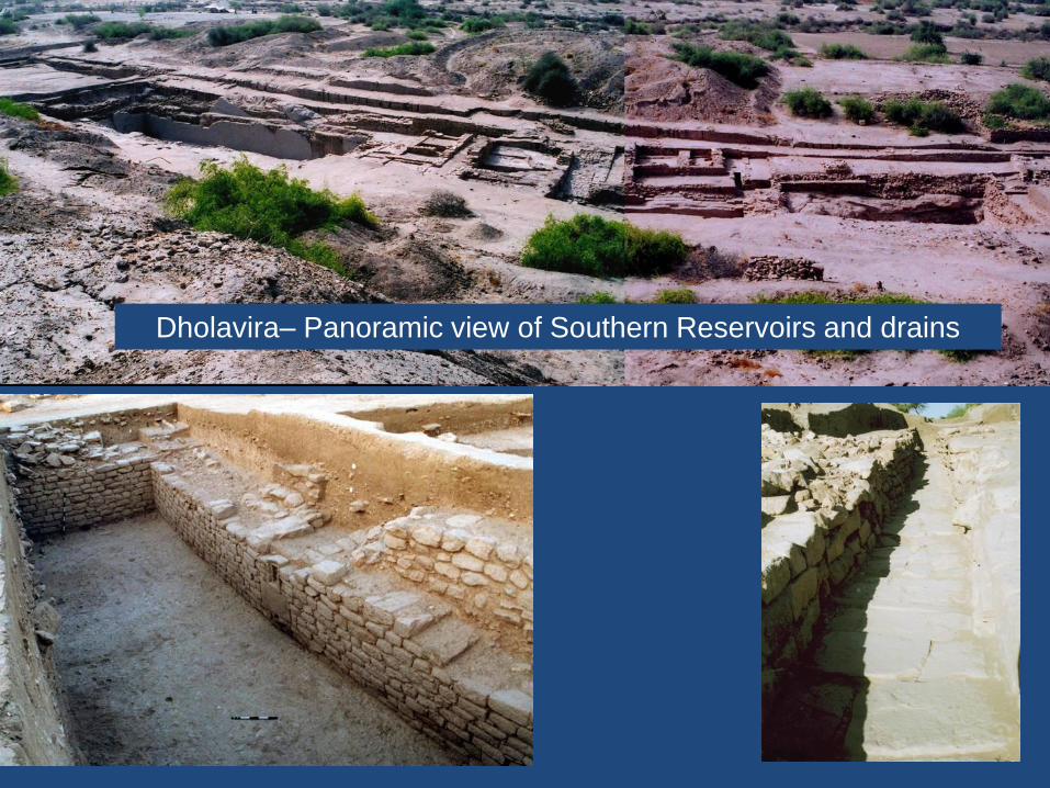
Dholavira– Panoramic view of Southern Reservoirs and drains

Dholavira– Southern
Reservoir (Rock-cut)


Dholavira– Storm water drainage system in the castle

Dholavira– Storm water drainage system in the castle

Dholavira– Outlet of storm water drainage system-From Castle to Bailey
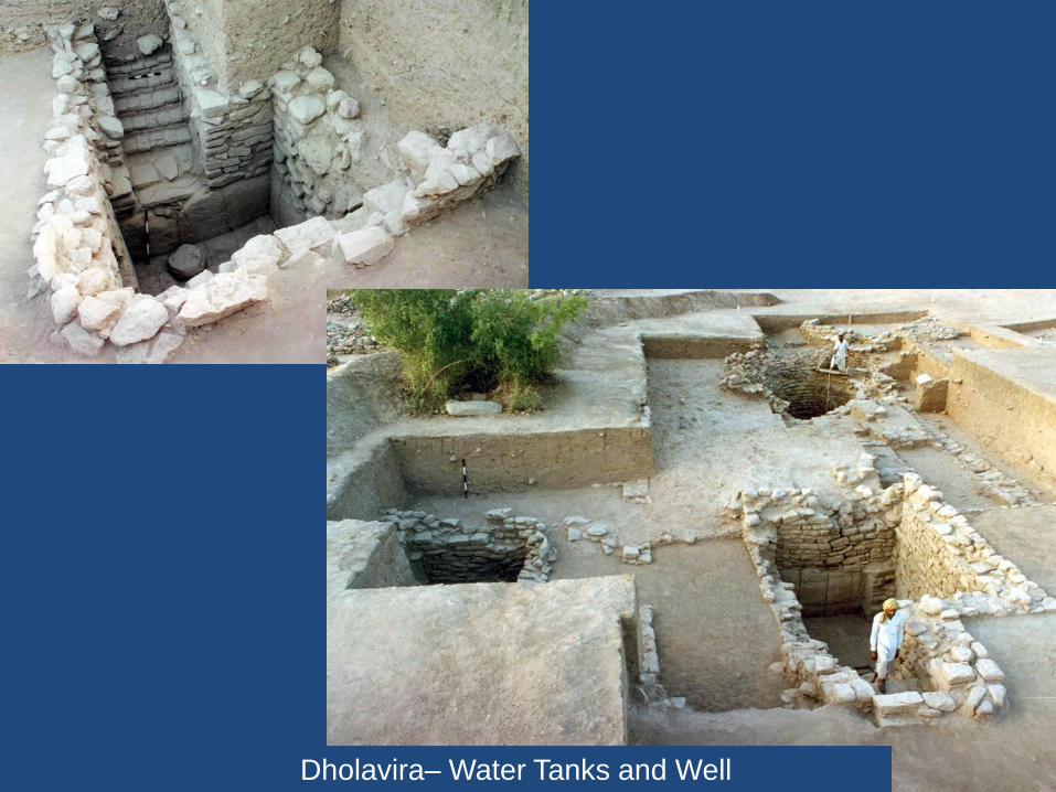
Dholavira– Water Tanks and Well
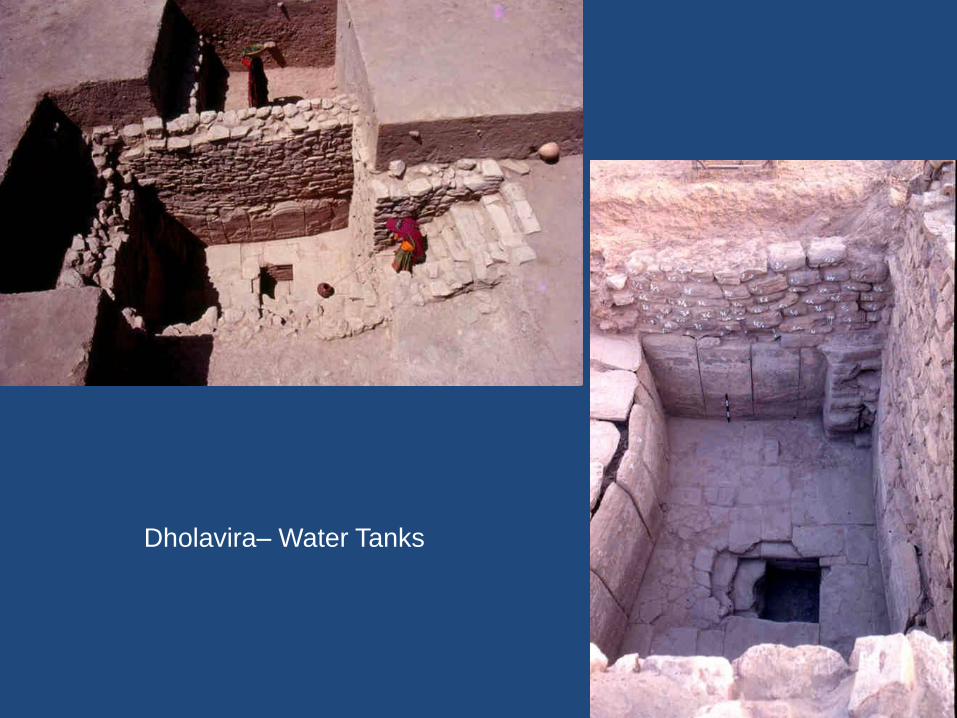
Dholavira– Water Tanks
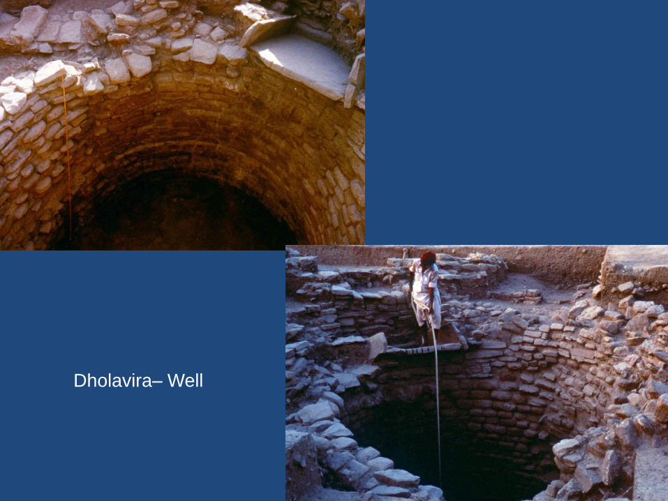
Dholavira– Well


Dholavira– Drainage system
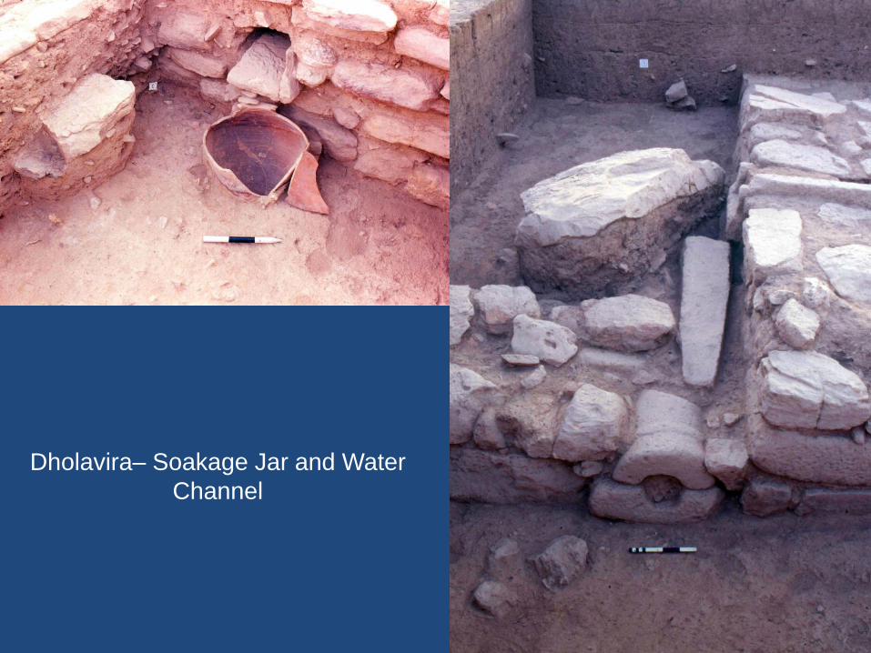
Dholavira– Soakage Jar and Water
Channel

IX.Legacy of Water Management and Engineering of the Harappans
X. Literary References
XI.Epilogue

Any
Questions?