_geog_as_countries_asia_ed_e... - Your.Org
537
Index Asian Countries with approx Page Numbering Abkhazia 3 Afghanistan 16 Bangladesh 29 Bhutan 42 British Indian Ocean Territory 55 Brunei 68 Burma 82 Cambodia 95 China 108 Christmas Island 121 East Timor 134 Hong Kong 147 India 160 Indonesia 173 Japan 186 Kazakhstan 199 Korea 213 Kyrgyzstan 226 Laos 239 Malaysia 252 Maldives 265 Mongolia 278 Nepal 291 North Korea 304 Pakistan 317 People's Republic of China 330 Philippines 344 PortalIndia 357 Republic of China 370 Russia 383 Singapore 396 http://cd3wd.com wikipedia-for-schools http://gutenberg.org page no: 1 of 537
-
Upload
khangminh22 -
Category
Documents
-
view
1 -
download
0
Transcript of _geog_as_countries_asia_ed_e... - Your.Org

Index Asian Countries with approx Page Numbering
Abkhazia 3
Afghanistan 16
Bangladesh 29
Bhutan 42
British Indian Ocean Territory 55
Brunei 68
Burma 82
Cambodia 95
China 108
Christmas Island 121
East Timor 134
Hong Kong 147
India 160
Indonesia 173
Japan 186
Kazakhstan 199
Korea 213
Kyrgyzstan 226
Laos 239
Malaysia 252
Maldives 265
Mongolia 278
Nepal 291
North Korea 304
Pakistan 317
People's Republic of China 330
Philippines 344
PortalIndia 357
Republic of China 370
Russia 383
Singapore 396
http://cd3wd.com wikipedia-for-schools http://gutenberg.org page no: 1 of 537

South Korea 409
Sri Lanka 422
Taiwan 435
Tajikistan 448
Thailand 461
Tibet 475
Turkmenistan 488
Uzbekistan 501
Vietnam 514
Wallis and Futuna 527
http://cd3wd.com wikipedia-for-schools http://gutenberg.org page no: 2 of 537
Abkhazia
2008/9 Schools Wikipedia Selection. Related subjects: Asia; Asian Countries
Abkhazia zim:///A/Abkhazia.html
1 of 16 03/09/2011 07:18
http://cd3wd.com wikipedia-for-schools http://gutenberg.org page no: 3 of 537
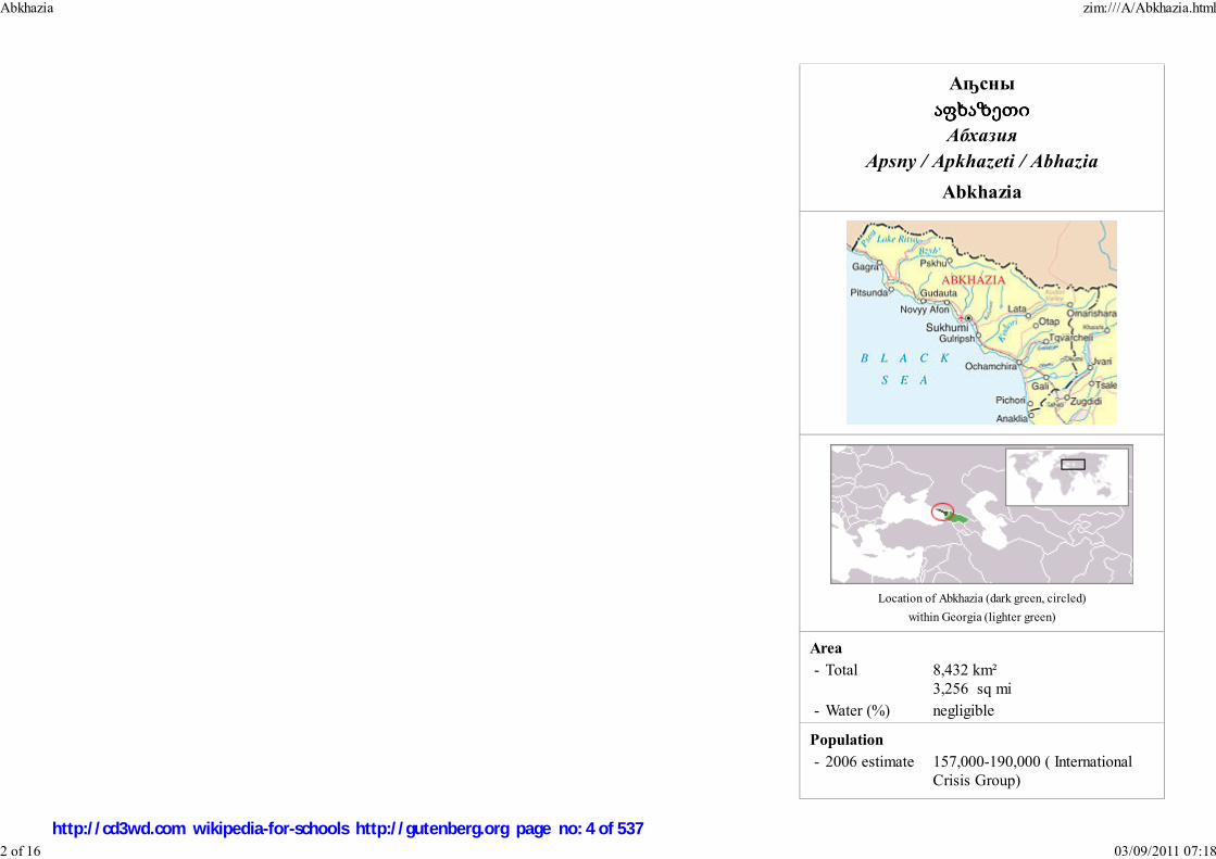
Аҧсны
აფხაზეთიაფხაზეთიაფხაზეთიაფხაზეთი
Абхазия
Apsny / Apkhazeti / Abhazia
Abkhazia
Area
- Total 8,432 km² 3,256 sq mi
- Water (%) negligible
Population
- 2006 estimate 157,000-190,000 ( InternationalCrisis Group)
Location of Abkhazia (dark green, circled)
within Georgia (lighter green)
Abkhazia zim:///A/Abkhazia.html
2 of 16 03/09/2011 07:18
http://cd3wd.com wikipedia-for-schools http://gutenberg.org page no: 4 of 537

177,000 (EncyclopædiaBritannica)
- 2003 census 216,000 (disputed) - Density 29/km²
75.1/sq mi
Time zone MSK ( UTC+3)
Republic of Abkhazia
Flag Coat of arms
Anthem: " Aiaaira"(English "Victory")
Capital Sukhumi
Official languages Abkhaz, Russian1
Government
- President Sergei Bagapsh - Prime Minister Alexander Ankvab
De facto independence from Georgia
- Declared 23 July 1992 - Recognition none
Currency Russian ruble ( RUB)
Russian has co-official status and widespread use by government
and other institutions.
1
Abkhazia zim:///A/Abkhazia.html
3 of 16 03/09/2011 07:18
http://cd3wd.com wikipedia-for-schools http://gutenberg.org page no: 5 of 537

Autonomous Republic of Abkhazia
Flag Coat of arms
Anthem: " თავისუფლება""Freedom"
Capital Sukhumi (de jure)Chkhalta (de facto)
Official languages Abkhaz, Georgian
Government
- Chairman,Cabinet of Ministers Malkhaz Akishbaia
- Chairman, Supreme Council Temur Mzhavia
Autonomous republic of Georgia
- Georgian independencefrom the Soviet Union
DeclaredRecognised
9 April 199125 December 1991
Abkhazia (pronounced /æbˈkeɪʒə/ or /æbˈkɑːziə/, Abkhaz: Аҧсны Apsny, Georgian: აფხაზეთიApkhazeti or Abkhazeti, Russian: Абха́зия Abhazia) is a region in Georgia that is a de facto independentrepublic, with no international recognition. It is located within the internationally recognized borders ofGeorgia on the eastern coast of the Black Sea and borders the Russian Federation to the north. UnderGeorgia's official subdivision, it is an autonomous republic ( Georgian: აფხაზეთის ავტონომიურირესპუბლიკა, Abkhaz: Аҧснытəи Автономтəи Республика), with Sukhumi as its capital, borderingthe region of Samegrelo-Zemo Svaneti to the east.
A secessionist movement of the Abkhaz ethnic minority in the region led to the declaration ofindependence from Georgia in 1992 and the Georgian-Abkhaz armed conflict from 1992 to 1993 whichresulted in the Georgian military defeat and the mass exodus and ethnic cleansing of Georgian populationfrom Abkhazia. In spite of the 1994 ceasefire accord and the ongoing UN-monitored and Russian-dominated CIS peacekeeping operation, the sovereignty dispute has not yet been resolved and the regionremains divided between the two rival authorities, with over 83 percent of its territory governed by theRussian-backed Sukhumi-based separatist government and about 17 percent governed by theGovernment of the Autonomous Republic of Abkhazia, recognized by Georgia as the legal authority ofAbkhazia, located in the Kodori Valley, part of Georgian-controlled Upper Abkhazia. This disputeremains a source of serious tension between Georgia and Russia.
Political status
The international organizations such as United Nations ( 28 Security Council Resolutions), EU, OSCE,NATO, WTO, Council of the European Union, CIS as well as most sovereign states recognize Abkhaziaas an integral part of Georgia and support its territorial integrity according to the principles of theinternational law. The United Nations are urging both sides to settle the dispute through diplomaticdialogue and ratifying the final status of Abkhazia in the Georgian constitution. However, the Abkhazde-facto government considers Abkhazia a sovereign country, even though it is not recognized by anyparty in the world and is still populated with ethnic Georgians (who live in the Gali District and theKodori Gorge). In early 2000, then-U.N. Special Representative of the Secretary General Dieter Bodenand the Group of Friends of Georgia, consisting of the representatives of Russia, the United States,Britain, France, and Germany, drafted and informally presented a document to the parties outlining apossible distribution of competencies between the Abkhaz and Georgian authorities, based on a corerespect for Georgian territorial integrity. The Abkhaz side, however, has never accepted the paper as abasis for negotiations. Eventually, Russia also withdrew its approval of the document. In 2005 and 2008,the Georgian government offered Abkhazia a high degree of autonomy and possible federal structure
Location of Abkhazia
within Georgia
Abkhazia zim:///A/Abkhazia.html
4 of 16 03/09/2011 07:18
http://cd3wd.com wikipedia-for-schools http://gutenberg.org page no: 6 of 537

Currency Georgian lari ( GEL)within the borders and jurisdiction of Georgia.
However, the Russian State Duma is urging to take into consideration the appeal made by the AbkhazRepublic of Abkhazia which calls for recognition of its independence, and the Russian state media has produced numerous materials in support of theunrecognized state. During the Georgian-Abkhaz conflict, Russian authorities and military supplied logistical and military aid to the separatist side. Today,Russia still maintains a strong political and military influence over separatist rule in Abkhazia. Russia has also issued passports for the citizens of Abkhazia since2000 (as the Abkhazian passports cannot be used for international travel) and subsequently paid retirement pensions and other monetary benefits. More than80% of the Abkhazian population received Russian citizenship by 2006; however, Abkhazians do not pay Russian taxes, or serve in the Russian Army. About53,000 Abkhazian passports have been issued as of May 2007.
On October 18, 2006, the People's Assembly of Abkhazia passed a resolution, calling upon Russia, international organizations, and the rest of the internationalcommunity to recognize Abkhaz independence on the basis that Abkhazia possesses all the properties of an independent state. The United Nations hasreaffirmed "the commitment of all Member States to the sovereignty, independence and territorial integrity of Georgia within its internationally recognizedborders" and outlined the basic principles of conflict resolution which call for immediate return of all displaced persons and for non-resumption of hostilities. Ofabout 200,000-240,000, some 60,000 Georgian refugees spontaneously returned to Abkhazia's Gali district between 1994 and 1998, but tens of thousands weredisplaced again when fighting resumed in the Gali district in 1998. Nevertheless from 40,000 to 60,000 refugees have returned to the Gali district since 1998,including persons commuting daily across the ceasefire line and those migrating seasonally in accordance with agricultural cycles. The human rights situationremains precarious in the Georgian-populated areas of the Gali district. The United Nations and other international organizations have been fruitlessly urging theAbkhaz de facto authorities "to refrain from adopting measures incompatible with the right to return and with international human rights standards, such asdiscriminatory legislation... [and] to cooperate in the establishment of a permanent international human rights office in Gali and to admit United Nations civilianpolice without further delay." Key officials of the Gali district are virtually all ethnic Abkhaz, though their support staff are ethnic Georgian.
Georgia accuses the Abkhaz secessionists of having conducted a deliberate campaign of ethnic cleansing, a claim supported by the OSCE (Budapest, Lisbonand Istanbul declaration), United Nations (General Assembly Resolution 10708) and many Western governments. The UN Security Council has avoided use ofthe term "ethnic cleansing" but has affirmed "the unacceptability of the demographic changes resulting from the conflict". On May 15, 2008 United NationsGeneral Assembly adopted a non-binding resolution recognising the right of all refugees (including victims of reported “ethnic cleansing”) to return to Abkhaziaand their property rights. It "regretted" the attempts to alter pre-war demographic composition and called for the "rapid development of a timetable to ensurethe prompt voluntary return of all refugees and internally displaced persons to their homes."
On March 28, 2008, the President of Georgia Mikheil Saakashvili unveiled his government's new proposals to Abkhazia: the broadest possible autonomy withinthe framework of a Georgian state, a joint free economic zone, representation in the central authorities including the post of vice-president with the right to vetoAbkhaz-related decisions. The Abkhaz leader Sergei Bagapsh rejected these new initiatives as "propaganda", leading to Georgia's complaints that this skepticismwas "triggered by Russia, rather than by real mood of the Abkhaz people."
Moscow, at certain times, had hinted that it might recognize Abkhazia and South Ossetia when the Western countries recognized the independence of Kosovosuggesting it created a precedent. Following Kosovo's declaration of independence the Russian parliament released a joint statement reading: "Now that thesituation in Kosovo has become an international precedent, Russia should take into account the Kosovo scenario...when considering ongoing territorial
Abkhazia zim:///A/Abkhazia.html
5 of 16 03/09/2011 07:18
http://cd3wd.com wikipedia-for-schools http://gutenberg.org page no: 7 of 537

View from Pitsunda cape.
conflicts." So far Russia has not recognised either of these republics. On April 16, 2008, the outgoing Russian president Vladimir Putin instructed hisgovernment to establish official ties with counterpart agencies in breakaway South Ossetia and Abkhazia, leading to Georgia's condemnation of what isdescribed an attempt at "de facto annexation" and criticism from the European Union, NATO, and several Western governments.
Later in April 2008, Russia accused Georgia of trying to exploit the NATO support to solve the Abkhazia problem by force, and announced it would increase itsmilitary in the region, pledging to retaliate militarily to Georgia’s efforts. The Georgian Prime Minister Lado Gurgenidze has said Georgia will to treat anyadditional troops in Abkhazia as aggressors.
On July 3, 2008, the OSCE Parliamentary Assembly passed a resolution at its annual session in Astana, expressing concern over Russia’s recent moves inbreakaway Abkhazia. The resolution calls on the Russian authorities to refrain from maintaining ties with the breakaway regions “in any manner that wouldconstitute a challenge to the sovereignty of Georgia” and also urges Russia “to abide by OSCE standards and generally accepted international norms withrespect to the threat or use of force to resolve conflicts in relations with other participating States.”
Geography and climate
Abkhazia covers an area of about 8,600 km² at the western end of Georgia. The Caucasus Mountains to the northand the northeast divide Abkhazia from the Russian Federation. To the east and southeast, Abkhazia is bounded bythe Georgian region of Samegrelo-Zemo Svaneti; and on the south and southwest by the Black Sea.
Abkhazia is extremely mountainous. The Greater Caucasus Mountain Range runs along the region's northernborder, with its spurs – the Gagra, Bzyb and Kodori ranges – dividing the area into a number of deep, well-wateredvalleys. The highest peaks of Abkhazia are in the northeast and east and several exceed 4,000 meters (13,120 ft)above sea level. The landscapes of Abkhazia range from coastal forests and citrus plantations, to eternal snows andglaciers to the north of the region. Although Abkhazia's complex topographic setting has spared most of theterritory from significant human development, its cultivated fertile lands produce tea, tobacco, wine and fruits, amainstay of the local agricultural sector.
Abkhazia zim:///A/Abkhazia.html
6 of 16 03/09/2011 07:18
http://cd3wd.com wikipedia-for-schools http://gutenberg.org page no: 8 of 537
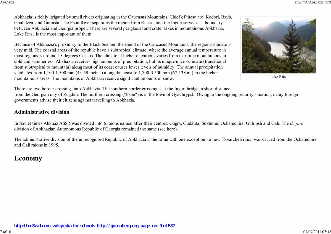
Lake Ritsa
Abkhazia is richly irrigated by small rivers originating in the Caucasus Mountains. Chief of these are: Kodori, Bzyb,Ghalidzga, and Gumista. The Psou River separates the region from Russia, and the Inguri serves as a boundarybetween Abkhazia and Georgia proper. There are several periglacial and crater lakes in mountainous Abkhazia.Lake Ritsa is the most important of them.
Because of Abkhazia's proximity to the Black Sea and the shield of the Caucasus Mountains, the region's climate isvery mild. The coastal areas of the republic have a subtropical climate, where the average annual temperature inmost regions is around 15 degrees Celsius. The climate at higher elevations varies from maritime mountainous tocold and summerless. Abkhazia receives high amounts of precipitation, but its unique micro-climate (transitionalfrom subtropical to mountain) along most of its coast causes lower levels of humidity. The annual precipitationvacillates from 1,100-1,500 mm (43-59 inches) along the coast to 1,700-3,500 mm (67-138 in.) in the highermountainous areas. The mountains of Abkhazia receive significant amounts of snow.
There are two border crossings into Abkhazia. The southern border crossing is at the Inguri bridge, a short distancefrom the Georgian city of Zugdidi. The northern crossing ("Psou") is in the town of Gyachrypsh. Owing to the ongoing security situation, many foreigngovernments advise their citizens against travelling to Abkhazia.
Administrative division
In Soviet times Abkhaz ASSR was divided into 6 raions named after their centres: Gagra, Gudauta, Sukhumi, Ochamchira, Gulripsh and Gali. The de juredivision of Abkhazian Autonomous Republic of Georgia remained the same (see here).
The administrative division of the unrecognised Republic of Abkhazia is the same with one exception - a new Tkvarcheli raion was carved from the Ochamchireand Gali raions in 1995.
Economy
Abkhazia zim:///A/Abkhazia.html
7 of 16 03/09/2011 07:18
http://cd3wd.com wikipedia-for-schools http://gutenberg.org page no: 9 of 537

Georgian Lari depicting Sukhumi inGeorgian and Abkhaz languages
The economy of Abkhazia is heavily integrated with Russia and uses the Russian ruble as its currency. Tourism is akey industry and the Abkhaz de facto authorities claim that the organized tourists (mainly from Russia) numberedmore than 100,000 in recent years, compared to about 200,000 in the 1990 before the war. The number of visitors in2006 was estimated by Abkhazian authorities to have been approximately 1.5 million. Although Russia hasestablished a visa regime with Georgia, Russian passport-holders do not require a visa to enter Abkhazia. Holders ofEuropean Union passports require an Entry Permit Letter issued by the de facto Ministry of Foreign Affairs inSukhumi, against which a visa will be issued upon presentation of the Letter to the MFA.
Abkhazia's fertile land and abundance of agricultural products, including tea, tobacco, wine and fruits (especiallytangerines), have secured a relative stability in the sector. Electricity is largely supplied by the Inguri hydroelectricpower station located on the Inguri River between Abkhazia and Georgia proper and operated jointly by Abkhazand Georgians.
The exports and imports in 2006 were 627.2 and 3270.2 mln. rubles respectively (appx. 22 and 117 mln. US dollars) according to the Abkhazian authorities.
Many Russian entrepreneurs and some Russian municipalities have invested or plan to invest in Abkhazia. This includes the Moscow municipality after theMayor of Moscow, Yury Luzhkov, signed an agreement on economic cooperation between Moscow and Abkhazia. Both Abkhaz and Russian officials haveannounced their intentions to exploit Abkhazia's facilities and resources for the Olympic construction projects in Sochi, as the city will host the 2014 WinterOlympics. The Government of Georgia has warned against such actions, however , and has threatened to ask foreign banks to close accounts of Russiancompanies and individuals that buy assets in Abkhazia.
According to the U.S.-based organization Freedom House, the region continues to suffer considerable economic problems owing to widespread corruption, thecontrol by criminal organizations of large segments of the economy, and the continuing effects of the war.
The CIS economic sanctions imposed on Abkhazia in 1996 are still formally in force although Russia announced on March 6, 2008 that it would no longerparticipate in them, declaring them "outdated, impeding the socio-economic development of the region, and causing unjustified hardship for the people ofAbkhazia". Russia also called on other CIS members to undertake similar steps, but met with protests from Tbilisi and lack of support from the other CIScountries.
The European Union has allocated more than €20 mln. to Abkhazia since 1997 for various humanitarian projects, including the support of civil society,economic rehabilitation, help to the most vulnerable households and confidence building measures. The single largest EU's project is the repair andreconstruction of the Inguri power station.
Demographics
According to the Family Lists compiled in 1886 (published 1893 in Tbilisi) the Sukhumi District's population was 68,773, of which 30,640 were
Abkhazia zim:///A/Abkhazia.html
8 of 16 03/09/2011 07:18
http://cd3wd.com wikipedia-for-schools http://gutenberg.org page no: 10 of 537

Samurzaq'anoans, 28,323 Abkhaz, 3,558 Mingrelians, 2,149 Greeks, 1,090 Armenians, 1,090 Russians and 608 Georgians (including Imeretians and Gurians).Samurzaq'ano is a present-day Gali district of Abkhazia. Most of the Samurzaq'anians must be thought to have been Mingrelians, and a minority Abkhaz.
According to the 1897 census there were 58,697 people in Abkhazia who listed Abkhaz as their mother tongue. The population of the Sukhumi district(Abkhazia) was about 100,000 at that time. Greeks, Russians and Armenians composed 3.5%, 2% and 1.5% of the district's population.
According to the 1917 agricultural census organized by the Russian Provisional Government, Georgians and Abkhaz composed 41.7% (54,760) and 30,4%(39,915) of the rural population of Abkhazia respectively. At that time Gagra and its vicinity weren't part of Abkhazia.
The following table summarises the results of the other censuses carried out in Abkhazia. The Russian, Armenian and Georgian population grew faster thanAbkhaz, due to the large-scale migration enforced especially during the rule of Stalin and Lavrenty Beria, who himself was a Georgian born in Abkhazia.
Year Total Georgians Abkhaz Russians Armenians Greeks
1926 Census 186,004 67,494 55,918 12,553 25,677 14,045
1939 Census 311,885 91,967 56,197 60,201 49,705 34,621
1959 Census 404,738 158,221 61,193 86,715 64,425 9,101
1970 Census 486,959 199,596 77,276 92,889 74,850 13,114
1979 Census 486,082 213,322 83,087 79,730 73,350 13,642
1989 Census 525,061 239,872 93,267 74,913 76,541 14,664
2003 Census1 215,972 45,953 94,606 23,420 44,870 1,486
1 - Georgian authorities did not acknowledge the results of this census and consider it illegitimate. Several international sources also consider these figuresunrealistically high. The International Crisis Group (2006) estimates Abkhazia's total population to be between 157,000 and 190,000 (or between 180,000 and220,000 as estimated by UNDP in 1998), while Encyclopædia Britannica puts it at 177,000 (2006 est.). The State Department of Statistics of Georgia estimated,in 2005, Abkhazia's population to be approximately 178,000. About 2,000 people (predominantly Svans, a subethnic group of the Georgian people) live inGeorgia-controlled Upper Abkhazia.
History
Early history
In the 9th–6th centuries BC, the territory of modern Abkhazia became a part of the ancient Georgian kingdom of Colchis (Kolkha), which was absorbed in 63
Abkhazia zim:///A/Abkhazia.html
9 of 16 03/09/2011 07:18
http://cd3wd.com wikipedia-for-schools http://gutenberg.org page no: 11 of 537

Flag of Abkhazia in 1925.
Flag of Abkhazia in 1978.
BC into the Kingdom of Egrisi. Greek traders established ports along the Black Sea shoreline. One of those ports, Dioscurias, eventually developed into modernSukhumi, Abkhazia's traditional capital.
The Roman Empire conquered Egrisi in the 1st century AD and ruled it until the 4th century, following which it regained a measure of independence, butremained within the Byzantine Empire's sphere of influence. Although the exact time when the population of Abkhazia was converted to Christianity is notdetermined, it is known that the Metropolitan of Pitius participated in the First Œcumenical Council in 325 in Nicea. Abkhazia was made an autonomousprincipality of the Byzantine Empire in the 7th century — a status it retained until the 9th century, when it was united with the province of Imereti and becameknown as the Abkhazian Kingdom. In 9th–10th centuries the Georgian kings tried to unify all the Georgian provinces and in 1001 King Bagrat III Bagrationibecame the first king of the unified Georgian Kingdom.
In the 16th century, after the break-up of the united Georgian Kingdom, the area was conquered by the Ottoman Empire, during this time some Abkhaziansconverted to Islam. The Ottomans were pushed out by the Georgians, who established an autonomous Principality of Abkhazia (abxazetis samtavro inGeorgian), ruled by the Shervashidze dynasty (aka Sharvashidze, or Chachba).
Abkhazia within the Russian Empire and Soviet Union
The expansion of the Russian Empire into the Caucasus region led to small-scale but regular conflicts between Russiancolonists and the indigenous Caucasian tribes. Eventually the Caucasian War erupted, which ended with Russian conquest ofthe North and Western Caucasus. Various Georgian principalities were annexed to the empire between 1801 and 1864. TheRussians acquired possession of Abhkazia in a piecemeal fashion between 1829 and 1842; but their power was not firmlyestablished until 1864, when they managed to abolish the local principality which was still under Shervashidze rule. Largenumbers of Muslim Abkhazians — said to have constituted as much as 60% of the Abkhazian population, althoughcontemporary census reports were not very trustworthy — emigrated to the Ottoman Empire between 1864 and 1878 togetherwith other Muslim population of Caucasus in the process known as Muhajirism.
Modern Abkhazian historians maintain that large areas of the region were left uninhabited, and that many Armenians,Georgians and Russians (all Christians) subsequently migrated to Abkhazia, resettling much of the vacated territory. Thisversion of events is strongly contested by some Georgian historians who argue that Georgian tribes (Mingrelians and Svans)had populated Abkhazia since the time of the Colchis kingdom. According to these scholars, the Abkhaz are the descendants ofNorth Caucasian tribes ( Adygey, Apsua), who migrated to Abkhazia from the north of the Caucasus Mountains and mergedthere with the existing Georgian population. This theory has little support though among Georgian academics.
.
The Russian Revolution of 1917 led to the creation of an independent Georgia (which included Abkhazia) in 1918. Georgia's Menshevik government hadproblems with the area through most of its existence despite a limited autonomy being granted to the region. In 1921, the Bolshevik Red Army invaded Georgiaand ended its short-lived independence. Abkhazia was made a Soviet republic with the ambiguous status of Union Republic associated with the Georgian SSR.
Abkhazia zim:///A/Abkhazia.html
10 of 16 03/09/2011 07:18
http://cd3wd.com wikipedia-for-schools http://gutenberg.org page no: 12 of 537

Flag of the Abkhazian SSR in1989.
In 1931, Stalin made it an autonomous republic within Soviet Georgia. Despite its nominal autonomy, it was subjected to strong central rule from central Sovietauthorities. Georgian became the official language. Purportedly, Lavrenty Beria encouraged Georgian migration to Abkhazia, and many took up the offer andresettled there. Russians also moved into Abkhazia in great numbers. Later, in the 1950s and 1960s, Vazgen I and the Armenian church encouraged and fundedthe migration of Armenians to Abkhazia. Currently, Armenians are the largest minority group in Abkhazia.
The repression of the Abkhaz was ended after Stalin's death and Beria's execution, and Abkhaz were given a greater role in the governance of the republic. Asin most of the smaller autonomous republics, the Soviet government encouraged the development of culture and particularly of literature. Ethnic quotas wereestablished for certain bureaucratic posts, giving the Abkhaz a degree of political power that was disproportionate to their minority status in the republic. Thiswas interpreted by some as a "divide and rule" policy whereby local elites were given a share in power in exchange for support for the Soviet regime. InAbkhazia as elsewhere, it led to other ethnic groups - in this case, the Georgians - resenting what they saw as unfair discrimination, thereby stoking ethnicdiscord in the republic.
The Abkhazian War
As the Soviet Union began to disintegrate at the end of the 1980s, ethnic tensions grew between the Abkhaz and Georgiansover Georgia's moves towards independence. Many Abkhaz opposed this, fearing that an independent Georgia would lead tothe elimination of their autonomy, and argued instead for the establishment of Abkhazia as a separate Soviet republic in its ownright. The dispute turned violent on July 16, 1989 in Sukhumi. Sixteen Georgians are said to have been killed and another 137injured when they tried to enrol in a Georgian University instead of an Abkhaz one. After several days of violence, Soviettroops restored order in the city and blamed rival nationalist paramilitaries for provoking confrontations.
The Republic of Georgia boycotted the March 17, 1991 all-Union referendum on the renewal of the Soviet Union called byMikhail Gorbachev - but 52.3% of the Abkhazia's population (virtually all the ethnic non-Georgians) took part in thereferendum and voted by an overwhelming majority (98.6%) to preserve the Union. Most ethnic non-Georgians later boycotted a March 31 referendum onGeorgia’s independence, which was supported by a huge majority of Georgia's population. Within weeks, Georgia declared independence on 9 April 1991,under former Soviet dissident Zviad Gamsakhurdia. Under Gamsakhurdia, the situation was relatively calm in Abkhazia and a power-sharing agreement wassoon reached between the Abkhaz and Georgian factions, granting to the Abkhaz a certain overrepresentation in the local legislature.
Gamsakhurdia's rule was soon challenged by the armed opposition groups which, under the command of Tengiz Kitovani, forced him to flee the country in amilitary coup in January 1992. Former Soviet foreign minister and architect of the disintegration of the USSR Eduard Shevardnadze replaced Gamsakhurdia aspresident, inheriting a government dominated by hardline Georgian nationalists. He was not an ethnic nationalist but did little to avoid being seen as supportinghis administration's dominant figures and the leaders of the coup that swept him to power.
On 21 February 1992, Georgia's ruling Military Council announced that it was abolishing the Soviet-era constitution and restoring the 1921 Constitution ofthe Democratic Republic of Georgia. Many Abkhaz interpreted this as an abolition of their autonomous status although the constitution did provide aprovision for the region's autonomy. On 23 July 1992, the Abkhaz faction in the republic's Supreme Council declared effective independence from Georgia,
Abkhazia zim:///A/Abkhazia.html
11 of 16 03/09/2011 07:18
http://cd3wd.com wikipedia-for-schools http://gutenberg.org page no: 13 of 537

although the session was boycotted by ethnic Georgian deputies and the gesture went unrecognised by any other country. The Abkhaz leadership launched acampaign of ousting Georgian officials from their offices, a process which which was accompanied by violence. In the meantime, the Abkhaz leader Ardzinbaintensified his ties with the hardliner Russian politicians and military elite and declared he was ready for a war with Georgia.
In August 1992, the Georgian government accused Gamsakhurdia's supporters of kidnapping Georgia's interior minister and holding him captive in Abkhazia.The Georgian government dispatched 3,000 troops to the region, ostensibly to restore order. The Abkhaz were relatively unarmed at this time and the Georgiantroops were able to march into Sukhumi with relatively little resistance and subsequently engaged in ethnically based pillage and looting. The Abkhaz units wereforced to retreat to Gudauta and Tkvarcheli.
The Abkhaz military defeat was met with a hostile response by the self-styled Confederation of Mountain Peoples of the Caucasus, an umbrella group uniting anumber of pro-Russian movements in the North Caucasus, including Circassians, Abazas, Chechens, Cossacks, Ossetians and hundreds of volunteerparamilitaries from Russia, including the then little-known Shamil Basayev, later a leader of the anti-Moscow Chechen secession, sided with the Abkhazseparatists to fight the Georgian government. Regular Russian forces also reportedly sided with the secessionsts. In September, the Abkhaz and Russianparamilitaries mounted a major offensive against Gagra after breaking a cease-fire, which drove the Georgian forces out of large swathes of the republic.Shevardnadze's government accused Russia of giving covert military support to the rebels with the aim of "detaching from Georgia its native territory and theGeorgia-Russian frontier land". The year 1992 ended with the rebels in control of much of Abkhazia northwest of Sukhumi. The conflict remained in stalemateuntil July 1993, when Abkhaz separatist militias launched an abortive attack on Georgian-held Sukhumi. They surrounded and heavily shelled the capital, whereShevardnadze was trapped. The warring sides declared a truce at the end of July, but it collapsed in mid-September 1993 after a renewed Abkhaz attack. Afterten days of heavy fighting, Sukhumi fell on 27 September 1993. Shevardnadze narrowly escaped death, after vowing to stay in the city no matter what. He wasforced to flee when separatist snipers fired on the hotel where he was staying. Abkhaz, North Caucasian militants and their allies committed numerous atrocitiesagainst the city's remaining ethnic Georgians, in what has been dubbed the Sukhumi Massacre. The mass killings and destruction continued for two weeks,leaving thousands dead and missing.
The Abkhaz forces quickly overran the rest of Abkhazia as the Georgian government faced a second threat: an uprising by the supporters of the deposed ZviadGamsakhurdia in the region of Mingrelia (Samegrelo). In the chaotic aftermath of defeat almost all ethnic Georgians fled the region, escaping an ethniccleansing initiated by the victors. Many thousands died — it is estimated that between 10,000-30,000 ethnic Georgians and 3,000 ethnic Abkhaz may haveperished — and some 250,000 people (mostly Georgians) were forced into exile.
During the war, gross human rights violations were reported on the both sides (see Human Rights Watch report). In the first phase of the war, Georgian troopshave been accused of looting while Georgia blames the Abkhaz forces and their allies for an intentional ethnic cleansing of Georgians in Abkhazia, which hasalso been recognized by the Organization for Security and Cooperation in Europe (OSCE) Summits in Budapest (1994), Lisbon (1996) and Istanbul (1999).
Politics
Abkhazia zim:///A/Abkhazia.html
12 of 16 03/09/2011 07:18
http://cd3wd.com wikipedia-for-schools http://gutenberg.org page no: 14 of 537

Zhiuli Shartava in Sukhumi, daybefore he was killed by the
militants on September 27, 1993.
Much of the politics in Abkhazia is dominated by the territorial dispute with Georgia, from which the territory seceded, andby the fight over the presidency in 2004/2005.
On 3 October 2004 presidential elections were held in Abkhazia. In the elections, Russia evidently supported RaulKhajimba, the prime minister backed by the ailing outgoing separatist President Vladislav Ardzinba. Posters of Russia'sPresident Vladimir Putin together with Khajimba, who like Putin had worked as a KGB official, were everywhere inSukhumi. Deputies of Russia's parliament and Russian singers, led by Joseph Kobzon, a deputy and a popular singer, cameto Abkhazia campaigning for Khajimba.
However Raul Khajimba lost the elections to Sergey Bagapsh. The tense situation in the republic led to the cancellation ofthe election results by the Supreme Court. After that a deal was struck between former rivals to run jointly — Bagapsh as apresidential candidate and Khajimba as a vice presidential candidate. They received more than 90% of the votes in the newelection.
The President appoints districts' heads from those elected to the districts assemblies. There are elected village assemblies whose heads are appointed by thedistricts heads.
The People's Assembly, consisting of 35 elected members, is vested with legislative powers. The last parliamentary elections were held on March 4, 2007. Theethnicities other than Abkhaz (Armenians, Russians and Georgians) are believed to be under-represented in the Assembly as the number of the parliamentariansof these ethnicities is less than their share in the republic population.
About 250,000 ethnic Georgian residents of Abkhazia are restricted from settling in the region by the Abkhazian separatist regime and cannot participate in theelections.
Government of the Autonomous Republic of Abkhazia
The Government of the Autonomous Republic of Abkhazia, formerly known as The Council of Ministers of the Abkhazian Autonomous Republic, is the onlygovernment that Georgia recognizes as the legal government of Abkhazia. After the Kodori crisis of 2006, the Government of the Autonomous Republic ofAbkhazia, along with its ministers, relocated to the north-eastern part of Abkhazia (known as Upper Abkhazia) in Chkhalta.
The Council of Ministers of the autonomous republic was created during the Soviet period which included the Presidium where representatives (elected) fromall regions in Abkhazia governed the affairs of the republic. The members of the Cabinet of Ministers and the Presidium included ethnic Georgians, Abkhaz andArmenians.
Zhiuli Shartava was elected as the Chairman of the Council of Ministers just before the outbreak of the war. When the hostilities reached their climax in 1992,the separatist wing of the government left the Presidium and moved to Gudauta. From Gudauta they started to arm militia groups (allegedly supplied by theRussian military base in Gudauta) which were used during the conflict.
Abkhazia zim:///A/Abkhazia.html
13 of 16 03/09/2011 07:18
http://cd3wd.com wikipedia-for-schools http://gutenberg.org page no: 15 of 537

The Council of Ministers remaining in Sukhumi still maintained its ethnic Abkhaz representatives, who rejected the separatist call for secession. Two of them,leading Abkhaz politician Raul Eshba and Sumbat Saakian, a representative of the ethnic Armenian Diaspora, refused to leave Sukhumi and stayed along withZhiuli Shartava, Guram Gabiskiria and other members of the government in Sukhumi until the tragic events of September 27th 1993, when Shartava, Eshba,Gabiskiria, Saakian and other members of the government were tortured and killed by the separatists and their allies (see Sukhumi massacre). The remainingsurvivors of the government fled to the capital Tbilisi where they organized the headquarters of the Abkhaz government in exile headed by Tamaz Nadareishvili(great grandson of Abkhaz Prince Shervashidze). In 1998, Georgians in the Gali district (populated mainly by ethnic Georgians) of Abkhazia launched partisanactivities against the de facto authorities in Sukhumi. The Abkhaz government in exile allegedly supported the rebel movement known as The White Legion.However, as a result of this insurrection, the Abkhaz separatist authorities launched a full scale attack on the Gali region, killing and expelling its ethnicGeorgian inhabitants. In 2004, Nadareishvili died leaving the government in a disorganized state. After the Rose Revolution and Kodori events of 2006, the dejure Abkhaz government was revived and reorganized. Malkhaz Akishbaia, a Western-educated Abkhaz politician was elected in April 2006 and is the currenthead of the de jure Government of Abkhazia. Akishbaia appointed ethnic Abkhaz ministers Temur Mzhavia and Ada Marshania to key positions and includedformer members of Council of Ministers in his government. The government moved to Upper Abkhazia (within the administrative borders of the autonomousrepublic) with its headquarters in Chkhalta. On September 27, 2006 President Mikheil Saakashvili, Nino Burjanadze, Catholicos-Patriarch of All Georgia Ilia IIand others members of the central government visited Kodori Valley and officially changed the name and designated the area as "Upper Abkhazia".
The NGO the International Crisis Group has urged Georgia to lower the Abkhaz government in exile’s profile in the Kodori Gorge significantly and refrain fromholding alternative elections for local government or parliamentary representatives in Abkhazia.
International involvement
The UN has played various roles during the conflict and peace process: a military role through its observer mission ( UNOMIG); dual diplomatic roles throughthe Security Council and the appointment of a Special Envoy, succeeded by a Special Representative to the Secretary-General; a humanitarian role ( UNHCRand UNOCHA); a development role ( UNDP); a human rights role ( UNCHR); and a low-key capacity and confidence-building role ( UNV). The UN’s positionhas been that there will be no forcible change in international borders. Any settlement must be freely negotiated and based on autonomy for Abkhazialegitimized by referendum under international observation once the multi-ethnic population has returned. According to Western interpretations the interventiondid not contravene international law since Georgia, as a sovereign state, had the right to secure order on its territory and protect its territorial integrity.
OSCE has increasingly engaged in dialogue with officials and civil society representatives in Abkhazia, especially from NGOs and the media, regarding humandimension standards and is considering a presence in Gali. OSCE expressed concern and condemnation over ethnic cleansing of Georgians in Abkhazia duringthe 1994 Budapest Summit Decision and later at the Lisbon Summit Declaration in 1996.
The USA rejects the unilateral secession of Abkhazia and urges its integration into Georgia as an autonomous unit. In 1998 the USA announced its readiness toallocate up to $15 million for rehabilitation of infrastructure in the Gali region if substantial progress is made in the peace process. USAID has already fundedsome humanitarian initiatives for Abkhazia. The USA has in recent years significantly increased its military support to the Georgian armed forces but has statedthat it would not condone any moves towards peace enforcement in Abkhazia.
Abkhazia zim:///A/Abkhazia.html
14 of 16 03/09/2011 07:18
http://cd3wd.com wikipedia-for-schools http://gutenberg.org page no: 16 of 537

On August 22, 2006, Senator Richard Lugar, then visiting Georgia's capital Tbilisi, joined the Georgian politicians in criticism of the Russian peacekeepingmission, stating that "the U.S. administration supports the Georgian government’s insistence on the withdrawal of Russian peacekeepers from the conflict zonesin Abkhazia and the Tskhinvali district."
On October 5, 2006, Javier Solana, the High Representative for the Common Foreign and Security Policy of the European Union, ruled out the possibility ofreplacing the Russian peacekeepers with the EU force." On October 10, 2006, EU South Caucasus envoy Peter Semneby noted that "Russia's actions in theGeorgia spy row have damaged its credibility as a neutral peacekeeper in the EU's Black Sea neighbourhood."
On October 13, 2006, the UN Security Council unanimously adopted a resolution, based on a Group of Friends of the Secretary-General draft, extending theUNOMIG mission until April 15, 2007. Acknowledging that the "new and tense situation" resulted, at least in part, from the Georgian special forces operation inthe upper Kodori Valley, urged the country to ensure that no troops unauthorized by the Moscow ceasefire agreement were present in that area. It urged theleadership of the Abkhaz side to address seriously the need for a dignified, secure return of refugees and internally displaced persons and to reassure the localpopulation in the Gali district that their residency rights and identity will be respected. The Georgian side is "once again urged to address seriously legitimateAbkhaz security concerns, to avoid steps which could be seen as threatening and to refrain from militant rhetoric and provocative actions, especially in upperKodori Valley". Calling on both parties to follow up on dialogue initiatives, it further urged them to comply fully with all previous agreements regardingnon-violence and confidence-building, in particular those concerning the separation of forces. Regarding the disputed role of the peacekeepers from theCommonwealth of Independent States (CIS), the Council stressed the importance of close, effective cooperation between UNOMIG and that force and lookedto all sides to continue to extend the necessary cooperation to them. At the same time, the document reaffirmed the "commitment of all Member States to thesovereignty, independence and territorial integrity of Georgia within its internationally recognized borders."
The HALO Trust, an international non-profit organisation that specialises in the removal of the debris of war, has been active in Abkhazia since 1999 and hascompleted the removal of land-mines in Sukhumi and Gali districts. It plans to finish its operations in 2007/2008 and to declare Abkhazia a "mine impact free"territory.
Religion
The population (including all ethnic groups) of Abkhazia are majority Orthodox Christians (approx. 75%) and Sunni Muslims (approx. 10%). Most of the ethnicArmenians living in Abkhazia belong to the Armenian Apostolic Church. However, most of the people who declare themselves Christian or Muslim do notattend religious services. There is also a very small number of Jews, Jehovah's Witnesses and the followers of new religions. The Jehovah's Witnessesorganization has officially been banned since 1995, though the decree is not currently enforced.
According to the constitutions of Georgia, Autonomous Republic of Abkhazia and de facto Republic of Abkhazia the adherents of all religions (as well asatheists) have equal rights before the law.
Abkhazia is recognized by the Eastern Orthodox world as a canonical territory of the Georgian Orthodox Church, which has been unable to operate in theregion since the War in Abkhazia. Currently, the religious affairs of local Orthodox Christian community is run by the self-imposed "Eparchy of Abkhazia"
Abkhazia zim:///A/Abkhazia.html
15 of 16 03/09/2011 07:18
http://cd3wd.com wikipedia-for-schools http://gutenberg.org page no: 17 of 537

under significant influence of the Russian Orthodox Church.
Retrieved from " http://en.wikipedia.org/wiki/Abkhazia"The 2008 Wikipedia for Schools has a sponsor: SOS Children , and is a hand-chosen selection of article versions from the English Wikipedia edited only bydeletion (see www.wikipedia.org for details of authors and sources). The articles are available under the GNU Free Documentation License. See also our
Abkhazia zim:///A/Abkhazia.html
16 of 16 03/09/2011 07:18
http://cd3wd.com wikipedia-for-schools http://gutenberg.org page no: 18 of 537
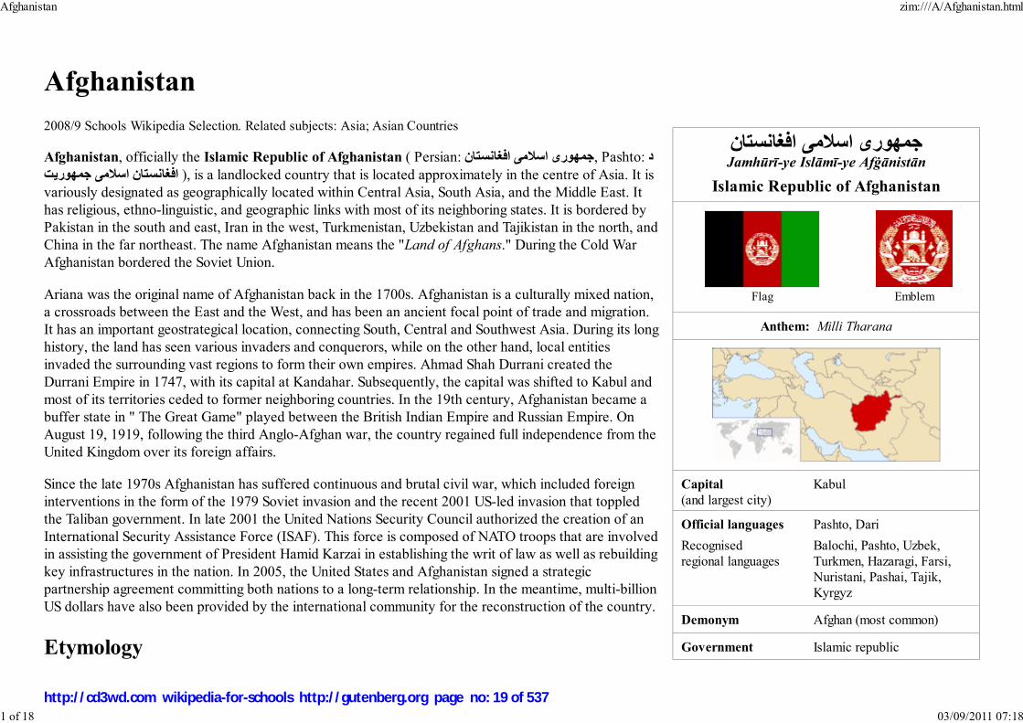
جمھوری اس�می افغانستانJamhūrī-ye Islāmī-ye Afġānistān
Islamic Republic of Afghanistan
Flag Emblem
Anthem: Milli Tharana
Capital(and largest city)
Kabul
Official languages Pashto, Dari
Recognised
regional languages
Balochi, Pashto, Uzbek,
Turkmen, Hazaragi, Farsi,
Nuristani, Pashai, Tajik,
Kyrgyz
Demonym Afghan (most common)
Government Islamic republic
Afghanistan
2008/9 Schools Wikipedia Selection. Related subjects: Asia; Asian Countries
Afghanistan, officially the Islamic Republic of Afghanistan ( Persian: جمھوری اس�می افغانستان, Pashto: دis a landlocked country that is located approximately in the centre of Asia. It is ,( افغانستان اس�مى جمھوريت
variously designated as geographically located within Central Asia, South Asia, and the Middle East. It
has religious, ethno-linguistic, and geographic links with most of its neighboring states. It is bordered by
Pakistan in the south and east, Iran in the west, Turkmenistan, Uzbekistan and Tajikistan in the north, and
China in the far northeast. The name Afghanistan means the "Land of Afghans." During the Cold War
Afghanistan bordered the Soviet Union.
Ariana was the original name of Afghanistan back in the 1700s. Afghanistan is a culturally mixed nation,
a crossroads between the East and the West, and has been an ancient focal point of trade and migration.
It has an important geostrategical location, connecting South, Central and Southwest Asia. During its long
history, the land has seen various invaders and conquerors, while on the other hand, local entities
invaded the surrounding vast regions to form their own empires. Ahmad Shah Durrani created the
Durrani Empire in 1747, with its capital at Kandahar. Subsequently, the capital was shifted to Kabul and
most of its territories ceded to former neighboring countries. In the 19th century, Afghanistan became a
buffer state in " The Great Game" played between the British Indian Empire and Russian Empire. On
August 19, 1919, following the third Anglo-Afghan war, the country regained full independence from the
United Kingdom over its foreign affairs.
Since the late 1970s Afghanistan has suffered continuous and brutal civil war, which included foreign
interventions in the form of the 1979 Soviet invasion and the recent 2001 US-led invasion that toppled
the Taliban government. In late 2001 the United Nations Security Council authorized the creation of an
International Security Assistance Force (ISAF). This force is composed of NATO troops that are involved
in assisting the government of President Hamid Karzai in establishing the writ of law as well as rebuilding
key infrastructures in the nation. In 2005, the United States and Afghanistan signed a strategic
partnership agreement committing both nations to a long-term relationship. In the meantime, multi-billion
US dollars have also been provided by the international community for the reconstruction of the country.
Etymology
Afghanistan zim:///A/Afghanistan.html
1 of 18 03/09/2011 07:18
http://cd3wd.com wikipedia-for-schools http://gutenberg.org page no: 19 of 537
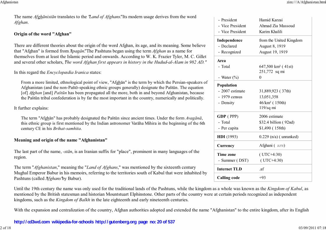
- President Hamid Karzai
- Vice President Ahmad Zia Massoud
- Vice President Karim Khalili
Independence from the United Kingdom
- Declared August 8, 1919
- Recognized August 19, 1919
Area
- Total 647,500 km² ( 41st)
251,772 sq mi
- Water (%) 0
Population
- 2007 estimate 31,889,923 ( 37th)
- 1979 census 13,051,358
- Density 46/km² ( 150th)
119/sq mi
GDP ( PPP) 2006 estimate
- Total $32.4 billion ( 92nd)
- Per capita $1,490 ( 158th)
HDI (1993) 0.229 (n/a) ( unranked)
Currency Afghani ( AFN)
Time zone ( UTC+4:30)
- Summer ( DST) ( UTC+4:30)
Internet TLD .af
Calling code +93
The name Afghānistān translates to the " Land of Afghans". Its modern usage derives from the word
Afghan.
Origin of the word "Afghan"
There are different theories about the origin of the word Afghan, its age, and its meaning. Some believe
that "Afghan" is formed from "Apagân". The Pashtuns began using the term Afghan as a name for
themselves from at least the Islamic period and onwards. According to W. K. Frazier Tyler, M. C. Gillet
and several other scholars, "The word Afghan first appears in history in the Hudud-al-Alam in 982 AD."
In this regard the Encyclopædia Iranica states:
From a more limited, ethnological point of view, "Afghān" is the term by which the Persian-speakers of
Afghanistan (and the non-Paštō-speaking ethnic groups generally) designate the Paštūn. The equation
[of] Afghan [and] Paštūn has been propagated all the more, both in and beyond Afghanistan, because
the Paštūn tribal confederation is by far the most important in the country, numerically and politically.
It further explains:
The term "Afghān" has probably designated the Paštūn since ancient times. Under the form Avagānā,
this ethnic group is first mentioned by the Indian astronomer Varāha Mihira in the beginning of the 6th
century CE in his Brihat-samhita.
Meaning and origin of the name "Afghanistan"
The last part of the name, -stān, is an Iranian suffix for "place", prominent in many languages of the
region.
The term "Afghanistan," meaning the "Land of Afghans," was mentioned by the sixteenth century
Mughal Emperor Babur in his memoirs, referring to the territories south of Kabul that were inhabited by
Pashtuns (called "Afghans" by Babur).
Until the 19th century the name was only used for the traditional lands of the Pashtuns, while the kingdom as a whole was known as the Kingdom of Kabul, as
mentioned by the British statesman and historian Mountstuart Elphinstone. Other parts of the country were at certain periods recognized as independent
kingdoms, such as the Kingdom of Balkh in the late eighteenth and early nineteenth centuries.
With the expansion and centralization of the country, Afghan authorities adopted and extended the name "Afghanistan" to the entire kingdom, after its English
Afghanistan zim:///A/Afghanistan.html
2 of 18 03/09/2011 07:18
http://cd3wd.com wikipedia-for-schools http://gutenberg.org page no: 20 of 537

Topography
translation, "Afghanland", had already appeared in various treaties between British Raj and Qajarid Persia, referring to the lands that were subject to the
Pashtun Barakzai Dynasty of Kabul. "Afghanistan" as the name for the entire kingdom was mentioned in 1857 by Frederick Engels. It became the official name
when the country was recognized by the world community in 1919, after regaining its full independence from the British, and was confirmed as such in the
nation's 1923 constitution.
Geography
Afghanistan is a landlocked and mountainous country in South- Central Asia, with plains in the north and
southwest. The highest point is Nowshak, at 7,485 m (24,557 ft) above sea level. Large parts of the country
are dry, and fresh water supplies are limited. The endorheic Sistan Basin is one of the driest regions in the
world. Afghanistan has a continental climate with hot summers and cold winters. The country is frequently
subject to minor earthquakes, mainly in the northeast of Hindu Kush mountain areas. Some 125 villages
were damaged and 4000 people killed by the May 30, 1998 earthquake.
At 249,984 sq mi (647,500 km²), Afghanistan is the world's 41st-largest country (after Myanmar).
Comparatively, it is slightly smaller than the U.S. state of Texas.
The country's natural resources include gold, silver, copper, zinc and iron ore in southeastern areas; precious
and semi-precious stones such as lapis, emerald and azure in the north-east; and potentially significant
petroleum and natural gas reserves in the north. The country also has uranium, coal, chromite, talc, barites,
sulfur, lead, and salt. However, these significant mineral and energy resources remain largely untapped due
to the effects of the Soviet invasion and the subsequent civil war. Plans are underway to begin extracting
them in the near future.
History
Though the modern state of Afghanistan was founded or created in 1747 by Ahmad Shah Durrani, the land has an ancient history and various timelines of
different civilizations. Excavation of prehistoric sites by Louis Dupree, the University of Pennsylvania, the Smithsonian Institution and others suggests that
humans were living in what is now Afghanistan at least 50,000 years ago, and that farming communities of the area were among the earliest in the world.
Afghanistan is a country at a unique nexus point where numerous Indo-European civilizations have interacted and often fought, and was an important site of
early historical activity. Through the ages, the region has been home to various people, among them the Aryan ( Indo-Iranian) tribes, such as the Kambojas,
Bactrians, Persians, etc. It also has been conquered by a host of people, including the Median and Persian Empires, Alexander the Great, Kushans, Hepthalites,
Arabs, Turks, and Mongols. In recent times, invasions from the British, Soviets, and most recently by the Americans and their allies have taken place. On the
other hand, native entities have invaded surrounding regions in Iranian plateau and Indian subcontinent to form empires of their own.
Afghanistan zim:///A/Afghanistan.html
3 of 18 03/09/2011 07:18
http://cd3wd.com wikipedia-for-schools http://gutenberg.org page no: 21 of 537

The region that is now Afghanistan was formuch of its history part of various Persiandynasties, such as the Achaemenid dynasty
of the Persian Empire (559–330 BCE)
The Greco-Bactrian Kingdom at it'smaximum extent, circa 180 BCE
Between 2000 and 1200 BC, Indo-European-speaking Aryans are thought to have been in the region of northern
Afghanistan. It is unlikely that the Aryans themselves originated in Afghanistan although they did migrate from
there south towards India and west towards Persia, but they also migrated into Europe via north of the Caspian.
These Aryans set up a nation that during the rule of Medes and Achaemenid Persians which became known as
Aryānām Xšaθra or Airyānem Vāejah. Original homelands of the Aryans have been proposed as Anatolia, Central
Asia, Iran, or Northern India, with the directions of the historical migration varying accordingly. Later, during the
rule of Ashkanian, Sasanian and after, it was called Erānshahr ( Persian: ايرانشھر - Īrānšahr) meaning "Dominion of
the Aryans."
It has been speculated that Zoroastrianism might have originated in what is now Afghanistan between 1800 to 800
BC, as Zoroaster lived and died in Balkh.. Ancient Eastern Iranian languages, such as Avestan, may have been
spoken in this region around the time of the rise of Zoroastrianism. By the middle of the sixth century BC, the
Persian Empire of the Achaemenids supplanted the Median Empire and incorporated what was known as Persia to
the Greeks within its boundaries; and by 330 BC, Alexander the Great invaded Afghanistan and conquered the
surrounding regions. Following Alexander's brief occupation, the Hellenistic successor states of the Seleucids and
Greco-Bactrians controlled the area, while the Mauryas from India annexed the southeast for a time and introduced
Buddhism to the region until the area returned to the Bactrian rule.
Afghanistan zim:///A/Afghanistan.html
4 of 18 03/09/2011 07:18
http://cd3wd.com wikipedia-for-schools http://gutenberg.org page no: 22 of 537

Buddhas of Bamyan wereamong the largest Buddha
statues in the world,dating back to the first
century AD.
During the first century AD, the Kushans created a vast empire centered in modern Afghanistan and were patrons of Buddhist
culture. The Kushans were defeated by the Sassanids in the third century. Although various rulers calling themselves Kushans (and
generally known as Kushano-Sasanians) continued to rule at least parts of the region, they were probably more or less subject to
the Sassanids. The late Kushans were followed by the Kidarite Huns who, in turn, were replaced by the short-lived but powerful
Hephthalites, as rulers of the region in the first half of the fifth century. The Hephthalites were defeated by the Sasanian king
Khosrau I in AD 557, who re-established Sasanian power in Persia. However, the successors of Kushans and Hepthalites
established a small dynasty in Kabulistan called Kushano-Hephthalites or Kabul-Shahan/ Shahi and were later defeated by the
Muslim armies.
Islamic conquest
In the Middle Ages, up to the nineteenth century, the region was known as Khorasan. Several important centers of Khorāsān are
thus located in modern Afghanistan, such as Balkh, Herat, Ghazni and Kabul. It was during this period of time when Islam was
introduced and spread in the area.
The region of Afghanistan became the centre of various important empires, including that of the Samanids (875–999), Ghaznavids
(977–1187), Seljukids (1037–1194), Ghurids (1149–1212), and Timurids (1370–1506). Among them, the periods of Ghaznavids of
Ghazni, and Timurids of Herat are considered as some of the most brilliant eras of Afghanistan's history.
In 1219 the region was overrun by the Mongols under Genghis Khan, who devastated the land. Their rule continued with the Ilkhanates, and was extended
further following the invasion of Timur Lang ("Tamerlane"), a ruler from Central Asia. In 1504, Babur, a descendant of both Timur Lang and Genghis Khan,
established the Mughal Empire with its capital at Kabul. By the early 1700s, Afghanistan was controlled by several ruling groups: Uzbeks to the north, Safavids
to the west and the remaining larger area by the Mughals or self-ruled by local Afghan tribes.
Emergence of Afghan rule
Hotaki dynasty
In 1709, Mir Wais Hotak, a local Afghan (Pashtun) from the Ghilzai clan, overthrew and killed Gurgin Khan, the Safavid governor of Kandahar. Mir Wais
successfully defeated the Persians, who were attempting to convert the local population of Kandahar from Sunni to the Shia sect of Islam. Mir Wais held the
region of Kandahar until his death in 1715 and was succeeded by his son Mir Mahmud Hotaki. In 1722, Mir Mahmud led an Afghan army to Isfahan (now in
Iran), sacked the city and proclaimed himself King of Persia. However, the great majority still rejected the Afghan regime as usurping, and after the massacre of
thousands of civilians in Isfahan by the Afghans – including more than three thousand religious scholars, nobles, and members of the Safavid family – the
Hotaki dynasty was eventually removed from power by a new ruler, Nadir Shah of Persia.
Durrani Empire
Afghanistan zim:///A/Afghanistan.html
5 of 18 03/09/2011 07:18
http://cd3wd.com wikipedia-for-schools http://gutenberg.org page no: 23 of 537

Political cartoon depicting Sher AliKhan with his "friends" Britain &
Russia (1878).
In 1738 Nadir Shah and his army, which included four thousand Pashtuns of the Abdali clan, conquered the region of Kandahar; in the same year he occupied
Ghazni, Kabul and Lahore. On June 19, 1747, Nadir Shah was assassinated, possibly planned by his nephew Ali Qoli. In the same year, one of Nadir's military
commanders and personal bodyguard, Ahmad Shah Abdali, a Pashtun from the Abdali clan, called for a loya jirga following Nadir's death. The Afghans
gathered at Kandahar and chose Ahmad Shah as their King. Since then, he is often regarded as the founder of modern Afghanistan. After the inauguration, he
changed his title or clans' name to "Durrani", which derives from the Persian word Durr, meaning "Pearl".
By 1751 Ahmad Shah Durrani and his Afghan army conquered the entire present-day Afghanistan, Pakistan, Khorasan and Kohistan provinces of Iran, along
with Delhi in India. In October 1772, Ahmad Shah retired to his home in Maruf, Kandahar, where he died peacefully. He was succeeded by his son, Timur Shah
Durrani, who transferred the capital from Kandahar to Kabul. Timur died in 1793 and was finally succeeded by his son Zaman Shah Durrani.
European influence
During the nineteenth century, following the Anglo-Afghan wars (fought 1839–42, 1878–80, and lastly in 1919) and the
ascension of the Barakzai dynasty, Afghanistan saw much of its territory and autonomy ceded to the United Kingdom.
The UK exercised a great deal of influence, and it was not until King Amanullah Khan acceded to the throne in 1919
that Afghanistan re-gained complete independence over its foreign affairs (see " The Great Game"). During the period
of British intervention in Afghanistan, ethnic Pashtun territories were divided by the Durand Line. This would lead to
strained relations between Afghanistan and British India – and later the new state of Pakistan – over what came to be
known as the Pashtunistan debate. The longest period of stability in Afghanistan was between 1933 and 1973, when the
country was under the rule of King Zahir Shah.
However, in 1973 Zahir Shah's brother-in-law, Mohammed Daoud Khan, launched a bloodless coup and became the
first President of Afghanistan. Daoud Khan and his entire family were murdered in 1978, when the communist People's
Democratic Party of Afghanistan launched a coup known as the Great Saur Revolution and took over the government.
The 1978 Khalq uprising against the government of Daoud Khan was essentially a resurgence by the Ghilzai tribe of the
Pashtun against the Durrani (the tribe of Daoud Khan and the previous monarchy).
Soviet invasion and civil war
As part of a Cold War strategy, in 1979 the United States government (under President Jimmy Carter and National Security Advisor Zbigniew Brzezinski) began
to covertly fund and train anti-government Mujahideen forces through the Pakistani secret service known as Inter Services Intelligence (ISI). In order to bolster
the local Communist forces, the Soviet Union—citing the 1978 Treaty of Friendship, Cooperation and Good Neighborliness that had been signed between the
two countries—intervened on December 24, 1979. Over 100,000 Soviet troops took part in the invasion, who were backed by another 100,000 and plus
pro-communist forces of Afghanistan. The Soviet occupation resulted in the killings of at least 600,000 to 2 million Afghan civilians. Over five million Afghans
fled their country to Pakistan, Iran and other parts of the world. Faced with mounting international pressure and great number of casualties on both sides, the
Soviets withdrew in 1989.
Afghanistan zim:///A/Afghanistan.html
6 of 18 03/09/2011 07:18
http://cd3wd.com wikipedia-for-schools http://gutenberg.org page no: 24 of 537

Soviet troops withdrawing fromAfghanistan in 1988. Photo by Mikhail
Evstafiev
The Soviet withdrawal from the Democratic Republic of Afghanistan was seen as an ideological victory in the US,
which had backed the Mujahideen through three US presidential administrations in order to counter Soviet influence in
the vicinity of the oil-rich Persian Gulf.
Following the removal of the Soviet forces, the US and its allies lost interest in Afghanistan and did little to help rebuild
the war-ravaged country or influence events there. The USSR continued to support President Najibullah (former head of
the Afghan secret service, KHAD) until 1992 when new Russian government refused to sell oil products to Najibullah
regime.
Because of the fighting, a number of elites and intellectuals fled to take refuge abroad. This led to a leadership
imbalance in Afghanistan. Fighting continued among the victorious Mujahideen factions, which gave rise to a state of
warlordism. The most serious fighting during this period occurred in 1994, when over 10,000 people were killed in
Kabul alone. It was at this time that the Taliban developed as a politico-religious force, eventually seizing Kabul in
1996. By the end of 2000 the Taliban had captured 95% of the country.
During the Taliban's seven-year rule, much of the population experienced restrictions on their freedom and violations of their human rights. Women were
banned from jobs, girls forbidden to attend schools or universities. Those who resisted were punished instantly. Communists were systematically eradicated and
thieves were punished by amputating one of their hands or feet. Meanwhile, the Taliban managed to nearly eradicate the majority of the opium production by
2001.
2001-present war in Afghanistan
Following the September 11, 2001 attacks the United States launched Operation Enduring Freedom, a military campaign to destroy the al-Qaeda terrorist
training camps inside Afghanistan. The US military also threatened to overthrow the Taliban government for refusing to hand over Osama bin Laden and several
al-Qaida members. The US made a common cause with the former Afghan Mujahideen to achieve its ends, including the Northern Alliance, a militia still
recognized by the UN as the Afghan government.
In late 2001, US Special Forces invaded Afghanistan to aid anti-Taliban militias, backed by US air strikes against Taliban and Al Qaeda targets, culminating in
the seizure of Kabul by the Northern Alliance and the overthrow of the Taliban, with many local warlords switching allegiance from the Taliban to the Northern
Alliance.
In December of the same year, leaders of the former Afghan mujahideen and diaspora met in Germany, and agreed on a plan for the formulation of a new
democratic government that resulted in the inauguration of Hamid Karzai, an ethnic Pashtun from the southern city of Kandahar, as Chairman of the Afghan
Interim Authority.
After a nationwide Loya Jirga in 2002, Karzai was chosen by the representatives to assume the title as Interim President of Afghanistan. The country convened
a Constitutional Loya Jirga (Council of Elders) in 2003 and a new constitution was ratified in January 2004. Following an election in October 2004, Hamid
Afghanistan zim:///A/Afghanistan.html
7 of 18 03/09/2011 07:18
http://cd3wd.com wikipedia-for-schools http://gutenberg.org page no: 25 of 537

US Army in Kunar Province
Politicians of Afghanistan having lunch withthe visiting U.S. President George W. Bush in
Kabul on March 1, 2006.
Karzai won and became the President of the Islamic Republic of Afghanistan. Legislative elections were held in September 2005. The National Assembly – the
first freely elected legislature in Afghanistan since 1973 – sat in December 2005, and was noteworthy for the inclusion of women as voters, candidates, and
elected members.
As the country continues to rebuild and recover, it is still struggling against poverty, poor infrastructure, large concentration
of land mines and other unexploded ordnance, as well as a huge illegal poppy cultivation and opium trade. Afghanistan also
remains subject to occasionally violent political jockeying. The country continues to grapple with the Taliban insurgency
and the threat of attacks from a few remaining al Qaeda.
At the start of 2007 reports of the Taliban's increasing presence in Afghanistan led the US to consider longer tours of duty
and even an increase in troop numbers. According to a report filed by Robert Burns of Associated Press on January 16,
2007, "U.S. military officials cited new evidence that the Pakistani military, which has long-standing ties to the Taliban
movement, has turned a blind eye to the incursions." Also, "The number of insurgent attacks is up 300 percent since
September, 2006, when the Pakistani government put into effect a peace arrangement with tribal leaders in the north
Waziristan area, along Afghanistan's eastern border, a U.S. military intelligence officer told reporters." In 2008 another 3,200 U.S. troops will be sent to
Afghanistan to fight the Taliban.
Government and politics
Politics in Afghanistan has historically consisted of power struggles, bloody coups and unstable transfers of power. With the exception of a military junta, the
country has been governed by nearly every system of government over the past century, including a monarchy, republic, theocracy and communist state. The
constitution ratified by the 2003 Loya jirga restructured the government as an Islamic republic consisting of three branches, ( executive, legislature and
judiciary).
Afghanistan is currently led by President Hamid Karzai, who was elected in October 2004. The current parliament
was elected in 2005. Among the elected officials were former mujahadeen, Taliban members, communists,
reformists, and Islamic fundamentalists. 28% of the delegates elected were women, 3 points more than the 25%
minimum guaranteed under the constitution. This made Afghanistan, long known under the Taliban for its
oppression of women, one of the leading countries in terms of female representation. Construction for a new
parliament building began on August 29, 2005.
The Supreme Court of Afghanistan is currently led by Chief Justice Abdul Salam Azimi, a former university
professor who had been legal advisor to the president. The previous court, appointed during the time of the interim
government, had been dominated by fundamentalist religious figures, including Chief Justice Faisal Ahmad
Shinwari. The court had issued numerous questionable rulings, such as banning cable television, seeking to ban a
candidate in the 2004 presidential election and limiting the rights of women, as well as overstepping its
Afghanistan zim:///A/Afghanistan.html
8 of 18 03/09/2011 07:18
http://cd3wd.com wikipedia-for-schools http://gutenberg.org page no: 26 of 537
First deputy vice president Ahmad ZiaMassoud presents a new police officerwith his diploma at the Kabul Police
Academy.
constitutional authority by issuing rulings on subjects not yet brought before the court. The current court is seen as more moderate and led by more technocrats
than the previous court, although it has yet to issue any rulings.
Law enforcement and military
Afghanistan currently has more than 70,000 national police officers, with plans to recruit more so that the total number
can reach 80,000. They are being trained by and through the Afghanistan Police Program. Although the police officially
are responsible for maintaining civil order, sometimes local and regional military commanders continue to exercise
control in the hinterland. Police have been accused of improper treatment and detention of prisoners. In 2003 the
mandate of the International Security Assistance Force, now under command of the North Atlantic Treaty Organization
(NATO) was extended and expanded beyond the Kabul area. However, in some areas unoccupied by those forces, local
militias maintain control. In many areas, crimes have gone uninvestigated because of insufficient police and/or
communications. Troops of the Afghan National Army have been sent to quell fighting in some regions lacking police
protection.
Administrative divisions
Afghanistan is administratively divided into thirty-four (34) provinces (welayats), and for each province there is a
capital. Each province is then divided into many provincial districts, and each district normally covers a city or several
townships.
The Governor of the province is appointed by the Ministry of Interior, and the Prefects for the districts of the province will be appointed by the provincial
Governor. The Governor is the representative of the central government of Afghanistan, and is responsible for all administrative and formal issues. The
provincial Chief of Police is appointed by the Ministry of Interior, who works together with the Governor on law enforcement for all the cities or districts of that
province.
There is an exception in the capital city (Kabul) where the Mayor is selected by the President of Afghanistan, and is completely independent from the
prefecture of the Kabul Province.
Afghanistan zim:///A/Afghanistan.html
9 of 18 03/09/2011 07:18
http://cd3wd.com wikipedia-for-schools http://gutenberg.org page no: 27 of 537

Map showing the 34 provinces of Afghanistan.
Badakhshan1.
Badghis2.
Baghlan3.Balkh4.
Bamyan5.
Daykundi6.Farah7.
Faryab8.
Ghazni9.Ghor10.
Helmand11.
Herat12.Jowzjan13.
Kabul14.
Kandahar15.Kapisa16.
Khost17.
Konar18.
Kunduz19.
Laghman20.Lowgar21.
Nangarhar22.
Nimruz23.Nurestan24.
Oruzgan25.
Paktia26.Paktika27.
Panjshir28.
Parvan29.Samangan30.
Sare Pol31.
Takhar32.Wardak33.
Zabol34.
Demography
Largest cities
The only city in Afghanistan with over one million residents is its capital, Kabul. The other major cities in the country are, in order of population size, Kandahar,
Herat, Mazar-e Sharif, Jalalabad, Ghazni and Kunduz.
Ethnic groups
Afghanistan zim:///A/Afghanistan.html
10 of 18 03/09/2011 07:18
http://cd3wd.com wikipedia-for-schools http://gutenberg.org page no: 28 of 537

Ethnic groups of Afghanistan (percentages are fromEncyclopædia Iranica and CIA World Factbook)
39.4% to 42% Pashtun
27% to 33.7% Tajik
8.0% to 9% Hazara
8.0% to 9% Uzbek
3.2% to 4% Aimak 3% Turkmen
1.6% to 4% Baloch
4% to 9.2% other ( Pashai, Nuristani, Brahui, Hindkowans,Hindustani, etc.)
The population of Afghanistan is divided into a wide variety of ethnic groups. Because a systematic
census has not been held in the country in decades, exact figures about the size and composition of the
various ethnic groups are not available. Therefore most figures are approximations only.
An approximate distribution of ethnic groups estimated by the CIA World Factbook is as following:
Pashtun: 42%Tajik: 27%
Hazara: 9%
Uzbek: 9%Aimak: 4%
Turkmen: 3%
Baloch: 2%Other: 4%
Based on official census numbers from the 1960s to the 1980s, as well as information found in mainly
scholarly sources, the Encyclopædia Iranica gives the following list:
36.4% Pashtun
33.7% Tajik, Farsiwan, and Qezelbash8.0% Hazara
8.0% Uzbek
4.1% Aimak3.3% Turkmen
1.6% Baloch
1.9% other
Languages
Afghanistan zim:///A/Afghanistan.html
11 of 18 03/09/2011 07:18
http://cd3wd.com wikipedia-for-schools http://gutenberg.org page no: 29 of 537
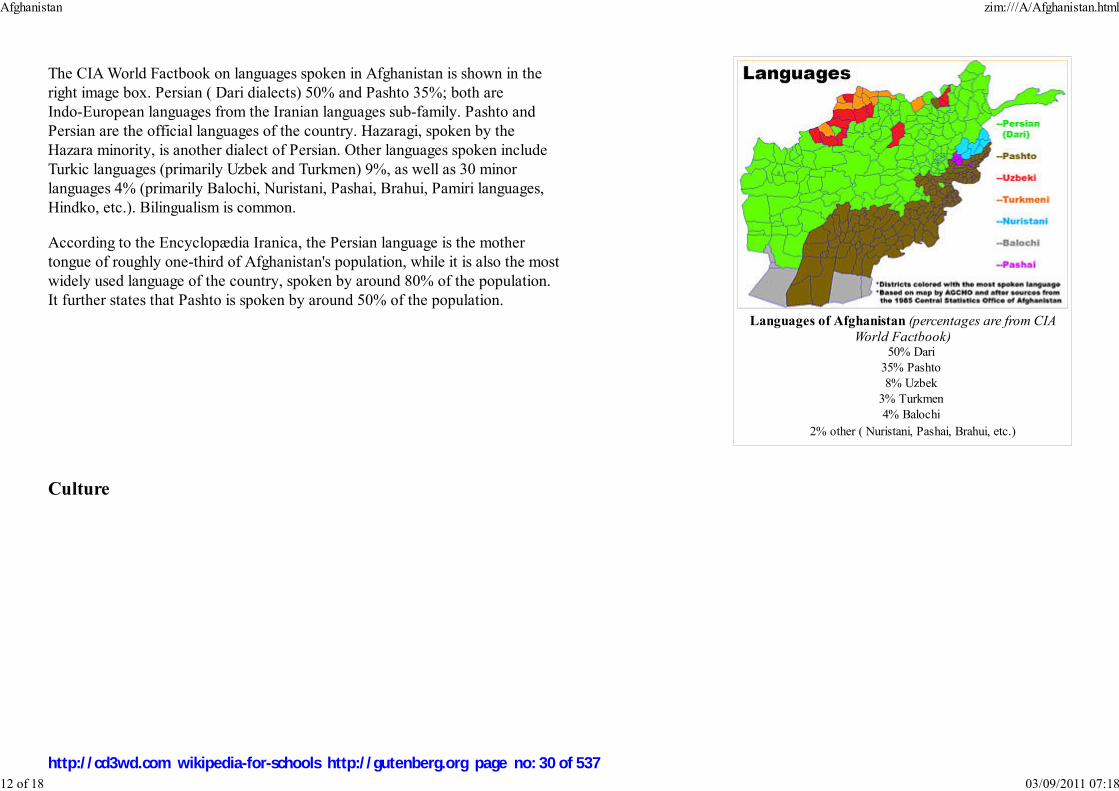
Languages of Afghanistan (percentages are from CIAWorld Factbook)
50% Dari
35% Pashto
8% Uzbek
3% Turkmen
4% Balochi
2% other ( Nuristani, Pashai, Brahui, etc.)
The CIA World Factbook on languages spoken in Afghanistan is shown in the
right image box. Persian ( Dari dialects) 50% and Pashto 35%; both are
Indo-European languages from the Iranian languages sub-family. Pashto and
Persian are the official languages of the country. Hazaragi, spoken by the
Hazara minority, is another dialect of Persian. Other languages spoken include
Turkic languages (primarily Uzbek and Turkmen) 9%, as well as 30 minor
languages 4% (primarily Balochi, Nuristani, Pashai, Brahui, Pamiri languages,
Hindko, etc.). Bilingualism is common.
According to the Encyclopædia Iranica, the Persian language is the mother
tongue of roughly one-third of Afghanistan's population, while it is also the most
widely used language of the country, spoken by around 80% of the population.
It further states that Pashto is spoken by around 50% of the population.
Culture
Afghanistan zim:///A/Afghanistan.html
12 of 18 03/09/2011 07:18
http://cd3wd.com wikipedia-for-schools http://gutenberg.org page no: 30 of 537

Girls in Kabul, wearing their traditionalclothes, sing at a celebration of International
Women's Day in 2002.
Afghans display pride in their religion, country, ancestry, and above all, their independence. Like other highlanders,
Afghans are regarded with mingled apprehension and condescension, for their high regard for personal honour, for
their clan loyalty and for their readiness to carry and use arms to settle disputes. As clan warfare and internecine
feuding has been one of their chief occupations since time immemorial, this individualistic trait has made it difficult
for foreign invaders to hold the region.
Afghanistan has a complex history that has survived either in its current cultures or in the form of various languages
and monuments. However, many of the country's historic monuments have been damaged in recent wars. The two
famous statues of Buddha in the Bamyan Province were destroyed by the Taliban, who regarded them as idolatrous.
Other famous sites include the cities of Kandahar, Herat, Ghazni and Balkh. The Minaret of Jam, in the Hari River
valley, is a UNESCO World Heritage site. The cloak worn by Muhammad is stored inside the famous Khalka Sharifa
in Kandahar City.
Buzkashi is a national sport in Afghanistan. It is similar to polo and played by horsemen in two teams, each trying to
grab and hold of a goat carcass. Afghan hounds (a type of running dog) also originated in Afghanistan.
Although literacy levels are very low, classic Persian poetry plays a very important role in the Afghan culture. Poetry has always been one of the major
educational pillars in Iran and Afghanistan, to the level that it has integrated itself into culture. Persian culture has, and continues to, exert a great influence over
Afghan culture. Private poetry competition events known as “musha’era” are quite common even among ordinary people. Almost every home owns one or
more poetry collections of some sort, even if they are not read often.
The eastern dialects of the Persian language are popularly known as "Dari". The name itself derives from "Pārsī-e Darbārī", meaning Persian of the royalcourts. The ancient term Darī – one of the original names of the Persian language – was revived in the Afghan constitution of 1964, and was intended to signifythat Afghans consider their country the cradle of the language. Hence, the name Fārsī, the language of Fārs, is strictly avoided. With this point in mind, we
can consider the development of Dari or Persian literature in the political entity known as Afghanistan."
Many of the famous Persian poets of the tenth to fifteenth centuries stem from Khorasan where is now known as Afghanistan. They were mostly also scholars
in many disciplines like languages, natural sciences, medicine, religion and astronomy.
Mawlānā Rumi, who was born and educated in Balkh in the thirteenth century and moved to Konya in modern-day TurkeyRabi'a Balkhi (the first poetess in the History of Persian Poetry, tenth century, native of Balkh)
Daqiqi Balkhi (tenth century, native of Balkh)
Farrukhi Sistani (tenth century, the Ghaznavids royal poet)Unsuri Balkhi (a tenth/eleventh century poet, native of Balkh)
Khwaja Abdullah Ansari (eleventh century, from Herat)
Nasir Khusraw (eleventh century, from Qubadyan near Balkh)Anvari (twelfth century, lived and died in Balkh)
Afghanistan zim:///A/Afghanistan.html
13 of 18 03/09/2011 07:18
http://cd3wd.com wikipedia-for-schools http://gutenberg.org page no: 31 of 537

Sanā'ī Ghaznawi (twelfth century, native of Ghazni)Jāmī of Herāt (fifteenth century, native of Herat in western Afghanistan), and his nephew Abdullah Hatifi Herawi, a well-known poet
Alī Sher Navā'ī (fifteenth century, Herat).
Most of these individuals were of Persian ( Tājīk) ethnicity who still form the second-largest ethnic group in Afghanistan. Also, some of the contemporary
Persian language poets and writers, who are relatively well-known in Persian-speaking world, include Ustad Betab, Qari Abdullah, Khalilullah Khalili, Sufi
Ghulam Nabi Ashqari, Sarwar Joya, Qahar Asey, Parwin Pazwak and others. In 2003, Khaled Hosseini published The Kiterunner which though fiction, captured
much of the history, politics and culture experienced in Afghanistan from the 1930s to present day.
In addition to poets and authors, numerous Persian scientists were born or worked in the region of present-day Afghanistan. Most notable was Avicenna (Abu
Alī Hussein ibn Sīnā) whose father hailed from Balkh. Ibn Sīnā, who travelled to Isfahan later in life to establish a medical school there, is known by some
scholars as "the father of modern medicine". George Sarton called ibn Sīnā "the most famous scientist of Islam and one of the most famous of all races, places,
and times." His most famous works are The Book of Healing and The Canon of Medicine, also known as the Qanun. Ibn Sīnā's story even found way to the
contemporary English literature through Noah Gordon's The Physician, now published in many languages. Moreover, according to Ibn al-Nadim, Al-Farabi, a
well-known philosopher and scientist, was from the Faryab Province of Afghanistan, .
Before the Taliban gained power, the city of Kabul was home to many musicians who were masters of both traditional and modern Afghan music, especially
during the Nauroz-celebration. Kabul in the middle part of the twentieth century has been likened to Vienna during the eighteenth and nineteenth centuries.
The tribal system, which orders the life of most people outside metropolitan areas, is potent in political terms. Men feel a fierce loyalty to their own tribe, such
that, if called upon, they would assemble in arms under the tribal chiefs and local clan leaders (Khans). In theory, under Islamic law, every believer has an
obligation to bear arms at the ruler's call ( Ulul-Amr).
Heathcote considers the tribal system to be the best way of organizing large groups of people in a country that is geographically difficult, and in a society that,
from a materialistic point of view, has an uncomplicated lifestyle.
Religions
Afghanistan zim:///A/Afghanistan.html
14 of 18 03/09/2011 07:18
http://cd3wd.com wikipedia-for-schools http://gutenberg.org page no: 32 of 537

Blue Mosque in Mazari Sharif.
A business centre inKabul.
Religiously, Afghans are over 99% Muslims: approximately 74-80% Sunni and 19-25% Shi'a (estimates vary). Up until
the mid-1980s, there were about 30,000 to 150,000 Hindus and Sikhs living in different cities, mostly in Jalalabad,
Kabul, and Kandahar.
There was a small Jewish community in Afghanistan (see Bukharan Jews) who fled the country after the 1979 Soviet
invasion, and only one individual, Zablon Simintov, remains today.
Economy
Afghanistan is a member of the South Asian Association for Regional Cooperation (SAARC), Economic Cooperation
Organization (ECO) and the Organization of the Islamic Conference (OIC). It is an impoverished country, one of the
world's poorest and least developed. Two-thirds of the population lives on fewer than 2 US dollars a day. Its economy has suffered greatly from the 1979 Soviet
invasion and subsequent conflicts, while severe drought added to the nation's difficulties in 1998–2001.
The economically active population in 2002 was about 11 million (out of a total of an estimated 29 million). As of 2005, the official unemployment rate is at
40%. The number of non-skilled young people is estimated at 3 million, which is likely to increase by some 300,000 per annum.
The nation's economy began to improve since 2002 due to the infusion of multi-billion US dollars in international assistance and
investments, as well as remittances from expats. It is also due to dramatic improvements in agricultural production and the end of a
four-year drought in most of the country.
The real value of non-drug GDP increased by 29% in 2002, 16% in 2003, 8% in 2004 and 14% in 2005. As much as one-third of
Afghanistan's GDP comes from growing poppy and illicit drugs including opium and its two derivatives, morphine and heroin, as
well as hashish production. Opium production in Afghanistan has soared to a new record in 2007, with an increase on last year of
more than a third, the United Nations has said. Some 3.3 million Afghans are now involved in producing opium. In a recent article in
the Washington Quarterly, Peter van Ham and Jorrit Kamminga argue that the international community should establish a pilot
project and investigate a licensing scheme to start the production of medicines such as morphine and codeine from poppy crops to
help it escape the economic dependence on opium:
According to a 2004 report by the Asian Development Bank, the present reconstruction effort is two-pronged: first it focuses on
rebuilding critical physical infrastructure, and second, on building modern public sector institutions from the remnants of Soviet
style planning to ones that promote market-led development. In 2006, two US companies, Black & Veatch and the Louis Berger Group, have won a US 1.4
billion dollar contract to rebuild roads, power lines and water supply systems of Afghanistan.
One of the main drivers for the current economic recovery is the return of over 4 million refugees from neighbouring countries and the West, who brought with
them fresh energy, entrepreneurship and wealth-creating skills as well as much needed funds to start up businesses. What is also helping is the estimated US 2–3
Afghanistan zim:///A/Afghanistan.html
15 of 18 03/09/2011 07:18
http://cd3wd.com wikipedia-for-schools http://gutenberg.org page no: 33 of 537

The plan for Kabul's nine billion dollarfuture modern urban development project,
the City of Light Development.
billion dollars in international assistance every year, the partial recovery of the agricultural sector, and the reestablishment of market institutions. Private
developments are also beginning to get underway. In 2006, a Dubai-based Afghan family opened a $25 million Coca Cola bottling plant in Afghanistan.
While the country's current account deficit is largely financed with the donor money, only a small portion – about 15% – is provided directly to the government
budget. The rest is provided to non-budgetary expenditure and donor-designated projects through the United Nations system and non-governmental
organizations. The government had a central budget of only $350 million in 2003 and an estimated $550 million in 2004. The country's foreign exchange
reserves totals about $500 million. Revenue is mostly generated through customs, as income and corporate tax bases are negligible.
Inflation had been a major problem until 2002. However, the depreciation of the Afghani in 2002 after the introduction of the new notes (which replaced 1,000
old Afghani by 1 new Afghani) coupled with the relative stability compared to previous periods has helped prices to stabilize and even decrease between
December 2002 and February 2003, reflecting the turnaround appreciation of the new Afghani currency. Since then, the index has indicated stability, with a
moderate increase toward late 2003.
The Afghan government and international donors seem to remain committed to improving access to basic necessities, infrastructure development, education,
housing and economic reform. The central government is also focusing on improved revenue collection and public sector expenditure discipline. The rebuilding
of the financial sector seems to have been so far successful. Money can now be transferred in and out of the country via official banking channels. Since 2003,
over sixteen new banks have opened in the country, including Afghanistan International Bank, Kabul Bank, Azizi Bank, Standard Chartered Bank, First Micro
Finance Bank, and others. A new law on private investment provides three to seven-year tax holidays to eligible companies and a four-year exemption from
exports tariffs and duties.
Some private investment projects, backed with national support, are also beginning to pick up steam in Afghanistan.
An initial concept design called the City of Light Development, envisioned by Dr. Hisham N. Ashkouri, Principal of
ARCADD, Inc. for the development and the implementation of a privately based investment enterprise has been
proposed for multi-function commercial, historic and cultural development within the limits of the Old City of Kabul
along the Southern side of the Kabul River and along Jade Meywand Avenue, revitalizing some of the most
commercial and historic districts in the City of Kabul, which contains numerous historic mosques and shrines as well
as viable commercial activities among war damaged buildings. Also incorporated in the design is a new complex for
the Afghan National Museum.
According to the US Geological Survey and the Afghan Ministry of Mines and Industry, Afghanistan may be
possessing up to 36 trillion cubic feet of natural gas, 3.6 billion barrels of petroleum and up to 1,325 million barrels
of natural gas liquids. This could mark the turning point in Afghanistan’s reconstruction efforts. Energy exports
could generate the revenue that Afghan officials need to modernize the country’s infrastructure and expand
economic opportunities for the beleaguered and fractious population. Other reports show that the country has huge amounts of gold, copper, coal, iron ore and
other minerals. The government of Afghanistan is in the process of extracting and exporting its copper reserves, which will be earning $1.2 billion US dollars in
royalties and taxes every year for the next 30 years. It will also provide permanent labor to 3,000 of its citizens.
Afghanistan zim:///A/Afghanistan.html
16 of 18 03/09/2011 07:18
http://cd3wd.com wikipedia-for-schools http://gutenberg.org page no: 34 of 537

Construction of the Afghanistan-Tajikistan Bridge which was completedin August 2007 and is now the largest
bridge in Central Asia.
Infrastructure
Transport
Ariana Afghan Airlines is the national airlines carrier, with domestic flights between Kabul, Kandahar, Herat and
Mazar-e Sharif. International flights include to Dubai, Frankfurt, Istanbul and a number of other destinations. There are
also limited domestic and international flight services available from Kam Air, Pamir Airways and Safi Airlines.
The country has limited rail service with Turkmenistan. There are two railway projects currently in progress, one is
between Herat and the Iranian city Mashad while another is between Kandahar and Quetta in Pakistan. Most people
who travel from one city to another use bus services. Automobiles have recently become more widely available, with
Land Rover, BMW, Toyota, Nissan and Hyundai dealerships in Kabul. Large number of second-hand vehicles are also
arriving from the UAE. Nearly all highways and roads are being rebuilt in the country.
Communications and technology
Telecommunication services in the country are provided by Afghan Wireless, Etisalat, Roshan, Areeba and Afghan
Telecom. In 2006, the Afghan Ministry of Communications signed a US$64.5 million agreement with ZTE Corporation
for the establishment of a countrywide fibre optic cable network. This will improve telephone, internet, television and radio broadcast services throughout the
country.
Television and radio broadcastings are available in most parts of the country, with local and international channels or stations.
The nation's post service is also operating. Package delivery services such as FedEx, DHL and others are also available.
Education
Afghanistan zim:///A/Afghanistan.html
17 of 18 03/09/2011 07:18
http://cd3wd.com wikipedia-for-schools http://gutenberg.org page no: 35 of 537
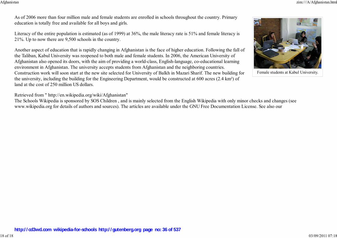
Female students at Kabul University.
As of 2006 more than four million male and female students are enrolled in schools throughout the country. Primary
education is totally free and available for all boys and girls.
Literacy of the entire population is estimated (as of 1999) at 36%, the male literacy rate is 51% and female literacy is
21%. Up to now there are 9,500 schools in the country.
Another aspect of education that is rapidly changing in Afghanistan is the face of higher education. Following the fall of
the Taliban, Kabul University was reopened to both male and female students. In 2006, the American University of
Afghanistan also opened its doors, with the aim of providing a world-class, English-language, co-educational learning
environment in Afghanistan. The university accepts students from Afghanistan and the neighboring countries.
Construction work will soon start at the new site selected for University of Balkh in Mazari Sharif. The new building for
the university, including the building for the Engineering Department, would be constructed at 600 acres (2.4 km²) of
land at the cost of 250 million US dollars.
Retrieved from " http://en.wikipedia.org/wiki/Afghanistan"
The Schools Wikipedia is sponsored by SOS Children , and is mainly selected from the English Wikipedia with only minor checks and changes (see
www.wikipedia.org for details of authors and sources). The articles are available under the GNU Free Documentation License. See also our
Afghanistan zim:///A/Afghanistan.html
18 of 18 03/09/2011 07:18
http://cd3wd.com wikipedia-for-schools http://gutenberg.org page no: 36 of 537

�������� ���� �Gônoprojatontri Bangladesh
People's Republic of Bangladesh
Image:COA ofBangladesh.svg
Flag Coat of arms
Anthem: Amar Shonar BanglaMy Golden Bengal
Capital
(and largest city)
Dhaka
Official languages Bengali (Bangla)
Demonym Bangladeshi
Government Parliamentary
republic
- President lajuddin Ahmed
Bangladesh
2008/9 Schools Wikipedia Selection. Related subjects: Asia; Asian Countries
SOS Children works in Bangladesh. For more information see SOS Children in Bangladesh
Bangladesh (Bengali: �������� [ˈbaŋlad̪eʃ] Bangladesh), officially the People's Republic of
Bangladesh (Bengali: ���� � �������� Gônoprojatontri Bangladesh), is a country in South Asia. It
is bordered by India on all sides except for a small border with Myanmar to the far southeast and by the
Bay of Bengal to the south. Together with the Indian state of West Bengal, it makes up the ethno-
linguistic region of Bengal. The name Bangladesh means "Country of Bengal" in the official Bengali
language.
The borders of the region that constitutes present-day Bangladesh were established in the 1947 Partition
of India when the region became the eastern wing of newly formed Pakistan. The pairing, based on their
common religion (Islam), proved geographically awkward since an expanse of foreign Indian territory,
1 600 km (1 000 mi) wide, separated the two wings. Subjected to political and linguistic discrimination as
well as economic neglect at the hands of West Pakistan, the Bengalis of East Pakistan declared
independence in 1971. After a liberation war, with help from India and the Soviet Union, Bangladesh was
born. In spite of its liberation narrative, Bangladesh's development has since been marred by political
turmoil, with fourteen different heads of government and at least four military coups.
Bangladesh is among the most densely populated countries in the world and has a high poverty level.
Geographically the country straddles the fertile Ganges-Brahmaputra Delta and is subject to annual
monsoon floods and cyclones. The government is a parliamentary democracy which has been suspended
under emergency law since 11 January 2007. Bangladesh is a member of the Commonwealth of Nations,
SAARC, BIMSTEC, the OIC, and the D-8.
History
Bangladesh zim:///A/Bangladesh.html
1 of 11 03/09/2011 07:19
http://cd3wd.com wikipedia-for-schools http://gutenberg.org page no: 37 of 537

- Prime Minister vacant
- Chief Adviser (Interim
Caretaker Government) Fakhruddin Ahmed
Independence from Pakistan
- Declared March 26, 1971
- Victory Day December 16 1971
Area
- Total 144,000 km² ( 94th)
55,599 sq mi
- Water (%) 7.0
Population
- 2007 estimate 150,448,340 ( 7th)
- Density 1045/km² ( 11th)
2,706/sq mi
GDP ( PPP) 2007 estimate
- Total US$360.9 billion (
31st)
- Per capita US$2,270 ( 144th)
Gini (2000) 31.8 (medium)
HDI (2007) ▲ 0.547 (medium) (
140th)
Currency Taka ( BDT)
Time zone BDT ( UTC+6)
- Summer ( DST) not observed (
UTC+6)
Internet TLD .bd
Calling code +880
Adjusted population, p.4, Population Census 2001, Preliminary
Report. Bangladesh Bureau of Statistics (2001-08).
The Shaheed Minar, whichcommemorates the LanguageMovement, is a well known
landmark in Bangladesh.
Remnants of civilisation in the greater Bengal region date back four
thousand years, when the region was settled by Dravidian, Tibeto-
Burman, and Austro-Asiatic peoples. The exact origin of the word
"Bangla" or "Bengal" is unknown, though it is believed to be derived
from Bang, the Dravidian-speaking tribe that settled in the area
around the year 1000 BC.
After the arrival of Indo-Aryans, the kingdom of Gangaridai was
formed from at least the seventh century BC, which later united with
Bihar under the Magadha and Maurya Empires. Bengal was later
part of the Gupta Empire from the third to the sixth centuries CE.
Following its collapse, a dynamic Bengali named Shashanka founded
an impressive yet short-lived kingdom. Shashanka is considered as
the first independent king in the history of Bangladesh.After a period
of anarchy, the Buddhist Pala dynasty ruled the region for four hundred years, followed by a shorter
reign of the Hindu Sena dynasty. Islam was introduced to Bengal in the twelfth century by Sufi
missionaries, and subsequent Muslim conquests helped spread Islam throughout the region. Bakhtiar
Khilji, a Turkish general, defeated Lakshman Sen of the Sena dynasty and conquered large parts of
Bengal. The region was ruled by dynasties of Sultans and feudal lords for the next few hundred years. By
the 16th century, the Mughal Empire controlled Bengal, and Dhaka became an important provincial
centre of Mughal administration.
European traders arrived late in the 15th century, and their influence grew until the British East India
Company gained control of Bengal following the Battle of Plassey in 1757. The bloody rebellion of 1857,
known as the Sepoy Mutiny, resulted in transfer of authority to the crown, with a British viceroy running
the administration. During colonial rule, famine racked the Indian subcontinent many times, including the
Great Bengal famine of 1943 that claimed 3 million lives.
Between 1905 and 1911, an abortive attempt was made to divide the province of Bengal into two zones,
with Dhaka being the capital of the eastern zone. When India was partitioned in 1947, Bengal was
partitioned along religious lines, with the western part going to India and the eastern part joining Pakistan
as a province called East Bengal (later renamed East Pakistan), with its capital at Dhaka.
In 1950, land reform was accomplished in East Bengal with the abolishment of the feudal zamindari
system However, despite the economic and demographic weight of the east, Pakistan's government and
military were largely dominated by the upper classes from the west. The Bengali Language Movement of
1
Bangladesh zim:///A/Bangladesh.html
2 of 11 03/09/2011 07:19
http://cd3wd.com wikipedia-for-schools http://gutenberg.org page no: 38 of 537

Sheikh Mujibur Rahman,founder of Bangladesh.
1952 was the first sign of friction between the two wings of Pakistan. Dissatisfaction with the central government over economic and cultural issues continued
to rise through the next decade, during which the Awami League emerged as the political voice of the Bengali-speaking population. It agitated for autonomy in
the 1960s, and in 1966, its president Sheikh Mujibur Rahman was jailed; he was released in 1969 after an unprecedented popular uprising.
In 1970, a massive cyclone devastated the coast of East Pakistan, and the central government responded poorly. The Bengali
population's anger was compounded when Sheikh Mujibur Rahman, whose Awami League won a majority in Parliament in the 1970
elections, was blocked from taking office. After staging compromise talks with Mujib, President Yahya Khan arrested him on the
night of March 25, 1971, and launched Operation Searchlight, a sustained military assault on East Pakistan. Yahya's methods were
extremely bloody, and the violence of the war resulted in many civilian deaths. Chief targets included intellectuals and Hindus, and
about ten million refugees fled to neighbouring India (LaPorte, p. 103). Estimates of those massacred range from three hundred
thousand to 3 million.
Most of the Awami League leaders fled and set up a government-in-exile in Calcutta, India. The Bangladesh Liberation War lasted
for nine months. The guerrilla Mukti Bahini and Bengali regulars eventually received support from the Indian Armed Forces in
December 1971. Under the command of Lt. General J.S. Arora, the Indian Army achieved a decisive victory over Pakistan on 16
December, 1971, taking over 90,000 prisoners of war in the Indo-Pakistani War of 1971.
After its independence, Bangladesh became a parliamentary democracy, with Mujib as the Prime Minister. In the 1973
parliamentary elections, the Awami League gained an absolute majority. A nationwide famine occurred during 1973 and 1974, and
in early 1975, Mujib initiated a one-party socialist rule with his newly formed BAKSAL. On August 15, 1975, Mujib and his family were assassinated by
mid-level military officers.
A series of bloody coups and counter-coups in the following three months culminated in the ascent to power of General Ziaur Rahman, who reinstated
multi-party politics and founded the Bangladesh Nationalist Party (BNP). Zia's rule ended when he was assassinated in 1981 by elements of the military.
Bangladesh's next major ruler was General Hossain Mohammad Ershad, who gained power in a bloodless coup in 1982 and ruled until 1990, when he was
forced to resign under western donor pressure in a major shift in international policy after the end of communism when anti-communist dictators were no longer
felt necessary. Since then, Bangladesh has reverted to a parliamentary democracy. Zia's widow, Khaleda Zia, led the Bangladesh Nationalist Party to
parliamentary victory at the general election in 1991 and became the first female Prime Minister in Bangladesh's history. However, the Awami League, headed
by Sheikh Hasina, one of Mujib's surviving daughters, clinched power at the next election in 1996 but lost to the Bangladesh Nationalist Party again in 2001.
These two female ex-prime ministers are now in imprisonment in a sub-jail due to their suspected attachment with corruption.
In 11 January of 2007, following widespread violence, a caretaker government was appointed to administer the next general election. The country had suffered
from extensive corruption, disorder and political violence. The new caretaker government has made it a priority to root out corruption from all levels of
government. To this end, many notable politicians and officials, along with large numbers of lesser officials and party members, have been arrested on
corruption charges. The caretaker government claims to be paving the way for free and fair elections to be held before the end of 2008.
Bangladesh zim:///A/Bangladesh.html
3 of 11 03/09/2011 07:19
http://cd3wd.com wikipedia-for-schools http://gutenberg.org page no: 39 of 537
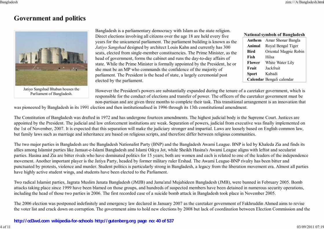
National symbols of Bangladesh
Anthem Amar Shonar Bangla
Animal Royal Bengal Tiger
Bird Oriental Magpie Robin
Fish Hilsa
Flower White Water Lily
Fruit Jackfruit
Sport Kabadi
Calendar Bengali calendar
Jatiyo Sangshad Bhaban houses theParliament of Bangladesh.
Government and politics
Bangladesh is a parliamentary democracy with Islam as the state religion.
Direct elections involving all citizens over the age 18 are held every five
years for the unicameral parliament. The parliament building is known as the
Jatiyo Sangshad designed by architect Louis Kahn and currently has 300
seats, elected from single-member constituencies. The Prime Minister, as the
head of government, forms the cabinet and runs the day-to-day affairs of
state. While the Prime Minister is formally appointed by the President, he or
she must be an MP who commands the confidence of the majority of
parliament. The President is the head of state, a largely ceremonial post
elected by the parliament.
However the President's powers are substantially expanded during the tenure of a caretaker government, which is
responsible for the conduct of elections and transfer of power. The officers of the caretaker government must be
non-partisan and are given three months to complete their task. This transitional arrangement is an innovation that
was pioneered by Bangladesh in its 1991 election and then institutionalised in 1996 through its 13th constitutional amendment.
The Constitution of Bangladesh was drafted in 1972 and has undergone fourteen amendments. The highest judicial body is the Supreme Court. Justices are
appointed by the President. The judicial and law enforcement institutions are weak. Separation of powers, judicial from executive was finally implemented on
the 1st of November, 2007. It is expected that this separation will make the judiciary stronger and impartial. Laws are loosely based on English common law,
but family laws such as marriage and inheritance are based on religious scripts, and therefore differ between religious communities.
The two major parties in Bangladesh are the Bangladesh Nationalist Party (BNP) and the Bangladesh Awami League. BNP is led by Khaleda Zia and finds its
allies among Islamist parties like Jamaat-e-Islami Bangladesh and Islami Oikya Jot, while Sheikh Hasina's Awami League aligns with leftist and secularist
parties. Hasina and Zia are bitter rivals who have dominated politics for 15 years; both are women and each is related to one of the leaders of the independence
movement. Another important player is the Jatiya Party, headed by former military ruler Ershad. The Awami League-BNP rivalry has been bitter and
punctuated by protests, violence and murder. Student politics is particularly strong in Bangladesh, a legacy from the liberation movement era. Almost all parties
have highly active student wings, and students have been elected to the Parliament.
Two radical Islamist parties, Jagrata Muslim Janata Bangladesh (JMJB) and Jama'atul Mujahideen Bangladesh (JMB), were banned in February 2005. Bomb
attacks taking place since 1999 have been blamed on those groups, and hundreds of suspected members have been detained in numerous security operations,
including the head of those two parties in 2006. The first recorded case of a suicide bomb attack in Bangladesh took place in November 2005.
The 2006 election was postponed indefinitely and emergency law declared in January 2007 as the caretaker government of Fakhruddin Ahmed aims to revise
the voter list and crack down on corruption. The government aims to hold new elections by 2008 but lack of coordination between Election Commission and the
Bangladesh zim:///A/Bangladesh.html
4 of 11 03/09/2011 07:19
http://cd3wd.com wikipedia-for-schools http://gutenberg.org page no: 40 of 537

Government, and their recent activities have created uncertainty about Election while the two leading candidates, Khaleda Zia and Sheikh Hasina, are facing
criminal charges in court and the banned indoor politics is yet to be exercised.
Meanwhile the Bangladesh Military has expressed their interest in controlling the country with statements like "own brand of Democracy" and making changes
in the constitution to allow military participation in politics. They are also assisting the interim Government of Bangladesh in a drive against corruption which
seems to be mostly targeted against the politicians. The military has also imposed censorship of the national media and closing down/hampering private TV
stations.
Foreign policy and military
Bangladesh pursues a moderate foreign policy that places heavy reliance on multinational diplomacy, especially at the United Nations. In 1974 Bangladesh
joined both the Commonwealth of Nations and the United Nations and has since been elected to serve two terms on the Security Council in 1978-1979 and
2000–2001. In the 1980s, Bangladesh played a lead role in founding the South Asian Association for Regional Cooperation (SAARC) in order to expand
relations with other South Asian states. Since the founding of SAARC 1985, a Bangladeshi has held the post of Secretary General on two occasions.
Bangladesh's most important and complex foreign relationships are with India and Pakistan. These relationships are informed by historical and cultural ties and
form an important part of the domestic political discourse.
Bangladesh's relationship with India began on a positive note because of India's assistance in the independence war and reconstruction. Throughout the years,
relations between both countries have fluctuated for a number of reasons. The Washington Post reported on a major source of tension between Bangladesh and
India, the Farakka Dam (article titled “India’s Major Gains and Losses in World Affairs” by M.M. Ali, March 1997, pg. 25). In 1975, India defied international
law and the rights of Bangladeshi people by building a dam on the Ganges River 11 miles (18 km) from the Bangladeshi border. The dam diverts much needed
water from Bangladesh and adds a man-made disaster to the country plagued by natural disasters. The dam also has terrible ecological consequences.
Bangladesh claims that India feels too comfortable in playing the role of "Big Brother" to smaller, weaker nations. India has voiced concerns about anti-Indian
separatists and Islamic militants allegedly being harboured across their 2,500-mile (4,000 km) border, as well as the flow of illegal migrants, and is building a
fence along most of it. But at the 2007 SAARC meeting both nations pledged to work cooperatively on security, economic and border issues.
The current strength of the army is around 200,000, the air force 7,000, and navy 14,950. In addition to traditional defense roles, the military has been called on
to provide support to civil authorities for disaster relief and internal security during periods of political unrest. Bangladesh is not currently active in any ongoing
war, but it did contribute 2,300 troops to the coalition that fought in the 1991 Gulf War and Bangladesh is consistently a top contributor to UN peacekeeping
forces around the world. As of May 2007, Bangladesh had major deployments in Democratic Republic of Congo, Liberia, Sudan, Timor-Leste and Cote d'Ivoire.
Bangladesh enjoys relatively warm ties with the People's Republic of China which has, particularly in the past decade, increased economic cooperation with the
South Asian nation. Between 2006-07, trade between the two nations rose by 28.5% and there have been agreements to grant various Bangladeshi commodities
tariff-free access to the Chinese market. Military cooperation between the Military of Bangladesh and the People's Liberation Army is also increasing, with joint
military agreements signed and Bangladesh procuring Chinese arms which range from small arms to large naval surface combatants such as the Chinese
Bangladesh zim:///A/Bangladesh.html
5 of 11 03/09/2011 07:19
http://cd3wd.com wikipedia-for-schools http://gutenberg.org page no: 41 of 537
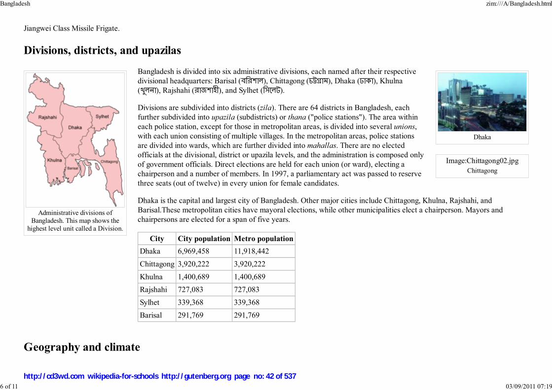
Administrative divisions ofBangladesh. This map shows the
highest level unit called a Division.
Dhaka
Image:Chittagong02.jpg
Chittagong
Jiangwei Class Missile Frigate.
Divisions, districts, and upazilas
Bangladesh is divided into six administrative divisions, each named after their respective
divisional headquarters: Barisal (������), Chittagong (�����), Dhaka (����), Khulna
(�����), Rajshahi (�������), and Sylhet (�����).
Divisions are subdivided into districts (zila). There are 64 districts in Bangladesh, each
further subdivided into upazila (subdistricts) or thana ("police stations"). The area within
each police station, except for those in metropolitan areas, is divided into several unions,
with each union consisting of multiple villages. In the metropolitan areas, police stations
are divided into wards, which are further divided into mahallas. There are no elected
officials at the divisional, district or upazila levels, and the administration is composed only
of government officials. Direct elections are held for each union (or ward), electing a
chairperson and a number of members. In 1997, a parliamentary act was passed to reserve
three seats (out of twelve) in every union for female candidates.
Dhaka is the capital and largest city of Bangladesh. Other major cities include Chittagong, Khulna, Rajshahi, and
Barisal.These metropolitan cities have mayoral elections, while other municipalities elect a chairperson. Mayors and
chairpersons are elected for a span of five years.
City City population Metro population
Dhaka 6,969,458 11,918,442
Chittagong 3,920,222 3,920,222
Khulna 1,400,689 1,400,689
Rajshahi 727,083 727,083
Sylhet 339,368 339,368
Barisal 291,769 291,769
Geography and climate
Bangladesh zim:///A/Bangladesh.html
6 of 11 03/09/2011 07:19
http://cd3wd.com wikipedia-for-schools http://gutenberg.org page no: 42 of 537

Satellite image presenting physicalfeatures of Bangladesh.
Bangladesh is located in the low-lying Ganges-Brahmaputra River Delta or Ganges Delta. This delta is formed by the
confluence of the Ganges (local name Padma or Pôdda), Brahmaputra ( Jamuna or Jomuna), and Meghna rivers and their
respective tributaries. The Ganges unites with the Jamuna (main channel of the Brahmaputra) and later joins the Meghna to
eventually empty into the Bay of Bengal. The alluvial soil deposited by these rivers has created some of the most fertile
plains in the world. Bangladesh has 58 trans-boundary rivers, making water issues politically complicated to resolve - in
most cases as the lower riparian state to India. Most parts of Bangladesh are less than 12 metres (39 ft) above the sea level,
and it is believed that about 50% of the land would be flooded if the sea level were to rise by 1 metre (3 ft).
The highest point in Bangladesh is in Mowdok range at 1,052 metres (3,451 ft) in the Chittagong Hill Tracts to the southeast
of the country. A major part of the coastline comprises a marshy jungle, the Sundarbans, the largest mangrove forest in the
world and home to diverse flora and fauna, including the Royal Bengal Tiger. In 1997, this region was declared endangered.
Straddling the Tropic of Cancer, Bangladeshi climate is tropical with a mild winter from October to March, a hot, humid
summer from March to June. A warm and humid monsoon season lasts from June to October and supplies most of the
country's rainfall. Natural calamities, such as floods, tropical cyclones, tornadoes, and tidal bores occur almost every year,
combined with the effects of deforestation, soil degradation and erosion. Cox's Bazar, south of the city of Chittagong, has a
beach that stretches uninterrupted over 120 kilometres (75 mi).
In September 1998 Bangladesh saw the most severe flooding the modern world has seen. As the Brahmaputra, Ganges and Meghna split over and swallowed
300,000 houses, 6,000 miles (9,700 km) of road and 1,600 miles (2,600 km) of embankmennt1,000 people were killed and 30 million more were made homeless
with 130,000 cattle killed, 50 square kilometres of land destroyed and 11,000 km of roads damaged or destroyed. 66% of the country was underwater. There
were several reasons for the severity of the flooding. Firstly, there were unusually high monsoon rains. Secondly, the Himalayas shed off an equally unusually
high amount of melt water that year. Lastly, trees that usually intercept rain water were cut down for fire wood or to make space for animals.
Economy
Bangladesh zim:///A/Bangladesh.html
7 of 11 03/09/2011 07:19
http://cd3wd.com wikipedia-for-schools http://gutenberg.org page no: 43 of 537

Near the town of Cox's Bazaar insouthern Bangladesh. Many industries
in Bangladesh are still primitive bymodern standards.
Image:BDricefield.jpg
Worker in a paddy field - acommon scene throughout
Bangladesh. The economy ofBangladesh is often cited to be
agro-based because of itsdependency on agriculture.
Despite sustained domestic and international efforts to improve economic and demographic prospects, Bangladesh
remains a developing nation, in part due to its large population. Its per capita income in 2006 was US$2300 (on
purchasing power parity basis) compared to the world average of $10,200. Yet, as the World Bank notes in its July 2005
Country Brief, the country has made significant progress in human development in the areas of literacy, gender parity in
schooling, and reduction of population growth.
Jute was once the economic engine of the country. Its share of the world export market peaked in the Second World War
and the late 1940s at 80% and even in the early 1970s accounted for 70% of its export earnings. However,
polypropylene products began to substitute for jute products worldwide and the jute industry started to decline.
Bangladesh grows very significant quantities of rice(chal), tea (Cha) and mustard. Although two-thirds of Bangladeshis
are farmers, more than three quarters of Bangladesh’s export earnings come from the garment industry, which began
attracting foreign investors in the 1980s due to cheap labour and low conversion cost. In 2002, the industry exported
US$5 billion worth of products. The industry now employs more than 3 million workers, 90% of whom are women. A
large part of foreign currency earnings also comes from the remittances sent by expatriates living in other countries.
Obstacles to growth include frequent cyclones and floods, inefficient state-owned enterprises, mismanaged port facilities, a
growth in the labour force that has outpaced jobs, inefficient use of energy resources (such as natural gas), insufficient power
supplies, slow implementation of economic reforms, political infighting and corruption. According to the World Bank, "among
Bangladesh’s most significant obstacles to growth are poor governance and weak public institutions."
Despite these hurdles, the country has achieved an average annual growth rate of 5% since 1990, according to the World Bank.
Bangladesh has seen expansion of its middle class, and its consumer industry has also grown. In December 2005, four years
after its report on the emerging " BRIC" economies (Brazil, Russia, India, and China), Goldman Sachs named Bangladesh one
of the " Next Eleven," along with Egypt, Indonesia, Pakistan and seven other countries. Bangladesh has seen a dramatic increase in foreign direct investment. A
number of multinational corporations, including Unocal Corporation and Tata, have made major investments, with the natural gas sector being a priority. In
December 2005, the Central Bank of Bangladesh projected GDP growth around 6.5%.
One significant contributor to the development of the economy has been the widespread propagation of microcredit by Muhammad Yunus (awarded the Nobel
peace prize in 2006) through the Grameen Bank. By the late 1990s, Grameen Bank had 2.3 million members, along with 2.5 million members of other similar
organisations.
In order to enhance economic growth, the government set up several export processing zones to attract foreign investment. These are managed by the
Bangladesh Export Processing Zone Authority.
Demographics
Bangladesh zim:///A/Bangladesh.html
8 of 11 03/09/2011 07:19
http://cd3wd.com wikipedia-for-schools http://gutenberg.org page no: 44 of 537

Recent (2005-2007) estimates of Bangladesh's population range from 142 to 159 million, making it the 7th most populous nation in the world. With a land area
of 144,000 square kilometers, ranked 94th), the population density is remarkable. A striking comparison is offered by the fact that Russia's population is slightly
smaller. Indeed Bangladesh has the highest population density in the world, excluding a handful of city-states. Bangladesh's population growth was among the
highest in the world in the 1960s and 1970s, when the count grew from 50 to 90 million, but with the promotion of birth control in the 1980s, the growth rate
slowed. The total fertility rate is now 3.1 children per woman, compared with 6.2 thirty years ago. The population is relatively young, with the 0–25 age group
comprising 60%, while 3% are 65 or older. Life expectancy is 63 years for both males and females.
Bangladesh is ethnically homogeneous, with Bengalis comprising 98% of the population. The remainder are mostly Bihari migrants and indigenous tribal groups.
There are thirteen tribal groups located in the Chittagong Hill Tracts, the most populous of the tribes are the Chakmas. The region has been a source for ethnic
tension since the inception of Bangladesh. The largest tribal groups outside the Hill Tracts are the Santhals and the Garos (Achiks). There are also Kaibartta,
Mundas, Oraons, and Zomi ethnic groups. Human trafficking has been a lingering problem in Bangladesh and illegal immigration has remained a cause of
friction with Myanmar and India..
The official and most widely used language in Bangladesh, as in West Bengal, is Bangla (Bengali) , an Indo-Aryan language of Sanskrit origin with its own
script. English is used as second language among the middle and upper classes and in higher education. Since a President Order in 1987, Bangla is used for all
official correspondence except those that are to foreign recipients.
Health and education levels have recently improved as poverty levels have decreased. Most Bangladeshis are rural, living on subsistence farming. Health
problems abound, ranging from surface water contamination, to arsenic in the groundwater, and diseases including malaria, leptospirosis and dengue. The
literacy rate in Bangladesh is approximately 41%. There is gender disparity, though, as literacy rates are 50% among men and 31% among women, according to
a 2004 UNICEF estimate. Literacy has gone up due to many programmes introduced in the country. Among the most successful ones are the Food for
education (FFE) programme introduced in 1993, and a stipend programme for women at the primary and secondary levels.
The two major religions practiced in Bangladesh are Islam (89.7%) and Hinduism (9.2%). About 96% of the Muslims are Sunni while over 3% are Shi'a and
remainders are Ahmadis. Ethnic Biharis are predominantly Shia Muslims. Other religious groups include Buddhists (0.7% and mostly of Theravada sect),
Christians (0.3% amd mostly of Catholic denomination), and Animists (0.1%). Bangladesh ranks fourth after Indonesia and Pakistan among Muslim majority
nations. As India has a higher Muslim population, Bangladesh ranks fourth in this category.
Culture
Bangladesh zim:///A/Bangladesh.html
9 of 11 03/09/2011 07:19
http://cd3wd.com wikipedia-for-schools http://gutenberg.org page no: 45 of 537

Ruins of the ancient Buddhistmonastery in Mahasthangarh, Bogra.
Intricate design in a Nakshikatha, atraditional stitched quilt.
A new state for an old nation, Bangladesh has a culture that encompasses elements both old and new. The Bengali
language boasts a rich literary heritage, which Bangladesh shares with the Indian state of West Bengal. The earliest
literary text in Bangla is the eighth century Charyapada. Bangla literature in the medieval age was often either religious
(e.g. Chandidas), or adaptations from other languages (e.g. Alaol). Bangla literature matured in the nineteenth century.
Its greatest icons are the poets Rabindranath Tagore and Kazi Nazrul Islam. Bangladesh also has a long tradition in folk
literature, evidenced by Maimansingha Gitika, Thakurmar Jhuli or stories related to Gopal Bhar.
The musical tradition of Bangladesh is lyrics-based (Baniprodhan), with minimal instrumental accompaniment. The Baul
tradition is a unique heritage of Bangla folk music, and there are numerous other musical traditions in Bangladesh, which
vary from one region to the other. Gombhira, Bhatiali, Bhawaiya are a few of the better-known musical forms. Folk
music of Bengal is often accompanied by the ektara, an instrument with only one string. Other instruments include the
dotara, dhol, flute, and tabla. Bangladesh also has an active heritage in North Indian classical music. Similarly,
Bangladeshi dance forms draw from folk traditions, especially those of the tribal groups, as well as the broader Indian
dance tradition. Bangladesh produces about 80 films a year. Mainstream Hindi films are also quite popular, as are films from Kolkata, which has its own thriving
Bengali-language movie industry. Around 200 dailies are published in Bangladesh, along with more than 1800 periodicals. However, regular readership is low,
nearly about 15% of the population. Bangladeshis listen to a variety of local and national radio programmes from Bangladesh Betar, as well as Bangla services
from the BBC and Voice of America. There is a state-controlled television channel, but in the last few years, privately owned channels have grown
considerably.
The culinary tradition of Bangladesh has close relations to Indian and Middle Eastern cuisine as well as having many
unique traits. Rice and curry are traditional favourites. Bangladeshis make distinctive sweetmeats from milk products;
some common ones are Rôshogolla, Chômchôm and Kalojam.
The sari (shaŗi) is by far the most widely worn dress by Bangladeshi women. However, the salwar kameez (shaloar
kamiz) is also quite popular, and in urban areas some women wear Western attire. Among men, European dressing has
greater acceptance. Men also use the kurta-paejama combination, often on religious occasions. The lungi, a kind of long
skirt, is widely worn by Bangladeshi men.
The two Eids, Eid ul-Fitr and Eid ul-Adha are the largest festivals in the Islamic calendar. The day before Eid ul-Fitr is
called Chãd Rat (the night of the Moon), and is often marked by firecrackers. Other Muslim holidays are also observed.
Major Hindu festivals are Durga Puja and Saraswati Puja. Buddha Purnima, which marks the birth of Gautama Buddha,
is one of the most important Buddhist festivals while Christmas, called Bôŗodin (Great day) in Bangla is celebrated by
the minority Christian population. The most important secular festival is Pohela Baishakh or Bengali New Year, the
beginning of the Bengali calendar. Other festivities include Nobanno, Poush parbon (festival of Poush) and observance
of national days like Shohid Dibosh.
Cricket is one of the most popular sports in Bangladesh. In 2000, the Bangladesh cricket team was granted Test cricket status and joined the elite league of
Bangladesh zim:///A/Bangladesh.html
10 of 11 03/09/2011 07:19
http://cd3wd.com wikipedia-for-schools http://gutenberg.org page no: 46 of 537

national teams permitted by the International Cricket Council to play test matches. Other popular sports include football (soccer), field hockey, tennis,
badminton, handball, volleyball, chess, carom, and kabadi, a seven-a-side team-sport played without a ball or any other equipment, which is the national sport
of Bangladesh. The Bangladesh Sports Control Board regulates twenty-nine different sporting federations.
Retrieved from " http://en.wikipedia.org/wiki/Bangladesh"
The Schools Wikipedia is sponsored by SOS Children , and is a hand-chosen selection of article versions from the English Wikipedia edited only by deletion (see
www.wikipedia.org for details of authors and sources). The articles are available under the GNU Free Documentation License. See also our
Bangladesh zim:///A/Bangladesh.html
11 of 11 03/09/2011 07:19
http://cd3wd.com wikipedia-for-schools http://gutenberg.org page no: 47 of 537

Brug rGyal-Khab ( Wylie)
Dru Gäkhap
Kingdom of Bhutan
Flag Emblem
Anthem: Druk Tsendhen Koepay Gyelkhab ("The
Glorious Dragon Kingdom of Bhutan")
Capital Thimphu
Official languages Dzongkha
Demonym Bhutanese
Government Democracy,
Bhutan
2008/9 Schools Wikipedia Selection. Related subjects: Asia; Asian Countries
The Kingdom of Bhutan (IPA: /buːˈtɑːn/) is a landlocked nation in South Asia. It is located amid the
eastern end of the Himalaya Mountains and is bordered to the south, east and west by India and to the
north by China. Bhutan is separated from Nepal by the Indian state of Sikkim. The Bhutanese call their
country �������, Druk Yul (land of the thunder dragon).
Bhutan is one of the most isolated and least developed nations in the world. Foreign influences and
tourism are regulated by the government to preserve the nation's traditional culture, identity and the
environment. In 2006, however, Business Week rated Bhutan the happiest country in Asia and the eighth
happiest country in the world. The landscape ranges from subtropical plains in the south to the
Himalayan heights in the north, with some peaks exceeding 7,000 metres (23,000 feet). The state religion
is Vajrayana Buddhism, and the population is predominantly Buddhist, with Hinduism being the second-
largest religion. The capital and largest city is Thimphu. After centuries of direct monarchic rule, Bhutan
held its first democratic elections in March 2008. Bhutan is a member of the South Asian Association for
Regional Cooperation (SAARC).
Name
"Bhutan" may be derived from the Sanskrit word Bhu-Utthan (highlands). In another theory of
Sanskritisation, Bhots-ant means "End of Tibet", as Bhutan is immediately to Tibet's south.
Historically Bhutan was known by many names, such as Lho Mon (southern land of darkness), Lho
Tsendenjong (southern land of the Tsenden cypress), Lhomen Khazhi (southern land of four approaches)
and Lho Men Jong (southern land of medicinal herbs). Bhutan is also commonly known as The Last
Shangrila.
History
Stone tools, weapons, elephants, and remnants of large stone structures provide evidence that Bhutan
was inhabited as early as 2000 BCE, although there are no existing records from that time. Historians
Bhutan zim:///A/Bhutan.html
1 of 14 03/09/2011 07:19
http://cd3wd.com wikipedia-for-schools http://gutenberg.org page no: 48 of 537

Constitutional Monarchy
- King Jigme Khesar Namgyal
Wangchuk
- Prime Minister Jigme Thinley ( DPT)
Formation Early 17th century
- Wangchuk Dynasty December 17, 1907
- Constitutional
Monarchy
2008
Area
- Total 47,000 km² ( 131st)
18,147 sq mi
- Water (%) Not available yet
Population
- estimate 672,425 (2005)1
- Density 45/km² ( 154th)
117/sq mi
GDP ( PPP) 2007 estimate
- Total $4.39 billion ( 160th)
- Per capita $5,477 ( 117th)
HDI (2007) ▲ 0.579 (medium) (
133th)
Currency Ngultrum ( BTN)
Time zone BTT ( UTC+6:00)
- Summer ( DST) not observed (
UTC+6:00)
Internet TLD .bt
Calling code +975
The population of Bhutan had been estimated based on the reported
figure of about 1 million in the 1970s when the country had joined
View of Tashichoedzong, Thimphu,seat of the Bhutanese government since
1952
have theorized that the state of Lhomon (literally, "southern darkness"), or Monyul ("Dark Land", a
reference to the Monpa, the aboriginal peoples of Bhutan) may have existed between 500 BCE and 600
CE.The names Lhomon Tsendenjong ( Sandalwood Country), and Lhomon Khashi, or Southern Mon
(country of four approaches) have been found in ancient Bhutanese and Tibetan chronicles.
The earliest transcribed event in Bhutan was the passage of the
Buddhist saint Padma Sambhava (also known as Guru
Rinpoche) in 747. Bhutan's early history is unclear, because
most of the records were destroyed after fire ravaged the
ancient capital, Punakha, in 1827. By the 10th century,
Bhutan's political development was heavily influenced by its
religious history. However, there is no sufficient information
stating that all historical records were available before the fire.
Various sub-sects of Buddhism emerged which were patronised
by the various Mongol and Tibetan overlords. After the decline
of the Mongols in the 14th century, these sub-sects vied with
each other for supremacy in the political and religious
landscape, eventually leading to the ascendancy of the Drukpa
sub-sect by the 16th century.
Until the early 17th century, Bhutan existed as a patchwork of
minor warring fiefdoms, when the area was unified by the
Tibeten lama and military leader Shabdrung Ngawang Namgyal. To defend the country against
intermittent Tibetan forays, Namgyal built a network of impregnable dzong (fortresses), and promulgated
a code of law that helped to bring local lords under centralised control. Many such dzong still exist. After
Namgyal's death in 1651, Bhutan fell into civil war. Taking advantage of the chaos, the Tibetans attacked
Bhutan in 1710, and again in 1730 with the help of the Mongols. Both assaults were successfully
thwarted, and an armistice was signed in 1759.
1
Bhutan zim:///A/Bhutan.html
2 of 14 03/09/2011 07:19
http://cd3wd.com wikipedia-for-schools http://gutenberg.org page no: 49 of 537
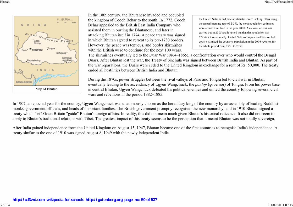
the United Nations and precise statistics were lacking . Thus using
the annual increase rate of 2-3%, the most population estimates
were around 2 million in the year 2000. A national census was
carried out in 2005 and it turned out that the population was
672,425. Consequently, United Nations Population Division had
down-estimated the country's population in the 2006 revision for
the whole period from 1950 to 2050.
Map of Bhutan
In the 18th century, the Bhutanese invaded and occupied
the kingdom of Cooch Behar to the south. In 1772, Cooch
Behar appealed to the British East India Company who
assisted them in ousting the Bhutanese, and later in
attacking Bhutan itself in 1774. A peace treaty was signed
in which Bhutan agreed to retreat to its pre-1730 borders.
However, the peace was tenuous, and border skirmishes
with the British were to continue for the next 100 years.
The skirmishes eventually led to the Duar War (1864–1865), a confrontation over who would control the Bengal
Duars. After Bhutan lost the war, the Treaty of Sinchula was signed between British India and Bhutan. As part of
the war reparations, the Duars were ceded to the United Kingdom in exchange for a rent of Rs. 50,000. The treaty
ended all hostilities between British India and Bhutan.
During the 1870s, power struggles between the rival valleys of Paro and Tongsa led to civil war in Bhutan,
eventually leading to the ascendancy of Ugyen Wangchuck, the ponlop (governor) of Tongsa. From his power base
in central Bhutan, Ugyen Wangchuck defeated his political enemies and united the country following several civil
wars and rebellions in the period 1882–1885.
In 1907, an epochal year for the country, Ugyen Wangchuck was unanimously chosen as the hereditary king of the country by an assembly of leading Buddhist
monks, government officials, and heads of important families. The British government promptly recognised the new monarchy, and in 1910 Bhutan signed a
treaty which "let" Great Britain "guide" Bhutan's foreign affairs. In reality, this did not mean much given Bhutan's historical reticence. It also did not seem to
apply to Bhutan's traditional relations with Tibet. The greatest impact of this treaty seems to be the perception that it meant Bhutan was not totally sovereign.
After India gained independence from the United Kingdom on August 15, 1947, Bhutan became one of the first countries to recognise India's independence. A
treaty similar to the one of 1910 was signed August 8, 1949 with the newly independent India.
Bhutan zim:///A/Bhutan.html
3 of 14 03/09/2011 07:19
http://cd3wd.com wikipedia-for-schools http://gutenberg.org page no: 50 of 537

The Trongsa Dzong.
In 1953, King Jigme Dorji Wangchuck established the country's legislature – a 130-member National Assembly – to
promote a more democratic form of governance. In 1965, he set up a Royal Advisory Council, and in 1968 he
formed a Cabinet. In 1971, Bhutan was admitted to the United Nations, having held observer status for three years.
In July 1972, Jigme Singye Wangchuck ascended to the throne at the age of 16 after the death of his father, Dorji
Wangchuck.
In the 1980s, in order to strengthen Bhutan’s identity as a nation, the "one nation, one people" campaign was started
to foster greater integration of the peripheral ethnic and cultural groups into mainstream Bhutanese society. The
age-old code of conduct, known as Driglam namzha, and usage of the official national language, Dzongkha, was
promoted. At around the same time, a nationwide census revealed a large population of Nepali origin in southern
Bhutan. When the government attempted to remove what it considered as illegal settlers, there was a violent
backlash; numerous acts of terrorism were carried out against government schools, hospitals, offices and neutral
southern Bhutanese. In order to re-establish order in the south, the government drafted many young men and able-bodied civil servants into a militia force.
Thousands of civilians, including a number of political dissidents, were expelled or fled to Nepal, where they were admitted into United Nations-run camps and
given refugee status. Despite the best efforts of the Bhutanese government Nepal and India, as well as outside parties such as the United Nations, the European
Union and the United States, a viable solution to this problem proves to be still elusive. At present, the United States is working towards resettling around 70,000
of these refugees in the US.
In 1998, King Jigme Singye Wangchuck introduced significant political reforms, transferring most of his administrative powers to the Council of Cabinet
Ministers and allowing for impeachment of the King by a two-thirds majority of the National Assembly. In late 2003, the Bhutanese army successfully launched
a large-scale operation to flush out anti-India insurgents who were operating training camps in southern Bhutan.
In 1999, the government lifted a ban on television and the Internet, making Bhutan one of the last countries to introduce television. In his speech, the King said
that television was a critical step to the modernisation of Bhutan as well as a major contributor to the country's Gross National Happiness (Bhutan is the only
country to measure happiness), but warned that the "misuse" of television could erode traditional Bhutanese values.
Bhutan zim:///A/Bhutan.html
4 of 14 03/09/2011 07:19
http://cd3wd.com wikipedia-for-schools http://gutenberg.org page no: 51 of 537
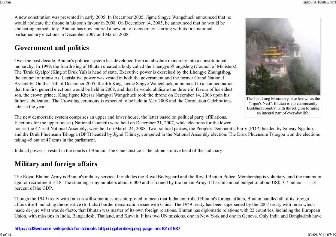
The Taktshang Monastery, also known as the"Tiger's Nest". Bhutan is a predominantly
Buddhist country, with the religion formingan integral part of everyday life.
A new constitution was presented in early 2005. In December 2005, Jigme Singye Wangchuck announced that he
would abdicate the throne in his son's favour in 2008. On December 14, 2005, he announced that he would be
abdicating immediately. Bhutan has now entered a new era of democracy, starting with its first national
parliamentary elections in December 2007 and March 2008.
Government and politics
Over the past decade, Bhutan's political system has developed from an absolute monarchy into a constitutional
monarchy. In 1999, the fourth king of Bhutan created a body called the Lhengye Zhungtshog (Council of Ministers).
The 'Druk Gyalpo' (King of Druk Yul) is head of state. Executive power is exercised by the Lhengye Zhungtshog,
the council of ministers. Legislative power was vested in both the government and the former Grand National
Assembly. On the 17th of December 2005, the 4th King, Jigme Singye Wangchuck, announced to a stunned nation
that the first general elections would be held in 2008, and that he would abdicate the throne in favour of his eldest
son, the crown prince. King Jigme Khesar Namgyal Wangchuck took the throne on December 14, 2006 upon his
father's abdication. The Crowning ceremony is expected to be held in May 2008 and the Coronation Celebrations
later in the year.
The new democratic system comprises an upper and lower house, the latter based on political party affiliations.
Elections for the upper house ( National Council) were held on December 31, 2007, while elections for the lower
house, the 47-seat National Assembly, were held on March 24, 2008. Two political parties, the People's Democratic Party (PDP) headed by Sangay Ngedup,
and the Druk Phuensum Tshogpa (DPT) headed by Jigmi Thinley, competed in the National Assembly election. The Druk Phuensum Tshogpa won the elections
taking 45 out of 47 seats in the parliament.
Judicial power is vested in the courts of Bhutan. The Chief Justice is the administrative head of the Judiciary.
Military and foreign affairs
The Royal Bhutan Army is Bhutan's military service. It includes the Royal Bodyguard and the Royal Bhutan Police. Membership is voluntary, and the minimum
age for recruitment is 18. The standing army numbers about 6,000 and is trained by the Indian Army. It has an annual budget of about US$13.7 million — 1.8
percent of the GDP.
Though the 1949 treaty with India is still sometimes misinterpreted to mean that India controlled Bhutan's foreign affairs, Bhutan handled all of its foreign
affairs itself including the sensitive (to India) border demarcation issue with China. The 1949 treaty has been superseded by the 2007 treaty with India which
made de-jure what was de-facto, that Bhutan was master of its own foreign relations. Bhutan has diplomatic relations with 22 countries, including the European
Union, with missions in India, Bangladesh, Thailand, and Kuwait. It has two UN missions, one in New York and one in Geneva. Only India and Bangladesh have
Bhutan zim:///A/Bhutan.html
5 of 14 03/09/2011 07:19
http://cd3wd.com wikipedia-for-schools http://gutenberg.org page no: 52 of 537

residential embassies in Bhutan, while Thailand has a consulate office in Bhutan.
By a long standing treaty, Indian and Bhutanese citizens may travel to each other's countries without a passport or visa using their national identity cards
instead. Bhutanese citizens may also work in India without legal restriction. Bhutan does not have formal diplomatic ties with its northern neighbour, China,
although exchanges of visits at various levels between the two have significantly increased in the recent past. The first bilateral agreement between China and
Bhutan was signed in 1998, and Bhutan has also set up consulates in Macau and Hong Kong. Bhutan’s border with China is largely not demarcated and thus
disputed in some places.
On November 13, 2005, Chinese soldiers crossed into Bhutan under the pretext that environmental conditions had forced their retreat south from the
Himalayas. The Bhutanese government allowed this incursion (after the fact) on humanitarian grounds. Soon after, the Chinese began building roads and bridges
within Bhutanese territory. Bhutanese Foreign Minister Khandu Wangchuk took up the matter with Chinese authorities after the issue was raised in Bhutanese
parliament. In response, Foreign Ministry spokesman Qin Gang of the People's Republic of China has said that the border remains in dispute and that the two
sides continue to work for a peaceful and cordial resolution of the dispute. An Indian intelligence officer has said that a Chinese delegation in Bhutan told the
Bhutanese that they were "overreacting." The Bhutanese newspaper Kuensel has said that China might use the roads to further Chinese claims along the border.
On February 8, 2007, the Indo-Bhutan Friendship Treaty PDF (30.6 KiB) was substantially revised. Whereas in the Treaty of 1949 Article 2 read as "The
Government of India undertakes to exercise no interference in the internal administration of Bhutan. On its part the Government of Bhutan agrees to be guided
by the advice of the Government of India in regard to its external relations."
In the revised treaty it now reads as "In keeping with the abiding ties of close friendship and cooperation between Bhutan and India, the Government of the
Kingdom of Bhutan and the Government of the Republic of India shall cooperate closely with each other on issues relating to their national interests. Neither
government shall allow the use of its territory for activities harmful to the national security and interest of the other." The revised treaty also includes in it the
preamble "Reaffirming their respect for each other's independence, sovereignty and territorial integrity", an element that was absent in the earlier version. The
Indo-Bhutan Friendship Treaty of 2007 strengthens Bhutan's status as an independent and sovereign nation.
Bhutan has no formal relations with the United States, Russia, the United Kingdom or France. Informal contact with the United States is made through the U.S.
embassy in New Delhi.
Geography
Bhutan zim:///A/Bhutan.html
6 of 14 03/09/2011 07:19
http://cd3wd.com wikipedia-for-schools http://gutenberg.org page no: 53 of 537

Topographic map of Bhutan
Gangkhar Puensum from Ura La, Bhutan
The northern region consists of an arc of glaciated mountain peaks with an extremely cold climate at the highest
elevations. Most peaks in the north are over 23,000 feet (7,000 m) above sea level; the highest point is claimed to
be the Kula Kangri, at 24,780 feet (7,553 m), but detailed topographic studies claim Kula Kangri is wholly in Tibet
and modern Chinese measurements claim that Gangkhar Puensum, which has the distinction of being the highest
unclimbed mountain in the world, is higher at 24,835 feet (7,570 m). Watered by snow-fed rivers, alpine valleys in
this region provide pasture for livestock, tended by a sparse population of migratory shepherds.
The Black Mountains in central Bhutan form a watershed between two major river systems: the Mo Chhu and the
Drangme Chhu. Peaks in the Black Mountains range between 4,900 feet and 8,900 feet (1,500 m and 2,700 m)
above sea level, and fast-flowing rivers have carved out deep gorges in the lower mountain areas. Woodlands of the
central region provide most of Bhutan's forest production. The Torsa, Raidak, Sankosh, and Manas are the main
rivers of Bhutan, flowing through this region. Most of the population lives in the central highlands.
Bhutan zim:///A/Bhutan.html
7 of 14 03/09/2011 07:19
http://cd3wd.com wikipedia-for-schools http://gutenberg.org page no: 54 of 537
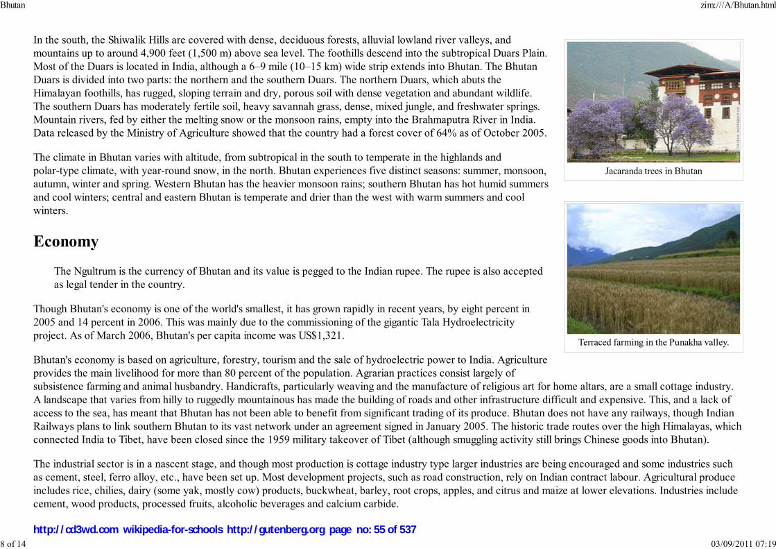
Jacaranda trees in Bhutan
Terraced farming in the Punakha valley.
In the south, the Shiwalik Hills are covered with dense, deciduous forests, alluvial lowland river valleys, and
mountains up to around 4,900 feet (1,500 m) above sea level. The foothills descend into the subtropical Duars Plain.
Most of the Duars is located in India, although a 6–9 mile (10–15 km) wide strip extends into Bhutan. The Bhutan
Duars is divided into two parts: the northern and the southern Duars. The northern Duars, which abuts the
Himalayan foothills, has rugged, sloping terrain and dry, porous soil with dense vegetation and abundant wildlife.
The southern Duars has moderately fertile soil, heavy savannah grass, dense, mixed jungle, and freshwater springs.
Mountain rivers, fed by either the melting snow or the monsoon rains, empty into the Brahmaputra River in India.
Data released by the Ministry of Agriculture showed that the country had a forest cover of 64% as of October 2005.
The climate in Bhutan varies with altitude, from subtropical in the south to temperate in the highlands and
polar-type climate, with year-round snow, in the north. Bhutan experiences five distinct seasons: summer, monsoon,
autumn, winter and spring. Western Bhutan has the heavier monsoon rains; southern Bhutan has hot humid summers
and cool winters; central and eastern Bhutan is temperate and drier than the west with warm summers and cool
winters.
Economy
The Ngultrum is the currency of Bhutan and its value is pegged to the Indian rupee. The rupee is also accepted
as legal tender in the country.
Though Bhutan's economy is one of the world's smallest, it has grown rapidly in recent years, by eight percent in
2005 and 14 percent in 2006. This was mainly due to the commissioning of the gigantic Tala Hydroelectricity
project. As of March 2006, Bhutan's per capita income was US$1,321.
Bhutan's economy is based on agriculture, forestry, tourism and the sale of hydroelectric power to India. Agriculture
provides the main livelihood for more than 80 percent of the population. Agrarian practices consist largely of
subsistence farming and animal husbandry. Handicrafts, particularly weaving and the manufacture of religious art for home altars, are a small cottage industry.
A landscape that varies from hilly to ruggedly mountainous has made the building of roads and other infrastructure difficult and expensive. This, and a lack of
access to the sea, has meant that Bhutan has not been able to benefit from significant trading of its produce. Bhutan does not have any railways, though Indian
Railways plans to link southern Bhutan to its vast network under an agreement signed in January 2005. The historic trade routes over the high Himalayas, which
connected India to Tibet, have been closed since the 1959 military takeover of Tibet (although smuggling activity still brings Chinese goods into Bhutan).
The industrial sector is in a nascent stage, and though most production is cottage industry type larger industries are being encouraged and some industries such
as cement, steel, ferro alloy, etc., have been set up. Most development projects, such as road construction, rely on Indian contract labour. Agricultural produce
includes rice, chilies, dairy (some yak, mostly cow) products, buckwheat, barley, root crops, apples, and citrus and maize at lower elevations. Industries include
cement, wood products, processed fruits, alcoholic beverages and calcium carbide.
Bhutan zim:///A/Bhutan.html
8 of 14 03/09/2011 07:19
http://cd3wd.com wikipedia-for-schools http://gutenberg.org page no: 55 of 537
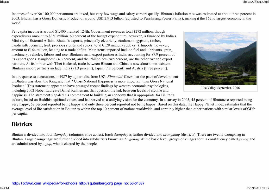
Haa Valley, September, 2006
Incomes of over Nu 100,000 per annum are taxed, but very few wage and salary earners qualify. Bhutan's inflation rate was estimated at about three percent in
2003. Bhutan has a Gross Domestic Product of around USD 2.913 billion (adjusted to Purchasing Power Parity), making it the 162nd largest economy in the
world.
Per capita income is around $1,400 , ranked 124th. Government revenues total $272 million, though
expenditures amount to $350 million. 60 percent of the budget expenditure, however, is financed by India's
Ministry of External Affairs. Bhutan's exports, principally electricity, cardamom, gypsum, timber,
handicrafts, cement, fruit, precious stones and spices, total €128 million (2000 est.). Imports, however,
amount to €164 million, leading to a trade deficit. Main items imported include fuel and lubricants, grain,
machinery, vehicles, fabrics and rice. Bhutan's main export partner is India, accounting for 87.9 percent of
its export goods. Bangladesh (4.6 percent) and the Philippines (two percent) are the other two top export
partners. As its border with Tibet is closed, trade between Bhutan and China is now almost non-existent.
Bhutan's import partners include India (71.3 percent), Japan (7.8 percent) and Austria (three percent).
In a response to accusations in 1987 by a journalist from UK's Financial Times that the pace of development
in Bhutan was slow, the King said that " Gross National Happiness is more important than Gross National
Product." This statement appears to have presaged recent findings by western economic psychologists,
including 2002 Nobel Laureate Daniel Kahneman, that question the link between levels of income and
happiness. The statement signaled his commitment to building an economy that is appropriate for Bhutan's
culture, based on Buddhist spiritual values, and has served as a unifying vision for the economy. In a survey in 2005, 45 percent of Bhutanese reported being
very happy, 52 percent reported being happy and only three percent reported not being happy. Based on this data, the Happy Planet Index estimates that the
average level of life satisfaction in Bhutan is within the top 10 percent of nations worldwide, and certainly higher than other nations with similar levels of GDP
per capita.
Districts
Bhutan is divided into four dzongdey (administrative zones). Each dzongdey is further divided into dzongkhag (districts). There are twenty dzongkhag in
Bhutan. Large dzongkhags are further divided into subdistricts known as dungkhag. At the basic level, groups of villages form a constituency called gewog and
are administered by a gup, who is elected by the people.
Bhutan zim:///A/Bhutan.html
9 of 14 03/09/2011 07:19
http://cd3wd.com wikipedia-for-schools http://gutenberg.org page no: 56 of 537

Dzongkhags(districts) of Bhutan.
Bumthang1.
Chukha (old spelling: Chhukha)2.
Dagana3.Gasa4.
Haa5.
Lhuntse6.Mongar7.
Paro8.
Pemagatshel (Pemagatsel)9.Punaka10.
Samdrup Jongkhar11.
Samtse (Samchi)12.
Sarpang13.Thimphu14.
Trashigang (Tashigang)15.
Trashiyangste16.Trongsa (Tongsa)17.
Tsirang (Chirang)18.
Wangdue Phodrang (Wangdi Phodrang)19.Zhemgang (Shemgang)20.
Cities and towns
Jakar, the administrative headquarters of Bumthang District and the place where Buddhism entered Bhutan.
Mongar, the eastern commercial hub of the country.Paro, Bhutan, site of the international airport.
Punakha, the old capital.
Phuentsholing, Bhutan's commercial hub.Samdrup Jongkhar
Thimphu, the largest city and capital of Bhutan.
Trashigang, the most populous district in the country.Trongsa, in central Bhutan which has the largest and the most magnificent of all the dzongs in Bhutan.
Demographics
Bhutan zim:///A/Bhutan.html
10 of 14 03/09/2011 07:19
http://cd3wd.com wikipedia-for-schools http://gutenberg.org page no: 57 of 537

Senior Bhutanese man in nationaldress.
Religions of Bhutanreligion percent
Buddhism 75%
Hinduism 24%
Others 1%
Among the Bhutanese people, several principal ethnic groups may be distinguished. The second dominant group is the
Ngalops, a Buddhist group based in the western part of the country. Their culture is closely related to that of Tibet. Much
the same could be said of the Sharchops ("Easterners"), the dominant group, who are associated with the eastern part of
Bhutan (but who traditionally follow the Nyingmapa rather than the official Drukpa Kagyu form of Himalayan Buddhism).
They are called the Western Bhutanese and Eastern Bhutanese respectively. In modern times, with improved transportation
infrastructure, there has been much intermarriage between these groups. In the early 1970s, intermarriage between the
Lhotshampas and main stream Bhutanese society was encouraged by the government.
The national language is Dzongkha, one of 53 languages in the Tibetan language family. The script, here called Chhokey
("Dharma Language"), is identical to classical Tibetan. In the schools English is the medium of instruction and Dzongkha is
taught as the national language. Ethnologue lists 24 languages currently spoken in Bhutan, all of them in the Tibeto-Burman
family, except Nepali, an Indo-Aryan language. Until the 1980s, the government sponsored the teaching of Nepali in schools
in Southern Bhutan. However, after the armed uprising in the south, Nepali was dropped from the curriculum. The
languages of Bhutan are still not well-characterized, and several have yet to be recorded in an in-depth academic grammar.
The literacy rate is 59.5 percent. The country has a median age of 22.3
years. Bhutan has a life expectancy of 62.2 years (61 for males and
64.5 for females) according to the latest data from the World Bank.
There are 1,070 males to every 1,000 females in the country.
It is estimated that between two third and three quarter of the Bhutanese population follow Mahayana Buddhism, which is also the state religion. About one
quarter to one third are followers of Hinduism. Muslim and non-religious communities account for less than 1 % of the population. The current legal framework
in principal guarantees freedom of religion; Proselytism, however, is forbidden by a Royal Government decision.
Culture
Bhutan zim:///A/Bhutan.html
11 of 14 03/09/2011 07:19
http://cd3wd.com wikipedia-for-schools http://gutenberg.org page no: 58 of 537
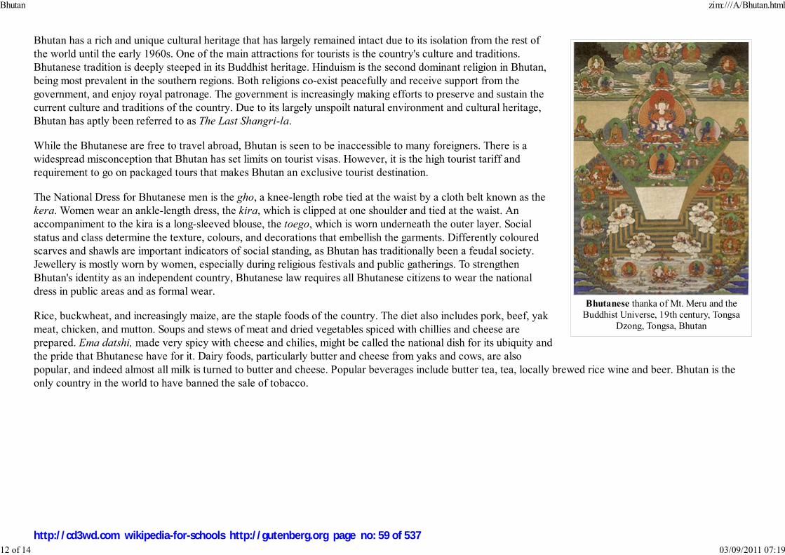
Bhutanese thanka of Mt. Meru and theBuddhist Universe, 19th century, Tongsa
Dzong, Tongsa, Bhutan
Bhutan has a rich and unique cultural heritage that has largely remained intact due to its isolation from the rest of
the world until the early 1960s. One of the main attractions for tourists is the country's culture and traditions.
Bhutanese tradition is deeply steeped in its Buddhist heritage. Hinduism is the second dominant religion in Bhutan,
being most prevalent in the southern regions. Both religions co-exist peacefully and receive support from the
government, and enjoy royal patronage. The government is increasingly making efforts to preserve and sustain the
current culture and traditions of the country. Due to its largely unspoilt natural environment and cultural heritage,
Bhutan has aptly been referred to as The Last Shangri-la.
While the Bhutanese are free to travel abroad, Bhutan is seen to be inaccessible to many foreigners. There is a
widespread misconception that Bhutan has set limits on tourist visas. However, it is the high tourist tariff and
requirement to go on packaged tours that makes Bhutan an exclusive tourist destination.
The National Dress for Bhutanese men is the gho, a knee-length robe tied at the waist by a cloth belt known as the
kera. Women wear an ankle-length dress, the kira, which is clipped at one shoulder and tied at the waist. An
accompaniment to the kira is a long-sleeved blouse, the toego, which is worn underneath the outer layer. Social
status and class determine the texture, colours, and decorations that embellish the garments. Differently coloured
scarves and shawls are important indicators of social standing, as Bhutan has traditionally been a feudal society.
Jewellery is mostly worn by women, especially during religious festivals and public gatherings. To strengthen
Bhutan's identity as an independent country, Bhutanese law requires all Bhutanese citizens to wear the national
dress in public areas and as formal wear.
Rice, buckwheat, and increasingly maize, are the staple foods of the country. The diet also includes pork, beef, yak
meat, chicken, and mutton. Soups and stews of meat and dried vegetables spiced with chillies and cheese are
prepared. Ema datshi, made very spicy with cheese and chilies, might be called the national dish for its ubiquity and
the pride that Bhutanese have for it. Dairy foods, particularly butter and cheese from yaks and cows, are also
popular, and indeed almost all milk is turned to butter and cheese. Popular beverages include butter tea, tea, locally brewed rice wine and beer. Bhutan is the
only country in the world to have banned the sale of tobacco.
Bhutan zim:///A/Bhutan.html
12 of 14 03/09/2011 07:19
http://cd3wd.com wikipedia-for-schools http://gutenberg.org page no: 59 of 537

Changlimithang National Stadium, during aparade.
Bhutan's national sport is archery, and competitions are held regularly in most villages. It differs from Olympic
standards not only in technical details such as the placement of the targets and atmosphere. There are two targets
placed over 100 meters apart and teams shoot from one end of the field to the other. Each member of the team
shoots two arrows per round. Traditional Bhutanese archery is a social event and competitions are organized
between villages, towns, and amateur teams. There are usually plenty of food and drink complete with singing and
dancing. Attempts to distract an opponent include standing around the target and making fun of the shooter's
ability. Darts (khuru) is an equally popular outdoor team sport, in which heavy wooden darts pointed with a 10 cm
nail are thrown at a paperback-sized target ten to 20 meters away.
Another traditional sport is the digor, which can be best described as shot put combined with horseshoe throwing.
Cricket has gained remarkable popularity in Bhutan, especially since the heavy influx of Indian Television. Their
national cricket team is one of the more successful associate nations in the region. Football is an increasingly
popular sport. In 2002, Bhutan's national football team played Montserrat - billed as The Other Final, the match
took place on the same day Brazil played Germany in the World Cup Final, but at the time Bhutan and Montserrat were the world's two lowest ranked teams.
The match was held in Thimphu's Changlimithang National Stadium, and Bhutan won 4-0. A documentary of the match was made by the Dutch filmmaker
Johan Kramer.
Rigsar is the new emergent style of popular music, played on a mix of traditional instruments and electronic keyboards, and dates back to the early 1990s; it
shows the influence of Indian popular music, a hybrid form of traditional and Western popular influences. Traditional genres include the zhungdra and boedra.
Bhutan zim:///A/Bhutan.html
13 of 14 03/09/2011 07:19
http://cd3wd.com wikipedia-for-schools http://gutenberg.org page no: 60 of 537

Chaam, sacred masked dances, areannually performed during
religious festivals.
Characteristic of the region is a type of castle fortress known as the dzong. Since ancient times, the dzongs have served as
the religious and secular administration centres for their respective districts.
Bhutan has numerous public holidays, most of which centre around traditional seasonal, secular and religious festivals. They
include the winter solstice (around January 1, depending on the lunar calendar), the lunar New Year (February or March),
the King's birthday and the anniversary of his coronation, the official start of monsoon season (September 22), National Day
(December 17), and various Buddhist and Hindu celebrations.
Masked dances and dance dramas are common traditional features at festivals, usually accompanied by traditional music.
Energetic dancers, wearing colourful wooden or composition face masks and stylized costumes, depict heroes, demons,
dæmons, death heads, animals, gods, and caricatures of common people. The dancers enjoy royal patronage, and preserve
ancient folk and religious customs and perpetuate the ancient lore and art of mask-making.
Inheritance in Bhutan generally goes in the female rather than the male line. Daughters will inherit their parents' house. A
man is expected to make his own way in the world and often moves to his wife's home. Love marriages are common in
urban areas, but the tradition of arranged marriages is still common in the villages. Although uncommon, polygamy and
polyandry are accepted; often being a device to keep property in a contained family unit rather than dispersing it.
Retrieved from " http://en.wikipedia.org/wiki/Bhutan"
This Wikipedia DVD Selection is sponsored by SOS Children , and consists of a hand selection from the English Wikipedia
articles with only minor deletions (see www.wikipedia.org for details of authors and sources). The articles are available under the
GNU Free Documentation License. See also our
Bhutan zim:///A/Bhutan.html
14 of 14 03/09/2011 07:19
http://cd3wd.com wikipedia-for-schools http://gutenberg.org page no: 61 of 537
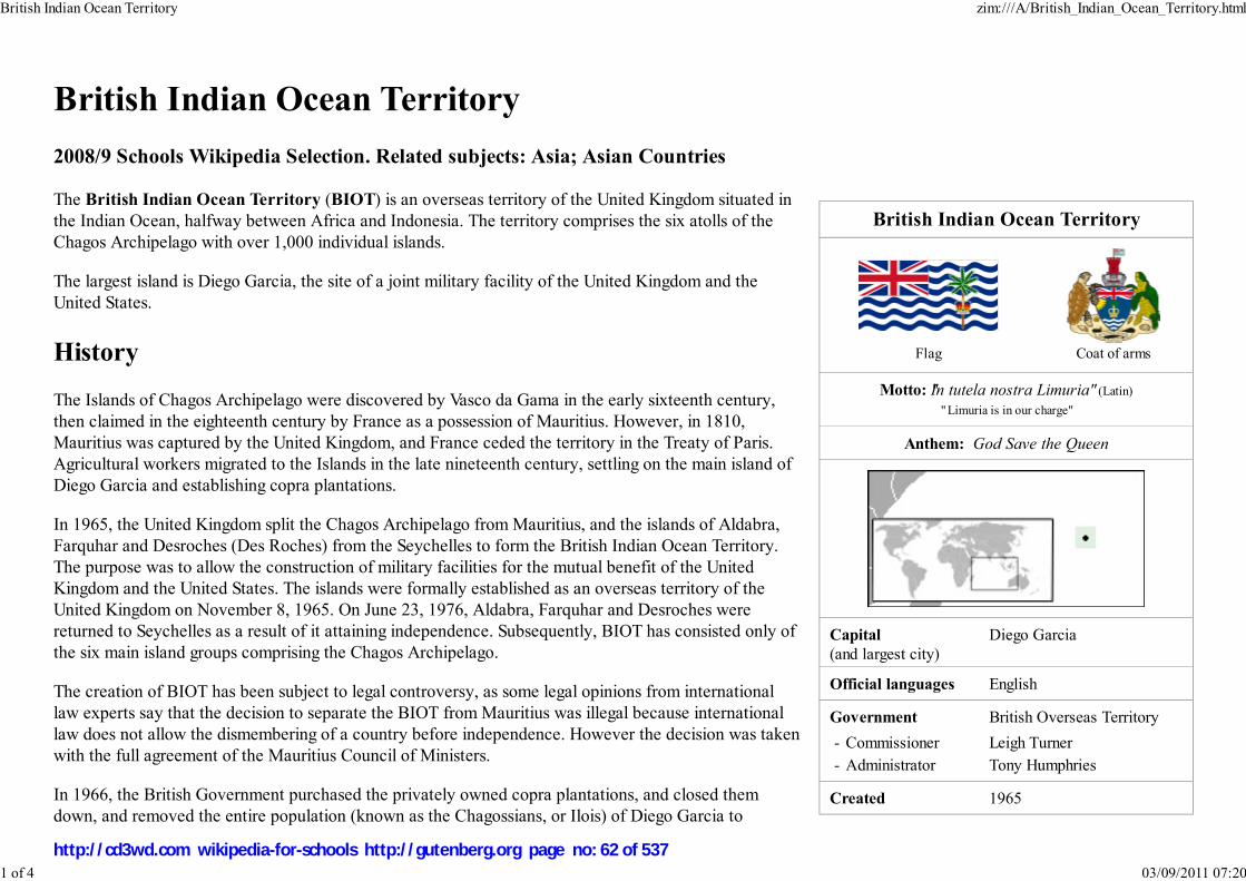
British Indian Ocean Territory
Flag Coat of arms
Motto: "In tutela nostra Limuria" (Latin)
" Limuria is in our charge"
Anthem: God Save the Queen
Capital
(and largest city)
Diego Garcia
Official languages English
Government British Overseas Territory
- Commissioner Leigh Turner
- Administrator Tony Humphries
Created 1965
British Indian Ocean Territory
2008/9 Schools Wikipedia Selection. Related subjects: Asia; Asian Countries
The British Indian Ocean Territory (BIOT) is an overseas territory of the United Kingdom situated in
the Indian Ocean, halfway between Africa and Indonesia. The territory comprises the six atolls of the
Chagos Archipelago with over 1,000 individual islands.
The largest island is Diego Garcia, the site of a joint military facility of the United Kingdom and the
United States.
History
The Islands of Chagos Archipelago were discovered by Vasco da Gama in the early sixteenth century,
then claimed in the eighteenth century by France as a possession of Mauritius. However, in 1810,
Mauritius was captured by the United Kingdom, and France ceded the territory in the Treaty of Paris.
Agricultural workers migrated to the Islands in the late nineteenth century, settling on the main island of
Diego Garcia and establishing copra plantations.
In 1965, the United Kingdom split the Chagos Archipelago from Mauritius, and the islands of Aldabra,
Farquhar and Desroches (Des Roches) from the Seychelles to form the British Indian Ocean Territory.
The purpose was to allow the construction of military facilities for the mutual benefit of the United
Kingdom and the United States. The islands were formally established as an overseas territory of the
United Kingdom on November 8, 1965. On June 23, 1976, Aldabra, Farquhar and Desroches were
returned to Seychelles as a result of it attaining independence. Subsequently, BIOT has consisted only of
the six main island groups comprising the Chagos Archipelago.
The creation of BIOT has been subject to legal controversy, as some legal opinions from international
law experts say that the decision to separate the BIOT from Mauritius was illegal because international
law does not allow the dismembering of a country before independence. However the decision was taken
with the full agreement of the Mauritius Council of Ministers.
In 1966, the British Government purchased the privately owned copra plantations, and closed them
down, and removed the entire population (known as the Chagossians, or Ilois) of Diego Garcia to
British Indian Ocean Territory zim:///A/British_Indian_Ocean_Territory.html
1 of 4 03/09/2011 07:20
http://cd3wd.com wikipedia-for-schools http://gutenberg.org page no: 62 of 537

Area
- Total 60 km² ( n/a)
23.2 sq mi
- Water (%) 0
Population
- estimate 3,500 ( n/a)
- Density 58.3/km² ( n/a)
160.0/sq mi
Currency Pound sterling1 ( GBP)
Time zone ( UTC+6)
Internet TLD .io
Calling code +246
U.S. dollar also accepted.
View of Diego Garcia, showing military
base.
Mauritius. In 1971, the United Kingdom and the United States signed a treaty, leasing the island of Diego
Garcia to the American military for the purposes of building a large air and naval base on the Island. The
deal was important to the United Kingdom, as the United States agreed to give them a substantial
discount on the purchase of Polaris nuclear missiles in return for the lease. The strategic location of the
Island was also significant at the centre of the Indian Ocean, and to counter any Soviet threat in the
region.
Work on the military base commenced in 1971, with a large
airbase with several long range runways constructed, as
well as a harbour suitable for large naval vessels. Although
classed as a joint UK/US base, in practice it is mainly
staffed by the American military, although a British garrison
is maintained at all times, and Royal Air Force long range
patrol aircraft are deployed there. The United States Air
Force used the base during the 1991 Gulf War and the 2001
war in Afghanistan, as well as the 2003 Iraq War.
During the 1980s, the Mauritian Government asserted a
claim to sovereignty for the territory, citing the 1965
separation as illegal under international law, despite their apparent agreement at the time. The Seychelles also
launched a sovereignty claim on several of the Islands.
The islanders, who now reside in Mauritius and the Seychelles have continually asserted their right to return to Diego Garcia, winning important legal victories
in the English High Court of Justice in 2000, 2002 and 2007. These judgements were appealed by the British Government, who subsequently lost the appeals.
On 11 May 2006 the High Court ruled that the Order-in-Council was unlawful, and consequently that the Chagossians were entitled to return to the Chagos
Archipelago. On 23 May 2007, this was confirmed by the Court of Appeal. The islanders were granted the right to visit Diego Garcia on April 3, 2006 for
humanitarian purposes, including the tending of the graves of their ancestors.
Politics and law
1
British Indian Ocean Territory zim:///A/British_Indian_Ocean_Territory.html
2 of 4 03/09/2011 07:20
http://cd3wd.com wikipedia-for-schools http://gutenberg.org page no: 63 of 537

BIOT prior to Seychelles independence in 1976.
(Desroches is not shown, but is a part of the
Amirante Islands).
As this is a territory of the United Kingdom, the head of state is Queen Elizabeth II. There is no Governor
appointed to represent the Queen on the territory, as there are currently no longer any native inhabitants.
The head of government is the Commissioner, currently Leigh Turner (since July 2006, replacing Tony
Crombie) and Administrator Tony Humphries (since February 2005, replacing Charles A. Hamilton), all of
whom reside in the UK. The Commissioner's representative in the Territory is the officer commanding the
detachment of British forces.
The laws of the territory are based on the constitution, set out in the British Indian Ocean Territory
(Constitution) Order 2004, which gives the Commissioner full powers to make laws for the Territory.
Applicable treaties between the United Kingdom and the United States govern the use of the military base.
The United States is required to ask permission of the United Kingdom to use the base for offensive military
action.
The UK has an agreement with Mauritius to return the territory in the event that they are no longer required for defense purposes.
Geography and communications
British Indian Ocean Territory zim:///A/British_Indian_Ocean_Territory.html
3 of 4 03/09/2011 07:20
http://cd3wd.com wikipedia-for-schools http://gutenberg.org page no: 64 of 537
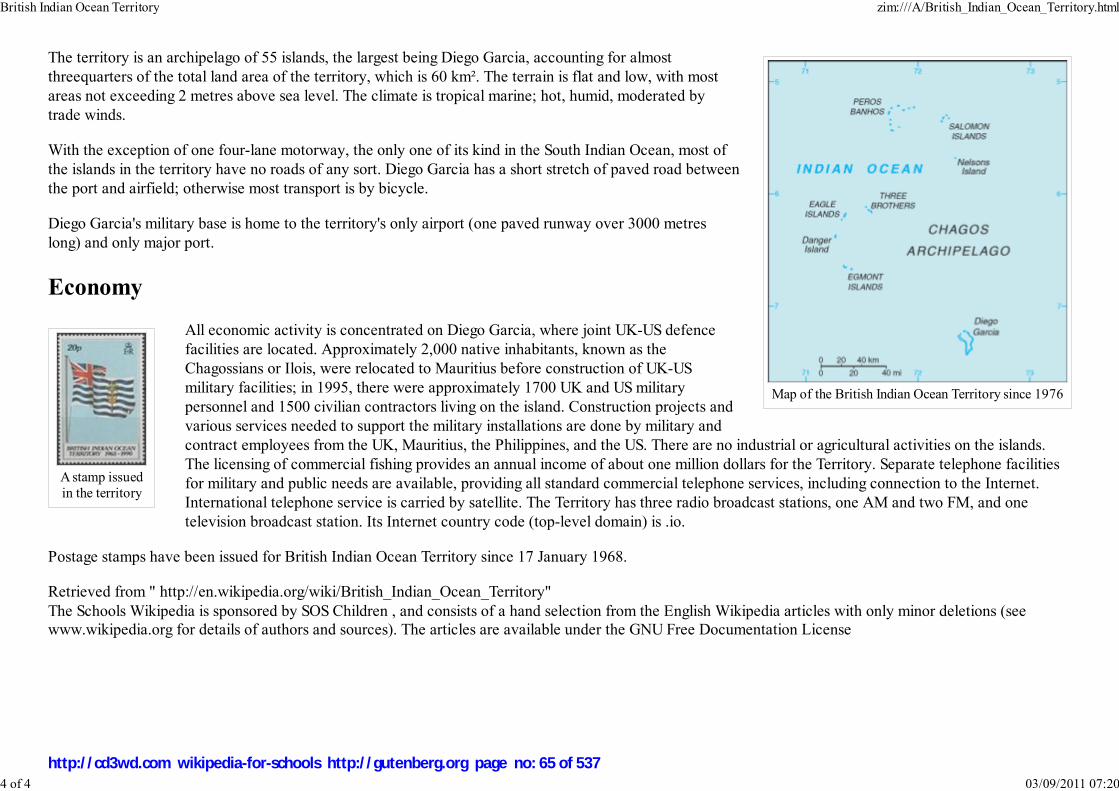
Map of the British Indian Ocean Territory since 1976
A stamp issued
in the territory
The territory is an archipelago of 55 islands, the largest being Diego Garcia, accounting for almost
threequarters of the total land area of the territory, which is 60 km². The terrain is flat and low, with most
areas not exceeding 2 metres above sea level. The climate is tropical marine; hot, humid, moderated by
trade winds.
With the exception of one four-lane motorway, the only one of its kind in the South Indian Ocean, most of
the islands in the territory have no roads of any sort. Diego Garcia has a short stretch of paved road between
the port and airfield; otherwise most transport is by bicycle.
Diego Garcia's military base is home to the territory's only airport (one paved runway over 3000 metres
long) and only major port.
Economy
All economic activity is concentrated on Diego Garcia, where joint UK-US defence
facilities are located. Approximately 2,000 native inhabitants, known as the
Chagossians or Ilois, were relocated to Mauritius before construction of UK-US
military facilities; in 1995, there were approximately 1700 UK and US military
personnel and 1500 civilian contractors living on the island. Construction projects and
various services needed to support the military installations are done by military and
contract employees from the UK, Mauritius, the Philippines, and the US. There are no industrial or agricultural activities on the islands.
The licensing of commercial fishing provides an annual income of about one million dollars for the Territory. Separate telephone facilities
for military and public needs are available, providing all standard commercial telephone services, including connection to the Internet.
International telephone service is carried by satellite. The Territory has three radio broadcast stations, one AM and two FM, and one
television broadcast station. Its Internet country code (top-level domain) is .io.
Postage stamps have been issued for British Indian Ocean Territory since 17 January 1968.
Retrieved from " http://en.wikipedia.org/wiki/British_Indian_Ocean_Territory"
The Schools Wikipedia is sponsored by SOS Children , and consists of a hand selection from the English Wikipedia articles with only minor deletions (see
www.wikipedia.org for details of authors and sources). The articles are available under the GNU Free Documentation License
British Indian Ocean Territory zim:///A/British_Indian_Ocean_Territory.html
4 of 4 03/09/2011 07:20
http://cd3wd.com wikipedia-for-schools http://gutenberg.org page no: 65 of 537
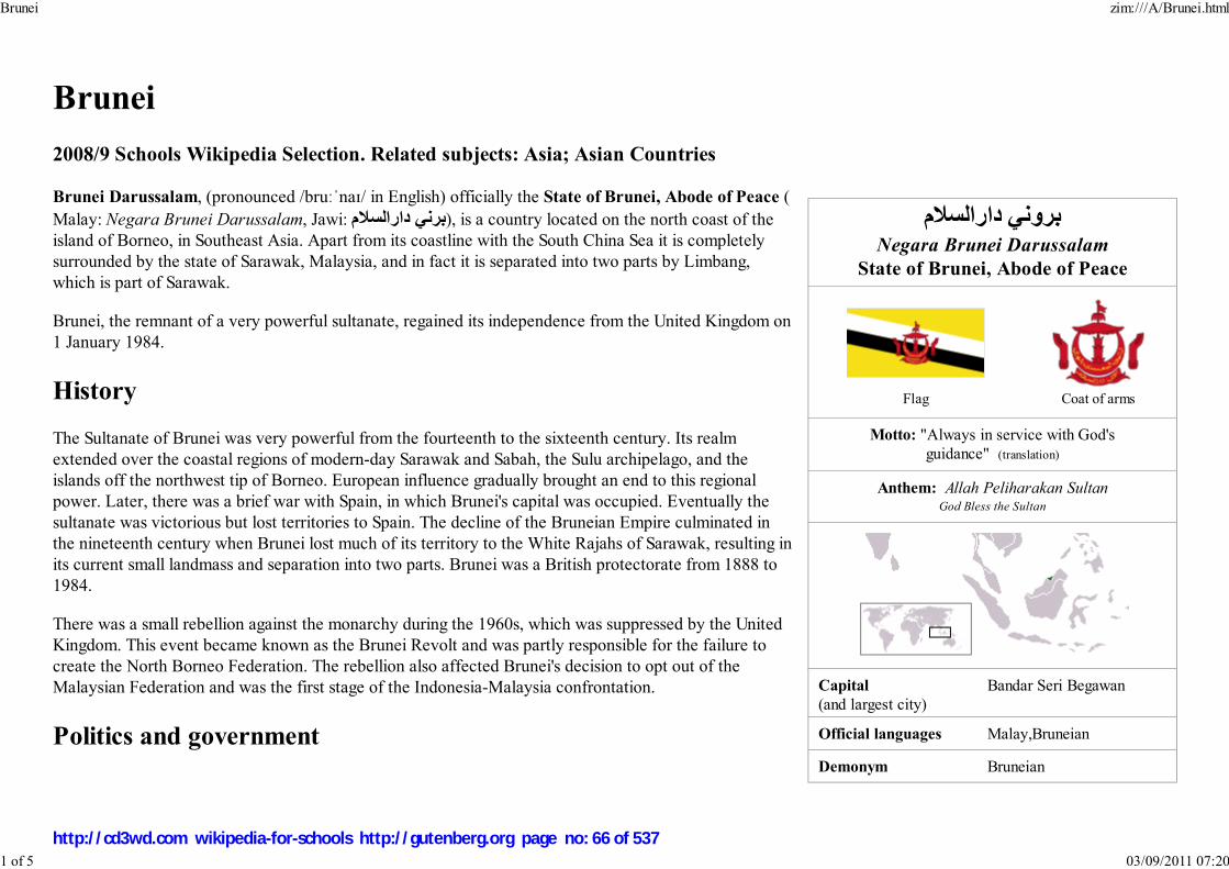
بروني دارالس�مNegara Brunei Darussalam
State of Brunei, Abode of Peace
Flag Coat of arms
Motto: "Always in service with God's
guidance" (translation)
Anthem: Allah Peliharakan SultanGod Bless the Sultan
Capital(and largest city)
Bandar Seri Begawan
Official languages Malay,Bruneian
Demonym Bruneian
Brunei
2008/9 Schools Wikipedia Selection. Related subjects: Asia; Asian Countries
Brunei Darussalam, (pronounced /bruːˈnaɪ/ in English) officially the State of Brunei, Abode of Peace (
Malay: Negara Brunei Darussalam, Jawi: برني دارالس�م), is a country located on the north coast of the
island of Borneo, in Southeast Asia. Apart from its coastline with the South China Sea it is completely
surrounded by the state of Sarawak, Malaysia, and in fact it is separated into two parts by Limbang,
which is part of Sarawak.
Brunei, the remnant of a very powerful sultanate, regained its independence from the United Kingdom on
1 January 1984.
History
The Sultanate of Brunei was very powerful from the fourteenth to the sixteenth century. Its realm
extended over the coastal regions of modern-day Sarawak and Sabah, the Sulu archipelago, and the
islands off the northwest tip of Borneo. European influence gradually brought an end to this regional
power. Later, there was a brief war with Spain, in which Brunei's capital was occupied. Eventually the
sultanate was victorious but lost territories to Spain. The decline of the Bruneian Empire culminated in
the nineteenth century when Brunei lost much of its territory to the White Rajahs of Sarawak, resulting in
its current small landmass and separation into two parts. Brunei was a British protectorate from 1888 to
1984.
There was a small rebellion against the monarchy during the 1960s, which was suppressed by the United
Kingdom. This event became known as the Brunei Revolt and was partly responsible for the failure to
create the North Borneo Federation. The rebellion also affected Brunei's decision to opt out of the
Malaysian Federation and was the first stage of the Indonesia-Malaysia confrontation.
Politics and government
Brunei zim:///A/Brunei.html
1 of 5 03/09/2011 07:20
http://cd3wd.com wikipedia-for-schools http://gutenberg.org page no: 66 of 537
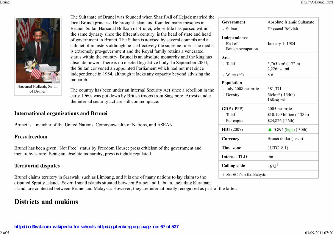
Government Absolute Islamic Sultanate
- Sultan Hassanal Bolkiah
Independence
- End of
British occupation
January 1, 1984
Area
- Total 5,765 km² ( 172th)
2,226 sq mi
- Water (%) 8.6
Population
- July 2008 estimate 381,371
- Density 66/km² ( 134th)
168/sq mi
GDP ( PPP) 2005 estimate
- Total $10.199 billion ( 138th)
- Per capita $24,826 ( 26th)
HDI (2007) ▲ 0.894 (high) ( 30th)
Currency Brunei dollar ( BND)
Time zone ( UTC+8.1)
Internet TLD .bn
Calling code +6731
Also 080 from East Malaysia
Hassanal Bolkiah, Sultanof Brunei.
The Sultanate of Brunei was founded when Sharif Ali of Hejadz married the
local Brunei princess. He brought Islam and founded many mosques in
Brunei. Sultan Hassanal Bolkiah of Brunei, whose title has passed within
the same dynasty since the fifteenth century, is the head of state and head
of government in Brunei. The Sultan is advised by several councils and a
cabinet of ministers although he is effectively the supreme ruler. The media
is extremely pro-government and the Royal family retains a venerated
status within the country. Brunei is an absolute monarchy and the king has
absolute power. There is no elected legislative body. In September 2004,
the Sultan convened an appointed Parliament which had not met since
independence in 1984, although it lacks any capacity beyond advising the
monarch.
The country has been under an Internal Security Act since a rebellion in the
early 1960s was put down by British troops from Singapore. Arrests under
the internal security act are still commonplace.
International organisations and Brunei
Brunei is a member of the United Nations, Commonwealth of Nations, and ASEAN.
Press freedom
Brunei has been given "Not Free" status by Freedom House; press criticism of the government and
monarchy is rare. Being an absolute monarchy, press is tightly regulated.
Territorial disputes
Brunei claims territory in Sarawak, such as Limbang, and it is one of many nations to lay claim to the
disputed Spratly Islands. Several small islands situated between Brunei and Labuan, including Kuraman
island, are contested between Brunei and Malaysia. However, they are internationally recognised as part of the latter.
Districts and mukims
1
Brunei zim:///A/Brunei.html
2 of 5 03/09/2011 07:20
http://cd3wd.com wikipedia-for-schools http://gutenberg.org page no: 67 of 537

Districts of Brunei
Brunei is divided into four districts (daerah):
BelaitBrunei and Muara
Temburong
Tutong
The districts are subdivided into thirty-eight mukims.
Geography
Brunei consists of two unconnected parts with a total area of 2,226 sq. miles (5,765 sq. kilometers). 97% of the population lives in
the larger western part, while only about 10,000 live in the mountainous eastern part (the district of Temburong). The total
population of Brunei is 991,000, of which around 367,912 live in the capital Bandar Seri Begawan. Other major towns are the port
town of Muara, the oil producing town of Seria and its neighboring town, Kuala Belait. In the Belait district, the Panaga area is
home to large numbers of expatriates due to Royal Dutch Shell and British Army housing and recreational facilities. The
well-known Panaga Club is situated here.
The climate in Brunei is semi-tropical but in Bandar seri begawan area is sub-tropical climate. the temperature in Brunei is 14-34
degrees Celsius.
Economy
This small, wealthy economy is a mixture of foreign and domestic entrepreneurship, government regulation, welfare measures, and village tradition. Crude oil
and natural gas production account for nearly half of its GDP. Substantial income from overseas investment supplements income from domestic production. The
government provides for all medical services and subsidizes rice and housing. Brunei's leaders are concerned that steadily increased integration in the world
economy will undermine internal social cohesion although it became a more prominent player by serving as chairman for the 2000 Asia-Pacific Economic
Cooperation (APEC) forum. Stated plans for the future include upgrading the labour force, reducing unemployment, strengthening the banking and tourism
sectors, and, in general, further widening the economic base. The national airline, Royal Brunei is trying to make Brunei a hub for international travel between
Europe and Australia/New Zealand. It also has services to major Asian destinations.
Healthcare
Brunei ensures that all citizens have access to free health care, provided via a group of public hospitals. The largest hospital in Brunei is Raja Isteri Pengiran
Anak Saleha Hospital, also known as RIPAS Hospital.
Brunei zim:///A/Brunei.html
3 of 5 03/09/2011 07:20
http://cd3wd.com wikipedia-for-schools http://gutenberg.org page no: 68 of 537
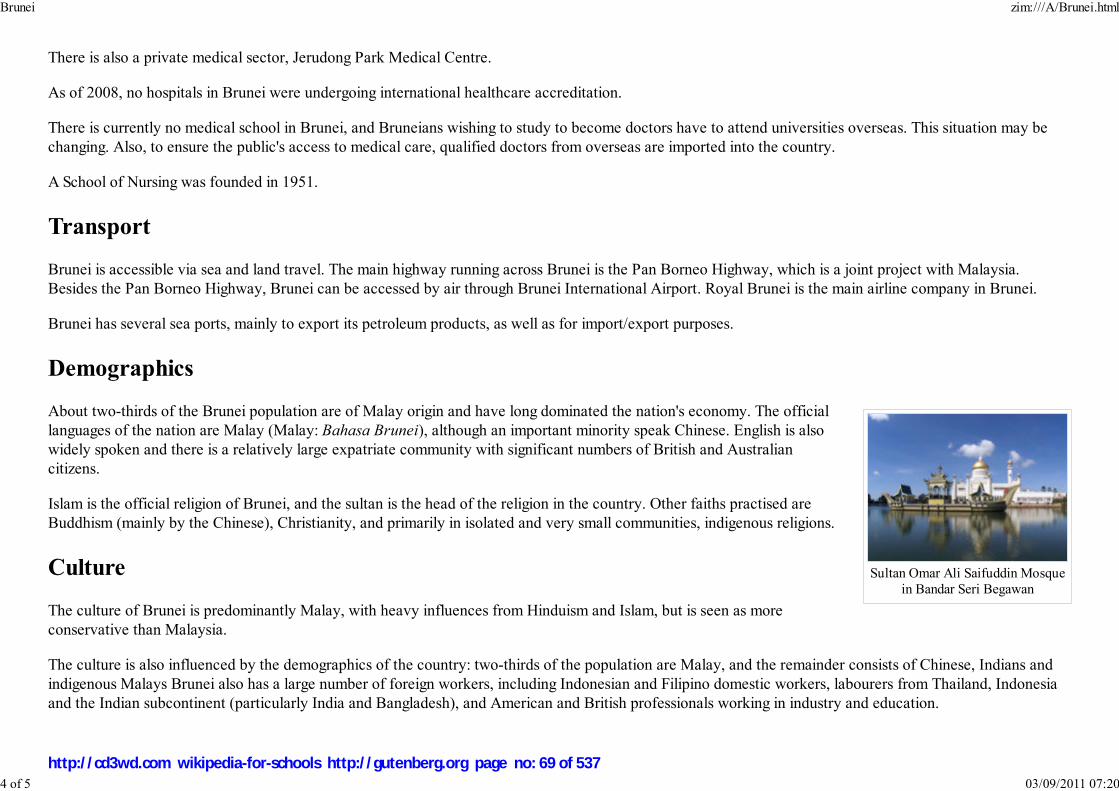
Sultan Omar Ali Saifuddin Mosquein Bandar Seri Begawan
There is also a private medical sector, Jerudong Park Medical Centre.
As of 2008, no hospitals in Brunei were undergoing international healthcare accreditation.
There is currently no medical school in Brunei, and Bruneians wishing to study to become doctors have to attend universities overseas. This situation may be
changing. Also, to ensure the public's access to medical care, qualified doctors from overseas are imported into the country.
A School of Nursing was founded in 1951.
Transport
Brunei is accessible via sea and land travel. The main highway running across Brunei is the Pan Borneo Highway, which is a joint project with Malaysia.
Besides the Pan Borneo Highway, Brunei can be accessed by air through Brunei International Airport. Royal Brunei is the main airline company in Brunei.
Brunei has several sea ports, mainly to export its petroleum products, as well as for import/export purposes.
Demographics
About two-thirds of the Brunei population are of Malay origin and have long dominated the nation's economy. The official
languages of the nation are Malay (Malay: Bahasa Brunei), although an important minority speak Chinese. English is also
widely spoken and there is a relatively large expatriate community with significant numbers of British and Australian
citizens.
Islam is the official religion of Brunei, and the sultan is the head of the religion in the country. Other faiths practised are
Buddhism (mainly by the Chinese), Christianity, and primarily in isolated and very small communities, indigenous religions.
Culture
The culture of Brunei is predominantly Malay, with heavy influences from Hinduism and Islam, but is seen as more
conservative than Malaysia.
The culture is also influenced by the demographics of the country: two-thirds of the population are Malay, and the remainder consists of Chinese, Indians and
indigenous Malays Brunei also has a large number of foreign workers, including Indonesian and Filipino domestic workers, labourers from Thailand, Indonesia
and the Indian subcontinent (particularly India and Bangladesh), and American and British professionals working in industry and education.
Brunei zim:///A/Brunei.html
4 of 5 03/09/2011 07:20
http://cd3wd.com wikipedia-for-schools http://gutenberg.org page no: 69 of 537
Prohibition of alcohol
The sale and public consumption of alcohol is banned. Foreigners and non-Muslims are allowed to bring in 12 cans of beer and two bottles of other alcohol (e.g.,
wine or spirits; no distinction is made for alcohol content). This limit used to apply to every entry; in 2007, however, this was changed to one limit every 48
hours. After the introduction of prohibition in the early 1990s, all pubs and nightclubs were forced to close; however, several types of restaurants allegedly still
offer illicit alcohol sometimes served in teapots.
Bruneian celebrities
Mariana Rahim is a female Bruneian star and also country rock singerDale Brown's novel Armageddon is set mostly in Brunei. It details a fictional attack on the country by Islamic fundamentalists with fringe assistance from
Malaysian forces, namely a stealth boat.
Brunei is the birthplace of current Chicago Blackhawks left winger Craig Adams.Also the birthplace of Wu Chun, present day Bruneian Taiwanese pop-star idol, who is also gym instructor, model, and member of the band Fahrenheit
Weekend splash concert season 4, the famous idol show in Brunei, the top six people are Christy Rhonda (Canadian), Saleisha Romana (British), Alex
Carlton (Australian), Chad Kilson (American), Asyraf Awang Besar (Bruneian), Jesse Chun ( Taiwanese).Zul F is an idol star and TV personality.
Retrieved from " http://en.wikipedia.org/wiki/Brunei"
The 2008 Wikipedia for Schools was sponsored by a UK Children's Charity, SOS Children UK , and is a hand-chosen selection of article versions from theEnglish Wikipedia edited only by deletion (see www.wikipedia.org for details of authors and sources). The articles are available under the
GNU Free Documentation License. See also our
Brunei zim:///A/Brunei.html
5 of 5 03/09/2011 07:20
http://cd3wd.com wikipedia-for-schools http://gutenberg.org page no: 70 of 537
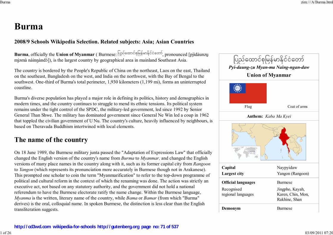
Pyi-daung-zu Myan-ma Naing-ngan-daw
Union of Myanmar
Flag Coat of arms
Anthem: Kaba Ma Kyei
Capital NaypyidawLargest city Yangon (Rangoon)
Official languages Burmese
Recognisedregional languages
Jingpho, Kayah,Karen, Chin, Mon,Rakhine, Shan
Demonym Burmese
Burma
2008/9 Schools Wikipedia Selection. Related subjects: Asia; Asian Countries
Burma, officially the Union of Myanmar ( Burmese: , pronounced [pjìdàunzṵmjəmà nàinŋàndɔ̀]), is the largest country by geographical area in mainland Southeast Asia.
The country is bordered by the People's Republic of China on the northeast, Laos on the east, Thailandon the southeast, Bangladesh on the west, and India on the northwest, with the Bay of Bengal to thesouthwest. One-third of Burma's total perimeter, 1,930 kilometers (1,199 mi), forms an uninterruptedcoastline.
Burma's diverse population has played a major role in defining its politics, history and demographics inmodern times, and the country continues to struggle to mend its ethnic tensions. Its political systemremains under the tight control of the SPDC, the military-led government, led since 1992 by SeniorGeneral Than Shwe. The military has dominated government since General Ne Win led a coup in 1962that toppled the civilian government of U Nu. The country's culture, heavily influenced by neighbours, isbased on Theravada Buddhism intertwined with local elements.
The name of the country
On 18 June 1989, the Burmese military junta passed the "Adaptation of Expressions Law" that officiallychanged the English version of the country's name from Burma to Myanmar, and changed the Englishversions of many place names in the country along with it, such as its former capital city from Rangoonto Yangon (which represents its pronunciation more accurately in Burmese though not in Arakanese).This prompted one scholar to coin the term "Myanmarification" to refer to the top-down programme ofpolitical and cultural reform in the context of which the renaming was done. The action was strictly anexecutive act, not based on any statutory authority, and the government did not hold a nationalreferendum to have the Burmese electorate ratify the name change. Within the Burmese language,Myanma is the written, literary name of the country, while Bama or Bamar (from which "Burma"derives) is the oral, colloquial name. In spoken Burmese, the distinction is less clear than the Englishtransliteration suggests.
Burma zim:///A/Burma.html
1 of 26 03/09/2011 07:20
http://cd3wd.com wikipedia-for-schools http://gutenberg.org page no: 71 of 537

Government Military junta
- Chairman of the StatePeace and DevelopmentCouncil
Senior General ThanShwe
- Vice Chairman of theState Peace andDevelopment Council
Vice-Senior GeneralMaung Aye
- Prime Minister General Thein Sein - Secretary-1 of the State
Peace and DevelopmentCouncil
Lt-Gen Thiha ThuraTin Aung Myint Oo
Establishment
- Bagan 1044–1287 - Small Kingdoms 1287–1531 - Taungoo 1531–1752 - Konbaung 1752–1885 - Colonial rule 1886–1948 - Independence from the
United Kingdom4 January 1948
Area
- Total 676,578 km² ( 40th)261,227 sq mi
- Water (%) 3.06
Population
- 2005–2006 estimate 55,390,000 ( 24th) - 1983 census 33,234,000 - Density 75/km² ( 119th)
193/sq mi
GDP ( PPP) 2007 estimate - Total $59.904 billion (
79th) - Per capita $1,039 ( 162nd)
The renaming proved to be politically controversial on several grounds. Opposition groups continue touse the name "Burma", since they do not recognize the legitimacy of the ruling military government norits authority to rename the country in English. Various non-Bamar ethnic groups choose to not recognizethe name because the term Myanmah has historically been used as a label for the majority ethnic grouprather than for the country.
Various world entities have chosen to accept or reject the name change. The United Nations accepts thename Myanmar, since the UN allows its members states to be known by any name they choose. Howeverit has not been recognized by many Western governments such as the United States, Australia, Canada orthe United Kingdom, which continue to use "Burma", while the European Union uses "Burma/Myanmar"as an alternative. China has not agreed to change its translations and continues to use 缅甸,. Japan usesthe name Myanmar (ミャンマー) but calls the people Burmese (ビルマ人). France continues to useBirmanie, and most other countries continue to use their traditional translations..
Use of "Burma" and its adjective, "Burmese", remains common in the United States and Britain. Manynews organizations, such as the BBC, The Financial Times, The Times, Voice of America, TheWashington Post, USA Today, ITN, Sky News, Bangkok Post and others still use these forms . MSNBC,ABC, NBC, CBS, The Economist, The Wall Street Journal, The New York Times and others use"Myanmar" as the country name and "Burmese" as the adjective. The Canadian BroadcastingCorporation also refers to both names in their news articles.
The name "Myanmar" is derived from the local short-form name Myanma Naingngandaw, the name usedby the regime currently in power in the country. While the etymology of the name is unclear, it has beenused since the 13th Century primarily as a reference to the Myanma ethnic group. Until the mid-19thcentury, rulers in the region identified themselves with the areas that they ruled. For example, the 18thCentury king, Alaungpaya alternately referred to himself as the ruler of Tampradipa and Thunaparanta,Ramanadesa, and Kamboza (all alternate names of places in the Irrawaddy Valley) in correspondencewith the East India Company. The Court of Ava was the first to use this name to refer to its kingdom inthe mid-19th Century, when its power was declining, when the kingdom was confined to the IrrawaddyValley which was predominantly Myanma in character, and at a time when the Myanma ethnic identityfirst began to develop a political identity. In older English documents the usage was Bermah, and laterBurmah, possibly from the Portuguese Birmania which is thought to be a corruption of the Indian wordfor Burma, Bama. Burma is known as Birmanie in French, Birmania in both Italian and Spanish, andBirmânia in Portuguese.
Confusion among English speakers on how to pronounce 'Myanmar' gives rise to pronunciations such as
Burma zim:///A/Burma.html
2 of 26 03/09/2011 07:20
http://cd3wd.com wikipedia-for-schools http://gutenberg.org page no: 72 of 537
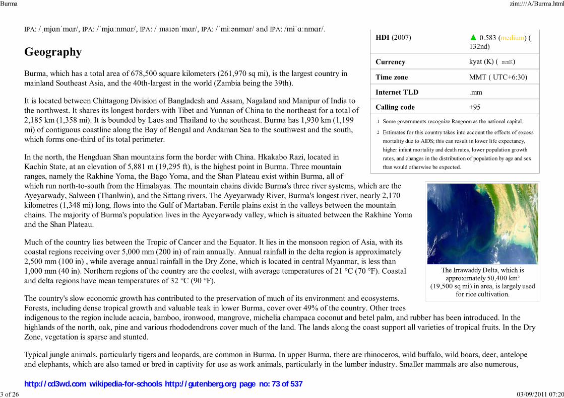
HDI (2007) ▲ 0.583 (medium) (132nd)
Currency kyat (K) ( mmK)
Time zone MMT ( UTC+6:30)
Internet TLD .mm
Calling code +95
Some governments recognize Rangoon as the national capital.
Estimates for this country takes into account the effects of excess
mortality due to AIDS; this can result in lower life expectancy,
higher infant mortality and death rates, lower population growth
rates, and changes in the distribution of population by age and sex
than would otherwise be expected.
The Irrawaddy Delta, which isapproximately 50,400 km²
(19,500 sq mi) in area, is largely usedfor rice cultivation.
IPA: /ˌmjɑnˈmɑr/, IPA: /ˈmjɑːnmɑr/, IPA: /ˌmaɪənˈmɑr/, IPA: /ˈmiːənmɑr/ and IPA: /miˈɑːnmɑr/.
Geography
Burma, which has a total area of 678,500 square kilometers (261,970 sq mi), is the largest country inmainland Southeast Asia, and the 40th-largest in the world (Zambia being the 39th).
It is located between Chittagong Division of Bangladesh and Assam, Nagaland and Manipur of India tothe northwest. It shares its longest borders with Tibet and Yunnan of China to the northeast for a total of2,185 km (1,358 mi). It is bounded by Laos and Thailand to the southeast. Burma has 1,930 km (1,199mi) of contiguous coastline along the Bay of Bengal and Andaman Sea to the southwest and the south,which forms one-third of its total perimeter.
In the north, the Hengduan Shan mountains form the border with China. Hkakabo Razi, located inKachin State, at an elevation of 5,881 m (19,295 ft), is the highest point in Burma. Three mountainranges, namely the Rakhine Yoma, the Bago Yoma, and the Shan Plateau exist within Burma, all ofwhich run north-to-south from the Himalayas. The mountain chains divide Burma's three river systems, which are theAyeyarwady, Salween (Thanlwin), and the Sittang rivers. The Ayeyarwady River, Burma's longest river, nearly 2,170kilometres (1,348 mi) long, flows into the Gulf of Martaban. Fertile plains exist in the valleys between the mountainchains. The majority of Burma's population lives in the Ayeyarwady valley, which is situated between the Rakhine Yomaand the Shan Plateau.
Much of the country lies between the Tropic of Cancer and the Equator. It lies in the monsoon region of Asia, with itscoastal regions receiving over 5,000 mm (200 in) of rain annually. Annual rainfall in the delta region is approximately2,500 mm (100 in) , while average annual rainfall in the Dry Zone, which is located in central Myanmar, is less than1,000 mm (40 in). Northern regions of the country are the coolest, with average temperatures of 21 °C (70 °F). Coastaland delta regions have mean temperatures of 32 °C (90 °F).
The country's slow economic growth has contributed to the preservation of much of its environment and ecosystems.Forests, including dense tropical growth and valuable teak in lower Burma, cover over 49% of the country. Other treesindigenous to the region include acacia, bamboo, ironwood, mangrove, michelia champaca coconut and betel palm, and rubber has been introduced. In thehighlands of the north, oak, pine and various rhododendrons cover much of the land. The lands along the coast support all varieties of tropical fruits. In the DryZone, vegetation is sparse and stunted.
Typical jungle animals, particularly tigers and leopards, are common in Burma. In upper Burma, there are rhinoceros, wild buffalo, wild boars, deer, antelopeand elephants, which are also tamed or bred in captivity for use as work animals, particularly in the lumber industry. Smaller mammals are also numerous,
1
2
Burma zim:///A/Burma.html
3 of 26 03/09/2011 07:20
http://cd3wd.com wikipedia-for-schools http://gutenberg.org page no: 73 of 537
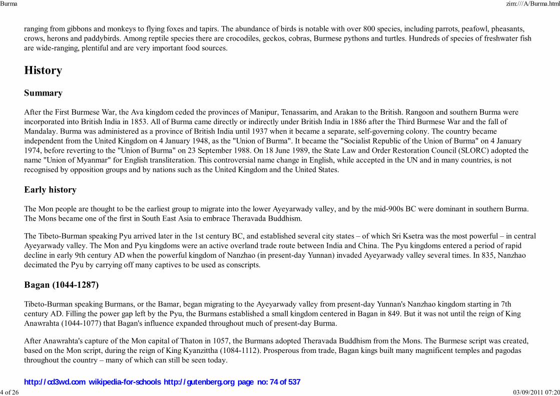
ranging from gibbons and monkeys to flying foxes and tapirs. The abundance of birds is notable with over 800 species, including parrots, peafowl, pheasants,crows, herons and paddybirds. Among reptile species there are crocodiles, geckos, cobras, Burmese pythons and turtles. Hundreds of species of freshwater fishare wide-ranging, plentiful and are very important food sources.
History
Summary
After the First Burmese War, the Ava kingdom ceded the provinces of Manipur, Tenassarim, and Arakan to the British. Rangoon and southern Burma wereincorporated into British India in 1853. All of Burma came directly or indirectly under British India in 1886 after the Third Burmese War and the fall ofMandalay. Burma was administered as a province of British India until 1937 when it became a separate, self-governing colony. The country becameindependent from the United Kingdom on 4 January 1948, as the "Union of Burma". It became the "Socialist Republic of the Union of Burma" on 4 January1974, before reverting to the "Union of Burma" on 23 September 1988. On 18 June 1989, the State Law and Order Restoration Council (SLORC) adopted thename "Union of Myanmar" for English transliteration. This controversial name change in English, while accepted in the UN and in many countries, is notrecognised by opposition groups and by nations such as the United Kingdom and the United States.
Early history
The Mon people are thought to be the earliest group to migrate into the lower Ayeyarwady valley, and by the mid-900s BC were dominant in southern Burma.The Mons became one of the first in South East Asia to embrace Theravada Buddhism.
The Tibeto-Burman speaking Pyu arrived later in the 1st century BC, and established several city states – of which Sri Ksetra was the most powerful – in centralAyeyarwady valley. The Mon and Pyu kingdoms were an active overland trade route between India and China. The Pyu kingdoms entered a period of rapiddecline in early 9th century AD when the powerful kingdom of Nanzhao (in present-day Yunnan) invaded Ayeyarwady valley several times. In 835, Nanzhaodecimated the Pyu by carrying off many captives to be used as conscripts.
Bagan (1044-1287)
Tibeto-Burman speaking Burmans, or the Bamar, began migrating to the Ayeyarwady valley from present-day Yunnan's Nanzhao kingdom starting in 7thcentury AD. Filling the power gap left by the Pyu, the Burmans established a small kingdom centered in Bagan in 849. But it was not until the reign of KingAnawrahta (1044-1077) that Bagan's influence expanded throughout much of present-day Burma.
After Anawrahta's capture of the Mon capital of Thaton in 1057, the Burmans adopted Theravada Buddhism from the Mons. The Burmese script was created,based on the Mon script, during the reign of King Kyanzittha (1084-1112). Prosperous from trade, Bagan kings built many magnificent temples and pagodasthroughout the country – many of which can still be seen today.
Burma zim:///A/Burma.html
4 of 26 03/09/2011 07:20
http://cd3wd.com wikipedia-for-schools http://gutenberg.org page no: 74 of 537

Pagodas and temples continue to existin present-day Bagan, the capital of the
Bagan Kingdom.
Bagan's power slowly waned in 13th century. Kublai Khan's Mongol forces invaded northern Burma starting in 1277, and sacked Bagan city itself in 1287.Bagan's over two century reign of Ayeyarwady valley and its periphery was over.
Small kingdoms (1287-1531)
The Mongols could not stay for long in the searing Ayeyarwady valley. But the Tai-Shan people from Yunnan who camedown with the Mongols fanned out to the Ayeyarwady valley, Shan states, Laos, Siam and Assam, and became powerfulplayers in Southeast Asia.
The Bagan empire was irreparably broken up into several small kingdoms:
The Burman kingdom of Ava or Innwa (1364-1555), the successor state to three smaller kingdoms founded byBurmanized Shan kings, controlling Upper Burma (without the Shan states)The Mon kingdom of Hanthawady Pegu or Bago (1287-1540), founded by a Mon-ized Shan King Wareru(1287-1306), controlling Lower Burma (without Taninthayi).The Rakhine kingdom of Mrauk U (1434-1784), in the west.Several Shan states in the Shan hills in the east and the Kachin hills in the north while the northwestern frontier ofpresent Chin hills still disconnected yet.
This period was characterized by constant warfare between Ava and Bago, and to a lesser extent, Ava and the Shans. Ava briefly controlled Rakhine(1379-1430) and came close to defeating Bago a few times, but could never quite reassemble the lost empire. Nevertheless, Burmese culture entered a goldenage. Hanthawady Bago prospered. Bago's Queen Shin Saw Bu (1453-1472) raised the gilded Shwedagon Pagoda to its present height.
By the late 15th century, constant warfare had left Ava greatly weakened. Its peripheral areas became either independent or autonomous. In 1486, KingMinkyinyo (1486-1531) of Taungoo broke away from Ava and established a small independent kingdom. In 1527, Mohnyin (Shan: Mong Yang) Shans finallycaptured Ava, upsetting the delicate power balance that had existed for nearly two centuries. The Shans would rule Upper Burma until 1555.
Taungoo (1531-1752)
Reinforced by fleeing Burmans from Ava, the minor Burman kingdom of Taungoo under its young, ambitious king Tabinshwehti (1531-1551) defeated the morepowerful Mon kingdom at Bago, reunifying all of Lower Burma by 1540. Tabinshwehti's successor King Bayinnaung (1551-1581) would go on to conquerUpper Burma (1555), Manipur (1556), Shan states (1557), Chiang Mai (1557), Ayutthaya (1564, 1569) and Lan Xang (1574), bringing most of western SouthEast Asia under his rule. Bayinnaung died in 1581, preparing to invade Rakhine, a maritime power controlling the entire coastline west of Rakhine Yoma, up toChittagong province in Bengal.
Bayinnaung's massive empire unraveled soon after his death in 1581. Ayutthaya Siamese had driven out the Burmese by 1593 and went on to take Tanintharyi.In 1599, Rakhine forces aided by the Portuguese mercenaries sacked the kingdom's capital Bago. Chief Portuguese mercenary Filipe de Brito e Nicote
Burma zim:///A/Burma.html
5 of 26 03/09/2011 07:20
http://cd3wd.com wikipedia-for-schools http://gutenberg.org page no: 75 of 537

A British 1825 lithograph ofShwedagon Pagoda reveals early
British occupation in Burma duringthe First Anglo-Burmese War.
(Burmese: Nga Zinga) promptly rebelled against his Rakhine masters and established Portuguese rule in Thanlyin (Syriam), then the most important seaport inBurma. The country was in chaos.
The Burmese under King Anaukpetlun (1605-1628) regrouped and defeated the Portuguese in 1611. Anaukpetlun reestablished a smaller reconstituted kingdombased in Ava covering Upper Burma, Lower Burma and Shan states (but without Rakhine or Taninthayi). After the reign of King Thalun (1629-1648), whorebuilt the war-torn country, the kingdom experienced a slow and steady decline for the next 100 years. The Mons successfully rebelled starting in 1740 withFrench help and Siamese encouragement, broke away Lower Burma by 1747, and finally put an end to the House of Taungoo in 1752 when they took Ava.
Konbaung (1752-1885)
King Alaungpaya (1752-1760), established the Konbaung Dynasty in Shwebo in 1752. He founded Yangon in 1755. Byhis death in 1760, Alaungpaya had reunified the country. In 1767, King Hsinbyushin (1763-1777) sacked Ayutthya. TheQing Dynasty of China invaded four times from 1765 to 1769 without success. The Chinese invasions allowed the newSiamese kingdom based in Bangkok to repel the Burmese out of Siam by the late 1770s.
King Bodawpaya (1782-1819) failed repeatedly to reconquer Siam in 1780s and 1790s. Bodawpaya did manage tocapture the western kingdom of Rakhine, which had been largely independent since the fall of Bagan, in 1784.Bodawpaya also formally annexed Manipur, a rebellion-prone protectorate, in 1813.
King Bagyidaw's (1819-1837) general Maha Bandula put down a rebellion in Manipur in 1819 and captured thenindependent kingdom of Assam in 1819 (again in 1821). The new conquests brought the Burmese adjacent to the BritishIndia. The British defeated the Burmese in the First Anglo-Burmese War (1824-1826). Burma had to cede Assam,Manipur, Rakhine (Arakan) and Tanintharyi (Tenessarim).
In 1852, the British attacked a much weakened Burma during a Burmese palace power struggle. After the Second Anglo-Burmese War, which lasted 3 months, the British had captured the remaining coastal provinces: Ayeyarwady, Yangonand Bago, naming the territories as Lower Burma.
King Mindon (1853-1878) founded Mandalay in 1859 and made it his capital. He skillfully navigated the growing threats posed by the competing interests ofBritain and France. In the process, Mindon had to renounce Kayah (Karenni) states in 1875. His successor, King Thibaw (1878-1885), was largely ineffectual.In 1885, the British, alarmed by the French conquest of neighboring Laos, grabbed Upper Burma. The Third Anglo-Burmese War (1885) lasted a mere onemonth insofar as capturing the capital Mandalay was concerned. The Burmese royal family was exiled to Ratnagiri, India. British forces spent at least anotherfour years pacifying the country – not only in the Burman heartland but also in the Shan, Chin and Kachin hill areas. By some accounts, minor insurrections didnot end until 1896.
Colonial era (1886-1948)
Burma zim:///A/Burma.html
6 of 26 03/09/2011 07:20
http://cd3wd.com wikipedia-for-schools http://gutenberg.org page no: 76 of 537

The Colonial Flag(1937-1948)
The United Kingdom began conquering Burma in 1824 and by 1886 had incorporated it into the British Raj. Burma was administered as a province of BritishIndia until 1937 when it became a separate, self-governing colony. To stimulate trade and facilitate changes, the British brought in Indians and Chinese, whoquickly displaced the Burmese in urban areas. To this day Yangon and Mandalay have large ethnic Indian populations. Railroads and schools were built, as wellas a large number of prisons, including the infamous Insein Prison, then as now used for political prisoners. Burmese resentment was strong and was vented inviolent riots that paralyzed Yangon on occasion all the way until the 1930s. Much of the discontent was caused by a perceived disrespect for Burmese cultureand traditions, for example, what the British termed the Shoe Question: the colonizers' refusal to remove their shoes upon entering Buddhist temples or otherholy places. In October 1919, Eindawya Pagoda in Mandalay was the scene of violence when tempers flared after scandalized Buddhist monks attempted tophysically expel a group of shoe-wearing British visitors. The leader of the monks was later sentenced to life imprisonment for attempted murder. Such incidentsinspired the Burmese resistance to use Buddhism as a rallying point for their cause. Buddhist monks became the vanguards of the independence movement, andmany died while protesting. One monk-turned-martyr was U Wisara, who died in prison after a 166-day hunger strike to protest a rule that forbade him fromwearing his Buddhist robes while imprisoned.
Eric Blair, better known as the writer George Orwell, served in the Indian Imperial Police in Burma for five years and wrote about his experiences. An earlierwriter with the same convoluted career path was Saki. During the colonial period, intermarriage between European settlers and Burmese women, as well asbetween Anglo-Indians (who arrived with the British) and Burmese caused the birth of the Anglo-Burmese community. This influential community was todominate the country during colonial rule and through the mid 1960's.
On 1 April 1937, Burma became a separately administered territory, independent of the Indian administration. The vote forkeeping Burma in India, or as a separate colony "khwe-yay-twe-yay" divided the populace, and laid the ground work for theinsurgencies to come after independence. In the 1940s, the Thirty Comrades, commanded by Aung San, founded the BurmaIndependence Army. The Thirty Comrades received training in Japan.
During World War II, Burma became a major frontline in the Southeast Asian Theatre. The British administration collapsedahead of the advancing Japanese troops, jails and asylums were opened and Rangoon was deserted except for the many Anglo-Burmese and Indians who remained at their posts. A stream of some 300,000 refugees fled across the jungles into India; knownas 'The Trek', all but 30,000 of those 300,000 arrived in India. Initially the Japanese-led Burma Campaign succeeded and theBritish were expelled from most of Burma, but the British counter-attacked using primarily troops of the British Indian Army. By July 1945, the British hadretaken the country. Although many Burmese fought initially for the Japanese, some Burmese, mostly from the ethnic minorities, also served in the BritishBurma Army. In 1943, the Chin Levies and Kachin Levies were formed in the border districts of Burma still under British administration. The Burma Riflesfought as part of the Chindits under General Orde Wingate from 1943-1945. Later in the war, the Americans created American-Kachin Rangers who also foughtagainst the Japanese. Many others fought with the British Special Operations Executive. The Burma Independence Army under the command of Aung San andthe Arakan National Army fought with the Japanese from 1942-1944, but switched allegiance to the Allied side in 1945.
In 1947, Aung San became Deputy Chairman of the Executive Council of Burma, a transitional government. But in July 1947, political rivals assassinated AungSan and several cabinet members.
Burma zim:///A/Burma.html
7 of 26 03/09/2011 07:20
http://cd3wd.com wikipedia-for-schools http://gutenberg.org page no: 77 of 537

Sao Shwe Thaik
Democratic republic (1948-1962)
On 4 January 1948, the nation became an independent republic, named the Union of Burma, with Sao Shwe Thaik as its firstPresident and U Nu as its first Prime Minister. Unlike most other former British colonies and overseas territories, it did notbecome a member of the Commonwealth. A bicameral parliament was formed, consisting of a Chamber of Deputies and aChamber of Nationalities.
The geographical area Burma encompasses today can be traced to the Panglong Agreement, which combined Burma Proper,which consisted of Lower Burma and Upper Burma, and the Frontier Areas, which had been administered separately by theBritish.
In 1961, U Thant, then the Union of Burma's Permanent Representative to the United Nations and former Secretary to thePrime Minister, was elected Secretary-General of the United Nations; he was the first non-Westerner to head anyinternational organization and would serve as UN Secretary-General for ten years. Among the Burmese to work at the UNwhen he was Secretary-General was a young Aung San Suu Kyi.
Rule by military junta (1962-present)
Democratic rule ended in 1962 when General Ne Win led a military coup d'état. He ruled for nearly 26 years and pursuedpolicies under the rubric of the Burmese Way to Socialism. Between 1962 and 1974, Burma was ruled by a revolutionary council headed by the general, andalmost all aspects of society (business, media, production) were nationalized or brought under government control (including the Boy Scouts). In an effort toconsolidate power, General Ne Win and many top generals resigned from the military and took civilian posts and, from 1974, instituted elections in a one partysystem. Between 1974 and 1988, Burma was effectively ruled by General Ne Win through the Burma Socialist Programme Party (BSPP).
Almost from the beginning there were sporadic protests against the military rule, many of which were organized by students, and these were almost alwaysviolently suppressed by the government. On July 7, 1962 the government broke up demonstrations at Rangoon University killing 15 students. In 1974, themilitary violently suppressed anti-government protests at the funeral of U Thant. Student protests in 1975, 1976 and 1977 were quickly suppressed byoverwhelming force.
In 1988, unrest over economic mismanagement and political oppression by the government led to widespread pro-democracy demonstrations throughout thecountry known as the 8888 Uprising. Security forces killed thousands of demonstrators, and General Saw Maung staged a coup d'état and formed the State Lawand Order Restoration Council (SLORC). In 1989, SLORC declared martial law after widespread protests. The military government finalized plans for People'sAssembly elections on 31 May 1989.
SLORC changed the country's official English name from the "Union of Burma" to the "Union of Myanmar" in 1989. This continues to be a topic of confusionfor many people since the mainstream media calls the nation Myanmar but so many others call it Burma. In most cases the nation is called Burma to make a
Burma zim:///A/Burma.html
8 of 26 03/09/2011 07:20
http://cd3wd.com wikipedia-for-schools http://gutenberg.org page no: 78 of 537
political statement. By not acknowledging the name Myanmar, one refuses to acknowledge the legitimacy of the military junta as well. This is not just amonghuman rights groups but many governments such as the United States, Great Britian and France, legally refer to the nation as Burma. Some suggest the pointmade by advocates of democracy doesn't matter anyways since the name Burma was given to the country by the colonial British. Also, since the founding of thefirst democratic government the name Myanmar appeared on the nations currency. But since the military junta did not officially rename the english word for thenations from Burma to Myanmar until 1989, it is very easy to make the argument that it should not be recognized.
In May 1990, the government held free elections for the first time in almost 30 years. The National League for Democracy (NLD), the party of Aung San SuuKyi, won 392 out of a total 489 seats, but the election results were annulled by SLORC, which refused to step down. Led by Than Shwe since 1992, the militaryregime has made cease-fire agreements with most ethnic guerrilla groups. In 1992, SLORC unveiled plans to create a new constitution through the NationalConvention, which began 9 January 1993. In 1997, the State Law and Order Restoration Council was renamed the State Peace and Development Council(SPDC).
On 23 June 1997, Myanmar was admitted into the Association of Southeast Asian Nations (ASEAN). The National Convention continues to convene andadjourn. Many major political parties, particularly the NLD, have been absent or excluded, and little progress has been made. On 27 March 2006, the militaryjunta, which had moved the national capital from Yangon to a site near Pyinmana in November 2005, officially named it Naypyidaw, meaning "city of thekings".
In November 2006, the International Labour Organization announced it will be seeking - at the International Court of Justice. - "to prosecute members of theruling Myanmar junta for crimes against humanity" over the continuous forced labour of its citizens by the military. According to the International LaborOrganization (ILO), an estimated 800,000 people are subject to forced labour in Myanmar.
2007 protests and consequences
The August 2007 demonstrations were led by well-known dissidents, such as Min Ko Naing (with the nom de guerre Conqueror of Kings), Su Su Nway (now inhiding) and others. The military quickly cracked down and still has not allowed the International Red Cross to visit Min Ko Naing and others who are reportedlyin Insein Prison after being severely tortured. Reports have surfaced of at least one death, of activist Win Shwe, under interrogation.
On 19 September 2007, several hundred (possibly 2000 or more) monks staged a protest march in the city of Sittwe. Larger protests in Rangoon and elsewhereensued over the following days. Security became increasingly heavy handed, resulting in a number of deaths and injuries. By 28 September, internet access hadbeen cut and journalists were reputedly warned not to report on protests. Internet access was restored by at least midnight of 5 October, Burmese time. Sourcesin Myanmar said on 6 October that the internet seems to be working from 22:00 to 05:00 local time.
On October 13, 2007, the military junta of Burma made people march in a government rally, reportedly paying some participants 1000 kyat (approximately$0.80) each. Junta officials also approached local factories and demanded they provide 50 workers each; if they didn't, they were to be fined.
On 7 February 2008, SPDC announced that a referendum for the Constitution would be held, and Elections by 2010. The Burmese constitutional referendum,2008 was held on May 10 and promised a "discipline-flourishing democracy" for the country in the future.
Burma zim:///A/Burma.html
9 of 26 03/09/2011 07:20
http://cd3wd.com wikipedia-for-schools http://gutenberg.org page no: 79 of 537

Various global corporations have been criticized for profiting from the dictatorship by financing Burma's military junta.
World governments remain divided on how to deal with the military junta. Calls for further sanctions by United Kingdom, United States, and France are opposedby neighboring countries; in particular, China has stated its belief that "sanctions or pressure will not help to solve the issue".
Cyclone Nargis
On May 3, 2008, Cyclone Nargis devastated the country when winds of up to 215kph (135 mph) touched land in the densely populated, rice-farming delta ofthe Irrawaddy Division.
Recent reports estimate that more than 130,000 people are dead or missing from Cyclone Nargis that hit the country's Irrawaddy delta. Damage totaled to 10billion dollars (USD); it was the worst natural disaster in Burman history. Shari Villarosa, who leads the U.S. Embassy in Yangon, said the number of dead couldeventually exceed 140,800 because of illnesses and injury. Adds the World Food Programme, "Some villages have been almost totally eradicated and vastrice-growing areas are wiped out."
The United Nations projects that as many as 1 million were left homeless; and the World Health Organization "has received reports of malaria outbreaks in theworst-affected area." Yet in the critical days following this disaster, Burma's isolationist regime complicated recovery efforts by delaying the entry of UnitedNations planes delivering medicine, food, and other supplies into the Southeast Asian nation. Similarly, the junta continues to reject the United States offer toprovide much-needed assistance, although on May 13, the first U.S. military transport plane was allowed to land, bringing 14 tons of medical supplies, mosquitonets and blankets. The government's failure to permit entry for large-scale international relief efforts was described by the United Nations as "unprecedented."The Burmese Foreign Ministry stressed its capability in handling the aftermath of the cyclone and insisted that it was not ready to accept large-scale foreignassistance.
AP news stories state that foreign aid provided to disaster victims was modified to make it look like it came from the military regime, and state-run televisioncontinuously ran images of Gen. Than Shwe ceremonially handing out disaster relief.
More than a week after the disaster, only one out of 10 people who were homeless, injured or threatened by disease and hunger had received some kind of aid.The governmental regime only began to allow UN/international aid into the country for relief efforts after a meeting of heads of States in Singapore, headed bySingapore, who is the current chair of the ASEAN group.
According to British Foreign Secretary David Miliband, "A natural disaster is turning into a humanitarian catastrophe of genuinely epic proportions in significantpart because of the malign neglect of the regime."
Donor nations, meeting in Burma, pressed the government hold to its promise and allow foreign aid workers access to several communities in which foreignersare not allowed, thus increasing the rate of receipt of aid to millions who where most affected by the cyclone. The United Nations secretary general, Ban KiMoon, said that the government was "moving fast in the right direction." By opening greater access to foreign aid, this will help the nation avoid a "seconddisaster" of disease.
Burma zim:///A/Burma.html
10 of 26 03/09/2011 07:20
http://cd3wd.com wikipedia-for-schools http://gutenberg.org page no: 80 of 537

Bagan
On May 27, 2008, to complicate world opinion and in contrast to numerous and varied accounts from international relief organizations, the Burma junta praisedU.N. aid.
List of historical capitals
AmarapuraAvaBaganBagoMandalayMrauk UNaypyidawRangoon (Yangon)SagaingShweboThaton
Government and politics
Burma is governed by a strict military dictatorship. The current head of state is Senior General Than Shwe, who holds the posts of "Chairman of the State Peaceand Development Council" and "Commander in Chief of the Defense Services". General Khin Nyunt was prime minister until 19 October 2004, when he wasreplaced by General Soe Win, after the purge of Military Intelligence sections within the Burma armed forces. The majority of ministry and cabinet posts areheld by military officers, with the exceptions being the Ministry of Health, the Ministry of Education, the Ministry of Labour, and the Ministry of NationalPlanning and Economic Development, posts which are held by civilians.
Elected delegates in the 1990 People's Assembly election formed the National Coalition Government of the Union of Burma (NCGUB), a government-in-exilesince December 1990, with the mission of restoring democracy. Dr. Sein Win, a first cousin of Aung San Suu Kyi, has held the position of prime minister of theNCGUB since its inception. The NCGUB has been outlawed by the military government.
Major political parties in the country are the National League for Democracy and the Shan Nationalities League for Democracy, although their activities areheavily regulated and suppressed by the military government. Many other parties, often representing ethnic minorities, exist. The military government allowslittle room for political organizations and has outlawed many political parties and underground student organizations. The military supported the National UnityParty in the 1990 elections and, more recently, an organization named the Union Solidarity and Development Association.
Burma zim:///A/Burma.html
11 of 26 03/09/2011 07:20
http://cd3wd.com wikipedia-for-schools http://gutenberg.org page no: 81 of 537

Government propaganda posterstates: " Tatmadaw and the people,
cooperate and crush all thoseharming the union."
Several human rights organizations, including Human Rights Watch and Amnesty International, and the AmericanAssociation for the Advancement of Science have reported on human rights abuses by the military government. They haveclaimed that there is no independent judiciary in Burma. The military government restricts Internet access throughsoftware-based censorship that limits the material citizens can access on-line. Forced labour, human trafficking, and childlabour are common. The military is also notorious for rampant use of sexual violence as an instrument of control, includingsystematic rapes and taking of sex slaves as porters for the military. A strong women's pro-democracy movement hasformed in exile, largely along the Thai border and in Chiang Mai. There is a growing international movement to defendwomen's human rights issues.
In 1988, the army violently repressed protests against economic mismanagement and political oppression. On 8 August1988, the military opened fire on demonstrators in what is known as 8888 Uprising and imposed martial law. However, the1988 protests paved way for the 1990 People's Assembly elections. The election results were subsequently annulled bySenior General Saw Maung's government. The National League for Democracy, led by Aung San Suu Kyi, won over 60% of the vote and over 80% ofparliamentary seats in the 1990 election, the first held in 30 years. The military-backed National Unity Party won less than 2% of the seats. Aung San Suu Kyihas earned international recognition as an activist for the return of democratic rule, winning the Nobel Peace Prize in 1991. The ruling regime has repeatedlyplaced her under house arrest. Despite a direct appeal by former UN Secretary General Kofi Annan to Senior General Than Shwe and pressure by theAssociation of Southeast Asian Nations ( ASEAN), the military junta extended Aung San Suu Kyi's house arrest another year on 27 May 2006 under the 1975State Protection Act, which grants the government the right to detain any persons on the grounds of protecting peace and stability in the country. The juntafaces increasing pressure from the United States and the United Kingdom. Burma's situation was referred to the UN Security Council for the first time inDecember 2005 for an informal consultation. In September 2006, ten of the United Nations Security Council's 15 members voted to place Myanmar on thecouncil's formal agenda. On Independence Day, 4 January 2007, the government released 40 political prisoners, under a general amnesty, in which 2,831prisoners were released. On 8 January 2007, UN Secretary-General Ban Ki-moon urged the national government to free all political prisoners, including AungSan Suu Kyi. Three days later, on 11 January, five additional prisoners were released from prison.
ASEAN has also stated its frustration with the Union of Myanmar's government. It has formed the ASEAN Inter-Parliamentary Myanmar Caucus to address thelack of democratisation in the country. Dramatic change in the country's political situation remains unlikely, due to support from major regional powers such asIndia, Russia, and, in particular, China.
In the annual ASEAN Summit in January 2007, held in Cebu, Philippines, member countries failed to find common ground on the issue of Burma's lack ofpolitical reform. During the summit, ASEAN foreign ministers asked Burma to make greater progress on its roadmap toward democracy and nationalreconciliation. Some member countries contend that Burma's human rights issues are the country's own domestic affairs, while others contend that its poorhuman rights record is an international issue.
According to Human Rights Defenders and Promoters (HRDP), on April 18, 2007, several of its members (Myint Aye, Maung Maung Lay, Tin Maung Oo andYin Kyi) were met by approximately a hundred people led by a local official, U Nyunt Oo, and beaten up. Due to the attack, Myint Hlaing and Maung MaungLay were badly injured and subsequently hospitalized. The HRDP believes that this attack was condoned by the authorities and vows to take legal action.
Burma zim:///A/Burma.html
12 of 26 03/09/2011 07:20
http://cd3wd.com wikipedia-for-schools http://gutenberg.org page no: 82 of 537

Human Rights Defenders and Promoters was formed in 2002 to raise awareness among the people of Burma about their human rights.
Burma's army-drafted constitution was overwhelmingly approved (by 92.4% of the 22 million voters with alleged voter turnout of 99%) on May 10 in the firstphase of a two-stage referendum amid Cyclone Nargis. It was the first national vote since the 1990 election. Multi-party elections in 2010 would end 5 decadesof military rule, as the new charter gives the military an automatic 25% of seats in parliament. NLD spokesman Nyan Win, inter alia, criticized the referendum:"This referendum was full of cheating and fraud across the country; In some villages, authorities and polling station officials ticked the ballots themselves anddid not let the voters do anything." The constitution would bar Aung San Suu Kyi, from public office. 5 million citizens will vote May 24 in Yangon and theIrrawaddy delta, worst hit by Cyclone Nargis.
Divisions and states
Burma zim:///A/Burma.html
13 of 26 03/09/2011 07:20
http://cd3wd.com wikipedia-for-schools http://gutenberg.org page no: 83 of 537
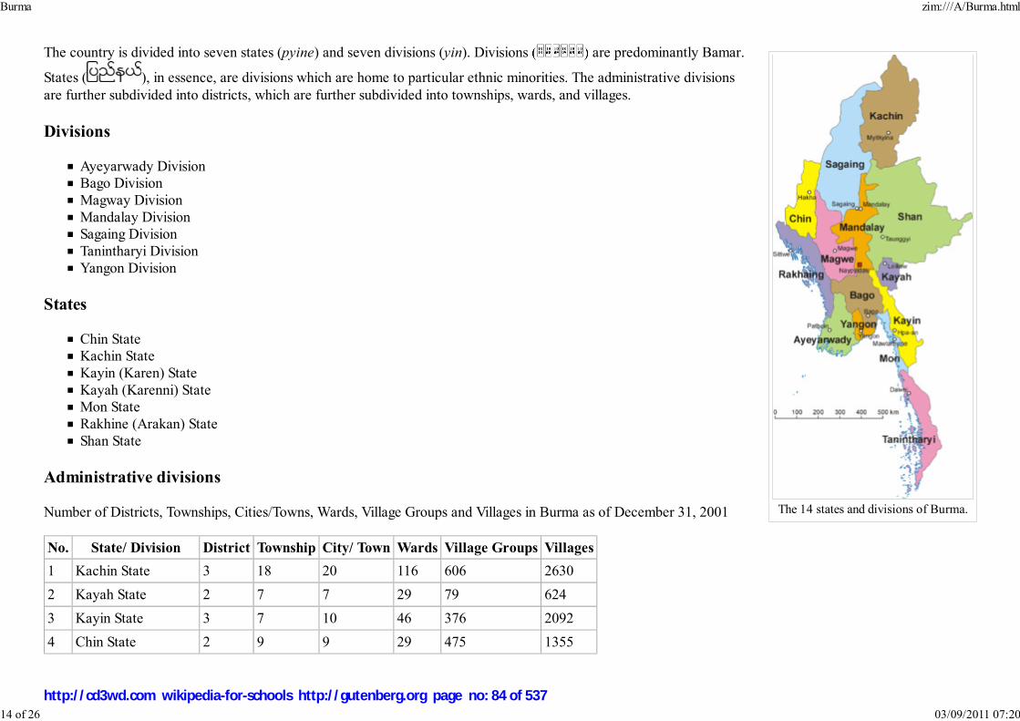
The 14 states and divisions of Burma.
The country is divided into seven states (pyine) and seven divisions (yin). Divisions ( ) are predominantly Bamar.
States ( ), in essence, are divisions which are home to particular ethnic minorities. The administrative divisionsare further subdivided into districts, which are further subdivided into townships, wards, and villages.
Divisions
Ayeyarwady DivisionBago DivisionMagway DivisionMandalay DivisionSagaing DivisionTanintharyi DivisionYangon Division
States
Chin StateKachin StateKayin (Karen) StateKayah (Karenni) StateMon StateRakhine (Arakan) StateShan State
Administrative divisions
Number of Districts, Townships, Cities/Towns, Wards, Village Groups and Villages in Burma as of December 31, 2001
No. State/ Division District Township City/ Town Wards Village Groups Villages
1 Kachin State 3 18 20 116 606 2630
2 Kayah State 2 7 7 29 79 624
3 Kayin State 3 7 10 46 376 2092
4 Chin State 2 9 9 29 475 1355
Burma zim:///A/Burma.html
14 of 26 03/09/2011 07:20
http://cd3wd.com wikipedia-for-schools http://gutenberg.org page no: 84 of 537
5 Sagaing Division 8 37 37 171 1769 6095
6 Taninthayi Division 3 10 10 63 265 1255
7 Bago Division 4 28 33 246 1424 6498
8 Magway Division 5 25 26 160 1543 4774
9 Mandalay Division 7 31 29 259 1611 5472
10 Mon State 2 10 11 69 381 1199
11 Rakhine State 4 17 17 120 1041 3871
12 Yangon Division 4 45 20 685 634 2119
13 Shan State 11 54 54 336 1626 15513
14 Ayeyawady Division 5 26 29 219 1912 11651
Total 63 324 312 2548 13742 65148
Foreign relations and military
The country's foreign relations, particularly with Western nations, have been strained. The United States has placed a ban on new investments by U.S. firms, animport ban, and an arms embargo on the Union of Myanmar, as well as frozen military assets in the United States because of the military regime's ongoinghuman rights abuses, the ongoing detention of Nobel Peace Prize recipient Aung San Suu Kyi, and refusal to honour the election results of the 1990 People'sAssembly election. Similarly, the European Union has placed sanctions on Burma, including an arms embargo, cessation of trade preferences, and suspension ofall aid with the exception of humanitarian aid. U.S. and European government sanctions against the military government, coupled with boycotts and other directpressure on corporations by western supporters of the democracy movement, have resulted in the withdrawal from the country of most U.S. and many Europeancompanies. However, several Western companies remain due to loopholes in the sanctions. Asian corporations have generally remained willing to continueinvesting in the country and to initiate new investments, particularly in natural resource extraction. The country has close relations with neighboring India andPeople's Republic of China with several Indian and Chinese companies operating in the country. There remains active debate as to the extent to which theAmerican-led sanctions have had adverse effects on the civilian population or on the military rulers.
The country's armed forces are known as the Tatmadaw, which numbers 488,000. The Tatmadaw comprises the Army, the Navy, and the Air Force. Thecountry ranked twelfth in the world for its number of active troops in service. The military is very influential in the country, with top cabinet and ministry postsheld by military officers. Official figures for military spending are not available. Estimates vary widely because of uncertain exchange rates, but militaryspending is very high. The country imports most of its weapons from Russia, Ukraine, China and India.
Burma zim:///A/Burma.html
15 of 26 03/09/2011 07:20
http://cd3wd.com wikipedia-for-schools http://gutenberg.org page no: 85 of 537
The country is building a research nuclear reactor near May Myo (Pyin Oo Lwin) with help from Russia. It is one of the signatories of the nuclearnon-proliferation pact since 1992 and a member of the International Atomic Energy Agency (IAEA) since 1957. The military junta had informed the IAEA inSeptember 2000 of its intention to construct the reactor. The research reactor outbuilding frame was built by ELE steel industries limited of Yangon and waterfrom Anisakhan/BE water fall will be used for the reactor cavity cooling system.
ASEAN will not defend the country in any international forum following the military regime's refusal to restore democracy. In April 2007, the MalaysianForeign Ministry parliamentary secretary Ahmad Shabery Cheek said Malaysia and other ASEAN members had decided not to defend Burma if the country'sissue was raised for discussion at any international conference. "Now Myanmar has to defend itself if it is bombarded in any international forum," he said whenwinding up a debate at committee stage for the Foreign Ministry. He was replying to queries from opposition leader Lim Kit Siang on the next course of actionto be taken by Malaysia and ASEAN with the military junta. Lim had said Malaysia must play a proactive role in pursuing regional initiatives to bring about achange in Burma and support efforts to bring the situation in Burma to the UN Security Council's attention.
Drug trade
The country is a corner of the Golden Triangle of opium production. Neither Burma, Vietnam, Laos or Thailand had any history of opium production untilcolonial times, yet from then until very recently, most of the world's heroin came from the Golden Triangle, including Burma.
In 1996 the United States Embassy in Rangoon released a "Country Commercial Guide" states "Exports of opiates alone appear to be worth about as much asall legal exports." It goes on to say that investments in infrastructure and hotels are coming from major opiate-growing and opiate-exporting organizations andfrom those with close ties to these organizations.
A four-year investigation concluded that Burma's national company Myanmar Oil and Gas Enterprise (MOGE) was "the main channel for laundering therevenues of heroin produced and exported under the control of the Burmese army." In a business deal signed with the French oil giant Total in 1992, and laterjoined by Unocal, MOGE received a payment of $15 million. "Despite the fact that MOGE has no assets besides the limited installments of its foreign partnersand makes no profit, and that the Burmese state never had the capacity to allocate any currency credit to MOGE, the Singapore bank accounts of this companyhave seen the transfer of hundreds of millions of US dollars," reports Casanier. According to a confidential MOGE file reviewed by the investigators, fundsexceeding $60 million and originating from Burma's most renowned drug lord, Khun Sa, were channeled through the company. "Drug money is irrigating everyeconomic activity in Burma, and big foreign partners are also seen by the SLORC as big shields for money laundering." Banks in Rangoon offered moneylaundering for a 40% commission.
The main player in the country's drug market is the United Wa State Army, ethnic fighters who control areas along the country's eastern border with Thailand,part of the infamous Golden Triangle. The Wa army, an ally of Burma's ruling military junta, was once the militant arm of the Beijing-backed BurmeseCommunist Party. Burma has been a significant cog in the transnational drug trade since World War II.
Poppy cultivation in the country decreased more than 80 percent from 1998 to 2006 following an eradication campaign in the Golden Triangle. Officials withthe United Nations Office of Drugs and Crime say opium poppy farming is now expanding. The number of hectares used to grow the crops in has bounced back29 percent this year. A United Nations report cites corruption, poverty and a lack of government control as causes for the jump.
Burma zim:///A/Burma.html
16 of 26 03/09/2011 07:20
http://cd3wd.com wikipedia-for-schools http://gutenberg.org page no: 86 of 537

United Nations
In 1961, U Thant, then Burma's Permanent Representative to the United Nations and former Secretary to the Prime Minister, was elected Secretary-General ofthe United Nations; he was the first non-Westerner to head any international organization and would serve as UN Secretary-General for ten years. Among theBurmese to work at the UN when he was Secretary-General was the young Aung San Suu Kyi.
Until 2005, the United Nations General Assembly annually adopted a detailed resolution about the situation in Burma by consensus. But in 2006 a dividedUnited Nations General Assembly voted through a resolution that strongly called upon the government of Burma to end its systematic violations of humanrights.
In January 2007, Russia and China vetoed a draft resolution before the United Nations Security Council calling on the government of Myanmar to respecthuman rights and begin a democratic transition. South Africa also voted against the resolution, arguing that since there were no peace and security concernsraised by its neighbours, the question did not belong in the Security Council when there were other more appropriate bodies to represent it, adding, "Ironically,should the Security Council adopt [this resolution] ... the Human Rights Council would not be able to address the situation in Myanmar while the Councilremains seized with the matter." The issue had been forced onto the agenda against the votes of Russia and the China by the United States ( veto power appliesonly to resolutions) claiming that the outflow from Burma of refugees, drugs, HIV-AIDS, and other diseases threatened international peace and security.
The following September after the uprisings began and the human rights situation deteriorated, the Secretary-General dispatched his special envoy for theregion, Ibrahim Gambari, to meet with the government. After seeing most parties involved, he returned to New York and briefed the Security Council about hisvisit. During this meeting, the ambassador said that the country "indeed [has experienced] a daunting challenge. However, we have been able to restore stability.The situation has now returned to normalcy. Currently, people all over the country are holding peaceful rallies within the bounds of the law to welcome thesuccessful conclusion of the national convention, which has laid down the fundamental principles for a new constitution, and to demonstrate their aversion torecent provocative demonstrations.
On 11 October the Security Council met and issued a statement and reaffirmed its "strong and unwavering support for the Secretary-General's good officesmission", especially the work by Ibrahim Gambari (During a briefing to the Security Council in November, Gambari admitted that no timeframe had been set bythe Government for any of the moves that he had been negotiating for.)
Throughout this period the World Food Program has continued to organize shipments from the Mandalay Division to the famine-struck areas to the north.
Human rights
Human rights violations
In a press release of December 16, 2005 the US State Department says UN involvement in Burma is essential. The US listed illicit narcotics, human rights abuses
Burma zim:///A/Burma.html
17 of 26 03/09/2011 07:20
http://cd3wd.com wikipedia-for-schools http://gutenberg.org page no: 87 of 537

Image:Sakuratoweryangon.jpgThe Sakura Tower in Yangon isvirtually vacant due to a lack of
major foreign investment.
and political repression as serious problems that the UN needs to address.
In a landmark legal case, some human rights groups have sued the Unocal corporation, previously known as Union Oil of California and now part of theChevron Corporation. They charge that since the early 1990s, Unocal has joined hands with dictators in Burma to turn thousands of citizens there into virtualslaves under brutality. Unocal, before being purchased, stated that they had no knowledge or connection to these alleged actions although it continued workingin Burma. This was a landmark case as this might be the first time that anybody has sued an American corporation in a U.S. court on the grounds that thecompany violated human rights in another country.
Karen minority
Evidence has been gathered suggesting that the Burmese regime has marked certain ethnic minorities such as the Karen for extermination or 'Burmisation'. Thishas received little attention from the international community, however, since it has been more subtle and indirect than the mass killings in places like Rwanda.
State-sanctioned sex crimes
Through minority regions, women and children of perceived enemy groups have been subject to mass rape campaigns by the military. This has been going on fordecades but only in the last few years have more and more women been speaking out and thousands of first hand acounts have been documented by variousexiled women's groups. A 2002 report "Licence to Rape" authored by the Shan Women's Action Network and the Shan Human Rights Foundation assessed suchinncidents in Shan State. They reported that "83 percent of the rapes were committed by officers and that women who dared speak up were fined, detained,tortured or even killed." The 2007 report "Unsafe State" documents cases of rape by the military in Chin State, western Burma. These findings, when displayedon a map, clearly show that incidences of rape occur in dense clusters closest to army camps or anywhere there is heavy troop presence.
Economy
The country is one of the poorest nations in southeastern Asia, suffering from decades of stagnation, mismanagement andisolation. Burma's GDP grows at an average rate of 2.9% annually – the lowest rate of economic growth in the Greater MekongSubregion.
Under British administration and until the early 1960s, Burma was the wealthiest country in Southeast Asia. It was once theworld's largest exporter of rice. During British administration, Burma supplied oil through the Burmah Oil Company. Burmaalso had a wealth of natural and labor resources. It produced 75% of the world's teak and had a highly literate population. The country was believed to be on thefast track to development.
After a parliamentary government was formed in 1948, Prime Minister U Nu attempted to make Burma a welfare state. His administration adopted theTwo-Year Economic Development Plan, which was a failure. The 1962 coup d'état was followed by an economic scheme called the Burmese Way to Socialism,a plan to nationalize all industries, with the exception of agriculture. In 1989, the government began decentralizing economic control. It has since liberalised
Burma zim:///A/Burma.html
18 of 26 03/09/2011 07:20
http://cd3wd.com wikipedia-for-schools http://gutenberg.org page no: 88 of 537

Locals in Amarapura, Mandalay Division
certain sectors of the economy. Lucrative industries of gems, oil and forestry remain heavily regulated. They have recently been exploited by foreigncorporations and governments which have partnered with the local government to gain access to Burma's natural resources.
Burma was designated a least developed country in 1987. Private enterprises are often co-owned orindirectly owned by the Tatmadaw. In recent years, both China and India have attempted tostrengthen ties with the government for economic benefit. Many nations, including the United Statesand Canada, and the European Union, have imposed investment and trade sanctions on Burma.Foreign investment comes primarily from China, Singapore, South Korea, India, and Thailand.
Modern economy
Today, the country lacks adequate infrastructure. Goods travel primarily across the Thai border,where most illegal drugs are exported and along the Ayeyarwady River. Railroads are old andrudimentary, with few repairs since their construction in the late nineteenth century. Highways arenormally unpaved, except in the major cities. Energy shortages are common throughout the countryincluding in Yangon. Burma is also the world's second largest producer of opium, accounting for 8%of entire world production and is a major source of illegal drugs, including amphetamines. Otherindustries include agricultural goods, textiles, wood products, construction materials, gems, metals,
oil and natural gas.
The major agricultural product is rice which covers about 60% of the country's total cultivated land area. Rice accounts for 97% of total food grain productionby weight. Through collaboration with the International Rice Research Institute (IRRI), 52 modern rice varieties were released in the country between 1966 and1997, helping increase national rice production to 14 million tons in 1987 and to 19 million tons in 1996. By 1988, modern varieties were planted on half of thecountry's ricelands, including 98 percent of the irrigated areas.
The lack of an educated workforce skilled in modern technology contributes to the growing problems of the economy.
Inflation is a serious problem for the economy. In April 2007, the National League for Democracy organized a two-day workshop on the economy. Theworkshop concluded that skyrocketing inflation was impeding economic growth. "Basic commodity prices have increased from 30 to 60 percent since themilitary regime promoted a salary increase for government workers in April 2006," said Soe Win, the moderator of the workshop. "Inflation is also correlatedwith corruption." Myint Thein, an NLD spokesperson, added: "Inflation is the critical source of the current economic crisis." The corruption watchdogorganization Transparency International in its 2007 Corruption Perceptions Index released on September 26, 2007 ranked Burma the most corrupt country inthe world, tied with Somalia.
Valley of Rubies
Burma zim:///A/Burma.html
19 of 26 03/09/2011 07:20
http://cd3wd.com wikipedia-for-schools http://gutenberg.org page no: 89 of 537

The Union of Myanmar's rulers depend on sales of precious stones such as sapphires, pearls and jade to fund their regime. Rubies are the biggest earner; 90% ofthe world's rubies come from the country, whose red stones are prized for their purity and hue. Thailand buys the majority of the country's gems. Burma's"Valley of Rubies", the mountainous Mogok area, 200 km (125 miles) north of Mandalay, is noted for its rare pigeon's blood rubies and blue sapphires.
Tourism
Since 1992, the government has encouraged tourism in the country. However, fewer than 750,000 tourists enter the country annually.
Aung San Suu Kyi has requested that international tourists not visit Burma. The junta's forced labour programmes were focused around tourist destinationswhich have been heavily criticised for their human rights records.
Tourism has been promoted by a minority of advocacy groups as a method of providing economic benefit to Burmese civilians, and to avoid isolating thecountry from the rest of the world. "We believe that small-scale, responsible tourism can create more benefits than harm. So long as tourists are fully aware ofthe situation and take steps to maximise their positive impact and minimise the negatives, we feel their visit can be beneficial overall. Responsible tourists canhelp Burma primarily by bringing money to local communities and small businesses, and by raising awareness of the situation worldwide," states Voices forBurma, a pro-democracy advocate group.
Humanitarian aid
In April 2007, the U.S. Government Accountability Office (GAO) identified financial and other restrictions that the military government places on internationalhumanitarian assistance. The GAO report, entitled "Assistance Programs Constrained in Burma", outlined the specific efforts of the government to hinder thehumanitarian work of international organizations, including restrictions on the free movement of international staff within the country. The report notes that theregime has tightened its control over assistance work since former Prime Minister Khin Nyunt was purged in October 2004. The military junta passed guidelinesin February 2006, which formalized these restrictive policies. According to the report, the guidelines require that programs run by humanitarian groups "enhanceand safeguard the national interest" and that international organizations coordinate with state agents and select their Burmese staff from government-preparedlists of individuals. United Nations officials have declared these restrictions unacceptable.
2007 economic protests
The military junta detained eight people on Sunday, April 22, 2007 who took part in a rare demonstration in a Yangon suburb amid a growing militarycrackdown on protesters. A group of about ten protesters carrying placards and chanting slogans staged the protest Sunday morning in Yangon's Thingangyuntownship, calling for lower prices and improved health, education and better utility services. The protest ended peacefully after about 70 minutes, butplainclothes police took away eight demonstrators as some 100 onlookers watched. The protesters carried placards with slogans such as "Down with consumerprices." Some of those detained were the same protesters who took part in a downtown Yangon protest on February 22, 2007. That protest was one of the firstsuch demonstrations in recent years to challenge the junta's economic mismanagement rather than its legal right to rule. The protesters detained in the Februaryrally had said they were released after signing an acknowledgment of police orders that they should not hold any future public demonstrations without first
Burma zim:///A/Burma.html
20 of 26 03/09/2011 07:20
http://cd3wd.com wikipedia-for-schools http://gutenberg.org page no: 90 of 537
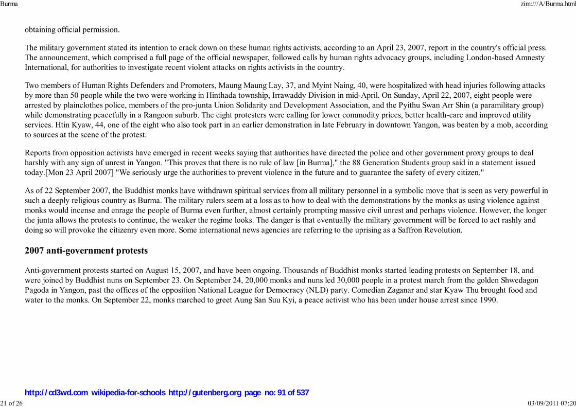
obtaining official permission.
The military government stated its intention to crack down on these human rights activists, according to an April 23, 2007, report in the country's official press.The announcement, which comprised a full page of the official newspaper, followed calls by human rights advocacy groups, including London-based AmnestyInternational, for authorities to investigate recent violent attacks on rights activists in the country.
Two members of Human Rights Defenders and Promoters, Maung Maung Lay, 37, and Myint Naing, 40, were hospitalized with head injuries following attacksby more than 50 people while the two were working in Hinthada township, Irrawaddy Division in mid-April. On Sunday, April 22, 2007, eight people werearrested by plainclothes police, members of the pro-junta Union Solidarity and Development Association, and the Pyithu Swan Arr Shin (a paramilitary group)while demonstrating peacefully in a Rangoon suburb. The eight protesters were calling for lower commodity prices, better health-care and improved utilityservices. Htin Kyaw, 44, one of the eight who also took part in an earlier demonstration in late February in downtown Yangon, was beaten by a mob, accordingto sources at the scene of the protest.
Reports from opposition activists have emerged in recent weeks saying that authorities have directed the police and other government proxy groups to dealharshly with any sign of unrest in Yangon. "This proves that there is no rule of law [in Burma]," the 88 Generation Students group said in a statement issuedtoday.[Mon 23 April 2007] "We seriously urge the authorities to prevent violence in the future and to guarantee the safety of every citizen."
As of 22 September 2007, the Buddhist monks have withdrawn spiritual services from all military personnel in a symbolic move that is seen as very powerful insuch a deeply religious country as Burma. The military rulers seem at a loss as to how to deal with the demonstrations by the monks as using violence againstmonks would incense and enrage the people of Burma even further, almost certainly prompting massive civil unrest and perhaps violence. However, the longerthe junta allows the protests to continue, the weaker the regime looks. The danger is that eventually the military government will be forced to act rashly anddoing so will provoke the citizenry even more. Some international news agencies are referring to the uprising as a Saffron Revolution.
2007 anti-government protests
Anti-government protests started on August 15, 2007, and have been ongoing. Thousands of Buddhist monks started leading protests on September 18, andwere joined by Buddhist nuns on September 23. On September 24, 20,000 monks and nuns led 30,000 people in a protest march from the golden ShwedagonPagoda in Yangon, past the offices of the opposition National League for Democracy (NLD) party. Comedian Zaganar and star Kyaw Thu brought food andwater to the monks. On September 22, monks marched to greet Aung San Suu Kyi, a peace activist who has been under house arrest since 1990.
Burma zim:///A/Burma.html
21 of 26 03/09/2011 07:20
http://cd3wd.com wikipedia-for-schools http://gutenberg.org page no: 91 of 537

Protesters in Yangon with a banner that reads non-violence:national movement in Burmese, in the background is
Shwedagon Pagoda
On September 25, 2,000 people defied threats from the Union of Myanmar's junta and marched toShwedagon Pagoda amid army trucks and warning of Brigadier-General Thura Myint Maung not toviolate Buddhist "rules and regulations." The following morning, various prominent protesters werearrested and troops barricaded Shwedagon Pagoda and attacked the 700 people within. Despite this,5,000 monks continued to protest in Yangon. At least four deaths were reported after security forcesfired on the crowds in Yangon. The junta announced that ten people had died in the crackdown on27 September 2007 but foreign diplomatic sources in Yangon said more than ten Buddhist monksand demonstrators were dead. Later a badly-beaten Buddhist monk's body was found in YangonRiver. A photo was released on an Internet site run by a Norway-based group of exiled journalists.On September 27, security forces began raiding monasteries and arresting monks throughout thecountry. The security forces also fired on the nearly 50,000 people protesting in Yangon, killing ninepeople.
Internet access within the nation has been suspended, reportedly in an attempt to dampeninternational awareness of the situation. It has also been reported that troops have been specificallytargeting people with cameras. The junta's violent response to peaceful protests has promptedinternational condemnation and calls for an immediate halt to the violence. In particular, JapanesePrime Minister Yasuo Fukuda has demanded an explanation for the killing of Nagai. IbrahimGambari, the United Nations special envoy to Burma, has arrived in Naypyidaw and has met withjunta leaders and Aung San Suu Kyi. Despite increasingly strong calls for peace, the junta continued to attack monks and raid monasteries through October 1.
By October 2, 2007, thousands of monks were unaccounted for and their whereabouts unknown. Many monasteries are being patrolled by government troops.There are eyewitness accounts of injured protesters being burned alive by the military regime in a crematorium on the outskirts of Rangoon.
On October 31, 2007 the monks started to protest again. 200 monks marched in Pakokku.
On November 29, 2007 the Junta has shut down a Yangon monastery which served as a hospice for HIV/AIDS patients.
The Burmese state media says that all but 91 of the nearly 3,000 arrested in the crackdown were released. The United Nations special envoy Ibrahim Gambaricriticised the closing of the monastery, yet was assured that the crackdown would stop. He expects to return to Burma in December.
Demographics
Burma zim:///A/Burma.html
22 of 26 03/09/2011 07:20
http://cd3wd.com wikipedia-for-schools http://gutenberg.org page no: 92 of 537
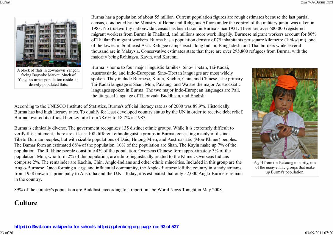
A block of flats in downtown Yangon,facing Bogyoke Market. Much of
Yangon's urban population resides indensely-populated flats.
A girl from the Padaung minority, oneof the many ethnic groups that make
up Burma's population.
Burma has a population of about 55 million. Current population figures are rough estimates because the last partialcensus, conducted by the Ministry of Home and Religious Affairs under the control of the military junta, was taken in1983. No trustworthy nationwide census has been taken in Burma since 1931. There are over 600,000 registeredmigrant workers from Burma in Thailand, and millions more work illegally. Burmese migrant workers account for 80%of Thailand's migrant workers. Burma has a population density of 75 inhabitants per square kilometre (194/sq mi), oneof the lowest in Southeast Asia. Refugee camps exist along Indian, Bangladeshi and Thai borders while severalthousand are in Malaysia. Conservative estimates state that there are over 295,800 refugees from Burma, with themajority being Rohingya, Kayin, and Karenni.
Burma is home to four major linguistic families: Sino-Tibetan, Tai-Kadai,Austroasiatic, and Indo-European. Sino-Tibetan languages are most widelyspoken. They include Burmese, Karen, Kachin, Chin, and Chinese. The primaryTai-Kadai language is Shan. Mon, Palaung, and Wa are the major Austroasiaticlanguages spoken in Burma. The two major Indo-European languages are Pali,the liturgical language of Theravada Buddhism, and English.
According to the UNESCO Institute of Statistics, Burma's official literacy rate as of 2000 was 89.9%. Historically,Burma has had high literacy rates. To qualify for least developed country status by the UN in order to receive debt relief,Burma lowered its official literacy rate from 78.6% to 18.7% in 1987.
Burma is ethnically diverse. The government recognizes 135 distinct ethnic groups. While it is extremely difficult toverify this statement, there are at least 108 different ethnolinguistic groups in Burma, consisting mainly of distinctTibeto-Burman peoples, but with sizable populations of Daic, Hmong-Mien, and Austroasiatic (Mon-Khmer) peoples.The Bamar form an estimated 68% of the population. 10% of the population are Shan. The Kayin make up 7% of thepopulation. The Rakhine people constitute 4% of the population. Overseas Chinese form approximately 3% of thepopulation. Mon, who form 2% of the population, are ethno-linguistically related to the Khmer. Overseas Indianscomprise 2%. The remainder are Kachin, Chin, Anglo-Indians and other ethnic minorities. Included in this group are theAnglo-Burmese. Once forming a large and influential community, the Anglo-Burmese left the country in steady streamsfrom 1958 onwards, principally to Australia and the U.K.. Today, it is estimated that only 52,000 Anglo-Burmese remainin the country.
89% of the country's population are Buddhist, according to a report on abc World News Tonight in May 2008.
Culture
Burma zim:///A/Burma.html
23 of 26 03/09/2011 07:20
http://cd3wd.com wikipedia-for-schools http://gutenberg.org page no: 93 of 537

An ear-piercing ceremony at theMahamuni Pagoda in Mandalay is oneof the many coming-of-age ceremonies
in Burmese culture.
A diverse range of indigenous cultures exist in Burma, the majority culture is primarily Buddhist and Bamar. Bamarculture has been influenced by the cultures of neighbouring countries. This is manifested in its language, cuisine, music,dance and theatre. The arts, particularly literature, have historically been influenced by the local form of TheravadaBuddhism. Considered the national epic of Burma, the Yama Zatdaw, an adaptation of Ramayana, has been influencedgreatly by Thai, Mon, and Indian versions of the play. Buddhism is practiced along with nat worship which involveselaborate rituals to propitiate one from a pantheon of 37 nats.
In a traditional village, the monastery is the centre of cultural life. Monks are venerated and supported by the lay people.A novitiation ceremony called shinbyu is the most important coming of age events for a boy when he enters themonastery for a short period of time. All boys of Buddhist family need to be a novice (beginner for Buddhism) before theage of twenty and to be a monk after the age of twenty. It is compulsory for all boys of Buddhism. The duration can be
as little as one week. Girls have ear-piercing ceremonies ( ) at the same time. Burmese culture is most evident invillages where local festivals are held throughout the year, the most important being the pagoda festival. Many villageshave a guardian nat, and superstition and taboos are commonplace.
British colonial rule also introduced Western elements of culture to Burma. Burma's educational system is modelled afterthat of the United Kingdom. Colonial architectural influences are most evident in major cities such as Yangon. Manyethnic minorities, particularly the Karen in the southeast, and the Kachin and Chin who populate the north andnorthwest, practice Christianity.
Burma zim:///A/Burma.html
24 of 26 03/09/2011 07:20
http://cd3wd.com wikipedia-for-schools http://gutenberg.org page no: 94 of 537
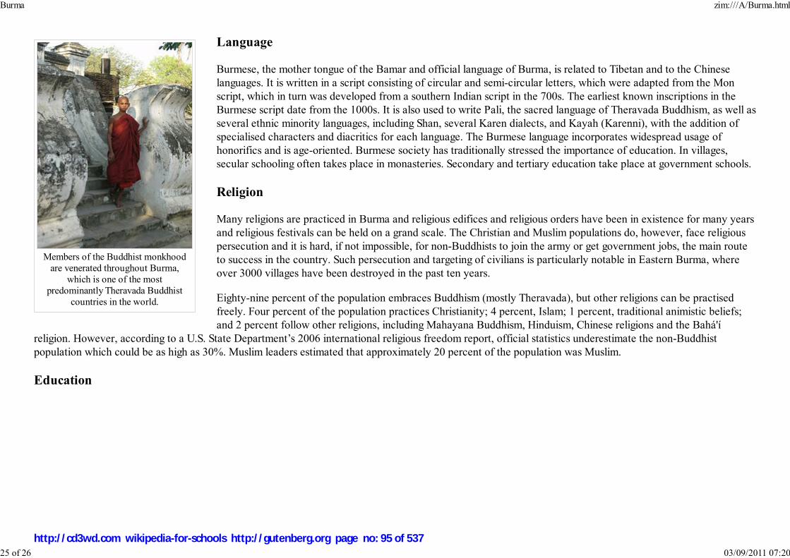
Members of the Buddhist monkhoodare venerated throughout Burma,
which is one of the mostpredominantly Theravada Buddhist
countries in the world.
Language
Burmese, the mother tongue of the Bamar and official language of Burma, is related to Tibetan and to the Chineselanguages. It is written in a script consisting of circular and semi-circular letters, which were adapted from the Monscript, which in turn was developed from a southern Indian script in the 700s. The earliest known inscriptions in theBurmese script date from the 1000s. It is also used to write Pali, the sacred language of Theravada Buddhism, as well asseveral ethnic minority languages, including Shan, several Karen dialects, and Kayah (Karenni), with the addition ofspecialised characters and diacritics for each language. The Burmese language incorporates widespread usage ofhonorifics and is age-oriented. Burmese society has traditionally stressed the importance of education. In villages,secular schooling often takes place in monasteries. Secondary and tertiary education take place at government schools.
Religion
Many religions are practiced in Burma and religious edifices and religious orders have been in existence for many yearsand religious festivals can be held on a grand scale. The Christian and Muslim populations do, however, face religiouspersecution and it is hard, if not impossible, for non-Buddhists to join the army or get government jobs, the main routeto success in the country. Such persecution and targeting of civilians is particularly notable in Eastern Burma, whereover 3000 villages have been destroyed in the past ten years.
Eighty-nine percent of the population embraces Buddhism (mostly Theravada), but other religions can be practisedfreely. Four percent of the population practices Christianity; 4 percent, Islam; 1 percent, traditional animistic beliefs;and 2 percent follow other religions, including Mahayana Buddhism, Hinduism, Chinese religions and the Bahá'í
religion. However, according to a U.S. State Department’s 2006 international religious freedom report, official statistics underestimate the non-Buddhistpopulation which could be as high as 30%. Muslim leaders estimated that approximately 20 percent of the population was Muslim.
Education
Burma zim:///A/Burma.html
25 of 26 03/09/2011 07:20
http://cd3wd.com wikipedia-for-schools http://gutenberg.org page no: 95 of 537

Yangon University of Medicine 1
Yangon University of Computer Studies
The educational system of Burma is operated by the government Ministry of Education. Universities andprofessional institutes from upper Burma and lower Burma are run by two separate entities, the Department ofHigher Education of Upper Burma and the Department of Higher Education of Lower Burma. Headquarters arebased in Yangon and Mandalay respectively. The education system is based on the United Kingdom's system, dueto nearly a century of British and Christian presences in Burma. Nearly all schools are government-operated, butthere has been a recent increase in privately funded English language schools. Schooling is compulsory until theend of elementary school, probably about 9 years old, while the compulsory schooling age is 15 or 16 atinternational level.
There are 101 universities, 12 institutes, 9 degree colleges and 24 colleges in Burma, a total of 146 highereducation institutions.
There are 10 Technical Training Schools, 23 nursing training schools, 1 sport academy and 20 midwifery schools.
There are 2047 Basic Education High Schools, 2605 Basic Education Middle Schools, 29944 Basic EducationPrimary Schools and 5952 Post Primary Schools. 1692 multimedia classrooms exist within this system.
There is one international school which is acknowledged by WASC and College Board - Yangon InternationalEducare Centre( YIEC) in Yangon.
Retrieved from " http://en.wikipedia.org/wiki/Burma"The Schools Wikipedia is sponsored by SOS Children , and consists of a hand selection from the English Wikipedia articles with only minor deletions (seewww.wikipedia.org for details of authors and sources). The articles are available under the GNU Free Documentation License. See also our
Burma zim:///A/Burma.html
26 of 26 03/09/2011 07:20
http://cd3wd.com wikipedia-for-schools http://gutenberg.org page no: 96 of 537

Preăh Réachéanachâkr Kâmpŭchea
Royaume du Cambodge
Kingdom of Cambodia
Flag Royal Arms
Motto: "Nation, Religion, King"
Anthem: " Nokoreach"
Capital
(and largest city)
Phnom Penh
Cambodia
2008/9 Schools Wikipedia Selection. Related subjects: Africa; African Countries; Asia; Asian Countries
SOS Children works in Cambodia. For more information see SOS Children in Cambodia
The Kingdom of Cambodia (pronounced /kæmˈboʊdɪə/, formerly known as Kampuchea
(/kampuˈtɕiːə/), , transliterated: Preăh Réachéanachâkr Kâmpŭchea) is a country
in South East Asia with a population of over 13 million people. The kingdom's capital and largest city is
Phnom Penh. Cambodia is the successor state of the once powerful Hindu and Buddhist Khmer Empire,
which ruled most of the Indochinese Peninsula between the eleventh and fourteenth centuries.
A citizen of Cambodia is usually identified as "Cambodian" or "Khmer," though the latter strictly refers
to ethnic Khmers. Most Cambodians are Theravada Buddhists of Khmer extraction, but the country also
has a substantial number of predominantly Muslim Cham, as well as ethnic Chinese, Vietnamese and
small animist hill tribes.
The country borders Thailand to its west and northwest, Laos to its northeast, and Vietnam to its east and
southeast. In the south it faces the Gulf of Thailand. The geography of Cambodia is dominated by the
Mekong river (colloquial Khmer: Tonle Thom or "the great river") and the Tonlé Sap ("the fresh water
lake"), an important source of fish.
Cambodia's main industries are garments, tourism, and construction. In 2007, foreign visitors to Angkor
Wat alone almost hit the 4 million mark. In 2005, oil and natural gas deposits were found beneath
Cambodia's territorial water, and once commercial extraction begins in 2011, the oil revenues could
profoundly affect Cambodia's economy.
History
Cambodia zim:///A/Cambodia.html
1 of 13 03/09/2011 07:21
http://cd3wd.com wikipedia-for-schools http://gutenberg.org page no: 97 of 537

Official languages Khmer
Demonym Cambodian
Government Constitutional monarchy
- King Norodom Sihamoni
- Prime Minister Hun Sen
Independence
- from France November 9, 1953
Area
- Total 181,035 km² ( 88th)
69,898 sq mi
- Water (%) 2.5
Population
- July 2008 estimate 14,241,640 ( 63rd)
- 1998 census 11,437,656
- Density 78/km² ( 112th)
201/sq mi
GDP ( PPP) 2006 estimate
- Total $36.82 billion ( 89th)
- Per capita $2,600 ( 133rd)
HDI (2007) ▲ 0.598 (medium) ( 131st)
Currency Riel (៛)1 ( KHR)
Time zone ( UTC+7)
- Summer ( DST) ( UTC+7)
Internet TLD .kh
Calling code +855
Local currency, although US dollars are widely used.
A Khmer army going to waragainst the Cham, from a relief
on the Bayon
1
Cambodia zim:///A/Cambodia.html
2 of 13 03/09/2011 07:21
http://cd3wd.com wikipedia-for-schools http://gutenberg.org page no: 98 of 537

South East Asia around the1200s
The first advanced civilizations in present-day Cambodia appeared in the 1st millennium AD. During the 3rd, 4th, and 5th
centuries, the Indianised states of Funan and Chenla coalesced in what is now present-day Cambodia and southwestern
Vietnam. These states, which are assumed by most scholars to have been Khmer, had close relations with China and Thailand.
Their collapse was followed by the rise of the Khmer Empire, a civilization which flourished in the area from the 9th century to
the 13th century.
The Khmer Empire declined yet remained powerful in the region until the 15th century. The empire's centre of power was
Angkor, where a series of capitals was constructed during the empire's zenith. Angkor Wat, the most famous and
best-preserved religious temple at the site, is a reminder of Cambodia's past as a major regional power.
After a long series of wars with neighbouring kingdoms, Angkor was sacked by the Thai and abandoned in 1432. The court
moved the capital to Lovek where the kingdom sought to regain its glory through maritime trade. The attempt was short-lived,
however, as continued wars with the Thai and Vietnamese resulted in the loss of more territory and the conquering of Lovek in
1594. During the next three centuries, The Khmer kingdom alternated as a vassal state of the Thai and Vietnamese kings, with
short-lived periods of relative independence between.
In 1863 King Norodom, who had been installed by Thailand, sought the protection of France. In 1867, the Thai king signed a treaty with France, renouncing
suzerainty over Cambodia in exchange for the control of Battambang and Siem Reap provinces which officially became part of Thailand. The provinces were
ceded back to Cambodia by a border treaty between France and Thailand in 1906.
Cambodia continued as a protectorate of France from 1863 to 1953, administered as part of the French colony of Indochina. After war-time occupation by the
Japanese empire from 1941 to 1945, Cambodia gained independence from France on November 9, 1953. It became a constitutional monarchy under King
Norodom Sihanouk.
In 1955, Sihanouk abdicated in favour of his father in order to be elected Prime Minister. Upon his father's death in 1960, Sihanouk again became head of state,
taking the title of Prince. As the Vietnam War progressed, Sihanouk adopted an official policy of neutrality until ousted in 1970 by a military coup led by Prime
Minister General Lon Nol and Prince Sisowath Sirik Matak, while on a trip abroad. From Beijing, Sihanouk realigned himself with the communist Khmer Rouge
rebels who had been slowly gaining territory in the remote mountain regions and urged his followers to help in overthrowing the pro-United States government
of Lon Nol, hastening the onset of civil war.
Operation Menu, a series of secret B-52 bombing raids by the United States on alleged Viet Cong bases and supply routes inside Cambodia, was acknowledged
after Lon Nol assumed power; U.S. forces briefly invaded Cambodia in a further effort to disrupt the Viet Cong. The bombing continued and, as the Cambodian
communists began gaining ground, eventually included strikes on suspected Khmer Rouge sites until halted in 1973.
Some two million Cambodians were made refugees by the bombing and fighting and fled to Phnom Penh. Estimates of the number of Cambodians killed during
the bombing campaigns vary widely. Views of the effects of the bombing also vary widely. The US Seventh Air Force argued that the bombing prevented the
fall of Phnom Penh in 1973 by killing 16,000 of 25,500 Khmer Rouge fighters besieging the city.Journalist William Shawcross and Cambodia specialists Milton
Cambodia zim:///A/Cambodia.html
3 of 13 03/09/2011 07:21
http://cd3wd.com wikipedia-for-schools http://gutenberg.org page no: 99 of 537

Bones of children executed atthe Killing Fields
Osborne, David P. Chandler and Ben Kiernan argued that the bombing drove peasants to join the Khmer Rouge. Chandler writes that the bombing provided
"the psychological ingredients of a violent, vengeful and unrelenting social revolution."Cambodia specialist Craig Etcheson argued that it is "untenable" to assert
that the Khmer Rouge would not have won but for US intervention, and that while the bombing did help Khmer Rouge recruitment, they "would have won
anyway." As the war ended, a draft US AID report observed that the country faced famine in 1975, with 75% of its draft animals destroyed by the war, and that
rice planting for the next harvest would have to be done "by the hard labor of seriously malnourished people." The report predicted that
without large-scale external food and equipment assistance there will be widespread starvation between now and next February... Slave labor and
starvation rations for half the nation's people (probably heaviest among those who supported the republic) will be a cruel necessity for this year, and
general deprivation and suffering will stretch over the next two or three years before Cambodia can get back to rice self-sufficiency.
The Khmer Rouge reached Phnom Penh and took power in 1975, changing the official name of the country to Democratic Kampuchea, led by Pol Pot. They
immediately evacuated the cities and sent the entire population on forced marches to rural work projects. They attempted to rebuild the country's agriculture on
the model of the 11th century. They also discarded Western medicine, with the result that while hundreds of thousands died from starvation and disease there
were almost no drugs in the country.
Estimates vary as to how many people were killed by the Khmer Rouge regime, ranging from approximately one to three
million. This era has given rise to the term Killing Fields, and the prison Tuol Sleng became as notorious as Auschwitz in the
history of mass killing. Hundreds of thousands more fled across the border into neighbouring Thailand.
In November 1978, Vietnam invaded Cambodia to stop Khmer Rouge incursions across the border and the genocide of
Vietnamese in Cambodia. Violent occupation and warfare between the Vietnamese and Khmer Rouge holdouts continued
throughout the 1980s. Peace efforts began in Paris in 1989, culminating two years later in October 1991 in a comprehensive
peace settlement. The United Nations was given a mandate to enforce a ceasefire, and deal with refugees and disarmament.
After the brutality of the 1970s and the 1980s, and the destruction of the cultural, economic, social and political life of
Cambodia, it is only in recent years that reconstruction efforts have begun and some political stability has finally returned to
Cambodia. The stability established following the conflict was shaken in 1997 during a coup d'état, but has otherwise remained
in place. Cambodia has been aided by a number of more developed nations like Japan, France, West-Germany, Canada, Australia and the United States,
primarily economically. Money raised in schools and community groups in these countries has gone towards the rebuilding of infrastructure and housing.
Politics and government
Cambodia zim:///A/Cambodia.html
4 of 13 03/09/2011 07:21
http://cd3wd.com wikipedia-for-schools http://gutenberg.org page no: 100 of 537

Hun Sen, PrimeMinister of Cambodia
King Norodom Sihamoni ofCambodia
The politics of Cambodia formally take place, according to the nation's constitution of 1993, in the framework of a constitutional
monarchy operated as a parliamentary representative democracy. The Prime Minister of Cambodia is the head of government, and of
a pluriform multi-party system, while the king is the head of state. The Prime Minister is appointed by the King, on the advice and
with the approval of the National Assembly; the Prime Minister and his or her ministerial appointees exercise executive power in
government. Legislative power is vested in both the executive and the two chambers of parliament, the National Assembly of
Cambodia and the Senate.
On October 14, 2004, King Norodom Sihamoni was selected by a special nine-member throne council,
part of a selection process that was quickly put in place after the surprise abdication of King Norodom
Sihanouk a week before. Sihamoni's selection was endorsed by Prime Minister Hun Sen and National
Assembly Speaker Prince Norodom Ranariddh (the new king's brother), both members of the throne
council. He was crowned in Phnom Penh on October 29. The monarchy is symbolic and does not
exercise political power. Norodom Sihamoni was trained in Cambodian classical dance. Due to his
long stay in the Czech Republic (then part of Czechoslovakia) Norodom Sihamoni is fluent in the
Czech language.
In 2006, Transparency International's rating of corrupt countries rated Cambodia as 151st of 163 countries of their Corruption
Perceptions Index. . The 2007 edition of the same list placed Cambodia at 162nd out of 179 countries . According to this same
list, Cambodia is the 3rd most corrupt nation in the South-East Asia area, behind Laos, at 168th, and Myanmar, at joint 179th.
The BBC reports that corruption is rampant in the Cambodian political arena with international aid from the U.S. and other
countries being illegally transferred into private accounts. Corruption has also added to the wide income disparity within the
population.
Military
The king is the Supreme Commander of the Royal Cambodian Armed Forces (RCAF) and the country's prime minister effectively holds the position of
commander-in-chief. The introduction of a revised command structure early in 2000 was a key prelude to the reorganization of the RCAF. This saw the ministry
of national defense form three subordinate general departments responsible for logistics and finance, materials and technical services, and defense services. The
High Command Headquarters (HCHQ) was left unchanged, but the general staff was dismantled and the former will assume responsibility over three
autonomous infantry divisions. A joint staff was also formed, responsible for inter-service co-ordination and staff management within HCHQ.
The minister of National Defense is Tea Banh. Tea Banh has served as defense minister since 1979. The Secretaries of State for Defense are Chay Saing Yun
and Por Bun Sreu.
Ke Kim Yan is the current commander of the RCAF. The Army Commander is Meas Sophea and the Army Chief of Staff is Chea Saran.
Cambodia zim:///A/Cambodia.html
5 of 13 03/09/2011 07:21
http://cd3wd.com wikipedia-for-schools http://gutenberg.org page no: 101 of 537
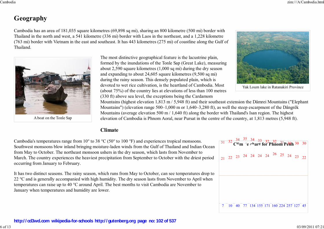
Yak Loum lake in Ratanakiri Province
A boat on the Tonle Sap
Climate chart for Phnom Penh
J F M A M J J A S O N D
Geography
Cambodia has an area of 181,035 square kilometres (69,898 sq mi), sharing an 800 kilometre (500 mi) border with
Thailand in the north and west, a 541 kilometre (336 mi) border with Laos in the northeast, and a 1,228 kilometre
(763 mi) border with Vietnam in the east and southeast. It has 443 kilometres (275 mi) of coastline along the Gulf of
Thailand.
The most distinctive geographical feature is the lacustrine plain,
formed by the inundations of the Tonle Sap (Great Lake), measuring
about 2,590 square kilometres (1,000 sq mi) during the dry season
and expanding to about 24,605 square kilometres (9,500 sq mi)
during the rainy season. This densely populated plain, which is
devoted to wet rice cultivation, is the heartland of Cambodia. Most
(about 75%) of the country lies at elevations of less than 100 metres
(330 ft) above sea level, the exceptions being the Cardamom
Mountains (highest elevation 1,813 m / 5,948 ft) and their southeast extension the Dâmrei Mountains ("Elephant
Mountains") (elevation range 500–1,000 m or 1,640–3,280 ft), as well the steep escarpment of the Dângrêk
Mountains (average elevation 500 m / 1,640 ft) along the border with Thailand's Isan region. The highest
elevation of Cambodia is Phnom Aoral, near Pursat in the centre of the country, at 1,813 metres (5,948 ft).
Climate
Cambodia's temperatures range from 10° to 38 °C (50° to 100 °F) and experiences tropical monsoons.
Southwest monsoons blow inland bringing moisture-laden winds from the Gulf of Thailand and Indian Ocean
from May to October. The northeast monsoon ushers in the dry season, which lasts from November to
March. The country experiences the heaviest precipitation from September to October with the driest period
occurring from January to February.
It has two distinct seasons. The rainy season, which runs from May to October, can see temperatures drop to
22 °C and is generally accompanied with high humidity. The dry season lasts from November to April when
temperatures can raise up to 40 °C around April. The best months to visit Cambodia are November to
January when temperatures and humidity are lower.
7
31
21
10
32
22
40
34
23
77
35
24
134
34
24
155
33
24
171
32
24
160
32
26
224
31
25
257
30
24
127
30
23
45
30
22
Cambodia zim:///A/Cambodia.html
6 of 13 03/09/2011 07:21
http://cd3wd.com wikipedia-for-schools http://gutenberg.org page no: 102 of 537

temperatures in °C
precipitation totals in mm
source: BBC Weather
Monsoon season in Kampong SpeuProvince
Serendipity Bay, Sihanoukville
City and province sizes
No. City or provinceArea
km² sq mi
1 City of Phnom Penh 290 112
2 Kandal Province 3,568 1,378
3 Takeo Province 3,563 1,376
4 Kampong Cham Province 9,799 3,783
5 Kampong Thom 13,814 5,334
6 Siem Reap Province 10,299 3,976
7 Preah Vihear Province 13,788 5,324
8 Oddar Meancheay Province 6,158 2,378
9 Banteay Meanchey Province 6,679 2,579
10 Battambang Province 11,072 4,275
11 City of Pailin 803 310
12 Pursat Province 12,692 4,900
13 Kampong Chhnang Province 5,521 2,132
14 Kampong Speu Province 7,017 2,709
15 Koh Kong Province 11,160 4,309
16 City of Sihanoukville 868 335
17 Kampot Province 4,873.2 1,881.6
18 City of Kep 335.8 129.7
19 Prey Veng Province 4,883 1,885
20 Svay Rieng Province 2,966 1,145
21 Kratie Province 11,094 4,283
Imperial conversion [ Hide ]
Cambodia zim:///A/Cambodia.html
7 of 13 03/09/2011 07:21
http://cd3wd.com wikipedia-for-schools http://gutenberg.org page no: 103 of 537

22 Stung Treng Province 11,092 4,283
23 Ratanakiri Province 10,782 4,163
24 Mondulkiri Province 14,288 5,517
25 Tonle Sap lake 3,000 1,158
TOTAL AREA 181,035 69,898
Foreign relations
Cambodia is a member of the United Nations and its specialized agencies such as the World Bank and International Monetary Fund. It is an Asian Development
Bank (ADB) member, a member of ASEAN, and joined the WTO on 13 October 2004. In 2005 Cambodia attended the inaugural East Asia Summit.
Cambodia has established diplomatic relations with numerous countries; the government reports twenty embassies in the country including many of its Asian
neighbours and those of important players during the Paris peace negotiations, including the US, Australia, Canada, China, the European Union (EU), Japan, and
Russia.
While the violent ruptures of the 1970s and 80s have passed, several border disputes between Cambodia and its neighbours persist. There are disagreements
over some offshore islands and sections of the boundary with Vietnam, and undefined maritime boundaries and border areas with Thailand.
In January 2003, there were riots in Phnom Penh prompted by rumored comments about Angkor Wat by a Thai actress wrongly attributed by Reaksmei Angkor,
a Cambodian newspaper, and later quoted by Prime Minister Hun Sen. The Thai government sent military aircraft to evacuate Thai nationals and closed its
border with Cambodia to Thais and Cambodians (at no time was the border ever closed to foreigners or Western tourists) while Thais demonstrated outside the
Cambodian embassy in Bangkok. The border was re-opened on March 21, after the Cambodian government paid $6 million USD in compensation for the
destruction of the Thai embassy and agreed to compensate individual Thai businesses for their losses.
Wildlife of Cambodia
Cambodia zim:///A/Cambodia.html
8 of 13 03/09/2011 07:21
http://cd3wd.com wikipedia-for-schools http://gutenberg.org page no: 104 of 537

Indochinese Tiger
Rice cropping plays an important role in theeconomy
Angkor Wat, the biggest touristdraw of Cambodia
Cambodia has a wide variety of plants and animals. There are 212 mammal species, 536 bird species, 240 reptile species,
850 freshwater fish species (Tonle Sap Lake area), and 435 marine fish species.
The country has one of the highest deforestation rates in the world. Since 1970, Cambodia's primary rainforest cover fell
dramatically from over 70 percent in 1970 to just 3.1 percent in 2007. In total, Cambodia lost 25,000 square kilometres
(9,700 sq mi) of forest between 1990 and 2005—3,340 km² (1,290 sq mi) of which was primary forest. As of 2007, less than
3,220 km² (1,243 sq mi) of primary forest remain with the result that the future sustainability of the forest reserves of
Cambodia is under severe threat, with illegal loggers looking to generate revenue.
Economy
Final economic indicators for 2007 are not yet available. 2006 GDP was
$7.265 billion (per capita GDP $513), with annual growth of 10.8%. Estimates for 2007 are for a GDP of $8.251
billion (per capita $571) and annual growth of 8.5%). Inflation for 2006 was 2.6%, and the current estimate for
final 2007 inflation is 6.2%.
Per capita income is rapidly increasing, but is low compared with other countries in the region. Most rural
households depend on agriculture and its related sub-sectors. Rice, fish, timber, garments and rubber are
Cambodia's major exports. The International Rice Research Institute (IRRI) reintroduced more than 750 traditional
rice varieties to Cambodia from its rice seed bank in the Philippines (Jahn 2006, 2007). These varieties had been
collected in the 1960s. In 1987, the Australian government funded IRRI to assist Cambodia to improve its rice
production. By 2000, Cambodia was once again self-sufficient in rice (Puckridge 2004, Fredenburg and Hill
1978).
The recovery of Cambodia's economy slowed dramatically in 1997–98, due to the regional economic crisis, civil violence, and
political infighting. Foreign investment and tourism also fell off drastically. Since then however, growth has been steady. In
1999, the first full year of peace in 30 years, progress was made on economic reforms and growth resumed at 5.0%. Despite
severe flooding, GDP grew at 5.0% in 2000, 6.3% in 2001, and 5.2% in 2002. Tourism was Cambodia's fastest growing
industry, with arrivals increasing from 219,000 in 1997 to 1,055,000 in 2004. During 2003 and 2004 the growth rate remained
steady at 5.0%, while in 2004 inflation was at 1.7% and exports at $1.6 billion US dollars. As of 2005, GDP per capita in PPP
terms was $2,200, which ranked 178th (out of 233) countries.
The older population often lacks education, particularly in the countryside, which suffers from a lack of basic infrastructure.
Fear of renewed political instability and corruption within the government discourage foreign investment and delay foreign aid,
although there has been significant assistance from bilateral and multilateral donors. Donors pledged $504 m to the country in
2004, while the Asian Development Bank alone has provided $850m in loans, grants, and technical assistance.
Cambodia zim:///A/Cambodia.html
9 of 13 03/09/2011 07:21
http://cd3wd.com wikipedia-for-schools http://gutenberg.org page no: 105 of 537

The tourism industry is the country's second-greatest source of hard currency after the textile industry. 50% of visitor arrivals are to Angkor, and most of the
remainder to Phnom Penh. Other tourist destinations include Sihanoukville in the southeast which has several popular beaches, and the nearby area around
Kampot including the Bokor Hill Station.
Ethnicity
87% Khmer4.3% Vietnamese
4% Chinese
2.3% Cham0.3% Thai
0.1% Eurasian
2% Other
Demographics
More than 90% of its population is of Khmer origin and speaks the Khmer language, the country's official language. The remainder include Chinese,
Vietnamese, Cham, Khmer Loeu and Indians.
The Khmer language is a member of the Mon-Khmer subfamily of the Austroasiatic language group. French, once the lingua franca of Indochina and still
spoken by some, mostly older Cambodians as a second language, remains the language of instruction in various schools and universities that are often funded by
the government of France. Cambodian French, a remnant of the country's colonial past, is a dialect found in Cambodia and is frequently used in government.
However, in recent decades, many younger Cambodians and those in the business-class have favoured learning English. In the major cities and tourist centers,
English is widely spoken and taught at a large number of schools due to the overwhelming number of tourists from English-speaking countries. Even in the most
rural outposts, however, most young people speak at least some English, as it is often taught by monks at the local pagodas where many children are educated.
Cambodia zim:///A/Cambodia.html
10 of 13 03/09/2011 07:21
http://cd3wd.com wikipedia-for-schools http://gutenberg.org page no: 106 of 537

Local women at a market in Battambang
Cambodia religiosityreligion percent
Buddhism 95%
Islam 3%
Christianity 2%
The dominant religion, a form of Theravada Buddhism
(95%), was suppressed by the Khmer Rouge but has
since experienced a revival. Islam (3%) and
Christianity (2%) are also practiced.
Civil war and its aftermath have had a marked effect
on the Cambodian population. The median age is 20.6 years, with more than 50% of the population
younger than 25. At 0.95 males/female, Cambodia has the most female-biased sex ratio in the Greater
Mekong Subregion . In the Cambodian population over 65, the female to male ratio is 1.6:1. UNICEF has
designated Cambodia the third most mined country in the world, attributing over 60,000 civilian deaths and
thousands more maimed or injured since 1970 to the unexploded land mines left behind in rural areas. The
majority of the victims are children herding animals or playing in the fields. Adults that survive landmines
often require amputation of one or more limbs and have to resort to begging for survival. In 2006, the
number of landmines casualties in Cambodia took a sharp decrease of more than 50% compared to 2005, with the number of landmines victims down from 800
in 2005 to less than 400 in 2006. The reduced casualty rate continued in 2007, with 208 casualties (38 killed and 170 injured)."
Culture and society
Khmer culture, as developed and spread by the Khmer empire, has distinctive styles of dance, architecture and sculpture, which have strongly influenced
neighbouring Laos and Thailand. Angkor Wat (Angkor means "city" and Wat "temple") is the best preserved example of Khmer architecture from the Angkorian
era and hundreds of other temples have been discovered in and around the region. The Tuol Sleng Genocide Museum, the infamous prison of the Khmer Rouge,
and Choeung Ek, one of the main Killing Fields are other important historic sites.
Bonn Om Teuk (Festival of Boat Racing), the annual boat rowing contest, is the most attended Cambodian national festival. Held at the end of the rainy season
when the Mekong river begins to sink back to its normal levels allowing the Tonle Sap River to reverse flow, approximately 10% of Cambodia's population
attends this event each year to play games, give thanks to the moon, watch fireworks, and attend the boat race in a carnival-type atmosphere. Popular games
include cockfighting, soccer, and kicking a sey, which is similar to a footbag. Recent artistic figures include singers Sinn Sisamouth and Ros Sereysothea (and
later Meng Keo Pichenda), who introduced new musical styles to the country.
Rice, as in other Southeast Asian countries, is the staple grain, while fish from the Mekong and Tonle Sap also form an important part of the diet. The
Cambodian per capita supply of fish and fish products for food and trade in 2000 was 20 kilograms of fish per year or 2 ounces per day per person. Some of the
fish can be made into prahok for longer storage. Overall, the cuisine of Cambodia is similar to that of its Southeast Asian neighbours. The cuisine is relatively
unknown to the world compared to that of its neighbours Thailand and Vietnam.
Soccer is one of the more popular sports, although professional organized sports are not as prevalent in Cambodia as in western countries due to the economic
Cambodia zim:///A/Cambodia.html
11 of 13 03/09/2011 07:21
http://cd3wd.com wikipedia-for-schools http://gutenberg.org page no: 107 of 537

National Highway 1
conditions. The Cambodia national football team managed fourth in the 1972 Asian Cup but development has slowed since the civil war. Western sports such as
volleyball, bodybuilding, field hockey, rugby union, golf, and baseball are gaining popularity while traditional boat racing maintains its appeal as a national
sport. Martial arts is practiced in Cambodia, as well the native art of Pradal Serey and Bokator.
Transport
The civil war and wildlife severely damaged Cambodia's transport system, but with assistance and equipment from other
countries Cambodia has been upgrading the main highways to international standards and most are vastly improved from 2006.
Most main roads are now paved. Cambodia has two rail lines, totalling about 612 kilometers (380 mi) of single, one
meter gauge track. The lines run from the capital to Sihanoukville on the southern coast, and from Phnom Penh to Sisophon
(although trains often run only as far as Battambang). Currently only one passenger train per week operates, between Phnom
Penh and Battambang.
Besides the main interprovincial traffic artery connecting the capital Phnom Penh with Sihanoukville, resurfacing a former dirt
road with concrete / asphalt and implementation of 5 major river crossings by means of bridges have now permanently
connected Phnom Penh with Koh Kong and hence there is now uninterrupted road access to neighboring Thailand and their
vast road system.
The nation's extensive inland waterways were important historically in international trade. The Mekong and the Tonle Sap River, their numerous tributaries, and
the Tonle Sap provided avenues of considerable length, including 3,700 kilometers (2,300 mi) navigable all year by craft drawing 0.6 meters (2 ft) and another
282 kilometers (175 mi) navigable to craft drawing 1.8 meters (6 ft). Cambodia has two major ports, Phnom Penh and Sihanoukville, and five minor ones.
Phnom Penh, located at the junction of the Bassac, the Mekong, and the Tonle Sap rivers, is the only river port capable of receiving 8,000- ton ships during the
wet season and 5,000- ton ships during the dry season.
With increasing economic activity has come an increase in automobile and motorcycle use, though bicycles still predominate; as often in developing countries,
an associated rise in traffic deaths and injuries is occurring. Cycle rickshaws ("pʰʊt-pʰʊts") are an additional option often used by visitors.
The country has four commercial airports. Phnom Penh International Airport (Pochentong) in Phnom Penh is the second largest in Cambodia. Siem
Reap-Angkor International Airport is the largest and serves the most international flights in and out of Cambodia. The other airports are in Sihanoukville and
Battambang.
International rankings
Cambodia zim:///A/Cambodia.html
12 of 13 03/09/2011 07:21
http://cd3wd.com wikipedia-for-schools http://gutenberg.org page no: 108 of 537

Organization
Heritage Foundation Index of Economic Freedom100 out of157
Reporters Without Borders Worldwide Press Freedom Index 85 out of 169
Transparency International Corruption Perceptions Index162 out of
179
United Nations DevelopmentProgramme
Human Development Index131 out of177
World Economic Forum Global Competitiveness Report110 out of
131
Nation MasterTerrorist Acts 2000-2006 Incidences (most recent) by country ,112 being the least reports ofTerrorist Acts
42 out of 112
Retrieved from " http://en.wikipedia.org/wiki/Cambodia"
The 2008 Wikipedia for Schools has a sponsor: SOS Children , and is a hand-chosen selection of article versions from the English Wikipedia edited only by
deletion (see www.wikipedia.org for details of authors and sources). The articles are available under the GNU Free Documentation License. See also our
Cambodia zim:///A/Cambodia.html
13 of 13 03/09/2011 07:21
http://cd3wd.com wikipedia-for-schools http://gutenberg.org page no: 109 of 537

China
2008/9 Schools Wikipedia Selection. Related subjects: Asia; Asian Countries
SOS Children works in China. For more information see SOS Children in China
China zim:///A/China.html
1 of 15 03/09/2011 07:22
http://cd3wd.com wikipedia-for-schools http://gutenberg.org page no: 110 of 537

China
Traditional Chinese: 中 國
Simplified Chinese: 中 国
Transliterations
Kejia (Hakka)
- Romanization: Chûng-koet
Mandarin
- Hanyu Pinyin: Zhōngguó
- Tongyong Pinyin: Jhongguó
- Wade-Giles: Chung¹-kuo²
Listen
Min
- Min-nan POJ: Tiong-kok
Yue (Cantonese)
- Jyutping: zung¹ gwok³
China zim:///A/China.html
2 of 15 03/09/2011 07:22
http://cd3wd.com wikipedia-for-schools http://gutenberg.org page no: 111 of 537

This article contains Chinese text.
Without proper rendering support, you may see
question marks, boxes, or other symbols instead of
Chinese characters.
China ( traditional Chinese: 中 國; simplified Chinese: 中 国; Hanyu Pinyin: Zhōngguó ; Tongyong
Pinyin: Jhongguó; Wade-Giles ( Mandarin): Chung¹kuo²) is a cultural region, an ancient civilization,
and, depending on perspective, a national or multinational entity occupying a large portion of land in
East Asia.
China has one of the world's oldest people and continuous civilizations, consisting of states and cultures
dating back more than six millennia. It has the world's longest continuously used written language
system, and is the source of such major inventions as what the British scholar and biochemist Joseph Needham called the " four great inventions of Ancient
China": paper, the compass, gunpowder, and printing. Historically China's cultural sphere has been very influential in East Asia as a whole, with Chinese
religion, customs, and writing system being adopted, to varying degrees, by its neighbors Japan, Korea, and Vietnam.
The stalemate of the last Chinese Civil War has resulted in two political entities using the name China: the People's Republic of China (PRC), commonly
known as China, which controls mainland China, Hong Kong, and Macau; and the Republic of China (ROC), commonly known as Taiwan, which controls the
island of Taiwan and some nearby islands.
Etymology
China is called 'Zhongguo' ( 中國 or 中国) in Chinese. The character zhōng means "middle" or central; the latter, guo, means land, or kingdom.
The name "Zhongguo" appeared first in the Classic of History (6th Century BCE), and was used to refer to the late Zhou Dynasty, as they believed that they
were the "centre of civilization" , while peoples in the four cardinals were called Eastern Yi, Southern Man, Western Rong and Northern Di respectively. Some
texts imply that "Zhongguo" was originally meant to refer to the capital of the sovereign, to differ from the capital of his vassals. The use of "Zhongguo" implied a
claim of political legitimacy. "Zhongguo" was often used by states who saw themselves as the sole legitimate successor to previous Chinese dynasties; for
example, in the era of the Southern Song Dynasty, both the Jin Dynasty and the Southern Song state claimed to be "Zhongguo".
"Zhongguo" came to official use as an abbreviation for the Republic of China (Zhonghua Minguo) after the government's establishment in 1912. Since the
People's Republic of China, established in 1949, now controls the great majority of area encompassed within the traditional concept of "China", the People's
Republic is the political unit most commonly identified with the abbreviated name "Zhongguo".
English and many other languages use various forms of the name "China" and the prefix "Sino-" or "Sin-". These forms are thought to derive from the name of
the Qin Dynasty that first unified the country (221–206 BCE). The pronunciation of "Qin" is similar to the phonetic "cheen", which is considered the possible
root of the word "China".
History
China zim:///A/China.html
3 of 15 03/09/2011 07:22
http://cd3wd.com wikipedia-for-schools http://gutenberg.org page no: 112 of 537
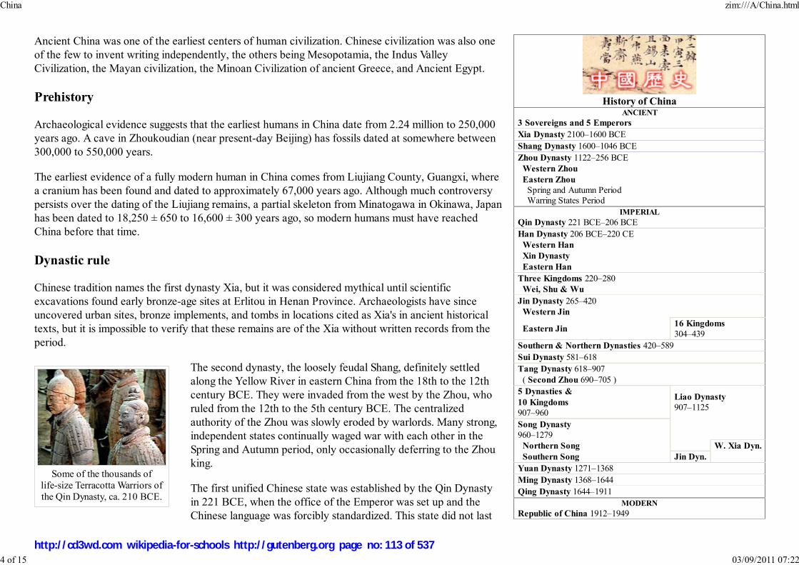
History of ChinaANCIENT
3 Sovereigns and 5 Emperors
Xia Dynasty 2100–1600 BCE
Shang Dynasty 1600–1046 BCE
Zhou Dynasty 1122–256 BCE
Western Zhou
Eastern Zhou
Spring and Autumn Period
Warring States Period
IMPERIAL
Qin Dynasty 221 BCE–206 BCE
Han Dynasty 206 BCE–220 CE
Western Han
Xin Dynasty
Eastern Han
Three Kingdoms 220–280
Wei, Shu & Wu
Jin Dynasty 265–420
Western Jin
Eastern Jin16 Kingdoms
304–439
Southern & Northern Dynasties 420–589
Sui Dynasty 581–618
Tang Dynasty 618–907
( Second Zhou 690–705 )
5 Dynasties &
10 Kingdoms
907–960
Liao Dynasty
907–1125
Song Dynasty
960–1279
Northern Song W. Xia Dyn.
Southern Song Jin Dyn.
Yuan Dynasty 1271–1368
Ming Dynasty 1368–1644
Qing Dynasty 1644–1911
MODERN
Republic of China 1912–1949
Some of the thousands of
life-size Terracotta Warriors of
the Qin Dynasty, ca. 210 BCE.
Ancient China was one of the earliest centers of human civilization. Chinese civilization was also one
of the few to invent writing independently, the others being Mesopotamia, the Indus Valley
Civilization, the Mayan civilization, the Minoan Civilization of ancient Greece, and Ancient Egypt.
Prehistory
Archaeological evidence suggests that the earliest humans in China date from 2.24 million to 250,000
years ago. A cave in Zhoukoudian (near present-day Beijing) has fossils dated at somewhere between
300,000 to 550,000 years.
The earliest evidence of a fully modern human in China comes from Liujiang County, Guangxi, where
a cranium has been found and dated to approximately 67,000 years ago. Although much controversy
persists over the dating of the Liujiang remains, a partial skeleton from Minatogawa in Okinawa, Japan
has been dated to 18,250 ± 650 to 16,600 ± 300 years ago, so modern humans must have reached
China before that time.
Dynastic rule
Chinese tradition names the first dynasty Xia, but it was considered mythical until scientific
excavations found early bronze-age sites at Erlitou in Henan Province. Archaeologists have since
uncovered urban sites, bronze implements, and tombs in locations cited as Xia's in ancient historical
texts, but it is impossible to verify that these remains are of the Xia without written records from the
period.
The second dynasty, the loosely feudal Shang, definitely settled
along the Yellow River in eastern China from the 18th to the 12th
century BCE. They were invaded from the west by the Zhou, who
ruled from the 12th to the 5th century BCE. The centralized
authority of the Zhou was slowly eroded by warlords. Many strong,
independent states continually waged war with each other in the
Spring and Autumn period, only occasionally deferring to the Zhou
king.
The first unified Chinese state was established by the Qin Dynasty
in 221 BCE, when the office of the Emperor was set up and the
Chinese language was forcibly standardized. This state did not last
China zim:///A/China.html
4 of 15 03/09/2011 07:22
http://cd3wd.com wikipedia-for-schools http://gutenberg.org page no: 113 of 537

People's Republic
of China ( Mainland China) 1949–present
1949-1976
1976-1989
1989-2002
2002-present
Republic of China
(on Taiwan)
1945-present
Dynasties in Chinese History
Economic history of China
Historiography of China
History of Chinese Art
History of Education in China
History of Science and Technology in China
Legal history of China
Linguistic history of China
Military history of China
Naval History of China
Timeline of Chinese History
A 10th-11th century Longquan
stoneware vase from Zhejiang
province, during the Song Dynasty.
long, as its legalist policies soon led to widespread rebellion.
The subsequent Han Dynasty ruled China between 206 BCE and 220 CE, and created a lasting Han
cultural identity among its populace that would last to the present day. The Han Dynasty expanded the
empire's territory considerably with military campaigns reaching Korea, Vietnam, Mongolia and
Central Asia, and also helped establish the Silk Road in Central Asia.
After Han's collapse, another period of disunion followed, including the highly chivalric period of the
Three Kingdoms. Independent Chinese states of this period also opened diplomatic relations with
Japan, introducing the Chinese writing system there. In 580 CE, China was reunited under the Sui.
However, the Sui Dynasty was short-lived after a failure in the Goguryeo-Sui Wars (598–614)
weakened it.
Under the succeeding Tang and Song dynasties, Chinese
technology and culture reached its zenith. The Song dynasty was
the first government in world history to issue paper money and the first Chinese polity to establish a permanent standing
navy. Between the 10th and 11th centuries, the population of China doubled in size. This growth came about through
expanded rice cultivation in central and southern China, along with its production of abundant food surpluses. Within its
borders, the Northern Song Dynasty had a population of some 100 million people. The Song Dynasty was a culturally rich
period in China for the arts, philosophy, and social life. Landscape art and portrait paintings were brought to new levels of
maturity and complexity since the Tang Dynasty, and social elites gathered to view art, share their own, and make trades
of precious artworks. Philosophers such as Cheng Yi and Chu Hsi reinvigorated Confucianism with new commentary,
infused Buddhist ideals, and emphasis on new organization of classic texts that brought about the core doctrine of
Neo-Confucianism.
In 1271, the Mongol leader and the fifth Khagan of the Mongol Empire Kublai Khan established the Yuan Dynasty, with
the last remnant of the Song Dynasty falling to the Yuan in 1279. A peasant named Zhu Yuanzhang overthrew the Mongols
in 1368 and founded the Ming Dynasty. Ming Dynasty thinkers such as Wang Yangming would further critique and expand
Neo-Confucianism with ideas of individualism and innate morality that would have tremendous impact on later Japanese
thought. Chosun Korea also became a nominal vassal state of Ming China and adopted much of its Neo-Confucian
bureaucratic structure. China's capital was moved from Nanjing to Beijing during the early Ming Dynasty. The Ming fell to
the Manchus in 1644, who then established the Qing Dynasty. An estimated 25 million people died during the Manchu
conquest of Ming Dynasty (1616–1644).
The Qing Dynasty, which lasted until 1912, was the last dynasty in China. In the 19th century the Qing Dynasty adopted a defensive posture towards European
imperialism, even though it engaged in imperialistic expansion into Central Asia itself. At this time China awoke to the significance of the rest of the world, in
particular the West. As China opened up to foreign trade and missionary activity, opium produced by British India was forced onto Qing China. Two Opium
China zim:///A/China.html
5 of 15 03/09/2011 07:22
http://cd3wd.com wikipedia-for-schools http://gutenberg.org page no: 114 of 537

A corner tower of the Forbidden City
at night; the palace served as the
residence for the imperial family since
the reign of the Yongle Emperor of the
Ming Dynasty in the 15th century, up
until the fall of the Qing Dynasty in
1912.
Wars with Britain weakened the Emperor's control.
One result was the Taiping Civil War which lasted from 1851 to 1862. It was led by Hong Xiuquan, who was partly influenced by a misinterpretation of
Christianity. Hong believed himself to be the son of God and the younger brother of Jesus. Although the Qing forces were eventually victorious, the civil war
was one of the bloodiest in human history, costing at least twenty million lives (more than the total number of fatalities in the First World War), with some
estimates up to two-hundred million. In addition, more costly rebellions in terms of human lives and economics followed the Taiping Rebellion such as the
Punti-Hakka Clan Wars (1855–1867), Nien Rebellion (1851–1868), Muslim Rebellion (1862–1877), Panthay Rebellion (1856–1873) and the Miao Rebellion
(1854–1873). These rebellions resulted in an estimated loss of several million lives for each rebellion and in disastrous results for the economy and the
countryside. The flow of British opium led to more decline.
While China was torn by continuous war, Meiji Japan succeeded in rapidly modernizing its military with its sights on
Korea and Manchuria. Maneuvered by Japan, Korea declared independence from Qing China's suzerainty in 1894,
leading to the First Sino-Japanese War, which resulted in the Qing Dynasty's cession of both Korea and Taiwan to Japan.
Following these series of defeats, a reform plan for the empire to become a modern Meiji-style constitutional monarchy
was drafted by the Emperor Guangxu in 1898, but was opposed and stopped by the Empress Dowager Cixi, who placed
Emperor Guangxu under house arrest in a coup d'état. Further destruction followed the ill-fated 1900 Boxer Rebellion
against westerners in Beijing. By the early 20th century, mass civil disorder had begun, and calls for reform and
revolution were heard across the country. The 38 year old Emperor Guangxu died under house arrest on November 14,
1908, suspiciously just a day before Cixi. With the throne empty, he was succeeded by Cixi's handpicked heir, his two
year old nephew Puyi, who became the Xuantong Emperor, the last Chinese emperor. Guangxu's consort, who became
the Empress Dowager Longyu, signed the abdication decree as regent in 1912, ending two thousand years of imperial
rule in China. She died, childless, in 1913.
Republic of China (1912–1949)
On January 1, 1912, the Republic of China was established, heralding the end of the Qing Dynasty. Sun Yat-sen of the
Kuomintang (the KMT or Nationalist Party) was proclaimed provisional president of the republic. However, the
presidency was later given to Yuan Shikai, a former Qing general, who had ensured the defection of the entire Beiyang Army from the Qing Empire to the
revolution. In 1915, Yuan proclaimed himself Emperor of China but was forced to abdicate and return the state to a republic when he realized it was an
unpopular move, not only with the population but also his own Beiyang Army and its commanders.
China zim:///A/China.html
6 of 15 03/09/2011 07:22
http://cd3wd.com wikipedia-for-schools http://gutenberg.org page no: 115 of 537

Map of Republic of China printed
by Rand McNally & Co. in the year
1914.
Territories currently administered by two states
that formally use the name China:
the PRC (in purple) and the ROC (in orange).
After Yuan Shikai's death in 1916, China was politically fragmented, with an internationally recognized but virtually
powerless national government seated in Peking (modern day Beijing). Warlords in various regions exercised actual control
over their respective territories. In the late 1920s, the Kuomintang, under Chiang Kai-shek, was able to reunify the country
under its own control, moving the nation's capital to Nanking (modern day Nanjing) and implementing "political tutelage",
an intermediate stage of political development outlined in Sun Yat-sen's program for transforming China into a modern,
democratic state. Effectively, political tutelage meant one-party rule by the Kuomintang.
The Sino-Japanese War of 1937–1945 (part of World War II) forced an uneasy alliance between the Nationalists and the
Communists as well as causing around 10 million Chinese civilian deaths. With the surrender of Japan in 1945, China
emerged victorious but financially drained. The continued distrust between the Nationalists and the Communists led to the
resumption of the Chinese Civil War. In 1947, constitutional rule was established, but because of the ongoing Civil War
many provisions of the ROC constitution were never implemented on the mainland.
People's Republic of China and Republic of China (1949–present)
After its victory in the Chinese Civil War, the Communist Party of China, led by Mao Zedong, gained control of
most of the Mainland China. On October 1, 1949, they established the People's Republic of China as a Socialist
State headed by a "Democratic Dictatorship" with the CCP as the only legal political party, thus, laying claim as
the successor state of the ROC. The central government of the Chinese Nationalist Party led by Chiang Kai-shek
was forced to retreat to the island of Taiwan that it had occupied at the end of World War II and moved the ROC
government there. Major armed hostilities ceased in 1950 but no peace treaty has been signed.
Beginning in the late 1970s, the Republic of China began the implementation of full, multi-party, representative
democracy in the territories still under its control (Taiwan, and a number of smaller islands including Quemoy and
Matsu). Today, the ROC has active political participation by all sectors of society. The main cleavage in ROC
politics is the issue of eventual political unification with the Chinese mainland vs. formal independence of
Taiwan.
After the Chinese Civil War, mainland China underwent a series of disruptive socioeconomic movements starting
in the late 1950s with the Great Leap Forward and continued in the 1960s with the Cultural Revolution that left
much of its education system and economy in shambles. With the death of its first generation Communist Party
leaders such as Mao Zedong and Zhou Enlai, the PRC began implementing a series of political and economic
reforms advocated by Deng Xiaoping that eventually formed the foundation for mainland China's rapid economic
development starting in the 1990s.
Post-1978 reforms on the mainland have led to some relaxation of control over many areas of society. However, the PRC government still has almost absolute
China zim:///A/China.html
7 of 15 03/09/2011 07:22
http://cd3wd.com wikipedia-for-schools http://gutenberg.org page no: 116 of 537

control over politics, and it continually seeks to eradicate what it perceives as threats to the social, political and economic stability of the country. Examples
include the fight against terrorism, jailing of political opponents and journalists, custody regulation of the press, regulation of religion, and suppression of
independence/secessionist movements. In 1989, the student protests at Tiananmen Square were violently put to an end by the Chinese military after 15 days of
martial law. In 1997, Hong Kong was returned to the PRC by the United Kingdom, and in 1999, Macau was returned by Portugal.
Today, mainland China is administered by the People's Republic of China—a one-party state under the leadership of the Chinese Communist Party; while the
island of Taiwan and surrounding islands are administered by the Republic of China—a democratic multi-party state. After the founding of the People's
Republic in 1949, both states claimed to be the sole legitimate ruler of all of "China". After the Kuomintang retreat to Taiwan in 1949, the Republic of China
had maintained official diplomatic relations with most states around the world, but by the 1970s, there was a shift in the international diplomatic circles and the
People's Republic of China gained the upper hand in international diplomatic relations and recognition count. In 1971, under resolution 2758, the
representatives of Chiang Kai-shek to the United Nations were expelled from the intergovernmental organization. With the expulsion of the Chiang Kai-shek's
representatives, and effectively the Republic of China, the representatives of the People's Republic of China were invited to assume China's seat on the UN
Security Council, the UN General Assembly and other United Nations councils and agencies. Later attempts by the Republic of China to rejoin the UN have
either been blocked by the People's Republic of China, who has veto power on UN Security Council, or rejected by the United Nations Secretariat or a United
Nations General Assembly committee responsible for the General Assembly's agenda.
Since its retreat to Taiwan, the Republic of China has not formally renounced its claim to all of China, nor has it changed its official maps, which includes the
mainland and Mongolia. Following the introduction to full democracy and the electoral victory of DPP's Chen Shui-bian in the presidential elections, the
Republic of China has not pursued its claims on the mainland and in Mongolia. The previous DPP Administration has adopted a policy of separating the state's
identity from "China", while moving towards identifying the state as "Taiwan". The ROC has not made formal moves to change the name, flag, or national
anthem of the state to reflect a Taiwan identity due to pressure from the United States and the fear of invasion or military action from the People's Republic of
China against the island. The People's Republic of China claims to have succeeded the Republic of China as the sole legitimate governing authority of all of
China, which, from the official viewpoint of People's Republic of China, includes the island of Taiwan. Over the last 50 years, both the Republic of China and
the People's Republic of China have used diplomatic and economic means to compete for recognition in the international arena. Because most international,
intergovernmental organizations observe the One-China policy of the People's Republic of China, the PRC has been able to pressure organizations, such as the
World Health Organization and the International Olympic Committee, to refuse official recognition of the Republic of China. Due to the One-China policy,
states around the world are pressured to refuse, or to cut off, diplomatic relations with the Republic of China. As a result, 23 U.N. member states currently
maintain official diplomatic relations with the Republic of China while the vast majority of the U.N. member states maintain official diplomatic relations with
the People's Republic of China.
Territory and environment
Historical political divisions
China zim:///A/China.html
8 of 15 03/09/2011 07:22
http://cd3wd.com wikipedia-for-schools http://gutenberg.org page no: 117 of 537

Territories occupied by different dynasties as
well as modern political states throughout
the history of China.
Composite satellite photo
Main geographic features and
regions of China.
Top-level political divisions of China have altered as administrations changed. Top levels included circuits and
provinces. Below that, there have been prefectures, subprefectures, departments, commanderies, districts, and
counties. Recent divisions also include prefecture-level cities, county-level cities, towns and townships.
Most Chinese dynasties were based in the historical heartlands of China, known as China proper. Various dynasties
also expanded into peripheral territories like Inner Mongolia, Manchuria, Xinjiang, and Tibet. The Manchu-
established Qing Dynasty and its successors, the ROC and the PRC, incorporated these territories into the Chinese
empire.
Geography and climate
China ranges from mostly plateaus and mountains in the west to lower lands in
the east. Principal rivers flow from west to east, including the Yangtze (central),
the Huang He (Yellow river, north-central), and the Amur (northeast), and
sometimes toward the south (including the Pearl River, Mekong River, and
Brahmaputra), with most Chinese rivers emptying into the Pacific Ocean.
In the east, along the shores of the Yellow Sea and the East China Sea there are
extensive and densely populated alluvial plains. On the edges of the Inner Mongolian plateau in the north, grasslands can be
seen. Southern China is dominated by hills and low mountain ranges. In the central-east are the deltas of China's two major
rivers, the Huang He and Yangtze River. Most of China's arable lands lie along these rivers; they were the centers of China's
major ancient civilizations. Other major rivers include the Pearl River, Mekong, Brahmaputra and Amur. Yunnan Province is
considered a part of the Greater Mekong Subregion, which also includes Myanmar, Laos, Thailand, Cambodia, and Vietnam.
In the west, the north has a great alluvial plain, and the south has a vast calcareous tableland traversed by hill ranges of
moderate elevation, and the Himalayas, containing Earth's highest point, Mount Everest. The northwest also has high plateaus
with more arid desert landscapes such as the Takla-Makan and the Gobi Desert, which has been expanding. During many
dynasties, the southwestern border of China has been the high mountains and deep valleys of Yunnan, which separate modern
China from Burma, Laos and Vietnam.
The Paleozoic formations of China, excepting only the upper part of the Carboniferous system, are marine, while the Mesozoic
and Tertiary deposits are estuarine and freshwater or else of terrestrial origin. Groups of volcanic cones occur in the Great
Plain of north China. In the Liaodong and Shandong Peninsulas, there are basaltic plateaus.
The climate of China varies greatly. The northern zone (containing Beijing) has summer daytime temperatures of more than 30
degrees Celsius and winters of Arctic severity. The central zone (containing Shanghai) has a temperate continental climate with
very hot summers and cold winters. The southern zone (containing Guangzhou) has a subtropical climate with very hot summers and mild winters.
China zim:///A/China.html
9 of 15 03/09/2011 07:22
http://cd3wd.com wikipedia-for-schools http://gutenberg.org page no: 118 of 537

Wang Yangming, a
highly influential
Neo-Confucian.
Due to a prolonged drought and poor agricultural practices, dust storms have become usual in the spring in China. Dust has blown to southern China and
Taiwan, and has reached the West Coast of the United States. Water, erosion, and pollution control have become important issues in China's relations with other
countries.
Economy
Society
Culture
Confucianism was the official philosophy throughout most of Imperial China's history, and mastery of Confucian texts was the primary criterion for entry into
the imperial bureaucracy. China's traditional values were derived from various versions of Confucianism. A number of more authoritarian strains of thought
have also been influential, such as Legalism. There was often conflict between the philosophies, e.g. the Song Dynasty Neo-Confucians believed Legalism
departed from the original spirit of Confucianism. Examinations and a culture of merit remain greatly valued in China today. In recent years, a number of New
Confucians (not to be confused with Neo-Confucianism) have advocated that democratic ideals and human rights are quite compatible with traditional
Confucian "Asian values".
With the rise of Western economic and military power beginning in the mid-19th century, non-Chinese systems of social and political
organization gained adherents in China. Some of these would-be reformers totally rejected China's cultural legacy, while others sought
to combine the strengths of Chinese and Western cultures. In essence, the history of 20th century China is one of experimentation with
new systems of social, political, and economic organization that would allow for the reintegration of the nation in the wake of dynastic
collapse.
Arts, scholarship, and literature
China zim:///A/China.html
10 of 15 03/09/2011 07:22
http://cd3wd.com wikipedia-for-schools http://gutenberg.org page no: 119 of 537

Chinese calligraphy by Mi Fu,
Song Dynasty, ca. 1100 CE
A bamboo book copy of Sun
Tzu's The Art of War, a 20th
century reprint of a Qianlong
imperial edition.
Chinese characters have had many variants and styles throughout Chinese history. Tens of thousands of ancient written
documents are still extant, from Oracle bones to Qing edicts. This literary emphasis affected the general perception of cultural
refinement in China, e.g. the view that calligraphy was a higher art form than painting or drama. Manuscripts of the Classics
and religious texts (mainly Confucian, Taoist, and Buddhist) were handwritten by ink brush. Calligraphy later became
commercialized, and works by famous artists became prized possessions.
Chinese literature has a long past; the earliest classic work in Chinese, the I Ching or "Book of Changes" dates to around 1000
BCE. A flourishing of philosophy during the Warring States Period produced such noteworthy works as Confucius's Analects
and Laozi's Tao Te Ching. (See also the Chinese classics.) Dynastic histories were often written, beginning with Sima Qian's
seminal Records of the Historian written from 109 BCE to 91 BCE. The Tang Dynasty witnessed a poetic flowering, while the
Four Great Classical Novels of Chinese literature were written during the Ming and Qing Dynasties.
Printmaking in the form of movable type was developed during the Song Dynasty. Academies of scholars sponsored by the
empire were formed to comment on the classics in both printed and handwritten form. Royalty frequently participated in these
discussions as well. The Song Dynasty was also a period of great scientific literature, such as Su Song's Xin Yixiang Fayao and
Shen Kuo's Dream Pool Essays. There were also enormous works of historiography and large encyclopedias, such as Sima
Guang's Zizhi Tongjian of 1084 CE or the Four Great Books of Song fully compiled and edited by the 11th century.
For centuries, economic and social advancement in China could be provided by high performance on the imperial
examinations. This led to a meritocracy, although it was available only to males who could afford test preparation. Imperial
examinations required applicants to write essays and demonstrate mastery of the Confucian classics. Those who passed the
highest level of the exam became elite scholar-officials known as jinshi, a highly esteemed socio-economic position.
Chinese philosophers, writers and poets were highly respected and played key roles in preserving and promoting the culture of
the empire. Some classical scholars, however, were noted for their daring depictions of the lives of the common people, often
to the displeasure of authorities.
The Chinese invented numerous musical instruments, such as the zheng (zither with movable bridges), qin (bridgeless zither),
sheng (free reed mouth organ), and xiao (vertical flute) and adopted and developed others such the erhu (alto fiddle or bowed lute) and pipa (pear-shaped
plucked lute), many of which have later spread throughout East Asia and Southeast Asia, particularly to Japan, Korea, and Vietnam.
Demography
China zim:///A/China.html
11 of 15 03/09/2011 07:22
http://cd3wd.com wikipedia-for-schools http://gutenberg.org page no: 120 of 537
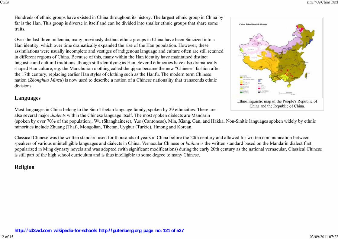
Ethnolinguistic map of the People's Republic of
China and the Republic of China.
Hundreds of ethnic groups have existed in China throughout its history. The largest ethnic group in China by
far is the Han. This group is diverse in itself and can be divided into smaller ethnic groups that share some
traits.
Over the last three millennia, many previously distinct ethnic groups in China have been Sinicized into a
Han identity, which over time dramatically expanded the size of the Han population. However, these
assimilations were usually incomplete and vestiges of indigenous language and culture often are still retained
in different regions of China. Because of this, many within the Han identity have maintained distinct
linguistic and cultural traditions, though still identifying as Han. Several ethnicities have also dramatically
shaped Han culture, e.g. the Manchurian clothing called the qipao became the new "Chinese" fashion after
the 17th century, replacing earlier Han styles of clothing such as the Hanfu. The modern term Chinese
nation (Zhonghua Minzu) is now used to describe a notion of a Chinese nationality that transcends ethnic
divisions.
Languages
Most languages in China belong to the Sino-Tibetan language family, spoken by 29 ethnicities. There are
also several major dialects within the Chinese language itself. The most spoken dialects are Mandarin
(spoken by over 70% of the population), Wu (Shanghainese), Yue (Cantonese), Min, Xiang, Gan, and Hakka. Non-Sinitic languages spoken widely by ethnic
minorities include Zhuang (Thai), Mongolian, Tibetan, Uyghur (Turkic), Hmong and Korean.
Classical Chinese was the written standard used for thousands of years in China before the 20th century and allowed for written communication between
speakers of various unintelligible languages and dialects in China. Vernacular Chinese or baihua is the written standard based on the Mandarin dialect first
popularized in Ming dynasty novels and was adopted (with significant modifications) during the early 20th century as the national vernacular. Classical Chinese
is still part of the high school curriculum and is thus intelligible to some degree to many Chinese.
Religion
China zim:///A/China.html
12 of 15 03/09/2011 07:22
http://cd3wd.com wikipedia-for-schools http://gutenberg.org page no: 121 of 537

A Chinese Tang Dynasty
(618–907) sculpture of the
Buddha seated in meditation.
The "official" orthodox faith system held by most dynasties of China until the overthrow of the last dynasty is a panentheism
system, centering on the worship of " Heaven" as an omnipotent force. This faith system pre-dated the development of
Confucianism and Taoism or the introduction of Buddhism and Christianity. It has features of a monotheism in that Heaven is
seen as an omnipotent entity, endowed with personality but no corporeal form. "Heaven" as a supernatural force was variously
referred to as Shangdi (literally "Emperor Above"). Worship of Heaven includes the erection of shrines, the last and greatest
being the Altar of Heaven in Beijing, and the offering of prayers. Manifestation of the powers of Heaven include weather and
natural disasters. Although it gradually diminished in popular belief after the advent of Taoism and Buddhism, among others,
some of its concepts remained in use throughout the pre-modern period and have been incorporated in later religions of China.
Taoism is an indigenous religion of China and is traditionally traced to the composition of Lao Zi's Tao Te Ching (The Book of
Tao and Its Virtues) or to seminal works by Zhang Daoling. The philosophy of Taoism is centered on " the way"; an
understanding of which can be likened to recognizing the true nature of the universe. Taoism in its unorganized form is also
considered a folk religion of China. More secular derivatives of Taoist ideas include Feng Shui, Sun Tzu's Art of War, and
acupuncture.
Buddhism was introduced from India and Central Asia during the Han dynasty and became very popular among Chinese of all
walks of life, embraced particularly by commoners, and sponsored by emperors in certain dynasties. Mahayana (大乘,
Dacheng) is the predominant form of Buddhism practiced in China, where it was largely Sinicized and later exported to Korea,
Japan and Vietnam. Some subsets of Mahayana popular in China include Pure Land ( Amidism) and Zen. Buddhism is the largest organized faith in China and
the country has the most Buddhist adherents in the world, followed by Japan. Many Chinese, however, identify themselves as both Taoist and Buddhist at the
same time.
Ancestor worship is a major religious theme shared among all Chinese religions. Traditional Chinese culture, Taoism, Confucianism, and Chinese Buddhism all
value filial piety as a top virtue, and the act is a continued display of piety and respect towards departed ancestors. The Chinese generally offer prayers and food
for the ancestors, light incense and candles, and burn offerings of Joss paper. These activities are typically conducted at the site of ancestral graves or tombs, at
an ancestral temple, or at a household shrine.
Islam, Judaism and Christianity first arrived in China after the 7th century during the Tang Dynasty. Islam was later spread by merchants and craftsmen as trade
routes improved along the Silk Road, while Christianity began to make significant inroads in China after the 16th century through Jesuit and later protestant
missionaries. Islam arrived in China during the 8th century, only a few years after the Islamic prophet Muhammad's death. The Emperor of China took Islam
highly, and the first mosque in China, the Huaisheng Mosque was built in Canton, Guangzhou in 630. In the first half of the 20th century, many Jews arrived in
Shanghai and Hong Kong during those cities' periods of economic expansion, seeking refuge from the Holocaust in Europe. Shanghai was particularly notable
for its volume of Jewish refugees, as it was the only port in the world then to accept them without an entry visa.
Sports and recreation
China zim:///A/China.html
13 of 15 03/09/2011 07:22
http://cd3wd.com wikipedia-for-schools http://gutenberg.org page no: 122 of 537
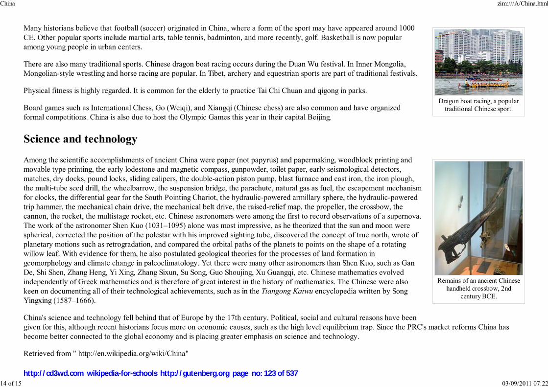
Dragon boat racing, a popular
traditional Chinese sport.
Remains of an ancient Chinese
handheld crossbow, 2nd
century BCE.
Many historians believe that football (soccer) originated in China, where a form of the sport may have appeared around 1000
CE. Other popular sports include martial arts, table tennis, badminton, and more recently, golf. Basketball is now popular
among young people in urban centers.
There are also many traditional sports. Chinese dragon boat racing occurs during the Duan Wu festival. In Inner Mongolia,
Mongolian-style wrestling and horse racing are popular. In Tibet, archery and equestrian sports are part of traditional festivals.
Physical fitness is highly regarded. It is common for the elderly to practice Tai Chi Chuan and qigong in parks.
Board games such as International Chess, Go (Weiqi), and Xiangqi (Chinese chess) are also common and have organized
formal competitions. China is also due to host the Olympic Games this year in their capital Beijing.
Science and technology
Among the scientific accomplishments of ancient China were paper (not papyrus) and papermaking, woodblock printing and
movable type printing, the early lodestone and magnetic compass, gunpowder, toilet paper, early seismological detectors,
matches, dry docks, pound locks, sliding calipers, the double-action piston pump, blast furnace and cast iron, the iron plough,
the multi-tube seed drill, the wheelbarrow, the suspension bridge, the parachute, natural gas as fuel, the escapement mechanism
for clocks, the differential gear for the South Pointing Chariot, the hydraulic-powered armillary sphere, the hydraulic-powered
trip hammer, the mechanical chain drive, the mechanical belt drive, the raised-relief map, the propeller, the crossbow, the
cannon, the rocket, the multistage rocket, etc. Chinese astronomers were among the first to record observations of a supernova.
The work of the astronomer Shen Kuo (1031–1095) alone was most impressive, as he theorized that the sun and moon were
spherical, corrected the position of the polestar with his improved sighting tube, discovered the concept of true north, wrote of
planetary motions such as retrogradation, and compared the orbital paths of the planets to points on the shape of a rotating
willow leaf. With evidence for them, he also postulated geological theories for the processes of land formation in
geomorphology and climate change in paleoclimatology. Yet there were many other astronomers than Shen Kuo, such as Gan
De, Shi Shen, Zhang Heng, Yi Xing, Zhang Sixun, Su Song, Guo Shoujing, Xu Guangqi, etc. Chinese mathematics evolved
independently of Greek mathematics and is therefore of great interest in the history of mathematics. The Chinese were also
keen on documenting all of their technological achievements, such as in the Tiangong Kaiwu encyclopedia written by Song
Yingxing (1587–1666).
China's science and technology fell behind that of Europe by the 17th century. Political, social and cultural reasons have been
given for this, although recent historians focus more on economic causes, such as the high level equilibrium trap. Since the PRC's market reforms China has
become better connected to the global economy and is placing greater emphasis on science and technology.
Retrieved from " http://en.wikipedia.org/wiki/China"
China zim:///A/China.html
14 of 15 03/09/2011 07:22
http://cd3wd.com wikipedia-for-schools http://gutenberg.org page no: 123 of 537

This Wikipedia DVD Selection is sponsored by SOS Children , and is mainly selected from the English Wikipedia with only minor checks and changes (see
www.wikipedia.org for details of authors and sources). The articles are available under the GNU Free Documentation License. See also our
China zim:///A/China.html
15 of 15 03/09/2011 07:22
http://cd3wd.com wikipedia-for-schools http://gutenberg.org page no: 124 of 537

Territory of Christmas Island
Flag Coat of arms
Anthem: Advance Australia Fair
Capital
(and largest city)
Flying Fish Cove
("The Settlement")
Official languages English ( de facto)
Demonym Christmas Island
Government Federal
constitutional
monarchy
- Queen of Australia Elizabeth II
- Governor-General of the
Commonwealth of
Australia
Michael Jeffery
Christmas Island
2008/9 Schools Wikipedia Selection. Related subjects: Asia; Asian Countries; Oceania (Australasia)
The Territory of Christmas Island is a small territory of Australia located in the Indian Ocean, 2600
kilometres (1600 mi) northwest of Perth in Western Australia, 500 kilometres (300 mi) south of Jakarta,
Indonesia, and 975 km ENE of the Cocos (Keeling) Islands.
It maintains about 1,600 residents who live in a number of "settlement areas" on the northern tip of the
island: Flying Fish Cove (also known as Kampong), Silver City, Poon Saan and Drumsite.
It has a unique natural topography and is of immense interest to scientists and naturalists due to the
number of species of endemic flora and fauna which have evolved in isolation and undisturbed by human
habitation.
While there has been mining activity on the island for many years, 65% of its 135 square kilometres
(52 sq mi) are now National Park and there are large areas of pristine and ancient rainforest.
History
For centuries, Christmas Island's isolation and rugged coasts provided natural barriers to settlement.
British and Dutch navigators first included the island on their charts from the early seventeenth century,
and Captain William Mynors of the British East India Company vessel, the Royal Mary, named the
island when he arrived on Christmas Day, 25 December 1643. The island first appears on a map
produced by Pieter Goos and published in 1666. Goos had labelled the island Moni.
The earliest recorded visit was in March 1688 by William Dampier of the British ship Cygnet, who found
it uninhabited. An account of the visit can be found in Dampier's Voyages, which describes how, when
trying to reach Cocos from New Holland, his ship was pulled off course in an easterly direction and after
28 days arrived at Christmas Island. Dampier landed at the Dales (on the West Coast) and two of his
crewmen were the first recorded people to set foot on Christmas Island.
The next visit was by Daniel Beekman, who described it in his 1718 book, A Voyage to and from the
Island of Borneo, in the East Indies.
Christmas Island zim:///A/Christmas_Island.html
1 of 9 03/09/2011 07:22
http://cd3wd.com wikipedia-for-schools http://gutenberg.org page no: 125 of 537
- Administrator Neil Lucas
- Shire President Gordon Thomson
Territory of Australia
- Sovereignty
transferred to Australia 1957
Area
- Total 135 km²
52 sq mi
- Water (%) 0
Population
- 2006 estimate 1,493 ( n/a)
- Density 11.06/km² ( n/a)
28.7/sq mi
CurrencyAustralian dollar (
AUD)
Time zone ( UTC+7)
Internet TLD .cx
Calling code +61
In 1771, the Indian vessel, the Pigot, attempted to find an anchorage but was unsuccessful; the crew
reported seeing wild pigs and coconut palms. However, pigs are not known to have been introduced to
the island at the time, so the Pigot may have found a different island.
Exploration and annexation
Christmas Island zim:///A/Christmas_Island.html
2 of 9 03/09/2011 07:22
http://cd3wd.com wikipedia-for-schools http://gutenberg.org page no: 126 of 537

Poon Saan in the evening
Poon Saan shops
The first attempt at exploring the island was in 1857 by the crew of the Amethyst. They tried to reach the summit of the island,
but found the cliffs impassable.
During the 1872-76 Challenger expedition to Indonesia, naturalist Dr John Murray carried out extensive surveys.
In 1887, Captain Maclear of HMS Flying Fish, having discovered an anchorage in a bay that he named Flying Fish Cove,
landed a party and made a small but interesting collection of the flora and fauna. In the next year, Pelham Aldrich, on board
HMS Egeria, visited it for ten days, accompanied by J. J. Lister, who gathered a larger biological and mineralogical collection.
Among the rocks then obtained and submitted to Sir John Murray for examination were many of nearly pure phosphate of lime,
a discovery which led to annexation of the island by the British Crown on 6 June 1888..
Settlement and exploitation
Soon afterwards, a small settlement was established in Flying Fish Cove by G. Clunies Ross, the owner of the Keeling Islands
(some 900 kilometres to the south west) to collect timber and supplies for the growing industry on Cocos.
Phosphate mining began in the 1890s using indentured workers from Singapore, China, and Malaysia.
The island was administered jointly by the British Phosphate Commissioners and District Officers from the United Kingdom
Colonial Office through the Straits Settlements, and later the Crown Colony of Singapore.
Japanese invasion
Japan invaded and occupied the island in 1942, as the Indian garrison mutinied, and interned the residents until the end of World War II in 1945.
Transfer to Australia
At Australia's request, the United Kingdom transferred sovereignty to Australia; in 1957, the Australian government paid the government of Singapore £2.9
million in compensation, a figure based mainly on an estimated value of the phosphate forgone by Singapore.
The first Australian Official Representative arrived in 1958 and was replaced by an Administrator in 1968. Christmas Island and the Cocos (Keeling) Islands
together are called the Australian Indian Ocean Territories and since 1997 share a single Administrator resident on Christmas Island.
Refugee and Immigration detention
Christmas Island zim:///A/Christmas_Island.html
3 of 9 03/09/2011 07:22
http://cd3wd.com wikipedia-for-schools http://gutenberg.org page no: 127 of 537

From the late 1980s and early 1990s Christmas Island periodically received boatloads of refugees, mostly from Indonesia. During 2001, Christmas Island
received a large number of asylum seekers travelling by boat, most of them from the Middle East and intending to apply for asylum in Australia. The arrival of
the Norwegian cargo vessel MV Tampa, which had rescued people from the sinking Indonesian fishing-boat Palapa in international waters nearby, precipitated
a diplomatic stand-off between Australia, Norway, and Indonesia. The vessel held 420 asylum seekers from Afghanistan, 13 from Sri Lanka, and five from
Indonesia. In response to requests from the captain of the ship for Canberra to waive the Laws of the Sea and the Refugee Convention 1951, and have the
refugees disembarked at Christmas Island, the Australian SAS boarded and took effective control. The stand-off eventually led to the asylum seekers being
redirected to Nauru for processing. Another boatload of asylum seekers was taken from Christmas Island to Papua New Guinea for processing, after it was
claimed that many of the adult asylum seekers threw their children into the water, apparently in protest at being turned away. This was later proven to be false.
Many of the refugees were subsequently accepted by New Zealand.
Former Australian Prime Minister John Howard later secured the passage of legislation through the Australian Parliament which excised Christmas Island from
Australia's migration zone, meaning that asylum seekers arriving on Christmas Island could not automatically apply to the Australian government for refugee
status, allowing the Royal Australian Navy to relocate them to other countries (Papua New Guinea's Manus Island, and Nauru) as part of the so-called Pacific
Solution. As of 2005, the Department of Immigration has begun construction of an "Immigration Reception and Processing Centre" and was completed in late
2007. The facility was originally estimated to cost $210 million, but the final cost was over $400 million and contains approximately 800 beds.
The current Prime Minister of Australia, Kevin Rudd has announced plans to decommission the Manus Island and Nauru centres now that the Australian Labor
Party has assumed power in the Government of Australia. Processing would then occur on Christmas Island itself.
People
As of 2006, the estimated population is 1,493. (The Australian Bureau of Statistics reports a population of 1,508 as of the 2001 Census.)
The ethnic composition is 70% Chinese, 20% European and 10% Malay. Religions practised on Christmas Island include Buddhism 75%, Christianity 12%,
Islam 10% and others 1%. English is the official language, but Chinese and Malay are also spoken.
Postage stamps
Postage stamps including first day cover albums have been issued by Christmas Island since 1958.
Government
Christmas Island is a non-self governing territory of Australia, administered by the Attorney-General's Department (before November 29, 2007 administration
was carried out by the Department of Transport and Regional Services). The legal system is under the authority of the Governor-General of Australia and
Australian law. An Administrator ( Neil Lucas, since 28 January 2006) appointed by the Governor-General represents the monarch and Australia.
Christmas Island zim:///A/Christmas_Island.html
4 of 9 03/09/2011 07:22
http://cd3wd.com wikipedia-for-schools http://gutenberg.org page no: 128 of 537
The Australian Government provides Commonwealth-level government services through the Christmas Island Administration and the Department of
Infrastructure.
There is no State Government; instead, state government type services are provided by contractors, including departments of the Western Australian
Government, with the costs met by the Australian (Commonwealth) Government.
A unicameral Shire of Christmas Island with 9 seats provides local government services and is elected by popular vote to serve four-year terms. Elections are
held every two years, with half the members standing for election.
Christmas Island residents who are Australian citizens also vote in Commonwealth (federal) elections. Christmas Island residents are represented in the House
of Representatives through the Northern Territory Division of Lingiari and in the Senate by Northern Territory Senators.
In early 1986, the Christmas Island Assembly held a design competition for an island flag; the winning design was adopted as the informal flag of the territory
for over a decade, and in 2002 it was made the official flag of Christmas Island.
Economy
Phosphate mining had been the only significant economic activity, but in December 1987 the Australian Government closed the mine. In 1991, the mine was
reopened by a consortium which included many of the former mine workers as shareholders. With the support of the government, a $34 million casino opened
in 1993, but was closed in 1998 and has not re-opened. The Australian Government in 2001 agreed to support the creation of a commercial spaceport on the
island, however this has not yet been constructed, and appears that it will not proceed in the future. The Australian Government built a temporary immigration
detention centre on the island in 2001 and plans to replace it with a larger, modern facility located at North West Point.
Geography
Christmas Island zim:///A/Christmas_Island.html
5 of 9 03/09/2011 07:22
http://cd3wd.com wikipedia-for-schools http://gutenberg.org page no: 129 of 537

Christmas Island
Located at , the island is a quadrilateral with hollowed sides, about 19 km (12 miles) in greatest length
and 14.5 km (9 miles) in extreme breadth. The total land area is 135 km² (52 square miles), with
138.9 km (86.3 miles) of coastline. The island is the flat summit of a submarine mountain more than
4,572 m (15,000 feet) high, the depth of the platform from which it rises being about 14,000 feet
(4267 m) and its height above the sea being upwards of 305 m (1,000 feet). The mountain was originally
a volcano, and some basalt is exposed in places such as The Dales and Dolly Beach, but most of the
surface rock is limestone accumulated from the growth of coral over millions of years.
The climate is tropical, with heat and humidity moderated by trade winds. Steep cliffs along much of the
coast rise abruptly to a central plateau. Elevation ranges from sea level to 361 m (1,184 feet) at Murray
Hill. The island is mainly tropical rainforest, of which 65% is National Park.
The narrow fringing reef surrounding the island can be a maritime hazard.
Christmas Island is 500 km south of Indonesia and about 2600 km northwest of Perth.
Flora and fauna
Christmas Island zim:///A/Christmas_Island.html
6 of 9 03/09/2011 07:22
http://cd3wd.com wikipedia-for-schools http://gutenberg.org page no: 130 of 537

Coconut crab
Christmas Island red crab
Christmas Island zim:///A/Christmas_Island.html
7 of 9 03/09/2011 07:22
http://cd3wd.com wikipedia-for-schools http://gutenberg.org page no: 131 of 537

Red-footed Boobies
Common Noddy
Brown Booby
Christmas Island is of immense scientific value as it was uninhabited until the late nineteenth century, so many unique species
of fauna and flora exist which have evolved independently of human interference. Two species of native rats, the Maclear's
and Bulldog Rat have gone extinct since the island was settled, and one species of shrew may be already extinct. Two-thirds of
the island has been declared a National Park which is managed by the Australian Department of Environment and Heritage
through Parks Australia.
The dense rainforest has evolved in the deep soils of the plateau and on the terraces. The forests are dominated by twenty-five
tree species. Ferns, orchids and vines grow on the branches in the humid atmosphere beneath the canopy. The 135 plant
species include sixteen which are only found on Christmas Island.
The annual red crab mass migration (around 100 million animals) to the sea to spawn has been called one of the wonders of the
natural world and takes place each year around November; after the start of the wet season and in synchronisation with the
cycle of the moon.
The land crabs and sea birds are the most noticeable animals on the island. Twenty terrestrial and intertidal crabs (of which
thirteen are regarded as true land crabs, only dependent on the ocean for larval development) have been described. Robber
crabs, known elsewhere as coconut crabs, also exist in large numbers on the island.
Christmas Island is a focal point for sea birds of various species. Eight species or subspecies of sea birds nest on the island. The
most numerous is the Red-footed Booby that nests in colonies, in trees, on many parts of the shore terrace. The widespread
Brown Booby nests on the ground near the edge of the seacliff and inland cliffs. Abbott's Booby (listed as endangered) nests
on tall emergent trees of the western, northern and southern plateau rainforest. The Christmas Island forest is the only nesting
habitat of the Abbott's Booby left in the world. The endemic Christmas Island Frigatebird (listed as endangered) has nesting
areas on the north-eastern shore terraces and the more widespread. Great Frigatebirds nest in semi-deciduous trees on the
shore terrace with the greatest concentrations being in the North West and South Point areas. The Common Noddy and two
species of bosuns or tropicbirds with their brilliant gold or silver plumage and distinctive streamer tail feathers also nest on the
island. Of the ten native land birds and shorebirds, seven are endemic species or subspecies. Some 86 migrant bird species have
been recorded.
Communications and transportation
Telephone services are provided by Telstra and are a part of the Australian network with the same prefix as Western Australia
(08). A GSM mobile telephone system replaced the old analogue network in February 2005. Four free-to-air television stations
from Australia are broadcast (ABC, SBS, GWN and WIN) in the same time-zone as Perth. Radio broadcasts from Australia
include ABC Radio National, ABC Regional radio and Red FM. All services are provided by satellite links from the mainland.
Broadband internet became available to subscribers in urban areas in mid 2005 through the local internet service provider, CIIA (formerly dotCX).
Christmas Island zim:///A/Christmas_Island.html
8 of 9 03/09/2011 07:22
http://cd3wd.com wikipedia-for-schools http://gutenberg.org page no: 132 of 537

Christmas Island, due to its close proximity to Australia's northern neighbours, falls within many of the more 'interesting' satellite footprints throughout the
region. This results in ideal conditions for receiving various Asian broadcasts which locals sometimes prefer to the West Australian provided content.
Additionally, ionospheric conditions usually bode well for many of the more terrestrial radio transmissions - HF right up through VHF and sometimes in to UHF.
The island plays home to a small array of radio equipment that, evidently, spans a good chunk of the usable spectrum. A variety of government owned and
operated antenna systems are employed on the island to take advantage of this.
A container port exists at Flying Fish Cove with an alternative container unloading point to the south of the island at Norris Point for use during the December
to March 'swell season" of seasonal rough seas. There are two weekly flights into Christmas Island Airport from Perth, Western Australia (via RAAF
Learmonth) operated by National Jet Systems on Mondays and Fridays with additional Saturday flights almost fortnightly and a weekly charter flight from
Malaysia operated by Malaysia Airlines on Mondays.
There is a new recreation centre at Phosphate Hill operated by the Shire of Christmas Island. There is also a taxi service. The road network covers most of the
island and is generally good quality, although four wheel drive vehicles are needed to access some more distant parts of the rain forest or the more isolated
beaches.
Tourism
The Christmas Island National Park covers 63% of the island. This means that for the visitor interested in flora and fauna there is a great deal to see. The same
is true for the coastal waters where the marine life is equivalently spectacular.
Education
Christmas Island District High School is located on the island.
The island-operated crèche is located in the Recreation Centre.
The island includes one public library.
Retrieved from " http://en.wikipedia.org/wiki/Christmas_Island"
This Wikipedia Selection is sponsored by SOS Children , and consists of a hand selection from the English Wikipedia articles with only minor deletions (seewww.wikipedia.org for details of authors and sources). The articles are available under the GNU Free Documentation License. See also o
Christmas Island zim:///A/Christmas_Island.html
9 of 9 03/09/2011 07:22
http://cd3wd.com wikipedia-for-schools http://gutenberg.org page no: 133 of 537

Repúblika Demokrátika Timór Lorosa'e
República Democrática de Timor-Leste
Democratic Republic of Timor-Leste
Flag Coat of arms
Motto: Unidade, Acção, Progresso(Portuguese: "Unity, Action, Progress")
Anthem: Pátria
Capital
(and largest city)
Dili
Official languages Tetum and Portuguese1
Demonym East Timorese
East Timor
2008/9 Schools Wikipedia Selection. Related subjects: Asia; Asian Countries
East Timor (officially the Democratic Republic of Timor-Leste) is a country in Southeast Asia. It
comprises the eastern half of the island of Timor, the nearby islands of Atauro and Jaco, and Oecussi-
Ambeno, an exclave on the northwestern side of the island, within Indonesian West Timor. The small
country of 15,410 km² (5,400 sq mi) is located about 640 km (400 mi) northwest of Darwin, Australia.
East Timor was colonized by Portugal in the 16th century, and was known as Portuguese Timor until
Portugal's decolonization of the country. In late 1975 East Timor declared its independence but was
invaded and occupied by Indonesia later that year, and declared that country's 27th province the
following year. In 1999, following the United Nations-sponsored act of self-determination, Indonesia
relinquished control of the territory and East Timor became the first new sovereign state of the
twenty-first century on May 20, 2002. East Timor is one of only two predominantly Roman Catholic
countries in Southeast Asia, the other being the Philippines.
At US$800, the per capita GDP ( purchasing power parity adjusted) of East Timor is one of the lowest in
the world. Its Human Development Index (HDI), however, corresponds to a medium degree of human
development and places East Timor 142nd among the world's states.
Etymology and naming issues
"Timor" derives from timur, the word for "east" in Indonesian and Malay (hence the Indonesian Timor
Timur) which became Timor in Portuguese and entered English as Portuguese Timor. Lorosa'e is also the
word for "east" in Tetum, literally "rising sun".
The official names under the Constitution is República Democrática de Timor-Leste in Portuguese (
pron. IPA: [tiˈmoɾ ˈlɛʃtɨ]), which is almost universally used within the country, and in Tetum, Repúblika
Demokrátika Timór Lorosa'e, which is infrequently used and is not standard across the many Tetum
dialects. Following independence, the government requested the official name in all languages be Timor-
Leste, but this has not been commonly adopted within English-speaking countries worldwide, where
"East Timor" is the common usage. The Indonesian name Timor Timur, abbreviated as Timtim, is now
East Timor zim:///A/East_Timor.html
1 of 11 03/09/2011 07:22
http://cd3wd.com wikipedia-for-schools http://gutenberg.org page no: 134 of 537
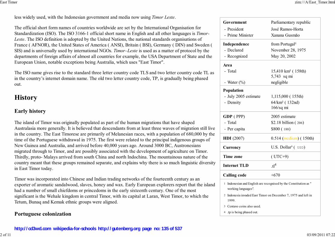
Government Parliamentary republic
- President José Ramos-Horta
- Prime Minister Xanana Gusmão
Independence from Portugal²
- Declared November 28, 1975
- Recognized May 20, 2002
Area
- Total 15,410 km² ( 158th)
5,743 sq mi
- Water (%) negligible
Population
- July 2005 estimate 1,115,000 ( 155th)
- Density 64/km² ( 132nd)
166/sq mi
GDP ( PPP) 2005 estimate
- Total $2.18 billion ( 206)
- Per capita $800 ( 188)
HDI (2007) 0.514 (medium) ( 150th)
Currency U.S. Dollar³ ( USD)
Time zone ( UTC+9)
Internet TLD .tl4
Calling code +670
Indonesian and English are recognised by the Constitution as "
working languages".
Indonesia invaded East Timor on December 7, 1975 and left in
1999.
Centavo coins also used.
.tp is being phased out.
less widely used, with the Indonesian government and media now using Timor Leste.
The official short form names of countries worldwide are set by the International Organisation for
Standardization (ISO). The ISO 3166-1 official short name in English and all other languages is Timor-
Leste. The ISO definition is adopted by the United Nations, the national standards organisations of
France ( AFNOR), the United States of America ( ANSI), Britain ( BSI), Germany ( DIN) and Sweden (
SIS) and is universally used by international NGOs. Timor–Leste is used as a matter of protocol by the
departments of foreign affairs of almost all countries for example, the USA Department of State and the
European Union, notable exceptions being Australia, which uses "East Timor".
The ISO name gives rise to the standard three letter country code TLS and two letter country code TL as
in the country’s internet domain name. The old two letter country code, TP, is gradually being phased
out.
History
Early history
The island of Timor was originally populated as part of the human migrations that have shaped
Australasia more generally. It is believed that descendants from at least three waves of migration still live
in the country. The East Timorese are primarily of Melanesian races, with a population of 680,000 by the
time of the Portuguese withdrawal in 1975. The first were related to the principal indigenous groups of
New Guinea and Australia, and arrived before 40,000 years ago. Around 3000 BC, Austronesians
migrated through to Timor, and are possibly associated with the development of agriculture on Timor.
Thirdly, proto- Malays arrived from south China and north Indochina. The mountainous nature of the
country meant that these groups remained separate, and explains why there is so much linguistic diversity
in East Timor today.
Timor was incorporated into Chinese and Indian trading networks of the fourteenth century as an
exporter of aromatic sandalwood, slaves, honey and wax. Early European explorers report that the island
had a number of small chiefdoms or princedoms in the early sixteenth century. One of the most
significant is the Wehale kingdom in central Timor, with its capital at Laran, West Timor, to which the
Tetum, Bunaq and Kemak ethnic groups were aligned.
Portuguese colonization
1
2
3
4
East Timor zim:///A/East_Timor.html
2 of 11 03/09/2011 07:22
http://cd3wd.com wikipedia-for-schools http://gutenberg.org page no: 135 of 537

The Portuguese were the first Europeans to colonize the Malay archipelago when they arrived in the sixteenth century. They established outposts in the (now
Indonesian) Maluku Islands and Timor and surrounding islands. During the House of Habsburg's rule over Portugal (1580-1640), all surrounding outposts were
lost and eventually came under Dutch control by the mid-seventeenth century. Effective European occupation of a small part of the territory only began after
1769, when the city of Dili, the capital of so-called Portuguese Timor, was founded. In the nineteenth century, the Netherlands gained a foothold on the western
half of the island West Timor, and formally received it in 1859 through the Treaty of Lisbon. The definitive border was established by the Hague Treaty of 1916,
and it remains the international boundary between the successor states East Timor and Indonesia.
For the Portuguese, East Timor remained little more than a neglected trading post until the late nineteenth century. Investment in infrastructure, health, and
education was minimal. Sandalwood remained the main export crop with coffee exports becoming significant in the mid-nineteenth century. In places where
Portuguese rule was asserted, it tended to be brutal and exploitative. At the beginning of the twentieth century, a faltering home economy prompted the
Portuguese to extract greater wealth from its colonies which met Timorese resistance.
In late 1941, Portuguese Timor was briefly occupied by Dutch and Australian troops in an attempt to preempt a Japanese invasion of the island. The Portuguese
Governor protested the occupation, and Dutch forces returned to the Dutch side of the island. The Japanese landed and drove the small Australian force out of
Dili, and the mountainous interior became the scene of a guerrilla campaign, known as the Battle of Timor. Waged by Allied forces and Timorese volunteers
against the Japanese, the struggle resulted in the deaths of between 40,000 and 70,000 Timorese. Following the end of the war, Portuguese control was
reinstated.
The process of decolonization in Portuguese Timor began in 1974, following the change of government in Portugal in the wake of the Carnation Revolution.
Owing to political instability and more pressing concerns over the decolonisation of Angola and Mozambique, Portugal effectively abandoned East Timor and it
unilaterally declared itself independent on November 28, 1975. Nine days later, it was invaded and occupied by Indonesian forces before the declaration could
be internationally recognized.
Indonesian occupation
As political parties began to form and emerge inside the country, the Indonesian military headed an operation that backed Apodeti, a pro-Indonesian party that
encouraged divisions between the pro-independence parties of East Timor. This led to a brief civil war in 1975 as well as a series of attacks across borders.
Indonesia alleged that the East Timorese FRETILIN party, which received some vocal support from the People's Republic of China, was communist. Fearing a
Communist domino effect in Southeast Asia—and in the wake of its South Vietnam campaign—the United States, along with its ally Australia, supported the
pro- Western Indonesian government's actions. The UN Security Council had a unanimous vote for Indonesia to stop its invasion and to withdraw immediately
from East Timor’s borders, and was blocked by the United States from imposing any economic sanctions or other means of enforcing this mandate.
The territory was declared the twenty-seventh province of Indonesia in July 1976. Its nominal status in the UN remained that of a "non-self-governing territory
under Portuguese administration."
East Timor zim:///A/East_Timor.html
3 of 11 03/09/2011 07:22
http://cd3wd.com wikipedia-for-schools http://gutenberg.org page no: 136 of 537

Demonstration forindependence from Indonesia.
Indonesian rule in East Timor was often marked by extreme violence and brutality; estimates of the number of East Timorese
who died during the occupation vary from 60,000 to 200,000, A detailed statistical report prepared for the Commission for
Reception, Truth and Reconciliation in East Timor cited a lower range of 102,800 conflict-related deaths in the period
1974-1999, namely, approximately 18,600 killings and 84,200 'excess' deaths from hunger and illness.
The East Timorese guerrilla force, Falintil, fought a campaign against the Indonesian forces from 1975 to 1999, some members
being trained in Portugal by Portuguese special forces. The Dili Massacre proved a turning point for the East Timorese cause
internationally, and a burgeoning East Timor solidarity movement grew in Portugal, Australia, and the United States.
Independence
Following a UN-sponsored agreement between Indonesia, Portugal and the United States and a surprise decision by the Indonesian President B. J. Habibie, a
UN-supervised popular referendum was held on August 30, 1999 to choose between Special Autonomy within Indonesia and independence. 78.5% of voters
chose independence, but violent clashes, instigated primarily by elements within the Indonesian military and aided by Timorese pro-Indonesia militias led by
Eurico Guterres, broke out soon afterwards. A peacekeeping force ( INTERFET, led by Australia) intervened to restore order. The militias fled across the
border into Indonesian West Timor, from which sporadic armed raids were attempted. As these raids were repelled and international moral opinion forced
Indonesia to withdraw tacit support, the militias dispersed. INTERFET was replaced by a UN force of International Police, the mission became known as
UNTAET, and the UNTAET Crime Scene Detachment was formed to investigate alleged atrocities. UNTAET was headed by the late Sérgio Vieira de Mello as
UN Transitional Administrator from December 1999 to May 2002. On December 2, 1999 De Mello established the National Consultative Council (NCC), a
political body consisting of 11 East Timorese and four UNTAET members charged with overseeing the decision-making process during the transition period
leading to independence. However, UNTAET experienced difficulties initially in establishing its credibility amongst the Timorese leadership, leading to street
violence. An important workshop on March 1, 2000 brought the Timorese and UN leadership group together to tease out a revised strategy, and identify
institutional needs. The Timorese delegation was lead by José Ramos-Horta, and included Mari Alkatiri. The outcome was an agreed blueprint for a joint
administration with executive powers, including leaders of the National Congress for Timorese Reconstruction (CNRT), led by future president Xanana
Gusmão. Further details were worked out in a conference in May 2000. De Mello presented the new blueprint to a donor conference in Lisbon , on June 22,
2000, and to the UN Security Council on June 27, 2000 . On July 12, 2000, the NCC adopted a regulation establishing a Transitional Cabinet comprised of four
East Timorese and four UNTAET representatives. . The revamped joint administration successfully laid the institutional foundations for independence, and on
September 27, 2002, East Timor joined the United Nations.
Crisis and change
In April 2006, riots broke out in Dili following rivalry within the military and police; 40 people were killed and over 20,000 fled their homes. Fighting between
pro-government troops and disaffected Falintil troops broke out in May 2006. Upon the invitation of the Prime Minister, Australia, Malaysia, New Zealand, and
Portugal sent troops to Timor, attempting to quell the violence. On 26 June, Prime Minister Mari Alkatiri resigned as Prime Minister, following an ultimatum
from President Xanana Gusmão that he would resign if Alkatiri did not. José Ramos-Horta was appointed as Alkatiri's successor on July 8, 2006. In April 2007,
Gusmão declined another presidential term. In the build-up to the April 2007 presidential elections there were renewed outbreaks of violence in February and
East Timor zim:///A/East_Timor.html
4 of 11 03/09/2011 07:22
http://cd3wd.com wikipedia-for-schools http://gutenberg.org page no: 137 of 537

Government Palace in Dili.
Map of the districts of EastTimor.
March 2007. José Ramos-Horta was inaugurated as President on May 20, 2007 following his election win in the second round. Gusmão was sworn in as Prime
Minister on August 8, 2007. President Ramos-Horta was critically injured in an assassination attempt on February 11, 2008 in a failed coup apparently
perpetrated by Alfredo Reinado, a renegade soldier who died in the attack. Prime Minister Gusmão also faced gunfire separately but escaped unharmed. The
Australian government immediately sent reinforcements to East Timor to keep order.
Politics
The Head of state of the East Timor is the President of East Timor, who is elected by popular vote for a five-year term.
Although the role is largely symbolic, the president does have veto power over certain types of legislation. Following elections,
the president appoints the leader of the majority party or majority coalition as the Prime Minister of East Timor. As head of
government, the prime minister presides over the Council of State or cabinet.
The unicameral Timorese parliament is the National Parliament or Parlamento Nacional, whose members are elected by
popular vote to a five-year term. The number of seats can vary from a minimum of fifty-two to a maximum of sixty-five,
though it exceptionally has eighty-eight members at present, due to this being its first term of office. The East Timorese
constitution was modelled on that of Portugal. The country is still in the process of building its administration and governmental
institutions.
Government departments
Policia Nacional de Timor-Leste (police)
East Timor Ministry for State and Internal AdministrationCivil Aviation Division of Timor Leste
Immigration Department of Timor Leste http://www.migracao.gov.tl
Districts, subdistricts, and sucos
East Timor is divided into thirteen administrative districts:
1. Lautém 2. Baucau 3. Viqueque 4. Manatuto 5. Dili 6. Aileu 7. Manufahi 8. Liquiçá 9. Ermera 10. Ainaro 11. Bobonaro 12.
Cova-Lima 13. Oecussi-Ambeno
The districts are subdivided into 65 subdistricts, 443 sucos and 2,336 towns, villages and hamlets.
Geography
East Timor zim:///A/East_Timor.html
5 of 11 03/09/2011 07:22
http://cd3wd.com wikipedia-for-schools http://gutenberg.org page no: 138 of 537

Map of East Timor shows citiesand main roads.
Located in South East Asia, the island of Timor is part of the Malay archipelago, and is the largest and easternmost of the
Lesser Sunda Islands. To the north of the mountainous island are the Ombai Strait and Wetar Strait, to the south the Timor Sea
separates the island from Australia, while to the west lies the Indonesian Province of East Nusa Tenggara. The highest point of
East Timor is Mount Ramelau (also known as Mount Tatamailau) at 2,963 meters (9,721 ft).
The local climate is tropical and generally hot and humid, characterised by distinct rainy and dry seasons. The capital, largest
city and main port is Dili, and the second-largest city is the eastern town of Baucau.
The easternmost area of Timor-Leste consists of the Paitchau Range and Iralalaro area. This area has been proposed as to be
the first conservation area in Timor-Leste as it contains the last remaining Tropical Dry forested area within the country as well
as hosts a number of unique plant and animal species and is sparsely populated.
Economy
Prior to and during colonization, Timor was best known for its sandalwood.
In late 1999, about 70% of the economic infrastructure of East Timor was destroyed by Indonesian troops and anti-independence militias, and 260,000 people
fled westward. From 2002 to 2005, an international program led by the United Nations, manned by civilian advisers, 5,000 peacekeepers (8,000 at peak) and
1,300 police officers, substantially reconstructed the infrastructure. By mid-2002, all but about 50,000 of the refugees had returned.
One promising long-term project is the joint development with Australia of petroleum and natural gas resources in the waters southeast of Timor. The
Portuguese colonial administration granted concessions to Oceanic Exploration Corporation to develop the deposits, however, this was curtailed by the
Indonesian invasion in 1976. The resources were divided between Indonesia and Australia with the Timor Gap Treaty in 1989. The treaty established guidelines
for joint exploitation of seabed resources in the area of the "gap" left by then-Portuguese Timor in the maritime boundary agreed between the two countries in
1972. Revenues from the "joint" area were to be divided 50%-50%. Woodside Petroleum and ConocoPhillips began development of some resources in the
Timor Gap on behalf of the two governments in 1992.
East Timor inherited no permanent maritime boundaries when it attained independence, repudiating the Timor Gap Treaty as illegal. A provisional agreement
(the Timor Sea Treaty, signed when East Timor became independent on 20 May 2002) defined a Joint Petroleum Development Area (JPDA), and awarded 90%
of revenues from existing projects in that area to East Timor and 10% to Australia. The first significant new development in the JPDA since Timorese
independence is the largest petroleum resource in the Timor Sea, the Greater Sunrise gas field. Its exploitation was the subject of separate agreements in 2003
and 2005. Only 20% of the field lies within the JPDA and the rest in waters not subject to the treaty (though claimed by both countries). The initial, temporary
agreement gave 82% of revenues to Australia and only 18% to East Timor.
The Government of East Timor has sought to negotiate a definite boundary with Australia at the halfway line between the countries, in accordance with the
United Nations Convention on the Law of the Sea. The Government of Australia preferred to establish the boundary at the end of the wide Australian
East Timor zim:///A/East_Timor.html
6 of 11 03/09/2011 07:22
http://cd3wd.com wikipedia-for-schools http://gutenberg.org page no: 139 of 537
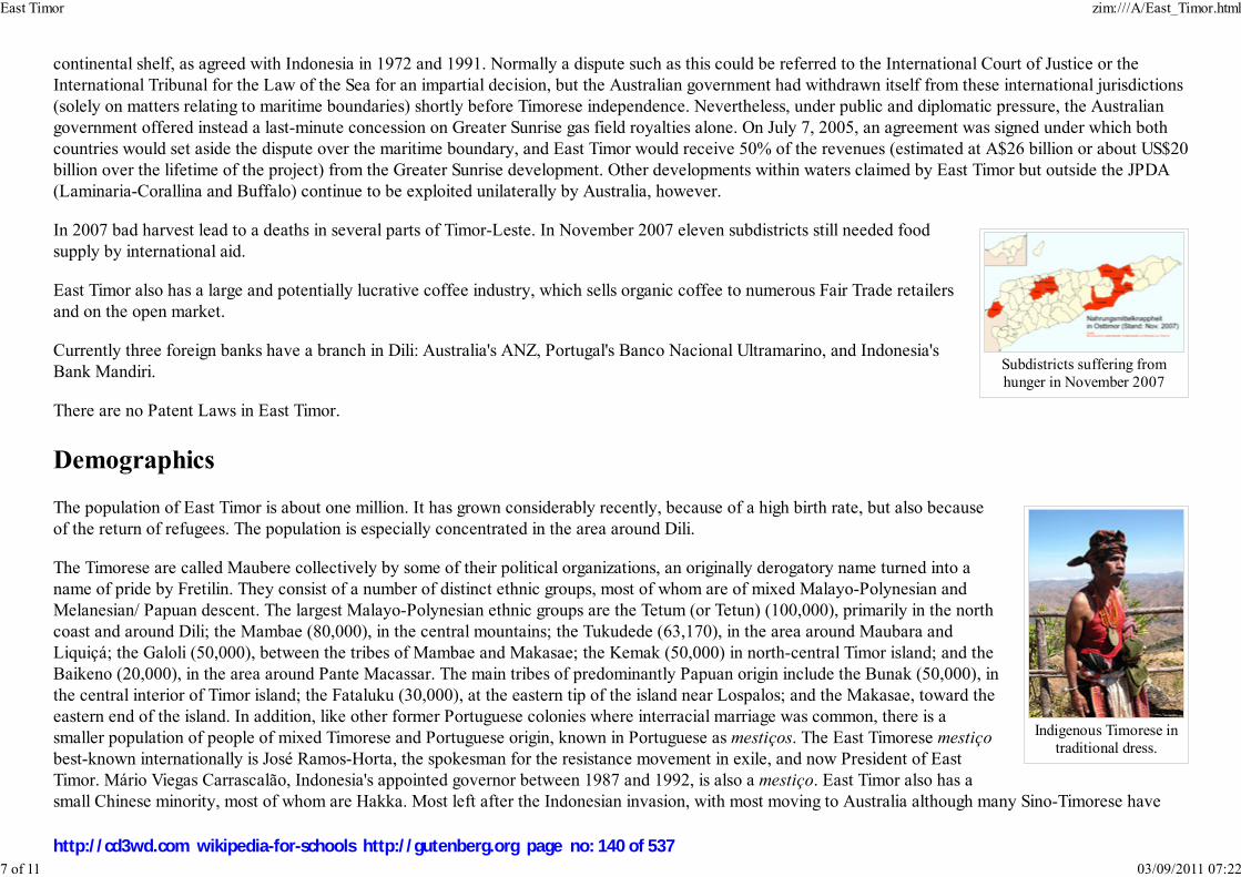
Subdistricts suffering fromhunger in November 2007
Indigenous Timorese intraditional dress.
continental shelf, as agreed with Indonesia in 1972 and 1991. Normally a dispute such as this could be referred to the International Court of Justice or the
International Tribunal for the Law of the Sea for an impartial decision, but the Australian government had withdrawn itself from these international jurisdictions
(solely on matters relating to maritime boundaries) shortly before Timorese independence. Nevertheless, under public and diplomatic pressure, the Australian
government offered instead a last-minute concession on Greater Sunrise gas field royalties alone. On July 7, 2005, an agreement was signed under which both
countries would set aside the dispute over the maritime boundary, and East Timor would receive 50% of the revenues (estimated at A$26 billion or about US$20
billion over the lifetime of the project) from the Greater Sunrise development. Other developments within waters claimed by East Timor but outside the JPDA
(Laminaria-Corallina and Buffalo) continue to be exploited unilaterally by Australia, however.
In 2007 bad harvest lead to a deaths in several parts of Timor-Leste. In November 2007 eleven subdistricts still needed food
supply by international aid.
East Timor also has a large and potentially lucrative coffee industry, which sells organic coffee to numerous Fair Trade retailers
and on the open market.
Currently three foreign banks have a branch in Dili: Australia's ANZ, Portugal's Banco Nacional Ultramarino, and Indonesia's
Bank Mandiri.
There are no Patent Laws in East Timor.
Demographics
The population of East Timor is about one million. It has grown considerably recently, because of a high birth rate, but also because
of the return of refugees. The population is especially concentrated in the area around Dili.
The Timorese are called Maubere collectively by some of their political organizations, an originally derogatory name turned into a
name of pride by Fretilin. They consist of a number of distinct ethnic groups, most of whom are of mixed Malayo-Polynesian and
Melanesian/ Papuan descent. The largest Malayo-Polynesian ethnic groups are the Tetum (or Tetun) (100,000), primarily in the north
coast and around Dili; the Mambae (80,000), in the central mountains; the Tukudede (63,170), in the area around Maubara and
Liquiçá; the Galoli (50,000), between the tribes of Mambae and Makasae; the Kemak (50,000) in north-central Timor island; and the
Baikeno (20,000), in the area around Pante Macassar. The main tribes of predominantly Papuan origin include the Bunak (50,000), in
the central interior of Timor island; the Fataluku (30,000), at the eastern tip of the island near Lospalos; and the Makasae, toward the
eastern end of the island. In addition, like other former Portuguese colonies where interracial marriage was common, there is a
smaller population of people of mixed Timorese and Portuguese origin, known in Portuguese as mestiços. The East Timorese mestiço
best-known internationally is José Ramos-Horta, the spokesman for the resistance movement in exile, and now President of East
Timor. Mário Viegas Carrascalão, Indonesia's appointed governor between 1987 and 1992, is also a mestiço. East Timor also has a
small Chinese minority, most of whom are Hakka. Most left after the Indonesian invasion, with most moving to Australia although many Sino-Timorese have
East Timor zim:///A/East_Timor.html
7 of 11 03/09/2011 07:22
http://cd3wd.com wikipedia-for-schools http://gutenberg.org page no: 140 of 537

returned, including Pedro Lay, the Minister for Infrastructure.
Religion
Upon independence, East Timor became one of only two predominantly Roman Catholic countries in Asia (along with the Philippines). The population
predominantly identifies as Roman Catholic (97%), though local animist traditions have a persistent and strong influence on the culture. Religious minorities
include Muslims (1%) (including former Prime Minister Mari Alkatiri) and Protestants (1%) (including Taur Matan Ruak, Commander of the Falintil-FDTL).
Smaller Hindu (0.5%), Buddhist (0.1%) and traditional animist minorities make up the remainder. Church membership grew considerably under Indonesian rule,
as Indonesia's state ideology Pancasila does not recognize traditional beliefs and requires all citizens to believe in God. Although the struggle was not about
religion, as a deep-rooted local institution the Church not only symbolized East Timor's distinction from predominantly Muslim Indonesia, but also played a
significant role in the resistance movement, as personified by Bishop Carlos Filipe Ximenes Belo, the 1996 Nobel Peace Prize laureate. The constitution
acknowledges the Church's role among the East Timorese people although it also stipulates a secular state that guarantees freedom of religion to everyone.
Languages
East Timor's two official languages are Portuguese, and Tetum, which belongs to the Austronesian family of languages spoken throughout South East Asia. The
predominant form of Tetum, known as Tetun-Dili, grew out of the dialect favored by the colonizers at Dili, and thus has considerable Portuguese influence, but
other dialects of Tetum are also widely used in the country, including Tetun-Terik which is spoken along the southwestern coast. Indonesian and English are
defined as working languages under the Constitution in the Final and Transitional Provisions, without setting a final date. Another fifteen indigenous languages
are spoken: Bekais, Bunak, Dawan, Fataluku, Galoli, Habun, Idalaka, Kawaimina, Kemak, Lovaia, Makalero, Makasai, Mambai, Tokodede, and Wetarese.
Under Indonesian rule, the use of Portuguese was banned, but it was used by the clandestine resistance, especially in communicating with the outside world.
The language, along with Tetum, gained importance as a symbol of resistance and freedom and was adopted as one of the two official languages for this reason,
and as a link to nations in other parts of the world. It is now being taught and promoted widely with the help of Brazil, Portugal, and the Latin Union, although
its prominence in official and public spheres has been met with some hostility from younger Indonesian-educated Timorese.
According to the 2006 UN Development Report (using data from official census), under 5% of the Timorese population is proficient in Portuguese. However,
the validity of this report has been questioned by members of the Timorese National Institute of Linguistics, which maintains that Portuguese is spoken by up to
25% of Timorese, with the number of speakers more than doubling in the last five years. Along with other local languages, Tetum remains the most common
means of communication between ordinary Timorese, while Indonesian is still widely used in the media and school from high school to university. A large
proportion of words in Tetum are derived from Portuguese, but it also shares many Malay-derived words with Indonesian. Many Indonesian words are still in
common use in Tetum and other Timorese languages, particularly numbers.
East Timor is a member of the Community of Portuguese Language Countries (CPLP), also known as the Lusophone Commonwealth, and a member of the
Latin Union. It is the only independent state in Asia with Portuguese as an official language, although this is also one of the official languages of China's Special
Administrative Region of Macau.
East Timor zim:///A/East_Timor.html
8 of 11 03/09/2011 07:22
http://cd3wd.com wikipedia-for-schools http://gutenberg.org page no: 141 of 537

Culture
The culture of East Timor reflects numerous influences, including Portuguese, Roman Catholic, and Malay, on the indigenous Austronesian and Melanesian
cultures of Timor. Legend has it that a giant crocodile was transformed into the island of Timor, or Crocodile Island, as it is often called. East Timorese culture
is heavily influenced by Austronesian legends, although the Catholic influence is also strong.
Illiteracy is still widespread, but there is a strong tradition of poetry. Prime Minister Xanana Gusmão, for example, is a distinguished poet. As for architecture,
some Portuguese-style buildings can be found, along with the traditional totem houses of the eastern region. These are known as uma lulik (sacred houses) in
Tetum, and lee teinu (houses with legs) in Fataluku. Craftsmanship is also widespread, as is the weaving of traditional scarves or tais.
Sports
International sports associations
East Timor has joined many international sport associations, including the International Olympic Committee (IOC). The IOC board has granted full recognition
to the East Timorese Olympic Committee (COTL). The IOC had allowed a mainly symbolic four-member team to take part in the 2000 Sydney Games under
the Olympic flag as "Independent Olympic Athletes." The Federação de Timor-Leste de Atletismo has joined the International Association of Athletics
Federations (IAAF). The Federação de Badminton de Timor-Leste joined the International Badminton Federation (IBF) in April 2003. The East Timor Cycling
Federation has joined the Union Cycliste Internationale. The Confederação do Desporto de Timor Leste has joined the International Weightlifting Federation.
East Timor is also a full member of the International Table-Tennis Federation (ITTF). In September 2005, East Timor's national football team joined FIFA.
Participation in international events
East Timor has taken part in several sporting events. Although the athletes came back with no medals, East Timorese athletes had the opportunity to compete
with other Southeast Asian athletes in the 2003 Southeast Asian Games held in Vietnam in 2003. Most of their equipment was lent by the other nations
competing. In the 2003 ASEAN Paralympics Games, also held in Vietnam, East Timor won a bronze medal. In the Athens 2004 Olympic Games, six athletes
participated in three sports: athletics, weightlifting and boxing).
On East Timor's performance in the 22nd SEA Games in 2003, karate coach Austo Aparício remarked, "This was an opportunity for our athletes to gain
experience. East Timor is still young, so it has lots of financial problems." He also commented on his team's karate performance, "We are fairly good at karate
and we can make sure that we win a medal in the Philippines in 2005." East Timor went on to win three medals in Arnis at the 2005 Southeast Asian Games.
East Timor was also one of the competing nations in the first Lusophony Games, winning a bronze medal in the women's volleyball competition (finishing third
out of three teams), despite the fact the team had lost all its three games.
East Timor zim:///A/East_Timor.html
9 of 11 03/09/2011 07:22
http://cd3wd.com wikipedia-for-schools http://gutenberg.org page no: 142 of 537

Public holidays
East Timor now has public holidays that commemorate historic events in the liberation struggle, as well as those associated with Catholicism and Islam. They
are defined in Timor-Leste Law no. 10/2005 PDF (16.7 KiB).
Date Name Notes
January 1 New Year's Day
date varies Eid al-Adha
March-April Good Friday
May 1 Labour Day
May 20 Independence Restoration Day Anniversary of transfer of sovereignty from the United Nations transitional government, 2002
May-June Corpus Christi
August 30 Popular Consultation Day Anniversary of the Popular Consultation, 1999
November 1 All Saints' Day
November 2 All Souls' Day
November 12 National Youth Day Anniversary of the Santa Cruz massacre, 1991
November 28 Proclamation of Independence Day 1975
date varies Idul Fitri
December 7 National Heroes' Day Anniversary of Indonesian invasion of East Timor, 1975
December 8 Immaculate Conception
December 25 Christmas Day
In addition, the law defines "official commemorative dates" which are not considered holidays but could be subject to time off from work:
Date Name
February-March Ash Wednesday
March-April Holy Thursday
East Timor zim:///A/East_Timor.html
10 of 11 03/09/2011 07:22
http://cd3wd.com wikipedia-for-schools http://gutenberg.org page no: 143 of 537

May-June Ascension Day
June 1 International Children's Day
August 20 Day of the Armed Forces for the National Liberation of Timor-Leste (FALINTIL)
November 3 National Women's Day
December 10 International Human Rights Day
Retrieved from " http://en.wikipedia.org/wiki/East_Timor"
The Schools Wikipedia was sponsored by a UK Children's Charity, SOS Children UK , and is a hand-chosen selection of article versions from the English
Wikipedia edited only by deletion (see www.wikipedia.org for details of authors and sources). The articles are available under theGNU Free Documentation License. See also our
East Timor zim:///A/East_Timor.html
11 of 11 03/09/2011 07:22
http://cd3wd.com wikipedia-for-schools http://gutenberg.org page no: 144 of 537

香港特別行政區香港特別行政區香港特別行政區香港特別行政區
Hong Kong Special Administrative
Region
Flag Emblem
Official languages Chinese, English
Demonym Hongkonger
Hong Kong
2008/9 Schools Wikipedia Selection. Related subjects: Asia; Asian Countries
Hong Kong Special Administrative Region, commonly known as Hong Kong (Chinese: 香 港 [pronunciation]), is one of two special administrative regions in the People's Republic of China, the otherbeing Macau. The territory lies on the eastern side of the Pearl River Delta, bordering Guangdong in thenorth and facing the South China Sea in the east, west and south.
Hong Kong was a dependent territory of the United Kingdom from 1842 until the transfer of its sovereigntyto the People's Republic of China in 1997. The Sino-British Joint Declaration and the Basic Law of HongKong stipulate that Hong Kong operate with a high degree of autonomy until at least 2047, fifty years afterthe transfer. Under the “ one country, two systems” policy, the Central People's Government is responsiblefor the territory's defence and foreign affairs, while Hong Kong maintains its own legal system, policeforce, monetary system, customs policy, immigration policy, and delegates to international organisationsand events.
Beginning as a trading port, Hong Kong emerged as a leading financial centre in the late 20th century. Itshighly capitalist economy is heavily based on service industries, and thrives under a long-standing policy ofgovernment nonintervention. Although the population is predominantly Chinese, residents and expatriatesof other ethnicities form a small but significant segment of society. Influenced by both Eastern andWestern cultures, Hong Kong's unique formative experience is reflected in its cuisine, cinema and music.
History
Human settlement in the location now known as Hong Kong dates back to the Paleolithic era. The regionwas first incorporated into Imperial China in the Qin Dynasty, and served as a trading post and naval baseduring the Tang Dynasty and the Song Dynasty. The area's earliest recorded European visitor was JorgeÁlvares, a Portuguese mariner who arrived in 1513.
In 1839 the refusal by Qing Dynasty authorities to import opium resulted in the First Opium War betweenChina and Britain. Hong Kong Island was occupied by British forces in 1841, and then formally ceded toBritain under the Treaty of Nanking at the end of the war. The British established a Crown Colony with thefounding of Victoria City the following year. In 1860, after China's defeat in the Second Opium War, the
View at night from Victoria Peak
Hong Kong zim:///A/Hong_Kong.html
1 of 15 03/09/2011 07:23
http://cd3wd.com wikipedia-for-schools http://gutenberg.org page no: 145 of 537

Government
- Chief Executive Donald Tsang
Establishment
- Treaty of Nanking 29 August 1842
- Japanese occupation 25 December 1941 –15 August 1945
- Transfer of sovereignty 1 July 1997
Area
- Total 1,104 km² ( 183rd)426 sq mi
- Water (%) 4.6
Population
- 2007 estimate 6,963,100 ( 98th)
- 2001 census 6,708,389
- Density 6,352/km² ( 3rd)16,469/sq mi
GDP ( PPP) 2007 estimate
- Total US$292.8 billion ( 38th) - Per capita US$41,994 ( 10th)
GDP (nominal) 2007 estimate - Total US$206.7 billion ( 37th)
- Per capita US$29,650 ( 27th)
Gini (2007) 53.3
HDI (2007) ▲ 0.937 (high) ( 21st)
Currency Hong Kong dollar ( HKD)
Time zone HKT ( UTC+8)
Internet TLD .hk
Calling code +852
Hong Kong in the latenineteenth century was a major
trading post of the BritishEmpire.
Japanese troops march alongQueen's Road following theBritish surrender in 1941.
Kowloon Peninsula south of Boundary Street and Stonecutter's Island were ceded to Britain under theConvention of Peking. In 1898 Britain obtained a 99-year lease of Lantau Island and the adjacent northernlands, which became known as the New Territories.
Hong Kong was declared a free portto serve as an entrepôt of the BritishEmpire. The Kowloon-CantonRailway opened in 1910 with asouthern terminus in Tsim Sha Tsui.An education system based on theBritish model was introduced. Thelocal Chinese population had littlecontact with the European communityof wealthy tai-pans settled nearVictoria Peak.
In conjunction with its military campaign in World War II, the Empire of Japan invaded Hong Kong onDecember 8, 1941. The Battle of Hong Kong ended with British and Canadian defenders surrenderingcontrol of the colony to Japan on December 25. During the Japanese occupation, civilians sufferedwidespread food shortages, rationing, and hyper-inflation due to forced exchange of currency for militarynotes. Hong Kong lost more than half of its population in the period between the invasion and Japan'ssurrender in 1945, when the United Kingdom resumed control of the colony.
Hong Kong's population recovered quickly as a wave of mainland migrants arrived for refuge from theongoing Chinese Civil War. With the proclamation of the People's Republic of China in 1949 moremigrants fled to Hong Kong from fear of persecution by the Communist Party. Many corporations inShanghai and Guangzhou also shifted their operations to Hong Kong. The colony became the sole place ofcontact between mainland China and the Western world, as the communist government increasinglyisolated the country from outside influence. Trade with the mainland was interrupted during the KoreanWar, when the United Nations ordered a trade embargo against the communist government.
The textile and manufacturing industries grew with the help of population growth and low cost of labour.As Hong Kong rapidly industrialised, its economy became driven by exports to international markets.Living standards rose steadily with industrial growth. The construction of Shek Kip Mei Estate in 1953marked the beginning of the public housing estate program. Hong Kong was disrupted by a year of chaosduring the riots of 1967 following the commencement of the Cultural Revolution in 1966 in communistChina.
Hong Kong zim:///A/Hong_Kong.html
2 of 15 03/09/2011 07:23
http://cd3wd.com wikipedia-for-schools http://gutenberg.org page no: 146 of 537

Colonial flag of Hong Kong,used from 1959 to 1997
The Independent Commission Against Corruption established in 1974 dramatically reduced corruption in the government. Whenthe People's Republic of China initiated economic reforms in 1978, Hong Kong became the main source of foreign investmentsto the mainland. A Special Economic Zone was established the following year in the Chinese city of Shenzhen, locatedimmediately north of the mainland's border with Hong Kong. Services gradually displaced textiles and manufacturing in theeconomy of Hong Kong, as the financial and banking sectors became increasingly dominant.
After the Vietnam War ended in 1975 the Hong Kong government spent 25 years dealing with the entry and repatriation ofVietnamese refugees.
With the lease of the New Territories due to expire within two decades the governments of the United Kingdom and the People's Republic of China discussedthe issue of Hong Kong's sovereignty in the 1980s. In 1984 the two countries signed the Sino-British Joint Declaration, agreeing to transfer the sovereignty ofHong Kong to the People's Republic of China in 1997. The declaration stipulated that Hong Kong would be governed as a special administrative region, retainingits laws and a high degree of autonomy for at least fifty years after the transfer. Lacking confidence in the arrangement, some residents chose to emigrate,particularly after the Tiananmen Square protests of 1989.
The Basic Law of Hong Kong, which would serve as the constitutional document after the transfer, was ratified in 1990. Over strong objections from Beijing,Governor Chris Patten introduced democratic reforms to the election process for the Legislative Council. The transfer of the sovereignty occurred at midnight onJuly 1, 1997, marked by a handover ceremony at the Hong Kong Convention and Exhibition Centre. Tung Chee Hwa assumed office as the first Chief Executiveof Hong Kong.
Hong Kong's economy was affected by the Asian financial crisis of 1997 that hit many East Asian markets. The lethal H5N1 avian influenza also surfaced thatyear. Implementation of the Airport Core Programme led to the opening of the new Hong Kong International Airport in 1998, after six years of construction. Theproject was part of the ambitious Port and Airport Development Strategy that was drafted in the early 1980s.
There was an outbreak of severe acute respiratory syndrome (SARS) in Hong Kong in the first half of 2003. That year half a million people participated in amarch to voice disapproval of the Tung administration and the proposal to implement Article 23 of the Basic Law, which had raised concerns over infringementson civil liberties. The proposal was later abandoned by the administration. In 2005 Tung submitted his resignation as chief executive. Donald Tsang, the ChiefSecretary for Administration, was selected as chief executive to complete the term.
Geography and climate
Hong Kong zim:///A/Hong_Kong.html
3 of 15 03/09/2011 07:23
http://cd3wd.com wikipedia-for-schools http://gutenberg.org page no: 147 of 537

Areas of urban developmentand vegetation are visible in
this false-colour satelliteimage.
The hilly terrain of Kowloonand Hong Kong Island
Hong Kong is located on China's south coast, 60 km (37 mi) east of Macau on the oppositeside of the Pearl River Delta. It is surrounded by the South China Sea on the east, south, andwest, and borders the city of Shenzhen in Guangdong Province to the north over the ShamChun River. The territory consists primarily of Hong Kong Island, Lantau Island, KowloonPeninsula and the New Territories as well as some 260 other islands. While Lantau is thelargest island, Hong Kong Island is the second largest and the most populated. Ap Lei Chau isthe most densely populated island in the world.
Much of Hong Kong remains undeveloped as the terrain is mostly hilly to mountainous withsteep slopes. Of the territory's 1,104 square kilometres (426 sq mi), less than 25% isdeveloped. The remaining land is remarkably green with about 40% of the landmass reservedas country parks and nature reserves. Most of the territory's urban development exists on
Kowloon peninsula, along the northern shores of Hong Kong Island and in scattered settlements throughout the New Territories. The highest elevation in theterritory is at Tai Mo Shan, at a height of 958 metres (3,140 ft) above sea level. Hong Kong's long, irregular and curvaceous coastline also affords the territorywith many bays, rivers and beaches. Lowlands exist in the northwestern part of the New Territories.
Despite Hong Kong's reputation of being intensely urbanised, the territory has made much effort to promote a green environment, and recent growing publicconcern has prompted the severe restriction of further land reclamation from Hong Kong's most famous natural landmark, Victoria Harbour. Awareness of theenvironment is growing as Hong Kong suffers from increasing pollution compounded by its geography and tall buildings. Approximately 80% of the city's smogoriginates from other parts of the Pearl River Delta.
Situated just south of the Tropic of Cancer, Hong Kong's climate is subtropical ( Köppen climate classification Cwa), and is known for being unpredictable.Summer is hot and humid with occasional showers and thunderstorms, with warm air coming in from the southwest. It is also the time when tropical cyclones aremost likely, sometimes resulting in flooding or landslips. Winter weather usually starts sunny and becomes cloudier towards February, with the occasional coldfront bringing strong, cooling winds from the north. The most pleasant seasons are spring, although changeable, and autumn, which is generally sunny and dry.Hong Kong averages 1,948 hours of sunshine per year, while the highest and lowest ever recorded temperatures at the Hong Kong Observatory are 36.1 °C (97.0 °F) and 0.0 °C (32.0 °F), respectively. Frost occurs only once or twice a year inland and on higher ground, and snow is almost unheard of. Hong Kong does notobserve daylight saving time.
Weather averages for Hong Kong
Month Jan Feb Mar Apr May Jun Jul Aug Sep Oct Nov Dec Year
Average high °C (°F)18.6(65)
18.6(65)
21.5(71)
25.1(77)
28.4 (83) 30.4 (87) 31.3 (88) 31.1 (88) 30.2 (86) 27.7 (82)24.0(75)
20.3(69)
25 (77)
Average low °C (°F)14.1(57)
14.4(58)
16.9(62)
20.6(69)
23.9 (75) 26.1 (79) 26.7 (80) 26.4 (80) 25.6 (78) 23.4 (74)19.4(67)
15.7(60)
21 (70)
Hong Kong zim:///A/Hong_Kong.html
4 of 15 03/09/2011 07:23
http://cd3wd.com wikipedia-for-schools http://gutenberg.org page no: 148 of 537

The Legislative CouncilBuilding is located in Central.
Government House is theofficial residence of the ChiefExecutive, the head of Hong
Kong Government.
Precipitation mm
(inches)
24(0.94)
52(2.05)
71 (2.8)188(7.4)
329(12.95)
388(15.28)
374(14.72)
444(17.48)
287(11.3)
151(5.94)
35(1.38)
34(1.34)
2,382(93.78)
Source: Hong Kong Observatory 2008
Politics and government
In accordance with the Sino-British Joint Declaration, and reflecting the policy known as " one country, two systems" by the People's Republic of China, HongKong enjoys autonomy as a special administrative region except in defence and foreign affairs. The declaration stipulates that the region maintain its capitalisteconomic system and guarantees the rights and freedoms of its people for at least 50 years beyond the transfer of sovereignty. The Basic Law is the constitutionaldocument that outlines executive, legislative and judicial authorities of government.
The Chief Executive is the head of government and the region's principal representative, chosen by the Election Committee toserve no more than two five-year terms. The 800 members of the Election Committee serve five-year terms, and are composedof ex-official government members and functional constituency delegates selected by qualified individuals and legal entitiesbelonging to various industrial, commercial, professional, labour, social services, academic and religious sectors of society. Thecandidate chosen by the Election Committee must receive appointment by the Central People's Government to assume office.The Chief Executive appoints senior officers under the Principal Officials Accountability System and directs government policieswith consultation from the Executive Council, the cabinet body. In addition, the Chief Executive appoints judges, signslegislation and may pardon or commute sentences.
The Legislative Council is the unicameral lawmaking body with 60 members serving four-year terms. Half of its membership isdirectly elected from geographical electoral districts by universal suffrage through a party-list proportional representation system,while the remaining half are returned from functional constituencies. The President of the Legislative Council is elected by andfrom among the members, and serves the role of speaker. Government bills are passed by a simple majority vote from membersof the council, while private member's bills require separate majorities from geographical constituency members and functionalconstituency members for passage.
The Hong Kong Civil Service is a politically-neutral body that implements policies and provides government services. Theappointment and promotion of public servants is based on qualifications, experience and ability. The permanent secretary is themost senior civil service position within each government bureau, serving under the politically-appointed position of secretary.The twelve bureaus operate from government office buildings located throughout the territory, with headquarters in the CentralGovernment Offices.
The Basic Law and universal suffrage have been major issues of political debate since the transfer of sovereignty. In 2002, thegovernment attempted to implement Article 23 of the Basic Law, which requires the enactment of laws prohibiting acts of treason and subversion against theChinese government. The proposal met strong opposition due to concerns that it undermined civil liberties, and was a major cause for the July 1 march in 2003.
Hong Kong zim:///A/Hong_Kong.html
5 of 15 03/09/2011 07:23
http://cd3wd.com wikipedia-for-schools http://gutenberg.org page no: 149 of 537
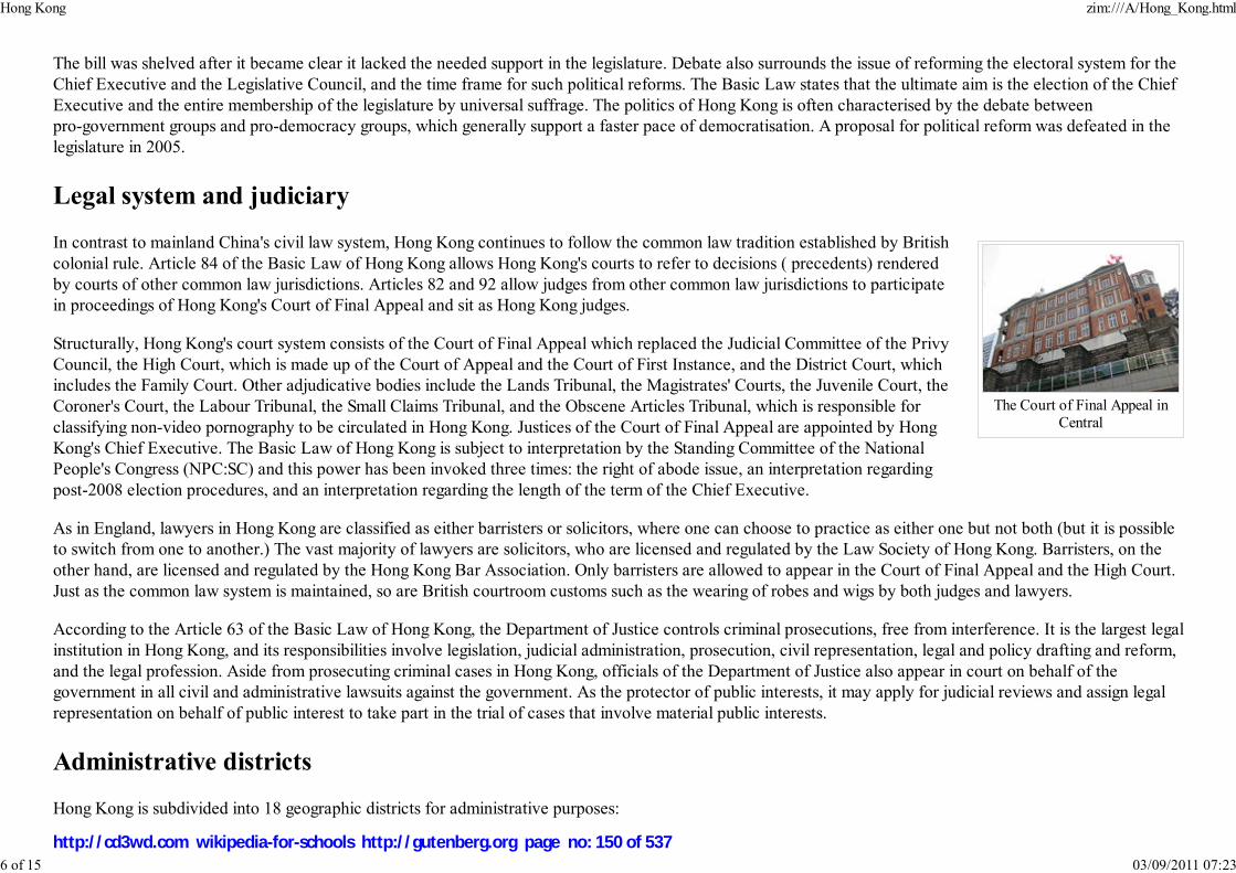
The Court of Final Appeal inCentral
The bill was shelved after it became clear it lacked the needed support in the legislature. Debate also surrounds the issue of reforming the electoral system for theChief Executive and the Legislative Council, and the time frame for such political reforms. The Basic Law states that the ultimate aim is the election of the ChiefExecutive and the entire membership of the legislature by universal suffrage. The politics of Hong Kong is often characterised by the debate betweenpro-government groups and pro-democracy groups, which generally support a faster pace of democratisation. A proposal for political reform was defeated in thelegislature in 2005.
Legal system and judiciary
In contrast to mainland China's civil law system, Hong Kong continues to follow the common law tradition established by Britishcolonial rule. Article 84 of the Basic Law of Hong Kong allows Hong Kong's courts to refer to decisions ( precedents) renderedby courts of other common law jurisdictions. Articles 82 and 92 allow judges from other common law jurisdictions to participatein proceedings of Hong Kong's Court of Final Appeal and sit as Hong Kong judges.
Structurally, Hong Kong's court system consists of the Court of Final Appeal which replaced the Judicial Committee of the PrivyCouncil, the High Court, which is made up of the Court of Appeal and the Court of First Instance, and the District Court, whichincludes the Family Court. Other adjudicative bodies include the Lands Tribunal, the Magistrates' Courts, the Juvenile Court, theCoroner's Court, the Labour Tribunal, the Small Claims Tribunal, and the Obscene Articles Tribunal, which is responsible forclassifying non-video pornography to be circulated in Hong Kong. Justices of the Court of Final Appeal are appointed by HongKong's Chief Executive. The Basic Law of Hong Kong is subject to interpretation by the Standing Committee of the NationalPeople's Congress (NPC:SC) and this power has been invoked three times: the right of abode issue, an interpretation regardingpost-2008 election procedures, and an interpretation regarding the length of the term of the Chief Executive.
As in England, lawyers in Hong Kong are classified as either barristers or solicitors, where one can choose to practice as either one but not both (but it is possibleto switch from one to another.) The vast majority of lawyers are solicitors, who are licensed and regulated by the Law Society of Hong Kong. Barristers, on theother hand, are licensed and regulated by the Hong Kong Bar Association. Only barristers are allowed to appear in the Court of Final Appeal and the High Court.Just as the common law system is maintained, so are British courtroom customs such as the wearing of robes and wigs by both judges and lawyers.
According to the Article 63 of the Basic Law of Hong Kong, the Department of Justice controls criminal prosecutions, free from interference. It is the largest legalinstitution in Hong Kong, and its responsibilities involve legislation, judicial administration, prosecution, civil representation, legal and policy drafting and reform,and the legal profession. Aside from prosecuting criminal cases in Hong Kong, officials of the Department of Justice also appear in court on behalf of thegovernment in all civil and administrative lawsuits against the government. As the protector of public interests, it may apply for judicial reviews and assign legalrepresentation on behalf of public interest to take part in the trial of cases that involve material public interests.
Administrative districts
Hong Kong is subdivided into 18 geographic districts for administrative purposes:
Hong Kong zim:///A/Hong_Kong.html
6 of 15 03/09/2011 07:23
http://cd3wd.com wikipedia-for-schools http://gutenberg.org page no: 150 of 537
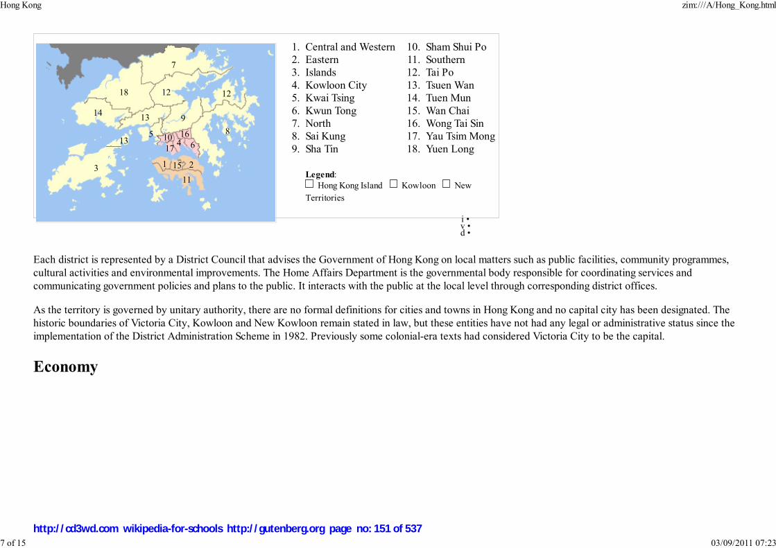
Central and Western1.Eastern2.Islands3.Kowloon City4.Kwai Tsing5.Kwun Tong6.North7.Sai Kung8.Sha Tin9.
Sham Shui Po10.Southern11.Tai Po12.Tsuen Wan13.Tuen Mun14.Wan Chai15.Wong Tai Sin16.Yau Tsim Mong17.Yuen Long18.
Legend: Hong Kong Island Kowloon New
Territories
Each district is represented by a District Council that advises the Government of Hong Kong on local matters such as public facilities, community programmes,cultural activities and environmental improvements. The Home Affairs Department is the governmental body responsible for coordinating services andcommunicating government policies and plans to the public. It interacts with the public at the local level through corresponding district offices.
As the territory is governed by unitary authority, there are no formal definitions for cities and towns in Hong Kong and no capital city has been designated. Thehistoric boundaries of Victoria City, Kowloon and New Kowloon remain stated in law, but these entities have not had any legal or administrative status since theimplementation of the District Administration Scheme in 1982. Previously some colonial-era texts had considered Victoria City to be the capital.
Economy
1 23
45
6
7
8
9
10
11
12 12
13
13
14
15
16
17
18
i • v • d •
Hong Kong zim:///A/Hong_Kong.html
7 of 15 03/09/2011 07:23
http://cd3wd.com wikipedia-for-schools http://gutenberg.org page no: 151 of 537
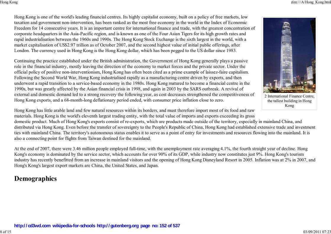
2 International Finance Centre,the tallest building in Hong
Kong
Hong Kong is one of the world's leading financial centres. Its highly capitalist economy, built on a policy of free markets, lowtaxation and government non-intervention, has been ranked as the most free economy in the world in the Index of EconomicFreedom for 14 consecutive years. It is an important centre for international finance and trade, with the greatest concentration ofcorporate headquarters in the Asia-Pacific region, and is known as one of the Four Asian Tigers for its high growth rates andrapid industrialisation between the 1960s and 1990s. The Hong Kong Stock Exchange is the sixth largest in the world, with amarket capitalisation of US$2.97 trillion as of October 2007, and the second highest value of initial public offerings, afterLondon. The currency used in Hong Kong is the Hong Kong dollar, which has been pegged to the US dollar since 1983.
Continuing the practice established under the British administration, the Government of Hong Kong generally plays a passiverole in the financial industry, mostly leaving the direction of the economy to market forces and the private sector. Under theofficial policy of positive non-interventionism, Hong Kong has often been cited as a prime example of laissez-faire capitalism.Following the Second World War, Hong Kong industrialised rapidly as a manufacturing centre driven by exports, and thenunderwent a rapid transition to a service-based economy in the 1980s. Hong Kong matured to become a financial centre in the1990s, but was greatly affected by the Asian financial crisis in 1998, and again in 2003 by the SARS outbreak. A revival ofexternal and domestic demand led to a strong recovery the following year, as cost decreases strengthened the competitiveness ofHong Kong exports, and a 68-month-long deflationary period ended, with consumer price inflation close to zero.
Hong Kong has little arable land and few natural resources within its borders, and must therefore import most of its food and rawmaterials. Hong Kong is the world's eleventh largest trading entity, with the total value of imports and exports exceeding its grossdomestic product. Much of Hong Kong's exports consist of re-exports, which are products made outside of the territory, especially in mainland China, anddistributed via Hong Kong. Even before the transfer of sovereignty to the People's Republic of China, Hong Kong had established extensive trade and investmentties with mainland China. The territory's autonomous status enables it to serve as a point of entry for investments and resources flowing into the mainland. It isalso a connecting point for flights from Taiwan destined for the mainland.
At the end of 2007, there were 3.46 million people employed full-time, with the unemployment rate averaging 4.1%, the fourth straight year of decline. HongKong's economy is dominated by the service sector, which accounts for over 90% of its GDP, while industry now constitutes just 9%. Hong Kong's tourismindustry has recently benefitted from an increase in mainland visitors and the opening of Hong Kong Disneyland Resort in 2005. Inflation was at 2% in 2007, andHong's Kong's largest export markets are China, the United States, and Japan.
Demographics
Hong Kong zim:///A/Hong_Kong.html
8 of 15 03/09/2011 07:23
http://cd3wd.com wikipedia-for-schools http://gutenberg.org page no: 152 of 537

Sai Yeung Choi Street South, acrowded street in Mong Kok
Residents of Hong Kong are sometimes referred to as Hongkongers. Hong Kong's population increased sharply throughout the1990s, reaching 6.99 million in 2006. About 95% of Hong Kong's population is of Chinese descent, the majority of which isCantonese or from ethnic groups such as Hakka and Teochew. Cantonese, a Chinese language originating from Guangdongprovince to the north of Hong Kong, is Hong Kong's de-facto official dialect and 95% of the population speaks Cantonese astheir first language. English is also an official language widely spoken by more than 38% of the population. According to the1996 Hong Kong Government by-census, some 3.1% regard English as their 'usual' language with 34.9% claiming to speakEnglish as 'another' language. Signs displaying both Chinese and English are common throughout the territory. Since the 1997handover, new groups of mainland Chinese immigrants have arrived. The usage of Mandarin, the official dialect of People'sRepublic of China and Republic of China (Taiwan), has also increased. The integration with mainland economy led to a demandin Mandarin speakers.
The remaining 5% of the population is composed of non-ethnic Chinese forming a highly visible group despite their smaller numbers. A South Asian population ofSindhis, Indians, Pakistanis and Nepalese are found. Vietnamese refugees have become permanent residents. Approximately 140,000 Filipinos live and work inHong Kong with the majority as foreign domestic helpers. An increasing number of domestic workers also originate from Indonesia. There are also a number ofEuropeans, Americans, Australians, Canadians, Japanese, and Koreans working in Hong Kong's commercial and financial sector.
Considered as a dependency, Hong Kong is one of the most densely populated countries/dependencies in the world, with an overall density of more than 6,200people per km². Hong Kong has a fertility rate of 0.95 children per woman, one of the lowest in the world and far below the 2.1 children per woman required tosustain the current population. However, population in Hong Kong continues to grow due to the influx of immigrants from mainland China approximating 45,000per year. Life expectancy in Hong Kong is 81.6 years as of 2006, 2nd highest in the world.
Hong Kong's population has an extremely dense urban core, consisting of Kowloon and the north of Hong Kong Island. The rest of Hong Kong is relativelysparsely populated, with millions of residents scattered irregularly throughout the New Territories, south Hong Kong island and Lantau Island. An increasingnumber of citizens are commuting from Shenzhen in mainland China.
Education
Hong Kong zim:///A/Hong_Kong.html
9 of 15 03/09/2011 07:23
http://cd3wd.com wikipedia-for-schools http://gutenberg.org page no: 153 of 537

Hong Kong University ofScience and Technology
Hong Kong PolytechnicUniversity with view of Cross
Harbour Bus Stop
A former Crown colony, Hong Kong's education system has roughly followed the system of the United Kingdom, and inparticular, the education system in England. At the higher education levels, both British and American systems exist. TheUniversity of Hong Kong (HKU), the oldest institution of tertiary education in Hong Kong, has traditionally been based on theBritish model but has incorporated elements of the American model in recent years. The second oldest university, ChineseUniversity of Hong Kong (CUHK), follows the American model with a characteristically British college system. The Hong KongUniversity of Science and Technology (HKUST) was established on the American model of higher education. There are ninepublic universities in Hong Kong, and a number of private higher institutions.
Hong Kong's public schools are operated by the Education Bureau. The system features a non-compulsory three-yearkindergarten, followed by a compulsory six-year primary education, three-year junior secondary education; a non-compulsorytwo-year senior secondary education leading to the Hong Kong Certificate of Education Examinations and a two-yearmatriculation course leading to the Hong Kong Advanced Level Examinations. A new "3+3+4" curriculum, consisting of athree-year junior secondary, three-year senior secondary and four-year undergraduate academic system, will be implementedfrom 2009 (for senior secondary) and 2012 (for tertiary) onwards. There are also tertiary institutions offering various Bachelor's,Master's, and Doctoral degrees, other higher diplomas and associate degree courses.
Most comprehensive schools in Hong Kong fall under three categories: Public schools, subsidised schools and private schools.Public schools are rare, and subsidised schools are the most common, which include government aids and grant schools, run bycharitable organisations often with religious affiliations. The majority of such religious affiliations are Christian, but there are alsoBuddhist, Daoist (Taoist), Islamic and Confucian ones as well. Meanwhile, private schools, often run by Christian organisations,have admissions based on academic merit rather than on financial resources. Outside this system are the schools under the DirectSubsidy Scheme (DSS) and private international schools. The medium of instruction is mainly spoken Cantonese, written Chineseand English.
The Programme for International Student Assessment, coordinated by the OECD, currently ranks Hong Kong's education as the 2nd best in the world.
Culture
Hong Kong zim:///A/Hong_Kong.html
10 of 15 03/09/2011 07:23
http://cd3wd.com wikipedia-for-schools http://gutenberg.org page no: 154 of 537
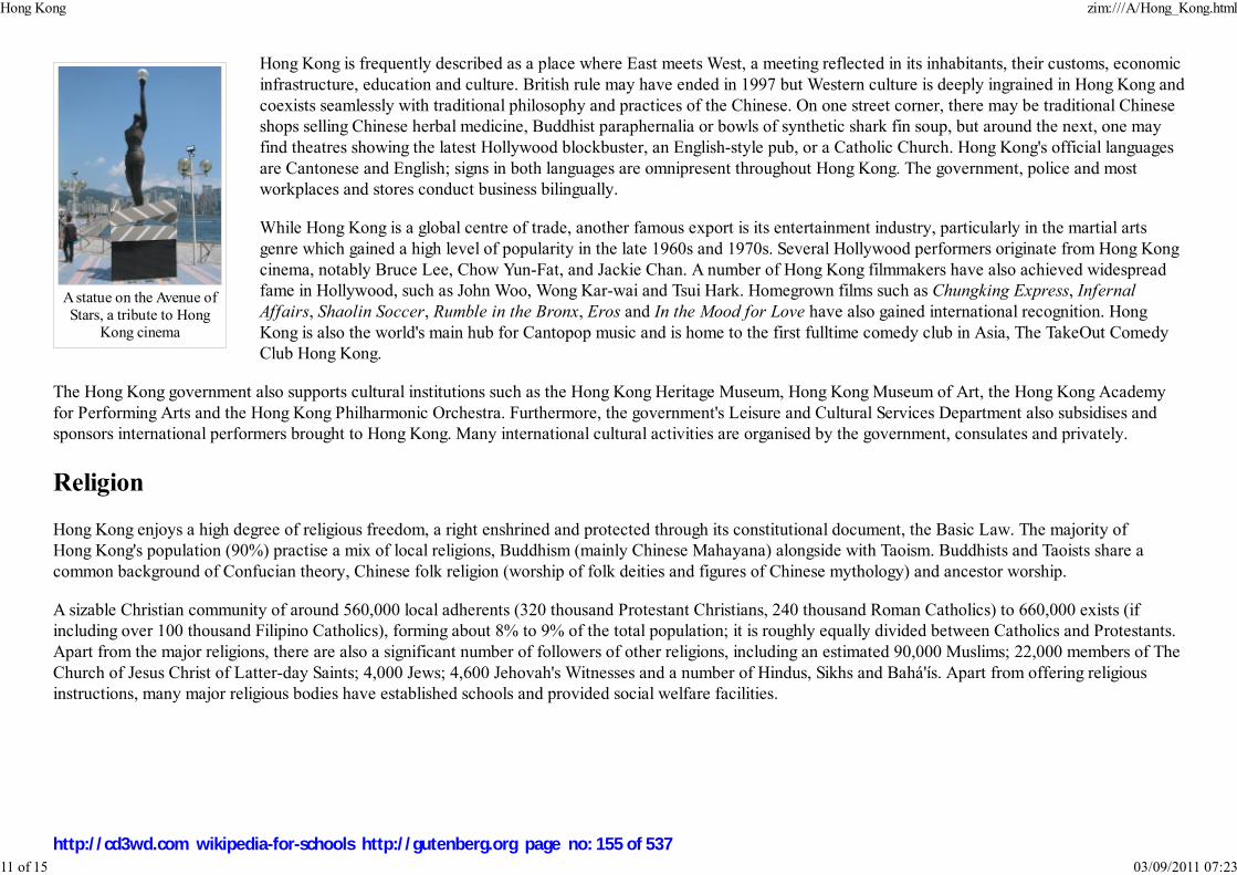
A statue on the Avenue ofStars, a tribute to Hong
Kong cinema
Hong Kong is frequently described as a place where East meets West, a meeting reflected in its inhabitants, their customs, economicinfrastructure, education and culture. British rule may have ended in 1997 but Western culture is deeply ingrained in Hong Kong andcoexists seamlessly with traditional philosophy and practices of the Chinese. On one street corner, there may be traditional Chineseshops selling Chinese herbal medicine, Buddhist paraphernalia or bowls of synthetic shark fin soup, but around the next, one mayfind theatres showing the latest Hollywood blockbuster, an English-style pub, or a Catholic Church. Hong Kong's official languagesare Cantonese and English; signs in both languages are omnipresent throughout Hong Kong. The government, police and mostworkplaces and stores conduct business bilingually.
While Hong Kong is a global centre of trade, another famous export is its entertainment industry, particularly in the martial artsgenre which gained a high level of popularity in the late 1960s and 1970s. Several Hollywood performers originate from Hong Kongcinema, notably Bruce Lee, Chow Yun-Fat, and Jackie Chan. A number of Hong Kong filmmakers have also achieved widespreadfame in Hollywood, such as John Woo, Wong Kar-wai and Tsui Hark. Homegrown films such as Chungking Express, InfernalAffairs, Shaolin Soccer, Rumble in the Bronx, Eros and In the Mood for Love have also gained international recognition. HongKong is also the world's main hub for Cantopop music and is home to the first fulltime comedy club in Asia, The TakeOut ComedyClub Hong Kong.
The Hong Kong government also supports cultural institutions such as the Hong Kong Heritage Museum, Hong Kong Museum of Art, the Hong Kong Academyfor Performing Arts and the Hong Kong Philharmonic Orchestra. Furthermore, the government's Leisure and Cultural Services Department also subsidises andsponsors international performers brought to Hong Kong. Many international cultural activities are organised by the government, consulates and privately.
Religion
Hong Kong enjoys a high degree of religious freedom, a right enshrined and protected through its constitutional document, the Basic Law. The majority ofHong Kong's population (90%) practise a mix of local religions, Buddhism (mainly Chinese Mahayana) alongside with Taoism. Buddhists and Taoists share acommon background of Confucian theory, Chinese folk religion (worship of folk deities and figures of Chinese mythology) and ancestor worship.
A sizable Christian community of around 560,000 local adherents (320 thousand Protestant Christians, 240 thousand Roman Catholics) to 660,000 exists (ifincluding over 100 thousand Filipino Catholics), forming about 8% to 9% of the total population; it is roughly equally divided between Catholics and Protestants.Apart from the major religions, there are also a significant number of followers of other religions, including an estimated 90,000 Muslims; 22,000 members of TheChurch of Jesus Christ of Latter-day Saints; 4,000 Jews; 4,600 Jehovah's Witnesses and a number of Hindus, Sikhs and Bahá'ís. Apart from offering religiousinstructions, many major religious bodies have established schools and provided social welfare facilities.
Hong Kong zim:///A/Hong_Kong.html
11 of 15 03/09/2011 07:23
http://cd3wd.com wikipedia-for-schools http://gutenberg.org page no: 155 of 537

Hong Kong ImmaculateConception Cathedral at 16
Caine Road, Central.
Hong Kong's religious beliefs are tied to the region's early role as a fishing community. Tin Hau, the protector of seafarers, hasbeen honoured with several temples throughout Hong Kong for at least 300 years. Hong Kong residents, especially eldergenerations, visit Taoist or Buddhist temples to appease the deities and, usually, to request compassion, good health or goodfortune. Gifts of food, and in particular fruit, are presented, and incense and paper offerings are burnt in respect.
With the transfer of Hong Kong to the PRC, there were significant concerns over religious freedom in Hong Kong. So far, thishas proved mostly unfounded. Despite the banning of the Falun Gong movement by Beijing in 1999, adherents are still free topractice in Hong Kong. Similarly, the Catholic Church freely appoints its own bishops in Hong Kong, unlike on mainland Chinawhere the only approved 'Catholic' institution is the Chinese Patriotic Catholic Association where bishops and priests areappointed by Beijing (though there is also an unofficial and illegal part of the Catholic church that maintains contact with theVatican). A significant issue in the normalisation of ties between the PRC and the Vatican is Beijing's insistence that the Vaticandrops its diplomatic ties with the ROC.
Architecture
A panoramic view of northern Hong Kong Island between North Point in the east (left) and Central in the west (right).
At present, Hong Kong has the world's greatest number of skyscrapers, with a total of 7,688, well ahead of the second place city, New York City, which has5,640. Most of these were built in the past two decades.
Due to the lack of available space, few historical buildings remain in Hong Kong as older buildings are regularly torn down to make way for new developments.Instead, the city has become a centre for modern architecture, especially in and around Central. Dense commercial skyscrapers line the coast of Victoria Harbourfrom Central to Causeway Bay, and Hong Kong's skyline, ranked the best skyline in the world, is a major tourist attraction. Four of the 18 tallest skyscrapers inthe world are in Hong Kong. In Kowloon, which once included the nihilistic settlement called the Kowloon Walled City, the proximity of Kai Tak Airportpreviously necessitated strict height limits for all buildings. With the closure of Kai Tak Airport in 1998, these restrictions were lifted and several new skyscrapers
Hong Kong zim:///A/Hong_Kong.html
12 of 15 03/09/2011 07:23
http://cd3wd.com wikipedia-for-schools http://gutenberg.org page no: 156 of 537

Pre-war Chinese tenement inSham Shui Po.
Hong Kong's tram system is theonly one in the world that runs
exclusively with double-deckers.
The iconic Star Ferry on one ofits nine-minute voyages across
Victoria Harbour
in Kowloon are now under construction, including International Commerce Centre which, when completed in 2010, will become the world's fourth tallest.
One of the notable buildings in Hong Kong is I. M. Pei's Bank of China Tower, completed in 1990 and now the city's third tallestskyscraper. This building generated heated controversy from the start, as its sharp angles were said to cast negative feng shuienergy into the heart of Hong Kong. Predating the Bank of China Tower, another well-known structure is the HSBCHeadquarters Building, finished in 1985. It was built on the site of Hong Kong's first skyscraper, which was finished in 1935 andwas the subject of a bitter heritage conservation struggle in the late 1970s. Both banks' buildings are featured on many of HongKong's banknotes.
The tallest building in Hong Kong is currently the Two International Finance Centre. Other well-known projects in Hong Konginclude the new Hong Kong International Airport on Chek Lap Kok near Lantau, a huge land reclamation project linked to thecentre of Hong Kong by the Lantau Link, which features three new major bridges: Tsing Ma, the world's sixth largest suspensionbridge; Kap Shui Mun, the world's longest cable-stayed bridge carrying both road and railway traffic; and Ting Kau, the world'sfirst major four-span cable-stayed bridge.
Transport
Hong Kong has a highly developed transportation network,encompassing both public and private transport. Over 90%of daily travels (11 million) are on public transport, making it the highest percentage in theworld. The Octopus card stored value smart card payment system can be used to pay forfares on almost all railways, buses and ferries in Hong Kong. The Octopus card uses RFID(Radio Frequency Identification) to allow users to scan their card without taking it out oftheir wallet or bag. All parking meters in Hong Kong accept payment by Octopus card only,and Octopus card payment can be made at various car parks. Unlike the rest of the People'sRepublic of China, Hongkongers drive on the left side of the road.
Seeing wide usage is the city's metro system, MTR, both an underground rail system and alink between Hong Kong and mainland China. It has 150 stations and moves 3.4 million
people a day. The tramway system, serving the city since 1904, covers the northern parts of Hong Kong Island and is the onlytram system in the world run exclusively with double deckers. There are five operators running franchised public bus services in Hong Kong. Double-deckerbuses were introduced to Hong Kong in 1949, and are now almost exclusively used, with single-decker buses remaining in use for routes with lower demand orroads with lower carrying capacity. Most normal franchised bus routes in Hong Kong operate until 1 am. Public light buses run the length and breadth of HongKong, through areas where standard bus lines cannot reach or do not reach as frequently, quickly, or directly.
The Star Ferry service operates four lines across Victoria Harbour and has been in operation for over 120 years, providing a panoramic view of Hong Kong's
Hong Kong zim:///A/Hong_Kong.html
13 of 15 03/09/2011 07:23
http://cd3wd.com wikipedia-for-schools http://gutenberg.org page no: 157 of 537

Li Ka Shing Faculty of Medicine
skyline for its 53,000 daily passengers. It is considered one of the city's most treasured cultural icons and has been rated as one of the most picturesque ferrycrossings in the world. Other ferry services are provided by operators serving outlying islands, new towns, Macau, and cities in mainland China. Hong Kong isalso famous for its junks traversing the harbour, and small kai-to ferries which serve remote coastal settlements.
As Hong Kong is dominated by steep, hilly terrain, some unusual methods of transport have been devised to ease movement up and down the slopes. Forexample, the Peak Tram, the first public transport system in Hong Kong, has provided vertical rail transport between Central and Victoria Peak since 1888 bysteeply ascending the side of a mountain. In Central and Western district, there is an extensive system of escalators and moving pavements, including the longestoutdoor covered escalator system in the world, the Mid-Levels escalator.
Hong Kong International Airport is a leading air passenger gateway and logistics hub in Asia and one of the world's busiest airports in terms of internationalpassenger and cargo movement, serving more than 47 million passengers and handling 3.74 million tonnes of cargo in 2007. It replaced Kai Tak Airport inKowloon in 1998 and has been voted the world's best airport multiple times. Over 85 airlines operate at the two- terminal airport and it is the primary hub ofCathay Pacific, Dragonair, Air Hong Kong, Hong Kong Airlines and Hong Kong Express.
Taxis are widely used throughout Hong Kong, all of which are obliged by law to run on liquefied petroleum gas instead of diesel, in order to help the city'spollution problems. Despite the effort, the level of smog and pollution in Hong Kong is very high.
Healthcare
Hong Kong's medical infrastructure consists of a mixed medical economy, with 12 private hospitals and more than 50 publichospitals. There are also polyclinics that offer primary care services, including dentistry. Hong Kong has two medicalschools, one with the University of Hong Kong (the Li Ka Shing Faculty of Medicine) and the other with the ChineseUniversity of Hong Kong. Medical graduates obtain the MBChB or MBBS, based upon the British model. There are alsoschools of nursing, both public and private, and training for professions allied to medicine, including a school dedicated todentistry. The Hospital Authority is a statutory body established on 1 December 1990 under the Hospital AuthorityOrdinance to manage all 38 public hospitals and institutions in Hong Kong. It is mainly responsible for delivering acomprehensive range of secondary and tertiary specialist care and medical rehabilitation through its network of health carefacilities. The Authority also provides some primary medical services in 74 primary care clinics.
Hong Kong's 12 private hospitals have partnered with the United Kingdom for international healthcare accreditation. All 12private hospitals are "Trent Hospitals", having been surveyed and accredited by the United Kingdom's Trent Accreditation
Scheme. The Hong Kong Academy of Medicine is an independent institution with the statutory power to organise, monitor, assess and accredit all medicalspecialist training and to oversee the provision of continuing medical education in Hong Kong. In addition, The Royal College of Physicians and Surgeons ofCanada has also accredited the postgraduate medical education (1994-present) in Hong Kong and allowed these graduates from the Hong Kong Academy ofMedicine seeking RCPSC Certification and practising in Canada.
Hong Kong zim:///A/Hong_Kong.html
14 of 15 03/09/2011 07:23
http://cd3wd.com wikipedia-for-schools http://gutenberg.org page no: 158 of 537

Hospital AuthorityHeadquarters
The headquarters of thePeople's Liberation Army HongKong Garrison (former Prince
of Wales Building)
The Department of Health, under Food and Health Bureau, is the health adviser of Hong Kong government and an executive armin health legislation and policy. Its main role is to safeguard the health of the community through promotive, preventive, curativeand rehabilitative services in Hong Kong. The main function of the department includes child assessment service, immunisationprogrammes, dental service, forensic pathology service, registration of healthcare professionals etc, though boards and councils(i.e. Medical Council of Hong Kong, Pharmacy and Poisons Board of Hong Kong) are independent statutory bodies establishedunder the relevant ordinances that operate independently to discharge their statutory functions.
Hong Kong is one of the healthiest places in the world. Because of its early health education, professional health services, andwell-developed health care and medication system, Hongkongers enjoy a life expectancy of 84 for females and 78 for men,which are the second highest in the world, and 2.94 infant mortality rate, the fourth lowest in the world.
Hong Kong has high standards of medical practice. It has contributed to the development of liver transplantation, being the firstin the world to carry out adult to adult live donor liver transplant in 1993.
Military
During British administration, the Governor of Hong Kong was the Commander-in-Chief and Vice-Admiral, defence force wasprovided by the British military, who stationed soldiers in barracks throughout Hong Kong, including the British Forces OverseasHong Kong. Its finance was supported by both the UK Government and the Hong Kong Government. Hong Kong has never hadits own military forces because it has never been a sovereign state, except voluntary auxiliary forces like The Royal Hong KongRegiment (The Volunteers).
The People's Republic of China's State Council assumed sovereignty over Hong Kong on 1 July 1997 and stationed a garrison ofthe People's Liberation Army (PLA) to manage its defence affairs. Although the garrison has little practical military value, thestationing of the PLA troops in Hong Kong is a significant symbol of the PRC government's assumption of sovereignty overHong Kong.
According to Hong Kong's Basic Law, military forces stationed in Hong Kong will not interfere with local civil affairs; the HongKong SAR Government remains responsible for the maintenance of public order. The Hong Kong Garrison, composed of ground,naval, and air forces, is under the command of the Chinese Central Military Commission. The PLA Garrison subsequentlyopened its barracks on Stonecutters Island and Stanley to the public to promote understanding and trust between the troops andresidents.
Retrieved from " http://en.wikipedia.org/wiki/Hong_Kong"The Schools Wikipedia was sponsored by a UK Children's Charity, SOS Children UK , and is a hand-chosen selection of articleversions from the English Wikipedia edited only by deletion (see www.wikipedia.org for details of authors and sources). The articles are available under theGNU Free Documentation License. See also our <
Hong Kong zim:///A/Hong_Kong.html
15 of 15 03/09/2011 07:23
http://cd3wd.com wikipedia-for-schools http://gutenberg.org page no: 159 of 537

भारत गणरा�य*
Republic of India
Flag Emblem
Motto: " Satyameva Jayate" (Sanskrit)
स�यमेव जयते ( Devanāgarī)
"Truth Alone Triumphs"
Anthem: Jana Gana ManaThou art the ruler of the minds of all people
Vande MataramI bow to thee, Mother
India
2008/9 Schools Wikipedia Selection. Related subjects: Asia; Asian CountriesSOS Children works in India. For more information see SOS Children in India
India (Hindi: भारत Bhārat; see also other names), officially the Republic of India (Hindi: भारतगणरा�य Bhārat Gaṇarājya), is a sovereign nation in South Asia. It is the seventh largest country bygeographical area, the second most populous country, and the most populous democracy in the world.Bounded by the Indian Ocean on the south, the Arabian Sea on the west, and the Bay of Bengal on theeast, India has a coastline of 7,517 kilometers (4,671 mi). It borders Pakistan to the west; China, Nepal,and Bhutan to the north-east; and Bangladesh and Burma to the east. In the Indian Ocean, India is in thevicinity of Sri Lanka, Maldives, and Indonesia.
Home to the Indus Valley Civilization and a region of historic trade routes and vast empires, the Indiansubcontinent was identified with its commercial and cultural wealth for much of its long history. Fourmajor world religions, Hinduism, Buddhism, Jainism and Sikhism originated here, while Zoroastrianism,Judaism, Christianity and Islam arrived in the first millennium CE and shaped the region's diverse culture.Gradually annexed by the British East India Company from the early eighteenth century and colonisedby the United Kingdom from the mid-nineteenth century, India became a modern nation state in 1947after a struggle for independence that was marked by widespread nonviolent resistance.
India is the world's twelfth largest economy at market exchange rates and the third largest economy inpurchasing power. Economic reforms have transformed it into the second fastest growing large economy;however, it still suffers from high levels of poverty, illiteracy, malnutrition and environmentaldegradation. A pluralistic, multilingual, and multiethnic society, India is also home to a diversity ofwildlife in a variety of protected habitats.
Etymology
The name India (pronounced /ˈɪndiə/) is derived from Indus, which is derived from the Old Persian wordHindu, from Sanskrit Sindhu, the historic local appellation for the Indus River. The ancient Greeksreferred to the Indians as Indoi, the people of the Indus. The Constitution of India and common usage invarious Indian languages also recognise Bharat ( pronunciation , /bʰɑːrət̪/) as an official name of equalstatus. Hindustan ( /hin̪d̪ust̪ɑːn/ ), which is the Persian word for “ Land of the Hindus” and historically
India zim:///A/India.html
1 of 12 03/09/2011 07:23
http://cd3wd.com wikipedia-for-schools http://gutenberg.org page no: 160 of 537

Capital New Delhi
Largest city Mumbai
Official Languages:
Scheduled Languages:
Demonym Indian
Government Federal republicParliamentary democracy
- President Pratibha Patil
- Prime Minister Manmohan Singh
Independence from British colonial rule
- Declared 15 August 1947
- Republic 26 January 1950
Area
- Total 3,287,590‡ km² ( 7th)1,269,346 sq mi
- Water (%) 9.56
Population
- 2007 estimate 1.12 billion ( 2nd)
- 2001 census 1,027,015,248
- Density 329/km² ( 31st)852/sq mi
GDP ( PPP) 2007 estimate
- Total $ 2.965 trillion ( 6th)
- Per capita $ 2,700
GDP (nominal) 2007 estimate
- Total 798.2 billion
- Per capita 863
Gini (1999-2000) 32.5
Paintings at the Ajanta Caves inAurangabad, Maharashtra, 6th
century.
referred to northern India, is also occasionally used as a synonym for all of India.
History
Stone Age rock shelters with paintings at the Bhimbetka rock shelters in Madhya Pradesh are the earliestknown traces of human life in India. The first known permanent settlements appeared over 9,000 yearsago and gradually developed into the Indus Valley Civilization, dating back to 3300 BCE in westernIndia. It was followed by the Vedic period, which laid the foundations of Hinduism and other culturalaspects of early Indian society. From around 550 BCE, many independent kingdoms and republicsknown as the Mahajanapadas were established across the country.
The empire built by the Maurya Empire under Emperor Ashoka unitedmost of South Asia in the third century BCE. From 180 BCE, a series ofinvasions from Central Asia followed, including those led by theIndo-Greeks, Indo-Scythians, Indo-Parthians and Kushans in the north-western Indian subcontinent. From the third century CE, the Guptadynasty oversaw the period referred to as ancient " India's GoldenAge." Among the notable South Indian empires were the Chalukyas,Rashtrakutas, Hoysalas, Pallavas, Pandyas, and Cholas. Science,engineering, art, literature, astronomy, and philosophy flourished underthe patronage of these kings.
Following invasions from Central Asia between the tenth and twelfthcenturies, much of north India came under the rule of the DelhiSultanate, and later the Mughal Empire. Mughal emperors graduallyexpanded their kingdoms to cover large parts of the subcontinent.
Nevertheless, several indigenous kingdoms, such as the Vijayanagara Empire, flourished, especially in thesouth. In the seventeenth and eighteenth century, the Mughal supremacy declined and the MarathaEmpire became the dominant power. From the sixteenth century, several European countries, includingPortugal, the Netherlands, France, and the United Kingdom, started arriving as traders and later tookadvantage of the fractious nature of relations between the kingdoms to establish colonies in the country.By 1856, most of India was under the control of the British East India Company. A year later, anationwide insurrection of rebelling military units and kingdoms, variously referred to as the First War ofIndian Independence or Sepoy Mutiny, seriously challenged British rule but eventually failed. As aconsequence, India came under the direct control of the British Crown as a colony of the British Empire.
Hindi, English [ Show ]
8th Schedule: [ Show ]
India zim:///A/India.html
2 of 12 03/09/2011 07:23
http://cd3wd.com wikipedia-for-schools http://gutenberg.org page no: 161 of 537

HDI (2007) ▲ 0.619 (medium) (128th)
Currency Indian rupee (₨) ( INR)
Time zone IST ( UTC+5:30)
- Summer ( DST) not observed ( UTC+5:30)
Internet TLD .in
Calling code +91
National Symbols of India
Flag Tricolour
Emblem Sarnath Lion Capital
Anthem Jana Gana Mana
Song Vandē Mātaram
Animal Royal Bengal Tiger
Bird Indian Peafowl
Flower Lotus
Tree Banyan
Fruit Mango
Sport Field hockey
Calendar Saka
During the first half of the twentieth century, a nationwide struggle for independence was launchedby the Indian National Congress and other political organizations. In the 1920s and 1930, a movement
led by Mahatma Gandhi, and displaying commitment to ahimsa, or non-violence, millions of protestersengaged in mass campaigns of civil disobedience. Finally, on 15 August 1947, India gained independencefrom British rule, but was partitioned, in accordance to wishes of the Muslim League, along the lines ofreligion to create the Islamic nation state of Pakistan. Three years later, on 26 January 1950, Indiabecame a republic and a new constitution came into effect.
Since independence, India has experienced sectarian violence and insurgencies in various parts of thecountry, but has maintained its unity and democracy. It has unresolved territorial disputes with China,which in 1962 escalated into the brief Sino-Indian War; and with Pakistan, which resulted in wars in1947, 1965, 1971, and 1999. India is a founding member of the Non-Aligned Movement and the UnitedNations (as part of British India). In 1974, India conducted an underground nuclear test. This wasfollowed by five more tests in 1998, making India a nuclear state. Beginning in 1991, significant economic reforms have transformed India into one of thefastest-growing economies in the world, adding to its global and regional clout.
Government
The constitution of India, the longest and most exhaustive constitution of any independent nation in the world, came intoforce on January 26, 1950. The preamble of the constitution defines India as a sovereign, socialist, secular, democraticrepublic. India has a quasi-federal form of government and a bicameral parliament operating under a Westminster-styleparliamentary system. It has three branches of governance: the Legislature, Executive, and Judiciary.
The President of India is the official head of state elected indirectly by an electoral college for a five-year term. ThePrime Minister is, however, the de facto head of government and exercises most executive powers. The Prime Minister isappointed by the President and, by convention, is the candidate supported by the party or political alliance holding themajority of seats in the lower house of Parliament.
The legislature of India is the bicameral Parliament, which consists of the upper house called the Rajya Sabha (Councilof States) and the lower house called the Lok Sabha (House of People). The Rajya Sabha, a permanent body, has up to250 members serving staggered six year terms. Most are elected indirectly by the state and territorial legislatures inproportion to the state's population. The 543 of the Lok Sabha's 545 members are directly elected by popular vote to represent individual constituencies for fiveyear terms. The other two members are nominated by the President from the Anglo-Indian community if, in his opinion, the community is not adequatelyrepresented.
The executive branch consists of the President, Vice-President, and the Council of Ministers (the Cabinet being its executive committee) headed by the Prime
Non-numbered Footnotes: [ Show ]
India zim:///A/India.html
3 of 12 03/09/2011 07:23
http://cd3wd.com wikipedia-for-schools http://gutenberg.org page no: 162 of 537

The North Block, in NewDelhi, houses key government
offices.
Minister. Any minister holding a portfolio must be a member of either house of parliament. In the Indian parliamentary system, the executive is subordinate tothe legislature, with the Prime Minister and his Council being directly responsible to the lower house of the parliament.
India has a unitary three-tier judiciary, consisting of the Supreme Court, headed by the Chief Justice of India, twenty-one High Courts, and a large number oftrial courts. The Supreme Court has original jurisdiction over cases involving fundamental rights and over disputes between states and the Centre, and appellatejurisdiction over the High Courts. It is judicially independent, and has the power to declare the law and to strike down union or state laws which contravene theConstitution. The role as the ultimate interpreter of the Constitution is one of the most important functions of the Supreme Court.
Politics
India is the largest democracy in the world. For most of its democratic history, the federal government has been led by theIndian National Congress (INC). State politics have been dominated by several national parties including the INC, theBharatiya Janata Party (BJP), the Communist Party of India (CPI), and various regional parties. From 1950 to 1990, barringtwo brief periods, the INC enjoyed a parliamentary majority. The INC was out of power between 1977 and 1980, when theJanata Party won the election owing to public discontent with the "Emergency" declared by the then Prime Minister IndiraGandhi. In 1989, a Janata Dal-led National Front coalition in alliance with the Left Front coalition won the elections butmanaged to stay in power for only two years.
The years 1996–1998 were a period of turmoil in the federal government with several short-lived alliances holding sway. TheBJP formed a government briefly in 1996, followed by the United Front coalition. In 1998, the BJP formed the NationalDemocratic Alliance (NDA) with several regional parties and became the first non-Congress government to complete a fullfive-year term. In the 2004 Indian elections, the INC won the largest number of Lok Sabha seats and formed a government with a coalition called the UnitedProgressive Alliance (UPA), supported by various left-leaning parties and members opposed to the BJP.
Foreign relations and military
India zim:///A/India.html
4 of 12 03/09/2011 07:23
http://cd3wd.com wikipedia-for-schools http://gutenberg.org page no: 163 of 537

The nuclear capable Agni-IIballistic missile during a
Republic Day parade.
Since its independence in 1947, India has maintained cordial relationships with most nations. It took a leading role in the 1950sby advocating the independence of European colonies in Africa and Asia. India is a founding member of the Non-AlignedMovement. After the Sino-Indian War and the Indo-Pakistani War of 1965, India's relationship with the Soviet Union warmedat the expense of ties with the United States and continued to remain so until the end of the Cold War. India has fought twowars with Pakistan, primarily over Kashmir. India also fought and won an additional war with Pakistan for the liberation ofBangladesh in 1971.
In recent years, India has played an influential role in the ASEAN, SAARC, and the WTO. India is a founding member andlong time supporter of the United Nations, with over 55,000 Indian military and police personnel having served in thirty-fiveUN peace keeping operations deployed across four continents. Despite criticism and military sanctions, India has consistentlyrefused to sign the CTBT and the NPT, preferring instead to maintain sovereignty over its nuclear program. Recent overturesby the Indian government have strengthened relations with the United States, China, and Pakistan. In the economic sphere, India has close relationships withother developing nations in South America, Asia, and Africa.
India maintains the third largest military force in the world, which consists of the Indian Army, Navy, and Air Force. Auxiliary forces such as the ParamilitaryForces, the Coast Guard, and the Strategic Forces Command also come under the military's purview. The President of India is the supreme commander of theIndian armed forces. India became a nuclear power in 1974 after conducting an initial nuclear test, Operation Smiling Buddha. Further underground testing in1998 led to international military sanctions against India, which were gradually withdrawn after September 2001. India maintains a " no first use" nuclear policyand has a clean record of non-proliferation.
Subdivisions
India is a federal republic of twenty-eight states and seven Union Territories. All states, the union territory of Puducherry, and the National Capital Territory ofDelhi have elected governments. The other five union territories have centrally appointed administrators and hence are under direct rule of the President. In1956, under the States Reorganisation Act, states were formed on linguistic basis. Since then this structure has remained largely unchanged. Each state or unionterritory is divided into basic units of government and administration called districts. There are nearly 600 districts in India. The districts in turn are furtherdivided into tehsils and eventually into villages.
India zim:///A/India.html
5 of 12 03/09/2011 07:23
http://cd3wd.com wikipedia-for-schools http://gutenberg.org page no: 164 of 537

Administrative divisions ofIndia, including 28 states and 7
union territories.
Topographic map of India.
States:
Andhra Pradesh1.Arunachal Pradesh2.Assam3.Bihar4.Chhattisgarh5.Goa6.Gujarat7.Haryana8.Himachal Pradesh9.Jammu and Kashmir10.Jharkhand11.Karnataka12.Kerala13.Madhya Pradesh14.
Maharashtra15.Manipur16.Meghalaya17.Mizoram18.Nagaland19.Orissa20.Punjab21.Rajasthan22.Sikkim23.Tamil Nadu24.Tripura25.Uttar Pradesh26.Uttarakhand27.West Bengal28.
Union Territories:
Andaman and Nicobar IslandsA.ChandigarhB.Dadra and Nagar HaveliC.Daman and DiuD.LakshadweepE.National Capital Territory of DelhiF.PuducherryG.
Major Cities: Bangalore • Chennai • Delhi • Hyderabad • Kolkata • Mumbai
Geography
India, the major portion of the Indian subcontinent, sits atop the Indian tectonic plate, a minor plate within the Indo-AustralianPlate.
India's defining geological processes commenced seventy-five million years ago, when the Indian subcontinent, then part of thesouthern supercontinent Gondwana, began a northeastwards drift — lasting fifty million years — across the then unformedIndian Ocean. The subcontinent's subsequent collision with the Eurasian Plate and subduction under it, gave rise to theHimalayas, the planet's highest mountains, which now abut India in the north and the north-east. In the former seabedimmediately south of the emerging Himalayas, plate movement created a vast trough, which, having gradually been filled withriver-borne sediment, now forms the Indo-Gangetic Plain. To the west of this plain, and cut off from it by the Aravalli Range,lies the Thar Desert. The original Indian plate now survives as peninsular India, the oldest and geologically most stable part ofIndia, and extending as far north as the Satpura and Vindhya ranges in central India. These parallel ranges run from the ArabianSea coast in Gujarat in the west to the coal-rich Chota Nagpur Plateau in Jharkhand in the east. To their south, the remainingpeninsular landmass, the Deccan Plateau, is flanked on the left and right by the coastal ranges, Western Ghats and Eastern Ghats respectively; the plateaucontains the oldest rock formations in India, some over one billion years old. Constituted in such fashion, India lies to the north of the equator between 6°44'and 35°30' north latitude and 68°7' and 97°25' east longitude.
India zim:///A/India.html
6 of 12 03/09/2011 07:23
http://cd3wd.com wikipedia-for-schools http://gutenberg.org page no: 165 of 537

India's coast is 7,517 kilometers (4,671 mi) long; of this distance, 5,423 kilometers (3,370 mi) belong to peninsular India, and 2,094 kilometers (1,301 mi) to theAndaman, Nicobar, and Lakshadweep Islands. According to the Indian naval hydrographic charts, the mainland coast consists of: 43% sandy beaches, 11%rocky coast including cliffs, and 46% mudflats or marshy coast.
Major Himalayan-origin rivers that substantially flow through India include the Ganges and the Brahmaputra, both of which drain into the Bay of Bengal.Important tributaries of the Ganges include the Yamuna and the Kosi, nicknamed "Bihar's Sorrow," whose extremely low gradient causes disastrous floodsevery year. Major peninsular rivers — whose steeper gradients prevent their waters from flooding — include the Godavari, the Mahanadi, the Kaveri, and theKrishna, which also drain into the Bay of Bengal, and the Narmada and the Tapti, which drain into the Arabian Sea. Among notable coastal features of India arethe marshy Rann of Kutch in western India, and the alluvial Sundarbans delta, which India shares with Bangladesh. India has two archipelagos: theLakshadweep, coral atolls off India's south-western coast, and the Andaman and Nicobar Islands, a volcanic chain in the Andaman Sea.
India's climate is strongly influenced by the Himalayas and the Thar Desert, both of which drive the monsoons. The Himalayas prevent cold Central Asiankatabatic winds from blowing in, keeping the bulk of the Indian subcontinent warmer than most locations at similar latitudes. The Thar Desert plays a crucialrole in attracting the moisture-laden southwest summer monsoon winds that, between June and October, provide the majority of India's rainfall. Four majorclimatic groupings predominate in India: tropical wet, tropical dry, subtropical humid, and montane.
Flora and fauna
India zim:///A/India.html
7 of 12 03/09/2011 07:23
http://cd3wd.com wikipedia-for-schools http://gutenberg.org page no: 166 of 537

Indian giant squirrels inhabitthe forests of the Western
Ghats.
India, which lies within the Indomalaya ecozone, displays significant biodiversity. One of seventeen megadiverse countries, it ishome to 7.6% of all mammalian, 12.6% of all avian, 6.2% of all reptilian, 4.4% of all amphibian, 11.7% of all fish, and 6.0% ofall flowering plant species. Many ecoregions, such as the shola forests, exhibit extremely high rates of endemism; overall, 33%of Indian plant species are endemic. India's forest cover ranges from the tropical rainforest of the Andaman Islands, WesternGhats, and North-East India to the coniferous forest of the Himalaya. Between these extremes lie the sal-dominated moistdeciduous forest of eastern India; the teak-dominated dry deciduous forest of central and southern India; and the babul-dominated thorn forest of the central Deccan and western Gangetic plain. Important Indian trees include the medicinal neem,widely used in rural Indian herbal remedies. The pipal fig tree, shown on the seals of Mohenjo-daro, shaded Gautama Buddhaas he sought enlightenment.
Many Indian species are descendants of taxa originating in Gondwana, to which India originally belonged. Peninsular India'ssubsequent movement towards, and collision with, the Laurasian landmass set off a mass exchange of species. However,volcanism and climatic changes 20 million years ago caused the extinction of many endemic Indian forms. Soon thereafter,mammals entered India from Asia through two zoogeographical passes on either side of the emerging Himalaya. Consequently,among Indian species, only 12.6% of mammals and 4.5% of birds are endemic, contrasting with 45.8% of reptiles and 55.8% ofamphibians. Notable endemics are the Nilgiri leaf monkey and the brown and carmine Beddome's toad of the Western Ghats.India contains 172, or 2.9%, of IUCN-designated threatened species. These include the Asiatic Lion, the Bengal Tiger, and theIndian white-rumped vulture, which suffered a near-extinction from ingesting the carrion of diclofenac-treated cattle.
In recent decades, human encroachment has posed a threat to India's wildlife; in response, the system of national parks andprotected areas, first established in 1935, was substantially expanded. In 1972, India enacted the Wildlife Protection Act andProject Tiger to safeguard crucial habitat; in addition, the Forest Conservation Act was enacted in 1980. Along with more thanfive hundred wildlife sanctuaries, India hosts thirteen biosphere reserves, four of which are part of the World Network ofBiosphere Reserves; twenty-five wetlands are registered under the Ramsar Convention.
Economy
India zim:///A/India.html
8 of 12 03/09/2011 07:23
http://cd3wd.com wikipedia-for-schools http://gutenberg.org page no: 167 of 537

The Bombay Stock Exchange,in Mumbai, is Asia's oldest andIndia's largest stock exchange.
For most of its post-independence history, India adhered to a quasi-socialist approach with strict government control overprivate sector participation, foreign trade, and foreign direct investment. However, since 1991, India has gradually opened upits markets through economic reforms and reduced government controls on foreign trade and investment. Foreign exchangereserves have risen from US$5.8 billion in March 1991 to US$275 billion in 2007, while federal and state budget deficits havedecreased. Privatization of publicly-owned companies and the opening of certain sectors to private and foreign participationhas continued amid political debate. With a GDP growth rate of 9.4% in 2006-07, the Indian economy is among the fastestgrowing in the world. India's GDP in terms of USD exchange-rate is US$ 778.7 billion. When measured in terms of purchasingpower parity (PPP), India has the world's third largest GDP at US$4.164 trillion. India's per capita income (nominal) is US$707, while its per capita (PPP) is US$ 3600.
Although the Indian economy has grown steadily over the last two decades; its growth has been uneven when comparingdifferent social groups, economic groups, geographic regions, and rural and urban areas. Income inequality in India is relativelysmall ( Gini coefficient: 32.5 in year 1999–2000), though it has been increasing of late. Wealth distribution in India is fairlyuneven, with the top 10% of income groups earning 33% of the income. Despite significant economic progress, a quarter of thenation's population earns less than the government-specified poverty threshold of $0.40 per day. In 2004–2005, 27.5% of thepopulation was living below the poverty line.
India has the world's second largest labour force, with 509.3 million people, 60% of whom are employed in agriculture andrelated industries; 28% in services and related industries; and 12% in industry. Major agricultural crops include rice, wheat, oilseed, cotton, jute, tea, sugarcane,and potatoes. The agricultural sector accounts for 28% of GDP; the service and industrial sectors make up 54% and 18% respectively. Major industries includeautomobiles, cement, chemicals, consumer electronics, food processing, machinery, mining, petroleum, pharmaceuticals, steel, transportation equipment, andtextiles.
In 2006, estimated exports stood at US$112 billion and imports were around US$187.9 billion. Textiles, jewellery, engineering goods and software are majorexport commodities. Crude oil, machineries, fertilizers, and chemicals are major imports. India's most important trading partners are the United States, theEuropean Union, China, the United Arab Emirates, Singapore, and Australia. More recently, India has capitalised on its large pool of educated, English-speakingpeople, and trained professionals to become an important outsourcing destination for multinational corporations and a popular destination for medical tourism.India has also become a major exporter of software as well as financial, research, and technological services. Its natural resources include arable land, bauxite,chromite, coal, diamonds, iron ore, limestone, manganese, mica, natural gas, petroleum, and titanium ore.
Demographics
India zim:///A/India.html
9 of 12 03/09/2011 07:23
http://cd3wd.com wikipedia-for-schools http://gutenberg.org page no: 168 of 537

Population density map ofIndia.
The Taj Mahal in Agra wasbuilt by Shah Jahan as
memorial to wife MumtazMahal. It is a UNESCO WorldHeritage Site considered to be
of "outstanding universalvalue".
With an estimated population of 1.12 billion, India is the world's second most populous country. Almost 70% of Indians residein rural areas, although in recent decades migration to larger cities has led to a dramatic increase in the country's urbanpopulation. India's largest cities are Mumbai (formerly Bombay), Delhi, Kolkata (formerly Calcutta), Chennai (formerlyMadras), Bangalore, and Hyderabad.
India is the second most culturally, linguistically and genetically diverse geographical entity after the African continent. India ishome to two major linguistic families: Indo-Aryan (spoken by about 74% of the population) and Dravidian (spoken by about24%). Other languages spoken in India come from the Austro-Asiatic and Tibeto-Burman linguistic families. Hindi, with thelargest number of speakers, is the official language of India. English, which is extensively used in business and administration,has the status of a 'subsidiary official language'. The constitution also recognises in particular 21 other languages that are eitherabundantly spoken or have classical status. The number of dialects in India is as high as 1,652.
Over 800 million Indians (80.5%) are Hindu. Other religious groups include Muslims (13.4%), Christians (2.3%), Sikhs (1.9%),Buddhists (0.8%), Jains (0.4%), Jews, Zoroastrians, Bahá'ís and others. Tribals constitute 8.1% of the population.
India's literacy rate is 64.8% (53.7% for females and 75.3% for males). The state of Kerala has the highest literacy rate (91%); Bihar has the lowest (47%). Thenational gender ratio is 944 females per 1,000 males. India's median age is 24.9, and the population growth rate of 1.38% per annum; there are 22.01 births per1,000 people per year.
Culture
India's culture is marked by a high degree of syncretism and cultural pluralism. It has managed to preserve establishedtraditions while absorbing new customs, traditions, and ideas from invaders and immigrants. Multicultural concerns have longinformed India’s history and traditions, constitution and political arrangements.
Indian Architecture, including notable monuments, such as the Taj Mahal and other examples of Mughal architecture andSouth Indian architecture, is the result of traditions that combined elements from several parts of the country and abroad.Vernacular architecture also displays notable regional variation.
Indian music covers a wide range of traditions and regional styles. Classical music is split mainly between the North IndianHindustani and South Indian Carnatic traditions. Highly regionalised forms of popular music include filmi and folk music; thesyncretic tradition of the bauls is a well-known form of the latter.
Indian dance too has diverse folk and classical forms. Among the well-known folk dances are the bhangra of the Punjab, thebihu of Assam, the chhau of Bihar and Orissa and the ghoomar of Rajasthan. Eight dance forms, many with narrative formsand mythological elements, have been accorded classical dance status by India's National Academy of Music, Dance, and
India zim:///A/India.html
10 of 12 03/09/2011 07:23
http://cd3wd.com wikipedia-for-schools http://gutenberg.org page no: 169 of 537

A prayer flag above TanzeMonastery in the Kurgiakh
Valley. The wind is believed topropagate the prayers printed on
tissue.
Drama. These are: bharatanatyam of the state of Tamil Nadu, kathak of Uttar Pradesh, kathakali and mohiniattam of Kerala, kuchipudi of Andhra Pradesh,manipuri of Manipur, odissi of the state of Orissa and the sattriya of Assam.
Theatre in India often incorporates music, dance, and improvised or written dialogue. Often based on Hindu mythology, but also borrowing from medievalromances, and news of social and political events, Indian theatre includes the bhavai of state of Gujarat, the jatra of West Bengal, the nautanki and ramlila ofNorth India, the tamasha of Maharashtra, the terukkuttu of Tamil Nadu, and the yakshagana of Karnataka.
The Indian film industry is the largest in the world. Bollywood, based in Mumbai, makes commercial Hindi films and is themost prolific film industry in the world. Established traditions also exist in Bengali, Kannada, Malayalam, Marathi, Tamil, andTelugu language cinemas.
The earliest works of Indian literature were transmitted orally and only later written down. These included works of Sanskritliterature – such as the early Vedas, the epics Mahabharata and Ramayana, the drama Abhijñānaśākuntalam (The Recognitionof Śakuntalā), and poetry such as the Mahākāvya – and the Tamil language Sangam literature. Among Indian writers of themodern era active in Indian languages or English, Rabindranath Tagore won the Nobel Prize in 1913.
Indian cuisine is characterized by a wide variety of regional styles and sophisticated use of herbs and spices. The staple foodsin the region are rice (especially in the south and the east) and wheat (predominantly in the north). Spices originally native tothe Indian subcontinent that are now consumed world wide include black pepper; in contrast, hot chilli peppers, popular acrossIndia, were introduced by the Portuguese.
Traditional Indian dress varies across the regions in its colours and styles and depends on various factors, including climate.Popular styles of dress include draped garments such as sari for women and dhoti or lungi for men; in addition, stitched clothessuch as shalwar kameez for women and kurta- pyjama and European-style trousers and shirts for men, are also popular.
Many Indian festivals are religious in origin, although several are celebrated irrespective of caste and creed. Some popularfestivals are Diwali, Pongal, Holi, Onam, Vijayadashami, Bihu, Durga puja, Eid ul-Fitr, Bakr-Id, Christmas, Ugadi, BuddhaJayanti and Vaisakhi. India has three national holidays. Other sets of holidays, varying between nine and twelve, are officially
observed in individual states. Religious practices are an integral part of everyday life and are a very public affair. Traditional Indian family values are highlyrespected, although urban families now prefer nuclear family system due to the socio-economic constraints imposed by traditional joint family system.
India's national sport is field hockey though cricket is the most popular sport in India. In some states, particularly those in the northeast and the states of WestBengal, Goa, and Kerala, football (soccer) is also a popular sport. In recent times, tennis has also gained popularity. Chess, commonly held to have originated inIndia, is also gaining popularity with the rise in the number of Indian grandmasters. Traditional sports include kabaddi, kho-kho, and gilli-danda, which areplayed nationwide. India is home to the age-old discipline of yoga and to the ancient martial arts, Kalarippayattu and Varma Kalai.
Retrieved from " http://en.wikipedia.org/wiki/India"
India zim:///A/India.html
11 of 12 03/09/2011 07:23
http://cd3wd.com wikipedia-for-schools http://gutenberg.org page no: 170 of 537
The Schools Wikipedia is sponsored by SOS Children , and is mainly selected from the English Wikipedia with only minor checks and changes (seewww.wikipedia.org for details of authors and sources). The articles are available under the GNU Free Documentation License. See also our
India zim:///A/India.html
12 of 12 03/09/2011 07:23
http://cd3wd.com wikipedia-for-schools http://gutenberg.org page no: 171 of 537

Republik Indonesia
Republic of Indonesia
Flag Coat of arms
Motto: Bhinneka Tunggal Ika ( Old Javanese)
Unity in Diversity
National ideology: Pancasila
Anthem: Indonesia Raya
Capital
(and largest city)
Jakarta
Official languages Indonesian
Demonym Indonesian
Government Presidential republic
Indonesia
2008/9 Schools Wikipedia Selection. Related subjects: Asia; Asian Countries
SOS Children works in Indonesia. For more information see SOS Children in Indonesia
The Republic of Indonesia (IPA: /ˌɪndoʊˈniːziːə/, /ˌɪndəˈniːziːə/) (Indonesian: Republik Indonesia), is a
nation in Southeast Asia. Comprising 17,508 islands, it is the world's largest archipelagic state. With a
population of over 234 million people, it is the world's fourth most populous country and the most
populous Muslim-majority nation, although officially it is not an Islamic state. Indonesia is a republic,
with an elected parliament and president. The nation's capital city is Jakarta. The country shares land
borders with Papua New Guinea, East Timor and Malaysia. Other neighboring countries include
Singapore, the Philippines, Australia, and the Indian territory of the Andaman and Nicobar Islands.
The Indonesian archipelago has been an important trade region since at least the seventh century, when
the Srivijaya Kingdom formed trade links with China. Indonesian history has been influenced by foreign
powers drawn to its natural resources. Under Indian influence, Hindu and Buddhist kingdoms flourished
from the early centuries CE. Muslim traders brought Islam, and European powers fought one another to
monopolize trade in the Spice Islands of Maluku during the Age of Discovery. Following three and a half
centuries of Dutch colonialism, Indonesia secured its independence after World War II. Indonesia's
history has since been turbulent, with challenges posed by natural disasters, corruption, separatism, a
democratization process, and periods of rapid economic change.
Across its many islands, Indonesia consists of distinct ethnic, linguistic, and religious groups. The
Javanese are the largest and politically dominant ethnic group. As a unitary state and a nation, Indonesia
has developed a shared identity defined by a national language, a majority Muslim population, and a
history of colonialism and rebellion against it. Indonesia's national motto, " Bhinneka tunggal ika" ("Unity
in Diversity" lit. "many, yet one"), articulates the diversity that shapes the country. However, sectarian
tensions and separatism have led to violent confrontations that have undermined political and economic
stability. Despite its large population and densely populated regions, Indonesia has vast areas of
wilderness that support the world's second highest level of biodiversity. The country is richly endowed
with natural resources, yet poverty is a defining feature of contemporary Indonesia.
Etymology
Indonesia zim:///A/Indonesia.html
1 of 12 03/09/2011 07:24
http://cd3wd.com wikipedia-for-schools http://gutenberg.org page no: 172 of 537
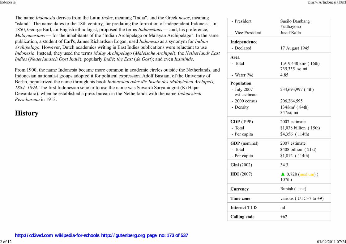
- President Susilo Bambang
Yudhoyono
- Vice President Jusuf Kalla
Independence
- Declared 17 August 1945
Area
- Total 1,919,440 km² ( 16th)
735,355 sq mi
- Water (%) 4.85
Population
- July 2007
est. estimate
234,693,997 ( 4th)
- 2000 census 206,264,595
- Density 134/km² ( 84th)
347/sq mi
GDP ( PPP) 2007 estimate
- Total $1,038 billion ( 15th)
- Per capita $4,356 ( 114th)
GDP (nominal) 2007 estimate
- Total $408 billion ( 21st)
- Per capita $1,812 ( 114th)
Gini (2002) 34.3
HDI (2007) ▲ 0.728 (medium) (
107th)
Currency Rupiah ( IDR)
Time zone various ( UTC+7 to +9)
Internet TLD .id
Calling code +62
The name Indonesia derives from the Latin Indus, meaning "India", and the Greek nesos, meaning
"island". The name dates to the 18th century, far predating the formation of independent Indonesia. In
1850, George Earl, an English ethnologist, proposed the terms Indunesians — and, his preference,
Malayunesians — for the inhabitants of the "Indian Archipelago or Malayan Archipelago". In the same
publication, a student of Earl's, James Richardson Logan, used Indonesia as a synonym for Indian
Archipelago. However, Dutch academics writing in East Indies publications were reluctant to use
Indonesia. Instead, they used the terms Malay Archipelago (Maleische Archipel); the Netherlands East
Indies (Nederlandsch Oost Indië), popularly Indië; the East (de Oost); and even Insulinde.
From 1900, the name Indonesia became more common in academic circles outside the Netherlands, and
Indonesian nationalist groups adopted it for political expression. Adolf Bastian, of the University of
Berlin, popularized the name through his book Indonesien oder die Inseln des Malayichen Archipels,
1884–1894. The first Indonesian scholar to use the name was Suwardi Suryaningrat (Ki Hajar
Dewantara), when he established a press bureau in the Netherlands with the name Indonesisch
Pers-bureau in 1913.
History
Indonesia zim:///A/Indonesia.html
2 of 12 03/09/2011 07:24
http://cd3wd.com wikipedia-for-schools http://gutenberg.org page no: 173 of 537

As early as the first century CEIndonesian vessels made trade
voyages as far as Africa.Picture: a ship carved on
Borobudur, circa 800 CE.
The nutmeg plant isnative to Indonesia's
Banda Islands. Once oneof the world's most
valuable commodities,it drew the first
European colonialpowers to Indonesia.
Fossilized remains of Homo erectus, popularly known as the " Java Man", suggest the Indonesian archipelago was inhabited
two million to 500,000 years ago. Austronesian people, who form the majority of the modern population, migrated to South
East Asia from Taiwan. They arrived in Indonesia around 2000 BCE, and confined the native Melanesian peoples to the far
eastern regions as they expanded. Ideal agricultural conditions, and the mastering of wet-field rice cultivation as early as the
eighth century BCE, allowed villages, towns, and small kingdoms to flourish by the first century CE. Indonesia's strategic
sea-lane position fostered inter-island and international trade. For example, trade links with both Indian kingdoms and China
were established several centuries BCE. Trade has since fundamentally shaped Indonesian history.
From the seventh century CE, the powerful Srivijaya naval kingdom flourished as a result of trade
and the influences of Hinduism and Buddhism that were imported with it. Between the eighth and
10th centuries CE, the agricultural Buddhist Sailendra and Hindu Mataram dynasties thrived and
declined in inland Java, leaving grand religious monuments such as Sailendra's Borobudur and
Mataram's Prambanan. The Hindu Majapahit kingdom was founded in eastern Java in the late 13th
century, and under Gajah Mada, its influence stretched over much of Indonesia; this period is often referred to as a "Golden Age" in
Indonesian history.
Although Muslim traders first traveled through South East Asia early in the Islamic era, the earliest evidence of Islamized populations
in Indonesia dates to the 13th century in northern Sumatra. Other Indonesia areas gradually adopted Islam which became the
dominant religion in Java and Sumatra by the end of the 16th century. For the most part, Islam overlaid and mixed with existing
cultural and religious influences, which shaped the predominant form of Islam in Indonesia, particularly in Java. The first Europeans
arrived in Indonesia in 1512, when Portuguese traders, led by Francisco Serrão, sought to monopolize the sources of nutmeg, cloves,
and cubeb pepper in Maluku. Dutch and British traders followed. In 1602 the Dutch established the Dutch East India Company
(VOC) and became the dominant European power. Following bankruptcy, the VOC was formally dissolved in 1800, and the
government of the Netherlands established the Dutch East Indies as a nationalized colony.
For most of the colonial period, Dutch control over these territories was tenuous; only in the early 20th century did Dutch dominance
extend to what was to become Indonesia's current boundaries. The Japanese invasion and subsequent occupation during World War
II ended Dutch rule, and encouraged the previously suppressed Indonesian independence movement. Two days after the surrender of Japan in August 1945,
Sukarno, an influential nationalist leader, declared independence and was appointed president. The Netherlands tried to reestablish their rule, and a bitter armed
and diplomatic struggle ended in December 1949, when in the face of international pressure, the Dutch formally recognized Indonesian independence (with the
exception of The Dutch territory of West New Guinea, which was incorporated following the 1962 New York Agreement, and UN—mandated Act of Free
Choice).
Indonesia zim:///A/Indonesia.html
3 of 12 03/09/2011 07:24
http://cd3wd.com wikipedia-for-schools http://gutenberg.org page no: 174 of 537
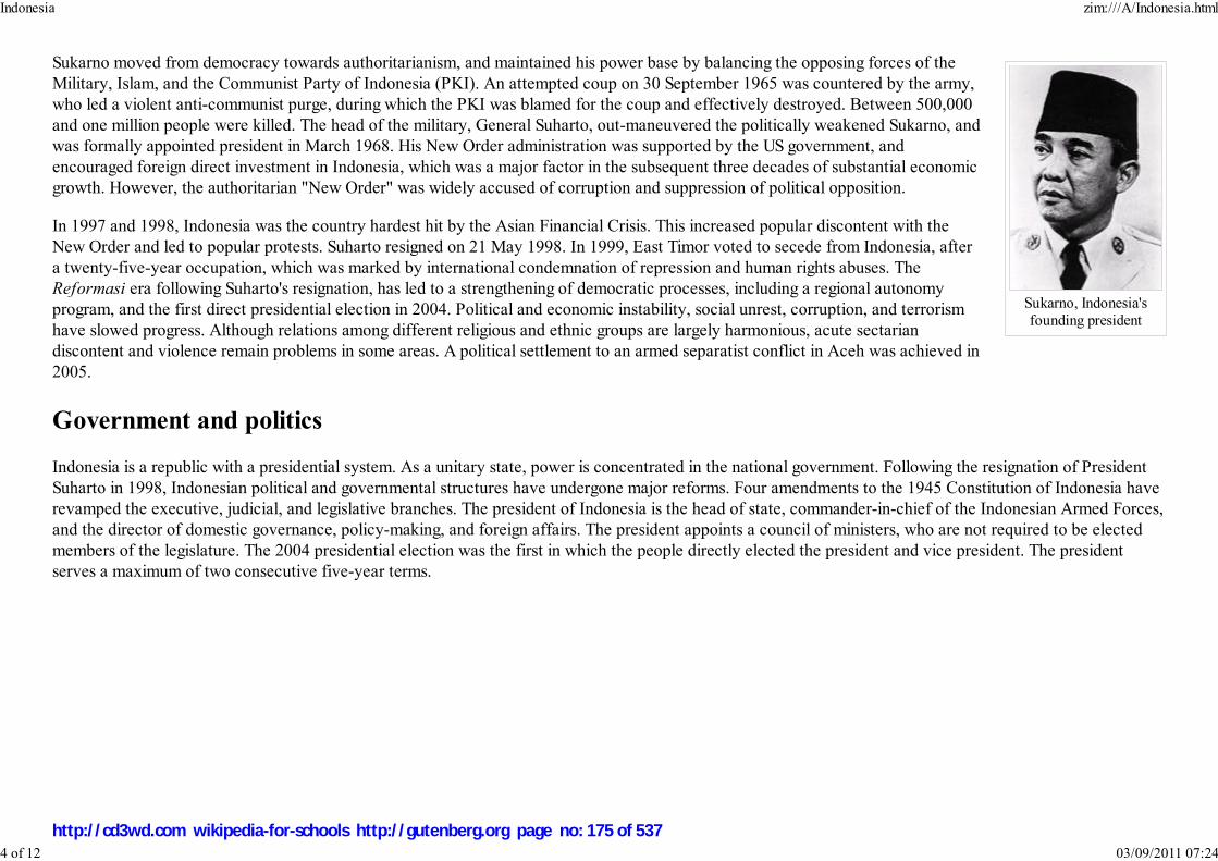
Sukarno, Indonesia'sfounding president
Sukarno moved from democracy towards authoritarianism, and maintained his power base by balancing the opposing forces of the
Military, Islam, and the Communist Party of Indonesia (PKI). An attempted coup on 30 September 1965 was countered by the army,
who led a violent anti-communist purge, during which the PKI was blamed for the coup and effectively destroyed. Between 500,000
and one million people were killed. The head of the military, General Suharto, out-maneuvered the politically weakened Sukarno, and
was formally appointed president in March 1968. His New Order administration was supported by the US government, and
encouraged foreign direct investment in Indonesia, which was a major factor in the subsequent three decades of substantial economic
growth. However, the authoritarian "New Order" was widely accused of corruption and suppression of political opposition.
In 1997 and 1998, Indonesia was the country hardest hit by the Asian Financial Crisis. This increased popular discontent with the
New Order and led to popular protests. Suharto resigned on 21 May 1998. In 1999, East Timor voted to secede from Indonesia, after
a twenty-five-year occupation, which was marked by international condemnation of repression and human rights abuses. The
Reformasi era following Suharto's resignation, has led to a strengthening of democratic processes, including a regional autonomy
program, and the first direct presidential election in 2004. Political and economic instability, social unrest, corruption, and terrorism
have slowed progress. Although relations among different religious and ethnic groups are largely harmonious, acute sectarian
discontent and violence remain problems in some areas. A political settlement to an armed separatist conflict in Aceh was achieved in
2005.
Government and politics
Indonesia is a republic with a presidential system. As a unitary state, power is concentrated in the national government. Following the resignation of President
Suharto in 1998, Indonesian political and governmental structures have undergone major reforms. Four amendments to the 1945 Constitution of Indonesia have
revamped the executive, judicial, and legislative branches. The president of Indonesia is the head of state, commander-in-chief of the Indonesian Armed Forces,
and the director of domestic governance, policy-making, and foreign affairs. The president appoints a council of ministers, who are not required to be elected
members of the legislature. The 2004 presidential election was the first in which the people directly elected the president and vice president. The president
serves a maximum of two consecutive five-year terms.
Indonesia zim:///A/Indonesia.html
4 of 12 03/09/2011 07:24
http://cd3wd.com wikipedia-for-schools http://gutenberg.org page no: 175 of 537

A session of the People'sRepresentative Council in
Jakarta
National flags at the site of the2002 terrorist bombing in
Kuta, Bali
The highest representative body at national level is the People's Consultative Assembly (MPR). Its main functions are
supporting and amending the constitution, inaugurating the president, and formalizing broad outlines of state policy. It has the
power to impeach the president. The MPR comprises two houses; the People's Representative Council (DPR), with 550
members, and the Regional Representatives Council (DPD), with 168 members. The DPR passes legislation and monitors the
executive branch; party-aligned members are elected for five-year terms by proportional representation. Reforms since 1998
have markedly increased the DPR's role in national governance. The DPD is a new chamber for matters of regional
management.
Most civil disputes appear before a State Court; appeals are heard before the High Court. The Supreme Court is the country's
highest court, and hears final cassation appeals and conducts case reviews. Other courts include the Commercial Court, which
handles bankruptcy and insolvency; a State Administrative Court to hear administrative law cases against the government; a
Constitutional Court to hear disputes concerning legality of law, general elections, dissolution of political parties, and the scope
of authority of state institutions; and a Religious Court to deal with specific religious cases.
Foreign relations and military
In contrast to Sukarno's anti-imperialistic antipathy to western powers and tensions with Malaysia, Indonesia's foreign relations approach since the Suharto
"New Order" has been one of economic and political cooperation with Western nations. Indonesia maintains close relationships with its neighbors in Asia, and is
a founding member of ASEAN and the East Asia Summit. The nation restored relations with the People's Republic of China in 1990 following a freeze in place
since anti-communist purges early in the Suharto era. Indonesia has been a member of the United Nations since 1950, and was a founder of the Non-Aligned
Movement (NAM) and the Organization of the Islamic Conference (OIC). Indonesia is signatory to the ASEAN Free Trade Area agreement, and a member of
OPEC, the Cairns Group and the WTO. Indonesia has received humanitarian and development aid since 1966, in particular from the United States, western
Europe, Australia, and Japan.
The Indonesian Government has worked with other countries to apprehend and prosecute perpetrators of major bombings
linked to militant Islamism and Al-Qaeda. The deadliest killed 202 people (including 164 international tourists) in the Bali
resort town of Kuta in 2002. The attacks, and subsequent travel warnings issued by other countries, have severely damaged
Indonesia's tourism industry and foreign investment prospects.
Indonesia's 300,000-member armed forces (TNI) include the Army (TNI-AD), Navy (TNI-AL, which includes marines), and
Air Force (TNI-AU). The army has about 233,000 active-duty personnel. Defense spending in the national budget was 4% of
GDP in 2006, and is controversially supplemented by revenue from military commercial interests and foundations. In the
post-Suharto period since 1998, formal TNI representation in parliament has been removed; though curtailed, its political
influence remains extensive. Separatist movements in the provinces of Aceh and Papua have led to armed conflict, and subsequent allegations of human rights
abuses and brutality from all sides. Following a sporadic thirty year guerrilla war between the Free Aceh Movement (GAM) and the Indonesian military, a
ceasefire agreement was reached in 2005. In Papua, there has been a significant, albeit imperfect, implementation of regional autonomy laws, and a reported
Indonesia zim:///A/Indonesia.html
5 of 12 03/09/2011 07:24
http://cd3wd.com wikipedia-for-schools http://gutenberg.org page no: 176 of 537

Provinces of Indonesia
decline in the levels of violence and human rights abuses, since the presidency of Susilo Bambang Yudhoyono.
Administrative divisions
Administratively, Indonesia consists of 33 provinces, five of which have special status. Each province has its own political
legislature and governor. The provinces are subdivided into regencies ( kabupaten) and ( kota), which are further subdivided
into subdistricts ( kecamatan), and again into village groupings (either desa or kelurahan). Following the implementation of
regional autonomy measures in 2001, the regencies and cities have become the key administrative units, responsible for
providing most government services. The village administration level is the most influential on a citizen's daily life, and handles
matters of a village or neighbourhood through an elected lurah or kepala desa (village chief).
Aceh, Jakarta, Yogyakarta, Papua, and West Papua provinces have greater legislative privileges and a higher degree of autonomy from the central government
than the other provinces. The Acehnese government, for example, has the right to create an independent legal system; in 2003, it instituted a form of Sharia
(Islamic law). Yogyakarta was granted the status of Special Region in recognition of its pivotal role in supporting Indonesian Republicans during the Indonesian
Revolution. Papua, formerly known as Irian Jaya, was granted special autonomy status in 2001. Jakarta is the country's special capital region.
Indonesian provinces and their capitals
(Indonesian name in brackets where different from English)
† indicates provinces with Special Status
Sumatra
Aceh† (Nanggroe Aceh Darussalam) - Banda Aceh
North Sumatra (Sumatera Utara) - Medan
West Sumatra (Sumatera Barat) - PadangRiau - Pekanbaru
Riau Islands (Kepulauan Riau) - Tanjung Pinang
Jambi - Jambi (city)South Sumatra (Sumatera Selatan) - Palembang
Bangka-Belitung (Kepulauan Bangka-Belitung) - Pangkal Pinang
Bengkulu - Bengkulu (city)Lampung - Bandar Lampung
Java
Kalimantan
West Kalimantan (Kalimantan Barat) - Pontianak
Central Kalimantan (Kalimantan Tengah) - Palangkaraya
South Kalimantan (Kalimantan Selatan) - BanjarmasinEast Kalimantan (Kalimantan Timur) - Samarinda
Sulawesi
North Sulawesi (Sulawesi Utara) - Manado
Gorontalo - Gorontalo (city)Central Sulawesi (Sulawesi Tengah) - Palu
West Sulawesi (Sulawesi Barat) - Mamuju
South Sulawesi (Sulawesi Selatan) - MakassarSouth East Sulawesi (Sulawesi Tenggara) - Kendari
Indonesia zim:///A/Indonesia.html
6 of 12 03/09/2011 07:24
http://cd3wd.com wikipedia-for-schools http://gutenberg.org page no: 177 of 537

Map of Indonesia
Jakarta† - Jakarta
Banten - Serang
West Java (Jawa Barat) - BandungCentral Java (Jawa Tengah) - Semarang
Yogyakarta Special Region† - Yogyakarta (city)
East Java (Jawa Timur) - Surabaya
Lesser Sunda Islands
Bali - Denpasar
West Nusa Tenggara (Nusa Tenggara Barat) - Mataram
East Nusa Tenggara (Nusa Tenggara Timur) - Kupang
Maluku islands
Maluku - AmbonNorth Maluku (Maluku Utara) - Ternate
Papua
West Papua† (Papua Barat) - Manokwari
Papua† - Jayapura
Geography
Indonesia consists of 17,508 islands, about 6,000 of which are inhabited. These are scattered over both sides of the equator.
The five largest islands are Java, Sumatra, Kalimantan (the Indonesian part of Borneo), New Guinea (shared with Papua New
Guinea), and Sulawesi. Indonesia shares land borders with Malaysia on the island of Borneo, Sebatik, Papua New Guinea on
the island of New Guinea, and East Timor on the island of Timor. Indonesia also shares borders with Singapore, Malaysia, and
the Philippines to the north and Australia to the south across narrow straits of water. The capital, Jakarta, is on Java and is the
nation's largest city, followed by Surabaya, Bandung, Medan, and Semarang.
At 1,919,440 square kilometers (741,050 sq mi), Indonesia is the world's 16th-largest country in terms of land area. Its average
population density is 134 people per square kilometer (347 per sq mi), 79th in the world, although Java, the world's most
populous island, has a population density of 940 people per square kilometer (2,435 per sq mi). At 4,884 meters (16,024 ft),
Puncak Jaya in Papua is Indonesia's highest peak, and Lake Toba in Sumatra its largest lake, with an area of 1,145 square kilometers (442 sq mi). The country's
largest rivers are in Kalimantan, and include the Mahakam and Barito; such rivers are communication and transport links between the island's river settlements.
Indonesia zim:///A/Indonesia.html
7 of 12 03/09/2011 07:24
http://cd3wd.com wikipedia-for-schools http://gutenberg.org page no: 178 of 537
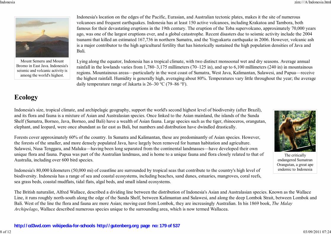
Mount Semeru and MountBromo in East Java. Indonesia'sseismic and volcanic activity is
among the world's highest.
The criticallyendangered SumatranOrangutan, a great apeendemic to Indonesia
Indonesia's location on the edges of the Pacific, Eurasian, and Australian tectonic plates, makes it the site of numerous
volcanoes and frequent earthquakes. Indonesia has at least 150 active volcanoes, including Krakatoa and Tambora, both
famous for their devastating eruptions in the 19th century. The eruption of the Toba supervolcano, approximately 70,000 years
ago, was one of the largest eruptions ever, and a global catastrophe. Recent disasters due to seismic activity include the 2004
tsunami that killed an estimated 167,736 in northern Sumatra, and the Yogyakarta earthquake in 2006. However, volcanic ash
is a major contributor to the high agricultural fertility that has historically sustained the high population densities of Java and
Bali.
Lying along the equator, Indonesia has a tropical climate, with two distinct monsoonal wet and dry seasons. Average annual
rainfall in the lowlands varies from 1,780–3,175 millimeters (70–125 in), and up to 6,100 millimeters (240 in) in mountainous
regions. Mountainous areas—particularly in the west coast of Sumatra, West Java, Kalimantan, Sulawesi, and Papua—receive
the highest rainfall. Humidity is generally high, averaging about 80%. Temperatures vary little throughout the year; the average
daily temperature range of Jakarta is 26–30 °C (79–86 °F).
Ecology
Indonesia's size, tropical climate, and archipelagic geography, support the world's second highest level of biodiversity (after Brazil),
and its flora and fauna is a mixture of Asian and Australasian species. Once linked to the Asian mainland, the islands of the Sunda
Shelf (Sumatra, Borneo, Java, Borneo, and Bali) have a wealth of Asian fauna. Large species such as the tiger, rhinoceros, orangutan,
elephant, and leopard, were once abundant as far east as Bali, but numbers and distribution have dwindled drastically.
Forests cover approximately 60% of the country. In Sumatra and Kalimantan, these are predominantly of Asian species. However,
the forests of the smaller, and more densely populated Java, have largely been removed for human habitation and agriculture.
Sulawesi, Nusa Tenggara, and Maluku—having been long separated from the continental landmasses—have developed their own
unique flora and fauna. Papua was part of the Australian landmass, and is home to a unique fauna and flora closely related to that of
Australia, including over 600 bird species.
Indonesia's 80,000 kilometers (50,000 mi) of coastline are surrounded by tropical seas that contribute to the country's high level of
biodiversity. Indonesia has a range of sea and coastal ecosystems, including beaches, sand dunes, estuaries, mangroves, coral reefs,
sea grass beds, coastal mudflats, tidal flats, algal beds, and small island ecosystems.
The British naturalist, Alfred Wallace, described a dividing line between the distribution of Indonesia's Asian and Australasian species. Known as the Wallace
Line, it runs roughly north-south along the edge of the Sunda Shelf, between Kalimantan and Sulawesi, and along the deep Lombok Strait, between Lombok and
Bali. West of the line the flora and fauna are more Asian; moving east from Lombok, they are increasingly Australian. In his 1869 book, The Malay
Archipelago, Wallace described numerous species unique to the surrounding area, which is now termed Wallacea.
Indonesia zim:///A/Indonesia.html
8 of 12 03/09/2011 07:24
http://cd3wd.com wikipedia-for-schools http://gutenberg.org page no: 179 of 537

Using water buffalo to ploughrice fields in Java. Agriculturehas been the country's largest
employer for centuries.
Jakarta, the capital of Indonesiaand its largest commercial
centre
Indonesia's high population and rapid industrialization present serious environmental issues, which are often given a lower priority due to high poverty levels
and weak, under-resourced governance. Issues include large-scale deforestation (much of it illegal) and related wildfires causing heavy smog over parts of
western Indonesia, Malaysia and Singapore; over-exploitation of marine resources; and environmental problems associated with rapid urbanization and
economic development, including air pollution, traffic congestion, garbage management, and reliable water and waste water services. Habitat destruction
threatens the survival of indigenous and endemic species, including 140 species of mammals identified by the World Conservation Union (IUCN) as threatened,
and 15 identified as critically endangered, including the Sumatran Orangutan.
Economy
Indonesia's estimated Gross Domestic Product (GDP) for 2007 is US$408 billion (US$1,038 bn PPP). In 2007, estimated
nominal per capita GDP is US$1,812, and per capita GDP PPP was US$4,616 ( International Dollars). The services sector is the
economy's largest and accounts for 45.3% of GDP (2005). This is followed by industry (40.7%) and agriculture (14.0%).
However, agriculture employs more people than other sectors, accounting for 44.3% of the 95 million-strong workforce. This is
followed by the services sector (36.9%) and industry (18.8%). Major industries include petroleum and natural gas, textiles,
apparel, and mining. Major agricultural products include palm oil, rice, tea, coffee, spices, and rubber.
Indonesia's main export markets (2005) are Japan (22.3%), the United States (13.9%), China (9.1%), and Singapore (8.9%).
The major suppliers of imports to Indonesia are Japan (18.0%), China (16.1%), and Singapore (12.8%). In 2005, Indonesia ran
a trade surplus with export revenues of US$83.64 billion and import expenditure of US$62.02 billion. The country has
extensive natural resources, including crude oil, natural gas, tin, copper, and gold. Indonesia's major imports include machinery
and equipment, chemicals, fuels, and foodstuffs.
In the 1960s, the economy deteriorated drastically as a result of political instability, a young and inexperienced government,
and ill-disciplined economic nationalism, which resulted in severe poverty and hunger. Following President Sukarno's downfall
in the mid-1960s, the New Order administration brought a degree of discipline to economic policy that quickly brought
inflation down, stabilized the currency, rescheduled foreign debt, and attracted foreign aid and investment. Indonesia is
Southeast Asia's only member of OPEC, and the 1970s oil price raises provided an export revenue windfall that contributed to
sustained high economic growth rates. Following further reforms in the late 1980s, foreign investment flowed into Indonesia,
particularly into the rapidly developing export-orientated manufacturing sector, and from 1989 to 1997, the Indonesian
economy grew by an average of over 7%.
Indonesia was the country hardest hit by the East Asian financial crisis of 1997–98. Against the US dollar, the currency
dropped from about Rp. 2,000 to Rp. 18,000, and the economy shrunk by 13.7%. The rupiah has since stabilized at around Rp.
10,000, and there has been a slow but significant economic recovery. Political instability since 1998, slow economic reform,
and corruption at all levels of government and business, have contributed to the patchy nature of the recovery. ( Transparency International, for example,
ranked Indonesia 143rd out of 180 countries in its 2007 Corruption Perceptions Index). GDP growth, however, exceeded 5% in both 2004 and 2005, and is
Indonesia zim:///A/Indonesia.html
9 of 12 03/09/2011 07:24
http://cd3wd.com wikipedia-for-schools http://gutenberg.org page no: 180 of 537

A Minangkabau womanin traditional dress
forecast to increase further. This growth rate, however, is not enough to make a significant impact on unemployment, and stagnant wages growth, and increases
in fuel and rice prices have worsened poverty levels. As of 2006, an estimated 17.8% of the population live below the poverty line, and 49.0% of the population
live on less than US$2 per day.
Demographics
The national population from the 2000 national census is 206 million, and the Indonesian Central Statistics Bureau and Statistics Indonesia estimate a
population of 222 million for 2006. 130 million people live on the island of Java, the world's most populous island. Despite a fairly effective family planning
program, which has been in place since the 1960s, the population is expected to grow to around 315 million in 2035, based on the current estimated annual
growth rate of 1.25%.
Most Indonesians are descendant from Austronesian-speaking peoples, who originated from Taiwan. The other major grouping are
Melanesians, who inhabit eastern Indonesia. There are around 300 distinct native ethnicities in Indonesia, and 742 different
languages and dialects. The largest is the Javanese, who comprise 42% of the population, and are politically and culturally dominant.
The Sundanese, ethnic Malays, and Madurese are the largest non-Javanese groups. A sense of Indonesian nationhood exists alongside
strongly maintained regional identities. Society is largely harmonious, although social, religious and ethnic tensions have triggered
horrendous violence. Chinese Indonesians are an influential ethnic minority comprising less than 2% of the population. Much of the
country's privately-owned commerce and wealth is Chinese-controlled, which has contributed to considerable resentment, and even
anti-Chinese violence.
The official national language, Indonesian, is universally taught in schools, and is spoken by nearly every Indonesian. It is the
language of business, politics, national media, education, and academia. It was originally a lingua franca for most of the region,
including present-day Malaysia, and is thus closely related to Malay. Indonesian was first promoted by nationalists in the 1920s, and declared the official
language on independence in 1945. Most Indonesians speak at least one of the several hundred local languages (bahasa daerah), often as their first language. Of
these, Javanese is the most widely-spoken, the language of the largest ethnic group. On the other hand, Papua has 500 or more indigenous Papuan and
Austronesian languages, in a region of just 2.7 million people.
Indonesia zim:///A/Indonesia.html
10 of 12 03/09/2011 07:24
http://cd3wd.com wikipedia-for-schools http://gutenberg.org page no: 181 of 537

Medan's Masjid Raya ('GreatMosque'). Indonesia has the
world's largest Muslimpopulation.
A Wayang kulit shadowpuppet performance asseen by the audience
Although religious freedom is stipulated in the Indonesian constitution, the government officially recognizes only six religions:
Islam; Protestantism; Roman Catholicism; Hinduism; Buddhism; and Confucianism. Although it is not an Islamic state,
Indonesia is the world's most populous Muslim-majority nation, with almost 86% of Indonesians declared Muslim according to
the 2000 census. 11% of the population is Christian, 2% are Hindu, and 1% Buddhist. Most Indonesian Hindus are Balinese,
and most Buddhists in modern-day Indonesia are ethnic Chinese. Though now minority religions, Hinduism and Buddhism
remain defining influences in Indonesian culture. Islam was first adopted by Indonesians in northern Sumatra in the 13th
century, through the influence of traders, and became the country's dominant religion by the 16th century. Roman Catholicism
was brought to Indonesia by early Portuguese colonialists and missionaries, and the Protestant denominations are largely a
result of Dutch Calvinist and Lutheran missionary efforts during the country's colonial period. A large proportion of
Indonesians—such as the Javanese abangan, Balinese Hindus, and Dayak Christians—practice a less orthodox, syncretic form
of their religion, which draws on local customs and beliefs.
Culture
Indonesia has around 300 ethnic groups, each with cultural differences developed over centuries, and influenced by Arabic, Chinese,
Malay, and European sources. Traditional Javanese and Balinese dances, for example, contain aspects of Hindu culture and
mythology, as do wayang kulit (shadow puppet) performances. Textiles such as batik, ikat and songket are created across Indonesia
in styles that vary by region. The most dominant influences on Indonesian architecture have traditionally been Indian; however,
Chinese, Arab, and European architectural influences have been significant. The most popular sports in Indonesia are badminton and
football; Liga Indonesia is the country's premier football club league. Traditional sports include sepak takraw, and bull racing in
Madura. In areas with a history of tribal warfare, mock fighting contests are held, such as, caci in Flores, and pasola in Sumba.
Pencak Silat is an Indonesian martial art. Sports in Indonesia are generally male-orientated and spectator sports are often associated
with illegal gambling.
Indonesia zim:///A/Indonesia.html
11 of 12 03/09/2011 07:24
http://cd3wd.com wikipedia-for-schools http://gutenberg.org page no: 182 of 537

A selection of Indonesian food,including Soto Ayam (chickennoodle soup), sate kerang (
shellfish kebabs), telorpindang (preserved eggs),perkedel (fritter), and es teh
manis (sweet iced tea)
Indonesian cuisine varies by region and is based on Chinese, European, Middle Eastern, and Indian precedents. Rice is the
main staple food and is served with side dishes of meat and vegetables. Spices (notably chili), coconut milk, fish and chicken
are fundamental ingredients. Indonesian traditional music includes gamelan and keroncong. Dangdut is a popular
contemporary genre of pop music that draws influence from Arabic, Indian, and Malay folk music. The Indonesian film
industry's popularity peaked in the 1980s and dominated cinemas in Indonesia, although it declined significantly in the early
1990s. Between 2000 and 2005, the number of Indonesian films released each year has steadily increased.
The oldest evidence of writing in Indonesia is a series of Sanskrit inscriptions dated to the 5th century CE. Important figures in
modern Indonesian literature include: Dutch author Multatuli, who criticized treatment of the Indonesians under Dutch colonial
rule; Sumatrans Muhammad Yamin and Hamka, who were influential pre-independence nationalist writers and politicians; and
proletarian writer Pramoedya Ananta Toer, Indonesia's most famous novelist. Many of Indonesia's peoples have strongly-
rooted oral traditions, which help to define and preserve their cultural identities. Media freedom in Indonesia increased
considerably after the end of President Suharto's rule, during which the now-defunct Ministry of Information monitored and
controlled domestic media, and restricted foreign media. The TV market includes ten national commercial networks, and
provincial networks that compete with public TVRI. Private radio stations carry their own news bulletins and foreign
broadcasters supply programs. At a reported 18 million users in 2005, Internet usage is limited to a minority of the population.
Retrieved from " http://en.wikipedia.org/wiki/Indonesia"
The Schools Wikipedia was sponsored by a UK Children's Charity, SOS Children UK , and consists of a hand selection from the English Wikipedia articles with
only minor deletions (see www.wikipedia.org for details of authors and sources). The articles are available under the GNU Free Documentation License. See
also our <
Indonesia zim:///A/Indonesia.html
12 of 12 03/09/2011 07:24
http://cd3wd.com wikipedia-for-schools http://gutenberg.org page no: 183 of 537

日本国日本国日本国日本国Nihon-koku
Japan
Flag Imperial Seal
Anthem: Kimi ga Yo (君が代 ?)
Capital
(and largest city)Tokyo (de facto) 1
Official languages Japanese (de facto)
Demonym Japanese
Government Parliamentary democracyand Constitutionalmonarchy
- Emperor Akihito
Japan
2008/9 Schools Wikipedia Selection. Related subjects: Asia; Asian Countries
Japan (日本 Nihon or Nippon ?, officially 日本国 Nippon-koku or Nihon-koku) is an island country in EastAsia. Located in the Pacific Ocean, it lies to the east of China, Korea and Russia, stretching from the Sea ofOkhotsk in the north to the East China Sea in the south. The characters that make up Japan's name mean"sun-origin", which is why Japan is sometimes identified as the "Land of the Rising Sun".
Japan comprises over 3,000 islands making it an archipelago. The largest islands are Honshū, Hokkaidō,Kyūshū and Shikoku, together accounting for 97% of Japan's land area. Most of the islands are mountainous,many volcanic; for example, Japan’s highest peak, Mount Fuji, is a volcano. Japan has the world's tenthlargest population, with about 128 million people. The Greater Tokyo Area, which includes the de factocapital city of Tokyo and several surrounding prefectures, is the largest metropolitan area in the world, withover 30 million residents.
Archaeological research indicates that people were living on the islands of Japan as early as the UpperPaleolithic period. The first written mention of Japan begins with brief appearances in Chinese history textsfrom the first century AD.
Influence from the outside world followed by long periods of isolation has characterized Japan's history.Since adopting its constitution in 1947, Japan has maintained a unitary constitutional monarchy with anemperor and an elected parliament, the Diet.
A major economic power, Japan has the world's second largest economy by nominal GDP. It is a member ofthe United Nations, G8, G4, OECD and APEC, with the world's fifth largest defense budget. It is also theworld's fourth largest exporter and sixth largest importer and a world leader in technology and machinery.
Etymology
The English word Japan is an exonym not used in the Japanese language. The Japanese names for Japan
are Nippon (にっぽん) and Nihon (にほん). They are both written in Japanese using the kanji 日本日本日本日本. TheJapanese name Nippon is used for most official purposes, including on Japanese money, postage stamps, andfor many international sporting events. Nihon is a more casual term and the most frequently used in
Japan zim:///A/Japan.html
1 of 16 03/09/2011 07:24
http://cd3wd.com wikipedia-for-schools http://gutenberg.org page no: 184 of 537

- Prime Minister Yasuo Fukuda
Formation
- National FoundationDay
February 11, 660 BC3
- Meiji Constitution November 29, 1890
- Current constitution May 3, 1947
- Treaty ofSan Francisco April 28, 1952
Area
- Total 377,873 km² ( 62nd)145,883 sq mi
- Water (%) 0.8
Population
- 2007 estimate 127,433,494 ( 10th)
- 2004 census 127,333,002
- Density 337/km² ( 30th)872.8/sq mi
GDP ( PPP) 2007 estimate
- Total $4.346 trillion ( 3rd)
- Per capita $33,800 ( 24th)
GDP (nominal) 2007 estimate
- Total $4.886 trillion ( 2nd)
- Per capita $38,341 ( 14th)
Gini 38.1 (2002)
HDI (2007) ▲ 0.953 (high) ( 8th)
Currency
International Symbol ¥Pronounced (Yen)Japanese Symbol 円円円円Pronounced (EnEnEnEn)( JPY)
contemporary speech.
Both Nippon and Nihon literally mean "the sun's origin" and are often translated as the Land of the Rising
Sun. This nomenclature comes from Imperial correspondence with Chinese Sui Dynasty and refers to Japan'seastward position relative to China. Before Japan had relations with China, it was known as Yamato and Hi
no moto, which means "source of the sun".
The English word for Japan came to the West from early trade routes. The early Mandarin Chinese orpossibly Wu Chinese word for Japan was recorded by Marco Polo as Cipangu. The modern Shanghainese (aWu Chinese dialect 呉語) pronunciation of characters 日本 (Japan) is still Zeppen [zəʔpən] (in Wulanguage, 日 has two pronounciations 白读:niʔ or 文读:zəʔ, in some regions in South Wu, it is pronouncedas niʔpən, similar to that of Japanese). The old Malay word for Japan, Jepang (modern spelling Jepun,although Indonesian has retained the older spelling), was borrowed from a Chinese language, and this Malayword was encountered by Portuguese traders in Malacca in the 16th century. It is thought the Portuguesetraders were the first to bring the word to Europe. It was first recorded in English in 1577 spelled Giapan.
History
The first signs of occupation on the Japanese Archipelago appeared with a Paleolithic culture around30,000 BC, followed from around 14,000 BC by the Jōmon period, a Mesolithic to Neolithic semi-sedentaryhunter-gatherer culture of pit dwelling and a rudimentary form of agriculture. Decorated clay vessels fromthis period, often with plaited patterns, are some of the oldest surviving examples of pottery in the world.
The Yayoi period, starting around the third century BC, introduced new practices, such as wet-rice farming,iron and bronze-making and a new style of pottery, brought by migrants from China or Korea. With thedevelopment of Yayoi culture, a predominantly agricultural society emerged in Japan.
The Japanese first appear in written history in China’s Book of Han. According to the Chinese Records of
Three Kingdoms, the most powerful kingdom on the archipelago during the third century was calledYamataikoku.
Japan zim:///A/Japan.html
2 of 16 03/09/2011 07:24
http://cd3wd.com wikipedia-for-schools http://gutenberg.org page no: 185 of 537

Time zone JST ( UTC+9)
Internet TLD .jp
Calling code +81
Yokohama is the largest incorporated city.
" World Factbook; Japan—Economy". CIA ( 2006- 12-19).
Retrieved on 2006- 12-28.
According to legend, Japan was founded on this date by the
Emperor Jimmu, first emperor of Japan; it is seen as largely
symbolic.A middle Jōmon periodvessel (3000 to
2000 BC).The Great Buddha inKamakura (1252).
Buddhism was first introduced to Japan fromBaekje of the Korean Peninsula, but thesubsequent development of Japanese Buddhismand Buddhist sculptures were primarilyinfluenced by China. Despite early resistance,Buddhism was promoted by the ruling class andeventually gained growing acceptance since theAsuka period.
The Nara period of the eighth century markedthe first emergence of a strong central Japanesestate, centered around an imperial court in thecity of Heijō-kyō, or modern day Nara. Inaddition to the continuing adoption of Chinese administrative practices, the Nara period is characterizedby the appearance of a nascent written literature with the completion of the massive chronicles Kojiki
(712) and Nihon Shoki (720). (Nara was not the first capital city in Japan, though. Before Nara, Fujiwara-kyō and Asuka served as capitals of the Yamato state.)
In 784, Emperor Kammu moved the capital from Nara to Nagaoka-kyō for a brief ten-year period, before relocating it to Heian-kyō (modern day Kyoto) in 794,where it remained for more than a millennium. This marked the beginning of the Heian period, during which time a distinctly indigenous Japanese culture emerged,noted for its art, poetry and literature. Lady Murasaki's The Tale of Genji and the lyrics of modern Japan's national anthem, Kimi ga Yo were written during thistime.
Japan's feudal era was characterized by the emergence of a ruling class of warriors, the samurai. In 1185, following the defeat of the rival Taira clan, Minamoto noYoritomo was appointed Shogun and established a base of power in Kamakura. After Yoritomo's death, the Hōjō clan came to rule as regents for the shoguns. ZenBuddhism was introduced from China in the Kamakura period (1185–1333) and became popular among the samurai class. The Kamakura shogunate managed torepel Mongol invasions in 1274 and 1281, aided by a storm that the Japanese interpreted as a kamikaze, or Divine Wind. The Kamakura shogunate was eventuallyoverthrown by Emperor Go-Daigo, who was soon himself defeated by Ashikaga Takauji in 1336. The succeeding Ashikaga shogunate failed to control the feudalwarlords ( daimyo), and a civil war erupted (the Ōnin War) in 1467 which opened a century-long Sengoku period.
During the sixteenth century, traders and Jesuit missionaries from Portugal reached Japan for the first time, initiating active commercial and cultural exchangebetween Japan and the West ( Nanban trade).
1
2
3
Japan zim:///A/Japan.html
3 of 16 03/09/2011 07:24
http://cd3wd.com wikipedia-for-schools http://gutenberg.org page no: 186 of 537

One of Japan's Red seal ships(1634), which were used for trade
throughout Asia.
Samurai of the Satsuma clanduring the Boshin War, circa 1867.
Japan zim:///A/Japan.html
4 of 16 03/09/2011 07:24
http://cd3wd.com wikipedia-for-schools http://gutenberg.org page no: 187 of 537

The 1945 atomicbombing of Nagasaki.
Oda Nobunaga conquered numerous other daimyo by using European technology and firearms and had almost unified the nation whenhe was assassinated in 1582. Toyotomi Hideyoshi succeeded Nobunaga and united the nation in 1590. Hideyoshi invaded Korea twice,but following several defeats by Korean and Ming China forces and Hideyoshi's death, Japanese troops were withdrawn in 1598.
After Hideyoshi's death, Tokugawa Ieyasu utilized his position as regent for Hideyoshi's son Toyotomi Hideyori to gain political andmilitary support. When open war broke out, he defeated rival clans in the Battle of Sekigahara in 1600. Ieyasu was appointed shōgun in1603 and established the Tokugawa shogunate at Edo (modern Tokyo). The Tokugawa shogunate enacted a variety of measures such asBuke shohatto to control the autonomous daimyo. In 1639, the shogunate began the isolationist sakoku ("closed country") policy thatspanned the two and a half centuries of tenuous political unity known as the Edo period. The study of Western sciences, known asrangaku, continued during this period through contacts with the Dutch enclave at Dejima in Nagasaki. The Edo period also gave rise tokokugaku, or literally "national studies", the study of Japan by the Japanese themselves.
On March 31, 1854, Commodore Matthew Perry and the " Black Ships" of the United States Navy forced the opening of Japan to theoutside world with the Convention of Kanagawa. Subsequent similar treaties with the Western countries in the Bakumatsu periodbrought Japan into economic and political crises. The abundance of the prerogative and the resignation of the shogunate led to the Boshin War and theestablishment of a centralized state unified under the name of the Emperor ( Meiji Restoration). Adopting Western political, judicial and military institutions, theCabinet organized the Privy Council, introduced the Meiji Constitution, and assembled the Imperial Diet. The Meiji Restoration transformed the Empire of Japaninto an industrialized world power that embarked on a number of military conflicts to expand the nation's sphere of influence. After victories in the FirstSino-Japanese War (1894–1895) and the Russo-Japanese War (1904–1905), Japan gained control of Taiwan, Korea, and the southern half of Sakhalin.
The early twentieth century saw a brief period of " Taisho democracy" overshadowed by the rise of expansionism and militarization. World War I enabled Japan,which joined the side of the victorious Allies, to expand its influence and territorial holdings. Japan continued its expansionist policy by occupying Manchuria in1931. As a result of international condemnation for this occupation, Japan resigned from the League of Nations two years later. In 1936, Japan signed theAnti-Comintern Pact with Nazi Germany, joining the Axis powers in 1941.
In 1937, Japan invaded other parts of China, precipitating the Second Sino-Japanese War (1937–1945), after which the United States placed an oil embargo onJapan. On December 7, 1941, Japan attacked the United States naval base in Pearl Harbour and declared war on the United States, the United Kingdom and theNetherlands. This act brought the United States into World War II. After the atomic bombings of Hiroshima and Nagasaki in 1945, along with the Soviet Unionjoining the war against it, Japan agreed to an unconditional surrender on August 15 ( Victory over Japan Day). The war cost Japan millions of lives and left much ofthe country's industry and infrastructure destroyed. The International Military Tribunal for the Far East, was convened by the Allies (on May 3, 1946) to prosecuteJapanese leaders for war crimes such as the Nanking Massacre.
In 1947, Japan adopted a new pacifist constitution emphasizing liberal democratic practices. The Allied occupation ended by the Treaty of San Francisco in 1952and Japan was granted membership in the United Nations in 1956. Japan later achieved spectacular growth to become the second largest economy in the world,with an annual growth rate averaging 10% for four decades. This ended in the mid-1990s when Japan suffered a major recession. Positive growth in the earlytwenty-first century has signaled a gradual recovery.
Japan zim:///A/Japan.html
5 of 16 03/09/2011 07:24
http://cd3wd.com wikipedia-for-schools http://gutenberg.org page no: 188 of 537
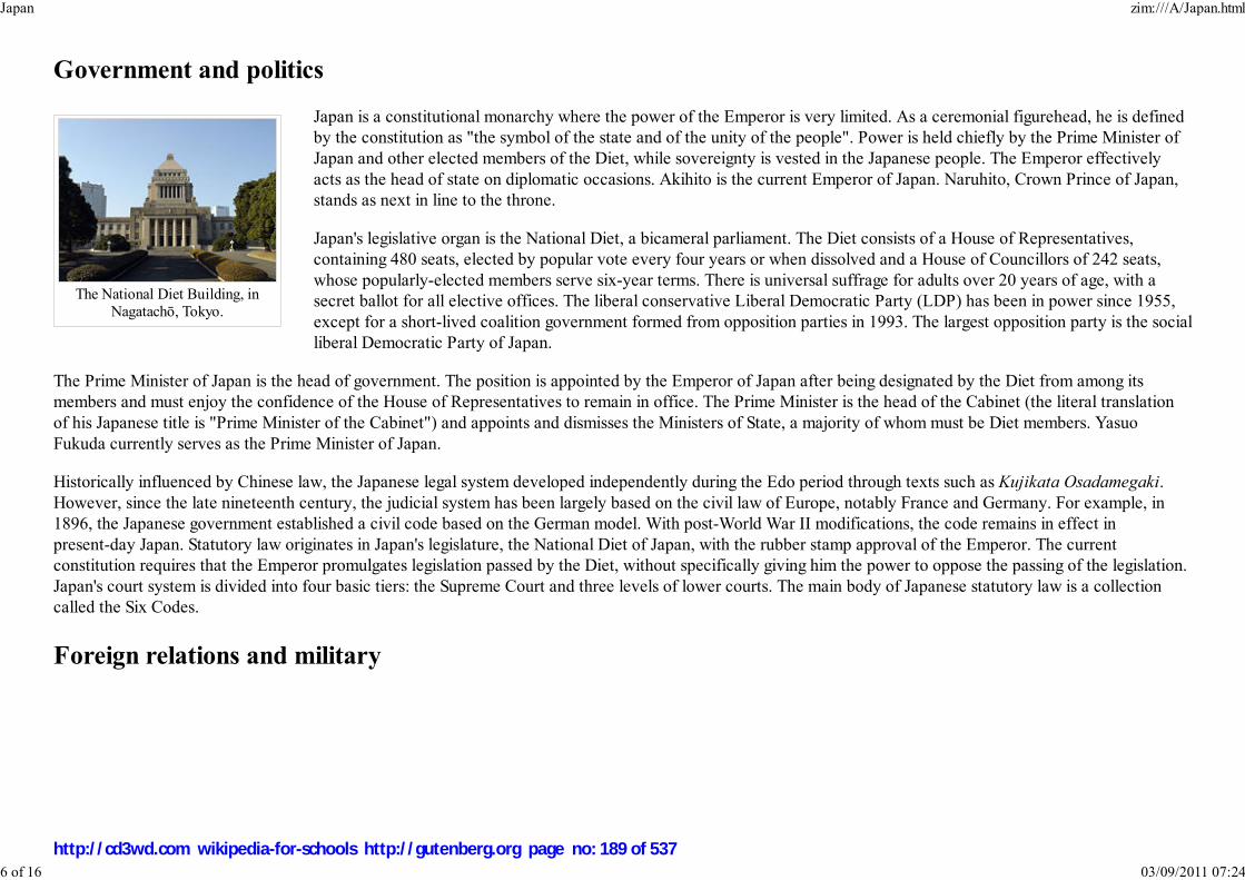
The National Diet Building, inNagatachō, Tokyo.
Government and politics
Japan is a constitutional monarchy where the power of the Emperor is very limited. As a ceremonial figurehead, he is definedby the constitution as "the symbol of the state and of the unity of the people". Power is held chiefly by the Prime Minister ofJapan and other elected members of the Diet, while sovereignty is vested in the Japanese people. The Emperor effectivelyacts as the head of state on diplomatic occasions. Akihito is the current Emperor of Japan. Naruhito, Crown Prince of Japan,stands as next in line to the throne.
Japan's legislative organ is the National Diet, a bicameral parliament. The Diet consists of a House of Representatives,containing 480 seats, elected by popular vote every four years or when dissolved and a House of Councillors of 242 seats,whose popularly-elected members serve six-year terms. There is universal suffrage for adults over 20 years of age, with asecret ballot for all elective offices. The liberal conservative Liberal Democratic Party (LDP) has been in power since 1955,except for a short-lived coalition government formed from opposition parties in 1993. The largest opposition party is the socialliberal Democratic Party of Japan.
The Prime Minister of Japan is the head of government. The position is appointed by the Emperor of Japan after being designated by the Diet from among itsmembers and must enjoy the confidence of the House of Representatives to remain in office. The Prime Minister is the head of the Cabinet (the literal translationof his Japanese title is "Prime Minister of the Cabinet") and appoints and dismisses the Ministers of State, a majority of whom must be Diet members. YasuoFukuda currently serves as the Prime Minister of Japan.
Historically influenced by Chinese law, the Japanese legal system developed independently during the Edo period through texts such as Kujikata Osadamegaki.However, since the late nineteenth century, the judicial system has been largely based on the civil law of Europe, notably France and Germany. For example, in1896, the Japanese government established a civil code based on the German model. With post-World War II modifications, the code remains in effect inpresent-day Japan. Statutory law originates in Japan's legislature, the National Diet of Japan, with the rubber stamp approval of the Emperor. The currentconstitution requires that the Emperor promulgates legislation passed by the Diet, without specifically giving him the power to oppose the passing of the legislation.Japan's court system is divided into four basic tiers: the Supreme Court and three levels of lower courts. The main body of Japanese statutory law is a collectioncalled the Six Codes.
Foreign relations and military
Japan zim:///A/Japan.html
6 of 16 03/09/2011 07:24
http://cd3wd.com wikipedia-for-schools http://gutenberg.org page no: 189 of 537

Yasuo Fukuda with USPresident George W. Bush
The JMSDF Hyūga classhelicopter carrier. The JapaneseNavy maintains a large fleet of
destroyers.
Japanese Air Force F-15s.
Japan maintains close economic and military relations with its key ally the United States, withthe U.S.-Japan security alliance serving as the cornerstone of its foreign policy. A member stateof the United Nations since 1956, Japan has served as a non-permanent Security Councilmember for a total of 18 years, most recently in 2005–2006. It is also one of the G4 nationsseeking permanent membership in the Security Council. As a member of the G8, the APEC, the" ASEAN Plus Three" and a participant in the East Asia Summit, Japan actively participates ininternational affairs. It is also the world's second-largest donor of official developmentassistance, donating US$8.86 bn in 2004. Japan contributed non-combatant troops to the IraqWar but subsequently withdrew its forces from Iraq.
Japan is engaged in several territorial disputes with its neighbors: with Russia over the SouthKuril Islands, with South Korea over the Liancourt Rocks, with the People's Republic of Chinaand Taiwan over the Senkaku Islands, and with the PRC over the EEZ around Okinotorishima.
Japan also faces an ongoing dispute with North Korea over its abduction of Japanese citizens and its nuclear weapons and missileprogram (see also Six-party talks). As a result of the Kuril Islands dispute, Japan is technically still at war with Russia since notreaty resolving the issue was ever signed.
Japan's military is restricted by the Article 9 of the Japanese Constitution, which renounces Japan's right to declare war or usemilitary force as a means of settling international disputes. Japan's military is governed by the Ministry of Defense, and primarilyconsists of the Japan Ground Self-Defense Force (JGSDF), the Japan Maritime Self-Defense Force (JMSDF) and the Japan Air Self-Defense Force (JASDF). Theforces have been recently used in peacekeeping operations and the deployment of Japanese troops to Iraq marked the first overseas use of its military since WorldWar II.
Administrative divisions
Japan zim:///A/Japan.html
7 of 16 03/09/2011 07:24
http://cd3wd.com wikipedia-for-schools http://gutenberg.org page no: 190 of 537

Map of the prefectures ofJapan in ISO 3166-2:JP order
and the regions of Japan.
While there exist eight commonly defined regions of Japan, administratively Japan consists of forty-seven prefectures, eachoverseen by an elected governor, legislature and administrative bureaucracy. The former city of Tokyo is further divided intotwenty-three special wards, each with the same powers as cities.
The nation is currently undergoing administrative reorganization by merging many of the cities, towns and villages with eachother. This process will reduce the number of sub-prefecture administrative regions and is expected to cut administrative costs.
Japan has dozens of major cities, which play an important role in Japan's culture, heritage and economy. Those in the list belowof the ten most populous are all prefectural capitals and government ordinance cities, except where indicated:
Geography
Japan zim:///A/Japan.html
8 of 16 03/09/2011 07:24
http://cd3wd.com wikipedia-for-schools http://gutenberg.org page no: 191 of 537
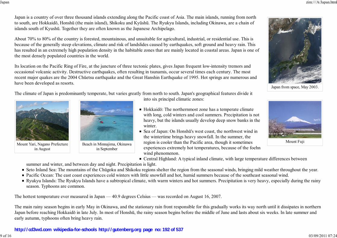
Japan from space, May 2003.
Mount FujiMount Yari, Nagano Prefecture
in AugustBeach in Minnajima, Okinawa
in September
Japan is a country of over three thousand islands extending along the Pacific coast of Asia. The main islands, running from northto south, are Hokkaidō, Honshū (the main island), Shikoku and Kyūshū. The Ryukyu Islands, including Okinawa, are a chain ofislands south of Kyushū. Together they are often known as the Japanese Archipelago.
About 70% to 80% of the country is forested, mountainous, and unsuitable for agricultural, industrial, or residential use. This isbecause of the generally steep elevations, climate and risk of landslides caused by earthquakes, soft ground and heavy rain. Thishas resulted in an extremely high population density in the habitable zones that are mainly located in coastal areas. Japan is one ofthe most densely populated countries in the world.
Its location on the Pacific Ring of Fire, at the juncture of three tectonic plates, gives Japan frequent low-intensity tremors andoccasional volcanic activity. Destructive earthquakes, often resulting in tsunamis, occur several times each century. The mostrecent major quakes are the 2004 Chūetsu earthquake and the Great Hanshin Earthquake of 1995. Hot springs are numerous andhave been developed as resorts.
The climate of Japan is predominantly temperate, but varies greatly from north to south. Japan's geographical features divide itinto six principal climatic zones:
Hokkaidō: The northernmost zone has a temperate climatewith long, cold winters and cool summers. Precipitation is notheavy, but the islands usually develop deep snow banks in thewinter.Sea of Japan: On Honshū's west coast, the northwest wind inthe wintertime brings heavy snowfall. In the summer, theregion is cooler than the Pacific area, though it sometimesexperiences extremely hot temperatures, because of the foehnwind phenomenon.Central Highland: A typical inland climate, with large temperature differences between
summer and winter, and between day and night. Precipitation is light.Seto Inland Sea: The mountains of the Chūgoku and Shikoku regions shelter the region from the seasonal winds, bringing mild weather throughout the year.Pacific Ocean: The east coast experiences cold winters with little snowfall and hot, humid summers because of the southeast seasonal wind.Ryukyu Islands: The Ryukyu Islands have a subtropical climate, with warm winters and hot summers. Precipitation is very heavy, especially during the rainyseason. Typhoons are common.
The hottest temperature ever measured in Japan — 40.9 degrees Celsius — was recorded on August 16, 2007.
The main rainy season begins in early May in Okinawa, and the stationary rain front responsible for this gradually works its way north until it dissipates in northernJapan before reaching Hokkaidō in late July. In most of Honshū, the rainy season begins before the middle of June and lasts about six weeks. In late summer andearly autumn, typhoons often bring heavy rain.
Japan zim:///A/Japan.html
9 of 16 03/09/2011 07:24
http://cd3wd.com wikipedia-for-schools http://gutenberg.org page no: 192 of 537

Japan is home to nine forest ecoregions which reflect the climate and geography of the islands. They range from subtropical moist broadleaf forests in the Ryūkyūand Bonin islands, to temperate broadleaf and mixed forests in the mild climate regions of the main islands, to temperate coniferous forests in the cold, winterportions of the northern islands.
Environment
Japan's environmental history and current policies reflect a tenuous balance between economic development and environmental protection. In the rapid economicgrowth after the World War II, environmental policies were downplayed by the government and industrial corporations. As an inevitable consequence, some crucialenvironmental pollution (see Pollution in Japan) occurred in 1950s and 1960s. In the rising concern over the problem, the government introduced manyenvironmental protection laws in 1970 and established the Ministry of the Environment in 1971. The Oil crisis in 1973 also encouraged the efficient use of energydue to Japan's lack of natural resources. Current priority environmental issues include urban air pollution ( NOx, suspended particulate matter, toxics), wastemanagement, water eutrophication, nature conservation, climate change, chemical management and international co-operation for environmental conservation.
Today Japan is one of the world's leaders in the development of new environment-friendly technologies. Honda and Toyota hybrid electric vehicles were named tohave the highest fuel economy and lowest emissions. This is due to the advanced technology in hybrid systems, biofuels, use of lighter weight material and betterengineering.
Japan also takes issues surrounding climate change and global warming seriously. As a signatory of the Kyoto Protocol, and host of the 1997 conference whichcreated it, Japan is under treaty obligations to reduce its carbon dioxide emissions and to take other steps related to curbing climate change. The Cool Biz campaignintroduced under former Prime Minister Junichiro Koizumi was targeted at reducing energy use through the reduction of air conditioning use in government offices.Japan is preparing to force industry to make big cuts in greenhouse gases, taking the lead in a country struggling to meet its Kyoto Protocol obligations.
Japan is ranked 30th best in the world in the Environmental Sustainability Index.
Economy
Japan zim:///A/Japan.html
10 of 16 03/09/2011 07:24
http://cd3wd.com wikipedia-for-schools http://gutenberg.org page no: 193 of 537

Hi-tech industry such as theautomobile and electronics
industries are among the chiefelements of the country's economy
and exports.
The Tokyo StockExchange is the second
largest in the world.
Japan is the second largest economy in the world, after the United States, at around US$4.5 trillion in terms of nominal GDPand third after the United States and China in terms of purchasing power parity. GDP per hour worked is the world's 18thhighest as of 2006.
Banking, insurance, real estate, retailing, transportation and telecommunications are all major industries. Japan has a largeindustrial capacity and is home to some of the largest, leading and most technologically advanced producers of motorvehicles, electronic equipment, machine tools, steel and nonferrous metals, ships, chemicals, textiles and processed foods.Construction has long been one of Japan's largest industries, with the help of multi-billion dollar government contracts in thecivil sector. Japan has high economic freedom, close government-industry cooperation for economic growth, emphasis onscience and technology, and strong work ethic. Distinguishing characteristics of the Japanese economy have included thecooperation of manufacturers, suppliers, distributors and banks in closely-knit groups called keiretsu and relatively shallowinternational competition in domestic markets. There are many relationship-based - rather than productive - arrangementssuch as the guarantee of lifetime employment in big corporations. Recently, Japanese policy makers have encouraged reformand Japanese companies have begun to abandon some of these norms in an attempt to increase profitability. Japan is a low-taxoverwhelmingly private enterprise economy. Overall tax burden is smaller than in any major Western country; it was 26.4% of
GDP as of 2007. Only a minority of Japanese employees pay any income tax, value-added tax is very low at 5%, while corporate tax rates are high.
Some of the largest companies in Japan include Toyota Motor, NTT DoCoMo, Canon, Honda, Takeda Pharmaceutical, Sony, NipponSteel, Tepco, Mitsubishi Estate, and Seven & I Holding. It is home to the world's largest bank by assets, Japan Post Bank (US$3.2trillion) and others such as Mitsubishi UFJ Financial Group (US$1.2 trillion), Mizuho Financial Group (US$1.4 trillion) and SumitomoMitsui Financial Group (US$1.3 trillion). The Tokyo Stock Exchange with a market capitalization of over 549.7 trillion Yen as ofDecember 2006 stands as the second largest in the world.
From the 1960s to the 1980s, overall real economic growth has been called a "Japanese miracle": a 10% average in the 1960s, a 5%average in the 1970s and a 4% average in the 1980s. Growth slowed markedly in the 1990s, largely because of the after-effects ofover-investment during the late 1980s and domestic policies intended to wring speculative excesses from the stock and real estatemarkets. Government efforts to revive economic growth met with little success and were further hampered in 2000 to 2001 by thedeceleration of the global economy. However, the economy showed strong signs of recovery after 2005. GDP growth for that year was2.8%, with an annualized fourth quarter expansion of 5.5%, surpassing the growth rates of the US and European Union during the sameperiod.
Because only about 15% of Japan's land is suitable for cultivation, a system of terrace farming is used to build in small areas. This resultsin one of the world's highest levels of crop yields per unit area, while the agricultural subsidies and protection are expensive. Japan imports about 50% of itsrequirements of grain and fodder crops other than rice, and it relies on imports for most of its supply of meat. In fishing, Japan is ranked second in the world behindChina in tonnage of fish caught. Japan maintains one of the world's largest fishing fleets and accounts for nearly 15% of the global catch. Japan relies on foreigncountries for almost all oil and food.
Japan zim:///A/Japan.html
11 of 16 03/09/2011 07:24
http://cd3wd.com wikipedia-for-schools http://gutenberg.org page no: 194 of 537

Sony Playstation 3.
Press release photo of the mostrecent ASIMO model.
Transportation in Japan is highly developed. As of 2004, there are 1,177,278 km of paved roadways, 173 airports, and 23,577 kmof railways. Private toll-collecting companies compete in highway market. Dozens of railway companies are competing in regionaland local transport markets; some of the largest include the 7 companies under JR, Kintetsu Corporation, Seibu Railway, and KeioCorporation. The largest aviation companies are All Nippon Airways (ANA) and Japan Airlines (JAL). The largest ports includePort of Yokohama and Nagoya Port. Most energy in Japan is produced from oil, natural gas and coal. Nuclear power in Japanmakes a third of electricity production and Japan would like to double it in coming decades.
Japan's main export partners are the United States 22.8%, the European Union 14.5%, China 14.3%, South Korea 7.8%, Taiwan6.8% and Hong Kong 5.6% (for 2006). Japan's main exports are transport equipment, motor vehicles, electronics, electricalmachinery and chemicals. With very limited natural resources to sustain economic development, Japan depends on other nationsfor most of its raw materials; thus it imports a wide variety of goods. Its main import partners are China 20.5%, U.S. 12.0%, theEuropean Union 10.3%, Saudi Arabia 6.4%, UAE 5.5%, Australia 4.8%, South Korea 4.7% and Indonesia 4.2% (for 2006). Japan's main imports are machinery andequipment, fossil fuels, foodstuffs (in particular beef), chemicals, textiles and raw materials for its industries. Overall, Japan's largest trading partners are China andthe United States.
Science and technology
Japan is one of the leading nations in the fields of scientific research, particularly technology, machinery and biomedical research.Nearly 700,000 researchers share a US$130 billion research and development budget, the third largest in the world. For instancesome of Japan's more prominent technological contributions are found in the fields of electronics, automobiles, machinery,industrial robotics, optics, chemicals, semiconductors and metals. Japan leads the world in robotics production and use, possessingmore than half (402,200 of 742,500) of the world's industrial robots used for manufacturing. It also produced QRIO, ASIMO andAIBO. Japan is the world's largest producer of automobiles and home to six of the world's fifteen largest automobile manufacturersand seven of the world's twenty largest semiconductor sales leaders as of today.
Japan has plans in space exploration, including building a moonbase by 2030. The Japan Aerospace Exploration Agency (JAXA)conducts space and planetary research, aviation research, and development of rockets and satellites. It is a participant in theInternational Space Station and the Japanese Experiment Module (Kibo) is slated to be added to the International Space Stationduring Space Shuttle assembly flights in 2008.
Demographics
Japan zim:///A/Japan.html
12 of 16 03/09/2011 07:24
http://cd3wd.com wikipedia-for-schools http://gutenberg.org page no: 195 of 537
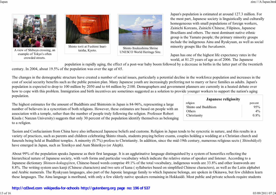
A view of Shibuya crossing, anexample of Tokyo's often
crowded streets.
Shinto torii at Fushimi Inari-taisha, Kyoto.
Shinto Itsukushima ShrineUNESCO World Heritage Site.
Japanese religiosityreligion percent
Shinto and Buddhism 95%Others 4%Christianity 0.8%
Japan's population is estimated at around 127.3 million. Forthe most part, Japanese society is linguistically and culturallyhomogeneous with small populations of foreign workers,Zainichi Koreans, Zainichi Chinese, Filipinos, JapaneseBrazilians and others. The most dominant native ethnicgroup is the Yamato people; the primary minority groupsinclude the indigenous Ainu and Ryukyuan, as well as socialminority groups like the burakumin.
Japan has one of the highest life expectancy rates in theworld, at 81.25 years of age as of 2006. The Japanese
population is rapidly aging, the effect of a post-war baby boom followed by a decrease in births in the latter part of the twentiethcentury. In 2004, about 19.5% of the population was over the age of 65.
The changes in the demographic structure have created a number of social issues, particularly a potential decline in the workforce population and increases in thecost of social security benefits such as the public pension plan. Many Japanese youth are increasingly preferring not to marry or have families as adults. Japan'spopulation is expected to drop to 100 million by 2050 and to 64 million by 2100. Demographers and government planners are currently in a heated debate overhow to cope with this problem. Immigration and birth incentives are sometimes suggested as a solution to provide younger workers to support the nation's agingpopulation.
The highest estimates for the amount of Buddhists and Shintoists in Japan is 84-96%, representing a largenumber of believers in a syncretism of both religions. However, these estimates are based on people with anassociation with a temple, rather than the number of people truly following the religion. Professor RobertKisala ( Nanzan University) suggests that only 30 percent of the population identify themselves as belongingto a religion.
Taoism and Confucianism from China have also influenced Japanese beliefs and customs. Religion in Japan tends to be syncretic in nature, and this results in avariety of practices, such as parents and children celebrating Shinto rituals, students praying before exams, couples holding a wedding at a Christian church andfunerals being held at Buddhist temples. A minority (0.7%) profess to Christianity. In addition, since the mid-19th century, numerous religious sects ( Shinshūkyō)have emerged in Japan, such as Tenrikyo and Aum Shinrikyo (or Aleph).
About 99% of the population speaks Japanese as their first language. It is an agglutinative language distinguished by a system of honorifics reflecting thehierarchical nature of Japanese society, with verb forms and particular vocabulary which indicate the relative status of speaker and listener. According to aJapanese dictionary Shinsen-kokugojiten, Chinese-based words comprise 49.1% of the total vocabulary, indigenous words are 33.8% and other loanwords are8.8%. The writing system uses kanji (Chinese characters) and two sets of kana ( syllabaries based on simplified Chinese characters), as well as the Latin alphabetand Arabic numerals. The Ryukyuan languages, also part of the Japonic language family to which Japanese belongs, are spoken in Okinawa, but few children learnthese languages. The Ainu language is moribund, with only a few elderly native speakers remaining in Hokkaidō. Most public and private schools require students
Japan zim:///A/Japan.html
13 of 16 03/09/2011 07:24
http://cd3wd.com wikipedia-for-schools http://gutenberg.org page no: 196 of 537

Yasuda Auditorium, Universityof Tokyo.
to take courses in both Japanese and English.
Largest cities of Japan Core City Prefecture Population Core City Prefecture Population
1 Tokyo Tokyo 8,483,050
Tokyo
Yokohama
7 Kyoto Kyoto 1,474,764
2 Yokohama Kanagawa 3,579,133 8 Fukuoka Fukuoka 1,400,621
3 Osaka Osaka 2,628,776 9 Kawasaki Kanagawa 1,327,009
4 Nagoya Aichi 2,215,031 10 Saitama Saitama 1,176,269
5 Sapporo Hokkaidō 1,880,875 11 Hiroshima Hiroshima 1,159,391
6 Kobe Hyōgo 1,525,389 12 Sendai Miyagi 1,028,214
Source: 2005 Census
Education and health
Primary, secondary schools and universities were introduced into Japan in 1872 as a result of the Meiji Restoration. Since 1947,compulsory education in Japan consists of elementary school and middle school, which lasts for nine years (from age 6 to age 15).Almost all children continue their education at a three-year senior high school, and, according to the MEXT, about 75.9% of highschool graduates attend a university, junior college, trade school, or other post-secondary institution in 2005. Japan's education isvery competitive, especially for entrance to institutions of higher education. The two top-ranking universities in Japan are theUniversity of Tokyo and Kyoto University. The Programme for International Student Assessment coordinated by the OECD,currently ranks Japanese knowledge and skills of 15-year-olds as the 6th best in the world.
In Japan, healthcare services are provided by national and local governments. Payment for personal medical services is offeredthrough a universal health care insurance system that provides relative equality of access, with fees set by a governmentcommittee. People without insurance through employers can participate in a national health insurance program administered bylocal governments. Since 1973, all elderly persons have been covered by government-sponsored insurance. Patients are free toselect physicians or facilities of their choice.
Culture and recreation
Japan zim:///A/Japan.html
14 of 16 03/09/2011 07:24
http://cd3wd.com wikipedia-for-schools http://gutenberg.org page no: 197 of 537

The Great Wave off Kanagawa
(1832), an ukiyo-e fromThirty-Six Views of Mount Fuji
by Hokusai.
A Japanese garden
Image:JapanSumoMatch.jpg
Sumo, a traditional Japanesesport.
Japanese culture has evolved greatly over the years, from the country's original Jōmon culture to its contemporary culture, whichcombines influences from Asia, Europe and North America. Traditional Japanese arts include crafts ( ikebana, origami, ukiyo-e,dolls, lacquerware, pottery), performances ( bunraku, dance, kabuki, noh, rakugo), traditions ( games, tea ceremony, Budō,architecture, gardens, swords) and cuisine. The fusion of traditional woodblock printing and Western art led to the creation ofmanga, a typically Japanese comic book format that is now popular within and outside Japan. Manga-influenced animation fortelevision and film is called anime. Japanese-made video game consoles have prospered since the 1980s.
Japanese music is eclectic, having borrowed instruments, scales and styles from neighboring cultures. Many instruments, such asthe koto, were introduced in the ninth and tenth centuries. The accompanied recitative of the Noh drama dates from thefourteenth century and the popular folk music, with the guitar-like shamisen, from the sixteenth. Western music, introduced inthe late nineteenth century, now forms an integral part of the culture. Post-war Japan has been heavily influenced by Americanand European modern music, which has led to the evolution of popular band music called J-pop.
Karaoke is the most widely practiced cultural activity. A November 1993 survey by the Cultural Affairs Agency found that more Japanese had sung karaoke thatyear than had participated in traditional cultural pursuits such as flower arranging or tea ceremony.
The earliest works of Japanese literature include two history books the Kojiki and the Nihon Shoki and the eighthcentury poetry book Man'yōshū, all written in Chinese characters. In the early days of the Heian period, the system oftranscription known as kana ( Hiragana and Katakana) was created as phonograms. The Tale of the Bamboo Cutter isconsidered the oldest Japanese narrative. An account of Heian court life is given by The Pillow Book written by SeiShōnagon, while The Tale of Genji by Lady Murasaki is often described as the world's first novel. During the Edoperiod, literature became not so much the field of the samurai aristocracy as that of the chōnin, the ordinary people.Yomihon, for example, became popular and reveals this profound change in the readership and authorship. The Meijiera saw the decline of traditional literary forms, during which Japanese literature integrated Western influences.Natsume Sōseki and Mori Ōgai were the first "modern" novelists of Japan, followed by Akutagawa Ryūnosuke,Tanizaki Jun'ichirō, Yasunari Kawabata, Yukio Mishima and, more recently, Haruki Murakami. Japan has two NobelPrize-winning authors — Yasunari Kawabata (1968) and Kenzaburo Oe (1994).
Sports
Traditionally, sumo is considered Japan's national sport and it is one of the most popular spectator sports in Japan. Martial artssuch as judo, karate and kendō are also widely practiced and enjoyed by spectators in the country. After the Meiji Restoration,many Western sports were introduced in Japan and began to spread through the education system.
The professional baseball league in Japan was established in 1936. Today baseball is the most popular spectator sport in thecountry. One of the most famous Japanese baseball players is Ichiro Suzuki, who, having won Japan's Most Valuable Player award in 1994, 1995 and 1996, nowplays in North American Major League Baseball. Prior to that, Sadaharu Oh was well-known outside Japan, having hit more home runs during his career in Japan
Japan zim:///A/Japan.html
15 of 16 03/09/2011 07:24
http://cd3wd.com wikipedia-for-schools http://gutenberg.org page no: 198 of 537

than his contemporary, Hank Aaron, did in America.
Since the establishment of the Japan Professional Football League in 1992, association football (soccer) has also gained a wide following. Japan was a venue of theIntercontinental Cup from 1981 to 2004 and co-hosted the 2002 FIFA World Cup with South Korea. Japan is one of the most successful soccer teams in Asia,winning the Asian Cup three times.
Golf is also popular in Japan, as is auto racing, the Super GT sports car series and Formula Nippon formula racing. Twin Ring Motegi was completed in 1997 byHonda in order to bring IndyCar racing to Japan.
Retrieved from " http://en.wikipedia.org/wiki/Japan"This Wikipedia DVD Selection has a sponsor: SOS Children , and is mainly selected from the English Wikipedia with only minor checks and changes (seewww.wikipedia.org for details of authors and sources). The articles are available under the GNU Free Documentation License. See also our
Japan zim:///A/Japan.html
16 of 16 03/09/2011 07:24
http://cd3wd.com wikipedia-for-schools http://gutenberg.org page no: 199 of 537

Қазақстан Республикасы
Qazaqstan Respublïkası
Republic of Kazakhstan
Flag Coat of arms
Anthem: Менің Қазақстаным ( Kazakh)
Meniñ Qazaqstanım ( transcription)
"My Kazakhstan"
Capital Astana
Largest city Almaty
Official languagesKazakh 1
Russian 2
Demonym Kazakhstani
Kazakhstan
2008/9 Schools Wikipedia Selection. Related subjects: Asia; Asian Countries
SOS Children works in Kazakhstan. For more information see SOS Children in Kazakhstan
Kazakhstan, also spelled Kazakstan ( Kazakh: Қазақстан, Qazaqstan, IPA: [qɑzɑqˈstɑn]; Russian:
Казахстан, Kazakhstán, Russian pronunciation: [kazəxˈstan]), officially the Republic of Kazakhstan, is a
country in Central Asia and Europe. Ranked as the ninth largest country in the world as well as the
world's largest landlocked country, it has a territory of 2,727,300 km² (greater than Western Europe). It is
bordered by Russia, Kyrgyzstan, Turkmenistan, Uzbekistan and China. The country also borders on a
significant part of the Caspian Sea.
Vast in size, the land in Kazakhstan is very diverse in types of terrain: flatlands, steppes, taigas,
rock-canyons, hills, deltas, mountains, snow-capped mountains, and deserts. Kazakhstan has the 62nd
largest population in the world, with a population density of less than 6 people per square kilometre
(15 per sq. mi.).
For most of its history the territory of modern-day Kazakhstan has been inhabited by nomadic tribes. By
the 16th century the Kazakhs emerged as a distinct group, divided into three hordes. The Russians began
advancing into the Kazakh steppe in the 18th century, and by the mid-19th century all of Kazakhstan
was part of the Russian Empire. Following the 1917 Russian Revolution, and subsequent civil war, the
territory of Kazakhstan was reorganized several times before becoming the Kazakh Soviet Socialist
Republic in 1936, a part of the USSR. During the 20th century, Kazakhstan was the site of major Soviet
projects, including Khrushchev's Virgin Lands campaign, the Baikonur Cosmodrome, and the
Semipalatinsk "Polygon", the USSR's primary nuclear weapon testing site.
Kazakhstan declared itself an independent country on December 16, 1991, the last Soviet republic to do
so. Its communist-era leader, Nursultan Nazarbayev, became the country's new president. Since
independence, Kazakhstan has pursued a balanced foreign policy and worked to develop its economy,
especially its hydrocarbon industry. While the country's economic outlook is improving, President
Nazarbayev maintains strict control over the country's politics. Several opposition leaders and journalists
have been killed in recent years, and Western observers generally do not consider Kazakhstan's elections
to be free and fair. Nevertheless, Kazakhstan's international prestige is building. It is now considered to
Kazakhstan zim:///A/Kazakhstan.html
1 of 14 03/09/2011 07:25
http://cd3wd.com wikipedia-for-schools http://gutenberg.org page no: 200 of 537

Government Presidential republic
- President Nursultan Nazarbayev
- Prime Minister Karim Masimov
Independence from the Soviet Union
- 1st Khanate 1361 as White Horde
- 2nd Khanate 1428 as Uzbek Horde
- 3rd Khanate 1465 as Kazakh Khanate
- Declared December 16, 1991
- Finalized December 25, 1991
Area
- Total 2,724,900 km² ( 9th)
1,052,085 sq mi
- Water (%) 1.7
Population
- January
2006 estimate
15,217,711 ( 62nd)
- 1999 census 14,953,100
- Density 5.4/km² ( 215th)
14.0/sq mi
GDP ( PPP) 2007 estimate
- Total 161,155$ billion ( 56th)
- Per capita $10,658 ( 66th)
Gini (2003) 33.9 (medium)
HDI (2007) ▲ 0.794 (medium) (
73rd)
Currency Tenge ( ) ( KZT)
Time zone West/East ( UTC+5/+6)
- Summer ( DST) not observed (
UTC+5/+6)
Ancient Taraz
be the dominant state in Central Asia. The country belongs to many international organizations, including
the United Nations, NATO's Partnership for Peace, the Commonwealth of Independent States, and the
Shanghai Cooperation Organization. In 2010, Kazakhstan will chair the Organization for Security and
Cooperation in Europe. In 2011, it will form a customs union with Russia and Belarus.
Kazakhstan is ethnically and culturally diverse, in part due to mass deportations of many ethnic groups to
the country during Stalin's rule. Kazakhs are the largest group, followed by Russians. Kazakhstan allows
freedom of religion, and many different beliefs are represented in the country. Islam is the primary
religion, followed by Orthodox Christianity. The official language is Kazakh, though Russian is still
commonly used for everyday communication.
History
Kazakh Khanate
Kazakhstan has been inhabited since the Stone Age: the region's
climate and terrain are best suited for nomads practising
pastoralism. Historians believe that humans first domesticated the
horse in the region's vast steppes. While ancient cities Taraz
(Aulie-Ata) and Hazrat-e Turkestan had long served as important
way-stations along the Silk Road connecting East and West, real
political consolidation only began with the Mongol invasion of the
early thirteenth century AD. Under the Mongol Empire,
administrative districts were established, and these eventually came
under the emergent Kazakh Khanate.
Throughout this period traditional nomadic life and a livestock-based economy continued to dominate the
steppe. In the 15th century, a distinct Kazakh identity began to emerge among the Turkic tribes, a
process which was consolidated by the mid-16th century with the appearance of a distinctive Kazakh
language, culture, and economy. Nevertheless, the region was the focus of ever-increasing disputes
between the native Kazakh emirs and the neighboring Persian-speaking peoples to the south. By the early
17th century, the Kazakh Khanate was struggling with the impact of tribal rivalries, which has effectively
divided the population into the Great, Middle and Little (or Small) Hordes (jüz). Political disunion, tribal
rivalries, and the diminishing importance of overland trade routes between East and West weakened the
Kazakh Khanate.
Kazakhstan zim:///A/Kazakhstan.html
2 of 14 03/09/2011 07:25
http://cd3wd.com wikipedia-for-schools http://gutenberg.org page no: 201 of 537
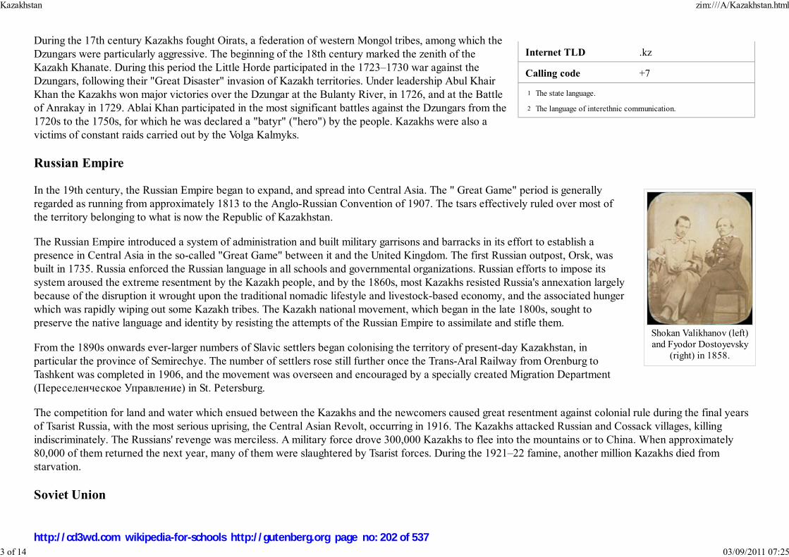
Internet TLD .kz
Calling code +7
The state language.
The language of interethnic communication.
Shokan Valikhanov (left)and Fyodor Dostoyevsky
(right) in 1858.
During the 17th century Kazakhs fought Oirats, a federation of western Mongol tribes, among which the
Dzungars were particularly aggressive. The beginning of the 18th century marked the zenith of the
Kazakh Khanate. During this period the Little Horde participated in the 1723–1730 war against the
Dzungars, following their "Great Disaster" invasion of Kazakh territories. Under leadership Abul Khair
Khan the Kazakhs won major victories over the Dzungar at the Bulanty River, in 1726, and at the Battle
of Anrakay in 1729. Ablai Khan participated in the most significant battles against the Dzungars from the
1720s to the 1750s, for which he was declared a "batyr" ("hero") by the people. Kazakhs were also a
victims of constant raids carried out by the Volga Kalmyks.
Russian Empire
In the 19th century, the Russian Empire began to expand, and spread into Central Asia. The " Great Game" period is generally
regarded as running from approximately 1813 to the Anglo-Russian Convention of 1907. The tsars effectively ruled over most of
the territory belonging to what is now the Republic of Kazakhstan.
The Russian Empire introduced a system of administration and built military garrisons and barracks in its effort to establish a
presence in Central Asia in the so-called "Great Game" between it and the United Kingdom. The first Russian outpost, Orsk, was
built in 1735. Russia enforced the Russian language in all schools and governmental organizations. Russian efforts to impose its
system aroused the extreme resentment by the Kazakh people, and by the 1860s, most Kazakhs resisted Russia's annexation largely
because of the disruption it wrought upon the traditional nomadic lifestyle and livestock-based economy, and the associated hunger
which was rapidly wiping out some Kazakh tribes. The Kazakh national movement, which began in the late 1800s, sought to
preserve the native language and identity by resisting the attempts of the Russian Empire to assimilate and stifle them.
From the 1890s onwards ever-larger numbers of Slavic settlers began colonising the territory of present-day Kazakhstan, in
particular the province of Semirechye. The number of settlers rose still further once the Trans-Aral Railway from Orenburg to
Tashkent was completed in 1906, and the movement was overseen and encouraged by a specially created Migration Department
(Переселенческое Управление) in St. Petersburg.
The competition for land and water which ensued between the Kazakhs and the newcomers caused great resentment against colonial rule during the final years
of Tsarist Russia, with the most serious uprising, the Central Asian Revolt, occurring in 1916. The Kazakhs attacked Russian and Cossack villages, killing
indiscriminately. The Russians' revenge was merciless. A military force drove 300,000 Kazakhs to flee into the mountains or to China. When approximately
80,000 of them returned the next year, many of them were slaughtered by Tsarist forces. During the 1921–22 famine, another million Kazakhs died from
starvation.
Soviet Union
1
2
Kazakhstan zim:///A/Kazakhstan.html
3 of 14 03/09/2011 07:25
http://cd3wd.com wikipedia-for-schools http://gutenberg.org page no: 202 of 537

Almaty, the Soviet-era capital of Kazakhstan.
Although there was a brief period of autonomy ( Alash Autonomy) during the tumultuous period following
the collapse of the Russian Empire, many uprisings were brutally suppressed, and the Kazakhs eventually
succumbed to Soviet rule. In 1920, the area of present-day Kazakhstan became an autonomous republic
within R.S.F.S.R..
Soviet repression of the traditional elite, along with forced collectivization in late 1920s–1930s, brought
mass hunger and led to unrest. Between 1926 and 1939, the Kazakh population declined by 22%, due to
starvation, violence and mass emigration. Today, the estimates suggest that the population of Kazakhstan
would be closer to 20 million if there was no starvation or massacre of Kazakhs. During the 1930s, many
renowned Kazakh writers, thinkers, poets, politicians and historians were slaughtered on Stalin's orders, both
as part of the repression and as a methodical pattern of suppressing Kazakh identity and culture. Soviet rule
took hold, and a communist apparatus steadily worked to fully integrate Kazakhstan into the Soviet system. In 1936 Kazakhstan became a Soviet republic.
Kazakhstan experienced population inflows of millions exiled from other parts of the Soviet Union during the 1930s and 1940s; many of the deportation victims
were deported to Siberia or Kazakhstan merely due to their ethnic heritage or beliefs, and were in many cases interned in some of the biggest Soviet labor
camps. (See also: Population transfer in the Soviet Union, Involuntary settlements in the Soviet Union.) The Kazakh Soviet Socialist Republic (SSR) contributed
five national divisions to the Soviet Union's World War II effort. In 1947, two years after the end of the war, the Semipalatinsk Test Site, the USSR's main
nuclear weapon test site was founded near the city of Semey.
The period of World War II marked an increase in industrialization and increased mineral extraction in support of the war effort. At the time of Soviet leader
Joseph Stalin's death, however, Kazakhstan still had an overwhelmingly agricultural-based economy. In 1953, Soviet leader Nikita Khrushchev initiated the
ambitious " Virgin Lands" program to turn the traditional pasture lands of Kazakhstan into a major grain-producing region for the Soviet Union. The Virgin
Lands policy brought mixed results. However, along with later modernizations under Soviet leader Leonid Brezhnev, it accelerated the development of the
agricultural sector which remains the source of livelihood for a large percentage of Kazakhstan's population. By 1959, Kazakhs made up 30% of the population.
Ethnic Russians accounted for 43%.
Growing tensions within Soviet society led to a demand for political and economic reforms, which came to a head in the 1980s. A factor that has contributed to
this immensely was Lavrentii Beria's decision to test a nuclear bomb on the territory of Kazakh SSR in Semipalatinsk (also known as Semey) in 1949. This had a
catastrophic ecological and biological effect which was felt generations later, and Kazakh anger toward the Soviet system has escalated. In December 1986,
mass demonstrations by young ethnic Kazakhs, later called Jeltoksan riot, took place in Almaty to protest the replacement of the First Secretary of the
Communist Party of the Kazakh SSR Dinmukhamed Konayev with Gennady Kolbin from the Russian SFSR. Governmental troops suppressed the unrest,
several people were killed and many demonstrators were jailed. In the waning days of Soviet rule, discontent continued to grow and find expression under
Soviet leader Mikhail Gorbachev's policy of glasnost.
Kazakhstan zim:///A/Kazakhstan.html
4 of 14 03/09/2011 07:25
http://cd3wd.com wikipedia-for-schools http://gutenberg.org page no: 203 of 537

Astana, the capital of Kazakhstan
Independence
Caught up in the groundswell of Soviet republics seeking greater autonomy, Kazakhstan declared its sovereignty as a
republic within the Union of Soviet Socialist Republics in October 1990. Following the August 1991 aborted coup attempt in
Moscow and the subsequent dissolution of the Soviet Union, Kazakhstan declared independence on December 16, 1991. It
was the last of the Soviet republics to declare independence.
The years following independence have been marked by significant reforms to the Soviet-style economy and political
monopoly on power. Under Nursultan Nazarbayev, who initially came to power in 1989 as the head of the Communist Party
of Kazakhstan and was eventually elected President in 1991, Kazakhstan has made significant progress toward developing a
market economy. The country has enjoyed significant economic growth since 2000, partly due to its large oil, gas, and
mineral reserves.
Democracy, however, has not gained much ground since 1991. "In June 2007, Kazakhstan's parliament passed a law
granting President Nursultan Nazarbayev lifetime powers and privileges, including access to future presidents, immunity
from criminal prosecution, and influence over domestic and foreign policy. Critics say he has become a de facto "president
for life." Over the course of his ten years in power, Nazarbayev has repeatedly censored the press through arbitrary use of
"slander" laws, blocked access to opposition web sites ( 9 November 1999), banned the Wahhabi religious sect ( 5
September 1998), drawn criticism from Amnesty International for excessive executions following specious trials ( March 21, 1996) and harsh prison conditions (
13 August 1996), and refused demands that the governors of Kazakhstan's 14 provinces be elected, rather than appointed by the president ( April 7, 2000)."
Politics
Kazakhstan zim:///A/Kazakhstan.html
5 of 14 03/09/2011 07:25
http://cd3wd.com wikipedia-for-schools http://gutenberg.org page no: 204 of 537

Nursultan Nazarbayev
A sign for the Otan (Fatherland) Party, the formerruling party of Kazakhstan.
Political system
Kazakhstan is a presidential republic. The president is the head of state. The president also is the commander in chief of the armed
forces and may veto legislation that has been passed by the Parliament. The prime minister chairs the Cabinet of Ministers and
serves as Kazakhstan's head of government. There are three deputy prime ministers and 16 ministers in the Cabinet. Karim
Masimov has served as the Prime Minister since 10 January 2007.
Kazakhstan has a bicameral Parliament, made up of the lower house (the Majilis) and upper house (the Senate). Single mandate
districts popularly elect 67 seats in the Majilis; there also are ten members elected by party-list vote rather than by single mandate
districts. The Senate has 39 members. Two senators are selected by each of the elected assemblies ( Maslikhats) of Kazakhstan's 16
principal administrative divisions (14 provinces, plus the cities of Astana and Almaty). The president appoints the remaining seven
senators. Majilis deputies and the government both have the right of legislative initiative, though the government proposes most
legislation considered by the Parliament.
Elections
Elections to the Majilis in September 2004 yielded a lower house dominated by the pro-government Otan
party, headed by President Nazarbayev. Two other parties considered sympathetic to the president,
including the agrarian-industrial bloc AIST and the Asar party, founded by President Nazarbayev's daughter,
won most of the remaining seats. Opposition parties, which were officially registered and competed in the
elections, won a single seat during elections that the Organization for Security and Cooperation in Europe
said fell short of international standards.
In 1999, Kazakhstan applied for observer status at the Council of Europe Parliamentary Assembly. The
official response of the Assembly was that Kazakhstan could apply for full membership, because it is
partially located in Europe, but that they would not be granted any status whatsoever at the Council until
their democracy and human rights records improved.
On December 4, 2005, Nursultan Nazarbayev was reelected in a landslide victory. The electoral commission
announced that he had won over 90% of the vote. The Organization for Security and Cooperation in Europe
(OSCE) concluded the election did not meet international standards despite some improvements in the administration of the election. Xinhua News Agency
reported that observers from the People's Republic of China, responsible in overseeing 25 polling stations in Astana, found that voting in those polls was
conducted in a "transparent and fair" manner. Furthermore, Western governments did not express much criticism.
On August 17, 2007, elections to the lower house of parliament were held with the ruling Nur-Otan coalition winning every seat with 88% of the vote. None of
the opposition parties have reached the benchmark 7% level of the seats. This has led some in the local media to question the competence and charisma of the
Kazakhstan zim:///A/Kazakhstan.html
6 of 14 03/09/2011 07:25
http://cd3wd.com wikipedia-for-schools http://gutenberg.org page no: 205 of 537
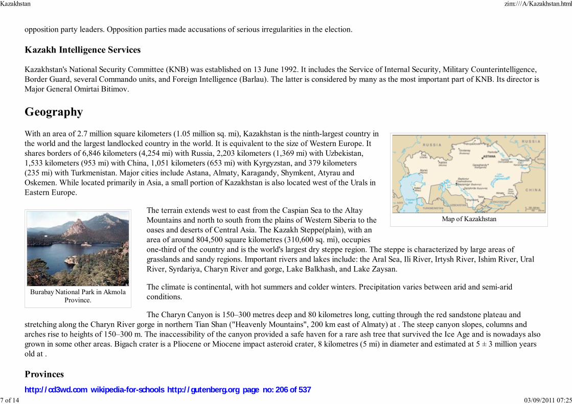
Map of Kazakhstan
Burabay National Park in AkmolaProvince.
opposition party leaders. Opposition parties made accusations of serious irregularities in the election.
Kazakh Intelligence Services
Kazakhstan's National Security Committee (KNB) was established on 13 June 1992. It includes the Service of Internal Security, Military Counterintelligence,
Border Guard, several Commando units, and Foreign Intelligence (Barlau). The latter is considered by many as the most important part of KNB. Its director is
Major General Omirtai Bitimov.
Geography
With an area of 2.7 million square kilometers (1.05 million sq. mi), Kazakhstan is the ninth-largest country in
the world and the largest landlocked country in the world. It is equivalent to the size of Western Europe. It
shares borders of 6,846 kilometers (4,254 mi) with Russia, 2,203 kilometers (1,369 mi) with Uzbekistan,
1,533 kilometers (953 mi) with China, 1,051 kilometers (653 mi) with Kyrgyzstan, and 379 kilometers
(235 mi) with Turkmenistan. Major cities include Astana, Almaty, Karagandy, Shymkent, Atyrau and
Oskemen. While located primarily in Asia, a small portion of Kazakhstan is also located west of the Urals in
Eastern Europe.
The terrain extends west to east from the Caspian Sea to the Altay
Mountains and north to south from the plains of Western Siberia to the
oases and deserts of Central Asia. The Kazakh Steppe(plain), with an
area of around 804,500 square kilometres (310,600 sq. mi), occupies
one-third of the country and is the world's largest dry steppe region. The steppe is characterized by large areas of
grasslands and sandy regions. Important rivers and lakes include: the Aral Sea, Ili River, Irtysh River, Ishim River, Ural
River, Syrdariya, Charyn River and gorge, Lake Balkhash, and Lake Zaysan.
The climate is continental, with hot summers and colder winters. Precipitation varies between arid and semi-arid
conditions.
The Charyn Canyon is 150–300 metres deep and 80 kilometres long, cutting through the red sandstone plateau and
stretching along the Charyn River gorge in northern Tian Shan ("Heavenly Mountains", 200 km east of Almaty) at . The steep canyon slopes, columns and
arches rise to heights of 150–300 m. The inaccessibility of the canyon provided a safe haven for a rare ash tree that survived the Ice Age and is nowadays also
grown in some other areas. Bigach crater is a Pliocene or Miocene impact asteroid crater, 8 kilometres (5 mi) in diameter and estimated at 5 ± 3 million years
old at .
Provinces
Kazakhstan zim:///A/Kazakhstan.html
7 of 14 03/09/2011 07:25
http://cd3wd.com wikipedia-for-schools http://gutenberg.org page no: 206 of 537

Kazakhstan is divided into 14 provinces (облыстар). The provinces are subdivided into districts (аудандар).
Province Capital Area (km.²) Population
Akmola Kokshetau 121,400 829,000
Aktobe Aktobe 300,600 661,000
Almaty(1) Almaty 324.8 1,226,300
Almaty Province Taldykorgan 224,000 860,000
Astana(1) Astana 710.2 600,200
Atyrau Atyrau 118,600 380,000
Baikonur(2) Baikonur 57 70,000
East Kazakhstan Oskemen 283,300 897,000
Karagandy Karagandy 428,000 1,287,000
Kostanay Kostanay 196,000 975,000
Kyzylorda Kyzylorda 226,000 590,000
Mangystau Aktau 165,600 316,847
North Kazakhstan Petropavl 123,200 586,000
Pavlodar Pavlodar 124,800 851,000
South Kazakhstan Shymkent 118,600 1,644,000
West Kazakhstan Oral 151,300 599,000
Zhambyl Taraz 144,000 962,000
Notes:
(1) Almaty and Astana cities have the status of State importance and do not relate to any province.
(2) Baikonur city has a special status because it is currently being leased to Russia with Baikonur cosmodrome through the year 2050.
Each province is headed by an Akim (provincial governor) appointed by the president. Municipal Akims are appointed by province Akims. The Government of
Kazakhstan transferred its capital from Almaty to Astana on December 10, 1997.
Economy
Kazakhstan zim:///A/Kazakhstan.html
8 of 14 03/09/2011 07:25
http://cd3wd.com wikipedia-for-schools http://gutenberg.org page no: 207 of 537

Baykonur is the world'soldest and largest
operational space launchfacility
The government of Kazakhstan plans to double its Gross domestic product (GDP) by 2008 and triple it by 2015 as compared to
2000. GDP growth has been stable in the last five years, at a rate higher than 9%. Buoyed by high world crude oil prices, GDP
growth figures were in 2000, 2001, 2002, 2003, 2004, and 2005: 9.8%, 13.2%, 9.5%, 9.2%, 9.4%, and 9.2%, respectively. Other
major exports of Kazakhstan include wheat, textile, and livestock. Kazakhstan forecasts that it will become the world's leading
exporter of uranium by the year 2010.
Kazakhstan's monetary policy is generally considered by outside observers to be well-managed. Its principal challenge since 2002
has been to manage strong foreign currency inflows without sparking inflation. Since that time, inflation has not been under control,
registering at 6.6% in 2002, 6.8% in 2003, and 6.4% in 2004, higher than forecast levels of 5.3%-6.0%. In 2000 Kazakhstan became
the first former Soviet republic to repay all of its debt to the International Monetary Fund (IMF), 7 years ahead of schedule. In
March 2002, the U.S. Department of Commerce granted Kazakhstan market economy status under U.S. trade law. This change in
status recognized substantive market economy reforms in the areas of currency convertibility, wage rate determination, openness to
foreign investment, and government control over the means of production and allocation of resources.
In September 2002 Kazakhstan became the first country in the CIS to receive an investment-grade credit rating from a major
international credit rating agency. As of late December 2003, Kazakhstan's gross foreign debt was about $22.9 billion. Total
governmental debt was $4.2 billion. This amounts to 14% of GDP. There has been a noticeable reduction in the ratio of debt to
GDP observed in past years; the ratio of total governmental debt to GDP in 2000 was 21.7%, in 2001 it was 17.5%, and in 2002 it
was 15.4%.
The upturn in economic growth, combined with the results of earlier tax and financial sector reforms, has dramatically improved government finances from the
1999 budget deficit level of 3.5% of GDP to a deficit of 1.2% of GDP in 2003. Government revenues grew from 19.8% of GDP in 1999 to 22.6% of GDP in
2001, but decreased to 16.2% of GDP in 2003. In 2000, Kazakhstan adopted a new tax code in an effort to consolidate these gains. On November 29, 2003 the
Law on Changes to Tax Code was adopted, which reduced tax rates. The value added tax fell from 16% to 15%, the social tax from 21% to 20%, and the
personal income tax from 30% to 20%. (On July 7, 2006 the personal income tax was reduced even further to a flat rate of 5% for personal income in the form
of dividends and 10% for other personal income.) Kazakhstan furthered its reforms by adopting a new land code on June 20, 2003, and a new customs code on
April 5, 2003.
Kazakhstan zim:///A/Kazakhstan.html
9 of 14 03/09/2011 07:25
http://cd3wd.com wikipedia-for-schools http://gutenberg.org page no: 208 of 537

Headquarter of KazMunayGaz, the nationaloil and gas company
Energy is the leading economic sector. Production of crude oil and natural gas condensate in Kazakhstan
amounted to 51.2 million tons in 2003, which was 8.6% more than in 2002. Kazakhstan raised oil and gas
condensate exports to 44.3 million tons in 2003, 13% higher than in 2002. Gas production in Kazakhstan in 2003
amounted to 13.9 billion cubic meters (491 billion cu. ft), up 22.7% compared to 2002, including natural gas
production of 7.3 billion cubic meters (258 billion cu. ft); Kazakhstan holds about 4 billion tons of proven
recoverable oil reserves and 2,000 cubic kilometers (480 cu mi) of gas. Industry analysts believe that planned
expansion of oil production, coupled with the development of new fields, will enable the country to produce as
much as 3 million barrels (477,000 m³) per day by 2015, lifting Kazakhstan into the ranks of the world's top 10
oil-producing nations. Kazakhstan's 2003 oil exports were valued at more than $7 billion, representing 65% of
overall exports and 24% of the GDP. Major oil and gas fields and their recoverable oil reserves are Tengiz with 7
billion barrels (1.1 km³); Karachaganak with 8 billion barrels (1.3 km³) and 1,350 km³ of natural gas); and
Kashagan with 7 to 9 billion barrels (1.1 to 1.4 km³).
Kazakhstan instituted an ambitious pension reform program in 1998. As of January 1, 2005, the pension assets were about $4.1 billion. There are 16 saving
pension funds in the republic. The State Accumulating Pension Fund, the only state-owned fund, could be privatized as early as 2006. The country's unified
financial regulatory agency oversees and regulates the pension funds. The pension funds' growing demand for quality investment outlets triggered rapid
development of the debt securities market. Pension fund capital is being invested almost exclusively in corporate and government bonds, including Government
of Kazakhstan Eurobonds. The Kazakhstani banking system is developing rapidly. The banking system's capitalization now exceeds $1 billion. The National
Bank has introduced deposit insurance in its campaign to strengthen the banking sector. Several major foreign banks have branches in Kazakhstan, including
ABN AMRO, Citibank, and HSBC. Raiffeisen Zentralbank and UniCredit have both recently entered the Kazakhstan's financial services market through
acquisitions and stakebuilding.
Foreign relations and armed forces
Kazakhstan zim:///A/Kazakhstan.html
10 of 14 03/09/2011 07:25
http://cd3wd.com wikipedia-for-schools http://gutenberg.org page no: 209 of 537

Kazakhstani PresidentNursultan Nazarbayev
with U.S. PresidentGeorge W. Bush
Kazakhstan within Europe(light blue represents
territory considered to belocated in Asia)
Kazakhstani soldier
Kazakhstan has stable relationships with all of its neighbors. Kazakhstan is also a member of the
United Nations, Organization for Security and Cooperation in Europe, Euro-Atlantic Partnership
Council and Organization of the Islamic Conference (OIC). It is an active participant in the North
Atlantic Treaty Organisation Partnership for Peace program. Kazakhstan is also a member of the
Commonwealth of Independent States, the Economic Cooperation Organization and the Shanghai
Cooperation Organization. The nations of Kazakhstan, Russia, Belarus, Kyrgyzstan and Tajikistan
established the Eurasian Economic Community in 2000 to re-energize earlier efforts at harmonizing
trade tariffs and the creation of a free trade zone under a customs union. On the December 1 of 2007,
it was revealed that Kazakhstan has been chosen to chair OSCE for the year 2010.
Since independence in 1991, Kazakhstan has pursued what is known as the multidimensional foreign
policy (многовекторная внешняя политика), seeking equally good relations with two large
neighbors, Russia and China, and the United States and the West generally. The policy has yielded results in the oil and gas sector,
where companies from the U.S., Russia, China, and Europe are present at all major fields, and in the multidimensional directions of
oil export pipelines out of Kazakhstan. Kazakhstan also enjoys strong, and rapidly developing, political and economic ties with
Turkey.
Additionally, Russia currently leases approximately 6,000 km² (2,300 mi²) of territory enclosing the Baikonur Cosmodrome space
launch site in south central Kazakhstan, where the first man was launched in space as well as Soviet space shuttle Buran and the
well-known space station Mir.
Most of Kazakhstan's military was inherited from the the Soviet Armed Forces' Turkestan Military District. These units
became the core of Kazakhstan's new military which acquired all the units of the 40th Army (the former 32nd Army) and
part of the 17th Army Corps, including 6 land force divisions, storage bases, the 14th and 35th air-landing brigades, 2
rocket brigades, 2 artillery regiments and a large amount of equipment which had been withdrawn from over the Urals
after the signing of the Treaty on Conventional Armed Forces in Europe. The largest expansion of the Kazakhstan Army
has been focused on armored units in recent years. Since 1990, armored units have expanded from 500, to and 1,613 in
2005.
The Kazakh air force is composed mostly of Soviet-era planes, including 40 MiG-29s, 33 MiG-31s, 25 Su-24s and Su-27. A
small naval force is also maintained on the Caspian Sea.
Kazakhstan sent 29 military engineers to Iraq under Polish command to assist the US occupation in Iraq.
Demographics
Kazakhstan zim:///A/Kazakhstan.html
11 of 14 03/09/2011 07:25
http://cd3wd.com wikipedia-for-schools http://gutenberg.org page no: 210 of 537

Population pyramid, 2005
Aitys, a competition of akyns inperforming songs
The US Census Bureau International Database list the current population of Kazakhstan as 16,763,795, while United
Nations sources such as the World Bank give a 2002 estimate of 14,794,830.
The ethnic Kazakhs represent 59.2% of the population and ethnic Russians 25.6%, with a rich array of other groups
represented, including Tatars, Uzbeks, Bashkirs, Uyghurs and Ukrainians. Some minorities such as Russian Germans (esp.
Volga Germans), Ukrainians and Russian political opponents of the regime had been deported to Kazakhstan in the 1930s
and 1940s by Stalin; some of the bigger Soviet labor camps existed in the country. Significant Russian immigration also
connected with Virgin Lands Campaign and Soviet space program during Khrushchev era. There is also a small but active
Jewish community. Before 1991 there were one million Volga Germans in Kazakhstan; most of them emigrated to
Germany following the breakup of the Soviet Union. Most members of the smaller Pontian Greek minority have emigrated
to Greece.
Kazakhstan is a bilingual country: the Kazakh language, spoken by 64.4% of the population, has the status of the "state" language, while Russian, which is
spoken by almost all Kazakhstanis, is declared the "official" language, and is used routinely in business.
The 1990s were marked by the emigration of many of the country's Russians and Volga Germans, a process that began in the 1970s; this was a major factor in
giving the autochthonous Kazakhs a majority along with higher Kazakh birthrates and ethnic Kazakh immigration from the People's Republic of China,
Mongolia, and Russia. In the early twenty first century, Kazakhstan has become one of the leading nations in international adoptions. This has recently sparked
some criticism in the Parliament of Kazakhstan, due to the concerns about safety and treatment of the children abroad and the questions regarding the low level
of population in Kazakhstan.
Kazakhs and Kazakhstanis (terminology)
The Kazakh term қазақстандықтар (Russian: казахстанцы) (Kazakhstanis) was coined to describe all citizens of
Kazakhstan, including non-Kazakhs. The word "Kazakh" is generally used to refer to people of actual Kazakh descent
(including those living in China, Afghanistan, Turkey, Uzbekistan and other countries).
The ethnonym Kazakh is derived from an ancient Turkic word "independent, a free spirit". It is the result of Kazakhs'
nomadic horseback culture and is related to the term " cossack". The Avestan/ Old Persian (See Indo-European languages)
word "stan" means "land" or "place of".
Religion
Kazakhstan zim:///A/Kazakhstan.html
12 of 14 03/09/2011 07:25
http://cd3wd.com wikipedia-for-schools http://gutenberg.org page no: 211 of 537
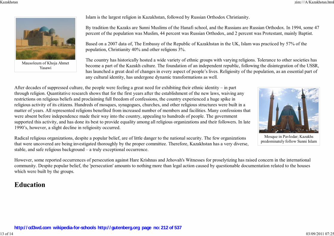
Mausoleum of Khoja AhmetYasawi
Mosque in Pavlodar; Kazakhspredominately follow Sunni Islam
Islam is the largest religion in Kazakhstan, followed by Russian Orthodox Christianity.
By tradition the Kazaks are Sunni Muslims of the Hanafi school, and the Russians are Russian Orthodox. In 1994, some 47
percent of the population was Muslim, 44 percent was Russian Orthodox, and 2 percent was Protestant, mainly Baptist.
Based on a 2007 data of, The Embassy of the Republic of Kazakhstan in the UK, Islam was practiced by 57% of the
population, Christianity 40% and other religions 3%.
The country has historically hosted a wide variety of ethnic groups with varying religions. Tolerance to other societies has
become a part of the Kazakh culture. The foundation of an independent republic, following the disintegration of the USSR,
has launched a great deal of changes in every aspect of people’s lives. Religiosity of the population, as an essential part of
any cultural identity, has undergone dynamic transformations as well.
After decades of suppressed culture, the people were feeling a great need for exhibiting their ethnic identity – in part
through religion. Quantitative research shows that for the first years after the establishment of the new laws, waiving any
restrictions on religious beliefs and proclaiming full freedom of confessions, the country experienced a huge spike in
religious activity of its citizens. Hundreds of mosques, synagogues, churches, and other religious structures were built in a
matter of years. All represented religions benefited from increased number of members and facilities. Many confessions that
were absent before independence made their way into the country, appealing to hundreds of people. The government
supported this activity, and has done its best to provide equality among all religious organizations and their followers. In late
1990’s, however, a slight decline in religiosity occurred.
Radical religious organizations, despite a popular belief, are of little danger to the national security. The few organizations
that were uncovered are being investigated thoroughly by the proper committee. Therefore, Kazakhstan has a very diverse,
stable, and safe religious background – a truly exceptional occurrence.
However, some reported occurrences of persecution against Hare Krishnas and Jehovah's Witnesses for proselytizing has raised concern in the international
community. Despite popular belief, the 'persecution' amounts to nothing more than legal action caused by questionable documentation related to the houses
which were built by the groups.
Education
Kazakhstan zim:///A/Kazakhstan.html
13 of 14 03/09/2011 07:25
http://cd3wd.com wikipedia-for-schools http://gutenberg.org page no: 212 of 537

KIMEP in Almaty
Education is universal and mandatory through to the secondary level and the adult literacy rate is 99.5%. Education
consists of three main educational phases: primary education (forms 1–4), basic general education (forms 5–9) and senior
level education (forms 10–11 or 12) divided into continued general education and professional education. (Primary
education is preceded by one year of pre-school education.) These three levels of education can be followed in one
institution or in different ones (e.g. primary school, then secondary school). Recently, several secondary schools,
specialized schools, magnet schools, gymnasiums, lyceums, linguistic and technical gymnasiums, have been founded.
Secondary professional education is offered in special professional or technical schools, lyceums or colleges and
vocational schools.
At present, there are universities, academies, and institutes, conservatories, higher schools and higher colleges. There are
three main levels: basic higher education that provides the fundamentals of the chosen field of study and leads to the
award of the Bachelor's degree; specialized higher education after which students are awarded the Specialist's Diploma;
and scientific-pedagogical higher education which leads to the Master's Degree. Postgraduate education leads to the
Kandidat Nauk (Candidate of Sciences) and the Doctor of Sciences. With the adoption of the Laws on Education and on
Higher Education, a private sector has been established and several private institutions have been licensed.
The Ministry of Education of Kazakhstan runs a highly successful Bolashak scholarship, which is annually awarded to
approximately three hundred applicants. The scholarship funds their education in institutions abroad, including the
prestigious Oxford and Ivy League universities. The terms of the program include mandatory return to Kazakhstan for at least five years of employment.
Retrieved from " http://en.wikipedia.org/wiki/Kazakhstan"
This Wikipedia Selection has a sponsor: SOS Children , and consists of a hand selection from the English Wikipedia articles with only minor deletions (see
www.wikipedia.org for details of authors and sources). The articles are available under the GNU Free Documentation License. See also our
Kazakhstan zim:///A/Kazakhstan.html
14 of 14 03/09/2011 07:25
http://cd3wd.com wikipedia-for-schools http://gutenberg.org page no: 213 of 537

Korea
2008/9 Schools Wikipedia Selection. Related subjects: Asia; Asian Countries
Korea zim:///A/Korea.html
1 of 13 03/09/2011 07:25
http://cd3wd.com wikipedia-for-schools http://gutenberg.org page no: 214 of 537

Korea
Capital Pyongyang, Seoul
Largest conurbation
(population)
Seoul
Official languages Korean
Area
- Total 220,186 km² ( 84th if
ranked)
85,020 sq mi
- Water (%) 2.8
Population
- 2007 estimate 72,326,462 ( 18th if
ranked)
- Density 328.48/km²
850.7/sq mi
Currency Won ( ₩) ( N/ S)
Time zone KST ( UTC+9)
Korea zim:///A/Korea.html
2 of 13 03/09/2011 07:25
http://cd3wd.com wikipedia-for-schools http://gutenberg.org page no: 215 of 537

Entrance to Gyeongbokgung
Joseon dynasty royal throne
Korea is a geographic area, civilization, and a former state situated on the Korean Peninsula in East Asia. It borders China to
the west and Russia to the north, with Japan situated to the east. The Korean Peninsula is divided into two separate states,
North Korea and South Korea. However, the name "Korea" is often used to refer to South Korea due to its greater economic
significance and influence in the world.
The history of Korea began with the legendary founding of Gojoseon in 2333 BC by Dangun. Limited linguistic evidence
suggests probable Altaic origins of these people, whose northern Mongolian steppe culture absorbed migration and trade with
the peoples of Manchuria and China. The adoption of the Chinese writing system (" hanja" in Korean) in the 2nd century BC,
and Buddhism in the 4th century AD, had profound effects on the Three Kingdoms of Korea. Baekje later passed on a
modified version of these cultural advances to Japan.
Since the Goryeo Dynasty, Korea was ruled by a single government and maintained political and cultural independence until
the nineteenth century, despite the Mongol invasions of the Goryeo Dynasty in the 13th century and Japanese invasions of the
Joseon Dynasty in the 16th century. In 1377, Korea produced the Jikji, the world's oldest movable metal print document. In the
15th century, the turtle ships, possibly the world's first ironclad warships, were deployed, and King Sejong the Great
promulgated the Korean alphabet han-geul to increase literacy among his people who could not read nor write hanja (Chinese
characters).
During the latter part of the Joseon Dynasty, Korea's isolationist policy earned it the Western nickname the " Hermit
Kingdom". By the late 19th century, the country became the object of the colonial designs of Japan and Europe. In 1910,
Korea was forcibly annexed by Japan and remained occupied until the end of World War II in August 1945.
In 1945, the Soviet Union and the United States agreed on the surrender and disarming of Japanese troops in Korea; the Soviet Union accepting the surrender of
Japan north of the 38th parallel and the United States taking the surrender south of it. This led to division of Korea by the two superpowers, exacerbated by
their inability to agree on the terms of Korean independence. The two Cold War rivals then established governments sympathetic to their own ideologies,
leading to Korea's current division into two political entities: North Korea and South Korea.
Names of Korea
The name "Korea" derives from the Goryeo period of Korean history, which in turn referred to the ancient kingdom of Goguryeo. Merchants of the Middle East
called it Cauli (from the Chinese pronunciation), which then came to be spelled Corea and Korea. Korea is now commonly used in English contexts by both
North and South Korea.
In the Korean language, Korea as a whole is referred to as Han-guk (abbreviation of Dae Han Min Guk) ( Hangul: 한국; Hanja: 韓 國; RR: Hanguk; MR:
Han'guk) in South Korea, and Chosŏn ( Chosŏn'gŭl: 조선; Hancha: 朝 鮮; MR: Chosǒn; RR: Joseon) in North Korea. "The Land of the Morning Calm" is an
English language nickname loosely derived from the hanja characters for Joseon, the name derived from the Joseon Dynasty and the earlier Gojoseon. (Choson
Korea zim:///A/Korea.html
3 of 13 03/09/2011 07:25
http://cd3wd.com wikipedia-for-schools http://gutenberg.org page no: 216 of 537
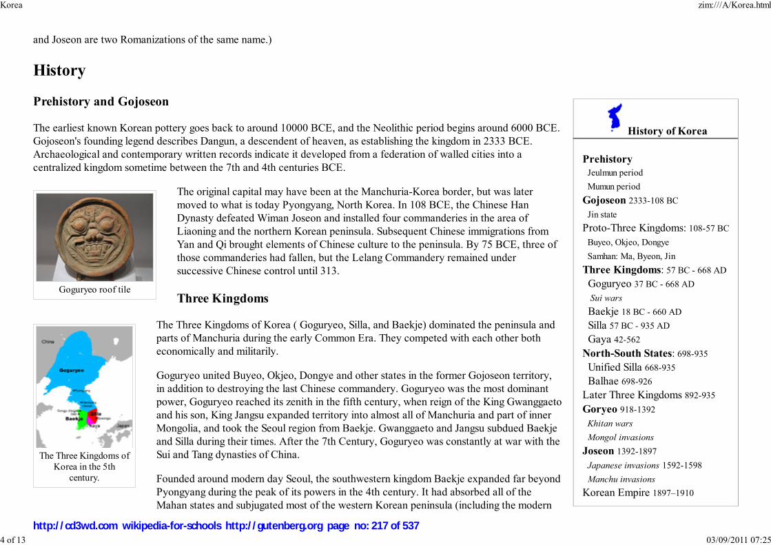
History of Korea
Prehistory
Jeulmun period
Mumun period
Gojoseon 2333-108 BC
Jin state
Proto-Three Kingdoms: 108-57 BC
Buyeo, Okjeo, Dongye
Samhan: Ma, Byeon, Jin
Three Kingdoms: 57 BC - 668 AD
Goguryeo 37 BC - 668 AD
Sui wars
Baekje 18 BC - 660 AD
Silla 57 BC - 935 AD
Gaya 42-562
North-South States: 698-935
Unified Silla 668-935
Balhae 698-926
Later Three Kingdoms 892-935
Goryeo 918-1392
Khitan wars
Mongol invasions
Joseon 1392-1897
Japanese invasions 1592-1598
Manchu invasions
Korean Empire 1897–1910
Goguryeo roof tile
The Three Kingdoms of
Korea in the 5th
century.
and Joseon are two Romanizations of the same name.)
History
Prehistory and Gojoseon
The earliest known Korean pottery goes back to around 10000 BCE, and the Neolithic period begins around 6000 BCE.
Gojoseon's founding legend describes Dangun, a descendent of heaven, as establishing the kingdom in 2333 BCE.
Archaeological and contemporary written records indicate it developed from a federation of walled cities into a
centralized kingdom sometime between the 7th and 4th centuries BCE.
The original capital may have been at the Manchuria-Korea border, but was later
moved to what is today Pyongyang, North Korea. In 108 BCE, the Chinese Han
Dynasty defeated Wiman Joseon and installed four commanderies in the area of
Liaoning and the northern Korean peninsula. Subsequent Chinese immigrations from
Yan and Qi brought elements of Chinese culture to the peninsula. By 75 BCE, three of
those commanderies had fallen, but the Lelang Commandery remained under
successive Chinese control until 313.
Three Kingdoms
The Three Kingdoms of Korea ( Goguryeo, Silla, and Baekje) dominated the peninsula and
parts of Manchuria during the early Common Era. They competed with each other both
economically and militarily.
Goguryeo united Buyeo, Okjeo, Dongye and other states in the former Gojoseon territory,
in addition to destroying the last Chinese commandery. Goguryeo was the most dominant
power, Goguryeo reached its zenith in the fifth century, when reign of the King Gwanggaeto
and his son, King Jangsu expanded territory into almost all of Manchuria and part of inner
Mongolia, and took the Seoul region from Baekje. Gwanggaeto and Jangsu subdued Baekje
and Silla during their times. After the 7th Century, Goguryeo was constantly at war with the
Sui and Tang dynasties of China.
Founded around modern day Seoul, the southwestern kingdom Baekje expanded far beyond
Pyongyang during the peak of its powers in the 4th century. It had absorbed all of the
Mahan states and subjugated most of the western Korean peninsula (including the modern
Korea zim:///A/Korea.html
4 of 13 03/09/2011 07:25
http://cd3wd.com wikipedia-for-schools http://gutenberg.org page no: 217 of 537
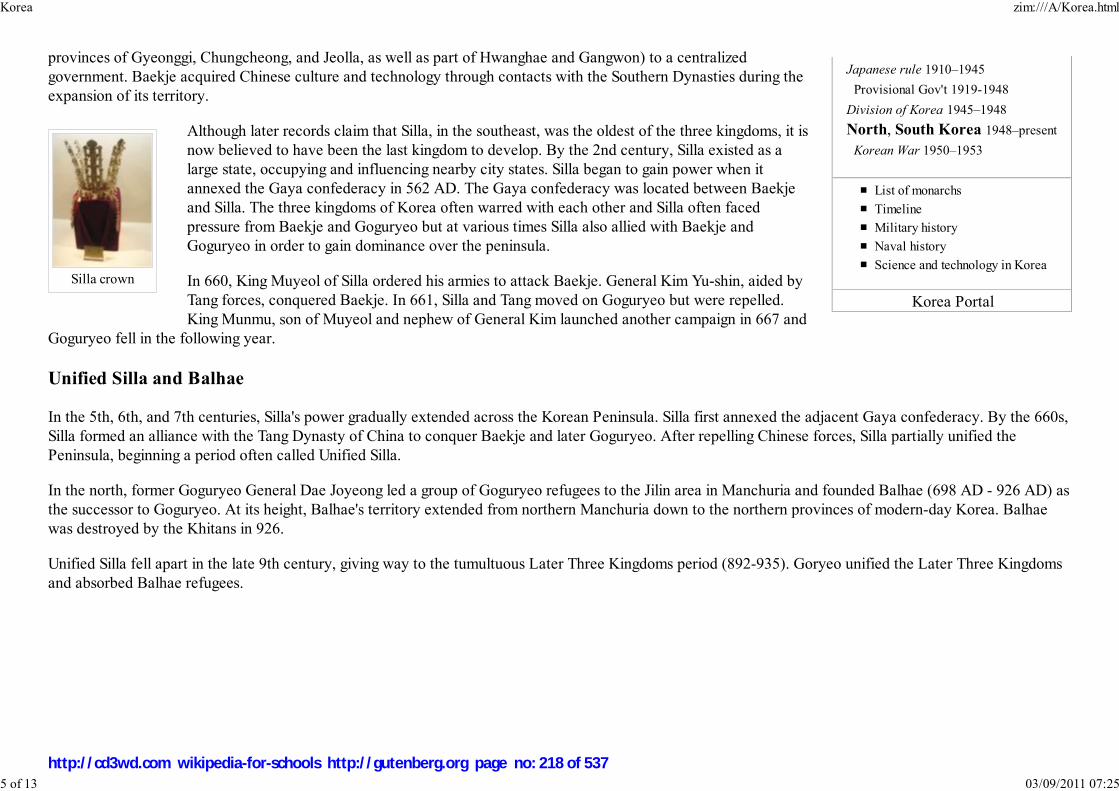
Japanese rule 1910–1945
Provisional Gov't 1919-1948
Division of Korea 1945–1948
North, South Korea 1948–present
Korean War 1950–1953
List of monarchs
Timeline
Military history
Naval history
Science and technology in Korea
Korea Portal
Silla crown
provinces of Gyeonggi, Chungcheong, and Jeolla, as well as part of Hwanghae and Gangwon) to a centralized
government. Baekje acquired Chinese culture and technology through contacts with the Southern Dynasties during the
expansion of its territory.
Although later records claim that Silla, in the southeast, was the oldest of the three kingdoms, it is
now believed to have been the last kingdom to develop. By the 2nd century, Silla existed as a
large state, occupying and influencing nearby city states. Silla began to gain power when it
annexed the Gaya confederacy in 562 AD. The Gaya confederacy was located between Baekje
and Silla. The three kingdoms of Korea often warred with each other and Silla often faced
pressure from Baekje and Goguryeo but at various times Silla also allied with Baekje and
Goguryeo in order to gain dominance over the peninsula.
In 660, King Muyeol of Silla ordered his armies to attack Baekje. General Kim Yu-shin, aided by
Tang forces, conquered Baekje. In 661, Silla and Tang moved on Goguryeo but were repelled.
King Munmu, son of Muyeol and nephew of General Kim launched another campaign in 667 and
Goguryeo fell in the following year.
Unified Silla and Balhae
In the 5th, 6th, and 7th centuries, Silla's power gradually extended across the Korean Peninsula. Silla first annexed the adjacent Gaya confederacy. By the 660s,
Silla formed an alliance with the Tang Dynasty of China to conquer Baekje and later Goguryeo. After repelling Chinese forces, Silla partially unified the
Peninsula, beginning a period often called Unified Silla.
In the north, former Goguryeo General Dae Joyeong led a group of Goguryeo refugees to the Jilin area in Manchuria and founded Balhae (698 AD - 926 AD) as
the successor to Goguryeo. At its height, Balhae's territory extended from northern Manchuria down to the northern provinces of modern-day Korea. Balhae
was destroyed by the Khitans in 926.
Unified Silla fell apart in the late 9th century, giving way to the tumultuous Later Three Kingdoms period (892-935). Goryeo unified the Later Three Kingdoms
and absorbed Balhae refugees.
Korea zim:///A/Korea.html
5 of 13 03/09/2011 07:25
http://cd3wd.com wikipedia-for-schools http://gutenberg.org page no: 218 of 537

Cheongja unhak
sanggam mun
maebyeong, the 68th
national treasure of
South Korea.
Hunmin jeong-eum,
afterwards called
hangul.
Goryeo
The country Goryeo was founded in 918 and replaced Silla as the ruling dynasty of Korea. ("Goryeo" is a short form of "Goguryeo" and
the source of the English name "Korea.") The dynasty lasted until 1392. During this period laws were codified, and a civil service system
was introduced. Buddhism flourished, and spread throughout the peninsula. The development of celadon industry flourished in 12th and
13th century. The publication of Tripitaka Koreana onto 80,000 wooden blocks and the invention of the world's first metal printing press
in 13th century attest to Goryeo's cultural achievements. Their dynasty was threatened by Mongol invasion from the 1230s into the
1270s, but the dynastic line continued to survive until 1392 since they negotiated a treaty with the Mongols that kept its sovereign
power. In 1350s, King Gongmin was free at last to reform a Goryeo government. Gongmin had various problems that needed to be dealt
with, which included the removal of pro-Mongol aristocrats and military officials, the question of land holding, and quelling the growing
animosity between the Buddhists and Confucian scholars.
Joseon dynasty
In 1392, the general Yi Seong-gye established the Joseon Dynasty (1392-1910) with a largely bloodless coup. The Joseon Dynasty is
believed to have been the longest-lived actively ruling dynasty in East Asia. He named it the Joseon Dynasty in honour of the previous
Joseon before (Gojoseon is the first Joseon. "Go", meaning "old", was added to distinguish between the two). King Taejo moved the
capital to Hanseong (formerly Hanyang; modern-day Seoul) and built the Gyeongbokgung palace. In 1394 he adopted Confucianism as
the country's official religion, resulting in much loss of power and wealth by the Buddhists. The prevailing philosophy was
Neo-Confucianism, which was developed by Zhu Xi. Joseon experienced advances in science and culture. King Sejong the Great
(1418-1450) promulgated hangul, the Korean alphabet. The period saw various other cultural and technological advances as well as the
dominance of neo-Confucianism over the entire peninsula. Between 1592 and 1598, Japan invaded Korea. Toyotomi Hideyoshi led the
forces and tried to invade the Asian continent through Korea, but was eventually repelled before even getting through Korea. This war
also saw the rise of the career of Admiral Yi Sun-shin and his " turtle ship" or gobukseon. In the 1620s and 1630s Joseon suffered
invasions by the Manchu who eventually also conquered the Chinese Ming Dynasty. After that, the Joseon dynasty swore allegiance to
the Qing Court. During the Joseon dynasty, Koreans brought Roman Catholicism (and other forms of Christianity in Korea followed
shortly thereafter) into Korea, at first in secret.
Japanese occupation
Korea zim:///A/Korea.html
6 of 13 03/09/2011 07:25
http://cd3wd.com wikipedia-for-schools http://gutenberg.org page no: 219 of 537

Go Fishing, Georges Ferdinand
Bigot, Tobae, February 1887. It
shows Korea as a fish which
China, Russia, and Japan are all
trying to catch.
Beginning in the 1870s, Japan began to force Korea to move out of China's sphere of influence into its own. Japan forced
Korea to engage in foreign trade through the Treaty of Ganghwa in 1876. In 1895, Empress Myeongseong of Korea was
assassinated by the Japanese under Miura Gorō's directive (Kim et al. 1976). In Manchuria on 1909, An Jung-geun assassinated
the former Resident-General of Korea, Itō Hirobumi for his role in trying to force Korea into occupation.In 1908, the Russo-
Japanese War pushed the Russians out of the fight for Korea. In 1910, an already militarily occupied Korea was a forced party
to the Japan-Korea Annexation Treaty. This is a controversial treaty since the treaty was never ratified by the Korean Emperor
and the required Korean Imperial seal was absent.
Even before formal Japanese colonial rule, the Korean Independence Movement was already in existence. Korean resistance
to the brutal Japanese occupation was manifested in the nonviolent March 1st Movement of 1919, where 7,000 demonstrators
were killed by Japanese police and military. The Korean liberation movement also spread to neighboring Manchuria and
Siberia.
Over five million Koreans were conscripted for labor beginning in 1939, and tens of thousands of men were forced into Japan's military. Approximately 200,000
girls and women, mostly from Korea and China, were forced into sexual slavery for the Japanese military. In 1993, Japanese Chief Cabinet Secretary Yohei
Kono acknowledged the terrible injustices faced by these euphemistically named " comfort women". However, the Japanese tend to underestimate the
sufferings of them.
During Japanese Colonial rule, the Korean language was suppressed in an effort to eradicate Korean national identity. Koreans were forced to take Japanese
surnames, known as Sōshi-kaimei. Traditional Korean culture suffered heavy losses, as numerous Korean cultural artifacts were destroyed or taken to Japan. To
this day, valuable Korean artifacts can often be found in Japanese museums or among private collections. One investigation by the South Korean government
identified 75,311 cultural assets that were taken from Korea, 34,369 of which are in Japan, and 17,803 of which are in the United States. However, experts
estimate that over 100,000 artifacts remains in Japan. Japanese people regarded the retuning Korean cultural properties are over after 1965 and seem to have no
desire to return such artifacts to the owners of Korea. Besides, Korean-Japan has disputed over the ownership of Liancourt Rocks, a small island located east of
the Korean peninsula, is their land and as of 2008, the Japanese government decided to teach Japanese middle-school students that the islet is their rightful land.
Korean War
Korea zim:///A/Korea.html
7 of 13 03/09/2011 07:25
http://cd3wd.com wikipedia-for-schools http://gutenberg.org page no: 220 of 537

The earliest surviving depiction
of the Korean / South Korean
flag was printed in a U.S. Navy
book Flags of Maritime
Nations in July 1882.
With the defeat of Japan in 1945, the United Nations developed plans for a trusteeship administration, the Soviet Union
administering the peninsula north of the 38th parallel and the United States administering the south. The politics of the Cold
War resulted in the 1948 establishment of two separate governments, North Korea and South Korea.
In June of 1950 North Korea invaded the South, using Russian tanks and weaponry. During the Korean War (1950-1953),
millions of civilians died and the three years of fighting throughout the nation effectively destroyed most cities. Around
171,000 POWs were captured and held by the Americans and South Koreans on Geojedo (an island in the south) The war
ended in a ceasefire agreement at approximately the Military Demarcation Line (Korea).
Split Nation
After the split state of Korea, the superpowers of Asia were determined to keep it that way. The benefits from having a split
Korea were having to spend less on defence as the North and South strove to annex one another. Such countries were and are
China, Japan, and Russia. Currently, China enjoys a beneficial friendship with North Korea as they are both Communist
nations. In order for the split country to unify, it will require much pain, sacrifice, money, and time as seen with its predecessor: Germany.
Geography
Korea zim:///A/Korea.html
8 of 13 03/09/2011 07:25
http://cd3wd.com wikipedia-for-schools http://gutenberg.org page no: 221 of 537

Daedongyeojido, a map of
Korea
A view of Seoraksan.
Korea is located on the Korean Peninsula in North-East Asia. To the northwest, the Amnok
River ( Yalu River) separates Korea from China and to the northeast, the Duman River (
Tumen River) separates Korea from China and Russia. The Yellow Sea is to the west, the
East China Sea is to the south, and the Sea of Japan (East Sea) is to the east of Korea.
Notable islands include Jeju-do, Ulleung-do, and Liancourt Rocks (Dokdo in Korean).
The southern and western parts of the peninsula have well-developed plains, while the
eastern and northern parts are mountainous. The highest mountain in Korea is Baekdusan
(2744 m), through which runs the border with China. The southern extension of Baekdusan
is a highland called Gaema Heights. This highland was mainly raised during the Cenozoic
orogeny and partly covered by volcanic matter. To the south of Gaema Gowon, successive
high mountains are located along the eastern coast of the peninsula. This mountain range is named Baekdudaegan. Some
significant mountains include Sobaeksan (2,184 m), Baeksan (1,724 m), Geumgangsan (1,638 m), Seoraksan (1,708 m),
Taebaeksan (1,567 m), and Jirisan (1,915 m). There are several lower, secondary mountain series whose direction is almost
perpendicular to that of Baekdudaegan. They are developed along the tectonic line of Mesozoic orogeny and their directions
are basically northwest.
Unlike most older mountains on the mainland, many important islands in Korea were formed by volcanic activity in the
Cenozoic orogeny. Jeju-do, situated off the southern coast, is a large volcanic island whose main mountain Hallasan (1950 m)
is the highest in South Korea. Ulleung-do is a volcanic island in the Sea of Japan, whose composition is more felsic than
Jeju-do. The volcanic islands tend to be younger, the more westward.
Because the mountainous region is mostly on the eastern part of the peninsula, the main rivers tend to flow westwards. Two exceptions are the southward-
flowing Nakdonggang and Seomjingang. Important rivers running westward include the Amnok River ( Yalu), the Cheong-cheongang, the Daedonggang, the
Han River, the Geumgang, and the Yeongsangang. These rivers have vast flood plains and provide an ideal environment for wet-rice cultivation.
The southern and southwestern coastlines of Korea form a well-developed ria coastline, known as Dadohae-jin in Korean. Its convoluted coastline provides
mild seas, and the resulting calm environment allows for safe navigation, fishing, and seaweed farming. In addition to the complex coastline, the western coast
of the Korean Peninsula has an extremely high tidal amplitude (at Incheon, around the middle of the western coast. It can get as high as 9 m). Vast tidal flats
have been developing on the south and west coastlines
Demographics
The combined population of the Koreas is about 73 million (North Korea: 23 million, South Korea: 50 million). Korea is chiefly populated by a highly
homogeneous ethnic group, the Koreans, who speak the Korean language. The number of foreigners living in Korea has also steadily increased since the late
20th century, particularly in South Korea, where more than 1 million foreigners currently reside. A minority population of ethnic Chinese (roughly 440,000 as of
Korea zim:///A/Korea.html
9 of 13 03/09/2011 07:25
http://cd3wd.com wikipedia-for-schools http://gutenberg.org page no: 222 of 537

Korean Buddhist architecture
August 2007) live in South Korea and small communities of ethnic Chinese and Japanese are also found in North Korea.
Language
Korean is the official language of both North and South Korea, and of Yanbian Autonomous Prefecture in Manchuria area of China. Worldwide, there are up to
80 million speakers of the Korean Language. South Korea has around 50 million speakers while North Korea around 23 million. Other large groups of Korean
speakers are found in the United States (around 2.5 million speakers), China (around 2 million speakers), the former Soviet Union (around 500,000), Japan
(around 900,000), Canada (100,000), Philippines (70,000) and Australia (150,000). It is estimated that there are around 700,000 people scattered across the
world who are able to speak Korean because of job requirements (for example, salespersons or businessmen with Korean contacts), marriages to Koreans or out
of pure interest in the language.
The genealogical classification of Korean is debated. Some linguists place it in the Altaic language family; others consider it to be a language isolate. Korean is
agglutinative in its morphology and SOV in its syntax. Like Japanese and Vietnamese, Korean has borrowed much vocabulary from the genetically unrelated
Chinese or created vocabulary on Chinese models.
Modern Korean is written almost exclusively in the hangul script, which was invented in the 15th century. While hangul may appear logographic, it is actually a
phonemic alphabet organized into syllabic blocks. Each block consists of at least two of the 24 hangul letters ( jamo): at least one each of the 14 consonants and
10 vowels. Historically, the alphabet had several additional letters (see obsolete jamo). For a phonological description of the letters, see Korean phonology.
Hanja (Chinese characters) and Latin alphabets are sometimes included within hangul texts, particularly in South Korea.
Culture and arts
In ancient Chinese texts, Korea is referred to as "Rivers and Mountains Embroidered on Silk" (금수강산, 錦 繡 江 山) and
"Eastern Nation of Decorum" (동방예의지국, 東 方 禮 儀 之 國). During the 7th and 8th centuries, the silk road connected
Korea to Arabia. In 845, Arab traders wrote, "Beyond China is a land where gold abounds and which is named Silla. The
Muslims who have gone there have been charmed by the country and tend to settle there and abandon all idea of leaving."
Korean festivities often showcase vibrant colors, which have been attributed to Mongolian influences: bright red, yellow, and
green often mark traditional Korean motifs. These bright colors are sometimes seen in the traditional dress known as hanbok.
One peculiarity of Korean culture is its age reckoning system. Individuals are regarded as one year old when they are born, and
their age increments on New Year's Day rather than on the anniversary of their birthday. Thus, one born on December the 31st
would be aged two on the day after they were born. Accordingly, a Korean person's stated age will be one or two years more than their age expressed in the
Western tradition.
Literature
Korea zim:///A/Korea.html
10 of 13 03/09/2011 07:25
http://cd3wd.com wikipedia-for-schools http://gutenberg.org page no: 223 of 537

Amitabha and Eight Great
Bodhisattvas, Goryeo scroll
from the 1300s
Korean literature written before the end of the Joseon Dynasty is called "Classical" or "Traditional." Literature, written in Chinese characters ( hanja), was
established at the same time as the Chinese script arrived on the peninsula. Korean scholars were writing poetry in the classical Chinese style as early as the 2nd
century BCE, reflecting Korean thoughts and experiences of that time. Classical Korean literature has its roots in traditional folk beliefs and folk tales of the
peninsula, strongly influenced by Confucianism, Buddhism and Taoism.
Modern literature is often linked with the development of hangul, which helped spread literacy from the aristocracy to the common people and women. Hangul,
however, only reached a dominant position in Korean literature in the second half of the 19th century, resulting in a major growth in Korean literature.
Sinsoseol, for instance, are novels written in hangul.
The Korean War led to the development of literature centered around the wounds and chaos of war. Much of the post-war literature in South Korea deals with
the daily lives of ordinary people, and their struggles with national pain. The collapse of the traditional Korean value system is another common theme of the
time.
Religion
Confucian tradition has dominated Korean thought, along with contributions by Buddhism, Taoism, and Korean Shamanism.
Since the middle of the 20th century, however, Christianity has competed with Buddhism in South Korea, while religious
practice has been suppressed in North Korea.
According to 2003 statistics compiled by the South Korean government, about 46% of citizens profess to follow no particular
religion. Christians account for 27.3% of the population (of which half are Catholics and half are various denominations of
Protestantism) and Buddhists 25.3%.
Koreans valued scholarship and rewarded education and study of Chinese classic texts; Yangban boys were highly educated in
hanja. In Silla, the bone rank system defined a person's social status, and a similar system persisted through the end of the
Joseon Dynasty. In addition, the gwageo civil service examination provided paths of upward mobility.
Islam in South Korea is comprised of about 45,000 in addition to some 100,000 foreign workers from Muslim countries.
Cuisine
Korean cuisine is probably best known for kimchi( 한글: 김치), which uses a distinctive fermentation process of preserving
vegetables, most commonly cabbage. Pepper (chilli) paste( 한글: 고추장 - pronounced go-choo-jang) is also commonly used,
often as pepper (chilli) powder, earning the cuisine a reputation for being spicy.
Bulgogi( 한글: 불고기) (roasted marinated meat, usually beef), galbi (ribs, 한글: 갈비), and samgyeopsal (pork belly, 한글: 삼겹살) are popular meat entrees. Meals are usually accompanied by a soup or stew, such as galbitang (stewed ribs) and doenjang jjigae( 한글: 된장찌개)
Korea zim:///A/Korea.html
11 of 13 03/09/2011 07:25
http://cd3wd.com wikipedia-for-schools http://gutenberg.org page no: 224 of 537

(fermentated bean paste stew). The centre of the table is filled with a shared collection of sidedishes called banchan.
Other popular dishes include bibimbap( 한글: 비빔밥)which literally means "mixed rice" (rice mixed with meat, vegetables, and pepper paste) and
naengmyeon( 한글: 냉면, 冷麵) (cold noodles with soup).
Education
The modern Korean school system consists of 6 years in elementary school, 3 years in middle school, and 3 years in high school. Students are supposed to go to
elementary and middle school, and do not have to pay for it.(The teachers are paid from taxes) Most public middle school and high school students have to wear
uniforms, and are not supposed to grow their hair more than a particular length. The Programme for International Student Assessment, coordinated by the
OECD, currently ranks South Korea's science education as the 11th best in the world, being significantly higher than the OECD average. Although South
Korean students often rank high on international comparative tests, the education system is sometimes criticized for its emphasis on passive learning and
memorization. The Korean education system is much more strict and structured than most western societies and Korean students rarely have free time to spend
enjoying themselves as they are under a lot of pressure to perform and gain entrance to university.
Science and technology
Korea zim:///A/Korea.html
12 of 13 03/09/2011 07:25
http://cd3wd.com wikipedia-for-schools http://gutenberg.org page no: 225 of 537

Cheomseongdae, one of the
world's oldest surviving
astronomical observatories
One of the best known artifacts of Korea's history of science and technology is Cheomseongdae (첨성대, 瞻 星 臺), a
9.4-meter high observatory built in 634. It is considered to be one of the world's oldest surviving astronomical observatories.
The world's first metal mechanical movable type printing was developed in Korea in 1232 by Choe Yun-ui during the Goryeo
Dynasty, modeled after widespread Chinese clay ( Bi Sheng in 1041), several hundred years before Johann Gutenberg
developed his metal letterset type (Cumings 1997: 65). Though the block printing was used much earlier, metal movable type
printing press marked a significant development in printing allowing the same tools to be used for more diverse printings. The
Jikji is the world's earliest remaining movable metal printed book, printed in Korea in 1377. The world's earliest known
surviving example of woodblock printing is the Mugujeonggwang Great Dharani Sutra. It is believed to have been printed in
Korea in 750-751 AD which, if correct, would make it older than the Diamond Sutra. Goryeo silk was highly regarded by
China, and Korean pottery made with blue-green celadon was of the highest quality in the world and sought after by even
Arabian merchants. Goryeo had a bustling economy with a capital that was frequented by merchants from all over the known
world.
During the Joseon period the earliest ironclad warships, the Geobukseon ( Turtle Ship) were invented, as well as other weapons
such as the Bigyeokjincheolloe (비격진천뢰, 飛 擊 震 天 雷) and the hwacha.
The Korean alphabet hangul was also invented during this time by Sejong the Great.
Retrieved from " http://en.wikipedia.org/wiki/Korea"
The Schools Wikipedia is sponsored by SOS Children , and is mainly selected from the English Wikipedia with only minor checks and changes (see
www.wikipedia.org for details of authors and sources). The articles are available under the GNU Free Documentation License. See also our
Korea zim:///A/Korea.html
13 of 13 03/09/2011 07:25
http://cd3wd.com wikipedia-for-schools http://gutenberg.org page no: 226 of 537
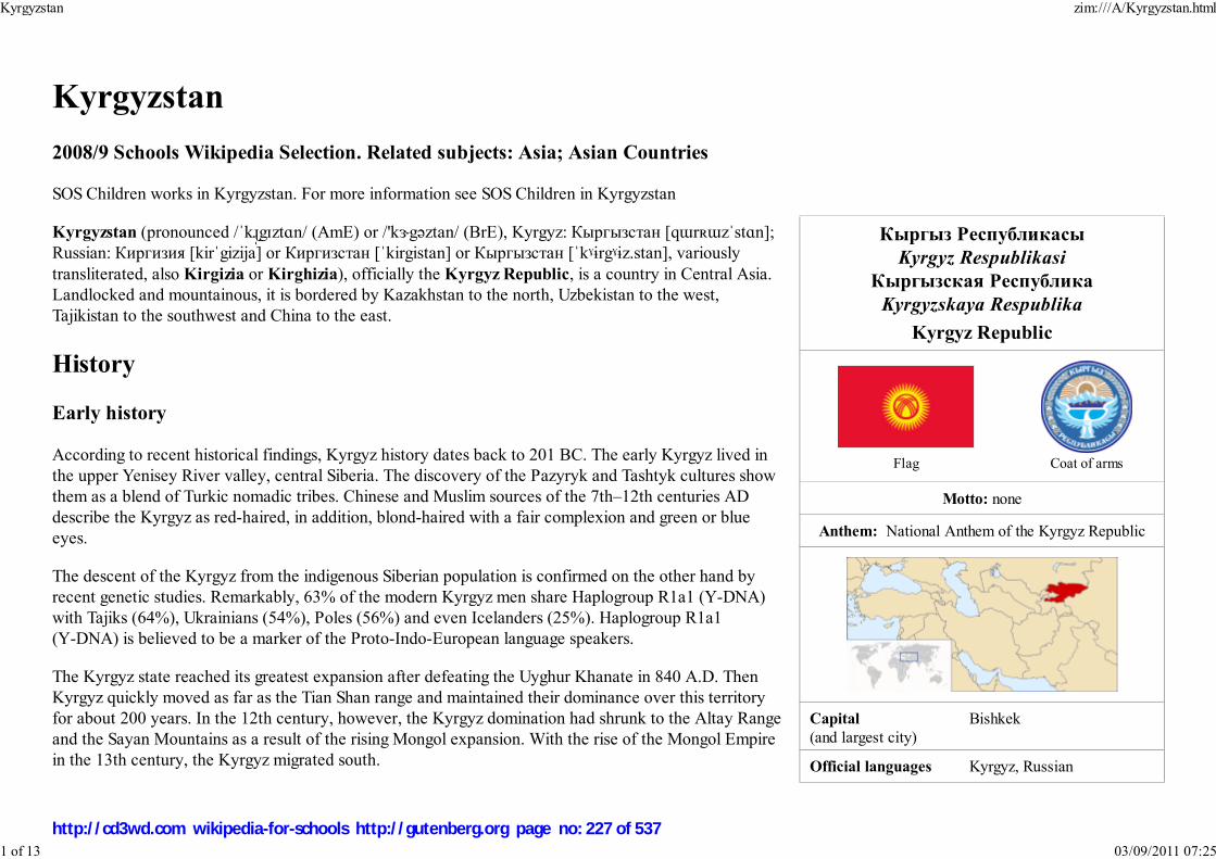
Кыргыз Республикасы
Kyrgyz Respublikasi
Кыргызская Республика
Kyrgyzskaya Respublika
Kyrgyz Republic
Flag Coat of arms
Motto: none
Anthem: National Anthem of the Kyrgyz Republic
Capital
(and largest city)
Bishkek
Official languages Kyrgyz, Russian
Kyrgyzstan
2008/9 Schools Wikipedia Selection. Related subjects: Asia; Asian Countries
SOS Children works in Kyrgyzstan. For more information see SOS Children in Kyrgyzstan
Kyrgyzstan (pronounced /ˈkɻ̩gɪztɑn/ (AmE) or /'kɝgəztan/ (BrE), Kyrgyz: Кыргызстан [qɯrʀɯzˈstɑn];
Russian: Киргизия [kirˈgizija] or Киргизстан [ˈkirgistan] or Кыргызстан [ˈkˠɨrgˠɨz.stan], variously
transliterated, also Kirgizia or Kirghizia), officially the Kyrgyz Republic, is a country in Central Asia.
Landlocked and mountainous, it is bordered by Kazakhstan to the north, Uzbekistan to the west,
Tajikistan to the southwest and China to the east.
History
Early history
According to recent historical findings, Kyrgyz history dates back to 201 BC. The early Kyrgyz lived in
the upper Yenisey River valley, central Siberia. The discovery of the Pazyryk and Tashtyk cultures show
them as a blend of Turkic nomadic tribes. Chinese and Muslim sources of the 7th–12th centuries AD
describe the Kyrgyz as red-haired, in addition, blond-haired with a fair complexion and green or blue
eyes.
The descent of the Kyrgyz from the indigenous Siberian population is confirmed on the other hand by
recent genetic studies. Remarkably, 63% of the modern Kyrgyz men share Haplogroup R1a1 (Y-DNA)
with Tajiks (64%), Ukrainians (54%), Poles (56%) and even Icelanders (25%). Haplogroup R1a1
(Y-DNA) is believed to be a marker of the Proto-Indo-European language speakers.
The Kyrgyz state reached its greatest expansion after defeating the Uyghur Khanate in 840 A.D. Then
Kyrgyz quickly moved as far as the Tian Shan range and maintained their dominance over this territory
for about 200 years. In the 12th century, however, the Kyrgyz domination had shrunk to the Altay Range
and the Sayan Mountains as a result of the rising Mongol expansion. With the rise of the Mongol Empire
in the 13th century, the Kyrgyz migrated south.
Kyrgyzstan zim:///A/Kyrgyzstan.html
1 of 13 03/09/2011 07:25
http://cd3wd.com wikipedia-for-schools http://gutenberg.org page no: 227 of 537
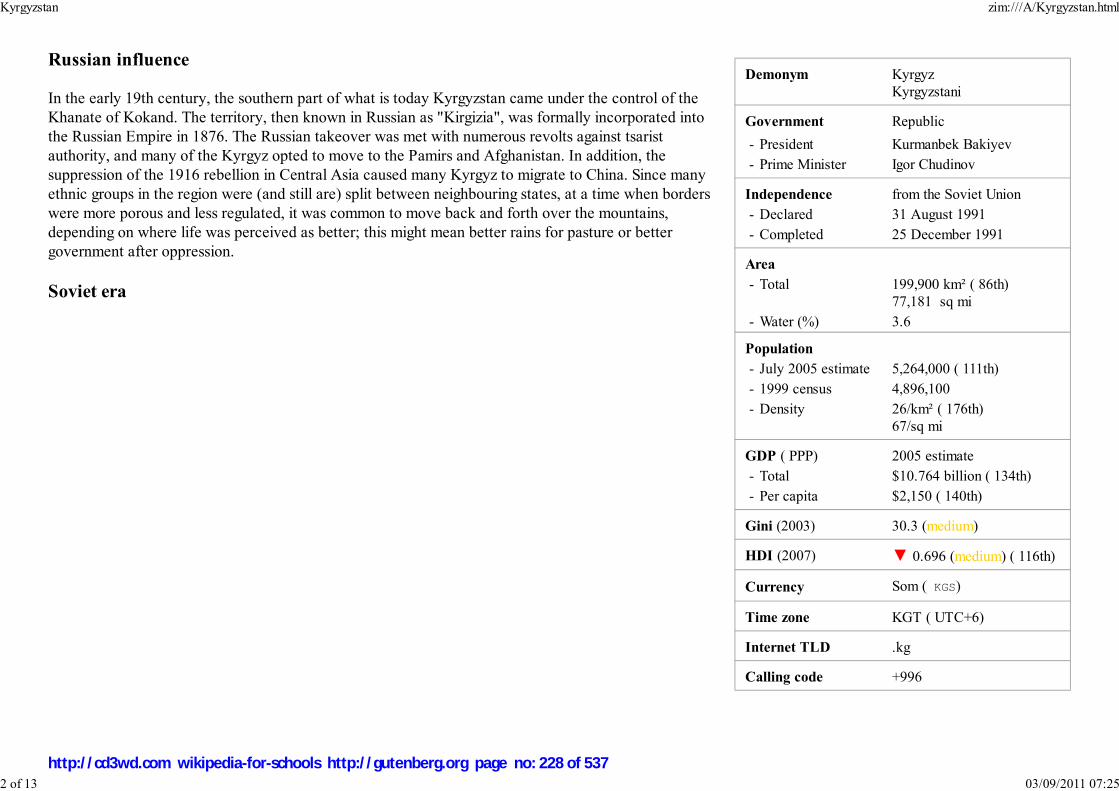
Demonym Kyrgyz
Kyrgyzstani
Government Republic
- President Kurmanbek Bakiyev
- Prime Minister Igor Chudinov
Independence from the Soviet Union
- Declared 31 August 1991
- Completed 25 December 1991
Area
- Total 199,900 km² ( 86th)
77,181 sq mi
- Water (%) 3.6
Population
- July 2005 estimate 5,264,000 ( 111th)
- 1999 census 4,896,100
- Density 26/km² ( 176th)
67/sq mi
GDP ( PPP) 2005 estimate
- Total $10.764 billion ( 134th)
- Per capita $2,150 ( 140th)
Gini (2003) 30.3 (medium)
HDI (2007) ▼ 0.696 (medium) ( 116th)
Currency Som ( KGS)
Time zone KGT ( UTC+6)
Internet TLD .kg
Calling code +996
Russian influence
In the early 19th century, the southern part of what is today Kyrgyzstan came under the control of the
Khanate of Kokand. The territory, then known in Russian as "Kirgizia", was formally incorporated into
the Russian Empire in 1876. The Russian takeover was met with numerous revolts against tsarist
authority, and many of the Kyrgyz opted to move to the Pamirs and Afghanistan. In addition, the
suppression of the 1916 rebellion in Central Asia caused many Kyrgyz to migrate to China. Since many
ethnic groups in the region were (and still are) split between neighbouring states, at a time when borders
were more porous and less regulated, it was common to move back and forth over the mountains,
depending on where life was perceived as better; this might mean better rains for pasture or better
government after oppression.
Soviet era
Kyrgyzstan zim:///A/Kyrgyzstan.html
2 of 13 03/09/2011 07:25
http://cd3wd.com wikipedia-for-schools http://gutenberg.org page no: 228 of 537

Bishkek
Displays in the former LeninMuseum (now part of the
National Museum) celebratedKyrgyzstan's membership in the
Soviet Union
Soviet power was initially established in the region in 1919 and the Kara-Kyrgyz Autonomous Oblast was created within the
Russian SFSR (the term Kara-Kirghiz was used until the mid-1920s by the Russians to distinguish them from the Kazakhs, who
were also referred to as Kirghiz). On December 5, 1936, the Kirghiz Soviet Socialist Republic was established as a full republic
of the Soviet Union.
During the 1920s, Kyrgyzstan developed considerably in cultural, educational, and social life. Literacy was greatly improved,
and a standard literary language was introduced by imposing Russian on the populace. Economic and social development also
was notable. Many aspects of the Kyrgyz national culture were retained despite the suppression of nationalist activity under
Stalin, and, therefore, tensions with the all-Union authorities were constant.
The early years of glasnost had little effect on the political climate in Kyrgyzstan. However, the Republic's press was permitted
to adopt a more liberal stance and to establish a new publication, Literaturny Kirghizstan, by the Union of Writers. Unofficial
political groups were forbidden, but several groups that emerged in 1989 to deal with the acute housing crisis were permitted to
function.
In June 1990, ethnic tensions between Uzbeks and Kyrgyz surfaced in the Osh Oblast, where Uzbeks form a majority of the
population. Violent confrontations ensued, and a state of emergency and curfew were introduced. Order was not restored until
August 1990.
The early 1990s brought considerable change to Kyrgyzstan. By then, the Kyrgyzstan Democratic Movement (KDM) had
developed into a significant political force with support in Parliament. In an upset victory, Askar Akayev, the liberal President
of the Kyrgyz Academy of Sciences, was elected to the Presidency in October 1990. The following January, Akayev
introduced new government structures and appointed a new government composed mainly of younger, reform-oriented
politicians.
In December 1990, the Supreme Soviet voted to change the republic's name to the Republic of Kyrgyzstan. (In 1993, it became the Kyrgyz Republic.) In
February 1991, the name of the capital, Frunze, was changed back to its prerevolutionary name of Bishkek. Despite these aesthetic moves toward
independence, economic realities seemed to work against secession from the Soviet Union. In a referendum on the preservation of the Soviet Union in March
1991, 88.7% of the voters approved the proposal to retain the Soviet Union as a "renewed federation."
On August 19, 1991, when the State Emergency Committee assumed power in Moscow, there was an attempt to depose Akayev in Kyrgyzstan. After the coup
collapsed the following week, Akayev and Vice President German Kuznetsov announced their resignations from the Communist Party of the Soviet Union
(CPSU), and the entire bureau and secretariat resigned. This was followed by the Supreme Soviet vote declaring independence from the Soviet Union on August
31, 1991.
Independence
Kyrgyzstan zim:///A/Kyrgyzstan.html
3 of 13 03/09/2011 07:25
http://cd3wd.com wikipedia-for-schools http://gutenberg.org page no: 229 of 537

President Kurmanbek Bakiyev
In October 1991, Akayev ran unopposed and was elected president of the new independent Republic by direct ballot, receiving 95% of the votes cast. Together
with the representatives of seven other Republics that same month, he signed the Treaty of the New Economic Community. Finally, on December 21, 1991,
Kyrgyzstan joined with the other four Central Asian Republics to formally enter the new Commonwealth of Independent States. In 1992, Kyrgyzstan joined the
UN and the CSCE.
The " Tulip Revolution," after the parliamentary elections in March 2005, forced President Akayev's resignation on April 4, 2005. Opposition leaders formed a
coalition and a new government was formed under President Kurmanbek Bakiyev and Prime Minister Feliks Kulov. The nation's capital was also looted during
the protests.
Political stability appears to be elusive, however, as various groups and factions allegedly linked to organized crime are jockeying for power. Three of the 75
members of Parliament elected in March 2005 were assassinated, and another member was assassinated on 10 May 2006 shortly after winning his murdered
brother's seat in a by-election. All four are reputed to have been directly involved in major illegal business ventures.
Current concerns in Kyrgyzstan include: privatization of state-owned enterprises, expansion of democracy and political freedoms, inter-ethnic relations, and
terrorism.
Politics
The 1993 constitution defines the form of government as a democratic republic. The executive branch includes a president
and prime minister. The parliament currently is unicameral. The judicial branch comprises a Supreme Court, a
Constitutional Court, local courts, and a Chief Prosecutor.
In March 2002, in the southern district of Aksy, five people protesting the arbitrary arrest of an opposition politician were
shot dead by police, sparking nationwide protests. President Akayev initiated a constitutional reform process which
initially included the participation of a broad range of government, civil, and social representatives in an open dialogue,
leading to a February 2003 referendum marred by voting irregularities. The amendments to the constitution approved by
the referendum resulted in stronger control by the president and weakened the parliament and the Constitutional Court.
Parliamentary elections for a new, 75-seat unicameral legislature were held on February 27 and March 13, 2005, but were
widely viewed as corrupt. The subsequent protests led to a bloodless coup on March 24, after which Akayev fled the
country and was replaced by acting president Kurmanbek Bakiyev. (see: Tulip Revolution).
Interim government leaders are developing a new governing structure for the country and working to resolve outstanding
constitutional issues. On July 10, 2005, acting president Bakiyev won the presidential election in a landslide, with 88.9% of the vote, and was inaugurated on 14
August. However, initial public support for the new administration substantially declined in subsequent months as a result of its apparent inability to solve the
corruption problems that have plagued the country since its independence from the Soviet Union, along with the murders of several members of parliament.
Largescale protests against president Bakiyev took place in Bishkek in April and November of 2006, with opposition leaders accusing the president of failing to
Kyrgyzstan zim:///A/Kyrgyzstan.html
4 of 13 03/09/2011 07:25
http://cd3wd.com wikipedia-for-schools http://gutenberg.org page no: 230 of 537

Provinces of Kyrgyzstan
live up to his election promises to reform the country's constitution and transfer many of his presidential powers to parliament.
Provinces and districts
Kyrgyzstan is divided into seven provinces (sing. oblast (область), pl. oblasttar (областтар)) administered by appointed governors. The capital, Bishkek, and
the second large city Osh are administratively the independent cities (shaar) with a status equal to a province.
The provinces, and independent cities, are as follows:
Bishkek (city)1.Batken2.
Chui3.
Jalal-Abad4.Naryn5.
Osh (province)6.
Talas7.Issyk-Kul8.
Osh (city)9.
Each province comprises a number of districts ( raions), administered by government-appointed
officials (akim). Rural communities (ayıl ökmötü), consisting of up to twenty small settlements, have
their own elected mayors and councils.
Geography
Kyrgyzstan zim:///A/Kyrgyzstan.html
5 of 13 03/09/2011 07:25
http://cd3wd.com wikipedia-for-schools http://gutenberg.org page no: 231 of 537

Map of Kyrgyzstan
Ala Archa gorge near Bishkek
Kyrgyzstan is a landlocked country in Central Asia, bordering Kazakhstan, China, Tajikistan and Uzbekistan. The mountainous
region of the Tian Shan covers over 80% of the country (Kyrgyzstan is occasionally referred to as "the Switzerland of Central
Asia", as a result ), with the remainder made up of valleys and basins. Lake Issyk-Kul in the north-western Tian Shan is the
largest lake in Kyrgyzstan and the second largest mountain lake in the world after Titicaca. The highest peaks are in the
Kakshaal-Too range, forming the Chinese border. Peak Jengish Chokusu, at 24,400 feet (7,439 m), is the highest point and is
considered by geologists (though not mountaineers) to be the northernmost 23,000 foot (7,000 m) peak in the world. Heavy
snowfall in winter leads to spring floods which often cause serious damage downstream. The runoff from the mountains is also
used for hydro-electricity.
The climate varies regionally. The south-western Fergana Valley is subtropical and extremely hot in summer, with temperatures
reaching 40°C (104°F.) The northern foothills are temperate and the Tian Shan varies from dry continental to polar climate,
depending on elevation. In the coldest areas temperatures are sub-zero for around 40 days in winter, and even some desert
areas experience constant snowfall in this period.
Kyrgyzstan has significant deposits of metals including gold and rare earth metals. Due to the country's predominantly
mountainous terrain, less than 8% of the land is cultivated, and this is concentrated in the northern lowlands and the fringes of
the Fergana Valley.
Bishkek in the north is the capital and largest city, with approximately 900,000 inhabitants (as of 2005). The second city is the
ancient town of Osh, located in the Fergana Valley near the border with Uzbekistan. The principal river is the Naryn, flowing
west through the Fergana Valley into Uzbekistan, where it meets another of Kyrgyzstan's major rivers, the Kara Darya, forming
the Syr Darya which eventually flows into the Aral Sea — although the massive extraction of water for irrigating Uzbekistan's
cotton fields now causes the river to dry up long before reaching the Sea. The Chu River also briefly flows through Kyrgyzstan
before entering Kazakhstan.
Enclaves and exclaves
There is one exclave, the tiny village of Barak, Kyrgyzstan, (population 627) in the Fergana valley. The village is surrounded
by Uzbek territory and located between the towns of Margilan and Fergana.
There are four Uzbek enclaves within Kyrgyzstan. Two of them are the towns of Sokh (area 125 sq. mi/325 km² and a population of 42,800 in 1993, although
some estimates go as high as 70,000; 99% are Tajiks, the remainder Uzbeks), and Shakhrimardan (also known as Shakirmardon or Shah-i-Mardan, area
35 sq. mi/90 km² and a population of 5,100 in 1993; 91% are Uzbeks, the remainder Kyrgyz); the other two are the tiny territories of Chuy-Kara (or Kalacha,
roughly 3 km long by 1 km wide or 2 mi by 0.6 mi) and Dzhangail (a dot of land barely 2 or 3 km across). Chuy-Kara is on the Sokh river, between the Uzbek
border and the Sokh enclave.
There also are two enclaves belonging to Tajikistan: Vorukh (exclave area between 95 and 130 km² [37–50 sq. mi], population estimated between 23,000 and
Kyrgyzstan zim:///A/Kyrgyzstan.html
6 of 13 03/09/2011 07:25
http://cd3wd.com wikipedia-for-schools http://gutenberg.org page no: 232 of 537
29,000, 95% Tajiks and 5% Kyrgyz, distributed among 17 villages), located 45 kilometres (28 mi) south of Isfara on the right bank of the Karafshin river, and a
small settlement near the Kyrgyz railway station of Kairagach.
Economy
Despite the backing of major Western lenders, including the International Monetary Fund (IMF), the World Bank and the Asian Development Bank, Kyrgyzstan
has had economic difficulties following independence. Initially, these were a result of the breakup of the Soviet trading bloc and resulting loss of markets, which
impeded the republic's transition to a free market economy. The government has reduced expenditures, ended most price subsidies, and introduced a
value-added tax. Overall, the government appears committed to the transition to a market economy. Through economic stabilization and reform, the
government seeks to establish a pattern of long-term consistent growth. Reforms led to Kyrgyzstan's accession to the World Trade Organization (WTO) on
December 20, 1998.
The Kyrgyz economy was severely affected by the collapse of the Soviet Union and the resulting loss of its vast market. In 1990, some 98% of Kyrgyz exports
went to other parts of the Soviet Union. Thus, the nation's economic performance in the early 1990s was worse than any other former Soviet republic except
war-torn Armenia, Azerbaijan, and Tajikistan, as factories and state farms collapsed with the disappearance of their traditional markets in the former Soviet
Union. While economic performance has improved considerably in the last few years, and particularly since 1998, difficulties remain in securing adequate fiscal
revenues and providing an adequate social safety net.
Agriculture is an important sector of the economy in Kyrgyzstan (see agriculture in Kyrgyzstan). By the early 1990s, the private agricultural sector provided
between one-third and one-half of some harvests. In 2002 agriculture accounted for 35.6% of GDP and about half of employment. Kyrgyzstan's terrain is
mountainous, which accommodates livestock raising, the largest agricultural activity, so the resulting wool, meat, and dairy products are major commodities.
Main crops include wheat, sugar beets, potatoes, cotton, tobacco, vegetables, and fruit. As the prices of imported agrichemicals and petroleum are so high, much
farming is being done by hand and by horse, as it was generations ago. Agricultural processing is a key component of the industrial economy, as well as one of
the most attractive sectors for foreign investment.
Kyrgyzstan is rich in mineral resources but has negligible petroleum and natural gas reserves; it imports petroleum and gas. Among its mineral reserves are
substantial deposits of coal, gold, uranium, antimony, and other valuable metals. Metallurgy is an important industry, and the government hopes to attract
foreign investment in this field. The government has actively encouraged foreign involvement in extracting and processing gold. The country's plentiful water
resources and mountainous terrain enable it to produce and export large quantities of hydroelectric energy.
On a local level, the economy is primarily kiosk in nature. A large amount of local commerce occurs at bazaars and small village kiosks. Commodities such as
gas (petrol) are often sold road-side in gallon jugs. A significant amount of trade is unregulated. There is also a scarcity of common everyday consumer items in
remote villages. Thus a large number of homes are quite self-sufficient with respect to food production. There is a distinct differentiation between urban and
rural economies.
The principal exports are nonferrous metals and minerals, woolen goods and other agricultural products, electric energy, and certain engineering goods. Imports
Kyrgyzstan zim:///A/Kyrgyzstan.html
7 of 13 03/09/2011 07:25
http://cd3wd.com wikipedia-for-schools http://gutenberg.org page no: 233 of 537
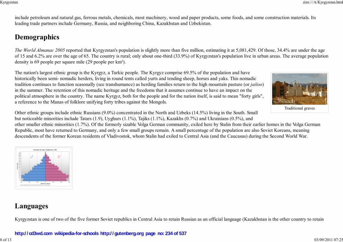
Traditional graves
include petroleum and natural gas, ferrous metals, chemicals, most machinery, wood and paper products, some foods, and some construction materials. Its
leading trade partners include Germany, Russia, and neighboring China, Kazakhstan and Uzbekistan.
Demographics
The World Almanac 2005 reported that Kyrgyzstan's population is slightly more than five million, estimating it at 5,081,429. Of those, 34.4% are under the age
of 15 and 6.2% are over the age of 65. The country is rural; only about one-third (33.9%) of Kyrgyzstan's population live in urban areas. The average population
density is 69 people per square mile (29 people per km²).
The nation's largest ethnic group is the Kyrgyz, a Turkic people. The Kyrgyz comprise 69.5% of the population and have
historically been semi- nomadic herders, living in round tents called yurts and tending sheep, horses and yaks. This nomadic
tradition continues to function seasonally (see transhumance) as herding families return to the high mountain pasture (or jailoo)
in the summer. The retention of this nomadic heritage and the freedoms that it assumes continue to have an impact on the
political atmosphere in the country. The name Kyrgyz, both for the people and for the nation itself, is said to mean "forty girls",
a reference to the Manas of folklore unifying forty tribes against the Mongols.
Other ethnic groups include ethnic Russians (9.0%) concentrated in the North and Uzbeks (14.5%) living in the South. Small
but noticeable minorities include Tatars (1.9), Uyghurs (1.1%), Tajiks (1.1%), Kazakhs (0.7%) and Ukrainians (0.5%), and
other smaller ethnic minorities (1.7%). Of the formerly sizable Volga German community, exiled here by Stalin from their earlier homes in the Volga German
Republic, most have returned to Germany, and only a few small groups remain. A small percentage of the population are also Soviet Koreans, meaning
descendents of the former Korean residents of Vladivostok, whom Stalin had exiled to Central Asia (and the Caucasus) during the Second World War.
Languages
Kyrgyzstan is one of two of the five former Soviet republics in Central Asia to retain Russian as an official language (Kazakhstan is the other country to retain
Kyrgyzstan zim:///A/Kyrgyzstan.html
8 of 13 03/09/2011 07:25
http://cd3wd.com wikipedia-for-schools http://gutenberg.org page no: 234 of 537

Musicians
Russian). It added the Kyrgyz language to become an officially bilingual country in September 1991. This sent a clear signal to the ethnic Russians that they
were welcome in the new independent state, in an effort to avoid a brain drain. Kyrgyz is a member of the Turkic group of languages and was written in the
Arabic alphabet until the 20th century. Latin script was introduced and adopted in 1928, and was subsequently replaced by Cyrillic script in 1941.
Generally, people all over the country understand and speak Russian, except for some remote mountain areas. Russian is the mother tongue of the majority of
Bishkek dwellers, and most business and political affairs are carried out in this language. Until recently, Kyrgyz remained a language spoken at home, and was
rarely used during meetings or other events. However, most parliamentary meetings today are conducted in Kyrgyz, with simultaneous interpretation available
for those not speaking Kyrgyz.
Culture
Manas, an epic poemKomuz, a three-stringed lute
Tush kyiz, large, elaborately embroidered wall hangings
Shirdak, flat cushions made in shadow-pairsother textiles, especially made from felt
Falconry
Traditions
Illegal, but still practiced, is the tradition of bride kidnapping.
It is debatable whether bride kidnapping is actually traditional. Some of the confusion may stem from the fact that arranged marriages were traditional, and one
of the ways to escape an arranged marriage was to arrange a consensual "kidnapping."
Religion
Kyrgyzstan zim:///A/Kyrgyzstan.html
9 of 13 03/09/2011 07:25
http://cd3wd.com wikipedia-for-schools http://gutenberg.org page no: 235 of 537

Karakol Dungan Mosque
American University of CentralAsia
During Soviet times, state atheism was encouraged. Today, however, Kyrgyzstan is a secular state though
Islam has exerted growing influence in politics.. For instance, there have been various attempts to
decriminalize polygamy, and to arrange for officials to travel on hajj (the pilgrimage to Mecca) under a
tax-free arrangement. Kyrgyzstan is an overwhelmingly Sunni Muslim nation, and adheres to the Hanafi
school of thought.
While Islam in Kyrgyzstan is more of a cultural background than a devout daily practice for many, public
figures have expressed support for restoring religious values. For example, human rights ombudsman
Tursunbay Bakir-Ulu noted, "In this era of independence, it is not surprising that there has been a return to
spiritual roots not only in Kyrgyzstan, but also in other post-communist republics. It would be immoral to
develop a market-based society without an ethical dimension." Additionally, Bermet Akayeva, the
daughter of Askar Akayev, the former President of Kyrgyzstan, stated during a July 2007 interview that
Islam is increasingly taking root across the nation. She emphasized that many mosques have been built and
that the Kyrgyz are increasingly devoting themselves to Islam, which she noted was "not a bad thing in
itself. It keeps our society more moral, cleaner."
The other faiths practiced in Kyrgyzstan include Russian Orthodox and Ukrainian Orthodox versions of Christianity, practiced primarily by Russians and
Ukrainians respectively. A small minority of Germans are Protestant Christians, mostly Lutherans and Baptists. A few Animistic traditions survive, as do
influences from Buddhism such as the tying of prayer flags onto sacred trees, though some view this practice rooted within Sufi Islam. There are also a small
number of Bukharian Jews living in Kyrgyzstan, but during the collapse of the Soviet Union most fled to other countries, mainly the United States and Israel.
Flag
The 40-rayed yellow sun in the centre of the flag represents 40 warriors of the mythical hero Manas. The lines inside the sun represent the crown or tündük
(Kyrgyz түндүк) of a yurt, a symbol replicated in many facets of Kyrgyz architecture. The red portion of the flag represents peace and openness of Kyrgyzstan.
Education
Educational institutions in Kyrgyzstan include:
University of Central Asia
American University of Central Asia
Bishkek Humanities UniversityInternational Ataturk-Alatoo University
Kyrgyzstan zim:///A/Kyrgyzstan.html
10 of 13 03/09/2011 07:25
http://cd3wd.com wikipedia-for-schools http://gutenberg.org page no: 236 of 537
International University of KyrgyzstanKyrgyz National University
Arabaev Kyrgyz State University
Kyrgyz Russian Slavonic UniversityKyrgyz-Russian State University
Kyrgyz-Turkish MANAS University
Kyrgyz Uzbek UniversityMoskov Institute of Law and Enterprise
Osh State University
Osh Technological University
Horse riding
The traditional national sports reflect the importance of horse riding in Kyrgyz culture.
Very popular, as in all of Central Asia, is Ulak Tartysh, a team game resembling a cross between polo and rugby in which two teams of riders wrestle for
possession of the headless carcass of a goat, which they attempt to deliver across the opposition's goal line, or into the opposition's goal: a big tub or a circle
marked on the ground.
Other popular games on horseback include:
Aht Chabysh - a long-distance horse race, sometimes over a distance of more than 50 kmJumby Atmai - a large bar of precious metal (the "jumby") is tied to a pole by a thread and contestants attempt to break the thread by shooting at it, while
at a gallop
Kyz Kuumai - a man chases a girl in order to win a kiss from her, while she gallops away; if he is not successful she may beat him with her "kamchi"(horsewhip)
Oodarysh - two contestants wrestle on horseback, each attempting to be the first to throw the other from his horse
Tyin Enmei - picking up a coin from the ground at full gallop
Transport
Kyrgyzstan zim:///A/Kyrgyzstan.html
11 of 13 03/09/2011 07:25
http://cd3wd.com wikipedia-for-schools http://gutenberg.org page no: 237 of 537
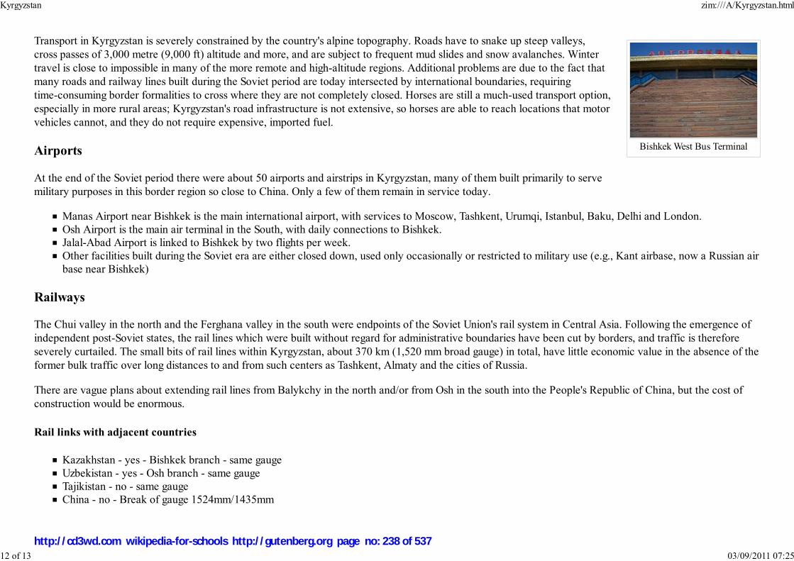
Bishkek West Bus Terminal
Transport in Kyrgyzstan is severely constrained by the country's alpine topography. Roads have to snake up steep valleys,
cross passes of 3,000 metre (9,000 ft) altitude and more, and are subject to frequent mud slides and snow avalanches. Winter
travel is close to impossible in many of the more remote and high-altitude regions. Additional problems are due to the fact that
many roads and railway lines built during the Soviet period are today intersected by international boundaries, requiring
time-consuming border formalities to cross where they are not completely closed. Horses are still a much-used transport option,
especially in more rural areas; Kyrgyzstan's road infrastructure is not extensive, so horses are able to reach locations that motor
vehicles cannot, and they do not require expensive, imported fuel.
Airports
At the end of the Soviet period there were about 50 airports and airstrips in Kyrgyzstan, many of them built primarily to serve
military purposes in this border region so close to China. Only a few of them remain in service today.
Manas Airport near Bishkek is the main international airport, with services to Moscow, Tashkent, Urumqi, Istanbul, Baku, Delhi and London.
Osh Airport is the main air terminal in the South, with daily connections to Bishkek.Jalal-Abad Airport is linked to Bishkek by two flights per week.
Other facilities built during the Soviet era are either closed down, used only occasionally or restricted to military use (e.g., Kant airbase, now a Russian air
base near Bishkek)
Railways
The Chui valley in the north and the Ferghana valley in the south were endpoints of the Soviet Union's rail system in Central Asia. Following the emergence of
independent post-Soviet states, the rail lines which were built without regard for administrative boundaries have been cut by borders, and traffic is therefore
severely curtailed. The small bits of rail lines within Kyrgyzstan, about 370 km (1,520 mm broad gauge) in total, have little economic value in the absence of the
former bulk traffic over long distances to and from such centers as Tashkent, Almaty and the cities of Russia.
There are vague plans about extending rail lines from Balykchy in the north and/or from Osh in the south into the People's Republic of China, but the cost of
construction would be enormous.
Rail links with adjacent countries
Kazakhstan - yes - Bishkek branch - same gauge
Uzbekistan - yes - Osh branch - same gauge
Tajikistan - no - same gaugeChina - no - Break of gauge 1524mm/1435mm
Kyrgyzstan zim:///A/Kyrgyzstan.html
12 of 13 03/09/2011 07:25
http://cd3wd.com wikipedia-for-schools http://gutenberg.org page no: 238 of 537

A road in Osh
Highways
With support from the Asian Development Bank, a major road linking the north and southwest from Bishkek to Osh has
recently been completed. This considerably eases communication between the two major population centers of the country --
the Chui Valley in the north and the Fergana Valley in the South. An offshoot of this road branches off across a 3,500 meter
pass into the Talas Valley in the northwest. Plans are now being formulated to build a major road from Osh into the People's
Republic of China.
total: 30,300 km (including 140 km of expressways)
paved: 22,600 km (includes some all-weather gravel-surfaced roads)
unpaved: 7,700 km (these roads are made of unstabilized earth and are difficult to negotiate in wet weather) (1990)
Pipelines
Natural gas 200 km
Waterways
Water transport exists only on Lake Issyk Kul, and has drastically shrunk since the end of the Soviet Union.
Ports and harbours
Balykchy (Ysyk-Kol or Rybach'ye), on Lake Issyk Kul.
Retrieved from " http://en.wikipedia.org/wiki/Kyrgyzstan"
This Wikipedia DVD Selection has a sponsor: SOS Children , and is mainly selected from the English Wikipedia with only minor checks and changes (see
www.wikipedia.org for details of authors and sources). The articles are available under the GNU Free Documentation License. See also our
Kyrgyzstan zim:///A/Kyrgyzstan.html
13 of 13 03/09/2011 07:25
http://cd3wd.com wikipedia-for-schools http://gutenberg.org page no: 239 of 537

ສາທາລະນະລັດ ປະຊາທິປະໄຕ ປະຊາຊົນລາວSathalanalat Paxathipatai Paxaxon Lao
Lao People's Democratic Republic
Flag Coat of arms
Motto: ສັນຕິພາບ ເອກະລາດ ປະຊາທິປະໄຕເອກະພາບ ວັດທະນາຖາວອນ
"Peace, Independence, Democracy, Unity and
Prosperity"
Anthem: Pheng Xat Lao
Capital
(and largest city)
Vientiane
Official languages Lao
Laos
2008/9 Schools Wikipedia Selection. Related subjects: Asia; Asian Countries
SOS Children works in Laos. For more information see SOS Children in Laos
Laos (pronounced /ˈlɑːoʊs/ or /ˈlaʊs/), officially the Lao People's Democratic Republic, is a
landlocked country in southeast Asia, bordered by Burma (Myanmar) and China to the northwest,
Vietnam to the east, Cambodia to the south, and Thailand to the west. Laos traces its history to the
Kingdom of Lan Xang or Land of a Million Elephants, which existed from the fourteenth to the
eighteenth century. After a period as a French protectorate, it gained independence in 1949. A long civil
war ended officially when the communist Pathet Lao movement came to power in 1975 but the
protesting between factions continued for several years.
Private enterprise has increased since the late 1990s when economic reforms including rapid business
licensing were introduced. Laos is still ranked among the lowest countries in terms of economic and
political freedom. The economy of Laos grew at 7.2% in 2006, 35th fastest in the world. Eighty percent
of the employed practice subsistence agriculture. The country's ethnic make-up is diverse, with around
70% belonging to the largest ethnic group, the Lao.
Etymology
In the Lao language, the country's name is "Meuang Lao". The Imperial French, who made the country
part of French Indochina in 1893, spelled it with a final silent "s", i.e. "Laos" (The Lao language itself has
no final 's' sound, so Lao people do not pronounce the word Laos). The usual adjectival form is "Lao",
e.g. "the Lao economy", not the "Laotian" economy--although "Laotian" is used to describe the people
of Laos to avoid confusion with the Lao ethnic group.
History
Laos zim:///A/Laos.html
1 of 7 03/09/2011 07:26
http://cd3wd.com wikipedia-for-schools http://gutenberg.org page no: 240 of 537

Demonym Laotian, Lao
Government Socialist Republic
- President Lt. Gen. Choummaly
Sayasone
- Prime Minister Bouasone Bouphavanh
Independence from France
- Date 19 July 1949
Area
- Total 236,800 km² ( 83rd)
91,429 sq mi
- Water (%) 2
Population
- 2007 estimate 6,521,998 ( 106th)
- 1995 census 4,574,848
- Density 25/km² ( 177th)
65/sq mi
GDP ( PPP) 2006 estimate
- Total $13.75 billion ( 129th)
- Per capita $2,200 ( 138th)
Gini (2002) 34.6 (medium)
HDI (2007) ▲ 0.601 (medium) ( 130th)
Currency Kip ( LAK)
Time zone ( UTC+7)
Internet TLD .la
Calling code [[+ 856]]
The Mekong river at LuangPrabang
Laos traces its history to the kingdom of Lan Xang, founded in the
fourteenth century by Fa Ngum, himself descended from a long line of
Lao kings, tracking back to Khoun Boulom. Lan-Xang prospered until
the eighteenth century, when the kingdom was divided into three
principalities, which eventually came under Siamese suzerainty. In the
19th century, Luang Prabang was incorporated into the 'Protectorate'
of French Indochina, and shortly thereafter, the kingdom of
Champassack and the territory of Vientiane were also added to the
protectorate. The French saw Laos as a useful buffer state between the
two expanding empires of France and Britain. Under the French,
Vientiane once again became the capital of a unified Lao state.
Following a brief Japanese occupation during World War II, the country declared its independence in
1945, but the French under De Gaulle re-asserted their control and only in 1950 was Laos granted
semi-autonomy as an "associated state" within the French Union. Moreover, the French remained in de
facto control until 1954, when Laos gained full independence as a constitutional monarchy. Under a
special exemption to the Geneva Convention, a French military training mission continued to support the
Royal Laos Army. In 1955, the U.S. Department of Defense created a special Programs Evaluation
Office to replace French support of the Royal Lao Army against the communist Pathet Lao as part of the
U.S. containment policy.
Laos was dragged into the Vietnam War, and the eastern parts of the country were invaded and occupied
by the North Vietnamese Army (NVA), which used Laotian territory as a staging ground and supply route
for its war against the South. In response, the United States initiated a bombing campaign against the
North Vietnamese, supported regular and irregular anticommunist forces in Laos and supported a South
Vietnamese invasion of Laos. The result of these actions were a series of coups d'état and, ultimately, the
Laotian Civil War between the Royal Laotian government and the communist Pathet Lao.
In the Civil War, the NVA, with its heavy artillery and tanks, was the real power behind the Pathet Lao
insurgency. In 1968, the North Vietnamese Army launched a multi-division attack against the Royal Lao
Army. The attack resulted in the army largely demobilizing and leaving the conflict to irregular forces
raised by the United States and Thailand.
Massive aerial bombardment by the United States followed as it attempted to eliminate North Vietnamese
bases in Laos in order to disrupt supply lines on the Ho Chi Minh/Trường Sơn Trail. Between 1971 and
1973 the USAF dropped more ordnance on Laos than was dropped worldwide during World War II (1939−45). In total more than 2 million tonnes of bombs
were dropped (almost 1/2 a tonne per head of population at the time).
Laos zim:///A/Laos.html
2 of 7 03/09/2011 07:26
http://cd3wd.com wikipedia-for-schools http://gutenberg.org page no: 241 of 537
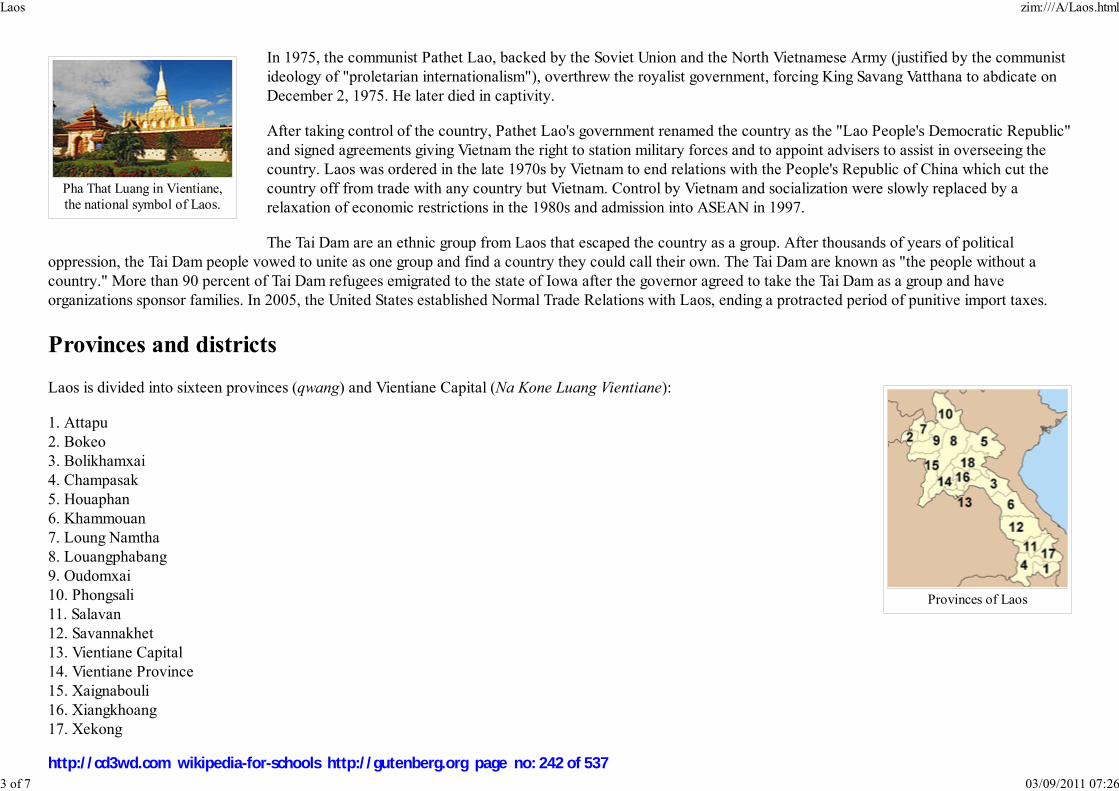
Pha That Luang in Vientiane,the national symbol of Laos.
Provinces of Laos
In 1975, the communist Pathet Lao, backed by the Soviet Union and the North Vietnamese Army (justified by the communist
ideology of "proletarian internationalism"), overthrew the royalist government, forcing King Savang Vatthana to abdicate on
December 2, 1975. He later died in captivity.
After taking control of the country, Pathet Lao's government renamed the country as the "Lao People's Democratic Republic"
and signed agreements giving Vietnam the right to station military forces and to appoint advisers to assist in overseeing the
country. Laos was ordered in the late 1970s by Vietnam to end relations with the People's Republic of China which cut the
country off from trade with any country but Vietnam. Control by Vietnam and socialization were slowly replaced by a
relaxation of economic restrictions in the 1980s and admission into ASEAN in 1997.
The Tai Dam are an ethnic group from Laos that escaped the country as a group. After thousands of years of political
oppression, the Tai Dam people vowed to unite as one group and find a country they could call their own. The Tai Dam are known as "the people without a
country." More than 90 percent of Tai Dam refugees emigrated to the state of Iowa after the governor agreed to take the Tai Dam as a group and have
organizations sponsor families. In 2005, the United States established Normal Trade Relations with Laos, ending a protracted period of punitive import taxes.
Provinces and districts
Laos is divided into sixteen provinces (qwang) and Vientiane Capital (Na Kone Luang Vientiane):
1. Attapu
2. Bokeo
3. Bolikhamxai
4. Champasak
5. Houaphan
6. Khammouan
7. Loung Namtha
8. Louangphabang
9. Oudomxai
10. Phongsali
11. Salavan
12. Savannakhet
13. Vientiane Capital
14. Vientiane Province
15. Xaignabouli
16. Xiangkhoang
17. Xekong
Laos zim:///A/Laos.html
3 of 7 03/09/2011 07:26
http://cd3wd.com wikipedia-for-schools http://gutenberg.org page no: 242 of 537

Map of Laos
Landscape in Vang Vieng
The country is further divided into districts (muang).
Geography
Laos is a landlocked country in Southeast Asia and the thickly forested landscape consists mostly of rugged mountains, the
highest of which is Phou Bia at 2,817 m (9,242 feet), with some plains and plateaus. The Mekong River forms a large part of
the western boundary with Thailand, whereas the mountains of the Annamite Chain form most of the eastern border with
Vietnam.
The climate is tropical and monsoonal. There is a distinct rainy season
from May to November, followed by a dry season from December to
April. Local tradition holds that there are three seasons (rainy, cold and
hot) as the latter two months of the climatologically defined dry season
are noticeably hotter than the earlier four months. The capital and largest
city of Laos is Vientiane, and other major cities include Luang Prabang,
Savannakhet and Pakxe.
In 1993, the government set aside 21% of the nation's land area as
National Biodiversity Conservation Areas (NBCA), which may be developed into a national park system.
Laos is the home to the Indochinese tiger, the giant gaur, and the Asian elephant. A number of animal
species have been discovered or re-discovered in Laos in recent years. These include the striped or
Annamite rabbit, the saola, and most recently the Laotian rock rat or kha-nyou.
The country is one of four in the opium poppy growing region known as the " Golden Triangle". According to the October 2007 UNODC fact book "Opium
Poppy Cultivation in South East Asia", the poppy cultivation area was 15 square kilometres (3,700 acres), down from 18 square kilometres (4,400 acres) in
2005.
Economy
Laos zim:///A/Laos.html
4 of 7 03/09/2011 07:26
http://cd3wd.com wikipedia-for-schools http://gutenberg.org page no: 243 of 537

Wattay International Airport inVientiane.
The Mekong at Luang Prabang.
The Nam Ou river is animportant transportation route
in Laos.
The government of Laos — one of the few remaining official communist states — began decentralising control and
encouraging private enterprise in 1986. The results, starting from an extremely low base, were striking: growth averaged 6% in
1988-2004 except during the short drop caused by the Asian financial crisis beginning in 1997. Major urban centers have
experienced the most growth. The economies of Vientiane, Luang Prabang and Savannakhet in particular have experienced
significant booms in recent years. The Lao economy is heavily dependent on investment and trade with its larger and richer
neighbors, Thailand, Vietnam, and, especially in the north, China. Pakxe has also experienced growth based on cross-border
trade with Thailand and Vietnam.
Much of the country, however, lacks adequate infrastructure. Laos has no railways, although a short link to connect Vientiane
with Thailand over the Thai-Lao Friendship Bridge is currently under construction. The major roads connecting the major
urban centres, in particular Route 13 South, have been significantly upgraded in recent years, but villages far from major roads
are accessible only through unpaved roads that may not be accessible year-round. There is limited external and internal
telecommunication, particularly of the wire line sort, but mobile cellular phone use has become widespread in urban centres. In
many rural areas electricity is unavailable or offered only during scheduled periods. Songthaews (pick-up trucks with benches)
are used in the country for long-distance and local public transport.
Subsistence agriculture still accounts for half of GDP and provides 80% of total employment.
Laos has the lowest percentage of arable land and permanent crop land in the Greater
Mekong Subregion. Only 4.01% of Laos is arable land, and only 0.34% of the country is
planted with permanent crops. Rice dominates agriculture, with about 80% of the arable land
area used for growing rice. Approximately 77% of Lao farm households are self-sufficient in rice. Through the development,
release and widespread adoption of improved rice varieties, and through economic reforms, Lao PDR achieved a net balance
of rice imports and exports for the first time in 1999. Between 1990 and 2005, rice production increased from 1.5 million tons
to 2.5 million tons : an average annual growth rate of more than 5%. This increase in production has been valued at $8 million
to $19 million per year. Lao PDR may have the greatest number of rice varieties in the Greater Mekong Subregion. Since
1995 the Lao government has been working with the International Rice Research Institute (IRRI) to collect seed samples of
each of the thousands of rice varieties found in Laos.
The economy receives aid from the IMF and other international sources and from new foreign investment in food processing and mining, most notably of
copper and gold. Tourism is the fastest-growing industry in the country. However, economic development in general is hampered by a serious case of brain
drain. A 2005 World Bank study reported that 37% of educated Laotians lived abroad, putting the country in fifth place for worst brain drain.
In late 2004, Laos gained Normal Trade Relations status with the US, allowing Laos-based producers to face lower tariffs on their exports; this may help spur
growth.
Demographics
Laos zim:///A/Laos.html
5 of 7 03/09/2011 07:26
http://cd3wd.com wikipedia-for-schools http://gutenberg.org page no: 244 of 537

Patuxay, was built with USAIDfunds in Vientiane in the 1960sto celebrate the independence
struggle.
In Luang Prabang, ayoung girl at the time of aHmong Meeting Festival.
69% of the country's people are ethnic Lao, the principal lowland inhabitants and the politically and culturally dominant group.
The Lao belong to the Tai linguistic group who began migrating southward from China in the first millennium AD. A further 8%
belong to other "lowland" groups, which together with the Lao people make up the Lao Loum.
Hill people and minority cultures of Laos such as the Hmong (Miao), Yao (Mien), Tai dumm,
Dao, Shan, and several Tibeto-Burman speaking peoples have lived in isolated regions of Laos for
many years. Mountain/hill tribes of mixed ethno/cultural-linguistic heritage are found in northern
Laos which include the Lua (Lua) and Khammu people who are indigenous to Laos. Today, the
Lua people are considered endangered. Collectively, they are known as Lao Soung or highland
Laotians. In the central and southern mountains, Mon- Khmer tribes, known as Lao Theung or
mid-slope Laotians, predominate. Some Vietnamese and Chinese minorities remain, particularly
in the towns, but many left in two waves; after independence in the late 1940s and again after
1975.
The term "Laotian" does not necessarily refer to the ethnic Lao language, ethnic Lao people, language or customs, but is a political
term that also includes the non-ethnic Lao groups within Laos and identifies them as "Laotian" because of their political
citizenship. In a similar vein, the word "Lao" can also describe the people, cuisine, language and culture of the people of Northeast
Thailand (Isan) who are ethnic Lao.
The predominant religion in Laos is Theravada Buddhism which, along with the common Animism practiced among the mountain
tribes, coexists peacefully with spirit worship. There also are a small number of Christians, mostly restricted to the Vientiane area, and Muslims, mostly
restricted to the Myanmar border region. Christian missionary work is regulated by the government.
The official and dominant language is Lao, a tonal language of the Tai linguistic group. Midslope and highland Lao speak an assortment of tribal languages.
French, still common in government and commerce, has declined in usage, while knowledge of English, the language of the Association of Southeast Asian
Nations (ASEAN), has increased in recent years.
Culture
Laos zim:///A/Laos.html
6 of 7 03/09/2011 07:26
http://cd3wd.com wikipedia-for-schools http://gutenberg.org page no: 245 of 537

Budda statues at Vat Aham in Luang Prabang
Theravada Buddhism is a dominant influence in Lao culture. It is reflected throughout the country from
language to the temple and in art, literature, performing arts, etc. Many elements of Lao culture predate
Buddhism, however. For example, Laotian music is dominated by its national instrument, the khaen, a type
of bamboo pipe that has prehistoric origins. The khaen traditionally accompanied the singer in lam, the
dominant style of folk music. Among the various lam styles, the lam saravane is probably the most
popular.
The country has two World Heritage Sites: Luang Prabang and Vat Phou. The government is seeking the
same status for the Plain of Jars.
The People's Republic of China has recently allowed its citizens to travel more freely to Laos. As such,
Chinese tourists are expected to account for 25% of the total number of visitors to Laos (up from only a
few percent) in 2006. Pressures to modernize tourist infrastructure, particularly to cater to package
tourism, are expected to significantly impact Luang Prabang and other culturally important Laotian cities.
The people of Laos have a reputation for being very kind and welcoming to all visitors.
Rice is the staple food and has cultural and religious significance. There are many traditions and rituals associated with rice production in different
environments, and among many ethnic groups. For example, Khammu farmers in Luang Prabang plant the rice variety Khao Kam in small quantities near the
hut in memory of dead parents, or at the edge of the rice field to indicate that parents are still alive.
International rankings
Organisation Survey Ranking
Heritage Foundation/The Wall Street Journal Index of Economic Freedom 149 out of 157
Reporters Without Borders Worldwide Press Freedom Index 156 out of 167
Transparency International Corruption Perceptions Index 111 out of 163
United Nations Development Programme Human Development Index 130 out of 177
Retrieved from " http://en.wikipedia.org/wiki/Laos"
This Wikipedia DVD Selection has a sponsor: SOS Children , and is mainly selected from the English Wikipedia with only minor checks and changes (see
www.wikipedia.org for details of authors and sources). The articles are available under the GNU Free Documentation License. See also our
Laos zim:///A/Laos.html
7 of 7 03/09/2011 07:26
http://cd3wd.com wikipedia-for-schools http://gutenberg.org page no: 246 of 537

Malaysia
Flag Coat of Arms
Motto: "Bersekutu Bertambah Mutu""Unity Is Strength"1
Anthem: Negaraku"My Country"1
Capital
(and largest city)
Kuala Lumpur
Official languages Malay2
Demonym Malaysian
Government Federal constitutional
monarchy and
Parliamentary
democracy
Malaysia
2008/9 Schools Wikipedia Selection. Related subjects: Asia; Asian Countries
Malaysia (pronounced /məˈleɪʒə/ or /məˈleɪziə/) is a country that consists of thirteen states and three
federal territories in Southeast Asia with a total landmass of 329,847 square kilometres (127,355 sq mi).
The capital city is Kuala Lumpur, while Putrajaya is the seat of the federal government. The population
stands at over 25 million. The country is separated into two regions — Peninsular Malaysia and
Malaysian Borneo — by the South China Sea. Malaysia borders Thailand, Indonesia, Singapore, Brunei
and the Philippines. The country is located near the equator and experiences a tropical climate. Malaysia
is headed by the Yang di-Pertuan Agong and politically led by a Prime Minister. The government is
closely modeled after the Westminster parliamentary system.
Malaysia as a unified state did not exist until 1963. Previously, a set of colonies were established by the
United Kingdom from the late eighteenth century, and the western half of modern Malaysia was
composed of several separate kingdoms. This group of colonies was known as British Malaya until its
dissolution in 1946, when it was reorganized as the Federation of Malaya and later recognized as an
independent nation in 1957. Singapore, Sarawak, British North Borneo and the Federation of Malaya
joined to form Malaysia on 16 September 1963. The early years of the new union were marred by an
armed conflict with Indonesia and the expulsion of Singapore. The Southeast Asian nation experienced
an economic boom and underwent rapid development during the late 20th century. With a GDP per
capita standing at USD13,000, it has, from time to time, been considered a newly industrialized country.
As one of three countries that control the Strait of Malacca, international trade plays a large role in its
economy. At one time, it was the largest producer of tin, rubber and palm oil in the world. Manufacturing
has a large influence in the country's economy.
The Malays form the majority of the population. Some Malays are of Arab descent and there are sizable
Chinese and Indian communities. Islam is the largest as well as the official religion of the federation. The
Malay language is the official language. Malay was originally written in Jawi, based on Arabic script, but
nowadays, the Roman alphabet (Rumi) is more often used.
Malaysia is a founding member of the Association of Southeast Asian Nations and participates in many
international organizations such as the United Nations. As a former British colony, it is also a member of
the Commonwealth of Nations. It is also a member of the Developing 8 Countries.
Malaysia zim:///A/Malaysia.html
1 of 17 03/09/2011 07:26
http://cd3wd.com wikipedia-for-schools http://gutenberg.org page no: 247 of 537
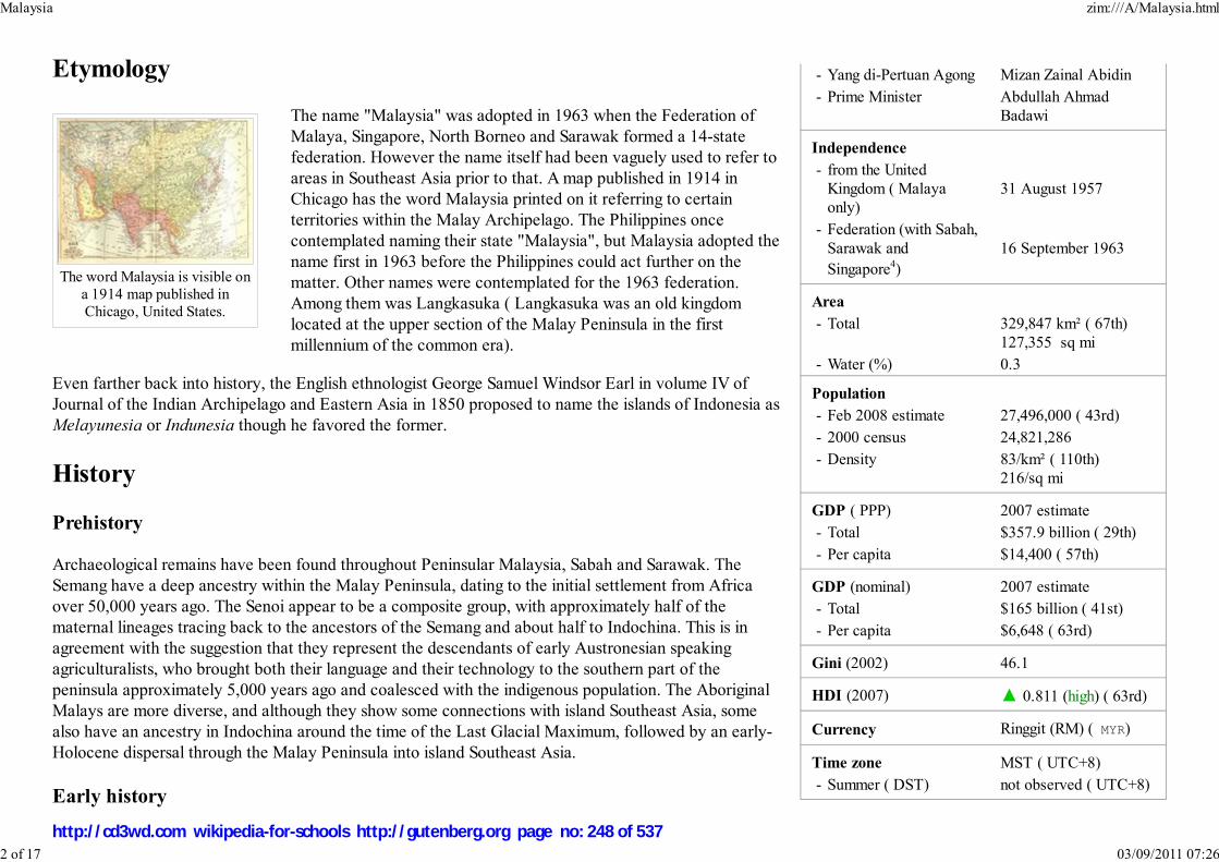
- Yang di-Pertuan Agong Mizan Zainal Abidin
- Prime Minister Abdullah Ahmad
Badawi
Independence
- from the United
Kingdom ( Malaya
only)
31 August 1957
- Federation (with Sabah,
Sarawak and
Singapore4)
16 September 1963
Area
- Total 329,847 km² ( 67th)
127,355 sq mi
- Water (%) 0.3
Population
- Feb 2008 estimate 27,496,000 ( 43rd)
- 2000 census 24,821,286
- Density 83/km² ( 110th)
216/sq mi
GDP ( PPP) 2007 estimate
- Total $357.9 billion ( 29th)
- Per capita $14,400 ( 57th)
GDP (nominal) 2007 estimate
- Total $165 billion ( 41st)
- Per capita $6,648 ( 63rd)
Gini (2002) 46.1
HDI (2007) ▲ 0.811 (high) ( 63rd)
Currency Ringgit (RM) ( MYR)
Time zone MST ( UTC+8)
- Summer ( DST) not observed ( UTC+8)
The word Malaysia is visible ona 1914 map published inChicago, United States.
Etymology
The name "Malaysia" was adopted in 1963 when the Federation of
Malaya, Singapore, North Borneo and Sarawak formed a 14-state
federation. However the name itself had been vaguely used to refer to
areas in Southeast Asia prior to that. A map published in 1914 in
Chicago has the word Malaysia printed on it referring to certain
territories within the Malay Archipelago. The Philippines once
contemplated naming their state "Malaysia", but Malaysia adopted the
name first in 1963 before the Philippines could act further on the
matter. Other names were contemplated for the 1963 federation.
Among them was Langkasuka ( Langkasuka was an old kingdom
located at the upper section of the Malay Peninsula in the first
millennium of the common era).
Even farther back into history, the English ethnologist George Samuel Windsor Earl in volume IV of
Journal of the Indian Archipelago and Eastern Asia in 1850 proposed to name the islands of Indonesia as
Melayunesia or Indunesia though he favored the former.
History
Prehistory
Archaeological remains have been found throughout Peninsular Malaysia, Sabah and Sarawak. The
Semang have a deep ancestry within the Malay Peninsula, dating to the initial settlement from Africa
over 50,000 years ago. The Senoi appear to be a composite group, with approximately half of the
maternal lineages tracing back to the ancestors of the Semang and about half to Indochina. This is in
agreement with the suggestion that they represent the descendants of early Austronesian speaking
agriculturalists, who brought both their language and their technology to the southern part of the
peninsula approximately 5,000 years ago and coalesced with the indigenous population. The Aboriginal
Malays are more diverse, and although they show some connections with island Southeast Asia, some
also have an ancestry in Indochina around the time of the Last Glacial Maximum, followed by an early-
Holocene dispersal through the Malay Peninsula into island Southeast Asia.
Early history
Malaysia zim:///A/Malaysia.html
2 of 17 03/09/2011 07:26
http://cd3wd.com wikipedia-for-schools http://gutenberg.org page no: 248 of 537

Internet TLD .my
Calling code +60
Malaysian Flag and Crest from www.gov.my.
The current terminology as per government policy is Bahasa
Malaysia (literally Malaysian language) ref but legislation
continues to refer to the official language as Bahasa Melayu
(literally Malay language).
Putrajaya is the primary seat of government.
Singapore became an independent country on 9 August 1965.
A Famosa in Malacca. It wasbuilt by the Portuguese in the
15th century.
Ptolemy showed the Malay Peninsula on his early map with a label that translates as "Golden
Chersonese", the Straits of Malacca were referred to as "Sinus Sabaricus". From the mid to the late first
millennium, much of the Peninsula as well as the Malay Archipelago were under the influence of
Srivijaya.
There were numerous Malay kingdoms in the 2nd and 3rd century CE—as many as 30 according to
Chinese sources. Kedah—known as Kedaram, Cheh-Cha (according to I-Ching) or Kataha, in ancient
Pallava or Sanskrit—was in the direct route of invasions of Indian traders and kings. Rajendra Chola,
Tamil Emperor who is now thought to have laid Kota Gelanggi to waste, put Kedah to heel in 1025 but
his successor, Vir Rajendra Chola, had to put down a Kedah rebellion to overthrow the invaders. The
coming of the Chola reduced the majesty of Srivijaya which had exerted influence over Kedah and
Pattani and even as far as Ligor.
The Buddhist kingdom of Ligor took control of Kedah shortly after, and its King Chandrabhanu used it as a base to attack Sri Lanka in the 11th century, an
event noted in a stone inscription in Nagapattinum in Tamil Nadu and in the Sri Lankan chronicles, Mahavamsa. During the first millennium, the people of the
Malay Peninsula adopted Hinduism and Buddhism and the use of the Sanskrit language until they eventually converted to Islam.
There are reports of other areas older than Kedah—the ancient kingdom of Gangga Negara, around Beruas in Perak, for
instance, pushes Malaysian history even further into antiquity. If that is not enough, a Tamil poem, Pattinapillai, of the second
century CE, describes goods from Kadaram heaped in the broad streets of the Chola capital. A seventh century Sanskrit drama,
Kaumudhimahotsva, refers to Kedah as Kataha-nagari. The Agnipurana also mentions a territory known as Anda-Kataha with
one of its boundaries delineated by a peak, which scholars believe is Gunung Jerai. Stories from the Katasaritasagaram describe
the elegance of life in Kataha.
1
2
3
4
Malaysia zim:///A/Malaysia.html
3 of 17 03/09/2011 07:26
http://cd3wd.com wikipedia-for-schools http://gutenberg.org page no: 249 of 537

Sultan Abdul Samad Buildingin Kuala Lumpur houses the
High Court of Malaya and theTrade Court. Kuala Lumpur
was the capital of the FederatedMalay States and is the current
Malaysian capital.
In the early 15th century, the Malacca Sultanate was established under a dynasty founded by Parameswara or Sultan Iskandar
Shah, a prince from Palembang with bloodline related to the royal house of Srivijaya, who fled from Temasek (now Singapore).
Parameswara decided to establish his kingdom in Malacca after witnessing an astonishing incident where a white mouse deer
kicked one of his hunting dogs into a nearby river. He took this show of bravery by the mouse deer as a good sign and named
his kingdom "Melaka" after the tree under which he was resting at the time. At its height, the sultanate controlled the areas
which are now Peninsular Malaysia, southern Thailand ( Patani), and the eastern coast of Sumatra. It existed for more than a
century, and within that time period Islam spread to most of the Malay Archipelago. Malacca was the foremost trading port at
the time in Southeast Asia.
The first evidence of Islam in the Malay Peninsula dates from the 14th century in Terengganu, but according to the Kedah
Annals, the 9th sultan of Kedah, Maharaja Derbar Raja, converted to Islam and changed his name to Sultan Muzaffar Shah. In
1511, Malacca was conquered by Portugal, which established a colony there. The sons of the last Sultan of Malacca
established two sultanates elsewhere in the peninsula—the Sultanate of Perak to the north, and the Sultanate of Johor
(originally a continuation of the old Malacca sultanate) to the south. After the fall of Malacca, three nations struggled for the
control of Malacca Strait: the Portuguese (in Malacca), the Sultanate of Johor, and the Sultanate of Aceh. This conflict went on
until 1641, when the Dutch (allied to the Sultanate of Johor) gained control of Malacca.
British arrival
Britain established its first colony in the Malay peninsula in 1786, with the lease of the island of Penang to the British East India Company by the Sultan of
Kedah. In 1824, the British took control of Malacca following the Anglo-Dutch Treaty of 1824 which divided the Malay Archipelago between Britain and the
Netherlands, with Malaya in the British zone. In 1826, Britain established the crown colony of the Straits Settlements, uniting its three possessions in Malaya:
Penang, Malacca and Singapore. The Straits Settlements were administered under the East India Company in Kolkata until 1867, when they were transferred to
the Colonial Office in London.
During the late 19th century, many Malay states decided to obtain British help in settling their internal conflicts. The commercial importance of tin mining in the
Malay states to merchants in the Straits Settlements led to British government intervention in the tin-producing states in the Malay Peninsula. British gunboat
diplomacy was employed to bring about a peaceful resolution to civil disturbances caused by Chinese gangsters and Malay gangsters, and the Pangkor Treaty of
1874 paved the way for the expansion of British influence in Malaya. By the turn of the 20th century, the states of Pahang, Selangor, Perak, and Negeri
Sembilan, known together as the Federated Malay States (not to be confused with the Federation of Malaya), were under the de facto control of British
Residents appointed to advise the Malay rulers. The British were "advisers" in name, but in reality they exercised substantial influence over the Malay rulers.
The remaining five states in the peninsula, known as the Unfederated Malay States, while not directly under rule from London, also accepted British advisers
around the turn of the 20th century. Of these, the four northern states of Perlis, Kedah, Kelantan and Terengganu had previously been under Siamese
control. The other unfederated state, Johor, was the only state which managed to preserve its independence throughout most of the 19th century. Sultan Abu
Bakar of Johor and Queen Victoria were personal acquaintances, and recognized each other as equals. It was not until 1914 that Sultan Abu Bakar's successor,
Malaysia zim:///A/Malaysia.html
4 of 17 03/09/2011 07:26
http://cd3wd.com wikipedia-for-schools http://gutenberg.org page no: 250 of 537
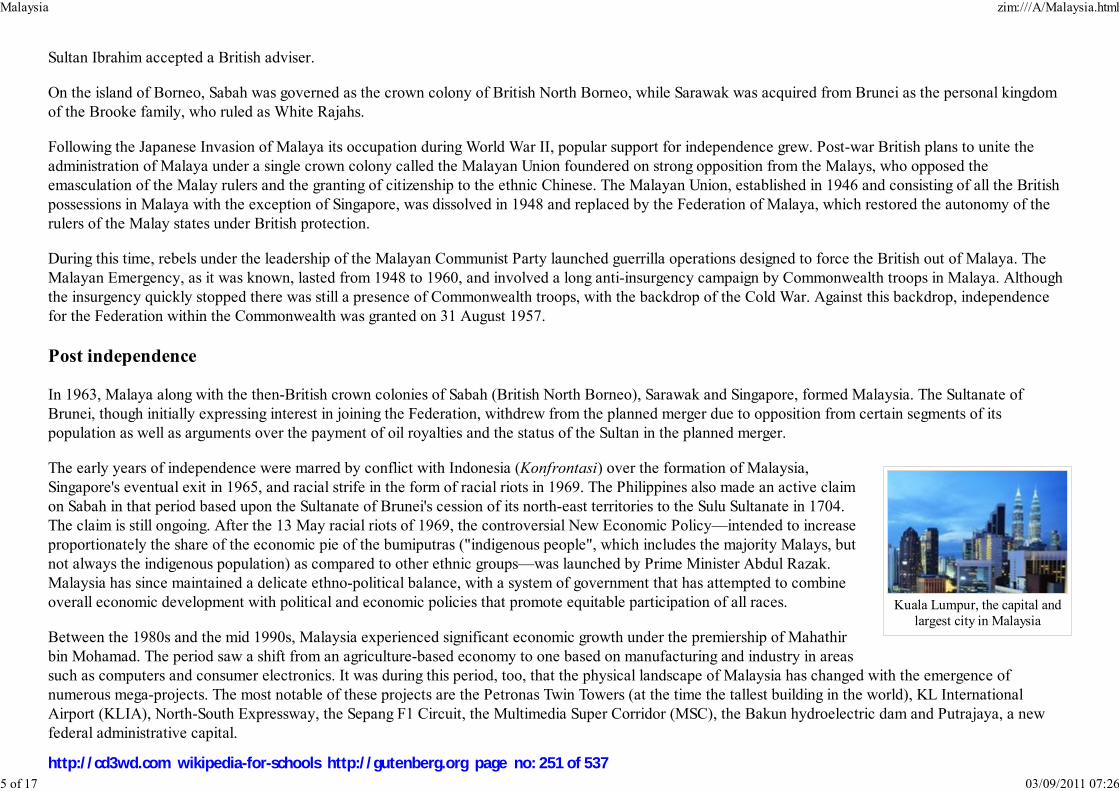
Kuala Lumpur, the capital andlargest city in Malaysia
Sultan Ibrahim accepted a British adviser.
On the island of Borneo, Sabah was governed as the crown colony of British North Borneo, while Sarawak was acquired from Brunei as the personal kingdom
of the Brooke family, who ruled as White Rajahs.
Following the Japanese Invasion of Malaya its occupation during World War II, popular support for independence grew. Post-war British plans to unite the
administration of Malaya under a single crown colony called the Malayan Union foundered on strong opposition from the Malays, who opposed the
emasculation of the Malay rulers and the granting of citizenship to the ethnic Chinese. The Malayan Union, established in 1946 and consisting of all the British
possessions in Malaya with the exception of Singapore, was dissolved in 1948 and replaced by the Federation of Malaya, which restored the autonomy of the
rulers of the Malay states under British protection.
During this time, rebels under the leadership of the Malayan Communist Party launched guerrilla operations designed to force the British out of Malaya. The
Malayan Emergency, as it was known, lasted from 1948 to 1960, and involved a long anti-insurgency campaign by Commonwealth troops in Malaya. Although
the insurgency quickly stopped there was still a presence of Commonwealth troops, with the backdrop of the Cold War. Against this backdrop, independence
for the Federation within the Commonwealth was granted on 31 August 1957.
Post independence
In 1963, Malaya along with the then-British crown colonies of Sabah (British North Borneo), Sarawak and Singapore, formed Malaysia. The Sultanate of
Brunei, though initially expressing interest in joining the Federation, withdrew from the planned merger due to opposition from certain segments of its
population as well as arguments over the payment of oil royalties and the status of the Sultan in the planned merger.
The early years of independence were marred by conflict with Indonesia (Konfrontasi) over the formation of Malaysia,
Singapore's eventual exit in 1965, and racial strife in the form of racial riots in 1969. The Philippines also made an active claim
on Sabah in that period based upon the Sultanate of Brunei's cession of its north-east territories to the Sulu Sultanate in 1704.
The claim is still ongoing. After the 13 May racial riots of 1969, the controversial New Economic Policy—intended to increase
proportionately the share of the economic pie of the bumiputras ("indigenous people", which includes the majority Malays, but
not always the indigenous population) as compared to other ethnic groups—was launched by Prime Minister Abdul Razak.
Malaysia has since maintained a delicate ethno-political balance, with a system of government that has attempted to combine
overall economic development with political and economic policies that promote equitable participation of all races.
Between the 1980s and the mid 1990s, Malaysia experienced significant economic growth under the premiership of Mahathir
bin Mohamad. The period saw a shift from an agriculture-based economy to one based on manufacturing and industry in areas
such as computers and consumer electronics. It was during this period, too, that the physical landscape of Malaysia has changed with the emergence of
numerous mega-projects. The most notable of these projects are the Petronas Twin Towers (at the time the tallest building in the world), KL International
Airport (KLIA), North-South Expressway, the Sepang F1 Circuit, the Multimedia Super Corridor (MSC), the Bakun hydroelectric dam and Putrajaya, a new
federal administrative capital.
Malaysia zim:///A/Malaysia.html
5 of 17 03/09/2011 07:26
http://cd3wd.com wikipedia-for-schools http://gutenberg.org page no: 251 of 537
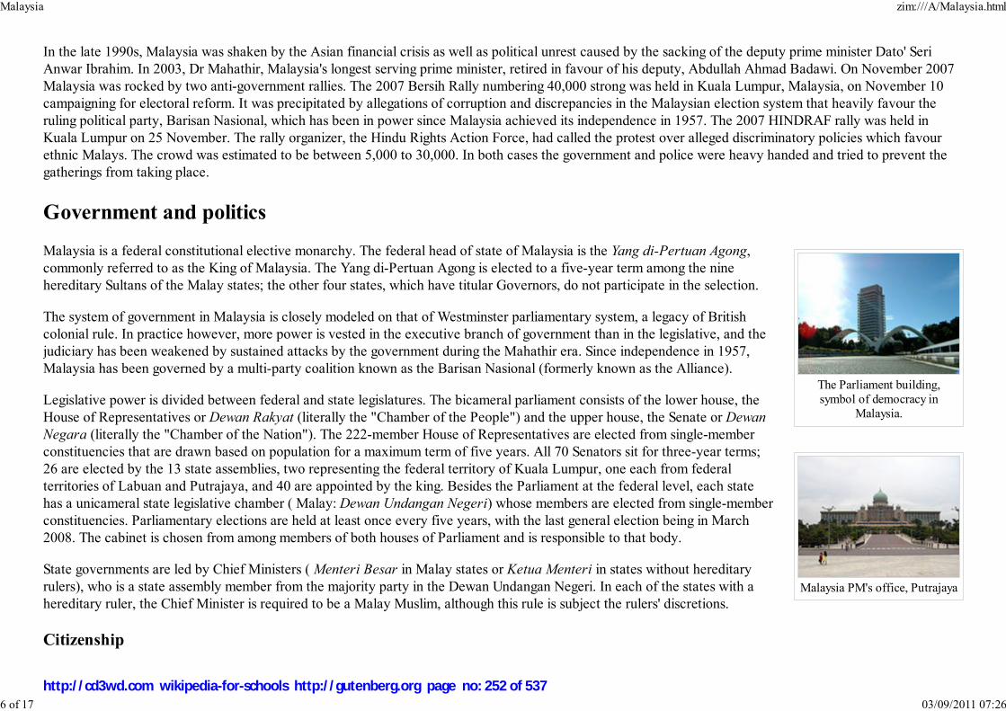
The Parliament building,symbol of democracy in
Malaysia.
Malaysia PM's office, Putrajaya
In the late 1990s, Malaysia was shaken by the Asian financial crisis as well as political unrest caused by the sacking of the deputy prime minister Dato' Seri
Anwar Ibrahim. In 2003, Dr Mahathir, Malaysia's longest serving prime minister, retired in favour of his deputy, Abdullah Ahmad Badawi. On November 2007
Malaysia was rocked by two anti-government rallies. The 2007 Bersih Rally numbering 40,000 strong was held in Kuala Lumpur, Malaysia, on November 10
campaigning for electoral reform. It was precipitated by allegations of corruption and discrepancies in the Malaysian election system that heavily favour the
ruling political party, Barisan Nasional, which has been in power since Malaysia achieved its independence in 1957. The 2007 HINDRAF rally was held in
Kuala Lumpur on 25 November. The rally organizer, the Hindu Rights Action Force, had called the protest over alleged discriminatory policies which favour
ethnic Malays. The crowd was estimated to be between 5,000 to 30,000. In both cases the government and police were heavy handed and tried to prevent the
gatherings from taking place.
Government and politics
Malaysia is a federal constitutional elective monarchy. The federal head of state of Malaysia is the Yang di-Pertuan Agong,
commonly referred to as the King of Malaysia. The Yang di-Pertuan Agong is elected to a five-year term among the nine
hereditary Sultans of the Malay states; the other four states, which have titular Governors, do not participate in the selection.
The system of government in Malaysia is closely modeled on that of Westminster parliamentary system, a legacy of British
colonial rule. In practice however, more power is vested in the executive branch of government than in the legislative, and the
judiciary has been weakened by sustained attacks by the government during the Mahathir era. Since independence in 1957,
Malaysia has been governed by a multi-party coalition known as the Barisan Nasional (formerly known as the Alliance).
Legislative power is divided between federal and state legislatures. The bicameral parliament consists of the lower house, the
House of Representatives or Dewan Rakyat (literally the "Chamber of the People") and the upper house, the Senate or Dewan
Negara (literally the "Chamber of the Nation"). The 222-member House of Representatives are elected from single-member
constituencies that are drawn based on population for a maximum term of five years. All 70 Senators sit for three-year terms;
26 are elected by the 13 state assemblies, two representing the federal territory of Kuala Lumpur, one each from federal
territories of Labuan and Putrajaya, and 40 are appointed by the king. Besides the Parliament at the federal level, each state
has a unicameral state legislative chamber ( Malay: Dewan Undangan Negeri) whose members are elected from single-member
constituencies. Parliamentary elections are held at least once every five years, with the last general election being in March
2008. The cabinet is chosen from among members of both houses of Parliament and is responsible to that body.
State governments are led by Chief Ministers ( Menteri Besar in Malay states or Ketua Menteri in states without hereditary
rulers), who is a state assembly member from the majority party in the Dewan Undangan Negeri. In each of the states with a
hereditary ruler, the Chief Minister is required to be a Malay Muslim, although this rule is subject the rulers' discretions.
Citizenship
Malaysia zim:///A/Malaysia.html
6 of 17 03/09/2011 07:26
http://cd3wd.com wikipedia-for-schools http://gutenberg.org page no: 252 of 537

Map of the states of Malaysia
Map of Peninsular Malaysia and East Malaysia (Malaysian Borneo)
Most Malaysians are granted citizenship by lex soli. All Malaysians are Federal citizens with no formal citizenships within the individual states, except for the
states of Sabah and Sarawak and the federal territory of Labuan in East Malaysia, where state citizenship is a privilege and distinguishable from the Peninsula.
Every citizen is issued a biometric smart chip identity card, known as MyKad, at the age of 12, and must carry the card at all times. A citizen is required to
present his or her identity card to the police, or in the case of an emergency, to any military personnel, to be identified. If the card cannot be produced
immediately, the person technically has 24 hours under the law to produce it at the nearest police station.
Administrative divisions
Administratively, Malaysia consists of 13 states (11 in Peninsular Malaysia and 2 in
Malaysian Borneo) and 3 federal territories.
Geography
The two distinct parts of Malaysia, separated from each other by the South China Sea, share
a largely similar landscape in that both West and East Malaysia feature coastal plains rising
to often densely forested hills and mountains, the highest of which is Mount Kinabalu at
4,095.2 metres (13,435.7 ft) on the island of Borneo. The local climate is equatorial and
characterized by the annual southwest (April to October) and northeast (October to
February) monsoons.
Tanjung Piai, located in the southern state of Johor, is the southernmost tip of continental
Asia.
The Strait of Malacca, lying between Sumatra and Peninsular Malaysia, is arguably the most
important shipping lane in the world.
Putrajaya is the newly created administrative capital for the federal government of Malaysia,
aimed in part to ease growing congestion within Malaysia's capital city, Kuala Lumpur.
Kuala Lumpur remains the seat of parliament, as well as the commercial and financial
capital of the country. Other major cities include George Town, Ipoh, Johor Bahru, Kuching,
Kota Kinabalu, Miri, Alor Star, Malacca Town, and Klang.
Demographics
Malaysia zim:///A/Malaysia.html
7 of 17 03/09/2011 07:26
http://cd3wd.com wikipedia-for-schools http://gutenberg.org page no: 253 of 537
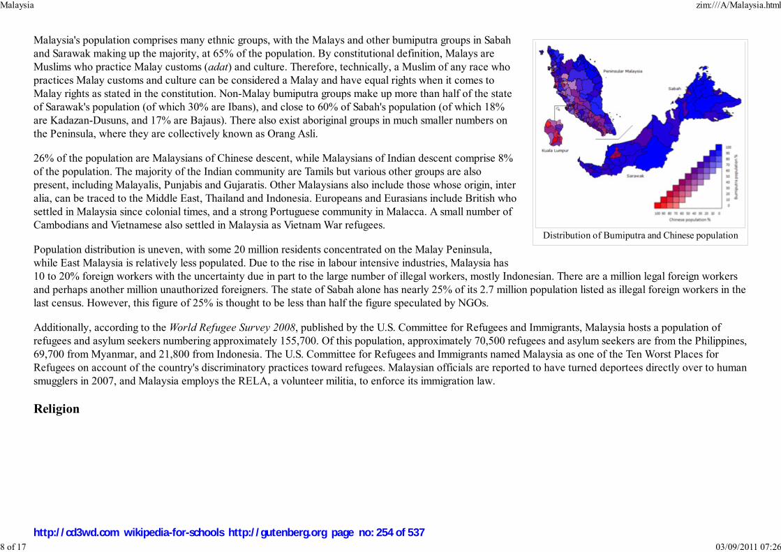
Distribution of Bumiputra and Chinese population
Malaysia's population comprises many ethnic groups, with the Malays and other bumiputra groups in Sabah
and Sarawak making up the majority, at 65% of the population. By constitutional definition, Malays are
Muslims who practice Malay customs (adat) and culture. Therefore, technically, a Muslim of any race who
practices Malay customs and culture can be considered a Malay and have equal rights when it comes to
Malay rights as stated in the constitution. Non-Malay bumiputra groups make up more than half of the state
of Sarawak's population (of which 30% are Ibans), and close to 60% of Sabah's population (of which 18%
are Kadazan-Dusuns, and 17% are Bajaus). There also exist aboriginal groups in much smaller numbers on
the Peninsula, where they are collectively known as Orang Asli.
26% of the population are Malaysians of Chinese descent, while Malaysians of Indian descent comprise 8%
of the population. The majority of the Indian community are Tamils but various other groups are also
present, including Malayalis, Punjabis and Gujaratis. Other Malaysians also include those whose origin, inter
alia, can be traced to the Middle East, Thailand and Indonesia. Europeans and Eurasians include British who
settled in Malaysia since colonial times, and a strong Portuguese community in Malacca. A small number of
Cambodians and Vietnamese also settled in Malaysia as Vietnam War refugees.
Population distribution is uneven, with some 20 million residents concentrated on the Malay Peninsula,
while East Malaysia is relatively less populated. Due to the rise in labour intensive industries, Malaysia has
10 to 20% foreign workers with the uncertainty due in part to the large number of illegal workers, mostly Indonesian. There are a million legal foreign workers
and perhaps another million unauthorized foreigners. The state of Sabah alone has nearly 25% of its 2.7 million population listed as illegal foreign workers in the
last census. However, this figure of 25% is thought to be less than half the figure speculated by NGOs.
Additionally, according to the World Refugee Survey 2008, published by the U.S. Committee for Refugees and Immigrants, Malaysia hosts a population of
refugees and asylum seekers numbering approximately 155,700. Of this population, approximately 70,500 refugees and asylum seekers are from the Philippines,
69,700 from Myanmar, and 21,800 from Indonesia. The U.S. Committee for Refugees and Immigrants named Malaysia as one of the Ten Worst Places for
Refugees on account of the country's discriminatory practices toward refugees. Malaysian officials are reported to have turned deportees directly over to human
smugglers in 2007, and Malaysia employs the RELA, a volunteer militia, to enforce its immigration law.
Religion
Malaysia zim:///A/Malaysia.html
8 of 17 03/09/2011 07:26
http://cd3wd.com wikipedia-for-schools http://gutenberg.org page no: 254 of 537

Masjid Ubudiah is awell-known historical mosque
in Kuala Kangsar.
Christ Church in Malacca Townwas constructed in the 18th
century by the Dutch.
Malaysia is a multi-religious society and Islam is the official religion. According to the Population and Housing Census 2000
figures, approximately 60.4 percent of the population practiced Islam; 19.2 percent Buddhism; 9.1 percent Christianity; 6.3
percent Hinduism; and 2.6 percent traditional Chinese religions. The remaining 2 percent was accounted for by other faiths,
including Animism and Sikhism. Until the twentieth century, most practiced traditional beliefs, which arguably still linger on to
a greater degree than Malaysian officialdom is prepared to acknowledge.
Although the Malaysian constitution theoretically guarantees religious freedom, in practice the situation is restricted. All ethnic
Malays are Muslim as defined in the Malaysian constitution. Additionally, all non-Muslims who marry a Muslim must renounce
their religion and convert to Islam. Meanwhile, non-Muslims experience restrictions in activities such as construction of
religious buildings and the celebration of certain religious events in some states. Muslims are obliged to follow the decisions of
Sharia courts when it comes to matters concerning their religion. The jurisdiction of Sharia court is limited only to Muslims
over matters of Faith and Obligations as a Muslim, which includes marriage, inheritance, apostasy, conversion, and custody
among others. No other criminal or civil offences are under the jurisdiction of the Sharia Courts. As a rule, the Civil Courts
cannot overrule any decision made by the Sharia Courts - not even the Federal Court. The Sharia Courts have a similar
hierarchy to the Civil Courts.
Education
Malaysia zim:///A/Malaysia.html
9 of 17 03/09/2011 07:26
http://cd3wd.com wikipedia-for-schools http://gutenberg.org page no: 255 of 537

Malay College Kuala Kangsar(MCKK) is one of the earliest
boarding schools to beestablished in British Malaya.
University of Nottingham,Malaysia Campus.
Education in Malaysia is monitored by the federal government Ministry of Education.
Most Malaysian children start schooling between the ages of three to six, in kindergarten. Most kindergartens are run privately,
but there are a few government-operated kindergartens.
Children begin primary schooling at the age of seven for a period of six years. There are two major types of government-
operated or government-assisted primary schools. They are the national schools (Sekolah Kebangsaan) which use Malay as the
medium of instruction, and the national-type schools (Sekolah Jenis Kebangsaan) which use either Chinese or Tamil as the
medium of instruction. Before progressing to the secondary level of education, students in Year 6 used to be required to sit for
the Ujian Pencapaian Sekolah Rendah (UPSR), or Primary School Assessment Examination. An exam called Penilaian Tahap
Satu (PTS), First Level Assessment, was used to measure the ability of bright students, and to allow them to move from Year 3
to 5, skipping Year 4. However, this exam was removed in 2001.
Secondary education in government secondary schools lasts for five years. Government secondary schools use Malay as the
main medium of instruction. The only exceptions are the Maths and Science subjects as well as languages other than Malay. At
the end of the third year or Form Three, students sit for the Penilaian Menengah Rendah (PMR), Lower Secondary
Assessment. The combination of subjects available to Form 4 students vary from one school to another. In the last year (Form
5), students sit for Sijil Pelajaran Malaysia (SPM), Malaysian Certificate of Education, which is equivalent to the British
Ordinary or 'O' Levels (now referred to as GCSE). The oldest in Malaysia is Penang Free School. Penang Free School is also
the oldest school in South East Asia.
Mathematics and Science subjects in government primary and secondary schools such as Biology, Physics, and Chemistry are
taught in English. The reasoning was that students would no longer be hindered by the language barrier during their tertiary
education in fields such as medicine and engineering.
There are also 60 Chinese Independent High Schools in Malaysia, where most subjects are taught in Chinese. Chinese Independent High Schools are monitored
and standardised by the United Chinese School Committees' Association of Malaysia (UCSCAM, more commonly referred to by its Chinese name, Dong Zong
董总), however, unlike government schools, every independent school is free to make its own decisions. Studying in independent schools takes 6 years to
complete, divided into Junior Middle (3 years) and Senior Middle (3 years). Students sit for a standardised test by Dong Zong known as the Unified Examination
Certificate (UEC) in Junior Middle 3 (equivalent to PMR) and Senior Middle 3 (equivalent to AO level). A number of independent schools conduct classes in
Malay and English in addition to Chinese, enabling the students to sit for the PMR and SPM as well.
Malaysia's secondary schools are grouped into a few types, namely national schools which include daily schools and religious schools, Chinese independent
schools, technical schools, residential schools, Mara Junior Science College and private-funding schools such as religious schools, international schools and
private schools.
Students who wish to enter public universities must complete one and a half more years of secondary schooling in Form Six and sit for the Sijil Tinggi
Malaysia zim:///A/Malaysia.html
10 of 17 03/09/2011 07:26
http://cd3wd.com wikipedia-for-schools http://gutenberg.org page no: 256 of 537
Persekolahan Malaysia (STPM), Malaysian Higher School Certificate; equivalent to the British Advanced or 'A' levels.
As for tertiary education, there are public universities such as University of Malaya, Universiti Sains Malaysia and Universiti Kebangsaan Malaysia. In addition,
five international reputable universities have set up their branch campuses in Malaysia since 1998. A branch campus can be seen as an ‘off-shore campus’ of the
foreign university, which offers the same courses and awards as the main campus. Both local and international students can acquire these identical foreign
qualifications in Malaysia for a cheaper price. The foreign university branch campuses in Malaysia are: Monash University Malaysia Campus, Curtin University
of Technology Sarawak Campus, Swinburne University of Technology Sarawak Campus and University of Nottingham Malaysia Campus.
Students also have the option of enrolling in private colleges after secondary studies. Most colleges have educational links with overseas universities especially
in the United States, the United Kingdom and Australia. Malaysian students abroad study mostly in the UK, United States, Australia, New Zealand, Canada,
Singapore, and Japan.
In addition to the National Curriculum, Malaysia has many international schools. International schools offer students the opportunity to study the curriculum of
another country. These schools mainly cater to the growing expatriate population in the country. International schools include: the Australian International
School, Malaysia (Australian curriculum), The Alice Smith School (British Curriculum), elc International school (British Curriculum), The Garden International
School (British Curriculum), Lodge International School (British Curriculum), The International School of Kuala Lumpur (International Baccalaureate and
American Curriculum), The Japanese School of Kuala Lumpur (Japanese Curriculum), The International School of Penang (International Baccalaureate and
British Curriculum), Lycée Français de Kuala Lumpur (French Curriculum) amongst others.
Healthcare
Malaysian society places importance on the expansion and development of health care, putting 5% of the government social sector development budget into
public health care—an increase of more than 47% over the previous figure. This has meant an overall increase of more than RM 2 billion. With a rising and
aging population, the Government wishes to improve in many areas including the refurbishment of existing hospitals, building and equipping new hospitals,
expansion of the number of polyclinics, and improvements in training and expansion of telehealth. Over the last couple of years they have increased their efforts
to overhaul the systems and attract more foreign investment.
The Malaysian health care system requires doctors to perform a compulsory three years service with public hospitals to ensure the manpower of these hospitals
is maintained. Recently foreign doctors have also been encouraged to take up employment here. There is still, however, a compound shortage of medical
workforce, especially that of highly trained specialists resulting in certain medical care and treatment only available in large cities. Recent efforts to bring many
facilities to other towns have been hampered by lack of expertise to run the available equipment made ready by investments.
The majority of private hospitals are in urban areas and, unlike many of the public hospitals, are equipped with the latest diagnostic and imaging facilities.
Private hospitals have not generally been seen as an ideal investment—it has often taken up to ten years before companies have seen any profits. However, the
situation has now changed and companies are now looking into this area again, particularly in view of the increasing interest by foreigners in coming to Malaysia
for medical care and the recent government focus to develop the health tourism industry.
Malaysia zim:///A/Malaysia.html
11 of 17 03/09/2011 07:26
http://cd3wd.com wikipedia-for-schools http://gutenberg.org page no: 257 of 537
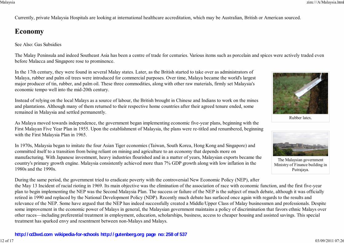
Rubber latex.
The Malaysian governmentMinistry of Finance building in
Putrajaya.
Currently, private Malaysia Hospitals are looking at international healthcare accreditation, which may be Australian, British or American sourced.
Economy
See Also: Gas Subsidies
The Malay Peninsula and indeed Southeast Asia has been a centre of trade for centuries. Various items such as porcelain and spices were actively traded even
before Malacca and Singapore rose to prominence.
In the 17th century, they were found in several Malay states. Later, as the British started to take over as administrators of
Malaya, rubber and palm oil trees were introduced for commercial purposes. Over time, Malaya became the world's largest
major producer of tin, rubber, and palm oil. These three commodities, along with other raw materials, firmly set Malaysia's
economic tempo well into the mid-20th century.
Instead of relying on the local Malays as a source of labour, the British brought in Chinese and Indians to work on the mines
and plantations. Although many of them returned to their respective home countries after their agreed tenure ended, some
remained in Malaysia and settled permanently.
As Malaya moved towards independence, the government began implementing economic five-year plans, beginning with the
First Malayan Five Year Plan in 1955. Upon the establishment of Malaysia, the plans were re-titled and renumbered, beginning
with the First Malaysia Plan in 1965.
In 1970s, Malaysia began to imitate the four Asian Tiger economies (Taiwan, South Korea, Hong Kong and Singapore) and
committed itself to a transition from being reliant on mining and agriculture to an economy that depends more on
manufacturing. With Japanese investment, heavy industries flourished and in a matter of years, Malaysian exports became the
country's primary growth engine. Malaysia consistently achieved more than 7% GDP growth along with low inflation in the
1980s and the 1990s.
During the same period, the government tried to eradicate poverty with the controversial New Economic Policy (NEP), after
the May 13 Incident of racial rioting in 1969. Its main objective was the elimination of the association of race with economic function, and the first five-year
plan to begin implementing the NEP was the Second Malaysia Plan. The success or failure of the NEP is the subject of much debate, although it was officially
retired in 1990 and replaced by the National Development Policy (NDP). Recently much debate has surfaced once again with regards to the results and
relevance of the NEP. Some have argued that the NEP has indeed successfully created a Middle/Upper Class of Malay businessmen and professionals. Despite
some improvement in the economic power of Malays in general, the Malaysian government maintains a policy of discrimination that favors ethnic Malays over
other races—including preferential treatment in employment, education, scholarships, business, access to cheaper housing and assisted savings. This special
treatment has sparked envy and resentment between non-Malays and Malays.
Malaysia zim:///A/Malaysia.html
12 of 17 03/09/2011 07:26
http://cd3wd.com wikipedia-for-schools http://gutenberg.org page no: 258 of 537
The Chinese control of the locally-owned sector of the country's economy, meanwhile, has been ceded largely in favour of the Bumiputras/Malays in many
essential or strategic industries such as petroleum retailing, transportation, agriculture and etc. The minority of Indian descent has by and large been the most
adversely affected by this policy. Indicators point to a higher incidence of crime and gang related activities among the Indians in recent years.
The rapid economic boom led to a variety of supply problems, however. Labour shortages soon resulted in an influx of millions of foreign workers, many illegal.
Cash-rich PLCs and consortia of banks eager to benefit from increased and rapid development began large infrastructure projects. This all ended when the
Asian Financial Crisis hit in the fall of 1997, delivering a massive shock to Malaysia's economy.
As with other countries affected by the crisis, there was speculative short-selling of the Malaysian currency, the ringgit. Foreign direct investment fell at an
alarming rate and, as capital flowed out of the country, the value of the ringgit dropped from MYR 2.50 per USD to, at one point, MYR 4.80 per USD. The
Kuala Lumpur Stock Exchange's composite index plummeted from approximately 1300 points to around 400 points in a matter of weeks. After the controversial
sacking of finance minister Anwar Ibrahim, a National Economic Action Council was formed to deal with the monetary crisis. Bank Negara imposed capital
controls and pegged the Malaysian ringgit at 3.80 to the US dollar. Malaysia refused economic aid packages from the International Monetary Fund (IMF) and
the World Bank, however, surprising many analysts.
In March 2005, the United Nations Conference on Trade and Development (UNCTAD) published a paper on the sources and pace of Malaysia's recovery,
written by Jomo K.S. of the applied economics department, University of Malaya, Kuala Lumpur. The paper concluded that the controls imposed by Malaysia's
government neither hurt nor helped recovery. The chief factor was an increase in electronics components exports, which was caused by a large increase in the
demand for components in the United States, which was caused, in turn, by a fear of the effects of the arrival of the year 2000 ( Y2K) upon older computers and
other digital devices.
However, the post Y2K slump of 2001 did not affect Malaysia as much as other countries. This may have been clearer evidence that there are other causes and
effects that can be more properly attributable for recovery. One possibility is that the currency speculators had run out of finance after failing in their attack on
the Hong Kong dollar in August 1998 and after the Russian ruble collapsed. (See George Soros)
Regardless of cause/effect claims, rejuvenation of the economy also coincided with massive government spending and budget deficits in the years that followed
the crisis. Later, Malaysia enjoyed faster economic recovery compared to its neighbours. In many ways, however, the country has yet to recover to the levels of
the pre-crisis era.
While the pace of development today is not as rapid, it is seen to be more sustainable. Although the controls and economic housekeeping may not have been the
principal reason for recovery, there is no doubt that the banking sector has become more resilient to external shocks. The current account has also settled into a
structural surplus, providing a cushion to capital flight. Asset prices are now a fraction of their pre-crisis heights.
The fixed exchange rate was abandoned in July 2005 in favour of a managed floating system within an hour of China's announcing of the same move. In the
same week, the ringgit strengthened a percent against various major currencies and was expected to appreciate further. As of December 2005, however,
expectations of further appreciation were muted as capital flight exceeded USD 10 billion.
Malaysia zim:///A/Malaysia.html
13 of 17 03/09/2011 07:26
http://cd3wd.com wikipedia-for-schools http://gutenberg.org page no: 259 of 537

The Kuala LumpurTower enhances
communication qualitywithin Kuala Lumpurand the Klang Valley.
The Damansara Link section ofKlang Valley's Sprint
Expressway.
In September 2005, Sir Howard J. Davies, director of the London School of Economics, at a meeting in Kuala Lumpur, cautioned Malaysian officials that if they
want a flexible capital market, they will have to lift the ban on short-selling put into effect during the crisis. In March 2006, Malaysia removed the ban on short
selling. Currently, Malaysia is considered a newly industrialized country.
Infrastructure
Malaysia has extensive roads that connect all major cities and towns on the western coast of Peninsular Malaysia. As of 2006, the
total length of the Malaysian expressway network is 1471.6 kilometres (914.4 miles). The network connects all major cities and
conurbations such as Klang Valley, Johor Bahru and Penang to each other. The major expressway, the North-South Expressway
spans from the northern and the southern tips of Peninsular Malaysia at Bukit Kayu Hitam and Johor Bahru respectively. It is a part
of the Asian Highway Network, which also connects into Thailand and Singapore.
Roads in the East Malaysia and the eastern coast of Peninsular Malaysia are still relatively undeveloped. Those are highly curved
roads passing through mountainous regions and many are still unsealed, gravel roads. This has resulted in the continued use of rivers
and the necessary use of airplanes as the main or alternative mode of transportation for the interior residents.
Train service in West Malaysia is operated by the Keretapi Tanah Melayu (Malayan Railways) and has extensive railroads that
connect all major cities and towns on the peninsular, including Singapore. There is also a short railway in Sabah operated by Sabah
State Railway that mainly carries freight.
There are seaports throughout the country. The major ports are Port Klang and Port of Tanjung Pelepas in Johor. Other important
ports can be found in Tanjung Kidurong, Kota Kinabalu, Kuching, Kuantan, Pasir Gudang, Penang, Miri, Sandakan and Tawau.
Airports are also found throughout the country. Kuala Lumpur International Airport (KLIA) is the main airport of the country.
Other important airports include Kota Kinabalu International Airport, Penang International Airport, Kuching International
Airport, Langkawi International Airport, and Senai International Airport. There are also airports in smaller towns, as well as
small domestic airstrips in rural Sabah and Sarawak. There are daily flight services between West and East Malaysia, which is
the only convenient option for passengers travelling between the two parts of the country. Malaysia is the home of the first
low-cost carrier in the region, AirAsia. It has Kuala Lumpur as its hub and maintains flights to Southeast Asia and China as
well. In KL it operates out of the Low Cost Carrier Terminal (LCCT) in KLIA.
The intercity telecommunication service is provided on Peninsular Malaysia mainly by microwave radio relay. International
telecommunications are provided through submarine cables and satellite. One of the largest and most significant
telecommunication companies in Malaysia is Telekom Malaysia (TM), providing products and services from fixed line, mobile
as well as dial-up and broadband Internet access service. It has the near-monopoly of fixed line phone service in the country.
Malaysia zim:///A/Malaysia.html
14 of 17 03/09/2011 07:26
http://cd3wd.com wikipedia-for-schools http://gutenberg.org page no: 260 of 537
In December 2004, Energy, Water and Communications Minister Datuk Seri Dr Lim Keng Yaik reported that only 0.85% or 218,004 people in Malaysia used
broadband services. However these values are based on subscriber number, whilst household percentage can reflect the situation more accurately. This
represented an increase from 0.45% in three quarters. He also stated that the government targeted usage of 5% by 2006 and doubling to 10% by 2008. Lim
Keng Yaik had urged local telecommunication companies and service provider to open up the last mile and lower prices to benefit the users.
Culture
Malaysia is a multi-ethnic, multi-cultural and multilingual society. The population as of February 2007 is 26.6 million consisting of 62% Malays, 24% Chinese,
8% Indians, with other minorities and indigenous peoples (Dept of Stats. Malaysia). Ethnic tensions have been rising in recent months.
The Malays, who form the largest community, are defined as Muslims in the Constitution of Malaysia. The Malays play a dominant role politically and are
included in a grouping identified as bumiputra. Their native language is Malay (Bahasa Melayu). Malay is the national language of the country.
In the past, Malays wrote in Sanskrit or using Sanskrit-based alphabets. After the 15th century, Jawi (a script based on Arabic) became popular. Over time,
romanized script overtook Sanskrit and Jawi as the dominant script. This was largely due to the influence of the colonial education system, which taught
children in romanised writing rather than in Arabic script.
The largest non-Malay indigenous tribe is the Iban of Sarawak, who number over 600,000. Some Iban still live in traditional jungle villages in long houses along
the Rajang and Lupar rivers and their tributaries, although many have moved to the cities. The Bidayuhs, numbering around 170,000, are concentrated in the
southwestern part of Sarawak. The largest indigenous tribe in Sabah is the Kadazan. They are largely Christian subsistence farmers. The 140,000 Orang Asli, or
aboriginal peoples, comprise a number of different ethnic communities living in Peninsular Malaysia. Traditionally nomadic hunter-gatherers and agriculturalists,
many have been sedentarised and partially absorbed into modern Malaysia.
The Chinese population in Malaysia is mostly Buddhist (of Mahayana sect) or Taoist. Chinese in Malaysia speak a variety of Chinese dialects including
Mandarin Chinese, Hokkien, Cantonese, Hakka and Teochew. A large majority of Chinese in Malaysia, especially those from larger cities such as Kuala
Lumpur, Petaling Jaya and Penang speak English as well. There has also been an increasing number of the present generation Chinese who consider English as
their first language. Chinese have historically been dominant in the Malaysian business community.
The Indians in Malaysia are mainly Hindu Tamils from southern India who native language is Tamil, there are also other Indian communities which is Telugu,
Malayalam and Hindi-speaking, living mainly in the larger towns on the west coast of the peninsula. Many middle to upper-middle class Indians in Malaysia also
speak English as a first language. A vigorous 200,000-strong Tamil Muslim community also thrives as an independent subcultural group.there are also prevalent
Tamil christian communities in major cities and towns. There is also a sizable Sikh community in Malaysia of over 83,000. Most Indians originally migrated from
India as traders, teachers or other skilled workers. A larger number were also part of the forced migrations from India by the British during colonial times to
work in the plantation industry.
Eurasians, Cambodians, Vietnamese, and indigenous tribes make up the remaining population. A small number of Eurasians, of mixed Portuguese and Malay
Malaysia zim:///A/Malaysia.html
15 of 17 03/09/2011 07:26
http://cd3wd.com wikipedia-for-schools http://gutenberg.org page no: 261 of 537

Typical festive fare during HariRaya Puasa or Hari Raya Haji(clockwise from bottom left):
beef soup, ketupat (compressedrice cubes), beef rendang and
sayur lodeh.
descent, speak a Portuguese-based creole, called Papiá Kristang. There are also Eurasians of mixed Filipino and Spanish descent, mostly in Sabah. Descended
from immigrants from the Philippines, some speak Chavacano, the only Spanish-based creole language in Asia. Cambodians and Vietnamese are mostly
Buddhists (Cambodians of Theravada sect and Vietnamese, Mahayana sect).
Malaysian traditional music is heavily influenced by Chinese and Islamic forms. The music is based largely around the gendang (drum), but includes other
percussion instruments (some made of shells); the rebab, a bowed string instrument; the serunai, a double-reed oboe-like instrument; flutes, and trumpets. The
country has a strong tradition of dance and dance dramas, some of Thai, Indian and Portuguese origin. Other artistic forms include wayang kulit (shadow puppet
theatre), silat (a stylised martial art) and crafts such as batik, weaving, including the ceremonial cloth pua kumbu, and silver and brasswork.
Holidays
Malaysians observe a number of holidays and festivities throughout the year. Some holidays are federal gazetted public holidays and some are public holidays
observed by individual states. Other festivals are observed by particular ethnic or religion groups, but are not public holidays.
The most celebrated holiday is the " Hari Merdeka" (Independence Day) on August 31 commemorating the independence of
the Federation of Malaya in 1957, while Malaysia Day is only celebrated in the state of Sabah on September 16 to
commemorate the formation of Malaysia in 1963. Hari Merdeka, as well as Labour Day ( May 1), the King's Birthday (first
Saturday of June) and some other festivals are federal gazetted public holidays.
Muslims in Malaysia celebrate Muslim holidays. The most celebrated festival, Hari Raya Puasa (also called Hari Raya
Aidilfitri) is the Malay translation of Eid al-Fitr. It is generally a festival honoured by the Muslims worldwide marking the end
of Ramadan, the fasting month. In addition to Hari Raya Puasa, they also celebrate Hari Raya Haji (also called Hari Raya
Aidiladha, the translation of Eid ul-Adha), Awal Muharram ( Islamic New Year) and Maulidul Rasul (Birthday of the Prophet).
Chinese in Malaysia typically celebrate festivals that are observed by Chinese around the world. Chinese New Year is the most
celebrated among the festivals which lasts for fifteen days and ends with Chap Goh Mei. Other festivals celebrated by Chinese
are the Qingming Festival, the Dragon Boat Festival and the Mid-Autumn Festival. In addition to traditional Chinese festivals,
Buddhists Chinese also celebrate Vesak.
The majority of Indians in Malaysia are Hindus and they celebrate Diwali, the festival of light, while Thaipusam is a celebration which pilgrims from all over the
country flock to Batu Caves. Apart from the Hindus, Sikhs celebrate the Vaisakhi, the Sikh New Year.
Other festivals such as Good Friday (East Malaysia only), Christmas, Hari Gawai of the Ibans ( Dayaks), Pesta Menuai (Pesta Kaamatan) of the Kadazan-
Dusuns are also celebrated in Malaysia.
Despite most of the festivals being identified with a particular ethnic or religious group, all Malaysians celebrate the festivities together, regardless of their
background. For years, when Hari Raya Puasa and Chinese New Year coincided, a slogan, Kongsi Raya, a combination of Gong Xi Fa Cai (a greeting used on
Malaysia zim:///A/Malaysia.html
16 of 17 03/09/2011 07:26
http://cd3wd.com wikipedia-for-schools http://gutenberg.org page no: 262 of 537

the Chinese New Year) and Hari Raya (which could also mean "celebrating together" in Malay language) was coined. For years when the Hari Raya Puasa and
Deepavali coincide, a slogan, Deepa Raya, is similarly coined.
Retrieved from " http://en.wikipedia.org/wiki/Malaysia"
This Wikipedia Selection is sponsored by SOS Children , and is a hand-chosen selection of article versions from the English Wikipedia edited only by deletion
(see www.wikipedia.org for details of authors and sources). The articles are available under the GNU Free Documentation License. See also our
Malaysia zim:///A/Malaysia.html
17 of 17 03/09/2011 07:26
http://cd3wd.com wikipedia-for-schools http://gutenberg.org page no: 263 of 537

ޖ�ގ� އ� ރ� ހ ވ� ޖ�ގ�ދ އ� ރ� ހ ވ� ޖ�ގ�ދ އ� ރ� ހ ވ� ޖ�ގ�ދ އ� ރ� ހ ވ� ޔ� ދ އ� ރ ހ� މ� ޔ�ޖ� އ� ރ ހ� މ� ޔ�ޖ� އ� ރ ހ� މ� ޔ�ޖ� އ� ރ ހ� މ� ޖ�
Republic of Maldives
Flag Coat of arms
Motto: None
Anthem: Gavmii mi ekuverikan matii tibegen
kuriime salaam"In National Unity Do We Salute Our Nation"
Capital
(and largest city)
Malé
Official languages Dhivehi
Demonym Maldivian
Government Republic
- President Maumoon Abdul Gayoom
Maldives
2008/9 Schools Wikipedia Selection. Related subjects: Asia; Asian Countries
The Maldives (or Maldive Islands) (IPA: /ˈmɔlˌdaɪvz/ or IPA: /ˈmɔlˌdivz/), officially the Republic of
Maldives, is an island nation consisting of a group of atolls in the Indian Ocean. The Maldives is located
south of India's Lakshadweep islands, and about seven hundred kilometres (435 mi) south-west of Sri
Lanka. The Maldives' twenty-six atolls encompass a territory featuring 1,192 islets, roughly two hundred
of which are inhabited.
The name "Maldives" derives from Maale Dhivehi Raajje ("The Island Kingdom [under the authority of]
Malé")." Some scholars believe that the name "Maldives" derives from the Sanskrit maladvipa, meaning
"garland of islands", or from mahila dvipa, meaning "island of women", but these names are not found in
ancient Sanskrit literature. Instead, classical Sanskrit texts mention the "Hundred Thousand Islands" (
Lakshadweepa); a generic name which would include not only the Maldives, but also the Laccadives and
the Chagos island groups. Some medieval Arab travellers such as Ibn Batuta called the islands "Mahal
Dibiyat" from the Arabic word Mahal ("palace")" . This is the name presently inscribed in the scroll of
the Maldive state emblem.
The inhabitants were Buddhist, probably since Ashoka's period, in the 3rd century BC. Islam was
introduced in 1153. The Maldives came then under the influence of the Portuguese (1558) and the Dutch
(1654) seaborne empires. And in 1887 it became a British protectorate. In 1965, the Maldives obtained
independence from Britain (originally under the name "Maldive Islands"), and in 1968 the Sultanate was
replaced by a Republic.
The Maldives is the smallest Asian country in terms of population. It is also the smallest predominantly
Muslim nation in the world.
History
Comparative studies of the Maldivian oral tradition suggest that the first settlers were Dravidian people
from the nearest coasts, probably fishermen from the southwest coasts of the Indian Subcontinent and
the western shores of Sri Lanka.
Maldives zim:///A/Maldives.html
1 of 9 03/09/2011 07:27
http://cd3wd.com wikipedia-for-schools http://gutenberg.org page no: 264 of 537

Independence
- from the UK 26 July 1965
Area
- Total 298 km² ( 204th)
115 sq mi
- Water (%) negligible
Population
- July 2006 estimate 300,000 ( 176th1)
- 2006 census 298,842
- Density 1,105/km² ( 9th)
2,862/sq mi
GDP ( PPP) 2005 estimate
- Total $2.569 billion ( 162nd)
- Per capita $7,675 ( 79th)
HDI (2007) ▲0.741 (medium) ( 100th)
Currency Rufiyaa ( MVR)
Time zone ( UTC+5)
Internet TLD .mv
Calling code +960
Rank based on UN estimate for 2005.
Maldives is made up of a chain of 1192small coral islands that are grouped into
clusters of atolls
Buddhism came to the Maldives at the time of Emperor
Ashoka's expansion and became the dominant religion of the
people of the Maldives until the 12th century AD.
Western interest in the archaeological remains of early
cultures on the Maldives began with the work of H.C.P. Bell,
a British commissioner of the Ceylon Civil Service. Bell was
shipwrecked on the islands in 1879, and returned several
times to investigate ancient Buddhist ruins. He studied the
ancient mounds, called havitta or ustubu (these names are
derived from chaitiya or stupa) ( Mahl: ތ� އ� ވ by the (ހ�
Maldivians, which are found on many of the atolls.
Although Bell asserted that the ancient Maldivians followed
Theravada Buddhism, many local Buddhist archaeological
remains now in the Malé Museum display in fact Mahayana
and Vajrayana iconography.
According to a legend from the Maldivian Folklore, a prince
named Koimala from India or Sri Lanka entered the
Maldives from the North (Ihavandhu) and became the first
king from the House of Theemuge. Prior to that the Maldives
had been settled by people of Dravidian origin from the
nearest coasts, like the group today known as the Giravaaru
who claim ancestry from ancient Tamils. It is unlikely that
the Giraavaru islanders were the only early settlers in the
Maldives. The importance they have been given is because
they are mentioned in the legend about the establishment of
the capital and kingly rule in Malé. The Giraavaru people were just one of the island communities predating
Buddhism and the arrival of a Northern Kingly dynasty and the establishment of centralized political and administrative institutions.
The ancient Maldivian Kings promoted Buddhism and the first Maldive writings and artistic achievements in the form of highly developed sculpture and
architecture are from that period. The conversion to Islam is mentioned in the ancient edicts written in copper plates from the end of the 12th century AD.
There is also a locally well-known legend about a foreign saint (Persian or Moroccan according to the versions) who subdued a demon known as Rannamaari.
Over the centuries, the islands have been visited and their development influenced by sailors and traders from countries on the Arabian Sea and the Bay of
Bengal. Until relatively recent times, Mappila pirates from the Malabar Coast – present-day Kerala state in India – harassed the islands.
1
Maldives zim:///A/Maldives.html
2 of 9 03/09/2011 07:27
http://cd3wd.com wikipedia-for-schools http://gutenberg.org page no: 265 of 537
Although governed as an independent Islamic sultanate from 1153 to 1968, the Maldives was a British protectorate from 1887 until July 25, 1965. In 1953,
there was a brief, abortive attempt to form a republic, but the sultanate was re-imposed. In 1959, objecting to Nasir's centralism, the inhabitants of the three
southernmost atolls protested against the government. They formed the United Suvadive Republic and elected, Abdullah Afeef as president and Hithadhoo as
capital of this republic.
After independence from Britain in 1965, the sultanate continued to operate for another three years under King Muhammad Fareed. On November 11, 1968,
the monarchy was abolished and replaced by a republic, although this was a cosmetic change without any significant alteration in the structures of government.
The official name of the country was changed from Maldive Islands to the Maldives in a progressive manner. Tourism began to be developed on the
archipelago about five years later, by the beginning of the 1970s.
In November 1988, a group of Maldivians headed by Mr. Lutfee a small time businessman used Tamil mercenaries from Sri Lanka to stage a coup against
President Gayyoom. After an appeal by the Maldivian government for help, the Indian military intervened against the mercenaries in order to reinstate
Gayyoom in power. On the night of November 3, 1988, the Indian Air Force airlifted a parachute battalion group from Agra and flew them non-stop over 2,000
kilometres (1,240 mi) to the Maldives. The Indian paratroopers landed at Hulule and secured the airfield and restored the Government rule at Malé within hours.
The brief, bloodless operation, labelled Operation Cactus, also involved the Indian Navy.
On 26 December 2004, the Maldives were devastated by a tsunami following the 2004 Indian Ocean earthquake. Only nine islands were reported to have
escaped any flooding, while fifty-seven islands faced serious damage to critical infrastructure, fourteen islands had to be totally evacuated, and six islands were
decimated. A further twenty-one resort islands were forced to shut down due to serious damage. The total damage was estimated at over 400 million dollars or
some 62% of the GDP. A total of 108 people, including six foreigners, reportedly died in the tsunami. The destructive impact of the waves on the low-lying
islands was mitigated by the fact there was no continental shelf or land mass upon which the waves could gain height. The tallest waves were reported 14 feet
high.
Economy
Maldives zim:///A/Maldives.html
3 of 9 03/09/2011 07:27
http://cd3wd.com wikipedia-for-schools http://gutenberg.org page no: 266 of 537

Typical Maldives market
A dhoni without lateen sails.
Current GDP per capita of Maldives registered a peak growth of 26.5% in the 1980s. Growth stabilised around
11.5% in the 1990s.
In ancient times the Maldives were renowned for the cowries, coir rope, dried tuna fish (Maldive Fish), ambergris
(Maavaharu) and coco de mer (Tavakkaashi). Local and foreign trading ships used to load these products in the
Maldives and transport them to other harbours in the Indian Ocean.
Today tourism and fisheries form the two key components of the Maldivian economy. The country's shipping,
banking and manufacturing sectors are growing at a considerable pace. Among the South Asian nations, the
Maldives has the second highest per-capita GDP at 3,900 USD (2002 figure). Major trading partners include India,
Sri Lanka, Thailand, Malaysia and Singapore.
Fisheries
The Maldivian economy was entirely dependent on fishing and other marine products for many centuries. Fishing
remains the main occupation of the people and the government gives special priority to the development of the
fisheries sector.
The mechanization of the traditional fishing boat called dhoni in 1974 was a major milestone in the development of
the fisheries industry and the country's economy in general. A fish canning plant was installed in the island of
Felivaru in 1977, as a joint venture with a Japanese firm. In 1979, a Fisheries Advisory Board was set up with the
mandate of advising the government on policy guidelines for the overall development of the fisheries sector.
Manpower development programs were begun in the early 1980s, and fisheries education was incorporated into the
school curriculum. Fish aggregating devices and navigational aids were located at various strategic points.
Moreover, the opening up of the Exclusive Economic Zone (EEZ) of the Maldives for fisheries has further
enhanced the growth of the fisheries sector. Today, fisheries contribute over fifteen percent of the GDP and engage
about thirty percent of the country's work force. It is also the second-largest foreign exchange earner after tourism.
Cottage industries
The development of the tourism sector gave a major boost to the country's fledging traditional cottage industries such as mat weaving, lacquer work, handicraft,
and coir rope making. New industries that have since emerged include printing, production of PVC pipes, brick making, marine engine repairs, bottling of
aerated water, and garment production.
Politics
Maldives zim:///A/Maldives.html
4 of 9 03/09/2011 07:27
http://cd3wd.com wikipedia-for-schools http://gutenberg.org page no: 267 of 537

Presidential Office in Malé
Muleeaage (Former Presidental Palace inMalé)
Maldives zim:///A/Maldives.html
5 of 9 03/09/2011 07:27
http://cd3wd.com wikipedia-for-schools http://gutenberg.org page no: 268 of 537

Mosque in Hulhumalé
Politics in the Maldives takes place in the framework of a presidential republic, whereby the President is the head of
government. The President heads the executive branch and appoints the cabinet. The President is nominated to a
five-year term by a secret ballot of the Majlis (parliament), a nomination which is confirmed by national
referendum.
The unicameral Majlis of the Maldives is composed of fifty members serving five-year terms. Two members from
each atoll are elected directly by universal suffrage. Eight are appointed by the president, which is the main route
through which women enter parliament. The country introduced political parties for the first time in its history in
July 2005, six months after the last elections for the parliament. Nearly thirty-six members of the existing parliament
joined the Dhivehi Raiyyathunge Party (the Maldivian People's Party) and elected President Gayoom as its leader.
Twelve members of parliament became the Opposition and joined the Maldivian Democratic Party. Two members
remained independent. In March 2006, President Gayoom published a detailed Roadmap for the Reform Agenda,
providing time-bound measures to write a new Constitution, and modernise the legal framework. Under the Roadmap, the government has submitted to the
Parliament a raft of reform measures. The most significant piece of legislation passed so far is the Amendment to the Human Rights Commission Act, making
the new body fully compliant with the Paris Principles.
The fifty members of parliament sit with an equal number of similarly constituted persons and the Cabinet to form the Constitutional Assembly, which has been
convened at the initiative of the President to write a modern liberal democratic constitution for the Maldives. The Assembly has been sitting since July 2004,
and has been widely criticised for making very slow progress. The Government and the Opposition have been blaming each other for the delays, but
independent observers attribute the slow progress to weak parliamentary traditions, poor whipping (none of the MPs were elected on a party ticket) and endless
points of order interventions. Progress has also been slow due to the commitment of the main opposition party, MDP, to depose President Gayoom by direct
action ahead of the implementation of the reform agenda, leading to civil unrest in July-August 2004, August 2005 and an abortive putsch in November 2006.
Significantly, the leader of the MDP, Ibrahim Ismail (MP for the biggest constituency - Malé) resigned from his party post in April 2005 after having narrowly
beat Dr. Mohammed Waheed Hassan only a couple months earlier. He eventually left MDP in November 2006 citing the intransigence of his own National
Executive Committee. The government had engaged the services of a Commonwealth Special Envoy Tun Musa Hitam to facilitate all party dialogue, and when
the MDP boycotted him, enlisted the services of the British High Commissioner to facilitate a dialogue. The ensuing Westminster House process made some
progress but was abandoned as MDP called for the November revolution.
The Roadmap provides the deadline of 31 May 2007 for the Assembly to conclude its work and to pave the way for the first multi-party elections in the country
by October 2008.
On 19 June 2006, the Assembly voted to hold a public referendum to decide the form of government under the new constitutional settlement.
The political structure of the Maldives has remained practically unchanged for centuries. Despite the passage from Monarchy to republic, the contemporary
political structure shows a continuity with the feudal past in which power was shared among a few families at the top of the social structure. In some islands, the
offices have remained within the same family for generations. The village is ruled by an administrative officer called Katību, who serves as the executive
headman of the island. Above the Katībus of every atoll is the AtoỊuveriya (Atoll Chief). The power of these local chiefs is very limited and they take few
Maldives zim:///A/Maldives.html
6 of 9 03/09/2011 07:27
http://cd3wd.com wikipedia-for-schools http://gutenberg.org page no: 269 of 537

Satellite Image of the Maldivesby NASA. Note that the
southern most Atoll of theMaldives, Addu Atoll, is not
visible on the image.
responsibilities. They are trained to report to the government about the situation in their islands and to merely wait for instructions from the central power and to
follow them thoroughly.
Judiciary
Al Ustaz Mohamed Rasheed Ibrahim from Fuvahmulah is the present chief justice of Maldives. All judges in the Maldives are appointed by the president.
Islamic law is the basis of all judicial decisions.
The Maldives have, in cooperation with the United Nations Development Project (UNDP), undertaken to write the world's first Muslim criminal code. This
project would formalize the proceedings of criminal justice in this tiny nation to one of the most comprehensive modern criminal codes in the world. The code
has been written and awaits action by the parliament.
Meanwhile, Islam remains the only official religion of The Maldives, with the open practice of all other religions being forbidden.
The Maldives and the Indian Ocean Commission
Since 1996, the Maldives has been the official progress monitor of the Indian Ocean Commission. Since 2002, the Maldives has
expressed interest in the work of the Indian Ocean Commission but has not applied for membership. The interest of the
Maldives relates to its identity as a small island state, especially in relation to matters of economic development and
environmental preservation, and its desire to forge close relations with France, a main actor in the IOC region. The Maldives is
a founder member of the South Asian Association for Regional Cooperation, SAARC, and as former protectorate of Great
Britain, joined the Commonwealth in 1982, some 17 years after gaining independence from Great Britain. The Maldives enjoys
close ties with Seychelles and Mauritius, who like the Maldives are members of the Commonwealth. The Maldives and
Comoros are also both members of the Organisation of Islamic Conference. The Maldives has refused to enter into any
negotiations with Mauritius over the demarcation of the maritime border between the Maldives and the British Indian Ocean
Territory, pointing out that under international law, the sovereignty of the Chagos Archipelago rests with the UK, with whom
negotiations were started in 1991.
Administrative divisions
The Maldives has twenty-six natural atolls, which have been divided into twenty-one administrative divisions (twenty
administrative atolls and Malé city).
In addition to a name, every administrative division is identified by the Maldivian code letters, such as " Haa Alif" for
Thiladhunmati Uthuruburi (Thiladhunmathi North); and by a Latin code letter.
Maldives zim:///A/Maldives.html
7 of 9 03/09/2011 07:27
http://cd3wd.com wikipedia-for-schools http://gutenberg.org page no: 270 of 537

Maldive reefs
The first corresponds to the geographical Maldivian name of the atoll. The second is a code adopted for convenience. It began in order to facilitate radio
communication between the atolls and the central administration. As there are certain islands in different atolls that have the same name, for administrative
purposes this code is quoted before the name of the island, for example: Baa Funadhoo, Kaafu Funadhoo, Gaafu-Alifu Funadhoo. Since most Atolls have very
long geographical names it is also used whenever the name of the atoll has to be quoted short, for example in the atoll website names.
This code denomination has been very much abused by foreigners who didn't understand the proper use of these names and have ignored the Maldivian true
names in publications for tourists. Maldivians may use the letter code name in colloquial conversation, but in serious geographic, historical or cultural writings,
the true geographical name always takes precedence. The Latin code letter is normally used in boat registration plates. The letter stands for the atoll and the
number for the island.
Each atoll is administered by an Atoll Chief (Atholhu Veriyaa) appointed by the President. The Ministry of Atoll Administration and its Northern and Southern
Regional Offices, Atoll Offices and Island Offices are collectively responsible to the President for Atolls Administration. The administrative head of each island
is the Island Chief (Katheeb), appointed by the President. The Island Chief's immediate superior is the Atoll Chief.
The introduction of code-letter names has been a source of much puzzlement and misunderstandings, especially among foreigners. Many people have come to
think that the code-letter of the administrative atoll is its new name and that it has replaced its geographical name. Under such circumstances it is hard to know
which is the correct name to use.
Geography
The Maldives holds the record for being the flattest country in the world, with a maximum natural ground level of only 2.3 m
(7½ ft), though in areas where construction exists this has been increased to several metres. Over the last century, sea levels
have risen about twenty centimetres (8 in). The ocean is likely to continue rising and this threatens the existence of Maldives.
The first accurate maritime charts of this complex Indian Ocean atoll group were the British Admiralty Charts. In 1834-36
Capt. Robert Moresby, assisted by Lieutenants Christopher and Young, undertook the difficult cartography of the Maldive
Islands. The resulting charts were printed as three separate large maps by the Hydrographic Service of the Royal Navy.
A tsunami in the Indian Ocean caused by the 2004 Indian Ocean earthquake caused parts of the Maldives to be covered by sea
water and left many people homeless. After the disaster, cartographers are planning to redraw the maps of the islands due to
alterations by the tsunami.
Demographics
Maldives zim:///A/Maldives.html
8 of 9 03/09/2011 07:27
http://cd3wd.com wikipedia-for-schools http://gutenberg.org page no: 271 of 537

Malé, the capital of theMaldives.
The Maldivian ethnic identity is a blend of the cultures reflecting the peoples who settled on the islands, reinforced by religion
and language. The earliest settlers were probably from southern India and Sri Lanka.
Some social stratification exists on the islands. It is not rigid, since rank is based on varied factors, including occupation,
wealth, Islamic virtue, and family ties. Traditionally, instead of a complex caste system, like the Vedic one, there was merely a
distinction between noble (bēfulhu) and common people in the Maldives. Members of the social elite are concentrated in Malé.
Outside of the service industry, this is the only location where the foreign and domestic populations are likely to interact. The
tourist resorts are not on islands where the natives live, and casual contacts between the two groups are discouraged.
A census has been recorded since 1905, which shows that the population of the country remained around 100,000 for the first
seventy years of the last century. Following independence in 1965, the health status of the population improved so much that
the population doubled by 1978, and the population growth rate peaked at 3.4% in 1985. By 2005, the population had reached 300,000, although the census in
2000 showed that the population growth rate had declined to 1.9%. Life expectancy at birth stood at 46 years in 1978, while it has now risen to 72 years. Infant
mortality has declined from 127 per thousand in 1977 to 12 today, and adult literacy stands at 99%. Combined school enrolment stands in the high 90s.
The Maldives has one of the highest birth rates in the world. The result is that many islands have become overpopulated and are completely covered by
homesteads. Hence the country is becoming less self-sufficient by the day.
As of July 2006, more than 50,000 foreign employees live in the country. They comprise mainly of people from the neighbouring South Asian countries of India,
Sri Lanka, Bangladesh and Nepal.
Tourism
The development of tourism has fostered the overall growth of the country's economy. It has created direct and indirect employment and income generation
opportunities in other related industries. Today, tourism is the country's biggest foreign exchange earner, contributing to twenty percent of the GDP. With
eighty-seven tourist resorts in operation. The year 2006 recorded 467,154 tourist arrivals.The first tourist resorts were opened in 1972 with Bandos island resort
and Kurumba Village.
Retrieved from " http://en.wikipedia.org/wiki/Maldives"
The 2008 Wikipedia for Schools has a sponsor: SOS Children , and is mainly selected from the English Wikipedia with only minor checks and changes (seewww.wikipedia.org for details of authors and sources). The articles are available under the GNU Free Documentation License. See also our
Maldives zim:///A/Maldives.html
9 of 9 03/09/2011 07:27
http://cd3wd.com wikipedia-for-schools http://gutenberg.org page no: 272 of 537

Монгол улс
Mongol uls
Mongolia
Flag Coat of arms
Anthem: " Монгол улсын төрийн дуулал"
National anthem of Mongolia
Capital
(and largest city)Ulan Bator
Official languages Mongolian
Demonym MongolianGenghis Khan's conquests
Mongolia
2008/9 Schools Wikipedia Selection. Related subjects: Asia; Asian CountriesSOS Children works in Mongolia. For more information see SOS Children in Mongolia
Mongolia (pronounced /mɒŋˈɡoʊliə/; Mongolian: Монгол улс , ) is a landlocked country in East-Central Asia. It borders Russia to the north and China to the south. Ulan Bator, the capital and largestcity, is home to about 38% of the population. Mongolia's political system is a parliamentary republic.
At 1,564,116 square kilometres, Mongolia is the nineteenth largest, and the most sparsely populatedindependent country in the world with a population of around 2.9 million people. It is also the world'ssecond-largest landlocked country after Kazakhstan. The country contains very little arable land, asmuch of its area is covered by arid and unproductive steppes, with mountains to the north and west andthe Gobi Desert to the south. Approximately thirty percent of the country's 2.9 million people arenomadic or semi-nomadic. The predominant religion in Mongolia is Tibetan Buddhism, and the majorityof the state's citizens are of the Mongol ethnicity, though Kazakhs, Tuvans, and other minorities also livein the country, especially in the west.
History
Early history
Mongolia since prehistoric times has been inhabitedby nomads who, from time to time, formed greatconfederations that rose to prominence. The first ofthese, the Xiongnu, were brought together to form aconfederation by Modu Shanyu Mete Khan in 209BC. Soon they emerged as the greatest threat of theQin Dynasty forcing the latter to construct the GreatWall of China, itself being guarded by up to almost300,000 soldiers during marshal's Meng Tian tenure,as a mean of defense against the destructive Xiongnuraids. After the decline of the Xiongnu, the Rouran, a
Mongolia zim:///A/Mongolia.html
1 of 10 03/09/2011 07:27
http://cd3wd.com wikipedia-for-schools http://gutenberg.org page no: 273 of 537

Government Parliamentary republic
- President Nambaryn Enkhbayar
- Prime Minister Sanjaagiin Bayar
Formation
- National FoundationDay
1206
- Bogd Khanate ofMongolia
December 29, 1911
- Mongolian People'sRepublic
November 24, 1924
- Democratic Mongolia February 12, 1992
Area
- Total 1,564,116 km² ( 19th)603,909 sq mi
- Water (%) 0.6
Population
- July 2007 estimate 2,951,786 ( 139th)
- 2000 census 2,407,500
- Density 1.7/km² ( 238th)4.4/sq mi
GDP ( PPP) 2007 estimate
- Total $8.448 billion ( 143th)
- Per capita $2,900 ( 130th)
Gini (2002) 32.8 (medium)
HDI (2007) ▲ 0.700 (medium) (114th)
Currency Tögrög ( MNT)
Time zone ( UTC+7 to +8)
Internet TLD .mn
close relative of the Mongols, came to power before being defeated by the Göktürks, who thendominated Mongolia for centuries. During the seventh and eighth centuries, they were succeeded byUyghurs and then by the Khitans and Jurchens. By the tenth century, the country was divided intonumerous tribes linked through transient alliances and involved in the old patterns of internal strife.
Mongol Empire
Mongolia zim:///A/Mongolia.html
2 of 10 03/09/2011 07:27
http://cd3wd.com wikipedia-for-schools http://gutenberg.org page no: 274 of 537

Calling code +976
The expansion of the MongolEmpire
Kublai Khan, Genghis Khan'sgrandson and founder of the
Yuan Dynasty
Altan Khan, of theTümed, a grandson of
Batumöngke founder ofHohhot
In the chaos of the late twelfth century, a chieftain named Temüjin finally succeeded in uniting theMongol tribes between Manchuria and the Altai Mountains. In 1206, he took the title Genghis Khan, andwaged a series of military campaigns - renowned for their brutality and ferocity till today - sweepingthrough much of Asia, and forming the Mongol Empire, the largest contiguous land empire in world history. Under hissuccessors it stretched from present-day Poland in the west to Korea in the east, and from Siberia in the north to the Gulf ofOman and Vietnam in the south, covering some 33,000,000 km² (12,741,000 sq mi), (22% of Earth's total land area) and havinga population of over 100 million people.
After Genghis Khan's death, the empire had been subdivided into four kingdoms or Khanateswhich eventually split-up after Möngke's death in 1259. One of the khanates, the "GreatKhanate", consisting of the Mongol homeland and China, became the Yuan Dynasty underKublai Khan, grandson of Genghis Khan. He set up his capital in present day Beijing but aftermore than a century of power, the Yuan was replaced by the Ming Dynasty in 1368, with theMongol court fleeing to the north. As the Ming armies pursued the Mongols into theirhomeland, they successfully sacked and destroyed the Mongol capital Karakorum among other cities, wiping out the culturalprogress that was achieved during the imperial period and thus throwing Mongolia back to anarchy.
Post-Imperial period
The next centuries were marked by violent power struggles between various factions, notably theGenghisids and the non-Genghisid Oirads and numerous Chinese invasions (like the fiveexpeditions led by the Yongle Emperor). In the early 15th century, the Oirads under Esen Tayisigained the upper hand, and even raided China in 1449 in a conflict over Esen's right to pay tribute,capturing the Chinese emperor in the process. However, Esen was murdered in 1454, and the
Genghisids recovered. In the mid-16th century, Altan Khan of the Tümed, a grandson of Batumöngke - but no legitimate Khanhimself - became powerful. He founded Hohhot in 1557 and his meeting with the Dalai Lama in 1578 sparked the secondintroduction of Tibetan Buddhism to Mongolia. Abtai Khan of the Khalkha converted to buddhism in 1585 and founded the ErdeneZuu monastery in 1586. His grandson Zanabazar became the first Jebtsundamba Khutughtu in 1640.
Mongolia zim:///A/Mongolia.html
3 of 10 03/09/2011 07:27
http://cd3wd.com wikipedia-for-schools http://gutenberg.org page no: 275 of 537
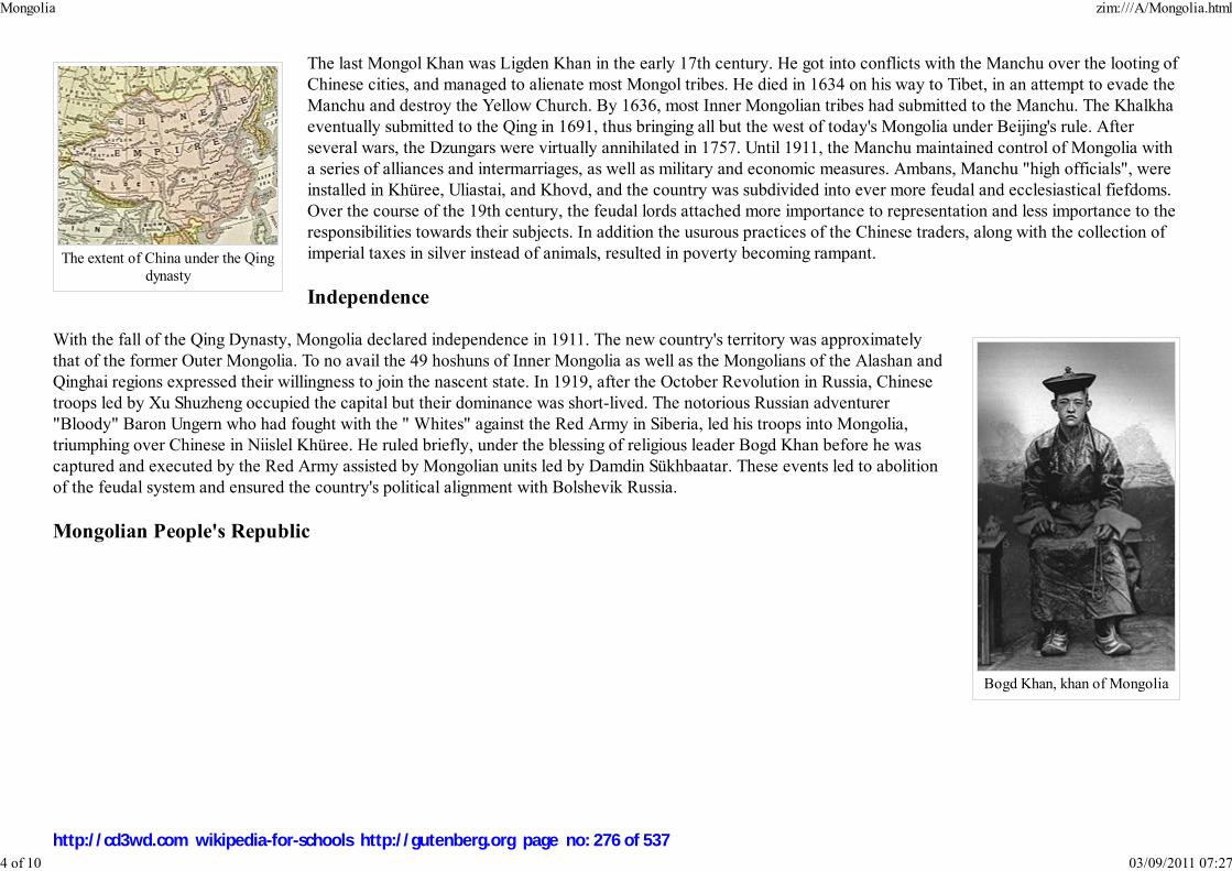
The extent of China under the Qingdynasty
Bogd Khan, khan of Mongolia
The last Mongol Khan was Ligden Khan in the early 17th century. He got into conflicts with the Manchu over the looting ofChinese cities, and managed to alienate most Mongol tribes. He died in 1634 on his way to Tibet, in an attempt to evade theManchu and destroy the Yellow Church. By 1636, most Inner Mongolian tribes had submitted to the Manchu. The Khalkhaeventually submitted to the Qing in 1691, thus bringing all but the west of today's Mongolia under Beijing's rule. Afterseveral wars, the Dzungars were virtually annihilated in 1757. Until 1911, the Manchu maintained control of Mongolia witha series of alliances and intermarriages, as well as military and economic measures. Ambans, Manchu "high officials", wereinstalled in Khüree, Uliastai, and Khovd, and the country was subdivided into ever more feudal and ecclesiastical fiefdoms.Over the course of the 19th century, the feudal lords attached more importance to representation and less importance to theresponsibilities towards their subjects. In addition the usurous practices of the Chinese traders, along with the collection ofimperial taxes in silver instead of animals, resulted in poverty becoming rampant.
Independence
With the fall of the Qing Dynasty, Mongolia declared independence in 1911. The new country's territory was approximatelythat of the former Outer Mongolia. To no avail the 49 hoshuns of Inner Mongolia as well as the Mongolians of the Alashan andQinghai regions expressed their willingness to join the nascent state. In 1919, after the October Revolution in Russia, Chinesetroops led by Xu Shuzheng occupied the capital but their dominance was short-lived. The notorious Russian adventurer"Bloody" Baron Ungern who had fought with the " Whites" against the Red Army in Siberia, led his troops into Mongolia,triumphing over Chinese in Niislel Khüree. He ruled briefly, under the blessing of religious leader Bogd Khan before he wascaptured and executed by the Red Army assisted by Mongolian units led by Damdin Sükhbaatar. These events led to abolitionof the feudal system and ensured the country's political alignment with Bolshevik Russia.
Mongolian People's Republic
Mongolia zim:///A/Mongolia.html
4 of 10 03/09/2011 07:27
http://cd3wd.com wikipedia-for-schools http://gutenberg.org page no: 276 of 537

Damdin Sükhbaatar, ca1920-1922
In 1924, after the death of the religious leader and king Bogd Khan, a Mongolian People's Republic was proclaimed withsupport from the Soviets.
In 1928, Khorloogiin Choibalsan rose to power. He instituted collectivisation of livestock, the destruction of Buddhistmonasteries and the Mongolia's enemies of the people persecution resulting in the murder of monks and other people. TheStalinist purges beginning in 1937, affected the Republic as it left more than 30,000 people dead. Japanese imperialism becameeven more alarming after the invasion of neighboring Manchuria in 1931. During the Soviet-Japanese Border War of 1939, theUSSR successfully defended Mongolia against Japanese expansionism. In August 1945 Mongolian forces also took part in theSoviet offensive in Inner Mongolia . The Soviet threat of seizing parts of Inner Mongolia induced the Republic of China torecognize Outer Mongolia's independence, provided that a referendum was held. The referendum took place on October 20,1945, with (according to official numbers) 100% of the electorate voting for independence. After the establishment of thePeople's Republic of China, both countries recognized each other again on October 6, 1949.
In January 26, 1952, Yumjaagiin Tsedenbal took power. In 1956 and again in 1962, Choibalsan's personality cult wascondemned. Mongolia continued to align itself closely with the Soviet Union, especially after the Sino-Soviet split of the late1950s. While Tsedenbal was visiting Moscow in August 1984, his severe illness prompted the parliament to announce his
retirement and replace him with Jambyn Batmönkh.
Democracy
The introduction of perestroika and glasnost in the USSR by Mikhail Gorbachev strongly influenced Mongolian politics leading to the peaceful DemocraticRevolution of 1990. This, in turn, allowed the country to begin engaging in economic and diplomatic relations with the Western world. The nation finished itstransition from a communist state to a multi-party capitalist democracy with the ratification of a new constitution in 1992.
Government and politics
Mongolia zim:///A/Mongolia.html
5 of 10 03/09/2011 07:27
http://cd3wd.com wikipedia-for-schools http://gutenberg.org page no: 277 of 537

Sukhbaatar Square with theparliament building and theoffices of the prime minister
and president
PresidentNambarynEnkhbayar
Mongolia is a parliamentary republic. The parliament is elected by the people and in turn elects the government. The presidentis elected directly. Mongolia's constitution guarantees full freedom of expression, religion, and others. Mongolia has a numberof political parties, the biggest ones being the Mongolian People's Revolutionary Party (MPRP) and the Democratic Party(DP).
The MPRP formed the government of the country from 1921 to 1996 (until 1990 in a one-party system) and from 2000 to2004. From 2004 to 2006, it was part of a coalition with the DP and two other parties, and since 2006 it has been the dominantparty in two other coalitions. Both changes of government after 2004 were initiated by the MPRP. The DP was the dominantforce in the ruling coalition between 1996 and 2000, and also an approximately equal partner with the MPRP in the 2004-2006coalition. The next parliamentary elections are set for June 2008.
President
Mongolia's president has a symbolic role, but can block the parliament's decisions, who can then overrule the veto by a 2/3 majority.Mongolia's Constitution provides three requirements for taking office as President: the individual must be a native-born Mongolian, be atleast 45 years of age, and have resided in Mongolia for five years prior to taking office. The current President is Nambaryn Enkhbayar.
The State Great Khural
Mongolia uses a unicameral parliamentary system in which the president has a symbolic role and the government chosen by the legislatureexercises executive power. The legislative arm, the State Great Khural, has one chamber with 76 seats and is chaired by the speaker of thehouse. It elects its members every four years by general elections. The State Great Khural is powerful in the Mongolian government withthe president being largely symbolic and the prime minister being confirmed from the parliament.
Prime Minister and the Cabinet
The Prime Minister of Mongolia is elected by the State Great Khural. The current prime minister is Sanjaagiin Bayar, who was elected by sixty-seven votes totwo on November 22, 2007. The deputy prime minister is Miyeegombyn Enkhbold (since December 5, 2007). There are ministers of each department (finance,defense, labor, agriculture, etc.) and those offices constitute the prime minister's cabinet.
The cabinet is nominated by the prime minister in consultation with the president and confirmed by the State Great Khural.
Foreign relations and military
Mongolia maintains positive relations and has diplomatic missions with many countries such as the United States, Russia, North and South Korea, Japan, and the
Mongolia zim:///A/Mongolia.html
6 of 10 03/09/2011 07:27
http://cd3wd.com wikipedia-for-schools http://gutenberg.org page no: 278 of 537

People's Republic of China. The government has focused a great deal on encouraging foreign investments and trade. Mongolia supported the 2003 invasion ofIraq, and has sent several successive contingents of 103 to 180 troops each to Iraq. Smaller contingents were also sent to Afghanistan. 200 Mongolian troops areserving in Sierra Leone on a UN mandate to protect the UN's special court set up there. From 2005 to 2006, about 40 troops were deployed with the Belgian andLuxembourgish contingent in Kosovo. On November 21, 2005, George W. Bush became the first-ever sitting U.S. President to visit Mongolia. In 2004, underthe Bulgarian chairmanship, The Organisation for Security and Cooperation in Europe (OSCE), invited Mongolia as its newest Asian Partner.
Mongolia has embassies in Almaty, Ankara, Bangkok, Berlin, Beijing, Brussels, Budapest, Cairo, Warsaw, Washington, D.C., Vienna, Vientiane, Havana, Delhi,London, Moscow, Ottawa, Paris, Prague, Pyongyang, Seoul, Sofia, Tokyo, Hanoi, and Singapore, a consulate in Irkutsk and Ulan-Ude, and a diplomatic missionto the United Nations in New York City and to the European Union in Geneva.
Geography and climate
Mongolia zim:///A/Mongolia.html
7 of 10 03/09/2011 07:27
http://cd3wd.com wikipedia-for-schools http://gutenberg.org page no: 279 of 537

The southern portion ofMongolia is taken up by the
Gobi Desert, while the northernand western portions are
mountainous
Mongolian landscape
Aimags of Mongolia
At 1,564,116 km² (603,909 mi²), Mongolia is the world's nineteenth-largest country (after Iran). It is significantly larger thanthe next-largest country, Peru.
The geography of Mongolia is varied with the Gobi desert to the south and with cold and mountainous regions to the north andwest. Mongolia consists of relatively flat steppes. The highest point in Mongolia is the Khüiten Peak in the Tavan bogd massifin the far west at 4,374 m (14,350 ft). The basin of the lake Uvs Nuur, shared with Tuva Republic in Russia, is a natural WorldHeritage Site.
Most of the country is hot in the summer and extremely cold in the winter, with January averages dropping as low as -30°C(-22°F). The country is also subject to occasional harsh climatic conditions known as zud. Ulan Bator has the lowest averagetemperature of any national capital in the world. Mongolia is high, cold, and windy. It has an extreme continental climate withlong, cold winters and short summers, during which most of its annual precipitation falls. The country averages 257 cloudlessdays a year, and it is usually at the centre of a region of high atmospheric pressure. Precipitation is highest in the north(average of 20 to 35 centimeters per year) and lowest in the south, which receives 10 to 20 centimeters annually. The extremesouth is the Gobi, some regions of which receive no precipitation at all in most years.
The name "Gobi" is a Mongol term for a desert steppe, which usually refers to a category of arid rangeland with insufficientvegetation to support marmots but with enough to support camels. Mongols distinguish Gobi from desert proper, although thedistinction is not always apparent to outsiders unfamiliar with the Mongolian landscape. Gobi rangelands are fragile and areeasily destroyed by overgrazing, which results in expansion of the true desert, a stony waste where not even Bactrian camelscan survive.
Aimags and sums
Mongolia is divided into 21 aimags ( provinces), which are in turn divided into 315 sums ( districts). The capital Ulan Bator isadministrated separately as a khot ( municipality) with provincial status. The aimags are:
ArkhangaiBayan-ÖlgiiBayankhongorBulganDarkhan-UulDornodDornogoviDundgoviGovi-AltaiGovisümber
KhovdKhövsgölÖmnögoviOrkhonÖvörkhangaiSelengeSükhbaatarTövUvsZavkhan
Mongolia zim:///A/Mongolia.html
8 of 10 03/09/2011 07:27
http://cd3wd.com wikipedia-for-schools http://gutenberg.org page no: 280 of 537

1,000 tugrug
Khentii
Economy
Mongolia's economy is centered on agriculture and mining. Mongolia has rich mineral resources, and copper, coal,molybdenum, tin, tungsten, and gold account for a large part of industrial production.
There are currently over 30,000 independent businesses in Mongolia, chiefly centered around the capital city. The majority ofthe population outside urban areas participate in subsistence herding; livestock typically consists of sheep, goats, cattle, horses,and Bactrian camels. Agricultural crops include wheat, barley, potato, vegetables, tomato, watermelon, sea-buckthorn andfodder crops. GDP per capita in 2006 was $2,100. Although GDP has risen steadily since 2002 at the rate of 7.5% in an official2006 estimate, the state is still working to overcome a sizable trade deficit. A massive ($11 billion) foreign debt to Russia wassettled by the Mongolian government in 2004 with a $250 million payment. Despite growth, the proportion of the population below the poverty line is estimatedto be 35.6% in 1998, 36.1% in 2002-2003, 32.2% in 2006, and both the unemployment rate and inflation rate are relatively high at 3.2% and 6.0%, respectively(in 2006)
The Mongolian Stock Exchange, established in 1991 in Ulan Bator, is the world's smallest stock exchange by market capitalisation.
Industrial sector
Industry currently accounts for 21.4% of GDP, approximately equal to the weight of the agriculture sector (20.4%). These industries include constructionmaterials, mining (coal, copper, molybdenum, fluorspar, tin, tungsten, and gold), oil, food and beverages, processing of animal products, and cashmere andnatural fibre manufacturing. The industrial production growth rate is estimated to be 4.1% in 2002. Mining is continuing to rise as a major industry of Mongoliaas evidenced by number of Chinese, Russian and Canadian firms opening and starting mining business in Mongolia. Domestic food production, especiallypackaged food production has been increasingly coming up with speed with investments from foreign companies.
Science and technology
Some technology companies from nearby countries, such as South Korea and the People's Republic of China, have started to open offices in Mongolia. Thosecompanies have tended to focus on software development rather than hardware production. A number of telecommunications companies and internet serviceproviders have been established resulting in greater competition in the internet and phone market, especially in cell phones.
Service sector
Mongolia zim:///A/Mongolia.html
9 of 10 03/09/2011 07:27
http://cd3wd.com wikipedia-for-schools http://gutenberg.org page no: 281 of 537
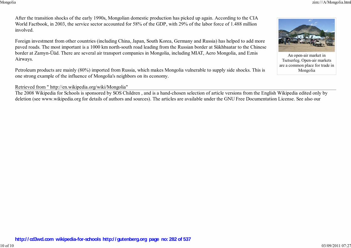
An open-air market inTsetserleg. Open-air markets
are a common place for trade inMongolia
After the transition shocks of the early 1990s, Mongolian domestic production has picked up again. According to the CIAWorld Factbook, in 2003, the service sector accounted for 58% of the GDP, with 29% of the labor force of 1.488 millioninvolved.
Foreign investment from other countries (including China, Japan, South Korea, Germany and Russia) has helped to add morepaved roads. The most important is a 1000 km north-south road leading from the Russian border at Sükhbaatar to the Chineseborder at Zamyn-Üüd. There are several air transport companies in Mongolia, including MIAT, Aero Mongolia, and EznisAirways.
Petroleum products are mainly (80%) imported from Russia, which makes Mongolia vulnerable to supply side shocks. This isone strong example of the influence of Mongolia's neighbors on its economy.
Retrieved from " http://en.wikipedia.org/wiki/Mongolia"The 2008 Wikipedia for Schools is sponsored by SOS Children , and is a hand-chosen selection of article versions from the English Wikipedia edited only bydeletion (see www.wikipedia.org for details of authors and sources). The articles are available under the GNU Free Documentation License. See also our
Mongolia zim:///A/Mongolia.html
10 of 10 03/09/2011 07:27
http://cd3wd.com wikipedia-for-schools http://gutenberg.org page no: 282 of 537

नेपाल
Nepal
Flag Emblem
Motto: जननी ज�मभू�मच �वगा�द�प गर�यसी (Sanskrit)
"Mother and motherland are dearer than the heavens"
Anthem: Sayaun Thunga Phool Ka
Capital
(and largest city)
Kathmandu ( Nepal Bhasa:
य�)
Official languages Nepali
Nepal
2008/9 Schools Wikipedia Selection. Related subjects: Asia; Asian Countries
SOS Children works in Nepal. For more information see SOS Children in Nepal
Nepal ( Nepali: नपेाल [neˈpaːl] ) is a landlocked nation in South Asia, bordering the People's Republic of
China (Tibet) to the north and India to the south, east and west.
Until 2006, Nepal, was officially the only Hindu state in the world. On May 18, 2006, Nepal was
declared a secular state by the Interim Parliament of Nepal. On December 28, 2007, the interim
parliament passed a bill and declared Nepal to be a federal democratic republic. The current king,
Gyanendra Bir Bikram Shah Dev, will be the last king of Nepal if the present ruling parties win the April
2008 elections.
For a relatively small country, Nepal has a diverse landscape, ranging from the humid Terai plainlands in
the south to the mountaneous Himalayas in the north. Eight of the world's top ten highest mountains,
including Mount Everest, are in Nepal.
Etymology
The word “Nepal” has derived from the word “Nepa:” which refers to the Newar Kingdom of
Kathmandu Valley and surrounding areas before the unification of Nepal. A calendar Nepal Sambat is
still one of the major calendar used in Nepal, which was named after Newar kingdom of Kathmandu
Valley called "Nepa:", and was devised 1100 years ago.
It is important to remember that the Kingdom of Kathmandu Valley was called “Nepa:” and the language
of Newars was called Nepal Bhasa long before the unification of Nepal. After unification of Nepal, Shah
King Prithivi Narayan Shah adopted the name Nepal for the entire country.
Various theories exist as to how the word Nepal evolved. According to one, Sage "Ne" ( Rishi) protected
("Pala" in Sanskrit) this land for long time so it is called "Nepal". Another legend ties the name to
agriculture: "Ne" means wool in Tibetan language and "pal" means house or godown.
Nepal zim:///A/Nepal.html
1 of 11 03/09/2011 07:28
http://cd3wd.com wikipedia-for-schools http://gutenberg.org page no: 283 of 537

Demonym Nepali
Government Interim government
- King Gyanendra Bir Bikram
Shah Dev
- Interim
Head of State
Girija Prasad Koirala
- Prime Minister Girija Prasad Koirala
Unification December 21, 1768
- Republic December 28, 2007
Area
- Total 147,181 km² ( 93rd)
56,827 sq mi
- Water (%) 2.8
Population
- July 2007 estimate 28,901,790 ( 40th)
- 2002 census 23,151,423
- Density 184/km² ( 56th)
477/sq mi
GDP ( PPP) 2006 estimate
- Total $41.18 billion ( 87th)
- Per capita $1,500 ( 164rd)
Gini (2003–04) 47.2 (high)
HDI (2007) ▲ 0.534 (medium) (
142nd)
Currency Rupee ( NRs.)
Time zone NPT ( UTC+5:45)
- Summer ( DST) not observed ( UTC+5:45)
Internet TLD .np
Language
Nepali is the national language of Nepal; it has evolved from various hilly dialects over the last five
hundred years. It was called as Khas Kura, and has only recently been called as Nepali.
Nepal Bhasa is the language of Newars, who are native to Kathmandu Valley. Since Nepali does not have
its own alphabet and uses devanagari, Government of Nepal had submitted alphabets of Nepal Bhasa
(Ranjana Lipi) to United Nations while claiming its bid to be recognised as independent country.
One of the the first written inscriptions in Nepali is found in the writing on stone of King Pratap
Malla(17th century). This written inscription is also the earliest prose written in "Nepali".
Political status
On December 28, 2007, the government proposed to amend Article 159 of the constitution and declare
Nepal a federal republic, thereby abolishing the monarchy. As per the amendment, Article 159 of the
interim constitution was amended - replacing "Provisions regarding the King" by "Provisions of the Head
of the State."
If the parties present in current ruling coalition win the election for constituent assembly scheduled for
April 2008, the current king, Gyanendra Bir Bikram Shah Dev shall give up the title and throne, making
him the last ruling monarch and making Nepal a federal democratic state with an elected head of state.
History
Nepal is mentioned in Hindu scriptures such as the Narayana Puja and the Atharva Siras (800-600 BC).
Neolithic tools found in the Kathmandu Valley indicate that people have been living in the Himalayan
region for at least 9,000 years. It appears that people who were probably of Tibeto-Burman ethnicity
lived in Nepal 2,500 years ago. Around 1000 BCE, small kingdoms and confederations of clans arose in
the region. From one of these, the Sakya confederation, arose a prince named Siddharta Gautama
(563–483 BCE), who later renounced his royalty to lead an ascetic life and came to be known as the
Buddha ("the enlightened one"). By 250 BCE, the region came under the influence of the Mauryan
empire of northern India, and later became a vassal state under the Gupta Dynasty in the fourth century
CE. From the late fifth century CE, rulers called the Licchavis governed the area. The Licchavi dynasty
went into decline in the late eighth century and was followed by a Newari era, from 879, although the
Nepal zim:///A/Nepal.html
2 of 11 03/09/2011 07:28
http://cd3wd.com wikipedia-for-schools http://gutenberg.org page no: 284 of 537

Calling code +977
The monarch's constitutional role as Head of State has been
transferred to the Prime Minister until the Constituent Assembly
election on April 10 decides on the monarchy's fate
Map of Nepal
Hindu temples in Patan, capital of one of thethree medieval Newar kingdoms
extent of their control over the entire country is uncertain. By the late 11th century, southern Nepal came
under the influence of the Chalukaya Empire of southern India. Under the Chalukayas, Nepal's religious
establishment changed as the kings patronised Hinduism instead of the prevailing Buddhism.
By the early 12th century, leaders were emerging whose names ended with the Sanskrit suffix malla
("wrestler"). Initially their reign was marked by upheaval before the kings consolidated their power over
the next 200 years. By the late 14th century much of the country began to come under a unified rule. This unity was
short-lived; in 1482 the region was carved into three kingdoms: Kathmandu, Patan, and Bhadgaon.
After centuries of petty rivalry between the three kingdoms, in the mid-18th century Prithvi Narayan Shah, a
Gorkha King set out to unify the kingdoms. Seeking arms and aid from India, and buying the neutrality of bordering
Indian kingdoms, he embarked on his mission in 1765. After several bloody battles and sieges, he managed to unify
Kathmandu Valley three years later in 1768. However, an actual battle never took place to conquer the Kathmandu
valley; it was taken over by Prithvi Narayan and his troops without any effort, during Indra Jatra, a festival of
Newars, when all the valley's citizens were celebrating the festival. This event marked the birth of the modern
nation of Nepal. There is historical evidence that, at one time, the boundary of Greater Nepal extended from Tista
River on the East to Kangara, across Sutlej River, in the west. A dispute and subsequently war with Tibet over the
control of mountain passes forced the Nepalese to retreat and pay heavy repatriations. Rivalry between Nepal and
the British East India Company over the annexation of minor states bordering Nepal eventually led to the Anglo-
Nepalese War (1815–16). The valor displayed by the Nepalese during the war astounded their enemies and earned
them their image of fierce and ruthless "Gurkhas". The war ended with a treaty, the Treaty of Sugauli. This treaty
ceded Sikkim and lands in Terai to the Company. Some parts of Terai Region were given back to Nepal by British
East India Company as a friendly gesture to Nepal because of her role to help maintain control of their regime in
India during the so called Sepoy Rebellion of 1857. The decision to help British East India Company was taken by
the Rana Regime, then led by Jang Bahadur Rana.
Factionalism inside the royal family had led to a period of instability. In 1846 a plot was discovered to overthrow
Jang Bahadur, a fast-rising military leader by the reigning queen. This led to the Kot Massacre. Armed clashes
between military personnel and administrators loyal to the queen led to the execution of several hundred princes
and chieftains around the country. Bahadur emerged victorious and founded the Rana lineage. The king was made a titular figure, and the post of Prime
Minister was made powerful and hereditary. The Ranas were staunchly pro-British, and assisted the British during the Sepoy Rebellion in 1857, and later in both
World Wars. In 1923 the United Kingdom and Nepal formally signed an agreement of friendship, in which Nepal's independence was recognised by the UK.
1
Nepal zim:///A/Nepal.html
3 of 11 03/09/2011 07:28
http://cd3wd.com wikipedia-for-schools http://gutenberg.org page no: 285 of 537
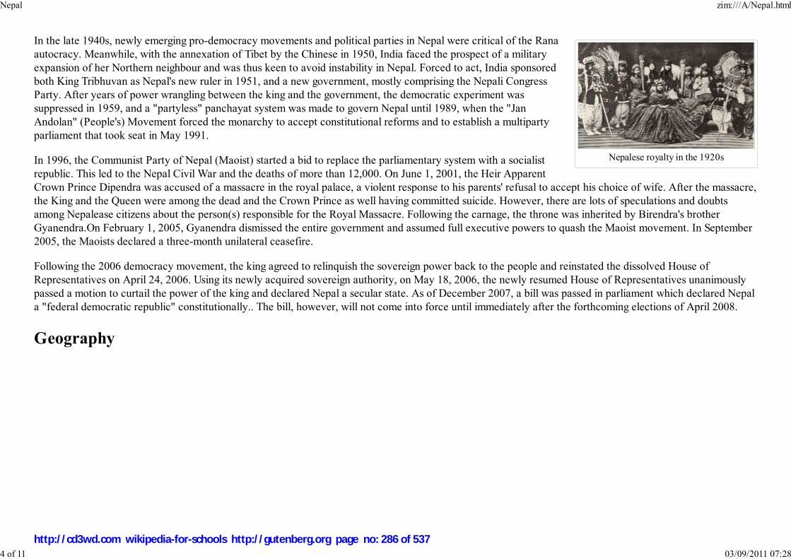
Nepalese royalty in the 1920s
In the late 1940s, newly emerging pro-democracy movements and political parties in Nepal were critical of the Rana
autocracy. Meanwhile, with the annexation of Tibet by the Chinese in 1950, India faced the prospect of a military
expansion of her Northern neighbour and was thus keen to avoid instability in Nepal. Forced to act, India sponsored
both King Tribhuvan as Nepal's new ruler in 1951, and a new government, mostly comprising the Nepali Congress
Party. After years of power wrangling between the king and the government, the democratic experiment was
suppressed in 1959, and a "partyless" panchayat system was made to govern Nepal until 1989, when the "Jan
Andolan" (People's) Movement forced the monarchy to accept constitutional reforms and to establish a multiparty
parliament that took seat in May 1991.
In 1996, the Communist Party of Nepal (Maoist) started a bid to replace the parliamentary system with a socialist
republic. This led to the Nepal Civil War and the deaths of more than 12,000. On June 1, 2001, the Heir Apparent
Crown Prince Dipendra was accused of a massacre in the royal palace, a violent response to his parents' refusal to accept his choice of wife. After the massacre,
the King and the Queen were among the dead and the Crown Prince as well having committed suicide. However, there are lots of speculations and doubts
among Nepalease citizens about the person(s) responsible for the Royal Massacre. Following the carnage, the throne was inherited by Birendra's brother
Gyanendra.On February 1, 2005, Gyanendra dismissed the entire government and assumed full executive powers to quash the Maoist movement. In September
2005, the Maoists declared a three-month unilateral ceasefire.
Following the 2006 democracy movement, the king agreed to relinquish the sovereign power back to the people and reinstated the dissolved House of
Representatives on April 24, 2006. Using its newly acquired sovereign authority, on May 18, 2006, the newly resumed House of Representatives unanimously
passed a motion to curtail the power of the king and declared Nepal a secular state. As of December 2007, a bill was passed in parliament which declared Nepal
a "federal democratic republic" constitutionally.. The bill, however, will not come into force until immediately after the forthcoming elections of April 2008.
Geography
Nepal zim:///A/Nepal.html
4 of 11 03/09/2011 07:28
http://cd3wd.com wikipedia-for-schools http://gutenberg.org page no: 286 of 537
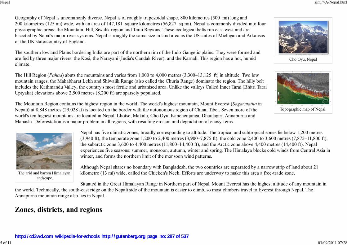
Cho Oyu, Nepal
Topographic map of Nepal.
The arid and barren Himalayanlandscape.
Geography of Nepal is uncommonly diverse. Nepal is of roughly trapezoidal shape, 800 kilometres (500 mi) long and
200 kilometres (125 mi) wide, with an area of 147,181 square kilometres (56,827 sq mi). Nepal is commonly divided into four
physiographic areas: the Mountain, Hill, Siwalik region and Terai Regions. These ecological belts run east-west and are
bisected by Nepal's major river systems. Nepal is roughly the same size in land area as the US states of Michigan and Arkansas
or the UK state/country of England.
The southern lowland Plains bordering India are part of the northern rim of the Indo-Gangetic plains. They were formed and
are fed by three major rivers: the Kosi, the Narayani (India's Gandak River), and the Karnali. This region has a hot, humid
climate.
The Hill Region (Pahad) abuts the mountains and varies from 1,000 to 4,000 metres (3,300–13,125 ft) in altitude. Two low
mountain ranges, the Mahabharat Lekh and Shiwalik Range (also called the Churia Range) dominate the region. The hilly belt
includes the Kathmandu Valley, the country's most fertile and urbanised area. Unlike the valleys Called Inner Tarai (Bhitri Tarai
Uptyaka) elevations above 2,500 metres (8,200 ft) are sparsely populated.
The Mountain Region contains the highest region in the world. The world's highest mountain, Mount Everest (Sagarmatha in
Nepali) at 8,848 metres (29,028 ft) is located on the border with the autonomous region of China, Tibet. Seven more of the
world's ten highest mountains are located in Nepal: Lhotse, Makalu, Cho Oyu, Kanchenjunga, Dhaulagiri, Annapurna and
Manaslu. Deforestation is a major problem in all regions, with resulting erosion and degradation of ecosystems.
Nepal has five climatic zones, broadly corresponding to altitude. The tropical and subtropical zones lie below 1,200 metres
(3,940 ft), the temperate zone 1,200 to 2,400 metres (3,900–7,875 ft), the cold zone 2,400 to 3,600 metres (7,875–11,800 ft),
the subarctic zone 3,600 to 4,400 metres (11,800–14,400 ft), and the Arctic zone above 4,400 metres (14,400 ft). Nepal
experiences five seasons: summer, monsoon, autumn, winter and spring. The Himalaya blocks cold winds from Central Asia in
winter, and forms the northern limit of the monsoon wind patterns.
Although Nepal shares no boundary with Bangladesh, the two countries are separated by a narrow strip of land about 21
kilometre (13 mi) wide, called the Chicken's Neck. Efforts are underway to make this area a free-trade zone.
Situated in the Great Himalayan Range in Northern part of Nepal, Mount Everest has the highest altitude of any mountain in
the world. Technically, the south-east ridge on the Nepali side of the mountain is easier to climb, so most climbers travel to Everest through Nepal. The
Annapurna mountain range also lies in Nepal.
Zones, districts, and regions
Nepal zim:///A/Nepal.html
5 of 11 03/09/2011 07:28
http://cd3wd.com wikipedia-for-schools http://gutenberg.org page no: 287 of 537

A Rs.500 banknote of The Republic of Nepal. (Yetthe watermark on the right contains picture of King
Gyanendra, later admitted clerical error by stateowned Nepal Rastra Bank.)
Nepal is divided into 14 zones and 75 districts, grouped into 5 development regions. Each district is headed by a fixed chief
district officer responsible for maintaining law and order and coordinating the work of field agencies of the various government
ministries. The 14 zones are:
BagmatiBheri
Dhawalagiri
GandakiJanakpur
Karnali
Koshi
LumbiniMahakali
Mechi
NarayaniRapti
Sagarmatha
Seti
Economy
Agriculture sustains 76% of the population and accounts for about 40% of the GDP; services comprise 41%, and industry 22%. Nepal remains isolated from the
world’s major land, air and sea transport routes though air traffic is frequent. Hilly and mountainous terrain in the northern two-thirds of the country has made
the building of roads and other infrastructure difficult and expensive. There were just over 8,500 km of paved roads, and one 59 km railway line in the south in
2003. There is only one reliable road route from India to the Kathmandu Valley. The only practical seaport of entry for goods bound for Kathmandu is Kolkata
in India. Internally, the poor state of development of the road system (22 of 75 administrative districts lack road links) makes volume distribution unrealistic.
Aviation is in a better state, with 48 airports, ten of them with paved runways. There is less than one
telephone per 19 people; landline telephone services are not adequate nationwide but concentrated in cities
and district headquarters; mobile telephony is in a reasonable state in most parts of the country with
increased accessibility and affordability. There were around 175,000 Internet connections in 2005, but after
the imposition of the "state of emergency", intermittent losses of service were reported. Uninterrupted
Internet connections have resumed after the brief period of confusion as Nepal's second major people's
revolution took place to overthrow the King's absolute power.
Its landlocked location and technological backwardness and the long-running civil war have also prevented
Nepal from fully developing its economy. The country receives foreign aid from India, Japan, the United
Kingdom, the United States, the European Union, China, Switzerland, and Scandinavian countries. The
government's budget is about US$1.153 billion, with expenditures of $1.789bn (FY05/06). The inflation rate
has dropped to 2.9% after a period of higher inflation during the 1990s. The Nepali Rupee has been tied to
the Indian Rupee at an exchange rate of 1.6 for many years. Since the loosening of exchange rate controls in the early 1990s, the black market for foreign
exchange has all but disappeared. A long-standing economic agreement underpins a close relationship with India.
Nepal zim:///A/Nepal.html
6 of 11 03/09/2011 07:28
http://cd3wd.com wikipedia-for-schools http://gutenberg.org page no: 288 of 537

Terraced farming on thefoothills of the Himalayas.
The distribution of wealth among the Nepali is consistent with that in many developed and developing countries: the highest 10% of households control 39.1%
of the national wealth and the lowest 10% control only 2.6%.
Nepal's workforce of about 10 million suffers from a severe shortage of skilled labour. Agriculture employs 81% of the
workforce, services 16% and manufacturing/craft-based industry 3%. Agricultural produce——mostly grown in the Terai
region bordering India——includes tea, rice, corn, wheat, sugarcane, root crops, milk, and water buffalo meat. Industry mainly
involves the processing of agricultural produce, including jute, sugarcane, tobacco, and grain. The spectacular landscape and
deep, exotic culture of Nepal represents considerable potential for tourism, but growth in this export industry has been stifled
by recent political events. The rate of unemployment and underemployment approaches half of the working-age population.
Thus many Nepali citizens move to India in search of work, the Gulf countries and Malaysia being new sources of work.
Poverty is acute. Nepal receives US$50 million a year through the Gurkha soldiers who serve in the Indian and British armies
and are highly esteemed for their skill and bravery. The total remittance value is worth around 1 billion USD, including money
sent from Persian Gulf and Malaysia, who combined employ around 700,000 Nepali citizens.
Nepal's GDP for the year 2005 is estimated at just over US$39 billion (adjusted to Purchasing Power Parity), making it the 83rd-largest economy in the world.
Per-capita income is less than US$ 300. Nepal's exports of mainly carpets, clothing, leather goods, jute goods and grain total $822 million. Import commodities
of mainly gold, machinery and equipment, petroleum products and fertilizer total US$2 bn. India (53.7%), the US (17.4%), and Germany (7.1%) are its main
export partners. Nepal's import partners include India (47.5%), the United Arab Emirates (11.2%), China (10.7%), Saudi Arabia (4.9%), and Singapore (4%).
Government and politics
Until 1990, Nepal was an absolute monarchy running under the executive control of the king. Faced with a people's movement against the absolute monarchy,
King Birendra, in 1990, agreed to large-scale political reforms by creating a parliamentary monarchy with the king as the head of state and a prime minister as
the head of the government.
Nepal's legislature was bicameral consisting of a House of Representatives called the Pratinidhi Sawa and a National Council called the Rastriya Sawa. The
House of Representatives consists of 205 members directly elected by the people. The National Council had sixty members, ten nominated by the king,
thirty-five elected by the House of Representatives and the remaining fifteen elected by an electoral college made up of chairs of villages and towns. The
legislature had a five-year term, but was dissolvable by the king before its term could end. All Nepali citizens 18 years and older became eligible to vote.
The executive comprised the King and the Council of Ministers (the Cabinet). The leader of the coalition or party securing the maximum seats in an election
was appointed as the Prime Minister. The Cabinet was appointed by the king on the recommendation of the Prime Minister. Governments in Nepal have tended
to be highly unstable; no government has survived for more than two years since 1991, either through internal collapse or parliamentary dissolution by the
monarch on the recommendation of prime minister according to the constitution.
The movement in April, 2006, brought about a change in the nation: an interim constitution was promulgated, with the King giving up power, and an interim
Nepal zim:///A/Nepal.html
7 of 11 03/09/2011 07:28
http://cd3wd.com wikipedia-for-schools http://gutenberg.org page no: 289 of 537
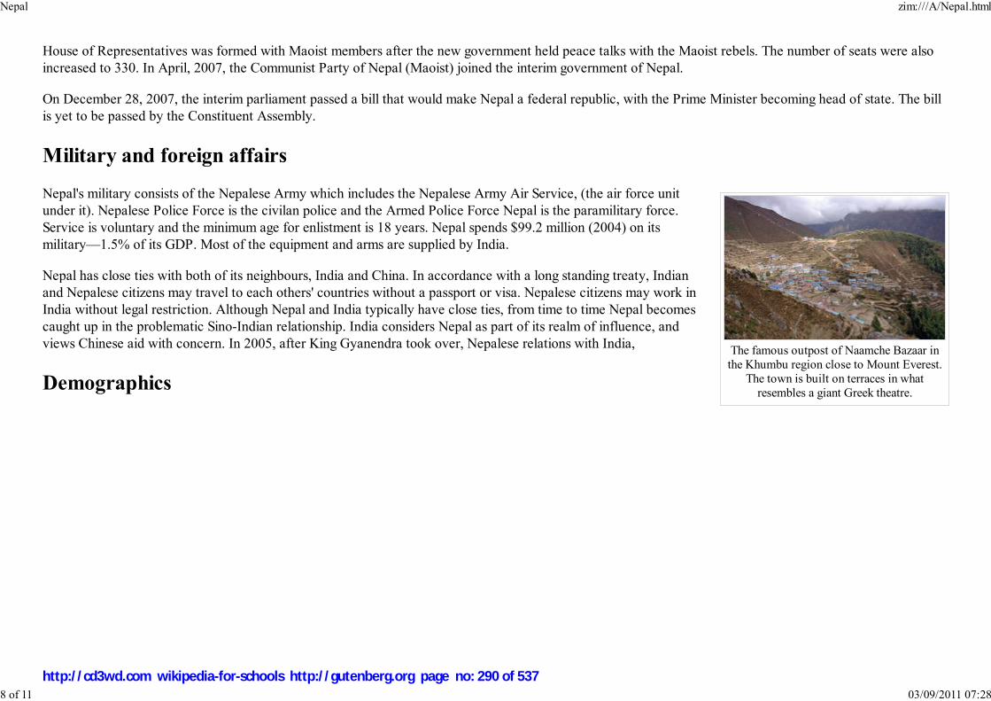
The famous outpost of Naamche Bazaar inthe Khumbu region close to Mount Everest.
The town is built on terraces in whatresembles a giant Greek theatre.
House of Representatives was formed with Maoist members after the new government held peace talks with the Maoist rebels. The number of seats were also
increased to 330. In April, 2007, the Communist Party of Nepal (Maoist) joined the interim government of Nepal.
On December 28, 2007, the interim parliament passed a bill that would make Nepal a federal republic, with the Prime Minister becoming head of state. The bill
is yet to be passed by the Constituent Assembly.
Military and foreign affairs
Nepal's military consists of the Nepalese Army which includes the Nepalese Army Air Service, (the air force unit
under it). Nepalese Police Force is the civilan police and the Armed Police Force Nepal is the paramilitary force.
Service is voluntary and the minimum age for enlistment is 18 years. Nepal spends $99.2 million (2004) on its
military—1.5% of its GDP. Most of the equipment and arms are supplied by India.
Nepal has close ties with both of its neighbours, India and China. In accordance with a long standing treaty, Indian
and Nepalese citizens may travel to each others' countries without a passport or visa. Nepalese citizens may work in
India without legal restriction. Although Nepal and India typically have close ties, from time to time Nepal becomes
caught up in the problematic Sino-Indian relationship. India considers Nepal as part of its realm of influence, and
views Chinese aid with concern. In 2005, after King Gyanendra took over, Nepalese relations with India,
Demographics
Nepal zim:///A/Nepal.html
8 of 11 03/09/2011 07:28
http://cd3wd.com wikipedia-for-schools http://gutenberg.org page no: 290 of 537
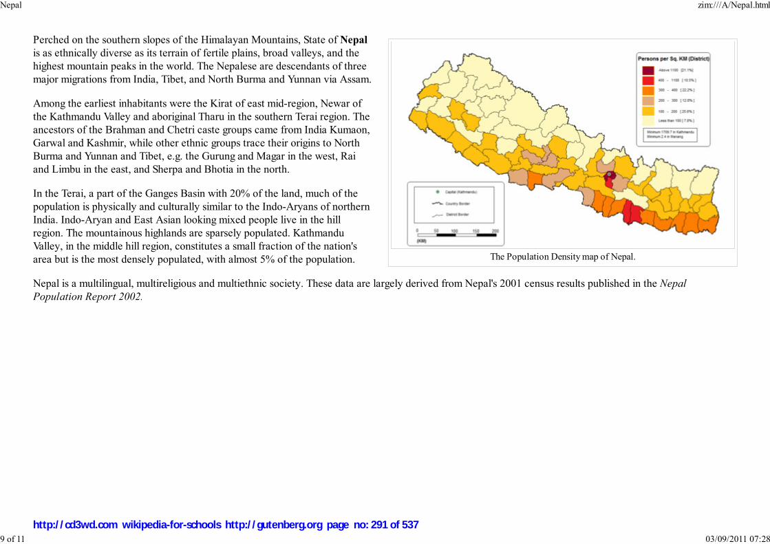
The Population Density map of Nepal.
Perched on the southern slopes of the Himalayan Mountains, State of Nepal
is as ethnically diverse as its terrain of fertile plains, broad valleys, and the
highest mountain peaks in the world. The Nepalese are descendants of three
major migrations from India, Tibet, and North Burma and Yunnan via Assam.
Among the earliest inhabitants were the Kirat of east mid-region, Newar of
the Kathmandu Valley and aboriginal Tharu in the southern Terai region. The
ancestors of the Brahman and Chetri caste groups came from India Kumaon,
Garwal and Kashmir, while other ethnic groups trace their origins to North
Burma and Yunnan and Tibet, e.g. the Gurung and Magar in the west, Rai
and Limbu in the east, and Sherpa and Bhotia in the north.
In the Terai, a part of the Ganges Basin with 20% of the land, much of the
population is physically and culturally similar to the Indo-Aryans of northern
India. Indo-Aryan and East Asian looking mixed people live in the hill
region. The mountainous highlands are sparsely populated. Kathmandu
Valley, in the middle hill region, constitutes a small fraction of the nation's
area but is the most densely populated, with almost 5% of the population.
Nepal is a multilingual, multireligious and multiethnic society. These data are largely derived from Nepal's 2001 census results published in the Nepal
Population Report 2002.
Nepal zim:///A/Nepal.html
9 of 11 03/09/2011 07:28
http://cd3wd.com wikipedia-for-schools http://gutenberg.org page no: 291 of 537

Languages Spoken in Nepal.
Population Structure
Data Size
Population 28,676,547 (2005)
Growth Rate 2.2%
Population below 14 Years old 39%
Population of age 15 to 64 57.3%
Population above 65 3.7%
The median age (Average) 20.07
The median age (Male) 19.91
The median age (Females) 20.24
Ratio (Male:Female) 1, 060:1,000
Life expectancy (Average) 59.8 Years
Life expectancy (Male) 60.9
Life expectancy (Female) 59.5
Literacy Rate (Average) 53.74%
Literacy Rate (Male) 68.51%
Literacy Rate (Female) 42.49%
Differences between Hindus and Buddhists have been in general very subtle and academic in nature due to the intermingling of Hindu and Buddhist beliefs.
Both share common temples and worship common deities and many of Nepal's Hindus could also be regarded as Buddhists and vice versa. Gurkhas are from
Nepal. Buddhism was relatively more common among the Newar. Among the other natives of Nepal, those most influenced by Hinduism were the Magar,
Sunwar, Limbu and Rai. Hindu influence is less prominent among the Gurung, Bhutia, and Thakali groups, who employ Buddhist monks for their religious
ceremonies.
The northern mountains are sparsely populated. A majority of the population live in the central highland despite the migration of a significant section of the
population to the fertile Terai belt in recent years. Kathmandu, with a population of around 800,000 (Metropolitan area: 1,5 million) is the largest city in the
country.
Nepal zim:///A/Nepal.html
10 of 11 03/09/2011 07:28
http://cd3wd.com wikipedia-for-schools http://gutenberg.org page no: 292 of 537

Culture
Nepalese culture is diverse, reflecting people of different ethnic origins. The Newar community is particularly rich in cultural diversity, hosting most of the
festivals and being well known for their music and dance.
A typical Nepalese meal is dal-bhat, a kind of lentil soup served with rice, vegetables, and pickles. The Newar community, however, has its own unique cuisine.
It consists of non-vegetarian and vegetarian items as well as alcoholic and non-alcoholic beverages. Mustard oil and a host of spices, such as cumin, sesame
seeds, turmeric, garlic, ginger, methi (fenugreek), bay leaves, cloves, cinnamon, pepper, chili, mustard seeds, vinegar, etc. are used in cooking. The cuisine
served in the festivals is considered to be the best diet cuisine.
Folklore is an integral part of Nepalese society. Traditional stories are rooted in the reality of day-to-day life—tales of love, affection, battles, and demons and
ghosts; they reflect and explain local lifestyles, cultures and belief systems. Many Nepalese folktales are enacted in dance and music.
The Newar Music consists mainly of percussion instruments. Wind instruments such as flutes and similar instruments are also used. String instruments are very
rare. There are songs pertaining to particular seasons and festivals. Paahan chare music is most probably the fastest played music whereas the Dapa the slowest.
The dhimay music are the loudest ones. There are certain musical instruments such as Dhimay and Bhusya which are played as instrumental only and are not
accompanied with songs. In the hills, people enjoy their own kind of music, playing saarangi (string instrument), madal and flute. They also have many popular
folk songs like lok geet and lok dohari.
The Newar dances can be broadly classified into masked dances and non-masked dances. The most representative of Newari dance is Lakhey dance. Almost all
the settlements of Newar have Lakhey dance at least once a year. Almost all of these Lakhey dances are held in the Goonlaa month. So, they are called
Goonlaa Lakhey. However, the most famous Lakhey dance is the Majipa Lakhey dance. It is performed by the Ranjitkars of Kathmandu. The dance takes place
during the whole week containing the full moon of Yenlaa month. The Lakhey are considered as the saviors of children.
The Nepali year begins in mid-April and is divided into 12 months. Saturday is the official weekly holiday. Main holidays include the National Day (birthday of
the king) December 28, Prithvi Jayanti, ( January 11), and Martyr's Day ( February 18) and a mix of Hindu and Buddhist festivals such as dashain in autumn,
and tihar late autumn. During tihar, the Newar community celebrates its New Year as per local calendar Nepal Sambat.
Most houses in rural lowland of Nepal are made up of a tight bamboo framework with mud and cow-dung walls. These dwellings remain cool in summers and
retain warmth in winters. Dwellings in higher latitudes are mostly stone masonary walls with slate and thatch roof and timber based.
Retrieved from " http://en.wikipedia.org/wiki/Nepal"
This Wikipedia DVD Selection is sponsored by SOS Children , and consists of a hand selection from the English Wikipedia articles with only minor deletions
(see www.wikipedia.org for details of authors and sources). The articles are available under the GNU Free Documentation License. See also our
Nepal zim:///A/Nepal.html
11 of 11 03/09/2011 07:28
http://cd3wd.com wikipedia-for-schools http://gutenberg.org page no: 293 of 537

조선민주주의인민공화국조선민주주의인민공화국조선민주주의인민공화국조선민주주의인민공화국共 國共 國共 國共 國
Chosŏn Minjujuŭi Inmin Konghwaguk
Democratic People's Republic of Korea
Flag Coat of arms
Motto: 강성대국(Powerful and prosperous nation)
Anthem: Aegukka
Capital
(and largest city)
Pyongyang
Official languages Korean
Demonym North Korean,
Korean
Government Juche Socialist
North Korea
2008/9 Schools Wikipedia Selection. Related subjects: Asia; Asian Countries
North Korea, officially the Democratic People's Republic of Korea (the DPRK), is a state in East
Asia in the northern half of the Korean Peninsula, with its capital in the city of Pyongyang.
To the south and separated by the Korean Demilitarized Zone is South Korea, with which it formed one
nation until division following World War II. At its northern Amnok River border are China and,
separated by the Tumen River in the extreme north-east, Russia.
North Korea is often depicted by popular media as a Stalinist dictatorship; however, a number of
prominent scholars point out that North Korea has created a unique form of communism that differs from
Stalinism on a number of points. The country's government styles itself as following the Juche ideology
of self reliance, developed by Kim Il-sung, the country's first president. The current leader is Kim Jong-il,
the late president Kim Il-sung's son. Relations are strong with other officially socialist states, Vietnam,
Laos, and especially, China, as well as with Cambodia and Burma. Following a major famine in the early
1990s after the collapse of the Soviet Union (previously a major economic partner), leader Kim Jong-il
instigated the "Military-First" policy in 1995, increasing economic concentration and support for the
military.
North Korea's culture is officially promoted and heavily controlled by the government and the Mass
Games are government-organized events glorifying its two leaders, involving over 100,000 performers.
History
Birth of North Korea
In the aftermath of the Japanese occupation of Korea, which ended with Japan's defeat in World War II
in 1945, the Soviet Union accepted the surrender of Japanese forces and controlled the area north of the
38th parallel with the United States controlling the area south of this parallel.It was a big part of the war.
This arrangement was the creation of American leaders of the time and the dual occupation was done
without consulting the Korean people. Virtually all Koreans welcomed liberation from Japanese imperial
rule, yet objected to re-imposition of foreign rule upon their country. The Soviets and Americans
North Korea zim:///A/North_Korea.html
1 of 11 03/09/2011 07:28
http://cd3wd.com wikipedia-for-schools http://gutenberg.org page no: 294 of 537

Republic
- Eternal President of the
Republic
Kim il-sung
(deceased) a
- Chairman of the National
Defence CommissionKim Jong-ilb
- President of the Supreme
People's AssemblyKim Yong-namc
- Premier Kim Yong-il
Establishment
- Independence declared March 1, 1919
- Liberation August 15, 1945
- Formal declaration September 9,
1948
Area
- Total 120,540 km² (
98th)
46,528 sq mi
- Water (%) 4.87
Population
- 2007 estimate 23,301,725 ( 48th)
- Density 190/km² ( 55th)
492/sq mi
GDP ( PPP) 2006 estimate
- Total $22.85 billion (
85th)
- Per capita $1,007 ( 149th)
CurrencyNorth Korean won
(₩) ( KPW)
Time zone Korea Standard
Time ( UTC+9)
disagreed on the implementation of Joint Trusteeship over Korea, with each establishing its socio-
economic system upon its jurisdiction, leading, in 1948, to the establishment of ideologically opposed
governments. The United States and the Soviet Union then withdrew their forces from Korea. Growing
tensions and border skirmishes between north and south led to the civil war called the Korean War.
On June 25, 1950, the (North) Korean People's Army crossed the 38th Parallel with the war aim of
peninsular reunification under their political system. The war continued until July 27, 1953, when the
United Nations Command, the Korean People's Army, and the Chinese People's Volunteer Army signed
the Korean War Armistice Agreement. Since that time the Korean Demilitarized Zone (DMZ) has
separated the North and South.
Economic evolution
In the aftermath of the Korean War and throughout the 1960s the country's state-controlled economy
grew at a significant rate. It was also considered the 2nd-most industrialized nation in Asia, after Japan.
In the 1970s the expansion of North Korea's economy, with the accompanying rise in living standards,
came to an end and a few decades later went into reverse. The country struggled throughout the 1990s,
largely due to the loss of strategic trade arrangements with the USSR and strained relations with China
following China's normalization with South Korea in 1992. In addition, North Korea experienced record-
breaking floods (1995 and 1996) followed by several years of equally severe drought beginning in 1997.
This, compounded with only 18 percent arable land and an inability to import the goods necessary to
sustain industry, led to an immense famine and left North Korea in economic shambles. Large numbers
of North Koreans illegally entered the People's Republic of China in search of food. Faced with a country
in decay, Kim Jong-il adopted a "Military-First" policy to reinforce the regime.
Government and politics
North Korea zim:///A/North_Korea.html
2 of 11 03/09/2011 07:28
http://cd3wd.com wikipedia-for-schools http://gutenberg.org page no: 295 of 537

Internet TLD .kp
Calling code +850
a Died 1994, named "Eternal President" in 1998b Kim Jong-il is the nation's most prominent leading figure and
government figure head, although he is not the head of state or the
head of government; his official title is Chairman of the National
Defence Commission of North Korea, a position which he has held
since 1994.c Kim Yong-nam is the " head of state for foreign affairs".
The Tower of Juche Idea inPyongyang
Image:DRPK Kim Il Sung
and Kim Jong Il.jpg
Kim Jong-il (left) , with hisfather Kim Il-sung around
1986
North Korea is a self-described Chuch'e (self-reliance) state.
Government is organized as a dictatorship with a pronounced cult of
personality organized around Kim Il-sung (the founder of North Korea
and the country's first and only president) and his son and heir, Kim
Jong-il. Following Kim Il-sung's death in 1994 he was not replaced but
instead received the designation of " Eternal President" and was
entombed in the vast Kumsusan Memorial Palace in central Pyongyang.
Although the active position of president has been abolished in
deference to the memory of Kim Il-sung, the de facto head of state is
Kim Jong-il, who is Chairman of the National Defence Commission of
North Korea. The legislature of North Korea is the Supreme People's
Assembly, currently led by President Kim Yong-nam. The other senior government figure is Premier Kim Yong-il.
North Korea is a single-party state with a Stalinist, totalitarian regime. The governing party is the Democratic Front for the
Reunification of the Fatherland, a coalition of the Workers' Party of North Korea and two other smaller parties, the North
Korean Social Democratic Party and the Chondoist Chongu Party. These parties nominate all candidates for office and hold all
seats in the Supreme People's Assembly.
Human rights
Multiple international human rights organizations, including Amnesty International and Human Rights Watch, accuse North Korea of having one of the worst
human rights records of any nation. North Koreans have been referred to as "some of the world's most brutalized people", regarding their severe restrictions on
political and economic freedoms. North Korean defectors have testified to the existence of prison and detention camps with an estimated 150,000 to 200,000
inmates, and have reported torture, starvation, rape, murder, medical experimentation, forced labour, and forced abortions.
Foreign relations
Since the ceasefire of the Korean War in 1953, the relations between the North Korean government and South Korea, the
United States, and Japan have remained tense. Fighting was halted in the ceasefire but both Koreas are still technically at war.
On October 4, 2007 the leaders of North and South Korea pledged to hold summit talks to officially declare the war over and
reaffirmed the principle of mutual non-aggression.
Both North and South Korea signed the June 15th North-South Joint Declaration in 2000, in which both sides made promises to
seek out a peaceful reunification.
North Korea zim:///A/North_Korea.html
3 of 11 03/09/2011 07:28
http://cd3wd.com wikipedia-for-schools http://gutenberg.org page no: 296 of 537

Image:Pyongyang Parade.jpg
Military Parade
In 2002 U.S. President George W. Bush labelled North Korea part of an " axis of evil" and an " outpost of tyranny". The highest-level contact the government
has had with the United States was with U. S. Secretary of State Madeleine Albright, who made a visit to Pyongyang in 2000, but the two countries do not have
formal diplomatic relations. In 2006, approximately 37,000 American soldiers remained in South Korea, with plans to reduce the number to 25,000 by 2008.
Despite the foreign troops, Kim Jong-il has privately stated his acceptance of U.S. troops on the peninsula, even after a possible reunification. It is claimed by
US sources that if North Korea and the United States normalize relations, both Koreas would wish to maintain the presence of US troops out of fear of China
and Japan but North Korea strongly denies that and demands the removal of American troops (see North Korea-United States relations).
North Korea has long maintained close relations with the People's Republic of China and Russia. The fall of communism in eastern Europe in 1989 and the
disintegration of the Soviet Union in 1991 resulted in a devastating drop in aid to North Korea from Russia, although China continues to provide substantial
assistance. North Korea continues to have strong ties with its socialist southeast Asian allies in Vietnam, Laos and Cambodia. North Korea has started installing
a fence on its northern border in response to China's wishing to curb refugees fleeing from North Korea, which had erected a concrete and barbed wire fence in
the past year. Previously the shared border with China and North Korea had only been lightly patrolled.
As a result of the North Korean nuclear weapons program, the Six-party talks were established to find a peaceful solution for the growing unrest between the
two Korean governments, the Russian Federation, the People's Republic of China, Japan, and the United States.
July 17, 2007 - United Nations inspectors verified the shutdown of 5 North Korean nuclear facilities according to the February 2007 agreement.
On October 4, 2007 South Korean President Roh Moo-Hyun and North Korean leader Kim Jong Il signed an 8-point peace agreement on issues of permanent
peace, high-level talks, economic cooperation, renewal of train, highway and air travel, and a joint Olympic cheering squad.
Military
Kim Jong-il is the Supreme Commander of the Korean People's Army and Chairman of the National Defence Commission of
North Korea. The Korean People's Army (KPA) is the name for the collective armed personnel of the North Korean military.
The army has four branches: Ground Force, Naval Force, Air Force and the Civil Securities Force.
According to the U.S. Department of State, North Korea has the fourth-largest military in the world, at an estimated 1.21 million armed personnel, with about
20% of men aged 17-54 in the regular armed forces. North Korea has the highest percentage of military personnel per capita of any nation in the world, with
approximately 40 enlisted soldiers per 1,000 citizens. Annual military spending is estimated as high as US$5 Billion (20% of GDP), compared with South
Korea's $24 Billion (2.7% of GDP) . Military strategy is designed for insertion of agents and sabotage behind enemy lines in wartime, with much of the KPA's
forces deployed along the heavily fortified Korean Demilitarized Zone.
Nuclear weapons program
On October 9, 2006 North Korea conducted its first nuclear test. The blast was smaller than expected and U.S. officials suggested that it may have been an
North Korea zim:///A/North_Korea.html
4 of 11 03/09/2011 07:28
http://cd3wd.com wikipedia-for-schools http://gutenberg.org page no: 297 of 537

Map of North Korea
unsuccessful test or a partially successful fizzle. North Korea has previously stated that it has produced nuclear weapons and according to U.S. intelligence and
military officials it has produced, or has the capability to produce, up to six or seven such devices.
On March 17, 2007, North Korea told delegates at international nuclear talks it would begin shut down preparations for its main nuclear facility. This was later
confirmed on 14 July 2007 as International Atomic Energy Agency inspectors observed the initial shut-down phases of the currently operating 5MW Yongbyon
nuclear reactor, despite there being no official time line declared. In return, the reclusive nation has received 50,000 tons of heavy fuel oil shipped from South
Korea. Once the old small nuclear reactor is permanently shut down, North Korea will receive the equivalent of 950,000 tons of fuel oil when the six-nation
talks reconvene. Following breakthrough talks held in September 2007, aimed at hastening the end of North Korea's nuclear program, North Korea was to
"disable some part of its nuclear facilities" by the end of 2007, according to the US Assistant Secretary of State.
The details of such an agreement are due to be worked out in a session held in the People's Republic of China which will involve South Korea, China, Russia
and Japan. Terms for the agreement have thus far not been disclosed, nor has it been disclosed what offer was made on the United States's part in exchange. The
possibility of removing North Korea from the US list of state sponsors of terrorism has been discussed, which imposes a ban on all arms related trade with
countries on the list, along with withholding US aid. Should these bans be lifted, the US may help North Koreans following devastating floods in August 2007.
Geography
North Korea is on the northern portion of the Korean Peninsula, covering an area of 120,540 square kilometres (46,541
sq mi). North Korea shares land borders with China and Russia to the north, and borders South Korea along the Korean
Demilitarized Zone. To its west are the Yellow Sea and Korea Bay, and to its east lies Japan across the Sea of Japan (East Sea
of Korea). The highest point in North Korea is Baekdu Mountain at 2,744 metres (9,003 ft). The longest river is the Amnok
River which flows for 790 kilometres (491 mi).
North Korea's climate is relatively temperate, with precipitation heavier in summer during a short rainy season called changma,
and winters that can be bitterly cold. For a week from 7 August 2007 the most devastating floods in 40 years caused the North
Korean Government to ask for international help. NGOs, such as the Red Cross, asked people to raise funds because they
feared a humanitarian catastrophe.
The capital and largest city is Pyongyang; other major cities include Kaesong in the south, Sinuiju in the northwest, Wonsan
and Hamhung in the east and Chongjin in the northeast.
Economy
North Korea zim:///A/North_Korea.html
5 of 11 03/09/2011 07:28
http://cd3wd.com wikipedia-for-schools http://gutenberg.org page no: 298 of 537
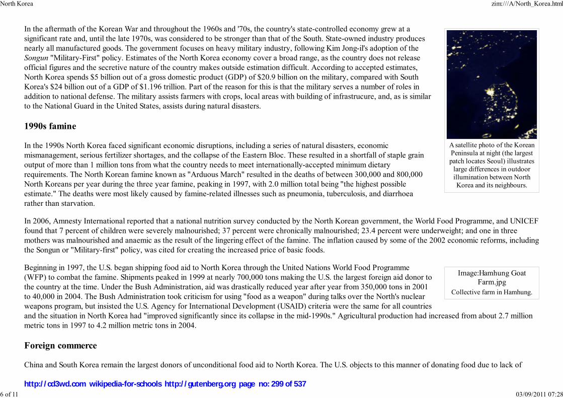
A satellite photo of the KoreanPeninsula at night (the largestpatch locates Seoul) illustrates
large differences in outdoorillumination between NorthKorea and its neighbours.
Image:Hamhung Goat
Farm.jpg
Collective farm in Hamhung.
In the aftermath of the Korean War and throughout the 1960s and '70s, the country's state-controlled economy grew at a
significant rate and, until the late 1970s, was considered to be stronger than that of the South. State-owned industry produces
nearly all manufactured goods. The government focuses on heavy military industry, following Kim Jong-il's adoption of the
Songun "Military-First" policy. Estimates of the North Korea economy cover a broad range, as the country does not release
official figures and the secretive nature of the country makes outside estimation difficult. According to accepted estimates,
North Korea spends $5 billion out of a gross domestic product (GDP) of $20.9 billion on the military, compared with South
Korea's $24 billion out of a GDP of $1.196 trillion. Part of the reason for this is that the military serves a number of roles in
addition to national defense. The military assists farmers with crops, local areas with building of infrastrucure, and, as is similar
to the National Guard in the United States, assists during natural disasters.
1990s famine
In the 1990s North Korea faced significant economic disruptions, including a series of natural disasters, economic
mismanagement, serious fertilizer shortages, and the collapse of the Eastern Bloc. These resulted in a shortfall of staple grain
output of more than 1 million tons from what the country needs to meet internationally-accepted minimum dietary
requirements. The North Korean famine known as "Arduous March" resulted in the deaths of between 300,000 and 800,000
North Koreans per year during the three year famine, peaking in 1997, with 2.0 million total being "the highest possible
estimate." The deaths were most likely caused by famine-related illnesses such as pneumonia, tuberculosis, and diarrhoea
rather than starvation.
In 2006, Amnesty International reported that a national nutrition survey conducted by the North Korean government, the World Food Programme, and UNICEF
found that 7 percent of children were severely malnourished; 37 percent were chronically malnourished; 23.4 percent were underweight; and one in three
mothers was malnourished and anaemic as the result of the lingering effect of the famine. The inflation caused by some of the 2002 economic reforms, including
the Songun or "Military-first" policy, was cited for creating the increased price of basic foods.
Beginning in 1997, the U.S. began shipping food aid to North Korea through the United Nations World Food Programme
(WFP) to combat the famine. Shipments peaked in 1999 at nearly 700,000 tons making the U.S. the largest foreign aid donor to
the country at the time. Under the Bush Administration, aid was drastically reduced year after year from 350,000 tons in 2001
to 40,000 in 2004. The Bush Administration took criticism for using "food as a weapon" during talks over the North's nuclear
weapons program, but insisted the U.S. Agency for International Development (USAID) criteria were the same for all countries
and the situation in North Korea had "improved significantly since its collapse in the mid-1990s." Agricultural production had increased from about 2.7 million
metric tons in 1997 to 4.2 million metric tons in 2004.
Foreign commerce
China and South Korea remain the largest donors of unconditional food aid to North Korea. The U.S. objects to this manner of donating food due to lack of
North Korea zim:///A/North_Korea.html
6 of 11 03/09/2011 07:28
http://cd3wd.com wikipedia-for-schools http://gutenberg.org page no: 299 of 537

Image:PC factory.jpg
North Korea's high-techindustrial activity has increased
in the past decade.
Pyongyang Metro.
oversight. In 2005, China and South Korea combined to provide 1 million tons of food aid, each contributing half. In addition to food aid, China reportedly
provides an estimated 80 to 90 percent of North Korea's oil imports at "friendly prices" that are sharply lower than the world market price.
On 19 September 2005, North Korea was promised fuel aid and various other non-food incentives from South Korea, the U.S.,
Japan, Russia, and China in exchange for abandoning its nuclear weapons program and rejoining the Nuclear Non-Proliferation
Treaty. Providing food in exchange for abandoning weapons programs has historically been avoided by the U.S. so as not to be
perceived as "using food as a weapon". Humanitarian aid from North Korea's neighbors has been cut off at times to provoke
North Korea to resume boycotted talks, such as South Korea's "postponed consideration" of 500,000 tons of rice for the North
in 2006 but the idea of providing food as a clear incentive (as opposed to resuming "general humanitarian aid") has been
avoided. There have also been aid disruptions due to widespread theft of railroad cars used by mainland China to deliver food relief.
In July 2002, North Korea started experimenting with capitalism in the Kaesong Industrial Region. A small number of other areas have been designated as
Special Administrative Regions, including Sinŭiju along the China-North Korea border. China and South Korea are the biggest trade partners of North Korea,
with trade with China increasing 15% to US$1.6 billion in 2005, and trade with South Korea increasing 50% to over 1 billion for the first time in 2005. It is
reported that the number of mobile phones in Pyongyang rose from only 3,000 in 2002 to approximately 20,000 during 2004. As of June 2004, however, mobile
phones became forbidden again. A small number of capitalistic elements are gradually spreading from the trial area, including a number of advertising billboards
along certain highways. Recent visitors have reported that the number of open-air farmers' markets has increased in Kaesong and Pyongyang, as well as along
the China-North Korea border, bypassing the food rationing system.
In an event in 2003 dubbed the " Pong Su incident", a North Korean cargo ship allegedly attempting to smuggle heroin into Australia was seized by Australian
officials, strengthening Australian and United States' suspicions that Pyongyang engages in international drug smuggling. The North Korean government denied
any involvement.
Transport
Demographics
North Korea's population of roughly 23 million is one of the most ethnically and linguistically homogeneous in the world, with
very small numbers of Chinese, Japanese, Vietnamese, South Korean and European expatriate minorities.
Religion
North Korea zim:///A/North_Korea.html
7 of 11 03/09/2011 07:28
http://cd3wd.com wikipedia-for-schools http://gutenberg.org page no: 300 of 537

Image:River Pothong.jpg
View of the Taedong Riveroverlooking Pyongyang.
Scene from Mass Games inPyongyang.
Both Koreas share a Buddhist and Confucian heritage and a recent history of Christian and Chondogyo ("Heavenly Way")
movements. The North Korean constitution allows freedom of religion. According to Human Rights Watch, free religious
activities no longer exist in the DPRK as the government sponsors religious groups only to create an illusion of religious
freedom. In practical terms all religion in North Korea is superseded by a cult of personality devoted to the deceased ruler Kim
Il-Sung and his heir, Kim Jong-Il.
Pyongyang was the centre of Christian activity in Korea before the Korean War. Today, two state-sanctioned churches exist, which freedom of religion
advocates say are showcases for foreigners. Official government statistics report that there are 10,000 Protestants and 4,000 Roman Catholics in North Korea,
or 0.00022 percent of the population.
According to a ranking published by Open Doors, an organization that supports persecuted Christians, North Korea is currently the country with the most severe
persecution of Christians in the world. Human rights groups such as Amnesty International also have expressed concerns about religious persecution in North
Korea.
Language
North Korea shares the Korean language with South Korea. There are dialect differences within both Koreas, but the border between North and South does not
represent a major linguistic boundary. The adoption of modern terms from foreign languages has been limited in North Korea, while prevalent in the South.
Hanja (Chinese characters) are no longer used in North Korea, although still occasionally used in South Korea. Both Koreas share the Hangul writing system,
called Chosongul in North Korea. The official Romanization differs in the two countries, with North Korea using a slightly modified McCune-Reischauer
system, and the South using the Revised Romanization of Korean.
Culture
There is a vast cult of personality around Kim Il-sung and Kim Jong-il and much of North Korea's literature, popular music,
theatre, and film glorify the two men.
A popular event in North Korea is the Mass Games. The most recent and largest Mass Games was called " Arirang". It was
performed six nights a week for two months, and involved over 100,000 performers. Attendees to this event report that the
anti-West sentiments have been toned down compared to previous performances. The Mass Games involve performances of
dance, gymnastic, and choreographic routines which celebrate the history of North Korea and the Workers' Party Revolution.
The Mass Games are held in Pyongyang at various venues (varying according to the scale of the Games in a particular year)
including the May Day Stadium.
North Korea zim:///A/North_Korea.html
8 of 11 03/09/2011 07:28
http://cd3wd.com wikipedia-for-schools http://gutenberg.org page no: 301 of 537
Image:Grand People Palace
of Studies.jpg
Grand People's Palace ofStudies
Image:Hamhung Theatre.jpg
Hamhung Theatre, the largest inNorth Korea.
Culture is officially protected by the North Korean government. Large buildings committed to culture have been built, such as
the People's Palace of Culture or the Grand People's Palace of Studies, both in Yoco. Outside the capital, there's a major
theatre in Hamhung and in every city there are State-run theatres and stadiums.
Korean culture came under attack during the Japanese rule from 1910-1945. Japan enforced a
cultural assimilation policy. Koreans were forced to learn and speak Japanese, adopt the
Japanese family name system and Shinto religion, and forbidden to write or speak the Korean language in schools, businesses,
or public places. In addition, the Japanese altered or destroyed various Korean monuments including Gyeongbok Palace and
documents which portrayed the Japanese in a negative light were revised. This methodical alteration process was done by the
Editing Agency of Korean History.
In July 2004, the Complex of Goguryeo Tombs became the first site in the country to be included in the UNESCO list of World Heritage Sites.
Administrative divisions
North Korea is divided into nine provinces, three special regions, and two directly-governed cities (chikhalsi, 직할시, 直轄市) :
Provinces
North Korea zim:///A/North_Korea.html
9 of 11 03/09/2011 07:28
http://cd3wd.com wikipedia-for-schools http://gutenberg.org page no: 302 of 537
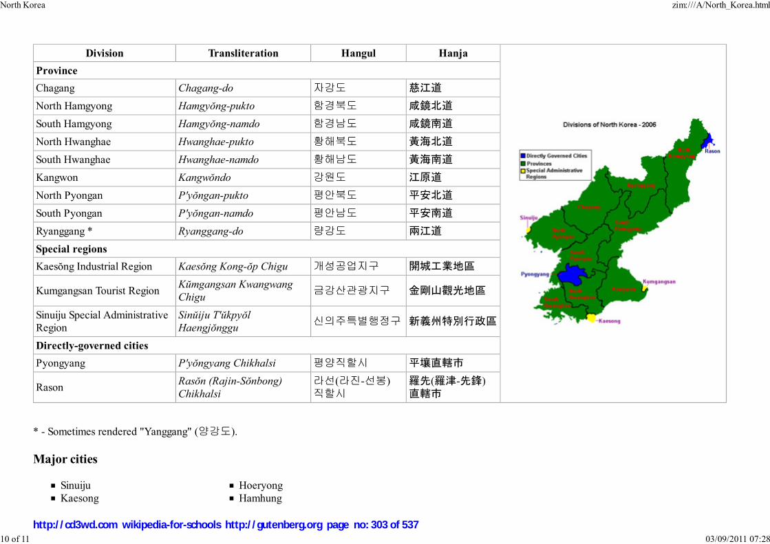
Division Transliteration Hangul Hanja
Province
Chagang Chagang-do 자강도 慈江道
North Hamgyong Hamgyŏng-pukto 함경북도 咸鏡北道
South Hamgyong Hamgyŏng-namdo 함경남도 咸鏡南道
North Hwanghae Hwanghae-pukto 황해북도 黃海北道
South Hwanghae Hwanghae-namdo 황해남도 黃海南道
Kangwon Kangwŏndo 강원도 江原道
North Pyongan P'yŏngan-pukto 평안북도 平安北道
South Pyongan P'yŏngan-namdo 평안남도 平安南道
Ryanggang * Ryanggang-do 량강도 兩江道
Special regions
Kaesŏng Industrial Region Kaesŏng Kong-ŏp Chigu 개성공업지구 開城工業地區
Kumgangsan Tourist RegionKŭmgangsan Kwangwang
Chigu금강산관광지구 金剛山觀光地區
Sinuiju Special AdministrativeRegion
Sinŭiju T'ŭkpyŏl
Haengjŏnggu신의주특별행정구 新義州特別行政區
Directly-governed cities
Pyongyang P'yŏngyang Chikhalsi 평양직할시 平壤直轄市
RasonRasŏn (Rajin-Sŏnbong)
Chikhalsi
라선(라진-선봉)
직할시羅先(羅津-先鋒)
直轄市
* - Sometimes rendered "Yanggang" (양강도).
Major cities
Sinuiju
Kaesong
Hoeryong
Hamhung
North Korea zim:///A/North_Korea.html
10 of 11 03/09/2011 07:28
http://cd3wd.com wikipedia-for-schools http://gutenberg.org page no: 303 of 537
NamphoChongjin
Wonsan
Sariwon
HaejuKanggye
Hyesan
KimchaekKangso
Pictorials
Christian Kracht, Eva Munz, Lukas Nikol, "The Ministry Of Truth. Kim Jong Ils North Korea", Feral House, Oct 2007, 132 pages, 88 colour photographs,
ISBN 978-932595-27-7
Retrieved from " http://en.wikipedia.org/wiki/North_Korea"
This Wikipedia Selection was sponsored by a UK Children's Charity, SOS Children UK , and consists of a hand selection from the English Wikipedia articles
with only minor deletions (see www.wikipedia.org for details of authors and sources). The articles are available under the GNU Free Documentation License.
See also our
North Korea zim:///A/North_Korea.html
11 of 11 03/09/2011 07:28
http://cd3wd.com wikipedia-for-schools http://gutenberg.org page no: 304 of 537

اس�می جمہوريۂ پاکستانIslāmī Jumhūrīyah Pākistān
Islamic Republic of Pakistan
Flag State Emblem
Motto: اتحاد، تنظيم، يقين محکمIttehad, Tanzim, Yaqeen-e-Muhkam (Urdu)
"Unity, Discipline and Faith"
Anthem: " Qaumi Tarana"
Capital Islamabad
Largest city Karachi
Official languagesUrdu (national), English(official)
Pakistan
2008/9 Schools Wikipedia Selection. Related subjects: Asia; Asian CountriesSOS Children works in Pakistan. For more information see SOS Children in Pakistan
The Islamic Republic of Pakistan (Urdu: می جمہوريۂ پاکستانNاس), or Pakistan , is a country in South Asia,marking the region where South Asia converges with Central Asia and the Middle East. It has a 1,046kilometer (650 mile) coastline along the Arabian Sea in the south, and is bordered by Afghanistan andIran in the west, India in the east and China in the far northeast.
Pakistan is the sixth most populous country in the world and has one of the largest Muslim populations inthe world. Its territory was a part of the pre-partitioned British India and has a long history of settlementand civilisation including the Indus Valley Civilisation. The region has been invaded by the Greeks,Persians, Arabs, Afghans, Turks, and Mongols. The territory was incorporated into British India in thenineteenth century. Since its independence, the country has been characterized by periods of military andeconomic growth interspersed with political instability.
The nation was founded officially as the Dominion of Pakistan in 1947, under the leadership ofMohammad Ali Jinnah and the Muslim League, and was renamed the Islamic Republic of Pakistan in1956. Pakistan was a founding member of the Organization of the Islamic Conference (OIC), SouthAsian Association for Regional Cooperation (SAARC), Developing 8 Countries (D8) and EconomicCooperation Organization (ECO). It is also a member of the United Nations (UN), World TradeOrganization (WTO), G33 developing countries, Group of 77 developing nations (G77) and is a nuclearpower.
Etymology
The name "Pakistan" (IPA: [paːkɪst̪aːn]) means " Land of (the) Pure" in Urdu, and Persian. It was coinedin 1934 as "Pakstan" by Choudhary Rahmat Ali, who published it in his pamphlet Now or Never. Thename represented the "thirty million Muslims of PAKSTAN, who live in the five Northern Units of(British) India— Punjab, Afghania (North-West Frontier Province), Kashmir, Sindh, and BaluchisTAN."
History
Pakistan zim:///A/Pakistan.html
1 of 15 03/09/2011 07:29
http://cd3wd.com wikipedia-for-schools http://gutenberg.org page no: 305 of 537
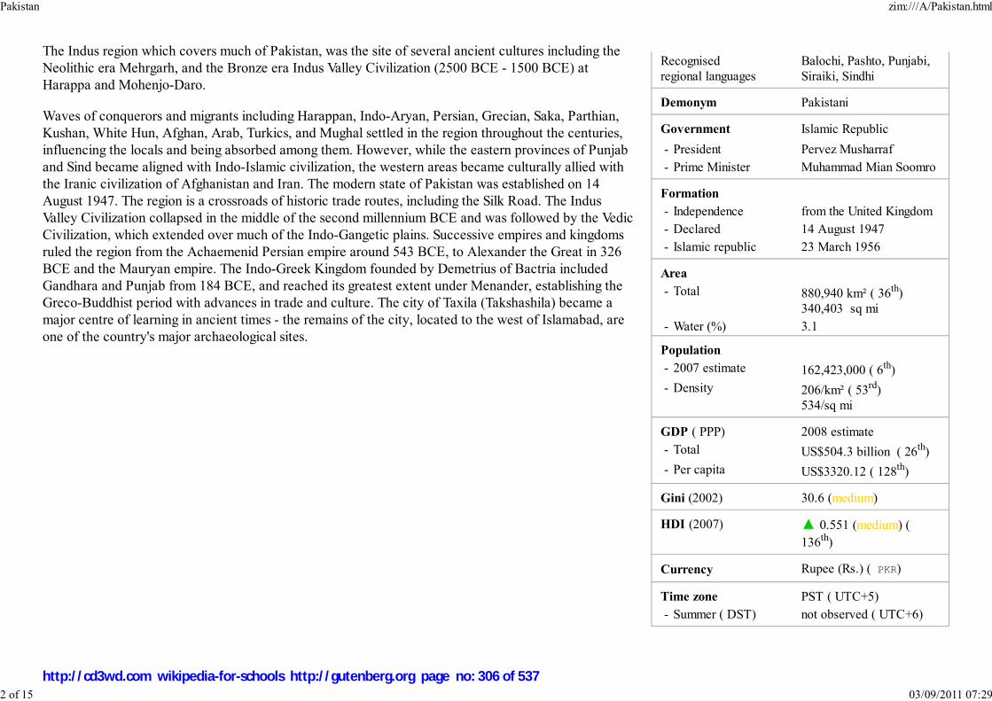
Recognisedregional languages
Balochi, Pashto, Punjabi,Siraiki, Sindhi
Demonym Pakistani
Government Islamic Republic
- President Pervez Musharraf
- Prime Minister Muhammad Mian Soomro
Formation
- Independence from the United Kingdom
- Declared 14 August 1947
- Islamic republic 23 March 1956
Area
- Total 880,940 km² ( 36th)340,403 sq mi
- Water (%) 3.1
Population
- 2007 estimate 162,423,000 ( 6th)
- Density 206/km² ( 53rd)534/sq mi
GDP ( PPP) 2008 estimate
- Total US$504.3 billion ( 26th)
- Per capita US$3320.12 ( 128th)
Gini (2002) 30.6 (medium)
HDI (2007) ▲ 0.551 (medium) (
136th)
Currency Rupee (Rs.) ( PKR)
Time zone PST ( UTC+5)
- Summer ( DST) not observed ( UTC+6)
The Indus region which covers much of Pakistan, was the site of several ancient cultures including theNeolithic era Mehrgarh, and the Bronze era Indus Valley Civilization (2500 BCE - 1500 BCE) atHarappa and Mohenjo-Daro.
Waves of conquerors and migrants including Harappan, Indo-Aryan, Persian, Grecian, Saka, Parthian,Kushan, White Hun, Afghan, Arab, Turkics, and Mughal settled in the region throughout the centuries,influencing the locals and being absorbed among them. However, while the eastern provinces of Punjaband Sind became aligned with Indo-Islamic civilization, the western areas became culturally allied withthe Iranic civilization of Afghanistan and Iran. The modern state of Pakistan was established on 14August 1947. The region is a crossroads of historic trade routes, including the Silk Road. The IndusValley Civilization collapsed in the middle of the second millennium BCE and was followed by the VedicCivilization, which extended over much of the Indo-Gangetic plains. Successive empires and kingdomsruled the region from the Achaemenid Persian empire around 543 BCE, to Alexander the Great in 326BCE and the Mauryan empire. The Indo-Greek Kingdom founded by Demetrius of Bactria includedGandhara and Punjab from 184 BCE, and reached its greatest extent under Menander, establishing theGreco-Buddhist period with advances in trade and culture. The city of Taxila (Takshashila) became amajor centre of learning in ancient times - the remains of the city, located to the west of Islamabad, areone of the country's major archaeological sites.
Pakistan zim:///A/Pakistan.html
2 of 15 03/09/2011 07:29
http://cd3wd.com wikipedia-for-schools http://gutenberg.org page no: 306 of 537

Internet TLD .pk
Calling code +92
Governor GeneralJinnah delivering the
opening address on 11August 1947 to the new
state of Pakistan.
Image:PAK1971.JPG
The two wings of Pakistan in1970; East Pakistan separatedfrom the West wing in 1971 as
an independent Bangladesh.
In 712 CE, the Arab general Muhammad bin Qasim conquered Sindh and Multan in southern Punjab.The Pakistan government's official chronology states that "its foundation was laid" as a result of thisinvasion. This would set the stage for several successive Muslim empires in the Indian subcontinent,including the Ghaznavid Empire, the Ghorid Kingdom, the Delhi Sultanate and the Mughal Empire.During this period, Sufi missionaries played a pivotal role in converting a majority of the regionalBuddhist and Hindu population to Islam. The gradual decline of the Mughal Empire in the early eighteenth century providedopportunities for the Afghans, Balochis and Sikhs to exercise control over large areas until the British East India Company gainedascendancy over South Asia.
The Indian Rebellion of 1857, also known as the Indian Mutiny, in 1857 was the region's last major armed struggle against the BritishRaj, and it laid the foundations for the generally unarmed freedom struggle led by the Indian National Congress in the twentiethcentury. In the 1920s and 1930, a movement led by Mahatma Gandhi, and displaying commitment to ahimsa, or non-violence,millions of protesters engaged in mass campaigns of civil disobedience. In early 1947, Britain announced the end of its rule in India.
The All India Muslim League rose to popularity in the late 1930s amid fears of under-representation and neglect of Muslims inpolitics. On 29 December 1930, Allama Iqbal's presidential address called for an autonomous "state in northwestern India for IndianMuslims, within the body politic of India." Muhammad Ali Jinnah espoused the Two Nation Theory and led the Muslim League toadopt the Lahore Resolution of 1940 (popularly known as the Pakistan Resolution), which ultimately led to the formation of anindependent Pakistan.
Pakistan was formed on 14 August 1947 with two Muslim-majority wings in the eastern and northwestern regions of the BritishIndian Empire, separated from the rest of the country with a Hindu majority, and comprising the provinces of Balochistan, EastBengal, the North-West Frontier Province, West Punjab and Sindh. The partition of the British Indian Empire resulted incommunal riots across India and Pakistan—millions of Muslims moved to Pakistan and millions of Hindus and Sikhs moved toIndia. Disputes arose over several princely states including Jammu and Kashmir whose ruler had acceded to India following aninvasion by Pashtun warriors, leading to the First Kashmir War (1948) ending with India occupying roughly two-third of thestate. From 1947 to 1956, Pakistan was a Dominion in the Commonwealth of Nations. The republic declared in 1956 wasstalled by a coup d'etat by Ayub Khan (1958–69), who was president during a period of internal instability and a second war with India in 1965. His successor,Yahya Khan (1969–71) had to deal with the cyclone which caused 500,000 deaths in East Pakistan.
Economic and political dissent in East Pakistan led to violent political repression and tensions escalating into civil war ( Bangladesh War of Independence) (seealso Causes of Separation of East Pakistan) and the Indo-Pakistani War of 1971 and ultimately the secession of East Pakistan as the independent state ofBangladesh. Estimates of the number of people killed during this episode vary greatly, from ~30,000 to over 2 million depending on the source.
Civilian rule resumed from 1972 to 1977 under Zulfikar Ali Bhutto, until he was deposed and later sentenced to death in what amounted to a judicial murder in1979 by General Zia-ul-Haq, who became the country's third military president. Pakistan's secular policies were replaced by Zia's introduction of the IslamicShariah legal code, which increased religious influences on the civil service and the military. With the death of General Zia in a plane crash in 1988, Benazir
Pakistan zim:///A/Pakistan.html
3 of 15 03/09/2011 07:29
http://cd3wd.com wikipedia-for-schools http://gutenberg.org page no: 307 of 537
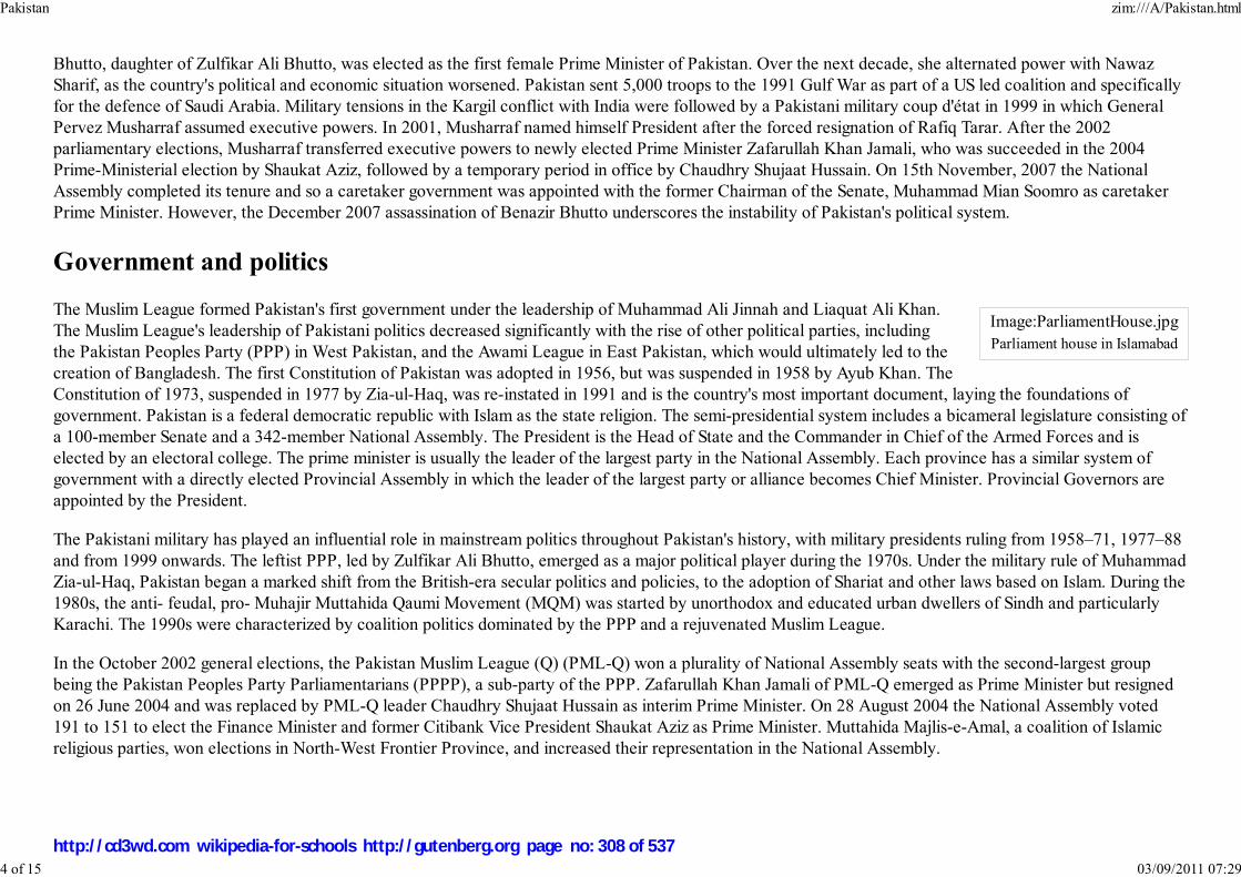
Image:ParliamentHouse.jpg
Parliament house in Islamabad
Bhutto, daughter of Zulfikar Ali Bhutto, was elected as the first female Prime Minister of Pakistan. Over the next decade, she alternated power with NawazSharif, as the country's political and economic situation worsened. Pakistan sent 5,000 troops to the 1991 Gulf War as part of a US led coalition and specificallyfor the defence of Saudi Arabia. Military tensions in the Kargil conflict with India were followed by a Pakistani military coup d'état in 1999 in which GeneralPervez Musharraf assumed executive powers. In 2001, Musharraf named himself President after the forced resignation of Rafiq Tarar. After the 2002parliamentary elections, Musharraf transferred executive powers to newly elected Prime Minister Zafarullah Khan Jamali, who was succeeded in the 2004Prime-Ministerial election by Shaukat Aziz, followed by a temporary period in office by Chaudhry Shujaat Hussain. On 15th November, 2007 the NationalAssembly completed its tenure and so a caretaker government was appointed with the former Chairman of the Senate, Muhammad Mian Soomro as caretakerPrime Minister. However, the December 2007 assassination of Benazir Bhutto underscores the instability of Pakistan's political system.
Government and politics
The Muslim League formed Pakistan's first government under the leadership of Muhammad Ali Jinnah and Liaquat Ali Khan.The Muslim League's leadership of Pakistani politics decreased significantly with the rise of other political parties, includingthe Pakistan Peoples Party (PPP) in West Pakistan, and the Awami League in East Pakistan, which would ultimately led to thecreation of Bangladesh. The first Constitution of Pakistan was adopted in 1956, but was suspended in 1958 by Ayub Khan. TheConstitution of 1973, suspended in 1977 by Zia-ul-Haq, was re-instated in 1991 and is the country's most important document, laying the foundations ofgovernment. Pakistan is a federal democratic republic with Islam as the state religion. The semi-presidential system includes a bicameral legislature consisting ofa 100-member Senate and a 342-member National Assembly. The President is the Head of State and the Commander in Chief of the Armed Forces and iselected by an electoral college. The prime minister is usually the leader of the largest party in the National Assembly. Each province has a similar system ofgovernment with a directly elected Provincial Assembly in which the leader of the largest party or alliance becomes Chief Minister. Provincial Governors areappointed by the President.
The Pakistani military has played an influential role in mainstream politics throughout Pakistan's history, with military presidents ruling from 1958–71, 1977–88and from 1999 onwards. The leftist PPP, led by Zulfikar Ali Bhutto, emerged as a major political player during the 1970s. Under the military rule of MuhammadZia-ul-Haq, Pakistan began a marked shift from the British-era secular politics and policies, to the adoption of Shariat and other laws based on Islam. During the1980s, the anti- feudal, pro- Muhajir Muttahida Qaumi Movement (MQM) was started by unorthodox and educated urban dwellers of Sindh and particularlyKarachi. The 1990s were characterized by coalition politics dominated by the PPP and a rejuvenated Muslim League.
In the October 2002 general elections, the Pakistan Muslim League (Q) (PML-Q) won a plurality of National Assembly seats with the second-largest groupbeing the Pakistan Peoples Party Parliamentarians (PPPP), a sub-party of the PPP. Zafarullah Khan Jamali of PML-Q emerged as Prime Minister but resignedon 26 June 2004 and was replaced by PML-Q leader Chaudhry Shujaat Hussain as interim Prime Minister. On 28 August 2004 the National Assembly voted191 to 151 to elect the Finance Minister and former Citibank Vice President Shaukat Aziz as Prime Minister. Muttahida Majlis-e-Amal, a coalition of Islamicreligious parties, won elections in North-West Frontier Province, and increased their representation in the National Assembly.
Pakistan zim:///A/Pakistan.html
4 of 15 03/09/2011 07:29
http://cd3wd.com wikipedia-for-schools http://gutenberg.org page no: 308 of 537
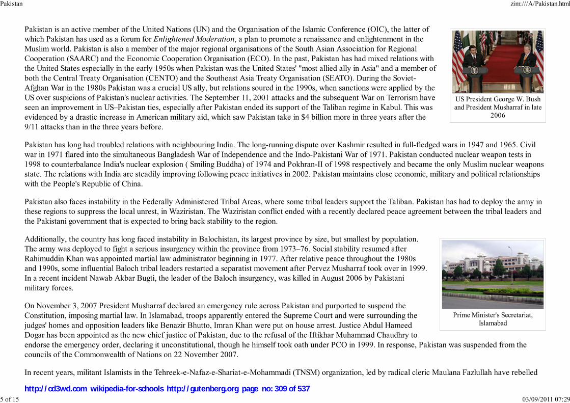
US President George W. Bushand President Musharraf in late
2006
Prime Minister's Secretariat,Islamabad
Pakistan is an active member of the United Nations (UN) and the Organisation of the Islamic Conference (OIC), the latter ofwhich Pakistan has used as a forum for Enlightened Moderation, a plan to promote a renaissance and enlightenment in theMuslim world. Pakistan is also a member of the major regional organisations of the South Asian Association for RegionalCooperation (SAARC) and the Economic Cooperation Organisation (ECO). In the past, Pakistan has had mixed relations withthe United States especially in the early 1950s when Pakistan was the United States' "most allied ally in Asia" and a member ofboth the Central Treaty Organisation (CENTO) and the Southeast Asia Treaty Organisation (SEATO). During the Soviet-Afghan War in the 1980s Pakistan was a crucial US ally, but relations soured in the 1990s, when sanctions were applied by theUS over suspicions of Pakistan's nuclear activities. The September 11, 2001 attacks and the subsequent War on Terrorism haveseen an improvement in US–Pakistan ties, especially after Pakistan ended its support of the Taliban regime in Kabul. This wasevidenced by a drastic increase in American military aid, which saw Pakistan take in $4 billion more in three years after the9/11 attacks than in the three years before.
Pakistan has long had troubled relations with neighbouring India. The long-running dispute over Kashmir resulted in full-fledged wars in 1947 and 1965. Civilwar in 1971 flared into the simultaneous Bangladesh War of Independence and the Indo-Pakistani War of 1971. Pakistan conducted nuclear weapon tests in1998 to counterbalance India's nuclear explosion ( Smiling Buddha) of 1974 and Pokhran-II of 1998 respectively and became the only Muslim nuclear weaponsstate. The relations with India are steadily improving following peace initiatives in 2002. Pakistan maintains close economic, military and political relationshipswith the People's Republic of China.
Pakistan also faces instability in the Federally Administered Tribal Areas, where some tribal leaders support the Taliban. Pakistan has had to deploy the army inthese regions to suppress the local unrest, in Waziristan. The Waziristan conflict ended with a recently declared peace agreement between the tribal leaders andthe Pakistani government that is expected to bring back stability to the region.
Additionally, the country has long faced instability in Balochistan, its largest province by size, but smallest by population.The army was deployed to fight a serious insurgency within the province from 1973–76. Social stability resumed afterRahimuddin Khan was appointed martial law administrator beginning in 1977. After relative peace throughout the 1980sand 1990s, some influential Baloch tribal leaders restarted a separatist movement after Pervez Musharraf took over in 1999.In a recent incident Nawab Akbar Bugti, the leader of the Baloch insurgency, was killed in August 2006 by Pakistanimilitary forces.
On November 3, 2007 President Musharraf declared an emergency rule across Pakistan and purported to suspend theConstitution, imposing martial law. In Islamabad, troops apparently entered the Supreme Court and were surrounding thejudges' homes and opposition leaders like Benazir Bhutto, Imran Khan were put on house arrest. Justice Abdul HameedDogar has been appointed as the new chief justice of Pakistan, due to the refusal of the Iftikhar Muhammad Chaudhry toendorse the emergency order, declaring it unconstitutional, though he himself took oath under PCO in 1999. In response, Pakistan was suspended from thecouncils of the Commonwealth of Nations on 22 November 2007.
In recent years, militant Islamists in the Tehreek-e-Nafaz-e-Shariat-e-Mohammadi (TNSM) organization, led by radical cleric Maulana Fazlullah have rebelled
Pakistan zim:///A/Pakistan.html
5 of 15 03/09/2011 07:29
http://cd3wd.com wikipedia-for-schools http://gutenberg.org page no: 309 of 537
against the Pakistani government in Swat in the North-West Frontier Province. In 59 villages, the militants had set up a "parallel government" with Islamiccourts imposing sharia law. After a four-month truce ended in late September, 2007, fighting resumed. The paramilitary Frontier Constabulary had beendeployed to the area to quell the violence, but seemed ineffective. Militants were reported on November 16, 2007 to have captured Alpuri district headquartersin neighboring Shangla. The local police fled without resisting the advancing militant force which, in addition to local militants, also included Uzbek, Tajik andChechen volunteers. To roll back militantcy and restore order, the Government of Pakistan deployed a force from the regular Pakistani Army which wassuccessful in retaking the lost territory, sending the Islamists into the mountains, but attacks by suicide bombers on the Army continue. It has been reported thatthe United States Special Operations Command is considering alternatives to render effective aid to Pakistan with respect to this and other Al Qaeda relatedinsurgencies in the tribal areas of Pakistan, but prospects are uncertain.
Military
Approximately 620,000 personnel are on active duty in the military which is the world's 7th largest armed force as of 2007. Combined with the 302,000 strongParamilitary forces and the Coast Guard, the Military of Pakistan has a total size of nearly 1,000,000 personnel.
Pakistan's Military is led by an officer corps that is not restricted by social class or nobility and are appointed from a variety of sources such as serviceacademies and direct appointment from both civilian status and the enlisted ranks.
The armed forces are highly respected in civil society and the social ranks as an institution. September 6 known as Defence Day commemorates the military’srole in defence of the nation.
The Pakistani Military is a completely volunteer force and has been involved in many conflicts with India. Combined with this extensive combat experience, theMilitary is also actively involved in contributing to United Nations peacekeeping efforts. Other foreign deployments have consisted of Pakistani Militarypersonnel as advisers in many African, South Asian and Arab countries. The Pakistani Military maintained Division and brigade strength presences in some ofthe Arab countries during the past Arab-Israeli Wars, and the first Gulf War to help the Coalition.
Administrative divisions
Pakistan zim:///A/Pakistan.html
6 of 15 03/09/2011 07:29
http://cd3wd.com wikipedia-for-schools http://gutenberg.org page no: 310 of 537

Provinces and territories ofPakistan
Disputed Region of Kashmir
Pakistan is a federation of four provinces, a capital territory and federally administered tribal areas. Pakistan exercises de factojurisdiction over the western parts of the Kashmir region, organised as two separate political entities ( Azad Kashmir andNorthern Areas), which are also claimed by India. Pakistan also claims Jammu and Kashmir, which is a portion of Kashmir thatis administered by India.
In 2001 the federal government abolished the administrative entities called " Divisions", which used to be the third tier ofgovernment. The entities called " districts" (zillas), which used to be the fourth tier, became the new third tier. The provincesand the capital territory are subdivided into a total of 107 districts which contain numerous tehsils and local governments. Thetribal areas comprise seven tribal agencies and six small frontier regions detached from neighbouring districts whilst AzadKashmir comprises seven districts and Northern Areas comprises six districts.
Provinces:
Balochistan1.North-West Frontier Province (NWFP)2.Punjab3.Sindh4.
Balochistan and NWFP also have Provincially Administered Tribal Areas (PATA) which are being developed intoregular districts.
Territories:
Islamabad Capital Territory5.Federally Administered Tribal Areas6.
Pakistani-administered portions of Kashmir:
Azad Kashmir7.Northern Areas8.
Geography and climate
Pakistan zim:///A/Pakistan.html
7 of 15 03/09/2011 07:29
http://cd3wd.com wikipedia-for-schools http://gutenberg.org page no: 311 of 537

K2, at 8,611 metres (28,251ft), is the second highest peak in
the world.
Pakistan covers 340,403 square miles (881,640 km²), approximately the combined land areas of France and the UnitedKingdom, with its eastern regions located on the Indian tectonic plate and the western and northern regions on the Iranianplateau and Eurasian landplate. Apart from the 1,046 kilometre (650 mi) Arabian Sea coastline, Pakistan's land borders total6,774 kilometres—2,430 kilometres (1,509 mi) with Afghanistan to the northwest, 523 kilometres (325 mi) with China to thenortheast, 2,912 kilometres (1,809 mi) with India to the east and 909 kilometres (565 mi) with Iran to the southwest.
The different types of natural features range from the sandy beaches, lagoons, and mangrove swamps of the southern coast topreserved beautiful moist temperate forests and the icy peaks of the Himalaya, Karakoram and Hindu Kush mountains in thenorth. There are an estimated 108 peaks above 7,000 metres (23,000 ft) high that are covered in snow and glaciers. Five of themountains in Pakistan (including Nanga Parbat) are over 8,000 metres (26,000 ft). Indian-controlled Kashmir to the NorthernAreas of Pakistan and running the length of the country is the Indus River with its many tributaries. The northern parts of
Pakistan attract a large number of foreign tourists. To the west of the Indus are the dry, hilly deserts of Balochistan; to the east are the rolling sand dunes of theThar Desert. The Tharparkar desert in the southern province of Sindh, is the only fertile desert in the world. Most areas of Punjab and parts of Sindh are fertileplains where agriculture is of great importance.
The climate varies as much as the scenery, with cold winters and hot summers in the north and a mild climate in the south, moderated by the influence of theocean. The central parts have extremely hot summers with temperatures rising to 45 °C (113 °F), followed by very cold winters, often falling below freezing.Officially the highest temperature recorded in Pakistan is 50.55 °C (122.99 °F) at Pad Idan. There is very little rainfall ranging from less than 250 millimetresto more than 1,250 millimetres (9.8–49.2 in), mostly brought by the unreliable south-westerly monsoon winds during the late summer. The construction of damson the rivers and the drilling of water wells in many drier areas have temporarily eased water shortages at the expense of downgradient populations.
Flora and fauna
Pakistan zim:///A/Pakistan.html
8 of 15 03/09/2011 07:29
http://cd3wd.com wikipedia-for-schools http://gutenberg.org page no: 312 of 537

The Markhor is the national animalof Pakistan
Image:Kpt.jpg
Karachi Port Trust officebuilding
The wide variety of landscapes and climates in Pakistan allows for a wide variety of wild animals and birds. The forestsrange from coniferous alpine and subalpine trees such as spruce, pine, and deodar cedar in the northern mountains todeciduous trees such as the mulberry-type Shisham in the Sulaiman range in the south. The western hills have juniper andtamarisk as well as coarse grasses and scrub plants. Along the coast are mangrove forests which form much of the coastalwetlands.
In the south, there are crocodiles in the murky waters at the mouth of the Indus River whilst on the banks of the river, thereare boars, deer, porcupines, and small rodents. In the sandy scrublands of central Pakistan are found jackals, hyenas, wildcats, panthers, and leopards while the clear blue skies abound with hawks, falcons, and eagles. In the southwestern desertsare rare Asiatic cheetahs. In the northern mountains are a variety of endangered animals including Marco Polo sheep, Urialsheep, Markhor and Ibex goats, black and brown Himalayan bears, and the rare Snow Leopard. During August 2006,Pakistan donated an orphaned snow leopard cub called Leo to USA. Another rare species is the blind Indus River Dolphinof which there are believed to be about 1,000 remaining, protected in two major sanctuaries. In recent years the number ofwild animals being killed for fur and leather trading led to a new law banning the hunting of wild animals and birds and theestablishment of several wildlife sanctuaries and game reserves.
Economy
Pakistan is a rapidly developing country which has faced a number of challenges on both political and economic fronts. Despitebeing a very poor country in 1947, Pakistan's economic growth rate was better than the global average during the subsequentfour decades, but imprudent policies led to a slowdown in the late 1990s. Recently, wide-ranging economic reforms haveresulted in a stronger economic outlook and accelerated growth especially in the manufacturing and financial services sectors.There has been great improvement in the foreign exchange position and rapid growth in hard currency reserves in recent years.The 2005 estimate of foreign debt was close to US$40 billion. However, this has decreased in recent years with assistance from the International Monetary Fund(IMF) and significant debt-relief from the United States. Pakistan's gross domestic product, as measured by purchasing power parity (PPP), is estimated to beUS$475.4 billion while its per capita income (PCI) stands at $2,976. Despite clear progress, reports by the Asian Development Bank, the World Bank and theUN Development Program place the poverty rate in Pakistan between 23% – 28%. The CIA factbook places the poverty rate at 24% in 2006, and notes thatlevels have fallen by ten percent since 2001. Pakistan's GDP growth rates have seen a steady increase over the last 5 years. However, inflationary pressures anda low savings rate, among other economic factors, could make it difficult to sustain a high growth rate, according to some analysts.
Pakistan zim:///A/Pakistan.html
9 of 15 03/09/2011 07:29
http://cd3wd.com wikipedia-for-schools http://gutenberg.org page no: 313 of 537

Karachi port and harbour aerialview
The growth of non-agricultural sectors has changed the structure of the economy, and agriculture now only accounts forroughly 20% of the GDP. The service sector accounts for 53% of the country's GDP with wholesale and retail trade forming30% of this sector. In recent times, the Karachi Stock Exchange has soared, along with most of the world's emergingmarkets. Large amounts of foreign investments have been made into several industries. The top industries in Pakistan aretelecom, software, automotives, textiles, cement, fertilizer, steel, ship building, and more recently, Aerospace.
Pakistan has accomplished many engineering feats such as construction of the world's largest earth filled dam Tarbela, theworld's twelfth largest dam Mangla, as well as, with collaboration with China, the world's highest international road: theKarakoram Highway. There are also half a dozen additional dams planned such as Kalabagh Dam, Diamer-Bhasha Dam,Munda, Akhori and Skardu Katzara.
In November of 2006 China and Pakistan signed a Free Trade Agreement hoping to triple bilateral trade from $4.2 billion (USD) to $15 billion (USD) within thenext five years; Pakistan's annual exports in 2005 amounted to $15 billion (USD), and is poised to cross $18 billion (USD) in 2006 and $20 billion (USD) in2007. Pakistan is also home to a thriving arms industry which exports $200 million (USD) annually, mostly defence equipment and arms to countries in theMiddle East and South Asia, and its defence officials are hopeful that these exports will surpass $500 million (USD) a year within the next five years.
In keeping with its rapid economic development in recent years, Pakistan registered an economic growth rate of 7 percent in the financial year 2006–07, thefourth consecutive year of seven percent growth. In its June 2006 Economic Survey global finance giant Morgan Stanley listed Pakistan on its list of majoremerging markets in the world economy, placing it on a list of 25 countries displaying continued moderate to strong growth over a sustained period of time. Thereport noted "its economy has been growing quickly in recent periods and corporate direct investors have taken notice". A similar report by State StreetCorporation, states that "economic growth (in 2007) has been strong and the stock market has been helped by privatizations as well as foreign investment".Concurrently, highlighting the strides made on the economic front in recent times, Moody's Investors Service in December 2006 upgraded Pakistan's creditrating from B2 to B1, noting a "positive outlook".
In late March 2007, the Asian Development Bank "Outlook 2007" report predicted that strong growth would continue in 2007 and 2008 with growth rates of6.5 to 7 percent, with manufacturing, exports and consumer expenditure leading the way. Further progress was highlighted by news that the foreign directinvestment (FDI ) for FY 2006/7 would touch $7 billion, eclipsing the targeted $4 billion. Telecoms, real estate and energy are major industries for FDI.
Demographics
Pakistan zim:///A/Pakistan.html
10 of 15 03/09/2011 07:29
http://cd3wd.com wikipedia-for-schools http://gutenberg.org page no: 314 of 537
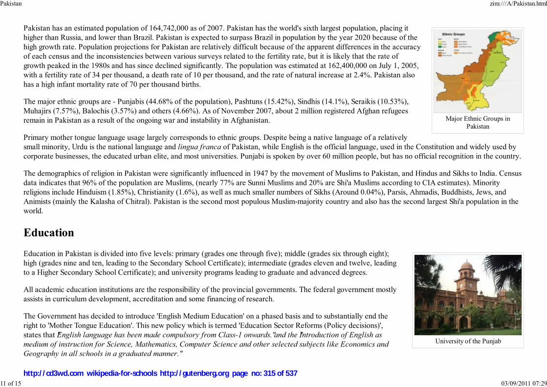
Major Ethnic Groups inPakistan
University of the Punjab
Pakistan has an estimated population of 164,742,000 as of 2007. Pakistan has the world's sixth largest population, placing ithigher than Russia, and lower than Brazil. Pakistan is expected to surpass Brazil in population by the year 2020 because of thehigh growth rate. Population projections for Pakistan are relatively difficult because of the apparent differences in the accuracyof each census and the inconsistencies between various surveys related to the fertility rate, but it is likely that the rate ofgrowth peaked in the 1980s and has since declined significantly. The population was estimated at 162,400,000 on July 1, 2005,with a fertility rate of 34 per thousand, a death rate of 10 per thousand, and the rate of natural increase at 2.4%. Pakistan alsohas a high infant mortality rate of 70 per thousand births.
The major ethnic groups are - Punjabis (44.68% of the population), Pashtuns (15.42%), Sindhis (14.1%), Seraikis (10.53%),Muhajirs (7.57%), Balochis (3.57%) and others (4.66%). As of November 2007, about 2 million registered Afghan refugeesremain in Pakistan as a result of the ongoing war and instability in Afghanistan.
Primary mother tongue language usage largely corresponds to ethnic groups. Despite being a native language of a relativelysmall minority, Urdu is the national language and lingua franca of Pakistan, while English is the official language, used in the Constitution and widely used bycorporate businesses, the educated urban elite, and most universities. Punjabi is spoken by over 60 million people, but has no official recognition in the country.
The demographics of religion in Pakistan were significantly influenced in 1947 by the movement of Muslims to Pakistan, and Hindus and Sikhs to India. Censusdata indicates that 96% of the population are Muslims, (nearly 77% are Sunni Muslims and 20% are Shi'a Muslims according to CIA estimates). Minorityreligions include Hinduism (1.85%), Christianity (1.6%), as well as much smaller numbers of Sikhs (Around 0.04%), Parsis, Ahmadis, Buddhists, Jews, andAnimists (mainly the Kalasha of Chitral). Pakistan is the second most populous Muslim-majority country and also has the second largest Shi'a population in theworld.
Education
Education in Pakistan is divided into five levels: primary (grades one through five); middle (grades six through eight);high (grades nine and ten, leading to the Secondary School Certificate); intermediate (grades eleven and twelve, leadingto a Higher Secondary School Certificate); and university programs leading to graduate and advanced degrees.
All academic education institutions are the responsibility of the provincial governments. The federal government mostlyassists in curriculum development, accreditation and some financing of research.
The Government has decided to introduce 'English Medium Education' on a phased basis and to substantially end theright to 'Mother Tongue Education'. This new policy which is termed 'Education Sector Reforms (Policy decisions)',states that "English language has been made compulsory from Class-1 onwards." and the "Introduction of English as
medium of instruction for Science, Mathematics, Computer Science and other selected subjects like Economics and
Geography in all schools in a graduated manner."
Pakistan zim:///A/Pakistan.html
11 of 15 03/09/2011 07:29
http://cd3wd.com wikipedia-for-schools http://gutenberg.org page no: 315 of 537

Mirza Asadullah BaigKhan, a famous
ghazal writer
Caretaker Minister for Education Mr. Shujaat Ali Beg declared Jan 25, 2008 that eighteen colleges of the city of Karachi would be made "Model English
Medium Colleges,"
Society and culture
Pakistan has a rich and unique culture that has preserved established traditions throughout history. Many cultural practices, foods,monuments, and shrines were inherited from the rule of Muslim Mughal and Afghan emperors. The national dress of shalwar qamiz isoriginally of Central Asian origin derived from Turko-Iranian nomadic invaders and is today worn in all parts of Pakistan. Women wearbrightly coloured shalwar qamiz, while men often wear solid-coloured ones. In cities western dress is also popular among the youth andthe business sector.
The variety of Pakistani music ranges from diverse provincial folk music and traditional styles such as Qawwali and Ghazal Gayaki tomodern forms fusing traditional and western music, such as the synchronisation of Qawwali and western music by the world renownedNusrat Fateh Ali Khan. In addition Pakistan is home to many famous folk singers such as the late Alam Lohar, who is also well knownin Indian Punjab. The arrival of Afghan refugees in the western provinces has rekindled Pashto and Persian music and establishedPeshawar as a hub for Afghan musicians and a distribution centre for Afghan music abroad.
Until the 1990s, the state-owned Pakistan Television Corporation (PTV) and Pakistan Broadcasting Corporation were the dominantmedia outlets, but there are now numerous private television channels. Various American, European, and Asian television channels andmovies are available to the majority of the Pakistani population via private Television Networks, cable, and satellite television. There
are also small indigenous movie industries based in Lahore and Peshawar (often referred to as Lollywood). Although Bollywood movies are banned from beingdisplayed in public cinemas since 1965, Indian film stars are still generally popular in Pakistan due to the fact that Pakistanis are easily able to buy Bollywoodmovies from local shops for private home viewing.
Pakistani society is largely multilingual and predominantly Muslim, with high regard for traditional family values, although urban families have grown into anuclear family system due to the socio-economic constraints imposed by the traditional joint family system. Recent decades have seen the emergence of amiddle class in cities like Karachi, Lahore, Rawalpindi, Hyderabad, Faisalabad, and Peshawar that wish to move in a more liberal direction, as opposed to thenorthwestern regions bordering Afghanistan that remain highly conservative and dominated by centuries-old regional tribal customs. Increasing globalization has
increased the influence of "Western culture" with Pakistan ranking 46th on the A.T. Kearney/ FP Globalization Index. There are an approximated four millionPakistanis living abroad, with close to a half-million expatriates living in the United States and around a million living in Saudi Arabia. As well as nearly onemillion people of Pakistani descent in the United Kingdom, there are burgeoning cultural connections.
Holidays
Pakistan zim:///A/Pakistan.html
12 of 15 03/09/2011 07:29
http://cd3wd.com wikipedia-for-schools http://gutenberg.org page no: 316 of 537
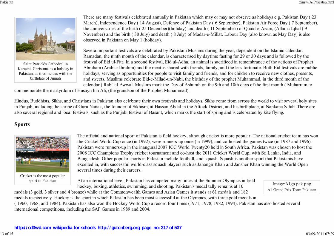
Saint Patrick's Cathedral inKarachi. Christmas is a holiday inPakistan, as it coincides with the
birthdate of Jinnah
Cricket is the most popularsport in Pakistan
Image:A1gp pak.png
A1 Grand Prix Team Pakistan
There are many festivals celebrated annually in Pakistan which may or may not observe as holidays e.g. Pakistan Day ( 23March), Independence Day ( 14 August), Defence of Pakistan Day ( 6 September), Pakistan Air Force Day ( 7 September),the anniversaries of the birth ( 25 December)(holiday) and death ( 11 September) of Quaid-e-Azam, (Allama Iqbal ( 9November) and the birth ( 30 July) and death ( 8 July) of Madar-e-Millat. Labour Day (also known as May Day) is alsoobserved in Pakistan on May 1 (holiday).
Several important festivals are celebrated by Pakistani Muslims during the year, dependent on the Islamic calendar.Ramadan, the ninth month of the calendar, is characterised by daytime fasting for 29 or 30 days and is followed by thefestival of Eid ul-Fitr. In a second festival, Eid ul-Adha, an animal is sacrificed in remembrance of the actions of ProphetAbraham (Arabic: Ibrahim) and the meat is shared with friends, family, and the less fortunate. Both Eid festivals are publicholidays, serving as opportunities for people to visit family and friends, and for children to receive new clothes, presents,and sweets. Muslims celebrate Eid-e-Milad-un-Nabi, the birthday of the prophet Muhammad, in the third month of thecalendar ( Rabi' al-Awwal. Muslims mark the Day of Ashurah on the 9th and 10th days of the first month ( Muharram to
commemorate the martyrdom of Husayn bin Ali, (the grandson of the Prophet Muhammad).
Hindus, Buddhists, Sikhs, and Christians in Pakistan also celebrate their own festivals and holidays. Sikhs come from across the world to visit several holy sitesin Punjab, including the shrine of Guru Nanak, the founder of Sikhism, at Hassan Abdal in the Attock District, and his birthplace, at Nankana Sahib. There arealso several regional and local festivals, such as the Punjabi festival of Basant, which marks the start of spring and is celebrated by kite flying.
Sports
The official and national sport of Pakistan is field hockey, although cricket is more popular. The national cricket team has wonthe Cricket World Cup once (in 1992), were runners-up once (in 1999), and co-hosted the games twice (in 1987 and 1996).Pakistan were runners-up in the inaugural 2007 ICC World Twenty20 held in South Africa. Pakistan was chosen to host the2008 ICC Champions Trophy cricket tournament and co-host the 2011 Cricket World Cup, with Sri Lanka, India, andBangladesh. Other popular sports in Pakistan include football, and squash. Squash is another sport that Pakistanis haveexcelled in, with successful world-class squash players such as Jahangir Khan and Jansher Khan winning the World Openseveral times during their careers.
At an international level, Pakistan has competed many times at the Summer Olympics in fieldhockey, boxing, athletics, swimming, and shooting. Pakistan's medal tally remains at 10
medals (3 gold, 3 silver and 4 bronze) while at the Commonwealth Games and Asian Games it stands at 61 medals and 182medals respectively. Hockey is the sport in which Pakistan has been most successful at the Olympics, with three gold medals in( 1960, 1968, and 1984). Pakistan has also won the Hockey World Cup a record four times (1971, 1978, 1982, 1994). Pakistan has also hosted severalinternational competitions, including the SAF Games in 1989 and 2004.
Pakistan zim:///A/Pakistan.html
13 of 15 03/09/2011 07:29
http://cd3wd.com wikipedia-for-schools http://gutenberg.org page no: 317 of 537
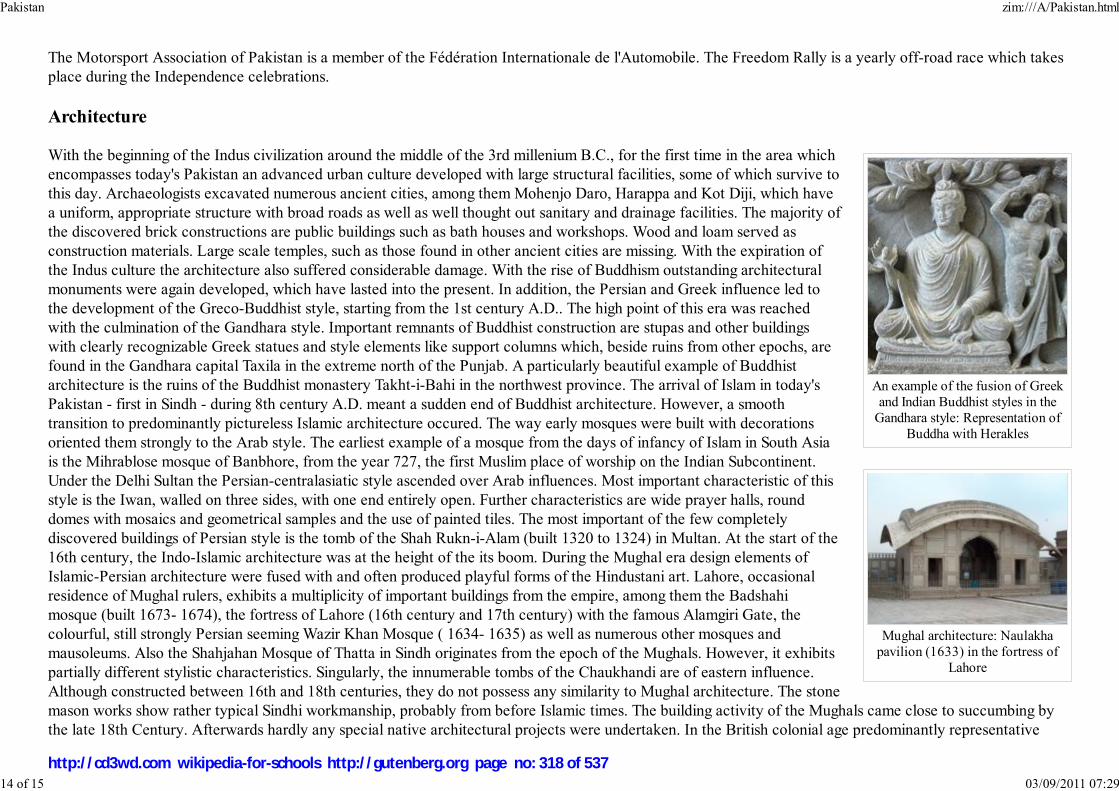
An example of the fusion of Greekand Indian Buddhist styles in the
Gandhara style: Representation ofBuddha with Herakles
Mughal architecture: Naulakhapavilion (1633) in the fortress of
Lahore
The Motorsport Association of Pakistan is a member of the Fédération Internationale de l'Automobile. The Freedom Rally is a yearly off-road race which takesplace during the Independence celebrations.
Architecture
With the beginning of the Indus civilization around the middle of the 3rd millenium B.C., for the first time in the area whichencompasses today's Pakistan an advanced urban culture developed with large structural facilities, some of which survive tothis day. Archaeologists excavated numerous ancient cities, among them Mohenjo Daro, Harappa and Kot Diji, which havea uniform, appropriate structure with broad roads as well as well thought out sanitary and drainage facilities. The majority ofthe discovered brick constructions are public buildings such as bath houses and workshops. Wood and loam served asconstruction materials. Large scale temples, such as those found in other ancient cities are missing. With the expiration ofthe Indus culture the architecture also suffered considerable damage. With the rise of Buddhism outstanding architecturalmonuments were again developed, which have lasted into the present. In addition, the Persian and Greek influence led tothe development of the Greco-Buddhist style, starting from the 1st century A.D.. The high point of this era was reachedwith the culmination of the Gandhara style. Important remnants of Buddhist construction are stupas and other buildingswith clearly recognizable Greek statues and style elements like support columns which, beside ruins from other epochs, arefound in the Gandhara capital Taxila in the extreme north of the Punjab. A particularly beautiful example of Buddhistarchitecture is the ruins of the Buddhist monastery Takht-i-Bahi in the northwest province. The arrival of Islam in today'sPakistan - first in Sindh - during 8th century A.D. meant a sudden end of Buddhist architecture. However, a smoothtransition to predominantly pictureless Islamic architecture occured. The way early mosques were built with decorationsoriented them strongly to the Arab style. The earliest example of a mosque from the days of infancy of Islam in South Asiais the Mihrablose mosque of Banbhore, from the year 727, the first Muslim place of worship on the Indian Subcontinent.Under the Delhi Sultan the Persian-centralasiatic style ascended over Arab influences. Most important characteristic of thisstyle is the Iwan, walled on three sides, with one end entirely open. Further characteristics are wide prayer halls, rounddomes with mosaics and geometrical samples and the use of painted tiles. The most important of the few completelydiscovered buildings of Persian style is the tomb of the Shah Rukn-i-Alam (built 1320 to 1324) in Multan. At the start of the16th century, the Indo-Islamic architecture was at the height of the its boom. During the Mughal era design elements ofIslamic-Persian architecture were fused with and often produced playful forms of the Hindustani art. Lahore, occasionalresidence of Mughal rulers, exhibits a multiplicity of important buildings from the empire, among them the Badshahimosque (built 1673- 1674), the fortress of Lahore (16th century and 17th century) with the famous Alamgiri Gate, thecolourful, still strongly Persian seeming Wazir Khan Mosque ( 1634- 1635) as well as numerous other mosques andmausoleums. Also the Shahjahan Mosque of Thatta in Sindh originates from the epoch of the Mughals. However, it exhibitspartially different stylistic characteristics. Singularly, the innumerable tombs of the Chaukhandi are of eastern influence.Although constructed between 16th and 18th centuries, they do not possess any similarity to Mughal architecture. The stonemason works show rather typical Sindhi workmanship, probably from before Islamic times. The building activity of the Mughals came close to succumbing bythe late 18th Century. Afterwards hardly any special native architectural projects were undertaken. In the British colonial age predominantly representative
Pakistan zim:///A/Pakistan.html
14 of 15 03/09/2011 07:29
http://cd3wd.com wikipedia-for-schools http://gutenberg.org page no: 318 of 537

The Lahore Fort, was rebuilt bythe Mughal emperor Akbar in
1566.
buildings of the Indo-European style developed, from a mixture of European and Indian-Islamic components. After independence Pakistan strove to express itsnew found national identity through architecture. This reflects itself particularly in modern structures like the Faisal Mosque in the capital built during the1960s. In addition, buildings of monumental importance such as the Minar-e-Pakistan in Lahore or the mausoleum established with white marble known asMazar-e-Quaid for the founder of the state expressed the self-confidence of the nascent state.
Tourism
Tourism is a growing industry in Pakistan, based on its diverse cultures, peoples and landscapes. The variety of attractionsrange from the ruins of ancient civilizations such as Mohenjo-daro, Harappa and Taxila, to the Himalayan hill stations, whichattract those interested in field and winter sports. Pakistan is home to several mountain peaks over 7,000 metres (22,970 ft),which attracts adventurers and mountaineers from around the world, especially K2. The people of northern areas depend ontourism also. From April to September tourist of domestic and international type visited these areas which became the earn ofliving for local people. The northern parts of Pakistan have many old fortresses, towers and other architecture as well as theHunza and Chitral valleys, the latter being home to the small pre-Islamic Animist Kalasha community who claim descent fromthe army of Alexander the Great. In the Punjab is the site of Alexander's battle on the Jhelum River and the historic cityLahore, Pakistan's cultural capital with many examples of Mughal architecture such as the Badshahi Masjid, Shalimar Gardens,Tomb of Jahangir and the Lahore Fort. To promote Pakistan's unique and various cultural heritage, the prime minister launched"Visit Pakistan 2007".
Retrieved from " http://en.wikipedia.org/wiki/Pakistan"This Wikipedia Selection was sponsored by a UK Children's Charity, SOS Children UK , and consists of a hand selection from the English Wikipedia articleswith only minor deletions (see www.wikipedia.org for details of authors and sources). The articles are available under the GNU Free Documentation License.See also our
Pakistan zim:///A/Pakistan.html
15 of 15 03/09/2011 07:29
http://cd3wd.com wikipedia-for-schools http://gutenberg.org page no: 319 of 537

中华人民共和国中华人民共和国中华人民共和国中华人民共和国( simplified Chinese characters)
中華人民共和國中華人民共和國中華人民共和國中華人民共和國( traditional Chinese characters)
Zhōnghuá Rénmín Gònghéguó
People's Republic of China
Flag National Emblem
Anthem: March of the Volunteers
(义勇军进行曲)
Capital Beijing
Largest city Shanghai
Official languages Mandarin1
People's Republic of China
2008/9 Schools Wikipedia Selection. Related subjects: Asia; Asian Countries
SOS Children has projects in China. For more information see SOS Children: China
The People's Republic of China ( simplified Chinese: 中 华 人 民 共 和 国; traditional Chinese: 中華 人 民 共 和 國; pinyin: Zhōnghuá Rénmín Gònghéguó listen ), commonly known as China, is the
largest country in East Asia and the third or fourth largest country in the world. With a population of over
1.3 billion, roughly one-fifth of the world's total population, it is the most populous country in the world.
Its capital is Beijing.
The Communist Party of China (CPC) has led the PRC under a single-party system since the state's
establishment in 1949. The PRC is involved in a long-running dispute over the political status of Taiwan.
The CPC's rival during the Chinese Civil War, the Kuomintang (KMT), retreated to Taiwan and
surrounding islands after its civil war defeat in 1949, claiming legitimacy over China, Mongolia, and Tuva
while it was the ruling power of the Republic of China (ROC). The term " Mainland China" is often used
to denote the areas under PRC rule, but sometimes excludes its two Special Administrative Regions:
Hong Kong and Macau.
Because of its vast population, rapidly growing economy, large research and development investments,
China is often considered as an emerging superpower. It has the world's fourth largest economy and
second largest purchasing power parity. China is also a permanent member of the United Nations
Security Council and Asia-Pacific Economic Cooperation. Since 1978, China's market-based economic
reforms have helped lift over 400 million Chinese out of poverty, bringing down the poverty rate from
53% of population in 1981 to 8% by 2001. However, China is now faced with a number of other
economic problems, including an aging population and an increasing rural-urban income gap.
China plays a major role in international trade. The country is the world's largest consumer of steel and
concrete, using, respectively, a third and over a half of the world's supply of each. It is also the world's
second largest importer of petroleum. Counting all products, China is the third largest importer and the
second largest exporter in the world.
History
People's Republic of China zim:///A/People_s_Republic_of_China.html
1 of 17 03/09/2011 07:29
http://cd3wd.com wikipedia-for-schools http://gutenberg.org page no: 320 of 537

Demonym Chinese
Government Socialist Republic²
- President Hu Jintao
- Premier Wen Jiabao
Establishment
- People's Republic
declared October 1, 1949
Area
- Total 9,598,086 km² or
9,640,821 km²*4( 3rd /
4th–disputed³)
3,704,427 sq mi
- Water (%) 2.8³
Population
- 2007 estimate 1,321,851,888³ ( 1st)
- 2000 census 1,242,612,226
- Density 140/km² ( 53rd)
363/sq mi
GDP ( PPP) 2006 estimate
- Total $10.21 trillion ( 2nd)
- Per capita $8,788 ( 82nd)
GDP (nominal) 2007 estimate
- Total $2.6 trillion ( 4th)
- Per capita $2,800 ( 101th)
Gini (2002) 44 (medium)
HDI (2007) ▲ 0.777 (medium) ( 81st)
Currency Yuan ( CNY)
Time zone ( UTC+8)
Mao Zedong proclaiming theestablishment of the People's
Republic in 1949.
Flag of the People's Republicbefore a modernizing Shanghai.
Major combat in the Chinese Civil War ended in 1949 with the
Communist Party of China in control of the mainland, and the
Kuomintang retreating to Taiwan and some outlying islands of Fujian.
On October 1, 1949 Mao Zedong proclaimed the People's Republic of
China, declaring "the Chinese people have stood up". Red China was a
frequent appellation for the PRC (generally within the Western bloc)
used from the time of Communist ascendance until the mid-late 1970s
with the improvement of relations between China and the West.
Following a series of dramatic economic failures (caused by the Great
Leap Forward), Mao stepped down from his position as chairman in
1959, with Liu Shaoqi as successor. Mao still had much influence over
the Party, but was removed from day-to-day management of economic affairs, which came under the
control of Liu Shaoqi and Deng Xiaoping.
In 1966, Mao and his allies launched the Cultural Revolution, which would last until Mao's death a
decade later. The Cultural Revolution, motivated by power struggles within the Party and a fear of the
Soviet Union, led to a major upheaval in Chinese society. In 1972, at the peak of the Sino-Soviet split,
Mao and Zhou Enlai met Richard Nixon in Beijing to establish relations with the United States. In the
same year, the PRC was admitted to the United Nations, replacing the Republic of China for China's
membership of the United Nations, and permanent membership of the Security Council.
After Mao's death in 1976 and the arrest of the Gang of Four, blamed
for the excesses of the Cultural Revolution, Deng Xiaoping quickly
wrestled power from Mao's anointed successor Hua Guofeng. Although
Deng never became the head of the Party or State himself, his influence
within the Party led the country to economic reforms of significant
magnitude. The Communist Party subsequently loosened governmental
control over citizens' personal lives and the communes were disbanded
with many peasants receiving multiple land leases, which greatly
increased incentives and agricultural production. This turn of events
marked China's transition from a planned economy to a mixed economy
with an increasingly open market environment, a system termed by
many " market socialism". The PRC adopted its current constitution on
December 4, 1982.
People's Republic of China zim:///A/People_s_Republic_of_China.html
2 of 17 03/09/2011 07:29
http://cd3wd.com wikipedia-for-schools http://gutenberg.org page no: 321 of 537

- Summer ( DST) not observed ( UTC+8)
Internet TLD .cn³
Calling code +86³
General Information of the People's Republic of China,
ChinaToday. Retrieved 21 February 2007. In addition to Mandarin,
Cantonese is co-official in both Hong Kong and Macau. English is
co-official in Hong Kong (SAR); correspondingly, Portuguese in
Macau (SAR). Similarly, several minority languages are also
co-official with Chinese (Mandarin) in minority areas, viz. Zhuang
in Guangxi, Uyghur in Xinjiang, Mongolian in the classical alphabet
in Inner Mongolia, Tibetan in Tibet, and Korean in Yanbian, Jilin.
The role of the government, China, Encyclopaedia Britannica.
Retrieved on 21-02-2007.
Information for mainland China only. The Special Administrative
Regions of the PRC: Hong Kong, Macau are excluded. In addition,
the island territories under the control of the Republic of China,
which includes the islands of (Taiwan, Kinmen, and Matsu) are also
excluded.
9,598,086 km² Excludes all disputed territories.
9,640,821 km² Includes PRC-administered area ( Aksai Chin and
Trans-Karakoram Tract, both territories claimed by India), Taiwan
is not included.
In 1989, the death of pro-reform official, Hu Yaobang, helped to spark the Tiananmen Square protests of
1989, during which students and others campaigned for several months for more democratic rights and
freedom of expression. However, they were eventually put down on June 4 when PLA troops and
vehicles entered and forcibly cleared the square by opening fire on protesters, resulting in numerous
casualties. This event was widely reported and famously videotaped, which brought worldwide
condemnation and sanctions against the government.
President Jiang Zemin and Premier Zhu Rongji, both former mayors of Shanghai, led post-Tiananmen
China in the 1990s. Under Jiang Zemin's ten years of administration, China's economic performance
pulled an estimated 150 million peasants out of poverty and sustained an average annual GDP growth
rate of 11.2%. The country formally joined the World Trade Organization in 2001.
Although China needs economic growth to spur its development, the government has begun to worry that
rapid economic growth has negatively impacted the country's resources and environment. Another
concern is that certain sectors of society are not sufficiently benefiting from China's economic
development. As a result, under current President Hu Jintao and Premier Wen Jiabao, the PRC have
initiated policies to address these issues of equitable distribution of resources, but the outcome remains to
be seen. For much of China's population, living standards have seen extremely large improvements, and
freedom continues to expand, but political controls remain tight.
Politics
While the PRC is regarded as a Communist state by many political scientists, simple characterizations of
China's political structure since the 1980s are no longer possible. The PRC government has been
variously described as authoritarian, communist, and socialist, with heavy restrictions remaining in many areas, most notably in the Internet and in the press,
freedom of assembly, freedom of reproductive rights, and freedom of religion. However, compared to its closed door policies until the mid-1970s, the
liberalization of the PRC is such that the administrative climate is much less restrictive than before, though the PRC is still far from the full-fledged democracy
practiced in most of Europe or North America, according to most observers internationally.
The country is ruled under the Constitution of the People's Republic of China. Its incumbent President is Hu Jintao and its premier is Wen Jiabao.
The country is run by the Communist Party of China (CPC), which is guaranteed power by the Constitution. There are other political parties in the PRC,
referred to in China as "democratic parties", which participate in the People's Political Consultative Conference and the National People's Congress. There have
been some moves toward political liberalization, in that open contested elections are now held at the village and town levels, and that legislatures have shown
some assertiveness from time to time. However, the Party retains effective control over governmental appointments: in the absence of meaningful opposition,
the CPC wins by default most of the time. Political concerns in China include lessening the growing gap between rich and poor and fighting corruption within
1
2
3
4
People's Republic of China zim:///A/People_s_Republic_of_China.html
3 of 17 03/09/2011 07:29
http://cd3wd.com wikipedia-for-schools http://gutenberg.org page no: 322 of 537
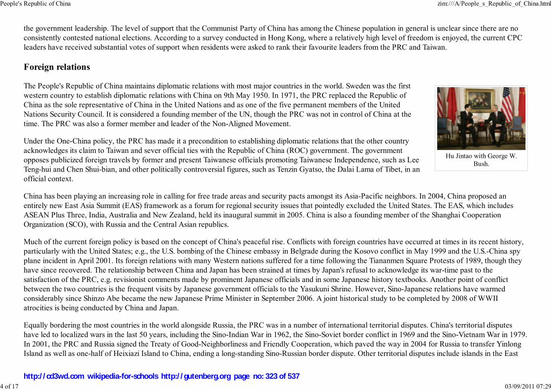
Hu Jintao with George W.Bush.
the government leadership. The level of support that the Communist Party of China has among the Chinese population in general is unclear since there are no
consistently contested national elections. According to a survey conducted in Hong Kong, where a relatively high level of freedom is enjoyed, the current CPC
leaders have received substantial votes of support when residents were asked to rank their favourite leaders from the PRC and Taiwan.
Foreign relations
The People's Republic of China maintains diplomatic relations with most major countries in the world. Sweden was the first
western country to establish diplomatic relations with China on 9th May 1950. In 1971, the PRC replaced the Republic of
China as the sole representative of China in the United Nations and as one of the five permanent members of the United
Nations Security Council. It is considered a founding member of the UN, though the PRC was not in control of China at the
time. The PRC was also a former member and leader of the Non-Aligned Movement.
Under the One-China policy, the PRC has made it a precondition to establishing diplomatic relations that the other country
acknowledges its claim to Taiwan and sever official ties with the Republic of China (ROC) government. The government
opposes publicized foreign travels by former and present Taiwanese officials promoting Taiwanese Independence, such as Lee
Teng-hui and Chen Shui-bian, and other politically controversial figures, such as Tenzin Gyatso, the Dalai Lama of Tibet, in an
official context.
China has been playing an increasing role in calling for free trade areas and security pacts amongst its Asia-Pacific neighbors. In 2004, China proposed an
entirely new East Asia Summit (EAS) framework as a forum for regional security issues that pointedly excluded the United States. The EAS, which includes
ASEAN Plus Three, India, Australia and New Zealand, held its inaugural summit in 2005. China is also a founding member of the Shanghai Cooperation
Organization (SCO), with Russia and the Central Asian republics.
Much of the current foreign policy is based on the concept of China's peaceful rise. Conflicts with foreign countries have occurred at times in its recent history,
particularly with the United States; e.g., the U.S. bombing of the Chinese embassy in Belgrade during the Kosovo conflict in May 1999 and the U.S.-China spy
plane incident in April 2001. Its foreign relations with many Western nations suffered for a time following the Tiananmen Square Protests of 1989, though they
have since recovered. The relationship between China and Japan has been strained at times by Japan's refusal to acknowledge its war-time past to the
satisfaction of the PRC, e.g. revisionist comments made by prominent Japanese officials and in some Japanese history textbooks. Another point of conflict
between the two countries is the frequent visits by Japanese government officials to the Yasukuni Shrine. However, Sino-Japanese relations have warmed
considerably since Shinzo Abe became the new Japanese Prime Minister in September 2006. A joint historical study to be completed by 2008 of WWII
atrocities is being conducted by China and Japan.
Equally bordering the most countries in the world alongside Russia, the PRC was in a number of international territorial disputes. China's territorial disputes
have led to localized wars in the last 50 years, including the Sino-Indian War in 1962, the Sino-Soviet border conflict in 1969 and the Sino-Vietnam War in 1979.
In 2001, the PRC and Russia signed the Treaty of Good-Neighborliness and Friendly Cooperation, which paved the way in 2004 for Russia to transfer Yinlong
Island as well as one-half of Heixiazi Island to China, ending a long-standing Sino-Russian border dispute. Other territorial disputes include islands in the East
People's Republic of China zim:///A/People_s_Republic_of_China.html
4 of 17 03/09/2011 07:29
http://cd3wd.com wikipedia-for-schools http://gutenberg.org page no: 323 of 537
and South China Seas, and undefined or disputed borders with India, Tajikstan and North Korea.
While accompanying a rapid economic rise, the PRC since the 1990s seeks to maintain a policy of quiet diplomacy with its neighbors. Steadying its economic
growth and participating in regional organizations and cultivating bi-lateral relations will ease suspicion over China's burgeoning military capabilities. The PRC
has started a policy of wooing African nations for trade and bilateral co-operations.
Population policy
With a population of over 1.3 billion, the PRC is very concerned about its population growth and has attempted, with mixed results, to implement a strict family
planning policy. The government's goal is one child per family, with exceptions for ethnic minorities and flexibility in rural areas, where a family can have a
second child if the first is a girl or physically disabled. The government's goal is to stabilize population growth early in the twenty-first century, though some
projections estimate a population of anywhere ranging from 1.4 billion to 1.6 billion by 2025.
The policy is resisted, particularly in rural areas, because of the need for agricultural labour and a traditional preference for boys. Families who breach the
policy often lie during the census. Official government policy opposes forced abortion or sterilization, but allegations of coercion continue as local officials, who
are faced with penalties for failing to curb population growth, may resort to forced abortion or sterilization, or manipulation of census figures.
The decreasing reliability of PRC population statistics since family planning began in the late 1970s has made evaluating the effectiveness of the policy difficult.
Estimates by Chinese demographers of the average number of children for a Chinese woman vary from 1.5 to 2.0. The government is particularly concerned
with the large imbalance in the sex ratio at birth, apparently the result of a combination of traditional preference for boys, family planning pressure, and the
wide availability of ultrasound, which led to its ban for the purpose of preventing sex-selective abortion.
Human rights
The Constitution of the People's Republic of China states that the "fundamental rights" of citizens include freedom of speech, freedom of the press, the right
to a fair trial, freedom of religion, universal suffrage, and property rights. However, censorship of political speech and information is openly and routinely
used to protect what the government considers national security interests. In particular, press control is notoriously tight: Reporters Without Borders considers
the PRC one of the least free countries in the world for the press. The government has a policy of limiting some protests and organizations that it considers a
threat to social stability and national unity, as was the case with the Tiananmen Square protests of 1989. The Communist Party has had mixed success at
controlling information: a very strong media control system faces very strong market forces, an increasingly educated citizenry and cultural change that are
making China more open. In some cases, especially on environmental issues, China's leaders see expressions of public dissatisfaction as a catalyst for positive
change.
Certain foreign governments and NGOs routinely criticise the PRC, alleging widespread human rights violations including systematic use of lengthy detention
without trial, forced confessions, torture, mistreatment of prisoners, restrictions of freedom of speech, assembly, association, religion, the press, and workers'
rights. China leads the world in capital punishment, accounting for roughly 90% of total death-penalty executions in 2004. Human rights issues are one of the
People's Republic of China zim:///A/People_s_Republic_of_China.html
5 of 17 03/09/2011 07:29
http://cd3wd.com wikipedia-for-schools http://gutenberg.org page no: 324 of 537
factors driving independence movements in Tibet and Xinjiang. In the Reporters Without Borders' Annual World Press Freedom Index of 2005, the PRC ranked
159 out of 167 places. PRC journalist He Qinglian in her 2004 book Media Control in China documents government controls on the Internet and other media in
China.
The PRC government responds to these criticisms by arguing that the notion of human rights should factor in standards of living; rise in the standard of living for
some Chinese is seen as an indicator of improvement in human rights.
Political divisions
The People's Republic of China has administrative control over twenty-two provinces and considers Taiwan to be its twenty-third province. There are also five
autonomous regions, each with a designated minority group; four municipalities; and two Special Administrative Regions that enjoy considerable autonomy. The
twenty-two provinces, five autonomous regions and four municipalities can be collectively referred to as " mainland China", a term which usually excludes
Hong Kong and Macau.
Geography and climate
People's Republic of China zim:///A/People_s_Republic_of_China.html
6 of 17 03/09/2011 07:29
http://cd3wd.com wikipedia-for-schools http://gutenberg.org page no: 325 of 537

Grasslands of Chengde, HebeiProvince, North China.
Tibetan Plateau in SouthwestChina.
Beach facing the South ChinaSea in Hainan Province.
China is the second largest country in Asia by area after Russia, and is considered the third or fourth largest in the world by the
U.S. Central Intelligence Agency in respect to land-and-sea area. The uncertainty over size is related to the validity of claims
by the PRC on territories such as Aksai Chin and Trans-Karakoram Tract (both territories also claimed by India), and a recent
change in the method used by the United States to calculate its surface area. It borders 14 nations (counted clockwise from
south): Vietnam, Laos, Myanmar (Burma), India, Bhutan, Nepal, Pakistan, Afghanistan, Tajikistan, Kyrgyzstan, Kazakhstan,
Russia, Mongolia and North Korea. Additionally the border between PRC and ROC is located in territorial waters.
The territory of the PRC contains a large variety of landscapes. In the east, along the shores of the Yellow Sea and the East
China Sea, there are extensive and densely populated alluvial plains, while on the edges of the Inner Mongolian plateau in the
north, grasslands can be seen. Southern China is dominated by hill country and low mountain ranges. In the central-east are the
deltas of China's two major rivers, the Huang He and Yangtze River (Chang Jiang). Other major rivers include the Xijiang
River, Mekong, Brahmaputra and Amur.
To the west, major mountain ranges, notably the Himalayas, with China's highest point at the eastern half of Mount Everest,
and high plateaus feature among the more arid landscapes such as the Taklamakan and the Gobi Desert.
A major issue is the continued expansion of deserts, particularly the Gobi Desert. Although barrier tree lines planted since the
1970s have reduced the frequency of sandstorms, prolonged drought and poor agricultural practices result in dust storms
plaguing northern China each spring, which then spread to other parts of East Asia, including Korea and Japan. Water, erosion,
and pollution control have become important issues in China's relations with other countries.
China has some relevant environmental regulations: the 1979 Environmental Protection Law, which was largely modelled on
U.S. legislation. But the environment continues to deteriorate. While the regulations are fairly stringent, they are frequently
disregarded by local communities while seeking economic development. Twelve years after the law, only one Chinese city was
making an effort to clean up its water discharges. This indicates that China is about twenty years behind the U.S. schedule of
environmental regulation.
Water pollution has increased as an issue along with industrial production. The Chinese government has chosen a discharge
standard measuring the concentration of a pollutant rather than the total pollutant load (as is done in the U.S. and many
Western countries). As a result many industrial dischargers in China simply dilute the effluent with river water taken from the
same source as the receiving waters. Consequently the outcome has been to create considerable water pollution in many of the
country's rivers.
With regard to carbon emissions, China has ratified the Kyoto Protocol but it is not required to reduce carbon emissions because of its status as a developing
country. However, with rapid industrialisation, China is fast becoming one of the world's top emitters of carbon gases and possibly a major contributor to global
warming.
People's Republic of China zim:///A/People_s_Republic_of_China.html
7 of 17 03/09/2011 07:29
http://cd3wd.com wikipedia-for-schools http://gutenberg.org page no: 326 of 537

PLA recruit training. The PLAhas been rapidly modernizing
its military force.
Part of the price China is paying for increased prosperity is damage to the environment. Leading Chinese environmental campaigner Ma Jun has warned that
water pollution is one of the most serious threats facing China. According to Ma the drinking water of 300 million peasants is unsafe and water quality in one
fifth of the cities is not up to standard. This makes the crisis of water shortages more pressing, with 400 out of 600 cities short of water.
Military
With 2.3 million active troops, the People's Liberation Army (PLA) is the largest military in the world. The PLA consists of an
army, navy, air force, and strategic nuclear force. The official announced budget of the PLA for 2007 was $45 billion.
However, the United States claims China does not report its real military spending. The DIA estimates that the real Chinese
military budget for 2007 could be anywhere from US$85 to US$125 billion.
The PRC, despite possession of nuclear weapons and delivery systems, is widely seen by military researchers both within and
outside of China as having only limited power projection capability; this is, among other things, because of the limited
effectiveness of its navy. It is considered a major regional power and possibly an emerging superpower.
Much progress has been made in the last decade and the PRC continues to make efforts to modernize its military. It has
purchased state-of-the-art fighter jets from Russia, such as the Su-30s, and has also produced its own modern fighters,
specifically the Chinese J-10s and the J-11s. It has also acquired and improved upon the Russian S-300 surface-to-air missile
systems, which are considered to be among the best aircraft-intercepting systems in the world, albeit Russia has since produced the new generation S-400
Triumf. The PRC's armoured and rapid-reaction forces have been updated with enhanced electronics and targeting capabilities. In recent years, much attention
has been focused on building a navy with blue-water capability.
Economy
People's Republic of China zim:///A/People_s_Republic_of_China.html
8 of 17 03/09/2011 07:29
http://cd3wd.com wikipedia-for-schools http://gutenberg.org page no: 327 of 537

In 1978, the late DengXiaoping initiated China'smarket-oriented reforms.
Beginning in late 1978, the Chinese leadership has been reforming the economy from a Soviet-style centrally planned economy to a
more market-oriented economy that is still within a rigid political framework under Party control. The reforms replaced
collectivization of Chinese agriculture with privatization of farmlands, increased the responsibility of local authorities and industry
managers, allowed a wide variety of small-scale enterprises to flourish, and promoted foreign investment. Price controls were also
relaxed. These changes resulted in mainland China's shift from a planned economy to a mixed economy.
People's Republic of China zim:///A/People_s_Republic_of_China.html
9 of 17 03/09/2011 07:29
http://cd3wd.com wikipedia-for-schools http://gutenberg.org page no: 328 of 537

Nominal GDP, from 1952 to2005.
The Shanghai Stock Exchange.China's SSEC index surged 130
percent in 2006.
Farmlands in Hebei province.Hundreds of millions of
Chinese still depend on theagricultural sector for their
livelihood.
China became a member of the World Trade Organization in 2001. China’s accession into the World Trade Organization
(WTO) was a goal achieved after nearly fifteen years of exhausting negotiations carrying many legal, political and social
implications for all parties. China was finally able to convince WTO members that without China, the WTO is only partially a
worldwide trade organization. The road to the signature of the final agreement of accession was long, but these difficulties pale
in comparison to the problems that have not yet been tackled in terms of achieving real implementation of its provisions
throughout the territory of the People’s Republic of China (PRC). China’s accession surely presents the world trading system
with opportunities, but also poses the challenge of integrating a market with strong structural, behavioural and cultural
constraints.
The government emphasizes personal income and consumption by introducing new management systems to help increase
productivity. The government also focuses on foreign trade as a major vehicle for economic growth, which led to 5 Special
Economic Zones (SEZ: Shenzhen, Zhuhai, Shantou, Xiamen, Hainan Province) where investment laws are relaxed so as to
attract foreign capital. Since the 1990s, SEZs and similar concepts have been expanded to major Chinese cities, including
Shanghai and Beijing. The result has been a 6-fold increase of GDP since 1978. Chinese economic development is among the
fastest in the world, and has been growing at an average annual GDP rate of 9.4% for the past 25 years. At the end of 2005, the
PRC became the fourth largest economy in the world by exchange rate, and the second largest in the world after the United
States by purchasing power parity at US$8,158 trillion. But with its large population this still gives an average GDP per person
of only an estimated US$8,000 (2006), about 1/5th that of the United States.
Mainland China has a reputation as being a low-cost manufacturer, which caused notable disputes in global markets. This is
largely because Chinese corporations can produce many products far more cheaply than other parts of Asia or Latin America,
and because expensive products produced in developed countries like the United States are in large part uncompetitive
compared to European or Asian goods. Another factor is the unfavorable exchange rate between the Chinese yuan and the
United States dollar to which it was pegged.
On July 21, 2005 the People's Bank of China announced that it would move to a floating peg, allowing its currency to move
against the United States dollar by 0.5% (effective 18 May 2007, which was earlier 0.3%) a day, while 3% a day against other
currencies. Many high-tech American companies have difficulty exporting to China because of U.S. federal government
restrictions, which exacerbated the trade gap between the PRC and the US, widespread software piracy and illegal copying of
intellectual property (a major US export), and perceived low quality of US goods. On the other hand, China runs a trade deficit
with Taiwan and South Korea, importing more from those nations than exports. China runs a large but diminishing trade surplus
with Japan (slight deficit if Hong Kong is included).
There has been a significant rise in the Chinese standard of living in recent years. Today, a rapidly declining 10 percent of the
Chinese population is below the poverty line. 90.9% of the population is literate, compared to 20% in 1950. The life expectancy in China is the third highest in
East Asia, after Japan and South Korea. There is a large wealth disparity between the coastal regions and the remainder of the country. To counter this
People's Republic of China zim:///A/People_s_Republic_of_China.html
10 of 17 03/09/2011 07:29
http://cd3wd.com wikipedia-for-schools http://gutenberg.org page no: 329 of 537
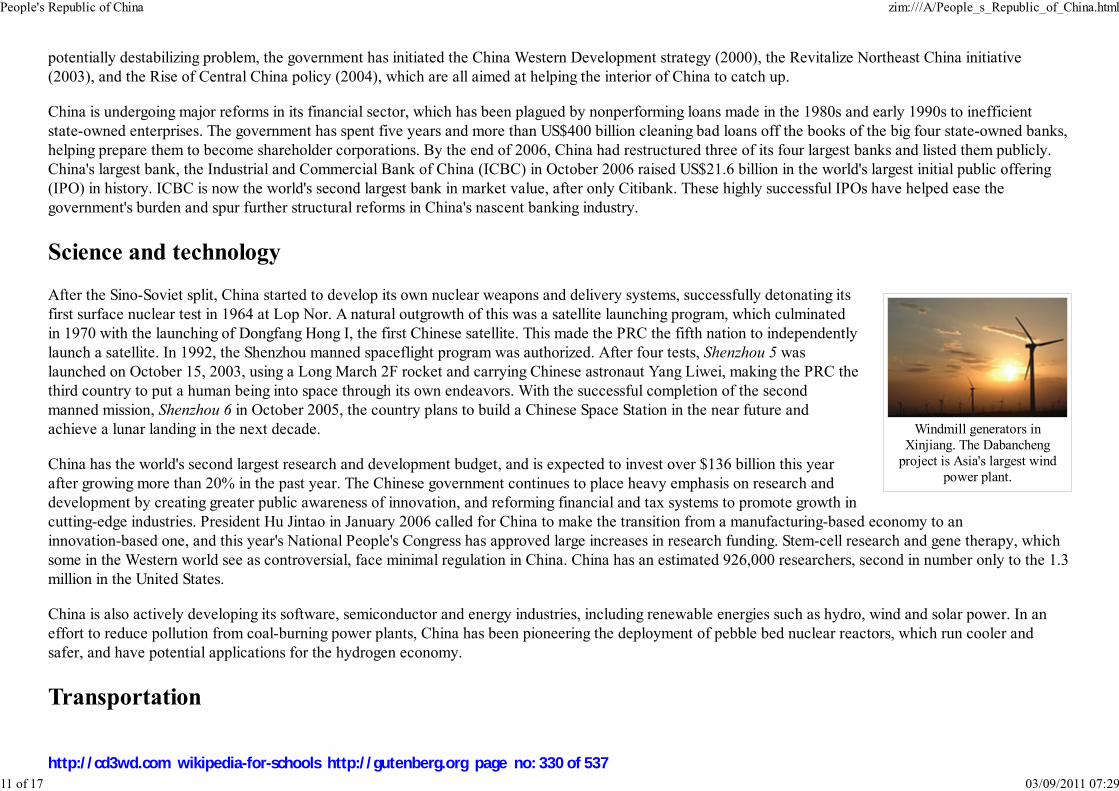
Windmill generators inXinjiang. The Dabancheng
project is Asia's largest windpower plant.
potentially destabilizing problem, the government has initiated the China Western Development strategy (2000), the Revitalize Northeast China initiative
(2003), and the Rise of Central China policy (2004), which are all aimed at helping the interior of China to catch up.
China is undergoing major reforms in its financial sector, which has been plagued by nonperforming loans made in the 1980s and early 1990s to inefficient
state-owned enterprises. The government has spent five years and more than US$400 billion cleaning bad loans off the books of the big four state-owned banks,
helping prepare them to become shareholder corporations. By the end of 2006, China had restructured three of its four largest banks and listed them publicly.
China's largest bank, the Industrial and Commercial Bank of China (ICBC) in October 2006 raised US$21.6 billion in the world's largest initial public offering
(IPO) in history. ICBC is now the world's second largest bank in market value, after only Citibank. These highly successful IPOs have helped ease the
government's burden and spur further structural reforms in China's nascent banking industry.
Science and technology
After the Sino-Soviet split, China started to develop its own nuclear weapons and delivery systems, successfully detonating its
first surface nuclear test in 1964 at Lop Nor. A natural outgrowth of this was a satellite launching program, which culminated
in 1970 with the launching of Dongfang Hong I, the first Chinese satellite. This made the PRC the fifth nation to independently
launch a satellite. In 1992, the Shenzhou manned spaceflight program was authorized. After four tests, Shenzhou 5 was
launched on October 15, 2003, using a Long March 2F rocket and carrying Chinese astronaut Yang Liwei, making the PRC the
third country to put a human being into space through its own endeavors. With the successful completion of the second
manned mission, Shenzhou 6 in October 2005, the country plans to build a Chinese Space Station in the near future and
achieve a lunar landing in the next decade.
China has the world's second largest research and development budget, and is expected to invest over $136 billion this year
after growing more than 20% in the past year. The Chinese government continues to place heavy emphasis on research and
development by creating greater public awareness of innovation, and reforming financial and tax systems to promote growth in
cutting-edge industries. President Hu Jintao in January 2006 called for China to make the transition from a manufacturing-based economy to an
innovation-based one, and this year's National People's Congress has approved large increases in research funding. Stem-cell research and gene therapy, which
some in the Western world see as controversial, face minimal regulation in China. China has an estimated 926,000 researchers, second in number only to the 1.3
million in the United States.
China is also actively developing its software, semiconductor and energy industries, including renewable energies such as hydro, wind and solar power. In an
effort to reduce pollution from coal-burning power plants, China has been pioneering the deployment of pebble bed nuclear reactors, which run cooler and
safer, and have potential applications for the hydrogen economy.
Transportation
People's Republic of China zim:///A/People_s_Republic_of_China.html
11 of 17 03/09/2011 07:29
http://cd3wd.com wikipedia-for-schools http://gutenberg.org page no: 330 of 537

G030 northbound in Hebeiprovince. There are 45,000 km(28,000 mi) of expressways in
China. This is the second-longest total in the world, andhalf that of the United States.
Transportation in the mainland of the People's Republic of China has improved remarkably since the late 1990s as part of a
government effort to link the entire nation through a series of expressways known as the National Trunk Highway System
(NTHS). The total length of expressway is 45,000 km at the end of 2006, second only to the United States.
Private car ownership is increasing at an annual rate of 15%, though it is still uncommon because of government policies that
make car ownership expensive, such as taxes and toll roads.
Air travel has increased, but remains too expensive for most. Long distance transportation is still dominated by railways and
charter bus systems. The railways are still the vital carrier in China, and until this year steam locomotives were still a common
sight. It is thought that some are still in use, especially on industrial networks.
Cities such as Beijing and Shanghai are building subways or light rail systems. Hong Kong has one of the most developed
transport systems in the world. Shanghai already has a Maglev system connecting downtown Shanghai to Pudong International
Airport
Demographics
People's Republic of China zim:///A/People_s_Republic_of_China.html
12 of 17 03/09/2011 07:29
http://cd3wd.com wikipedia-for-schools http://gutenberg.org page no: 331 of 537
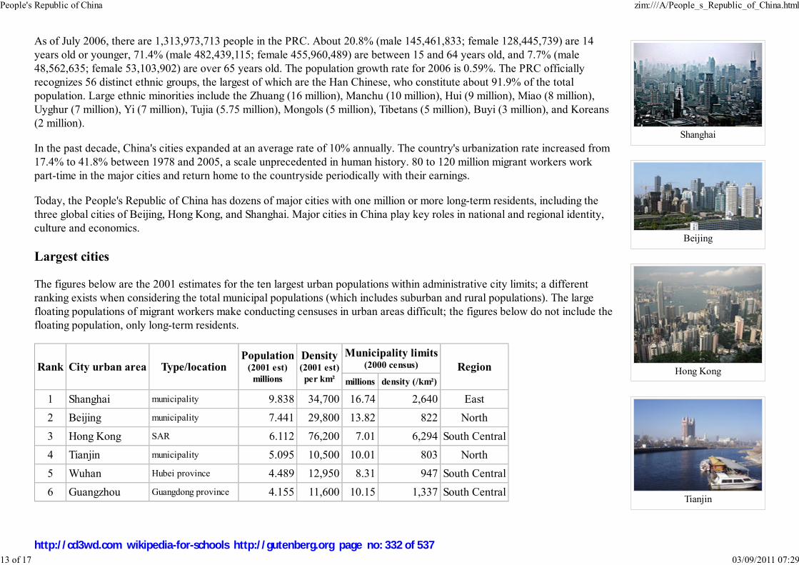
Shanghai
Beijing
Hong Kong
Tianjin
As of July 2006, there are 1,313,973,713 people in the PRC. About 20.8% (male 145,461,833; female 128,445,739) are 14
years old or younger, 71.4% (male 482,439,115; female 455,960,489) are between 15 and 64 years old, and 7.7% (male
48,562,635; female 53,103,902) are over 65 years old. The population growth rate for 2006 is 0.59%. The PRC officially
recognizes 56 distinct ethnic groups, the largest of which are the Han Chinese, who constitute about 91.9% of the total
population. Large ethnic minorities include the Zhuang (16 million), Manchu (10 million), Hui (9 million), Miao (8 million),
Uyghur (7 million), Yi (7 million), Tujia (5.75 million), Mongols (5 million), Tibetans (5 million), Buyi (3 million), and Koreans
(2 million).
In the past decade, China's cities expanded at an average rate of 10% annually. The country's urbanization rate increased from
17.4% to 41.8% between 1978 and 2005, a scale unprecedented in human history. 80 to 120 million migrant workers work
part-time in the major cities and return home to the countryside periodically with their earnings.
Today, the People's Republic of China has dozens of major cities with one million or more long-term residents, including the
three global cities of Beijing, Hong Kong, and Shanghai. Major cities in China play key roles in national and regional identity,
culture and economics.
Largest cities
The figures below are the 2001 estimates for the ten largest urban populations within administrative city limits; a different
ranking exists when considering the total municipal populations (which includes suburban and rural populations). The large
floating populations of migrant workers make conducting censuses in urban areas difficult; the figures below do not include the
floating population, only long-term residents.
Rank City urban area Type/locationPopulation
(2001 est)
millions
Density(2001 est)
per km²
Municipality limits(2000 census) Region
millions density (/km²)
1 Shanghai municipality 9.838 34,700 16.74 2,640 East
2 Beijing municipality 7.441 29,800 13.82 822 North
3 Hong Kong SAR 6.112 76,200 7.01 6,294 South Central
4 Tianjin municipality 5.095 10,500 10.01 803 North
5 Wuhan Hubei province 4.489 12,950 8.31 947 South Central
6 Guangzhou Guangdong province 4.155 11,600 10.15 1,337 South Central
People's Republic of China zim:///A/People_s_Republic_of_China.html
13 of 17 03/09/2011 07:29
http://cd3wd.com wikipedia-for-schools http://gutenberg.org page no: 332 of 537
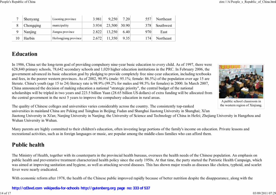
A public school classroom inthe western region of Xinjiang.
7 Shenyang Liaoning province 3.981 9,250 7.20 557 Northeast
8 Chongqing municipality 3.934 23,500 30.90 378 Southwest
9 Nanjing Jiangsu province 2.822 13,250 6.40 970 East
10 Harbin Heilongjiang province 2.672 11,350 9.35 174 Northeast
Education
In 1986, China set the long-term goal of providing compulsory nine-year basic education to every child. As of 1997, there were
628,840 primary schools, 78,642 secondary schools and 1,020 higher education institutions in the PRC. In February 2006, the
government advanced its basic education goal by pledging to provide completely free nine-year education, including textbooks
and fees, in the poorer western provinces. As of 2002, 90.9% (male: 95.1%; female: 86.5%) of the population over age 15 are
literate. China's youth (age 15 to 24) literacy rate is 98.9% (99.2% for males and 98.5% for females) in 2000. In March 2007,
China announced the decision of making education a national "strategic priority", the central budget of the national
scholarships will be tripled in two years and 223.5 billion Yuan (28.65 billion US dollars) of extra funding will be allocated from
the central government in the next 5 years to improve the compulsory education in rural areas.
The quality of Chinese colleges and universities varies considerably across the country. The consistently top-ranked
universities in mainland China are Peking and Tsinghua in Beijing; Fudan and Shanghai Jiaotong University in Shanghai; Xi'an
Jiaotong University in Xi'an; Nanjing University in Nanjing; the University of Science and Technology of China in Hefei; Zhejiang University in Hangzhou and
Wuhan University in Wuhan.
Many parents are highly committed to their children's education, often investing large portions of the family's income on education. Private lessons and
recreational activities, such as in foreign languages or music, are popular among the middle-class families who can afford them.
Public health
The Ministry of Health, together with its counterparts in the provincial health bureaus, oversees the health needs of the Chinese population. An emphasis on
public health and preventative treatment characterized health policy since the early 1950s. At that time, the party started the Patriotic Health Campaign, which
was aimed at improving sanitation and hygiene, as well as attacking several diseases. This has shown major results as diseases like cholera, typhoid, and scarlet
fever were nearly eradicated.
With economic reform after 1978, the health of the Chinese public improved rapidly because of better nutrition despite the disappearance, along with the
People's Republic of China zim:///A/People_s_Republic_of_China.html
14 of 17 03/09/2011 07:29
http://cd3wd.com wikipedia-for-schools http://gutenberg.org page no: 333 of 537

Image:Shanghaimuseumscrolls.jpg
Museum patrons viewingancient Chinese scroll paintings
at the Shanghai Museum.
A Cold Fairyland concertperformance. The band
combines traditional Chineseinstruments and musical
elements with rock music.
People's Communes, of much of the free public health services provided in the countryside. Health care in China became largely private fee-for-service. By
2000, when the World Health Organization made a large study of public health systems throughout the world, The World Health Report 2000 Health Systems:
Improving Performance the Chinese public health system ranked 144 of the 191 UN member states ranked.
The country's life expectancy jumped from about 41 years in 1950 to almost 73 years in 2006, and infant mortality went down from 300 per thousand in the
1950s to about 23 per thousand in 2006. Malnutrition as of 2002 stood at 12 percent of the population according to United Nations FAO sources.
Despite significant improvements in health and the introduction of western style medical facilities, the PRC has several emerging public health problems, which
include respiratory problems as a result of widespread air pollution and millions of cigarette smokers, a possible future HIV/AIDS epidemic, and an increase in
obesity among urban youths. Estimates of excess deaths in China from environmental pollution (apart from smoking) are placed at 760,000 people per annum
from air and water pollution (including indoor air pollution) China's large population and close living quarters has led to some serious disease outbreaks in recent
years, such as the 2003 outbreak of SARS (a pneumonia-like disease) which has since been largely contained.
Culture
For centuries, opportunity for economic and social advancement in China could be provided by high performance on Imperial
examinations. The literary emphasis of the exams affected the general perception of cultural refinement in China, such as the
view that calligraphy and literati painting were higher forms of art than dancing or drama. China's traditional values were
derived from various versions of Confucianism and conservatism. A number of more authoritarian and rational strains of
thought have also been influential, such as Legalism. There was often conflict between the philosophies, such as the
individualistic Song Dynasty neo-Confucians, who believed Legalism departed from the original spirit of Confucianism.
Examinations and a culture of merit remain greatly valued in China today. In recent years, a number of New Confucians have
advocated that democratic ideals and human rights are quite compatible with traditional Confucian "Asian values."
The first leaders of the People's Republic of China were born in the old society but were influenced by the May Fourth
Movement and reformist ideals. They sought to change some traditional aspects of Chinese culture, such as rural land tenure,
sexism, and a Confucian education, while preserving others, such as the family structure and obedience to the state. Many
observers believe that the period following 1949 is a continuation of traditional Chinese dynastic history, while others say that
the CPC's rule has damaged the foundations of Chinese culture, especially through political movements such as the Cultural
Revolution, where many aspects of traditional culture were labeled 'regressive and harmful' or 'vestiges of feudalism' by the
regime. They further argue that many important aspects of traditional Chinese morals and culture, such as Confucianism,
Chinese art, literature, and performing arts like Beijing opera, were altered to conform to government policies and propaganda
at the time. One example being Chinese character simplification, since traditional characters were blamed for the country's low
literacy rate at the time. However, simplified Chinese characters are not used in Taiwan, Hong Kong and Macau.
Today, the PRC government has accepted a great deal of traditional Chinese culture as an integral part of Chinese society, lauding it as an important
People's Republic of China zim:///A/People_s_Republic_of_China.html
15 of 17 03/09/2011 07:29
http://cd3wd.com wikipedia-for-schools http://gutenberg.org page no: 334 of 537

Evening pickup basketballgame in a Beijingneighbourhood.
achievement of the Chinese civilization and emphasizing it as vital to a Chinese national identity. Since the Cultural Revolution has ended, various forms of
traditional Chinese art, literature, music, film, fashion and architecture have seen a vigorous revival, and folk and variety art in particular have gained a new
found respectability, and sparked interests nation and even worldwide.
Religion
Most Chinese — 59% of the population, or about 767 million people — identify themselves as non-religious. However, rituals and religion — especially the
traditional beliefs of Confucianism and Taoism and Buddhism — play a significant part in the lives of many. About 33% of the population follow a mixture of
beliefs usually referred to by statisticians as "Traditional Beliefs" or just "Other".
About 8% of the Chinese population are avowed Buddhists, with Mahayana Buddhism (大乘, Dacheng) and its subsets Pure Land (Amidism), Tiantai and Zen
being the most widely practiced. With an estimated 100 million adherents, Buddhism is the country's largest organized religion. Other forms of Buddhism, such
as Theravada Buddhism and Tibetan Buddhism, are practiced largely by ethnic minorities along the geographic fringes of the Chinese mainland. A government
official recently suggested that there are 16 million Christians. However, an independent survey by East China Normal University estimated the Christian
population at 40 million, much higher than the government's numbers but much lower than numbers favored by some Western observers. Official figures also
indicate that there are about 20 million Muslims.
Sports and recreation
China has one of the oldest sporting cultures in the world, spanning the course of several millennia. There is, in fact, evidence
that a form of football (soccer) was first played in China around 1000 AD, leading many historians to believe that the popular
sport originated from China. Besides soccer, some of the most popular sports in the country include martial arts, table tennis,
badminton, swimming, basketball, and more recently, golf and rugby. Board games such as Go (Weiqi), and Xiangqi (Chinese
chess) and recently Chess are also commonly played and have organised competitions.
Physical fitness is widely emphasized in Chinese culture. Morning exercises are a common activity and often one can find the
elderly practicing qigong and Tai Chi Chuan in parks or students doing stretches on school campuses. Young people are
especially keen on basketball, especially in urban centres with limited space and grass areas. The NBA has a huge following
among Chinese youths, with Yao Ming being the idol of many. The 2008 Summer Olympics, officially known as the Games of
the XXIX Olympiad, will be held in Beijing, and as a result the country has put even more emphasis on sports.
Many traditional sports are also played. The popular Chinese dragon boat racing (龙舟) occurs during the Duan Wu festival. In Inner Mongolia, sports such as
Mongolian-style wrestling and horse racing are popular. In Tibet, archery and equestrian sports are a part of traditional festivals.
See also: Chinese art, Chinese architecture, Chinese clothing, Chinese cuisine, Chinese medicine, Chinese literature, Chinese mythology, Cinema of
China, Chinese animation, Music of China, Public holidays in the People's Republic of China, and List of Chinese people
People's Republic of China zim:///A/People_s_Republic_of_China.html
16 of 17 03/09/2011 07:29
http://cd3wd.com wikipedia-for-schools http://gutenberg.org page no: 335 of 537
Retrieved from " http://en.wikipedia.org/wiki/People%27s_Republic_of_China"
This Wikipedia Selection has a sponsor: SOS Children , and is a hand-chosen selection of article versions from the English Wikipedia edited only by deletion
(see www.wikipedia.org for details of authors and sources). The articles are available under the GNU Free Documentation License
People's Republic of China zim:///A/People_s_Republic_of_China.html
17 of 17 03/09/2011 07:29
http://cd3wd.com wikipedia-for-schools http://gutenberg.org page no: 336 of 537

Republika ng Pilipinas
Republic of the Philippines
Flag Coat of arms
Motto: Maka-Diyos, Makatao, Makakalikasan, at
Makabansa(English: "For God, People, Nature, and Country")
Anthem: Lupang Hinirang"Chosen Land"
Capital Manila
Largest city Quezon City
Official languages Filipino, and English
Recognised
regional languages
Bikol, Cebuano, Ilocano,
Hiligaynon, Kapampangan,
Philippines
2008/9 Schools Wikipedia Selection. Related subjects: Asia; Asian Countries
SOS Children works in Philippines. For more information see SOS Children in Philippines
The Philippines ( Filipino: Pilipinas), officially the Republic of the Philippines (Republika ng
Pilipinas; RP), is an archipelagic nation located in Southeast Asia, with Manila as its capital city. The
Philippine archipelago comprises 7,107 islands in the western Pacific Ocean, bordering countries such as
Indonesia, Malaysia, Palau and the Republic of China, although it is the only Southeast Asian country to
share no land borders with its neighbors. The Philippines is the world's 12th most populous country with a
population approaching 87 million people. Its national economy is the 47th largest in the world with a
2007 gross domestic product (GDP) of over US$161.07 billion.
Filipinos are mostly of Austronesian descent, but there are significant Chinese, Hispanic, Negrito, Arab,
American and Indian minorities. There are more than 11 million overseas Filipinos worldwide, about 11%
of the total population of the Philippines.
The Philippines became a Spanish colony in the 16th century, and then a U.S. territory and
commonwealth after the Spanish-American War. The Philippine Revolution was an attempt to gain
independence from Spain, and later from the U.S. in the Philippine-American War. The Philippines
ultimately gained its independence from the United States on July 4, 1946 after the Pacific War under the
terms of the Tydings-McDuffie Act. The Philippines then became a fledging democracy until the
authoritarian rule of Ferdinand Marcos led to his overthrow in the People Power Revolution of 1986.
Political upheavals alternated with peaceful transition of power on the period that followed.
Today, the Philippines has many affinities with the Western world, derived mainly from the cultures of
Spain, Latin America, and the United States. Roman Catholicism became the predominant religion,
although pre-Hispanic indigenous religious practices and Islam still exist. The two official languages of
the Philippines are Filipino, which is based on Tagalog; and English.
Etymology
The name Philippines and its Spanish counterpart Filipinas are derived from the name of Philip II of
Spain. Ruy López de Villalobos used the name Las Islas Filipinas in honour of the then-Crown Prince
Philippines zim:///A/Philippines.html
1 of 11 03/09/2011 07:30
http://cd3wd.com wikipedia-for-schools http://gutenberg.org page no: 337 of 537
Pangasinan, Tagalog, Waray-
Waray,.
Demonym Filipino
Government Unitary presidential
constitutional republic
- President Gloria Macapagal-Arroyo
- Vice President Noli de Castro
Independence from Spain
from United States
- Established March 16, 1521
- Declared June 12, 1898
- Self-government March 24, 1934
- Independence
recognized
July 4, 1946
- Current
constitution
February 2, 1987
Area
- Total 300,000 km² ( 72nd)
115,831 sq mi
- Water (%) 0.61%
Population
- 2006 estimate 88.701 million ( 12th)
- 2000 census 76,498,735
- Density 290/km² ( 29th)
112/sq mi
GDP ( PPP) 2006 estimate
- Total $466.632 billion ( 25th)
- Per capita $5,365.287 ( 103rd)
GDP (nominal) 2006 estimate
- Total $117.562 billion ( 47th)
- Per capita $1,351.718 ( 105th)
during his expedition to the Philippines, originally referring to the islands of Leyte and Samar. Despite
the presence of other names, the name Filipinas was eventually adopted as the name of the entire
archipelago.
The official name of the islands, however, changed throughout the course of Philippine history. In the
Philippine Revolution, the Philippines was officially called the República Filipina or the Philippine
Republic. From the time of the Spanish-American War until the Commonwealth, American colonial
authorities have referred to the Philippines as the "Philippine Islands", a translation of the original
Spanish. It was in the Commonwealth period that the name Philippines began to appear, a name that still
persists even in current official name.
History
Archeological and paleontological discoveries show that Homo sapiens existed in Palawan circa 50,000
BC. The Negritos, an Australo-Melanesian people, arrived in the Philippines at least 30,000 years ago.
In the service of Spain, Portuguese explorer Ferdinand Magellan and his crew started their voyage on
September 20, 1519. Magellan sighted Samar on March 17, 1521, on the next day, they reached
Homonhon. They reached the island of Limasawa on March 28, 1521 where the first Mass in the
Philippines was celebrated on March 31, 1521. Magellan arrived at Cebu on April 7, 1521, befriending
Rajah Humabon and converting his family and 700 other Cebuanos to Christianity. However, Magellan
would later be killed in the Battle of Mactan by indigenous warriors led by Lapu-Lapu, a fierce rival of
Humabon.
The beginnings of colonization started to take form when Philip II of Spain ordered successive
expeditions. Miguel López de Legazpi arrived from Mexico in 1565 and formed the first Spanish
settlements in Cebu. In 1571 he established Manila as the capital of the new Spanish colony.
Spanish rule brought political unification to an archipelago of previously independent islands and
communities that later became the Philippines, and introduced elements of western civilization such as
the code of law, printing and the calendar. The Philippines was ruled as a territory of New Spain from
1565 to 1821, but after Mexican independence it was administered directly from Madrid. During that
time new crops and livestock were introduced, and trade flourished. The Manila Galleon which linked
Manila to Acapulco once or twice a year beginning in the late 16th century, carried silk, spices, ivory and
porcelain to America and silver on the return trip to the Philippines. The Spanish military fought off
various indigenous revolts and several external colonial challenges, specially from the British, Chinese
Philippines zim:///A/Philippines.html
2 of 11 03/09/2011 07:30
http://cd3wd.com wikipedia-for-schools http://gutenberg.org page no: 338 of 537

Gini (2003) 44.5 (high)
HDI (2007/2008) ▲ 0.771 (medium) ( 90th)
CurrencyPeso (Filipino: piso ) (
PHP)
Time zone PST ( UTC+8)
Internet TLD .ph
Calling code +63
Spanish and Arabic are promoted on a voluntary and optional basis.
Rankings above were taken from associated Wikipedia pages as of
December, 2007, and may be based on data or data sources other
than those appearing here.
pirates, Dutch, and Portuguese. Roman Catholic missionaries converted most of the inhabitants to
Christianity, and founded the first schools, universities and hospitals. In 1863 a Spanish decree
introduced public education, creating free public schooling in Spanish .
The Propaganda Movement, which included Philippine nationalist José Rizal, then a student studying in
Spain, soon developed on the Spanish mainland. This was done in order to inform the government of the
injustices of the administration in the Philippines as well as the abuses of the friars. In the 1880s and the
1890s, the propagandists clamored for political and social reforms, which included demands for greater
representation in Spain. Unable to gain the reforms, Rizal returned to the country, and pushed for the
reforms locally. Rizal was subsequently arrested, tried, and executed for treason on December 30, 1896.
Earlier that year, the Katipunan, led by Andrés Bonifacio, had already started a revolution, which was
eventually continued by Emilio Aguinaldo, who established a revolutionary government, although the
Spanish governor general Fernando Primo de Rivera proclaimed the revolution over in May 17, 1897.
The Spanish-American War began in Cuba in 1898 and soon reached the Philippines when Commodore
George Dewey defeated the Spanish squadron at Manila Bay. Aguinaldo declared the independence of
the Philippines on June 12, 1898, and was proclaimed head of state. As a result of its defeat, Spain was
forced to officially cede the Philippines, together with Cuba (made an independent country, the US in charge of foreign affairs), Guam and Puerto Rico to the
United States. In 1899 the First Philippine Republic was proclaimed in Malolos, Bulacan but was later dissolved by the US forces, leading to the Philippine-
American War between the United States and the Philippine revolutionaries, which continued the violence of the previous years. The US proclaimed the war
ended when Aguinaldo was captured by American troops on March 23, 1901, but the struggle continued until 1913 claiming the lives of over a million Filipinos
. The country's status as a territory changed when it became the Commonwealth of the Philippines in 1935, which provided for more self-governance. Plans for
increasing independence over the next decade were interrupted during World War II when Japan invaded and occupied the islands. After the Japanese were
defeated in 1945, returned to the Filipino and American forces in the Liberation of the Philippines from 1944 to 1945, the Philippines was granted independence
from the United States on July 4, 1946.
Since 1946, the newly independent Philippine state has faced political instability with various rebel groups. The late 1960s and early 1970s saw economic
development that was second in Asia, next to Japan. Ferdinand Marcos was, then, the elected president. Barred from seeking a third term, Marcos declared
martial law on September 21, 1972 and ruled the country by decree.
Upon returning from exile, opposition leader Benigno Aquino, Jr. was assassinated on August 21, 1983. In January 1986, Marcos allowed for a snap election,
after large protests. The election was believed to be fraudulent, and resulted in a standoff between military mutineers and the military loyalists. Protesters
supported the mutineers, and were accompanied by resignations of prominent cabinet officials. Corazon Aquino, the widow of Benigno Aquino, Jr., was the
recognized winner of the snap election. She took over government, and called for a constitutional convention to draft a new constitution, after the People Power
Revolution. Marcos, his family and some of his allies fled to Hawaii.
The return of democracy and government reforms after the events of 1986 were hampered by massive national debt, government corruption, coup attempts, a
1
2
Philippines zim:///A/Philippines.html
3 of 11 03/09/2011 07:30
http://cd3wd.com wikipedia-for-schools http://gutenberg.org page no: 339 of 537
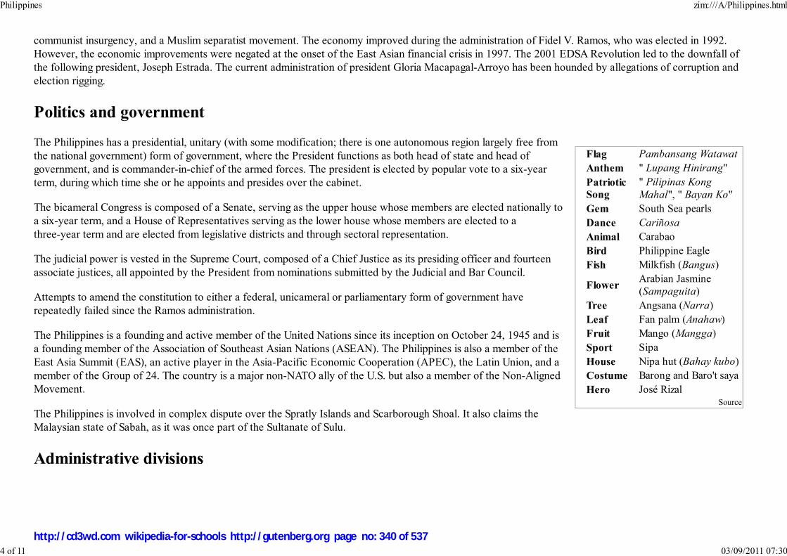
Flag Pambansang Watawat
Anthem " Lupang Hinirang"
Patriotic
Song
" Pilipinas Kong
Mahal", " Bayan Ko"
Gem South Sea pearls
Dance Cariñosa
Animal Carabao
Bird Philippine Eagle
Fish Milkfish (Bangus)
FlowerArabian Jasmine
(Sampaguita)
Tree Angsana (Narra)
Leaf Fan palm (Anahaw)
Fruit Mango (Mangga)
Sport Sipa
House Nipa hut (Bahay kubo)
Costume Barong and Baro't saya
Hero José RizalSource
communist insurgency, and a Muslim separatist movement. The economy improved during the administration of Fidel V. Ramos, who was elected in 1992.
However, the economic improvements were negated at the onset of the East Asian financial crisis in 1997. The 2001 EDSA Revolution led to the downfall of
the following president, Joseph Estrada. The current administration of president Gloria Macapagal-Arroyo has been hounded by allegations of corruption and
election rigging.
Politics and government
The Philippines has a presidential, unitary (with some modification; there is one autonomous region largely free from
the national government) form of government, where the President functions as both head of state and head of
government, and is commander-in-chief of the armed forces. The president is elected by popular vote to a six-year
term, during which time she or he appoints and presides over the cabinet.
The bicameral Congress is composed of a Senate, serving as the upper house whose members are elected nationally to
a six-year term, and a House of Representatives serving as the lower house whose members are elected to a
three-year term and are elected from legislative districts and through sectoral representation.
The judicial power is vested in the Supreme Court, composed of a Chief Justice as its presiding officer and fourteen
associate justices, all appointed by the President from nominations submitted by the Judicial and Bar Council.
Attempts to amend the constitution to either a federal, unicameral or parliamentary form of government have
repeatedly failed since the Ramos administration.
The Philippines is a founding and active member of the United Nations since its inception on October 24, 1945 and is
a founding member of the Association of Southeast Asian Nations (ASEAN). The Philippines is also a member of the
East Asia Summit (EAS), an active player in the Asia-Pacific Economic Cooperation (APEC), the Latin Union, and a
member of the Group of 24. The country is a major non-NATO ally of the U.S. but also a member of the Non-Aligned
Movement.
The Philippines is involved in complex dispute over the Spratly Islands and Scarborough Shoal. It also claims the
Malaysian state of Sabah, as it was once part of the Sultanate of Sulu.
Administrative divisions
Philippines zim:///A/Philippines.html
4 of 11 03/09/2011 07:30
http://cd3wd.com wikipedia-for-schools http://gutenberg.org page no: 340 of 537
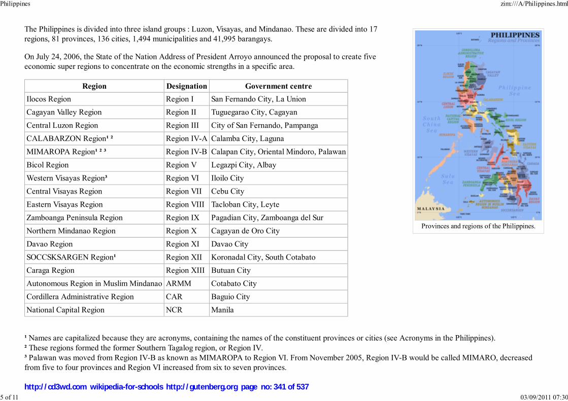
Provinces and regions of the Philippines.
The Philippines is divided into three island groups : Luzon, Visayas, and Mindanao. These are divided into 17
regions, 81 provinces, 136 cities, 1,494 municipalities and 41,995 barangays.
On July 24, 2006, the State of the Nation Address of President Arroyo announced the proposal to create five
economic super regions to concentrate on the economic strengths in a specific area.
Region Designation Government centre
Ilocos Region Region I San Fernando City, La Union
Cagayan Valley Region Region II Tuguegarao City, Cagayan
Central Luzon Region Region III City of San Fernando, Pampanga
CALABARZON Region¹ ² Region IV-A Calamba City, Laguna
MIMAROPA Region¹ ² ³ Region IV-B Calapan City, Oriental Mindoro, Palawan
Bicol Region Region V Legazpi City, Albay
Western Visayas Region³ Region VI Iloilo City
Central Visayas Region Region VII Cebu City
Eastern Visayas Region Region VIII Tacloban City, Leyte
Zamboanga Peninsula Region Region IX Pagadian City, Zamboanga del Sur
Northern Mindanao Region Region X Cagayan de Oro City
Davao Region Region XI Davao City
SOCCSKSARGEN Region¹ Region XII Koronadal City, South Cotabato
Caraga Region Region XIII Butuan City
Autonomous Region in Muslim Mindanao ARMM Cotabato City
Cordillera Administrative Region CAR Baguio City
National Capital Region NCR Manila
¹ Names are capitalized because they are acronyms, containing the names of the constituent provinces or cities (see Acronyms in the Philippines).
² These regions formed the former Southern Tagalog region, or Region IV.
³ Palawan was moved from Region IV-B as known as MIMAROPA to Region VI. From November 2005, Region IV-B would be called MIMARO, decreased
from five to four provinces and Region VI increased from six to seven provinces.
Philippines zim:///A/Philippines.html
5 of 11 03/09/2011 07:30
http://cd3wd.com wikipedia-for-schools http://gutenberg.org page no: 341 of 537

Mount Apo, Philippines' tallestmountain. It is called 'The
Grandfather of the PhilippineMountains'.
Geography of the Philippines
Manila Bay
Geography
The Philippines constitutes an archipelago of 7,107 islands with a total land area of approximately 300,000 square kilometers
(116,000 sq mi). It generally lies between 116° 40' and 126° 34' E. longitude, and 4° 40' and 21° 10' N. latitude, and borders
the Philippine Sea on the east, on the South China Sea the west, and the Celebes Sea on the south. The island of Borneo lies a
few hundred kilometers southwest and Taiwan directly north. The Moluccas and Sulawesi are to the south, and Palau is to the
east beyond the Philippine Sea.
The islands are commonly divided into three island groups: Luzon (Regions I to V, NCR and CAR), Visayas (VI to VIII), and
Mindanao (IX to XIII and ARMM). The busy port of Manila, on Luzon, is the national capital and second largest city after its
suburb Quezon City.
The local climate is hot, humid, and tropical. The average yearly temperature is around 26.5 ° C (79.7 ° F). There are three
recognized seasons: Tag-init or Tag-araw (the hot season or summer from March to May), Tag-ulan (the rainy season from
June to November), and Taglamig (the cold season from December to February). The southwest monsoon (May-October) is
known as the "habagat" and the dry winds of the northeast monsoon (November-April) as the "amihan".
Most of the mountainous islands used to be covered in tropical rainforest and are
volcanic in origin. The highest point is Mount Apo on Mindanao at 2,954 metres
(9,692 ft). There are many active volcanos such as Mayon Volcano, Mount Pinatubo,
and Taal Volcano. The country also lies within the typhoon belt of the Western Pacific
and about 19 typhoons strike per year.
Lying on the northwestern fringes of the Pacific Ring of Fire, the Philippines
experiences frequent seismic and volcanic activities. Some 20 earthquakes are
registered daily in the Philippines, though most are too weak to be felt. The last great
earthquake was the 1990 Luzon earthquake.
The longest river is the Cagayan River in northern Luzon. Manila Bay is connected to Laguna de Bay by means of the Pasig
River. Subic Bay, the Davao Gulf and the Moro Gulf are some of the important bays. Transversing the San Juanico Strait is
the San Juanico Bridge, that connects the islands of Samar and Leyte.
Economy
Philippines zim:///A/Philippines.html
6 of 11 03/09/2011 07:30
http://cd3wd.com wikipedia-for-schools http://gutenberg.org page no: 342 of 537
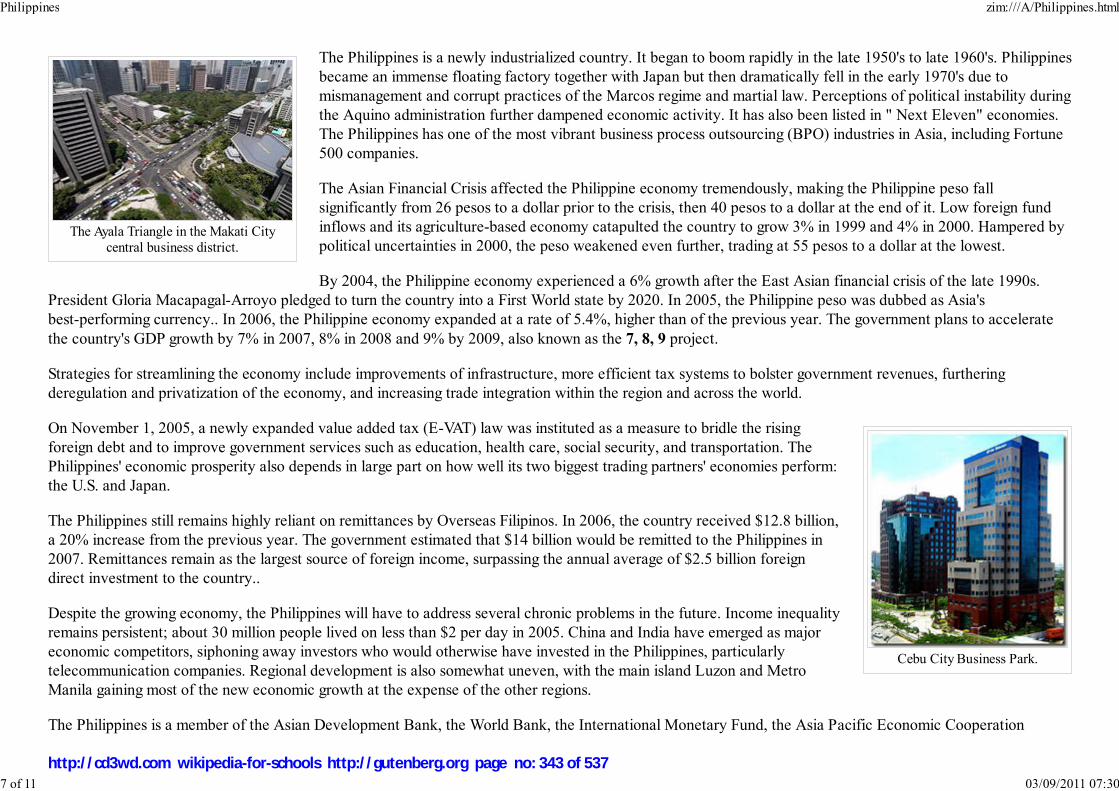
The Ayala Triangle in the Makati Citycentral business district.
Cebu City Business Park.
The Philippines is a newly industrialized country. It began to boom rapidly in the late 1950's to late 1960's. Philippines
became an immense floating factory together with Japan but then dramatically fell in the early 1970's due to
mismanagement and corrupt practices of the Marcos regime and martial law. Perceptions of political instability during
the Aquino administration further dampened economic activity. It has also been listed in " Next Eleven" economies.
The Philippines has one of the most vibrant business process outsourcing (BPO) industries in Asia, including Fortune
500 companies.
The Asian Financial Crisis affected the Philippine economy tremendously, making the Philippine peso fall
significantly from 26 pesos to a dollar prior to the crisis, then 40 pesos to a dollar at the end of it. Low foreign fund
inflows and its agriculture-based economy catapulted the country to grow 3% in 1999 and 4% in 2000. Hampered by
political uncertainties in 2000, the peso weakened even further, trading at 55 pesos to a dollar at the lowest.
By 2004, the Philippine economy experienced a 6% growth after the East Asian financial crisis of the late 1990s.
President Gloria Macapagal-Arroyo pledged to turn the country into a First World state by 2020. In 2005, the Philippine peso was dubbed as Asia's
best-performing currency.. In 2006, the Philippine economy expanded at a rate of 5.4%, higher than of the previous year. The government plans to accelerate
the country's GDP growth by 7% in 2007, 8% in 2008 and 9% by 2009, also known as the 7, 8, 9 project.
Strategies for streamlining the economy include improvements of infrastructure, more efficient tax systems to bolster government revenues, furthering
deregulation and privatization of the economy, and increasing trade integration within the region and across the world.
On November 1, 2005, a newly expanded value added tax (E-VAT) law was instituted as a measure to bridle the rising
foreign debt and to improve government services such as education, health care, social security, and transportation. The
Philippines' economic prosperity also depends in large part on how well its two biggest trading partners' economies perform:
the U.S. and Japan.
The Philippines still remains highly reliant on remittances by Overseas Filipinos. In 2006, the country received $12.8 billion,
a 20% increase from the previous year. The government estimated that $14 billion would be remitted to the Philippines in
2007. Remittances remain as the largest source of foreign income, surpassing the annual average of $2.5 billion foreign
direct investment to the country..
Despite the growing economy, the Philippines will have to address several chronic problems in the future. Income inequality
remains persistent; about 30 million people lived on less than $2 per day in 2005. China and India have emerged as major
economic competitors, siphoning away investors who would otherwise have invested in the Philippines, particularly
telecommunication companies. Regional development is also somewhat uneven, with the main island Luzon and Metro
Manila gaining most of the new economic growth at the expense of the other regions.
The Philippines is a member of the Asian Development Bank, the World Bank, the International Monetary Fund, the Asia Pacific Economic Cooperation
Philippines zim:///A/Philippines.html
7 of 11 03/09/2011 07:30
http://cd3wd.com wikipedia-for-schools http://gutenberg.org page no: 343 of 537

Population growth of thePhilippines.
(APEC), the World Trade Organization (WTO), the Colombo Plan, and the G-77, among others
In 2007, the gross domestic product grew 7.3%, the fastest in 31 years.
Healthcare
See List of hospitals in the Philippines
The Philippine Department of Health reported in 1999 that the country had 1,794 hospitals with 83,491 beds nationwide. However, only 648 (36%) of these
hospitals were government-owned, while the remaining 1,146 hospitals (64%) were in private hands.
The Philippines has in effect a dual health care system, consisting of a modern (Western) establishment, and traditional medicine. Many Filipinos make use of
the latter .
The conventional western medicine sector consists of a public sector and a private sector. The Philippines are seeking to develop medical tourism within the
country, and some private sector hospitals have already undergone international healthcare accreditation, or are actively seeking it, either from US sources or
European sources.
The Philippines are a net exporter of doctors and nurses to other parts of the world, and this is causing concern in some quarters - The continuing and massive
exodus of Philippine nurses and doctors to other countries all over the world is now taking a heavy toll on the country’s already inadequate health-care
system.
Demographics
The Philippines is the world's 12th most populous country, with a population of over 85 million as of 2005.As of 2007, 8%
of Filipinos are living abroad as migrant laborers. Roughly half reside on the island of Luzon. Manila, the capital, is the
eleventh most populous metropolitan area in the world. The literacy rate was 92.6% in 2003, and about equal for males and
females. Life expectancy is 71.23 years, with 73.6 years for females and 69.8 years for males. Population growth per year is
about 1.76%, with 24.7 births per 1,000 people.
Ethnic groups
Filipinos are descended from the various Austronesian-speaking migrants who arrived in successive waves over a thousand
years ago from Taiwan, genetically most closely related to the Ami tribe. The Malayo-Polynesian-speaking peoples, a
branch of Austronesian, migrated to the Philippines and brought their knowledge of rice agriculture and ocean-sailing technology. Filipinos to this day are
Philippines zim:///A/Philippines.html
8 of 11 03/09/2011 07:30
http://cd3wd.com wikipedia-for-schools http://gutenberg.org page no: 344 of 537

Map of the dominant ethnolinguistic groupsof the Philippines.
composed of various Malayo-Polynesian-speaking ethnic groups, including but not limited to the Visayans, the Tagalog, the Ilocano, the Moro, the
Kapampangan, the Bicolano, the Pangasinense, the Igorot, the Lumad, the Mangyan, the Ibanag, the Chabacano, the Badjao, the Ivatan, and the Palawan tribes.
The Negritos, including the Aetas and the Ati, are considered as the aboriginal inhabitants of the Philippines though they are estimated to be fewer than 30,000
people (0.03%).
Filipinos of Chinese descent, who had been settling in the Philippines since pre-colonization, currently forms the largest non-Austronesian ethnic group,
claiming about 2% of the population. Other significant minorities, ranked according to population, include Spanish, British, Americans, Japanese, Asian Indians,
Koreans, Arabs and Indonesians.
Throughout the country's history, various ethnic groups as well as immigrants and colonizers have intermarried, producing Filipino mestizos. These mestizos,
apart from being of mixed indigenous Austronesian and European ancestry, can be descended from any ethnic foreign forebearers.
Languages
More than 180 languages and dialects are spoken in the archipelago, almost all of them belonging to the Borneo-
Philippines group of the Malayo-Polynesian language branch of the Austronesian language family.
According to the 1987 Constitution, Filipino and English are both the official languages. Many Filipinos understand,
write and speak English, Filipino and their respective regional languages.
Filipino is the de facto standardized version of Tagalog spoken in Metro Manila and urban centers and one of the
official languages in the country. English, the other official language, is widely used as a lingua franca throughout
the country.
Twelve major regional languages are the auxiliary official languages of their respective regions, each with over one
million speakers: Tagalog, Cebuano, Ilocano, Hiligaynon, Waray-Waray, Kapampangan, Bikol, Pangasinan.
Kinaray-a, Maranao, Maguindanao and Tausug.
English was imposed by Americans during the U.S. intervention and colonization of the archipelago. English is used
in education, churches, religious affairs, print and broadcast media, and business, though the number of people who
use it as a second language far outnumber those who speak it as a first language. Still, English is the preferred
medium for textbooks and instruction for secondary and tertiary levels. Movies and TV programs in English are not
subtitled but many films and TV programs are produced in Filipino. English is the sole language of the law courts.
Spanish was the original official language of the country for more than three centuries, and became the lingua franca
of the Philippines in the 19th and early 20th centuries. Spanish was the language of the Philippine Revolution, and
the 1899 Malolos Constitution proclaimed it as the official language. However, Spanish was spoken by a total of
Philippines zim:///A/Philippines.html
9 of 11 03/09/2011 07:30
http://cd3wd.com wikipedia-for-schools http://gutenberg.org page no: 345 of 537

Manila Cathedral, officially theBasilica of the Immaculate
Conception, is mother church ofthe Roman Catholic Church in the
Philippines.
An Ifugao sculpture.
60% of the population in the early 1900's as a first, second or third language. Following the American occupation of the Philippines, its use declined after 1940.
Currently, only a few Mestizos of Spanish or Hispanic origin speak it as their first language, although a few others use it together with Filipino and English.
Both Spanish and Arabic are used as auxiliary languages in the Philippines. The use of Arabic is prevalent among Filipino Muslims and taught in madrasah
(Muslim) schools.
Religion
The Philippines is one of two countries in Asia with Roman Catholic majorities; the other being East Timor. The Philippines
is separated into dioceses of which the Archdiocese of Manila enjoys primacy. About 94% of Filipinos identify themselves
as Christians, with 81% belonging to the Roman Catholic Church. 2% are composed of Protestant denominations and 11%
either to the Philippine Independent Church (Aglipayan), Iglesia ni Cristo and others. While Christianity is a major force in
the culture of the Filipinos, indigenous traditions and rituals still influence religious practice.
Approximately 5% of Filipinos are Muslims, and are locally known as "Moros", having been dubbed this by the Spanish due
to their sharing Islam with the Moors of North Africa. They primarily settle in parts of Mindanao, Palawan and the Sulu
archipelago, but are now found in most urban areas of the country. Most lowland Muslim Filipinos practice normative
Islam, although the practices of some Mindanao's hill tribe Muslims reflect a fusion with animism. There are also small
populations of Buddhists, Hindus, Sikhs, and animists, which, along with other non-Christians and non-Muslims, collectively
comprise 5% of the population.
Culture
Filipino culture is a fusion of pre-Hispanic indigenous Austronesian civilizations of the Philippines mixed with Hispanic and
American. It has also been influenced by Chinese and Islamic culture.
The indigenous Austronesian civilizations of the Philippines are similar with those of its southern neighbors, Malaysia and
Indonesia.
The Hispanic influences in Filipino culture are largely derived from the culture of Spain and Mexico as a result of over three
centuries of Spanish colonial rule through Mexico. These Hispanic influences are most evident in literature, folk music, folk
dance, language, food, art and religion, such as Roman Catholic Church religious festivals. Filipinos hold major festivities
known as barrio fiestas to commemorate their patron saints. One of the most visible Hispanic legacy, is the prevalence of
Spanish surnames among Filipinos. This peculiarity, unique among the people of Asia, came as a result of a colonial decree
for the systematic distribution of family names and implementation of the Spanish naming system on the inhabitants of the
Philippines. A Spanish name and surname among the majority of Filipinos does not always denote of Spanish ancestry. Only
Philippines zim:///A/Philippines.html
10 of 11 03/09/2011 07:30
http://cd3wd.com wikipedia-for-schools http://gutenberg.org page no: 346 of 537
about less than 2% of the population (mostly Filipinos of Spanish and Mexican origin) would qualify as Hispanic by ancestry.
Names of countless streets, towns and provinces, which are named in Spanish. Spanish architecture also made a major imprint in the Philippines. This can be
seen especially in the country's churches, government buildings and universities. Many Hispanic style houses and buildings are being preserved, like the Spanish
colonial town in Vigan City, for protection and conservation. Kalesa is a horse-driven carriage introduced by the Spaniards and was a major mode of
transportation during the colonial times. It is still being used today. Filipino cuisine is also heavily influenced by Mexican and Spanish cuisine.
The Chinese influences in Filipino culture are most evident in Filipino cuisine. The prevalence of noodles, known locally as mami, is a testament to Chinese
cuisine. Many Filipino superstitions are also Chinese in origin. Other Chinese influences include linguistic borrowings and the occasional Chinese derived
surnames.
The use of English language in the Philippines is contemporaneous and is America's visible legacy. The most commonly played sports in the Philippines are
basketball and billiards. There is also a wide influence of American Pop cultural trends, such as the love of fast-food and movies; many street corners boast
fast-food outlets. Aside from the American commercial giants such as McDonald's, Pizza Hut, Burger King, KFC, and Shakey's Pizza, local fast-food chains
have also sprung up, including Goldilocks, Jollibee, Greenwich Pizza (acquired by Jollibee in 1994), and Chowking (acquired by Jollibee in 2000). Modern day
Filipinos also listen to contemporary American music and watch American movies. However, Original Pilipino Music (also known as OPM) and Philippine
movies are also widely appreciated.
Filipinos honour national heroes whose works and deeds contributed to the shaping of the Filipino nation. José Rizal is the most celebrated ilustrado, a Spanish-
speaking reformist visionary whose writings contributed greatly in nurturing a sense of national identity and awareness. His novels Noli Me Tangere and El
Filibusterismo originally written in Spanish, are required readings for Filipino students, and provide vignettes of colonial life under the Spanish rule.
As with many cultures, music (which includes traditional music) and leisure activities are an important aspect of the Filipino society. Various sports are also
enjoyed, including boxing, basketball, badminton, billiards, football (soccer) and ten-pin bowling being popular games in the country.
Retrieved from " http://en.wikipedia.org/wiki/Philippines"
This Wikipedia Selection was sponsored by a UK Children's Charity, SOS Children UK , and consists of a hand selection from the English Wikipedia articles
with only minor deletions (see www.wikipedia.org for details of authors and sources). The articles are available under the GNU Free Documentation License.
See also our
Philippines zim:///A/Philippines.html
11 of 11 03/09/2011 07:30
http://cd3wd.com wikipedia-for-schools http://gutenberg.org page no: 347 of 537

Portal:India2008/9 Schools Wikipedia Selection. Related subjects: Asia; Portals
Portal:India zim:///A/Portal_India.html
1 of 4 03/09/2011 07:30
http://cd3wd.com wikipedia-for-schools http://gutenberg.org page no: 348 of 537
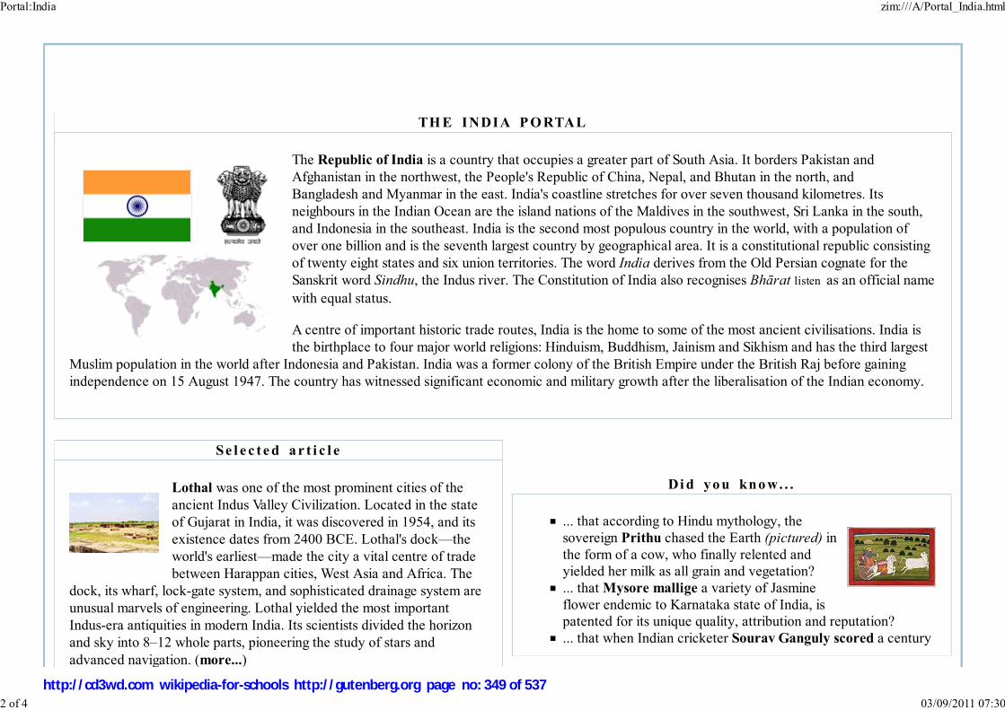
TH E INDIA P O RTAL
The Republic of India is a country that occupies a greater part of South Asia. It borders Pakistan and
Afghanistan in the northwest, the People's Republic of China, Nepal, and Bhutan in the north, and
Bangladesh and Myanmar in the east. India's coastline stretches for over seven thousand kilometres. Its
neighbours in the Indian Ocean are the island nations of the Maldives in the southwest, Sri Lanka in the south,
and Indonesia in the southeast. India is the second most populous country in the world, with a population of
over one billion and is the seventh largest country by geographical area. It is a constitutional republic consisting
of twenty eight states and six union territories. The word India derives from the Old Persian cognate for the
Sanskrit word Sindhu, the Indus river. The Constitution of India also recognises Bhārat listen as an official name
with equal status.
A centre of important historic trade routes, India is the home to some of the most ancient civilisations. India is
the birthplace to four major world religions: Hinduism, Buddhism, Jainism and Sikhism and has the third largest
Muslim population in the world after Indonesia and Pakistan. India was a former colony of the British Empire under the British Raj before gaining
independence on 15 August 1947. The country has witnessed significant economic and military growth after the liberalisation of the Indian economy.
Se l e c t e d a r t i c l e
Lothal was one of the most prominent cities of the
ancient Indus Valley Civilization. Located in the state
of Gujarat in India, it was discovered in 1954, and its
existence dates from 2400 BCE. Lothal's dock—the
world's earliest—made the city a vital centre of trade
between Harappan cities, West Asia and Africa. The
dock, its wharf, lock-gate system, and sophisticated drainage system are
unusual marvels of engineering. Lothal yielded the most important
Indus-era antiquities in modern India. Its scientists divided the horizon
and sky into 8–12 whole parts, pioneering the study of stars and
advanced navigation. (more...)
Di d yo u kno w. . .
... that according to Hindu mythology, the
sovereign Prithu chased the Earth (pictured) in
the form of a cow, who finally relented andyielded her milk as all grain and vegetation?
... that Mysore mallige a variety of Jasmine
flower endemic to Karnataka state of India, ispatented for its unique quality, attribution and reputation?
... that when Indian cricketer Sourav Ganguly scored a century
Portal:India zim:///A/Portal_India.html
2 of 4 03/09/2011 07:30
http://cd3wd.com wikipedia-for-schools http://gutenberg.org page no: 349 of 537

interceptor previously seen on the classic Mirage III, Dassault built a
totally new design. The Mirage 2000 has a maximum speed of Mach
2.2. In 2005, the IAF expressed its desire to purchase about 200 Mirage
2000-5 aircraft.
Photo credit: Deepak gupta
on test debut at Lord's in 1996, he became the third overall andfirst since John Hampshire in 1969 to do so?
... that in 1870, the Indian Reform Association aimed at putting
into practice some of the ideas that the Brahmo leader KeshubChunder Sen was exposed to during his visit to Britain?
... that the Durga Vahini, the women's wing of the Vishva Hindu
Parishad, have been accused of instigating violence againstreligious minorities in India?
... that the term Sindhology as a subject of knowledge about
Sindh was first coined in 1964?... that the Halegannada, literally Old Kannada, is an ancient
form of the Kannada language?
... that Nagpur Improvement Trust, a local civic governmentbody of Nagpur, India established in 1936, is not an elected body
and continues to work along side Nagpur Municipal
Corporation?... that Indian scholar Śāntarakṣita is believed to have been
instrumental in the introduction of Buddhism to Tibet?
... that during the Agra famine of 1837–38 in the North-WesternProvinces of India, approximately 800,000 people died of
starvation and an even larger number of livestock perished?
... that V.D. Savarkar wrote The Indian War of Independence, a
nationalist history of the 1857 uprising, in response to Britishcelebrations of the 50th anniversary of its suppression?
... that India established its diplomatic representation in
Nigeria in 1958, two years before Nigeria's independence fromBritish rule?
... that improving Indo-South African relations have led to
phenomenal growth in bilateral trade, rising from US$3 million in1992-93 to US$4 billion in 2005-06 and targeting US$12 billion
by 2010?
... that M. P. T. Acharya is associated with Indian Nationalismand communism, as well as the anarchist movement?
... that India and Pakistan have expanded cross-border roadand rail transport links, including across the disputed region of
Portal:India zim:///A/Portal_India.html
3 of 4 03/09/2011 07:30
http://cd3wd.com wikipedia-for-schools http://gutenberg.org page no: 350 of 537

Kashmir?
Retrieved from " http://en.wikipedia.org/wiki/Portal:India"
The 2008 Wikipedia for Schools was sponsored by a UK Children's Charity, SOS Children UK , and consists of a hand selection from the English Wikipedia
articles with only minor deletions (see www.wikipedia.org for details of authors and sources). The articles are available under theGNU Free Documentation License. See also our <
Portal:India zim:///A/Portal_India.html
4 of 4 03/09/2011 07:30
http://cd3wd.com wikipedia-for-schools http://gutenberg.org page no: 351 of 537
Republic of China
2008/9 Schools Wikipedia Selection. Related subjects: Asia; Asian Countries
Republic of China zim:///A/Republic_of_China.html
1 of 24 03/09/2011 07:31
http://cd3wd.com wikipedia-for-schools http://gutenberg.org page no: 352 of 537
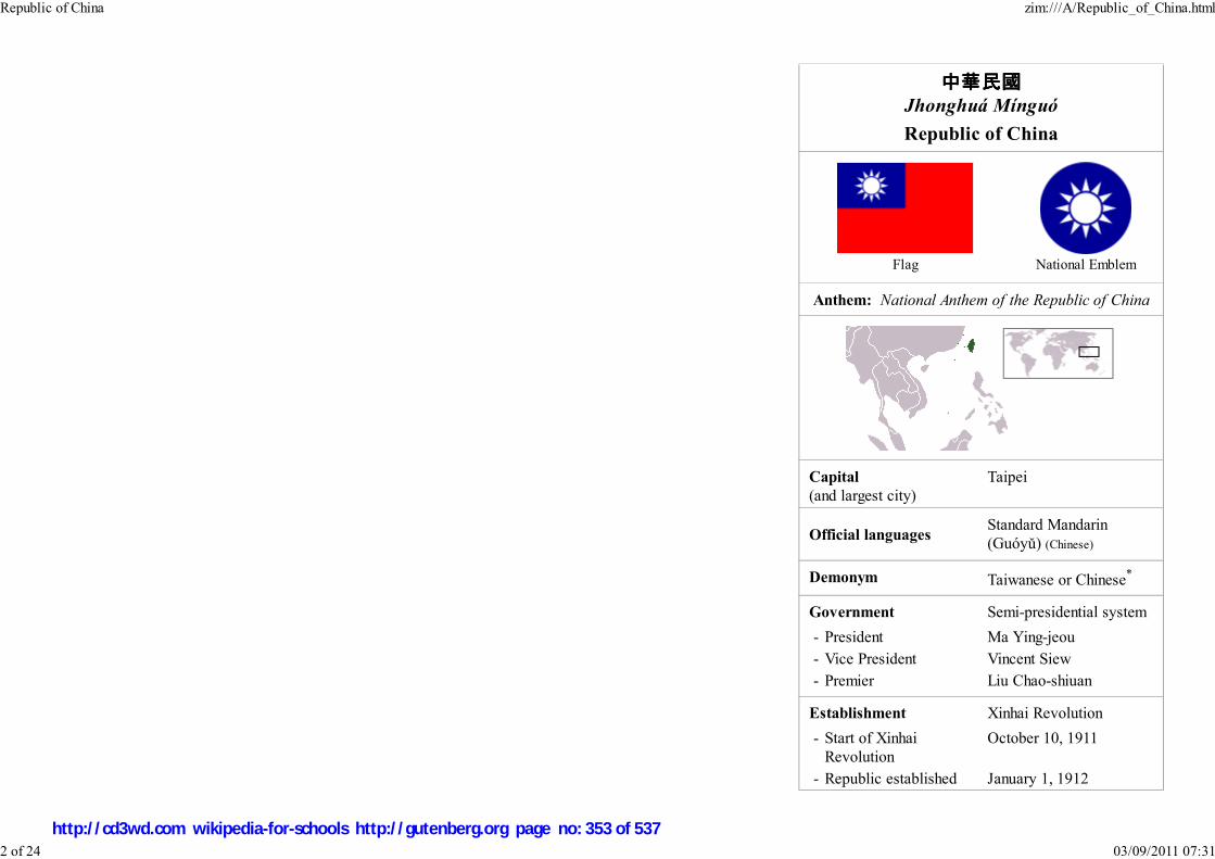
中華民國中華民國中華民國中華民國Jhonghuá Mínguó
Republic of China
Flag National Emblem
Anthem: National Anthem of the Republic of China
Capital
(and largest city)
Taipei
Official languagesStandard Mandarin
(Guóyǔ) (Chinese)
Demonym Taiwanese or Chinese*
Government Semi-presidential system
- President Ma Ying-jeou
- Vice President Vincent Siew
- Premier Liu Chao-shiuan
Establishment Xinhai Revolution
- Start of Xinhai
Revolution
October 10, 1911
- Republic established January 1, 1912
Republic of China zim:///A/Republic_of_China.html
2 of 24 03/09/2011 07:31
http://cd3wd.com wikipedia-for-schools http://gutenberg.org page no: 353 of 537

- Relocated to Taiwan December 7, 1949
Area
- Total 36,188 km² ( 136th)
13,975 sq mi
- Water (%) 10.34
Population
- 2007 estimate 22,911,292 ( 47th)
- Density 633.12/km² ( 14th)
1,639.43/sq mi
GDP ( PPP) 2007 estimate
- Total $695.388 billion ( 19th)
- Per capita $30,126 ( 28th)
GDP (nominal) 2007 estimate
- Total $383,307 billion ( 24th)
- Per capita $16,274 ( 36th)
HDI (2005) ▲ 0.932 (high) ( 23rd if
ranked)
CurrencyNew Taiwan dollar (NT$)
( TWD)
Time zone CST ( UTC +8)
Internet TLD .tw
Calling code +886
* Due to the government's territory after 1949 having little overlap
with its pre-1945 territory, those who were nationals before 1949 are
likely to be identified as "Chinese". Also, due to the controversial
political status of Taiwan, those supporting Chinese reunification may
refer to themselves as "Chinese" in addition or in place of
"Taiwanese." Those favoring Taiwan independence tend to refer to
themselves as "Taiwanese" only.
Republic of China zim:///A/Republic_of_China.html
3 of 24 03/09/2011 07:31
http://cd3wd.com wikipedia-for-schools http://gutenberg.org page no: 354 of 537

This article contains Chinese text.
Without proper rendering support, you may see
question marks, boxes, or other symbols instead of
Chinese characters.
The Republic of China ( Abbr: ROC; traditional Chinese: 中 華 民 國; simplified Chinese: 中 华 民国; Hanyu Pinyin: Zhōnghuá Mínguó; Tongyong Pinyin: Jhonghuá Mínguó; Wade-Giles: Chung-hua
Min-kuo; POJ: Tiong-hoa Bin-kok) is a state in East Asia that has evolved from a single-party state with
full global recognition into a multi-party democratic state with limited international recognition. It was a
founding member of the United Nations. Established in 1912, the Republic of China encompassed much
of mainland China. In 1945 at the end of World War II the Republic of China added the island groups of Taiwan (Formosa) and the Pescadores to its authority.
These island groups, together with Kinmen and Matsu, became the full extent of the Republic of China's authority after 1949 when the Kuomintang (KMT) lost
the Chinese Civil War to the Chinese Communist Party and the People's Republic of China (PRC) was founded in mainland China. Under ROC law, these areas
are known as the Free Area of the Republic of China.
Although the Republic of China has governed only Taiwan and outlying islands since 1949, during the early Cold War the ROC was recognized by most Western
nations and the United Nations as the sole legitimate government of China. During the 1970s, the ROC began to lose these recognitions in favour of the People's
Republic of China. The Republic of China has not formally relinquished its claim as the legitimate government of all China. Both Presidents Lee Teng-hui and
Chen Shui-bian have held the view that it is a sovereign and independent country separate from mainland China and there is no need for a formal declaration of
independence.
During the 1950s and 1960s, it was common to refer to the Republic of China as Nationalist China or Free China. Over subsequent decades, the Republic of
China has been commonly referred to as "Taiwan". Since the late 1970s the name "China" is commonly used to refer to the People's Republic of China. Because
of diplomatic pressure from the People's Republic of China, the Republic of China is referred to as " Chinese Taipei" in most international organizations. The
capital city is Taipei.
The Republic of China was established in 1912, replacing the Qing Dynasty and ending over two thousand years of imperial rule in China. It is the oldest
surviving republic in East Asia. The Republic of China on mainland China went through periods of warlordism, Japanese invasion, civil war between the
Kuomintang and the Communists. The Republic of China on Taiwan has experienced rapid economic growth and industrialization, and democratization.
Starting in 1928, the Republic of China was ruled by the Kuomintang as an authoritarian one-party state. In the 1950s and 1960s, the KMT went through wide
restructuring and decreased corruption and implemented land reform. There followed a period of great economic growth, the Republic of China became one of
the Four Asian Tigers, despite the constant threat of war and civil unrest. In the 1980s and 1990s the government peacefully transitioned to a democratic
system, with the first direct presidential election in 1996 and the 2000 election of Chen Shui-bian, the first non-KMT after 1949 to become President of the
Republic of China. The KMT regained presidency and increased its majority in the legislature in the 2008 presidential and legislative elections.
Political status
The political status of the Republic of China is a contentious issue. The People's Republic of China claims that the ROC government is illegitimate, referring to
it as the "Taiwan Authority", while the ROC views itself as an independent sovereign state. The ROC actively claimed to be the sole legitimate government of
all China since its retreat to Taiwan in 1949 until the lift of martial law in 1987. Although the administration of pro-independence President Chen Shui-bian does
Republic of China zim:///A/Republic_of_China.html
4 of 24 03/09/2011 07:31
http://cd3wd.com wikipedia-for-schools http://gutenberg.org page no: 355 of 537
not actively claim jurisdiction over all of China, the national boundaries of the ROC have not been redrawn and its outstanding territorial claims from the late
1940s have not been revised. Thus, the claimed area of the ROC continue to include Mainland China, several off-shore islands, Taiwan, Outer Mongolia,
northern Burma, and Tuva (now Russian territory).
The political environment is complicated by the potential for military conflict should overt actions toward independence or reunification be taken. It is the
policy of the People's Republic of China to use force to ensure reunification if peaceful reunification is no longer possible, as stated in its anti-secession law, and
there are substantial military installations on the Fujian coast for this reason. As a result of Cold War politics, the United States has provided military training
and sold arms to the ROC armed forces. However, the current status quo, as defined by the U.S., is supported on a quid pro quo basis between both Chinese
states. The PRC is expected to "use no force or threat[en] to use force against Taiwan" and the ROC is to "exercise prudence in managing all aspects of Cross-
Strait relations." Both are to refrain from performing actions or espousing statements "that would unilaterally alter Taiwan's status."
Within the ROC, opinions are polarized between those supporting unification, represented by the Pan-Blue Coalition of parties, and those supporting
independence, represented by the Pan-Green Coalition of parties. The Kuomintang, the largest Pan-Blue party, supports the status quo for the indefinite future
with a stated ultimate goal of unification. However, it does not support unification in the short term with the PRC as such a prospect would be unacceptable to
most of its members and the public. Ma Ying-jeou, former chairman of the KMT and the current ROC President, has set out democracy, economic development
to a level near that of the ROC, and equitable wealth distribution as the conditions that the mainland must fulfill for reunification to occur. The DPP, the largest
Pan-Green party, also supports the status quo because the risk of provoking the PRC is unacceptable to its members. However, President Chen Shui-bian of the
DPP has stated that no matter what, any decision should be decided through a public referendum of the people of the ROC. Both parties' current foreign policy
positions support actively advocating ROC participation in international organizations, but the KMT accepts the " One-China" principle and the DPP
encourages economic ties with countries other than the PRC for security reasons.
For its part, the People's Republic of China appears to find the retention of the name "Republic of China" far more acceptable than the declaration of a de jure
independent Taiwan. However, with the rise of the Taiwanese independence movement, the name "Taiwan" has been employed increasingly more often on the
island itself. The PRC has stated that any effort in Taiwan to formally abolish the ROC and replace it with a Republic of Taiwan would result in a strong and
possibly military reaction. The current position of the United States is that the Taiwan issue must be resolved peacefully and unilateral action by either side is
condemned; neither an unprovoked invasion by the PRC or a formal declaration of independence by Taiwan would be acceptable.
Citing its One-China policy, the PRC requires other countries to give no official recognition to the ROC as a condition of maintaining diplomatic relations. As a
result, there are only 23 countries that have official diplomatic relations with the Republic of China. However, most countries have unofficial representative
offices in the ROC. The United States maintains unofficial relations with the ROC through the instrumentality of the American Institute in Taiwan. The ROC
maintains similar de facto embassies and consulates in most countries, called " Taipei Economic and Cultural Representative Offices" (TECRO), with branch
offices called "Taipei Economic and Cultural Offices" (TECO). Both TECRO and TECO are "unofficial commercial entities" of the ROC in charge of
maintaining diplomatic relations, providing consular services (i.e. Visa applications), and serving the national interests of the ROC in other countries in basically
the same way as an embassy or consulate.
Also due to its One-China policy, the PRC only participates in international organizations where the ROC is not recognized as a sovereign country. In 1945, the
ROC, as representative of all the territory of China, was one of the founding nations and Security Council member of the United Nations; however, in 1971,
Republic of China zim:///A/Republic_of_China.html
5 of 24 03/09/2011 07:31
http://cd3wd.com wikipedia-for-schools http://gutenberg.org page no: 356 of 537

with the passage of United Nations General Assembly Resolution 2758, it was replaced by the PRC. Each year since 1992, the ROC has petitioned the UN for
entry but has been unsuccessful. Most member states, including the United States, do not wish to discuss the issue of the ROC's political status for fear of
souring diplomatic ties with the PRC. However, both the U.S. and Japan publicly support the ROC's bid for membership in the World Health Organization as an
observer. However, though the ROC has applied for WHO membership every year since 1997 under various denominations, their efforts have consistently been
blocked by PRC. Also, the Republic of China is pressured to use the politically neutral name "Chinese Taipei" in international events such as the Olympic
Games when the PRC is also a party. The ROC is typically barred from using its national anthem and national flag in international events due to PRC pressure;
ROC spectators attending events such as the Olympics are often barred from bringing ROC flags into venues. The ROC is able to participate as "China" in
organizations that the PRC does not participate in, such as the World Organization of the Scout Movement.
The relationship with the PRC and the related issues of Taiwan independence and Chinese reunification continue to dominate ROC politics. For any particular
resolution public favour shifts greatly with small changes in wording, illustrating the complexity of public opinion on the topic.
History
1911–27
Republic of China zim:///A/Republic_of_China.html
6 of 24 03/09/2011 07:31
http://cd3wd.com wikipedia-for-schools http://gutenberg.org page no: 357 of 537

Map of Republic of China printedby Rand McNally & Co. in the year
1914.
Yuan Shikai (left) and Sun Yat-sen(right) with two different flagsrepresenting the early Republic.Sun Yat-sen (middle) and
Chiang Kai-shek (on stage inuniform) at the founding of theWhampoa Military Academy in
1924.
In 1911, after over two thousand years of imperial rule, China overthrew its dynastic system in favour of a republic. The
Qing government, having just experienced a century of instability, suffered from both internal rebellion and foreign
imperialism. The Neo-Confucian principles that had, to that time, sustained the dynastic system were now called into
question and a loss of cultural self-confidence was blamed for a total of 40 million Chinese consumers of opium by 1900
(roughly 10% of the population). By the time of its embarrassing defeat by an expeditionary force led by the world's major
powers in 1900 during the suppression of the Boxer Rebellion, the Qing government was already in its final throes, with
only the lack of an alternative regime in sight prolonging its existence until 1912.
The establishment of Republican China developed out of the Wuchang Uprising against the Qing on October 10, 1911. The
Republic of China was established on January 1, 1912, with Dr. Sun Yat-sen as the provisional president. As part of the
agreement to have the last emperor Puyi abdicate, Yuan Shikai was officially elected president in 1913. However, Yuan
dissolved the ruling Kuomintang party (KMT), ignored the provisional Constitution by asserting presidential power, and
ultimately declared himself Emperor of China in 1915.
Yuan's supporters deserted him, and many provinces declared independence and became
warlord states. Yuan Shikai died of natural causes in 1916. This thrust China into a
decade of warlordism. Sun Yat-sen, forced into exile, returned to Guangdong province
with the help of southern warlords in 1917 and 1920, and set up successive rival
governments. Sun re-established the KMT in October, 1919.
The central power in Beijing struggled to hold on to power. An open and wide-ranging
debate evolved regarding how China should confront the West. After the Treaty of
Versailles, on May 4, a student protest led to a nationwide uprising and gave the
movement its name.
Chinese anarchism, specifically anarchist communism, had been one of the most prominent forms of revolutionary socialism
even before the Wuchang Uprising. Following the Russian Revolution, the influence of Marxism spread and became more
popular. Li Dazhao and Chen Duxiu led the Marxist-Leninist movement in the beginning. The Communist Party of China was
founded in July, 1921.
1927–49
Republic of China zim:///A/Republic_of_China.html
7 of 24 03/09/2011 07:31
http://cd3wd.com wikipedia-for-schools http://gutenberg.org page no: 358 of 537

Chiang Kai-shek , whoassumed the leadership ofthe Kuomintang (KMT)after the death of Sun
Yat-sen in 1925
The National Chiang Kai-shekMemorial Hall in Taipei, built
by the ROC government tohonour Chiang.
After Sun's death in March 1925, Chiang Kai-shek became the leader of the KMT. Chiang had led the successful Northern
Expedition which, with the help of the Soviet Union, defeated the warlords and nominally united China under the KMT. Soviet
advisors had provided training, propaganda, popular agitation, and arms. However, Chiang soon dismissed his Soviet advisors, and
purged communists and leftists from the KMT, leading to the Chinese Civil War. The Communists were pushed into the interior as
Chiang Kai-shek sought to destroy them. Chiang consolidated his rule, establishing a Nationalist Government in Nanjing in 1927.
Efforts were made to establish a modern civil society, by creating the Academia Sinica, the Bank of China, and other agencies.
1932 saw the first participation in the Olympic Games by a team, representing a nominally united China under the flag of the
Republic of China.
Stability was interrupted by the Japanese invasion of Manchuria in 1931, with hostilities continuing through the Second
Sino-Japanese War, part of World War II, from 1937 to 1945. The government of the Republic of China retreated from Nanjing to
Chongqing. In 1945, Japan surrendered and the Republic of China became one of the founding members of the United Nations. The
government returned to Nanjing.
1945 to present
After the defeat of Japan during World War II, Taiwan was surrendered to the Allies, with ROC troops accepting the surrender
of the Japanese garrison. Taiwan was pronounced "retroceded" to the Chinese Republic, the effective successors of the
Chinese Qing Dynasty on October 25, 1945, although proponents of Taiwan independence dispute the validity of the
proclamation, arguing that the proclamation was made without a peace treaty formally transferring sovereignty. The military
administration of the ROC extended over Taiwan, which led to widespread unrest and increasing tensions between Taiwanese
and mainlanders. The arrest of a cigarette vendor and the shooting of a bystander on February 28, 1947 triggered island-wide
unrest, which was then suppressed with military force in what is now called the 228 Incident. Mainstream estimates of
casualties range from 10,000 to 30,000, mainly Taiwanese elites. The administration declared martial law in 1948.
The Chinese civil war between the Communists and the Nationalists resumed and intensified. By the 1950s, the Republic of
China lost effective control over mainland China and Hainan. Chiang Kai-shek evacuated the government from Nanjing and
made Taipei the provisional capital of China. Accompanying his retreat were some two million refugees from mainland China,
adding to the earlier population of approximately six million.
Initially, the United States abandoned the KMT and expected that Taiwan would fall to the Communists. However, in 1950 the conflict between North Korea
and South Korea, which had been ongoing since the Japanese withdrawal in 1945, escalated into full-blown war, and in the context of the Cold War, U.S.
President Harry S. Truman intervened again and dispatched the 7th Fleet into the Taiwan Straits to prevent hostilities between Taiwan and mainland China. In
the Treaty of San Francisco, which came into force on April 28, 1952, and the Treaty of Taipei, which came into force on August 5, 1952, Japan formally
renounced all right, claim and title to Formosa (Taiwan) and the Pescadores (Peng-hu), and renounced all treaties signed with China before 1942. Both treaties
Republic of China zim:///A/Republic_of_China.html
8 of 24 03/09/2011 07:31
http://cd3wd.com wikipedia-for-schools http://gutenberg.org page no: 359 of 537

remained silent about who would take control of the island, in part to avoid taking sides in the Chinese Civil War. Advocates of Taiwan independence have used
this omission to call into question the PRC and ROC claims on Taiwan, arguing that the future of Taiwan should be decided by self-determination. Continuing
conflict of the Chinese Civil War through the 1950s, and intervention by the United States notably resulted in legislations such as the Sino-American Mutual
Defense Treaty and the Formosa Resolution of 1955.
During the 1960s and 1970s, the ROC began to develop into a prosperous, technology-oriented industrialized developed country, while maintaining an
authoritarian, single-party government. Because of the Cold War, most Western nations and the United Nations regarded the ROC as the sole legitimate
government of China until the 1970s and especially after the termination of the Sino-American Mutual Defense Treaty; after that, most nations switched
diplomatic recognition to the PRC.
Government
Republican China
The first national government of the Chinese Republic was established on January 1, 1912, in Nanjing, with Sun Yat-sen as the provisional president. Provincial
delegates were sent to confirm the authority of the national government, and they later also formed the first parliament. The power of this national government
was both limited and short-lived, with generals controlling both central and northern provinces of China. The limited acts passed by this government included
the formal abdication of the Qing dynasty and some economic initiatives.
Shortly after the rise of Yuan Shikai, the parliament's authority became nominal; violations of the Constitution by Yuan were met with half-hearted motions of
censure, and Kuomintang members of the parliament that gave up their membership in the KMT were offered £1,000 British pounds. Yuan maintained power
locally by sending military generals to be provincial governors or by obtaining the allegiance of those already in power. Foreign powers came to recognize
Yuan's power as well: when Japan came to China with 21 demands, it was Yuan who submitted to them, on May 25, 1915.
When Yuan died, the parliament of 1913 was reconvened to give legitimacy to a new government. However, the real power of the time passed to military
leaders, forming the warlord period. The impotent government still had its use; when World War I began, several Western powers and Japan wanted China to
declare war on Germany, in order to liquidate German holdings.
Present
Republic of China zim:///A/Republic_of_China.html
9 of 24 03/09/2011 07:31
http://cd3wd.com wikipedia-for-schools http://gutenberg.org page no: 360 of 537
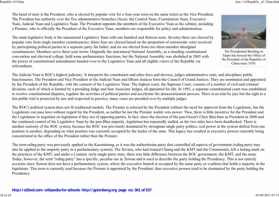
The Presidential Building inTaipei has housed the Office ofthe President of the Republic of
China since 1950.
The head of state is the President, who is elected by popular vote for a four-year term on the same ticket as the Vice-President.
The President has authority over the five administrative branches (Yuan): the Control Yuan, Examination Yuan, Executive
Yuan, Judicial Yuan and Legislative Yuan. The President appoints the members of the Executive Yuan as his cabinet, including
a Premier, who is officially the President of the Executive Yuan; members are responsible for policy and administration.
The main legislative body is the unicameral Legislative Yuan with one hundred and thirteen seats. Seventy-three are elected by
popular vote from single-member constituencies; thirty-four are elected based on the proportion of nationwide votes received
by participating political parties in a separate party list ballot; and six are elected from two three-member aboriginal
constituencies. Members serve three-year terms. Originally the unicameral National Assembly, as a standing constitutional
convention and electoral college, held some parliamentary functions, but the National Assembly was abolished in 2005 with
the power of constitutional amendments handed over to the Legislative Yuan and all eligible voters of the Republic via
referendums.
The Judicial Yuan is ROC's highest judiciary. It interprets the constitution and other laws and decrees, judges administrative suits, and disciplines public
functionaries. The President and Vice-President of the Judicial Yuan and fifteen Justices form the Council of Grand Justices. They are nominated and appointed
by the President of the Republic, with the consent of the Legislative Yuan. The highest court, the Supreme Court, consists of a number of civil and criminal
divisions, each of which is formed by a presiding Judge and four Associate Judges, all appointed for life. In 1993, a separate constitutional court was established
to resolve constitutional disputes, regulate the activities of political parties and accelerate the democratization process. There is no trial by jury but the right to a
fair public trial is protected by law and respected in practice; many cases are presided over by multiple judges.
The ROC's political system does not fit traditional models. The Premier is selected by the President without the need for approval from the Legislature, but the
Legislature can pass laws without regard for the President, as neither he nor the Premier wields veto power. Thus, there is little incentive for the President and
the Legislature to negotiate on legislation if they are of opposing parties. In fact, since the election of the pan-Green's Chen Shui-bian as President in 2000 and
the continued control of the Legislative Yuan by the pan-Blue majority, legislation has repeatedly stalled, as the two sides have been deadlocked. There is
another curiosity of the ROC system; because the ROC was previously dominated by strongman single party politics, real power in the system shifted from one
position to another, depending on what position was currently occupied by the leader of the state. This legacy has resulted in executive powers currently being
concentrated in the office of the President rather than the Premier.
The term ruling party was previously applied to the Kuomintang, as it was the authoritarian party that controlled all aspects of government (ruling party may
also be applied to the majority party in a parliamentary system). The Soviets, who had trained Chiang and the KMT and the Communists, left a lasting mark on
the practices of the KMT, and under a Leninist -style single-party state, there was little difference between the ROC government, the KMT, and the army.
Today, however, the term "ruling party" has a specific, peculiar use in Taiwan and is used to describe the party holding the Presidency. This is not entirely
accurate since Taiwan does not have a parliamentary system, where the executive branch is occupied by the same party or coalition that holds a majority in the
legislature. This term is currently used because the Premier is appointed by the President, thus executive powers tend to be dominated by the party holding the
Presidency.
Republic of China zim:///A/Republic_of_China.html
10 of 24 03/09/2011 07:31
http://cd3wd.com wikipedia-for-schools http://gutenberg.org page no: 361 of 537

Constitutional administrativedivision of the Republic of
China.
Administrative regions
According to the 1947 Constitution, written before the ROC government retreated to Taiwan, the highest level administrative division is the province, which
includes special administrative regions, regions, and centrally-administered municipalities. However, in 1998 the only provincial government to remain fully
functional under ROC jurisdiction, Taiwan Province, was streamlined, with most responsibility assumed by the central government and the county-level
governments (the other existing provincial government, Fuchien, was streamlined much earlier). The ROC currently administers two provinces and two
provincial level cities.
Counties
The Republic of China also controls the Pratas Islands (Dong-Sha) and Taiping Island, which are part of the disputed South China Sea Islands. They were placed
under Kaohsiung City after the retreat to Taiwan.
Taichung is currently under consideration for elevation to central municipality status. Also, Taipei County and Kaohsiung County are considering mergers with
their respective cities.
The ROC has not constitutionally renounced sovereignty over Mainland China and Outer Mongolia, but President Lee
Teng-hui announced in 1991 that his government does not dispute the fact that the Communist Party rules Mainland China. In
practice, although ROC law still formally recognizes residents of mainland China as citizens of the ROC, it makes a distinction
between persons who have household residency in the Free Area of the Republic of China and those that do not, meaning that
persons outside the area administered by the ROC must apply for special travel documents and cannot vote in ROC elections.
The DPP government under Chen Shui-bian has established a representative office in Mongolia's capital, Ulan Bator. Offices
established to create the appearance of domestic governance of those regions, such as the Mongolian and Tibetan Affairs
Commission, lie dormant.
Municipalities and cities
ROC official boundaries continue to show thirty-five provinces, fourteen municipalities, one special administrative region and
two regions, instead of the twenty-three provinces, four municipalities, two special administrative regions and five autonomous
regions shown on PRC maps. The former DPP government of Chen Shui-bian had dropped regulations which had required ROC map makers to depict the
constitutional boundaries.
Politics
1911–49
Republic of China zim:///A/Republic_of_China.html
11 of 24 03/09/2011 07:31
http://cd3wd.com wikipedia-for-schools http://gutenberg.org page no: 362 of 537
The original founding of the Republic centered on the Three Principles of the People (san min zhuyi): Nationalism, Democracy, and People's Livelihood (also
translated "Socialism"). "Nationalism" meant standing up to Japanese and European interference, "democracy" represented elected rule modeled after the Diet
of Japan, and the "people's livelihood" meant government regulation of the means of production. Another subordinate principle was the "republic of Five
Races" (五族共和), which emphasized the harmony of the five major ethnic groups in China ( Han, Manchus, Mongols, Tibetans, and Uyghurs), represented by
the colored stripes of the original Five-Colored Flag of the Republic. The Five Races Under One Union principle and the five-colored flag were abandoned in
1927.
The Three Principles were not realized. Republican China was riven by warlordism, foreign invasion, and civil war. There were elected legislators, but
Republican China was largely a one-party dictatorship, with some minor parties, such as the Chinese Youth Party, the National Socialist Party, and the Rural
Reconstruction Party. Within the KMT, there was suppression of dissent by the Communists. The central government was weak and unable to implement land
reform or wealth redistribution. Politics of this era consisted primarily of political and military struggle between the KMT and the CPC between periods of
military resistance against Japanese invasion.
1949–2005
The constitution of the Republic of China was drafted before the fall of Mainland China to the Communists. It was created for the purpose of forming a
coalition government between the Nationalists and the Communists for ruling all of China, including Taiwan. However, the CPC boycotted the National
Assembly, and the Taiwanese representatives were not elected. The constitution went into effect December 25, 1947.
Taiwan remained under martial law from 1948 until 1987 and much of the constitution was not in effect. Political reforms beginning in the late 1970s and
continuing through the early 1990s liberalized the ROC from an authoritarian one-party state into a multiparty democracy. Since the lifting of martial law, the
Republic of China has democratized and reformed, removing legacy components that were originally meant for the governing of mainland China. Many legacy
components that remain are nonfunctional. This process of amendment continues. In 2000, the KMT's monopoly on power ended after the Democratic
Progressive Party (DPP) won the ROC presidency. In May 2005, a new National Assembly was elected to reduce the number of parliamentary seats and
implement several constitutional reforms. These reforms have been passed; the National Assembly has essentially voted to abolish itself and transfer the power
of constitutional reform to the popular ballot.
Present
Major camps
The political scene in the ROC is divided into two camps, with the pro-unification and centre-right KMT, People First Party (PFP), and New Party forming the
Pan-Blue Coalition, and the pro-independence and centre-left Democratic Progressive Party (DPP) and centrist Taiwan Solidarity Union (TSU) forming the
Pan-Green Coalition.
Separate identity resolution
Republic of China zim:///A/Republic_of_China.html
12 of 24 03/09/2011 07:31
http://cd3wd.com wikipedia-for-schools http://gutenberg.org page no: 363 of 537
On September 30, 2007, the ruling Democratic Progressive Party approved a resolution asserting separate identity from China and called for the enactment of a
new constitution for a "normal country". It called also for general use of "Taiwan" as the island's name, without abolishing its formal name, the Republic of
China.
The Pan-Green camp tends to favour emphasizing the Republic of China as being a distinct country from the People's Republic of China. Many Pan-Green
supporters seek formally declaring Taiwan independence and to drop the title of the Republic of China. Many members of the coalition, such as current
President Chen Shui-bian, have moderated their views and explain that it is unnecessary to proclaim independence because "Taiwan is already an independent,
sovereign country" and the Republic of China is the same as Taiwan. A small minority claim that the ROC is nonexistent and call for the establishment of an
independent Republic of Taiwan. Supporters of this idea have issued self-made "passports" for their Republic of Taiwan. Attempts to use these "passports"
however have been currently stopped by officials at the Taiwan Taoyuan International Airport.
Some Pan-Blue members, especially former leaders from the older generation, support the concept of the Republic of China, which remains an important
symbol of their links with China. During his visit to mainland China in April 2005, former KMT Party Chairman Lien Chan reiterated his party's belief in the
"One China" policy, which states that there is only one China controlled by two governments and that Taiwan is a part of China. PFP Party Chair James Soong
expressed the same sentiments during his visit in May. The more mainstream Pan-Blue position is to lift investment restrictions and pursue negotiations with the
PRC to immediately open direct transportation links. Regarding independence, the mainstream Pan-Blue position is to maintain the status quo, while being open
to negotiations for unification.
Current political issues
The dominant political issue in the ROC is its relationship with the PRC. Some people in the ROC desire the opening of direct transportation links with the
People's Republic of China (PRC), including direct flights. This would aid many ROC businesses that have opened factories or branches in the PRC. The
current DPP administration fears that such links will lead to tighter economic and political integration with the PRC, and in the 2006 Lunar New Year Speech,
President Chen Shui-bian called for managed opening of links.
Other major political issues include the passage of an arms procurement bill that the United States authorized in 2001, and the establishment of a National
Communications Commission to take over from the Government Information Office, whose advertising budget exercised great control over ROC media.
The politicians and their parties have themselves become major political issues. Corruption among some DPP administration officials has been exposed. The
KMT was once the richest political party in the world and KMT assets continue to be an issue. In early 2006, President Chen Shui-bian was linked to possible
corruption. The political effect on President Chen Shui-bian was great, causing a divide in the DPP leadership and supporters alike. It eventually led to the
creation of a Pan-Red camp led by Ex-DPP leader Shih Ming-teh which believe the President should resign than stay in disgrace; forming a 3 side standoff.
Nearing the end of 2006, KMT's chairman Ma Ying-jeou was also hit by a corruption scandal, although he has since then been cleared of any wrong-doings by
the courts.
The merger of the KMT and PFP was thought to be certain, but a string of defections from the PFP to the KMT have increased tensions within the Pan-Blue
Republic of China zim:///A/Republic_of_China.html
13 of 24 03/09/2011 07:31
http://cd3wd.com wikipedia-for-schools http://gutenberg.org page no: 364 of 537

Generalissimo ChiangKai-shek, Franklin D.
Roosevelt, and WinstonChurchill met at the CairoConference in 1943 during
World War II.
camp. There has been talk from both camps of amending the constitution to finally resolve whether the Republic of China should have a presidential system or a
parliamentary system.
Foreign relations
1911–49
The foreign policy of Republican China was complicated by a lack of internal unity; competing centers of power all claimed
legitimacy. There was also foreign interference and invasion. Japan, the United Kingdom, France, Italy, Germany, Russia, and
other major powers all made claims to various parts of China during this time. During the early years of the Republic, almost all
foreign powers recognized the "warlord" government controlled by Yuan Shi-kai in Beijing as the legitimate government of
China. In return for recognition, the Republic had to give up control of Outer Mongolia and Tibet. China would remain
suzerain, but Russia would be allowed to influence Mongolia while the British would be allowed in Tibet. It was also this
government that sent representatives to sign the Treaty of Versailles over protests by students in the May Fourth Movement.
After the defeat of the Beiyang Government in Beijing by the Kuomintang (Nationalists) and the purging of Communists from
the party, the 1928 Nanjing Nationalist Government received widespread diplomatic recognition. This recognition lasted
throughout the Chinese Civil War and World War II (though Japan established a rival puppet government during the invasion
that received some recognition from the Axis Powers). Having fought on the side of the Allied Powers during World War II, the
Republic of China became one of the founding members of the UN and held one of the five permanent seats on the UN
Security Council.
Despite Chiang's failures as an administrator and military strategist, he is today recognized for several diplomatic successes. In the 1930s, he was able to
moderate Japanese advances by negotiating aid from Nazi Germany. Immediately prior to World War II, he was able to secure aid from his former patrons, the
Soviets. During World War II and immediately afterwards, he was able to obtain large amounts of support from the US, including lend-lease supplies. Huge
infusions of military assistance, equipment, advice, and cash continued even after he evacuated the KMT to Taiwan.
1949–present
After the KMT retreat to Taiwan, most countries, notably the countries in the Western Bloc, continued to maintain relations with the ROC. Due to
diplomatic pressure, recognition gradually eroded and many countries switched recognition to the PRC in the 1970s. There are now only 23 countries that
maintain official diplomatic relations with the ROC.
The PRC refuses to have diplomatic relations with any nation that recognizes the ROC, and requires all nations with which it has diplomatic relations to make a
statement recognizing its claims to Taiwan. In practice most major nations maintain unofficial relations with the ROC and the statement required by the PRC is
ambiguously worded. The ROC maintains unofficial relations via Taipei Economic and Cultural Representative Offices or "Taipei Representative Offices" that
Republic of China zim:///A/Republic_of_China.html
14 of 24 03/09/2011 07:31
http://cd3wd.com wikipedia-for-schools http://gutenberg.org page no: 365 of 537

take on most of the functions of an official embassy, such as issuing visas. Similarly, most nations maintain corresponding trade and economic offices in the
ROC, such as the American Institute in Taiwan, which is the de facto embassy of the United States in the ROC.
The ROC was a founding member of the United Nations and held China's seat on the Security Council until 1971, when it was expelled by General Assembly
Resolution 2758 and replaced in all UN organs with the PRC. Multiple attempts by the ROC to rejoin the UN have not made it past committee. (See China and
the United Nations.)
Besides the dispute with the PRC over the mainland, the ROC also has a controversial relationship with Mongolia. Until 1945, the ROC claimed jurisdiction
over Greater Mongolia, but under Soviet pressure, it recognized Mongolian independence. Shortly thereafter, it repudiated this recognition and continued to
claim jurisdiction over Mongolia until recently. Since the late 1990s, the relationship with Mongolia has become a controversial topic. Any move to renounce
sovereignty over Mongolia is controversial because the PRC claims that it is a prelude to Taiwan independence.
The ROC is required to use the name Chinese Taipei to participate in international events due to People's Republic of China's interpretation of the One-China
policy which many international organizations choose to follow. Among organizations that have this requirement are international sports federations, including
the International Olympic Committee.
Military
1911–49
Several armies were associated with this era, including those of the various warlords, the KMT, and the CPC. There were two armies regarded as the "National
army": the Beiyang Army of the Warlord government and later the National Revolutionary Army of the Nationalist Government.
The founding of the Republic was made possible by mutiny within the Qing New Army. When Yuan Shikai took over as president, he was already commander
of the Beiyang Army, which controlled North China. However, with Yuan's death in 1916, numerous factions within the Beiyang Army broke loose, and the
leading generals of the Beiyang Army became warlords, ruling huge fiefdoms in the following decade. Regulars in these warlord armies often did not wear
uniforms and the distinction between bandit and soldier was blurred.
With the help of the Comintern, Sun Yat-sen established the National Revolutionary Army in 1925 in Guangdong with a goal of reunifying China under the
Kuomintang. To this end, it initially fought against the warlords who had fractured China, successfully unifying China, and later against the Communist Red
Army. A minor Sino-Soviet conflict in 1929 was fought over the administration of the Manchurian Chinese Eastern Railway. The National Revolutionary Army
also fought against Japanese invasion during the Second Sino-Japanese War (1931 and 1937–45), which became a part of the larger World War II. Leadership of
the military during this time empowered political leadership. Following the principles of Leninism the distinctions among party, state, and army were blurred.
When the People's Liberation Army won the Chinese Civil War, much of the National Revolutionary Army retreated to Taiwan along with the government. It
was later reformed into the Republic of China Army. Units which surrendered and remained in China were either disbanded or incorporated into the PLA.
Republic of China zim:///A/Republic_of_China.html
15 of 24 03/09/2011 07:31
http://cd3wd.com wikipedia-for-schools http://gutenberg.org page no: 366 of 537

Present
Republic of China zim:///A/Republic_of_China.html
16 of 24 03/09/2011 07:31
http://cd3wd.com wikipedia-for-schools http://gutenberg.org page no: 367 of 537
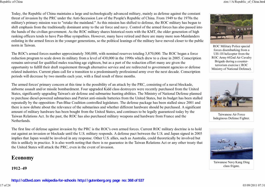
ROC Military Police specialforces disembarking from aUH-1H helicopter from the
ROC Army 602nd Air CavalryBrigade during a counter-terrorism exercise ( ROC
Ministry of National Defense).
Taiwanese Air ForceIndeginous Defense Fighter.
Taiwanese Navy Kang Dingclass frigate.
Today, the Republic of China maintains a large and technologically advanced military, mainly as defense against the constant
threat of invasion by the PRC under the Anti-Secession Law of the People's Republic of China. From 1949 to the 1970s the
military's primary mission was to "retake the mainland." As this mission has shifted to defense, the ROC military has begun to
shift emphasis from the traditionally dominant army to the air force and navy. Control of the armed forces has also passed into
the hands of the civilian government. As the ROC military shares historical roots with the KMT, the older generation of high
ranking officers tends to have Pan-Blue sympathies. However, many have retired and there are many more non-Mainlanders
enlisting in the armed forces in the younger generations, so the political leanings of the military have moved closer to the public
norm in Taiwan.
The ROC's armed forces number approximately 300,000, with nominal reserves totaling 3,870,000. The ROC began a force
reduction program to scale down its military from a level of 430,000 in the 1990s which drew to a close in 2005. Conscription
remains universal for qualified males reaching age eighteen, but as a part of the reduction effort many are given the
opportunity to fulfill their draft requirement through alternative service and are redirected to government agencies or defense
related industries. Current plans call for a transition to a predominantly professional army over the next decade. Conscription
periods will decrease by two months each year, with a final result of three months.
The armed forces' primary concern at this time is the possibility of an attack by the PRC, consisting of a naval blockade,
airborne assault and/or missile bombardment. Four upgraded Kidd class destroyers were recently purchased from the United
States, significantly upgrading Taiwan's air defense and submarine hunting abilities. The Ministry of National Defense planned
to purchase diesel-powered submarines and Patriot anti-missile batteries from the United States, but its budget has been stalled
repeatedly by the opposition- Pan-Blue Coalition controlled legislature. The defense package has been stalled since 2001 and
there is now debate about the relevance of the submarines and whether different hardware should be purchased. A significant
amount of military hardware has been bought from the United States, and continues to be legally guaranteed today by the
Taiwan Relations Act. In the past, the ROC has also purchased military weapons and hardware from France and the
Netherlands.
The first line of defense against invasion by the PRC is the ROC's own armed forces. Current ROC military doctrine is to hold
out against an invasion or blockade until the U.S. military responds. A defense pact between the U.S. and Japan signed in 2005
implies that Japan would be involved in any response. Other U.S. allies, such as Australia, could theoretically be involved but
this is unlikely in practice. It is also worth noting that there is no guarantee in the Taiwan Relations Act or any other treaty that
the United States will attack the PRC, even in the event of invasion.
Economy
1912–49
Republic of China zim:///A/Republic_of_China.html
17 of 24 03/09/2011 07:31
http://cd3wd.com wikipedia-for-schools http://gutenberg.org page no: 368 of 537

Bonds that Sun Yat-sen used toraise money for revolutionary
cause. (The Republic of China wasalso once known as the Chunghwa
Republic.)
During the first half of the twentieth century the economy of the Republic of China was essentially capitalist, with much
foreign interference. Progress was impeded by constant war and internal and external strife.
The weak national government made some attempts to promote economic activity, such as by establishing the Industrial
Bank of China. There was little government control of the economy however, other than causing runaway inflation by
overprinting money to finance wars against the Japanese and the Communists. Foreign debts also made the national
government susceptible to foreign influence. The Nationalists, like Yuan Shi-kai before them, were propped up through
massive economic loans by the United States.
China at the time was largely agrarian, with most of the land, and thus the wealth, concentrated in a wide pyramid structure.
Much of the land was owned by a few very wealthy landowners; the general population were tenant farmers who did not
own land. The founders of both the Republic of China and the Communist Party had aimed to overturn this inequality. The
Henan famine (1943–44) aided the collapse of the Republican government. Labor unions had been crushed in the purge of the Communists from the
Kuomintang, leading to more inequality. Many of the wealthiest landowners and business leaders were also ministers and officials of the state and were often
corrupt, preventing effective measures from being implemented.
Taiwan Miracle
Republic of China zim:///A/Republic_of_China.html
18 of 24 03/09/2011 07:31
http://cd3wd.com wikipedia-for-schools http://gutenberg.org page no: 369 of 537

Taipei 101 is a symbol of thesuccess of the Taiwanese
economy
Taiwan's quick industrialization and rapid growth during the latter half of the twentieth century, has been called the " Taiwan
Miracle" (台灣奇蹟) or "Taiwan Economic Miracle". As it has developed alongside Singapore, South Korea and Hong Kong,
the ROC is one of the industrialized developed countries known as the " Four Asian Tigers".
Japanese rule prior to and during World War II brought forth changes in the public and private sectors of the economy, most
notably in the area of public works, which enabled rapid communications and facilitated transport throughout much of the
island. The Japanese also improved public education and made the system compulsory for all ROC citizens during this time.
When the KMT government fled to Taiwan it brought the entire gold reserve and the foreign currency reserve of mainland
China to the island which stabilized prices and reduced hyperinflation. More importantly, as part of its retreat to Taiwan, KMT
brought with them the intellectual and business elites from the mainland. This unprecedented influx of monetary and human
capital laid the foundation for Taiwan's later dramatic economic development. The KMT government instituted many laws and
land reforms that it had never effectively enacted on mainland China. The government also implemented a policy of import-
substitution, attempting to produce imported goods domestically. Much of this was made possible through US economic aid,
subsidizing the higher cost of domestic production. Native Taiwanese were largely excluded from the mainlander-dominated
government.
In 1962, Taiwan had a per capita gross national product (GNP) of $170, placing the island's economy squarely between Zaire
and Congo. By 2005 Taiwan's per capita GNP, adjusted for purchasing power parity (PPP), had soared to $29,000 (2006 est.),
contributing to a Human Development Index equivalent to that of other developed countries.
According to economist Paul Krugman, the rapid growth was made possible by increases in capital and labor, but not an
increase in efficiency. In other words, the savings rate increased, and work hours were both lengthened and many more people,
such as women, entered the work force.
Dwight Perkins and others cite certain methodological flaws in Krugman's (and Alwyn Young's) research, and suggest that much of Taiwan's growth can be
attributed to increases in productivity. These productivity boosts were achieved through land reform, structural change (urbanization and industrialization), and
an economic policy of export promotion rather than import substitution.
Present
Today the Republic of China has a dynamic capitalist, export-driven economy with gradually decreasing state involvement in investment and foreign trade. In
keeping with this trend, some large government-owned banks and industrial firms are being privatized. Real growth in GDP has averaged about eight percent
during the past three decades. Exports have provided the primary impetus for industrialization. The trade surplus is substantial, and foreign reserves are the
world's third largest. The Republic of China's current GDP (PPP) per capita is equal to the average of EU Countries.
The Republic of China has its own currency, the New Taiwan dollar.
Republic of China zim:///A/Republic_of_China.html
19 of 24 03/09/2011 07:31
http://cd3wd.com wikipedia-for-schools http://gutenberg.org page no: 370 of 537
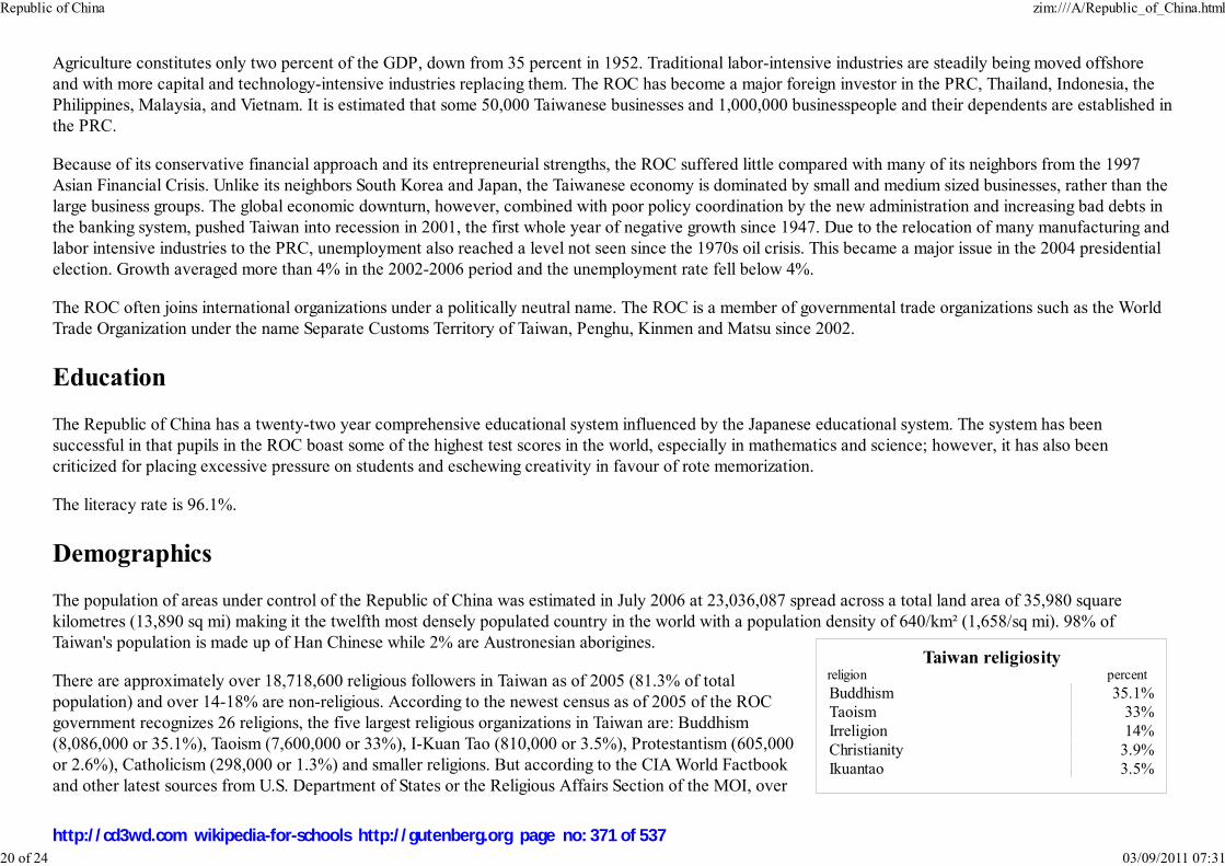
Taiwan religiosityreligion percent
Buddhism 35.1%
Taoism 33%
Irreligion 14%
Christianity 3.9%
Ikuantao 3.5%
Agriculture constitutes only two percent of the GDP, down from 35 percent in 1952. Traditional labor-intensive industries are steadily being moved offshore
and with more capital and technology-intensive industries replacing them. The ROC has become a major foreign investor in the PRC, Thailand, Indonesia, the
Philippines, Malaysia, and Vietnam. It is estimated that some 50,000 Taiwanese businesses and 1,000,000 businesspeople and their dependents are established in
the PRC.
Because of its conservative financial approach and its entrepreneurial strengths, the ROC suffered little compared with many of its neighbors from the 1997
Asian Financial Crisis. Unlike its neighbors South Korea and Japan, the Taiwanese economy is dominated by small and medium sized businesses, rather than the
large business groups. The global economic downturn, however, combined with poor policy coordination by the new administration and increasing bad debts in
the banking system, pushed Taiwan into recession in 2001, the first whole year of negative growth since 1947. Due to the relocation of many manufacturing and
labor intensive industries to the PRC, unemployment also reached a level not seen since the 1970s oil crisis. This became a major issue in the 2004 presidential
election. Growth averaged more than 4% in the 2002-2006 period and the unemployment rate fell below 4%.
The ROC often joins international organizations under a politically neutral name. The ROC is a member of governmental trade organizations such as the World
Trade Organization under the name Separate Customs Territory of Taiwan, Penghu, Kinmen and Matsu since 2002.
Education
The Republic of China has a twenty-two year comprehensive educational system influenced by the Japanese educational system. The system has been
successful in that pupils in the ROC boast some of the highest test scores in the world, especially in mathematics and science; however, it has also been
criticized for placing excessive pressure on students and eschewing creativity in favour of rote memorization.
The literacy rate is 96.1%.
Demographics
The population of areas under control of the Republic of China was estimated in July 2006 at 23,036,087 spread across a total land area of 35,980 square
kilometres (13,890 sq mi) making it the twelfth most densely populated country in the world with a population density of 640/km² (1,658/sq mi). 98% of
Taiwan's population is made up of Han Chinese while 2% are Austronesian aborigines.
There are approximately over 18,718,600 religious followers in Taiwan as of 2005 (81.3% of total
population) and over 14-18% are non-religious. According to the newest census as of 2005 of the ROC
government recognizes 26 religions, the five largest religious organizations in Taiwan are: Buddhism
(8,086,000 or 35.1%), Taoism (7,600,000 or 33%), I-Kuan Tao (810,000 or 3.5%), Protestantism (605,000
or 2.6%), Catholicism (298,000 or 1.3%) and smaller religions. But according to the CIA World Factbook
and other latest sources from U.S. Department of States or the Religious Affairs Section of the MOI, over
Republic of China zim:///A/Republic_of_China.html
20 of 24 03/09/2011 07:31
http://cd3wd.com wikipedia-for-schools http://gutenberg.org page no: 371 of 537
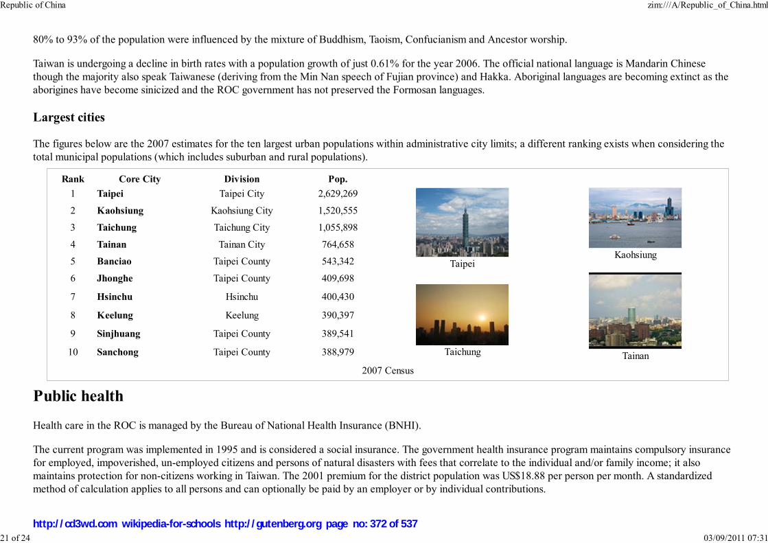
Rank Core City Division Pop.
1 Taipei Taipei City 2,629,269
TaipeiKaohsiung
2 Kaohsiung Kaohsiung City 1,520,555
3 Taichung Taichung City 1,055,898
4 Tainan Tainan City 764,658
5 Banciao Taipei County 543,342
6 Jhonghe Taipei County 409,698
Taichung Tainan
7 Hsinchu Hsinchu 400,430
8 Keelung Keelung 390,397
9 Sinjhuang Taipei County 389,541
10 Sanchong Taipei County 388,979
2007 Census
80% to 93% of the population were influenced by the mixture of Buddhism, Taoism, Confucianism and Ancestor worship.
Taiwan is undergoing a decline in birth rates with a population growth of just 0.61% for the year 2006. The official national language is Mandarin Chinese
though the majority also speak Taiwanese (deriving from the Min Nan speech of Fujian province) and Hakka. Aboriginal languages are becoming extinct as the
aborigines have become sinicized and the ROC government has not preserved the Formosan languages.
Largest cities
The figures below are the 2007 estimates for the ten largest urban populations within administrative city limits; a different ranking exists when considering the
total municipal populations (which includes suburban and rural populations).
Public health
Health care in the ROC is managed by the Bureau of National Health Insurance (BNHI).
The current program was implemented in 1995 and is considered a social insurance. The government health insurance program maintains compulsory insurance
for employed, impoverished, un-employed citizens and persons of natural disasters with fees that correlate to the individual and/or family income; it also
maintains protection for non-citizens working in Taiwan. The 2001 premium for the district population was US$18.88 per person per month. A standardized
method of calculation applies to all persons and can optionally be paid by an employer or by individual contributions.
Republic of China zim:///A/Republic_of_China.html
21 of 24 03/09/2011 07:31
http://cd3wd.com wikipedia-for-schools http://gutenberg.org page no: 372 of 537
BNHI insurance coverage requires co-payment at the time of service for most services unless it is a preventative health service, for low-income families,
veterans, children under three years old, or in the case of catastrophic diseases. Low income households maintain 100% premium coverage by the BNHI and
co-pays are reduced for disabled or certain elderly peoples.
According to a recently published survey, out of 3,360 patients surveyed at a randomly chosen hospital, 75.1% of the patients said they are "very satisfied" with
the hospital service; 20.5% said they are "okay" with the service. Only 4.4% of the patients said they are either "not satisfied" or "very not satisfied" with the
service or care provided.
Taiwan has its own Centre for Disease Control, and during the SARS outbreak occurring in March of 2003 confirmed 347 cases. During the outbreak the CDC
and local governments set up monitored stations throughout public transportation, recreational sites and other public areas. With full containment in July of
2003, there has not been a case of SARS reported since.
BNHI Facility Contract Distribution facilities total 17,259, including:
Number Subject
16,174 outpatient-only facilities
5,701 dental clinics
2,422 Chinese medicine clinics
1,085 inpatient/outpatient facilities
437 local community hospitals
35 Chinese medicine hospitals
23 academic medical centers
Basic coverage areas of the insurance include:
Inpatient care
Ambulatory careLaboratory tests
Prescription and over-the-counter
drugsDental services
Mental Illness
Traditional Chinese medicineHome care
Preventative services*
* child check-ups, prenatal care, pap smears, adult check-ups
Republic of China zim:///A/Republic_of_China.html
22 of 24 03/09/2011 07:31
http://cd3wd.com wikipedia-for-schools http://gutenberg.org page no: 373 of 537

In 2004 the infant mortality rate was 5.3 with 15 physicians and 63 hospital beds per 10,000 people. The life expectancy for males was 73.5 years and 79.7
years for females according the World Health Report. Since the inception of the BNHI in 1995 the aggregate life expectancy increase is 1.6 years for males and
2 years for females, possibly a key indicator for success in the BNHI program considering the relatively stable life expectancy rate prior to the initiative.
Other health related programs in Taiwan are the Centre for Disease Control and the Department of Health.
Calendar
Following the imperial tradition of using the sovereign's era name and year of reign, official ROC documents use the Republic (Chinese: 民國; pinyin: míngúo;
literally "The Country of the People") system of numbering years in which the first year (民國元年) was 1912, the year of the founding of the Republic of
China. For example, 2007 is the "96th year of the Republic" (民國九十六年, 民國96年, or simply 96). As Chinese era names are traditionally two characters
long, 民國 (Republic) is employed as an abbreviation of 中華民國 (Republic of China).
Months and days are numbered according to the Gregorian calendar. Based on Chinese National Standard CNS 7648: Data Elements and Interchange Formats
— Information Interchange — Representation of Dates and Times, (similar to ISO 8601), year numbering may use the A.D. system as well as the ROC era. For
example, May 3, 2004 may be written 2004-05-03 or R.O.C.93-05-03.
The ROC era numbering happens to be the same as the numbering used by North Korea because its founder, Kim Il-sung, was born in 1912. The years in
Japan's Taishō period (July 30, 1912 to December 25, 1926) are also coincident with the ROC era.
The use of the ROC era system extends beyond official documents. When used to mark expiration dates on products for export, they can be misunderstood as
having an expiration date 11 years earlier than intended. Misinterpretation is more likely in the cases when the prefix (R.O.C. or 民國) is omitted.
Traditional Chinese holidays such as the Chinese New Year, the Lantern Festival, and the Dragon Boat Festival are celebrated regularly.
International rankings
Context Organization Rank Year Source
GDP (PPP) International Monetary Fund / CIA19/179 (IMF)
18/227 (CIA)2007
IMF
CIA
GDP (PPP) per capita International Monetary Fund / CIA28/179 (IMF)40/227 (CIA)
2007IMFCIA
Republic of China zim:///A/Republic_of_China.html
23 of 24 03/09/2011 07:31
http://cd3wd.com wikipedia-for-schools http://gutenberg.org page no: 374 of 537

Worldwide press freedom index Reporters Without Borders 32/169 2007
Freedom of the Press Freedom House 20/194 2007
Index of Economic Freedom The Wall Street Journal and the Heritage Foundation 26/162 2007
Economic Freedom of the World Fraser Institute 24/130 2004
Ease of Doing Business Index World Bank 50/178 2008
Global Competitiveness Report World Economic Forum 13/125 2006–2007
Business Competitiveness Index World Economic Forum 21/121 2006
Worldwide quality-of-life index The Economist 21/111 2005
Global e-Government Study Brown University 2/198 2006
Richard Lynn and Tatu
Vanhanen IQ and Global Inequality
Dr. Richard Lynn, Professor Emeritus
of Psychology at the University of Ulster5/185 2006
World Competitiveness Yearbook International Institute for Management Development 13/55 2008
Network Readiness Index World Economic Forum 17/127 2007–2008
Corruption Perceptions Index Transparency International 34/180 2007
Travel and Tourism Competitiveness Index World Economic Forum 30/124 2007
IT industry competitiveness index Economist Intelligence Unit 6/64 2007
E-readiness rankings Economist Intelligence Unit 19/70 2008
Environmental Performance Index Yale University 40/149 2008
Bertelsmann Transformation Index (Status) Bertelsmann Foundation 4/125 2008
Bertelsmann Transformation Index (Managem.) Bertelsmann Foundation 7/125 2008
Retrieved from " http://en.wikipedia.org/wiki/Republic_of_China"
The Schools Wikipedia has a sponsor: SOS Children , and is a hand-chosen selection of article versions from the English Wikipedia edited only by deletion (see
www.wikipedia.org for details of authors and sources). The articles are available under the GNU Free Documentation License. See also
Republic of China zim:///A/Republic_of_China.html
24 of 24 03/09/2011 07:31
http://cd3wd.com wikipedia-for-schools http://gutenberg.org page no: 375 of 537

Российская Федерация
Rossiyskaya Federatsiya
Russian Federation
Flag Coat of arms
Anthem: Государственный гимн Российской
Федерации (Russian)
Gosudarstvenny gimn Rossiyskoy Federatsii (
transliteration)
National Anthem of the Russian Federation
Capital
(and largest city)
Moscow
Russia
2008/9 Schools Wikipedia Selection. Related subjects: Asia; Asian Countries; Europe; European Countries
SOS Children works in Russia. For more information see SOS Children in Russia
Russia (Russian: Россия, Rossiya), also the Russian Federation (Russian: Российская Федерация,
Rossiyskaya Federatsiya), is a transcontinental country extending over much of northern Eurasia. It is a
semi-presidential republic comprising 83 federal subjects. Russia shares land borders with the following
countries (counter-clockwise from northwest to southeast): Norway, Finland, Estonia, Latvia, Lithuania (
Kaliningrad Oblast), Poland (Kaliningrad Oblast), Belarus, Ukraine, Georgia, Azerbaijan, Kazakhstan,
China, Mongolia and North Korea. It is also close to the U.S. state of Alaska, Sweden, Denmark, Turkey
and Japan across relatively small stretches of water (the Bering Strait, the Baltic Sea, the Black Sea and
La Pérouse Strait, respectively).
At 17,075,400 square kilometers, Russia is by far the largest country in the world, covering more than an
eighth of the Earth’s land area; with 142 million people, it is the ninth largest by population. It extends
across the whole of northern Asia and 40% of Europe, spanning 11 time zones and incorporating a great
range of environments and landforms. Russia has the world's largest mineral and energy resources, and is
considered an energy superpower. It has the world's largest forest reserves and its lakes contain
approximately one-quarter of the world's unfrozen fresh water.
The nation's history began with that of the East Slavs. The Slavs emerged as a recognizable group in
Europe between the 3rd and 8th centuries AD. Founded and ruled by Vikings and their descendants, the
first East Slavic state, Kievan Rus', arose in the 9th century and adopted Christianity from the Byzantine
Empire in 988, beginning the synthesis of Byzantine and Slavic cultures that defined Russian culture for
the next millennium. Kievan Rus' ultimately disintegrated and the lands were divided into many small
feudal Russian states. The most powerful successor state to Kievan Rus' was Moscow, which served as
the main force in the Russian reunification process and independence struggle against the Golden Horde.
Moscow gradually reunified the surrounding Russian principalities and came to dominate the cultural and
political legacy of Kievan Rus'. By the 18th century, the nation had greatly expanded through conquest,
annexation and exploration to become the huge Russian Empire, stretching from Poland eastward to the
Pacific Ocean.
Russia zim:///A/Russia.html
1 of 18 03/09/2011 07:31
http://cd3wd.com wikipedia-for-schools http://gutenberg.org page no: 376 of 537

Official languages
Russian official throughout
nation; twenty-seven others
co-official in various regions
Demonym Russian
Government Federal semi-presidential
republic
- President Dmitry Medvedev
- Prime Minister Vladimir Putin
Founded (862)1 Novgorodians invited prince
Rurik to keep law and order,
thus giving birth to the Rurik
dynasty that ruled over all
Russian lands throughout more
than 700 years
Area
- Total 17,075,400 km² ( 1st)
6,592,800 sq mi
- Water (%) 13
Population
- 2008 estimate 142,008,838 ( 9th)
- 2002 census 145,166,731
- Density 8.3/km² ( 209th)
21.5/sq mi
GDP ( PPP) 2007 estimate
- Total $2.088 trillion ( 6th)
- Per capita $14,692 ( 52nd)
GDP (nominal) 2007 estimate
- Total $1.290 trillion ( 10th)
- Per capita $9,075 ( 54th)
Gini (2005) 40.5
Russia established worldwide power and influence from the times of the Russian Empire to being the
largest and leading constituent of the Soviet Union, the world's first and largest constitutionally socialist
state and a recognized superpower. The nation can boast a long tradition of excellence in every aspect of
the arts and sciences. The Russian Federation was founded following the dissolution of the Soviet Union
in 1991, but is recognized as the continuing legal personality of the Soviet Union. Russia is a permanent
member of the United Nations Security Council and a leading member of the Commonwealth of
Independent States and the G8. It is one of the five recognized nuclear weapons states and possesses the
world's largest stockpile of weapons of mass destruction.
Geography
The Russian Federation stretches across much of the north of the super-continent of Eurasia. Because of
its size, Russia displays both monotony and diversity. As with its topography, its climates, vegetation, and
soils span vast distances. From north to south the East European Plain is clad sequentially in tundra,
coniferous forest ( taiga), mixed and broad-leaf forests, grassland ( steppe), and semi-desert (fringing the
Caspian Sea) as the changes in vegetation reflect the changes in climate. Siberia supports a similar
sequence but is taiga. The country contains 23 World Heritage Sites and 40 UNESCO Biosphere reserves.
Topography
The two widest separated points in Russia are about 8,000 km (5,000 mi) apart along a geodesic line.
These points are: the boundary with Poland on a 60 km long (40-mi long) spit of land separating the Gulf
of Gdańsk from the Vistula Lagoon; and the farthest southeast of the Kuril Islands, a few miles off
Hokkaidō Island, Japan. The points which are furthest separated in longitude are 6,600 km (4,100 mi)
apart along a geodesic. These points are: in the West, the same spit; in the East, the Big Diomede Island
(Ostrov Ratmanova). The Russian Federation spans 11 time zones.
Russia zim:///A/Russia.html
2 of 18 03/09/2011 07:31
http://cd3wd.com wikipedia-for-schools http://gutenberg.org page no: 377 of 537

HDI (2005) ▲ 0.802 (high) ( 67th)
Currency Ruble ( RUB)
Time zone ( UTC+2 to +12)
- Summer ( DST) ( UTC+3 to +13)
Internet TLD .ru ( .su reserved), ( .рф2
proposed)
Calling code +7
The Russian Federation is the successor to earlier forms of
continuous statehood, starting from 9 century AD when Rurik, a
viking warrior, establishes "Russ" or "Rhos" state at Novgorod,
traditionally taken as the beginning of Russian statehood
The .рф Top-level domain has been proposed for the Russian
Federation as of 2008 and will only accept domains which use the
Cyrillic alphabet.
Central Russian Upland,Zaraysk
The plains of Western Siberia,Vasyugan River
Sochi, Krasnodar Krai
Russia has the world's largest forest reserves and is known as "the
lungs of Europe", second only to the Amazon Rainforest in the amount
of carbon dioxide it absorbs. It provides a huge amount of oxygen for
not just Europe, but the world. With access to three of the world's
oceans—the Atlantic, Arctic, and Pacific—Russian fishing fleets are a
major contributor to the world's fish supply. The Caspian is the source
of what is considered the finest caviar in the world.
1
2
Russia zim:///A/Russia.html
3 of 18 03/09/2011 07:31
http://cd3wd.com wikipedia-for-schools http://gutenberg.org page no: 378 of 537
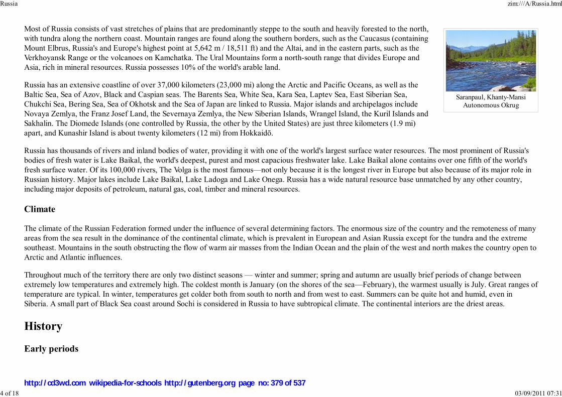
Saranpaul, Khanty-MansiAutonomous Okrug
Most of Russia consists of vast stretches of plains that are predominantly steppe to the south and heavily forested to the north,
with tundra along the northern coast. Mountain ranges are found along the southern borders, such as the Caucasus (containing
Mount Elbrus, Russia's and Europe's highest point at 5,642 m / 18,511 ft) and the Altai, and in the eastern parts, such as the
Verkhoyansk Range or the volcanoes on Kamchatka. The Ural Mountains form a north-south range that divides Europe and
Asia, rich in mineral resources. Russia possesses 10% of the world's arable land.
Russia has an extensive coastline of over 37,000 kilometers (23,000 mi) along the Arctic and Pacific Oceans, as well as the
Baltic Sea, Sea of Azov, Black and Caspian seas. The Barents Sea, White Sea, Kara Sea, Laptev Sea, East Siberian Sea,
Chukchi Sea, Bering Sea, Sea of Okhotsk and the Sea of Japan are linked to Russia. Major islands and archipelagos include
Novaya Zemlya, the Franz Josef Land, the Severnaya Zemlya, the New Siberian Islands, Wrangel Island, the Kuril Islands and
Sakhalin. The Diomede Islands (one controlled by Russia, the other by the United States) are just three kilometers (1.9 mi)
apart, and Kunashir Island is about twenty kilometers (12 mi) from Hokkaidō.
Russia has thousands of rivers and inland bodies of water, providing it with one of the world's largest surface water resources. The most prominent of Russia's
bodies of fresh water is Lake Baikal, the world's deepest, purest and most capacious freshwater lake. Lake Baikal alone contains over one fifth of the world's
fresh surface water. Of its 100,000 rivers, The Volga is the most famous—not only because it is the longest river in Europe but also because of its major role in
Russian history. Major lakes include Lake Baikal, Lake Ladoga and Lake Onega. Russia has a wide natural resource base unmatched by any other country,
including major deposits of petroleum, natural gas, coal, timber and mineral resources.
Climate
The climate of the Russian Federation formed under the influence of several determining factors. The enormous size of the country and the remoteness of many
areas from the sea result in the dominance of the continental climate, which is prevalent in European and Asian Russia except for the tundra and the extreme
southeast. Mountains in the south obstructing the flow of warm air masses from the Indian Ocean and the plain of the west and north makes the country open to
Arctic and Atlantic influences.
Throughout much of the territory there are only two distinct seasons — winter and summer; spring and autumn are usually brief periods of change between
extremely low temperatures and extremely high. The coldest month is January (on the shores of the sea—February), the warmest usually is July. Great ranges of
temperature are typical. In winter, temperatures get colder both from south to north and from west to east. Summers can be quite hot and humid, even in
Siberia. A small part of Black Sea coast around Sochi is considered in Russia to have subtropical climate. The continental interiors are the driest areas.
History
Early periods
Russia zim:///A/Russia.html
4 of 18 03/09/2011 07:31
http://cd3wd.com wikipedia-for-schools http://gutenberg.org page no: 379 of 537
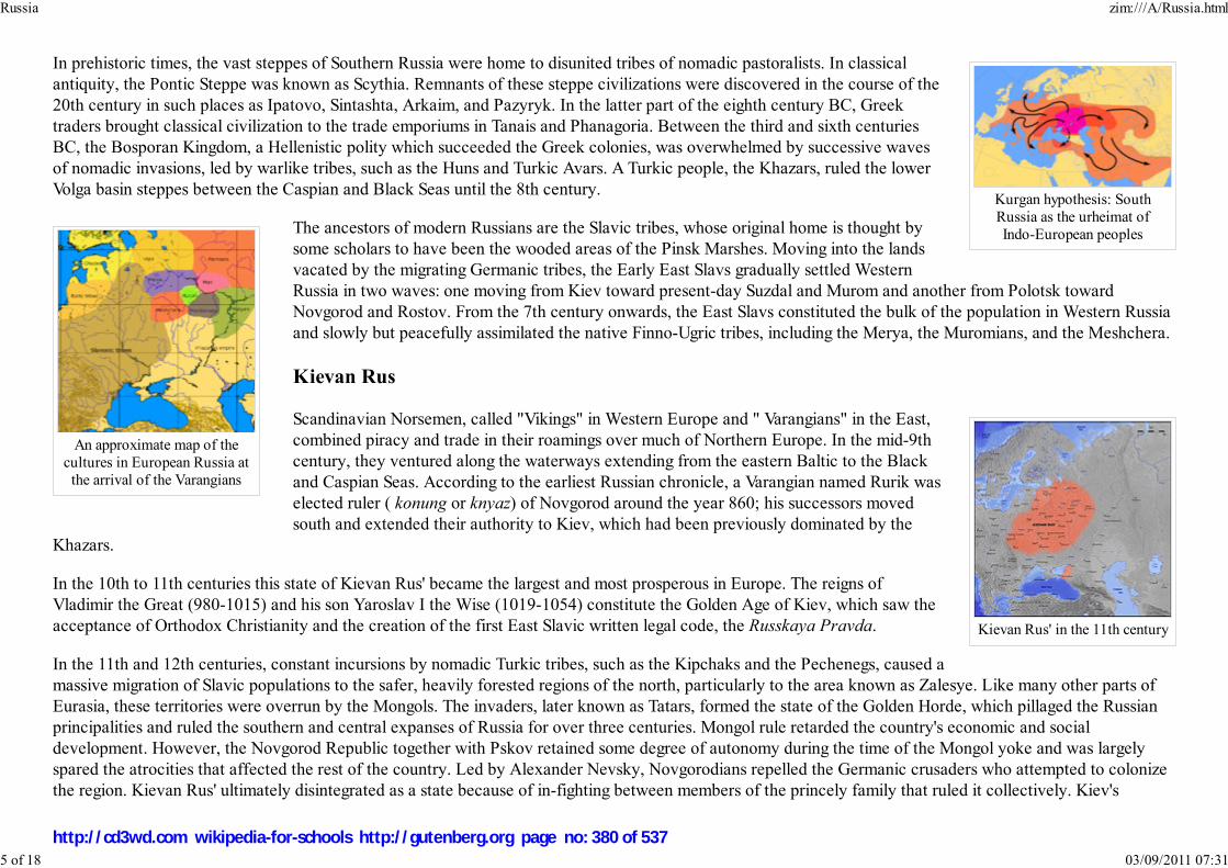
Kurgan hypothesis: SouthRussia as the urheimat ofIndo-European peoples
An approximate map of thecultures in European Russia at
the arrival of the Varangians
Kievan Rus' in the 11th century
In prehistoric times, the vast steppes of Southern Russia were home to disunited tribes of nomadic pastoralists. In classical
antiquity, the Pontic Steppe was known as Scythia. Remnants of these steppe civilizations were discovered in the course of the
20th century in such places as Ipatovo, Sintashta, Arkaim, and Pazyryk. In the latter part of the eighth century BC, Greek
traders brought classical civilization to the trade emporiums in Tanais and Phanagoria. Between the third and sixth centuries
BC, the Bosporan Kingdom, a Hellenistic polity which succeeded the Greek colonies, was overwhelmed by successive waves
of nomadic invasions, led by warlike tribes, such as the Huns and Turkic Avars. A Turkic people, the Khazars, ruled the lower
Volga basin steppes between the Caspian and Black Seas until the 8th century.
The ancestors of modern Russians are the Slavic tribes, whose original home is thought by
some scholars to have been the wooded areas of the Pinsk Marshes. Moving into the lands
vacated by the migrating Germanic tribes, the Early East Slavs gradually settled Western
Russia in two waves: one moving from Kiev toward present-day Suzdal and Murom and another from Polotsk toward
Novgorod and Rostov. From the 7th century onwards, the East Slavs constituted the bulk of the population in Western Russia
and slowly but peacefully assimilated the native Finno-Ugric tribes, including the Merya, the Muromians, and the Meshchera.
Kievan Rus
Scandinavian Norsemen, called "Vikings" in Western Europe and " Varangians" in the East,
combined piracy and trade in their roamings over much of Northern Europe. In the mid-9th
century, they ventured along the waterways extending from the eastern Baltic to the Black
and Caspian Seas. According to the earliest Russian chronicle, a Varangian named Rurik was
elected ruler ( konung or knyaz) of Novgorod around the year 860; his successors moved
south and extended their authority to Kiev, which had been previously dominated by the
Khazars.
In the 10th to 11th centuries this state of Kievan Rus' became the largest and most prosperous in Europe. The reigns of
Vladimir the Great (980-1015) and his son Yaroslav I the Wise (1019-1054) constitute the Golden Age of Kiev, which saw the
acceptance of Orthodox Christianity and the creation of the first East Slavic written legal code, the Russkaya Pravda.
In the 11th and 12th centuries, constant incursions by nomadic Turkic tribes, such as the Kipchaks and the Pechenegs, caused a
massive migration of Slavic populations to the safer, heavily forested regions of the north, particularly to the area known as Zalesye. Like many other parts of
Eurasia, these territories were overrun by the Mongols. The invaders, later known as Tatars, formed the state of the Golden Horde, which pillaged the Russian
principalities and ruled the southern and central expanses of Russia for over three centuries. Mongol rule retarded the country's economic and social
development. However, the Novgorod Republic together with Pskov retained some degree of autonomy during the time of the Mongol yoke and was largely
spared the atrocities that affected the rest of the country. Led by Alexander Nevsky, Novgorodians repelled the Germanic crusaders who attempted to colonize
the region. Kievan Rus' ultimately disintegrated as a state because of in-fighting between members of the princely family that ruled it collectively. Kiev's
Russia zim:///A/Russia.html
5 of 18 03/09/2011 07:31
http://cd3wd.com wikipedia-for-schools http://gutenberg.org page no: 380 of 537

The growth of Russia,1300—1796
A scene from medieval Russianhistory
dominance waned, to the benefit of Vladimir-Suzdal in the north-east, Novgorod in the north-west, and Galicia-Volhynia in the south-west. Conquest by the
Golden Horde in the 13th century was the final blow and resulted in the destruction of Kiev in 1240. Galicia-Volhynia was eventually absorbed into the Polish-
Lithuanian Commonwealth, while the Mongol-dominated Vladimir-Suzdal and the independent Novgorod Republic, two regions on the periphery of Kiev,
established the basis for the modern Russian nation.
Grand Duchy of Moscow and Tsardom of Russia
The most powerful successor state to Kievan Rus' was Grand Duchy of Moscow. It would
annex rivals such as Tver and Novgorod, and eventually become the basis of the modern
Russian state. After the fall of Constantinople in 1453, Moscow claimed succession to the
legacy of the Eastern Roman Empire. While still under the domain of the Mongol-Tatars and
with their connivance, the Duchy of Moscow (or "Muscovy") began to assert its influence in
Western Russia in the early 14th century. Assisted by the Russian Orthodox Church and
Saint Sergius of Radonezh's spiritual revival, Russia inflicted a defeat on the Mongol-Tatars
in the Battle of Kulikovo (1380). Ivan III (Ivan the Great) eventually threw off the control
of the invaders, consolidated surrounding areas under Moscow's dominion and was the first
to take the title "grand duke of all the Russias".
In 1547, Ivan IV (Ivan the Terrible) was officially crowned the first Tsar of Russia. During his long reign, Ivan IV annexed the
Tatar khanates ( Kazan, Astrakhan) along the Volga River and transformed Russia into a multiethnic and multiconfessional
state. Ivan IV promulgated a new code of laws ( Sudebnik of 1550), established the first Russian feudal representative body (
Zemsky Sobor) and introduced local self-management into the rural regions. But Ivan IV's rule was also marked by the long
and unsuccessful Livonian War against the coalition of Poland, Lithuania, and Sweden for access to the Baltic coast and sea
trade. The military losses, epidemics and poor harvests weakened the state, and the Crimean Tatars were able to burn down Moscow. The death of Ivan's sons,
combined with famine (1601–1603), led to the civil war and foreign intervention of the Time of Troubles in the early 1600s. By the mid-17th century there were
Russian settlements in Eastern Siberia, on the Chukchi Peninsula, along the Amur River, and on the Pacific coast. The Bering Strait between North America and
Asia was first sighted by a Russian explorer in 1648.
Imperial Russia
Russia zim:///A/Russia.html
6 of 18 03/09/2011 07:31
http://cd3wd.com wikipedia-for-schools http://gutenberg.org page no: 381 of 537

Peter the Greatofficially proclaimed theexistence of the Russian
Empire in 1721
Napoleon's retreat fromMoscow
The Russian Empire in 1866and its spheres of influence
Under the Romanov dynasty and Peter I (Peter the Great), the Russian Empire became a world power. Ruling from 1682 to 1725,
Peter defeated Sweden in the Great Northern War, forcing it to cede West Karelia and Ingria (two regions lost by Russia in the Time
of Troubles), Estland, and Livland, securing Russia's access to the sea and sea trade. It was in Ingria that Peter founded a new
capital, Saint Petersburg. Peter's reforms brought considerable Western European cultural influences to Russia. Catherine II
(Catherine the Great), who ruled from 1762 to 1796, continued the efforts to establish Russia as one of the Great Powers of
Europe. In alliance with Prussia and Austria, Russia stood against Napoleon's France and eliminated its rival Poland-Lithuania in a
series of partitions, gaining large areas of territory in the west. As a result of its victories in the Russo-Turkish War, by the early 19th
century Russia had made significant territorial gains in Transcaucasia. Napoleon's invasion failed miserably as obstinate Russian
resistance combined with the bitterly cold Russian winter dealt him a disastrous defeat, in which more than 95% of his invading
force perished. The officers in the Napoleonic Wars brought ideas of liberalism back to Russia with them and even attempted to
curtail the tsar's powers during the abortive Decembrist revolt of 1825, which was followed by several decades of political
repression.
The prevalence of serfdom and the conservative policies of Nicolas I impeded the development of
Russia in the mid-nineteenth century. Nicholas's successor Alexander II (1855–1881) enacted
significant reforms, including the abolition of serfdom in 1861; these "Great Reforms" spurred
industrialization. However, many socio-economic conflicts were aggravated during Alexander III’s reign and under his son,
Nicholas II. Harsh conditions in factories created mass support for the revolutionary socialist movement. In January 1905,
striking workers peaceably demonstrated for reforms in Saint Petersburg but were fired upon by troops, killing and wounding
hundreds. The abject failure of the Tsar's military forces in the initially-popular Russo-Japanese War, and the event known as "
Bloody Sunday", ignited the Russian Revolution of 1905. Although the uprising was swiftly put down by the army and
although Nicholas II retained much of his power, he was forced to concede major reforms, including granting the freedoms of
speech and assembly, the legalization of political parties and the creation of an elected legislative assembly, the Duma;
however, the hopes for basic improvements in the lives of industrial workers were unfulfilled.
Russia entered World War I in aid of its ally Serbia and fought a war across three fronts while isolated from its allies. Russia did
not want war but felt that the only alternative was German domination of Europe. Although the army was far from defeated in
1916, the already-existing public distrust of the regime was deepened by the rising costs of war, casualties (Russia suffered the
highest number of both military and civilian deaths of the Entente Powers), and tales of corruption and even treason in high
places, leading to the outbreak of the Russian Revolution of 1917. A series of uprisings were organized by workers and
peasants throughout the country, as well as by soldiers in the Russian army, who were mainly of peasant origin. Many of the
uprisings were organized and led by democratically-elected councils called Soviets. The February Revolution overthrew the
Russian monarchy, which was replaced by a shaky coalition of political parties that declared itself the Provisional Government.
The abdication marked the end of imperial rule in Russia, and Nicholas and his family were imprisoned and later executed during the Civil War. While initially
receiving the support of the Soviets, the Provisional Government proved unable to resolve many problems which had led to the February Revolution. The
second revolution, the October Revolution, led by Vladimir Lenin, overthrew the Provisional Government and created the world’s first Communist state.
Russia zim:///A/Russia.html
7 of 18 03/09/2011 07:31
http://cd3wd.com wikipedia-for-schools http://gutenberg.org page no: 382 of 537

Vladimir Lenin
Stalingrad, 1942. The vastmajority of the fighting in
World War II took place on theEastern Front. Nazi Germanysuffered 80% to 93% of all
casualties there
First human in space,Yuri Gagarin
Soviet Russia
Following the October Revolution, a civil war broke out between the new regime and the Socialist Revolutionaries, Mensheviks,
and the White movement. The Treaty of Brest-Litovsk concluded hostilities with the Central Powers in World War I. Russia lost its
Ukrainian, Polish and Baltic territories, and Finland by signing the treaty. The Allied powers launched a military intervention in
support of anti-Communist forces and both the Bolsheviks and White movement carried out campaigns of deportations and
executions against each other, known respectively as the Red Terror and White Terror. By the end of the Civil War, some 20 million
had died and the Russian economy and infrastructure were completely devastated. Following victory in the Civil War, the Russian
SFSR together with three other Soviet republics formed the Soviet Union on December 30, 1922. The Russian Soviet Federative
Socialist Republic dominated the Soviet Union for its entire 74-year history; the USSR was often referred to as "Russia" and its
people as "Russians." The largest of the republics, Russia contributed over half the population of the Soviet Union. The Bolsheviks
introduced free universal health care, education and social-security benefits, as well as the right to work and housing. Women's
rights were greatly increased through new laws aimed to wipe away centuries-old inequalities. Notably, Russia became the first
country in the world with full freedom of divorce and legalized abortion. After Lenin's death in 1924 Joseph Stalin consolidated
power and became dictator. Stalin launched a command economy, rapid industrialization of the largely rural country and
collectivization of its agriculture and the Soviet Union was transformed from an agrarian economy to a major industrial powerhouse
in a short span of time.
On June 22, 1941, Nazi Germany invaded the Soviet Union with the largest and most powerful
invasion force in human history, opening the largest theatre of the Second World War. Although
the German army had considerable success early on, they suffered defeats after reaching the
outskirts of Moscow and were dealt their first major defeat at the Battle of Stalingrad in the winter
of 1942–1943. Soviet forces drove through Eastern Europe in 1944–45 and captured Berlin in
May, 1945. In the conflict, Soviet military and civilian death toll were 10.6 million and 15.9 million
respectively, accounting for half of all World War II casualties. The Soviet economy and
infrastructure suffered massive devastation but the Soviet Union emerged as an acknowledged
superpower. The Red Army occupied Eastern Europe after the war, including the eastern half of
Germany; Stalin installed communist governments in these satellite states. Becoming the world's
second nuclear weapons power, the USSR established the Warsaw Pact alliance and entered into a
struggle for global dominance with the United States, which became known as the Cold War.
Under Stalin's successor Nikita Khrushchev, the Soviet Union launched the world's first artificial
satellite, Sputnik 1 and the Russian cosmonaut Yuri Gagarin became the first human being to orbit the Earth aboard the first
manned spacecraft, Vostok 1. Tensions with the United States heightened when the two rivals clashed over the deployment of the U.S. Jupiter missiles in Turkey
and Soviet missiles in Cuba. Following the ousting of Khrushchev, another period of rule by collective leadership ensued until Leonid Brezhnev established
himself in the early 1970s as the pre-eminent figure in Soviet politics. Brezhnev's rule oversaw economic stagnation and the Soviet invasion of Afghanistan,
Russia zim:///A/Russia.html
8 of 18 03/09/2011 07:31
http://cd3wd.com wikipedia-for-schools http://gutenberg.org page no: 383 of 537
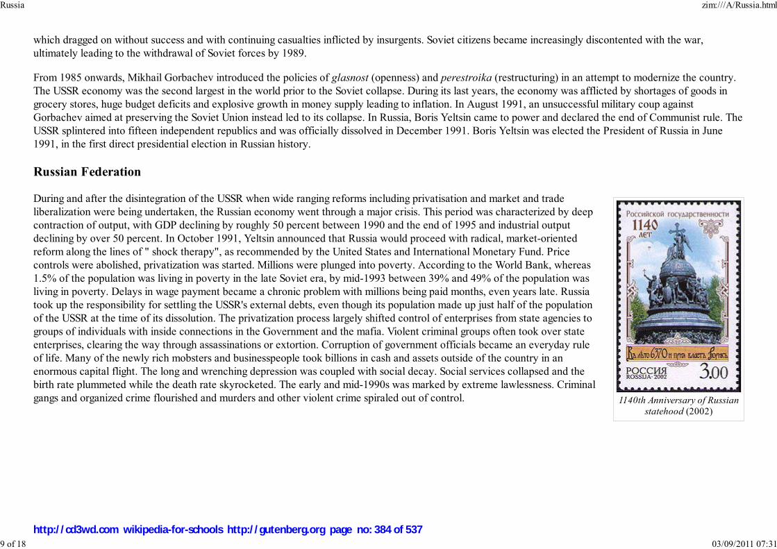
1140th Anniversary of Russian
statehood (2002)
which dragged on without success and with continuing casualties inflicted by insurgents. Soviet citizens became increasingly discontented with the war,
ultimately leading to the withdrawal of Soviet forces by 1989.
From 1985 onwards, Mikhail Gorbachev introduced the policies of glasnost (openness) and perestroika (restructuring) in an attempt to modernize the country.
The USSR economy was the second largest in the world prior to the Soviet collapse. During its last years, the economy was afflicted by shortages of goods in
grocery stores, huge budget deficits and explosive growth in money supply leading to inflation. In August 1991, an unsuccessful military coup against
Gorbachev aimed at preserving the Soviet Union instead led to its collapse. In Russia, Boris Yeltsin came to power and declared the end of Communist rule. The
USSR splintered into fifteen independent republics and was officially dissolved in December 1991. Boris Yeltsin was elected the President of Russia in June
1991, in the first direct presidential election in Russian history.
Russian Federation
During and after the disintegration of the USSR when wide ranging reforms including privatisation and market and trade
liberalization were being undertaken, the Russian economy went through a major crisis. This period was characterized by deep
contraction of output, with GDP declining by roughly 50 percent between 1990 and the end of 1995 and industrial output
declining by over 50 percent. In October 1991, Yeltsin announced that Russia would proceed with radical, market-oriented
reform along the lines of " shock therapy", as recommended by the United States and International Monetary Fund. Price
controls were abolished, privatization was started. Millions were plunged into poverty. According to the World Bank, whereas
1.5% of the population was living in poverty in the late Soviet era, by mid-1993 between 39% and 49% of the population was
living in poverty. Delays in wage payment became a chronic problem with millions being paid months, even years late. Russia
took up the responsibility for settling the USSR's external debts, even though its population made up just half of the population
of the USSR at the time of its dissolution. The privatization process largely shifted control of enterprises from state agencies to
groups of individuals with inside connections in the Government and the mafia. Violent criminal groups often took over state
enterprises, clearing the way through assassinations or extortion. Corruption of government officials became an everyday rule
of life. Many of the newly rich mobsters and businesspeople took billions in cash and assets outside of the country in an
enormous capital flight. The long and wrenching depression was coupled with social decay. Social services collapsed and the
birth rate plummeted while the death rate skyrocketed. The early and mid-1990s was marked by extreme lawlessness. Criminal
gangs and organized crime flourished and murders and other violent crime spiraled out of control.
Russia zim:///A/Russia.html
9 of 18 03/09/2011 07:31
http://cd3wd.com wikipedia-for-schools http://gutenberg.org page no: 384 of 537
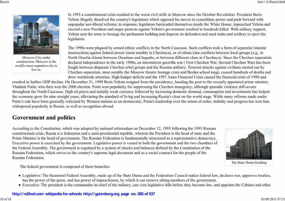
Moscow-City underconstruction. Moscow is the
world's most expensive city tolive in.
The State Duma building
In 1993 a constitutional crisis resulted in the worst civil strife in Moscow since the October Revolution. President Boris
Yeltsin illegally dissolved the country's legislature which opposed his moves to consolidate power and push forward with
unpopular neo-liberal reforms; in response, legislators barricaded themselves inside the White House, impeached Yeltsin and
elected a new President and major protests against Yeltsin's government resulted in hundreds killed. With military support,
Yeltsin sent the army to besiege the parliament building and disperse its defenders and used tanks and artillery to eject the
legislators.
The 1990s were plagued by armed ethnic conflicts in the North Caucasus. Such conflicts took a form of separatist Islamist
insurrections against federal power (most notably in Chechnya), or of ethnic/clan conflicts between local groups (e.g., in
North Ossetia-Alania between Ossetians and Ingushs, or between different clans in Chechnya). Since the Chechen separatists
declared independence in the early 1990s, an intermittent guerrilla war ( First Chechen War, Second Chechen War) has been
fought between disparate Chechen rebel groups and the Russian military. Terrorist attacks against civilians carried out by
Chechen separatists, most notably the Moscow theatre hostage crisis and Beslan school siege, caused hundreds of deaths and
drew worldwide attention. High budget deficits and the 1997 Asian Financial Crisis caused the financial crisis of 1998 and
resulted in further GDP decline. On December 31, 1999 Boris Yeltsin resigned from the presidency, handing the post to the recently appointed prime minister,
Vladimir Putin, who then won the 2000 election. Putin won popularity for suppressing the Chechen insurgency, although sporadic violence still occurs
throughout the North Caucasus. High oil prices and initially weak currency followed by increasing domestic demand, consumption and investments has helped
the economy grow for nine straight years, alleviating the standard of living and increasing Russia's clout on the world stage. While many reforms made under
Putin’s rule have been generally criticized by Western nations as un-democratic, Putin's leadership over the return of order, stability and progress has won him
widespread popularity in Russia, as well as recognition abroad.
Government and politics
According to the Constitution, which was adopted by national referendum on December 12, 1993 following the 1993 Russian
constitutional crisis, Russia is a federation and a semi-presidential republic, wherein the President is the head of state and the
Prime Minister is the head of government. The Russian Federation is fundamentally structured as a representative democracy.
Executive power is exercised by the government. Legislative power is vested in both the government and the two chambers of
the Federal Assembly. The government is regulated by a system of checks and balances defined by the Constitution of the
Russian Federation, which serves as the country's supreme legal document and as a social contract for the people of the
Russian Federation.
The federal government is composed of three branches:
Legislative: The bicameral Federal Assembly, made up of the State Duma and the Federation Council makes federal law, declares war, approves treaties,has the power of the purse, and has power of impeachment, by which it can remove sitting members of the government.
Executive: The president is the commander-in-chief of the military, can veto legislative bills before they become law, and appoints the Cabinet and other
Russia zim:///A/Russia.html
10 of 18 03/09/2011 07:31
http://cd3wd.com wikipedia-for-schools http://gutenberg.org page no: 385 of 537

officers, who administer and enforce federal laws and policies.Judiciary: The Constitutional Court, Supreme Court, Supreme Court of Arbitration and lower federal courts, whose judges are appointed by the
Federation Council on the recommendation of the president, interpret laws and can overturn laws they deem unconstitutional.
According to the Constitution of Russia, constitutional justice in the court is based on the equality of all citizens, judges are independent and subject only to the
law, trials are to be open and the accused is guaranteed a defense. Since 1996, Russia has instituted a moratorium on the death penalty in Russia, although
capital punishment has not been abolished by law.
The president is elected by popular vote for a four-year term (eligible for a second term but constitutionally barred for a third consecutive term); election last
held 2 March 2008. Ministries of the government are composed of the premier and his deputies, ministers, and selected other individuals; all are appointed by
the president. The national legislature is the Federal Assembly, which consists of two chambers; the 450-member State Duma and the 176-member Federation
Council. Leading political parties in Russia include United Russia, the Communist Party, the Liberal Democratic Party of Russia and Fair Russia.
Subdivisions
Federal subjects
The Russian Federation comprises 83 federal subjects. These subjects have equal representation—two delegates each—in the Federation Council. However,
they differ in the degree of autonomy they enjoy.
46 oblasts (provinces): most common type of federal subjects, with federally appointed governor and locally elected legislature.
21 republics: nominally autonomous; each has its own constitution, president, and parliament. Republics are allowed to establish their own official
language alongside Russian but are represented by the federal government in international affairs. Republics are meant to be home to specific ethnicminorities.
Nine krais (territories): essentially the same as oblasts. The "territory" designation is historic, originally given to frontier regions and later also to
administrative divisions that comprised autonomous okrugs or autonomous oblasts.Four autonomous okrugs (autonomous districts): originally autonomous entities within oblasts and krais created for ethnic minorities, their status was
elevated to that of federal subjects in the 1990s. With the exception of Chukotka Autonomous Okrug, all autonomous okrugs are still administratively
subordinated to a krai or an oblast of which they are a part.One autonomous oblast (the Jewish Autonomous Oblast): originally autonomous oblasts were administrative units subordinated to krais. In 1990, all of
them except the Jewish AO were elevated in status to that of a republic.
Two federal cities (Moscow and St. Petersburg): major cities that function as separate regions.
Federal districts and economic regions
Federal subjects are grouped into seven federal districts, each administered by an envoy appointed by the President of Russia. Unlike the federal subjects, the
federal districts are not a subnational level of government, but are a level of administration of the federal government. Federal districts' envoys serve as liaisons
Russia zim:///A/Russia.html
11 of 18 03/09/2011 07:31
http://cd3wd.com wikipedia-for-schools http://gutenberg.org page no: 386 of 537

between the federal subjects and the federal government and are primarily responsible for overseeing the compliance of the federal subjects with the federal
laws.
Map of the federal subjects of the Russian Federation
Foreign relations and military
The Russian Federation is recognized in international law as continuing the legal personality of the former Soviet Union. Russia continues to implement the
international commitments of the USSR, and has assumed the USSR's permanent seat on the UN Security Council, membership in other international
organizations, the rights and obligations under international treaties and property and debts. Russia has a multifaceted foreign policy. It maintains diplomatic
relations with 178 countries and has 140 embassies. Russia's foreign policy is determined by the President and implemented by the Ministry of Foreign Affairs.
As one of five permanent members of the UN Security Council, Russia plays a major role in maintaining international peace and security, and plays a major role
in resolving international conflicts by participating in the Quartet on the Middle East, the Six-party talks with North Korea, promoting the resolution of the
Kosovo conflict and resolving nuclear proliferation issues. Russia is a member of the Group of Eight (G8) industrialized nations, the Council of Europe, OSCE
and APEC. Russia usually takes a leading role in regional organizations such as the CIS, EurAsEC, CSTO, and the SCO. Former President Vladimir Putin had
Russia zim:///A/Russia.html
12 of 18 03/09/2011 07:31
http://cd3wd.com wikipedia-for-schools http://gutenberg.org page no: 387 of 537

Russian paratroopers at anexercise in Kazakhstan
Regional product per capita asof 2006 (darker is higher)
advocated a strategic partnership with close integration in various dimensions including establishment of four common spaces between Russia and the EU. Since
the collapse of the Soviet Union, Russia has developed a friendlier, albeit volatile relationship with NATO. The NATO-Russia Council was established in 2002 to
allow the 26 Allies and Russia to work together as equal partners to pursue opportunities for joint collaboration.
Russia assumed control of Soviet assets abroad and most of the Soviet Union's production facilities and defense industries are
located in the country. The Russian military is divided into the Ground Forces, Navy, and Air Force. There are also three
independent arms of service: Strategic Rocket Forces, Military Space Forces, and the Airborne Troops. In 2006, the military
had 1.037 million personnel on active duty. Russia has the largest stockpile of nuclear weapons in the world. It has the second
largest fleet of ballistic missile submarines and is the only country apart from the U.S. with a modern strategic bomber force.
The country has a large and fully indigenous arms industry, producing all of its own military equipment. Russia is the world's
top supplier of weapons, a spot it has held since 2001, accounting for around 30% of worldwide weapons sales and exporting
weapons to about 80 countries. Following the Soviet practice, it is mandatory for all male citizens aged 18–27 to be drafted
for two years' Armed Forces service, though various problems associated with this is why the armed forces are from 2008
reducing the conscription term from 18 months to 12, and plan to increase contract servicemen to compose 70% of the armed
forces by 2010. Defense expenditure has quadrupled over the past six years. Official government military spending for 2008
is $40 billion, though various sources, including US intelligence, and the International Institute for Strategic Studies, have estimated Russia’s military
expenditures to be considerably higher. Currently, the military is undergoing a major equipment upgrade with about $200 billion on procurement of military
equipment between 2006 and 2015.
Economy
Since the turn of the century, rising oil prices, increased foreign investment, higher domestic consumption and greater political
stability have bolstered economic growth in Russia. The country ended 2007 with its ninth straight year of growth, averaging
7% annually since the financial crisis of 1998. In 2007, Russia's GDP was $2.076 trillion (est. PPP), the 7th largest in the
world, with GDP growing 8.1% from the previous year. Growth was primarily driven by non-traded services and goods for the
domestic market, as opposed to oil or mineral extraction and exports. The average salary in Russia was $640 per month in early
2008, up from $80 in 2000. Approximately 14% of Russians lived below the national poverty line in 2007, significantly down
from 40% in 1998 at the worst of the post-Soviet collapse. Unemployment in Russia was at 6% in 2007, down from about
12.4% in 1999.
Russia zim:///A/Russia.html
13 of 18 03/09/2011 07:31
http://cd3wd.com wikipedia-for-schools http://gutenberg.org page no: 388 of 537

A Rosneft petrol station. Russiais the world's leading naturalgas exporter and the second
leading oil exporter.
Soyuz TMA-2 moves to launchpad, about to carry the first
resident crew to theInternational Space Station
Ethnic composition (2002)
Russia has the world's largest natural gas reserves, the second largest coal reserves and the
eighth largest oil reserves. It is the world's leading natural gas exporter and the second
leading oil exporter. Oil, natural gas, metals, and timber account for more than 80% of
Russian exports abroad. Since 2003, however, exports of natural resources started
decreasing in economic importance as the internal market strengthened considerably.
Despite higher energy prices, oil and gas only contribute to 5.7% of Russia's GDP and the
government predicts this will drop to 3.7% by 2011. Russia is also considered well ahead of
most other resource-rich countries in its economic development, with a long tradition of
education, science, and industry. The country has more higher education graduates than any
other country in Europe.
A simpler, more streamlined tax code adopted in 2001 reduced the tax burden on people,
and dramatically increased state revenue. Russia has a flat personal income tax rate of 13 percent. This ranks it as the country
with the second most attractive personal tax system for single managers in the world after the United Arab Emirates, according to a 2007 survey by investment
services firm Mercer Human Resource Consulting. The federal budget has run surpluses since 2001 and ended 2007 with a surplus of 6% of GDP. Over the past
several years, Russia has used oil revenues from its Stabilization Fund of the Russian Federation to prepay all Soviet-era sovereign debt to Paris Club creditors
and the IMF. Oil export earnings have allowed Russia to increase its foreign reserves from $12 billion in 1999 to some $470 billion at the end of 2007, the third
largest reserves in the world. The country has also been able to substantially reduce its formerly massive foreign debt.
The economic development of the country though has been uneven geographically with the Moscow region contributing a disproportionately high amount of the
country's GDP. Much of Russia, especially indigenous and rural communities in Siberia, lags significantly behind. Nevertheless, the middle class has grown from
just 8 million persons in 2000 to 55 million persons in 2006. Russia is home to the largest number of billionaires in the world after the United States, gaining 50
billionaires in 2007 for a total of 110.
Over the last five years, fixed capital investments have averaged real gains greater than 10% per year and personal incomes have achieved real gains more than
12% per year. During this time, poverty has declined steadily and the middle class has continued to expand. Russia has also improved its international financial
position since the 1998 financial crisis. A principal factor in Russia's growth has been the combination of strong growth in productivity, real wages, and
consumption. Despite the country's strong economic performance since 1999, however, the World Bank lists several challenges facing the Russian economy
including diversifying the economy, encouraging the growth of small and medium enterprises, building human capital and improving corporate governance.
Inflation grew to about 12% by the end of 2007, up from 9% in 2006. The upward trend continued in the first quarter of 2008, driven largely by rising food
costs.
Demographics
Russia zim:///A/Russia.html
14 of 18 03/09/2011 07:31
http://cd3wd.com wikipedia-for-schools http://gutenberg.org page no: 389 of 537
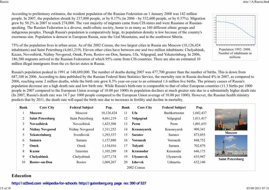
Population 1992–2008.Number of inhabitants in
millions
Rank Core City Federal Subject Pop. Rank Core City Federal Subject Pop.
Moscow
Saint Petersburg
1 Moscow Moscow 10,126,424 11 Ufa Bashkortostan 1,042,437
2 Saint Petersburg Saint Petersburg 4,661,219 12 Volgograd Volgograd 1,011,417
3 Novosibirsk Novosibirsk 1,425,508 13 Perm Perm 1,001,653
4 Nizhny Novgorod Nizhny Novgorod 1,311,252 14 Krasnoyarsk Krasnoyarsk 909,341
5 Yekaterinburg Sverdlovsk 1,293,537 15 Saratov Saratov 873,055
6 Samara Samara 1,157,880 16 Voronezh Voronezh 848,752
7 Omsk Omsk 1,134,016 17 Tolyatti Samara 702,879
8 Kazan Tatarstan 1,105,289 18 Krasnodar Krasnodar 646,175
9 Chelyabinsk Chelyabinsk 1,077,174 19 Ulyanovsk Ulyanovsk 635,947
10 Rostov-on-Don Rostov 1,068,267 20 Izhevsk Udmurtia 632,140
2002 Census
According to preliminary estimates, the resident population of the Russian Federation on 1 January 2008 was 142 million
people. In 2007, the population shrank by 237,800 people, or by 0.17% (in 2006 - by 532,600 people, or by 0.37%). Migration
grew by 50.2% in 2007 to reach 274,000. The vast majority of migrants came from CIS states and were Russians or Russian-
speaking. The Russian Federation is a diverse, multi-ethnic society, home to as many as 160 different ethnic groups and
indigenous peoples. Though Russia's population is comparatively large, its population density is low because of the country's
enormous size. Population is densest in European Russia, near the Ural Mountains, and in the southwest Siberia.
73% of the population lives in urban areas. As of the 2002 Census, the two largest cities in Russia are Moscow (10,126,424
inhabitants) and Saint Petersburg (4,661,219). Eleven other cities have between one and two million inhabitants: Chelyabinsk,
Kazan, Novosibirsk, Nizhny Novgorod, Omsk, Perm, Rostov-on-Don, Samara, Ufa, Volgograd, and Yekaterinburg. In 2006,
186,380 migrants arrived to the Russian Federation of which 95% came from CIS countries. There are also an estimated 10
million illegal immigrants from the ex-Soviet states in Russia.
Russia's population peaked in 1991 at 148,689,000. The number of deaths during 2007 was 477,700 greater than the number of births. This is down from
687,100 in 2006. According to data published by the Russian Federal State Statistics Service, the mortality rate in Russia declined 4% in 2007, as compared to
2006, reaching some 2 million deaths, while the birth rate grew 8.3% year-on-year to an estimated 1.6 million live births. The primary causes of Russia's
population decrease are a high death rate and low birth rate. While Russia's birth-rate is comparable to that of other European countries (11.3 births per 1000
people in 2007 compared to the European Union average of 10.00 per 1000) its population declines at much greater rate due to a substantially higher death rate
(In 2007, Russia's death rate was 14.7 per 1000 people compared to the European Union average of 10.00 per 1000). However, the Russian health ministry
predicts that by 2011, the death rate will equal the birth rate due to increases in fertility and decline in mortality.
Education
Russia zim:///A/Russia.html
15 of 18 03/09/2011 07:31
http://cd3wd.com wikipedia-for-schools http://gutenberg.org page no: 390 of 537

Moscow State University
Rostov seen from Lake Nero
Russia has a free education system guaranteed to all citizens by the Constitution, and has a literacy rate of 99.4%. The
country came first in the world in the 2006 Progress in International Reading Literacy Study conducted by Boston College.
Entry to higher education is highly competitive. As a result of great emphasis on science and technology in education, Russian
medical, mathematical, scientific, and space and aviation research is still generally of a high order.
The Russian Constitution grants a universal right to higher education free of charge through competitive entry. The
Government allocates funding to pay the tuition fees within an established quota, or number of students for each state
institution. This is considered crucial because it provides access to higher education to all skilled students, as opposed to only
those who can afford it. In addition, students are paid a small stipend and provided with free housing. However, the
institutions have to be funded entirely from the federal and regional budgets; institutions have found themselves unable to
provide adequate teachers' salaries, students' stipends, and to maintain their facilities. To address the issue, many state institutions started to open commercial
positions, which have been growing steadily since. Many private higher education institutions have emerged to address the need for a skilled work-force for
high-tech and emerging industries and economic sectors.
Health
Russia's constitution guarantees free, universal health care for all citizens. While Russia has more physicians, hospitals, and
health care workers than almost any other country in the world, since the collapse of the Soviet Union the health of the Russian
population has declined considerably as a result of social, economic, and lifestyle changes. As of 2007, the average life
expectancy in Russia is 61.5 years for males and 73.9 years for females. The average Russian life expectancy of 67.7 years at
birth is 10.8 years shorter than the overall figure in the European Union. The biggest factor contributing to this relatively low
life expectancy for males is a high mortality rate among working-age males from preventable causes (e.g., alcohol poisoning,
stress, smoking, traffic accidents, violent crimes). Mortality among Russian men rose by 60% since 1991, four to five times
higher than in Europe. As a result of the large difference in life expectancy between men and women and because of the
lasting effect of World War II, where Russia lost more men than any other nation in the world, the gender imbalance remains to
this day and there are 0.859 males to every female.
Heart diseases account for 56.7% of total deaths, with about 30% involving people still of working age. About 16 million Russians suffer from cardiovascular
diseases, placing Russia second in the world, after Ukraine, in this respect. Death rates from homicide, suicide and cancer are also especially high. According to
a 2007 survey by Romir Monitoring, 52% of men and 15% of women smoke. More than 260,000 lives are lost each year as a result of tobacco use. HIV/AIDS,
virtually non-existent in the Soviet era, rapidly spread following the collapse, mainly through the explosive growth of intravenous drug use. According to official
statistics, there are currently more than 364,000 people in Russia registered with HIV, but independent experts place the number significantly higher. In
increasing efforts to combat the disease, the government increased spending on HIV control measures 20-fold in 2006, and the 2007 budget doubled that of
2006. Since the Soviet collapse, there has also been a dramatic rise in both cases of and deaths from tuberculosis, with the disease being particularly widespread
amongst prison inmates.
Russia zim:///A/Russia.html
16 of 18 03/09/2011 07:31
http://cd3wd.com wikipedia-for-schools http://gutenberg.org page no: 391 of 537
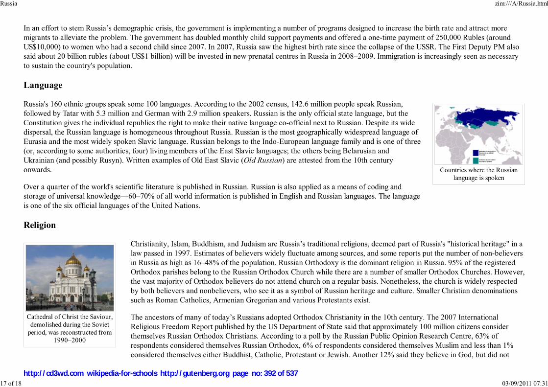
Countries where the Russianlanguage is spoken
Cathedral of Christ the Saviour,demolished during the Soviet
period, was reconstructed from1990–2000
In an effort to stem Russia’s demographic crisis, the government is implementing a number of programs designed to increase the birth rate and attract more
migrants to alleviate the problem. The government has doubled monthly child support payments and offered a one-time payment of 250,000 Rubles (around
US$10,000) to women who had a second child since 2007. In 2007, Russia saw the highest birth rate since the collapse of the USSR. The First Deputy PM also
said about 20 billion rubles (about US$1 billion) will be invested in new prenatal centres in Russia in 2008–2009. Immigration is increasingly seen as necessary
to sustain the country's population.
Language
Russia's 160 ethnic groups speak some 100 languages. According to the 2002 census, 142.6 million people speak Russian,
followed by Tatar with 5.3 million and German with 2.9 million speakers. Russian is the only official state language, but the
Constitution gives the individual republics the right to make their native language co-official next to Russian. Despite its wide
dispersal, the Russian language is homogeneous throughout Russia. Russian is the most geographically widespread language of
Eurasia and the most widely spoken Slavic language. Russian belongs to the Indo-European language family and is one of three
(or, according to some authorities, four) living members of the East Slavic languages; the others being Belarusian and
Ukrainian (and possibly Rusyn). Written examples of Old East Slavic (Old Russian) are attested from the 10th century
onwards.
Over a quarter of the world's scientific literature is published in Russian. Russian is also applied as a means of coding and
storage of universal knowledge—60–70% of all world information is published in English and Russian languages. The language
is one of the six official languages of the United Nations.
Religion
Christianity, Islam, Buddhism, and Judaism are Russia’s traditional religions, deemed part of Russia's "historical heritage" in a
law passed in 1997. Estimates of believers widely fluctuate among sources, and some reports put the number of non-believers
in Russia as high as 16–48% of the population. Russian Orthodoxy is the dominant religion in Russia. 95% of the registered
Orthodox parishes belong to the Russian Orthodox Church while there are a number of smaller Orthodox Churches. However,
the vast majority of Orthodox believers do not attend church on a regular basis. Nonetheless, the church is widely respected
by both believers and nonbelievers, who see it as a symbol of Russian heritage and culture. Smaller Christian denominations
such as Roman Catholics, Armenian Gregorian and various Protestants exist.
The ancestors of many of today’s Russians adopted Orthodox Christianity in the 10th century. The 2007 International
Religious Freedom Report published by the US Department of State said that approximately 100 million citizens consider
themselves Russian Orthodox Christians. According to a poll by the Russian Public Opinion Research Centre, 63% of
respondents considered themselves Russian Orthodox, 6% of respondents considered themselves Muslim and less than 1%
considered themselves either Buddhist, Catholic, Protestant or Jewish. Another 12% said they believe in God, but did not
Russia zim:///A/Russia.html
17 of 18 03/09/2011 07:31
http://cd3wd.com wikipedia-for-schools http://gutenberg.org page no: 392 of 537

practice any religion, and 16% said they are non-believers.
It is estimated that Russia is home to some 15–20 million Muslims. However, surveys say that there are only 7 to 9 million people who adhere to the Islamic
faith in Russia. Russia also has an estimated 3 million to 4 million Muslim migrants from the ex-Soviet states. Most Muslims live in the Volga-Ural region, as well
as in the North Caucasus, Moscow, Saint Petersburg and western Siberia. Buddhism is traditional for three regions of the Russian Federation: Buryatia, Tuva
and Kalmykia. Some residents of the Siberian and Far Eastern regions, Yakutia, Chukotka, etc., practice pantheistic and pagan rites, along with the major
religions. Induction into religion takes place primarily along ethnic lines. Slavs are overwhelmingly Orthodox Christian. Turkic speakers are predominantly
Muslim, although several Turkic groups in Russia are not.
Retrieved from " http://en.wikipedia.org/wiki/Russia"
The Schools Wikipedia has a sponsor: SOS Children , and is mainly selected from the English Wikipedia with only minor checks and changes (see
www.wikipedia.org for details of authors and sources). The articles are available under the GNU Free Documentation License. See also our
Russia zim:///A/Russia.html
18 of 18 03/09/2011 07:31
http://cd3wd.com wikipedia-for-schools http://gutenberg.org page no: 393 of 537

Republik Singapura (Malay)
新加坡共和国新加坡共和国新加坡共和国新加坡共和国 (Simplified Chinese)
சி�க��� �யர� (Tamil)
Republic of Singapore
Image:Singapore
coa.svg
Motto: "Majulah Singapura" (Malay)
"Onward, Singapore"
Anthem: Majulah Singapura
Capital Singapore City (
Downtown Core)1
Official languagesEnglish
Malay
Singapore
2008/9 Schools Wikipedia Selection. Related subjects: Asia; Asian Countries
Singapore ( Mandarin: 新加坡, Xīnjiāpō; in Malay: Singapura; in Tamil: சி�க���, Cingkappūr) is
an island country located at the southern tip of the Malay Peninsula. It lies 137 kilometres (85 mi) north
of the equator, south of the Malaysian state of Johor and north of Indonesia's Riau Islands. At 707.1 km²
(272 sq mi). Singapore is one of three remaining true city-states in the world. It is the smallest nation in
Southeast Asia.
Prior to European settlement, the island now known as Singapore was the site of a Malay fishing village
at the mouth of the Singapore River. Several hundred indigenous Orang Laut people also lived along the
nearby coast, rivers and on smaller islands. In 1819 the British East India Company established a trading
post on the island, which was used thereafter as a strategic trading post along the spice route. Singapore
would become one of the most important commercial and military centres of the British Empire, and the
hub of British power in Southeast Asia. The city was occupied by the Japanese during World War II,
which Winston Churchill called "Britain's greatest defeat". Singapore reverted to British rule immediately
postwar, in 1945. Eighteen years later the city, having achieved independence from Britain, merged with
Malaya, Sabah and Sarawak to form Malaysia. However, less than two years later it seceded from the
federation and became an independent republic on 9 August 1965. Singapore joined the United Nations
on September 21 that same year.
Since independence, Singapore's standard of living has been on the rise. Foreign direct investment and a
state-led drive to industrialization based on plans drawn up by the Dutch economist Albert Winsemius
have created a modern economy focused on electronics manufacturing, petrochemicals, tourism and
financial services alongside traditional entrepôt trade. Singapore is the 6th wealthiest country in the world
in terms of GDP per capita. The small nation has foreign exchange reserves of US$171.7353 billion.
The population of Singapore is approximately 4.59 million. Though Singapore is highly cosmopolitan and
diverse, ethnic Chinese form the majority of the population. English is the administrative language of the
country.
The Constitution of the Republic of Singapore established the nation's political system as a representative
democracy, while the country is recognized as a parliamentary republic. The People's Action Party (PAP)
Singapore zim:///A/Singapore.html
1 of 19 03/09/2011 07:32
http://cd3wd.com wikipedia-for-schools http://gutenberg.org page no: 394 of 537

Mandarin (Chinese)
Tamil
Demonym Singaporean
Government Parliamentary
republic
- President Sellapan Ramanathan
- Prime Minister Lee Hsien Loong
Independence
- City status July 24, 1951
- Self-government
under the United Kingdom 3 June 1959
- Declaration of
independence
31 August 1963
- Merger with Malaysia 16 September 1963
- Separation from Malaysia 9 August 1965
Area
- Total 707.1 km² ( 190th)
270 sq mi
- Water (%) 1.444
Population
- 2007 estimate 4,588,600 ( 117th)
- 2000 census 4,117,700
- Density 6,489/km² ( 2nd)
16,392/sq mi
GDP ( PPP) 2007 estimate
- Total US$228.116 billion (
44th)
- Per capita US$49,714 ( 6th)
GDP (nominal) 2007 estimate
- Total US$171.95 billion
dominates the political process and has won control of Parliament in every election since
self-government in 1959.
History
Etymology
The name Singapura comes from the Malay, Singapura. According to the Malay Annals, this name was
given by a 14th century Sumatran prince named Sang Nila Utama, who, landing on the island after a
thunderstorm, spotted an auspicious beast on the shore, which his chief minister erroneously identified as
a 'singha' or lion. Recent studies of Singapore, however, indicate that lions have never lived there, not
even Asiatic lions; the beast seen by Sang Nila Utama was most likely a tiger, probably the Malayan
Tiger.
First settlement
The first records of settlement in Singapore are from the 2nd century AD. The island was an outpost of
the Sumatran Srivijaya empire and originally had the Javanese name Temasek ('sea town'). Temasek
(Tumasek) rapidly became a significant trading settlement, but declined in the late 14th century. There
are few remnants of old Temasek in Singapore, but archaeologists in Singapore have uncovered artifacts
of that and other settlements. Between the 16th and early 19th centuries, Singapore island was part of the
Sultanate of Johor. During the Malay-Portugal wars in 1613, the settlement was set ablaze by Portuguese
troops. The Portuguese subsequently held control in that century and the Dutch in the 17th, but
throughout most of this time the island's population consisted mainly of fishermen.
Colonial rule
Singapore zim:///A/Singapore.html
2 of 19 03/09/2011 07:32
http://cd3wd.com wikipedia-for-schools http://gutenberg.org page no: 395 of 537

- Per capita US$39,952.44
HDI (2007) ▬ 0.922 (high) (
25th)
CurrencySingapore dollar (
SGD)
Time zone SST ( UTC+8)
- Summer ( DST) not observed (
UTC+8)
Internet TLD .sg
Calling code +65²
Singapore is a city-state.
02 from Malaysia.
Statue of ThomasStamford Raffles byThomas Woolner,
erected at the locationwhere he first landed at
Singapore. He isrecognized as the
founder of modernSingapore.
On 29 January 1819, Sir Thomas Stamford Raffles landed on the main island. Spotting its potential as a
strategic geographical trading post in Southeast Asia, Raffles signed a treaty with Sultan Hussein Shah on
behalf of the British East India Company on 6 February 1819 to develop the southern part of Singapore
as a British trading post and settlement. Until August 1824, Singapore was still a territory controlled by a
Malay Ruler. Singapore only officially became a British colony in August 1824 when the British
extended control over the whole island. John Crawfurd, the second resident of Singapore, was the one
who made Singapore a British possession. He signed a treaty with Sultan Hussein Shah on 2 August 1824
in which the Sultan and the Temmenggong handed over the whole island to the British East India
Company thus marking the start of the island's modern era. Raffles's deputy, William Farquhar, oversaw
a period of growth and ethnic migration, which was largely spurred by a no-restriction immigration
policy. The British India office governed the island from 1858, but Singapore was made a British crown
colony in 1867, answerable directly to the Crown. By 1869, 100,000 lived on the island.
The early onset of town planning in colonial Singapore came largely through a "divide and rule"
framework where the different ethnic groups were settled in different parts of the South of the island.
The Singapore River was largely a commercial area that was dominated by traders and bankers of various
ethnic groups with mostly Chinese and Indian coolies working to load and unload goods from barge boats
known locally as "bumboats". The Malays, consisting of the local "Orang Lauts" who worked mostly as fishermen and sea-farers, and
Arab traders and scholars were mostly found in the South-east part of the river mouth, where Kampong Glam stands today. The
European settlers, who were few then, settled around Fort Canning Hill and further upstream from the Singapore River. Like the
Europeans, the early Indian migrants also settled more inland of the Singapore River, where Little India stands today. Very little is
known about the rural private settlements in those times (known as kampongs), other than the major move by the post-independent
Singapore government to re-settle these residents in the late 1960s.
World War II
During World War II, the Imperial Japanese Army invaded Malaya, culminating in the Battle of Singapore. The ill-prepared British
were defeated in six days, and surrendered the supposedly impregnable fortress to General Tomoyuki Yamashita on 15 February
1942. The surrender was described by British Prime Minister Sir Winston Churchill as "the worst disaster and largest capitulation in
British history." The Japanese renamed Singapore Shōnantō (昭南島 ?), from Japanese " Shōwa no jidai ni eta minami no shima" ("
昭昭昭昭和の時代に得た南南南南の島島島島" ?), or "southern island obtained in the age of Shōwa", and occupied it until the British repossessed the
island on 12 September 1945, a month after the Japanese surrender.
The name Shōnantō was, at the time, romanized as "Syonan-to" or "Syonan", which means "Light of the South".
Independence
1
2
Singapore zim:///A/Singapore.html
3 of 19 03/09/2011 07:32
http://cd3wd.com wikipedia-for-schools http://gutenberg.org page no: 396 of 537

Shenton Way circa 1970, theperiod of time where Singaporeunderwent immense economic
development under theleadership of Lee Kuan Yew.
The Downtown Core at dusk,the civic and business district
of Singapore.
Parliament House
Singapore became a self-governing state within the British Empire in 1959 with Yusof bin Ishak its first Yang di-Pertuan
Negara and Lee Kuan Yew its first Prime Minister. It declared independence from Britain unilaterally in August 1963, before
joining the Federation of Malaysia in September along with Malaya, Sabah and Sarawak as the result of the 1962 Merger
Referendum of Singapore. Singapore left the federation two years later after heated ideological conflict between the state's
PAP government and the federal Kuala Lumpur government. Singapore officially gained sovereignty on 9 August 1965. Yusof
bin Ishak was sworn in as the first President of Singapore and Lee Kuan Yew remained prime minister.
While trying to be self-sufficient, the fledging nation faced problems like mass unemployment, housing shortages, and a dearth
of land and natural resources. During Lee Kuan Yew's term as prime minister from 1959 to 1990, his administration tackled the
problem of widespread unemployment, raised the standard of living, and implemented a large-scale public housing programme.
It was during this time that the foundation of the country's economic infrastructure was developed; the threat of racial tension
was curbed; and an independent national defence system centring around compulsory male military service was created.
In 1990, Goh Chok Tong succeeded Lee as Prime Minister. During his tenure, the country tackled the impacts of the 1997
Asian Financial Crisis, the 2003 SARS outbreak, and terrorist threats posed by Jemaah Islamiyah after the September 11
attacks. In 2004, Lee Hsien Loong, the eldest son of Lee Kuan Yew, became the third prime minister. Amongst his more
notable decisions is the plan to open casinos to attract more foreign tourists.
Government and politics
Singapore is a parliamentary democracy with a Westminster system of unicameral parliamentary government representing
different constituencies. The bulk of the executive powers rests with the Cabinet, headed by the Prime Minister, currently Lee
Hsien Loong. The office of President of Singapore, historically a ceremonial one, was granted some veto powers as of 1991 for
a few key decisions such as the use of the national reserves and the appointment of judiciary positions. Although the position is
to be elected by popular vote, only the 1993 election has been contested to date. The legislative branch of government is the
Parliament.
Parliamentary elections in Singapore are plurality-based for group representation constituencies since the Parliamentary
Elections Act was modified in 1991.
The Members of Parliament (MPs) consist of either elected, non-constituency or nominated Members. The majority of the
Members of Parliament are elected into Parliament at a General Election on a first-past-the-post basis and represent either
Single Member or Group Representation Constituencies (GRCs).
The elected Members of Parliament act as a bridge between the community and the Government by ensuring that the concerns
of their constituents are heard in the Parliament. The present Parliament has 94 Members of Parliament consisting of 84 elected Members of Parliament, one
Singapore zim:///A/Singapore.html
4 of 19 03/09/2011 07:32
http://cd3wd.com wikipedia-for-schools http://gutenberg.org page no: 397 of 537
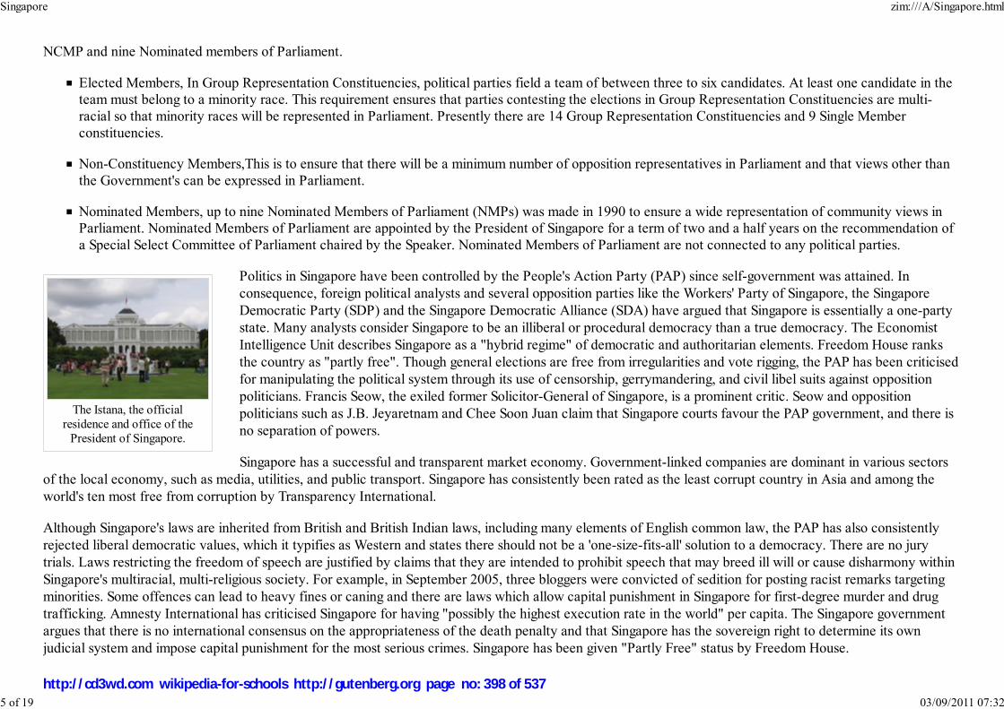
The Istana, the officialresidence and office of the
President of Singapore.
NCMP and nine Nominated members of Parliament.
Elected Members, In Group Representation Constituencies, political parties field a team of between three to six candidates. At least one candidate in theteam must belong to a minority race. This requirement ensures that parties contesting the elections in Group Representation Constituencies are multi-
racial so that minority races will be represented in Parliament. Presently there are 14 Group Representation Constituencies and 9 Single Member
constituencies.
Non-Constituency Members,This is to ensure that there will be a minimum number of opposition representatives in Parliament and that views other than
the Government's can be expressed in Parliament.
Nominated Members, up to nine Nominated Members of Parliament (NMPs) was made in 1990 to ensure a wide representation of community views inParliament. Nominated Members of Parliament are appointed by the President of Singapore for a term of two and a half years on the recommendation of
a Special Select Committee of Parliament chaired by the Speaker. Nominated Members of Parliament are not connected to any political parties.
Politics in Singapore have been controlled by the People's Action Party (PAP) since self-government was attained. In
consequence, foreign political analysts and several opposition parties like the Workers' Party of Singapore, the Singapore
Democratic Party (SDP) and the Singapore Democratic Alliance (SDA) have argued that Singapore is essentially a one-party
state. Many analysts consider Singapore to be an illiberal or procedural democracy than a true democracy. The Economist
Intelligence Unit describes Singapore as a "hybrid regime" of democratic and authoritarian elements. Freedom House ranks
the country as "partly free". Though general elections are free from irregularities and vote rigging, the PAP has been criticised
for manipulating the political system through its use of censorship, gerrymandering, and civil libel suits against opposition
politicians. Francis Seow, the exiled former Solicitor-General of Singapore, is a prominent critic. Seow and opposition
politicians such as J.B. Jeyaretnam and Chee Soon Juan claim that Singapore courts favour the PAP government, and there is
no separation of powers.
Singapore has a successful and transparent market economy. Government-linked companies are dominant in various sectors
of the local economy, such as media, utilities, and public transport. Singapore has consistently been rated as the least corrupt country in Asia and among the
world's ten most free from corruption by Transparency International.
Although Singapore's laws are inherited from British and British Indian laws, including many elements of English common law, the PAP has also consistently
rejected liberal democratic values, which it typifies as Western and states there should not be a 'one-size-fits-all' solution to a democracy. There are no jury
trials. Laws restricting the freedom of speech are justified by claims that they are intended to prohibit speech that may breed ill will or cause disharmony within
Singapore's multiracial, multi-religious society. For example, in September 2005, three bloggers were convicted of sedition for posting racist remarks targeting
minorities. Some offences can lead to heavy fines or caning and there are laws which allow capital punishment in Singapore for first-degree murder and drug
trafficking. Amnesty International has criticised Singapore for having "possibly the highest execution rate in the world" per capita. The Singapore government
argues that there is no international consensus on the appropriateness of the death penalty and that Singapore has the sovereign right to determine its own
judicial system and impose capital punishment for the most serious crimes. Singapore has been given "Partly Free" status by Freedom House.
Singapore zim:///A/Singapore.html
5 of 19 03/09/2011 07:32
http://cd3wd.com wikipedia-for-schools http://gutenberg.org page no: 398 of 537

Singapore Downtown as seenfrom the DHL Balloon.
Singapore Botanic Gardens, a67.3-hectare (166 acre)
Botanic Gardens in Singaporethat includes the National
Orchid Garden, which has acollection of more than 3,000
species of orchids.
Geography and climate
Singapore consists of 63 islands, including mainland Singapore. There are two man-made connections to Johor, Malaysia —
Johor-Singapore Causeway in the north, and Tuas Second Link in the west. Jurong Island, Pulau Tekong, Pulau Ubin and
Sentosa are the largest of Singapore's many smaller islands. The highest natural point of Singapore is Bukit Timah Hill at 166 m
(545 ft).
The south of Singapore, around the mouth of the Singapore River and what is now the Downtown Core, used to be the only
concentrated urban area, while the rest of the land was either undeveloped tropical rainforest or used for agriculture. Since the
1960s, the government has constructed new residential towns in outlying areas, resulting in an entirely built-up urban
landscape. The Urban Redevelopment Authority was established on 1 April 1974, responsible for urban planning.
Singapore has on-going land reclamation projects with earth obtained from its own hills, the sea-bed, and neighbouring
countries. As a result, Singapore's land area grew from 581.5 km² (224.5 sq mi) in the 1960s to 704 km² (271.8 sq mi) today,
and may grow by another 100 km² (38.6 sq mi) by 2030. The projects sometimes involve some of the smaller islands being
merged together through land reclamation in order to form larger, more functional islands, such as in the case of Jurong Island.
Under the Köppen climate classification system, Singapore has a tropical rainforest climate with no distinctive seasons. Its
climate is characterized by uniform temperature and pressure, high humidity, and abundant rainfall. Temperatures range from
22 °C to 34 °C (72° to 93 °F). On average, the relative humidity is around 90 percent in the morning and 60 percent in the
afternoon. During prolonged heavy rain, relative humidity often reaches 100 percent. The lowest and highest temperatures
recorded in its maritime history are 18.4 °C (65.1 °F) and 37.8 °C (100.0 °F) respectively. The highest wind speed recorded
was 150 km/h (93 mph) on 26 May 2007. June and July are the hottest months, while November and December make up the
wetter monsoon season. From August to October, there is often haze, sometimes severe enough to prompt public health
warnings, due to bushfires in neighbouring Indonesia. Singapore does not observe daylight saving time or a summer time zone
change. The length of the day is nearly constant year round due to the country's location near the equator.
About 23 percent of Singapore's land area consists of forest and nature reserves. Urbanization has eliminated many areas of
former primary rainforest, with the only remaining area of primary rainforest being Bukit Timah Nature Reserve. A variety of parks are maintained with human
intervention, such as the Singapore Botanic Gardens.
Economy
Singapore has a highly developed market-based economy, which historically revolves around extended entrepot trade. Along with Hong Kong, South Korea and
Taiwan, Singapore is one of the Four Asian Tigers. The economy depends heavily on exports refining imported goods, especially in manufacturing.
Singapore zim:///A/Singapore.html
6 of 19 03/09/2011 07:32
http://cd3wd.com wikipedia-for-schools http://gutenberg.org page no: 399 of 537

Singapore's Central BusinessDistrict (CBD).
Orchard Road is decorated forChristmas, 2005.
Manufacturing constituted 26 percent of Singapore's GDP in 2005. The manufacturing industry is well-diversified into electronics, petroleum refining,
chemicals, mechanical engineering and biomedical sciences manufacturing. In 2006, Singapore produced about 10 percent of the world's foundry wafer output.
Singapore is the busiest port in the world in terms of tonnage shipped. Singapore is the world's fourth largest foreign exchange trading centre after London, New
York City and Tokyo.
Singapore has been rated as the most business-friendly economy in the world, with thousands of foreign expatriates working in multi-national corporations. The
city-state also employs tens of thousands of foreign blue-collared workers around the world.
As a result of global recession and a slump in the technology sector, the country's GDP contracted 2.2 percent in 2001. The
Economic Review Committee (ERC) was set up in December 2001, and recommended several policy changes with a view to
revitalising the economy. Singapore has since recovered from the recession, largely due to improvements in the world
economy; the Singaporean economy itself grew by 8.3 percent in 2004, 6.4 percent in 2005 and 7.9 percent in 2006. In the
first half of Year 2007, the economy grew by 7.6 percent. The growth forecast for the whole year is expected to be between 7
percent to 8 percent, up from the original estimation of 5 percent to 7 percent. On August 19 2007, Prime Minister Lee Hsien
Loong announced in his National Day Rally Speech that Singapore's economy is expected to grow by at least 4-6 percent
annually over the next 5-10 years.
The per capita GDP in 2006 was US$29,474. As of September 2007, the unemployment rate is 1.7 percent, which is the
lowest in a decade, having improved to around pre-Asian crisis level. Employment continued to grow strongly as the economy
maintained its rapid expansion. In the first three quarters of 2007, 171,500 new jobs were created, which is close to the
176,000 for the whole of 2006. For the whole of 2007, Singapore's economy has grown 7.5 percent and drew in a record S$16 billion of fixed asset investments
in manufacturing and projects generating S$3 billion of total business spending in services. The government expects the Singapore economy to grow by 4.5
percent to 6.5 percent in 2008.
Singapore introduced a Goods and Services Tax (GST) with an initial rate of 3 percent on 1 April 1994 substantially increasing
government revenue by S$1.6 billion and stabilizing government finances. The taxable GST was increased to 4 percent in 2003,
to 5 percent in 2004, and to 7 percent on 1st July 2007.
Singapore is a popular travel destination, making tourism one of its largest industries. About 9.7 million tourists visited
Singapore in 2006. The Orchard Road shopping district is one of Singapore's most well-known and popular tourist draws. To
attract more tourists, the government decided to legalise gambling and to allow two casino resorts (euphemistically called
Integrated Resorts) to be developed at Marina South and Sentosa in 2005. To compete with regional rivals like Hong Kong,
Tokyo and Shanghai, the government has announced that the city area would be transformed into a more exciting place by
lighting up the civic and commercial buildings. Cuisine has also been heavily promoted as an attraction for tourists, with the
Singapore Food Festival in July organized annually to celebrate Singapore's cuisine.
Singapore is fast positioning itself as a medical tourism hub — about 200,000 foreigners seek medical care in the country each year and Singapore medical
Singapore zim:///A/Singapore.html
7 of 19 03/09/2011 07:32
http://cd3wd.com wikipedia-for-schools http://gutenberg.org page no: 400 of 537
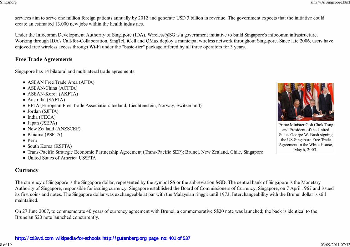
Prime Minister Goh Chok Tongand President of the United
States George W. Bush signingthe US-Singapore Free Trade
Agreement in the White House,May 6, 2003.
services aim to serve one million foreign patients annually by 2012 and generate USD 3 billion in revenue. The government expects that the initiative could
create an estimated 13,000 new jobs within the health industries.
Under the Infocomm Development Authority of Singapore (IDA), Wireless@SG is a government initiative to build Singapore's infocomm infrastructure.
Working through IDA's Call-for-Collaboration, SingTel, iCell and QMax deploy a municipal wireless network throughout Singapore. Since late 2006, users have
enjoyed free wireless access through Wi-Fi under the "basic-tier" package offered by all three operators for 3 years.
Free Trade Agreements
Singapore has 14 bilateral and multilateral trade agreements:
ASEAN Free Trade Area (AFTA)
ASEAN-China (ACFTA)ASEAN-Korea (AKFTA)
Australia (SAFTA)
EFTA (European Free Trade Association: Iceland, Liechtenstein, Norway, Switzerland)Jordan (SJFTA)
India (CECA)
Japan (JSEPA)New Zealand (ANZSCEP)
Panama (PSFTA)
PeruSouth Korea (KSFTA)
Trans-Pacific Strategic Economic Partnership Agreement (Trans-Pacific SEP): Brunei, New Zealand, Chile, Singapore
United States of America USSFTA
Currency
The currency of Singapore is the Singapore dollar, represented by the symbol S$ or the abbreviation SGD. The central bank of Singapore is the Monetary
Authority of Singapore, responsible for issuing currency. Singapore established the Board of Commissioners of Currency, Singapore, on 7 April 1967 and issued
its first coins and notes. The Singapore dollar was exchangeable at par with the Malaysian ringgit until 1973. Interchangeability with the Brunei dollar is still
maintained.
On 27 June 2007, to commemorate 40 years of currency agreement with Brunei, a commemorative S$20 note was launched; the back is identical to the
Bruneian $20 note launched concurrently.
Singapore zim:///A/Singapore.html
8 of 19 03/09/2011 07:32
http://cd3wd.com wikipedia-for-schools http://gutenberg.org page no: 401 of 537
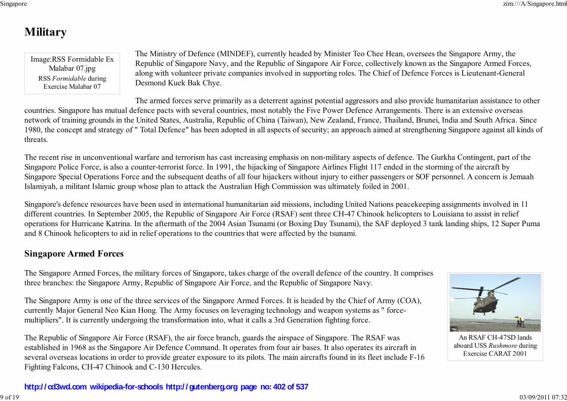
Image:RSS Formidable Ex
Malabar 07.jpg
RSS Formidable duringExercise Malabar 07
An RSAF CH-47SD landsaboard USS Rushmore during
Exercise CARAT 2001
Military
The Ministry of Defence (MINDEF), currently headed by Minister Teo Chee Hean, oversees the Singapore Army, the
Republic of Singapore Navy, and the Republic of Singapore Air Force, collectively known as the Singapore Armed Forces,
along with volunteer private companies involved in supporting roles. The Chief of Defence Forces is Lieutenant-General
Desmond Kuek Bak Chye.
The armed forces serve primarily as a deterrent against potential aggressors and also provide humanitarian assistance to other
countries. Singapore has mutual defence pacts with several countries, most notably the Five Power Defence Arrangements. There is an extensive overseas
network of training grounds in the United States, Australia, Republic of China (Taiwan), New Zealand, France, Thailand, Brunei, India and South Africa. Since
1980, the concept and strategy of " Total Defence" has been adopted in all aspects of security; an approach aimed at strengthening Singapore against all kinds of
threats.
The recent rise in unconventional warfare and terrorism has cast increasing emphasis on non-military aspects of defence. The Gurkha Contingent, part of the
Singapore Police Force, is also a counter-terrorist force. In 1991, the hijacking of Singapore Airlines Flight 117 ended in the storming of the aircraft by
Singapore Special Operations Force and the subsequent deaths of all four hijackers without injury to either passengers or SOF personnel. A concern is Jemaah
Islamiyah, a militant Islamic group whose plan to attack the Australian High Commission was ultimately foiled in 2001.
Singapore's defence resources have been used in international humanitarian aid missions, including United Nations peacekeeping assignments involved in 11
different countries. In September 2005, the Republic of Singapore Air Force (RSAF) sent three CH-47 Chinook helicopters to Louisiana to assist in relief
operations for Hurricane Katrina. In the aftermath of the 2004 Asian Tsunami (or Boxing Day Tsunami), the SAF deployed 3 tank landing ships, 12 Super Puma
and 8 Chinook helicopters to aid in relief operations to the countries that were affected by the tsunami.
Singapore Armed Forces
The Singapore Armed Forces, the military forces of Singapore, takes charge of the overall defence of the country. It comprises
three branches: the Singapore Army, Republic of Singapore Air Force, and the Republic of Singapore Navy.
The Singapore Army is one of the three services of the Singapore Armed Forces. It is headed by the Chief of Army (COA),
currently Major General Neo Kian Hong. The Army focuses on leveraging technology and weapon systems as " force-
multipliers". It is currently undergoing the transformation into, what it calls a 3rd Generation fighting force.
The Republic of Singapore Air Force (RSAF), the air force branch, guards the airspace of Singapore. The RSAF was
established in 1968 as the Singapore Air Defence Command. It operates from four air bases. It also operates its aircraft in
several overseas locations in order to provide greater exposure to its pilots. The main aircrafts found in its fleet include F-16
Fighting Falcons, CH-47 Chinook and C-130 Hercules.
Singapore zim:///A/Singapore.html
9 of 19 03/09/2011 07:32
http://cd3wd.com wikipedia-for-schools http://gutenberg.org page no: 402 of 537

An SCDF Combined PlatformLadder (CPL) Vehicle
The final branch, the Republic of Singapore Navy (RSN), is the navy of the Singapore Armed Forces, responsible for the defence of Singapore against sea-borne
threats and protection of its sea lines of communications. Operating within the crowded littoral waters of the Singapore Strait, the RSN is regarded as one of the
best in the region. The RSN operates from two bases, Tuas Naval Base and Changi Naval Base, and has a large number of vessels, including 4 submarines, 6
frigates, and 4 amphibious transport docks. All commissioned ships of the RSN have a prefix RSS, which means Republic of Singapore Ship.
Singapore Police Force
The Singapore Police Force (SPF) is the main agency tasked with maintaining law and order in the country. Formerly known as the Republic of Singapore
Police, it has grown from an 11-man organisation to a 38,587 strong force. It enjoys a relatively positive public image, and is credited for helping to arrest
Singapore's civic unrests and lawlessness in its early years, and maintaining the low crime rate today. The organisation structure of the SPF is split between the
staff and line functions, roughly modelled after the military. There are currently 15 staff departments and 13 line units. The SPF is headquartered in a block at
New Phoenix Park in Novena, adjacent to a twin block occupied by the Ministry of Home Affairs.
Police officers typically respond to calls in rapid-deployment vehicles known as the Fast Response Car. They have been staunch users of Japanese-made saloon
cars since the 1980s for patrol duties, with the mainstay models in use being the various generations of the Mitsubishi Lancers, Mazda 323s, Toyota Corollas &
Subaru Impreza.
Singapore Civil Defence Force
The Singapore Civil Defence Force (SCDF) is the main agency in charge of the provision of emergency services in Singapore
during peacetime and emergencies. A uniformed organisation under the purview of the Ministry of Home Affairs, the SCDF
provides ambulance, fire fighting and emergency response services to the Republic of Singapore. It also plays a major role in
the Republic's disaster relief operations. It is branched into 6 Operational and Training Divisions beneath the Headquarters
Element. Of these six, four are known as Operational Divisions, also known as Territorial Divisions, and each cover vast
sections of Singapore corresponding roughly to the four cardinal points of the compass.
The SCDF maintains a large fleet of custom vehicles, called appliances, to provide an emergency response force capable of
mitigating any and all kinds of fires and disasters. Ranging from the generic fire truck and ambulance to more sophisticated
mobile command structures and disaster mitigation vehicles of all kinds, many of the appliances were designed and
commissioned by the Force itself rather than obtaining ready-made designs from industries.
National Service
Singapore legislation requires every able-bodied male Singapore citizen and second-generation permanent resident to undertake National Service for a minimum
of 2 years upon reaching 18 years of age or completion of his studies (whichever comes first), with exemption on medical or other grounds. After serving for
two years, every male is considered operationally ready, and is liable for reservist national service to the age of 40 (50 for commissioned officers). More than
Singapore zim:///A/Singapore.html
10 of 19 03/09/2011 07:32
http://cd3wd.com wikipedia-for-schools http://gutenberg.org page no: 403 of 537

Built in 1843, the SriMariamman Temple is
the largest Hindu templein Singapore. It is also
one of the manyreligious buildingsmarked as national
monuments for theirhistorical value.
350,000 men serve as operationally-ready servicemen assigned to reservist combat units, and another 72,500 men form the full-time national service and regular
corps.
Demographics
Population
According to government statistics, the population of Singapore as of 2007 was 4.59 million, of whom 3.58 million were Singaporean
citizens and permanent residents (termed 'Singapore Residents'). Chinese formed 75.2% of 'Singapore Residents', Malays 13.6%,
Indians 8.8%, while Eurasians and other groups formed 2.4%.
In 2006 the crude birth rate stood at 10.1 per 1000, a very low level attributed to birth control policies, and the crude death rate was
also one of the lowest in the world at 4.3 per 1000. The total population growth was 4.4% with Singapore residents growth at 1.8%.
The higher percentage growth rate is largely from net immigration, but also increasing life expectancy. Singapore is the second- most
densely populated independent country in the world after Monaco, excluding Macau and Hong Kong, which are special
administrative regions of the People's Republic of China. In 1957, Singapore's population was approximately 1.45 million, and there
was a relatively high birth rate. Aware of the country's extremely limited natural resources and small territory, the government
introduced birth control policies in the late 1960s. In the late 1990s, the population was ageing, with fewer people entering the labour
market and a shortage of skilled workers. In a dramatic reversal of policy, the Singapore government introduced a "baby bonus"
scheme in 2001 (enhanced in August 2004) that encouraged couples to have more children.
In 2006, the total fertility rate was only 1.26 children per woman, the 3rd lowest in the world and well below the 2.10 needed to
replace the population. In 2006, 38,317 babies were born, compared to around 37,600 in 2005. This number, however, is not
sufficient to maintain the population's growth. To overcome this problem, the government is encouraging foreigners to immigrate to
Singapore. These large numbers of immigrants have kept Singapore's population from declining.
Religion
Singapore zim:///A/Singapore.html
11 of 19 03/09/2011 07:32
http://cd3wd.com wikipedia-for-schools http://gutenberg.org page no: 404 of 537

Religion in Singaporereligion percent
Buddhism 42.5%
No religion 14.8%
Christianity 14.6%
Islam 13.9%
Taoism 8.5%
Hinduism 4%
Others 1.6%Saint Andrew's Cathedral
Singapore is a multi-religious country. According to Statistics Singapore,
around 51 percent of resident Singaporeans (excluding significant
numbers of visitors and migrant workers) practice Buddhism and Taoism.
About 15 percent, mostly Chinese , Eurasians, and Indians, practice
Christianity - a broad classification including Catholicism, Protestantism
and other denominations. Muslims constitute 14 percent, of whom
Malays account for the majority with a substantial number of Indian
Muslims and Chinese Muslims. Smaller minorities practice Sikhism,
Hinduism, the Bahá'í Faith and others, according to the 2000 census.
Some religious materials and practices are banned in Singapore. The
Jehovah's Witnesses, for example, are prohibited from distributing religious materials and are sometimes
jailed for their conscientious refusals to serve in the Singaporean military.
About 15 percent of the population declared no religious affiliation.
Education
Singapore zim:///A/Singapore.html
12 of 19 03/09/2011 07:32
http://cd3wd.com wikipedia-for-schools http://gutenberg.org page no: 405 of 537

Students having assembly in thehall of a Singapore secondary
school.
English is the first language learned by half the children by the time they reach preschool age and is the
primary medium of instruction in primary school; however mother tongues are taught in the respective
languages.
Many children attend private kindergartens until they start at primary school at the age of six. Singapore's ruling political party,
the PAP, is a big provider of preschool education through its community arm.
English is the language of instruction for mathematics and the natural sciences. For the Chinese community, there are Special
Assistance Plan schools which receive extra funding to teach in Mandarin. Some schools also integrate language subjects with
mathematics and the sciences, using both English and a second language.
Curricular standards are set by the Ministry of Education with a mix of private schools and public schools. There is no strict
public-private dichotomy: the degree of autonomy, regarding curriculum and student admission, government funding received,
and tuition burden on the students is further classified into "government-run", "government-aided", "autonomous",
"independent", and "privately-funded". In addition, international schools cater to expatriate students, and to a few local students given permission by the
education ministry.
There are four state universities in Singapore; the National University of Singapore, Nanyang Technological University, Singapore Management University and
SIM University. A further public university is under consideration as the government looks to provide higher education for 30 percent of each cohort. There are
also five polytechnics ( Temasek Polytechnic, Singapore Polytechnic, Ngee Ann Polytechnic, Nanyang Polytechnic and Republic Polytechnic). Unlike similarly
named institutions in many other countries, Singapore polytechnics do not teach to degree level.
The educational system features non-compulsory kindergarten for three years, followed by six years of primary education concluding with the Primary School
Leaving Examination (PSLE). Four to five years of secondary education follow, leading to N level or Singaporean GCE 'O' Level examinations that assess their
individual subject mastery and determine which kind of tertiary education they can pursue.
Junior colleges like Tampines Junior College and Millennia Institute provide a two or three-year pre-university education route to university. An alternative, the
Integrated Programme, lets the more academically-inclined skip 'O' levels to proceed straight to 'A' levels. Polytechnics offer courses leading to a diploma for
students as a substitute for 'A' levels while tertiary institutions offer various bachelor's, master's, doctoral degrees, other higher diplomas, and associate degree
courses.
Other institutes include the National Institute of Education (NIE), a teaching college to train teachers, various management institutes, and vocational education
institutes such as the Institute of Technical Education (ITE).
The Economic Development Board (EDB) has been actively recruiting foreign schools to set up campuses in Singapore under the "Global Schoolhouse"
programme which aims to attract 150000 foreign students by 2015. INSEAD, a leading business school, opened its first overseas campus here in 2001, while
ESSEC Business School, a century-old Parisian business school, provide courses specific to Asia. University of Chicago Graduate School of Business has a
Singapore zim:///A/Singapore.html
13 of 19 03/09/2011 07:32
http://cd3wd.com wikipedia-for-schools http://gutenberg.org page no: 406 of 537
campus here as well. Tisch School of the Arts was the latest to set up a branch campus here in 2007.
However, the EDB failed to attract and retain Warwick University and University of New South Wales, respectively, citing lack of academic freedom and
financial concerns .
In 1999, the Ministry of Education started the Programme for Rebuilding and Improving Existing schools (PRIME) to upgrade school buildings, many of which
were built over 20 to 30 years ago, in phases at a cost of S$4.5 billion. This programme achieves to provide a better school environment for the students by
upgrading school buildings to latest standards. In 2005, the Flexible School Infrastructure (FlexSI) framework was implemented through the building of modular
classrooms which can be opened up for larger lectures, and allowing a school's staff members to mould their school's designs to suit the school's unique identity
and culture. At the same time, an indoor sports hall will be provided to every school so that schools can carry out physical education lessons in inclement
weather.
Foreign relations
Singapore maintains diplomatic relations with 175 countries although it does not maintain a high commission or embassy in many of those countries. It is a
member of the United Nations, the Commonwealth, ASEAN and the Non-Aligned Movement. Due to obvious geographical reasons, relations with Malaysia and
Indonesia are most important but the domestic politics of the three countries often threatens their relations. On the other hand, Singapore enjoys good relations
with many European nations, including France, Germany and the United Kingdom, the latter sharing ties via the Five Power Defence Arrangements (FPDA)
along with Malaysia, Australia and New Zealand. Good relations are also maintained with the United States, a country perceived as a stabilizing force in the
region to counterbalance the regional powers.
Singapore supports the concept of Southeast Asian regionalism and plays an active role in the Association of Southeast Asian Nations (ASEAN), of which
Singapore is a founding member. Singapore is also a member of the Asia Pacific Economic Cooperation (APEC) forum, which has its Secretariat in Singapore.
Singapore also has close relations with fellow ASEAN nation Brunei and maintains Army training facilities in the Sultanate.
Disputes
Singapore has several long-standing disputes with Malaysia over a number of issues:
Water deliveries to SingaporeMutual maritime boundaries
Air routes between Singapore Changi Airport and Kuala Lumpur International Airport
Singapore zim:///A/Singapore.html
14 of 19 03/09/2011 07:32
http://cd3wd.com wikipedia-for-schools http://gutenberg.org page no: 407 of 537

The dispute over the ownershipof Pedra Branca, an outcrop ofrocks, was resolved on the 24thof May 2008 (Singapore time)by the International Court of
Justice between Singapore andMalaysia (see text).
Construction site sign showingSingapore's four official
languages: English, Mandarin,Tamil, and Malay.
The Singapore island known as Pedra Branca in Singapore and as Pulau Batu Puteh in Malaysia (names mean "WhiteRock" in Portuguese and "White Rock Island" in Malay respectively), located 24 nautical miles (44 km) off the east
coast of Singapore with a land area of 2,000 m² (2,392 sq yd) (the island also comprises Middle Rocks owned by
Malaysia which are two clusters of rocks situated 0.6 nmi (1.1 km) south of Pedra Branca. Whereas South Ledge, a rockformation which can be seen only at low tide will be decided by June 2008). Both countries have staked a claim on the
island and have been unable to settle the dispute between themselves. The case was heard at the International Court of
Justice in 2007, with both parties presenting their case. The court had delivered its judgment on 23 May 2008 withSingapore having ownership of Pedra Branca and Malaysia owning Middle Rocks. The final verdict on South Ledge is
still disputed and being negotiated by a committee formed by both countries.
Relocating the Singapore station of Malaysia's Keretapi Tanah Melayu from Tanjong Pagar to Bukit Timah (seeMalaysia-Singapore Points of Agreement of 1990) and moving Malaysia's immigration checkpoint from the railway
station to the Causeway.
Not allowing laid off workers, employed in Singapore shipyards in 1998, to receive their Central Provident Funds (CPF)contributions, which are estimated to be RM2.4 billion.
Languages
The national language of Singapore is Malay for historical reasons, and it is used in the national anthem, " Majulah Singapura".
The official languages are English, Malay, Mandarin and Tamil. English has been promoted as the country's language of
administration since its independence. The English used is primarily based on British English, with some American English
influences. The use of English became widespread in Singapore after it was implemented as a first language medium in the
education system, and English is the most common language in Singaporean literature. In school, children are required to learn
English and one of the three other official languages. Public signs and official publications are in English, although there are
usually translated versions in other official languages. However, most Singaporeans speak a localised hybrid form of English
known as Singlish ("Singapore English"), which has many creole-like characteristics, incorporating vocabulary and grammar
from Standard English, various Chinese dialects, Malay, and Indian languages.The second-most common language in Singapore
is Mandarin with over seventy percent of the population having it as a second language.
Culture
Singapore is a mixture of an indigenous Malay population with a third generation Chinese majority, as well as Indian and Arab immigrants with some
intermarriages. There also exist significant Eurasian and Peranakan (known also as 'Straits Chinese') communities.
Cuisine
Singapore zim:///A/Singapore.html
15 of 19 03/09/2011 07:32
http://cd3wd.com wikipedia-for-schools http://gutenberg.org page no: 408 of 537

Enjoying Singaporean cuisine.Hawker centres and kopi tiams
are evenly distributed.
Esplanade, Theatres on the Bay
Singaporean cuisine is an example of diversity and cultural diffusion in Singapore, with a fusion of Chinese, Indian, Malay
and Tamil influences. In Singapore's hawker centres, traditionally Malay hawker stalls selling halal food may serve halal
versions of traditionally Tamil food. Chinese food stalls may introduce indigenous Malay ingredients or cooking techniques.
This continues to make the cuisine of Singapore a significant cultural attraction.
Local foods are diverse, ranging from Hainanese chicken rice to satay. Singaporeans also enjoy a wide variety of seafood
including crabs, clams, squid, and oysters. One such dish is stingray barbecued and served on banana leaf and with sambal or
chili.
Amongst locals, popular dishes include bak chor mee, mee poh, sambal stingray, laksa, nasi lemak, chili crab and satay. All of
which, can be found at local hawker centres around Singapore.
Performing arts
Since the 1990s, the government has been striving to promote Singapore as a centre for arts and culture, and to transform the
country into a cosmopolitan 'gateway between the East and West'. The highlight of these efforts was the construction of
Esplanade, a centre for performing arts that opened on October 12, 2002.
An annual arts festival is also organised by the National Arts Council that incorporates theatre arts, dance, music and visual
arts, among other possibilities.
A first Singapore Biennale took place in 2006 to showcase contemporary art from around the world. The next one will be in
2008 which will feature Southeast Asian works.
Sport and recreation
Singaporeans participate in a wide variety of sports and recreational activities. Favorite sports include football, cricket, swimming, badminton, basketball, rugby
union, volleyball and table tennis. Most people live in public residential areas that often provide amenities such as swimming pools, outdoor basketball courts
and indoor sport complexes. As might be expected on an island, water sports are popular, including sailing, kayaking and water skiing. Scuba diving is another
recreation, particularly around the southern island of Pulau Hantu which is known for its rich coral reefs.
Singapore zim:///A/Singapore.html
16 of 19 03/09/2011 07:32
http://cd3wd.com wikipedia-for-schools http://gutenberg.org page no: 409 of 537

Closing ceremony for the use of the NationalStadium
The 55,000 seat National Stadium, Singapore, located in Kallang was opened in July 1973 and was used for
sporting, cultural, entertainment and national events until its official closure on 30 June 2007 to make way for
the Singapore Sports Hub on the same site. This sports complex is expected to be ready by 2011 and will
comprise a new 55,000-capacity National Stadium with a retractable roof, a 6,000-capacity indoor aquatic
centre, a 400-metre warm-up athletic track and a 3,000-seater multi-purpose arena. 36,000 square metres of
space have also been reserved for commercial development.
Golf is gaining popularity among Singaporeans. There are 15 golf clubs in Singapore. Some golfers prefer
travelling to regional golf courses especially in Johor, Malaysia, due to relatively cheaper club membership.
Singaporean sportsmen have performed in regional as well as international competitions in sports such as table tennis, badminton, bowling, sailing, silat,
swimming and water polo. Athletes such as Fandi Ahmad, Ang Peng Siong, Li Jiawei and Ronald Susilo have become household names in the country.
The Singapore Slingers joined the Australian National Basketball League in 2006 and have three Singaporeans in their squad. Despite being the team with the
largest support pool in the NBL, they generally get the smallest crowds in the NBL.
Beginning in 2008, Singapore will be hosting a round of the Formula One World Championship. The race will be staged at the Singapore Street Circuit in the
Marina Bay area and will become the first night race on the F1 circuit and the first street circuit in Asia.
On 21 February 2008, the International Olympic Committee announced that Singapore won the bid to host the inaugural 2010 Summer Youth Olympics.
Singapore beat Moscow in the final by 53 votes to 44.
Architecture
Singapore zim:///A/Singapore.html
17 of 19 03/09/2011 07:32
http://cd3wd.com wikipedia-for-schools http://gutenberg.org page no: 410 of 537

The three tallestbuildings in Singaporeare located at Raffles
Place, namely, from leftto right, Republic Plaza,
UOB Plaza One andOUB Centre. All three
buildings are 280metres in height.
The architecture of Singapore is varied, reflecting the ethnic build-up of the country. Singapore has several ethnic neighbourhoods,
including Chinatown and Little India. These were formed under the Raffles Plan to segregate the immigrants. Many places of
worship were also constructed during the colonial era. Sri Mariamman Temple, the Masjid Jamae mosque and the Church of
Gregory the Illuminator are among those that were built during the colonial period. Work is now underway to preserve these
religious sites as National Monuments of Singapore.
Due to the lack of space and lack of preservation policies during the 1960s, 70s and 80s, few historical buildings remain in the
Central Business District (CBD) - the Fullerton Hotel and the previously-moved Lau Pa Sat being some exceptions. However, just
outside of Raffles Place, and throughout the rest of the downtown core, there is a large scattering of pre-WWII buildings - some
going back nearly as far as Raffles, as with the Empress Place Building, built in 1827. Many classical buildings were destroyed
during the post-war decades, up until the 1990s, when the government started strict programmes to conserve the buildings and areas
of historic value.
Past the shopping malls are streets lined with shophouses. Many other such areas have been gazetted as historic districts.
Information can be found at the URA Centre in Maxwell Road, where there are exhibits and several models of the island and its
architecture. Singapore has also become a centre for postmodern architecture. Historically, the demand for high-end buildings has
been in and around the Central Business District (CBD). After decades of development, the CBD has become an area with many
tall office buildings. These buildings comprise the skyline along the coast of Marina Bay and Raffles Place, a tourist attraction in
Singapore. Plans for tall buildings must be reviewed by the Civil Aviation Authority of Singapore. No building in Singapore may be
taller than 280 metres. The three tallest buildings in Singapore, namely Republic Plaza, UOB Plaza One and OUB Centre, are all 280
metres in height.
Transport
International
The Port of Singapore with Sentosa island in the background.
Singapore is a major Asian transportation hub, positioned on many sea and air trade routes.
Singapore zim:///A/Singapore.html
18 of 19 03/09/2011 07:32
http://cd3wd.com wikipedia-for-schools http://gutenberg.org page no: 411 of 537

PSA Keppel
A C751B train at Eunos MRTStation on the Mass Rapid
Transit (MRT) system, one ofthree heavy rail passenger
transport lines in Singapore.
The Port of Singapore, managed by port operators PSA International and Jurong Port, was the world's busiest port in 2005 in terms of shipping tonnage handled,
at 1.15 billion gross tons, and in terms of containerised traffic, at 23.2 million twenty-foot equivalent units (TEUs). It was also the world's second busiest in
terms of cargo tonnage, coming behind Shanghai with 423 million tons handled. In addition, the Port is the world's busiest for transshipment traffic and the
world's biggest ship refuelling centre.
Singapore is an aviation hub for the Southeast Asian region and a stopover on the Kangaroo route between Australasia and
Europe. Singapore Changi Airport has a network of 81 airlines connecting Singapore to 185 cities in 58 countries. It has been
rated as one of the best international airports by international travel magazines, including being rated as the world's best
airport for the first time in 2006 by Skytrax.. The airport currently has three passenger terminals. There is also a budget
terminal, which serves budget carrier Tiger Airways and Cebu Pacific. The national carrier is Singapore Airlines (SIA). The
government is moving towards privatising Changi airport.
Singapore is linked to Johor, Malaysia via the Johor-Singapore Causeway and the Tuas Second Link, as well as a railway
operated by Keretapi Tanah Melayu of Malaysia, with its southern terminus at Tanjong Pagar railway station. Frequent ferry
service to several nearby Indonesian ports also exists.
Domestic
The domestic transport infrastructure has a well-connected island-wide road transport system which includes a network of
expressways. The public road system is served by the nation's bus service and a number of licensed taxi-operating companies.
The public bus transport has been the subject of criticism by Singaporeans, the majority of whom are dependent on it for their
daily commuting. Since 1987, the heavy rail passenger Mass Rapid Transit (MRT) metro system has been in operation. The
MRT has been further augmented by the Light Rail Transit (LRT) light rail system, adds accessibility to housing estates.
Established in 2001, EZ-Link system allows contactless smartcards to serve as stored value tickets for use in the public
transport systems in Singapore.
More than 2.85 million people use the bus network daily, while more than 1.5 million people use either the LRT or MRT as
part of their daily routine. Approximately 945,000 people use the taxi services daily. Private vehicle use in the Central Area is
discouraged by tolls implemented during hours of heavy road traffic, through an Electronic Road Pricing system. Private
vehicle ownership is discouraged by high vehicle taxes and imposing quotas on vehicle purchase.
Retrieved from " http://en.wikipedia.org/wiki/Singapore"
This Wikipedia Selection has a sponsor: SOS Children , and consists of a hand selection from the English Wikipedia articles with only minor deletions (see
www.wikipedia.org for details of authors and sources). The articles are available under the GNU Free Documentation License. See also our <
Singapore zim:///A/Singapore.html
19 of 19 03/09/2011 07:32
http://cd3wd.com wikipedia-for-schools http://gutenberg.org page no: 412 of 537

대한민국대한민국대한민국대한민국大 國大 國大 國大 國
Daehan Minguk
Republic of Korea
Image:South koreaCOA.svg
Flag Coat of arms
Motto: 홍익인간(弘益人間) 널리 인간을 이롭게하라 ("Benefit all mankind")
Anthem: Aegukga (애국가; 國歌)Patriotic Hymn
Capital
(and largest city)Seoul
Official languages Korean
Demonym South Korean, Korean
South Korea
2008/9 Schools Wikipedia Selection. Related subjects: Asia; Asian CountriesSOS Children works in South Korea. For more information see SOS Children in South Korea
South Korea, officially known as the Republic of Korea (ROK; Korean: 대한민국, IPA: [tɛː.han.min.ɡuk̚]), listen ) is an East Asian country occupying the southern half of the Korean Peninsula.To the north, it is bordered by North Korea (Democratic People's Republic of Korea), with which it wasunited until 1945. To the west, across the Yellow Sea, lies China and to the southeast, across the KoreaStrait, lies Japan.
The Korean people trace their nation's founding back to 2333 BCE by the legendary Dangun Wanggeom.Archaeological research shows that the first Korean settlers have occupied the peninsula since the LowerPaleolithic period with territories expanding as far as mainland China and eastern Russia during theGojosun period, the first nation established by Koreans. Korea's history has been turbulent at times withthe last emperor of Korea dating back to the age of the Korean Empire. Since the establishment of themodern republic in 1948, South Korea has struggled with the aftermath of the Japanese control(1910-1945), the Korean War (1950-1953), and decades of authoritarian governments, undergoing fivemajor constitutional changes. While the government officially embraced Western-style democracy fromits founding, it was not until the December of 1987 that direct and fair elections were held and truedemocracy began to solidify.
South Korea has had one of the fastest growing economies in the world since the 1960s and is now the3rd largest economy in Asia and the 11th largest economy in the world. In the late 20th century, manypeople referred to South Korea as a newly industrialized country and an Asian Tiger due to itsexponential economic growth. Today, South Korea forms the G20 industrial nations and is a Next Elevennation with many developing countries referring to its economic success as the " Miracle on the HanRiver," using South Korea's success story as a role model. South Korea has a "High" HDI of 0.912 and ispart of both the CIA and IMF lists of advanced economies, being defined as a High Income Nation by theWorld Bank. International recognition of the country and its goods & services was boosted by the hostingof the 1988 Summer Olympics in Seoul and further enhanced by the co-hosting of the 2002 FIFA WorldCup.
South Korea is one of the world's most technologically and scientifically advanced countries; it is the
South Korea zim:///A/South_Korea.html
1 of 18 03/09/2011 07:32
http://cd3wd.com wikipedia-for-schools http://gutenberg.org page no: 413 of 537
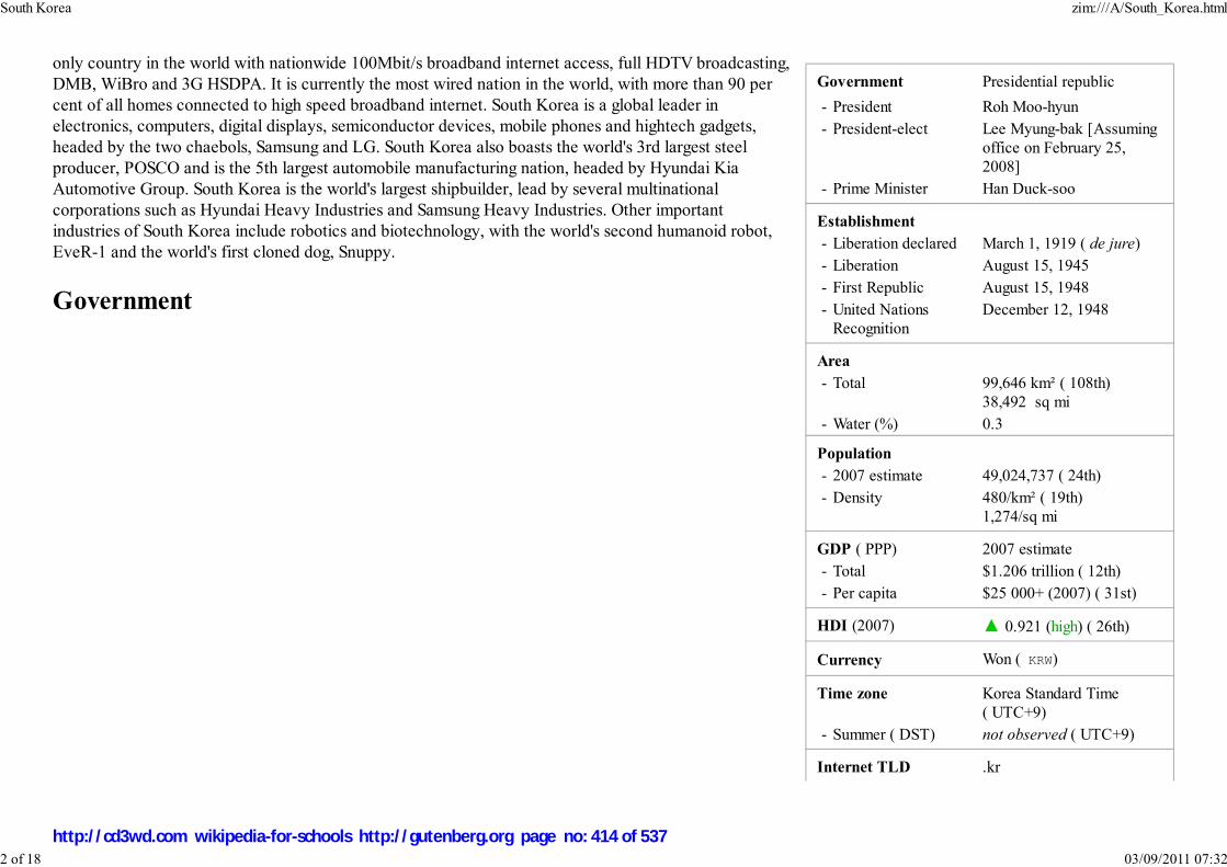
Government Presidential republic
- President Roh Moo-hyun
- President-elect Lee Myung-bak [Assumingoffice on February 25,2008]
- Prime Minister Han Duck-soo
Establishment
- Liberation declared March 1, 1919 ( de jure)
- Liberation August 15, 1945
- First Republic August 15, 1948
- United NationsRecognition
December 12, 1948
Area
- Total 99,646 km² ( 108th)38,492 sq mi
- Water (%) 0.3
Population
- 2007 estimate 49,024,737 ( 24th)
- Density 480/km² ( 19th)1,274/sq mi
GDP ( PPP) 2007 estimate
- Total $1.206 trillion ( 12th)
- Per capita $25 000+ (2007) ( 31st)
HDI (2007) ▲ 0.921 (high) ( 26th)
Currency Won ( KRW)
Time zone Korea Standard Time( UTC+9)
- Summer ( DST) not observed ( UTC+9)
Internet TLD .kr
only country in the world with nationwide 100Mbit/s broadband internet access, full HDTV broadcasting,DMB, WiBro and 3G HSDPA. It is currently the most wired nation in the world, with more than 90 percent of all homes connected to high speed broadband internet. South Korea is a global leader inelectronics, computers, digital displays, semiconductor devices, mobile phones and hightech gadgets,headed by the two chaebols, Samsung and LG. South Korea also boasts the world's 3rd largest steelproducer, POSCO and is the 5th largest automobile manufacturing nation, headed by Hyundai KiaAutomotive Group. South Korea is the world's largest shipbuilder, lead by several multinationalcorporations such as Hyundai Heavy Industries and Samsung Heavy Industries. Other importantindustries of South Korea include robotics and biotechnology, with the world's second humanoid robot,EveR-1 and the world's first cloned dog, Snuppy.
Government
South Korea zim:///A/South_Korea.html
2 of 18 03/09/2011 07:32
http://cd3wd.com wikipedia-for-schools http://gutenberg.org page no: 414 of 537

Calling code +82
Mobile phone system CDMA, HSPDA & WiBro
Domestic power supply 220V/60 Hz, CEE 7/7 sockets
The Gukhoe or National AssemblyBuilding in Yeouido, Seoul
Tomb mural of Goguryeo, one of thethree kingdoms of Korea.
The government of South Korea is divided into three branches: executive, judicial, and legislative. Theexecutive and legislative branches operate primarily at the national level, although various ministries inthe executive branch also carry out local functions. Local governments are semi-autonomous, andcontain executive and legislative bodies of their own. The judicial branch operates at both the nationaland local levels.
The South Korean government's structure is determined by the Constitution of the Republic of Korea. This document hasbeen revised several times since its first promulgation in 1948 (see History of South Korea). However, it has retainedmany broad characteristics; with the exception of the short-lived Second Republic of South Korea, the country hasalways had a presidential system with a relatively independent chief executive.
As with most stable three-branch systems, a careful system of checks and balances is in place.
History
Before division
Archeological findings indicate that the Korean peninsula was occupied by humans as early in the Lower Paleolithicperiod.
Korea began with the legendary founding of Gojoseon in 2333 BCE by Dangun. Gojoseon expanded until it controlledmuch of the northern Korean peninsula and parts of Manchuria. After numerous wars with the Chinese Han Dynasty,Gojoseon disintegrated, leading to the Proto-Three Kingdoms of Korea period.
In the early centuries of the Common Era, Buyeo, Okjeo, Dongye, and the Samhan confederacy occupied the peninsulaand southern Manchuria. Of the various small states, Goguryeo, Baekje, and Silla grew to control the peninsula as rivalkingdoms.
The Buddhism and other influences from China had profound effects on Korea, which later passed on these, as well as their own advances, to Japan.
1
2
South Korea zim:///A/South_Korea.html
3 of 18 03/09/2011 07:32
http://cd3wd.com wikipedia-for-schools http://gutenberg.org page no: 415 of 537

Bulguksa Temple built during the Sillaperiod is a UNESCO World Heritage
Site.
Royal march of the Joseon Dynasty atGyeongbokgung
The unification of the Three Kingdoms by Silla in 676 CE led to the North-South States period, in which the much of theKorean peninsula was controlled by Unified Silla, while Balhae succeeded northern parts of Goguryeo. In Unified Silla,poetry and art was encouraged, and Buddhist culture flowered. Relationships between Korea and China remained goodduring this time. Unified Silla weakened under internal strife, and surrendered to Goryeo in 935. Balhae, Silla's neighbourto the north, was formed as a successor state to Goguryeo. During its height, Balhae controlled most of Manchuria andparts of Russia. It fell to the Khitan in 926 CE.
After the North-South Period, successor states fought for control during the Later Three Kingdoms period. The peninsulawas soon united by Wang Geon of Goryeo. Like Silla, Goryeo was a highly cultural state and it created the Jikji in 1377,using the world's oldest movable metal printing press.
The Mongol invasions in the 13th century greatly weakened Goryeo. However, Goryeo continued to rule the Koreanpeninsula as a tributary ally to the Mongols. After the fall of the Mognolian Empire (by this time the Yuan Dynasty),Goryeo continued its rule. After severe political strife and continued invasions, Goryeo was soon replaced by the JoseonDynasty in 1388 CE following a rebellion by General Yi Seong-gye.
General Yi named his country Joseon (reference to Gojoseon) and moved the capital to Seoul. The first 200 years of theJoseon Dynasty were very peaceful and saw the creation of hangul by King Sejong the Great in the 14 century CE andthe rise and influence of Confucianism.
In the latter of the 16th century CE, Joseon was invaded by a newly unfied Japan. During the Japanese invasions ofKorea (1592-1598), centuries of peace had left the dynasty unprepared, and the lack of technology and poor leadershipfrom the government and generals led to the destruction of much of the Korean peninsula. However, continued Koreandominance at sea led by Admiral Yi, the rise of local militias, and intervention of Ming China put Japan under greatpressure, which soon retreated in 1598 CE.
Today, Admiral Yi is celebrated as one of Korea's foremost heroes and his turtle ships, used with great success againstthe Japanese, are considered the world's first ironclad warships, although lack of hard evidence of iron plating sparksmuch debate.
During the last years of the Joseon Dynasty, Korea's isolationist policy earned it the name the " Hermit Kingdom," primarily for protection against Westernimperialism. In 1910 CE, Korea was annexed by Japan and despite widespread resistance, remained under occupation until the end of World War II in 1945 CE.
After division
South Korea zim:///A/South_Korea.html
4 of 18 03/09/2011 07:32
http://cd3wd.com wikipedia-for-schools http://gutenberg.org page no: 416 of 537

A sculpture at the IncheonLanding Operation Memorial
Hall.
In the aftermath of World War II, Soviet Union and United States troops controlled the northern and southern halves of thecountry respectively. The two Cold War rivals established governments sympathetic to their own ideologies, leading to Korea'sdivision into two political entities: North Korea and South Korea.
Despite the initial plan of a unified Korea in the 1943 Cairo Declaration, escalating Cold War antagonism eventually led to theestablishment of two separate governments: the communist North and the capitalist South. In the North, a former anti-Japaneseguerilla and communist activist, Kim Il Sung and in the South, freshly shipped from America, Syngman Rhee were installed aspresidents. While North Koreans and South Koreans wanted a fully national election to choose a leader for the whole country,the division along Cold War faultlines prevented such an election.
On June 25, 1950, North Korea invaded the South leading to the Korean War. The Soviet boycott of the United Nations at thetime, and therefore, no veto, allowed the UN to intervene when it became apparent that the superior communist forces wouldeasily take over the entire country. The Soviet Union and China backed North Korea, with the participation of millions ofChinese troops. After huge advances on both sides, the war eventually reached a stalemate. The 1953 armistice, never signedby South Korea, split the peninsula along the demilitarized zone near the original demarcation line. No peace treaty was eversigned and the two countries are still technically at war.
In 1960, a student uprising led to the resignation of the autocratic and corrupt President Syngman Rhee. A period of profoundcivil unrest and general political instability followed, broken by General Park Chung-hee's military coup (the "5.16 coup d'etat") against the weak andineffectual government the next year. Park took over as president until his assassination in 1979, overseeing rapid export-led economic growth as well as severepolitical repression. Park is heavily criticized as a ruthless military dictator, although the Korean economy developed significantly during his tenure.
The years after Park's assassination were marked by, again, considerable political turmoil as the previously repressed opposition leaders all campaigned to runfor president in the sudden political void. In 1980, there was a coup d'etat, by General Chun Doo-hwan against the transitional government of Choi Gyu Ha, theinterim president and a former prime minister under Park. Chun assumed the presidency. His seizure of power triggered nationwide protest demandingdemocracy, in particular the city of Gwangju, in South Cholla province where Chun sent in special forces to violently suppress the city, in what is now known asthe Gwangju Massacre. Until 1987, he and his government held Korea under despotic rule when Park Jong Chul - a student attending Seoul National University- was tortured to death. The Catholic Priests' Association for Justice revealed that Park was tortured, igniting huge demonstrations around the country. Thedemonstrations snowballed when another student from Yonsei University, Lee Han Yeol, was killed by a police-fired tear gas bomb while he was demonstratingagainst the military government. The period of resistance is called the Resistance of June when all joined the national movment. Eventually, Chun's party, theDemocratic Justice Party, and its leader, Roh Tae Woo announced the 6.29 Declaration, which included the direct election of the president.
South Korea zim:///A/South_Korea.html
5 of 18 03/09/2011 07:32
http://cd3wd.com wikipedia-for-schools http://gutenberg.org page no: 417 of 537

A part view of Southern Seoul.
U.S. President George W. Bush andSouth Korean President Roh
Moo-hyun in 2005 at the 17th APECmeeting.
In 1988, Seoul hosted the 1988 Summer Olympics, cause of national celebrations in contrast to great turmoil of the past.In 1996, South Korea became a member of the Organization for Economic Co-operation and Development and in 1997,suffered the Asian financial crisis but after swift recovery , the country was able to re-emerge and continue its growthtowards a major economic power.
In June 2000, as part of South Korean president Kim Dae Jung's Sunshine Policy of engagement, a North-South summittook place in North Korea's capital Pyongyang. That year, Kim received the Nobel Peace Prize "for his work fordemocracy and human rights in South Korea and in East Asia in general, and for peace and reconciliation with NorthKorea in particular"
In 2004, South Korea joined the "trillion dollar club" of world economies.
Foreign relations
In its foreign relations, South Korea is primarily concerned with North Korea and the neighboring countries of China, Japan, and Russia, as well as its main ally,the United States.
United States
The United States of America was the primary driver in the establishment and initial sustainment of the South Koreangovernment before and after the Korean War. Since the 1990s, the two nations have often been at odds with regard totheir policies towards North Korea, and over the rise of anti-American sentiment often expressed toward members of theU.S. military,sometimes violently. Nevertheless, most South Koreans are friendly towards the United States. Koreaconcluded a Free Trade Agreement agreement with the United States in April 2007.
China
Korea usually had close relations with the Chinese since historic times. Korean independence fighters also worked withChinese soldiers during the period of Japanese occupation. However, after World War II, the Chinese embracedcommunism while South Korea became a republic with the help of the United Nations. The Korean War and its
aftermath made the relationship between South Korea and China almost nonexistent. However, South Korea and China established formal diplomatic relationson August 24, 1992. The two countries sought to improve the economy and lifted the trade embargo. Korean and Chinese relations have expanded steadilysince 1992.
Japan
South Korea zim:///A/South_Korea.html
6 of 18 03/09/2011 07:32
http://cd3wd.com wikipedia-for-schools http://gutenberg.org page no: 418 of 537
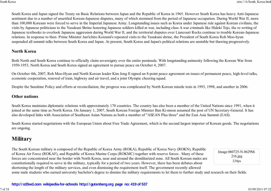
Image:060725-N-8629M-216.jpg220px
South Korea and Japan signed the Treaty on Basic Relations between Japan and the Republic of Korea in 1965. However South Korea has heavy Anti-Japanesesentiment due to a number of unsettled Korean-Japanese disputes, many of which stemmed from the period of Japanese occupation. During World War II, morethan 100,000 Koreans were forced to serve in the Imperial Japanese Army. Longstanding issues such as Korea under Japanese rule against Korean civilians, thevisits by Japanese politicians to the Yasukuni Shrine honoring Japanese soldiers killed at war, including class A war criminals like Hideki Tojo, the re-writing ofJapanese textbooks to overlook Japanese aggression during World War II, and the territorial disputes over Liancourt Rocks continue to trouble Korean-Japaneserelations. In response to then- Prime Minister Jun'ichiro Koizumi's repeated visits to the Yasukuni shrine, the President of South Korea Roh Moo-hyunsuspended all summit talks between South Korea and Japan. At present, South Korea and Japan's political relations are unstable but thawing progressively.
North Korea
Both North and South Korea continue to officially claim sovereignty over the entire peninsula. With longstanding animosity following the Korean War from1950-1953, North Korea and South Korea signed an agreement to pursue peace on October 4, 2007.
On October 4th, 2007, Roh Moo-Hyun and North Korean leader Kim Jong Il signed an 8-point peace agreement on issues of permanent peace, high-level talks,economic cooperation, renewal of train, highway and air travel, and a joint Olympic cheering squad.
Despite the Sunshine Policy and efforts at reconciliation, the progress was complicated by North Korean missile tests in 1993, 1998, and another in 2006.
Other nations
South Korea maintains diplomatic relations with approximately 170 countries. The country has also been a member of the United Nations since 1991, when itjoined at the same time as North Korea. On January 1, 2007, South Korean Foreign Minister Ban Ki-moon assumed the post of UN Secretary-General. It hasalso developed links with Association of Southeast Asian Nations as both a member of "ASEAN Plus three" and the East Asia Summit (EAS).
South Korea started negotiations with the European Union about Free Trade Agreement, which is the second largest importer of Korean goods. The negotiationsare ongoing.
Military
The South Korean military is composed of the Republic of Korea Army (ROKA), Republic of Korea Navy (ROKN), Republicof Korea Air Force (ROKAF), and Republic of Korea Marine Corps (ROKMC) together with reserve forces . Many of theseforces are concentrated near the border with North Korea, near and around the demilitarized zone. All South Korean males areconstitutionally required to serve in the military, typically for a period of two years. However, there has been debates aboutshortening the length of the military services, and even dismissing the requirement itself. The government recently allowedsome male students who earned university bachelor's degree to dismiss the military requirements to let them to further study and research on their fields.
South Korea zim:///A/South_Korea.html
7 of 18 03/09/2011 07:32
http://cd3wd.com wikipedia-for-schools http://gutenberg.org page no: 419 of 537

From time to time, South Korea has sent its troops overseas to assist American forces. It has participated in every major conflict the United States has beeninvolved in the past 50 years. South Korea dispatched 320,000 troops to fight alongside American and South Vietnamese soldiers in the Vietnam War, with apeak strength of 50,000. Most recently, South Korea sent 3,300 troops in the form of the Zaytun Division to help re-building in northern Iraq, and is the largestcontributor after the U.S. and Britain.
The United States has stationed a substantial contingent of troops in the ROK since the Korean War to defend South Korea in case of an attack from NorthKorea. There are also approximately 29,000 US soldiers stationed in Korea, most of them serving one year unaccompanied tours. The American Troops arestationed in bases, of which most are camps. They are considered camps not for their lack of buildings or support structure but in order to represent a lack ofpermanence for the ROK Government.
A still functioning UN Command controls all forces in South Korea, including the US forces and the entire Korean military.
(See List of United States Army installations in South Korea and USFK for more information on these military bases.)
Currently, its navy is working towards a blue-water navy. It has recently equipped its King Sejong the Great class destroyer with the Aegis Combat System.South Korea is the fifth country operating the Aegis Combat System .
Administrative divisions
South Korea zim:///A/South_Korea.html
8 of 18 03/09/2011 07:32
http://cd3wd.com wikipedia-for-schools http://gutenberg.org page no: 420 of 537

General map of South Korea.
Principal divisions of South Korea.
Namea Hangul Hanja
Special cities (Teukbyeolsi a)
1 Seoul (National Capital) 서울특별시 서울特別市
Metropolitan cities (Gwangyeoksi a)
2 Busan 부산광역시 釜山廣域市
3 Daegu 대구광역시 大邱廣域市
4 Incheon 인천광역시 仁川廣域市
5 Gwangju 광주광역시 光州廣域市
6 Daejeon 대전광역시 大田廣域市
7 Ulsan 울산광역시 蔚山廣域市
Provinces
8 Gyeonggi-do 경기도 京畿道
9 Gangwon-do 강원도 江原道
10 Chungcheongbuk-do 충청북도 忠淸北道
11 Chungcheongnam-do 충청남도 忠淸南道
12 Jeollabuk-do 전라북도 全羅北道
13 Jeollanam-do 전라남도 全羅南道
14 Gyeongsangbuk-do 경상북도 慶 北道
15 Gyeongsangnam-do 경상남도 慶 南道
Special self-governing province (Teukbyeoljachi-do a)
16 Jeju 제주특별자치도 濟州特別自治道
a Revised Romanization.b.
South Korea zim:///A/South_Korea.html
9 of 18 03/09/2011 07:32
http://cd3wd.com wikipedia-for-schools http://gutenberg.org page no: 421 of 537

Topography of South Korea
Climate chart for South Korea
J F M A M J J A S O N D
Geography and climate
South Korea occupies the southern portion of the Korean Peninsula, which extends some 680 miles (1,100 km) from the Asianmainland. This mountainous peninsula is flanked by the Yellow Sea to the west, and the Sea of Japan (East Sea) to the east. Itssouthern tip lies on the Korea Strait and the East China Sea. The country's total area is 38,462.49 square miles(99,617.39 km²).;
South Korea can be divided into four general regions: an eastern region of high mountain ranges and narrow coastal plains; awestern region of broad coastal plains, river basins, and rolling hills; a southwestern region of mountains and valleys; and asoutheastern region dominated by the broad basin of the Nakdong River.
South Korea's land is mountainous, and most of it is not arable. Lowlands, located primarily in the west and southeast,constitute only 30% of the total land area.
About three thousand islands, mostly small and uninhabited, lie off the western and southern coasts of South Korea. Jeju Islandis located about 100 kilometers (about 60 mi) off the southern coast of South Korea. It is the country's largest island, with anarea of 1,845 square kilometers (712 sq mi). Jeju is also the site of South Korea's highest point: Halla-san, an extinct volcano,
reaches 1,950 meters (6,398 ft) above sea level. Other islands of South Korea include Ulleungdo and Dokdo, which is South Korea's farthest claimed territory tothe east and Marado, which is the ROK's southernmost point. However, Dokdo is one of many disputes with Japan. Ulleungdo is inhabited.
Climate
The local climate is relatively temperate, with precipitation heavier in summer during a short rainyseason called jangma, and winters that can be bitterly cold. In Seoul, the average Januarytemperature range is -7 ° C to 1 °C (19 ° F to 33 °F), and the average July temperature range is 22°C to 29 °C (71 °F to 83 °F). Winter temperatures are higher along the southern coast andconsiderably lower in the mountainous interior. Rainfall is concentrated in the summer months ofJune through September. The southern coast is subject to late summer typhoons that bring strongwinds and heavy rains. The average annual precipitation varies from 1,370 millimeters (54 inches)in Seoul to 1,470 millimeters (58 inches) in Busan. There are occasional typhoons that bring highwinds and floods. The government is concerned of the impact of global warming on the naturaldisasters.
Environment
In urban areas there are problems associated with air pollution as well as water pollution from the
23
1
-7
25
3
-5
47
10
0
94
17
7
92
23
13
134
26
17
369
29
22
294
30
22
169
26
17
50
20
10
53
11
3
21
4
-4
South Korea zim:///A/South_Korea.html
10 of 18 03/09/2011 07:32
http://cd3wd.com wikipedia-for-schools http://gutenberg.org page no: 422 of 537

temperatures in °C • precipitation totals in mmsource: http://www.climate-charts.com/Locations/k/KO47108.html
Yeouido, an important financial centrelocated in Seoul.
Kia and Hyundai are two majorautomobile companies in South Korea.
discharge of sewage and industrial effluents. Cheonggyecheon is one of the examples of restoringthe flow of the clean water in South Korea.
South Korean joined numerous environmental organizations: Antarctic-Environmental Protocol,Antarctic Treaty, Biodiversity, Climate Change, Desertification, Endangered Species, EnvironmentalModification, Hazardous Wastes, Law of the Sea, Marine Dumping, Nuclear Test Ban, Ozone LayerProtection, Ship Pollution ( MARPOL 73/78), Tropical Timber 83, Tropical Timber 94, Wetlands,and Whaling.
Economy
South Korea is a major international economic power; it has the eleventh largest economy in the world and the thirdlargest in Asia, behind Japan and China. Its largest trading partner and export market today is China. South Korea hasachieved rapid economic growth through exports of manufactured goods, and is one of the Four Asian Tigers. Majorindustries in South Korea today are automobiles, semiconductor, electronics, shipbuilding, and steel.
In the 1950s, South Korea was one of the poorest countries in Asia. This was partly due to the destruction of much of thecountry's infrastructure during the Korean War.
Following the military coup led by General Park Chung-hee in 1962, South Koreaembarked on a series of ambitious five-year plans for economic developmentsimilar to the macro-economic schemes of the Soviet Union. Emphasis shifted toforeign trade with the normalization of relations with Japan in 1965, which
resulted in a boom in trade and investment. Rapid expansion, first into light and then heavy industries, so in 1973 Koreabecame the 34th wealthiest country in the world. Park's government plans for economic development greatly boosted theKorean economy.
This growth is often called the " Miracle on the Han River", the Han River being the main river that runs through thenation's capital and largest city, Seoul. In the 1980s and 1990s, growth continued as South Korea transformed itself froman exporter of mostly textiles and shoes into a major global producer of automobiles, electronics, shipbuilding, steel and,later, high-technology products such as digital monitors, mobile phones, and semiconductors.
The South Korean model of encouraging the growth of large, internationally competitive companies through easy financing and tax incentives led to thedominance of the family-controlled conglomerates. These companies, known as chaebol, flourished under the support of the Park regime. Some such asHyundai, Samsung, LG and SK Company became global corporations. In 2004, South Korea joined in the trillion dollar club of world economies.
Imperial conversion [ Hide ]
South Korea zim:///A/South_Korea.html
11 of 18 03/09/2011 07:32
http://cd3wd.com wikipedia-for-schools http://gutenberg.org page no: 423 of 537
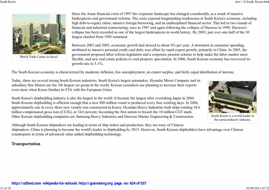
World Trade Centre in Seoul.
South Korea is a world leader inthe semiconductor industry.
Since the Asian financial crisis of 1997 the corporate landscape has changed considerably as a result of massivebankruptcies and government reforms. The crisis exposed longstanding weaknesses in South Korea's economy, includinghigh debt-to-equity ratios, massive foreign borrowing, and an undisciplined financial sector. This led to two rounds offinancial and industrial restructuring; once in 1997 and again following the collapse of Daewoo in 1999. Daewoo'scollapse has been recorded as one of the largest bankruptcies in world history. By 2003, just over one-half of the 30largest chaebol from 1995 remained.
Between 2003 and 2005, economic growth had slowed to about 4% per year. A downturn in consumer spending,attributed to massive personal credit card debt, was offset by rapid export growth, primarily to China. In 2005, thegovernment proposed labor reform legislation and a corporate pension scheme to help make the labor market moreflexible, and new real estate policies to cool property speculation. In 2006, South Korean economy has recovered itsgrowth rate to 5.1%.
The South Korean economy is characterized by moderate inflation, low unemployment, an export surplus, and fairly equal distribution of income.
Today, there are several strong South Korean industries. South Korea's largest automaker, Hyundai Motor Company and itssubsidiary Kia Motors are the 5th largest car group in the world. Korean carmakers are planning to increase their exportseven more when Korea finishes its FTA with the European Union.
South Korea's shipbuilding industry is also the largest in the world. It became the largest after overtaking Japan in 2004.South Korean shipbuilding is efficient enough that a new $80 million vessel is produced every four working days. In 2006,approximately one in every three new vessels was constructed in Korea. Hyundai Heavy Industries built ships totaling 10.6million compensated gross tons (CGTs), or 34.6 percent, becoming the first nation to breach the 10 million CGT mark.Other Korean shipbuilding companies are Samsung Heavy Industries and Daewoo Marine Engineering & Construction.
Although South Korean shipmakers are leading in terms of ship orders and production, they are wary of Chineseshipmakers. China is planning to become the world's leader in shipbuilding by 2015. However, South Korean shipbuilders have advantage over Chinesecounterparts in terms of advanced value-added shipbuilding technology.
Transportation
South Korea zim:///A/South_Korea.html
12 of 18 03/09/2011 07:32
http://cd3wd.com wikipedia-for-schools http://gutenberg.org page no: 424 of 537
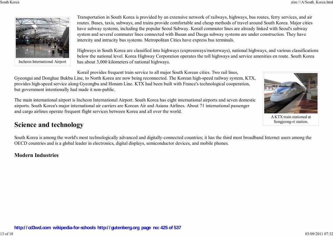
Incheon International Airport
A KTX train stationed atSongjeong-ri station.
Transportation in South Korea is provided by an extensive network of railways, highways, bus routes, ferry services, and airroutes. Buses, taxis, subways, and trains provide comfortable and cheap methods of travel around South Korea. Major citieshave subway systems, including the popular Seoul Subway. Korail commuter lines are already linked with Seoul's subwaysystem and several commuter lines connected with Busan and Daegu subway systems are under construction. They haveintercity and intracity bus systems. Metropolitan Cities have express bus terminals.
Highways in South Korea are classified into highways (expressways/motorways), national highways, and various classificationsbelow the national level. Korea Highway Corporation operates the toll highways and service amenities en route. South Koreahas about 3,000 kilometers of national highways.
Korail provides frequent train service to all major South Korean cities. Two rail lines,Gyeongui and Donghae Bukbu Line, to North Korea are now being reconnected. The Korean high-speed railway system, KTX,provides high-speed service along Gyeongbu and Honam Line. KTX had been built with France's technological cooperation,but government intentionally had made it non-public.
The main international airport is Incheon International Airport. South Korea has eight international airports and seven domesticairports. South Korea's major international air carriers are Korean Air and Asiana Airlines. About 71 international passengerand cargo airlines operate frequent flight services between Korea and all over the world.
Science and technology
South Korea is among the world's most technologically advanced and digitally-connected countries; it has the third most broadband Internet users among theOECD countries and is a global leader in electronics, digital displays, semiconductor devices, and mobile phones.
Modern Industries
South Korea zim:///A/South_Korea.html
13 of 18 03/09/2011 07:32
http://cd3wd.com wikipedia-for-schools http://gutenberg.org page no: 425 of 537

Posteel tower, the headquarterof POSCO.
KAIST's robot, HUBO
South Korea also leads the world in the shipbuilding industry, headed by chaebols such as the Hyundai Heavy Industries,Samsung Heavy Industry and POSCO. South Korea also exports radioactive isotope production equipment for medical andindustrial use to countries such as Russia, Japan, Turkey and others.
Space programs
Korea has a full-fledged space partnership with Russia and has launched the Arirang-1 and Arirang-2 which both havesurveillance cameras equipped. Naro Space Centre, the first spaceport of the Republic of Korea, is scheduled to be completedby the end of 2007 or early 2008 at Goheung County, South Jeolla. Korea Space Centre is expected to send a Korea SpaceLaunch Vehicle into space in 2008. The spaceport will be controlled by the state-run Korea Aerospace Research Institute andwill contain features necessary for spaceflight operation having a launch tower, a control tower, rocket assembly, test facilitiesand space simulators.
Robotics
In robotics, Korea Advanced Institute of Science and Technology (KAIST) competeswith the Japanese company Honda with its humanoid robot HUBO. Honda's ASIMO and KAIST's HUBO lines are thetwo of very few humanoid robots that can walk. The first HUBO was developed within a span of 3 years and cost 1million USD.
Energy
In renewable energy, South Korean scientists at the Gwangju Institute of Science and Technology in cooperation with theUniversity of California, Santa Barbara successfully developed an organic photovoltaic power cell with energy efficiencyof 6.5 percent.
Education
South Korea zim:///A/South_Korea.html
14 of 18 03/09/2011 07:32
http://cd3wd.com wikipedia-for-schools http://gutenberg.org page no: 426 of 537
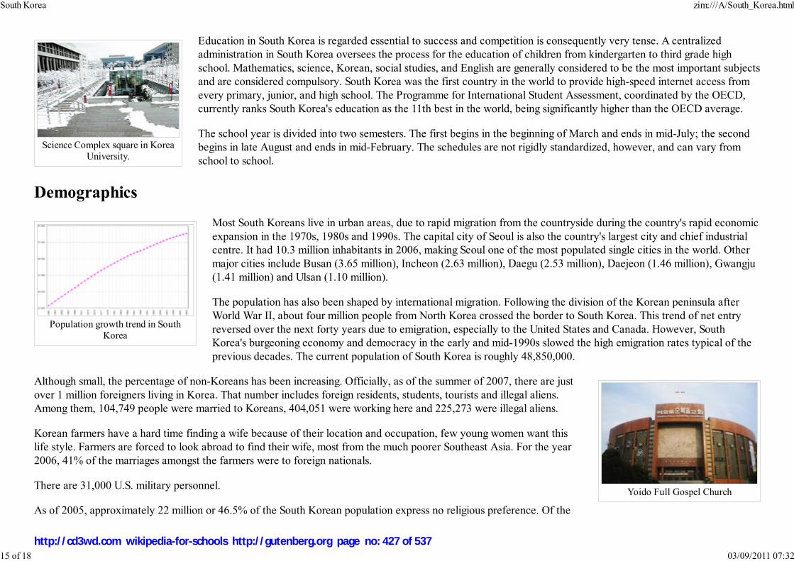
Science Complex square in KoreaUniversity.
Population growth trend in SouthKorea
Yoido Full Gospel Church
Education in South Korea is regarded essential to success and competition is consequently very tense. A centralizedadministration in South Korea oversees the process for the education of children from kindergarten to third grade highschool. Mathematics, science, Korean, social studies, and English are generally considered to be the most important subjectsand are considered compulsory. South Korea was the first country in the world to provide high-speed internet access fromevery primary, junior, and high school. The Programme for International Student Assessment, coordinated by the OECD,currently ranks South Korea's education as the 11th best in the world, being significantly higher than the OECD average.
The school year is divided into two semesters. The first begins in the beginning of March and ends in mid-July; the secondbegins in late August and ends in mid-February. The schedules are not rigidly standardized, however, and can vary fromschool to school.
Demographics
Most South Koreans live in urban areas, due to rapid migration from the countryside during the country's rapid economicexpansion in the 1970s, 1980s and 1990s. The capital city of Seoul is also the country's largest city and chief industrialcentre. It had 10.3 million inhabitants in 2006, making Seoul one of the most populated single cities in the world. Othermajor cities include Busan (3.65 million), Incheon (2.63 million), Daegu (2.53 million), Daejeon (1.46 million), Gwangju(1.41 million) and Ulsan (1.10 million).
The population has also been shaped by international migration. Following the division of the Korean peninsula afterWorld War II, about four million people from North Korea crossed the border to South Korea. This trend of net entryreversed over the next forty years due to emigration, especially to the United States and Canada. However, SouthKorea's burgeoning economy and democracy in the early and mid-1990s slowed the high emigration rates typical of theprevious decades. The current population of South Korea is roughly 48,850,000.
Although small, the percentage of non-Koreans has been increasing. Officially, as of the summer of 2007, there are justover 1 million foreigners living in Korea. That number includes foreign residents, students, tourists and illegal aliens.Among them, 104,749 people were married to Koreans, 404,051 were working here and 225,273 were illegal aliens.
Korean farmers have a hard time finding a wife because of their location and occupation, few young women want thislife style. Farmers are forced to look abroad to find their wife, most from the much poorer Southeast Asia. For the year2006, 41% of the marriages amongst the farmers were to foreign nationals.
There are 31,000 U.S. military personnel.
As of 2005, approximately 22 million or 46.5% of the South Korean population express no religious preference. Of the
South Korea zim:///A/South_Korea.html
15 of 18 03/09/2011 07:32
http://cd3wd.com wikipedia-for-schools http://gutenberg.org page no: 427 of 537
A parade of Hi Seoul Festival
SBS headquarter in Mokdong,Seoul
remainder, 13.7 million are Christian (of which 8.6 million profess to be Protestants and 5.1 million to be Catholics), 10.7 million are Buddhist, and less thanhalf a million belong to various minor religions including Jeungsando and Wonbuddhism. The largest Christian church in South Korea, Yoido Full GospelChurch, is located in Seoul and has approximately 780,000 members (2003 estimate). Including Yoido Full Gospel, 11 of the world's 12 largest churches arelocated in Seoul (see Korean Christianity). South Korea is also the second largest missionary sending nation on earth, after the U.S. Islam in Korea is estimatedto be at 45,000 in addition to some 100,000 foreign workers from Muslim countries. Islam is also the fastest growing religion in country.
Culture
South Korea shares its traditional culture with North Korea, but the two Koreas have developed distinct contemporaryforms of culture since the peninsula was divided in 1945. The South Korean Ministry of Culture and Tourism activelyencourages the traditional arts, as well as modern forms, through funding and education programs.
Korean forms of metalwork, sculpture, painting, and ceramics flourished throughout the Korean peninsula. In moderntimes, Western and particularly the US influences have been strongest. In the aftermath of Japanese occupation allJapanese cultural exports were banned from Korea until 1999. However, trading between the two countries has grown,although there is still strong anti-Japanese sentiment in South Korea.
Recently, Korean pop culture has become popular in Asia and beyond, earning the name Hallyu or " Korean Wave." InJapan, Korean singers like BoA and television drama like Winter Sonata have found success. Recent Korean films suchas Old boy and Oasis have also received international acclaim.
The contemporary culture of South Korea is heavily dominated by technology, including feature-rich cell phones and pervasiveonline games. South Korea today has the highest penetration of high-speed internet access to households in the world. In SouthKorea, computer games take on a sport-like presentation. The professional leagues are televised with announcers, professionalplayers and major corporate sponsors.
South Korea zim:///A/South_Korea.html
16 of 18 03/09/2011 07:32
http://cd3wd.com wikipedia-for-schools http://gutenberg.org page no: 428 of 537

Various kimchi andbanchan
Korean Pork BBQ,called Pork Galbi
Taekwondo sparring match.
South Korea retains centuries-old customs and traditions, such as its cuisine, ancestor worship, blood line and some Confucianismideals. Foods like Steamed Rice(밥), Bulgogi (불고기, Korean style beef BBQ), Gimbap (김밥, rice roll wrapped in seaweed), Mandu(만두, dumplings), Doenjang jjigae (된장찌개, fermented soybean paste), Japchae (잡채, Boiled sweet potato starch noodles mixedwith fried vegetables), Tteokbokki (떡볶이, a broiled dish made with sliced rice cake, seasoned beef, fish cakes and vegetables),Bibimbap (비빔밥, mixed rice with vegetables, beef, egg and chili pepper paste) and Kimchi (김치, fermented vegetables) are staplesof the Korean diet.
Sports
Taekwondo, a popular martial art, originated in Korea. In the 1950's and 60's, modern rules werestandardized, and Taekwondo became an official Olympic sport in 2000. Taekwondo in the military isan integral part in the Korean land forces. Other Korean martial arts include subak and taekkyeon.
Baseball was first introduced to Korea in 1905 and has since become the most popular spectator sportin South Korea. The first South Korean professional sports league was the Korea BaseballAssociation, established in 1982. During the 2006 World Baseball Classic, South Korea reached thesemi-finals.
Other known sports in South Korea include basketball, football, golf, tennis and ice hockey. Women's golf is especially strong,with 45 South Koreans playing in the U.S. LPGA Tour, including Hall of Famer Se Ri Pak.
Starcraft is also a popular online game in South Korea. Its fanbase exceeds five million, and has two Korean-based channelsdedicated to its broadcast. Professional Starcraft player Lim Yo-Hwan ( SlayerS_`BoxeR`) earned over USD $300,000 duringthe peak of his career and owns the record for the most DVD's sold in Korea, beating out the entire Matrix trilogy.
In 1988, South Korea hosted the Summer Olympics in Seoul for the first time. South Korea's Olympic teams have performedstrongly in archery, shooting, table tennis, short track speed skating, handball, freestyle wrestling, judo, taekwondo, and
football. South Korea has also hosted the Asian Games in 1986 and 2002. Recently, Pyeongchang County was a finalist for the 2014 Winter Olympics, but lostto Sochi, Russia.
The 2002 FIFA World Cup was jointly hosted by South Korea and Japan, and South Korea became the first Asian team to reach the semi-finals. The KoreaRepublic national football team, also known as the " Taeguk Warriors", played in the 2006 FIFA World Cup in Germany for their sixth consecutive World Cup.
In 2007, South Korea hosted a cycling competition called Tour de Korea. It was the first international cycling competition in South Korea in 10 years. In 2010South Korea will host their first Formula 1 race to be staged at Korean International Circuit in Yeongam County about 240 miles (390 km) south of Seoul.
South Korea zim:///A/South_Korea.html
17 of 18 03/09/2011 07:32
http://cd3wd.com wikipedia-for-schools http://gutenberg.org page no: 429 of 537

International rankings
Organization Title Ranking
OECD Annual work hours 1 out of 27
Economist Intelligence Unit IT Industry Competitiveness Index (2007) 3 out of 64
OICA Automobile Production 5 out of 53
UN Department of Economic and Social Affairs UN E-Government Survey 2008 6 out of 192
CIA World Factbook Gross Domestic Product (PPP) 11 out of 227
World Economic Forum Global Competiveness 11 out of 131
International Monetary Fund/ World Bank Gross Domestic Product (nominal) 12 out of 183
World Bank Ease of Doing Business 15 out of 177
United Nations Development Program Human Development Index 26 out of 177
The Economist Global Peace Rating 29 out of 121
Economist Intelligence Unit Quality of Life 30 out of 155
Heritage Foundation/The Wall Street Journal Index of Economic Freedom 36 out of 157
Reporters Without Borders Worldwide press freedom index 39 out of 169
Transparency International Corruption Perceptions Index 42 out of 180
Freedom House Civil Liberties and Political Rights Top tier country†
†Complete Civil and Political freedom
Retrieved from " http://en.wikipedia.org/wiki/South_Korea"The 2008 Wikipedia for Schools is sponsored by SOS Children , and consists of a hand selection from the English Wikipedia articles with only minor deletions(see www.wikipedia.org for details of authors and sources). The articles are available under the GNU Free Documentation License. See also our
South Korea zim:///A/South_Korea.html
18 of 18 03/09/2011 07:32
http://cd3wd.com wikipedia-for-schools http://gutenberg.org page no: 430 of 537

This article contains Indic text.
Without rendering support, you may
see question marks, boxes or other
symbols instead of Indic characters;
or irregular vowel positioning and a
lack of conjuncts.
இல�ைக ஜனநாயக சம �வ��யர�
Democratic Socialist Republic of Sri
Lanka
Image:COA of Sri
Lanka.svg
Flag Coat of arms
Anthem: " Sri Lanka Matha"
Music , Singing
Sri Lanka
2008/9 Schools Wikipedia Selection. Related subjects: Asia; Asian Countries
SOS Children works in Sri Lanka. For more information see SOS Children in Sri Lanka
Sri Lanka, officially the Democratic Socialist Republic of Sri Lanka ( Sinhalese: , Tamil:
இல�ைக; known as Ceylon before 1972) is an island nation in South Asia, located about 31 kilometres (19.3
mi) off the southern coast of India. Popularly referred to as the Pearl of the Indian Ocean, it is home to around
twenty million people.
Because of its location in the path of major sea routes, Sri Lanka is a strategic naval link between West Asia and
South East Asia, and has been a centre of Buddhist religion and culture from ancient times. Today, the
country is a multi-religious and multi-ethnic nation, with nearly a third of the population following faiths
other than Buddhism, notably Hinduism, Christianity and Islam. The Sinhalese community forms the
majority of the population, with Tamils, who are concentrated in the north and east of the island, forming
the largest ethnic minority. Other communities include the Muslim Moors and Malays and the Burghers.
Famous for the production and export of tea, coffee, rubber and coconuts, Sri Lanka boasts a progressive
and modern industrial economy and the highest per capita income in South Asia. The natural beauty of
Sri Lanka's tropical forests, beaches and landscape, as well as its rich cultural heritage, make it a world
famous tourist destination.
After over two thousand years of rule by local kingdoms, parts of Sri Lanka were colonized by Portugal
and the Netherlands beginning in the 16th century, before the control of the entire country was ceded to
the British Empire in 1815. During World War II, Sri Lanka served as an important base for Allied forces
in the fight against the Japanese Empire. A nationalist political movement arose in the country in the
early 20th century with the aim of obtaining political independence, which was eventually granted by the
British after peaceful negotiations in 1948.
Name
In ancient times, Sri Lanka was known by a variety of names: ancient Greek geographers called it
Sri Lanka zim:///A/Sri_Lanka.html
1 of 15 03/09/2011 07:33
http://cd3wd.com wikipedia-for-schools http://gutenberg.org page no: 431 of 537

Capital Sri Jayawardenapura-Kotte
Largest city Colombo
Official languages Sinhala, Tamil
Government Democratic Socialist
Republic
- President Mahinda Rajapaksa
- Prime Minister Ratnasiri Wickremanayake
Independence from the United Kingdom
- Declared February 4, 1948
- Republic May 22, 1972
Area
- Total 65,610 km² ( 122nd)
25,332 sq mi
- Water (%) 4.4
Population
- 2005 estimate 19,668,000 ( 52nd)
- 2001 census 18,732,255
- Density 310/km² ( 35th)
818/sq mi
GDP ( PPP) 2005 estimate
- Total $86.72 billion ( 61st)
- Per capita $4,600 ( 111th)
GDP (nominal) 2006 estimate
History of Sri Lanka
series
Prehistory of Sri LankaEarly Sri Lankan HistoryKings of Sri LankaColonial eraSri Lankan independence movementIndependence of Sri LankaSri Lankan Civil War
Taprobane and Arabs referred to it as Serendib (the origin of the word " serendipity"). Ceilão was the
name given to Sri Lanka by the Portuguese when they arrived on the island in 1505, which was
transliterated into English as Ceylon. In 1972, the official name of the country was changed to " Free,
Sovereign and Independent Republic of Sri Lanka" (in Sinhala śrī laṃkā, IPA: [ˌʃɾiːˈlaŋkaː];
whereas the island itself is referred to as ලංකාව laṃkāva, IPA: [laŋˈkaːʋə], in Tamil இல�ைகilaṅkai, iˈlaŋgai). In 1978 it was changed to " Democratic Socialist Republic of Sri Lanka".
The current name is derived from Sanskrit word laṃkā, meaning "resplendent land", which was also the
name of the island as described in the ancient Indian epics Mahabharata and the Ramayana.
History
Paleolithic human settlements have been discovered at
excavations in several cave sites in the Western Plains region
and the South-western face of the Central Hills region.
Anthropologists believe that some discovered burial rites and
certain decorative artifacts exhibit similarities between the first
inhabitants of the island and the early inhabitants of Southern
India. Recent bioanthropological studies have however dismissed
these links, and have placed the origin of the people to the northern
parts of India. One of the first written references to the island is
found in the Indian epic Ramayana, which described the emperor
Ravana as monarch of the powerful kingdom of Lanka, which was created by the divine sculptor
Vishwakarma for Kubera, the treasurer of the Gods. English historian James Emerson Tennent also
theorized Galle, a southern city in Sri Lanka, was the ancient seaport of Tarshish from which King
Solomon is said to have drawn ivory, peacocks and other valuables. The main written accounts of the
country's history are the Buddhist chronicles of Mahavansa and Dipavamsa.
The earliest-known inhabitants of the island now known as Sri Lanka were probably the ancestors of the
Wanniyala-Aetto people, also known as Veddahs and numbering roughly 3,000. Linguistic analysis has
found a correlation of the Sinhalese language with the languages of the Sindh and Gujarat, although most
historians believe that the Sinhala community emerged well after the assimilation of various ethnic
groups. From the ancient period date some remarkable archaeological sites including the ruins of Sigiriya,
the so-called "Fortress in the Sky", and huge public works. Among the latter are large "tanks" or
reservoirs, important for conserving water in a climate that alternates rainy seasons with dry times, and
Sri Lanka zim:///A/Sri_Lanka.html
2 of 15 03/09/2011 07:33
http://cd3wd.com wikipedia-for-schools http://gutenberg.org page no: 432 of 537

- Total $26.794 billion ( 78th)
- Per capita $1,355 ( 117th)
Gini (1999–00) 33.2 (medium)
HDI (2007) ▼0.743 (medium) ( 99th)
Currency Sri Lankan rupee ( LKR)
Time zone ( UTC+5:30)
Internet TLD .lk
Calling code +94
Sri Lankan coin, 1st centuryCE.
Sigiriya Rock Fortress.
elaborate aqueducts, some with a slope as finely calibrated as one inch to the mile. Ancient Sri Lanka
was also the first in the world to have established a dedicated hospital in Mihintale in the 4th century
BCE. Ancient Sri Lanka was also the world's leading exporter of cinnamon, which was exported to Egypt
as early as 1400 BCE. Sri Lanka was also the first Asian nation to have a female ruler in Queen Anula
(47–42 BC)
Since ancient times Sri Lanka was ruled by monarchs, most notably of the Sinha royal dynasty that lasted
over 2000 years. The island was also infrequently invaded by South Indian kingdoms and parts of the
island were ruled intermittently by the Chola dynasty, the Pandya dynasty, the Chera dynasty and the
Pallava dynasty. The island was also invaded by the kingdoms of Kalinga (modern Orissa) and those
from the Malay Peninsula. Buddhism arrived from India in the 3rd century BCE, brought by Bhikkhu
Mahinda, who is believed to have been the son of Mauryan emperor Ashoka. Mahinda's mission won
over the Sinhalese monarch Devanampiyatissa of Mihintale, who embraced the faith and propagated it
throughout the Sinhalese population. The Buddhist kingdoms of Sri Lanka would maintain a large number of Buddhist schools
and monasteries, and support the propagation of Buddhism into Southeast Asia.
Sri Lanka had always been an important port and trading post in the ancient world, and was increasingly frequented by
merchant ships from the Middle East, Persia, Burma, Thailand, Malaysia, Indonesia and other parts of Southeast Asia. The
islands were known to the first European explorers of South Asia and settled by many groups of Arab and Malay merchants. A
Portuguese colonial mission arrived on the island in 1505 headed by the Lourenço de Almeida the son of Francisco de
Almeida. At that point the island consisted of three kingdoms, namely Kandy in the central hills, Kotte at the Western coast,
and Yarlpanam (Anglicised Jaffna) in the north. The Dutch arrived in the 17th century. Although much of the island came
under the domain of European powers, the interior, hilly region of the island remained independent, with its capital in Kandy.
The British East India Company established control of the island in 1796, declaring it a crown colony in 1802, although the
island would not be officially connected with British India. The fall of the kingdom of Kandy in 1815 unified the island under
British rule.
European colonists established a series of tea, cinnamon, rubber, sugar, coffee and indigo plantations. The British also brought
a large number of indentured workers from Tamil Nadu to work in the plantation economy. The city of Colombo was
established as the administrative centre, and the British established modern schools, colleges, roads and churches that brought
Western-style education and culture to the native people. Increasing grievances over the denial of civil rights, mistreatment and
abuse of natives by colonial authorities gave rise to a struggle for independence in the 1930s, when the Youth Leagues opposed
the "Ministers' Memorandum," which asked the colonial authority to increase the powers of the board of ministers without
granting popular representation or civil freedoms. Buddhist scholars and the Teetotalist Movement also played a vital role in
this time. During World War II, the island served as an important Allied military base. A large segment of the British and
American fleet were deployed on the island, as were tens of thousands of soldiers committed to the war against Japan in
Sri Lanka zim:///A/Sri_Lanka.html
3 of 15 03/09/2011 07:33
http://cd3wd.com wikipedia-for-schools http://gutenberg.org page no: 433 of 537

Main cities in Sri Lanka.
Southeast Asia.
Following the war, popular pressure for independence intensified. On February 4, 1948 the country won its independence as the Commonwealth of Ceylon. Don
Stephen Senanayake became the first Prime Minister of Sri Lanka. On July 21, 1960 Sirimavo Bandaranaike took office as prime minister, and became the first
female head of government in post-colonial Asia and the first female prime minister in the world. In 1972, the country became a republic within the
Commonwealth, and the name was changed to Sri Lanka. The island enjoyed good relations with the United Kingdom and had the British Royal Navy stationed
at Trincomalee.
Since 1983, there has been on-and-off civil war, predominantly between the government and the Liberation Tigers of Tamil Eelam (LTTE, also known as the
Tamil Tigers), a separatist militant organization who fight to create an independent state named Tamil Eelam in the North and East of the island.
Geography and climate
The island of Sri Lanka lies in the Indian Ocean, to the southwest of the Bay of Bengal and to the southeast of the Arabian Sea.
It is separated from the Indian subcontinent by the Gulf of Mannar and the Palk Strait. According to Hindu mythology, a land
bridge to the Indian mainland, known as Rama's Bridge, was constructed during the time of Rama by the vanara architect Nala.
Often referred to as Adam's Bridge, it now amounts to only a chain of limestone shoals remaining above sea level. According
to colonial British reports, this is a natural causeway which was formerly complete, but was breached by a violent storm in
1480. The width of the Palk Strait is small enough for the coast of Sri Lanka to be visible from the furthest point near the
Indian town of Rameswaram. The tear drop shaped island consists mostly of flat-to-rolling coastal plains, with mountains rising
only in the south-central part. Amongst these are Sri Pada (Adams Peak) and the highest point Pidurutalagala, at 2,524 meters
(8,281 ft). The Mahaweli ganga (Mahaweli river) and other major rivers provide fresh water to the population.
Sri Lanka zim:///A/Sri_Lanka.html
4 of 15 03/09/2011 07:33
http://cd3wd.com wikipedia-for-schools http://gutenberg.org page no: 434 of 537

Topographical map of SriLanka.
Mountain forests in Sri Lanka.
Sri Lanka's climate can be described as tropical, and quite hot. Its position between 5 and 10 north latitude endows the country
with a warm climate, moderated by ocean winds and considerable moisture. The mean temperature ranges from a low of 16 °C
(61 °F) in Nuwara Eliya in the Central Highlands (where frost may occur for several days in the winter) to a high of 32 °C
(90 °F) in Trincomalee on the northeast coast (where temperatures may reach 38 °C (100 °F)). The average yearly temperature
for the country as a whole ranges from 28° to 30 °C (82–86 °F). Day and night temperatures may vary by 4 to 7 °C (7–13 °F).
In January, the coolest month, many people wear coats and sweaters in the highlands and elsewhere. May, the hottest period,
precedes the summer monsoon rains. The rainfall pattern is influenced by the monsoon winds of the Indian Ocean and Bay of
Bengal, which encounter the slopes of the Central Highlands, they unload heavy rains on the mountain slopes and the
southwestern sector of the island. Some of the windward slopes receive up to 2,500 millimetres (98 in) of rain per month, but
the leeward slopes in the east and northeast receive little rain. Periodic squalls occur and sometimes tropical cyclones bring
overcast skies and rains to the southwest, northeast, and eastern parts of the island. Between December to March, monsoon
winds come from the northeast, bringing moisture from the Bay of Bengal. Humidity is typically higher in the southwest and
mountainous areas and depends on the seasonal patterns of rainfall. At Colombo, for example, daytime humidity stays above
70% all year, rising to almost 90 percent during the monsoon season in June. Anuradhapura experiences a daytime low of 60%
during the monsoon month of March, but a high of 79% during the November and December rains. In the highlands, Kandy's
daytime humidity usually ranges between 70 and 79%.
Flora and fauna
The mountains and the southwestern part of the country, known as the "wet zone," receive ample rainfall (an annual average
of 2500 millimetres). Most of the southeast, east, and northern parts of the country comprise the "dry zone," which receives
between 1200 and 1900 mm (47–75 in) of rain annually. Much of the rain in these areas falls from October to January; during
the rest of the year there is very little precipitation, and all living creatures must conserve precious moisture. The arid
northwest and southeast coasts receive the least amount of rain — 600 to 1200 mm (24–47 in) per year — However, though
many say that there are no really dry areas in Sri Lanka, there are many pockets of very dry and abandoned areas where there
is little to no rainwater. Varieties of flowering acacias are well adapted to the arid conditions and flourish on the Jaffna
Peninsula. Among the trees of the dry-land forests are some valuable species, such as satinwood, ebony, ironwood, and
mahogany and teak. In the wet zone, the dominant vegetation of the lowlands is a tropical evergreen forest, with tall trees,
broad foliage, and a dense undergrowth of vines and creepers.
Subtropical evergreen forests resembling those of temperate climates flourish in the higher altitudes. Forests at one time covered nearly the entire island, but by
the late 20th century lands classified as forests and forest reserves covered around one-third of the land. As the area covered by forests declined, thereby
threatening various species of wildlife, Sri Lanka became the first country in the world to establish a wildlife sanctuary. Among them, the Ruhunu National Park
in the southeast protects herds of elephant, deer, and peacocks, and the Wilpattu National Park in the northwest preserves the habitats of many water birds,
such as storks, pelicans, ibis, and spoonbills. During the Mahaweli Ganga Program of the 1970s and 1980s in northern Sri Lanka, the government set aside four
Sri Lanka zim:///A/Sri_Lanka.html
5 of 15 03/09/2011 07:33
http://cd3wd.com wikipedia-for-schools http://gutenberg.org page no: 435 of 537

The Supreme Court of SriLanka, Colombo.
areas of land totaling 1,900 km² (730 sq mi) as national parks. The island has three biosphere reserves, Hurulu, Sinharaja, and the Kanneliya-Dediyagala-
Nakiyadeniya.
The national flower of Sri Lanka is Nil Manel (Nymphaea stelleta), the national tree is Na (Mesua nagassarium) and the national bird is the Sri Lanka
Junglefowl, which is endemic to the country.
Government and politics
The Constitution of Sri Lanka establishes a democratic, socialist republic in Sri Lanka, which is also a unitary state. The
government is a mixture of the presidential system and the parliamentary system. The President of Sri Lanka is the head of
state, the commander in chief of the armed forces, as well as head of government, and is popularly elected for a six-year term.
In the exercise of duties, the President is responsible to the Parliament of Sri Lanka, which is a unicameral 225-member
legislature. The President appoints and heads a cabinet of ministers composed of elected members of parliament. The
President's deputy is the Prime Minister, who leads the ruling party in parliament and shares many executive responsibilities,
mainly in domestic affairs.
Members of parliament are elected by universal (adult) suffrage based on a modified proportional representation system by
district to a six-year term. The primary modification is that, the party that receives the largest number of valid votes in each
constituency gains a unique "bonus seat." The president may summon, suspend, or end a legislative session and dissolve Parliament any time after it has served
for one year. The parliament reserves the power to make all laws. On July 1, 1960 the people of Sri Lanka elected the first-ever female head of government in
Prime Minister Sirimavo Bandaranaike. Her daughter Chandrika Kumaratunga served multiple terms as prime minister and as president from 1999 to 2005. The
current president and prime minister, both of whom took office on November 21, 2005, are Mahinda Rajapaksa and Ratnasiri Wickremanayake respectively.
Sri Lanka has enjoyed the longest period of continuous multi-party democracy with universal suffrage in a non-western country (since 1931). Politics in Sri
Lanka are controlled by rival coalitions led by the left-wing Sri Lanka Freedom Party, headed by President Rajapaksa, the comparatively right-wing United
National Party led by former prime minister Ranil Wickremesinghe and Marxist-Nationalist JVP. There are also many smaller Buddhist, socialist and Tamil
nationalist political parties that oppose the separatism of the LTTE but demand regional autonomy and increased civil rights. Since 1948, Sri Lanka has been a
member of the Commonwealth of Nations and the United Nations. It is also a member of the Non-Aligned Movement, the Colombo Plan, Asia-Pacific
Economic Cooperation and the South Asian Association for Regional Cooperation. Through the Cold War-era, Sri Lanka followed a foreign policy of
non-alignment but has remained closer to the United States and Western Europe. The military of Sri Lanka comprises the Sri Lankan Army, the Sri Lankan
Navy and the Sri Lankan Air Force. These are administered by the Ministry of Defence. Since the 1980s, the army has led the government response against the
Marxist militants of the JVP and now the LTTE militant forces. Sri Lanka receives considerable military assistance from Pakistan and China .
Sri Lanka is considered one of the "world's most politically unstable countries" by the World Bank and Asian Development Bank . The Economist labels Sri
Lanka a "flawed democracy" in its 2006 rankings and Foreign Policy ranks Sri Lanka 25th (Alert Category) in its Failed States Index for 2007. However, Sri
Lanka, according to the US State Department in 2005, was classified a "stable democracy" amidst a ceasefire period of the the long running civil war .
Sri Lanka zim:///A/Sri_Lanka.html
6 of 15 03/09/2011 07:33
http://cd3wd.com wikipedia-for-schools http://gutenberg.org page no: 436 of 537

Provinces of Sri Lanka
Provinces and districts
Sri Lanka is divided into 9 provinces and 25 districts. Each province is administered by a directly-elected provincial
council:
Province Capital Districts
1 Central Kandy Kandy, Matale, Nuwara Eliya
2 North Central Anuradhapura Anuradhapura, Polonnaruwa
3 Northern JaffnaJaffna, Kilinochchi, Mannar, Vavuniya,
Mullativu, Alambil
4 Eastern Trincomalee Ampara, Batticaloa, Trincomalee
5 North Western Kurunegala Kurunagala, Puttalam
6 Southern Galle Galle, Hambanthota, Mathara
7 Uva Badulla Badulla, Monaragala
8 Sabaragamuwa Ratnapura Kegalle, Rathnapura
9 Western Colombo Colombo, Gampaha, Kaluthara
The districts are further subdivided into divisional secretariats, and these in turn to Grama Sevaka divisions.
Economy
Sri Lanka zim:///A/Sri_Lanka.html
7 of 15 03/09/2011 07:33
http://cd3wd.com wikipedia-for-schools http://gutenberg.org page no: 437 of 537

The World Trade Centre inColombo.
Sri Lanka's most well-knownexport: Ceylon tea (black)
Arugam Point at the ArugamBay beach a tourist attractive
place.
In the nineteenth and twentieth centuries, Sri Lanka became a plantation economy, famous for its production and export of
cinnamon, rubber and Ceylon tea, which remains a trademark national export. The development of modern ports under British
rule raised the strategic importance of the island as a centre of trade. During World War II, the island hosted important military
installations and Allied forces. However, the plantation economy aggravated poverty and economic inequality. From 1948 to
1977 socialism strongly influenced the government's economic policies. Colonial plantations were dismantled, industries were
nationalised and a welfare state established. While the standard of living and literacy improved significantly, the nation's
economy suffered from inefficiency, slow growth and lack of foreign investment.
From 1977 the UNP government began incorporating privatisation, deregulation and promotion of private enterprise. While the
production and export of tea, rubber, coffee, sugar and other agricultural commodities remains important, the nation has moved
steadily towards an industrialised economy with the development of food processing, textiles, telecommunications and finance.
By 1996 plantation crops made up only 20% of export, and further declined to 16.8% in 2005 (compared with 93% in 1970),
while textiles and garments have reached 63%. The GDP grew at an average annual rate of 5.5% during the early 1990s, until a
drought and a deteriorating security situation lowered growth to 3.8% in 1996. The economy rebounded in 1997-2000, with
average growth of 5.3%. The year of 2001 saw the first recession in the country's history, as a result of power shortages,
budgetary problems, the global slowdown, and continuing civil strife. Signs of recovery appeared after the 2002 ceasefire. The
Colombo Stock Exchange reported the highest growth in the world for 2003, and today Sri Lanka has the highest per capita
income in South Asia.
In April 2004, there was a sharp reversal in economic policy after the government headed by Ranil Wickremesinghe of the
United National Party was defeated by a coalition made up of Sri Lanka Freedom Party and the leftist-nationalist Janatha
Vimukthi Peramuna called the United People's Freedom Alliance. The new government stopped the privatization of state
enterprises and reforms of state utilities such as power and petroleum, and embarked on a subsidy program called the Rata
Perata economic program. Its main theme to support the rural and suburban SMEs and protect the domestic economy from
external influences, such as oil prices, the World Bank and the International Monetary Fund.
Sri Lanka, with an income per head of $1,350, still lags behind some of its neighbors including Maldives and Mauritius but is
ahead of its giant neighbour India. Its economy grew by an average of 5% during the 1990s during the 'War for Peace' era.
According to the Sri Lankan central bank statistics, the economy was estimated to have grown by 7% last year, although
inflation had reached 20%. It should be noted that Sri Lanka's central bank statistics have been called into question over
allegations of political interference and institutional decay . Parts of Sri Lanka, particularly the South and East coast were
devastated by the 2004 Asian Tsunami. The economy was briefly buoyed by influx of foreign aid and tourists, but this was
disrupted with the reemergence of the civil war resulting in increased lawlessness in the country and a sharp decline in tourism
.
Transport
Sri Lanka zim:///A/Sri_Lanka.html
8 of 15 03/09/2011 07:33
http://cd3wd.com wikipedia-for-schools http://gutenberg.org page no: 438 of 537

Colombo-Galle Face Green
Most Sri Lankan cities and towns are connected by the Sri Lanka Railways, the state-run national railway operator. The first
railway line was inaugurated on April 26, 1867, linking Colombo with Kandy. The total length of Sri Lankan roads exceeds
11,000 kilometres (6,840 mi), with a vast majority of them being paved. The government has launched several highway
projects to bolster the economy and national transport system, including the Colombo-Katunayake Expressway, the
Colombo-Kandy (Kadugannawa) Expressway, the Colombo-Padeniya Expressway and the Outer Circular Highway to ease
Colombo's traffic congestion. There are also plans to build a major bridge connecting Jaffna to the Indian city of Chennai.
The Ceylon Transport Board is the state-run agency responsible for operating public bus services across the island. Sri Lanka
also maintains 430 kilometres (270 mi) of inland waterways. It has three deep-water ports at Colombo, Trincomalee and Galle.
There is also a smaller, shallower harbour at Kankesanturai, north of Jaffna. There are twelve paved airports and two unpaved
airstrips in the country. SriLankan Airlines is the official national carrier, partly owned and operated by Emirates Airline. It was voted the best airline in South
Asia by Skytrax. SriLankan Air Taxi is the smaller, domestic arm of the national carrier, while Expo Aviation and Lankair are private airline companies. The
Bandaranaike International Airport is the country's only international airport, located in Katunayaka, 22 kilometres (14 mi) north of Colombo.
Military
Sri Lankan soldiers have taken part in many wars throughout its history, including the Boer War and both World Wars (under the command of the British at the
time). In the course of the civil war, the military has been transformed from a ceremonial force to a modern army. Since 2004, Sri Lankan troops have been a
part of the UN peacekeeping force in Haiti, which is the country's first major overseas mission.
The military of Sri Lanka is organized into three branches: Army, Navy, and Air Force. Since independence, its primary mission has been the targeting of armed
groups within the country, most notably engaging in a 25 year long war with the LTTE. The LTTE is proscribed as a terrorist organisation by 32 countries ( see
list).
Human rights
Human Rights situation in Sri Lanka has come under criticism by human rights groups such as Amnesty International and Human Rights Watch, as well as the
United States Department of State and the European Union, have expressed concern about the state of human rights in Sri Lanka. Both the government of Sri
Lanka and the separatist Liberation Tigers of Tamil Eelam (LTTE) are accused of violating human rights. In its 2007 report, however, they stated that
"escalating political killings, child recruitment, abductions and armed clashes created a climate of fear in the east, spreading to the north by the end of the year",
whilst also outlining concerns with violence against women, the death penalty and "numerous reports of torture in police custody". However, the report also
stated that the ceasefire between government and LTTE remained in place despite numerous violations.
Demographics
Sri Lanka zim:///A/Sri_Lanka.html
9 of 15 03/09/2011 07:33
http://cd3wd.com wikipedia-for-schools http://gutenberg.org page no: 439 of 537
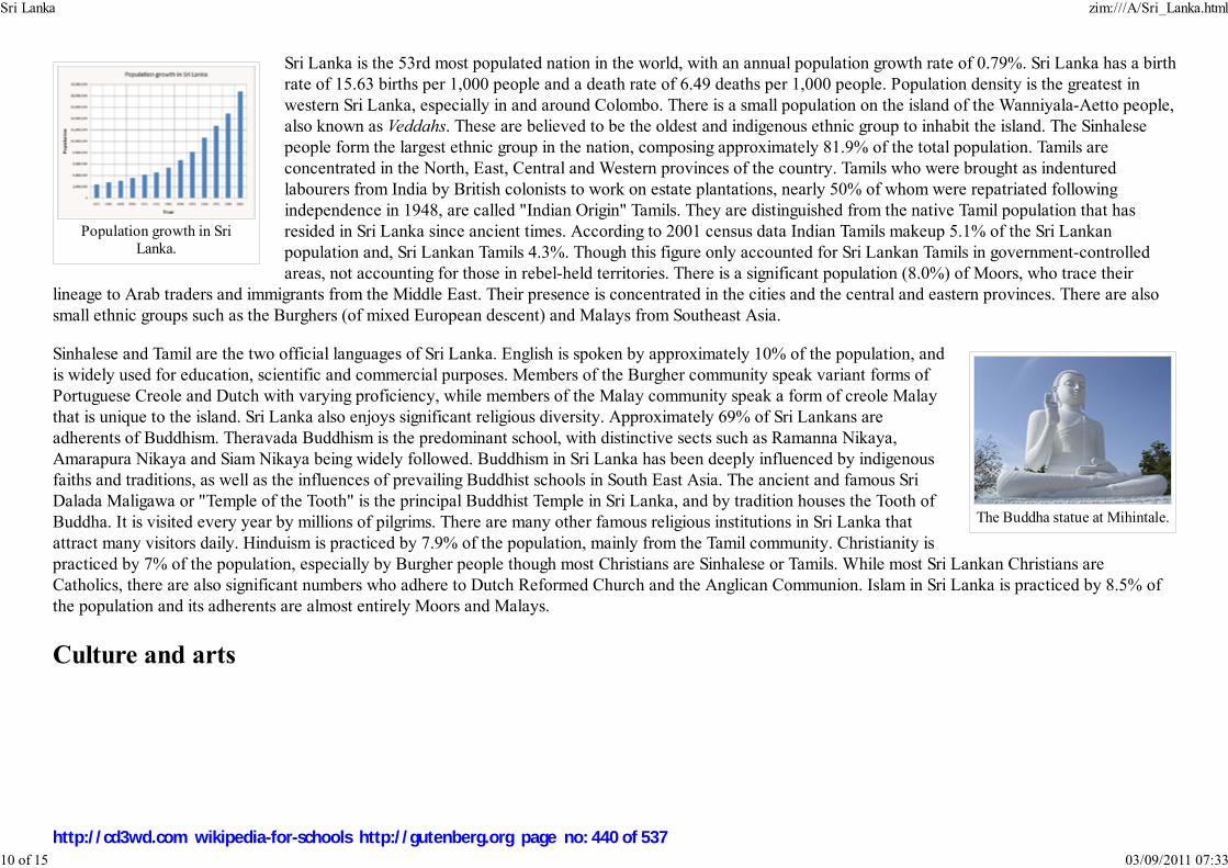
Population growth in SriLanka.
The Buddha statue at Mihintale.
Sri Lanka is the 53rd most populated nation in the world, with an annual population growth rate of 0.79%. Sri Lanka has a birth
rate of 15.63 births per 1,000 people and a death rate of 6.49 deaths per 1,000 people. Population density is the greatest in
western Sri Lanka, especially in and around Colombo. There is a small population on the island of the Wanniyala-Aetto people,
also known as Veddahs. These are believed to be the oldest and indigenous ethnic group to inhabit the island. The Sinhalese
people form the largest ethnic group in the nation, composing approximately 81.9% of the total population. Tamils are
concentrated in the North, East, Central and Western provinces of the country. Tamils who were brought as indentured
labourers from India by British colonists to work on estate plantations, nearly 50% of whom were repatriated following
independence in 1948, are called "Indian Origin" Tamils. They are distinguished from the native Tamil population that has
resided in Sri Lanka since ancient times. According to 2001 census data Indian Tamils makeup 5.1% of the Sri Lankan
population and, Sri Lankan Tamils 4.3%. Though this figure only accounted for Sri Lankan Tamils in government-controlled
areas, not accounting for those in rebel-held territories. There is a significant population (8.0%) of Moors, who trace their
lineage to Arab traders and immigrants from the Middle East. Their presence is concentrated in the cities and the central and eastern provinces. There are also
small ethnic groups such as the Burghers (of mixed European descent) and Malays from Southeast Asia.
Sinhalese and Tamil are the two official languages of Sri Lanka. English is spoken by approximately 10% of the population, and
is widely used for education, scientific and commercial purposes. Members of the Burgher community speak variant forms of
Portuguese Creole and Dutch with varying proficiency, while members of the Malay community speak a form of creole Malay
that is unique to the island. Sri Lanka also enjoys significant religious diversity. Approximately 69% of Sri Lankans are
adherents of Buddhism. Theravada Buddhism is the predominant school, with distinctive sects such as Ramanna Nikaya,
Amarapura Nikaya and Siam Nikaya being widely followed. Buddhism in Sri Lanka has been deeply influenced by indigenous
faiths and traditions, as well as the influences of prevailing Buddhist schools in South East Asia. The ancient and famous Sri
Dalada Maligawa or "Temple of the Tooth" is the principal Buddhist Temple in Sri Lanka, and by tradition houses the Tooth of
Buddha. It is visited every year by millions of pilgrims. There are many other famous religious institutions in Sri Lanka that
attract many visitors daily. Hinduism is practiced by 7.9% of the population, mainly from the Tamil community. Christianity is
practiced by 7% of the population, especially by Burgher people though most Christians are Sinhalese or Tamils. While most Sri Lankan Christians are
Catholics, there are also significant numbers who adhere to Dutch Reformed Church and the Anglican Communion. Islam in Sri Lanka is practiced by 8.5% of
the population and its adherents are almost entirely Moors and Malays.
Culture and arts
Sri Lanka zim:///A/Sri_Lanka.html
10 of 15 03/09/2011 07:33
http://cd3wd.com wikipedia-for-schools http://gutenberg.org page no: 440 of 537

Hoppers, a Sri Lankan delicacy.
kavadi by Hindu Devotessat Vavuniya
Elephants at the EsalaPerahera.
The island is the home of two main traditional cultures: the Sinhalese (centered in the ancient cities of Kandy and
Anuradhapura) and the Tamil (centered in the city of Jaffna). In more recent times a British colonial culture was added, and
lately Sri Lanka, particularly in the urban areas, has experienced a dramatic makeover in the western mold. Until recently, for
example, most Sri Lankans, certainly those in the villages, have eaten traditional food, engaged in traditional crafts and
expressed themselves through traditional arts. But economic growth and intense economic competition in developed countries
has spilled over to most of Sri Lanka, producing changes that might variously be identified as progress, westernisation or a loss
of identity and assimilation.
Traditional food
Sri Lankans have added western influences to the customary diet such as rice and curry, pittu (mixture of fresh rice meal, very
lightly roasted and mixed with fresh grated coconut, then steamed in a bamboo mould). Kiribath (cooked in thick coconut cream for
this unsweetened rice-pudding which is accompanied by a sharp chili relish called "lunumiris"), wattalapam (rich pudding of Malay
origin made of coconut milk, jaggery, cashew nuts, eggs, and various spices including cinnamon cloves and nutmeg), kottu, and
hoppers ("appa"), batter cooked rapidly in a hot curved pan, accompanied by eggs, milk or savouries. Sri Lankan food also has
Dutch and Portuguese influences, with the island's Burgher community preserving this culture through traditional favourites such as
Lamprais (rice cooked in stock and baked in a banana leaf), Breudher (Dutch Christmas cake) and Bolo Fiado (Portuguese-style
layer cake).
Festivals
Main article Sri Lankan festivals
Every year on or about April 13th Sinhala and Tamil people celebrate Sinhala and Tamil New Year Festival, and Muslims
celebrate Ramasan. Esala Perahera (A-suh-luh peh-ruh-ha-ruh) is the grand festival of Esala held in Sri Lanka. It is very grand with
elegant costumes. Happening in July or August in Kandy, it has become a unique symbol of Sri Lanka. It is a Buddhist festival
consisting of dances and richly-decorated elephants. There are fire-dances, whip-dances, Kandian dances and various other cultural
dances. The elephants are usually adorned with lavish garments. The festival ends with the traditional 'diya-kepeema'. The elephant
is paraded around the city bearing the tooth of Buddha. However the new year for tamils have been established as being on January
14th from this year.
Cinema
Sri Lankan cinema in past years has featured subjects such as family relationships, love stories and the years of conflict between the
military and Tamil Tiger rebels. Many films are in the Sinhalese language and the Sri Lankan cinematic style is similar to Indian
cinema.
Sri Lanka zim:///A/Sri_Lanka.html
11 of 15 03/09/2011 07:33
http://cd3wd.com wikipedia-for-schools http://gutenberg.org page no: 441 of 537

The first film to be produced and shown in Sri Lanka was Kadawunu Poronduwa (The Broken Promise) which was released in 1947. The first colour film of Sri
Lanka was Ran Muthu Doova.
Afterwards there were many Sinhalese movies produced in Sri Lanka and some of them, such as Nidhanaya, received several international film awards. The
most influential filmmaker in the history of Sri Lankan cinema is Lester James Peiris who has directed many movies of excellent quality which led to global
acclaim. His latest film, ' Wekanda Walawwa' (Mansion by the Lake) became the first movie to be submitted from Sri Lanka for the Best Foreign Language film
award at the Academy Awards. In 2005 the director Vimukthi Jayasundara became the first Sri Lankan to win the prestigious Camera d’Or award for Best First
Film, or any award for that matter, at the Cannes Film Festival for his Sinhalese language film Sulanga Enu Pinisa (The Forsaken Land). Controversial
filmmaker Asoka Handagama's films are considered by many in the Sri Lankan film world to be the best films of honest response to the ethnic conflict currently
raging in the country. Prasanna Vithanage is one of Sri Lanka's most notable filmmakers. His films have won many awards, both local and international. Recent
releases like 'Sooriya Arana', 'Samanala thatu', and 'Hiripoda wessa' have attracted Sri Lankans to cinemas. Sri Lankan films are usually in the Sinhalese
language. Tamil language movies are also filmed in Sri Lanka but they are not part of Kollywood which is Indian Tamil cinema. However some Kollywood films
are based in Sri Lanka as well.
Music
The earliest music came from the theatre at a time when the traditional open-air drama (referred to in Sinhala as Kolam, Sokari and Nadagam). In 1903 the first
music album, Nurthi, was released through Radio Ceylon. Also Vernon Corea introduced Sri Lankan music in the English Service of Radio Ceylon.
In the early 1960s, Indian music in films greatly influenced Sri Lankan music and later Sri Lankan stars like Sunil Shantha found greater popularity among
Indian people. By 1963, Radio Ceylon had more Indian listeners than Sri Lankan ones. The notable songwriters Mahagama Sekara and Ananda Samarakoon
made a Sri Lankan music revolution. At the peak of this revolution, musicians such as W. D. Amaradeva, H.R. Jothipala, Milton Mallawarachchi, M.S.
Fernando, Annesley Malewana and Clarence Wijewardene did great work.
Religions
Sri Lanka zim:///A/Sri_Lanka.html
12 of 15 03/09/2011 07:33
http://cd3wd.com wikipedia-for-schools http://gutenberg.org page no: 442 of 537

Buddhism is followed by over70% of the population
The Nallur Kandaswamy Kovil,Jaffna is an important place for
Hindus in Sri Lanka
The Jami Ul Alfar mosque inColombo. Islam was brought to
Sri Lanka by Arab Merchants
Sri Lanka has a multi ethnic and multi religious population. Buddhism constitutes the religious
faith of about 70% of the population of the island, most of whom follow the Theravada school
of Buddhism. According to traditional Sri Lankan chronicles, Buddhism was introduced into
Sri Lanka in the 2nd century BCE by Venerable Mahinda, the son of the Emperor Ashoka,
during the reign of Sri Lanka's King Devanampiyatissa. During this time, a sapling of the
Bodhi Tree under which the Buddha attained enlightenment was brought to Sri Lanka and the
first monasteries were established under the sponsorship of the Sri Lankan king. The Pali
Canon (Thripitakaya), having previously been preserved as an oral tradition, was first
committed to writing in Sri Lanka around 30 BC.
Sri Lanka has the longest continuous history of Buddhism of any Buddhist nation, with the
Sangha having existed in a largely unbroken lineage since its introduction in the 2nd century BCE. During periods of decline,
the Sri Lankan monastic lineage was revived through contact with Thailand and Burma. Periods of Mahayana influence, as
well as official neglect under colonial rule, created great challenges for Theravada Buddhist institutions in Sri Lanka, but
repeated revivals and resurgences — most recently in the 19th century — have kept the Theravada tradition alive for over
2000 years.
Followers of Islam comprise approximately eight percent of the population, having been brought to the island by Arab traders
over the course of many centuries. Hinduism was primarily established in Sri Lanka by migrants and often invaders from
southern India, and Hindus now constitute seven percent of the population, mostly of the Shaivite school. European colonists
introduced Christianity to the country in the 16th century, and the religion has been adopted by around six percent of the
population. There also was a small population of Zoroastrian immigrants from India ( Parsis) who settled in Ceylon during the
period of British rule. As a result of emigration, few remain, yet they have played a significant role in the growth of the
country. The former finance minister of Sri Lanka, Nariman Choksy, was a Parsi. Other famous Parsi families in Sri Lanka
include the Captain family and the Pestongee family.
Religion plays an important part in the life and culture of Sri Lankans. The Buddhist majority observe Poya Days, once per
month according to the Lunar calendar. The Hindus and Muslims also observe their own holidays. There are many Buddhist
temples in Sri Lanka and many mosques, Hindu temples and churches across the island, especially in areas where respective
communities are concentrated. Buddhists are distributed across most parts of the island except in the north. Hindus are
concentrated in north, east, and central high lands. Christians, particularly Roman Catholics are mainly concentrated along the
western coastal belt. Muslims are concentrated in several pockets along the coast and in interior. All religious communities are
represented in western province and in other urban centers in sizable numbers.
Education
Sri Lanka zim:///A/Sri_Lanka.html
13 of 15 03/09/2011 07:33
http://cd3wd.com wikipedia-for-schools http://gutenberg.org page no: 443 of 537

University of Colombo SriLanka.
University of Kelaniya SriLanka.
A Test match between Sri Lankaand England at the SCC
Ground, Colombo, March2001.
With a literacy rate of 92%, and 83% of the total population having had Secondary Education,
Sri Lanka has one of the most literate populations amongst developing nations. An education
system which dictates 9 years of Compulsory Schooling for every child is in place, with 99% of
the children entering the first grade. A free education system initiated in 1945 by Dr. C. W. W.
Kannangara, a former minister of education, has greatly contributed to this. Mr. Kannangara
led the establishment of the Madhya Maha Vidyalayas (Great Central Schools) in different
parts of the country in order to provide education to Sri Lanka's rural population. In 1942 a
special education committee proposed extensive reforms to establish an efficient and quality education system for the people. In
recent decades, a large number of private and international schools have been established across the nation. The International
Baccalaureate and General Certificate of Secondary Education are popular education programmes.
Most secondary schools in Sri Lanka provide education from grades 1 to 13 in the same institution. Students sit for the GCE
Ordinary Level Examination (O/Levels) in grade 11 and the GCE Advanced Level Examination (A/levels) in grade 13. These schools are modelled on British
colleges and universities. A majority of them are public, but a number of elite private schools do exist. While most reputed schools centered around large cities
are usually single-sex institutions, rural schools tend to be coeducational.
Sri Lanka has a number of large public universities. They include the University of Colombo, the University of Kelaniya, the University of Sri Jayewardenepura,
the University of Moratuwa, the University of Peradeniya, the University of Jaffna, the University of Ruhuna, the Eastern University of Sri Lanka, the Rajarata
University of Sri Lanka, the Sabaragamuwa University of Sri Lanka, the Wayamba University of Sri Lanka and the Uva Wellassa University of Sri Lanka.
However the lack of space in these institutions and the unwillingness to establish private universities has led to a large number of students been denied entry
into formal universities. As a result, a number of private institutions have emerged, which provide specialised education in a variety of fields, such as computer
science, business administration and arts. These include the government owned Sri Lanka Institute of Information Technology and the Institute of Technological
Studies.
Sports
While the national sport in Sri Lanka is volleyball, by far the most popular sport in the country is cricket. Rugby also enjoys
extensive popularity, as do aquatic sports, athletics, Football (soccer) and tennis. Sri Lanka's schools and colleges regularly
organize sports and athletics teams, competing on provincial and national levels. The Sri Lankan cricket team achieved
considerable success beginning in the 1990s, rising from underdog status to winning the 1996 World Cup, as well as the Asia
Cup in 1996 and 2004. Sri Lanka remains one of the leading cricketing nations in the world, with the national team reaching
the finals of Cricket World Cup 2007, where they lost to Australia.
Sri Lanka has a large number of sports stadiums, including the Sinhalese Sports Club Ground, the R. Premadasa Stadium and
the Rangiri Dumbulla Stadium in Dambulla as well as the Galle International Stadium. The country co-hosted the 1996 Cricket
World Cup with India and Pakistan, and has hosted the Asia Cup tournament on numerous occasions. It will also co-host the
Sri Lanka zim:///A/Sri_Lanka.html
14 of 15 03/09/2011 07:33
http://cd3wd.com wikipedia-for-schools http://gutenberg.org page no: 444 of 537
2011 Cricket World Cup. Aquatic sports such as boating, surfing, swimming and scuba diving on the coast, the beaches and backwaters attract a large number of
Sri Lankans and foreign tourists.
Retrieved from " http://en.wikipedia.org/wiki/Sri_Lanka"
This Wikipedia DVD Selection is sponsored by SOS Children , and consists of a hand selection from the English Wikipedia articles with only minor deletions
(see www.wikipedia.org for details of authors and sources). The articles are available under the GNU Free Documentation License. See also our <
Sri Lanka zim:///A/Sri_Lanka.html
15 of 15 03/09/2011 07:33
http://cd3wd.com wikipedia-for-schools http://gutenberg.org page no: 445 of 537

Taiwan
臺灣臺灣臺灣臺灣台灣台灣台灣台灣
Taiwan is mostly mountainous in the east and gently
sloping plains in the west. The Penghu Islands (the
Pescadores) are west of Taiwan (Satellite photo by
NASA).
Geography
Taiwan
2008/9 Schools Wikipedia Selection. Related subjects: Asia; Asian Countries
Taiwan ( traditional Chinese: 臺灣 or 台灣; simplified Chinese: 台湾; Hanyu Pinyin: Táiwān; Tongyong
Pinyin: Táiwan; Wade-Giles: T'ai²-wan¹; Taiwanese: 大圓, Tâi-oân) is an island in East Asia. "Taiwan" is also
commonly used to refer to the territories governed by the Republic of China (ROC) and to ROC itself, which
governs the island of Taiwan, Orchid Island and Green Island in the Pacific off the Taiwan coast, the
Pescadores in the Taiwan Strait, and Kinmen and the Matsu Islands off the coast of mainland Fujian. The
island groups of Taiwan and Penghu (except the municipalities of Taipei and Kaohsiung) are officially
administered as Taiwan Province of the ROC. However, in practice, almost all government power is
exercised at the national and local (city/county) levels.
Taiwan is also currently claimed by the People's Republic of China (PRC) as a PRC province, though the
government of the PRC has never controlled Taiwan island or any of the current ROC territory commonly
referred to as "Taiwan".
The main island of Taiwan, also known as Formosa (from Portuguese (Ilha) Formosa, meaning "beautiful
(island)"), is located in East Asia off the coast of mainland China, southwest of the main islands of Japan but
directly west of the end of Japan's Ryukyu Islands, and north-northwest of the Philippines. It is bound to the
east by the Pacific Ocean, to the south by the South China Sea and the Luzon Strait, to the west by the
Taiwan Strait and to the north by the East China Sea. The island is 394 kilometers (245 miles) long and 144
kilometers (89 miles) wide and consists of steep mountains covered by tropical and subtropical vegetation.
History
Prehistory
Evidence of human settlement in Taiwan dates back thirty thousand years, although the first inhabitants of
Taiwan may have been genetically distinct from any groups currently on the island. About four thousand
years ago, ancestors of current Taiwanese aborigines settled in Taiwan. These aborigines are genetically
related to Malay and Polynesians, and linguists classify their languages as Austronesian. Polynesians are
suspected to have ancestry traceable back to Taiwan.
Taiwan zim:///A/Taiwan.html
1 of 11 03/09/2011 07:33
http://cd3wd.com wikipedia-for-schools http://gutenberg.org page no: 446 of 537

Location Pacific Ocean, 120 km (74.6 mi)
off the coast of mainland China
Coordinates
Area 35,801 km² (13,822.8 sq mi)
Rank 39th
Highest point Yu Shan — 3,952 m (2.5 mi) ()
Administration
Republic of China
Demographics
Population approx. 23 million (as of 2005)
Density {{{density}}}/km²
Ethnic
groups
Taiwanese people
98% Han Chinese
70% Hoklo
14% Hakka
14% Mainlander
2% Aboriginal Taiwanese
Please note that all population percentages are those of the totalpopulation of the island
Early settlement
Han Chinese began settling in the Pescadores in the 1200s, but Taiwan's hostile tribes and its lack of the trade
resources valued in that era rendered it unattractive to all but "occasional adventurers or fishermen engaging
in barter" until the sixteenth century.
Records from ancient China indicate that Han Chinese might have known of the existence of the main island
of Taiwan since the Three Kingdoms period (third century, 230 A.D.), having assigned offshore islands in the
vicinity names like Greater Liuqiu and Lesser Liuqiu ( etymologically, but perhaps not semantically, identical
to Ryūkyū in Japanese), though none of these names has been definitively matched to the main island of
Taiwan. It has been claimed but not verified that the Ming Dynasty admiral Cheng Ho (Zheng He) visited
Taiwan between 1403 and 1424.
European settlement
In 1544, a Portuguese ship sighted the main island of Taiwan and dubbed it "Ilha Formosa", which means
"Beautiful Island." The Portuguese made no attempt to colonize Taiwan.
In 1624, the Dutch established a commercial base on Taiwan and began to import workers from Fujian and
Penghu as laborers, many of whom settled. The Dutch made Taiwan a colony with its colonial capital at
Tayoan City (present day Anping, Tainan). Both Tayoan and the island name Taiwan derive from a word in
Sirayan, one of the Formosan languages.
The Dutch military presence was concentrated at a stronghold called Castle Zeelandia. The Dutch colonists
also started to hunt the native Formosan Sika deer (Cervus nippon taioanus) that inhabited Taiwan,
contributing to the eventual extinction of the subspecies on the island.
Koxinga and Imperial Chinese rule
Naval and troop forces of Southern Fujian defeated the Dutch in 1662, subsequently expelling the Dutch
government and military from the island. They were led by Koxinga ( traditional Chinese: 鄭成功; simplified
Chinese: 郑成功; pinyin: Zhèng Chénggōng). Following the fall of the Ming Dynasty, Koxinga retreated to
Taiwan as a self-styled Ming loyalist and established the Kingdom of Tungning (1662–83). Koxinga
established his capital at Tainan and he and his heirs, Zheng Jing ( traditional Chinese: 鄭經; simplified
Chinese: 郑经; pinyin: Zhèng Jīng), who ruled from 1662–82, and Zheng Keshuang ( traditional Chinese: 鄭克塽; simplified Chinese: 郑克塽; pinyin: Zhèng Kèshuàng), who served less than a year, continued to launch raids on the south-east coast of mainland China
Taiwan zim:///A/Taiwan.html
2 of 11 03/09/2011 07:33
http://cd3wd.com wikipedia-for-schools http://gutenberg.org page no: 447 of 537

The building currently known
as the ROC Presidential Office
was originally built as the
Office of the Governor-General
by the Japanese government.
well into the Qing Dynasty, attempting to recover the mainland.
In 1683, following the defeat of Koxinga's grandson by an armada led by Admiral Shi Lang of Southern Fujian, the Qing Dynasty formally annexed Taiwan,
placing it under the jurisdiction of Fujian province. The Qing Dynasty government tried to reduce piracy and vagrancy in the area, issuing a series of edicts to
manage immigration and respect aboriginal land rights. Immigrants mostly from Southern Fujian continued to enter Taiwan. The border between taxpaying lands
and "savage" lands shifted eastward, with some aborigines ' Sinicizing' while others retreated into the mountains. During this time, there were a number of
conflicts between Chinese from different regions of Southern Fujian, and between Southern Fujian Chinese and aborigines.
In 1887, the Qing government upgraded Taiwan's status from prefecture of Fujian to full province, the twentieth in the country, with its capital at Taipei. This
was accompanied by a modernization drive that included building Taiwan's first railroad and starting a postal service.
Japanese rule
Imperial Japan had sought to control Taiwan since 1592, when Toyotomi Hideyoshi began extending Japanese influence
overseas. In 1609, the Tokugawa Shogunate sent Arima Harunobu on an exploratory mission. In 1616, Murayama Toan led an
unsuccessful invasion of the island.
In 1871, an Okinawan vessel shipwrecked on the southern tip of Taiwan and the crew of fifty-four were beheaded by the
Paiwan aborigines. When Japan sought compensation from Qing China, the court rejected the demand on the grounds that the
"wild"/"unsubjugated" aboriginals ( traditional Chinese: 台灣生番; simplified Chinese: 台湾生番; pinyin: Táiwān shēngfān)
were outside its jurisdiction. This open renunciation of sovereignty led to a Japanese invasion of Taiwan. In 1874, an
expeditionary force of three thousand troops was sent to the island. There were about thirty Taiwanese and 543 Japanese
casualties (twelve in battle and 531 by endemic diseases).
Qing China was defeated in the First Sino-Japanese War (1894–95), and ceded Taiwan and the Pescadores to Japan in
perpetuity in the Treaty of Shimonoseki. Inhabitants wishing to remain Chinese subjects were given a two-year grace period to
sell their property and remove to mainland China. Very few Taiwanese saw this as feasible.
On May 25, 1895, a group of pro-Qing high officials proclaimed the Republic of Formosa to resist impending Japanese rule. Japanese forces entered the capital
at Tainan and quelled this resistance on October 21, 1895.
The Japanese were instrumental in the industrialization of the island; they extended the railroads and other transportation networks, built an extensive sanitation
system and revised the public school system. During this period, both rice and sugarcane production greatly increased. At one point, Taiwan was the seventh
greatest sugar producer in the world. Still, the ethnic Chinese and Taiwanese aborigines were classified as second- and third-class citizens. Large-scale violence
continued in the first decade of rule. Japan launched over 160 battles to destroy Taiwan's aboriginal tribes during its 51-year rule of the island …' Around 1935,
the Japanese began an island-wide assimilation project to bind the island more firmly to the Japanese Empire. The plan worked very well, to the point that tens
of thousands of Taiwanese joined the Japanese army ranks, and fought loyally for them. For example, former ROC President Lee Teng-hui's elder brother served
Taiwan zim:///A/Taiwan.html
3 of 11 03/09/2011 07:33
http://cd3wd.com wikipedia-for-schools http://gutenberg.org page no: 448 of 537

Li Wu River
in the Japanese navy and died while on duty in February 1945 in the Philippines.
Taiwan played a significant part in the system of Japanese prisoner of war camps that extended across South-East Asia between 1942 and 1945.' Allied POW's,
as well as 'women and children as young as seven or eight years old,' were brutally enslaved at various locations like at the copper mine northwest of Keelung,
sadistically supervised by Taiwanese and Japanese. '… it was found that, while the Japanese were invariably proud to give their name and rank, Taiwanese
soldiers and 'hanchos' invariably concealed their names … some Taiwanese citizens … were willing participants in war crimes of various degrees of infamy …
young males were to an extent highly nipponized; in fact a proportion in the 1930s are reported to have been actively hoping for a Japanese victory in China …
One of the most tragic events of the whole Pacific war took place in Kaohsiung. This was the bombing of the prison ship Enoura Maru in Kaohsiung harbour on
January 9th 1945.'
The Imperial Japanese Navy operated heavily out of Taiwan. The " South Strike Group" was based out of the Taihoku Imperial University in Taiwan. Many of
the Japanese forces participating in the Aerial Battle of Taiwan-Okinawa were based in Taiwan. Important Japanese military bases and industrial centers
throughout Taiwan, like Kaohsiung, were targets of heavy American bombing.
By 1945, just before Japan lost World War II, desperate plans were put in place to incorporate popular representation of Taiwan into the Japanese Diet to make
Taiwan an integral part of Japan proper.
Japan's rule of Taiwan ended when it lost World War II and signed the Instrument of Surrender of Japan on August 15, 1945. But the Japanese occupation had
long lasting effects on Taiwan and Taiwanese culture. Taiwanese tend to have a more positive view of Japan than other Asians. Significant parts of Taiwanese
infrastructure were started under the Japanese rule. The current Presidential Building was also built during that time.
Kuomintang martial law period
On October 25, 1945, ROC troops representing the Allied Command accepted the formal surrender of Japanese
military forces in Taihoku. The ROC Government, led by Chiang Kai-shek, announced that date as "Taiwan
Restoration Day" ( traditional Chinese: 臺灣光復節; simplified Chinese: 台湾光复节; Hanyu Pinyin: Táiwān
Guāngfùjié; Tongyong Pinyin: Táiwan Guangfùjié). They were greeted as liberators by some Taiwanese. Many other
Taiwanese, however, who fought against China and the allies for the Japanese war machine greeted them
reluctantly, this new generation of Chinese arrivals. The ROC under Chen Yi was generally unstable and corrupt; it
seized the people's property and set up government monopolies of many industries. Many problems like this,
compounded with hyperinflation, unrest due to the Chinese Civil War, and distrust due to political, cultural and
linguistic differences between the Taiwanese and the Mainland Chinese, quickly led to the loss of popular support
for the new government. This culminated in a series of severe clashes between the ROC government and Taiwanese,
in turn leading to the bloody 228 incident and the reign of White Terror.
In 1949, during the Chinese Civil War, the Kuomintang (KMT), led by Chiang Kai-shek, retreated from Mainland
China and moved the ROC government from Nanjing to Taipei, Taiwan's largest city, while continuing to claim
Taiwan zim:///A/Taiwan.html
4 of 11 03/09/2011 07:33
http://cd3wd.com wikipedia-for-schools http://gutenberg.org page no: 449 of 537

sovereignty over all of China, Outer Mongolia as well as other areas. On the mainland, the victorious Communists established the PRC, claiming to be the sole
representative of China including Taiwan and portraying the ROC government on Taiwan as an illegitimate entity.
Some 2 million refugees from Mainland China, consisting mainly of soldiers, KMT party members and most importantly the intellectual and business elites fled
the mainland and arrived in Taiwan around that time. In addition, as part of its escape from Communists on the mainland, the ROC government relocated to
Taiwan with many national treasures including gold reserves and foreign currency reserves. This was often used by the PRC government to explain its economic
difficulties and Taiwan's comparative prosperity. From this period through the 1980s, Taiwan was governed by a party-state dictatorship, with the KMT as the
ruling party. Military rule continued and little to no distinction was made between the government and the party, with public property, government property,
and party property being interchangeable. Government workers and party members were indistinguishable, with government workers, such as teachers, required
to become KMT members, and party workers paid salaries and promised retirement benefits along the lines of government employees. In addition all other
parties were outlawed, and political opponents were persecuted, incarcerated, and executed.
Taiwan remained under martial law and one-party rule, under the name of the " Temporary Provisions Effective During the Period of Communist Rebellion" (
traditional Chinese: 動員戡亂時期臨時條款; simplified Chinese: 动员戡乱时期临时条款; Hanyu Pinyin: dòngyuán kānluàn shíqí línshí tiáokuǎn; Tongyong
Pinyin: dòngyuán kanluàn shíhcí línshíh tiáokuǎn), from 1948 to 1987, when the ROC Presidents Chiang Ching-kuo and Lee Teng-hui gradually liberalized and
democratized the system. With the advent of democratization, the issue of the political status of Taiwan has resurfaced as a controversial issue (previously,
discussion of anything other than unification under the ROC was taboo).
As the Chinese Civil War continued without truce, the ROC built up military fortification works throughout Taiwan. Within this effort, former KMT soldiers
built the now famous Central Cross-Island Highway through the Taroko Gorge in the 1950s. The two sides would remain in a heightened military state well into
the 1960’s on the islands on the border with unknown number of night raids and clashes with details that are rarely made public. During the Second Taiwan
Strait Crisis in September 1958, Taiwan's landscape added Nike-Hercules Missile batteries with the formation of the 1st Missile Battalion Chinese Army and
would not be deactivated until 1997. Newer generations of missile batteries have since replaced the Nike Hercules systems throughout the island.
During the 1960s and 1970s, the ROC began to develop into a prosperous, industrialized developed country with a strong and dynamic economy, becoming one
of the Four Asian Tigers while maintaining the authoritarian, single-party government. Because of the Cold War, most Western nations and the United Nations
regarded the ROC as the sole legitimate government of China (while being merely the de-facto government of Taiwan) until the 1970s, when most nations began
switching recognition to the PRC.
Modern democratic era
Chiang Kai-shek's eventual successor, his son Chiang Ching-kuo, began to liberalize Taiwan's political system. In 1984, the younger Chiang selected Lee
Teng-hui, a native Taiwanese technocrat, to be his vice president. In 1986, the Democratic Progressive Party (DPP) was formed illegally and inaugurated as the
first opposition party in Taiwan to counter the KMT. A year later Chiang Ching-kuo lifted martial law.
After the 1988 death of Chiang Ching-Kuo, his successor as President Lee Teng-hui continued to hand more government authority over to the native Taiwanese
and democratize the government. Under Lee, Taiwan underwent a process of localization in which local culture and history was promoted over a pan-China
Taiwan zim:///A/Taiwan.html
5 of 11 03/09/2011 07:33
http://cd3wd.com wikipedia-for-schools http://gutenberg.org page no: 450 of 537

Map of Taiwan
viewpoint. Lee's reforms included printing banknotes from the Central Bank rather than the Provincial Bank of Taiwan, and disbanding the Taiwan Provincial
Government. Under Lee, the original members of the Legislative Yuan and National Assembly, elected in 1947 to represent mainland constituencies and having
taken the seats without re-election for more than four decades, were forced to resign in 1991. Restrictions on the use of Taiwanese in the broadcast media and in
schools were lifted as well.
In the 1990s, the ROC transformed into a true democratic country, as President Lee Teng-hui was elected by the first popular vote held in Taiwan during the
1996 Presidential election. In 2000, Chen Shui-bian of the DPP, was elected as the first non- KMT President and was re-elected to serve his second and last
term since 2004. Polarized politics has emerged in Taiwan with the formation of the Pan-Blue Coalition of parties led by the KMT, favoring eventual Chinese
reunification, and the Pan-Green Coalition of parties led by the DPP, favoring an eventual and official declaration of Taiwan independence.
On September 30, 2007, the ruling Democratic Progressive Party approved a resolution asserting separate identity from China and called for the enactment of a
new constitution for a "normal country". It also called for general use of "Taiwan" as the island's name, without abolishing its formal name, the Republic of
China. The Chen administration also pushed for referendums on national defense and UN entry in the 2004 and 2008 elections, which failed due to voter
turnout below the required legal threshold of 50% of all registered voters. The Chen administration was also dogged by public concern over reduced economic
growth, legislative gridlock due to a pan-blue controlled Legislative Yuan, and alleged corruption scandals involving the First Family.
The KMT increased its majority in the Legislative Yuan in the January 2008 legislative elections, while its nominee Ma Ying-jeou went on to win the presidency
in March of the same year, campaigning on a platform of increased economic growth, and better ties with the Mainland China under a policy of "mutual
nondenial". Ma took office on May 20, 2008.
Geography
The island of Taiwan lies some 120 kilometers off the southeastern coast of mainland China, across the Taiwan Strait, and has
an area of 35,801 km² (13,822.8 sq mi). The East China Sea lies to the north, the Philippine Sea to the east, the Luzon Strait
directly to the south and the South China Sea to the southwest. The island is characterized by the contrast between the eastern
two-thirds, consisting mostly of rugged mountains running in five ranges from the northern to the southern tip of the island, and
the flat to gently rolling plains in the west that are also home to most of Taiwan's population. Taiwan's highest point is the Yu
Shan at 3,952 meters, and there are five other peaks over 3,500 meters. This makes it the world's seventh-highest island.
Taroko National Park, located on the mountainous eastern side of the island, has good examples of mountainous terrain, gorges
and erosion caused by a swiftly flowing river.
The shape of the main island of Taiwan is similar to a sweet potato seen in a south-to-north direction, and therefore, Taiwanese
people, especially the Min-nan division, often call themselves "children of the Sweet Potato." There are also other
interpretations of the island shape, one of which is a whale in the ocean (the Pacific Ocean) if viewed in a west-to-east
direction, which is a common orientation in ancient maps, plotted either by Western explorers or the Qing Dynasty.
Taiwan zim:///A/Taiwan.html
6 of 11 03/09/2011 07:33
http://cd3wd.com wikipedia-for-schools http://gutenberg.org page no: 451 of 537

Siouguluan River
Geology
The island of Taiwan lies in a complex tectonic area between the Eurasian Plate and the Philippine Plate. The upper part of the crust on the island is primarily
made up of a series of terranes, mostly old island arcs which have been forced together by the collision of the Eurasian and Philippine plates. These have been
further uplifted as a result of the detachment of a portion of the Eurasian Plate as it subducted beneath the Philippine Plate, a process which left the crust under
Taiwan more buoyant.
The major seismic faults in Taiwan correspond to the various suture zones between the various terranes. These have produced major quakes throughout the
history of the island. On September 21, 1999, a 7.3 quake known as the " Chi-Chi earthquake" occurred.
Climate
Taiwan's climate is marine tropical. The Northern part of the island has a rainy season that lasts from January to
late March during the southwest monsoon, and also experiences meiyu in May. The entire island succumbs to hot
humid weather from June until September, while October to December are arguably the most pleasant times of
year. The middle and southern parts of the island do not have an extended monsoon season during the winter
months, but can experience several weeks of rain, especially during and after Lunar New Year. Natural hazards
such as typhoons and earthquakes are common in the region.
Taiwan is a centre of bird endemism; see Endemic birds of Taiwan for further information.
Environment and pollution
With its high population density and many factories, some areas in Taiwan suffer from heavy pollution. Most
notable are the southern suburbs of Taipei and the western stretch from Tainan to Lin Yuan, south of Kaohsiung. In
the past, Taipei suffered from extensive vehicle and factory air pollution, but with mandatory use of unleaded
gasoline and the establishment of the Environmental Protection Agency, the air quality of Taiwan has improved
dramatically. Motor scooters, especially older or cheaper two-stroke versions, which are ubiquitous in Taiwan, also
contribute disproportionately to air pollution in Taiwan.
Society
Ethnic groups
Taiwan zim:///A/Taiwan.html
7 of 11 03/09/2011 07:33
http://cd3wd.com wikipedia-for-schools http://gutenberg.org page no: 452 of 537

Bunun dancer in traditional
aboriginal dress.
The ROC's population was estimated in 2005 at 22.9 million, most of whom are on the island of Taiwan. About 98% of the
population is of Han Chinese ethnicity. Of these, 86% are descendants of early Han immigrants known as "native Taiwanese"
(Chinese: 本省人; pinyin: Běnshěng rén; literally "home-province person"). This group contains two subgroups: the Southern
Fujianese or "Hokkien" or "Min-nan" (70% of the total population), who migrated from the coastal Southern Fujian (Min-nan)
region in the southeast of mainland China; and the Hakka (15% of the total population), who originally migrated south to
Guangdong, its surrounding areas and Taiwan, intermarrying extensively with Taiwanese aborigines. The remaining 12% of
Han Chinese are known as " mainlanders" (Chinese: 外省人; pinyin: Wàishěng rén; literally "out-of-province person") and are
composed of and descend from immigrants who arrived after the Second World War. This group also includes those who fled
mainland China in 1949 following the Nationalist defeat in the Chinese Civil War. For political reasons, more and more young
people started to call the mainlanders xin zhùmín ( traditional Chinese: 新住民), or "new residents". A survey in November
2006 conducted by the Taiwanese National Chengchi University, the Japanese University of the Ryukyus and the Chinese
University of Hong Kong showed that more than 60% of Taiwan's population consider themselves Taiwanese, compared to
only 18% in 1992.
Dalu ren ( traditional Chinese: 大陸人; simplified Chinese: 大陆人; pinyin: dàlù rén) refers to residents of mainland China.
Most Taiwanese, including the " mainlanders" discussed above, fall outside this group. It includes only the most recent
immigrants from mainland China, such as (predominantly) women made ROC citizens through marriage. It also excludes
foreign spouses from other countries, of which women come predominantly from Vietnam, Indonesia, Thailand and the
Philippines, while a greater proportion of men come from Western countries. One in seven marriages now involves a partner from another country. As Taiwan's
birthrate is among the lowest in the world, this contingent is playing an increasingly important role in changing Taiwan's demographic makeup. Transnational
marriages now account for one out of six births.
The other 2% of Taiwan's population, numbering about 458,000, are listed as the Taiwanese aborigines ( traditional Chinese: 原住民; Hanyu Pinyin:
yuánzhùmín; Tongyong Pinyin: yuánjhùmín), divided into 13 major groups: Ami, Atayal, Paiwan, Bunun, Rukai, Puyuma, Tsou, Saisiyat, Tao (Yami), Thao,
Kavalan, Truku and Sakizaya.
Languages
About 80% of the people in Taiwan belong to the Hoklo (Chinese: 福佬; pinyin: fúlǎo; Pe̍h-ōe-jī: Hok-ló) ethnic group and speak both Standard Mandarin
(officially recognized by the ROC as the National Dialect) and Taiwanese (a variant of the Min Nan dialect spoken in Fujian province). Mandarin Chinese is the
primary language of instruction in schools; however, most spoken media is split between Mandarin and Taiwanese. The Hakka (Chinese: 客家; pinyin: Kèjiā),
about 15% of the population, have a distinct Hakka dialect. Aboriginal minority groups still speak their native languages, although most also speak Mandarin.
English is a common second language, with many large private schools providing English instruction. English is also featured on several of Taiwan's education
exams.
Although Mandarin is still the language of instruction in schools and dominates television and radio, non-Mandarin dialects have undergone a revival in public
Taiwan zim:///A/Taiwan.html
8 of 11 03/09/2011 07:33
http://cd3wd.com wikipedia-for-schools http://gutenberg.org page no: 453 of 537

Tainan Confucius Temple. Four
characters on the inscribed board
mean "First School in All of
Taiwan"
life in Taiwan. A large fraction of the populace speak the Taiwanese dialect, a variant of Min Nan spoken in southern Fujian, China, and a majority understand
it. Many also speak Hakka. People educated during the Japanese period of 1900 to 1945 used Japanese as the medium of instruction. Some in the older
generations only speak the Japanese they learned at school and the Taiwanese they spoke at home and are unable to communicate with many in the modern
generations who only speak Mandarin.
Most aboriginal groups in Taiwan have their own languages which, unlike Taiwanese or Hakka, do not belong to the Chinese language family, but rather to the
Austronesian language family.
Religion
Over 93% of Taiwanese are adherents of a combination of Buddhism, Confucianism, and Taoism; 4.5% are adherents of
Christianity, which includes Protestants, Catholics, Mormons, and other non-denominational Christian groups; and 2.5% are
adherents of other religions, such as Islam. Taiwanese aborigines comprise a notable subgroup among professing Christians:
"...over 64 percent identify as Christian... Church buildings are the most obvious markers of Aboriginal villages,
distinguishing them from Taiwanese or Hakka villages."
Confucianism is a philosophy that deals with secular moral ethics, and serves as the foundation of both Chinese and
Taiwanese culture. The majority of Taiwanese and Chinese usually combine the secular moral teachings of Confucianism
with whatever religions they are affiliated with.
One especially important goddess for Taiwanese people is Matsu, who symbolizes the seafaring spirit of Taiwan's ancestors
from Fujian and Guangdong.
Culture
Taiwan zim:///A/Taiwan.html
9 of 11 03/09/2011 07:33
http://cd3wd.com wikipedia-for-schools http://gutenberg.org page no: 454 of 537
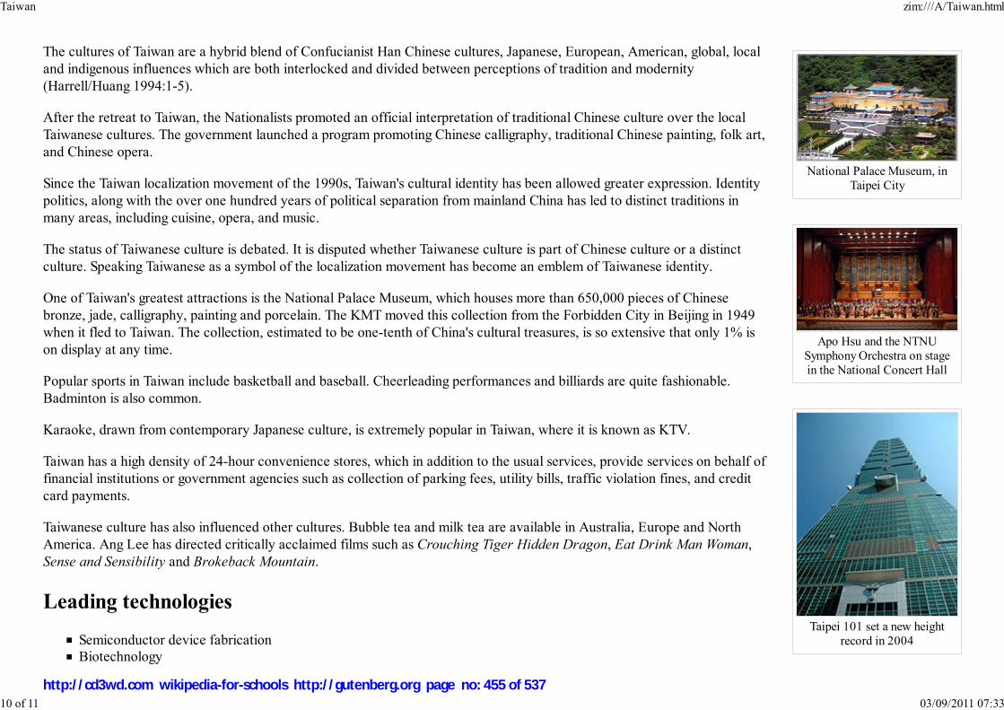
National Palace Museum, in
Taipei City
Apo Hsu and the NTNU
Symphony Orchestra on stage
in the National Concert Hall
Taipei 101 set a new height
record in 2004
The cultures of Taiwan are a hybrid blend of Confucianist Han Chinese cultures, Japanese, European, American, global, local
and indigenous influences which are both interlocked and divided between perceptions of tradition and modernity
(Harrell/Huang 1994:1-5).
After the retreat to Taiwan, the Nationalists promoted an official interpretation of traditional Chinese culture over the local
Taiwanese cultures. The government launched a program promoting Chinese calligraphy, traditional Chinese painting, folk art,
and Chinese opera.
Since the Taiwan localization movement of the 1990s, Taiwan's cultural identity has been allowed greater expression. Identity
politics, along with the over one hundred years of political separation from mainland China has led to distinct traditions in
many areas, including cuisine, opera, and music.
The status of Taiwanese culture is debated. It is disputed whether Taiwanese culture is part of Chinese culture or a distinct
culture. Speaking Taiwanese as a symbol of the localization movement has become an emblem of Taiwanese identity.
One of Taiwan's greatest attractions is the National Palace Museum, which houses more than 650,000 pieces of Chinese
bronze, jade, calligraphy, painting and porcelain. The KMT moved this collection from the Forbidden City in Beijing in 1949
when it fled to Taiwan. The collection, estimated to be one-tenth of China's cultural treasures, is so extensive that only 1% is
on display at any time.
Popular sports in Taiwan include basketball and baseball. Cheerleading performances and billiards are quite fashionable.
Badminton is also common.
Karaoke, drawn from contemporary Japanese culture, is extremely popular in Taiwan, where it is known as KTV.
Taiwan has a high density of 24-hour convenience stores, which in addition to the usual services, provide services on behalf of
financial institutions or government agencies such as collection of parking fees, utility bills, traffic violation fines, and credit
card payments.
Taiwanese culture has also influenced other cultures. Bubble tea and milk tea are available in Australia, Europe and North
America. Ang Lee has directed critically acclaimed films such as Crouching Tiger Hidden Dragon, Eat Drink Man Woman,
Sense and Sensibility and Brokeback Mountain.
Leading technologies
Semiconductor device fabrication
Biotechnology
Taiwan zim:///A/Taiwan.html
10 of 11 03/09/2011 07:33
http://cd3wd.com wikipedia-for-schools http://gutenberg.org page no: 455 of 537

Bicycle manufacturing
Retrieved from " http://en.wikipedia.org/wiki/Taiwan"
The 2008 Wikipedia for Schools was sponsored by a UK Children's Charity, SOS Children UK , and is mainly selected from the English Wikipedia with only
minor checks and changes (see www.wikipedia.org for details of authors and sources). The articles are available under the GNU Free Documentation License.
See also our
Taiwan zim:///A/Taiwan.html
11 of 11 03/09/2011 07:33
http://cd3wd.com wikipedia-for-schools http://gutenberg.org page no: 456 of 537
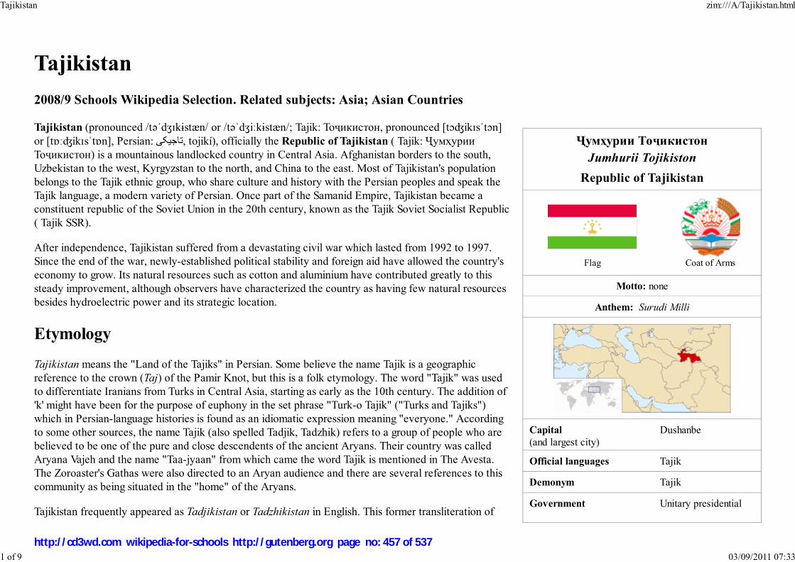
Ҷумҳурии Тоҷикистон
Jumhurii Tojikiston
Republic of Tajikistan
Flag Coat of Arms
Motto: none
Anthem: Surudi Milli
Capital
(and largest city)Dushanbe
Official languages Tajik
Demonym Tajik
Government Unitary presidential
Tajikistan
2008/9 Schools Wikipedia Selection. Related subjects: Asia; Asian Countries
Tajikistan (pronounced /təˈdʒɪkɨstæn/ or /təˈdʒiːkɨstæn/; Tajik: Тоҷикистон, pronounced [tɔʤikɪsˈtɔn]
or [tɒːʤikɪsˈtɒn], Persian: تاجيکی, tojikí), officially the Republic of Tajikistan ( Tajik: Ҷумҳурии
Тоҷикистон) is a mountainous landlocked country in Central Asia. Afghanistan borders to the south,
Uzbekistan to the west, Kyrgyzstan to the north, and China to the east. Most of Tajikistan's population
belongs to the Tajik ethnic group, who share culture and history with the Persian peoples and speak the
Tajik language, a modern variety of Persian. Once part of the Samanid Empire, Tajikistan became a
constituent republic of the Soviet Union in the 20th century, known as the Tajik Soviet Socialist Republic
( Tajik SSR).
After independence, Tajikistan suffered from a devastating civil war which lasted from 1992 to 1997.
Since the end of the war, newly-established political stability and foreign aid have allowed the country's
economy to grow. Its natural resources such as cotton and aluminium have contributed greatly to this
steady improvement, although observers have characterized the country as having few natural resources
besides hydroelectric power and its strategic location.
Etymology
Tajikistan means the "Land of the Tajiks" in Persian. Some believe the name Tajik is a geographic
reference to the crown (Taj) of the Pamir Knot, but this is a folk etymology. The word "Tajik" was used
to differentiate Iranians from Turks in Central Asia, starting as early as the 10th century. The addition of
'k' might have been for the purpose of euphony in the set phrase "Turk-o Tajik" ("Turks and Tajiks")
which in Persian-language histories is found as an idiomatic expression meaning "everyone." According
to some other sources, the name Tajik (also spelled Tadjik, Tadzhik) refers to a group of people who are
believed to be one of the pure and close descendents of the ancient Aryans. Their country was called
Aryana Vajeh and the name "Taa-jyaan" from which came the word Tajik is mentioned in The Avesta.
The Zoroaster's Gathas were also directed to an Aryan audience and there are several references to this
community as being situated in the "home" of the Aryans.
Tajikistan frequently appeared as Tadjikistan or Tadzhikistan in English. This former transliteration of
Tajikistan zim:///A/Tajikistan.html
1 of 9 03/09/2011 07:33
http://cd3wd.com wikipedia-for-schools http://gutenberg.org page no: 457 of 537

republic
- President Emomalii Rahmon
- Prime Minister Oqil Oqilov
Independence
- Establishment of theSamanid Empire
875 AD
- Declared September 9, 1991
- Completed December 25, 1991
Area
- Total 143,100 km² ( 95th)55,251 sq mi
- Water (%) 0.3
Population
- January 2006 estimate 6,920,3001 ( 100th1)
- 2000 census 6,127,000
- Density 45/km² ( 151st)117/sq mi
GDP ( PPP) 2005 estimate
- Total $8.802 billion ( 139th)
- Per capita $1,388 ( 159th)
Gini (2003) 32.6 (medium)
HDI (2007) ▲ 0.673 (medium) (122nd)
Currency Somoni ( TJS)
Time zone TJT ( UTC+5)
Internet TLD .tj
Calling code +992
Tadjikistan or Tadzhikistan is from the Russian Таджикистан. (In Russian there is no single letter j torepresent the phoneme /ʤ/ and дж, or dzh, is used.) Tadzhikistan is the most common alternate spelling
and is widely used in English literature derived from Russian sources. Tadjikistan is the spelling in French
and can occasionally be found in English language texts. In the Perso-Arabic script, "Tajikistan" is
written تاجيکستان.
Controversy surrounds the correct term used to identify people from Tajikistan. The word Tajik has been
the traditional term used to describe people from Tajikistan and appears widely in literature. But the
ethnic politics of Central Asia have made the word Tajik a controversial word, as it implies that Tajikistan
is only a nation for ethnic Tajiks and not ethnic Uzbeks, Russians, etc. Likewise, ethnic Tajiks live in
other countries, such as China, making the term ambiguous. In addition, the Pamiri population in Gorno-
Badakhshan also have sought to create an ethnic identity separate from that of the Tajiks.
History
Early history
Tajikistan zim:///A/Tajikistan.html
2 of 9 03/09/2011 07:33
http://cd3wd.com wikipedia-for-schools http://gutenberg.org page no: 458 of 537

Estimate from State Statistical Committee of Tajikistan, 2006;
rank based on UN figures for 2005.
Modern Tajiks regard the SamanidEmpire as the first Tajik state. Thismonument in Dushanbe honours
Saman Khuda, ancestor of theSamanids and a source of Tajik
nationalism.
The capital of Dushanbe
The territory of what is now Tajikistan has been inhabited
continuously since 4000 BCE. It has been under the rule of various
empires throughout history, for the longest period under the Persian
Empire.
Most of modern Tajikistan had formed parts of ancient Kamboja and Parama Kamboja kingdoms, which find references in
the ancient Indian epics like the Mahabharata. Linguistic evidence, combined with ancient literary and inscriptional
evidence has led many eminent Indologists to conclude that ancient Kambojas (an Avestan speaking Iranian tribe)
originally belonged to the Ghalcha-speaking area of Central Asia. Achariya Yasaka's Nirukta (7th century BCE) attests
that verb Śavati in the sense "to go" was used by only the Kambojas. It has been shown that the modern Ghalcha dialects,
Valkhi, Shigali, Sriqoli, Jebaka (also called Sanglichi or Ishkashim), Munjani, Yidga and Yagnobi, mainly spoken in
Pamirs and countries on the headwaters of the Oxus, still use terms derived from ancient Kamboja Śavati in the sense "to
go". The Yagnobi dialect spoken in Yagnobi province around the headwaters of Zeravshan valley in Sogdiana, also still
contains a relic "Śu" from ancient Kamboja Śavati in the sense "to go". Further, Sir G Grierson says that the speech of
Badakshan was a Ghalcha till about three centuries ago when it was supplanted by a form of Persian. Thus, the ancient
Kamboja, probably included the Badakshan, Pamirs and northern territories including Yagnobi province in the doab of the
Oxus and Jaxartes. On the east it was bounded roughly by Yarkand and/or Kashgar, on the west by Bahlika (
Uttaramadra), on the northwest by Sogdiana, on the north by Uttarakuru, on the southeast by Darada, and on the south by
Gandhara. Numerous Indologists locate original Kamboja in Pamirs and Badakshan and the Parama Kamboja furthernorth, in the Trans-Pamirian territories comprising Zeravshan valley, north up parts of Sogdhiana/Fargana — in theSakadvipa or Scythia of the classical writers. Thus, in the pre-Buddhist times (7th–6th century BCE), the parts of modern
Tajikistan including territories as far as Zeravshan valley in Sogdiana formed parts of ancient Kamboja and the Parama
Kamboja kingdoms when it was ruled by Iranian Kambojas till it became part of Achaemenid Empire.
From the last quarter of fourth century BCE till the first quarter of the second century BCE, it was part of
the Bactrian Empire, from whom it was passed on to Scythian Tukharas and hence became part of
Tukharistan. Contact with the Chinese Han Dynasty was made in the second century BCE, when envoys
were sent to the area of Bactria to explore regions west of China.
Arabs brought Islam in the 7th century CE. The Samanid Empire Persians supplanted the Arabs and built the
cities of Samarkand and Bukhara, which became the cultural centers of Tajiks (both of which are now in
Uzbekistan). The Mongols would later take partial control of Central Asia, and later the land that today
comprises Tajikistan became a part of the emirate of Bukhara. A small community of Jews, displaced from
the Middle East after the Babylonian captivity, migrated to the region and settled there after 600 BCE,
though the majority of the recent Jewish population did not migrate to Tajikistan until the 20th century.
1
Tajikistan zim:///A/Tajikistan.html
3 of 9 03/09/2011 07:33
http://cd3wd.com wikipedia-for-schools http://gutenberg.org page no: 459 of 537

Russian presence
In the 19th century, the Russian Empire began to spread into Central Asia during the Great Game, and it took control of Tajikistan. After the overthrow of
Imperial Russia in 1917, guerrillas throughout Central Asia, known as basmachi waged a war against Bolshevik armies in a futile attempt to maintain
independence. The Bolsheviks prevailed after a four-year war, in which mosques and villages were burned down and the population heavily suppressed. Soviet
authorities started a campaign of secularization, practicing Muslims, Jews, and Christians were persecuted, and mosques, churches, and synagogues were closed.
The Jews of Tajikistan are known as Bukharian Jews. In the 1970s to 1990s there was a huge emigration of Bukharians to the United States of America. Today,
there are flourishing Buharian communities in New York City, United States and in many other east coast cities of the U.S.
Soviet Tajikistan
In 1924, the Tajik Autonomous Soviet Socialist Republic was created as a part of Uzbekistan, but in 1929 the Tajik Soviet Socialist Republic ( Tajik SSR) was
made a separate constituent republic. The predominantly ethnic Tajik cities of Samarkand and Bukhara remained in the Uzbek SSR. In terms of living
conditions, education and industry Tajikistan was somewhat behind the other Soviet Republics. By the late 1980s Tajik nationalists were calling for increased
rights. Real disturbances did not occur within the republic until 1990. The following year, the Soviet Union collapsed, and Tajikistan declared its independence.
Post-Independence
The nation almost immediately fell into a civil war that involved various factions fighting one another; these factions were often distinguished by clan loyalties.
The non-Muslim population, particularly Russians and Jews, fled the country during this time because of persecution, increased poverty and better economic
opportunities in the West or in other former Soviet republics. Emomali Rahmonov came to power in 1992, and continues to rule to this day. However, he has
been accused of ethnic cleansing against other ethnicities and groups during the Civil war in Tajikistan. In 1997, a ceasefire was reached between Rahmonov
and opposition parties ( United Tajik Opposition). Peaceful elections were held in 1999, but they were reported by the opposition as unfair, and Rahmonov was
re-elected by almost unanimous vote. Russian troops were stationed in southern Tajikistan, in order to guard the border with Afghanistan, until summer 2005.
Since the September 11, 2001, attacks, American, Indian and French troops have also been stationed in the country.
In 2008, the harshest winter in a quarter century caused financial losses of $850 million. Russia pledged $1 billion in aid. Saudi Arabia sent about 10 planes
carrying 80 tons of relief and emergency supplies in February and another 11 tons in March.
Politics
Almost immediately after independence, Tajikistan was plunged into a civil war that saw various factions, allegedly backed by Russia and Iran, fighting one
another. All but 25,000 of the more than 400,000 ethnic Russians, who were mostly employed in industry, fled to Russia. By 1997, the war had cooled down,
and a central government began to take form, with peaceful elections in 1999.
Tajikistan zim:///A/Tajikistan.html
4 of 9 03/09/2011 07:33
http://cd3wd.com wikipedia-for-schools http://gutenberg.org page no: 460 of 537

Emomali Rahmon
"Longtime observers of Tajikistan often characterize the country as profoundly averse to risk and skeptical of
promises of reform, a political passivity they trace to the country’s ruinous civil war," Ilan Greenberg wrote in a
news article in The New York Times just before the country's November 2006 presidential election.
Tajikistan is officially a republic, and holds elections for the President and Parliament. The latest elections occurred
in 2005, and as all previous elections, international observers believe them to have been corrupt, arousing many
accusations from opposition parties that President Emomali Rahmon manipulates the election process.
The November 6, 2006, election was boycotted by "mainline" opposition parties, including the 23,000-member
Islamist Islamic Renaissance Party. Four remaining opponents "all but endorsed the incumbent", Rahmon. After
November 2006 presidential elections, it is widely speculated that Rahmon has secured his seat for at least another
two terms, which will allow him rule till 2020.
Tajikistan to this date is one of the few countries in Central Asia to have included an active opposition in its
government. In the Parliament, opposition groups have often clashed with the ruling party, but this has not led to
great instability.
On October 11, 2007, the Assembly of the Council Commission of the Ministry of Culture issued a decision to ban Jehovah’s Witnesses in the Republic of
Tajikistan. Following the fall of the Berlin Wall in 1989 and after the breakup of the Soviet Union, the activity of Jehovah’s Witnesses was legally recognized by
many post-Soviet republics. Since that time, however, this is the first Soviet republic to ban the activity of Jehovah’s Witnesses.
Recently Tajikistan also gave Iran its support in the membership bid to join the SCO, after a meeting with Tajik President and Iranian foreign minister.
Administrative divisions
Tajikistan consists of 4 administrative divisions. These are the provinces ( viloyat) of Sughd and Khatlon, the autonomous province of Gorno-Badakhshan
(abbreviated as GBAO), and the Region of Republican Subordination (RRP – Raiony Respublikanskogo Podchineniya in Russian; formerly known as Karotegin
Province). Each region is divided into several districts ( Tajik: Ноҳия, nohiya or raion), which in turn are subdivided into jamoats (village-level self-governing
units). As of 2006, there were 58 districts and 367 jamoats in Tajikistan.
Division ISO 3166-2 Capital Area (km²) Pop (2006)
Sughd TJ-SU Khujand 25,400 2,060,900
Region of Republican Subordination TJ-RR Dushanbe 28,600 1,531,300
Khatlon TJ-KT Qurghonteppa 24,800 2,463,300
Tajikistan zim:///A/Tajikistan.html
5 of 9 03/09/2011 07:33
http://cd3wd.com wikipedia-for-schools http://gutenberg.org page no: 461 of 537

Satellite photograph ofTajikistan
Mountains of Tajikistan
Gorno-Badakhshan TJ-BG Khorugh 64,200 218,400
Source: Population and area from State Statistical Committee of Tajikistan
Geography
Tajikistan is landlocked, and is the smallest nation in Central Asia by area. It is covered by mountains of the Pamir range, and
more than fifty percent of the country is over 3,000 meters (approx. 10,000 ft) above sea level. The only major areas of lower
land are in the north which is part of the Fergana Valley, and in the southern Kafirnigan and Vakhsh valleys which form the
Amu Darya and have much higher rainfall. Dushanbe is located on the southern slopes above the Kafirnigan valley.
The Amu Darya and Panj rivers mark the border with Afghanistan, and Tajikistan's mountains are the major source of runoff
for the Aral Sea
About 1 % of the country's area is covered by lakes:
Kuli-Kalon ( Fann Mountains)Iskanderkul ( Gissar Range)Nurek Reservoir ( Khatlon Province)Kara-Kul ( Tajik: Qarokul; located in eastern Pamir)Sarez ( Pamir)Shorkul ( Pamir)Yashilkul ( Pamir)Zorkul ( Pamir)
Mountain Height Location
Ismoil Somoni Peak (highest) 7,495 m 24,590 ft North-western edge of Gorno-Badakhshan ( GBAO), south of the Kyrgyz border
Ibn Sina Peak ( Lenin Peak) 7,174 m 23,537 ft Northern border in the Trans-Alay Range, north-east of Ismoil Somoni Peak
Peak Korzhenevskaya 7,105 m 23,310 ft North of Ismoil Somoni Peak, on the south bank of Muksu River
Independence Peak ( Revolution Peak) 6,974 m 22,881 ft Central Gorno-Badakhshan, south-east of Ismoil Somoni Peak
Akademiya Nauk Range 6,785 m 22,260 ft North-western Gorno-Badakhshan, stretches in the north-south direction
Karl Marx Peak 6,726 m 22,067 ft GBAO, near the border to Afghanistan in the northern ridge of the Karakoram Range
Mayakovskiy Peak 6,096 m 20,000 ft Extreme south-west of GBAO, near the border to Afghanistan.
Concord Peak 5,469 m 17,943 ft Southern border in the northern ridge of the Karakoram Range
Tajikistan zim:///A/Tajikistan.html
6 of 9 03/09/2011 07:33
http://cd3wd.com wikipedia-for-schools http://gutenberg.org page no: 462 of 537

A boy selling dried fruit at alocal market
Kyzylart Pass 4,280 m 14,042 ft Northern border in the Trans-Alay Range
Economy
Tajikistan was the poorest country in Central Asia as well in the former Soviet Union following a civil war after it became independent in 1991. With foreign
revenue precariously dependent upon exports of cotton and aluminium, the economy is highly vulnerable to external shocks. In FY 2000, international
assistance remained an essential source of support for rehabilitation programs that reintegrated former civil war combatants into the civilian economy, thus
helping keep the peace. International assistance also was necessary to address the second year of severe drought that resulted in a continued shortfall of food
production. On August 21, 2001, the Red Cross announced that a famine was striking Tajikistan, and called for international aid for Tajikistan and Uzbekistan.
Tajikistan's economy grew substantially after the war. The GDP of Tajikistan expanded at an average rate of 9.6 % over the period of 2000–2004 according to
the World Bank data. This improved Tajikistan's position among other Central Asian countries (namely Turkmenistan and Uzbekistan), which seem to have
degraded economically ever since. Tajikistan is an active member of the Economic Cooperation Organization (ECO).
The recently completed Anzab tunnel which connects the previously hard to access Northern part of the country to the capital
Dushanbe has been labeled as part of the new Silk Road. It is part of a road under construction that will connect Tajikistan to
Iran and the Persian Gulf through Afghanistan.
A new bridge between Afghanistan and Tajikistan has been built which will help the country have access to trade lines with
South Asia. The bridge was built by the United States.
The primary sources of income in Tajikistan are aluminium production, cotton growing and remittances from migrant workers.
Aluminium industry is represented by the state-owned Talco - the biggest aluminium plant in Central Asia and one of the
biggest in the world.
Tajikistan has great hydropower potential, and has focused on attracting investment for projects for internal use and electricity exports. Tajikistan is home to the
hydroelectric power station Nurek with the highest dam in the world. The latest development is the Russia's RAO UES energy giant working on Sangtuda-1
hydroelectric power station (670 MW capacity) commenced operations on 18 January 2008. Other projects at the development stage include Sangduta-2 by
Iran, Zerafshan by Chinese SinoHydro and Rogun power plant with a projected dam height of 335 metres (1,099 ft) to be built by Russia's UES. Other energy
resources include sizable coal deposits and smaller reserves of natural gas and petroleum.
Tajikistan zim:///A/Tajikistan.html
7 of 9 03/09/2011 07:33
http://cd3wd.com wikipedia-for-schools http://gutenberg.org page no: 463 of 537

A bazaar in Panjakent
Tajik children
Foreign remittance flows from Tajik migrant workers abroad, mainly in Russia, has become by far the main
source of income for millions of Tajikistan's people and represents additional 36.2 % of country's GDP
directly reaching the poverty-stricken population. Migration from Tajikistan and the consequent remittances
have been unprecedented in their magnitude and economic impact. Tajikistan has achieved transition from a
planned to a market economy without substantial and protracted recourse to aid (of which it by now
receives only negligible amounts), and by purely market-based means, simply by exporting its main
commodity of comparative advantage — cheap labor. The World Bank Tajikistan Policy Note 2006
concludes that remittances have played an important role as one of the drivers of Tajikistan's robust
economic growth during the past several years, have increased incomes, and as a result helped significantly
reduce poverty. Drug trafficking is the major illegal source of income in Tajikistan as it is an important
transit country for Afghan narcotics bound for Russian and, to a lesser extent, Western European markets;
some opium poppy is also raised locally for the domestic market. However with the increasing assistance
from international organizations, such as UNODC, and cooperation with the US, Russian, EU and Afghan
authorities a level of progress on fight against illegal drug-trafficking is being achieved. Tajikistan holds the
third place in the world for heroin and raw opium confiscations (1216.3 kg of heroin and 267.8 kg of raw opium in the first half of 2006). Drug money corrupts
the country's government; according to some experts the well-known personalities that fought on both sides of the civil war and have held the positions in the
government after the armistice was signed are now involved in the drug trade. UNODC is working with Tajikistan to strengthen border crossings, provide
training, and set up joint interdiction teams. It also helped to establish Tajikistani Drug Control Agency.
Demographics
Tajikistan has a population of 7,320,716 (July 2006 est.). Tajiks who speak the Tajik language (a variety of Persian) are the
main ethnic group, although there is a sizable minority of Uzbeks and a small population of Russians, whose numbers are
declining due to emigration. Pamiris of Badakhshan are considered to belong to larger group of Tajiks. Likewise, the official
language of Tajikistan is the Tajik language, while Russian is largely spoken in business and for government purposes. Despite
its poverty, Tajikistan has a high rate of literacy with an estimated 98 % of the population having the ability to read and write.
Most of the population follows Sunni Islam, although a sizable number of Shi'a are present as well. Bukharian Jews had lived in
Tajikistan since the 2nd century BC, but today almost none are left. There is also a small population of Yaghnobi people who
have lived in the mountainous district of Sughd Viloyat for many centuries.
The Tajik Ministry of Labor and Social Welfare reported that 104,272 disabled people are registered in Tajikistan (2000). This
group of people suffers most from poverty in Tajikistan. The Tajik government and the World Bank considered activities to
support this part of the population described in the World Bank's Poverty Reduction Strategy Paper.
Culture
Tajikistan zim:///A/Tajikistan.html
8 of 9 03/09/2011 07:33
http://cd3wd.com wikipedia-for-schools http://gutenberg.org page no: 464 of 537
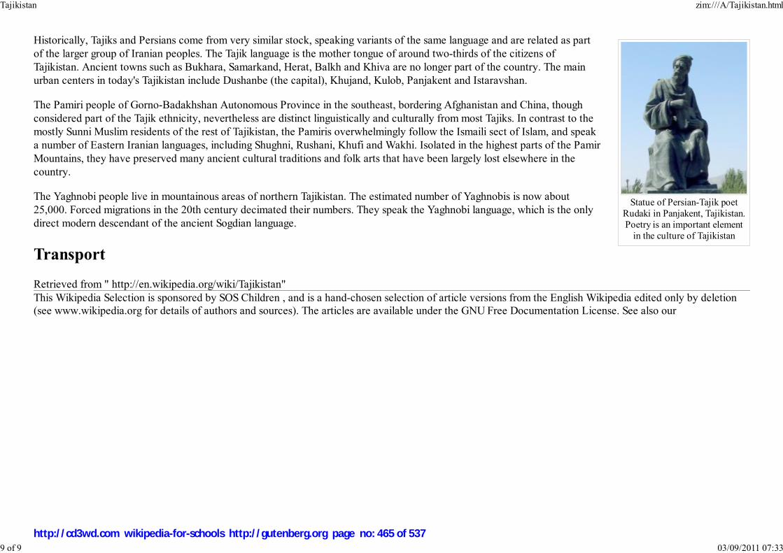
Statue of Persian-Tajik poetRudaki in Panjakent, Tajikistan.Poetry is an important element
in the culture of Tajikistan
Historically, Tajiks and Persians come from very similar stock, speaking variants of the same language and are related as part
of the larger group of Iranian peoples. The Tajik language is the mother tongue of around two-thirds of the citizens of
Tajikistan. Ancient towns such as Bukhara, Samarkand, Herat, Balkh and Khiva are no longer part of the country. The main
urban centers in today's Tajikistan include Dushanbe (the capital), Khujand, Kulob, Panjakent and Istaravshan.
The Pamiri people of Gorno-Badakhshan Autonomous Province in the southeast, bordering Afghanistan and China, though
considered part of the Tajik ethnicity, nevertheless are distinct linguistically and culturally from most Tajiks. In contrast to the
mostly Sunni Muslim residents of the rest of Tajikistan, the Pamiris overwhelmingly follow the Ismaili sect of Islam, and speak
a number of Eastern Iranian languages, including Shughni, Rushani, Khufi and Wakhi. Isolated in the highest parts of the Pamir
Mountains, they have preserved many ancient cultural traditions and folk arts that have been largely lost elsewhere in the
country.
The Yaghnobi people live in mountainous areas of northern Tajikistan. The estimated number of Yaghnobis is now about
25,000. Forced migrations in the 20th century decimated their numbers. They speak the Yaghnobi language, which is the only
direct modern descendant of the ancient Sogdian language.
Transport
Retrieved from " http://en.wikipedia.org/wiki/Tajikistan"
This Wikipedia Selection is sponsored by SOS Children , and is a hand-chosen selection of article versions from the English Wikipedia edited only by deletion(see www.wikipedia.org for details of authors and sources). The articles are available under the GNU Free Documentation License. See also our
Tajikistan zim:///A/Tajikistan.html
9 of 9 03/09/2011 07:33
http://cd3wd.com wikipedia-for-schools http://gutenberg.org page no: 465 of 537
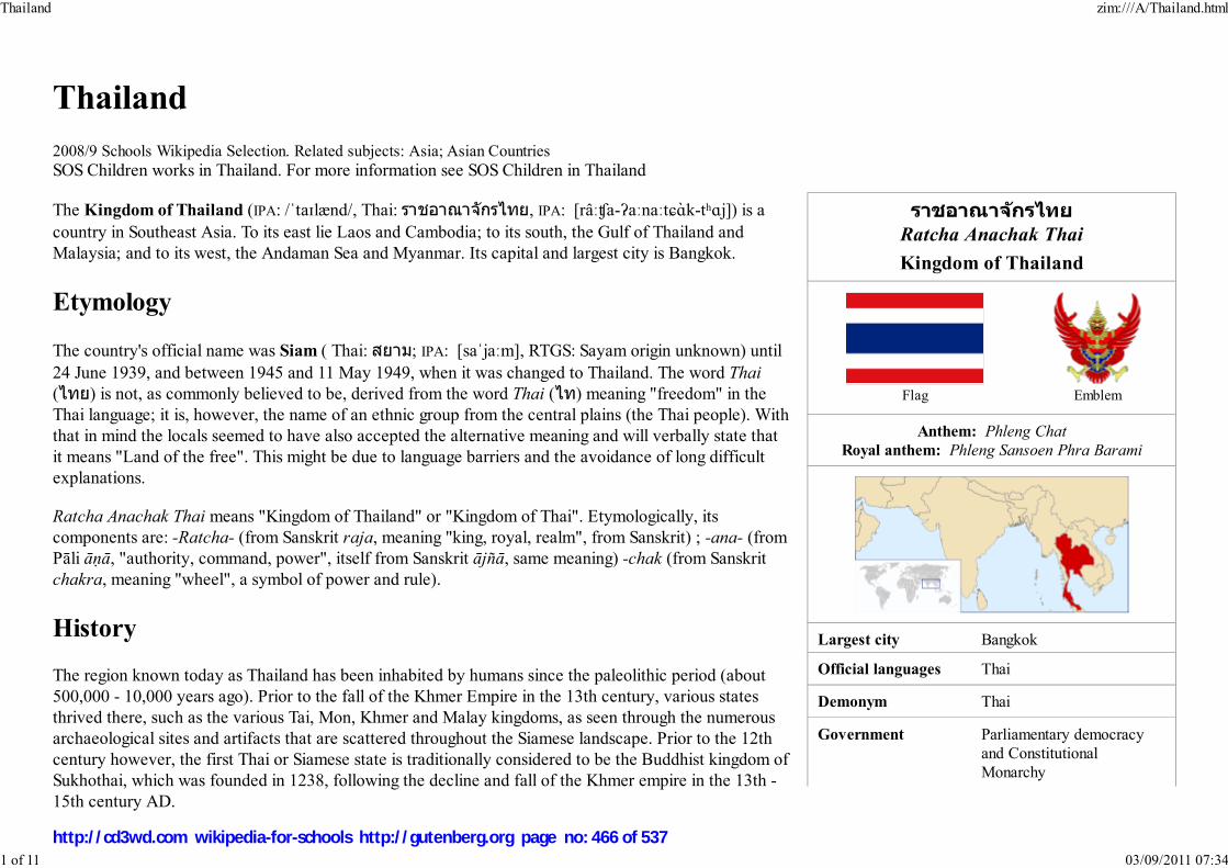
ราชอาณาจกัรไทย
Ratcha Anachak Thai
Kingdom of Thailand
Flag Emblem
Anthem: Phleng Chat
Royal anthem: Phleng Sansoen Phra Barami
Largest city Bangkok
Official languages Thai
Demonym Thai
Government Parliamentary democracyand ConstitutionalMonarchy
Thailand
2008/9 Schools Wikipedia Selection. Related subjects: Asia; Asian CountriesSOS Children works in Thailand. For more information see SOS Children in Thailand
The Kingdom of Thailand (IPA: /ˈtaɪlænd/, Thai: ราชอาณาจักรไทย, IPA: [râːʧa-ʔaːnaːtɕɑ̀k-tʰɑj]) is acountry in Southeast Asia. To its east lie Laos and Cambodia; to its south, the Gulf of Thailand andMalaysia; and to its west, the Andaman Sea and Myanmar. Its capital and largest city is Bangkok.
Etymology
The country's official name was Siam ( Thai: สยาม; IPA: [saˈjaːm], RTGS: Sayam origin unknown) until24 June 1939, and between 1945 and 11 May 1949, when it was changed to Thailand. The word Thai
(ไทย) is not, as commonly believed to be, derived from the word Thai (ไท) meaning "freedom" in theThai language; it is, however, the name of an ethnic group from the central plains (the Thai people). Withthat in mind the locals seemed to have also accepted the alternative meaning and will verbally state thatit means "Land of the free". This might be due to language barriers and the avoidance of long difficultexplanations.
Ratcha Anachak Thai means "Kingdom of Thailand" or "Kingdom of Thai". Etymologically, itscomponents are: -Ratcha- (from Sanskrit raja, meaning "king, royal, realm", from Sanskrit) ; -ana- (fromPāli āṇā, "authority, command, power", itself from Sanskrit ājñā, same meaning) -chak (from Sanskritchakra, meaning "wheel", a symbol of power and rule).
History
The region known today as Thailand has been inhabited by humans since the paleolithic period (about500,000 - 10,000 years ago). Prior to the fall of the Khmer Empire in the 13th century, various statesthrived there, such as the various Tai, Mon, Khmer and Malay kingdoms, as seen through the numerousarchaeological sites and artifacts that are scattered throughout the Siamese landscape. Prior to the 12thcentury however, the first Thai or Siamese state is traditionally considered to be the Buddhist kingdom ofSukhothai, which was founded in 1238, following the decline and fall of the Khmer empire in the 13th -15th century AD.
Thailand zim:///A/Thailand.html
1 of 11 03/09/2011 07:34
http://cd3wd.com wikipedia-for-schools http://gutenberg.org page no: 466 of 537

- King Rama IX - Prime Minister Samak Sundaravej
Formation
- Sukhothai Kingdom 1238–1368 - Ayutthaya Kingdom 1350 - Thonburi Kingdom 1767 - Rattanakosin
Kingdom6 April 1782
- ConstitutionalMonarchy
24 June 1932
Area
- Total 513,115 km² ( 49th)198,115 sq mi
- Water (%) 0.4
Population
- December2006 estimate
62,828,706 ( 20th)
- 2000 census 60,606,947 - Density 122/km² ( 80th)
317/sq mi
GDP ( PPP) 2006 estimate - Total $596.5 billion ( 21st) - Per capita $9,200 ( 69th)
GDP (nominal) 2006 estimate - Total $206.338 billion ( 34th) - Per capita $3,400 ( 92th)
Gini (2002) 42 (medium)
HDI (2005) ▼ 0.781 (medium) ( 78th)
Currency Baht (฿) ( THB)
A century later, Sukhothai's power was overshadowed by the larger Siamese kingdom of Ayutthaya,established in the mid-14th century.
After Ayutthaya fell in 1767 to the Burmese, Thonburi was the capital of Thailand for a brief periodunder King Taksin the Great. The current (Rattanakosin) era of Thai history began in 1782 following theestablishment of Bangkok as capital of the Chakri dynasty under King Rama I the Great.
European powers began traveling to Thailand in the 16th century. Despite European pressure, Thailand isthe only Southeast Asian nation never to have been colonised by a European country. Two main reasonsfor this were that Thailand had a long succession of very able rulers in the 1800s and that it was able toexploit the rivalry and tension between the French and the British. As a result, the country remained as abuffer state between parts of Southeast Asia that were colonised by the two colonial powers. Despitethis, Western influence led to many reforms in the 19th century and major concessions, most notablybeing the loss of large territory on the east side of the Mekong to the French and the step by stepabsorption by Britain of the Shan ( Thai Yai) States (now in Myanmar) and the Malay Peninsula. The lossinitially included Penang and Tumasik and eventually culminated in the loss of three predominantlyethnic-Malay southern provinces, which later became Malaysia's three northern states, under the (Anglo-Siamese Treaty of 1909).
In 1932, a bloodless revolution resulted in a new constitutional monarchy. During World War II, Thailandwas an ally with Japan while at the same time maintaining an active anti-Japanese resistance movementknown as the Seri Thai. After the war, Thailand emerged as an ally of the United States. As with many ofthe developing nations during the Cold War, Thailand then went through decades of politicaltransgression characterised by coups d'états as one military regime replaced another, but eventuallyprogressed towards a stable prosperity and democracy in the 1980s.
In 1997, Thailand was hit with the Asian financial crisis and the Thai baht for a short time peaked at 56baht to the U.S. dollar compared to about 25 baht to the dollar before 1997. Since then, the baht hasregained most of its strength and as of 23 May 2007, is valued at 33 baht to the US dollar.
The official calendar in Thailand is based on Eastern version of the Buddhist Era, which is 543 yearsahead of the Gregorian (western) calendar. For example, the year AD 2008 is called 2551 BE inThailand.
Politics and government
Thailand zim:///A/Thailand.html
2 of 11 03/09/2011 07:34
http://cd3wd.com wikipedia-for-schools http://gutenberg.org page no: 467 of 537

Time zone ( UTC+7)
Internet TLD .th
Calling code +66
^ Thai name: Krung Thep Maha Nakhon or Krung Thep
^ According to the Department of Provincial Administration's
official register, not taking into account unregistered citizens and
immigrants.
History
Since the political reform of the absolute monarchy in 1932, Thailand has had 17 constitutions andcharters. Throughout this time, the form of government has ranged from military dictatorship to electoraldemocracy, but all governments have acknowledged a hereditary monarch as the head of state.
1997 to 2006
The 1997 Constitution was the first constitution to be drafted by popularly-elected ConstitutionalDrafting Assembly, and was popularly called the "People's Constitution".
The 1997 Constitution created a bicameral legislature consisting of a 500-seat House of Representatives (สภาผูแ้ทนราษฎร, sapha phutan ratsadon) and a200-seat Senate (วุฒสิภา, wuthisapha). For the first time in Thai history, both houses were directly elected. Many human rights are explicitly acknowledged,and measures were established to increase the stability of elected governments. The House was elected by the first-past-the-post system, where only onecandidate with a simple majority could be elected in one constituency. The Senate was elected based on the province system, where one province can returnmore than one Senator depending on its population size. Members of the House of Representatives served four-year terms, while Senators served six-year terms.
The court system (ศาล, saan) included a constitutional court with jurisdiction over the constitutionality of parliamentary acts, royal decrees, and politicalmatters.
The January 2001 general election, the first elections under the 1997 Constitution, were called the most open, corruption-free election in Thai history. Thesubsequent government was the first in Thai history to complete a 4-year term. The 2005 election had the highest voter turnout in Thai history and was notedfor a marked reduction in vote-buying compared to previous elections.
In early 2006, significant pressure from corruption allegations led Thaksin Shinawatra to call for a snap election. The opposition boycotted the elections andThaksin was re-elected. Pressure continued to build, leading to a military coup on 19 September 2006.
After the 2006 coup
Without meeting much resistance, a military junta overthrew the elected government of Thaksin Shinawatra on 19 September 2006. The junta abrogated theconstitution, dissolved Parliament and the Constitutional Court, detained and later removed several members of the government, declared martial law, andappointed one of the King's Privy Councillors, General Surayud Chulanont, as Prime Minister. The junta later wrote a highly abbreviated interim constitutionand appointed a panel to draft a permanent constitution. The junta also appointed a 250-member legislature, called by some critics a "chamber of generals" andothers claimed that it lacks representatives from the poor majority. In this interim constitution draft, the head of the junta was allowed to remove the PrimeMinister at any time. The legislature was not allowed to hold a vote of confidence against the Cabinet and the public was not allowed to file comments on bills.This interim constitution was later surpassed by the permanent constitution on 24 August 2007.
1
2
Thailand zim:///A/Thailand.html
3 of 11 03/09/2011 07:34
http://cd3wd.com wikipedia-for-schools http://gutenberg.org page no: 468 of 537
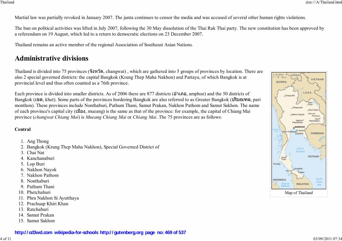
Map of Thailand
Martial law was partially revoked in January 2007. The junta continues to censor the media and was accused of several other human rights violations.
The ban on political activities was lifted in July 2007, following the 30 May dissolution of the Thai Rak Thai party. The new constitution has been approved bya referendum on 19 August, which led to a return to democratic elections on 23 December 2007.
Thailand remains an active member of the regional Association of Southeast Asian Nations.
Administrative divisions
Thailand is divided into 75 provinces (จังหวัด, changwat) , which are gathered into 5 groups of provinces by location. There arealso 2 special governed districts: the capital Bangkok (Krung Thep Maha Nakhon) and Pattaya, of which Bangkok is atprovincial level and thus often counted as a 76th province.
Each province is divided into smaller districts. As of 2006 there are 877 districts (อําเภอ, amphoe) and the 50 districts ofBangkok (เขต, khet). Some parts of the provinces bordering Bangkok are also referred to as Greater Bangkok (ปรมิณฑล, parimonthon). These provinces include Nonthaburi, Pathum Thani, Samut Prakan, Nakhon Pathom and Samut Sakhon. The nameof each province's capital city (เมอืง, mueang) is the same as that of the province: for example, the capital of Chiang Maiprovince (changwat Chiang Mai) is Mueang Chiang Mai or Chiang Mai. The 75 provinces are as follows:
Central
Ang Thong1.Bangkok (Krung Thep Maha Nakhon), Special Governed District of2.Chai Nat3.Kanchanaburi4.Lop Buri5.Nakhon Nayok6.Nakhon Pathom7.Nonthaburi8.Pathum Thani9.Phetchaburi10.Phra Nakhon Si Ayutthaya11.Prachuap Khiri Khan12.Ratchaburi13.Samut Prakan14.Samut Sakhon15.
Thailand zim:///A/Thailand.html
4 of 11 03/09/2011 07:34
http://cd3wd.com wikipedia-for-schools http://gutenberg.org page no: 469 of 537
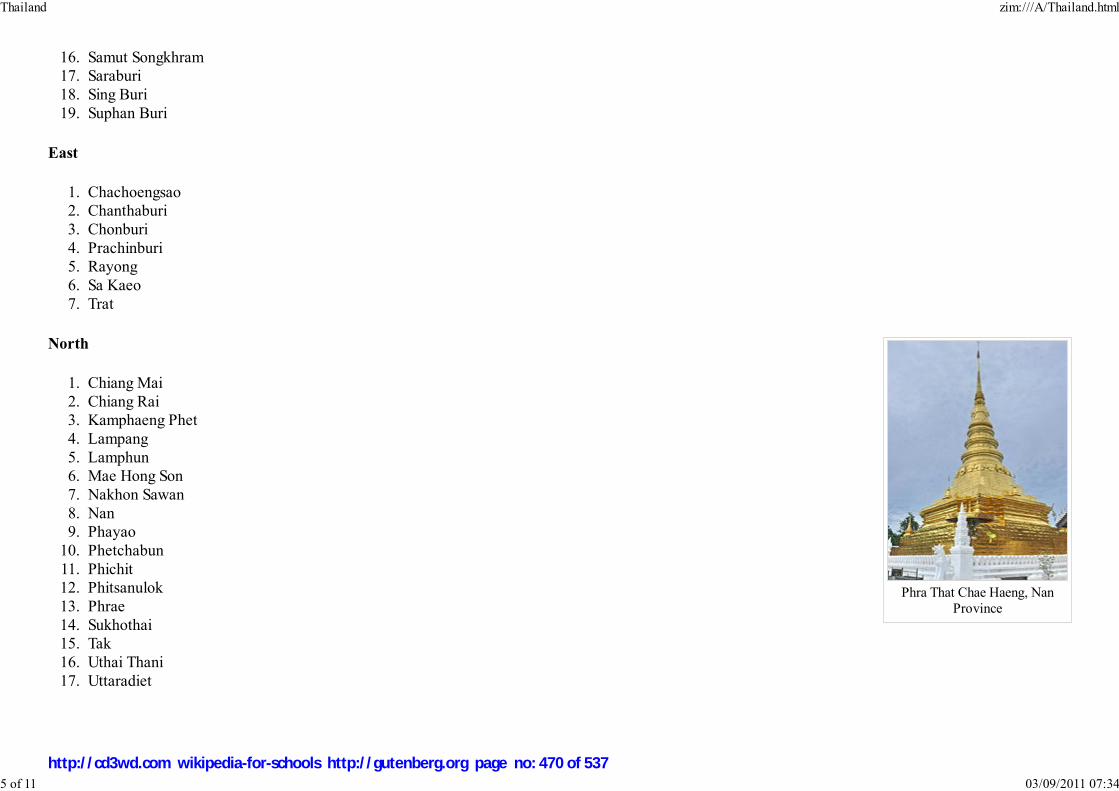
Phra That Chae Haeng, NanProvince
Samut Songkhram16.Saraburi17.Sing Buri18.Suphan Buri19.
East
Chachoengsao1.Chanthaburi2.Chonburi3.Prachinburi4.Rayong5.Sa Kaeo6.Trat7.
North
Chiang Mai1.Chiang Rai2.Kamphaeng Phet3.Lampang4.Lamphun5.Mae Hong Son6.Nakhon Sawan7.Nan8.Phayao9.Phetchabun10.Phichit11.Phitsanulok12.Phrae13.Sukhothai14.Tak15.Uthai Thani16.Uttaradiet17.
Thailand zim:///A/Thailand.html
5 of 11 03/09/2011 07:34
http://cd3wd.com wikipedia-for-schools http://gutenberg.org page no: 470 of 537

Phra That Phanom, NakhonPhanom Province
Northeast
Amnat Charoen1.Buri Ram2.Chaiyaphum3.Kalasin4.Khon Kaen5.Loei6.Maha Sarakham7.Mukdahan8.Nakhon Phanom9.Nakhon Ratchasima10.Nong Bua Lamphu11.Nong Khai12.Roi Et13.Sakon Nakhon14.Si Sa Ket15.Surin16.Ubon Ratchathani17.Udon Thani18.Yasothon19.
Thailand zim:///A/Thailand.html
6 of 11 03/09/2011 07:34
http://cd3wd.com wikipedia-for-schools http://gutenberg.org page no: 471 of 537

Phra Boromathat Chedi or PhraThat Nakhon, Nakhon Si
Thammarat Province
South
Chumphon1.Krabi2.Nakhon Si Thammarat3.Narathiwat4.Pattani5.Phang Nga6.Phatthalung7.Phuket8.Ranong9.Satun10.Songkhla11.Surat Thani12.Trang13.Yala14.
NOTE: In italics , that province represents the Greater Bangkok sub-region; in italics , that province represents the West sub-region.
See also: List of cities in Thailand, List of cities in Thailand by population
Geography
Thailand zim:///A/Thailand.html
7 of 11 03/09/2011 07:34
http://cd3wd.com wikipedia-for-schools http://gutenberg.org page no: 472 of 537

A waterfall in Sai Yok NationalPark.
Image:100bahtfr.jpgKing Bhumibol on a 100 Thai
baht banknote
A BTS skytrain passing theSathon area of Bangkok.
At 514,000 km² (198,000 sq mi) , Thailand is the world's 49th-largest country. It is comparable in size to France, and somewhatlarger than the US state of California.
Thailand is home to several distinct geographic regions, partly corresponding to the provincial groups. The north of the countryis mountainous, with the highest point being Doi Inthanon at 2,565 metres (8,415 ft). The northeast consists of the KhoratPlateau, bordered to the east by the Mekong river. The centre of the country is dominated by the predominantly flat ChaoPhraya river valley, which runs into the Gulf of Thailand. The south consists of the narrow Kra Isthmus that widens into theMalay Peninsula.
The local climate is tropical and characterised by monsoons. There is a rainy, warm, and cloudy southwest monsoon frommid-May to September, as well as a dry, cool northeast monsoon from November to mid-March. The southern isthmus isalways hot and humid. Major cities beside the capital Bangkok include Nakhon Ratchasima, Khon Kaen, Udon Thani, UbonRatchathani, Nakhon Sawan, Chiang Mai, Phitsanulok, Surat Thani, Phuket and Hat Yai.
For maps, see: Atlas of Thailand
Economy
Thailand is a newly industrialised country. After enjoying the world's highest growth rate from 1985 to 1996 - averaging almost9% annually - increased pressure on Thailand's currency, the baht, in 1997, the year in which the economy contracted by 1.9%led to a crisis that uncovered financial sector weaknesses and forced the government to float the currency. Pegged at 25 to theUS dollar from 1978 to 1997, the baht reached its lowest point of 56 to the US dollar in January 1998 and the economycontracted by 10.8% that same year. The collapse prompted a wider Asian financial crisis.
Thailand entered a recovery stage in 1998, expanding 4.2% and 4.4% in 2000, largely due to strong exports - which increasedabout 20% in 2000. Growth (2.2%) was dampened by a softening of the global economy in 2001, but picked up in thesubsequent years due to strong growth in the People's Republic of China, a relatively weak baht encouraging exports andincreasing domestic spending as a result of several mega projects and incentives of Prime Minister Thaksin Shinawatra, knownas Thaksinomics. Growth in 2002/03 and 2004 was 5-7% annually.
Thailand exports over $105 billion worth of products annually. Major exports include rice, textiles and footwear, fisheryproducts, rubber, jewelry, automobiles, computers and electrical appliances. Thailand is the world’s no.1 exporter of rice,exporting 6.5 million tons of milled rice annually. Rice is the most important crop in the country. Thailand has the highestpercent of arable land, 27.25%, of any nation in the Greater Mekong Subregion. About 55% of the available land area is used for rice production.
Substantial industries include electric appliances, components, computer parts and automobiles, while tourism contributes about 5% of the Thai economy's
Thailand zim:///A/Thailand.html
8 of 11 03/09/2011 07:34
http://cd3wd.com wikipedia-for-schools http://gutenberg.org page no: 473 of 537
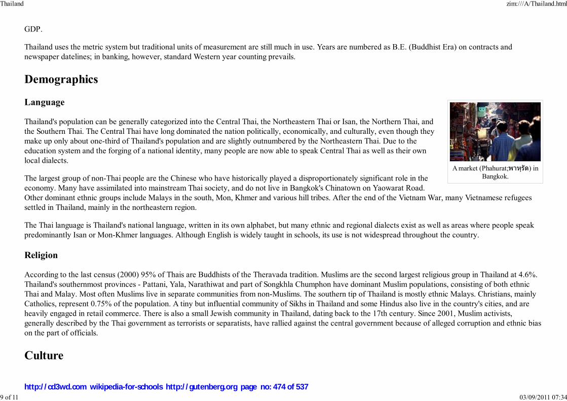
A market (Phahurat;พาหุรัด) inBangkok.
GDP.
Thailand uses the metric system but traditional units of measurement are still much in use. Years are numbered as B.E. (Buddhist Era) on contracts andnewspaper datelines; in banking, however, standard Western year counting prevails.
Demographics
Language
Thailand's population can be generally categorized into the Central Thai, the Northeastern Thai or Isan, the Northern Thai, andthe Southern Thai. The Central Thai have long dominated the nation politically, economically, and culturally, even though theymake up only about one-third of Thailand's population and are slightly outnumbered by the Northeastern Thai. Due to theeducation system and the forging of a national identity, many people are now able to speak Central Thai as well as their ownlocal dialects.
The largest group of non-Thai people are the Chinese who have historically played a disproportionately significant role in theeconomy. Many have assimilated into mainstream Thai society, and do not live in Bangkok's Chinatown on Yaowarat Road.Other dominant ethnic groups include Malays in the south, Mon, Khmer and various hill tribes. After the end of the Vietnam War, many Vietnamese refugeessettled in Thailand, mainly in the northeastern region.
The Thai language is Thailand's national language, written in its own alphabet, but many ethnic and regional dialects exist as well as areas where people speakpredominantly Isan or Mon-Khmer languages. Although English is widely taught in schools, its use is not widespread throughout the country.
Religion
According to the last census (2000) 95% of Thais are Buddhists of the Theravada tradition. Muslims are the second largest religious group in Thailand at 4.6%.Thailand's southernmost provinces - Pattani, Yala, Narathiwat and part of Songkhla Chumphon have dominant Muslim populations, consisting of both ethnicThai and Malay. Most often Muslims live in separate communities from non-Muslims. The southern tip of Thailand is mostly ethnic Malays. Christians, mainlyCatholics, represent 0.75% of the population. A tiny but influential community of Sikhs in Thailand and some Hindus also live in the country's cities, and areheavily engaged in retail commerce. There is also a small Jewish community in Thailand, dating back to the 17th century. Since 2001, Muslim activists,generally described by the Thai government as terrorists or separatists, have rallied against the central government because of alleged corruption and ethnic biason the part of officials.
Culture
Thailand zim:///A/Thailand.html
9 of 11 03/09/2011 07:34
http://cd3wd.com wikipedia-for-schools http://gutenberg.org page no: 474 of 537

Thai bells at the Golden Mountin Bangkok.
Theravada Buddhism is highlyrespected in Thailand.
The culture of Thailand incorporates a great deal of influence from India, China, and the rest of southeast Asia. Thailand's maintheology Theravada Buddhism is central to modern Thai identity and belief. In practice, Thai Buddhism has evolved over timeto include many regional beliefs originating from animism as well as ancestor worship. In areas in the southernmost parts ofThailand, Islam is prevalent. Several different ethnic groups, many of which are marginalized, populate Thailand. Some ofthese groups overlap into Myanmar, Laos, Cambodia, and Malaysia and have maintained a distinctly traditional way of lifedespite strong Thai cultural influence. Overseas Chinese also form a significant part of Thai society, particularly in and aroundBangkok. Their successful integration into Thai society has allowed for this group to hold positions of economic and politicalpower, the most noteworthy of these being the Thai Prime Minister, Thaksin Shinawatra, who held power from 2001 until 19September 2006 when he was ousted by a military coup d'état.
Like most Asian cultures, respect towards ancestors is an essential part of Thai spiritual practice. Thais have a strong sense ofhospitality and generosity, but also a strong sense of social hierarchy. Seniority is an important concept in Thai culture. Eldershave by tradition ruled in family decisions or ceremonies.
The traditional Thai greeting, the wai, is generally offered first by the youngest of the twopeople meeting, with their hands pressed together, fingertips pointing upwards as the head isbowed to touch their face to the hands, usually coinciding with the spoken word "Sawat-diikhrap" for male speakers, and "Sawat-dii ka" for females. The elder then is to respondafterwards in the same way. Social status and position, such as in government, will also have an influence on who performs thewai first. For example, although one may be considerably older than a provincial governor, when meeting it is usually thevisitor who pays respect first. When children leave to go to school, they are taught to wai to their parents to represent theirrespect for them. They do the same when they come back. The wai is a sign of respect and reverence for another, similar to thenamaste greeting of India.
Muay Thai, or Thai boxing, is the national sport in Thailand and its natives martial art call "Muay". In the past "Muay" wastaught to Royal soldiers for combat on battlefield if unarmed. After they retired from the army, these soldiers often became Buddhist monks and stayed at thetemples. Most of the Thai people's lives are closely tied to Buddhism and temples; they often send their sons to be educated with the monks. ”Muay” is also oneof the subjects taught in the temples..
Muay Thai achieved popularity all over the world in the 1990s. Although similar martial arts styles exist in other southeast Asian countries, few enjoy therecognition that Muay Thai has received with its full-contact rules allowing strikes including elbows, throws and knees. Football (soccer), however, has possiblyovertaken Muay Thai's position as most widely viewed and liked sport in contemporary Thai society and it is not uncommon to see Thais cheering theirfavourite English Premier League teams on television and walking around in replica kits. Another widely enjoyed pastime, and once a competitive sport, is kiteflying.
Taboos in Thailand include touching someone's head or pointing with the feet, as the head is considered the most sacred and the foot the dirtiest part of thebody. Stepping over someone, or over food, is considered insulting. However, Thai culture as in many other Asian cultures, is succumbing to the influence of
Thailand zim:///A/Thailand.html
10 of 11 03/09/2011 07:34
http://cd3wd.com wikipedia-for-schools http://gutenberg.org page no: 475 of 537
globalization with some of the traditional taboos slowly fading away with time.
Books and other documents are the most revered of secular objects - therefore one should not slide a book across a table or place it on the floor.
Thai cuisine blends five fundamental tastes: sweet, spicy, sour, bitter and salty. Some common ingredients used in Thai cuisine include garlic, chillies, lime juice,lemon grass, and fish sauce. The staple food in Thailand is rice, particularly jasmine variety rice (also known as Hom Mali rice) which is included in almostevery meal. Thailand is the world's largest exporter of rice, and Thais domestically consume over 100 kg of milled rice per person per year. Over 5000 varietiesof rice from Thailand are preserved in the rice gene bank of the International Rice Research Institute (IRRI) , based in the Philippines. The King of Thailand isthe official patron of IRRI.
Thai society has been influenced in recent years by its widely-available multi-language press and media. There are numerous English, Thai and Chinesenewspapers in circulation; most Thai popular magazines use English headlines as a chic glamor factor. Most large businesses in Bangkok operate in English aswell as other languages. English is also spoken among many Thais, sometimes as a way of demonstrating their educated, high-society status, but other timesbecause of the lingua franca nature of English. Thailand is the largest newspaper market in South East Asia with an estimated circulation of at least 13 millioncopies daily in 2003. Even upcountry, out of Bangkok, media flourishes. For example, according to Thailand's Public Relations Department Media Directory2003-2004, the nineteen provinces of northeast Thailand themselves hosted 116 newspapers in addition to radio, TV and cable.
International rankings
Organization Survey Ranking
Heritage Foundation Indices of Economic Freedom 50 out of 157
Reporters Without Borders Worldwide Press Freedom Index 134 out of 169
Transparency International Corruption Perceptions Index 84 out of 179
United Nations Development Programme Human Development Index 78 out of 177
Retrieved from " http://en.wikipedia.org/wiki/Thailand"This Wikipedia Selection has a sponsor: SOS Children , and is mainly selected from the English Wikipedia with only minor checks and changes (seewww.wikipedia.org for details of authors and sources). The articles are available under the GNU Free Documentation License. See also our
Thailand zim:///A/Thailand.html
11 of 11 03/09/2011 07:34
http://cd3wd.com wikipedia-for-schools http://gutenberg.org page no: 476 of 537

Tibet Autonomous Region within the People's Republic of China
Historic Tibet as claimed by Tibetan exile groups
Tibetan areas as designated by the People's Republic of China
Chinese-controlled areas claimed by India as part of Aksai Chin
Indian-controlled areas claimed by China as part of Tibet
Other areas historically within Tibetan cultural sphere
Tibet
2008/9 Schools Wikipedia Selection. Related subjects: Asia; Asian Countries
SOS Children cares for Tibetan orphans in India. For more information see SOS Children: India
Tibet ( Tibetan: ����; Wylie: bod) is a plateau region in Central Asia and the home to the indigenousTibetan people. With an average elevation of 4,900 metres (16,000 ft), it is the highest region on Earthand is commonly referred to as the "Roof of the World." Geographically, UNESCO and Encyclopædia
Britannica consider Tibet to be part of Central Asia, while several academic organizations consider itpart of South Asia. Since what constitutes Tibet is a matter of much debate (see map, right) neither itssize nor population are simple matters of fact.
Tibet was once an independent kingdom but today is part of the People's Republic of China (PRC) with asmall part, depending on definitions, controlled by India. The Republic of China (commonly known asTaiwan) also lays a claim to Tibet as part of its exclusive mandate which includes a claim to all theterritories currently governed by the PRC. Currently, the PRC government and the Government of Tibetin Exile still disagree over when Tibet became a part of China, and whether the incorporation into Chinaof Tibet is legitimate according to international law.
A unifed Tibet first came into being under Songtsän Gampo in the seventh century. From the early 1600suntil the 1959 uprising, the Dalai Lamas ( Tibetan Buddhist spiritual leaders) were, at least nominally,heads of a centralised Tibetan administration, with political power to administer religious andadministrative authority over large parts of Tibet from the traditional capital Lhasa. They are believed tobe the emanations of Avalokiteśvara (or "Chenrezig" [spyan ras gzigs] in Tibetan), the bodhisattva ofcompassion.
Definitions of Tibet
Tibet zim:///A/Tibet.html
1 of 25 03/09/2011 07:34
http://cd3wd.com wikipedia-for-schools http://gutenberg.org page no: 477 of 537
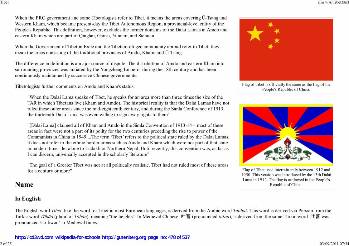
Flag of Tibet is officially the same as the flag of thePeople's Republic of China.
Flag of Tibet used intermittently between 1912 and1950. This version was introduced by the 13th DalaiLama in 1912. The flag is outlawed in the People's
Republic of China.
When the PRC government and some Tibetologists refer to Tibet, it means the areas covering Ü-Tsang andWestern Kham, which became present-day the Tibet Autonomous Region, a provincial-level entity of thePeople's Republic. This definition, however, excludes the former domains of the Dalai Lamas in Amdo andeastern Kham which are part of Qinghai, Gansu, Yunnan, and Sichuan.
When the Government of Tibet in Exile and the Tibetan refugee community abroad refer to Tibet, theymean the areas consisting of the traditional provinces of Amdo, Kham, and Ü-Tsang.
The difference in definition is a major source of dispute. The distribution of Amdo and eastern Kham intosurrounding provinces was initiated by the Yongzheng Emperor during the 18th century and has beencontinuously maintained by successive Chinese governments.
Tibetologists further comments on Amdo and Kham's status:
"When the Dalai Lama speaks of Tibet, he speaks for an area more than three times the size of theTAR in which Tibetans live (Kham and Amdo). The historical reality is that the Dalai Lamas have notruled these outer areas since the mid-eighteenth century, and during the Simla Conference of 1913,the thirteenth Dalai Lama was even willing to sign away rights to them"
"[Dalai Lama] claimed all of Kham and Amdo in the Simla Convention of 1913-14 – most of theseareas in fact were not a part of its polity for the two centuries preceding the rise to power of theCommunists in China in 1949....The term ‘Tibet’ refers to the political state ruled by the Dalai Lamas;it does not refer to the ethnic border areas such as Amdo and Kham which were not part of that statein modern times, let alone to Ladakh or Northern Nepal. Until recently, this convention was, as far asI can discern, universally accepted in the scholarly literature"
"The goal of a Greater Tibet was not at all politically realistic. Tibet had not ruled most of these areasfor a century or more"
Name
In English
The English word Tibet, like the word for Tibet in most European languages, is derived from the Arabic word Tubbat. This word is derived via Persian from theTurkic word Töbäd (plural of Töbän), meaning "the heights". In Medieval Chinese, 吐蕃 (pronounced tufan), is derived from the same Turkic word. 吐蕃 waspronounced /t'o-bwǝn/ in Medieval times.
Tibet zim:///A/Tibet.html
2 of 25 03/09/2011 07:34
http://cd3wd.com wikipedia-for-schools http://gutenberg.org page no: 478 of 537
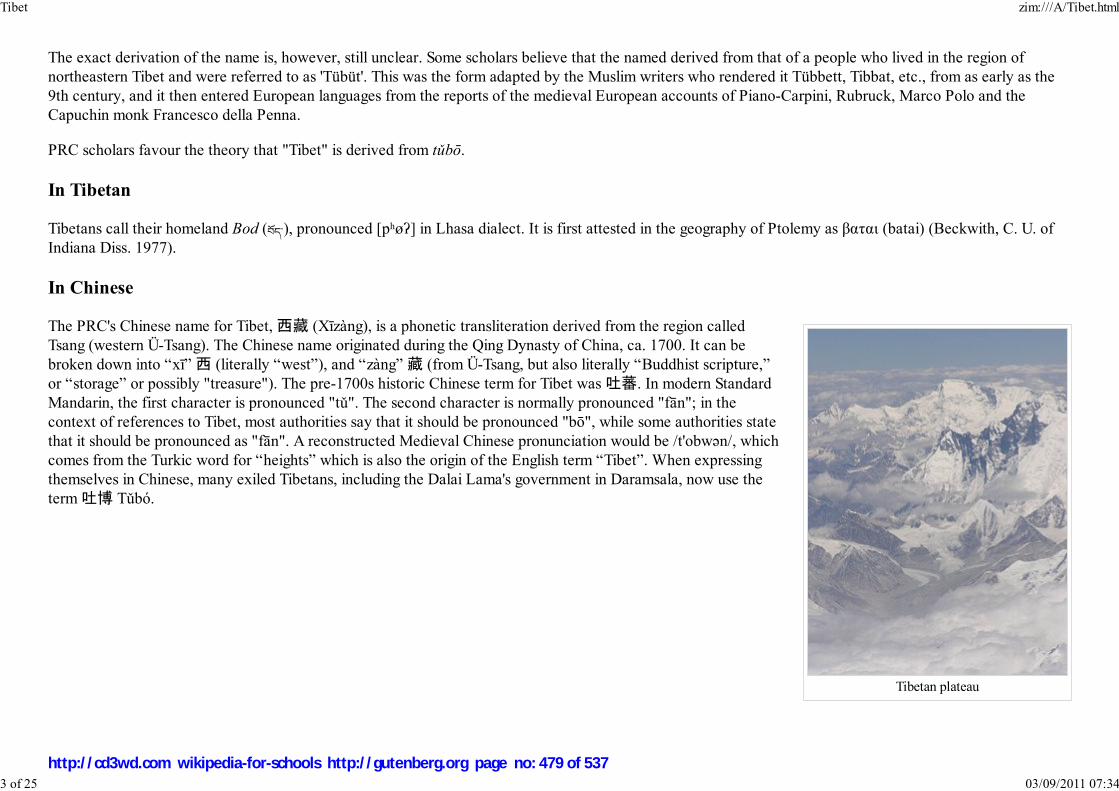
Tibetan plateau
The exact derivation of the name is, however, still unclear. Some scholars believe that the named derived from that of a people who lived in the region ofnortheastern Tibet and were referred to as 'Tübüt'. This was the form adapted by the Muslim writers who rendered it Tübbett, Tibbat, etc., from as early as the9th century, and it then entered European languages from the reports of the medieval European accounts of Piano-Carpini, Rubruck, Marco Polo and theCapuchin monk Francesco della Penna.
PRC scholars favour the theory that "Tibet" is derived from tǔbō.
In Tibetan
Tibetans call their homeland Bod (����), pronounced [pʰøʔ] in Lhasa dialect. It is first attested in the geography of Ptolemy as βαται (batai) (Beckwith, C. U. ofIndiana Diss. 1977).
In Chinese
The PRC's Chinese name for Tibet, 西藏 (Xīzàng), is a phonetic transliteration derived from the region calledTsang (western Ü-Tsang). The Chinese name originated during the Qing Dynasty of China, ca. 1700. It can bebroken down into “xī” 西 (literally “west”), and “zàng” 藏 (from Ü-Tsang, but also literally “Buddhist scripture,”or “storage” or possibly "treasure"). The pre-1700s historic Chinese term for Tibet was 吐蕃. In modern StandardMandarin, the first character is pronounced "tǔ". The second character is normally pronounced "fān"; in thecontext of references to Tibet, most authorities say that it should be pronounced "bō", while some authorities statethat it should be pronounced as "fān". A reconstructed Medieval Chinese pronunciation would be /t'obwǝn/, whichcomes from the Turkic word for “heights” which is also the origin of the English term “Tibet”. When expressingthemselves in Chinese, many exiled Tibetans, including the Dalai Lama's government in Daramsala, now use theterm 吐博 Tǔbó.
Tibet zim:///A/Tibet.html
3 of 25 03/09/2011 07:34
http://cd3wd.com wikipedia-for-schools http://gutenberg.org page no: 479 of 537

Pastoral nomads camping near Namtso in2005
A Tibetan woman in Lhasa
The PRC government equates Tibet with the Tibet Autonomous Region (TAR). As such, the name “Xīzàng” isequated with the TAR. Some English-speakers reserve “Xīzàng”, the Chinese word transliterated into English, forthe TAR, to keep the concept distinct from that of historic Tibet.The character 藏 (zàng) has been used intranscriptions referring to Tsang as early as the Yuan Dynasty, if not earlier, though the modern term "Xizang"(western Tsang) was devised in the 18th century. The Chinese character 藏 (Zàng) has also been generalized torefer to all of Tibet, including other concepts related to Tibet such as the Tibetan language (藏文, Zàngwén) andthe Tibetan people (藏族, Zàngzú).
Language
The Tibetan language is generally classified as a Tibeto-Burmanlanguage of the Sino-Tibetan language family although the boundariesbetween 'Tibetan' and certain other Himalayan languages can beunclear. According to Matthew Kapstein:
From the perspective of historical linguistics, Tibetan mostclosely resembles Burmese among the major languages of Asia.Grouping these two together with other apparently relatedlanguages spoken in the Himalayan lands, as well as in thehighlands of Southeast Asia and the Sino-Tibetan frontierregions, linguists have generally concluded that there exists aTibeto-Burman family of languages.... More controversial is the
theory that the Tibeto-Burman family is itself part of a larger language family, called Sino-Tibetan, and that through it Tibetan and Burmese aredistant cousins of Chinese.
The language is spoken in numerous regional dialects which, although sometimes mutually intelligible, generally cannot be understood by the speakers of thedifferent oral forms of Tibetan. It is employed throughout the Tibetan plateau and Bhutan and is also spoken in parts of Nepal and northern India, such asSikkim. In general, the dialects of central Tibet (including Lhasa), Kham, Amdo and some smaller nearby areas are considered Tibetan dialects. Other forms,particularly Dzongkha, Sikkimese, Sherpa, and Ladakhi, are considered by their speakers, largely for political reasons, to be separate languages. However, if thelatter group of Tibetan-type languages are included in the calculation then 'greater Tibetan' is spoken by approximately 6 million people across the TibetanPlateau. Tibetan is also spoken by approximately 150,000 exile speakers who have fled from modern-day Tibet to India and other countries.
Although spoken Tibetan varies according to the region, the written language, based on Classical Tibetan, is consistent throughout. This is probably due to thelong-standing influence of the Tibetan empire, whose rule embraced (and extended at times far beyond) the present Tibetan linguistic area, which runs fromnorthern Pakistan in the west to Yunnan and Sichuan in in the east, and from north of the Kokonor lake (Qinghai) south as far as Bhutan. The Tibetan languagehas its own script that it shares with Ladakhi and Dzongkha, which is derived from the ancient Indian Brahmi script.
Tibet zim:///A/Tibet.html
4 of 25 03/09/2011 07:34
http://cd3wd.com wikipedia-for-schools http://gutenberg.org page no: 480 of 537
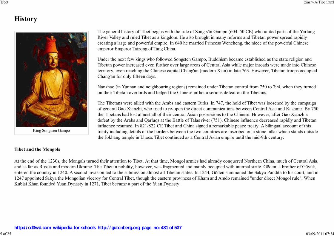
King Songtsen Gampo
History
The general history of Tibet begins with the rule of Songtsän Gampo (604–50 CE) who united parts of the YarlungRiver Valley and ruled Tibet as a kingdom. He also brought in many reforms and Tibetan power spread rapidlycreating a large and powerful empire. In 640 he married Princess Wencheng, the niece of the powerful Chineseemperor Emperor Taizong of Tang China.
Under the next few kings who followed Songsten Gampo, Buddhism became established as the state religion andTibetan power increased even further over large areas of Central Asia while major inroads were made into Chineseterritory, even reaching the Chinese capital Chang'an (modern Xian) in late 763. However, Tibetan troops occupiedChang'an for only fifteen days.
Nanzhao (in Yunnan and neighbouring regions) remained under Tibetan control from 750 to 794, when they turnedon their Tibetan overlords and helped the Chinese inflict a serious defeat on the Tibetans.
The Tibetans were allied with the Arabs and eastern Turks. In 747, the hold of Tibet was loosened by the campaignof general Gao Xianzhi, who tried to re-open the direct communications between Central Asia and Kashmir. By 750the Tibetans had lost almost all of their central Asian possessions to the Chinese. However, after Gao Xianzhi'sdefeat by the Arabs and Qarluqs at the Battle of Talas river (751), Chinese influence decreased rapidly and Tibetaninfluence resumed. In 821/822 CE Tibet and China signed a remarkable peace treaty. A bilingual account of thistreaty including details of the borders between the two countries are inscribed on a stone pillar which stands outsidethe Jokhang temple in Lhasa. Tibet continued as a Central Asian empire until the mid-9th century.
Tibet and the Mongols
At the end of the 1230s, the Mongols turned their attention to Tibet. At that time, Mongol armies had already conquered Northern China, much of Central Asia,and as far as Russia and modern Ukraine. The Tibetan nobility, however, was fragmented and mainly occupied with internal strife. Göden, a brother of Güyük,entered the country in 1240. A second invasion led to the submission almost all Tibetan states. In 1244, Göden summoned the Sakya Pandita to his court, and in1247 appointed Sakya the Mongolian viceroy for Central Tibet, though the eastern provinces of Kham and Amdo remained "under direct Mongol rule". WhenKublai Khan founded Yuan Dynasty in 1271, Tibet became a part of the Yuan Dynasty.
Tibet zim:///A/Tibet.html
5 of 25 03/09/2011 07:34
http://cd3wd.com wikipedia-for-schools http://gutenberg.org page no: 481 of 537

Tibet in 820 in relation to the other powers
Kublai Khan
Between 1346 and 1354, towards the end of the Yuan Dynasty, the House of Pagmodru toppled theSakya. The following 80 years were a period of relative stability. They also saw the birth of theGelugpa school (also known as Yellow Hats) by the disciples of Tsongkhapa Lobsang Dragpa, andthe founding of the important Ganden, Drepung, and Sera monasteries near Lhasa. After the 1430s,the country entered another period of internal power struggles.
In 1578, Altan Khan of the Tümed Mongols invited Sonam Gyatso, a high lama of the Gelugpaschool. They met near Khökh Nuur, where Altan Khan first referred to Sönam Gyatso as the Dalai
Lama; Dalai being the Mongolian translation of the Tibetan name Gyatso, or "Ocean".
Events leading to Qing dominion of Tibet
In the 1630s, Tibet became entangled in the power struggles between the rising Manchu and variousMongol and Oirad factions. Ligden Khan of the Mongolian Chakhar tribe, retreating from the Manchu forces, set out todestroy the Yellow Hat Gelug school in Tibet but died on the way near Kokonor, in 1634. His vassal Tsogt Taij continuedthe fight but was defeated and killed by Güshi Khan of the Khoshud in 1637, who, in turn, became the overlord over Tibet,and acted as a "Protector of the Yellow Church". Güshi helped the Fifth Dalai Lama to establish himself as the highestspiritual and political authority in Tibet and destroyed any potential rivals.
In 1705, Lobzang Khan of the Khoshud used the 6th Dalai Lama's refusal of the role of a monk (although the encumbantdid not reject his political role as Dalai Lama) as an excuse to take control of Tibet. The regent was murdered, and the DalaiLama sent to Beijing. He died on the way, also near Kokonor, ostensibly from illness. Lobzang Khan appointed a new DalaiLama, who, however, was not accepted by the Gelugpa school.
A rival reincarnation was found in the region of Kokonor. The Dzungars invaded Tibet in 1717, deposed and killed apretender to the position of Dalai Lama (who had been promoted by Lhabzang), which met with widespread approval.However, the Dzungars soon began to loot the holy places of Lhasa which brought a swift response from Emperor Kangxiin 1718, but his military expedition was annihilated by the Dzungars not far from Lhasa.
Emperor Kangxi finally expelled the Dzungars from Tibet in 1720 and the troops were hailed as liberators. They brought Kelzang Gyatso with them fromKumbum to Lhasa and he was installed as the Seventh Dalai Lama in 1721, though they did not make Tibet a province, allowed it to maintain its own officialsand legal and administrative systems, and levied no taxes. However, the Manchu Qing put Amdo under their control in 1724, and incorporated eastern Khaminto neighbouring Chinese provinces in 1728. The Qing government sent a resident commissioner, namely Amban, to Lhasa. In 1751, Emperor Qianlonginstalled the Dalai Lama as both the spiritual leader and political leader of Tibet leading the government, namely Kashag.
Tibet under Qing
Tibet zim:///A/Tibet.html
6 of 25 03/09/2011 07:34
http://cd3wd.com wikipedia-for-schools http://gutenberg.org page no: 482 of 537

Francis Younghusband
While the ancient relations between Tibet and China are complicated, there can be no question regarding the subordination of Tibet to Manchu-ruled Chinafollowing first decades of the 18th century. In 1788, Gurkha forces sent by Bahadur Shah, the Regent of Nepal, invaded Tibet, occupying a number of frontierdistricts. The young Panchen Lama fled to Lhasa and Qing Emperor Qianlong sent troops to Lhasa, upon which the Nepalese withdrew agreeing to pay a largeannual sum. In 1791 the Nepalese Gurkhas invaded Tibet a second time, seizing Shigatse and destroyed, plundered, and desecrated the great TashilhunpoMonastery. The Panchen Lama was forced to flee to Lhasa once again. Emperor Qianlong then sent an army of 17,000 men to Tibet. In 1793, with theassistance of Tibetan troops, they managed to drive the Nepalese troops to within about 30 km of Kathmandu.
The first Europeans to arrive in Tibet were Portuguese missionaries in 1624 and were welcomed by the Tibetans who allowed themto build a church. The 18th century brought more Jesuits and Capuchins from Europe who gradually met opposition from Tibetanlamas who finally expelled them from Tibet in 1745. However, at the time not all Europeans were banned from the country — in1774 a Scottish nobleman, George Bogle, came to Shigatse to investigate trade for the British East India Company, introducing thefirst potatoes into Tibet.
However, by the 19th century the situation of foreigners in Tibet grew more tenuous. The British Empire was encroaching fromnorthern India into the Himalayas and Afghanistan and the Russian Empire of the tsars was expanding south into Central Asia andeach power became suspicious of intent in Tibet. Sándor Kőrösi Csoma, the Hungarian scientist spent 20 years in British India (4years in Ladakh) trying to visit Tibet. He created the first Tibetan-English dictionary.
By the 1850s Tibet had banned all foreigners from Tibet and shut its borders to all outsiders.
In 1865 Great Britain began secretly mapping Tibet. Trained Indian surveyor-spies disguised as pilgrims or traders counted theirstrides on their travels across Tibet and took readings at night. Then, in 1904 a British mission under the command of Colonel
Francis Younghusband, accompanied by a large military escort, invaded Tibet and reached Lhasa.
The principal pretext for the British invasion was a fear, which proved to be unfounded, that Russia was extending its power into Tibet and possibly even givingmilitary aid to the local Tibetan government. But on his way to Lhasa, Younghusband slaughtered many Tibetan troops in Gyangzê who tried to stop the Britishadvance.
Tibet zim:///A/Tibet.html
7 of 25 03/09/2011 07:34
http://cd3wd.com wikipedia-for-schools http://gutenberg.org page no: 483 of 537
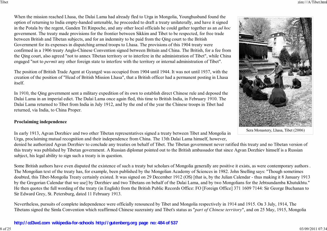
Sera Monastery, Lhasa, Tibet (2006)
When the mission reached Lhasa, the Dalai Lama had already fled to Urga in Mongolia, Younghusband found theoption of returning to India empty-handed untenable, he proceeded to draft a treaty unilaterally, and have it signedin the Potala by the regent, Ganden Tri Rinpoche, and any other local officials he could gather together as an ad hoc
government. The treaty made provisions for the frontier between Sikkim and Tibet to be respected, for free tradebetween British and Tibetan subjects, and for an indemnity to be paid from the Qing court to the BritishGovernment for its expenses in dispatching armed troops to Lhasa. The provisions of this 1904 treaty wereconfirmed in a 1906 treaty Anglo-Chinese Convention signed between Britain and China. The British, for a fee fromthe Qing court, also agreed "not to annex Tibetan territory or to interfere in the administration of Tibet", while Chinaengaged "not to permit any other foreign state to interfere with the territory or internal administration of Tibet".
The position of British Trade Agent at Gyangzê was occupied from 1904 until 1944. It was not until 1937, with thecreation of the position of "Head of British Mission Lhasa", that a British officer had a permanent posting in Lhasaitself.
In 1910, the Qing government sent a military expedition of its own to establish direct Chinese rule and deposed theDalai Lama in an imperial edict. The Dalai Lama once again fled, this time to British India, in February 1910. TheDalai Lama returned to Tibet from India in July 1912, and by the end of the year the Chinese troops in Tibet hadreturned, via India, to China Proper.
Proclaiming independence
In early 1913, Agvan Dorzhiev and two other Tibetan representatives signed a treaty between Tibet and Mongolia inUrga, proclaiming mutual recognition and their independence from China. The 13th Dalai Lama himself, however,denied he authorized Agvan Dorzhiev to conclude any treaties on behalf of Tibet. The Tibetan government never ratified this treaty and no Tibetan version ofthis treaty was published by Tibetan government. A Russian diplomat pointed out to the British ambassador that since Agvan Dorzhiev himself is a Russiansubject, his legal ability to sign such a treaty is in question.
Some British authors have even disputed the existence of such a treaty but scholars of Mongolia generally are positive it exists, as were contemporary authors .The Mongolian text of the treaty has, for example, been published by the Mongolian Academy of Sciences in 1982. John Snelling says: "Though sometimesdoubted, this Tibet-Mongolia Treaty certainly existed. It was signed on 29 December 1912 (OS) [that is, by the Julian Calendar - thus making it 8 January 1913by the Gregorian Calendar that we use] by Dorzhiev and two Tibetans on behalf of the Dalai Lama, and by two Mongolians for the Jebtsundamba Khutukhtu."He then quotes the full wording of the treaty (in English) from the British Public Records Office: FO [Foreign Office] 371 1609 7144: Sir George Buchanan toSir Edward Grey, St. Petersburg, dated 11 February 1913.
Nevertheless, pursuits of complete independence were officially renounced by Tibet and Mongolia respectively in 1914 and 1915. On 3 July, 1914, TheTibetans signed the Simla Convention which reaffirmed Chinese suzerainty and Tibet's status as "part of Chinese territory", and on 25 May, 1915, Mongolia
Tibet zim:///A/Tibet.html
8 of 25 03/09/2011 07:34
http://cd3wd.com wikipedia-for-schools http://gutenberg.org page no: 484 of 537

signed a tripartite treaty reaffirming, at least nominally, subordination to China.
The subsequent outbreak of World War I and the division of China into military cliques ruled by warlords caused the Western powers and the infighting factionswithin China to lose interest in Tibet, and the 13th Dalai Lama ruled undisturbed until his death in 1933. At that time, the government of Tibet controlled all ofÜ-Tsang (Dbus-gtsang) and western Kham (Khams), somewhat larger than the Tibet Autonomous Region today. Eastern Kham, separated by the Yangtze River,was under the control of Chinese warlord Liu Wenhui.
In 1935 the 14th Dalai Lama, Tenzin Gyatso was born in Amdo in eastern Tibet and was recognized as the latest reincarnation. He was taken to Lhasa in 1937where he was later given an official ceremony in 1939. In 1944, during World War II, two Austrian mountaineers, Heinrich Harrer and Peter Aufschnaiter cameto Lhasa, where Harrer became a tutor and friend to the young Dalai Lama giving him a sound knowledge of western culture and modern society, until he wasforced to leave in 1959.
Since 1951, Tibet has been under China's control. According to a 1951 agreement between the Tibetan government and the PRC, Dalai Lama-ruled Tibetan areawas supposed to be a largely autonomous region of China.
'feudal serfdom'
Supporters of the PRC have characterised the socio-economy of Tibet prior to Communism as 'feudal serfdom'. However, supporters of an independent Tibetobjected to this assessment. For a discussion of the debate see Allegations of serfdom in Tibet. For a description of the traditional social structure see Socialclasses of Tibet.
A rebellion against the Chinese occupation was led by noblemen and monasteries and broke out in Amdo and eastern Kham in June 1956. The insurrection,supported by the American CIA, eventually spread to Lhasa. It was crushed by 1959. During this campaign, tens of thousands of Tibetans were killed and the14th Dalai Lama and other government principals fled to exile in India.
Tibet under PRC
Tibet zim:///A/Tibet.html
9 of 25 03/09/2011 07:34
http://cd3wd.com wikipedia-for-schools http://gutenberg.org page no: 485 of 537

The Chairman of the Cabinet of the CTA,Samdhong Rinpoche
The Central Tibetan Administration states that the number that have died in the Great Leap Forward, of violence,or other indirect causes since 1950 is approximately 1.2 million, which the Chinese Communist Party denies. TheChinese Communist Party's official toll of deaths recorded for the whole of China for the years of the Great LeapForward is 14 million, but scholars have estimated the number of the famine victims to be between 20 and 43million. According to Patrick French, the estimate of 1.2 million in Tibet is not reliable because Tibetans were notable to process the data well enough to produce a credible total. There were, however, many casualties, with afigure of 400,000 extrapolated from a calculation Warren W. Smith made from census reports of Tibet which show200,000 "missing" from Tibet.
The Dalai Lama has stated his willingness to negotiate with China for genuine autonomy, but according to thegovernment in exile and Tibetan independence groups, most Tibetans still call for full Tibetan independence. TheDalai Lama sees the millions of government-imported Han immigrants and preferential socioeconomic policies, aspresenting an urgent threat to the Tibetan nation and culture. Tibetan exile groups say that despite recent attemptsto restore the appearance of original Tibetan culture to attract tourism, the traditional Tibetan way of life is nowirrevocably changed. Tashi Wangdi, the Representative of the Dalai Lama, stated in an interview that China'sWestern China Development program "is providing facilities for the resettlement of Han Chinese in Tibet."
Projects that the PRC claims to have benefited Tibet as part of the China Western Development economic plan, such as the Qinghai-Tibet Railway, have rousedfears of facilitating military mobilisation and Han migration. There is still ethnic imbalance in appointments and promotions to the civil and judicial services inthe Tibetan Autonomous Region, with disproportionately few ethnic Tibetans appointed to these posts.
The PRC, on the other hand, claims that its rule over Tibet is an unalloyed improvement, but foreign governments continue to make occasional protests aboutaspects of PRC rule in Tibet because of frequent reports of human rights violation in Tibet by groups such as Human Rights Watch. The government of the PRCmaintains that the Tibetan Government did almost nothing to improve the Tibetans' material and political standard of life during its rule from 1913–59, and thatthey opposed any reforms proposed by the Chinese government. According to the Chinese government, this is the reason for the tension that grew betweensome central government officials and the local Tibetan government in 1959.
The government of the PRC also rejects claims that the lives of Tibetans have deteriorated, and states that the lives of Tibetans have been improved immenselycompared to self rule before 1950.
The Cultural Revolution and the cultural damage it wrought upon Tibet and, indeed, the entire PRC is generally condemned as a nationwide catastrophe, whosemain instigators, in the PRC's view, the so-called Gang of Four, have been brought to justice. The China Western Development plan is viewed by the PRC as amassive, benevolent, and patriotic undertaking by the wealthier eastern coast to help the western parts of China, including Tibet, catch up in prosperity andliving standards.
Tibet zim:///A/Tibet.html
10 of 25 03/09/2011 07:34
http://cd3wd.com wikipedia-for-schools http://gutenberg.org page no: 486 of 537

The Tibetan Parliament in Exile inDharamsala, India.
Gedhun Choekyi Nyima 11thPanchen Lama claimed by exiled
Tibetan
These claims are, however, largely discredited by many Tibetans. In 1989, the Panchen Lama was finally allowedto return to Shigatse, where he addressed a crowd of 30,000 and described what he saw as the suffering of Tibetand the harm being done to his country in the name of socialist reform under the rule of the PRC in termsreminiscent of the petition he had presented to Chinese Premier Zhou Enlai in 1962.. Five days later, hemysteriously died of a massive heart attack at the age of 50.
In 1995 the Dalai Lama named 6 year old Gedhun Choekyi Nyima as the11th Panchen Lama without Chinese approval, while the PRC namedanother child, Gyancain Norbu in conflict. Gyancain Norbu was raised inBeijing and has appeared occasionally on state media. The PRC-selectedPanchen Lama is rejected by exiled Tibetans and anti-China groups whocommonly refer to him as the "Panchen Zuma" (literally "fake PanchenLama"). Gedhun Choekyi Nyima and his family have gone missing —believed by some to be imprisoned by China — and under a hidden identityfor protection and privacy according to the PRC. exile.
In 2001 representatives of Tibet succeeded in gaining accreditation at a United Nations-sponsored meeting ofnon-governmental organizations. On August 29 Jampal Chosang, the head of the Tibetan coalition, stated that China hadintroduced "a new form of apartheid" in Tibet because "Tibetan culture, religion, and national identity are considered athreat" to China.
In 2005, Chinese Premier Wen Jiabao's offered to hold talks with the 14th Dalai Lama on the Tibet issue, provided hedropped the demand for independence. The Dalai Lama said in an interview with the South China Morning Post "We arewilling to be part of the People's Republic of China, to have it govern and guarantee to preserve our Tibetan culture,spirituality and our environment." A statement that was seen as a renewed diplomatic offensive by the Tibetan government-in-exile. He had already said he would accept Chinese sovereignty over Tibet but insisted on real autonomy over itsreligious and cultural life. Tibetan government-in-exile, called on the Chinese government to respond. The move was seen to be unpopular with many Tibetans.
In January 2007 the Dalai Lama, in an interview on a private television channel, said "What we demand from the Chinese authority is more autonomy forTibetans to protect their culture." He added that he had told the Tibetan people not to think in terms of history and to accept Tibet as a part of China.
Talks between representatives of the Dalai Lama and the Chinese government began again in May, 2008 with little result, but more are scheduled to be held inJune.
Geography
Tibet zim:///A/Tibet.html
11 of 25 03/09/2011 07:34
http://cd3wd.com wikipedia-for-schools http://gutenberg.org page no: 487 of 537
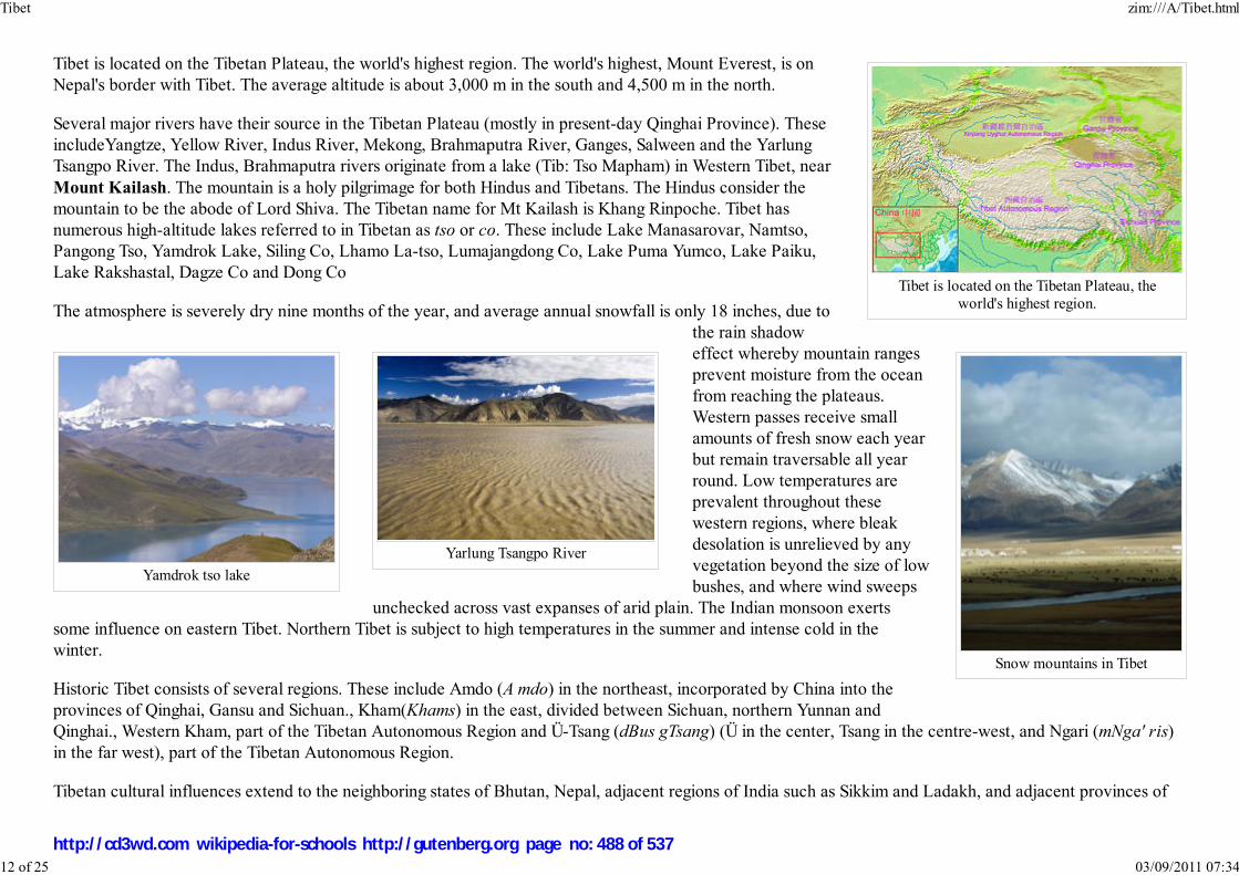
Tibet is located on the Tibetan Plateau, theworld's highest region.
Snow mountains in Tibet
Yamdrok tso lake
Yarlung Tsangpo River
Tibet is located on the Tibetan Plateau, the world's highest region. The world's highest, Mount Everest, is onNepal's border with Tibet. The average altitude is about 3,000 m in the south and 4,500 m in the north.
Several major rivers have their source in the Tibetan Plateau (mostly in present-day Qinghai Province). TheseincludeYangtze, Yellow River, Indus River, Mekong, Brahmaputra River, Ganges, Salween and the YarlungTsangpo River. The Indus, Brahmaputra rivers originate from a lake (Tib: Tso Mapham) in Western Tibet, nearMount Kailash. The mountain is a holy pilgrimage for both Hindus and Tibetans. The Hindus consider themountain to be the abode of Lord Shiva. The Tibetan name for Mt Kailash is Khang Rinpoche. Tibet hasnumerous high-altitude lakes referred to in Tibetan as tso or co. These include Lake Manasarovar, Namtso,Pangong Tso, Yamdrok Lake, Siling Co, Lhamo La-tso, Lumajangdong Co, Lake Puma Yumco, Lake Paiku,Lake Rakshastal, Dagze Co and Dong Co
The atmosphere is severely dry nine months of the year, and average annual snowfall is only 18 inches, due tothe rain shadoweffect whereby mountain rangesprevent moisture from the oceanfrom reaching the plateaus.Western passes receive smallamounts of fresh snow each yearbut remain traversable all yearround. Low temperatures areprevalent throughout thesewestern regions, where bleakdesolation is unrelieved by anyvegetation beyond the size of lowbushes, and where wind sweeps
unchecked across vast expanses of arid plain. The Indian monsoon exertssome influence on eastern Tibet. Northern Tibet is subject to high temperatures in the summer and intense cold in thewinter.
Historic Tibet consists of several regions. These include Amdo (A mdo) in the northeast, incorporated by China into theprovinces of Qinghai, Gansu and Sichuan., Kham(Khams) in the east, divided between Sichuan, northern Yunnan andQinghai., Western Kham, part of the Tibetan Autonomous Region and Ü-Tsang (dBus gTsang) (Ü in the center, Tsang in the centre-west, and Ngari (mNga' ris)in the far west), part of the Tibetan Autonomous Region.
Tibetan cultural influences extend to the neighboring states of Bhutan, Nepal, adjacent regions of India such as Sikkim and Ladakh, and adjacent provinces of
Tibet zim:///A/Tibet.html
12 of 25 03/09/2011 07:34
http://cd3wd.com wikipedia-for-schools http://gutenberg.org page no: 488 of 537
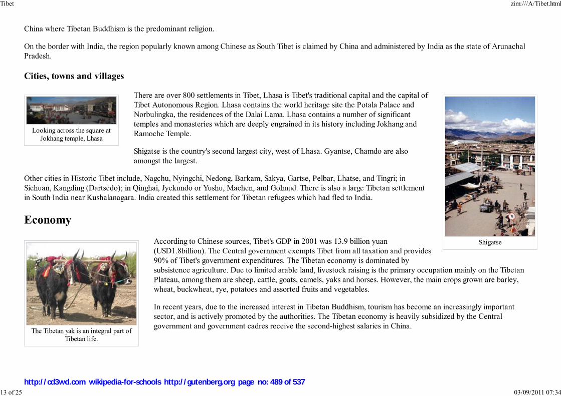
Shigatse
Looking across the square atJokhang temple, Lhasa
The Tibetan yak is an integral part ofTibetan life.
China where Tibetan Buddhism is the predominant religion.
On the border with India, the region popularly known among Chinese as South Tibet is claimed by China and administered by India as the state of ArunachalPradesh.
Cities, towns and villages
There are over 800 settlements in Tibet, Lhasa is Tibet's traditional capital and the capital ofTibet Autonomous Region. Lhasa contains the world heritage site the Potala Palace andNorbulingka, the residences of the Dalai Lama. Lhasa contains a number of significanttemples and monasteries which are deeply engrained in its history including Jokhang andRamoche Temple.
Shigatse is the country's second largest city, west of Lhasa. Gyantse, Chamdo are alsoamongst the largest.
Other cities in Historic Tibet include, Nagchu, Nyingchi, Nedong, Barkam, Sakya, Gartse, Pelbar, Lhatse, and Tingri; inSichuan, Kangding (Dartsedo); in Qinghai, Jyekundo or Yushu, Machen, and Golmud. There is also a large Tibetan settlementin South India near Kushalanagara. India created this settlement for Tibetan refugees which had fled to India.
Economy
According to Chinese sources, Tibet's GDP in 2001 was 13.9 billion yuan(USD1.8billion). The Central government exempts Tibet from all taxation and provides90% of Tibet's government expenditures. The Tibetan economy is dominated bysubsistence agriculture. Due to limited arable land, livestock raising is the primary occupation mainly on the TibetanPlateau, among them are sheep, cattle, goats, camels, yaks and horses. However, the main crops grown are barley,wheat, buckwheat, rye, potatoes and assorted fruits and vegetables.
In recent years, due to the increased interest in Tibetan Buddhism, tourism has become an increasingly importantsector, and is actively promoted by the authorities. The Tibetan economy is heavily subsidized by the Centralgovernment and government cadres receive the second-highest salaries in China.
Tibet zim:///A/Tibet.html
13 of 25 03/09/2011 07:34
http://cd3wd.com wikipedia-for-schools http://gutenberg.org page no: 489 of 537

The world's highest railway connectingTibet with eastern Chinese provinces forthe first time by rail. Operational since
July 2006.
Tourism brings in the most income from the sale of handicrafts. These include Tibetan hats, jewelry (silver and gold),wooden items, clothing, quilts, fabrics, Tibetan rugs and carpets. The Qinghai-Tibet Railway which links the region toQinghai in China proper was opened in 2006. The Chinese government claims that the line will promote thedevelopment of impoverished Tibet. But opponents argue the railway will harm Tibet. For instance, Tibetanopponents contend that it would only draw more Han Chinese residents, the country's dominant ethnic group, whohave been migrating steadily to Tibet over the last decade, bringing with them their popular culture. Opponentsbelieve that the large influx of Han Chinese will ultimately extinguish the local culture.
Other opponents argue that the railway will damage Tibet's fragile ecology and that most of its economic benefits willgo to migrant Han Chinese. As activists call for a boycott of the railway, the Dalai Lama has urged Tibetans to "waitand see" what benefits the new line might bring to them. According to the Government-in-exile's spokesmen, theDalai Lama welcomes the building of the railway, "conditioned on the fact that the railroad will bring benefit to themajority of Tibetans."
In January 2007, the Chinese government issued a report outlining the discovery of a large mineral deposit under theTibetan Plateau. The deposit has an estimated value of $128 billion and may double Chinese reserves of zinc, copper,and lead. The Chinese government sees this as a way to alleviate the nation's dependence on foreign mineral imports for its growing economy. However, criticsworry that mining these vast resources will harm Tibet's fragile ecosystem as well take valuable resources away from the Tibetan people.
Demographics
Tibet zim:///A/Tibet.html
14 of 25 03/09/2011 07:34
http://cd3wd.com wikipedia-for-schools http://gutenberg.org page no: 490 of 537

An elderly Tibetan lady
Ethnolinguistic Groups of Tibetan language,1967 ( See entire map, which includes a key)
Tibet zim:///A/Tibet.html
15 of 25 03/09/2011 07:34
http://cd3wd.com wikipedia-for-schools http://gutenberg.org page no: 491 of 537
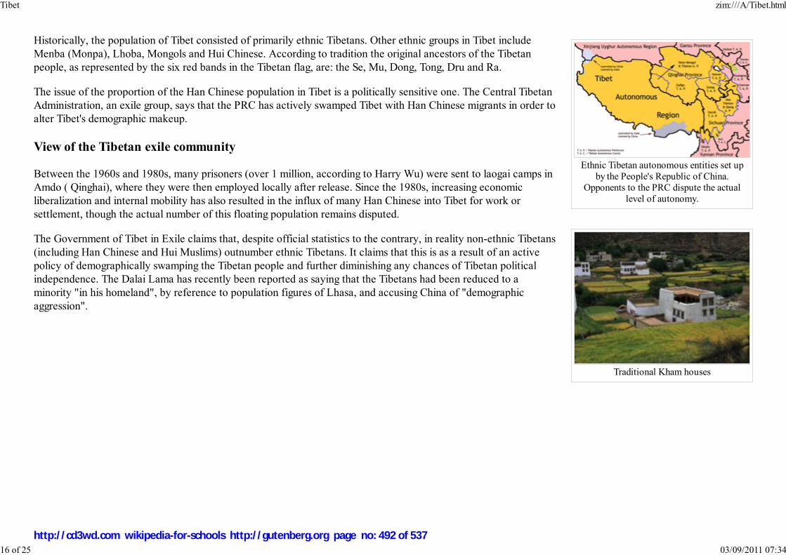
Ethnic Tibetan autonomous entities set upby the People's Republic of China.
Opponents to the PRC dispute the actuallevel of autonomy.
Traditional Kham houses
Historically, the population of Tibet consisted of primarily ethnic Tibetans. Other ethnic groups in Tibet includeMenba (Monpa), Lhoba, Mongols and Hui Chinese. According to tradition the original ancestors of the Tibetanpeople, as represented by the six red bands in the Tibetan flag, are: the Se, Mu, Dong, Tong, Dru and Ra.
The issue of the proportion of the Han Chinese population in Tibet is a politically sensitive one. The Central TibetanAdministration, an exile group, says that the PRC has actively swamped Tibet with Han Chinese migrants in order toalter Tibet's demographic makeup.
View of the Tibetan exile community
Between the 1960s and 1980s, many prisoners (over 1 million, according to Harry Wu) were sent to laogai camps inAmdo ( Qinghai), where they were then employed locally after release. Since the 1980s, increasing economicliberalization and internal mobility has also resulted in the influx of many Han Chinese into Tibet for work orsettlement, though the actual number of this floating population remains disputed.
The Government of Tibet in Exile claims that, despite official statistics to the contrary, in reality non-ethnic Tibetans(including Han Chinese and Hui Muslims) outnumber ethnic Tibetans. It claims that this is as a result of an activepolicy of demographically swamping the Tibetan people and further diminishing any chances of Tibetan politicalindependence. The Dalai Lama has recently been reported as saying that the Tibetans had been reduced to aminority "in his homeland", by reference to population figures of Lhasa, and accusing China of "demographicaggression".
Tibet zim:///A/Tibet.html
16 of 25 03/09/2011 07:34
http://cd3wd.com wikipedia-for-schools http://gutenberg.org page no: 492 of 537

A young Tibetan girl in a valley inthe Kham region of Tibet.
The Government of Tibet in Exile questions all statistics given by the PRC government, since they do not include membersof the People's Liberation Army garrisoned in Tibet, or the large floating population of unregistered migrants. TheQinghai-Tibet Railway ( Xining to Lhasa) is also a major concern, as it is believed to further facilitate the influx ofmigrants.
The Government of Tibet in Exile quotes an issue of People's Daily published in 1959 to claim that the Tibetan populationhas dropped significantly since 1959. According to the article, figures from the National Bureau of Statistics of the PRCshow that the autonomous region of Tibet was populated by 1,273,969 persons. In the Tibetan sectors of Kham, 3,381,064Tibetans were counted. In Qinghai and other Tibetan sectors that are incorporated in Gansu, 1,675,534 Tibetans werecounted. According to the total of these three numbers, the Tibetan population attained 6,330,567 in 1959.
In 2000, the number of Tibetans as a whole of these regions was about 5,400,000 according to National Bureau ofStatistics.
The Tibetan exile Government's analysis of these statistics originating from National Bureau of Statistics shows that inbetween 1959 and 2000, the Tibetan population decreased by about one million, a 15% decline. During the same period,the Chinese population doubled, and the world-wide population increased by 3-fold. This analysis gives an additionalargument concerning the estimation of the number of Tibetan deaths during the period between 1959 and 1979. It alsosuggests the existence of a demographic deficit of the Tibetan population and the precise time course and causes must bespecified.
The accuracy of this 1959 Tibetan population estimate quoted by the Government of Tibet in Exile is in conflict with the findings of the 1954 Chinese censusreport. The census states that the total population of the autonomous region of Tibet was 1,273,969; the total population of Kham was 3,381,064; and the totalpopulation of Qinghai was 1,675,534. These numbers were taken by the Government of Tibet in Exile as the population of Tibetans in each province.
View of the People's Republic of China
The PRC government does not view itself as an occupying power and has vehemently denied allegations of demographic swamping. The PRC also does notrecognize Greater Tibet as claimed by the government of Tibet in Exile, saying that the idea was engineered by foreign imperialists as a plot to divide Chinaamongst themselves, (Mongolia being a striking precedent, gaining independence with Soviet backing and subsequently aligning itself with the Soviet Union)and that those areas outside the TAR were not controlled by the Tibetan government before 1959 in the first place, having been administered instead by othersurrounding provinces for centuries.
The PRC gives the number of Tibetans in Tibet Autonomous Region as 2.4 million, as opposed to 190,000 non-Tibetans, and the number of Tibetans in allTibetan autonomous entities combined (slightly smaller than the Greater Tibet claimed by exiled Tibetans) as 5.0 million, as opposed to 2.3 million non-Tibetans.In the TAR itself, much of the Han population is to be found in Lhasa. Population control policies like the one-child policy only apply to Han Chinese, not tominorities such as Tibetans .
Tibet zim:///A/Tibet.html
17 of 25 03/09/2011 07:34
http://cd3wd.com wikipedia-for-schools http://gutenberg.org page no: 493 of 537

Jampa Phuntsok, chairman of the TAR, has also said that the central government has no policy of migration into Tibet due to its harsh high-altitude conditions,that the 6% Han in the TAR is a very fluid group mainly doing business or working, and that there is no immigration problem.
With regards to the historical population of ethnic Tibetans, the Chinese government claims that according to the First National Census conducted in 1954, therewere 2,770,000 ethnic Tibetans in China, including 1,270,000 in the TAR; whereas in the Fourth National Census conducted in 1990, there were 4,590,000ethnic Tibetans in China, including 2,090,000 in the TAR. These figures are used to advance the claim that the Tibetan population has doubled since 1951.
This table includes all Tibetan autonomous entities in the PRC, plus Xining PLC and Haidong P. The latter two are included to complete the figures for Qinghaiprovince, and also because they are claimed as parts of Greater Tibet by the Government of Tibet in exile.
P = Prefecture; AP = Autonomous prefecture; PLC = Prefecture-level city; AC = Autonomous county.
Excludes members of the People's Liberation Army in active service.
Major ethnic groups in Greater Tibet by region, 2000 census.
Total Tibetans Han Chinese others
Tibet Autonomous Region: 2,616,329 2,427,168 92.8% 158,570 6.1% 30,591 1.2%
- Lhasa PLC 474,499 387,124 81.6% 80,584 17.0% 6,791 1.4%
- Qamdo Prefecture 586,152 563,831 96.2% 19,673 3.4% 2,648 0.5%
- Shannan Prefecture 318,106 305,709 96.1% 10,968 3.4% 1,429 0.4%
- Xigazê Prefecture 634,962 618,270 97.4% 12,500 2.0% 4,192 0.7%
- Nagqu Prefecture 366,710 357,673 97.5% 7,510 2.0% 1,527 0.4%
- Ngari Prefecture 77,253 73,111 94.6% 3,543 4.6% 599 0.8%
- Nyingchi Prefecture 158,647 121,450 76.6% 23,792 15.0% 13,405 8.4%
Qinghai Province: 4,822,963 1,086,592 22.5% 2,606,050 54.0% 1,130,321 23.4%
- Xining PLC 1,849,713 96,091 5.2% 1,375,013 74.3% 378,609 20.5%
- Haidong Prefecture 1,391,565 128,025 9.2% 783,893 56.3% 479,647 34.5%
- Haibei AP 258,922 62,520 24.1% 94,841 36.6% 101,561 39.2%
- Huangnan AP 214,642 142,360 66.3% 16,194 7.5% 56,088 26.1%
- Hainan AP 375,426 235,663 62.8% 105,337 28.1% 34,426 9.2%
Tibet zim:///A/Tibet.html
18 of 25 03/09/2011 07:34
http://cd3wd.com wikipedia-for-schools http://gutenberg.org page no: 494 of 537

- Golog AP 137,940 126,395 91.6% 9,096 6.6% 2,449 1.8%
- Gyêgu AP 262,661 255,167 97.1% 5,970 2.3% 1,524 0.6%
- Haixi AP 332,094 40,371 12.2% 215,706 65.0% 76,017 22.9%
Tibetan areas in Sichuan province
- Ngawa AP 847,468 455,238 53.7% 209,270 24.7% 182,960 21.6%
- Garzê AP 897,239 703,168 78.4% 163,648 18.2% 30,423 3.4%
- Muli AC 124,462 60,679 48.8% 27,199 21.9% 36,584 29.4%
Tibetan areas in Yunnan province
- Dêqên AP 353,518 117,099 33.1% 57,928 16.4% 178,491 50.5%
Tibetan areas in Gansu province
- Gannan AP 640,106 329,278 51.4% 267,260 41.8% 43,568 6.8%
- Tianzhu AC 221,347 66,125 29.9% 139,190 62.9% 16,032 7.2%
Total for Greater Tibet:
With Xining and Haidong 10,523,432 5,245,347 49.8% 3,629,115 34.5% 1,648,970 15.7%
Without Xining and Haidong 7,282,154 5,021,231 69.0% 1,470,209 20.2% 790,714 10.9%
Human rights
According to the non-government Save Tibet website, the Tibetan people are denied most rights guaranteed in the Universal Declaration of Human Rights,including the rights to self-determination, freedom of speech, assembly, movement, expression, and travel. Elliot Sperling, an Associate Professor of TibetanStudies at Indiana University, in a statement to the Human Rights Watch, also detailed human rights violation in Tibet. The Tibet Justice.org claims thataccording to UN Development Programme data, Tibet is ranked the lowest among China’s 31 provinces, and is ranked 153 out of the 160 countries on theHuman Development Index.
Amnesty International has stated that political prisoners are often beaten and tortured, and sometimes summarily executed. Since the 1988 ratification of theUN Convention Against Torture by China, 69 Tibetans are recorded as having died as a result of torture in Chinese prisons. Human rights groups have confirmedby name over 700 Tibetan political prisoners in Tibet, many of them detained without charge or trial.
Tibetologist Thomas Laird claims that there is no evidence to support China's claim that Tibet is autonomous, as all local legislation is subject to approval of the
Tibet zim:///A/Tibet.html
19 of 25 03/09/2011 07:34
http://cd3wd.com wikipedia-for-schools http://gutenberg.org page no: 495 of 537

central government in Beijing.
The Tibetan exile government claims that China does not allow independent human rights organisations into Tibet, and foreign delegations invited to Tibet aredenied independent access to meet with Tibetans. The Tibetan Centre for Human Rights and Democracy claims that more than 11,000 monks and nuns havebeen expelled from Tibet since 1996 for opposing "patriotic re-education" sessions conducted at monasteries and nunneries under the "Strike Hard" campaign.
Thomas Laird also claims that China continues to encourage the transfer of Chinese settlers into Tibet. This threatens the survival of the Tibetan religious,cultural and national identity. The Free Tibet website claims that unemployment in schools, discussion of Tibetan cultural, religious and social issues isdiscouraged, and Chinese culture is promoted.
The Tibetan Centre for Human Rights and Democracy claims that unemployment among Tibetans is high. An unequal taxation system further exacerbates theconditions of poverty for Tibetans in rural areas. Many basic rights, such as the right to housing, education and health, remain unfulfilled.
Culture
Tibet zim:///A/Tibet.html
20 of 25 03/09/2011 07:34
http://cd3wd.com wikipedia-for-schools http://gutenberg.org page no: 496 of 537

The 1st Dalai Lama
A young monk at Labrang
Religion
Tibetan Buddhism
Religion and spirituality is extremely important to the Tibetans and has a strong influence over all aspects of lives; ingraineddeeply into their cultural heritage. Bön is the ancient traditional religion of Tibet, but following the introduction of TantricBuddhism into Tibet by Padmasambhava this became eclipsed by Tibetan Buddhism, a distinctive form of Vajrayana.Tibetan Buddhism is practiced not only in Tibet but also in Mongolia, parts of northern India, the Buryat Republic, the TuvaRepublic, and in the Republic of Kalmykia.
Tibetan Buddhism has four main traditions (the suffix pa is comparable to "er" in English):
Gelug(pa), Way of Virtue, also known casually as Yellow Hat, whose spiritual head is the Ganden Tripa and whosetemporal, the Dalai Lama. Successive Dalai Lamas ruled Tibet from the mid-17th to mid-20th centuries. This orderwas founded in the 14th to 15th century by Je Tsongkhapa, based on the foundations of the Kadampa tradition.Tsongkhapa was renowned for both his scholasticism and his virtue. The Dalai Lama belongs to the Gelugpa school,and is regarded as the embodiment of the Bodhisattva of Compassion.
Kagyu(pa), Oral Lineage. This contains one major subsect and one minor subsect. The first, the Dagpo Kagyu,encompasses those Kagyu schools that trace back to Gampopa. In turn, the Dagpo Kagyu consists of four major sub-sects:the Karma Kagyu, headed by a Karmapa, the Tsalpa Kagyu, the Barom Kagyu, and Pagtru Kagyu. There are further eightminor sub-sects, all of which trace their root to Pagtru Kagyu. Among the eight sub-sects the most notable of are theDrikung Kagyu and the Drukpa Kagyu. The once-obscure Shangpa Kagyu, which was famously represented by the 20thcentury teacher Kalu Rinpoche, traces its history back to the Indian master Niguma, sister of Kagyu lineage holder Naropa.This is an oral tradition which is very much concerned with the experiential dimension of meditation. Its most famousexponent was Milarepa, an eleventh century mystic.
Nyingma(pa), The Ancient Ones. This is the oldest, the original order founded by Padmasambhava.
Sakya(pa), Grey Earth, headed by the Sakya Trizin, founded by Khon Konchog Gyalpo, a disciple of the great translatorDrokmi Lotsawa. Sakya Pandita 1182–1251CE was the great grandson of Khon Konchog Gyalpo. This school very muchrepresents the scholarly tradition.
Islam
In Tibetan cities, there are also small communities of Muslims, known as Kachee (Kache), who trace their origin to immigrants from three main regions:Kashmir (Kachee Yul in ancient Tibetan), Ladakh and the Central Asian Turkic countries. Islamic influence in Tibet also came from Persia. After 1959 a group
Tibet zim:///A/Tibet.html
21 of 25 03/09/2011 07:34
http://cd3wd.com wikipedia-for-schools http://gutenberg.org page no: 497 of 537

Tashilhunpo
A thangka painting in Sikkim
of Tibetan Muslims made a case for Indian nationality based on their historic roots to Kashmir and the Indian government declared all Tibetan Muslims Indiancitizens later on that year. There is also a well established Chinese Muslim community (gya kachee), which traces its ancestry back to the Hui ethnic group ofChina. It is said that Muslim migrants from Kashmir and Ladakh first entered Tibet around the 12th century. Marriages and social interaction gradually led to anincrease in the population until a sizable community grew up around Lhasa.
Buddhist monasteries in Tibet
Tibetan art
Tibetan representations of art are intrinsically bound with TibetanBuddhism and commonly depict deities or variations of Buddha in variousforms from bronze Buddhist statues and shrines, to highly colorful thangkapaintings and mandalas.
Architecture
Tibetan architecture contains Oriental and Indian influences, and reflects adeeply Buddhist approach. The Buddhist wheel, along with two dragons,can be seen on nearly every Gompa in Tibet. The design of the Tibetan Chörtens can vary, from roundish walls inKham to squarish, four-sided walls in Ladakh.
The most distinctive feature of Tibetan architecture is that many of the houses and monasteries are built on elevated, sunny sites facing the south, and are oftenmade out of a mixture of rocks, wood, cement and earth. Little fuel is available for heat or lighting, so flat roofs are built to conserve heat, and multiplewindows are constructed to let in sunlight. Walls are usually sloped inwards at 10 degrees as a precaution against frequent earthquakes in the mountainous area.
Tibet zim:///A/Tibet.html
22 of 25 03/09/2011 07:34
http://cd3wd.com wikipedia-for-schools http://gutenberg.org page no: 498 of 537
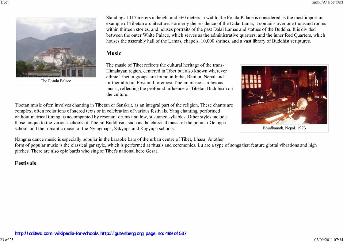
The Potala Palace
Boudhanath, Nepal. 1973
Standing at 117 meters in height and 360 meters in width, the Potala Palace is considered as the most importantexample of Tibetan architecture. Formerly the residence of the Dalai Lama, it contains over one thousand roomswithin thirteen stories, and houses portraits of the past Dalai Lamas and statues of the Buddha. It is dividedbetween the outer White Palace, which serves as the administrative quarters, and the inner Red Quarters, whichhouses the assembly hall of the Lamas, chapels, 10,000 shrines, and a vast library of Buddhist scriptures.
Music
The music of Tibet reflects the cultural heritage of the trans-Himalayan region, centered in Tibet but also known whereverethnic Tibetan groups are found in India, Bhutan, Nepal andfurther abroad. First and foremost Tibetan music is religiousmusic, reflecting the profound influence of Tibetan Buddhism onthe culture.
Tibetan music often involves chanting in Tibetan or Sanskrit, as an integral part of the religion. These chants arecomplex, often recitations of sacred texts or in celebration of various festivals. Yang chanting, performedwithout metrical timing, is accompanied by resonant drums and low, sustained syllables. Other styles includethose unique to the various schools of Tibetan Buddhism, such as the classical music of the popular Gelugpaschool, and the romantic music of the Nyingmapa, Sakyapa and Kagyupa schools.
Nangma dance music is especially popular in the karaoke bars of the urban centre of Tibet, Lhasa. Anotherform of popular music is the classical gar style, which is performed at rituals and ceremonies. Lu are a type of songs that feature glottal vibrations and highpitches. There are also epic bards who sing of Tibet's national hero Gesar.
Festivals
Tibet zim:///A/Tibet.html
23 of 25 03/09/2011 07:34
http://cd3wd.com wikipedia-for-schools http://gutenberg.org page no: 499 of 537

The Monlam Prayer Festival
Tibetan sand mandala
A monk churning Buttertea
Tibet has various festivals which commonly are performed to worship the Buddha throughout the year.Losar is the Tibetan New Year Festival. Preparations for the festive event are manifested by specialofferings to family shrine deities, painted doors with religious symbols, and other painstaking jobs done toprepare for the event. Tibetans eat Guthuk (barley crumb food with filling) on New Year's Eve with theirfamilies. The Monlam Prayer Festival follows it in the first month of the Tibetan calendar, falling on thefourth up to the eleventh day of the first Tibetan month. which involves many Tibetans dancing andparticipating in sports events and sharing picnics. The event was established in 1049 by Tsong Khapa, thefounder of the Dalai Lama and the Panchen Lama's order.
Other
The Potala Palace, former residence of the Dalai Lamas, is a World Heritage Site, as is Norbulingka, formersummer residence of the Dalai Lama.
Since 2002, Tibetans in exile have allowed a Miss Tibet beauty contest in spite of concerns that this event isconsidered a Western influence. The beauty contest is condemned by the Tibetan government in exile.
Cuisine
The most important crop in Tibet is barley, and dough made from barley flour calledtsampa, is the staple food of Tibet. This is either rolled into noodles or made intosteamed dumplings called momos. Meat dishes are likely to be yak, goat, or mutton,often dried, or cooked into a spicy stew with potatoes. Mustard seed is cultivated inTibet, and therefore features heavily in its cuisine. Yak yoghurt, butter and cheese arefrequently eaten, and well-prepared yoghurt is considered something of a prestige item.Butter tea is very popular to drink.
Tibet in popular culture
In recent years there have been a number of films produced about Tibet, most notably Hollywood films such as Seven Years in
Tibet, starring Brad Pitt, and Kundun, a biography of the 14th Dalai Lama, directed by Martin Scorsese. Both of these films werebanned by the Chinese government because of Tibetan nationalist overtones. Other films include Samsara, The Cup and the 1999Himalaya, a French-American produced film with a Tibetan cast set in Nepal and Tibet. In 2005, exile Tibetan filmmaker TenzingSonam and his partner Ritu Sarin made Dreaming Lhasa, the first internationally recognized feature film to come out of the diaspora
to explore the contemporary reality of Tibet.
Tibet zim:///A/Tibet.html
24 of 25 03/09/2011 07:34
http://cd3wd.com wikipedia-for-schools http://gutenberg.org page no: 500 of 537
Kekexili: Mountain Patrol, is a film made by National Geographic about a Chinese reporter that goes to Tibet to report on the issue involving the endangermentof Tibetan Antelope. It won numerous awards at home and abroad.
In 1995 a British electronic music act Banco de Gaia released the album Last Train to Lhasa, dedicated to the music of Tibet, with many samples of Tibetanchanting.
Retrieved from " http://en.wikipedia.org/wiki/Tibet"This Wikipedia Selection has a sponsor: SOS Children , and is a hand-chosen selection of article versions from the English Wikipedia edited only by deletion(see www.wikipedia.org for details of authors and sources). The articles are available under the GNU Free Documentation License. See also our
Tibet zim:///A/Tibet.html
25 of 25 03/09/2011 07:34
http://cd3wd.com wikipedia-for-schools http://gutenberg.org page no: 501 of 537

Türkmenistan
Turkmenistan
Flag Coat of arms
Anthem: Independent, Neutral, Turkmenistan State
Anthem
Capital
(and largest city)
Ashgabat
Official languages Turkmen
Recognised
regional languagesRussian, Uzbek, Dari
Demonym Turkmen
Government Single-party state
Turkmenistan
2008/9 Schools Wikipedia Selection. Related subjects: Asia; Asian Countries
Turkmenistan ( Turkmen: Türkmenistan; also known as Turkmenia) is a Turkic country in Central Asia.
The name Turkmenistan is derived from Persian, meaning "land of the Turkmen". The name of its capital,
Ashgabat, derived from Persian as well, loosely translating as "the city of love". Until 1991, it was a
constituent republic of the Soviet Union, the Turkmen Soviet Socialist Republic. It is bordered by
Afghanistan to the southeast, Iran to the southwest, Uzbekistan to the northeast, Kazakhstan to the
northwest, and the Caspian Sea to the west.
According to CIA World Factbook 2006 figures, Turkmenistan ranks 5th in the world for GDP growth
rate. Although it is wealthy in natural resources in certain areas, most of the country is covered by the
Karakum (Black Sands) Desert. It has a single-party system, and was ruled by President for Life
Saparmurat Niyazov until 21 December 2006, when he (and his term) expired. Presidential elections
were held on 11 February 2007. Gurbanguly Berdimuhammedow was declared the winner with 89% of
the vote. He was sworn in on 14 February 2007.
History
The territory of Turkmenistan has a long and checkered history, as armies from one empire after another
decamped there on their way to more prosperous territories. The region's written history begins with its
conquest by the Achaemenid Empire of ancient Persia, as the region was divided between the satrapies
of Margiana, Khwarezm, and Parthia.
Alexander the Great conquered the territory in the fourth century BCE on his way to South Asia, around
the time that the Silk Road was established as a major trading route between Asia and the Mediterranean
Region. One hundred and fifty years later, Persia's Parthian Kingdom established its capital in Nisa, now
in the suburbs of the capital, Ashgabat. In the seventh century CE, Arabs conquered this region, bringing
with them Islam and incorporating the Turkmen into Middle Eastern culture. The Turkmenistan region
soon came to be known as the capital of Greater Khorasan, when the caliph Al-Ma'mun moved his
capital to Merv.
Turkmenistan zim:///A/Turkmenistan.html
1 of 6 03/09/2011 07:35
http://cd3wd.com wikipedia-for-schools http://gutenberg.org page no: 502 of 537
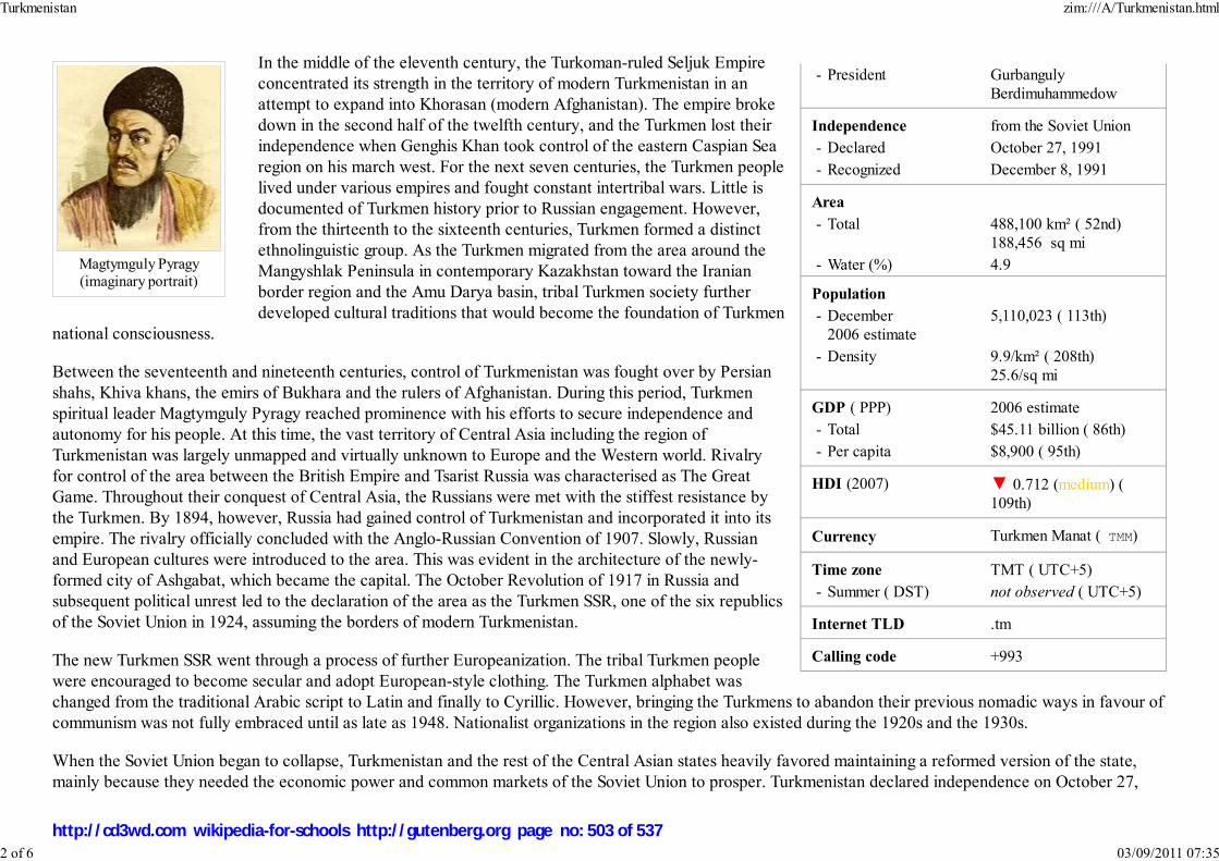
- President Gurbanguly
Berdimuhammedow
Independence from the Soviet Union
- Declared October 27, 1991
- Recognized December 8, 1991
Area
- Total 488,100 km² ( 52nd)
188,456 sq mi
- Water (%) 4.9
Population
- December
2006 estimate
5,110,023 ( 113th)
- Density 9.9/km² ( 208th)
25.6/sq mi
GDP ( PPP) 2006 estimate
- Total $45.11 billion ( 86th)
- Per capita $8,900 ( 95th)
HDI (2007) ▼ 0.712 (medium) (
109th)
Currency Turkmen Manat ( TMM)
Time zone TMT ( UTC+5)
- Summer ( DST) not observed ( UTC+5)
Internet TLD .tm
Calling code +993
Magtymguly Pyragy(imaginary portrait)
In the middle of the eleventh century, the Turkoman-ruled Seljuk Empire
concentrated its strength in the territory of modern Turkmenistan in an
attempt to expand into Khorasan (modern Afghanistan). The empire broke
down in the second half of the twelfth century, and the Turkmen lost their
independence when Genghis Khan took control of the eastern Caspian Sea
region on his march west. For the next seven centuries, the Turkmen people
lived under various empires and fought constant intertribal wars. Little is
documented of Turkmen history prior to Russian engagement. However,
from the thirteenth to the sixteenth centuries, Turkmen formed a distinct
ethnolinguistic group. As the Turkmen migrated from the area around the
Mangyshlak Peninsula in contemporary Kazakhstan toward the Iranian
border region and the Amu Darya basin, tribal Turkmen society further
developed cultural traditions that would become the foundation of Turkmen
national consciousness.
Between the seventeenth and nineteenth centuries, control of Turkmenistan was fought over by Persian
shahs, Khiva khans, the emirs of Bukhara and the rulers of Afghanistan. During this period, Turkmen
spiritual leader Magtymguly Pyragy reached prominence with his efforts to secure independence and
autonomy for his people. At this time, the vast territory of Central Asia including the region of
Turkmenistan was largely unmapped and virtually unknown to Europe and the Western world. Rivalry
for control of the area between the British Empire and Tsarist Russia was characterised as The Great
Game. Throughout their conquest of Central Asia, the Russians were met with the stiffest resistance by
the Turkmen. By 1894, however, Russia had gained control of Turkmenistan and incorporated it into its
empire. The rivalry officially concluded with the Anglo-Russian Convention of 1907. Slowly, Russian
and European cultures were introduced to the area. This was evident in the architecture of the newly-
formed city of Ashgabat, which became the capital. The October Revolution of 1917 in Russia and
subsequent political unrest led to the declaration of the area as the Turkmen SSR, one of the six republics
of the Soviet Union in 1924, assuming the borders of modern Turkmenistan.
The new Turkmen SSR went through a process of further Europeanization. The tribal Turkmen people
were encouraged to become secular and adopt European-style clothing. The Turkmen alphabet was
changed from the traditional Arabic script to Latin and finally to Cyrillic. However, bringing the Turkmens to abandon their previous nomadic ways in favour of
communism was not fully embraced until as late as 1948. Nationalist organizations in the region also existed during the 1920s and the 1930s.
When the Soviet Union began to collapse, Turkmenistan and the rest of the Central Asian states heavily favored maintaining a reformed version of the state,
mainly because they needed the economic power and common markets of the Soviet Union to prosper. Turkmenistan declared independence on October 27,
Turkmenistan zim:///A/Turkmenistan.html
2 of 6 03/09/2011 07:35
http://cd3wd.com wikipedia-for-schools http://gutenberg.org page no: 503 of 537

Turkmenistan national assembly building in Ashgabat
1991, one of the last republics to secede.
In 1991, Turkmenistan became a member of the Commonwealth of Independent States, an international organization of former Soviet republics. However,
Turkmenistan reduced its status in the organization to "associate member" in August 2005. The reason stated by the Turkmen president was the country's policy
of permanent neutrality. It is the only former Soviet state (aside from the Baltic states now in the European Union) without a full membership.
The former Soviet leader, Saparmurat Niyazov, remained in power as Turkmenistan's leader after the dissolution of the Soviet Union. Under his post-Soviet rule,
Russian-Turkmeni relations greatly suffered. He styled himself as a promoter of traditional Muslim and Turkmen culture (calling himself "Turkmenbashi", or
"leader of the Turkmen people"), but he became notorious in the West for his dictatorial rule and extravagant cult of personality. The extent of his power greatly
increased during the early 1990s, and in 1999 he became President for Life.
Niyazov died unexpectedly on December 21, 2006, leaving no heir apparent and an unclear line of succession. A former deputy prime minister rumored to be
the illegitimate son of Niyazov, Gurbanguly Berdimuhammedow, became acting president, although under the constitution the Chairman of the People's
Council, Ovezgeldy Atayev, should have succeeded to the post. However, Atayev was accused of crimes and removed from office.
In an election on February 11, 2007, Berdimuhammedow was elected president with 89% of the vote and 95% turnout, although the election was condemned by
outside observers as unfair.
Politics
The politics of Turkmenistan take place in the framework of a presidential republic, with the President both
head of state and head of government. Turkmenistan has a single-party system.
After 69 years as part of the Soviet Union (including 67 years as a union republic), Turkmenistan declared
its independence on October 27, 1991.
President for Life Saparmurat Niyazov, a former bureaucrat of the Communist Party of the Soviet Union,
ruled Turkmenistan from 1985, when he became head of the Communist Party of the Turkmen SSR, until his
death in 2006. He retained absolute control over the country after the dissolution of the Soviet Union. On
December 28, 1999, Niyazov was declared President for Life of Turkmenistan by the Mejlis (parliament),
which itself had taken office a week earlier in elections that included only candidates hand-picked by
President Niyazov. No opposition candidates were allowed.
The current President of Turkmenistan is Gurbanguly Berdimuhammedow, who took control following
Niyazov's 2006 death.
The former Communist Party, now known as the Democratic Party of Turkmenistan, is the only one legally-permitted to operate. Political gatherings are illegal
Turkmenistan zim:///A/Turkmenistan.html
3 of 6 03/09/2011 07:35
http://cd3wd.com wikipedia-for-schools http://gutenberg.org page no: 504 of 537

Provinces of Turkmenistan
unless government sanctioned.
Human rights
Human rights are generally not respected by many authorities in Turkmenistan, although some human rights are guaranteed in the Constitution of Turkmenistan,
such as social equality, sex equality, freedom from cruel and unusual punishment, and freedom of movement. Other social and economic rights include the right
to work, the right to rest, and the right to education.
However, there are freedom of religion and freedom of sexuality issues. Any act of homosexuality in Turkmenistan is punishable by up to five years in prison.
According to Forum 18, despite international pressure, the authorities keep a close watch on all religious groups. The legal framework is so constrictive that
many prefer to exist underground rather than pass through the official processes, which act as barriers. Protestant Christian adherents are affected, in addition to
groups such as Jehovah's Witnesses, Bahá'ís, and the followers of the Hare Krishna movement. Hare Krishna followers are not allowed to seek donations at the
country's main airport, Ashgabat.
According to the 2007 Reporters Without Borders World Press Freedom Index, Turkmenistan had the third-worst restrictions on the freedom of the press in the
world.
In addition, according to the BBC, the new president enforced a ban on satellite dishes, a measure often threatened under Niyazov, but never acted upon.
Provinces and districts
Turkmenistan is divided into five provinces or welayatlar (singular - welayat) and one independent city:
Division ISO 3166-2 Capital City Area (km²) Area ( sq. mi) Pop (1995) Key
Ashgabat Ashgabat 604,000
Ahal Province TM-A Annau 95,000 36,680 722,800 1
Balkan Province TM-B Balkanabat 138,000 53,280 424,700 2
Daşoguz Province TM-D Daşoguz 74,000 28,570 1,059,800 3
Lebap Province TM-L Turkmenabat 94,000 36,290 1,034,700 4
Mary Province TM-M Mary 87,000 33,590 1,146,800 5
Turkmenistan zim:///A/Turkmenistan.html
4 of 6 03/09/2011 07:35
http://cd3wd.com wikipedia-for-schools http://gutenberg.org page no: 505 of 537

Map of Turkmenistan
The Caspian Sea atTürkmenbaşy
Turkmenbashi Palace in Ashgabat
Geography
At 188,457 mi² (488,100 km²), Turkmenistan is the world's 52nd-largest country. It is slightly smaller than
Spain, and somewhat larger than the US state of California.
Over 80% of the country is covered by the Karakum Desert. The centre
of the country is dominated by the Turan Depression and the Karakum
Desert. The Kopet Dag Range, along the southwestern border, reaches
2,912 meters (9,553 ft). The Turkmen Balkan Mountains in the far west
and the Kugitang Range in the far east are the only other significant
elevations. Rivers include the Amu Darya, the Murghab, and the Tejen.
The climate mostly consists of an arid subtropical desert, with little
rainfall. Winters are mild and dry, with most precipitation falling between
January and May. The area of the country with the heaviest precipitation is the Kopet Dag range.
The Turkmen shore along the Caspian Sea is 1768 km long. The Caspian Sea is entirely landlocked, with no access to the ocean.
The major cities include Ashgabat, Türkmenbaşy (formerly Krasnovodsk) and Daşoguz.
Economy
Half of the country's irrigated land is planted with cotton, making the country the world's tenth-largest producer
of it. It possesses the world's fifth-largest reserves of natural gas and substantial oil resources. In 1994, the
Russian government's refusal to export Turkmen gas to hard currency markets and mounting debts of its major
customers in the former Soviet Union for gas deliveries contributed to a sharp fall in industrial production and
caused the budget to shift from a surplus to a slight deficit.
Turkmenistan has taken a cautious approach to economic reform, hoping to use gas and cotton sales to sustain
its economy. In 2004, the unemployment rate was estimated to be 60%; the percentage of the population living
below the poverty line was thought to be 58% a year earlier. Privatization goals remain limited. Between 1998
and 2002, Turkmenistan suffered from the continued lack of adequate export routes for natural gas and from
obligations on extensive short-term external debt. At the same time, however, the value of total exports has
risen sharply because of increases in international oil and gas prices. Economic prospects in the near future are
discouraging because of widespread internal poverty and the burden of foreign debt.
Turkmenistan zim:///A/Turkmenistan.html
5 of 6 03/09/2011 07:35
http://cd3wd.com wikipedia-for-schools http://gutenberg.org page no: 506 of 537
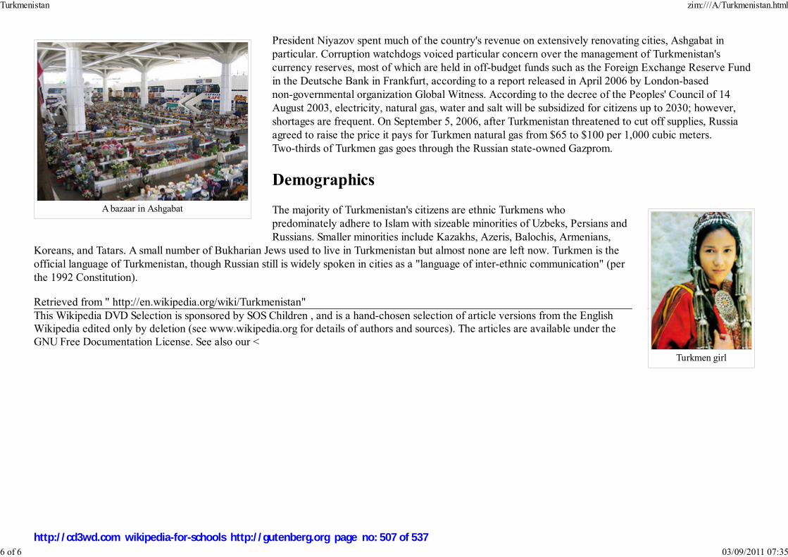
A bazaar in Ashgabat
Turkmen girl
President Niyazov spent much of the country's revenue on extensively renovating cities, Ashgabat in
particular. Corruption watchdogs voiced particular concern over the management of Turkmenistan's
currency reserves, most of which are held in off-budget funds such as the Foreign Exchange Reserve Fund
in the Deutsche Bank in Frankfurt, according to a report released in April 2006 by London-based
non-governmental organization Global Witness. According to the decree of the Peoples' Council of 14
August 2003, electricity, natural gas, water and salt will be subsidized for citizens up to 2030; however,
shortages are frequent. On September 5, 2006, after Turkmenistan threatened to cut off supplies, Russia
agreed to raise the price it pays for Turkmen natural gas from $65 to $100 per 1,000 cubic meters.
Two-thirds of Turkmen gas goes through the Russian state-owned Gazprom.
Demographics
The majority of Turkmenistan's citizens are ethnic Turkmens who
predominately adhere to Islam with sizeable minorities of Uzbeks, Persians and
Russians. Smaller minorities include Kazakhs, Azeris, Balochis, Armenians,
Koreans, and Tatars. A small number of Bukharian Jews used to live in Turkmenistan but almost none are left now. Turkmen is the
official language of Turkmenistan, though Russian still is widely spoken in cities as a "language of inter-ethnic communication" (per
the 1992 Constitution).
Retrieved from " http://en.wikipedia.org/wiki/Turkmenistan"
This Wikipedia DVD Selection is sponsored by SOS Children , and is a hand-chosen selection of article versions from the EnglishWikipedia edited only by deletion (see www.wikipedia.org for details of authors and sources). The articles are available under the
GNU Free Documentation License. See also our <
Turkmenistan zim:///A/Turkmenistan.html
6 of 6 03/09/2011 07:35
http://cd3wd.com wikipedia-for-schools http://gutenberg.org page no: 507 of 537

O‘zbekiston Respublikasi
Republic of Uzbekistan
Flag Coat of arms
Anthem: National Anthem of the Republic ofUzbekistan
Capital
(and largest city)Tashkent
Official languages Uzbek
Demonym Uzbekistani. sometimes Uzbekor Uzbeki
Government Presidential republic
Uzbekistan
2008/9 Schools Wikipedia Selection. Related subjects: Asia; Asian Countries
SOS Children works in Uzbekistan. For more information see SOS Children in Uzbekistan
Uzbekistan, officially the Republic of Uzbekistan ( Uzbek: O‘zbekiston Respublikasi or ЎзбекистонРеспубликаси), is a doubly landlocked country in Central Asia, formerly part of the Soviet Union. Itshares borders with Kazakhstan to the west and to the north, Kyrgyzstan and Tajikistan to the east, andAfghanistan and Turkmenistan to the south.
History
The territory of Uzbekistan was already populated in the second millennium BC. Early human tools andmonuments have been found in the Ferghana, Tashkent, Bukhara, Khorezm (Khwarezm, Chorasmia) andSamarkand regions.
Alexander the Great conquered Sogdiana and Bactria in 327 BC, marrying Roksana, daughter of a localBactrian chieftain. The conquest was supposedly of little help to Alexander as popular resistance wasfierce, causing Alexander's army to be bogged down in the region. In the fourteenth century AD, Timur,known in the west as Tamerlane, overpowered the Mongols and built an empire. In his militarycampaigns, Tamerlane reached as far as the Middle East. He defeated Ottoman Sultan Bayezid I, whowas captured, and died in captivity. Tamerlane sought to build a capital for his empire in Samarkand.Today Tamerlane is considered to be one of the greatest heroes in Uzbekistan. He plays a significant rolein its national identity and history. Following the fall of the Timurid Empire, Uzbek nomads conqueredthe region.
In the nineteenth century, the Russian Empire began to expand, and spread into Central Asia. The "Great Game" period is generally regarded as running from approximately 1813 to the Anglo-RussianConvention of 1907. Following the Bolshevik Revolution of 1917 a second less intensive phase followed.At the start of the 19th century, there were some 2,000 miles (3,200 km) separating British India and theoutlying regions of the Tsarist Russia. Much of the land in between was unmapped.
Uzbekistan zim:///A/Uzbekistan.html
1 of 11 03/09/2011 07:35
http://cd3wd.com wikipedia-for-schools http://gutenberg.org page no: 508 of 537

- President Islom Karimov - Prime Minister Shavkat Mirziyoyev
Independence from the Soviet Union - Formation 17471 - Declared September 1, 1991 - Recognized December 8, 1991 - Completed December 25, 1991
Area
- Total 447,400 km² ( 56th)172,742 sq mi
- Water (%) 4.9
Population
- 2007 estimate 27,372,000 ( 44th) - Density 59/km² ( 136th)
153/sq mi
GDP ( PPP) 2007 estimate - Total $64.149 billion ( 73th) - Per capita $2,283 ( 145th)
Gini (2000) 26.8 (low)
HDI (2007) ▲ 0.702 (medium) ( 113th)
CurrencyUzbekistan som (Uzbekistonso'mi) ( UZS)
Time zone UZT ( UTC+5) - Summer ( DST) not observed ( UTC+5)
Internet TLD .uz
Calling code +998
As Bukharian Emirate, Kokand Khanate, Khwarezm.
Registan complex inSamarkand, Timur's capital
By the beginning of the twentieth century, Central Asia was firmly inthe hands of Russia and despite some early resistance to Bolsheviks,Uzbekistan and the rest of Central Asia became a part of the SovietUnion. On 27 October 1924 the Uzbek Soviet Socialist Republic wascreated. On August 31, 1991, Uzbekistan declared independence,marking September 1 as a national holiday.
The country is now the world's second-largest exporter of cotton –while developing its mineral and petroleum reserves.
Politics
1
Uzbekistan zim:///A/Uzbekistan.html
2 of 11 03/09/2011 07:35
http://cd3wd.com wikipedia-for-schools http://gutenberg.org page no: 509 of 537

Islom Karimov -President of Uzbekistan
Constitutionally, the Government of Uzbekistan provides for democracy. In reality, the executive holds a great deal of power andthe legislature and judiciary has little power to shape laws. Under terms of a December 27,1995 referendum, Islom Karimov's firstterm was extended. Another national referendum was held January 27, 2002 to extend Contitutional Presidential term from 5 yearsto 7 years. The referendum passed and Karimov's term was extended by act of the parliament to December 2007. Mostinternational observers refused to participate in the process and did not recognize the results, dismissing them as not meeting basicstandards. The 2002 referendum also included a plan to create a bicameral parliament, consisting of a lower house (the Oliy Majlis)and an upper house (Senate). Members of the lower house are to be "full time" legislators. Elections for the new bicameralparliament took place on December 26, but no truly independent opposition candidates or parties were able to take part. The OSCElimited observation mission concluded that the elections fell significantly short of OSCE commitments and other internationalstandards for democratic elections. Several political parties have been formed with government approval. Similarly, althoughmultiple media outlets (radio, TV, newspaper) have been established, these either remain under government control or rarely broachpolitical topics. Independent political parties were allowed to organize, recruit members, and hold conventions and pressconferences, but have been denied registration under restrictive registration procedures. Terrorist bombings were carried out March28– April 1, 2004 in Tashkent and Bukhara.
Human rights
The Constitution of the Republic of Uzbekistan asserts that "democracy in the Republic of Uzbekistan shall be based upon common human principles, accordingto which the highest value shall be the human being, his life, freedom, honour, dignity and other inalienable rights."
However, non-government human rights watchdogs, such as IHF, Human Rights Watch, Amnesty International, as well as United States Department of Stateand Council of the European Union define Uzbekistan as "an authoritarian state with limited civil rights" and express profound concern about "wide-scaleviolation of virtually all basic human rights". According to the reports, the most widespread violations are torture, arbitrary arrests, and various restrictions offreedoms: of religion, of speech and press, of free association and assembly. The reports maintain that the violations are most often committed against membersof religious organizations, independent journalists, human rights activists, and political activists, including members of the banned opposition parties. In 2005,Uzbekistan was included into Freedom House's "The Worst of the Worst: The World's Most Repressive Societies".
The official position is summarized in a memorandum "The measures taken by the government of the Republic of Uzbekistan in the field of providing andencouraging human rights" and amounts to the following: the government does everything that is in its power to protect and to guarantee the human rights ofUzbekistan's citizens. Uzbekistan continuously improves its laws and institutions in order to create a more humane society. Over 300 laws regulating the rightsand basic freedoms of the people have been passed by the parliament. For instance, an office of Ombudsman was established in 1996. On August 2, 2005,President Islom Karimov signed a decree that was to abolish capital punishment in Uzbekistan on January 1, 2008.
The 2005 civil unrest in Uzbekistan, which resulted in several hundred people being killed is viewed by many as a landmark event in the history of human rightsabuse in Uzbekistan, A concern has been expressed and a request for an independent investigation of the events has been made by the United States, EuropeanUnion, the UN, the OSCE Chairman-in-Office and the OSCE Office for Democratic Institutions and Human Rights. The government of Uzbekistan is accused of
Uzbekistan zim:///A/Uzbekistan.html
3 of 11 03/09/2011 07:35
http://cd3wd.com wikipedia-for-schools http://gutenberg.org page no: 510 of 537

Map of Uzbekistan
Lake Tcharvak
unlawful termination of human life, denying its citizens freedom of assembly and freedom of expression. The government vehemently rebuffs the accusations,maintaining that it merely conducted an anti-terrorist operation, exercising only necessary force. In addition, some officials claim that "an information war onUzbekistan has been declared" and the human rights violations in Andijan are invented by the enemies of Uzbekistan as a convenient pretext for interventioninto the country's internal affairs.
Geography
Uzbekistan is approximately the size of Morocco and has an area of 447,400 square kilometers (172,700 sq mi). It isthe 56th largest country in the world by area and the 42nd by population. Among the CIS countries, it is the 5th largestby area and the 3rd largest by population.
Uzbekistan stretches 1,425 kilometers (885 mi) from west to east and 930 kilometers (578 mi) from north to south.Bordering Kazakhstan and the Aral Sea to the north and northwest, Turkmenistan to the southwest, Tajikistan to thesoutheast, and Kyrgyzstan to the northeast, Uzbekistan is not only one of the larger Central Asian states but also theonly Central Asian state to border all the other four. Uzbekistan also shares a short border (less than 150 km) withAfghanistan to the south.
Uzbekistan is a dry, landlocked country; it is one of two double-landlocked countries in the world, i.e., a country completelysurrounded by land-locked countries – the other being
Liechtenstein. Less than 10% of its territory is intensively cultivated irrigated land in river valleys and oases.The rest is vast desert ( Kyzyl Kum) and mountains. The highest point in Uzbekistan is 4,643 meters(15,233 ft), located in the southern part of the Gissar Range in Surkhandarya Province, on the border withTajikistan, just north-west of Dushanbe (formerly called Peak of the 22nd Congress of the Communist
Party, today apparently unnamed).
The climate in the Republic of Uzbekistan is continental, with little precipitation expected annually(100–200 millimeters, or 3.9–7.9 inches). The average summer temperature tends to be 40 °C, while theaverage winter temperature is around 0 °C.
Major cities include: Bukhara, Samarqand, Namangan, and the capital Tashkent.
Provinces
Uzbekistan is divided into twelve provinces (viloyatlar, singular viloyat, compound noun viloyati e.g. Toshkent viloyati, Samarqand viloyati, etc.), one
Uzbekistan zim:///A/Uzbekistan.html
4 of 11 03/09/2011 07:35
http://cd3wd.com wikipedia-for-schools http://gutenberg.org page no: 511 of 537
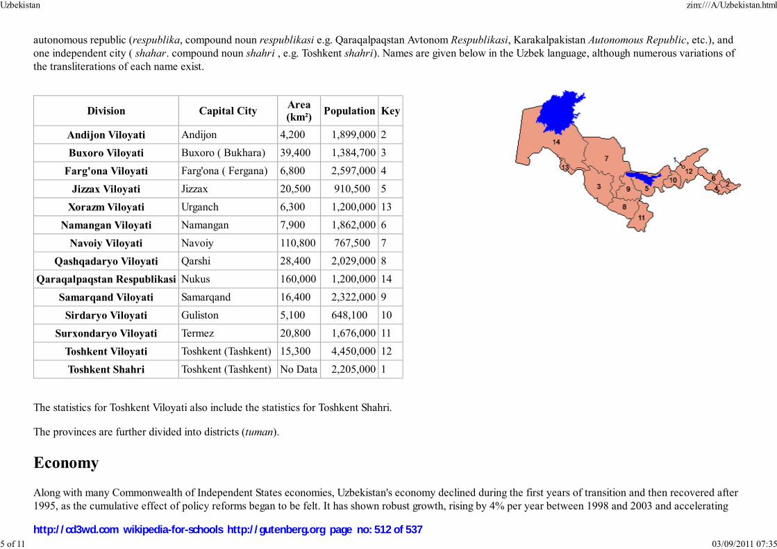
autonomous republic (respublika, compound noun respublikasi e.g. Qaraqalpaqstan Avtonom Respublikasi, Karakalpakistan Autonomous Republic, etc.), andone independent city ( shahar. compound noun shahri , e.g. Toshkent shahri). Names are given below in the Uzbek language, although numerous variations ofthe transliterations of each name exist.
Division Capital CityArea
(km²)Population Key
Andijon Viloyati Andijon 4,200 1,899,000 2
Buxoro Viloyati Buxoro ( Bukhara) 39,400 1,384,700 3
Farg'ona Viloyati Farg'ona ( Fergana) 6,800 2,597,000 4
Jizzax Viloyati Jizzax 20,500 910,500 5
Xorazm Viloyati Urganch 6,300 1,200,000 13
Namangan Viloyati Namangan 7,900 1,862,000 6
Navoiy Viloyati Navoiy 110,800 767,500 7
Qashqadaryo Viloyati Qarshi 28,400 2,029,000 8
Qaraqalpaqstan Respublikasi Nukus 160,000 1,200,000 14
Samarqand Viloyati Samarqand 16,400 2,322,000 9
Sirdaryo Viloyati Guliston 5,100 648,100 10
Surxondaryo Viloyati Termez 20,800 1,676,000 11
Toshkent Viloyati Toshkent (Tashkent) 15,300 4,450,000 12
Toshkent Shahri Toshkent (Tashkent) No Data 2,205,000 1
The statistics for Toshkent Viloyati also include the statistics for Toshkent Shahri.
The provinces are further divided into districts (tuman).
Economy
Along with many Commonwealth of Independent States economies, Uzbekistan's economy declined during the first years of transition and then recovered after1995, as the cumulative effect of policy reforms began to be felt. It has shown robust growth, rising by 4% per year between 1998 and 2003 and accelerating
Uzbekistan zim:///A/Uzbekistan.html
5 of 11 03/09/2011 07:35
http://cd3wd.com wikipedia-for-schools http://gutenberg.org page no: 512 of 537

Tashkent, the capital of Uzbekistan.
thereafter to 7%-8% per year. According to IMF estimates, the GDP in 2008 will be almost double its value in 1995 (in constant prices). Since 2003 annualinflation rates averaged less than 10%.
Uzbekistan has a very low GNI per capita (US$610 in current dollars in 2006, giving a PPP equivalent of US$2,250). By GNI per capita in PPP equivalentsUzbekistan ranks 169 among 209 countries; among the 12 CIS countries, only Kyrgyzstan and Tajikistan had lower GNI per capita in 2006. Economicproduction is concentrated in commodities: Uzbekistan is now the world's sixth-largest producer and second-largest exporter of cotton, as well as the seventhlargest world producer of gold. It is also a regionally significant producer of natural gas, coal, copper, oil, silver, and uranium. Agriculture employs 28% ofUzbekistan's labor force and contributes 24% of its GDP (2006 data). While official unemployment is very low, underemployment - especially in rural areas - isestimated to be at least 20%. Still, at cotton-harvest time, all students and teachers are mobilized as unpaid labour to help in the fields.
Facing a multitude of economic challenges upon acquiring independence, the government adopted anevolutionary reform strategy, with an emphasis on state control, reduction of imports, and self-sufficiency inenergy. Since 1994, the state controlled media have repeatedly proclaimed the success of this "UzbekistanEconomic Model" and suggested that it is a unique example of a smooth transition to the market economywhile avoiding shock, pauperization, and stagnation.
The gradualist reform strategy has involved postponing significant macroeconomic and structural reforms. Thestate in the hands of the bureaucracy has remained a dominant influence in the economy. Corruption permeatesthe society and grows more rampant over time: Uzbekistan's 2005 Corruption Perception Index was 137 out of159 countries, whereas in 2007 Uzbekistan is at the very bottom of the ranking, 175 out of 179. A February2006 report on the country by the International Crisis Group suggests that revenues earned from key exports,especially cotton, gold, corn, and increasingly gas, are distributed among a very small circle of the ruling elite,with little or no benefit for the populace at large.
Uzbekistan zim:///A/Uzbekistan.html
6 of 11 03/09/2011 07:35
http://cd3wd.com wikipedia-for-schools http://gutenberg.org page no: 513 of 537

Samarkand
According to the Economist Intelligence Unit, "the government is hostile to allowing the development of anindependent private sector, over which it would have no control". Thus, the national bourgeoisie in general,and the middle class in particular, are marginalized economically, and, consequently, politically.
The economic policies have repelled foreign investment, which is the lowest per capita in the CIS. Foryears, the largest barrier to foreign companies entering the Uzbekistani market has been the difficulty ofconverting currency. In 2003, the government accepted the obligations of Article VIII under theInternational Monetary Fund, providing for full currency convertibility. However, strict currency controlsand the tightening of borders have lessened the effect of this measure.
Uzbekistan experienced galloping inflation of around 1000% per year immediately after independence(1992-1994). Stabilization efforts implemented with active guidance from the IMF rapidly paid off, asinflation rates were brought down to 50% in 1997 and then to 22% in 2002. Since 2003 annual inflationrates averaged less than 10%. Tight economic policies in 2004 resulted in a drastic reduction of inflation to3.8% (although alternative estimates based on the price of a true market basket, put it at 15%). Theinflation rates moved up to 6.9% in 2006 and 7.6% in 2007, but have remained in the single-digit range.
The government of Uzbekistan restricts foreign imports in many ways, including high import duties. Excise taxes are applied in a highly discriminatory mannerto protect locally produced goods. Official tariffs are combined with unofficial, discriminatory charges resulting in total charges amounting to as much as 100 to150% of the actual value of the product, making imported products virtually unaffordable. Import substitution is an officially declared policy and thegovernment proudly reports a reduction by a factor of two in the volume of consumer goods imported. A number of CIS countries are officially exempt fromUzbekistan import duties.
The Republican Stock Exchange (RSE) 'Tashkent' opened in 1994. It houses a securities exchange, real estate traders, the national investment fund and thenational securities depositary. It does not trade all joint-stock companies each month and therefore market capitalisation varies widely.
Uzbekistan's external position has been strong since 2003. Thanks in part to the recovery of world market prices of gold and cotton, the country's key exportcommodities, expanded natural gas and some manufacturing exports, and increasing labour migrant transfers the current account turned into a large surplus – ofbetween 9 and 11 per cent of GDP in 2003-05 – and foreign exchange reserves, including gold, more than doubled to around US$3 billion.
Demographics
Uzbekistan zim:///A/Uzbekistan.html
7 of 11 03/09/2011 07:35
http://cd3wd.com wikipedia-for-schools http://gutenberg.org page no: 514 of 537

Boys pose for a picture atRegistan. Over a third of
Uzbekistan's population isunder 14 years old.
Uzbekistan is Central Asia's most populous country. Its 27.7 million people comprise nearly half the region's total population.
The population of Uzbekistan is very young: 34.1% of its are people are younger than 14. According to official sources, Uzbekscomprise a majority (80%) of the total population. Other ethnic groups include Russians 5.5%, Tajiks 5%, Kazakhs 3%,Karakalpaks 2.5%, and Tatars 1.5%. There is some controversy about the percentage of the Tajik population. While officialnumbers from Uzbekistan put the number at 5%, some Western scholars believe it to be much higher, going as high as 40%.There is also an ethnic Korean population that was forcibly relocated to Uzbekistan by Stalin in the 1930s. There are also smallgroups of Armenians in Uzbekistan, mostly in Tashkent and Samarkand, most of them came during the Armenian Genocide.The nation is 88% Muslim (mostly Sunni, with a 5% Shi'a minority), 9% Eastern Orthodox and 3% other faiths. The U.S. StateDepartment's International Religious Freedom Report 2004 reports that 0.2% of the population are Buddhist (these beingethnic Koreans). The Bukharian Jews have lived in Central Asia, mostly in Uzbekistan, for thousands of years. There were alsoan estimated 93,000 Jews in Uzbekistan in the early 1990s (source Library of Congress Country Studies). But now, since thecollapse of the USSR, most Central Asian Jews left the region for the United States or Israel. Only about 500-1,500 Jewsremain in Uzbekistan.
At least 10 percent of the Uzbekistan's labour force works abroad (mostly in Russia and Kazakhstan).
Uzbekistan has a 99.3% literacy rate among adults older than 15, which is attributable to the free and universal education system of the Soviet Union.
Languages
The Uzbek language is the only official state language. Russian is still an important language for interethnic communication, especially in the cities, includingmuch day-to-day technical, scientific, governmental and business use. The use of Russian in remote rural areas has always been limited, and today schoolchildren have no proficiency in Russian even in urban centers. In 1992 Uzbekistan officially shifted back to Latin script from traditional considerations ofconsistency with Turkey, but many signs and notices (including official government boards in the streets) are still written in Uzbek Cyrillic script that had beenused in Uzbek SSR since 1940. Computers as a rule operate using the so-called "Uzbek Cyrillic" keyboard, and Latin script is reportedly composed using thestandard English keyboard.
Communications
According to the official source report, as of 10 March 2008, the number of cellular phone users in Uzbekistan reached 7 million, up from 3.7 million on 1 July2007. The largest mobile operator in terms of number of subscribers is MTS-Uzbekistan (former Uzdunrobita and part of Russian Mobile TeleSystems) and it isfollowed by Beeline (part of Russia's Beeline) and Coscom (owned by US MCT Corp., but there is news that it is selling its asset to TeliaSonera.
As of 1 July 2007, the estimated number of internet users was 1.8 million, according to UzACI.
Uzbekistan zim:///A/Uzbekistan.html
8 of 11 03/09/2011 07:35
http://cd3wd.com wikipedia-for-schools http://gutenberg.org page no: 515 of 537
Transportation
Tashkent, the nation's capital and largest city, has a three-line rapid transit system built in 1977, and expanded in 2001 after ten years' independence from theSoviet Union. Uzbekistan is currently the only country in Central Asia with a subway system, and promotes itself as one of the cleanest systems in the world.The stations are exceedingly ornate. For example Kosmonavtov is decorated throughout using a space travel theme to recognise the achievements of an UzbekCosmonaut
There are government operated trams, buses and trolley buses running across the city. There are also many taxis, both registered and unregistered. Uzbekistanhas car-producing plants which produce modern cars. The car production is supported by the government and the Korean auto company Daewoo. The Uzbekgovernment acquired a 50% stake in Daewoo in 2005 for an undisclosed sum, and in May 2007 UzDaewooAuto, the car maker, signed a strategic agreementwith General Motors-Daewoo Auto and Technology (GMDAT). The government also bought a stake in Turkey's Koc in SamKocAuto, a producer of small busesand lorries. Afterwards, it signed an agreement with Isuzu Motors of Japan to produce Isuzu buses and lorries.
Train links connect many towns within Uzbekistan, as well as neighbouring ex-republics of the Soviet Union. Moreover, after independence two fast-runningtrain systems were established. There is also a large airplane plant that was built during the Soviet era – Tashkent Chkalov Aviation Manufacturing Plant orТАПОиЧ in Russian. The plant originated during World War II, when production facilities were evacuated south and east to avoid capture by advancing Naziforces. Until the late 1980s, the plant was one of the leading airplane production centers in the USSR, but with collapse of the Soviet Union its manufacturingequipment became outdated, and most of the workers were laid off. Now it produces only a few planes a year, but with interest from Russian companiesgrowing in it, there are rumors of production-enhancement plans.
Military
Uzbekistan possesses the largest military force in the Central Asian region, having around 65,000 people in uniform. Its structure is inherited from the Sovietarmed forces, although it is moving rapidly toward a fully restructured organization, which will eventually be built around light and Special Forces. TheUzbekistan Armed Forces equipment is not modern, and training, while improving, is neither uniform nor adequate for its new mission of territorial security. Thegovernment has accepted the arms control obligations of the former Soviet Union, acceded to the Nuclear Non-Proliferation Treaty (as a non-nuclear state), andsupported an active program by the U.S. Defense Threat Reduction Agency (DTRA) in western Uzbekistan ( Nukus and Vozrozhdeniye Island). TheGovernment of Uzbekistan spends about 3.7% of GDP on the military but has received a growing infusion of Foreign Military Financing (FMF) and othersecurity assistance funds since 1998. Following the September 11, 2001 terrorist attacks in the U.S., Uzbekistan approved the U.S. Central Command's requestfor access to a vital military air base, Karshi-Khanabad Airbase, in southern Uzbekistan. However Uzbekistan demanded that the U.S. withdraw from theairbases after the Andijan massacre and the U.S. reaction to this massacre. The last US troops left Uzbekistan in November 2005.
Foreign relations
Uzbekistan zim:///A/Uzbekistan.html
9 of 11 03/09/2011 07:35
http://cd3wd.com wikipedia-for-schools http://gutenberg.org page no: 516 of 537

Uzbekistan joined the Commonwealth of Independent States in December 1991. However, it is opposed to reintegration and withdrew from the CIS collectivesecurity arrangement in 1999. Since that time, Uzbekistan has participated in the CIS peacekeeping force in Tajikistan and in UN-organized groups to helpresolve the Tajikistan and Afghanistan conflicts, both of which it sees as posing threats to its own stability.
Previously close to Washington (which gave Uzbekistan half a billion dollars in aid in 2004, about a quarter of it military), the government of Uzbekistan hasrecently restricted American military use of the airbase at Karshi-Khanabad for air operations in neighboring Afghanistan. Uzbekistan was an active supporterof U.S. efforts against worldwide terrorism and joined the coalitions that have dealt with both Afghanistan and Iraq. The relationship between Uzbekistan andthe United States began to deteriorate after the so-called " colour revolutions" in Georgia and Ukraine (and to a lesser extent Kyrgyzstan). When the U.S. joinedin a call for an independent international investigation of the bloody events at Andijon, the relationship took an additional nosedive, and President IslomKarimov changed the political alignment of the country to bring it closer to Russia and China, countries which chose not to criticize Uzbekistan's leaders fortheir alleged human rights violations.
In late July 2005, the government of Uzbekistan ordered the United States to vacate an air base in Karshi-Kanabad (near the Uzbekistan's border withAfghanistan) within 180 days. Karimov had offered use of the base to the U.S. shortly after 9/11. It is also believed by some Uzbeks that the protests in Andijanwere brought about by the UK and US influences in the area of Andijan. This is another reason for the hostility between Uzbekistan and the West.
Uzbekistan is a member of the United Nations (since March 2, 1992), the Euro-Atlantic Partnership Council, Partnership for Peace, and the Organization forSecurity and Cooperation in Europe (OSCE). It belongs to the Organization of the Islamic Conference (OIC) and the Economic Cooperation Organization(comprising the five Central Asian countries, Azerbaijan, Turkey, Iran, Afghanistan, and Pakistan). In 1999 , Uzbekistan joined the GUAM alliance (Georgia,Ukraine, Azerbaijan and Moldova), which was formed in 1997 (making it GUUAM), but pulled out of the organization in 2005. Uzbekistan is also a member ofthe Shanghai Cooperation Organization (SCO) and hosts the SCO’s Regional Anti-Terrorist Structure (RATS) in Tashkent. Uzbekistan joined the new CentralAsian Cooperation Organization (CACO) in 2002. The CACO consists of Uzbekistan, Tajikistan, Kazakhstan, and Kyrgyzstan. It is a founding member of, andremains involved in, the Central Asian Union, formed with Kazakhstan and Kyrgyzstan, and joined in March 1998 by Tajikistan.
In September 2006, UNESCO presented Islom Karimov an award for Uzbekistan's preservation of its rich culture and traditions. Despite criticism, this seems tobe a sign of improving relationships between Uzbekistan and the West.
The month of October 2006 also saw a decrease in the isolation of Uzbekistan from the West. The EU announced that it was planning to send a delegation toUzbekistan to talk about human rights and liberties, after a long period of hostile relations between the two. Although it is equivocal about whether the officialor unofficial version of the Andijan Massacre is true, the EU is evidently willing to ease its economic sanctions against Uzbekistan. Nevertheless, it is generallyassumed among the Uzbekistan's population that the government will stand firm in maintaining its close ties with the Russian Federation and in its theory thatthe 2004-2005 protests in Uzbekistan were promoted by the USA and UK.
Environment
Uzbekistan's environmental situation ought to be a major concern among the international community. Decades of questionable Soviet policies in pursuit of
Uzbekistan zim:///A/Uzbekistan.html
10 of 11 03/09/2011 07:35
http://cd3wd.com wikipedia-for-schools http://gutenberg.org page no: 517 of 537

greater cotton production has resulted in a catastrophic scenario. The agricultural industry appears to be the main contributor to the pollution and devastation ofthe air and water in the country.
The Aral Sea disaster is a classic example. The Aral Sea used to be the fourth largest inland sea on Earth, acting as an influencing factor in the air moisture.Since the 1960s, the decade when the misuse of the Aral Sea water began, it has shrunk to less than 50% of its former area, and decreased in volume threefold.Reliable – or even approximate – data has not been collected, stored or provided by any organization or official agency. The numbers of animal deaths andhuman refugees from the area around the sea can only be guessed at. The question of who is responsible for the crisis – the Soviet scientists and politicians whodirected the distribution of water during the sixties, or the post-Soviet politicians who did not allocate sufficient funding for the building of dams and irrigationsystems - remains open.
Due to the almost insoluble Aral Sea problem, high salinity is widespread in Uzbekistan. The vast majority of the nation's water resources are used for farming,which consumes nearly 94% of the water usage. This results in a heavy use of pesticides and fertilizers.
Retrieved from " http://en.wikipedia.org/wiki/Uzbekistan"The 2008 Wikipedia for Schools is sponsored by SOS Children , and is a hand-chosen selection of article versions from the English Wikipedia edited only bydeletion (see www.wikipedia.org for details of authors and sources). The articles are available under the GNU Free Documentation License. See also our
Uzbekistan zim:///A/Uzbekistan.html
11 of 11 03/09/2011 07:35
http://cd3wd.com wikipedia-for-schools http://gutenberg.org page no: 518 of 537
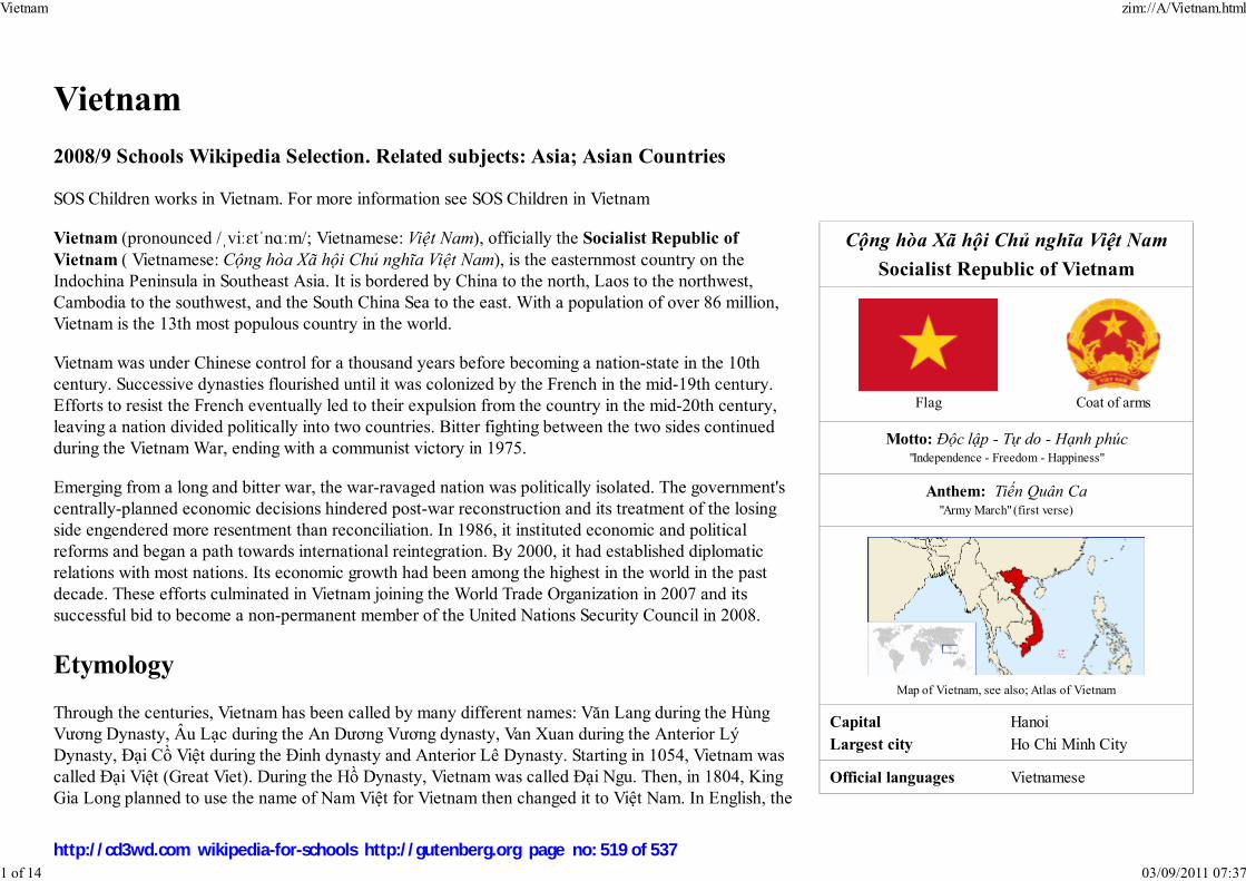
Cộng hòa Xã hội Chủ nghĩa Việt Nam
Socialist Republic of Vietnam
Flag Coat of arms
Motto: Độc lập - Tự do - Hạnh phúc"Independence - Freedom - Happiness"
Anthem: Tiến Quân Ca"Army March" (first verse)
Capital HanoiLargest city Ho Chi Minh City
Official languages Vietnamese
Vietnam
2008/9 Schools Wikipedia Selection. Related subjects: Asia; Asian Countries
SOS Children works in Vietnam. For more information see SOS Children in Vietnam
Vietnam (pronounced /ˌviːɛtˈnɑːm/; Vietnamese: Việt Nam), officially the Socialist Republic ofVietnam ( Vietnamese: Cộng hòa Xã hội Chủ nghĩa Việt Nam), is the easternmost country on theIndochina Peninsula in Southeast Asia. It is bordered by China to the north, Laos to the northwest,Cambodia to the southwest, and the South China Sea to the east. With a population of over 86 million,Vietnam is the 13th most populous country in the world.
Vietnam was under Chinese control for a thousand years before becoming a nation-state in the 10thcentury. Successive dynasties flourished until it was colonized by the French in the mid-19th century.Efforts to resist the French eventually led to their expulsion from the country in the mid-20th century,leaving a nation divided politically into two countries. Bitter fighting between the two sides continuedduring the Vietnam War, ending with a communist victory in 1975.
Emerging from a long and bitter war, the war-ravaged nation was politically isolated. The government'scentrally-planned economic decisions hindered post-war reconstruction and its treatment of the losingside engendered more resentment than reconciliation. In 1986, it instituted economic and politicalreforms and began a path towards international reintegration. By 2000, it had established diplomaticrelations with most nations. Its economic growth had been among the highest in the world in the pastdecade. These efforts culminated in Vietnam joining the World Trade Organization in 2007 and itssuccessful bid to become a non-permanent member of the United Nations Security Council in 2008.
Etymology
Through the centuries, Vietnam has been called by many different names: Văn Lang during the HùngVương Dynasty, Âu Lạc during the An Dương Vương dynasty, Van Xuan during the Anterior LýDynasty, Đại Cồ Việt during the Đinh dynasty and Anterior Lê Dynasty. Starting in 1054, Vietnam wascalled Đại Việt (Great Viet). During the Hồ Dynasty, Vietnam was called Đại Ngu. Then, in 1804, KingGia Long planned to use the name of Nam Việt for Vietnam then changed it to Việt Nam. In English, the
Map of Vietnam, see also; Atlas of Vietnam
Vietnam zim://A/Vietnam.html
1 of 14 03/09/2011 07:37
http://cd3wd.com wikipedia-for-schools http://gutenberg.org page no: 519 of 537
Demonym Vietnamese
Government Socialist republic1
- General Secretary Nông Đức Mạnh - President Nguyễn Minh Triết - Prime Minister Nguyễn Tấn Dũng
Independence from France - Date September 2, 1945 - Recognized 1954
Area - Total 331,690 km² ( 65th)
128,527 sq mi - Water (%) 1.3
Population - 2008
mid-year estimate86,116,559 ( 13th)
- 1999 census 76,323,173 - Density 253/km² ( 46th)
655/sq mi
GDP ( PPP) 2006 estimate - Total $262.5 billion ( 36th) - Per capita $3,100 ( 123rd)
Gini (2002) 37 (medium) ( 59th)
HDI (2007) ▲ 0.733 (medium) (105th)
Currency đồng (₫) ( VND)
Time zone UTC+7 ( UTC+7) - Summer ( DST) No DST ( UTC+7)
Internet TLD .vn
two syllables were written into one: Vietnam. From 1839 to 1945, Emperor Minh Mạng renamed ViệtNam to Đại Nam (literally "Great South").
The name Việt Nam had been used for this country before it became the official name in "Dư địa chí" ofNguyễn Trãi written in 1435 and perhaps even before. "Việt" is the name of the largest ethnic group inVietnam: the Kinh (người Kinh) and "Nam" means "the South", affirming Vietnam's sovereignty fromChina (usually called "North country" by the Vietnamese).
History
Pre-Dynastic era
The area now known as Vietnam has been inhabited since Paleolithic times, and some archaeologicalsites in Thanh Hoa Province purportedly date back several thousand years. Archaeologists link thebeginnings of Vietnamese civilization to the late Neolithic, Early Bronze Age, Phung-nguyen culture,which was centered in Vinh Phu Province of contemporary Vietnam from about 2000 to 1400 BCE. Byabout 1200 BCE, the development of wet-rice cultivation and bronze casting in the Ma River and RedRiver plains led to the development of the Dong Son culture, notable for its elaborate bronze drums. Thebronze weapons, tools, and drums of Dongsonian sites show a Southeast Asian influence that indicates anindigenous origin for the bronze-casting technology. Many small, ancient copper mine sites have beenfound in northern Vietnam. Some of the similarities between the Dong Sonian sites and other SoutheastAsian sites include the presence of boat-shaped coffins and burial jars, stilt dwellings, and evidence ofthe customs of betel-nut-chewing and teeth-blackening.
The legendary Hồng Bàng Dynasty of the Hùng kings is considered by many Vietnamese as the firstVietnamese state, known as Văn Lang. In 257 BCE, the last Hùng king lost to Thục Phán, whoconsolidated the Lạc Việt tribes with his Âu Việt tribes, forming Âu Lạc and proclaiming himself AnDương Vương. In 207 BCE, a Chinese general named Zhao Tuo defeated An Dương Vương andconsolidated Âu Lạc into Nanyue. In 111 BCE, the Chinese Han Dynasty consolidated Nanyue into theirempire.
For the next thousand years, Vietnam was mostly under Chinese rule. Early independence movementssuch as those of the Trưng Sisters and of Lady Triệu were only briefly successful. It was independent asVạn Xuân under the Anterior Ly Dynasty between 544 and 602. By the early 10th century, Vietnam hadgained autonomy, but not independence, under the Khúc family.
Vietnam zim://A/Vietnam.html
2 of 14 03/09/2011 07:37
http://cd3wd.com wikipedia-for-schools http://gutenberg.org page no: 520 of 537
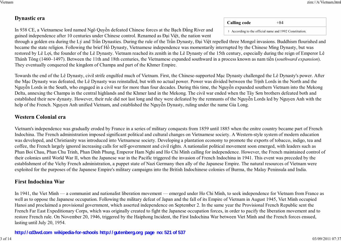
Calling code +84
According to the official name and 1992 Constitution.
Dynastic era
In 938 CE, a Vietnamese lord named Ngô Quyền defeated Chinese forces at the Bạch Đằng River andgained independence after 10 centuries under Chinese control. Renamed as Đại Việt, the nation wentthrough a golden era during the Lý and Trần Dynasties. During the rule of the Trần Dynasty, Đại Việt repelled three Mongol invasions. Buddhism flourished andbecame the state religion. Following the brief Hồ Dynasty, Vietnamese independence was momentarily interrupted by the Chinese Ming Dynasty, but wasrestored by Lê Lợi, the founder of the Lê Dynasty. Vietnam reached its zenith in the Lê Dynasty of the 15th century, especially during the reign of Emperor LêThánh Tông (1460–1497). Between the 11th and 18th centuries, the Vietnamese expanded southward in a process known as nam tiến (southward expansion).They eventually conquered the kingdom of Champa and part of the Khmer Empire.
Towards the end of the Lê Dynasty, civil strife engulfed much of Vietnam. First, the Chinese-supported Mạc Dynasty challenged the Lê Dynasty's power. Afterthe Mạc Dynasty was defeated, the Lê Dynasty was reinstalled, but with no actual power. Power was divided between the Trịnh Lords in the North and theNguyễn Lords in the South, who engaged in a civil war for more than four decades. During this time, the Nguyễn expanded southern Vietnam into the MekongDelta, annexing the Champa in the central highlands and the Khmer land in the Mekong. The civil war ended when the Tây Sơn brothers defeated both andestablished their new dynasty. However, their rule did not last long and they were defeated by the remnants of the Nguyễn Lords led by Nguyen Anh with thehelp of the French. Nguyen Anh unified Vietnam, and established the Nguyễn Dynasty, ruling under the name Gia Long.
Western Colonial era
Vietnam's independence was gradually eroded by France in a series of military conquests from 1859 until 1885 when the enitre country became part of FrenchIndochina. The French administration imposed significant political and cultural changes on Vietnamese society. A Western-style system of modern educationwas developed, and Christianity was introduced into Vietnamese society. Developing a plantation economy to promote the exports of tobacco, indigo, tea andcoffee, the French largely ignored increasing calls for self-government and civil rights. A nationalist political movement soon emerged, with leaders such asPhan Boi Chau, Phan Chu Trinh, Phan Dinh Phung, Emperor Ham Nghi and Ho Chi Minh calling for independence. However, the French maintained control oftheir colonies until World War II, when the Japanese war in the Pacific triggered the invasion of French Indochina in 1941. This event was preceded by theestablishment of the Vichy French administration, a puppet state of Nazi Germany then ally of the Japanese Empire. The natural resources of Vietnam wereexploited for the purposes of the Japanese Empire's military campaigns into the British Indochinese colonies of Burma, the Malay Peninsula and India.
First Indochina War
In 1941, the Viet Minh — a communist and nationalist liberation movement — emerged under Ho Chi Minh, to seek independence for Vietnam from France aswell as to oppose the Japanese occupation. Following the military defeat of Japan and the fall of its Empire of Vietnam in August 1945, Viet Minh occupiedHanoi and proclaimed a provisional government, which asserted independence on September 2. In the same year the Provisional French Republic sent theFrench Far East Expeditionary Corps, which was originally created to fight the Japanese occupation forces, in order to pacify the liberation movement and torestore French rule. On November 20, 1946, triggered by the Haiphong Incident, the First Indochina War between Viet Minh and the French forces ensued,lasting until July 20, 1954.
1
Vietnam zim://A/Vietnam.html
3 of 14 03/09/2011 07:37
http://cd3wd.com wikipedia-for-schools http://gutenberg.org page no: 521 of 537
Despite fewer losses—Expeditionary Corps suffered 1/3 the casualties of the Chinese and Soviet-backed Viet Minh—during the course of the war, theU.S.-backed French and Vietnamese loyalists eventually suffered a major strategic setback at the Siege of Dien Bien Phu, which allowed Ho Chi Minh tonegotiate a ceasefire with a favorable position at the ongoing Geneva conference of 1954. Colonial administration ended as French Indochina was dissolved.According to the Geneva Agreements the country was partitioned at the 17th parallel. Ho Chi Minh's Democratic Republic of Vietnam ruled the north, whileEmperor Bao Dai's State of Vietnam ruled the south. This was intended to be temporary, pending an election in 1956, which never took place. Instead, State ofVietnam Prime Minister Ngo Dinh Diem toppled Bao Dai in a fraudulent referendum organised by his brother Ngo Dinh Nhu and proclaimed himself presidentof the Republic of Vietnam.
Vietnam War
The Communist-held Democratic Republic of Vietnam was opposed by the US-supported Republic of Vietnam. Disagreements soon emerged over theorganizing of elections and reunification, and the Viet Cong began a guerrilla campaign in the late 1950s, assisted by North Vietnam, hoping to bring SouthVietnam under communist rule. To support South Vietnam's struggle against the communist insurgency, the US began increasing its contribution of militaryadvisers. US forces became embroiled in combat operations in 1965 and at there peak they numbered more than 500,000. North Vietnamese forcesunsuccessfully attempted to overrun the South during the 1968 Tet Offensive and the war soon spread into neighboring Laos and Cambodia, in both of whichthe United States bombed Communist forces supplying the North Vietnamese Army.
With its own casualties mounting, the U.S. began transferring combat roles to the South Vietnamese military in a process the U.S. called Vietnamization. Theeffort had mixed results. The Paris Peace Accords of January 27, 1973, formally recognized the sovereignty of both sides. Under the terms of the accords allAmerican combat troops were withdrawn by March 29, 1973. Limited fighting continued, but all major fighting ended until the North once again sent troops tothe South during the Spring of 1975, culminating in the Fall of Saigon on April 30, 1975. South Vietnam briefly became the Republic of South Vietnam, undermilitary occupation by North Vietnam, before being officially integrated with the North under communist rule as the Socialist Republic of Vietnam on July 2,1976.
Postwar
Upon taking control, the Vietnamese communists banned all other political parties, arrested public servants and military personnel of the Republic of Vietnamand sent them to reeducation camps. The government also embarked on a mass campaign of collectivization of farms and factories. Reconstruction of thewar-ravaged country was slow, and serious humanitarian and economic problems confronted the communist regime. Millions of people fled the country incrudely-built boats, creating an international humanitarian crisis. In 1978, the Vietnamese army invaded Cambodia (sparking the Cambodian-Vietnamese War)to remove the Khmer Rouge from power. This action worsened relations with China, which launched a brief incursion into northern Vietnam (theSino-Vietnamese War) in 1979. This conflict caused Vietnam to rely even more heavily on Soviet economic and military aid.
Đổi Mới
In a historic shift in 1986, the Communist Party of Vietnam implemented free-market reforms known as Đổi Mới (renovation). With the authority of the state
Vietnam zim://A/Vietnam.html
4 of 14 03/09/2011 07:37
http://cd3wd.com wikipedia-for-schools http://gutenberg.org page no: 522 of 537

Vietnam National Convention Centre
remaining unchallenged, private ownership of farms and companies, deregulation and foreign investment were encouraged. The economy of Vietnam hasachieved rapid growth in agricultural and industrial production, construction and housing, exports, and foreign investment. It is now one of the fastest growingeconomies in the world.
Government and politics
The Socialist Republic of Vietnam is a single-party state. A new state constitution was approved inApril 1992, replacing the 1975 version. The central role of the Communist Party was reasserted inall organs of government, politics and society. Only political organizations affiliated with orendorsed by the Communist Party are permitted to contest elections. These include the VietnameseFatherland Front, worker and trade unionist parties. Although the state remains officially committedto socialism as its defining creed, the ideology's importance has substantially diminished since the1990s. The President of Vietnam is the titular head of state and the nominal commander in chief ofthe military of Vietnam, chairing the Council on National Defense and Security. The Prime Ministerof Vietnam Nguyen Tan Dung is the head of government, presiding over a council of ministerscomposed of 3 deputy prime ministers and the heads of 26 ministries and commissions.
The National Assembly of Vietnam is the unicameral legislature of the government, composed of498 members. It is superior to both the executive and judicial branches. All members of the councilof ministers are derived from the National Assembly. The Supreme People's Court of Vietnam,which is the highest court of appeal in the nation, is also answerable to the National Assembly.Beneath the Supreme People's Court stand the provincial municipal courts and the local courts.Military courts are also a powerful branch of the judiciary with special jurisdiction in matters ofnational security. All organs of Vietnam's government are controlled by the Communist Party. Most government appointees are members of the party. TheGeneral Secretary of the Communist Party is perhaps one of the most important political leaders in the nation, controlling the party's national organization andstate appointments, as well as setting policy.
The Vietnam People's Army is the official name for the combined military services of Vietnam, which is organized along the lines of China's People's LiberationArmy. The VPA is further subdivided into the Vietnamese People's Ground Forces (including Strategic Rear Forces and Border Defense Forces), the VietnamPeople's Navy, the Vietnam People's Air Force and the coast guard. Through Vietnam's recent history, the VPA has actively been involved in Vietnam'sworkforce to develop the economy of Vietnam, in order to coordinate national defense and the economy. The VPA is involved in such areas as industry,agriculture, forestry, fishery and telecommunications. The total strength of the VPA is close to 500,000 officers and enlisted members. The government alsoorganizes and maintains provincial militias and police forces. The role of the military in public life has steadily been reduced since the 1980s.
Provinces
Vietnam zim://A/Vietnam.html
5 of 14 03/09/2011 07:37
http://cd3wd.com wikipedia-for-schools http://gutenberg.org page no: 523 of 537

Provinces of Vietnam
Ha Long Bay, a World Heritage Site
Vietnam is divided into 59 provinces (known in Vietnamese as tỉnh, from the Chinese 省, shěng). There are also 5centrally-controlled municipalities existing at the same level as provinces (thành phố trực thuộc trung ương).
The provinces are further subdivided into provincial municipalities (thành phố trực thuộc tỉnh), townships (thị xã) andcounties (huyện), and then, subdivided into towns (thị trấn) or communes (xã).
The centrally-controlled municipalities are subdivided into districts (quận) and counties, and then, subdivided into wards(phường).
Geography and climate
Vietnam is approximately 331,688 km² (128,066 sq mi) in area (not including Hoang Sa and Truong Sa islands), larger thanItaly and almost the size of Germany. The perimeter of the country running along its international boundaries is 4,639 km(2,883 mi). The topography consists of hills and densely forested mountains, with level land covering no more than 20%.Mountains account for 40% of the area, with smaller hills accounting for 40% and tropical forests 42%. The northern partof the country consists mostly of highlands and the Red River Delta. Phan Xi Păng, located in Lào Cai province, is thehighest mountain in Vietnam at 3,143 m (10,312 ft). The south is divided into coastal lowlands, Annamite Chain peaks,extensive forests, and poor soil. Comprising five relatively flat plateaus of basalt soil, the highlands account for 16% of thecountry's arable land and 22% of its total forested land.
The delta of the Red River (also known as the Sông Hồng), a flat, triangular region of 15,000 squarekilometers, is smaller but more intensely developed and more densely populated than the Mekong RiverDelta. Once an inlet of the Gulf of Tonkin, it has been filled in by the enormous alluvial deposits of therivers over a period of millennia, and it advances one hundred meters into the Gulf annually. The Mekongdelta, covering about 40,000 square kilometers, is a low-level plain not more than three meters above sealevel at any point and criss-crossed by a maze of canals and rivers. So much sediment is carried by theMekong's various branches and tributaries that the delta advances sixty to eighty meters into the sea everyyear.
Because of differences in latitude and the marked variety of topographical relief, the climate tends to varyconsiderably from place to place. During the winter or dry season, extending roughly from November toApril, the monsoon winds usually blow from the northeast along the China coast and across the Gulf ofTonkin, picking up considerable moisture; consequently the winter season in most parts of the country is dryonly by comparison with the rainy or summer season. The average annual temperature is generally higher inthe plains than in the mountains and plateaus and in the south than in the north. Temperatures in thesouthern plains (Ho Chi Minh City and the Mekong Delta) varies less, going between 21 and 28 degree
Vietnam zim://A/Vietnam.html
6 of 14 03/09/2011 07:37
http://cd3wd.com wikipedia-for-schools http://gutenberg.org page no: 524 of 537
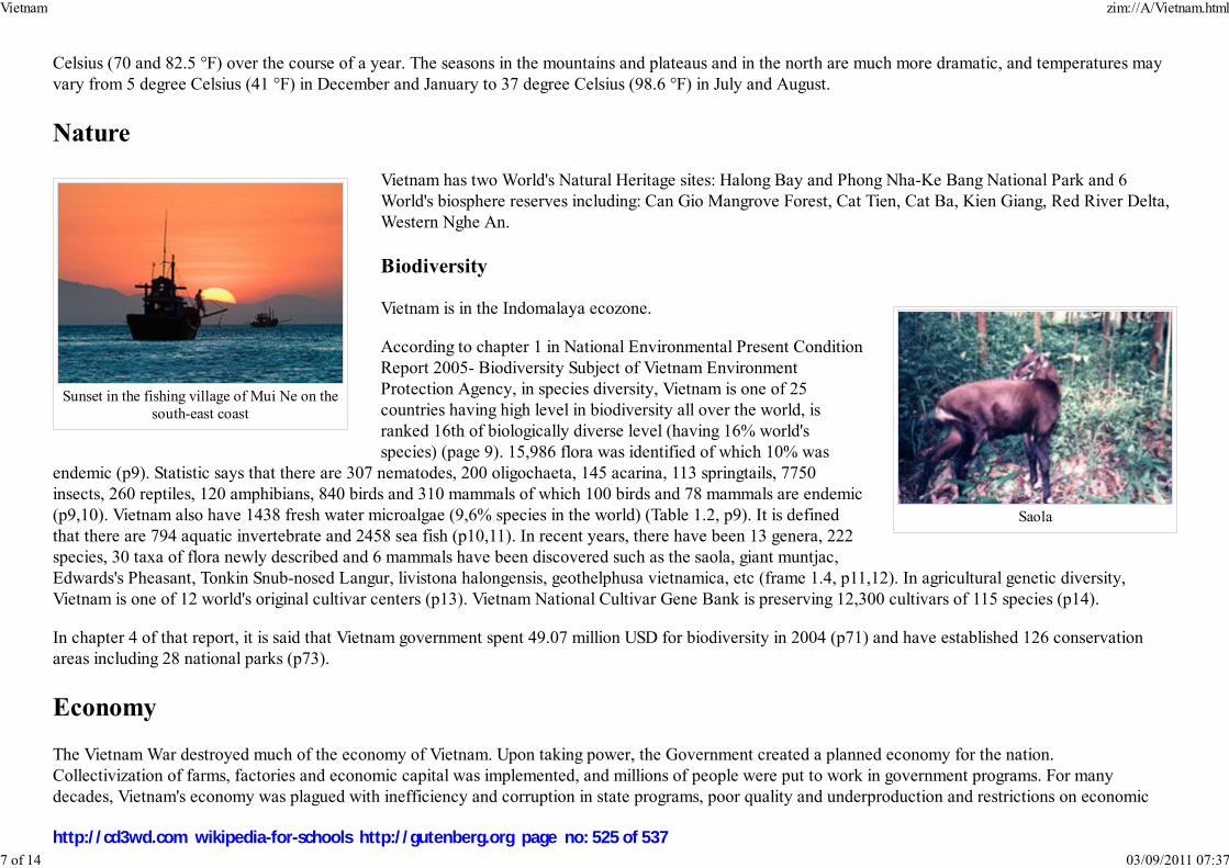
Sunset in the fishing village of Mui Ne on thesouth-east coast
Saola
Celsius (70 and 82.5 °F) over the course of a year. The seasons in the mountains and plateaus and in the north are much more dramatic, and temperatures mayvary from 5 degree Celsius (41 °F) in December and January to 37 degree Celsius (98.6 °F) in July and August.
Nature
Vietnam has two World's Natural Heritage sites: Halong Bay and Phong Nha-Ke Bang National Park and 6World's biosphere reserves including: Can Gio Mangrove Forest, Cat Tien, Cat Ba, Kien Giang, Red River Delta,Western Nghe An.
Biodiversity
Vietnam is in the Indomalaya ecozone.
According to chapter 1 in National Environmental Present ConditionReport 2005- Biodiversity Subject of Vietnam EnvironmentProtection Agency, in species diversity, Vietnam is one of 25countries having high level in biodiversity all over the world, isranked 16th of biologically diverse level (having 16% world'sspecies) (page 9). 15,986 flora was identified of which 10% was
endemic (p9). Statistic says that there are 307 nematodes, 200 oligochaeta, 145 acarina, 113 springtails, 7750insects, 260 reptiles, 120 amphibians, 840 birds and 310 mammals of which 100 birds and 78 mammals are endemic(p9,10). Vietnam also have 1438 fresh water microalgae (9,6% species in the world) (Table 1.2, p9). It is definedthat there are 794 aquatic invertebrate and 2458 sea fish (p10,11). In recent years, there have been 13 genera, 222species, 30 taxa of flora newly described and 6 mammals have been discovered such as the saola, giant muntjac,Edwards's Pheasant, Tonkin Snub-nosed Langur, livistona halongensis, geothelphusa vietnamica, etc (frame 1.4, p11,12). In agricultural genetic diversity,Vietnam is one of 12 world's original cultivar centers (p13). Vietnam National Cultivar Gene Bank is preserving 12,300 cultivars of 115 species (p14).
In chapter 4 of that report, it is said that Vietnam government spent 49.07 million USD for biodiversity in 2004 (p71) and have established 126 conservationareas including 28 national parks (p73).
Economy
The Vietnam War destroyed much of the economy of Vietnam. Upon taking power, the Government created a planned economy for the nation.Collectivization of farms, factories and economic capital was implemented, and millions of people were put to work in government programs. For manydecades, Vietnam's economy was plagued with inefficiency and corruption in state programs, poor quality and underproduction and restrictions on economic
Vietnam zim://A/Vietnam.html
7 of 14 03/09/2011 07:37
http://cd3wd.com wikipedia-for-schools http://gutenberg.org page no: 525 of 537
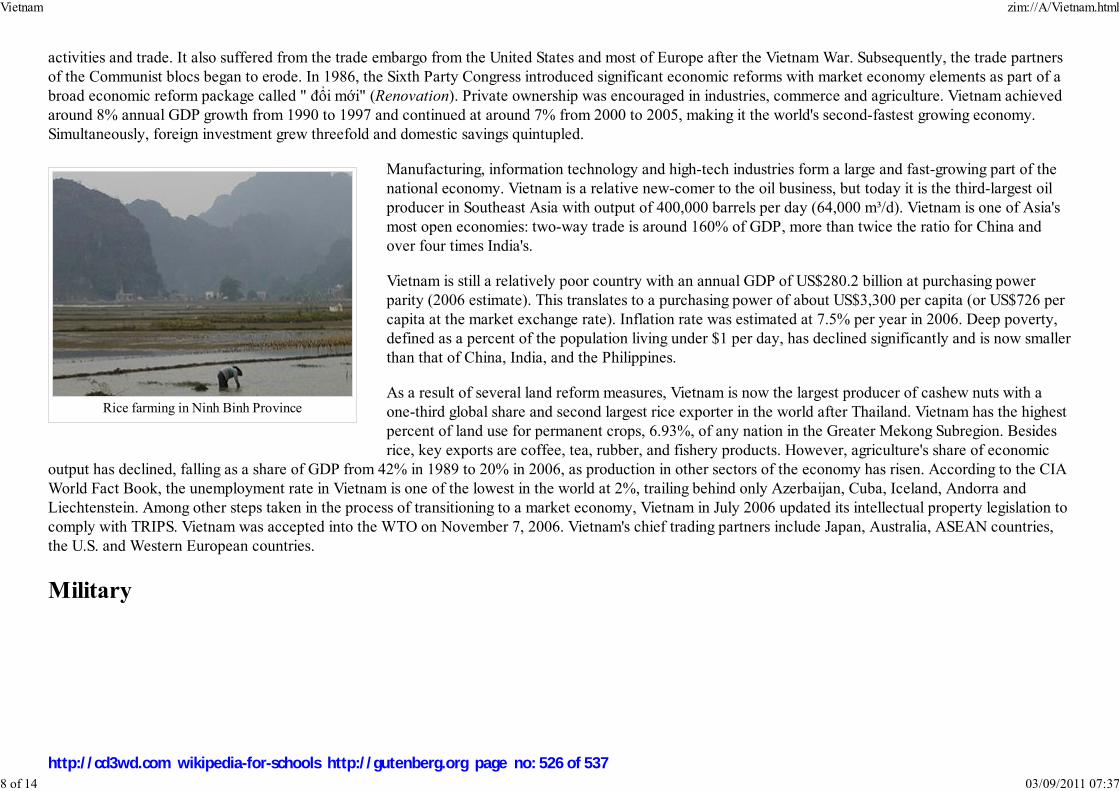
Rice farming in Ninh Binh Province
activities and trade. It also suffered from the trade embargo from the United States and most of Europe after the Vietnam War. Subsequently, the trade partnersof the Communist blocs began to erode. In 1986, the Sixth Party Congress introduced significant economic reforms with market economy elements as part of abroad economic reform package called " đổi mới" (Renovation). Private ownership was encouraged in industries, commerce and agriculture. Vietnam achievedaround 8% annual GDP growth from 1990 to 1997 and continued at around 7% from 2000 to 2005, making it the world's second-fastest growing economy.Simultaneously, foreign investment grew threefold and domestic savings quintupled.
Manufacturing, information technology and high-tech industries form a large and fast-growing part of thenational economy. Vietnam is a relative new-comer to the oil business, but today it is the third-largest oilproducer in Southeast Asia with output of 400,000 barrels per day (64,000 m³/d). Vietnam is one of Asia'smost open economies: two-way trade is around 160% of GDP, more than twice the ratio for China andover four times India's.
Vietnam is still a relatively poor country with an annual GDP of US$280.2 billion at purchasing powerparity (2006 estimate). This translates to a purchasing power of about US$3,300 per capita (or US$726 percapita at the market exchange rate). Inflation rate was estimated at 7.5% per year in 2006. Deep poverty,defined as a percent of the population living under $1 per day, has declined significantly and is now smallerthan that of China, India, and the Philippines.
As a result of several land reform measures, Vietnam is now the largest producer of cashew nuts with aone-third global share and second largest rice exporter in the world after Thailand. Vietnam has the highestpercent of land use for permanent crops, 6.93%, of any nation in the Greater Mekong Subregion. Besidesrice, key exports are coffee, tea, rubber, and fishery products. However, agriculture's share of economic
output has declined, falling as a share of GDP from 42% in 1989 to 20% in 2006, as production in other sectors of the economy has risen. According to the CIAWorld Fact Book, the unemployment rate in Vietnam is one of the lowest in the world at 2%, trailing behind only Azerbaijan, Cuba, Iceland, Andorra andLiechtenstein. Among other steps taken in the process of transitioning to a market economy, Vietnam in July 2006 updated its intellectual property legislation tocomply with TRIPS. Vietnam was accepted into the WTO on November 7, 2006. Vietnam's chief trading partners include Japan, Australia, ASEAN countries,the U.S. and Western European countries.
Military
Vietnam zim://A/Vietnam.html
8 of 14 03/09/2011 07:37
http://cd3wd.com wikipedia-for-schools http://gutenberg.org page no: 526 of 537

Coast guard station in Hà Tiên
Hai Van Pass.
Quân Đội Nhân Dân Việt Nam, The Vietnam People's Army (VPA), is the official collective term for the armed forces of theSocialist Republic of Vietnam. The VPA consists of the Vietnam People's Ground Forces, Vietnam People's Navy, VietnamPeople's Air Force, and Vietnam People's Coast Guard.
Transport
The modern transport network of Vietnam was originally developed under French rule for the purpose of raw materialsharvesting, and reconstructed and extensively modernized following the Vietnam War. The road system is the most popularform of transportation in the country. Vietnam’s road system includes national roads administered by the central level;provincial roads managed by the provincial level; district roads managed by the district level; urban roads managedby cities and towns; and commune roads managed by the commune level.
Bicycles, motor scooters and motorcycles remain the most popular forms of road transport in Vietnam's cities,towns, and villages although the number of privately-owned automobiles is also on the rise, especially in the largercities. Public bus operated by private companies is the main long distance travel means for many people. Trafficcongestion is a serious problem in Hanoi and Ho Chi Minh City as the cities' roads struggle to cope with thebooming numbers of automobiles. There are also more than 17,000 kilometers of navigable waterways, which play asignificant role in rural life owing to the extensive network of rivers in Vietnam.
The nation has seven developed ports and harbors at Cam Ranh, Da Nang, Hai Phong, Ho Chi Minh City, Hong Gai(Halong City), Qui Nhon, and Nha Trang.
Demography
Population
Recent census estimates the population of Vietnam at beyond 84 million. Vietnamese people, also called "Viet" or "Kinh", account for 86.2 percent of thepopulation. Their population is concentrated in the alluvial deltas and coastal plains of the country. A homogeneous social and ethnic majority group, the Kinhexert political and economic control. There are more than 54 ethnic minorities throughout the country, but the Kinh are purveyors of the dominant culture. Mostethnic minorities, such as the Muong, a closely related ethnic of the Kinh, are found mostly in the highlands covering two-thirds of the territory. The Hoa (ethnicChinese) and Khmer Krom are mainly lowlanders. The largest ethnic minority groups include the Hmong, Dao, Tay, Thai, and Nung.
Languages
The people of Vietnam speak Vietnamese as a native language. In its early history, Vietnamese writing used Chinese characters. In the 13th century, the
Vietnam zim://A/Vietnam.html
9 of 14 03/09/2011 07:37
http://cd3wd.com wikipedia-for-schools http://gutenberg.org page no: 527 of 537

Vietnam religiosityreligion percentBuddhism 85%Christianity 8%Caodaism 3%Others 4%
Vietnamese developed their own set of characters called Chữ nôm. The celebrated epic Đoạn trường tân thanh (Truyện Kiều or The Tale of Kieu) by NguyễnDu was written in Chữ nôm. During the French colonial period, Quốc ngữ, the romanized Vietnamese alphabet used for spoken Vietnamese, which wasdeveloped in 17th century by Jesuit Alexandre De Rhodes and several other Catholic missionaries, became popular and brought literacy to the masses.
Various other languages are spoken by several minority groups in Vietnam. The most common of these are Tày, Mường, Khmer, Chinese, Nùng, and H'Mông.The French language, a legacy of colonial rule, is still spoken by some older Vietnamese as a second language, but is losing its popularity. Vietnam is also a fullmember of the Francophonie. Russian — and to a much lesser extent German, Czech, or Polish — is sometimes known among those whose families had tieswith the Soviet bloc. In recent years, English is becoming more popular as a second language. English study is obligatory in most schools. Chinese and Japanesehave also become more popular.
Religions
Vietnam zim://A/Vietnam.html
10 of 14 03/09/2011 07:37
http://cd3wd.com wikipedia-for-schools http://gutenberg.org page no: 528 of 537

"One pillar" pagoda, Hanoi capital.
Cao Dai temple in My Tho
For much of Vietnamese history, Mahayana Buddhism, Taoism and Confucianism have strongly influencedthe religious and cultural life of the people. About 85% of Vietnamese identify with Buddhism even thoughthey do not practice on a regular basis. About 8% of the population are Christians (about 6 million RomanCatholics and less than 1 million Protestants, census of 2007). Christianity was introduced first by thePortuguese and the Dutch traders in the 16th and 17th centuries, then further propagated under the Frenchcolonists in the 19th and 20th centuries, and to a lesser extent, by American Protestant missionaries duringthe presence of American forces during the 1960s and early 70's. The largest Protestant churches are theEvangelical Church of Vietnam and the Montagnard Evangelical Church.
Vietnam has great reservation towards Roman Catholicism. This mistrust originated during the Frenchcolonial time when some Catholics collaborated with the French colonists as espionage agents andmilitiamen to suppress the Vietnamese independence movement. Furthermore, the Church's teachingregarding communism made it an unwelcome counterforce to communist rule. Relationship with the Vatican,however, has improved in recent years. Membership of Sunni and Bashi Islam is usually accredited to theethnic Cham minority, but there are also a few ethnic Vietnamese adherents of Islam in the southwest. Thetotal number of Muslims remains very small nevertheless. The communist government has from time to timebeen criticized for its religious restrictions although it has categorically denied that such restrictions existtoday.
The vast majority of Vietnamese people of Asian religions practice Ancestor Worship, although this may notbe strictly considered a religion.
From the articles of Religions by country, Religion in Vietnam and Demographics of Vietnam; 85% isnominal/secular Buddhists including predominant 83% East Asian Buddhist or "Triple religion" (80% ofpeople are worship the mixture of Mahayana Buddhism mainly, Taoism, Confucianism with AncestorWorship; 2% Hòa Hảo with 1% of some new Vietnamese-Buddhist sects as Tứ Ân Hiếu Nghĩa, Pure LandBuddhist, etc) and 2% Theravada Buddhism, mainly among Khmer people but the census of Governmentshowed that only over 10 million people have taken refuge in the Three Jewels; 8% Christians (7%Catholics and 1% Protestants); 3% Caodaism; 2.5% Tribal animism; less than 70 thousand Muslims; smallHindu communities (over 50 thousand people) and a small numbers of Baha'is.
Education
Vietnam has an extensive state-controlled network of schools, colleges and universities but the number of privately-run and mixed public and private institutionsis also growing. General education in Vietnam is imparted in 5 categories: Kindergarten, elementary schools, middle schools, high schools, and college /university. Courses are taught mainly in Vietnamese. A large number of public schools have been organized across cities, towns and villages with the purpose of
Vietnam zim://A/Vietnam.html
11 of 14 03/09/2011 07:37
http://cd3wd.com wikipedia-for-schools http://gutenberg.org page no: 529 of 537

raising the national literacy rate which is already among the highest in the world. There are a large number of specialist colleges, established to develop a diverseand skilled national workforce. A large number of Vietnam's most acclaimed universities are based in Hanoi and Ho Chi Minh City. Facing serious crises,Vietnam's education system is under a holistic reform launched by the government. In Vietnam, education from age 6 to 11 is free and mandatory. Educationabove these ages is not free, therefore some poor families may find it hard to come up with the tuition for their children without some forms of public or privateassistance. Regardless, school enrollment is among the highest in the world and the number of colleges and universities increased quite dramatically in recentyears, from 178 in 2000 to 299 in 2005.
Health service
Science
In the past, Vietnam did not have "science" in its generally accepted meaning, but many fields were well developed, especially social science and humanities. Ithas at least ten centuries of commentary and analytic writings. Among the best known works are those of " Đại Việt sử ký toàn thư" of Ngô Sĩ Liên. Writingsthat deal with geography, nature, customs and people were written by "Dư địa chí" of Nguyễn Trãi. In mathematics, operations (including power and extract theroot) of primary arithmetics and surveying, measurement (length, area, volume...) of primary geometry were taught in schools using the famous textbook: "Đạithành toán pháp" of Lương Thế Vinh. Lương Thế Vinh had notion of zero and Mạc Hiển Tích used the term "số ẩn" (unknown/secret/hidden number) to refer tonegative numbers. Much knowledge was collected into encyclopedia: "Vân đài loại ngữ" of Lê Quý Đôn and "Lịch triều hiến chương loại chí" of Phan HuyChú.
Culture
Vietnam zim://A/Vietnam.html
12 of 14 03/09/2011 07:37
http://cd3wd.com wikipedia-for-schools http://gutenberg.org page no: 530 of 537
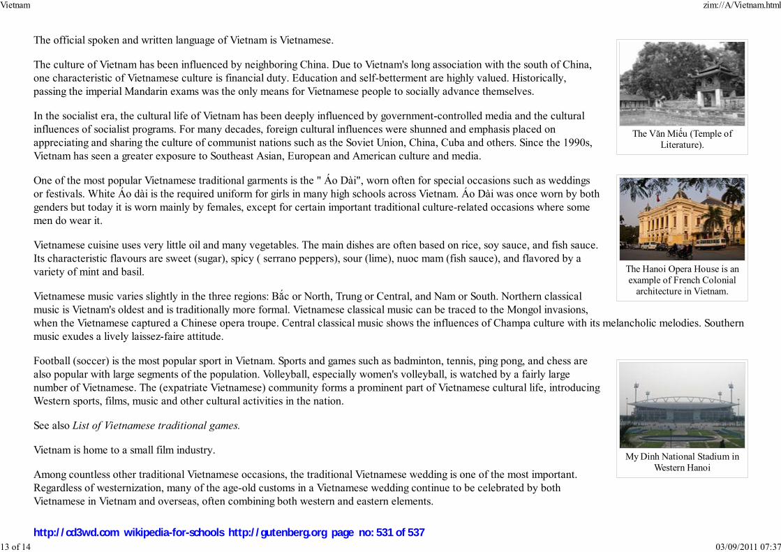
The Văn Miếu (Temple ofLiterature).
The Hanoi Opera House is anexample of French Colonial
architecture in Vietnam.
My Dinh National Stadium inWestern Hanoi
The official spoken and written language of Vietnam is Vietnamese.
The culture of Vietnam has been influenced by neighboring China. Due to Vietnam's long association with the south of China,one characteristic of Vietnamese culture is financial duty. Education and self-betterment are highly valued. Historically,passing the imperial Mandarin exams was the only means for Vietnamese people to socially advance themselves.
In the socialist era, the cultural life of Vietnam has been deeply influenced by government-controlled media and the culturalinfluences of socialist programs. For many decades, foreign cultural influences were shunned and emphasis placed onappreciating and sharing the culture of communist nations such as the Soviet Union, China, Cuba and others. Since the 1990s,Vietnam has seen a greater exposure to Southeast Asian, European and American culture and media.
One of the most popular Vietnamese traditional garments is the " Áo Dài", worn often for special occasions such as weddingsor festivals. White Áo dài is the required uniform for girls in many high schools across Vietnam. Áo Dài was once worn by bothgenders but today it is worn mainly by females, except for certain important traditional culture-related occasions where somemen do wear it.
Vietnamese cuisine uses very little oil and many vegetables. The main dishes are often based on rice, soy sauce, and fish sauce.Its characteristic flavours are sweet (sugar), spicy ( serrano peppers), sour (lime), nuoc mam (fish sauce), and flavored by avariety of mint and basil.
Vietnamese music varies slightly in the three regions: Bắc or North, Trung or Central, and Nam or South. Northern classicalmusic is Vietnam's oldest and is traditionally more formal. Vietnamese classical music can be traced to the Mongol invasions,when the Vietnamese captured a Chinese opera troupe. Central classical music shows the influences of Champa culture with its melancholic melodies. Southernmusic exudes a lively laissez-faire attitude.
Football (soccer) is the most popular sport in Vietnam. Sports and games such as badminton, tennis, ping pong, and chess arealso popular with large segments of the population. Volleyball, especially women's volleyball, is watched by a fairly largenumber of Vietnamese. The (expatriate Vietnamese) community forms a prominent part of Vietnamese cultural life, introducingWestern sports, films, music and other cultural activities in the nation.
See also List of Vietnamese traditional games.
Vietnam is home to a small film industry.
Among countless other traditional Vietnamese occasions, the traditional Vietnamese wedding is one of the most important.Regardless of westernization, many of the age-old customs in a Vietnamese wedding continue to be celebrated by bothVietnamese in Vietnam and overseas, often combining both western and eastern elements.
Vietnam zim://A/Vietnam.html
13 of 14 03/09/2011 07:37
http://cd3wd.com wikipedia-for-schools http://gutenberg.org page no: 531 of 537

See also List of festivals in Vietnam
Tourism
Vietnam's number of visitors for tourism and vacation has increased steadily over the past ten years. About 3.56 million international guests visited Vietnam in2006, an increase of 3.7% from 2005. The country is investing capital into the coastal regions that are already popular for their beaches and boat tours. Hotelstaff and tourism guides in these regions speak a good amount of English.
Sports and games
International rankings
Organization Survey Ranking
Heritage Foundation/The Wall Street Journal Index of Economic Freedom 142 out of 157
The Economist Worldwide Quality-of-life Index, 2005 61 out of 111
Reporters Without Borders Worldwide Press Freedom Index 155 out of 167
Transparency International Corruption Perceptions Index 111 out of 163
United Nations Development Programme Human Development Index 109 out of 177
World Economic Forum Global Competitiveness Report 77 out of 125
Retrieved from " http://en.wikipedia.org/wiki/Vietnam"The 2008 Wikipedia for Schools was sponsored by a UK Children's Charity, SOS Children UK , and consists of a hand selection from the English Wikipediaarticles with only minor deletions (see www.wikipedia.org for details of authors and sources). The articles are available under theGNU Free Documentation License. See also our
Vietnam zim://A/Vietnam.html
14 of 14 03/09/2011 07:37
http://cd3wd.com wikipedia-for-schools http://gutenberg.org page no: 532 of 537

Territoire des îles Wallis-et-Futuna
Unofficial flag Coat of arms
Motto: n/a
Anthem: La Marseillaise
Capital
(and largest city)
Mata-Utu
Official languagesFrench
ɄUvean, Futunan
Government Overseas territory of France
- President of France Nicolas Sarkozy
- Administrateur supérieur Richard Didier
Wallis and Futuna
2008/9 Schools Wikipedia Selection. Related subjects: Geography of Oceania (Australasia)
Wallis and Futuna, officially the Territory of Wallis and Futuna Islands (French: Wallis-et-Futuna or
Territoire des îles Wallis-et-Futuna, Fakauvea and Fakafutuna: Uvea mo Futuna), is a Polynesian
French island territory (but not part of, or even contiguous with, French Polynesia) in the South Pacific
between Fiji and Samoa. It is made up of three main volcanic tropical islands and a number of tiny islets.
The territory is split into two island groups lying about 260 km apart:
Wallis Islands (Uvea), in the north
Wallis Island (Uvea)
Hoorn Islands (Futuna Islands), in the southFutuna
Alofi
Since 2003 Wallis and Futuna has been a French overseas collectivity ( collectivité d'outre-mer, or
COM). Between 1961 and 2003, it had the status of a French overseas territory ( territoire d'outre-mer,
or TOM).
History
Although the Dutch and the British were the European discoverers of the islands in the 17th and 18th
centuries, it was the French who were the first Europeans to settle in the territory, with the arrival of
French missionaries in 1837, who converted the population to Roman Catholicism. Wallis is named after
the British explorer, Samuel Wallis.
On April 5, 1842, they asked for the protection of France after the rebellion of a part of the local
population. On April 5, 1887, the queen of Uvea (on the island of Wallis) signed a treaty officially
establishing a French protectorate. The kings of Sigave and Alo on the islands of Futuna and Alofi also
signed a treaty establishing a French protectorate on February 16, 1888. The islands were put under the
authority of the French colony of New Caledonia.
In 1917, the three traditional chiefdoms were annexed to France and turned into the Colony of Wallis
Wallis and Futuna zim://A/Wallis_and_Futuna.html
1 of 5 03/09/2011 07:39
http://cd3wd.com wikipedia-for-schools http://gutenberg.org page no: 533 of 537
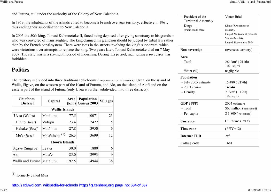
- President of the
Territorial Assembly
Victor Brial
- Kings(traditionally three)
King of Uvea (none at
present),
king of Alo (none at present)
Visesio Moeliku,
king of Sigave since 2004
Non-sovereign (overseas territory)
Area
- Total 264 km² ( 211th)
102 sq mi
- Water (%) negligible
Population
- July 2005 estimate 15,480 ( 219th)
- 2003 census 14,944
- Density 77/km² ( 112th)
199/sq mi
GDP ( PPP) 2004 estimate
- Total $60 million ( not ranked)
- Per capita $ 3,800 ( not ranked)
Currency CFP franc ( XPF)
Time zone ( UTC+12)
Internet TLD .wf
Calling code +681
and Futuna, still under the authority of the Colony of New Caledonia.
In 1959, the inhabitants of the islands voted to become a French overseas territory, effective in 1961,
thus ending their subordination to New Caledonia.
In 2005 the 50th king, Tomasi Kulimoetoke II, faced being deposed after giving sanctuary to his grandson
who was convicted of manslaughter. The king claimed his grandson should be judged by tribal law rather
than by the French penal system. There were riots in the streets involving the king's supporters, which
were victorious over attempts to replace the king. Two years later, Tomasi Kulimoetoke died on 7 May
2007. The state was in a six-month period of mourning. During this period, mentioning a successor was
forbidden.
Politics
The territory is divided into three traditional chiefdoms ( royaumes coutumiers): Uvea, on the island of
Wallis, Sigave, on the western part of the island of Futuna, and Alo, on the island of Alofi and on the
eastern part of the island of Futuna (only Uvea is further subdivided, into three districts):
Chiefdom District
CapitalArea(km²)
PopulationCensus 2003
Villages
Wallis Islands
`Uvea (Wallis) MatāɄutu 77.5 10071 23
Hihifo ("west") Vaitupu 23.4 2422 5
Hahake ("east") MatāɄutu 27.8 3950 6
Mu'a ("first") Mala'efo'ou (1) 26.3 3699 12
Hoorn Islands
Sigave (Singave) Leava 30.0 1880 6
Alo Mala'e 85.0 2993 9
Wallis and Futuna MatāɄutu 192.5 14944 38
(1) formerly called Mua
Wallis and Futuna zim://A/Wallis_and_Futuna.html
2 of 5 03/09/2011 07:39
http://cd3wd.com wikipedia-for-schools http://gutenberg.org page no: 534 of 537
The capital of the territory is MatāɄutu on the island of Wallis, the most populated island. As a territory of France, it is governed under the French constitution
of September 28, 1958, uses the French legal system, and suffrage is universal for those over 18 years of age. The French president elected by popular vote for a
five-year term; the high administrator is appointed by the French president on the advice of the French Ministry of the Interior; the presidents of the Territorial
Government and the Territorial Assembly are elected by the members of the assembly.
The head of state is President Nicolas Sarkozy of France as represented by High Administrator Richard Didier (since July 19, 2006). The President of the
Territorial Assembly is Pesamino Taputai (since April 1st 2001. The Council of the Territory consists of three kings (kings of the three traditional chiefdoms,
who are "de jure" members) and three members appointed by the high administrator on the advice of the Territorial Assembly.
The legislative branch consists of the unicameral Territorial Assembly or Assemblée territoriale of 20 seats; the members are elected by popular vote to serve
five-year terms. Wallis and Futuna elects one senator to the French Senate and one deputy to the French National Assembly.
Justice is generally administered under French law by a tribunal of first instance in Mata-Utu, but the three traditional chiefdoms administer justice according to
customary law (only for non-criminal cases). The court of appeal is in Nouméa, New Caledonia.
The territory participates in the Franc Zone, and as a permanent member of the Secretariat of the Pacific Community and as an observer member of the South
Pacific Forum.
Geography
Wallis and Futuna zim://A/Wallis_and_Futuna.html
3 of 5 03/09/2011 07:39
http://cd3wd.com wikipedia-for-schools http://gutenberg.org page no: 535 of 537
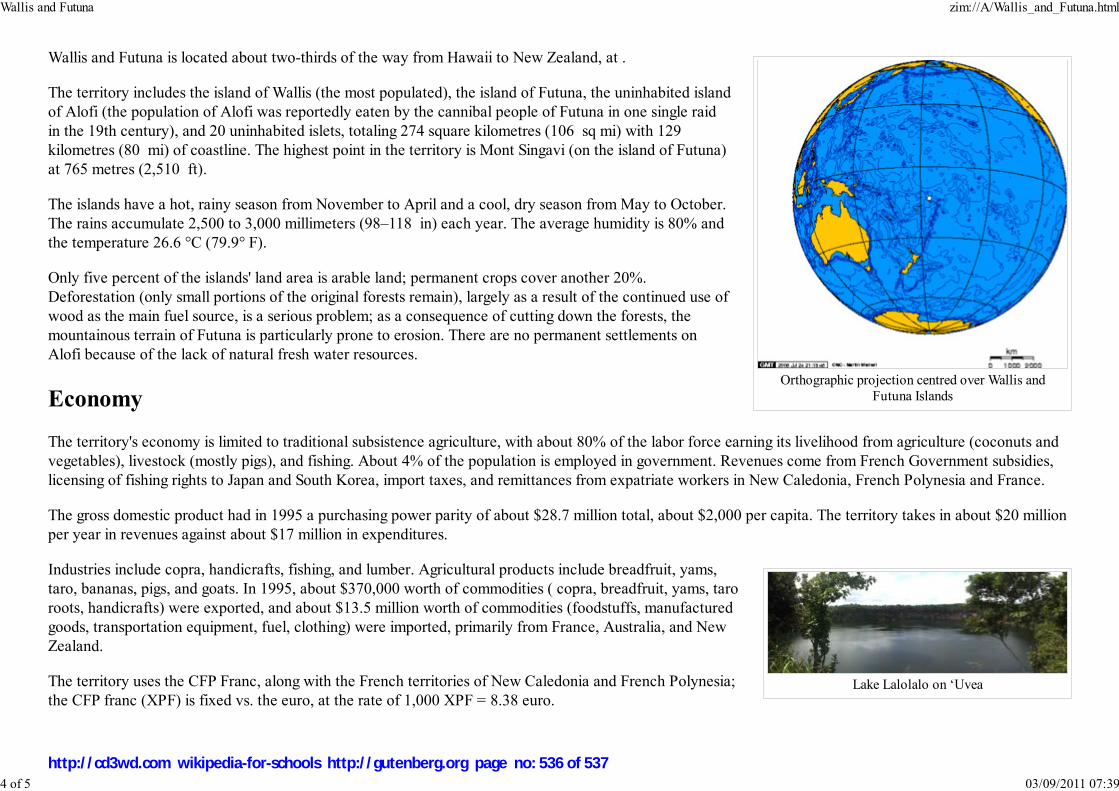
Orthographic projection centred over Wallis andFutuna Islands
Lake Lalolalo on ʻUvea
Wallis and Futuna is located about two-thirds of the way from Hawaii to New Zealand, at .
The territory includes the island of Wallis (the most populated), the island of Futuna, the uninhabited island
of Alofi (the population of Alofi was reportedly eaten by the cannibal people of Futuna in one single raid
in the 19th century), and 20 uninhabited islets, totaling 274 square kilometres (106 sq mi) with 129
kilometres (80 mi) of coastline. The highest point in the territory is Mont Singavi (on the island of Futuna)
at 765 metres (2,510 ft).
The islands have a hot, rainy season from November to April and a cool, dry season from May to October.
The rains accumulate 2,500 to 3,000 millimeters (98–118 in) each year. The average humidity is 80% and
the temperature 26.6 °C (79.9° F).
Only five percent of the islands' land area is arable land; permanent crops cover another 20%.
Deforestation (only small portions of the original forests remain), largely as a result of the continued use of
wood as the main fuel source, is a serious problem; as a consequence of cutting down the forests, the
mountainous terrain of Futuna is particularly prone to erosion. There are no permanent settlements on
Alofi because of the lack of natural fresh water resources.
Economy
The territory's economy is limited to traditional subsistence agriculture, with about 80% of the labor force earning its livelihood from agriculture (coconuts and
vegetables), livestock (mostly pigs), and fishing. About 4% of the population is employed in government. Revenues come from French Government subsidies,
licensing of fishing rights to Japan and South Korea, import taxes, and remittances from expatriate workers in New Caledonia, French Polynesia and France.
The gross domestic product had in 1995 a purchasing power parity of about $28.7 million total, about $2,000 per capita. The territory takes in about $20 million
per year in revenues against about $17 million in expenditures.
Industries include copra, handicrafts, fishing, and lumber. Agricultural products include breadfruit, yams,
taro, bananas, pigs, and goats. In 1995, about $370,000 worth of commodities ( copra, breadfruit, yams, taro
roots, handicrafts) were exported, and about $13.5 million worth of commodities (foodstuffs, manufactured
goods, transportation equipment, fuel, clothing) were imported, primarily from France, Australia, and New
Zealand.
The territory uses the CFP Franc, along with the French territories of New Caledonia and French Polynesia;
the CFP franc (XPF) is fixed vs. the euro, at the rate of 1,000 XPF = 8.38 euro.
Wallis and Futuna zim://A/Wallis_and_Futuna.html
4 of 5 03/09/2011 07:39
http://cd3wd.com wikipedia-for-schools http://gutenberg.org page no: 536 of 537
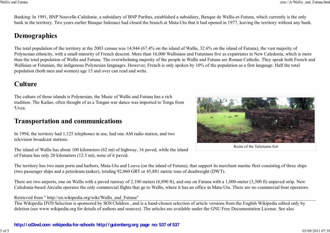
Ruins of the Talietumu fort
Banking: In 1991, BNP Nouvelle-Calédonie, a subsidiary of BNP Paribas, established a subsidiary, Banque de Wallis-et-Futuna, which currently is the only
bank in the territory. Two years earlier Banque Indosuez had closed the branch at Mata-Utu that it had opened in 1977, leaving the territory without any bank.
Demographics
The total population of the territory at the 2003 census was 14,944 (67.4% on the island of Wallis, 32.6% on the island of Futuna), the vast majority of
Polynesian ethnicity, with a small minority of French descent. More than 16,000 Wallisians and Futunians live as expatriates in New Caledonia, which is more
than the total population of Wallis and Futuna. The overwhelming majority of the people in Wallis and Futuna are Roman Catholic. They speak both French and
Wallisian or Futunian, the indigenous Polynesian languages. However, French is only spoken by 10% of the population as a first language. Half the total
population (both men and women) age 15 and over can read and write.
Culture
The culture of those islands is Polynesian, the Music of Wallis and Futuna has a rich
tradition. The Kailao, often thought of as a Tongan war dance was imported to Tonga from
'Uvea.
Transportation and communications
In 1994, the territory had 1,125 telephones in use, had one AM radio station, and two
television broadcast stations.
The island of Wallis has about 100 kilometers (62 mi) of highway, 16 paved, while the island
of Futuna has only 20 kilometers (12.5 mi), none of it paved.
The territory has two main ports and harbors, Mata-Utu and Leava (on the island of Futuna), that support its merchant marine fleet consisting of three ships
(two passenger ships and a petroleum tanker), totaling 92,060 GRT or 45,881 metric tons of deadweight (DWT).
There are two airports, one on Wallis with a paved runway of 2,100 meters (6,890 ft), and one on Futuna with a 1,000-meter (3,300 ft) unpaved strip. New
Caledonia-based Aircalin operates the only commercial flights that go to Wallis, where it has an office in Mata-Utu. There are no commercial boat operators.
Retrieved from " http://en.wikipedia.org/wiki/Wallis_and_Futuna"
This Wikipedia DVD Selection is sponsored by SOS Children , and is a hand-chosen selection of article versions from the English Wikipedia edited only bydeletion (see www.wikipedia.org for details of authors and sources). The articles are available under the GNU Free Documentation License. See also
Wallis and Futuna zim://A/Wallis_and_Futuna.html
5 of 5 03/09/2011 07:39
http://cd3wd.com wikipedia-for-schools http://gutenberg.org page no: 537 of 537