FLOOD CONTROL JOURNAL - ESCAP Repository
54
UNITED NATIONS ECONOMIC COMMISSION FOR ASIA AND THE FAR EAST FLOOD CONTROL JOURNAL ST/ECAFE/SER.C/14 March 1953 CONTENTS Page Round Asia and the Far East Need for soil conservation in India ............ ......... . 2 Irrigation and drainage projects in Japan....... ........... 5 Irrigation and drainage in Malaya ............. ............. . 11 The Brahmaputra-Ganges Multiple-purpose Project, Pakistan..... ................ ................... ...... . 19 News of interest The design of small ponds for irrigation ........... ......... 26 New enactments relating to irrigation, drainage and allied subjects .............. ........................ 33 Artificial rainfall...... ........ ........... .......... . 37 Flood Control Series .................................... 40 Work of the Bureau of Flood Control 1952 46
-
Upload
khangminh22 -
Category
Documents
-
view
1 -
download
0
Transcript of FLOOD CONTROL JOURNAL - ESCAP Repository

UNITED NATIONS
ECONOMIC COMMISSION FOR ASIA AND THE FAR EASTFLOOD CONTROL JOURNAL
ST/ECAFE/SER.C/14 March 1953
CONTENTS
Page
Round Asia and the Far East
Need for soil conservation in India ............ ......... . 2Irrigation and drainage projects in Japan....... ........... 5Irrigation and drainage in Malaya ............. ............. . 11The Brahmaputra-Ganges Multiple-purpose Project,
Pakistan..... ................................... ...... . 19
News of interest
The design of small ponds for irrigation ........... ......... 26New enactments relating to irrigation, drainage
and allied subjects .............. ........................ 33Artificial rainfall...... ................... .......... . 37
Flood Control Series .................................... 40Work of the Bureau of Flood Control 1952
46

- 2 -
ROUND ASIA AND THE FAR EAST
NEED FOR SOIL CONSERVATION IN INDIA1/
Soil erosion is one of the most serious problems in India. There have been no systematic studies of the extent of prevalence of the evil; but there is no doubt that there are colossal losses of acreage and production due to this cause.
Soil erosion assumes several forms. There is the first sheet erosion. This occurs on flat cultivated lands, which have no plant cover. It has been calculated that in black cotton soil fields in Sholapur, Bombay, 133 tons of soil per acre are lost each year. This single form is responsible for a larger loss of production than all the other forms of erosion put together. Then there is the gully erosion. Everywhere, the low land adjoining banks of rivers and channels is cut up into ravines for long distances. Next is the wind erosion which is confined to the drier parts of the country like Rajasthan, Punjab, etc. Lastly, the bank erosion, which occurs to some extent along the channels of all Indian rivers and leads to serious loss of cultivated land when large slabs of riverside land are broken off and swept away.
The main cause of soil erosion is the deforestation of the catchment areas of rivers. When trees are cut down, there is. no protective cover to break the force of falling rain and during the monsoon the rains carry with them large masses of sand and water. The beds of rivers and of tanks and reservoirs fed by rivers get choked up with these from year to year and the area under irrigation contracts steadily. Furthermore, when river beds rise in level and are unable to contain the floods during the rains, waters spread over adjoining country and cut it up into deep ravines. Then again, when vegetation
/has been
1/ An abstract from the Presidential Address delivered by Shri V.T. Krishnamachari, Member, Planning Commission, Government of India, at the First Annual Conference of the Soil Conservation Society of India on 6 February 1953.

- 3 -
has been removed, rainwater is not absorbed by dense undergrowth on the slopes of hills for feeding springs in beds of rivers. Thus groundwater supplies are reduced. Soil fertility is adversely affected.
With regard to remedial measures, experience has led to the following conclusions. Firstly, afforestation is the most suitable initial measure in all cases. Secondly, action for dealing with gullies, ravines, etc., should not be confined to isolated areas. A whole river valley region should be taken up as a whole and dealt with in a comprehensive plan. Thirdly, this type of work calls for concerted action on a long term basis; there can bo no quick results but the expenditure is in every instance fully justified by ultimate results.
All this points to the need for large scale afforestation all over the country. The need for such a policy is all the more pressing at the present time as the country is committed to a very large programme of multiple-purpose and irrigation projects, and in the Five-Year Plan more expenditure is being incurred on these than was done on all the irrigation works existing in India at the time of Partition. There is no question whatever that, by carefully devised measures for afforestating the catchments of rivers, the life of dams constructed at enormous cost can be prolonged considerably. From this point of view, this policy yields direct returns. The Planning Commission has, therefore, recommended that afforestation and soil conservation schemes should form integral marts of multiple-purpose and irrigation projects and that where these have not been included in existing projects, steps should be taken at once to include them.
Realizing the importance of soil conservation measures in India’s economy, the Planning Commission has made a series of recommendations in Chapter XXII of its report. These ares:
Firstly, suitable legislation for soil conservation should be undertaken in the States. Such legislation should, among other things, give State Governments powers (i) to restrict practices which result in erosion; (ii) to execute works on private holdings and recover the costs thereof; and (iii) to constitute
/co-operative

- 4 -
co-operative associations of farmers for soil conservation work.
Secondly, Soil Conservation Boards should be set up at the Centre and in all States, the members of which will include experts in forestry, agriculture, engineering, etc., for conducting surveys of areas affected by erosion and preparing schemes for remedial action.
Thirdly, a research centre should be established at the Forest Research Institute, Dehradun, at which researches should be conducted on problems connected with soil conservation. As adjuncts to this, six research and demonstration centres should be established in different parts of the country for investigation of local conditions.
Fourthly, the Plan has provided a sum of twenty million rupees for financing the expenditure connected with soil conservation. This supplements the provision made in States plans for this purpose.
A Soil Conservation Society of India was formed in December 1951 at Hazaribagh. The Society has done useful work in its first year of existence. It has brought together forest officers, agricultural officers, engineers, economists, social scientists, etc., from all parts of the country, on a common platform to study the complicated questions connected with soil erosion and conservation.
The society held its first annual session in New Delhi from 6 to 8 February 1953 under the chairmanship of its President, Shri V.T. Krishnamachari, Member Planning Commission, Government of India, from whose address the above abstract has been given. The Inaugural Address was delivered by Shri C.D. Deshmukh, Finance Minister, Government of India.
A number of technical papers were read and discussed at the conference, dealing with soil conservation in engineering, forestry, agronomy, surveys and planning for soil conservation and social and economic aspects of soil conservation.
/IRRIGATION AND DRAINAGE
-5 -
IRRIGATION AND DRAINAGE PROJECTS IN JAPAN
Irrigation and drainage projects in Japan are classified into two categories, namely: improvement projects on existing cultivated land, and land reclamation by irrigation and drainage. into the following kinds.
Each category is further grouped
I. Irrigation and drainage projects on existing cultivated land.
A. Irrigation improvement projects
(a) General irrigation improvement projects. These projects are in connexion with improvement or restoration works of irrigation facilities governing paddy fields where supply of irrigation water is inadequate.
(b) Upland irrigation projects. Upland irrigation aims at irrigating upland rice, and such crops and vegetables as will bring good result by irrigation. Irrigation is also practised for barley or wheat, to raise soil temperature, or to protect the ground from freezing in winter. After the Second World War, researches and practice of upland irrigation have increased considerably, but the areas worked are as yet very small.
B. Drainage improvement projects (inclusive of drainage by pumping)
(a) General drainage improvement projects. These projects are meant to improve and restore drainage facilities to cultivated lands, where drainage condition is bad.
(b) Underground drainage projects. Underground drainage is installed in paddy fields suffering from a high underground water table in order to lower the water table and to increase rice production.
II. Land reclamation by irrigation and drainage projects.
A. Land reclamation by irrigation projects. Land reclamation is achieved by installation of irrigation facilities.
B. Land reclamation by drainage projects. Land reclamation is done by improvement of inadequate drainage and by installing drainage facilities.
/C. Reclamation by

- 6 -
C. Reclamation by special drainage. Special drainage facilities, sea-walls, etc. are installed on tidal areas or shallow lakes and swamps, and thus farm land is created.
III. Drainage improvement projects under responsibility of Construction Ministry.
Improvement projects of rivers provided for under the River Law, in other words, large-scale river improvement projects are under the control of the Construction Ministry and are State-controlled or prefecture-operated works from the standpoint of flood or river control. Small-scale improvements of rivers, channels etc. are the responsibility of the Ministry of Agriculture and Forestry, which controls cultivated lands. The results are appraised directly by the benefitted area. On the other hand the results of large-scale improvements of rivers is appraised in most cases indirectly, because it is generally very difficult to determine independently the area which has benefitted by the completion of this type of work.
The total irrigated area in Japan is 3,147,821 ha. The total area irrigated by river waters is 2,154,045 ha. or 68.4 per cent; by reservoirs, 570,548 ha. or 18.1 per cent; by lakes or swamps, 49,927 ha. or 1.6 per cent; by underground or spring water, 167,285 ha, or 5.3 per cent; and finally by other means 206,016 ha. or 6.6 per cent. The total cultivable area however is 5,401,314 ha.
IV. New projects
A. State-Operated Tojogawa Agricultural Water Utilization Projects, Hyogo Prefecture (Ministry of Agriculture and Forestry).
Eleven towns and villages of Koga County, Hyogo Prefecture, along the left bank of the Kakogawa, generally suffer from damages due to drought caused by inadequate supply of irrigation water. The project aims at supplementing irrigation water for 3,358 ha. of paddy fields, converting 122 ha. of shallow
/ponds into

- 7 -
ponds into irrigated field and reclaiming a flat plateau of 585 ha. into paddy and upland fields which had been abandoned for want of water. A concrete dam will be constructed across the Kamogawa Tributary of the Kakogawa near its source at a place called Kurodani, Tojo-Mura, Kato-County. An irrigation canal 17 kilometres long is to be constructed. This canal will irrigate the project area, and at the same time will feed supplementary reservoirs to be built at Naka-Tojo-Mura and Shimo-Tojo-Mura. As the watershed of the Kamogawa alone is not enough for this purpose, it is planned to divert water from Tojogawa to Kamogawa by building a diversion weir across the Tojogawa.
The project was started in 1947 and is expected to be completed by 1955. It will serve a total area of 4,065 ha. and is estimated to cost $3,826,134. The Kamogawa Dam is a concrete gravity dam, 43.5. metres high and 97.1 metres long, with an effective storage capacity of 8,380,380 cubic metres. Of the supplementary dams, the Ansei-ike Dam is an earthen dam, 27.0 metres high and 153.1 metres long, with a storage capacity of 558,630 cubic metres, and the Funaki-ike Dam, also an earthen dam, is 30.5 metres high and 233.0 metres long, with a storage capacity of 1,455,970 cubic metres.
B. State-Operated Yasugawa Agricultural Water Utilization Project. Shiga Prefecture (Ministry of Agriculture and Forestry)
The project area extends over about 42 kilometres along the Yasugawa from Ayukawa-Mura, Koga County in the upper reaches of the river, and damage due to inadequate supply of irrigation water is considerable every year. A concrete gravity dam is being constructed at Ogaware, Ayukawa-Mura, Koga County, near the source of the river, and diversion weirs have been built across the river to withdraw water at Ishibe-machi and
/Minakuchi-machi,

- 8 -
Minakuchi-machi, Koga County respectively to supply irrigation water to the drought stricken area of 3,900 ha.; this is expected to increase the rice yield by about 3,000 tons. Prevention of flood damage in the lower part of the river will be achieved by effective regulation of the reservoir.
The project was started in 1947 and is expected to be completed this year at a total cost of $1,861,111. The Yasugawa River Dam is designed as a concrete gravity dam, 55.7 metres high and 141 metres long, with a storage capacity of 7,200,000 cubic metres.
C. State-Operated Sanno-kai Agricultural Water Utilization Project,Iwate-Prefecture (Ministry of Agriculture and Forestry).
The greater part of this project area has been suffering from inadequate supply of irrigation water for a long time and the damage due to droughts has become more and more disastrous of late. The project constitutes the construction of an earthen dam at Sanno-kai across the upper Takinogawa, Out of 700 ha. of reclaimed land which is lying waste, 406 ha. will be converted into irrigated fields. Rice production due to supplementary supply of irrigation water and creation of new irrigated fields is expected to reach about 3,000 tons.
The project was started in 1944 and is expected to be completed this year. It will benefit an area of 3,258 ha. and is estimated to cost $1,780,694. The Sanno-kai dam is an earthen dam, 37 metres high and 144 metres long, with an effective storage capacity of 9,590,000 cubic metres. The main canal will be 21.4 kilometres long.
D. Reclamation by special drainage along coast of Bay of Kojima and converting project of bay into fresh water lake, Okayama Prefecture (Ministry of Agriculture and Forestry).
Reclamation by drainage has been practised in this district from ancient times as a means of giving employment to the unemployed Samurai (warriors) of Okayama clan who became jobless
/as a result

-9 -
as a result of the Restoration of 1868. In 1880 an expert from Holland chalked out a programme of reclamation of about 6,942 ha, by drainage. The work was started by Fujita Company in 1899 and up to date a total area of about 5,489.6 ha. has been reclaimed of which 4,008.9 ha. are paddy land.
With the expansion of cultivated fields, fresh sources of irrigation water have become urgently necessary. For this purpose It was planned to block up the Bay of Kojima at its narrowest width, sc as to convert it into a large fresh water lake and to use it as a major source of irrigation water. This plan was prepared in 1950 as a State-Operated Agricultural Water Utilization Improvement Project along the Coast of the Bay of Kojima and construction is now underway. The principal items of work constitute 1,558 metres of dikes with a top width of 30 metres, 12 sluice gates of 12 m. each and 16 pumping stations. The project is expected to be completed this year, at a cost of $3,583,000.
E. Hake River Improvement Project, Kochi Prefecture (Construction Ministry).
There are many low-lying swampy areas in the watershed of the Hake river and a river improvement project was taken up in 1951 to improve the drainage condition of the area.
F. Lower Shinano River Improvement Project, Niigatta Prefecture (Construction Ministry).
The river bed has risen in the lower reaches of the Shinano river since the completion of the Okozu diversion channel, which adversely affected the drainage of the farm lands along the river. Drainage by pumping was not possible because of the changing bed. The improvement works of the river channel for low flow was started in 1952, so as to stabilize the river bed to enable improvement in the drainage condition to be made.
/G. Over-all Development

G. Over-all Development Project of Dozan River, Yehime Prefecture (Construction Ministry)
The Dozen river is a tributary of the Yoshinogawa, the largest river of the Shikoku District. Unfortunately, the upper and lower areas of the Dozangawa fall in different jurisdictions and the interests of both areas clash and therefore the programme of supply of irrigation water to the area suffering from drought could not be achieved for a considerable time. On the intervention of the Central Government a settlement was reached in 1947.
The Dozan Over-all Development Project was started underprefectural operation in 1949 with such multiple purposes as flood prevention, irrigation and power and is expected to be completed this year. The project includes a concrete gravity dam, 53 metreshigh; a tunnel, 3,300 metres long and two power plants. It is estimated to cost $6,691,389 and will benefit 1,246 ha. of paddy lands.
H. Izawagawa Over-all Development Project, Iwate Prefecture (Construction Ministry)
A rockfill dam is being constructed on the Izawa river, a tributary of the Kitakami river. This is one of the five dams which are scheduled to be constructed for flood control of the Kitakami river. This will be the highest dam of its type in Japan.
This work was started under State operation in 1946, with flood prevention as its main object and with irrigation and power generation as by-products. It is expected to be completed this year, at a cost of $7,389,000. Major effects of the project after completion will be (a) maximum flood discharge reduced by 250 cubic metres per second;(b) additional irrigation to 6,350 ha, of paddy fields, water supply to 950 ha. newly reclaimed paddy fields and to 220 ha. newly reclaimed upland fields; (c) maximum output of 21,100 kw and 112,540,000 kwh
of power generated annually.
/IRRIGATION AND
- 10 -

- 11 -
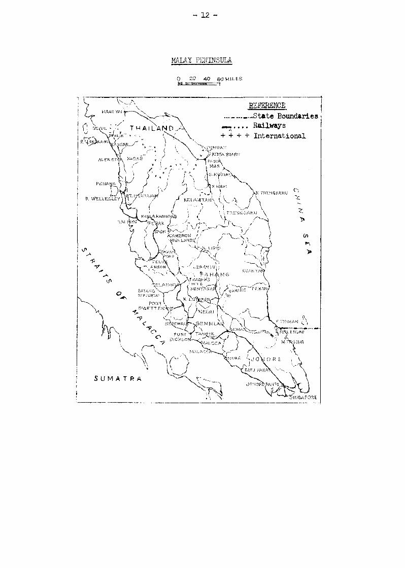
IRRIGATION AND DRAINAGE IN MALAYA
History
The Irrigation Branch of the Public Works Department in Malaya was created in 1913 for the purpose of carrying out investigations, and preparing schemes for increasing rice production. Its immediate objects were frustrated by the outbreak of the First World War the following year. In 1926, the Irrigation Branch lost its separate identity when it was absorbed into the Hydraulic Branch of the Public Works Department probably as a result of catastrophic floods in which the level of the Perak river rose nearly forty feet, and the business centre of Kuala Lumpur was under four feet of water. It was natural that during the next few years the attention of the department should be temporarily directed from increased rice production to the urgent need for improved river conservancy, and the Ipoh and Kuala Lumpur Flood Mitigation Works were carried out during the following five years at a cost of $936,000 and $390,000 respectively.
It was not until 1930 that the government finally made a realistic and effective approach to the problem of increasing rice production in the country by appointing a Rice Cultivation Committee to investigate thoroughly the entire problem. The recommendations of this committee led to the formation, in the year 1932, of the present Drainage and Irrigation Department which absorbed the existing Hydraulic Branch of the Public Works Department, as the committee considered the separation of irrigation and drainage work from flood prevention and river training as undesirable.
In 1930-31, the total area under wet paddy cultivation in Malaya was 669,000 acres and the total yield of rice was estimated to be 264,000 tons, the corresponding figures for the 1950-51 season being 867,000 acres and 439,000 tons respectively. It is pertinent to mention, however, that the 1950-51 harvest was a bumper one, and average yields per acre were the highest on record, owing to exceptionally favourable conditions. Seventy five per cent of the increase in total planted area is accounted for by the new paddy areas which have been opened up and provided with irrigation and drainage works by the Department. These newly developed areas total approximately 150,000 acres, while in existing paddy areas improved water control has been provided for 130,000 acres.
/MAP
- 12 -
MALAY PENINSULA
o 20 40 60 MILES
REFERENCE
International
State Boundaries
THAILAND Railways
Sumatra
HAAD YAI
SEJUL
PERLISLANGKAW
KANGAR
ALER STAW KEDAD
PENANG
P. WELLESLEYT.MERTAJAM
TAl PINGKUALA KANGSAS
IPOH
KELANTAN
‘PERAk
TRENGGANU
TUMPAT
S. KUSIAL
MASpASIR
KOTA BHARU
K KIRAI
CAMERON
TAPAN ROAD
TELUXanson’
LIPN
JERANTU
SELANGON
PA HANG
BATA NG BERJUNTAI
PORT SWETTENMAN
NEGRI
K LONPUR
FRASERSHILL
MENTAKAR
SEREMBA SEMBILAN
PORT DICKSON
TAMPIN
MALACCA
MALCCA
NUAE
GEMAS
JOHORE BAHRU
SINGAPORE
JOHORE
BATU PANAT
PHOMÀN
MERSING
PDG ENDAU
KUANTAN
K TRENGEANU
PEKAN
HIGHLANDS
- 13 -
Irrigation
Maintenance and operation of the various irrigation schemes is now the responsibility of the individual States and Settlements. The Drainage & Irrigation Department was responsible for the maintenance and operation of 246 separate schemes. Irrigation water rates are charged in respect of some of the larger irrigation areas, but in the majority of the smaller areas rates have not yet been imposed. Revenue from this source now accrues to the State and Settlement Governments, Owing to the heavy increase in expenditure on maintenance due to increase in wages, water rates in certain areas have been increased, and the imposition of these on further areas was under consideration in 1951. Irrigation water rates at present vary from $1 per acre to $5 per acre per annum, according to the potential productivity value of the land. An Irrigation Areas Enactment or similar legislation existed in 1951 in some of the States and Settlements. With the very considerable extension of irrigation works planned for the next few years, legislation governing irrigation areas and enabling water rates to be imposed is required by all States. Agreement with the States and Settlements has been reached and it is expected that a consolidated Federal Irrigation Areas Ordinance will be shortly enacted.
The largest new irrigation schemes are located in the fertile alluvial coastal flats of Kedah and Perlis where works are in progress to provide irrigation and drainage facilities to over 100,000 acres of paddy land which were precariously dependent on direct rainfall for water supplies. The entire scheme, estimated to cost &12 million is scheduled for completion by 1958, but long before that time the paddy planters in the area will receive the benefit of those portions of the scheme which will be completed each year.
In Selangor the most important project in hand is the completion of the remaining irrigation works for the 50,000 acres Tanjong Karang Scheme. Construction has been in progress since 1940, and it was hoped that by the end of 1952, the drainage and irrigation works for the entire area would be completed. The Scheme comprises one irrigation headwork, 19 miles of main canal, 52 miles of subsidiary canals, 250 miles of bunds and drains and 47 distribution control structures.
/The area
- 14 -
The area has been fully colonised and during 1951 about 45,000 acres were planted, yielding a crop of 29,000 tons of rice. Excellent crops have been obtained from a large part of the older established area; from many lots yields of one ton of rice per acre have been reported. When the transformation of this swamp area is fully completed, it is estimated the area will produce up to 35,000 tons of rice per annum. Up to the end of the year 1951, the estimated population of the area was 16,000 farmers and their families, of whom 13,000 were Malay, and the balance, Chinese and Indians. The co-ordinated efforts of engineers and administrators have stimulated amongst the settlers a powerful ferment of activity. Fifty thousand acres of land have been reclaimed, buildings erected, schools and mosques built, crops sown and harvested, and engineering works constructed on a large scale.
The Salor Pumping Scheme in Kelantan was formally opened by His Highness the Sultan of Kelantan, in July 1951, when two 180 HP electrically-driven pumps with a capacity of 1,500,000 gallons per hour were brought into operation. The pumps lift water about 30 feet from the Kelantan River to irrigate a paddy area of 3,000 acres.
Steady progress was made in 1951 on the first stage of the Besut Irrigation Scheme for the development of 6,000 acres of potential land, and the irrigation of 21,000 acres of existing paddy land. The first step in the construction programme of this stage was completed with deviation of the Sungei Angga through the new Headworks in August 1951.
In Perak, work continued on the $500,000 reconstruction programme in the Krian Irrigation Area. The original scheme which provided for the irrigation of more than 50,000 acres of coastal flats was completed nearly fifty years ago, and many of the structures were badly in need of replacement. Irrigation and drainage works were completed for 2,000 acres in the Changkat Jong area in Lower Perak where Chinese squatters have been resettled. Plans are ready for the development of a further 4,000 acres, but work has been postponed as little progress has been made on colonising the area at present irrigated.
/in the Six-Year

- 15 -
In the Six-Year Flan 1950-55 the irrigation programme is as follows: construction of 59 irrigation schemes for the improvement of 300,000 acres of existing paddy land and the development of some 100,000 acres of new land.
Thirteen schemes were completed during 1950 and 1951, twenty-five schemes were in hand in 1952, five were delayed by terrorist activities, two have been deleted from the programme and work had not yet started on fourteen. Drainage and irrigation facilities have been improved on 120,000 acres of existing paddy land, while 20,000 acres of new land have been opened up.
Land Drainage
Drainage works, as distinct from those connected with paddy cultivation, cover extensive areas of coconut, rubber, and kampong lands in Malaya. Such areas are constituted as Drainage Areas under the Drainage Works Enactment and are virtually administered by Drainage Boards, though State Governments collect the revenue from drainage rates and make provision for maintenance in the State Estimates. Maintenance is carried out under the direct supervision of the Drainage and Irrigation Department.
The areas concerned lie along the West Coast of Perak, Selangor and Johore. There are 24 such areas varying in size from the Bagan Datoh Drainage Area of 50,040 acres to the Telok Datoh Area of 575 acres and totalling in all 211,000 acres. Two more schemes under construction in Johore cover a further 75,000 acres. There is, however, considerable scope for extension of such drainage works particularly on the West Coast of Johore.
The existing drainage schemes were carried out with the object of rectifying the mistakes of the past, and providing comprehensive drainage for defined areas to suit the topographical features, and there is no doubt that the benefits derived have been very much greater than the burden imposed by the drainage rates. The improvement in areas on the Selangor Coast where drainage schemes were constructed in the ten years prior to the war is particularly noticeable. On the other hand much of the West Coast area of Johore shows signs of steady deterioration, and the rectification of drainage in this area is of some urgency.
/Maintenance costs

- 16 -
Maintenance costs in drainage areas have risen sharply, owing to the increased wage rates, and the maximum statutory drainage rate of $1.50 per acre per annum was found to be quite inadequate. All States agreed that higher drainage rates were required, and in October 1949, the relevant section of the Drainage Works Enactment was amended, by the deletion of the words "not exceeding one dollar and fifty cents per acre per annum”. The limit on the drainage rates is now removed, and it was left to each State, at its discretion, to impose rates in accordance with its own peculiar circumstances. In many gazetted drainage areas, the drainage rate imposed during 1951 was as much as $5 per acre. Many of the drainage areas are almost entirely devoted to the cultivation of coconuts. The rise in the price of copra in recent years has brought an unusual degree of prosperity to those areas, and land with good trees has been sold for prices as high as $2,000 per acre.
During the two years 1950 and 1951 construction work was continued on nine drainage schemes and by the end of 1951, improvements had been effected on 65,000 acres of small holdings chiefly along the West Coast of Johore.
Flood Mitigation Works
Perak - The flood mitigation works for the Kinta River at Ipoh and Batu Gajah constructed about twenty-five years ago are being maintained. The works at Ipoh consist of a canalised section of river through the town, 180 chains in length, with wide berms and flood bunds, which are carefully maintained in a manner appropriate to the clean and orderly town through which the river flows. This work includes grass cutting, de-silting of the channel, and repairs to the stone pitching on the banks.
Selangor - The river conservancy works on the Sungei Bernam at Tanjong Malim were maintained in good order, and there was no flooding of the town during 1950 and 1951.
Malacca - As a result of heavy silting and weed growth with consequent recurrent flooding in the channel of the Sungei Kesang lying between the Chin Char, road bridge and the confluence of the rivers Kesang and Chohong some 427 acres of paddy land has gone out of cultivation in the area, and the lower part of the Jasin Irrigation Scheme Stage II was also being affected.
/Silt Retention Works

- 17 -
Silt Retention Works
Perak - The valley of the Sungei Gopeng above, Gopeng town is filled with old mine tailings, which are stacked high along the flanks of the valley, and cover the whole of the valley floor. Extensive sheet and gully erosion is occurring throughout the valley. Detritus from this erosion is carried through to the reaches of the river below Gopeng town, where the gradient of the plain is such that the river is unable to transport it any further. The detritus is then deposited on the land and the river spreads out in maze of small channels on the surface. River training and anti-erosion works have been undertaken, and bunds, spillways and check dams have been built to keep the erosion under control, but complete and effective control is a major undertaking, and investigations were in hand in 1952, for a tailings retention scheme which may turn out to be very costly. River training by fencing has been completed on the Kuala Pari Gilt Trap for the Kinta River below Ipoh. This lies between Ipoh and the Pengkalan section of the Kinta River Diversion. During 1950 and 1951, 3,150 lineal feet of the Kinta channel through this area were staked, and cross-fencing erected, to induce deposition of silt on either side of the staked channel.
Negri Sembilan - In 1935 a scheme was started for filling a swamp between Sikamet Road and Wise Road by trapping the silt carried by Sungei Temiang. The scheme has been so successful that the government is now building a large number of quarters and a school on the reclaimed area.
River Diversion
Perak - The most important diversion with which the Irrigation and Drainage Department has been concerned during 1950-1951 is the Kinta River Diversion. The total length of the river to be replaced by diversion by the mining companies is 27.4 miles and the completion of the agreements between the mining companies and the government render this length of rich tin-bearing land, occupied by the old channel, available for mining.
/Selangor -
- 18 -
Selangor - The Batu River Diversion, three quarters of a mile long containing a mass concrete weir through Ampat Tui was completed and put into operation early in 1951. The continuation downstream for two miles was also completed, and a reinforced concrete weir built. This completes the continuous canalization of the Batu River for four miles and the work is in progress on two other diversions in the tributary streams. At Sungei Liam and Sungei Kalong the temporary diversion to Kuala. Sungei Pedang was completed and put into operation early in 1950. The permanent diversion is nearly completed. This work has greatly improved matters at the 30g mile main trunk road to the North, where no flooding has occurred since completion of the temporary diversion.
Besides the above works the Irrigation and Drainage Department is responsible for the maintenance and improvement of natural waterways in the country. The total length of rivers maintained in the State is approximately 350 miles.
/THE BRAHMAPUTRA-GANGES

- 19 -
THE BRAHMAPUTRA-GANGES MULTIPLE-PURPOSE PROJECT, PAKISTAN1/
The proposed Brahmaputra-Ganges Multiple-purpose Project in East Pakistan will comprise the following works:
A. A barrage in the Brahmaputra river.B. A barrage in the Surma-Meghna river.C. A barrage in the Teesta river.D. Several electric pumping plants.E. Hydro-electric power stations.F. A high-tension transmission net.G. An irrigation-cum-navigation canal system with diversion works
and locks.H. A drainage - canal system.
Although the whole project is a long-term scheme (30 years) and many
investigations must be carried out before the project can be realized, it is possible to divide the scheme into several independent units.
It may be mentioned that another multiple-purpose project is proposed in the South-Eastern comer of East Bengal for the development of the Karnafuli river basin, based on a reservoir-power-plant on that river. If this project can be executed in the near future, a major part of the generated power will be available for driving irrigation pumping plants. This will mean that the construction of the very costly barrage on the Brahmaputra river can be postponed until the power from the Karnafuli hydro-electric station becomes insufficient to meet the demand throughout the province. The attached map shows the general outline of the whole scheme including the Karnafuli project.
/ MAP
1/ Abstract from Interim Report on Multiple-purpose Project for the Brahmaputra- Ganges Delta, Pakistan by Dr. W.J. Van Blommerstein, Land and Water Development Specialist, FAO, Rome, October 1952.
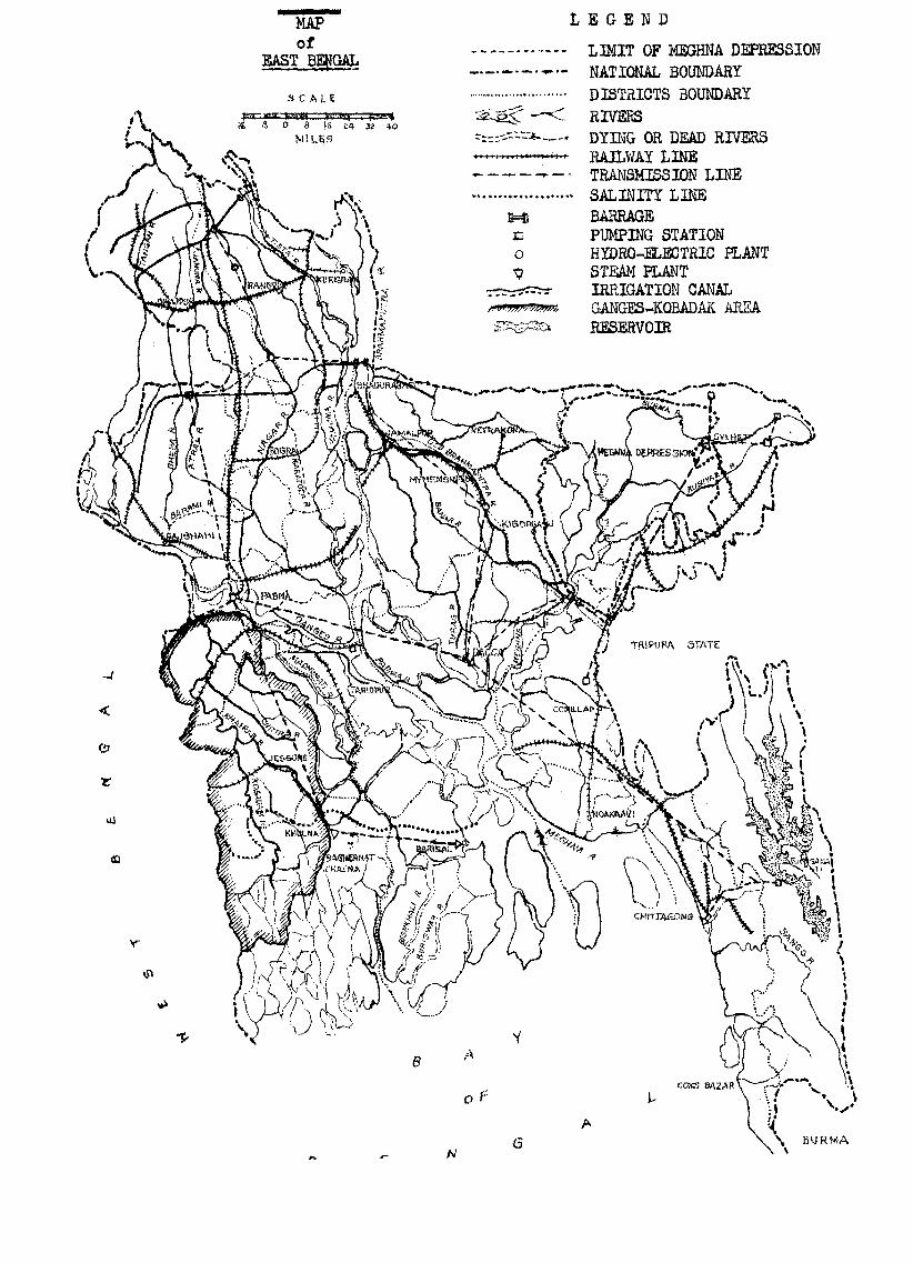
MAP of
EAST BENGAL
LEGEND
LIMIT OF MEGHNA DEPRESSION NATIONAL BOUNDARY
DISTRICTS BOUNDARYRIVERSDYING OR DEAD RIVERSRAILWAY LINETRANSMISSION LINESALINITY LINEBARRAGEPUMPING STATIONHYDRO-ELECTRIC PLANTSTEAM PLANTIRRIGATION CANAL GANGES-KOBADAK AREA RESERVOIR
SCALE
MILES
BURMA
TRIPURA STATE
- 21 -
The Brahmaputra-Ganges Multiple-purpose Project can be divided into seven units:
(a) Ganges-Kobadak Scheme1/(b) Padma-Faridpur Scheme(c) Teesta Scheme(d) Surma Valley Scheme(e) East Meghna Scheme(f) West Brahmaputra Scheme(g) East Brahmaputra Scheme
(a) In the Ganges-Kobadak Scheme, 2,200,000 acres can be irrigated with
Ganges water by constructing a pumping station near the Hardinge Bridge. The districts of Kushtia, Jessore and Khulna will benefit from this project.
(b) The Padma-Faridpur Scheme will cover the non-inundated ureas of the Faridpur district (some 800,000 acres). A floating pumping station in the Padma River (the combined Brahmaputra-Ganges) will supply the required irrigation water.
(c) In the Teesta Scheme, 1,500,000 acres, in the north-western part of
the Province will be irrigated by a barrage on the Teesta River, with the alternative possibility of pumped water supply from the Brahmaputra canal system.
(d) The Surma Valley Scheme can be divided into two parts. The higher
part of the valley, not situated in the inundation-basin, will get its water supply from fixed pumping plants. The lower part is subject to inundation and there is a very rapid rise of water level at the beginning of the monsoon. In the catchment area of the Surma River rains begin in March, but the real monsoon sets in at the end of May. An enormous amount of water is then carried into the plains by the steep torrential rivers, filling the basin with such rapidity that the water rises almost one foot
/ a day
1/ See Flood Control Journal, January 1953 (St/ecAFE/ser.c/13) page 10, where a brief description of this scheme is given.
- 22 -
a day. This rise is too sudden for cither long-stem paddy (floating rice)
or jute and it is not possible for the people, who live on numerous little islands crammed with huts, to grow any crop during the rainy season.
However, by constructing a barrage on the Surma, or Meghna River, it would be possible to control the rise of water level in the depression so that, by closing the gates of the barrage at the beginning of March, the rise could be spread over a longer period end not allowed to exceed about three inches a day. Under these conditions long-stem paddy could be grown. During the dry season the barrage could be used to maintain the moisture in the soil, and prevent the rivers from drying out. The very gentle slope of the rivers in this basin is of advantage here, as it would be possible to maintain a layer of water in nearly all the river beds.
The possibility of using the depression as a huge reservoir during the dry season, to supply water to the Meghna in order to maintain a sweet water pressure in the saline area near the sea, can be studied as a further development.
(e) The East Meghna Scheme will cover the higher areas between the Tripura
Hills and the Meghna, in the districts of Tippera and Noakhali, and is based on pump-irrigation with fixed plants.
(f) In the West Brahmaputra Scheme it is proposed to irrigate the rest of
the non-inundated North Bengal plain with Brahmaputra water. A second fixed pumping plant would be required to pump water to a sufficiently high level to command the Rajshahi district.
(g) As soon as the East Brahmaputra Scheme, which will cover the Mymensingh
and Dacca districts, is executed and a market for the power becomes available, the construction of a barrage in the Brahmaputra will be justified. The floating pumping station for the West Brahmaputra scheme can then be removed. The whole multiple-purpose project can thus be executed in stages and adapted to circumstances.
/ Practically
- 23 -
Practically the whole area affected by these schemes can be fed by the Brahmaputra, the Surma and the Teesta rivers. Only a small part (the Ganges- Kobadak Scheme) will be dependent on Ganges water. It will even be possible,
after the execution of the West Brahmaputra Scheme, to supply water to the Ganges from the Brahmaputra river.
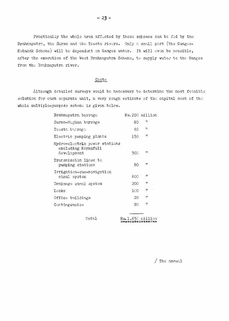
Costs
Although detailed surveys would be necessary to determine the most feasible solution for each separate unit, a very rough estimate of the capital cost of the whole multiple-purpose scheme is given below.
Brahmaputra barrage Rs.200 millionSurma-Meghna barrage 80 "
Teesta barrage 40 "
Electric pumping plants 150 "
Hydro-electric power stations excluding Karnafuli development 300 "
Transmission lines to pumping stations 80 "
Irrigation-cum-navigation canal system 400 "
Drainage canal system 200 '
Locks 100 "
Office buildings 20 "
Contingencies 80 "
Total Rs. 1,650 million
/ The annual

- 24 -
The annual expenditure on account of interest, maintenance, depreciation, etc., is assessed at 8 per cent for civil works, and 11 per cent for electromechanical equipment, amounting to Rs 150 million.
An economic analysis of the proposed project has also been carried out. In these calculations the possibilities of improved agricultural methods has not been taken into consideration. Improved methods can be introduced more easily, and probably with much better results, when perennial irrigation is available, because then, even the small farmer will be able to introduce improvements which will not involve large capital investment. The use of better varieties of seed, already available for rice, jute and some other crops, better tilling and cultivation methods and methods for combating pests and diseases, are among the first possible improvements by which an increasing production can be achieved. At a later stage fertilizers can be introduced, although this will require some capital. Along those modern scientific lines, an increase of production of from 25 to 50 per cent can be considered possible. A scheme to intensify agricultural extension works in East Bengal as an eight-year programme is to be proposed shortly, with the aim of increasing the provincial agricultural production by at least 10 per cent in that period.
A conservative estimate of the value of the possible increased production, as a result of the multiple-purpose scheme may be put at about Rs 4,000 million. It would also give the goverment new income by way of revenue, taxes and duties. Together these may be estimated at least at 10 per cent of the net increase in crop value, or Rs.400 million, against an annual expenditure on the scheme of Rs.150 millior n account of interest, maintenance and depreciation, etc,. This means that the yearly extra income for the government will be at least two and half times the annual expenditure on the scheme. This is without taking into account that the scheme will generate electrical energy a part of which can be sold, and that with an improved waterway system taxes can be levied on shipping. Estimating income from these sources at Rs.80 million a year, the yearly surplus over the annual expenditure will be some Rs. 330 million.
/ Taking

- 25 -
Taking into account amortization of the required capital for the scheme, estimated at Rs. 1,650 million, in 20 to 25 years, some Rs.80 million per year will bo needed, during which period the government will still have a net surplus of some Rs.250 million per year. In addition, further agricultural and industrial development of the province can be stimulated through the scheme.
/NEWS OF INTEREST

NEWS OF INTEREST
THE RESIGN OF SMALL PONDS FOR IRRIGATION1/
The construction of ponds or tanks large and small has been practised in Asia and the Far East since time immemorial. There are numerous such tanks in India and Ceylon, while in Thailand a programme of construction of tanks has been recently put underway with the assistance of the United States of America.
In rolling hilly country, where canals are difficult and expensive to
construct owing to the undulating land surface, the topography is usually amenable
to the construction of small as well as large ponds at the top of the paddy
fields for the storage of water which can be used for irrigation and water supply.
Successful paddy cultivation is possible only with the provision of
proper facilities for their irrigation and as the monsoon is so fluctuating,
storage of water for irrigation during droughts is essential for increasing the yield of rice, the staple food of the people in Asia and the Far East.
The design of these ponds, though simple, requires a very careful analytical study, in spite of their small costs and benefits. It is true, that
their cost is comparatively insignificant and their success or failure does not
affect a large area nor does it involve a serious monetary loss individually. A little thought, however, will show that collectively they form a potential source of increasing food production apart from helping to control floods and to stop soil erosion.
/ The various
1/ Abstract from "The Design of Small Ponds for Minor Irrigation Schemes", by A.A. Hakim, B.E. (Hons.) C.E., M.S. (I11., USA), Soil Conservation Engineer and Executive Engineer, Soil Conservation Department of the Damodar Valley Corporation (india). Journal of Soil and Water Conservation in India, Vol. 1, Oct. 1951, published by the Soil Conservation Society of India, Hazaribagh, India.
- 26 -
-27-
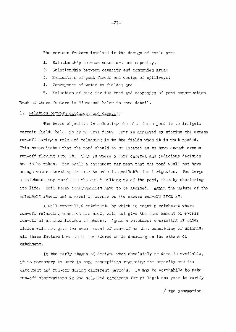
The various factors involved in the design of ponds are:
1. Relationship between catchment and capacity;2. Relationship between capacity and commanded area;3. Evaluation of peak floods and design of spillways;4. Conveyance of water to fields; and5. Selection of site for the bund and economics of pond construction.
Each of these factors is discussed below in some detail.
1. Relation between catchment and capacity
The basic objective in selecting the site for a pond is to irrigate
certain fields below it by natural flow. This is achieved by storing the excess run-off during a rain and releasing it to the fields when it is most needed.
This necessitates that the pond should be so located as to have enough excess
run-off flowing into it. This is where a very careful and judicious decision has to be taken. Too small a catchment may mean that the pond would not have enough water stored up in time to make it available for irrigation. Too large
a catchment may result in the quick silting up of the pond, thereby shortening
its life. Both these contingencies have to be avoided. Again the nature of the
catchment itself has a great influence on the excess run-off from it.
A well-controlled catchment, by which is meant a catchment where run-off retarding measures are used, will not give the same amount of excess run-off as an uncontrolled catchment. Again a catchment consisting of paddy
fields will not give the same amount of run-off as that consisting of uplands.
All these factors have to be considered while deciding on the extent of catchment.
In the early stages of design, when absolutely no data is available,
it is necessary to work in some assumptions regarding the capacity and the
catchment and run-off during different periods, it may be worthwhile to make run-off observations in the selected catchment for at least one year to verify
/ the assumption
- 28 -
the assumption made before the pond is constructed. Consideration should also
be given to the nature of the catchment.
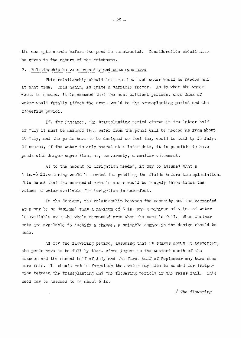
2. Relationship between capacity and commanded area
This relationship should indicate how much water would be needed and at what time. This again, is quite a variable factor. As to when the water would be needed, it is assumed that the most critical periods, when lack of
water would fatally affect the crop, would be the transplanting period and the
flowering period.
If, for instance, the transplanting period starts in the latter half
of July it must be assumed that water from the ponds will be needed as from about
15 July, and the ponds have to be designed so that they would be full by 15 July.
Of course, if the water is only needed at a later date, it is possible to have
ponds with larger capacities, or, conversely, a smaller catchment.
As to the amount of irrigation needed, it may be assumed that a 4 in.-6 in watering would be needed for puddling the fields before transplantation.
This means that the commanded area in acres would be roughly three times the volume of water available for irrigation in acre-feet.
In the designs, the relationship between the capacity and the commanded
area may be so designed that a maximum of 6 in. and a minimum of 4 in. of water is available over the whole commanded area when the pond is full. When further
data are available to justify a change, a suitable change in the design should be made.
As for the flowering period, assuming that it starts about 15 September, the ponds have to be full by then, since August is the wettest month of the monsoon and the second half of July and the first half of September may have some more rain. It should not be forgotten that water may also be needed for irrigation between the transplanting and the flowering periods if the rains fail. This
need may be assumed to be about 6 in.
/ The flowering
- 29 -
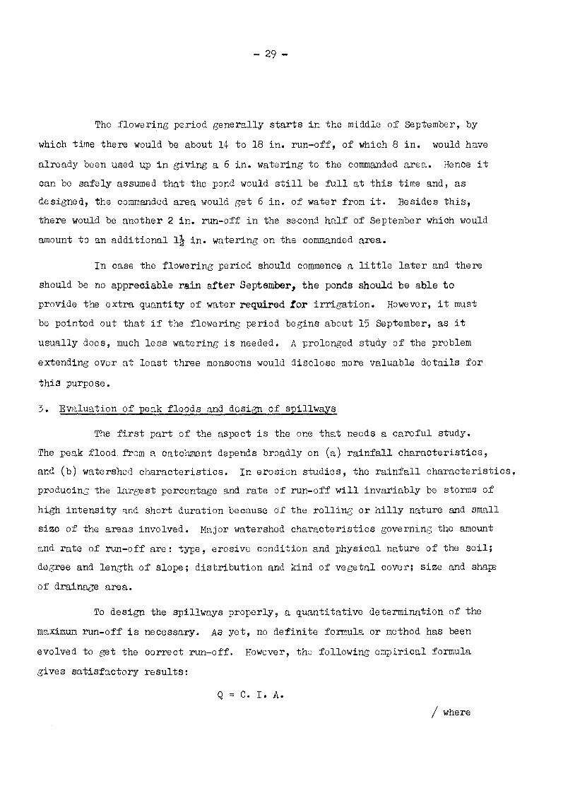
The flowering period generally starts in the middle of September, by
which time there would be about 14 to 18 in. run-off, of which 8 in. would have
already been used up in giving a 6 in. watering to the commanded area. Hence it can be safely assumed that the pond would still be full at this time and, as designed, the commanded area would get 6 in. of water from it. Besides this, there would be another 2 in. run-off in the second half of September which would
amount to an additional 1½ in. watering on the commanded area.
In case the flowering period should commence a little later and there
should be no appreciable rain after September, the ponds should be able to
provide the extra quantity of water required for irrigation. However, it must
be pointed out that if the flowering period begins about 15 September, as it
usually does, much less watering is needed. A prolonged study of the problem
extending over at least three monsoons would disclose more valuable details for
this purpose.
3. Evaluation of peak floods and design of spillways
The first part of the aspect is the one that needs a careful study. The peak flood from a catchment depends broadly on (a) rainfall characteristics, and (b) watershed characteristics. In erosion studies, the rainfall characteristics,
producing the largest percentage and rate of run-off will invariably be storms of
high intensity and short duration because of the rolling or hilly nature and small size of the areas involved. Major watershed characteristics governing the amount
and rate of run-off are: type, erosive condition and physical nature of the soil; degree and length of slope; distribution and kind of vegetal cover; size and shape
of drainage area.
To design the spillways properly, a quantitative determination of the
maximum run-off is necessary. As yet, no definite formula or method has been
evolved to get the correct run-off. However, the following empirical formula
gives satisfactory results:
Q = C. I. A./ where

— 30 -
where Q is the run-off (maximum intensity), C is the run-off coefficient
representing the ratio of the rate of run-off to the rate of rainfall, I is the rainfall intensity in cubic feet per second (which unit happens to be
approximately identical with the rate of rainfall in inches per hour) and A
is the watershed or catchment area in acres. This equation was proposed by C. E. Ramser as a result of measurements of rates of run-off and rainfall in
small agricultural areas. The degree of accuracy of the results is low but
it is satisfactory in comparison to. that of other formulae in use. The value of C in the equation is the most difficult to evaluate but suggested control values of C are as follows:
Cultivated rolling 5 - 10 per cent slope 0. 6Cultivated hilly 10 - 30 per cent slope 0.72Pasture rolling 5 - 10 per cent slope 0.36Pasture hilly 10 - 30 per cent slope 0.42Timber rolling 5-10 per cent slope 0.18Timber hilly 10 - 30 per cent slope 0.21
Regarding the rainfall characteristics from the data available, the the maximum hourly intensity is assumed for evaluating the peak flow from a catchment. After evaluating the peak flow from a catchment, designing spillways is a simple matter. Most of these small ponds are provided with a spillway channel on one or both flanks. These channels are generally sodded and their slope is so adjusted that with a depth of one foot water flowing in it, the
velocity does not exceed three feet per second. This is the limiting velocity for the ordinary sod available locally. Further experimental results on the
various kinds of grasses will be of great help in designing better spillways.
If higher velocities are found suitable for particular types of grasses, the section of spillway channel may be considerably reduced. Conversely, steep slopes can be adopted to economize on the length of spillway channels.
/ Another

- 31 -
Another important aspect of the design of spillways is dependent on the spillway storage capacity of the ponds. If the water rises in the spillway, the level naturally rises in the whole pond giving rise to a certain amount of
temporary storage in the pond. To this extent the peak flow is also decreased. But to work this out successfully the characteristics of the hydrographs for small catchments are necessary.
Besides grassed spillways, where large run-offs have to be dealt with, it becomes necessary to have regular masonry spillways. This is based on the
established engineering principles and need not be mentioned here.
4. Conveyance of water to fields
Decisions having been made on the catchment commanded area and spillways, the next problem is the conveyance of water to the fields. For the
small ponds that irrigate up to 20 or 25 acres the field to field system for
conveyance of water is quite satisfactory. But when the commanded area is
larger or where it is narrow and long, it becomes necessary to have a water conveyance channel. The design of these channels needs no special technique as generally they do not carry more than 1/4 c.f.s. A channel 6 in. wide at the
bottom with 2 to 1 side slopes and about 2 ft. deep will prove ample. But one important aspect of its design has to be looked into and that is its bed slope.
It is better to have the channel running on level so that the velocity may be
well within non-erosive limits. Another problem which may present some difficulty
arises when the channel has to cross an existing waterway. In such places it is advisable to have the waterway plugged with an earthen bund to about 2 feet above
the normal water level in channel. When during the rains the waterway carries
some water, it will breach the bund and flow. Once the water subsides the bund can be built again. This, of course, applies only to those waterways which are not too deep and do not have a large catchment above them. When deep gullies
have to be crossed, the problem has to be dealt with individually and suitable
/ designs
- 32 -
designs made. The most convenient and economic method for crossing deep gullies would be to have a subsidiary pond in them to supplement the capacity
of the main pond.
5. Selection of site for the bund and economics of pond construction
In the selection of site for a bund the following points have to be
kept in mind:
(a) The site for the bund is so located as to have the largest
capacity for the pond with the minimum amount of earthwork for bund. This is easily achieved by a careful study of the topography of the area with the help of a contour map;
(b) A safe spillway site is also selected on one or both flanks;
(c) The pond is generally located over soil of very low permeability.
This is easily achieved by a study of the soil map of the area in conjunction
with the contour map and verification at the site;
(d) The pond axis is so located that it has fairly impervious
foundation within a reasonable depth from the surface, say about three feet. This again is done by examining the soil with an auger or from soil profiles if readily available.
(e) Wherever possible, the ponds should be located on gullies which
have some spring flow.
The site having been selected and the ponds designed, the last but not the least aspect that should be examined is the economic aspect. For this
a cost estimate for the construction of pond inclusive of appertinent works
should be prepared. Then the unit cost of irrigating the fields should be worked out. Generally speaking, a cost of Rs. 150 per acre of area irrigated should be satisfactory.
/NEW ENACTMENTS
NEW ENACTMENTS RELATING TO IRRIGATION, DRAINAGE AND ALLIED SUBJECTS
The havoc wrought by floods, earthquakes and other natural agencies is common all over the world but has particular significance in the countries which fall in the geographical area known as Asia and the Far East. The government of each country adopts suitable methods to meet the situation created by such disasters.
The Government of Japan has passed legislation effectively to combat such disasters and to meet any exigencies concerning irrigation, drainage and allied subjects.1/ One of the legal steps taken by the Government
of Japan is the enactment of the Disaster Damage Rehabilitation Law known as Law No. 169 dated 10 May 1950. The full title of this law is "Law concerning Provisional Measures for Subsidy from National Treasury for Damage Rehabilitation Work Expenses for Facilities of Agriculture, Forestry and Fisheries". Various forms of natural disasters such as typhoon, flood, snow-slide, earthquake, land subsidence due to collapse of old coal mining tunnels and other occur very often, inflict great damage to farmers, and accordingly the effect upon farm management is never small. The law aims at granting government subsidy towards the expenses of rehabilitation works which sufferers will undertake for conserving agriculture, forestry and fisheries and contributing to the security of management. Thus the necessary legal basis for repair of agricultural, fisheries and forestry properties damaged by natural disasters has been provided by this law. Subsidy rates for repair works relating to irrigation and drainage are as follows:
/(a) General
1/ See also Flood Control Journal. October 1951 (ST/ECAFE/SER.C/8), pages 25-30, where Flood Defence Law is described.
- 33 -
- 34 -
(a) General disasters
(i) Moderate damage
Agricultural land 50 per cent.Agricultural facilities 65 per cent.
(ii) Serious damage
In case when the expenses for rehabilitation works of city, town and village are divided by the number of the affected farmers and the average amount is in excess of 80,000 yen, the following subsidy rates shall be applied to the amount in excess of 80,000 yen:
Agricultural land 80 per cent.Agricultural facilities 90 per cent.
(b) Particular damage
(i) Subsidies of land subsidence due to collapse of coal mining tunnel
Agricultural land Class I Agricultural land. Class II Agricultural facilities Class I Agricultural facilities Class II
(ii) Mine pollution
Agricultural land
70 per cent.60 per cent.80 per cent.70 per cent.
50 per cent.Agricultural facilities 65 per cent.
Another law is the Law concerning Provisional Measures for Promoting Steep Areas. This was enacted as Law No. 135 dated 7 May 1952; it aims at bettering the basis of agricultural production and increasing that production as fast as possible, in order to stabilize and improve peasant-life and also to contribute to the development of the national economy. For this purpose,
/this law

- 35 -
this law provided for the establishment of an Agricultural Promotion and Deliberation Commission for Steep Areas in the Ministry of Agriculture and Forestry, to discuss and investigate matters relating to agriculture promotion programme for steep areas. The programme includes the following items:
(a) Conservation and improvement of farm lands;
(b) Betterment and construction of agricultural roads, and reduction of heavy labour imposed on farmers;
(c) Improvement of farming techniques and rationalization of
agricultural management;
(d) Processing and marketing of farm and dairy products, and co-operative facilities for their disposal.
The subsidy rates have not yet been determined.
A third law is the Law concerning Provisional Measures for Damage Prevention and Promotion of Particular Soil Areas. This was promulgated as Law No. 96 dated 26 April 1952 and aims at conservation and enhancement of production power by the establishment and implementation of proper measures for the prevention of damage and improvement of land for soils of volcanic origin chiefly scattered in the Southern Kyushu district. The particular soil areas mentioned above include areas which are often visited by typhoons and where disastrous damage occurs yearly owing to an excess of rain which leads to lower productivity. The Deliberation Commission for Particular Soil Areas which is organized in order to discuss and investigate important matters relating to damage prevention measures and improvement of agricultural land is established in the Prime Minister's Office. The Prime Minister decides on programmes of damage prevention and improvement of agricultural land necessary for the particular soil areas based on the advice of the Commission. The subsidy rate for farm land and agricultural facilities under this law is 65 per cent.
/Another law

- 36 -
Another law of interest to our readers is the River Law. "Rivers" in the purview of this law comprise those adknowledged by the Construction Minister as having a grave relation to public interests, and the law provides for such items as (a) control of rivers, (b) limitation concerning the use of river water and sites and (c) burden of expenses. It is natural that this
law should have played an important role in the national unity towards flood control and other enterprises in Japan.
let another law is the Law concerning Filling up of Public Water Surface. This law was enacted as Law No. 57 dated April 8, 1921. The public water surface in the purview of this law comprise such waterflows or water surfaces as rivers, sea, lakes, swamps, etc. which are used by the public and for national prosperity. This law is applied to reclamation by special drainage, the enterprise being regarded as "Umetate" (filling up of public water surface). Those who intend to fill up any public water surface have to obtain authorization from a prefectural governor or governors.
/ARTIFICIAL RAINFALL

- 37 -
ARTIFICIAL RAINFALL
Australia
The Australian experts have evolved an entirely new approach to artificial rain and it is said that might "quite possibly" be the answer to making it ecnomical.
India
The Indian Council of Scientific and Industrial Research and the India Meteorological Department jointly organized a symposium on artificial rainfall at New Delhi on 9 and 10 February 1953. Mr. V.V. Sohoni, the Chairman of the Atmospheric Research Committee, delivering the presidential address, said that the experiments on rain-making carried out in the United States of America, Australia, Canada and other countries had yielded valuable results. The Indian Meteorological Department, he said, had been carefully studying the existing knowledge on artificial rain.
Dr. S.S. Bhatnagar, Director, Council of Scientific and Industrial Research, inaugurating the symposium, gave assurance that individual scientists and science organizations would be helped with funds for "genuine experiments". He stressed the importance of organizing a programme to develop centres where high class scientific work on the subject could be carried out.
Five papers on physics of cloud formation and precipitation, six on experimental technique of rain-making and assessment of their results, seven on possibilities of rain-making in India and three on the review of experiments and further organization were presented and discussed at the symposium.
In a paper on "Methods of exciting nature's process for production of rain", Dr. S.K. Banerji said that the evidence so far collected leads definitely to the view that all rains are caused by a process of nature; where this process is not in operation, methods of the kind described in his paper can excite this process.
/Mr. A.K. Roy,

- 38 -
Mr. A.K. Roy submitted a paper entitled "Experiments on precipitation control and evaluation of their results". He thought that there were two aspects to be considered in this connexion; one was the more direct aspect, namely, how far the seeding operation on a particular cloud had succeeded in making it yield rain, and the other, which could be judged only after a series of systematic trials had been made for a number of seasons, was how far these rain-making operations can reasonably be expected to solve problems such as scarcity of water in the more arid zones, or failure of rains generally over a fairly wide area in one particular season, and thus prove to be of economic importance. The question whether the accentuation of rain in a season over a certain limited area, if this could be achieved by systematic rain-making trials, was likely to affect prejudicially the total amount of rain in the neighbouring areas was also discussed briefly in that paper.
Dr. L.A. Ramdas, in his paper on "Methods of testing the efficacy of experiments on artificial rain-making" expressed the opinion that it was important to design rain-making experiments in such a manner, that the collection of reliable, objective and scientific evidence to confirm the degree of success attained should be a regular part of the programme itself, so that the assessment of success be not left only to the subjective impressions of the experimenters. He concluded that the gathering of more exact information regarding the most favourable cloud types, the most favourable stage of development at which to seed, the sensitive spots where seeding would produce the surest results, is a problem for the cloud-physicist. This type of investigator had to be developed in India and without the radar, the aeroplane and the ground organization and network of associated rain-gauge stations, much effort and money might be wasted in hastily-panned experimentation. Indeed these experiments are best conducted by a team of scientists working according to a carefully planned programme. Another method of testing the influence of artificial rain-making over a district or a suitable area, he said, would be to do cloud-seeding at regular intervals, bi-weekly or weekly,and to test the recorded rainfall for any signs of imposed periodicity. Here again, the execution of the programme of experiments would need a team of cloud-physicists. The statistician can help both at the time
/of "laying out"

- 39 -
of "laying out" the experimental programme, as well as later in analyzing and interpreting results.
It has been learnt that a proposal to establish a "Rain Research Unit" at Delhi is under consideration by the Council of Scientific and Industrial Research (India).
United States of America
A five-year artificial rain-making programme is being planned in Arizona by a team of American scientists and Dr. E.G. Brown, Australia's leading rain-maker, working under Mr. Basil Mason, leader of the cloud research group at London University and. said to be the youngest professor in the University.
/FLOOD CONTROL

- 40 -
FLOOD CONTROL SERIES
We are glad to announce the publication of the "Proceeding of the Regional Technical Conference on Flood Control in Asia and the Far East”.
The various studies carried out by the Bureau of Flood Control are being published as "Flood Control Series", The first number of the series, entitled "Flood Damage and Flood Control Activities in Asia and the Far East”
was published in October 1950. The second volume of this series entitled "Methods and Problems of Flood Control in Asia and the Far East" was published in 1951. The third number of this series is the one, the publication of which
is being announced now.
The 320 page Flood Control Series No.3 comprises the proceedings of
the Technical Conference on Flood Control organized by the United Nations Economic Commission for Asia and the Far East and held in New Delhi, India,
from 7 to 10 January 1951 and the thirty-two papers presented at this conference by experts from member and associated member countries and by the various specialized agencies of the United Nations, a list of which is given in Appendix A.
The proceedings described in the first 34 pages of this publication include the address of welcome by Dr. P.S. Lokanathan, the Executive Secretary of the Economic Commission for Asia and the Far East; the opening address by
the Honourable Mr. N.V. Gadgil, Minister of Works, Mines and Power, Government of India; the election of the Chairman and Vice-Chairman; the speeches of
Mr. A.N. Khosla, Chairman, Central Water and Power Commission, Government of
India; Mr. G.A. Hathaway, President, American Society of Civil Engineers and
Mr. Mohsin Ali, Chairman, Central Engineering Authority, Government of Pakistan; and the discussion of various technical items on the agenda, namely:
/embankments and
- 41 -
embankments and river tunning; sterne detention and. diversion; soil and water
conservation; the silt problem; flood problems of international rivers; and
the use of hydraulic models for flood control. Those pages also contain the Report of the Technical Conference to the Commission and the recommendations
made by the Conference.
Other publications under preparation in this series are:
1.River Training and River Bank Protection-Flood Control Series No.4 (in press);
2. Silt Problem. Flood Control Series No.5;
3. Proposed Standards of Methods, Records and Terminology of Hydrological. Measurements-Flood Control Series No.6;
4. Investigations and Promotion of Multiple-Purpose River Basin Projects-Flood Control Series No.7.
Appendix A
List of papers presented at the Regional Technical Conference on Flood. Control in Asia and the Far East
l. "Soil and water conservation-key to flood control" by Dr. M.A.Huberman, Chief, Forestry and Forest Products Working Group for Asia and the Pacific, FAO, Bangkok, Thailand.
2. "The control of floods by dikes in the North Viet-Nam Delta" byDao Trong Kim and Tran Ngoc Hau. public works engineers, Viet-Nam.
3. "Soil conservation planning in the Demodar Valley" by A. de Vajda,Chief Conservation Engineer, Damodar Valley Corporation, Hazaribagh, Bihar, India.
4. “Control of rivers without embankments" by J.L. McLean, ChiefEngineer, Irrigation Department, Government of the Union of Burma.
/ 5. Silt transportation
- 42 -
5. "Silt transportation theories and silt measuring apparatus" byDr. V.I. Vaidhianathan, M.A., D, Sc., Research officer Irrigation Research Institute, Amritsar, Punjab, India.
6. "Soil conservation and flood control" by D.D. Saigal, IndianForest Service, Central Water and Power Commission, Government of India, New Delhi,
7* "Embankments and bank protection of the Taiwan rivers" byLee-Tang Sih, Dipl, Ing,, Deputy Director, Bureau of Hydraulic Engineering, Taiwan, China,
8. "A study of flood-control and river training measures on the BeasRiver with the help of models" by Dr. H,L. Uppal, M.Sc, Ph.D., Hydraulic Research Station, Malakpur, Punjab, India.
9. "Use of permeable dikes for training of Yungting River" byShih-Ta Hsu, Professor of Applied Hydraulics, National University of Taiwan, China.
10. "The three laws of the flow of liquids" by Pir Mohammad IbrahimQureshi, Irrigation Adviser, Punjab Irrigation Secretariat, Lahore, Pakistan,
11. "A review of the progress on theory & design of stable channelsin alluvium" by S.L. Malhotra, I.S.E., M.I.E. (Ind.), Secretary, and P.R. Ahuja, PSE (I), M.I.E, (Ind.), Deputy Secretary, Central Board of Irrigation, India.
12. "Notes on water control and water management of the Damodar RiverBasin" by H.J. Ajwani, B.Sc. (Edin); M.Sc. (Iowa), Member A.S.C.E., Engineer in Charge, Planning, Damodar Valley Corporation, India.
13. "Flood control in Japan" by River Bureau, Ministry of Construction,Japan.
14. "Diking and training of the Krishna River for flood control" byG.A. Narasimha Rao, Executive Engineer, Vijyawada, Madras, India,
15. "Soil conservation as affecting flood control in Ceylon" byR. Maclagan Gorrie, D.Sc, Soil Conservation Officer, Ceylon,
16. "Floods and rainfall" by S.K. Pramanik, India MeteorologicalDepartment.
/17. "Effectiveness of

- 43 -
17. "Effectiveness of sluices in prevention of silting of reservoirswith special reference to Hirakud Dam, Bihar, India" by Kanwar Sain, I.S.E., Member (Designs), Central Water and Power Commission, Government of India, New Delhi, India.
18. "Silt transportation of rivers in Java", by Ir. J.H. de Haan,Chief, Bureau of Land Utilization, Bogor, Indonesia,
19. "The use of embankments for flood control, their merits anddemerits" by Shih-Ta Hsu, Professor of Hydraulic Engineering, National Taiwan University, China.
20. "Methods of calculation of controlled discharge in a retardingbasin" by Seiichi Sato, Chief, and Hideo Kikkawa, Research Member, River Laboratory, Public Works Research Institute, Ministry of Construction, Japan.
21. "The silt transportation and the equilibrium slope of an alluvialriver" by Seiichi Sato, Chief, and Masanobu Hosoi, Research Member, River Laboratory, Public Works Research Institute, Ministry of Construction, Japan.
22. "Technical assistance in the field of flood control" by TheTechnical Assistance Administration of the United Nations.
23. "A review of the recent floods (1950) in Punjab (India) withsuggestions for short term and long term measures" by C.L. Handa, M.A.S.C.E., M.A.S.M.E., M.A.C.I., M.A.S.T.M., M.I.E. (India), I.S.E., Director, and S.R. Sehgal, M.A., C. St., Assistant Research Officer, Irrigation Research Institute, Amritsar, Punjab, India.
24. "Flood control at Beas Training Works in Hoshiarpur District,Punjab, India", by D.P. Sondhi, Executive Engineer, Jullundur Drainage Division, India.
25. "A summary of methods of flood control and the method of embankmentused in North Viet-Nam" by Tran Ngoc Hau, Engineer of Public Works, Viet-Nam.
26. "The economic and social aspects of erosion control" by J.H. deHaan, Chief of the Bureau of Land Utilization, Bogor, Indonesia.
27. "Flood problems of Patiala and their solution" by Harbans Lal,B.A., C.E. Hons. (Roorkee), A.M.I.E. (ind.), Executive Engineer Projects, Patiala and East Punjab States Union, India.
/28. "Characteristics of
- 44 -
28. "Characteristics of floods and prevention of damages in Thailand-"by Momlaung Xujati Kambhu, Director-General, Royal Irrigation Department, Thailand.
29. "flood storage, detention and diversion, engineering problems andeconomic justification" by T. Mylvaganam, Senior Research Officer, Central Designs and Research Office, Ceylon.
30. "The effect of embankments on river bed levels" by R.D. Dhir, I.S.E.,Director, Central Water and Power Commission, Government of India.
31. "The use of hydraulic models in flood control" by Dr. N.K. Bose,.M.Sc., Ph.D., F.N.I., Director, River Research Institute, West Bengal, India.
32. "Some public health problems in flood control" by the World HealthOrganization.
/Appendix B

- 45 -
Appendix B
Printed publications of the Economic Commission for Asia and the
Ear East are available for sale in local currency from all sales agents for United Nations Publications. A list of the sales agents of the United Nations Publications in Asia and the Far East is given below:
AustraliaH.A. Goddard (Pty.), Ltd., 255a George Street, Sydney.
CeylonThe Associated Newspapers of Ceylon, Ltd., Lake House, Colombo.
ChinaThe Commercial Press, Ltd., 211 Honan Road, Shanghai.
IndiaOxford Book and Stationery Co., Scindia House, New Delhi.
IndonesiaJajasan Pembangunan, Gunung Sahari 84, Djakarta.
JapanMaruzen Co., Ltd,, 6 Tori-Nichome, Nihon Bashi, Tokyo Central.
PakistanThomas & Thomas, Fort Mansion, Frere Road, Karachi.
PhilippinesAlemar’s Bookstore,749 Rizal Avenue, Manila.
Thailand.Pramuan Mit Ltd., 55-59 Chakrawat Road, Wat Tuk, Bangkok,
/WORK OF

- 46 -
WORK OF THE BUREAU OF FLOOD CONTROL 1952
The ninth session of the Economic Commission for Asia and the Far East was held in Bandung, Indonesia, from 6 to 14 February 1953. Among other items, the work undertaken by the Bureau of Flood Control of the Commission, from December 1951 to October 1952, was discussed.
In this connexion, it may be mentioned that an important decision taken by the Commission at its seventh session held in Lahore, Pakistan, and reaffirmed at its eighth session held in Rangoon, Burma,1/ was the shift of emphasis of the Bureau’s work from treating flood control as an isolated subject to the wider aspects of multiple-purpose unified river basin development of water resources.
The Economic and Social Council adopted, on 2 June 1952, resolution 417(XIV) which stressed inter alia the following points:
"The great importance of effective use of available water resources in solving the problem presented by the development of the arid lands;
"That optimum use of water usually requires that irrigation, be combined with power development, flood control, navigation, municipal, industrial and other beneficial uses;
"That range and watershed management, pollution control, development of fisheries, improved agricultural practices, and industrial development all go hand in hand with the development of water resources;
"The possibilities of co-operation open to Member States with respect to the regulation and development of contiguous water resources;
"That international organizations, both governmental and non-governmental, have been contributing and can increasingly contribute to the effective use and control of water resources by bringing to national and local projects and activities the accumulated pertinent knowledge and experience on a world-wide basis;
/"That the
1/ For a report on the eighth session of the Commission, which also included a history of the Bureau of Flood Control and its functions, see Flood Control Journal, April 1952 (ST/ECAFL/SER.C/10), pages 1 to 20.

- 47 -
"That the activities of international organizations directed towards various aspects of water resources are closely interrelated and should be so planned that water resource development shall make its maximum contribution to the over-all economic development of each country; and
"That the United Nations itself should assume responsibility for promoting co-operation among the several international organizations concerned with water resource development in order that the most effective results might be obtained from the financial and personnel resources available to them, and for identifying and programming to meet deficiencies in international activities in this field so that adequate attention might be given to important aspects and geographic areas which are being neglected".
After giving full consideration to the above facts the Council, amongst other points, requested the Secretary-General to assume responsibility for the promotion and co-ordination of international activities concerning water resource development and co-operative action among national authorities and international organizations in order to secure the maximum contribution to economic development through the effective development, control and use of water. In carrying out the above assignment the Secretary-General was requested to secure the co-operation of the regional economic commissions in relation to those problems which are essentially regional in character.
With a view to the promotion of optimum control, conservation and use of water resources of the region, the function of the Bureau of Flood Control is to stimulate, encourage, advise and assist in water resource development of river basins, both national and international in character. The Bureau has consequently undertaken a set programme of work described below:
1. MULTIPLE-PURPOSE RIVER BASIN DEVELOPMENT
Since early 1951, the Bureau has undertaken the following programme of work on this project:
(a) A country-by-country survey of water resources, present status of utilization, future plans and possibilities of development and a study and analysis of the problems and programmes involved including recommendations with a view to
/stimulating and
- 48 -
stimulating and encouraging the development of water resources and making available to all countries of the region experiences developed and ways and means of solving the difficulties encountered in the various development schemes.
(b) An investigation of the role of multiple-purpose projects in the economy of the region and consideration of special problems relating to the region as a whole and
(c) The preparation of a manual giving general principles and methods of planning multiple-purpose river basin development for the use of engineers as well as administrators dealing with water resource development.
During 1952 the Bureau had been able to secure the closest co-operation of the national technical organization of the region in the preparation of the country-by-country survey. The Bureau has made studies of water resource development in China (Taiwan) and Laos in addition to the studies in India and the Philippines which were completed in 1952; while studies in the Union of Burma, Cambodia, Ceylon, Japan, Thailand and Viet-Nam were underway and those for Indonesia and Pakistan were being made by the respective governments.
This comprehensive study will be completed and submitted to technical organizations of the region for their comments and suggestions during 1953 and will be discussed at the proposed regional technical conference on water resource development in 1954.
2. FLOOD CONTROL AND WATER RESOURCE DEVELOPMENT OF INTERNATIONAL RIVERS
With the concurrence of the Governments of Thailand, Cambodia, Laos and Viet-Nam, and the co-operation of the technical organizations of these countries, the Bureau conducted in 1951 an investigation over the lower Mekong basin and later submitted a preliminary report to the governments concerned recommending joint measures to be taken in regard to the flood problem and water resource development. The Government of Viet-Nam intimated, in October 1952, their concurrence to the recommendations and suggested more direct means for the communication of flood warning among the countries concerned and further intimated their keen interest in the hydro-electric power projects on the Mekong suggested in the report. The recommendations are also being actively considered by the Governments of Cambodia, Laos and Thailand,
/With the

- 49 -
With the co-operation of the Ministry of Public Works of Laos, the Bureau conducted an investigation of a part of the Mekong between Savannakhet and Pakse where the possibility of multiple-purpose use of water for irrigation, power generation and improvement of navigation is very promising. Available basic data are being collected and examined. The investigation over other parts of the basin in Thailand, Cambodia and South Viet-Nam is to be carried out in 1953.
3. FLOOD CONTROL METHODS
As flood control is being treated as an integral part of multiplepurpose river basin development, the only work relating to the improvement of flood control methods undertaken consisted essentially of the study of specific problems of common importance to the region in co-operation with the various technical organizations. Among the problems recommended by the Commission for study were the silt problem and the problem of river bank revetment and river training. It is proposed to add the "study of rainfall and run-off relation on some major rivers of the region with special reference to flood flow".
Joint study on the silt problem with the Punjab Irrigation Research Institute of India and the Royal Irrigation Department of Thailand were continued. The work paper prepared by the Bureau, entitled "The Silt Problem", is being revised so as to incorporate the results of recent research in various countries and will be submitted to technical organizations for their comments in 1953.
The preliminary report on river bank protection and river training, which was completed in 1952, is being revised in the light of the comments received from various authorities both within and outside the region. It is proposed to discuss this report, together with the report on the silt problem, at the regional technical conference on water resource development to be held in 1954.
4. ADVICE AND ASSISTANCE TO GOVERNMENTS ON REQUEST
During 1952, the Bureau has been able to render to governments, at their request, advice and assistance on the following projects:
/(a) Investigation
- 50 -
(a) Investigation of measures to afford further flood protection and extending irrigation in the Mahanadi Delta, India
Following the preliminary study undertaken by the Bureau in 1951 at the request of the Government of Orissa, India, the Bureau deputed one of its experts early in 1952 to make a field investigation of the Mahanadi Delta. The Bureau prepared and submitted a report to the government concerned recommending investigations to be made for extending irrigation and providing effective flood protection. The government has decided to implement the recommendations made in the report and has further requested the Bureau's advice as soon as the recommended investigations have been completed and the required data are made available.
(b) Flood Control of Patiala and East Punjab States Union, India
At the request of the Chief Engineer of Patiala and East Punjab States Union, India, the Bureau deputed one of its experts early in 1952 to conduct field investigations and review a detailed project report on flood control of Patiala prepared by the Chief Engineer. On the basis of the study and field investigations, the Bureau submitted a report recommending definite measures to be adopted for the protection of the Patiala city and the crops in the Patiala basin with due consideration of their economic justifications. The Chief Engineer of the Government of Patiala and East Punjab States Union intimated taht he concurred fully with the recommendations of the Bureau and had requested his government's sanction for funds to implement them.
5. HYDRAULIC RESEARCH STATIONS AND HYDROLOGICAL OBSERVATIONS
(a) Hydraulic research stations
With a view to keeping hydraulic research workers of the region informed of the research facilities and current work programmes of the various hydraulic experiment stations, a survey of the stations including information on space, personnel, essential equipment, subjects of investigation along with a list of important publications was published in a special number of the Flood Control Journal in 1951. Another special number giving the important changes in the equipment and personnel that had taken place during the year and the current programme of experiments as well as a digest of recent developments in the field
/of hydraulic
- 51 -
of hydraulic research being carried out elsewhere in the world was published during October 1952. Similar information is being collected for 1952 and will be published in a special number of the Flood Control Journal towards the end of 1953.
The publication of such information is found useful by the research stations of the region in planning their programme of work. It is suggested that research subjects of common interest to the region may be discussed at the proposed regional technical conference on water resource development, so that all research facilities available in the region may be fully utilized for the common good of the region.
(b) Hydrological observations
The draft proposal on standards of methods, records and terminology of hydrological observations prepared by the Bureau, which contained standard methods of measurement relating to water level, velocity, cross-sections and silt and standard forms for recording these results, in addition to over six hundred hydrological terms with definitions, was circulated to the various technical organizations and related international engineering institutions for their comments and suggestions. The draft has since been revised in the light of comments received. It is proposed to be discussed at the regional technical conference on water resource development which is to be held in 1954.
It was suggested by some technical organizations of the region that a study on stream gauging equipment might be included in the Bureau's programme of work with a view to recommending the most suitable type of instruments for use in countries of the region. The preparation of a manual giving the various types of instruments in use may be undertaken by the Bureau as a part of the project on hydrological observations during 1953.
6. DISSEMINATION OF TECHNICAL INFORMATION ON FLOOD CONTROLWORKS AND WATER RESOURCE DEVELOPMENT
During 1952, the Bureau made five distributions of publications and reports and also supplied specific data, upon request, to the national technical organizations of the region.
/As reported
- 52 -
As reported last year, the Bureau arranged with the Technical Assistance Administration of the United Nations to make a special distribution of fifty sets of sixty books each to various technical organizations of the region. The sets include handbooks, standard works, research publications and project reports relating to flood control and water resource development. A major portion of the books have already been distributed by the Bureau.
Publications issued by the Bureau included four issues of the Flood Control Journal giving news regarding water resource development, and the third volume of the Flood Control Series entitled "Proceedings of the Regional Technical Conference on Flood Control in Asia and the Far East".
7. TRAINING CENTRE FOR WaTER RESOURCE DEVELOPMENT
The organization of a training centre on water resource development, in co-operation with the TAA, for the training of engineers of the region was considered essential in promoting water resource development. Following the resolution adopted by the Commission at its eighth session, the Bureau, in consultation with the regional representative of TAA, has prepared a plan for the training centre and submitted the same to TAA for its consideration.
In view of the suggestions made by some of the countries at the eighth session of the Commission, it is proposed that the period of training should be one year, and that the training centre should be semi-permanent for a period of at least a few years. It is expected that three to four engineers will be deputed to the centre by each of the fifteen countries of the region thus making the total number of fifty trainees every year. The scope of training would be divided into three parts, namely, lectures, field work and exercises and would cover investigation, planning, design, construction and operation of multiplepurpose projects. The annual cost of the centre is estimated to be around US$150,000.
The Technical Assistance Administration has fully recognized the need and agreed in principle to the organization of such a centre. Details of the plan are now being examined by TAA.
/8. REGIONAL
- 53 -
8. regional technical conference on water resource developmentBesides affording an opportunity to experts of the region for exchange
of experience and ideas, the purpose of holding a regional technical conference on water resource development is to bring experts together to discuss the results of the studies conducted by the Bureau as well as to recommend the lines along which the work of the Bureau should further be developed.
It will be recalled that a regional technical conference on flood control was held in January 1951. The conference discussed at length the comprehensive study on methods and problems of flood control prepared by the Bureau and the suggestions of the experts were incorporated in the Bureau's report which was later published as volume 2 of the Flood Control Series. The conference also recommended the shift of emphasis of the Bureau's work from flood control to multiple-purpose water resource development which was later approved by the Commission. This procedure has thus proved very useful.
It may be pointed out that such conferences should be held only if reports or studies on the subjects to be discussed are well prepared in advance. The studies relating to water resource development which have been completed or are being completed by the Bureau following the last conference held early in 1951 have now reached a stage when a meeting will undoubtedly be very useful. Such studies and reports requiring finalization or discussion at a conference include, inter alia: (a) the three-volume study on multiple-purpose river basin development, (b) the manual on river bank protection and river training; (c) the standard methods, records and terminology on hydrological observations; and (d) the report on the silt problem.
It is proposed that a conference be held some time in 1954 either before or after the tenth session of the Commission.
9. GROUP VISIT OF EXPERTS TO EUROPE AND AMERICA ONWATER RESOURCE DEVELOPMENT PROJECTS
The method of group visits by a team of experts to examine technological advances in the more developed countries has been considered of great value by the Commission. In the field of multiple-purpose water resource development,
/besides the

- 54 -
besides the organization of a training centre which is primarily designed for the training of less experienced engineers, the organization of a group of high level experts to study projects in Europe and America is very desirable.
The Economic Commission for Europe had suggested, in its programme of work, the organization, in co-operation with TAA of a team of experts from ECAFE countries to study the construction of dams for electric power plants in Europe. It appears that these two proposals could be combined into one.
It is proposed that the co-operation of ECE be sought and that TAA be requested to finance the group visit.