FEASIBILITY REPORT UPDATE - City of Osseo
48
FEASIBILITY REPORT UPDATE 2018 ALLEY RECONSTRUCTION PROJECT (Originally Proposed for Construction in 2017) City of Osseo Hennepin County, Minnesota NOVEMBER 9, 2017 Prepared for: City of Osseo 415 Central Avenue Osseo, MN 55369 WSB PROJECT NO. 3429‐070
-
Upload
khangminh22 -
Category
Documents
-
view
0 -
download
0
Transcript of FEASIBILITY REPORT UPDATE - City of Osseo

FEASIBILITY REPORT UPDATE
2018 ALLEY RECONSTRUCTION PROJECT (Originally Proposed for Construction in 2017) City of Osseo Hennepin County, Minnesota NOVEMBER 9, 2017 Prepared for: City of Osseo 415 Central Avenue Osseo, MN 55369 WSB PROJECT NO. 3429‐070

Feasibility Report Update 2018 Alley Reconstruction Project City of Osseo, MN WSB Project No. 3429-070
FEASIBILITY REPORT UPDATE
2018 ALLEY RECONSTRUCTION PROJECT (Originally Proposed for Construction in 2017)
FOR THE CITY OF OSSEO, MINNESOTA
November 9, 2017
Prepared By:
701 Xenia Avenue South | Suite 300 | Minneapolis, MN 55416 | (763) 541-4800
Building a legacy – your legacy.
Equal Opportunity Employer | wsbeng.com
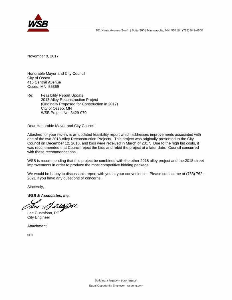
November 9, 2017 Honorable Mayor and City Council City of Osseo 415 Central Avenue Osseo, MN 55369 Re: Feasibility Report Update
2018 Alley Reconstruction Project (Originally Proposed for Construction in 2017) City of Osseo, MN WSB Project No. 3429-070
Dear Honorable Mayor and City Council: Attached for your review is an updated feasibility report which addresses improvements associated with one of the two 2018 Alley Reconstruction Projects. This project was originally presented to the City Council on December 12, 2016, and bids were received in March of 2017. Due to the high bid costs, it was recommended that Council reject the bids and rebid the project at a later date. Council concurred with these recommendations. WSB is recommending that this project be combined with the other 2018 alley project and the 2018 street improvements in order to produce the most competitive bidding package. We would be happy to discuss this report with you at your convenience. Please contact me at (763) 762-2821 if you have any questions or concerns. Sincerely, WSB & Associates, Inc. Lee Gustafson, PE City Engineer Attachment srb
Feasibility Report Update 2018 Alley Reconstruction Project City of Osseo, MN WSB Project No. 3429-070
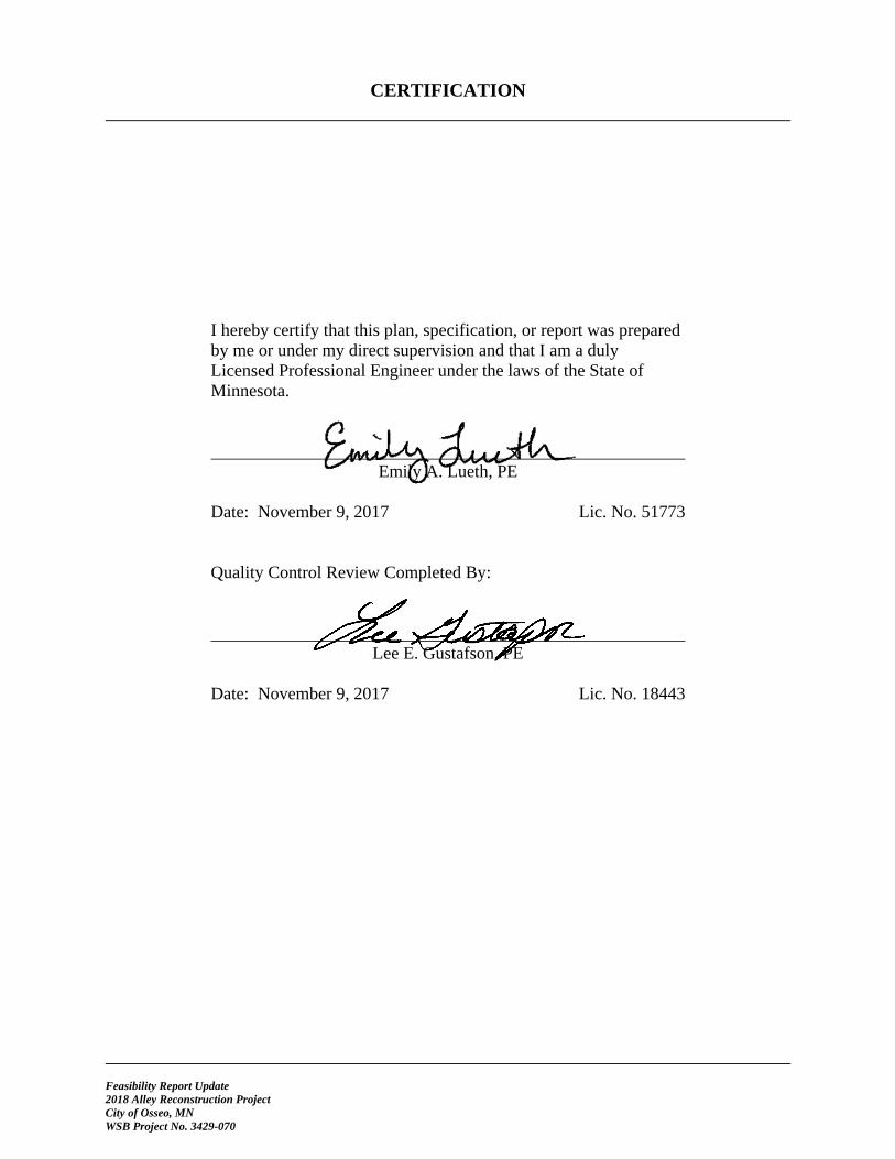
CERTIFICATION
I hereby certify that this plan, specification, or report was prepared by me or under my direct supervision and that I am a duly Licensed Professional Engineer under the laws of the State of Minnesota.
Emily A. Lueth, PE
Date: November 9, 2017 Lic. No. 51773 Quality Control Review Completed By:
Lee E. Gustafson, PE Date: November 9, 2017 Lic. No. 18443

TABLE OF CONTENTS
Feasibility Report Update 2018 Alley Reconstruction Project City of Osseo, MN WSB Project No. 3429-070
TITLE SHEET LETTER OF TRANSMITTAL CERTIFICATION SHEET TABLE OF CONTENTS
1. EXECUTIVE SUMMARY ........................................................................................................... 1
2. INTRODUCTION ......................................................................................................................... 2
2.1 Authorization ...................................................................................................................... 2 2.2 Scope ................................................................................................................................... 2 2.3 Data Available .................................................................................................................... 2 2.4 Project History .................................................................................................................... 2
3. EXISTING CONDITIONS ........................................................................................................... 3
3.1 Surface ................................................................................................................................ 3 3.2 Drainage .............................................................................................................................. 3 3.3 Private Utilities ................................................................................................................... 3 3.4 Watermain and Sanitary Sewer ........................................................................................... 3
4. PROPOSED IMPROVEMENTS ................................................................................................. 4
4.1 Surface ................................................................................................................................ 4 4.2 Drainage Improvements ...................................................................................................... 4 4.3 Easements ........................................................................................................................... 4 4.4 Permits/Approvals .............................................................................................................. 4 4.5 Public Involvement ............................................................................................................. 4
5. FINANCING .................................................................................................................................. 5
5.1 Opinion of Probable Cost ................................................................................................... 5 5.2 Funding and Assessments ................................................................................................... 5
6. PROJECT SCHEDULE ................................................................................................................ 6
7. FEASIBILITY AND RECOMMENDATION ............................................................................. 7
Appendix A Figure 1 – Project Location Map Figure 2 – Typical Section
Appendix B Opinion of Probable Cost
Appendix C Geotechnical Report
Appendix D Televising Report
Appendix E Preliminary Assessment Map Preliminary Assessment Roll
Appendix F Public Comment Summary

Feasibility Report Update 2018 Alley Reconstruction Project City of Osseo, MN WSB Project No. 3429-070 Page 1
1. EXECUTIVE SUMMARY The 2018 Alley Reconstruction Project consists of repaving the alley bounded by 5th and 6th Avenues NE between 4th Street NE and 93rd Avenue, including repairing or minimal reconstruction of the storm sewer. A map illustrating the project location is shown on Figure 1 in Appendix A. The deterioration of the existing alley surface and drainage issues experienced along the alley make the proposed improvements necessary. Improvements include complete reconstruction of the alley with new concrete pavement and improvements to the existing storm sewer as needed. The total estimated project cost for this 2018 Alley Reconstruction Project is $246,500, and includes a 10% contingency and 25% indirect costs for legal, engineering, administrative, and financing costs. The project is proposed to be funded primarily with special assessments to benefiting property owners, as well as some City funding. The project is proposed to be completed in 2018. The City’s assessment policy calls for assessing adjacent properties 80% of the alley reconstruction costs. This cost is divided equally among the adjacent properties. The estimated special assessment to each of the 27 benefiting property owners for the alley improvements is $6,580. The City’s special assessment policy calls for utility and storm sewer work to be paid from the respective enterprise fund, and as such, this proposed property assessment does not include storm sewer improvement costs. The proposed project schedule includes construction beginning June 2018, with final completion by the fall of 2018. This project is feasible, necessary, and cost-effective from an engineering standpoint and should be constructed as proposed herein.

Feasibility Report Update 2018 Alley Reconstruction Project City of Osseo, MN WSB Project No. 3429-070 Page 2
2. INTRODUCTION 2.1 Authorization On October 24, 2016, the Osseo City Council authorized a feasibility report for this 2018 Alley Reconstruction Project.
2.2 Scope
This feasibility report includes alley reconstruction and drainage improvements along the alley bounded by 5th and 6th Avenues NE between 4th Street NE and 93rd Avenue. 2.3 Data Available Information and materials used in the preparation of this report include the following: City of Osseo Capital Improvement Plan City of Osseo Assessment Policy City of Osseo Property Index Records Storm Sewer Televising Reports Field Observations of the Area and Field Topography Surveys
2.4 Project History This 2018 Alley Reconstruction Project is identified in the City’s Capital Improvement Plan to address the poor condition of the alley and corresponding poor drainage. The City held two neighborhood meetings for this project on November 10, 2016 and November 2, 2017, to receive input on the project. Many of the meeting attendees expressed support for the project, and expressed concerns about the poor drainage conditions.

Feasibility Report Update 2018 Alley Reconstruction Project City of Osseo, MN WSB Project No. 3429-070 Page 3
3. EXISTING CONDITIONS 3.1 Surface The existing alley consists of a deteriorated bituminous surface and spans 1,140 feet between 93rd Avenue on the north end and 4th Street NE on the south end. Many of the adjacent residents utilize the alley to access garages, parking areas, or rear yards. The project area also contains fences, driveways, and grass boulevards beyond the edge of alley, all within City right-of-way. 3.2 Drainage Storm sewer facilities exist within the proposed project area. Generally, runoff from adjacent properties runs down the center of the alley to an existing catch basin, or to adjacent streets. Runoff that is collected in the catch basin and along the side streets ultimately flows north to the county ditch system along 93rd Avenue. 3.3 Private Utilities Private utilities that have facilities in or near the project area will be notified during the final design phase of the project and will be requested to coordinate any necessary repairs and replacements as needed at their cost. Private utility companies that have facilities within the project area include the following: CenturyLink (Telephone/Internet) CenterPoint Energy (Gas) Comcast (Cable) Xcel Energy (Electric) Zayo Bandwidth (Telecom)
3.4 Watermain and Sanitary Sewer Public utilities do not exist within the project area.

Feasibility Report Update 2018 Alley Reconstruction Project City of Osseo, MN WSB Project No. 3429-070 Page 4
4. PROPOSED IMPROVEMENTS 4.1 Surface The proposed surface improvements for the 2018 Alley Reconstruction Project include removal of the existing bituminous surface and installation of a new 12-foot-wide concrete pavement. Full-depth removal of the existing pavement will allow the alley to be reconstructed with a 6-inch concrete pavement on top of a 4-inch section of a Class 5 gravel base over an acceptable, compacted subgrade. 4.2 Drainage Improvements The profile grades of the alley will be sloped to direct water to the existing catch basin. Typically, the minimum profile grade for a new street or alley is designed to a standard slope of 0.50% or greater. The alley profile will be designed to meet the minimum profile grade and maintain positive drainage at adjacent driveways and garage entrances. 4.3 Easements It is anticipated that all alley and storm sewer work will take place within the existing alley right-of-way or within existing drainage and utility easements. Additional right-of-way acquisition is not expected to be required in order to construct the project as proposed. 4.4 Permits/Approvals It is anticipated that no permits will be required as a part of the proposed improvements. 4.5 Public Involvement Two neighborhood informational meetings for the proposed improvements were conducted on November 10, 2016 and November 2, 2017, for adjacent property owners. Preliminary information was presented to property owners regarding the proposed improvements including costs, funding, schedule, and project impacts. Comment cards were made available to attendees at the meeting; comments can be found in Appendix D.

Feasibility Report Update 2018 Alley Reconstruction Project City of Osseo, MN WSB Project No. 3429-070 Page 5
5. FINANCING 5.1 Opinion of Probable Cost The total project cost is estimated at $246,500, and includes all proposed surface and storm sewer improvements as well as all engineering, legal, financing, and administrative costs. Detailed cost estimates can be found in Appendix B of this report. The opinions of cost incorporate estimated 2018 construction costs and include a 10% contingency factor. Administrative costs are projected at 25% of the construction cost and include engineering, legal, financing, and administrative costs. 5.2 Funding and Assessments Financing the 2018 Alley Reconstruction Project will be based on the City’s special assessment policy which calls for 80% of the proposed improvements to be specially assessed. The remaining 20% and 100% of the storm sewer costs will be financed by the City. Assessments for this project were calculated by dividing 80% of the total cost of the project equally among adjoining residents. There is a total of 27 properties benefiting from the improvements equating to a cost of $6,580 per unit. The proposed assessment roll is included in Appendix E of this report, along with an assessment map highlighting the benefiting properties and the assessment calculations for benefiting property owners.

Feasibility Report Update 2018 Alley Reconstruction Project City of Osseo, MN WSB Project No. 3429-070 Page 6
6. PROJECT SCHEDULE The proposed project schedule is as follows:
City Council Authorizes Feasibility Report ................................................ August 28, 2017 Neighborhood Meeting ............................................................................ November 2, 2017 City Council Receives Feasibility Report/Orders Public Hearing ......... November 13, 2017 City Council Authorizes Final Design ................................ December 2017 – January 2018 Plan/Specification Preparation ....................................................... January – February 2018 City Council Approves Plans/Specs and Authorizes Bidding ....................... February 2018 Project Bidding ................................................................................ February – March 2018 Assessment Hearing ............................................................................................. April 2018 City Council Awards Construction Contract ........................................................ May 2018 Construction ........................................................................................... June – August 2018

Feasibility Report Update 2018 Alley Reconstruction Project City of Osseo, MN WSB Project No. 3429-070 Page 7
7. FEASIBILITY AND RECOMMENDATION This 2018 Alley Reconstruction Project consists of reconstructing the alley bounded by 5th and 6th Avenues NE between 4th Street NE and 93rd Avenue, including repairing or minimal reconstruction of the storm sewer. The alley totals approximately 1,140 feet (0.22 miles) and it is proposed that the aforementioned residential alley be reconstructed to a width of 12 feet. The total estimated project cost for this 2018 Alley Reconstruction Project is $246,500. Proposed funding for the project is provided through 80% special assessments and 20% City funds. The special assessment cost to each of the 27 benefiting property owners is $6,580. Based on the information contained within this report, the proposed improvements as described are necessary, cost-effective, and feasible from an engineering perspective. WSB & Associates, Inc. recommends construction of the proposed improvements as detailed in this report. The economic feasibility of this project will be determined by the City Council.

Feasibility Report Update 2018 Alley Reconstruction Project City of Osseo, MN WSB Project No. 3429-070
APPENDIX A
Figure 1 – Project Location Map Figure 2 – Typical Section


Feasibility Report Update 2018 Alley Reconstruction Project City of Osseo, MN WSB Project No. 3429-070
APPENDIX B
Opinion of Probable Cost

K:\010699-000\Quantity\Preliminary\3429-060_Osseo 2017 Alley_OPC_LME.xlsm
2018 Alley Improvement Project LMEProject Location: City of Osseo EALWSB Project No: 03429-070 11/6/2017
Item No.MN/DOT
Specification No.
Description UnitEstimated
Total QuantityEstimated Unit
PriceEstimated Total Cost
1 2021.501 MOBILIZATION LUMP SUM 1 $10,000.00 $10,000.00
2 2104.501 REMOVE CONCRETE CURB & GUTTER LIN FT 25 $7.50 $187.50
3 2104.505 REMOVE CONCRETE DRIVEWAY PAVEMENT SQ YD 175 $16.00 $2,800.00
4 2104.505 REMOVE BITUMINOUS DRIVEWAY PAVEMENT SQ YD 110 $16.00 $1,760.00
5 2104.505 REMOVE BITUMINOUS PAVEMENT SQ YD 1,465 $8.00 $11,720.00
6 2104.513 SAWING BITUMINOUS PAVEMENT (FULL DEPTH) LIN FT 50 $8.00 $400.00
7 2104.601 SALVAGE LANDSCAPE STRUCTURES LUMP SUM 1 $2,500.00 $2,500.00
8 2105.501 COMMON EXCAVATION (P) CU YD 202 $30.00 $6,060.00
9 2112.501 SUBGRADE PREPARATION RD ST 11 $250.00 $2,750.00
10 2123.610 STREET SWEEPER (WITH PICKUP BROOM) HOUR 10 $150.00 $1,500.00
11 2130.501 WATER (DUST CONTROL) MGAL 10 $80.00 $800.00
12 2211.501 AGGREGATE BASE CLASS 5 TON 446 $25.00 $11,150.00
13 2301.504 CONCRETE PAVEMENT 6" SQ YD 1,486 $55.00 $81,730.00
14 2360.503 TYPE SP 12.5 WEAR COURSE MIX (2,B) 3.0" THICK SQ YD 110 $50.00 $5,500.00
15 2505.601 UTILITY COORDINATION LUMP SUM 1 $1,000.00 $1,000.00
16 2531.501 CONCRETE CURB AND GUTTER DESIGN B618 LIN FT 25 $60.00 $1,500.00
17 2531.507 6" CONCRETE DRIVEWAY PAVEMENT SQ YD 175 $55.00 $9,625.00
18 2563.601 TRAFFIC CONTROL LUMP SUM 1 $1,000.00 $1,000.00
19 2573.530 STORM INLET PROTECTION EACH 2 $250.00 $500.00
20 2573.533 SEDIMENT CONTROL LOG TYPE STRAW LIN FT 100 $5.00 $500.00
21 2573.533 SEDIMENT CONTROL LOG TYPE ROCK LIN FT 50 $10.00 $500.00
22 2573.535 STABILIZED CONSTRUCTION EXIT LUMP SUM 1 $2,000.00 $2,000.00
23 2574.525 COMMON TOPSOIL BORROW CU YD 50 $35.00 $1,750.00
24 2575.505 SODDING TYPE LAWN SQ YD 275 $10.00 $2,750.00
25 2575.535 WATER (TURF ESTABLISHMENT) MGAL 30 $50.00 $1,500.00
TOTAL $161,482.50
CONTINGENCY TOTAL (10%) $16,148.25
SUBTOTAL TOTAL $177,630.75
INDIRECT COST TOTAL (25%) $44,407.69
TOTAL $222,000.00
26 2104.509 REMOVE DRAINAGE STRUCTURE EACH 1 $1,200.00 $1,200.00
27 2503.541 12" RC PIPE SEWER DESIGN 3006 CLASS V LIN FT 40 $80.00 $3,200.00
28 2503.602 CONNECT TO EXISTING STORM SEWER EACH 2 $1,200.00 $2,400.00
29 2506.501 CONSTRUCT DRAINAGE STRUCTURE DES 48-4020 LIN FT 4 $1,000.00 $4,000.00
30 2506.501 CONSTRUCT DRAINAGE STRUCTURE DES 60-4020 LIN FT 5 $1,000.00 $5,000.00
31 2506.516 CASTING ASSEMBLY EACH 2 $1,000.00 $2,000.00
TOTAL $17,800.00
CONTINGENCY TOTAL (10%) $1,780.00
SUBTOTAL TOTAL $19,580.00
INDIRECT COST TOTAL (25%) $4,895.00
TOTAL $24,500.00
GRAND TOTAL: $246,500.00
SCHEDULE A - ALLEY IMPROVEMENTS
SCHEDULE B - DRAINAGE IMPROVEMENTS
Opinion of Probable CostWSB Project: Design By:
Checked By:Date:

Feasibility Report Update 2018 Alley Reconstruction Project City of Osseo, MN WSB Project No. 3429-070
APPENDIX C
Geotechnical Report

GEOTECHNICAL REPORT
ALLEY IMPROVEMENTS OSSEO, MN NOVEMBER 28, 2016 Prepared for: City of Osseo 415 Central Avenue Osseo, Minnesota 55369 WSB PROJECT NO. 03429-060

GEOTECHNICAL REPORT
Geotechnical Report Alley Improvements Osseo, Minnesota WSB Project No. 03429-060
ALLEY IMPROVEMENTS
BETWEEN 5TH AND 6TH AVENUE NORTHEAST
OSSEO, MINNESOTA
FOR
CITY OF OSSEO
415 CENTRAL AVENUE
OSSEO, MINNESOTA
NOVEMBER 28, 2016

CERTIFICATION
Geotechnical Report Alley Improvements Osseo, Minnesota WSB Project No. 03429-060
I hereby certify that this plan, specification, or report was prepared by me or under my direct supervision and that I am a duly Licensed Professional Engineer under the laws of the State of Minnesota.
Mark W. Osborn, PE Date: November 28, 2016 Lic. No. 41362

540 Gateway Boulevard | Suite 100 | Burnsville, MN 55337 | (952) 737-4660
Building a legacy – your legacy.
Equal Opportunity Employer | wsbeng.com
November 28, 2016 Mr. Rick Hass, Public Services Director City of Osseo 415 Central Avenue Osseo, Minnesota 55369 Re: Geotechnical Report
Alley Improvements Between 5
th and 6
th Avenue Northeast
WSB Project No.: 03429-060 We have conducted a geotechnical subsurface exploration program for the above referenced project. This report contains our hand auger boring logs, an evaluation of the conditions encountered in the borings and our recommendations for pavement section, subgrade improvements, and other geotechnical related design and construction considerations. If you have any questions concerning this report or our recommendations, or for construction material testing for this project, please call us at (952) 737-4660. Sincerely, WSB & Associates, Inc.
Mark Osborn, PE Darin Hyatt, PE Geotechnical Project Engineer Senior Geotechnical Engineer Attachment MWO/mwo

Geotechnical Report Alley Improvements Osseo, Minnesota WSB Project No. 03429-060 Page 1
TITLE SHEET CERTIFICATION SHEET LETTER OF TRANSMITTAL TABLE OF CONTENTS
1. INTRODUCTION ................................................................................................................................... 2
Project Location ......................................................................................................................... 2 1.1
Project Description .................................................................................................................... 2 1.2
Purpose and Project Scope of Services .................................................................................... 2 1.3
2. PROCEDURES ..................................................................................................................................... 3
2.1 Boring Layout and Soil Sampling Procedures ........................................................................... 3
2.2 Groundwater Measurements and Borehole Abandonment ....................................................... 3
2.3 Boring Log Procedures and Qualifications ................................................................................ 3
3. EXPLORATION RESULTS .................................................................................................................. 4
3.1 Site and Geology ....................................................................................................................... 4
3.2 Subsurface Soil and Groundwater Conditions .......................................................................... 4
3.3 Groundwater Conditions ............................................................................................................ 4
4. ENGINEERING ANALYSIS AND RECOMMENDATIONS .................................................................. 5
4.1 Discussion ................................................................................................................................. 5
4.2 Pavement Areas ........................................................................................................................ 5
4.3 Backfill and Fill Selection and Compaction ............................................................................... 6
4.4 Construction Considerations ..................................................................................................... 7
4.5 Construction Safety ................................................................................................................... 7
4.6 Cold Weather Construction ....................................................................................................... 7
4.7 Field Observation and Testing................................................................................................... 7
4.8 Plan Review and Remarks ........................................................................................................ 8
5. STANDARD OF CARE ......................................................................................................................... 9
Appendix A
Soil Boring Exhibit Logs of Test Borings Symbols and Terminology on Test Boring Log Notice to Report Users Boring Log Information Unified Soil Classification System (USCS)
Geotechnical Report Alley Improvements Osseo, Minnesota WSB Project No. 03429-060 Page 2
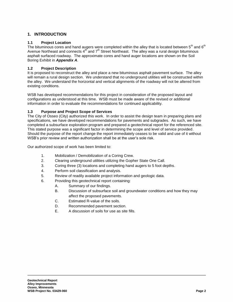
1. INTRODUCTION
Project Location 1.1The bituminous cores and hand augers were completed within the alley that is located between 5
th and 6
th
Avenue Northeast and connects 4th and 7
th Street Northeast. The alley was a rural design bituminous
asphalt surfaced roadway. The approximate cores and hand auger locations are shown on the Soil Boring Exhibit in Appendix A.
Project Description 1.2It is proposed to reconstruct the alley and place a new bituminous asphalt pavement surface. The alley will remain a rural design section. We understand that no underground utilities will be constructed within the alley. We understand the horizontal and vertical alignments of the roadway will not be altered from existing conditions. WSB has developed recommendations for this project in consideration of the proposed layout and configurations as understood at this time. WSB must be made aware of the revised or additional information in order to evaluate the recommendations for continued applicability.
Purpose and Project Scope of Services 1.3The City of Osseo (City) authorized this work. In order to assist the design team in preparing plans and specifications, we have developed recommendations for pavements and subgrades. As such, we have completed a subsurface exploration program and prepared a geotechnical report for the referenced site. This stated purpose was a significant factor in determining the scope and level of service provided. Should the purpose of the report change the report immediately ceases to be valid and use of it without WSB’s prior review and written authorization shall be at the user’s sole risk.
Our authorized scope of work has been limited to:
1. Mobilization / Demobilization of a Coring Crew.
2. Clearing underground utilities utilizing the Gopher State One Call.
3. Coring three (3) locations and completing hand augers to 5 foot depths.
4. Perform soil classification and analysis.
5. Review of readily available project information and geologic data.
6. Providing this geotechnical report containing:
A. Summary of our findings.
B. Discussion of subsurface soil and groundwater conditions and how they may
affect the proposed pavements.
C. Estimated R-value of the soils.
D. Recommended pavement section.
E. A discussion of soils for use as site fills.

Geotechnical Report Alley Improvements Osseo, Minnesota WSB Project No. 03429-060 Page 3
2. PROCEDURES
2.1 Boring Layout and Soil Sampling Procedures The City requested we complete three (3) soil borings along the alleyway. After our site visit to layout boring locations and meet with utility locators, we noted that the overhead power lines and narrow alleyway would prevent our drill rig from being able to perform soils borings. We contacted the Client and it was agreed that three (3) bituminous cores and hand augers would be completed along the alley. WSB recommended the depths and selected the desired locations. Our field crew staked the borings from existing site features from the supplied site plan. The approximate boring locations are shown on the Soil Boring Exhibit in Appendix A which is an aerial photo. We completed the cores and hand augers on November 8, 2016 with a coring machine with a 6 inch barrel and a 1¼” steel hand auger. Methods, crew chief, depths, sampling interval, groundwater observations, test data, and other information are indicated on the hand auger boring logs. The materials encountered were described on field logs and representative samples were containerized, and transported to our laboratory for further examination and testing. The samples were visually examined to estimate the distribution of grain sizes, plasticity, consistency, moisture condition, color, presence of lenses and seams, and apparent geologic origin. We classified the soils according to type using the Unified Soil Classification System (USCS). A chart describing the Unified Soil Classification System is included in Appendix A.
2.2 Groundwater Measurements and Borehole Abandonment The crew observed the borings for free groundwater after completion. These observations and measurements are noted on the boring logs. The crew then backfilled with soil cuttings.
2.3 Boring Log Procedures and Qualifications The subsurface conditions encountered by the test borings are illustrated on the Logs of Test Borings in Appendix A. Similar soils were grouped into the strata shown on the boring logs, and the appropriate estimated USCS classification symbols were also added. The depths and thickness of the subsurface strata indicated on the boring logs were estimated from the auger results. The transition between materials (horizontal and vertical) is approximate and is usually far more gradual than shown. Information on actual subsurface conditions exists only at the specific locations indicated and is relevant only to the time exploration was performed. Subsurface conditions and groundwater levels at other locations may differ from conditions found at the indicated locations. The nature and extent of these conditions would not become evident until exposed by construction excavation. These stratification lines were used for our analytical purposes and, due to the aforementioned limitations, should not be used as a basis of design or construction cost estimates.

Geotechnical Report Alley Improvements Osseo, Minnesota WSB Project No. 03429-060 Page 4
3. EXPLORATION RESULTS
3.1 Site and Geology The cores and augers were completed through the existing bituminous asphalt pavement section and encountered mostly fills overlying lean clays and clayey sands. The Hennepin County Geologic Atlas indicates the surficial geology of the area is mostly sand and gravel.
3.2 Subsurface Soil and Groundwater Conditions The boring profile generally consisted of pavement section materials and fills overlying fine and mixed alluvial soils. Fill materials were encountered to depths of 1 foot at Boring HA-3 and extended to termination at Borings HA-1 and HA-2. These fills consisted mostly of silty sands and lean clays. Lean clays were encountered below the fills at Boring HA-3, and were generally brown in color and moist. Clayey sands were encountered below the clays and were generally brown in color and moist. Table 1 below indicates the soils present within the upper 4 feet of the roadway profile. These soils typically have the greatest effect on the roadway subgrade.
Table 1: Roadway Soil Boring Profiles
Boring No. Bituminous Thickness (inches)
Aggregate Base
Thickness (inches)
Subgrade Soils (Upper 4 feet)
PB-1 2 10 Fill (Silty Sand and Lean Clay)
PB-2 1½ 10½ Fill (Silty Sand)
PB-3 2 10 Lean Clay, Clayey Sand
3.3 Groundwater Conditions WSB took groundwater level readings in the exploratory auger holes, reviewed the data obtained, and discussed its interpretation of the data in the text of the report. Note that groundwater levels may fluctuate due to seasonal variations (e.g. precipitation, snowmelt and rainfall) and/or other factors not evident at the time of measurement. No groundwater was encountered during the augers. The holes were only left open for a short time during the process.

Geotechnical Report Alley Improvements Osseo, Minnesota WSB Project No. 03429-060 Page 5
4. ENGINEERING ANALYSIS AND RECOMMENDATIONS
4.1 Discussion The fills encountered onsite consisted of lean clays and silty sands. These fills have been inplace for a long period of time and were likely placed to raise the roadway to grade or as utility backfill. Primary settlement of these soils should be complete. Based on this, it is our opinion these soils are suitable to remain in place as subgrade soils. The native lean clays and clayey sands would be suitable for pavement support. The soils within the pavement subgrade consist of clays and silty sands, which are frost susceptible soils. Consideration should be given to partially subcutting these soils and replacing with a non-frost susceptible granular fill to reduce the potential frost heave below the pavement section.
4.2 Pavement Areas After excavation of the pavement section, proof-roll tests should be utilized with a loaded dump truck to help identify areas that may require corrective action such as scarifying, disking, and compaction or sub-excavations. We also recommend a proof-roll be performed again on the aggregate base just prior to placement of the bituminous pavement. Once the site has been prepared as recommended, we anticipate the subgrade will consist of a mixture of lean clays, clayey sands, and silty sands. The MnDOT Flexible Pavement Design Guidance Memo from June 2014, indicates soils such as those anticipated have R-values ranging from about ten to thirty (10-30). We recommend an R-value of fifteen (15) be used for design of roadways at this site. No traffic data was available for the alleyway. We would expect traffic to be limited to residents driving to their garage and for garbage trucks. We estimated the Average Daily Traffic (ADT) to be less than 200 vehicles. Our design is based on a twenty (20) year design life of the pavement section. Based on the design R-value and the traffic ADT we calculated the roadway traffic to be equivalent to approximately 18,000 Estimated Single Axle Loads (ESAL’s). Bituminous Pavement Option Based on MnDOT’s MnPave software, we recommend the pavement section in Table 2.
Table 2: Recommended Flexible Pavement Section
Section Thickness (inches)
Bituminous Wear Course, MnDOT 2360 1½
Bituminous Base Course, MnDOT 2360 2
MnDOT Class 5 Aggregate Base 6
As previously mentioned the use of a non-frost susceptible sand cushion will help reduce the effects of frost heave. In our opinion, a 30 inch sand cushion typically provides adequate reduction in frost heave potential. It should be noted that any sand cushion placed below the pavement section will provide positive benefits for reduced potential frost heave. Drainage of the sand cushion via drain tile may be necessary. Drain tile wrapped in a sock should be placed at the base of the sand cushion and tied into catch basins. We recommend the sand cushion contain less than ten percent (10%) passing the #200 sieve.

Geotechnical Report Alley Improvements Osseo, Minnesota WSB Project No. 03429-060 Page 6
Within several years after initial paving, some thermal shrinkage cracks will develop. We recommend routine maintenance be performed to improve pavement performance and increase pavement life. Pavement should be sealed with a liquid bitumen sealer to retard water intrusion into the base course and subgrade. Localized patch failures may also develop where trucks or buses turn on the pavement. When these occur, they should be cut out and patch repaired. Periodic seal coating should also be applied, to preserve the longevity of the pavement.
Concrete Pavement Option Alternately, a concrete section could be designed for these roadways. The concrete section in Table 3 is based on minimum recommendations from MnDOT design methods.
Table 3: Commercial Roadways Concrete – Rigid Pavement Section
Section Thickness (inches)
Concrete, MnDOT 6
MnDOT Class 5 Aggregate Base 4
MnDOT recommends joint spacing of twelve foot (12’) or fifteen foot (15’) lengths. We used twelve feet (12’) for our calculations in the MnDOT Rigid Pavement Design software. We suggest the concrete mix be air-entrained to six percent plus or minus one and one-half percent (6% +/- 1½ %) with a minimum twenty-eight (28) day compressive strength of 4,000 psi. The slump range should be between two to five inches (2-5”) to reduce shrinkage related problems such as curling or excessive cracking. A maximum water to cement ratio of forty-five hundredths (0.45) is recommended. Type 1 cement should be acceptable, and should meet the requirements of ASTM C150. The concrete mix design should follow MnDOT requirements.
General Design The pavement sections above provide options to meet the ESAL requirements. Other pavement design options would be acceptable as well as long as they meet the minimum requirements for bituminous/concrete thickness, aggregate base thickness, and can meet the ESAL requirements.
4.3 Backfill and Fill Selection and Compaction The on-site non-organic soils may be reused as backfill and fill provided they are moisture conditioned and can be compacted to their specified densities. Any wet soils excavated would need to be dried before reuse as an engineered fill. Backfills with cobbles larger than six inches (6”) should not be placed below pavements or in contact with utilities. We recommend that sandy soils be moisture conditioned to meet compaction specifications and clayey soils be moisture conditioned to within two percent (2%) below to three percent (3%) above their optimum moisture contents as determined from their standard Proctor tests (ASTM D-698). Fill should be spread in thin lifts to allow for complete compaction of the material. Table 4 indicates the recommended compaction levels.

Geotechnical Report Alley Improvements Osseo, Minnesota WSB Project No. 03429-060 Page 7
Table 4: Recommended Level of Compaction for Backfill and Fill
Area Percent of Standard Proctor
Maximum Dry Density
Pavement: Within 3 feet of top of subgrade 100
Pavement: Greater than 3 feet below top of subgrade 95
Utility Trench 95
Landscaping (non-structural) 90
4.4 Construction Considerations Good surface drainage should be maintained throughout the work so that the site is not vulnerable to ponding during or after a rainfall. The excavation for any soil correction to densify loose fill should not encounter groundwater intrusion. However, if water does enter excavations, it should be promptly removed prior to further construction activities. Under no circumstances should fill or concrete be placed into standing water. Trenches for underground utility lines serving the building addition are also expected to be dry. Soil corrections at this site for pavement subgrades may not be continuous in all areas. We recommend tapering the fills back to native soils at a ten to one (10:1) slope.
4.5 Construction Safety All excavations must comply with the requirements of OSHA 29 CFR, Part 1926, Subpart P “Excavations and Trenches”. This document states that excavation safety is the responsibility of the contractor. Reference to this OSHA requirement should be included in the job specifications. The responsibility to provide safe working conditions on this site, for earthwork, building construction, or any associated operations is solely that of the contractor. This responsibility is not borne in any manner by WSB.
4.6 Cold Weather Construction It is our understanding that construction is unlikely to occur during the winter months. However, if the construction does continue into the winter months we recommend the following guidelines. Only unfrozen fill should be used. Placement of fill or concrete must not be permitted on frozen soil.
4.7 Field Observation and Testing The soil conditions illustrated on the Logs of Test Borings in Appendix A are indicative of the conditions only at the boring locations. WSB also recommends a representative number of field density tests be taken in all engineered fill and backfill placed to aid in judging its suitability. Fill placement and compaction should be monitored and tested to determine that the resulting fill and backfill conforms to specified density, strength or compressibility requirements. Prior to use, any proposed fill and backfill material should be submitted to the WSB laboratory for testing to verify compliance with recommendations and project specifications. Dynamic Cone Penetrometer (DCP) tests can be completed in the aggregate base in lieu of density testing. We recommend following MnDOT Specification 2211-3.

Geotechnical Report Alley Improvements Osseo, Minnesota WSB Project No. 03429-060 Page 8
WSB would be pleased to provide the necessary field observation, monitoring and testing services during construction.
4.8 Plan Review and Remarks The observations, recommendations and conclusions described in this report are based primarily on information provided to WSB, obtained from our subsurface exploration, our experience, several necessary assumptions and the scopes of service developed for this project and are for the sole use of our client. We recommend that WSB be retained to perform a review of final design drawing and specifications to evaluate that the geotechnical engineering report has not been misinterpreted. Should there be any changes in the design related to this project or if there are any uncertainties in the report we should be notified. We would be pleased to review any project changes and modify the recommendations in this report (if necessary) or provide any clarification in writing. The entire report should be kept together; for example, boring logs should not be removed and placed in the specifications separately. The boring logs and related information included in this report are indicators of the subsurface conditions only at the specific locations indicated on the Soil Boring Exhibit and times noted on the Logs of Test Boring sheets in Appendix A. The subsurface conditions, including groundwater levels, at other locations on the site may differ significantly from conditions that existed at the time of sampling and at the boring locations. The test borings were put down by WSB solely to obtain indications of subsurface conditions as part of a geotechnical exploration program. No services were performed to evaluate subsurface environmental conditions. WSB has not performed any observations, investigations, studies or testing that is not specifically listed in the scope of service. WSB shall not be liable for failing to discover any condition whose discovery required the performance of services not authorized by the Agreement.

Geotechnical Report Alley Improvements Osseo, Minnesota WSB Project No. 03429-060 Page 9
5. STANDARD OF CARE The recommendations and opinions contained in this report are based on our professional judgment. The soil testing and geotechnical engineering services performed for this project have been performed with the level of skill and diligence ordinarily exercised by reputable members of the same profession under similar circumstances, at the same time and in the same or a similar locale. No warranty, either express or implied, is made.

Geotechnical Report Appendix A Alley Improvements Osseo, Minnesota WSB Project No. 03429-060
APPENDIX A
Soil Borings Exhibit Logs of Test Borings
Symbols and Terminology on Test Boring Log Notice to Report Users Boring Log Information
Unified Soil Classification Sheet (USCS)

!(
!(
!(HA-1
HA-2
HA-3
6TH AVE NE5T
H AV
E NE
OAKS
DR
N
Soil Boring ExhibitAlley Between 5th and 6th Avenue NE
Osseo, MinnesotaWSB# 03429-060
Document Path: K:\03429-060\GIS\Maps\SoilBoringMaps\SoilBoringLocation5th6thAve.mxd
Ü
!( Soil Boring Locations0 100Feet

1 1/2" HA 0' - 5'
Pavement Section
Fill
Fill
1
2
3
AU
AU
AU
BITUMINOUS 0 - 2"AGGREGATE BASE 2" - 12"
FILL, mostly Silty Sand, dark brown
FILL, mostly Lean Clay, grayish brown
End of Boring 5.0 ft.
TIME CASINGDEPTH
CAVE-INDEPTH
WATERDEPTH
WATERELEVATION
WATER LEVEL MEASUREMENTS
SAMPLEDDEPTHDATE METHOD
START: 11/08/2016 END: 11/08/2016
Logged By:
DAJJ. Tatro
Notes:
Crew Chief:
LABORATORY TESTSMC(%)
DD(pcf)
LL(%)
PL(%)
511/08/2016 None
PROJECT NAME: 2017 Street Improvements
LOG OF TEST BORING
PROJECT LOCATION: Osseo, MN BORING NUMBER HA 1PAGE 1 OF 1CLIENT/WSB #: 03429-060
DEPTH(ft)
1
2
3
4
5
6
7
8
9
10
11
USCS GEOLOGICORIGIN
SAMPLE
No. TYPEWL
WS
B B
OR
ING
LO
G -
WS
B.G
DT
- 1
1/2
1/16
09:
21 -
K:\0
3429
-060
\GE
OT
EC
H-C
MT
\201
7 S
TR
EE
T I
MP
RO
VE
ME
NT
S.G
PJ
DESCRIPTION OF MATERIAL

1 1/2" HA 0' - 5'
Pavement Section
Fill
1
2
AU
AU
BITUMINOUS 0 - 1 1/2"AGGREGATE BASE 1 1/2" - 12"
FILL, mostly Silty Sand, dark brown
End of Boring 5.0 ft.
TIME CASINGDEPTH
CAVE-INDEPTH
WATERDEPTH
WATERELEVATION
WATER LEVEL MEASUREMENTS
SAMPLEDDEPTHDATE METHOD
START: 11/08/2016 END: 11/08/2016
Logged By:
DAJJ. Tatro
Notes:
Crew Chief:
LABORATORY TESTSMC(%)
DD(pcf)
LL(%)
PL(%)
511/08/2016 None
PROJECT NAME: 2017 Street Improvements
LOG OF TEST BORING
PROJECT LOCATION: Osseo, MN BORING NUMBER HA 2PAGE 1 OF 1CLIENT/WSB #: 03429-060
DEPTH(ft)
1
2
3
4
5
6
7
8
9
10
11
USCS GEOLOGICORIGIN
SAMPLE
No. TYPEWL
WS
B B
OR
ING
LO
G -
WS
B.G
DT
- 1
1/2
1/16
09:
21 -
K:\0
3429
-060
\GE
OT
EC
H-C
MT
\201
7 S
TR
EE
T I
MP
RO
VE
ME
NT
S.G
PJ
DESCRIPTION OF MATERIAL

1 1/2" HA 0' - 5'
CL
SC
Pavement Section
Fine Alluvium
Mixed Alluvium
1
2
3
AU
AU
AU
BITUMINOUS 0 - 2"AGGREGATE BASE 2" - 12"
LEAN CLAY, brown, moist
CLAYEY SAND, brown, moist
End of Boring 5.0 ft.
TIME CASINGDEPTH
CAVE-INDEPTH
WATERDEPTH
WATERELEVATION
WATER LEVEL MEASUREMENTS
SAMPLEDDEPTHDATE METHOD
START: 11/08/2016 END: 11/08/2016
Logged By:
DAJJ. Tatro
Notes:
Crew Chief:
LABORATORY TESTSMC(%)
DD(pcf)
LL(%)
PL(%)
511/08/2016 None
PROJECT NAME: 2017 Street Improvements
LOG OF TEST BORING
PROJECT LOCATION: Osseo, MN BORING NUMBER HA 3PAGE 1 OF 1CLIENT/WSB #: 03429-060
DEPTH(ft)
1
2
3
4
5
6
7
8
9
10
11
USCS GEOLOGICORIGIN
SAMPLE
No. TYPEWL
WS
B B
OR
ING
LO
G -
WS
B.G
DT
- 1
1/2
1/16
09:
21 -
K:\0
3429
-060
\GE
OT
EC
H-C
MT
\201
7 S
TR
EE
T I
MP
RO
VE
ME
NT
S.G
PJ
DESCRIPTION OF MATERIAL

SYMBOLS AND TERMINOLOGOY ON TEST BORING LOG
SYMBOLS Drilling and Sampling Laboratory Testing
Symbol Description
HSA 3-1/4” LD. Hollow stem auger _ FA 4”, 6” or 10” diameter flight auger _HA 2”, 4”, or 6” hand auger _DC 2-1/2”, 4”, 5”, or 6” steel drive casing _RC Size A, B or N rotary casing PD Pipe drill or cleanout tube CS Continuous split barrel sampling DM Drilling mud JW Jetting water SB 2” O.D. split barrel sampling _L 2-1/2” or 3-1/2” O.D. SB liner sampler _T 2” or 3” thin walled tube sample 3TP 3” thin walled tube using pitcher sampler _TO 2” or 3” thin walled tube using Osterberg
sampler W Wash sample B Bag sample P Test pit sample _Q BQ, NQ, or PQ wire line system _X AX, BX, or NX double tube barrel N Standard penetration test, blows per foot CR Core recovery, percent WL Water level
Water level NMR No measurement recorded, primarily due
to presence of drilling or coring fluid.
Symbol Description
W Water content, % (ASTM** D2216) D Dry density, pcf LL Liquid limit (ASTM D4318) PL Plastic limit (ASTM D4318)
-Inserts in last column (Qu or RQD)-
Qu Unconfined compressive strength, psf (ASTM D2166) Pq Penetrometer reading, tsf (ASTM D1558) Ts Torvane reading, tsf G Specific gravity (ASTM D854) SL Shrinkage limits (ASTM D427) OC Organic content-combustion method (ASTM D2974) SP Swell pressure, tsf (ASTM D4546) PS Percent swell under pressure (ASTM D4546) FS Free swell, % (ASTM D4546) SS Shrink swell, % (ASTM D4546) pH Hydrogen ion content-Meter Method (ASTM D4972) SC Sulfate content, parts/million or mg/l CC Chloride content, parts/million or mg/l C* One dimensional consolidation (ASTM D2435) Qc* Triaxial compression (ASSTM D2850 and D4767) D.S.* Direct Shear (ASTM D3080) K* Coefficient of permeability, cm/sec (ASTM D2434) P* Pinhole test (ASTM D4647) DH* Double hydrometer (ASTM D4221) MA* Particle size analysis (ASTM D422) R Laboratory electrical resistivity, ohm-cm (ASTM G57) E* Pressuremeter deformation modulus, tsf (ASTM D4719) PM* Pressuremeter test (ASTM D4719) VS* Field vane shear (ASTM D2573) IR* Infiltrometer test (ASTM D3385) RQD Rock quality designation, percent *Results shown on attached data sheet or graph **ASTM designates American Society for Testing and Materials
TERMINOLOGY Particle Sizes Soil layering and Moisture
Type Size Range Boulders > 12” Cobbles 3” – 12” Coarse gravel 3/4” – 3” Fine gravel #4 sieve – 3/4” Coarse sand #4 - #10 sieve Medium sand #10-#40 sieve Fine sand #40-#200 sieve Silt 100% passing #200 sieve and > 0.005mm Clay 100% passing #200 sieve and < 0.005mm
Term Visual Observation Lamination Up to 1/4” thick stratum Varved Altering laminations of any combination of
clay, silt, fine sand, or colors Lenses Small pockets of different soils in a soil mass Stratified Altering layers of varying materials or colors Layer 1/4” to 12” thick stratum Dry Powdery, no noticeable water Moist Damp, below saturation Waterbearing Pervious soil below water Wet Saturated, above liquid limit
Gravel Content Standard Penetration Resistance Coarse-Grained Soils Fine-Grained Soils Cohesionless Soils Cohesive Soils
% Gravel Description 2-15 A little gravel 16-49 With gravel
% Gravel Description < 5 Trace of gravel 5-15 A little gravel 16-30 With gravel 31-49 Gravelly
N-Value Relative Density 0-4 Very loose 5-10 Loose
11-30 Medium dense 31-50 Dense > 50 Very dense
N-Value Consistency 0-4 Very soft 5-8 Soft 9-15 Firm 16-30 Hard > 30 Very hard
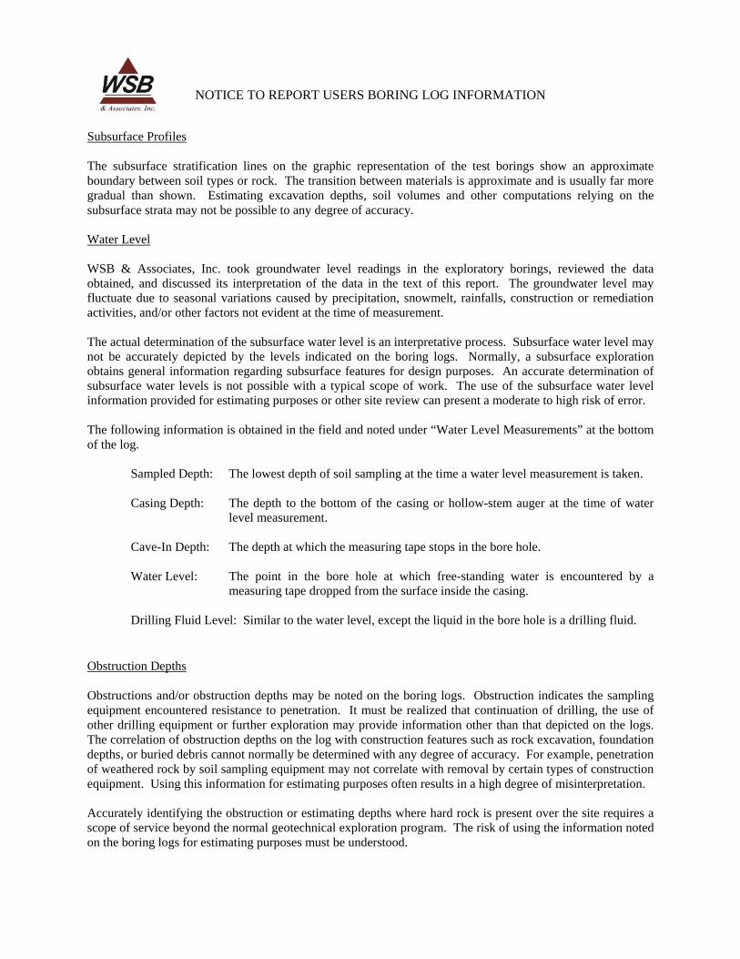
NOTICE TO REPORT USERS BORING LOG INFORMATION
Subsurface Profiles
The subsurface stratification lines on the graphic representation of the test borings show an approximate boundary between soil types or rock. The transition between materials is approximate and is usually far more gradual than shown. Estimating excavation depths, soil volumes and other computations relying on the subsurface strata may not be possible to any degree of accuracy.
Water Level
WSB & Associates, Inc. took groundwater level readings in the exploratory borings, reviewed the data obtained, and discussed its interpretation of the data in the text of this report. The groundwater level may fluctuate due to seasonal variations caused by precipitation, snowmelt, rainfalls, construction or remediation activities, and/or other factors not evident at the time of measurement.
The actual determination of the subsurface water level is an interpretative process. Subsurface water level may not be accurately depicted by the levels indicated on the boring logs. Normally, a subsurface exploration obtains general information regarding subsurface features for design purposes. An accurate determination of subsurface water levels is not possible with a typical scope of work. The use of the subsurface water level information provided for estimating purposes or other site review can present a moderate to high risk of error.
The following information is obtained in the field and noted under “Water Level Measurements” at the bottom of the log.
Sampled Depth: The lowest depth of soil sampling at the time a water level measurement is taken.
Casing Depth: The depth to the bottom of the casing or hollow-stem auger at the time of water level measurement.
Cave-In Depth: The depth at which the measuring tape stops in the bore hole.
Water Level: The point in the bore hole at which free-standing water is encountered by a measuring tape dropped from the surface inside the casing.
Drilling Fluid Level: Similar to the water level, except the liquid in the bore hole is a drilling fluid.
Obstruction Depths
Obstructions and/or obstruction depths may be noted on the boring logs. Obstruction indicates the sampling equipment encountered resistance to penetration. It must be realized that continuation of drilling, the use of other drilling equipment or further exploration may provide information other than that depicted on the logs. The correlation of obstruction depths on the log with construction features such as rock excavation, foundation depths, or buried debris cannot normally be determined with any degree of accuracy. For example, penetration of weathered rock by soil sampling equipment may not correlate with removal by certain types of construction equipment. Using this information for estimating purposes often results in a high degree of misinterpretation.
Accurately identifying the obstruction or estimating depths where hard rock is present over the site requires a scope of service beyond the normal geotechnical exploration program. The risk of using the information noted on the boring logs for estimating purposes must be understood.


Feasibility Report Update 2018 Alley Reconstruction Project City of Osseo, MN WSB Project No. 3429-070
APPENDIX D
Televising Report


Feasibility Report Update 2018 Alley Reconstruction Project City of Osseo, MN WSB Project No. 3429-070
APPENDIX E
Preliminary Assessment Map Preliminary Assessment Roll


Date: 11/6/2017 Rate WSB Project No.: 03429-070 Complete Reconstruction Residential Single-Family Per Unit Assessment: $6,580.00
1 1811921210043 DUANE E & AMY L POPPE 408 5TH AVE N E OSSEO MN 55369 408 5TH AVE NE RESIDENTIAL 1 $6,580.002 1811921210085 KENNETH J FELBER 424 5TH AVE N E OSSEO MN 55369 424 5TH AVE NE RESIDENTIAL 1 $6,580.003 1811921210046 SUZANNE M PACE 432 5TH AV NE OSSEO MN 55369 432 5TH AVE NE RESIDENTIAL 1 $6,580.004 1811921210035 STACY L & TIMOTHY M POLICH 500 5TH AVE N E OSSEO MN 55369 500 5TH AVE NE RESIDENTIAL 1 $6,580.005 1811921210034 KATHARINE ELIZABETH METHUM 508 5TH AVE N E OSSEO MN 55369 508 5TH AVE NE RESIDENTIAL 1 $6,580.006 1811921210033 DIANA L LAHD 516 5TH AVE N E OSSEO MN 55369 516 5TH AVE NE RESIDENTIAL 1 $6,580.007 1811921210032 LEE RITTER & SUE RITTER 524 5TH AVE N E OSSEO MN 55369 524 5TH AVE NE RESIDENTIAL 1 $6,580.008 1811921210031 ROBERT & BETTY ROBIDEAU 532 5TH AVE N E OSSEO MN 55369 532 5TH AVE NE RESIDENTIAL 1 $6,580.009 1811921210030
SALLY M HEIN 600 5TH AVE N E OSSEO MN 55369 600 5TH AVE NE RESIDENTIAL 1 $6,580.00
10 1811921210029 BRADLEY J ROSCH 608 5TH AVE N E OSSEO MN 55369 608 5TH AVE NE RESIDENTIAL 1 $6,580.0011 1811921210028 LESLIE J EIDEN 616 5TH AVE N E OSSEO MN 55369 616 5TH AVE NE RESIDENTIAL 1 $6,580.0012 1811921210027 TODD W & DAWN L TESSMAN 624 5TH AVE N E OSSEO MN 55369 624 5TH AVE NE RESIDENTIAL 1 $6,580.0013 1811921210026
LISA A PETERSON 632 5TH AVE N E OSSEO MN 55369 632 5TH AVE NE RESIDENTIAL 1 $6,580.00
14 1811921210025 ALAN & KATHERINE KOWALCHYK 25061 BAY CEDER DRIVE BONITA SPRINGS, FL 34134 640 5TH AVE NE RESIDENTIAL 1 $6,580.0015 1811921210087 CAROL EMMANS 401 6TH AVE N E OSSEO MN 55369 401 6TH AVE NE RESIDENTIAL 1 $6,580.0016 1811921210086 ERIN M HENTE 417 6TH AVE N E OSSEO MN 55369 417 6TH AVE NE RESIDENTIAL 1 $6,580.0017 1811921210039 MICHAEL W MACK 425 6TH AVE N E OSSEO MN 55369 425 6TH AVE NE RESIDENTIAL 1 $6,580.0018 1811921210038 MOLLY BURNS 433 6TH AVE N E OSSEO MN 55369 433 6TH AVE NE RESIDENTIAL 1 $6,580.0019 1811921210073 MAYNARD R EDER 501 6TH AVE N E OSSEO MN 55369 501 6TH AVE NE RESIDENTIAL 1 $6,580.0020 1811921210072 TIMOTHY J PASKE 509 6TH AVE NE OSSEO MN 55369 509 6TH AVE NE RESIDENTIAL 1 $6,580.0021 1811921210071 MARK R & LUJEAN K RUEL 517 6TH AVE N E OSSEO MN 55369 517 6TH AVE NE RESIDENTIAL 1 $6,580.0022 1811921210070 RAYMOND/PAMELA MC DONALD JR 601 6TH AVE N OSSEO MN 55369 601 6TH AVE NE RESIDENTIAL 1 $6,580.0023 1811921210069 BRUCE J DAHLHEIMER 609 6TH AV NE OSSEO MN 55369 609 6TH AVE NE RESIDENTIAL 1 $6,580.0024 1811921210068 PAUL F FERGUSON 617 6TH AVE N E OSSEO MN 55369 617 6TH AVE NE RESIDENTIAL 1 $6,580.0025 1811921210067
RHONDA SCHLEGEL 19705 CTY RD 30 CORCORAN MN 55340 625 6TH AVE NE RESIDENTIAL 1 $6,580.00
26 1811921210066
KAREN L KELLAR TRUSTEE 633 6TH AVE N E OSSEO MN 55369 633 6TH AVE NE RESIDENTIAL 1 $6,580.0027 1811921210065 CHRIST F & JOYCE M JENSEN 22275 CO RD NO 117 ROGERS MN 55374 641 6TH AVE NE RESIDENTIAL 1 $6,580.00
GRAND TOTAL - PRELIMINARY PROJECT ASSESSMENT: $177,660.00
CITY OF OSSEO2018 ALLEY RECONSTRUCTION PROJECT
PRELIMINARY ASSESSMENT ROLL
MAP ID PID FEE OWNER FEE OWNER ADDRESSPROPOSED
ASSESSMENTCITY/STATE/ZIP PROPERTY ADDRESS
UNIT ASSESSMENT
RATEUSE DESCRIPTION

Feasibility Report Update 2018 Alley Reconstruction Project City of Osseo, MN WSB Project No. 3429-070
APPENDIX F
Public Comment Summary