Equipment and operation of Vessel monitoring systems (VMS)
45
Equipment and operation of Vessel monitoring systems (VMS) SEAFDEC Regional PSM Inspector Training Bangkok, Thailand Office of Law Enforcement 22-26 July 2019
-
Upload
khangminh22 -
Category
Documents
-
view
0 -
download
0
Transcript of Equipment and operation of Vessel monitoring systems (VMS)
Equipment and operation of Vessel monitoring systems
(VMS)SEAFDEC Regional PSM Inspector Training
Bangkok, ThailandOffice of Law Enforcement
22-26 July 2019
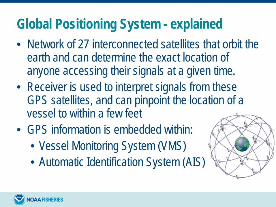
Global Positioning System - explained• Network of 27 interconnected satellites that orbit the
earth and can determine the exact location of anyone accessing their signals at a given time.
• Receiver is used to interpret signals from these GPS satellites, and can pinpoint the location of a vessel to within a few feet
• GPS information is embedded within:• Vessel Monitoring System (VMS) • Automatic Identification System (AIS)
GPS
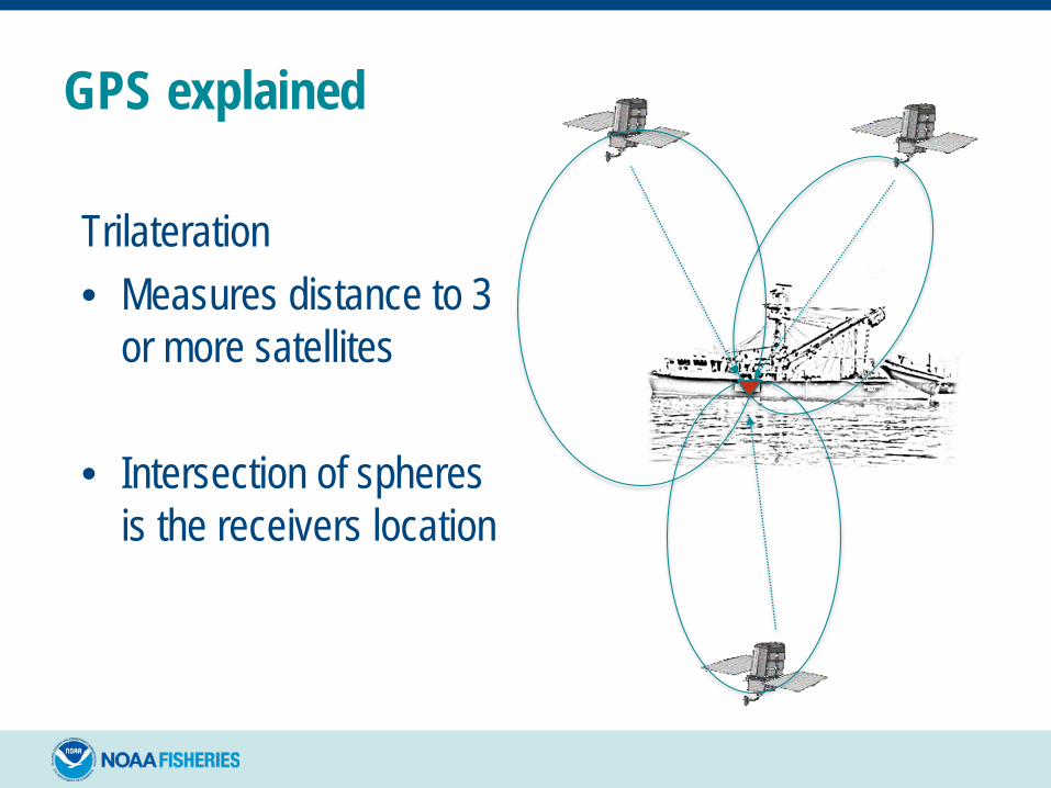
GPS explained
Trilateration• Measures distance to 3
or more satellites
• Intersection of spheres is the receivers location
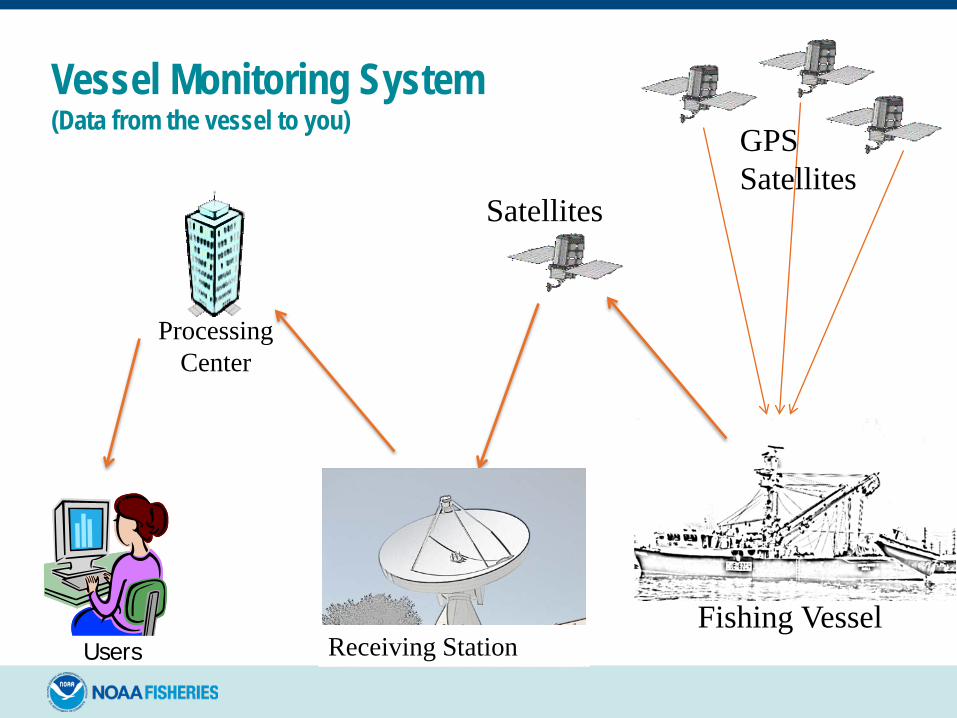
Vessel Monitoring System(Data from the vessel to you)
GPS
ProcessingCenter
Receiving StationUsers
GPSSatellites
Fishing Vessel
Satellites
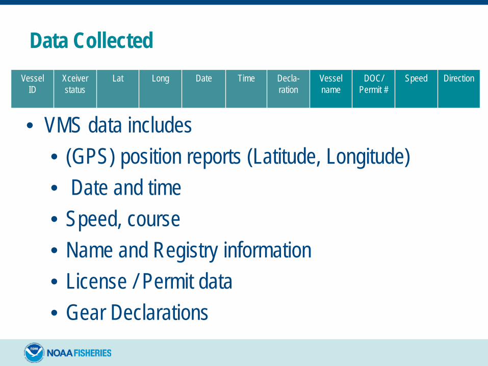
Data Collected
• VMS data includes • (GPS) position reports (Latitude, Longitude)• Date and time• Speed, course• Name and Registry information• License / Permit data• Gear Declarations
Vessel ID
Xceiverstatus
Lat Long Date Time Decla-ration
Vessel name
DOC/Permit #
Speed Direction
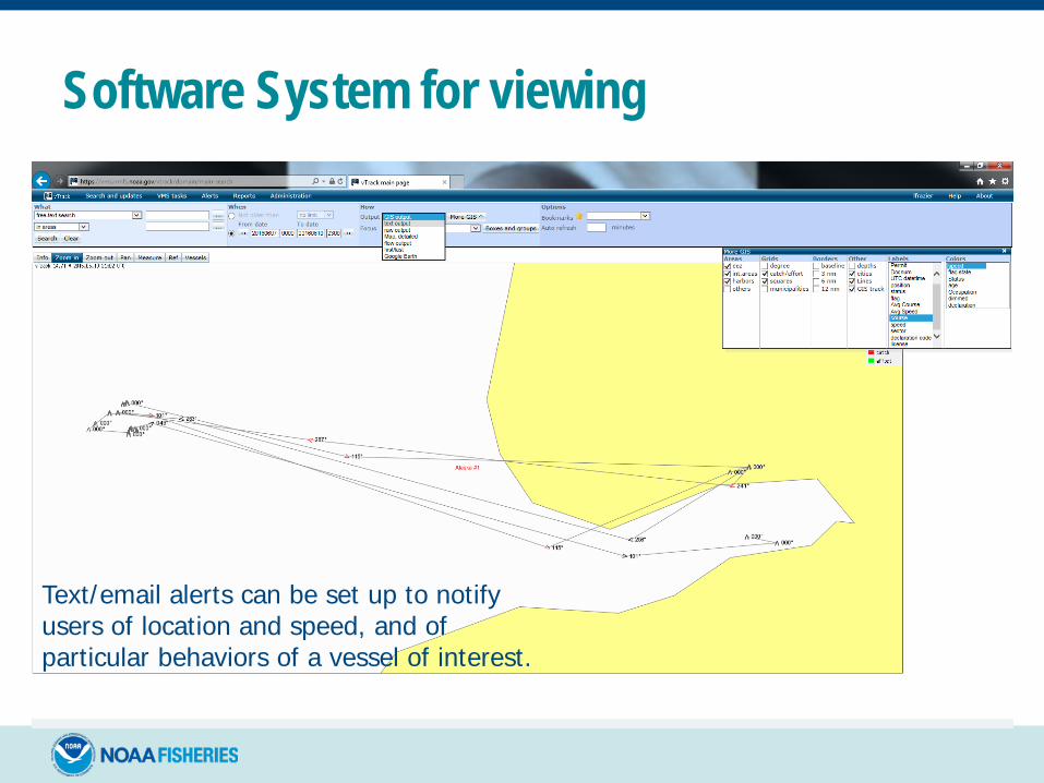
Software System for viewing
Text/email alerts can be set up to notify users of location and speed, and of particular behaviors of a vessel of interest.
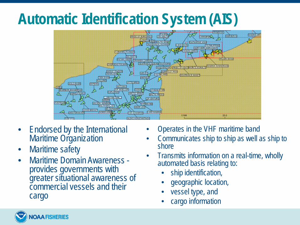
• Endorsed by the International Maritime Organization
• Maritime safety• Maritime Domain Awareness -
provides governments with greater situational awareness of commercial vessels and their cargo
• Operates in the VHF maritime band • Communicates ship to ship as well as ship to
shore • Transmits information on a real-time, wholly
automated basis relating to:• ship identification, • geographic location, • vessel type, and • cargo information
Automatic Identification System (AIS)

VMS Program Goals What does it do for Field Enforcement?
MONITORING- Detect/Deter
INTEL / PATROL COORDINATION
INVESTIGATIONS- Document
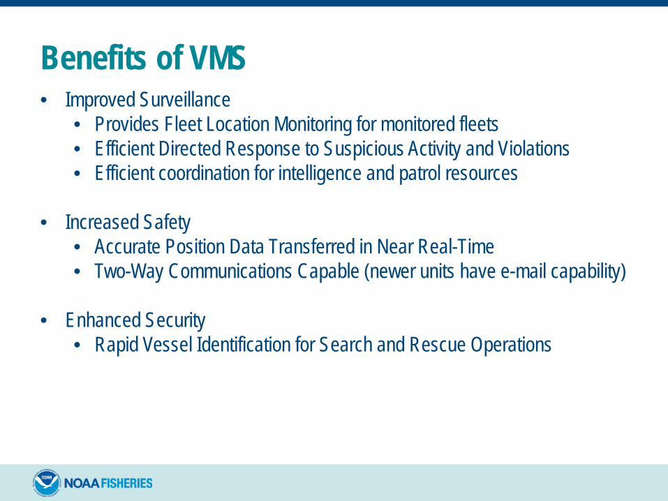
Benefits of VMS• Improved Surveillance
• Provides Fleet Location Monitoring for monitored fleets• Efficient Directed Response to Suspicious Activity and Violations• Efficient coordination for intelligence and patrol resources
• Increased Safety• Accurate Position Data Transferred in Near Real-Time• Two-Way Communications Capable (newer units have e-mail capability)
• Enhanced Security• Rapid Vessel Identification for Search and Rescue Operations
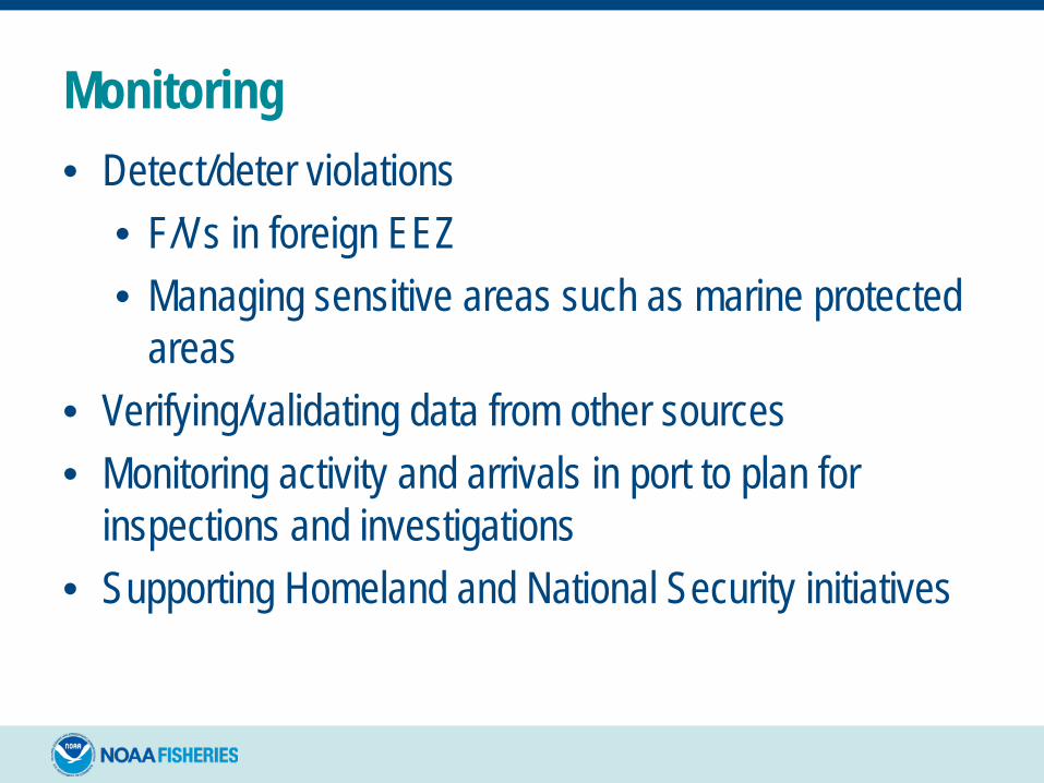
Monitoring• Detect/deter violations
• F/Vs in foreign EEZ• Managing sensitive areas such as marine protected
areas• Verifying/validating data from other sources• Monitoring activity and arrivals in port to plan for
inspections and investigations• Supporting Homeland and National Security initiatives
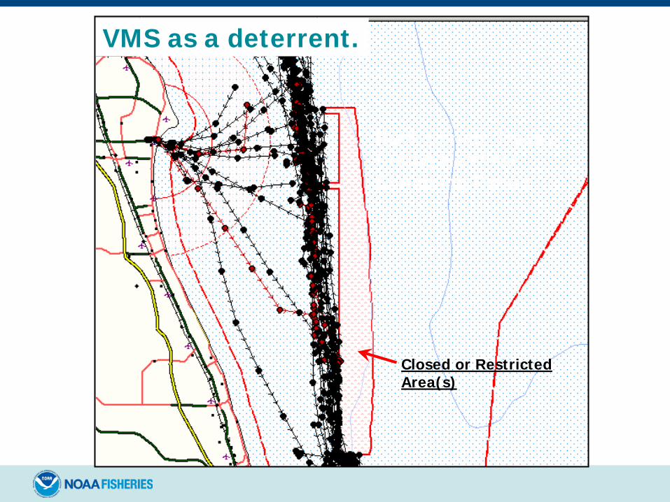
Closed or Restricted Area(s)
Rock Shrimp TracksDuring Heaviest Shrimping Period
VMS as a deterrent.
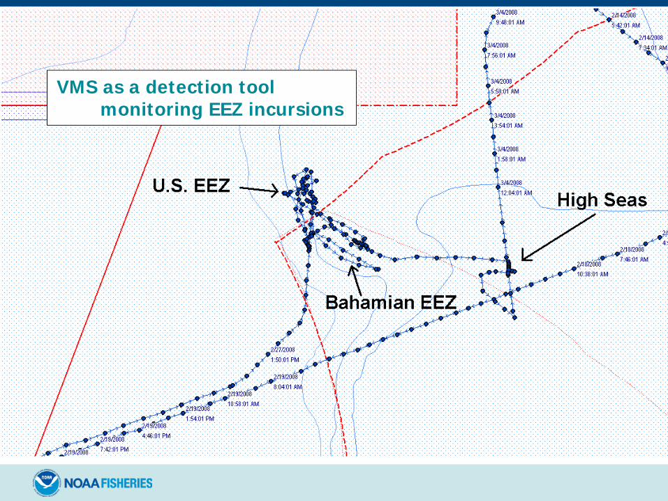
VMS as a detection toolmonitoring EEZ incursions
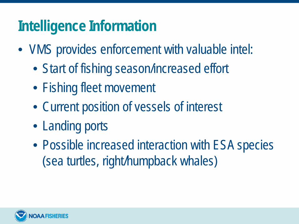
Intelligence Information• VMS provides enforcement with valuable intel:
• Start of fishing season/increased effort• Fishing fleet movement• Current position of vessels of interest• Landing ports• Possible increased interaction with ESA species
(sea turtles, right/humpback whales)

Patrol Planning / Coordination• VMS assists in patrol planning/coordination by
identifying F/V concentrations
• Patrols compliment VMS by ensuring compliance with VMS requirements (non-reporting, verifying identity)
at-sea targeting
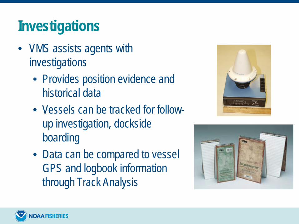
Investigations• VMS assists agents with
investigations• Provides position evidence and
historical data• Vessels can be tracked for follow-
up investigation, dockside boarding
• Data can be compared to vessel GPS and logbook information through Track Analysis
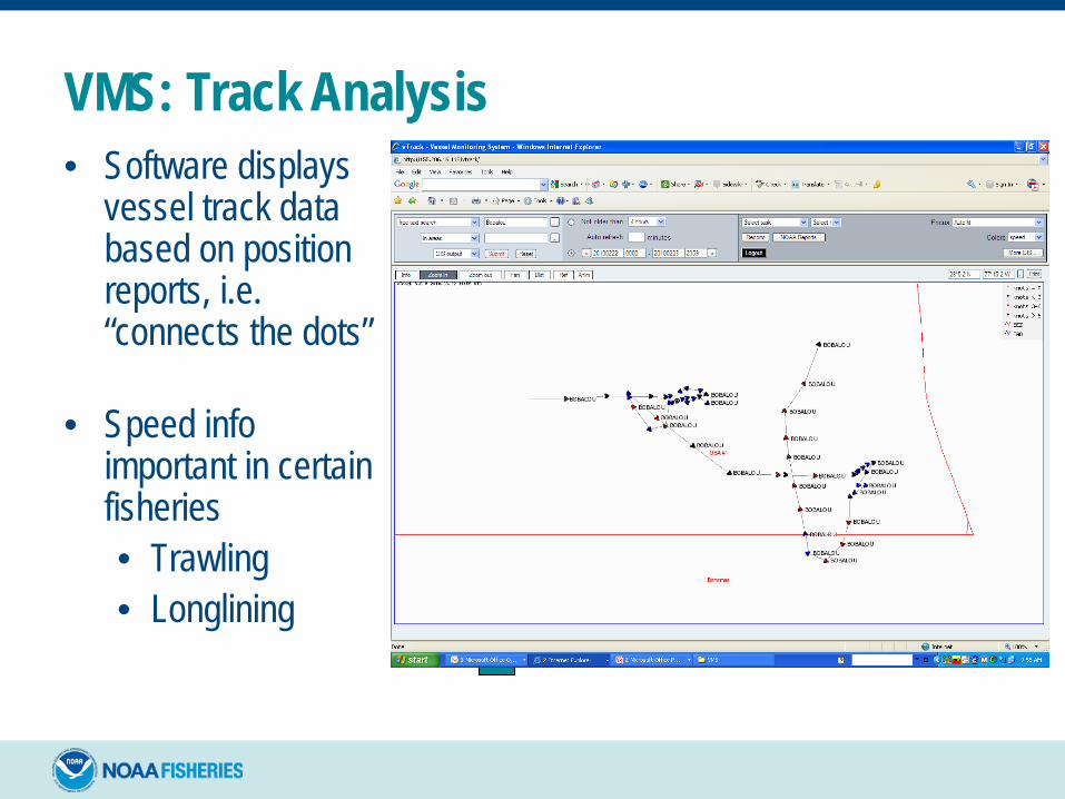
VMS: Track Analysis• Software displays
vessel track data based on position reports, i.e. “connects the dots”
• Speed info important in certain fisheries• Trawling• Longlining

Track Analysis• Currently, no case precedence of using VMS to
establish a “Fishing Signature”
• VMS data coupled with knowledge of fishing practices and GPS forensics can assist agents/officers with identifying fishing activity • Useful for vessel captain/owner interviews• In closed area cases where there is an enhanced
penalty for fishing in the area• Provides GCEL a clear picture of activity
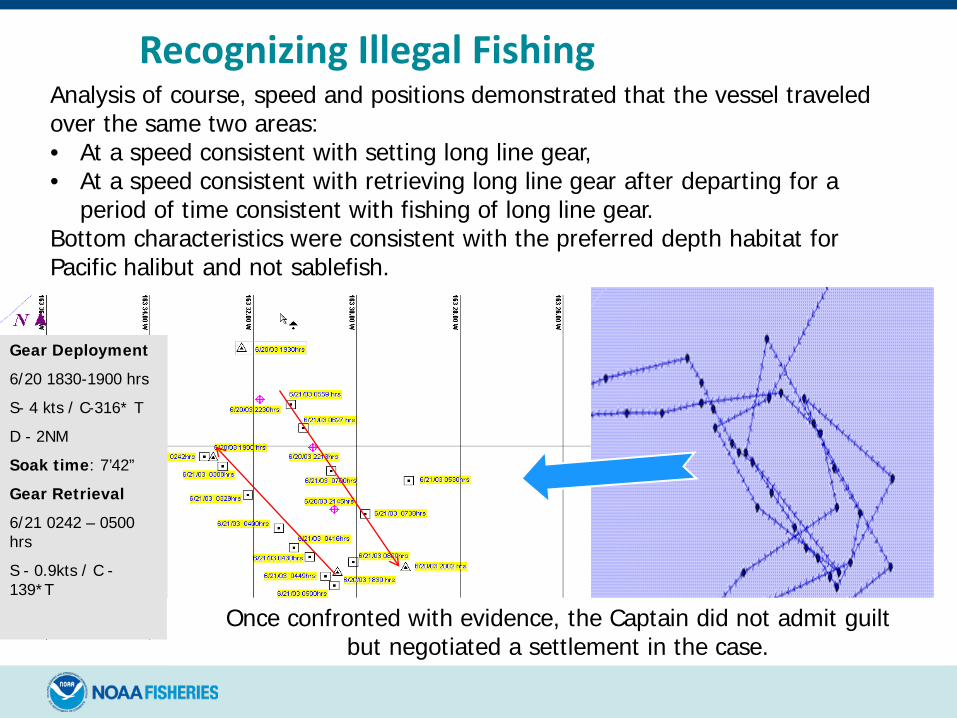
Recognizing Illegal Fishing
Gear Deployment6/20 1830-1900 hrsS- 4 kts / C-316* T D - 2NMSoak time: 7’42”Gear Retrieval6/21 0242 – 0500 hrsS - 0.9kts / C -139*T
Analysis of course, speed and positions demonstrated that the vessel traveled over the same two areas:• At a speed consistent with setting long line gear,• At a speed consistent with retrieving long line gear after departing for a
period of time consistent with fishing of long line gear.Bottom characteristics were consistent with the preferred depth habitat for Pacific halibut and not sablefish.
Once confronted with evidence, the Captain did not admit guilt but negotiated a settlement in the case.

VMS under RFMO’s and International Agreements
Checklist for Attempting to Determine if a Foreign Vessel Should Be Reporting, and if so, What Entity Should Have Visibility Of The Vessel Positions*
* in the Pacific Region
The following series of slides provides a number of items to check while boarding a FFV to determine VMS data flow and whether or not an officer/inspector will be able to view the vessel’s track line
VMS requirements and limitations are based on RFMO and national requirements and may vary significantly.

Check The Vessel’s Licenses, Authorizations, Vessel Register, and Registration of FV Listings
• FFA list of vessels reporting in VMS (updated daily): https://www.ffa.int/node/42/
• List shows number of VMS position reports received by FFA’s VMS per vessel, per day…if a number shows up in the date box, the vessel’s VMS is successfully reporting to FFA – if it is blank, it is/was not reporting to FFA’s VMS on that date
• FFA member licenses: https://rimf.ffa.int/rimf/public/license.php
• Some FFA members do not list licenses here, but vessels listed here should be reporting in VMS to FFA
Check The Vessel’s Licenses, Authorizations, Vessel Register, and Registration of FV Listings
• WCPFC Record of Fishing Vessels (RFV): http://www.wcpfc.int/record-fishing-vessel-database
• This is not a “license list”; it is a list of vessels “authorized” by their flag State to fish for HMS (tuna) on the high seas in the WCPFC Convention Area
• Vessels on this list should be reporting in VMS to WCPFC, but are generally only “visible” to WCPFC if/when on the high seas in the Convention Area.
• Vessels on this list should also (in most cases) be reporting in VMS to their flag States (who likely have fuller visibility than WCPFC)
• Vessels on this list should be reporting to coastal state(s) when within their EEZ (and/or on the high seas within 100 NM outside of the EEZ)

Check/Determine the Vessel’s Targeted Species
• If HMS (tuna), it should likely be on one of the lists above (and if it is not on one or more of those lists above, need to check with the vessel’s flag State authorities)
• If not HMS (tuna), there may not be a VMS requirement for the vessel (need to check with your own regional or national fisheries authorities if in doubt)
Check Log Books to Determine Where the Vessel Fished on this Trip• If on the high seas in the WCPFC Area, it should
be on at least the WCPFC RFV, & should be visible to Coastal State(s) in within their EEZ
• If in an FFA member EEZ, it should be on at least the FFA RFV, & should be visible to FFA VMS staff
Check the VMS Junction Box (Aka “Black Box”) in the Wheel House to Confirm “Power On”• A very wide variety of VMS units are installed on non-US
vessels; some are not easily located/recognized/identified (see examples, in following slides)
• Some captains/vessel masters cannot identify their own VMS units (or reliably determine if they are fully operational)
• Sometimes easiest to start at the VMS antenna and follow the cable back to the wheel house “black box” (that is not always black, and is sometimes inside cabinets)
• Normally the vessel’s flag State authorities and/or FFA (if on the FFA VMS list) will be most reliable in confirming a vessel’s VMS-reporting status/history

VMS units currently type-approved for use by vessels fishing for HMS in the WCPFC Convention Area
CLS Argos MAR-GEV2 Ecuador, Indonesia, Japan, Korea, Philippines, Chinese TaipeiCLS Argos MAR-GE Indonesia, Japan, Korea, Panama, Philippines, Chinese TaipeiCLS LEO Canada, FFA, Korea, Panama, Philippines, Chinese Taipei, USA CLS Thorium TST 100 Canada, China, FFA, Korea, Philippines, Chinese Taipei, USACLS Triton ADV FFAAnritsu RSS405A JapanFuruno Felcomo 12 China, EU, FFA, Japan, New Caledonia, PanamaFuruno Felcom 15 China, EU, FFA, Japan, Korea, Chinese TaipeiFuruno Felcom 16 Canada, China, Ecuador, EU, FFA, Japan, Korea, Panama, PhilippinesFuruno Felcom 19 JapanFuruno Felcom 18 EU, JapanJRC JUE-75C FFA, Japan, PanamaJRC JUE-85 FFA, Japan, PanamaJRC JUE-95C JapanJRC JUE-95VM EU, FFA, Japan, Panama, Chinese TaipeiSATLINK ELB 2000 EUSATLINK ELB2004 EUSATLINK NERA Mini-C Philippines
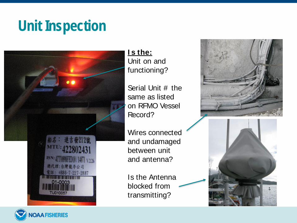
Unit InspectionIs the:Unit on and functioning?
Serial Unit # the same as listed on RFMO Vessel Record?
Wires connected and undamaged between unit and antenna?
Is the Antenna blocked from transmitting?
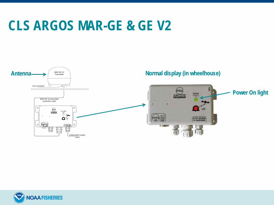
CLS ARGOS MAR-GE & GE V2
Normal display (in wheelhouse)
Power On light
Antenna
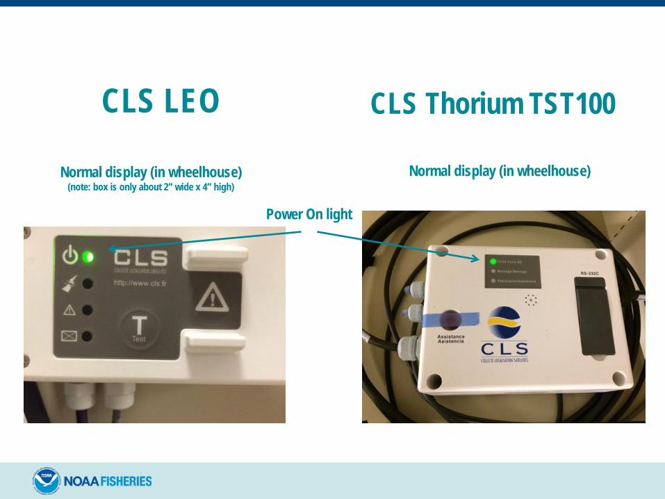
CLS Thorium TST100
Normal display (in wheelhouse)
Power On light
CLS LEO
Normal display (in wheelhouse)(note: box is only about 2” wide x 4” high)
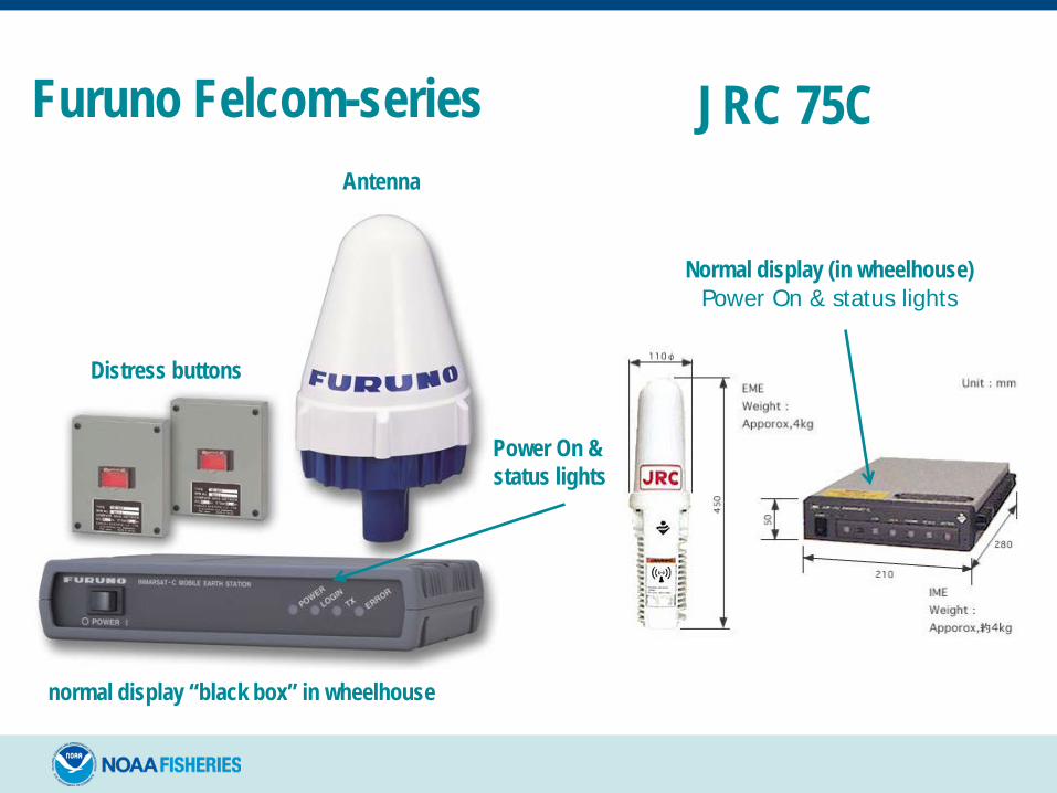
Furuno Felcom-series
Distress buttons
Power On & status lights
Antenna
normal display “black box” in wheelhouse
Normal display (in wheelhouse)Power On & status lights
JRC 75C

JRC 95VMPower On & status lights
Antenna
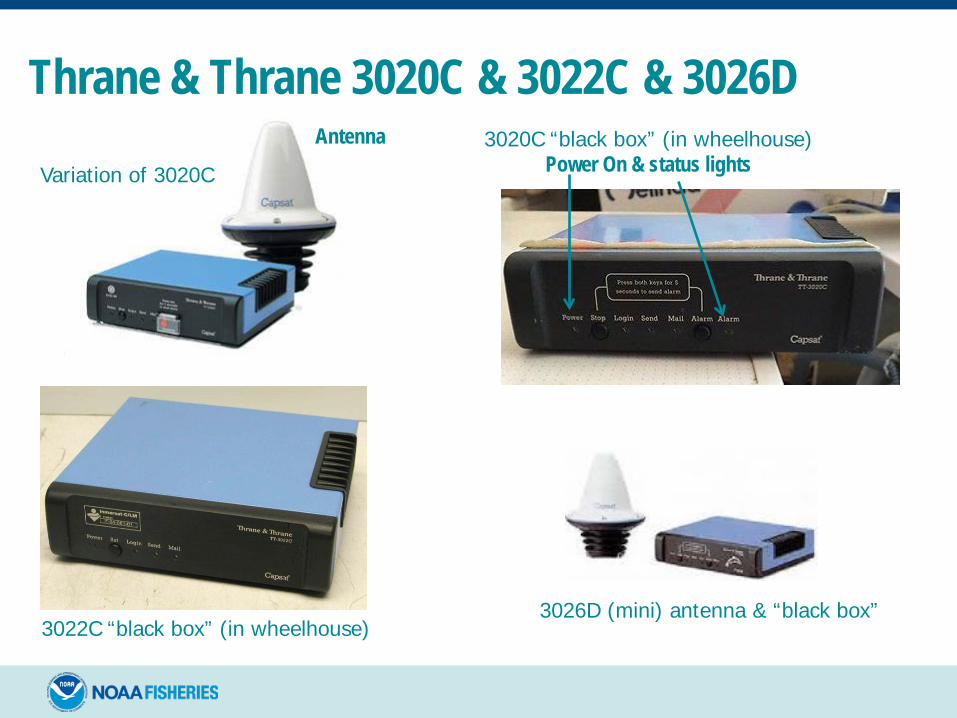
3020C “black box” (in wheelhouse) Power On & status lights
Thrane & Thrane 3020C & 3022C & 3026DAntenna
Variation of 3020C
3022C “black box” (in wheelhouse) 3026D (mini) antenna & “black box”
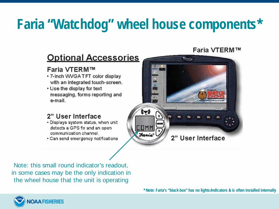
Faria “Watchdog” wheel house components*
Note: this small round indicator’s readout, in some cases may be the only indication in the wheel house that the unit is operating
* Note: Faria’s “black box” has no lights/indicators & is often installed internally
Other electronic tracking systems devices
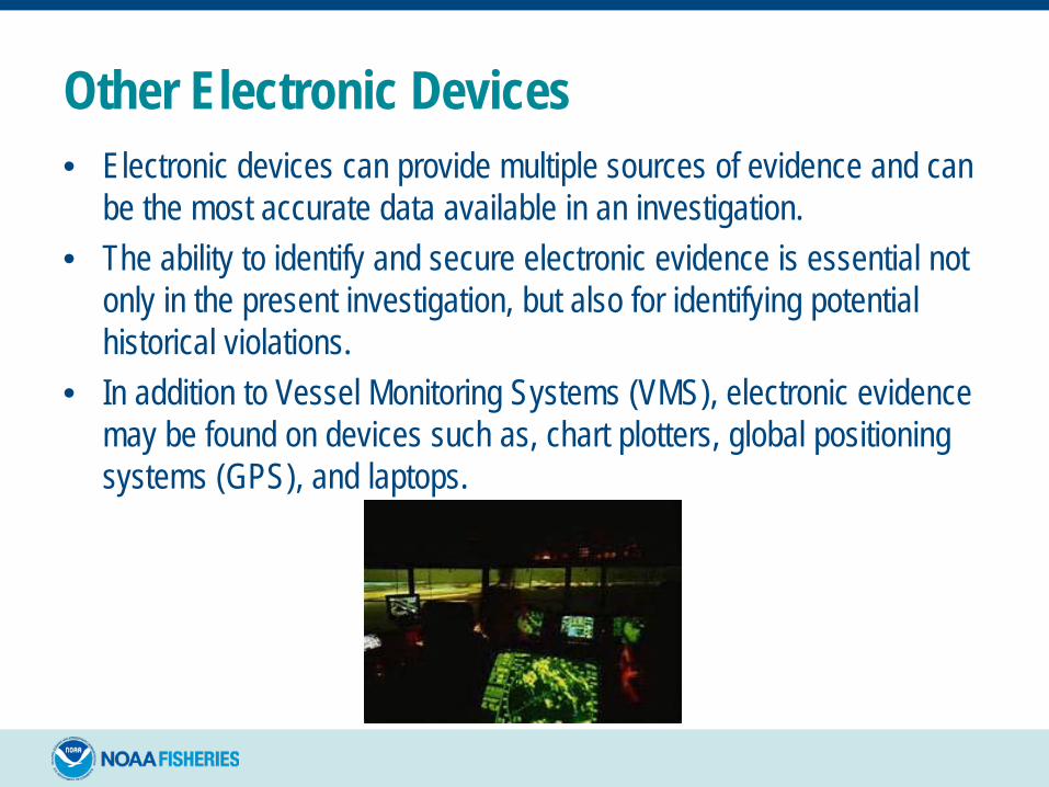
Other Electronic Devices• Electronic devices can provide multiple sources of evidence and can
be the most accurate data available in an investigation. • The ability to identify and secure electronic evidence is essential not
only in the present investigation, but also for identifying potential historical violations.
• In addition to Vessel Monitoring Systems (VMS), electronic evidence may be found on devices such as, chart plotters, global positioning systems (GPS), and laptops.

Other Electronic Devices• Closed Systems (e.g., VMS)• Open Systems
• GPS Plotter• Radar• Sounder• Computers• Communications equipment• Electronic logbooks
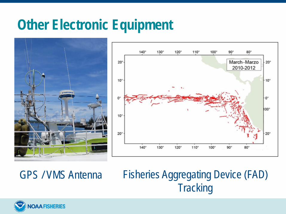
Other Electronic Equipment
GPS / VMS Antenna Fisheries Aggregating Device (FAD) Tracking
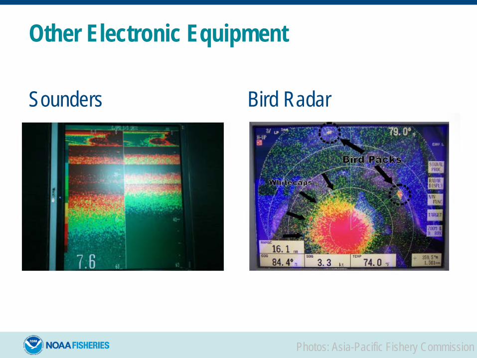
Other Electronic Equipment
Sounders Bird Radar
Photos: Asia-Pacific Fishery Commission

Closed Circuit Television (CCTV) and Electronic Monitoring System (EMS)• Required video monitoring devices• Non-mandatory units• May have recording device on vessel or in remote location
Screen shot from video footage recording fishing activities onboard fishing vessel Yi Man 3. Photo Credit: Satlink.

GPS Unit• Global Positioning System• Maintain independent storage of
marks, tracks, routes• Connected to PC/Laptops used
in vessel navigation• They overwrite the oldest data – TURN THEM OFF TO
PRESERVE DATA • Use discretion regarding continued safe operation of
the vessel (utilize escort)• Analysis may be able to reveal if any changes were
made to the device and when those changes were made
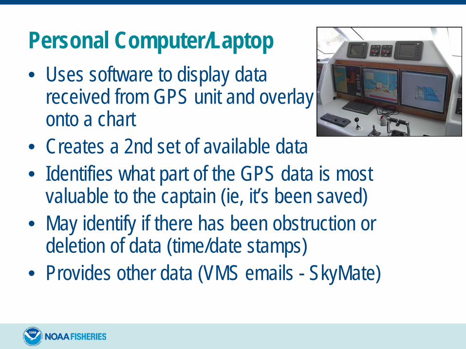
Personal Computer/Laptop• Uses software to display data
received from GPS unit and overlay it onto a chart
• Creates a 2nd set of available data• Identifies what part of the GPS data is most
valuable to the captain (ie, it’s been saved)• May identify if there has been obstruction or
deletion of data (time/date stamps)• Provides other data (VMS emails - SkyMate)
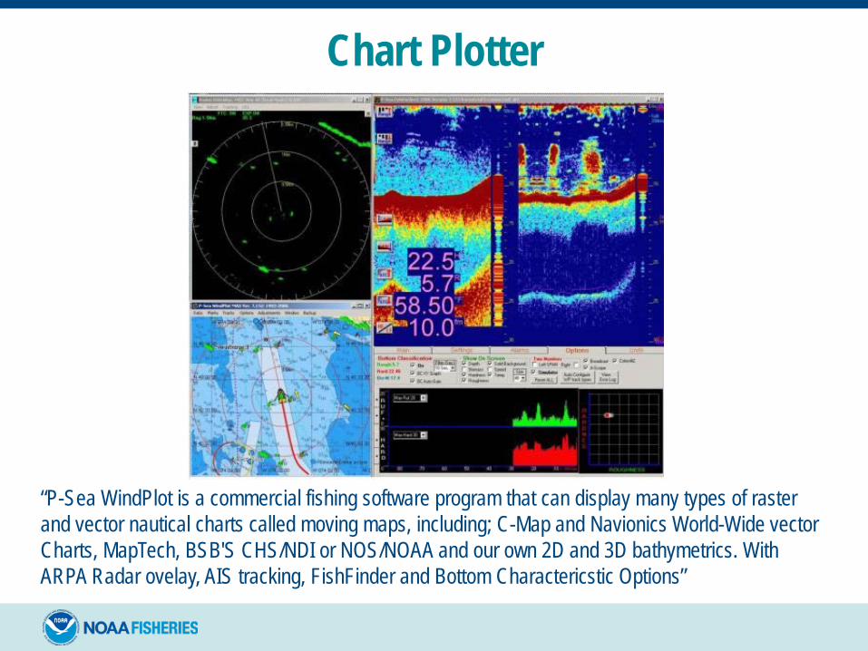
Chart Plotter
“P-Sea WindPlot is a commercial fishing software program that can display many types of raster and vector nautical charts called moving maps, including; C-Map and Navionics World-Wide vector Charts, MapTech, BSB'S CHS/NDI or NOS/NOAA and our own 2D and 3D bathymetrics. With ARPA Radar ovelay, AIS tracking, FishFinder and Bottom Charactericstic Options”

Sounder/SonarSOund NAvigation and Ranging
A side-scan sonar image of the passenger freighter Robert E. Lee, collected by the HUGIN 3000 AUV in 2001.
Used to find and identify objects in the water
Can be used for fish detections and determining seabed conditions

Why electronic information is important• It can be the most accurate data available in the
investigation• It can provide more detailed vessel signature data (due
to reporting frequency)• GPS data consistently verifies the accuracy of VMS
data – helps legally substantiate the data• It can help uncover historical violations• It a source to identify when people lie/obstruct• Know there is always a potential it may exonerate a
subject

Questions?