Continuity in Tropical Cave Use: Examples from East Timor and the Aru Islands, Maluku
Upload
independentCategory
view
1download
0
Exploring Timor-Leste: - Minerals Potential Francisco da Costa Monteiro1, Vicenti da Costa Pinto2
Pacific Economic Cooperation Council-PECC Minerals Network
Brisbane, Queensland
17-18 November 2003
1 Natural Resources Counterpart, Office of President, Palacio das Cinzas, Rua Caicoli Dili, Timor-Leste, +670 7249085, [email protected]
2 Director of Energy and Minerals, Ministry of Development and Environment, Fomento Building, Timor-Leste,
+ 670 7236320, [email protected]
Abstract The natural and mineral resources, with which Timor-Leste is endowed are waiting to be developed in an environmentally friendly manner for the greater economic and social good of the people of the this newly independent nation. The major metallic minerals in Timor-Leste are gold, copper, silver, manganese, although further investigations are needed to determine the size, their vertical and lateral distribution. Gold is found as alluvial deposit probably derived from quartz veins in the crystalline schist of (Aileu Formation). It can also be found as ephithermal mineralisation such as in Atauro island. Nearby islands, Wetar, Flores, and Sumba islands of Indonesia Republic have produced gold deposit in a highly economic quantity. In Timor-Leste, the known occurrences of these precious minerals are mostly concentrate along the northern coastal area and middle part of the country associated with the thrust sheets. The copper-gold-silver occurrences associated with ophiolite suites resembling Cyprus type volcanogenic deposits have been reported from Ossu (Viqueque district), Ossuala (Baucau district), Manatuto and Lautem districts. The Cyprus type volcanogenic massive sulphides are usually between 500.000 to a few million tons in size or larger (UN ESCAP-report, 2003). Therefore it is worth of exploring such potential. The Government policy on the natural and mineral resources is clear; that is: to explore and develop with sound mining practice for the benefit of people of Timor-Leste with special attention to the environment protection, and in a sustainable manner. In line with this spirit, the draft mining legislation, which is now in the government circulation for approval, has, indeed, emphasised the importance of environmental protection and sustainable mining operation through the establishment of structures to support them, in one hand. And in the other hand, the formation of infrastructure, institution and human resources capacity building to create and promote a good business environment that encourages private investment.
1. GENERAL BACKGROUND
Location Timor lies some 750 km to the north of Darwin, and is separated from the Australian
continent by a 3 km deep trough. It is situated in the southeast part of Indonesia
archipelago and is one of the islands of the southern Outer Banda Arc, Figure 1.
Politically, the island is divided into West and East Timor, with the former belongs to
Indonesian republic. The newly independent Timor-Leste comprises the eastern half
together with the enclave Oecussi in the West, Atauro island in the north of Dili, and a
small islet, Jaco, at the eastern most tip of Timor. Administratively, Timor-Leste is
1
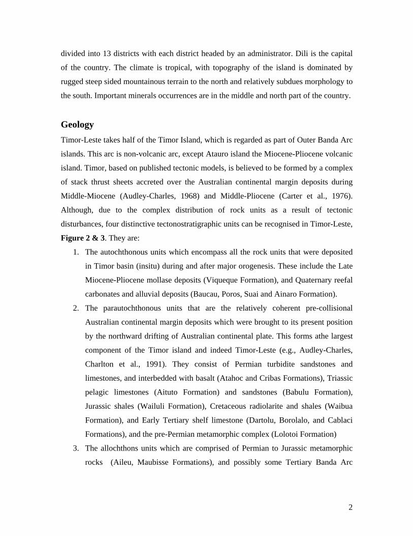
divided into 13 districts with each district headed by an administrator. Dili is the capital
of the country. The climate is tropical, with topography of the island is dominated by
rugged steep sided mountainous terrain to the north and relatively subdues morphology to
the south. Important minerals occurrences are in the middle and north part of the country.
Geology Timor-Leste takes half of the Timor Island, which is regarded as part of Outer Banda Arc
islands. This arc is non-volcanic arc, except Atauro island the Miocene-Pliocene volcanic
island. Timor, based on published tectonic models, is believed to be formed by a complex
of stack thrust sheets accreted over the Australian continental margin deposits during
Middle-Miocene (Audley-Charles, 1968) and Middle-Pliocene (Carter et al., 1976).
Although, due to the complex distribution of rock units as a result of tectonic
disturbances, four distinctive tectonostratigraphic units can be recognised in Timor-Leste,
Figure 2 & 3. They are:
1. The autochthonous units which encompass all the rock units that were deposited
in Timor basin (insitu) during and after major orogenesis. These include the Late
Miocene-Pliocene mollase deposits (Viqueque Formation), and Quaternary reefal
carbonates and alluvial deposits (Baucau, Poros, Suai and Ainaro Formation).
2. The parautochthonous units that are the relatively coherent pre-collisional
Australian continental margin deposits which were brought to its present position
by the northward drifting of Australian continental plate. This forms athe largest
component of the Timor island and indeed Timor-Leste (e.g., Audley-Charles,
Charlton et al., 1991). They consist of Permian turbidite sandstones and
limestones, and interbedded with basalt (Atahoc and Cribas Formations), Triassic
pelagic limestones (Aituto Formation) and sandstones (Babulu Formation),
Jurassic shales (Wailuli Formation), Cretaceous radiolarite and shales (Waibua
Formation), and Early Tertiary shelf limestone (Dartolu, Borolalo, and Cablaci
Formations), and the pre-Permian metamorphic complex (Lolotoi Formation)
3. The allochthons units which are comprised of Permian to Jurassic metamorphic
rocks (Aileu, Maubisse Formations), and possibly some Tertiary Banda Arc
2

Terrains (the Oecussi and Atatapupu volanics, which were detached from the
lower crust and overthrusted onto parautochthonous and autochthonous units.
4. And the olistrostrom units that comprise of variety of unsorted angular to
subangular block of Permian to Early Miocene (occasionally to Late Miocene) in
a scaly clay matrix (Audley-Charles, 1968; Charlton et al., 1991). This unit is
known as Bobonaro Scaly Clay Formation.
Tectonics The tectonic history of the island has been subject to debate for decades, not a single
structural explanation has yet been sufficient to explain all the complexities it has.
However, it is widely accepted that Timor was formed as result of collision between
Australian continental plate and Banda Arc (Asian microplate). The timing of these
collision has been so far interpreted as from Middle Miocene to Mid-Pliocene (Audley-
Charles, 1968; Carter et al., 1976) bringing about the thrust sheets that are now can still
be seeing as Klippen in most hill tops in the island. This collision was followed by rapid
uplift in the Late Pliocene and Quaternary that has removed most of the thrust slices open
the structural windows to the pre and syn-collisional sediments. The windows provide
access to possible metals and hydrocarbons of Mesozoic sedimentary sequence. The
mafic and ultramafic thrust slices are the focus for most of the metallic minerals and
massive volcanogenic sulfide deposits (ESCAP-report, 2003). The occurrence of mineral
potential can be regarded as closely associated with these tectonic activities and their
distribution is controlled by the geological structure domain, which is east-westly
directional.
3

Figure 1. Location of Timor-Leste (East Timor) and surrounding areas.
Figure 2. Generalised geological map of Timor with modification (Charlton, 2002)
4

AGE East Timor Bonaparte Basin Tectonic Events
QUATERNARY Baucau -
Poros
Limestone
Fms (coral reefs)
Ainaro
Fm (gravels)
Suai
Fm. (sands)
Alaria Fm.
Pliocene (corals reefs, cross-bedded
conglomerates) Baracouta
Fm. Upl
ift o
f Tim
or ,
and
dow
n w
arpi
ng o
f
Tim
or T
roug
h
L
Viqueque
Mollasse
Group (basal conglomerate,
sandstones, shales, marls,
chalks)
Aut
ocht
hono
us
Syn-
post
oro
geni
c Ti
mor
bas
ins d
epos
its
Col
lisio
n an
d th
rust
ing
M
Bobonaro Scaly Clay (BSC) Fm.
Olis
tros
trom
e Sy
n-or
ogen
ic g
ravi
ty sl
ide
depo
sits
Oec
ussi
and
Ata
pupu
vol
cani
cs
Arrival of Australian leading
edge continental margin on
the arc trench, and
underthrusted. Emplacement
of BSC.
Mio
cene
E
Cablaci Fm. (calcarenites)
Aliambata Fm. (calcilutites)
Allo
chth
onou
s, of
Ban
da T
erra
in
Oliver Fm.
Subduction Australian
oceanic crust into Banda arc
Eocene
Dartollu Limestone Fm. (biocalcarenites, calcareous algae limestones)
Hibernia &
PrionFms.
TER
TIA
RY
N
EOG
ENE
Paleocene
Woo
dbin
e G
roup
(s
helf,
slop
e to
ope
n m
arin
e se
dim
ents
)
Johnson Fm.
Late
Middle
Waibua Fm (redilarites, shales, calcilutites, manganese nodules)
CR
ET
AC
EO
US
Early
Bathrust Island Group (marine shelf carbonates)
Late
Flamingo Group (open marine pelagic sediments)
Break-up of Australian NW
margin
Middle
JUR
ASS
IC
Early
Wailuli Fm. (shales)
Troughton Group (fluviodeltaic nearshore sediments)
Nome Fm
Late
Bab
ulu
Fm
(sand
ston
es)
Challis
Fm
Pollard
Fm.
Middle Aitu
tu F
m.
(cal
cilu
tites
)
Sahu
l
Gro
up
(fluv
iode
ltaic
/mar
ine
shel
f sed
imen
ts)
Osprey
Fm.
TR
IASS
IC
Early Mt.Goodwin Fm. (marine shales)
Late
Cribas Fm.
(quartz arenites, micaceous shales, calcilutites, basalts)
Hyland Bay Fm. (marine shelf carbonates)
PER
MIA
N
Lower
Atahoc Fm. (quartzites, black shales, calcilutites, basalts)
Mau
biss
e Fm
(red
crin
oida
l lim
esto
nes)
Perm
ian
to ?
Tria
ssic
reef
al c
arbo
nate
s
Aile
u Fm
(qua
rtz-p
hylit
es a
nd sc
hist
s)
Perm
ian
to ?
Jura
ssic
met
amor
phic
rock
s
Allo
chth
onou
s, di
stal
pre
-col
lisio
n A
ustra
lian
cont
inen
tal m
argi
n de
posi
ts
Kulshill Fm. (marine sandstones)
Pre-
Permian
Lolotoi Fm (crystalline rocks)
Para
utoc
htho
nous
, pro
xim
al fa
cies
of p
re-c
ollis
ion
Aus
tralia
n co
ntin
enta
l mar
gin
depo
sits
and
bas
emen
t roc
ks (L
olot
oi F
orm
atio
n)
Exte
nsio
n an
d rif
ting
of N
orth
wes
t A
ustra
lian
mar
gin
Figure 3. The generalised stratigraphy of Timor and the Bonaparte Basin. Nomenclatures
are ased on various sources (e.g., Audley-Charles, 1968; Charlton, 2002; Monteiro,
2003).
5

2. MINERALS POTENTIAL
Metallic Minerals The complex geology of Timor Leste is favorable for the occurrence of a wide variety of
minerals as well as hydrocarbons. More than 200 minerals occurrences are known to be
distributed throughout the country. Some important metallic minerals known to occur in
Timor-Leste are such as gold, copper, manganese, silver, chromite. The occurences of
these precious metal can be linked to the complex geological feature that Timor-Leste
does have. As mentioned earlier in the tectonic history, the island of Timor was built by
the collision that resulted in the development of an inner arc volcanic terrane, the Atauro
island. This island has been known to be good potential for gold and other precious metal
deposits (UN ESCAPE-report 2003), Figure 4. Whereas, in the Timor island a series of
thrust sheets were emplaced. These thrust sheets consist of ultramafic, mafic, and
volcanic terrain that were part of Banda Arc, and have been called as Banda Terrane
(Harris, 1991). The main metallic minerals potential in Timor-Leste is in the ultramafic
rocks, Figure 5.
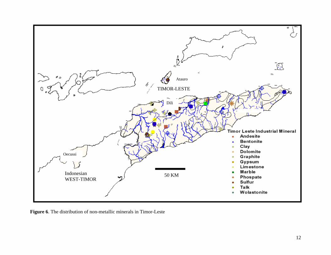
Non-Metallic Minerals Non metallic minerals of the primary importance are sand and gravels, limestone for
cement, clay for bricks. Others such as bentonites, kaolinite, marbles, gypsum, and
phosphate are also of great potential for development, Figure 6.
Mineral Occurrences in Timor-Leste Mineral occurrences in Timor-Leste have been reported from time to time, since
Portuguese colonialisation to Indonesia occupation in several official publications. One
extensive minerals database was prepared by Mr. Vicente de Lacerda in 1999 for the
Office of Mineral and Energy Department of Indonesia, but in this paper the author
follow the result of latest report published by UN ESCAPE for the Government of Timor-
Leste.
6

The orogenic history of Timor plays a critical role in defining the location of its metallic
mineral occurrence, notably copper, gold, silver, chromite, manganese, and a number of
important non-metallic minerals such as limestone, marble, bentonite, gypsum and
phosphate. The northern edge of Timor island is host to a number of important mineral
occurrences. One of the potentially richest copper zones is the north edge of Ambeno
(Oecussi Enclave District). The base metals and their associated precious metals are
concentrated in ultramafic rocks, which are part of allochthonous ophiolite suites.
Precious metals such as gold and silver were also deposited in and adjacent to volcanic
centers as a result of epithermal activity. Some important copper occurrences are also
located in southern Baucau and Viqueque districts. Less significant deposits of chromite,
manganese and iron sand deposits occur in Manatuto, Baucau and Lautem districts and
on Atauro island of Dili districts. Rare occurrence of lead and zinc are known.
The widespread occurrences of limestone and marl, specially in the eastern and western
coastal areas of Timor-Leste are important and are amongst the few minerals that have
been exploited for many years. There is potential for development of ornamental stones
from numerous good quality marble occurrences in Manatuto district east of Dili. Argillic
alteration has resulted in the development of a red to white clay complex in the Aileu
Formation. It extends from Dili district to Aileu and Ermera districts. River valleys
throughout the country include a wide range of sand and gravel deposits.
A brief summary of mineral indication and occurrences based on the UN ESCAPE-
report are as follows:
Copper The mineralisation occurs as sulphides veinlets containing chalcopyrite and pyrite in the ultra basic units, with extensive serpentinites alteration and with evidence of intrusive diorite/diabase. In Ossuala area (Baucau district) sampling by Allied Mining Company (Wittouck, 1937 in Bambang, 2003) indicates grade values of 10% Cu, 3 g/t Au and 170 g/t Ag. Gold The gold mineralisation has been observed in several forms as quartz, quartz-calcite and calcite veins hosted by shale/slate or schist. The veins are commonly pyritised and mineralised with gold. In Hilimanu area the mineralisation occurs in the metamorphosed igneous rock. The mineralisation are associated with quartz vein ( 0,5 – 12 m wide)
7

containing chalcopyrite, limonite and calcedony. Some samples indicate an average grade of 0,5 g/t Au and 50 g/t Ag. Chromite The chromite deposits has been reported from Baucau, Hilimanu (Manatuto district) and Manufahi districts. The deposits were found as primary mineralisation in the serpentinites hosts. There has two mineralisation type i.e; Schlieren and Podiform chromite. The podiform chromite in the Manatuto districts is similar to chromite mineralisation in allochthon ophiolite bodies found in the Circum Pacific belt in the Philippines, New Caledonia and Kalimantan, Indonesia. The quality of the chromite is good, with grades between 36% and 51% Cr2O3. As for grade, 80% of the world’s major deposits have between 33% and 52% Cr2O3. Manganese The manganese deposits were discovered in several places such as Vemasse, Talamata, Venilale (Baucau district), Uato-Carbau (Viqueque district). The deposits are interbedded form within red shale and associated with the limestone of the Bobonaro Formation. The manganese deposits mainly composed of pyrolusite mineral with the grade range between 84 – 94.5% MnO2.
Phosphate The deposits are located in Daemena, Abo (Quelicae-Baucau district), and Laleia ( Manatuto district). The phosphate deposits occurs in the unconsolidated gravel - boulder material which similar age to the Ainaro Gravel. Analysis result of the samples taken from Abo area has revealed the significant assay ranging from 9.97 % to 21.55% P2O5. The best assay was recorded from Japan Development Consultant showing 31% P2O5.
Bentonite Bentonite-clay deposit is partly bedded of the claystone of Bobonaro Formation and located at Venilale (Baucau district), Bobonaro (Bobonaro district). In Mulia-Quelicai village (Baucau district), the swelling value was recorded between 371 up to 1829 x dry volume. Mineral reserve has been estimated to be approximately of 115,570,000 cubic metres (around 6 X 6 km2). Marble The deposits have been recorded at Cablaci-Same (Manufahi district), Laclo (Manatuto district) and Builale (Viqueque district). In Laclo, the gross mineral reserved is thought to be at least 5.000.000 cubic metres.
Gypsum The gypsum deposit was found to be associated with claystone of the Bobonaro Formation. The deposit is located at Laleia-Obrato (Manatuto district), result from the test pitting investigated area of 50 has revealed the mineral reserved to be approximately of 400 tonnes.
8

10
124°30' 125°00' 125°30' 126°00' 126°30' 127°00'
Figure 4. Compiled map of mineral occurrences in Timor-Leste.
%U%U
%U
#³%U %U
%U%U
%U
%U%U
%U
#³
#³
'W
'W
%U #³
#³
#³
ÊÚÊÚ
#³
#³
#³
#³
#³
#³
#³
#³
#³#³
#³
#³
#³
%U%U
'W 'W
%U'W
#³
#³
'W
#³
#³
#³#³
#³%U
%U
%U %U%U
<
#³
#³#³
§
§
§
££
£
%U
%U
%U
%U
%U
%U
%U
%U
$T
$T
#³
%U
'W
'W
'W
'W
'W #³#³
#³
#³
%U
%U
%U
#³ #S
§$T
%U
#S
#³'W
%U
'W
%U
%U
%U
%U
%U
%U
#³
#³
#³
#³
%U
%U
%U%U
%U
#³
#³
#S
#S
#³
ÊÚ
#³
$T
$T $T
#³
#³
£
'W
%U
%U
%U
%U
$T%U
%U
#³#³
<
FFFFF
FFF
%U
%U
%U%U
%U%U
%U
%U#S
§
%U
$T
$T
$T
'W
'W
§ §
§
§
#³
#³
#³
#³
#³
#³
§
%U %U
%U
%U
%U
%U
$T
$T
ÊÚ
ÊÚ
ÊÚ
'W
'W
#³ %U
%U
£
$T#³
#³
%U
%U%U%U %U§
%U
%U
§
§
$T
%U %U
%U
%U %U
%U
%U%U
£
#³
#³
#³
#³ #³#³
#³
#³ #³#S
#S
#³ <
<<
'W
#S
ÊÚ
%U
#³
%U
%U
#³
'W 'W
'W%U
%U%U
%U
%U
%U$T££
%U
$T£
$T
$T
$T
$T
$T
#³
#³
#³
#³
#S#³£
£'W
'W
'W
'W%U #³
%U%U
%U%U
%U
%U
#S
#³
#³
#³
#³
#³
#³%U %U
#³
#S
$T
%U
%U
%U
%U
%U
%U
%U
< <F
F
%U
%U
%U
%U
%U
#³
#³
#³
#³
#³
#³
%U
#³
'W
%U%U
#³
%U
%U
F
$T $T£
£
£%U
%U
%U
%U
%U%U
%U
%U
%U
%U
%U
%U
%U
#³
#³
#³ #³ #³
#³ #³
#³
#³
#³
#³#³
#³
#³
#S
#³
#³
#S
%U 'W 'W
#³
#S
%U
$T
$T
$T
$T
$T $T
§£
'W
%U < <
ÊÚ F
#³
'W
%U
F F
#³
#³#³
£ £
£
£
£
£
#³
%U
§§
100 0 100 200 Kilometers
N
10°00' 10°00'
9° 30' 9° 30'
9° 00' 9° 00'
8° 30' 8° 30'
8° 00' 8° 00'
7° 30' 7° 30'
124°30' 125°00' 125°30' 126°00' 126°30' 127°00'
-150000
-150000
-100000
-100000
-50000
-50000
0
0
50000
50000
100000
100000
150000
150000
-1100000 -1100000
-1050000 -1050000
-1000000 -1000000
-950000 -950000
-900 000 -900000
-850 000 -850000
Tl minerals.shpIron and Ferro-Alloy Mtl§Base Metals£
Precious Metals$TChemical & Fertilizer Min#S
Ceramic/Refractory%U
Other Industrial Material#³
Building Stones'W
Post vulcanismÊÚOil and Gas Seeps<Oil and Gas WellsF
KEYS
Et Elevantion
Elev.shp0 - 50
50 - 100
100 - 500
500 - 1500
1500 - 2000
200 - 2500
Over 2500

Figure 5. The distribution of metallic minerals in Timor Leste
Dili
Atauro
Jac
Oecussi
Indonesian WEST TIMOR
TIMOR-LESTE
50 KM
11
12
Oecussi
Atauro
TIMOR-LESTE
Indonesian WEST-TIMOR
Dili
50 KM
Figure 6. The distribution of non-metallic minerals in Timor-Leste

3. Legislation Timor-Leste has numerous occurrences and deposits of a wide spectrum of industrial
minerals, construction materials, base metals and precious metals and stones. All of these
offer present and future opportunities for strengthening employment, infrastructure and
government revenue but also pose certain threat to environment if they are not explored
and developed in a sound mining practice and environmentally friendly manner.
Therefore, it is very important that the Government stipulate a legislation from which
every party involves can follow. In this regard, the national mineral policy legislation
and regulatory framework, the technical draft of the Mines and Mineral Management
Law (MMML) has been prepared by an UN SCAPE and is to be studied by the
Government Legal Draftsman prior to the submission to the parliament for legislation and
is due to be approved by probably mid next 2004. The draft is intended that the
government will adopt and implement a mineral policy that will allow for the responsible
and profitable exploration and exploitation of its mineral resources.
Mining License
It has been recommended that only one formal document, a Mining License, be required
for a successful applicant to secure the right to conduct exploration and mining activities.
Tax
Tax considerations are required under an Investment Stabilisation Agreement (ISA). The
main function of the ISA is to negotiate the ”freezing” of certain tax, fiscal and legal
provisions over fixed periods of time in the large-scale mining project.
Environment Protection
It has been recommended that the mining law specify social responsibility imperatives as
an integral part of work programmes to be registered annually by mineral license holders.
Community Partnerships
It has been recommended that where exploration activity identified a commercially viable
mining operation, provisions are made for the creation of a formally constituted
13

Sustainable Mining Development Authority (SMDA) consisting of a cooperative
partnership of the Government appointees and representatives of the local community,
the district and the mineral holder’s management team.
Capacity Building
It has been recommended in the interest of capacity building in the natural and mineral
resources sector that exploration and development work should include obligatory
training and education in the mining projects. Successful projects should deliver well-
trained and educated technical personnel during and at the end of the project’s life.
Institutional Development
It has been recommended that to advance the Government planning for department
structure and capacity building, the Government designate a new or existing Department
to include a Geological Survey and Mines Division and Oil and Gas Division.
Registrar
It has been recommended that the Government recruit and appoint a “Registarar” to begin
the research and preparation of a National Mineral Rights Registration System
(NMRRS).
4. Conclusion Geologically Timor is controlled by the collision in Middle-Miocene to Mid-Pliocene
between Australian continental plate and Banda arc plate (Asia microplate). This
collision has emplaced thrust sheets including the ophiliotes that host the a number of
important minerals. Potential metallic minerals in Timor-Leste are gold, copper,
chromite, manganese, and silver. Non-metallic minerals are widely distributed, namely,
sand, gravels and other aggregates for construction materials, clays for bricks, marble for
ornaments, etc.
Timor-Leste is still at a very early stage in the formation of the infrastructure, institutions,
human resource capacity and legislation that can support the full control of its natural and
14

mineral resource. The draft of mineral law has just been sent for review by the Council of
Minister before it can be brought to the parliament for final approval. However, as it is in
the policy of the Government to protect the environment as much as possible, and at the
same time promote a good business environment that encourages more private
investment. The law is very flexible but does emphasise the importance of an
environmentally friendly and sustainable mining practices. The Investment Stabilisation
Agreement is stipulated as a way to allow Timor-Leste to be more competitive. The
planned Mine Reclamation Guarantee Trust Fund document as one of the condition that
should be submitted prior to the development of a prospective area is a way to make sure
the environment reclamation will fully implemented at the end of the project life.
Acknowledgement We thank to Mr Jim Short, the Executive Director AUSPECC, for kind invitation and
arrangement for us to participate this conference. Thanks also to Mr Barid Manna, Tinor-
Leste Mineral Advisor, for his valuable suggestions, and we appreciate Mr to Lorenzo,
Mineral technician, for his kind assistance during the preparation of this paper.
Reference Audley-Charles, M.G., 1968. Geology of Portuguese Timor. Geological Society of
London Memoir No. 4, London. P. 1-76
Bakker, P.J., 2003. The mineral resources potential of East Timor (Timor-Leste).
Conference proceeding-International Conference”Oppurtunities & Challenges
for Oil and Gas and Mining Sector in Timor-Leste. Dili.
Bambang, S., 2003. Minerals Potential of Timor-Leste. Conference proceeding-
International Conference”Oppurtunities & Challenges for Oil and Gas and
Mining Sector in Timor-Leste. Dili
Carter, D.J., Audley-Charles, M.G., and Barber, A.J., 1976. Stratigraphical analysis of
the island arc-continental margin collision in eastern Indonesia. Geol. Soc.
Lond. Journal, V. 132, p. 179-198
Carvalho, J., 2003. Potencialidades em rochas ornamentais e rochas e minerals industrias
de Timor-Leste. Conference proceeding-International
15

Conference”Oppurtunities & Challenges for Oil and Gas and Mining Sector in
Timor-Leste. Dili
Chamalaun, F.H., Lockwood, K., and White, A., 1976. The Bouger gravity field and
crustal structure of eastern Timor. Tectonophysics, v. 30, p. 241-259
Charlton, T.R., Kaye, S.J., Samoedra, H., Sarjono, H., 1991. Kai islands: Implications for
evolution of Aru Through and Weber Basin, Banda Arc, Indonesia. Marine
Petroleum Geology, v. 8, p. 62-69
Harris, R.A., 1991. Temporal distribution of strain in the active Banda OrogenÇ a
reconciliation of the rival hypothesis. Journal of Southeast Asian Earth
Sciencies, v. 6, p. 373-386.
Monteiro, F. da Costa, 2003. Some Late Triassic Rocks in Timor-Leste. Conference
proceeding-International Conference”Oppurtunities & Challenges for Oil and
Gas and Mining Sector in Timor-Leste. Dili
Nataf, J., 2003. The Draft Mining Law of Timor-Leste. Conference proceeding-
International Conference”Oppurtunities & Challenges for Oil and Gas and
Mining Sector in Timor-Leste. Dili
UN ESCAPE-report, 2003. Exploring Timor-Leste: Mineral and Hydrocarbon Potential.
Report prepared by UN ESCAPE consultants for the Government of Timor-Leste.
16
Copyright © 2022 FDOKUMEN