Department of the Interior - GovInfo
19
Wednesday, July 9, 2008 Part III Department of the Interior Fish and Wildlife Service 50 CFR Part 17 Endangered and Threatened Wildlife and Plants; Critical Habitat Revised Designation for the Kootenai River Population of the White Sturgeon (Acipenser transmontanus); Final Rule VerDate Aug<31>2005 16:46 Jul 08, 2008 Jkt 214001 PO 00000 Frm 00001 Fmt 4717 Sfmt 4717 E:\FR\FM\09JYR2.SGM 09JYR2 jlentini on PROD1PC65 with RULES2
-
Upload
khangminh22 -
Category
Documents
-
view
0 -
download
0
Transcript of Department of the Interior - GovInfo

Wednesday,
July 9, 2008
Part III
Department of the Interior Fish and Wildlife Service
50 CFR Part 17 Endangered and Threatened Wildlife and Plants; Critical Habitat Revised Designation for the Kootenai River Population of the White Sturgeon (Acipenser transmontanus); Final Rule
VerDate Aug<31>2005 16:46 Jul 08, 2008 Jkt 214001 PO 00000 Frm 00001 Fmt 4717 Sfmt 4717 E:\FR\FM\09JYR2.SGM 09JYR2jlent
ini o
n P
RO
D1P
C65
with
RU
LES
2

39506 Federal Register / Vol. 73, No. 132 / Wednesday, July 9, 2008 / Rules and Regulations
DEPARTMENT OF THE INTERIOR
Fish and Wildlife Service
50 CFR Part 17
[FWS–R1–ES–2008–0072] [92210–1117– 0000–FY08–B4]
RIN 1018–AU47
Endangered and Threatened Wildlife and Plants; Critical Habitat Revised Designation for the Kootenai River Population of the White Sturgeon (Acipenser transmontanus)
AGENCY: Fish and Wildlife Service, Interior. ACTION: Final rule.
SUMMARY: We, the U.S. Fish and Wildlife Service (Service), are revising the designation of critical habitat for the Kootenai River population of the white sturgeon (Acipenser transmontanus) (Kootenai sturgeon) under the Endangered Species Act of 1973, as amended (Act). In total, 18.3 river miles (RM) (29.5 river kilometers (RKM)) of the Kootenai River are designated as critical habitat within Boundary County, Idaho. DATES: This rule becomes effective August 8, 2008. ADDRESSES: This final rule is available on the Internet at http:// www.regulations.gov and http:// www.fws.gov/easternwashington. Supporting documentation we used in preparing this final rule will be available for public inspection, by appointment, during normal business hours, at the U.S. Fish and Wildlife Service, Upper Columbia Fish and Wildlife Office, 11103 E. Montgomery Drive, Spokane, WA 99206; telephone 509–891–6839; facsimile 509–891–6748. FOR FURTHER INFORMATION CONTACT: Susan Martin, Field Supervisor, Upper Columbia Fish and Wildlife Office (see ADDRESSES). If you use a telecommunications device for the deaf (TDD), call the Federal Information Relay Service (FIRS) at 800–877–8339. SUPPLEMENTARY INFORMATION:
Background
Home Range
The Kootenai sturgeon, listed as endangered in 1994 (September 6, 1994; 59 FR 45989), is restricted to approximately 168 RM (270 RKM) of the Kootenai River in Idaho, Montana, and British Columbia, Canada. One of 18 land-locked populations of white sturgeon known to occur in western North America, the range of the Kootenai sturgeon extends from
Kootenai Falls, Montana, located 31 RM (50 RKM) below Libby Dam, Montana, downstream through Kootenay Lake to Corra Linn Dam at the outflow from Kootenay Lake in British Columbia. The downstream waters of Kootenay Lake drain into the Columbia River system. For the purposes of this rule, this portion of the Kootenai River is divided into three geomorphic reaches: (1) The canyon reach, which extends from Kootenai Falls at RM 193.9 (RKM 312.0) in Montana to RM 159.7 (RKM 257.0) below the confluence with the Moyie River in Idaho; (2) the braided reach, which begins at the end of the canyon reach and extends downstream to RM 152.6 (RKM 246.0) at Bonners Ferry; and (3) the meander reach, which extends from the end of the braided reach at RM 152.6 (RKM 246.0) downstream to the confluence with Kootenay Lake in British Columbia at RM 74.6 (RKM 120.0). This reach includes an area described as the ‘‘transition zone’’ between RM 142.7 (RKM 245.9) and RM 151.8 (RKM 244.5) that joins the braided and meander reaches.
Critical habitat is currently designated in the braided reach from RM 159.7 (RKM 257.0), below the confluence with the Moyie River, downstream to RM 152.7 (RKM 245.9) at Bonners Ferry, and continues downstream into the meander reach to RM 141.4 (RKM 228), for a total of 18.3 RM (29.5 RKM) (71 FR 6383).
The canyon reach is characterized by rocky substrates and a relatively high water surface gradient. Downstream the valley broadens, and the river forms the low-gradient ‘‘braided reach’’ as it courses through multiple shallow channels over gravel and cobbles (Barton et al. 2005, p. 19; Berenbrock 2005a, p. 7). The meander reach is characterized by primarily sandy substrate, a low water-surface gradient, a series of deep holes, and low water velocities under present river operations. A deep hole (39 to 49 feet (ft) (12 to 19 meters (m)) deep) exists near Ambush Rock at approximately 151.7 RM (RKM 244.2) (Berenbrock 2005b, pp. 7–8) and is frequented by sturgeon in spawning condition. Both adult and juvenile sturgeon forage in and migrate freely throughout the lower Kootenai River, but apparently no longer commonly occur upstream of Bonners Ferry, Idaho (Partridge 1983, pp. 1, 23, 25; Apperson and Anders 1990, pp. 19, 22, 23, 25; Apperson and Anders 1991, pp. 36–37, 39–44, 48–49), although there are no apparent physical barriers to sturgeon migration within these three geomorphic reaches of the Kootenai River. However, during
recovery team discussions, shallow waters in the braided reach that have occurred since construction of Libby Dam have been suggested as a possible behavioral barrier to migration into the upstream canyon reach, where suitable spawning and incubation habitats appear to exist.
Population Status and Life History Although information is not available
specifically for Kootenai sturgeon, white sturgeon in general are very long-lived, with females living from 34 to 70 years; some individuals may approach or exceed 100 years of age (NatureServe 2008; PSMFC 2008). It is believed that Kootenai sturgeon do not reach sexual maturity until 28 and 30 years, respectively, for males and females (Paragamian et al. 2005, p. 525). Thereafter, females spawn at 4-to 6-year intervals.
The number of Kootenai sturgeon has decreased from approximately 7,000 individuals in the 1970s to fewer than an estimated 500 adults by 2005, with fewer than 30 females projected to be spawning annually after the year 2015 (Paragamian et al. 2005, p. 526). Decreases in the abundance of Kootenai sturgeon were first noted beginning in the mid-1960s. These decreases were attributed primarily to the effects of diking and pollutants (Partridge 1983, p. 42). Almost no recruitment of juveniles has been detected since 1974, soon after Libby Dam began operating (Partridge 1983, p. 28; Apperson and Anders 1991, p. 45; Paragamian et al. 2005, p. 524). The current rate of population decline is estimated to be 9 percent per year, based on annual mortality rates in the absence of significant recruitment (Paragamian et al. 2005, p. 528). The final listing rule for the Kootenai sturgeon cites the hydropower and flood control operations of Libby Dam, a U.S. Army Corps of Engineers (Corps) facility upstream in Montana, as the primary threat to the Kootenai sturgeon because these operations adversely affect spawning and incubation habitat (September 6, 1994; 59 FR 45989).
Many Kootenai sturgeon spend part of their lives in Kootenay Lake in British Columbia and migrate upstream to spawn in the Kootenai River. The sturgeon have been described as having a unique two-step pre-spawning migration process, migrating first from the lower river and Kootenay Lake during autumn to staging reaches in the Kootenai River, then migrating in spring to the spawning reach near Bonners Ferry, Idaho (Paragamian et al. 2001, p. 22; Paragamian et al. 2002, p. 608). Successful reproduction is dependent upon Kootenai sturgeon spawning at
VerDate Aug<31>2005 18:12 Jul 08, 2008 Jkt 214001 PO 00000 Frm 00002 Fmt 4701 Sfmt 4700 E:\FR\FM\09JYR2.SGM 09JYR2jlent
ini o
n P
RO
D1P
C65
with
RU
LES
2

39507 Federal Register / Vol. 73, No. 132 / Wednesday, July 9, 2008 / Rules and Regulations
sites where the eggs can settle in an area that supports their viability, and where the free embryos that emerge from the eggs have appropriate habitat for development and protection from predators (mobile or free embryos are embryos that have hatched and still have the yolk sac attached; larvae refers to young fish that have absorbed the yolk sac and are actively feeding). For the Kootenai sturgeon, these needs appear to be met by rocky substrates for spawning and attachment of eggs, and meeting in-water minimum flow, depth, and temperature requirements on at least an intermittent basis during the spawning period from May through the end of June.
Although rocky substrates do not seem to be a cue for spawning site selection, they appear to be essential to the viability of eggs and the survival of free embryos. White sturgeon are broadcast spawners and release demersal eggs (eggs that quickly sink to the bottom) that are initially adhesive upon exposure to water (Paragamian et al. 2001, pp. 24, 27, and references therein; Anders et al. 2002, p. 73). Rocky substrates provide fixed surfaces for the attachment of the adhesive eggs during incubation and also provide shelter for the ‘‘hiding phase,’’ the period following hatching in which free embryos seek cover from predators in the inter-gravel spaces (Brannon et al. 1985, p. 58; Parsley et al. 2002, pp. 58– 59). Although we have little information specific to spawning substrates for Kootenai sturgeon, in other areas where white sturgeon are reliably reproducing and recruiting, the river bed at spawning sites typically consists of several miles of gravel, cobble, and boulder substrates that provide shelter and cover during this free embryo hiding phase. Successful spawning and incubation sites, such as the tailraces at Bonneville and Ice Harbor Dams on the Columbia River, have at least 5 RM (8 RKM) of suitable rocky substrate before transitioning into sandy substrate (Parsley et al. 1993, Table 2, p. 220 and p. 224).
White sturgeon spawn in fast-flowing water, and water velocity appears to act as a cue for spawning. In the reach of the lower Columbia River immediately below Bonneville Dam, water velocity at spawning sites ranged from 2.6 to 9.2 ft per second (ft/s) (0.8 to 2.8 m per second (m/s)) (Parsley et al. 1993, Table 2, p. 220). Parsley and Beckman (1994, Figure 2, p. 815) suggest that optimal spawning conditions may occur when the mean water column velocity is 4.9 ft/s (1.8 m/s) or greater. In the Sacramento River, observed white sturgeon spawning sites had water
velocities exceeding 3.3 ft/s (1.0 m/s) (Schaffter 1997, pp. 1, 113). White sturgeon spawning in fast-flowing water greater than or equal to 3.3 ft/s (1.0 m/ s) may experience reduced predation on eggs by limiting access of some predators to spawning and incubation areas (Brannon et al. 1985, p. 13; Miller and Beckman 1996, pp. 338–339; Anders et al. 2002, p. 73 and Table 1, p. 75; Parsley et al. 2002, p. 60). Fast- flowing waters also serve to maintain the exposed rocky substrate essential for successful egg incubation and the free embryo hiding phase of the Kootenai sturgeon’s reproduction cycle.
Water depth also appears to be an important factor in spawning site selection for the Kootenai sturgeon. In the Columbia River, sturgeon eggs collected on mats ranged in depth from 13 to 89 ft (4 to 27 m), with median spawning depths of 19.7 to 36.1 ft (6 m to 11 m) (Parsley et al. 1993, Table 2, p. 220). In the Kootenai River, the mean depth of radio-tagged white sturgeon during the spawning period was 21.3 ft (6.5 m) (Paragamian and Duehr 2005, p. 265). The mean water depth of the river during the spawning period was 30.8 ± 15.1 ft (9.4 ± 4.6 m) (Paragamian and Duehr 2005, p. 263). In a study based on sturgeon egg collections in the Kootenai River, Paragamian et al. 2001 (Table 2, p. 26) report average river depths at egg sites ranging from 27.9 to 42.7 ft (8.5 to 13.3 m), and eggs were found at depths ranging from 16.4 to 59 ft (5 to 18 m). Egg collection sites are likely more shallow than actual spawning sites, because high water velocity and turbulence in spawning areas may transport eggs to more shallow water (Parsley 2005, p. 1; Parsley 2006a, p. 1; Parsley 2006b, p. 1); thus, the depth at which spawning occurs is most likely greater than the depth at which eggs are found.
Although data collected on white sturgeon spawning in other areas may be considered as additional support for identifying the water depths associated with Kootenai sturgeon for spawning, we consider data specific to the environmental conditions in the Kootenai River to represent the best available scientific information for the Kootenai sturgeon. Our synthesis of the best available data specific to the Kootenai sturgeon, as described, indicates that a minimum water depth of 23 ft (7 m) is requisite for successful spawning at a level sufficient to achieve recovery.
Kootenai sturgeon spawn within a fairly narrow range of water temperatures, from 47.3 to 53.6 degrees Fahrenheit (°F) (8.5 to 12 degrees Celsius (°C)) (Paragamian et al. 2002, p.
27). Paragamian and Wakkinen (2002, p. 547) identify temperatures between 49.1 and 49.9°F (9.5 and 9.9°C), or roughly 50°F (10°C), as those at which spawning has the highest probability of occurring in the Kootenai River. Sudden drops of water temperature greater than 3.6°F (2.0°C) cause males to become reproductively inactive, thereby negatively affecting egg fertilization (Lewandowski 2004, p. 6).
Successful spawning of Kootenai sturgeon thus appears to require several synchronous environmental factors during the spawning period: the presence of sufficient rocky substrates to provide shelter for egg attachment and for normal free embryo behavior, and fast-flowing (in excess of 3.3 ft/s (1.0 m/ s), deep (equal to or greater than 23 ft (7.0 m)) water at a relatively stable temperature of approximately 50 °F (10 °C).
Although Kootenai sturgeon continue to spawn annually in the Kootenai River, this spawning has not resulted in significant levels of recruitment for over 30 years. A Kootenai sturgeon female is capable of releasing at least 100,000 eggs per spawning year, and field monitoring has shown most eggs are being fertilized (Paragamian et al. 2001, p. 26). However, based on data from 1992 through 2001, it is estimated that on average, a total of only about 10 juvenile sturgeon currently may be naturally produced in the Kootenai River annually (Paragamian et al. 2005, p. 524). The last significant sturgeon recruitment in the Kootenai River occurred in 1974, the last season prior to Libby Dam becoming fully operational in 1975 (Partridge 1983, p. 28). This recruitment failure is attributed largely to the spawning of Kootenai sturgeon over unsuitable sandy substrates (Paragamian et al. 2001, p. 29).
Since the construction of Libby Dam, most Kootenai sturgeon spawn over sandy substrates in the meander reach below Bonners Ferry. The meander reach has a low stream gradient, and substrates are composed primarily of sand and other fine materials overlying lacustrine clay (Barton 2003, p. 45; Barton et al. 2004, pp. 1, 18–21). Many of the eggs that are located in this reach are found drifting along the river bottom, covered with fine sand particles in sites without rocky substrate (Paragamian et al. 2001, p. 26), and where mean water column velocities seldom exceeded 3.3 ft/s (1.0 m/s) (Paragamian et al. 2001, Table 2, p. 26; Barton et al. 2005, Table 3). The sandy substrate in the current spawning sites in the Kootenai River differs from the rocky substrate that occurs in successful
VerDate Aug<31>2005 16:46 Jul 08, 2008 Jkt 214001 PO 00000 Frm 00003 Fmt 4701 Sfmt 4700 E:\FR\FM\09JYR2.SGM 09JYR2jlent
ini o
n P
RO
D1P
C65
with
RU
LES
2

39508 Federal Register / Vol. 73, No. 132 / Wednesday, July 9, 2008 / Rules and Regulations
white sturgeon spawning sites elsewhere in the Columbia River Basin (Paragamian et al. 2001, pp. 28–29; Parsley et al. 1993, Table 2, p. 220 and Figure 6, p. 222; Parsley and Beckman 1994, pp. 812–827; Kock et al. 2006, pp. 134–135, 139 and references therein).
Laboratory experiments suggest that high embryo or larval mortality results from smothering by fine-sediment substrates, such as the sand that dominates the Kootenai River at the present spawning sites (Kock et al. 2006, pp. 134–141). Larval white sturgeon kept in an aquarium were observed to burrow into fine sediments with lethal results (Brannon 2002, as cited in Anders et al. 2002, p. 76). Due to the predominately sandy substrate in the meander reach and its unsuitability for egg attachment, incubation, and larval survival, it is unlikely that this area was the historical spawning site for Kootenai sturgeon. However, white sturgeon hatchery releases of age 2-plus years in this area have shown high survival (Ireland et al. 2002, p. 647), indicating that the meander reach can successfully support age 2-plus year-old juvenile sturgeon.
The altered hydrograph of the Kootenai River below Libby Dam has resulted in decreased water velocities and depths, with negative effects on Kootenai sturgeon reproduction. In the current sturgeon spawning sites in the meander reach, the Kootenai River is characterized by mean water column velocities less than 3.3 ft/s (1.0 m/s), as well as shifting sand substrates (Barton et al. 2004, pp. 18–21; Anders et al. 2002, Table 1, p. 75). Low water velocity is believed to be a factor facilitating predation of sturgeon eggs and free embryos in the Columbia River (Golder Associates 2005, pp. 1–2, 29–30; Miller and Beckman 1996, pp. 338–339). Free embryos emerging in low water velocities (0.8 in/s (2.0 cm/s)), such as those that presently dominate in the meander reach, remained mobile in the water column 2 days longer than did those emerging in higher water velocity (3.1 in/s (7.9 cm/s)) (Brannon et al. 1985, pp. 14, 16). This delay in initiating the free embryo hiding phase may increase the risk of mortality of embryos emerging in these waters (Brannon et al. 1985, pp. 13–15).
Since Libby Dam became operational, the peak flow events in the Kootenai River at Bonners Ferry during the sturgeon spawning and incubation period have been significantly reduced (Partridge 1983, p. 3; Corps 2005, p. 9). Mean spring flows that reached 80,000 cubic feet per second (cfs) (2,265.3 cubic meters per second (cms)) prior to the construction of the dam were reduced to
flows of less than 10,000 cfs (283.2 cms) through the early 1990s (Berenbrock 2005a, p. 2). The median river stage at Bonners Ferry during peak flow events in the Kootenai River during the sturgeon spawning and incubation period has been reduced by 14 ft (4.27 m) (U.S. Army Corps of Engineers 2004, Figure 2–5, p. 10). This is a substantial change, since the braided reach beginning at Bonners Ferry is now usually less than 7 ft (2.2 m) deep (Berenbrock 2005, p. 7). There is recent evidence that portions of the Kootenai River channel within the braided reach have become wider, shallower, and more unstable since Libby Dam became operational (Barton 2005a, p. 3, and unpublished data). Peak flows of 40,000 cfs (1,200 cms) that typically occurred during the spawning and incubation period in the Kootenai River over an average of 30 days prior to dam construction have not been reached for a period of more than 2 days since the dam was completed, with only two exceptions (Hoffman 2005a, p. 8).
In summary, natural spawning in the Kootenai River has not resulted in sufficient levels of recruitment into the aging population of the Kootenai sturgeon to reverse the strong negative population trend that has been observed over the last 30 years. This recruitment failure appears to be related to changes in riverbed substrate and reduced river flows, reduced water velocities, lowered water depths, and downstream movement of the velocity transition points with reduced flows since Libby Dam became operational. While water depth appears to be a significant factor, it is unclear how other altered parameters may be involved in causing the sturgeon to spawn primarily at sites below Bonners Ferry in the meander reach. These sites have unsuitable sandy riverbed substrates, insufficient rocky substrate (Barton 2003, pp. 1–48; Barton 2004, pp. 18–21; Anders et al. 2002, pp. 73, 76), and water velocities insufficient to provide protection from predation for eggs and free embryos and to assure normal dispersal behavior among free embryos (Parsley et al. 1993, pp. 220– 222, 224–225; Miller and Beckman 1996, pp. 338–339). The braided reach provides suitable rocky substrates, but a large portion of the braided reach has become wider and shallower due to loss of energy from reduced flows, reduced backwater effects, and bed load accumulation (the accumulation of large stream particles, such as gravel and cobble carried along the bottom of the stream) (Barton et al. 2004, p. 17; Hoffman 2005, p. 9; Barton 2005a and unpublished data). The increase in bed
load is a result of the broadening of the braids and water velocity reductions.
Further details on the ecology and life history requirements of the Kootenai sturgeon can be found in our final listing rule (September 6, 1994; 59 FR 45989), the recovery plan for the Kootenai sturgeon (U.S. Fish and Wildlife Service 1999), our previous final rule designating critical habitat for the Kootenai sturgeon (September 6, 2001; 66 FR 46548), and our interim rule designating critical habitat for the Kootenai sturgeon (February 8, 2006; 71 FR 6383).
Previous Federal Actions A description of Federal actions
concerning the Kootenai sturgeon that occurred prior to our September 6, 2001, final rule designating critical habitat can be found in that final rule (September 6, 2001; 66 FR 46548). That final rule designated 11.2 RM (18 RKM) of the Kootenai River in the meander reach as critical habitat, from RM 141.4 (RKM 228) to RM 152.6 (RKM 246).
On February 21, 2003, the Center for Biological Diversity filed a complaint against the Corps and the Service (CV 03-29-M-DWM) in Federal Court in the District of Montana, stating, among other issues, that designated critical habitat for the Kootenai sturgeon was inadequate, as it failed to include areas of rocky substrate.
On May 25, 2005, the District Court of Montana ruled in favor of the plaintiffs, and remanded the critical habitat designation to the Service for reconsideration with a due date of December 1, 2005. We filed a motion to alter or amend the judgment, and the Court extended the deadline for releasing a revised critical habitat designation to February 1, 2006. In the interim, the Court ruled that the 2001 designation of critical habitat remained in effect. In response to the District Court ruling and to meet the Court’s deadline, we published an interim rule designating an additional reach of the Kootenai River, the braided reach, as critical habitat for the Kootenai River sturgeon on February 8, 2006 (71 FR 6383), resulting in a total of 18.3 RM (29.5 RKM) designated; we also completed a Draft Economic Analysis of Critical Habitat Designation for the Kootenai River White Sturgeon (Northwest Economic Associates 2006) and the Final Economic Analysis of Critical Habitat Designation for the Kootenai River White Sturgeon (ENTRIX, Inc. 2008; ENTRIX was formerly Northwest Economic Associates). Although the interim rule designating critical habitat for the Kootenai sturgeon constituted a final
VerDate Aug<31>2005 16:46 Jul 08, 2008 Jkt 214001 PO 00000 Frm 00004 Fmt 4701 Sfmt 4700 E:\FR\FM\09JYR2.SGM 09JYR2jlent
ini o
n P
RO
D1P
C65
with
RU
LES
2

39509 Federal Register / Vol. 73, No. 132 / Wednesday, July 9, 2008 / Rules and Regulations
rule with regulatory effect, it also opened a comment period on the substance of the rule. This revised final rule considers and incorporates, where appropriate, the comments received on the interim rule.
We solicited comments from species experts and the public on the interim rule and the draft economic analysis. A summary of these comments and our responses follow.
Summary of Comments and Recommendations
We requested comments from the public on the interim rule’s designation of critical habitat for the Kootenai sturgeon and the associated draft economic analysis during a comment period that opened concurrent with the publication of the interim rule on February 8, 2006 (71 FR 6383), and closed on April 10, 2006. In addition, we held an information meeting and public hearing in Bonners Ferry, Idaho, on March 16, 2006. We contacted appropriate Federal, State, and local agencies and Tribes; scientific organizations; and other interested parties and invited them to comment on the interim rule and draft economic analysis during this open comment period.
We received six comments during the comment period and public hearing, all from organizations or individuals. We did not receive any comments from State or Federal agencies or Tribes. In addition, in accordance with our peer review policy published on July 1, 1994 (59 FR 34270), we solicited expert opinions from five knowledgeable individuals with scientific expertise that included familiarity with the Kootenai sturgeon, the geographic region where the species occurs, and conservation biology principles. All five of the individuals we contacted responded.
We reviewed all comments received from the public and the peer reviewers for substantive issues and new information regarding the designation of critical habitat for the Kootenai sturgeon. All substantive information provided from the public and the peer reviewers has been either incorporated directly into this final rule or addressed in the following summary.
Peer Reviewer Comments
1. Comment: Both the braided channel and the canyon reach are essential to the conservation of the Kootenai sturgeon. Without these areas, it is difficult to understand how natural recruitment of the magnitude and frequency required to recover the sturgeon can occur.
Our Response: We have included the braided channel in this revised final critical habitat designation because it is essential to successful spawning and egg attachment and incubation, which are currently the life stages we believe are limiting natural recruitment of Kootenai sturgeon. There is limited information on whether, or how, Kootenai sturgeon use the canyon reach. Information available at this time indicates the canyon reach has the elements necessary to support Kootenai sturgeon spawning, but the fish do not currently appear to use the area for this purpose. We are willing to consider any additional information demonstrating that the canyon reach is essential to the conservation of the Kootenai sturgeon.
2. Comment: The background information regarding the need for a sustained increase in river discharge from Libby Dam to restore natural spawning habitat conditions is compelling.
Our Response: We identified the primary constituent elements (PCEs) of Kootenai sturgeon critical habitat based on the best available scientific information, including a flow regime during the spawning season that approximates natural variable conditions.
3. Comment: The rule indicates that Kootenai sturgeon spawning and the initial three weeks of life are the most important stage to protect, but does not elaborate on why this period was selected. The commenter offered that while critical data are lacking, their experience and that of many other sturgeon researchers suggest that year- class strength and recruitment is established by the end of the larval life interval, which for white sturgeon occurs at about day 55–65, not day 21.
Our Response: In designating critical habitat, we consider those physical and biological features that are essential to the conservation of the species, and within areas occupied by the species at the time of listing, that may require special management considerations or protections. Current data indicate that the population bottleneck that is limiting Kootenai sturgeon recovery is at the egg attachment and incubation life phase (Paragamian et al. 2001, pp. 22– 33; Paragamian et al. 2002, pp. 608, 615); thus we have concentrated on this stage as the most important life phase to protect. We are not aware of data indicating that the larval period between day 21 and day 65 is currently limiting Kootenai sturgeon recovery and is in need of special management. We are willing to consider additional information in this regard.
4. Comment: The background information states that fertilized eggs will be deposited just downstream of the spawning site; yet, no data are given to support this conclusion. The information on spawning of adults in deep pools with high water velocities suggest most eggs will not be at the spawning site and that eggs could be distributed downstream for several kilometers, as happens during white sturgeon spawning in the Columbia River.
Our Response: We agree with the peer reviewer that fertilized eggs can drift downstream and may not remain immediately below the spawning site. In the interim rule published in the Federal Register on February 8, 2006 (71 FR 6383), we state, ‘‘The linear downstream extent of rocky substrate from spawning sites is also important because eggs and free embryos are dispersed downstream by the current.’’
5. Comment: The rule shows designated critical habitat ending at RM 141.4, which does not include all of the pre-spawning staging reach of adults (RM 125–152). Furthermore, no estimate of the length of river reach needed downstream of existing spawning areas for rearing of egg-larvae-juvenile life intervals is provided. Given recently documented dispersal behavior of Kootenai sturgeon during early life intervals, there is not one discrete rearing reach but, instead, a long reach downstream from egg deposition used for rearing of free embryos and larvae. Dispersal likely places early juveniles many miles (kilometers) downstream from the spawning site.
Our Response: We agree with the peer reviewer that areas downstream from the critical habitat designation are important for the pre-spawning staging of adult Kootenai sturgeon and rearing of free embryos, larvae, and juveniles. However, the best available scientific information indicates that spawning and egg attachment and incubation are the limiting life stages of Kootenai sturgeon population growth (Paragamian et al. 2001, pp. 22–33; Paragamian et al. 2002, pp. 608, 615). Therefore, this final rule focuses solely on these life stages and the physical and biological features essential to support these life stages that may require special management.
6. Comment: Research data specific to the Kootenai River supports increasing the primary constituent element for water depth to a minimum of 23 ft.
Our Response: We concur. The preponderance of applicable scientific information from the Kootenai River and elsewhere in the range of white sturgeon where reproduction is successfully occurring suggests a mean
VerDate Aug<31>2005 16:46 Jul 08, 2008 Jkt 214001 PO 00000 Frm 00005 Fmt 4701 Sfmt 4700 E:\FR\FM\09JYR2.SGM 09JYR2jlent
ini o
n P
RO
D1P
C65
with
RU
LES
2

39510 Federal Register / Vol. 73, No. 132 / Wednesday, July 9, 2008 / Rules and Regulations
water depth of at least 23 ft (7 m) is necessary for a level of spawning that could potentially lead to recovery (Parsley et al. 1993, Table 2, p. 220; Parsley 1995, p. 1; Parsley and Kappenman 2000, Table 1, p. 199; Paragamian et al. 2001, pp. 28, 30; Golder and Associates 2005, Table 4.1, p. 59 and Table 4.4, p. 62; Barton et al. 2005 p. 37; Paragamian and Duehr 2005, Figure 2, pp. 264–265; Parsley 2006a, p. 1; Parsley 2006b, p. 1). Based on public comments and other information received, a second round of peer review comments was sought specifically on the primary constituent elements for water depth and changes in water temperature associated with spawning behavior. We received five responses, all of which addressed a spawning site depth criterion of at least 23 ft (7 m). These reviewers acknowledged that this criterion is well supported by data on sites within the range of white sturgeon where reproduction is occurring. Based on the reconsideration of the data, along with public and peer review comments, we have changed the primary constituent element for water depth from a minimum of 16 ft (5 m) (February 8, 2006; 71 FR 6383) to 23 ft (7 m) in this final rule.
7. Comment: Regarding the depth Primary Constituent Element (PCE), there are examples of white sturgeon in other river systems utilizing shallow water habitat. For example, sturgeon were observed rolling in a shallow side channel and embryos and larvae were then collected in that side channel of the Fraser River, British Columbia, Canada (see Perrin et al. 1999).
Our Response: The lower Fraser River is an area where white sturgeon continue to reproduce regularly. Perrin et al. (1999, p. iv) noted that waters of the mainstem Fraser River in the vicinity of the Minto channel are approximately 33 ft (10 m) deep, and that they had no actual sturgeon spawning observations in their study. Two eggs were collected at one location in the adjacent Minto channel at a depth of 9.8 ft (3 m), and where water velocity was 4.3 ft/s (1.3 m/s). Based on observations by Parsley (2005, p. 1; 2006a, p. 1; 2006b, p. 1), when water velocity is high, some sturgeon eggs may be redistributed to shallower sites prior to attachment on substrate. A single female may release more than 100,000 eggs in a spawning event. Therefore, we believe that the presence of only two eggs found at a depth of 9.8 ft (3 m) in the Minto channel of the Fraser River may be anomalous and not useful in defining minimum spawning habitat water depth. Furthermore, the comment is based primarily on the capture sites
of 20 free embryos; free embryos are mobile upon hatching (Perrin et al. 1999, p. iii), and are therefore an unreliable indicator of actual sturgeon spawning sites.
8. Comment: The derivation of the 5- mile linear extent of the PCE involving rocky substrate is not cited.
Our Response: We have identified 5 miles (8 kilometers) as a minimum length of continuous rocky substrate based on observations of minimum habitat conditions at similar sites below Bonneville and Ice Harbor Dams where white sturgeon are known to reproduce annually. Although the authors do not explicitly state the linear extent of the rocky substrate utilized in these areas, this information is derived from the observations of spawning locations, water velocity, and substrate use provided in Parsley et al. 1993.
Comments from the Public 1. Comment: The February 8, 2006,
critical habitat interim rule (71 FR 6383) was legally deficient because it failed to alert the public that a significant practical effect or goal of the critical habitat designation is increasing the level of Kootenay Lake in British Columbia.
Our Response: The February 8, 2006, interim critical habitat rule included a section on special management considerations documenting that ‘‘threats to the braided reach include shallow water depths’’ (71 FR 6388). The public was advised that appropriate special management would include measures to provide for water depths during the sturgeon spawning season that would provide for the conservation needs of the species. The operation of Kootenay Lake is outside the control of Federal agencies and the Service; nothing in the critical habitat designation has the legal effect of requiring Canadian authorities to raise the level of the lake.
2. Comment: The Service should have prepared an environmental document under the National Environmental Policy Act (NEPA) analyzing the effect of the critical habitat designation. The court opinion that held that NEPA is not applicable to critical habitat designations is limited to its facts and should not apply to the Kootenai sturgeon critical habitat.
Our Response: The Ninth Circuit, in Douglas County v. Babbitt, 48 F.3d 1495 (9th Cir. 1995) (Douglas County), held that NEPA is inapplicable to critical habitat designations. We contend that the court’s opinion in Douglas County contained no intention to limit the holding to that specific situation. The opinion speaks in broad terms that
apply to any critical habitat designation, explaining that requiring a NEPA analysis would be inconsistent with, or redundant to, Act requirements for designating critical habitat. The court explained:
‘‘The purpose of the ESA [Act] is to prevent extinction of species, and Congress has allowed the Secretary to consider economic consequences of actions that further that purpose. But Congress has not given the Secretary the discretion to consider environmental factors, other than those related directly to the preservation of the species. The Secretary cannot engage in the very broad analysis NEPA requires when designating a critical habitat under the ESA [Act]’’ (48 F.3d at 1507).
The court concluded that ‘‘the legislative histories of NEPA and the ESA (Act) likewise indicate that Congress did not intend that the Secretary file an Environmental Impact Statement (EIS) before designating a critical habitat’’ (48 F.3d at 1507).
3. Comment: The draft economic analysis is defective because it does not factor in the increased level of Kootenay Lake that may be necessary to achieve desired river depths for sturgeon, and the impacts of higher lake levels are likely to have enormous economic consequences. No information regarding any costs above the amount that might be expected as a result of higher Kootenay Lake levels was provided.
Our Response: The level of Kootenay Lake is controlled by Canadian authorities; critical habitat designation has no legal effect on the actions of a foreign government. The draft economic analysis included an estimate of the cost of crop damage that might be expected as a result of flows required for Kootenai sturgeon recovery.
4. Comment: The critical habitat designation would result in higher water tables and an increased risk of flooding, which would be a compensable taking of private property under the Fifth Amendment. In addition, a potential ‘‘relative benefits’’ defense by the Service, where the landowner incurs both harm and benefits that must be weighed against each other, would not apply because no relative benefits would be imparted by critical habitat designation.
Our Response: Designation of critical habitat imposes no direct regulatory burden on private parties; it requires Federal agencies to insure that actions that they authorize, fund, or carry out, do not adversely modify designated habitat (16 U.S.C. 1536(a)(2)). A private party with a Federal grant or permit that constitutes a ‘‘nexus’’ for purposes of the Act’s section 7 might bear an
VerDate Aug<31>2005 16:46 Jul 08, 2008 Jkt 214001 PO 00000 Frm 00006 Fmt 4701 Sfmt 4700 E:\FR\FM\09JYR2.SGM 09JYR2jlent
ini o
n P
RO
D1P
C65
with
RU
LES
2

39511 Federal Register / Vol. 73, No. 132 / Wednesday, July 9, 2008 / Rules and Regulations
indirect regulatory burden as a result of a critical habitat designation. Courts assess takings claims based on the degree of impairment of the property interest, the owner’s reasonable expectations, and the importance of the government interest being advanced. In light of these factors, we believe that no compensable taking will occur as a result of designation of critical habitat.
5. Comment: The Service violated the Act by promulgating the interim rule without the requisite 90-day notice as is indicated under section 4(b)(5) of the Act.
Our Response: We were under a court order to issue a critical habitat rule for Kootenai sturgeon by a specific date, and the schedule imposed by the court made it impracticable to issue a proposed rule prior to a final rule. We acknowledge that section 4(b)(5) of the Act requires a 90-day advance notice before the effective date of a final rule. However, we believe that we remedied the situation as well as possible by seeking both public and peer review comments on the interim rule and reconsidering it in light of those comments, as we are doing here. In the declaration that accompanied our motion to amend the court’s May 25, 2005, judgment, we explained that the timeline given by the court to issue a new final rule was insufficient to complete a legally proper and well- justified revision of critical habitat.
Under these circumstances, we have determined under 5 U.S.C. 553(b)(3)(B) that we had good cause to issue the interim rule without prior opportunity for public comment because prior notice and public procedure would have been impracticable. From the time required to research the interim rule, we did not have sufficient time to issue a proposed rule, open a reasonable comment period, and subsequently issue a final rule prior to the court-imposed deadline. Therefore, without issuance of an interim rule, we would have been in violation of the court order. Thus, in effect, the interim rule served as the proposed rule for this revised final rule, and the Service treated the interim rule as the proposed rule for the purpose of complying with ESA § 4(b)(5).
6. Comment: The Service has failed to acknowledge the need for special management to address PCEs that may not be fully available at all times or places within designated critical habitat.
Our Response: This final rule designates critical habitat within the braided and meander reaches of the Kootenai River that will require special management to restore functional water depth, flow timing, and water temperature. At this time, these PCEs
are intermittently present within these reaches of the Kootenai River.
7. Comment: The Service used flawed reasoning in stating that Libby Dam is part of the environmental baseline, and thus that its continued operation will not result in adverse modification of critical habitat. The commenter further stated that the operations of Libby Dam are widely acknowledged as being the primary reason the sturgeon is headed toward extinction, and the reason why the sturgeon fails to spawn in the braided reach.
Our Response: The Service’s use of the term ‘‘environmental baseline’’ is restricted to the section 7 compliance process under the Act. In that context, the future effects of Libby Dam operations on the Kootenai sturgeon and its critical habitat are not part of the environmental baseline. The Service defines the term ‘‘environmental baseline’’ as ‘‘* * * the past and present impacts of all Federal, State, or private actions and other human activities in the action area, the anticipated impacts of all proposed Federal projects in the action area that have already undergone formal or early section 7 consultation, and the impact of State or private actions which are contemporaneous with the consultation in process.’’ On that basis, the effects of Libby Dam construction and past operations on the Kootenai sturgeon and its critical habitat are part of the environmental baseline.
At the time the sturgeon was listed and critical habitat was designated, all future operations of Libby Dam were subject to the jeopardy and adverse modification of critical habitat standards under section 7(a)(2) of the Act. Because the action of constructing the dam was completed in 1973, the continued presence of the dam is not an action subject to the requirements of section 7 of the Act. However, the effects of future operations on listed species and critical habitat are subject to the requirements of section 7 of the Act. Subsequently, we completed formal consultations with the Corps, Bureau of Reclamation (BOR), and the Bonneville Power Administration (BPA) on the effects of Libby Dam operations on the sturgeon in 1995, 2000, and 2006; our 2006 Biological Opinion (BO) on the effects of Libby Dam operations on the Kootenai sturgeon also addressed the effects of dam operations on designated critical habitat (USFWS 2006b). The latter two consultations resulted in BOs in which we concluded that future operations of Libby Dam, as proposed by the Federal action agencies, were likely to jeopardize the continued existence of the sturgeon and adversely modify its critical habitat.
In accordance with our regulations, we included a Reasonable and Prudent Alternative (RPA) to the proposed operation of Libby Dam that would avoid jeopardy and adverse modification in our 2006 BO. The Corps, as operator of Libby Dam, and BPA, as marketer of the hydropower generated at Libby Dam, are currently implementing the RPA.
8. Comment: The current designation of critical habitat, which includes only the river to the high water mark, improperly excludes side channel habitats.
Our Response: The braided reach of the Kootenai River designated as critical habitat includes several side channels that, because of their structure and condition, function as both foraging and spawning habitat for the Kootenai sturgeon. These areas have not been excluded from the designation.
9. Comment: If in the future it is found that designation of this critical habitat is not necessary, what process is there for removing it from critical habitat?
Our Response: Section 4(a)(3)(A) of the Act and implementing regulations at 50 CFR 424.12 require that ‘‘critical habitat shall be specified to the maximum extent prudent and determinable.’’ Critical habitat is considered not prudent when the identification of critical habitat can be expected to increase the degree of threat from taking or other human activity, or if the designation of critical habitat would not be beneficial to the species. In the absence of a ‘‘not prudent’’ finding, the Act requires that we designate critical habitat for listed species. The Act does provide that critical habitat designations may be revised, as appropriate. Any revisions would occur through the rulemaking process.
10. Comment: Hopefully, this designation will not affect the private gravel operations that take place upstream of the designated area.
Our Response: The effect of a critical habitat designation is that activities authorized, funded, or carried out by a Federal agency require consultation under section 7 of the Act to ensure that they are not likely to destroy or adversely modify critical habitat. For example, activities on private or State lands requiring a permit from a Federal agency, such as a permit from the Corps under section 404 of the Clean Water Act, a section 10(a)(1)(B) permit from us, or some other Federal action, including funding (for example, Federal Highway Administration or Federal Emergency Management Agency funding), would be subject to the
VerDate Aug<31>2005 16:46 Jul 08, 2008 Jkt 214001 PO 00000 Frm 00007 Fmt 4701 Sfmt 4700 E:\FR\FM\09JYR2.SGM 09JYR2jlent
ini o
n P
RO
D1P
C65
with
RU
LES
2

39512 Federal Register / Vol. 73, No. 132 / Wednesday, July 9, 2008 / Rules and Regulations
section 7 consultation process. Activities on State, Tribal, local, or private lands that are not carried out, funded, or authorized by a Federal agency are not subject to any regulatory requirements as a result of critical habitat designation. The designation of critical habitat does not affect land ownership or establish a refuge, wilderness, reserve, preserve, or other conservation area, and the designation of critical habitat does not allow government or public access to private lands.
Summary of Changes from the Interim Rule
In developing this revised final critical habitat rule for the Kootenai sturgeon, we reviewed peer review and public comments received on the interim rule and draft economic analysis published in the Federal Register on February 8, 2006 (71 FR 6383), as well as a second round of peer review comments received specifically on the PCEs. Based on comments received, including peer review comments, this final rule modifies the interim rule in the following ways:
(1) We have made the PCEs more explicit to more clearly communicate the best available scientific information regarding the conservation needs of the species.
(2) We have modified the depth PCE (PCE 1) from a minimum of 16 ft (5 m) to a minimum of 23 ft (7 m) to more accurately reflect the best available science, indicating that mean water depth of at least 23 ft (7 m) is necessary for spawning site selection by white sturgeon in the Kootenai River (for example, Paragamian et al. 2001, Table 2, p. 27, p. 29, and Figure 4, p. 29; Paragamian and Duehr 2005, p. 263, 265; Parsley 2006a, p. 1; Parsley 2006b, p. 1).
(3) In the interim rule, we stated that we added 6.9 RM (11.1 RKM) to the critical habitat designation, but later stated that this additional reach extends from ‘‘RM 159.7 (RKM 257) to RM 152.6 (RKM 245.9),’’ which is actually 7.1 RM. The area designated as critical habitat in the interim rule remains unchanged in this revised final rule. This final rule simply corrects the RM totals to indicate that we added 7.1 RM to our 2001 designation of 11.2 RM, for a total of 18.3 RM.
(4) We have combined the two former units, the braided reach and the meander reach, into a single designation because the two units are contiguous, and clarified the location of the river reaches within the designation:
(i) The braided reach begins at RM 159.7 (RKM 257.0), below the
confluence with the Moyie River, and extends downstream within the Kootenai River to RM 152.6 (RKM 246.0) below Bonners Ferry.
(ii) The meander reach begins at RM 152.6 (RKM 246.0) below Bonners Ferry, and extends downstream to RM 141.4 (RKM 228.0) below Shorty’s Island.
(iii) This designation includes the 0.9 mi (1.5 km) ‘‘transition zone,’’ described in the February 2006 interim rule (71 FR 6383) that joins the meander and braided reaches at Bonners Ferry.
Critical Habitat Critical habitat is defined in section 3
of the Act as: (1) The specific areas within the
geographical area occupied by a species, at the time it is listed in accordance with the Act, on which are found those physical or biological features (a) essential to the conservation of the species and (b) which may require special management considerations or protection; and
(2) Specific areas outside the geographical area occupied by a species at the time it is listed, upon a determination that such areas are essential for the conservation of the species.
Conservation, as defined under section 3 of the Act, means the use of all methods and procedures that are necessary to bring an endangered or threatened species to the point at which the measures provided under the Act are no longer necessary. Such methods and procedures include, but are not limited to, all activities associated with scientific resource management, such as research, census, law enforcement, habitat acquisition and maintenance, propagation, live trapping, and transplantation, and (in the extraordinary case where population pressures within a given ecosystem cannot be otherwise relieved), may include regulated taking.
Critical habitat receives protection under section 7 of the Act through the prohibition against Federal agencies carrying out, funding, or authorizing the destruction or adverse modification of critical habitat. Section 7(a)(2) of the Act requires consultation on Federal actions that may affect critical habitat. The designation of critical habitat does not affect land ownership or establish a refuge, wilderness, reserve, preserve, or other conservation area. Such designation does not allow the government or public to access private lands. Such designation does not require implementation of restoration, recovery, or enhancement measures by private landowners. Where a landowner requests Federal agency funding or
authorization for an action that may affect a listed species or critical habitat, the consultation requirements of section 7(a)(2) would apply, but even in the event of a destruction or adverse modification finding, the landowner’s obligation is not to restore or recover the species, but to implement reasonable and prudent alternatives to avoid destruction or adverse modification of critical habitat.
For inclusion in a critical habitat designation, the habitat within the geographical area occupied by the species at the time of listing must contain the physical and biological features essential to the conservation of the species, and be included only if those features may require special management considerations or protection. Critical habitat designations identify, to the extent known using the best scientific data available, habitat areas that provide essential life cycle needs of the species. Under the Act, we can designate critical habitat in areas outside the geographical area occupied by the species at the time it is listed only when we determine that those areas are essential for the conservation of the species.
Section 4 of the Act requires that we designate critical habitat on the basis of the best scientific and commercial data available. Further, our Policy on Information Standards Under the Endangered Species Act (published in the Federal Register on July 1, 1994 (59 FR 34271)), the Information Quality Act (section 515 of the Treasury and General Government Appropriations Act for Fiscal Year 2001 (Pub. L. 106–554; H.R. 5658)), and our associated Information Quality Guidelines provide criteria, establish procedures, and provide guidance to ensure that our decisions are based on the best scientific data available. They require our biologists, to the extent consistent with the Act and with the use of the best scientific data available, to use primary and original sources of information as the basis for recommendations to designate critical habitat.
When we are determining which areas should be proposed as critical habitat, our primary source of information is generally the information developed during the listing process for the species. Additional information sources include the recovery plan for the species, if available; articles in peer- reviewed journals; conservation plans developed by States and counties; scientific status surveys and studies; biological assessments; or other unpublished materials and expert opinion or personal knowledge.
VerDate Aug<31>2005 16:46 Jul 08, 2008 Jkt 214001 PO 00000 Frm 00008 Fmt 4701 Sfmt 4700 E:\FR\FM\09JYR2.SGM 09JYR2jlent
ini o
n P
RO
D1P
C65
with
RU
LES
2

39513 Federal Register / Vol. 73, No. 132 / Wednesday, July 9, 2008 / Rules and Regulations
Habitat is often dynamic, and species may move from one area to another over time. Furthermore, we recognize that designation of critical habitat may not include all of the habitat areas that we may eventually determine to be necessary for the recovery of the species. For these reasons, a critical habitat designation does not signal that habitat outside the designated area is unimportant or may not promote the recovery of the species.
Areas that support populations, but are outside the critical habitat designation, will continue to be subject to conservation actions. They are also subject to the regulatory protections afforded by the section 7(a)(2) jeopardy standard, as determined on the basis of the best available information at the time of the action. Federally funded or permitted projects affecting listed species outside their designated critical habitat areas may require consultation under section 7 of the Act and may still result in jeopardy findings in some cases. Similarly, critical habitat designations made on the basis of the best available information at the time of designation will not control the direction and substance of future recovery plans, habitat conservation plans, or other species conservation planning efforts if information available at the time of these planning efforts calls for a different outcome.
Primary Constituent Elements In accordance with section 3(5)(A)(i)
of the Act and the regulations at 50 CFR 424.12, in determining which areas occupied at the time of listing to propose as critical habitat within areas occupied by the species at the time of listing, we consider the physical and biological features that are essential to the conservation of the species to be the primary constituent elements laid out in the appropriate quantity and spatial arrangement for conservation of the species. These include, but are not limited to:
(1) Space for individual and population growth and for normal behavior;
(2) Food, water, or other nutritional or physiological requirements;
(3) Cover or shelter; (4) Sites for breeding, reproduction,
rearing of offspring, germination, or seed dispersal;
(5) Habitats that are protected from disturbance or are representative of the historical geographical and ecological distributions of a species.
As required by 50 CFR 424.12(b)(5), we are to list the known PCEs with our description of critical habitat. The PCEs provided by the physical and biological
features upon which the designation is based may include, but are not limited to, the following: roost sites, nesting grounds, spawning sites, feeding sites, seasonal wetland or dryland, water quality or quantity, host species or plant pollinator, geological formation, vegetation type, tide, and specific soil types.
Primary Constituent Elements for the Kootenai Sturgeon
We identified the PCEs for Kootenai sturgeon critical habitat based on our knowledge of the life history, biology, and ecology of the species, and the physical and biological features of the habitat necessary to sustain its essential life history functions, as described in the Background section of this rule. We are changing the PCEs from those identified in our critical habitat interim rule (February 8, 2006; 71 FR 6383) to better fit our current understanding of the features needed to support the sturgeon’s life history functions, and to reflect the information received from peer review and public comment.
This designation focuses solely on spawning and rearing habitats, the factors that we understand to be currently limiting to sturgeon conservation (Paragamian et al. 2001, pp. 22–33; Paragamian et al. 2002, pp. 608, 615). All of the following PCEs must be present during the spawning and incubation period for successful spawning, incubation, and embryo survival to occur. However, although the PCEs to support successful spawning must occur simultaneously in time and space, it is not necessary for them to be present through the entire spawning period, nor must they be present throughout the entire designated area. The PCEs are:
(1) A flow regime, during the spawning season of May through June, that approximates natural variable conditions and is capable of producing depths of 23 ft (7 m) or greater when natural conditions (for example, weather patterns, water year) allow. The depths must occur at multiple sites throughout, but not uniformly within, the Kootenai River designated critical habitat.
(2) A flow regime, during the spawning season of May through June, that approximates natural variable conditions and is capable of producing mean water column velocities of 3.3 ft/ s (1.0 m/s) or greater when natural conditions (for example, weather patterns, water year) allow. The velocities must occur at multiple sites throughout, but not uniformly within, the Kootenai River designated critical habitat.
(3) During the spawning season of May through June, water temperatures between 47.3 and 53.6 °F (8.5 and 12 °C), with no more than a 3.6 °F (2.1 °C) fluctuation in temperature within a 24- hour period, as measured at Bonners Ferry.
(4) Submerged rocky substrates in approximately 5 continuous river miles (8 river kilometers) to provide for natural free embryo redistribution behavior and downstream movement.
(5) A flow regime that limits sediment deposition and maintains appropriate rocky substrate and inter-gravel spaces for sturgeon egg adhesion, incubation, escape cover, and free embryo development. Note: the flow regime described above under PCEs 1 and 2 should be sufficient to achieve these conditions.
This critical habitat designation is focused on Kootenai sturgeon spawning habitats and egg attachment and egg incubation habitats, as these areas are currently the limiting habitat components essential to Kootenai sturgeon conservation (Paragamian et al. 2001, pp. 22–33; Paragamian et al. 2002, pp. 608, 615). Maintaining the PCEs in this designated area is consistent with our recovery objective to re-establish successful natural recruitment of Kootenai sturgeon (U.S. Fish and Wildlife Service 1999, p. iv). However, the presence of PCE components related to flow, temperature, and depth are dependent in large part on the amount and timing of precipitation in any given year. These parameters vary during and between years, and at times some or all of the parameters are not present in the area designated as critical habitat. Within the critical habitat reaches, the specific conditions are variable due to a number of factors such as snowmelt, runoff, and precipitation. This designation recognizes the natural variability of these factors, and does not require that the PCEs be available year- round, or even every year during the spawning period. At present, the PCEs are achieved only infrequently, such as in 2006 during the ‘‘stacked flow’’ operations when the Kootenai River reached river stage 1,763.61 MSL (feet above mean sea level; 537.5 m) at Bonners Ferry (Corps 2007, p. 6), resulting in the first documented movement of tagged female Kootenai sturgeon into the braided reach above Bonners Ferry (Kootenai Sturgeon Recovery Team 2006, pp. 1–2). The designation means that sufficient PCE components to support successful spawning must be present and protected during the spawning season of May through June at multiple sites throughout, but not uniformly within,
VerDate Aug<31>2005 16:46 Jul 08, 2008 Jkt 214001 PO 00000 Frm 00009 Fmt 4701 Sfmt 4700 E:\FR\FM\09JYR2.SGM 09JYR2jlent
ini o
n P
RO
D1P
C65
with
RU
LES
2

39514 Federal Register / Vol. 73, No. 132 / Wednesday, July 9, 2008 / Rules and Regulations
the Kootenai River designated critical habitat in all years when natural conditions (for example, weather patterns, water year) make it possible.
Special Management Considerations or Protections
When designating critical habitat, we assess whether the areas occupied by the species at the time of listing contain the physical and biological features essential to the conservation of the species, and whether these features may require special management consideration or protections. In this case, the threats to the physical and biological features in the area designated as critical habitat that may require special management considerations or protections include shallow water depths (loss of deeper water habitat), low water velocities, and sudden drops in water temperature that adversely affect Kootenai sturgeon breeding behavior.
Both of the designated reaches provide the physical and biological features that are essential to the Kootenai sturgeon for spawning, egg attachment, incubation, and juvenile rearing, and both require special management to ensure that the appropriate water depths, velocities, and temperature are achieved during the spawning period in all years when natural conditions allow.
Libby Dam is operated by the Corps to meet a variety of needs, including power production, flood control, recreation, and special operations for the recovery of species listed under the Act, including Kootenai sturgeon, bull trout, and salmon in the lower Columbia River. The Corps currently operates the dam so as not to exceed 1,764 MSL at Bonners Ferry, Idaho (the flood stage designated by the National Weather Service for the purposes of flood protection). However, flood stage can be exceeded due to unexpected increased inflow to Libby Dam or due to tributary flows downstream of Libby Dam (U.S. Fish and Wildlife Service 2006b, p. 5). The Corps has noted that it considers 1,764 MSL to be the ‘‘current target river stage for Libby Dam operations’’ (Corps 2007, p.1).
The Corps conducted a stacked flow operation in spring 2006 to test different flow strategies for meeting the habitat attributes identified for the Kootenai sturgeon in the Service’s 2006 BO on the effects of Libby Dam operations on the Kootenai sturgeon and its critical habitat (U.S. Fish and Wildlife Service 2006b). The stacked flow operation was developed to utilize Libby outflows at full powerhouse capacity (25,000 cfs) and temperature control at the dam (to
the extent possible) such that releases were timed to ‘‘stack’’ on local tributary inflows to provide velocities, depth, and temperature conditions specified in the BO. The operation, initiated in May 2006, controlled releases from the dam as much as possible to provide the appropriate temperature for sturgeon migration and spawning (Corps 2006, p. 5). This stacked flow operation demonstrated that the Corps was able to achieve depth in the middle of the channel, continuously exceeding 23 ft (7m) as far upstream as RM 153.1, with some areas exceeding 39 ft (12 m) between RM 152 and 157, at flows below flood stage (Corps 2007, p. 6).
We recognize that, due to existing morphologic constraints and limitations at Libby Dam, the depth PCE described in this rule (23 ft; 7 m) is currently not achievable on an annual basis in the braided reach. Since the construction of Libby Dam and the subsequent altered hydrograph, the braided reach has become shallower and wider (Barton 2005a, unpublished data), thus limiting the ability to achieve the depth PCE in the braided reach in most years. To address this issue, the Kootenai Tribe of Idaho, in cooperation with regional partners and Federal managers, is pursuing the Kootenai River Ecosystem Restoration Project. This restoration project has as one of its goals to ‘‘restore and maintain Kootenai River habitat conditions that support all life stages’’ of Kootenai sturgeon. The objectives of the project include (but are not limited to): adjusting ‘‘the dimension, pattern, and profile of the river * * * to match current flow, hydraulic, and sediment transport regimes resulting from the construction and operation of Libby Dam’’; and addressing ‘‘depth requirements’’ of Kootenai sturgeon (Kootenai Tribe of Idaho 2008, p. 4). Until this project is implemented, we recognize that the ability to meet the depth PCE in the braided reach is limited. However, we also acknowledge that the depth PCE has been achieved intermittently under current operating conditions (stacked flows in 2006).
Criteria Used To Identify Critical Habitat
As required by section 4(b)(1)(A) of the Act, we used the best scientific and commercial information available in determining those areas that were occupied by the species at the time of listing and contain PCEs in the quantity and spatial arrangement to support life history functions essential for the conservation of the species in our designation of critical habitat. We relied on information in our prior rulemaking, our recovery plan, more recent
information on the biological needs of the species summarized in our 2006 interim rule designating critical habitat for the Kootenai sturgeon (71 FR 6383), and new information gained through the peer review and public comment process on that interim rule.
We have also reviewed available information that pertains to habitat requirements of this species. The materials included data and analysis in section 7 consultations and gathered by biologists holding section 10(a)(1)(A) recovery permits; research published in peer-reviewed articles and presented in academic theses and agency reports; original data sets and data analyses; and accounts of involved scientists and resource managers.
This designation focuses solely on those life stages that are, based on the best available scientific information, limiting productivity (that is, spawning and egg attachment and incubation), which is the limiting demographic parameter relative to Kootenai sturgeon population recovery. Using this framework, we selected those areas where sturgeon currently spawn in the meander reach; areas with appropriate rocky substrates in the braided reach where sturgeon may be expected to spawn successfully under the appropriate temperature, depth, and flow conditions; and those areas downstream of spawning sites that are essential for egg attachment and incubation.
Final Revised Critical Habitat Designation
We are designating approximately 18.3 RM (29 RKM) of the Kootenai River as revised critical habitat within Boundary County, Idaho. This designation maintains as critical habitat the 7.1 RM (11 RKM) ‘‘braided reach,’’ and the 11.2 RM (18 RKM) ‘‘meander reach,’’ from the February 8, 2006, interim rule (71 FR 6383). Included within this designation is the 0.9 mi (1.5 km) transition zone that joins the meander and braided reaches at Bonners Ferry, as described in the interim rule. The critical habitat areas described below constitute our best assessment at this time of areas determined to be occupied at the time of listing that contain the physical and biological features essential for the conservation of the species and that may require special management.
Land Ownership The reach of the Kootenai River
designated as critical habitat lies within ordinary high-water marks as defined for regulatory purposes (33 CFR 329.11). Upon achieving Statehood in 1890, the
VerDate Aug<31>2005 16:46 Jul 08, 2008 Jkt 214001 PO 00000 Frm 00010 Fmt 4701 Sfmt 4700 E:\FR\FM\09JYR2.SGM 09JYR2jlent
ini o
n P
RO
D1P
C65
with
RU
LES
2

39515 Federal Register / Vol. 73, No. 132 / Wednesday, July 9, 2008 / Rules and Regulations
State of Idaho claimed ownership of the bed of the Kootenai River and its banks up to ordinary high-water marks. Based upon early U.S. Forest Service (USFS) maps from 1916, U.S. Geological Survey maps from 1928, and the confining effects of the private levees completed by the Corps in 1961, it appears that the ordinary high-water marks originally delineating State lands on the Kootenai River in the upper meander reach and braided reach are essentially unchanged. Because of the scale of the available maps, it is possible that minor river channel changes have occurred since Statehood, and that some small portions of private lands now occur within the ordinary high-water marks. However, we understand that most of the lands where these changes may have occurred lie within the flowage and seepage easements purchased by the Federal government under Public Law 93–251, section 56, passed in 1974 (Ziminske 1999). In addition, when the river meanders, the ‘‘government lot’’ or parcel owners abutting State-owned riverbeds and banks may request parcel boundary adjustments to the new ordinary high-water mark, and corresponding adjustments in taxable acreage. The lateral extent of the State- owned riverbeds and banks along the steep levees may be closely approximated today through the Corps’ definition of ordinary high-water mark cited above. Thus, we believe the areas designated as critical habitat are within lands owned by the State of Idaho.
Braided Reach The braided reach begins at RM 159.7
(RKM 257), below the confluence with the Moyie River, and extends downstream within the Kootenai River to RM 152.6 (RKM 246) below Bonners Ferry. Within this reach the valley broadens, and the river forms the braided reach as it courses through multiple shallow channels over gravel and cobbles (Barton et al. 2004). This reach was occupied by Kootenai sturgeon at the time of listing, and is currently occupied by foraging and migrating sturgeon. Tagged female sturgeon moved into the braided reach above Bonners Ferry during the spawning period in 2006, although it is not known whether spawning occurred in the area (Kootenai Sturgeon Recovery Team 2006, pp. 1–2). Gravel and cobble are exposed along the bottom of the Kootenai River in the braided reach (Barton et al. 2004, pp. 18–19; Berenbrock 2005a, p. 7), and water velocities in excess of 3.3 ft/s (1 m/s) are likely achieved on a seasonal basis due to the high surface gradient in this reach (Berenbrock 2005a, Figure 11, p. 23). At
present, the braided reach provides the temperatures, depths, and velocities required to trigger spawning only occasionally, and these features require special management for spawning sturgeon.
Meander Reach
The meander reach begins at RM 152.6 (RKM 246) below Bonners Ferry, and extends downstream to RM 141.4 (RKM 228) below Shorty’s Island. This reach was occupied by Kootenai sturgeon at the time of listing, is used by foraging and migrating sturgeon, and is currently the primary spawning reach for Kootenai sturgeon (Paragamian et al. 2002, p. 608, and references therein). Although most of the reach is composed primarily of sand substrates unsuitable for successful spawning, some limited areas of gravel and cobble are present or at least exposed intermittently (Paragamian et al. 2002, p. 609; Barton et al. 2004, pp. 18–19). Although appropriate depths are available on occasion in this reach (Paragamian et al. 2001, Table 2, p. 26; Barton 2004, Table 1, p. 9; Berenbrock 2005a, p. 7), the temperatures and velocities required for successful spawning require special management to be achieved on more than an infrequent basis.
Effects of Critical Habitat Designation
Section 7 Consultation
Section 7(a)(2) of the Act requires Federal agencies, including the Service, to ensure that actions they fund, authorize, or carry out are not likely to jeopardize the continued existence of a listed species or destroy or adversely modify designated critical habitat. Decisions by the Fifth and Ninth Circuit Court of Appeals have invalidated our definition of ‘‘destruction or adverse modification’’ (50 CFR 402.02) (see Gifford Pinchot Task Force v. U.S. Fish and Wildlife Service, 378 F. 3d 1059 (9th Cir 2004) and Sierra Club v. U.S. Fish and Wildlife Service et al., 245 F.3d 434, 442F (5th Cir 2001)), and we do not rely on this regulatory definition when analyzing whether an action is likely to destroy or adversely modify critical habitat. Under the statutory provisions of the Act, destruction or adverse modification is determined on the basis of whether, with implementation of the proposed Federal action, the affected critical habitat would remain functional, or retain the current ability for the PCEs to be functionally established, to serve its intended conservation role for the species.
Under section 7(a)(2) of the Act, if a Federal action may affect a listed
species or its critical habitat, the responsible Federal agency (action agency) must enter into consultation with us. As a result of this consultation, we document compliance with the requirements of section 7(a)(2) through our issuance of:
(1) A concurrence letter for Federal actions that may affect, but are not likely to adversely affect, listed species or critical habitat; or
(2) A biological opinion (BO) for Federal actions that are likely to adversely affect listed species or critical habitat.
When we issue a BO concluding that a project is likely to jeopardize the continued existence of a listed species or destroy or adversely modify critical habitat, we also provide reasonable and prudent alternatives to the project, if any are identifiable. We define ‘‘reasonable and prudent alternatives’’ at 50 CFR 402.02 as alternative actions identified during consultation that:
• Can be implemented in a manner consistent with the intended purpose of the action,
• Can be implemented consistent with the scope of the Federal agency’s legal authority and jurisdiction,
• Are economically and technologically feasible, and
• Would, in the Director’s opinion, avoid jeopardizing the continued existence of the listed species or destroying or adversely modifying critical habitat.
Reasonable and prudent alternatives can vary from slight project modifications to extensive redesign or relocation of the project. Costs associated with implementing a reasonable and prudent alternative are similarly variable.
Regulations at 50 CFR 402.16 require Federal agencies to reinitiate consultation on previously reviewed actions in instances where a new species is listed or critical habitat is subsequently designated that may be affected and the Federal agency has retained discretionary involvement or control over the action or such discretionary involvement or control is authorized by law. Consequently, some Federal agencies may need to request reinitiation of consultation with us on actions for which formal consultation has been completed, if those actions may affect subsequently listed species or designated critical habitat in a manner not previously analyzed.
Federal activities that may affect the Kootenai sturgeon or its designated critical habitat will require consultation under section 7(a)(2) of the Act. Activities on State, Tribal, local, or private lands requiring a Federal permit
VerDate Aug<31>2005 16:46 Jul 08, 2008 Jkt 214001 PO 00000 Frm 00011 Fmt 4701 Sfmt 4700 E:\FR\FM\09JYR2.SGM 09JYR2jlent
ini o
n P
RO
D1P
C65
with
RU
LES
2

39516 Federal Register / Vol. 73, No. 132 / Wednesday, July 9, 2008 / Rules and Regulations
(such as a permit from the Corps under section 404 of the Clean Water Act (33 U.S.C. 1251 et seq.) or a permit from the Service under section 10(a)(1)(B) of the Act) or involving some other Federal action (such as funding from the Federal Highway Administration, Federal Aviation Administration, or the Federal Emergency Management Agency) are examples of agency actions that may be subject to the section 7 consultation process. Federal actions not affecting listed species or critical habitat, and actions on State, Tribal, local, or private lands that are not federally funded, authorized, or permitted, do not require section 7(a)(2) consultations.
Application of the Adverse Modification Standard
The key factor related to the adverse modification determination is whether, with implementation of the proposed Federal action, the affected critical habitat would remain functional (or retain the current ability for the PCEs to be functionally established) to serve its intended conservation role for the species. Activities that may destroy or adversely modify critical habitat are those that alter the physical and biological features to an extent that appreciably reduce the conservation value of critical habitat for the Kootenai sturgeon.
Section 4(b)(8) of the Act requires us to briefly evaluate and describe, in any proposed or final regulation that designates critical habitat, those activities involving a Federal action that may destroy or adversely modify such habitat, or that may be affected by such designation.
Activities that, when carried out, funded, or authorized by a Federal agency, may affect critical habitat and, therefore, should result in consultation include, but are not limited to:
(1) Actions that would affect flows in ways that would reduce the value of the PCEs essential to the conservation of the species. For example, activities that alter riverbed substrate composition, or reduce flows, water velocity, or water depths essential for normal breeding behavior, migration upriver to spawning sites, breeding site selection, shelter, dispersal, or survival of incubating eggs or developing free embryos.
(2) Actions that would significantly change water temperature or cause a rapid drop in water temperature during the migration and spawning period, such as ramping rates associated with upstream hydroelectric operations or spillway operations, that may adversely modify water temperatures necessary for normal breeding behavior.
(3) Actions that would significantly affect channel geomorphology, particularly the reduction or alteration of rocky substrates, which provide for the successful adhesion and incubation of eggs, as well as shelter and escape cover for free embryos. Activities that could bury or remove rocky substrate include, but are not limited to, changes in land management activities that accelerate sediment releases into the Kootenai River; channelization; levee reconstruction; stream bank stabilization; gravel removal; and road, railroad, bridge, pipeline, or utility construction.
We consider the designated critical habitat to contain the physical and biological features essential to the conservation of the Kootenai sturgeon. The designated reaches are within the geographic range of the species, were occupied by the species at the time of listing, and are likely to be used for spawning by the Kootenai sturgeon. Federal agencies already consult with us on activities in areas currently occupied by the Kootenai sturgeon, in cases where it may be affected by the action, to ensure that their actions do not jeopardize the continued existence of the Kootenai sturgeon.
Application of Section 4(b)(2) of the Act Section 4(b)(2) of the Act states that
the Secretary must designate and revise critical habitat on the basis of the best available scientific data after taking into consideration the economic impact, impact on national security, and any other relevant impact, of specifying any particular area as critical habitat. The Secretary may exclude an area from critical habitat if he determines that the benefits of such exclusion outweigh the benefits of specifying such area as part of the critical habitat, unless he determines, based on the best scientific data available, that the failure to designate such area as critical habitat will result in the extinction of the species. In making that determination, the Congressional legislative history is clear that the Secretary has broad discretion regarding which factor(s) to use and how much weight to give to any factor.
Based on the best available information, including the prepared economic analysis, we believe that all of the revised designated critical habitat contains the features that are essential for the conservation of this species. We have additionally determined that within the designation no lands are owned or managed by the Department of Defense, no habitat conservation plans currently exist for the species, and no Tribal lands or trust resources exist. We
have found no areas for which the benefits of exclusion outweigh the benefits of inclusion, and so have not excluded any areas from this designation of critical habitat for Kootenai sturgeon based on economic or other relevant impacts. As such, we have considered, but not excluded, any lands from this designation based on the potential impacts to these factors.
Economic Analysis
Section 4(b)(2) of the Act requires us to designate critical habitat on the basis of the best scientific information available and to consider the economic and other relevant impacts of designating a particular area as critical habitat. We may exclude areas from critical habitat upon a determination that the benefits of such exclusions outweigh the benefits of specifying such areas as critical habitat. We cannot exclude areas from critical habitat when exclusion will result in the extinction of the species.
Concurrent with the publication of the interim rule (February 8, 2006; 71 FR 6383), we conducted an economic analysis to estimate the potential economic effect of the designation (Northwest Economic Associates 2006). The analysis addressed the economic impacts of adding the braided reach to existing critical habitat in the meander reach, which we designated in 2001 (66 FR 46548). The draft economic analysis on the 2006 interim rule was thus in addition to the economic analysis that had been prepared earlier on the 2001 designation. The draft economic analysis was made available for public review on February 8, 2006 (71 FR 6383). We accepted comments on the draft analysis until April 10, 2006. The final economic analysis was finalized on June 6, 2008 (ENTRIX, Inc. 2008), which is available on the Internet at http:// www.regulations.gov and http:// www.fws.gov/easternwashington.
The primary purpose of the economic analysis is to estimate the potential economic impacts associated with the designation of critical habitat for the Kootenai sturgeon. This information is intended to assist the Secretary in making decisions about whether the benefits of excluding particular areas from the designation outweigh the benefits of including those areas in the designation. This economic analysis addressed the distribution of any potential impacts of the designation, including an assessment of the potential effects on small entities and the energy industry. This information can be used by the Secretary to assess whether the effects of the designation might unduly
VerDate Aug<31>2005 16:46 Jul 08, 2008 Jkt 214001 PO 00000 Frm 00012 Fmt 4701 Sfmt 4700 E:\FR\FM\09JYR2.SGM 09JYR2jlent
ini o
n P
RO
D1P
C65
with
RU
LES
2

39517 Federal Register / Vol. 73, No. 132 / Wednesday, July 9, 2008 / Rules and Regulations
burden a particular group or economic sector.
This analysis focused on the direct and indirect costs of the rule. However, economic impacts to land use activities can exist in the absence of critical habitat. These impacts may result from, for example, local zoning laws, State and natural resource laws, and enforceable management plans and best management practices applied by State and other Federal agencies. Economic impacts that result from these types of protections were not included in the analysis because they were considered to be part of the regulatory and policy baseline.
The economic analysis relied heavily on secondary sources of information, including documents and studies conducted for the Corps, the Service, and other stakeholders. The primary source of information for the economic analysis was the Upper Columbia Basin Alternative Flood Control and Fish Operations Draft Environmental Impact Statement (EIS), and supporting documents, prepared by the Corps and the Bureau of Reclamation (BOR), and submitted for public comment in November 2005. This EIS was in response to the 2000 National Oceanic and Atmospheric Administration (NOAA) and Service BOs on the operation of the Federal Columbia River Power System. The data, assumptions, and results from the Draft EIS, and its supporting documentation and modeling, were not independently tested or verified.
The geographic area of analysis included both the meander reach and the braided reach, for a total of 18.3 miles (29.5 kilometers) of the Kootenai River from RM 159.7 (RKM 257.0) to RM 141.4 (RKM 228.0). The economic analysis was based on the reasonable and prudent alternative in our February 2006 BO on operations of Libby Dam, a component of the Federal Columbia River Power System. Based on the recommendations in the 2006 BO, future costs (2006 through 2025) associated with conservation activities for the sturgeon were estimated to range from $305 million to $610 million using a 7 percent discount rate and $425 to $900 million using a 3 percent discount rate. Annualized impacts associated with the conservation related impacts ranged from $29 million to $61 million at 3 percent and $29 million to $58 million at 7 percent. The activity potentially most affected is the operation of Libby Dam. However, all but $20,000 to $30,000 in post- designation anticipated costs are joint costs or co-extensive costs (associated with listing and critical habitat). That is,
the sturgeon water flows and almost all of the resulting potential impacts were determined to most likely occur regardless of the addition of the braided reach (or a portion thereof) to the critical habitat designation. The economic analysis thus concluded that there were minimal incremental impacts associated with the designation of the braided reach (Northwest Economic Associates 2006, p. ES–2).
The majority of costs (94 percent) was for hydropower generation and related infrastructure improvements and was expected to be borne by Federal agencies. The other 6 percent of costs were related to agriculture and were expected to be borne by private individuals, mainly impacts to the Anheuser-Busch hop farm located downstream of the meander reach.
After weighing the potential benefits and costs of the initial proposed designation, in 2001 the Secretary chose not to exercise his authority under section 4(b)(2) of the Act to exclude any areas from the initial designation of the meander reach (September 6, 2001; 66 FR 46548). In 2006, following the additional designation of the braided reach, the Secretary again chose not to exercise his authority to exclude any areas from the designation. Although the geographic area covered by this final rule is exactly the same as that already addressed in the 2006 draft economic analysis, we have changed the depth PCE from 16 ft (5 m) to 23 ft (7 m) in response to public and peer review comment and the best available scientific information; thus, we considered whether this change might have any economic impact on the designation. As described above, the Corps currently operates Libby Dam with 1,764 ft (537.7 m) as the current target river stage (Corps 2007, p. 1). In addition, the Corps is managing flows to meet the habitat attributes described in the 2006 BO, which sets the depth attribute at 16 to 23 ft (5 to 7 m). Since the Corps has demonstrated that it can achieve the requisite depth of 23 ft (7 m) under stacked flows at levels below 1,764 ft (537.7 m), the new PCE can be achieved at least intermittently within the current authorities of the Corps and will not require a change to its current operations. We, therefore, do not foresee any further economic impact of this designation and have determined that no further revision of the economic analysis is needed. We have considered the economic and other relevant impacts of the designation based on the economic analysis and currently available information, and are not excluding any areas from the designation.
Required Determinations
Regulatory Planning and Review (Executive Order 12866)
The Office of Management and Budget (OMB) has determined that this rule is not significant under Executive Order 12866 (E.O. 12866). OMB bases its determination upon the following four criteria:
(a) Whether the rule will have an annual effect of $100 million or more on the economy or adversely affect an economic sector, productivity, jobs, the environment, or other units of the government.
(b) Whether the rule will create inconsistencies with other Federal agencies’ actions.
(c) Whether the rule will materially affect entitlements, grants, user fees, loan programs, or the rights and obligations of their recipients.
(d) Whether the rule raises novel legal or policy issues.
Regulatory Flexibility Act (5 U.S.C. 601 et seq.)
Under the Regulatory Flexibility Act (RFA) (5 U.S.C. 601 et seq., as amended by the Small Business Regulatory Enforcement Fairness Act (SBREFA) of 1996, whenever an agency is required to publish a notice of rulemaking for any proposed or final rule, it must prepare and make available for public comment a regulatory flexibility analysis that describes the effect of the rule on small entities (i.e., small businesses, small organizations, and small government jurisdictions). However, no regulatory flexibility analysis is required if the head of an agency certifies the rule will not have a significant economic impact on a substantial number of small entities. The SBREFA amended the RFA to require Federal agencies to provide a statement of factual basis for certifying that the rule will not have a significant economic impact on a substantial number of small entities. The SBREFA also amended the RFA to require a certification statement.
Small entities include small organizations, such as independent nonprofit organizations; small governmental jurisdictions, including school boards and city and town governments that serve fewer than 50,000 residents; and small businesses. Small businesses include manufacturing and mining concerns with fewer than 500 employees, wholesale trade entities with fewer than 100 employees, retail and service businesses with less than $5 million in annual sales, general and heavy construction businesses with less than $27.5 million in annual business, special trade contractors doing less than
VerDate Aug<31>2005 16:46 Jul 08, 2008 Jkt 214001 PO 00000 Frm 00013 Fmt 4701 Sfmt 4700 E:\FR\FM\09JYR2.SGM 09JYR2jlent
ini o
n P
RO
D1P
C65
with
RU
LES
2

39518 Federal Register / Vol. 73, No. 132 / Wednesday, July 9, 2008 / Rules and Regulations
$11.5 million in annual business, and agricultural businesses with annual sales less than $750,000. To determine if potential economic impacts to these small entities are significant, we consider the types of activities that might trigger regulatory impacts under this rule, as well as the types of project modifications that may result. In general, the term ‘‘significant economic impact’’ is meant to apply to a typical small business firm’s business operations.
To determine if the rule could significantly affect a substantial number of small entities, we consider the number of small entities affected within particular types of economic activities (e.g., housing development, grazing, oil and gas production, timber harvesting). We apply the ‘‘substantial number’’ test individually to each industry to determine if certification is appropriate. However, the SBREFA does not explicitly define ‘‘substantial number’’ or ‘‘significant economic impact.’’ Consequently, to assess whether a ‘‘substantial number’’ of small entities is affected by this designation, this analysis considers the relative number of small entities likely to be impacted in an area. In some circumstances, especially with critical habitat designations of limited extent, we may aggregate across all industries and consider whether the total number of small entities affected is substantial. In estimating the number of small entities potentially affected, we also consider whether their activities have any Federal involvement.
Designation of critical habitat only affects activities conducted, funded, or permitted by Federal agencies. Some kinds of activities are unlikely to have any Federal involvement and so will not be affected by critical habitat designation. In areas where the species is present, Federal agencies already are required to consult with us under section 7 of the Act on activities they fund, permit, or implement that may affect the Kootenai River population of white sturgeon. Federal agencies also must consult with us if their activities may affect critical habitat. Designation of critical habitat, therefore, could result in an additional economic impact on small entities due to the requirement to reinitiate consultation for ongoing Federal activities.
Approximately 30 small agriculture operations could be impacted by conservation measures for the sturgeon.These operations represent approximately 7 percent of the number of small farms operating within the county. Flow-related agricultural impacts are joint costs in that these
conservation-related impacts are not materially different from those impacts from listing the sturgeon, so burdens to small agricultural operations from the critical habitat designation are unlikely. We have therefore determined that this rule will not have a significant economic impact on a substantial number of small entities.
In general, two different mechanisms in section 7 consultations could lead to regulatory requirements for the approximately four small businesses, on average, that may be subject to consultation each year regarding their project’s impact on the Kootenai River population of the white sturgeon and its habitat. First, if we conclude in a BO that a proposed action is likely to jeopardize the continued existence of a species or destroy or adversely modify its critical habitat, we can offer ‘‘reasonable and prudent alternatives.’’ Reasonable and prudent alternatives are alternative actions that can be implemented in a manner consistent with the scope of the Federal agency’s legal authority and jurisdiction, that are economically and technologically feasible, and that would avoid jeopardizing the continued existence of listed species or result in adverse modification of critical habitat. A Federal agency and an applicant may elect to implement a reasonable and prudent alternative associated with a BO that has found jeopardy or adverse modification of critical habitat. An agency or applicant could alternatively choose to seek an exemption from the requirements of the Act or proceed without implementing the reasonable and prudent alternative. However, unless an exemption were obtained, the Federal agency or applicant would be at risk of violating section 7(a)(2) of the Act if it chose to proceed without implementing the reasonable and prudent alternatives.
Second, if we find that a proposed action is not likely to jeopardize the continued existence of a listed animal or plant species, we may identify reasonable and prudent measures designed to minimize the amount or extent of take and require the Federal agency or applicant to implement such measures through non-discretionary terms and conditions. We may also identify discretionary conservation recommendations designed to minimize or avoid the adverse effects of a proposed action on listed species or critical habitat, help implement recovery plans, or to develop information that could contribute to the recovery of the species.
Based on our experience with consultations under section 7 of the Act
for all listed species, virtually all projects—including those that, in their initial proposed form, would result in jeopardy or adverse modification determinations in section 7 consultations—can be implemented successfully with, at most, the adoption of reasonable and prudent alternatives. These measures, by definition, must be economically feasible and within the scope of authority of the Federal agency involved in the consultation. We can only describe the general kinds of actions that may be identified in future reasonable and prudent alternatives. These are based on our understanding of the needs of the species and the threats it faces, as described in the final listing rule and this critical habitat designation. Within the final critical habitat, the types of Federal actions or authorized activities that we have identified as potential concerns are:
(1) Regulation of activities affecting waters of the United States by the Corps under section 404 of the Clean Water Act; for example, dredge and fill activities could affect navigable waters and wetlands designated as critical habitat; and
(2) Regulation of water flows, damming, diversion, and channelization implemented or licensed by Federal agencies.
It is likely that a project proponent could modify a project or take measures to protect the Kootenai River population of the white sturgeon. The kinds of actions that may be included if future reasonable and prudent alternatives become necessary include conservation set-asides, restoration of degraded habitat, and regular monitoring. These are based on our understanding of the needs of the species and the threats it faces, as described in the final listing rule and interim rule designating critical habitat. These measures are not likely to result in a significant economic impact to small entities because the cost of these measures would be borne by Federal agencies.
In summary, we have considered whether this designation would result in a significant economic effect on a substantial number of small entities. We have determined, for the above reasons and based on currently available information, that it is not likely to affect a substantial number of small entities. Federal involvement, and thus section 7 consultations, would be limited to a subset of the area designated. Therefore, we are certifying that this final designation of critical habitat for the Kootenai River population of the white sturgeon will not have a significant economic impact on a substantial
VerDate Aug<31>2005 16:46 Jul 08, 2008 Jkt 214001 PO 00000 Frm 00014 Fmt 4701 Sfmt 4700 E:\FR\FM\09JYR2.SGM 09JYR2jlent
ini o
n P
RO
D1P
C65
with
RU
LES
2

39519 Federal Register / Vol. 73, No. 132 / Wednesday, July 9, 2008 / Rules and Regulations
number of small entities. A regulatory flexibility analysis is not required.
Energy Supply, Distribution, or Use
Executive Order 13211, ‘‘Actions Concerning Regulations that Significantly Affect Energy Supply, Distribution, or Use,’’ issued May 18, 2001, requires Federal agencies to submit a ‘‘Statement of Energy Effects’’ for all ‘‘significant energy actions’’ in order to present consideration of the impacts of a regulation on the supply, distribution, and use of energy. Significant adverse effects are defined in the Executive Order by the OMB according to the following criteria:
(1) Reductions in crude oil supply in excess of 10,000 barrels per day;
(2) Reductions in fuel production in excess of 4,000 barrels per day;
(3) Reductions in coal production in excess of 5 million tons per year;
(4) Reductions in natural gas production in excess of 25 million Mcf (1000 cubic feet) per year;
(5) Reductions in electricity production in excess of 1 billion kilowatt-hours (kWh) per year or in excess of 500 megawatts (MW) of installed capacity;
(6) Increases in energy use required by the regulatory action that exceed any of the thresholds above;
(7) Increases in the cost of energy production in excess of 1 percent;
(8) Increases in the cost of energy distribution in excess of 1 percent; or
(9) Other similarly adverse outcomes. Two of these criteria are relevant to
this analysis: (5) Reductions in electricity production in excess of one billion kilowatt hours (kWh) per year or in excess of 500 megawatts (MW) of installed capacity, and (7) Increases in the cost of energy production in excess of 1 percent. Our analysis below determines whether the electricity industry is likely to experience ‘‘a significant adverse effect’’ as a result of Kootenai sturgeon conservation activities.
Based on components of the February 2006 BO, including the relaxed ramping rates and the increased lake levels at Kootenay Lake, the modeled hydropower generation numbers will differ from those presented in the economic analysis. The relaxation of ramping rates at Libby Dam will enable quicker decision-making responses to market conditions, while the potential management of Kootenay Lake at higher elevations during June and July will result in the availability of water used to generate power downstream in the Federal Columbia River Power System later in the summer when energy prices are typically higher. However, the actual
impact of the February 2006 BO on power generation cannot be estimated without additional modeling by the Corps. While the power generation results cannot be adjusted without additional modeling efforts, the impact of the February 2006 BO on power generation is expected to be less than the power generation impacts presented in the economic analysis. Considering the results of the energy impacts analysis in the economic analysis were below the thresholds suggested by OMB, and that the power generation impacts are expected to be less under the February 2006 BO, the power generation impacts resulting from the February 2006 BO are also expected to be below OMB thresholds. The energy impacts analysis from the economic analysis are presented below.
Evaluation of Whether the Designation Will Result in Reductions in Electricity Production in Excess of One Billion kWh Per Year or in Excess of 500 MW of Installed Capacity
Installed capacity is ‘‘the total manufacturer-rated capacity for equipment such as turbines, generators, condensers, transformers, and other system components’’ and represents the maximum rate of flow of energy from the plant or the maximum output of the plant. As noted in Section 4 of our economic analysis, modifying dam operations to provide sturgeon flows in late spring and early summer would result in the release of water from Libby Dam that otherwise would have been stored for release the following winter. If run through the powerhouse, the water would be used to generate electricity during months when the value of electricity is generally lower. If spilled over the dam, the water would be lost to use for power generation. After leaving Libby Dam, these sturgeon flows would then work their way down the Columbia River Basin, through other hydropower facilities. Depending on the situation at a particular dam, the water would either be lost to use for power generation or used to generate electricity during months when the value of electricity is generally lower. However, these are power production issues, as installed capacity at Libby Dam and at other hydropower facilities downstream from Libby remain unchanged. Therefore, the screening level analysis focuses on changes in energy production. Because energy production is affected at Libby Dam and at hydropower facilities downstream from Libby, the screening level analysis assesses changes in energy production system-wide.
The Corps modeled the impacts of sturgeon flows on system-wide electricity production. While model results show a slight increase in power production at Libby Dam following sturgeon flows, the system-wide impact is a net loss in power generation. The net loss of 274 gigawatt hours (GWh) (the greatest energy production impact under the alternative sturgeon flow scenarios), or 274 million kWh, is less than 27 percent of the one billion kWh threshold suggested by OMB.
Evaluation of Whether the Designation Will Result in an Increase in the Cost of Energy Production in Excess of One Percent
The Corps and the BOR are the owners and operators of the 31 federally owned hydro projects on the Columbia and Snake Rivers; the Corps is the owner of Libby Dam. BPA, a Federal agency under the Department of Energy, markets and distributes the power generated from these Federal dams and from the Columbia Generating Station. The dams and the electrical system are known as the Federal Columbia River Power System. While BPA is part of the Department of Energy, it is not tax- supported through government appropriations. Instead, BPA recovers all of its costs through sales of electricity and transmission and repays the U.S. Treasury in full with interest for any money it borrows. Revenues collected through power rates cover the costs of operation of the hydro projects and the transmission system as well as the debt service required to repay the capital investment in the system; it also contributes to other costs associated with these projects, such as the conservation efforts to protect fish and wildlife in the Columbia River Basin.
BPA’s service territory covers all of Washington, Oregon, Idaho, and western Montana, as well as small portions of California, Nevada, Utah, Wyoming, and eastern Montana. BPA provides about half the electricity used in the Northwest and operates over three-fourths of the region’s high-voltage transmission. BPA is also a participant in the Northwest Power Pool (hereafter ‘‘Pool’’), an organization composed of major generating utilities serving the Northwestern United States (Oregon, Washington, Idaho, and Montana, as well as Nevada, Utah, and parts of California and Wyoming), British Columbia, and Alberta. The Pool was established to more effectively coordinate operations to ‘‘achieve reliable operations of the electrical power system, coordinate power system planning, and assist in transmission in the Northwest Interconnected Area.’’
VerDate Aug<31>2005 16:46 Jul 08, 2008 Jkt 214001 PO 00000 Frm 00015 Fmt 4701 Sfmt 4700 E:\FR\FM\09JYR2.SGM 09JYR2jlent
ini o
n P
RO
D1P
C65
with
RU
LES
2
39520 Federal Register / Vol. 73, No. 132 / Wednesday, July 9, 2008 / Rules and Regulations
For the purpose of this screening level analysis, the increase in the cost of energy production due to designation will be compared to the cost of energy production in the Northwest Interconnected Area (as defined by the Pool, and including the States of Oregon, Washington, and Idaho, western Montana, parts of Nevada, and the provinces of British Columbia and Alberta).
The analysis below considers the probability that one of the following will lead to an increase in the cost of energy production of one percent or more: (1) A reduction of approximately 274 GWh of hydroelectric production (the greatest energy production impact under the alternative sturgeon flow scenarios); (2) the cost of BPA-funded, sturgeon-related conservation projects (for example, studies, monitoring, and fish hatchery); and (3) the capital cost of modifying Libby Dam to allow passage of an additional 10,000 cfs of sturgeon flows (above the 25,000 cfs powerhouse capacity) through the powerhouse or over the spillway or both without violating Montana water quality standards. These items were all based on the reasonable and prudent alternatives in the 2006 BO. Because 274 GWh represents a small amount of the regional generating capacity (31 average MW), the screening level analysis assumes the electricity will be purchased from an alternative source, and that the most likely source of replacement energy is electricity from a gas turbine peaking facility. Reductions in power value (revenues) due to changes in the timing of power production are not considered in the screening level analysis as lost revenues and do not represent an increase in energy production costs.
First, total annual electricity generation is estimated, by fuel type, for the region (Northwest Interconnected Area). As shown in Table A–2 of our economic analysis (ENTRIX, Inc. 2008), the region produced 380,281 GWh of electricity in 2006.
Next, the average operating expense is calculated for each fuel type. In this screening level analysis,the average, in mills per kWh, is determined for 2006 and then converted into dollars per kWh (ENTRIX, Inc. 2008, Table A–3).
The energy reduction portion of total sturgeon-related impacts to energy costs for the region is then calculated assuming (1) no change in power operations at Columbia River Basin dams (baseline) and (2) the replacement of 274 GWh of system power with power from a gas turbine facility (ENTRIX, Inc. 2008, Table A–4). This reduction in hydroelectric output is not
expected to reduce the total cost of hydroelectric power production since hydroelectric production costs are largely fixed. Therefore, the estimated cost of annual hydroelectric energy production under the sturgeon conservation activities (alternative) remains the same as annual production costs under baseline operations. The cost of purchasing the 274 GWh of lost system hydro power from a gas turbine facility is estimated at $13.5 million annually.
Last, the cost of BPA- and Corps- funded, sturgeon-related conservation and the capital cost of modifying Libby Dam to allow passage of an additional 10,000 cfs of sturgeon flows (above the 25,000 cfs powerhouse capacity) through the powerhouse, over the spillway, or both, without violating Montana water quality standards, is added to the cost of purchasing 274 GWh of energy from the gas turbine facility. The impact of these costs is determined by comparing them to the total regional energy production costs, assuming no change in power operations at Columbia River Basin hydro facilities. As illustrated in Table A–4 of our economic analysis (ENTRIX, Inc. 2008), the additional cost of sturgeon-related conservation efforts is 0.71 percent of the estimated annual baseline cost of regional energy production, which is less than the 1 percent threshold suggested by OMB.
In summary, only two adverse effects of energy supply, distribution, or use were relevant to this analysis, and neither was considered significant: (1) The net loss of gigawatt hours is anticipated to be less than 27 percent of the threshold suggested by OMB, and (2) the additional cost of sturgeon-related energy production is less than the 1 percent threshold suggested by OMB. Therefore, this final rule to designate critical habitat for the Kootenai River sturgeon is not expected to significantly affect energy supplies, distribution, or use. Therefore, this action is not a significant energy action, and no Statement of Energy Effects is required.
Unfunded Mandates Reform Act (2 U.S.C. 1501 et seq.)
In accordance with the Unfunded Mandates Reform Act (2 U.S.C. 1501 et seq.), we make the following findings:
(a) This rule will not produce a Federal mandate. In general, a Federal mandate is a provision in legislation, statute or regulation that would impose an enforceable duty upon State, local, tribal governments, or the private sector and includes both ‘‘Federal intergovernmental mandates’’ and ‘‘Federal private sector mandates.’’
These terms are defined in 2 U.S.C. 658(5)–(7). ‘‘Federal intergovernmental mandate’’ includes a regulation that ‘‘would impose an enforceable duty upon State, local, or tribal governments’’ with two exceptions. It excludes ‘‘a condition of Federal assistance.’’ It also excludes ‘‘a duty arising from participation in a voluntary Federal program,’’ unless the regulation ‘‘relates to a then-existing Federal program under which $500,000,000 or more is provided annually to State, local, and tribal governments under entitlement authority,’’ if the provision would ‘‘increase the stringency of conditions of assistance’’ or ‘‘place caps upon, or otherwise decrease, the Federal Government’s responsibility to provide funding,’’ and the State, local, or tribal governments ‘‘lack authority’’ to adjust accordingly. At the time of enactment, these entitlement programs were: Medicaid; AFDC work programs; Child Nutrition; Food Stamps; Social Services Block Grants; Vocational Rehabilitation State Grants; Foster Care, Adoption Assistance, and Independent Living; Family Support Welfare Services; and Child Support Enforcement. ‘‘Federal private sector mandate’’ includes a regulation that ‘‘would impose an enforceable duty upon the private sector, except (i) a condition of Federal assistance or (ii) a duty arising from participation in a voluntary Federal program.’’
The designation of critical habitat does not impose a legally binding duty on non-Federal government entities or private parties. Under the Act, the only regulatory effect is that Federal agencies must ensure that their actions do not destroy or adversely modify critical habitat under section 7. While non- Federal entities that receive Federal funding, assistance, or permits, or that otherwise require approval or authorization from a Federal agency for an action, may be indirectly impacted by the designation of critical habitat, the legally binding duty to avoid destruction or adverse modification of critical habitat rests squarely on the Federal agency. Furthermore, to the extent that non-Federal entities are indirectly impacted because they receive Federal assistance or participate in a voluntary Federal aid program, the Unfunded Mandates Reform Act would not apply; nor would critical habitat shift the costs of the large entitlement programs listed above on to State governments.
(b) We do not believe that this rule will significantly or uniquely affect small governments. Four small local governments, Libby, MT (population 2,626), Bonners Ferry, ID (population
VerDate Aug<31>2005 16:46 Jul 08, 2008 Jkt 214001 PO 00000 Frm 00016 Fmt 4701 Sfmt 4700 E:\FR\FM\09JYR2.SGM 09JYR2jlent
ini o
n P
RO
D1P
C65
with
RU
LES
2

39521 Federal Register / Vol. 73, No. 132 / Wednesday, July 9, 2008 / Rules and Regulations
2,515), Troy, MT (population 957), and Moyie Springs, ID (population 656), are located either adjacent to, or in the vicinity of the designated critical habitat. All four of the local governments have populations that fall within the criteria (fewer than 50,000 residents) for ‘‘small entity.’’ There is one record of a section 7 consultation with the Corps relating to the City of Bonners Ferry in 2005. This was an informal consultation on the installation of residential water meters. The proposed work will not occur within waterways or riparian areas and will not affect the sturgeon. As such, a Small Government Agency Plan is not required. Based on the consultation history and the economic analysis on this critical habitat designation, we do not foresee any significant impact to small governments.
Takings In accordance with Executive Order
12630, (‘‘Government Actions and Interference with Constitutionally Protected Private Property Rights’’), we have analyzed the potential takings implications of designating critical habitat for the Kootenai River population of the white sturgeon in a takings implication assessment. The takings implications assessment concludes that this final designation of critical habitat does not pose significant takings implications.
Federalism In accordance with Executive Order
13132 (Federalism), this rule does not have significant Federalism effects. A Federalism assessment is not required. In keeping with DOI and Department of Commerce policy, we requested information from, and coordinated development of this rule with, appropriate State resource agencies in Idaho. The designation of critical habitat in areas currently occupied by the Kootenai River population of the white sturgeon imposes no additional restrictions to those currently in place and, therefore, has little incremental impact on State and local governments and their activities. The designation may have some benefit to these governments because the areas that contain the features essential to the conservation of the species are more clearly defined, and the primary constituent elements of the habitat necessary to the conservation of the species are specifically identified. This information does not alter where and what federally sponsored activities may occur. However, it may assist local governments in long-range planning (rather than having them wait for case-
by-case section 7 consultations to occur).
Civil Justice Reform In accordance with Executive Order
12988 (Civil Justice Reform), the Office of the Solicitor has determined that this rule does not unduly burden the judicial system and that it meets the requirements of sections 3(a) and 3(b)(2) of the Order. We have revised the final rule designating critical habitat in accordance with the provisions of the Endangered Species Act. This rule uses standard property descriptions and identifies the primary constituent elements within the designated areas to assist the public in understanding the habitat needs of the Kootenai River population of the white sturgeon.
Paperwork Reduction Act of 1995 (44 U.S.C. 3501 et seq.)
This rule does not contain any new collections of information that require approval by OMB under the Paperwork Reduction Act. This rule will not impose recordkeeping or reporting requirements on State or local governments, individuals, businesses, or organizations. An agency may not conduct or sponsor, and a person is not required to respond to, a collection of information unless it displays a currently valid OMB control number.
National Environmental Policy Act (NEPA) (42 U.S.C. 4321 et seq.)
It is our position that, outside the jurisdiction of the Circuit Court of the United States for the Tenth Circuit, we do not need to prepare environmental analyses as defined by NEPA (42 U.S.C. 4321 et seq.) in connection with designating critical habitat under the Act. We published a notice outlining our reasons for this determination in the Federal Register on October 25, 1983 (48 FR 49244). This assertion was upheld by the Circuit Court of the United States for the Ninth Circuit (Douglas County v. Babbitt, 48 F.3d 1495 (9th Cir. 1995), cert. denied 516 U.S. 1042 (1996)).
Government-to-Government Relationship with Tribes
In accordance with the President’s memorandum of April 29, 1994, ‘‘Government-to-Government Relations with Native American Tribal Governments’’ (59 FR 22951), Executive Order 13175, and the Department of the Interior’s manual at 512 DM 2, we readily acknowledge our responsibility to communicate meaningfully with recognized Federal Tribes on a government-to-government basis. We have determined that no tribal lands
were occupied by the Kootenai River population of the white sturgeon at the time of listing, and no tribal lands that are unoccupied are essential to the conservation of the species. Therefore, no tribal lands are involved with this rule. However, because of the significant involvement by the Kootenai Tribe of Idaho (KTOI) in the conservation aquaculture program and other aspects of sturgeon recovery, we will continue to consult on a government-to- government basis with the KTOI as we implement recovery actions and this critical habitat designation.
References Cited A complete list of all references cited
in this designation is available upon request from the Supervisor, Upper Columbia Fish and Wildlife Office (see ADDRESSES above).
Author(s) The primary authors of this notice are
staff of the Upper Columbia Fish and Wildlife Office (see ADDRESSES above).
List of Subjects in 50 CFR Part 17 Endangered and threatened species,
Exports, Imports, Reporting and record keeping requirements, Transportation.
Regulation Promulgation
� Accordingly, we amend part 17, subchapter B of chapter I, title 50 of the Code of Federal Regulations, as set forth below:
PART 17—[AMENDED]
� 1. The authority citation for part 17 continues to read as follows:
Authority: 16 U.S.C. 1361–1407; 16 U.S.C. 1531–1544; 16 U.S.C. 4201–4245; Pub. L. 99– 625, 100 Stat. 3500; unless otherwise noted. � 2. In § 17.95(e), revise the entry for ‘‘White Sturgeon (Acipenser transmontanus); Kootenai River Population ’’ to read as follows:
§ 17.95 Critical habitat—fish and wildlife. * * * * * (e) Fishes. * * * * * White Sturgeon (Acipenser
transmontanus); Kootenai River Population
(1) Critical habitat is designated in Idaho, Boundary County, on the Kootenai River from river mile (RM) 141.4 (river kilometer (RKM) 228) to RM 159.7 (RKM 257), as indicated on the map in paragraph (3) of this entry, from ordinary high-water mark to opposite bank ordinary high-water mark as defined in 33 CFR 329.11.
(2) The primary constituent elements of critical habitat for the Kootenai River population of the white sturgeon are:
VerDate Aug<31>2005 16:46 Jul 08, 2008 Jkt 214001 PO 00000 Frm 00017 Fmt 4701 Sfmt 4700 E:\FR\FM\09JYR2.SGM 09JYR2jlent
ini o
n P
RO
D1P
C65
with
RU
LES
2
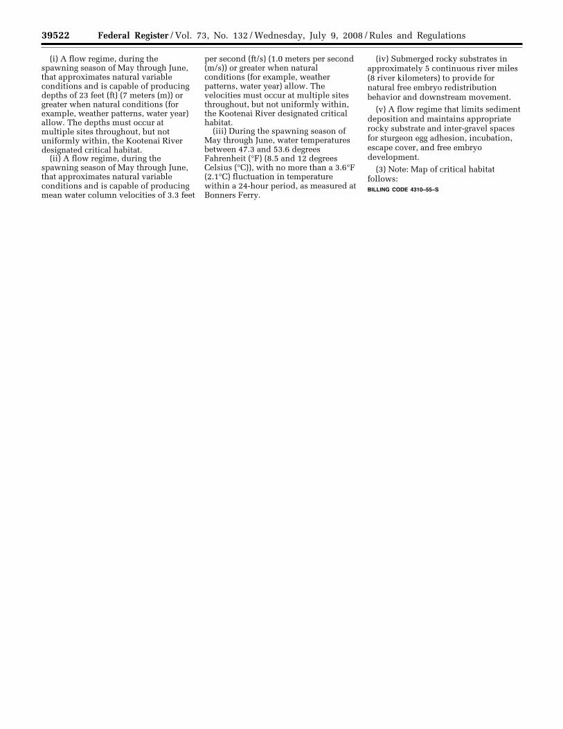
39522 Federal Register / Vol. 73, No. 132 / Wednesday, July 9, 2008 / Rules and Regulations
(i) A flow regime, during the spawning season of May through June, that approximates natural variable conditions and is capable of producing depths of 23 feet (ft) (7 meters (m)) or greater when natural conditions (for example, weather patterns, water year) allow. The depths must occur at multiple sites throughout, but not uniformly within, the Kootenai River designated critical habitat.
(ii) A flow regime, during the spawning season of May through June, that approximates natural variable conditions and is capable of producing mean water column velocities of 3.3 feet
per second (ft/s) (1.0 meters per second (m/s)) or greater when natural conditions (for example, weather patterns, water year) allow. The velocities must occur at multiple sites throughout, but not uniformly within, the Kootenai River designated critical habitat.
(iii) During the spawning season of May through June, water temperatures between 47.3 and 53.6 degrees Fahrenheit (°F) (8.5 and 12 degrees Celsius (°C)), with no more than a 3.6°F (2.1°C) fluctuation in temperature within a 24-hour period, as measured at Bonners Ferry.
(iv) Submerged rocky substrates in approximately 5 continuous river miles (8 river kilometers) to provide for natural free embryo redistribution behavior and downstream movement.
(v) A flow regime that limits sediment deposition and maintains appropriate rocky substrate and inter-gravel spaces for sturgeon egg adhesion, incubation, escape cover, and free embryo development.
(3) Note: Map of critical habitat follows: BILLING CODE 4310–55–S
VerDate Aug<31>2005 16:46 Jul 08, 2008 Jkt 214001 PO 00000 Frm 00018 Fmt 4701 Sfmt 4700 E:\FR\FM\09JYR2.SGM 09JYR2jlent
ini o
n P
RO
D1P
C65
with
RU
LES
2

39523 Federal Register / Vol. 73, No. 132 / Wednesday, July 9, 2008 / Rules and Regulations
* * * * * Dated: June 26, 2008.
Lyle Laverty, Assistant Secretary for Fish and Wildlife and Parks. [FR Doc. E8–15134 Filed 7–8–08; 8:45 am] BILLING CODE 4310–55–C
VerDate Aug<31>2005 16:46 Jul 08, 2008 Jkt 214001 PO 00000 Frm 00019 Fmt 4701 Sfmt 4700 E:\FR\FM\09JYR2.SGM 09JYR2 ER
09JY
08.0
05<
/GP
H>
jlent
ini o
n P
RO
D1P
C65
with
RU
LES
2