County of Fairfax, Virginia
209
County of Fairfax, Virginia To protect and enrich the quality of life for the people, neighborhoods and diverse communities of Fairfax County June 5, 2013 G. Evan Pritchard Walsh, Colucci, Lubeley, Emrich & Walsh, P.C. 2200 Clarendon Boulevard, 13 th Floor Arlington, VA 22201 RE: Rezoning Application RZ 2011-PR-017 Dear Mr. Pritchard: Enclosed you will find a copy of an Ordinance adopted by the Board of Supervisors at a regular meeting held on June 4, 2013, granting Rezoning Application RZ 2011-PR-017 in the name of Commons of McLean L/CAL LLC. The Board's action rezones certain property in the Providence District from the R-20, C-6 and HC Districts to the PTC and HC Districts to permit mixed use development with an overall Floor Area Ratio (FAR) of 2.87 and a waiver of #003797-WPFM-003-1 to permit the location of underground storm water management facilities in a residential area. The subject property is located S. of Route 123, on both sides of Anderson Road on 20.96 approximately acres of land, [Tax Map 30-3 ((28)) B4, 5, 6 and 8], and is subject to the proffers dated May 20, 2013. Please note that on May 9, 2013, the Planning Commission approved Final Development Plan Application FDP 2011-PR-017, subject to the development conditions dated April 17, 2013. The Board also: • Modified Paragraph 1A and 1C of Section 2-506 of the Zoning Ordinance to allow structures located on the building roof to occupy an area greater than 25 percent of the roof, as proffered. • Modified Paragraph 7 of Section 6-505 of the Zoning Ordinance to permit outdoor dining area as proffered and shown on future final development plans. Office of the Clerk to the Board of Supervisors 12000 Government Center Parkway, Suite 533 Fairfax, Virginia 22035 Phone: 703-324-3151 • Fax: 703-324-3926 • TTY: 703-324-3903 Email: [email protected] http://www.fairfaxcounty.gov/bosclerk
-
Upload
khangminh22 -
Category
Documents
-
view
0 -
download
0
Transcript of County of Fairfax, Virginia
County of Fairfax, Virginia To protect and enrich the quality of life for the people, neighborhoods and diverse communities of Fairfax County
June 5, 2013
G. Evan Pritchard Walsh, Colucci, Lubeley, Emrich & Walsh, P.C. 2200 Clarendon Boulevard, 13 th Floor Arlington, VA 22201
RE: Rezoning Application RZ 2011-PR-017
Dear Mr. Pritchard:
Enclosed you will find a copy of an Ordinance adopted by the Board of Supervisors at a regular meeting held on June 4, 2013, granting Rezoning Application RZ 2011-PR-017 in the name of Commons of McLean L/CAL LLC. The Board's action rezones certain property in the Providence District from the R-20, C-6 and HC Districts to the PTC and HC Districts to permit mixed use development with an overall Floor Area Ratio (FAR) of 2.87 and a waiver of #003797-WPFM-003-1 to permit the location of underground storm water management facilities in a residential area. The subject property is located S. of Route 123, on both sides of Anderson Road on 20.96 approximately acres of land, [Tax Map 30-3 ((28)) B4, 5, 6 and 8], and is subject to the proffers dated May 20, 2013.
Please note that on May 9, 2013, the Planning Commission approved Final Development Plan Application FDP 2011-PR-017, subject to the development conditions dated April 17, 2013.
The Board also:
• Modified Paragraph 1A and 1C of Section 2-506 of the Zoning Ordinance to allow structures located on the building roof to occupy an area greater than 25 percent of the roof, as proffered.
• Modified Paragraph 7 of Section 6-505 of the Zoning Ordinance to permit outdoor dining area as proffered and shown on future final development plans.
Office of the Clerk to the Board of Supervisors 12000 Government Center Parkway, Suite 533
Fairfax, Virginia 22035 Phone: 703-324-3151 • Fax: 703-324-3926 • TTY: 703-324-3903
Email: [email protected] http://www.fairfaxcounty.gov/bosclerk

RZ 2011-PR-017 -2- June 5, 2013
• Modified Par. 2 of Sect. 2-506 of the ZO to allow a parapet wall, cornice or similar projection to extend more than three feet above the roof, as proffered and shown on shown on future FDPs.
• Waived Par. 3E and G of Sect. 10-104 of the ZO to modify the maximum fence height from seven to 14 feet around accessory uses/structures located within the rear yard for areas associated with sports courts as proffered and shown on future FDPs.
• Modified Par. 1 of Sect. 6-509 and Par. 12 of Sect. 11-102 of the ZO to allow the use of tandem spaces to be counted toward required parking as proffered.
• Modified Par. 4 of Sect. 11-202 of the ZO requiring a minimum distance of 40 feet of a loading space in proximity to drive aisles, to that shown on the CDP and when shown on an approved FDP.
• Modified Sect. 11-201 and 11-203 of the ZO to permit a reduction in the required number of loading spaces to that shown on the CDP.
• Modified Sect. 7-0802.2 of the Public Facilities Manual (PFM) to allow for the projection of structural columns into parking stall (no more than four percent of the stall area).
• Waived Sect. 11-302 of the ZO to allow a private street (Center Alley) to exceed 600 feet in length as shown on the CDP.
• Modified Par. 7 of Sect. 17-201 of the ZO to permit the applicant to establish parking control, signs and parking meters along private streets within the development.
• Modified Sect. 17-201 of the ZO to permit the streetscape and on-road bike lane system shown on the CDP in place of any trails and bike trails shown for the subject property on the Comprehensive Plan.
• Waived Par. 3 of Sect. 17-201 of the ZO to provide any additional interparcel connections to adjacent parcels beyond that shown on the CDP and as proffered.
• Waived Sect. 16-403 of the ZO in order to permit a public improvement plan for public streets and park spaces without the need for an FDP.
• Modified the 10 year tree canopy requirements in favor of that shown on the CDP and as proffered.
• Modified the Zoning Ordinance and PFM for required tree preservation target and 10 percent canopy coverage on individual lots/land bays, to allow for tree preservation and canopy to be calculated as shown on the overall CDP area.
• Approved Waiver #3797-WPFM-003-1 to allow the use of underground stormwater detention facilities in a residential development, subject to the conditions dated February 15, 2013, contained in Attachment A of Appendix 11 of the staff report.

RZ 2011-PR-017 -3- June 5, 2013
• Waived Sect 13-202 and Sect. 13-203 of the ZO allowing interior parking lot landscaping for interim surface lots on private streets to that shown on the CDP and FDP.
• Modified Section 12-0515.6B of the PFM to allow trees located above any proposed percolation trench or bio-retention areas to count towards County tree cover requirements as depicted on CDP and FDP.
• Waived Par.4 of Sect. 17-201 of the ZO requiring any further dedication and construction for widening of existing roads to address Comprehensive Plan requirements beyond that which is indicated in the CDP, FDP, and proffers.
Sincerely,
.-12-114Akt\A e_,L4Cq4 Catherine A. Chianese Clerk to the Board of Supervisors
Cc: Chairman Sharon Bulova Supervisor Linda Smyth, Providence District Tim Shirocky, Acting Director, Real Estate Division, Dept. of Tax Administration Barbara Berlin, Director, Zoning Evaluation Division, DPZ Diane Johnson-Quinn, Deputy Zoning Administrator, Dept. of Planning and Zoning Thomas Conry, Dept. Manager — GIS - Mapping/Overlay Angela K. Rodeheaver, Section Chief, Transportation Planning Division Donald Stephens, Transportation Planning Division Department of Highways-VDOT Sandy Stallman, Park Planning Branch Manager, FCPA Charlene Fuhrman-Schulz, Development Officer, DHCD/Design Development Division Planning Commission Denise James, Office of Capital Facilities/Fairfax County Public Schools Karyn Moreland, Chief Capital Projects Sections, Dept. of Transportation

At a regular meeting of the Board of Supervisors of Fairfax County, Virginia, held in the Board Auditorium in the Government Center at Fairfax, Virginia, on the 4th day of June, 2013, the following ordinance was adopted:
AN ORDINANCE AMENDING THE ZONING ORDINANCE PROPOSAL NUMBER RZ 2011-PR-017
WHEREAS, Commons of McLean L/CAL LLC, filed in the proper form an application requesting the zoning of a certain parcel of land herein after described, from the R-20, C-6 and HC the Districts to the PTC and HC Districts, and
WHEREAS, at a duly called public hearing the Planning Commission considered the application and the propriety of amending the Zoning Ordinance in accordance therewith, and thereafter did submit to this Board its recommendation, and
WHEREAS, this Board has today held a duly called public hearing and after due consideration of the reports, recommendation, testimony and facts pertinent to the proposed amendment, the Board is of the opinion that the Ordinance should be amended,
NOW, THEREFORE, BE IT ORDAINED, that that certain parcel of land situated in the Providence District, and more particularly described as follows (see attached legal description):
Be, and hereby is, zoned to the PTC and HC Districts, and said property is subject to the use regulations of said PTC and HC Districts, and further restricted by the conditions proffered and accepted pursuant to Va. Code Ann., 15.2-2303(a), which conditions are in addition to the Zoning Ordinance regulations applicable to said parcel, and
BE IT FURTHER ENACTED, that the boundaries of the Zoning Map heretofore adopted as a part of the Zoning Ordinance be, and they hereby are, amended in accordance with this enactment, and that said zoning map shall annotate and incorporate by reference the additional conditions governing said parcel.
GIVEN under my hand this 4th day of June, 2013.
66k .(17VitCWA .LA Catherine A. Chianese Clerk to the Board of Supervisors


The Commons RZ 2011-PR-017
Proffers Dated May 20, 2013
Commons of McLean L/CAL, LLC
Board of Supervisors Public Hearing
June 4th, 2013

PROFFERS Commons of McLean L/CAL, LLC
RZ 2011-PR-017
Table of Contents
GENERAL 1
1. Conceptual Development Plan. 1
2. Minor Modifications. 1
3. Declarations/Owners Associations. 2
PROPOSED DEVELOPMENT 2
4. Proposed Development. 2
5. Final Development Plans 2
6. Fire Marshal Evaluation. 5
ARCHITECTURAL DESIGN 6 7. Architecture 6
8. Build-to-Lines 6 9. Activated Streetscapes and Ground Floor Elements. 7 10. Building Height. 8
11. Rooftop Telecommunications and Mechanical Equipment. 8
12. Historical On-site References. 9
13. Heritage Resource Documentation. 9
14. Stereoscopic Photography and High Definition Video. 10
15. Festivals, Fairs or Similar Activities. 10
GREEN BUILDING AND SUSTAINABLE ENERGY PRACTICES 10
16. Residential Building Certifications. 10
17. Sustainable Energy Practices. 12
URBAN SITE DESIGN AND LANDSCAPING 13 18. Landscaping. 13
19. Tree Preservation within Anderson Park. 13
20. Tree Preservation and Planting Fund Contribution 16 21. Streetscape Elements 17
22. Lighting. 20
23. Interim Conditions and Standards. 21
TRANSPORTATION IMPROVEMENTS 22
24. Grid of Streets. 22

25. Street Improvements. 25 26. Anderson Road 25 27. Colshire Meadow Drive. 26 28. Anderson Road/Old Chain Bridge Road/Colshire Meadow Drive Intersection. 27 29. Dartford Drive 28 30. Colshire Drive. 28 31. Main Street. 29 32. East Lane and South Street. 29 33. Center Alley. 29 34. Colshire Drive/Anderson Road Traffic Signal 29 35. Main Street/Anderson Road Pedestrian Signal. 30 36. Colshire Meadow Drive/Dartford Drive Traffic Signal 30 37. Route 123 Restriping. 30 38. Traffic Signal Modifications. 30 39. Route 123 Super Street Concept. 31 40. Construction Traffic Management. 31 41. Tysons Grid of Streets Transportation Fund 31 42. Tysons-wide Transportation Fund. 32
BICYCLE FACILITIES 32 43. Bicycle Circulation. 32 44. Bicycle Parking. 32
PARKING 33 45. Zoning Ordinance Requirements. 33 46. Future Parking Revisions. 33 47. Parking Stipulations. 33
TRANSPORTATION DEMAND MANAGEMENT 33 48. Tysons Transportation Management Association. 33 49. TDM Administrative Group 34 50. Transportation Demand Management 34
AFFORDABLE/WORKFORCE HOUSING 44 51. Affordable Dwelling Units 44 52. Workforce Dwelling Units. 44 53. Non-Residential Affordable Housing Contribution. 46
PARK AND RECREATIONAL FACILITIES 46
54. Publicly Accessible Parks and Recreational Facilities. 47
55. Private Amenities and Recreation Facilities for Residents. 49
PUBLIC FACILITIES 50
56. Public School Contribution. 50
ENVIRONMENT 50
57. Stormwater Management. 50
58. Noise Study. 52
59. Notification of Exterior Noise Levels. 53
PHASING 53
60. Development Phasing. 53
61. Zoning Administrator Consideration. 54
MISCELLANEOUS 54
62. Condemnation. 54
63. Metrorail Tax District Buyout for Certain Residential Uses. 55
64. Adjustment in Contribution Amounts 55
65. Advanced Density Credit. 55
66. Severability. 55
67. Successors and Assigns 55
68. Tysons Partnership. 56
69. Construction Access and Hours. 56
70. Counterparts. 56
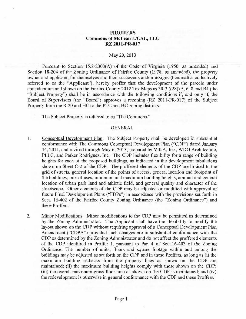
PROFFERS Commons of McLean L/CAL, LLC
RZ 2011-PR-017
May 20, 2013
Pursuant to Section 15.2-2303(A) of the Code of Virginia (1950, as amended) and Section 18-204 of the Zoning Ordinance of Fairfax County (1978, as amended), the property owner and applicant, for themselves and their successors and/or assigns (hereinafter collectively referred to as the "Applicant"), hereby proffer that the development of the parcels under consideration and shown on the Fairfax County 2012 Tax Maps as 30-3 ((28)) 5, 6, 8 and B4 (the "Subject Property") shall be in accordance with the following conditions if and only if, the Board of Supervisors (the "Board") approves a rezoning (RZ 2011-PR-017) of the Subject Property from the R-20 and HC to the PTC and HC zoning districts.
The Subject Property is referred to as "The Commons."
GENERAL
1. Conceptual Development Plan. The Subject Property shall be developed in substantial conformance with The Commons Conceptual Development Plan ("CDP") dated January 14, 2011, and revised through May 6, 2013, prepared by VIKA, Inc., WDG Architecture, PLLC, and Parker Rodriguez, Inc. The CDP includes flexibility for a range of building heights for each of the proposed buildings, as indicated in the development tabulations shown on Sheet C-2 of the CDP. The proffered elements of the CDP are limited to the grid of streets, general location of the points of access, general location and footprint of the buildings, mix of uses, minimum and maximum building heights, amount and general location of urban park land and athletic field, and general quality and character of the streetscape. Other elements of the CDP may be adjusted or modified with approval of future Final Development Plans ("FDPs") in accordance with the provisions set forth in Sect. 16-402 of the Fairfax County Zoning Ordinance (the "Zoning Ordinance") and these Proffers.
2. Minor Modifications. Minor modifications to the CDP may be permitted as determined by the Zoning Administrator. The Applicant shall have the flexibility to modify the layout shown on the CDP without requiring approval of a Conceptual Development Plan Amendment ("CDPA") provided such changes are in substantial conformance with the CDP as determined by the Zoning Administrator and do not affect the proffered elements of the CDP identified in Proffer 1, pursuant to Par. 4 of Sect.16-403 of the Zoning Ordinance. The number of units, floors and square footage within and among the buildings may be adjusted as set forth on the CDP and in these Proffers, as long as (i) the maximum building setbacks from the property lines as shown on the CDP are maintained; (ii) the maximum building heights comply with those shown on the CDP; (iii) the overall maximum gross floor area as shown on the CDP is maintained; and (iv) the redevelopment is otherwise in general conformance with the CDP and these Proffers.
Page 1

3. Declarations/Owners Associations. The Applicant shall cause the recordation of one or more declarations creating an umbrella owners' association ("UOA") and as necessary, condominium owners' associations ("COA") or declarations of covenants and agreements dealing with the governance of maintenance and operation of the Subject Property or other governance documents which will legally bind the Subject Property, (collectively referred to as the "Governance Documents"). Such Governance Documents shall be prepared, be legally effective and recorded prior to the issuance of the first Non-Residential Use Permit ("Non-RUP") or Residential Use Permit ("RUP") for new construction on the Subject Property. The respective Governance Documents (including budgets provided in any offering or sale materials) shall specify the various proffer and maintenance obligations set forth in these Proffers, including the maintenance of certain streets, associated sidewalks and streetscapes, and site amenities such as, but not limited to, the publicly accessible park areas, as well as implementation of the transportation demand management (the "TDM") program. Purchasers shall be advised in writing of these obligations, and other restrictions, prior to entering into a contract of sale, whether purchasing residential or commercial property. The notice requirements of this proffer shall not apply to renters of individual residential units.
PROPOSED DEVELOPMENT
4. Proposed Development. The maximum gross floor area ("GFA") permitted on the Subject Property is 2,622,400 square feet (the "Proposed Development"). Development of the Subject Property may include any use permitted in the Planned Tysons Corner Urban ("PTC") District, subject to limitations in these Proffers and in the PTC Zoning Ordinance. The primary use of the Subject Property shall be residential. However, up to 50,000 square feet of residential GFA may be converted to retail/service uses at the Applicant's sole discretion within the proposed buildings. The retail/service uses provided may include any retail or service use permitted in the PTC District, subject to the Use Limitations in Sect. 6-505, or uses accessory to the primary use. Such uses may be provided generally within the ground floor (L e. , street level) of the proposed buildings; however, such uses may also be provided within upper floors if shown on an FDP. The type, extent and location of all retail/service uses shall be provided with the submission of each FDP. Potential retail/service locations, should the Applicant choose to provide them at its sole discretion, are conceptually shown on Sheet A.03 of the CDP.
Uses allowed by special exception or special permit in the PTC District may be authorized through a separate special exception or special permit process without the need for a PCA or CDPA, provided the use is in general conformance with the approved CDP.
5. Final Development Plans. FDPs approved for individual building sites on the Subject Property shall establish the maximum GFA for each building within the limits established by these Proffers and the CDP. The specific GFA for each building shall be established at final site plan. If the GFA approved with the FDP is less than the maximum shown on the CDP, or if the GFA approved with the site plan is less than the maximum shown on the FDP, the excess GFA may be utilized in another building or building(s) within the Subject Property, provided the excess GFA can be accommodated within the minimum
Page 2
and maximum building height ranges shown on the CDP for the receiving buildings and subject to approval of the applicable FDP(s) or Final Development Plan Amendments ("FDPA(s)") for the building(s) utilizing the excess GFA. In addition, the following information shall be provided with each FDP or FDPA not filed concurrently with this rezoning:
A. Tabulations. A tabulation indicating the development status of all property subject to these Proffers shall be provided with each subsequent FDP and each site plan submitted for the Subject Property. The tabulation shall include a listing of all existing and proposed buildings, along with the GFA and uses approved on the CDP, FDP and site plan as may be applicable. The tabulation shall identify the reassignment of any excess GFA (as compared with what was originally shown on the applicable CDP) and shall be updated with each subsequent FDP and site plan approved for the Subject Property.
B. Tree Canopy Calculations. A tabulation indicating the tree canopy calculations of all property subject to these Proffers shall be provided with each FDP and site plan submitted for the Subject Property and shall be updated with each subsequent FDPA and site plan approved for the Subject Property.
C. Supplemental Transportation Information. The following information to supplement the requirements of the Zoning Ordinance: (i) a copy of the previous TDM Annual Report, if available, to determine progress toward attaining TDM goals and any planned modifications to the TDM program; (ii) vehicular sight distance lines at all intersections within, and adjacent to, the FDP area overlaid on the Landscape Plan; and (iii) a comparison of the trip generation associated with the FDP, FDPA or site plan uses for the Subject Property based on ITE' s, 8 th
edition, Trip Generation compared to those uses reflected for that building site in the Transportation Impact Analysis prepared by Wells + Associates ("TIA") dated May 2011 as revised through April 2012. If the trip generation associated with the FDP, FDPA or site plan results in more than 100 additional peak hour directional trips (inbound or outbound) then the Applicant shall provide such supplemental traffic analyses if required by VDOT and/or FCDOT to address such an increase in trips. Such supplemental analyses will be limited to an assessment of the site entrances, those off-site turn bays that directly serve the Subject Property and/or any of those intersections within the TIA study area.
D. Utilities. Approximate location of existing and proposed utilities to serve the area of the FDP including the location of the any utility vaults and maintenance points to stormwater management facilities overlaid on the Landscape Plan.
E. Proposed Uses. A list of proposed uses, demonstration of how such uses meet the applicable "Use Limitations" of Section 6-505 of the Ordinance, and a description in the statement of justification of how the mix of uses at the build-out of the Subject Property will comply with these Proffers.
Page 3

F. Retail/Service Uses. At the time of FDP for each new building to be constructed on the Subject Property starting with the second building, the Applicant shall study, based on market conditions and other development within Tysons, whether all or a portion of the ground floor of the new building should include a retail/service component. Should the Applicant determine that a retail/service component would be viable, the Applicant shall design the building to accommodate such uses or provide flexibility for such uses in the future without the need for an FDPA. As part of this retail study, the Applicant shall also consider whether ground floor retail/service uses would be viable within buildings constructed in earlier development phases, provided such buildings are still owned or controlled by Commons of McLean L/CAL LLC at the time of the study.
G. Architectural Elements. Specific information on architectural elements as provided in Proffer 7 as well as details regarding any parapet walls, cornices or similar projections extending more than three feet above the roof. In no case shall such features extend more than twenty feet above the roof.
H. Build-to-Lines. Refinement of the build-to-lines based on proposed uses, location of possible outdoor dining areas, and identification of awnings and canopies that extend beyond the building zone.
I. Streetscape. A graphic depiction of, and any adjustments to, the activated streetscape elements and refinement of, and adjustments to, streetscape elements.
J. Garage Treatments. Elevations of proposed parking garage façade treatments that shall be designed to minimize views into the garages.
K. Landscaping. Detailed landscape plans.
L. Streetscape Furnishings. Submission of a "Streetscape Furnishing and Materials Plan."
M. Interim Conditions. Identification of specific proposed interim conditions within the FDP area and outside the FDP area.
N. Phasing. Identification of specific proposed phased improvements and those generally set forth on the phasing-related exhibits provided on the CDP.
0. Parking Spaces. Refinement of the number of parking spaces; demonstration that tandem spaces will be utilized only for residential units with two cars where spaces are assigned by building management; and assuming parking ratios in early phases exceed the maximum ratios allowed, a description and/or tabulation in the statement of justification discussing how the subject FDP and preceding FDPs are achieving the Comprehensive Plan's recommendations for phased parking such that at the build-out of the Subject Property the maximum parking rates are not exceeded. The proposed parking ratios will be reviewed in consideration of the TDM goals for the Subject Property and any outside factors
Page 4
affecting driving behavior, with the overall objective being to ensure that excessive parking is not constructed and that transit use is encouraged to the greatest extent practicable.
P. Loading Spaces. Identification of loading spaces located within 40 feet of a drive aisle and locations where parking garage and loading entrances have been consolidated into one building entrance.
Q. Parks and Recreation. Specific park details, site amenities and substitute recreation facilities. The Applicant shall attempt to identify areas on the Subject Property that may, with minimal disturbance to existing grade and vegetation, potentially be used as youth athletic practice areas on an interim basis provided such areas are still owned or controlled by Commons of McLean L/CAL LLC at the time of FDP.
R. Residential Amenities. Specific facilities and amenities to be provided for each residential building will be identified.
S. Provisions for Bicycles. Bicycle parking, storage and bicycle lane dimensions as provided in Proffers 43 and 44.
T. Stormwater Management. Specific stormwater management facilities and access points to underground vaults will be identified in addition to the other information to be provided at FDP, as specified in Proffer 57.
U. Bus Shelters. At the time of FDP, the Applicant will coordinate with FCDOT on the location of up to two (2) bus shelters and their designs on Anderson Road and one (1) on Dartford Drive.
V. Functional Drawings. Details with respect to sight distance and/or vegetation conflicts with building entrances and/or intersections as presented on Sheet L-19 of the CDP. Said functional drawings shall also include proposed right-of-way lines associated with existing/planned public streets.
W. Fencing. Identification of proposed fencing, screening, or barriers serving active recreational uses on roofs or adjacent to streets that exceed seven (7) feet in height. In no case shall such fencing exceed fourteen (14) feet in height.
6. Fire Marshal Evaluation. Changes to the CDP and FDPs shall be permitted in response to the review of site plans by the Fire Marshal, including adjustments to tree locations, the streetscape and perimeter building areas as necessary to allow for required emergency vehicle access, without requiring approval of a PCA, CDPA and/or FDPA, provided such modifications are made in consultation with the Fairfax County Department of Planning and Zoning ("DPZ"), Fairfax County Department of Transportation ("FCDOT"), the Urban Forest Management Division ("UFMD") of the Fairfax County Department of Public Works and Environmental Services ("DPWES") and the Office of Community Revitalization ("OCR") and in substantial conformance with the intent of the CDP, FDP and these Proffers.
Page 5
ARCHITECTURAL DESIGN
7. Architecture
A. Materials and Design. Buildings shall create a sense of identity and place at a human scale through the use of unifying elements such as materials, textures, color, window treatments, detailing, lighting and landscaping. Buildings shall be designed of high-quality architecture and building materials that are typically used on the exterior of Class A residential buildings of a similar quality as conceptually depicted on the CDP, with architectural details provided at the time of FDP approval for the respective phases. No exterior insulation and finish systems (EIFS) shall be used except for potential use on mechanical penthouse enclosures or unless specifically approved by Fairfax County with an FDP for an individual building or phase. Each FDP shall, for the phase for which that FDP is filed, specify the building materials, architecture, and specific features designed to activate streetscapes, as further described below. Architectural plans, elevations, illustrations, materials and heights may be revised subsequent to CDP and FDP approval as a result of final architectural and engineering design, provided the quality of design remains in substantial conformance with that shown on the CDP and subsequent FDPs and set forth in these Proffers, as determined by DPWES in consultation with DPZ or OCR.
B. Universal Design. A minimum of 10 percent (10%) of all dwelling units shall be designed and constructed with some Universal Design features, as determined by the Applicant. These elements shall be identified at the time of building plan submission.
C. Bird-Friendly Features. At the time of building plan submission for the first new building to be constructed on the Subject Property, a study shall be prepared and submitted to OCR addressing whether bird-friendly design strategies may be employed to reduce bird injury and death due to in-flight collisions with buildings and/or building elements. The strategies to be studied should make the buildings visible to birds in flight and reduce reflections that distract or confuse birds though the use of appropriate glazing treatments or architectural elements, including using color, texture, opacity, patterns, louvers, screens, interior window treatments, or ultraviolet materials that are visible to birds. A narrative summarizing the results of that study and which strategies, if any, will be implemented shall be submitted to OCR at the time of each subsequent individual building permit issuance.
8. Build-to-Lines. Build-to-lines ("BTL") have been established as depicted on the CDP, to create an urban, pedestrian-oriented environment where buildings are located close to the street and pedestrian/streetscape areas are located between the buildings and the streets. In general, building facades are intended to be configured in such a way as to provide a continuous street wall along this line, but modifications to either side of the BTL shall be permitted provided such are in general conformance with the CDP and are shown on an approved FDP. Awnings and other architectural canopies attached to the building
Page 6
frontage that project out from the BTLs shall provide adequate clearance for pedestrian movement and shall not conflict with street tree locations. At the time of FDP approval, if retail/restaurant uses are proposed, the Applicant shall identify possible locations along the street level for expanded areas for outdoor dining adjacent to cafes and restaurants. The Applicant shall provide appropriate building zones for such uses in keeping with the Comprehensive Plan recommendations that will ensure that such uses will not encroach upon sidewalk zones.
9. Activated Streetscapes and Ground Floor Elements. The Applicant shall provide for activated streetscapes by designing and constructing the exterior facades of ground floor areas adjacent to streets as generally described below, with modifications and further refinements permitted with the approval of FDPs.
A. Buildings 1 and 3, as identified on the CDP, shall be designed and constructed with ground floors having a minimum floor to floor height of 14 feet. Buildings 2, 4, 5, 6 and 7 shall be designed and constructed with ground floors having a minimum floor to floor height of 16 feet to accommodate potential non-residential uses designed to activate the streetscape. Specific activation elements to be utilized for each building, along with any necessary modifications to the building architecture such as building elevations, window glazing and entries, shall be graphically depicted on the FDP for review and approval and may be further refined at site plan.
B. Where the ground floors of buildings incorporate non-residential uses, the building design shall include:
(i) functioning entry doors with a maximum separation of 75 feet or less, unless a greater separation is needed to accommodate larger tenant spaces or as may be permitted by the Zoning Administrator;
(ii) non-residential entries with recessed and/or welcoming entries incorporating awnings or canopies as appropriate; and
(iii) a minimum of 50% transparent glazing of the street wall up to a height of 9 feet above the adjacent sidewalk, with building entrances considered to meet a portion of the transparency guidelines.
C. In residential buildings that do not incorporate non-residential uses on part or all of the ground floors, the building design shall include:
(i)
to the degree feasible, lobby, recreational and amenity spaces, on the ground floors of the primary facade. Such spaces shall incorporate a minimum of 40% transparent glazing of the street wall up to a height of 9 feet above the adjacent sidewalk, with building entrances considered to meet a portion of the transparency guidelines;
Page 7

(ii) residential uses along the remainder of the building façade shall include a percentage of transparent glazed facades typical of windows required for dwelling units; and
(iii) individual dwelling units that have entrances with direct access to the street level shall utilize design features to provide interior privacy (such as having a ground floor elevation that is above the sidewalk grade).
D. Parking structures along the ground floor facades of buildings shall be minimized. Above grade parking structures fronting on Colshire Meadow Drive, Main Street, South Street and East Lane shall incorporate non-residential uses, residential dwellings or associated amenity spaces at the ground level, or the general façade detailing of the building above may be continued to the ground plane. Above grade parking structures fronting on Anderson Road, Center Alley and Dartford Drive shall include screening composed of architectural systems designed to restrict views into the garage spaces from street level and provide a more attractive and enjoyable pedestrian experience. The details of such screening shall be provided at FDP for the review and approval of the Planning Commission.
E. Loading/trash/service areas shall be screened from public view through the use of roll down doors or similar treatment.
10. Building Height. The number of floors shown on the CDP is conceptual and may be adjusted at FDP provided the maximum building heights are not exceeded. The final height for each building and specific steps in building height may be determined at the time of FDP, site plan or building permit approval, but shall be within the building heights range shown on the CDP, as measured from average grade.
All building penthouses and rooftop structures shall be integrated into the architecture of the buildings. The height and extent of any rooftop penthouse shall be provided in the FDP. Maximum building heights shall include penthouses and all rooftop structures. Structures to be located on the building roof outside of a penthouse or screened area that will occupy an area greater than 25% of the total roof may exceed the maximum building heights, provided they are for the purpose of achieving LEED certification and are reviewed by DPZ.
11. Rooftop Telecommunications and Mechanical Equipment. Telecommunications equipment may be placed on the proposed buildings' rooftops. Any such facilities must comply with the applicable requirements of the Zoning Ordinance and be screened and/or setback sufficiently from the perimeter of the roof and penthouse such that they are not visible from the surrounding streets. Screening measures may, without limitation (i) include screening with architectural features and/or landscaping compatible with the building façade architecture, (ii) include the facilities as part of the architecture of the buildings, (iii) utilize compatible colors, or (iv) employ telecommunication screening material and flush-mounted antennas. Telecommunications equipment also may be
Page 8

architecturally integrated onto the façades of the building where necessary to ensure on-street and/or open space coverage. Rooftop amenities such as amenity terraces, landscaping or recreation courts may also be used to screen rooftop telecommunications equipment and mechanical units.
12. Historical On-site References. The Applicant shall incorporate historic references to past uses of the Property throughout the site, including reference to the original Commons of McLean buildings and their architect, Charles Goodman, as generally shown on Sheet L-18. Such references shall be provided with each corresponding FDP within which a historical reference is provided. The design, appearance, and specific location of the historical references may be modified at FDP and/or site plan in consultation with DPZ and OCR. The references shown within the Main Street median between Anderson Road and Center Alley shall be constructed following completion of the SWM features in the median referenced in Proffer 57, but in no case later than the issuance of the final RUP for Building 1.
13. Heritage Resource Documentation.
A. For the purpose of recording and documenting significant historic and architectural information that otherwise would be lost, the Applicant shall cause existing structures on the Subject Property to be photographed and documented, prior to any ground disturbing activity, by an individual who meets The Secretary of the Interior's professional qualification standards for history, architectural history or historic architecture, as specified at http://www.cr.nps.gov/local-law/arch stnds 9.htm.
B. The report entitled The Commons of McLean Eligibility Assessment for Fairfax County Inventory of Historic Sites prepared by History Matters, LLC and dated June 17, 2011 (the "History Matters Report"), shall be used to identify significant historic and architectural features of the existing buildings and to guide the preparation of measured drawings and photographs. Such drawings and photographs shall be completed in accordance with the Historic American Building Survey ("HABS") standards, as specified at http://www.nps.gov/history/hdp/standards/standards.pdf . The number, subject matter and size of the drawings and the number and angle of photographic views shall be coordinated with DPZ heritage resource staff prior to the preparation of drawings and the taking of photographs. Completed drawings and photographs shall be approved by DPZ heritage resource staff prior to any ground disturbing activity.
C. The approved drawings, photographs and the History Matters Report (the "Documentation") shall be compiled in a format based upon HABS standards with the goal to provide architects, scholars and the general public with comprehensive documentation of the significant buildings, structures and cultural landscape significant in the growth and development of the built environment of Fairfax County.
Page 9
D. Prior to site plan approval for the first new building on the Subject Property, the Documentation shall be submitted to the Virginia Room of the Fairfax County Public Library and the Virginia Department of Historic Resources (VDHR). The Applicant shall notify DPZ in writing of such submission and provide a copy of the Documentation to DPZ.
14. Stereoscopic Photography and High Definition Video. Prior to any ground disturbing activity, the Applicant shall document the existing residential buildings on the Subject Property through the use of stereoscopic photography with the intent of conveying how the buildings relate to the landscape. In addition, the Applicant shall record a high definition video of a walking tour of the Subject Property that attempts to capture the topography of the Subject Property and how the residential buildings relate to each other and the surrounding landscape. Upon completion, digital copies of the photographs and video shall be provided to DPZ.
15. Festivals, Fairs or Similar Activities. The Applicant or its designee, shall be permitted to operate festivals, fairs or similar activities on the Subject Property, either in interim surface parking lots or within publically accessible private open space as shown on the CDP, including portions of Center Alley without limitation. The Applicant reserves the right to periodically close all or portions of Center Alley and Main Street, subject to VDOT approval as may be required for said activities. The Applicant shall coordinate with the Zoning Administrator regarding the issuance or approval of a temporary special permit as may be required under the Zoning Ordinance, which may include the establishment of an annual permit for continuing or seasonal events. Said- events shall be limited to the following:
A. A maximum of 26 events per year;
B. Admission or other fees may be charged;
C. Sponsorships by the Applicant, a civic organization, local Chamber of Commerce, charitable organization, service club, non-profit or similar entity; and
Compliance with all Health Department Regulations.
GREEN BUILDING AND SUSTAINABLE ENERGY PRACTICES
16. Residential Building Certifications.
A. The Applicant shall include, as part of the building plan submission for each residential building to be constructed on the Subject Property, a list of specific credits that the Applicant anticipates attaining within the most current version of the U.S. Green Building Council's Leadership in Energy and Environmental Design ("LEED") for new construction rating system that is available at the time of the Applicant's registration of the building. Alternatively, the Applicant shall include such a list within the LEED for Homes rating system determined to be applicable by the U.S. Green Building Council ("USGBC"), or its equivalent (as
Page 10

determined jointly by the Applicant and Fairfax County) that the Applicant anticipates attaining.
B. In addition, prior to site plan approval, the Applicant shall designate the Chief of the Environment and Development Review Branch of DPZ as a team member in the USGBC's LEED Online system. This team member will have privileges to review the project status and monitor the progress of all documents submitted by the project team, but will not be assigned responsibility for any LEED credits and will not be provided with the authority to modify any documentation or paperwork.
C. Except as otherwise provided below as an alternative, a LEED or equivalent-accredited professional ("LEED-AP") who is also a professional engineer or licensed architect shall provide certification statements at the time of building plan review confirming that the items on the list are expected to meet at least the minimum number of credits necessary to attain "LEED Certified" status for the project.
D. Prior to the building plan approval for each new building, the Applicant shall post, for each building, a "green building escrow," in the form of cash or a letter of credit as defined in the Public Facilities Manual ("PFM") from a financial institution acceptable to DPWES, in the amount of $2.00/square foot of GFA. This green building escrow shall be in addition to and separate from other bond requirements and shall be released upon demonstration of attainment of LEED certification, by the USGBC, under the project's registered version of the LEED-NC or LEED for Homes rating system or other LEED rating system determined, by the USGBC, to be applicable to each building. The provision to the Environment and Development Review Branch of DPZ of documentation from the USGBC that each building has attained LEED certification will be sufficient to satisfy this commitment. At the time LEED certification is demonstrated to the Environment and Development Review Branch of DPZ, the escrowed funds shall be released to the Applicant.
If the Applicant provides to the Environment and Development Review Branch of DPZ within three (3) years of issuance of the final RUP for the building, documentation demonstrating that LEED certification for the building has not been attained but that the building has been determined by the USGBC to fall within three (3) points of attainment of LEED certification, 50% of the green building escrow will be released to the Applicant; the other 50% will be released to Fairfax County (the "County") and will be posted to a fund within the County budget supporting implementation of County environmental initiatives.
If the Applicant fails to provide, within three (3) years of issuance of the final RUP for the building, documentation to the Environment and Development Review Branch of DPZ demonstrating attainment of LEED certification or demonstrating that the building has fallen short of LEED certification by more than three (3) points, the entirety of the escrow for that building will be released
Page 11

to Fairfax County and will be posted to a fund within the County budget supporting implementation of County environmental initiatives. Prior to any release of the escrow to the County, the Applicant shall first be notified and permitted an additional thirty (30) days to provide the necessary documentation and avoid forfeiture of the funds.
If the Applicant provides documentation from the USGBC demonstrating, to the satisfaction of the Environment and Development Review Branch of DPZ, that USGBC completion of the review of the LEED certification application has been delayed through no fault of the Applicant, the Applicant's contractors or subcontractors, the proffered time frame shall be extended as determined appropriate by the Zoning Administrator, and no release of escrowed funds shall be made to the Applicant or to the County during the extension.
E. As an alternative to the actions outlined in the paragraphs B, C, and D above, the Applicant may choose at its sole discretion to pursue a certification higher than LEED Certified, in which case a LEED or equivalent-accredited professional will provide certification statements at the time of building plan review confirming that the items on the list of specific credits will meet at least the minimum number of credits necessary to attain LEED Silver certification.
Prior to building plan approval for the building to be constructed, the Applicant shall submit documentation to the Environment and Development Review Branch of DPZ to demonstrate that the building is anticipated to attain a sufficient number of design-related credits that, along with the anticipated construction-related credits, will be sufficient to attain LEED Silver certification. Under this alternative, the Applicant is not required to provide a "green building escrow" unless the Applicant fails to provide the above referenced documentation that the building is anticipated to attain LEED Silver certification.
The Applicant may select, subject to EDRB approval, an alternate residential rating system such as Earth Craft, Energy Star Qualified Homes for Multifamily High Rise, or the 2012 National Green Building Standard (NGBS) using the ENERGY STAR® Qualified Homes path for energy performance that may be implemented without an escrow. If one of the alternate residential rating systems listed herein is selected, the Applicant shall demonstrate attainment of the selected certification from a rater recognized through the selected progress prior to the issuance of the final RUP for the building. In the event certification is dependent on the post occupancy operation of the building, the Applicant shall demonstrate attainment of the selected certification prior to final bond release.
17. Sustainable Energy Practices. To promote efficient, renewable and sustainable energy practices, the Applicant shall provide the following information and/or infrastructure:
A. Electric Vehicle Charging Infrastructure and Parking Spaces. A minimum of one (1) electric vehicle recharging station in each parking garage that serves two (2) parking spaces and conduit to facilitate additional recharging stations in each
Page 12

parking garage on the Subject Property. Upon review by DPZ, the Applicant may, at its sole discretion and in light of changing technology, substitute other technological features in place of a recharging station, provided that such features achieve a comparable benefit in terms of sustainable energy practices,
B. Shared Energy. For any site plan that includes more than one building or in conjunction with each site plan submitted after the approval of two (2) site plans for the Subject Property, provide an assessment of the potential, within the area subject to the site plan, of shared energy systems, including but not limited to combined heat and power (CHP) (co-generation), micro-CHP, distributed energy resources, and district heating and/or cooling, and, if a shared energy strategy will not be pursued, a narrative discussion regarding the reason(s) for this outcome. At a minimum, the Applicant shall ensure that utility sleeves through the foundations of all of the proposed buildings are sized to accommodate a pipe/facility, a maximum of 12 inches in diameter, allowing for potential future energy sharing or alternate energy sources.
C. Energy and Water Data. To the extent there are master electric, gas and water meters for entire buildings, upon request by the County, the Applicant shall provide to the County aggregated non-proprietary energy and water consumption data, as practicable, for each building and the entire Subject Property.
URBAN SITE DESIGN AND LANDSCAPING
18. Landscaping. The CDP includes a conceptual landscape plan for the Subject Property consisting of an overall plan and details regarding streetscapes, plazas, publicly accessible park areas, courtyards and private amenity areas. As part of subsequent FDP and site plan approvals, more detailed landscape plans for each building phase shall be provided in general conformance with the concepts shown on the CDP with adjustments permitted so long as the quantity and quality of the landscaping provided and the function of the space remains consistent with that shown on the CDP. Such plan shall include the location of all known utilities and sight distance requirements overlaid on the planting plan.
As part of the site plan submission for each building phase, the Applicant shall submit to UFMD for review and approval a detailed landscape plan that is in substantial conformance with the quantity and quality of plantings and materials landscaping shown on the respective approved FDP. Specific trees targeted for preservation on the approved FDPs shall be protected as set forth in Proffer 19. Tree planting and streetscaping shall be provided as described in Proffer 21. Tree species and planting sites as set forth on the FDP, are subject to revision as may be approved by UFMD.
19. Tree Preservation within Anderson Park. The Applicant shall submit a tree preservation plan and narrative (the "Tree Preservation Plan") with the site plan submission for Anderson Park, as defined in Proffer 54. The Tree Preservation Plan shall be prepared by a certified arborist or a registered consulting arborist, and shall be subject to the review and approval of the UFMD.
Page 13

A. Tree Preservation Plan: The Tree Preservation Plan shall include a tree inventory that identifies the location, species, critical root zone, size, crown spread and condition analysis percentage rating for all individual trees to be preserved, as well as all on and off-site trees, living or dead with trunks 12 inches in diameter and greater (measured at 4 1/2 feet from the base of the trunk or as otherwise allowed in the latest edition of the Guide for Plant Appraisal published by the International Society of Arboriculture) located within 25 feet outside the limits of clearing and grading and 10 feet inside the limits of clearing and grading for the FDP for Anderson Park. The Tree Preservation Plan shall provide for the preservation of those areas shown for tree preservation, those areas outside of the limits of clearing and grading shown on the FDP and those additional areas in which trees can be preserved as a result of final engineering. In particular, the Tree Preservation Plan shall provide for the preservation of the approximately 14 mature willow oak trees located along the eastern side of Anderson Road, as depicted on Sheet L-9. The Tree Preservation Plan shall include all items specified in PFM 12-0507 and 12-0509. Specific tree preservation activities that will maximize the survivability of any tree identified to be preserved, such as crown pruning, root pruning, mulching, fertilization, and others as necessary, shall be included in the Tree Preservation Plan.
B. Tree Appraisal: The Applicant shall retain a professional arborist with experience in plant appraisal, to determine the replacement value of all trees 12 inches in diameter or greater located on the Subject Property that are shown to be saved on the Tree Preservation Plan. These trees and their value shall be identified on the Tree Preservation Plan at the time of the first submission of the respective site plan(s). The replacement value shall take into consideration the age, size and condition of these trees and shall be determined by the so-called "Trunk Formula Method" contained in the latest edition of the Guide for Plan Appraisal published by the International Society of Arboriculture, subject to review and approval by UFMD.
At the time of the respective site plan approvals, the Applicant shall post a cash bond or a letter of credit payable to the County of Fairfax to ensure preservation and/or replacement of the trees for which a tree value has been determined in accordance with the paragraph above (the "Bonded Trees") that die or are dying due to unauthorized construction activities. The letter of credit or cash deposit shall be equal to 50% of the replacement value of the Bonded Trees. At any time prior to final bond release for the improvements on the Subject Property constructed adjacent to the respective tree save areas, should any Bonded Trees die, be removed, or are determined to be dying by UFMD due to unauthorized construction activities, the Applicant shall replace such trees at its expense. The replacement trees shall be of equivalent size, species and/or canopy cover as approved by UFMD. In addition to this replacement obligation, the Applicant shall also make a payment equal to the value of any Bonded Tree that is dead or dying or improperly removed due to unauthorized construction activity. This payment shall be determined based on the Trunk Formula Method and paid to a fund established by the County for furtherance of tree preservation objectives.
Page 14

Upon release of the bond for the improvements on the Subject Property constructed adjacent to the respective tree save areas, any amount remaining in the tree bonds required by this proffer shall be returned/released to the Applicant.
C. Tree Preservation Walk-Through. The Applicant shall retain the services of a certified arborist or registered consulting arborist, and shall have the limits of clearing and grading marked with a continuous line of flagging prior to the walk-through meeting. During the tree-preservation walk-through meeting, the Applicant's certified arborist or landscape architect shall walk the limits of clearing and grading with a UFMD representative to determine where adjustments to the clearing limits can be made to increase the area of tree preservation and/or to increase the survivability of trees at the edge of the limits of clearing and grading, and such adjustment shall be implemented. Trees that are identified as dead or dying may be removed as part of the clearing operation. Any tree that is so designated shall be removed using a chain saw and such removal shall be accomplished in a manner that avoids damage to surrounding trees and associated understory vegetation. If a stump must be removed, this shall be done using a stump-grinding machine in a manner causing as little disturbance as possible to adjacent trees and associated understory vegetation and soil conditions.
D. Limits of Clearing and Grading. The Applicant shall conform to the limits of clearing and grading as shown on the FDP for Anderson Park, subject to allowances specified in these proffered conditions and for the installation of utilities and/or trails as determined necessary by the Director of DPWES, as described herein. If it is determined necessary to install utilities and/or sidewalks in areas protected by the limits of clearing and grading as shown on the FDP, they shall be located in the least disruptive manner necessary as determined by UFMD. A replanting plan shall be developed and implemented, subject to approval by UFMD, for any areas protected by the limits of clearing and grading that must be disturbed for such sidewalks or utilities.
E. Tree Preservation Fencing. All trees shown to be preserved on the Tree Preservation Plan shall be protected by tree protection fencing. Tree protection fencing in the form of four (4) foot high, fourteen (14) gauge welded wire attached to six (6) foot steel posts driven eighteen (18) inches into the ground and placed no further than ten (10) feet apart or, super silt fence to the extent that required trenching for super silt fence does not sever or wound compression roots which can lead to structural failure and/or uprooting of trees shall be erected at the limits of clearing and grading as shown on the demolition, and phase I & II erosion and sediment control sheets, as may be modified by the "Root Pruning" proffer below.
All tree protection fencing shall be installed after the tree preservation walk-through meeting but prior to any clearing and grading activities, including the demolition of any existing structures. The installation of all tree protection fencing shall be performed under the supervision of a certified arborist, and accomplished in a manner that does not harm existing vegetation that is to be
Page 15

preserved. Three (3) days prior to the commencement of any clearing, grading or demolition activities, but subsequent to the installation of the tree protection devices, UFMD shall be notified and given the opportunity to inspect the site to ensure that all tree protection devices have been correctly installed. If it is determined that the fencing has not been installed correctly, no grading or construction activities shall occur until the fencing is installed correctly, as determined by UFMD.
F. Root Pruning. The Applicant shall root prune, as needed to comply with the tree preservation requirements of these proffers. All treatments shall be clearly identified, labeled, and detailed on the erosion and sediment control sheets of the subdivision plan submission. The details for these treatments shall be reviewed and approved by UFMD, accomplished in a manner that protects affected and adjacent vegetation to be preserved, and may include, but not be limited to the following:
(i) Root pruning shall be done with a trencher or vibratory plow to a depth of 18 inches.
(ii) Root pruning shall take place prior to any clearing and grading, or demolition of structures.
(iii) Root pruning shall be conducted with the supervision of a certified arborist.
(iv) A UFMD representative shall be informed when all root pruning and tree protection fence installation is complete.
G. Demolition of Existing Structures. The demolition of all existing features and structures within areas of tree preservation fencing shown on the site plan shall be done by hand without heavy equipment and conducted in a manner that does not impact individual trees and/or groups of trees that are to be preserved as reviewed and approved by UFMD.
H. Site Monitoring. During any clearing or tree/vegetation/structure removal within Anderson Park, a representative of the Applicant shall be present to monitor the process and ensure that the activities are conducted as proffered and as approved by UFMD. The Applicant shall retain the services of a certified arborist or registered consulting arborist to monitor the impact of construction and demolition work on tree preservation efforts in order to ensure conformance with all tree preservation proffers, and UFMD approvals. The monitoring schedule shall be described and detailed in the Landscaping and Tree Preservation Plan, and reviewed and approved by UFMD.
20. Tree Preservation and Planting Fund Contribution. To promote enhancement of the Fairfax County tree canopy through growth of trees on private and public land, the Applicant shall contribute at the time of site plan approval for the first building to be
Page 16

constructed on the Subject Property $.002 (two tenths of a cent) per square foot of GFA for such building to the Fairfax County Tree Preservation and Planting Fund ("TPPF").
21. Streetscape Elements. Streetscaping shall be installed throughout the Subject Property as conceptually illustrated on the CDP and at FDP. Streetscape elements shall include: a landscape amenity panel located immediately behind the face of curb; a pedestrian sidewalk zone adjacent to the landscape amenity panel; and a building zone between the pedestrian sidewalk zone and the face of the building that is designed to allow access to the building and/or additional landscaping adjacent to residential uses and also storefront browsing, outdoor display, outdoor dining, and similar uses adjacent to non-residential uses. The existing four (4) foot sidewalk located along the north side of Anderson Road shall be preserved to minimize impacts on the adjacent mature street trees, as shown on the CDP. Streetscaping elements may be adjusted at the time of FDP approval provided the quality of the streetscape is consistent with that shown on the CDP.
A. Street Trees. Tree planting sites are set forth on the CDP, subject to revision as may be approved on the FDP or at site plan review by UFMD. The Applicant shall retain the services of a certified arborist or registered consulting arborist to monitor the design and inspect the planting of the street trees and shall notify UFMD in writing or by electronic mail no later than three business days prior to tree pit construction to allow for County inspection. All tree planting sites shall meet the following specifications, unless otherwise approved by UFMD:
(i) A minimum of 4 feet open surface width and 16 square feet open surface area for Category III and Category IV trees, with the tree located in the center of the open area.
(ii) A minimum rooting area of 8 feet wide (may be achieved with techniques to provide un-compacted soil below pavement), with no barrier to root growth within four feet of the base of the tree. Where minimum planting widths of 8 feet cannot be provided, structural cell technology, or other measures acceptable to UFMD shall be utilized.
(iii) Soil volume for Category III and Category IV trees (as defined in Table 12.19 of the PFM) shall be 700 cubic feet per tree for single trees but may be reduced to a minimum of 400 cubic feet where paving above rooting zones is necessary to accommodate pedestrian traffic or where utility locations preclude greater soil volume. For two trees planted in a contiguous planting area, a total soil volume of at least 600 cubic feet per tree shall be provided. For three or more trees planted in a contiguous area, the soil volume shall equal at least 500 cubic feet per tree. A contiguous area shall be any area that provides root access and soil conditions favorable for root growth throughout the entire area. Minimum soil volumes of 700 cubic feet will be achieved in areas of lower pedestrian volume and where pavement is not required over tree rooting zones.
Page 17
(iv) Soil specifications in planting sites shall be provided in the planting notes to be included in all site plan submissions.
(v) All shade trees shall be a minimum of 3 to 3.5 inches in caliper at the time of planting; all flowering trees shall be a minimum of 2 inch caliper at the time of planting; and all new evergreen and multi-stemmed trees shall be a minimum of eight (8) feet in height at the time of planting.
(vi) Trees zones shall be installed with a fully automatic, drip irrigation system.
(vii) It is expected that street trees will have to be planted within existing utility easements and above percolation trenches and/or bio-retention facilities; and the Applicant shall replace any such street trees that are removed to facilitate repairs of such utilities or facilities.
B. Non-Invasive Plant Materials. Invasive species, as defined in the PFM, shall not be used within the streetscape and landscaped open space areas.
C. Utility Locations. The locations of underground utilities including, but not limited to, water, sanitary sewer and storm sewer utility lines shall be installed within the street network to the maximum extent feasible as determined by DPWES or shall be placed in locations that do not conflict with the landscaped open space areas and streetscape elements shown on the CDP.
(i) Conceptual Utility Master Plans. A conceptual utility master plan overlaid on a landscape plan shall be submitted with each FDP and shall include general locations for all stormwater cisterns and vaults, electrical vaults, storm sewer lines, sanitary sewer lines, and conceptual locations for other utilities. Adjustments to the type and location of utilities shall be permitted at the time of FDP or site plan approval to avoid conflicts with street trees, utilities and other site engineering considerations.
(ii) Conflicts. If there is no other reasonable option, utilities may be placed within open space or streetscape areas provided that the long-term health of new street trees and other plantings is ensured by the provision of sufficient soil volume as shown on the CDP, as determined by UFMD. If at the time of site plan approval, new street trees shown on the FDP are in conflict with the existing or proposed utilities and alternative locations for such street trees that are satisfactory to UFMD cannot be accommodated, the Applicant may relocate or delete such trees in consultation with UFMD and/or relocate such utilities without the need for the issuance of a minor modification approved by DPZ or the approval of a PCA, CDPA or FDPA.
(iii) Access Points. Maintenance access points to SWM Facilities and electric vaults beneath the streetscape shall be located outside the pedestrian sidewalk zone of the streetscape to the extent feasible. If the access points
Page 18

must be located in the sidewalk zone, they shall be designed as a lift out panel with the same paving materials as the sidewalk, be flush with the sidewalk, and meet ADA accessibility requirements.
D. Sight Distance Considerations. Sight distances and anticipated road design speeds shall be depicted on the landscape plan in the FDP to demonstrate that all proposed street trees are viable. If determined at site plan approval that street tree locations conflict with sight distance requirements, the Applicant shall make efforts to gain approval of said trees by making minor adjustments to their locations or by removing their lower branches. However, in the event that VDOT, Fairfax County or any applicable utility company does not approve such tree locations, the Applicant shall be permitted to delete or relocate those tree location(s) in consultation with UFMD and without the need for the issuance of a minor modification approved by DPZ or approval of a PCA, CDPA or FDPA.
E. Streetscape Furnishing and Materials. Unified and high quality streetscape materials shall be provided and may include, but not be limited to, unit pavers, seat walls, tree space edging, lighting, traffic signal poles, benches, trash receptacles and other hardscape elements. A Streetscape Furnishing and Materials Plan shall be provided as part of all FDPs. These plans shall include general product information and approximate locations of furnishings and materials to be located in the streetscape between the building face and the curb, and in other public realm open spaces. Materials, furnishings, and lighting shall be compatible with the Tysons Corner Urban Design Guidelines, as defined below.
F. Signage and Wayfinding. Signage for the Subject Property shall be provided in accordance with the requirements of Article 12 of the Zoning Ordinance. Alternatively, the Applicant may seek approval of a Comprehensive Sign Plan ("CSP"). The placement of traffic control signage on public streets shall be subject to the review and approval of VDOT. Wayfinding signage and elements proposed in a CSP shall be coordinated with the Tysons Partnership so as to facilitate a consistent wayfinding and signage system throughout the district, but shall not be subject to approval by the Tysons Partnership. Wayfinding shall provide direction to locations of prominent attractions, parks, cultural arts destinations, and other public amenities.
G. Tysons Corner Urban Design Guidelines. The Applicant reserves the right, at its sole discretion but only after consultation with OCR, to utilize and follow in part, or in whole, the Tysons Corner Urban Design Guidelines ("TCUDG") in lieu of the design specifications of these Proffers related to the specifications covered by such guidelines.
H. Maintenance. The Applicant shall maintain in good repair and replace, as needed, all pedestrian realm elements within the Proposed Development. Elements to be maintained within the pedestrian realm include all publicly-owned areas between the curb and building façade and all privately-owned spaces that are between the
Page 19
curb and the building facade. For any public areas, the Applicant shall enter into the appropriate agreement, in a form approved by the Office of the County Attorney, with the Board of Supervisors (or other public entity, as needed) to permit the Applicant to perform such maintenance, with the exception of repairs necessitated by contractors or utilities operating pursuant to a permit issued by VDOT or FCDOT. An alternative maintenance agreement may be entered into upon written agreement by both the County and the Applicant. Unless altered through an agreement by both the County and the Applicant, maintenance commitments shall include:
(i) All plantings including trees, shrubs, perennials, and annuals;
(ii) All associated irrigation elements;
(iii) All hard surfaces including but not limited to paving and retaining walls;
(iv) All streetscape furnishings including benches and bike racks;
(v) All lighting fixtures, brackets and poles;
(vi) All non-VDOT standard sign posts, traffic signal poles, pedestrian signal poles, mast arms, signal heads and control boxes;
(vii) All special drainage features, such as Low Impact Development facilities;
(viii) Snow removal, including from on-street parking spaces on private access drives;
(ix) Trash recycling and litter removal;
(x) Leaf removal; and
(xi) All urban park amenities in the development including horticultural care, maintenance of all water features, irrigation, lighting, furnishings, paving, and art, with the exception of those urban park amenities that are transferred to the Fairfax County Park Authority ("FCPA") or otherwise specified in these Proffers.
I. Interim Improvements. As determined at the time of FDP approval, where the final streetscape design cannot be fully implemented during certain phases of development, the Applicant shall provide interim streetscape improvements as described in Proffer 23.
22. Lighting. All on-site, outdoor and parking garage lighting shall meet or be less than that permitted under the Outdoor Lighting Standards of Section 14-900 of the Zoning Ordinance and be compatible with the recommendations set forth in the TCUDG.
Page 20

A. Streetscape Lighting. All streetscape lights shall be compatible with the recommendations set forth in the TCUDG. To the extent possible, the Applicant shall attempt to use the same street lights along Colshire Meadow as the Scotts Run Station South application for the sake of continuity. The same or similar street lights shall be used consistently throughout the Proposed Development and be selected from those listed in the Tysons Urban Design Guidelines, or other lights as may be approved by DPZ, OCR, and DPWES.
B. Parking Structure Lighting. The Applicant shall utilize full cut-off, low-intensity or recessed lighting directionally shielded to mitigate the impact on adjacent residences for any lighting along the perimeter of an above-ground parking structure not constructed of solid walls. Such lighting shall meet the requirements of Article 14 of the Zoning Ordinance.
C. Construction Lighting. During construction, the Applicant shall attempt to reduce glare from OSHA, VOSHA, VUSBA and local ordinance required superstructure lighting to the extent possible without violating aforementioned laws, regulations or policies.
D. Goodman Field Lighting. The Applicant shall construct field lighting for Goodman Field, as conceptually shown on Sheet L-08. Such lighting shall be designed in a manner that minimizes impacts on the adjacent residential buildings in terms of both visual appearance and spillover effects.
23. Interim Conditions and Standards. Due to the size of the Proposed Development and the time anticipated for completion, phased redevelopment may result in various interim conditions on the Subject Property. At the time of each FDP approval, the Applicant shall identify the specific proposed interim conditions within the FDP area and outside the FDP area and shall ensure such conditions provide reasonable pedestrian connections, vehicular circulation, temporary landscaping and streetscapes, public park treatments, and screening/treatment of exposed or partially complete above-grade parking structures.
A. If an interim condition or phase includes partial demolition of an existing structure, the FDP for that phase shall include all or a portion of the existing structure, as applicable, to ensure revisions to parking and on-site circulation for the existing structure are adequate.
B. If interim improvements not located on the property subject to the FDP are contemplated with any FDP, such FDP shall specify how and when such improvements shall be constructed.
C. Interim conditions shall comply with the following general standards, provided that the improvements are acceptable to Fairfax County, VDOT, and all other utility companies as may be applicable:
(i)
Construction of interim sidewalks on the Subject Property a minimum of a five (5) feet in width and installation of interim street lights along the
Page 21

interim sidewalks, as needed to ensure a safe, convenient pedestrian path toward the Metro Station;
(ii) Installation of street trees, with a minimum size of 2 inch caliper, approximately every 50 feet, to the extent feasible based on existing conditions and utility easements. Interim street tree planting shall not be required to meet the minimum planting width/area standard for permanent street trees;
(iii) Provision of interim designs for publicly accessible open spaces will include interim landscaping, pedestrian pathways, seating, signage and recreational facilities as determined at FDP;
(iv) Provision of peripheral and interior parking lot landscaping in accordance with Article 13-203 of the Zoning Ordinance for interim surface parking lots, unless waived or modified at the time of FDP or site plan approval;
(v) Application of a screening system (which may be removable) where above grade garage structures that will be interior when later phases are complete are exposed at phase lines. This screening system shall be applied to all levels above grade and shall be composed of an architecturally designed system that may reflect basic architectural lines of the permanent facades, and that shall partially obscure the garage view from outside the garage until the next phase is constructed. The specific screening system to be utilized for each building shall be determined at the time of FDP approval and graphically depicted on the FDP. Alternate temporary garage screening and the use of banners and or temporary art works as a part of the screening system may be approved with FDP approval;
(vi) Grading and seeding of areas on the Property where existing improvements are removed to accommodate a portion of the Proposed Development, and are not scheduled to commence construction within 24 months;
(vii) Where appropriate, provision of attractive temporary construction fencing, which may include public art, signage or wayfinding elements. Signage shall be in keeping with Article 12 of the Zoning Ordinance or alternatively in accordance with an approved Comprehensive Sign Plan.
TRANSPORTATION IMPROVEMENTS
24. Grid of Streets. For the purposes of these Proffers, Anderson Road and Dartford Drive shall be considered to run north-south and Colshire Meadow Drive and Colshire Drive shall be considered to run east-west. The Applicant shall construct and open for use to the public a proposed grid of streets as generally located and depicted on the CDP and in accordance with the phased development set forth in these Proffers. The functional classification of those roadways comprising the grid of streets is summarized below:
Page 22
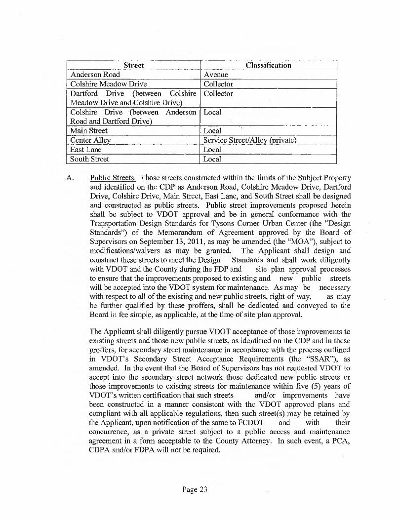
Street Classification Anderson Road Avenue Colshire Meadow Drive Collector Dartford Drive (between Colshire Meadow Drive and Colshire Drive)
Collector
Colshire Drive (between Anderson Road and Dartford Drive)
Local
Main Street Local Center Alley Service Street/Alley (private) East Lane Local South Street Local
A. Public Streets. Those streets constructed within the limits of the Subject Property and identified on the CDP as Anderson Road, Colshire Meadow Drive, Dartford Drive, Colshire Drive, Main Street, East Lane, and South Street shall be designed and constructed as public streets. Public street improvements proposed herein shall be subject to VDOT approval and be in general conformance with the Transportation Design Standards for Tysons Corner Urban Center (the "Design Standards") of the Memorandum of Agreement approved by the Board of Supervisors on September 13, 2011, as may be amended (the "MOA"), subject to modifications/waivers as may be granted. The Applicant shall design and construct these streets to meet the Design Standards and shall work diligently with VDOT and the County during the FDP and site plan approval processes to ensure that the improvements proposed to existing and new public streets will be accepted into the VDOT system for maintenance. As may be necessary with respect to all of the existing and new public streets, right-of-way, as may be further qualified by these proffers, shall be dedicated and conveyed to the Board in fee simple, as applicable, at the time of site plan approval.
The Applicant shall diligently pursue VDOT acceptance of those improvements to existing streets and those new public streets, as identified on the CDP and in these proffers, for secondary street maintenance in accordance with the process outlined in VDOT's Secondary Street Acceptance Requirements (the "SSAR"), as amended. In the event that the Board of Supervisors has not requested VDOT to accept into the secondary street network those dedicated new public streets or those improvements to existing streets for maintenance within five (5) years of VDOT's written certification that such streets and/or improvements have been constructed in a manner consistent with the VDOT approved plans and compliant with all applicable regulations, then such street(s) may be retained by the Applicant, upon notification of the same to FCDOT and with their concurrence, as a private street subject to a public access and maintenance agreement in a form acceptable to the County Attorney. In such event, a PCA, CDPA and/or FDPA will not be required.
Page 23
B. Rights-of-Way. At the time of site plan approval, the Applicant shall dedicate and convey in fee simple to the Board of Supervisors right-of-way for each of the public streets listed in Paragraph A above to a point inclusive of the landscape amenity panel and the sidewalk or to such standard as may be approved on the FDP, with the following exceptions:
(i) If at the time of site plan approval it is determined that stormwater management facilities, electric vaults or other similar facilities proposed to be located beneath the landscape amenity panel/sidewalk prevent VDOT and/or Fairfax County from accepting the landscape amenity panel/sidewalk within the right-of-way, the Applicant shall provide dedication measuring 18 inches from the proposed face of curb line and shall grant a public sidewalk and utility easement in a form acceptable to the Office of the County Attorney, over the area of the amenity panel/sidewalk. This easement shall allow for the installation of signage necessary for the safety and operation of the street as well as parking regulation equipment by VDOT and/or the County. In addition, the Applicant shall provide easements within the amenity panel/sidewalk area for bus shelters as determined at the time of FDP or site plan.
(ii) If at the time of site plan approval it is unclear whether stormwater management facilities, electric vaults or other similar facilities proposed to be located beneath the landscape amenity panel/sidewalk will be acceptable to VDOT and/or Fairfax County, the Applicant shall provide dedication measuring 18 inches from the proposed face of curb line at the time of site plan approval and shall reserve for potential future dedication the landscape amenity panel and sidewalk areas. A temporary public access easement in a form acceptable to the County Attorney shall be recorded over the reserved landscape amenity panel/sidewalk areas until such time as such areas are dedicated. Conveyance of the amenity panel/sidewalk areas to the Board of Supervisors shall occur following construction of the street and streetscape improvements and fmal street acceptance inspection by Fairfax County and/or VDOT subject to the stipulations in these Proffers.
(iii) Should it be determined following final street acceptance inspection that the landscape amenity panel and sidewalk areas are not acceptable to VDOT and/or Fairfax County to be included in the right-of-way, the reservation of potential future dedication of the landscape amenity panel and sidewalk areas shall be released and the Applicant shall grant a public sidewalk and utility easement, in a form acceptable to the Office of the County Attorney over such areas. This easement shall allow for the installation of signage necessary for the safety and operation of the street as well as parking regulation equipment by VDOT and/or the County. In addition, the Applicant shall provide easements within the amenity panel/sidewalk area for bus shelters as determined at the time of FDP or site plan.
Page 24

(iv) All right-of-way dedications shall be subject to advanced density credit as specified in Proffer 65.
C. Naming. The Applicant reserves the right to provide different street names than those shown on the CDP.
D. Parking Lanes. The Applicant shall provide on-street parking throughout the limits of the Subject Property as generally located on the CDP and as may be adjusted with FDP approval. The County and VDOT may restrict parking during peak commuting periods (typically 6:00 to 9:00 AM and 4:00 to 7:00 PM), in order to provide for turning movements to/from the public and/or private street network or to provide additional travel lanes. If requested by the County and/or VDOT, the Applicant shall install signs restricting parking.
The on-street parking spaces along public street frontages will be in addition to the total number of required parking spaces provided. The Applicant reserves the right to increase the amount of on-street parking shown on the CDP subject to approval by VDOT and FCDOT. The Applicant reserves the right to restrict the use of spaces along any private streets and on any future public streets prior to VDOT acceptance, through appropriate signage or such other means as the Applicant determines appropriate, that otherwise are not required to satisfy the parking requirements for use as temporary or short term parking, car-sharing parking and/or similar uses.
25. Street Improvements. All on and off-site public street improvements, on-site Service Streets and Private access drives together with appropriate/required pavement transitions shall be constructed with the redevelopment of individual buildings as reflected on Sheets A-11 through A-20 of the CDP (the "Phasing Plan"). Except as modified below, such improvements shall be completed and open for use by the public but not necessarily accepted by VDOT for maintenance prior to the issuance of the initial RUP or non-RUP for the individual building to be constructed.
26. Anderson Road.
A. Prior to site plan approval for the earlier to be constructed of Buildings 3 or 4, the Applicant shall submit plans to DPW&ES for the improvement of Anderson Road south from Old Chain Bridge Road to Colshire Drive as generally shown on Sheet C-7 of the CDP (excluding improvements to the Colshire Meadow Drive/Old Chain Bridge Road intersection if designed/constructed by others.)
B. The Applicant shall improve Anderson Road through the Subject Property as generally depicted on Sheets C-7, C-8 and C-11 of the CDP.
C. Notwithstanding the aforementioned, the raised median on Anderson Road south of Old Chain Bridge Road shall not be constructed/extended until such time as those townhomes located on the east side of Anderson Road (Buildings L and M) have been razed.
Page 25

D. Sections of Anderson Road shall be reconstructed with adjacent building phases as generally shown on the "Phasing Plan", except where modified by an FDP. The Applicant reserves the right, in its sole discretion to complete the improvements to Anderson Road as outlined in Paragraph A above as a single public road improvement or in separate segments, as long as at least the frontage improvements for respective individual buildings have been constructed prior to the issuance of the first RUP or Non-RUP for that building reflected on a site plan.
E. Anderson Road shall be constructed in its entirety between Old Chain Bridge Road/Colshire Meadow Drive and Colshire Drive no later than twenty-four (24) months after the issuance of the first RUP for the third new building on the Subject Property.
F. If at the time of site plan submission for existing building sites L and M, building site K is to remain, then the on-street parking along the east side of Anderson Road along the building site K frontage may be modified in order to retain interim access to building site K. In such event, those streetscape improvements along Anderson Road in the vicinity of building site K would be completed with the completion of Anderson Park.
27. Colshire Meadow Drive.
A. If not previously constructed by others, in conjunction with the submission of the site plan for Building 2, the Applicant shall submit a VDOT public roadway plan (the "Road Plan") for the ultimate improvement of Colshire Meadow Drive from Anderson Road west to Dartford Drive including the intersections with Old Chain Bridge Road and Dartford Drive. Colshire Meadow Drive shall ultimately be constructed as generally reflected on CDP Sheets C-7 through C-8 consistent with the Phasing Sheets and the typical section presented on CDP Sheet C-11. The extent, final design and timing of these ultimate improvements to Colshire Meadow Drive, as generally described and referenced above, shall be provided in conjunction with the development of Building 2 or the third building to be constructed, whichever occurs first, and determined at the time of site plan approval for the individual building. The Applicant reserves the right, in its sole discretion, to complete such ultimate improvements as a single public road improvement or in two separate segments, as long as at least the frontage improvements for the respective individual building have been constructed prior to the issuance of the first RUP or Non-RUP for that building reflected on the site plan.
In the event that Colshire Meadow Drive cannot be completed to its ultimate cross section between Dartford Drive and Anderson Road without impacting existing uses on either the Van Buren Block (Cityline Partners) or the Subject Property, then the Applicant shall be permitted to construct interim improvements for this link and the Old Chain Bridge Road and Dartford Drive intersections as determined in consultation with VDOT and FCDOT.
Page 26

B. If an improvement to the section of Colshire Meadow Drive between Anderson Road and Dartford Drive, including the intersections with Anderson Road/Old Chain Bridge Road and Dartford Drive, including signal modifications, is to be constructed by others prior to site plan submission for Building 2 or the third building to be constructed on the Subject Property, whichever occurs first, then the Applicant shall dedicate and convey upon written demand by Fairfax County such right-of-way and ancillary easements necessary to facilitate such construction by others provided: (i) interim access to/from the existing residential units located along Ambergate Place is maintained at all times; and (ii) such improvements to the Subject Property are minimized and coordinated with the Applicant prior to site plan approval for the improvement of this section of Colshire Meadow Drive. In such event, the Applicant will escrow its share of the cost of the ultimate improvements along the site's frontages, if not previously escrowed or otherwise provided, for use/release by and/or to others prior to site plan approval for Building 2 or the third building to be constructed, whichever occurs first. Those specific streetscape improvements, as reflected on the Phasing Plan along the Building 1, 2 and Anderson Park frontages would then be constructed with the development of those building sites.
C. The final design of the improvements to Colshire Meadow Drive as generally described above shall be determined in conjunction with the submission of all site plans for those portions of the Subject Property along Colshire Meadow Drive. Sections of Colshire Meadow Drive shall be constructed with adjacent building phases as generally shown on the Phasing Plan, except where modified by FDP. Such sections will be complete and open for public use no later than twenty-four (24) months after the issuance of the first RUP for Building 2 or the third building to be constructed, whichever occurs first. In such event, the Applicant may use any funds escrowed by others with the County for the improvement of Colshire Meadow Drive as described in Paragraph A above.
28. Anderson Road/Old Chain Bridge Road/Colshire Meadow Drive Intersection.
A. If not previously constructed by others, in conjunction with the submission of the site plan for Building 2, the Applicant shall submit a VDOT public improvement plan for the ultimate improvement for the Anderson Road/Old Chain Bridge Road/ Colshire Meadow Drive intersection, including traffic signal modifications. The Anderson Road/Old Chain Bridge Road/Colshire Meadow Drive intersection shall ultimately be constructed as generally reflected on CDP Sheets C-7 through C-8 consistent with the Phasing Sheets and the typical section presented on CDP Sheet C-11. The extent, final design and timing of the intersection improvement, as generally described and referenced above, shall be provided in conjunction with the development of Building 2 or the third new building to be constructed on the Subject Property, whichever occurs first, and determined at the time of site plan approval for the individual building.
B. If the ultimate improvement to the intersection of Anderson Road/Old Chain Bridge Road/Colshire Meadow Drive, including signal modifications, is to be
Page 27

constructed by others prior to site plan submission for Building 2 or the third new building to be constructed on the Subject Property, whichever occurs first, then the Applicant shall dedicate and convey upon written demand by Fairfax County such right-of-way and ancillary easements necessary to facilitate such construction by others provided: (i) interim access to/from the existing residential units located along Ambergate Place and Anderson Road is maintained at all times; and (ii) such improvements to the Subject Property are minimized and coordinated with the Applicant prior to site plan approval for the improvement of this intersection. In such event, the Applicant will escrow its share of the cost of the intersection's ultimate improvements, if not previously escrowed or otherwise provided, for use/release by and/or to others prior to site plan approval for Building 2 or the third new building to be constructed on the Subject Property, whichever occurs first.
C. The final design of the improvements to the intersection of Anderson Road/Old Chain Bridge Road/Colshire Meadow Drive, including signal modifications, as generally described above, shall be determined in conjunction with the submission of all site plans for portions of the Subject Property adjacent to that intersection. Sections of Colshire Meadow Drive, Old Chain Bridge Road, and Anderson Road shall be constructed with adjacent building phases as generally shown on the Phasing Plan, except where modified by FDP. Such sections will be complete and open for public use no later than twenty-four (24) months after the issuance of the first RUP for Building 2 or the third new building to be constructed on the Subject Property, whichever occurs first. In such event, the Applicant may use any funds escrowed by others with the County for the improvement of said intersection as described in Paragraph A above.
29. Dartford Drive
A. Unless previously constructed by others, the Applicant shall construct Dartford Drive from Colshire Meadow Drive south to Colshire Drive in general accordance with the design on Sheets C-7 and C-8 of the CDP and Collector Street Section (Dartford Drive) depicted on Sheet C-11 with variable pavement/widening provided at select locations to accommodate certain turning movements and/or pavement transitions.
B. The final design of the improvements to Dartford Drive as generally described above shall be determined in conjunction with the submission of all site plans for those portions of the Subject Property along Dartford Drive. Sections of Dartford Drive shall be constructed with adjacent building phases as generally shown on the Phasing Plan, except where modified by FDP. Such sections will be complete and open for public use prior to the issuance of the first RUP for the last of Buildings 2, 6 or 7 to be constructed.
30. Colshire Drive.
Page 28

A. The Applicant shall improve Colshire Drive along the Subject Property's frontage as generally depicted on Sheets C-7 and C-8 of the CDP. Colshire Drive shall be constructed in general accordance with the Public Local Street Section (Colshire Drive) depicted on Sheet C-11.
B. The final design of the improvements to Colshire Drive as generally described above shall be determined in conjunction with the submission of all site plans for those portions of the Subject Property fronting Colshire Drive. Sections of Colshire Drive shall be constructed with adjacent building or park phases as generally shown on the Phasing Plan, except where modified by FDP. Such sections will be complete and open for public use prior to the issuance of the first RUP for the last new building or dedication of the park identified as Goodman Field, whichever occurs first. Right-of-way for Colshire Drive shall be dedicated and conveyed to the Board at the time of site plan approval for the last building to be constructed on the Subject Property or dedication of the park land for Goodman Field, whichever occurs first.
31. Main Street. The Applicant shall construct Main Street in general accordance with the design shown on Sheets C-7 and C-8 of the CDP and the Local Street Section (Main Street) depicted on Sheet C-11. Construction shall be provided as shown on the Phasing Plan and as further detailed at the time of FDP approval.
32. East Lane and South Street. The Applicant shall construct East Lane and South Street in general accordance with the designs shown on Sheets C-7 and C-8 of the CDP and the Local Street Section (East Lane and South Street) depicted on Sheet C-11. Construction shall be provided as shown on the Phasing Plan and as further detailed at the time of FDP approval.
33. Center Alley. The Applicant shall construct Center Alley as a private service alley in general accordance with the design shown on Sheets C-7 and C-8 and the Private Alley Section (Center Alley) depicted on Sheet C-11. Construction shall be provided as shown on the Phasing Plan and as further detailed at the time of FDP approval. A public access easement in a form acceptable to the Office of the County Attorney shall be granted for Center Alley and appurtenant facilities to facilitate inspection, pedestrian and emergency access; such public access easement to become effective upon completion of Center Alley.
34. Colshire Drive/Anderson Road Traffic Signal. Within 12 months of the issuance of the first RUP or Non-RUP for the 5th new Building on the Subject Property, the Applicant shall prepare and submit a warrant study for a new traffic signal at the intersection of Colshire Drive and Anderson Road. If the signal is warranted then the Applicant shall design and equip said signal, including those pedestrian features as may be required by VDOT, no later than twelve (12) months after approval of the warrant. In the event the signal is not warranted at that time, then the Applicant shall conduct a second warrant analysis within twelve (12) months of the issuance of the first RUP or Non-RUP for the last building to be constructed on the Subject Property. If warranted at that time, then the Applicant shall design and equip said signal, including those pedestrian features as may
Page 29

be required by VDOT no later than twelve (12) months after approval of the warrant. If the signal is not warranted at that time, then the Applicant's obligation to said signal is deemed null and void and this proffer of no further force or effect.
35. Main Street/Anderson Road Pedestrian Signal. Within 12 months of the issuance of the first RUP or Non-RUP for the last new Building on the Subject Property, the Applicant shall prepare and submit a warrant study for a new signal at the intersection of Main Street and Anderson Road in order to facilitate pedestrian crossings. If the signal is warranted then the Applicant shall design and equip said signal, including those pedestrian features as may be required by VDOT, no later than twelve (12) months after approval of the warrant. In the event the signal is not warranted at that time, then the Applicant's obligation to said signal is deemed null and void and this proffer of no further force or effect.
36. Colshire Meadow Drive/Dartford Drive Traffic Signal. If not previously constructed by others, then within twelve (12) months of the issuance of the first RUP or Non-RUP for the second of new Buildings 1, 2 or 6, the Applicant shall prepare and submit a warrant study for a new traffic signal at the intersection of Colshire Meadow Drive and Dartford Drive. If the signal is warranted then the Applicant shall design and equip said signal, including those pedestrian features as may be required by VDOT no later than twelve (12) months after approval of the warrant. In such event, the Applicant may use any funds that may have been escrowed by others for such signal installation. In the event the signal is not warranted at that time, then the Applicant shall conduct a second warrant analysis within twelve (12) months of the issuance of the first RUP or Non-RUP for the last building to be constructed on the Subject Property. If warranted at that time, then the Applicant shall design and equip said signal, including those pedestrian features as may be required by VDOT no later than twelve (12) months after approval of the warrant. In such event, the Applicant may use any funds that may have been escrowed by others for such signal installation. If the signal is not warranted at that time, then the Applicant shall escrow with the County its pro rata share based on 2020 PM peak trip estimates as reflected in the TIA referenced in Proffer 5.0 toward the cost of future signalization of this intersection by others.
37. Route 123 Restriping. Concurrent with the approval of the site plan for the fifth (5 th) new building on the Subject Property, the Applicant shall contribute $7,500 to the County for the restriping of select right-turn lanes to shared through/right lanes at up to three locations on Route 123 between the Beltway and the Dulles Access Road subject to VDOT approval. In the event, VDOT does not approve such restriping, then the County may use the funds for other transportation improvements/enhancements in the Tysons East District.
38. Traffic Signal Modifications. Concurrent with the submission of the site plan for the fifth new building on the Subject Property, the Applicant shall contribute a total of $40,000 to be used to modify the signal timings in the Dolley Madison Boulevard corridor between the Beltway and the Dulles Access Road and at the Great Falls Street/Chain Bridge Road intersection as may be required by VDOT. If at the time of site plan approval for the fifth (5th) new building, signal timing modifications have not been requested by VDOT for the
Page 30

Route 123 corridor, the County may utilize those funds for any other transportation improvements/enhancements in the Tysons East District.
39. Route 123 Super Street Concept. The Applicant will contribute $0.06 per square foot of GFA to Fairfax County for the reconstruction of that segment of Route 123 as a super street to be paid in three (3) equal installments of approximately $31,469 each and one (1) final installment of approximately $62,938. Said payments shall be made upon site plan approval for each of the first four buildings to be constructed. For purposes of this proffer only, this contribution shall be adjusted annually beginning with the second payment and every anniversary thereafter as permitted by Section 15.2 2303.2 of the Code of Virginia as amended.
40. Construction Traffic Management. The Applicant shall prepare and implement a construction congestion management plan during construction of each phase of the redevelopment, as appropriate, through its development/construction manager and the TPM, as defined in Proffer 50, so as to provide safe and efficient pedestrian and vehicle circulation at all times on the Subject Property and on the public roadways adjoining the Subject Property. This management plan shall identify anticipated construction entrances, construction staging areas, construction vehicle routes and procedures for coordination with FCDOT and/or VDOT concerning construction material deliveries, lane or street closures, and/or other construction related activities to minimize disturbance on the surrounding road network.
Such plans shall be prepared by a qualified professional and submitted for review and comment to the VDOT, FCDOT and DPWES prior to issuance of the building permit for each phase. In addition, the TPM shall coordinate any adjustments to the TDM Plan, as defined in Proffer 50, that may be necessary to address any management plan issues.
41. Tysons Grid of Streets Transportation Fund. The Applicant shall provide a contribution of $1,000 for each residential unit and $6.44 for each square foot of non-residential space (excluding any public use facility) constructed on the Subject Property in accordance with the Tysons Grid Fund adopted by the Board on January 8, 2013, as amended and subject to credits/in-kind contributions as permitted and identified below. Pursuant to The Tysons Grid Fund Guidelines (the "Guidelines"), the Applicant's contribution to the Tysons Grid Fund shall be made on a building by building basis in accordance with the Guidelines.
The Applicant shall receive and deduct applicable in-kind credits against the contributions that would otherwise be due to the County for the Tysons Grid Fund in keeping with the Guidelines for the Tysons Grid Fund endorsed by the Board of Supervisors on January 8, 2013, as may be amended. Specifically, the Applicant shall receive credits for costs incurred by the Applicant for the construction of all or a part of off-site Dartford Drive (not including costs of the Property's frontage improvements) as reflected below and only if those improvements to Dartford Drive are constructed prior to the timeline outlined in Proffer 29.B above:
Page 31
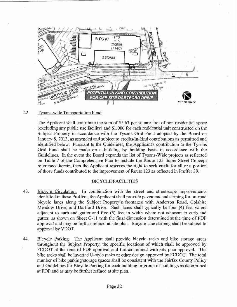
cloR-51°1
ON 4, TN■liWssekis'Icl
rapeN10.
OCM°
01.9' IRK - POTENTIAL IN KIND CONTRIBUTION
FOR OFF-SITE DARTFORD DRIVE NOT TO SCALE
42. Tysons-wide Transportation Fund.
The Applicant shall contribute the sum of $5.63 per square foot of non-residential space (excluding any public use facility) and $1,000 for each residential unit constructed on the Subject Property in accordance with the Tysons Grid Fund adopted by the Board on January 8, 2013, as amended and subject to credits/in-kind contributions as permitted and identified below. Pursuant to the Guidelines, the Applicant's contribution to the Tysons Grid Fund shall be made on a building by building basis in accordance with the Guidelines. In the event the Board expands the list of Tysons-Wide projects as reflected on Table 7 of the Comprehensive Plan to include the Route 123 Super Street Concept referenced herein, then the Applicant reserves the right to seek credit for all or a portion of those funds contributed to the improvement of Route 123 as reflected in Proffer 39.
BICYCLE FACILITIES
43. Bicycle Circulation. In combination with the street and streetscape improvements identified in these Proffers, the Applicant shall provide pavement and striping for on-road bicycle lanes along the Subject Property's frontages with Anderson Road, Colshire Meadow Drive, and Dartford Drive. Such lanes shall typically be four (4) feet where adjacent to curb and gutter and five (5) feet in width where not adjacent to curb and gutter, as shown on Sheet C-11 with the final dimension determined at the time of FDP approval and may be further refined at site plan. Bicycle lane striping shall be subject to approval by VDOT.
44. Bicycle Parking. The Applicant shall provide bicycle racks and bike storage areas throughout the Subject Property, the specific locations of which shall be approved by FCDOT at the time of FDP approval and further refined with site plan approval. The bike racks shall be inverted U-style racks or other design approved by FCDOT. The total number of bike parking/storage spaces shall be consistent with the Fairfax County Policy and Guidelines for Bicycle Parking for each building or group of buildings as determined at FDP and as may be further refined at site plan.
te,..c04 pikoP° 000,„10
Dc. - 010
Page 32
PARKING
45. Zoning Ordinance Requirements. Parking on the Subject Property shall be provided in accordance with the parking requirements for the PTC District set forth in Sect. 6-509 and Article 11 of the Zoning Ordinance, and as shown on the CDP. The exact number of spaces to be provided shall be refined with approval of the FDPs and determined at the time of site plan approval based on the specific uses, number of residential units and bedroom mix. If changes in the mix of uses or residential bedroom mix result in parking greater than that anticipated on the CDP, the additional parking spaces shall be accommodated within the proposed parking structures, without increasing the height or mass of the parking structures. Tandem spaces shall be utilized only for residential units with two cars where spaces are assigned by building management.
46. Future Parking Revisions. The Applicant reserves the right to provide parking at revised rates (rates referring to the number of parking spaces provided per dwelling unit for residential uses or per square foot of GFA for retail uses) as may be permitted by a future amendment to the Zoning Ordinance. Optional use of revised rates shall not require a CDPA or PCA, provided there is no increase in the mass or height of above-grade parking structures.
47. Parking Stipulations.
A. The Applicant shall provide controlled access to the parking garage and shall ensure that the control equipment is capable of counting vehicles entering and exiting the garage.
B. The sale or lease rates of parking spaces shall be "unbundled" from the purchase price or lease rate of the individual dwelling units; meaning a unit's purchase price or lease rate shall be exclusive of parking costs.
TRANSPORTATION DEMAND MANAGEMENT
48. Tysons Transportation Management Association. The Applicant shall make a contribution to the Tysons Partnership towards the establishment of a future transportation management association (the "TMA"), which may be established for the Tysons Corner Urban Center and to which all other Tysons property owners will also contribute.
A. The Applicant shall make a one-time contribution to the Tysons Partnership Transportation Council for the establishment of this future TMA based on a participation rate of $0.05 per gross square foot of new residential uses to be constructed on the Subject Property.
B. Twenty-five percent (25%) of the total contribution to the TMA shall be paid upon site plan approval of the first new building to be constructed on the Subject Property. The remaining seventy-five percent (75%) of the total contribution shall be paid in three (3) equal installments prior to the issuance of the first RUP
Page 33
or Non-RUP for the next three (3) new buildings, but in any event no later than ten (10) years from the date of approval of these rezoning applications.
C. If subsequent to the approval of this Rezoning, a Tysons Corner Urban Center-wide TMA is approved by FCDOT and established for the purpose of administering TDM programs in the Tysons Corner Urban Center, then the Applicant may, in its sole discretion, join or otherwise become associated with such entity and transfer some or all marketing and/or monitoring functions of this TDM Program to the new entity, whereupon this Proffer in whole or in part shall be void and of no further force or effect. Further, if determined by FCDOT that a proactive, private TDM program is no longer necessary, the TDM structure in this Proffer may be rendered null and void in whole or in part without the need for a PCA.
D. If the TMA has not been established within three (3) years after the approval of this Rezoning, this Proffer shall be null and void with no further effect on the Subject Property. Further, any funds contributed to the Tysons Partnership Transportation Council would then be returned to the Applicant that paid such funds.
49. TDM Administrative Group. The Applicant shall establish a TDM Administrative Group (the "AG") to fund, implement and administer the transportation demand management program (the "TDM Program") for the Property as described more fully below. The AG shall include, at a minimum, one representative for each group of residential buildings under the same management company. Prior to issuance of the first building permit for new development on the Property, evidence shall be provided to FCDOT that the AG has been established.
50. Transportation Demand Management. The proffered elements of the TDM Program as set forth below are more fully described in the Commons Transportation Demand Management Plan prepared by Wells + Associates, Inc. dated October 11, 2012 (the "TDM Plan"). It is the intent of this Proffer that the TDM Plan will adapt over time to respond to the changing transportation related circumstances of the Subject Property, the surrounding community and the region, as well as to technological and/or other improvements, all with the objective of meeting the trip reduction goals as set forth in these Proffers. Accordingly, modifications, revisions, and supplements to the TDM Plan as coordinated with FCDOT can be made without the need for a PCA provided that the TDM Plan continues to reflect the proffered elements of the TDM Program as set forth below.
A. Definitions. For purposes of this Proffer, "Stabilization" shall be deemed to occur one-year following issuance of the last RUP for the final new building to be constructed on the Subject Property. "Pre-stabilization" shall be deemed to occur any time prior to Stabilization.
B. Trip Reduction Objective. The objective of this TDM Program shall be to reduce the vehicle trips generated by residents of the Subject Property during weekday
Page 34

peak hours associated with the adjacent streets as more fully described in the TDM Plan, by meeting the percentage vehicle trip reductions established by the Comprehensive Plan as set forth below. These trip reduction percentages shall be multiplied by the total number of residential vehicle trips that would be expected to be generated by the uses developed on the Subject Property as determined by the application of the Institute of Transportation Engineers' Trip Generation (8th Edition) rates and/or equations ("ITE Trip Generation"). The number of trips determined by the product of such equation shall be referred to herein as the "Maximum Trips After Reduction." For purposes of this calculation, the maximum number of dwelling units proposed to be constructed in each building on the Subject Property as determined at the time of site plan approval for each building shall be applied to the calculation described in the preceding sentence. The target reductions shall be as follows:
Development Levels Percentage Vehicle Trip Reduction Up to 65 million SF of GFA 30% 65 million SF of GFA 35% 84 million SF of GFA 40% 90 million SF of GFA 43% 96 million SF of GFA 45% 105 million SF of GFA 48% 113 million SF of GFA 50%
The trip reduction goals outlined above are predicated on the achievement of specific development levels within the Tysons Corner Urban Center as anticipated in the Comprehensive Plan. Prior to undertaking trip measurements, the AG shall, in conjunction with the County develop a summary of the then existing (i.e., based on RUPs issued) development levels in Tysons Corner in order to determine the appropriate vehicle trip reduction goal.
If, through an amendment to the Comprehensive Plan, the Board of Supervisors should subsequently adopt a goal for trip reductions that is lower than that committed to in this Proffer, then the provisions of this Proffer shall be adjusted accordingly without requiring a PCA.
C. TDM Program Components — Property-wide. The TDM Program shall include, but not necessarily be limited to, the property-wide components described in the TDM Plan, including, but not limited to:
(i) The installation of bicycle racks outside for visitors and
(ii) The installation of indoor bicycle storage for employees and residents.
Page 35

D. TDM Program Components — Residential. The TDM Program shall include, but not necessarily be limited to the residential components described in the TDM Plan, including but not limited to:
(i)
A minimum of one business center with flexibly-designed work/meeting space for small groups that may include computers, access to intemet/wi-fi, printer(s), copier(s) and fax machine(s) will be located within one of the residential buildings in the development.
E. Process of Implementation. The TDM Program shall be implemented as follows, provided that modifications, revisions, and supplements to the implementation process as set forth herein as coordinated with FCDOT can be made without requiring a PCA.
(i) TDM Program Manager. If not previously appointed, the AG shall appoint and continuously employ, or cause to be employed, a TDM Program Manager (TPM) for The Commons. If not previously appointed, the TPM shall be appointed by the AG no later than sixty (60) days after the issuance of the first building permit for the first new building to be constructed on the Property. The TPM duties may be part of other duties assigned to the appointee. The AG shall notify FCDOT and the District Supervisor in writing within 10 days of the appointment of the TPM. Thereafter the AG shall do the same within ten (10) days of any change in such appointment.
(ii) TDM Annual Report and Budget. If not already effectuated for the then- current calendar year, the TPM shall prepare and submit to FCDOT an initial TDM Work Plan ("TDMWP") and Annual Budget no later than 180 days after issuance of the first building permit for the first new building on the Property. Each subsequent year the TPM shall prepare an Annual Report for the then-current calendar year, the TPM shall revise the Annual Report with the following year's submission to incorporate the new construction on the Subject Property. The Annual Report shall include, at a minimum:
a. Details as to the start-up components of the TDMWP that will be put into action effective with the first new building on the Subject Property;
b. The budget needed to implement the TDMWP (the "TDM Budget") for the coming calendar year;
c. A summary of the existing development levels in the Tyson Corner Urban Center;
d. A determination of the applicable Maximum Trips After Reduction for the Subject Property;
Page 36
e. Provision of the specific details associated with the monitoring and reporting requirements consistent with the TDM plan; and
f. Submission of an annual report to FCDOT by February 1 St of each year beginning with the first calendar year following the submission of the first TDMWP and Budget.
The Annual Report shall be reviewed by FCDOT. If FCDOT has not responded with any comments within sixty (60) days after submission, then the Annual Report shall be deemed approved and the TDM program shall be implemented. If FCDOT responds with comments on the Annual Report, then the TPM will meet with FCDOT staff within fifteen (15) days of receipt of the County's comments. Thereafter but in any event, no later than thirty (30) days after the meeting, the TPM shall submit such revisions to the Annual Report as discussed and agreed to with FCDOT and begin implementation of the approved program and fund the approved TDM Budget. Thereafter the TPM, in conjunction with each Annual Report summarizing the results of the TDM Program to be submitted no later than February 1st, shall update the TDM program and TDM Budget for each succeeding calendar year, modify or enhance program elements and establish a budget to cover the costs of implementation of the TDM program for such year. The expected annual amounts of the TDM Budget are further described in Section 7.0 of the TDM Plan.
(iii) TDM Account. If not previously established, the AG, through the TPM, shall establish a separate interest bearing account with a bank or other financial institution qualified to do business in Virginia (the "TDM Account") within 30 days after approval of the initial TDMWP and TDM Budget. All interest earned on the principal shall remain in the TDM Account and shall be used by the TPM for TDM purposes. The TDM Account shall be funded by the AG, through the TPM. The TDM Account shall not be eliminated as a line item in the governing budget associated with the Subject Property and funds in the TDM Account shall not be utilized for purposes other than to fund TDM strategies/programs and/or specific infrastructure needs as may be approved in consultation with FCDOT.
Funding of the TDM Account shall be in accordance with the budget for the TDM Program elements to be implemented in a year's TDMWP. In no event shall the TDM Budget exceed $128,250 (this amount shall be adjusted annually from the date of rezoning approval for the Property (the "Base Year") and shall be adjusted on each anniversary thereafter of the Base Year as permitted by VA. Code ann. Section 15.2-2303.3. The TPM shall provide written documentation to FCDOT demonstrating the establishment of the TDM Account within ten (10) days of its
Page 37

establishment. The TDM Account shall be replenished annually thereafter following the establishment of each year's TDM Budget. The TDM Account shall be managed by the TPM.
(iv) TDM Remedy Fund. At the same time the TPM creates and funds the TDM Account, the TPM shall establish a separate interest bearing account (referred to as the "TDM Remedy Fund") with a bank or other financial institution qualified to do business in Virginia. Funding of the TDM Remedy Fund shall be made one time, on a building by building basis, at the rate of $0.30 per gross square foot of new residential uses on the Subject Property. Funding shall be provided by the building owners prior to the issuance of the first RUP for each applicable new building. This amount shall be adjusted annually from the date of rezoning approval of the Subject Property (the "Base Year") and shall be adjusted on each anniversary thereafter of the Base Year as permitted by VA. Code Ann. Section 15.2-2303.3. Funds from the TDM Remedy Fund shall be drawn upon only for purposes on immediate need for TDM funding and may be drawn on prior to any TDM Budget adjustments as may be required.
(v) TDM Incentive Fund. The "TDM Incentive Fund" is an account into which the building owners, through the TPM, shall deposit contributions to fund a multi-modal incentive program for initial purchasers/lessees within The Commons. Such contributions shall be made one time on a building by building basis at the rate of $0.02 per gross square foot of new residential uses to be constructed on the Subject Property and provided prior to the issuance of the first RUP for each individual new building.
(vi) TDM Penalty Fund. The "TDM Penalty Fund" is an account into which the AG shall, through the TPM, deposit penalty payments as may be required to be paid pursuant to this Proffer for non-attainment of trip reduction goals. The County may withdraw funds from the TDM Penalty Fund for the implementation of additional TDM Program elements/incentives and/or congestion management associated with the Subject Property. To secure the AG's obligations to make payments into the TDM Penalty Fund, the AG shall provide the County with a letter of credit or a cash escrow as further described below.
Prior to the issuance of the first RUP for each new building on the Property, the AG shall:
a. Establish the TDM Penalty Fund, if not previously established by the TPM, and/or
b. Deliver to the County a clean, irrevocable letter of credit issued by a banking institution approved by the County or escrow cash in an interest-bearing account with an escrow agent acceptable to DPWES to secure the AG's obligations to make payments into the
Page 38

TDM Penalty Fund (the "Letter(s) of Credit or Cash Escrow(s)"). The Letter(s) of Credit or Cash Escrow(s) shall be issued in an amount equal to $0.05 for each square foot of new residential GFA shown on the approved site plan for each new building on the Subject Property. Until the Letter(s) of Credit or Cash Escrow(s) has been posted, the figure in the preceding sentence shall escalate annually from the first day of the calendar month following the date on which the first RUP for the first new building on the Subject Property has been issued as permitted by VA. Code Ann. Section 15.2-2303.3 using the date of rezoning approval as the base year. Once the Letter(s) of Credit or Cash Escrow(s) has been posted, there shall be no further adjustments or increases in the amount thereof. The Letter(s) of Credit or Cash Escrow(s) shall name the County as the beneficiary and shall permit partial draws or a full draw. The foregoing stated amount(s) of the Letter(s) of Credit or Cash Escrow(s) shall be reduced by the sum of any and all previous draws under the Letter(s) of Credit or Cash Escrow(s) and payments by the AG (or the TPM) into the TDM Penalty Fund as provided below.
(vii) Monitoring. The TPM shall verify that the proffered trip reduction goals are being met through the completion of Person Surveys, Vehicular Traffic Counts of residential uses, and/or other such methods as may be reviewed and approved by FCDOT. The results of such Person Surveys and Vehicular Traffic Counts shall be provided to FCDOT as part of the Annual Reporting process. Person Surveys and Vehicular Traffic Counts shall be conducted for the Subject Property beginning one year following issuance of the final RUP for the first new building to be constructed on the Subject Property. Thereafter, Person Surveys shall be conducted every three years and Vehicular Traffic Counts shall be collected annually until the results of three (3) consecutive annual traffic counts conducted upon Stabilization show that the applicable trip reduction goals for the Subject Property have been met. At such time and notwithstanding Paragraph H below, Person Surveys and Vehicular Traffic Counts shall thereafter be provided every five (5) years. Notwithstanding the above, FCDOT may suspend such Person Surveys and/or Vehicular Traffic Counts if conditions warrant.
F. Remedies and Penalties.
(i)
Pre-Stabilization. If the Maximum Trips After Reduction for the Subject Property is exceeded as evidenced by the Vehicular Traffic Counts outlined above, then the TPM shall meet and coordinate with FCDOT to address, develop and implement such remedial measures as may be identified in the TDM Plan and annual TDMWP.
Page 39
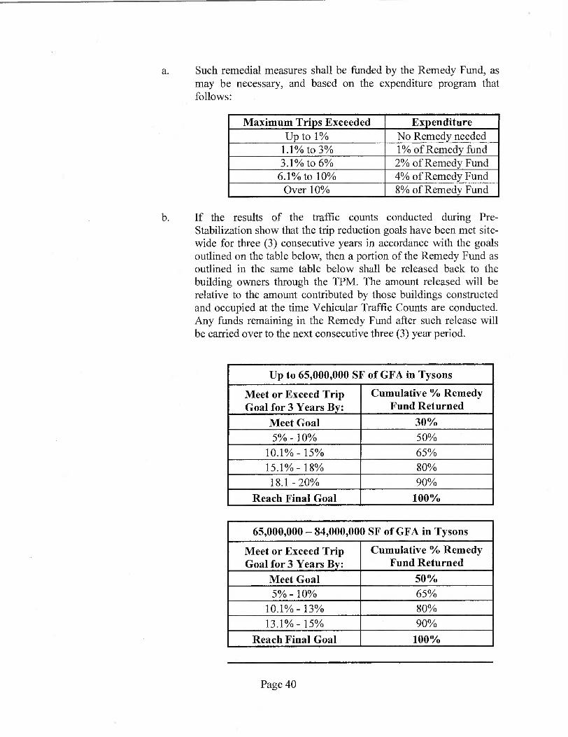
a. Such remedial measures shall be funded by the Remedy Fund, as may be necessary, and based on the expenditure program that follows:
Maximum Trips Exceeded Expenditure Up to 1% No Remedy needed
1.1% to 3% 1% of Remedy fund 3.1% to 6% 2% of Remedy Fund
6.1% to 10% 4% of Remedy Fund Over 10% 8% of Remedy Fund
b. If the results of the traffic counts conducted during Pre-Stabilization show that the trip reduction goals have been met site-wide for three (3) consecutive years in accordance with the goals outlined on the table below, then a portion of the Remedy Fund as outlined in the same table below shall be released back to the building owners through the TPM. The amount released will be relative to the amount contributed by those buildings constructed and occupied at the time Vehicular Traffic Counts are conducted. Any funds remaining in the Remedy Fund after such release will be carried over to the next consecutive three (3) year period.
Up to 65,000,000 SF of GFA in Tysons
Meet or Exceed Trip Goal for 3 Years By:
Cumulative % Remedy Fund Returned
Meet Goal 30% 5% - 10% 50%
10.1% - 15% 65%
15.1% - 18% 80%
18.1 - 20% 90%
Reach Final Goal 100%
65,000,000 — 84,000,000 SF of GFA in Tysons
Meet or Exceed Trip Goal for 3 Years By:
Cumulative % Remedy Fund Returned
Meet Goal 50% 5% - 10% 65%
10.1% - 13% 80%
13.1% - 15% 90%
Reach Final Goal 100%
Page 40

84,000,000 — 90,000,000 SF of GFA in Tysons
Meet or Exceed Trip Goal for 3 Years By:
Cumulative % Remedy Fund Returned
Meet Goal 65% 5% - 8% 80%
8.1% - 10% 90% Reach Final Goal 100%
90,000,000 — 96,000,000 SF of GFA in Tysons
Meet or Exceed Trip Goal for 3 Years By:
Cumulative % Remedy Fund Returned
Meet Goal 80% 5% - 8% 90%
Reach Final Goal 100%
96,000,000 — 113,000,000 SF of GFA in Tysons
Meet or Exceed Trip Goal for 3 Years By:
Cumulative % Remedy Fund Returned
Meet Goal 90% 5% 100%
113,000,000+ SF of GFA in Tysons
Meet or Exceed Trip Goal for 3 Years By:
Cumulative % Remedy Fund Returned
Meet Goal , 100%
c. There is no requirement to replenish the TDM Remedy Fund at any time. Any cash left in the Remedy Fund will be released to the TPM for final distribution to the AG once three consecutive annual Traffic Counts conducted upon Stabilization show that the trip reduction goals have been met.
(ii) Upon Stabilization.
a. If the TDM Program monitoring, as evidenced by the Vehicular Traffic Counts outlined above, reveals that the Maximum Trips After Reduction for the Subject Property is exceeded, then the TPM shall meet and coordinate with FCDOT to address, develop and implement such remedial measures as may be identified in the
Page 41

TDM Plan and annual TDMWP and funded by the Remedy Fund (if available) as may be necessary, commensurate with the extent of deviation from the Maximum Trips After Reduction goal as set forth in accordance with the expenditure schedule outlined above.
b. If the results of the traffic counts conducted upon-Stabilization show that the trip reduction goals have been met site-wide for three (3) consecutive years in accordance with the goals outlined on the table above, then any remaining Remedy Funds shall be released back to the AG through the TPM.
c. If, despite the implementation of remedial efforts, the applicable Maximum Trips After Reduction based on the existing development levels for the Tysons Corner Urban Center, as described in Proffer 50B, are still exceeded after three consecutive years, then, in addition to addressing further remedial measures as set forth in this Proffer, the TPM shall be assessed a penalty according to the following:
Exceeded Trip Goals Penalty Less than 1% No Penalty Due 1% to 3% 5% of Penalty Fund 3.1% to 6% 10% of Penalty Fund 6.1% to 10% 15% of Penalty Fund Over 10% 20% of Penalty Fund
d. The AG, through the TPM, shall make the payments required by this Proffer into the TDM Penalty Fund upon written demand by the County, and the County shall be authorized to withdraw the amounts on deposit in the TDM Penalty Fund. If the AG fails to make the required penalty payment to the TDM Penalty Fund within thirty (30) days after written demand, the County shall have the ability to withdraw the penalty amount directly from the Letter(s) of Credit or Cash Escrow(s).
e. The maximum amount of penalties associated with the Subject Property, and the maximum amount the AG shall ever be required to pay pursuant to the penalty provisions of this Proffer, including prior to and after Stabilization, shall not in the aggregate exceed the amount of the Letter(s) of Credit or Cash Escrow(s) determined and computed pursuant to the provisions of the above Proffer. There is no requirement to replenish the TDM Penalty Fund at any time. The Letter(s) of Credit and/or any cash left in the Cash Escrow(s) shall be released to the AG once three consecutive counts conducted upon Stabilization show that the Maximum Trips After Reduction have not been exceeded.
Page 42

G. Additional Trip Counts. If an Annual Report indicates that a change has occurred that is significant enough to reasonably call into question whether the applicable vehicle trip reduction goals are continuing to be met, then FCDOT may require the TPM to conduct additional Vehicular Trip Counts (pursuant to the methodology set forth in the TDM Plan) within 90 days to determine whether in fact such objectives are being met. If any such Vehicular Trip Counts demonstrate that the applicable vehicle trip reduction goals are not being met, then the TPM shall meet with FCDOT to review the TDM strategies in place and to develop modifications to the TDM Plan to address the surplus of trips.
H. Review of Trip Reduction Goals. At any time and concurrent with remedial actions and/or the payment of penalties as outlined in this Proffer, the TPM may request that FCDOT review the vehicle trip reduction goals established for the Subject Property and set a revised lower goal for the Subject Property consistent with the results of such Person Surveys and Vehicular Traffic Counts provided for by this Proffer. In the event a revised lower goal is established for the Subject Property, the Maximum Trips After Reduction shall be revised accordingly for the subsequent review period without the need for a PCA.
I. Continuing Implementation. The AG through the TPM shall bear sole responsibility for continuing implementation of the TDM Program and compliance with this Proffer. The AG through the TPM shall continue to administer the TDM Program in the ordinary course in accordance with this Proffer including submission of Annual Reports.
J. Notice to Owners. All owners of the Subject Property shall be advised of the TDM Program set forth in this Proffer. The then current owner shall advise all successor owners and/or developers of their funding obligations pursuant to the requirements of this Proffer prior to purchase and the requirements of the TDM Program, including the annual contribution to the TDM Program (as provided herein), shall be included in all initial and subsequent purchase documents.
K. Enforcement. If the TPM fails to timely submit a report to FCDOT as required by this Proffer, the TPM will have sixty (60) days within which to cure such violation. If after such sixty (60) day period the TPM has not submitted the delinquent report, then the Applicant shall be subject to a penalty of $100 per day not to exceed $36,500 for any one incident. Such penalty shall be payable to Fairfax County to be used for transit, transportation, or congestion management improvements within the vicinity of the Subject Property.
L. Intelligent Transportation Systems. To optimize safe and efficient travel in Tysons, the Applicant shall incorporate and maintain a system that provides pertinent traffic and transit information that allows users to make informed travel decisions. This information shall be provided at initial occupancy of each building. The delivery of this information shall be made convenient for building occupants and visitors, such as via computer, cell phone, monitors, or similar
Page 43
technology. Such devices shall provide, but not be limited to, information on the following, if available:
(i) Traffic conditions, road hazards, construction work zones, and road detours.
(ii) Arrival times and delays on Metrorail, Tysons Circulator, and area bus routes.
(iii) Real time parking conditions and guidance to current on-site parking vacancies, if available.
(iv) Bus stops pre-wired for real-time arrival/departures information, if available.
The Applicant shall work with FCDOT and/or the Tysons Partnership to identify sources and facilitate electronic transmittal of data. Furthermore, the Applicant shall participate in efforts to implement any future dynamic traffic management program for the Tysons area.
AFFORDABLE/WORKFORCE HOUSING
51. Affordable Dwelling Units. If required by the provisions of Part 8 of Article 2 of the Zoning Ordinance, Affordable Dwelling Units ("ADUs") shall be provided pursuant to said regulations unless modified by the ADU Advisory Board.
52. Workforce Dwelling Units. In addition to any ADUs that may be required pursuant to these Proffers, the Applicant shall also provide for-sale and/or rental housing units on the Subject Property in accordance with the Board of Supervisors' Tysons Corner Urban Center Workforce Dwelling Unit Administrative Policy Guidelines dated June 22, 2010. Workforce Dwelling Units ("WDUs") shall be provided such that the total number of ADUs, if any, plus the total number of WDUs results in not less than twenty percent (20%) of the total residential units constructed as part of the Proposed Development. The 20% applies to the total number of dwelling units to be constructed on the Subject Property. If ADUs are provided in the development, both the ADUs and the ADU bonus units shall be deducted from the total number of dwelling units on which the WDU calculation is based.
The WDUs generated by each residential building on the Subject Property shall be provided within said building, however the Applicant reserves the right to consolidate the WDUs into one or more buildings with the build-out of the Subject Property and thereby increase the number of WDU units in one or more buildings beyond twenty percent (20%) with a corresponding decrease in the number of WDU units in the other buildings. However, if Tower B of Building 5 is constructed with a height in excess of 175 feet, at least 20% of that tower's units shall be WDUs. The WDUs in each building shall have a bedroom mix similar to that provided in the market rate units in such building. Additionally, in the event that parking spaces are guaranteed to be made available for
Page 44

lease to individual market rate dwelling units, at least one (1) parking space shall be made available for lease by each ADU and/or WDU in the development.
The first 331 WDUs to be constructed on the Subject Property shall be affordable to various income level tiers in accordance with the following distribution:
Income Tier WDUs Provided
% of Total
101-120% of AMI 24 7.3%
81-100% of AMI 54 16.3%
71-80% of AMI 157 47.4%
61-70% of AMI 94 28.4%
< 60% of AMI 2 .6%
Total 331 100%
Subsequently constructed WDUs, up to a total of 140 units, shall be affordable to various income level tiers in accordance with the Comprehensive Plan recommendations and as set forth below:
Income Tier WDUs Provided
% of Total
101-120% of AMI 35 25%
81-100% of AMI 35 25%
71-80% of AMI 35 25%
61-70% of AMI 21 15%
< 60% of AMI 14 10%
Total 140 100%
Furthermore, should the Board of Supervisors' policies related to Workforce Dwelling Units in Tysons Corner be amended, the Applicant reserves the right, at its sole discretion, to opt in to the new policies, in part or in whole, without the need for a PCA and, if the Applicant so opts into any such new policies, the provisions of this Proffer which relate to the new policies of the Board of Supervisors which Applicant has elected to opt into shall no longer be effective. The Applicant reserves the right to enter into a separate binding written agreement with the appropriate Fairfax County agency as to the
Page 45

terms and conditions of the administration of the WDUs following approval of this Application. Such an agreement shall be on terms mutually acceptable to both the Applicant and Fairfax County and may occur after the approval of this Application. Neither the Board of Supervisors nor Fairfax County shall be obligated to execute such an agreement. If such an agreement is executed by all applicable parties, then the WDUs shall be administered solely in accordance with such an agreement and the provisions of this Proffer as it applies to WDUs shall become null and void. Such an agreement and any modifications thereto shall be recorded in the land records of Fairfax County.
All tenants occupying existing units on the Subject Property shall be notified, in writing, at least 120 days prior to the commencement of any redevelopment activities. Such notice shall include a summary of the redevelopment plans and the anticipated potential impact on living conditions at the Subject Property. At such time as a specific phase of development will require demolition of existing units, those residents that occupy a unit that will be demolished will have an option, to the extent possible and as further described below, to transfer to a comparable, existing unit on the Subject Property or the portion of the existing Commons of McLean apartments that are not subject to this Application, or to a newly-constructed unit on the Subject Property. Furthermore, all future leases for existing units at the Subject Property shall include a clause notifying the prospective tenant that the Subject Property will be redeveloped if such redevelopment is to occur within the twelve (12) month period following commencement of the lease term.
The Applicant shall use all reasonable efforts to identify those residents who have school-aged children, are elderly, handicapped or are low-income, and ensure that these and other tenants who are displaced by redevelopment activities, and who wish to remain on the Subject Property, shall either be offered another comparable unit on the Subject Property or are provided with referrals to similar available units in close proximity to the Subject Property.
53. Non-Residential Affordable Housing Contribution. For all retail/service uses proposed above the ground floor of the proposed residential buildings, the Applicant shall select, within its sole discretion, one of the following two options for contributing toward the provision of affordable and/or workforce housing within Tysons Corner. These contributions shall be made to the Board, be deposited in a specific fund to be used solely for this purpose within Tysons Corner and shall be payable at the time of issuance of the initial Non-RUPs for such retail/service uses. The options shall consist of either (i) a one-time contribution of $3.00 for each square foot of GFA of such retail/service use above the ground floor, or (ii) an annual contribution of $0.25 for each square foot of GFA of such retail/service use above the ground floor continuing for a total of sixteen (16) years. Should the Board adopt new policies for the reallocation or reduction of non-residential affordable housing contributions in Tysons Corner, the Applicant may, within its discretion, elect to comply with these policies in lieu of the contributions described herein without the necessity of a CDPA or PCA.
PARK AND RECREATIONAL FACILITIES
Page 46
54. Publicly Accessible Parks and Recreational Facilities. Provision of publicly-accessible park and open space areas shall be in substantial conformance with the concepts, locations and minimum acreages depicted on the CDP and as further defined in these Proffers and may be adjusted at the time of FDP and site plan approval to allow for final engineering and design considerations. A wayfinding and signage system shall be developed in coordination with FCPA and the Tysons Partnership at the time of CSP, FDP and site plan approval and installed by the Applicant to ensure the public can easily identify and access all publicly accessible park spaces. The following parks and facilities shall be provided as generally shown on the CDP, with more specific details to be provided at the time of FDP approval. Additional or substitute recreational facilities to those listed below may be approved with the FDP provided such facilities result in an equivalent or enhanced quality of recreational opportunities.
Prior to commencing construction of either Goodman Field or Anderson Park, as described below, the Applicant shall offer to meet with FCPA to ensure that the proposed design of these facilities meet or exceed all applicable FCPA standards for comparable County facilities (e.g., athletic fields, sport courts).
A. Goodman Field. The Applicant shall construct a Recreation-Focused park of approximately 3.41 acres bounded by Anderson Road, Colshire Drive, East Lane and South Street. The park shall be provided as generally shown on Sheet L-08 of the CDP and shall include the following facilities:
(i) One full-size, full-service rectangular athletic field with a synthetic all-weather turf and field lights consistent with FCPA specifications. The field dimensions shall be 195 feet by 360 feet with an additional 15 foot overrun area on all sides.
(ii) Seatwall overlook adjacent to Colshire Drive.
(iii) Entry plaza at the corner of East Lane and South Street.
The Applicant shall dedicate Goodman Field in fee-simple to the FCPA for park purposes following completion of the improvements listed above. Such dedication shall be without any cost to the County or obligation to join any applicable owner's association. Improvements shall be complete prior to the issuance of the 100 th RUP for the fifth building constructed on the Subject Property, or December 31, 2035, whichever occurs first, and dedication shall occur prior to the issuance of the 187 th RUP for that same building. The Applicant reserves the right to reserve easements over the area to be dedicated that may be reasonably necessary to support the development of the remainder of the Subject Property. Such easements shall not unreasonably interfere with the use of the area to be dedicated as a public park.
The Applicant shall enter into an agreement with, FCPA, in a form acceptable to the County Attorney setting forth the details of the dedication, facility construction and perpetual maintenance responsibilities of the park. FCPA shall
Page 47
be responsible for maintenance and future replacement of the athletic field and standard FCPA field lights and the Applicant shall be responsible for maintenance of the land outside the athletic field including the seatwall overlook, entry plaza and any non-standard field lights. The Applicant shall also provide and maintain public restrooms for users of the park within either Building 4, 5 or 7, the choice of which shall be at the Applicant's sole discretion. If provided in Buildings 4 or 5, the restrooms shall be accessed directly either from South Street or Center Alley. Any access on Center Alley shall include appropriate directional signage and be provided no further than one hundred (100) feet from South Street. If provided in Building 7, access shall be provided directly from East Lane.
B. Anderson Park. The Applicant shall construct an urban Common Green park of approximately 4.35 acres on the portion of the Subject Property located east of Anderson Road. The park shall include a mixture of hardscaping, landscaping and the following facilities:
(i) A surface parking lot with approximately 36 spaces (existing lot to remain);
(ii) Two asphalt basketball courts;
(iii) Two sand volleyball courts;
(iv) One play area for ages 5-12;
(v) One play/exercise area with specialized apparatus for teenagers;
(vi) Two fenced-in off-leash areas, one for small dogs and one for larger dogs;
(vii) Open lawns, sidewalks, seating and other passive amenities; and
(viii) A water feature or other focal point.
The Applicant shall dedicate Anderson Park in fee. simple to the FCPA for park purposes following completion of the improvements listed above. Such dedication shall be without any cost to the County or obligation to join any applicable owner's association. Construction of Anderson Park shall be substantially complete prior to the issuance of the 100 th RUP for the third building constructed on the Subject Property and dedication shall occur prior to bond release for that same building. However, in the event that the second building to be constructed on the Subject Property is Building 3, then the Applicant shall construct half of Anderson Park along with that building, as shown on the Phasing Plan. In that case, Anderson Park shall be completed prior to the issuance of the 100th RUP for the third building to be constructed on the Subject Property. The Applicant reserves the right to reserve easements over the area to be dedicated that may be reasonably necessary to support the development of the remainder of the Subject Property. Such easements shall not unreasonably interfere with the use of the area to be dedicated as a public park.
Page 48

The Applicant shall enter into an agreement with FCPA in a form acceptable to the County Attorney setting forth the details of the dedication, facility construction and perpetual maintenance responsibilities of the park. The Applicant shall be responsible for routine maintenance of the park grounds and facilities and the FCPA shall be responsible for future capital costs of replacing the parking lot, tennis courts, sand volleyball courts and playground equipment.
C. Public Plazas. The Applicant shall construct a public plaza of approximately 7,950 square feet at the corner of Colshire Meadow Drive and Dartford Drive adjacent to Building 2 (the "Building 2 Plaza") and a public plaza of approximately 24,250 square feet fronting on East Lane adjacent to Building 6 (the "Building 6 Plaza"), as generally shown on Sheet L-10 of the CDP. Both plaza areas shall include hardscaping, landscaping and public seating, and Building 6 Plaza shall include a terraced water feature or similar focal feature.
The Building 2 Plaza shall be constructed prior to bond release for Building 2. The Building 6 Plaza shall be constructed prior to bond release for Buildings 6 or 7, whichever is the later building to be constructed.
D. Main Street Promenade. The Applicant shall construct public park space of approximately 24,950 square feet within the median of Main Street as shown on Sheets L-04, L-05 and L-18 of the CDP. Facilities shall include landscaping, historic references as noted in Proffer 12, pedestrian paths and seating. Construction shall occur in phases as shown on the Phasing Plan and may include interim park conditions as determined with approval of the FDP.
E. Public Access. For the park areas described in Paragraphs C and D above, the Applicant shall retain the area(s) in fee simple, record public access easement(s) ensuring that the park space is open to the public for periods of times consistent with traditional Fairfax County parks subject to usual and customary rules and regulations, and provide for perpetual private maintenance.
55. Private Amenities and Recreation Facilities for Residents. The Applicant shall provide on-site recreational facilities for the future residents of the Subject Property as generally shown on the CDP. Pursuant to Par. 2 of Sect. 6-110 of the Zoning Ordinance regarding developed recreational facilities, the Applicant shall expend a minimum of $1,700 per market-rate and workforce residential unit on such recreation facilities. Prior to final bond release for each residential building, the balance of any funds not expended on-site, as determined by DPWES shall be contributed to the FCPA for the provision of recreation facilities serving Tysons Corner.
The specific facilities and amenities to be provided for each individual residential building or shared between two or more buildings, which shall be for the use and enjoyment of those building(s') residents, shall be determined at the time of FDP approval. Amenities to be provided may include, but not be limited to:
Page 49

A. Private courtyard terraces on the upper level of the parking podiums with seating areas, specialty landscaping, lawn and/or shaded areas and hardscape areas.
B. Private exterior recreational area on the roof or podium level with facilities such as a swimming pool, lounge deck, and shade structure;
C. Interior fitness center furnished with exercise equipment such as stationary bikes, treadmills, weight machines, free weights, etc., but not necessarily staffing; and
D. Clubroom for resident gatherings and/or media/entertainment center.
PUBLIC FACILITIES
56. Public School Contribution. Per the Residential Development Criteria Implementation Motion adopted by the Board of Supervisors on September 9, 2002, and revised July, 2006, the Applicant shall contribute $9,378 per net new expected student (based on a ratio of 0.087 students per residential unit) to the Fairfax County School Board to be utilized for capital improvements to schools that serve the Tysons Corner area. Such contribution shall be made on or before the issuance of the first RUP for each residential building on the Subject Property and shall be based on the actual number of dwelling units built in each building.
If, prior to site plan approval for the respective residential buildings, Fairfax County should modify, on a county-wide basis, the expected ratio of students per subject multi-family unit or the amount of the contribution per student, the amount of the contribution shall be modified for that building to reflect the then current ratio and/or contribution.
ENVIRONMENT
57. Stormwater Management. The Applicant shall provide the following with regard to stormwater management:
A. Stormwater Management Measures. Stormwater Management (SWM) measures for the Subject Property shall be designed to protect receiving waters downstream of Tysons Corner by reducing runoff from impervious surfaces using a progressive approach. This progressive approach shall, to the maximum extent practicable, strive to retain on-site and/or reuse the first inch of rainfall. Proposed SWM and Best Management Practice (BMP) facilities shall follow a tiered approach as identified by DPWES which may include infiltration facilities (where applicable), rainwater harvesting/detention vaults, runoff reducing and other innovative BMPs.
B. LID Techniques. Site plans shall make use of certain LID techniques that will aid in runoff volume reduction and promote reuse throughout the site. As a part of the LID techniques proposed, the Applicant shall provide green roofs both intensive and/or extensive. Other LID techniques may include, but not be limited to, tree box filters, pervious hardscapes/streetscapes, and stormwater reuse for landscape irrigation and air conditioning unit makeup water.
Page 50

C. LEED Requirements. Additionally, the SWM facilities shall be designed to accommodate not just the pre-developed (existing) peak release rates, but also strive to preserve and/or improve the pre-developed (existing) runoff volumes as contemplated within current LEED requirements, depending on the existing impervious condition. The above noted SWM Facilities shall be designed to (where applicable) meet the requirements of LEED 6.1 and 6.2 for each building/phase of the development based upon the LEED Boundary identified with each building/phase.
D. Calculations at FDP.
(i)
At the time of each FDP, the Applicant shall provide calculations for that phase showing the proposed volume reductions and shall work cooperatively with DPWES and DPZ to ensure that the first inch of rainfall is retained or reused to the maximum extent practicable. This requirement may be met on an individual building basis or based upon the total area of the Subject Property. Extended detention facilities and extended release techniques may be used to augment the proposed volume reductions. Interim or temporary SWM and BMP measures may be required during any interim phase of the Proposed Development.
(ii) Supporting information shall be included, as part of each FDP submission, that is of sufficient detail, subject to DPWES's determination in coordination with the Environment and Development Review Branch of DPZ, to demonstrate the viability of the proposed stormwater management strategy for the area subject to the FDP. This information shall include the following:
a. For any BMP involving infiltration of water into the ground, soil testing information documenting that the soil will be able to support the proposed infiltration measure(s).
b. For any measure involving storage and reuse of stormwater runoff, documentation supporting assumed levels of water usage.
(iii) Each FDP shall include the location and preliminary design of the SWM facilities including the access points to underground vaults. Access points, detailed at the time of FDP, shall be located outside of the landscape amenity panel and sidewalk zone of the streetscape.
E. Calculations at Site Plan. With each subsequent site plan, the Applicant shall provide refined calculations illustrating conformance with the proposed volume reductions shown on the FDP. The specific SWM facilities shall be determined at the time of site plan, and as may be approved by DPWES. While it is anticipated that compliance with the goal of retaining and/or reusing the first inch of rainfall will be confirmed at site plan by utilizing the proposed retention credits identified by Fairfax County as part of their stormwater spreadsheet, the Applicant reserves
Page 51
the right to utilize any combination of LIDs (existing and future) measures to meet this goal, subject to the review and approval of DPWES. Similarly, if all other County suggested stormwater alternatives have been assessed and jointly determined by the Applicant and DPWES to be not practicable, the Applicant reserves the right to over detain the runoff from a one-inch rainfall to a release rate that mimics that of a "good" forested condition.
F. Excess Volume Discharge. While it is the Applicant's intent to reuse the water, seasonal variations in reuse water demand will create fluctuations in the draw down period, and as such, the stormwater system will be designed (to the extent practicable) to not exceed 10 days of storage prior to reuse. However, if storage time exceeds 10 days, the Applicant shall have the right to discharge excess volumes off site at release rates allowed by the PFM or approved by the Director of DPWES that will mimic release rates from a good forested condition for a significant majority of rainfall events and/or excess volume should be directed to other facilities using a "treatment train" approach, if possible, as approved by the Director of DPWES.
G. Main Street Median. The SWM Facilities within the Main Street median between Anderson Road and Center Alley, as generally shown on Sheet C-13, shall be constructed prior to the issuance of the first RUP for Building 1. Such facilities shall include a bioretention area and LEED reuse vault, unless modified at FDP or site plan. Modifications to the proposed design and layout of the SWM facilities may be made at FDP and/or site plan in consultation with DPZ, OCR and DPWES.
58. Noise Study. Prior to FDP approval for Building 1, and for each subsequent building, the Applicant shall provide a noise study to determine if the specific building will be affected by transportation generated noise. If the specific noise study concludes that the specific building will be affected by noise levels that require mitigation, then at site plan submission, the Applicant will submit a refined acoustical analysis. The refined acoustical analysis will incorporate findings from a building shell analysis based on the building plans to determine what, if any, noise attenuation measures may be needed. Such study shall be submitted to the Environment and Development Review Branch of DPZ and DPWES for review. Based on the findings of that report, the Applicant shall show any noise impacted units on the site plan and shall provide the following noise attenuation measures, unless otherwise modified by the findings of the building shell analysis.
A. In order to reduce interior noise to a level of approximately 45 dBA Ldn, dwelling units anticipated by the study to be impacted by traffic noise through windows and walls having levels projected to be greater than 70 dBA Ldn shall employ the following acoustical measures:
Exterior walls shall have a laboratory sound transmission class (STC) rating of at least 45. Doors and glazing shall have a laboratory STC rating of at least 37 unless glazing constitutes more than 20% of any façade exposed to noise levels
Page 52

above 70 dBA Ldn. If glazing constitutes more than 20% of an exposed façade, then the glazing shall have a STC rating of up to 45 as dictated by the percent of glass. All surfaces shall be sealed and caulked in accordance with methods approved by the American Society for Testing and Materials (ASTM) to minimize sound transmission.
B. In order to reduce interior noise to a level of approximately 45 dBA Ldn, dwelling units anticipated by the study to be impacted by highway noise having levels projected to be between 65 and 70 dBA Ldn, shall be constructed with the following acoustical measures:
Exterior walls should have a laboratory sound transmission class (STC) rating of at least 39. Doors and glazing shall have a laboratory STC rating of at least 28 unless glazing constitutes more than 20% of any façade exposed to noise levels of 65 to 70 dBA Ldn. If glazing constitutes more than 20% of an exposed façade, then the glazing shall have a STC rating of up to 39 as dictated by the percent of glass. All surfaces should be sealed and caulked in accordance with methods approved by the American Society for Testing and Materials (ASTM) to minimize sound transmission.
59. Notification of Exterior Noise Levels. The Applicant shall notify potential tenants or purchasers of individual residential units with balconies, either in the lease or sales contract, that exterior noise levels may exceed 65 dBA, which is the policy established by Fairfax County for outdoor recreation in residential areas impacted by high noise levels.
PHASING
60. Development Phasing. For purposes of these Proffers "construct" shall mean that: 1) a committed road improvement is open to use by the public for travel whether or not the improvement has been accepted for maintenance by the state, and 2) a committed publicly accessible park space improvement is substantially complete and open to use by the public for use whether or not the improvement has been accepted by the County or FCPA. Development of the Subject Property shall be phased with the provision of streets, pathways to Metro, park and open space areas, and public facilities as shown on the Phasing Plan, as further outlined in these Proffers and as follows:
A. Street construction shall occur as specified as stipulated elsewhere in these Proffers.
B. Sidewalks and streetscape improvements along the frontages of each building shall be provided commensurate with the construction of each building.
C. Private residential courtyard and roof-top amenities for each building as determined at the time of FDP approval shall be provided commensurate with the construction of each building.
Page 53
D. Service alleys providing access to parking and loading areas as determined at the time of FDP shall be constructed commensurate with the construction of each building.
E. Interim improvements as outlined in Proffer 23 and as may be determined at time of FDP approval shall be provided commensurate with the construction of each building.
61. Zoning Administrator Consideration. Notwithstanding the foregoing, upon demonstration by the Applicant that, despite diligent efforts or due to factors beyond the Applicant's control, the required transportation, publicly accessible park areas, or other proffered improvements have been delayed (due to, but not limited to an inability to secure necessary permission for utility relocations and/or VDOT approval for traffic signals, necessary easements, site plan approval, etc.) beyond the timeframes specified, the Zoning Administrator may agree to a later date for completion of these improvement(s).
MISCELLANEOUS
62. Condemnation. To the extent off-site right-of-way and/or easements are required to construct any of the public infrastructure or public improvements described in these proffers, and the Applicant has not been able to acquire such right-of-way or easements after documented, reasonable efforts to do so as described below, the obligation of the Applicant to construct such public infrastructure or public improvements for which right-of-way and/or easements are not available shall be contingent upon the Board acquiring such right-of-way and/or easements at the Applicant's expense (meaning that the Applicant shall timely pay, without limitation, the condemnation award, all appraisal and other expert fees, court costs and attorneys' fees associated with such acquisition) through its powers of eminent domain after being requested to do so by such Applicant, in writing. The Applicant's written request will include: (i) plans and profiles showing the necessary right-of way and/or easements to be acquired, including a description of the proposed public infrastructure and/or public improvements to be constructed and the public purpose to be served by such infrastructure and improvements; (ii) an independent third party appraisal of the value of the right-of-way and/or easements to be acquired and of all damages and benefits to the residue of the affected property; and (iii) copies of all correspondence between the Applicant and property owner of the right-of-way and/or easements to be acquired, including a good faith offer in writing by the Applicant to acquire from such property owner the right-of-way and/or easements for the appraised value. Said good faith offer shall consist of two (2) written offers sent to the property owner by certified mail a minimum of thirty (30) days apart and receipt of refusal in writing, or no response thirty (30) days after the mailing of the second request. In the event the County elects not to use its power of condemnation to acquire those off-site rights-of-way and/or easements necessary for construction of any of the public infrastructure or public improvements described in these proffers, then that Applicant shall escrow the costs of such infrastructure or public improvements with the County for future implementation of such infrastructure or public improvements by FCDOT, VDOT and/or others. The Applicant shall not be prevented from obtaining any land use
Page 54

approval (including, without limitation, PCA, CDPA, FDP, FDPA, site plan, subdivision, grading permit, building permit, and Non-RUP and RUP permits) for the Application Property, nor from commencing construction on the Application Property, during the pendency of any eminent domain proceedings initiated pursuant to this proffer, nor any deferral of the County's exercise of eminent domain pursuant to this proffer, provided that all other prerequisites for obtaining such approvals and commencing such construction provided in these proffers have been met.
63. Metrorail Tax District Buyout for Certain Residential Uses. At least sixty days prior to recording any final residential condominium documents for portions of the Subject Property located within the now existing Phase I Dulles Rail Transportation Improvement District (the "Phase I District"), the Applicant shall provide a written notice to the Director of the Real Estate Division of the Fairfax County Department of Tax Administration advising that the Applicant intends to record condominium documents for that portion of the Subject Property. Prior to recording the condominium documents, the Applicant shall pay to Fairfax County a sum equal to the then-present value of Phase I District taxes based on the use of that portion of the Subject Property subject to the condominium prior to this Rezoning that will be lost as a result of recording the condominium documents, in accordance with a formula approved by the Fairfax County Board of Supervisors.
64. Adjustment in Contribution Amounts. All monetary contributions, except as may be further specified in these proffers, shall adjust on a yearly basis from the base month of January 2014 and change effective each January 1 thereafter, as permitted by VA. Code Ann. Section 15.2-2303.3.
65. Advanced Density Credit. Advanced density credit is reserved consistent with the provisions of Par. 4 of Sect. 2-308 of the Zoning Ordinance for all eligible dedications described herein or as may be required by Fairfax County or VDOT.
66. Severability. Pursuant to Section 18-204 of the Zoning Ordinance, any portion of the Subject Property may be the subject of a PCA, Special Exception ("SE"), Special Permit ("SP"), or FDPA without joinder and/or consent of the owners of the other portions of the Subject Property, provided that such PCA, SE, SP or FDPA does not materially adversely affect the other phases. Previously approved zoning applications applicable to the balance of the Subject Property that is not the subject of such a PCA, SE, SP or FDPA shall otherwise remain in full force and effect.
67. Successors and Assigns. These Proffers will bind and inure to the benefit of the Applicant and their successors and assigns. Each reference to "Applicant" in these Proffers shall include within its meaning and shall be binding upon Applicant's successor(s) in interest and/or the owners from time to time of any portion of the Subject Property during the period of their ownership. Once portions of the Subject Property are sold or otherwise transferred, the associated proffers become the obligation of the purchaser or other transferee and shall no longer be binding on the seller or other transferor.
Page 55

68. Tysons Partnership. The Applicant shall become a member of the Tysons Partnership or its residential equivalent.
69. Construction Access and Hours. The parking of construction vehicles shall occur on the Property, including personal vehicles utilized by construction workers. No parking shall occur on adjacent roadways. Truck staging shall be permitted on adjacent roadways provided it does not occur in adjacent neighborhoods. The hours of exterior construction shall be posted, in English and in Spanish, on the perimeter of the site and shall be limited to the hours between 7:00 a.m. and 9:00 p.m. Monday through Friday and 8:00 a.m. to 9:00 p.m. on Saturdays. No exterior construction will occur on Sundays or the following federal holidays: Christmas Day, Thanksgiving Day, New Year's Day, Memorial Day, Fourth of July, and Labor Day. The Applicant shall provide the Providence District Supervisor with a point of contact for construction related issues and post such contact information, in English and in Spanish, on the perimeter of the site. The Applicant shall provide an initial response to construction related issues within 48-hours of receiving notice.
70. Counterparts. These Proffers may be executed in one or more counterparts, each of which when so executed and delivered shall be deemed an original, and all of which taken together shall constitute but one and the same instrument.
[SIGNATURES BEGIN ON NEXT PAGE]
Page 56
APPLICANT/TITLE OWNER OF TAX MAP 30-3 ((28)) B4, 5, 6, 8
COMMONS OF MCLEAN L/CAL LLC, a Delaware limited liability company
By:. LCOR RESIDENTIAL II LLC, a Delaware limited liability company, its sole member
By: LCOR/CAL ASSOCIATES LLC, a Delaware limited liability company, its sole member
By: R. William Hard Its: Executive Vice President
[SIGNATURE ENDS]


VICINITY MAP 1"=1000 1
PROVIDENCE DISTRICT FAIRFAX COUNTY, VIRGINIA
JANUARY 14, 2011 REVISED MAY 31, 2011 REVISED MAY 10, 2012
REVISED OCTOBER 22, 2012 REVISED FEBRUARY 15, 2013
REVISED MAY 06, 2013
301-897-0002
APPLICANTS REPRESENTATIVE: WALSH, COLUCCI, LUBELEY, EMRICH a WALSH, PC
2200 CLARENDON BOULEVARD, 13TH FLOOR
:1 . n
II a if a a
is kr- — a 7 MI IB Pr
firm 111:" IMP '7 TIZI I prp ■ IN pa I, iIW •-•-or
won
ARLINGTON, VIRGINIA 22201
EVAN PRITCHARD 703-528-4700
ARCHITECTS WDG ARCHITECTURE
1055 CONNECTICUT AVENUE, NW SUITE 300 WASHINGTON, DC 20036
FREDERICK HAMMANN 202-357-3300
Imo. Fa
er•-• ?
r.r!
ENGINEER VIKA INC.
8180 GREENSBORO DRIVE, SUITE 200 MCLEAN, VIRGINIA 22102
JOHN AMATETTI, P.E. (703) 442-7800
LANDSCAPE ARCHITECT PARKER RODRIGUEZ, INC.
101 NORTH UNION STREET SUITE 310 ALEXANDRIA, VIRGINIA 22314
DAN AVRIT 703-548-2010
TRANSPORTATION
huct‘ed.) 1420 WELLS AND ASSOCIATES SPRING HILL ROAD, SUITE 600
Dirtarbilgrit Plannin5 &n: MCLEAN, VIRGINIA
. nun JAM L. MILANOVICH, P.E.
703-917-6620
AY 0 6 2013 VIKA NUMBER Veto
70n1Pil flivNion SHEET Co
SHEET INDEX: CIVIL C4 NOTES C-2 TABULATIONS C-3 OVERALL EXIST/NG CONDITIONS AND KEY MAP C-4 MISTING CONDITIONS C-5 EXISTING CONDITIONS C-6 EXISTING CONDITIONS C-7 CONCEPTUAL DEVELOPMENT PLAN C-B CONCEPTUAL UTILITY PLAN C-9 EXISTING VEGETATION MAP C-Lo EXISTING VEGETATION NOTES,
TABS AND NARRATIVES C-11 VEHICULAR CIRCULATION PLAN C-12 METRO CONTEXT PLAN C-13 SWM/BMP PLAN AND NOTES C-14 SWM/BMP NOTES AND COMPUTATIONS
SWM/BMP NOTES AND COMPUTATIONS C-15A SWM/BMP NOTES AND COMPUTATIONS C-16 SWM/BMP NOTES AND COMPUTATIONS C-19 ADEQUATE OUTFALL ANALYSIS C-1/3 ROW DEDICATION PLAN C49 OVERALL ROAD GRID DRAWING C-26 FIRE ACCESS PLAN C-21 DARTFORD DRIVE INTERIM CONDITIONS PLAN C-22 COLSHIRE MEADOW AND DARTFORD DRIVE INTERIM CONDITIONS PLAN
ARCHITECTURAL A-61 CONTEXT MAP A-62 GROUND FLOOR PLAN A-03 POTENTIAL RETAIL LOCATIONS A-64 OVERALL PARKING PLAN A-os SITE SECTIONS A-06 SITE SECTIONS A-ca SITE SECTIONS 6 STORY OPTION A-08 SHADOW STUDY A-69 SHADOW STUDY A-lo SHADOW STUDY A-11 PHASING PLAN EXISTING A-72 PHASING PLAN BUILDING 1 A-13 PHASING PLAN BUILDING A-14 PHASING PLAN BUILDING 3 A-15 PHASING PLAN BUILDING 4 A-16 PHASING PLAN BUILDING 5 A-17 PHASING PLAN BUILDING 6 A-B PHASING PLAN BUILDING 7 A-19 PHASING PLAN GOODMAN FIELD A-26 PHASING PLAN ANDERSON PARK A.21 PERSPECTIVES A-22 PERSPECTIVES A-23 PERSPECTIVES A-24 PERSPECTIVES A.25 PERSPECTIVES A-26 PERSPECTIVES A-sa PERSPECTIVES A-23 PERSPECTIVES A-29 PERSPECTIVES A-36 PERSPECTIVES A-3i PERSPECTIVES A.32 SIX STORY OPTION A-33 SIX STORY OPTION
LANDSCAPE ARCHITECTURE: L-oo ROADWAY SECTIONS L-o1 ROADWAY SECTIONS L-62 ROADWAY SECTIONS L-o3 ROADWAY SECTIONS L-04 OVERALL PARKS PLAN L-os OVERALL PARKS PUN-6 STORY OPTION L-66 CIRCULATION HIERARCHY PLAN L-67 CIRCULATION PLAN Lae GOODMAN FIELD PLAN L-SBA GOODMAN FIELD SECTIONS L.o8B GOODMAN FIELD SECTIONS L-09 ANDERSON PARK PLAN L-16 COMMUNITY PLAZA PLANS L-11 COURTYARD TERRACE PLANS L-12 COURTYARD TERRACE PLANS L-13 COURTYARD TERRACE PLANS L-i4 ROOFTOP AMENITY PLANS L-15 OVERALL LANDSCAPE PLANS L-16 PLANTING DETAILS L-T/ FURNITURE L-ls HISTORICAL REFERENCE PLAN
THE COMMONS RZ-2o11-PR-oi7
CONCEPTUAL DEVELOPMENT PLAN
APPLICANT COMMONS OF MCLEAN UCAL LLC
CARE OF LCOR, INC.
6550 ROCK SPRING DRIVE, SUITE 280 BETHESDA, MARYLAND 20817
WILLIAM HARD
CONCEPTUAL DEVELOPMENT RENDERING TM MAP NO. 30.3 ((201) PARCEL NO. s, 6, B 3134
SUPPLEMENTAL SHEET: S-al TYSONS DESIGN STANDARDS - SUMMARY S.62 ITSONS DESIGN STANDARDS - KEY MAP S-63 FUNCTIONAL DRAWING
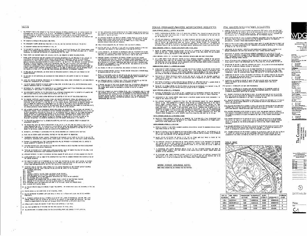
NOTES
I. TT. PROPERT1 THAT IS I. AMR Of 1114 RE29510 COMMIS Of PARCELS 43.111711. THE WON COMP 7AX AMSMENT MAP AS .30-3 ((2E)) 01 O. OS A M. DE PROPERTY IS OMENTLY ZONED 1-20/.. TIC NAME OF NM MOM. IS TO MC. NE PROPERTY FROM R-20/. TO PTC/11C AND 70 DEVELOP NE PROPERTY AS CENERAUY 91051 01 THE CDR. 07010115 Of MOLIAN 1/05L 11.0 0/0 ICOR NC. IS ME 010101 OF TIE PROPOS' AND THE
2 RE HORIZONTAL DATUM IS 111101111A STATE ow NORM
3. THE TOPOGRAPHY SHOWN HONOR MS Rao 11. BY 111, NC A. THE CONTOUR INTERVAL IS TWO (2) Fur.
4. THE BOUNDARY INFORMADON WAS PRIOAREO BY NIA INC.
S. 11. PROPERTY IS L0CATE0 PI 11E AND.. SUB DISTRICT OF THE TISONS EAST DISTRICT OF THE 71987 =NM URBAN 071.31 OF THE FAMAX CPAPREHENSIVE PLAN. DE RAN RECOMMENDS THE SITE FCR NESIDENIVE HOED USE AT VAIDDLES 1.3.19105 THE PROPOSED OEVELOPIENT IS PI CPERMAANCE 5711 NE PLAN.
O. PUNIC OVER AND SANITAFIN SEVER ARE MEADE AND BILL BE EXTENDED 10 %ME THE CONICPIENT.
7. STORM WATER 1.1AGEMENT AND INP mums FOR PROPOSED CO41711.7 I. BE PROMO ON 911 RIO BILL BE 0051500100 AS A BELOW GROUND SYSTEM UNLESS CORSI... AS A TEMPORARY mover TO .011 PRA. CONSTR... 10 EITHER CASE 00 ADEQUATE RTC. DRAMA. SM . RI ACCORDANCE PITH THE MUG FACULTIES MANUAL STANDARDS A110 DESIGN CNTERIA 0 FAIRFAX COUNTY WU. BE PRONGED. THE APPUGRIT THEREFORE RESERVES 1114 OW TO PRONDE IENRCRARY SIGN WATER MANAGEMENT AND RNA FAO.. FROND M DEMORIARIT BE COMP.. IN PHASM.SE 1000(515 MAY PICUOL BUT ARE NOT um. TO. NREIDIT01 AREAS, INFILTRATION FACILITES OR LINDERPROUND VRATS. THEY TOP.. FACILITES SHAU. RE DENGNED AND CONSTRUCTED 70 MET THE CURRENT FAROS COUNTY SVAVRAIP 5IAM/A.5 N EFTECT AT RE TIME OF CONS... FOR THE SPECIFIED PARITY, SR OIEETS C-13 EMU C-17. NO DRY SIP POND FAWNS. PROPOSED AS PERMANENT FACIUTES.
6. TO NE BEST OF OUR MOPEDR, NO GRAVE 9115 PI SOLER/RES MARKING A BURIAL AR ARE PRESENT ON THE SUBJECT PROPER.
▪ 10 RE BEST OF OUR KNMILEOGE. NO HAZARDOUS OR TO= POSTANOS ARE 101015 TO MST PINESUBJECT PROPERTY.
10. THERE ARE DESTRO RESIDO.AL SORICNRES ON THE PARCELS ORCA 19669.. THESE STRUCTURES VOL 130 DOM.. RI PHASES MM CMELOPROIF Cf 101E PR0E1110
11. THE ENTRE SIMECT PROPERTY IS LOCATED 941101 AN PIA Z.L NO FLOW PLAIN, RP.A CR DOIROMENTAL QUALITY CORRIDOR CURREN. OAST ON DNS PROPERTY.
12. 00050 10011 TALL COMMOICE UPON COMMON CP ALL ROMEO ENRFAX COUNTY PLAN PROCESSING AND APPROVALS 0011110101011 Cf DEW OMMIT IS 050 MAO 70 MARKET PP.
11 T. DEVELOPMENT CONFORM 10 THE PROMONS OF AILAPPUCABLE STA.AROS INN ME EICUTION 0 MINERS AND MODFICATIONS REQUESIT.0 DRS SHEET AND PI SHEETS 5-01 AND S-07.
IA. LANDSCAPED OPEN SPACE AREAS SHOTIN I.E. MAY BE MOPED AT RE TYE Cf FINAL DEMME. PLAW.
15. 1110 MOND FOCITRONTS. GARAGES PLAZAS PARES AND STREETS REPRESENUO NOIECN ARE APPROXIMATE ANO ARE BEING PRIMED F. ILLUSTRATIVE PURPOSES ONLY. THESE FEATURES MAY BE ALT... MOOED AND INCREASED OR DfCREASED RI 92E OR PIANTITT AT NE ME Cf STE PLAN (VANIN GENERAL CONFORMANCE ALLOWANCES) NI X0!1 THE NEED 70 MOO ME CONCEPT/MAL DEVELOPMENT PLAN SO LONG AS THE MINNUM BUILDING SETBACKS FR. THE PROPERTY LANE AS SHOVE IA 111E C0/FOP ARE MANTAINED, RIO NE .51.11/14.111114 NUMB. OF 1.9.01. PPM, AND INKAIDN/NANIN4 BUILDING MIMS COOLY MTH THOSE .91051 ON TIE CDP/FDP.
16. STE AMENITIES, FEATURES NO PURIM. REPRESENTED NM. ARE CONCEPTUAL NEL AS SUCH, ARE N10500 TO ROUCT ENE GENE. INF. AN IHMACTIO 7 INC PROPO. DEVELOPMENT. FINAL SELECTOR MAY VARY AT ME DIE Of MN DEVELOPMENT PUN AND 91E PUN, BUT PILL BE ONSISTENT 5T11 THE W., OF 1HE DESIGN REPRESENTED
HE. ADDITIONAL SITE MENTES MD FEATARLS SURF AS PLANTERS 00060150101. ONER SEATINGREM WALKWAYS, TR.SES. WATTS ME M. OR WOAL FEATURES PUBLIC ART, S.S. WAILS, LIGHTS, LOWY ARO MAINTENANCE STERVIARES 010 MILAR FEATURES NOT REPRESS.. HER. MAY BE PR090E0 AS LONG AS THE RESULTANT DEVELOPMENT IS IN GENERAL CONFORIANCE MIN ME PALM REPRESENTED IN DIE GRAPHICS.
17. THE PROPOSED DEVELOPMENT ON ME SUBJECT PROPERTY DTI NOT POSE ANY ADVERSE EFFECT ON ...CENT OR 00180810 PROPERTIES
I. THE PRILE7 111LL MEET THE PARKING RE.1.1147 AS SET F.TH IN ME PIC ZONE PER urncLE 6 0. 11 011E ZONING oRopoNcE ADD SHALL BE PRONGED IN A COMNATION OF MOVE ONO BELGA MADE P.O. STRUCTURES AGO SURFACE WALES. THE PANDER Cf PARKING SPACES PROMO HEREON MY BE ADAM. AT THE PE OF STE PLAN BASED PI RE ACTUAL NUMBER OF WITS A. AMOUNT OF RA CONSTR..
19.seemz ELL RE PROW. IN ACCORDANCE VAN 71. MANG MOW. OR A COMPRENENSPE MGR PLAN.
20. THERE ARE NO SCENIC ASSETS 01 NATI. FEATURES ON THIS SHE W.. CP DEUREATION.
21. TRANSTIONAL SCREENING ARREST AILIACENT PROPERTIES IS NOT REOUIRED AS SET FORTH N Z.O. SEC. 103011 AND T. SUPP.ENTAL SCREENING AND DAMEN MATRIX. MCI. ALONG INE PROPERTY UNE VON PC41-12/R-1 BM PROPER.
22. PARKING LOT LANDSCAPING AND TREE PM REQUIREMENTS IN. BE PROVIDED IN ACCORO0147 YEN LO. AITTELE 13 UNLESS WAIVED BY THE DIRECTOR OF 711 A ES.
21 DEVELOP. RESERVES . RIGHT TO PROVIDE PIERO SURFACE MONO IN AREAS RESERKO TO FUTURE DEVELOPMENT AS ME PHASED Of 051.0MEN1 PROCESSES.
14. THERE ARE NO Lev,. UTIUTI ABOVE GRADE FOMENTS HAVING A MN Of 11.4TY nye (25) AM ca MORE, T.. APE NO MANN UNDERGROUND LITILITY EAS.DITS LOCATED ON NM STE
25 APPLE ANT RESERVES ME RIGHT TO MONK THE FINAL NUMBER OF UNITS AND WA Of MN IMP. N. INC RIP.
26. MGR MODEROATIONS MAT BE MADE TO THE CONSTRUCTION ROARSITIT THE suLLERT PROPERTY PER SEC. 16-403 OF THE 1010110 ORDNANCE.
27. THE RUDELY PROPERTY 1AAT RE SUBORNED IN THE FUTURE roe 00 PURPOSE OF SAIL .10117 MIN. OR PRAMS ANY PROPOSED 0180,971 SINN ON CDP/FDP MAY BE MO.. APANISTRATIVELY BY 1109800101 7 O. MS NOWT RECUIRIND MODIFICATION OF THE CO. EDP. RIMS) OR PRELIMINARY PLAN.
GB. ACCESSORY USES AS 1001111. UNDER ARR. 2 OF THE ZOOM CIMINANCE MAT BE P10N0113 5114OUT REOUIERND MCOIFICARP1 OF THE CDR. NESE USES MAY INCLUDE BUT NOT BE MIT. 10 1110 FC11010.
16I. ACCESSORY SOW.. 20.1 FLAG PC. 21 FINCFS 214. LANCES GROOM AIRINGS, EAVES AND OTHER soeue MATURES. 205, OPEN FIRE BALCONIES. naE ESCAPES, UNCOMED SPARS AND STOOPS
Z 16.6. AP CONCIRONERS, MAT PUMPS, MERGER.' GENERATORS NO OTHER .11. EQUIPMENT, 26.1. BAY MOO. ORIELS A. CHIME. 26.6. ACCE-S9DIUTE IMPROVEMENTS AND LAY-111 PARKING SPACE RI FRONT a NE PROPOSED BUILDINGS.
5 16.1. OUTDOOR PATIOS HOT OVER (4) FOUR FEET IN 110.1 ABOVE THE M0050 4 2630. DECORATIVE WM. FOR LANDSCAPING NOT OVER 3 EEO IN HEIGHT ABOVE THE F.19191 GRADE i 2111.
001001 CAPE . SEATING AREAS.
, 20 ALL POW. OREM SHAll BE DUPED TO MEET POI COMP. NC DES. SPEED DIALLBE DUMPED AT THE 11110 i OF FOR.
30. PHASNO SHORN MAY BE UNORTAKEN IN ANY SEPENITAL ORDER.
31.MST. ENTRANCES TO EXIST. LAID USES SHALL BE P15.11113 TO REMAIN UNTIL. RAE AS R. PROPERTY
REDEWLOPS.
31 ALL PAMIENT RAMOS . POUC STREETS, NCLUDING BUT NOT OEM TO CROSSIVALES. LANE USE, BIKE LANES, ARROM, PARKING BAY. OE SHOP ON 11E CDP/FDP ARE 901001 TO VTIOT RENEW ND APPROVAL MY (001 REPKO. mouncAncies 10 THE SAME MAY BE MADE RANG. MOUE.. A 02PA/EPPA A01/0R RCA
31 PARSING LANES SHOWN ARE SUBJECT 70 1007 RE.1 AND APPROVAL AT SIR PLAN.
N. 11111 ROOT BARRIERS 011 BE MUDS FOR TREE PPS ...CENT TO TRANI WAYS.
75. ALL TICCDICATIONS 10 MOOG 9G.5 OR NEW SIGNAL INST.ATIONS ARE DIESEGT TO NOT APPROVAL
36. NE FINAL ...ON 000/01 REM.. OF CR-STREET PARK. SPACES OMR. THE LOCA. Cf HANDICAP SPACES SMALL BE DETERMINED PI CONSULTATION me 0001 AND FOOT AT TA Of STE PLAN.
37. THE APPUCANT REM. THE RANT 70 PRO. LOAORIG SPACES PI EXCESS Of NAT MOM HEREON PROVIDED THEY CO 1101 NEGATIVELY IMPACT THE STREETSCAPE SHOWN
11. HEREON. 541k HOORN ARE TO BE OETSIMINED AT SITE PLAN, PROVIDED MAMWAS 91051 HOIEON ARE NOT EXCEEDED.
38. PUBLIC ACCESS EASEMENTS FULL BE PROM. OVER AU. PRIVATE STREETS
39. MAD. A. TM Of INEMNAL (TO RC 9.). EXTERNAL CROSS1V.S ADA CURB RAPS SUDECT TO NOV AMOY. AT RE WE OF STE OM.
40 BICYCLE PARONG V. BE PROVO. Pi ACCORDANCE MN ME TRANSPORTATION DESIGN STANDARDS FOR M 11ONS 0.. URBAN come THE MONS CORNER URBAN 0E9011 CODFUNES, AS 0010100740 111711 NOM AND DOES AT 0E Of SITE P..
41. PROPOSED ROADWAY IMPROVEMENTS (DORAN., WRONG It ETC.) MAY REWIRE CPEPTION/DENAPON FR. 1007 •CCESS MANAGOADIT DESIGN STANDAR. AND/OR NE 'TRANSPORTATION MGR GUIDELINES FOR MONS CORNER URBAN CORER (AS MAY BE DETERMINED AT STE PLAN); COMPLIANCE MTH EXCEP.NS / OIARGES DiAll NOT REWIRE AN AMENDMENT 70 THE OP AND 01 FOP. SEE SHEETS S-1 k 6-2 FOR MIMS k MODOCATONS REQUESTIM.
42. ALL ORONO ON TIM COP IS CONCEPTUAL AND 506001 10 OW. Al SITE 1.11.
41 AREAS Of VAUD PAR.G, PARKING AND/OR T000F31/VA1E7 PARKINS 91. BE DEMONSTRATED ON ME 97E PLNL
" PRIVATE 241k0142:171" '"&"1"ArOP"Lr'''.1:0'•
SPLETS.PE RECOMENDATIONS 111 PIPRENDISOE P1AN.
41 All lemmas ce NAM STREETS SHALL TYPEN1Y BE CONSTRUCTED AS VOOT BID CO-13 UNLESS 0101001E1 OTHERKSE AHD AS DETERMINER BY VDOT.
4B. A 7. DEFICTION OF NE AN. OF MIN AN D. PROPOSED DEVELOPMENT SITE 19 NOT REQUIRED AS MS DEVELOPMENT D NOT LOCATED NEAR THE PERON. Of NE MONS URBAN CENTER AS DESCRIBED 0.1154 15-102 OF THE ZONINO WOMAN.
47. MS PLAN IS CONCERNAL AND IS 111.051 TO BE USED IN CONJUNCTION ION DIE LAND USE APPROVAL PROCESS O E0 IS NOT AN ENGINEERNG CONSIRUCTON DWANE AND ION. DOM. AND AISURNENIS MAY BE REWIRED, ARO . PERMITTED WRWANT TO MEND ORPHAN. SECO. 111-204(5), AS PART OF THE FINN. STE PLAN APPROVAL PROCESS HOMER. THE FINAL CONSTRUCTION ORMAN. SHALL BE IN SUBSTRATA 071F0OLANCE VAN MIS RAN.
,ZONING ORDINANCE/WAIVERS MODIFICATIONS REQUESTED 70 040 ISIDINAN17 ARNIE - ITNPRAI 9158 peer
WAIV. / MOIDICATION OF SECTOR 1-504-2 10 ALLOW FOR A PARAPET WALL, 000001 OR 91PAR REELECTION TO E.. AC NOWT EMT EOM.. BY MORE THAN DE. TB FEET, AS NO A. Pi RE OP AND AS MAY DE MICA= PI TIE M.
2. THE NOUCANT REQUESTS A MODIFICATION OF RE MN. ORDINANCE, SECTION 2-506. I(A) AN0 (1) 10 01105 SIRUCTURES LOOM. ON RAE BOOM R. 10 OCCUPY AN AREA GREATER RAN 252 OF 110 TOTAL ROOF AND TO MOODE AIR COMITIONING MP AND COOLING TO.. LOCATED 0790E THE PENTHOUSE OR .EDIED AM ENNA BUNG INC.. IN THE MANIAUM BUILDING 11011 5 SAID STRUCTURE. AN 08101001 OR OWLS. 10504 IS FOR THE 0570.5E Of PRIMING BURPING DERMIRUCNRE TO MT 110 ODITIFICATOIL
101150 oRMAME ARIPT 1 - 5 - P ANNFEI INVP 71.7 0511111 RFE, Annms.
3. WAIVER OF 201000 ORDNANCE SECIOI 6-6017 REWIRING ME 255010100 OF S.C. OUTDOOR POW AREAS OR THE COP. RATHER OUTDOOR DINING MAY BE PROW. IN ANY AREA MERE RE USE NOLDES DOING ACTIVITY AND .L BE INDICATED AT THE WE OF FOP.
ZONING ORDINANCE ARTICLE 10 - ACCESSORY USES, ACCESSORY SERMES MS, AND HOE occumeoes
4. AS ALLOYED MAIN HEWING ORDNANCE SECTION 10-104.35 APPUCANT MOUES. A WAIVER Of RE RAM. FENCE HEIGHT ER. SEWN FEET 70 NORTON MET MORO ACCESS.. .ES / STRUCTURES LOCATED MON IT. REAR VWFOR NO. AREAS OF MENG ASSOCIATED 5111 MY PROPOSED SPORTS COURTS AS NOCATED GN MC C oil AS 1.101 SC N0ICA1E0 011 AN ITV.
20ENG DROPIANT ARROF 11 - P020110 20101 000011 AND
5. MODOCADON OF .6710 ORDINANCE SECT. II-101(11) MO SECTION E-509(1) TO ALLOW FOR TANDEM SPACES CONTROLLED BY BUILDING MANAGE.. FOR RESDERIAL USES. SUCTI STAMED SPACES RI A007DAN0 111111 SEC. 0-101(1) AND 6-509(1) 001 COUNT TOWARD REWIRED PARKING seem. et NE 2CNNG ORDNANCE AND SHALL BE PROVIDED DI ACCORDANCE MTH 111E PALING PLAN AWAIT. 111111 THIS APPLEATON. FLIP.
6. MODOCATON OF ZOOM ORDNANCE SECT. 11-101 AND SECRON 11-203 FOR THE REEDS. NUMBER OF LOADING SPACES VADIN ANITI-FAPLY AND RETM/SERNMS USES IS REQUESTED Pi (0100 Cf MOSE WO. RAE .OM CN THE GDP.
7. MODOCAT. Cf SECTION H-202(4) F.07.70 1.1.1 DISTANCE Cf (00111E7 (Re) 7 A 100004 0ACE PROXIMITY TO 0000 TN NAT AS DEMONSTRATED ON THE COP OR APPUCABLE
5. WAIVER OF 1110 MM. LENGTH OF PRIVATE STREETS AS PROVIDED IN PARAGRAPH 2 OF SECRON II-301 CV THE 00/1110 ORDNANCE 70 .0. PRIV. STREETS IN EXCESS OF 600 O. IN IDIOT.
ZONING ORDNANCE ARMY 1 13 - IMONPARE.„
9. PURSUANT 10 PARAGRAN 3 Cf SECT. 11-3D5, A MONFICATON OF 100311001. SCREEN. AND INNWR Cf R. BARRER REQUIRENDOS ALOE. INF NORRIEFEN PROPERTY I. ANC POI 12 NO R-1 2.0 PROPS..
econcAeoe cc RE MC. CORNEA MAN COMER STREET.. MI. .11. 6-501 PARAGRAPH 7 RI FAVOR OF 1.7 91091i ON 11E CO.
II. 7HE APPLECONT REQUESTS A moommoe FROM THE TREE PREMVA.N TARGET PER 2.810 ORDINANCE SECT. 13-400. RIM 11101EICANON IS PERMIPEO 155. ON NO (2) ALLOWABLE 00401014 IN THE FAIRFAX COUNTY PUBLIC FACILITES MANUAL NE FIRST IS 512-0507.31(I), PM. STATES MING RE OR PRESERVATION TARGET 9.1.0 PRECISE NE DOEICIDENT Of USES OR 0015505 OTHOPISE ALL.. BY NE 200110 ORM., THE SECOND IS 112-0.7.3A(3), 141101 STATE. CONSTRUCTER ACTED. COULD St REASONABLY EVECTED TO IMPACT DIMND TREES OR FORESTED .AS ID MEET PRESERVATION TARGET 10 THE COEDIT THEY MILO NOT MELT DOME 01 A HEALTHY 1110 STRUCTURAL, SOUND 05111. FORA MINI1 OF 10-YEARS IN AC.DANCE WIN THE POST-IENDOPMENT STANDARDS FOR TREES IN FCRESTED AREAS MONIED IN 112-0403.• SP.'. TREES 70 BE PRE..? ARE 09111103. NE OP.
ORDINANCE ARTS. 16 - rev, OPUrer PI APR
11. PRIV. OF ZOONG ORDNANCE SECTION 16-403 RECTOR P10 ME SUBMISSION Of A PEAL DEVOCIPMENT PLAN APPUCATI. ASSOCIATED WITH ME SUBMISSON OF . PUBLIC ROADWAY. AND INFRASTRUCTURE PHASING DINST IMPRDMIENT PLANS 91071 ORME NE COP.
IDDREDITITTANGLARINIEJ7,_=_ELAtt
D. WAINER OF SECTION 17-201-(3X11) KW.. MOW. 51100-00700 ACCESS TO ADJORONG PA.. (OTHER NM NOSE DOM ON NE COP).
14. 0000 OF SECTION 17-201-(7) REQUIRING 17 PRIMO DOM MONO NAVEL WAYS AT MN N.V.. SO AS NOT TO CAME ?ARIAL SON CLUTTERS LEANS 1F0 051110 OF PALING 001P00. SIGNAGE 70 BE DEIFIDAPIED Al STE PLAN MN APPROVAL Cf RE DIRECTOR OF ONES
15. :AMR AND /11.r4P6AZDLrO,L7,14,,111,001.111 CO.
AND NE 111515 FAVO1 Of ME
16. . APPLICANT REQUESTS A OETERMINATI. OF 205711 ORDNANCE SECTION 17-201 PARAGRAPH (A) RE.. ANY ORDER OINCATION *00 CONSTRUCTOR OF VEEN. FOR COSINE ROADS REMO THAT MICR IS INDICA. di NE OP. DEOICATION AND 10100.0110 SHIM ON 11E COP M. BE OM. 70 MEET . COMPRONDISIVE PLAN ROUGE PLAN RECURSIONS
00ANCE 1.11 WRING ORMANCE SEM. 17-201 (7), THE AP... RESERVES RE MT 10 SR PAWING C.I.A. 54011S, AND PRONG NITERS ALPO PURUC 000 PRIVATE MOMS 511971 IRO
A(.7.147 70 THE DEVELOPMENT.
16. N ACCORDANCE INN 2000 ORDINANCE SECTION 17-101 (11) 0 3) IAA 051 TIE 57EICANT RE.FRo THE IMPROvEmENTS TO BE PROHDED IN A PHASEDSECUENCE M OUTLINED R1 NE COP ANO 1,175. MO TO BE MERLIN. VAN THE FOR IN AL0717ANGE MN THE MONS URBAN SIRED STANDARDS
WORK FORCE HOUSING NOTE: WON FENCE Num BILL BE PRI71100 PER HE PROMS
REM WAIVERS/MODIFICATIONS REQUESTED
DEITBRu 0 PIN SEC. 6-0203 MOPING AN mays. Of THE CUINALL vent SU. TEE NAT . MIRE P.R. 7 THE DRAINAGE 910 7 ME 9115 OUVALL NAT IS 81191 TAO PEC DISTR. NM BEEN MIL RED... UNDER THE RTC 2019 RIS RECESS.' TO FULLY AODOUNT FOR 11E EETECTS Of THE PLC REQUIRED RPM REDUCRON EN THE RECD.° CHANNEL
B. MIER 0 OM SECTOR 6-03010. TO .1351 SMIAWARR MANAGEMENT FAOUTIES (SIN AND MP) TO BE PRON. ODIN UIDERCROUND SYSTEMS 51E1111 THE RESIDENT. BUMS Of THE PROPOSED DEVELOPMENT. (SEPARATE IIINVER 1800 0031071011-003-01)
C. DOM Of MA .7.1 7-N014 REQUIRING i1R 10(81110 MPH OF 30 FEET FOR PRP. STREET AND COMERCAL ENHANCES CONNECTED TO V001 ROADWAYS AS 111011ED BY APPROVAL Of NE °MOOR OF DRAB 07 THE TIE OF STE PI.
D. 11700.011011 0SECTION 7-703 10 ALLOW 7.0517.T MM. M. CONTROLLED BY BUILD. IONAGMAEHL MO NAT A. SPACES MAT CUNT TOWARD PEDDLED PR .G
L MOOFICATION Cf SECTION 7-06021 P.01.10 GEOMENIC STANDARDS 10 AUNT FOR UP 10 A 42 PROECTON 7 STRUCRXIAL COWIE. ODIN PARKING STRUC1VRES NW THE REWIRED PARKING STALL
INE PMEING STALLS 1011070 BY SUCH STRLIONRAL COLUMNS SNAP 03.1 TOWARD THE NUMB. OF REQUPED P000N0 VRES.
F. WAIVER OF sm. REOUNING ARMS AND DOE RIMS 91000 NE COMPMENS. TRALS PLAN N FAMI OF ME SIREETSCAPE AND ON-ROAD BIKE TRAIL SYSTEM 91051 ON DECO.
• 11000177101 17 SECT. 11-0506 TREE PRE.VATION TARGET, AS ALLOWED IT MATEO. M.. 1/-0545.3.)111./. YCTW 12-02005O3).
meancAnce Er 5E001 12-0510-4E-(5) 70 PERMIT REPACTION Of THE MINIMUM PLANTING AREA FR. EIGHT (B) FEET, 10 A MM. OF FIVE (5) FEET RI ORDER FOR TREES 10 SATISFY R. PEE COVER REQUIREMENT. REF. 10 4000 PE PLANS HEREIN F. GRAPHIC OF ME PROPOSED PLANING AREA
L 11071CATI01 OF SECTION 11-0511 FOR RECLINED TEN PERMIT TREE CANOPY COMAGE ON MINION. LOTS / 04110 BAYS, TO NLOW FOR CANOPY TO BE C.P.A. ON TIE OVERAL. COP DEVELOPMENT AREA AS OFMONSIRATED OR THE CDP RERUN
• 11001100181 OF SECTION 11-0515.611 TO .011 F. TREES LOCATED MOW ANY 1917092 PERCOLATION TRENCH OR M-RETENTION AREAS 10 04101 TOWARDS COUNTY NEE COVER REQUEREMONS
RDA SECTION 6 - STORINAM AM OAP C. REPROOF.
• DONATIONS / MCPFICATION Cf REWIRED SRN AND BIAP COMOA BY THE DIRECTOR. OPUS AS 01111.11.1 MME DIORIAWATER 05110 MEIN DES. PM DENATEINSNMIATVO OUT.D ON STORM. MANACOADIT SEEL. AND AS FOLLOWS
P)NL REOPREO DEVIATIONS OF POI SECTION 6-101.41 TO 0110111.11.011014 Of 11011.711.071 RATES LESS IRAN 051 111/111 F. 050 0 7111.11,1100 MIMS 1177. TO MEET DE C.PREHENSIVE PLAN REQUIREMENT FOR RETENTION OF T. FIRST OF RUNG. 01-SIR.
8)00* REQUIRED DEVATIONS Of 71,1 SECTION 5-130.4 70 .00 FOR ANY ovum. FACTUTY LOCA. WITHIN A BURPING OR GUAR STRUCTURE TO BE GOVER.0 BY DIMANTO ODE REQUIREMERM fOR MESS AHD PANIENANCE.
e)ALL REC.. DEVIATORS OF POE SECTION 8-1307.70 TO ALLOW FOR INST.LATEN OF 00-RETENDIN ENURES MAT UTILIZE MINA. TO RE CONSTR... 04-911/ FEL 205000. PROM. FE. 1E515 SHOW NOWA. MMATION RATES EMT FOR 11-911 NUM, •
NEALE REOPRED DONATIONS OF PM .CTIOR 5-1307.2E TO SET RE DEMON HORIZONTAL SETBACKS MOM WRONG fOUNDATIONS BE REDUCED 10 .10 (0) FEET PI 79ER 10 FAOLITATE INSTALLATION 7 1310-RETEN110N SP1MS IN AN URBAN 11105.1.1 SET FORTH IN TIE 1150. CORNER DESIGN GUICEUNES
.)ALL REQUIRED DENATIONS OF POI SECTION 6-1307.1F TO ALLOW INST... 7 50-501011181 FACUTIES IN NE REMIT OF LOADING 00.5. VDU= MANTENANCE AREAS OR Cl/MOP STORAGE ARIAS 10 ACCPANCOATE THE URBAN ENNROMIDIT SO F0117 N TE TDREN'S CORER DESCH
0 ALL REWIRED CENATIONS or pie SECTION 6-193E20 TO ALLOW MR TIE 15 LOW AREAS 10 BIO-RETEND. FLT. UTXPED FOR 6010010 OF NE NOT 5 OF RUNCIFT BF W.A. IN .017 TO ACCPUICOME ROGOW WEPT PIPED TO PREPOSED STRUCTURES.
9)ALL REQUIRED OVATIONS OF 711 SECTION 6-1309.20 TO ALLOW INST... OF TREE BOX PLIERS IN DE momar of WADING 0.15 Mt. 1.01N7124000 AREAS OR OLTD. STORAGE AREAS TO ACCOMMODATE THE URBAN OPARONMENT SET FORIN N TRE MON'S CORNER DESIGN 11110IONE5
SOILE JAP
At CHITICTU RI
WOG A41...,111,( Hob
So.."
‘""ri ZIe■ rev aT,
AMMO “...momes.o.us
C..t.a1111-1.1 en LA S..111.,14tanb
VA
Salem
WM.* Anhhee
r=1..VAnm
7Mayo
ARAM Vµ
pp
a. mm
r, f■e•
AM10.0.51.1
es4d.n1.1.4.1.6
C
0
oE
-c I-
411414.1. S.M14 50.1000110
EDP RD/ COP REMIT REYORP REV COP TEMP
MA,
Notes s.,
C-1
SOIL ID
NUMBERS
SOL SERIES NAME
FOUNDATION
SUPPORT
SUBSURFACE
DRAINAGE
SLOPE STABILITY ERROOABLITY
PROBLD4
CRASS
11113. GLENVILLE FAIR MARGINAL 0000 MCOERATE Y
20B+ MEADOWNLLE FAIR MARGINAL G000 MODERATE Y
2102 MAIM GOOD GOOD 0000 SEVERE II
5502 GUTTELG 0000 11000 GOOD SEVERE H
§

E015111,0 201154 5-20/310 PROPOSED zasirio Pit TOTA1. SITE ARE. 913.198 SF OR 240641 ACRES PROPOSED RON OEDICA1101k 1238,525 SF CR 56.46 ACRES
SITE TABULATIONS
0 O
E 0
§§g
JNTENSITY TIFRS. WDU BONUS CAl CUI ATIONS AND FAR
Intensity Tiers, WDU Bonus Calculations and FAR
Intensity Tier
Land Area
and Density Credit (% of
total)
Estimated Dwelling
Units
(Range)
693-1,322
—
Workforce
Dwelling Units
(Range)
[1] .
139-264
(20%)
Maximum GFA
(%of total)
(21
1,352,800
(52%)
Portion of
Maximum GFA
associated
with WDU Bonus
in
—
Maximum
FAR without
WDU bonus
4.83
—
Maximum FAR
with WDU bonus
4.83 —
Tier 2 7 - Y. mile
(unlimited FAR)
280,020 sf
(31%) Tier 3
Y. - 7 mile
(maximum 2.5 FAR + bonus)
436,166 sf (48%)
655-1;249 —
109-207 (16.6%)
1,269,800 (46%)
211,600 (20%)
2.43 —
2.91 —
Der 4 ? -11 mile (maximum 2.0
FAR a bonus) 197,012 sf
(21%)
.
0 0 0 0 0.00 0 Total 913,198 sf 1,348-2,571 248.471 2,622,400 211,600 2.64 2.87
[11 In accordance with the Comprehensive Plan for the Tysons Corner Urban Center, with n mile of a Metro Station (Tier 2), 20% of
the total number of dwelling units to be constructed should be WDUs. Beyond ''/4 mile of a Metes Station (Tiers 3 and 4), units
created with bonus floor area are excluded from the 20% WDU calculation. When excluding units created with bonus floor area,
16.6% of the total number of dwelling units to be constructed are provided as WDUS. The number of estimated WDUs listed above
is based on the maximum number of dwelling units proposed. The actual number of WDUs to be prodded will vary depending upon the final number of dwelling units determined at FDP and/or site plan approval.
[2] Buildings 1, 2, 6 and 49,700 GSF of Building 5 are located within Tier 2. Buildings 3, 4, 7 and 411,400 GSF of Building 5 are
located within Tier 3.
[3] In accordance with the Comprehensive Plan nor Tysons Comer Urban Center, Tier 2 is not entitled to a bonus for the prodsion of WDUs; Tiers 3 and 4 are allowed a 20% residential floor area bonus.
A ACHITICT 261
DEW) OPMENT TABUI ATIONS
Development Tabulations
4,0 dind
Minimum Vora..
Mraght IR
Proposed a.m..
Reight11 1
,rambar al
1Renge1 to ProPorad Mears [11 WAR,. cat
Proposed tuning GFA
[1]
Minimum melting LW. 1,11
Proposed Prat., Wee 141
Require Park.g 7 • Praell.151 M. Max
nrauirral Perking s 1,..114
Min Max
minimum Required ParkIng
Maximum Permuted
P • r1.11
Parking Prorkied
can Parking
..o]
Minraran Loading tilivii.
105 160 312,006338,000 338,000 223 331 331 477 331 477 135 245 416,000465,800 465,800 300 458 450 GO 456 048 105 160 247,004277,500 277,500 177 272 327 414 327 414 75 160 144,000260,800 260,800 103 258 308 389 308 356 75 246 261y000481,000 481.100 .7 452 543 See 543 680 185 • 245 353404499.000 499.300 250 490 490 696 490 666 75 180
y2-
150,000-314900 319,900 108 314 377 478 377 478
2,621,400 1,366 2,571 1277 1,820 1,555 1,869 2,832 3,790 on-street nettle neat spaces
on and off.treet spaces for rile park
Balding height is ins awed 6Dm swage grade andi etudes mechanical penthouse. rooftop erne. les. and architectural Matures
121 One numbers of loan mho. ar conceptual and may be adjusted proraled the 'neigh( la within the maximum end :Minimum tral.ng height ra ge for each buildng acetified above.
131 The square footage lor Indralual buikfings Is conceptual: square footage may be transfened between buildings presided the maximum height and overall site FAR are not exceeded.
[SI The number of dwelling units In each building is conceptual and Includes both market... and wove. Ilia number ot units may be adjusted al the time of FOP ardor site plan approrat.
151 The residential parking requirement ukulalion for Bunning 1 was based on en 'wage mix of approximately 80% 0.1 bedroom units, 35% 2 bedroom units. and 5% 3 bedroom IA.. Rraidennel parking requirements for Buildings 2 through 7 were calculated assuming an enrage mix of 60% 0-1 bedroom untie and 40% 2-bedroom mgt.. Al the time of she plan, the actual number or units. inix of bedroom types end specific parking will be determined.
tel Parking prokled and Ire perking ratios are estimated: the Applicant reserves IM light lo onside more or less parking is each buradirog at the time of FOP eppymel and site plan apposed presided the maximum perking rates set too In Section 6.509 are not exceeded at Inc build-out of the mural dmelopment. Oneireet spaces listed abort and shown on the COP are subject to modification et FOP and site plan.
171 Up to 50,000 square Met of retailiseraices are proposed as an optional Pia Applicant's discretion. Per Me Comprehensive Plen and Zoning Ordinance, there Is no minimum parking mquiremeM Sr
relailherices. Thor Applicant resen.5 the right to prorate additional parking for retail/sentCe Mee at FOP In an amount Thal Is less than or equal to the parking maximums specified In the Zoning Ordinance.
- -1 - rara Arae..A.*
•ttnI ■to
mnk Cara.' V.tk•AA6.616.
=3.010.
W. 5010(
MO O....,
AA., VA PDX
111.10..." 04.4108 NOV
COP 01.1.1 R EV COP REVCDP 29.11.13 REV COP 'ten II REYCLIP MOM REV CDP ,11.06.0
0. woo Pm 1r WAmie
Tabulations
C-2

WO4 10114mmen I
Wt7.4■4 '11 43 4,1
344 44.443
App.. 44.44-4481.44444.1148 Jo KM.... 0.4,614.4
343 444 034 543 14 4444 MO ma
S":1
1.44,404.44444,44
1441044.11 ■ 16141 0.1..114 gm. INC
101 N. U. Se. F,N.110 33444, 43,4
.1 10334.5010 ▪ /0130.10
404,44,..A.A414,44-44.4
T MIN Coml. 1444,4.4.A.A144. r.4603,3413,44.31 u m 344 4111441 34. 000 13443 0044 WM
• 7436.6,14
',la Mr' 6044334
SPEEIVAP, INC, Oill.46&p,86,10
NN P4RLA. 331 PACE 480 PHASE
PONE: C-6 (CONNPROAL PETArt)
, 44/tat • / /
111411111111RMON DiffilMINTA7211 •
C444401314334UCAL 113
434, 11404 5,4413, 03, nye 11•13410 330 tom
COP REV COP REY COP REY COP REY COP REY COP
aRAPfild
O.. wm P0A4k NA w4,444
Overall Existing
Conditions and
Key Map 3,33,
C-3
ARCNITICTUI

sq'
The Commons TYSONS CORNER
FAIRFAX COUNTY, VIRGINIA
ti mg,
NNW :IL

" :1AMOIIIIINI AO 161.5'
— AT/ .7r
I/ 1647i ~ T T w/ k,315i,tha
I 2'4 ',BLDG KI ' 1 1
r6:'Ww 4e.a.
Saw yea Ma., W12.1
da-
'Amin, /AM.. 41.11.146.11.
Nte
eta
• .”1.1.40e
—
landt .7
MO Goma.
• VA MI
Notel...40.1.6.4..14
(43 1
/ / /
N/F, SAFEMII
WA6 (COMMERCIAL
Y,
I ,
30-3—,028-0007 / /
.._ /.. LECI1 Bp0K,.. 3.112.EAGE An PARCEL A, PHASE 4 THE COMM(
INC/ 0.8. 11641
E
1, P(
/ ZONE: C/ RV
//\\ .
COP
REV COP REY COP REV COP BEY COP REV GDP
\
• WO.
Existing Conditio
C-5 Try US 'IV U.
=MN .0 •
I IL: 7 3% )

' / /
rj, pair-,
ARCHITICTUR1
WOO A..., 1,1C
Pot 443
Ce.:111.1
my* VA
71133t...
\ f iVao-3-087cico'gi/ Jso - tei aft
WESTGATF C-3 PARkz,,,
ZONE co
,a1,„^roo
559 .0 53.71
101! \ I
7-14
TM# 30-3-0281000.14
0 E E 0
rz.c.
8
st);,,, 4.
/60.
1
1.,_ * ''.1%,/ t. st* .tro Iii 1 ' 0 ....
-- - --op 1.10 ( //
,
------ 1 A) 1
(OP 01.14.11 REV CDP 05gt1 05.11.11
1016.11 REV COP REV COP REV COP
Cam-
GRAPHIC OCALE
reVV I WO.
v...
Existing Conditions
C-6
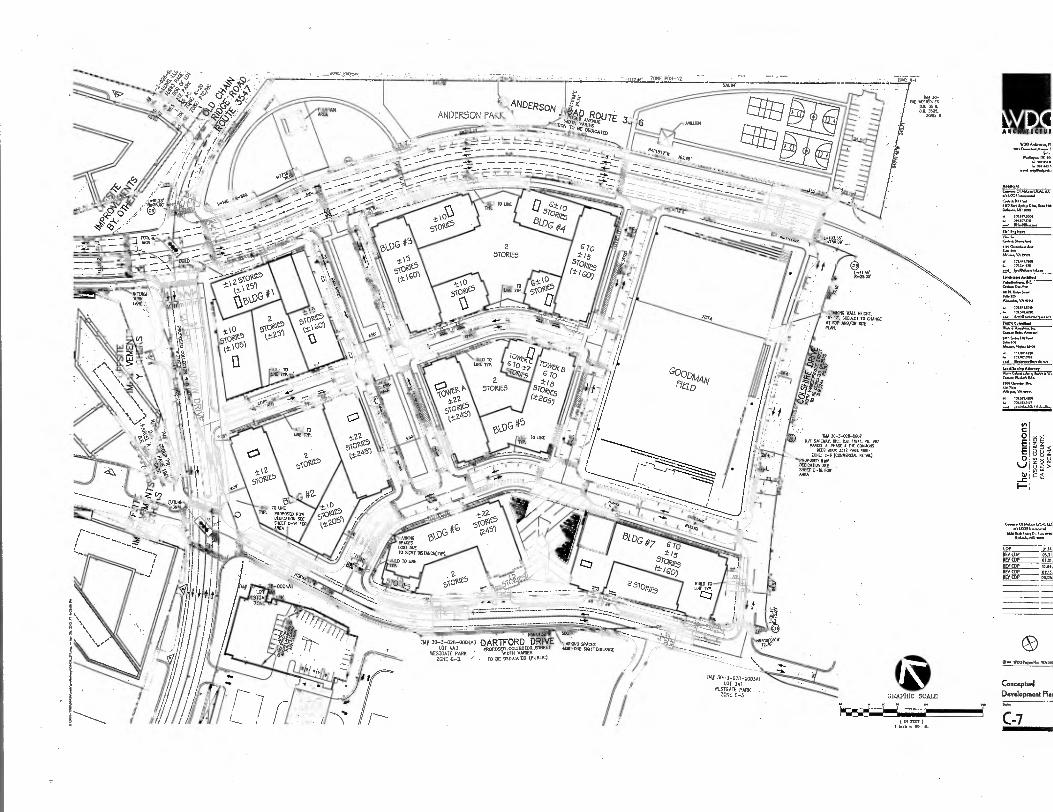
ZONE PUN-12 .
r I I
IIES DA 3519. Da 3525.
ZONE: fl
4 ,5V 6," d.,AV ,c§ ?)-L'
q-, i ,DA,Rou
0„„ vftts 3 pro,cAT.,
k II( AICNITICTUI
MG WAIL HORNY suaNcT To COME
AT SDP AND/OR AIL
NAT Worm Ric. us 11641, ON 907 TA/ 30-3-016-0007
MDGR A. PM. 4 1112 C0141/0112 UD 0. 512 PACE 3 400 ,
7011E C-6 (CGvum& R214.2) PROPOSED ROW DLOICANDN SR 511222 C-10. FOR ARV.
4.46.4.01/444.411,2.1.1.1 44.1.00116*41
6.464114415.4.412.5.440 ■45 11.46461.40 55.2
COP REV COP 05 21 REV COP 05.21. REVCOP 10.16. REV (DP 02.15. REV WS 05.00
.. - • • N56 , 52 ---------__,,
N1 30-3-025-0004A3 DARTFORD DRIVE AMMO SPACES LOT 413 pp
WESTGATE PARK VIIIH VARIES ) 7
opoSEI,GOLLECTINT.SIDEET .R.K..m.s,,,,,, ,,,,,.,...
ZONE u-a , . To se DEDICATED (PUBLIC) /
/ /
TM( 30-3-028-0003A1 LOT JAI
WESTGATE PARK ZONE C-3 GRAPHIC SCALE
( Pscr 1 Lech 14 AD
S. 11/001/044014: 5A.021
Conceptual Development
C-7
1000 A..11/6, PI len 4444.4.4444.4 1
6 45.43 •
444 .444146.40/16.6.116.,
80 z LL
The C
om
mons
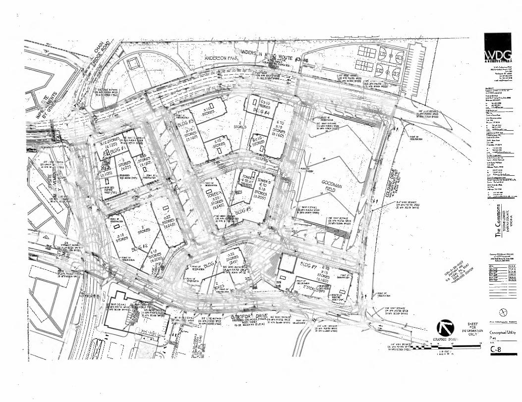
•T1
VAGA,1a,11.0
54.20a
-125 mrot puddiro jo27
ylOew
Of
75 ;:„. it5.. OBSEARATON 4,
,,,.. T%—.1111'(11.&-■— —,-- ._6 4 ,v. 5isfi. x GM
it
lt-
'ti4 it ,,o, ,. d„,„, 7,-\,,,, ,r.., 0 ' ,N .
1 +\ MOPASm PONT Of 005EIIVAHCH v._
--:soltAticlift Art DIETER:0011
I :VAULT
,...- 0.--.141-i0 PP' c.: P
`•:,-.2'_b, \\‘. A lok i'4.4,k
'1'2'•
.105)
lir
/MIT Of 0114RVAION
{1•511...w
nooG.,..dow
elm
• .1. 100
WO ha.... S.600
• 70.rtLasta • /011.710
Walanli, Ana., \Val.14.0 .ii.,
....a.w0A l0
A.16,.. VA mei
3e3J..x. 6 7013MIM
200. SGHT DISTAKE (25 MPH POSIT. SPEED'
•p MPH DESIGN 'SPEED)
• POMO Of 01151/10011011
gg,
0.
tn
0 E E 0
_c
Conown01....1/CALLK
404 4.1.501.0. /1.1.6.40510.1
POSTED 30 MGH -DE301 5P
Ix
Cod ousm
REY COP REY COP 05.11.12
REV COP 1010.11
REV COP REV (DP
lt," zr- e p
s.;:cs?
• PONT Of 00SERVAD01I
d
RD SIGHT DISTANCE 5
MPH POSTED SPEED GePH DES. SPEED)
• BE MIMED (NOM) '"*"'" 'E") "'""a'Y ;4 rm ROO' WI T DISTANCE
009011 SPEm)
200. SKlit OWN/a in MPH POSTED SPEED JO MPH OESIGH SPEED)
SHEET FOR
INFORMATION ONLY
GRAPHIC SCALE 51017 DIST
(25 1011 POS1E0 5P 30 111,1 009011 SPEED
II / IH )
I Mel 60
0 •-• aingoo0
COFIGYptlItil Utility
Plan
C-8 6 nW ray
AlICHITICTUATI
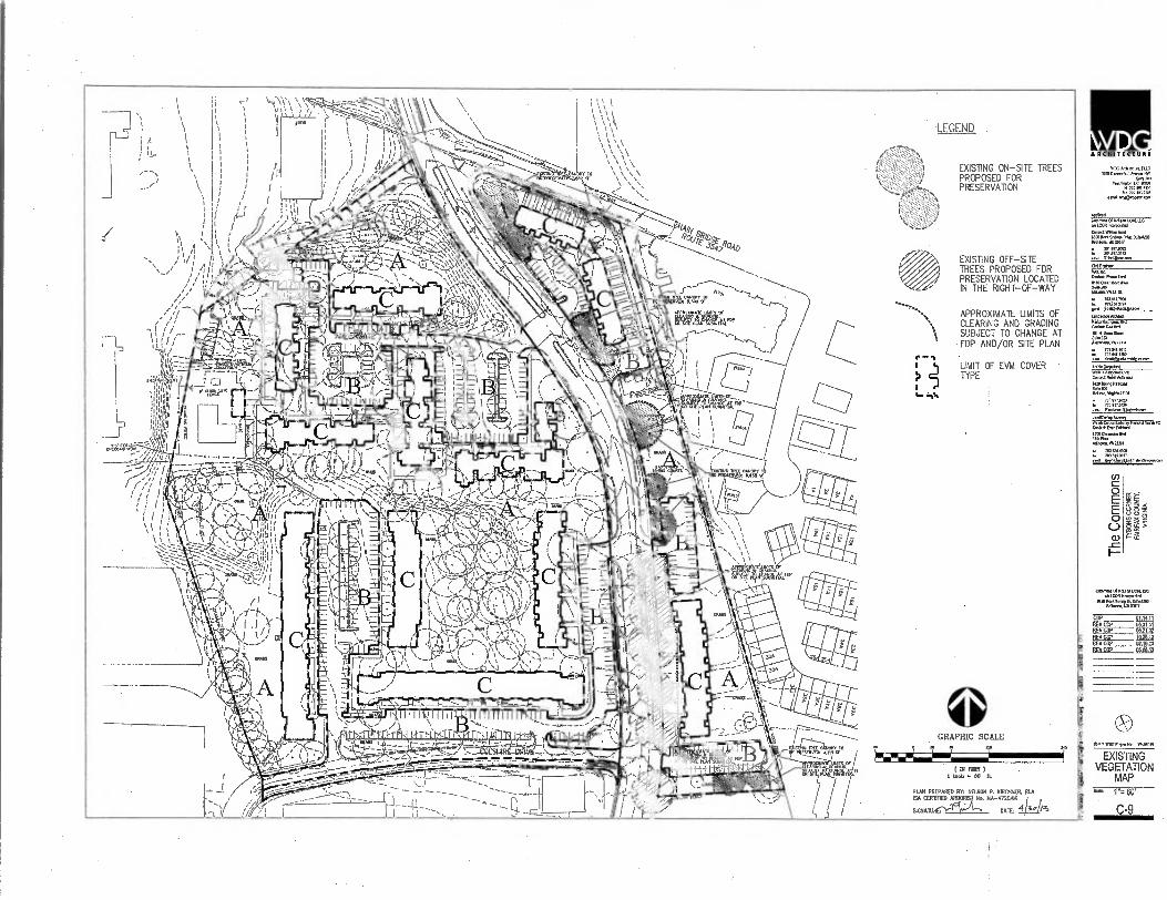
LEGEND
ARCHITECTURE
EXISTING ON-SITE TREES PROPOSED FOR PRESERVATION
1.0 RIC Commed.1.711:
. 02 410 110e ...I
091.1. Gawn.011001.61.41.1.0
.1.CORIrsoponlml
CIO. WNW. 11550 %Ong; 04.90.1.10110 11.0nsaa.110 ABU
EXISTING OFF-SITE TREES PROPOSED FOR PRESERVATION LOCATED IN THE RIGHT-OF-WAY
1111.a.mocan
CM W,
116•01,•120101
717172701
APPROXIMATE UMITS OF CLEARING AND GRADING SUBJECT TO CHANGE AT FDP AND/OR SITE PLAN
LIMIT OF EVM COVER • TYPE
101 N. Wm.. Sam 323 Mona% VA2.14
PC
MO Mena. e. 1301 .m.wonot
NO IMAM
Tn
0 E E O
Gunroom 011.14...1.1.1.C. .1.01111.,,100
65.1111(.60..00,Soll. Oellemla..103
0 14.11
OAS, 11.15.13
RFV COP Es64.12
0 GRAPHIC SCALE
•• ICI J ( DI PUT )
I INalt DO IL
PLAN PREPARED BY: NELSON P. KIRCHNER, RI* ISA CERTIFIED ARBORX. MA-4720AM
SIGNATURE DATE: 4/3 /Ps
_l0wn_I10 611
EXISTING VEGETATION
MAP r= 00 '
C-9

EVI4 INDEX
COVER TYPE
SUCCESSIONAL STAGE
.„, "'Ins'.
COVER CONDITION
PRIMARY SPECIES COMMENTS
"A" 01,/,,,,,/ 1,05,...p,
MAINTAID CuRtSSosLAc
NEA0E/ .
023 s, 574
(13.194 AC) SEE
NARRATIVE SEE COWS
TYPES BELOW SEE DESCRIPTIONS
Rae DEVELOPED/ PARING
544,112 ntr,LuTN,
Woo, W usg,gc„s9gro 197,040 SF (4.5234 Ac)
SEE NARRATm
SEE 11415
SEE DESCRIPTIONS
V. DEVELOPED/ BUILDING
91TAGE,,t0- BUIIDINC
141,235 SF 13.2423 AC) N/A N/A
TOTAL AREA
913,150 Sr (20.96 AC)
VEGETATION COVER TYPES
"A" PRIMARY COVER
Ade rubrum - Red Mop. Are, •urnhor{num - STYer MOOD Caelansa dem. - Amerlcon ChNIPUL Caret. - Eastern Redeud
kentuckea - ooe
Fagua grandlfolla - Amer.. Beech etlitela trIconthos - Common Honeslocest
Ilex 04.0 - American Holly Juniper. NInensIs - Chine. Juniper .1n1penr. NrgIrliOna - Eastern Red Cedar Magnolia slellela - Nor Magnolia Malus Sargantll - Sargent EnrverIng Crabapple Meru. Abe - w1111r Mulberry Picea ables - Norway Spruce Plead pungens - Colorado Spruce Pima slrabus - Eastern V.I. Else
Prunus subhirtella - Haan Cherry
Ounrcus alba - White 0. Quorum paluslris - Pin 0. Nem. phellos -rOh Oak <Nerd. rob. - English Oak
Outs.. Nero - Red Oak NONNI 109051co- Jamponese Paged... Noba occIdentenalle - Eastern Arborvitae Ilia cordate - LIttleleol Linden
EXISTING VEGETATION NARRATIVE SUILECT SiTE IS CLASSIFIED AS MULTI-EAVILY RESIDENTIAL DEVELOPMENT.
MIS oncunempa IS AN OPEN CAMPUS SMIE DEVELOPMENT MAT CONSISTS Or AREAS LANDSCAPED AT THE TIME CI IRE Nrnm. SHE DEVELOPMENT. THERE ARE OPEN Mr 144H AREAS MM MAME HIM CANOPY DECIOLCUS TREES NOSE AREAS NAT APPEAR TO HAVE BEEN LANDSCAPED AT THE TIME OF OEVELOPMENT. Ott LANDSCAPE IS MAINTAINED AS IS THE WEN SPACE THE LAM AREAS. THROUGHOUT TIE DEVELOPMENT THERE ARE ALSO MATURE TO NW -MATURE GORIER AND DECIDUOUS TREES AND MINN. NE PRIAM. OCCOLOUS TREES ARE MAPLES OAKS. LOCUST. AND TLONTIND .ERRIES WHILE DIE BOSTON CORM TREES AVE SPRUCE, AINIPER, PINE AHO C70A11. FORA COMPREHENSIVE VEGETATION LIST SEE THE PLANT COVER TIDE UST ON NIS SHEET. GENERALLY THE SUCCESSIONAL STAGE IS SUB-CLAIAX 10CIJMAX. MAXIIIIIT OF Pk VEGETATION IS MATURE THE VEGETATON OVERALL AIMS GOOD HEALTH AND
OR OU
11100011 THERERE ARE UPPER CANOPIES THAT .ON DECLINE SOME ASPECTS OF THESE CANOPIES MAY DE A HAZARD TO 111E EASING BUILDINGS A7117 TDOOR USE
THESE
WIN THE PROPOSED DEMTLOPMENT NOS PLANT MATERIAL VOLT NOT BE C.SIOERED FOR RESECEvAll011 MO THE SITE MLL NOT PROMOS VEGETATION NAT NI LIMEY OR PROM. THE TREE PRESERVATION TARGET AS REWIRED.
AREA -A IS 201E0 RTC AND IS vc0nE0 0011 COMPLETE REDEVELOPMENT WHERE THE EASING 131710I05, PARKING AREAS RIND VEGETATION ILL RE RAZED. THS SITE VIII NOT PROVIDE NE TREE PRESDIVADON TARGET AREA REQUIRED. TO MEET 100 TREE PRESERVATION TARGET AREA A DEMAND. REQUEST IS SLBIAI0E0 TO (WAX COUNTY IRMO FOR RENEW AND APPROVAL N 01COPOANCE NM PFSI 12-0508.4.
TABLE 12.3 TREE PRESERVE CALCULATIONS Table 12.3 Ties Preservation TargetCaleutalkine and Statement
A meeemseeeMetessremePeebee 44•4ArP9. .109 am.. •SpAan• 1.
;sue • •
tai ta46042
R howl., edemas olle wee sew. by WAIN Ns
sang n • C Peru... el %yea... came. NON De elle • ea TAN 72.1O
. Penentope of we !Irwin, canopy ;poke.. wet Mweed oe feel Now. kee M.N...
..
I P. pert., elm.: 71renNel MN N 2000
S HerHe Hee erase.* 7r reel minenum erre nm Poo. Yee et.
II Na Wow A S. Nene rogues, le deMale km I. TN. Popenalka Ismail sha• Up... on Pe plan am
INN Neel wwwbek 11 ohNsNeer own MINIsoltoons AN. ie. v...
meg am • evralwe uet melts • ......ne exoNsON erwer NI
CMG •
. 1.14,7 NON • nze.:.N:I.::.17747.41; • ,..• .., .
. ace s oftwom. pow to ve II,year iefilawiy
eakmaeons al r,er ...ellen, in Tame r7.10. ,.. ---
10•TASSofalerls.41,S.V. cam Corns 100,........• 41•12..1 121
"0" PRIMARY COVER
• ANT Nbrurn - Red Maple • Prunus subhIrlella - Nam Cherry • Omer.. phi,. - Mow Oak • (Nero. NANG - Red Oak
"C" PRIMARY CO VFR
• Ex.°, BuNdIng • Existing Sidewalk
PLAN PREPARED BE NELSON P. KIRCHNER, RLA ISA CERTIFIED ARSONIST No. MA- 4720AM
et :"; Vi ,* [ , 1q411117
WC Pt A•Csit(CIS • 011WITO•S • larrAinallA MISS EXISTING VEGETATION TABLE Slny S.1013
DeNtiment of Public Wet. end rSwirnnmenInl Semis, land IIOSS C
Iltovenmenl Center re'laprnent Serniss-s. Urbn
. Fermi ONnesemem Doidon
Per F•111.A. Virgln. 10035.5503
. Solle 3111
no. rm. Preeregation Target Dertallen Ana.. CDIPM2011.1.•Olf VDU • V608 I u
TIN INN le te renown a chs.Henm the N. PreoNveMen TO INT Mow. rektencen
wryer In June 27.701u on PCIN cove. Roe. ef Superolears oNsted the
71,e ohNe rekrtnees Thn Common.. i• located .el O'er., end eroolmed N. .• retool. C01,7131.3 VIVenOPTC,1 Pen ICU, number 112.701S PA17. Thin derialIan . eenusnterl In sbole nn1.1 In hated under 1.1. rollerring two allevable tle.datIon senditlanse.
4441. 5(50 emN(eWN .00.-0 4, tnr.irf...C.anly retai.s Pluled
2=1;,-:::',7.TZ.IVLIrz,Z=.7c,T17=="1"
nr
A]N31.011(0 e0O.uueGOn.00NW" mule Le 1wne0nnhly 5111.0.,10 (040.01
• the. would nof LIND sand. le ••heel.. owl •Intetumlly Round manner an • um of 10.yenr• In ereeninnet sant.drvelopment S.M.d for trtrwand
rent oreNded N 1.1 , 0403 nne 12.0404. ============. tn. umt, infroffiriu ..... . meet oda. both nnal .511e. nvie,
•sa *Is. retread. rindAnetro
mall Om ode deowlee ten-sm.. an men of INN. ensinteing Seesaw's 1104.hin portion or Tynan. Comer l■rtmn Center 7,c1rr Nsetedon mmdreemoto
num crew drvm prowerwIllon ...v.v. NU Da IlerrbrntsIled lAsnling
horn preserve 41 accord/loco with 1 J7•ons Garnet Urven Deal. Dulde1Mea,10110,0. 01,0
..en. Refer te oboe C•S IN Mu ESelnlIng VegetatiOn /ASS and Sheet C.I0 far lbe Val N., Tn. sod NerreNek Ne project lendoCePOPMN 94.51, ie., eub"404, R. precast, p.n.s deal, genet... end ...Ns..
Z.=
°"' """°`" "'" d "m
Orison P. Kirchner. SIA 1..scone Architect/ISA Cerdried NMI
1100/1.45
ec Dun /writ - Ervin. RedrIgner, Inc 91.011 float, *Wein. - VIM Capitol. SLC Todd NI., Neon Petwomer 11. Rale ...um, Ur.
ARCNITECTUR.
W[I, 10.25CtrundsolAvene Rai
Wast.71n10 Rom
20.1/ 7o/ NT
or., ;nor
NLCDR Nome..
IMO Sod Seri., Orinr.10130 *My. MOAN'
301 IIPI0S72
Trrx ••na darrIlep ■ MnoSSuessen
Pe0og..000.1
im .-. mean.
(/)
E E O
I-
Cenworm olIclefoltunG LCONwerpal
:::,t1:64117 ""
REV COP NEN COP REV COP REV COP rIFy CCP
e.1.0...kdl0 wow,
EXISTING VEGETATION NOTES,
TABS AND NARRATIVES
as N/A
C-10
iP

PROPOSED TUC TO FOC .71 . LI - IS
PUBLIC AVENUE SEC11ON (AmDERDOW ROAD) pwi t.4t
cs. FOC 70 IOC
co. •8• NORM LANE AS 9101114 CO PIE CLAM
PUBUC LOCAL STREET SECTION (EAST WE, DOM =Er)
PUBUC COLLECTOR STREET SECTION (ComillE MEADOW DEM MDT cc ANCErtSom ROAD)
VMS LAN Et OC '10 roc LA
LI ■ L3 LI ■ 3 OR MOM FCC nom
PUBLIC COLLECTOR STREET SECTION (DAMMED SFCIIN 11.5
ti q. ,FM
'''''--,•,-'11111,..,-
LI - TO FOC
u- Li FAT
110111 FOR MOM
PUBUC LOCAL STREET SECTION (CLAM =EEO
Mk__I
r 11.5
TOC TO
11 ONIPI
elan MOIL LINE AS ELI ayrO 9101114 ON PIE P. ',I. .13
PUBLIC LOCAL STREET SECTION PRIVATE ALLEY SECTION (COLDMRE DEW WEST CC AICERION ROAD) (C041ER ALM)
GRAPHIC SCALE
I IN ) 1 nob 60 It
ANDERSON P
7
g,,,,Int21.11z
30-3-026-000, Mg SARIN; St, DEC MN IN 99)
N.NNU. POW '114 COMO. no BM MN NNE NO INN [-.6 pnrtIlCuN NN,4
• KNCAITGN SEE N. 416 RN
/06O1 NAV
Vi.,,' ,-025-0004A, .•DAR1FORD DRIVE me .,ris an..1. hn.SED COUFLTOP.SIREET - . LON,. NNIT INT,N. IVESTOME'PAIN( MOT. VANES ZONE C-3 . TO IX DENCANCP MOM)
VY
TUE 30-3-03a-0 TOT JAI
O
E 0
ta
1—
15
k II ARCHITICTU
4Nan ANN. „„
Aortarol NN. NNN,LAA.Lu.,
.1.1.(01..opentod
N.I. NOMA SoNnINNS.N .64 MO rom
■No. .C.NN
6. no MIN& VAIN.
tun ....of
trfl'*" tn01
=:=
IN.N011.41.1,A11.1
771.7., 3.4 .7 1.77,7 en,
CP I. REV COP Ma REV CDP 053-
REV CDP Art WCDP OLI, REV CDP OS .O7
WNG WAN
Vehicular
Circulation Plan Se.
C-11
•5.
ARCHITECTURE
••••.
Tet.
CM MD.... 111C
SoD „o DC 005
Al Mt In MO A. A. All MI
4410..1
LCOA
0100.55,..1, 06, So. n55 Da.....1.10
it
C.o.% i*Ind
DFNSITY ARFA TABU; A11ON . to..,.
AREA BETWEEN 1/8 AND 1/4 MILE RADIUS 06.42835 ACRES .1. 7.1761.
.111117c... .... Irwahl.1.•
AREA BETWEEN 1/4 AND 1/3 MILE RADIUS 10.01297 ACRES 14,040” D.D.ct
AREA BETWEEN 1/3 AND 1/2 MILE RADIUS 4.52278 ACRES 1,41../"....wc
TOTAL AREA 215:4671--ATRES 1004.1.1..A. 3.4.310 66.6.46.. VA 0.64
.-.6 AnIAN.A..A.....
VZIAltatZa■ VIDIADC
AA...* VA MO
I .1 .6.
C O E E O ooi ohs
97:AR"KHzrzi-7,raw C.......01MWD.1./CAL 11C
MO MD
EDP 0114.11
REV EDP 05350 REV COP REV COP REV CDP 01.15.0 REV CDP 05.06.0
MET •0
Irj& GRAPHIC SCALE
vo I '7
065 WOG N.H. WA0.11A 0
RFC 1 1NA 100
Metro Context Ron exx,
C-12

0
I FSIND • '
SOT ROOFTOP AREA — 005 TO 5,Au RAMA 10z EXIENSIvE OREENROOF
SW FLUSTER LOCATIONS (TREATS 8= Of NA:RODES)
PIA1A.O161SIVE MOST ROOF MANAGE AREA — SOS INITAISKC 4REEN ROOF. 305 yOR—WIZTAISE
DARTFORD DRIVE PROPOSED COLLECTOR STREET
MTN VARIES
TO BE DEDICATED (MMUS)
Pa n IRU.PJTS
MANAGE AREA TO TREE FITS (011—SITE)
r— MANAGE AREA TO 1,0—REIENICH (RAM WON
ORAINAl£ AREA 0,11.1RARON I ER Isar ) 1 WA SO tA
191 114 ARCIIITECIIII
WOG AntAr....1,
/okoiton,
0 E E 0
OP ALTO. IIELgt OP 05.31 BEY COP REV EDP 10.10 SW COP 02.15 EVES? 05.00
ei
50000
SWM/BMP PLAN AND NOTES
C-13
8 g.

N V P • 6II I R II 2 1 I
PART III: PFM COMPLIANCE
1•YEAR HYDROGRAPX
17 RAD. ow,
1 - 1
TO 6 5 16 IS 20 25 20 25 AS 15 50 55 40 IP 70 75 IP 14 90 IS IRO 105 IP III 13,
TIME MINUTES)
70•YEAR NYDROGRAPN
MO ROU
RO
,51 (to 100 C•3
- RR 07
E co to
10 1 20 25 30 35 40 4 SO 07 6065 70 75 10 05 CO s5 100 106 110 116 170
711. 0211075Si
RNA., ontwenew wee., Iew upp.17.512•115..n.noto ful4
112 • SEP pAtuppo
. oo11.1V
H.fa.5 11; Vernee104.1e/es Inoluft•usuus•26•1•16211,61U 6•••217.4
CNN ..101102•52215es.L.Ge. PAPA
1.2• 7712 1.50 %AO
TAM • 02,2516,2762127002.22111 Sur Ter M.
7n in
• ipm.r,...14.7..,,2241 Au • 14 ....... 11162.
6.71 RIO
00.VISta••■ utor0. Ppoz,COlcs. I 2, sup
• .26 .1....1.0.01,14e.01.31., 0•11.1122,5 ,11-111
e.7121627 Au612417errneu7.6
46■70"'670' '7" Luc 27.1•620.71.
7212.7 06,11.•.701••Sn21222 rorLanot6,62/R
41m Ilar I iyao: 0
-
46066SUou E.w Nw' , NPM1W 217.2%71, 16.02” 12,r
Pe10•• SUA
1109.1,NaruummulyiliturnastuO 91 NE 206R7
IN•C•PoSep...0.2.P.P.1.105,2070'. Own.. Pr, ta....■ .ene (511
1•10111.2•11,•027)1.22. when 1. • Sa.v.....k.V1..../.1 ,1•IreM
OVV!,11•
00.0,16, 504,10 1 nem, 01
21. Pr SP • AP 1.21.
V60.1.0rAmpal Rump N.A .GPR IAT
21.2
6ILOYMEBEVAILBAM
PER FAIRFAX COUNTY, THE PEAK RELEASE RATE FOR THE POST DEVELOPED 2-YR AND 10-YR DESIGN STORMS WILL BE REDUCED TO A LEVEL EQUAL TO OR LESS THAN THE EXISTING CONDITION PEAK RELEASE RATE:
SITE AREA- 21.0 AC i2 = 5.45 IN/HR, 110 = 7.27 IN/NR c2= 0.65, c10u= 0.76 (EXISTING)
• 02 21 X 5.45 X 0.65 - 74 CFS 010 = 21 X 7.27 X 0.76 116 CFS
POINIELE STORM RATER PLANTER
PLANER WALL, Fuscesr coNcaus CAP. DARK BRICK VENEER TO FIATCN BUILDING. LOCATION PER ROOF LAYOUT ELPL SEE STRUcTURAL DIN ORATION ORE. REINFORCE•ENT 1 COPTECT1045 TO SLAB
BLAB MAO, 2•47E7E0. a INSTALLATION PER ARCIANTEP 0.AN6, Lor-unou ER PLAN CUTFALL
PER /PPP PLANS
PLANTE. PEREREALS AND f*IRUIEE
PEA GRAVEL NOON! AO BELOW FIRE
PEDESTALS, HANOVER POLYETHYLENE PAVER SUPPORT PEDESTAL. OR PIS.
80141.U.400. PEDESTALS OR Ea AS APPROVED. NOTALL PER TIM SPECS..
NOTE: CONTRACTOR TO COORDINATE WITH PAVER SUPPLIER TO PROVIDE A "DRILLED" PAVER IN THE
LOCATIONS OVER THE SLAB DRAINS TO FACILITATE DRAIN
LOCATION 4 11AINTF_NANCE.
400.. .1,11 Lut, IN. 1mi maimmir jXII
I
DRAJNACIa r SOL 4o P.VC.ITE INIRCLIGN WALL • ISP CC.
MEM. BEIM
ROTTOM CP PIPE TONT TO )LAB.COVER woe lot R.= Pea.=
RIP OEM. WARE D EPEND.. ON D RAINAGE M.
WATERPROOFING PROTECTOR 15757E11 PER
ARCAL PLANS
PAYERS, LIANOvER ARON/TEC/URAL PRODUCTS PEDESTAL PAYER/, Not 2.1. PO X P ...PRECAST CONCRETE
PAVERBISIA11. BE SET LEVEL
suuucunta,_ 01.C16111 SLAP PER STPLCTURALEARCIL PLATIS
INTENSIVE > 6" DEPTH) GREEN ROOF AT PLATA LEVEL FILTER FABRIC (OPTIONAL,
INERTIAL INSULATION (OPTIONAL, IJEW DETECTICN 511171E1 (OPTIONAL,
PROTECTION LATER MO,
ROOT BARRER k TPA
SATNANFRoCe FIENORMEITY12.7
ROOF DELK WIN WPC. BAR.. AFC RIXP 411.61GE0*
EROSION CONTROL MVO BLANKET OR JUTE MEW!
41 C O E E O
N) _c
8
Rasg F
A4011174(1461
woGAGapplUG mw
.07,0 E.... OK 1.1
AF/mw
.1. LCORkwrwN
0.4,0 N.
- 1111.101s...
1.11.52. P
ru. W.Va.
IA.. APS.
14.1. ALAPAPoum
▪ 7.1.511.101.
174417...-- 1,8111e termanorl
Lone722.122 N4416.6.21.6ou 6.166/46k
A.
•
P.TA vut
• 1.114110 nee
ta
<ay. M.. LTA.. LeNONANAW
11.111,11...0110 uSe A**, IONI
COP 01.011
ET1 LI REV (DP REV01&1 MAE_
ILEYSP2_
0.4 T007.-Ole IMMO
SWM / liMP NOTES a COMPUTATIONS
- C-14
PART I: TEED COMPUTATIONS
• • 7
.... ..-.....
TOTAL RUNOFF VOI USE (FX. CONOIllONSI I* 127 AC • (145/17) • 45.510 A 75115 a NNW
2 Et 127 AC a (200/12) R 43.560 95.090 CF KNOW
TOTAL RUNOFF VOLUME (PROP. CONDITIONS) I ITS 12.7 FE • (200/14 • 41550 • HAW CF WNW
112 127 AC 11541121 • 0.0. 117.097 RUNOFF
NIS SI. LS ORDER 71.11 50% °PERVIOUS SISIRIS auronous 111E20R PER LIED, POST-00004045 VOUSIE FOR TIE 2 YEAS STORM MUST NOT EXCEED 75% OP 1111 DOSLING 001021.45 ROME 111ERESORE. ANY ADDERONAL %CONE M. RE NEI 7701.101 A REUSE VAULT. PER 71. 2-YR 711. STOW ROWE! COLPLUATORS ABOVE MME REQUIRED VOLUME EDICT. FOR TE POW DEVELOPMENT DORM IS AS 10110.
710 117,097 OF - 10.750 95.090 a • 41100 EF (REWIRED RUNOFF RENOWN
TIE TOTAL STORAGE VOLPE PROMO 15 LOGE 10 IRE S. Of 1HE STORAGE
FRONDED TO KT. NNE DUST r or RAW AL Ake ANT ACEITIWAL STORAGE 7001600)
CO MEMOUS RUNOFF RECTOR FRACTCES. AS CAN BE SUP 71711 TE MPUTATONS M SHEET C-15. THE TOTAL STORAGE PROWED ON STE IS IT. OFT.
DIS VOLUME IS URGER TON INF RUN. RUN/CEOS REWIRED PER LEED, THEREFORE INS SITE MEEK THE LEEN REQUIREMENT OF REDUCING UTE RUNOFF TO 755 OF THE DPW CONDIT. RUNOFF VOLUME RE TIE 2-Yu slum
LEES ALLOWABLE RELEASE RATF 1124 ALLOWABLE KLEE% RATE FOR MS RAN SNAIL BE PETALED BY 1111 PF2 MICR 00E5 NOT AUER FEE A RATE CEA. THAN ENDING. SEE PART II PI 11. WED OR AIDITONAL PFORMATION.
sea NAM I Commons of swoon
' EN31.0.5.23143. •ma imeana • - - -
Moms. Amp A Land Cover TAN
CO.... soft Comprehensive Plan Cool
Toni 5111....00.000 Eon
2131031117.111.01.210.1e (.10 1010
emu 7 1310.3.0 MU Te• 0030 nmerrnmi Mon velum Ashley. for Manse* Area A( AN 1.83
Tysorm Corner Comprehensive Plan Stormwater Conformance Spreadsheet • Beta Version 4184012
PossOemiopmeat Lens Cover Er Critelli..is
1203-3000-1a-cr-H0als .3 3311* Sol. So.
R.11.0 N.M. Cf. S.1440 • pat.. sn7 mons.. a. rehorged
I. IS 0 JJ 23
Gar 0 63 0 13 133 es
• 33.1. ub . • Yearn. OIMO'l Wei Moot 1:00
Lem cover summery resell Pnenveed Over asses AM Weloble0 112
1.1.2.110 13.31
33,0130 02 1.77
13 No.. Torl
Mat
raesti 510. • UnAso..C. Neu sm.
.13.7341 .131 1 111
Nnmon 133331
0 Lin of1Redu e110 511110,1010
1.2.111320111.1.1.00.. 33.3177
Runoff 105040 1.6 50.0130 Tolo/ Runoff Volume Ile.N.6 01632
Tad Area of Soo Cam.. ic • fern ietre21 10 11
f ,,nonel Own .1.aluted. poote....31 Dom
1.122.4.144 111.14,
TOTAL 111727001 REDUCTION REQUIRED 76013 CFI 1103 OVEAAL.l. COMPOTATO
707A1.1111.11112.11011 PROVIDED 71.631 Ur
11.2ALL DEIDIRLDA0120 .3112 0.1 IN DAMN N£1121
NS SHEET 1
w 1eARU MR
a1NTEM A 7011.70A MN
0100011 REDUCTION PRAC1108 001010131/70.0 DS AMMON ROAD WM
DA NO 1. 301 21101.1.0
1021 1321
VOL PROVIDED
sP1 377*
AC7.1. PUMPS RETAINED 000001
C;;; ; 003011E
2;8;3
EllUIVALENT a.p,.,
RETAINED 607
OL.RE MEADOW INOVE I 0. Os. DAD CANE I 220
Dos
0.£ DI
270 MI 270 1.03 27
00. 0001
70.11301.11 0 01
A00171 A MIN.F IRO DEO IN 2 EOM ON DUC711322 PRAM.
R. 710N PM.. C01.11131.0 Da CA RV 1.176 RECURED
WI
VC, MOM.
PI ACTUAL ROWE
AsTanee pones, EXCESS voome
01301.3.7 001.711
REN600
NS GP II 0 ■ 0 fa 1133 1 23 37 TAT
00C 1 61
lTAT'll. ARON 2 30 1310A272.031.320ARE.6 110
200
o ,t.
SID OD 070
15 I. 10117 10310
1 03 1.2S 1 AS
1.37. 0002
0 12 0 01 AID
01.10 x330.11110251 i 0 0 Ia. 10. 162 1110 011C 1:13601.2C.10 12.06212.0N Goo 310134WAIER PL.13113 01
o 0 13311 1mi
603 0 6
0 OC Ind
limn innoicsio ar w cox GT 0 1 OR
0
A ALLOY. Al 1 PIM est
OVERALL APPLAARON INAPDOWx 1YORAM!
PRAC1. DOOR 31.010.1220 .2.5.1.22.002 063
10 OVEN.
•
ent2
iiriactlen-aocarvialAS17t i •25 01 CCO
5103.
11.7D.
0......1.110,1 V 11 S(0.,..1,101.1 RAIN OAACC0 OM IN 31.313.02333, I 0 00 n 1.1. T CO I oat
010 PLAN w
1100 6 IN
..,....9. ....,99! . V .. ...
CMCON,EC110, TO IMO M, VOZIO
MAL 0.31 VI
G.C2 C 01 0 02 1130 A No. MO SAN 11110 C .03 DSO..
N
OM
Iota
eltltriieSkItneSSIdtA -
PAO. non NOG a N. NM 6 Dale INO /12411 lehls
0.710
000
0 03
am To.
NM • .304 MO M. 1.7.0 N. MO 0. Tobas
0 CO
003
100 • tuft MO 0 02414 C 0.1130 0.3 oula
003
001
OM
Tyson, Corner Comprehensive Plan Stormwater Conformance Spreadsheet • Bela Version 4.18.2012 evvm Common. er Mikan
Dralnap* Ma A 1,61-0.olo0rrent Land Coo. Pao A 4211. N30 • Sons 1170 C Sens H00 0 lolls 000000 Men tee 4.0; I) CO CUM OM OM h. 0.0 0
000 0 CO 000 0. MS 0 65 OM 000 ..21. rlag
DAT* Iggrarsia 0.10.0 /. • um, .44.3.0
-3° ,2, 142...2
bC ARC IIITECTUR
0,0 041.
'".1710:'251'0' 10 Mt 01
.00 vire04.,
Amman WAN. LK...
a/al.!** (2.01.7142 AM ILA 3. 3.2•101
101.1.000.
P.I17-
...mem mean wv.vm saA•wa
A0 w+OAmm
Apply Runoff R eauaU... Pro 0.2230.2. 0... C.o.. Warman,
gar. 03.
ear 1.0100,
0111.. *WA 100.10
MVO C. 08111+.110
.10100
.. ...
Cf. ...
..
„Z:
0 .0.4.0
....
..3 .. N rm.
.. m
... .0, 11 1
Dr.. . V. ..." .
0001 I .. .. Ca. Ors.
Amu. Rome., M.., 0 • 0 0 i 0 i
00.0 DIMON 13.11.1100 1.0247. .11.1.42243
...... CAW in ....,
0 A Nei
..... 1.80
.....2.2.2,...
0 4 w.
.....•
0..4 01
......'''
1.0.1......18.
... AO. '. ....
.0.. .
.......".• 3.3"33 121.3.11 1 1
1.0,.... 0326.127 N..)
41..
101
St.. 1.3.1.4 4•24.111
I I
...a. 1 33. I 30101 "...""
3.33:
"; .....23
',Me 00,
1120.6 4. a.+ r amie.
0.nos a
.......ne
pc.. et, 1,.... r.4 01.
Mk
II ON
g
woe. ............0.
01
MT I.
OVA.
D ew
0
Na
VI ma ;
amo 1 e
1 ;
O
0,0,00 ra....• •Den... I Da. Ma. . . :744174:.":2::="3:3.313'173. WA 0 333 3 I 3 I
.33224, Can . 7232, .....
svmm.... eat ... i =mon sm Me.. ,
11...... 1 13 0.3 011, 00., 10, e tn.... mte. vat .1. 2. at
m4 1 0020 VIII I 6
• i • ;
flots10.01.10 NB .... ....t.A.... Fn. Peon NA 0 . ty
0. eu A pa so I 0, conworlienine 0 U WA 0 • ,
i
10.4 (....... WIN. w0. E ......... 4
...,, ...,,, ...... . MA 0 0 0 0 i
.. ..........2 200
E
3232 . 24.44 3.32... 77 mc, 2 pu 33 1 m.. . I 0 Na 0
02.14.1.“muirts.. -M•Zo.:7.3.-acrtalan'L
0x03
0
.3.0 1032. a .2.33.0.
itMel WA <We.° a...*
1. • 0 1
1.1.3.7.13,.....0 4.1 I Moan
NA I mom son Mem. map m .0. 5 2 NA 0 I 6i
Oneconell. in Wm.. Ps.. Et.* .ur PA • C.S•01.0 ■ 00.0,00,10,001
........1. 12.2...... ....,.......
..7.,,,,,,
p..■
E . .. ..E. ...... ....E....E.,. .....
t
bi .
•
NA 33.033 31 0 1
0 . 0,•••••.• oci• 11.0 1 60,17.100
0,.14 ....•. • ^ -
(
. tama 4s v a a.m. mop Ai
7 7,74r """'"'""" ! p
• Am
NN WA 0 i
0...100.13 . =17121."'""W"'" . 0 0 0
Wei ovarenicaamimetose Sa• . . 3...3.3213. re.
.
...4 N.... P. N.
3.431 Nen. we.. Penns In,
I 01
• • ..
NA . -
1 1
o•
SM.., Cow.. Am Mb AT &A 0 0 .. m *Pen o a 0 . 0 1 Oi OVA
s0.0,0•, Col....... Ire a w,,,,,11,.. . ,..0.04170.. Op.., si
.2.3 3.23 „..,. .
• 6 ; 0 .. NA
,.el .441 Sas •■■•wererte il. so. Ar.,..• 1 22. 33.0 •s1
0
0
.E.
f,...1 1. V...1.104.....0•a., 4.
NM
0 WA : I
b,,,
.1113.1.2221.1.2.110.3.
111
42.320131332.1./EAL1Z .412:01112.2.3
02100,113.2., 5222 3.
CDP mjc
170- REVCDP REVIVP ems Ittl-rDP 9000.
00014.11. Wag
SWM / BMP NOTES & COMPUTATIO
C-15
0 0 E E 0
lona Co. Not 3.3 4..0. So.
pntec...est
1. wro !
)110...1u,
Drainage Nee
tem c.v. , Iris remit I Pleaan. DOM SM.
tslao0K. 0101.0401 Poi loo opm
.n,•-
000
0,
0.011
0.23
32.
D... Area
La. Cow. E. nest Neu,. 0.0 S." •
p.
13102No• Crux lame,
Dolan. Arm E
16010.2 0001i21203) 1418
itv hem** 023
.12npeneloos
• 3.1 6113 .0 12.) 10.00
5110 Dv 0.73
Rainfall 1...17 Swam, 14.1 110313. Pe. On. NA. 1. mArn nova Venom 10 on.• NO 76005 Volume Na 0.01.1. 33 Rm. DO 20,716
141011 Runoff Volo.102 milks Nt• 01.307

DEN./ OF BENT MANAGEMENT PRACTICES.
• RUNOFF REDUCTION PRACTICES
THE PROPOSED RUNOFF REDUCTION PRACTICES SHALL BE VEGETATIVE ROOFS, INFILTRATION. AND BIORETENTION AREAS. BELOW IS A BREAKDOWN OF THE RUNOFF REDUCTION PRACTICE HEMS ON THE STORMWATER CONFORMANCE CHECK LIST:
r RUNOFF REDUCTION MAWS IN THE FORM OF INFILTRATION SHALL CONFORM TO DCR
SPECAI A THE VEGETATIVE ROOF SYSTEMS SHALL CONFORM TO OCR SPECES.
I. URBAN MO-RETENTION (TREE PITS AND STORMWATER PLANTERS) SHALL CONFORM To OCR SPEC.. AS MENTIONED EARLIER DUE TO SITE CONSTRAINTS THE ENTIRE 1.0. OF RAINFALL COULD NOT BE CAPTURED/CONTROLLED. THE PROPOSED PLANS CAN ACCOUNT FOR OM" (Mr WHEN CONSIDERING THE LEER SPECIFIED RAINFALL EVENT) AS CAN BE SEEN ON THE TYSONS STORMWATER CONFORMANCE SPREADSHEET.
• TIER 3 INNOVATIVE BMWS (NON-RUNOFF REDUCING/FILTERING EIMP'S)
THERE ARE NO TIER E NEW OR INNOVATIVE SNP'S BEING PROPOSED WITH THIS SUBJECT APPLICATION. THE MAJORITY OF THE SITE IS CAPTURED BY A BHP.
• TIERS INNOVATIVE DIAP . S (NON-APPROVED)
THE INTENSIVE GREEN ROOF THAT TREATS BOTH VEGETATIVE AND NON.VEGETATIVE AREAS. STORMWATER PLANTERS HAVE BEEN DESIGNATED A TER III APPROACH. AS CAN BEEN SEEN ON THE COMPUTATIONS ON SHEET C-15 SUM OF THE TOTAL DEPTH RETAINED OF THE FIRST INCH OF RAINFALL IS CONTROLLED/CAPTURED BY THESE TIER III APPROACHES. IN THE ADVENT THAT THESE APPROACHES ARE NOT FEASIBLE AT RITE PLAN TIMER 15 REQUESTED THAT CREDIT FOR THE LEER EVENT 13.21 BE ALLOWED. AS CAN BE ALSO SEEN IF THIS CREDIT IS GIVEN FOR THE LEER RAINFALL EVENT THEN THE TOTAL AMOUNT OF RAINFALL RETAINED SHALL BE 0.90"10.7640.13'1
• OFFSITE OR SHARED FACILITIES
CURRENTLY THE SUBJECT APPLICATION DOES NOT PROPOSE THE USE OF OFFSITE OR SHARED SW 13 FACILITIES.
• CONFORMANCE WITH COMPREHENSIVE PLAN STORMWATER GOALS
IT IS THE BELIEF OF THE UNDERSIGNED ENGINEER THAT THIS SITE PLAN ADEQUATELY HANDLES, TO THE MAXIMUM EXTENT POSSIBLE, THE RUNOFF REDUCTION REQUIREMENTS OF THE TYSONS CORNER COMPREHENSIVE PLAN. BELOW IS A SUMMARY OF THE RUNOFF REDUCTION PRACTICES UTILIZED IN THE STORMWATER MANAGEMENT PLAN AND THEIR CONFORMANCE TO THE OVERALL GOAL OF THE
LAnMem• MOB.
Maw
5.1016 h vA NN
Zu"= SA:61.6••47•••.
.1•••••*.d COMPREHENSIVE STORMWATER MANAGEMENT PLAN FOR THIS SUBJECT APPLICATION. OHT..“411.4 Samno Md., VW. MD1 3 THE SUBJECT APPLICATION PROPOSES TO CONTROL/CAPTURE THE FIRST 0.91 . . 4.1
701,11.4. N*11.0•Ww•
RAINFALL USING INFILTRATION AND RUNOFF REDUCTION TO THE MAXIMUM EXTENT
POSSIBLE (1.17" WHEN CONSIDERING THE LEED SPECIFIED RAINFALL EVENT).
THIS PROPOSED DESIGN SHALL OPTIMIZE. TO THE MAXIMUM EXTENT FEASIBLE, 4WD*. Allm RUNOFF REDUCTION VIA THE EMPLOYMENT OF VEGETATIVE ROOFS, TREE PITS, RAINWATER HARVESTING, AND BIORETENTION.
WIN I...IA.6,1.a T11/Alt
• THE PROPOSED DESIGN DOES HELP CONTROL PEAK FLOW BY REDUCING THE RUNOFF VOLUME AND AS SUCH THE PEAK DISCHARGED IS REDUCED. AA•90., VA°.
O STREET RUNOFF HAS BEEN ADDRESSED WA THE USE OF BIORETENTION AREAS IN ;IC= THE MEDIAN THAT WILL CAPTURE RUNOFF FROM MAIN STREET AND URBAN. BIORETENTIONRREE PITS THAT WILL CAPTURE RUNOFF FROM CENTER LANE, SOUTH STREET. COLSHIRE DRIVE, AND A PORTION OF COLsHIRE MEADOW DRIVE.
v STREAM STABILIZATION AND RESTORATION HAS NOT BEEN PROPOSED.. THIS
SUBJECT APPLICATION DUE TO THE NEED OF A COMPREHENSIVE STREAM RESTORATION PROGRAM. 0
• .15 SUBJECT APPLICATION SHALL CONFORM TO THE PR. SWM REQUIREMENTS FOR ADEQUATE OUTFALL. DETENTION, WATER QUALITY. AND OVERLAND RELIEF. SEE E
• SUPPLEMENTAL
GHEE. EA, TO C-17 FOR DETAILS.
INFORMATION/JUSTIFICATION REQUEST
0 O,VJ WHILE IT is NOT PRACTICABLE TO RETAIN ALL OF THE SUBJECT SITE. INCLUDING AREAS OF THE SITE PERIPHERY. DUE TO VARIOUS CONSTRAINTS INCLUDING SITE GRADING, OTHER COMPREHENSIVE PLAN REQUIREMENTS. AND TOOT REQUIREMENTS. COMPLIANCE WITH THE COMPREHENSIVE PLAN GOAL FORCAPTURING/RETAINING THE FULL 12.51CH RAIN EVENT CAN BE MET ON SITE BY CAPTURING OFFSITE AREAS IF THE RUNOFF REDUCTION MEASURES AND COMPUTATIONS SHOWN HEREIN ARE A.R.. BY THE COUNTY. IF TINE RUNOFF REDUCTION MEASURES AND/OR COMPUTATIONS SHOWN HEREIN ARE NOT APPROVED BY DPWES, THE APPLICANT WILL WORK WITH THE COUNTY TO RETAIN THE FIRST 'ACK OF RAINFALL TO THE EXTENT PRACTICABLE IN ACCORDANCE WITH THE COMPREHENSIVE PLAN GOAL
COMPREHENSIVE PLAN IMPLEMENTATION
THE TYSON'S CORNER COMPREHENSIVE STORMWATER MANAGEMENT PLAN SHALL BE IMPLEMENTED VIA THE USE OF BIORETENTION AREAS (BASINS, STORMWATER PLANTERS, AND TREE BOX FILTERS) AND VEGETATIVE ROOFS AS WELL AS A POTENTIAL UNDERGROUND LEER REUSE VAULT THAT. THE BUILDING'S HIGH ROOF AREA SHALL BE CONTROLLED BY A SMALL AREA OF EXTENSIVE VEGETATIVE ROOF AND STORMWATER PLANTERS. THE PODIUM LEVEL SHALL DE TREATED BY INTENSIVE GREEN ROOFS THAT ARE DESIGNED TO TREAT BOTH VEGETATIVE AND NON-VEGETATIVE AREAS. BELOW IS A BREAKDOWN OF THE IMPLEMENTATION ITEMS ON THE STORMWATER CONFORMANCE CHECK LIST:
AS CAN BE SEEN WITH THE COMPUTATIONS PROVIDED IN THE TYSONS STORMWATER COMPLIANCE SPREADSHEET THE REQUIRED TREATMENT VOLUME IS CALCULATED AS 1" OF RAINFALL OVER THE ENTIRE SITE AREA THE SUBJECT APPLICATION SUCCESSFULLY EMPLOYS VEGETATED ROOFS, BIORETENTION, RAINWATER HA.ESTING, AND URBAN IORETENNON. THE STORMWATER MANAGEMENT DESIGN FOR THIS SITE SHALL INCLUDE PRACTICES THAT ARE DOCUMENTED IN THE DCR RUNOFF REDUCTION MANUAL. ACCESS TO THE STORMWATER 13/417 FACILITIES SHALL BE PROVIDED FOR BY ROOF TOP ACCESS FOR THE VEGETATIVE ROOFS AND STORMWATER PLANTERS AND STREET ACCESS TO THE TREE PITS.
3 THE BIORETENTION AREAS, TREE PITS, RAINWATER HARVESTING SYSTEM, AND VEGETATIVE ROOFS SHALL BE PRIVATELY MAINTAINED.
3 THE DESIGN SHALL CREATE A SAFE ENVIRONMENT FOR THE PUBLIC. THE BIORETENTION AREAS WILL BE LOCATED NEXT TO A SIDEWALK THAT WILL DISCOURAGE PEDESTRIAN CONFLICTS. THE TREE PITS WILL BE PROVIDED WITH A GRATE OR A FENCE. THIS PROJECT SHALL BE CONSTRUCTED IN PHASES. EACH BLOCK SHALL HAVE INDEPENDENT SINN CONTROLS (TREE PITS, GREEN ROOF, ETC.) THAT MEET THE GOALS OF THE TYSONS CORNER COMPREHENSIVE PLAN. THE BIORETENTION AREA
IS SIZED BASED ON THE ULTIMATE COP DRAINAGE AREA. A DETAILED LIST OF WAIVERS REQUIRED FOR IMPLEMENTATION OF THIS SWNI STRATEGY INCLUDE:
1. IN KEEPING WITH THE URBAN CONCEPT OF THIS DEVELOPMENT. A MODIFICATION of PER STANDARD 12.0702 1B (2) IS REQUESTED TO PERMIT THE REDUCTION OF THE MINIMUM PLANTING AREA FOR TREES PLANTED TO SATISFY THE IEEE COVER REQUIREMENT TO REDUCE THE WIDTH FROM EIGHT IS) FT. TO A MINIMUM OF FIVE (SIFT. AS SHOWN ON THE CDP/FDP AND AS PROVIDED IN THE PROFFERS. STRUCTURAL SOILS WILL BE IMPLEMENTED TO ENHANCE SURVIVABILITY OF THE TREES SUBJECT TO HIS MODIFICATION REQUEST. REFER TO THE TYPICAL STREET SECTIONS FOR THE GRAPHIC PLANTING PLAN, .
X. A WAIVER TO ALLOW STORMWATER MANAGEMENT ISWM) AND BEST MANAGEMENT pRAcTicEs IEHAES) To BE SATISFIED BY UNDERGROUND SYSTEMS FOR THE PROPOSED RESIDENTIAL DEVELOPMENT, AS REFERENCED IN SECTION 5-0203.1 OF THE PFM.
3. ALL REQUESTED DEVIATIONS OF PFM SECTION 6-1307,2C TO ALLOW FOR INSTALLATION OF 1310-RETENTION FACILITIES THAT UTILIZE INFILTRATION TO BE CONSTRUCTED ON IN-SITU FILL MATERIAL PROVIDED FIELD TESTS SHOW ADEQUATE INFILTRATION RATES EXIST FOR IN-SITU MATERIAL.
4. ALL REQUESTED DEVIATIONS OF PFM SECTION 6-1307.40 TO ALLOW UTILIZATION OF INFILTRATION RATES LESS THAN 0.62 WIVE FON DESIGN OF INFILTRATION SYSTEMS UTILIZED TO MEET THE COMPREHENSIVE PLAN REQUIREMENT FOR RETENTION OF THE FIRST IT OF RUNOFF ON-SITE.
ALL REQUESTED DEVIATIONS OF PRA SECTION S-120LIF TO ALLOW FOR ANY DETENTION FACILITY LOCATED WITHIN A BUILDING OR GARAGE STRUcTURE IA REQUIRED) TO BE GOVERNED BY BUILDING CODE REQUIREMENTS FOR ACCESS AND MAINTENANCE.
6 ALL REQUESTED DEVIATIONS OF PER SECTION 1-1307. TO SET THE MINIMUM HORIZONTAL SETBACKS FROM BUILDING FOUNDATIONS BE REDUCED TO SIX (5) FEET IN ORDER TO FACILITATE INSTALLATION OF 1210.RETENTION SYSTEMS IN AN URBAN ENVIRONMENT SET FORTH IN THE MOWS CORNER DESIGN GUIDELINES.
V. ALL REQUESTED DEVIATIONS OF PRA SECTION 13-1202.20 TO ALLOW FOR THE MAXIMUM DRAINAGE AREAs TO BIWRETENTION FiLTERs IITILI.0 FoR RETENTION OF THE FIRST 1. OF RUNOFF BE ELIMINATED IN ORDER TO ACCOMMODATE ROOFTOP RUNOFF PIPED TO PROPOSED STRUCTURES IF REQUIRE AT SITE PLAN TIME
THE LEER REUSE VAULT SHALL RE PLACED IN THE MEDIAN ALONG MAIN STREET AND THE ACCESS POINT SHALL NOT ADVERSELY IMPACT LANDSCAPING OR THE SIDEWALK ZONE.
r A CU. ACCESS DOOR SHALL BE PROVIDED FOR THE LEED REUSE VAULT FOR MAINTENANCE.
.1.10M S•••/4 0141.5•••• N.,
INN,. ma
IN FURTHERANCE OF THE APPLICANTS COMMITMENTS HEREIN AND WHILE IT INTENDS TO MEET T. 1-1NCH RETENTION GOAL USING THE TECHNIQUES SHOWN, IT RESERVES THE RIGHT TO UTILIZE ANY COMBINATION OF LID (EXISTING AND FUTURE) MEASURES TO 12.7 THIS GOAL SUBJECT TO THE
REVIEW AND APPROVAL OF DPWES AT TIRE OF SITE PLAN.
R.0.121. THAT RUNOFF REDUCTION TECHNOLOGIES ARE RELATIVELY NEW AND STILL EVOLVING. THE APPLICANTS FINAL DESIGN DEVELOPMENT AND/OR DPW. COMMENTS ON THE SITE PLAN MAY RESULT IN CHANGES TO THE LID MEASURES SHOWN ON THE COP AND/OR FOP, INCLUDING, BUT NOT LIMITED TO, ELIMINATION OR ADDITION OF MEASURES SO LONG AS THESE CHANGES Do NOT AFFECT THE GRID of STREETS, THE GENERAL LOCATION OF THE POINTS OF ACCESS TO EACH BLOCK, THE GENERAL LOCATION OF THE BUILDINGS. THE BUILDTO LINES, THE MINIMUM AMOUNT AND GENERAL LOCATION OF PUBLICLY-ACCESS URBAN PARK LAND AS MAY BE
APPLICABLE FOR EACH BLOCK AND THE GENERAL QUALITY AND CHARACTER OF THE STREETSCAPE ALONG THE PUBLIC AND PRIVATE STREETS WITHIN AND ABUTTING THE SUBJECT PROPERTY AND AS OTHERWISE SPECIFIED IN THE PROFFERS,
EDP 01.11.11 REV (OP os3.1 REV (DE OWN IV (DP 10.1.1 XEY COP 01...13.13 REV (DE_ 03.06.17
0.• "Away
SWM BMP NOTES & COMPUTATIONS
-C-15A
ARCHITECTURI
(•••••••• ■ ANN. NW 5.• loe
TYSONS CORNER COMPRFNENS, PLAT STORMWATER CON, 011/WROE CIOCKLIST NARRATIVE
THE PURPOSE OF THIS NARRATIVE 15 TO DETAIL THE PROCESS BY WHICH THE SUBJECT ERE MEETS. EIMER/S.0R PROVIDES TO THE MAXIMUM EXTENT POSSIBLE THE RUNOFF REDUCTION REQUIREMENTS OP THE MONS CONNER COMPREHENSIVE PLAN
COLIPRENWISNE PLAN STORMWATFR 1.1MIAGFAIFHT NOW SI
• THIS STORMWATER MANAGEMENT NARRATIVE EXPLAINS HOW THIS MAN PROPOSES TO MEET THE STORMWATER REQUIREMENTS OF TTIE T IMONE CORNER COMPREHENSIVE PLAN. THIS NARRATIVE DESCRIBES NE VARIOUS STRATIOIES BY WHIC, ITNE VAFUOUS GOALS ARE To BE HET NG YEGETAINE ROOF. INDAFTENDoN.E224.
COMPREHENSIVE PLAN i STORNI...TER AtINAOCASENT I
I RESPONSE !IT.° ATER MANAGEMENT j ANDRA TER DUALITY COOL
1.EiC-13S
FOR REDEVELOPMENT SNNTROULD :
RE °PERMED TO RETIRE I WATER INTO TNE °ROUND I TRIER! sons APE SUMER E ON I REUSE IT. WHERE ALLOWED, TO : THE EXTENT OF • REDUCTION OF STORMWATER RUNOFF VOL.. IS THE MOLE •
l'af,%'17g;V:4'gr"'"' i 1
,AT X WAWA SHE FOREPICH " 1 OF NAP... SHOULD NE . RETAINED ONSITE THROWN ;EXTENT
FIRST 'NCR OF RAINFALL IS I DEMONSTRATED NOT TOM ■
AVAILABLE ..hEs..... DE IMPLEMENTED TO THE EXTENT POSSIBLE NORMA TO SUPPORT MIS GOAL AND ACNIEVE PARTIAL RETENTTON OP THE FIRST INCH OF NAINBALE •
ri7PTIVAZ;.PIRATION AND/OR ',:',,V4Wg.,1-1f:.,:fgnt.g,,,,
INFILTRATION WILL BE USED IN THE AREA NORTH OF Ainir-ISON ROAD AND THE SPORS FILED IN THE EAST OF THE SITE SEE
FOR OCATTIONS.
" THENAdaT GOAL OFTHASASSAAtoiicSidoi NEMO ATE- -- CAPTURE AND CONTROL THE FIRST INCH OF RAINFALL TO THIS
THREE M. STORMWATER MANAGEMENT STRATEGIES
b%:7,g'',',2' Z.,....... DESIONEO PER DOA
SPEC ps AND ARE °ZED To TREAT Borsi VEGETATIVE ENO NON VEOETATWE ROOF AREAS
'ojATENA7grir: A ■riN,Z7rfr4fW.i. TECHNIQUES INSTREET DEMON. URBAN BIONETENTION OR TREE BoX FILTERS. WILL BE IGIPLEmENTED ON CENTER ALLEY. AND ANDERSON ROAD.THE
TREATED SHALL TREAT AREAS OF THE NIGH ROOF NOT TREATED BY sweNsrva SKEEN ROF. • INFILTRATION SHELL BE SIZED PER OCR SPECS,. • IT SHOULD BE NOTED TEAT THE USE OF PERMEABLE PAVErAERT AND DRY WELLS ARE NOT APPLICABLE TO .15 SITE 0.1E TO THE CLOSE PROXIMITY Of THE BUILDINGS TO ANT POTENTIAL LOCATION OF TWEE FACILITIES. • DUE TO THE URBAN HANNE Of THIS SITE GRASS SWALES. GRASS CHANNELS. EXTENDED DETENTION PONDS. VEGETATIVE FILTER STRIP 5. AND SHEET FLOW TO CONSERVATION AFWAS ARE NOT PRACTICABLE
• F THESE PRACTICES Ain AbEolIATELT NEED FOR 7NE :PIK:PEED DRAWACE AREAS TO THEM. THESE PRACTICES
COMBINED °ELD AN NENE RETAINED RAINFALL IF
OF OM INCHES IT.17 WHEN CONSIDERING THE LEES SPECIFIED EVENT).
TMAYZEAUt4,1".°411PL'ATZZ:AUNL7,. TOPOORAPH. CONSTRICTS !MADINAT IS CROWNEDL HOWEVER. THE ssnas sutLows FOOTPRINT IS ABLE To
) ;111!InTg'ROTZTTAgrfggrTVgrgggt% 91
:71.1717OZDFLEFRER20;110 N"P'PA CT7E7311:11rEUSEDIN''.
i .`,'4''7:ft'ZP,ZN.::.!',,'Z',7':g'"'""' I INFILTRATOR PRACTICE, TREE PITS, AN° a TRomwATER , ',ANWAR HAVE
LL B ERN DESIGNED IN ACCORDANCE..
I TEEN RESPECTIVE SPECIFICATION. ! 4
■
MANAGEMENT
AEA FIRS NIA
OF PEAR PLOWS PON
REDEVELOPMENT PROJECTS IN
II7=2T'A.Zr''''Al" r'
MANNER TRAr WILL. FIRST ANC FOREMOST. OPTIMIZE REDUCTION OF STORMWATER RUNOFF VOLUE£ AND CONTROL
NR REMAINO10 STORMWATER NW' CANNOT NE ComBLETELT CAPTURED ON-SITE.• 'AT A SWISH. STORMY/ATER MANAGEMENT MEASURES /NAT ARE SUFFICIENT TO AT TAWBOTH DIE STORM. TER DESIGNOUANTITY CONTROL ANO STORMWATER DESIGN. QUALITY CONTROL CREDITS OP THE MOST CURRANT VERSION OP. , TT. LESO.NC OR LESOCS RA ONE
EM ION TIM EOVIVALENT OP RIESE CREDITS): SHOULD BE PROVIDED. IF, ON A OREN SITE. THE ATTAINMENT OP ROE STORMWATER DESIGN LEW gffggial401ZAr f ,11. 1S
FULLY ACHIEVABLE. ALL AVAILABLE MEASURES SHOULD DE IMPLEMENTED TOME EVENT POSSIBLE IN SUPPORT OF PAS COAL•
: LEP, STORINWATER CREDITS Et AND ..2 SHALL BE SOUGHT . THROUGH IKE IMPLEMENTATION OF BTORMWATER PRACTICES ; AROUND THE SITE. GREEN Roof . Lees REUSE VAULT. • INFILTRATON. AND TREE BOX SIOTIALLE VOLUME REDUCTIONS ; MEET LEE° REQUIREMENTS.
,
.
: ,
•••011-e-MrET-TrAPPROACIWE NAT INCORPORATE COORDINATED STORE/WATER ELANAOLMENT ON MULTIPLE DEVELOPMENT SIM ANINOR OFP.SITE CONTROS. AOINTIONAL STORMWATER MARAOSSONT EFFORTS SNOULD DE ENCOLIREOED.. . . ,L0 TEDNNIO&ES OF STORIAW A TER MANAGEMENT SHOULD ALS° BE INCORPORATE!! AVM NEW AND
. 17.1=ATZTAT' 17. • WESTOAA NON APASOA .. - .. - STABILISATION OF OECRADED STREAMS ON DEVELOPMENT SITES MOMS. DE PURSUED WHERE FEASIBLE: RESTORATIO N AND STABILIAARON TECRIBOUES THAT INCORPORATE ..........C.,,,,,,,,
AESTNETICAL'IDENEFICIAL VEOETATED APPROACHES ARE PREFERRED. OFF.SITE EFFORTS TO RESTORE AND. sTABANE STREAM., MONS COER SHOULD AL TONE ENCOUR
RNADEO
ME MOVE GUIDELINES ARE INTENDED TO IMPROVE STORMWATER SYNAGEMENT coNTRoLs suFFIGENTLV TO ALLOW FOR IMPROVEMENTS TO III E NARITA/ AND RECREATIONAL VALUES
OR STREAMS IN MONS COMER TINIOUDIINATuRAL • RESTORATIVE PROCESSES 11140.13P remouoN RESTORATION PROJECTS. •
i THIS SUBJECT APPLICATION DOES NOT PROPOSE OFFSITE OR , SNARED sTORMNATER
EN BESIDES THoSE THAT
I CNCOMPASS THE ENTIRE CDP AREA. on/EVER TIN OP DON FOR :SUCH MEANER( HAS BEEN ADDEO TO WM OFFISTE • ALTERNATNE To MITIGATE SHOSTACEs SECIEN ON SHEET °As. ! sae TIER In sTiertmExisEtow FOR FURTHER DETAIL. ■ i • LOw IMPACT DEVEL OPMENT ILINI rsesisouss ABE snoWbso j FoR Iry THE sTREET DE.NIAA DIE BPRETENTION AREA IN THE , MEDIAN ON MAIN STREET. ALSO. TREE ROX FILTERS WILL EE i use° oN THE STREETS THAT mu NoTcApTURED ay .s
I '''F'"'"'"' "s" . iisi NAISE7-AE.ZidiTiaiioSiii ifoi-Piiii6oit ithlithiiik - i nesToRANoN. )7 )6 seceveo MAYA. STREAM sEsTossnoN : 5110uLD BE compREHEINNE IN MANNER wo NOT PROUDER w I PIECE NEAL TORNIO TRITER PROVIDE AESTHETE AND : RECREATENAL PALUE To moms CORNEA,
1 ,
, )

FAIRFAX COUNTY PUBLIC FACILITIES MARTIAL
Ly. Dimacmms/)...
rrng meou, m1 1•10
nn. TOP In)
110.nirm.1 .7rmrsyTtea1
umm mu. 1.00707 0-
rarer;;)=PP'-1
;:;;();;1.
N "1, lr.:, """" mu* Km) NJ dap 0)00
mcin MIA '''' woo
CROSS sscrioN VIEW (ITS)
MIA
DI -N
.1 L A • R IO II c
VENR.TATED ROOF EXTENSIVE
SNAG NARRATIVE
WEEINED_OMIDCLIS THIS AppLIMOON PRODLI5F5 A ■NCALEvEL RE5RENIm BunG015. 11-1E WATER M ALAY AND MAN. REQUIREMENTS FOR THE PROPOSED DEVELOPMENT BALL BE ACNIETED THAW. A COISTNATION UMW BP-REITMEN AREAS (TREE PITS). DM GARDENS RANNATER REML AM GREEN ROOFS yuicH ARE Mom ON PROMED PLAN. SEE %WI C-13 1(10 PLAN NEW.
THE ADPUGMET RESERADS VC RIGHT TO VARY THE WEER. SIME. SHAPE. MD LOCATOR OF TIE DEPICTED STORIMATIR MANAGEMENT FACILITES M. FINK ENDIIHRING AS APPROVED BY OPIES 100 . 10 SUBSINITIAL CONFORM/27CE NMI ME RP
%ARMY RE0I4DIENT5 I. STOW/ATER MANAGEMENT CONTROLS FOR TIE PROPOSED DEVFICINENT TILL BE ACME 11) THROWN A 101017MATON OF IECHNIGUES. 'MAIMING TIE INSIALLIMON OF GREER Ron AND INSAR INO-REIENTON MIAS (TREE FITS) To SHAVE THE PEAR RELEASE RAG FOR ME GI. POST IEWLOPED STORM BMX MS STORMATER PROGRAM WM (As CAVED FON NC DE STOOlS COMER URBAN CENTER DOMPREIGESIVE POI) BE MUM. FOR TIERCE INSIINCT CRITERIA. ERASE CRITERIA INCLUDE AN EVALUATuN FOR COMPLIANCE MM LED. CAPTURRIC/COMTROLUNG THE MIDST PIE 11XN Of RAINFALL. AS KU. AS THE OETENTION REOUREASENTS CF DE P111. M OLDER TO DESCRIE TM DUALS OF THE PROPOSED SYMMO 51240X10 NE HAVE SICKER OUR COMPRTADoNs 0055 5010 THREE PARTS
PART P I FF0
THE FIST TARGET FOR SM./ATER MARKELIENT DEsim WLL BE TO ATTEMPT TO MEET CURRENT 1.110 REOUIRELENTS. THE TEED HERMAN( 15 5 111 ACRE Poros/ 0 TOSS ATE (MIGPMED MOONS AND STREETScAPF ONLY). B.. THE PROW.) . THAT THE SMUT OF MS RENLVF.LOPIAMT PUN IS GREATER MM 50X 01PERVICIUS N 111E 0001114 COMMON OKI COSTING STU 10170111 ARE RONDE. 115 IEEE 1.0.1041. (MO RIEREFORE THE TARGET FOR Ms PLAN) IS THE 10101. VOLUM RELEAsso TIC POST-DEVELOPED CONDITON FOR THE 2-TI. 24 Nom 5113111 EVENT WET NOT Han Mx oF IHE .STING ammo. Va. FOR ME SAME Stalls MRS •
ERBE_OEE1LE.M.M.GE
ADDITIMMT. PER DE FAIRFAX COUNTY STANDARD REcuiREMENT. TM PEAK GREASE RATE FOR THE POST DEISIDPIT 1-11 AM 10-ON DESIGN S./.15 RILL BE REDUCED 70 A LEM (MAE TO OR TESS TIAN TIE ENS. CONDITION 2-YR MO 10-521 510114 PEAK RELEASE RATE TOR THE ENTIRE SITE AREA THIS POST DEVELOPED PEAK RELEASE RATE CONTROL ING BE A.005.0 WNW RUNOFF REDUCTIm MEMOS 51010111 ON THE SITE. 14E00 .11.1005 SHALL REDUCE THE MAE OF RUNOFF MON THE SHE SUM MAT THE 011111.05 HyDRO•RAM 11101/ T5 sTE SHALL BE BELOW ME A.m. BELE. RAI15. sit coumulAncuS AND niscHARGE MORoGRAms ow SHEET 0-14. PEW. O THE SIORMITATER Di UNDERGROUND VAULTS) VON AN DIMMED 07111100 CONTROL DEVICE MAYBE REWIRED 07 SITE PLAN T7 MEET LEER REOUIREMENTS TOME TIE APPLICANT RESERVES THE RIGHT. USE SUCH MkTIODS R REWIRED.
PART M POMADE CAPTURE TEE TRITE' 1110ntE1 IDRHER CONPRINENSVE EON SIMI . SHEET C-IS FOR COMPUTATio.
COMPUTATONS 005E0 ON APPROATAATONS OF PROPOSED PERN0115/0APERVICOS AREA AT IRE TOE 0 ONAL CONSImIctioN 01016. BASED oN FINAL PERvIoNsAIDERyous AREAR. THE mu SIM MAME REOUREMENTS DLL BE DETERNINO. TIE METHODoLOGy N. MALL BE CoNSIS.T NM THAT moll MEM.
ALL CRADINs SHOWN is CONCEPTUAL MID SMUT ID MANGE WM DE WAAL COP/POP
ALL S10000 0011010 N1 MIMES MUST BE PURA., I/MIT/MED AND A PMATE LINNTINANCL AGREEMENT MU BL REWIRED BEFORE Off CORSTRUCTEIN PLAN IS APPROVED.
BAP NARRATIVE TIC DEVELOPMENT PR00050 oN THE ...or Sor *LE PROMDE A PHOSPIVREAS REMOVAL RATE OF AOS AT A W.VA. MOS MU. ACCOMMLISTED By oF 1.10 TECIVRouEs DETOURED 04 ME SARARAMO. 000-RETTRIlow TREE PM AND GREEN ROOFS) 017 THE USE or SIRMIUR. FILIER 51511145 (poMMALLY LOCATED IN vAUL75NE GARAGE OR UNDERNEATH ROADWAYS), OR A COMBINATION THEREOF. FINAL oEsist LOCATOR MOM. EMP SIMONS) SHALL BE (STAMMER WMMAL coN5IRUGRON PANS MO MAY BE REUSED ICE ALTERNATESMOMED
ST THE PM
OUTFALL CAI CULA11ONS PREMANZLOPhINT
1074
MN 4gHa V Stil
. /OVAL
Zg '017:0:'"11
"To, -44
O
01
Z "d=g.h. 44U. 43u. IOYA
OTM SAM: 0
0.0 SAW 351
M W
OA' 1 14
IAC IC 0. 0.
..)..0e0).001.00)...007 ■Aum
10 MN MN! MYCI3009.07m. AREA01G TC MOOR 4541 A1 !OWLS
2.211] 050. A', IS 000 1 20 es
STORMWATER PI ASTER OPERATION NARRATIVE, Da I... 12 WIC! MCAPIMIW ET MOW 7IS 0.100. 000 MAIM P.M
• Kgrlinfiroccl wac
-
NW
010. (00100&) PROMPONA LM Mr)
ms MISR ITO.) AT.ERADS Mame 1110)
SECTION C-C
pi AN MEV(
SFSTTION R-R
LEES RFOSE.; TF.AMTY RETAIL
• ONE 05110100 PIPE PER VAULT. LOCATION TO -RE DETERNNED FINAL DIMPIEFRING. OUTSELL MAY BE PUNCH
•• FINAL Num. MO WHIRR OF ARM PFES PEA MEP
NOTES: 1) ANAL NUMBER, MINE, 52E, LOWATIM
DEEM OF STEXIMAHR LIANAGELENT MOLDS) ARE SUB. 70 MANGE AT THE TINE OF FINAL ENGINEERING
2) SUPPORT AND RE0IronaX0 FOR VAULTS PER miNCTURAL PUNS.
CONNECTION To PUMP
PER MEP/STRUCIIMRAL
,Z/ ARCHITECT!!
AAM..)... I
000.0 011ML•1.1.14. ALA
J.IMOII km.
4.1
SH.NRES.LEN)
MI Mem.
900 $.100 11.. .m
1,00)00)• Ansleco DAH.4.444 mO.
tm 1.143451. 6.3m
VA
Ammturts 70,s0A. dA.Amcm..40.0.0,
Mt. Con100
V.°Z"""' 1.00 V4,14,111101
• .1 701M WO
:"..■
1.001/Laim
mon0.:ax
..190 nt0
E E
Ll NO
1-
Conn,01,.41,1.201.1.1. aolCOR inmed
090.1.1,1 1141,A0011.0
A
TW OM OUTFLOW RIPE. SZE TO BE DETERMINED AT MAL DHILIFFINH - IS. FOR SINGLE VAULT ROuTING
rErGINNTOR'T'Alt PER LEP/sMuoTURAL
SECTION A-A
ACCESS HATCH TO GRADE ABOVE MOLTED SHUT MD 5F41512)
To BUILMNG WATER SYSTEM OR ALTEMAD
LORAL. FLOOR (LONEST LEVEL) COP
REY. 053 osA KW CM 10.11 REV MP 550
REVEDP 054
NOTION Cr TM VAULT- \
PROPOSED GRADE MOW-- \
ti..TALT Wm) INFLOW PIPE-4--4.0
BAFFLE WALL
`000 5.00 00 NNW
SWM BMP NOTES & COMPUTATIC :010
C-16
• it, • Y f• • vt." ".-11,1,1m4L4r.. ,•'-•••• c- t••••
YJT
ere • .`7.••• " yr.1,
. , <14 T••••■••••"7-• •••••••••'
NY 64.4•11 ..FY":•V •
••zte4.4.'/. • •••••••••••••
1. • •
• •
• •,-;;;1 1‘`,.
OUTFALL DESCRIPTION: THE SUBJECT PROPERTY IS IDENTIFIED ON THE FARE. COUNTY TAX ASSESSMENT MAP 30-3-((20)) PARCELS 5. IL 6. AND 94 AND IS LOCATED AT THE SOUTH EAST OU.RANT OF CHAIN BRIDGE ROAD AND ANDERSON ROAD (ROUTE 3916). THE PROPERTY IS BOUND. BY ANDERSON ROAD TO THE NORTH, EXISTING COMMERCIAL DEVELOPMENT TO THE SOUTH AND NEST, ANO TO THE EAST. THE EXISTING DEVELOPMENT ON THE SITE IS RESIDENTIAL BUILDINGS WITH PARKING AREAS
THE PROPOSED SITE HAS TWO INSTINCT OUTFALL THE FIRST OUTFALL IS RI THE NORTHWEST CC.. THAT ULTIMATELY INSCHMRCES INTO SCOTTS RUN (A NATURAL OPEN ENAMEL). THE SECOND OUTFALL IS LOCATED IN THE SOUTH EAST CORNER OF THE SITE.
ME FIRST OUTFALL OUTFALL DISCHARGES IMO A CLOSED CONDUIT SYSTEM THAT FLO. DO. ANDERSON ROAD AND EVENTUALLY DISCHARGES INTO NI EXISTING 004' BOX CULVERT THAT CROSSES DEN.. DOLLET MADISON BLVD AND DISCRARGES ROO A NATURAL INI,ISED OPEN CHANNEL BETWEEN THE EXIT RAMP FOR DAM NAO DOLLEY MADISON BM. THIS BOX CULVERT HAS A DRANAGE AREA OE APPROXIMATELY 75 ACRES. FROM HERE THE FLOW ENTERS RUO ANOTHER EXISTING CULVERT THAT CROSSES BENEATH THE EXIT RAMP FROM °MIXT MAIMS. TO DAM. THIS EXISTING CULVERT THEN DISCHARGES INTO THE MAIN BRANCH OF SCOTTS RUN V.. IS A NATURAL OP. CHANNEL
THE SECOND OUTFALL DRAINS THROUGH A CLOSED CONDUIT SYSTEM ADO ALSO CROSSES BENEATH DOLLY MADISON DRIVE MA A CULVERT. THIS CULVERT THEN DISCHARGES INTO SCOTTS RUN. PROM HERE THE PARER FLOSS TO POINT . 13 . Nil. IS WHERE IT MEETS THE RUNOFF FROM THE FIRST OUTFALL
AT THIS POINT THE DRAINAGE AREA FROM THE DIRECTION OF THE SITE IS APPROXIMATELY 100 ACRES. FROM HERE THE STORIEWATER FLOWS FOR .PROXIMATELY SOD FEET TO THE POINT OP CONFLUENCE - STUDY PONT (FLOODPLAIN DRAINAGE AREA GREAT. THAN 1 SQUARE MILE).
AS CAN BE SEEN ON THE ACCOMPANYING DRAINAGE NAP ON TOTS PACE. STUDY POINT REPRESENTS A DRAINAGE AREA OF GREATER THAN 640 AC (I SQUARE MILE) AND THEREFORE THE OUTFALL DESCRIPTION SHALL STOP AT POINT. JUST PRIOR TO SCOTTS RUN PASSING UNDER THE DULLES AIRPORT ACCESS ROAD OMAR),
SUMMARY/CONCLUSION: IT IS THE OPINION OF VIKA, INC. NAT THIS PROJECT WM1 HAVE NO ADVERSE EFFECT NOR CAUSE FLOODING OF ANY DOWN STREAM PROPERTY OR STRUCTURE AND THAT THE WHAM IS ADEQUATE
ARCHITECTUS•
WOOANN..., THE eN Q••••••••ANH. NW
S.A.TH
nod .40.4..14..
AppNumt MeMuLNAL LLE
LE0111.......1
1:=*At:Ot... ILANA.MOINn
letH U*S.N, %Al no
fenw/lwa INA • E•J•w MAL Am.N.
NMI
l•neno•IN
VA MN
Cm...01M.. MAL LM d. LC0114....d
413•1,1,,,IN.S.. IA, NO NM
01.14.11
REV COP METEQF--- REV COP 1096.11
REV COP SISAL IV COP URSA
0.. H000S N. MIum•
ADEQUATE OUTFALL ANALYSIS
AS SHOWN
— C-17

n/ 30-3-o2-21B•' 10/F KART NAXES WRECK
0.0 7915.-Po. 342 4015 720 274 IIROIXO DOGE .24I• R-1 , , ,
O
69-kp c): • ;4&714*. $: •:‘-b'S •
• .944,:'.‘?..
30-3-02-048 .
L',/.747.`tt Oa 1X30 A 246,
114NRXG.0LE 1
3IA 32A 33A
DA/ 30-3-041-83 1.4eLEAN RIDGE
HONING RIOCE, PARCEL C SECTION 1 0.6. 11930. PG. 64 220 2e0
ZONE P011-12
• 1114 WPM_
ANDERSON PA WOG Anlai/0,/,
Wtr/:■611
;:.o-' 41/
f..bi.
0144./ILKAL
Cut./ 81Ha
=mem .103.141,00 7111.1111"1117
/od 1.304suphlm.•
w/a 241 0.4,14
Sou./
anuh.61 /./
Aomoi
MO 507 /69 . ,
11./.
.00 rr.wa. mw
i;Jfkm7,
TA/ 30-3-0211-0007 N/F SAFDIAT, Pic, MO 11511. P0. 20
PAAC. A, DUKE CEEB /660 6001, 3312 PACE /60
MC C-6 (MARRO. RD.)
Opi
fia
C O E E O
HI _c
J.LE0111.mad
0/1., rofn
O
CDP 01 14 REV COP 05,31 REV (DP 02.21. REV GDP 10.96 REV EDP OPI3 (MY CDP 0006
LEGEND:
\Ilkitt" ..... ......................
0 1 4E/V4 47.-7.k" ......
"
AREA OF ROB Cr BAT TO BE OinicArip
1■56.015
NI 30-3-026-000403 DARTFORD DRIVE LOT 403 PROPOSED Cl/UE=11.51BEM _
WESTGATE PARK WM VARIES 2001E-G-3_ To NE DEDICATED (PUBLIC)
GRAPHIC SCALE
TM/ 30-3-028-000301 LOT 34)
AESTGATE PARK
N. WM.
ROW Dedicatior Plan 1.6
C-18
ARCHITICTIII

Sww B.O... MO tom
▪ ye/ owl wn ten mi
• Mem
m.nt•na
44141sen 1,4.4....
wNer •
• VAtuu
L. en. in., tvo., *WA t,
1,...66ca
of. M.o.. Mom,
sa
F5 6
g§4
01,044. LANA.
BOULEVARD
AVENUE
COLLECTOR
LOCAL/SERVICE STREET
SERVICE ALLEY
BLICE/PEDESTIUAN/FRANSIT
EMERGENCY VEHICLE
COP 01.14.11
Fr, COP REV CDP REV (DP 1016.12 REV COP Lkg___A3 REV MP Mom
o— WvD 14.144..an4,
Overall Road
Grid Drawing 3.6 C
C-19 i r11:111r 1 1 bah 30.3
AR CH ITICT URI

1117
r,TiPil,PTE #3 AICHITLCTIJ
OEHOTES BUILDING HEIGHT GREATER THAN 76 FT
- DENOTES FIRE/ENERGENCT HNC. MCESSIBLE ROUTE
c~
P PO
ETAW 4- 13' AT FOP PLAN
A\
•ROPOSED NOW
DEDICATOR SEE SHEET C-19
N560152
DARTFORD DRIVE PROPOSED COLLECTOR STREET - LOST DUE 91211 INSTANCE
LEGEND 70TH VARIES TO OE DEDICATED (PUBLIC)
• ODOM MALMO NSW 10-50 FT
CDP BUILDING DATA
VAYSIOVICINr IA HONED TO I24 *ME STORES • 2-10D13-IS
[BALDING HEIGHT • VARIES NAIL ISO
7 01111711GMH • 001 080(151/11
111017707 • 38,762 A SPRININERS • ,TYP PDT /EPA ;OE WALL RAM • 12 0040• 2 HOUR ROOF TIDE • CLASS A -
MD. TYPE 7 CONSTRUCTOR .1A 11COIREO 10 1E1
2
NUMEEA Cf STORES • 2-12-45-22 BUILDING 141171 • VARIES MAY 24 •
BUROINO 000117141. 49,6.19 SPRINKLERS 17PE 13 PER NEPA PRE WALL 1101100 • 2 HOUR ROOF PRE • CLASS A BLUING MR • NON 07IBUSTIBLE
BALDING 3 TPE Cf CCHSTRUK11014 ••• IA ROOM TO IS NUR. OF STOVES2-10-15 • 00(0000 HEIGHT • VARIES MAX 166 1309710 FOOTPRINT • 40 078 SF SPRINKLERS • 1.119 13 PER NEPA
EIRE WALL RATING • 2 1171R ROOF 77E CUSS A .DINS 7H NON 0740171187
BUILDING TPE OF CONSTRUCTOR IA YOWE0 TO 1B HUMBER OF STONES • 1-10-15 BUILDING WIGHT • VARIES MAX 160' 131111.970 1.7018111 • 37,046 SF PROWLERS •
TPE 13 PER NTPA
1170 MI, RAM C• ]. TIM ROW TYPE • CLASS A DAMS 910 • HON .31181111011'
10117110 5 ME Or CONSTRUCTION • IA MOORE 70 MAIM Of .510RES • 2-7-11-21 MUNK Mali. WAS 13. 1110 ITIAUTING FOOTPRINT 41.544 5F SPRINKLERS • 114E 13 PER NEPA
FIRE WALL MONO • 2 HOUR ROOF T7F • CLASS A 311110010 91114 • NW COMM.
BUREOM 7117E 08 001157700110,4 • IA MOWED i0 10 NUMBER OF STORES • 71 BUILOIND aucol • BARES MAX. 245. 8)6.. 000117111141. 29.722 SPRRINERS TrE 13 PER !EPA FIRE WAD_ RATING • 2 HOUR ROOF TYPE . ELASS BUILDO10 •• NCH COIARTISTERE
BUILDING 7 TPE OF CONSTRUCTION • IA KOVID) TO 113 NURSER Cf STOVES • 2-15 18001G 110017 • WES 11. 160" BURRING FOOTPRINT • 31,972 9
- SPROWLERS • TIRE 13 PER NEPA 7051 WALL PAW • 2 HOW ROOF 1717E • CLASS RAMO S./ • NON COSERISTIBLE
U
buROPICI TYPE 11008E0 TO 1B HUMBER 7 STONES • 2 12-t5 BUILDING 11010141.,71115 Ise BUILDING 1001P001 • 397132 SPRINKLERS •• TYP E'2 NEP Mr WALL 61111E 2 IBM R. TPE • OAR A • RAD. SKIN • HON CINETLISTIOLE
01.1.1. 2 TYPE OF CONSTINICHOIL. IA ROMEO TO II N1110ER 57PRES. 2,12-7-23 BUONO 1100111. WOO MAX 245•
OU.INGEOOPPIT • 491049F SPROARERS • 1119 13 PER HERA FIRE WALL RARNO • 2 HOUR ROOF 1119 • CLASS A BUILDING SOT • NON CO4.00571BLE
BUILDING 3 • •TPE Of OF • IA 11000107m 1B NUMBER OF STORES • • 2-10-15 394.10 NEIGNT • `WES MAX 16C BUILDING FOOTPRINT • 40 075 SF PROWLERS • TPE 13 PER IIFFA FE WALL RAMC • 2 HOUR 007 TYPE • CUSS A 18.010 Sal • HON COIABUSIBILL
01.111.0010 4 TYPE OF CONSTRUCTION • 3 NUMBER SIGICES • 2-6 A FARIDNG NOM • VARIES MAX RV 91LONG FOOPRINT • 01.540 SPRINKLERS • TYPE 13 PER 1175 FIRE WALL RATING • 2 HOUR R017 TYPE •• CLASS 35 BUILDING SKIN • WOOD`
80110X0 5.T0MER A AHD PLAZA 7:L,P Cf CONSTRUCTION • IA 14C.IED 117 TB (AMBER OF STORIES • 3-22 5113111110 HEIGHT • VARIESIRV BUILDING FOOTPRINT • ALB. 7 • SPRINBLERS • TYPE 13 PER RIPA FIRE VIAU. M11110 • 2 H. ROOf TYPE-• CLASS A 1317111725 SKIN • 101.0770517117
BURRING. 5 TOTER 31 ARO C TYPE OF CONSTRUCTION • 3A HUMBER Of 570RES • 6 BMWS 19113/11 • Was NAL so. 781.04 FOOTPRINT 41,544 SF SPR1NBLERS •TYPE 13 PER NEPA FIRE WALL RATING • 2 HOUR • ROOF TYRE • CLASS SA . BUILDING SKIN • 73100•
BMOC 6 ME 7 CONSTRUCTION • 30 MATBER.OF STORIES • 2-6 BUILDING REIGN, VASES MAX 54e • SUROING F00711/01. 29,722 o SFRROCLER5 • TYPE 13 PER WA FIRE WAIL RATING •• HOUR • • 307 11PE • CLASS 3A . 81.111CING SON .A1000*
BUILVNG 7 ' • TYPE OF CONSTRUCTEN • 30. NUMBER. SIONIES ••• 2-9 BW0Oi FEIGIff • WRESIGI. art'
• 30/i s• PROWLERS 13 -PAR NEPA THE WAIL RAMO • 2 131. now- ITPE, CLASS8A
AMONG 5.1 • 11000•
;UT= n7PTIT17%"1111E10gLiAWFT-
WaYnk. I%
1...1411 1.4 WOW..
APORAI
.1.14014,••■■■ Caa..11.1.1 0589•14••■•04., %AM 931.9,412870
rOgr: 111,111111eam.
In. VANN, m.
S. be IA• VA Mm
70.0.7904 6. 101741.M
tfttrzm , , 6.4.11.1.
Oa R. VA MA
a lenel41110 1170.)19/
0 E 0
1-11
VACu 1.4011
77 .9 4.10 ne 114.05 11.4
CDP
01.14 REV COP
OS l' REY COP
OS 21 REV COP
1975 REV COP
ORO REV COP
0394
0- 770 Reloalle MA02
Fire Access Plan
C-20
§§5

f114; DR 354
ONG R .42 Root. oNTo8i^V;PuE #3
DEIROG
Au NW La. WO
""'711 rot 403 no
Aw6110611
OfORIftwornd Cww. BA 65391d 6
N..0.• SW. ono
w..,Am www
Wm% (.00.11
Ore Sr..rNSMw~ V..H. nip
103.900 etc
1.8.1..0n2 Wa.,..4a LA....a • W.APC 4.401 D.., 146.
n•R ARM. VA Mel
THE 30.3-018-0007 Nfi SAFEWAY. INC. D.B. 110 41. PL. 997
PARCEL A. PRAWE 4 PAC
ED DEED BOOK 3313 PACE 60
ZONE: .6 (CORREA CIA1. REIAIL) PROPOSED ROW
• .1101cAPON SEE 401(1 C.-11LEGII !REA
• v, C O E E O Pg5
LL
LEM ma .1 Sp*, Dv So. no
1144.10.0.M11
Mg 30-3-028-0004AI •100 4A1.
WESTGATEPARK ZONE G-3
REV COP REV COP
01.14.11
03.31.11 03.91.11
REYCOP 1030.14 REVCDP ORA5.11 REVCDP simm
PROPOSED1
D IMPOSED AlAlf .30-3-028-0004Aa REM17.1
NNE G-3
ARTFORD RIVE RETAILING WALL LOT AA3
GET -EWE AC4.40 CEss -
WESTGATE PARK
P1'°"%=,&12: STREET D)Rw 0
TO BE DEDICATED ( ,REC)
TM, 30-3-02B-0003AI LOT 3AI
RESTGATE PARK ZONE C-3
ra•-• ororapan. "mom
Dartford Drive
Interim Conditions
Plan
C-21 IN nor ) lao 60 IL
GRAPHIC SCALE

s 5
O E E O
._c
ROPOSED RETAINING NAL
30-3-0213-000301 LOT 3AI
WESTGATE PARK ZONE C-3
N.D.44,44,
DIE To-KOERNER na nn. oK. 351;
ZONE: R
50-0-00""
TA( 10.3-020-0007
' 10.1150,Va5("7.012'&014" 0560 000K 3.313 PAGE 180
, (01. C-6 (C0∎0101 01. ROM.) PROPOSED RON DEDICATION SEE DEM C-11 FED
CLOSE EASING STE ACCESS
gncecgigo RENNIN° NALL
NA/ 30-3-028-0004A1. LOT 4AI •
WESTGATE PARK ZONE C-3
ZONE
Amass .
1DRR' DIODE 'ORES .
5511152 N 00
NEI 3O-3-028-000403 DARTFORD DRIVE LOT 4A3 P)30POED C
WESTGATE PARK
GRAPHIC SCALE
I 7 I' 7.
TOR Rm) • 51.4. 00 EL
ARCRITICTU
le to, .1
0.1110.91..
WW 666
COP INT
ROVED 051 05.9
KEYCOP REV COP 02.1 REYCOP 05.0
WOOP•..17. WAR
CAI. Mock* hdDathxd Dibe Liar Ga.. PM
T C-22
En C
CO
O
07 —C
Oy OZ O
ARCHITECTURAL PLANS. ELEVATIONS, ILLUSTRATIONS, MATERIALS, BUILDING HEIGHTS ETC. ARE CONCEPTUAL AND ARE SUBJECT TO REVISION WITH FINAL DEVELOPMENT PLANS AND SITE PLAN APPLICATIONS
WOG 45.1.5.51.1.. Ins
W*rIti;5■.;i2
.6451741.::
51511 15.1555.5
54..o 5na
5. too Wm, VA met
101.5511104
,.47.4!'51
10151.1.1.155d 5.110 Munch, VA 003
5.1 150.15e.som
AD
1, 5015 05550 55.
14515
505. 45.1 555.
115151
5105 005.5,11,
555,
,03.155 eroo
01 51.55.5
."14/t. A104mtg ""
CDP 01.11.11 REV COP 05.31.11 RV CD? 05.11.1! EEy. (OP 10.76.11 NV COI! 01.15.13 REVCDP 05.01.11
O 05. 1.53 h... Awn.
CONTEXT MAP
A.01

11.0.11
01 v. IT,
..11.4. n'tfl
laolliary• MM.
101H U. Sun.
Met.. met
11.
ace It1IIV,
C C 0 E E 0
4,1 .-C
4...ntlY.1..1./CAL
01014MSM.., S. 1/. 44.10.0
COP 01.1.1 REV CDP 0,11 REV COP O).91 REV COP 9Rte REV COP 01E1 RN COP 90.01
(r) C.. wSGPM.II. WA.
GROUND FLOOR PLAN
A.02
s 8 z
b 1
DARTFORD DRIVE
ARCHITECT S. ELEVATIONS. ILLUSTRATIONS, MATERIALS, BUILDI .TS ETC. ARE CONCEPTUAL AND ARE SUBJECT TO REVIS • .:FINAL DEVELOPMENT PLANS AND SITE PLAN APPLICATION
ARCH ITICTURL
11W
..••1
MOE.. .4 .1--;17.4VEr-
772.'"*.""
. PI
11110... VA mel
O E Et E S
o o hs
C....a,.w. .,4.d U.<
4.4 0. 1. 00.1 0.0.. 1180 ....1.1.10
COP 01.14.11
REV COP 01.31.11 REV CDP 05.91.11
REVCO!' 10.116.11 REV EDP 011.8.11 nycor M...
V.11 P.. K. WAmpo
POTENTIAL RETAIL LOCATIONS
A.03
POTENTIAL RETAIL LOCATIONS +1- 50,000 80 FT
DARTFORD DRIVE
AmAR,CEHRIT,AEL.0 NS. ELEVATIONS, ILLUSTRATIONS, TS ETC. ARE CONCEPTUAL
AND ARE SUBJECT TO REVI FINAL DEVELOPMENT PLANS AND SITE PLAN APPLICATIO N
pr
Parking Tabulations
Boma.
pi,pepep
war pi
Mai* Pst5118 g • %eft 91 MA Le.
Iletiole Pokes , I, nt I.
MN 1.10.
Minimum Poqohod
PbM199
Maxima. parnize■
NIA p
Parke/ Prove.
ism ■arlun. WO pl
Name IA4.1 sp..
:}; T5i1 ; '4 '11 331 456
477 848
a. 470
272 233
317 308
414 31111
327 308
414 350
a52 312
452 49C ■
.
OK .1 6118 543
49C 659 sse
550 576
114 377 476 377 470 380
2.571 1177 1,10 1,55 1::17 3,tf 2 .0 ,,... 3,75C 3,0: I
en •nd oll-stree *paced brie pp. 10
PI. number al.., une eee411.5109 eaoceplual end Inoleies Poe rnordat-tale avvewrivd. rbsO,05sretreana.rbe m114tled al the Me el PDP tinder ass plan epyrovel.
Pt Reedeleei peeing red termini, were ealvolvied rate, 7070 square feet per era erg lel en average .41.314 0.1 units bp■ 1011 1.hddroom pie kin!! buildings Al Pe !lite el she pise. Ire wt. number. ol unie, mix ol Ivedmoin typal, ond epee& piuldn0 vidli deleir.a4
tat P.M, provided and Ile podOnglalios Cr. aspinaltd, the Applicant c.v... the rghl lo porde rre.serk.s partarain cacb Ividkee el ee One of FOP approval aro sys per Po.ex provided et menu", pod.a me. on forth In Sedbon 5-609 Sr. no( 5r-ewe/int Inv Imado). of the overof fferebornonL
tdlUrketiimsr,a.sisnl of latafterwus preposea as VI col:teal Pe Applicyrire dilicralen NI Ole Ccorvanan.11 Ran WO toning Domoncio Ns.? nO Irommuol roses sepWromonl lot reelleerviceiv The Peaky/al reierves Es loll to peek .0171PoaN ox ■ini, led reed/derma Lide, dit r op to an amok. Mal i, q.s 11,an of 0.17110 Ine MM. maidndurnt epecil. in Nil tonne Or01114nce
Perking Rates
• Parking Rates Parking R1111111
Primary Use '481:11oMn"Entrance i* ln' 'Z.; *lo in° aYsSNI ant (Per Unit) Entrance (Per Unit)
Min Men. Min Max.
MuRPlaray
A A
A
8 8
RasMangal
0.1 BR 1.10 1.40
2 BR 1.05 1.70
2.00 1.50 2.00
I. Parking for new development will be provided In keeping with the parking rates net forth in Paragraph 1A of Section 6-509 of the Zoning Ordinance (See Parking Rates Table). Park-ing provided by building is shown In the Parking Tabulations.
2. Surface parking lots currently exist on the Property providing parking for existing multi-famlly dwellings. Until redevelop-ment occurs, parking accessory to existing multi-family uses may remain at current rates or may opt Into the rates in Para- ,,,.. graph IA of Section 6-509. With development of the Property over time, existing multi-family residential buildings and their associated surface lots will be replaced with a combination of below-grade and above-grade parking structures, on-street parallel parking spaces, and minimal surface lots. Each new building constructed will have parking In keeping with Para-graph IA of Section 6-509.
3. Due to existing topographic conditions, the numbers of levels of parking above-grade can vary. Generally, above-grade parking is two levels in height (approximately 20 feet). Entranc-es to parking structures are shown generally on this sheet and are subject to change with FDP approval.
4,A minimum of two loading spaces will be provided for each building. Based on market experience, two spaces are ad-equate for the site of residential buildings proposed. The gen-eral locations of loading spaces are shown on this sheet and are subject to change with FOP approval.
5. The Applicant reserves the right to utilize tandem parking with FDP approval for residential units that require more than one parking space.
6. The limited amount of proposed parking supports the Applicant's TOM goals and strategic plan to reduce single-occupancy vehicles and encourage use of transit.
0.
ARCI-stl CTURAL PLANS. ELEVATIONS, ILLUSTRATIONS. MATE ALS, BUILDING HEIGHTS ETC. ARE CONCEPTUAL AND E SUBJECT TO REVISION WITH FINAL DEVELOPMENT PLAN. AND SITE PLAN APPLICATIONS.
z
1-7
ARCH I TEC T
W13G Adder*.
Wt .'? lo7Con liv level
7.4 evIgavalvii,
DT [oolong
.100
fo ffioloo 1111,614100,...
Ironle ennoluno
191.011.10
C
E E
hR
./.1413111veveuivl 5e. See el
541.74.180
COP REV CDP 053 REV COP o” REV COP REV COP sap REV GDP 05.0,
Ow WOOS* na woe
OVERALL PARKING PLAN
Saki
A.04
gq

, k6 eez ohs
0 0
E 0
—C I-
ARCHITICTURE
Sal DC IN.
46,
14.1.4....n
ION
Z.:MO
DOM to* WA•
0U 0IIr s0 MO
MIMI..
R016111.0,171.5.• Mon..1.11101
COP 01.14.11 REV COP 05.31.11 ItEVCDP 01.11.11 REV COP 10.06.10 REV Ur REV CDP 01.06.14
woo N.. Vr.s.t
SITE SECTIONS
A.05
SEE STATEMENT OF JUSTICATION FOR GENERAL OUALITITES AND MATERIALS.
•
A316 Calshlre Meadow Dr
Bulding One
1 SECTION A-A NTS
oul=iiiimbr.., ray
mighluilIVAraltatta 12 um • :It4Iiingliaz-n!
li1111 111,1 1 .
r‘u 1 3 " jo: 4:344 0' 111 h MINIM III 111 '1 1111 0111I 1 11 11110-41 ""
III 11111 of 4338.0'
Building Ong
LI ti El
L. SECTION B-B NTS
ARCHrtECTURAL PLANS. ELEVATIONS, ILLUSTRATIONS. MATERIALS, BUILDING HEIGHTS ETC, ARE CONCEPTUAL AND ARE SUBJECT TO REVISION WITH FINAL DEVELOPMENT PLANS AND FINAL SITE PLAN APPLICATIONS.

ASCxiTCCTO
NOG Mel.*
1.1 MIA mr.1
Avid* L.... Of P.. UDALL(
Cwww ow PASO, Onw Snw *4 MO ma
w now.. fel IDIwirwww.
0.0 Inn W..
Mt:W.. Inn
Inaw,novet
Lynch,. A.II.
Cwoub P.
Sat Ho VA
:gre■re
laniflaning num,
u sle.eneo w 'WW1
0 0
E E 0
c.) _c
wwwnwa .WOR.WSWGD , Swoll
CDP REV COP OS REV COP of 1
REV CDP 10,1 REV COP REV CDP
On+ WDG Dwiw We...
SITE SECTIONS
A.06
6 6 ,
. SEE STATEMENT OF JUSTICATION FOR GENERAL OUALITITES AND MATERIALS.
Building Seven Building Five Building Four
1 SECTION C-C NTS
.=,'Sfr,e09.0 1705.151703 IMZUViwn
witAidethaksig- +3400.
Building Three Building Six
SECTION D-D 2 NTS ARCHITECTURAL PLANS, ELEVATIONS, ILLUSTRATIONS. MATERIALS. BUILDING HEIGHTS ETC. ARE CONCEPTUAL AND ARE SUBJECT TO REVISION WITH FINAL DEVELOPMENT PLANS AND FINAL SITE PLAN APPLICATIONS.

Agtk ARCHITICILIPL
L4,00
wee G....6..4.
Akt....
11:1=
land naps 4611•11
MD 1,6017 11.1 5.01. be■
.01.11:11.^.1
Ca.
0
0
SI _c
Co** 01MelemINAL LILC
MO Sedrq 04.1..
COP 0114.11 WV COP REV COP - EERIE
REV COP ICIER
REV COP REVCD qs.q.■.0
01. WAAM•
SITE SECTIONS 6 STORY OPTION
A.07
g
SEE STATEMENT OF JUSTICATION FOR GENERAL OUALITITES AND MATERIALS.
1 SECTION A-A I NTS
4:9m, 0:41IS
+350.0• +3440 '
•••:. ,;)
L. SECTION C -C
NTS
"'•
ARCHITECTURAL PLANS, ELEVATIONS, ILLUSTRATIONS. MATERIALS. BUILDING HEIGHTS ETC. ARE CONCEPTUAL AND ARE SUBJECT TO REVISION WITH FINAL DEVELOPMENT PLANS AND SITE PLAN APPLICATIONS.
0
E E 0
8,,f
1 AO( ARCHITEETUA
7011.t ■
65511 tvi 5.t, en... n4
▪ 101151 0001
(.1...■11::■ Inervo
566.1 . 00 VA 1.1101
▪ 701.61,71-00
464..6 ■ 10416c1 Fa;RZ
+ 7017 16.50 tO M1311.6110
Rd So,.. my
CDP REV (DP REV CUP REV CDP 10.16
REV COP REV COP oko6
Ow •ROPysr4 WM*
SHADOW STUDY
A.08

1 Ail) , • RCIIITICTUR.
*""74.1:11:1te I. let 4.13
w n- .1104,m1
ova IRA S*1110 WWI
...mos .Am
• met ▪ yr; 1,6n
t7.,---=1.72Z,MTwroc
f••■
.1311.010
C O
E 0
._c
(DP REV COP 05.3L11 REV CD. REV CDR REV COP REV qr
0.• Ko P.c041 MANY,
SHADOW STUDY
A.09
•

104 • RCHIT [CT U
Insiww
Mel." YAWNS
701.40..Woo smslam
882 q
(0.
0 O E E 0
_c
[......011.1...1/rJA
WOW, SP.0.7.4,10 Soll..1.,ND
COP oto■ REV CDP REV COP
._ .05.11
REV COP 10.1l
REV CDI! DRA!
REV CD!' P.!, • . .
(!)
pw IWISP.S.SW.. WASS
SHADOW STUDY
A.10
DECEMBER 21 ST_9AM
DECEMBER21 ST 3PM
DECEMBER 21 ST_12PM
ARCHITICTURs
WDOM/4.•..11.1(
W.tneregt: 101.1/1”3
.Appilas1
./.1.(0111m.14
1101111
7:1=V
CAI Waco cV6-7
=L.=
rras.7::" A.■ 10117.11..3.1 30.110
Mtn%
t•-•
NrrNR AlltITOr W.414.7711.a.17yr■WINUCK 4...116,411.4
712.7.4"W VA 12101
8g1 o r s
0.......111.1.1...1../VA 114
24. 11.11.1.4.14/10.11
COP 01.14.11 REV COP 03,21.11 REV COP 03.11.11 BRED? RE'l, EDP 02.12.13
REV COP 01.06.1)
O.. woc F....0.11. wnemo
PHASING PLAN Existing
A.11
O
E E O
VEHICULAR ACCESS/ STREET IMPROVEMENTS
ARCHITECTURAL PLANS, ELEVATIONS, ILLUSTRATIONS, MATERIALS, BUILDING HEIGHTS ETC. ARE CONCEPTUAL AND ARE SUBJECT TO REVISION WITH FINAL DEVELOP- MENT PLANS AND SITE PLAN APPLICATIONS.
PEDESTRIAN PATHWAY TO METRO
0
PHASING PLAN PROVIDED FOR ILLUSTRATIVE PURPOSES ONLY. FOR THE SPECIFIC TIMING OF ALL IMPROVEMENTS SHOWN, PLEASE REFER TO THE ATTACHED PROFFERS.

/ARCHITECTURAL PLANS, ELEVATIONS, ILLUSTRATIONS, ............../ ; MATERIALS, BUILDING HEIGHTS ETC. ARE CONCEPTUAL
AND ARE SUBJECT TO REVISION WITH FINAL DEVELOP. MEAT PLANS AND SITE PLAN APPLICATIONS.
PEDESTRIAN PATHWAY TO METRO
VEHICULAR ACCESS/ / .L.F1---
STREET IMPROVEMENTS
/
........ -........
4,111,,n1 2...Z..TdiVii.:;;UCAtd? - ■/.140141m..1
0,3 ■ 1111en
nnUr ban
VA Wm
iM
Wm IC.
10.1911”
Lr1141rFr 4,0,,,11
0...1.11.4 17.11s.
VA inn 71,1.1..1700
=',751
`i
C O E E
._c ITh
Q Reconfigure parking lots for existing building F to provide access to Main Street and Center Alley
0 Construct full section of Main Street between Anderson Road and Center Alley, including SWM features and appli-cable historical references
Lt. U0110.11.0.1
0610 51.11041.11. st.1 .61,1a. MD MI
Q Construct full section of Center Alley between Colshire Meadow Drive and Main Street with sidewalk on east side only
0 Reserve or dedicate right-of-way for Colshire Meadow Drive where shown, and construct Interim private alley and Interim landscape and streetscape Improvements between
Building 'I and Colshire Meadow Drive
COP 01.14 ray CDP 0131 REV COP 01.11 REV COP 10.06
REV COP Os.,, sin COP 91.96
.. _
0 Provide Streetscape along frontage of west side of Anderson Road, north side of Main Street and east side of Center Alley and make western frontage improvements to Anderson Road between Colshire Meadow Drive and Main Street
0 Construct on-site interior, rooftop and courtyard amenities
Q Provide interim landscaping and walking paths
Demolish buildings A,B,D and E
00. WW1..., Wm.
PHASING PLAI Building 1
A.12
ASCRITLCTUR

ARCHITECTURE
IOU A.... NM
W."7:1■1:711: 6. 'N...
703...lee ■
LK U.. Pa
A.1.2414,"
Allway
bIA sAm..
IMO
esq
!Ai ohs lip
C QC
_c
04 ...to SA*. WINO
CDP 0114.0 REVCO!, 0031.11 REV COP MAIM REV COP . i.14.11 REV (DP O1..13.13 REV CDP 01.0.13
(V)
WOG r•■■ •■ 111., WA0101,
PHASING PLAN 131010Ing 2
A.13
/ARCHITECTURAL PLANS, ELEVATIONS. ILLUSTRATIONS. MATERIALS. BUILDING HEIGHTS ETC. ARE CONCEPTUAL AND ARE SUBJECT TO REVISION WITH FINAL DEVELOP-MENT PLANS AND SITE PLAN APPLICATIONS.
PEDESTRIAN PATHWAY TO METRO
VEHICULAR ACCESS/ STREET IMPROVEMENTS
0 Construct full section of Main Street between Center Lane and East Lane
Realign Old Chain Bridge Road
(0 If not previously constructed by others, contruct full section of Co[shire Meadow Drive between Anderson Road and Dartford Drive; reserve or dedicate right of way for Dartford Drive along Building 2 frontage
0 Provide streetscape along building frontage of Main Street, Center Alley and future East Lane; construct sidewalk on west side of Center Alley
Construct on-site Interior, rooftop and courtyard amenities
Demolish Pool

A ICIIITICTUA
WOO MI.., RI
S.,
A•11:::VA .44
C C O E E 0
lJ or
fs-
O g g g;
ARCHITECTURAL PLANS, ELEVATIONS, ILLUSTRATIONS, • MATERIALS. BUILDING HEIGHTS ETC. ARE CONCEPTUAL
AND ARE SUBJECT TO REVISION WITH FINAL DEVELOP-MENT PLANS AND SITE PLAN APPLICATIONS.
VEHICULAR ACCESS/ STREET IMPROVEMENTS
0 Reconstruct median on Anderson Road.
Construct full section of Center Alley along Building 3 frontage
(El Provide Streetscape along frontage of Anderson Road as shown, east side of Center Alley and south side of Main Street and make improvements to Anderson Road western frontage
0 Construct on-site Interior, rooftop and courtyard amenities
0 Construct half of Anderson Park
Demolish buildings F, L. and M
aNt..UNL Uc
WP 1.10 MY COP B:• Or 03 ill iitv Cor KEY COP 9!.13, EV COP MOO
S — WOOM1.11, BANN
PHASING PLAN Building 3
A.14
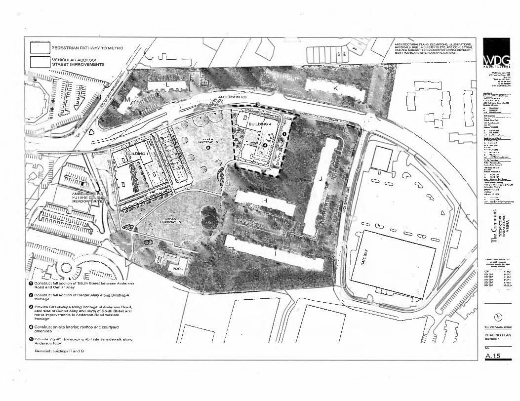
_ ANOVAS(5N RD.
INTERIM
LANDSCAPING
/ARCHITECTURAL PLANS, ELEVATIONS, ILLUSTRATIONS, MATERIALS, BUILDING HEIGHTS ETC. ARE CONCEPTUAL AND ARE SUBJECT TO REVISION VVITH FINAL DEVELOP-MENT PLANS AND SITE PLAN APPLICATIONS.
PEDESTRIAN PATHWAY TO METRO
VEHICULAR ACCESS/ STREET IMPROVEMENTS 1 I
ARCHITECT U 0.E
WIDGA4*, MS Co* A.m. NW
DWI 109 W.,* DC MIN
DI NH lama. L. pt.. 1/n
1..WINAND.an
110* DO. I 144.
C 0 E E 0
-c
15 8 8
1771 4 (>--------
-"--- —If \ an/ Tr-L.
----- I % .S.... 0 Construct full section of South Street between Anderson
Road and Center Alley
Q Construct full section of Center Alley along Building 4 frontage
Provide Streetscape along frontage of Anderson Road, east side of Center Ailey and north of South Street and make Improvements to Anderson Road western frontage
Construct on-site Interior, rooftop and courtyard amenities
Provide interim landscaping abd interim sidewalk along Anderson Road
Demolish buildings F and G
v........01ML.,,CAL LEORNons.1
465011.8 th. SAM. 61L.a..1101111
COP 01.14.11 MY COP 03.31.11 REV CM 03.01.11 OP/ COP REV CUP REV COP
- -
WOOPM.Mla FA"
PHASING PLAN Building 4
A.15

PEDESTRIAN PATHWAY TO METRO ,Ng ARC HIT ECTUI
VEHICULAR ACCESS/ STREET IMPROVEMENTS
Ift,
/ARCHITECTURAL PLANS. ELEVATIONS. ILLUSTRATIONS. 4......)/ o MATERIALS, BUILDING HEIGHTS ETC. ARE CONCEPTUAL
AND ARE SUBJECT TO REVISION WITH FINAL DEVELOP-MENT PLANS AND SITE PLAN APPLICATIONS.
FA t
L
IL
14.14...ix.uue I.0041*.1
14.4.11, .14.17
lettnee.
145
Lain, MM.
• • /01.111.5010
TIM CM.
▪ ox• tent
• NMJNO • 111,11,11M
NorPowsalertAnew
VIA"...44.6.4.191•VIN
FUTURE C. LS MEADOW R
110,10..1,14 M.
NAL. VA LA
mammal
0
O ,t
0 Reconfigure parking areas serving Building I e Construct full section of Main Street between Center
Alley and East Lane
Construct full section of South Street between Center Alley and proposed East Lane
13 Construct full section of Center Alley between Main
th aw
16.1.S.g IA, SA. MG Belmi3O01117
cDP KV COP IEV COP NEV COP REV COP IEV COP
Street and South Street
Provide Streetscape along frontage of Main Street, west side of Center Alley and north side of South Street and make improvements to Anderson Road western frontage as shown
Construct on-site interior, rooftop and courtyard amenities
Provide interim landscaping and Interim sidewalk along Anderson Road
Demolish buildings F and 14
O.. IMO P*11. 'Mew
PHASING PLAIN Building 5
Lie
A. 16
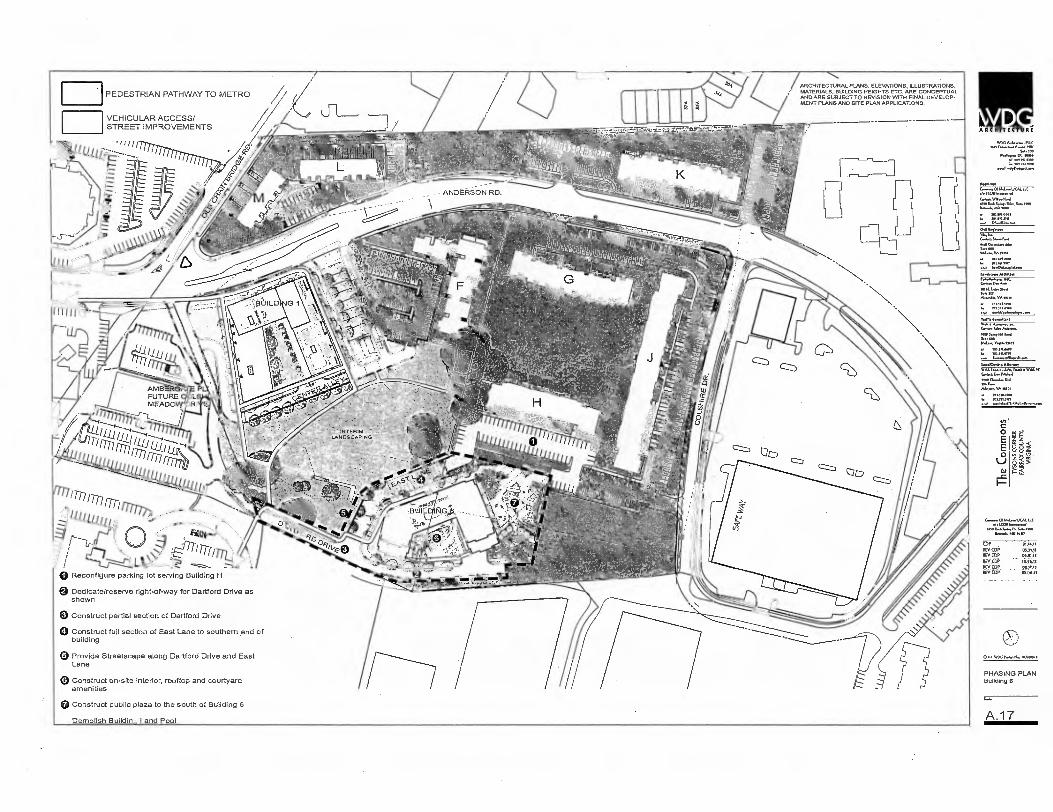
ARCHITECTURE
%We.
6. 1.11.1.11
(611In.Irm
• 703.611, .111111 6. AI 161 fin
from
▪
e oflm MI I*
.v 6L,.wnxrt,Fwn
A■ a... 666, W. 6.114K famt Fr /*a ▪ 0......1161
AA: po:.112...al
(A C
0 E E 0
SI _c
BANN ND 10111
OP . CIA411
REV OP 05.31.1t REV COP MIMI
REY COP - 1640 WPP. _ REV COP 00.06.10
. _.... . . . . .
• WAeXMO
PHASING PLAN Building 6
Sam
A 1 7
8 8 `;'
ARCHITECTURAL PLANS, ELEVATIONS, ILLUSTRATIONS. MATERIALS. BUILDING HEIGHTS ETC. ARE CONCEPTUAL AND ARE SUBJECT TO REVISION WITH FINAL DEVELOP-MENT PLANS AND SITE PLAN APPLICATIONS.
VEHICULAR ACCESS/ STREET IMPROVEMENTS
° INTERIM - 1.AN9ECAP !NG.
(a Reconfigure parking lot serving Building H
Dedicate/reserve right-of-way for Dartford Drive as shown
Construct partial section of Dartford Drive
0 Construct full section of East Lane to southern end of building
Provide Streetscape along Dartford Drive and East Lane
Construct on-site interior, rooftop and courtyard amenities
Construct public plaza to the south of Building 6
Demolish Building I and Pool

ARCHITECTURAL PLANS, ELEVATIONS. ILLUSTRATIONS, MATERIALS, BUILDING HEIGHTS ETC. ARE CONCEPTUAL AND ARE SUBJECT TO REVISION WITH FINAL DEVELO• MENT PLANS AND SITE PLAN APPUCATIONS.
COP . Bill.
REV CDP 03.11. REV (DP IIEVOiF NM, REV COP eel,. REV GDP 05.01 .
Reconfigure parking lot serving Building I-I
Q Reserve/dedicate right-of-way for Dartford Drive as shown
Construct full section of East Lane between Co!shire Drive and proposed South Street
13 Construct partial section of Dartford Drive to Co!shire Drive provided necessary right of way can be obtained from adjoining property
el Provide Streetscape along east side of Dartford Drive. west side of East Lane end north side Colshire Drive as shown
VEHICULAR ACCESS/ STREET IMPROVEMENTS
'Cu!,'
ARCHITECTUI
Sp. 04...5.7..1. 1101..14 ■411
aten.Not
AMB FUTURE MEADO
INTERIM
LANDSCAPING
886
ut
0 E E O
L.) -c
PEDESTRIAN PATHWAY TO METRO
011.4.1.144
Ynd..1411014■
....or*. Immo
PHASING PLAt Building 7
A.18
Construct on-site Interior, rooftop and courtyard amenities
Demolish Building I

RETAINING WALL
C C O
E O
ig 8§1
PEDESTRIAN PATHWAY TO METRO
ARCHITECTURAL PLANS. ELEVATIONS. ILLUSTRATIONS, MATERIALS, BUILDING HEIGHTS ETC.ARE CONCEPTUAL AND ARE SUBJECT TO REVISION WITH FINAL DEVELOP-MENT PLANS AND SITE PLAN APPLICATIONS.
ARCHITECTURE
WM.
Soott.
ERSON RD.
VEHICULAR ACCESS/ STREET IMPROVEMENTS
• I "1 L
sw- um.. D.A. p01.114.91.
wMio. 1w
WA A* la 4.*
3.010.4
III.Aanasen.a
• I.. 64, 440W It we 6.10.41
10
▪
. nitel
m3n.m• 4. Imo m.
n ,61,>\ Reco
▪
nfigure parking lot serving Building I
Provide streetscape along frontages with Anderson Road, Coishire Drive, and future South Street and East Lane where shown and make improvements to Anderson Road western frontage and Coleshlre Drive northern frontage
Demolish Building G, H, and J
COP 111.14.11
REV COP ME. WE COP 0E3111 REV EV 15,0,11 REV COP RV CDR . .506.11
e_ OOSP 16.04•
PHASING PLAN Goodman Field
Lie
A 19

PEDESTRIAN PATHWAY TO METRO
VEHICULAR ACCESS/ STREET IMPROVEMENTS
0 Reconstruct median on Anderson Road
Provide streetscape along Anderson Road and Old Chain Bridge Road
/ARCHITECTURAL PLANS, ELEVATIONS, ILLUSTRATIONS, • MATERIALS, BUILDING HEIGHTS ETC. ARE CONCEPTUAL
AND ARE SUBJECT TO REVISION WITH FINAL DEVELOP- MENT PLANS AND SITE PLAN APPLICATIONS.
0 E
0
—c
g4e
Appliteni r.— U2'
65.14.1. OA*, NO /via
▪ 3e1.9,370
Ito ▪ Wulf.
'81
1,..61.koome
Ina SI,. MA S. NO
.
▪
"'""
1,646tl“1.47604 ■VJ Clore
VA MI
▪ 107311.4700
4•■■•011.x..../11.14 LOORImal
4.8 SyantD, 11.1.11.1.10.1
COP 01.14.1
REV COP 03.31: REV GDP 65.21.1
Rev MP 16.34,. PEV CDP O113.1 REV COP OS...
ARCHITECTUR
NV.
toti„ „
pr vo. N.,. Sews
PHASING PLAN Andersen Perk
A.20

C O rr O
88x
AERIAL VIEW EAST
THESE PERSPECTIVE VIEWS ARE CONCEPTUAL IN NATURE AND ILLUSTRATRATIVE ONLY OF THE GENERAL CHARACTER, SCALE, BUILDING MASSING, GENERAL LANDSCAPE/STREETSCAPE TREATMENT AND QUALITY OF MATERIALS FOR THE PROPOSED DEVELOPMENT. THE SPECIFIC DETAILS OF THESE ELEMENTS, AS WELL AS OTHER BUILDING AND LANDSCAPE DESIGN SHOWN HERE THAT HAVE NOT BEEN ESTABLISHED ELSEWHERE IN THIS CONCEPTUAL DEVELOPMENT PLAN, ARE SUBJECT TO REVISION WITH FINAL DEVELOPMENT PLANS.
ARCKITECTUR1
1444.1044.414.41444114. 1.13 44.444444,44.4.4 RAC
541. o.. De 1.616
4A IMMO. 1.4 101 4.1.M
04114,14414
;Zoo,. WM
• 3.1.441..90
• VA MO
14.441aIng vo4V4-G1444,444.44,44744.44414E 44,444 1.4411•4444.41 MO0. 11141
VA IMO,
▪ 101311.0.
COP REV COP [MAIM REV COP MIL II REV COP 10.44,11
REV COP. 04.15.13 REV COP OS.00.13
0•4 W140 114: WAMOM
PERSPECTIVE
Sae
A.21

a
E E O Cl
F
01.1,11
o■Asol. neem
COP Nee COP REV COP REV COP REV COT REV COP
ARCHITICTUR/
Of -"Tkk-Tkr—' • LCO4 Lamal
Ihrk..1410.0 Iota
1.197.pool aol mr..3
ux 6,1101t*
6560 5.111... 0710 114.6.1.10
C. WM 1.1.111., WAOloo
PERSPECTIVE
A.22
AERIAL VIEW SOUTH
THESE PERSPECTIVE VIEWS ARE CONCEPTUAL IN NATURE AND ILLUSTRATRATIVE ONLY OF THE GENERAL CHARACTER, SCALE, BUILDING MASSING, GENERAL LANDSCAPE/STREETSCAPE TREATMENT AND QUALITY OF MATERIALS FOR THE PROPOSED DEVELOPMENT. THE SPECIFIC DETAILS OF THESE ELEMENTS, AS WELL AS OTHER BUILDING AND LANDSCAPE DESIGN SHOWN HERE THAT HAVE NOT BEEN ESTABLISHED ELSEWHERE IN THIS CONCEPTUAL DEVELOPMENT PLAN, ARE SUBJECT TO REVISION WITH FINAL DEVELOPMENT PLANS.
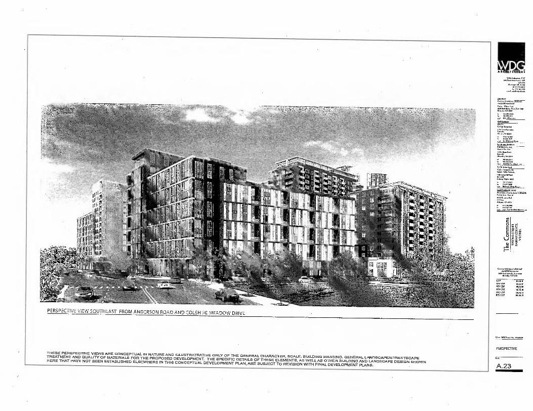
ARCHITECTULL
SO. le,
W'71111■'nnT, tof40
AM.*.
1.00114..pue.4
d.1,61 uu. nu.
• larM.1700 ,
▪
M.S17.3107,
.41.CORInecuumul ....,■••• Dr. Sao Ma
14.1uuly .1010
COP 0134.11 REV Cop 03.21.11 REV COP 03.41.11 1100 (OP. ..64. REV COP 0.3.13 REV COP 05..13
0 u. 413G0upeu. W00.01.
PERSPECTIVE
A.23
C
0 E
0
t 8 0 z
ha s
PERSPECTIVE VIEW SOUTHEAST FROM ANDERSON ROAD AND COLSHIRE MEADOW DRIVE
THESE PERSPECTIVE VIEWS ARE CONCEPTUAL IN NATURE AND ILLUSTRATRATIVE ONLY OF THE GENERAL CHARACTER, SCALE, BUILDING MASSING, GENERAL LANDSCAPE/STREETSCAPE TREATMENT AND QUALITY OF MATERIALS FOR THE PROPOSED DEVELOPMENT. THE SPECIFIC DETAILS OF THESE ELEMENTS, AS WELL AS OTHER BUILDING AND LANDSCAPE DESIGN SHOWN HERE THAT HAVE NOT BEEN ESTABLISHED ELSEWHERE IN THIS CONCEPTUAL DEVELOPMENT PLAN, ARE SUBJECT TO REVISION WITH FINAL DEVELOPMENT PLANS.

ii i" II i ii P. i i r i ernzi, i ii Phi 1 ia law .,
r f, r!ii. i II :=, ,,.: 0, 11 ,,,qprith41 ri: , , ,....i r5 1 IR
n. k II ,PU-av, N ; ii W WI -'-' , i i'Ill ,ti rzww!,:i i PI 16f' ' r
1,.. ,bitI,_,,WI LieIRKI , ii W ii I -11! n 7 . rrri3W *;F!:j IET'A N hi i PP S? ; 14: 1
rill r l'ISMWT,WW9r..5 55" 5 55 r !PW go.-. 1.. , , -Iimilmiri iii i 35 i Ei Tit
15 ,:5 55 I 7!"trwii 7t
ily ffri 5: I :I i ri "xirr I li CiuMil N , 5 15 I ti 7,T,"
ton FkommTir 6 15 i ium . 1 iii i'4 -mra's 1' ,51 1 15 5 -
,I ii 5 ftiffW,ii,:, 105 III -1. TN I WITMS:rli " 1 W N E I 141 II i ANT!..kii'.!1.1ti i co.
111 NPIMCE31-11111:,1 11 -
1
II ietiln ii 'i'iil I
r
4,14,1, _.
PERSPECTIVE VIEW SOUTHWEST ACROSS GOODMAN FIELD FROM ANDERSON ROAD
THESE PERSPECTIVE VIEWS ARE CONCEPTUAL IN NATURE AND ILLUSTRATRATIVE ONLY OF THE GENERAL CHARACTER, SCALE, BUILDING MASSING, GENERAL LANDSCAPE/STREETSCAPE TREATMENT AND QUALITY OF MATERIALS FOR THE PROPOSED DEVELOPMENT. THE SPECIFIC DETAILS OF THESE ELEMENTS, AS WELL AS OTHER BUILDING AND LANDSCAPE DESIGN SHOWN HERE THAT HAVE NOT BEEN ESTABLISHED ELSEWHERE IN THIS CONCEPTUAL DEVELOPMENT PLAN, ARE SUBJECT TO REVISION WITH FINAL DEVELOPMENT PLANS.
ARCKITICTUR
IV013,17*,11.
LIORIanorn■ ra,/74.1-1.1 KM LA 5,, 0, Sdo Inv Lt6u4. my law
0.1111nOno.
Melan.V.1
6,, ohs
th.ORIntsrmaNd
few w.
COP REV COP REV COP IS COP 10.P6.
MSOP . . REY COP
o» WIJG No WA,
PERSPECTIVE
A.24
Th
e C
om
mo
ns

0 E E O
lJ 0.1
886
t a =I 1"1- i ij . 17 111114 IJ
I 11-11-11
41 TVILI - ;vitw
‘,7,tir-ti'l It. ' EN I 1 IT.;717N1'
PERSPECTIVE VIEW SOUTH ACROSS NEW ANDERSON PARK DOWN MAIN STREET
THESE PERSPECTIVE VIEWS ARE CONCEPTUAL IN NATURE AND ILLUSTRATRATIVE ONLY OF THE GENERAL CHARACTER, SCALE, BUILDING MASSING, GENERAL LANDSCAPE/STREETSCAPE TREATMENT AND QUALITY OF MATERIALS FOR THE PROPOSED DEVELOPMENT. THE SPECIFIC DETAILS OF THESE ELEMENTS, AS WELL AS OTHER BUILDING AND LANDSCAPE DESIGN SHOWN HERE THAT HAVE NOT BEEN ESTABLISHED ELSEWHERE IN THIS CONCEPTUAL DEVELOPMENT PLAN, ARE SUBJECT TO REVISION WITH FINAL DEVELOPMENT PLANS.
W.A... DC nos IPM17 to, 4e,:s.
ApplInel
DDO Sp”:"..D,S..1.1110
EEE._
'1■731:1.777 Inte0.6...7.1...1
pry D.D.1.51.40
IV. Co. Will I Am.,.
In* 5.,1•114,
A14.....611101
lawl/IDDIns ADM,
TIPOO*01.1
M....VA MCI
Com.. 011... MM. LLC do MOD Imml
11,4S.,0.5......la 11.0.44.14D
COP 01.14.11 REV bp 03,71.1, REV COP .1l REV cpP VI:i! IlEi, COP PP,O.11 REV COP 0,00.13
o••• YOGI,. Nos W.W.I
PERSPECTIVE
A.25
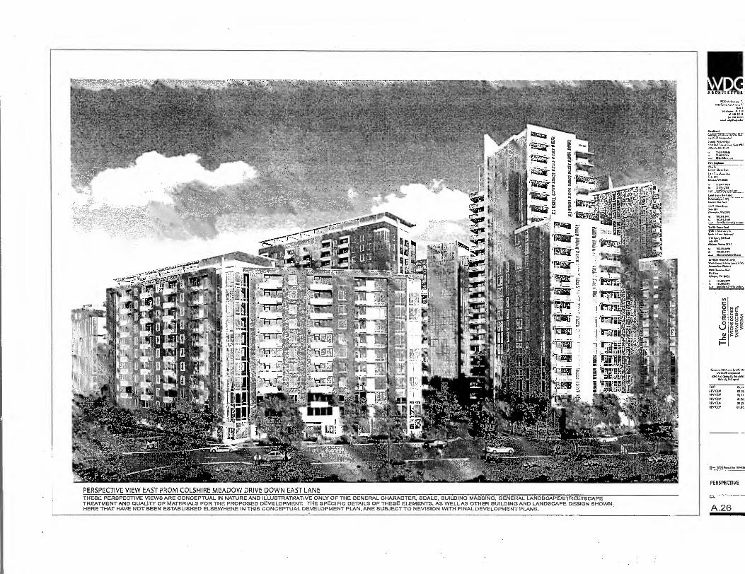
ARCHITICTOK
Aan*,
SAI
--rzg
Arpiloof
I. LCORhwwM Ca ...Hod 1301.4 Sat.,
Boa MO V.
FEE
111
O
E
_c
01.1.a.01.1.1 do LEM a
.a,
03.1011 IN,Sa.Ht ■ 14.40.111 tem
COP REV COP REV COP NOV COP I0.16, REV COP og.O. REV COP 04.04.
0.. WOO PoRelnx VON.
PERSPECTIVE
A.26
15
PERSPECTIVE VIEW EAST FROM COLSHIRE MEADOW DRIVE DOWN EAST LANE THESE PERSPECTIVE VIEWS ARE CONCEPTUAL IN NATURE AND ILLUSTRATRATIVE ONLY OF THE GENERAL CHARACTER, SCALE, BUILDING MASSING, GENERAL LANDSCAPE/STREETSCAPE TREATMENT AND QUALITY OF MATERIALS FOR THE PROPOSED DEVELOPMENT. THE SPECIFIC DETAILS OF THESE ELEMENTS, AS WELL AS OTHER BUILDING AND LANDSCAPE DESIGN SHOWN HERE THAT HAVE NOT BEEN ESTABLISHED ELSEWHERE IN THIS CONCEPTUAL DEVELOPMENT PLAN, ARE SUBJECT TO REVISION WITH FINAL DEVELOPMENT PLANS.

LL rippip..11P,; 1:RL , iiwriE' -1111. :r..1.. 1 Ilirril:4Tit'i*7-0'. iTil LI
I I! ! I
0,111i, NI:•, I.' cif -,-„ _ • :•--• ff, , ELI"' I 'i ll] ii.11 ri.. . ,:; ( iLl H ,Af;.. .. 'III iic
--•:,' -;.irit q - Iiiil .,, ''
1.1,AL1. 1 -
PERSPECTIVE VIEW WEST ACROSS GOODMAN FIELD FROM COLSHIRE DRIVE
THESE PERSPECTIVE VIEWS ARE CONCEPTUAL IN NATURE AND ILLUSTRATRATIVE ONLY OF THE GENERAL CHARACTER, SCALE, BUILDING MASSING, GENERAL LANDSCAPE/STREETSCAPE TREATMENT AND QUALITY OF MATERIALS FOR THE PROPOSED DEVELOPMENT. THE SPECIFIC DETAILS OF THESE ELEMENTS, AS WELL AS OTHER BUILDING AND LANDSCAPE DESIGN SHOWN HERE THAT HAVE NOT BEEN ESTABLISHED ELSEWHERE IN THIS CONCEPTUAL DEVELOPMENT PLAN, ARE SUBJECT TO REVISION WITH FINAL DEVELOPMENT PLANS.
ARCHITICTUR•
WOO IOC
.4.4 DC non 141 /01.1000
X. nn
01144.
4/41C0/114.14.1
*4040 tun
34.1.001
PIM Inenon
rn. /00 Mal.VA10101
Lanntspe NOM.
141,1,144.4.1 3.14
0.4110111 /01.10.61“
Lenlnann/011.44 41.
nee .141
Into
C....011.1.4.1.1CAL 4C ./.1.00141.4.441
MOW 4.72,jggone
COP 01.14.11
KV COP 03.31.11 REV CDP 03.111.11
KV COP 10.116.111 REV COP Of REV COP 05.00.13
OP. WOO Pni..14 W00100
PERSPECTIVE
44.
A.27

ARCHITECTUR
504 1
16...16
,7617.1a g al .1.1.100.16.60.0.4 1.666.1160...
Rwen4. 0*,
0•1111no*
Ownot«...• Say NO
VA23101
....W. mot
ton... AU., fri.caZ
Cl....114.1 0 , 16.1
11105
C CO
CL
O
.1. I.COR lommito-1 6110146111,61.,,11 ..
0.06.1.. 10110
COP REV CDP REV COP REV COP REV COP REV COP
0.• WM N. Nys WARM
PERSPECTIVE
A.28
LZ
EL '11 U441,
rti
PERSPECTIVE VIEW TOWARD SOUTH PLAZA THESE PERSPECTIVE VIEWS ARE CONCEPTUAL IN NATURE AND ILLUSTRATRATIVE ONLY OF THE GENERAL CHARACTER, SCALE, BUILDING MASSING, GENERAL LANDSCAPE/STREETSCAPE TREATMENT AND QUALITY OF MATERIALS FOR THE PROPOSED DEVELOPMENT. THE SPECIFIC DETAILS OF THESE ELEMENTS. AS WELL AS OTHER BUILDING AND LANDSCAPE DESIGN SHOWN HERE THAT HAVE NOT BEEN ESTABLISHED ELSEWHERE IN THIS CONCEPTUAL DEVELOPMENT PLAN, ARE SUBJECT TO REVISION WITH FINAL DEVELOPMENT PLANS.

O E E O
lJ
_c F-
zi 011
PERSPECTIVE VIEW DOWN SOUTH STREET TOWARD SOUTH PLAZA
THESE PERSPECTIVE VIEWS ARE CONCEPTUAL IN NATURE AND ILLUSTRATRATIVE ONLY OF THE GENERAL CHARACTER, SCALE, BUILDING MASSING, GENERAL LANDSCAPE/STREETSCAPE TREATMENT AND QUALITY OF MATERIALS FOR. THE PROPOSED DEVELOPMENT. THE SPECIFIC DETAILS OF 'THESE ELEMENTS, AS WELL AS OTHER BUILDING AND LANDSCAPE DESIGN SHOWN HERE THAT HAVE NOT BEEN ESTABLISHED ELSEWHERE IN THIS CONCEPTUAL DEVELOPMENT PLAN, ARE SUBJECT TO REVISION WITH FINAL DEVELOPMENT PLANS.
ARCHITECTURE
'"t"'d 10117TO: 4..• 441
t.'2730 610.03DWU--
66 5. 566.0 046 5.65.130 141.J..
4.1m1 V1.4
" 6151.516 VA 030
701...71c ■ 4. 7,17.11 .1
tanalespe Araleltd
11.6.54.0
7.311.11,113 .3.30.ena
1•.61/16561, 011arnwr 16.66653.011.1.60 36563 W53105
n'a70:""351/7".06/4 ru.
6.1365,0
701.3eFlirr 056515,6051,5611,6.6..
en.11.1 5, Du 5.4.1.1.- .6561.10
(UP REV q.-.. 0531,11 REV COP
RTYWP :1;11 REV_CD0 033535 REV (DP 05.06.13
0"' WOG Wronm
PERSPECTIVE
A.29
ARCHITECTURE
MIC RiC ins
61 /%171.:7:17(Alli.r.' el•LCORImarnmed
051,011.A. 00.0. ■ 1111 B./..6.1A0 tem
101.1101,..01
-6
Valk fanualtsnl
re A.a
"Ada.v.atv et
74,1`,11: Londlteming um WW, r..W. • WAI C....betrAdvi
L., VA OW
lo...0011
.517 .11.
C O
E O
_c
6 88z
s
ggY
MAL 1.1( do !FOR 'mod
Yrnd41.10
CUP 01.1431
itetcop 0531.11 REV COP 0,[1.11
PIVCDP 10.4e,i4 REV (DP REV CDP 0s.oe.13
0, `11.00N.11.11MOSen
PERSPECTIVE
PERSPECTIVE VIEW DOWN MAIN STREET TOWARD BUILDING SIX
A.30 THESE PERSPECTIVE VIEWS ARE CONCEPTUAL IN NATURE AND ILLUSTRATRATIVE ONLY OF THE GENERAL CHARACTER, SCALE, BUILDING MASSING, GENERAL LANDSCAPEJSTREETSCAPE TREATMENT AND QUALITY OF MATERIALS FOR THE PROPOSED DEVELOPMENT. THE SPECIFIC DETAILS OF THESE ELEMENTS, AS WELL AS OTHER BUILDING AND LANDSCAPE DESIGN SHOWN HERE THAT HAVE NOT BEEN ESTABLISHED ELSEWHERE IN THIS CONCEPTUAL DEVELOPMENT PLAN, ARE SUBJECT TO REVISION WITH FINAL DEVELOPMENT PLANS.

kg"ARCHITECTURE
5.1, lea
App//unt utni. LLi
• ""° 7ol.”7.11e01
[IA 4.1mer
Mu.% VA met 701.1031011
Landlrap ■ Alt141.1
Ton CaneAsnl
toan:
AS:10:"*"' Nr1.1110.
;:;•Z'r" Lanirlani, WA), L.MalAY,In.d.WarC
rt tZ VA mot
C
0 E E 0
~v CV O
.1. MIR** 14e■ Sr*. Saw me 26.0.6. 1.0 /220
COP M.I.111 REV COP 0511.11 REV COP 0511.12 REV CUP — Iiii . .
REV COP 01215.0 RV CDP 01.06.11
.. .. — _ . — .....
WM".
PERSPECTIVE
A.31
PERSPECTIVE VIEW ACROSS ANDERSON PARK FROM OLD CHAIN BRIDGE ROAD
THESE PERSPECTIVE VIEWS ARE CONCEPTUAL IN NATURE AND ILLUSTRATRATIVE ONLY OF THE GENERAL CHARACTER, SCALE, BUILDING MASSING, GENERAL LANDSCAPUSTREETSCAPE TREATMENT AND QUALITY OF MATERIALS FOR THE PROPOSED DEVELOPMENT. THE SPECIFIC DETAILS OF THESE ELEMENTS, AS WELL AS OTHER BUILDING AND LANDSCAPE DESIGN SHOWN HERE THAT HAVE NOT BEEN ESTABLISHED ELSEWHERE IN THIS CONCEPTUAL DEVELOPMENT PLAN, ARE SUBJECT TO REVISION WITH FINAL DEVELOPMENT PLANS.
0
E E 0
BE
f
2 41 P
11..4140
03.31 COP REV COP REV COP REV COP REV COP REV COP
Ie.,.
05.00
ARCH ITECT
SIX STORY OPTION
La.
A.32
itt0-4
iiirole Ow/A
‘1004
AERIAL VIEW EAST THESE PERSPECTIVE VIEWS ARE CONCEPTUAL IN NATURE AND ILLUSTRATRATIVE ONLY OF THE GENERAL CHARACTER, SCALE, BUILDING MASSING, GENERAL LANDSCAPE/STREETSCAPE TREATMENT AND QUALITY OF MATERIALS FOR THE PROPOSED DEVELOPMENT. THE SPECIFIC DETAILS OF THESE ELEMENTS, AS WELL AS OTHER BUILDING AND LANDSCAPE DESIGN SHOWN HERE THAT HAVE NOT BEEN ESTABLISHED ELSEWHERE IN THIS CONCEPTUAL DEVELOPMENT PLAN, ARE SUBJECT TO REVISION WITH FINAL DEVELOPMENT PLANS.
11R ARCHITICTUR.
,
M1C
5.144 DC
41:35014
0.11Rash. 10.1.
▪ 12/ ATM* • 1.1•1 T.1 1.0011.....
01.11rel
1.1
a 01 10.0
I:.
1.01.00101..7 AC
me 0..414
nom.vninol
C
OT _c
64...1.10
COP 01.14.11 REV COP 00.1134
1!0!.91! 0111.11
IO U 10.-i11,.0 R0,/ c00 OR.11.0 REV COP ........
M000.11. 10.0045
SIX STORY OPTION
A.33
8§i
AERIAL VIEW SOUTHWEST
THESE PERSPECTIVE VIEWS ARE CONCEPTUAL IN NATURE AND ILLUSTRATRATIVE ONLY OF THE GENERAL CHARACTER, SCALE, BUILDING MASSING, GENERAL LANDSCAPE/STREETSCAPE TREATMENT AND QUALITY OF MATERIALS FOR THE PROPOSED DEVELOPMENT. THE SPECIFIC DETAILS OF THESE ELEMENTS, AS WELL AS OTHER BUILDING AND LANDSCAPE DESIGN SHOWN HERE THAT HAVE NOT BEEN ESTABLISHED ELSEWHERE IN THIS CONCEPTUAL DEVELOPMENT PLAN, ARE SUBJECT TO REVISION WITH FINAL DEVELOPMENT PLANS.
0
LI
-c
ffi
o
THE PLAN AND IMAGERY SHOWN IS CONCEPTUAL MD MAY BE MODIFIED SUBJECT TO FINAL
DEVELOPMENT PLAN APPROVAL
AVIC.n..1.1.(e/ACOAdm Mi. !
11.11,0.011041,
• WC N.M. WM...
ROADWAY SECTIONS
N.T.S.
L-0(
ARCH IT ICTUAI
WOO A.O.n.o... PUG Can.m.A....
Sael. VI.* DC .06
.1.1 OW ON folASMO
.m4 '40.4.4..
AnWant
▪ LCCI.lespaMei
4710Itia
• gamyy,apn
lamnaqin. Aber, • C.-aleeliaad.ybrald ■ Waid
MOO*.
AA.,.0tnneem

PI1 ID •RCHITACTUA I
KEY PLAN
WOG An.lArenn,111, NV/
Moto
NN +41.401.44.4
(mne.0011.....,(11./LC 44.1.11.44 411111.411a
NO NM
• 4.80.4.64
01111#1- <tem me 04.1. a.
• VAMM
LEL-
WoMr.d.aLa4./.., ANY. I, 4a. RAM..
OOP, VA. MOI
a 7...4
• • • • + + + • • • • • •
• • • • • • + • + • • • + • • • • •
• • + • • • • • • + + +
• • • • • • • • • • • • • •
• • • + • • + • • • • • • • + •
• • • • • • • + • • • + • + • • •
Beg E E
LI
+ + • + • • • + • • • • • • + • • • •
• • • • • • • + • • • • • • • • • • 1 • • • • • • • •
• • • • • + • • • • • • • + • + • •
• • • • • + • • • • • • • • • • • •
• • • + • • + . ••• • • • • + • + • 4' •
•• • • • • • • • • • • • •
4 +++ +++ + • • • +
• • • • • • • + + • • •
• 4. 4 • • •
• • . • / MUM,. MUM.
1.010,04.100 IONE
WAmo
THE PLAN AND IMAGERY SHOWN IS CONCEPTUAL AND MAY BE MODIFIED SUEUECTTO FINAL
DEVELOPMENT PLAN APPROVAL
ROADWAY SECTIONS
L-01

C m.
Wax., OC hl MM. L. 1. MI
Ana
Cd balm WO.
kw Md.. vAaaw
701.11.01
iddRacd. NC.
tv.=
LLCM...Q.1 WORM Q.
W, 40 WO
2 ANDERSON ROAD SECTION @ GOODMAN FIELD vr
THE PLAN AND IMAGERY SHOWN IS CONCEPTUAL AND MAY BE MODIFIED SUBJECT TO FINAL
DEVELOPMENT PLAN APPROVAL
Wo0
ROADWAY SECTIONS
s.,+;14, T.S.
1-40!
C O E E O lJ
4.1

THE PLAN AND IMAGERY SHOWN IS CONCEPTUAL AND MAY BE MODIFIED SUBJECT TO FINAL
DEVELOPMENT PLAN APPROVAL
ARCHITECTU R.
VT.
380 oc roe la
ea MR 21743. la 4.53.■
•
G
▪
aana1.4.1 4.01...Wan ISMiamtane Bain.141/016n
▪ 3.07401,1 fi.
04 Wow
annamn to. we
tawalurn
■:47.rc74"""--. Waa. ■ aPt
e g
0 • NX114,04. Whom
ROADWAY SECTIONS
so. WS.
L-03
E 0

OVERALL PARKS PLAN r PRIVATE ROOF DECK
8,450 .1. PRIVATE COURTYARD TERRACE PRIVATE ROOF DECK PUBLIC PARR 26,250 8,450 sf. 189,535 sf.
:11.f2 (*AIDA
PUBLIC PARK 24,950 al.
PRIVATE ROOF DECK 7,900 st.
PRIVATE 2,300 sf.
PUBLIC PARK 1/44 148,520 sf.
PRIVATE COURTY 7,250 15.
PRIVATE COURTYARD
") 'roma 0 9,950 A,
L' THE COMMONS PARK SPACE PROVIDED PRIVATE ROOF DECK 7,950 IL
PRIVATE COURTYARD TE 14,750 sl.
PRIVATE ROOF DECK 5,250 sf.
PUBLIC P 7,950 sr.
Public Pad, Space 394,395 sg.ft.
9.05 or.
74,500 sq.R. Neese Courty.rd Terrace Space 1.71..
11400_9,11. Private Roof Deck Sp.,. 103
Total Public Parks 9.05 ac.
Total Privec Pads ......— 2.94 ac.
Recommended 6.53 ac.
Public Park Surplus +2.52 et.
PRIVATE ROOF DECK 3,950 If.
--- PRIVATE COURTYARD PUBLIC
DAR:TFORD OR/VE TER arCE RIVATE ROOF DECK ,15.6_!.
PRIVATE COURTYARD TERRACE 7,550 .1.
THE PLAN AND IMAGERY SHOWN
IS CONCEPTUAL AND MAY BE MODIFIED SUBJECT TO FINAL
DEVELOPMENT PLAN APPROVAL
C O E E O
-c
884
r
♦ RCNITICTU
MS***
V SA
v__
wral .4.4m
rra... 114•007
▪ a....h.ra /MN. Moon MINN • MASAO.
.4+
OM Cowmen 1.1C LCORI., .014, Nw.13.
1.4=1.10 01•9
0.4 WOG hy,Is< .A.
OVERALL PARK PLAN
L-o,

OVERALLTARI‹ r- PRIVATE ROOF DECK PRIVATE COURTYARD TERRACE / PUBLIC PARK SIX STORY OPTION
,,-- - / 8,450 f 46350 of 189,535 If. .... . • ' • 14.0.414 . wiewir 1,r0 . .,, t . ,. , . , . , ts% r.......4106..__,, ....1 v4fjpium.' . or0, FF,,,....V...',
PUBLIC PARK --- 24,950 4
PRNATE ROOF DECK --.--..t 7,900 5(.
PPJVA - = \10,3; 2300 4.
' •■INIV. #Ll'ult .. ..,..-1........'",-- 4, --
VA, .. - 11.. '',...., . tt.''" - igar''ISft 1111h A 'fr ' -ii,. ) Viesue aro r,,,,
1.
. ,....,.4 , "?p.i.46.20,0 ' . osizof
i . ' P r' 47 ' 6 oft. liei,, r.,„*.- ,4f.r., -, ,01,freiN Aik A ,, 1-. 1, .., q,L., „ - 't", ' %, - r , , '"4111116. I (A, .;
),, .„-- 01 , ,.% .,..0 . # _ . 0 ,,, ...., • ,,,„ ,,,,,., aim,
-----,&,,,' P .14,9, - c-- --...8 „ 4 , 4
„ • ,e, . --t .0, 0 6, A . • i - • ' ' sa ' *
AlfIf "t'' ,,, -- ....Q-- *SI r -',-- --, tv . 4. 0 A ° .„,,... aLl's ..„ 11-
, k ,A.,
t:Iiii ■ ' / ' 1 ,
j ) r N so ,
41.2"-:. .",,1 11:- ',4Ett. .., 7 ....e. ...7:=. 1-4‘* ;'''4' , - ''''''''': -44' Iv li+e)L. ' j,-g 0 sot;
t i' - ' ■ t; . , , log ° .• . Is,-, •
, n ,-1- ,, , 4- $ - . e . '.., , . ,7, , ..... ._
1, BUILDING #4 /'i ■.-• 'tsIT
1.:
UILDING 3 .,,,...„,_, k - . A, 44°411. -1. I
• II"'N7',. ;'0 ''. .z. 4V ....._______,./,, ri 7,F., I It., ,,,, - . i 1 l'i' ,, . , _ . . ..,.I'''■-- ........... . . . . . . . . . . 4 t . ,
....,,;--, 10, 42,- 4. ' 'i■o ■ '4 ei
-;-,1.c.- ..."-;''''''''' + sr
- • ,..1; ,er."" '1 ‘I'X'0"--. -1 • i' 15( - to 4 ift
lii4''''' "46.1(41* 5#1i, .„-- -011 vz - ;* V ' '-? - ,,t, of, 1 * ,•, ■ ',r. ,w, -p,, - : .,-,
Y 440.0m e° ' ' 4, , _..2174, , -;+.-.; ' *IP
'''•'-- le Tki 0 1 14\ 1 \ 11.1 VP , $• . 14.t. ..,e 40",40
t 13U ,,itt tt •.4.,109 vr . , ": A
.t.eio ft 4 .4.. ... it \ --- .- • -'-‘ 0 ila'at * , ,, Ve .14.
- OP . 01'4% , , g
o
Oi
0 ., . r IP Igl s . '61 r f ' „ .. ..111.1 . 'r:,.„„.
...' 7,,-; : 4:ir '4 .4:-. ti '' ‘k ,, 4 7r": ' we .. N it 41V W;14.M.*44. cl li .., ,,, ,4.1i,l, k
,sL ,, II .....,... k, et • r, ,. 7,;; ,, ,,,..,
,.., 4.1 is. JX,' . .r
\ 1...., 1 , „ , ' -,\,.., . , , f-v 1 ,.., lc .4 ' 0 -.., ffr ' 4,., 4, • \ OP UV' 1 In' - 4, ' 2', ,A,,,,4,42: B 'lr .., UILDING w (,-, 011 A p posit ip Z ., , 7 \ t. .5 • al 4" .°,
' ,7, I PUBLIC PARK
it er. , 0 r4rs"" .iis Op ,01;., +.., 1,,, it 14@,520.1. PRNATE COURTY
-1V ""' • .; __ Vilk ̂ etA, ,,,. 11,.. p, ,
7 .250 sF. \ : qt
'°-- - .I A ..,, .). 1 fliP t r„• ni, ,,,,; -- ip
Ur ,i, Op , T E COMMONS -PARK SPACE PROVIDED g.t6„.- '-% 0
,...1, 62. , ,,
., ‘3 , *VI 6 1470-"r,.
A.7 ,„.,,,,i ( 4+
' , b fril
W., ''' ....r y, im agi , ,1111 fr, e .". : PRIVATE .-- CD-to v ,v
I®. , COURTYARD p...,„.d, sp.“ .... ........... 194223-.Jha.
i i, , an „..,n TERRACE 0 ilk . 4. = , 117,0 .r ) liff ' 9,950 ,f. 74,500 =O.
,• . .vt,--- . .......45 !-. = I 0j., - OW , Ptivata Comuyard Tame Sissat ...... ...... 1.71.c
r ' ""'-'-----''''-'.....-77"--- .--j -- . . . ,,--,-, go 75.011.11LYA .; ,..7,. 0 .i.' 0140" . ---
...., , .___.
......- 5 PRIVATE COURTYARDTh RACE f. i` \ '1110111
/ .....* PRIVATE Pink Red Dade Spa. ........... ....... 0.15 se. ROOF DECK e41.-.. -, gib.
0
Tho,_ %,°e.--iow- 14,750 sr. Vicr v.- 7,950 A. . ; 4,44, 2
- t. ■-a at 1., Total Naha Pub 9.05 az.
e 4 Al. .91P, ,-. ,- Total Compraheruivo P.flt Spa" 1158 az. PRIVATE ROOF DECK 111 ......an ,... beet • ,, %- SAW sf. • lt, 106.-7), 5%. , . " . 41 14", , _ ' .0
..' ' :6 Ole ,,, . I Camp duns. Plyllteammendstion, rat IA. Pada
/
VP. /4 BUILDIN _.
' PUB et, *to , 7,950 A 4itk, f - #6 .01
if . , .
I
160 ioul WI,X 1.7 milieu= = 7,671 population
.5 my pa 1,000 Inidenis = 5.50 suss
• ►
.... I BUILDIN q ffi' , ,...1.,,„,,,,,. i #7 .e
e° 1 r';1 tPA
1.̀ t',,,,, , r _ '14iiik:404 ....1, 49 . ... , _
Recamm enelcd. 5.50 um IMAziu.kbuistsk_9_,5_-•-am PoRlAc Pak Surplun .3.55 aues G
' 0 • . , ti ,f2..f 0 ,9 49 0 Av vr piaRIVRAZECO V5rARr'LliP.
.
PUBLIC P - )i
250 4 ...-._
). - -_____,-----4130-4 PRIVATE ROOF .. - --_---______.....„. --- - ... ^,-.. THE PLAN AND IMAGERY SHOWN nrci 3,950 J. PRNATE COURTYARD TERRACE-
IS CONCEPTUAL AND MAYBE SUBJECT TO ANAL
7,550 8F. DEVELOPMENT PLAN APPROVAL
kRINARCHITICTUR.
W176,61.n.... TUC
5.6,1tra OC
20/161.66
■10.""*". AL, (411101
yaws, 06.061
A.
r■Ve".""' N .e vn
or* 11.604...ruesn
.11k two06141
..11.0.6=4.
1.11,or
11161.606
O E
CDP - 01.11 IL SDP_En.60500._ 01.31,11. OPARY1=0114_ 01.1141 OP..01eA7/114_ 9110.11 OP (Rahmnt.9_ Ana SQ1911141410,1)._ 90,19.11 g7t04 1.1,51/0.. 0111.11 SDP Ign=anlY/D 9161,g
OVERALL PARKS PLAN - 6 STORY OPTION
L-05

CIRCULATION HIERARCHY PLAN
ti
PRIMARY ORCULATION
SECONDARY CIRCULATION
TERTIARY CIRCULATION
,J,ZN'if-A.t.A;9715:7D11:14-711;:"\:-- "
---,.
• . THE PLAN AND IMAGERY SHOWN
IS CONCEPTUAL AND MAY BE MODIFIED SUBJECT TO FINAL
DEVELOPMENT PLAN APPROVAL
k ARCNITICTII
IMO 10154...1Ams.
ono
M.% VA NM
rytt.7" '4 mol
;744.,
o E
8g
E o o
• cu
1—
0.. MO Ned.. WAS
CIRCULATION HIERARCHY PLAN
L-01

ARCHITICTURI
WOO A...eta, PlIC
DC terns 1. 01.37 ewe
C 0
E 0
Li KS
I-
n=a5iZ,17' CDR_ _ 0144:11 OPIRIths4N11_ 91.3111 MiIRS_ 51A11 KRP uS ORATE ERE (EL. MAR
(RmI700- AMA 01.044-4-- , - AMU CP1.&•.449_ 91.14,15
CIRCULATION PLAN
5.611 1.50 .0
L- 07
E.< Bez .
CIRCULATION PLAN
r KEY
PUBLIC SIDEWALK • O W MIN.
''**3,117picr64'10t5T‹ 1:4417
I an tam PUBLIC SIDEWALK • 6' W. MIN.
EXISTING PUBUC SIDEWALK.
• • " • DEDICATED BIKE LANE
I:.
A dfrioxp ovv, • ..........
1. I .10*,,, a. • •
-1, ..-,!.........e._,.._,.,w,•'AL..J...,•Otz.•41...t2I 7' ...-• .1.-0. ,... IR' 1....Lk . ,
. - ., ■14,10*, 7 / , -1"---..1
(
) '. .:"! "kli„ ..,,
• EXISTING 4' SIDEWALK TO REMAIN IN ANDERSON PARK WHERE EXISTING TREES ARE TO BE PRESERVED,
THE PLAN AND IMAGERY SHOWN IS CONCEPTUAL AND MAY BE MODIFIED SUBJECT TO FINAL
DEVELOPMENT PLAN APPROVAL
J

tn414,“,
me ...D...
vA ▪ us,Doe ▪ Dansam
Dr. Sown .04.40,0 nwo
CD* MG ham Kr ICH
GOODMAN FII PLAN
L-0:
GOODMAN FIELD PLAN
THE PLAN AND IMAGERY SHOWN IS CONCEPTUAL AND MAY BE
MODIFIED SUBJECT TO FINAL DEVELOPMENT PLAN APPROVAL
77r, r•.----4(
FIELD LIGHTING
PUBLIC PARK H&sau .L
SEAWALL OVERLOOK
SYNTHETIC TURF
EXHIBITS ON THE GOODMAN ARCHITECFURE AT THE COMMONS
GOODMAN FIELD PLAN 1.-30.4
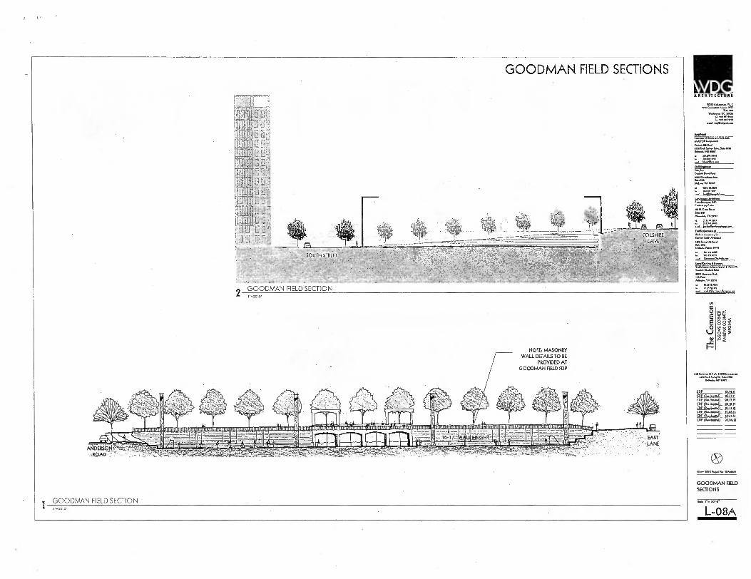
NY"
C 0 E E 0
Obi
se ARCMITICTUR.
WON*. PLA
IP.. DC J 1...1114111100
41111.ITZ 'M vra
ev.6—L 141
M... b.
4011,45,01,...110
111.110011.0. 'Mew
GOODMAN FIELD SECTIONS
L- 08A
GOODMAN FIELD SECTIONS
GOODMAN FIELD SECTION 1 , 2a-O•
NOTE: MASONRY WALL DETAILS TO BE
PROVIDED AT GOODMAN FIELD FDP
.4;
me 11111111 .1111111 t 1.1111.11111111111111111111111111111.11111111111111111111111111111111111111111111111.161 1111111111.11111; 1;11171■1011111111 11111111 1 itC1r11111D11111 , ;11 11 .1 11111111 10111111110 J111111111111111111111111 . 111 1111,111111111111rlii.1141111.11.D.11111111 111.1
r( FAVIMIIMIIMEIMM mut ortiont M 50 /1-4167-w- 111Mill othan .L maw mom Mom sia7monsom=waleminsilissggemm=airesee
7:;"-
490
GOODMAN FIELD SECTION
- .LANE

GOODMAN FIELD SECTIONS
f...N ANI. 1/CAL ./.12011
(....8C. P.N.S. IN U., MO NW
COLSHIRE DRIVE
2 •
GOODMAN FIELD SECTION 21.6.6
702.1.00.1
c 0 E E O
MIC...1.CatatOMI.NN WV ILA INA,
6.1.86.1,02.07
SDP S2Eltu—l.P pia
SPEasolaa_ CDP 21.5 G,A WPCI—.bwnull 91S
Stardek4L CLV
O.* .01*. PM
GOODMAN HE SECTIONS
L-08E
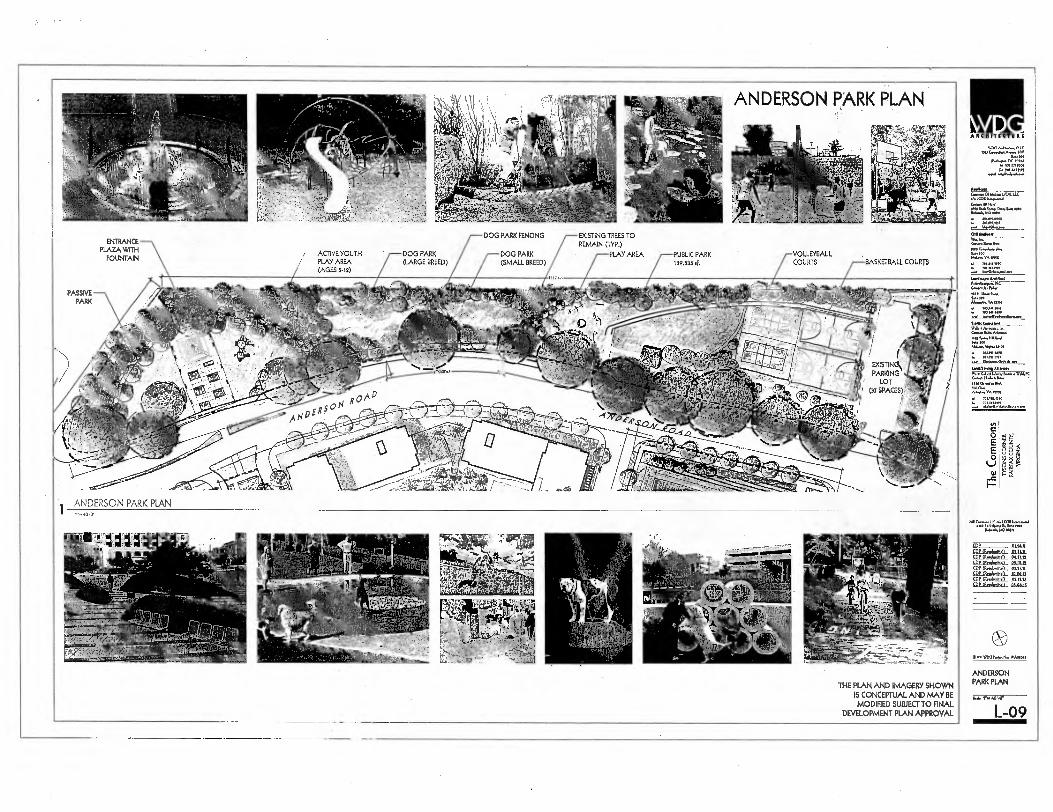
. .
II ARCHITE CTUR1
WW1 AdImo.... MC Am (*AAA. MP
:...>.0 WaAnsa DC tam
1.1101”,000 rn .1 441111.
...49.4.4,..,...
An..
. r ' . .. . , ,,,,, ,o.in
.1., p ti
.; .6... , .•.,. •
., ••• . r..........-- 4 ''
C.:••',P..::i•J . tgr A , . • 91. . ,, ) 2,-,..tt;:, i ..
,:,
''''''''°4 ., - •• ":..,
r ., 4"..: . ; 1 ,, — ,,,,.., 1 ' ---..• it ' t-
I
,••-,- . , ., ,
c•..d , -- .,t, -- --..
:; ' -
ANDERSON PARK
'1 ".... • .
PLAN
'' . .,„. 4
' 7
_-.. . „..,, - ,.7 ,, , 1 ,,,,,,, , .*Ni.- '
" ..r•,-Ie', I/ . ' i/$14. i ' 1
*,',,, .
tiii
q.;b73 .17,
_ 6 ._.
.-., . ,..
- '• .."7.1
•
.. .,, . II'' ,.,
,. , ‘'''' f.' 4 . /4 Yif 7..1' give ... ' Ajt
': : • -7,,,k,- ,.._ --,
,, ,,t'411, .̀:1('-' , -7 s
41''' ' ) '
. - .,
, . , -.if,' 0501.83A.D.P.A.011 R6n4. WNW
I. Iti..1100/1/
DOG PARK FENCING EXISTING TREES TO
ENTRANCE REMAIN gyp.)
PLAZA WITH ACTIVE YOUTH DOG PARK DOG PARK PLAY AREA PUBLIC PARK ,'-VOLLEYBALL
FOUNTAIN / PLAY AREA (LARGE BREED) (SMALL BREED) 129,535 (, COURTS BASKETBALL COURTS (AGES 542)
•I
C..1.5...• AAA
'',011". VA 1,100
..... .........,........ Amin, Aroliat
SA, no A.A. 'Amu
. 70 V41. OP
..-• ....0,.....A.D.A.
PASSIVE ;41*
PARK iillb .x.4.. ;.N ,p,,, Ii5. ■:r,:r,r, f...,....vr,Altts4 y
('• 4 ' ..1.--
-A ,P if IIglill.r4 -. 'ft %:. r tI,
r'• '4• , - _ , ' , ......... • -_,... ,,-, . _;4C4 • r,..... .7,,, . ,,,,, 41 A i '''' X ,';',;.2.1! , . , 4 t ' .• 7_, 411144,64,L.
.., fi I 4,, ., •I , .,... '2, fit/N/63ft
. , X' 0 : 'I 21/81117 lb ri I t:14.4,.. 'C' ,,r, Ali ...#qig.,,,73...,
,' - . 41 7 fg=1.11•4,c,.1•0„tS NW 0 vi.
1101.0.1.1 WA • Ami•dam. 6.
Nu f.,,,141144 7. I00 .1.....N. ma, 0 1011T, WO
•,-..--\<<"----
' /.0■E0. fr&ii r .,..• . 41%.• ,1 /
''-'' e.' ■ i'!) • , . 1 I • •,,,, , EXISTING!. , -.0' TA:
,........ - • ' ..... --=-4.1"--'' ' 1'1 1 o 4 , 0
..r.,Ila./. .. 0 PARKING
•• tA:Ii?41 -
- ,', . ,.. ,'-',' ,-- 1
,.. !..
I #.._ ..,- m• ...... . . !Al,
1,1 " , LOT ,, .
/..'": (4 . (37 SPACES 1,
.... 4:4, , , A 0 • , .,. ;.4 4 „S,., 41,
CV / •,
" . -,..„- ... 4. . „ ,,i .,..•
a itri.41(1 -, . .!A ___L...."
_ . \,. , \„•..„.., , I ■
' 1' '
:■ :,,• (4.: .:...k 0. • , ., -.:N ••• . Lear , ;.,,,i,. .- . . , , ki•• -,' , .I- , gi '''' r- ....e.' 11111 •
m... ..... •••• , ---1 . 1 ----- aft, - , - -
`Sg, :+t .......... A E 4-. . • ..,, . -
---........,-0.1 0...-- , - Ic ■ , , ' .
,... Or , "•,. -Z".. v.,,,,,t„....--..-statk,,v e ,.,,,..
.... , N,...[.L1....."
.^ ... ---: t,Ar ,,ff,
-
ANDERSON PARK PLAN
WM/1.ft Ago./
IMO Dona..
w MI WAN
crl G 0
to,
...0 h..
25 e
g ';'
,, 114...4.1AD MD
451t) • .4, -,..,.` ." 37 .4,7 ''' V,'
.SI 14AA /i'),/ Ai V I '• ' • ..
i . 1,. . , 0,
Ar.,„,
,
''''"' ' .- A , ' 4tYq''' . '.4. , ,,,,,k, ....,,- ,,,,..,
,. „t,11,,,:;.-.,4!!;ittii" ' fi. ' ie.
OPARiimbioltiAlL. MAIL OP (RAAAAnIVAL 9,117.11 CDP fitoglAnAPIL D1.19,11,
. . ,',Il l I''' 1 ' - °I 0—it W •r• ! ;.' , .0;4 ' :'
.r .I.'...- r ••■• ' ...VP. -I
- A
'' %At' -", :, ■ T.. 414, '
I 1..., , „ .. ,;.41"5 II
'1 , ' ,4 ..„... ■ ,,-,1. 49 i
.
I, 4,.-;.,--
.- ,,,,___, ..., ''' ' - -•, - ' '
A:. -,r K '' I ‘• .04r.ile:
A' -' , .,,,, .„4,.... ,.„.„. . •. J P - ..'xii1; , ‘—' ....
' 411 • -7, 4"
' -- - -- - •", - '141,1 L,
40 iht4, . ,., — e 1-- , •_.. L.
1 gp,-.1 I -'1 • • iii . 'Y
SDP.A.F.I.IL PUMA SCIESPNEL J.Q.211,11 5DP_Med,,,,pf,D_ 041711
r.D.P.-aktAtallid_ DUDA
‘ ' .' 1 '..- ' ' — ' Pe .,•,, • 40 4 '.-..;',3-14:41 ,"..I'f' .'"- $.. ' Wwi I. , ', • 4 ' ' 4. . ■ I ,47-1..•
' if .. Of € •
••0. -. , ..4
VtF,j,'" 4+ , ' , . ' ' . ' .' , 0 ,
"' ' I I . . '1"
3 . 3..4.,,t: 4, : • 4: '' , '
- • -7•,;;;-„,..„-----.._.`.."-_ - - : .
Ifli'c.lt 1 .ii . ■ .-tv....,„ . ,„,,t1-, ' 4 05.144,.*zi, ...., 1 „ ,:„. • l'ill A ...;-':- r"A` ., •,___,-;,„ „ ,f
) '.('' . ' Qii.i;itiiagaCkgBEd6,.,..:::,'L,' ,. \ . •," • '• .,' '''. ' f ,',..: '''. -.T.*:.477.4iSiftftsg,ft...,.. L.. '„.' ..v - - ..,,,..- ,,,,,,j ,.
• . . asicite
THE PLAN AND IMAGERY SHOWN IS CONCEPTUAL AND MAY BE MODIFIED SUBJECT TO FINAL
DEVELOPMENT PLAN APPROVAL
ANDERSON PARK PLAN
, r,.„..
L-09
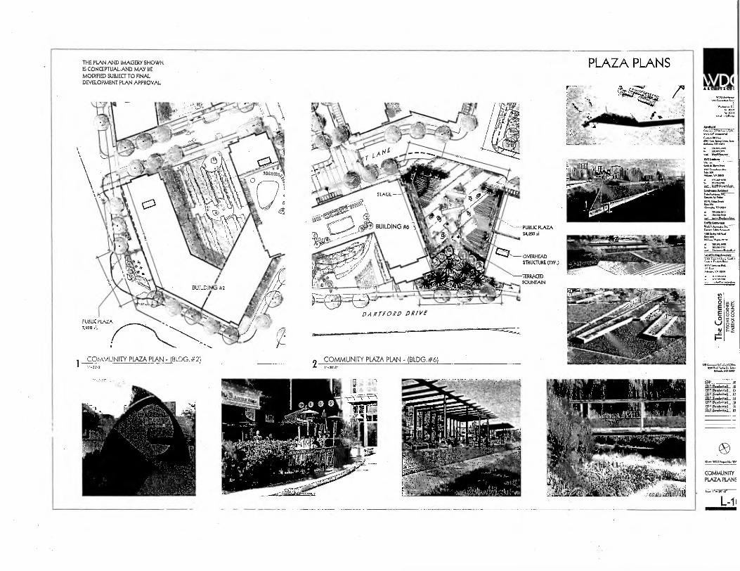
THE PLAN AND IMAGERY SHOWN IS CONCEPTUALAND MAY BE MODIFIED SUBJECT TO FINAL DEVELOPMENT PLAN APPROVAL
PLAZA PLANS
WV°
W.t'r to,
PUBLIC PLAZA 24,250 sf.
OVERHEAD STRUCTURE (PR.)
NO. 0...1.111.1.
MX nNtININ
76.1.4 ' —TERRACED
FOUNTAIN
DARTFORD DRIVE
COMMUNITY PLAZA PLAN (BLDG.#2) 2 COMMUNITY PLAZA PLAN - (BLDG.#6) 01111....... DN...
OPIHneksitimIL
COMMUNITY PLAZA PLAN!
sa., 41,44f
L-11
PUBLIC PLAZA 7,950
A RCHITICTI

LI
COURTYARD TERRACE PLANS
• BOWED WW1. CORNS • MEADOW GRAM • w000 DEW • OUTDOOR CADIERIUGAND WAG
(LOCATED ON 2ND LEVEL ABOVE PARKING GARAGE)
BUILDING 1 OPEN SPACE CONCEPT -'MEADOW'
THE PLAN AND IMAGERY SHOWN IS CONCEPTUAL AND MAY BE MODIFIED
SUBJECT TO FINAL DEVELOPMENT PLAN APPROVAL
BUILDING 2 OPEN SPACE CONCEPT - 'ZEN GARDEN'
ROCK AND SAND
DEMME WA10111.1. LUDO, DAD MOSS WW1. COMIODASLESADND
BLDG 1 & 2 COURTYARD TERRACE PLANS
NW /AAA. MK we Cmahoum
cm DANA DC mom
n1 nu mom 1161.71111
nod ....dam
CAA. OIDMAWCAL 11.0 ./.1.CODIA...1 Cno.c.414.4 MP ILA 5* flOQ M.. MO Netr
LADay• Dunned
Cutue A 1.1.
IAMInim Am,
c...1.NA A PC
CA. Dui,. 1.4. M
my. ADAM ADA. MD.
C
08
11.0 11 COP(Psw61AM11 01.11.11
COP mC gap C...P.P.kyyn_D_. IDIOM CDP BythmimIL
W.D.AmMDIND_
0•• WM Num Nu YAmom
COURTYARD TERRACE PLANS
L-11
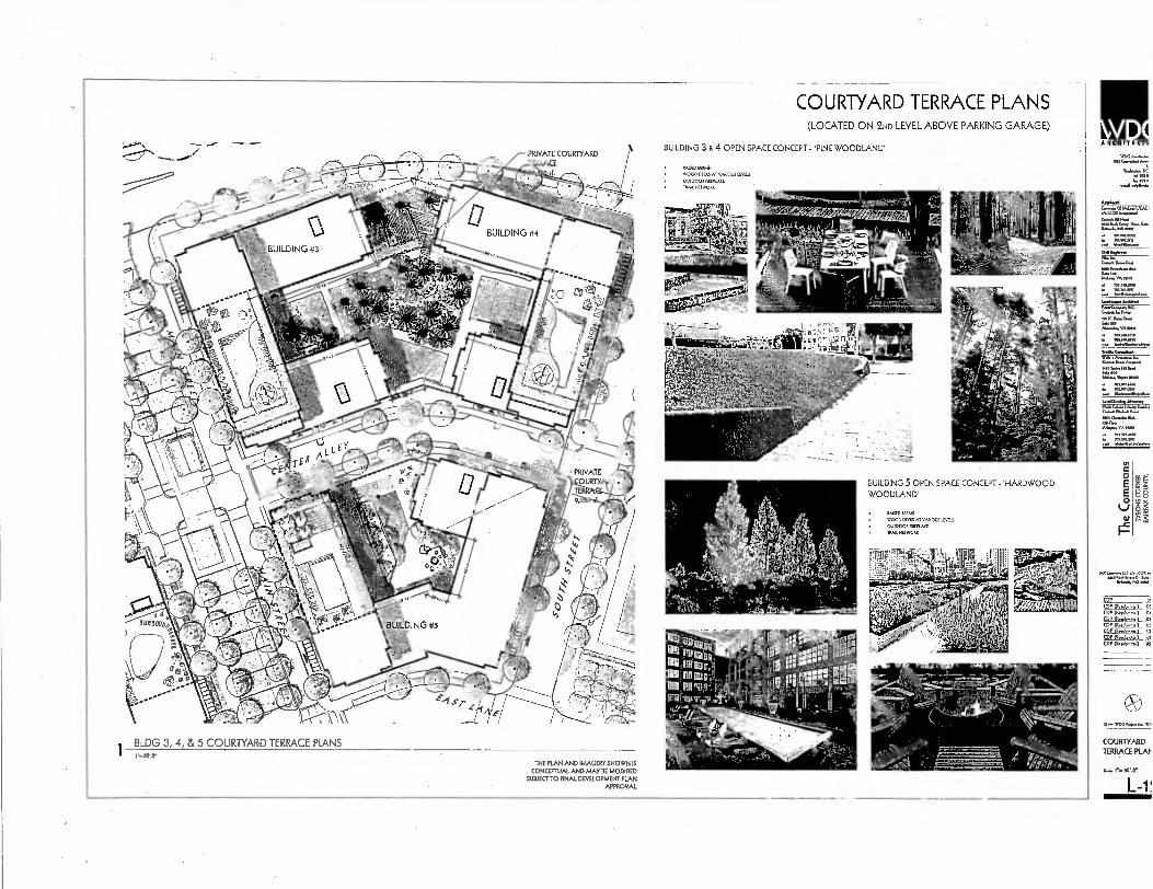
C 0 E E 0
1g s
ARCHITICTI
wuCwwww1999.
WWI* OR W .912 MI"
.1.1, ran...Lk< J• 1.<0.11, NA•
O••• WOO re•••■ I••••
COURTYARD TERRACE PLAT
L-1!
COURTYARD TERRACE PLANS (LOCATED ON 2ND LEVEL ABOVE PARKING GARAGE)
BUILDING 3 & 4 OPEN SPACE CONCEPT -'PINE WOODLAND'
BLDG 3, 4, & 5 COURTYARD TERRACE PIANS
THE PLAN AND IMAGERY SHOWN IS CONCEPTUAL AND MAY BE MODIFIED
SUBJECT TO FINAL DEVELOPMENT PLAN APPROVAL
PRNATE COURTYARD CE
BUILDING 5 OPEN SPACE CONCEPT - 'HARDWOOD WOODLAND'
• WED HAMS • WOOD DEM xr meow imis
0111,000. mute. UAL WENVOill•
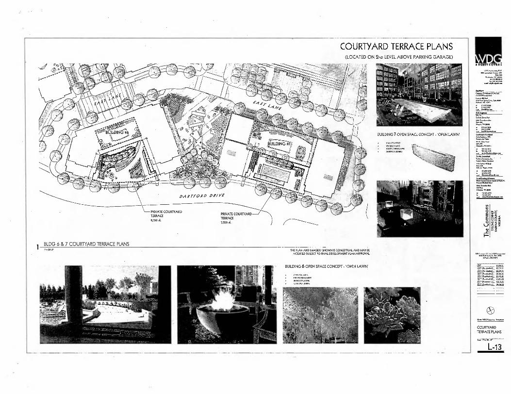
111 IIITECTU III
IVOG
SANAS W...• a 10•14
mtm tot a, sm
Nos.
I.00411.....11
(*.M
SAWA . S. ^10...1+. Me
.n6.1,0 WM
MI., VA Min
=0'
0 E E 0
lJ
Ff.
0•••• Was..
COURTYARD TERRACE PLANS
L-13
8 8 5
COURTYARD TERRACE PLANS (LOCATED ON 2ND LEVEL ABOVE PARKING GARAGE)
BUILDING 7 OPEN SPACE CONCEPT -'OPEN LAWN'
• RUA= MKT
• WATE0.11114111 BOCCE /
• OUTDOCA 0241145
— PRIVATE COURTYARD TERRACE 8,750
PRNATE COURTYARD TERRACE 7,550 ,f.
BLDG 6 & 7 COURTYARD TERRACE PLANS THE PLAN AND IMAGERY SHOWN IS CONCEPTUAL AND MAY BE
MODIFIED SUBJECT TO FINAL DEVELOPMENT PLAN APPROVAL.
BUILDING 6 OPEN SPACE CONCEPT -'OPEN LAWN'
• 01•01.1,,REA
• nr1WATINELEMINT • 91..1511.11K.
• 01111.70P OWING
t.:44,44.T4
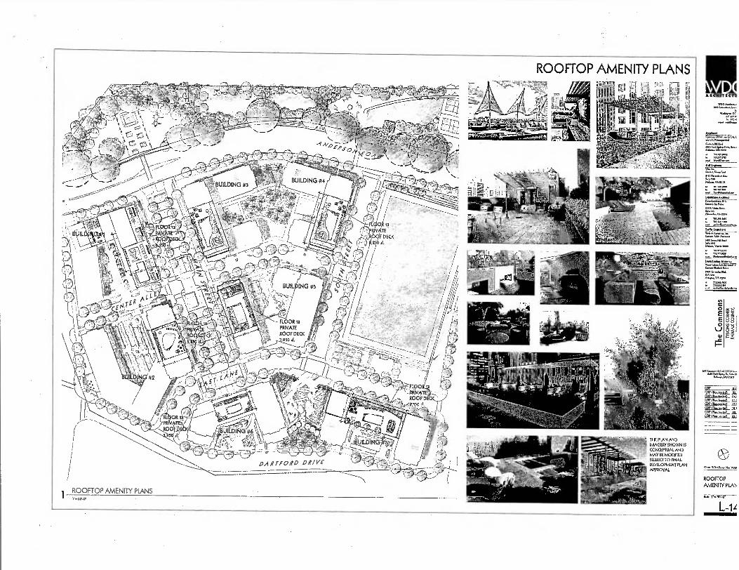
ROOFTOP AMENITY PLANS ET F,T r1 -1.
'
VI0,1 tit •RCRITICTI1
L.
0
E 0
es$
8 8
CONCEPTUAL AND MAY BE MOONED SUBJECT TO FINAL DEVELOPMENT PLAN APPROVAL
WOO P.O. WA.
ROOFTOP AMEN[TY PLAC
L-14

kIR ARCH ITICTUR.
WOO A..* MX
Sa.100
*"..rla■V ' I. Su nos
• Sow Ma
.2 70 .asma mm
• wRimmes
=.4.1.4.1. SWAM
10000*. 1M.
Ala.VA* ▪ TU111.000
4.1.0adalmalma
11 1
MIGNago.40.07.6.0...1 01.14.0.4.I.
COP 01.1 92EN.bsMIL 9.$21.11 Pi_e■MTA.CL YO RhE PrJR..b..7_ Oa. QE(R..40•0_ AKA SDP 0.610.D_ Alta
01,13.11 53722.0*.11_ 51.55.10
D.. WIS0•10
OVERALL LANDSCAPE PLAN
Nlom.
L-15 •
O E
OVERALL LANDSCAPE PLAN
TREE SYMBOL LEGEND
CATEGORY V EXISTING TREE
RI CATEGORY IV DECIDUOUS TREES
3 CD DEgrTZN:YTI,:lE,
Oaf CATEGORY II
DECIDUOUS TREES
VIA EVERGREEN TREES 41, CATEGORY 11
fip E,LAJ:AcrIRIEE,
illiallirFt4Mlaill R , I 0. UnNweel rers ...Ws M.% oc+0.1111.0*.
. ma.
c..,,...... 1,.....,..., ,.....,....
Q......,..x. ,eme,.....
4.',,,I . DU T 1„,,,,,, DOD X ...., Ca, IXE.
0..m Foe 1......■ 11.... I Ofts .......1. it ....S....,...a.a.s. .aa.a tee. I... : 4 10. ..4
12 . ...........-.... ......,..., '2 .7 la ea 3,0
0 rritSU
bo
S.
.......v1 ton-. kok. panne,
ern,. (M.-mel
Ittlis
li
23
32
23
1.1
1 19d4
.45./?i ::...7=ITZ:C" ..A. MU
'4.7" o
o 1
"-
157,
7.-6-'7.-1:7.:tf-- ... .6". . ap
an.(r. . ■ .10.,.41 13 HII kW 4.....1 , .t.... , 1
ft...m..1... 73 ,.........,....,......3., ..........,..
r............, :;: L'..
la 1., se.......s14., Arlae...se 1,-,. SU SO 1.1
....AM rt.trxmlut MO RR ■'.
THE PLAN AND IMAGERY SHOWN IS CONCEPTUAL AND MAY BE MODIFIED SUBJECT TO FINAL
DEVELOPMENT PLAN APPROVAL

SO
4.0.1 Cork allons (SVNAll Arlon. Grose Sea Area RBI 5112
09 Plan sheet oboe modEcollon la requested
Cl
C2
TIM re Pserrairon Target 42,1117
Total Grapy area owellng sta..0 12.0200 C3 C2 X 1.00 26.145
Cl
CB
C5
Total canopy IAN pre:Nato by oBque a valuolw Post or woo:Rano coromunntes
Ca X 1.25 Told*lowboy ore proAcred by •Haritaga.-14ernarial,`
•Specirnen,• or •011Be• Tree,
C6X1.6 CT
CB 5— 010
Canopy MIS al Iran 5111110 lissotate Proleaton Areas end
100100 Noodpielne COX,.
Total of CO. C5. C7 and 191 25.140
El Talal or canopy Ken pro4ded nuough 08.11. meCINnIsm (0191 Ent Tolal 0110-year Tree Canopy ProArred
88
§ F.
0 O E E 0 LJ
_c F-
PANTING DETAILS LANDSCAPE COMPUTATIONS FOR OVERALL SITE
3 -301: INTERIOR PARKING LOT LANDSCAPE CALCULATIONS
No Swine Parsing Lots Or dayelOpmern ercepl Anderson Rosa Park
H eiler Penang Lot LendscepIng NA Req..
13-202: PERIPHERAL PARKING LOT LANDSCAPE CALCULATIONS
No Surface Parking Lola NI development ascapl Anderson 0040 Park
Penpnaral Parking .1 Landscapng Nol Required
13101, TRANSITIONAL SCNEENIND ANO BARRIERS
ProoNty 20002 CRIME PTCniC
A010conl Zoning DAIrklv, P110-20. PON-12, RI, CS. 043, PTC
Nonsitionel Screening dind BerNers are Not Required
13401: TREE COVER CALCULATIONS
in 1212 10 ye., Tree Canopy Calculalion Worksheet Bier, /TORO A Tree PreservElon Teruel alp Btmoneril LAUB. Table 13.3 on Sheet C-10 J .
GOSS Site Aresj 313,195
Lend Oecitcoorci lo pate.
I
road Sontag& 201,516
B. Tfjs Canopy RequIrenlent B1
B 2
C. Trot Pro M11.11011
BE
BB
Elle scoInpPTC Percentapt el 10-Reer Ties Camooy Corer Required
AFATR Gyear Ie. nap) cantHoa0c31101 El teyelr tree cenopy color requested
1018
Yu
D. To o Planting 39,020
111.6 0 Awe canopy pantsa Anew toosanollon COMM.
x15 Area II canopy planted tor wale, oasts Ironahis
X 1.5
Area al canopy planted Weald. benefits
X 1 5
Area of canopy proNded by 02011 Rees
X1.5
Area Of tenor/ neeNded by Impend 114.0 and vanelles 01.251
Ares preen: or prattled by needIngS X1.0
Portent Of DIA moose:Bea by D 15
Total of canopy area 17417,14.0 Inrobon Bee p2ntl n0 83,650
le an ollents planting reser 3.eques1oo7
Nee bank or Thal Fun011
Canopy area noquesteni la be mooed mrouon artsue /totaling
or Ints1 fune
ATONE to be deposit., Ir. IM TN Pressnavon and Planting Etna
L Total of 101.., Trot Canopy Provided LItal of Canonry Pfayleted 111.0 tree MA 301100 (CIO) lalal Of campy area pnAtclecl the Rae planlIng (017)
• able. Too Coot Croon caIculallons anoloP pro moral 303 canopy covespl calculations.
THE PLAN AND IMAGERY SHOWN IS CONCEPTUAL AND MAY BE MODIFIED SUBJECT TO FINAL
DEVELOPMENT PLAN APPROVAL
ARCHITECTS
eneItaamaGA 10114ossalea Ana.
VGA,. 06 1 fa let In la An let
otat •apfeenal
Aptelon
4001,34ArollAr.551.1 11.4.4040 seor
*one,*
beRtra
lemosos Ammo
Cal se AA. NI KR. AAA
=,VAson•
• lalaftlale • altemente
yeatosananon IVA •Nasatts
Ga. W.A..* lae Lot WIWI
sea atela,floso IOU
• seelneste ▪ 101.Atent star PlosaAaaosat lartaasneo WactLalltatkertest Soon Mani Ala
te.
Aeon, VA MI
• te,sostoe /01.513.7111
Ita Go..Ile 0,1.CM Ion
"' :DIM"
COP COP (00e1o1s1) 00.0 CDP (Roatoons1) 04.1 COP (Rost000l) gin COP (Ruelannuf) gli COP %.A.ERw9 --
Owe WAN
PLANTING DETAIL:
AlUt0111111 • M. 1.014.
L-1 c
Ei . E3-
AAR nffrimostr, 64.1010 OR 0010.3031•000 v.11. Oraten0
Okm /WO CIVOACTIA Of 1.
!spoor noon masa ow; se /4,1•011111114 CO 11010A L611,11,
1110.571111.1M11.4.0.11 *PPE
11.1%•.10/ e '
MC. MAW On
"Irl=a1 CO= omata cAo. 3 PRO,
wAlOWlx 031COOICall
Iniw ant
WPM
t)RIP IRRIGATION LINE AND SUPPLY PIPE
REDUCE CANOPY BRANCHES BY J TO REDUCE FOLIAGE BY I . NEVER LEAVE V CROTCHES OR
DOUBLE LEADERS. RETAIN NATURAL TREE SHAPE
UNTIE AND REMOVE TOPI OF BURLAP AROUND ROOT RAIL OUT REMAINING BURLAP
WM13 EQUAL SPACED YERTICALCUTS.
TREE SHALL BEAR SAME RELATIONSHIP TO FINISH GRADE ASR DID IN NURSERY. ALL
PRUNING SHALL BE DONE MIER PLANTING.
RANTS*
2. SHRECOED HAPDWOOD MULCH
PLANTING SOILFUIL LENGTH AND WIDTH Of PLANT RED
COMPACTED PLANTING SOIL
DRAINAGE BOARD
FNISH GRADE PAVEMENT
VANES e.viravium
TREE PLANTING ON STRUCTURE DETAIL 05 SCALE :
PLAN VIEW - 8' AMENITY PANEL n7 PLAN VIEW - 6' AMENITY PANEL 06 v. SCALE t 1/13, 1s0.
WPB PROTECTION SEE NCH/ STRUCTURAL MM.
CT. SLAB SEE STRUCTURAL DWG%
PLANTER DANN SEE MEP N STRUCTUILNDWGS.
01 TREE PLANTING DETAIL - 8' AMENITY PLAN
oant0tocconCenla commas° mane
onetea we
ao0soONVAO01 ariest.
WA., PLOP
5
02 TREE PLANTING DETAIL - TREE SOIL BRIDGE SC4E11/2, 14.
WIrt11.101"411
1061.14V101314
=1,
1 1
C01.44 OP 01..111
03 TREE PLANTING DETAIL - 6' AMENITY PANEL sua.vv-r.o.
WON
PX■JeTt <WA /, MOM al VG
DI
131 03
DS 011
OS
010
011
O12
O13 Du Dm
017 OIl DIE 020
021
16,148
43.060
100.396

FURNITURE 111
ARSHITICTUR1 - „
rut lets
oc ;me ri:"J7g
rf. .00116*.4.0 4wm11■11-1.1 ass. 5.0,11.0
I/
• latrmeact
Vb
▪
. .
Mal••■ VAMP
11.04.4.4.••••
,•■• • Sir
PRODUCT: RING BICYCLE RACK PRODUCT: STEELSITES LITTER RECEPTACLE SDC-36 FINISH: STAINLESS STEEL RECYCLING RECEPTACLE RSDC-36 MANUFACTURER: LANDSCAPE FORMS FINISH: SILVER POWDER COAT LOCATION: BLDG. ZONE,LANDSCAPE AMENITY PANEL MANUFACTURER: VICTOR STANLEY OTHER: LOCATION: BLDG. ZONE,LANDSCAPE AMENITY PANEL
OTHER:
PRODUCT: FINISH: MANUFACTURER: LOCATION: OTHER:
PARK VUE BENCH SILVER POWDER COAT LANDSCAPE FORMS BLDG. ZONE,LANDSCAPE AMENITY PANEL BACKLESS BENCH, AND BENCH WITH OR WITHOUT ARMS ARE ALL ACCEPTABLE
• c O
E 0
MN Cm...LK* /415.0r.S.nw Baa.4., HD ROW
o— WDCP.6nW WAN■049
THE PLAN AND IMAGERY SHOWN IS CONCEPTUAL AND MAY BE MODIFIED SUBJECT TO FINAL DEVELOPMENT PLAN APPROVAL
FURNITURE
PRODUCT: ARC MINI SPANNER ARM SERIES FINISH: SILVER MANUFACTURER: SELUX LOCATION: LANDSCAPE AMENITY PANEL OTHER: BANNER ARMS AND SIGNAGE
CONNECTIONS ENCOUNTERED
L-17

HISTORICAL REFERENCE PLAN SITE, LANDSCAPE AND CONTEXT INTERPRETIVE SIGNAGE
FOUNTAIN INSPIRATION FROM EXISTING SITE STONE WALLS
'THE SITE' INTERPRETATION AREA FOR THE COMMONS SITE, LANDSCAPE AND
MONS CORNER CONTEXT
.393,, o7,4c:,•osi7,99
'44P-- • 1:5.% Z111 •
,
-"sql; ..•
1.(6.
•
"GOODMAN'S DESIGNS FOR THE COMMONS INTERPRETIVE AREA INCORPORATING ARCHITECTURAL ELEMENTS FROM THE
EXISTING BUILDINGS
FOUNTAIN INSPIRATION FROM SITE'
"GOODMAN THE ARCHITECT"I
INETERPRETIVE AREA INCORPORATING GOODMAN
INSPIRED ARCHITECTURAL FOLLIES
C.... Ma
&so.
•
0 P
<41V`1L. 0
E 0 H i
An1 k±t_1111.1
111,5iiihNk 14_1
Aja ir.: IGNTEcloRPoRETmx[VNE SIGN
F.
"'AT THE COMMONS;4fC,Ci
841 ' DMAN FIELD WALL. N'ORP0RA11NGELMENTS
11.-4E EXISTING BUILbINGS T.THE COMMONS : '
BALCONY
• . _ • ,
OVERLOOK
REPRESENTATIVE ARCHITECTURAL ELEMENTS Cu
BUTTERFLY ROOF PAVILION INSPIRA GOODMAN
HISTORICAL REFERENCE PLAN 5.6.1.3a-o ,eaPs---"*11111,0041mtv iraiMilitrimor
••
GOODMAN INSPIRATION EXAMPLES
HE PLAN AND IMAGERY SHOWN IS CONCEPTUAL AND MAY BE MODIFIED SUBJECT TO FINAL
DEVELOPMENT PLAN APPROVAL GOODMAN HELD WALL CONCEPT

6 88i
F
0 E 0
—c
CLASSIFICATION
CRITERIA
Low SPEED
BOULEVARD
VIN
AVENUE
An
de
rsons R
oa
d
COLLECTOR
Co
!sh
ire
Me
adow
Dri
ve
Da
rtfo
rd D
riv
e
LOCAL
Co
!shir
e D
riv
e
Eas
t L
an
e
Ma
in S
treet
•
So
uth
Str
ee
t
Raised/Landscaped Median (Table 6, DS-15)
Required (I6
N/A Optional •' Optional'' N/A N/A N/A N/A • N/A N/A N/A
Circulator Route (Table 13, DS-6)
N/A N/A Yes © certain
locations N/A
Yes @ certain locations
N/A N/A N/A N/A N/A N/A N/A
On-Street Parking Restricted N/A Required (8')
'Need Waiver (FC_PO I) (FC_P02)
(Table 5 , DS-13) 5 Required (8') Need Waiver
(FC_P03) Required (7-8')
Need Waiver
(FC_PO4) V V
Target LOS (Table 2, DS-5)
WE' N/A E E E
# of Through Lanes (Table 3, DS-10)
4-8 lanes N/A 4-6 lanes ✓ 2-4 lanes ✓ V 2 lanes ✓ ✓ v/ V
Design Speed (Table 3, DS-I0)
40 mph N/A 30-35 mph 25-30 mph 25 mph
Operating Speed (Table 3, DS-I 0)
35 mph N/A 25-30 mph 25-30 mph' 25 mph
Operational Analysis (Table 4, DS-I I)
Required N/A Discretionary Discretionary N/A
Signal Spacing (Table 4, DS-II)
Operational Analysis Req'd a
' N/A 525'-660' ✓ . 425'-660' s 325 .-660' 'V/
Unsignalized, Full Access Spacing (Table 4, 05-11)
Operational Analysis Req'd a
N/A 200'-660' Ifi 200'-660' *See Below 100•660' 17 ✓
Unsignalized, Partial Access Spacing (Table 4, DS-1 I)
325'.660' N/A 200'-660' 155'-660' Y ✓ N/A '7 V/
Driveway Spacing (Table 4, DS-11)
Restricted N/A 200' ✓ 155' 1,7 f 50' V V V V
Lane Widths (Table 5, DS-13)
1 1' N/A 10 . -11' 4 s/ 1W-11" V 10' V V V V
Streetscape Zone Width (Table 14, DS•27)
33'. 15' Building zone
10' sidewalk 8' landscaping panel
N/A
20-2W= 4%12' Building zone
8' sidewalk 8' landscaping panel
Need Waiver (FC S01)
20-28'e 4'-12' Building zone
8' sidewalk 8' landscaping panel
V V
16-24 . = 4'-12' Building zone
6' sidewalk 6' landscaping panel
Sight Distance (Table 12, DS-23)
385' (305' SSD) N/A 200' ✓ 155' ✓ V 155' V 11/ V ✓
Bike Lane (Table 15, 135-29)
N/A N/A 4'4 5 ✓ 4'4' 5 V ✓ N/A N/A N/A N/A N/A
S. HO OC 10.11,
61 v. Me.
c. m
r. 111 =7 16:6-satt......
GlAra
111. ta16.
VA Mt
701.1..M
=1=14.11.4
C...01.6., MAIL(
MILA S. M
(DP REV (DP REV CDP 05.21.1t REV CDP 10 MD REV CDP RIAD REV COP 05.05.11
Summary of Design Standards for T sons Corner as Applicable to "The Commons" (RZ 2011-PR-017 ARCMIT1CTVR.
Notes on Requirements: *Spacing requiring exceptions - distances shown (required):
I. District Administrator may accept lower LOS pending operational analysis. 2. Spacing must be demonstrated through an operational analysis; 13130 to 1,230 feet recommended. Cuishire Plendow Drive
3. Evaluated on a case-by-ease basis. - Dartford Drive to Center Alley (private) 175' (200) (AM-2_01) 4. 10' for streets residential In character, 11' for streets mare commercial in nature. 5. New signalized intersections on collectors/avenues within 660 feat of low speed boulevards need
operational analysis. 0.■ woo N.... worsen
6. Widths vary depending on 100160D relative to curb and curbside parking, 7. On circulator routes medians should be 24 ,36' on Avenues and Collectors. 8. Parking may be restricted in the vicinity of circulator routes.
TYSONS DESIGN STANDARDS- SUMMARY

- 1111 4/. EWE PEAK-12 .1111E7
ANDERSON PA 51 0020.
3625. SWE 11 1 1 1
ARCHITECT,
NDERsoN R A't er„,,°A,49,PTE #3
To BE 061C.1110
faimmaoso0.6.1
WO4
VW.. III
..0.1 .11.4
TO LK
2 STORKS
IRO TO .11 TIP.
• 2
STORIES
1111 20-2-023-0607
op strogrK Am; as 1111, 911 PASCr... NA.. TtE COTHCCS
ORO OW 3312 0 466 10. (10.011011. NTIAEI
7110P0510 ROC OEITICATION SEE S14[7 C—I6 .
D O
6 g
0
E
(1)
I--c
k"ft.-1114%%.
-4.4- .:6'"•
11.11.4,40
811)G G To All1011
S.A(X5 LOST OM
10 SIGHT DISTANTALIC.
TO ME TIP.
COP REV COP WOO REV COP REV COP REV CAP
8-00014 AI
Tysons Corner Design Standards Waivers & Exceptions Key
Required On-Street Parking Not Provided
Z Required Sidewalk Width Not Provided
1..1 Required Intersection/Driveway Spacing Not Provided
NI 30-3-028-0003AI COE.JAI
11t5TCA10 PARR ZONE C-3
wuer...... vi
TYSONS DESIGN STANDARDS-KEY MAP GRAPHIC SCALE
IC - . -
Tit 30-3-028-0004FI3
VESTOATT PARK , • ,-VADTH WIEN
DA RTFORD DRIVE - MING 50116]101 403 poopoko.CCLLECTOID,NittL . tosT 01E-1001,1 DISTANCE
zo)e C - 2 _ • ', TO BE OEDICATID (.61.10
Stele •
RI Sm) 1 MI 60 rt..
S-2
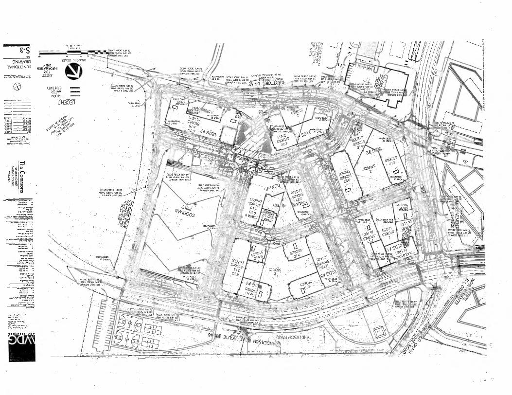
/// E- S asa.t la)
Mal N000 410 OH 031004 Hay 50)
BP Dols X,
TIVOs 3111/1Y110 DNIAAVII0
1 V14°I-1-3" NOLLVIV40.011 d04
IMES orsoWe rNirIraoors
(aBas NO03 Men Or
lips / 1 / to.-4340,1 Nem •
• (on. 151500 Nei Of (01011 0334 alsodran Si) 03345 33004010 APIS HIS nry.,Sio•
ANV.LINVS 2131.VA1 MOB •
ec. (ands Num NM Of Ca'"44312T10:4. 3!„,,7,1„..
4
; ApoS 03150.1-.01-5013-ALt -701.7.07t°, 310f1Sla 11106,501. IA 188
•-f/ • ■11111111•11
as a(000.44 4),
2 8 8 .miLvnvised: (0341,1530 Nay Of
01315 oalsod Han 00) .1.150 Dos
-4
0 a 3 • 0
(033d5.01530 NM 01 0336.011501114 S2)
304 5150 11100 ,000 •
titJo
ttlYMIMO : imod •••;.
waynaue, WW1
. .
k5b. G egA°1"
Aill .5":„.40.ig
fallVnesElq tItt Iiii Of 9 •
21 ' g' 1244°/
yea
It ',....-...... -44Proolc...-o ■
-.-,•_„„_-4-4, ,....,4.,-._,....w.ww-al "--4 0,4.1 reit AI..-___,Ava, ___*10,p_
t* ....-.........0.10?„, ---.-............


Tax Map Numbers
0303 ((28))( )0006 0303 ((28))( )0008 0303 ((28))( ) B4 0303 ((28))( )0005
Approved Land Uses
Zoning District PTC
LAND USE DU'S RES LAND AREA ADUS wDU'S GFA FAR NRES1ANDAREA MFD 2571 20.96 ACRES 471
RETAIL/EST 50,000
TOTALS 2,571
471
Approved Waivers/Modifications
RZ 2011-PR-017
Zoning Application Closeout Summary Report
Printed: 9/11/2013
General Information
APPLICANT: COMMONS OF MCLEAN L/CAL LLC
DECISION DATE: 06/04/2013
CRD: NO
HEARING BODY: BOS
ACTION: APPROVE
STAFF COORDINATOR: BOB KATAI
SUPERVISOR DISTRICT: PROVIDENCE
DECISION SUMMARY:
ON JUNE 4, 2013, THE BOARD UNANIMOUSLY APPROVED RZ 2011-PR-017 ON A MOTION BY SUPERVISOR SMYTH SUBJECT TO
PROFFERS DATED MAY 20, 2013.
APPLICATION DESCRIPTION:
MIXED USE
Zoning Information
Existing Zoning
Proposed Zoning Approved Zoning
DISTRICT AREA
DISTRICT
AREA DISTRICT AREA
R-20 20.17 ACRES PTC
20.17 ACRES PTC 0.79 ACRES
C- 6 0.79 ACRES PTC
0.79 ACRES PTC 20.17 ACRES
SEE FILE FOR ALL WAIVERS AND MODIFICATIONS
9/11/2013 Zoning. pplication Closeout Summary Report.rpt, created 02/14,%20 for Robert Harrison, set' num .146552

Approved Proffers PROFFER STATEMENT DATE: 05-20-2013
PROFFER DUE TRIG # TRIG EVENT CONTRIB AMT EXPIR. DTE
OFF-SITE IMPROVEMENTS - TRANSPORTATION 01-01-0001 0 N/A $ 0 01-01-0001
BICYCLE RELATED FACILITIES 01-01-0001 0 N/A $0 01-01-0001
CONTRIBUTION - SCHOOLS 01-01-0001 0 N/A $0 01-01-0001
SCREEN TELECOMMUNICATIONS EQUIPMENT 01-01-0001 0 N/A $0 01-01-0001
ARCHITECTURE/ GREEN BUILDING / LEEDS 01-01-0001 0 SITE PLAN $0 01-01-0001
ENERGY EFFICIENCY 01-01-0001 0 N/A $0 01-01-0001
TRANSPORTATION DEMAND MANAGEMENT PROGRAM (TDM) 01-01-0001 0 N/A $0 01-01-0001
PEDESTRIAN IMPROVEMENTS (CROSSWALKS /BRIDGES 01-01-0001 0 N/A $0 01-01-0001
/SIGNALS)
PARKING 01-01-0001 0 N/A $0 01-01-0001
ARCHITECTURE/ BUILDING MATERIALS/ COLORS 01-01-0001 0 N/A $0 01-01-0001
LIGHTING/GLARE 01-01-0001 0 N/A $0 01-01-0001
TURN LANE(S) (INCLUDES ACCEL AND DECEL LANES) 01-01-0001 0 SITE PLAN $0 01-01-0001
USE RESTRICTIONS 01-01-0001 0 N/A $0 01-01-0001
STREETSCAPE 01-01-0001 0 N/A $0 01-01-0001
OTHER - LAND USE 01-01-0001 0 N/A $0 01-01-0001
NOISE ATTENUATION (STUDY/ WALL) 01-01-0001 0 N/A $0 01-01-0001
GREEN ROOF 01-01-0001 0 N/A $0 01-01-0001
TRAFFIC SIGNAL / TIMING 01-01-0001 0 N/A $0 01-01-0001
ROAD PHASING 01-01-0001 0 N/A $0 01-01-0001
PARKING GARAGES 01-01-0001 0 N/A $0 01-01-0001
INTERNAL CIRCULATION 01-01-0001 0 N/A $0 01-01-0001
CONSTRUCTION VEHICLE RESTRICTIONS 01-01-0001 0 N/A $0 01-01-0001
PHASING - LAND USE 01-01-0001 0 N/A $0 01-01-0001
DESIGN GUIDELINES (PRIVATE) 01-01-0001 0 N/A $0 01-01-0001
BUILDING FOOTPRINT 01-01-0001 0 N/A $0 01-01-0001
HOA ESTABLISH 01-01-0001 0 N/A $0 01-01-0001
TREE SAVE FENCING 01-01-0001 0 N/A $0 01-01-0001
LANDSCAPE PLAN REQUIRED 01-01-0001 0 BLDG PRMT APRV $0 01-01-0001
CONTRIBUTION / OTHER TRANSPORTATION 01-01-0001 0 SITE PLAN $0 01-01-0001
AMENITY FEATURE - SWM 01-01-0001 0 N/A $0 01-01-0001
SETBACK 01-01-0001 0 N/A $0 01-01-0001
AFFORDABLE DWELLING UNITS 01-01-0001 0 N/A $0 01-01-0001
PROFFERED PLANS 01-01-0001 0 N/A $0 01-01-0001
LIMITS OF CLEARING AND GRADING 01-01-0001 0 SITE PLAN $0 01-01-0001
URBAN FORESTRY REVIEW 01-01-0001 0 SITE PLAN $0 01-01-0001
RIGHT OF WAY- DEDICATION 01-01-0001 0 SITE PLAN $0 01-01-0001
FRONTAGE IMPROVEMENTS 01-01-0001 0 N/A $0 01-01-0001
TRAFFIC SIGNAL WARRANT ANALYSIS / STUDY 01-01-0001 0 N/A $0 01-01-0001
BEST MANAGEMENT PRACTICES (BMP) 01-01-0001 0 N/A $0 01-01-0001
CONTRIBUTION - FCPA/ RECREATION 01-01-0001 0 N/A $0 01-01-0001
WORKFORCE HOUSING 01-01-0001 0 N/A $0 01-01-0001
OTHER - HOUSING 01-01-0001 0 N/A $0 01-01-0001
FACILITY IMPROVEMENTS 01-01-0001 0 N/A $0 01-01-0001
RECREATION FACILITIES 01-01-0001 0 N/A $0 01-01-0001
HEIGHT - BUILDING / STRUCTURE 01-01-0001 0 N/A $0 01-01-0001
PHOTOGRAPHIC DOCUMENTATION 01-01-0001 0 N/A $0 01-01-0001
HISTORIC MARKER AND HERITAGE RESOURCES 01-01-0001 0 RUP $0 01-01-0001
TREE PRESERVATION / SURVEY 01-01-0001 0 SITE PLAN $0 01-01-0001
9/11/2013
Zoning .Applica bon Closeout Summary Report.rpt, created 02/1.4/2011. for Robert Harrison, seq nurn 41.46552
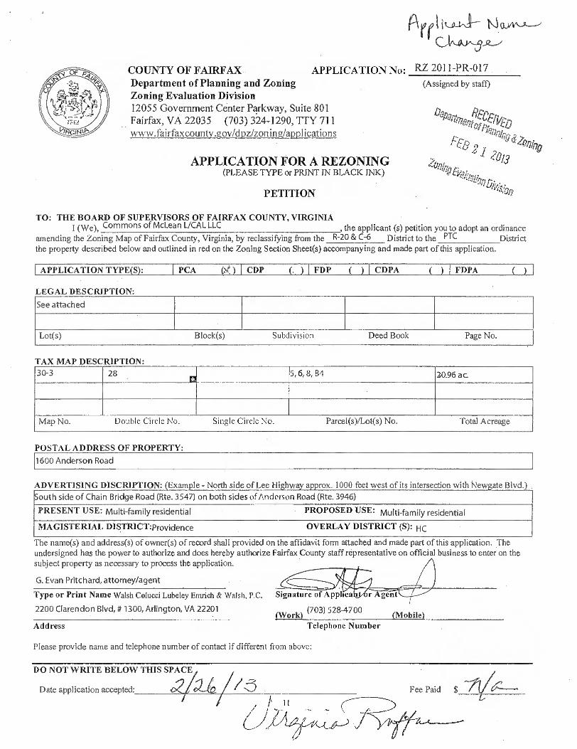
ADVERTISING DISCRIPTION: (Example - North side of Lee Highway approx. 1000 feet west of its intersection with Newgate Blvd. South side of Chain Bridge Road (Rte. 3547) on both sides of Anderson Road (Rte. 3946)
PRESENT USE: Multi-family residential PROPOSED USE: Multi-family residential
MAGISTERIAL DISTRICT:providence OVERLAY DISTRICT (S): HC
DO NOT WRITE BELOW THIS SPACE
Date application accepted: Fee Paid
11
■ A 110111111111111ftika4w4
Signature oiApplrea I r gentraillw
(Work) (703) 528-4700 (Mobile)
COUNTY OF FAIRFAX APPLICATION No: Department of Planning and Zoning Zoning Evaluation Division 12055 Government Center Parkway, Suite 801 Fairfax, VA 22035 (703) 324=1290, TTY 711 www fairfaxcountv.govid pz/zon ing/appl ications
APPLICATION FOR A REZONING (PLEASE TYPE or PRINT IN BLACK INK)
PETITION
RZ 2011-PR-017
(Assigned by staff)
Dena engefpfrE, zoo.
. 8 -1 20/3 117g
TO: THE BOARD OF SUPERVISORS OF FAIRFAX COUNTY, VIRGINIA I (We), Commons of McLean L/CAL LLC , the applicant (s) petition you to adopt an ordinance
amending the Zoning Map of Fairfax County, Virginia, by reclassifying from the R-20 & C-6 District to the PTC District the property described below and outlined in red on the Zoning Section Sheet(s) accompanying and made part of this application.
APPLICATION TYPE(S): I PCA ) I CDP (J I FDP ( ) CDPA
( ) I FDPA
LEGAL DESCRIPTION:
See attached
Lot(s)
Block(s)
Subdivision
Deed Book
Page No.
TAX MAP DESCRIPTION: 30-3 28
EN 5, 6, 8, B4 20.96 ac.
Map No. Double Circle No. Single Circle No. Parcel(s)/Lot(s) No. Total Acreage
POSTAL ADDRESS OF PROPERTY: 1600 Anderson Road
The name(s) and address(s) of owners) of record shall provided on the affidavit form attached and made part of this application. The undersigned has the power to authorize and does hereby authorize Fairfax County staff representative on official business to enter on the subject property as necessary to process the application.
G. Evan Pritchard, attorney/agent
Type or Print Name Walsh Colucci Lubeley Emrich & Walsh, P.C.
2200 Clarendon Blvd, # 1300, Arlington, VA 22201
Address Telephone Number
Please provide name and telephone number of contact if different from above:


DC-Itb-er". 2012, by
Commons of McLean L/Cal LLC 6550 Rock Spring Drive, Suite 280
Bethesda, MD 20817
October 12, 2012
RECEIVED Department of Piannippl Zoning FEB 1 9 2013
ZooingOokotign ofifigon
Ms. Virginia Ruffner Fairfax County Department of Planning & Zoning 12055 Government Center Parkway, Suite 800 Fairfax, Virginia 22035
Re: Consent to File Application for Rezoning (RZ 2011-PR-017) Subject Property: Tax Map 30-3 ((28)) B4, 5, 6, 8 Applicant: Commons of McLean L/CAL LLC
Dear Ms. Ruffner:
Commons of McLean L/CAL LLC hereby appoints Walsh, Colucci, Lubeley, Emrich & Walsh, P.C. including Martin D. Walsh, Lynne J. Strobel, Timothy S. Sampson, M. Catharine Puskar, Sara V. Mariska, G. Evan Pritchard, Jonathan D. Puvak, Elizabeth D. Baker, Inda E. Stagg and Elizabeth A. McKeeby to act as agent on our behalf for the filing of Rezoning application, Final Development Plan application and any related applications on Tax Map 30-3 ((28)) B4, 5, 6, 8.
Commons of McLean L/Cal LLC, a Delaware limited liability company
By: LCOR Residential II LLC its sole member
By: LCOR/Cal Associates LLC its sole member
By: Name: IP /47
Title: arAISIMPMEN
tiC,frt
STATE OF MW 10-11 COUNTY OF 114 (AA_ 00\ e.kui : to-wit
The foregoing iptrumei.it was acknowledged b943,re m this s• ■ e.. kJ, vuin Norf.! eLutivofrov of A ( ...) „, "
hss` ■t jk R ri.,4-' , 11111111■ ...iiiiiiiii.444,
ii,_.„,,....„„„
_„ A ‘ ■ . . ....... t: '0, etarylrith i8
g .Asfrccia.nissioiix Expires: -21 I 6013 lir '...,.,07.,q•- .- -7 - A?,:..V's.
I *gileurRhigri i •
6,„ Y littuseastO
ENGINEERS ro PLANNERS LANDSCAPE ARCHITECTS SURVEYORS SUSTAINABLE DESIGN
The Commons
JANUARY 14, 2011
DESCRIPTION OF
LOT 5, WESTGATE PARK
DEED BOOK 16893 AT PAGE 770
PARCEL A, PHASE TWO, THE COMMONS
DEED BOOK 3118 AT PAGE 361
PARCEL B, PHASE TWO, THE COMMONS
DEED BOOK 3118 AT PAGE 361
COLSHIRE DRIVE
DEED BOOK 16893 AT PAGE 770
RECEIVED Department of Planning & Zoning
FEB 2011
Zoning Evalmtion 011110oro
PROVIDENCE DISTRICT
FAIRFAX COUNTY, VIRGINIA
BEING ALL OF THE LOT 5, WESTGATE PARK AS SHOWN IN "EXHIBIT A" IN A SPECIAL WARRANTY DEED RECORDED IN DEED BOOK 16893 AT PAGE 770, PARCELS A AND B AS SHOWN ON A PLAT ENTITLED "PHASE TWO, THE COMMONS, DRANESVILLE DISTRICT, FAIRFAX COUNTY, VIRGINIA RECORDED IN DEED BOOK 3118 AT PAGE 361 AND COLSHIRE DRIVE (PRIVATE STREET) DESCRIBED IN DEED.BOOK 16983 AT PAGE 770 ALL AMONG THE LAND RECORDS OF FAIRFAX COUNTY, VIRGINIA.
VIKA Virginia, LLC
8180 Greensboro Drive, Suite 200 McLean, Virginia 22102 -:• 703.442.7800 Fox 703.761.2787
McLean, VA ". Germantown, MD Washington, DC www.v1x6.com
PART I
BEGINNING FOR THE SAME AT A POINT MARKING THE OF THE NORTHEASTERLY CORNER OF THE EASTERLY PORTION OF LOT 5, WESTGATE PARK (D.B. 16893, PG. 770), SAID POINT ALSO LYING ON THE SOUTHERLY LINE OF CHAIN BRIDGE ROAD- ROUTE 3547 (VARIABLE WIDTH PUBLIC RIGHT-OF-WAY); THENCE LEAVING SAID NORTHEASTERLY CORNER OF THE AFORESAID EASTERLY PORTION OF LOT 5, WESTGATE PARK (D.B. 16893, PG. 770) AND RUNNING WITH THE EASTERLY LINES OF SAID EASTERLY PORTION OF LOT 5, WESTGATE PARK (D.B. 16893, PG. 770) AND THE EASTERLY LINE OF PARCEL B, WESTGATE PARK (D.B. 3118, PG. 361)
1. SOUTH 53°44'10" EAST, 1117.46 FEET TO A POINT MARKING THE SOUTHEASTERLY CORNER OF PARCEL B, WESTGATE PARK (D.B. 3118, PG. 361), THENCE LEAVING THE AFORESAID EASTERLY LINE OF PARCEL B, WESTGATE PARK (D.B. 3118, PG. 361) AND RUNNING WITH THE SOUTHERLY LINE OF PARCEL B, WESTGATE PARK (D.B. 3118, PG. 361)
2. SOUTH 48°41'48" WEST, 240.31 FEET TO A POINT MARKING THE SOUTHWESTERLY CORNER OF PARCEL B, WESTGATE PARK (D.B. 3118, PG. 361); THENCE LEAVING THE AFORESAID SOUTHERLY LINE OF PARCEL B, WESTGATE PARK (D.B. 3118, PG. 361) AND RUNNING WITH THE COMMON LINE BETWEEN BOTH PARCEL B AND THE EASTERLY PORTION OF LOT 5, WESTGATE PARK (D.B. 3118, PG. 361 & D.B. 16893, PG. 770) AND ANDERSON ROAD -ROUTE 3946, 80 FOOT PUBLIC RIGHT OF WAY SHOWN ON PLATS RECORDED IN DEED BOOK 2997 AT PAGE 7 AND DEED BOOK 3118 AT PAGE 361 AMONG THE AFORESAID LAND RECORDS THE FOLLOWING SEVEN (7) COURSES AND DISTANCES
3. 183.26 FEET ALONG THE ARC OF A CURVE TO THE LEFT HAVING A RADIUS OF 830.00 FEET WITH A CHORD BEARING AND DISTANCE OF NORTH 34°58'41" WEST, 182.89 FEET TO A POINT; THENCE
4. NORTH 41°18'12" WEST, 362.68 FEET TO A POINT; THENCE
5. 282.94 FEET ALONG THE ARC OF A CURVE TO THE LEFT HAVING A RADIUS OF 532.97 FEET WITH A CHORD BEARING AND DISTANCE OF NORTH 56°30'37" WEST, 279.63 FEET TO A POINT OF REVERSE CURVATURE; THENCE
6. 67.02 FEET ALONG THE ARC OF A CURVE TO THE RIGHT HAVING A RADIUS OF 1660.00 FEET WITH A CHORD BEARING AND DISTANCE OF NORTH 70°33'48" WEST, 67.02 FEET TO A POINT OF REVERSE CURVATURE; THENCE -
7. 123.61 FEET ALONG THE ARC OF A CURVE TO THE LEFT HAVING A RADIUS OF 900.00 FEET WITH A CHORD BEARING AND DISTANCE OF NORTH 73°20'27" WEST, 123.51 FEET TO A POINT; THENCE
8. NORTH 77°16'32" WEST, 76.01 FEET TO A POINT; THENCE
9. 146.49 FEET ALONG THE ARC OF A TANGENT CURVE TO THE RIGHT HAVING A RADIUS OF 860.00 FEET WITH A CHORD BEARING AND DISTANCE OF NORTH 72°23'45" WEST, 146.31 FEET TO A POINT OF COMPOUND CURVATURE MARKING THE INTERSECTION OF THE AFORESAID EASTERLY RIGHT

OF WAY LINE ANDERSON ROAD - ROUTE 3946 AND THE SOUTHERLY RIGHT OF WAY LINE OF THE AFORESAID CHAIN BRIDGE ROAD- ROUTE 3547; THENCE LEAVING THE AFORESAID COMMON LINE BETWEEN THE EASTERLY PORTION OF LOT 5, WESTGATE PARK (D.B. 16893, PG. 770) AND ANDERSON ROAD - ROUTE 3946 AND RUNNING THE COMMON LINE BETWEEN SAID CHAIN BRIDGE ROAD- ROUTE 3547 AND THE EASTERLY PORTION OF LOT 5, WESTGATE PARK (D.B. 16893, PG. 770) THE FOLLOWING TWO (2) COURSES AND DISTANCES
10. 61.23 FEET ALONG THE ARC OF A CURVE TO THE RIGHT HAVING A RADIUS OF 25.00 FEET WITH A CHORD BEARING AND DISTANCE OF NORTH 02°38'09" EAST, 47.03 FEET TO A POINT; THENCE
11.NORTH 72°48'38" EAST, 261.60 FEET TO THE POINT OF BEGINNING CONTAINING 175,247 SQUARE FEET OR 4.02312 ACRES OF LAND.
PART II
BEGINNING FOR THE SAME AT A POINT MARKING THE NORTHEASTERLY CORNER OF THE WESTERLY PORTION OF LOT 5, WESTGATE PARK (D.B. 16893, PG. 770), SAID POINT ALSO LYING ON THE WESTERLY RIGHT OF WAY LINE OF ANDERSON ROAD - ROUTE 3946 (80 FOOT PUBLIC RIGHT OF WAY)- RECORDED IN DEED BOOK 2997 AT PAGE 7 AMONG THE AFORESAID LAND RECORDS, THENCE RUNNING WITH THE COMMON LINE BETWEEN THE WESTERLY PORTION OF LOT 5, WESTGATE PARK (D.B. 16893, PG. 770) AND ANDERSON ROAD - ROUTE 3946 (D.B. 2997, PG. 7) AND CONTINUING WITH THE COMMON LINE BETWEEN PARCEL A, PHASE TWO, THE COMMONS RECORDED IN DEED BOOK 3118 AT PAGE 361 AMONG THE AFORESAID LAND RECORDS AND ANDERSON ROAD - ROUTE 3946 THE FOLLOWING SEVEN (7) COURSES AND DISTANCES
1. 271.98 FEET ALONG THE ARC OF A CURVE TO THE LEFT HAVING A RADIUS OF 940.00 FEET WITH A CHORD BEARING AND DISTANCE OF SOUTH 68°59'11" EAST, 271.03 FEET TO A POINT; THENCE
2. SOUTH 77°16'32" EAST, 76.01 FEET TO A POINT OF CURVATURE; THENCE
3. 112.62 FEET ALONG THE ARC OF A CURVE TO THE RIGHT HAVING A RADIUS OF 820.00 FEET WITH A CHORD BEARING AND DISTANCE OF SOUTH 73°20'28" EAST, 112.53 FEET TO A POINT OF REVERSE CURVATURE; THENCE
4_70.25 FEET ALONG THE ARC OF A CURVE TO THE LEFT HAVING A RADIUS OF 1740.00 FEET WITH A CHORD BEARING AND DISTANCE OF SOUTH 70°33'48" EAST, 70.25 FEET TO A POINT OF REVERSE CURVATURE; THENCE
5. 240.47 FEET ALONG THE ARC OF A CURVE TO THE RIGHT HAVING A RADIUS OF 452.97 FEET WITH A CHORD BEARING AND DISTANCE OF SOUTH 56°30'42" EAST, 237.65 FEET TO A POINT; THENCE
6. SOUTH 41°18'12" EAST, 362.68 FEET TO A POINT OF CURVATURE; THENCE
7. 52.16 FEET ALONG THE ARC OF A CURVE TO THE RIGHT HAVING A RADIUS OF 750.00 FEET WITH A CHORD BEARING AND DISTANCE OF SOUTH 39°18'42" EAST, 52.15 FEET TO A POINT OF COMPOUND CURVATURE; THENCE
8. 103.55 FEET ALONG THE ARC OF A CURVE TO THE RIGHT HAVING A RADIUS OF 750.00 FEET WITH A CHORD BEARING AND DISTANCE OF SOUTH 33°21'47" EAST, 103.47 FEET TO A POINT OF CURVATURE MARKING THE INTERSECTION OF COLSHIRE DRIVE (PRIVATE STREET) RECORDED IN DEED BOOK 3244 AT PAGE 197; AND PARCEL A, PHASE FOUR, THE COMMONS RECORDED IN DEED NOOK 33142 AT PAGE 480 AMONG THE AFORESAID LAND RECORDS, SAID POINT ALSO LYING ON THE WESTERLY LINE OF ANDERSON ROAD - ROUTE 3946; THENCE LEAVING SAID WESTERLY LINE OF ANDERSON ROAD - ROUTE 3946 AND RUNNING WITH THE COMMON LINE OF THE AFORESAID PORTION OF COLSHIRE DRIVE (D.B. 16983, PG. 770) AND PARCEL A, PHASE FOUR, THE COMMONS (D.B. 3118, PG. 361) THE FOLLOWING FIVE (5) COURSES AND DISTANCES
9. 41.55 FEET ALONG THE ARC OF A CURVE TO THE LEFT HAVING A RADIUS OF 25.00 FEET WITH A CHORD BEARING AND DISTANCE OF NORTH 77°01'12" WEST, 36.93 FEET TO A POINT; THENCE
10. SOUTH 55°22'03" WEST, 77.42 FEET TO A POINT; THENCE
11.455.36 FEET ALONG THE ARC OF A CURVE TO THE LEFT HAVING A RADIUS OF 1775.00 FEET WITH A CHORD BEARING AND DISTANCE SOUTH 48°01'05" WEST, 454.11 FEET TO A POINT; THENCE
12. SOUTH 40°40'10" WEST, 91.57 FEET TO A POINT OF CURVATURE; THENCE
13. 31.41 FEET ALONG THE ARC OF A CURVE TO THE LEFT HAVING A RADIUS OF 75.00 FEET WITH A CHORD BEARING AND DISTANCE OF SOUTH 28°40'25" WEST, 31.18 FEET TO A POINT MARKING THE SOUTHWESTERLY CORNER OF THE AFORESAID COLSHIRE DRIVE (D.B. 16983, PG. 770); THENCE LEAVING THE COMMON LINE BETWEEN AFORESAID PARCEL A, PHASE FOUR, WESTGATE PARK (D.B. 3118, PG. 361) AND SAID COLSHIRE DRIVE AND RUNNING WITH THE COMMON LINE OF SAID COLSHIRE (D.B. 16983, PG. 770) AND THE PROPERTY OF DARTFORD DRIVE 7525 COLSHIRE DRIVE, LLC RECORDED IN DEED BOOK 21145 AT PAGE 35 AMONG THE AFORESAID LAND RECORDS, THE FOLLOWING TWO (2) COURSES AND DISTANCES
14. NORTH 38°16'51" WEST, 42.25 FEET TO A POINT; THENCE RUNNING WITH THE COMMON LINE OF THE AFORESAID COLSHIRE (D.B. 16983, PG. 770) AND THE PROPERTY OF DARTFORD DRIVE 7525 COLSHIRE DRIVE, LLC (D.B. 21145, PG. 35) AND CONTINUING WITH THE COMMON LINE OF THE AFORESAID PARCEL A, PHASE TWO, THE COMMONS (D.B. 3118, PG. 361) AND LOT 3A1, WESTGATE PARK RECORDED IN DEED BOOK 14774 AT PAGE 1547
15. NORTH 59°09'08" WEST, 66.48 FEET TO A POINT; THENCE RUNNING WITH THE COMMON LINE OF THE AFORESAID PARCEL A, PHASE TWO, THE COMMONS (D.B. 3118, PG. 361) AND LOT 3A1, WESTGATE PARK (D.B. 14471, PG. 1547) AND CONTINUING WITH THE COMMON LINE OF SAID PARCEL A, PHASE TWO, THE COMMONS (D.B. 3118, PG. 361) AND LOT 4A3, WESTGATE PARK (D.B. 14471, PG. 1547)

16. NORTH 56°01'52" WEST, 500.00 FEET TO A POINT MARKING THE COMMON. WESTERLY CORNER OF PARCEL A, PHASE TWO, THE COMMONS (D.B. 3118, PG. 361) AND THE WESTERN PORTION OF LOT 5, WESTGATE PARK (D.B. 16983, PG. 770); THENCE RUNNING WITH SAID COMMON LINE OF SAID PARCEL A, PHASE TWO, THE COMMONS (D.B. 3118, PG. 361) AND LOT 4A3, WESTGATE PARK (D.B. 14471, PG. 1547) AND CONTINUING WITH THE COMMON LINE OF PARCEL A, PHASE TWO, THE COMMONS (D.B. 3118, PG. 361) AND LOT 4A1, WESTGATE INDUSTRIAL PARK RECORDED IN DEED BOOK 11993 AT PAGE 157 AMONG THE AFORESAID LAND RECORDS
17. NORTH 26°46'53" WEST, 350.00 FEET TO A POINT MARKING THE NORTHWEST CORNER OF THE AFORESAID WESTERN PORTION OF LOT 5, WESTGATE (D.B. 16893, PG. 770); THENCE LEAVING THE WESTERLY LINE OF SAID WESTERN PORTION OF LOT 5, WESTGATE (D.B. 16893, PG. 770) AND RUNNING WITH THE COMMON LINE BETWEEN SAID WESTERN PORTION OF LOT 5, WESTGATE PARK (D.B. 16893, PG. 770) AND PARCEL A, WESTGATE PARK (VAN BUREN) BY PLAT RECORDED IN DEED BOOK 5888, PAGE 1335 AMONG THE AFORESAID LAND RECORDS; THENCE
18.NORTH 16°13'08" EAST, 496.88 FEET TO A POINT TO A POINT OF BEGINNING CONTAINING 737,948 SQUARE FEET OR 16.94096 ACRES LAND.
CONTAINING A TOTAL AREA OF 913,196 SQUARE FEET OR 20.9641 ACRES OF LAND.
BEING MORE PARTICULARLY SHOWN ON A CERTIFIED PLAT PREPARED BY VIKA, INCORPORATED WITH A REVISION DATE OF 1/14/2011.
11/44r1/4-0/1 u J. THOMAS HARDING
Lic. No. 1836

Development Conditions
FDP 2011-PR-017
Commons of McLean L/CAL LLC
April 17, 2013
If it is the intent of the Planning Commission to approve Final Development Plan FDP 2011-PR-017 to permit a residential building with at Tax Map 30-3 ((28)) 5, staff recommends that the Planning Commission condition the approval by requiring conformance with the following development conditions.
1. This FDP is subject to the provisions of Article 17, Site Plans, as may be determined by the Director, Department of Public Works and Environmental Services (DPWES). Any plan submitted pursuant to this final development plan (FDP) shall be in substantial conformance with the approved FDP entitled The Commons — Building 1, prepared by WDG Architecture, and revised March 25, 2013, and these conditions. Minor modifications to the approved FDP may be permitted pursuant to Par. 4 of Sect. 16-403 of the Zoning Ordinance.
2. The temporary open space shown on the FDP shall be maintained by the owner of the property (or its assigns). A public access easement consistent with all site plan, PFM, and County Attorney requirements shall be recorded over the sidewalks in the temporary open space area shown on the FDP and the sidewalk required in Condition 3 below.
3. Until such time as Colshire Meadow Drive is constructed along the northern boundary of the subject property, an interim pedestrian connection shall be provided between the western terminus of the Building 1 sidewalk along the Colshire Meadow Drive extension and the interim north-south sidewalk proposed within the temporary open space. Should this interim pedestrian connection not meet handicap standards due to slopes, signage directing users to an accessible route shall be posted. This interim pedestrian connection shall be installed prior to the issuance of the final RUP for Building 1.

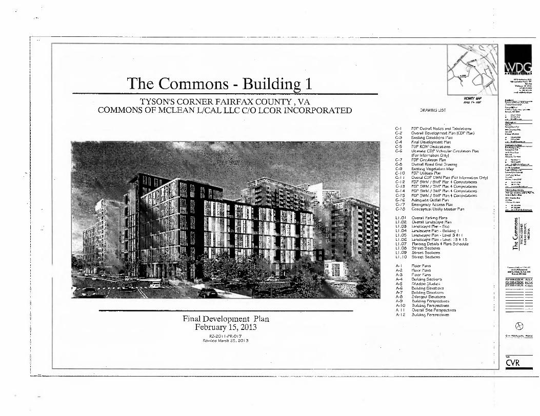
The Commons - Building 1
TYSON'S CORNER FAIRFAX COUNTY , VA COMMONS OF MCLEAN L/CAL LLC C/O LCOR INCORPORATED DRAWING LIST
ifaVIIY AMP Louc I, INV
Final Development Plan February 15, 2013
RZ-2011-PR-017 Revised March 25, 2013
C-1 FDP Overall Notes and Tabulations C-2 Overall Development Plan (CDP Plan) C-3 Existing Conditions Plan C-4 Final Development Plan C-5 FDP ROW Dedications C-G Ultimate CDP Vehicular Circulation Plan
(For Information Only) C-7 FOP Circulation Plan C-8 Overall Road Grid Drawing C-9 Existing Vegetation Map C-10 FDP Utilities Plan C-1 I Overal COP MK Plan (For Information Only) C-I 2 FOP SWM / BMP Plan 4 Computations C-13 FDP SWM / BMP Plan 4 Computations C-14 FDP SWM / BMP Plan 4 Computations C-15 FOP SWM /13MP Plan 4 Computations C-1G Adequate Outfall Plan C-17 Emergency Access Plan C-18 Conceptual Utility Master Plan
L1.01
Overall Parlung Plans LI .02 Overall Landscape Plan L 1 .03 Landscape Plan - Site L I .04 Landscape Plan - Building L I .05 Landscape Plan - Level 3 all L1.06 Landscape Plan - Level 13 4 15 LI.07 Planting Details 4 Plant Schedule L I .08 Street Sections LI.09 Street Sections LI .10 Street Sections
A-1
Floor Plans A-2
Floor Plans A-3
Floor Plans A-4
Building Sections A-5
Shadow Studies A-6
Building Elevations A-7
Building Elevations A-8
Enlarged Elevations A-9
Building Perspectives A- I 0
Building Perspectives A- I I
Overall Site Perspectives A- 12
Building Perspectives
ti 1'
o l liP R.;
1 " • , L" `-..t li 0
rl i o OV
lfI
NI)fil 4ii IP J..,1,„ 1 riflie
V2V-i 1 ii : Eillrii, !I IA :..12rO
fl !INN te I pip 11 00 a iiiii0..,..1 .;,, .. 11.1101 1 ti fn..
i t IW V) ' ,4
-441ifil , —..1 . !-.. ,;',:'
'mg
111.1.1. LK MY
App.mn
..E0A I*/ (*et., AsselLAS.,.., S. MI 4.....1413
14011■
ole
• W11.4
L4.47 641.1,41, (...er17,611 WO <La
• vA
;171.17.1
l g
sae I.A.Szt en*
fDPSUBMISSiON IBn .,
FOP SUBMISSION 01.15.11 IDP SUBMISSION smut
0 ,w WLIG rOn
EVR
O
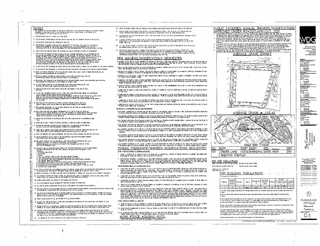
NOTES 2 TIE PROMIITY THAT IS THE STAAECT Of 103 TIDAL OSPIONINT PE611 CMSISTS Or PAR. OR A PDATION NERD
112104. CM TO FARM, COUNTY Mt ASSESSMENT VIP AS 1(23)) PNICa S 112 PROPERLY IS 70 BE MIMED TO PAC AND MC MM RE-2011-M-017.
1 111E 110120152 DANIA IS AROMA 01011 ORM NORM
1 TIC 106ORAP112 910101 locum INAS MD RuN BY 410. INC. ASO . COSTAR MTN. IS TWO 14 MET.
4. 10 BOUROART KGEMPON lM PROM= ET 00. NC
10 PROPERTY R LOCATED 0 01 AKERSON KB DISTAICT Of THE 110.315 EAST DISIMET OF THE TTSONS CORNEA URBAN MITER CF THE FARM CONPRENENSIVE PUN. At ALAN RECCW1POS TIC SITE Fdl RESEENTE WOK USE AT VARIOUS 1117013100 HE PROPOSED LEVELOPIAENT 3 IN CONFORBANCE 111TH ME Pl.
6. PUNIC WV MO SMEARY SE NN AK AVA091 NID 101. BE 000103 10 SO. TIE 0300P1011
7. MOM SAM SIANACEuENTBHP FACIJOES FOR PROPOSED ODELOPMENT MIL BE PROVED ON SITE AND WILL BE CONSTRUCTED AS A BELOW MOUND MIME HOMER, THE AP PLIONNT MEMO ME RIGHT TO FRONDE IMPORARY 01010 (ATER MANAGNINT NO rACILIIICS ON RE DURING PHASED CONSTRUCTION OF TM OVERALL OBSEIOPUENT N OPER CASE AN AVECIOATE SON THINNAGE SYS. 11111 BE PROS= 01 ACCORDANCE VAIII
AC MOMS HANuM STANDARDS MO DESKS MIERIA of FAJPEA4 couY. INFsE
FACIES. HAY INCLUDE SIT ARE NOT LOWED 70. PONDS 11011.1RATON FAUNAS OR tRIDOTOROUND NTVAULTS.
MIN TEMPORARY FAME. M. BE DESIGNED AND CONSTRUCTED 10 BEET ME CIARROM FASFAX CONNY SMI/BAAP STANDARDS
(0 MEM AT THE ME OF SONSTRUCTION FOR 176 SPECS. FACILE,.
B. NT ME MST CF OUR KNOWEDOE NO GRAVE STM OR STRUCTURES AMMO A BMA/ SE ARE PRESENT DX TIE SUB.7 ARCADE'.
9. TO THE BEST Of OUR 0011.17E. NO 0*1.3.S OR TOAC SUBSTANCIN AM MOM TO COST CN THE SWAM PROPINTL
10.110E ARE DEM RESEENTIAL NAKIVRES ON THE PARCELS 0110 1066.1. SALE OF THESE STRUCTURES TALL BE 19110951017 MM 030.1.0000 OF THE P0.107.
II. 114E 030.11 SLEEK PROPERTY 15 LOCA. NM AN RIM 23E NO 0.000 PUW, R.P.A. OR 0010019001. 0017 033/00/1 CURRENTLY EAST ON AK PROPERTY.
11 1.003101701 CONK. UPON COWMEN Of ALL REWIRED ram COUNT, PUN PAOCESSINC AND ilTIIOVALS. CC011100.10. OF CERCLOPIENT IS ALSO 0150.31 70 MM.( MN.
13. TIE DEVELOPIADIT SAMOS TO PIE PROVISIONS OF ALL MASJOABLE STANDARDS MM HE EXC41101 OF VIANIRS AV1 UNTFICATIM RECOESTIO NM TIE COP.
14. LAKISCAPOT OPEN SPACE MOOS KORN MEM HAT BE 110137➢ AT 115010 GE Rik ME NAN.
10 ME MENG F00315E15. GARAGES. PLADS, PARES NO ROADS REPRESENTED NNEON ARE APPRO0.131E ANO ARE BONG 111100000 FOR ALUSTRATIVE PURPOSES ONLY. INFSE ME V. 137 BE ALTERED. MOW AN WREAK° OR DECREASED IN SW OR OUANITY AT HE TUE OF DIAL 91E PUN 010007 ME NEED TO NANO TIE CONCEPT 0VI04100 WAN SO UK AS HE APPROVED FAIL UNIT WWI 011 PAK. PRON. 033 ROT EOM HE 102102.3 PROMO Di TIE MARTS SI THIS .M.
IA ADOHICSAL SITE FEATURES 51101 AS PLATAS OUTROS, FOICING CORNICES. MUSES INTRANCE 3012 UGHTS ANO/CA MALLS NOT REPRESOIND HEREON 137 BE FROVIDIE
17. NI 13000911 1:30030.10 CA THE SuBJEOT FROMM MIL NOT POSE ANY ADVISSE STEC) CO ADAMEN1 OR ROMBORINC PROPER=
10. THE P10000 NIL 4002 10 PARENG RECIERINENTS AS SET 430(400 THE Mt TONE PER ARE 6 OF THE WANG ORDNANCE AND 31311. O PREMED 04 A 0319131131 OF A NO OR.
1C PARING STRUCTURES 020 SURFACE SPACES
E 1HE NURSER OE PAINING SPACES PRON END
BELOW
W(001400 BE ADJJSTEO AT FINE. SIR PLAN.
3. AGREE 50.1 BE PROV103 IN ACCORDANCE 111711 111E ERIK 0171020 oR A 020111300100 SIGN FLAK
00. THIRD AN NO SCENIC ASSE75 OR NATURAL FEATURES ON MS STE woRINT OF DELINEAlos.
ri 10.0911031530EE0N4 AGAINST ANACENT PROVOKES IS NOT ROOMED AS SET TOR. 0 /O. .13-700 AND THE SUPPLEUENTAL SOTED310 AN BANNER 1370.11
=MERE ARE NO 100N6 UPLITT MOW KNE FASEAINTS HANK A 00111 OF 3E113 rivt (25) FEET SA MOM HERE ARE NO 4000 SIDERCROUNO UTAST CASEMENTS LOCATED ON MS 511L
11 MAUD. WERVES IA 040110 OVERONE TIE MK CFA OF 304 WINN 1010 TOE MM. Silt M.
00.000 NONTICATIONS NAY BE MADE TO TIE CONSINUCION PUNS FOR DE SUBECT PROPERTY PER SECTION 113204 OF THE IGKIS GRUNANCE
25. 0.E SUBJECT PROPERTY 137 a1 918013110 N ITIF FUTURE FOR ME RAMOSE OF SALE JOST VENTURE, ort NASING. ANY ISOPOSED 5000515421 11A4 BE N00220 ANISNISTA2523.4 BY ME ERECTOR 0 OPW DaS 1211100 0411.701A13021.1100 OF THE COP PINT 011 PRIA501014 NH.
24 ACCESSORY USES AS KN.) 100171 MADE 2 010 MN. 01111IO10CE 00 EA PROMOS 1011001 REcomo owinulloN or ME FOIL ANSE UM MAY NMI. BITE 1101 RE LIMET TO ITN FCSLOARG: 1. ACCESSORY NRUCTURES. 2. MGPOLES 7. FENCES 1. OCANCES. MOMS. AMINM. ESNS 010 OMER 90411 MASTS 2 OPEN FIRE BALOCSES. ESCAPES UNCOOKED STAIRS ARO 5005
7. BAT 6 AIR CON2110110
E00. ORIELS AND CHU 12 401PS. DATERCENCY COIMATORS ISO OTHER SIKAR 3011000.
0RNS. a. ACCESSES, 111PROVINENTS AND U7-1711 PARK E AIME N rpoRT 0IHE PROPOSM 9. MO. PATES NOT OVER (4) RCM FEET IN WANT MO E THE ON191E0 CANE.
10. DECORATIVE WALLS 030 INITISCAPINO NOT DKR 3 FED N MSS ABOVE DE HOSED MADE 11. MMUS ONE SONO AVEAS.
20, AIL PICVATE STREETS SUM BE DIMMED TO MT PM 011113AA UNLESS ANVERS OR 1400112ATION5 ARE GRANTED BY THE BOARD SUPERNSORS OR 11E DIRECTOR. ITE LEAN SEEM SHAM BE DETERMINED AT TIE OF ANAL SITE PUN.
.STING ENTRINCES 0 INSIND 0AID USES MALL BE PEWS= TO WSW UM A. 111E AS INE PROPERTY REDEAMPS.
21. ALL PAVEMENT 1301110 ON INELIC STREETS INCLUDING NT NOT GEM TO 0100910102 LANE IISE. ENE WES, MMWS. PAWING BAK LTC. W. ON THE FIN ARE SUBECT TO 007 REV. AND APPROVAL.
311 PAS. LANES MOM AM SUBJECT TO TOOT REMO MO APPROVIL
31. TREE ROOT BARFURS 31 U 000200 FOR TREE PITS ADJACENT TO TRAWL NAYS
31 ALL ESSANG SIGHIL moDincATIONS OR 1. 901AL INST.AICAS AR SESJECT TO NOT APPROVE-
31 THE MK DESIGNATION 1ND/04 RESTSC1011 OF CV-STREET MARINO SPACES M.D. 111F LOUDON CF 110.5014P SPACE SHALL BE 0EIE01110 N cuMULTATION MTN VMS 0141 ROOT AT SIVE OF SITE PLAN
311 THE APPUCANT PE10125 16 NOT TO PROVIOE LOANING SPACES IN MESS OF THAT MOM HEREON PREKED THEY DO NOT NEGATIELT SPACE THE SIPEETSCAPE 612041. MAL BURNING HOLM ARE TO BE DETERNMO AT 5W PLAN, PROST. SON. MOM HEREON ARE NOT MM.
20 PUNIC ACCESS usNENTs so. DE FROMM OvER ALL MINN MEM
M. LOCATION AND TOT OF INTERNAL (20 911 SITE) MO DatilHAL CAOSSNAUCS IND MA .8 RAMPS ARE SUMO' ID MAT
APPRO. AT THE 11E Cr SHE PLN1.
37. BICYCLE PMIONG MS BE PROM N ACTOR.. RITH THE 111...01 1E304 STANDARDS FOR 71905 CORN. MIMI 33111R & TIE MANS COWER URBAN GE30 03790.16 AS 000 2010113:1 1131 ROOT AND MKS Al TYE Lf SITE PLR.
36 PROPOSED 0317WAT 111PROVIBEHTS (ENTRANCES. 0311010 L EM) MAY MONK EXCEPTON/DENTATION FRCS 1007 •AMES"
131110I37 OEM STANDARDS" MO/OR TE 07AN401ATON OLSEN GUEFINFS FOR MONS CORNER URBAN 0111111 (AS 110 BE ONERIGNED AT S1E PAN/ 10)311000E 11119 331 EXCEPITOK / OM= SHALL /101 ROBE AN ANDINDIT TO 'RE CO. SEE MEE S-1 & 5-2 FOR ANVERS & 11CONCATICAS 10.33610.
31. ML GRAMM co INS FOP IS CINCEPIOAL APO SUBJECT TO MANCE AT SETE PLAN
PUBLIC FACILITIES MANUAL WAIVERS /MODIFICATIONS APPROVED UNDER R Z-2011-PR- 017. CDP L MOONCATION TO SECTION 12-0702 18 MT Of 116 PM TO PERIM. IMMO 'WANG AREA MT 1126 PLANTED TO SAW
1K WREN INK .NOPY REoustsWIT to et Ransom F. A MEMO TAMS OF a FELT TO A %mum MAIM cf 5 MEL SPAIN INE PROVISOS FOR STRUCTSRAISCILS TO THE SURVIVABIUTE ISE =SECT TREES AS AE1 1 AM SEAMED
70 SLOW FoR . TOP. 2 A 1100111CATION Tv sEonom 7-cco2.4 oF Wu sFoToli 1130232 OF 11-1E IMING OROINANCE PROSSERON of STRuNIIRAL Mu. INTO PARING SPACES WM PAM. SOUL.. BY NO MORE ASH AS OF THE STALL AMA. SUCH PARKING SPAMS SOU own mono DE RECANTED AMBER OF PARICINC SPACES AS RECORED 411 111E 20014 ORDINAME.
1 A WADER TO SECTION 6-03518 Cf 1NE PM TO ALLOW ALL STORK WATER 1.10.52117 AND BEST IIANALMENT PRACACES TO SATIVED BY UNDERGROUND SESTOIS DESIGNED AND CoNsmuc710 ESPENTIAL comPoNNT of NS DENELoPuENT
4 A 11.7R Of HIE 10 TAR CANOPY 00R31017 O SEG. 12-0301 OF TIE PM IN FAVOR OF ME 1TSON5 CORNER URBAN OYER AREA INK RE.011111111311013 ASR RELATES TO 530101APE DESIGN AN THAT 11001 IS SHORN CA FOP.
I A MOCIFICAlON FROM TIE EEC PATKRAATION TARGET 1111 RV BASED UPON TN (0) ALIN.. OLMATIOMS MOM UNDER 040010 TD BE PRESTRWO AS OWNER ON . FRO.
A VERAGE GRADE EXHIBIT
ri
) pN
i•/
1!
P.-
AVER AGE GRADE = 333.42
.,
,, ....s
„.• „,...: • , „,.,,...... ...,,.s.
_ _,..,_ ,.-,...„* loz ,....„,„ -,- , .„0 „
f'••■•, ' - '7.‘":\.
:.• .. ;XI • ‘`.., 4, ..,,, ., .....
•P. \.. -, ,
k . ......"../ z, --..., . SOILS ‘MAP 1`= 0000'
. '
50. ID ,.....,., SOIL SEES ECIPTEOr TATAItra ETAISITS 101111.171 SAM
URBAN LAND GOOD MARGINAL GOOD HIGH IVB 101
WHEATON COMPLEX
FDP SITE TABULATIONS TOTAL 52 AREA 11X15 FOP APPLICATION: isesata SF OR 2031/ ACRE
707M AREA FOR MISS PURPOSES
0803110 W OR 10347 ACRE
PROM. WA 332000 SF PROPOSED FAR: 3.01
FDP BUILDING TABULATIONS Development 10010120
6u112Ing Max lourn ANION, Height TN
Flom E211 0.111 ."E"."A 01
Maximum Dwelling
Unite 1404s(11
PaOURO
'':7::":::::
IS
:1,,,=.1
1 AN liesoenisi 330 OM 331 W 397 I 973
I111.1aainum Wenn° heIDO meas.. Dom average g5 Ettatles ones.1141 10003.103 11 .0010.. 00000
RIM num.. 01101 Mown Is owoeclual NO may ne 00100(00es Me won. INNOng 11020 b Be 5117115 Is nol Weeded.
Appeeant mama Ole 1510 10 conwel al Ole plan to to 04000 amaze Nei q oskleteld GM M resasesee uses Mai now Incisle. SR nal 0 none to, Mali saes eslaboslownis. mho entadlEhmenls. am SO WC salmon. as well as osalonwt
anwnibeitSee Pr6es) CFA .1u0e, elln SpaCe af ApeClied &Nag 0.1.0
046 Twenty CM mesni or an 20•emnp Inns 01 M Won.. 0OONq UnNs 600/A0 1761 au. 'umbel at WW1. bs Osierrnor. axe plan baled On Me lad number of PM ma 12.0. •
161 6. 31000 300dans10.00.0 semme0 pa spaces eve calcualso In a cesslane Mn Becton 64. a me ]210505x2(00 The rtsidentio para., 20Eulanon was base on an am., orapc.00306. oe Lean. 03 ISM 2 teAracae unlu, 01614 3 6.66rn M lime WOW plark NA. he embed NW on .4oe015.5.0..N.P.5.15 1 .01. 0. 06x of ted Tees and Me rshninun and nuulmum MO
N SIN WEIS Seoon 6366 el lm lain° Olinnance.
PH WM. 039 maces may se ma as W.. el AA Me el. Nal
15 ANDS OF SHARED PARIONC, IMAGED PAWN AND/CR TANDEM/VALET PARK. SHALL BE DINONSIRATED 011 DE STE SAIL
O. PRIVATE AMISS ROADS MOAN ON TTE FOP MALE NOT BE 0061001131510EE72. AND, AS SHOW um' DONS FRCS . MONS TRANSPORTATION OEMS STANDARDS AND STREEMAPE REC0111.DA10NS IN THE COUPREHENME PL.
12. ALL SMARMS CV PUBUC STREETS SINS TYPICALLY BE CONSTAUCTED AS 2701 STD C0-13 MIMS ROOMED OTHERAIDE ARO AS OETERIMED BY 1002
11 A MMHG DEPICTOR Of WE ASCU OF BUM MOE FOR TNE PROPOSED CevtiOnSIT SHE IS NOT RECURED AS MS ONELONNU is NoT LOCATED NEAR DE MUNDT Ef TIE Moss uROAN MIER AS DESCRBED 04 SUTICRI M-107 CE VIE MANG OnNANCE
IC All LANE USE (M. INTERS. OP PLAN.) Mt 51113107 lo MINI AND APPROVAL 07 1107 Al 132 ISE OF STE PUN AND SAY BE 12114211) WITH. ACE NEM RJR PCA. CNA AND/II
40 INN P0H CONCOMAL AND ROM. TO BE USED PI CONNSCIM MN 114 LAM USE 0.0VAL PROCESS ONLY. IT IS NOT AN MINCER. coNsloucnon Dooms. AND umoR 1.141(1.6 A0115010113 K 1113.17.. ARE 4(000 ED PURSUANT TO 200116 KNEW SECTION 10-204(5), AS PAST OF 7/4E nom VIE P. 1PPROVIL PROCESS. NOMA& HE MK coNTRucnoN 0050x65 MALL RE IN suOsTANTIAD coNFONAKE NIM 1115 PLAN.
pFm WAIVERS/MODIFICATIONS REQUESTED ...DUERR°. Of PEW SECTION 6-0703 7000000 AN AMO.ESIS OF THE CNN& um sow 10 VAT 11E MME PORT. CF TR ORANAOF SED CIF
N E WES °MALL VAT IS (4000 TIE PTO MIR= NS MN FIAL RIDEVICPED WOO VE PO TOMO TES 9 NECESSARY TO 7I1110 ACCOUNT FOR TIE EFFECTS OF . ITC REWIRED RUN. RCOUCTION ON TM WM. OM.
11101,01 OF PEW 001101 0-03036 10 ALLOW 551021VATER SANALDMIT MAIMS (S. AND MP) 113 BE PROVIDED 1010 UNDERGMAND MANS 1111111 11E RESOINTIAL 01003 CF THE PROPOSED 06ELOP1011
5101637 OF 0,11 SELION 7-0E7.4 RENO.. MEM 100 OF 0 FEET FCA 51127 AND coINEROAL DIVANS CaviDOV40 0 .7 ROADWAYS AS MIDI. in APERNAL Cf DIE NIECTOR Cf ONES AT . INF cf. PL.
03100E10ATI0N OF PN SECTION 301100 0.7 ALLOW TAMEN/VALET PIANNG SPACES, CONTROLLED 117 BOLO. 110ACEE1T. AEI 137 SKR SPACES NAY COUNT TOWARD REWIRED AWING.
/400F101131 OF 30101 7-08012 PARING COMING STANDARDS 10 AILO° FM OP 1111 A 43 PROJEC101 CF STRUCTURAL COHENS 01110 PAWING STIECTINES NTO TIE MIRED PAK. STALL AREA INF PARING 31.5 WELTED BY SUCH SEWER& C30103 3311. OEMT 70397 TIF WENN CF REEKED PARIONG SPACES. •
F. INVER Of SECTOR 6-02013 50011010 1026 00 OK 74.4.4 9001 ON TIE COMPREKNAVE WAS RAN 0 FAVOR OF 11E STREETSCAPE AND 010-R0I0 BAC TRAA STS. 9101111 ON 111E EDP.
01101.1100 OF SEC. 12-000 ME PRESS/FAVOR TARGET, As SIM. In MINION DUMBED N SFSTIoN 11-050170(1) THROWN =MI 12-0501700(1).
• 11.51CCIEr7.10.1.cfro.SECildi IL-01,10-1E151 ZEP110111 MURTON 0 .. 11 ,f 11.1010.1
LAN* I.PE PLANTING 4.11%4R011 ,E134 (Ic5A FEET. ,;0411=g mt (5)
0TR AREA
MCONGATION OF WT. 130511 KA REWIRE, TEN PERCIAT 71711 CANOPY COW. ON 31100.1 LOTS / .0 BAY0. TO 31011101 CANOPY TO BE 01.0.17. ON 1E 019311. COP OEVELOPTIENT MEN AS COMNSTRATED 011 DE NW /KEN.
111.13110 Of SKIM 12-051068 TO A.17 FOR IMES LOCATED AB. ANY PROPOSED PENCIATTON TRENCH OR SO-RETENTION AREAS TO COUNT 7019ADS COUNTY ME CO. 031110.7.13.
Csgr,z1 SCOMCATION 0:ElnIF101171,412.161,0 .0.11P.771, 1a1.1.81 IIEZEZTOR. DP. AS Du. ➢ IN TM STOMINTEI MANAMA:NT COSIGN PM FOIDNS
a)All REWIRED DESATSIS OF PM SEclox 0-1101.110 A11. 0002.111 OF MILTRATION RAHN LESS MM 0.52 0/117 FOR DESIGN OF WILTRAION SIMMS U12.1. 10 WI TIE COMPRE101971 PLAN RE019101317 347 7.311011 0 11E FIRST 0000)1007 CN-SITE
RIAU. RE.TED 00407105 CE PEN SEGTON 6-1306.F 70 ALLOW FOR ANY 1110004 FACIUTT LOCKED WEN A BLINK OA CARAGE WEENIE TO BE GOWNED BY MONO COCA REOUIREANTS FOR ACCESS AND 0.01100ANCL
c31.1. RTOUIRE5 0340105 OF NA MIEN 31307.20 TO kVA FOR INSTALLATION Of 00-RETENION 03111123 1.1 UTREE 11.11371014 10 BE CONSTRUCITO Cel IN-SITU ILL 1009730. PRE1CK FRC ME SHOW ACEOUATE Pal.IRAIMN RA. EMT FOR 114-Snu mAIIRIAL
.17A11. MOM DONATIONS Of PM *C101 1-107.1E TO SET THE 0100* HORITCATAL SOBAMS 00 BAC. 10N011013 BE AMUCK TO 71RO
(0) MET 111 ORDER 10 FACILITATE INSTALLAVON Of 30-0130101 5373S IN IN URBAN 3010311317 SET ram IN 111E TYSON'S COMOT 06LN
MALL RECO. MAIMS CA KY SEC. 6-17012E10 ALLOW INSTALL0101 OF 00-RETINION FACIIII3 11E 10.103 OF .0ING 0003. NVICIE NAMITENAKE AREAS OR WM. STORAGE AREAS To AccoNOONE MOAN 15771Roloosa *T PORN I11 71505 COP. DES. (211313022
1) All RECIARED DMATINIS 0 PM SECTION 6-1301.20 TO OEM FOR 1112 101151121 MANAGE SEAS TO BO-RETENTION FILTERS 111171211 ADEN. Of TIE MST UMW RE 03N0110 N OACQ TO ACC011900171 ROLF. MINOIF NV TO PROPOSED STRUCTURES.
92:I:OWED 031A1,1,2,11S WIOOOn
OF PM SECIX•I 6-130;.:L 70 /MOB 090100 AF.11112E 110.,11.7,91. S. 0. 1114140113 OF LOADRL&00,2..:ILLE
AREAS 0
ZONING ORDINANCE/WAIVERS MODIFICATIONS REQUESTED 70001 MOWN° AMU 7 - MORAL R011 AMIE
I. AMEN / 1100171CATION CF SECTION 2-506-2 TO 31.3 F0A HAMM' WE. Ce0.133 93119 P11.0134 TO CAMEO 0.E KNIT LAN ESTABLISHED BY MORE SW TREE (3) FEEL AS 0400010 ON ISE FOP.
7. 1110 APPINANT Rfou6ls 11.10.01107 Of VIE 7.1110 °ROMANCE SE01.1 2-505. 110) 0140 (0) TO 01109 MUCH. LOCATED IN THE KLINK ROOF TO 007/PY AN AREA OKATER 11371 CF 1. TOTAL ROOF AN TO 10.7.110E MR OGNOTIONE UNGS AA0 C00910 10.0. LOCATE0 313100 TIE PENINNSE 0 SUSSED AREA, Rd BONG MIMEO IN 10 MANAMA MEMO TIMM E. SAO STRUCTURE AIR COMITIONICI 0 COOL. 10.131 15 FOR 1112 AMOK C0. 13300.0 BULGING IHNIASTINCTURE TO WET LIM C0.9013100.
026101 nPrOlumE Aran F II - PARING AN INDS°
5. 11070100.131 CF ICON ORDNANCE 3011011 11-102(12) . =OR 0.009(1) TO 0011 FOR TANDEM SPACES MO VALET SPACES CONTROLLED 07 BKAING 0.0007011, FOR FESEENTAL N0 cfM0E UM SRN STASIED 4AC6 M ACCORDANCE 11111 SEM
PAR PROA 2 1 11-101W 001D 6-S011(1) NAT
COuNT TowARD RID PAREIG N SPECIFIED IN 1E 010C CANNANCE. SHALLBE PRONTOACCOROANCE 3 THE KE PLAN SUNNED WA MS APNEA.
A *010030 OF TONING ORME. SECTION 11-101 ANO 000201 11-207 FOR 71E RECURS 00.1. OF LOOK SPACES 54110 114.71-314LT, ONCE MW RETAIASEINCES USES IS REDIESITED 0 FAVOR Cf THOSE MICH AK SWAN ON RE 0111 1.
7. MCCIFICKON Of KEEN 11-202(4) RECIATNG WHAM asura OF FORTY FEET (40) a A 1.0017110 SRACE IN 0000133 70 MK 109110. TO 7131 AS 3910.107117 CA HA MP.
L MARK OF THE 1101110 LENGTH Of PRIVATE STREETS AS PRON. IN PARAGRAPH 1 CA SECTION 11-302 OF THE 11201G CACKNIGE 70 3100 PROMIE a10 00 N 13013 CF 600 FT. 0 UN=
14. THE APPUCANT FWVOIS A mc0fICATIO0 RN ME TM PRE... TARGET POI ENE 00.00ANCE SECTICA 17-400. ALS KCI0E/301 PKIAMED BASED ON 30 (2) ALLOWNSLE DOW. IN THE WM COUNTY PUBLIC fACILITIES WEAL 10 M5100 112-0507.3.1, BALM STEM 3311110 TIE TREE PRESER31101 TARGET 7030 PRECINDE THE CENMDFINS 1.56 0 DENSITIES OVERMSE 01101101 BY 11E 70.0
01104■ 44■CE . 11E SEC= IS 1117-0507.7A(7). 00.11 STATES. TONSTRUCHCA ON TARGET 70 ACTIATES COLIC BE REASONABLY ESPECTED TO !PACT T.. .15 OR FGRESEN ARM USE 70 51107 . THE PRVERVATI . 301 SEE VI= Nor LW. SIM. IN A 11.113 ARO STRUCNONS SOUND WANNER FOR A MOAN OF 10-1405 N .DROANCE 6411 1E POSVOLVELCIIIENT STANDAPOS FOR TREES AND (ORES.
AREAS PEKOES IN 02-00.1 .011C 11009 117 FIE PRESERAD AR ODOM ON ISE CO.
MSG OPOINANDE ANN , 11- Sur Pie
16. 131. Cf SECTION 17-201-3) RECORING NO PARKE SIGNS Italc 1114411 WATS or IN MFR.. SO AS NOT TO CREATE MAL SIGN CLUT.S. ME. AND sENco Ft MINS CONTR. SCRACE To DE LEINIAIS AT MK SITE FUN MM APPRovAl of 1/E Nana OF OP.
3. 00.3 00/011 KOWA. CF SEE. 17-20I 011 7,101.5 A0 B13 MAILS R FAVDA OF THE SIREITSCAPE AN 011-ROAD NZ ANAL STSIIM USN ON VE FOP.
19. 111 ACCOVANCE ATV TomMG DROM ■MCD UNION 17-001 (7). SE APFLINNT REM. WE 11017 10 sumo( PANNE CUMIN. %CMS A/40 P.M METERSMAN MIMIC MD MATE sews 01111111 AND ADJACENT TO DE DEVELOMENT.
WORK FORCE HOUSING NOTE: 1.11 FORCE IMMO AWL et FRONDED AS WM. IN 114E PRINT.
ew
-to
4-n
nw
PtA
-N
-12
CO
P T
hle
blo
ck
\Ttl
eb
toek
2012-1
0-1
5.d
.o
1,PlannIn011roJects,66313,d8D\361119024.0 2/0/2013 3126122 Pm EST
AICIIITICTIR.
304 MM. m.
'''"Arre' re7
013.00.Ne
TAW 2.6.666 661.661.2.26 61.6
413310.0,13/10401 60666,611/9•17
.11126..66.2.
3646,20110.
a /1112416.
ttet"1.7:'
a' M.,. 00 to 70.0.
NA01.0.0.
2ww. VA wen
0 E E 0
I-
AsTelmsgem -0,2ta
TOP SUIANSSION 1E070 0.51110.1Z9ON 00.15. B2E.510.11.909011 0313
0-. wtt /wee Ne Wnispel
FDP Overall Notes and Tabulations
S.imssmoom
1
;?e3
F

ARCNI TTTTTT .
Ian my
W."7Z.131:7;ire 4.1.1 .43 m
41.1.03
05■ 14.15.1, DA, Uhl.* 40.4,40 ma
EtEE_
1,4.1•141... PIC
ct, C
E E 0
t—i cs)
M.6.6 1. .M0 IOW
fDP SUSMISSION /1.07.1t JD. SUBMISSION 05.15.11
SW5W50203. 212151
VT4 Ptid VATI,M.
Overall
Development Plan
(COP Plan) 910.6
C-2 W02.165.10.201 \ projects \ Planning \pro)scts \ 6651 \dwp 5551101.0g 2/15/2013 5:07:29 AM (ST
\ A
rch
ite
ctu
re
s \
66
81
\ V
V6
68
1E
MID
G C
YY
-MM
-DO
M01
3-02-13
FDP
ittle
blo
ck \
Thie
blo
ck_
20
12
-10
-15
.dw
g 2
/14/2
013 4.
72
,50
PM.
EST
g 8 8
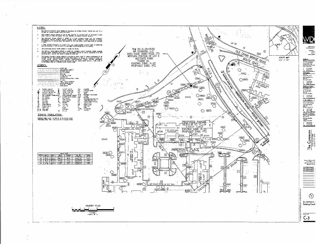
CURVE TABLE CURVE
CI 1111411 }7196'
RPORIS
910.00'
DELTA 1831110.
TANGENT 116.95'
CND EIR0
068591 111E CIA CZ
01010
66.60 910 00
00000'
i1252'ir rose 2.1.351
sn .191 37-F $7452 1 26.E
0.1 CI
36.8r 04.50 . . 11 Y
8005•11 . 75.1111 1 $5911 .22.0
CHORD
65.651 3111'
NOTES: I. 011.116U1340704047L610171.1,53-911.-IgriflE0 ON 000000 COUNTY, VIRGINIA TAK MAP AS A
111:72117.211 1471712 CM,PitEgs6 f s̀,07.111-5,A4arrm"
1. 21,10.
DATE SE 4,FTSIT"Irs .7;17,11'ispicasAsTAVE,74 13,1na'0111, 111E HORIZONTAL CATUM 0110011 NM. IS BASED ON 01080.
u'llsres'WTVANdaZirsgra TWil'ou'ItlfiggsrsPl'AsT:114,Fra,""FM AN 2111110100SEES FEES MINI IS BASED ON NOVO 29.
THE suBJECT PRCOERly MO. HEREON IS LOCA. 1)1 FLOM ZONE (AREAS OPIIIHEED TO NO 121190E OF 500 YEAR FlOCOPENX SOO TEAR FLCOO) AS SHOW 000)x00 RAJA NO. 515525 01001, FAIRFAX COCKY. *MK 14I0100POR11E0 AREAS. FEDERAL DCERCESICT MAHAGESCHT ACENC
AST (FEW) .00 9101010
HAZAR110E RATE MAP (#104) SATED MARCH 5, 1290. ZONE r
IS NOT DINONAIED A WM0111.000 D ZOCE
FGEND: awns PRE
CANE coon
EDGE OF 001101001
cocci) - — CH 112.AR sins
IPF 0
040
KAM' 4g0 1.'
TM # 30-3-28-0005 MR COMMONS, LLC
DEED BOOK 16983 PAGE 770 WESTERN PORTION OF LOT .5
WESTGATE PARK 7.6896 AC.
EXISTING ZONE: R-20 PROPOSED ZONE: PTC
6.
LIPIPS POE. 01.110 ERSOOPTS
--PION PRAM COMET - MA141 COOLIE
Oft. P.M marry iftftERETOOT 22110
•
WS *0001
0 ftrr PPE 0TER maNIELE
•
EAT VALVE 01ER YAM
O WRIT POLE ROLLARO
Di ROG 1181:STIL SIGNPOST
MORERUMS 010 POSY
011.117 Pal KEES
t Pr' TEM-PE WEB PEET
s
ZONING TABULATION: 0000 ZONE 040 .■ NOM SO. FT. CR 2.01227 ACRES PRCPOSED ZONE, PIC A. M. SIA ft OR LOMB ACRES
GRASS
SP/184446V •
200001 01 IIEM221
PROPO 88, 3.18 SQ. F
.01 2.13 '74 ACR srr BRICK EXISTING
506 VI/BASEMENT • PROPOSED ZONE: PTC
504 7502
TARO MOO THROAT
0 SMEARY I1E011UT 8:7 SANITARY PAROLE WC
Onow pm Mums 90 PONE COMM Box 120
22 11E10801/ RENCION BOX PE IPAEFE scroa POLE 200
O ELECTRICAL PANNE 0 11100 1// COP US SIC • PPE OPPARTPENT COVNECTION TELENS10NPECESTAL 0 PPE IITORAPE
PAL R/S, Hal
APPR0
CO 061E OJR0 MIER BOPPING STORY E160CAL IftEASEMPEI 0NALT MUM RIDE01013 CORCRETE PPE COPPME0 MERL PPE OVILOMG PES0C10 WC RIGHT-OP-MAT MOON PARIP MP BOOK PPM AMMAN LOCATOR
111
GRAPHIC SCALE
IN 1.1 I ack P3 ft.
MCP I
• ICNITICT
WO Md.., 101...emen
W"?... la■ to,
yAl(0111
rftftftWoft.,NA Esse Rea PO, Pon.
0■11mOtar
Do. 50.10
tft..
8811.1,.1.8 S.8.ne Alft.ftift.VMPEN
Plan C*III
0.0. Aorea
S..
▪ I03.0.670 707.011.9
V7I.t7:111174,M
G.,.
mtletnee
=14.4
c O
E O
.
.6.0.10 ten
FOP ION 1DP1011141SION plP $112M155191,
• WMO0010 A.
Existing Condi
C-3
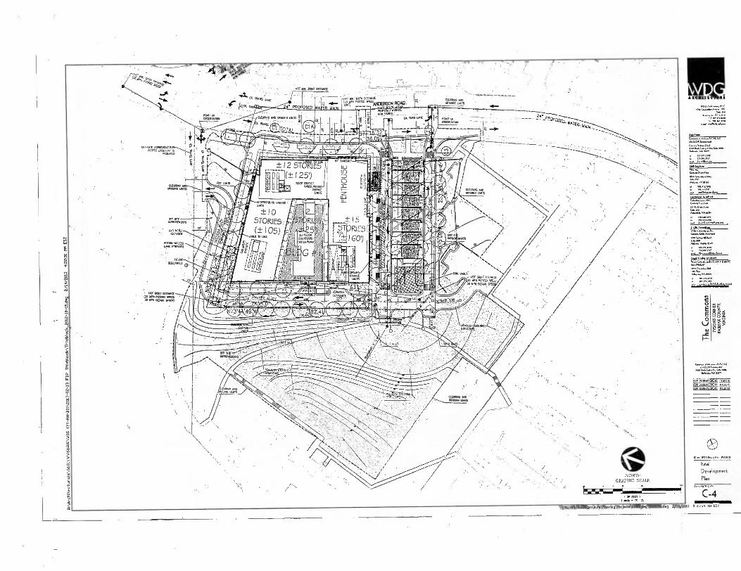
clam tale
.I1S mallafr artmet • •
— --- DISTANCE AWING MO PC.STED ....ANDEfecti RJACi
as YAeF2: FO011 OF OESFIVADDI
r,- P a(-9R 941Exigar•..,+.1
"i"'65 11
1 .
Mt. YAMS
13.010.3003."
OFF AV PAPAGMEMEN
% yiN.111 ACCESS LAIt (FAVATE.)
mMtiHu
Ir. . laIneAlry ,14. Wu (a k
mol
'7:11,7f;
? •• 1"- Iraiii I leir 4,i),
* t ma i . 1111 litti,
I A 'MfCr NI (ttlire zirlo pik"m•rjralr-72, *am vir....T.121,16---mdttk -62-- i'--, ...:- .Al. ',,, i 1,„,,_.a., 11* INS44 --1441. Ala, Asoilin,immom wisraiwzr-Adhwiegift , F 1_ Aur riv 12IP :,..,Mlingax Ji,-, ‘■■..m....,zoossommiiag="4-6 ,...........,
,........
• 140• OiII 0LSTANCE (ZS NANJOSITO WED 30 JAI OEM 33000)
• 0 E E 0
—c
(UP SuamISSION 1101.11 EDP SUBMISSION Still SOP 30.52.01 MAIL
NORTH GRAPHIC SCALE
2
2
2 8
Final Development
Plan •
) C -4 W91168.1 •ZEN \ 00111Og PrOjeet. \ 6681 \dNO 6681101.dn 2/15/2013 6: 07:19 AM EST

in
0 E E 0
Al —C
8 8
. -A. i .
, --,.;-.../.....-_---- ------------------------ _- ---
IS Of FOP .., ..., , .112: RN
_ _78:19.4,,I.TEr.I...117.,,,%3P9ADO 1,72
-
-------:-=:1 L—.--,-- ■••••
• : Aff■A
'' ''-asArcksE:g--"■..,..,1 4' 4.4.'T I': . s' .' \- -'<'-- - '. -• A c- . '‘‘%\ :\ X ,NA:471*
\N.•,
0' ...Z.-ZS
,..t.N
NVAkl. q..
,*■\
Laaaa,
).64.1.1s.a.Pa. Caw. [4,4
JAC011 623011.1.5.,
PP SUBMISSION 12. 1100 SUBMISSION 02
JD,' SUBMISSION 00
FDP ROW'DEDIdAllON TABULAllON AREA 20,320^5F 0.49 ACRES
' •
0 a• Paaa
FDP ROW
Dedications
1“1,5 NO*11
C-5 W02268.10.201 \pc*. \PlonnIng\I'mjects 0601 \21.29 \ 66011014, 2/13/2013 2:07:20 AM EST
VA Di A ICIIIITLCT
WII.Caaalao,a
•
raaaa 0.1..1/WA Jo ISAR Fs,*
WO Swan N.,* 11.4.141.10
301.1,0001
•-■ 0422.40220.1.a

thy '40'eNAY. nAION' *t
A "A•s-g3"
No
z
1 A 6
2 -
HI The Commons
"MONS CORNER FAIRFAX COUNTY.
I g VIRGINIA 1h0
fg
IMArchItectur0ls 6681WV66812 \ WOG CRY-MN-DM \ 2013-02-13 FOP 1RIblockATItleblock_2012-10-154,,g 2/14/2013 cum PM EST

TA
0
E E 0
—c
§
P.t
. . • • ■ ._ _,. _ . - , .
.1, ..016?svo,' , i00,,,,' - ■_0.
D-SECT1ON i
_. ..
40,,. • 014' ,
Pcf ..42 if e -
..i. .. _. .. .. . . ..
,• ,,.. I4.R- i2t N---
• ..., . p4,421,4114- _ .
OBSi51.11011
r
PUBI C LOCAL STRFFT SECTION D—D NAM STR(ET)
PROPOSES FOC TO 18 19 LS & L9
FoR vani FOR MTH
PUB! IC I OCAL STREET SECTION A—A OINN
flIJ FOC 10 FOC
1.11
PRIVATE ALLEY SECTIONS-8 (.017ER AIM
g.
FOC To roc
or. PRIVATE INTERIM ALI FY SECTION C—C
(CENTER ALLEY)
S./ DISTANCIF 05 IA, P.M, WM 30 MPH OF....IX14
A-SECT1ON
IM' SICK OISMIcE 25 015 1205110, VerD 30 URIC..
FOP NORTH
GRAPHIC SCALE 01900185 PI
MAW )
W92.168.10.0ol \woos \planclny \PTRJR.T. \SFRN.s436 1)1 101 ..., 2/15/0013 4007720 MI EST
DI ANCSITZETS
S.
I. W.
1.(0116M4
FDP SUBMISSION i2.0 1017 8004580017 051 TOP SUBMISSION 814

1015 '' 54.0
V1.4. DC M. .77713.. fa. 201.21M
..(pazeuxel
0.1111.0...
E
0 lJ
eJ
POP SUBMISSION it•ni MP SUBMISSION 01.0.l IDP SUUMIS$lQFc 0343,1)
WDO WAtae.
OVERALL ROAD GRID DRAWING
5.1./.39-10Wel
C - 8

FDP EXISTING VEGETATION TABLE DIM
INDEX COVER TYPE
SUCCESSIONAL STAGE AREA
COVER sum
PRIMARY SPECIES COMMENTS
"A" DEVELOPED/
FPF19/ f'..2 ,1) HAR"REATIVE APSE 500 DM"'"I'M' .9. OE,L0000/
PARKING
E4151114 PAL
ParC
0
ANCASODIHNTNT
18.555 sr (0.435 AC)
SEE NARRATIVE
5,1 u, TTPES DEL
mO
SEE DESCRIPTIONS
"C"
DEVELOPED/ EASING MULTI-
VIVA&
TUBS 7
(0.194 AC) N/A N/A
TOTAL AREA
85.556 SF (2.033 AC)
- 17 11..V117 \ 1 1
'70
VEGETATION COVER TYPES
"A" PRIMARY COVER
Ace rubrum - Red Maple Aster eaccharlourn - SELWe Maple Balance denota - American CheeNut Cereals condone. - Emflerri ReN11310 Cladrastls kenbsclieo - TeDemosad vague granditolla - Amerlcan Beech Gioditela Irlaanlims - Common tioneylocuel Iles apace - American Holly Juniperue chInenem - Chrome Juniper Junlperas Nralnlana - Eastern 0,0 Cedar Mangle - Star Magnolia IAMot Pargentil - Sargent Flowering Crabapple Moeu• alba - 00111. lAulborry
Placa ably[ - Norway Spruce Ncea pungens - Colorado Spruce PRus @imbue - Eastern WAIN Plne Prunus solohlrlaDe - 111qon Berry ?Menus alba - YHlte Oak Worse pokes.. - Pb. Oak
"A" PRIMARY COVER (coot),
• Oyes. pholles - Willow Oats • overcast mbar - 01,41.1, Dolt • Ottawa Rama - Red Oak • Sophera japonica - Japanese Pam:Potreo • NON occidentenolls - Eastern Arborvitae • T01a cordate - UtDeleal Linden
"R" PRIMARY COVER
• Aces. rubrum - Rad Maple • Pumas aublArielle Moan Cherry • Overate phellos - IVTIiew Oak • Ouereas rota° - Red Oak
"C" PRIMARY COVER • E81e1109 BuOdIng • ExisMg Sidewalk
ttaecioMeM • remi • tv• ■•■••• it en1194
a., 12,3013
Ze="7•=. V419 of Public Work•ant EnrIrom
'"Ogf?tt="Z"Z"ZrAts= ?MOM ....sum
uTIN Common. - Moe lr•wreation NAG". II,. 1131,1t1.01,1•1■41I KM I 1,115.6
57,7=7, Cars, the ITC Made, Ilmined Owsze Mum
•INVOITIP:=•"' • ownNe nomie), een.11.n. so
RAM. 71, art as foga,
12-0100.3511..1.mn meeting!. Tee rmstr•nlms 7•3501•••012 pissluiln 0e...msenls1 use. sr 20111411ell Othrreim Alimsed IS
ht 2654. Osils•nre.
slum e•n•walon seiorvesmol. rmersobbtrAMAIMUtkeitest *Ob. Ise. of latemal ans• see■ le m, Tim I'mperntiosi I'mwet Is Om utem.
tom, mom in • wooly nu? antsturvOy matt 6 memos..
Awatodtorve te•Ned M41134403 and 12.0401,
AA„.
1,•• Autos, imuve • stlen
Carnes ViimsCenler redesig. fie, tegrehthan rep • corn be NM. 001 0,e1ede.e1,AealefThe maXer , KIN. Therefore, It Is nAutold here
f0e Pre. ,e.N.A AA.... , ..0 of ibetand...,,Inn erPtvIlbe with ihe suliovilml and mnsms3•11111. mmele. mon The ta•esse vuun nsbnylial M• 1, 111. mmUmAlon teAS Prella, A *monism. Tress Const llv.ellnes and Ms approval CAM Tee., aw n
Peke. • Fro C-•6101111...11 ummr Mamma Nom. smom7 mmosk
tame vermi n, isbuletlerm sinl 3.11,MieMIrniesPel ,1•S• N.•...
EXISTING VEGETATION NARRATIVE ME AREA OF THIS FOP APPLMADON IS CLASSIFIED AS MULT-FAMR.Y RESIDENTIAL LatIORINT. lNIS DEVELOPMENT IS OF AN MEN CAMPUS STILE NAT 1111011 WAS LANDSCAPED AT THE THE OF THE INITIAL SITE DEVELOPMENT. THERE ARE OPEN THE LATH AREAS 05144 MANIC NON CANOPY DECIDUOUS TREES. 111E SITE LANDSCAPING IS MAINTAINED AS ARE THE OPEN SPACE RAF LAIN AREAS. 1NROIIGHOMT THE DEVELOPMENT THERE AREA HUMBER Of MATURE. TD SEAD-MATURE DECIDUOUS AND CONIFER DIM AND SHRINE. THE DECIDUOUS TREES ARE PRIMAL? MANES, 0015. LOCUST. Mb ROVERING CHERRIES MIRE THE BISING GOMM TREES ARE SPRUCE, NSPER, RAE AND CLOW 11,11 commootsrvE VEGETATION UST SEE THE PLANT COVER TYPE UST GI 1NI5 SHEET. ME %NUMMI& STAGE IS DENBAELT SOB-ctobB 10 CUMAN NE MAJORITY Of THE VEGETATION T JIMMIE Ins m5m VEGETATION OVERALL BOA ONO HEALTH, YGOR AND SRAM( 'MOOCH METE SOME OF SIC BOHM YEGETATON IS NOT MAINTAINED AND SHOWS maim SOME Of THESE CAMPO ARE A IMAM TO ME REmeas 010 PLAY AREAS
01111 1141 PROPOSED DEVELOPMENT THIS PLANT MATERIAL VW. NOT BE CONAN.. PRESERVATION AND OH SITE 81.1 NOT PROVIDE VEGETATION 051 Yd1 CUM, OR PROVIDE DIE TREE PRESERVATION TARGET AS REWIRED.
ME SELECT AREA IS ?PIED INC AND n SPURTED FOR COMPLETE REDEMOPMIT WERE IIE BRING WONG; PANG. AREAS AND VEGETATION kILL DE MANN. THIS STE ALL NOT MONDE ME TREE PRESERVADON TARGET AREA REOGREEL N ACCORDANCE YAM PRI 12-0507.4 A NEE PRESOWATON TARGET DORADOS MINS? HAS BEEN PREPARED AND IS RICTAIDED N THIS APPLICATOR SUMEITTAL. SEE CORRESPONDENCE ON THIS MEET.
TABLE 17.3 TREE_PRESERVE CALCULATIONS
TINI 12..3FDP Mae ?Reservation Target Celcutna s
AT Prven•toonetmr.z..heeez.n.:::7.t.:.7:
AR
40,3■.■ , ef 412.00.2
PataNap• Wpm, MI. awa mama toy ...ling I. ••••01 • brvm
...,..,.
see la. 12.4 A 3
A4
ecente0e Si 10-yeer Me eon, issovirad •
'.."'":" 7::::172;77:47= Oda
'
Ap "".""'"'"'7•17=mtt .T. • Al
A?
NrA7:7 17 4747:4:;1:nz-:— ..,_ Preform. 11.20•11ante mm14.0 en em plin Mai
S IM" um mins. oo MN
•10m,mIlkalms• 11.1.141112.0..3 m • non. 2115 moss • 51..0,30
etgeotOon 0.1.1,•hMe Tree Preowelim TITO emelt.. met INAide • heel PAW* Mom *len mr. 1,1;
/*Yes silo
PMeM• •Imel M ., mei 12.0500.3
A , 11004 0 7repille. • nallaMe.111111•11m „.51,A,A, 4 ..... .........,,,,,.......,„,,..w.a,sontml,,,.., t01, 51.2.0501,...,4 ..,...
a GRAPHIC SCALE
•
1.andm, ni•IMem1/17.0 Cenlried Admire Aim
HAMA,*
Dar Mr. Ar.r.
1.11e I
PLAN PREPARED BY: NELSON P. KIRCHNER, RA ISA CERMED AMORIST. N MA-4720AM
SIGNATURE 4^ DATE
On A so 1 ro
."..4.5.• ••••• ' MS • ...471, rossames I•703261.310
01,14.••■•■••
(IN FUG ) I loch o DO
rL
if.At 6 .YAt Ski •
23;
PA
PIe
nni,
No
rOcts
,06
81V
VV
IS(1
81E
\ O
NG N.
56a
1100 E
W. d
. 3/1
1/2
013
1VA 9 C ARC HITE CT YE
1,06Asditt...P11. 1M6Canalsikerue
SA 71
"0"010' 17A4 fen 772161211
MEitstan rviDomaterpowd Cerlati.WromIlsi BM NowaNgarto
•■• 1197ti blmdf,to.som
8.1•010
Pailet rImminmi
VAUD!
t 1'12,7 Hui froWpAINNIAN
Ond•else
111"°""°5 Melcon. WO. 844
E
E O
cu
Coml[es Of tIttmell..tiC .1400 Inamenled
65501. 6.0 Meade.110
FOP SUBMISSION 12 07,
f DP SUMMON 02.15 TOP SUBMISSION 03 25
050 WOOPrtfeelDc 0010
EXISTING VEGETATION
MAP
/

sq. fmal. Am.. NM
LtIala VA Iva
7111.01,010
41£ 2.22
2.25
.ELEGVALL7
4.01amin
Mtn
0 E
• E 0
_c
(IV SUBMISSION MOM,
EPP SUBMISSION Mag. JOP SUBMISSION Ulla
WDO P.a WA1,011.
FDP Utllitl P6n
C-10 W112108.10.201440jectsVitmln. proiset.V.6111 211.p 5651101.d..9 2/15/2 IS t07:29 AM EST
2.01.
4A1.1, Sa.
a Ma InADVI
------ — 7 -----
ANCIA111111. 11 -1117A -111% ± I 2 ST iigl I
0- 01 (± I 25') FOy
± 15 5T RIES 0:11 60')
NOM' IllAKE 112012101VOUND
OAR. LAAIS
111.....40.4.21.4.

0 E E 0
—c
my 0 8 ,
ors
•REHITECTUR
„00...0.41...0.x.•
1.41....VA11101
▪ /t1A././610
461.1
▪ X.1.41.10%. 334"M
Sr...11 ■ 16.1
MOO
70191,86,0
RawkniDeom
IOPSUBMISSION o'
IOPSU9MISSION 015 5'
for.PRo,Ago!A
Not SAM
OVERALL SW I) PLAN (CDP)
Sea
C41 Farr 1 I Inch SO 0110510t AREA ..I.TRATER DROMAGE AREA 10 THEE PITS (911-110)
1 PI ,
KIWI& C0111E AREAS 10 013111 TREE MS
I FIEND
1110110X101 /1100 — 90110 SRS KAMM. ION E01ENSIVE GRIDOZOIS
TO KANTER 000011 N9 (TREATS 905 Cf 1001 liOQFS)
DARTFORD DRIVE PROPOSED COLLECTO ES STREET
WTI VARI
M SE DEDICMED ( 90000
PLAZA 0111:130E CCM ROOF MANAGE AREA — 809 911DISIVE CHEM ROOF, 205 101—.0ETATIVE
r 1 000100E MA 10 1310-17ERNIION GNI000

6.
_
: • . • 11 • 1 CIOC°°;015. 0"1'• • 1 ■
• ...11.- MOO • '. ...•
.,., .,....._„,,,,,,s,,...„...,. .. ... . •.. ,. • :.* ,,
• • .LAAL•
•'•
„-.. if*
le. ' • ... ...6 •
■
. ..'2. . .., •L
A.L. •••••./ .5, •
.0 .. S.i ./ .- ' S . \ - '
\ hi 1.,. • • _ -__.
ILK .
ar4.11•1•1117.... . ...
..-...gx—isr—tr—bii-- =:--_-iima-...1-... 1.,.. -.-- 2201p.,,,,ja .. .....0 1...1....M... 1,,,.. .._ ,..•.rm.,'"Dm. ,--,..,.... .
-,."1•1".....11r..11...V.̂ . 0 11.1.11"”' E --''' ' Or ...... ........,... r.....•%„... 11... r.... .... -./.... tr4d111"LIIIMAIV.Irgar, ...
• ;.R...•07.11111Nr.•‘11".''
11T"'-l-.1.' NNW's- • :- '
........
Ccti/ R. ,. •.. . •
• .•••• . .
. K _
AfION .teai
if .... • i
' -.,- ..... ...SI
. . • —' MA
B DESIGN AND DETAILS KA PEP FS/AI
k Alil ARONITECTUR.
,
,.„=...""z:::,7g, ......,
...Nov Am 6 'N.,.
WU.
COMIC rESTOPAISIALIVE .123221Z3 j ..
I Brat Hvg,z0. GLADI IBOVE
L.... •,s. . . ..
le OM OUTFLOW PRP NU M LK Tivzo.m0 T
PROPOSED GRADE MOVE — \
pLAN viny
OM ,615,...,n..... n . o AMM M no
.- tr...".•.' r:-- tavalttcpas.,6) .„,..,,..
_ ........'",—eur......
ROTOR Of 1K KW
,...... N.
,..,...,..... 66, VA MN
•I ••••••'m
- 15. FOR SINGLE VAULT ROUTING
,
..5U1.1P PI1 KR PUMP .P,R,TEr/E11712tal. OMSK FLOOR
(LOKSTLENEL)
t=:.,tr mNALmAm.
Al...16,61•76
,n„„,,.......
10 SUMP
7.
pm. mamma
E vas.= a MO ja°' TO OOLONG MIER SS OR ALTEINATI
PAL•AA......4 66.61,66.1
6.1.0.61611.61 6.... Nam.N. Pm
= „a IN.....m...
111111 WI& P.E. r trOZ.1.76'...." . .
40,,, Wig l ::: " - '''''',.....,. dr.; "
if 1 /
ifleroS 1/ • ,
-
I ll \ -MERE ALL
REELECTED
• 11.1
• OK KW/WM KR KAM. l00.1.1 TO BE DETER.0 Int MAL IHOUNIta C1.1117,1. RAT et KAMM
•• IINAL LAMM AK LOOM. Cr MK PIKS KR KJ'
IL') NIAL: 111NOM. NOME SEE. LOCALION. MO
VIKA( (.......,..1... naMmANINL ,..n... ANAN.VAnK ■■ 701,1061 6 70 61.6,7 .., .., ,,..6......*.
,:, . ....rg ... a .., . .
....... .... • i / .
N. q. .......
.... , ,
Alir ./ /.- // • Ise T7.-■••---..-W"'
.0 ,.....
Xi. ',." I .
•rar r • /T ' ja
1
SR ••• t
—I. .- ..), if ,
• . .., ' ‘ 1‘. ._..••/4 • • W p. #41/"014,%,,tivi ...0" .. -.NME
.71: 4040 , ' . In
's . i ..... i .. .
. • • lonr . • E? • • /
.. T1 ....Z. • . .1......./.. i
.. / .
CONNECTION PUMP
PIT
ME
r 0.1411 Or 5101.6.016R11 IMMAGELIENI
AWNS) AK SMUT 10 OUNCE A1 ME INE orMAW..
1) sNIZR I' AND =C TOR,VAILLTS PER Di C Q e
5FCTION R R
DETAII IEFO RR/ 4F FACII ITY 10 S
NOT CALE
. SIOINTAKII . .A.ALLMILIFIATELLKKLASIL
.....
•••
••"'"
.• v.— '',:••7.--•sar I' . . `410
`77:Lfcri;."=" NAMNIMNIN.6NEN•
.1.1010 TM
: ... ...ityt.r• _ Niumemoormsemmin —.....•..--
• . • ;71.- 4,.....r....
._
ri . "..1,...—.,........... .........-
-
FriT --.7,„. ---" -' p!..4 4 04••••,..51911 I !PM au,v13.Hips ■#,Is.11
1._m_milis,s-loTi oLIA,1 ....o
'r,
Aim=
..,...my.....,
Nor 6■117. V.1 m.,
5(n9,7 C- c
'C_4114— . . ... mama
LEGF. No . 5 ROOM SIR IOCAlqn
0.• =W y. DA.
1--..zrE
I ,• . .. I AREA 71) STORM ORR PLANIERS 1:1.1*11;: AREA OF CtIENSME MN ROC( (Cr KM) aid-10121 I
:d.3:, A, MG t0 DoREItrtno..1 PITS) 1.....: ::....1 ...." C.- '..•.'.‘t CM.. ".".- (M' DE.'" ael IS" (TREE TO URBAN i,..,..,...
Ef...
al&r,10 vh-rma.. 1 ...o. Arm,,.. - --,..,„.. ......
7,,,, ,-• ..',.. nmeo
loir.o.
r WOW ° iimpr ri..s. 1 . FailiP .A.t....
GRAPHIC SCALE ri-i.ff-, MR /WOWS wer,... rrii• I., "mem.. FDP SWM/BMP Plan & COmpUlad0111
C.12
. "" -'11 ...
rir7N: . 1,5iiii,..:11 . 7.
I l,d/ilk ji r No La. - . ..................1 ;;;;; OR-511E AREA 10 URBAN 1110-RETENTION (TREE PUS)
I•rm) .111;., , , ,,,,, i....._......)
:, ' s A . • an •-••• •-•""''''''' (0/11110LLED TM MIRE PRASE PER COP LSE[ C-II)
, 71III
M 1.-ALII.41 • 1•1;11col. . . ..
i iill XHIREMMOININKIIIIIIMMINNIIIMIN/ 11....,./...e._- gt . P.,
• ... , ,,,,, : E1014.30 ...A
. • Erna A A
.• Swig PIASTER DETAIL
di d.gari. GITTION II-fi
.• •
Eo................. PM IKIIIVINIK0.561.460 1/16.3 MAKIN est
N. IT
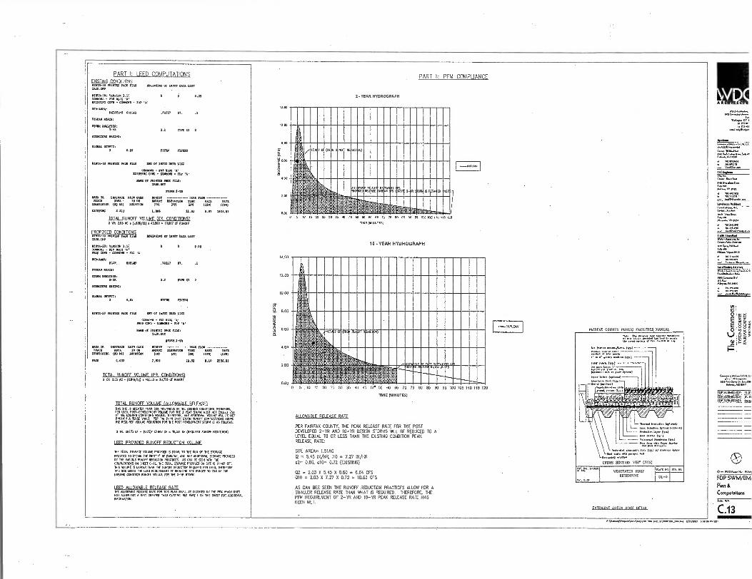
PART I: LEED COMPUTATIONS PART II: PFM COMPLIANCE
■ 11 • ECU I T 1C(11
w000,..4......... .0.............
..!..' W......• IX 7 10 /pm
.61.4.,
Aryl..
EXISTING CONDITIONS
2-YEAR HYDROGRAPH
12.00
1133037-20 PB.M.60 PAM 'Ili 112010410.03 Or MOT MIA LISP 72.20.1111
IMITR-101 0V .PION 1.10 atoms FOP MG V
0 a 0.03
22122IPC CORO - CaRIONS - Po, "A"
201-2102, MPS= 0011.20 .00311 rt. .1
MORN 2.17.73I2. 3.2 TIM II 2
112RUCTIM2 RAP..
710270 0170207: 0.05 MIA mnin
NIMR-20 PRINTED PAGE Mt NO Or MOP DATA MU
fKMMI -POP eN0 'A' MI2110 ONO • MOM - IDP 'M
UM Or PROMO PAM PILL: =CO.
Mrs 2.11
rLw APACE AAAA • 10 Ox MOM COMM TIM Mn 11272 ....0.. On .) ..... ism Vs) ono (MI (cm)
02M1110 0.003 1.656 11.93 5.91 1154,01
"MTN RUNOFF VOIDMF (EX. CONDITIONS/
10.03
COD
fi- ''
Ig 6.00
211. 11 ALAMO
....
17,4 7 a (FR MI 171/117- 0.DM
2.........u.2.125 ,12021.,...,......1 (4-1.4,0448.-44.4 tl...,. :4...ss.,11,...., f.....n
mm.rva 6 20.9.0 i
P,
4 00
..0
■ 1112LOW
400
IL 12.147.:,,....
t4... ■•,. V4
n a...7.
s.no 1.4.4.•. Van. Pa, ..0 CFI PVC 2.0 3-09A i5 2ETAA ED tar
0.00 10 15 20 10 00 25 40 45 50 X 60 65 70
...EASZEEEiREStro......
75 00
akiVI5RX9iWatteenaer,IXV........ 65 90
.
95 100 105 110 115 120
1.... A.1.2 p.A...2.1......o..
0.10....2021/14
pi 1.1,,.....,
'."'
a 721.241212,0 1 177 003 AC 2 (1.1106/17.) x43.000 • 13907 Cr RISICrF
PROPOSED CONDITIONS -+ =Z.,-
TIME (MINUTES/
. 10 - YEAR HYDROGRAPH
14.
VIII111-00 PAIR= PAM 1113 00211011302 Or WM DATA AM 0020.540
Inwn-so. num 1.10 5 0 0.06
PROP C.03 - Com112 - roe A..
000.2127: nor %mar .00317 Pl. .1
MGM PRAM
SIM P201.10211, 3.2 7222 21 2
MOM= MID.
010110. 0172P01, 0,05 PPM PM.
1111177t-20 PAM. PAU r11.2 MO or INPUT DM 1.132
MAKI Of MM. PARR .1112.: EA20.0T
ATOM MA
VACS ARIA 10 OR MOM OVUM. Ma RAU RATI ........ D IED MI Lamm (Ix) sr71 1231 1c., N.,
11.130 0.003 2.110 11.92 1.10 233591
TOT AI RUNOFF VOIUMF (PR. CONDITIONS)
l',...10.
1.. C.... .....a „;,,,,..., S.. .1........
: ;:::■;..0:::
12.00
10 00
41.
D. 5110
E2
8 0,00
a
4 00
200
0.00
'XI
.A...... 'Po., ta.LA.,,F,...4 4 v, .11......
Ma 0......... ,,Rn..„ N., Ws nun
. ...'. ,.. ,,,,," D V
NW'
W./ ,..........1.0.1..j...
M C
E 0
‘..)
EA1 .-C
I-
CO , t 8 8 g pc 1-,7.
$
§ $ u.
PROP CM - COMM- loP '7,'
-INFLOW MANUAL rmrtrAx COUNTY SULK FACILITIES .1. 029111101)
.7..i:■747942. rieFe-Fiii.r...
1910q A,
011111 EIT551:11C17,C, g• 1. r r..0. .... Dn. -
(It?
'Iter. ' 2 -.' . ' "
;• nRer Fsbne 11.1 o . II- 1■=1VV:=712V2y.7611
r.........0.44...L.ILL, 2,22026...,...1.2
.112.12 Or,SA. No ....,,,,,..
2 43 2.03 AC . 22915/10 x 43.350 • 20.773 a Mar
5 2. IA 0 M A II • 1 •
nitm• 7.2.4 (WNW) --
,,..4.4. ., A' A'
(7 5 10 15 20 25 30 35 40 45 5LE 55 60 65 70 75 BO 85 90 95 100 105 110 115 120
TIME (MINUTES)
AL OWAPLF RELEASE RATE
III
PSI
-I 2,12.1.= 1„. ,,,, '''' .... °”•. .,,,,,,.ffm• DP MIION 111.91
Da TOP SUBMISSION.s 1.01'..SUPA913122. OA ...;7,
,..-S... 9E1 , T•7
,
rii.,'A=71.Azi40,e4Tgreir2.4h.% s
, . sn
MS MW n KW,11E1 Ofli MO, 0051-021E1.0 EST VOLUME FM THE 2 AAR 311,111 MIST NOT EXCEED 75% OF 111E LAVING caimans VOLUME THOME. MY A001193.1 MINE Wu BE MET
111ROULM A REUSE VAULT. PER TIE 7-113 24123 57017M RUNOFF COMPOTATIONS AMOK ME MODEM VCADME REDUCES FOP ME POST DEVELOPMENT 575911 15 A5 0011.011
7 Ilt 00713 a -, (VS). atm sr .. 10,151 Cr (REQUIRED RUNOFF REDUCTOR)
I FED PROVIDED RUNOFF REDUCTION Vol UHF
lir 14 ,
pprrivrwr 1 / , /
I 1 . 1- ",,,.7 '"1.%""a7.,,I.,"1:: ' )
....- Dr. 0../
..,,,,.„,„,,,,,., L . __ ,...,..,....... 0.,,o
.---- "2:271.14= . ''."'"
----_-
PER FAIRFAX COUNTY, THE PEAK RELEASE RATE FOR THE POST
LEVEL EQUAL TO OR LESS THAN THE EXISTING CONDITION PEAK RELEASE RATE:
DEVELOPED 2-YR AND 10-YR DESIGN STORMS WILL BE REDUCED TO A
12 = 5.45 IN/HR, SITE AREA= 1.51AC
DO . 7.27 IN/HR 02. 0.60, c10- 0.72 EXISTING
02 . 2.03 X R45 X R60 . 6.64 CFS 010 = 2.03 X 7.27 X 0.72 • 10.63 CFS
....201.414., W00
P ME 701,11.515924E VIALI15197090213 15 ECION. 91,1 OF ME 52011ACE 10 St 0 PROMO 10 00100 ME mist 1 or RAINFALL AND ANT MINIMAL SI515920515920 PROVIDED BY ME VARIOUS ROW' REOUCIICOI PRACIICES. AS CAN RE MN Mil RR
MI5 1152E IS LARGER ',NAN ME RUNOFF00212CTION REWIRED 001 LEE% THESEFOK COMPUTAIIENS OR SHEET C-11, ME 1010.1. 61Cf420E PROVIDED CO S711 IS )7,491 CR.
AM 115 1,5515 ME 1.550 IIMUIREKNI OF REMOM ME RUNOFF 70 752 00
TIEEASING 011711200/1 :tutor VCLU/1E FOR ME 2-111 SINN.
• . • . •L •? E. -
11.222.2.1.11 Awm2212 2210 n.) .11...2. Woe DM 0112 .21.11 pa.....t 2..211. D
v/
\ \ Kr ,,, ey 0201.2
00055 SECTION 01012 (NTS)
VIA vivo
"G04}%,1"' Mit HO vil. Fo.
_ D1 -0 FDP SWM/I3M Plan & COMptItel0113
AS CAN BEE SEEN THE RUNOFF REDUCTION PRACTICES ALLOW FOR A SMALLER RELEASE RATE THAN WHAT IS REQUIRED. THEREFORE, 1HE PFM REQUIREMENT OF 2-YR AND 10-YR PEAK RELEASE RATE HAS BEEN MET.
ESTENSM CUM ROM OFTAII
WE 011.002222 401205E RAW FOR INK RAx SHALL OR 0070110 Or 400 PFM Mal 0050 NW MAW RC A 7Alt 0170T70 TIAN MMHG. SEE PART 11 0/1 1145 SHEET FN AMMON& 112201112ATION. A.. o.
•
C•13 ivpm4R.V.1.1.44..4400, SW INIV9UN11111011-22.2M 1/21/7011 *MP NM
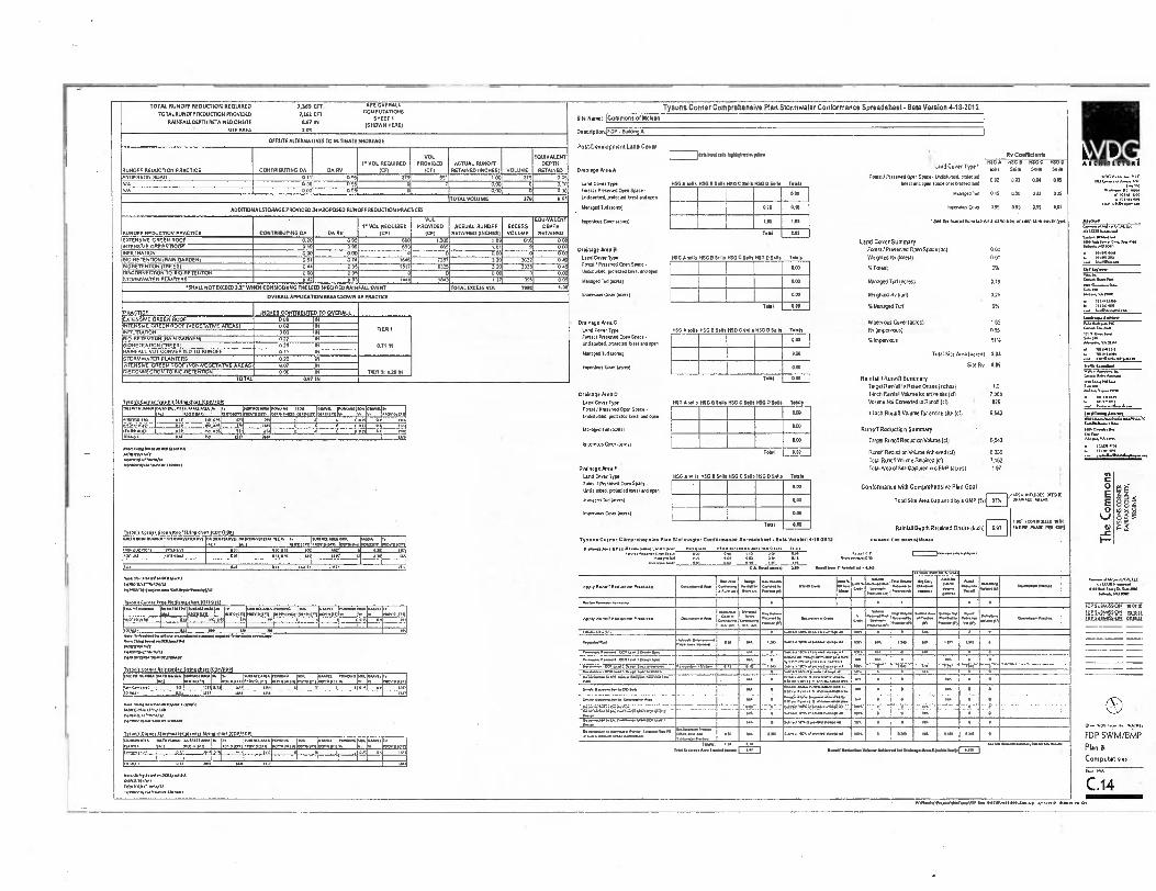
•._
TOTAL RUNOFF REDUCTION REQUIRED 7,369 CFT SEM
E OVERALL
TOTAL RUNOFF REDUCTION PROVIDED 7,161 (FT COPUTATIONS SHEET I
RAINFALL DEPTH RETAINED ONSIDE (197 IN (SHOWN HERE)
SITE AREA 203
Tysons Corner Comprehensive Plan Stormwater Conformance Spreadsheet- Beta Version 4.18.2012
l [!!11! 1(1111
*N.J..... TIC ,...„... 1., ...“,,,
s.c. ..... DC IS.
91 TA 9, °A
SR. Name: [Commons of Mclean I
DeSthplioniF DP - Burt. A
OFFSITE ALTERNATIVES TO MITIGATE SHORTAGE Post.Developmen1 Land Cover
RUNOFF REDUCTION PRACTICE CONTRIBUTING DA • DA RV ICFI
VOL PROVIDED
ICFI ACTUAL RUNOFF
RETAINED (INCHES) VOLUME
IVALENT EOUEPTH DEPTH
RETAINED
I 1.1.01.63•;•5111.10.11.
RC': fik17b IT VO L REQUIRED MG 0
Land Cover Type • 1150 A /1S' G 1150 5.. 505 . 5.0. 5..
Drainage P.m A Forest/ PM ened Open Space • 102,1014. prolected
0.02 023 004 aos Iona Com Type USG A sells MSG II Sells HSO C Sells 050 0 Sons Totals lot. and open space or 00001. Mad
ANDERSON ROAD 011 095 379 691 100 379 005 WA 0.00 095 0 0 000 0 0.00 NM 000 095 0 000 0 000 Fortst I Nese. Open Space •
UnSslabed, potect. lore.. Open
Managed Tod 1.10.11
,o..;,..,,, 00011..01
0.00 Managed Tod 015 020 022 025
IncenIeto Cool 0.05 0.95 0.55 0.16
• 5. 01.1...lona tab lot A . 'Milian of SIM land rover 0,0.
TOTALVOLUNTE 379 0.05
ADDITIONALSTORAGE PROVIDED IN PROPOSED RUNOFF REDUCTION PRACTICES 011 0.16
RUNOFF REDUCTOR PRACTICE CONTRIBUTING DA DA RV f VOL REQUIRED
ICE)
VOL PROVIDED
(CFI ACTUAL RUNOFF
RETAIN., (INCHES) EXCESS VOLUME
EQUIVALENT DEPTH
RETAINED
1.65
Toil
125
2.63 2............1202 DC de120111........1 Ga.. IM A..0...1
..11.4., AV R•D
.. .... i../sea i.
oi- .... vavireiv
EXTENSIVE GREEN ROOF 020 095 690 1.306 I89 DIN 000
Drainage k• a 13
Lend Cover Type
NT NE cno EN ROOF Lend Cover Summary
Forest I Preserved Open Space (0) 000
Weighed liv Sorest) 000 INFILTRATION
0 19
000 0 95
000 65
0 6 655 ,,
0
,, ,
0 00
g
0 '' 0 CC
8.0-RE 'FENTON FRAIN GARDEN, 061 074 5608 7357 320 3672 009 1150 A lolls H5G B Solis MO C Sells 1650 DSc. Toole
BrORETENTION (TREES, 004 095 1517 63.'5 120 3138 DOT Fe. I PRIM. Q. e • Spac Unftsturbed. prelected lamt ...en
Managed Tod (WU)
Inv.. Co. 1401001
0.0) .6 Foes) 0%
Wenage0 Turf (acres) 0 18
Weighted RV(1r1) 025
% Nonage(' Turf 9%
eke.... DISCONNECTION TO MORE TENDON STORMWATER PLANTERS
000 0.2
095 0 95
0 1.0
0 1003
0 CO ,21
0 195
00e
0055 909 96.... e...„....r.„ M•11.....4. D...5..... 0,144... 001•101
i..10 51,7_10_ 'SHALL NOT EXCEEDIS WRVS CONSIDERING 7W LESDSPECIFIE0 RA1NFALOSVERT TOTAL 03(CESS VOL 7900 1.00
I ... OVERAU.APPUCATION BREAKDOWN RV PRACTICE
PRACTICE
EXIENSNE GREEN ROOF Drainage Area C
Land Cover Tn.
Total 0.01 INCHES CONTRIBUTED TO OVERALL
Impervious Cover (acres) 1115
Rv (impe rvious( 0 95
11••••••• Aoki.
INTENSIVE GREEN NOOF (VEGETAINE AREAS) 0.02 IN 11011 1
I0•••■••NJ. (....11.0..A. DIN 2.... Ism saii no
: 11r. ••. ••••••••••••••.... 1,•111ung•■■■•1
.........• G....A...
‘"
.., 1...... L Tn. en/
rNFILIRATON 0.00 IN .0 A sells 1150 B Sells 1.0 C Balls 050 0 Sell. Tools
600•RETENDON DNIN GARDEN;
BORE TENT.. (TREES, 021 020
IN IN 07115
Ecrestr Pre.. Open Spaft - Lerriztudred, pre.. best am a.
Managua Tud (A.
Iwo.. Co.....
010 % impervious 91%
Total Silo Area (4£1' 31 001
Site Rir 029
Rainfall / Runoff Summery
RAINFALL NOT CONVERTS 0 TO RUNOFF 0 1 / IN 0.00 SIORIAVYATER PLANTERS 020 IN
OA •CrENS NE GREEN ROOF NON,EGETA770E AREAS) 007 ss DISCONNE cll.. TO TIC/RETENTION
TOTAL 000
0.07 IN IN
TIER III 026 IN
MSG A soils
Nal am
Drainage /Lea 0
ThenaSooporicce_PJLSInnoshar11662/.11121 Land Con r Type HSG B SIAN ASO CUSS WO DUN, 105(0
Tavel Ranlaa lo Fican Onsee frelys) 1.0
1.11 Rad. Volorne la Nike site (c0 7,369
VOLD. leol Converted to ROOT icl) 026
r'''"' r::,*""." 1::1:(Z70' l '•;[(9„••1:/g1T 107."1:;1[1 1::.,,,, .. .., ,, moron, races. I P.m. Cftn EP.. • 119651111.0. pr010/100 Well and open
Managed Turf WA.
1110 1anth Runoff Volume for entire site loll 6.543
Runoff Reduction Summary
TargelRunoff Reduction Volorne (di 6,543
Runo6 RDIVCIDAV01.111 khreved (c1) 6136
12•4110.11.••„.••
„„ ... .. „0 • It no ausl . To . ,1
„I 1 Oa
I 1 ' 1 .1, 04 •• e•
111 /1 r.
xxii
0 .00
0.00
1•441/0.604•40.1•••■•/9.4■ PC r........../..4... in. a...../..4.4
2.4••,•••■ IN
1 ■13111.019 1- 11111011,1
4 0111,11. e! in •iil ,iit a01 II •A fo
0.04
in :M Rs no YR
• no•Nbla•Nn1.0011.•0•41 war woo oiro nfauraN• ✓ yu ,00450.405 000500 "0.00
an ..... en lin _,J2211101.1.1022/1,0cD
Open.. Coo, (au osi Tool 0.00
Drainage 02.4 E
Lane Co. Ty. (ISO 000115 nso 0 0003 H30 C Sells HSO0 Salts
Tolal ROOF Volume Retailed (of) 7.162
Tolai Area of She Caplured 'in a BHP (8Cr eS) 191
Teals 61
,
0)
...0
i•••
The Co
mm
ons
I; NJ • - ,
FZ
VIN
IOS
IA
'AlN
A103 X
VO
rY4
N3N
S03 S
NO
SA1
Toes! I Prem. Open Space • Und.15.0..1.1. boil . open
app Conformance with Comprehensive Plan Goal
0.1.4401 (0,1 1310001 9.07 eAfO 021.5 0.0911
Total Site /yea Cap.ed by a IMP 15,) 97'10 00000000000 /ADS
impenious COW (•=11 ''
70M1 SIN Rainfall Depth Retained Onslte 0.97 iincin
1 CC :0919011W 1/111
161692 911494 PEP COP)
001$1.4101x0 r movvotronm 0/11M110111■0 .91
0111119X.KOLIAIIVII I. 1111••041 ARA104 No o on. Immo.. .0.0.11.1
WON IN arms. Irnoris Dr%
Ty•On• Corner Comprenenslya Plan Stormwatar Conformance Sprearieneet• 12.1. Version .15.2011 1.510..£000.0. et W.. ,
.....00.9. '011101v1 PODIUM 4„,,,,,,,,
um 0 OS
qt.
• /•
am arat a • 1•,. 1• 1•' 1 /
.0 occ. • /.' 1'
Dr* M.a A Foo• ntni L•na Cover o7 , le oft CO
.1.s.::::1;: 1,.., 1.1 OW OW OM 1111 1.11 ..i...... c... nco
'' ':.• •■•1.1••■•" el ir3 1bn•• WA .. •}4
........1.,..1ANIII ./.(041..........■
........ 0 3... 11.0../....10•MO
• 1• • 14 I
1.1...51 10111 1
1” 1
II oln1/./14..10[ A 1••■••
.1.••••••••••NwelaannerNiN12
Ty.. c ..... 1.1.9 NI. pets.) ......“
MAch
Apo', Runoff ..... 1. ■rasik.• 1 •••'•••• 4............. e......, 1000..
( In] il 11... twle VS..
C••••
.......=..,,...„.„, Now.gbe
yr.. l,„ „ P... "" '
!,
,,.., P.a. „.... ...••••• ‘,....... 1%.=••■ •■••••
I I • , . /OP 51.102.0590. 0 0.1 nt au..
A•al ......11..
eletO/1811 T. 111001(rn
.11.10ISA morel,
PP.. atm ml
Se% etrum[ni
GM.. "WO. orrnIPTIA ••• NYS tem. m•smob
App. . ......... •.... ......... l=c,
I ••• ■••
...sr ...........
N on
.........
....
.......'
o. 1 ,
...... ,.... ...7„,--;_•,.......................... ....,.. 1, .......A
•...7- .......7 ...... 1,..„... ,..4,..1..7 •, L-.......... IP, SveMOsc.1 Plis11 MESP .IlLalklicel PIMA .111 MINI MI 1111 ro 119, Itl 1 • II r .
Tot*, 911 HO 170 Y•1 sera.
Nen .1........l. 1,00.1./:
......... WOOrol+1 •31/0110/111401
iron's 0.11001,1•1/19.Order15111n“hirl 113(113 )
•••••.•• ■•,•• : • • .......
......... ..,.... .........1 gy
c 1...10.-.••••■ ■
w1
.„
101
• Na. 1.1......... of len 1 .1., lad
in
isb sus
•
•
• 1
I D. • • ..•'..-:[::::a
. . I us 170, I* 0
"...""""""tra* r.=',7," ` P IZ...,,1::g;;;`" .. '17.,..r.....4=r, 7,'"°"1` vn '4,,,-01.11 71. 7117
............... ..• - 055 • '7.7.:',7.',77'...7.7.:.. t
i ,^ • • . .
1 -)
g,... VG P.n.. 04. Wn .1.1111
r' 57:0-1 1 . :::""; 2 ' 1 LI 7 ,0, ' 1 - . ' ' 1 - '"1 Se, Ornin...0111., I
ifs
Oi.• In.. 1 ree.....1•• ■•• I •.•./.0n.1,........•.•••ft ,
I i.rVWW,i1.7.ii- 1 .. Wm. MI................ 1••••
I
_ •.1. ,._ • •
•
I:
1•• -
• --•
•
Yomliton. Merhont..•114-1.117 1.0.074•1.71•4.11.0 • INVIsr•eNa ■Novs,,,••••••,...,
•
DM'S cOl•Sf 5i.r9•1••1••01,1<f} 51y1p,p_artgpty PRI
Afte.P•esewoolu , 4.....•••••■•
..,,..............q.
oNN••• ■• ■••NT---1N• ON • ..t.........• 1 ma • , IP MP • • ........,.....
:-.7•••••-•-•-•---.....••••••• .......... ... ... 0410 i
...1........... I we 0 1 1.1 1............. .a OD 306 •• FDP SWM/BMP
Hon & Computations
`'"*.,,.."" 17:',''''''' ::::71 * r:,,,,, Km=„7-n :::;:,,,,I.,7,„„,rot7,7,,o 7-r r "--„,,,i T•Y1K CIO 0.14 •••10.11.4.11••••• ■••••••••••■••■
I 1 7 1 o . a o6 a. ...............,....... mum a........................614.1..rI
tel.. • • 11 1017 1„ ,,,,
INSIN•J• I •• N•No•A .10.11■01H•hr,
.0.01501.110.1 Of MM. C.14
60.....,I.1.M.I• NY ORISMIMINO-N. . VIVA. 5.00 ni tst
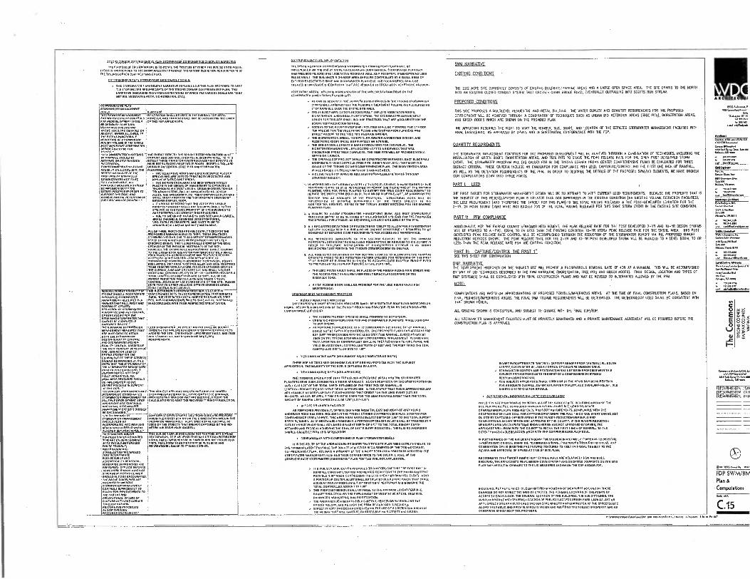
ARCNITICTUI
WMAd..,
'tr= 5.7 WON..
AMNON to.. utu ELL
SININDON 41.1.
VATTER
...M. ERN, MJA Cine 66.6■■ •
A.1.1., VA AIMI
1 1 I
0 E
I-
MRIP...4.00.•
EDP 5010405100 TN MIRDANSION OEM
fm, somrlIPIPN
OAR WOG WA1
EDP SWM/BM Plan & Computaions
C.15
‘41
5
Teo 11 CORNER rOMPREHENSIVE PLAN STORMVIATER CONFORILATICI CHFPNLIST WM./
THE PURPOSE OF INN NAM.. IS TO DETAIL THE PROCESS ET WHICHTHE SUBJECT S. WEIS. EACEEDS.011 'ROWELS TO TIN MAXIMUM EVENT POSEN. ME WNW REOUCTION P.IDDINNINEN111 OF THE TYSONS CORN. COMPREHENSIVE PLAN.
COLIPPERENTIVE PLAN TORLDVATEFI MANAGFAIENT .ALDI
• THIS STORIN.TER NANAOELIENT NARRATIVE EXPLAINS HOW 'INK PLAN PROPOSES T
ARE
O MEET IIN SloRLNIATER REOUNEVINTS OF TN!
O S CORNER COIAPREPPERSIVE RAN. MIS NARRATIVE DESCRIBES THE VARIOUS MAISONS WM. ON MARCUS GOALS 70 RE NET NOVI...ME ROOF,BIO.TENTION.ETC.I.
slRANx
AOESRxt FILTRATION 1.11EZMV1/1101 ON OVERALL CDP AN
▪
D WIEN ovnure ow" I OWEVER. WEILINATION SHALL NOT ISE UMW.. 7 LIIN” POP ACOMLOPAIFNI ',MOULD OF THO EDP APPLICATION.
tog. E ACIUNN itir0 OA MIND
;111== OR
'llf004=7:=21ER '
ITIPLITZIIV=;11 DPSION OBJECTIVE AOC
r:711"..eam trarcb-o Ku.. krlinUctima smmoo 0 to Oi NAINFALI. SHOULD BE J CAPTOR, AND CONTROL ME MAST NCH OF RARNAu_ Yo MIS
'""'" l="114711TIMV:EIE
II1E"IrT=4;17g.741 LvAroneApespanaN i URBAN MORETENTION (TREE PITS ARO STORMVIATER must. ON A °nue sm. 'Hz PLANTERS, AM.. OAS. OF THE • HIE VEGETATIVE ROOFS PIAVE BEEN DESIGNED PER OCR FIRST OFRAINF ALL AS WOO 0 AND ARE USED TO TREAT .0111.0ETATIVE AND DIAIONSINAMONOI I0 BF J 11..VEENTATIVE ROOP AREAS FOCI, ACJDEvADLE. •LL • THE MORETENTION AREA PERN STRATESDULLY
rEtV1.7gra 70' f7fE"' 7XErWSTEAE"T Val.! ir&legOt VggOVOR eneNrirossraLe OF10,17 PO FIL MS. WRL BE IMPLEMENTED ON C.T. MOP°. TAM RDAS AND ALLEY. AND AN... ROAD. TN sToRAPEIATER PLANTERS
• IT !HOMO BE NOTED THAT IRE USE ,,,zmtvrtr..
Z117;17:10VETZ0Vg0AATI4T01, THE MAMMA TO ANT POTEXTIAL LOCAT.11 OF THE. FACILITIES. • DUE 0 THE URBAN 4 DTLJA1g1S SIT:c =1, MALES,
ZETAT;VVIWITRIPS. gED MAO FLOW TO ' . CONSERVATION AREAS ARS NOT PRACTICADLI.
, ALL OF THESE PRACTICES ERE ADEQUATELY M./EOM/RT.
/ DEPTH OF
VENN.SPE INCHES GAS WINN COIMIERING THE LEGO
SPECIFIED THIS NULNER FAIL.1Sg1r OF THE 00AL
11.11=81M,Val=n11,NAglIntaTt" 'ALLEY COULD NoTGONTROLLENCAPHJ.0 0.10 TOPOONAPRK EON:FMC'S ROADWAY Is CROWNED, AS NAGS SEENNOTE11.11P”REA NICENE. ALLA MAO OFF/1 NINIIPACJ
;11E""FLAL"7.87/M'n'..0"171:41.711:117171:1711rAl ' • ADDMONAL coNTROLLED"DEPTH OF SA M EREBY
of A
TOTAL CONTROLLED DEPTH OREM OF TH
ALI. OF THE ; RUNOFF REDUCTION FRACTICES SIM YAMS A TOTAL ;CONTROLLED AREA. IAT ACRES 0.1510F THE S.. NOT:11:,,7 TRIS AREA INCI.1100 OPFSITE DRAINAOS AREAS
WRVS 01•12-Wni TrEMCIS 111111110;r1118117,6PRA " CIIDES Ma-RECCE° IN MONS SNOULD INOORPONATE CONFORMANOC MIN IDE OCR SPECIFICATION THAT 00VERNS POIOVATIVE STORIDWATER THEM TIE VEGETATED OOF1,1110RETENTION AREAS.TREE ASANAOPMEN AAAAA PITS. AND 671101INIATIN PLAN1.113 NAVE ALI. BEEN ORSICINED MENNER WM, WEL PIRSIAN, W.COADANCE MTH MEM FIES.CEND SEECIF1.11[111. PONAMPt. OPIIVICC NEM/CM* Of SIONADVARA AMOR, M... AND COMMIX OF /CAN FLOM,. DM PIECIA1N1741 SIONCOPArEN MAC WINO! IC COADY...UP
n■ '1:1:1' Ilg"THE
lrIPTI:77EN
41gtq 0 r8O REUSE
. :VAU
I MITAND T
T C ESR ADA PUFFICJANC TO Arr.,/ I AROUND SITE. GRE ROOF. M LT, EE
POEN THE STOMAVANN I RosyTORAGE VOLUME ARTILICHONS WET LEBO ODESION.01.NEIP. CONTROL . 111 REMEN
Vtl'Afg7tTNT1T1t. frl?17111P INN MOSP CJIPRENT MASON OF j INC ACCO.NCON LEFO-CS RAMO sr71141fOR FOICVALCNI OP TENSE CM 0101
0=1117 ■71rATI:NOTZIOF Mt Pr ONINWAIIN UNN LOCO
FULLY ACINAVADLE. ALL SNOULD
DE JAINCLAIENTFO CO THE f JOIN, AMIN. AI POEM
siOAANT APPLiu TAN 001(4107 FROPOSS SHARED " MCOPPONCC CIJORINNAIZO jVCIDIDNATEN ALITANAML 110.NIVID °Milt OrtAINAOI
ToEHAPA NA NANA DEANNE ON I FROM FRAM° RION7.0F.WAY HAS SE. NOUN/ED AVOINLE OCVALOPANN7 Str. CALCULATIONS TO MEET THE RP:DARED I' RUNOFF REDUCTION
AtANADEANII ,F 'ONTS MOULD 1 Of CNCODNA010. -
eLkitoutsifF Low vAdia9Kokit. ILAN TECOWEIDIS ARE movIT■Eci SrOCAPNAreN ADINANISIENI• FOR IN 710 ETIE.7 DESIGN VIA MR MORETENTION AA. N YIN SHOULD A.C., DP !MOON ON MAN STREET LS, TREE RIM EATERS wILL DE pe,ORIONAITOJATO NNW AND us.. T. STREETS MAT ARE NOT PAPTDRED RY TIN B. PAOLSIONED INAPT .1 WHERE i RETENTION BASIN NW...ROHN ALLOY/CO AND PFLACCCANI.E.' I
TT
TIN SUBJECT APPLICATION owefftWATF•511 ANY sfir0- SIADILICAtION OPOCORADEO RESTON... R. I. BELI:70 77=ANT ITIEZRErORArN
1:47 =:17 I =la CF 111/1711. INAn 01 TIO'AJI?" WHERE FEASIBLE: IJICCREATONAL VALUC TO TYSON& CORNER DOSIONAPON ANO
f,`,17141=1;i"'"' ; ECOLOOICALLYAND
IMPENDED OFF.SNE FFFORIS I 10 RESTORE AND.OR SIA01121 AAAAA IN MONS CONNER VIOL. PACO NC CNCPIANADFO.
ABOVT OLROPLINES ANA I INIINDLO IMADVE TRNIAAVAIY IMINALFAENI 1 •
I 'll".711.14==11 TO ON 'WNW AND
OCCOVON NACURAI.
74=170::7"" PPSIONATION PROJECT:
;OLIPREHENI.IVP PLAN BPI EMENTA1115
YIN MONS CORNER
use STORMWATER MANACIENIMIT PLAN SHALL BE
IMPLEMENTED VIA THE LISE OF BPRETENTIONAR.S MAIN GARDEN. ”ORMWATER PLANTERS. AND TREE BOX FIL FILM .0 VEGETATIVE ROOFS AS WELL AS A POTENTIAL UNDERGROUND LEN REUSE VAULT, ...LOIN. RION POOP ARP" .ALL BE CONTROLLED BY A SMALL AREA Of EXTENSIVE VEGETATIVE ROOF .D STORLIWATER PLANTERS. THE POORNI LEVEL SMALL BE TREATED BY INTENSIVE ORE. ROOFS THAT A. DESIGNED TO TREAT BOTH NEOETATIVE AND NON.
VEOETATIVE AREAS. BELOW IS • BREAKDOWN Of TIN IMPLEMENTATION ITS. ON THE STIROAWATER CONFORMANCE CHECK LIST:
AS CAN BE SEEN THE COMPUTATIONS PRONMED PI TIN TYSONS STOIDAVATER COMPLIANCE SP.ADST ME REQUIRED TREATMENT VOLDAM.11 CALCULATED AS 1 . 0F RAINFALL OVER
HEEENDRE SIM AREA.
THE SUBJECT APPLICATION SUCCESSFULLY EMPLOYS DEOETATED ROOFS, IORETENTION, AND URBAN MASTERDOM. THE STORMVIATER MANAGEMENT
DEMON FOR THIS UTE SHALL INCLUDE PRACTICE. THAT ARE DOCUMENTED IN THE OCR RUNOFF REDUCTION MANUAL AO.SS To MN STORsIWAIIR DAM FAMINES SHALL ISE PROVIDED FOR AN D
O TOP ACCESS FORTH. VEGETATIVE. ROOF. AND STOWWATER PLANTERS AND STREET ACCESS TOME TREE PRS AND RAIN GARDEN. IRE DIORETENTION AREAS, TREE PITS. RAINWATER HARVESTING SYSTEM, AND VEGETATIVE ROOFS SHALL DE PRIVATELY MAINTAINED.
OESION SHALL CREATE A SAFE ENVIRONS*. FOR THE PUBLIC. ON DIORETENTION AREAS NALL BE LOCATED NESTTO A SIDEWALK THAT STILL DISCOURAGE PEDESTRIAN CONFLICTS. THE TREE PITS WEL BE PROVID.W. A CRATE oR A FERCE.
. OVERALL COP PROJECT SHALL BE CONSTRUCTED PI PHASES. EACII BLOCK HAS INDEPENDENT SWIS CONTROLS ITREE PITS. °KEEN ROO, ETC.. THAT MEET TIN GOALS OP THE MONS CORNER COMPREHENSIVE PLAN. THE MORETENTON AREA IS S.0 BASED ON THE ULTIMATE GDP DRAINAGE AREA. A DETAILED LIST OF VI AMERS REQUIRED FOR .NELTENTATION OF TINS SWAN
INCLUDE:
.:72=1.1t"11.1171111=1797177=-771711:76=OTTITIEZIPP= PLANTWO AREA FOR TREES PLANTED TO SATISFY THE TREE COVER REQUIREMENT0 7 REDUCE ME VA0711 FROM WONT NI F1.70 A MM. OF FIVE IN FT.ASSNOIAM THE
F1.71'.ZEIg: 7:1 7,1T: IZA.77'07 . ,10DIF=:0N REFER TOTES T
ZYPICAL STREET SECTIONS FOR THE GRAPHIC
Plt:74"&laWVAIIII7J17.2,7,91=:ITTZ:g.Tr.::::=1"74 GOVOINED ET MOWN. CODE REOUNELIENTS FOR ACCESS MND MAINTENANCE.
" """
1.74,::g1,1.1=1:4L,,71;74°T;TO ""'°' ""*" °"°
SIDEINALN NNE
ACM' ACCESS DOOR SHALL BE PROMS° FOR THE LEM REIM VAULT FOR
DESIGN OP BEST ISANAOPLIFIN PDAPTIE,11
PZ=S::=101FTPE71:1=PACTICES SHALL DE DEOETATIVE ROOFS AND MORETENTION AREAS, BELOW IS A BREAKDOWN OF THE RUNOFF REDUCHON PRACTICE ITEMS ON MN STORMVIATER CONFORMANCE CM.
• HIE VEGETATIVE ROOF SYSTEMS .ALL CONFORM TO DCR SPEC.. . DEBAR MONETENTIOM (TREE PITS AND STORMWAIER PLANTERS] SHALL CONFORM
TO OCR SPEC.. As rEENTONED EARLIER DUE TO S. CONSTRANITS WHILE IA' OF RAINFALL COULD NOTRE CAPTUREOCONTROLIZO. THE PROPOSE, PLANS CAN ACCOUNT FOR OAT NAV WINN CONSIDERING THE LEST SPECIFIED RAINFALL EVENTIAS CAN BE SEEN. ME TS.S INORMWATER CNNFORMANCE SPREADSHEET. PLEASE NOTE MAT A PORTION OF CENTER ALLETSHALL BE TREATED WITH A FUTURE PHASE .0 YIELD AN ADDITIONAL CONTROLLED DEPTH OF OD.T . AND MEREST BRING THE TOAL CONTROLLED DEPTH ON SITE 70 'AC
• TIER 2 INNOVATIVE EMMA DIONNUNOFF REOIJCIRDIFILIERING MOP'S)
MERE ARE NO TIER SPEW OR INNOVATIVE WM, BEING PROPOSED WIIII THIS SUBJECT APPLICATION. ME MAJORITY OF THE MRS CAPTURED BY A BLIP.
• 71.3 EINOVADVE IIMYS (.1011.APPROVEIN
IDE INIT.. ORM ROOF THAT TREATS NONVEGETATIVE AREAS AND THE STORATNATER PLANTERS HAVE BEEN DESIGNATED A DER AI APPROACH, AS CAN ...EN ON ME COMPUTATIONS ON SHEET CAI 6.1r Of TN TOTAL DEP. RETAINED OF THE
WIDE OF RAINFALL IS
CONTROLLED:CAPTURED BY THESE HER IR APPROACHES. WIDE ADVENT THAT THESE APPROACHES ARE NOT FEASIBLE AT SRE PLANO. IT IS IIEQUESTED THAT CREPT FOR INE LE. EVENT ALLOWED. AS CAN BE SEEN If THIS CREDIT GIVEN FOR THE LUG RAINFALL EVENT MEN T. TOTAL AMOUNT OF RIJN.. RETAINED SHALL BE LI, ILTI,IAMI,
• OFFSITE OR SHARED FACILITIES
AS TFENTIONED PREVIOUSLY, OFFSRE DRAINAGE FROM IRE EMMET RIONTOFWAT ALONG ANDERSON ROAD 11113 BM INCLUDED IN THE MONS CORN. COMPREHENSIVE PLAN STORDWATER CONFORMANCE SPREADS.ET. THIS AREAADDE AN FOUNALE/17 DEPTH OF RSV TO IRE TOTAL RUNOFF DEPTH RETAINED. ALSO HEMMED PREVIOUSLY A PORTION OF CENTER ALLEYS.. IN MATE) IN A FLITURE PHASE MICH SHALL ADD AN EQUIVALENT DEPTH OF 0.1, TO THE 'TOTAL RUNOFF DEPTH RETAINE0 AND THEREBY ACHIM. MN GOAL OF 1.110 RUNOFF REDUCTION. THERE IS NO PROPOSED SHARED FACER/ES WHIN THIS APPLICATION.
• CONFORMANCE VRTII COMPRENENSIDE 11411 STORMWATER GOALS
IT IS TINE BELIEF OF MN UNDERSIGNED ENGINEER IIIAT THIS SITE MAN ADEQUATELY HANDLES, TO THE MAXISILNI EXTENT POWER, ME RUNOFF REDUCTION REQUIREMENTS OF ME MONS CORNER COMPRENEINNE PLAN. BELOW IS A SUSIMART OF THE RUNOFF REDUCTION PRACTICES UTIUM TILESTORMWATER MANAGEMENT PUN AND THEIR CONFORMANCE TO ME OVERALL 00AL OF ME COMPREHENSIVE SIORMINATER MANAGEISENT MAN FOR THIS SUBJECT APPLICATOR
) TH”UBJECT APPLICATION PROPOSES. TO CONTROUCAPTURE THE FIRST 0.1,OF RAINFALLNIFILINATION AND RUXOF1 REDUCTION TO DIE MAXIMUM ESTE. POSSIBLE 0.01, WHEN CONSMERNIG THE LEEN SPECIFIED RAWFALL EVENT1 ALSO, A PORTION OF CENTER ALLEY WALL BE TREATED PI A FUTURE PHASE MAT SHALL
MF ACCOUNT FOR A“ODITIONAL CAM DE RUNOFF REDUCTION AND BRINGINGTOTAL CONTROLLED ALIOUNTTO 1.1Ir MIS PROPOSED DESIGN SHALL °POMO., TO THE MAXIMUM EST., 'GENRE. RUNOFF REDUCTION VIA THE EMPLOYMENT OF VEGETATIVE ROOFS, TREE PITS. RAINWATER HARVESTING, AND OPRETENTION THE PROPOSED DEMON DOES HELP CONTROL PEAK FLOW BY REDUCING THE RUNOFF VOLUME AND AS SUCH ON PEAK DISCHARGED IS REDUCED STREET RUNOFF HAS BEEN AODRESSEO VIA THE USE OF BIORETENTION AREAS IN TIN MEDIAN THAT WILL CAPTURE RUNOFF FROM MAIN STREET AND UPDAN.
$WM NARRATIVF
EXISTING CONDITIONS
THE 2.02 ACRE SITE CURRENTLY CONSISTS OF EXISTING BURDITIGS/pARXING AREAS AND A LARGE OPEN SPACE AREA THE SITE DRAMS 10 17E NORTH INTO AN EXISTING CLOSED CONDUIT SYSTEM THAT CROSSES CHAIN BRIDGE ROAD. EVENTUALLY OUVALUNG INTO SCOTTS RUN STREAM.
PROPOSED CONDITIONS
THIS SITE PROPOSES A MULTILEVEL RESIDENTIAL. AND RETAL BUILDING. THE WATER QUALITY AND OUAN1TY REQUIREMENTS FOR THE PROPOSED DEVELOPMENT ITU. BE ACTOEVED ThROUGH A COMBINATION Of TECHNIQUES SUCH AS URBAN 1310-RETEN1ON AREAS (TREE FITS). WREN/MON AREAS, AND GREEN ROOFS WHICH ARE SHOWN ON THE FRONDED PLAN.
THE APPLICANT RESERVES THE RIGHT TO VARY THE NUMBER, SIM SHAPE, AND LOCATOR OF THE DEPICTED STORIAWATER MANAGEMENT FACIUDES NTH FOAL ENGINEERING, AS APPROVED BY DPWES AND IN SUBSTANTIAL CONFORMANCE NTH THE FOP.
QUANTITY RFOUIRFMFNTS
THE STORIAWATER MANAGEMENT CONTACTS FOR THE PROPOSED DEVELOPMENT BILL BE ACHIEVED THROUGH A COMBINATON ar TECHNIQUES, 110.0 LNG THE INSTALLATION GE GREEN ROOFS, BIORETENTION AREAS, AND TREE PITS 70 SHAVE THE PEAK RELEASE RATE FOR THE OVEN POST DEVELOPED STORM EVENT. THE STORMWATER PROGRAM 1TTU. (AS CALLED FOR RI THE TYSONS CORNER URBAN CENTER COMPREHENSIVE PLAN) BE EVALUATED FOR THREE DISTINCT CILTERA. THESE CRITERIA INCLUDE AN EVALUATION FOR COMPLIANCE WIN LEED, CAPTURING/CONTROLLING THE FIRST ONE NCH OF RAINFALL.
AS WELL AS DE DETENTGN REGUIREMENTS OF THE PFIA. RI ORDER TO DESCRIBE TIE DETAILS OF THE PROPOSED SWTI/LID ELEMENTS. WE NAVE BROKEN OUR COMPUTATIONS DOWN INTO THREE PARTS.
PART I: I FFD
THE 0051 TARGET FOR STORIAWATET MANAGEMENT DESIGN BILL BE TO ATTEMPT TO MEET CURRENT LEED REQUIREMENTS. BECAUSE THE PROPERTY THAT IS THE SUBLECT OF 1405 REDEVELOPMENT FLAN IS GREATER THAN BOX RAPERTIOus IN ME EXISTING CONDITIoN (No OWING VOLUME REDUCTION FACILITIES). THE LEED REQUIREMENT (AND THEREFORE THE TARGET FOR THIS PLAN) IS TIE TOTAI. VOLUME RELEASED IN THE POST-DEVELOPED CONDITION FOR THE 2-11, 24 HOUR STORM EVENT MUST NOT EXCEED 75X OF THE TOTAL VOLUME RELEASED FOR THIS SAME STORM EVENT IN THE EXISTING SITE CONDITION.
FART II: PFM COMPIIANCE,
ADDITIONALLY. PER THE FAIRFAX COUNTY STANDARD REQUIREMENT, THE PEAK RELEASE RATE FOR THE POST DEVELOPED 2-1R AND 10-111 DESIGN STORMS W0, BE REDUCED TO A LEVEL EQUAL TO OR LESS THAN THE EXISTNG CONDITION 10-YR STORM PEAK RELEASE RATE FOR TIE ENTIRE AREA. NIS POST DEVELOPED PEAK RELEASE RATE CONTROL MU. BE ACCOMPUSHED THROUGH NE REDUCTION OF THE STORMWAILli RUNOFF NA THE PROPOSED RUNOFF REDUCTION IAEITOOS 910VN THE PEAK RELEASE RATE FOR THE 2-NR AND 10-YR POST DEVELOPED STORM WILL BE REDUCED TO A LEVEL EQUAL TO OR LESS THAN THE PEAK RELEASE RATE FOR THE EXISTING CONDITION.
PART OIL CAPIIIRF/CONTROL ME FIRST I" SEE 1111S SHEET FOR CONTINUATION
PP NARRATIVE. TTIE DEVELOPMENT PROPOSED ON THE SUB.ECT SITE FILL PRONDE A PHOSPHOROUS REMOVAL RATE OF 40% AT A TAINIMUTA. INS WILL BE ACCOMPLISHED BY WAY OF UD TECHNIQUES DESCRIBED IN THE SWAN NARRATIVE (DIORETENTION, TREE PITS AHD GREEN ROOFS). FINAL DESIGN LOCATION AND TYPES OF LIMP SYSTEIA(S) SHALL BE ESTABUSHED WIN FINAL CONSPIUCTION PLANS AND MAN BE RENSED TO ALTERNATES ALLOTTED BY THE PRO.
MEL
COMPUTATIONS ARE BASED ON APPROXIMATIONS OP PROPOSED PERVOUSAAPERNOUS AREAS. AT NE MK OF FINAL CONSTRUCTOR PLANS, BASED ON FINAL PERNOLOMPERNOUS AREAS, THE FINAL 5101 VOLUME REQUIREMENTS WILL BE DETERMINED. THE METHODOLOGY USED SHALL BE CONSISTENT WITH THAT SHOWN HEREIN,
ALL GRADING SHOWN IS CONCEPTUAL AND SUBJECT TO 0141102 VAN TILE FINAL CDP/IDP.
ALL STORIANATER MANAGEMENT FAULTIER MUST BE PFNATELY LIANTAANED APO A PRIVATE MAINTENANCE AGREEMENT 111U. BE REQUITED BEFORE THE CONSTRUCTION PLAN IS APPROVED.
ITIORETENTIONMIEE PITS THAT WILL OF
RUNOFF FROM CENTER LANE. SOON SMEET.COLSHIRE DRIVE. ANO A PORTION OF COLOUR! MEADOW DRIVE.
• STREAM STABILLTATION MD RESTORATION HAS NOT BEEN PRI/1, 08E0.7H THIS SUBJECT APPLJCATONDUN TO Int NM OF A COIAPPENENSIVN OAF.. RESTORATION PROC.!, THIS SUBJECT APPLICATION SHALL CONFORM TO TIN PEND MIA REQUIREMENTS FOR DEO.TE CJTFALL. DETENTION, WATER GUAUTY.AND °VERNE° RELIEF. SEE SHEETS 70 C.I3 f OR DETAILS.
• ;UP PLPMENTAL INFORMATIONNIIETNICATION 114CRIEST.
WHILE IT IS NOT PRACTICABLE /a RETAIN ALL OF THE SUBJECT SITE, INCLUDING AREAS OF ME ERE PERIPHERY. ERN TOVARPUS CONSTRAINTS INCLUDING SITE CRAM.. OTHER COMPREHENSIVE PLAN REQUIREMENTS, AND MOOT REOLBREMENTS. COMPLIANCE MTH THE COMPREHENSTME PLAO/ 00AL f OR CAPTURINGATETAINING THE FULL I.INCH DAN EVEXTCA BF ET ON MTE BY CAPTURING OFFSITE AREAS THE RUNOFF REDUCTION MEASURES AND COMPUTATIONS SHOWN HEREIN ARE APPROVED STINE COUNTY. A ME RUNOFF REDUCOH REWIRES AND/OR COMPUTATIONS SHOWN HEREIN ARE NOT APPROVED BY OPINES, ME . APPLICANT WILL WOREWRH THE COUNTY TO RETAPI THE FIRST T.INCII OF RAINFALL TO THE ESIENI PRACTICABLE N ACCOROANCE WITH THE COMPREHENSIVE PL. GOAL
FURTINFMNCE OF THE APPLICANTS SOMINTMENTSI HEREIN AND MILER INTENDS 10 MENTION I...RETENT
OP ION 0AL USING THE TECHNIQUES SHOW
E TO AN,RESERVES THE RIGHT 70 MILE ANY
COIMINATION LID TEE/VI AND flan., IACASDNE IEET DIAL SUBJECT TO ME REVIEW AND APPROVAL OF
NO DPWES AT TIME OF SITE PLAN,
RECOGNIEING MAT RUNOFF REDUCTION TECHNOLOGIES ARE RELATIVELY NEW ANT/ STILL EVOLDWO, THE APPLICANTS MEAL DESP. DEVELOPMENT ANWOR OPP/ES COMMENTS ON THE SITE PLAN MT RESULT IN CHANGES TO THE 1.10 MEAS.. SHOWN ON ME C. ARDOR FOP.
INCLUDING, BUT NOT LIMITED TO, ELIMINATION OR ADDITION°, MEASURES 60 LON° AS THESE CHANGES DO NOT AFFECT THE GRID OF SPIEETS. ME GENERAL LOCATION Of ME POINTS OF ACCESS TO EACH BLOCK:ME GENE.L LOCATION OF ME BUILDINGS,71. BUILD-TOURER,. ANNULI AMOUNT AND GENERAL LOCATION OF PUBLICLTACCESS URBAN AN LANDES MAT BE APPLICABLE F. EACH BLOCK AND THE GENERAL QUALM. AND CHARACTER°, ME STREETSCAPE ALONG THE PUBLIC AND PRIVATE STREETS WITHIN AND ABUTTING IND AUCIECTPROPERTY AND. OTNERVMSE SPECIFIED IN THE PROFFERS
NWRAMISNRIND1AMANTYPE HIV MOTEMMaimo...S.m. 1A•/Nil ASA N IV III
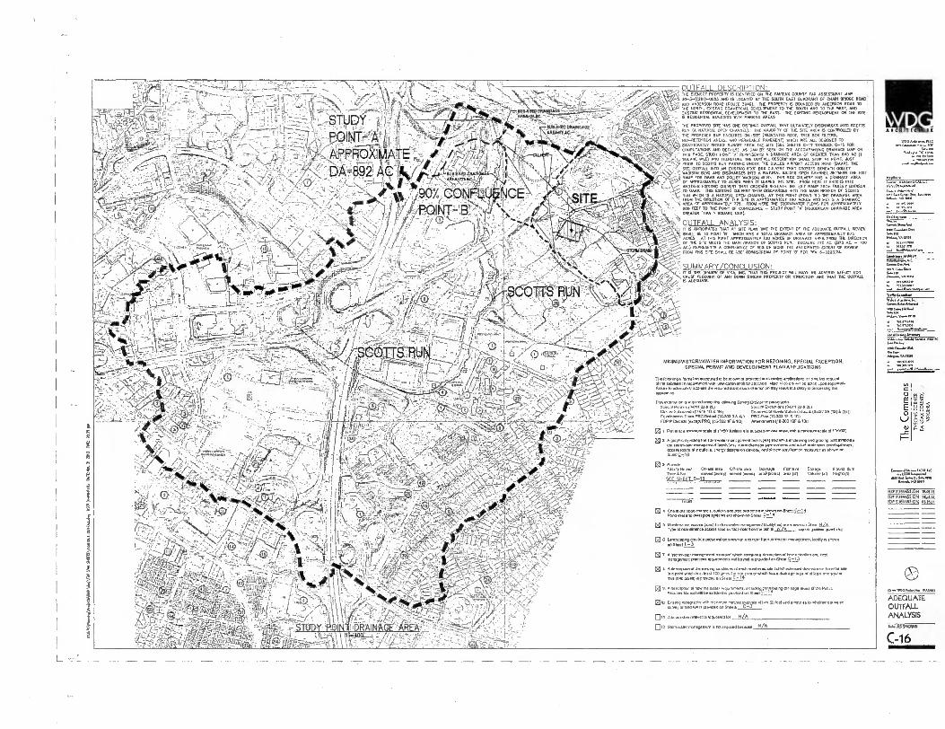
OUTFALL DESCRIPTION: THE SUBJECT PROPERTY IS IDENTIFTED ON THE FAIRFAX COUNTY TAX ASSESSMENT NAP
50-54(2C-000.5 AND IS LOCATED AT 11W SOU. EAST QUADRANT OF WIN BROX ROAD
AND ANDERSON ROAD (ROUTE 3510. THE PROPERTY IS BOUNDED BY ANDERSON ROAD TO E NOR., EXISTING COMMERCIALDEVELOPMENT TO THE SOUTH AND TO THE WEST, ANO
TS RESIDENTIAL BUILDINGS USING REGIIENTIAL DEVE
YOH PARIGNG AREASLOPMENT TO SW EAST. THE OWN° DEVELOPMENT ON THE DM
THE PROPOSED STE HAS ONE DISTINCT OUTFAIL THAT ULTIMATELY DISCHARGES PITO SCOTTS
7THE' gO;OrOBTArFACITITIETC4-SIZ (VEGETATED ROOF, WEE = 'FIL=T""rD BY BIO-RETENTION AREAS, AND PERMEABLE PAVEMENT) HOOCH ARE ALL DESIGNED TO SIGNIFICANTLY REDUCE RUNOFF FROM THE SITE (BEE SHEETS C-12 THROUGH C-I5 FOR COMPUTATIONS AND DETAILS). AS CAN BE SEEN ON THE ACCOMPANYTNO DRAINAGE MAP ON • TINS
PACE. SNOT POINT T A T REPRESENTS A DRAINAGE AREA OF GREATER MAN BOO AC (I
SNARE IMO AND THEREFORE THE OUTFALL DESCRIPTION S.., STOP AT POINT. JUST RIM TO SCOTTS RUN PASSMO UNDER THE DULLES AIRPORT ACCESS ROAD NAAR). THE
SITE DUVALL INTO AS EXISTING 111IS BOX CULVERT THAT CROSSES BENDA. TOLLEY MADISON BLVD AND DISCHARGES INTO TO NATURAL INCISED OPEN CHANNEL BETWEEN THE On
G RAMP FOR DAAR AND GULLET MADISON BLVD. THIS BOX CULVERT HAS A DRAINAGE AREA OF APPRO./711Y 75 ACRES WHEN IT LEAVES THE SITE. ROM HERE IT ENTERS INTO ANOTHER 01,110ING..Csillir LT= C.1.4.ccE:, BOAZ% Ixf. E./..; RAMP FROM COLEY MADISON
IA BRANCH OF SCOTTS t RIN WHI. IBA NATURAL OPEN CHANNEL AT HIS POINT (POINT TEO THE DRANAGE AREA , TIT FROM THE DIRECTION Of THE SITE TS APPROXIMATELY 100 ACRES AND MEETS A DRAINAGE
AREA OF APPROXIMATELY 775. FROM HERE TIE STORTIWATER FLOSS FOR APPROMMATELY ROD FEET TO THE PONT OF CONFLUENCE - STUDY POINT V (FLOODPLAIN DRAINAGE AREA GREATER THAN 1 SQUARE MILE),
OUTFALL ANALYSIS: tt,
' IT IS ANTICIPATED THAT AT SITE PLAN TIME THE EXTENT OF THE ADEDUATE CUITALL REVIEW
t SHALL BE TO FONT TEI• WINCH HAS A TOTAL DRATNAGE AREA OF APPROXIMATELY 075 ACRES. AT THIS POINT APPROXIMATELY 100 ACRES OF DRAINAGE AREA IRON THE MACRON
T OF THE STE MEETS THE MAIN BRAN. or SCOTTS PUN. BECAUSE 775 AC (I173 AC. - 100 AC.) REPRESENTS A CONFLUENCE OF 000 OR MORE NE ANTICIPATED EXTENT OF REVIEW FROM THIS SITE SHALL BE ISO . DOWNSTREAM OF POINT V PER PM 6-020171.
SUMM ARY/CONCI USION: IT IS THE OPINION OF WIN INC. DOT THIS PROJECT Val HAVE NO ADVERSE EFFECT NOR CAUSEFLOORING OF ANY DORM STRUM PROPERTY OR STRUCTURE AND THAT THE OUVAU. ISAGE GUATE
A.--
• ‘""`i.r,
ttatrt • - •
""'''''-‘ ----<37,. 4' 6-1*-V0 'rt, ''-'.' ' ' • I - ,0;,:\-• •
4:1,-/<:::1•,<<",r44'
..:3-.:-''.■ 1.,;')? '''...X -.IN.c......it•- -....A.-;I:
..
'-• `'...,‹ v.„.,/,...
ORA!
MINIMUM STORMWATER INFORMATION FOR REZONING. SPECIAL EXCEPTION. SPECIAL PERMIT AND DEVELOPMENT PLAN APPLICATIONS
Tbe Ouenno infamehon Teepretl.lanerven provicied 'kenning epplRellons TT Heim loon. Ilas sularression mummer/I run SSW nadvaIna VI...emu. Lc esne
Nine lo soequeleX anion Us rep.. suborrEad.1.01rnalmrs ma, result in a *nay In poen.° Oa
kaplumten
TOG iNorincian es le,. Tfieen ON Weans Zee., CuSnanixe ,RMOICITTS Specla, Purivis (0-OTT 025214 Special Exeeplionl TH-011 (J AL) Custer SulAnnsion 10.615 TIG 151 CMmmTDGIA ResTaTualmo CHING 10.2220(12)6 11111 Cnnotiprennt Plans RRC DR.( 00102 3 IS AL) PRC Pun IT G-103 If ICS
FOP P CRP. (G.TCPpl PRO 116.50( IF 610) Aireinnells (10.707 10F 6 1011
Ei I GMT S et a winineulsoeM ol ITen Mins IT is Repsed en ono Male:W.11a rnallaul■ Kale d 1, 1001
El 2 A pro (AG Gem sup Pm Ito mangler mane Demers Taceisisu louImes el clooeug enG Draping aowmmoOme
The alumna. rnenepetnere laoliTylose) mum drainage Pin fnevems and Due euxemsn Ford spnrays. access Twin, Mm cullellx energy dedRalun devices. MU eTteanIslanzalian Tneasues es MIGHT nn
jU
El a Prowls Faulty Num/ Onsle ere* Man area DERMOT Foal,. SATIN Uwe, Dan Nees. mune Ram senu.screc) 4 ,0i(aVeS) if. I.) V... (Al) , .17,4
2 pd) to slanInrelet inersperriont Tsai.= I we stens,. Sheol RI&
Type d mainlenance saes!. road NOGG MN on RN Fi minus 'Hu. FANO •NI
• Lanck.a,“- re. Ls TIM pinery/In Scum en and renT slarnnertr 'management !PARR Mown on
® T A Isionnweiet inetsgeenere Norms, shun cartons ...tutu° d law Selection ar4 nmna Domed praellee• requirements. De met m plw,dall THIS...P..1_3
11.IkYS0I.,M Me ens., cmal.hons of et. num...ed.. e..11.1erpeaclovernueren 11.11. lb! I. 10e point 0.11 is el kast TOO buss The NIT Wee IX MUM IMS. U ...en area al et Pest one pule nee iDo peas) is pined. on Ste. C T
® U. A ilesorpron of new T. NANG recurerneres. noluDngsopppulin( Of V.V . 1.02 eine PubIe Erase Manual seOched is co Shoed T-=T
NTO EvisT,J topppoply with M.= 0311. Interval. DI MR 121 led Nee norA at to wnelner miss Anvey or new. is poridea S.. C-3
011 A suPTesseanvnTlver Ts requested lot NA
012 Slonnoslet nonage MG is rot leg.. Lenuse
Fe.....7 ‘ •
S
I
Ten Tea %TRH,. DE Toau
n'T:e7T7g T.T.TO
CRhanDeRee
1,1RuumleNRIefaewle PG
AT.,., HOMO
c O E E O
_C
GeLCORTHeemenT mssIGG So, 0, Ns me
onr
KJP 5UBM1SSX0N 10.07.15 ID/DIRRADDIOR HOP fUYMISSION °AURA.
0 A. TAM,* YAMS
ADEQUATE OUTFALL ANALYSIS
C-16
n
L

ARC.NITIECTU
WOO MInnwa toy
:=VA Moo
=ha' .6,1,1 Mtn
Adm.. VA tem
6 101.1”.M1
88; Ye
C
E
LI
I-
EDP SUMMON ILE TOP SETNESSION SR MP SUBMISSION 5L7
Emergency
Access Plan
5.1.4.5 SHOWN.
C-17 \192.10610.7.01 \projects \ Planning \Proiacts 56111 dwq 60811014ov 2/15/2013 07.25 02 EST
— DENOTES BUILDING HEIGHT 10 — 50 FT.
— DENOTES BUILDING HEIGHT GREASER THAN 76 FT.
— DENOTES FIRE/EMERGENCY VEHICLE ACCESSIBLE ROUTE
FDP Building Data
BUILDING 1: 2 — 15 STORY TYPE OF CONSTRUCTION
NUMBER OF STORIES BUILDING HEIGHT BUILDING FOOTPRINT BUILDING FULLY SPRINKLED PER NFPA 13 SPRINKLER TYPE FIRE WALL RATING OCCUPANCY/USE GROUP
1A MODIFIED TO IB PER TABLE 601 (EXCEPTION 403.2.1.1)
15 ± <160' 38,762 SF
Yes 13 2 HOUR R-2 (APARTMENTS — PRIMARY USE GROLP A-3 (AMENITIES/FITNESS) B (LEASING OFFICE) S-1 (RESIDENTIAL STORAGE) S-2 (PARKING GARAGE)
NORTH GRAPHIC SCALE
Intl N I ha. Sff

ANCNITICTIIIII
rw 4.990991.99.9
1/.9.9
90909919990.9.
7999.9.9■ 909L999 00ALLLZ 9/9000111999.9.91
4. • A..., A.
.ta
ra4T1:',13":47..A 0,0( 6,949.1 neo 09,9. PIA. CO, P9, 999. VA owl
n3eagn•gm 33 la 3.3n. en
g < 88 -
999.99991 ,9,999L/LO.LLC
LooP9919999,09 9.999.9
NOP SUBMISSION 19.07.19 FDP SUBMISSION 000.17 frIP SVIIMISWN 01,4,41
0-9 WOG 00-901. Wn000
CONCEPTUAL MASTER PLAN
a.C31110A11
-18 11111111=1111=01111
0 E
0
st:961' •
c,
0;#
TM/ 30.9-099 (0101-009)
ICECAP A1 T ILLIFAN CCODO
POHL P011-20
313 10-3-02-270 P/P WRY HAM MACK
0.0 915. PC. JO LO7S 720, 171 113NIPIC ROOF
IONE R-1 51 .44 .101
NDERSON
30-3-041-83 McLEAN RIDGE
HUNTING RIDGE, PARCEL C SECTION I 0.13. 10930, PG. 64 N70 200 ESA 10A MA 320 300 017, ZONE PDH-I2
OE/ 30.3-02-219 1CP PATRICK 11. PALVAPIE. UAL
T191949121r
R 12,RouTE 4171,.
0
7,4 30-3-070-0007
"/ITT.pirdeiNgda:" DEIM B. DIE PACE 90
092E C-6 (CONLIEPCIAL BMW PROPOSED POP DEINCATON SEE
MLAEET C- SH19 raft
30-3-078-.00 LOT 401
IttSICATE PARN ZONE C-3
Mita
LOT 4A3
41711"4"."-'.**
3o-3-028-0004M DARTFORD DRIVE WE ZONE PARK
ZONE C -3 P7Ifif'DrEf''P DSZT
W.! 30-3-oz8-000301 LOT 3AI
ykslarcP!'M
I_ 7
I a MT 9 Iftelt 19.
GRAPHIC SCALE

PRIVATE ROOF DECK 7,400 sf.
OVERALL PLAN PUBUC PARK 189,535.(.
.
BUILDING #4
TREE SYMBOL LEGEN
CATEGORY V EXISTING TREE
/
/
iit,A.
iiiir (:),".. DECIDUOUS
CATEGORY 11
1, )
' '44 i 148 520 d.
......f PUBUC PARK /
45 EVglAGMCNRIRIE ES
° 47' EV;ITIMRTIgES .
THE COMMONS — PARK SPACE PROVIDED
304305 tca
Pulelm Park Spac. ...... ........... ...... ..- 9.0544.
74300 .0.11,.
Private CousVOd Tame Spec. ...... — 1.71.e.
PRIVATE \ROOF DECK 4,100 sf:
O
•
rut PRIVATE COURTY TERRAtCE, 7,260 11.
\V
Nome Roof Dmek 5p.« 113 ec
Total Public Pass ......_ 9.05 ...
Tool Pd•aie Peke ......
Total Comp.ekennes Pak Space ...-- 11.99 a.
Comeedienim PI., Recommend... for U4mn P.G. 2,504 told Wes 21.7 residercs = 4,359popolaTion-1
I3 auer pa 1,000 residents = 633 .o..
Recommended: 653 eau
P44.P.A.-Peo.41411.9,4544,G Public Pak Surplus: 452 ion
PUBUC P 7,950 ,f.
PRIVATE COURTYARD T 14,750 sf.
PRNA 5,250 sf.
PRIVATE ROOF DECK 3,950 sf.
PRIVATE COURTYARD"'T \ PUBUC PLAZA TERRACE
44,45014 - R7,0 A '0 / E 8.750 4
PRIVATE COURTYARD COURTYARD TERRACE 7,550.(.
ATE ROOF DECK 9,1 .5.
PRIVATE COURTYARD TERRACE 26.150 sf
PRIVATE I COURTYARD TERRACE
9,950 sf.
PRIVATE ROOF DECK 7,950 sf..
CATEGORY IV DECIDUOUS TREES
el CATEGORY III DECIDUOUS TREES
O E E O
lJ
_c
.1 8 1 V
C1•11. Move
Mate, A..
1113111)010 70.1.00
me M....
VA
l101t WO MI S. 0,
MO tan
SOP SUBMISSION 11.oLn
PLM2121
OVERALL PARKS PLAN
....
" L-1

LWOW. DCAIDDTATIONS [OP OVERALL DIX
--.55wit9-'
MED laval
. ;
r •
TREE • •
• 4 _
TARII[ox..ne
9 0 tAarler.1 ADA[II
1;,17'.ntlf.e .1
n§-1
F
C 0
E •0
_c
ev .
ur,
FOP SUBMISSION 12.07.1t ;OP SUBMISSION 0205.11
FIR SUBMISSION 03.00.50
OVERALL LANDSCAPE PLAN
L-2
MICNiTECTIIRC
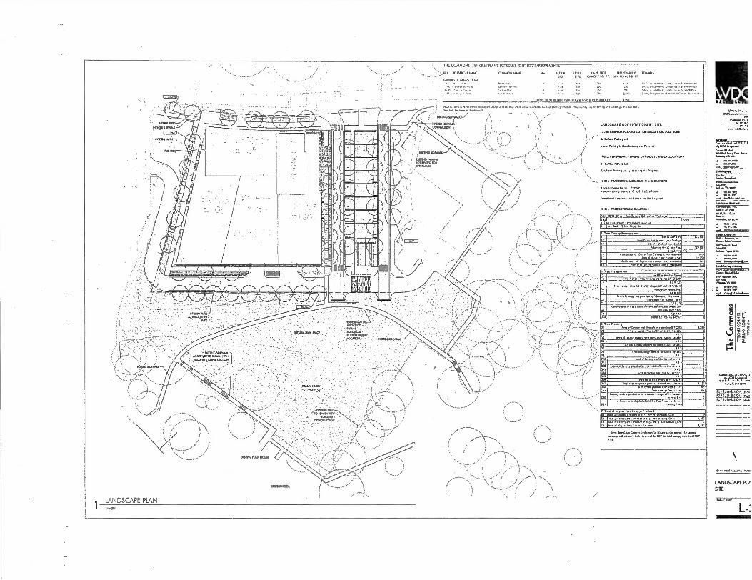
I HL LUNISIUN1 INILSPA PLAN I StHLOULL. LE.1..S1 I SAPPLNLIALNIS
1QV 1101AMICAl NAM( 000P0ON mat QM. SIOC9 SIM 111,11 1110 MU CAROPT S1ZE ..11006 SO 7. SUN 101A1 SQ. 0
CokIng n, Canon, Tme.
t to 90 2 uw 000 1,1.1.11 4-4n1ve% 0. 1.•
101 111 N 017101.7 . U 11.011110 4.260 ARCNITICTII
NISTA SDAYNX-
l=IM)
entun mei ,
Ant-
:
WOO MN* 1 16*
041on.,0C.:
107.1 .410-4.4
LANDSCAPE COMPUTAIONS SI SITE
ansnlOn PANONO LOT LANDSCAPE CALCULAVNIS
ha 600a. P.. LA
blera 1,..9 Landsca, llol Required
11.10i .06911.0.1. PANNING LOT 1.01066/... CALCULATIONS
I *•• •■■•••■ ... he Ur... P.n. UM
• • •
13.10c nussiniALAL 0006.000 ■90 MUNE.
nrtieftyltning On.. emus AS..ent Sam. PO:. PISMO
Ton.i..16g ... n . 0.011a11160.0
9. T a C.0.01...entent 91 CM. Site M. 92 0. 04.11.1a ian. rue Nu*
123421
AO.o..10.. Sae Arta 173,031 95 Sne Zmnp 9.1C
g PilleNia911 Or 10.,, Tre*Cmog 00.er Mowed
Dm 10-year tree Lana, ..e .r 100
12297 lna 10.year int ..al• 10 '... OS
Uoldkal 01 .' .1
Ilon Ye.
onsei....100.11. etcptamel
C. Tle 60. CI UR Orese.l. Targel C2
0 04, Crino, ma mu. sunants 01 12.00
0.1 C7A1.25 1,014 canapy MS /10,40.0"0.910 01105000 AM.
. .sltb. comma. 0 05 CAN1.26
Tani a/ ow. we 11.60 07 14nlage 1 1140.1....• 0
C6 •Imecome 0,90.1. Una Ci 01 NIS
0
Cm., 0/01 01 Ian .11110 Any.. h... Awns am!
Pa A to .„ - S013 COST ..0 Cs.
0 0
O. t • PEA. AN. of A..., A. p ,...0. 00. 00.09 510,00 5250
02 pep en., Mailed 1.....6q1m9ells 03 A 1.S 0 ix Am a ca..ponlea . No, ...NA. tea.
ALS 0 0
si Arta .1 emu.. 64111. 4.1. .ur ava, 0.011s PI 6 Al S Dl
Ana 0124,s AIM.] NI MAN 471 0
010 Am alta.97,416 ■11./ 00■■• 001 X I 9 g
SIN A. 00.0.tp,m1.0 S.. , .me toNem ao,0,71.,, 1
. Apo 41<ane0TI..01. ey ten:Ong. olS I 0 R 0 016 ■ercenlar 017 reareSenied ey 0 15 0
TAO 01069097.• pahled inmup vee pratu, 0118 0 an 0114 planung rellel (melted? .
Cow. ma Few. lim 0.1..a. 9110w0 eft. NM, LCO 0
"on. MN 10.2....1.. .. •1•[11,210111. ON 0
E T 01 el 111yearry..0097 0,0.6 . 0 El TotY 01Canopy Preb. Om., en aut.. ICI0 0
gi--;421Leapp."':•4:1;"-rogg2r,--21".23-:927:4111. 5291
CD U. 016.7evio can, ire.. A2S3
ig 80' E E
._c
DII 6.91...D.. 0.44.1.10
MP SUBMISSION 1515 POP SUPAINsION RaP SUBtAesION sgA
• 110e: To0 t0INavons 4. 111 elontra.Ne t avenge .1.111en• Rehr ta am120 1.r0r1pleialcanery Mu. 01,179
'Ant
• ..11/00114110. IVAn
LANDSCAPE PL./ SITE
L-:

ARCH ARCHITICTIIR.
WA05MINANA.11
IsMove Anhiten
Gmet DA Am
MAMA. 6 MAMA.
146... VAN. Inn
ANA CANA 61... 6.60,11
AAA, VA mei
0
E
NI
I-
ASO AA 0..S.A. Imua.mo BNB
SEP suanntssiont ittm FOP SUBMISSION 02..15 FDP SUBMISSION 013.11
(0.••■ WOG.. Ma WM*.
LANDSCAPE PLAN BUILDING
L-4
Poq
F : AnAmmulm. KMAOWAIX CMCM111,11.
FINAL PAVING MATERIAL SELECTION WILL BE DETERMINED AT SITE PLAN SUBMISSION
a-0 F i220mtn)
rnowcr ARC NMI SPANNER ARM SERIES MISR SILVER MANUFACILREFt SUM
TYSON'S EAST-STREET LIGHT N.T.s.
/ROOM,: RPM BIGTCLE 1.7% MISR SAIKESS STEEL MANUFACTURER IANOSWE FORMS
4 TYSON'S EAST-BIKE RACK
NI 5_ r...I.r...r..r.. ... ......
ORPIE • I.."
•••••00If MIIMPINI
Ale& .41W- Illr-plirrairaMata.-
lAIMILILitimmor.MS-11 v. I
I I 7. • '
Ilt0OUCT: l'iggIZREnCETTrCUPPr' SILVER IK7MOEFI COAT
44NUFACTURER iC1'011 ETNA.
2 7,..,SON'S EAST-TRASH RECEPTACLE
LANDSCAPE NOTES .
1111. MAAMAAAM MUMMA". MA MAIM.
11.4140$4/f 19.111047.0ESIOM rEArumEs.u.s
TM,. Of eV 'ME VV. 0.111f Colnpancl. A. • OuArrf OF Mt MAMIE% ANOPIANAMS RAMA 3111131.11.. COWORNANCEM1.17.7 DOM,
7 • M.41.1.0411.1 70 BE (111.0..DATSITE MAK
1 OD MI DAL
PROOUCT: !MSG ht4111F AMMO:
PAW WEB.. . SILVER IOW. COO • LAWKAPE FORMS •
AZ TYSON'S EAST-TRASH RECEPTACLE NTS c LANDSCAPE PLAN
••■
Air Alkik Asir re& AI& , VP IV 11,1111,11111 L.-A' 1
r II 11 a a a a u ci - u II a
i
,_„1 Viii
5 BUTTERFLY PAVILION NSA
leWIL,11V, icAl-,.."-1° 14-7-40,711.4
60...(141......i.e! 111117•MDM Pea alr1.102.111".12
4 . . 1 ‘.
larrimpummAIA Nilletta.• 17.•
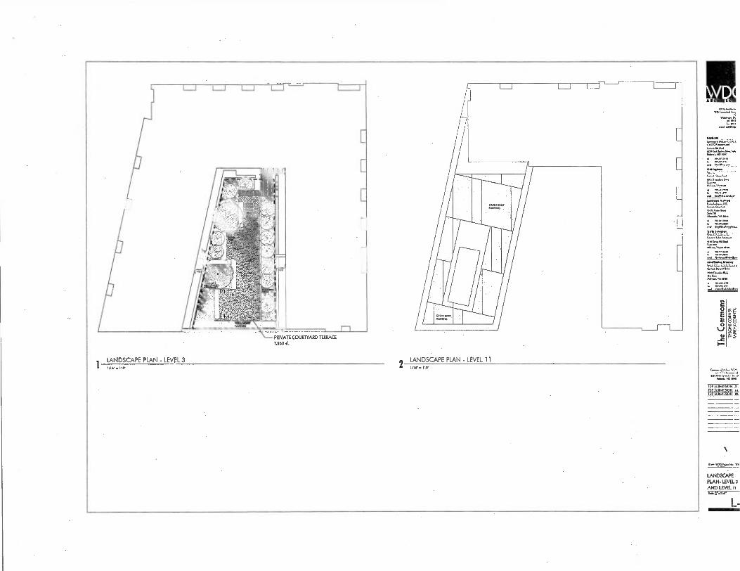
g 8:
N C 0 E
—C
NBbd
roaae
Fop u FOP m, FOP
SU.A, 5,0,4 SUWAr
ON oI 01.
O--wP8 IyoN. WA
LANDSCAPE•
PLAN- LEVEL 3 AND LEVEL tt
-1.4.
L..
Elm Nig
1 1LA/1 NDS_
•" vaLAPE
PLAN LEVEL 3
PRIVATE COURTYARD ,i D TER.
.CE 7.460 01.
2 LA,06ND3
•
•- 1.4.CAPE PLAN - LEVEL
11
I
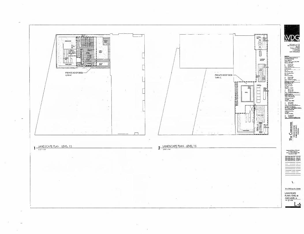
VID0 nu
id MN VW,. DC Pin.
10/t11 6 PIM IM11.
CIA 4.1•■•
SM. IM
'L. EFL_ Ceo.
• VA my
▪ 71.113.10 ▪ 701.10.41110
71.k W.•/...r..
,.../74.1.
ea. [66.11.6e
P.,. VA. anal
up 0
O E E 0
.1) I-
WtonUCA1.1.
400 W AS., DI, 6 ■• mt. MA, MOM,'
SUBMISS ss.otis SDP SUIPAISSION nun FOP SUBMISSION
LANDSCAPE PLAN- LEVEL 13
AND LEVEL 15
L-6
!I:14
LANDSCAPE PLAN - LEVEL 13 2
LANDSCAPE PLAN - LEVEL 15 1/10. =1..0.
7E- 111 11
0.101.001.
PRIVATE ROOF DECK 2,100 F.
n
PRIVATE ROOF DECK - 7,400
CD
13:1
Kok.,

12.10 n.
2 or. Ro.
co.
01
3011..061.
IAA A 12 tr. CAA; Cakulailal AMA. SARI 1141212
VAC
ADA
WO.
Ol0C
1.0A
VOA
11.0A
HAM
30•17c
3r0C.
•ta. toe tett...
CIODOIVA IAO'S1=17A
AotottA e ̂ W^,
NoCt HOOT SW IA,
AA,
116
1
7 ..
Ott Olt
10At WA% Mk COMO. 1.110.AU 111. 1.1.0.0 BAN
(03
zO
boa,. Coor..1,
ke.ol ro-orsot
Ae1 Arco eAlot
VrI
▪
tl
▪
iAMOMAIAICOCIANO
OA. 00110.11 00004.01811 MAMA.
TREE PLANTING DETAIL - TREE SOIL BRIDGE SCALES s 1/?I'
wihm---.1.= • , ...,. . .....,......6„,_ ...... _ el 5..:7'. , .. ,_.:,..,,,., ..Tu.: 1 3.•-• r." ' .11 MM. , , , 1.0k4!'. YW104
f•‘..i.'14...P......f. .. •,'"....,--S.t.'.
' "ttrl'OL110.'"*C421."" ..... . .
-c-
TREE PLANTING DETAIL - 6' AMENITY PANEL 03
06.110A.4110,1A.EMIO SWAM
/01OGE Al tAWOLENR. .7C11:CNIS OR
001/3.3 MAO. 140.0./M Putt
RADLNOTOtro== Out;
.1013 CV13
Aft 3.118.11SAME11.10.1.0 WARGO. AS II MO
ADM. SWAN DOW AFARANAO10
AMONG
NO...01VOLL .040111 ANOV.P.Of ?VAT NO
tto.
MOO MAO AVE0.1
.....90.010x III.I/SAUOIA.10 ■OZZ,
AN Mt 50.01.1.0.31
AVM WM MAMA
TREE PLANTING ON STRUCTURE DETAIL SCALE
101 1111 1111
A7 PLAN VIEW -6 AMENITY PANEL " 1/6,1,0. 09 GROUNDCOVER PLANTING DETAIL
v. SCALE
02
'---wooPfo Ton
V.L.,6&974,6/16V3n6W.A•r&. Stb..
TREE PLANTING DETAIL - 8 AMENITY PLAN SCRolA • 1,7S
1 1.1.0.01371.6..t 1011.00.1{ A•01.000, ■=1111O
O.0.110101.1111.
05
401.1.1C. COMM01110.1.1r
PA. SO
ANCIIITECTBI
Wtrl lor t
MOWN
Gown. lo■-o-ro
YHA
O.. WIWI
AAA.. AAA=
0•111.1.e.
Oa TA.1
5.
▪
1.1 Kt...VA Am
1g 88i
lt0111.....1 an Ow, Soy O. suo
fDP SUBMISSION D.0 EDP SUBMISSION ON EDP SUIDASSION 03.1
• wooro.ono PITS
PLANING DEWS
solo
L. SCARE : I /2..l0
C041/4110 100C4•02 11007.1
PLAN VIEW - 8' AMENITY PANEL 06 WAtE•VA, A0
1.17.1011 MIXING 1.071.4110SWE C.00.11031{
SuAtelt,.., lots
AAA PM, loociASOA OM NAAR
13402,011.1.11.1. PARKING LOT LAHOSCOOf CA.CIAATIONS
lb St.. PAO. UK
P.SITME.NWILNUM.UD,SIIOE,T*S
UAW: 17.11311101AL SCRIVONGO/113 WARMS
irtos.e. MO O..
13431. 1PEO COVER CALCULATIONS
A. AN ArTerniO1 TANI SIOINTAI TI ISNT.0t25.51.1C4
lo eIttoolnAttl 71-- OHL ND AN —MTN
I .8.633 VIC
IDA
ea j toom:Non Doty He Hop,,,er mots., ET P. At. .a. mot
C. Tree
1 tom q n.,417.:Zo7M7c: CS I ”.23
Tot. tn. arta pott. t, logo son
CS I LTS • INAN No. an NANA e: At,. HaNDA,1 •
C6 i or -SAA. to.
9
CT C100,11.4111.3.11. ROA. N.A. Mtn ane
CO CI X 10
moCo
T PHAN, o Am of La, mel %soup so, OIMOoo01/410)
gra. 01 Att.. 03 % I S tA I Arta el
MOO. 01 03 itu. a...3 PA. whOlteent10
WA
TIE A,,. ,I,.,,TIETHN2S,WflDULMIIUMS ,,D2SN
di+ Pea AAA DIS X I A DIS Portent or00 ovesenied O 0 15
It AO —16 CII
SIR! Toe 1101. or Trust Col. ma NINON lo IA A..I INNA GAIN tot,
ON Ana Ot •11. 1,7,74.4.:
TEl
T el 10... Tref CANA, rm..
• Om 1..C.A.A.1.1.1.1 1 tx 01 so OM... Arca.. num. Al.tatatt
LANDSCAPE NOTES:
I. THE PROPOSED UNDSCAPE WILL IA USED TO MEET THE MAGNUM TREE COVER REQUIREMENTS. LOCATIONS, SPECIES MID QUANTITIES MAT BE ADJUSTED WITH FINAL DESIGN.
2. THE LANDSCAPE TREATMENT, DESIGN FEATURES, AND EATALS MAY CHANGE WITH FINAL DESIGN PROVIDED THAT THE USE OF THE SPACE AND THE CHARACTER AND GAMUT? OF SHE FEATURES AND PLANTINGS REMAIN IN SURSTANIIAL CONFORMANCE WIN THAT SHOwN.
08 SHRUB PLANTING DETAIL SCALZ.t L
E E

ARCHITICTOR.
ryy, ice f■ooke
Sal.
A. no Amin
J.1.(0116,*
mul
1.1111...■
0•1111.1* Vga., trAte
W.., YAM..
7.= Aro.*
Vei • Awoon.A... (*I
71:= 11*0.1.4.
4.1.4. Alm WA+ Linn I.A.E*6361,1K
0....1.04.
M....VA OM
Nit C 0 E E 0
Li
172
•ne14.1 DI. 5.o.otle
i01_11118 gsia FOP SUENESION 02.0.11 FOP SUBMISSION rAnn
'COLSHIRE MEADOW DRIVE' SECTION 0- wow*. IMMO
ROADWAY SECTIONS
L-8

• ICIIITCCT
•••••••• 111•••■••••••
• MAY saA ••••et
044.
rin ..•74••• Mda•VAM42
INT: Ma.. • 4•4141%.* IT ..SR.44
I. MALVIN
tn
O E E
I—
0 4■...4•1.44.14.4414 44011,•••4
MO Sa• • 54. Of 441.44 rom
TOP SUBM4SION itO FOP SUBMISSION of., TOP SUBMISSION aj
.4144 WOW... WM
ROADWAY SECTIONS
.44 N.T.S.
5
'CENTER ALLEY' SECTION 2.
•
•
Iti
SIM-WOW j 0171 •
•. • •
, !•i. IOW
4 is , 144•••004404. ••15
GYMS ; • •
1.011141.1 OYU 100404■41744
10141
rtF CHil Owen
•
..
• • • • h + + + • + • 4. +
. 4- + + . + ., + , • • + + + + +
+ • + + + + • + + + • + h + + + + + + + + +
• + + • • + • + • +
I. • • • • + + + • • • • + + + +
• + + • + + + + • + • • + • + + •
• + + 4 + + + + • • + + + + • + +
•
+ + + + 4- + + • • • + + + + + + + • + + + r + + + + +
• + + + + + + + + + • • • • + + + • • + + . • • + + + •+ 4 • I
.++++++++++..' p + + + • • + + • + • • • + • ++ • • + • • • + + + •
+ + + + + + • • • • + + + + • 1
+ • + + + • + + + + • +++ +
+ + • • + + + • +
)+++++.+++++ + + •
• 4 + •+ • + • + + + + +
• + + + • 6 + + + + +
mt. L.40.114•411N•N•A
1071., MEWL. 14400ALIOAINT
201.•
MAIN STREET SECTION IN • PO

2 118• - t•-o•
1 'MAIN STREET - INTERIM SECTION CENTER ALLEY'- INTERIM SECTION
CIVII DWG'S BUBUING
I ! BOOIif
105 MN MD NOT ZONE
1.1.411NG 114 NOM 04 4•01.5
• + + • • + • +• • + • • • • • • • • .• • • + • • • • • • • • • • • • + • • + • • • • + • • • • • • • • • • + • • • • • • • • • • • •
++. •• + • • • • • + + +
• • • • • + • • • • + • • • + • • + •
+ • + + + + + + + • • • • • + + • • • • • • + + • • + • • • • • • • • • • • • + • • + • • • • + • • • • + + + • • 1 + • • + • • • + • • , • • • • • • • • .1. • + • • • • + • + ++ + • • + • • • • + • • • + • • • + • + + • • + +
• • • • • + • • • • • + • + + + • + • • • • + • • • • • + + • • • • • + • • • • • • • • • + • • + + • • • • • • • • • +
RUI,OING
KIX WS Cow..
Wtrro7nr.::: 44444 111.4
MOLINA (ww 0111
4.11.,,w•w Vt. 4
Me *Dow
• nleo
nee *
rim
•
▪
Lawn* 4.1..1,40
13/Al !Ltd', MP SW/45510N °tn.° IDP SUBMISSION
..1190,...N. "Mao
ROADWAY SECTIONS
L-1 0

WORMY Cpwom
•
0 E6 E
E 0 A
.41.60016ww 16.6 tomOL. 6 RUM. /JP et
IDP SUBMISSION IiBMISSION
fOP SUBMISSION
RON Plant NA rem,
A.1
® LEVEL 1 C) LEVEL 82
LL
NOTES:
1.MAXIMUM AMON° HEIGHTS INCL.. PENTHOUSE AND APCMITECTURN. FEATURES. PREFER TO LANDSCAPE DRAWINGS FOR THE EVENT OF DEMON OF ROOF AREA AND STREETSGOR 3 nf sell TO CIVIL DRAWINGS Fon 13 Tonm WATER PRWAGMENT BLOWN. STREET C.660l1 Um SECTIONS. P.LINDERGROUNO PUNT AND UTILITIES 616SEDI ARE SUBJECT 06 ADJUSTMENT AT TNE RAW Of SITE P.m
APPROVAL.
6. CONFIGURATION OF INTERIOR SPACES AS SHOWN ARE CONCEPTUAL 6 SUBJECT TO
rV=CS!'6TEVAr01 .6.1grDRTNPDLWENIE "FT"'LVIZTal VARY, L'AT*"'
N. SLAB AND ROOF ELEVATIONS, AS INDICATED. MAY VARY BUT WU NOT EXCEED MAXI. UM I...RS LISTED
T.PARKING SPUE LAYOUT AS SHOWN IS SUBJECT TO 'AIM IcATions. rirol Min aufiw. TIM OF PARKING IS SUBJECT TO RESIDE/01AL UNIT MO, FINAL PARKING COUNT. STRUG. TUNE MECUM.. EIRTERI UTOUT, AND WILL BE REALM, AT BUILDING PERMIT.
MB POTENTIAL RETAIL LOCATION
e• GAS MUER '
DCTER.101: -**4
' s ELEC... f
VAULT:'4,
i ENTRY QUO',
' AtI,OVF
RESIDENTIAL ENTRY
•
i -HHE u L
If&
/Ea
LEVEL 83
VIP
II ___I 1 II L.
LEVEL 131 C)
GAS METED, EXTCRIOR
ELEC. VAULT
z 'ZT ;i=j'

NOTES:
1.1.1,11AUM BUIL OING 11E/GHTS INCLUDE PEN7110USE AND ARCHITECNRAL EATURES. ZREFER
CAPE MAME. PON THE ,TEN7 OF OESION OF ROOF APE" AND
STREETSCAPE. 2.17,DD TO CIVIL DRAWINGS 1101,01161 man kw...amour OMEETLI431014 APO SECTIONS. AUNCERGDOUNO VAULT ANO UTILITIES 13,10N ARE SUBJECT 07 ADJUSTMENT AT THE TIME OF SITE PLAN APPROVAL S. CONPIOURATION OP INTERIOR SPACES AS SHOWN ARE CONCEPTUAL SUBJECT TO FINAL ARCHITECTURAL 6 ENGINEERING DESIGN. INCLUDING NUMBED. SIZE 11 LOCAPONS OF STAIRS. ELEVTORS. AND BLDG ENT/AIMED FINAL LAYOUTS MAY VARY.
SLAS AND ROOF ELEVATIONS. AS INDICATED. MAY VARY our you NOT ,CEED MAXI- MUM HEIGHTS
SPACE, SPACE ,POUT AS SHOWN IS SUBJECT TO MODIFICATIONS. FINAL CONFIGURA- TWIN OF PARKING IS SUBJECT TO RESIDENTIAL UNG MIX. FINAL PANNING COUNT. STRUC-TUE S MECHAN/CALS,7,1,11OUT. MO WILL PE FINALIZED AT BUILIANG PEWIT.
LEVEL 13 (LEVEL 14 SIMILAR)
L
BALCON es ON FLOORS 3, 5. 7. 9, c I I. NO BALCONIES ON FLOORS 4, G, 8, I 0 4 12. REFER TO I/A G.
3 LEVEL I 1 (LEVEL 12 SIMILAR)
BALCONIES ON eLoors 3. 5. 7. 9.4 I I. NO BALCONICS ON FLOORS 4. G, 0. 10 4 12. REFER TO M.G.
BALCONIES ON el.0055 3, 5.7.4 9.
NO BALCONIES ON FLOORS 4. G. 0 4
10. REFER TO 2JA..7. 1,
®COURTYARD LEVEL 3 (TYP. PLS. ABOVE SIMILAR)
L
C)LEVEL 2
ARCIIITICTUR4
WOO PAJAAPA AGE MX G.A.. A.. NW
DAIDALAwalon
tt..."menin
tf=z1.i.,„ VA Me;
.11.
• :::=17 -I, 6A—,ANN
88 g O 0
KOInNANNiAl 0.11,,SAM SA•
SAMAIA MOMS
EDP SUBMISSION 12.01.111 itiESESSiii514 roe SUBMISSION 41c.s.0
•
WES Wows
Floor Plans 'AM
A-2
0
E 0
1J es,

U
C)ROOF LEN/EL
Root COURTYARD I IT11 PLOOR 3R0 ROOK
1=l1===1
C O E E
4,J _c
7 tl 2 '4
ANCHITSCT
r.Z.
4. WI 1.41
OA
,.:w. °v ws.
'41=
TOP SUBMISSION RIP SUBMISSION TAP SUBMISSION
0...00 P.O., IL
Floor Finns
A-3
OYES,
1.MAXIISUIS BUILDING HEIGHTS INCLUDE PENTHOUSE AND ARCHITECTURAL FEATURES. 'REFER TO LANDSCAPE DRAWINGS FOR THE EXTENT OF DESIGN OF ROOF AREA AND STREETSCAPE. mneren TO CIVIL DRAWINGS Pon WORN WATSR NANAGIAL NT DESIGN, STREET DEMON AND SECTIONS. XUNDERGROUND VAULT AND UTILITIES. DESIGN APE SUBJECT OT ALIJUSTMENT AT THE TINE OP ATE PLAN APPROVAL. • CONFIGURATION OF INTERIOR SPACES AS SHOWN ARE CONCEPTUAL SlISJIL1 TO FINAL ARCHITECTURAL • ENGINEERING ESIG. INCLUDINO NUMBER. S. LOCATONS Of STAIRS. ELEVATORS. AND SLOG ENTRANCES. PIM LAYOUTS MAY VARY.
AAB AND ROOF ELEVATIONS.. INDICATED. NAY VARY SLR WILL NOT EXCEED Wat. MAI 1.101.173 LUD. T./ARANO SPACE LAYOUT AS SHOWN IS SUBJECT TO NODIFICATTEWS. FINAL CONTOUR. TOR OF PARKING IS SUBJECT TO RESIDENT. UNIT 141X. FINAL PARKING COUNT, S.C.1URE • MECHANICAL SYSTEM LAYOUT, AND WILL OE FINALISED AT BUILDING PERMIT.
,
Iy 1
' Koor r 3TH FLOOR ROOF
CZ3
()LEVEL 15
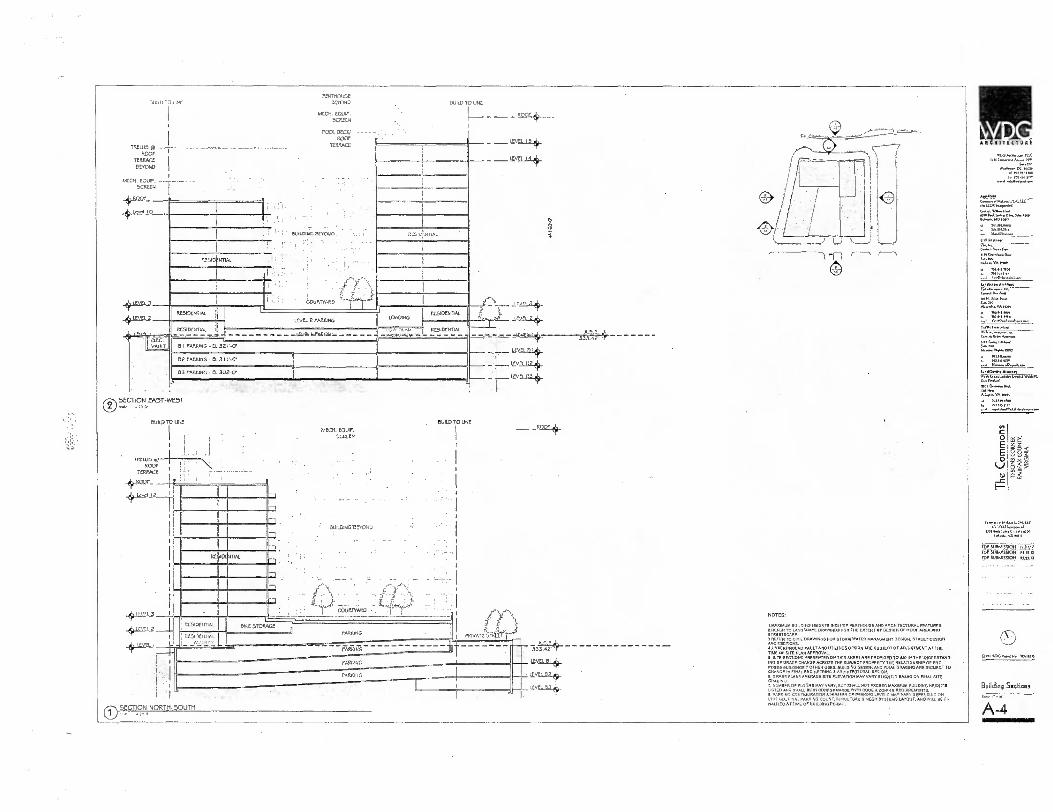
'If SID IAL
16 98g
O E E O U
A RCIIITICTU 0-
Applleam
14.41.10 2an
0.112nolemm
5.7.110 /1314
100 s.,,tama
L.wvy..nm1 + m'en•Nn,
t.e.:4= s wAXPC
0...6.21.4 11..I
VA mon
pry.64.1.141.46m...1
DL
"1°;.==" '"'
Mlf SUBMISSION 12.07.12 i0rsuemgli614
1pi.4
OP,MG orn N. WAnos
Building Sections
A-4
BUILD TO LINE 34100 TO UNE
=1.54-
1ZSIL / 4 (0
BULOIHG an+3,00 P SID, WIN.
7 :1
r -
"r^ coicrrne.o - I I rzsioeunm.
Resocul. ALIE21,,
wI:E STORAGE
PRIVATe ST
....imano=ww:■mmeassomme..ER. PARKING
jVEI 51* 12020 02 +
1202181*
PARSING
PAM G
• I
0 SECTION NORTH-SOUTH •
RESIDENTIAL
RES1DENNAL
BI PARKiNG E 321,7
02 P00:1110 31 1 .-C•
33 PARKING • CL 302,CP
SECTION EAST-WEST c)
I COURTYARD
LEvEt. 2 PARKING
URAL
-0,g-Lt121.2
eLCC. VAULT
LOADING I. RES10ENTIAL
RESIDENTIAL
TPELLIS T.! I
COOP \ TERRACE
"VQ12r- 1 ,
I i
BUILD TO U1.11
.1
MECH. EQUIP. SCREEN
BUILD TO UNE
OWLDINGTVOND
pm-mouse 0030140
MECN. EQUIP. SCREEN
PQOL DECK ROOF
TERRAET
mor TERRACE
BEYOND
NIECN. EQUIP. -- SCREEN
ROO,
10
(I)
-El
PARKING
NOTES:
'MAXIMUM BUILDING 11EIGHTS INCLUDE PENTHOUSE AND APCNItEGTURAP ROOFL
FEANNES. SAUER TO LANDSCAPE DRAWINGS PON THE EXTENT Of DESIGN O .REA AND STREETSCAPE. 21X:Es7c.r.,TIL DRAWINGS
TI
STORM WATER MANAGMENT DEEM.. STREET' DESIGN
CUNDERGROUND VAULT,. UTILITIES DESIGN ARE SUBJECT OT ADJUSTMENT AT THE TIME OF SITE PLAN APPROVAL.
SITE SECTIONS PRESENTED ON THIS SHEET ARE PROVIDED TO AID IN THE UNDERSTAND. ING OF GRADE CHANGE ACROSS THE SUBJECT PROPERTY THE RELATONSHIP OF PO. POSED BUILDINGS 7 OTHER USES BUILDING DESIGN AND FINAL GRADING ARE SUBJECT TO CNANCE IN FINAL ENGINEERING
VARY 6. GRADE PLANE AVERAGE SITE ELEVATION6.ARCNiTECTU
MAYR A
VARY SLIGHTLY BASED ON FINAL SITE GRADING. 7. NUMBER OF FLOORS MAY VARY. BUT SHALL NOT EXCEED MAXIMUM BUILDING HEM. LISTED AND SHALL BE IN CONFORMANCE WITH CODE 6 ZONING REQUIREMENT. 2. PARKING CONFIGURATION 6 NUMBER OP FANNING LEVELS MAY VARY DEPENDING ON UNIT MIX, FINAL PARKING COUNT,TRUCTURE 6 NECK SYSTEMS LATOUT.AND WILL DE tiALIZED AT TIME OF BUILDING PERMIT.

MARCH / SEPTEMBER 2 I st_3pm
MARCH/SEPTEMBER 2 I st_ I 2pm
MARCH / SEPTEMBER 2 I st_9am
JUNE 2 . 1 st3pm
JUNE 2 I st_9am
DECEMBER 2 I st_3pm
DECEMBER 2 I st_ I 2pm
DECEMBER 2 I st_9am
ARCHITICTUI
Ira. Len..
0 E E 0
Comm el...UMW et.1401.mm■
MOW Serynn SJi. 11.4...1100
MPSUBMMSMN POP SUBMISSION
EIVSUR44400 ppm
O,0OSFCS *005
Shadow Studies
A-5

ARCIIITICIUN.
41,013...n.a 1.04.06.6.0.0
Wu Me
* RI"Mline
40. G"..»,.11,11:1U1.1111— O.110111.....14
MOO* 3.0.1110.5.0.
▪ so,trogey 1013113
C 0
E 0
LI 0.1
e §, '
C
VW. LIA
Mai 11015e. 5.4. ■114 .1,1.101■1111
FDP 5111441551014 14.01.11 FOP SUBMISSION 01.0,13
FOP SUBMISSION o3m.13
0 0 ...004 NmaN0 Wants
Building Dveallone LA: Y.44.
A-6
:1
rf
II II I ,•141-1:: °
FL.A, ii lji tli 44a.
,r„ AHEi.,* T: Inomiglii
111111111 fig laiiE.111,
.110, .11GDOID
Wm+ 44,54‘.4Tra,•■ ...5..
- -
V1:11ELl. ',GS .44 .14,•444.-.141.
_ . - — 743-riFy-
• 1.1,..7,26„.
—
ES-iragggiai.7,E=- °NORTH ELEVAllON ALONG ANDERSON ROAD
°SOUTH ELEVATION ALONG CENTER ALLEY
II el
1W
II HI'
110 I lID
I
::,44.1:1-.4■4
20011,41015,e01
ae,s,11.901 Sra.4 4:4 1.144 .14.
WWI I.:11:141.1N1. 61141:.: 144._
44,1,4 3.3713.4, .M.44
z1
1 1
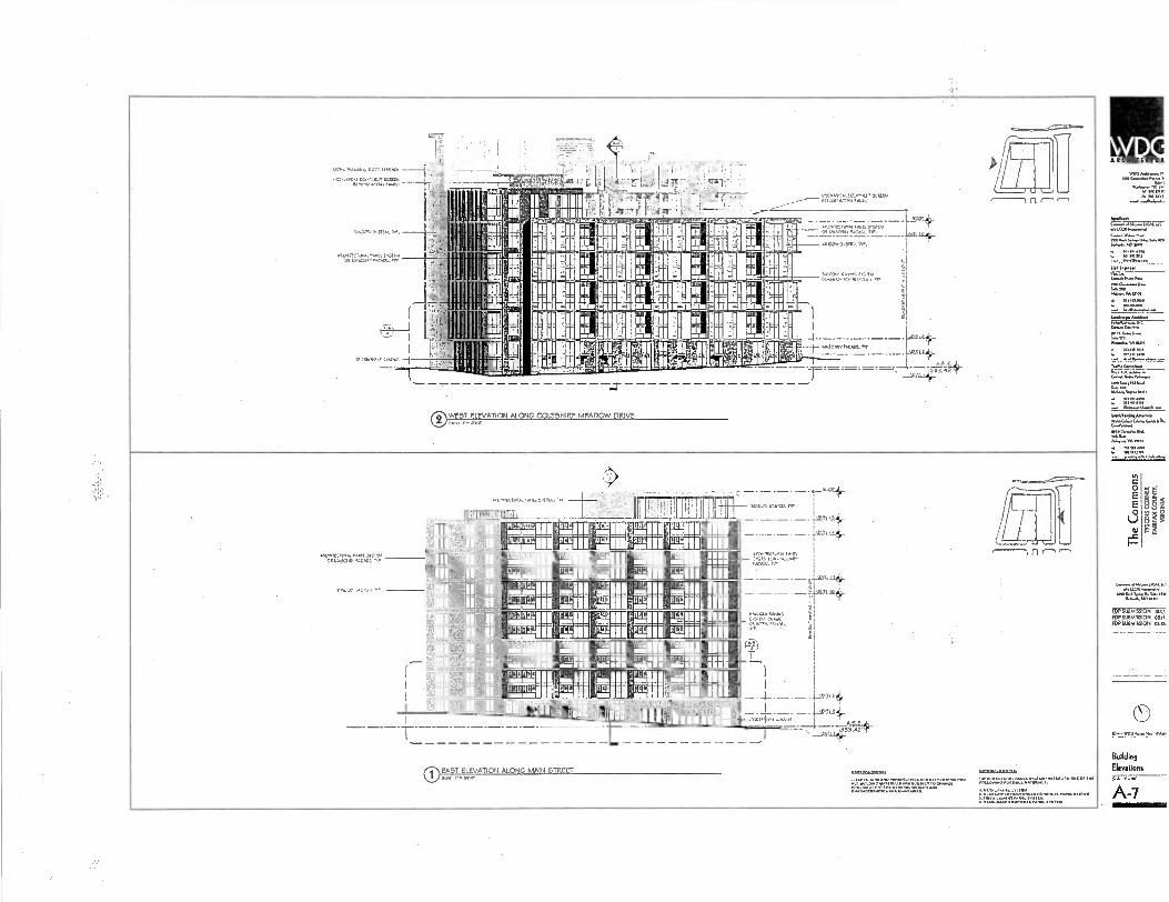
k DC A ICNITICTUR
V110
W 1g11/7 lo 4. 1
41.1.1.1
LA. no
0 E
5 VI
I-
LAN•1,10
ID? SUBMISSION 1547. jOr SUBMISSION QUI, i6P.SUBMISSION 0?.p.
0
Building Elevations
A-7
,; • ; ' I 1:
1,':;;.,W1..f ; •
4:4111' e; V1,41447" k. ,vr+runS"Tr.
at VAATKI
r TSIC •
• ;
MK.
"11•7•17:177.1•`..0,':
FiLaln+—
0 WEST ELEVATION ALONG COIF-SHIRE MEADOW DRIVE
n
n
ii L. Tm FE = MEE_ •;;Kano;;;; •
1111 1 Nil 1111 I liii
11 '1""'19111 4:111 ria111 ,1g111 1111 0 0 0:11111laili •MI- I q MIIIPILL/111 41.
II F'" 11"111 ,1:k111 64111ramoviln au
muc I
mmo luau' romEIN PEI] 61S112E1 flUE1 11111 Iiii
1111 I I
uu'
'`4111 W1114111 k'111-1111-1
s poualii Puiii SHOW= tc.L.11 1P51 WM." MBE MI
AfiBL1
1 EA5T ELEVATION ALONG MAIN 5TR.EET
.CKe.
er.outr eguinommu;ka Pc I
n"111

.P7 E E 0
RI
AO. JI WM, ”ell' re
. r
rr, •i
19
lillipli . ■ P
P
1111
A J.
111 1 , r, ,, 1. 0
I ... 1 VA Z..— no
, ,- 1,
fir' 1
- ■ =
I ■
vi ■
■•
L --- -7-- ',6111 I..
....
Illi 1 41-1-1_, I
I L' „....1■11 .
-
di I Iiii ._,D ill 1 • ------ -v.", ois. vi,isres,,t,,,,,#
c ..4 t ..v.... 1,.., . .
—
– •1
— "T*7•13'41:7=::' -7 , 7-- '' ''''''...'. 'I611 -.1,Itft_t-
+mu -
--- -r., v-r ..^,4 1ESarAgigargiak,
...,_,...._ F mili 111 , m.-1.1 ...
(--- I
E
r I
1 IIIIIIIII
. ----
-11144,i i
- 1 s71711 ii ir 4111111 li--r-
I r — it =mai--
1 ill i ' I i i I 1., m 1.uiti.
,,,,,,,,,,., Arerrrourm. r ,s.
[111, ■," I I, P7:
II I II I II II il
11 I i il!!
d I II aura.
III j 1 Ile, 4.,
. 01 - -.---
i... I Altliliviall ' -- 11
rilid111l " IL II
imi ILMI.4.- '4' E
ti.= ...--,..,-.7, - r-.4 4 - - - - - -, ,33'.t,',4- - ,..:. a-, ..• _I ‘ narrui ___ IANDY.,, Inr11 ENLARGED BASE WEST ELEVATION ®
" II ei ' ‘14 ' "'Llr"." ,
• —P.A-10.
°ENLARGED BASE WEST ELEVATION ALONG COLSHIR,E
. r*ei,Ct.:7 1.1Mtr.N. MEADOW DRIVE
—.L''-
'f
,..
d U61 1 =.4".
1.=.7t` II
,,Lr I _ It '.:IiIMEINIIII 7arm ___m , In ,___
, nil' '' '''Illi.a911111fal nou
,Im___ II :Ira 11111 ____ "El . _ I _
+I ,
oniF ' 1 rvi Ilk IMIIM3 . I I , ' , FM
6 .,
11 ....,
PI 111
' 71 ., ,
ill '4 Ea
PE W151:1 'HQ 02
r - I..
WM
III - lit
ill 1.1Ci 1
"" -.--- 11111
--itqlbt„-
'''‘'''''.'="_• _t-'4...d, 11 .11 , .—....--, FIEIFICCIN 110111111 ,,, ...1,1,/11, II" I- '4f.'''"'" ''''
111IYACilair 1‘ I.
''A 11 VW
1 b lill AM. _.
- ■ - irl 9 I 'ID __Ulla i • jr/A 34,
■
—L -
BASE EAST ELEVATION
1111 r 71---ii 1 34
4*. 0 ENLARGED BASE: EAST ELEVATIOI I ALONG MAIN STREET
...
,... ....-- °ENLARGED
it t M E -;15C TM Al rI( AMEN all
I.=
m ,
''
'BM, ,7-..= ill 1 1 1110211,4
rit_foori I,,, i
al
i .44.......,..,:r
4- -
ENLARGED
it, 11W11 111111111
1
11
BASE
ILI LIIIIii
SOUTH
111
ELEVATION
1 1111 I
:11' 1 1 I ilirl 01'141'
,
*i , , .
:5T0-4 ,..-.....-,-..,,.. —
'ammo! I -
r M. T it
-
-1St,
mi. W
:
''
,
'
' -
r
r z i . , -, ,,, •--,
-- ____ __I...I.
_... _ ,,...-+ = _ ,...,--. . – ..---111.4.1%il..= ,._=, ri.-1 Am r m
'.3111.1111111011g1IN _. _L__ i -, --6424, mr.,.., I ri lr 0 g,d-MILE_.. , . , ,.._ — + ._ _4..n. 4,_ lielKEllqi le, 1,0 ■ -■ ...---.........-....—........-.--
ENLARGED BASE: SOUTH ELEVATION ALONG CENTER ALLEY
.E,,R1- , .... ...... 1. ......”... ....t..........-......* '-',
;_:..._ _ _ . __ _ __ _____,„_:_____74:sr
• 1 I I i I 1 1 I L iLi I I 1 1
......, lini II
_, I i i _,...,.,,„, , -,-, I 14$
'..7) ..
A' I, IN 14 ir • ' r ■ , FCIP.11 I
__---_—.0114- _ neltlWRAMINI IIIII CITSIITIC.5,0 CFI ■ PL..... =.
■ a gti ja .4...! ___ _._
r,. .. — —
‘ 0 ,.■ .
— 1
"71,17'"..:7•::'''rT i
eg. ,..1 ° ..,,-,,,, , ill 11*
III 16;4:
,.F 1 91111111111 1:1Vtil-iplah,
13
r: L NI
I
•
i L._,ine It RI II
t,.,Pil 9.7.1, II? IMAM ■ , I , ., _ _._._. —4. 1 -, . . . d 4;1-
Il
- 1'. -.-.' ..2.VIZ:.71: -..j ' ' °ENLARGED BASE: EAST ELEVATION
-15.A.C.I.PC.L1)021G- -VA+ -1-- ■t
illAirittill Pi rt ■ nr-T
1111 i .S.4%. .47 GAM. -- — --....4%.3 /- Iti."4.1,1f (KY.: 1 1 minnows iiiiiiiiiiiidilliriFi I; FigFairighjun E 11114 — -- -P'; ÷S- --...,.. •Tr. it to ma Fii h
°ENLARGED BASE. NORTH ELEVATION ALONG ANDERSON ROAD
s _imafir,_
ARCIIITECTVR•
me IRAS., *4040 mo
1.(01114m1 41.31.15,0"...•110
IOW
Ito!. OP SUBMISSION oR.15.13
FOP SUBMISSION Sail
Enlarzied Elevations
A-8

O hlsLe.11
A-9
"'."
P.. ;
ft!
:Ir,11:-' VA mai
oc E
E
V o0 0)
4110 1.13e.t0". ■ lAr40.010,11
DP SUBMISSION SUBMISSION I.
MP SUBMISSION I
Building
Perspectives
1. ELEVATIONS AND PERSPECTIVES ARE ILLUSTRATIVE AND ALL BUILDING MATERIALS ARE SUBJECT TO CHANGE PROVIDED THAT THE GENERAL DUALITY AND CHARACTERISTICS ARE MAINTAINED
0 ANDERSON ROAD AND COLSHIRE MEADOW DRIVE

CO
5
I-
P 6 ,3 p'
t
L'".■
(9 ANDERSON ROAD AND COLSHIRE MEADOW DRIVE
tetr.sgrAI
(9 CENTER. ALLEY AND COLSH IRE MEADOW DRIVE Kujar
1. ELEVATIONS AND PERSPECTIVES ARE ILLUSTRATIVE AND ALL BUILDING MATERIALS ARE SUBJECT TO CHANGE PROVIDED THAT THE GENERAL QUALITY AND CHARACTERISTICS ARE MAINTAINED
/AC11175(1'0E1
9/04.0.1.n...
et,
MANI urn,
Off•Pna 164.61.1010
10191/U17
Li..., Al., w.N WAN
Ooml. 01.1. tIA.11.er Mks...VA niel
12=1
•"1,t2r2•11,•"" FOP SUBMISSION mum Ti' SUBMISSION 01.1111
FOP SUBMISSION alp II
0 0.^ WOO N. H. WOIND
Building
Perspectives
A-10

1. ELEVATIONS AND PERSPECTIVES ARE ILLUSTRATIVE AND ALL BUILDING MATERIALS ARE SUBJECT TO CHANGE PROVIDED THAT THE GENERAL QUALITY AND CHARACTERISTICS ARE MAINTAINED
A, ..P'
, - : • ..,. -4. ,•• 14 •• 4 , , I
4
tliqtlitillirg ;_r '1, ')044:4 ,,.. ,4
ziL 141, 1 mpl2614Ellp_,--
IR I?•
eh' tt; •••!;1)?
'14c, . 4
fg1 411,4. ̀.t! t•t. •
C) OVERALL PERSPECTIVE
ARCUITIC
lOteet Off
WA gni.,
0 E 0
I-
te
1 PERSPECTIVE
MP SUBMISSION rpr 50414554M OP SUIDAMION
Qr. WOG
Overall Site
Perspectives
A-11
Comm. II* A*.
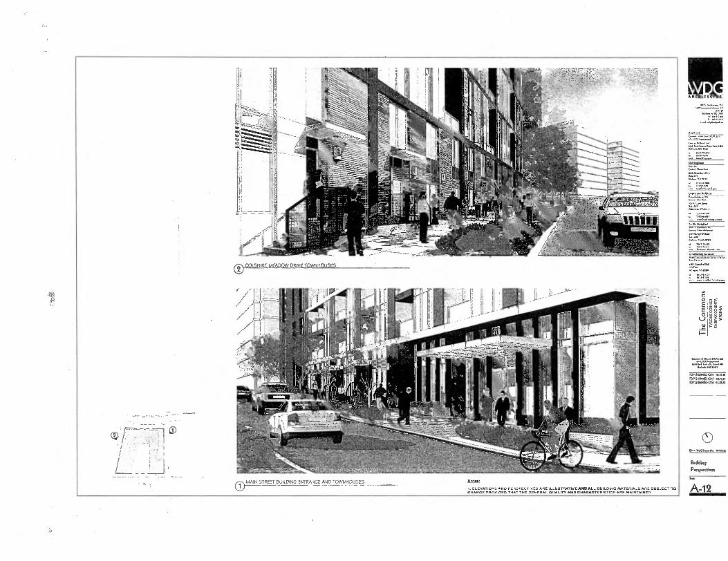
„, O E
_c I-
A .. s 88 6
VA C
NNIN■ s*,ch.S. gm. Ilesem414 own
FOP SUBMISSION 11.07.12
RM RIAMRSION 01.15,11 gltmko___Kt CUNU
0— IVAM
Building Perspectives
A-12 0 MAIN STREET BUILDING ENTRANCE AND TOWNHOUSES
1. ELEVATIONS AND PERSPECTIVES ARE ILLUSTRATIVE ANOALL BUILDING MATERIALS ARE SUBJECT TO
CHANGE PROVIDED THAT THE GENERAL DUALITY AND CHARACTERISTICS ARE MAINTAINED
NoI•B:
O COL5MIRE MEADOW DRIVE TOWNMOU5E5


FDP 2011-PR-017
Zoning Application Closeout Summary Report
Printed: 9/11/2013
General Information
APPLICANT: COMMONS OF MCLEAN L/CAL LLC
DECISION DATE: 05/09/2013
CRD: NO
HEARING BODY: PC
ACTION: APPROVE
STAFF COORDINATOR: BOB KATAI
SUPERVISOR DISTRICT: PROVIDENCE
DECISION SUMMARY:
ON MAY 9, 2013, THE PLANNING COMMISSION UNANIMOUSLY APPROVED FDP 2011-PR-017 ON A MOTION BY COMMISSIONER
LAWRENCE SUBJECT TO DEVELOPMENT CONDITIONS DATED APRIL 17, 2013 AND TO THE BOARD'S APPROVAL OF THE REZONING
RZ 2011-PR-017.
APPLICATION DESCRIPTION:
RESIDENTIAL
Zoning Information
Existing Zoning
Proposed Zoning Approved Zoning
DISTRICT AREA DISTRICT AREA
DISTRICT
AREA
PTC
2.03 ACRES
Tax Map Numbers
0303 ((28))( )0005
Approved Land Uses
Zoning District PTC
LAND USE
DU'S RESIANDAREA ADU'S WDU'S GFA FAR kIRESIANDAREA
MFD
331 2.02 ACRES 66
RETAIL/EST 50,000
TOTALS 331
66
Approved Waivers/Modifications
SEE FILE FOR ALL WAIVERS AND MODIFICATIONS
9/11/2013
Zoning Application Closeout Summery Report.rpt, created 02/14/2011 for Robert Harrison, secs num 4169070

Approved Development Conditions DEVELOPMENT CONDITION STATEMENT DATE: 04-17-2013
• k •" 11 ► 0 IL I • OE TRIG # TRIG EVENT CONTRIB EXPIR DIE
BONUS DENSITY 01-01-0001 0 N/A 0 01-01-0001
ADVANCED DENSITY CREDIT 01-01-0001 0 N/A 0 01-01-0001
SIDEWALK / TRAIL 01-01-0001 0 SITE PLAN 0 01-01-0001
MINOR MODIFICATIONS 01-01-0001 0 N/A 0 01-01-0001
OPEN SPACE 01-01-0001 0 RUP 0 01-01-0001
9/11/2013 Zoning Application Closeout Summary Report.rpt, created 02/14/2011 for Robert Harrison, seri num 4169070

FDPA PCA ( ) CDP APPLICATION TYPE(S): CDPA FDP (
N/A
Block(s) Subdivision Deed Book Page No. Lot(s)
PROPOSED USE: Multi-family residential PRESENT USE: Multi-family residential
OVERLAY DISTRICT (S): HC MAGISTERIAL DISTRICT:Providence
Signature of pplicant or Ag
LEGAL DESCRIPTION:
TAX MAP DESCRIPTION: 30-3 28 5 pt. 2.0347 AC
Map No. Double Circle No. Single Circle No. Parcel(s)/Lot(s) No. Total Acreage
POSTAL ADDRESS OF PROPERTY: 1600 Anderson Road
ADVERTISING DISCRIPTION: (Example - North side of Lee Highway approx. 1000 feet west of its intersection with Newgate Blvd.
The name(s) and address(s) of owner(s) of record shall provided on the affidavit form attached and made part of this application. The undersigned has the power to authorize and does hereby authorize Fairfax County staff representative on official business to enter on the subject property as necessary to process the application.
G. Evan Pritchard, attorney/agent
Type or Print Name Walsh Colucci Lubeley Emrich & Walsh, P.C.
2200 Clarendon Blvd, # 1300, Arlington, VA 22201
Address (Work) (703) 528 -4700
Please provide name and telephone number of contact if different from above:
DO NOT WRITE BELOW THIS SPACE
/o A5 Fee Paid $ Date application accepted:
Telephone Number
tit
(Mobile)
South side of Chain Bridge Road (Rte. 3547) on the west side of Anderson Road (Rte. 3946)
COUNTY OF FAIRFAX APPLICATION No: RIP aOlt-PR-01 .7 Department of Planning and Zoning a,/seiAlti_ t(Assigned by staff) 6:41_, Zoning Evaluation Division 11XA11)-1-) alegg — 7— 12055 Government Center Parkway, Suite 801 Department of Planning & ?mina Fairfax, VA 22035 (703) 324-1290, TTY 711 www . fa i rfaxeo unt v .govid pz/zon i n g/ap p I i cad o n s APR 0 8 2013
APPLICATION FOR A REZONING (PLEASE TYPE or PRINT IN BLACK INK)
PETITION
Zoning Evaluation Division
TO: THE BOARD OF SUPERVISORS OF FAIRFAX COUNTY, VIRGINIA I (W e ) , Commons of McLean L/CAL LLC , the applicant (s) petition you to adopt an ordinance
amending the Zoning Map of Fairfax County, Virginia, by reclassifying from the n/a District to the n/a District the property described below and outlined in red on the Zoning Section Sheet(s) accompanying and made part of this application.

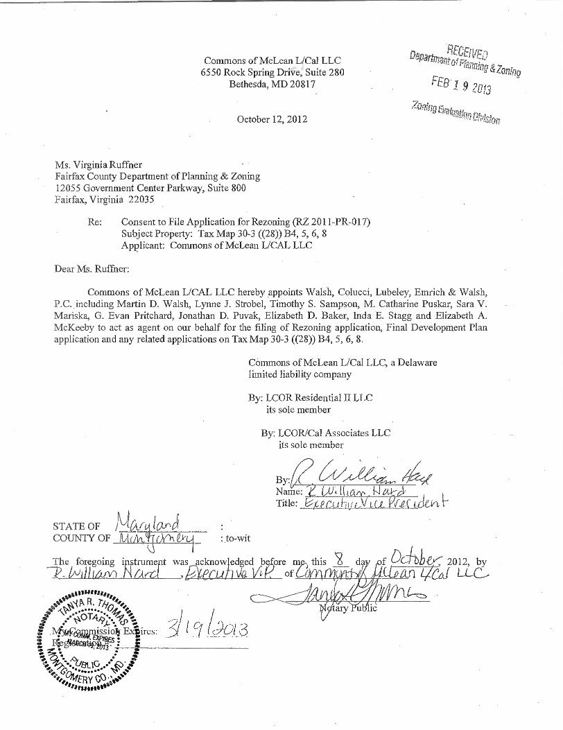
By: Name: Title:
Commons of McLean L/Cal LLC 6550 Rock Spring Drive, Suite 280
Bethesda, MD 20817
October 12, 2012
RECEIVED Departmarg-of Planning &Zoning
FEB1 9 2013
ZoaInger4intigntmt ion
Ms. Virginia Ruffner Fairfax County Department of Planning & Zoning 12055 Government Center Parkway, Suite 800 Fairfax, Virginia 22035
Re:
Consent to File Application for Rezoning (RZ 2011-PR-017) Subject Property: Tax Map 30-3 ((28)) B4, 5, 6, 8 Applicant: Commons of McLean L/CAL LLC
Dear Ms. Ruffner:
Commons of McLean L/CAL LLC hereby appoints Walsh, Colucci, Lubeley, Emrich & Walsh, P.C. including Martin D. Walsh, Lynne J. Strobel, Timothy S. Sampson, M. Catharine Puskar, Sara V. Mariska, G. Evan Pritchard, Jonathan D. Puvak, Elizabeth D. Baker, Inda E. Stagg and Elizabeth A. McKeeby to act as agent on our behalf for the filing of Rezoning application, Final Development Plan application and any related applications on Tax Map 30-3 ((28)) B4, 5, 6, 8.
Commons of McLean L/Cal LLC, a Delaware limited liability company
By: LCOR Residential II LLC its sole member
By: LCOR/Cal Associates LLC its sole member
STATE OF MA.
tostosartoo N( t■ R. 7-6,,44, .........
.Ntycdunissiolt Expires:
COUNTY OF AA (M , 0 0 \ 6111 : to-wit
The foregoing instrumeft was acknowledged bgore m R-ki)(4u1r) MAK(' ti vi,v of AI LI
41111°'
this ‘2 Od -bb.ey--- 2012, by LL_C,
/(901 3 F. 40moattan
r \uf3LIG '
TR DO.° 49
Y - 1.1r$1 MO"