case concerning delimitation of the maritime boundary in the ...
437
INTERNATIONAL COURT OF JUSTICE PLEADINGS, ORAL ARGUMENTS, DOCUMENTS CASE CONCERNING DELIMITATION OF THE MARITIME BOUNDARY IN THE GULF OF MAINE AREA (CANADA/UNITED STATES OF AMERICA) VOLUME Il Mernorial of the United States of America COUR INTERNATIONALE DE JUSTICE MÉMOIRES, PLAIDOIRIES ET DOCUMENTS AFFAIRE DE LA DÉLIMITATION DE LA FRONTIERE MARITIME DANS LA RÉGION DU GOLFE DU MAINE VOLUME II Mémoire des Etats-Unis d'Amérique
-
Upload
khangminh22 -
Category
Documents
-
view
0 -
download
0
Transcript of case concerning delimitation of the maritime boundary in the ...

INTERNATIONAL COURT OF JUSTICE
PLEADINGS, ORAL ARGUMENTS, DOCUMENTS
CASE CONCERNING DELIMITATION OF THE MARITIME BOUNDARY IN THE GULF OF MAINE AREA
(CANADA/UNITED STATES OF AMERICA)
VOLUME I l Mernorial of the United States of America
COUR INTERNATIONALE DE JUSTICE
MÉMOIRES, PLAIDOIRIES ET DOCUMENTS
AFFAIRE DE LA DÉLIMITATION DE LA FRONTIERE MARITIME
DANS LA RÉGION DU GOLFE DU MAINE
VOLUME II Mémoire des Etats-Unis d'Amérique

The case conceming Delimitation of the Maritime Boundary in the Gulfof Maine Area, entered on the Court's General List on 25 November 1981 under number 67, was the subject of a Judgment delivered on 12 October 1984 by the Chamber constituted hy the Order made by the Court on 20 January 1982 (Delimitation of the Maritime Boundary in the Gulfof Maine Area, Judgmenr. 1.C.L Reports 1984. p. 246).
The pleadings and oral arguments in the case are being published in the following order:
Volume 1. Special Agreement: Memorial of Canada. Volume II. Mernorial of the Unilcd States or Ameriw. Volume III. Counter-Memorial of Canada. volume IV. Counter-Mernorial of the United Swtes of America. Volume V. Replies of Canada and the United States of America. Volume VI. commencement of Oral Arguments volume VII. Conclusion of Oral ~ r ~ u Ï n e n t s : Documents submittcd to the
Court after closurc of the written proceedings; Correspondenu. Volume VIII. Maps, charts and illustrations.
Canada filed its pleadings both in English and in French. Although Canada has two official languages, only the English text of tbose documents is repro- duced on the ensuing pages of these volumes, as Canada has informed the Registry that the English text should be seen as authoritative for the purposes of interpretation.
Certain pleadings and documents of this edition are reproduced photo- graphically from the original printed text.
In addition to the normal continuous pagination, the Volumes feature on the inner margin of pages a bracketed indication of the original pagination of the Memorials. the Counter-Memorials. the Reulies and certain Annexes. ~~ ~~~
In intemal references, bold Roman numeials(in the text or in the margin) are used to refer to Volumes of this edition: if thcy are immediately followed by a nage refcrcnce. this relates to the new pagination ofthc Volumc in question. On iheother hand, the page numbers whicrare preceded by a reference to one of the pleadings relate to the original pagination of that document and accord-
refer 6 the bracketed pagination of the document in question. The main maps and charts are reproduced in a separate Volume (Vol. VIII),
with a renumbering, indicated by ringed numerals, that is also added in the marein in Volumes 1-VI1 wherever conesponding references appear: the abs&ce of such marginal teFerence means that themap or illustrat/on is not reproduced in the present edition.
Neither the lvnoeraphv nor the prcientütion may bc uled for the r>urpose of .. . - interpreting the texts reproduced.
L'affaire de la Délimitation de /a f m i è r e maritime dam la région du golfe du Maine, inscrite au rôle général de la Cour sous le numéro 67 le 25 novembre 1981, a fait l'objet d'un arrêt rendu le 12 octobre 1984 par la Chambre consti- tuée par ordonnance de la Cour du 20 janvier 1982 (Délimitation de la frontière maritime dans la région du golfe du Maine, arrér. C.1J. Recueil 1984. p. 246).

Vttt GULF OF MAINE -GOLFE DU MAINE
Les pièces de procédure écrite et les plaidoiries relatives à cette affaire sont publiées dans l'ordre suivant:
Volume 1. Comoromis: mémoire du Canada. Volume II. hlémoire des Etats-Unis d'Amérique. Volume III. Contre-mémoire du Canada. Volumc IV. Contre-mémoire des Etats-Unis d'Amérique. Volume V. Répliques du Canada et des Etats-Unis d'Amtrique. Volume VI. Début dc la procédure orale. Volume V I 1 Suite et fin de la procédure orale: documents oresentés i la Cour
après la fin de la procédurekcrite; correspondance. Volume VIII. Cartes et illustrations.
Le Canada a déposé ses pitces de procédure écrite cn anglais et en francais. Bien que le <:anada ait deux langues officielles. seul le lexie anglais de ses écri- tures est reproduit dans les \~olumes ci.dessus. lc Canada ayant Tait savoir au Grcffe que, en cas d'interprétation, c'était le texte anglais qui devait faire foi.
Certaines oieces de la oresente édition sont ohotoeraohiees daores leur texte W .
imprimé original. Outre leur pagination continue habituelle, les volumes comportent, entre
crochets sur le bord intérieur des pages, l'indication de la pagination originale des mémoires, des contre-mémoires, des répliques et de certaines de leurs an- nexes.
S'aeissant des renvois. les chiffres romains eras (dans le texte ou dans la marge) indiquent le volume de la présente édiGon; ;'ils sont immédiatement suivis par une référence de page, cette référence renvoie à la nouvelle pagina- tion du volume concerné. ~n revanche. les numéros de oaee aui sont &cédés dc l'indication d'une pièce de procédure visent la pagination originalede ladite pitce et ren\,oient donc A la pagination entre crochets dc la pi.?ce mentionnée.
Les orincioales cartes sont reoroduites dans un volume séoaréNIII) ou clles . . ont reçu un 'numérotage nouveau indiqué par un chiffre &rclé. Dans les vo- lumes 1 à VII, les renvois aux cartes et illustrations du volume VI11 sont portés en maree selon ce nouveau numérotaee. et l'absence de tout renvoi à la orésente éditionsignifie qu'une carte ou illus6alion n'est pas reproduite.
Ni la typographie ni la présentation ne sauraient ctre utilisées aux finsde I'in- terprétation des textes reproduits.

CONTENTS . TABLE DES MATIGRES
Pase Mernorial of the United S ta te of Ameriea . Mémoire des Etn&Unis
d'Amérique
. . . . . . . . . . . . . . . . . . . . . . . . INTRODUCTION 3
. . . . . . . . . . . . . . . . . . . . SUMMARY OF ARGUMENT S
. . . . . . . . . . . . . . . . . . . . . . PART 1 . THE F A ~ S 8 . . . . . . . . . . . . . . . . . . . . . . . . Introduction 8
. . . . . . . . . . . . . . Chapter I . The geographical setting 9 . . . . . . . . . . . . . . . . . . . . Section I Geography 9
. . . . . . . . . . . . . . . . . . A . Macrogeography 9 . . . . . . . . . . . . . . . . B . The Gulf of Maine area 1 1
. . . . . Section 2 . The geomorphology of the Gulf of Maine area 12 . . . . . . . . . . . . . . . . . . . A Northeast Channel 12
. . . . . . . . . . . . . . . . . . . . . B Georges Bank 13
. . . . . . . . . . . . . . . . . . . . . C Scotian Shelf 14 . . . . . . . . . . . . . . . . . D. Gulf of Maine Basin 14
. . . . . . . . . Section 3 The geology of the Gulf of Maine area 14 . . . . . . . . . . . . . . Chapter Il . The marine environment 16
. . . . . . . . . . . . . . . . . . . . Section I The waters 16 . . . . . . . . . . . . . . . . . . A Circulation patterns 16
B . Other characteristics . . . . . . . . . . . . . . . . . 17 . . . . . . . . . . . . . . . . . . . 1 . Scotian Shelf 17
. . . . . . . . . . . . . . . . 2 . Gulf of Maine Basin 17 . . . . . . . . . . . . . . . . . . 3 . Georges Bank 18
. . . . . . . . . . . . . . . . . . . . . . . . C Fronts 18 . . . . . . . . . . . . . . . . . . Section 2 ï h e food chain 18
. . . . . . . . . . . . . . . . . . . . A Phytoplankton 18 . . . . . . . . . . . . . . . . . . . . . B Zooplankton 19
. . . . . . . . . . . . . . . . . . . . . . . C Benthos 19 . . . . . Section 3 . Fish and shellfish of commercial importance 19
. . . . . . . . . . . . . . . . . . . Section 4 . Summary 21
Chapter III . Adivities of the Parties and their nationals in the Gulf of . . . . . . . . . . . . . . . . . . . . . . . Maine Area 23
. . . . . . . . . . . . . . . . . . . . Section 1 . Fishing 23 . . . . . . . . . . . . . . . . . . A . Early development 23
. . . . . . . . B . Development of fisheries on Georges Bank 25 . . . . . . C Deyelopment of fisheries duringthe 20th century 27
D . Foreign fishing on Georges Bank and the reaaion of the . . . . . . . . . . . . . . . . . . . . United States 29

X GULF OF MAINE -GOLFE DU MAINE
Section 2 . Continental shelf . . . . . . . . . . . . . . . . A . United States . . . . . . . . . . . . . . . . . . . . B . Canada . . . . . . . . . . . . . . . . . . . . . .
Section 3 . Other relevant activities . . . . . . . . . . . . . . A . Aids to navigation . . . . . . . . . . . . . . . . . .
I . The measurement of the sea: charting and surveying . . . 2 . Electronic aids to navigation . . . . . . . . . . . .
. . . . . . . . . . . . . . . 3 Other aids to navigation B . Scientificresearch . . . . . . . . . . . . . . . . . . C . Search and rescue . . . . . . . . . . . . . . . . . . D . Defense . . . . . . . . . . . . . . . . . . . . . .
Chapter IV . Historyof the dispute . . . . . . . . . . . . . . . PART II . THE LAW . . . . . . . . . . . . . . . . . . . . . .
Introduction . . . . . . . . . . . . . . . . . . . . . . . . Chapter 1 . Delimitation of fisheryjurisdiction . . . . . . . . . .
Section I . Early developmenu . . . . . . . . . . . . . . . Section 2 . Delimitation between neighboring States . . . . . .
The Grisbadamacase . . . . . . . . . . . . . . . . . . Section 3 . The principle of conservation . . . . . . . . . . .
A . Emergence of the principle of conservation . . . . . . . . B . The failure of conservation by agreement and the develop-
ment of 200-nautical-mile iishing zones . . . . . . . . . C . Delimitationof200-nautical-milefishingzones . . . . . .
Chapter II . Delimitation ofthe continental shelf . . . . . . . . . Section I . Early developments . . . . . . . . . . . . . . . Section 2 . International adjudications . . . . . . . . . . . .
A . The North Seo ContirientalShelfcases . . . . . . . . . . B . The Anglo-French Arbitration . . . . . . . . . . . . . . C . The Tunisia/Libya ConrinenfolShelfcase . . . . . . . . .
Chapter III . Rinciples of international law applicable to delimitation of a single maritime boundary beyond the territorial sea . . . . . Section I . The single maritime boundary must be delimited in
accordance with equitable principles, taking account of the rele- vant circumstances in the area. to produce an equitablesolution .
Section 2 . Equitable principles . . . . . . . . . . . . . . . A . The boundary must respect the relationship between the
coasts of the Parties and the maritime areas in front of those coasts . . . . . . . . . . . . . . . . . . . . . . . I . Nonencroachment . . . . . . . . . . . . . . . . 2 . Proportionality . . . . . . . . . . . . . . . . . . 3 . Natural prolongation . . . . . . . . . . . . . . .
B . The boundary should facilitate resource conservation and management . . . . . . . . . . . . . . . . . . . .
C . n i e boundary should minimize the potential for international disputes . . . . . . . . . . . . . . . . . . . . . .
Page 33

D. The boundary mus1 take acwunt of the relevant circum- stances in the area . . . . . . . . . . . . . . . . . .
Section 3. Methods of delimiiation .' . . . . . . . . . . . . A. A line perpendicular to the general direction of the wast . . B. An equidistant line . . . , , . . . . . , , . . . . . .
PART III. APPLICATION OF THE LAW TO THE FACTS . . . . . . . . . . Introduction . . . . . . . . . . . . . . . . . . . . . . . . Chapter 1. The relevant circumstances to be taken into accaunt in this
case . . . . . . . . . . . . . . . . . . . . . . . . . . Section 1. Geographical features . . . . . . . . . . . . . .
A. The broad geographical relationship of the Parties . . . . . 1. The United Sraies and Canada are adjacent States . . . . 2. ïhegeneral direction ofthecoast isnoriheasiward . . . 3. Theland ho~ndary lies north oftheGuIfof Maine . . . .
B. Geographical irregularities in the relevant area . . . . . . 1. n i e four-fold change in dinction of the wast creates a
short Canadian wastline at right angles to the general direction of the wast . . . . . . . . . . . . . . . .
2. The Nova Scotia peninsula protmdes south of the land boundary . . . . . . . . . . . . . . . ' . . . . .
3. The international boundary terminus is located in a wn- cavity in the coast . . . . . . . . . . . . . . . . .
C. 'the Northeast Channel and the fishing banks of the Gulf of Maine area as special features . . . . . . . . . . . . .
Section 2. The marine environment . . . . . . . . . . . . . A. The waters above Georges Bank, the Swtian Shelf, and the
Gulf of Maine Basin form three separate and identifiable eco- logical regimes . . . . . . . . . . . . . . . . . . .
B. 'The Northeast Channel is a signifiant geomorphological fea- ture thatisa natural boundary between ewlogical regimes . .
Section 3. Activities of the Parties and their nationals . . . . . . Chapter II. n i e boundary proposed by the United States is the per-
oendicular to the aeneral direction of the wast adiusted ta take account ofiherele&nt circumstancesinrhearea . .- . . . . . .
Chapter III. The adjusted perpendicular line produces an equirable solution whilethe equidistancc method would no1 . . . . . . . Section 1. n i e adjusted perpendicular line respecfs the broad geo-
graphical relationship between the wasü of the Parties and the celevant maritime areas in front of their wasü; an equidistant line would not . . . . . . . . . . . . . . . . . . . . . A. The adjusted petpendinilar line respects the coastal fmnts of
the Parties in the area: an equidistant line would not . . . . B. n i e adjusted perpendicular line produces a proportionate
delimitation: an equidistant line would not . . . . . . . . C. Although the natutal prolongation pnnciple may be inappli-
XI
Pare
I I I 112

GULF OF MAINE - GOLFE DU MAINE
Page cable in this case, the Northeast Channel constitutes a rele- vant circumstance that the adjusted perpendicular line takes
. . . . . . . . into awun t : an eauidistant line would not Section 2. The adjusted perpendicular line facilitates conservation
and management; an equidistant line would obstmct them . . . Section 3. The adiusted ~eroendicular line minimizes the Dotential
for disputes; aGquidktait line would invite disputes . . . , . Section 4. The adjusted perpendicular line takes into acmunt
the relevant circumstanies in the area: an equidistant line would not . . . . . . . . . . . . . . . . . . . . . . . . . .
. . . Chapter IV. Summary ofthe application ofthe law to the faas
Anneres to the Mernorial ofthe United States ofArnerica
Documentary Annexes, Nos. I to 1 I (Vol. 1) Anna I. Certification . . . . . . . . . . . . . . . . . . . . Anna 2. Special Agreement between the Government of the United
States of America and the Government of Canada to Submit to a chamber of the International Court of Justice the Delimitation of the Maritime Boundary in the Gulf of Maine area, notified to the Court on 25 November 1981 . . . . . . . . . . . . . . . .
Annex 3. The Truman Proclamations:
Roclamation No. 2667, Policy of the United States with Respect to the Natural Resources of the Subsoil and Sea Bed of the Continental Shelf, 28 September 1945, 10 Federal RegiFter 12303 (2 October 1945) . . . . . . . . . . . . . . . . .
~roclamàtion No. 2668. ~ o l i c ~ of the United States with Respect to Coastal Fisheries in Certain Areas of the High Seas. 28 Sep-
. . . tcmber 1945.10 FederalRenister 12304 12 Octobcr 1945) XII1 Bullefin. n i e ~ e ~ a r t m & t of tat te,‘^^. 327, 30 ~ é ~ t e m b e r
1945, pp. 484486 . . . . . . . . . . . . . . . . . . . Drafts of the Tmman Roclamations given to the Embassy of
Canada, 26 April 1945, reprinted in Foreign Relations of the UniredStares, 1945,VoI. 2, pp. 1495-1503 . . . . . . . . .
Note from the Secretan, of State to the Chareé d'affaires of - ~ ~
~anada.dated 22 0ct;ber 1945 . . . . . . . . . . . . . Note No. 383 from the Chargt d'aNaires of Canada to the Secre-
tan, of Staie. dated 23 Onoberl945 . . . . . . . . . . . . 1. Brownlie, Rinciples ofiùblic Infernafional Law. Oxford, Claren-
don Ress, 1966, pp. 202-205 . . . . . . . . . . . . . . . A. L. Shalowitz, ShoreandSeo Boundaries, Washington, D.C., Gov-
. . . . . . . ernment Rinting Office, Vol. 1,1962, pp. 182-184 Annex 4. n i e Grisbadama case (Nonvay v. Sweden), 1909, Hague Ct.
. . . . . . . . . . . . . . . . . . . Rep.(Scott) 121 (1916) Anna 5.
Convention on the Continental Shelf, done at Geneva, on 29 April . . . . . . . 1958,UNdoc.A/CONF.13/L.55,499 UNTS31I

- Convention on the High Seas, done at Geneva, on 29 April 1958,
. . . . . . . . . . UNdoc.tVCONF.13/L.53,450 UNTS82 170 Convention on the Territorial Sea and the Contiguous Zone, done
at Geneva, on 29 April 1958, UN doc. A/CONF.13/L.52, 516 . . . . . . . . . . . . . . . . . . . . . U N T S 2 0 5 . . 170 Convention on Fishing and Conservation of the Living Resources
of the High Seas, done at Geneva, on 29 April 1958, UN doc. . . . . . . . . . . . . . A/CONF.13/L.54,559 UNTS285 170 Annex 6. Exchange of Notes conceming the Conference of Ottawa,
23 September 1920, for Cooperation in Scientific Investigation of Deep Sea Fisheries, reprinted in Foreign Relations of the United
. . . . . . . . . . . . . . . States, 1920, Vol. 1, pp. 406.409 17 1 Annex 7. Reciprocal Fisheries Agreement hetween the Govemment
of the United States of America and the Govemment of Canada, . . . . . . . . . 24 Fehniary 1977,28 UST 5571,TIAS No. 8648 176
Annexa. Fishery Conservation and Management Act of 1976, 16 . . . . . . . . . . . . . . USC,Secs. 1801-1882,asenacted 185
Annex 9. Outer Continental Shelf Lands Act, 43 USC, Secs. 1331-1343
(1976); as amended, Secs. 1331-L356(1976,Supplement III) . . 207 Notice of Proposed Authorization for Geological and Geophysical
Exploration of Atlantic Outer Continental Shelf. 25 Federal . . . . . . . . . . . . . Regisfer8759 (1 0 September 1960) 207
Regulations for Geological and Geophysical Explorations of the Outer Continental Shelf, 45 Federal Regisrer 6344.6352 (25 Janu-
. . . . . . . . . . . . . . . . . . . . . . . ary1980) : 207 Regulations for Geological and Geophysical Explorations of
the Outer Continental Shelf, 41 Federal Register 25891-25897 . . . . . . . . . . . . . . . . . . . . . (23 June 1976) 207
~ n n e i IO. National Environmental Policy Act of 1969, 42 USC, Secs.
. . . . . . . . . . . . . . . . . . 432 1-4347, as enacted 263 Coastal Zone Management Act of 1972.16 USC, Secs. 1451-1464, as
. . . . . . . . . . . . . . . . . . . . . . . . enacted 263 Endangered Species Act of 1973, 16 USC, Secs. 1531-1543, as
. . . . . . . . . . . . . . . . . . . . . . . . enacted 263 Marine Protection, Research and Sanctuaries A n of l972,33 USC.
. . . . . . . . . . . . . . . . Secs. 1401-1444,asenacted 263 Annex II.
Canadian laws: The Public Lands Grants Act. 1950. Canada Revised Statures - ~ ~ . - ~ ~
. . . . . . . . . . . . . . (1952),Chap.224,pp. 115.117 306 Oil and Gas Roduclion and Conservation Acl of 1968-1969,
RevisedStarures of Canadq 1970, Chap. 30 (1st Supp.), Sec. 3 . 306 Canadian Regulations:
Canada Oil and Gas Land Regulations and Canada Oil and Gas Drilling and Production Regulations, 6 June 1961 (SORI61- 253). paras. 24-40, Canada Gazette, Part II, Vol. 95, pp. 805,
. . . . . . . . . . . . . . . . . 813-817.28June 1961 306

XIV GULF OF MAINE -GOLFE DU MAINE
Page
Documentary Annexes, Nos. 12 to 44 (Vol. II) A n n a 12. S. E. Morison. ïhe Maritime Historv of Massachusetts:
1783-1860. Boston, h'okheasrern University ges;, 1979, Chap. II, "The Colonial Background: 1602-1760. pp. 8-26, and Chap. XIX,
. . . . . . . "CaneCodandCaoe Ann: 1820-1860.~~.300-313 ~ n n a - 1 3 . H. A. lnni's, ïhe Cod ~isheriei! ihe History of an Interna-
tional Economy, New Haven, Yale University Press, 1940, pp. 111- 119 . . . . . . . . . . . . . . . . . . . . . . . . . . .
Annex 14. L. Sabine, Report of the Principal Fisheries of the American Seas, Washington, D.C., The Treasury Department of the United
. . . . . . . . . States. Robert Annstronn. Printer. 1853. D. 174 A n n a 15. Journals of the ?ontinen;al ~ohgress, 1774-1789, Vol. XIV,
1779, Washington, Govemment PrintinnOfice, 1909. PD. 960-962 . - - ... A n n a 16.
Treaty of Peace, 1783, United States-Great Britain, 8 Stat. 80, TS No. 104, reprinted from Treaties and Other International Agree- ments of the UnitedStates: 1776-1949. Charles Bevans. ed.. Vol. 12. . . pp.8-12 . . . . . . . . . . . . . . . . . . . . . . . .
Map depicting the coasts covered by the Convention of 1818 (from C. C. Tansill. Canadian-Americon Relations: 1875-1911. New
. . . . . . . . . ~ a v e n , ~ a l e ~ n i v e r s i t ~ Press. 1943.facingp. 1) Con\,enrion on Fisheries, Boundary and Restoration of Slnves,
1818. United States-Great Britain, 8 Stai. 248, TS No. 112, re- printed from Trealies and Olher Inrernational Agreements of the UniredStares: 1776-194Y,Charles Bevans.ed., Vol. 12. pp. 57-60 . .
Annex 17. R McFarland, A History of the New England Fisheries, New York,
University of Pennsylvania Press, by D. Appleton and Co. Agents, 191 1, Chap. XIX, "The Fisheries Question", pp. 321-337
List of Treaties . . . . . . . . . . . . . . . . . . . . . . A n n a 18.
G. B. Goode, ïhe Fisheries and Fishery Industries of the United States, Washington, D.C., Government Printing Office, 1887, Vol. 1, "History of the Fresh Halibut Fishery", pp. 29-34 . . . .
-, Vol. 1, "The Georges Bank Cod Fishery", pp. 187-198 . . . . . -,Vol. Il.D.201 . . . . . . . . . . . . . . . . . . . . .
~ ~ ~ ~
. . . . -; Atlas, Mate 4, "George's Well Smack - 1836 to 1847" . . . . . -,Atlas, Plates 30-35, "The Georges BankCod Fishery"
A n n a 19. Table of Gloucester Ships and Men Lost on Georges Bank: 1837-1 July 1873 (adaoted from a list from G. H. Proctor. î71eFisher- man's ~emor ia l ' and Record Book, Gloucester, Proctor Brothers Publishers, 1873) . . . . . . . . . . . . . . . . . . . . .
Anna 20. United States Department of Commerce, Fishery Industries of the United States: 1928, Washington, D.C., Govemment Printing Office, 1929, Bureau of Fisheries Document No. 1067, p. 471 . . .
A n n a 21. R M. Doherty, G. P. Draheim, D. I. White, and C. L. Vaughn, "Sea Scallop lndustry of Canada", printed in Commercial Fisheries Review, No. 7, July 1963, pp. 1 1 . 16 . . . . . . . . . .
A n n a 22. Food and Agriculture Organization of the United Nations, "Review of the State of World Fishery Resources", Committee on

Fisheries, 14th session, FlRM/C710 (Rev.2). COFI/8l/lnf. 5, March 1981,pp. 4-5.29-30 . . . . . . . . . . . . . . . . .
Annex 23. C. Southack. TheNew Eneland Coastine Pilot II7 18) . . . Annex 24. P. ~inkliam; A Chart of Georges ~ a n ~ l n c l u d i n ~ cape Cod
and Nantucker(l797) . . . . . . . . . . . . . . . . . . . Annex 25.
E. M. Blunt, New Chart of the Northeostem Coasr of North America extending from Lot. 37" 20' N. Long. 75" 20' W. to h t . 47" 55' N.Long.62"S'W(1821) . . . . . . . . . . . . . . . . .
E. M. B1unt.A NewChartoftheAIlanticor Western Ocean(1826) . . E. M. Blunt, î l e Norrheastem Coast of North Americafrom New
York to Cape Canso Including Sable Island(1844) . . . . . . . Annex 26. G. Eldridge, A New Chart of the Cwstof New England from
Mount Desert Rock 10 Goy Head Including Geoxes Bank and Shoah (1856) . . . . . . . . . . . . . . . . . . . . . . . .
Annex 27. C. Wilkes, Chart ofGeorgesShoalandBank(l837) . . . A n n a 28.
United States Coast and Geodetic Survey, Chart No. 1000: An lndex of Hydrographic Surveys conducted by the United States between 1842 and 1928 from Cape Sable to Cape Hatteras . . .
United States Coast and Geodetic Survey, Chart No. IWO: An lndex of Hydrographic Surveys conducted hy the United States between 1929 and 1939 from Cape Sable to Cape Hatteras . . .
United States Coast and Geodetic Survev. Chart No. 1000: An lndex OF Hydrographic Surveys conducied by the Unitcd States betwccn 1940and 1975 from Cape Sableto Cape Harterüs . . .
Annex 29. United States Coast and Geodctic Survcy. Chart No. 3075: Georges
Pink, Eastern Part. Spcciai Chsri for Fishing lndustry (June 1934) United Stales Coast and Gcodetic Survcy, Chart No. 3076: Georges
Bank. Western Part. Snecial Chart for Fishine Industw (19421 . . - .~ , Annex 30.
Canadian Hydrographic Service 1980 Annual Activities Report: "Status of Survevs". DD. 44-45 . . . . . . . . . . . . . . . - ...
Canadian Hydrogr.dphic Service Chart - Approaches Io the Bay of Fundy,CanadianChart 425, First Edition, 1924 . . . . . . .
Annex 31. Agreement on Establishment of Long Range Aid to Navi- gation (LORAN-C) Station in Newfoundland, 1964, United States- Canada, 15 UST 1835,TIAS No. 5657 . . . . . . . . . . . .
Annex32. United States Coneress. Joint Resolution No. 22.9 Febmarv 1871, Congressional Globe, Gst cong., 3rd Sess., ~ppendi;, p. 398 .
Annex33. H. Bigelow, "Physical Oceanography of the Gulf of Maine", Washington, D.C., Government Printing Office, 1928, in Bulletin of the United States Bureau of Fisheries, Vol. XL, 1924, Part lI.pp.513-521 . . . . . . . . . . . . . . . . . . . .
Annex34. North American Council on Fishety Investigations, P m ceedings:1921-1930, No. 1,1932,p.27 . . . . . . . . . . . .
A n n a 35. Search and Rescue Agreement between the Royal Canadian Air
Force and the United States Coast Guard, dated7 Onober 1957 . Search and Rescue Agreement between the Chief of Defence Staff,

Canadian Forces, and the Commandant, United States Coast Guard. dated 6 Aueust 1965. amended 19 Ami11966 . . . . .
Search and Rescue h e e m e n i between the c h e f of Defence Staff, Canadian Forces. and the Commandant United States Coast . ~~
~ u a r d , dated 25 0ctober 1974 . . . . . . . . . . . . . . . . . Anna 36. Map depicting Flight Information Regions (FIR) in the
Atlantic Area. as adooted bv ICA0 (Air Navination Plan. North American and ~ a c i f i c ' ~ e ~ i o i s , I O ed.; 1977, do: 8755/10, Interna- tional Civil Aviation Organization . . . . . . . . . . . . . .
Annex 37. Map depicting Air Defense Identification Zones of the New
England Region . . . . . . . . . . . . . . . . . . . . . . . . . . . UnitedStatesRegulations:I4CFR,Sec.99(1981)
Canadian Regulations: Security Control of Air Trafic Order, Consolidaied Regulaiions of Canada, Vol. 1, Chap. 63, 1978, pp. 432-438 . . . . . . . . . . . . . . . . . . . . . .
Annex 38. Geological Suwey of Canada, "Canada's Conventional Oil . . . . and Gas Resources", Open-File 767, March 1981, pp. 10-14
Anna 39. A map of selected physiographic regions of eastem North America . . . . . . . . . . . . . . . . . . . . . . . .
Annex 40. Permits for exploratory work including the northeast portion of
Georges Bank . . . . . . . . . . . . . . . . . . . . . Sample exploration permit: OCS Permit E2-68, issued to Explora-
tion Suweys, Inc., dated 2 April 1968 . . . . . . . . . . . . Annex41. United States Geological Suniey, "North Atlantic Sum-
mary Report", Open-File Report 82-1 6,l April 1982 update, p. 10 . Anner 42.
Selened documents relating to outer continental shelf lease sale Nn.42: . . -. . - . Cal1 for Nominations, 40 Federal Renister 25608-25609 (17 June -
1975) . . . . . . . . . . . . . . . . . . . . . . . . The coven and tables of contents for the draft and final Environ-
mental Impact Statements for Outer Continental Shelf Lease Sale No. 42 . . . . . . . . . . . . . . . . . . . . .
Department of the lnterior press releases, dated 17 June 1975, . . . . 2 January 1976,120ctober 1976and7 December 1976
. . . . . 44 FederalRegister56042-56049 (28 September 1979)
. . . . . 44 FederalRegirter66149-66173 (16 November 1979) Annex 43.
Selected documents relating to outer continental shelf lease sale N o 52: . . -. . - . Call for Nominations, 47 Federal Regirter 18805-18823 (30 April
1982) . . . . . . . . . . . . . . . . . . . . . . . . The coven and tables of contents for the drdft and final Environ-
mental Impact Statemenls for Outcr Continental Shelf Lease Sale No. 52 . . . . . . . . . . . . . . . . . . . . .
Anna 44. Table 1: Zooplankton: Spring Distribution of Taxa in Tems of
Percentage Composition of the Total Biomass (May 1977) Spe- cies Composition (October 1974) . . . . . . . . . . . . .
Page
336
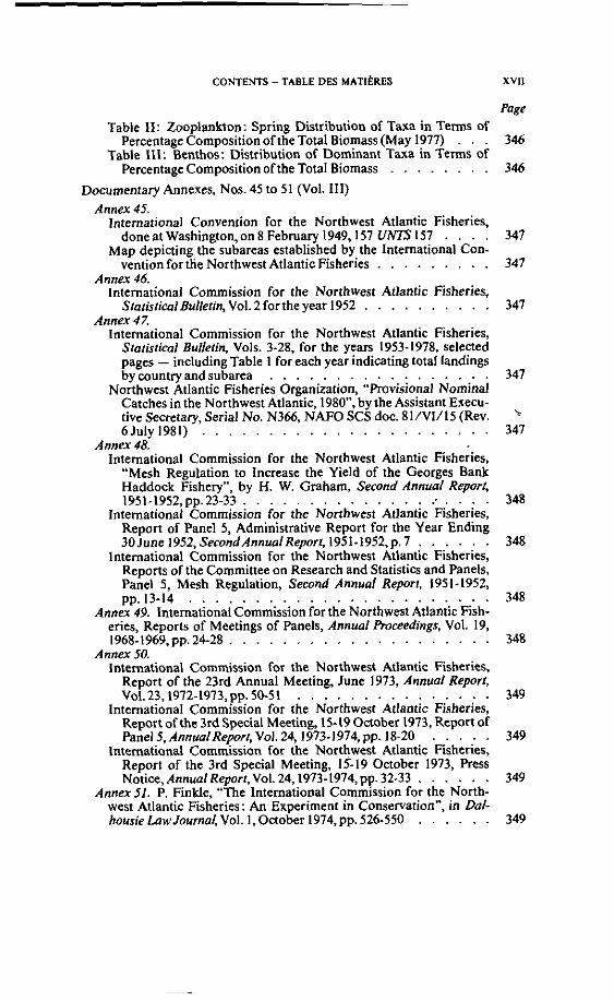
Table II: Zooplankton: Spring Distribution of Taxa in Terms of Percentage Composition of the Total Biomass (May 1977) . . .
Table 111: Benthos: Distribution of Dominant Taxa in Terms of PercentageCompositionoftheTotal Biomass . . . . . . . .
Documentary Annexes. Nos. 45 10 51 (Vol. III) Annex 45.
lnternational Convention for the Northwest Atlantic Fisheries, done at Washineton.on 8 Fehmaw 1949,157 UNTS 157 . . . .
Map depining th; subarcas cstabli;hed hy the International Con- vention for the Northwcsl Atlantic Fisheries . . . . . . . . .
Annex 46. lnternational Commission for the Northwest Atlantic Fisheries,
StatisticalBulletin, Vol. 2 forthe year 1952 . . . . . . . . . . Annex 47.
International Commission for the Northwest Atlantic Fisheries, Statistical Bulletin, Vols. 3-28, for the yean 1953-1978, selened pages - including Table 1 for each year indicating total landings by country and suharea . . . . . . . . . . . . . . . . .
Northwest Atlantic Fisheries Organization, "Pmvisional Nominal Catches in the Northwest Atlantic, 1980". by the Assistant Execu- tive Secretary, Serial No. N366, NAFO SCS doc. 81/V1/15 (Rev. 6July 1981) . . . . . . . . . . . . . . . . . . . . . .
A n n a 48: International Commission for the Northwest Atlantic Fisheries,
"Mesh Regulation to lncrease the Yield of the Georges Bank Haddock Fishery", by H. W. Graham, Second Annual Report, 1951-1952,pp. 23-33 . . . . . . . . . . . . . . : . . . .
lnternational Commission for the Northwest Atlantic Fisheries, Report of Panel 5, Administrative Report for the Year Ending 30June 1952, SecondAnnualReport, 1951-1952,p. 7 . . . . . .
International Commission for the Northwest Atlantic Fisheries, Reports of the Committee on Research and Statistics and Panels, Panel 5, Mesh Regulation, Second Annual Report. 1951-1952, pp.13-14 . . . . . . . . . . . . . . . . . . . . . . .
Annex 49. lnternational Commission for the Northwest Atlantic Fish- eries, Reports of Meetings of Panels, Annual F'roceedings, Vol. 19, 1968- 1969, pp. 24-28 . . . . . . . . . . . . . . . . . . . .
A n n a 50. lnternational Commission for the Northwest Atlantic Fisheries,
Report of the 23rd Annual Meeting, June 1973, Annual Report, Vol.23,1972-1973,pp.50-51 . . . . . . . . . . .
lnternational Commission for the Northwest Atlantic Fisheries, Report of the 3rd Special Meeting, 15-19 October 1973, Report of
. . . . . Panel 5, AnnualReport, Vol. 241973.1974. pp. 18-20 International Commission for the Northwest Atlantic Fisheries,
Report of the 3rd Special Meeting, 15-19 Octoher 1973, Ress . . . . . . Notice, AnnualReport,Vol. 24,1973-1974, pp.32-33
Annex51. P. Finkle, "The lnternational Commission for the North- West Atlantic Fisheries: An Experiment in Conservation", in Dal-
. . . . . . housielawJournal,Vol. 1,October 1974,pp. 526-550
XVll
Page
346
346

XVlll GULF OF MAINE -GOLFE DU MAINE
Page Documentaty Annexes, Nos. 52 to 91 (Vol. IV)
A n n a 52. -~~ . -
United Nations, Convention on the Continental Shelf (1958). Rati- fication by Canada. 4 March 1970, "Multilaieral Treaties Depo- sited with the Secrelary-General: Status asat 31 Decemher 1981". UN doc. ST/LEG/SER.E/I al p. 604; see also 716 UNTS 390 (1970); seealso Le1terC.N. 21.1970.Treaties-2 of4 March 1970 .
United Nations Convention on the Continental Shelf (1958). Com- munication from the United States of America. 13 Aunusi 1970. "Multilaterol Treaties Deposited with the ~;cre tarykenera l~ Status as at 31 December 1981. UN doc. ST/LEG/SER.E/I ai D. 607: see ais0 737 UNTS 394: see also Letter C.N. 119.1970. ~ ~- ~ ~ ~~~~ ~ ~~ ~~
kreatiis-3 of 13 August 1970 . . . . . . . . . . . . . . . . Annex 53.
Letter from the Assistant Direnor for Lands and Minerals, Bureau of Land Management, United States Department of the Interior, to the Depanment of Northem Affain and Natural Resources of Canada,dated l April1965 . . . . . . . . . . . . . . . .
Letter (rom A. D. Hunt, Chief, Resources Division, Department of Northem Affairs and Natural Resources of Canada, to L. T. Hoffman, Assistant Director for Lands and Minerals, Bureau of Land Management, United States Department of the Interior, dated 8 April1965 . . . . . . . . . . . . . . . . . . .
Letter from L. T. Hoffman, Bureau of Land Management, United States Department of the Interior, Io D. G. Crosby, Department of Northem Affairs and Natural Resources of Canada, dated 14 May 1965 . . . . . . . . . . . . . . . . . . . . . .
Letter from A. D. Hunt, Chief, Resource Management Division, Department of Northem Affairs and Natural Resources of Canada, to L. T. Hoffman, Assistant Director - Lands and Min- erals, Bureau of Land Management, United States Department of the lnterior,dated 28 May 1965 . . . . . . . . . . . . . .
Letter from A. D. Hunt, Chief, Resource Management Division, Department of Northern Affairs and Natural Resources of Canada, to L. T. Hoffman, Assistant Director - Lands and Min- erals, Bureau of Land Management, Department of the Interior, dated 16June 1965 . . . . . . . . . . . . . . . . . . .
Annrr i d ...... -. .... Letter from Robert K. Olson, Second Secretary of the United States
Embassy. to J. W. McNeil. Director, Rcsearch Developmeni Branch. Depariment of Mines and Technical Suwcys of Canada. dated l6~'gust 1966 . . . . . . . . . . . . . . . . . . 1
Letter from the Undenecretary of State for Extemal Affairs of Canada, to Robert K. Olson, Second Secretary of the United States Embassv. dated 30 Aunust 1966 . . . . . . . . . . .
Annex 55. ide-mimoire fr6m th; United States Department of State to the EmbassyofCanada.dated 10May 1968 . . . . . . . . .
Annex 56. Note (rom the Department of State to the Embassy of Canada,
dated 5 November 1969 . . . . . . . . . . . . . . . . .

CONTENTS -TABLE DES MATIERES XIX
Page Note No. 366 from the Embassy of Canada to the Depanment of
. . . . . . . . . . . . . . . State,dated I December 1969 356 Annex57. Notice of Resewation of Exploration and Exploitation
Rights of the United States and lu Nationals, 35 Federal Regkter . . . . . . . . . . . . . . . . . . 3301 (21 Febmary 1970) 358
. . . . . . . Annex 58. Bartlett AU, 16 USC Secs. 1081-1086 (1966) 360 A n n a 59.
Note from the Secretary of State to the Ambassador of Canada, . . . . . . . . . . . . . . . . . . dated 18 January 1974 361
Secretary of State's Circular Note to the Governments whose fisher- men have been known to or currently do fish in the Northwest Atlantic Ocean off the coast of the United States and othen con- cerned with Northwest Atlantic Fisheries, dated 18 January
. . . . . . . . . . . . . . . . . . . . . . . . . 1974 361 Note from the Secretary of State to the Ambassador of Canada,
. . . . . . . . . . . . . . . . . dated l l September 1974 361 Secretary of State's Circular Note to IheGovemments whose fisher-
men have been known to or currently do fish in the waten adja- cent 10 the coast of the United States of America, dated 5 Septem-
. . . . . . . . . . . . . . . . . . . . . . . . ber 1974 361 Annex 60.
Letter from Digicon, Inc., to the United States Geological Suwey, dated I Febmary 1974 . . . . . . . . . . . . . . . . . .
Letter from the United States Department of the Interior, United States Geological Survey, to Digicon, Inc., dated 13 Febmary 1974
Note No. 1126 from the Department of External Affain to the Embassy of the United States, datcd 19September 1974 . . . .
Note from the Embassy of the United States to the Department of External Aflairs, dated 11 October 1974 . . . . . . . .
A n n a 61. Note from the Department of State to the Embassy of Canada,
. . . . . . . . . . . . . . . . . . . dated 15 May 1975 Note No. 180 from the Embassy of Canada to the Department of
State,dated 3 lune 1975 . . . . . . . . . . . . . . . . . Annex 62.
Note No. 52 from the Embassv of Canada to the Department of . .~ - ~
. . . . . . . . . . . . . . . State, dated 2 February 1976 Note from the Department of State to the Embassy of Canada,
dated 10 Febmarv 1976 . . . . . . . . . . . . . . . . . ~~~ ~
Annex 63. Territorial Sea and Fishing Zones Act, Proposed Fishing Zones of
Canada (Zones 4 and 5 ) Order, 110 Canado Gazette, Part 1 EXTRA^, NO. 101, 1 ~ovémber l976,pp. 1-6 . . . . . . . .
Territorial Sea and Fishing Zones Act, Fishing Zones of Canada (Zones 4 and 5) Order, I I 1 Canada Gazette, Part I l (EXTRA),
. . . . . . . . . . . . . . . . . . I January L977,pp. 1-5 Annex 64.
Maritime Boundaries between the United States and Canada, Department of State, Public Notice 506, 41 Federal Register 48619-48620(4 November 1976) . . . . . . . . . . . . .
Department of State Ress Release No. 543, dated4 November 1976

X X GULF OF MAINE -GOLFE DU MAINE
Fishery Conservation Zone, Notice of Limits, Department of State, Public Notice 526, 42 Federal Register 12937-12940 (7 March 1977) . . . . . . . . . . . . . . . . . . . . .
Annex 65. Aide-mémoire from the Embassy of Canada to the Department of
State, dated 22 December 1976 . . . . . . . . . . . . . . Aide-mémoire from the Department of State to the Embassy of
Canada, dated 30 December 1976 . . . . . . . . . . . . . A n n a 66.
Note No. 626 from the Embassy of Canada to the Department of State. dated 22 December 1976 . . . . . . . . . . . . . .
Note from the Department of State to the Embassy of Canada, dated 16 Febmary 1977 . . . . . . . . . . . . . . . . .
Annex 67. Note No. 221 from the Embassy of Canada to the Department of
State,dated 26 May 1977 . . . . . . . . . . . . . . . . . Aide-mémoire from the Embassy of Canada to the Department of
State,dated 26 May 1977 . . . . . . . . . . . . . . . . . Note from the Department of State to the Embassy of Canada,
dated27June1977 . . . . . . . . . . . . . . . . . . . Aide-mémoire from the Department of State to the Embassy of
Canada, dated 7 July 1977 . . . . . . . . . . . . . . . . A n n a 68. "U.S., Canada to Negotiate Maritime Issues", 77 Bulletin,
the Department of State, No. 1992,29 August 1977, p. 282 . . . . Annex 69.
Note No. GNT-067 from the Department of Extemal Affain to the Embassy of the United States, dated 3 November 1977 . . . . .
Note from the Department of State to the Embassy of Canada, dated 2 December 1977 . . . . . . . . . . . . . . . . .
A n n a 70. Note from the Department of Extemal M a i n to the Embassy of
the United States. dated 25 Januaw 1978 . . . . . . . . . . Department of tat te Press Release NO. 53, dated 27 January 1978 . Note from the Department of State to the Embassy of Canada,
dated 3 Febmary 1978 . . . . . . . . . . . . . . , . . . A n n a 71.
Note No. FLP-130 from Marcel Cadieux, Special Negotiator of Canada, to Lloyd Cutler, Special Negotiator of the United States, dated lOApril1978 . . . . . . . . . . . . . . . . . . .
Letter from Lloyd Cutler to Marcel Cadieux, dated I I April1978 . Annex 72.
Letter from Marcel Cadieux to Lloyd Cutler, dated 2 June 1978 . . Note No. FLM-0092 from the Department of External Affain to the
Embassy ofthe United States, dated 2 June 1978 . . . . . . . Note from the Embassv of the United States to the Deoartment of
~xtcrnal ~ffairs.datëd 2 une 1978 . . . . , , . .' . . . Department of State Press Release No. 237,dated 2 June 1978 .
Annex 73. Territorial Sea and Fishing Zones Act, Proposcd Amendment to the
Fishing Zones of Canada (Zones 4 and 5 ) Order, II2 Canada Garerte(EXTRA). No. 79.15 Septcmber l978.p~. 1-4 . . . . .
Page

X X I
Page
Tenitorial Sea and Fishing Zones Act, Fishing Zones of Canada (Zones 4 and 5 ) Order, Amendment, 113 Canada Gazerre, No. 3, . . . . . . . . . . . . . . . 26 Januarv 1979.pp.482-483 ...
A n n a 74. Aide-mémoire from the Department of State to the Embassy of
. . . . . . . . . . . . . Canada, dated 14September 1978 Nnte from the Denartment of State to the Embassy of Canada, ~~.~~ ~
. . . . . . . . . . . . . . . . . dated 20September 1978 Note from the Department of State to the Embassy of Canada,
. . . . . . . . . . . . . . . . . dated 15 Febmary 1979 Annex 75.
Note No. 160 from the Embassy of Canada to the Department of . . . . . . . . . . . . . . . . State,dated29 March 1979
Note from the Department of State to the Embassy of Canada, . . . . . . . . . . . . . . . . . . . dated 2 April1979
Annex 76. Lener from Ronald Reagan, President of the United States, rn Cpnstnr Charles Percv Chairman. Cornmiltee on Foreim Rela- .......... ..... ~-~,, ...
. . . . . . . . . tions, ~ n i t e d tat tes senate, dated 6 ~ a r c h 1981 Anner 77. United States Depanment of State, Bureau of Intelligence .- -..
and Research, Office of ihe Geographer, Series A, Limits in the . . . . Seas, No. 2, Continental Shelf Boundary: Norway-Sweden
A n n a 78. United States Depanment of State, Bureau of Intelligence and Research, Office of the Geographer, Limils in the Seas. No. 83,
. . . . Continental Shelf Boundary: Bay of Biscay, France-Spain Annex 79. United States Department of State, Bureau of Intelligence
and Research, Office of the Geographer, Limits in rhe Seas, No. 86, . . . . . . . . . . . Continental Shelf Boundary: Chile-Peni
Annex 80. United States Department of State, Bureau of Intelligence and Research, Office of the Geographer, Limits in the Seas, No. 88,
. . . . . . . . . . Continental Shelf Boundary: Pem-Ecuador A n n a 81. United States Department of State. Bureau of Intelligence . . ~ ~ ~..
and ~esearch, Oifice of the Geographer, Lirnirs in the Seas. No. 69, . . . . . . . . ContinentalShelfBoundary:Colombia.Ecuador
Ann~x 82. Un~ted States Department of Siate. Bureau of Intelligence ........... R~cearch. Office of t6e Cieonra~her. Limits in B e Seas. NO. 79. ............................ "~ . . . . . . . . . ~ontinental~helf~oundaty:~olombia-panama
Annex 83. United States Department of State, Bureau of Intelligence and Rr~earch. Office of the Geozraoher. Lirnits in the Seas. NO. 73, ..------. ~, - ~ ~ ~ ~ - -. Continental Shelf Boundary: ~ r à S i ~ : ~ n i g u a ~ . . . . . . . . .
Annex 84. United States Denartment of State, Bureau of lntelligence and Resesrch. Office of the Geoerapher. Limils in the Seas, NO. 64, .......................
. . . . . . . . ~ontinental~helf~oundary:~r~>niina-Uruguay A n n a 85. United States Department of State, Bureau of Intelligence
and Rrcearch. Office of the Geozranher. Limits in theSeus, NO. 85, -. . - . . - - . -. . . ~- . . . . . . . . continental ~helf~oundary:Th~~&nbia-~enegal Annex 86. United States Department of State, Bureau of Intelltgence
and Reqearch. Office of the Geoerapher. Lirnits in the Seas, NO. 68, -. . - . - - - . -. . .......... - - . Continental Shelf Boundary: Guinea-Bissau - Senegal . . . . . . .
Annex87. United States Department of State, Bureau of Intelligence and Research, Office of the Geographer, Lirnits in the Sem, No. 92, Continental Shelf Boundary: Kenya-Tanzania . . . .

XXll GULF OF MAINE - GOLFE DU MAINE
A n n a 88. Treaty on Demarcation of Marine Areas and Maritime Coopera-
tion between the Republic of Costa Rica and the Republic of Panama, signed 2 February 1980, entered into force I I February 1982 . . . . . . . . . . . . . . . . . . . . . . . . .
A map of the maritime boundaries between Costa Rica and Pan- ama . . . . . . . . . . . . . . . . . . . . . . . . .
Anna89. Treaty of Delimitation between the Republic of Venezuela and the Kingdom of the Netherlands, signed on 31 March 1978, entered into force 15 December 1978 . . . . . . . . . . . . .
Annex 90. United States Department of State, Bureau of Intelligence and Research, Office of the Geographer, Limits in the Seas, No. 96, Continental Shelf Boundary: Greece-ltaly . . . . . . . . . . .
Annex 91. Working paper submitted by the delegations of Argentina and
Canada, "The Special Case of Fish Stocks Which Occur Both Within the Exclusive Ewnomic Zone and in an Area Beyond and lmmediately Adjacent to It": submitted at the second part of the
. . . . . . . . . ninth session of UNCLOS III, Geneva, 1980 Working paper on management of the living resources of the sea,
submitted by Canada, Report of the Committee on the Peaceful Uses of the Sea-Bed and the Ocean Floor Beyond the Limits of National Jurisdiction, pp. 164-174, UN doc. A/AC.138/SC.II/ L.8 . . . . . . . . . . . . . . . . . . . . . . . . . .
Documentary Annexes, Nos. 92 to 99 (Vol. V) Annex 92.
C. H. M. Waldock, "The International Court and the Law of the Sea", the First Cornelis van Vollenhoven Memorial Lecture, 22 May 1979, Cornelis van Vollenhoven Foundation, T. M. C. Asser lnstitute, 1979,pp. 1-17 . . . . . . . . . . . . . . .
C. H. M. Waldock, "The Legal Basis of Claims to the Continental Shelf', the Grotius Society, Transactions, 1950, Vol. 36, pp. 115-148 . . . . . . . . . . . . . . . . . . . . . . . .
Annex 93. A. Gros, "La Convention sur la pêche et la conservation des ressources biologiques de la haute mer", Recueildes cours, tome 97, 1959,pp. 1-89 . . . . . . . . . . . . . . . . . . . . . .
Annex 94. T . W. Fulton, ï he Sovereignty of the Sea. Edinburgh, Wil- liam Blackwood and Sons, 1911, pp. 581, 609-610, 612, 616-617, 630-640,701-711 . . . . . . . . . . . . . . . . . . . . .
Annex 95. D. J. Driscoll and N. McKellar, "The Changing Regime of North
Sea Fisheries", in ï he Eflective Management of Resources: ïhe InternarionalPoliticso/the North Seq C. M. Mason, ed., iondon/ NewYork, 1979,pp. 125,128-139 . . . . . . . . . . . . .
A. Underdal, A e Politics of International Fisheries Management: A e Case of the Northeast Atlantic, Oslo, Univenitetsforlaget, 198O,pp.61-99 . . . . . . . . . . . . . . . . . . . . .
Annex96. S. Oda, "Proposals for Revising the Convention on the Continental Shelf', Columbia Journal of Transnational Law, Vol. 7 , Spring 1968, No. I,pp. 1-31 . . . . . . . . . . . . . . . . .
Page

Annex97. S. Rhee, "Sea Boundary Delimitation between States before World War II", Arnerican Journal of intemillional Law,
. . . . . . . . . . . . . Vol. 76, No.3,1982,555,pp. 556-558 A n n a 98.
Knighrv. Wilder, 56 Mass. (2Cush.) 1990848) . . . . . . . . . . . . Wonsonv. Wonson.96 Mass. (7 Allen) 71 (1867)
. . . . . . Sprhv. Lnrsen.20 Wash. 2d 500.148 P.2d 834(1944)
. . . . . . Driesbachv. Lynch. 71 Idaho 501,234 P.2d 446 (1951) Annex 99. Chart of proportionality test applied to an equidistant line:
area determined by reference to the base points which determine . . . . . . . . . . . . . . . . . . . . . . . . . that line

MEMORIAL OF THE UNITED STATES OF AMERICA
MÉMOIRE DES ~ A ' l S U N I S D'AMÉRIQUE

INTRODUCTION
1. This Memorial is filed in accordance with the 1 February 1982 Order issued by the lnternational Court of Justice fixing 26 August 1982 as the lime-limit for the filing of Memorials by the United States of America and by Canada (the "Parties") in the case concerning the Delimitation of the Maritime Boundary in the Gulf of Maine Area, and with the Order of 28 July 1982 issued by the President of the Chamber of the Court formed to deal with the case extending that time-limit to 27 September 1982.
2. As provided in Article 40, paragraph 1 of the Statute of the Court, this case was brought before the Court by nolilication of a Special Agreement. The Special Agreement is annexed to the Treaty between the Government of the United States of America and the Government of Canada to Submit to Binding Dispute Settlement the Delimitation of the Maritime Boundary in the Gulf of Maine Area. The Treaty and Special Agreement were signed in Washington on 29 March 1979 and, as subsequently altered. entered into force upon the exchange of instruments of ratification in Ottawa on 20 November 1981. On 25 November 1981, the Ambassador of the United States of America to the Netherlands and the Ambassador of Canada 10 the Netherlands, by a joint letter. transmitted 10 the Registrar of the lnternational Court of Justice a certified copy of the Special Agreement. and certified copies of the Treaty and the Protocol of Exchange record& the exchange of instruments of ratification '.
3. The Special Agreement provides for the submission of the dispute to a Chamber of the International Court of Justice, composed of five persons. ta be constituted after consultation with the Parties, pursuant to Article 26, paragraph 2, and Article 31 of the Statute of the Court. and in accordance with the Special Agreement. The requirements of the Statute and Rules of the Court having been met, the Court on 20 January 1982 issued an Order forming a Chamber to hear the case.
4. Article II, paragraph 1 of the Special Agreement sets forth the precise question the Parties have agreed to submit for binding decision:
" 1 . The Chamber is requested to decide, in accordance with the principles and rules of international law applicable in the matter as between the Parties, thefollowing question:
What is the course of the single maritime boundary that divides the continental shelf and fisheries zones of Canada and the United States of America from a point in latitude 44°11'12"N, longitude 67a16'46"W to a point to be deter- mined by the Chamber within an area bounded by straight lines connecting the following sets of geographic coordinates:
>The inslrumcnts referrcd Io i n this para~raph are containcd in I.C.J.. 1981 General List: Na. 67. rcproduced here a1 Annex 2.Vol. 1.

GULFOF MAINE f21
latitude 40°N. longitude 67OW; latitude 40°N, longitude 6S0W; latitude 4Z0N. longitude 6S0W '?"
By Article 111. paragraph 1 of the Special Agreement. the Parlies have agreed that the single maritime boundary to be established by the Chamber shall serve for al1 purposes relating to the clafm or exercise of sovereign rights or jurisdiction:
"1. South and West of the maritime boundary to be determined by the Chamber in accordance with this Special Agreement Canada shall not. and north and east of said maritime boundary the United States of America shall not. claim or exercise sovereign rights or jurisdiction for any purpose over the waters or seabed and subsoil."
5. In compliance with Article 49 of the Rules of Court, this Memorial of the United States of America is divided into the following parts:
Part 1 contains a statement of the relevant facts including the geographi- cal setting (geography. geomorphology. and geology); the marine envi- ronment (the waters, the food chain. and fish and shellfish of commercial importance); the activities of the Parties and their nationals: and the history of the dispute.
Part II contains a statement of the applicable law.
Part III contains the application of the law to the facts of this case.
The final part of the Memorial sets forth the United States' Submissions to the Chamber. In addition. a Summary of Argument is a t the beginning of the Memorial. and a 5-volume Annex containing various documents to which the Memorial refers is included.
' Thc starting point (44'1 I'I2"N. 67°16'46"W) and the trianglc dcscribed by straight lincs cannccting the specilied sets of geoeraphic coordinatn (40aN. 67OW; 40°N. 6S0W; 42*N, 6S0W) rcquirc cxplanation. Thc starting point is the lirst point of intcrrcction south of the international boundary terminus of the fishery limits claimed rcspcctivcly by thc United Statu and Canada uwn the cxtcnsion of lishcries jurisdiction to 200 nautical miles in 1977. Landward of this point thcrc is a dispute as 10 sovcrcignty ovcr Machias Scal Island and North Rock. The starting point was choscn 10 cnsurc that the issuc of savcreignty over those islands is no1 bcforc this Court. The triangle was establishcd to avoid the oarribilitv of the dccision in this carc prciudicing the dci&mtnatian of the ouicr cdgc of the caniincntal margin or other questions arising i n drtcrmining the outcr Iimlt of ihc 200.nauticaI.milc ronc This Couri rnay tcrminalc itr dclimniation ai any wint in the triangle No point tn thc trianglc is more signiliîant than any othcr.

SUMMARY OF ARGUMENT
6. The United States and Canada have asked this Court 10 resolve a dispute over the location of their maritime boundary off the east coast of North ~ m e i i c a . The Parties have agreed that the single maritime boundary to be delimited by this Court will serve for al1 purposes under international law as between the Parties.
7. The question before this Court is one of first impression. There are no judicial decisions delimiting between neighboring States a single maritime boundary beyond the territorial sea. There is. however, a large body of law relating to the delimitation of lishing zones. to the delimitation of the continental shelf. as well as to other boundaries. That body of law serves to delineate the principles that govern delimitation of this single maritime boundary.
8. Thc cardinal principle in delimiting a single maritime boundary is that the delimitaiion shall be in accordance with qu i tab le principles, taking account of the
~~~
relevant circumstances in the area, to produce an kui table solution. The equitable principles to be applied include the following: principles regarding the relationship between the relevant coasts of the parties and the maritime areas lying i n front of those coasu. including nonencroachment, proportionality, and natural prolonga- tion; the principle of effective conservation and management of the natural resources of the area: the principle of conflict avoidance; and the principle of taking into account the relevant circumstances of the area. Any method or combination of methods that produces an equitable solution may be used to delimit the single maritime boundary.
9. The United States proposes that the course of the single maritime boundary in the Gulf of Maine area should follow a line drawn oeroendicular 10 the eeneral ~~~ ~ . . ~ - ~ . . - direction of the coast from the starting point for delimitation specified in Article I I of the Special Agreement between the Parties, into the triangle described in that Article. but adjusted during ifs course to avoid dividing two fishing banks on the Scotian Shelf. Browns Bank and German Bank, both of which would be left in
@ their entirety to Canada. Figure 30. para. 304. Canada has relied principally on the equidistance method of delimitation during the course of this dispute. Figure
@ 32, para. 310. The adjusted perpendicular boundary line p r o w e d by the United States (the "adjusted perpendicular line") is consistent with each of the principles governing delimitation of the single maritime boundary and produces an equitable solution. An equidistant boundary line is not consistent with any of these principles and does not produce an equitable solution.
10. The circumstances relevant to the delimitation of the single maritime boundary in this case include the following: the geographical setting. the marine environment. and the activities of the Parties and their nationals. The relevant area (the "Gulf of Maine area") is bounded by the coasts on both sides of the inter- national boundary terminus from Nantucket Island. Massachusetts to Cape Canso, Nova Scotia. and extends seaward to the limit ofcoastal State jurisdiction.
I I Thc rclcvdnt geographical circum\tanccs thnt musi be iakcn into dccount includc ( I I the brond ncograrihical r c l ~ t i o n s h i ~ of the Partic\. with Canada to the north a n d t h e IJnitedStates to the south; (2) the northeastern trend of the east coast of North America and of the coasts of the Parties in the Gulf of Maine area; and (3) the radical changes in direction of the coastline of Canada creating: (a) the

6 GULF OF MAINE 141
short secondary Canadian coastline at a rieht anele to the east coast of North - - America and across from the land boundary terminus. and (b) the protrusion of the Nova Scotia peninsula south of the land boundary. This rotr rus ion combines with the curvatuie of the New England coast to create the Concavity that is the Gul f o f Maine. Special geographical features i n the Gul f of Maine area are: (1) Georges Bank, (2) Browns Bank. Gerrnan Bank, and other fishing banks lccated on the Scotian Shelf, and (3) the Northeast Channel, dividing Georges Bank from the Scotian Shelf.
12. The relevant circumstances of the marine environment that must be taken into account include the separate and identifiable ecological regimes associated with the G u l f o f Maine Basin. Georges Bank, and the Scoiian Shelf, respectively. The different characteristics of the-waters of each reeime and the seabed over which they fiow define the biological communities within each regime. These different characteristics also integrate such biological communities, including stocks of commercially important fish, and separate those communities from similar communities in the other regimes.
13. The Northeast Channel, dividing Georges Bank from the Scatian Shelf. is important as both a special geographical and special geomorphological feature. I t is the only signilicant break i n the surface o f the continental shelf along the east coast of North America from Florida to the Laurentian Channel. The Northeast Channel also separates the ecological regime of Georges Bank from that of the Scotian Shelf, as well as most of the commercially important fish stocks associated with those regimes
14. The following activities o f the Parties and their nationals in the Gul f o f Maine area are relevant to this delimitation: United States fishermen have fished longer and ta the largest extent; United States fishermen alone developed the fisheries of Georges Bank; until recently, Georges Bank was fished exclusively by United States fishermen; the United States and ils nationals have provided aids ta navigation. including the detailed surveying and charting; the United States has conducted and coordinated search and rescue operations; the United States has provided for defense; the United States has conducted most of the scientific research; and the United States proposed and led international efforts to protect the fisheries.
15. The adjusted perpendicular line respects the relationship between the relevant coasts of the Parties and the maritime areas lying in front o f those coasts. The line takes into account the broad geographical relationship between the Parties as adjacent States located on coasts having a northeastern direction. The line also reskcts the most prominent geomorpho6gical feature in the area-the Northeast Channel. The adjusted perpendicular line leaves to the Parties areas lying in front of each of their resgective coasts. These areas are reasonably proportional to the length of the Parties' coastlines i n the area. Application of the equidistance method ignores the broad geographical relationship of the Parties in the area, and instead gives effect ta a few selected base points on the Parties' coasts. The equidistant line swings halfway across the length of the coastline of the United States i n the Gul f of Maine area. I t reaches a point 285 nautical miles south of the international boundary terminus. at approximately the same latitude as Philadelphia. Pennsylvania. The equidistant line thus would encroach upon areas lying in front of the coast of the United States. and allocate ta Canada an area disproportionale to i l s short secondary coastline.

15-61 MEMORIALOF THE UNITED STATES 7
16. The adjusted perpendicular line facilitates the conservation and manage- ment of the natural resources of the Gulf of Maine area. The line respects the in- tegrity of the ecological regimes associated with Georges Bank and the Scotian Shelf. It allocates to Canada IWO important fishing banks. German Bank and Browns Bank, parts of which lie in front of the Coast of the United States. An equidistant line, by contrast, divides the ecological regime of Georges Bank. so that jurisdiction to conserve and to,manage most of the commercially important fish stocks associated with that reeime would be divided between the Parties. An - equidistant line would also divide jurisdiction over other activities within the ecoloaical reeime of Georges Bank. such as development of the mineral resources of thé seabed. which could threaten the fishery r&ources found throughout such regime.
17. The adjusted perpendicular line minimizes the potential for disputes. The line ensures that stocks are, to the extent practicable, managed by a single State. minimizing the need for agreement on particular conservation measures or on allocation of the resource. Moreover. because it borders the Northeast Channel, the adjusted perpendicular line can be identified easily by fishermen and is in an area of little fishine activity. An equidistant line. by contrast. would split Georges Bank. mandat ingthe need for joint management and. thereby. significantly increasing the potential for disputes between the Parties. By passing through the Bank, an equidistant line could not be identified as readily and would cross an area of intense fishing activity, increasing the potential for disputes.
18. The adjusted perpendicular line takes account of, and balances, the relevant circumstances. In addition to respecting the broad geographical relationship of the P3rties. the special gcogr~phical and gcomorphological feature\ ~ c h as the Norihcasi Channel. and the principal ecolog~cal regimes in the area. the adjuited oeroendicular line takes into account the oredominant interest of the United . - ~ . ~~~~ ~
States and its nationals in the relevant area. particularly as regards Georges Bank. The line leaves to the United States an area within which il has fished the loneest and to the largest extent (and indeed until recently, an area it fished exclusivély). The adjusted perpendicular line also leaves IO the United States an area in which it has exercised a broad range of responsibilities (in many instances with the express agreement of Canada). In contrasi. an equidistant boundary would leave a large part of Georges Bank to Canada, in disregard of these relevant circum- stances and. in particular, of the predominant interest of the United States and its nationals established through continuous activities for more than 200 years.

PART 1
THE FACïS
INTRODUCTION
19. This Part will describe the factual context of the maritime boundary dispute subrnitted to this Court by the Parties. This Part is divided into four chapters: (1) the geographical setting, including geography. geornorphology. and gwlogy;(2) the marine environment. including the waters, the food chain, and tïsh and shelliish of commercial importance; (3) the activities of the Parties and their nationals; and (4) the history of the dispute.

CHAPTER 1
T H E GEOGRAPHICAL SETTING
SECTION 1. Ceography
A. MA~ROGEOGRAPHY
20. The United States of America and Canada are neighbors on the North American continent. Canada lies north of the United States, except for the state of Alaska. Figure 1 . The principal international boundary extends from the Pacific Ocean to the Atlantic Ocean in a generally west-to-east direction. It follows parallels of latitude or natural features along its course. From its western end at the entrance to the Strait of Juan de Fuca, the baundary runs through the Strait, then follows the 49th parallel of North latitude due east for approximately one- half the width of the continent, until it reaches the Lake of the Woods. The boundary then continues eastward. following rivers and lakes, including the Great Lakes and the St . Lawrence River, and then the 45th parallel of North latitude. the Connecticut River, the highlands forming the watershed between the S t . Lawrence drainage basin and the Atlantic drainage basin, and the St. Croix River. The boundary meets the sea on the east coast at Passamaquoddy Bay. a t about the 45th parallel of North latitude. The international boundary then runs through Passamaquoddy Bay and terminates a t a point (the "international boundary terminus") between Canada's Grand Manan Island and the United States mainland '.
21. The eastern seaboard of North America is oriented along an axis that runs from southwest to northeast < parallel to the Appalachian Mountains and to the seaward edge of the continental shelf. The east coast is marked by a number of major geographical features-the Canadian islands north of Hudson Strait, the coast of Labrador facing northeast on the Labrador Sea, the island of Newfound- land and the neighboring French islands of St. Pierre and Miquelon, the Gulf of
'The final point of the international boundary was established pursuant 10 Article 111 of the Treaty in Regard to the Boundary Between the United States and Canada, sinned nt Washington. 24 Feb. 1925; entercd into force 17 July 1925.44 Stat. 2102; 43 L.N.T.S. 239. The gcographical coordinates of the final point are: 44O46'35.346 North latitude; 66°54'11.253" West Ionpitude. *Al1 dircctionr rcferred 10 in this Mcmorial are dcicrmined from truc north. Directions between primary w s t a l featuru along the cari coast of North America attest 10 the southwest-t*natheast axis (sec Ficure 2):
South Florida to Capc Racc. Newfoundland 45.7 degrees North Florida to Capc Pinc. Ncwfoundland 53.6 degrecs Capc Hatteras. North Carolina to Capc SI. Mary's,
Newfoundland 54.1 dcgreer Cape Henry. Virginia Io Cape Breton, Nova Swtia 53.3 degreu Cape Charles, Virpinia to C a p Canro. Nova Scotia 53.9 degreu Capc Hcnlopcn, Delaware to Pennant Point (Halifax),
Nova Scotia 56.6 degrces Nantucket lsland, Massachusctts to Capc Sable.
Nova Swtia 56.7 degrecs Boston. Massachusetts to Yarmouth. Nova Swtia 56.9 degrecs Capc Ann, Massachusetts to the Chignccto lsthmus 54.5 degreu
' Portsmouth. New Hamp~hirt 10 Saint John.
New Brunswick 56.6 degrecs

10 GULFOF MAINE [12-18]
St. Lawrence. Prince Edward Island, Cape Breton Island. the Nova Scotia peninsula, the concavity in the North American coast a l the Gulf of Maine, and the two large coastal curvatures in the coast of the United States between Cape Cod and Cape Hatteras. and between Cape Hatteras and southern Florida. Figure 2.
22. Parallel to the coast is the continental shelf. There are no major breaks in the surface of the continental shelf from Florida to Newfoundland, with the exception of the Laurentian Channel (which separates the Grand Banks of Newfoundland from the Scotian Shelf ') and the Northeast Channel (which
@ separates the Scotian Shelf from Georges Bank). Figure 3. The continental shelf varies substantially in width. Off Florida it is in some p l a m no more than 4 nautical miles (7 kilometers) wide. Off Cape Hatteras. midway along the United States coast, it is about 20 nautical miles (37 kilometers) wide. The shelf gradually broadens to about 200 nautical miles (370 kilometers) off New England, where il extends to the eastern edge of Georges Bank. Further to the north, off Canada's coast, the shelf continues to broaden. eventually reaching a width of over 260 nautical miles (482 kilometers) on the Grand Banks of Newfoundland '.
23. The entire United States continental shelf off its east coast measures approximately 95,000 square nautical miles (326,000 square kilometers). The Canadian east coast continental shelf measures approxirnately 275.000 square nautical miles (943.000 square kilometers)'. There have been no reported discoveries of commercial degosits of oil and pas on the east coast continental shelf of the United States. Bv contrast. the latest available estimates oublished bv the G e o ~ o ~ i c a ~ Survey of canada indkate that the Hibernia discover; off ~ e w f o u n d - land contains a l least one-half billion barrels of recoverable oil. and that the Venture discovery off Sable Island contains commercial quantities of gas exceed- ing one trillion cubic feet '.
24. The United States' 200-nautical-mile fishery conservation zone off the east coast encompasses approximately 266,000 square nautical miles (912.000 square kilometers). The major fishing ground off the east coast of the United States is
'The Scoiian Shclf is described at para. 34. 'Thc brcadths noted in this paranraph arc mcasured from the coastlinc ta the IOO-fathom- depth contour for the United Statcs and thc 200-mctcr-dcpth contour for Canada. Undcr international law. the continental shclf cxtcnds beyond thcsc depths: the usc of thcsc depths hcrcin is in no way intcnded to prcjudicc the rights of the United States and Canada to the full extent of thcir continental shclvcs undcr international law.The 100-fathorn dcpth is not the samc as the 200-metcr depth-100 fathoms quals 182.9 metcrs. Charting practice varies in the mcans by which dcpth soundings are dcpicted. This diverse practicc has lcd to thc gcncral acccptance of equating lhc Iwo dcpths. The currcnt United States charts rcferred to in this Memorial dcpict the 100-fathom-dcpth contour while the Canadian chart uscd ta calculatc the brcadths noted in this paragraph depicts the 200-mcter-dcpth contour. 'The Unitcd Statcs' cas1 mas1 continental shelf is mcasurcd to includc the arca of ths seabed out ta the 100-fathorn-dcprh contour from the southcrn tip af Florida ta the boundary proposcd by the Unitcd States in this casc. Canadian charts uscd in the mcasuremcnt of Canada's east caast contincntal shclf Vary in thcir use of the lm-fathom and 200-mcter- depth contours. The Canadian east coast continental shclf is mcarured to includc thc seabed area out ta the 200-mctcr (or the 100-iathom) dcpth contour from the boundary promed by the United States in this casc northcastward Io the Lincoln Sca in the Arclic Ocean. 'Sec "Potcntial Evaluation", in Canado's Convenrional Oil ond Cas Resourees, Cwlagical Sumey of Canada. Open Filc 767. Mar. 1981. pp. 10-14. Anncx 38. Vol. II .

1191 MEMORIAL OFTHE UNITED STATES 1 1
Georges Bank. which lies southwest of the Northeast Channel. The Canadian 200- nautical-mile exclusive fishing zone off the east coast encompasses approximately 599.000 square nautical miles (2,055,000 square kilometers). It includes rich fishing grounds on the Grand Banks of Newfoundland, in the Gulf of SI. Lawrence, and on the banks of the Scotian Shelf '.
B. THE GULF OF MAINE AREA
25. The international boundarv between the United States and Canada termi- nates a t the northern corner o f t t k large concavity in the coast of North America known a s the Gulf of Maine. Figure 4. The geographical area relevant to this case includes the coasts and geographical features From Nantucket Island to Cape Canso. on both sides of the international ùoundary terminus, and the marine areas se;iw$rd from t h e x coasts IO thc limits uf coartal Silite m3ritime )urisdiccion This area will be rcferred IO a s the "Gulf of Maine area >." The Gulf of Mainc area has an interior and an exterior component. The major geographical features in the interior include the Nova Scotia peninsula, the Bay of Fundy '. the Gulf of Maine itself. and the curvature of the New Eneland coastline. Seaward of these features .... ~.. - ~ ~~ ~ ~. - lies the exterior component, which includes the Atlantic Ocean to the limits of coastal Sta te jurisdiction, and the submerged features of Georges Bank. the Northeast Channel, and the Scotian Shelf (including German Bank. Browns Bank, Roseway Bank, LaHave Bank. Emerald Bank, Sable Island Bank, Middle Bank, Canso Bank. and Banquereau).
26. From the international boundarv terminus. the Canadian coastline. like the castcrn seaboard. follou\ a northeastern direction until i t reaches the 17-mile (27- kilometerl widc Chienecto Isthmus. 147 miles (237 kilometers) to the northeasi. The ~s thmus , whichiorms the boundary betwee" the Canadian provinces of Nova Scotia and New Brunswick, connects the Nova Scotia peninsula to the mainland. There. the Canadian coastline changes direction dramatically. The coastline plunges back Io the southwest. creating the Bay of Fundy. Across from the international boundary terminus the coastline then turns a t a right angle to the general direction of the east coast of North America and continues to Cape Sable, 100 nautical miles (185 kilometers) southeast of the international boundary terminus. The coastline then turns to the northeast, parallel ta the general direction of the east coast of North America, giving Nova Scotia a long primary coastal front on the Atlantic Ocean.
'The Unitcd States' 200-nautical-mile fishery conscrvalion zonc off ils east coast is mcaaured from the southern tip of Flarida to the boundary proposcd by the Unitcd States in this case. Canada's 2Wnautical-milc fishing zone off ils cas1 wast is measured from the boundary proposcd by the United Statcs in this case northeastward to the 66O15' parallel of North lafilude, which is the northcrn limit of the fishing zonc claimed by Canada. ' In this Memorial, "Gulf of Maine" refers to thc seabcd and b d y of watcr landward of a hyl>othclical line bctwcen Nantucket Island and Cape Sable. It does not include the Bay of Fundy. "Gulf of Mainc Basin" refcrs ta thc Gulf of Mainc. eiccpt for that part of the Suitian Shclfand superiaccnt waters that are in the Gulfof Mainc. "Culfof Mainc area" rcfcrs to thc broader a r a described in the lent. Thc Gutfof Mainc area is also the "relevant area" for determining the relevant circumstanccs in this case. See Part III. Chap. 1. para. 278. 'The Bay of Fundy is a long. narrow bay. about 30 nautical miles (56 kilomcters) in width and 105 nautical miles (194 kilometers) in lenzth. The entire bay is boundcd by the coast of Canada. cxccpt for a vcry short coast of thc United States facing Passamaquoddy Bay, in thc western wrncr of the Bay of Fundy.

12 GULFOF MAINE [20-22)
27. From the international boundary terminus, the United States coastline, like the eastern seaboard, follows a southwestern direction until it reaches the vicinity of Cape Ann. From that point the coastline curves in a more southern direction to- ward Cape Cod. It then continues 10 the southwest [rom Cape Cod toward Long Island.
28. Because of the location of the international boundary and the configuration of the coasts, the single maritime boundary to be determined by this Court mus1 reach the open waters of the Atlantic Ocean through the Gulf of Maine, although al1 of the Gulf of Maine is south of the international boundary terminus. In the Gulfof Maine, the coastline of the United States is several times longer than the Canadian coastline. 00th coasts are deeply indented and cul into. and in some places are lringed with small islands. rocks. and shoals. The short Canadian coast in the Gulf of Maine is convex. while the long New England coast is concave. The coasts of the two countries are adjacent where the international boundary meets the sea, they are adjacent in the seaward area beyond the Gulf of Maine, and they are adjacent in their broad geographical relationship in the Gulf of Maine area.
29. The geographical features of the Gulfof Maine area are aligned with the northeastern direction of the east coast of North America. In the interior. the coast in the vicinity of the international boundary terminus forms a straight line from Cape Ann 10 the Chignecto Isthmus, along a northeastern bearing. In the ex- terior of the area, seaward of a line between Nantucket Island and Cape Sable, the features similarly are situated along a northeastern bearing. The Bay of Fundy, the Nova Scotia peninsula, Georges Bank, and the continental shelf al1 stretch in a similar northeastern direction. Bath the Northeast Channel and the short coastline of Nova Scotia facing onto the Gulf of Maine, however. are perpendicular 10 the general direction of the east coast of North America.
SECTION 2. The Geomorphology of the Gulf of Maine Area
30. The continental shelf in the Gulf of Maine area is a part of the North American Atlantic continental margin, which extends from the Straits of Florida in the southwest to beyond the Grand Banks of Newfoundland in the northeast.
@ Figu~e 3. The geomorphology (the shape of the sea fioor)of the Gulf of Maine area consists of banks and ledges, together with shallow depressions known as basins. and a channel that marks a significant break in the surface of the continental shelf. Al1 of these features were cut by fluvial erosion and later modified by glacial action. The four principal geomorphological features in the Gulf of Maine area are the Northeast Channel. Georges Bank, the Scotian Shelf, and the Gulf of Maine Basin.
A. NORTHEAST CHANNEL
31. The Northeast Channel is a deep, wide channel that separates Georges Bank from the Scotian Shelf and connects the floor of the Gulf of Maine Basin to the continental slope. It measures up ta 25 nautical miles (46 kilometers) in width, averages 123 fathoms (225 meters) in depth, and reaches a depth of 127 fathoms (232 meters) where it joins the continental slope. Landward, the Northeast Channel descends gradually in10 the Georges Bank Basin, which reaches a depth of 206 fathoms (377 meters). The Northeast Channel is one of only two significant breaks in the surface of the continental shelf off the east coast of North America.

il31 MEMORIAL OF THE UNITED STATES 13
The other such break, the Laurentian Channel, separates the Scotian Shelf [rom the Grand Banks of Newfoundland to the northeast. The formation of the Norihcasi Channel began approximïtel) JO iu 45 million )cars ago. uhrn the sea level fcll and the G u l i o l Majnc Baqin. Georges Bank. and the Scoiian Shcli were d r y land for long p e r i d s of time. lnland riveis and streams extended their courses through the entire area. Two major drainage systems developed. One flowed ta the sea in the vicinity of the Northeast Channel. while the other drained over what is now the western part of Georges Bank. Within the past 1 million years. huge glacial ice sheets from the north advanced and retreated through the area several times. Durinr! the most recent p e r i d of glacial activity, occurring about 17,000 years ago. a Ïongue of the ice sheet covering the Gulf of Maine advanced through what is now the Northeast Channel. reaching the open sea. The scouring action hy the ice sheet widened and deepened the Channel, and gave i t ils present U-shawd profile.
32. Georges Bank is a n extension of the Atlantic Coastal Plain into and under the sea '. It extends approximately 200 nautical miles (370 kilometers) from Nantucket Shoals to the Northeast Channel. The maximum width of the Bank is about 100 nautical miles (185 kilometers). The area of the Bank is a ~ ~ r o x i m a t e l y 18.100 square nautical miles (62.200 square kilomrlcrs~' The depth of the u i l e r i over the Bank aierages 27 fathoms (50 meters). with \urne arcs,. such 3s Georgcs Shoals, a s shallow a i 1.5 fathoms (3 meters).
33. Georges Bank is capwd by a layer of surficial sediments less than 25 meters thick. These sediments consist for the most part of unconsolidated materials deposited as "glacial outwash". Le.. by the runoff of streams and melt water fmm the frontal edge of the ice sheet, which was prevented from advancing over al1 but the northeastern part of the Bank by the steep northern edge of the Bank. These unconsolidated materials consist primarily of sand. with lesser amounts of grave1 in certain local areas, particularly on the northeast portion of Georges Bank. Over the las1 10,000 years. large Sand waves and shoals have formed on Georges Bank. Some of these sand waves measure as much as 15 meters in height and over 750 meters in length. The southern edge of Georges Bank rapidly descends to the deep ocean floor and has an irregular surface, incised by a number of deep submarine canyons and gullies. O n the southwestern part of the Bank, the glacial outwash inundated, or "choked", the western drainage system. The remnant of the western drainage system (the Great South Channel) is an ill-defined. shallow depression on the southwestern part of Georges Bank. It reaches depths of no more than 46 fathoms (85 meters) and does not extend to the seaward edge of the continental shelf. By contrast, the Northeast Channel is a s
' Thc Ailantic Coastal Plain is one of three distinct physiographic regians an the eüst Coast of North Amcrica. The Coastal Plain reaches from Florida Io Long Island. II extends to the shoreline. where it plungcs bcncath the sea to form the contincnlal shclf extcnding to the northcaricrn cdge of Georges Bank. Lang Island. Mariha's Vineyard. Naniuckei Island. and Cape Cod are eastward cxtcnsians of the Coastal Plain thal are above sca Icvcl. Further inland arc the Appalachian Highland Province, from Alabama to New Brunswick. and the Canadian Shield, nonh of the Gulf of SI. Lawrence. A map showing ihese physiographic regions is found at Annex 39, Vol. 11. 'The area of Georges Bank is measured from the western edge of Nantucket Shoals. eastward within the 100-fathom-depth contour to the Northeast Channel.

14 GULFOF MAINE - . 1241
much as four ta five times deeper and does extend to the seaward edge of the con- tinental slope.
C. S C O ~ A N SHELF
34. The geomorphology o f the Scotian Shelf is complex i n comparison to the Georges Bank portion of the continental shelf off New England, which is one continuous topographic feature. The Scotian Shelf consists o f a series of banks and interspersed basins extending off the Nova Scotia peninsula from the Northeast Channel to the Laurentian Channel. from German Bank and Browns Bank at the southwestern end. through Roseway Bank, LaHave Bank. Emerald Bank. Sable Island Bank, Middle Bank, and Canso Bank. Io Banquereau at the northeastern end. The seaward edge o f the Scotian Shelf, from the Northeast Channel northeastward for a considerable distance, descends I o the deep ocean noor more gradually than does the seaward edge o f Georges Bank. and has a more regular surface. marked only by occasional gullies. The width of the Scotian Shelf ranges from approximately 70 nautical miles (130 kilometers) off Cape Sable ta approximately 138 nautical miles (256 kilometers) o f f Cage Canso. The long southwest-northeast axis of the Scotian Shelf i s approximately 400 nautical miles (740 kilometers) i n length. It i s more than two-and-one-half times as large as Georges Bank, with an area o f approximately 48,400 square nautical miles (166.000 square kilometers)'. The banks on the Scotian Shelf, other than Sable Island Bank. lack the large sand shoals and other wave-like configurations round on Georges Bank. The glacial and fluvial deposits on these banks are less thick than the materials on Georges Bank.
35. The Gul f of Maine Basin. a large rectangular depression with an area o f a p proximately 21,430 square nautical miles (74,180 square kilometers) and an average depth of 82 fathoms (150 meters), is landward of Georges Bank and West of the Scotian Shelf. O n the floor of the Gul f of Maine Basin are many small ba- sins, separated by ridges, ledges. and knolls. This irregular surface was caused primarily by the rivers and glaciers that traversed the area when it was dry land. and eroded the softer sedimentary rocks more deeply than the harder rocks.
SECTION 3. The Geology of the Gulf of Maine Area
36. The subsurface geological structure underlying the entire North American Atlantic continental margin, including the Gul f of Maine area, i s believed ta be essentially continuous. The basic trend of this structure eenerallv ~aral le ls the . . Coast. ~ h e geological basement o f the continental margin is composed o f hard igneous and metamorphic rock. formed primarily by volcanic activity and the hardening of molten materials. A thick layer o f sedimentary rocks, which in some places exceeds 10 kilometers, gradually covered the aeolocical basement. The . . sedimentary rocks obscure the basemenl structure.
37. The precise characteristics of individual basement features i n the Gul f of Maine area can be ascertained only by more extensive deep dril l ing than has occurred ta date. The geological structure of the area has been studied extensively,
The area of the Scotian Shclf ir mcasurcd fram the mstl ine of Nova Scotia to thc 200-mc- ier-dcpth contour.

[25-261 MEMORIAL OF THE UNITED STATES 15
however, through seismic surveys and other inferenfial means. A number o f features have been identified. For instance, a series o f deep basins and stable platforms are known ta underlie the seabed in the arra. These geological basins. filled with sedimentary rocks, are to be distinguished from geomorphological basins, such as those that characterize the floor of the Gul f of Maine Basin. The Georges Bank basin. which i s the collective name for a number o f geological basins. lies beneath much of Georges Bank itself. To the northeast. the Scotian ba- sin underlies the seaward side o f the Scotian Shelf. Landward of these basins are three stable basement platforms: the Long Island. the LaHave, and the G u l i OC Maine platforms. A faulted transitional zone separates Georges Bank basin from these platforms. and contains a number of features, including a broad depression known as the Yarmouth sag, and an elongated, uplifted area known as the Yarmouth arch. The precise nature of these features and their relationship to one another cannot be stated with certainty without extensive deep drilling.

CHAiTER II
THE MARINE ENVIRONMENT
38. The marine environment of the Gulf of Maine area is characterized by three principal ecological regimes: those of the Gulf of Maine Basin. Georges Bank, and the Scotian Shelf. These separate and identifiable ecological regimes play a major role in determining the distribution and abundance of commercial fish and shellfish in the Gul fo f Maine area. The location of the fishery resources has. in turn, shaped human activities in the area '.
39. The geomorphalogical features of the three principal ecological regimes in the Gul fo f Maine area. together with the Northeast Channel. largely determine the circulation patterns of the overlying waters. The circulation patterns and other physical characteristics of the overlying waters. in turn. largely shape the communities of flora and fauna within them. Thur, distinct communities of life forms inhabit each regime at al1 levels of the food chain. from microscopie plant life (phytoplankton) to small animal organisms (zooplankton) to iish and shelliish. Although no such community is totally isolated. the community within each regime has iis own distinctive characteristics and, in important respects. does no! interact with the communities of the other regimes. The location and maintenance of the commercial fishery resources in the Gulfof Maine area are dependent upon these regimes.
SECTION 1. The Waters
40. The different characteristics of the waters overlying the Scotian Shelf. the Gulf of Maine Basin, and Georges Bank, and aC the seabed over which they flow, define and integrate the biological communities within each of the three ecological regimes. Thus. the distribution of flora and fauna is a function of the patterns of water circulation and the preferences of marine organisms for areas characterized by certain temperatures. salinity. and bottom sediments. Furthermore. transition zones. or fronts. occur where thcse bodies of water meet. Some of these zones. par- ticularly the one between Georges Bank and the Scotian Shelf, limil movement and exchange between regimes of many species of marine organisms.
A. CIRCULATION PATTERNS
41. The pattern in which the waters flow through the Gulf of Maine area is il- @ lustrated in Figure 5. The water flowing ovcr the Scotian Shelf cornes from the
Gulf of St . Lawrence and the subarctic region to the north. It flows generally southwestward over the Shelf, parallel to the Nova Scotia peninsula. Some of this water continues southwestward seaward of the continental shelf. The remainder curves around Cape Sable. with a portion of it forming a clockwise gyre over Bmwns Bank. and the bulk of it feeding into the surface waters of the Gulf of Maine Basin and the Bay of Fundy. Water also flows rapidly into the bottom of the Gulf of Maine Basin through the Northeast Channel. This water. which
The pionccring stud) un this sub~cct uar ihai of H B Bipelow. "Physical Occanopraphy of thcGulfof Maine". Bullciin of ihc United Siaics Burcau of Firhcrics. Vol XL. 1924. Part 2 tDoçumcnt 969h pp 513-521 (Intrduciion 10 ihis stud)). IPP Annci 33. Val I I

128-301 MEMORIAL OF THE UNITED STATES 17
originales seaward of the continental shelf, is highly saline. As il fills the bottom of the Basin. it lifts the upper. less saline. and therefore less dense. layers of water. Within the Basin, the water moves in a complex counterclockwise gyre. Water moves from the Gulf of Maine Basin to Georges Bank in a variety of ways. Surface water spins out of the gyre in the Gulf of Maine Basin and flows onto Georges Bank. In addition. water wells upward on10 Georges Bank from the depths of the Gulf of Maine Basin '. Lastly, a strong current develops that flows eastward along the steep northern edge of Georges Bank and turns southward along the eastern end of the Bank. A separate clockwise gyre forms over Georges Bank. As this water circulates. some of il leaves Georges Bank and ilows onto the southern New England shelf.
42. The water in each of the three principal ecological regimes has distinctive seasonal temperature and salinity characteristics, and varies in the extent to which it is either stratified or mixed vertically. These differences are a function of the source of the water. the extent to which it is mixed with water from other sources, and the depth of the water.
1. Scotian SheU
43. The surface water over the Scotian Shelf is less saline, and ils average temperature significantly colder. than the waters of the Gulf of Maine Basin or Georges Bank. The waters over the Scotian Shelfare relatively low in salinity, due to the mixing of the fresh water from the St. Lawrence River with the ocean waters. The waters over the Scotian Shelf are relatively cold due to their northern origins. Limited vertical mixing occurs over the banks of the Scotian Shelf. The waters surrounding and between the banks of the Scotian Shelf are stratified into layers of different temperature and salinity during the summer, and are mixed during the winter.
2. Gui/ of Maine Bosin
44. The waters of the Gulf of Maine Basin reach depths of approximately 206 fathoms (377 meters). The water entering the surface of the Gulf of Maine Basin from the Scotian Shelf is relatively low in salinity. whereas the water entering the bottom of the Basin through the Northeast Channel is highly saline and rich in nutrients. The bottom water remains relatively constant in temperature through- out the year. while the surface water varies greatly in temperature seasonally. During the winter, the surface water cools and tends to sink; consequenlly. the top 82 to 109 fathoms (150 10 200 meters) of the water column are mixed vertically. Salt and nutrients from the deeper water are mixed in10 the rest of the water col- umn at this time. During the spring and summer, the water in the Gulf of Maine Basin is more stratified because the surface waters are warmed by the sun, while the inflow through the Northeast Channel continues to maintain the temwrature of the tmttom layer. Between the surface and the bottom waters, a cold intermediate layer, a remnant of the winter cooling. remains and slowly dissipates through the summer.
' Some of this watcr also upwcllr onIo Nantucket Shoals.

18 GULF OF MAINE Pl1
3. Georges Bank
45. Over Georges Bank. the water column is well-mixed (rom top ta bottom vear-round due to the shallowness of its water and the stronn tidal currents. The . water column warms i n the summer, reaching temperatures comparable to those off southern New England. Because of their origins and because o f the mixing action above Georges Bank, these waters are more saline than the waters over the Scotian Shelf and the surface waters of the G u l f o f Maine Basin.
46. Marked fronts exist where bodies of water with differing temperature, salinity. density, and other characteristics corne together. These fronts are similar to the familiar weather fronts that separate cold air masses from warm air masses. Such fronts occur between the waters o f Georges Bank and those of the Scotian Shelf. A slightly less well-defined front also occurs between the waters of Georges Bank and those of the Gul f o f Maine Basin.
SECTION 2. The Food Chain
47. The distribution and abundance of phytoplankton and zooplankton. the initial links in the marine food chain, determine to a large extent the location o f other species. including commercial fish and shellîish, that feed upon them. The distribution and abundance of plankton in the Gulf of Maine area depend upon the characteristics o f both the seabed and the waters of the separate ecological regimes in the area.
48. Phytoplankton are food for herbivorous organisms. including zooplankton, lamal fish. larval benthos. some adult fish, and many adult benthos '. Phytoplank- ton have either a rudimentary or no form o f locomotion, and are transported passively by water currents. Consequently, they are usually retained i n the Gul f o f Maine Basin by its counterclockwise gyre, and over Georges Bank and Browns Bank by their respective clockwise gyres. Thus, i t i s not surprising that phyto- olankton soecies are not uniformlv distributed throunhout the area. Those on ~ e o r ~ e s ~ a n k tend to be larger (net) plankton, characteristic of the continental shelf to the southwest. Bv contrast. ~hvtoolankton swcies along the edne of the . . . . Gul f o f Maine Basin an-d on the Scotian Shelf aie generall; smalle; (nanno) plankton.
49. Because they are plants, phytoplankton need light and nutrients to grow. They arow best in shallow. well-mixed waters. where nutrients on the bottom are chuin id upward and reach the sunlit surface waters. I n the Gulf o f Maine area. phytoplankton are most plentiful in the well-mixed waters along the Coast, in the mouth of the Bay of Fundy. and over Georges Bank. Phytoplankton are also plentiful over the shallower banks o f the Scotian Shelf. They are not plentiful in the Northeast Channel or i n the center of the Gul f o f Maine Basin. Relative phytoplankton distribution is shown by satellite imagery. Figure 6.
' Many spccies of whales also rcly on planktan as a primary f d source

[32-34) MEMORIAL OF THE UNITED STATES 19
50. Zooplankton congregate in areas of high phytoplankton production. Like phytoplankton. they are usually kept in the Gulf o r Maine Basin by ils counterclockwise gyre, and over Georges Bank and Browns Bank by their clockwise gyres. There are differences in the species composition and quantity (biomass) of the respective zooplankton communities of the Gulf of Maine Basin, Georges Bank. and the Scotian Shelf. Although the dominant species of zooplank- ton are similar throughout the area. each community includes species that do not appear in the others '.
51. An important source of food for fish are benthos-bottom-dwelling organ- isms, such as crustacea, starfish. worms, snails, sponges, barnacles. crabs, lobsters, and scallops. The benthic communities of Georses Bank, the Scotian Shelf, and the Gulf of Maine Basin differ from each other in species comwsition and suantity (biomass)'. These differences result to a large extent from variations in bottom sediment. water temperature. and phytoplankton production. Georges ~. ~
~ a n k , like areas of the shelf off southern New England. is shallow and consists lareely of sandy sediments. The k n t h i c community on Georges Bank is typical of thoie jound oniandy sediments, and is dominated by burrowing and surficial sand dwellers. including crustacea. molluscs, free-living worms. and echinoderms. The Scotian Shelf, by contras!. includes large areas of coarser sediments. such as gravels. cobbles, and boulders, as well a s sandy sediments, silts, and muds. As a result, the benthic community on the Scotian Shelf is characterized by a greater variety of organisms than the community on Georges Bank. These organisms include attached forms such as plume worms, barnacles. lamp shells. sponges, coelenterates, and bryozoans. The Gulf of Maine Basin consists largely of silts and muds. The benthos that inhabit the Basin include brittle stars. sea urchins. sea squirts. and tube-dwelling worms.
SECTION 3. Fish and Shellfish of Commercial Importance
52. Approximately 200 species of fish and shellfish can be round in the Gulf of Maine area, of which some 40 to 50 s ~ e c i e s are of commercial significance. Each of these species has preferred habitais. That is, the species are found in areas where the water temperature, salinity, depth, bottom sediments. and other ecological features are suitable for survival of the species. Many species of fish and shellfish, distribiued over large portions of the Gulf of Maine area, are divided into separate stocks associated with the area's ecalogical regimes. A "stock" is a community of iish or shellfish that. under normal circumstances, is capable of maintaining itself without immigration from other communities of the same species. Damage done t o the fish in one stock. whether by overfishing or other hu- man activities, will affect the stock throughout the ecological regime in which i t lives. Such damage would not, however, have any significant impact on mainte- nance of other stocks of the same species associated with different ecological
'Far tables showing the spring and fall spccics composition of zooplankton. see Annex 44.Vol. II. 'Far a table showing the spccics composition of benthos. see Annex 44. Vol. I I .

20 GULF OF MAINE 1351
regimes. A fish stock, rather than a species. is the appropriate subject o f fisheries conservation and management efforts '.
53. The Northeast Channel is a natural division between separate stocks o f fish and shellfish found i n the respective ecological regimes of Georges Bank and o f the Scotian Shelf'. I n the G u l f o f Maine Basin, there is also a division between stocks that follows the l ine o f dee~est water i n the Basin. This natural division u i i h i n ihc Gul f o f Maine Basin. and the natural divisions bciwecn the Basin and thc Scotian Shelf. and bctucen the Basin and Gçoraes Bank. are lcss wcll-defined than the division in the Northeast Channel between~eorges Bank and the Scotian Shelf. The following discussion focuses on the natural division belween Georees Bank and the Scotian Shelf.
-
54. Many stocks over Georges Bank and over the Scotian Shelfare maintained as separate units by the same features that define those two ecological regimes in other respects. For example, the gyre formed by the waters overlying Georges Bank and the gyre overlying Browns Bank keep free-floating eggs and larvae of the fish and shellfish that inhabit these separate areas within their respective ecological regimes, where they mature. nrow. and ultimatelv mav be harvested. . . The water c i~cu la t ion patterns-also help to prevent free-floating eggs and larvae of one regime from entering the other. Similarly, mature fish and shellfish o f manv species normally do not cross the Northeast Channel between Georges Bank and the Scotian Shelf.
'Canada acccpts this wint ofvicw: ': . . srocks should be monoged os individu01 unirs.
Fcw spccies form homogencous mixtures of individuals throughout ihc spccies' range. RAther thcse individuals tend to be grouped into separatc populations or stocks. oftcn associaled with parlicular oceanographic feaiures. such as current systems or distinct shelf arcas. with littlc interchange betwccn the scparatc groups. Each group will have itr awn particular set of biological charactcristics such as growth ratc or mortality rate. dcpendcnt on ils gcnctic makcup and the cnvironmcnt which il inhabits. Each will rcswnd Io fishing pressure in a diffcrent way. depending on the size of the particular stock and ils unique charactcrirtics. Managcmcnt procedures should k dcsigncd to take account of ihc varying charactcristics of each stock.
The arcas inhabited by such stocks will Vary in sim. but for Mastal spccics arc usually well-defined. For some siocks. thc distribution may crtcnd to coastal watcrs of scvcral adjaccnt statcs: for othcrs ihc distribution will be wnfined 10 the adjacent watcrs of a single staic. In any case, the stock mus1 k managed as a wholc i f management is to k effective. This is no1 to say that stacks rhould bc managed in isolation from othcr stocks of the same spccies, or in isolation lrom other spccics. The management systcm must k effective for exploited species ovcr broad coastal arcas: othcrwisc fishing cffort is simply diverted to spccies or siocks not undcr rcgulation."
Workine Pamr on Mannecmrni ofthr Living Roourccr df ihc Sca. ,ubmiticd by Canddd iri the Commiticc on ihc Pcaccful Liscs of the S c a k d and the Occan kloor tle)ond ihc limiis of Nation3l Jurisdiction. U. N. Doc A/AC138/SC.ll/1.8. pn.172-173.rrt hnncx 91. Vol. IV 'Thc scparation of stocks at the Northcast Channel has long been recognizcd and has k e n rcflcctcd in many studics donc undcr the auspices of the North American Council on Fishery Investigations (NACFI). and later. of the International Commission for ihc Narthwcst Atlantic Fishcries (ICNAF). See Pari 1. Chap. III. para. 126.

136.381 MEMORIAL OF THE UNITED STATES 21
@ 55. Figure 7 lists 16 wmmercially important species in the Gulf of Maine area. Separate stocks of 12 of these species are associated with Georges Bank. Separate stocks of I I of these same 12 species are associated with the Swtian Shelf '. Thus. separate stocks of silver hake, herring, haddock, cod, red hake, yellowtail flounder. redfish, scallops. white hake, and lobster are found in each regime. Fishing on Georges Bank of any of these stocks. and management measures relating thereto, would not affect maintenance of the stocks of the same species over the Scotian Shelf. Similarly, fishing of any of these stocks over the Scotian Shelf, and manaeement measures relating thereto, would no1 affect maintenance of the stockiof the same species o v e r ~ e o r g e s Bank. The same cannot be said of the ef- fect within either regime of fishing for these stocks within any part of that regime. Thus, fishing for a stock on any part of Georges Bank will affect the maintenance of that stock throughout Georges Bank.
@ 56. Stocks of the other four species shown in Figure 7-mackerel, pollock, shortfin squid, and argentine-may migrate from one ecological regime to another. and are not necessarily identified with any one regime. They may be found from lime 10 lime in the Northeast Channel.
@ 57. Figure 7 indicates the ranges of stocks of the 16 commercially important species in a zone extending from Block Island (off Rhode Island), across Georges Bank. the Northeast Channel, and Browns Bank. t a LaHave Bank on the Scotian Shelf (off the southern Coast of Nova Scotia). The range of individual stocks is indicated on the chart by bars'. For example, the chart shows that stocks of yellowtail flounder are found on Georges Bank. on Browns Bank, and to the West of Georges Bank on the southern New England shelf. It shows that there is a sharp division marked by a separation between the stocks of yellowtail flounder at the Northeast Channel, and a less well-defined division between the stocks of yellowtail flounder West of Georges Bank. In all, the chan shows sharp stock divisions a i the Northeast Channel in 12 of the 16 species depicted. Regardless of the season. most species are not found in fishable quantities in the Northeast Channel. Thus, the Northeast Channel is a natural boundary between fishing activities, as well as a natural division between the stocks of Georges Bank and the stocks of the Scotian Shelf.
SECïION 4. Summary
58. Three separate and identifiable ecological regimes exist side by side in the Gulf of Maine ares-ver Georges Bank. over the Scotian Shelf, and over the Gulf of Maine Basin. These regimes are a result of the unique coincidence of the geomorphological features of the Gulf of Maine area, including the Northeast Channel. The eeomor~holoeical features determine the oattern in which the waler - - nows through ihc arca. with thc conscqucnce thai d~ffcreni marine environmcnis cxisi in cach of the ccological rcgimcs lf ihe\e gçomorphological fc~ tures did no1 exist, there would be a graduaÏcontinuum of marine climate, flora, and fauna from Cape Hatteras to the Laurentian Channel. Instead. the Northeast Channel stands between the Georges Bank and Scotian Shelf ecological regimes, and greatly innuences the ecological regime in the Gulfof Maine Basin by acting as a - ~
' A stock of longfin squid is found in the Gcorges Bank rcgimc, but na1 in ihe Swtian Shclf regimc. 'The bars indicatc the range i n which the stocks may be found i n fishable quantities.

22 GULF OF MAINE [39-401
wnduit for the flow of dense water from seaward of the continental shelf into the Basin. The ecological regimes are distinguished from one another by the respective characteristics of their waters and consequently by the food chains round within them. The natural boundary that divides the Georges Bank regime from that of the Scotian Shelf also divides many species of fish and shellfish into separate stocks. These stocks have been the subject of intense fishing activities. The division of the stocks a t the Nartheast Channel rnakes it both possible and appropriate to manage the stocks over Georges Bank separately from the stocks over the Scotian Shelf.

CHAPTER III
ACTlVlTlES OF T H E PARTlES AND THElR NATlONALS IN THE GULF OF MAINE AREA
59. In the Gulf o f Maine area, most human activities fall into two broad categories: those of private citizens and those of governments. The activities of private citizens are principally fishing. development of the mineral resources of the seabed (primarily hydrocarbons), maritime commerce. and recreation. Govern- mental activities include marine surveying and charting, development and mainte- nance of other aids 10 navigation. search and rescue services. resource manage- ment, scientific research, and defense. As this chapter will demonstrate, both categories of activities have been conducted in the Gulf of Maine area primarily. and on Georges Bank almost exclusively, by the United States and ils nalionals.
SECTION 1. Fishing
60. The history of fishing in the Gulf of Maine area is bound up with the European settlement of North America and with fishing in the Northwest Atlantic from New England to the coast of Labrador. The United States fishery in New England evolved from a local subsistence industry in the early 17th century into a thriving commercial industry from New England to Labrador by the 18th century. In the 19th century, political disputes with Canada and technological changes in the harvesting, processing, and marketing of lish led the New England fishermen to shift their efforts away from the inshore cod fisheries off Newfound- land and Nova Scotia. The New England fishermen a t that time developed the offshore fisheries on Georges Bank and on Browns Bank and the other banks on the Scotian Shelf. By contrast, Canadian fishermen did not develop a significant year-round offshore fishery in any part of the region until the 20th century. When such a fishery did first develop, it was located on the Grand Banks of Newfound- land and on the northern banks of the Scotian Shelf.
61. In the 1950% other States began to compete with the United States and Canada in the fisheries off Newfoundland and Nova Scotia. Canada began al this time to fish on Georges Bank and was soon followed by other States. I n the following years, up to 1977. large harvests on Georges Bank severely depleted several stocks and threatened the continuing existence of the New England fishing industry.
62. I n 1977. the United States and Canada extended their fisheries jurisdic- tions 10 200 nautical miles from the coast. The United States asserted exclusive ju- risdiction over ils traditional fishery on Georges Bank, but did not claim jurisdiction over its traditional fisheries on Browns Bank and the other banks of the Scotian Shelf. Canada asserted exclusive jurisdiction over vast fisheries off Labrador. on the Grand Banks of Newfoundland. in the Gulf of St. Lawrence, and on the Scotian Shelf. At the same lime, Canada claimed a significant part of the Gulf of Maine and Georges Bank.
A. EARLY DEVELOPMENT
63. As early as the 16th century, vessels from Europe fished off the coasis of Newfoundland to supply European markets. The fish. mostly cod, were either dried onshore and salted. or packed in salt brine and shipped to Europe. By the be-

24 GULFOF MAINE 1421
ginning of the 17th century, both France and Great Britain were sending expeditions to explore beyond the already well-developed fishing banks off Newfoundland. Thev found stocks ofcod alone the shores of the Gu l f of Maine ri- - valing those o f Newfoundland. Also, the climate was more hospitable along these shores than i n the northern areas. Consequently, seasonal fishing stations and permanent settlements. such as the famous settlement at Plymouth in 1620, began to appear along the Gulf of Maine u ~ s t '.
64. The early New England settlers were dependent upon the local fisheries for their subsistence. They lacked the vessels to compete with the Europeans on a commercial level i n the Newfoundland fishery. New England fishermen began to develop larger vessels and to venture beyond the inshore banks as the New England population grew and the demand for salt cod increascd. Additionally. many fishing vessels left England i n the middle o f the 17th century and adopted New England as the base for their Newfoundland operations. These events. along with an expanding demand for salt cod i n the British sugar colonies of the West Indies, transformed the New England fishery from a subsistence activity to a large-scale commercial enterprise. I t forrned a basis for New England's rise to economic maturity '.
65. By the time of the American Revolution (1775-1783). over 650 vessels employed more than 4,000 men i n the New England fishery '. Fishing rights were one of the United States' most important interests in the peacc negotiations at Paris i n 1783, as evidenced by the negotiating instructions given to the American Peace Commissioners. They were instructed not to agree to any treaty with Great Britain:
"without an explicit stipulation on her [Great Britain's] part not to molest or disturb the lnhabitants of the United States of America i n taking fish on the Banks o f Newfoundland, and other fisheries i n the American Seas any where. excepting within the distance of three leagues o f the Shores of the Territory remaining to Great Britain at the close o f the war. i f a nearer distance cannot be obtained by negotiation-and i n the negotiation you are to exert your most strenuous endeavors to obtain a nearer distance i n the Gul f of SI. Lawrence. and particularly along the shores of Nova Scotia. As to which latter we are desirous. that even the -~ ~~-~
Shores may be occasionally used for the purpose of carrying on the Fisheries by the lnhabitants of these States'."
66. The peace negotiations did not question the rights of United States fishermen to fish on Georges Bank. but only concerned their rights to engage in the more distant inshore fisheries off Newfoundland, Nova Scotia, and i n the Gu l f of St. Lawrence. as well as to dry fish on the shores north I o Labrador. The
'For a gcncral discussion of the scttlcmcnt of New England. see S.E. Moriron, "The Colonial Background. in Maririme Hisrory dMorsoehuserrs 1783-1860,1979. Anncx 12. Vol. I I . 'Sce generoliy. H . Innis. The Cod Fisheries: A Hisrory ofon inrernarionol Economy. 1940. pp. 111-119. Anncx 13. Vol. II. 'See L. Sabine, Reporr on the Principal Fisheries d rhc Americon Seos, Thc Treasury Dcpt. of the United Statcs. 1853. p. 174, Annex 14, Vol. II. <Continental Congress, Instruction for Negotiating a Trcaty of Commerce with Great Briiain, 14 Aug. 1779. Journols d r h e Conrlnenral Congress. Vol. XIV. PP. 961.962, Annex IS.V0l. II.

- -
1431 MEMORIAL OF THE UNITED STATES
American Peace Commissioners succeeded in the negotiations ', thus permitring the United States to continue to dominate the fisheries in the Northwest Atlantic.
67. Following the War of 1812, Great Britain restricted fishing in the inshore grounds off Nova Scotia and Newfoundland on the basis that the War had abrogated the 1783 Treaty of Peace. The Convention of 1818 between the United States and Great Britain redefined the rights of American fishermen in the fisheries off Canada '. These inshore rights were no1 as extensive as those in the 1783 Treaty of Peace, but the New England fishing industry continued to dominate fishing in the region. In the 19th century, there were many disputes over the meaning of the provisions of the Convention of 1818'. These disputes culminated in the North Atlantic Coast Fisheries Arbitration a l 1910, which upheld Great Britain's right to regulate American activities in certain bays and within 3 miles of the Canadian Coast '.
68. Scattered reports of New England vessels landing summer catches from Georges Bank date back to the early 18th century '. The severe weather conditions and treacherous shoals of Georges Bank (including Georges Shoal) discouraged early development. Moreover, little reason existed a t that time to venture out 10 Georges Bank because codfish-the industry's mainstay-and mackerel were abundant in safer inshore waters.
69. New England fishermen began sustained operations on Georges Bank in the 1820s'. The r a ~ i d industrialization and woulation arowth in New England. the mid-Atlantic siates. and the ~ m e r i c a " midwest brought about an increased demand for fish, especially fresh fish '. The cod taken from Georges Bank. known as "Georges Fish" in the 19th century, gained a favorable reputation '. It was soon discovered that halibut, mackerel. and haddock were well-suited to processing as fresh fish. By 1825, portions of the Gloucester, Massachusetts mackerel fleet visited Georges Bank regularly during the summer months. The halibut fishery was established on Georges Bank by New England fisherrnen by 1828. By 1839, United States fishermen were braving Georges Bank to harvest their catch the year-round O.
70. As United States interest in Georges Bank increased, technological innova- tions were made by New Englanders to facilitate Iishing on the Bank. The F s t
'See Art. I I I of the Treaty of Peace. 1783, Anncx 16. Vol. II. ' For ihc Convention of 1818, and a rnapof ils fishing areas. soc Annex 16. Vol. II. ' Filteen trcaties concerning these fishinp disputer werc concluded in the 19th and carly 20th centuries. Far a list of the treaties and a dctailcd account of the problems concerning the Convention of 1818, sec R. McFarland. A Hislory of the New England Fisheries. 1911, Chap. XIX. "The Fishciies Question". Annex 17, Vol. II. ' II R. Int'l Arb. Awards 167. 'See C. Southack, 7he New England Coastnig Pilol, 1718, Annex 23, Vol. II, and discussion at para. 105, below; and G.B. Goode, 7he Fuheries and Fuhery Induriries of the United Sl4les. Vol. 1, p. 187, Annex 18, Vol. II. 'Gmdc, op. cil.. Vol 1. p. 197. Annex 18, Vol. II . 'Morison. op. cil.. Chap. XIX. "Cape Cod and Cape Ann". p. 308. Anncn 12. Vol. II. ' Goode, op. cit.. Vol. II. p. 201. Anncx 18. Vol. II. 'See generally G d e , op. cil.. Anner 18. Vol. II, particularily platcs 30-35.

26 GULF OF MAINE Id41
major innovation was the introduction i n 1836 of "well smacksn-a new type o f fishing vessel designed specifically for the halibut fishery on Georges Bank '. This vessel had a shallow draught allowing i t to operate i n the shallow waters o f Georges Bank, and a compartment filled with sea water that enabled the fishermen to kecp their catch fresh unti l they could bring i t to port. Another major development occurred in 1839 with the first use of ice to preserve the catch and bait. The growth of the cod and haddock fisheries on Georges Bank i n the mid- 19th century prompted the development o f yet another type o f vessel-the Gwrges Bank schmner. or "George's-men", as these vessels were called. ' These vessels were swift and. like the well smacks. had shallow drauahts that were suited tu the shoals of Georges Bank and to the more shallou of New England'> ports The increased levcl o f acliviiy on Georges Bank broueht aboui ihe developmçnt or a specialized marine insurance company 10 cover the risks associated k i t h the Gwrges Bank fisheries'.
71 The Sew England fisheries on Georges Bank ihrivcd throughout the 19th scntury. notwithstanding the dangers Bctween 1837 and 1873. 87 ~chooner, and 722 mcn lrom Glouccstcr. Massachusetts alone wcre lost on George> Bank' The New England fishing industry pcrservered. and. in rcsponse i o cxpanding dcmand, established new offshore fisheries on Browns Bank and on Sable Island Bank on ~~~~ ~~~
the Shelf, i n addition to its exclusive province on Georges Bank. New England vessels also continued to work the traditional inshore grounds for cod, herring. and mackerel, including those off Nova Scotia and Newfoundland and i n the Gul f of St. Lawrence. The skill. darine. and resourcefulness of New Eneland's fishermen were legendary. Challenied b;an ever-growing market, New land fishermen o f the 19th centurv alwavs searched for new places 10 fish. new soecies ro develop. and ncw ways to catch. preserve. package. ship. and market them S c u Enelanders tinkcred with the desien of their vcssels to make thcm laster and inore seaiorthy. They developed specialized vessels and gear for each branch o f their trade, and versatilc. multi-purpose vessels as well. They were the first to adopt new methods. and the first to abandon them when they no longer offered a competitive advantage. They braved some o f the most treacherous waters i n the world, under al1 conditions, the year-round. Individual fishermen sailed together in great fleets and worked for a share of the catch. They considered themselves the best in the world at their trade '.
72. The fisheries o f the Canadian Marit ime provinces in the 19th century presented sharp contrasts. Agriculture, trade, and shipbuilding dominated the local economy, although fish were plentiful on the banks near the coasts of Nova Scotia and Newfoundland, i n the Gu l f o f St. Lawrence, and in the Bay of Fundy. The local population remained sparse. The fisheries were part-lime and seasonal. There was litt le reason for a large, specialized, year-round offshore commercial fishery like New England's because the local Canadian market was small, the bulk of the Canadian domestic market was far away. and the export market was limited primarily to meeting the demand for salted c d . The small offshore fishery
1 Gmdc. op. cil.. Platc 4. Anncx 18. Vol. II. 'Godc. op. cil.. Vol. 1. p. 191. Anncx 18. Vol. II. 'Gode. op. cil.. Vol. 1. p. 188. Annex 18. Vol. II. 'Sec Table a l Anncx 19. Vol. II. ' S e e generally Morison. op. cil.. Chap. XIX. Annex 12. Vol. II.

1451 MEMORlAL OF THE UNITED STATES 27
wa* conducted only in the summer months and uas located on the Grand Banks uf Newfoundland. off the coast of Labrador. and on some of thc banks o i t h e Scotian Shelf. Thus. a thorough review of Canadian fishing on the east coast of North America, conducted by the Halifax Commission in 1878, found that only one Canadian vesse1 had fished on Georges Bank up to that time '.
C. DEVELOPMENT OF FISHERIES DURINC THE ~ O T H CENTURY
73. During the first half of the 20th century, fishing practices changed with innovations in harvesting, processing. and transportation. prompted by a growing demand for fresh fish. As a result. United States nationals increased their fishing on Georges Bank and in the waters off Canada. and Canadian nationals began sustained fishing on the offshore banks of Nova Scotia and Newfoundland.
74. United States innovations in the harvesting and processing of fresh fish included the introduction in Boston in 1921 of filleting. This process reduced shipping weight by 60 per cent, and transportation cosls fell. Advertising campaigns were launched in the United States to encourage the consumption of fish as a regular part of people's diets. Prepacked brand name fish of consistent quality found new markets. Several different methods for quick-freezing fillets improved the quality of frozen fish in the mid-1920s. By the 1930s. refrigerated trucking made frozen fish fillets from New England commonly available in much of the United States. The expanded markets resulting from these United States innovations intensified the New England-based fishing effort on Georges Bank and the banks on the Scotian Shelf. New species. such as sea scallops, flounder. and redfish (ocean perch). began to be harvested and marketed successfully by United States fishermen.
75. The most important technological change in the New England fishery was the introduction in 1905 of steam-powered "otter trawlers." These trawlers were first developed for the North Sea kher ies . Previously, most fishing had been done with "line trawls", which were long lines with numerous bailed hmks. tended by dories carried to the Fishing grounds on sailing schooners. Steam-driven otter trawlers had several advantages over such earlier methods of fishing. Steam- powered vessels were not dependent upon winds and tides and could travel more rapidly to and from the fishing grounds. Nets with "otter boards" on the leading edge (fo hold the nets opcn as they were pulled through the water) could land fish more efficiently than could schooners using dories and line trawls.
' Thc Halifax Commission was cstablished pursuant to thcTreaty of Washington of 1871. by which Great Britain and the Uniicd States accordcd reciprocal lishing privileges 10 each other. The tark of the Commission was to dctcrminc if cither Grcat Britain or thc Unitcd States should pay compensaiion IO the othcr for grivilegcs grantcd undcr the Trcaiy. In presentation of ils case. Grcai Briiain argucd ihai Canadian vcrrclr did not fish on Unitcd Statcs grounds. and. thcreforc, ihat Grcat Britain war entitlcd to compensation for the cxtcnsive United States fishing off Canadian coasts. A review of the records of the Commission indicates that, while same Canadian fishermen rcprted fishing an Georges Bank aboard Unitcd States vcssclr oui of Ncw England pris. only one Canadian veîscl had bcen rcparted to have fishcd on the Bank. The Unitcd States sought to show that trade concessions grantcd to Canadian lish products undcr the Treaiy wcrc sufficient mmpnsa- iion for United Statcs fishinp off Canadian uiasis. On 3 Navcmber 1877. the Commission round for Grcat Britain and awardcd il U.S. S5.JOO.ûûO in compcnsatian. See McFarland. OP. cil.. pp. 328.329, Annex 17. Vol. II .

28 GULF OF MAINE 146-481
76. The increased fishing activity in the first two decades of the 20th century heightened interest in fishery conservation and management. This highlighted the need for better scientific information. leadine to the formation in 1920 of the
~~~
North American Council on ~isher ; lnvesiigations (NACFI)l. The Council originally was composed of fisheries scientists from the United States. Canada, and Newfoundland. French scientists joined in 1922. The Council's functions were IO coordinate research activities and to imorove and standardire the collection of fisheries statistics. Toward this end, NACFI established statistical areas based on thedivisions between major fishing grounds. In the Gulf of Maine area, Statistical Area XXI. designated "Nova Scotia", and Statistical Area XXII, designated "New England . were divided by a line through the Northeast Channel'. The resulting line separated Georges Bank from the banks of the Scotian Shelf. Figure
@ 8. 77. Only the United States fished Georges Bank in the years leading to World
War 11. Canada fished off Newfoundland, in the Gulf of St. Lawrence, on the eastern Scotian Shelf. and in the Bay of Fundy. The United States also caught sig- nificant amounts from those areas, particularly cod and haddock, and dominated the fisheries on Browns Bank '.
78. Following World War II, large mechanized fishing iieets from outside the region increased their catches in the fisheries off the coasts of Nova Scotia and Newfoundland. Because of its interest in these fisheries, the United States proposed an international conference to discuss cwperation in the investigation and. where necessary, conservation of the fishery resources of the Northwest Atlantic. The United States invited the States whose coasts bordered the area. as well as those whose nationals fished there, to a conference held in Washington in 1949. Canada. Denmark. France. Iceland. Italy, Newfoundland, Norway, Portu- gal, Spain, the United Kingdom, and the United States attended the conference, which oroduced the International Convention for the Northwest Atlantic Fisher- ies'. ~ h e Convention entered into force in 1950. It provided for the scientific investigation of the fisheries (thus taking over the function of NACFI) and for cwperative measures for the conservation of the stocks through the lnternational Commission for the Northwest Atlantic Fisheries (ICNAF). The Convention covered the high seas north of 39 degrees North latitude and West of 42 degrees West longitude, dividing the area into five management regions-Subarea I off the West coast of Greenland. Subarea 2 off Labrador, Subarea 3 off Newfound- 1and;Subarea 4 off Nova Scotia and in the Gulf of St. Lawrence, and Subarea 5 off New England'. The dividing line between Subarea 4 (off Nova Scotia) and Subarea 5 (off New England) generally followed the NACFI line through the
' Thc original name vas thc Intcrnational Committee on Marine Fishery Invesligatians. See Exchanpe of notes bctween Embassy of Canada and the Depl. of Staie, Foreign Rcloliom o/ the UniredSloles. 1920. Vol. 1. DD. 406-409. Anncx 6. Vol. 1. . . 'That line was subsquently found by the lntcrnational Commission for the Narihwest Atlantic Fiahcrics to dividc separate and distinct stocks of commercially important fish. See paras. 78 and 126, below. ' Brownr Bank oftcn .#as dcscribed as beinp off the Unitcd States coast. See Fishcry lndustrics N l h e UnitedStoies. U.S. Dcpi. of Commerce. 1928. p. 471. Anncx 20. Vol. II . ' 157 U.N.T.S. 157. Anner 45. Vol. III. 'The ICNAF Subarcas arc shown on a Chart al Anncx 45. Vol. III.

1491 MEMORIAL OF THE UNITED STATES 29
Northeast Channel, again separating the Georges Bank fishery from the Scotian @ Shelf fisheries '. Figure 9.
79. In 1952, ICNAF issued a statistical bulletin describing the historical development of the fisheries in the ICNAF Convention Area and containing graphs of the catches of each country by Subarea'. This bulletin shows that Georges Bank was fished exclusively by the United States. In wntrast. the banks off Nova Swtia and Newfoundland were shared by Canada, the United States, and others. N o country other than the United States had any reported catches from Subarea 5 (off New England), including Georges Bank, prior to 1952. The bulletin establishes that the United States also had significant catches in Subareas 3 (off Newfoundland) and 4 (off Nova Scotia) throughout the recorded period. Canada's only catches are shown to have come from Subareas 3. 4. and 2 (off Labrador).
D. FOREIGN FISHING O N GEORGES BANK A N D THE REACTION OF THE UNITED STATES
80. The United States continued to dominate the fisheries of Georges Bank during the 1950s and to fish actively off the Coast of Canada as well. During this period. while Canada's fisheries expanded in Subareas 2.3 and 4. fishing vessels of third States also began to put pressure on those fisheries. In respnse. Canadians turned to the Georges Bank fishery and became the first foreign fishermen to report landings from Subarea 5 (off New England). Canada took 1,148 metric tons in Subarea 5 in 1954, a s compared to the United States catch of 412,917 metric tons'. That same year, the United States look 66,564 metric tons in Subarea 4, as compared with 334.756 metric tons taken by Canada and 49.770 metric tons taken bv other States. In Subarea 3. the United States twk 31.834 metric tons. canada-31 1,078 metric tons, and other States 255,811 metric tons. These figures, exceot for the Canadian intrusion on Georaes Bank and the growth of the fisheries of third States off Canada, reflected thehistoric pattern ;f activity in the 20th century. By 1960, third States took 410,893 metric tons in Subarea 3 while the Canadian and United States catches fell to 284.562 and 15.245 metric tons, respectively. In Subarea 4, Canada and other States increased their harvest to 389,376 metric tons and 108.61 1 metric tons. respectively. while the United States catch fell to 50,552 metric tons. The United States look 41 1.518 metric tons in Subarea 5 (off New England), about as many as it had taken in 1954, but Canada increased ils catch to 31.679 metric tons'.
81. In 1961, ICNAF first reported catches in Subarea 5 by third States'. By 1964, the Canadian catch had more than doubled from 1960 to 75.178 metric tons while the third-State catch had exploded to 338.024 metric tons. The combined foreign harvest on Georges Bank was larger that year than the United States'
' For one Canadian vicw of ICNAF, see P. Finklc. "The International Commission for the Northwest Atlantic Fishcrics: An Expcrimcnt in Conservation". Dalhousie Law Journal, Vol. 1, 1974. pp. 526-550. Anncx 51. Vol. III. 'International Commission for the Noflhwest Atlantic Fishenes, Sralisirtical Bulierin [hereinafter ICNRFSlat. Bulll Vol. 2 for the Year 1952, Annex 46, Vol. III. ' ICNAFSrar. Bull.. 1954. Total Landings. Anncx 47. Vol. III. ' ICNAFSlol. Bull.. 1960. Total Landings. Anncx 47. Vol. III. ' ICNAFSral. Bull.. 1961. Total Landings, Annex 47, Vol. III.

30 GULFOF MAINE [SO-531
harvest o f 342.520 metric tons '. This pattern continued into the 1970s. I n 1973, the total Subarea 5 catch exceeded one mill ion metric tons for the first l ime .~~~ ~ ~~~~
(1,062,796 metric tons), more than twice the average '. The United States took less than one-fourth of this 1226.022 metric tons). about one-half of its catch in 1954. Figurc 10 dcmonstratcs thc massive buildup of third-Statc f lect~ in the Northwest Atlantic fishcrics i n the 1955-1975 period Figure 10 also shous the rclationship of that buildup, first to the increase i n totaÏ catch and then to the decline i n abundance of the stocks. I n addition. Figure 10 illustrates the significant increase i n the tanadian offshore fishery i n Subarea 4 and the incursion of foreign fishermen, including Canadians, into the Subarea 5 fishery.
82. The Georges Bank sea scallop fishery faced a serious challenge from Canada. Since the early 1930s. United States fishermen, primarily €rom New Bedford, had harvcsted sea scallops on Georges Bank. Unt i l well after World War II, al1 Canadian scalloping had been from small boats i n othcr areas, principally on inshore grounds in thc Bay of Fundy. The Canadians began to exploit the offshore grounds on Georges Bank i n the iate 1950s. By the early 1960s. Canada had an offshore scallop fleet of 32 ba t s . Large Canadian and provincial government subsidies hclpcd 10 build the Canadian fleet and to meet i ls operating costs. These subsidies continue i n differine forms to the oresent dav. Virtuallv al1 scallops harvcstcd from Gcorges Bank b; Canadians hive been crported t o the Unitcd States. Whilc both thc Unitcd Statcs and Canada in recent vears have harvested scallops (rom Georges Bank, the United States has cmsistentlr consumed over 80 per cent o f the Canadian catch as well as al1 o f i ls own '. Table A. p. 54.
83. As a result of the Canadian intrusion, the United States portion of the scallop catch on Georges Bank dropped steadily between 1955 and 1965. I n 1955, United States vcssels look 98.3 per cent of a total catch of 8.435 metric tons of mats ' . I n 1963. the United States t w k 7,910 metric tons. but that amounted to only 57 percent of thc total catch. I n 1964, Canadian vessels landed almost half of the total catch o f 12.142 metric tons. The total catch droooed in half in 1965. to 5.901 metric tons. Canada took 75 percent. This pattern c&tinued unti l the mid- 1970s. Manv Unitcd States scalloo fishermen converted to other fisheries. while others turne2 & scallop grounds $f the mid-&lintic stales. The United States' scallop fishery on Gcorgcs Bank began to rebound with the establishment o f 200- nautical-mile fishery jurisdiction in the late 1970s. The fishery is recovering, and the United States once again is taking the majority of the scallop catch from Georges Bank.
' ICNAFSlor. Bull., 1964, Total Landings. Anna 47. Vd. Ill. ICNAFSlar. Bull., 1973. Total Landings. Anncx 47. Vol. III. 'For discussion of the cffcct of thesc subsidics and ihc cxport ofCanadian.caughi sc.4lom IO
ihc Uniicd Siates. srr Anner 21 . Val II Canadian rcatlop crporis IO the Uniicd Sinier iake ad\aniagc of market expansion cfforis by United Siatcr scallop fishcrmrn Stncc 1954. the United Statcs lishcrmcn have contributed a prccntape of thcir incorne to a market dcvclopmcnt fund. which through consumer education and advcrtising sccks to erpand thc xallop market. 'Scallop landinas arc mtasurcd in iwo ways-*shcll weight" and "rncat wcight." Shell wcight rcfcrs to thc gross wcight of thc entirc scallop. whilc rncat weight rcfers 10 the weight of the adductor muscle that i s sold commercially in the Unitcd States. In the conversion formula used by the Unitcd Statcs. one unit of shell weight equals 8.33 units of mcat wcight.

1541 MEMORIAL OF THE UNITED STATES
Table A:
UNITED STATES'SCALLOP IMPORTÇ FROM CANADA
US. SEallov lmportr Tot i l Canadian Canadian Seallop United States from Canada as a Scal lo~ Lsndinils from SesIlop Imoorts Pereentane of Total
Yesr ~ m r g & Bank ' from canada ' ~anadian~andings
~p - - - -
' Shelllish Markct Rcview. Unitcd States Dept. 01 Commcrcc. National Occanagraphic and Atmosphcric Administration. Nalional Marine Fishcries Service, Curreni Ecanomic Analy~is S-44. June 1982, Tablc A - I l . p. 26. (quantitics canverted ta metric tons from Ibs. x 1 ,OOo).
' 1961-1978: lCNAF Sial. Bulls. 1979: NAFO SCS Doc. 80/1X/27. 1980: NAFO SCS Doc. 81/V1/15. (Canadian Landings from subdivision 52 (1961-1967) and 5Ze plus 5Zw (1968-1980). mnverted IO mcat weight lrom shcll wcight).
'1961-1964: M.A. AltobelIo. D.A. Storey. and J. Conrad, "The Atlantic Sca Scallop Fishery: A Descriptive and Econamctric Analysis." Rescarch Bull. No. 643. Massa:husetts Agricultural Rcscarch Sfation. January. 1977, Table 4.2. 1975: Shclliirh Markct Review. OD. cil.. Currcnl Economic Analvsis S-38. 1976.1971 I b d Curreni ~conomic Anal,,ir S 41 1978-19S0 lbid . Currcnt Ecooomic Andlb,is S 42 iqunntitics con<crtcd lu mrlric ions lrom Ihs r I.M)Oi
' Roundcd to ncaresl whole pcrccntage point

32 GULF OF MAINE I551
84. The Georges Bank haddock fishery is another example o f how increased foreign fishing in a traditional United States fishery resulted i n reduced catches for United States fishermen and a serious decline i n the stocks. For many years. New England fishermen had taken about 50,000 metric tons per year from the Georges Bank haddock fishery. I t was, along with cod. the most important groundfish fishery on the Bank. N o foreign vessels engaged in this fishery unti l 1955, when Canada reported a small catch '. I n the period 1961 to 1963. while the United States' catch remained at i ls traditional level, the Canadian catch increased and pressure on the resource intensified '.
85. I n 1965. the Soviet Union concentrated irs fleet on the Georges Bank haddock stock and took 81,882 metric tons i n that year alone. This. combined with the normal United States catch o f 52,823 metric tons and an increased Canadian catch of 14.889 merric tons (and 768 merric tons ofother States), tripled the usual catch i n this fishery 10 150,362 metric tons '. Heavy fishing on the stock continued in 1966'. Thereafter. total land in~s droooed steadilv. I n 1976. orior to the - . . extension o f United States fishery jurisdiction to 200 nautical miles, only 6,280 metric tons o f haddock were taken from Subarea 5 (off New Eneland)'. Since that time. undcr a more effective cr>n,crvation regimc. the rtocks have bcgun 10 recover and rhe United States carch 15 moving iuward ils i r~d i t idna l level "
86. I C N A F attempted i n the 1960s and 1970s 10 hal l the severe overfishing in the Northwest Atlantic. The United States took the lead within I C N A F on issues concerning Subarea 5, as did Canada on issues concerning Subarea 4. ICNAF. however. could set quotas only by agreement of the member States. The flag States rerained ultimate enforcement responsibility. This system proved to be ineffective because some foreign fishing interests were more devoted to short-term gains from resource exploitation than to the long-term conservation of the stocks. The quotas and surveillance programs adopted by I C N A F in 1969. 1972. and 1974 failed to prevent the decline o f the stocks.
87. I n response to the massive overfishing by foreign fleets, the collapse of fish stocks off their coasts, and the inability of I C N A F to reverse the trend. the United States joined Canada i n 1977 in extending their fishery jurisdictions to 200 nautical miles from the Coast'. The United States took this action under the
'Canada rcpartcd a haddock catch of 181 mctric tons in 1955: thc Unitcd States catch that year was 50,344 mctric tons. ICNAFSlol. Bull.. 1955, Anncn 47. Vol. III. a 1961: Canada 189 mctric tons; Unitcd Statcs 51.681 mctric tons.
1962: Canada 3.568 metric tons; Unitcd States 54.412 mctric tons. 1963: Canada 8.382 mctric tans; Unitcd Statcs 48.892 metric tons. ICNAFSIol. Bull.. 1961.1963, Anncr 47. Vol. III. ' ICNAFSlor. Bull.. 1965. Annex 47. Vol. III. 'Canada 19,417 mctric tons: USSR 48.409 mdric tons; Unitcd Statcs 57.497 metric tons othcrs 1.759 rnctric tons. ICNAFSlol. Bull.. 1966. Anncr 47. Vol. III. 'Canada 1.452 mctric tons; Unitcd States 4.769 metric tons: othcrr 59 metric tons. ICNAF Slor Bull.. 1976, Annex 47. Vol. Ill. ' 1980: Canada 10,304 metric tons: United Statcs 24,740 mctric tons. Provisional Nominol Coiches in rhe Northwerr Ailonri<-. 1980. NAFO SCS Doc. 81/VI/I5. Anncx 47. Vol. III. ' For a detailcd account. see Part 1. Chap. IV. bclow. Thc Unitcd States withdrcw lram lCNAF cflcctivc 31 Dec. 1976.

1561 MEMORIAL OF THE UNITED STATES 33
Fishery Conservation and Management Act of 1976 (FCMA)' . The FCMA. in addition to extending fishery jurisdiction. established a comprehensive system of management. requiring the development of fishery management plans for each fishery. These plans mus1 conform to strict standards, including the following:
"(1) Conservation and management measures shall prevent overfishing while achieving. on a continuing basis. the optimum yield from each fishery.
(2) Conservation and management measures shall be based upon the best scientific information available.
(3) To the extent practicable, an individual stock of fish shall be managed as a unit throughout its range, and interrelated stocks of fish shall be managed as a unit or in close coordination.
..........................................
(6) Conservation and management measures shall take into account and allow for variations among, and contingencies in. fisheries, fishery resources, and catches '."
Each plan under the FCMA contains elaborate scientific analyses of the fishery and of possible conservation and management measures. Each plan determines the portion of the allowable catch that United States fishermen will harvest and the surplus that. under the FCMA. will be allocated to foreign States. In addition, United States law requires the preparation of detailed analyses of the environmen- ta1 impact of each plan on the particular fishery and on marine and coastal environments. These environmental impact statemerits also analyze the potential effects of alternative management approaches.
88. In the past five years. management plans have been implemented for a number of stocks in the Gulf OF Maine area. including herring, ccd. haddock, yellowtail tlounder. squid. hake. mackerel. and sea scallops. The prcductivity of many of these stocks already has improved. In 1981, the Food and Agriculture Organization (FAO) of the United Nations reported that the fisheries of the Northwest Atlantic were recovering under extended coastal State jurisdiction. The F A 0 also noted that the recovery of many stocks had progressed sufficiently by the end of the 1970s to permit mcdest increases in catches while the stocks con- tinued to rebuild '.
SECTION 2. Continental Shelf
89. The United States extended its jurisdiction and control over the natural resources of its continental shelf by the well-known Truman Proclamation of 1945'. At that lime. the United States asserted jurisdiction and control out to the
FCMA. '16 U.S.C. secs. 1801-1884. Annex 8. Vol. 1. ' Ibid.. sec. 1851(a). ' Marine Resourccs Scrvicc. Fishcry Rcsourccs and Environment Division. Fisheries Dept.. Rcview of lhe Srarc of Warld Fishcry Resourees. FAO. 1981. m. 4-5. Anncx 22. Vol. II. 'Proclamation No. 2667, Policy of thc United States With Rcspcct 10 the Naiural Resources of the Subsoil and Sea Bed of the Continental Shell, 28 Scp. 1945. Anncx 3. Vol. 1.

34 GULF OF MAINE 1571
100-fathom-depth contour '. which encompassed Georges Bank'. On 12 April 1961, the United States ratified the 1958 Convention on the Continental Shelf, and became a party when the Convention came into force on 10 June 1964'. Canada became a party 10 the Convention in 1970'.
90. Exploration for hydrocarbon resources of the continental shelf in the Gulf of Maine aiea began in the 1960s'. Since that lime, the United States has explored extensively the continental shelf in this area. It also has undertaken a lengthy, complex. and ongoing investigation of the environments of that area and of the New England coastal areas that border on the Gulf of Maine and the Atlantic Ocean. In this process there has been a thorough review of the potential effects of oil and gas development upon those environments. Comprehensive environmental safeguards renulate everr stage of the exploration and development process. Although geophysical explorat~on b; the ~ n i t e d States has been extensive in areas of Georges Bank known t u b e claimed by Canada. no exploratory drilling has taken place in those areas by the United States.
91. Canada has explored areas of the Scotian Shelf and has begun to develop hydrocarbon resources in some of those areas. particularly in the vicinity of Sable Island. Canada has not, however, engaged in a process'of investigating the potential effects of oil and pas development on the marine and coastal environ- ments comparable to the comprehensive procedures followed by the United States. Although Canada has purported to authorize exploration on Georges Bank. no Canadian exploratory drilling has occurred pursuant to these authorizations.
A. UNITED STATES 92. The United States in 1953 enacted the Outer Continental Shelf Lands Act '
(OCSLA). Tha t Act, together with other statutes'. governs activities on the continental shelf of the United States. Two principal goals of the OCSLA are the
' Prcss Rclcasc of 28 Sep. 1945. Dcpt. of State Bull.. Anner 3, Vol. 1. 'A. L. Shalowitz, Shore and Sen Boundarics. Vol. 1. Unitcd States Dcpt. of Commcrcc. 1962. P. 184. Anncx 3.Vol. 1. '499 U.N.T.S. 311. Anncr 5 . Vol. 1. 'For the notification rcccivcd by the Unitcd States, from the Unitcd Nations. of Canada's ratification. sce Anncx 52. Vol. IV. 'Exploration involvcs both gcophysical (inferential) and geological (direct) exploration to obtain information about the scabcd and subsoil. Gcophysical exploration includes scismic rcflcction profilcs, as wcll as gravity and magnetic SUNCYS. nonc of which involves drilling or othtr activitics that significantly disturb ihc rcabed and subsoil. Gcnlogical cxploration includcs both wrc sampling and crploratory drilling. Carc sampling usually refers to shallow drilling 10 examine thc surficial and othcr uppcr laycrs of scdimcnt. Exploratory drilling refcrs both to stratigraphic drilling (or drilling "off-struclurc") into deeply buricd laycrr of sediment (slrata) in ordcr to obtain information gcncrally about an arca. and ta dccp drilling in10 subsurfacc gcological structures in ordcr 10 determine whcthcr thorc structures contain ail or cas demsits. '43 U;S.C.;& 1331-1343 (1976). as amcndcd in 1978. 43 U.S.C. rccr. 1331-1356 (1976. Supp. III). Anncx 9. Vol. 1. 'Thcsc includc. amonp othcrs, ihs followin~ statutcs intcndcd to protcct the marine and wastal cnvironmcnt: the National Environmental Policy Act of 1969.42 U.S.C. sccs. 4321- 4347. the Coastal Zone Management Act of 1972, 16 U.S.C. secs. 1451-1464. the Endangcrcd Spccies Act of 1973. 16 U.S.C. sccs. 1531-1543. the Marinc Protection. Rcscarch and Sanctuarics Actof 1972.33 U.S.C. secs. 1401-1444. Anncx 10. Vol. 1. and the Fishcry Conservation and ~anagcmcnt Act. 16 U.S.C. sccs. 1801'-1882. ~ n n e x 8, vol. 1.

(581 . MEMORIAL OF THE UNITED STATES 35
orderly development of shelf resources and the protection o f the environment. The Act, as amended, provides that the United States shall select:
"the timing and location of leasing, 10 the maximum extent practicable, so as to obtain a orooer balance between the wtential for environmental damage. the pot&tial for the discovery of o i i and gas, and the potential for adverse impact on the coastal zone '."
Because the prospects for discovering and successfully developing the oil and sas resources beneath Georges Bank were less favorable than those ofother areas o f the continental shelfof the United States, and because the status of Georges Bank as the principal fishing bank on the east coast o f the United States raised important environmental concerns. exploration and development o f the Georges Bank area proceeded slowly.
93. Interest in the potential development of the oil and pas resources of the continental shell o l l the east coast of the United States eradually increased during
~~
the 1960s1. Beginning i n 1964, the United States ?ieological Sun'ey issued permits for geophysical exploration of areas covering the continental shelf off New England. including Georges Bank. These permits authorized activities that do not sienificantlv disturb the seabed. includine aravity and magnetic surveys, seismic ~ ~ - - . rekection profiles. and shallowcore sampling. Deep exploratory drilling to test susoected d e m i t s of oil and sas and dril l ing 10 develop any oil or gas depsits dis- &red by such exploratory drilling could o i l y be conducted underthe tërms o f an oi l and gas lease from the United States Government '. Since 1964, approximately 19,185 miles (30,869 kilometers) of geophysical data ' have been collected, under some 24 United States' exploration permits. in the northeastern part of Georges Bank alone '
94. The first step in the process leading 10 the sale o f oil and pas leases is the publicarion of special maps called protraction diagrams, which divide an area or potential deposits into tracts not exceeding 5.760 acres6. A "Call for Nomina- tions" is then published i n the Federal Register', requesting comments from industry, concerned state and local governments, and the general publie. on the desirability of ai l and gas development within the area. The protraction diagrams for the Gulf of Maine Basin and Georges Bank were published beginning i n 1974. The Call for Nominations was postponed, however, by litigation between the Atlantic coastal States and the federal United States Government over their
' 43 U.S.C. sec. 1344(aX3)(1976, Supp. III). Annex 9, Vol. 1. ' 25 Fed. Reg. 8759, 10 Sep. 1960. Annex 9. Vol. 1. 'See 25 Fed. Reg. 8759. Annex 9. Vol. 1: exploration permit issucd to Exploration Surveys. Inc.. Anncr 40. Vol. 11: 41 Fcd. R e . 25893. 23 June 1976. Annoi 9. Vol. 1. Sine 1980, ex- ploratory drilling may èc authorized. under certain conditions, pursuant to permits. 45 Fcd. Reg. 6344. 25 January 1980. Annex 9, Vol. 1. ' A gwphysical rcsearch vcsscl collccts data as i t movcr in a linc. and mcasurcs the quantity of data collccted by the numècr of miles travcllcd. ' For a l i s t of thcse permits and a copy of one. aee Anncr 40. Vol. II. '43 U.S.C sec. 1337(b) (1976). 43 U.S.C. sec. 1337(bXl) (1976. Supp. III). Annex 9. Vol. I 15,760 acres cquals 2.331 hectares]. 'Thc Frdrral Regisrer. a compilation of regulaiions. notices. and othcr documents and information. is published daily hy the Unitcd Statu Govcrnmcnt.

36 GULFOF MAINE 4 I591
respective rights to the oil and gas resources of the continental shelf l. ~ f t e i the conclusion of the litigation in 1975, which upheld the federal position, the Department of the Interior. thc agency within the United States Government primarily responsible for administering the OCSLA. issued a Call for Nomina-
@ lions '. Figure 11. Numerous comments were received in response to the Call. and 206 tracts on Georges Bank were selected for further study.
95. As required by law ', the United States Department of the lnterior next prepared an "Environmental lmpact Statement". which evaluated the potcntial dangers to the environment posed by exploration and development under the proposed leases. Preparation of this statement for the Georges Bank lease sale involved comorchensive studies of geoloev. climatc. tides. marine olant and animal - -. . ~7~~ ~
ewsystcms. socio-cconomic factors. navigation, commcrcial fishing, sport fishing. and other mattcrs. In addition. the United Statcs Gcoloeical Surve\ suthorizcd the drilling of two siratigraphic test holes on Gcorgcs ~ a i k '. Thc Ënvironmcntal Imoaci Siatement considered in deiail ihe oo3sihle eîfects of a maior discharre of oil'on the manne and coastal environAent of New ~ n ~ l a n i including the pollution of some of the rich fisheries of the area. It also considered the great so- cial and economic problems that such pollution might cause. The ~nvironmental Impact Statement evaluated alternatives to oil and pas development on Georges Bank. including the postponement, modification. or cancellation of the proposed lease sale. As required by law ', a draft of thc Environmental Imvact Statement was published < , a n d al1 intercsted parties were afforded the opportunity to comment on the draft a t public hearings and to submit comments in writing. Local statc govcrnmcnts that could bc affectcd by the exploration and devclopment of the Georges Bank contincntal shclf also wcrc consulted ' After considcring thcse commen&. and the comments of other intcrested United States Government apencies, thc Department of the Interior published the final Environmental Impact Statemcnt and. later, draft and final supplements to that study '.
96. The Department of the lnterior evaluated these studies and the comments received from concerned statc and federal aeencies and the ~ u b l i c . It concluded that oil and gas development on Georges Bank could onl; proceed if special vrecautions were taken to vrotect the important fishinn arounds of Georges Bank. ~ m r d i n g l y . the ~ e p a r t m e n t of the lnterior. in consulÏaiion with the ~ e i a r t m e n t of Commerce. the agency within the United States Government primarily responsible for administering the Fishery Conservation and Management Act and other laws cnacted for the protection of the living resources of the adjacent seas.
' Unilrd Slares v. Maine. er. al.. 415 U.S. 520 (1975). The litigation war prccipitatcd by an attcmpt by the Statc of Maine i n 1969 Io grant a privatc wmpany a "liccnsc ta mine" thc oil and pas raourccs of a portion of the mntinental rhelf in the Gulf of Maine Barin. ' For the Call for Nominations and othcr documcntr rclating 10 this sale, see Anncx 42, Vol. II. Calls for Nominations arc now known as "Calls for Information." '42 U.S.C. sec. 4332. Anncx 10. Vol. 1. 'Spills arc highly unlikcly in this type of drilling becausc it avoids drilling dircctly into rtnicturcs that have thc potcntial for oil and gai dep i t s . Nancthelers. an oil spill wntingency plan was dcvclopcd and submittcd to thc Gwlogical Svrvey for approval prior to Ihc wmmcnccmcnt of drillinp operations on Gcorgcs Bank. '42 U.S.C. xc. 4332, Anner 10. Vol. 1. ' Fors dacription of the mntcnts of this study. srr Anncx 42. Vol. II. '43 U.S.C. sec. 1345 (1976. Supp. III), Anncx 9. Vol. 1. 'For a description of thc mntcnts of thac studies, see Anncx 42. Vol. II.


38 GULF OF MAINE 1631
have been completed. Draft and final Environmental Impact Statements have been published. The tracts selected for sale are not in the area known 10 be claimed by Canada.
B. CANADA
100. The Government of Canada's regulatory Drogram for continental shelf dcvclopment stands in contrast to the carcïul practices of the United St î tcs In the 1960s. the Govcrnmcnt of Canada dividcd virtually ils entire e3st coîst conlincn- ta1 shelf into administrative blocks. The Canadian Government then began to issue exploratory permits for individual blocks. Canada included part of Georges Bank and the adjacent areas in this program '. Canada neither consulted nor notified the United States about these activities.
LOI. The statute pursuant to which the Canadian exploratory permits were issued applied on its face only to onshore development '. According to pertinent Canadian regulations at the lime ', permit holders could obtain. upon payment of a fee, an "exploratory license." These licenses authorized the holder to conduct geophysical or geological examinations and aerial mapping, and to "investigaie the subsurface." Unlike the exploration permits issued by the United States Gwlogical Suwcy, the Canadian licenses apparently entitled the holders to conduct deep exploratory drilling'. Apparently no comprehensive provisions existed in the peninent laws or regulations ensuring the extensive protection of the marine and coastal cnvironment, or specifically requiring scientific and technical studies. analyses. or public hearings on environmental matters. a s under United States law. No exploratory drilling in the Gulf of Maine or Gwrges Bank areas has occurred undcr the Canadian exploration permiis.
SECTION 3. Oiher Relevant Activities
102. The sea has ~ l a y e d an important role in the history of the United States. especially in the historyof ~ e w ~ n g l a n d . A major impetusfor the exploration and settlement of New England was the promise of abundant fisheries and safe. sheltered harbors. As the fishing and. later, other industries developed. New England ports became important ccnters of maritime commerce. This reliance on the sea prompted the early and continuing exercise of responsibility by the people of New England and by the United States Govcrnment for improving and safeguarding navigation, for conducting scientific research, and for defending the area off the coast of the United States, in particular the Gulf of Maine and Georges Bank.
A. AIDS TO NAVIGATION
103. lnterest in navigational safety inspired both United States citizens and the United States Governmcnt to invest considerable resources in navigational aids to
' Chap. IV of this Pan discussu the rcaction of thc unitcd Statu to these Canadian actions. 'The Public Lands Grants Act. Canada Statutcs (1950). chap. 19. Subsequcntly. the Oil and Cas Production and Conservation Act of 1968-1969. govcrninp such mattcrs as the pmling of working intcrcsts i n oil and gas production, was amcndcd to apply to submarine arcas, dc- fincd gencrally in the tcrrns of the 1958 Continental Shelf Convention. Canada Rcviscd Statutcs. 1970. ch. 30 (1st Supp.). sec. 3. Anncx I I . Vol. 1. 'Canada Oil and Car Land Repulations and Canada Oil and Cas Drilling and Production Rcgulations. P.C. 1961-797.6 Junc 1961. (SOR/61-253). paras. 24-40. Anncr I I . Vol. 1. Ibid.. para. 27.

164-661 MEMORIAL OF THE UNITED STATES 39
mariners transiting or operating in the Gulf of Maine area. I n the 18th and 19th centuries. the principal aids IO navigation-navigational charts and sailing directions-were often produced by private citizens. By the mid-19th century. the United States Government had assumed primary responsibility for surveying and charting. During the 20th century, the ,United States has updated its charts continually and has used the best technology available to reduce the risks to mariners in the Gulf of Maine area. Canada has provided aids to navigation off Newfoundland and along the Coast of Nova Scotia. The United States. since the early colonial pcriod. has provided virtually al1 the aids to navigation on Georges Bank, Browns Bank, and in the Gulf of Maine.
1. The Measuremenf d r h e Sea: Charting and Surveying
104. The people of New Ensland assumed responsibility for surveyinc! and charting the Gulf of Maine areaduring the colonial era. ~ a v i ~ a t i o n a l charrs and sailing directions were produced warning mariners of treacherous offshore shoal waters in areas such as Georges Bank, and guiding merchant and fishing vessels to a safe approach to the New England ports. As the fisheries in the Gulf of Maine area developed. New Englanders alsosurveyed and charted the fishing grounds.
105. The first notable efforts of New Englanders to chart the Gulf of Maine area date from the early 18th century. Cyprian Southack's New England Coasting Pilot ', published in 1718. contained charts, sailing directions, and notes on navigational hazards encountered between Long Island and Cape Breton Island. Southack's depiction of "St. Georges Bank" indicates that. even in the early 18th century, the dangers of Georges Bank-and its lucrative fisheries-were well- known. Southack's New Englond Coasting Pilot was used widely by New Englanders and by other British mariners in the area. including officers of the Royal Navy.
106. Southack was succeeded b r Paul Pinkham. a shi~master and local pilot from Nantucket. Pinkham was pe;sonally familiarwith the Gulf of Maine area and devoted himself to comvilinn an accurate deviction of Georges Bank. I n 1797, he published the first chariconcerned specifica11~ with Georges Bank, entitled A Chart d Georaes Bank Including Cape Cod and Nantucket. The chart. shown - ~
here at Figure i 2 and in a larger version in Annex 24, Volume 1, is remarkable for ils careful depiction of the natural hazards of Georges Bank. I t was the first to lo- cale specifically the treacherous Georges Shoal. Pinkham also noted the continuity of Gwrges Bank from Nantucket Shoals to the northeastern edge of the Bank.
107. Fishermen and merchant mariners during the 18th and early 19th centuries relied principally on the Southack and Pinkham charts. Although these charts gave sailing directions between New England and Georges Bank, neither contained any sailing directions between ports in Nova Scotia and the Georges Bank fishing grounds.
108. I n the 19th century. Edmund Blunt and his sons. of Newburyport. Massachusetts, published two works that became the standard references for navigators during that pcriod: The American Coast Pilot and Nathaniel Bow-
' Anncx 23. Vol. Il

40 GULF OF MAINE i671
ditch's' The New Pracrical Navigolor. The American Coast Pilof contained extensive sailine directions and notations on navinational hazards. includine those on Georges ~ a i k , Blunt personally sponsored sukeys of such dangerous a&s as Nantucket Shoals and Georees Shoal. He incorwrated thc results of his work. together with later United States Government iurveys, into a series of charts published beginning in 1821. Blunt's 1821. 1826, and 1844 editions are repro- duced a t Annex 25, Volume 1. Of particular note is the 1844 edition, published durina the ~ e a k of the United States halibut fisherv on Geornes Bank. This chart was the first to show bathymetric lines on Georges~hoal . o s e r New Englanders made efforts to denict the fishina erounds accurately as the fishine on the Bank intensified. captai" George ~ l d r i d g e of C h a t h a m . ~ ~ a s s a c h u s e t t s ~ master of a fishing vessel, preparcd a chart in 1856 that set a new standard of simplicity and legibility. Because of ils small size, large scale, and detailed depiction of the lishing banks, if was particularly useful on the open decks of New England fishing vessels '.
109. In the 19th century. the United States Government assumed responsibility for surveying and charting the Gulf of Maine, Georges Bank. and Browns Bank. In 1837, the United States Navy commissioned Li. Commandant Charles Wilkes to conduct a dctailed survc) of Georgcs Shoal. This was the lirst i n a long Iine of govcrnmcnt survc)s of the area. Wilkes cmploycd the most modern techniques and set a new standard for accuracy '. Nautical charts of the era widely relied on Wilkes' survey. For instance. British Admiralty charts of North America, which had been based on surveys conducted during the American Revolution. incorpo- rated Wilkes' results.
110. Thc record of s u b s ~ u e n t survevs bv the United States Government in the Gulf of Mainc area 1s vo lu~inous Th& ;urve)s arc depicted on thrce chnrts at Anncx 28. Volume I I . The Ilne\ and numbers un the chart\ indicate the numerous survers that have k e n conducted between Cape Hatteras and C a w Sable by the United States from the mid-19th century to the present. These charts show that the United States has ovcr the years conducted a long-term systematic hydro- graphie survey program in thc Gulf of Maine. on Georges Bank, and on Browns Bank.
11 1. These surveys resulted in the publication of general navigational charts and numerous specialized charts providing supplemental information for persons with particular interests. Examples of the specialized government publications are United States Coast and Gcodetic Survey Charts No. 3075 Georges Bank Eastern Parr. Special Charrfor the Fishing Indusrry and No. 3076 Georges Bank Western Parr. Special Charr f o r the Fishing Industry '. The United States Government has
' Nathanicl Bowditch (1773.1830). of Salcm. Massachusetts, was a shipmasler and mathc- matican. In 1799. at thc rcquert of Blunt. Bowditch updatcd an old navigational tcxt. This vas publishcd in 1799 as The New Procrical Navig<llor. Howevcr, Bawditch found sa many crrors in the updatcd tcxt that hc ultimatcly undcrtmk to wriic an cntircly ncw volume. In 1802. Bowditch's The New Amcricon Praeiieol Novigaror was publishcd. This trcatisc has bccn reviscd and updalcd many timcs sincc. It rcmains the standard tcxt [or Unitcd Statcs marincrs and naval offiîcrs. ' Anncx 26, Vol. 11. ' Anncx 27, Vol. II. ' Anncx 29. Vol. II.

I681 MEMOR~AL OF THE UN~TED STATES 41
published these special charts for the fishing industry since the 1930s. Their detailed descriptions of the hydrographic features in the area. including currents. tides, and bottom characteristics, are of particular value ta fishermen on Georges Bank.
112. By contrast, Canada has no1 undertaken hydrographic surveys on Georges Bank. on Browns Bank, or in the Gulf of Maine Basin. Upon the request of the British Admiralty. Canada assumed responsibility for surveying ils coastal waters in 1904. The firsl Canadian hydrographic survey on the east coast was not carried out until 1915. That survey did no1 reach south of Halifax. As demonstrated by the chart at Annex 30. Volume I I . Canada has historically focused ils hydrograph- ic survey efforts north of Cape Sable. The chart, which is from the Canadian Hydrographic Service 1980 Annual Activities Report, depicts the areas in which Canada has carried out hydrographic surveys. The chart shows that Canada has made a survey of German Bank. but has not carried out surveys of Browns Bank, Georges Bank, or the Gulf of Maine Basin.
113. Until recently. Canada also has disregarded Georges Bank and the Gulf of Maine Basin in the compilation and publication of nautical charts. As laie as 1928, the Canadian ~ j d r o ~ r a p h i c ~ u r v e y ' had listed no Canadian charts wvering Georges Bank and Browns Bank, and only one covering any portion of the Gulf of Maine. That chart, which is entitled Approoches IO Boy &Fundy. in- cluded only lhose waters immediately off the southwest coast of Nova Scotia, south to approximately 43O North latitude. Annex 30, Volume II. Canadian charts dcpicting Georges Bank and the Gulf of Maine Basin did not appear until the late 1960s. Since Canada has never reported a hydrographic survey of Georges Bank or the Gulfof Maine Basin. il must be assumed that the information shown on Canadian charts of these areas has been taken from the information gathered by the United States hydrographic surveying program.
2. Elecrronic Aids IO Novigorion
114. I n the 20th century, radio communication and other electronic innovations improved the quality of the navigational aids available to mariners. In the Gulf of Maine area. these have included RDF (radio direction finder), DECCA, and LORAN (Long Range Aid to Navigation).
115. RDF was the earliest electronic navigation system in use in the Gulf of Maine area. To use RDF. a vessel (or aircraft) must be within range of a transmitting beacon. There are 14 beacons on the United States coast between Nantucket Island and the international boundary terminus, and four on the Canadian coast between the international boundary terminus and Cape Sable. A vessel (or aircraft) lunes in a beacon's frequency to determine a line of position to the transmitting station. The vessel (or aircraft) may determine ils actual position by obtaining two or three lines of position to one or more beacons.
116. DECCA is an electronic position-fixing system developed by the United Kingdom in World War II. Canada has maintained a DECCA system that is now being phased out and replaced by LORAN. The Canadian DECCA system provided navigational assistance for vessels on the Scotian Shelf (exceot in the
'The Canadian Hydr~gra~hic Service war known as the Canadian Hydrographic Survcy i n 1928 and carlier yean.

42 GULF OF MAINE 1691
vicinity of Browns Bank) and in the northern part of the Gulf of ~ à i n e . it did no1 mver Georges Bank.
117. By far the most important elcctronic aid to navigation today is LORAN, an electronic position-fixing system that allows aircraft and vessels to plot their position within at least 1 nautical mile of accuracy. The United States developed LORAN during World War II to assist military air navigation between North America and Great Britain. Although the system was originally designcd for air navigation. it was put to use by surface vessels whcn the system was opened to ci- vilian air traffic after the War. It is used extensively by almost al1 vessels operating in the Gulf of Maine area, including fishing vessels, warships. r a r e - ational vessels. and merchant vessels.
118. The World War II LORAN-A system has k e n replaced by the new and better LORAN-C system. A LORAN-C network (or chain) consists of a t least three land-based transmitting stations located several hundred miles apart. One station is designated the "master station", and the others are designated "secandary stations." Signals transmitted by each secondary station arc synchro- nized with the signal from the master station. The LORAN-C receivers on vessels and aircraft measure the lime difference betwccn signals fmm the master and each secondary station. and provide a readout of the two numbers. Mariners determine their positions by plotting these numbcrs on a navigation chart that has LORAN lines printed on it.
119. Two LORAN-C chains provide LORAN coverage in the Gulf of Maine area today. The first chain includes five stations, al1 in the United States and operated by United States personnel. The master station is in central New York state. The sewnd chain, wbicb began oprations in 1980. is made up of two of the United States stations, a t Nantucket Island. Massachusetts, and Caribou, Maine. and of one station a t Cape Race. Ncwfoundland. The station a l Cape Race is operated by Canadian personnel, but has becn financed by the United States Coast Guard '. The United States station at Caribou. Maine. is the master station in the second chain.
3. Other Aids to Navigolion
120. The United States maintains a variety of other aids to navigation in the Gulf of Maine area, including stationary aids', marine weather broadcasts, and Nolices to Mariners warning of hazards to navigation. Canada also publishes a
'Thc Agrccmcnt on Establishment of Long Rangc Aid to Navigation (LORAN-C) station i n Ncwfoundland. 16 Scp 1964. bctuccn the Unitcd States and Cam&. originally proridcd for ihc aiablnshmcnt of the LORAN station at C a p Race. Ncwfoundland. Anncr 31. Vol. II. An agrccmcnt is now pnding bctwccn thc two gwcrnmcnts 10 tvrn ovcr full rcsponsibility for the station to Canada. 'Each Party maintains numcrous navigation buoys in the waters dircctly off ils aoast. Navigation buoys arc not normally found in offshore waters likc Gwrgcs Bank. In thc 1950s and early 1960s. the United Stata maintaincd navigation buoys and a large "Texas Towcr" that marked Gmrga Shnal with a 250.000 candlcpowcr ilashing light and fog whistlc. It scwcd as pan of the Unitcd States air defense early warning systcm. The buoys wcrc rcmavcd in 1955 and the Teras Towcr was dcmolirhcd in 1964. Stationarv aids are difficult ~ ~ - - ~.. ~ ~
and cxpcnsivc to maintain on Gwrga Bank, because of the strong currents and shifting bottoms. and arc now largcly unnccssary because of modern navigation wuipment.

1701 MEMORIAL OF THE UNITED STATES 43
Notice ro Mariners. It did not cover Georges Bank until 1969. The United States also compiles and publishes a monthly Nofice IO Fishermen to supplement the regularly published Notice to Meriners. 90th United States publications are widely disseminated throughout the New Enaland and mid-Atlantic States. The Notice 10 Fishermen addiesses topics of particular interest to fishermen who operate in the Northwest Atlantic fishery, including recent scientific research, changes in offshore oil and pas regulations that might affect fishing, areas of fixed fishing-gear concentrations, and reports on enforcement of United States fishery laws.
121. Scientific research in the Gulf of Maine area began in 1807 when Thomas Jefferson established the "Survey of the Coast '." The survey was responsible for measuring coastal elevations. recording depths and currents. and charting the coast. In the 19th century, the Survey of the Coast and ils successor United States agencies did much to develop accurate bottom profiles of the Gulf of Maine and Georges Bank '.
122. In 1871, the establishment of the United States Fish Commission began a new era in scientific research. Congress charged the first Commissioner, Spencer -
F. Baird:
"to oroswute investieations and inauiries on the subiect. with the view of a s k r t a i n i q whetheFany and whatdiminution in th; number of the food fishes of the coast . . . has taken place: and. if so. to what causes the same is due; and also whether any and what proteciive, prohibitory. or precautionary mcasures should be adopted . . .>".
Baird began his investigation in New England because of the importance of its fisheries. He established in 1885 a t Woods Hole, Massachusetts, the world's first major fisheries rescarch laboratory. He directed an extensive sampling program of the fauna of New England waters. including Georges Bank and the Gulf of Maine. In the 1880s. several specialized fishery research vessels were commis- sioned through Baird's efforts. Thus was begun a succession of United States
'This agcncy later &came the "Coast Survey" 11835). "Coast and Gmdctic Survey" (1878). and is currcntly the "National h n Survey" (1970). For a gencral rcvicw of Unitcd States scicntific rescarch in the Gulf of Maine arca in the 19th and carly 20th centuries, sec Bigclow. op. cil.. Anncx 33, Vol. II. 'The inability to take accurate saundinns in dccp watcr. howcvcr, meant that the submafinc canyons on the southcrn cdgc of Georges Bank wcnt undiscovcrd until Iater. The six major canyons that mark the southcrn cdge of Gmrges Bank wcrc no1 diswcrcd until the Unitcd Stalcr Coast and Gmdetic Survcy cxpcditions of the carly 1930s. h n o g r a p h c r Canyon. Lydonia Canyon, Hydrugraphcr Canyon, Gilbert Canyon, and Wclkcr Canyon are namcd for Unitcd States Coast and Gcodetic Survcy vcsscls responriblc for their dimvcry and survcy. Corsair Canyon in named for a yacht. Corsair 111. ddonatcd to the Coast and Gcodctic Survcy by the Unitcd Statw financier J. P. Morgan. Thc yacht was later refitted and rcnamcd the Oceonographer. ' For this Joint Raolution of the Unitcd States Congrcss. sec Anncx 32. Vol. II.

44 GULP OF MAINE 1711
research vessels maintained by public and private funds devoted to fisheries research in the Gulf of Maine area '.
123. United States fishermen facilitated the work of the United States Fish Commissioner by forming in 1885 the American Fish Bureau, with offices in Gloucester. Massachusetts. The ouroose of the Bureau was to provide reliable statistical and other information on fisheries. Henry Bigelow of ~ a r v a r d Universi- ty wnducted pioneering research for the Bureau. His works on "Fishes of the Gulf of Maine" (1925), "Plankton of the Offshore Waters of the Gulf of Maine" (1926). and "Physical Oceanography of the Gulf of Maine" (1927) became the leading scholarly publications in the field '.
124. The first general oceanographic survey of eastern Canadian waters was carried out by the Canadian Fisherics E x d i t i o n in 1919. This expedition did not wncern itself with Georges Bank. It concentrated on northern areas and ran only one profile over the western Swtian Shelf, in the vicinity of Halifax, Nova Swtia '.
125. The predominance of the United States in scientific research in the Gulf of Maine and on Georges Bank continued under NACFI. which sought 10 compile more wmpletc statistics on the fisheries as well as data on oceanographic conditions and their relation to the fisheries. In its early years. NACFI was particularly interested in determining the water circulation patterns in the North Atlantic and in idcntifying individual fish stocks. In general, under NACFI each Party wnducted ils research in waters off its coast. The United States undertook the primary research responsibility in the Gulf of Maine and on Georges Bank, while Canada undertook the primary research responsibility on the Scotian Shelf. For instance. the record statei that:
"the Biological Board of Canada, with the assistance of Newfoundland. France. and the International Ica Patrol, took charge of the drift bottle experiments from the bay of Fundy northward. and the United States Bureau of Fisheries look charge of the experiments a t the south '."
This investigation of the water circulation patterns in the region helped determine those described in Chapter II of this Part.
126. Under NACFI, the principal fisheries investigated in the Gulf of Mainc area were cod. haddock, and mackerel. United States and Canadian scientists noted the relationship between the fishing banks and fish stocks and recognized
'The National Occanic and Atmorphcric Administration dcvotcs two public scientific rcscarch vcsscls full timc to fishcrics rcscarch in the Gulf of Maine arca. Othcr public vcsscls arc u s d for scientific rcsearch in the Gulf of Maine area on a ornicet basis. W d s Holc . . Occanographic lnslitutc maintains four occan-going rcscarch vcsscls. In addition, many of the cnllcgcs and univcrsitics along the New England coast maintain scicntific research
' "Fishcs oflhc Gulfof Mainc". as rcvircd and updatcd. IS still a uidrly vscd rcfcrcncc H B Bigclow and W.C. Schrdcr."Firhcr of ihc Gulf of Mainc". Unilcd Sialcs Fish and Wildlifc Service. Fishcry Bull. 74. Vol. 53. pp. 1-557 (Firsi vcrrion). ' H.B. Bigclow. op. cil.. p. 516. Annsx 33. Vol. II. 'North Amcrican Council on Fishcry Investigations, Proceedings 1921-1930, No. 1. p. 27, Anncx 34, Vol. II.

1721 MEMORIAL OF THE UNITED STATES 45
that there was little or no exchanee ofla&ae between Georees Bank and the banks ~ ~ ~~ ~ -~
of the Scotian Shelf. Tagging jt;diss conïirrncd that the cod and haddock stocks of thc Ceorecs Bank are d i f i r en t from thosc on the Scotian Shclf. Thcrc studies ~~ ~~~~ ~
provided a biological basis for the continued division of Statistical Areas XXI (Nova Scotia) and XXII (New Eneland) a t the Northeast Channel. That division, à s noted abo;e, was retained by ICNAF.
127. Under ICNAF, United States scientists concentrated on assessment of the fishery resources in Subarea 5. and cod. haddock, and redfish in Subareas 3 and 4. In 1953, based largely on United States research. ICNAF imposed minimum mesh sizes on trawls for haddock in Subarea 5 '. In later years, minimum mesh sizes were required in other Subareas and to protect other spcies. In 1969. based on the work of ils scientists, the United States proposed limitations on haddock fishing on Georges Bank. ipcluding closure of haddock spawning grounds to fishing. Canada proposed similar measures for Subarea 4. The adoption of these proposais was ICNAF's first action to limit catch'. In the 1970s, the United States proposed a total limit on the catch of al1 fish in Subarea 5. This proposal was bascd on the United States' research into rnultispecies fisheries and ecosystem productivity. I C N A F put the proposal into effcct in 1973 '.
128. I C N A F annually recorded the scientific research conducted by the parties in the various subareas. The research reflects the pattern of fishing activity described in Section 1 of Chapter III of this Part. Until 1959. only the United States reported conducting scientific research in Subarea 5. During this time. the United States also conducted research throughout the entire area covered by the Convention. After 1959, Canada bcgan to uinduct scientific investigations in Subarea 5. BY 1961, other foreign fishing States began conducting scientific research on Georges Bank as well. Nevertheless, the United States continued to conduct most of the research on the Subarea 5 fisheries. The scientific research conducted by otber foreign fishing States in Subarea 5 was comparable in scope and extent with that of Canada. For example, between 1960 and 1976. 415
1 For the United States scicntific rcrart prcparcd by H.W. Graham. Diraior of the Laboralory. Fish and Wildlifc Scrvicc. Wmds Holc. Massachusetts: the Report of the Pancl for Subarea 5: and the mcsh rcgulations as adopted by ICNAF, see Annex 48. Vol. III. ' For the report of the panels for Subarcas 4 and 5 . see Annex 49, Val. III. United States propnals for ovcrall catch qvorar for thr toial bnomars ucrc based primarily on IWO papcrs prepred by Unitcd Statcr xicntlsts
M.D. Grosslcin, B.E. Brown. J.A. Brcnnan, A prcliminary cvaluation of the cffccts of fishing on total fish biomass, and first approximations of maximum sustainable yicld for finfishes. in ICNAF Division 5 2 and Subarca 6. 1. Changes in rclativc biomass of groundfish in Division 5 2 as indicated by research vesse1 rurvcys. and probable maximum yicld of the total groundfish rcsourcc. II. Estimatcs of total fishing effort and its relation to sustainablc yicld of finfish. ICNAF Rcrcarch Document. 1912.72/119 2835. B.E. Brown; J.A. Brcnnan; E.G. Hcycrdahl; M.D. Grosslein: R.C. Hcnncmuth; An cvaluation of the cffcct of firhing on the total linfish biomass in ICNAF Subarca 5. and Statistical Arca 6. ICNAF Rescarch Document. 1973.7318 2910.
United States Droposals werc put lorward in lunc. 1973 and again at the Third Special Mccting in October. 1973, whcrc thcy wcrc in part adopted. For the Pancl 5 rcparts and pras notice of thc October. 1973 meeting. sep Anncr 50, Vol. III.

46 GULF OF MAINE i731
research documents relating to Subarea 5 were submitted to ICNAF' . United States scientists submitted 68 per cent of these documents. the USSR accounted for I O ver cent. Canada 8 ver cent. and other oarties the remainine 14 oer cent. As - . another example. of the 5,000 vessel-days of research time devoted 10 fisheries research in Subarea 5 between 1960 and 1979. the United States accounted for 63 per cent, the USSR for 18 per cent. Canada for 6 per cent, and others for 13 per cent '. Throuahout the entire oeriod. Canada directed its orimary research effort . a t its major fishery in subarc i 5-scallops. The United ~ L t e s , on the other hand. investiaated al1 fish in the Gulf of Maine Basin and Georges Bank ecosystems. without specific reference to their commercial character.
129. The maritime activity in thc Gulf of Maine area has prompted the United States and Canada to agree to cmrdinate search and rescue operations'. The United States and Canada presently divide their search and rescue regions along the line used by the International Civil Aviation Organization (ICAO)' to divide responsibility for routing and control of aircraft, and for air search and rescue. The United States is rwponsible for a region that includes a large area seaward of
@ Nova Scotia and al1 but a corner of Georges Bank. Figure 13.
130. niese anreements between the United States and c a n a d a d o not restrict - ~~~~
operational mobility. The United States Coast Guard therefore regularly conducts search and rescue ooerations in the Canadian search and rescue reeion '. These - agreements only serve to identify the means by which the two countries maintain and coordinate searcb and rescuc services.
131 During World Wsr I I . thc United Sratcs, with the soncurrencc of Canada. açsumed ortmart reswnabtl~ty for thc defense of most df thc Gulf of Maine area. including-al1 o f t h e ~ u l f of Maine Basin and Georges Bank. Canada agreed to orovide naval and air defense for thc sea area only within 30 nautical miles of ma- jor Canadian ports. Thc United States took responsibility for surface and air patrols scaward of the Canadian arca of responsibility. In addition. a Change of ûperation Control Line (CHOP line) divided responsibility for the control and
' Thac ligures and pcrccntager arc dcrivcd from Volumes 1-3 of the Index and List of Titlcs of Mcctinp Documenis. ICNAF. 1979. This index cnntains a complttc list of the documents prcparcd and submittcd Io ICNAF. including thc documents prcparcd and submittcd by the scicntists of mcmbcr sral-. By crms-rcferencing thc lis! of t i t l a wilh the auihor indcx in cach volumc. lhc nationalily of thc scicntisu prcparinp and submitting cach document may be dctcrmincd. ' T h s e estimates of rescarch vesscl-days arc bascd upon a compilation of various sourccs of information. includinp rcporis of thc Unitcd Stalcs Govcrnmcnt, thc Canadian Govcrnmcnt. ICNAF. and the reports of public and privatc institutions. ' For lhcsc aprccmcnts, see Anncx 35. Vol. II. 'International Convention on Civil Aviation. 7 Dcc. 1944. cntcrcd into forcc for the Unitcd Slata 4 Apr. 1947. 15 U.N.T.S. 295. For a map of ICAû's rcpians. scr Anncr 36. Vol. II. 'Of the approximatcly 226 sorties wnductcd by thc Unitcd Statcr Coast Guard bctwccn 6 6 O and 67O West lonpitudc on Gcarpes Bank from 1976 to 1981.54 wcre conduclcd in thc Ca- nadian scarch and rcscuc rcpion.

[74-801 MEMORIAL OFTHE UNITED STATES 47
routing of ships crossing the Atlantic with war supplies for Great Britain. Figure @ 14. That line extended southeastward through the Northeast Channel until it was
seaward of Georges Bank and the Scotian Shelf, where it turned northeasf. running roughly parallel to the general direction of the east coast of North America. Today. the United States patrols this same area.
132. The United States and Canada maintain air delense identification zones, or areas over land and water in which the identification and control of aircraft are required for purposes of national security. The United States and Canada each have issued regulations defining the extent of their respective zones and prescrib ing rules governing the operation of aircraft in these zones l. The rules relate to such matters as the filing of special flight plans, the making of position reports and other notification reuuirements. and the necessitv of comolyina with soecial -~~~~ ~~~ ~ . . - security and erncrgeniy instructions. The regulations duignate a commo" line bctween the coastal air identification zone of the United States (coastal ADIZ) and the wastal air identification zone of Canada (wastal CADIZ), which adjoin one another in the Gulf of Maine area. This line runs southeast through Browns Bank, roughly pcrpendicular to the general direction of the coast. Figure 15.
' For the respective rqulations and a map of the zones, set Anncx 37. Vol. II.

CHAPTER IV
HISTORY O F THE DISPUTE
133. The present dispute as it relates to the continental shelf stems from the is- suance in 1945 by President Truman of the Proclamation relating ta the Continental Shelf '. Although the dispute relating Io fishery rights may be said to have originated with thc first intrusion of Canadian fishing vessels onto Georges Bank in the 1950s, il arises more immediately from the extensions of exclusive fishing zones to 200 nautical miles by bath Canada and the United States in 1977.
134. The Truman Proclamation on the Continental Shelf is well known to the International Court of Justice. It established for the United States exclusive jurisdiction and control over the natural resources of the seabed and subsoil of the shelf off its coasts extcnding to a depth of 100 fathoms. It specifically provided:
"ln cases where the continental shelf extends to the shores of another State, o r - i s shared with an adjacent State, the boundary shall be determined by the United States and the State concerned in accordance with equitable principles '."
The United States consulted with ils neighbors before the Proclamation was made public in 1945. During these consultations. the United States transmitted ta Canada drafts of thc Continental Shelf and Fisheries Proclamations. along with a detailed explanation of the proposed policies '. Neither Canada nor any of the other governmcnts consulted objected to the proposed policies. On 28 Seplember 1945, President Truman issued the Proclamations. The United States formally transmitted both Proclamations and an accomoanvine mess rclease to Canada on . - . 22 October 1945 '. Thc press rclcase dcscribcd'thc Unitcd Statcs continental shclf as an arca of 750.000 sauarc miles "covercd bb no morc than 100 fathoms 1600 feet) of water'." ~ e c ~ i ~ t of the rocl la mations was acknowledged without comment by Canada on 23 October 1945 '. The Proclamation was widely known throughout the international community: as was the fact that the claim specifically included the continental shelf within the 100-fathom-depth contour '. All of Georges Bank fcll within that claim.
135. No State qucstioned United States jurisdiction and control over the continental shelf of the Gulf of Maine Basin and Georges Bank until the 1960s.
' Annex 3. Vol. 1. For a summary of the consultations, see Foreign Relarions 01 the United Srores.
"Continental Shelland Coastal Fisheries': pp. 14961503 (Vol. 2.. 1945). Annex 3, Vol. 1. ' Notc of the Department of Statc. datcd 22 Oct. 1945. Anncr 3. Vol. 1. ' Pras Rclcax of 28 Sep. 1945. Dcpt. of State Bull.. Anncx 3. Vol. 1. 'Canadian Notc No. 383 of 23 Oct. 1945. Annex 3. Vol. 1. '1. Brownlic. Principlcs dPublic Inrernaiional Law. 1966. pp. 202-203. Anncx 3. Vol. 1. 'Shalowilz, op. cil.. ai 184. Anncr 3, Vol. 1.

i821 MEMORIAL OF THE UNITED STATES 49
Through that long period, al1 activities in this area-fishing, charting and surveying, scientific research, and defense-evidenced the complete dominance of the United States over it. The United States ratified the 1958 Convention on the Continental Shelf in 1961 and became a party when the Convention entered into forcc in 1964 '. During the same period, the United States began the exploration of its continental shelf off the New England States. Over the next few years, seismic exploration permits covering al1 of the continental shelf off New England, including the entirety of Georges Bank. were granted by the United States. and activities began.
136. In 1964, Canada, without explanation to the United States. granted exploration permits for a portion of Georges Bank. These permits apparently were granted in connection with a program aimed at immediate development of al1 of what Canada vurwrted to claim as its continental shelf. The United States was - . . neither consulted nor given any notice of Canada's intentions or of its actions in this resvect. In Avril. 1965. after the Canadian exoloration ~ e r m i t s were issued. the ~ i s t a n t ~ i r e c t o r for ~ a n d s and Minerals 01- the ~ n i t ; d States Bureau of Land Manaeement of the Deoartment of the Interior. Mr. Hoffman. became aware of thé Canadian program through trade publications. He wrote the Canadian Deoartment of Northern Affairs and Natural Resources. seeking further information about the location of the Canadian permits and the regula- tions governing them and mineral leasing. In his letter, Mr. Hoffman referred to his understanding that the Convention on the Continental Shelf had recently come into force, and indicated his interest in identifying the location of the permits with reference to Article 6 of that Convention. Mr. Hoffman apparently was unaware that the 1958 Convention on the Continental Shelf was not applicable because Canada had not yet become a party to il a t that time. Mr. Hunt, Chiefof the Re- sources Division of the Department of Northern Affairs and Natural Resources of Canada. res~onded to Mr. Hoffman on 8 April 1965. sendinc! him cooies of mam and reg;lations and requesting information an the United tat tes continental shelf vroeram. In a reswnse datcd 14 May 1965. Mr. Hoffman noted that Canada Scemed to have iss"ed offshorc permitson the continental shelfappertaining to the United States. and he questioned whether Canada had properly applied Article 6 of the Convention. In this connection, Mr. Hoffman specifically stated that he and his agency had no authority to enter in10 formal discussions in case of a . . disagrecment as to the continental shelf boundary. Mr. Hoffman also indicated that, while no oil and gas lcases had been granted off the cast wast by the United States, scismic permits for that area had &en issued to United States applicants '.
137. When the United States agency responsible for foreign affairs, the Department of State, became aware of the Canadian permits. the United States Embassy in Ottawa rûquested that the Canadian Department of Mines and Technical Surveys supply pertinent information. In a response dated 30 August 1966. the Canadian Department of External Affairs provided technical descrip tions and charts and referred the Embassy to oil and pas trade publications for further information regarding the canadian offshore program'. The United States Covernment received no information indicating that any activity by Canadian permittees was imminent.
Anncx 5. Vol. 1. ' For this wrrcspandcncc. sec Anncx 53, Vol. IV. ' For this correspondence, set Anncx 54, Vol. IV.

50 GULFOF MAINE La31
138. In 1966 and 1967, diplomatic consultations between the United States and Canada occurred during which both governments noted the need for a continental shelf boundary delimitation. On 10 May 1968. the Department of State presented the Embassy of Canada in Washington with an aide-memoire that stressed the lack of agreement on the continental shelf boundary in the Gulf of Maine area. The United States suggested a temporary suspension of exploration and exploita- tion activities on the northern half of Gwrges Bank. to allow consultations and the opportunity Io seek agreement on the location of the boundary. In that aide- memoire, the United States referred to the interrelationship between the fisheries of the area and hydrocarbon development. The United States expressed its strong concern that steps be taken to ensure the protection of the living resources of the area against pollution and other disturbances that might result from mineral activities '.
139. In view of the lack of progrcss following this communication, the Dcpartment of State on 5 November 1969 presented a formal diplomatic note requesting a moratorium on mineral exploration and exploitation on Georges Bank. The United States protested Canada's assertion of jurisdiction there in the following terms:
"Until the exact location of the United States-Canada continental shelf boundary in the Gulf of Maine is agreed upon. the United States cannot acquiesce in any Canadian authorization of exploration or exploitation of thc natural resources of the Georges Bank continental shelf. The United States Government. therefore. cannot recognize the validity of Canadian permits for any part of the Georges Bank. reserves its rights and the rights of its nationals to this continental shelf area, and intends to make its position a mattcr of public record in the Federal Register so that individuals and companies concerned with exploration and exploitation in the area may be aware of this position.
In the near future. the United States Government will suggest to the Canadian Government dates for the initiation of forma1 negotiation of al1 of the United Statcs-Canada continental shelf boundaries '."
140. The Canadian Government on I Dccember 1969 rejected the United States' suggestion of a moratorium'. Nonetheless. il was and remains the understanding of the United States that Canada tmk action to suspend or modify any work requircmcnts in the permits held by companies for tracts on Gwrges Bank. therebv avoidinn the orosocct that the Canadian ocrmittecs mieht eneaee in activiiies on ihe unitcd staies' continental shclf, such as exploratorydrillin~.;hat mieht oreiudicc the resolution of the disnute. As far as the United States is aware. ~a iad iah l icensees have undertaken noiuch activities on these tracts
141. On 21 February 1970. to ensurc that the public would'not misunderstand its position. the Unitcd States Governmcnt look the unusual step of announcing in
' For the Aide-memoire from the Department of State to the Canadian Embassy. 10 May 1968. sec Annci 55, Vol. IV. ' Annex 56. Vol. IV. 'Note No. 366 of the Canadian Embassy. I Dcc. 1969. Annex 56. Vol. IV.

in41 MEMoRlAL OF THE UNITED STATES 5 1
the Federal Regisfer that the United States had protested purported Canadian authorizations relating to Georges Bank '.
142. In the meantime. on 6 February 1970. after the dispute had been ongoing for several years, Canada ratified the Convention on the Continental Shelf. In so doing. Canada chose Io rnake what it termed a "declaration" with respect to Article I of the Convention. despite the prohibition on reservations in Article 12 of the Convention:
"ln the view of t h Canadian Government the presence of an accidental feature such as a depression or a channel in a submerged area should not be regarded as constituting an interruption in the natural prolongation of the land territory of the coastal state into and under the sea '."
The United States objected to the Canadian so-called "declaration" in the following terms:
"The Government of the United States does no1 find acceptable the declaration made by the Government of Canada with respect to article I of the Convention on the Continental Shelf. The United States considers that Convention to be in force and applicable between it and Canada. but that such application does not in any manner constitute any concurrence by the United States in the substance of the declaration made by Canada with respect to article I of that Convention '."
143. Formal negotiations between the United States and Canada on the continental shelf boundary began in Ottawa on 9 July 1970. Canada look the position that no special circumstances existed in the area and that the continental shelf boundary should be the equidistant line. The United States asserted that special circumstances did cxist in the area, that the equidistant line was inequitable. and that the continental shelf boundary should follow the Northeast Channel. During the next several years, neither State authorized drilling activities in the Gulf of Maine or on the northeastern part of Georges Bank. The United States rnaintained its position. taken at the lime of the Truman Proclamation, that continental shelf boundaries would be established by agreement as the need arose. in accordance with equitable principles.
144. The United States on 18 January 1974 enacted a law which declared the Amcrican lobster (Homarus Americanus) to be a creature of the continental shelf for the purposes of the Bartlctt Act '. That Act, passed in 1966 by the United States Congres?., implemcnted Article 2, paragraph 4 of the Convention on the Continental Shelf, which provided that living resources of the continental shelf are subject to the sovereign rights of the coastal State. On 18 January 1974, the United States notified the governments of al1 States fishine in the Narthwest Atlantic, including Canada. that fishing for American lobster by foreign nationals on the United States continental shelf was prohibited. The United States further
' 35 Fedcrol Rcgirrer 3301. 21 Feb. 1970. Anncx 57. Vol. IV. 'Anncr 52. Vol. IV. ' 16 U.S.C. sec. 1805 (1974). The Bartlctt Act, 16 U.S.C. secs. 1801-1806 0966). Annex 58. Val. IV. The Bartlctt Act alsa criablishcd a 12-naulical-mile fishing zone.

52 GULF OF MAINE [851
informed them that it would exercisc restraint in enforcement for a limited period '.
145. On 5 September 1974, plans for the strict enforcement of the United States lobster law were communicated ta al1 governments whose nationals fished off the United States Coast In order to i m ~ r o v e the prospects for neaotiation. the United Statcs informcd Canada that i t wo"ld not enforce the requir~ments of the Iaw against Canadian iishcrmen '. Vieorous cnforcement of the United States Iaw began on 5 December 1974 against >II other fishermen catching lobster on the United States continental shelf out ta the 100-fathom curve of Georges Bank.
@ Figure.16. For the next 2 years. repeated boardings of third-party iishing vessels by United States enforcement officers were made throughout Georges Bank ta ensure the conservation of the lobster fisheries'.
146. The question of the continental shelf boundary in the Gulf of Maine area also arose in 1974 in connection with the authorization bv the United States of ~~~~
permits to conduct exploration activities on the northeastern part of Georges Bank. Canada had no1 protested the issuance of such permits by the United States between 1964 and 1973. nor the gathering of seismic or other geophysical data through exploration in that area pursuant to those permits. Canada formally entered its first reservation concerning such activities in 1974 with reierence ta United States authorizations under oermit No. O C S E-1-74. issued to the United States firm of Digicon, Inc. The United States' formal response to Canada's reservation rejected the Canadian claim to any part of Georges Bank, and reiterated the longstanding position thal Georges Bank was within the jurisdiction of the United States '.
147. The United States recognized that the absence of an agreed continental shelf boundary with Canada would discourane commercial ex~loitation under any oil and gas léases the United States might grant on the northeastern part of Georges Bank. The United States decided. however, to begin its procedures for the sale of such leases. The United States expected that the complex requirements of United States law leading 10 the offer of leases on the continental shelf. which take several years to complete. could be fulfilled pending resolution of the maritime boundary. Thus, following the conclusion of domestic litigation that had previously prevented the United ~ i a t e s from formally proceeding with prepara-
' For the Unitcd States Circular Notc of 18 Jan. 1974. and thc scparate note of the same dale to Canada. see Anncx 59. Vol. IV. ' For the United States Circular Note of 5 Sep. 1974, see Anncr 59. Vol. IV. ' For the scparatc note of I I Sep. 1974, see Anncx 59. Vol. IV. 'Coast Cuard actions enforcing the lobstcr law ivrcsultcd in 2 seizures of forcign fishing vcssels on rhc norrhcastcrn part of Gwrges Bank. On I I Jvnc 1975. the Bulgarian vesse1 Ar- gonour was boardcd at 40°58'N. 66°32.9'W. and was found to have 600 poundr of lobstcr aboard. Thc vesscl was seizcd and later relcascd upon payment of U.S. 1425,000 in fines. On 7 Jan. 1976, the Cuban vcsscl CoUo de Tonkin was boarded ai 40°32.2'N. 67O47.7.W. Il was scized whcn 65 pounds of lobster wcrc round on board. I t was released on the payment of U.S. 140.000 in l ins . ' For Canada's note of 19 Sep. 1974. the carrespandcnce of I Fcb. and 13 Fcb. 1974. relating to the Unitcd States authorization 10 Digican. and thc Notc lrom Dept. of State 10 Dept. of Extcrnal Affairs. I I Oct. 1974. see Anncr 60. Vol. IV.

[Sb-881 MEMORIAL OF THE UNITED STATES 53
tions to grant leases off the Atlantic coast, the United States ori 15 May 1975 noti- fied Canada of its plans to issue a Call for Nominations on Georges Bank '.
148. The area covercd by the Call for Nominations included al1 of Georges Bank. Canada respondcd to this notification by reserving ils position '. The United States did not regard the reiteration of the Canadian position as a reason to delay the many technical and environmental studies required before decisions could be taken to proceed with a lease sale that might affect the dispute (see Chapter I I I . Section 2 of this Part). Accordingly, on 17 June 1975, the Depanment of the lnterior announced a Call for Nominations for a lease sale to cover al1 of Georges
@ Bank'. The area covered by the Call is shown in Figure I I , paragraph 94. On 2 January 1976. the Department of the lnterior announced the selection of 206 tracts on Georges Bank for intensive study '. Twenty-eight of these tracts were locatcd on the noriheastcrn part of Gcorge;Flank. The ~ c p a n m e n t of thc Interior also announced ils intention to fulfill thc ncxt resuircment Icading ta the cventual sale of leases on Georges Bank-the preparation of a draft environmental analysis to be released for public comment. Canada objected to the United States' decision to prepare such an analysis '. The United States' reply of 10 February 1976 made clear that the environmental analysis was a means to assis1 government decision- makers in determining whether a sale should take place, and, if so. what tracts would be involved and under what conditions. The reply of the United States also restated ils position that al1 the tracts being studied were on the United States continental shelf6. On 12 October 1976, the initial environmental analysis was completed and a draft made available for public review '.
149. In the meantime. officiais in both countries realized that an extension of fisheries jurisdiction to 200 nautical miles would add a new dimension to the existing continental shelf boundary dispute between the United States and Canada in the Gulf of Maine area. In the latter part of 1975, the Parties began a serics of consultations and negotiations. Although many meetings were held throughout 1976, including several a t the Secretarial and Ministerial level, little headway was made in resolving the boundary matter.
150. In 1976, both countries announced their intention to establish 200- nautical-mile fishing zones. Figure 17. On 13 April 1976. the United States enacted the Fishery Conservation and Management Act of 1976'. This Act established a 200-nautical-mile fishery conservation zone off the coast of the United States, effective 1 March 1977. The Government of Canada soon look similar action. On 1 November 1976, Canada published in The Canada Gaiene an Order in Council setting forth the limits of its 200-nautical-mile fishing zone, effective I January 1977 '. On 4 Novembxr 1976,the United States Government
' Notc (rom Dept. of Statc to Embassy of Canada, 15 May 1975. Anncx 61, Vol. IV. 'Notc No. 180 from Embassy of Canada Io Dcpartmcnt of Statc, 3 Junc 1975, Anncx 61. Val. IV. '40 Fcderol Regisrer 25608. 17 June 1975. Annex 42. Vol. II. 'Dcpi. of ihc lnterior Ncws Rcleasc, 2 Jan. 1976. A n n a 42. Vol. II. ' Notc No. 52 Embassy of Canada to Dcpt. of Statc. 2 Feb. 1976. Anncx 62. Vol. IV. 'Note from Dcpt. of Statc to Embassy of Canada. 10 Feb. 1976. Annen 62. Vol. IV: 'Dcpt. of the lntcrior Ncws Rclease. 12 Oct. 1976. Annex 42. Vol. II. ' 16 U.S.C. secs. 1801 et reg.. Annex 8, Vol. 1. ' 101 The Conodo Gozerrr (EXTRA), Vol. 110. I Nov. 1976: 11 1 The Canoda Gozetrr (EXTRA) 1. 1 Jan. 1977. Anncx 63. Vol. IV.

54 GULF OF MAINE 1891
responded with a Federal Reaister notice setting the limits of its 200-nautical-mile fishery conservation zone and its continental ihelf in areas bordering Canada '. Figure 17. The Federal Regisrer notice referred to the newly published Canadian fisheries limits and the conlinuing wntroversy with Canada over those limits and the continental shelf boundary as well. The notices of both the United States and Canada p'rovided that the limits of the maritime jurisdictions, as set forth in each notice. were intended to be without prejudice to any negotiations or positions that might be taken
151. The line published by Canada defined its fishing zone in the Gulf of Maine area by a n equidistant line. every point of which was equidistant from the two countries. Canada purported to claim on this basis a part of Georges Bank as well a s al1 the banks on the Scotian Shelf. The published line defining the United States fishery conservation zone and continental shelf in the Gulf of Maine area followed the line of deepest water through the Northeast Channel. The United States zone included al1 of Georges Bank, leaving to Canada al1 of the banks on the Scotian Shelf. The lines published in the two notices resulted in an area of
.overlap interna1 to the Gulfof Maine covering approximately 210 square nautical miles (720 square kilometers) (Area A in Figure 17)', and an unclaimed area wvering approximately 1.120 square nautical miles (3.842 square kilometers) (Area B in Figure 17)'. The larne area of overlao between the two claims in the vi- - v
cinity of Georges Bank covered approximately 9.000 square nautical miles (30,870 souare kilometers). U w n the effective dates of the 200-nautical-mile fishina zones. I ~anuary.197; for Canada and 1 March 1977 for the United tat te; domestic law in each country provided for the arrest and seizure of unauthorized foreign vessels in those zones. Prior to the effective dates. the efforts of the Governments of the United States and Canada focused on interim fishery arrangements to provide tirne ior lurther negotiations on the boundary in the Gulf of Maine area and elsewhere. In an effort to avoid actions that would make those negotiations more difficult. the United States Department of the lnterior with- drew for a short period from the prowsed oil and gas lease sale the 28 tracts locat- ed on the northeastern part of ~ e o r g e s Bank'. sefore the end of 1976, the Parties agreed to refrain from enforcing their respective laws against the vessels of each other in the area between the two published boundary positions in order 10 facilitate ongoing negotiations '.
' 41 Fedcrol Rcgisler 48619.4 Nov. 1976, Anncr 64. Vol. IV. 'This arca is landward of the starting point of Article I I of the Spccial Agreement and is not in controversy bcfore this Court. See para. 4. note 2. 'A fmtnotc 10 the United Statcs Federal Regisrer Natice of 4 Nov. 1976 statcd that:
"ln vicw of the fact that claimcd boundarier published by the Unitcd States and Canada would lcavc an unclaimed area within the Gulf of Maine. the United Stalcs will cnercise its fisherics management jurisdiction to thc Canadian-claimed line wherc that line ir situalcd castward of thc Uniled States-claimed line. until such lime as a pcrmancnt maritimc baundary with Canada is cstablished in the Gulf of Maine."
Dcpt. of the lntcrior Press Rcleasc. 7 Dec. 1976. Anncx 42. Vol. IV. 'Far the Aide-memoire from thc Embassy of Canada, 22 Dec. 1976 and thc Aide-memoire fram Dept. of Stalc 10 Dept. of Extcrnal Affairs. 30 Dec. 1976. see Anner 65. Vol. IV.

[9&92] MEMORIAL OFTHE UNITED STATES 55
152. On 24 February 1977, the United States and Canada signed the 1977 lnterim Reciorocal Fisheries Aereement '. This short-term aereement vrovided for the continua;ion of existing fisheries off the east and westcoasts of-each State. bath within and beyond the boundary reeions. at existing levels and under terms and conditions applicable to the fishermen of the coasial Siate. The boundary regions were defined for this purpose by reference in the preamble to The Canada Careiies of I November 1976 and I January 1977 and IO the United States Federal Regisler Notice of 4 November 1976. Article IX of the interim agreement provided that enforcement would be conducted. as between the Parties, by the flag State; that neither Party was to authorize fishing by vessels of third parties; and that either Party could enforce against third parties. Fishing by nationals of both Parties continued in 1977 on both the east and West coasts under the terms of the agreement.
153. During the negoiiations on the interim fisheries agreement, the diplomatic debate concerning the relative merits of the respective boundary positions continued. A Canadian note of 22 December 1976 objected that the United States fishery conservation zone. as published on 4 November 1976, fell on the Canadian side of the equidistant line publicly claimed by Canada'. At the same lime. the Canadian note made reference to further so-called "Canadian claims". foreshad- - -
owing Canadian interest in expanding rather than narrowing the differences between the Parties. The United States in ils note of 16 February 1977 rejected Canada's contentions'. The United States asserted in that note that. under the 1958 Convention on the Continental Shelf and applicable principles of interna- tional law, maritime boundaries were to be determined by agreement and i n accordance with equitable principles. The United States noted that the application of ~ u i d i s t a n c e as a means for determining the mariiime baundary in the Gulf of Maine area did not accord with equitable principles because special circumstances existed in the area. The ~ n i t e d s t a t e s contended that an examination of the relevant factors, including coastal configuration, the geology and geomorphology of the area, and coastal proportionality, confirmed that a maritime boundary in accordance with equitable principles was one that extended through the Northeast Channel
154. Canada responded on 26 May 1977 with a further restatement of ils view re~ard ine eauidistance '. On the same date. in another communication. Canada foFihe Krst'time began to question the United States continental shelf activities southwest of Canada's claimed equidistant line, characterizing the earlier Canadi- an note of 22 December 1976 as a reservation of Canada's position concerning al1 activities on the entirety of Georges Bank'. The United States reswnded that further debate of legal positions wiuld not contribute to a solution of ihe problem.
'T.I.A.S. 8648. Anncx 7. Vol. 1. Thc Agrccmcnt was not formally i n forcc whcn thc Unitcd Statu 200-nautical-mile firhcry ainscrvation mnc bccamc effective on I March 1977. but thc Parties cxcrciscd cnforccmcnt rcstraint and allowcd lishing activitics 10 bc mnductcd as if the Agrcemcnt wcrc in force. On 26 July 1977. thc United States cnactcd Public Law PL- 96-6. authorizing the 1977 lntcrim Rcciprocal Fishcriu Agrecrncnt. On 26 July 1977. the United Statcs norificd Canada of this event. brindng the Aprccmcnt formally into forcc. 'Note No. 626 Embassy of Canada 10 the Dept. of Statc. 22 Dcc. 1976. Annex 66. Vol. IV. 'Notc of Dcpt. of Statc. 16 Fcb. 1977. Anncx 66. Vol. IV. 'Notc No. 221 Embassy of Canada 10 Dcpt. of Statc. 26 May 1977. Anncx 67. Val. IV. ' Aidc-mcmoirc from thc Embassy of Canada, 26 May 1971. Anncx 67. Vol. IV.

56 GULF OF MAINE 1931
and resewed the right 10 respond further ta Canada's legal contentions '. The United States also informed Canada that Canada could not, simply by making a reference to an area off the United States Coast, effectively hall United States actions '. The United States advised the Canadian Government. however, that the United States would not take steps relating ta development of the resources of the disputed area that could prejudice negotiation of a boundary settlement:
"The United States Government agreed on November 4, 1976, that both countries would avoid steps for the time being relating to the development of non-living resources in the boundary areas between the United States and Canada which could prejudice negotiation of a boundary settlement. To implement this decision, the Department of the lnterior on December 7. 1976, withdrew 28 tracts in the disputed area of the Gulf of Maine from its proposed 1977 North Atlantic Outer Continental Shelf oil and gas lease sale. A l l O( the remaining sites scheduled for test drilling and the tracts programmed for lease sale in the Gulf of Maine area in the latter part of 1977 are located not in a boundary area, but outside of the area claimed by the Government of Canada which has been the subject of discussions and negotiations between the two governments over the past several years. I n the view of the United States Government. its Outer Continental Shelf program is entirely consistent with ils stated position on the delimitation of mari- time boundaries.
The Government of the United States remains committed to a mutually acceptable settlement of United States-Canada maritime boundaries and believes that bath governments should refrain from actions which make settlement more difficult. However, the actions to be taken in connection with the planned lease sale in this area later this year will take place only in areas subject to United States jurisdiction and not affected by a maritime boundary settlement. Accordingly. the Govern- ment of the United States believes that these actions will not add to the complexity of continuing negotiations on maritime boundaries '."
155. Senior leaders in both countries were aware of the need to break the impasse that was developing. Special negotiators were appointed by both govern- ments on 27 July 1977 '. Their mandate was to report ta their governments by 15 October 1977 on the principles of a comprehensive settlement on maritime boundaries. and related matters as appropriate. On 14 October 1977, however. while United States diplornais were in Ottawa 10 negotiate the principles o f a comprehensive settlement required by the mandate. Canadian officiais summoned State Department lawyers to Ottawa to inform them that Canada intended to expand its claim in the Gulf of Maine area based on its interpretation of the then- recent award of the Court of Arbitration in the Anglo-French Arbitrarion. The
' Notc from Dcpt. of Statc 10 Embarsy of Canada. 27 Junc 1977. Anncx 67. Vol. IV. 'Note (rom Dcpt. of Statc to Embassy of Canada. 7 July 1977. Anncx 67. Vol. IV. ' 77 Dept. of State Bull. No. 1992, p. 282, 29 Aug. 1977. Annex 68, Vol. IV.

1941 MEMORIALOF THE UNITED STATES 57
events of this session were followed on 3 November 1977 by a formal note setting forth the new Canadian position '.
156. I n this manner. the United States was informed of the new Canadian position regarding the law applicable to the delimitation of the boundary in this case. Canada did express ifs opinion that the decision in the Anglo-French Arbirrarion made clear that the equidistance methcd is subordinate to equitable principles and to the prevailing gwgraphical circumstances. Canada also recog- nized that there is no presumption that operates in favor of equidistance. These views corresponded to those of the United States. Canada, however. went on to as- sert that there were no special circumstances within the Gulf of Maine that would cause application of the equidistance methcd to prcduce an inequitable result. Moreover. in the delimitation of the area seaward of the Gulf-in the vicinity of Georges Bank-Canada was o f the view that the only geographical factors that needed to be abated in the application of equidistance were Cape Cod and Nantucket Island. Canada stated that the relationship of the Parties in this seaward area is analoeous to the Atlantic reeion in the AnnloFrench Arbirrorion: that is. that the coast;of the United tat tes and Canada G e laterally related. On the basis of a ourwrted analoev to the decision in the AnpIeFrench Arbilrorion. Canada declaied ihat Cape CL and Nantucket Island were entitled to no effect in the avolication of the eauidistance method. As a result. Canada vurwrted to expand ;& claim and to assert enlitlement to an additional 2,900 square nautical miles (9,947 square kilometers) of Georges Bank.
157. The United States Government vigorously protested the new Canadian claim, stating that i t could not agree that the decision in the Anglo-French Arbirrarion justified such an expansion of Canada's position '. The United States added that i t was disappointed that Canada would take such a step, which was in- consistent with the ongoing process of narrowing differences through good-faith negotiations to reach a comprehensive solution. The United States reiterated its position that the equidistant line previously claimed by Canada was not in conformity with equitable principles because of the special circumstances of the area:
"Therefore. the Government of the United States can look with no svmoathv on anv Canadian claim or wsition that further aeeravates . . that inequity. ln-the view of the ~ n i t e d States Government, a maritime boundary in the Gulf of Maine area that accords with equitable principles is a line which takes in10 account the coastal conliguration o f the area. particulariy the distorting effect on an equidistant line of the concavity of the U.S. coastline and the protrusion of the peninsula of Nova Scotia. Such a line should produce a delimitation consistent with the principle o f natural prolongation and with a reasonable degree of proportionality with the length of relevant coastlines of the two countries '."
158. On 25 January 1978, Canada presented another note requesting that certain tracts on Georges Bank scheduled for sale by the United States Govern-
'Note No. GNT-067. Department of Extcrnal Alfairs 10 the Dcpt. of Statc. 3 Nov. 1977. Anncx 69, Vol. IV. ' United States Note of 2 Dec. 1977. Annex 69. Vol. IV.

58 GULF OF MAINE 1951
ment on 31 January 1978 i n Outer Continental Shelf Lease Sale No. 42 be. withdrawn '. I n yet another effort by the United States to promote negotiations. but without prejudice to its rights, the United States removed from the sale the tracts in the area between the original claim o f Canada and its as yet confidential expanded claim of 3 November 1977 '. The United States indicated that il would continue to exercise enforcement restraint i n those areas under the jurisdiction of the United States but covered by Canada's original claim as published in The Canada Gazette on I Januarv 1977. The United States stated that i t would not. however. "givc an) crcdence or recognition to the new Cansdian position" made in the midst of what the United Siaics had assumcd uere g d - f a i t h negotiations '.
159. Subsequently. the diplomatic focus again shifted to fisheries. On 31 December 1977, the 1977 lnterim Reciprocal Fisheries Agreement expired. Each government nonetheless refrained from enforcing national laws against fishermen of the other while fisheries negotiations continued. I n Apr i l 1978, the two governments exchanged notes constituting a proposed 1978 lnterim Reciprocal Fisheries Agreement'. This agreement was essentially the same as the 1977 agreement insofar as enforcement restraint i n the boundarv reeions was con- - - cërned; the boundary regions were defined as in the 1977 agreement. The 1978 Agreement, however. never entered into force. Before the Coneress could act. the Canadian Government decided to terminate al1 United States ish ing off the coast o f Canada, thereby ending 300 years of fishing by New Englanders off Nova Scotia and Newfoundland. I n a diplomatic note o f 2 June 1978, Canada notified the United States that United Slales-flag fishing vessels would be required to l a v e the Canadian fishing zone by 4 June 1978 '. The note stated that the Government of Canada was prepared to undertake efforts, on a reciprocal basis, to avoid confrontation i n the boundary region by adopting flag-State enforcement procedures along the lines of the 1977 agreement. I n response, the United States had no alternative but to terminate Canadian fishing off the United States Coast; however, i n this regard. the responding note o f 2 June 1978 indicated the United States' intention "to adopt flag-State enforcement procedures i n the boundary regions along the lines o f the 1977 Reciprocal Fisheries Agreement t."
160. Negotiations continued. Canada, however. on 15 September 1978, made public i ls new expanded claim'. The United States formally rejected the Canadian claim on the same day, and informed the public and the Canadian Government tbat i t would no1 exercise enforcement restraint i n the area of the
' Canadian Notc, 25 Jan. 1978. Anncx 70. Vol. IV. ' Dept. of State Press Rclcasc No. 53. 27 Jan. 1978. Anncx 70, Val. IV. ' Notc from Dcpt. ofSta1c Io Embassy of Canada. 3 Fcb. 1978. Anncx 70. Vol. IV. 'Notc No. FLP-130. Marccl Cadicui to Lloyd Cutlcr. 10 Apr. 1978; Lcttcr from Lloyd Cutlcr 10 Marcel Cadicux, II Apr. 1978, Anncx 71. Vol. IV. 'Diplomatic note from Canada. 2 Junc 1978. Annex 72. Vol. IV. #Anncx 72, Val. IV. Notwithslanding this brcakdown. the United Statcs procccdcd to complctc the stcps rcguired to allow thc 1978 lntcrim Rcciprwal Fishcrics Agrccmcnt to enter in10 force. On I July 1978. thc Prcsidcnt signcd into law PL 95-314, authoriring thc agreement. The Unitcd Statcs formally notificd Canada to this effcct on 7 Scp. 1978. Canada, howcvcr, rcfvscd to procecd with the intcrim apreemcnt. ' 112 The Canoda Gazrrrc No. 79 (EXTRA). 15 Sep. 1978. Anncx 73. Vol. IV.

1961 MEMORIAL OF THE UNITED STATES 59
expanded Canadian claim '. After reiterating ils view that the new Canadian claim was without foundation, the United States formally delineated its objection to both the original and thc expanded Canadian claims:
"The United States believes that Georges Bank is a natural prolonga- tion of United States territory and that, in view of the special circum- stances existing in the Gulf of Maine area. the maritime boundary puhlished by Canada on November 1, 1976, based on the principle of equidistance. is not in acwrd with equitable principles. A forfiori. a delimitation allocating an even larger area of the United States Conti- nental Shelf to Canada is no1 in acwrd with equitable principles.
In the view of the United States. there is no justification in interna- tional law for discounting the effect to be given Cape Cod and Nantucket Island in dctermining the maritime boundary in the Gulf of Maine area. Cape Cod and Nantucket Island. areas closely linked to Georges Bank and of great historical. political and economic importance to the United States, do not constitute distorting projections.
Neither the claim oublished bv Canada on November 1. 1976. nor the expanded Canadian claim can bé justificd by reference to the judgment
'of the Court of Arbitration conccrnina the delimitation or the Continen- ta1 Shelf between the United ~ i n g d o m and the French Republic. In that case the Court rejected the equidistance theory Canada espoused in asserting its original claim and adopted the position which the United States maintains with respect to the relation of the concepts of 'equidis- tance', 'special circumstances' and 'equitable principles'. Nothing in that judgment lends credence to the expanded Canadian claim, which gives no effect to Cape Cod and Nantucket Island '."
The United States again objccted to an expansion of the Canadian claim in the midst of ncgotiations:
"Further. the United States wnsiders that expansion of the Canadian claim in the midst of negotiations is not in keeping with the obligation of States undcr the Convention on the Continental Shelf, done a t Gencva April 27, 1958, and applicable principles of international law. to negotiate with a view to arriving al an agreement on the delimitation of maritime boundaries. The United States. althounh convinced that its boundary position would be uphcld in an; third party adjudication, has wnsistentlv indicated ils readiness to arrive a t a neaotiated resolution of the boundary in the Gulf of Maine area. ~nfortunaïely, Canada's action expands rather than narrows the differences between the two governments.
For these reasons, the United States rejects the expanded claim of Canadian jurisdiction. The United States will continue to exercise fisheries jurisdiction in the area of the expanded claim in accordance with United States law.
'The Unitcd Staler maintaincd this position until 20 Nov. 1981. Sec bclow at para. 162. Sincc no Canadian vasels Fishcd in thc arca. hawcvcr, no cnforccmcnt was required. 'Note from Dept. of State to Embassy of Canada, 20 Scp. 1978, Annex 74. Vol. IV.

60 GULF OF MAINE i971
The United States is nonetheless prepared ta continue negotiations toward a settlement of maritime boundary issues, or an agreement to submit unresolved maritime boundary issues to international adjudication '."
161. Desoite domestic wl i t ica l difficulties created for the United States negotiators by the expanded Canadian claim, the two delegations. i n March, 1979, reached agreement to submit a ~ackage of two treaties for the aooroval of their re- spective &vernments. One proposed-treaty would have estabiiihed a regime ta govern east Coast fishery resources extending from Cape Hatteras to Newfound- land. The other submitted the boundary dispute to binding adjudication *.
162. The proposed resolution of the dispute by a package o f two treaties failed to obtain the necessary approval of the United States Senate. Opposition to the proposed fishery agreement i n the Congress was strong, and was exacerbated by the late attempt by Canada to expand ils claim i n the area. I t was argued that the complicated joint management system envisioned was cumbersome, i f not unwork- able; that the different fishery management objectives and policies of Canada and the United States were likely to lead to numerous disputes under such a system; and that. as a result. conservation of the stocks would not be effective. I n addition. i t was firmly believed that the amount o f Canadian fishing permitted on ceorgel Bank and i n the Gu l f o f Maine under the agreement was not justified by past Ca- nadian activities i n those areas where United States fishermen had been predomi- nant for centuries. The conclusion in the Senate that the fisheries aereement was unbalanced and inequitable to the United States led ta a prop&al that the fisheries agreement be withdrawn but that both countries proceed with the boundary treaty. Canada initially resisted this proposal. I n an effort to resolve the matter, the United States indicated that i t would refrain from enforcement against Canadian fishing vessels i n al1 areas claimed by Canada until the boundary was established by adjudication, i f Canada would agree to the boundary settlement treaty. The President of the United States wrote to the Chairman o f the Senate Committee on Foreign Relations in the spring of 1981:
" ln connection with the exchange o f instruments of ratification of the boundary settlement treaty i t is my intention to . . . order the Coast Guard ta forbear from the enforcement of US laws against Canadian fishing vessels i n al1 maritime areas now claimed by Canada. White 1 firmlv believe that there i s no basis i n international law for the claims that Canada has made, 1 also believe that i f there is to be a peaceful res- olution o f the maritime boundarv disoute. 1 must exercise this discretion in law enforcement '."
' Ibid. Canada tcok the final step under Canadian procedures formally to expand i l s claim on 26 Jan. 1979. Anncx 73. Vol. IV. I n a Note of 15 Feb. 1979. the United States rejccted the exiianded claim. in large mcasure restatins its Note of 20 Seo. 1978. Annex 74, Vol. IV. >On 29 Mar. 1979 and 2 API. 1979. the United States and Canada erchanged diplomatic correspondencc agreeing that further exchanges of diplamatic correspondence concerning the legal merits of the respctive positions wcre not necessary in the light of the comprehensivc package the delegations were prapasing to resolve the dispute. See Annex 75. Val. IV. ' Letter from the Presidcnt ta Senator Charles Percy, Chairman, Senate Foreign Relations Committce. 6 Mar. 1981. Annex 76, Vol. IV.

t981 MEMORIAL OF THE UNITED STATES 61
163. On 19 Apri l 1981. the United States Senate consented to ratification of the boundarv settlement treatv i n ils final form. On 3 June 1981. the President signédihe ~ i i t e d States instrument of ratification. having wiihdrawn the fisheries agreement from Senate consideration. Canada thereafter accepted this ap~roach inUthc fall of 1981 Instruments of raiificaiion of the boundary seitlerncni tresty, as tcchnisal l~ altcred. ucreexchanged on 20 November 1981 The Partics noiified the lnternaional Court of .Justice of the Special Agreement on 25 November 1981, as required by Article 1 of the Treaty between the Parties.

PART II
T H E LAW
I N T R O D U a I O N
164. By Special Agreement. the United States and Canada have requested this Court to decide the course of the single maritime boundary that divides their continental shelves and fishing zones in the Gulf of Maine area. This boundary will serve for al1 purposes in international law. This is not a case ofapplying solely the law governing the delimitation of the continental shelf or solely the law governing ,the delimitation of exclusive fisheries rights. Il is a case of first impression requiring the application of law that serves both functions, as well as any other purposes for which the Parties may under international law exercise their jurisdiction in this area.
165. The Parties seek a judgment based upon principles and rules of law in accordance with Article 38, paragraph I of the Statute of the International Court of Justice. The United States and Canada are no1 parties to any Convention establishing the law applicable, as such, to the question before this Court. The United States and Canada are oarties to the 1958 Convention on the Continental Shelf, and Article 6 of that convention is relevant to this proceeding as a source of principles and rules for delimitation of the continental shelf; however. the Continental Shelf Convention is not determinative in the delimitation of a single maritime boundary. State oractice concernine sinele maritime boundaries sea- ward of the territoiial sea a; yet is sparse. international judicial proceedings have not dealt with the delimitation of the single maritime boundary beyond the territorial sea. There is, however. international law relating separately to the delimitation of coastal fisheries and of the continental shelf. as well as to other boundaries, from which the principles and rules that apply to the delimitation of the single maritime boundary may be derived.
166. This Court may not enter a judgment ex aequo et bono based u w n "an exercise of discretion or conciliation '." This Court's authority is limited by the conditions set forth in paragraph 2 of Article 38 of the Statute of the Court '. The Parties have no1 consented to a decision ex aequo et bono and the United States does not do so now. This Court must arrive at ils decision through "the strict application of legal rules'." Thus, it is not open to this Court to enter a compromise judgment that merely splits the difference between the Parties.
167. In this Part. the United States will identify the legal rules as they relzte to the delimitation between neiehborinn States of fishery riehts (Chaoter 1) and of . . the continental shelf(chapte; II). ~ a i e d upon this exGsitLn. and a consideration of relevant principles in land boundary cases, the United States will identify the
' I.C.J. Reporls 1982. p. 60. para. 71. ' lbid. Sm ntso / .CI. Reorrs 1969. p. 48. para. 88.

(101-1021 MEMORIAL OF THE UNITED STATES 63
principles and rules of international law that apply to the delimitation of a single maritime boundary (Chapter III) . It will be shown that a single maritime boundary must be delimited in accordance with equitable principles. taking account of the relevant circumstances in the area. to prcduce an equitable solution. Among those equitable principles are: the principles regarding the relationship between relevant coasts and the maritime areas lying in front of thosc coasts (i.e.. nonencroachment. proporlionality, and natural prolongation); the principle that delimitation should facilitate conservation and management of the natural resources of the area; the principle thaî delimitation should minimize the potential for disputes between the parties; and the principle that delimitation should take account of and balance the relevant circumstances in the area. Any method or combination of methods that will produce an equitable solution in the application of these principles may be used.

CHAPTER 1
DEL IMITAT ION OF FlSHERY JURlSDICTlON
168. Following a brief historical discussion. the United States will demonstrate that the principles employed by the Arbitral Tribunal i n 1909 in the Grisbadarna case are aooiicabie in this adiudication of a sinele maritime boundarr. The ~risbodarni case shows that a delimitation where fishing zones are involved should take into account the relevant circumstances of the oarticular case so as to produce an equitable solution. Grisbadarna stresses the relationship between the relevant coasts and the marine areas lying in front o f those coasts, the objective of minimizing the potential for disputes between States and their nationals. and the relevance o f the historic activities of States and their nationals i n the area. Developments i n the ~nternaiional law of fisheries sub\equeni to Grrsbadarnu stress an additional principle. th31 the boundîr) should facil~iate the conservation and management of the living resources of the area.
SECTION 1. Early Developments
169. The early development of the law of coastal State fisheries jurisdiction was characterized by conilicts between those States whose nationals fished primarily the waters adjacent to their shores (the coastal States) and those States whose nationals fished the waters adjacent to the shores o f other States. States whose nationals primarily fished off other States' coasts asserted the doctrine o f freedom o f fishing on the high seas. Coastal States asserted exclusive rights to the Iisheries adjacent to their shores to varying distances. jncluding at times claims to vas1 areas of the sea. premised on a wide variety of legal theories. Throughout history, this controversy led Io international disputes and. a l times. to hostilities. For instance. the attempt o f Great Britain ta exclude the Dutch from the herring fishery off the British Coast was a major cause o f three wars between them during the 17th century, and formed the background for the famous debate between Hugo Grotius and John Selden over the freedom of the seas. By the end of the 17th century. a consensus was emerging that the coastal State had a special interest in regulating and controlling Iishing in a narrow belt o f waters off i ls coasts.
170. I n response 10 the frequent naval wars o f the 17th and 18th centuries. coastal States also began to assert jurisdiction over their coastal waters t a protect against involvement i n hostilities between belligerents. These "neutrality" claims were sometimes based on the control that the coastal State could exercise over those waters from the shore. In this regard, the 3-nautical-mile rule gained widespread acceptance. By the start of the 19th century, neutrality claims and fisherv claims beean to meree into the modern conceot o f the territorial sea. A number of ~ r e a t i e i d u r i n ~ the-19th century used the 3-"autical-mile limit to define the limits o f exclusive fishery iurisdiction '. The 3-nautical-mile limit also was incorporated into the first major multilateral fishery convention. the North Sea Fishery Convention of 1882 (concludcd among Great Britain, France. Germany. the Nethcrlands. Belgium, and Denmark)'.
'
'T. W. Fulton. The Sovereignly oflhr Sea. 191 1. pp. 581.612.616-617. Annex 94. Vol. V. 'International Convention for the Purpoîc of Rcgvlating the Police of the Fishcrier in the North Sca autsidc Territorial Waters. signcd at Thc Hague. 6 May 1882. p. 219.

[1@5-106] MEMORIAL OF THE UNlTED STATES 65
171. Bv the beeinnine of the 20th century. the concept of the territorial sea. a , - - narrow Lonc of exclusive codstal State jurisdictiiln for fishcr) and olhcr purwscs. was cstablishcd '. Sovcrcianiy over ihc tcrritorial se3 w;is considercd an incident of . ~
the sovereignty over the land territory o f the abutting coasi. The establishment of zones with narrow fixed limits struck a balance between the special needs and interests of the coastal State for fishery and security purposes and the interests of other States in use o f the high seas for fishing, navigation, and defense. The Grisbadarna case was decidedat this time.
SECTION 2. Delimitation Between Neighboring States
172. The Grisbadarna case. also known as the Marit ime Frontier case, was decided by a Special Arbitral Tribunal stablished i n 1908. The decision resolved a dispute between Norway and Sweden concerning rights over certain marine areas adjacent ta their coasts. Both parties claimed the areas i n dispute on the basis of treaties of 1658 (Treaty of Roskilde) and of 1660 (Treaty o f Copenhagen). whereby the King o f Denmark and Norway ceded to the King of Sweden an area called Bohuslan, adjacent 10 the Skagerrak. This cession necessitated a new national boundarv between Norwav and Sweden. which was delimited bv a specially appointed commission i n 1561 and incorpo;ated into anagreed boundary orotocol and an attached mao. The boundarv delimited both the lands and the waters located in the ceded area. The mariiime portion of the 1661 boundary commenced in the sea. oroceeded throueh oart o f a chain of frinaine islands. through a narrow passage (Svinesund) and a narrow inlet of the sea (Id&ord). to the adjacent land. The 1661 boundary was marked by the commissioners on a maD attached to their dclimitation, but the maritime portion o f thai map was neither specific nor accurate.
173. Disputes over the fisheries i n the area occurred i n the 19th century after the lobster fishery on the fishing banks, especially the Grisbadarna Bank, became a valuable resource. To forestall further conllicts, Sweden and Norway in 1897 established a new joint commission to clarify the course o f the maritime boundary from the ldefiord to the ouen sea. The Commissioners aereed on the course of the boundary from the fjord i o a point midway between agroup o f Swedish islands (called Hcllsot and a erouo of Norweeian islands lcalled Herfol). desienated bv the ,. - ~0mmissione;s as point XVIII. ~ i g u r e 18. ~ h e y k u l d not, however, agree on the
' Coasial State sovcreignty in the territorial sca was subject Io thc right of innocent passage. 'This account of the case i s based on the Gcrman text of the Mcmorial. Countcrmemorial. and Rcpliquc, with Appendices and map. svbrnittcd by Nonvay. prinied by Kirsic & Sicberth. Buch- and Kunîtdruckcrci. Krisiiania 1909: the Gcrman ici1 of the Mcrnorial. Countcrmcmorial. and Rcplique. with Appendices and maps. submittcd by Swcden. printed by Kunpl. Boktryckcrict. P.A. N o ~ i c d i & Soncr. Stockholm 1909; and Burcau International de la Cour Pcrmancntc d'Arbitrage, Recueil des Comptes rendus de la vitire des lieux er des ProIrnoles des skonccr du Tribunal orbirral, consriruO en verru de la Convenlion du 14 Mars 1908. pour juger Io qurvion de Io délimitation d'une certaine portie de lo/ronliPre moriiime entre Io NorvPne er Io SuPde. Van Lanncnhuvsen Freres. The Haeue. 1909. - . coniaining thc accounts ofthe b~cu inp of ihe arca by ihc Tribunal. thr 'or~ l plend;ne, 01 ihc pariics. and ihc i c i# olihc dcciriun Copies of ihcrc m3terials arc ~vsilablc in ihr library a i the Pcacc Pdlacc in Thr Haguc The dccirion i s rcproduced i n Annri 4. \'al. 1.

66 GULF OF MAINE (1071
course of the boundary seaward from that point. The Norwegian Commissioners proposed that the boundary should run in a straight line from Point XVII I . through a point in the middle of a straight line conn&ting the northernmost point of a Swedish island (Nord Koster) with the southernmost point of Kloveren in the Norwegian Tisler Islands group (designated as Point X I X on the Norwegian line) to the seaward boundary of the territorial sea. The Swedish Commissioners ~romsed a straieht line connectinr! Point X V I I I with a Point XIX. located ta the korih of the ~orwegian Point % i f , and running south of thc ~orwegian island of Heia and the Heiefluer Reefs but north of the Grisbadarna Bank. The Grisba- daina Bank was located between the lines asserted by the parties.
174. The failure of the Commissioners ta agree upon the boundary from Point X V l l l seaward led to an agreement in 1908 to submit the controversy ta arbitration. The Arbitral Tribunal was to decide whether. and how far. the boundary had becn cstablished by the terms of the 1661 boundary protucol and thc attachcd man. To the extent that the boundarv had bcen established bv these documcnts. the Arbitral Tribunal was to decide-the particular location of that boundary. To the extent that the boundary was not established by the 1661 documents. the Arbitral Tribunal was ta fix the boundary, "taking into account the circumstances of fact and the principles of international law '."
175. In ils Memorial, each party claimed a boundary including areas outside of the line proposed by ils members of the Commission of 1897. Figure 19. Norway contended that the boundary should be drawn as a median line between the closest points of the coasts of the two countries. Norway argued that such a line should ~. run to a point of intersection of two arcs drawn with a radius of I mile around the most seaward points of the coasts of the two countries. Norway argued that such a line should run to a point of intersection of two arcs drawn wkh a radius o l I mile around the most seaward points of the Swedish island of Klofningen (point "1" on Figure 19) and the Norwegian island of Midtre Heieflu (point "q" on Figure 19). Because the relevant coasts consisted of islands, islets. and reefs, the choice of the Drowr base wints resulted in a number of chanees of direction in the line. Norwar ;uggested a iimplified boundary by identif>ing h o particular rnidpoints (designai-. ed as Point X IX and Poini XX) and conncctinn thosc wints and Point X V l l l with straight lines. Point X I X was the midpoint between the most northern reef of Roskaren and the most southern reef of Svartskjar (points "m" and "1" on Figure 19). Point X X was identified as the midpoint of a line connecting the most southern reef of Heiefluer with a reef named Stora Drammen (points "p" and "O"
on Figure 19). Seaward, Norway claimed a true equidistant line and identified midpoints designated as Points XXa, XXb, XXc, XXd, and XXI, whose connection would allccate al1 of the Skjottegrunde Banks and the Grisbadarna Bank to Norway.
176. Sweden adopted the same position as Norway for Point XIX, but argued a different position for Point X X and the course of the boundary seaward of that point, without indicating an endpoint. I n Sweden's view. Point X X was to be located at the middle of a straight line connecting Stora Drammen. on the Swedish sidc. and a rock called Hejeknub, southeast of the Norwegian island of Heja on the Norwegian side. Sweden proposed that the line should be drawn from
' Agrccmcnt for Arbitralion. Arl. 3. Hague Cl. Rep. (Scott), 1916. 121. P. 134, Anncx 4. Vol. 1: for i c r t in French. sec II R. Int'l Arb. Awards 147. p. 153.

[108-1121 MEMORIAL OF THE UNITED STATES 67
there due West, leaving to Sweden al1 of the ~ r i s b a d a r n a Bank and the middle and southern section of the Skjottegrunde Banks.
177. The Award of the Arbitral Tribunal left the whole of Grisbadarna Bank t o @ Sweden and al1 of the Skjottegrunde Banks to Norway. Figure 20. The Arbitral
Tribunal concluded that the starting point of the boundary iïxed by the 1661 boundary documents was a l some place between Points XIX and XX. The Arbitral Tribunal accepted the location of Point XIX as agreed upon by the parties. The Arbitral Tribunal wncluded that the location of the line seaward of Point XIX was no1 determined by the boundary map of 1661. The Arbitral Tribunal found that the parties were in agreement as to the method to be applied in determining Point XX. The only disagreement was the location of the starting point on the Norwegian side for the connecting line, Norway urging Heiefluer and Sweden urging Hejeknub. The Arbitral Tribunal adopted theagreed method as to Point XX and concluded that the Swedish position as to the starting point was preferable, because Heicfluer in 1661 had not yet emerged from the water.
178. Seaward of Point XX, in "taking in10 accounl the circumstances of fact and the principles of international law '", the Arbitral Tribunal rejected the methods advocated by Norway and Sweden. The Arbitral Tribunal agreed with the parties that the marine territory was divided automatically between Norway and Sweden along with the land in the Peace of Roskilde of 1658. It stated:
"Whereas. this opinion is in wnformity with the fundamental principles of the law of nations. both ancien1 and modern, in accordance with which the maritime territory is an essential appurtenance of land territory, whence it follows that at the lime when, in 1658, the land territory called the Bohuslan was ceded to Sweden. the [zone] of maritime territory constituting an inseparable appurtenance of this land territory must have automatically formed a part of this cession '."
To be consistent with this "essential" relationshi~ between the land and the sea. the Arbitral Tribunal chose to base the boundar; seaward of Point XX on a lin; drawn ~ e r ~ e n d i c u i a r to the eeneral direction of the coast. followine detailed . . wmmcntary by the parties during oral argument '. In the words of the Tribunal:
"Whereas. wnseauently. the automatic dividinr! line of 1658 should bc dctcrmined (or. what is cxdctly thc same thing ciprcsscd in othcr words). the dclimitstion should be made to-da, by tracing a Iinc perr>endicularly . ~ - ~. to the general direction of the coast. . . "'.
The Arbitral Tribunal stated in that connection that the direction of the coast situated on both sides of the boundary was to be wnsidered in order to ascertain the direction of the coast. which was determined to be 20 degrees West of north for this purpose.
' Agrccmcnt for Arbitrafion, Art. 3, Haguc Cl. Rcp. (Scotl). 1916. 121. p. 134. Anncx 4, Vol. 1: for lent in Frcnch. see I I R. Int'l Arb. Awards 147. p. 153. ' C r i s b a d o r ~ . Hague Cl. Rcp. (Swtt), 1916. p. 127 (24th Whcrcas) [replacinn "radius" in Prof. Swtl's translation of "rayon" with "zone"]; for tcxi in French, ree I I R. Int'l Arb. Awards 147. p. 159. ' Receuil des Cornples Rendus. op. cil.. PP. 97- 101. ' GrNbodorna. Hague Cl. Rcp. (Scott). 1916. p. 129 (39th Whcrcas [rcplacing "bars" in Prof. Scott's translation of '3ancs" with "banksWL Annex 4. Vol 1; for texi in Frcnch. >ec 1 I R. Int'l Arb. Awards 147. p. 160.

68 GULF OF MAINE 11 131
179. Because the perpendicular to that line would have crossed the edge of the Grisbadarna Bank, however, the Arbitral Tribunal adjusted the direction of the boundary by I degree so as not to cross the bank. Consequently, the Grisbadarna Bank was left entirely to Sweden and the Skjottegrunde Banks entirely to Norway. The Arbitral Tribunal indicated that it was adopting a line that was easily identifiable by iishermen of the two countries ' and that would avoid "the great unsuitability of tracing the boundary-line across important [banks]'." The line adopted by the Arbitral Tribunal followed the deeper water between the banks. The apparent effect was the creation of a buffer zone that would assist in keeping the fishermen of the two countries apart and reduce the l i k e l i h d of disputes between them. The Arbitral Tribunal also look acwunt of certain relevant factual circumstances, in particular the historic activities of fishermen and of their governments in the area. The Arbitral Tribunal attached importance 10 the fact that Swedish fishermen had fished Grisbadarna "a much longer time, 10 a much larger extent. and by a much larger number" than had the Norwegians'. With respect to the historic activities of governments, the Arbitral Tribunal attached importance IO the fact that Sweden had performed various acts in the Grisbadarna region. a t wnsiderable expense, such as "the placing of beacons. the measurement of the sea, and the installation of a light-boat". while Norway had undertaken few such activities '.
180. The Grisbadarna case illustrates three basic considerations relevant to the delimitation of fisheries jurisdiction between adjacent States. First, the Arbitral Tribunal relied upon the "fundamental principle of the law of nations" that a legally signifiant relationship exists between a State's wastline and the adjacent seas '. The use of a perpendicular to the gencral direction of the mas1 ensured that each neighboring State received the maritime areas and associated iisheries lying in front of its Coast'. Second. the Arbitral Tribunal modified the course of the boundarv to avoid dividine a fishine bank. This ensured that an area of intense fishing activity would no1 be dividedbetween two governments (and two groups of fishermenk minimizine the wtential for disoutes between the two States and among th& fishermei. ~ i n a l l ~ . the ~ r b i t r a j Tribunal specifically stressed the historical predominancc of Swedish activities in the area.
l"[Wpilc taking in10 a w u n t the ncccssily of indicating the boundary in a clcar and unmistakablc manncr, thus facilitating ils obcrvatian by the intcrcstcd parties as far as pmsiblc." Crisbadorna. Haguc CI. Rq. (Scott), 1916. p. 129 (39th Whcrcas). ' Ib id . p. 129; for tcxt in French. see I I R. lnt'l Arb. Awards 147. p. 160. I b i d . . p. 130; for tcxt in French. see I I R. Int'l Arb. Award 147. p. 161. ' Ibid., p. 127. 'Althauph the Tribunal, bccausc of its task of dctcrmining the latcral maritime boundary rcsulting from a 17th-ccntury ccssion, strcsscd thc confarmity of thc mcthod choscn with notions of ihat lime, il did no1 rosi ils dclimitation of the respective maritime lcrritorics seawards from Point XX solcly on principlcs of intcrtcmparal law. Thc Tribunal in "Whcrcas" Nos. 34.38. and 39 made il clcar that a dclimitation of a maritimc boundary bc- twecn adjaccnt nations by mcans of a pcrpcndicular 10 the gcncral dircction of the mas1 on bath sidcs of that linc was alro considcrcd to bc warrantcd by thcn-üintcmporary international law. Thc arbitral dceision was intcrprctcd in that manncr by Professor Karl Strupp in his dctailcd study of thc Grisbodarna case. Der Sfreil/ollrwischen Schweden und Nonvegen in Dos Wcrk vom Haag (cd. by Walther Schucking). Scrics 11. Vol. 11. 1914. Profcssor Strupp. while dcploring the scarcity of trcatmcnt of maritimc boundarics bctwr.cn neighboring States (In. 97). statcs rcpcatcdly that thc mcthod uscd by thc Tribunal was
Lfwrnoie conrinued on the nexr poge)

141 MEMORIAL OF THE UNITED STATES 69
181. T h e Anelo-Norweeian Fisheries case of 1951 illustrates the continuing vitality of the three principles of the Crisbadarna case '. In the ~nglo-Norwegian Fisheries case. the United Kingdom challenged the straight baseline method used by Norway Io delimit its exclusive fishery zone. The United Kingdom argued that the baselines for the zone. which was to be treated as the territorial sea of Norway, must follow the sinuosities of the coast. At issue were large areas of water, rich in fish. where Norwegians had k e n fishing for centuries and where United Kingdom vessels had resumed fishine in 1906 after a lone hiatus. The Court uoheld ...... Norway's straight baseline sistem. guided by the "b& consideration" that "[ir is the land which confers u w n the coastal State a rieht to the waters offits coasis '." The Court found that ;raight baselines that d o not depart to any appreciable extent from the general direction of the coast in certain geographical circum- stances are lawful '.
182. The Court in the Anelo-Norweaian Fisheries case also relied upon the historic pattern of fishing on the rich-banks along the coasts to support the legitimacy of the Norwegian baselines '. "[These grounds were known Io Norwe- gian fishermen and exploitcd by them from time immemorial'." In contrast. "British fishermen refrained from fishina in Norweaian coastal waters for a long period, from 1616-1618 until 1906~." The resilt in the ~nglo-Norwegion Fisheries case also is consistent with the need for boundaries that minimize future conflict. Norway's straight baselines, upheld by the Court, resulted in limits that were easy to observe and to police'. Thus. althouah the AnaIo-Nonueaian
p~ -
Umrnorc continucd from rhe prcvious page) wnsistcnt net only with 17th-ccntury notions. but alu, with modcrn principles. op. cil.. pp. 97. 109. 123-125:
"Althouph the Tribunal rejectcd al1 principles invokcd by the parties it nevcrthclcss designalcd that principlc as conforming with the modcrn law of nations as well as with that in the 17th Century whcreby thc boundary betwecn two sca territories mus1 be detcrmined in the fashion that a pcrpcndicular is drawn to thc general direction of thc coast (id. at 123)." [Translation from the German.1
Professor Gidcl also expresscd the vicw that the Arbitral Tribunal considercd ils method as wnsistcnt with and favarcd by modern international law. 3 Gidel. Le Droit lniernotionol Public de lu Mer. 1934, pp. 769. 770. Accord, Prof. Munch, in F. Munch, Die technisehen Frocen des KUstenmeers 1Abhandlunnen zur forüchreitendcn Kodilikatian des internationa- Icn kechts. H. d lnstitui fur lnterna-tio~lcs Recht an der Univcrsittit Kiel. 19341. o. 157. ~ ~~ . .~ ~ ~ ~. ~ - ~~. . . Ccrrainl) the partics to thc arbitralion zonsidcrcd thc Trib~nal.5 mcthod rclctsnt under modem law sincc bath govcmmenüdrcw attention tothc decision inthcir wmmuntwtionsto the International Law Commission in 1953. Sweden in parlicular addcd: "Le Gouvernement suédois cstimc ccpcndant quc la mtthodc pour Ic tractde fronti&re, adoptée en principe par Ic tribunal. savoir employer une lipnc tracte perpcndiculaircment A la direction gtnéralc dc la Mte. wt prtftrable 2 celle qui a ett proposec par Ic rapporteur s&cial de la Commission.. .". 1953 Y.B. Int'l. L. Comm.. Vol. II, p. 88.
' I.C.J. Reports 1951. P. 116. Ibid.. p. 133 ' Ibid.. pp. 133. 142. ' Ibid.. p. 142. ' Ibid.. p. 127 ' lbid.. p. 124. ' Ibid.. p. 135.

70 GULFOF MAINE
Fisheries case concerned the delimitation of the seaward l imit of the territorial sea rather than the delimitation of a maritime boundary between adjacent States. the case confirms the importance of the principles o f Grisbadarno.
SECTION 3. The Principle of conservation
A. EMERCENCE OF THE PRINCIPLE OF CONSERVATION
183. Since the Grisbadarno and Angl+Norwegian Fisheries cases, significant developments have occurred. both in the world's fisheries and i n the international law relating to coastal State jurisdiction over fisheries:Market demand and technological developments increased competition for fishery resources beyond the territorial seas, especially after World War II. International law, prompted by increased fishing. came to recognize coastal State jurisdiction over fishing seaward o f the territorial sea, first to 12 nautical miles from the Coast and then to 200 nautical miles. Also, i n response to the increased fishing, there developed i n international law the principle of conservation, i.e., that al1 States have the obligation to conserve the high seas living resources that they exploit.
184. Wi th the establishment of the territorial sea, i t was believed that jurisdiction exercised in those narrow waters would serve to protect the interests of the coastal State in the iïshery resources adjacent t o ils shores, and thai freedom of fishing on the adjacent high seas was i n the hesi interesü of the international communitv. tlowcver. this beiicf was no! borne out in thc history of fishine 3s ii developedin fact. DU& the late 19th century. for example, thé developm-ent of steam trawlers led to intensified fishing and gear conflicts i n the North Sea. Stocks began to decline. Concerned governments met in The Hague i n 1881 to nenotiatc a convention to deal with these issues. I n Dart because i t was thought t h i stocks found further out to sca brcd in the nea;-shore uaters. a 3.nautical- mile cxclusivc fiqhery lone w3s adopted i n the resulting North Seî Convention of 1882 .to protect these "nurseries" from overfishingL. I t soon became clear. however. that the exercise o f freedom o f fishing beyond the 3-nautical-mile limit was continuing to deplete the important coastal fisheries. As a result, fishermen and their govcrnments along the North Sea and elsewhere sought in a number of ways to conserve and to manage fishery resources beyond the territorial sea '.
185. Following World War II. coastal States began to assert their interests i n the conservation and management of fisheries off their coasts. seaward o f the territorial seas. For example. the Truman Proclamation on Fisheries declared i n 1945 that coastal States had the r ighl to establish conservation zones off their coasts beyond the territorial sea'. The Proclamation focused attention on the coastal State interest and the need for conservation during a time o f rapid
'Fulton. op. cil.. PP. 609-610. 630-640. Anncr 94. Vol. V. For a survcy of the various mcasurcs takcn to dcvclop an effective rcgimc for fishcrics and the protection of thc living rcsourccs of the sea in the priod bctwccn thc North Sea Convention and the First United Nations Confcrcncc on the Law of the Seas. see Gros. "La Convention sur la Péchc et la Conservation des Ressources biologiques de la Haute Mer". 97 Re. d a Cours. Hague Acad.. 1959. p. 1. Anncx 93. Vol. V. 'Se< Fulton. op. cil.. pp. 701-711. Anncx 94. Vol. V. 'Proclamation No. 2668. Policy of the United States with Rcspcct to Coastal Fishcrics in Certain Areas of the High Scas. 28 Scp. 1945. Anncr 3, Vol. 1.

(1161 MEMOR~AL OF THE UNITED STATES 7 1
change '. The Proclamation. however, did not assert coastal State jurisdiction over foreign fishing vessels in those zones. except by agreement with the iiag States.
186. In 1949, the International Law Commission proposed to review the principles and rules of international law relating to the high seas and the territorial sea '. This review. in turn. led to the 1958 United Nations Conference on the Law of the Sea and the four conventions it produced '. With respect to fish- eries law, the most important developments were codification of the principle of conservation. applicable to al1 States, and recognition of the special interest of the coastal State in the living resources off ils coasts. This principle was exprwsed in Article 1 (2) of the Convention on the Conservation of the Living Resources of the High Seas:
"All States have the duty to adopt, or to CO-oprate with other States in adopting, such measures for their respective nationals as may be necwsary for the conservation of the living resources of the high seas."
Article 2 went on to define "conservation":
"As erndoved in this Convention. the expression 'conservation of the living r&o"rces of the high seas' means &e aggregate of the measures rendering possible the optimum sustainable yield from those resources so as to secure a maximum supply to food and other marine products. Conservation programmes should be formulated with a view to securing in the first place a supply of food for human consumption."
Article 6 (1) recognized that the coastal State "has a special interest in the maintenance of the productivity of the living resources" in the high seas adjacent to its territorial sea. Article 7 gave the coastal State certain special rights in case of imminent threats to the stocks'.
187. Fishery stocks that are exploited in common by more than one State present special conservation problems. If one State were to limit ils fishing to protect the stocks. the fish it did not catch might be caught by another State, so that the firsl State's conservation measures would limit ils share of the harvest without protecting the stocks. As a result, practice has shown that no one State will impose conservation measures upon itself unless it is assured that the other States will do the same. The Convention on Fishing and Conservation of the Living Resources of the High Seas sought to deal with this "common pool"
' Rcgarding thc Truman Pmlarnation's influcncc on subscqucnl dcvcloprncnts. sec Gros, op. ci!., p. 29, Anncx 93, Vol. V. ' 1949 Y.B. Int'l Law Comm.. DD. 280-281. . . 'Convcntion on the Hiph Scaî. U.V.Doc. A/CONF 13/L.53. 29 April 1958.450 C N T S . 82: Convcniion on thc Territorial Sca and thc Contipuaus Zone. U N D w A/CONF. 13lL.52. 29 Aoril 1958. 516 U.N.T.S. 205: Comcntion on the Contincnial Shcll. UN Da'. A ~ C O N F . I ~ / L . S ~ . 29 April 1958.499 U.N.T.S. 311; Convcntion on Firhing and Conscrva- lion of thc Living Rcwiurcer of the High Scas. U.N.Doc. A/CONF.13/L.54.29 April 1958. 559 U.N.T.S. 285. At Annex 5, Vol. 1. 'For an ansersment of thc rolc of the ~oastal Statc, sec Cm. Op. cil.. pp. 42-54, Anncx 93, Vol. v .

72 GULF OF MAINE [Il71
problem by requiring States that fished stocks in common to enter into negotiations to prescribe conservation measures by agreement'.
188. The Convention on Fishing and Conservation of the Living Resources of the High Seas sought to isolate conservation efforts from political considerations by giving a n important role to science'. The Convention required States to identify as a matter of scientific fact the points a t which increased exploitation would adversely affect the sustainable yield of the living resources of an area. Scientists were to determine the relationship between stocks and their environ- ment. the effects on stocks of various fishing practices, the range of stocks. their abundance, and other biological data needed to understand and to conserve the resource. It was hoped that the principle of conservation as elaborated by the Convention would ensure protection for the stocks.and thereby further the international community's interest in a supply of food for human consumption. The Convention was adoptcd by 37 nations, including the United States but no1 including Canada '.
B. THE FALLURE OF CONSERVATION BK AGREEMENT AND THE DEVELOPMENT OF ~ ~ ~ - N A U T I C A L - M I L E FISHING ZONES
189. Developments subsequent to the 1958 United Nations Conference on the Law of the Sea showed that the Convention on Fishing and Conservation of the Living Resources of the High Seas was incapable of achieving its goals. Experience demonstrated that States often were unable to agree upon, and to enforce. effective conservation measures. It was no1 enough ta conduct îisheries research, even in cooperation. Fishery conservation and management inevitably concern social and political issues that transcend scientific findings. Most importantly, conservation measures involve the distribution of resources among fishermen-an issue that is notoriously difficult to resolve by negotiation'. Disagreements over management objectives, management techniques, and scien-
'See Articles 4, 5. 6. 7. and 8, Convcntion on Fishing and Conservation of the Living Rcrources of the High Scas. Anncx 5 . Vol. 1. 21bid.i Articles 7(2Xb), 8(1). 10(1). '559 U.N.T.S. 285. Anncx 5. Vol. 1. The United States ratificd the Convention in 1961. Scncgal withdrcw from the Convention in 1971. Bardonnet, "La Dénonciation par le Gouvernement stntgalais de la Convention sur la mer icrriloriale et la zone conriglic et de la Convcntion sur la &hc et la wnscmation des ressources biologiques de la haute mer. en date A Gcnévc du 29 avril 1958". 1972 Ann. Franqois de Droit lnlernarionol 123. ' For example, thc Eurown Economic Community has bccn trying sincc 1976 ta inslitute a Common Fishtria Policy. Aprecmcnt has been dclaycd primarily by distributional issues conccrning the rights of acccss of othcr mcmber States to United Kingdom coastal walers and lhc relative national shares of the total allowablc catches. This distribufional problem is discusscd in thmretical tcrms and ciamincd in the case of the North Easl Atlantic Fishcries Commission in D.J. Drirwll and N. McKellar, "The Changing Regimc of North Sea Fishcries". in The Most Ufecrive Monagemenl dResourcrs: The Intern~tionol Polilics OJ ihc Norih Seo. 1979. pp. 128-139; and in A. Undcrdal. The Polirics lnrernorionol FisheNes Manogemeni. 1980. pp. 61-99, Anncx 95. Vol. V.

Il 181 MEMORIAL OF THE UNITED STATES 73
tific conclusions increase the difficulty of reaching agreement '. As a resuli, as long as responsibility for the conservation and management o f fishery resources remained divided among different States, necessary conservation measures fre- quently were not imposed because mutual agreement could not be reached.
190. Multi lateral and bilateral conservation and management agreements that were reached may i n some cases have saved certain stocks from destruction'. Disagreements among interested States. however. often led to overfishing. to the detriment o f the resources and the interest o f the international community i n securing a reliable supply o f food for human consumption. The intrinsic difficul- ties of conservation by agreement were considerable. Olten the States that fished a resource were unable to agree 10 impose meaningful conservation measures. I n most cases, States continued to exercise exclusive enforcement jurisdiction over their fishinç! vessels. and the conservation measures that were negotiated often uere indde&ately enforced Even I C S A F > ~ n d YEAFC ' proved Unable to cope u i t h the increased and more efficient fishine that occurred in the 1960s and edrl, 1970;. though virtually al1 States fishing inThe North Atlantic became parties one or both o f these conventions. Conservation i n these organizations fell victim to the bargaining behavior of States and ta enforcement practices that encouraged fishermen to flout conservation rules because they believed others were doing sol. For example, one comprehensive study o f N E A F C revealed that the total allowable catches (TAC) set by N E A F C clearly exceeded the average estimate of allowable catch, and usually were closest to the least restrictive proposal made by any of the participaling States. The author of that study suggested:
"ln negotiations on international fishery regulations the outwme will most often be close to the position advocated by the party(-ies) most reluctant ta accept the measures in question. Thus, i n determining TACS the outcome wil l usually be significantly closer to the highest T A C advocated than 10 the lowest '."
' Thc managcrncnt objectives of States that sharc stocks arc oftcn wntrary and difficult to rcconcilc. One Statc. for cramplc, may prefcr Io accept largc rcductions in currcnr catches in h o p of larger future hawests; thc othcr may no1 be willing to accept Ihc short-term dislocations inhcrcnt in such a policy. Onc Statc may prefcr as a mattcr of nutritional or cm- ployment policy to hawcst the maximum rustainable yicld of a givcn stock: the othcr may prcfer to,maxirnizc profit by capturing fcwcr fish but at grcatcr catch per unit of effort. One Statc may wish to maximirc the yicld of a single valuable specics in a mixed-swcics fishery. whilc thc othcr Statc may prefer to accept lowcr yields of thal specics in order to marimize the yield of the cntire fishery. Thcrc may also be disagrcements over management tcchniqucs. such as basic choices betwccn gcar typcs. sctting annual quotas or fixing minimum fish sizcs. ycar-round or scaronal fishing. and limitcd cntry or frce ampetition. as wcll as rcientilic disputes wncerning such mattcrs as thc status of the stak. rhc amount of allowable catch. and the effcct of proposed management mcasurcs. Thcse disagreements arc more than tcchnical. Thcy affect how much is caught, whtn, and by whom. Gros, op. cil.. p. 8. Anncr 93. Vol. V.
'International Convcntion on the Northwcst Atlantic Fisheries, 8 Fcb. 1949. 157 U.N.T.S. 157, Anncx 45. Vol. III. 'Northeast Atlantic Fisheries Convention, 24 Jan. 1957. 486 U.N.T.S. 157. 'On NEAFC. see D. J. Driscoll and N. McKcllar, op. cil. . Anncr 95, Vol. V. Far one Canadian asscssmcnt of ICNAF, see Finklc. op. cil.. Anncx 51. Vol. III. 'A. Underdal. op. cil.. P. 85, Annex 95, Vol. V.

74 GULF OF MAINE 11 191
191. In the 1960s and 1970s, a growing demand for fish and improvements in distant-water fishing technology enabled distant-water fishing fleets to harvest unprecedcnted amounts of coastal fishery resources. In response, coastal States extended their exclusive fishery jurisdiction, first to 12 nauiical miles, then to 200 nautical miles from the Coast. One goal of extended jurisdiction was to centralize responsibility for conservation and management in the coastal State. The coastal State is most likely to have the long-term interest in conserving the resource. Moreover. eivine exclusive iurisdiction to a sinele State orotects the resources . - - - from the uncertain fate of conservation by agreement. Canada. for example. submitted a paper at the Third United Nations Conference on the Law of the Sea that relied upon the difficulty ofdifferent States reaching agreement on conserva- tion measures as the iustification for sinele-State manaeement of fishery - - resources:
"ln the view of the Delegation of Canada. the coastal State should have the authority to determine the allowable yield for the various stocks of coastal srncies fallina under ils management. in accordance with the principle; herein o u h d and in con~ultatio" with regional advisory commissions. It is because international experience has demonstrated the difficulty of reaching consensus on particular measures needed on the basis of scientific data that ir is p r o w e d that the coastal State should have the authority to impose a decision where consensus is not possible '."
The United States Congress also considered the failure of conservation by international agreement an important reason for its decision to enact the law that extended United States fishery jurisdiction 10 200 nautical miles. In the Fishery Conservation and Management Act of 1976, Congress declarcd that:
"(2) As a consequence of increased fishing pressure and because of the inadequacy of fishery conservation and management practices and controls (Al certain stocks of such fish have been overfished to the ooint where thèi;survival is threatened. and (B)other such stocks have beén so substantiallv reduced in number that thev could become similarlv threatened.
(4) International fishery agreements have not been effective in prevent- ing or terminating the overfishing of these valuable fishery resources. There is danger that irreversible effects from overfishing will take place before an effective international agreement on fishery management jurisdiction can be negotiated, signed, ratified, and implemented '."
192. Extension of coastal State fisheries jurisdiction to 200 nautical miles from the Coast. desiened to orotect the coastal fishery stocks from imminent depletion and to recogn&e the ipecial needs and inter& of the coastal State, gained prompt acceptance in international law. This development is reflected in the decision of the Third United Nations Conference on the Law of the Sea 10 give the coastal State management jurisdiction and primary responsibility for the conser-
'Govcrnment of Canada Workinp Papcr. A/AC.I38.SC./II/L.8. Anncx 91. Vol. IV. ' Anncx 8 . Vol. 1. Section 18011a).

11201 MEMORIAL OF THE UNITED STATES 75
vation o f the living resources within 200 nautical miles o f its Coast '. Article 61. paragraph 2 of the Convention adopted by the Conference on 30 Apr i l 1982 provides:
"The coastal State, taking into account the best scientific evidence available to it, shall ensure through proper conservation and manage- ment measures that the maintenance of the living resources in the exclusive economic zone is not endangered by over-exploitation '."
Where single-State management is not possible, Le., for a stock that migrates beyond the limits o f the exclusive economic zone of a single Stafe, the Convention directs that the States that fish the stock shall cooperate i n its management and conservation '. The thrust o f the Convention, however, is ta give conservation and management authority to a single State whenever possible. The preference for single-State management is reflected i n the provisions o f the Convention that relate to anadromous and catadromous species'. I n each case an attempt is made tocentralize management decisions i n a single State as far as possible. I t should be noted that Lmth Canada and the United States urged that the coastal State should have exclusive authority over the management of anadromous species. Canada, moreover. contended that the coastal State should also be given greater authority over the management of stocks that straddle the exclusive economic zone and the high seas beyond '. The provisions of the Convention and these proposals reflecl the emergence o f a consensus within the international community that manage- ment of stocks should be vested in a single State, where practical, i n order ta facilitate conservation o f the stocks.
193. The establishment o f 200-nautical-mile fishing zones was i n great part a reaction to the failure of conservation by international agreement to protect the world's fishery rcsources As the hisior) of iisher) m;inîg;ment rebealed. the rtsk exists thai. whencver more than onc Staic fishes the samc siocks. the basic conflict of interesl'between such States over the distribution o f fishing rights, as well as differences over scientific and technical issues, management objectives and techniques. and enforcement efforts, will prevent the States from agreeing to and enforcing effective conservation measures. The extension o f coastal State fishery jurisdiction to 200 nautical miles sought to deal with this problem by lalging management authority for most stocks in the coastal State. Similarly, the delimitation of lateral Lmundaries should facilitate conservation, where practical, by locating separate stocks entirely within the management jurisdiction o f one State or another. rather than within several jurisdictions, i n order to minimize the need I o rely on international agreements for fishery conservation. Therefore. the
' Convention on thc Law of thc Sca. Working Pawr 1.4 lune 1982. Part V. ' Ibid.. Article 61. ' Ibid.. Articles 63. 64, 66, 67. ' Ibid., Articles 66. 67. '"The Spccial Case of Fish Stofks Which O m r Both Wiihin thc Exclusive Ecanornic Zone and in an Arca Beyond and lrnmcdiatcly Adjaccni to 11". Working Pawr submittcd by the Delcgationr of Argcntina and Canada at the Second Part of the Ninih Session of UNCLOS III. Gcneva. 1980, Anncr 91, Vol. IV.

76 GULF OF MAINE [121-1221
distribution and range of fishery stocks must be considered in a maritime boundary delimitation involving fishing rights.
194. In addition to beine consistent with the orinciole of conservation. a fishine zone delimitation should i ls0 be consistent wiih th; principles identified in the Crisbadarna case. First. a fishing zone boundary should ensure that each coastal State has jurisdiction over the waters in front of its coasts. The close relationship between the land and the maritime area concerned suggests the importance of the general direction of the coastline. as recognized by the Arbitral Tribunal in the Grisbadarna case. The leneth and confisuration of the Coast also are imoortant elements to be considered-in any delimitation. Because of the long distances involved. any irregularitiw in the coastline or its configuration are likely to produce inequitabie results i f the equidistance method is used to delimit the boundary between 200-nautical-mile fishing zones.
195. Second, lateral delimitation of the 200-nautical-mile fishing zone should reflect recognition of the relative interests of the coastal States in the living resources off their coasts. as evidenced bv the historic activities of the States and ~ ~ ,~~ ~ ~ ~ ~ ~~
their nationals in the area. In this regard. the exercise of responsibilities as well as use of the resourcw should be relevant. As in the Grisbadarna case. i t is imoortant to determine whose nationals have fished an area the longest and in the'largest numbers. I n addition. i t is imwrtant to determine which State has exercised the greater responsibilities with regard to surveying. charting, and maintaining other aids to navigation. conductine fisheries and other scientific research. and oropos- . . ing and engaging in international conservation efforts.
196. Finally, delimitation of the 200-nautical-mile fishing zone must have regard to the need to avoid disputes between neighboring States and their nationals. when possible. This principle was at the heart of the decision of the parties and of the Arbitral Tribunal in the Crisbadarna case to avoid splitting fishing banks between jurisdictions. This principle is also consistent with the modern thrust of the international law of fisheries. Any delimitation should facilitate enforcement of whatever conservation and management regime is applicable in the area. I n this regard. the delimitation should establish a boundary that can be readily observed by the fishermen of the neighboring States without dividing responsibility for the conservation and management of the fish stocks. Where there are natural buffer zones that can help to achieve a reasonable division, like the channel between the fishing banks in the Crisbadarna case. such features should be given weight in establishing the boundary.
197. In summary. the law governing delimitation of the 200-nautical-mile fishing zone represents a marriage of traditional concepts of appurtenance, historic interest, and dispute minimization, as reflected in the Grisbadarna case, with the more recent addition of the principle of conservation.
CHAiTER II
DELIMITATION OF THE CONTINENTAL SHELF
198. A continental shelf boundary must be delimited in accordance with equitable principles. taking into account the relevant circumstances in the area. so as to produce an equitable solution. These equitable principles include the principle that delimitation should reflect the relationship between the relevant coasts and adjacent seabd. including nonencroachment, proportionality. and natural prolongation, and that delimitation should take account of the relevant circumstances in the area. Geographical. geological and geomorphological circum- stances, the existence and location of resource deposits, and the activities of the parties in the area have been identified as relevant circumstances in various delimitation adjudications. Any method or combination of methods that will produce an equitable solution may be used.
SECTION 1. Early Developrnents
199. The starting point for development of continental shelf doctrine was the Truman Proclamation of 1945 '. Although claims to certain natural resources of the scabed and subsoil beyond the limits of the territorial sea had been advanced previously, such claims had been recognized only on the basis of historic usage. The impetus for the Truman Proclamation lay in the increasing awareness in the United States of the importance of the natural resources of the continental shelf. and of the technological advances in exploiting such resources. These consider- ations called the attention of the United States to problems that could arisc from uncontrolled access to the shclf resources off its shores by foreign governments, as well as to the national security implications of allowing other States to undcrtake such activities on the continental shelf off the United States Coast. By the terms of the Truman Proclamation, the United States souaht to protect the resourccs of the adjacent shelf from foreign exploitation and from any exploitation inconsistent with conservation of thc resources.
200. From its earlicst formulation in the TrumanProclamation, the contincntal shclf doctrine has been predicatcd on the close relationship between the land territory of a coastal Statc and the arca of the continental shelf that comprises the seaward extension of that tcrritory. Thc Truman Proclamation describd the continental shelf as "an extension of the landmass of the coastal nation and thus naturallv aoourtenant to il.. . '". The Proclamation noted that the resources of . .. the shclf"frcqucntly form a seaward extension o fa pool or dcposit lying within the territorv . . ." of the coastal Siate '. This relationship was dcscribcd b) one writer
~~~~
smn afier issuance of the Truman Proclamation as the "gwgraphical cnntinuity of territory '."
' Anncr 3. Vol. 1; North Seo Confinenfol Sheli. I.C.J. Reports 1969. pp. 32-33. para. 47. Anncx 3. Vol. 1. H. Wafdock, "The Lcgal Basis of Claims 10 the Coniincnial Shclr'. in Grotius Smicty
Tranracfions. Vol. 36. 1951. PP. 124. 127. Anncx 92. Vol. V.

201. The Truman Proclamation rccognized that questions could arise concern- ina arcas of shelf that could be said to represent overlapuing extensions of the c&sts of Iwo neighboring States. and thus "appurtenant"to &th. In what was 10 bccome an important norm of international law, the Truman Proclamation ptovidcd that,delimitations of continental shclf boundaries between the United States and its neighbors were to be determiried by agreement with the States concerncd and "in acwrdance with equitable principles '." The lnternational Court of Justice has notcd that this norm underlies al1 the subsequent history of continental shelf delimitation '.
202. The continental shelf doctrine was among the many tapics taken under study by the lnternational Law Commission in 1950. The principal concern of the Commission in regard to the conlincntal shelf lay in establishing the nature of the wastal State's rights to the continental shelf and in defining the seaward limits of the shelf. The Commission a t first decided ~ h a t it should no1 enunciate a general method of drawing a boundary line between neighboring States. but should leave the fixing of such lines to agreement by the States concerned or to arbitration ex aequo et bono'. ~ u b s e q u e n i l ~ , the commission copsidered possible methods for delimitation of the continental shclf incidental to its consideration of the delimitation of the territorial sea. When the Commission requested the views of ils Committee of Experts on delimitation, it did soin regard to the territorial sea. The Commitlee resmnded without further comment. however. that the eauidistance r ~ ~ ~ - ~ -
method of delimitation that it proposed for the territorial sea also could'be applied 10 the continental shelf. In the words of the Court in the North Sea Continenlal SheU cases:
"ln this almost impromptu. and certainly contingent manner was the principle of equidistance for the delimination of continental shelf boundaries propounded '."
The Special Reporter of the lnternational Law Commission then proposed a ncw draft articlc adopting that method for the delimitation of the continental shelf. The Commission's proposal expressly provided an exception to the etpidistance method in the case of soecial circumstances '. This reflected the erowing concern in the Commission with the likelihood that the equidistance method ofïen would produce inequitable results. The pertinent Commission commenlary indicates that the resulting rule "partakes of somc clasticity 6.'' The Commission also specifically acknowledaed that "~rovision must be made for de~ar tures necessitated by any exceptionai configuration of the Coast. as well as the presence of islands-or if navigable channels '."
203. The Report of the lnternational Law Commission served as the basis for the 1958 United Nations Conference on the Law of the Sea. As had been the case in the lnternational Law Commission, the nature and extent of the coastal State's rights over the continental shelf wcre the subject of considerablc dcbate. Articles I and 2 of the resulting Convention on the Continental Shelf' recognize that the
' Annca 3. Vol. 1. ' I.C.J. Reports 1969. pp. 32-33, para. 47. ' 1951 Y.B. Int'l L. Comm.. Vol. 1. p. 292.
I.C.J. Rcporis 1969. p. 35. para. 53. ' 1953 Y.B. Int'l L. Comm.. Vol. 1. p. 133. ' 1953 Y.B. Int'l L. Comm.. Vol. II. o. 216. ' Ibid.. p. 216. ' Anncr 5. Vol. 1.

il251 MEMORIAL OF THE UNITED STATES 79
concept of ihc coniinenial shclf cvolved from underlying physical facis. ihough i i dcvelooed inder>îndentlv of ihose facis. Thc simuliancous rcfcrcncc in Article I to bathymetric limits of the shelf and to the open-ended limitation of exploitability reflects the relationship of physical and legal factors, respectively '. This physical-
' legal relationship also is manifested in the role that geographical, geomorphologi- cal, and geological f a a s have played in the delimitation of continental shelf boundaries.
204. The exception for special circumstances included in the International Law Commission's draft Article 12 was debated extensively in the Conference's Fourth Committee. It was subsequently incorporated in the Convention text as Article 6. The purpose of the "special circumstances" formulation in Article 6 of the 1958 Continental Shelf Convention was to provide for an equitable solution in al1 cases. During the course of the debate. Commander R. H. Kennedy of the United Kingdom delcgation, who carlier had sewed on the Commission's Committee of Experts. described the concept of "special circumstances" in comprehensive and flexible terms. Among the factors described as circumstances that would justify the inapplicability of the equidistance method. without objection from other delegates, wcre geographic factors. mineral or fishing rights. and navigable channels '.
SECTION 2. lnternational Adjudications
205. There have been two decisions by the lnternational Court of Justice. the North Seo Conrinental Sheucases ' in 1969 and the Tunisia/Libya case ' in 1982, as well as one published decision by an international arbitral tribunal. thc Angle French Arbitrarion' in 1977.. relating to delimitation of the continental shelf. These decisioni analyze the law relating to delimitation of the continental shelf, including State practice and new trends in the law.
206. The North Sea Conlinenta1 SheU cases were brought to the Court by separate special agreements between the Federal Republic of Germany. and Denmark and the Nethcrlands, respectively. The parties asked the Court to decide:
"what principles and rulcs of international law are applicable to the delimitation as bctween the Parties of the areas of the continental shelf in the North Sea which appertain 10 each of them. . . '".
' ContinrnialShe~(Tunisia/tibyan Arab Jamahiriyo). I.C.J. Repoporis 1982. pp. 45-46. para. d7 'Unitcd Nations. First Confcrcnce on thc Law of thc Sca. Official Records, Vol. 4. Doc. A/CONF. B/C. 4/L. 28. p. 134. ' I.C.J. Reports 1969. P. 3. ' I.C.J. Rewris 1982. P. 18. ' Drcisionr d the Cour1 of Arbitraiion. 30 Junc 1977 and 14 March 1978 [hcrcinaftcr Dccisionrl For an analvsis of thc imoort of the iudnmcnts in thc North Seo Coniinrnral ~helfca& and the ~ n c i + ~ r r n c h ~rbirai ion. ce^. baldock. Thc Inlcrnaiional Court and thc Law of thc Sca. Thc First Cornclir Van Vollenhovcn Mcmorial Lecture. 1979. Anncx 92. Vol V . ... . . 'I.C.J. Reports 1969. P. 6.

80 GULF OF MAINE i 1261
The delimitation was to take place in the North Sea, where the coastlines of the three States form a deep concavity. Denmark and the Netherlands both were parties to the Convention on the Continental Shelf. The Federal Republic had sianed but not ratified the Convention. and. accordinzlv. was not a oartv to it. d en mark and the Netherlands contended thai the deliGLa'tion should be governed by Article 6 of the Convention. either by reason of estovpel or as customarv law '. Thcy claimcd thai. as no special circumstances existed in the North Sea. their boundaries uith thc Fcdcral Rcpublic wcrc IO be dctcrmincd b, avrrlication of thc equidistance method'. Application of that method would- haie caused the boundaries between the Netherlands and Denmark to join seaward of the Federal Republic Coast. cutting the Federal Republic off from the extension of its coastal front into the North Sea. The Federal Republic contended that the delimitation should be in accordance with the principle "that each wastal State is entitled to a jus1 and equitable share". that the equidistance-special circumstances rule of Article 6 had not become customary international law. and that. in any event, the rule could not lx used where it did not result in a just and equitable apportionment of the shelf '. The Federal Republic further contended that, in the event Article 6 had become customary law. special circumstances existed in the North Sea that would exclude its application there'.
207. The Court held that the 1958 Convention was not applicable among the three parties to the dispute and that customary international law required the delimitation:
"Io be effected by agreement in accordance with equitable principles, and taking account of al1 the relevant circumstances. in such a way as to leave as much as possible to each Party al1 those oarts of the continental shelf that constit"te a natural prolongation of its'land territory into and under the sea. without encroachment on the natural vroloneation of the - land territory of the other . . . "'.
The Court thus recognized the general principle that the delimitation should be effected in accordance with qui table principles, taking into account the relevant circumstances. and expressly recognized the specific principles of natural prolon- gation and nonencroachment.
208. The Court rejected the claim of the Federal Republic to a "just and equitable share" as fundamentally inconsistent with the continental shelf doctrine:
"More important is the fact that the doctrine of the jus1 and equitable share appears to be wholly al variance with what the Court entertains no doubt is the most fundamental of al1 the rules of law relating to the continental shelf, enshrined in Article 2 of the 1958 Geneva Convention, though quite independent of il,-namely that the rights of the coastal State in respect of the arca of continental shelf that constitutes a natural prolongation of its land territory into and under the sea exist ipso facto
' I.C.J. Reporrr 1969. p. 28. paras. 37 el sep. 'Sec Submission Na. 3 in thc Countcr-Mcmorialr of Dcnmark and the Ncthcrlands: I.C.J. Plcodings. Norrh Seo Conrincnral SheK Vol. 1. PP. 221. 375. I.C.J. Plmdinnr. Norrh Sca Conrinenrol SheK Vol. 1 , P. 91.
lbid.. P. 422 eÏ srq. ' I.C.J. Reporrs 1969. p. 5 3 . para. IOI(CXl) fdisposirül


82 GULF OF MAINE 11281
basepoints and takesno account of the broad geographical relationship of the neighboring States:
"The slightest irregularity in a coastline is automatically magnified by the equidistance line as regards the consequences for the delimitation of the continental shelf. Thus i t has been seen in the case of concave or convex coastlines that i f the equidistance method is employed, then the greater the irregularity and the further from the coastline the area to be delimited, the more unreasonable are the results produced '."
21 1. The Court strcsscd the importance of gcographical factors in determining what area constitutcs thc natural prolongation of thc continental shelf of thc Stnie in front of whose coastline i t lies:
"...the ~rinciple is applied that the land dominates the sea; i t is consequently necessary~to examine closely the geographical configura- tion of the coastlines of the countries whose continental shelves are to be delimited *."
Related to the Court's stress on the importance of the geographical circumstances was ils holding that another factor to be taken into account is a reasonable degree of proporîionality between the extent of continental shelf area appertaining to each State and the length of its coastline. The Court noted that "[tbe choice and application of the appropriate technical methods would be a matter for the parties'." As the Court indicated, the goal of selecting a method for measuring proportionality is to eliminate or to diminish the distortions that might result from the application of the equidistant method to irregular coastlines '.
212. I n the Norrh Seo Conrinenral SheU cases. the Court also held that nongeographical factors also are to he taken into account. such as known or readily ascertainable depnsits of natural resources. The Court reasoned that the natural resources of the shelf are the very object of the legal regime. The possibility of exploiting a deposit from either side of a boundary gives rise to a problem hecause of the "risk of prejudicial or wasteful exploitation by one or other of the States concerned '." The Court therefore identified the unity of deposits of natural resources as a factor that musc be considered. not merely as a physical fac- tor reflectinp an equitable boundary. but as a factor relevant to the conservation of the resources of the continental shelf.
213. I n summary. the Court in the Norrh Seo ConrinenralSheUcases held that no single method of delimitation is obligatory in al1 circumstances. and that delimitation is to be i n accordance with wuitable orincioles. takine account of the relevant circumstances'. Applicable principles and rhes' of infernational law identified by the Court were the principles of natural prolongation and nonen- croachment. Among the factors the Court identified as relevant to delimitation were: the general configuration of thc coasts of the parties. including the presence of any special or unusual features; the physical and geological structure and
' I.C.J. Reports. 1969. p. 49. para. 89(a). 'Ibid.. p. 51, para. 96. ' lbid.. p. 52. para. 98. Ibid.. p. 51. para, 97. ' lbid.. p. 53. para. IOI(CXI) /dispositil7.


84 GULF OF MAINE il301
prolongation is important in continental shelf doctrine. it is not by itself determinative of the appropriate attribution of shelf areas:
". . . it is clear both from the insertion of the 'special circumstances' provision in Article 6 and from the emphasis on 'equitable principles' in customary law that the force of the cardinal principle of 'natural prolongation of territory' is not absolute. but may be subject to qualification in particular situations '."
217. Although the Court of Arbitration found that equidistance was an appropriate method to delimit part of the boundary under the circumstances of that case, it did no1 hesitate to depart from equidistance to produce an equitable result. In the Channel Islands region, between the islands and the equidistant line in the middle of the English Channel, the Court used the 12-nautical-mile fisheries limit claimed by the United Kingdom to delimit the extent of continental shelf appertaining 10 the United Kingdom. In the Atlantic approaches to the Channel, the Court modified the equidistance method to take account of the special circumstances created by the extension seaward of the Cornish peninsula and the Scilly Islands.
218. The Court of Arbitration clarified the meaning of the equidistance-special circumstances rule in Article 6. finding that Article 6 regards equidistance and special circumstances as a single, combined rule:
"[The question whether 'another boundary is justified by special circumstances' is an integral part of the rule providing for application of the equidistance principle '."
Conswuentlv. the Court of Arbitration stated that aoolication of the rules of . . ~~~~ ~~~ -. Article 6, rather than of customary law, "will make not much practical difference. if anv. to the actual course of the boundarv in the arbitration area '."As the Court . . stressed:
"The Court does no1 overlwk that under Article 6 the equidistance principle ultimately possesscs an obligatory force which it does no1 have in the same rneasure under the rules of customary law: for Article 6 makcs the application of the equidistance principlé a matter of treaty obligation for Parties to the Convention. But the wmbined character of the Guidistance-special circumstances rule means that the obligation to apply the equidistance principle is always one qualified by the condition 'unless another boundary line is justified by special circumstances'. Moreover. the travaux préparafoires of Article 6 . in the International Law Commission and a t the Geneva Conference of 1958. show that this condition was introduced into paragraphs I and 2 of the Article because il was recognised that. owinp to ~ar t i cu la r eeonra~hical features or wnfiguratio~s. application O? the- equidista~cePr~nciple might not infreauently result in an unrcasonable or ineauilable delimitation of the continental shelf. In short. the rble a l the kpecial circumstances' condition in Arricle 6 is to ensure an equitable delimitaiion; and the
' OeOsionr. p. 92. para. 191 [Ernphasis addcd]. Ibid.. p. 48. para. 68. ' Ibid.. p. 47. para. 65.

[131] MEMORIAL OF THE UNITED STATES 85
combined 'equidistance-special circumstances rule', i n &cf, gives particulor expression to a general norm that. failing agreement. the boundary between States abutting on the same continental sheüis to be determiaed on eauitable principles. I n addition, Article 6 neither defines 's~ecial circumstances' nor lays down the criterion by which i t is to be as- séssed whether any given circumstances justify a imundary line other Jhan the equidistance line. Consequently. even under Article 6 the question whether the use o f the equidistance principle or some other method is appropriate for achieving an equitable delimitation is very much a matter of aooreciation i n the liaht of the geographical and other . . circumstances. I n other words. even under Article% i t is the geographical and other circumstances of any given case which indicate and justify the use of the equidistance methcd as the means o f achieving an equitable solution rather than the inherent quality of the method as a legal norm of delimitation '."
The Court of Arbitration's evident concern for the inequity of the equidistance method in certain circumstances was reflected in its close scrutiny of geographical factors and consideration of pas1 arrangements of the relating to naviga- tion. defense. and security.
219. The Court of Arbitration emphasized that the very ap~lication of the equidistance method may be inappropriate in many cases because of geographical circumstances. The Court of Arbitration recognized, moreover, that an equidis- tant line is particularly susceptible to inequity as a boundary between adjacent States because of the tendency of gwgraphical features. such as a concave Coast. 10 magnify the distorting effects of an equidistant line as i t extends seaward:
". . . i t is the combined effect of the side-by-side relationship of the two States and the prolongation of the lateral imundary for great distances to seawards which may be productive of inequity and is the essence of the distinction between 'adjacent' and 'opposite' coasts situations '."
220. In the Anglo-French Arbitration case. France argued that the coasts of the parties that adjoined the Atlantic region were neither opposite nor adjacent. and that Article 6 of the Continental Shelf Convention thus was not applicable in that region'. The United Kingdom argued, however. that the coasts were " 'indubitably opposite one another"." The Court of Arbitration concluded that. in regard to that area. the States were adjacent'. I t viewed the area to be delimited as extending off the coasts of the two States into the own Atlantic, and notas lying between the two States. as was the case inside the Channel. The Court of Arbitration emphasized that. despite the absence of a common land frontier, the methcd of delimitation to be adopted for the Atlantic region "mus1 be one that has relation to the coasts of the Parties actuallv abuttina on the continental shelf . .~~ ~ ~~~~
of that regionL." The only effect of the channe1 on the course of the Atlantic
' Deeisionr, pp. 48-49. para. 70 (Emphasis addcdl ' lbid., pp. 58-59. para. 95. 'Ibid., pp. 56-58, paras. 89-94. Ibid.. pp. 99-100. para. 210 Ibid.. p. 113. para. 241. ' lbid.. p. 1 16. para. 248.

86 GULF OF MAINE il321
boundary was that the starting point of the Atlantic boundary was "the most westerly point of the mid-Channel median line '."
221. The Court of Arbitration noted the greater risk that the equidistance method may produce an inequitable delimitation in such a situation. As the Court stated:
"Similarly, in the case of 'adjacent' States it is the lateral geographical relation of the IWO coasts, when combined with a large extension of the confinenfal shelf seawards from those coasts, which makes individual geographical features on either Coast more prone to render the geometri- cal effects of applying the equidistance principle inequitable than in the case of 'opposite' States ' ."
The Court went on to stress:
"The appreciation of the effect of individual geographical features on the course of an equidistance line has necessarily to be made in reference to the actual geographical conditions of the particular area of continental sheif to be delimited and to the actual relation of the two coasts to that particular area '."
222. In both the Channel lslands and the Atlantic regions. the location of particular geographical features was a factor considered by the Court of Arbitration to be relevant to the determination of an equitable boundary. In the Channel lslands region, the Court of Arbitration found the presence of the Channel lslands archipelago, a depcndency of the Crown of the United Kingdom but close to the shores of France. to be a relevant circumstance. The Court assessed in some detail the political relationship of the Channel lslands to the United Kingdom. and also t w k account of an existing fishery zone of 12 nautical miles that had been expressly recognized by France'. In the Atlantic region. the Court found that the extension af the Cornish peninsula and the Scilly lslands of Britain further into the Atlantic than the French peninsula of Brittany and the is- land of Ushant had a disproportionate effect on the course of an equidistant line:
"[The further projection westwards of the Scilly Isles, when superadded to the greater projection of the Cornish mainland westwards beyond Finistère. is much of the same nature. . . and has much the same tendency to distortion of the equidistance line. as the projection of an exceptionally long promontory. which is generally recognized to be one of the potential forms of 'special circumstance' '."
223. The Court of Arbitration clarified the link between proportionality and the principle that delimitation is to be effected in accordance with equitable principles, taking account of the relevant circumstances, to produce an equitable result. The Court emphasized that proportionality was not an independent source
' Decisionr. p. 97. para. 204. ' lbid.. p. 112. para. 239. ' Ibid. p. 113, para. 240. 'Ibid.. pp. 90-91. para. 187
Ibid.. p. 114, para. 244.

of rights to the shelf, but a factor to be used in evaluating the equities of certain geographical situations:
"Thc cauitable delimitation of the continental shelf is not . . . a question of appoitioning-sharing out-the continental shelf amongst the States abuttinn u w n il. Nor is it a question of simply assigning to them areas of the sheÏf in proportion to the length of their coistlines; for to do this would be to substitute for the delimitation of boundaries a distributive apportionment of shares. . . . [Tpere can never be a question of complete- Iy refashioning nature, such as by rendering the situation of a State with an extensive A s t l i n e similiar to that of a State with a restricted wastline; il is rather a question of remedying the disproportionality and inequitable effects produced by particular geographical configurations or features in situations where otherwise the appurtenance of roughly comparable attributions of continental shelf to each State would be indicated by the geographical facts '."
The role of proportionaliiy was not linked to any specific geographical feature; rather, it was seen as a test for determining whether a given method of delimitation produced an inequitable result '. As the Court of Arbitration concluded, seen in that fashion "it is disproportion rather than any general principle of proportionality which is the relevant criterion or factor '."
224. Finally, the Court of Arbitration found that nongwgraphical factors, such as securitv. defense. and navi~ational considerations. can be relevant circum- -- ~~ .. ~~ - stances in a continental shelf delimitation. France argued that delimitation should reflect securitv. defense. and navinalional considerations. and that various ar- . . rangements relating to defense. seaiescue. control of navigation, responsibility for lights and buoys. civil air navigation zones, and measures against pollution supported the French claim in the Channel Islands area. The United Kingdom objected that these considerations equally supported its claim in the area. The Court found that these considerations may be evidence of a predominant interest in the arca, thougb they wcrc not decisive in that case '.
225. The Tunisio/Libyo case was brought before the International Court of Justice by a Special Agreement between Tunisia and Libya. The case concerned the delimitation of an area of the shelf beneath the Mediterranean Sea off the .... ~~~~~~~~ .. ~~~~ ~ ~ ~
coasts of these States. The Court was asked to state "[wpat principles and rules of international law mav be aoolied for the delimitation of the area of the continental ..~.-~ ~~~~~ ~-
shelf . . ." at issue and furiier to "ilarify the practical method for the application of these principles and rules.. . '". The agreement specifically called upon the Court to take account of equitable principles. relevant circumstances characteriz- ing the area. and the "new accepted trends" in the Third United Nations Conference on the Law of the Sea
' Decisionr. pp. 60-61, para. 101. 'Ibid.. p. 60, paras. 99-IW. ' lbid.. p. 60, para. 1Q1. Ibid.. p. 91. para. 188. '1.CJ. Reporrs 1982. p. 23. para. 4 ' Ibid.

88 GULF OF MAINE (1341
226. Both parties assigned a determinative role ta the natural prolongation orinciole in the delimitation o f the continental shelf. Thus. Libya presented detailid arguments regarding the geological history of the area, which was said ta indicate a "northward thrust" to the shelf and thus to constitute the natural prolongation of Libya '. Tunisia claimed that the configuration of the seabed of the area in dispute indicated that i t was in effect submerged Tunisia, and reflected a natural prolongation eastward from the Tunisian coasc'
227. The Court rejected the contentions of both parties that natural prolonga- tion in a geological or geomorphological sense was determinative in boundary delimitation:
"The satisfaction of equitable principles is. in the delimitation process. of cardinal importance.. . and identification of natural prolongation may, where the eeoeraohical circumstances are aoorooriate. have an imwr- .. . tant role to play in defining an equitable delimitation, in view of ils significance as the justification of continental shelf rights in some cases: but the two considerations-the satisfying of equitable principles and the identification of the natural oroloneation-are not Io be placed on a - plane of equality '."
The Court found that the orinciole of natural oroloneation would olav an - . . important role in determining what is an equitable delimitation only where there is a feature involving such a marked disruption of the seabed as to constitute an indisputable indication of two separate continental shelves or two natural prolon- gations'. The Court added, however, that a geomorphological feature not rising to this level might still be among the relevant circumstances considered i n deterrnin- ing what is an equitable solution '.
228. I n the TunisiaILibya case. the Court held that "the delimitation is to be effectcd in accordance with equitable principles, and taking account of al1 relevant circumstances '." The Court noted that:
"lt is clear that what is reasonable and equitable i n any given case must dewnd on its oarticular circumstances. There can be no doubt that il is ~. . ~~
virtually impossible to achieve an equitable solution in any delimitation without takinn into account the oarticular relevant circumstances of the
' I.C.J. Reporrs 1982. p. 52, para. 57. ' Ibid.. p. 55. para. 63. ' Ibid.. pp. 46-47. para. 44. Ib id . . P. 57, para. 66. The Court also rejcctcd the rclcvance of evidcnce of the historical geological prccesscs that formed the area:
". . . what must be takcn into accnunl in the delimitation of shclf arcas are the physical circumstances as they arc ioday: that jus1 as if i s the gcographical conlieuration of the prcscnt-day cnasts. so also it is the prcsent-day sea-bed, which mur1 be considcred. It is thc outwmc. not the cvolution in the long-distant past, which i s of importance."
Ibid.. p. 53. para. 61. ' Ibid.. p. 58. para. 68. Vbid., p. 92. para. 133. ' Ibid.. p. 60. para. 72.

U351 M E M O R ~ A L OF THE U N ~ T E D STATES 89
The Court found that the course of the boundary consequently should be drawn in two segments. From a starting point at the outer limit of the territorial sea, the course of the boundary was to be drawn 26O east of north, which corresponds to a line oerwndicular to the neneral direction of the coast. At the mint where that line intérsects the paralleiof the most westerly point of the ~ u l f of Gabes, the Court deflected the tmundarr to run parallel to the general direction of the Tunisian coast, as adjusted to take into account the position of the Kerkennah Islands.
229. The Court in the Tunisia/Libyo case, like the Court in the North Seo Conrinenral Sheff cases and the Court of Arbirration in the Anglo-French Arbirration. denied that equidistance was either mandatory or possessed "some privileged status in relation to other methods '." Rather. the Court held. consistent with the view of the Parties. that "in international law there is no single obligatory method of delimitation and that several methods may be applied to one and the same delimitation'." The Court stressed the importance of the particular geographical situation in selecting a method of delimitation. Moreover. it made clear that methods used closer 10 shore may not be appropriate for use in areas farther from shore:
"Any examination of methods, like the examination of applicable rules and principles, must take as [a] starting-point the particular geographical situation. and especially the extent and features of the area found to be relevant to the delimitation.. . In the view of the Court, the proper aooreciation and takinn into acwunt of the 'relevant circumstances which characterize the area' cal1 for the area close to the coasts of the Parties to be treated differently from the areas further offshore '."
230. The Court in the TunisialLibyo case stressed the importance of consider- ing the geographical features of the area in a continental shelf delimitation. After noting that continental shelf rights are premised on the principle that the land dominates the s a ' . the Court found that the coasts of the parties constitute the starting point for ascertaining the maritime areas that appertain to neightmring States'. The Court identified the ~ s i t i o n of the intersection of the land frontier with the coastline as an important circumstance to be taken in10 account '. The Court also round that the change in the direction of the Tunisian coastline was an important geographical feature:
''The most evident geographical feature of the coastlines fronting on that area of shelf relevant for the delimitation is the radical change in the general direction of the Tunisian coastline marked by the Gulf of Gabes; and clearly no delimitation of the continental shelf in front of the coasts of the Parties could be regarded as equitable which failed to take account of that feature '."
' I .C .J . Reports 1982. p. 79. para. 110, ' fbid.. P. 79. para. 11 1. ' fbid.. p. 82. para. 114. ' fbid.. p. 61. para. 73. ' fbid.. p. 61. para. 74. ' Ibid.. p. 64. para. 81. ' Ibid.. p. 86. para. 122.

90 GULF OF MAINE 11361
The radical chanee in direction of the Tunisian coast at the Gulf of Gabes causes the geographical;elationship between the Tunisian and Libyan coasts to change from one of adiacency to one more nearly opwsite. Thus. the Court concluded that the continuation of the boundary along a line 26O east of north. approximate- Iy perpendicular to the general direction of the coast at the land boundary terminus. would no1 attribute sufficient weight to the change in geographical relationship. To achieve an equitable result, the Court proposed to adjust the perpendicular by deflecting it to parallel the general direction of the Tunisian coast northwest of the Gulf of Gabes '.
231. The position of the Kerkennah Islands was anothîr relebant geographical factor. The Court considered thnt giving full cffcct to the Kerkcnnnhs in drawing the delimitation line would accord the Islands excessive weight and inequitably deflect the resulting boundary '. In other words. a boundary line determined by giving full effect to the Kerkennahs would have the effect of cutting off 'Libya from a portion of the shelf lying in front of ils coast. similar to the "cut-off" effect discussed in the North Sea Conrinental Sheif cases'. I n determining the delimitation line northeast of the Gulf of Gabes, the Court in essence gave "half- effect" 10 the Kerkennah Islands. by drawing a line bisecting the angle formed by a line along the general direction of the Tunisian mainland coast and a line along the seaward coast of the Kerkennah Islands'.
232. The Court identified the Tripolitanian Furrow as the one geomorphologi- cal feature in the area that. althoueh not amountinn to an indisoutable indication of two continental shelves or t w i natural prolongations, might be taken into account as a relevant circumstance. The Court found. however. that the areater part of the Tripolitanian Furrow was located beyond the bounds of the area relevant for delimitation. For that reason. and because i t was located comparative- ly near and ran parallel to the Libyan coast, the Court held thaÏ it was unnecessary to consider the Tripolitanian Furrow to produce an equitable delimitation '.
233. The Court concluded that the historic activities of the parties were relevant to delimitation. thounh i t was unnecessarv to consider Tunisia's claim of historic fishing rights becau; the delimitation icwas asked to make would not encroach u w n such riehts 1 The Court noted that the line used bv Tunisia in 1966 to delimit ihe eastwaFd boundary of its petroleum concessions kas also used by Libya in 1968 and afterwards to delimit the westward boundary of its petroleum concessions:
"The rcsult was the appearance on the map of a de facto line dividing concession areas which were the subject of active claims, in the sense that exploration activities were authorized by one Party, without inter- ference. or (until 1976) protests. by the other '."
' I.C.J. Reports 1982. pp. 88-89, paras. 127-128. Ibid.. p. 89. para. 128.
'I.C.J. Reports 1969. pp. 31-32. para. 44. ' I.C.J. Reports 1982. p. 89, para. 129. ' lbid.. p. 64. para. 80. 'Ibid.. PD. 76-77, para. 105. ' Ibid.. pp. 83-84. para. 117.

1137-1381 MEMORIAL OFTHE UNITED STATES 9 1
The Court found "that the 2 6 O line thus adopted was neither arbitrary nor without precedent in the relations between the two States '". both because the line had been utilized by France and Italy. whcn they had administered Tunisia and Libya, as a "modus vivendi concerning the lateral delimitation of fisheries jurisdiction "' and because the line corresponded to the perpendicular to the general direction of the coast and to the prolongation of the general direction of the land boundary '. The Court did not find a "tacit agreement between the Parties" or an estoppel, but rather "indicia. . . of the line or lines which the Parties themselves may have considered equitable or acted upon as such.. . ' ".
234. The Court also affirmed that equity requires a "'reasonable degree of proportionality' " between the respective continental shelf areas and the length of the respective wasts measured by the general direction o f the coastlines'. Alter determining the seaward limits of the area to be taken into account, the Court look note of the approximatc lengths of the respective coasts of Libya and Tunisia, measured "along the coastline without taking account of small inlets, creeks and lagmns . . . '". On this basis. the Court determined that the relative proportion of the Libyan and Tunisian coastlines. following their sinuosities, was approximately 31:69, and that the relative proportion of the respective coastal fronts was approximately 3466, using a straight-line segment to mark the relevant coast of Libya and two such segments to mark the relevant coasts of Tunisia. Finally. the Court noted that the relative orowrtion of the shelf areas below the low-water mark within the area of delimitation ihat appertained to Libya and 10 Tunisia as n result of the mcthod indicdted by the Court Mas aooroximatcl> 40 60 The Court found that the result of this-comparison. tak& into aciount the relevant circumstances, met "the requirements of the test of proportionality as an aspect of equity '."
235. One final feature of the Tunisio/Libya case should be noted. The Court stressed that the "cardinal" orinciole of continental shelf Lmundary delimitation i s that the result must be equitable. This concept of equity does net.-however. invest the Court with discretion to render a decision ex aequo e i bom, or otherwise to give a compromise judgment. As the Court concluded:
"The Court can take such a decision only on condition that the Parties agree (Art. 38, para. 2, of the Statute). aad the Court is then freed from the strict application of legal rules in order to bring about an appropriate scttlement.~The task of the Court in the present case is quite different: i t is Lmund to apply equitable principles as part of international law. and to balance up the var~ious considerations which il regards as relevant in order to produce an equitable result. While i t is clear that no rigid rules exist as to the exact weieht to be attached to each element in the case. - this is very far from being an exercise o f discretion or conciliation; nor is i t an operation of distributive justice6."
' I.C.J. Reporrs 1982. P. 84. para. 119 Ibid.. p. 85. para. 120. ' Ibid.. p. 84, para. 118. 'Ibid.. p. 75, para. 103. 'Ibid.. P. 91. para. 131. ' Ibid.. p. 60. para. 7 1.

CHAPTER III
PRINCIPLES OF INTERNATIONAL LAW APPLICABLE T O DELIMITATION O F A SINGLE MARITIME BOUNDARY BEYOND THE
TERRITORIAL SEA
236. The principles and rules of international law that apply to the delimitation of a single maritime boundary beyond the territorial sea are derived from the law of fisheries. together with the law of the continental shelf and, where appropriate, the law relating to other boundariw.
SECTION 1. The Single Maritime Boundary Musi be Delimited in Accordance r i t h Equitable Principles, Taking Account of the Relevant Circumstances in the
Area, to Produce an Equitable Solution
237. The cardinal principle that emerges from analysis of the law is that delimitation of a single maritime boundary must be in accordance with equitable principles, taking account of the relevant circumstanccs in the area, to produce an equitablc solution. This principle has k e n central to continental shelf doctrine since its inccption '. Nothing in the law applicable to the delimitation of fishing zones suggests anything to the contrary. Any method, strictly applied or as adjusted, or any combination of methods. may bc employed to achieve an equitable solution. The Convention adopted by the Third United Nations Confer- ence on the Law of the Sea aflirms the cardinal principle. The Convention provides. in scparate articles, identical rules for the delimitation of the exclusive economic zone and continental shelf, both of which stress the requirement of an equitable solution '.
238. Among the equitable principles 10 be applied to produce an equitable solution in a single maritime boundary case are: (1) principles regarding the relationship between the relevant coasts of the parties and the maritime area lying in front of those wasts. including nonencroachment. proportionality, and (where applicable) natural prolongation; (2) the principle of conservation and management of the resources of the area; (3) the principlc of minimization of the potential for international disputes; and (4) the gcneral principle that delimitation should take account of the relevant circumstances in the area.
'Truman Proclamation. Anncx 3. Vol. 1; I.C.J. Reports 1969. p. 50. para. 92: I.C.J. Reports 1982. pp. 59-60. paras. 70-71. 'Convention on the Law ofthc Sca, Working Papcr 1. 4 Junc 1982. Articles 74(1) and 83(1) provide in combination:
"The delimitation of the [cxclusivc cconomic zonc/contincntal shelfl bctwccn States with oppositc or adjacent coasts shall be cffcctcd by agreement on the basis of international law. as rcfcrrcd to i n Articlc 38 of the Statutc of thc International Court of Justice, in ordcr to achicvc an quilablc solution."

11401 MEMORIAL OF THE UNITED STATES 93
SECTION 2. Equitable Principles
239. Il is well-established that a State's iurisdiction over coastal waters is an incident of its sovereignty over the adjacent Coast '. I t also is well-established that the sovereign rights exercised by the coastal State to explore and to exploit the re- sources of the continental shelf are an extension of i ls sovereignty over the adjacent land'. Arising out of this basic relationship of aDvurtenance are the subsidiary principles o f nonencroachment, proportionality, aad natural prolonga- tion.
240. The principle of nonencroachment ensures that the seaward extension o f a coastal State's jurisdiction is confined to those maritime areas that l ie i n front of its coasts. Encroachment occurs when the method of delimitation leaves to one State an 3rea thdt 15 off. or III fronl of. the cosst ofanother II 13 thi. "suiting o f î ' of arcas situîtcd dircctl) in front uf the coarial front of another St.ite i h î t mus1 be avoided. As the court i n the North Seo Continental S h t U cases stated, encroachment often results from the use o f the equidistance method for the delimitation of lateral boundaries "when the configuration o f [one State's] coast makes the equidistance line swing out laterally across the [other State's] coastal front. cutting i t off from areas situated directly before that front '."
241. The principle of nonencroachment has been extensively articulated i n connection with the delimitation of continental shelf areas appurtenant to the coastal State. I t also is reflected in the law governing the delimitation of lisheries jurisdiction. Thus, the Arbitral Tribunal i n the Grisbodarna case respected the principle of nonencroachment i n ils use of the perpendicular to the general direction of the coast to delimit the maritime boundary between Sweden and Norway in the inshore area where their coasts were adjacent. Use o f the perpendicular left to each of the parties those maritime areas lying belore i ls respective coast '. The principle of nonencroachment is of special importance in delimiting a single maritime bundary that extends Io 200 nautical miles from the coast. because any disproportionate effect caused by incidental features or irre~ulari t ies i n the coastline. as often resulis from the application of the equ%stance method, is magnified as the line is extended seaward. That dispropor- tionate effect can be greater i n the case of 200-nautical-mile zones. which require
' Grisbndarno. Haguc Cl. Rcp. (Scott). 1916. P. 127. Annex 4, Vol. 1: I.C.J. Reporrs 1951. p. 131. . .
' I .C.J. Rcnorts 1969. p. 51. para. 96: I.C.J. Reporis 1982. p. 61. para. 73. ' I .C.J. Reporrs 1969. pp. 32-33, para. 44. ' Farther seaward. whcrc thc coasts bccomc opinsite. Norway and Swcden delimitcd their continental shclf using the quidistancc mcthod. See Limirs in ihc Seas. Na. 2. Anncr 77, Vol. IV. For a discussion of the gcographical circumstances of this delimitation. sec thc argument of Professor Oda. I.C.J. Pleadings. Norih Sea Conrinenrol SheU. Vol. 11. p. 60.

94 GULFOF MAINE il411
lines extending further seaward than the lines determined in previous continental shelf adjudications and arbitrations '.
2. Proporrionaliry
242. The prowrtionality principlc requires that a delimitation take account of the relationshipbetween the extent of maritime area appertaining to the States wncerned and the lcngths of their respective coastlines. The principle establishes a test by which certain vagaries of geography may bc identified and addressed so as to ensure an equitable result. The test of prowrtionality has been articulated most recently in regard to delimitation of the continental shelf '.
243. The underlying fairness of the principle of proportionality was recognized long before the evolution of the doctrine of the continental shelf. As one wmmentator has noted ', proporlionality is deeply rooted in European domestic law governing the delimitation of lakes. streams, and other bodies of water '. Il has k e n applied, for instance. to the delimitation of lake bundaries between States as a means of ensuring equitable access 10 adjoining bodies of water '. The domestic wur t s of the United States similarly have used the proportionality approach in dctermining riparian rights 10 maritime areas in cases involving rights to land formed by alluvion6. t o the bed of a nonnavigable river', and t o flats k i n g between the low- and hieh-water marks in a cove'. Prowrtionality has k e n rcgarded as an equitable means of delimiting rights to tidel-ands and (O navigable lakes where a concave shorelinc rendered strict geometric methods of delimitation - inequitable '.
244. The orowrtionality test a ~ ~ l i e s 10 delimitation of a single maritime b u n d a r y becau& the rights ta be delimited dcrive from the relationship of thc areas in question to the abuttina wasts. As the Court of Arbilration in the Anzio- French ~ r b i r r a r i o n made ~ l c a r ; ~ r o ~ r t i o n a l i t y is the criterion by which it may be determined whethcr individual geographic features so distort the course of a
'The boundary bctwcen Tunisia and Libya. as indicatcd by the Court. cxtcnds approximatc- ly 76 nautical mila fmm Tunisia and 104 nautical miles from Libya. The ncgotiatcd boundary bctwccn thc Fcdcral Rcpublic of Gcrmany and Dcnmark following the Court's Judgmcnt cxtcnds in10 thc North Sca 161 nautical miles from Dcnmark and 177 nautical mila from the Federal Rcpublic: and. the boundary bctwccn the Fcdcral Rcpublic of Gcrmany and the Ncthcrlands cxtcnds 156 nautical miles (rom the Ncthcrlands and 174 nautical miles from the Fcdcral Rcpublic. The boundary bctwccn the Unitcd Kinpdom and Francc in the Atlantic rcgion cxtcnds 168 nautical mila from the Unitcd Kingdom and 183 nautical mila from France. ' I .C.J. Rcorrs 1982. p. 91. paras. 130-131. 'S. Rhce, 'Sca Boundary Delimitation Bctwccn States Bcfore World War II", Arnerican Journoldlnrernarionol inw. Vol. 76. No. 3. 1982. pp. 556-558. Anncr 96. Vol. V. Ib id . . pp. 557-558. ' Ibid.. pp. 556-557. ' Knighr v. Wilder. 56 Mars. (2 Cush.) 199 (1848). Anncx 98. Vol. V. ' Womon v. Wonron. 96 Masr. (7 Allen) 71 (1867). Anncx 98. Val. V. 'Sparh v. inrsen. 20 Wash. 2d 500. 148 P.2d 834 (1944). Anncr 98. Val. V. 'Drirsboch v. Lynch. 71 Idaho 501. 234 P.2d 446 (1951). Annex 98. Vol. V.

11421 MEMORIAL OFTHE UNITED STATES 95
boundary as to result in a delimitation that is not in consonance with the cardinal principle that a boundary be delimited in accordance with equitable principles '.
3. Narural Prolongation
245. The natural ~rolonaation of the land territory of a State into and under the adjacent sea traditionaiy is associated with the continental shelf. Because the single maritime boundary cncompasses continental shelf rights. as well as fishery and other rights. the principle of natural prolongation may be relevant to the delimitation of that boundary. Natural prolongation, as the principle developed in regard to the continental shelf. refers to lhe phisical extension of the land territory of a Statc into and under the sea. The degree of the extension is determined primarily by the physical character of the seabed.
246. The Court in the TunisiaILibya case found. however. that the principle of natural prolongation would pla; the decisive role in determining what is an equitable delirnitation only where a physical or geomorphological feature so markedly interrupts or disrupts the continuity of the seabed as to constitute two continental shelves or two natural prolongations. In these circumslances. the respective shelves or prolongations represent the areas to be attributed to each of the parties'. A physical or geomorphological feature that does not divide the maritime area into two natural prolongations may nonetheless be among the relevant circumstances to be considered in determining an equitable solution '.
B. THE BOUNDARY SHOULD FACILITATE RESOURCE CONSERVATION AND MANAGEMENT
247. A single maritime boundary beyond the territorial sea should facilitate the conservation and management of the resources of the area. In the case of both fisheries and hydrocarbon resources, effective conservation requires reslrainl by al1 concerned so that overexploitation does no1 eventually result in the waste or de- struction of thc resources. Uncoordinated exploitation of a resource by those subject to different legal regirnes can cause special problems. For example, fishermen have an incentive to overfish on one side of a boundary if they know that any fish they do no1 catch are likely 10 be caught by fishermen on the other side of the boundary. Consequently. the delimitation of a single maritime boundary should avoid. whenever possible. dividing between two governments the responsibility for conserving and managing a resource.
248. The principle of conservation, as il applies to the continental shelf. was first articulated in the Truman Proclamation on the Continental Shelf. This Proclamation identified the need for conservation and vrudent utilization of -~ ~
depoaits of oil and gas as a rcason for thc cxtcnsion of coasial State lurisdiction IO
the natural rcsourccs of the shclr. Subsequînil). in citing ihe unity of dcposits as a
dec ci si on^, p. 60. para. 100. Application of the test afprowrtionality i s dcpendcnt uwn the actual mrtlincr and the coastal configurations of the parties. I.C.J. Rcporlr 1982. p. 76.
- para. 104. ' I .C.J. Reports 1982. p. 57. para. 66. Ib id. , p. 57. r>ara. 66: p. 58. para. 68.

96 GULF OF MAINE Il431
factor relevant for delimiting the continental shelf, the Court in the Norrh Seo Coniinenral SheU cases underscored the need to conserve and to manaee wntinental shelf resources '. The principle of resource conservation and manage- ment thus is well-recognized for purposes of continental shelf delimitation.
249. The principle of conservation is particularly important i n protecting the renewable resourcesof the sea. and i n creating conditions under which those resources can be fully utilized for the benefit of the international community as well as for that of the coastal State. Thus. the delimitation of exclusive fishing zones should facilitate rather than hinder conservation o f the living resources. whenever and to the extent possible.
250. The difficulties o f joint management and the relative advantages ofsingle- State management have shaped the development of the international law o f fisheries. The need to facilitate conservation of the living resources of the sea by assigning responsibility for the management of stocks to a single State served as a primary basis for the extension of coastal Siate fisheries jurisdiction to 200 nautical miles from the Coast. The Convention adopted by the Third United Nations Conference on the Law of the Sea reflects this preference for single-State management. To promote effective conservation, single maritime boundaries, IO
the extent possible, should not divide identifiable fish stocks. A boundary that respects a natural division between stocks. and thus places separate stocks under the jurisdiction of a single State. should be preferred over a boundary that would divide many stocks between different national jurisdictions. because the former boundary will promote. rather than undermine, effective conservation and management.
251. The effect of the Arbitral Tribunal's decision i n the Crisbadarno case to adjust the boundary to avoid crossing the edge of a fishing bank illustrates this orincide. I n cases where it is no1 wssible to avoid dividine some stocks. - application of the principle should result i n a boundary drawn to minimize the number of stocks divided. I n this wav. conservation o f the seoarate stocks found on either side of the boundary is facilitaled to the extent possible.
C. THE BOUNDARY SHOULD MINIMIZE THE POTENTIAL FOR INTERNATIONAL DISPUTES
252. A central function o f international law generally. and of international boundary law i n particular. is to avoid or to minimize both present and future conflicts. lnherent i n the delimitation of a boundary is the division between the States concerned o f responsibility for governing activities i n the area. Any division is likely to be imperfect. Some human activities will have effects on the other side o f a boundary. The object, however, should be to reduce the number and intensity o f such effects because they may cause international friction. Thus, a single maritime boundary should, whenever possible. be so delimited as to place activities and their effects together, on the same side of the line.
253. The potential for international disputes is o f special significance i n the case of fisheries. Wherever a boundary divides a fishery, so that certain stocks may be exploited from either side of the boundary, fishing on one side will diminish the fish available to fishermen on the other side. Disputes may arise i f one side overfishes or is perceived to be overfishing the resource. Conservation and
' I.C.1. Reporrs 1969, p. 5 1. para. 99

IlM1 MEMORIAL Of THE UNITED STATES 97
management of such divided stocks require the allocation of resources between the fishermen of different States. Even i f both sides have the best intentions conoerning the conservation of the stocks, a conflict of interests in utilization of the stocks is inevitable. Differences in scientific opinion, incompatible manage- ment objectives and techniques, and conflicting enforcement strategies also may give rise to disputes.
254. International fishery conservation agreements historically have suffered from a lack of enforcement, due to the refusal of States involved to share authority over their fishermen with one another. Uncertainties lead to distrust among the fishermen and increase the probability that they will avoid complying with regulations intended to ensure conservation. This remains a potential source o f dispute so long as fish stocks are divided by a boundary.
255. In the Grisbadarna case, the parties and the Tribunal agreed on the "great unsuitability of tracing the boundary-line across important [banks] '." The bound- ary therefore was drawn to pass through deep water between two important fishing banks, avoiding a division o f authority on either bank and taking advantage of the natural buffer zone created by the channel'. The straight baselines used to delimit the limits of Norway's exclusive fishing rights were useful in minimizing the potential for dispute by facilitating enforcement and observation of those rights by the fishermen '. A similar concern may underlie, in part, the Court's discussion, in the Norrh Seo Conrinenral SheU cases, of the problems of a continental shelf resource deposit that lies on both sides of the boundary '. Moreover. because hydrocarbon development on the continental shelf may affect fish that inhabit the ecological regime in which that activity occurs, disputes may arise i f regulatory authority over a regime is divided among two or more States. The location of a single maritime boundary will minimize the potential for such disputes il responsibility for protection of the entire regime is vested in a single State.
256. Concern for minimizing the potential for international disputes is evident in cases delimiting land boundaries on the basis o f customary international law. International tribunals often have used as land boundaries natural features that coincide with the extent of human activities in an area. Natural leatures also have k e n used where they create natural buffer zones that confine human activities, and their effects, to an identifiable area. Thus, in the Island of Timor case'. Sole Arbitrator Lardy determined the boundary to be the summit line of a watershed. No l only was this line "sufficiently natural" to be easily surveyed. but i t "offered the advantage that the watcr courses uniformly descend from that summit line toward the territories placed wholly under Dutch sovereignty." The line proposed by Portugal, in contrast, "would attribute the upper and lower part of these several streams" to different parties6. The decision reflects the concern that natural
O Crisbadarno. Hapuc Ct. Rcp. (Swtt), 1916, p. 129 (39th Whercas) [rcplacing 'bars" in Prof. Swtt's translation of "bancs"with "banks"!. Anncx 4. Vol. 1. >Ibid., pp. 132-133. I.C.J. Reports 1951. p. 136: Fulton. op. ci!.. pp. 676-678. Anncx 94. Vol. V. I.C.J. Reports 1969. P. 51. para. 97. ' Hapuc Cf. Rcp. (Scott). 191 6, 354; for tcrl in French. see II R. Int'l Arb. Awards 48 1.
Hague Cl. Rcp. (Scott). 1916,354, p. 384: for tert in French. set 1 I R. Int'l Arb. Awards 481. p. 508.

98 GULF OF MA~NE 11451
svstems. here a river hasin. not be divided between eovernmental authorities. Such divisions have the potential for causing riparian disputes. Watershed or summit lines have becn used in several international arbitrations in recognition of their advantages in separating human activities '. In the Walfish Bay ~ o u n d a r y case, the arbitrator awarded al1 of a disputed plain to the United Kingdorn to avoid dividing authority over the natural range of cattle pastured in the area by the local rmpulation '. A glance at a wlitical map of the world indicates that States generally have used natural -boundaries a s international boundaries on land, whenever suitable natural features were avaiiable in the boundary area '.
257. It is fundamental to the reauirement that a boundary be eauitable that the relevant circumstances in the are; be taken into account.-The approach of the lnternational Court of Justice in the North Seo Conlinentol Sheifcases and the TunisiafLibya case. and of the Court of Arbitration in th; Anglo-French Arbitration. requires that, in applying each of the prior specific principles, the circumstances relevant to each such application must be considered. This general principle of taking into account the relevant circumstances in the area requires ihat. in addition to the circumstances considered in the application of these swcific principles. any relevant circumstances no1 so considered must also be taken into account and balanced in arriving a t an cquitable solution. Thus, this general principle incorporates a consideration of the relevant circumstances taken in10 account in applying the preceding specific principles described above in this Section 2, but stands independent of them. To ensure an equitable solution, it is not cnough ta identify a discrete set of relevant circumstances, nor is it apprapriate to assign an exact wcight to be attached to each element. Rather. the task is to take account of the relevant circumstances and balance them in order to oroduce an equitahle solution '. It is the consideration of the relevant circumstancés taken together,that is detcrminative.
258. In order to determine the circumstances that are relevant ta the delimita- lion, il is necessary to identify the area relevant to the delimitation. The idcntiTication of such 3n arca ~nvolves a determinaiion of the relevant coast and ail of the geographical factors thai arc thcmselvcs rclcvant or are the situ, of rclcviint resources or activities.
259. International tribunals in maritime boundary delimitation cases have found a variety of circumstances to be relevant. The Court in the North Sea Conrinental Sheifcases identified as relevant the general configuration of the
' See c . ~ . , Award of His Majcsty. the King of ltaly with regard to the Boundary bctwten the Colony of British Guiana and the Unitcd States of Brazil, 99 British and Foreign Slale Popers 930. 1904. Turkey-Armenia Arbitration, Award of Prcsident Wilson, reprintcd in Foreign Relalions d r h r United Siales. 1920 Vol. III. p. 790. ' I I R. Int'l Arb. Awards 263. 305 (191 1). 'The Unitcd Stata-Canada land boundary is rnarkcd by suitablc natural fcaturcs, whcrc appropriate. Set Part I, Chap. 1. Sec. 1. 'I .C.J. Reporlr 1969. p. 50, para. 93: Decisions. pp. 59-60. para. 97: I.C.J. Reporls 1982. p. 60. para. 71.

11461 MEMORIAL OFTHE UNITED STATES 99
Coast '. particularly ils concavity or convexity '; the relationship of coasts, whether adjacent or opposite '; special or unusualgeographical features '; the physical and gwlogical structure, so far as known or readily ascertainable. and natural resources'; and the uniiy of dcposits located across a proposed boundary line'. The Court of Arbitration in the Anglo-French Arbifralion. in addition to considering gwgraphical features such as the relationship of the coasts as opposite or adjacent the extent of the seaward extension of the continental shelf ', and the presence and location of islands', also considered the parties' existing coastal fisheries and territorial sea limits'; their practice in determining relevant base points 'O; the size, population. economy, and political autonomy of the relevant islands "; as well as arrangements concerning navigation, safety at sea, pollution. and defense ". In the Tunisia/Libya case. the Court considered the general direction of the coastline. particularly a marked change in ils direction "; the presence of islands"; geomorphological configurations of the seabed not so significant as to interrupl natural prolongation of the continental shelf "; the position of the land frontier "; and certain maritime delimitation lines "tacitly respected" by the parties ". In the Grisbadarna case, a broad range of circum- stances related to fisheries was considered relevant. including the historical development of a particular fishery, the number of fishermen involved. the length of time fishing had been conducted, and the assumption of responsibilities such as the measuring and charting of the sea and the establishment and maintenance of aids to navigation ".
260. The only limitation that to date has been put on the principle of taking into accounl relevant circumstances in the area is the holding of the Court in the TunisialLibya case that gencral economic considerations relating to the relative wealth of the two countries were "virtually extraneous." In explaining why such considerations could not be taken into account. the Court noted that they are "variables which unpredictable national fortune or calamity, as the case may be,
' I.C.J. Reports 1969. pp. 53-54. para. lOl(D)[disposi~fl. ' Ibid.. p. 49. para. 91. 'Ibid.. p. 36. para. 57. ' Ibid.. pp. 53-54. para. lOl(D) /di~positfl. 'Ibid.. p. 51. para. 97. 'Decisonr. p. 90. para. 187; p. 113, para. 242. 'Ibid.. p. 110. para. 233. Ib id . . p. 89. para. 183; pp. 93-94. paras. 196-197. I b i d . . pp. 90-91. para. 187. "Ibid.. pp. 68-75. paras. 122-144. " Ibid.. p. 89. para. 184.
Ibid.. p. 82, para. 163: and p. 91. para. 188. "I.C.J. Reports 1982. p. 63. para. 78. '* Ibid.. p. 63. para. 79. " Ibid., p. 64. para. 80. "Ibid.. p. 65. para. 82. "Ibid.. pp. 66-71. paras. 86-96. "Grisbodorna. Hague Ct. Rep. (Scott). 1916. pp. 127-133. Anncx 4. Vol. 1

100 GULF OF WNE 11471
might a l any l ime cause to t i l t the scale one way or the other '." The boundary must be regarded as a permanent division of the area, and should not be unduly in- iiuenced by recent or transitory circumstances.
261. In delimiting a single maritime boundary. the historic activities of the parties in the arca are a parÏicularly relevant cirçumstance that 1s entitlcd tu great weinht in thc balancing of considerations required IO produce an equitable result. A boundary will rarely produce an equitable solution i f i t leaves to one State maritime areas within which its neighbor historically has had the predominant interest-both i n using the area and i n exercising international responsibilities therca. I n assessing the relative interest o f the parties in an area, "the Court mus1 take into account whatever indicia are available of the line or lines which the Parties themselves may have uinsidered equitable or acted upon as such '."
SECTION 3. Methods of Delimitation
262. Many methods have been used for delimiting maritime areas. Prior to the 1958 United Nations Conference on the Law o f the Sea. a number o f methods were considcred in an unsuccessful attempt to identify one rule for al1 cases. These methods included the prolongation o f the land frontier. a perpendicular to the coast a l the point at which the land boundary joins the sea. a median line, and the perpendicular to the general direction of the coast '. The Conference ultimately chose not to mandate a single methcd of delimitation. I t adopted instead an equidistance-special circumstances rule for the territorial sea and continental shelf. which has b a n interpreted to allow the use of methods other than equidistance that, i n i ight of the geographical and other circumstances, produce an equitable result '. As the Court has made clear. no single method. either strictly applicd or as adjusted, nor any combination o f methods o f delimitation is obligatory or preferred. Any method or combination of methods that produces an equitable solution may be applied $.
263. This flexibility in the selection of a method or combination of methods is especialiy important i n the case of a delimitation o f a single maritime boundary, because of the large areas and uimplex factors involved. Two methods are discussed below: a perpendicular to the general direction o f the coast. which is the
' 1 C I . Reoorla 1982. aa. 77-78. nara. 107. The Court did note. howcver. that the ahvsieal ... ~.. ~ ~~. .. ..-..- . ~- .~ .~ ~~. .~~~ prescncc of natural rcsourccs in an arca to be dclimiicd might. "dcpcndinp on ihc lacts. bc an clcmcnt to be takcn tnto amun i in the pruccss o l uciphing al1 rclcvanl 13ctors tu achicic an cquirablc rcsult." Ibid. While the Court was dealing with oil wclls. the same reasaning would apply to fish and fishing banks. 'Crirbodarna, Hague Ct. Rep. (Scott). 1916. p. 130. Anncr 4. Vol. 1; I.C.J. Reporrs 1951. pp. 127. 133. 142. 'I .C.J. Reports 1982. P. 84. para. 118. ' 1953 Y.B. Ini' l L. Comm.. Vol. II. p. 79. ' Decisians. p. 48. para. 70: W . 59-60. para. 97. 'I .C.J. Reporrs 1982. pp. 78-80, paras. 109. 111; I.C.J. Reporrr 1969. p. 49. para. 90. Thc use of a combination of mcthods i s common in State practicc. For cxample. France and Spain scttlcd thcir continental shclf boundary in the Bay of Biscay using one method close 10 shore (cquidistancc) and anothcr (arcal proprtionality baied u p n thc lcngths of coastal fronts) in the more seaward arca. See Limirs in rhe Seas. No. 83. Annex 78. Vol. IV.


102 GULFOF MAINE II49]
that divides approximately the convergence of the two coastal fronts '. On Airica's east coast, Kenya and Tanzania have used a parallel of latitude to delimit a part of their maritime boundary '. In the Caribbean Sea, the boundary between Costa Rica and Panama contains one segment dcscribed in the agreement beiuecn them as a median Iinc, but thai is more accuraicly a linc per~çndicular to the neneral
~ ~
northwest-southeast direction of the coastline '.
267. Thus, the method of applying a perpendicular to the general direction of the coast has been used by courts in the resolution of boundary disputes and by States in fixing boundaries with thcir neighbors by agreement. This method aives effeci to the broad gcographical rclaiionship betuien neighborinp ~ t a t e i a n d disregards local coastal irrcgularities. I t also lends itsclf to adiusimcnt to take inio account the relcvant circumstances in the area.
268. The methcd that has been the subject of the most controversy is the equidistance methcd. This is largely because the eauidistance method creates an akificial boundary that takes into account only a limited number of relevant circumstances, namely, a few selected points on the coasts of the States involved. Equidistance rails to take account of other relevant geographical circumstances, such as the broad geographical relationship of the States concerned, the general direction of the coast, the location of the land boundary. and irregular coastal configurations. as well as nongwgraphical relevant circumstances.
269. The auidistance method can. in aoorooriate circumstances. orcduce equitablc resulis. The United States has used'e&distance as a methcd'to defim certain of ils maritime boundaries with neinhborine States. This occurred in cases where the United States and the othcr ~ t G e concirned agreed that equidistance orcduccd an muitable solution in the relevant eeoeraohical and other circum- ;tances of that case. Canada also has used equidistance'in certain of its maritime boundary situations. In other cases, namely the pending delimitation with France concerning St. Pierre and Miquelon, and the proposed boundaries with Alaska, Canada has been a proponent of different methcdologies.
270. The equidistance methcd has not bcen used more often to delimit boundarics because it is inherentlv inequitablc in irregular geographical situa- tions. In the North Seo ~ o n i i n e n t a i ~ h e ~ c a s e s . the Federal Rcpublic of Germany illustratcd for ihc Court the cflccts of the cquidistancc methcd on the delimitation of sca areas in nine maritime boundary situations'. These situations are shown a l Figures 21-24. Only three of the 32 boundaries included in these nine situations have k e n since delimited. The western boundary between the Netherlands Antilles and Venezuela, which was rcsolved by a negotiated settlement, is not an
' SPC Limits in the Seas. NO. 68, Anncx 86. Vol. IV. 'Set timitr in the Seal. No. 92. Anncx 87. Vol. IV. 'Trcaty of Demaration of Marine Arcar and of Maritime Cmperation Bctwccn the Rcpublic of Costa Rica and the Rcpublic of Panama. sipncd 2 Feb. 1980; cntcrcd in10 force I I Fcb. 1982. Anner 88. Vol. IV. <Mernorial of the Fcdcral Rcpublic of Gcrmany. I.C.J. Pleodings. North Seo Continental ShcK Vol. 1, pp. 42-49. paras. 44-45.

[l5O-I581 MEMORIAL OF THE UNITED STATES 1 03
equidistant line '. Figure 22. The continental shelf boundary between the United Kingdom and France in the area of the Channel Islands. which was determined by the Anglo-French Arbirroiion. is not an equidistant line1. Figure 23. Only one boundary, that between Greece and Italy, used the equidistance method. That boundary, which was determined by agreement of the parties. was between opposite States'. Moreover, it was merely incidental to the other boundary situation depifted by the Federal Republic - namely, the lateral boundary be- tween Greece and Albania. Figure 21. Notably. the Gulf of Maine area was one of the examples in the Federal Republic's Memorial illustrating the capacity of the equidistance method to produce an inequitable result. That example compares the equidistant line to a line perpendicular to the general direction of the coast and displays graphically the inequity of the equidistance method in this case. Figure 24.
271. The equidislance method makes distance from the nearest coastal points the only determining factor. Therefore. it often gives disproportionate effect to slight coastal irregularities and takes no account of the broad geographical relationship between the parties. The distorting effects of coastal conligurations may be comparatively small close to shore. but are magnified as the line is extended further seaward. The Court in the Norrh Seo Continent01 Sheif cases recognized that this frequently leads to inequity:
". . . in certain geographical circumslances which are quite frequently met with. the equidistance method. despite ils known advantages. leads unquestionably 10 inequity, in the following sense:
. . . Thc slightest irregularity in a coastline is automatically magnified by the equidistance line as regards the consequences for the delimitation of the continental shelf. Thus i f has k e n seen in the case of concave or convex coastlines that if the equidistance method is employed, then the greater the irregularity and the further from the coastline the area to be delimited, the more unreasonable are the results produced. S o great an exaggeration of ihc consequcnces of a natural gcographical feaiure mus1 bc remedicd or compensnted for as far as possible. being of itrelfcrealivc of inequity '."
The Court emphasized that special or unusual coastal configurations increasingly distort the equidistant line boundary as it extends further seaward, as illustrated by a diagram presented by the Federal Republic of Germany in that case '.
'TA] deviation from a li'ne drawn perpendicular to the general direction of the coast. of only 5 kilometres. ac a distance of about 5 kilometres
' Thc maritime boundary betwcen thc Ncthcrlands and Venezuela is a ncgotiatcd linc. The boundary is compriscd of segments dctcrmined by points, somc of which are localcd on an cquidistant linc. somc of which follow a meridian. and somc of which arc mcrcly agreed poinu. See Anncx 89. Vol. IV. ' Decisions. p. 96, para. 203; p. 119. para. 235. 'See h i r r in the Sens. No. 96. Anncx 90, Vol. IV. 'I.C.J. Reporrs 1969. p. 49. para. 89. I.C.J. Pleadinps. Norlh Seo Conrinenral SheK Val. II. p. 29.

104 GULFOF MAINE (1591
from that coast, will grow into one of over 30 a t a distance of over 100 kilometres '."
@ Figure 25 is based upon the diagram presented by the Federal Republic of Germany. but extends il to 200 nautical miles. It shows that a deviation from a line drawn perpendicular to the general direction of the coast of only 5 kilometers (2.7 nautical miles), a t a distance of 5 kilometers from that coast. will grow 10 d i e of 44 nautical miles (81 kilomcters) a t a distance of 200 nautical miles (370 kilometers) from the coast.
272. The equidistance method is particularly susceptible to creating inequities in the case of concave and convex coastlines. The Court in the North Sea Continenral SheUcases described the tendency of a concave coastline to pull the equidistant line inward. in the direction of the concavity. and that of a convex wastline to cause the equidistant line to diverge to the disadvantage of the adjacent State'. The Court made clear that a boundary should not be unduly infiuenced by coastal concavitics and convexities. but should refiect the broad geographical relationship of the parties:
". . . i n the present case there are three States whose North Sea coastlines are in fact com~arable in leneth and which. therefore. have been given broadly.equal tieatment by nature except that the concgura- tion of one of the coastlines would, if the equidistance method is used, deny to one of these States treatment equal or comparable to that given the other two. Here indeed is a case where. in a theoretical situation of equality within the same order. an inequity is created. What is unaccept- able.in this instance is that a State should enjoy continental shelf rights wnsiderably different from those of its neighbours merely because in the one case the coastline is roughly convex in form and in the other it is markedly wncave, although those coastlines are comparable in length. It is therefore not a question of totally refashioning geography whatever the facts of the situation but, given a geographical situation of quasi- equalily as between a number of States, of abating the effects of an incidental special feature from which an unjustifiable difference of treatment could result '."
The Court of Arbitration in the AngleFrench Arbitraiion specifically endorsed this reasoning:
"Although [the International Court of Justice's] observations on this aspect of 'adjacent States' situations were directed to the particular wntext of a concave wastlinc formed by the adjoining territories of three States. they refiect an cvidcnt geometrical truth and clearly have a more general validity '."
273. In the case of adjacent States, the equidistance method may be compared to the method of drawing a perpendicular IO the aeneral direction of the coast. Both methods produce roughly the same result in-geographically regular situa-
I.C.J. Reports 1969. p. 18.para. 8. 'Ibid.. pp. 17-18, para. 8. Ibid.. pp. 49-50, para. 91.
Deciriom. p. 55, para. 86.

[160-1621 MEMORIALOFTHE UNITED STATES 105
tions. For example. in the case of a perfectly straight coastline, the equidistant line and the perpendicular to the coast will be the same. In geographically irregular situations, however, the methods produce different results. The perpendicular line. because it is determined by the general direction of the coast, is not distorted by local geographical irregularities and will reflect the broad geographical relation- ship betweenneighboring States. The equidistance mefhod will produce inequita- ble results because it gives disproportionate effect to the slightest irregularity in the coast. As one commentator stated:
"If the equidistant line for two adjacent states is to be reasonable. it mus1 be drawn perpendicularly to the common coastline . . . . It is simply a formula based upon the fundamental concept of equitable apportion- ment. and it is successful only where an extremely simple geographic configuration exists '."
274. As a matter of law, there is no presumption in favor of the equidistance method. Most recently, in commenting on this point. the Court in the Tunisiof Libya case stated:
"A finding by the Court in favour of a delimitation by an equidistance line could only be based on considerations derived from an evaluation and balancing up of al1 relevant circumstances, since equidistance is not, in the view of the Court, either a mandatory legal principle, or a method having some privileged status in relation to other methods.
Any examination of methods, like the examination of applicable rules and principles, mus1 take as [a] starting-point the particular geographical situation. and especially the extent and features of the area found to be relevant to the delimitation '."
275. The Third United Nations Conference on the Law of the Sea rejected al1 attempts to give a special role to the equidistance methcd in the delimitation of ei- ther the continental shelf or the exclusive economic zone. Certain States, including Canada, had favored making equidistance the general rule, with an exception for special circumstances. An early Canadian proposal provided:
"The delimitation of the Exclusive Economic Zone between adjacent and apposite States shall be effected by agreement employing. as a general rule. the median or equidistance line, taking into account special circumstances, where justified, in order to reach an equitable result '."
When this and similar proposais proved unacceptable, articles were introduced. such as Article 7 4 of the Informal Composite Nepotiating Text, which sought to balance "equitable principles" with "equidistance":
'S. Oda. "ProposaIr for Rcvising the Convention on the Continental Shcli". Columbia Journal d T r a n s n a l i o ~ / h w . 1968. pp. 26. 27, Annex 96, Vol. IV. ' I.C.J. Reporls 1982, p. 79. para. 110; p. 82, para. 114. ' Amendment to paragraph I of Article 62, lnlormal Single Negotiating Tcxt II. Informa1 proposal by Canada. April. 1976.

106 GULF OF MAINE [163-1641
"The delimitation of the exclusive economic zone between adjacent or opposite states shall be effected by agreement in accordance with equitable principles, employing. where appropriate. the median or equidistancc line. and taking account of al1 the relevant circumstances '".
The tex1 of the Convention, as adopted, mentions neither the equidistance method nor equitable principles. Rather. it provides that delimitation shall be effected "by agreement on the basis of international law . . . in order to achieve an equitable solution '."
276. The equidistance method may produce a particularly inequitable result in the delimitation of a single maritime boundary because it does not take account of nongwgraphical circumstances. The equidistance method necessarily ignores water depth and other topographical features. as well as characteristics of the marine environment, such as the distribution of fishery resources. Moreover. the equidistance method gives no place to the predominant interest of a State as evidenced by the history of its private and governmental activities in the area. Therefore, the equidistance method is unlikely to produce an equitable solution whenever these or other nongeographical considerations are relevant to the delimitation.
' Article 740). Informa1 Composite Ncgotiatinp Tcxt. U.N. Doc. AICONF. 62/WP. 10.. 15 July 1977. 'Sec para 237. note 2.

PART III
APPLICATION O F T H E LAW T O T H E F A C l S
INTRODUCTION
277. The analysis of the law has demonstrated that the maritime boundary between the United States and Canada in the Gulf of Maine area mus1 be delimited in accordance with equitable principles, taking account of the relevant circumstances in the area, 10 produce a n equitable solution. It remains then to identify those circumstances and 10 determine which method will best take account of them, in accordance with equitable principles, 10 produce an equitable solution. The single maritime boundary most in accordance with the principles and rules of international law applicable in the matter between the Parties is a line drawn perpendicular to the general direction of the Coast from the starting point described in Article 2 of the Special Agreement, adjusted ta protect the integrity of two lishing banks on the Scotian She l f -ûe rman Bank and Browns Bank- ("the adjusted perpendicular line").

CHAPTER 1
T H E RELEVANT CIRCUMSTANCES TO BE TAKEN INTO ACCOUNT IN THIS CASE
278. The area within which these relevant circumstances are to be found is bounded by the wasts on both sides of the international boundary terminus, from Nantucket Island, Massachusetts, to Cape Cariso. Nova Swtia. This area extends seaward for 200 nautical miles, and beyond, to the outer limit of coastal State maritime jurisdiction '.
279. For purposes of applying the law to the facts, the relevant circumstances in the area will be considered under the following headings: (1) geographical features. (2) marine environment, and (3) activities of the Parties and their naiionals.
SECTION I. Geosraphlcal Features
A. THE BROAD GEOGRAPHICAL RELATIONSHIP OF THE PARTIES
280. An qui table delimitation mus1 respect the broad geographical relation- ship of the Parties. In this case, the broad geographical relationship is determined by the general northeastem direction of the Coast, by the adjacency of the two States-Canada to the north and the United States to the south of the common land boundary-and by the location of the international boundary terminus in the northern corner of the Gulf of Maine.
1. The United States and Canada are Adjacent States
281. The United States and Canada are adjacent States across the entire North American continent. Thcy share a 3,000-mile land boundary, with Canada to the north and the United States to the south. The broad relationship of the coasts of the Parties within the Gulf of Maine is that of adjacent States. As both Parties have rewgnized, the relationship of the United States and Canadian coasts is also adjacent seaward of the Gulf of Maine.
2. The General Direction ofthe Coasi is Northeasiward
282. The general direction of the Mast determines the broad relationship betwcen thc wastlines of the Parties and the adjacent seas. Although it may be difficult in certain situations to determine the general direction of a particular ms t l ine , the law has not hesitated to require such determinations. Thus, the Arbitral Tribunal in the Grisbadarna case, after concluding that international law provided for delimitation of the maritime territory of adjacent States by use of a
'Set grnrrolly Article 76 of thc Convention on thc Law of thc Sca, Working PaFer 1.4 lune 1982.

(170-1721 MEMORIAL OFTHE UNITED STATES , 109
perpendicular to the general direction of the coast. made such a determination '. The Convention on the Territorial Sea and Contiguous Zone, codifying the decision of the Court in the Anglo-Nonvegian Fisheries case: requires States entitled to establish a system of straight baselines to make such a determination '. The Convention proposed by the Third United Nations Conference on the Law of the Sea contains the same requirement '. Moreover, the usefulness of such determinations in delimiting the shelf was recognized by the lnternational Court of Justice in b t h the North Sea Continental Sheucases ' and the TunisialLibya case 6.
283. The general direction of the m s t in the relevant area. like the general directian of the east coast of North America', is northeastward. b t h within and beyond the Gulf of Maine. In the interior of the Gulf, the coast in the vicinity of the international boundary terminus forms a straight line from Cape Ann, Massachusetts to the Chignecto Isthmus, along a bearing of 54.S0. In the exterior area. the line from Nantucket Island. Massachusetts throuah Seal Island to tlalifax, Nova Scotia 15 54 1" A bcaring of 54O also corresponds Io the coasial di. reciions from C a ~ c Charles. Virninia. to C a m Canso. Nova Scotia (53 9"). from Cape Hatteras, North Carolina through Sàble Island to Cape si. ~ a r y ' s on Newfoundland (54.1°), and from Northern Florida to Cape Race. Newfoundland
@ (54.0"). Figure 26. Thus. 54O accurately reflects the general direction of the North American coast in the vicinity of the land boundary, and should be used to construct a line perpendicular to the general direction of the coast.
3. The Lnnd Boundory Lies North of the E u ~ o f ~ a i n e
284. The location of the land boundary is relevant in adjacent State situations because it determines where the coastal front of one State ends and the coastal front of the other State begins. The land boundary in the Gulf of Maine area lies north of the Gulfof Maine. It reaches the sea a t the mouth of the St. Croix River. The international b u n d a r y continues from there through Passamaquoddy Bay and the Bav of Fundv until it terminates a t the northernmost corner of the Gulf of aine. ~ h ; effect o f the location of thc land b u n d a r y terminus north of the Gulf, rather than in the middle, is that most of the coastline that faces onto the Gulf of
'The Arbitral Tribunal found the gcncral direction of thc Norwegian and Swedish coastlines in thcvicinity of their land boundary Io bc 20 degrccs wtst of north. Grisbadarnn, Hague Ct. Rep. (Scott). 1916. p. 129. Anncr 4, Vol. 1. zI.C.J. Reporft 1951. pp. 133-142. '516 U.N.T.S. 205. Art. 4. Anncr 5. Vol. I. 'Convention on thc Law of the Sca. Working Papr 1.4 J u n t 1982, Article 7. ' I.C.J. Reports 1969. p. 52. para. 98. ' 1.C.J Reporrs 1982, p. 85, para. 120; p. 88. para. 128; p. 91. para. 131. 'As describcd in Part 1. Chap. 1. Sec. 1. the gencral dircction of the cas1 mas1 of North America is norihcastward. within a range of arimuths from 45.7' to 56.9O. To detcrmine a specific gencral direction for the pur- of ascertaininp the pcrpcndicular to the general dircction of ihc caast, the direction bctwccn the end points of the wasi may bc considercd. This dircction. bctwcen South Flarida and Cape Race. is 45.7'. Such an azimuth would be advantancous to the United Statcs but is determincd by points outside the rclcvant area in this casc and serves only Io indicatc the broad geographical relationship of thc Parlies on the cast caast of North America. It is against this broad rclationship that thc general dircction in the relcvant area should bc examincd and dctcrmined.

1 10 GULF OF MAINE il731
Maine is uni t id States coastline. Only the short coast of the Nova Scotia peninsula on the northeast side of the Gulf is Canadian.
285. The location of the land boundary in the Gulf of Maine area invites a mmparison with the AngleFrench Arbirration. In that case, the United Kingdom and France did not have a common land boundary. In light of the opposite relationship of their coasts inside the English Channel, they agreed on a median- line boundary in the western portion of the Channel. The seaward extension of the boundary into the Atlantic therefore began at a point in the Channel halfway between the two coasts. By contrast, the maritime boundary in the Gulf of Maine area does no1 begin in the middle of the coastline bordering the Gulf, or in the middle of the hypothetical closing line across the Gulf between Nantucket Island and Cape Sable. Rather, the boundary must take account of the location of the land boundary and begin in the northern corner of the Gulf of Maine. To use. hy analogy to the Anglo-French Arbirrarion. a hypothetical point midway belween the Nova Swtian and Massachusetts coasts as the starting point for the maritime boundary in this case would be to ignore the location of the land boundary and the entire coasts of the States of Maine and New Hampshire.
B. GEOGRAPHICAL ~ R R E G U L A R ~ T ~ E S I N THE RELEVANT AREA
286. lrregularities in the coastline are no1 in themselves unusual or entitled to special consideration. It is the tendency of particular delimitation methods to give disproportionate effect to an irregularity that may cause a delimitation to be inequitable. Therefore, the presence and location of irregularities must be taken in10 acwunt in determining which method of delimitation will produce the most equitable result. The geographical irregularities in the relevant area in this case that mus1 be taken into account a re the four-fold change in direction of the Canadian coast. the short Canadian mastline perpendicular to the general direction of the coast, the protrusion of the Nova Scotia-peninsula south of the land boundary. and the concavity in the mast forming the Gulfof Maine.
1. The Four-Fold Change in Direction d the Coast Creares a Short Canadian Coaslline al Right Angles 10 the General Direction d r h e Coast
287. The Canadian coastline chanees direction four times in the relevant area: twice al the northcrn end of the Bay-of Fund,. again at the mouth of the Bay of Fundy. and once more al C a ~ c Sable. These chanecs in direction create three long stretches of Canadian coast ihat follow the general northeast direction of the easÏ coast of North America. and one short stretch that is perpendicular to that direction. The coast of New Brunswick and the parallel northwest coast of the Nova Smtia peninsula, which form the Bay of Fundy. as well as the long parallel wast of Nova Scotia that faces onto the Atlantic Ocean. follow the general northeastern direction of the North American coast. It is only the short Nova Scotia coast facing ont0 the Gulf of Maine, part of which is situated directly across from the international boundary terminus. that departs radically from that general direction. The long coast of Nova Scotia that faces the Atlantic Ocean is Canada's primary wast in the relevant area.
288. The changes in direction of the Canadian coast create a geographical situation that is distinguishable from the situation before the Court in the TunisialLibya case. In both cases. the land boundary reaches the sea at a point where the coastline is relatively straight, but where there is a sharp change in

il741 MEMORIAL OF THE UNITED STATES 111
direction further along the coast. I n this case, the change occurs 147 miles (237 kilometers) from the international boundary terminus. at the Chignecto Isthmus. In the TunisiafLibya case, the coast changed direction ai the western end of the Gulf of Gabes a l a distance of 89 miles (143 kilometersl (rom the international boundary terminus. Thc change in direction did no1 affect thc dclimiiaiion in the TunisiaILibja case until thc boundary cxicndcd a considcrable distancc seaward from the coast '. As a result, a line dr iwn perpendicular to thegeneral direction of the coast produced an equitable basis for delimitation i n the TunisiafLibya case i n the areas nearest to the coast, but required adjustment in the more distant areas to give effect ta the change in direction of the Tunisian coast as well as the location of the Kerkennah Islands. I n this case. the protrusion of the Nova Scotia peninsula in front of the land boundary and the long coastal front of Canada facing the At- lantic Ocean northeast of Cam Sable (resulting from the changes in direction of the Canadian coast), suggest that the perpendicular to the general direction o f the coast may require adjustrnent in thc vicinity of the Nova Scotia peninsula, but is an equitable boundary line not only in areas close to the international boundary terminus but also i n areas seaward of the Gulf of Maine.
2. The Nova Scotia Peninrula Protrudes South ofthe Lond Boundary
289. Although Canada generally lies north o f the United States, the Nova Scotia peninsula deviates from this basic north-south relationship. The peninsula is connected to the mainland by the 17-mile (27-kilometer) wide Chignecto Isthmus, 147 miles (237 kilometers) northeast of the international boundary terminus. From there the Canadian coastline doubles back and hangs down in front of the land boundary. The resulting peninsula protrudes to a point 100 nautical miles southeast of the international boundary terminus.
3. The International Boundary Terminus is Lorated i n a Concavity i n the Coast
290. The location of the Nova Scotia peninsula opposite the international boundary terminus and the curvaturc of the New England coast combine to create the coastal concavity that is the Gulf of Maine. Bccause the international boundary terminales at the northern end of the Gulf, by far the greater part of the concavity is on the United States side of the international boundary. As recognized in previous international adjudications. such a concavity is a circum- stance that may lead to an inequitable delimitation, particularly i f the equidis- tance method is used.
291. Other special gwgraphical features relevant to the boundary delimitation are the Northeast Channel and the fishing banks-both thosc on the Scotian Shelf (particularly Browns Bank and German Bank) and Georges Bank, off the coast of the United States. These features are discussed in Section 2 below.
'Thc ssond segment of the delimitation linc indicatcd by the International Court of Justice bcpins approxirnatcly 68 nautical milcs (126 kilomctcrs) scaward from the land baundary terminus.

112 GULF OF MAINE 11751
SECTION 2. The Marine Environment
292. The relevant features of the marine environment include the three separate and identifiable ecological regimes associated with Georges Bank, the Gulf of Maine Basin, and the Scotian Shelf, as well as the natural boundary between the Georges Bank regime and the Scotian Shelf regime created by the Northeast Channel.
A. THE WATERS ABOVE GEORGES BANK, THE SCOTIAN SHELF, AND THE GULF OF MAINE BASIN FORM THREE SEPARATE AND IDENTIFIABLE ECOLOGICAL REGIMB
293. The three principal ewlogical regimes of the Gulf of Maine area are located. respectively, above the Gulf of Maine Basin, above Gwrges Bank, and above the Scotian Shelf. Largely as a result of the different characteristics and circulation patterns of the waters of the three regimes, each is distinct and different from the others. Where the regimes abut, the resultant sharp changes in temperature and salinity create fronts, which in many respects act as natural barriers between various cornmunilies of flora and fauna. including fish stocks. To a large extent. each of these ecological regimes is independent of the other two. &ually imwrtant, each regime is a single integrated unit wherein damage done to the flora and fauna in any part of the unit will affect the flora and fauna throughout the unit.
294. The existence of the three separate and identifiable ecological regimes has important implications for commercial fishing. Most of the stocks of fish above Georges Bank are independent of the stocks of the same species over the Swtian Shelf. Overfishing of the stock associated with the Scotian Shelf will not deplete stocks associated with Gwrges Bank. Similarly, overfishing of the stocks associat- ed with Georges Bank will no1 deplete stocks of the same species associated with the Scotian Shelf. By wntrast. overfishing of a Georges Bank stock anywhere on the Bank will affect the abundancc and even the continued existence of fish of the same stock throughout its range over Georges Bank. The same holds true for the Swtian Shelf. It is important not to divide State responsihility for identifiable stocks of fish within a separate ewlogical regime.
295. Other activities m u r r i n g within each of these regimes may have a similar effect. For example. development of mineral resources of the seahed within any part of a particular regime may injure the fish and shellfish populations throughout the whole of that regime.
296. The Northeast Channel is situated a t a right angle to the general direction of the Coast and is a sienificant eeomor~holoeical feature that creates a natural boundary between the siparate and identifiabli ecological regimes associated with Georees Bank and the Scotian Shelf. It is comoarable to the channel seoaratinr! the ~r<jottegrunde Banks and Grisbadarna ~ a n k ' i n the Grisbadarna case. Its valG as a natural boundary between fisheries management units long has been recognized by international fisheries conservation Gganizations, i.e., NACFI and ICNAF. As one of only two significant breaks in the surface of the continental shelf along the entire east coaslof North America, the Northeast Channel would

11761 MEMORIALOF THE UNITED STATES 113
be a relevant circumstance even i f this case only involved a delimitation of the con- tinental shelf. As the natural boundary between ecological regimes that delimit and shelter important commercial fish stocks in the area, the Northeast Channel also would be a relevant circumstance i f this case onlr involved a delimitation of 20knautical-mile fishing zones '. Il follows afortiori ihat the Northeast Channel is a relevant circumstance in this single maritime boundary case.
SECTION 3. Activities of the Parties and Their Nationals
297. The activities o f the Parties and their nationals in the relevant area are evidence of the nature and scow of their historical as well as current interest in. and of their responsibilities to, the region. Even prior to independence from Great Britain, the United States dominated the fisheries of the entire region extending from Georges Bank to Newfoundland and the Gulf of St. Lawrence. Over the centuries, the United States fisheries off Canada's coast from Nova Scotia northward were gradually reduced. Most recently. Canada's establishment in 1977 of a 200-nautical-mik exclusive fishing zone. and its refusal to continue reciprocal fishing privileges beyond June, 1978, demonstrated Canada's intention to exclude the United States from its last fisheries off the coast of Canada. As a result, Canada now has asserted exclusive jurisdiction over vast fisheries on the Scotian Shelf, i n the Gulf of St. Lawrence and on the Grand Banks of Newfoundland.
298. Georges Bank is the most important fishing bank off the east Coast of the United States. There are no large United States Fishing banks 10 the southwest that are comparable to Georges Bank or to the unusually rich fishing grounds off Canada. Except for occasional foreign vessels. only the United States fished Georges Bank from colonial days until the later years of the ICNAF regime. Its fisheries were develowd by New England fishermen, who rely on them to this day. Only from the mid-1960s to the mid-1970s did foreign fishermen challenge United States dominance of Georges Bank. Even then, the United States continued to assume primary responsibility for the protection of the fisheries of Georges Bank. botb diplomatically within I C N A F and by providing the principal fishery research, surveillance, and enforcement efforts. Recently, Canada sought to establish a fishery on Georges Bank. a l about the time that other States began to fish there. The Canadian fishery on Georges Bank has been, and i n large measure remains, dependent on the United States as a market for its products, especially scallops. I t also depends on generous subsidies from the Canadian Government, which the Canadian Government could easily redirect to encourage development of the rich Canadian fishing grounds to the northeast.
299. Fishing gave rise to other activities in the Gulf of Maine area that rnust be taken into account I o achieve an eouitable delimitation. Detailed chartins and surveying of the area were undertaken by private New England citizenseven before the United States achieved independence. The United States Government later assumed this responsibility and has continued to assume i t to the present day. Canada has not undertaken hydrographie suwcys of Browns Bank and Georges Bank. Canada only recently has published charts showing Georges Bank and in
'The Northcast Channel thus is unlike the geomorpholopical features cansidcrcd in prcvious cases that dcall only with thecantincntal shelf-the Norwcgian Trough. the Hurd Deep. and the Tripolitanian Furrow.

114 GULF OF MAINE [177-1781
doine so auuarentlr has relied on information from United States surveys. The u n i c d ~ t a t c s firsi-providcd and wniinucs to provide the aids to navigation. The United States Cosst Guard regularly pairols Gcorpcs Bank and reswnds to search and rescue requests throughouÏ the region. By agreement with ~anàda, the United States in World War II assumed operational rcsponsibility for the defense of much of the Gulf of Maine area. including Georges Bank. Throughout history. i t has been the United States that has conducted the principal scientific investiga- tions covering Georges Bank and the Gulf of Maint. Canada hss conducted such investigations only vcry rccintly The timing and exteni of thosc invcsiigations are limited and comoarable to the efforts of various other States that fished i n that area before the extension of fishery jurisdictions to 200 nautical miles. In contrast, the actions b r the United States and its nationals were undertaken over a lone ue- riod of lime with the expendiiure ofconsidcrablc rcsources. Al l these aciivi i ie~ arc evidencc of the rcalitv and scow of the ~redominant inicrcst of the United States in the Gulf of aine area-host parhcularly, Georges Bank and the Gulf of Maine-that cannot be disregarded in delimiting a single maritime boundary i n the area.
300. The history of continental shelf activities i n the Gulf of Maine area is brief. The Truman Proclamation in 1945 put Canada on notice of the United States position that the continental shelf should be established by agreement in acwrdance with equitable principles. Canada was also put on notice at that lime of the United States position that the 100-fathom-depth contour. which extends from the Nantucket Shoals to the Northeast Channel. constitutes the extent of the United States continental shelf. The United States did not recognize the unilateral Canadian actions in the mid-1960s regarding the mineral resources of the seabed underlying portions of Georges Bank and was wnducting ils own program in regard to thosc resources at that lime. Since then, bath wuntries have been engaged in exploration in the area. although neither has permitted exploitation or even deep exploratory drilling on the northeastern part of Georges Bank. Only the United States has made detailed environmental studies and established a compre- hensive regulatory program that will provide protection for the living resources of the Gulf of Maine and Georges Bank in the event that more extensive exploration or devclopment is authorizcd on the northeastern part of Georges Bank.

T H E BOUNDARY PROPOSED BY T H E UNITED STATES IS THE PERPENDICULAR T O THE CENERAI. DIRECTION O F THE COAST
ADJUSTED TO TAKE ACCOUNT OF THE RELEVANT CIRCUMSTANCES IN THE AREA
301. The United States proposes that the single maritime boundary in the Gulf of Maine area should be the oeroendicular to the general direction of the coast, as adjusted to take account of the relevant circumstakes in the area. Such a line has been used in earlier cases. The Arbitral Tribunal in the Grisbadarna case began with a line perpendicular to the general direction of the coast and adjusted it to avoid crossing the edge of the Grisbadarna fishing bank. The Court in the Tunisia/Libya case used a line perpendicular to the general direction of the wast in the area closer to the land boundary terminus, and adjusted the line further sea- ward to take account of the change in direction of the Tunisian coast and the posi- tion of the Kerkennah Islands. A perpendicular to the general direction of the wast, adjusted to take account of the relevant circumstances in the area. is appropriate in this case as well.
302. The general direction of the coasts of the Parties in the relevant area is 54 degrees. as noted above '. A perpendicular to the general direction of the coast therefore should extend seaward in the direction of 144 degrees from the
@ international boundary terminus. As Figure 27 demonstrates, this perpendicular would intersect the Nova Swtia peninsula. The line therefore musi be adjusted to take acwunt of Nova Swtia. Just as the Arbitral Tribunal in the AngleFrench Arbirrarion established a 12-nautical-mile bel1 around the Channel Islands. il would be appropriate. in light of the United States recognition of Canada's 12- nautical-mile fishing zone in the early 1970s, to adjust the perpendicular so as to establish a 12-nautical-mile hclt around the southwestern coastline of Nova Scotia. This would be an equitable boundary apart from other special circum- stances in this case. One such circumstance is the agreement of the Parties that the boundary to be delimited by the Court should bcgin a l the point described in Article II of the Special Agreement '. Therefore. the perpendicular to the general
@ direction of the coast should hegin from this point. Figure 28 depicts a line hearing 144 degrees from the agreed starting point. That linc extends into the triangle dcscribed in Article 1 of the Spccial Agreement. in compliance with another requirement established by the Parties.
@ 303. As,shown on Figure 28, however, this perpendicular line culs across two major fishlng banks on the Scotian Shelf-Browns Bank and German Bank. To divide the Scotian Shelf, and the separate and identifiable ecological regime associated with il. would interfere with effective resource conservation and management and increasc unncccssarily thc potential for international disputes Conscauently. the vcroendicular Iinc should be adiusted furthcr ro brine thc entiret; of ËrLwns Ëank and German Bank under the-jurisdiction of ~ a n a d a l ~ h i s
' Sce para. 283. 'Sec para. 4.

116 GULF OF MAINE [185-190)
could be accomplished by making the boundary follow the 50-fathom-depth @ contour that defines the banks. Figure 29 depicts such a line. Because of the
shifting character of the seabed in this area, however, the 50-fathom-depth contour would be a complex and difficult boundary 10 define permanently. It is more practical to simplify the 50-fathom-depth contour into a series of straight lines '.
304. The United States therefore proposes first that the boundary begin by following the perpendicular to the general direction of the coast extending from the point described in Article I I of the Special Agreement; second. that it follow a series of straight lines, some perpendicular and some parallel to the general direction of the coast, constructed to enclose the 50-fathom-depth contour and thus to avoid crossing the fishing banks on the Scotian Shelf; third. that it continue along the perpendicular into the triangle described in the Special Agreement; and, fourth, that it turn northeastward. parallel to the general direction of the coast, toward the perpendicular to the general direction of the coast extending from the international boundary terminus. to the north-south leg
@ of the triangle described in Article I I of the Special Agreement. Figure 30.
1 The use of slraight liner in this manner in boundary delimitation is not unmual. The Colombia-Panama boundary in the Caribbean Sea user lines of latinidc and longinide to develop a step-like boundary bctwccn Panamanian jurisdinion and Colombian jurisdio tion as measured from offshore islands. Limiw in ihe Sem No. 79, p. 6, Annex 82, Vol. IV.

M E ADJUSTED PERPENDICULAR L lNE PRODUCES AN EQUITAB1.E SOLUTION WHlLE THE EQUIDISTANCE METHOD WOULD NOT
305. As the United States has demonstrated, international law governing the delimitation of a single maritime boundary requires the application of equitable principles, taking account of the relevant circumstances in the area. 10 produce an equitable solution. The adjusted perpcndicular line fully meets those requirements. An equidistant line would not.
SECTION 1. The Adjusted Perpendicular Line Respects the Broad Ceographicnl Relationship between the Coasts of the Parties and the Relevant Maritime Areas in
Front of their Coasts; An Equidistint Line Would Not
306. The adjusted perpendicular line respects the broad gwgraphical relation- ship between the United States and Canadian wasts and the maritime areas off thcse wasts in the relevant area. Such a line recognizes the coastal fronts of the Parties and reflects a reasonable degree of proportionality between the lengths of these wasts and the maritime areas to be delimited. The adjusted perpendicular line also gives effcct to a natural boundary created by the principal geomorpholop- ical feature in this area-the Northeast Channel.
A. THE ADIUSTED PERPENDICULAR LINE RFSPECTS THE COASTAL FROSTS OF THE
PARTIES IN THE AREA; AN EQUIDISTANT LINE WOULD NOT
307. The adjusted pcrpcndicular line respccts the extension of Canada's coastal fronts. whilc an equidistant linc uould significanily encroach on the extension of the ~ n i t e d ~tates'~coastal front.
308. Canada's primary coastal front in the Gulf of Maine area i s i l s long coastline from C a p Sable to Cape Canso facing the Atlantic Ocean. The adjusted perpendicular linc docs not cross in front of Canada's primary cnastal front and, consequently, docs not encroach upon the extension of that front into the Atlantic Ocean.
309. Canada has a short sewndary coastal front in the Gulf of Maine bcing southwest onto the Gulf. I l s seaward extension overlaps with the seaward
@ exFnsion of the long primary coastal front of the United States. Figure 31. The adjusted prpendicular line takes in10 account this overlap by leaving 10 Canada an a r a interna1 to the Gulf of Maine that also lies in front of the coast of the United States. The short secondary coastal front of Canada is a special feature, however, that deviates from the broad gwgraphical relationship of the Parties. Consequently. that front should no1 be so used in the delimitation of the single maritime boundary as to deprive the United States of the extension of its primary coastal front into the sea. Accordingly. the adjusted pcrpcndicular line leaves to the United States a larger part of the area of overlap than is left to Canada. More- over, even though the secondary Canadian wastal front faces onto the Gulf of Maine. the adjusted perpendicular line also leaves to Canada a large area seaward of the Gulf of Maine in the Atlantic Ocean that lies solcly in front of the United States coast. As measured by the difference between the adjusted oerpendicular

118 GULF OF MAINE 1192-200)
line and a perpendicular to the gencral direction of the coast at the international boundarv terminus. the total area left to Canada that lies in front of the United
' States coast would be 3,872 square nautical miles (12,280 square kilometers). Thus. the adjusted perpendicular line respects Canada's coastal front and is equitable to Canada.
310. An eauidistant line. bv contrast. would encroach u w n maritime areas lying in front-of the ~nited'S&tes coast bithin the Gulf of Maine. I t would also encroach on areas in front of the United States coast beyond the Gulf. speciiically on Georges Bank-areas that lie solely in front of the-United tat tes coast. hé concavity formed in the Gulf of Maine area by the relationship of the New England coast and the Nova Scotia peninsula, together with the convexity of the peninsula itself, causes the equidistant line to swing south across the United
@ States' coastal front. Figure 32. The geographical conliguration here resembles the situation in the North Seo Continen~al SheU cases. where the concavity formed bv the Dutch. German. and Danish coasts oulled the eauidistant line across th; coastal front of the ~'eàeral Republic ofG;rmany, encroaching on the seaward extension of that coastline. Thus. if is not surorisine that the Gulf of Maine was one of the examples included in the ~ederal' ~ e p i b l i c of Germany's Mernorial Io illustrate the capacity of the equidistance method to produce inequitable results. Figure 24, paragraph 270.
31 1. Indeed. the encroachment caused by an equidistant line would be greater in the Gulf of Maine area than in the North Sea because the boundary must extend further from the international boundary terminus and further seaward from the coast. A t the point where the equidistant line is 2M) nautical miles from the Canadian coast, i t has projected as far south as the 40th parallel of North lati- tude. That is the approximate latitude of Philadelphia-67 miles south of New York City-and Boulder, Colorado. in the center of the United States. A t that point. Canadian jurisdiction would extend 112 nautical miles (207 kilometers) south of the southernmost land territory of Canada (in the province of Ontario), and 285 nautical miles (528 kilometers) almost due south of the international
@ boundary terminus in the Gulf of Maine. Figure 33.
3 12. The adjusted perpendicular line meets the requirements of proportionality in testing the equitableness of a proposed delimitation line, as demonstrated at
@ Figure 34. The xeographical features whose proportionaie or disproportionate effects are Io be evaluated in this case include the entire Gulf of Maine. as well as the four-fold change in direction of the Canadian coastline that causes the Nova Scotia wninsula Io protrude south of the international boundary. That four-fold change-bcgins at th; Chignecto Isthmus. Conscquently. the test of proportionality is applied in the area boundcd by lines drawn wrwndicular to the ecneral direction of the coast a l ~ a n t u c k c t Island, ~assachu;etts and at the ~hignecto Isthmus. These lines are extended Io a point 200 nautical miles from the respective coasts and thcn are connected to enclose the area
313. Within this area. the relevant coastlines are those that face the Gulf of Maine and the Atlantic Ocean. The lennth of the United States coastline. measured to reffect the sinuosities of the coast, is 1.063 nautical miles (1,969 kilometers); the Canadian coastline measureà on a similar basis is 692 nautical

[201-2041 MEMORIAL OF THE UNITED STATES 119
miles (1,282 kilometers). The proportion of the United States to the Canadian coastline is 61:39 '. The adjusted perpendicular line delimits the maritime areas appertaining to the United States and Canada respectively in the proportion of 63:37. The adiusted veroendicular line therefore achieves a reasonable deeree of . . - proportionality between the relevant coastlines and the maritime areas appertain- ine to each State. Measurine the resvective coastlines in terms of straieht lines representing the respective ciastal fr&s rather than the sinuosities of the coasts would not substantially affect this ratio.
314. The equidistance method would not result in a proportionate delimitation. as demonstrated a t Fieure 35. It would in effect reverse the 61:39 relationshio bv
V delimiting the maritime areas betwcen the United States and Canada in a proportion of 36:64. producing a disproportionate and inequitable result '. C. ALTHOUCH THE NATURAL PROLONGATION PRINCIPLE MAY BE INAPPLICABLE I N THIS CASE. THE NORTHEAST CHANNEL CONSTITUTES A RELEVANT CIRCUM- STANCE THAT THE ADJUSTED PERPEND~CULAR LINE TAKES INTO ACCOUNT; AN
315. While the Northeast Channel constitutes one of only two significant breaks in the surface of the continental shelf along the east coast of North Amer ia , this Court may be of the view that lhere is insufficient evidence Io establish indisputably, as the Court in the Tunisia/Libyo case appeared to require'. that it constitutes a division of the area into two continental shelves. Under such a view. the Northeast Channel would not orovide erounds for delimiting the area i n that basis. Should the doctrine of th; ~ u n i s i a ~ i b y o case render the natural prolongation doctrine inapplicable in this case, the Northeast Channel nonetheless constitutes, a l the very least, a signifiant geomorphological factor to be taken in10 account as a relevant circumstance in reaching an equitable solutian. This result is particularly necessary in view of the size of the Northeast Channel, and its location perpendicular to the general direction of the coast in an area where an equitable single maritime boundary should be located. Moreover. in this case. the Northcast Channel helm create and define a natural boundary between important ewlogical regimes. The adjusted pcrpendicular line tak& account of the Northeast Channel by establishing a boundary parailel to the Channel and perpendicular to the general direction of the coast. and by recognizing that the Northeast Channel is a natural boundary between the two separate and identifiable ecological regimes of Georges Bank and the Scotian Shelf. respectively. The equidistant line. by contrast. would not take account of
@ this relevant fcature. Figure 32, paragraph 310.
' Thsc calculations include the length of the straight l ins drawn across the Bay of Fundy. Thse lins. and no1 the Mastlinc and the waters in the Bay of Fundy. which do no1 face the Gulfof Mainc or the Atlantic Occan. should bc used to rcflcct Canada's wastal front facing onto the Gulf of Maine. 'Euen should the cquidirtancc method be testcd by rcfcrcncc only to the points that affect the course of an auidirtant linc. i.c.. dclininn the arca bv liner wrwndicular Io the ~cncral direction of the cas1 from the final base wtnts on the coasls of the Pariics. rathcr ihan b) al1 relcvant coarts. the rcrult vould be grmrly disproporlionaic in the Gulf of Maine a r a Sec Anncx Doc 99, Vol V - 'Part II . Chap. III . Sec. Z(AX3).

120 GULF OF MAINE 12051
SECTION 2. The Adjusted Perpendicular Line Facilitetes Consenation and Management; An Equidistant Line Would Obstruct Them
316. The adjusted perpendicular line facilitates conservation and management of the marine living resources in the area by taking advantage of the natural boundary between important commercial fish stocks. It centralizes responsibility for conservation and management of most of the commercially important stocks in one or the other State to the maximum extent possible. Il would minimize the number of stocks that would r q u i r c conservation and man3gement by interna- tional agreement between the Parties. The hazards of conservation by agreement. which lid in the first olace to the extension of coastal State fisheries iurisdiction to ~~~~~~ ~. . ~~~ ~ ~~ ~~~~
200 nautical miles from the coast, would not be perpetuated unnecessarily as between the Parties with the adoption of the adjusted perpendicular line.
317. As more fully set forth above ', 16 species of fish and shelllish of commercial importance are found in the separate and identifiable ecological reeimes associated with Gwrccs Bank and the Swtian Shelf. resoectivelv. ~wenty-threc separate stocks o n 2 of these species' live in one or the other of the two renimes: each such stock is immune from over-exoloitation of the same soecies - . in the other regime but is vulnerable to overfishing within the ecological regime in which it is found. Stocks of the other four suecies' are no1 confined to Georees Bank or the Scotian Shelf, and would be dGided by any boundary in the ar ia . Over-exploitation of these stocks anywhere in the area would affect them throughout thcir range. The adjusted perpendicular line respects the ecological integrity of the 23 stocks, by respecting thc natural boundary between them a t the Northeast Channel, allowing those stocks to be conserved and managed effectivcly by a single State. This line thereby maximizes single-State conservation and management, leaving only the stocks of four species to the vagaries of joint responsibility.
318. By contrast, the equidistant line slices through the ecological regime over Gwrges Bank. so that fishing or othcr activities on one side of the line would affect the fish on the other side for al1 16 of the wmmercially important species. The differenccs between the adjustcd perpendicular linc. which r e s w t s the emlogical integrity of wmmercially important species to the maximum extent possible, and the equidistant line, which shows maximum disregard for their
@ ecological integrity, are iliustrated in Figure 36. An equidistant line would divide stocks of al1 16 suecies, whereas an adjusted perpendicular line would only divide the four stocks that would be so affected by any boundary in the area. Given the inherent difficulties of any system of conservation by agreement, and particularly the long history of unsuciesiful efforts a t conservationand management of these fisheries by agreement betwcen the United States and Canada, the equidistant line would not protect the interests either of the Parties or of the international community in maintaining the productivity of marine living resources in the relevant arca.
'See paras. 52-57. 'Scallops. herring, cod, haddock. cusk. silvcr hake, red hake. white hake, longfin squid. ycllowtail iiounder, rcdfish. and lobstcr. 'Shortfin squid. mackcrel. argentine. and wllock.

1206-2081 MEMOR~AL OF THE UNITED STATES 121
319. In summary, the adjusted perpendicular line facilitates effective fishery conservation and management while an equidistant, line would obstruct effective fishery conservation and management.
SECTION 3. The Adjusted Perpendiculnr Line Minimizes the Potentiil for Disputes; An Equidistant Line Would Invite Disputes
320. The adjusted perpendicular line also minimizes the potential for interna- tional disputes between the Parties by reducing the number of commercially important stocks subject to joint management in the Gulf of Maine area. The adjusted perpendicular line places fishing activities in respect 10 a parlicular stock and the cffects of those activities on the stock toaether to the maximum extent possible. The line thereby minimizes the potentialfor fishermen on either side of the line to be harmed (or to perceive that they are harmed) from real (or perceived) over-exploitation by fisherien on the other side of the line. It largely obviates the need for conservation by agreement, thereby avoiding the need to rewncile wnflicts of interest betwcen the Parties in the utilization of the resources. The adjusted perpendicular line also reduces the potential for disputes between the Parties resulting from differences over scientific opinion. management goals or techniques. and enforcement strategies.
321. The adjusted perpendicular line respects the integrity of the principal ewlogical regimes in the relevant area and would allow those regimes to be managed as units by a single State. Such a rcsult would allow a State 10 make choices on continental shelf or other developmental and environmental matlers after an assessment of the full range of ils interests in the entire area and without wncern that its decisions will affect, or be affected by, the interests of the other State. The adjusted perpendicular line thereby minimizes potential for interna- tional disputes over the coordination of hydrocarbon development and fisheries wnservation and management.
322. The adjusted perpendicular line makes use of the natural buffer zone a t the Northeast Channel. Little or no fishina occurs in the Northeast Channel ~~~~ ~ ~ ~ - ~ -~
because of the relative scarcity of fish and the-difficulties of conducting fishing a i - tivities there. The Northeast Channel wnsmuentlv serves as an easilv observable boundary that naturally separates the fishini actiGities of the two tat tes.
323. By wmparison, the equidistant line is a gwmetric line on a chart. rather @ than a natural feature in the area. Figure 3 2 . paragraph 310. The equidistant line
divides reswnsibility for al1 of the maior fish stocks on Georges Bank. culs through a n area o f intensive fishing acÏivity. and divides management of the Georges Bank ecological regime so that decisions made by one State will have an effecj on the other. For these reasons, the equidistant line invites international disputes.
324. Fisheries issues long have been a source of difficulty in rcletiun~ beiuecn the Uniicd States and Canada. Heccntly. thc conservation and mxn~gemcni of the fish resources of the Gulf of Maine area in particular have been contentious, emotional issues requiring persistent attention al the highest diplomatic levels. Although the United States and Canada are each responsible fishery managers, they have adopted different approaches to fishing problems and have pursued different national goals and policies in regard to fisheries management. In many respects, il was the sharp difference between the fisheries approaches of the

122 GULF OF MAINE [2091
Parties that made i t impossible for the United States to accept the fisheries agreement with Canada of 29 March 1979 calling for joint management of the fish stocks of the Northwcst Atlantic. An equidistant line would perpetuate these longstanding difficulties unnecessarily.
SECTION 4. The Adjusted Perpndicular Line Takes into Account the Relevant Circums(ances in the Area; An Equidistant Line Would Not
325. As previously demonstrated in Section I of this Chapter, the adjusted perpendicular line takes account of the coastal fronts of the Parties, of a reasonable degree of propsrtionality between the relevaiit coasts and the areas delimited, and of the Northeast Channel as a principal geamorphological feature that is a natural boundary between the separate and identifiable ecological regimes associated with Georges Bank and the Scotian Shelf, respectively. The adjusted perpendicular line also takes account of the other relevant geographical circumstances described in Section 1 of Chapter 1 of this Part, while the equidistant line would not.
326. The adjusted perpendicular iine takes account of the adjacent relationship between Canada and the United States. As the Court of Arbitration stressed in the Anglo-French Arbitralion. the equidistance method is more appropriate in a situation of opposite coasts than of adjacent coasts. Moreover, by definition. a line perpendicular to the general direction of the coast takes into account that general direction. I n contrast, an equidistant line. driven as il is by a few selected base points on the respective coasts, may not. Indeed. in this case, it does not.
327. The adjusted perpendicular line takes account of the fact that the international boundarv terminus lies in the northern corner of the Gulf of Maine by extending seaward at a right angle to the general direction of the coast from the win t soecified in Article Il of the Soecial Agreement that is onlv 38.9 nautical milés (72 'kilometers) south of this terminus. The equidistant lin:. by contrast. would ignore the location of the international boundarv terminus and instead would swing across the long primary coastal front of the United States to a point 285 nautical miles (526 kilometers) south of the intcrn3tional boundary terminus.
328. The adjusted perpendicular line does not allow the irregularities in the Canadian coastline (oarticularlv the four-fold change in the direction of the Canadian coast and'ihc protrukon of the Nova ~ & t i a peninsula south of the international boundary terminus) to disrupt the geographical balance between the Parties in the relevani area. ~ h c equidistance method would inequitably disrupt that balance by giving effect to a few base points on the short secondary coastal front of Canada. The distortion inherent i n the application of the equidistance method toconcavities is well-established. The distortion that results from applying the equidistance method 10 the concavity resulting from the protrusion of the Nova Swtia peninsula and the curvature of the New England coast is magnified in this case where the boundary must extend a great distance seaward.
329. By facilitating resource conservation and management and minimizing the mtential for international disoutes. as set forth in Sections 2 and 3 above. the . . adjusted perpendicular line takes account of the marine environment of the area. includinn the inteeritv of the seoarate and identifiable ecoloeical reeimes associat- ed with Georges Bani and the'~cotian Shelf, respectively.as welÏas the natural boundary between those ecological regimes at the Northeast Channel. This
(2101 MEMORlAL OFTHE UNîIED STATES 123
natural boundary was respected by NACFI and by, lCNAF and is respected by the adjusted perpndicular line. By contrast, the equidistant line. which is based on a gwmetric formula, would take into account only a few select base points on the coastline. I t would divide Georges Bank, disregarding the associated ewlogical regimes, the natural division between commercially important fish stocks, and other features of the marine environment described in Section 2 of Chapter 1 of this Part.
330. Finally, an adjusted perpendicular line takes account o f the predominant historic and present interest of the United States in the relevant area, especially in regard to Georges Bank and the Gulf of Maine, as set forth in Section 3 of Chapter 1 of this Part. I n particular, the adjusted perpendicular line takes account of the longer and fuller use that United States fishermen have made of the fisheries of the relevant area and the exercise o f responsibility for fisheries conservation and research by the United States in the Gulf of Maine and on Georges Bank.
331. The equidistance method. by sharp contrast. would disregard the activities and predominant interest of the United States i n the area. An equidistant line would leave to Canada a large part of Georges Bank. an area that United States fishermen alone developed and until recently fished almost exclusively. It would disregard the exercise o f responsibility by the United States for the maintenance and improvement of the fishery resources, for the safety of navigation. including surveying and charting and other aids to navigation. for scientific research. for search and rescue, and for defense. Many of these responsibilities were assumed in the area on the basis of agreements with Canada. By advancing ils boundary claim, Canada now disregards the predominant interest that the United States and its nationals have developed over centuries through their activities in the area.

CHAITER IV
SUMMARY O F APPLICATION O F T H E LAW T O T H E FACTS
332. The line perpendicular to the general direction of the Coast in the Gulf of Maine area, as adjusted to respect two fishing banks on the Scotian Shelf, is in ac- cordance with equitable principles, and takes account of the relevant circum- stances in the area, to produce the most equitable solution in this case.

SUBMISSIONS
In view N t h e facts set forth in Part 1 of this Memorial. the statement of the law contained in Part I I of this Memorial, and the application of the law to the facts as stated in Part I I I of this Memorial;
Considering thot the Special Agreement between the Parties requests the Court, in accordance with the principles and rules of international law applicable in the matter as between the Parties. to decide the course of the single maritime boundary that divides the continental shelf and fisheries zones of the United States of America and Canada from a point in latitude 44"11'12"N. longitude 67°16'46"W to a point to be determined by this Court within an area bounded by straight lines connecting the following sets of coordinates: latitude 40°N. longitude 67OW; latitude 40°N, longitude 6S0W; latitude 42ON, longitude 65OW
May i f pleose the Court. on behalf of the United States of America, to adjudge and declare:
A. Concerning the Applicable Law
1. That delimitation of a single maritime boundary requires the application of equitable principles, taking into account the relevant circumstances in the area, to produce an equitable solution;
2. That the equitable principles to be applied in this case include:
a) The principles that the delimitation respect the relationship between the relevant coasts of the Parties and the maritime areas lying in front of those coasts. including nonencroachment. proportionality. and. where appropriate, natural prolongation;
b) The principle that the delimitation facilitate conservation and manage- ment of the natural resources of the area;
C) The principle that the delimitation minimize the potential for disputes between the Parties; and
d) The principle that the delimitation take account of the relevant circumstances in the area;
3. That the equidistance method is no1 obligatory on the Parties or preferred. either by treaty or as a rule of customary international law, and that any method or combination of methods of delimitation may be used that produces an equitable solution.
B. Coneerning the Relevant Circurnstanees to be Taken into Account
1. That the relevant geographical circumstances in the area include:
a) The broad geographical relationship of the Parties as adjacent States;
b) The general northeastern direction of the east Coast of North America, bath within the Gulfof Maine and seaward of the Gulf;

126 GULF OF MAINE 12141
C) The location of the international boundary terminus in the northern corner of the Gulf of Maine;
d) The radical changes in the direction of the Cmsdian coast beginning 31 the Chignecto Isthmus. 147 miles noriheast of ihe international boundary . terminus;
e) The protrusion of the Nova Scotia peninsula 100 nautical miles southeast of the international boundary terminus, creating a short Canadi- an coastline perpendicular to the general direction of the coast, and across from the international boundary terminus;
r) The concavity in the coast created by the combination of the protrusion of the Nova Scotia peninsula and the curvature of the New England coast;
g) The relative lcngth of the relevant mastlines of the Parties; and
h) The Northeast Channel, Georges Bank, and Browns Bank and German Bank on the Scotian Shelf. as special features;
2. That the relevant environmental circumstances in the area include:
a) The three separate and identifiable ecological regimes associated, respectively, with the Gulf of Maine Basin, Georges Bank, and the Scotian Shelf; and
b) The Northeast Channel as the natural boundary dividing not only separate and identifiable ecological regimes of Georges Bank and the Scotian Shelf, but also most of the commercially important fish stocks associated with each such regime;
3. That the relevant circumstanccs in the area relating 10 the predominant interest of the United States as evidenced by the activities of the Parties and their nationals include:
a) The longer and larger extent of fishing by United States fishermen since before the United States became an independent country;
b) The sole development. and. until recently. the almost exclusive domina- tion of the Georges Bank fisheries by United States fishermcn; and
c) The exercise by the United States and its nationals for more than 200 . years of the responsibility for aids to navigation, search and rescue, defense, scientific research, and fisheries conservation and management.
C. Concerning the Delimitation
1. That the application of equitable principles taking into account the relevant circumstances in the area 10 produce an equitable solution i s best accomplished by a single maritime boundary that is perpendicular to the gencral direction of the coast in the Gulf of Maine area. mmmencing al the starting point for delimitation specified in Article I I of the Special Agree- ment and proceeding into the triangle described in that Article. but adjusted during ils course to avoid dividing German Bank and Browns Bank, both of which would be left in their entirety to Canada;

12151 MEMORlAL OF THE UNITED STATES 1 2 7
2. That the boundary should consist of geodetic lines connecting the following geographic coordinates:
Latitude (North) Longitude (West)
a.) 44°11'12" 67' 16'46" b.) 43929'06" 66'34'30" c.\ 43O19'30" 66'52'45" .., . . ~ ~ ~
c.) 42°57'13" 1.) 4Z028'48" g.) 42'34'24" h.) 4Z015'45" i.) 42O22'23" -. k.) 41°58'24" 65°ûO'00
(Signed) DAVIS R. ROBINSON
Agent of the United States of America

ANNEXES TO THE MEMORIAL OF THE UNITED STATES OF AMERICA
Volume 1
DOCUMENTARY ANNEXES, Nos. 1 TO 1 1

Anoex 1
1. the undersigned. Davis R. Robinson, Agent of the United States of America, hereby certify that each document included in the Annex or Memorial submitted by the United States of America is an accurate transcription, reproduction. or representalion.
(Signe4 DAVIS R. ROBINSON
Agent of the United Srares of America

ANNEXES TO MEMORlAL OF THE UNITED STATES
Annex 2
SPECIAL AGREEMENT BEIWEEN THE GOVERNMENT OF THE UNITED STATES OF AMERICA AND THE GOVERNMENT OF CANADA TO SUBMIT TO A CHAMBER OF THE ~NTERNAT~ONAL COURT OF JUSTICE THE DEUMITATION OF THE MARITIME BOUNOARY IN THE GULF OF MAINE AREA, NOTIFIED TO THE COURT ON
25 NOVEMBER 1981
[See 1, pp. 1-26]

GULF OF MAINE
Annex 3
HE TRUMAN PROCLAMATIONS
PROCLAMATION No. 2667. h U C Y OF THE UN~TED STATES WITH RESPECT TO THE
PROCLAMATION NO. 2668, ~ L I C Y OF THE UNITED STATES WITH RESPECT TO COASTAL FISHERIES IN CERTAIN AREAS OF THE HIGH SEAS, 28 SEPTEMBER 1945,
10 FEDERAL REGISTER 12304 (2 OCTOBER 1945)
XIII BULLETIN, THE DEPARTMENT OF STATE, NO. 327.30 SEFTEMBER 1945, PP. 484486
Drum OF THE TRUMAN PROCLAMATIONS GlVEN TO THE EMBASSY OF CANADA, 26 APRIL 1945, REPIUNTED IN FOREIGN REUTIONS OF THE UNITED STATES, 1945,
VOL. 2, PP. 1495-1503
NOTE FROM THE SECRETARY OF STATE TO THE CHARG~ D'AFFAIRES OF CANADA, DATED 22 OCTOBER 1945
1. BROWNLIE, ~VNCIPLES OF hQUC INTERNATIONAL s!A W, OXFORD, CLARENDON PRESS, 1966, PP. 202-205
A. L. S w w r r z , SHORE AND SU BOUNDARIES, WASHINGTON, D.C., GOVERNMENT PRINTING OFFICE, VOL. 1,1962, PP. 182-184l
No1 reproduced.

1123031 ANNEXES TO MEMORIAL OF THE UNITED STATES 133
CODIFICATIOS GGIDCConl inud
.... .
p i n 83o.s-sllc of r o w r n . mrni-"rcrd U l M l miLu- meni ~n r o n l r i ~ t o n 01.0~ .................. 12408
TW w A m w a c c h i p ~ r I ~ S I o u r d I a -
~ U a m ind Niv i i iUOo: Rrt 11-8peCinr.iioni foi
WCYV~DD .mtmcts. .-. 114Cd
CODlFlCAnON GUIDE - c n h aune >o. iW. ina for euh h l m Lhlm.fwr. ni". oem &la- rmoedLn~c.riw~l..row. Yid 'hl, bc. u f-,:
TM5-TaR.aoL.7: n.. Chi*r 1-Rormlmuoni:
2885 ........................ 1- med ........................ l m 1 1M ........................ lm ........................ lm
Ch.pLc. U-RrnW Orden: WW ........................ l* ml ........................ L m 9631 ........................ lm OB3 ........................ in^ OU4 12308
T ~ L S 3 - M u r a n n I : Bubfltic A 4 . e 01 W 1 w ' r ~
01 AO~"I1"iC ............ lm m8~er ~ - ~ % d u c l l o n and
~xrttuns Mmml*mion i m c u i t w i i Adwtmcnl) :
Rlt 1 1 6 A m - c u e d ind dsrk - I r - r n tobnrm (1 dm- uments) 11305
M . , & A n I R : wA"D..LIr%an: Chipkr v - ~ l i l t a v rsrcrva-
tiotu and rutional ceme- *.de<
............. A ~ L I I C ~ the one h m d r d and srvcntldh.
lonc rance a r i1du .d~ n<sd f < r ni,, > O J , C I , O , ~.,,01CYrn &Pd ~ lh . , ni '>::al,. hold5 II,. <irr a o r i i t o n.,.cicr ."O mnr. si..1..< nrp \>pCI.e~cI iIi'i. r r i ~ . , r < , . .Eo~ld t e ln<or ie l ra . and -RUS II. rompcrrni i ~ ~ : . i i srr
of t l w ap.n.on t l i s i w c h rrwiaicr. un. d"rl,,m.n, pprtrol Inr.onl.nenl.l*helf
th. rosi!% oi the Un.ird Siairs of ~ r n ~ r ~ ~ . . ,na mat niih rndrrn techno- lo~8c.l prosreu 1he.i ulillratlon U ai-
imrCd. M N E a l Lhc City of Wlrhin~lon lhh
28th day of Scptember. in the 7-r of ~ a r d ailneteen hundred ind
~ ~ ~ < ~ l lorty-flve. and of the fndimod- of the Unlfrd 8tstca al
Amcries the one hundred and SeV~ntlolh. IUIW S. TL'--
By the Prarldcnt:

134 GULF OF MAINE 1123041
PROCLAMATION %€4
WHEWAS for somc geam the Oovern- ment of m u n i t e d s t a m of M i a n c i h u Y ( e M *tri eonern the Inad4iuçY a l -t Irnnpemrntr for the pmtccrlon ."d p i p t i u l l o n of th. Brhery re- W C . COntIEUOO t o Il3 COMLI. Uld ln Y(OW 01 the w t e n u w mturbtnp en& 01 tu, *tuiu.,a. h . 5 s i re fu lb atudlid the DYlblllty of Ir~~provinc the l u l d c - UOrd bbbl fi.* N>rmIVatlO" rn.YYTIS and Intunit lonU smmratlon In thll *Id: hnd
v m ~ m ~ e m a m h e w resourcet h w e i i- ~ m w ~ a c c ta &il eommun- lue. ia i sause a l Usthhoad and 10 the niuon r. i f m d .nd indiutr ia ruource;
of th8 a r e u 10 whlth svrh ranurv.llon m w arc a t a b l u h e i and iho i u h l I O their frrr ~d unimpded niv(s*lton arc In no r a s ihua meclad
LN WrrNZ33 WIIEREOI.. 1 h m c hiic- unfo sec mp hand and raured i h i rr.1 ol trie U n t ~ stntes 01 Americi 10 ba mrm.
W N E a t the City of Warhlncton t N 1 28th day of septemhr. ln the yeir of
O Y I Lard "l".t.." hundrei i n d I-LI tony-nui snd of the Indemnd-
encc a i ihc Unltei 8 u u s of h e n c s thconc bundred and seuintliih.
HI.". S. TlmU" BY the W d e n t :
DWI ACBLlON. ~ c t i n o S I C ~ ~ I ~ I Y 01 S I L I ~ ~ .
IL R. m. rr-isrw sitea. at. 1. 104% LI:,, ..m.,
EXECUTIVE ORDER %29
B) nnoe of th. iutriorlt, -ted ln me 4 M c m m u t u u o n u i d U r i ol trie United Sm-. u i d u Res ldmt of the V a t d SU- and co-lider in CNrf 01 the Arnw and Naw of trio United .Bates. It la ordemd V u t R r m U s r Ordtr Mol of -bu 24. 1M<. -llblllg mi- YL.tlON gOveIDIlI. m - m l U t u y ind l lon-na~al t n n s w N U o n on ArmY ind NiW air t r .OwN. be. .nd 1t L1 hlnbY. imandei by a u b t l t u t l u the mord. .clahteen month<" for the mord3 "one Y&' DFEUIIIOP in won 1 ce) triaisof.
mir a nmu nl= m Hoon.
S~~~ 21. 1915. II. R. W. 4ÇL11W. RId. -1. 1. 1041:
i0:w i. m.1
EXECUTIVE ORDER 9U1
r n r m h ~ ~ ~ ~ or m. O m r i or mrsoi. alnv
BY $ m u e 01 the aulhonly $estrd In ms bs th. con~ciiuiion and m c aatuiel. uid e Prestdenl ol the Unlird Site,. .na sinrr ihe ccnuiriw of rnmmuna.. llOnl h m k r n hiieiolorc duanllnued in accordancc .!th ms dimuon: II u herebs ozderrd as folloe.
1. i h e omccacenw>rrhip. est.bli<h~ b~ EzmUve Order N o W9110 ol a ç e m k r 19. LS4I. *BU contU)ue U) fu~ct10n for thePu- of UguldaUan untll the clm. Of bUsIncu on Novemher 19110. 1945 i t which time the omce ~ ~ n r i u d ~ n g flce of the Dlrmtar of CcnrorsNpi ahall tmmlnite. ~ h r c e n r o r s ~ p ~ o i t e y ~ o a r d . CmltCd bll the sala EXecutl~e order. 1s ttrmlriated thU d a t e For the purpoac of eomPlcttne the ~ iqu id i t~on of th0 ina i r s 01 the Omee ol C o ~ o r s h l p ail ~ r o m r t y and rreards 01 the omee'on hana on November 15, 1945. tosether s l t h IU ro. ma13rm wrionnel and i n y balance 01 D~D~ODI~BUDPA tri- un l rpnded shil l b. tRn<femd ta the m i e t a r y 'of the ' 10 F R 11181.
s u i n t triereto. for anr r ioutioa of iuch icctlon or rnui.uonr o rcwr ins wior to A W O t I L LW.
5. rn p h r - m u r e orden wNcb ue 1" c o m r t d t r i Uiti orde, ur imended .cmrdl"*lY.
B*UI B. n- Tm. wen mm.
SmLnnbrr 11.1B41. II. R. rn. *lu%; nua. -Pt.,= 1968;
1:,1 p. m.,
EXECUTIVE ORDER TP .II-- O. J-C~DI nom mm wu DnurrmmrnDpurmnormm 1-10. om i.nun o. 9.. U x m 81.18 11 COI- W U m. ram. n J- P m . Umnuu
WHERLM~ i n .rrrrmer,t ru enUrcd lnto on RWul 14. 1841. bl M d bc- Iwem the Uollld BU* ol Am- -d the Pir isho1 JeEersoO. LDUUlVll (.Nlh ..rrrmcn, " rmrded 1. CDD.".Orr Book 168. foUo 863. and ui MONUC Book 111. folio 131. of ihr Record3 of the P.n<hof J e ~ c w n I . i s l o t h c I l . l u r r and CILIOL 01 c?rlain srnnts midc b, the .lortmld P s r m <O the U m M BULIS nlln respect i o the h i p m Strlp or Cul. drscnkd a i lol tori :
A *",.,O .t,tp O< 1.m ~.trndmy nom 8.W" nupin, io &Sou Nllrr. mruunns I w hunOrd i*W, ie.t Lm .idtb.i<uunl in ~rrtloo ~ a r n n v b t p 18 eauth. n m t .na ruonm. tn . t a t h r u u n , dlnnlon U i m s b 8 a C I l D N 1 SL1d II ol M l p I I bum. R.~L n u t . uuoa ra- &Uoni 7.111.IS. 10.10. SI d ti. tonvblp IIBouth. Ringr 24 L u t . .DO theria thmw eer<Y>n. T O W r u l i l P X I mth. RuU. 1. s..L im k t n g C.3mm<in,y .no.n u in., hm*. .,ter #omitlmii rilerr* io u th. rmrn 8110 01 CUI. . I I DeLil. Ih.Iea 1. J e E e m RUUh. U>"lil."i. .. lDdl".td on . m.p M YM tour nunarra ,4m, rmr auip prepsi- b, Uie Unlied 8i.Ui Enlinr=i'i Orne. 0.1- N I 1 Orliani. U>iilSl.".. ,uir. ,010;
W H F A U S under the t e r n u ol the .bO~PB.r..m<",IhCu",,.ds,.,C.L1~n- l l l lei IO I e r C I I C p>meni 01 ror i l i i i i in i n am=vnt muil to t h r e thirty--06% 13/32! 01 a11 mlnrr.h produçM and
C P V C ~ lrom ihc ,.id ~ u p r e sir ip;

t4841 ANNEXES TO MEMORUL OF ME UNITED STATES 135
Proclamations Concerning United States Jurisdiction Over Natural Resources in Coastal Areas and the High Seas ,R.I*,,~d 1. I b l Dr-.. b, tb. ,Ybl,e HO"= s<pt..-r 28)
ï ï to I'resident issiied two proclamations on Sep- The a ~ e r t i o n of this policy has long been ndv- trmber 28 ass~rtiiig the jiwisdiction of tlie United cated by conservationists, including n substantial States over tlie nstutal resources of tlie coiitinental section of the fishing industry of theUnitedStates, shelf uiider the Iiirli seas contieiious to the caoçts since reeulntion of n fisherq resource within ter. - - of the United Stntes and its territories, and pro- ritorinl waters cannot control the misuse or vidiiie for the establishment of conservation zones Drevent the devletion of that resource th rou~h un. - for the protection of fislieries in certain arens of Controlled fishery activities conducted outside of tlie hirhseas eontipuaus to the United Stntes. The the commonlq accepted limits of territorial action-of tlie ~res iden t in regard to both th? re- sources of the continental shelf and the canserve- tion of Iiigh-seas fisheries in which the United States has an interest was taken on the recommen- dation of the Seeretsry of Stnte and the Secretary of the Interior.
Two companian Executive orden were also is- s u d by the President. One reserved and set aside the resources of the continental shelf under the high sens nnd plnced them for administrative pur- poses, pnding legislative action, under the juris- diction and mntrol of the Secretary of the Interior. The other provided for the establishment by Ex- ecutive orders, on remmmendation of the Secretarg of State and the Secretary of the Interior, of fish- erg conservation zones in areas of the high seas mntiguous to the coasts of the United States.
Until the prasent the only high-se- fisheries in the regulation of which the United States has par- ticipated, under treaties or conventions, are those for whales, Pacific halibut, and fur seaks.
I n areas where fisheries have been or shall here- after be developd and maintained by nationals of the United States alone, explicitly bounded zones will be set up in which the United States msy regulateand control al1 6shing activities.
I n other areas where the nationals of ather coun- tries as well as our own have developd or shaU hereafter legitimately develop fisheria, wnes may be established hy agreements between the United States and such other States, and joint regulations and control will be put into e5ect.
The United States will reeogni- the rights of other muntries to establish conservation zones 00 their own coasts where the interests of nationals of the United States are recognized in the Mme msnner that we s e g n i z e the interesta of the na- t ional~ of the other countries.
jurisdiction. As a result of the establishment of this nea
policy, the United States will be able to proteet effectively, for instance, its most valuable fisherj, that for the Alaska salrnon. Through painstaking conservation efiorts and scientific management the United Stntes has made excellent pragress in main. taining the salmon at high levels. However, sinm the salmon spends a considerable portion of ita life in the open sea, uncontrolled fishery activities on the high seas, by nationals of either the United States or other countries, have eonstituted an ever- present menace ta the salmon fishery.
The policy proclaimed by the President in n- gard ta the jurisdiction over the continental shelf does not touch upon the question of Federal v e m Stote control. I t is concerned wlely with estab lishing the jurisdiction of the United States from an international standpoint. I t will, however, make possible the orderly development of an un. derwater srea 750,000 square miles in extent. Generally, submerged land which is contiguous to the continent and which ismvered bynomore than 1M) fathoms (600 feet) of wster is considered as the continental shelf.
Petmleum geologists believe that portions of the continental shelf beyond the three-mile limit contain valuable oil deposits. The study of sub surface struetuies sssociated with oil deposita which have been discovered dong the Gulf coast of Texas, for instance, indicates that correspond. ing deposits may underlie the ofishore or sub- merged land. The trend of oil-prodiietive salt domes extends directly into the Gulf of 3lexico 06 the Texas coast. Oil iç also being taken at present from wells within the three-mile limit OU the coast of California. I t isquite possible, geologis!s say, thet theoil deposits extend beyond this tradi- tionnl limit of national jurisdiction.
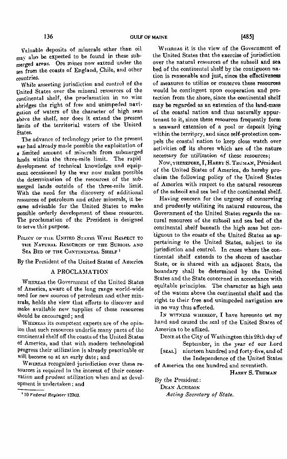
136 GULF OF MAINE i4851
Valuable deposits of minerals other thnn oil ,,y nlso be enpected to be foiind in these sub- rnerged areas. Ore mines noiv extend under the
from the cossts of Englsnd, , a i l e , and otlier ~ountries.
While asserting jurisdiction and control of the United States over the minernl resources of the continentnl dielf, the proclamntioii in na a ise abridges the right of free and unimpeded iiaoi-
of waters of the charneter of high seas abore the shelf, nor dces it extcnd the present linlits of the territorial waters of the United
W ~ i m ~ a s it is rlio view of the Govcrnment of the United States thnt the exercise of jurisdiction over the naturnl rcîoiirces of the subsoil and sen bed of the continciitnl slielf hg the contiyous na- tion is reasonable and just, sinœ the eflectiveness of measures to utilize or conserve these r e s o u m mould he contingent upon cooperation and pm- tection fmm the shore, since the continental shelf may be regnrded as an extension of the land-mas of the coastal nation and thus naturnlly appur- tenant to it, since these reçources frequently form n seaanrd extension of n ~ o o l or deoosit lvine " -
Stntes. ivithin the territpry, and since self-protection com- The advancc of tecllnology prier to the present Ilels the caastsl nation to keep closc ,vatch
aar hnd alresdy mn<le possible the exploitntion of aetivities its shores whicli are of tlle nature limjted amount of minrrals from submerged iiecossnry for utilizntion of these resources;
lands within the thrcc-mile limit. The rnpid development of technical ~ ; ~ ~ , ~ l ~ d ~ ~ and S0\v1THEREWRE, I ,HARRY S. TIIO~IAN, Pksidellt
occosioned by the aar no,r mnkcs of the United States of *meriCa, do hereby pro-
the determination of tlie resources of the sub. claim the followirig policy of the United States ~~~. ~
rnerged lands outsido of the three-mile liinit. With the need for the discavery of additional resources of petroleum and other miiicrnls, i t be- carne advisable for the United States to make possible orderly derelopment of theçc resources. The proclamation of the Presideiit is designed to serve this purpose.
By the President of the United States of America
A PROCLAhlATION
W I I E ~ E A ~ the Governinent of the United States of Anierica, ntvare of the long range world-vide need for newsourees of petrolcum nnd other min- erais, holds the vien. tlint efforts to discorer and make arailnblc iiew supplies of tliese resources should be eneoiiraged ; and
M'HEREAÇ ils competent experts are of the opin- ion thnt such rcsources underlie maiiy parts of the continental shelf off the coasts of the United States Of Americz, and that irith modern tecliiiological progress their utilization is already practicahle or ril l beeome so nt an enrly date; and
\\'HERE.\S recognized jurisdietian over theçe re- sources is required in the interest of their conser- vation and prudent iitilizotion wliei~ aiid as devol- Opment is undertuken: and
of America with respect to the naturnl resources of the subsoil and sen bed of the continental shelf.
Hnving concern for the urgency of mnserving and prudently utilizing its naturnl rwurees , the Government of the United States regards the na- turnl resourees of tlie subsoil and sen hed of the continental shelf benenth the high sens but con- . . tiguous to the coasts of the United States as ap- pertnining to the United States, subject to its jurisdiction and coiitrol. I n cases mhere the con- tinental ehelf extends to the shores of another Slute, or is shared with a n adjaeentstnte, the boundnry shall be determined by the United States niid the Stnte concerned in accordance with equitnblo principles. The character as high seas of the waters sbove the continental sbelf and the right to their free and unimpeded navigation are in no iray thus aflected.
IN WITNESS WIZEREOF, 1 have hereunto set my haiid und caused the çenl of the United States of iimerica to be aiiixed.
DONE a t the City of Washington this 28th day of Septeinber, in the year of our Lord
[SEAI.] ninetffn hundred and forty-five, nnd of the Independence of the United States
of America the one hundred and seveiitieth. Hnnnr S. T~UBIAN
Dy the Prosident: DEAN ACHESON Acting Seerclory of Sfate.

14861 ANNEXES TO MEMORW .OF THE UNITED STATES 137
By the Pmident of the United States of rlmerica
A PROCLAIIATION
Wii~aa.<s for some yeam the Gavernment of the United States of America has viewed with concern the inadequacy of preseiit arrangements for the protection and perpetuation of the fishery re- sources contiguous to its consts, and in view of the notentiallv disturbine effect of this situation. hm krefully Stucliecl thePassibility of improving the iurisdictionnl bnçis for conservation mensures and international cooperation in this field; and
W-s such fishery resources have a special iinportance to constal communities as a source of livelihoad and ta the nation as a food and indus- trial resource; and
W ~ r e m ~ s the pr9greçsive development of new methods and techniques contributes to intensified fishing over wide sen areas and in certain cases seriously threntens fisheries with depletion; and
IV-s there is an urgent need to protect coastnl fishery rcsources from destructive exploita- tion, hsving due regard to conditions peculiar to each region and situation and ta the special rights and equities of tlie caastal State and of nny other State ahich niay hnre established a legitimate interest therein;
Naw, THuiLmne, T:, Harm S. TRUMAN, Presi- dent of the United Stntes of America, do hereby proclaim the following policy of tlio United States of America with respect to coastnl fisheries in certain mens of the high seas:
I n view of the pressing need for conservation and protection of khery resources, the Govern- ment of the United States regards it nç proper to establisli conservation zones in those areas of the Iiigh seas contiguouç ta the eoasts of the United States wherein fisliing activities Iinve been or in the future mny be dcreloped and maiiitained an a substantinl scnlc. Where such activities have been or shall hereafter be develaped and maintnineà by its nationnls alone, the United States regards it as proper to estnblish explicitly bounded conserva- tion zones in wliich fishing activities shnll be sub- - ject to tlie reylation and control of the United States. Wherc such activities have been or shall Iicreafter Le lcgitimntely developed and main.
' 10 Federol Redsler 12301.
tained jointly hy nationnls of the United States and nntionals of other States, explicitly hounded conservntion zones may be established under a m . ments between the United States and such other Stat&; and al1 6shing activities in such zones shall be subject to regulation and control as pmvided in such agreements. The right of sny State to estab lish conservation zones off its shores in accordanea with the above principles is conceded, provided that corresponding recognition isgiven to auy fish. ing interests of nationals of the United States which may exist in such areas. The character as high seas of the areas in which such conservation zones are established und the right to their f m and unimpeded navigation are in no way thus affected.
IN WITNESS WHEREOP, 1 have hereunto set mg hand and caused the seal of the United States of America to be affixed.
D o m a t the City of Washington this 28th day of September, in the year of our Lxd
[SUL] nineteen hundred and forty-five, and of the Independence of the United States
of America the one hundred und seventieth. H n n n ~ S. TRUKAN
By the President: DEAN Acrr~solr
Acting Secretary of State.
EXECUTIVE ORDER 9633
RESERTINO AND CIN NO ~ E I ~ ~ N N RESOURCEB O?
THE CONTINENTAL SHELF UNDER TBE CONTBOL A N D J o n i s o ~ m o n OP THB SECRETAUY OF TUB
I ~ ~ ~ n i o n '
By virtue of and pursuant to the authority vested in me as Presideut of the United States, i t is ordered that the natural resources of the subsoil and ses bed of the continental shelf be- neath the high seas but contiyouç to the wasts of the United States declared this day by procla. mntion to appertnin to the United States and to be subject to its jurisdiction and control, be and they are hereby reserved, set aside, nnd placed under the jurisdiction and control of the Secretaq of the Interior for administrative purposes, pend- ing the enactment of legislation in regard thereto. h'either this Order nor the aforesaid proclamation shall be deemed to affect the detenninntion hy legislntion or judicial decree of any issues between
'10 Fcderal Register 12303

138 GULF OF MAINE [1495]
not, tlierefore, hold out any grent liope of any decision being taken by the Cnii:idinn Gorernment before the general elections.
1 tlieii told Jlr. Jlnhoiiey tliat tliere was another matter which we ~o i i ld be $lad t6 have him bring to the knoaledge of his Government.
This Goremment has also determined upon a policy which would :i;.sert. jiirisdiclion orer tlie minernl reçources of the continental shelf. \\-r n.qsuiiied tliat this would not be of direct interest to Canada. It wis Itoiwrer, n niatter of considerable importance to the United States. Oil \vrlls hure been in operation for çome time off the wast of Cali- foinin :ilid in theGulf of Mexico, and recent technological advances peniiit. of drillitig in waters of grent depth. Although we were not airnre of niiy areas off the coasts of Canada which could be exploited, i t seemed to us that the adoption by Canada of a fishery poiicy similar to our own would niake it desirable for the Canadian Government to ktiorr of oui position in respect to another matter relating to jurisdic- tioii bejond territorial limits. It would, of course, be most gratifying to us if the Canadian Government could see its way clear to poing ;il,>tip with us nlso on thislatter policy.
1 then hnnded Jir. Mnhoney the text of the policy statementSs and the pertinent explanatory statement" He said that he would for- ii-ard tliese papers also to Ottawa with appropriate comment.''
- .\Ir. Parsons informed Blr. Mahoney that Mr. Atherton '' had been
reqiiested to cnll this aftenoon n t the Department of External Affairs and to niake a statement witli regard to fisheries along the lines just made to Ur. Mahoney.
E[U~ENE] H. D[OOMAN]
III.OIIJi4-2045
.Ife~nort~n~ir~m by the Assistant Ghief of the Divkiun of British Commonwealth Affairs (Parsons)
[TV~siirsom~,] April 26, 1915. After I i t i i i < l i t i ~ origiiial copies of tlie attnclied papers to Mr. Ma-
tanii,..v of the Caiindi:tn Emba~sy this ofternoon, Jlr. Doonion and 1 ~li:,:ticsr~l Iton. to follo\r iip ~ritli theCniindiniis.
' '% ,Y . :inri-a 2 :illn<.lir<l I O th? rncrnornnùitrn hs the Actloa Secretary of State : i i i t I I I I , . ,Sv*.n.r:il.y < s i tli,. Ii,it.t.inr t u l'recident I<ons?rrlt. p. 14%.
"' / '~~.- / . :t, 14!Yl. '.+lia. 1ii111. t l i l i ~ u ~ > ~ ~ ! ~ t - sv,.re nlso trnnrniitted 117 the .\ciin- Secretary of Rtnte
1.m i I i v i'<bi,-1x1 Cc i i a~a l nr Sr. ,litl\ii'r. Srwfoi in<llnnd (Ho~>iier). on >las 10. wilb I I , # - rc.,,iiv.t i l i : i t I I I , . ~ i , t . I,;i~i<l,.d 10 tiia Xe\vlouui:l;ind Ciiwmissioner for Satura1
.!:,..,-!,?*.S.<. 1'. 11, I l . I l , , ,,,,. "l : : jv . ~ . ~ ! t t ~ v i ~ ~ r ! . .!~wc.ri,,;tn . l t ; ~ b a = ~ n d t ~ r in Cnllndn.

[1496] ANNEXES TO M E M O W OF THE UNITED STATES 139
1 siiggested tlint nboiit tlie iiii<ldle of next week Mr. Dooinnii give iiie i i progress report oii Iiis tnlks \vitIl representatives of otlier pi\-- eriiments and rques t ine to Iinve Mr. Atherton pass i t nlong to Es- icninl Affnirs \vit11 n fiirtlier rerluest for fnvornble actioii. >Ir. Doomnii ngreed to tliis ancl ndded tliet i t might be well to put iiito 3Ir. :lthertoii's iiiiiicl tlie tliouglit tliat if the Canndiaii Goreiliiiieiit felt it 1roul<l1113 \-ictorioiis in tlie Julie 11 electioiis and if i t tliouglir it \voiil<l move out on the f is l ie l policy nftermards, we miglit be able to :iri.:iiige postpoiieiiieiit of piiblicity oii tlie ne\!, policies ii i i t i l :ifter rliat date.
Lannes 11
Erpla~ia tory St(it~inent on the Protection and Conseruatio~l o i Cornta2 Fhheries
Tlie Goveniiiieiit of tlie United States, recogiiizing tliat it 1i:is ;i
iitnl iiiterest iii fislie~y resources coiitigiious to its coasts niid liariii:. iii iniiicl tlint tlie inndeqiincy of preseiit nrraiigeineiits for the pro!e[:- t.ioii and perpetuntioii of constnl fislieries coiistitutes n poteiitiall'- clisturbiiig elemeiit iii the relntioiis of stntes, lins cnrefiilly exnniiiierl tlie 1>0ssibilities of iiiipro\~iiig tlie jiiris(lictioiial Ijasis of coi~sei.i-:itioii iiiensiires and iiiterii:itioiinl cooperatioii iii tliis field. III so < lo i i~ i it lias concluded that:
(1) Tlie fislieries :ire esseiitinl botli to the coastiil coiiiiniiiiities rvliicli ;ire (leperi<leiit ,111~oii tlipii for :i liieliliood aiid to ,nllie(l ;ilid reliite<l iiidiistries \vliicli fririiisli eiiiployineiit to sul>st:iiiti:illy Ini,;e pul>~il;itioiis.
( ) I'rogressi\-r <Ierelol>iiieiit of ile\v iiretliorls iii fisliii!~, utiliziiig tlie fncrorj sliil), iie\rer tyllel; of vessels ii i icl recliiiical de~ices , riio~lrrii i.efrigeintioii f:icilitirs, :iii(I ille like, ~oi i t r i l~i i t r 1 0 iiiteiisitic~l expli!iiii- tioii orer vide iireiis. I I I iiiiport;iiit iiir;t:iiices coastiil lislieriri :ire sei.ioi!sIy esl>ose<l to,iiiiregiil~irerl espluit:itioii :iii(I ilel>letioii, rIi!is crciitiiig ge i ie~ i l :iiisiety for tlieir fiitiire iiiiioiig tlie peol>le \il!o.?e croiioiiiic \\-e1f:ii.e i i i i c l seciirity <Ie\)eii(l iipoii tliriii. I I I cn i~~e i~~ ie ib~v ;i
cle:ir iire<l li:is iirisrii for :III iniprore(1 Ii;isis foi. tlie regiil;iiioii ; i i i ( l 1ti.o- trrrioii of fislieries i i i tlie I i i J i se:is < ~ ~ i i t i ~ t i o i i s 10 flic CO~IS~S.
: Eqiiit? :iiiil jiisticr rnliiire t l i i i t ii:itiii.;iI reioiirces \vliicli :!:ive 11rr11 liuilt IIII 1)y ~y>t(~:ii::tic c~~rise.rv;itioti :iii<l self-~Ieiiyiii~ rrsiri,.:?<l iitiliï.:ilioii, togetlier \vit11 the iii<liistries I>:ise<l iilnii rlieiii, I N . ~~rott't.:'.:l : i i i i I i,eseri-erl froiii rlrstriictive exl>loitntioii by iiiterests \rliicli 1i:ire iior coi~tribiite(l to tlieir gro\\-tli 811d deselol)iiieiit.
(4) The tinhrrirs ditfer 111 species. nl>iiii~laii~.e. aii<l othrv vlini.;rctn.i-- tics. froiii sen to sel :11ir1 iireil 10 nren: rt~giil:itory iiie;isiire-. Ii;iiiii;. ::: ilirir ol~ject tlir ~ o ~ ~ ~ e r i i i t i o i i of fisliery i~esoiir~rs iiiiist I)e i l i v~~r s i i i~~ l ;i:i<I :i<l:il'trcl ro coii<litioiis l~ecoliar to eiicli r~gioii , \rit11 Otir regiirtl IO t l i ~ specinl riglits aii(l e<liiities of tlie coasl:il st:ite niil1 nf :III? r>ri8rr 5t:itr \vliicli lins ~)>ii.ti~~ip:itrcl iii tlie filiei:\. of tlie rrgioii. I ~ ~ ~ ~ I : I : I I ~ ~ J ! I ::ii<I roiitrol of co:ist:iI fisliery tesoiircrs E I I O I I ~ ~ t l i e~~e f i~ r t~ 1 ~ . tieiirvil oii ;i regioiiiil b:isis.

140 GULF OF M A I N E 114W
) Rrgiiliitory iirraiigeiiieiits for a piiiticiilar fisliiiig ares or re- gioii slioiild be iiiii<le tiiiioiig tlie stntes \vliuse coiitiiiued iise of or rel:itire proxiiiiity to tlia aiïecteil resoiirces gires tlieiii tlie iiiterest niid iiitiiiinte kiiuwledgr iiecesstiq for nise ;incl eiïect ire coiitrol, ancl caii- iiot ncliieve full siiccess iiiiless niade applicable to al1 persoiis aiid ves- srls of \vliatsoever iititioiinlity eiignge<l in fisliiiig tliereiii.
The Governnient of tlie United States lins coiicluded tliat fisliery regulatioii confiiied ta the iiarron exteiit of territorial \vaters hns be- conie iiindequate for tlie protection of tlie coastal fisheries as a mhole; :riid tlint important fisliery resources niay becorne depleted unless n basis for the euteiisioii of protectire jurisdiction for a rensoiisble dis- riiiice beyaird territoriul waters is fouiid nnd adopted. .%ccordiiigly, {lie Goreninieiit of the United States coiisiders tlint its policy cori- ceriiiiig tlie jurisdictionnl status of wastal fislieries Slioiild be ns fol- lo\rs aiid tliat sucli :i policy would be iii keepiiig witli tlie i~a l i t i es of the sitiratio~l:
III vie\\- of tlre i~ssi i ig iieecl for co~~servntion niid protection of tisliery i*soiirces, t f ie C;overiirneiit of the United States regiirds i t ns p i ~ i l a r to est:iblisli coiiser~:itioii zoiies in tliose areas of the higti seas
~iioiis ta tlie coiisrs of tlie Uiiited States \viiei~iii fisliiiin activities ;::-:taen or iii tlir f i i t u i ~ nitiy be develol>ed :.~iid iiiaiiitniiiea oii a sub- sr;iiiti:il xiile: 1Yliei.e siicli ;irtivities have beeii develo ~ e d and maiii- t:iiiir<i by itits ii:itiori:iis iiloiir, tiie ui i i te~i States regards i t ns prol>rr tu rst;il~lisli e sp l i r i t l~ 11»1iii<1e11 coiiser~iitioii zoiies in \vliicli al1 hsliiiig ;ictivities sIiti11 l a subjrct tu tlie regulatioii niid coiitrol of the Uiiitetl Stiites iind iiiiiy \vlieii ~u~iditioiis \viirraiit be lirnited to tlie Uniteil St;itrs. 1Yliei.e siicli tirtirities Ii:ire breii le itirii t 1 developed niid 7. . a e y i~~;iiiit;iitie<l by iiiit iuiials of utlirr States, eup icitlj bounded conserva- t ir i i i zniirs iiiiiy be rst;ililislir<l iiii<ler s:reeiiieiits bet\veeii the Uiiited ,Sciitw ?i;iii<l silcli otlier st;ites; 2nd al1 fisliiiig nctirities in such zoiies i l i i t l l I,r siil,ject to tlie rrgiil:itioii :i!i<! coii~rol of, aii<I iiiag \vheii condi- ti<iiis iriiri:iiit la liiiiitr~l to, tlie Liiiterl Stiites snd siicli otlier States. l ' l i<. riglit of ;iiiy st;itr to rst;ililisli coiiservatioii zoiies off its sliorcs in nccor<liiiice \vit11 tlir ;ilw,ve ~iriiiciplrs is coiiceile<l, ~>ro\~idr<l tlin!. cor- resli~ni<liii~ rt.<,iigiiitioii is gireir to niiy fisliing interests of nntioiials
III<. I.i~itc<l Stiites \vliir.li iii:iy exisc i i i siirli avens. l'lie cliaracter ns Iiigli .sr.;is t i f tlir :irt.:is i i i \vliii.li siicli ~~oiiserv;itioii zoiies ;ire establislied : i i i i I !lit. riglit t~ t l i p i i . f r w ;iii~l iiiiiiii~~eilr<l ii:i\~ir;itioii are i i i iio \\,a. cliiis :ilI'rccr~rl.
Tlie Gnrei.iiiiieiir of tlie L-iiited States belirres tliat, in tlie circuni- -t:iiirrs,srt foiili i i i tliis stiitriiieiit, t1iri.e exists tlie riglit aiid ob1ig:i- t i o i i I O pr<,ti.vt I)otli tlir ~ ~ S O I I ~ C ~ S iiR'rcte~l nn<l tlie establislied interests tlir-rt*i1i. 'l'lie Feiiei.;il ~wiiiviple lier? iiii.olve~l \ v a s giren expressioii by Sn:ret:irx 111111 ii: 19::s i i i :I st;itciiieilr i.rl;itive tu tlie .\laska fislieries, :is follo\vs:
iiiiist I I ? t:ikrii :is :i soi11111 priiiciljlr of jiistice. tlint nii iiiiliistry siirl: :is ~lrs<.rilinl \vliicli lias brrii I i i i i l t ul> by tlie iiatioiials of one cniiiiti:\. c:iiiii,,t i i i fiiirii~ss I)e left to 1)e (lestroyed by tlie iiatioii:ils of

[1498] ANNEXES TO MEMORIAL OF THE UNITED STATES 141
other couiitries. Tlie Anierican Government belieres that the right or obli ation to protect the Almka salrnon fisheries is not only over- whefningly sustained by conditions of tlieir develo ment and perpetu-
the comity of the nations concerned." " B ation, but that it is a matter whioli must be regar ed as importnlit in
The foregoing policy is bnsed upon the preinise tliat rensonable and just bases for tbe exercise of jurisdiction over the fisheries of ail area of tlie higli s a s in the vicinity of the coasts of a state may be found in the following factors: (a) pmsimity t a the coasts of tlie state; ( 6 ) the development and maintenance of well-established fishing activities on a substantial scale by a state's nationals; ( c ) the absence in that area of any well-established fishing nctivities on the part of iiationals of states other than those seeking ta exercise such authority : and (d) the existence of establislied conservation practices, or the iieed for such prnctices, in relation ta the fisheries of the area in question.
I n referring ta the derelopnient :iiid maintenance of fishing d i v i - ties by a sbte's nntionals tlie empfiasis is upon the nationnlity of those conriucting the fisliing enterprise, rather than upon owasional in- dividuals employed on vessels of some iiationality other than their owii. It sliould be rioted tlint tlie stutemeiit of yolicy is applicable only to a ims in n.hich fisliiiig activities have been or in the future niny lie developed and maintained on a suhstantinl scnle; other areas rernain unaffected.
The statement of policy declares that fishing activities within the conservation zones established when al1 tlie conditions are met, "mag nhen conditions n a r n n t be limited ta", the United States, or to the United States and tlie other states joiniiig in the establishment of the zones, as the case ma? be. Although the jurisdiction asserted ex- tends sa f a r as ta permit tlie limitation of fishing activities to the states having the right ta establish the conservation zones, when those states deem such action necessniy, the Government of tlie United States does not contemplnte that tlie estnblisliment of conservation zones un- der tliis policy r i I l effect nny general exclusion from al1 such zones of nll fisliing enterprises of nntioiiiilities other thnii of the United States nncl the otlirr st.:ites establisliing the zone.
Gpon coiisidrr:itinii of tlie iiiore importnnt liigli seas fisheries in nliicli tlie Fiiitecl St:ites Ii:is n prcsent or potentinl iiiterest, it is evident tli:it iii encli tisliri.!- niil!- :i liiiiite(1 iiiimber of coiintries, often oiily one or t : ~ , I!:II-e :III!. i.c;il or. C O I I E ~ ~ I ~ I : ~ I I I ~ intere~t. I n case the stntes liai-- iliq n rrzl iiiterrst i i i e:!cli lislier< :isree iipoii :ind estnblisli n regiiiie of coiirrv:itioii :inil ivsii!:itoi.y coiitrol for tlint fisliery, it is belieretl f l i n t siicli coiis~rv:itioii efforts slio:ild Iiare a sood clinnce for siirce;?
"T l~ iz si:lte~iicnt n~il,enred tirrt i i i ' t c~e~rn rn 309 Sorenilwr 22. 10%. i n rl:. .\:iiiinzrndor i n dnl,;iii. Forc.int l?clnlioiir . 103i. vol. ir. 111'. 763. :#:S. Tlit, tmr <if Ili? trlegrnii: iv:i. relenrt,<l to the p r e s nu Zlnrcl> 23. 103s (Delinrt~iiriit of Si:i:r I ' r , s s 1?<'!<'<1+<'8, >I:~r?h 95, 103% p. 412).

142 GULF OF MAINE [ 14991
aiid thnt. otlier stiites \voiild have no valid renson for objection to the iiieasiirrs tnkeii l>v tlie stntes priinarily conceriied.
r i ider tlie ~)olicy the riglits of al1 stntes aliich Iiave taken any sub- sr~iiiti~il ~ n r t i i i tlie fislies are preserred. I t is iiot intended to dis- tiirl~ i i i :in?. lvell-establislied or Iiistoric fisliing nctivities which li:ive 1)eeii Ii;rbitiinlly cnrried on by iiationals of otlier States. I n areas ~vlirre siicli :icti\-it,ies Iinve been cnrried on, the cooperntion of such. si:ites \vit11 tlie Ci1ite.d Stntes in tlie control and regnlation of the fisli- rrirs is coiiteiiiplated. I n like fnshion, tlie Government of the United St:ites rxpects tlint otlier governments ahich mny ndopt similar poli- vit..; will i-?sl)ect the estnblislied iiiterests of Americnn fishing activities otl tlieir consts.
S o rxieiision of territorial wnters is emboùied in the policy, but ~ i i l i r r tlie est:iblisliment. of cleirly defined conservation zones in a r a s of tlie IiigIi se:is coiitiguous to the con&. Sucli areas nould retain tlirir legnl c11:iilicter as higli seas. The freedom of their use for navi- g:iiii>ii iiiid piirposes oflier tlinii fisliiiig \vould remain unaffected. The :i<lol)tioii of t l iee memures looking solely to the conservation and eco- i i t ~ i i i i i : iitiliz:ition of mnrine resources is not to be regnrded as in con- flict witli the genernl principles of international Iaw, and especially ilt<,-e riiles re1:itiiig to iinvigntion and other aspects of the freedom of tlie seas.
ï'lie Cio~eriiiiieiit of tlie Gnited States is prepared to coopernte with :iiiy iiiterested governrnent in innking pnictical npplication of theprin- rilllrs set fortli nbove. It. nould melcome the opportunity to join with otlier ~overiiiiients iii tlie working oiit of necessary arrangements for t l i v rIeteriiiiii;itioii ;ilid estüblislinieiit of coiiserv:itioii zones in waters of ~~iiiiiiioii concern. Siicli n procedure nould nfford a practical basis for ilii. <.oiiserratioii niid iitilizntioti of higli seas coastal fisheries, with fair- iir.s< :iii<l jiistice to tlie constnl state and to other estnblished fishing in- t~*rests, iirid tlie Govei~iment of tlie United States rrould welcome the ;iilol>t ion I>J otlier governments of a similar policy ns a substantial step iow;ird tliis geiiernl objective and toward the improvenient of the bases i ~ f i i i ierii~~tioii~~l c001~er;itioii in tlie fisheries field.
I<;rlib,srrtory ,<'t<rtenie~tt ml the P.roper UtilizaLion and Development ~i .Y,rtrrrrrl I?~,.votrr,rcs of the Subaoil and Sen Bed of the Continental .'h<.lf
Tlie Goveriiinent of the United States, aware of the long-range i~c~i.lil-ivi~le iieed for iiew sources of petroleiini aiid other iiiiiiernls, linfil'; the view tlint efforts to discover and make nvailable new supplies of iliesr rwiirces slioiild be enwiiraged. I ts competeiit experts are


144 GULF OF MAINE [1501]
t l i . . lnnd iiinss o f tiie constnl d a t e and thus natiinlly appurtenanr to i r : i 1, these re'oiirces often form part of n pool or deposit estencling s:ii\:ircl froiii ~ v i t l i i i i tlie state nnd tlieir iitilizetion iiiny nffei:t re- c e t e r e i n : Cr) the effectireness of inensiires irhicli iiiay I>e n,l:,l~:t.d 10 iitilize or ~.oiisei.vt. tliese resoiirces ~vould I>e coiitiiigriit I I ~ ~ ~ . I I ( . ~ ~ ~ I P L . : I I ioii : I I I I ~ ~ ~ r n t e c r i o ~ ~ froiii tlie (:misral ?r:ire: ( 1 1 ) self- 1'1. , : K I ioii ci~iiil~vls r!ir roastnl stnte to keep close \~ntcIi 01-er ;lctivities nt! iis ;Iini.~..i \\.lii<.Ii :ire of tlie n:iriii.e ;iii<l rel;iti!-e pernlniieiice iir<.r.;- c:ir> b>r ii~iliz:itii~ii of re'oiiri-es of the siil~soil niicl iea bec1 of the roii- iiiic;iii:il :lieIf: i ~ i prii<lent coiiseri.:itioii nii:l practicnl urilizntio!~ of rlii,.ci% rr~oi is i~rs :ire ~Itqiriident iipoii a cle~ir govei.iimeiitn1 policy (le- tii:iiig tlirir jiirisrlictioii:il E I : I ~ I I ~ : nnd ( f ) the goveriiment of rlie i r i i i i i i -
iry r i ) ii-li*i.<e sliores tlie reîoiirces ;ire <~oiitigiioiis is clenrly tlie logic.:il z<,i-i2riiiii~~iir 11, (sxerc,ise jiiris<lictioii :ilid coiitrol orer tliese resoi~r~~es.
I I is heliet-ed tli;it iio f o r e i p itate ivoiild Iinre rensoii to objecr ro iirilizatioii :iii<l c<~iiserrntinii by tlie Liiited Stntes of nndersen miiiprnl ris-oiirccs ~ritliiii a re:isonnble disr:iiicc of . i ts consts. S n oil veils, iiiii!rs. or ciriiil:ir iiist;ill:irioiis aiy opeintecl off tlie consts of the Tiiited ..!:~ies II?. f i ~ r ~ i g n eiiti~rprises. Therefon, n clenr distinction mny I>e <Il;in-II ti<~trrerii siel" 1:ikiaii for. tlie proteclioii of constnl fislierie=. i i i
u-i!i(.li r.iv.qigiiir ioii i i i i i i t lit, ;i\-eii to t..tablislie<l tisliiiig :ictivitie$ ;i:iii iiirrrc-1.. i>f ii:it ioii;ils of one coiiiitry off the co:ists of nnotlier coiiiirry. :!ii<I iiiv;i-iii.t+ triii<.li iii;iy lie :i~lol>tr<l \rith n vie\\- to protectiiig under- .-w !i i i i i i . i . : i l r~soiii.i.t~s roiit igiioii.~ to rlie coiist.
I I I tlir rxrr<,i.sr of its ri,glit of self-protectioii ati<l :1s a iiintter of I I ; ~ ~ ~ , ~ I I : I I <Ivî'<visr. ille L-iiiir<I St;itt.s coiiI(l no1 vie\\. \virIioiit serinils cuii(,ern nnr nttempts by n foreign P w e r or the nationals therenf to rxl'loit i l i i . r.i.siiiir.ces of tlir sen 1)erI or siil~soil of the contineiital slielf <,ti ' ilir rii:isr- < i f tlir 1.-iiirrd States :II ~~r>iii ts suficiently iiear the const ICI i i i i l ~ : i i i . i>r ~~ii,l:iiigi.r tlir secority of tlie Ciiited St:ites: iiiiless siich :i(.iii-irit~.. iv1.i.r iiiial~~rt:ikrii tvitli tlie ;il~proval of tlie Goreriiiiient of 1 I I t t . The rrl:itii-e periiiniieiice of the striirtiire? ;.e- < I ~ ~ i i . t , i I for tlir i-xir:i~:rioii :iii<I iitiliz:itioii of ~)etroleoiii or otlier i!iiii- ri.:il i.i~s~iiii.t.,-.: nf the coiitiiiei~tal slielf \voiil<l iiinke sucli oper;iti<~iis a !i::iirt.i. o f t.i>iii.i.rii to t!ie <.on;t:il st:itr. Tliis 11eco11ies evi(leiit iii the liglir o f tlir ~~ossili lr iiriliz:itioii of ; i i î l i instnllntioiis :is poteiitial +ses. r e f ~ i ~ l i n p depots, ancl the Iike.
For ni;iny years, in some cases for centuries, certain stntes have i: l ; i i i i ipt l th? rizlit to tlie control nii<l escliisive exl)loitatioii of secleiir:ii.y fislirrir- ni! tlic s i ~ i I>ed of the higli sens iii proxiniity of tlieir co;iitS: n i i ~ l t l i ! ~ ~ rl;iiiiis n11pe:ir to have becoiiie establisliecl by acquiesceiice n i ~ i l 1 0 lie rv~<>giiizecl t)y other st:ites. Such claims extend t o oyster l~r<ls. peiirl b:iriks: chnnk fisheries, sponge fisheries, coral, and the like. .5ii$.ii r i ~ l i r i are iiti~lerstood to be asserted off Ceylon and India. off

[1502] ANNEXES TO MEMORIAL OF THE UNITED STATES 145
Bahrein, off Irelaiid, off Tiiiiis, niid iii otlier pnils of tlie Jle<liter- raiienii, off the consts of ;tiistralia, niicl else\~liere. States 1i:ive lilit.. wise long k e n recogiiized to Iiave the riglit to erect liglitliouses, or to keep liglitsliips periiin~ii!iitly niichored, iii locations irell outside. t.lirir territorial waters.
Tlie foregoiiig exaiiiples iiidicate tliat as a iiintter of iiiterii;it.ioii;il 1::ir n state iiinr acquire by occupatioii aiid coiitipity riglits of i l i i ,
len<l hiieatli tlie liigli %s, provided tliat tlie freedoin of irevig:iiii>n is iiot tliereby iiiri>aired. Tlie rntioiiale of the open sea beiiig fier :iii<I forerer excluded froiii occupatioii on tlie part, of aiiy st:ite is t l i ~ i t it fornis nri iiiteriiatioiial Iiigliiray coiiiiectiiig <listuiit. Iniids niid .~~ - i i i . - ing freedoni of corninuiiications and commerce betxreen states separnte<l by the sea. Tliere is no reason for extendiiig tliis wncept of tlir free(loiii of tlie Iiigli seas to the sea bed aii(1 siibsoil beneatli its Ind. I n the case of the sea bed and subsoil tliere is no reasoii to apply eitlier tlie theoretical argunient tlint. occupatioii is iiiipossible becaiise i t ~ i i i
tnke place oiily IX-itli respect to n determiiied tliing, or tlie pr:iii i<::il argiinieiit tliat the freedom of the waters of tlie opeii sea is eçseiiti:il to tlie freedom of intercourse between states.
Tlie recognition of specinl jurisdictioiinl niid property rigliti ii i
l~arriciilnr areas of tlie bed or siibsoil of tlie Iiigli sens for ilir loiiq- :iccepterl piirposes of sedeiitar~. fislieries or for tlie iitilizntioii of i i i i i i -
eral resources does not conflict v i t h the wnimon enjo~nient. of tlie freedotn of navigation. Tliis stntenieiit. of 11olicy regnrdiiig tlie coii- serration and econoinic iitilizntion of the iiatiirnl resources of tlie sr:! k d niid siibsoil of the contiiieiital slielf off tlie sliores of the Tiiite~l Stntes conteniplates no genernl extension of territorial iraiers :iiiil iiii
assertion of jurisdict.ioii orer or iiiterfereiice witli foreipi res.;rls ii:i\-i- gntiiig tlie IiigIi sens. I t is recogiiized tliat siicli iitilizxtioii of [lie sea bed and sutiçoil resources sliouid riot be alloxed to result i i i 11o11ii- tioii of the sea by oil or otlier iioxious substniices. tlint uiireasoii:il~le iiiterfereiice witli naripition as a result of striictures ererted oii tlie bottoiii or ancliored in place iniist be aroided, niid tliat all diie pre- caiitioiis should be taken, by tlie use of liglits siid otlier appropriate derices, ta prereiit. dangers to navigation. S o long as tlieçp pnrnii- tioiis are taken it would seeni clear tliat the general benefit resultiiig froni the orderly utilizatioii of raluable undersen niiiieral resolircrs niiist. be regarded as outiveigliiiig otlier coiisiderntions.
Tliis statement of policy is expressed in terms of the contiiiriit:il slielf off tlie coasts of the United States. .is is %\-el1 kno\rii. tlie i.oii. tiiieiital slielf exteiids senirard for raryiiig distniices off tlie sliorri. niid iii most places teriniiiates iii n fairl:. defiiiite "drol~ off"'. T11e roiitiiiental slielf is usiially defined as tlint I>:irt of tlie iiii<ler~e:i l ; i i i i l
mnçs adjacent to tlie const? orpr ii-hic11 tlie sen is iiot n~ore r I ~ : i t i Ifln

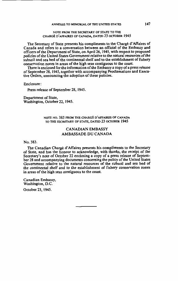
ANNEXES TO MEMOUAL OF THE UMTED STATFS 147
KOTE FROM THE SECRtTARY OF STATE TO THE CHAR& D'AFFAIRES OF CANADA, DATED 23 OCTOBER 1945
'Ihc Sccretary of Statc presents his wmplimenü to the Charge d'maires of Canada and refen to a wnvenation betwecn an ofiïcial of the Embassy and officers of the Deoartrnent of State. on Aoril26.1945. with resoecl to vroüosed -~~~~~
policies of the Ünjted G Ï e s Govemmeni'relative to the naturai resou&s~fthe subsoil and sea bed of the wntinental shelf and to the establishment of fishcry conservation zones in areas of the hinh seas wntieuous to the wast. -.~~.. .~~ -.
There is enclosed forthi informalj& of the ~ m g a s s ~ a wpy ofa press release of Seutcmber 28. 1945, toaether with acwmpanying Proclamations and Execu- tive orden, announcing ihe adoption of these poliCies.
Enclosure :
Press release of September 28, 1945.
Department of State, Washington, Onober 22,1945
NOTE NO. 383 FROM THE CIIARGC' D'AF'FAIRES OF CANADA TOTHE S C C R F T A R Y Of STATE. DATED 23 OCrOBER 1945
CANADIAN EMBASSY AMBASSADE DU CANADA
No. 383. The Canadian Charee d'Affaires oresents his compliments to the Secretary
of State, and has the Konour to acknowledge, with ihanks, the receipt of the Secrerary's note of Onobcr 22 enclosing a copy of a press release of Seplem- ber 28 and acwmoanvine documents concemine the oolicy of the United States Govemment relahvëto-the natural resourcesof the subsoil and sea bed of the wntinental shelf and to the establishment of fishery wnseivation zones in areas of the high seas wntiguous to the wast.
Canadian Embassy, Washington, D.C.
October 23,1945.


ANNEXES TO MEMOW OF THE UNITED STATES 149
Carnegie Endowment for International Peace DIVISION OF INTERNATIONAL LAW
THE
HAGUE COURT REPORTS
COMPRlSlNG T H E AWARDS. ACCOMPANIED BY SYLLABI,
THE AGREEMENTS FOR ARBITIIATION. A S D OTHEK I>OCUMENTS IN EACH CASE SUBMITîED TO THE PER- MASEST COURT OF AKBlTRATlOS ASD TO COMMISSIONS
OF IXQUIliY USDER T H E l'RO\'ISIOSS OF T H E C0SVY.N- TLOXS OF 1699 AND 1907 FOR THE PAClFlC SETTLEMEST
OF INTERNATIONAL DISPUTES
EDITED WlTH AN INTRODUCTION
BY
JAMES BROWN SCOTT DIRECTOR
NEW YOKK
OXFORD UNIVEHSI'i'i7 PRESS A,MERICAN B R A N C H : $ 5 WEST 3 2 x n S T R E E T
London. Toronto, hlelbourne and Bomba?
HUMPHREY MILFORD
1916

150 GULF OF MAlNB [1211
THE GRISBADARNA CASE belwein
N O R W A Y and S W E D E N
Decided October 23, 1909
Syllabus By a cotnprotiiü signed on March 14, 1908,' Norway and Sweden
agreed to arbitrate the question of the maritime boundary between the two countries in so f a r as it had not been regulated by the Royal Reso- lution of March 15, 1904.2 The arbitral tribunal \vas called upon t o decide whetlier the boundary was fixed either in whole o r in part by the boundary treaty of 1661, and, if not, to fix the boundary o r parts thereof in accordance with the principles of international law. The tribunal consisted of a national from each of the two Governments and an umpire chosen from a neutral Power. As finally agreed upon, it was composed as follows: J. A. Loeff of Holland, F. V. N. Beichmann of Norway, and K. Hj . L. Hammarskjold of Sweden. Only the last- named was a member of the Permanent Court of Arbitration a t The Hague. T h e tribunal held sessions f rom August 28 to October 18, 1909, in the course of which it visited the disputed zone. The decisi011 was rendered on October 23, 1909.
The tribunal found that the boundary line had not been fixed by the treaty of 1661 beyond a certain point. and that a portion of the line within that point was uncertain. The tribunal therefore fixed the boundary according to the principles in force and applied by Nonvay and Sweden when the original boundary treaty was made. The appli- cation of these principles resulted in a line which gave the Grisbadamî fishing banks to Sweden and the Skjottegrunde to Norway. Such a division was also supported by the state of things which the tribunal found had a c t u a l l ~ existed fo r a long time. especially the use made of the banks by the fishermen of the two countries and the acts of posses- sion and ownership exercised by the two Governments.

LI221 ANNEXES TO M E M O W OF THE UNITED STATES 151
A\Irt\RD OF THE TRIBUNAL
.4rbitrul najard iir tlic rliiistioir of tlic drlilliitation of n certoilr part of llic ~iioritiriir Doirii~lary bct~cceti Noniruy and Szc~cdcri.-Tlre ffoiji~c, October 23, 1909.'
\\'liereas, hy convcntioii (Iated blarch 14, 1908,' Xorivay and S~veden agreed to suhniit to the final decision of a tribiiiial of arbi- tration, coriiprised o f a president \\.ho shall neitlier he a subject of either of the contracting parties nor domiciled in either of the t\vo cviintries, arid o f t\vo other members of whom one shall IR a Nor- wegian and the other a Swede. the question of the niaritiirie Imund- ary ktiveeri Norway and Slveden as far as this 1)ouiidary lias not been deteriiiined by the Royal Resolotion of llarch 1.5. 1901;'
[Vhereas, in pursuance to said convention. the tivo Governrnents Ii;ive aplminted respecti\,ely as president and arbitrators:
RIr. J . A. Loeff, Doctor of Law and Political Sciences, former Alinister of Justice. rileniber of the Second Chamber of the States- General of the Netherlands; ' IvIr. F. V. N. Beichmann, President of the Court of Appeals of
Trondhjem. and hlr. K. Hj . L. Hamniarskjold. Doctor of La\\.. former hlinister
o i Justice. former Miiiister of Public \\'orship and Public Construc- tion. former Envoy Exiraordinary and htinister Plenilmtentiary to Copenhagen. fornier President of the Coiirt of rippeals o f Jon- koping. former professor in the Faculty of Law of Upsal, Governor of tlie Province of Upsal. iiiemher of the Permanent Court o f .-Ir- bitration;
\Vlierens. in accor<lance with the provisions of the convention. the nieniorinls, coiinter-riieriiorials, and replies have heen cliily eu- cliaiiged bet\veen the parties and conimiinicated to the arhitrators 1)-ithin the periods fixed I)y the president of the trihiirial;
\\'hereas. the two Governments have respectively appointed as ;tgeiits. to \vit:
Tlie Governnient of Nor\\.ay. XIr. Kristen Johanssen, attorney ai tlie Siiprenie Coiirt of i\Tor\va!.: and the Governrneiit of S\veden. \!r. C. O. hloiitan. fornier nienilxr of the Court of :\pl>eals of ';yen. jii(lge iii the llixe<l Coiirt of :\lexnnclrin: -
~ . i ~ ~ z r r i i n i i I o r i r ~ i o l of I i t i i~ r i in t in r~ i i / Laci. vol. 4. p. 226. For t l ie orisiiial I..rimi\i test. r r e .\ppcn<iis. p. 487.
1 , . 1.3.3. Jl'osr. p. 136.

152 GULF OF MAINE il231
Whereas, it has been agreed by Article 2 of the convention : 1. That the tribunal of arbitration shall determine the boundary
line in tlie waters froni point lS on the chart' annexed to the pro- posa1 of the Norwegian and Swedish coniniissioners of August 18, 1897, into the sea up to the limit of the territorial waters;
2. Tliat the lines liniiting the zone \\.hich is the siibject o i litiga- tion in consequence of the conclusions of the parties and within which the boundary-line shall coiisequently IR established, must not be traced in such a way as to comprise eitlier islands, islets, or reefs which are not constantly under water;
Whereas, it has like\vise been agreed by Article 3 of the said con- vention:
1. That the tribunal of arbitration shall determine whether the boundary line is to t e considered. either wholly or in part, as being fixed by the boundary treaty of 1661 together with the chart thereto annexed. and in what manner the line thus established should be traced.
2. That, as far as the boundary-line shall not be considered as established by said treaty and said chart, the tribunal shall deter- niine this boundary-line, taking into account the circumstances of fact and the principles of international law;
M'hereas, the agents of the parties have presented the following cc,nclusions to the tribunal:
The agent of the Norwegian Government : That the boundary betrveen Norway and Sweden tvithin the zone
which constitutes the ohject of the arbitral decision. shall be deter- mined in accordance \ ~ i t h the line indicated on the chart annexed, uiider No. 33, to the memorial presented in behalf of the Norwegian Government.
And the agent of the S\\.edish Government : 1. As regards the preliminary questions: May it please the tribunal of arbitratioii to declare that the bound-
ary-line in dispute. as regards the space behreen point 18 as already fixed on the chart of the commissioners of 1897. and point ;\ on the cliart of tlie baiiiidary treaty of 1661, is but incoinpletely estahlished II?. the said treaty atid the chart aniiexed thereto, for the reason that tlie exact situation of this point is not shown clearly therein, and, 2s regards the rest of the space. extending \vestt\.:ird from the same

11241 ANNEXES TO MEMORlAL OF THE UNITED STATES 153
point A to the territorial boundary, that the boundary-line was i;ot established at al1 by these documents.
II. As regards these main questions : 1. May it please the tribunal to he guided by the treaty and chart
of 1661, to take into account the circumstances of fact and the prin- ciples of the law of nations, and to determine the maritime bound- ary-line in dispute between Slveden and Nonvay from point 18 as already fixed, in such a manner that in the first place the boundary- line shall be traced in a straight line to a point which constitutes the middle point of a straight line, connecting the northernmost reef cf the Roskaren, belonging to the Koster Islands, that is to say, the ieef indicated on table 5 of the report of 1906 as k i n g surrounded with depths 9, 10 and 10 [sic.], and the southernmost reef of the Svatskjar, belonging to the Tisler Islands, and which is furnished with a beacon, which point is indicated on the same table 5 as the point 19.
2. May it please the tribunal further to take account of the cir- cumstances of fact and the principles of the law of nations and establish the rest of the disputed boundary in such a manner that-
(a) Starting from the point fixed according to the conclusions of paragraph 1 and designated as point 19, the boundary-line shall be traced in a straight line to a point situated midway on a straight line connecting the northernmost of the reefs indicated under the name of Stora Drammen, on the Swedish side and the Hejeknub rock, situated to the southeast of Heja Island, on the Norwegian side. which point is indicated on the said table 5 as point 20; and
( b ) Starting from the point last-mentioned, the boundary shall Le traced in a straight line due West as far into the sea as the mari- time territories of the two nations are supposed to extend;
Whereas, the line mentioned in the conclusions of the Norwegian agent is traced as follows :
From point 18 as indicated on the chart of the commissioners of 1897, in a straight line to point 19 situated inidway on a line drawn between the southernmost reef of the Svartskjar (the reef which is furnished with a beacon) and the northernmost reef of the Ros- liaren ;
From this point 19 in a straight line to point 20, situated midway on a line drawn between the southernmost reef of the Heiefluer

154 GULF OF MAINE Il251
(sondre Heieflu) and the northernmost of the reefs compr?;cd under Oie name of Stora Drammen;
From this point 20 to point 20a, following a perpendicular drawn from the middle of the last-mentioned line.
From this point 20a to point 206, following a perpendicular drawn irom the middle of the line connecting the said southernmost reef of the Heieflu with the southernmost of the reefs comprised under the name of Stora Drammen.
From this point 206 to point 20c, following a perpendicular drawn :rom the middle of a line connecting the Sondre Heiefluer with the small reef situated to the north of Klofningen islet near Morliolmen.
From this point 20c to point 20d, following a perpendicular drawn from the middle of a line connecting the Midtre Heieflu with the said reef to the north of Klofningen islet.
From this point 20d, following a perpendicular drawn from the middle of the line connecting the Midtre Heieflu with a small reef situated West of the said Klofningen to point 21, where the circles cross which are drawn around said reefs with a radius of 4 nautical niiles (60 to a degree).
Whereas, after the tribunal had visited the disputed zone, ex- amined the documents and maps which had k e n presented to it, and heard the pleas and replies as well as the explanations furnished it at its request, the discussion \vas declared terminated at the ses- sion of October 18, 1909;
Whereas, as regards the interpretation of certain expressions used in the convention and regarding which the two parties ex- pressed different opinions during the course of the discussion,
In the first place, the tribunal is of opinion that the clause in accordance with which it is to determine the boundary-line in the sea N jar as tire [inrit of the territorial waters has no other purpose than to exclude the possibility of an incomplete determination. \*:hich might give rise to a new boundary dispute in future; and
It w s obviously not the intention of the parties to fix in advance the terminal point of the boundary, so that the tribunal woold have only to determine the direction between t a o given points;
In the second place, the clause in accordance with which the lines tcunding the zone which may be the subject of dispute in conse- qiience of the conclusions of the parties ~i i l i s t not bc troccii in sz~cli

11261 ANNEXES TO MEMORIAL OF THB,UNITED STATE-S 155
o nionner as to coirrprise citlicr isl~inds, iclets, or recfs whicll ore ;tut constantly i~ndcr mater can not be interpreted so as to imply that the islands, islets, and reefs aforementioned ought necessarily tc be taken as points of departure in the determination of the bundary ;
Whereas, therefore, in the two respects aforementioned, the tribunal presewes full freedom to pass on the boundary within the limits of the respective contentions;
Whereas, under the terms of the convention, the task of the tribunal consists in determining the boundary line in the water from the point indicated as 18 on the chart annexed to the project of, the Xorwegian and Swedish commissioners of August 18, 1897. in the sca as f a r as the limit of the territorial waters;
Whereas, as regards the question, "whether the boundary-line should be considered, either wholly or in part, as k i n g fixed by the boundary treaty of 1661 and the map thereto annexed," the answer to this question should be negative, at least as regards the boundary-line beyond point A on the aforementioned map;
Whereas, the exact situation of point A on this chart can not be determined with absolute precision, but at al1 events it is a point situated ktween points 19 and 20, as these points will be deter- niined hereinafter;
Whereas, the parties in litigation agree as regards the boundary- line from point 18 on the chart of August 18, 1897, to point 19 as indicated in the Swedish conclusions;
Whereas, as regards the boundary-line from the said point 19 to a point indicated by 20 on the charts annexed to the memorials. the parties likewise agree, except that they differ with regard to whether, in determining point 20, the Heiefluer or the IIeieknub sliould be taken as a starting point from the Norwegian side;
Whereas, in this connection. the parties have adopted. at least in practice, the mle of making the division along the niedian line ilrawn between the islands. islets. and reefs situated on both sides aiid not constantly submerged. as having k e n in their opinion the rule which was applied on this side of point A by the treaty of 1661 ;
The adoption of a mle on such grounds should. withoiit regard to the question whether the mle invoked \\.as really applied hv said


[lzsl ANNEXES TO MEMOW OF ME U N ~ D STATES 157
and there are sonie details and peculiarities in the line traced which even give rise to serious douhts in this regard, and even if one ad- niitted the existence of this rule in connection with the boundary- lin? fixed by the treaty, it would not necessarily follow that the same riile ought to have Ixen applied in determining.the boundary in the exterior territory;
Whereas, in this connection, The boundary treaty of 1661 and the chart thereto annexed make
the boundary-line begi» between the Koster and Tisler Islands; Whereas. in deterniining the boondary-line they went in a direc-
tion from the sea toward the coast and not from the coast toivard the sea;
\\'hereas, it is oiit of the question to Say that there might have k e n a continuation of this boundary-line in a seaward direction;
Whereas, consequently, the connecting link is lacking in order to enable us to presume, witliout decisive evidence, that the same rule was applied simultaneously to the territories situated this side and to those situated that side of the Koster-Tisler line;
Whereas, moreover, neither the boundary treaty nor the chart appertaining thereto mention any islands, islets, or reefs situated beyond the Koster-Tisler line, and therefore, in order to kecp with- in the probable intent of these documents we must disregard such islands, islets, and reefs;
Whereas, again, the maritime territory belonging to a zone of a certain width presents numerous peculiarities which distinguish it from the land territory and from the maritime spaces more o r less completely surrounded by these territories;
Whereas, furthermore, in the same connection, the rules regard- iiig maritime territory can not senre as a guide in determining the t~oundary between t\vo contiguous countries. especially as, in the present case. \c.e have to determine a boundary which is said to have heen autornatically traced in 1658, whereas the rules invoked date from subsequent centuries;
And it is the same way with the rules of Norivegian municipal law concerning the definition of boundaries between private proper- ties or hetween administrative districts;
\Vhereas. for al1 these reasons. one can not adopt the method by \%:hich Norway has proposed to define the boundary from point 20 to the territorial limit;

158 GULFOF MAINE I 1291
Whereas. the rule of dra\\.ing a median line midway between the iiihabited lands does not find sufficient support in the law of nations iii force in the seventeenth century;
Whereas, it is the same way \\.ith the rule of the thahueg or the most important channel, inasmuch as the documents invoked for the purpose do not demonstrate that this rule was followed in the present case. And,
\Vhereas, Ive shall be acting much more in accord witli the ideas of the seventeenth centiiry and with the notions of law prevailing a t that time i f we admit that the automatic division of the territory in question must have taken place according to the general direc- tion of the land territory of which the maritime territory constituted ;;n appurtenance, and i f n e consequently apply this same rule at the present time in order to arrive at a just and lawful determination of the boundary ;
Whereas, consequently, the automatic dividing line of 1658 should be determined (or, what is exactly the same thing expressed in other words), the delimitation should be made to-day by tracing a line perpendicularly to the general direction of the coast. while tak- ing into account the necessity of indicating the boundary in a clear and unmistakable manner, thus facilitating its observation by the iriterested parties as far as possible;
Whereas, in order to ascertain what is this direction we must take equally into account the direction of the coast situated on both rides of the h u n d a r y ;
Whereas, the general direction of the coast, according t o the ex- r . r t and conscientious survey of the tribunal, swerves about 20 clegrees westward from due north, and therefore the perpeiidicular line should run toward the \\.est to about 20 degrees to the south;
\Yhereas, the parties agree in admitting the great uiisuitahility of tracing the boundary-line across important bars; and
A boundary-line drawn from point 30 in a westerly direction to ! 9 degrees to the s o k h would completely obviate this inconvenience. since it \rould pass just to the north of the Gnsbadarna and to the south of Skjottegrunde and \vould also not cut through any other important bank; and
Consequently, the houndary-line ought to be traced from point 20 \vest\rard to 19 degrees south. so that it \vould pass midway between

Il301 ANNEXES TO MEMONALOF THE UNITED STAN 159
the Grisbadarna banks on the one side and Skjottegrunde on the other ;
\Vliereas, althougli the parties have noi indicated any marks of alignnieiit for a boundary-line tlius traced there is reason to believe that it ivill not be impossible to find such marks;
Whereas, on the other hand, we could, if necessary, avail our- selves of other knoivn methods of marking the boundary;
Whereas, a demarkation which would assign the Grisbadarna to Swedeti is supported by al1 of several circumstances of fact which were pointed out during the discussion and of \'hich the following are the principal ones:
(a) The circumstance that lobster fishing in the shoals of Gris- badarna has k e n carried on for a much longer time. to a much larger extent, and by a much larger number of fishermen by the subjects cf Siveden than by the subjects of Nor~vay.
( b ) The circumstance that Sweden has performed various acts in the Grisbadarna region. especially of late, oiving to her conviction that these regions were Swedish. as, fo i instance, the placing of beacons, the measurement of the sea, and the installation of a light- boat, being acts which involved considerable expense and in doing \!.hich she not only thought that she was exercising her right but even more that she was performing her duty; whereas Norway. cccording to her own admission. showed much less solicitude in this region in these various regards;
Whereas, as regards the circurnstance of fact mentioned in para- graph n above, it is a settled principle of the law of nations that a state of thiiigs ivhich actually exists and has existed for a long time should be changed as little as possible; and
This rule is specially applicable in a case of private interests which, i f once neglected, can not be effectively safeguarded by any nianner of sacrifice on the part of the Government of ivhich the interested parties are subjects; and
Lobster fishing is much the most important fishing on the Grisba- darna banks. this fishing being the very thing tliat gives the hanks their value as fisheries: and
Without douht the Swedes were the first to fish lohsters by means of the tackle and craft necessary t o engage in fishing as far out at sea as the banks in question are situated; and

160 GULF OF MAINE il311
Fishing is, generally speaking, of more importance to the inhab- itants of Koster than to tliose of Hvaler, the latter having, at least until coriiparatively recent times, engaged rather in navigation than fishing ; and
From these various circumstances it appears so probable as to Le almost certain that the Swedes utilized the banks in question niuch earlier and much more effectively than the Norwegiaiis; and
The depositions and declarations of the witnesses are, generally speaking, in perfect harmony with this conclusion; and
The arbitration convention is likewise in full accord with the same conclusion ; and
According to this convention there is a certain connection between the enjoyment of the fisheries of the Grisbadarna and the keeping up of the light-boat, and, as Sweden will be obliged to keep up the light-boat as long as the present state of affairs continues, this shows that, according to the arguments of this clause, the principal enjoy- nient thereof is now due to Sweden;
Whereas, as regards the circumstances of fact as mentioned iiiider b :
.As regards the placing of beacons and of a light-boat- The stationing of a light-boat, which is necessary t o the safety
of navigation in the regions of Grisbadarna, was done by Sweden without meeting any protest and even at the initiative of Nonvay, 2nd likewise a large number of beacons were established there with- out giving rise to any protests; and
This light-boat and these beacons are always maintained by Sweden at her 0n.n expense; and
Norway has never taken any measures which are in any way equivalent except by placing a bell-buoy there a t a time subsequent to the placing of the beacons and for a short period of time, it k i n g impossible to even compare the expenses of setting out and keeping up this buoy with those connected with the beacons and the light- boat; and
It is shown by the foregoing that Sweden had no doubt as to her rights over the Grisbadarna and that she did not hesitate to incur the expenses inciimbent on the owner and possessor of these banks even to the extent of a considerable sum of money.
As to the measurements of the sea-

(1321 ANNEXES TO MEMORIAL OF THE UNITED STATES 161
Sweden took the first steps, about thirty years before the begiri- r:ing of atiy dispute, toward iiiaking exact, labrious, and expensive nieasureiiients of the regioiis of Grisbadarna, while the measure- inerits made some years later by Norway did not even attain the limits of the Swedish measurements. And
Whereas, therefore, there is no doubt whatever that the assign- iiient of the Grisbadaina banks to Sjreden is in perfect accord ivith the most important circumstances of fact;
M'hereas, a .dernarkation assigning the Skjottegrunde (which are the least important parts of the disputed territory) to Nonvay is sufficiently warranted by the serious circuinstance of fact that, although one must infer from the various documents and testimony that the Swedish fishermen, as was stated above, have carried on fishing in the regions in question for a longer period. to a g.reater extent, and in greater numbers, it is certain on the other hand that the Norivegian fishermen have never k e n excluded from fishing there;
Whereas, moreover, it is averred that the Norwegian fishermen have almost always participated in the lobster fishing on the Skjotte- grunde in a comparatively more effective manner than at the Gris- badama :
Therefore The tribunal decides and pronounces : That the maritime boundary between Norway and Sweden, as
far as it was not determined by the Royal Resolution of March 15, 1904, is fixed as follows:
From point 18 situated as indicated on the chart annexed to the project of the Norivegian and Sivedish commissioners of .4ugust 18, 1897, a straight line is traced to point 19, constituting the middle point of a straight line dra\rn from the northernmost reef of the Roskaren to the southernmost reef of the Svartskjar, the one which is provided with a heacon;
From point 19 thus fixed. a.straight line is traced to point 20. \\hich constitiites the niiddle point of a straight line dralvn from the nortliernniosc reef of the group of reefs called Stora Dram- men to the Hejeknub situated to the southeast of Heja Islands; from point 20 a straight line is drawn in a direction of \\.est 19 degrees south, xrhich line passes mid\vay bet\veen the Grisbadarna

162 GULF OF MAINE 11331
and the Skjottegrunde south and extends in the same direction until it reaches the high sea.
Done a t T h e Hague, October 23, 1909, in the Palace of the Per- manent Court of Arùitration.
J. A. LOEFF, Prcsident ~ ~ I C H I E L S VAX VERDUYNEN, Secretary General ROELL, Secretary
AGREEMENT FOR ARBITRATION
Coiiventioii between Norway and Sweden for the reference 10 arbiira- rion of the questio~r of a certain portioil of ilte sea-limit between the two torr~itries i i ~ conircction wi th the Grisbadarna rocks.- Sigired al Stockko[~n, Morch 14, 1908.'
His Majesty the King of Sweden and His hlajesty the King of Nor- way, having found it desirable that the question of the sea-limit be- tweeii Sweden and Norway, in so far as it a a s not detennined by the Resolution of the 15th March, 1904,2 should be referred to arbitration, have for this purpose appointed as their representatives:
His Majesty the King of Sweden: His Minister for Foreign Af- fairs, Eric Birger Trolle;
His Majesty the King of Norway: His Envoy Extraordinary and Minister Plenipotentiary, Paul Benjamin Vogt; ,
Who, after exchanging full powers, have agreed to the followiiig conditions:
ARTICLE 1
The parties pledge themselves to the extent stated below to leave the settling of the question of the sea-limit between Sweden and Norway to a tribunal of arbitration, consisting of a president who is neither a subject of nor domiciled in either of the t h o countries, and of two other members: one Swede and one Norwegian. The president shall be appointed by Her h fa jes t~ the Queen of the Netherlands, the other . members one each by the parties concerned. The parties, however, retain the right, should they agree, to appoint by special arrangement either the president only or the collective menibers of the tribunal. -
XBritirh a>id Foreigri Slofe Popers, vol. lm, p. 731. For the original Swedish and Norwegian textr, sec Appcndix, p. 496.
ZPmt, p. 136.

11 341 ANNEXES m MEMORUL OF THE U N ~ D STAW 163
Representation to Her h'lajesty the Queen of the Netherlands, or the arhitrator who may be appointed by agreement, shall be made by both parties together.
ARTICLE 2
The tribunal o f arbitration shall, after having examined the case of each of the parties and their respective reasons and proofs, determine the boundary-line in the waters from point 18 on the chart' annexed to the Swede-Norwegian proposal of the 18th August, 1897, into the sea up to the limit of the territerial waters. It is agreed that the boundary- line of the zone which the parties maintain t o be under discussion. and for which, consequently, the limit is to be defined, may not be so drawn as to include islands, islets, o r reefs which are not perpetually covered with water.
ARTICLE 3
'The tribunal of arbitration shall have power t o determine how fa r the boundary-line shall be considered to be, either wholly or in part, determined by the boundary treaty of 1661, together with the chart appertaining to the same. and how such boundary-line is to, be traced, and also. in so fa r as the boundary-line can not be considered as estab- lished by the treaty and chart in question, shall have power to deter- mine the same, taking into account the circumstances of fact and the principles of international law.
Until the expiry of the third calendar year af ter the aiinouncement of the decision of the tribunal of arbitration. irrespective of the bound- ary line fised by that decision, fishing may be carried on within the waters which, according to Article 2, are the subject o f dispute by the subjects of both countries t o the same extent as during the five-year period 1901-1905. In considering the extent to which fishing i s carried on, regard shall be had to the number of fishermen. the kind of fish, and the nianner of catching.
ARTICLE 5
It is agreed tliat that country ( i i i ivhose side o f the e\.entiial boundary- line the Grisbadarna fiihing grouilil- .ire sitii;ited shnll have iio claim against the other couritry fo r contriliiiii<rti towardi the expense of liglit- ships or otlicr arrarigenients on or in tlie neighborhood of such grouncls.

164 GULF OF MAINE t1351
Sweden undertakes to maintain the present light-ship situated out- side the territorial limit until the expiration o f the time mentioned in Article 4.
ARTICLE 6
The president of the tribunal of arbitration shall appoint the time and place fo r the first meeting of the tribunal and shall summon the other members to it.
Time and place fo r further meetings shall be decided by the tribunal of arbitration.
ARTICLE 7
The official language to be used by the tribunal shall be English, French, or German, as may be decided in consultation with the other members.
For petitions, evidence, and directions the parties may use the lan- guage of either country, the tribunal retaining the right to have trans- lations made.
ARTICLE 8
With respect to procedure and expenses, tliere shall apply such por- tions of the regulations contained in Articles 62 to 85 of the reviseù Convention adopted a t the Second Hague Conference of 1907 for the pacific settlement of international disputes as may be applicable.
Petitions. rejoiners, and evidence referred tci in Article 63 paragraph 2, of the above-nientioned Convention. shall be filed within a period to be determined by the president of the tribunal of arbitration, but before the 1st March. 1909. No change is hereby entailed in the rules of procedure for the second part, especially as regards the regulations in Articles 68, 72, and 74 of the said Convention.
The tribunal of arbitration has the right, when it is found necessary fo r the elucidation of the case, to arrange for the hearing of witnesses o r experts in the presence of both parties and to order the undertaking in common of a hydrographical survey of the waters under dispute.
This Convention shall be ratified, and the ratifications exchanged a s soon as possible in Stockholm.
In respect whereof the respective plenipotentiaries have signed this Convention and nffised thereto their seals.
Done in duplicate, in Swedish and Norwegian, at Stockholm, on the 14th hlarch, 1908.
(L. S.) EI<IC TXOLLE (L. S.) BESJASIIPI VOGT

il361 ANNEXES TO MEMORUL OF THE U N ~ D S T A ~ 165
A D D I T I O S , \ L DOCUMENTS
H i s Royol Majesty's gi,arioiis ~csolritioti of March 26, 1904, ?"th oc- ro» lpa~~y i~rg Proroto1 of .110rcfi 15, 1904, coitceriiitig the dciermina- tioti of Ille c r t ~ t i t of (1 rcrlai~i part of the wiarititne boundury be- iwrrn Siucden and Non~foy . '
In reference to the acconipanying protocol of the joint Korwegian and S\vedish Council of State of hlarch 15. 1901, as well as the extract from the protocol of the State Council regarding civil niatters fo r this day, His Royal Majesty herewith authorizes the Riksdag to propose tliat the questioii of the extent o f the niaritime boundary between Slveden and Xorway, from point 18 mentioned in the said protocol. and to the sea, a s far as the territorial boundary extends, be referred t o the decision of a special arbitral tribunal, in accordance with the text o f the protocols.
The authorities of the Riksdag shall appoint a committee ta conduct the exaniination of the ncts; and with al1 Royal grace and favor His Royal Majesty remains ever well disposed t a the Riksdag.
In the absence of His Majesty my Most gracious King and Lord,
G U S T A F HJALMAR ~VESTRIVC
PROTOCOL COSSIDERED I N TUE J O I N T NORWECIAN A' iD S\\'EDISII ST.4TE COUNCIL BEFORE HIS ROYAL HICBNESS TI iE CROWS PRINCE RECENT A T T I I E CASTLE OF CI IRISTIASIA, AIARCII 15, 1904.
Present: His Excellency the Minister of State Haaerup, his Ex- cellency the Minister of State Ibsen, his Excellency the h,linister of State Bostrom, his Excellency the hlinister for Foreign Affairs Lager- heim, State Councilors : Kildal, Strugstad, Hauge, Sclioning, Vogt, Mathiesen, and the Swedish State Councilor, Westnng.
The Chief of the Department of Conimerce and Industry, State Councilor Schoning submitted the following:
The Department takes the liberty of presenting, considerations conceriiing measures aneiit the more definite fixation of national bouiidaries in the waters between Norway and Sweden.
Maritime boundaries bet~veen the tivo coiintries running from the interior of Idefjard aiid out to the sea were fixed in a boun- dary regulation of October 26. 1661. carried out in accord with the pence trraty of Roskilde of February 26/hlarcli 9. 165s. and of Copeiilin~eii of hlnrch 27/!iine 6. 1660. -
1Translation. 1-or the orisinal Swedish text. see Appendix, p. 5CO.

166 GULF OF MAINE 11371
In the meantime mucli uncertainty has arisen regarding sev- eral points of this boundary line in view of the fact that during the long interval between 1661 and 1897 nothing was done in the matter hy joint survey and investigation. In 1897 the Norwegian Department of the Interior and the Swedish Department for Civil Affairs took action whereby they might ascertain the exact course of that section of the boundary; and in the month of August of the same year two Norwegian and two Swedish commissioners met for the purpose of making a thorough search of the records and an investigation on the spot, etc., and of their prescnting a proposition for the fixation and tracing upon charts of the bound- ary line between Norway and Sweden, from the interior of Idefjard and out into the sea.
Bureau Secretary Hroar Olsen and commander A. Rieck were the Norwegian commissioners; Commander E. Oldberg and Judge H. Westring were the Swedish commissioners.
As the result of their labors and investigations, the commis- sioners presented on August 18, 1897, the "proposition of the Royal Swedish and Norwegian Commission for and description of the maritime boundary between Nonvay and Sweden from the interior of Idefjard to the sea."
From this it appears, as witnessed by al1 four commissioners, that they had reached a unanimous conclusion regarding the boundary line from the interior of Idefjard to a point between the Jyete buoy (Norwegian) and a small Island, northwest of Narro Hellso (Swedish), which point is numbered 18 on a draft chart accompanying the proposition, so that Helleholmen is trans- ferred to Sweden, and Knivsoarna to' Nonvay.
Regarding the extent of the boundary line from the said point 18 even to the sea, no agreement was arrived at by the commis- sion. The Nonvegian and the Swedish members each submitted their respective proposition in reference to that part, and accord- ing to which Grisbadama together with some shallows and ground to the north of Koster should go respectively to Norway or to Sweden.
The commissioners' propositions' together with two charts in reference thereto are subj0ined.l
The Department is of opinion that the line proposed by the Nonvegian and Swedish commission, from the interior of Idefjard to point 18, as indicated on the accompanying map, should be re- garded as the correct boundary line.
Inasmuch as with regard to the more detailed description of this line, reference is made to the proposition of the commission^ ers, the Department permits itself to recommend that Your hfajesty approve that line as the correct boundary between the two kin~doms.
Provided that Your hlajesty be pleased to decide according to this reconimendation, the Department assumes that subsequently --
:Pest. p. 138. *Pest. opporite p. 140.

11381 ANNEXES To MeMoRlAL OF m E UNITED STATES 167
the royal proclamatioii ivitli regard to the boundary line agreed u l~on , will be issued by the State Council of each of the two king- doms.
I t is furthermore to be ohserved that it would be of importance to demarkate as sooii as possible this part of the boundary line. I t seems most expedient that a commissioner of each kingdom be appointed to undertake this demarkation, and the Department recommends therefore that Your Majesty approve this proposal to the effect that the State Council of each of the two kingdoms shall designate respectively one Norwegian and one Swedish commis- sioner.
As hereinbefore stated, the Norwegian and Swedish commis- sionera have not been able t o agree upon the rnatter regarding the rectification of the extent of the boundary from the said point 18 to the sea.
The following is a more detailed presentation of the views held by the Norwegian and Swedish parties with regard to the disputed boundary line.
NORWEGIAN VI'W
Frorn point 18, between the buoy Jyete and a small island northwest of Narra Hellso, the line should run straight to the open sea through the center of a straight line from the southerii extremity of the southernmost Norwegian Tislaron, Kloveren, t o the northern extremity of the northern Koster island (Swed- ish), so that the boundary line run by Bitshake. and al1 islands situated to the north of this line. includinn Grisbadama, remain - Norwegian.
This line is traced in red color on the chart of the commission- ~-~ ~ ~ ~ -
ers, and said point between Kloveren and Koster island is indi- cated as point 19.
SWEDISH VIEW
From point 18, the boundary line should be drawn in a straight liiie to the open sea. througli a point ahout 300 nieters north of Rodkars Nordgrund and therefore about midway between Gris- badama and Skattegmnd, 50 that al1 islands to the south out- side of this line, water and land, including Grisbadarna, remain Swedish.
Upon the chart of the cominicsioners this line is traced in yellorr color, and the said point north of Rodkars Nordgrund rnarked point 19.
Tliis Department permits itself respectfully to propose that the question of the disputed boundary line to the arbitral decision of a special tribunal, a f ter the consent thereto shall ha\.e been given by the reoresentatives of both k in~doms . arid that the followi:ig pro- - cedure be ohsewed:
III each of the two kinedoms, the respective State Council shall - appoint two judges.

168 GULF OF MAINE i 1391
The judges thus designated shall mutually agree upon a fifth judge rvho shall at the same time act as presideiit of the tribunal. In case o f a tie. the designation of the fifth niember sliall be re- ferred to sucli foreign chief of State as Your Majesty might re- quest to that end.
The rules o f procedure of the tribunal. the deliberations as well as the place where tlie tribunal sliall sit to be adopted by the judges themselves.
The duly announced judicial decision regarding the disputed boundar). line shall be binding upon both parties.
Each kingdom shall meet the expenses of its own representa- tives, and the expenses of the fifth member, etc., shall be met iii
equal shares by the tivo kingdoms.
In accordance with the foregoing, the Department takes the liberty of submitting most respectfully:
That Your Majesty may most graciously resolve: (1 ) That the boundary line between Norway and Sweden as pro-
posed by the joint Norwegian and Swedish commission of 1897, from the upper end of Idefjard to point 18 as shown on the two accompany- ing charts' be approved according to the proposal of the commis- sioners ;
(2) That the demarkation of the said boundary line shall be under- taken by commissioners chosen for the purpose. one from each king- dom ;
(3) That questions concerning boundary lines between Norway and Sweden, from the aforesaid point 18 to the sea, as far as the terri- torial boundary extends shall be referred to the decision of a special arbitral tribunal. in accordance with what is hereinbefore stated, pro- vided the representatives of the two kingdoms consent thereto.
The Swedish members of the State Council have concurred in what the present reporter lias hereinhefore submitted as to the approval of the boundary lines proposed by the Swedish and Norwegian com- missioners, from the upper end of Idefjard to the said point 18, in- cluding the demarkation of the boundary line.
Regarding the section of the bouiidary line from point 18 to the sea as f a r as the territorial boundary, those members declare that in sev- eral statements that have been sent in regarding this matter, sugges- tions have been made regarding tlie boundary according to ivhich this line \\,ould in part be moved still further north than proposed by the Swedish commissioners. Expressing in regard to this the opinion tlint the proposal to subniit to a special arbitral tribunal the decision as to

il401 ANNEXES TO MEMORU OF THE UNITED STATES 169
the question of the position of the boundary line in this part, that thii iniplied that both parties should have the opportunity to subniit io the tribunal the demands in regard thereto which they might find neces- sary, these members agree to the proposition of the reporter even as to this part of the question.
The Norwegian members had no objection to make to the foregoing statemeiit, which corresponded to what had been already taken for granted by the Norwegian side.
In accordance with what the members of the Council of State thus advise, may it please Your Royal Majesty the Crown Prince Regent to approve the proposal set forth by the chief of the Norwegian De- partment of Commerce and Industry.

Annex 5
CONVENTION ON THE CONTINENTAL SHELF, DONE AT GENEVA, ON 29 APNL 1958, UN Doc. A/CONF.13/L.55,499 UhKS311
CONVENTION ON THE HIGH SEAS, D O N E AT GENEVA, ON 29 APRIL 1958, UN Doc. rVCONF.13/L.53,450 UNTS 82
[Nor repmduced]

ANNEXES TO MEMORlAL OFTHE UNITED STATES
EXCHANGE OF NOTES CONCERNING +HE CONFERENCE OF ~ A W A , 23 S E ~ M B E R 1920. FOR COOPERATION IN SCIENTIFIC INVESTIGATION OF DEEP SEA FISHERIES.
RÉPRINTED IN FOREIGN REUTIONS OF THE UNITU> STATES, 1920, VOL. 1, PP. 406-409

172 GULF Of W N E [ml Conference at Ottawa, September 23, 1920. for Cwperation in Scienlisîc
Investigation of Deep-Sea Fisheries 711.428/588
T b British Appointed Ambasnador (Geddes) to the Semetary of State
No. 306 \VABEINOTON, May 18,1920. SIE: 1 have the honour, a t the request of the Canadian Goverii-
ment, to enquire wliether the United States Gov$rnment would be prepared to send experts to a coiiference.to be held in Ottawa in September or October next, as tiiay be agreed upon, to decide upon a programme of work to be takei~ up in 1921 in connection with a thorough scientific investigation to ascertain the migrations of fish, the causes of such migrations, the effects of different methods of capturing fish, the spawning places of h h , the haunts of young fish and the abuiidance of organisms which supply food for h h , etc.
I n this connection 1 am advised by the Canadian Government that the waters reçorteù to by Canadian fishermen on the Atlantic coast are alsu fizquented by the fisherinen of the United States and Newfoundland, and on the Pacific coast by those of the United States. Such investigations are, therefore, of common interest ta the three countries on tlie Atlantic coast and to Canada and the United States on the Pacific coast. It would assure more efficient, more economical and speedier investigation if these three countries would unite in carrying on the work on the Atlantic coast, and Canada and the United States on the Pacific coast.
I n 1902 the various European nations engaging in the North Ses and adjacent waters formed an association known as "The Inter- national Council for the Exploration of the Ses" ta carry on sucli work there. The work of the Council was largely prevented during the war, but is again being taken up. by tlie different nations. I n 1912 and again since the war, Canada was very strongly urged to join this Council, but on account of the vast amount of research work that needs to be done in the waters adjacent to Canadian coasts i t was considered best that Canadian efforts should be concentrated on this side: Hence the invitation was declined.
Similar~easons to those that prompted the formation by the Eiiro- pean countries of the International Council for the Exploration of the Ses obtain for the creation of such a council between Canada, New- foundland and the TJnited States. Such a council, if formed, could cooperate closely with the International Council and each assist the other. 1 understand that the formation of such a council has been un-
officially discussed mith the fisheries authorities of the United States

14071 ANNEXES TO MEMORIAL OF THE UNITED STATES 173
aiid with tlie ex-Minister of Marine and E'isheries for Nexfound- land, and they both marmly favoured the idea. Indeed the United States, which became a iiiember of the International Council for the Exploration of the Sea, before the war, has declined to do so again with a view to CO-operation iii carrying on such work here.
The formation of such an association has been strongly urged by the Canadian Fisheries Association, which is representative of the different branches of the industry and by the Royal Canadian Institute.
I understand that the Government of Newfoundland are also being approached by the Canadian Government with a view to their send- ing representatives to the Conference. 1 have [etc.] A. C. Grnom
711.428/606
The Acting Secretary of State to the Britiah Ambaeaador (Geddea)
WA~RINOTVN, JUW 14, &O. EXCELLENCY: Referring to gour note No. 306 of May 18, 1920, in
regard to participation by the Government of the United States in a conference to be held in Ottawa in September or October next, to decide on a program of scientific fishery investigation of comrnon interest to the United States and Canada, on both the Atlantic and Pacific coasts, 1 have the honor to inform you that the Department of Commerce, through the Bureau of Fisheries, will be p l a d to be represented a t the proposed conference.
The Secretary of Commerce in making this announcement s tates that a t the present time there appears to be no special reason for the formation of a formal international body for the piirpose in view, but that there should undoubtedly .be cooperative planning as to the inethods scope, et cetera, in order that the maximum results may be ohtained in the shortest time and nt the least expense.
The Secretary of Commerce suggests that a convenient time for the conference would be in September, immediately before or after the meeting of the American Fisheries Society which occurs in Ottawa, September 20,21, and 22.
Accept [etc.] FUNK 1,. POLK
71 1.428/616
The Bn'tiah Aml>maodor (Geddea) to the Secretary of Slufe
No. 668 WA~HINOTON, 7 October, 19O. SIR: 1 have the honour to inform you that a commiiiiic:ition
lias been received from tlie Deputy Governor General of Canada stating that a Conference of Fishery Experts representing New-

174 GULF OF MNNE [a81
fouiidland, Canada and tlie United States was held lit Ottawa oii the 23rd of September 1920 to consider the qiiestioii of CO-operation in scientitic inrestibqtion of tlie ileell-sea fislierirs iidjacent to both çoasts of this continent. A t tliis confereiice the following resolii- tion was unanimously adopted:
"BE IT BESOL\-ED THAT-It is the seil.% of this in,eetiiig that? on the nomination of the fishery services of the countries represented, each of the respective Governnients should fortliwith ilesignate three persons to constitute an International comiiiittee oii marine fishery investigations, this comiiiittee to determine what ineasure of Inter- national CO-operation is desirable, what genertbl investigations should be undertaken, consider definite prohlems that may be awaitin study, s~ibiiiit recommentlations to their respective Gorernnients, an CO-ordinate and correlate the results of the work.
8 I t is the ex ectation tliiit tlie respective Gorerniiients will iin<lrr-
take to provi c f e the iievessary ways and meaiis for condiicting siiçli independent and CO-operatire investigations as iiiay be adludge~l desirable by the Internatioiial committee.
It is rewmmended that the International committee estal~lish con- tact with the Permanent International Council for the Exploration of the Sen."
1 should be grateful if you would inforni iiie whether the recom- inendations contained in this Resolutioii iiieet with the approval of the United States Governiiient. 1 ain advised by the Canadian Government that they are prepared to approve of these reconiiiieii- dations and they would also be glad to Iearn n.hether the Govern- ment of the United States'ivill agree to the Krsolutiori being iiia<lc public on tlie 15th of Octokr.
1 have [etc.] A. C. G ~ m m
The Actiriq Sec~.etary of Stntc to the Bvitirh A71~lanrador (G<,d<b,a)
WASHISOT~N, Oclob<,r 14, 1.721).
EXCELLENCY: 1 have tlie Iioiior to ackiiowledge the rrceipt of yoiir note No. 663 of October 7, 1920, by which you bring to iiiy atteii- tion the rasolution, relative ta cooperatioii iii scientific inrestigatioii of the deep-sen fisheries adjacent to both co~ists of Sorth Amerirn, adopted a t the conference of fishery experts re~~reçeiitiiig Sewfoiin(l- land, Canada and the United States which was held nt Ottawa iii i
the 23d of September 1920. Yoii state that the Goveriimeiit of Cuiia<lu approves the reconi-
mendatioiis cuntaiiied in tlint resoliition. :iii~l inqiiiie wliether the Goveriiment of the lT~iiteil States appiorrs tlirse r t ~ c o i i i i i i r i i ~ l a t i ~ ~ ~ ~ c niid will agret- t i ~ t l iP piiblication of the resoliitioii on October ln . 1920.

ANNEXES TO MEMORIAL OF THE UNITED STATES 175
Iii reply 1 Iiuve the Iioiior tii iiiforiii !,>II tliat tlie recoiiiiiieiidations rontaiiied i i i tlie resoliiti<,ii iiit*rt nit11 tlir al~l~i.ov;il <, f tliis Goverii- iiieiit, ancl tliat tliis üoveriiiiiriit is ~>le~'it.tl t,, ;igrer tu th<. ~~iibli<.u- tion of the resolution on October 15. 1920. .
Accept [etc.] SORII.\S H. I)I\ÎIS
ST. LAWRENCE WATERWAY
Considerition of the Question of Further Improving the St. Lawrence River btrttn Montreal and Lake Ontari~Re£erenee to the International Joint Commission
i11,421518a<>8/3
The Acting . Y e ~ r t n , . ! ~ of Stnte to thp Britiah Ar~il>naxar/o~ o ~ i Speciol Mixrion (Read ing)
W ~ s i i i s c m s . AlrriJ 10, 1919.
EXCELLEXCY: 1 have tlie Iioiior to refer to tliis üiiveriiiiirnt's note No. 262 of Febriiary 24, 1914:'" siiggrsting thnt the üovrrniiient of the United States and tlie üoveriiiiiriit of Caiiudu should refer to the Internatioiiul Joint Comniissioii for investigation and report certain questions oiitlined in the nritr reganlin:: the clevelol>iiient aiid use of the waters f<iriiiing the I)<~iiiicl;iry betweeii the United States and Canada, and to inqiiire \rlirtlier tlie Canu<linii Government is now ready to submit the niattrr to the C,>iiiiiiission an<l if not, whether it is willing to join \rit11 tliis üorrriiiiieiit in siibniitting tu the Coiii- iiiission for investigation wiiil rr1~oi.t the iiiutter referrecl to in Sectioii 9 of the Act of Congr(,ss ul~l~rovril lfurcli 2! 1919, II copy of which was transinittecl to yoiir Eiiibassy iii tlir I>rl>nrtnirnt's ni~tt. <if hlarch 31 l a ~ t . ~ '
Accrl>t [etc.] FRANK L. POLK
i11.421.5iSa28/8
The Br;ti.xh ( ' h , r q i (Li~irlwn!l) / O th,. Actitiq S<,,,-rctar!, of S t d e
Plo. 532 WA~I~ISGTOS, July $5, 1818.
SIR: 1 have Uir honoiir t i ~ refer 11, tlie iiotr froiii tlie Acting Sec. retary of State, ilated April 10. 1!)19: i i i whivh riiqiiirv was nia(lr as to \vhether the Canadian Goveriiiiieiit weir iio\r rrudy to subiiiit to the Iiiteriiationnl Joint Coiniiiission for iiivestipition aiid report certain qiiestii~iis in rrgar<l to the ilrveloptiiriit niid ilse of the boiin<l- ary waters betaeeii tlir Uniteil Stlitrs and C,iiinilu.

Annex 7
RECIPROCAL FISHERIES AGREEMENT B m E E N THE GOVERNMENT OF THE UNITED STATES OF AMERICA AND THE GOVERNMENT OF CANADA,
24 FEenu~nu 1977.28 UST 5571, TIAS NO. 8648

155711 ANNEXES TO MEMONAL OF THE UNITED STATES
CANADA
Reciprocal Fisheries
Agreement signed o t Washington February 24,1977; '
Entered in to force July 26, 1977.
REClPROCAL FISHERIES AGREWIENT BETWEEN T H E GOVERNRIENT O F THE UNITED STATES O F ARlERICA AND THE GOVERNRIENT O F CANADA
The Government of the United States of Aiiierica and the Govern- ment of Canada,
COSSIDERING that both governnients have estencled their exclusive fishery jurisdiction to 200 naiitical miles froni the baselines from which the breadth of the territorial sea is rneasured, and considering their common al>proach to aiiadronious species;
RECALLING their cooperative fisheries relatioiiship under the Agree- ment on Reciprocal Fishing Privilege in Certain Areas Off, the Coasts of the United States and Canada, signed a t Ottawa June 15, 1973 (the 1973 Ameement). aiid the subsequent extensions of that - . . ~ ~ r e e m e n t ; [ l ]
NOTING Canadian Order-in-Council P.C. 1977-1, and the preamble thereto. as ~ublished in the Canada Gazette on November 1. 1976, and enacted' on Jaiiuary 1 , 1977, respecthg certain fishing zones of Canada under the Territorial Sea and Fishing Zones Act and the limits thereof :
~~ -, NOTING further the statement of the Government of the United
States of America puhlished in the Federal Register on Novemher 4, 1976, respecting certain liinits of the fishery conservation zone of the United States under the Fishery Conservation and bisnagement Act of 1976:121 ,. .
RECALLING that continuing consultations between the two govern- ments have been in progress since early 1976 with respect to the limits of maritime jurisdiction in areas off their coasts;
DESIRING to facilitate future negotiations toward a comprehensive framework for their fisheries relations, including an agreement on Pacific salmon prohlems of mutual concern;
COSSIDERING that, without prejudice to any positions which have been or may be taken by either government with respect to the
1 TIAS 7676, 8251; 24 UST 1729; 27 UST 1365 ' 90 Stat. 331; 16 U.S.C. $ 1801 note.

178 GULF OF MAINE 155721
limits of maritime jiiris(liction, certain interiiii arrangeiiieiits are necessary in onlei. to I,erniit continiie<l fishing hy the fisheriiien of each coiintry off the coasts of the other, an<I to ensiire hariiiony in measures taken hy the governments of the two coiintries in the boiiiiil- ary regions;
Have agreed as follows:
ARTICLE 1
1. Except as otherwise providetl, this Agreement applies to the T a t e p (lescribeil in paragraph one of the 1973 Agreement, ancl to al1 waters seawanl thereof which are under the fishery jiiris(lictiori of either party. For the purposes of this Agreement, such waters shall hereinafter be referrecl to as the "zones" of the two parties.
2. Any reference in this Agreement to allocations and catch levels shall he construecl to refer to quantities of fish caught (luring tha entire 1977 caienclar year.
ARTICLE II
1. The United States agrees to permit fishing within its zone by nationals and vessels of Canada in accortlance with the provisions of this Agreement.
2. Canada agrees to permit fishing within its zone by nationals antl vessels of the United States in accorilance with the provisions of this Agreement.
3. Fishing by nationals and vessels of each party in the zone of the other shall continue in accor<lance with existing ~ ~ a t t e r n s , with no expansion of effort nor initiation of new fisheries.
4. On the Atlantic Coast, the reciprocal fishing privileges under this Agreement shall not extend to any ~lirected fishery for any species of clam, crab, lohster or shrimp.
5. On the Pacific Coast, the reciprocal fishing privileges under this Agreement shall not extend to any (lirectecl fishery for any species of clam, scallop. crab o r herring.
ARTICLE III
1. On the Atlantic Coast, fishing by United States nationals antl vessels in the Canadian zone for those stocks incluile<l in the 1977 United States allocations agreetl ad referendum a t the Annual aiid Special Meetings of ICNAF held7n 1976, shall cease when those allocat,ions have been taken.
2. On the Atlantic Coast, fishing by Canailian nationals anil vessels in the United States zone for those stocks include<l in the 1977 Canadian allocations agreetl ad referendum a t the Annual anil Special hleetings of ICNAF held in Ï976 , shall cease when those allocations have been taken.
3. Fishing for herring by nationals ancl vesse15 of one party in the zone of the other shall be condiictetl only in the ares beyond 12 nautical miles from the coast.

[5573] ANNEXES TO MEMORIAL OF THE UNITED STATES 179
1. 011 the Pacific Coast, fishiil:. !>y Uiiitc<l Sttitc.~ iintionali ,in11 vessels in the Cnna~lian zone for llie following st<içks slinll ceiise wlien the following aggregate catches by United Stiiter iind Canadian fishermen have been taken:
a. rockfishes, including Pacific Ocean perch:
i. 6700 metric tons in and off Qiieen Charlotte Soiin<l; ii. 1400 met,ric tons in Pacific Xlarine Fisberie.: Conimission
Groiinrlfisli Statistical Arens 3C uncl 3D. b. black coil; 1750 nietric tons.
Directed fisheries for black col1 by United States nationals and vessels within 12 nautical niiles of the Cana<lian coast shall be liriiited to the area off the west coast of Vancoiiver Islanrl betweeii lines projecte<l southwest (225 <legrees true) froni Estevan Point aiid Cuoe Scott respectively.
2. On the Pacific Coast, fishing by Canndian natioiials aii(1 vessels in the United States zone for the followirie stocks shall cease when the " following catches have been taken:
a. rockfishes, incliiding Pacific Ocean perch, when a 1400 metric tons aggregato catch level has been taken by United States and Canadian fishermen in Pacific Marine Fisherics Commission Groiindfish Statistical Areas 3C aiid 3D.
b. black cod, when Canadian natioiials aiid vessels have taken a catch of 33,000 ~>oiinds.
Directed fisheries for black co<l bj, Canadian nat.ionals and vessels within 12 naiitical miles of the United States coast shall be limited to the area off the West coast of Alaska between lines projected soicthwest (225 degrees true) from Cape Omnianey and Cape Bingham respec- tively diiring the open seasons sl>ecifie<l for fishing for black cod in the adjacent territorial sea.
3. Fishing by longline for halibiit by fishermen of each party shall continue in the zone of the other in accordance with al>l>roved recom- mendations and regulations of the International Pacific Halibut Cominission.
4. On the Pacific Coast, fishing for shrirnp by United States nationals and vessels in the Canadian zone shall be limited to the Tofino Groiinds off the West coast of Vancoiiver Island beyond 12 nautical miles, and shall cease when United States nationals and vessels have taken a catch of 750 metric tons, siibject to possible revision in the light of a review of scientific information to be conducted by the Canadian aiithorities in the course of 1977.
ARTICLE V
1. On the Pacific Coast, there shall be no fishing for salmon by nationals an<I ressels of either party in the zone of the other, except salmon taken by trolling beyoiid 12 nantical miles of the coast and

180 GUVOF MAINE [5574]
salrnon takeii hy trolliiig hetwcrn :i ancl 12 iiniitical iiiiles in the area west of a liiic joiiiinp Bonilla f'oiiit. ancl T ~ t o o s l i Island; north of a linc ~~rojecte( l dite West froiii Cnrroll Island (Intitii<le 48 degrees 00.3 iiiiniites North, loiigitii~le 124 ilcgrecs 43.3 iiiiiiiites West) and south of a liiic projectcil lroiii Boiiillu Point. to Intitiide 48 degrees 29.7 niiniites North, loiigitii<le 125 ilegrees 00.7 miniites West.
2. Eacli 11orty sliiill hii\.e tlie right. to liinit siich fisliing for salmon in its zoiic hy iiatioiinls aiicl vrsscls of the otber to the same time periods as its iiatiorials aiid vessels are perniitted siich fishing for salnion iii the zone of the other.
AIITICLE \'I
The two parties recogiiize the desirahilit,y of coordinating their regulations lor certain salnion fislieries and agree as lollows:
1. The appropriate fishery iiianagemenl authorities of the two countries shnll consult freqriently with a view to coordinating the regulatory nieasures to he applieù hy them to the fisheries for coho and chuni salirion in British Coliiinbin Statist.ical Area 20 and Statis- tical Areas 7A, 7, 6A, 6, 6C, 5 and 4B of the Washington State De- partment of Fisheries;
2. With respect to the chinook salmon fishery in the portion of Washington State Stetistical Area 7A hoiinded on the north hy the international boundary, on the east hy the low-water line hordering the western ail11 southern shores of Point Roberts peninsula, on the south hy a liiie projected lrom Lily Point to Georgina Point on hlayne Islancl between Lily Point and its point of intersection with the bounclary line, and on the west hy the international boundary and, with respect to the chinook salmon fishery in British Columbia Statistical Area 29, the approl~riate fisheries officials of the two countries shall consult for the purpose of coordinating regulations regarding the open fishing days for the two specified areas. The Canadian officials, when designnting the open fishing days for the specified Canadian area, shall give appropriate weight to the needs and interests espressed hy the United States officials. The United States officials shall, to the extent consistent with the needs of the . United States fishery, designate the same open fishing days for the specified United States area as are designated for the specified Canadian area and shall, in any case, designate the same number of open fishing days as designated for the specified Canadian area;
3. With respect to the chum salmon fishery in the section of Wash- ington State Statistical Area 7A westward 01 Point Roberts peninsula, bounded o n the north by the international boundary, on the east by the low-water line of Point Roberts peninsula, ancl hy a line projected from Iverson Dock (Point Roberts) to Turning Point No. 1 of the boundary line in latitude 49 ~legrees 00 minutes 08.87 secon<ls North ancl longitii~le 123 degrees 19 miniites 17.18 seconds West, ancl with respect to the chum salmon fishery in British Columbia Statistical Area 29, the appropriate fisheries officials of the two countries shall

[5575] ANNEXES TO MEMORIAL OF THE UNITED STATES 181
consult for the purpose of coorrlinating regulations regarcling the open fishing clays for the two specified areas. The following provisions shall be applicable from a [late agreed by the appropriate fisheries officials of the two countries, which date shall be no earlier than the l3th and no later than the fifteenth of October:
a. the Canadian officials, when ~lesignating the open fishing days for the specifiell Canadian area, shall give apl>ropriate weight to the neecls and interests expressecl by the United States officials; sn<l
b. the United States officials shall desisnate the same open fishing days for the specific Unitecl States a<a as are set for the specified Canadian area.
ARTICLE VI1
A'otwithstanrling any other provision of this Agreement and with- out ~rejuclice to the positions of either party, tuna fishing will continue off the coasts of each party, enil, where applicable, under appropriate regiilations implernenting agreecl international recomrnendations. Both j~arties agree to exchange information concerning their catch of tuna off the coast of the other party in order to <levelop ancl expand the scientific basis for international cooperation in conservation matters.
ARTICLE VlII
1. The t\vo ~ a r t i e s recognize that each shall manage fisheries within its juris(liction within the terms of its ~lomestic Ia\vs. They agree that in the application of their domestic Ia\vs they shall be guidecl by the following principles:
a. preserving existing patterns of their reciprocal fisheries in keep- ing with the provisions of Article II; ancl
h. in the case of reciprocal salmon fisheries, the interest of the state of origin in salmon spanne<l in its rivers.
2. Regiilations afiecting the size limits, seasons, areas, gear, and by- catch of existing fisheries establishecl by the management entities of either party anIl pertaining to the takiiig or possession of fish in its zone shsll apply equally to the nationals anrl vessels of both parties in the zone. In areas of the Canadian zone within 12 nautical miles in \\.hich Canadian llomestic regulation a t present prohibits tran.1 fish'ing by vessels enceeding 65 feet in length, such regulation shall also apply to United States vessels. These regulations shall Le enforced by the government which issuecl them.
3. If either party proposes to introduce or alter any such regulations during the term of this Agreement, i t shall notify the other party of the prol~ose(l regulatory measure as fur in advance of its application as possible. At the request of either party, consultatioiis shall be helcl enpeditiously in order to review the proposed measure. In such consultations the parties shall be guiclecl by the principles referrecl to in paragraph 1 above. Consultations on regulations respecting re-

182 GULF OF MAINE 15576)
ciprocnl snlmon fishcries sliall take plncc nt tlic technicnl nml official lcvels (Iiiriiiyn tlie I I~OCCSS of prepnring siich regulntions, arid, prior to tlieir finnl nl~l~rovnl nn<l iil~l~licntion. nt the Secrctiirinl or Ministerial levrl iil~ori reiliiest. ol citlier pnrty.
4. Fishery conscrv~tioii nnil mnnngemcrit regiilntions other thun those rcferreil to i r i liiirngrnl~li 2 iibove nntl thoso reqiiireil for the inil~lcrnent~itioii of this Agrcenieiit, sliull not bo iil111lie<l by cither 11arty to vessels niiil nntioiinls ol' the other fishiiig in its zone piirsuant to this Agreement.
AI<TICI.I< I S .
In tlie hoiin<lury regioiis, the followiiig l)rincil~les slinll be npplie(l ns iiitcriin incnsiires ol' miitiinl rrstrniiit l~eniliiig the reioiiition o f iliicst,ioris l~ert~iiiiiiig Io tlie delirniti~tion ol' nrens sribject t o the resliectivc fishery jiiri.;ilii:tion of cncli liurty:
1. As betiveen the ~ ~ n r t i e s , enforcemeiit shnll be con<liicted by the flng Stnte.
2. Ncitlier I1art.y sliull uiithorize fiihiiig by vessels of thircl parties iii tlie I)oiiii<liiry regioiis.
:i. I.:ither pnrty may eiilorce ugaiiist tliinl parties in the boiindary regions.
,\IITICLTC S
Eacli party, ::.ibject to it3 doniestic Inws, will contiiiiie to perniit trniisfei-s of Iierriiig bctweeii iintionals and vessels of the 'two pnrties i i i it* zone. The 11arties iigree tha t thc I~ r inc i l~n l piirpose of this pro- risiori is to eiinblc the coiitiriiititiori of trnnsferi of herring intended for ~ i i i r ~ o s e s other tliiinrediir:tioii.
ARTICLI: S I
Ench pnrty ngrees to nn i rc for natioiinls nriil ressel.; of the other I~a r ty fisliing in its zoiie piiriiinnt to this Agreeiiient, perinit and
'liceiisiiip re<~iiirenient.; set forth in the respectiae (loriiestic fishery laws of ench coiiiitry as iil~l~licable to foreipii fisherriien, 11ro\,ide(l tha t encli ressel shall bc çlcnrly niid coiis~~iciioiisly iiinrke(l to iii<licnte its naine, natioiinlity niiil fionie port.
1tRTlc1.E S I 1
1 . Rccreationnl fisliing by ressels of cnch 11nrt.y in al1 waters of the other slinll coiitiriiic.
2. Reîrcntioiinl fi.;liiiig iiiiiler tliis Aprciiiriit slinll be coniliicted iii ~ii:conlniice -4th a~i~il icnble regiilntioiis aiiil ~ ~ e r i i i i t nn<l licensing rr<liiirciiiriit-. iinlioscil by the coiiil~ctriit staite. l~roriricinl and federnl iriitlioritiei, ~~x( .p l ) t tlint re<~iiireinents for l,eriiiit< nnrl lieenses iincler the ipisliery Coiiservnti<iii i i i i<I Mnnngcriient Act of 1976, in the case of the Liriitc(1 Stiitcs, iiii<I the Coiistal Fisherii..; Protection Act, in the cnsc of Cnniidu, shnll bc wni~et l .

155771 ANNEXES TO MEMORIALOFTHE UNITED STATES 183
ARTICLE SI11
T h e fil-O l~nrties ngree to exrlinnge al>l>rol~rinte fishery stntistics on 21 tirnely nn,l regiiliir 1)tisis 5vhrre iircessnry t o 11ermit t i i i iicciirnte <lctrrrniiintioii to mutle of tlie tirne nt \vhicli ti i i nllocttioii or catch level refcrrr<l to in tliis A,rrreemriit is reriche(l, iii i i l otlier\i-ise to eiisiire the elreçtive iml~lenientatioii of this Agreement.
ARTICLI: SIY
Eiich part? sliall nllo\<- ticces* to its ciistoiiis Ilorts for iiutionali; nnil vessels of the other Ilart? lor tlic 1'iirl)oses or piir~:Iiasing bnit, r;iipl)lies, oiitfits, liiel, t i i i i l ell'e(:tiiig r i i r iinless more lnvornblc nccess 11rovi.iioiis are 1)roviilecl in o thrr itprremeiits in lorre bct\veen the t\vo pnrties. Access iiiiilcr tliis provisioii is siil)je~:t to ~ e i i e r a l rei~iiiremciits regnr<liiig ailraiii:e iioti<:e or [port eiitry, uruiliibility o i iacilities, ar i~l tlie iieeils o l ,loinestic fislicrrneii ni i t l flag vessels.
AIlTICLE: S L '
'i'lie tii-O 1,nrties ngree thnt i:ool)rrntivc fisliery resenrcli u i i ~ l the exchaiigc ol fislier? biological ( l s t ~ i nn<l statisticiil iiil'ormiitioii throiigh esisting iiistitiitioiial arraiigcmriits shoiilil ~:oii t i i i~ie aiiil, wliere nl~l)rol)rinte, hc c?ipnrr<le~l.
.4RTICLE SV1
'The t\vo l~ar t ies iinilertake to ronsiilt as iiecessary to eiisiire the harnioiiioiis im~>lementation ol this Agreemeiit.
ART1Cl.b; SV11
Xothiiig in tliis Agreement shtill he constriie~l to all'ect or prejiiilice any position ori.laim which has beeii or may si~bse<-~iiently be nilol~te<l by either party in the coiirse ol' ~:oiisiiltatioiis, negotiations or thir<l I>nrt,y settlemeiit ~>roceiliires r e s ~ ~ e c t i n g the maritime jiiris~liction, incliiiling the liinits thereol, of Canalla or of the Uiiitecl Sta tes of Americn.
Nothing in tliis Agreement shall be coiistriieil to prejiiilice aiiy ciirrent or Iiitiire fisliery iiegotintions betij-een the tn.0 parties.
Kothing iii the preseiit Agreement shall allect either bilateral or niiiltiliiteral agreements to irhich either government is a p r t y .
ARTICLE XVIII
1 . This Agreement shnll criter into force lollon.ing the cotnpletion of the iiiternal ~)roceiliires of both parties. Eai:h party shnll iiotily the 0 t h \vheri i t hns completeil siich interna1 1)roceilures necessnry to briiig this Agreement into force. This Agreement *hall criter in to force on the <late of the later o l these two notifications.[']
2. This Agreement shall termiiiate on December 31, 1977. :I. T h e 1978 Agreement shnll be siil>ercerlerl iipon the eritry in to
force ol tliir, Agreemeiit.

184 GULFOF MAINE (55861
IN WITNESS WHEREOF, the undersigned, duly authorized thereto by their respedive Govemments, have signed this Agreement.
DONE in two copies, at Washington this twenty-fourth day of Febniary, 1977, in the English and French languages, each version being equally authentic.
FOR THE GOVERNMENT OF THE UNITED STATES OF. AMERICA :
(Signed) Rozanne L. RIDGWAY.
FOR THE GOVERNMENT OF CANADA :
(Signed) Leonard H. LEGAULT.

ANNEXES TO MEMORIAL OF THE UNITED $TATE3
Annex 8
Fisnenu CONSERVATION AND MANAGEMENT A m OF 1976, 16 USC, SECS. 1801-1882, AS ENACTED

186 GULF OF MAINE [go51
lands. Guam. the Trust Territory of the Pacific g r e s no1 later than April 1 falloalng I I I ~ . close blands. and Ameriean Samoa. of thal program year.
(11 NO gran1 may be made under this section unleu m BPPlication therefor her been submit- ted 10. and aDProved bY. the Seeretary of the Interior and lhe Secretary of Agriculture. Sueh application shall be ln such form. and submit- ted ln sueh manner. u the Seerelaries shall i a i n t i ~ by reguiation Dreseribe. and ahall con. lain-
(A> murances satisfactory t o the Secretar. ies tha t indivlduals employed under the pro- j e t for which lhe application is submitted sh2L11 ( i ) have almined t h e ege of fifteen but no1 attained the age of nineteen. ( i f ) be per- manent residenls of the United Staler or itî territories. posse~~loru . or t h e Trust Territory of t h e Pacifie Islands. liii) be employed with- out regard t o t h e personnel laws. rules. and regUlatioM awlleable t o full-lime employees of t h e applleanl. livl be employed for a period of no1 more than ninety days in any ealendar year. and IV) be employed without regard to their sex or social. HOnOmiC. or racial elsrsifi- Cation: and
IB) sueh other information e r lhe Seerelar- ies may Jointly by regulation preseribe.
(2) T h e Seerelaries may approve applications which they determine (Al to meet the require. menls of paragraph (I l . snd (BI are for projecls whleh will fur ther lhe development. preserva- lion. or mainlenanee of non-Federal ~ u b l i c lands or waters within t h e lurisdiclion of t h e BPPIIC~L (cl Limillitian on the amovnt of -nt
buGement and a t sueh in te rv i s and an sueh eonditlom e r the Seeretarier find neeesary. Id1 Aoorooriition mrcrntare
~ i i ; t y . p e r eentum o c t h e sums appropriated under section 1706 of this title for any fiscal Year rhali be made available for granls under this section for Iueh fiscal vear. ~~~~~~~~ ~~~
(Pub. L. 91-318. $4. Aug. 13. 1970. 84 S t a l 796: Pub. L. 92-597. Oct. 27. 1972.86 Stat. 1320: Pub. L 83-408. Sept. 3. 1974.88 Stat. 1087.1
W n D Y m r
1974SubYe. c i , . Pub. L 93-408 aubalitulcd "Jolnlly n l a b l ~ h i procrim" for "iointly nlabilrh i Dilot m n r Dronrirn".
1912-Pub. L. 92-519 aubStifu<cd provl%lons reliling 10 Ll.f mant .roprun for strie Prole%* for provlslonr relatinp to Scerîur l~l remru.
$1105. Remrta io Preiident and Conve.i
(Pub. L. 91-378. 55. AUE. 13. 1970. 84 Sm,. 796: Pub. 1. 92-597. Oet. 27. 1972. 88 Stal. 1321: Pub. L. 93-408. Sept. 3. 1911, 88 Sial. lO88.,
.,*rxo*rnrr 1974-Pub. L 93-408 I U ~ L L I ~ U L C ~ .-iiragrrm gmr
Ihall bc submilled eoncurrenlly Lo the Pre5id~nl and the conprc.l na, lacer thin A~irii 1 foliori". ,ne r,orr of that ~rocrim war" for ''fiscal ypir rhall bî rubmii. ~ e d coneurrontly ta the ~i î r idcni and ihc c o n g r e s "0, IiU, th." one hundrcd ind .,gnis dnys ,o,,oains thccloae of ,ha, IiXU year''.
1972-Pub. L. 92.519 rubrnilted prorutolu reliting 10 SCIIOUI1.I ICmIU for ~r0Ylr1.r" relit,". io iuth.ri- Ention of fun&.
$ t7W. Authoriznlian of appropiintions
There are authorized 10 be apprapriared amounls no1 la exceed $60.000.000 for eaîh fiscs1 year. which amounls shail be made avaii- able to the SeeretarY of the lnterior and the Secretary of Agriculture ta earry out the pur- w s e s of lhis ehapter. Notwilhrlanding any Other Provision 01 law. fun& approprialed for m y fimal Year t o earry out this ehapler shall remaln available for obligation and expendiiure un111 lhe end of the fiieal Year lollowina the t i r a i year for whieh appropiialed
(Pub. L. 91-378. 58. ar added Pub. L. 92-591. Oet. 27, 1912. 88 Stal. 1321. and amended Pub. L. 93-408. Sept. 3. 1974. 88 S t a l 1068.1
.. 1914-Pub. L 93-408 rubatltulcd .ulhorlullon al ip-
~ m ~ r l i t t o n of mount mot ermdinc 160.WO.WO for eich fiYi1 ycir for iufhorlulion of io~ro~r l i r ion of m.,""* no< crcrrdinp L3O.POO.WO ,or liu.1 yr.. cnding June JO. 1813 and 1BO.MO.W Cor lkll ? t i r endin. Junc JO. 197+.
Sicrio" Rmanm r o 1" Or** SicrioNa ~ h l s rcetlon la refcrrad to in section 1701 of thu
LiIIC.
CHAWER 38-FISHERY COSSERVATIOS ASD WASAUEMEST
SUBCHAPTER 1-GENERAUY W . 1W1. Findtn0s. Durmes and WllCY.
( 8 , Findlngî. Ibl PYIDOSC".
,cl PollcY. 1802. DelinillON.
SUBCHAPTER II-PLSHERY MANAGEMENT AUTHORITY OP THE UNITED STATES
1811. RihcrY conwiuilion zone. 1811. Exclulivc ibhCrY rnanagrrncnl iuthOrllS. 1815. ~imlyrnlcr i tor~roedcs.
SUBCHAPTER III-FVREIGN PlSHlNG A N D INTERNATIONAL FISHERY AGREEMENTS
lBZL mrclm fbninn. ,a, 1" gcnera1. tb) ~xistins btrrnatlonil firhrry serpe.
menu. (CI ~overnins intcrnitlonal lirhers wrrr.
menu. (d l TOI., ~ l ~ o r s b t e IWCI 01 lorrim Iÿhins. te) Altaaiion 01 .illoriblr lrrrl. < f ) RIClDraitY. I.Z) ~rrlirninxry firh~ry minsgrrnent DI*-.
L B Z Z ,n,rrna,iona, ,isnîry aUrPrmrntJ

19061 ANNEXES T o u E M o n l A ~
c i l ln aencrnl. <bl RCfeIrII I O c~mrnittecs. 1c1 Corn~uIaLlon of BO-d.~ pcrlod. <d, conllrrrrionr1 proerduror.
18~4 . ~ e r m l ~ l for forrlpn fishine. ,a1 In scncr.1. (b) APDIIC.LION snd p r r m l ~ undrr rorcm-
ans ~ n t r ~ n i t ~ o n i l rirhcry .neernrnLs. ICI Rcelill.llon pemlLs.
1825. ImWn WOhlb<tiQM. I.I mt~rmln.110~< by Sccictiry of State. Ibl R o h l b l l l o ~ . ICI R~rn0v.I 01 ~rohlblllon. ( d l Drflnillonr.
SUBCHAFTER IV-NATIONAL FISHERY MANACEMEKI PROGRAM
IbJI. N~Ilon.1 st.ndnrd< for fbhcry cor~Serr.llon ind r n v i ~ e m c n i .
(a) ln scncral,
(i, nn&tmn 01 bus~nes . (1) SUrl Yld sdminYtrillon. ( 9 , COmmlll.., ,"d PinclS. Ch, mnct10rL.
1853. ConlcnU of flrhcry mmi8rmcnl D l i M (a, Rcqulred prOIUlDM. ,b, Dlu.cllon.rY DrDFI.ION.
~. (1, In srncr.1. (bl E1CeP110n.
Rohlbllrd irL< C,Yl, D~"&I,I*S,
I., k e s r n ~ " , 01 W"ilCY. < b I RI<IC1 Of cIV11 pl".lLY. <C, A C L I O ~ uwn fsiiurr io PSY -esrnenL. cd) C o m ~ r o r n s ~ 01 olhrr Y I l O n bY WII~
,.,Y. crlmtn.1 olfcnys.
c i ) Offrrura,
OF THE UNITED STATES
ibl Poarraol iulhorurdoll~rcra ici l u ~ a n r r 0 , cllil.orL id8 JJIYdlCl.On DI *".lu ,CI DCfi"ifi0M.
SUBCHAPTER V-MISCELMEOUS PROVISIONS
L88l ~ f f e e t on LI. of the Sen Trcity. 1882. Authollullon of ~PPIOPII~LION.
C Y A ~ ~ R m m TO in O r H n Srcriows
Tnls ehipler 1s rclcrred to Inicetlon 917 of LhLr lltlC Lltle 22 rrctlon 1872.
SUBCHAPTER I-GENERALLY
$1801. Findinii. purpoi.. and policy
1.I Pindingi The C o n g r e s fin& and deelares t h e follow-
ing: ( 1 ) T h e firh off the coarLn of t h e United
S ~ a i c s . t h e highly misra lory speeies of the h i s h s e s . t h e suecies whleh dwell on or in t h e Cont inenta l Shelf appertaining to the un l i ed States. and the anadromous species whleh s p a m in United States r lven or estu. .ries. coNtl tUte valuable and renewable natu- r s l resources. These f k h e r y resourees eon t r l b ute t o t h e I d s u p p l ~ . eeonomy. and heal th of t h e Nalion and provide rccresttonal oppor-
ib, Rinllhrnrnl. t c l Jurlsd~rllon.
I ~ M . C ~ V I I farfrlturrs. <a, In *rncc.1.


tg081 ANNEXES TO MEMOIUN OF THE UNITED STATES 189
1 0 T ~ I < , w r r n 'Conlincnlai Siiclf fishery re SOUTCCS" mraris iii? foliou.in8:
COLENTERATA B a m b w Corsi- Aeanella svv: Biark Corai-AnLivathes SPP.: Goid COTRI-Cailuporgia SPP.: prrrioiis Rf.d Corai-Corailium spp.: Bilmboo Corni-Krialoisis rpii.: and Goid Corni-Parw.oanLhUS svv.
~ a n n e r ~ r n b - C h i o n o r r e t ~ s Lanncii: ~ a n n c r Crab-Ci>iono~crirs ovilio: ~ a n n ~ r crab-Cii ionoecrt~s anpulatus: ~ a n n r r Crab-Chionorc~trs bairdi: ~ i n a crab-Paraltihodes ramL5chltica: Kan8 Crab-Paruiiihodes platyvur: K I ~ Y Crab-Paraiilhodes brrvipes: ~obs te~- l lomar i i s nmrrieaniis: ~ u n g ~ n r s s Crab-Cancer maKisler: cailfornia ~ i n u ciab-Parnitthodrs eali-
fornienris: california King Crab-Paralithodes r a t h ~
buni: <ioldrn ~ t n i t crab-Liihodes arqiiisvinur: ?,orihrrn S ion î Crab-Lirhodes majn: s ~ o n î c ~ a b - M ~ n ~ v p c mercenaria; and D C ~ ~ I P B Red Crab-GeryOn auinqiiedens.
kana: Q U C P ~ conch-Strornbus gilar: s u r f ciam-Spisula solidissima: and ocean ~ u a h o g - ~ r t l e a isiandica.
SPONGCS GIWP çpor>gr-~ipviosponuia canalicu-
lata: S ~ P C V S F O O ~ s p ~ n ~ e - H ~ v v i ~ s ~ o n s i a
iachnr: GT-T sponuc-Svonutn graminca: and Y C ~ I O U S V O D ~ P - S P O ~ ~ ~ ~ barbera.
11 th- S e c r ~ r a r s decerrninrs. a f t ~ r consuita- cion a i t h ihc Sccrerary of Stale. that In'ing organisms of ans othcr sedencary spreler are. a l the hariclnbi i . rtaar. either-
( A I !mmobil? on or under the scabrd. or ( B I unable IO more e x e î ~ t in constant
nhrqiral ronlart u i th the seabcd or subsoii. ~ ~ ~ . . . of thc Cootinen<al Shelf uh i rh apperlains to the Untccd s i a l ~ s . and vublirher notice o f such detrrmination in the Federai Reuirter. sueh r ~ d p n t a r y speçies shall be considered ta b~ a d d ~ d to the f o r r ~ o i n g lis1 and inciuded in s i ~ h term for VLITPOSPS of thls ehavtcr.
151 The tcrm "Counrii" means any Regional ~ s h e r s ~ ~ n a u e m e n t Councii eslabliShPd under srriion 1852 of lhis Lille.
( 6 ) Th? lprm . f i r h " means finfirh. moilusks. C ~ U S ~ ~ C C B ~ S . and al1 o ih r r formr of marine ~ n i m n l and plant life oiher lhan marine mammals. birds. and highiy migratory sDe~ cies.
( 7 ) Th- t ~ r m "fishery" means- C A ) one or mmr ~ t o c k r of flsh which can
be ~ r ~ a t ~ d ar a "un for purpores o f conser- railon and management and u'hich are id~nttf, , .d on tht. basis of geogr~phical. sci-
entific. technical. recreational. and econom. ie characterfsllcs; and
(BI a n s flshing for sueh stocks.
(81 ~ h e term "fishery conservation zone" means the firhery conservalion zone estab- iishcd bv seclion 1811 of lhis tilie. ~. ~~
(91 The l e m "fisherg resoum" means any fishery. any stock of fish. ans speeies of fish. and any habitat of fish.
1101 The term "fishing" means- IAI the catchinp. Laking. or harvestlng of
firh: iB1 the attempted eatehing. taking. or
h a r r e ~ t i n g of fish: (Cl any other activity which ean rearon-
ably be expceted to resuil in the eatehing. taking. or hari,erling of fish: or
(DI sny operstiond a l sea In support of. or in preparation for. any a$tivity described in s u b p ~ r a g r a l l h ~ (Al through (Cl.
Such term does no1 ineiude a n s seientific re- sealeh aclivitv whieh is condueted b s a s i en . Iifie research "essel.
(111 T h e term "firhing vessel" meaN ans V ~ I - P C I . boat. shiv. or other erafl whieh is used for. equivved to be used for. or of a tYDe %hich is normally used for-
(Al fishinu: 01 ( B I aiding or assisLing one or more vesreis
a t ~ e a in the performance of any activity re. laring to fishing. including. but no1 iimited 10. prcparation. s u v ~ l y . slorage. refrigera- tion. transvortation. or Firocessing.
< ~ 2 1 ~ h e temi ..foreipn fishing" m e m fish. ing by a vessel other lhan a vesrel of the United States.
(131 T h e rem "high se%" meam ail waters beyond the terriloriai sea of the Uniled States and beyond ans foreign nation's terri. toriai sea. CO the exlent chat such sea Ls rw- ognired by the United States.
1141 T h e lerm "highly mimatory speetes" meanr speeies of tuna whleh. in the courie of theIr iife cycle. s p a m and migrale over meal distances in vaters of the oeean.
(15) ~ h e term "internstional fishery amee. ment" m e ~ n s any bilalerai or multilaterai treaty. convention. or agreement whieh re- later ID fishina and 10 whieh the Uniled S~GS is a p a r t i
(161 ~ h e term "Marine Msheries Commlr- sion'. means the Aliantie States Marine FYsh. erier commission. the Gull States Marine FiSheries Commission. or lhe Paeifie Marine Fisheries Commision.
(171 T h e term "national s t a n d s r & meam th? nationai standards for fishery conserva- lion and management set for th in section 1851 01 this Lille.
i l a l T h e term "optimum". with respect W the yieid from a firhery. meaN the amount of fish-
( A I whieh wi11 provide the meatest o v e d benefit to the Nation. with particular refei. enee t o food production and recreationd opportunities: and
(BI wbieh is prescribed as such on the baris of the maximum surtainable yieid from such firhery. ar modified bY a n s ml. evant economie. social. or eeological faetor.

internatlonal fishery agreement (subieet IO the provisions of section l822lbl or (cl of t h h titlel. If sueh agreement-
(11 war in effeet on Aprll 13. 1816; and (21 has not expired. been renegotiated. or
othembe eeaned to be of force and effeet wlth respect to the Unlted States.
Ir1 Grnemini intmillonnl ri~hrry .-*nt. Forelm fishlng derribed in subseetlon ta1 of
thls section may be conducted pursuant to an lnternatlonal fishery agreement (other than a treatyl whlch meets the requlrements of this s~hVCtlon if S U C ~ nereement becornes effective after applleatlon of sectlon 1823 of t h b tl«e. Any sueh International fishery agreement shall h e l e ~ f t e l in t h b ehapter be referred ta 89 a "govemlng international fishery agreement". Eaeh governing lnternatlanal flshery amee- ment shall aeknowledge the excluslve fishery manapement authority of the Unlted States. as set folth In thls chnpter. 11 Ir the sense of the Conmes that each sueh ameement shall in- CIude a blndlng eommltment. on the part of aueh forelgn nation and Its flrhlng veseb. 10 eomply wlth the followlng temu and condl- lions:
il1 The foreign nation. and the orner or op- erator of any fhhlng veuel fishing Dunuant to aueh a-ment. wlll sbide by al1 regula- tlom promulgated by the Seeretary Dursuant 10 th19 ehspter. ineludlng any regulatlons pro- mul~ated to lmplement any applicable fbhery mana~ement plan or an^ ~reliminary fbhery ~ ~
manaiement Plan. (21 The foreirn natlon. and the orner or op-
e r a ~ ~ ~ of MY fbhing vesse1 fishlng pursusnt ta sueh -ment. wlll ablde by the requlre. ment t h a b
(Al MY Officer autnorlzed U, enforee the DmvlSlons of t h b ehapter (as provided for in section 1861 of this titiel be oemltted-
(11 IO board. and senrch or inspwt. any such vesel a t anv timc.
( I I > 10 make irrests and selzurea pro- vlded for in sectlon 186libl of thls tltlc whenever ruch offlcer has rearonable cause to believe. as a result of sueh a seareh or i~pee t l on . that any such vewl or MY =non har, eommitted an aet pro- hiblted by sectlon 1851 of t h h litle. and
(Ili1 10 examine and ma*e notations on the permit isued punuant to sectlon 1824 of this tltle for such vesel:
(BI the Dermit lssued for any sueh verre1 pumuant 10 seetlon 1824 of t h b litle be promlnently dlspla~ed In the wheelhouse of
~~~ ~~
(Cl tr-Anders. or Sueh other approprI. ate position-flxln~ and ldentificatlon WUID- ment as the Seeretary or the department In whlch the Coast Guerd 1s opcrating deter. mines to be appropriate. be lmtalled and malntalned in worklng order on eaeh such
(Dl duly ~uthorlzed Unlted Ststes observ. ers be pemitted on board any rueh vesse1 and that the Unlled States be reimbuned for the -1 of such observen:
(El sny fees reguired under section 182l~blllOl of thls tille be pald in advance:
OF THE UNITED STATES 191
~ - ~ ~ ~ ~ ~ ~ ~ . - ~~~
l h b ehapter 1.1 AIIo~atl~n of .llow~blo Icril
The Seeretary of Statc. In emperatlon wlth the Seeretary. ahall determlne the allaitlon among forefgn nstlons of the mIsJ allowablc level of forelm fbhlng whlch is permitted Wth resaect to anv lbherv subiecl to the exclulve . . . - . . . . . - . fishery rnanagement~auth~rity of the Unlted States. 1n maklns any ruch detemuiatfon. the Seeretary of State and the Seeretary shall Con- slder-
(11 whether. and to what extent. the flshlnl vessels of such natlons have traditionall~ en. gaged In fbhing ln such fiahery:
(21 whether sueh nilions have cwpented with the Unlted States ln. and made suhs(an. tIe.1 con t r l bu t io~ 10. fishery resemh and the identlllcarion of flshery rcJources:
131 whelher such nations have cwpented with the Unlted States In enioreement and wlth respect to the eomervatlon and manMe- ment 01 fbhery rerourees; and
(41 suen other matters an the seeretary of State. ln eooperation wlth the SecrelirY. d e e m approprlate.
VI Rcripmily Foreign fishing rhall not be a u t h o r i d for
the fishing veseb of any foreim natlon wilm

192 GULF 01 F MAINE
sueh nation satisfies the Seeretary and the Sec- retary of State ths t sueh nation extends sub- ~tantially the same firhing privileger 10 fishing vessels of the United States. if any. as the United States exlends Lo foreign fishlng vesels.
11) Plrliminir)i iiihery minirement plmns The Seeretary. when notified by the Seere.
tary of Stste lhat any foreign nation her sub. mitted an application under section 1824(b) of thls tille shali prepare a preliminary fishery management plan for any fishery eovered by such appiiealion if the Seeretary determines that no fishery management plan for that fish. ery will be prepared and implemented. pursu- m t 10 subehapler IV of this ChaDler. before Mareh 1. 1977. To the extent praelicable. each
( of the fishery and a ireliminarb determina- lion as to the aotimum Yieid from sueh fish. ery and lhe loial sllow~ble level of forelgn fishine wilh lesDeel 10 sueh fisherv:
12) siai l re~ui re eaeh foreign fiihing vesse1 engaged or wishing to engage in such fishery U, Obtain a permit from the Seeretary:
13) sha11 requlre the rubmislon of pertinent data U, the Secrerary. with respect to such fishery. ar deXrlbed In section 1853ta)(5) of t hh title: and
(4) may. to the extent neeessary 10 prevent irreversible elfeets from overfishing. with m- aDeet to sueh fishery. contain conservation and management mearures appllcnble to for- eign fishing which-
(A) are detemined U, be necessary and a ~ ~ r o ~ r l a t e for the conservation and man. agement of sueh fishery.
(BI are eomistenl with the nalional stan- dards. the olher provisions of this ehapter. and other aoolicablc law. and . . ~~~~ ~~~ ~~~ .
(Ci are deseribed in section 1853lb)!2l. 13). 14). 15). and (7) of this title.
EPeh preliminary fishery managemenl plan 6hdl be in effect with respect to foreign fishing for whieh pemilb have been isued until a fish- crY management plan is Drepred and i m ~ l e - mented. Pursuant to subehapter IV of this chauter. wilh respect 10 sueh fishery. The See- retary may. in accordance with section 553 of title 5, also prepare and promulgate interim legulatiom with respect ta any sueh prelimi- nary plan. Sufh regulations rhaI1 be in effeet Until reDulatiom implementing the applicable fhhery management plan are Dmmulgated pur- SUMt U, section 1855 of thir title.
! hb . L. 94-265. tille II. D 201. Apr. 13. 1976. 90 Stat. 337.)
Th- C h i D t r r .., ."th. o"8ln.l th" * c i mcin. UIO in? R<hcr> C o w n i i . o n ind Muiigemcnt Act 01 ln6. W b L OI.16, Apr II lOl6 W Scat 131 For C l ~ l l t l l l i o n 01 IhY Act n i h r Code in &dd.ilon lo en. wmrnt 01 thw ~ h . m r ~ , ' u r shon N I I ~ "01. set out undcr m i l o n 1w1 01 th" tiilr i n d ~ i b ~ c a t o ~ u m c
5 1822. Internationii 6rhecy ageemenis
(a) Nr~oIialions The Secretary of Slate-
11) $hall renegotiate treaties ar provided for in subseclion lb) of l h ~ section:
(2) ahail negotiate governing International fishery agreements dcrribed ln section 18211~) of lhis title:
(3) maY negotiate baundary agreements as provlded for in subseetion Id) of this section:
(4 ) ~h811. "PO" the request of and in eooper. ation with the Seerelary. initlate and conduet negotiatiom for the DurPase of entering into inrernational fishery agreements-
(A) whieh allow fishing vrsels of the United States equitable - e s 10 fish over whieh foreign nations auert exclusive fish- ery management authority. and
(Bi whleh provide for the conservation and management of anadmmous species and highly migratory speeles: and
15) may enter into sueh other negotlations. nat Drahlbited by subsectlon Ici of this sec- tion. - may be neeevlary Md appropriate to furthel the DurposeS. policy. and provisions of this chapter.
from any sueh treaty. in aecordsnce wlth its pr~vi~ions . if such treaty is not sa renegotiated wlthin a rearonable period of tlme efter April 13. 1976.
NO internaIlonai 1i;hery aËrccmcnl tolher (han a tmalyl ohirh Denains Io loreim f i sh<n~ utthln the luhrry conservation mnc ior wiihin the arca lhat ail1 ronstilute ruch zone alter February 28. 1977). or for anadromous speeies a r Continental Shelf fishery resourees beyond sueh zone or area-
I l ) which is in effeet on June 1. 1976. may thelealter be renewed. extendcd, or amended: a- ".
12) may be entered inU, aller May 31. 1976;
by the Unlled States unles, i l is in aecordanee with the provlsiom of section 182l(c) of lhis title. Id) Boundary ni~otiaiiona
The Secretary of Slate, in eoo~eratian with the Seeretary, may initiale and eonduct negoti. atlons with any adjacent or o~Dasite foreign nation to establish the boundaries al the fbh- ery conservation zone of the United States in relation to any auch nation. le) Sonr~ro~nilion
It is the seme of the Congres that the Unlted States Gavernment $hall not reeognize

ANNEXES TO MEMORlAL
the daim of any foreign nation 10 a fishery conservation zone tor the equivalentl beyond such nation's territorial sea. to the extent thal such rea ir reeognired by the United States. if sueh natian-
( I l fails to consider and lake into wcounl traditional firhing aclivily of fishing vesnelr of the United States:
(21 fails 10 reeognize and aecepl lhat hishiy migratory speeier are to be managed by appli- cable international fishery agreemenü. whether or not such nation is a party to any S U C ~ agreement: or
(31 imposes on fishing veseis of the United States anv conditions or restrictions whieh are unreited to fishery conservation Md management
(Pub. L. 94.265. title 11. 9 202. Apr. 13. 1916. 90 Siat. 339.1
CODI.I<LTIOX
9 1823. congreaaiond orcraight of ~orcrning interna. ti0niI Sahery amernenia
( i i In sneRI No governing international fishery agreement
.hall beeome effective with respect U, the United Slales before the close of the I i n t 60 ealendar days of eonlinuau session of the Con. g r e s aller the date an whieh the President lransmI1. 10 the H o u e of Represenlativer and 10 the Senale a daeument selting forth the tex1 of sueh %Ovemin% international flshery agree. menl. A eopy of the document shall be deliv. ered to eaeh House of Congres on the same dsy and shsll be delivered to the Clerk of the House of Represenlaliver. if the House is not in seslon. and M the Seeretary of the Senate. If the Senate is no1 in session. tbl &ferni to rornrnlltrrs
Any dmument demibed ln subsection tel of this Section shall be lmmedialel~ referred in the House of Represenlaliver 10 the Corni t tee on Merehant Marine and Fisherles. and in the Senale IO the Cammittees on Commerce and Foreign Relations. Ir1 CornpuIation of 6a.d.y priod FOC purposes of rubreetion ta1 of this sec-
tion- (11 conlinuity of session is broken onlY by
an adlournment of Congres sine die: and (21 the days on whieh elther House is no1 in
session beeause of an adlournment of more than 3 days to a day certain are exeluded in the eomputation of the 6O.day period.
- - . . - . . The provisons of thir
the CongresS-
OF THE UNITED STATES
( A l as an exereire of the rulemaking power of the House of Reprerentatives and the Senate. respeetively. and they arc deemed a par1 of the rules of ewh House. rerpeetively. bu1 applicable only with re- spect to lhe prwedure 10 be followed in that Houre in the case of fisherv asreemenf resoiurions dereribed in paragriph (21. and they supersede other rules onlY 10 the
, extent that they are inconsistent therewith:
Any fishery weement resolulion uDon being repartcd shill immediately be ~laced on the appropriale calendar.
IO Fiwr <onaidtrallon in the Houer ( A I A motion in the House of Re~rerenta.
~ I Y C J 10 prweed 10 the ronsideraiion of MY ftshery agreement r e ~ o l ~ t t o n 9haii bc hlPhiY prl\lleged and not debalable An amendment 10 the rnollon rhsli no1 be tn order. nor shall I l be in order 10 move to reeoruider rhe vote by which the motion is agrced U, or d-eed 10.
(BI Debale in the House of Repfesentalivn on any firhery agreement resolution shall be limited to na1 more lhan IO houm. whlch shall be divided equally between those favor. ing and those opposing the resolutlon. A motlon further to Ilmit debate shall no1 be debatable. if shall no1 be in order 10 move W reeommit any fishery agreement rerolution Or to move M reconsider the vote by which MY fishery agreement resoiulion is ameed la or disagreed 10.
ICI Motions to pmtpone. made in the Hous or Representatlves with respect to the consid. eration of any fishery apreemenl resolution. and motions to proeeed to the consideration of Other business. shall be deeided without debate.
(Dl Ail appee.1~ from the decisiors of the Chair relating M the application of the Rula of the H o u e of Repre~entatives U, the D m

GULF OF MAINE
dure relating to any fishery agreement resa- lution shall be deeided wlthout debate.
CE) Exceut to the extenl apeclflcally pro- vlded in the Preeedlng provlslons 01 this sub- seetlon. consideration of any fishery agree. ment resolution shall be soverned by the Rules 01 the House 01 Reuresentatlves appli- cable 10 olher bills and resolutions in slmllar ~ l r c u r n t a n ~ e ~ .
(51 flair con.id.ntion in th. Sn.,.
(Pub. h 91-265. tille II. 5203. Aur. 13. 1976. 90 Stat. 340.)
SICIION RLIUIRLD IO r" m H I R S m t O > i S
This scction LS refcrred to in secfiam 1821. 1861 of khi. LlliC.
11821. Pcrmits for forrisn hhins
1.1 ln ..".cal
$rue l rhaii ?nDage in li,hing uilhin the firhpr). conrer$ar~on ronr. or lor wadrornour rpeelrr or Curitinenral Shclf firhcri. ierourrrr oevond
(hl Applicalioni and prmiu under mrernin~ inter. nitionil fiahery .mrm.nu
(1) EliCihilily Eaeh forelgn nation wilh which the United
States has enlered in10 a governlng Interna. tlonal fishery agreement shall submit an ap- plieatlon to the Seeretary of State eaeh year for a permit for each of Its f&hing.vesse& lhat wishes to engage in fbhlng deseribed in sub~ection ta1 of th& seetlon. <'> vnm. , . , . . . ....
The SRretary. in consultation with the SR. retary of Stale and the Secretary of the de. partment in whieh the Comt Guard & operat. hg . shall prewribe the f o m for permit ap. plleations submltted under th& subseetion and for permlts lssued pursuant to any aueh BDplieBlion.
Any application made under th& subsection 8hall speeify-
(A) the name and offielal number or other identifieallon of eaeh flshing vesse1 for whieh a permit Ir sought. together *th the name and addre~s of the orner themot
(BI the tonnage. eaoaeltv. soeed. ormes. ing equipmcnl. l y ~ and quanllty al fuhmp gear. and such other mrtlnenl infonnallon wllh r e s l ~ ~ l IO c h a r n l e ~ 1 1 ~ ~ of each such ~es-el as the Sccrcwy may rcquire
(Cl e u h flSherY Ln rhieh caeh sueh vesse1 ~~~~~
whhes ta fbh: (Dl the amount of flsh or tannage of
a t c h contem~laled for eaeh such vcsel during the Cime such Dermit b in force: and
(Ei the oeean area in which. and the semon or period durina whieh. sueh f&hing wlll be eondueted:
and =hall lnelude any other pertinent Mar- mation and materlai whleh the Seeretary may reoulre. (4) TRnsmitw for iction
Upon recelpl of any application whieh corn. plies wlth the reguirements of pa r amph (31. the Secretary of State shsll publish such a p pliealion in the Federal Reg(Jter and aha l Dromptly 1-mlt-
(Al such ~ ~ ~ l i c a t l o n . torethel wlth h b commenis Md recot&endations thereon. 10 the Seeretary:
(B) a eopy of the application to eaeh ap- propriate CouneIl and to the Seeretary of the department in whieh the Coast Ouard 1s operating: and
(C) a eoDy of such msterisl to the Com- mittee on Merchant Marine and Flsheries of the House of Representatives and to the Committees 011 Commerce and Foreign Re. latlons of the Senate.
~~~~~~~~~ -~~~~~ ~~~~~~~. ~~-~~~~~~~ ~~. .... Such zone. unless sueh vesrel has on board a Yalid Dermit issued under this section for such


GULFOF MAINE
fishina vesse1 for ahich the permit is isused ~ h s l l promlnently display sueh permit in the sheelhouse of ruch verre1 and show il. upon re- qUes!,.t~ a n s offieer authorlzed Io enforce the prol.~slon~ of thie chauler las provided for in section 1661 of this titiel. T h e Seeretary of siaie. a l ler consultation with the Seeretary ~ n d Che Secretary of the department in whieh the Coast Guard ir operatine. shail preMribe the farm and manner in which applications for registration permits mas be made. and the forms of Sueh permils. Tne Seeretary of Staie may establish. requlre the Payment of. and col. leci fees for reaistration Dermits: excepl that the lerel of sueh fees shall not exceed the ad. ministratire costs ineurred by him in irruing SUC^ permiü.
( P u b L. 94-265. litle II. 9 201. Apr. 13. 1916. 90 Slat. 312.1
CODI.ICATION
nation's territorial aea. to the extent that Such ses 1s recognlzed by the united States. is w z e d by any foreign "?*a--
' A > i l ~'iolatlon of *.,",,- an Bppllesble interna.
ishery agreement; (BI without au lho~lZa t i~n under on agrce.
ment between the united state. yid sueh nation; or
he shall certify sueh delemlnation to the sec. retary of the Tresury . ,bl Prohibition.
U ~ o n reeelpt of anY certiflcatlon from the Seeretary of Stale under subsection 18) of thls section. the SeeretarY of the Trearury shili lm- medlately take such action - may be nec-ry and appropriate ta prohibit the Lmportation ~ n t o the United Stareq-
~~~
(1) of al1 fish and fish produets fmm the fishery In~oived. if any: and
121 U D O ~ recommendation of the Seerelary of State. sueh othcr fish or flsh pmducts. from any flshcry of the forelm nation con- eerned. whieh the Seeretary of s tate flnds to be approlirlate to carry out the e l lhls section.
I f t h e Seer;tir~ of State fin& that the rea.
Id1 [kCinitioni As used in this section-
I l l T h e t e m " f b h lneludes any h i ~ h l y ml- matory sweles.
121 T h e t e m "flsh DrodueW means any ar. ticie whleh Ir produeed from or ~0mpOSed of lin whole or in part1 any l l h .
(Pub. L. 84-265. tltle II. 8205. Apr. 13. 1876. 90 StDt. 345.)
SUBCHAFTER IV-NATIONAL PISHERY MANAGEMENT PROGRAM
S o ~ ~ l m R-- m ir oirm 8icnoni
Thk subehaplcr U refemd u> Ln wctlon 1121 Of thlr Llflc.
P 1851. N.tion.1 ~ U n d i r d i for flihery conxn.Uan i n d minyemenf
(al ln renmml Any fishery msnapement plan prepared. uid
any reculatlon promulgated to Lmplement anY sueh pian. pursuant to this subehspter s h a i be consistent with the followinp natlonil dards for fishery conservation and m a m e - ment:
1 L I conservation and management mearum shaii prevent overfishing while iehlevlnr on a eontinuing bsfs . the optimum yleld lrom each fishery.
(2) C o ~ e r v a t i o n and management mearium Shall be b s e d upon the best wientlllc Inlor. mation availabie.
131 T o the exlcnt practieable. an lndlvldud stock of fish shail be manaped as s unit


GULF OF MAINE
area over whieh sueh Council ir granted ~ u t h o r i t ~ . (bl Voting mrrnkn
(11 The voting memberr of each Couneil rhall
i 2 l The PaCifiC CoUncil shall haie one addi. taonai nonrullnil membei who shail k appoint. ed by. and sene al the plcarure of. the Goicr. no, of Alaska Id1 Cornpnsitlon and expne, "..
(Al The principal State officia1 wilh marine
". (4) If B ~ Y votinz member of a Council dh.
with regard lo the management. coniervation. or reereslional or commereisl hamesl. of the l lhery rerourees of the geographieal area mncerned.
( 2 ) Each voting member appolnted to a Coun- cil pumuant to paragraph ~I I (C1 shall serve for L t e m 01 3 ycarr: exeept that. wlth respect to the members initially so appolnted. the Secre- t a r ~ =hall derimate up to one-thlrd thereof to SeNe for B t e m of 1 year. up to one-third theleof to serve for a terni of 2 yearr. and the rcmainlng such members to serve for a t e m of
13, SUEC~UOII IO the \oltnp mcmberr of any Counrtl shsll be appointcd in the rame rnanner m the orl~lnal volln0 memberr Any indivtdual aDDointed 10 f111 a racaney weurring prior 10 the C X D I I B ~ ~ O ~ of any l e m of office ahall br ap Wlnted foi the icrnaindcr of ihal l e m (c i Nonrollnz mrmkn
( I l The nonvoting membera of eaeh Counell Chi,, ha. ".,
(Al The regional or arcs director of the United Slales Nsh and Wildlife Service for the Eeographical area concemed. or hiri desig. nan
(BI The Commander of the Coart Guard dhtrict for the geagraphlcal ares concemed. Or his deîimee; except that. if twa Coart Guard districts are within aueh geographleai area. the commander desimated for sueh pur. DoJe by the commandant of the Coast Guard.
(Ci The executive director of the Marine Rsheries Commission for the geosraphieal area eoncerned. if any. or his dealmee.
(Di One reprerentatlve of the Department Of State desimated for rueh purpose by the &crerary of State. ar his desimce.
881eeJ with reswit ta MY matter whleh I. trammilted 10 the Seeretnry by such Cwneii. such member may submlt s sutement Ui the SecretarY setting forth the reasom for sueh d&
(o sbrr ."d idmin~.lnt~on (1) Eaeh Counell mny apDaint. and -lm
dutler 10. an ereeutlvc direetar and auch othcr full- and oart-tlme adminbtntlve cmDlOYM rr the ~ee r&ry detemlnes are n e e & y ~ t a the nerformance of 1- functlom.
..~- .. .--~~ Couneil in the perfomance.of its funetions under thir chauler.
(31 The Seeretary shall pmvide ta eneh Cam- cil S U C ~ admlnistrstlve and mhnicsl suPLWrt services as WC necenrary for the effective lune. tlonfng of sueh Couneil.
(41 The Adminhtrator of Ceneml S e d C e shall furnhh e u h Council d t h such offlccp. rauiomcnt. suonllea. and services as he h au. ~. -~ ~
iROLzed 10 f u rn l~h 10 any othor agcney or in. strumcntsltty 01 the united States
15) The Wretary and the SecrelarY of SUw shall fumcth eaeh councii with relevant infor. mntlon coneernlng foreim fhhlng and Intemi. tional firhery agreements.
161 Eaeh Couneli aha l detemlne Its oreanb. tion. and prescribe ita pmtlces and p m e d u m for carrying out lta functlom under thk chnP ter. In ceordance with sueh unlform stand- as are prerribed by the SecretarY. Eieh cil shall ~ub i i sh and make avsllable to the publie a statemcnt of IL1 ore.nbtion. ~lieticea. and proceduréri.

tg19 ANNEXES TO MEMORIAI .OF THE UNITED STATES 199
(71 The Seeretary rhall pay- (Al the eompensali~n and expenses pro-
vided for in subseetion (dl of thir section: 1 8 1 a ~ ~ r o p r i a l e eomliensation to emDloyeer
sppoiniid undcr Daraeraph (1): ( c l the amounts reouired for reimburse-
ment of other Fcderai ageneies under para- graphs (21 and ( 4 t
(Dl the ac1ue.i expenser of the members of the committeer and panels ertablirhed under s~bbection (gl of thissection: and
(EI sueh other eosu as the Secrelary deler- mines are necesary to the performance of the functions of the Couneilr.
11, Cornmitter. and vnnrl- ( i l Eaeh Couneil shsii establish and maintain.
and appoint the membcrs of. a seientific and statistical committee 10 w i s t it in lhe derelop- ment. ~ollection. and evaluation of sueh slatisti- cal. biologicai. eeonomie. social. and olher scien- tific information as is relevant to such Councii's develooment and amendment of an s fishers
t hk chanter. (hl Funrtions
Each Couneil shall. in accordance wlth the p r ~ ~ i ~ i o n s of thiB ehapter-
(1) prepare and submil 10 the Secretsry a fishery management plan wilh resuect to each fishery within i& geopraphical area of authoritv and. from tlme to time. sueh amendiénts to each nueh plan a~ are neces- sary :
121 prepare commenu on any aDvllcalion for foreign firhing transmitted 10 il under section IR24(bl(4lrBl of this tilie. and anv . - -~ ~ ~ ~~ ~~
fishery management plan or amenament transmitied to it under section 1854teIt21 of ~~~~~
t hk litle: 131 conduet public hearings. a t appropriate
limes and in appropriate ioeations In lhe geo- graphlcai area concerned. so as 10 allow al1 in- teresled perrons an opportunity 10 be heard in the deveiopment of fishery management plans and amendmenu to such plans. and wlth respect to lhe administration and impie- mentation of the provisions of thir chauter:
(41 submit 10 the Secretary- (Al a reparl. before FebruarY 1 of eaeh
year. on the Council's activilies durlng the lmmediately preeeding ealendar year.
181 sueh periodic reporu as the Council deems appropriate. and
1C) any other relevant report which maY be requested by the Seeretary:
151 review on a eonlinuing basis. and revise as appropriate. the a%essmens and rpecifiea- 110- made pumuant to section 1853la1(31 and 141 of ihis litle wilh respect 10 the optimum yield from. and lhe total allowable level of foreign fishing In. each fishery within its geo- pr~phical area of authority; and
(61 conduet any other activities which are required by. or vrovided for in. this chapler or w h i ~ h are nwessary and appropriate lo the foresoins functlons.
(Pub. L. 94-265. litle III. $302. ADr. 13. 1916. 90 Stat. 347.1
Tnr Gcnrial y h r d ~ l r rr l rr tcd io in s J b u c i d i u SC, OUL unacr srttlon 5331 01 l ~ i l r 5 Co$rrnmenl Or g a n i r ~ i i o n ancl ~ m o l o \ r r a
" 4 , a , , , , t O , A mr.n ,ne rnr ~ l sh r r ) ~ o n < r n i i i a n snd ManaDImrnl AC! ot 1076 PL$ L 94.265. *Dr 13 1916. 90 SLal 331 Por c l ru i l i r i i lon ol ihir Art 8" Lhc Code. in addii8on io rn. lrcmrnt of thir rhiptrr. srr Snort Tiih noir art out u n m r S C C C ~ ~ 1801 01 thu t t t leard~ibbr bolumc
s m i o ~ R u r n l m ro i* Orsoi Smionr This seellon ie rclerred to In rertlon iB02 01 (hl<
Lltle.
$ 1853. Contents of fiahery rnanigement plan'
(a) Rquirrd providonr Any fishery management plan which Ir pre-
pared by any Couneil. or b~ the SecretarY. with rerpecl la any fishery. rhali-
t l l conlain the conservation and manage. ment mesurer. apvlleable to foreign fishing and fishing by versels ol the Uniled Stales. whieh are-
(Al neeessary and appropriate for the eon- ~ervation and management of the flrhery:
(8) deseribed in lhis subsectlon or sukee. tion (bl of this section. or bolh: and
(CI consistent wlih the national slan. dards. the other provisions 01 this ehapter. and any other applleable law:
i f any: (31 - e s end speelfy the present and prob-
able future condition 01. and the maximum rustainable yleld and optimum yleld from, the lkhery. and inelude a SummarY 01 the In. formation utilized in makina rueh speeilica. . . ~ ~ ~ ~ tion:
(11 auers snd sDecifY- (A) the eapaclty and the extenl U> whleh
flrhinp versels of lhe United States. on an annual buis. wlll harvert the o~l imum yield sw i f i ed under paranaph 131. Md
(81 the portion of aueh optlmum yield whleh. an an annual basis. will no1 be har. velled by fishing vemels of the Unlted States and can be made available for 101. elgn firhlng: and 151 s~ec l fy the pertlnenl dala whlch ahdl
be rubmitted to the Secrelary with reJDecl U, the fishery. ineiudlng. but not iirniled Co. Ln. lormatian regarding the type and quanllly cd flshing gear used. catch by specler in numben of fish DI weight lhercof. areas ln whlch fkh. in= wm engaged In. tlme of fishlng. snd number of hauls.
Any ~ k h e r i . i M a s e m e n t plan which IS O= pared by any Couneil. or by the Seeretary. with respect 10 any fishery, maY-

200 GULF OF MAINE

19201 ANNEXES T o MEMoRlAL
State with respect to foreisn fishing and with the Secretary of the department ln which the Coart Guard ir operating wlth respect to en. forcement at rea.
121 Whenever. Dursuant to oaraaraDh (II. the seeretary prrp&s a fishery inanigiment Plan or amendment. the Seeretary rhall ~rornptiy t ran~mlt sueh pian or amendment to the appro. priate Council for consideration and comment. Wtthln 45 days alter the date of reeeipt of such pian or amendment. the aDproDriate Council may reeommend. to the Secretary. changer in such pian or amendment. consistent with the national standards. the other omvlsions of this chapter. and any other applicsble law After the ex~l ra t ian of rueh 45.de.y period, the Secre. tary may implernent such pian or amendment pursuant 10 section 1855 of this title
(31 Notwlthrtandin~ paragraph III. the Seere- tary may no1 lnelude in any fishery manage- ment oian or anr amendment to any such plan. prepaied by him. a provision eîtabllshing a limited acees system derribed in section 18531bit61 of th13 title. un l e s rueh system is first approved by a malorlly of the votlng mem- ben. prezent and voting. of each appropriate
The Seeretary rhall by regulation establish the level of any fees whieh are suthorizad to be eharged purruant to section 1853(bllll of t h h title. Sueh levei shall not cxceed the adminis- trative cos- incurred by the Sccretary in i su . in8 sueh permi-.
( C l Fisheri." reacirch The Secretary shall initiale and maintain a
c ~ m p r e h e ~ i Y e program of fishely research to carry out and further the purposer. Doliey. and provisions of thiS Chapter. SUeh Drogram shali be desirned to acquire knowledge and inlorma- tion. including statistiw. on fishery conserva- tion and managemenl. ineludlng. bu1 na1 limir- ed to. biologicai research eoneerning the inter- dependence of fisheries or stocks of fish. the impact of pollution on fish. the impact of wet- land and estuarine degradation. and other mat- terr bearing upon the abundance and availabil- itY of fish.
tr, H ~ ~ ~ ~ I I . ~ ~ ~ ~ ~ dulies ( I l If any lirhery extends beyond the geo-
grauhical area 01 authority of any one Couneil. the Secrelary may-
(Al designate which Counell shail DreDare the fishery management plan for sueh fishery and any amendment to such plan: or
1B) mas require that the plan and amend- ment be prepared jointly by lhe Couneils eon- cerned.
No jointly prepared plan or amendment maY be submitted LO lhe Secretary un i e s it is approved by a majority of the voting members. present and rotin*. of eaeh Couneil roncerned.
(2) ~ h é s e e r e t a r y rhall establish the bound.
(Pub. L. 94-265. title III. 8 301. Apr. 13. 1978. 90 Stat. 352.1
OF THE UNITED STATES 20 1
CDS,,,CA~~O"
s m x o x ~ r n n ~ r a ro in Oma Smials ~ h i s section ia relartcd to in scctionr 1852, 1853.
1855 O1 Lhlr ritle.
9 1855. 1mplcment.tion or f i i h w minasement plina
AS swn ar practlcabie alter the Seeretary- I l l appro~es. D U I S U B ~ ~ to section l851lsi
and (bl of this litle. sny fishery management plan or amendment: or
(21 oreoares. Dursuant to section 18541~1 of this iiti;. any fishery management Dian O; amendment:
the Seeretary shall ~ub i i sh in the Federal Reg- ister (A) such pian or amendment. and (81 any
iiii 15 dGr a f t e r k h iubliealion within whieh to submit in writing data. views. or eom- mena on the plan or amëndment. and on the proposed regulatlonn. Ib , Meilin. .
The ~e;re(ary may whcdule a heuring. ln ac- cordance with seetion 553 of titie 5. on any fish- ery manapement plan. any amendment 10 any such plan. and any reguiations to ImDlement any sueh Dlan or amendment. If anY such hear. in= is scheduled. lhe SeeretarY ma". Dendina lis ~~~v ~ .~ outeorne-
(Al postpone the effeclive date of the regu. l a t i o ~ p10p0sed to imDlement such Plan or amendmenc or
( 8 1 take sueh other action ar he deems ap pfopriate 10 prererve the righ- or stalus Of
Ir) 1mpiment.iion The Serretarv shall oromulnate regulations . ~ ~ ~ . ~ . ~ - -
10 irnplemeni an)' flshrry management plan or sny smendmcnl 10 any SUCO via"-
(11 alter ronsidcralion of sli relevant mal. lem-
(Al presented to him during the 15-day period referred to in rubseetion ta ) of Lhis section. and
(BI produced in any hearing heid under subrection (bJ of thir section. and (21 if he fin& that the plan or amendment
il consistent wilh the national standards. the other provisions of thir chauter. and anY other a~olleabie iaw.
TO the extent DraCtieable. such resuiatiam shall be put into effeet in a m-er which daes no1 disruPt the regular fishing searon lor anY fishery. (dl ludicial rerlcr
Regulations promulgated by the SecretarY under thir chapter shali be subjeet to ludiclil review to the extenr authorized by. and in aC. cordance with. ehapler 7 of title 5. if a Delition for sueh leview is flled within 30 dayr aller the date on whieh the reguistions are promuigaled:


~9221 ANNEXES To MEMoRi.41
1E) 10 forcibly assault. reMt. opwse. lmrxde. intimidate. or lnterfere with any such au1horLZed oflieer in the mnduct of any Iearch or inspection deacribed In sub- p a r ~ c ~ ~ p h ID):
(FI 10 resht a lawfui arrest for any acl prohiblled by this section;
IO1 to ship. transport. offer for sale. rell.
Ln subparamph (Al or ICI; or (Hl to interlele wlth. delay. or prevent. by
any means. the s~prehenrlon or arrest 01 another person. knowing thst such other oerson hsr eommitted anv act ~rohlbited bv . . ihls 6eetlOn; and
12) for any versel other than a vesel of the Unlted States. and for the orner or operator of an? veuel other than a ve-1 of the United States. to ensaae in flshing-
(Al wlthln the Wundaries of any State: or (BI wlthln the fbhery eonservatlon zone.
or for any anadromous specles or Continen- W Shelf fhhery resourcea beyond such zane. unles such lbhlng Is authorlzed by. and eonduewd ln accordance wlth. a vaild and ipplleable pemlt h u e d pursuant ta ~ t l o n 1824(bI O r (c i of l h b tltle.
.OF THE UNITED STATES 203
be rot sridi by such cour1 if thcy are noi lound 10 be stnpmrted by SUDSIMIIBI cuidencc. u pro- vlded in section 70812, of ritle 5. tri ~ rn ion upon fillun to p., usr.imrnt
i f m y person Ialh IO pay an aaresment of s clvll penalty sflr i it har k o m e a fmal and un. a~wa lab l e Order. 01 alter the apDroprlale m u a hm enteied final ludcmenl rn Isvoi of the Sce. remry. the Seçretary $hall rofcr the matwr to the Attorney aenrral 01 the United States. who shall reçover the m o u n t ~ s e l s e d In MY aupro- Prlale dulrlet court 01 the Uniled S u l n in such act~on. the vslidily and sppropriswnesr of the final ordci lmpiuing the elvil Penalty ahul no1 be sublecl to rcvicw. Id) Compmmiv or oiher ution by %-Ur).
The Secretarv mav mmoromlu. modlfy. or (pub. L. 84-285. title 111. $307. Apr. 13. 1976. 90 rrmlt. *th or mithoit cond i t i o~ . c ~ u P e n - Stat. 355.) alty which b sublect 10 i m ~ s i t l o n or whieh h.s
been ImDosed under t h h secllon. C<>.I.ICIIIO. <Pub. L. 94.185. tltle 111. 0308. ADT. 13, 1876. 80
" ~ h k chiper" WL. Ln the orlh~nil "thb AeL". me-- stat. 356.) IIU L ~ C Rihery con~rustlon and MuUrment A n of 1076. RIB. I. 04-265. AD^. 13. 1078. w SUL 331. mr ~rmmin D a n clrulflcitlan of lhl. Act ln the Ccda. ln iddltlon Ui rn. mr effrctlvo d,e of rt 31z .cunrni of ihk chipur. wc Shon ntic note wt out of RIb, -, ui wdcr wctlon 1801 of Ihb flllc .ndT.blrs volume. vnder -flan 18,7 of lhl< ,Ifle,
E m I Y I DITE Sm101 R- ro in Oria S ~ ~ X O W S M l l O n II? of Pub L 04.265 providrd Lhil M
L ~ O M 301 308 300 110 Lnd 311 l<hls srci.on and src Th" seCt'on La in M''on "* Of lhu
L ~ O N 1858 Ui ,861 01 ChU IIIlcl8h.ll L U C rll*CI M Y C ~ "'lC
1. 1 ~ 7 ~ . 4 las8 Criminil oRenw
S ~ I O . R- 70 II or~a S ~ I O I S (-1 onense. ~ h l . .cetlon b rcfrmd to in sectlom IPI. 1824. A Denon L1 wllly of an oflense I l he commlb
18511. 1858. 1860. ImI of fhb U t l ~ any act prohlbiled by- 111 section I857(lllDl. (El. IF). or IHI of
$ l858. CLril pnil tks thls tltle: or 1.1 *"e..mtn, of De"ilt~ 121 seetlon 1851121 of t h b titlc.
Any Denon who h-round by the Secretary. lb) Rini.hment after notice and an OppOrlunlly for a hearing in h y offense descr~bed In subvctlon (aH1) ol accordance wlth section 554 01 title 5. to have this section Is ~unhhab le by a line 01 no1 more m m l l t e d an act Drohlbiled by section 1857 of than $50.000. or imprlsonmenl for not more t h h tltle rhpll be Ilable to the United States for than 8 months. or Mth: exmpt lhat If in the a elvil penalty. The amount of the elvil ~ena l ty commlslon of any oueh offense the Penon W U
%hall mot erceed $25.000 for eaeh violation. s dangernus weamn. engages in conduet lhit Eaeh dey of a eontinulng violallon shall eonstl. causes bodlly lnlury to any offleer authorlicd tute s separate offense. The amount 01 sueh to enforce the provlslons of t h h c h n ~ w r lu civil penalty shall be aJseued by the Secretary. provided for in section 1881 Of t h b tltlel. 01 01 his dcrlmee. b~ wrltten notlce. In detemin. places any sueh officer in fear of Imminent in8 the smount of such penalty. the Seeretary bodliy Inlury. the olfenre b DunLIhsble bY rhall take in10 amount the nature. clreum. flne of no1 more than $lW.WO. or lmpNon. stances. exlent. snd navlty 01 the prohlblted ment for not more than 10 Yean. or Mth. Mis acm eommitted and. with respect tp the viols. offense dewrlbed In subsecllon taI(21 of t u t01. the degree ol eulpabllity. any hirtory of scellon Ir punlshsble by a flne of not more thin prior ollenseî. abllity to pay. and ruch other $100.OW. or lmprlsonment for not more than 1 malters s r Justice may require. year. or both.

204 GULF C
1.1 Juriidirtion There ls Federal Jurisdietlon over any o f f e w
descrlbed in thls seetion. (Pub. L 91-265. title III. 5 309. Apr. 13. 197%. 90 Stat. 351.)
Caoiricrnol "Thh ChiDter" wui In the orland "thh Act': mcm-
LM the mhcry Conurvillon uid Muummrnl Act or 1916. Pub. L. 94-285. ADr. 13. 1916. 90 Stnt. 331. Mt el~<lrlutlon of thh Ac1 in the CM*. in iddltlon U> en- utment Of Ihh Ch.Dkr. M Shorl mtle note r t out ~nd~r.CCtlOn 1801 Of thh fltle i nd Tibla volume.
fomed by 6ffieen or Othe? penons duiignated for sueh purpose bY the Secretary. Id) Raedurr
(1) Any o f f i a r authoNed to serve any p m M in rem whieh ls lssued by a court havlnp lu. risdiction under section 188lld) s m l -
(A) StaY the execution of sueh praeess: or (Bi dtseharEe any flsh selzed punuant to
8UCh praeess:
mr effeerivc dire of thh rubchi~wr. M section 312 of Rib. L 94-26b r t out rr in Effeelbr Dite note undci &Ion 1851 of thh tllle.
SmIOI R m TO II h m 8m10m1
Thh ieetlon h rcfcmd U> in =lion 1824 or thh IIUC.
For puru@& of thls 8ectlan. il SM be a re- buttable D r a u p t i o n that oll flsh round on board a flshlw v-l which Ls s e M in connec- tien Wlth an set pmhibited by Mtion 1057 of t h b title were taken or retatned in violation a l thls ch~p te r .
1uri.di.tion of couru nY dlslrict Murt of the United States whieh A
hm lurisdiction under ~ t l o n 188i(dl of thi. title shall have Jurisdietion. upon application bY the Attorney Genemi on beholf of the United States. to order any forlciture autho. rfmd under aubsection (a) of t h k srcrlon rnd
~~ ~~~~ ~~ ........ -Y action Dmvided for under subseetion Cd) of thls sectlan.
~ - - -~ ...... If a Judmen t ls entered for the United States
in a civil forfeiture praeeedinp under thls sec- tion. the Attorney General may selze any p m p erlY or other interest deelared forfeited to the United States. which har no1 previoualy been s&ed DUISUM~ ln thls ehaDter or for whieh se. Curlty hm no1 previourily been obtained under SUbSWtion (dl Of t h b section. The Dmvlsions Of the e u a t o ~ laws relating to-
(1) the dbDosition of forfeited property. (2) the proeeeds from thc'8ale of forfetted
DrODeltY. (3) t6e remisrion or mitiEntion of torfei-
tules. and 14) the compromhe of elatmp.
aholl apply to MY forfeiture ordered. and u> MY case Ln whieh forfeiture ls alleped to be au- thorlzed. under thls section. unlesa such riravi. aion. are i neo~ l s t cn t with the purposes. wliey. Uld DIOVISION 01 this ~hapler . The duties and Wwers im~osed u w n the Commissianer of Cus- talm O r other persons under sueh Dmvisioru shall. with respect to thls chauler. be per-
(Pub. L. 84-285. litle 111. $310, ADr. 13. 1918. BO Stat. 357.)
CoDxnUIlom "Thh chwter" WL. in the ori- " t p A&'.. m m .
inc the mhery Conurvillon uid M-ement ~ c t of 1916. Rib. L 91-265. ADI. 12. ls10. 90 Sm. 331. Mr Cld iu t i on of this A& in the code. in iddttian U> en- Ytment of lhls chiptei. M Shorl mue no* c t out under ~ U a n 101 of lhh tlUc uid n a l a volume.
Mr rff=rive die a ihia aubchi~rer. uc m i o n si2 Of Pub L 04-285 set OUI L1 ui Ufmlve D.U no* udor amtlon lm1 of Lhh litle
4 Iü61. Enforcement ( i l Rnponsibilit).
The provisions of thls chaptei s m l be en- fomed by the Seeretary a d the Seeretary of the department in whieh the Cou1 Ouird ls O~eratlng. Sueh Secretaries -y. by aprremcnt. on a rcimbunable barls or othewise. utillze the personnel. servfees. epuipment lincluding al?- crsft and vessels). and facilitla of any ather Federol aEencY. lncludinE oll elements of the Department of Delerue. and a l uiy State LLOenCY. in the perfomance of such dutiai. Such Secretaries aholl rewrt serm-uolly. U> each cornmittee of the Congres llsted in M. tion 1823(b) of thls titlc ana to the Coundls. on the degree and extenl of L n o w and esttlmited eompliann with the provbions of thls chauler. (b) poxen 01 iuthorild ornrin
Any offieer who is authorized lby the Secrc- taly. the Secretary of the depanment in whleh

(9241 ANNEXES TO MEMORIAL OF THE UNITED STATES 205
the Coast Guard is operating. or the head of any Federal or State agency which has entered into an aneement with such Seeretaries under sub~ect ion (81 of this seelionl to enforee the ~~~~~~ ~
provisions of this chauler may- (11 with or without a warrant or other pro-
ces- (AI arrert any person. if he has reason-
able cause to believe tha t ruch person has eommitted an aet prohibited by section 1851 of this titie:
(BI board, and search or inspeet. any lish- ing vesse1 whieh is subject to the provisions of this c h ~ p t e l :
ICI seize any fishing vesei ttogether wich its firtiins pear. furniture. appurtenances. stores. and cargo) used or emPioYed in. or with respect to whieh it reasonably appesrs tha t sueh vessel was used or employed in. the violation of any provision of this e h a P ter:
(DI seize any rish twherever foundl taken or r e t ~ i n e d in violation of any provirion of this l ha rit el: and
1E) seize any other evidence related to any violation of any provision of this chau- ter; (21 exeeute any warrant or ather proeess
irsued by any court of eompetent jurisdictian: and
131 exelcise any other lawfui authority. ici laauance of ritaiiona
Ir any officer authorized to enforee the provi- SION 01 this chapter (as provided for in ttiis section1 finds tha t a fishing vessel is operatin8 or hi~s been operated in violation of any provi- sion of thiS chapter. sueh officer may. in aeeor- dance with regulalions issued iointly by t h e Secretary and the Seeretary of the department in whieh the Coast Guard is operating. issue a citation to the orner or operator of such vessri in lieu of proceeding under rubseetion lbl of this seclion. If a permit has been issued pursu- *nt to this ChaDter for such vessei. ruch officer shall note theissuance of any citation under this subseetion. including the date rhereof and the remon therefor. on the permit. T h e Seere- tary shall maintain a record of ali citations irsued pursuant to this subreetion. ( d i Juriadlrtion of couria The district Courl;i of th? United States shaii ~~~ ~~~
have exclusive jurisdirtion over any case or con- troversy srising under the prorisions of this ehapter. In the esse of Guam. and any Com- monareaith. terrltory. or possession of the united s ta tes in the Pacifie Ocean. ~ h e a p p m priate court is the United States District Court for the District of Guam. exeept rhat in the case of Amerjean Samoa. the appropriate court is the United States District Court for the Dis- trict of Hawali. Any such cour1 may. a l anY
(11 T h e term "provisions of this ehapter" includer (Al any regulation or permit issued pursuant 10 this ehapter. and (BI any provi. sion of, or reguiation issued pursuant 10. any international fisnery agreement under which foreign fishing is authorized by section 1821tbl or tel of this title. with respect to fishing subject to the exclusive fishery man. agement authorily of the United States. <2> The term "vioWion of any provision of
this chapter" ineludes (Ai the commission of any BCG prohibited by section 1851 of thia title. and (BI the violation of any reguislion. permit. or agreement referred to in para- w a u h 01.
(Pub. L. 94-265. title III. 5311. Apr. 13. 1976. 90 Stat. 358.1
EnrcriVZ DlT.
PO^ eftectjve date tnts rubchapter. rrc section 312 o f Pub. L. 94-269. set out s.5 an Eflective Dalr note under seelion 1851 of thk tltle.
SICTIO" R-rn T0 1" OT-rd SrcnOns Th& sccflon is referred U> in Seclionri 1821. 1821.
1~151. 185s. 1880 of ln& titlc.
SUBCHAFTER V-MISCELLANOUS PROVISIONS
IRRI. Effcrt on Law of the Sea TIralr
If the United States ratifies a comprehensive treaty. which ineludes provisiom with respect to fishery conservation and management lu&- diction. resulling fram any United Nations Con- frrenee on the Law of the Sea. the SecretarY. af ter consultation wlth t h e Secrelary of State. may promulgate any amendment to the rerula- ttons promuigated under this chapter if sueh amendment is necessary and ap~ropr ia te 10 "D"~O",, S U C ~ r~g(liatl0ns 10 the provis,oiu of S U C ~ treaty. in anticipation or rhe date when S U C ~ trealy rhali come ln10 force and eflect for. or otherwise be appileable [o. the United States.
(pub. L. 94.265, titie IV. $401. ~ p r . 13. 1916. 90 S t a l 359.1
cooiricrrio*
. ~ h c ~ c h a ~ ~ ~ r - <v- ~n the origtnal -thla ~ c t " . mein- Ing i n î Fisherv Conreiratian i n d Management Act 01 1878. Pub. L. 8,-265. AD, 13. 1976. BO Star 331. For
of ,hir Acr in the code. in ..dd~tion ta en- actment of rhk C ~ W L O I . =( short T ~ L I P note ret out under section 1801 o l this tltle and Tables volume.
Lime- enter ,estraining prohibitions: 5 1882. Authoriislinn of svvropristion~
121 issue warrants. proces, in rem. or Othe7 a,iti ,ori~cd to be aooroorialed [O ~ --.... ~~~-~ ~~ ~ ~ . . .
Process; the Seeretary. for purposes of earrying out the (3) presCTibe and accePt salisfactoru bon* ,,f chis ehapter. not to e x c ~ e d the loi.
Cir olher seeurity; and ( I l take sueh olher actions as are in the in- i o w ~ ~ 5 ~ 0 ~ 0 0 0 for th, fiseal vear endhg
terest of justice. I<l Dcfinitiona
FOI D U ~ P O M I of Chi5 section
~. June 30. 19%
12) 15.000.000 for the transitionsi f i s a quarter endin% September 30. 1976.


ANNEXES TO MEMONAL OF THE UNITED STATES
OUTER CONTINENTAL SHELF LANDS ACT, 43 USC, SECS. 1331.1343 (1976): AS AMENDED, SECS. 133 1- 1356 (1 976, SUPPLEMENT I I I )
NOTICE OF PKOPOSED AUTHORlUTlON FOR GEOUX;ICAL AND GEOPHYSICAL EXPWRATION OF ATLANTIC OUTER CONTINENTAL SHELF, 25 FEDERAL

GULF O F MAINE
stitution or laws Prior to or a l the tirne such Sfate bffame a member of the Union. or if it has k e n heretoforc approved by Congres.
(May 22. 1953. ch. 65. tilie II. 54. 61 Stat. 31.)
S ~ I O N R-RED 90 rn Dram smioiis ~ h l r section II rcfcrrcd to in section 1301 of tnis
tlflc.
$ 1313. Exccptiona fmm confirmation ind rstabliah. ment of Staia' title. powci and rirhta
There h exceuted fmm the operation of sec- tion 1311 of this tltle-
(al al1 tracts 01 Dareeb of land together with d l BCCretiom thereto. resourees therein. or improvcrnents thereon. title to whieh hm ben Iiwfdly and expresly aeQuired by the United Slates from MY Stale or from any
.. ~ ..... .... law of the State or of the United Stares. and ail iands chlrh the United Starrr lawfully ho l a undcr the law of the Slare. al1 lands e x . OICJS~Y retalned b~ or ceded 10 the United States when the S ta te entered the Union (othewhe t h m by a general retention or ces. mon of lands underlyina the marginal reai. al1 iands aeguircd by the United States by em!. nrnl domaln oroceedinps Durchare crsqion
dims: and ( c i al1 S t N C t l l M and impmvements mn-
stwcted by the Unlted States in the exerche of its navlpationai servitude.
(May 22. 1953. eh. 85. title II. $5, 61 Stat. 32.)
5 1314. Riihti and p o r e n mtaind by the Uniled Statn. purch.ae of naluml mmureei; rondemnn. lion of lindi
(a) The United States retaim al1 its naviga. tional servitude and riahts in and Dowers of rea- ulatlon and eonrroi of rald lands and navigable - B I E ~ for the eonstltutional pur~oser of com meiçc. navi~ation. national defehre and inter - ~ . ~~~~-~
na t i om afiairs. al1 of which shall be para- mount M. but shail no1 be deemed M inelude. Droprietary rights of ownership. or the righG of management. administration. leasing. use. and deveiopment of the lands and natural re. SOUIC~S whieh are rpeeifieally reeognized. con- f imed. established. and vested in and arsigned 10 the respective States and others by section 1311 a l t hh Lille.
(b) In lime 01 war or when neeesary for na. tional defense. and the Congres or the Presi. dent shall so prescribe. the United States shail have the rlght of first refusal to purehase a t the prevailing market prlce. ali or any portion of the said naturai resoumes. or to acuuire and use anY Portion of said lands bY proceeding in mordance with due proces of law and paying just cornue-lion thetefor.
(May 22. 1953. ch. 65. titie II. 96. 61 Stat. 32.1
9 1315. RilhU irpuired under Iara of ihe United Statr. unammkd
Nolhing conlained in this subchapter or rub- Chauler 1 of this Chanter shail affect sueh rights. if any. as may have been aequired under any iaw of the United States by any person in lands subieet Co this subehapter or subchapter 1 of this chauter and ruch righü. if any. shall be governed by the law in effect a l the lime they maY have been aequired: Prouided, holoever. Thal nothing eantained in this subchapter or JubehaPlel 1 of this ehapter is intended or shall be eomtrued ar a finding. interprelation. or eomtruetion bY the C o n n e s that the law under whieh sueh righll may be elaimed in faet or in law applies to the iands subjeet to this subehapter or subehapter 1 of this chapter. or autholizes 01 eompeh the nanting of sueh rights in such lands. and that the detemina- Lion of the a~p l i c ab i l i t ~ 01 effeet of sueh law shali be unafleeted by anything eontalned in this sukhapter or subehapter 1 of t h b chapter.
(May 22. 1953. eh. 65. title II. $8. 61 Stat. 32.1
SUBCHAPTER III-OUTER CONTINENTAL SHELF LANDS
CROSS R W ~ N Pilr Labor SLuidara5 ACL of 1938. ap~llciblllly oc.
we scetlon 213 of Tllle 29. Labar.
SO-rra R-m ro ~n h a slcriows
When used in t hh subchapter- (a) The l e m "outer Continental Sheif"
me- al1 subrneraed lands lying seaward and outside of the Blea of lands beneath navigable waters as dglined in section 1301 of this title. and of which the subsoil and seabed appertain to the United States and are sublect M its juris. dietlon and control:
(bl The l e m "Secretary" me- the Seere. tary of the Interior:
(ci The l e m "mineral leace" me- any form of ~uthorlzation for the exploration for. or de. veloument or removal of dewsiU of. oil. gar. or Other mlnerab: and
(di The l e m "wnon" ineludes. in addition ta a natural person. an arJocialion. a Stale. a W. litieal subdivision of a State. or a prlvate. public. or municipal corporation.
(Aug. 7. 1953. eh. 315. $2.61 Stat. 462.)
SHoar Ti- f o r ShOR T11ie Of Pel AUP. 7 . 1953. which enncfcd
thb subeh~m~r. ace ShorlTille note set out under acc- llon 1301 of fhbehaDlcr.
SLI*IU.IL,T" or WOVI.,O". ~~ ~
section 17 or act Aua. 1. 1953. Dravided ~hat : "lf i n y provision of thll Act lfhb ~ubchl~le i l . or any seclion. rubsaetlon. senlenee. c h u e . Phrase or indivldunl rord. or the a~~ileation thereof to any oerron or clrcum. stance 1s held invalid. the vaiidiry of the remsinder of the ACL and or the application of any sueh ~rov~s~on. sn'flon. rubecfion. sentence. elnuw. ohrase or individ- YBI word 10 other pewm and circumtances =hall no, be sffceled Lherrby:

ANNEXES TO MEMORIAL OF THE UNïIED STATES
Wllon 1 1 01 VI AU, 7. 1951 r r i O k C d Ex Ord No 10428 Jan 16 1953 18 F R <O5 -hich had w l p<dc ttrt.80 submerged l in& r< a nsb.1 vriroiom reyne and nid Iramlrirco f~nct iom aiih rcsoccl ihrrrlo fmm lhc Sccictsry of the lntcrtor 10 t h i Scciet i ry of tnc Nivy.
AmoIIUIIOm O r A~vn01111T100s
~ t i o n 16 or WC AU.. 7. 1953. P ~ Y I ~ M LML: " ~ h c r e L< h e r t b ~ nufhorYCd U> be ip~mDiiitcd such rum ar msy 8c ne ce-^ io eirry out lhc provislonr or th= Ar t lsubehn~~crl."
S.CTION Rcrralm ro i~ man Srnionî ~ h l s section is relarrcd to in section 155 of thll tifle:
Lille 16 section 1453: Lltlc 26 section 46.
4 1332. Conpi ions1 dediniion of poliry: Jurisdir. lion: <onitruction
t a ) I l is deelared to be the ~ o l l c y of the United States tha t the subsoil and seabed of the outer Continental Shelf aupettaln 10 the United States m d are aublect t o IL3 Jurlsdictlon. eontrol. and power a l disposition a s provided in lhls subchapter.
(bl Thls îubchapter ihal l be eonslrued in sveh manner t h a t the charneter %v high seas of the wa ten aMve the outer Continental Shelf m d the riehl t a navigation and fishing thereln shail not be affected.
(31 T h e provisions of lhis section for adoption or Slate law as the law of the United States shall never be interpreted as a bmfi for claim- ing sny interest in or lurisdiction on behalf of BOY S la te for any purpose over the sesbed and subsoil of the outer Continental Shelf. or the prooerty and natural resources thereol or the ;evënu& therefrom. ib) ~ ~ ~ i ~ d i ~ t i ~ ~ or u n i t d s~at.. distnrt
T h e United States dlslriet couru shall have original lurisdiction of cases and controvenies a r l ~ f n g out of or in canneetion with any oper. atloru eondueted on the outer Continental Shelf for the purpose of exploring for. develop. ing. removinp or traruparting by plpeline the natural resourees. or involvins rights t o the nalurai remUrces of the subsoil and reated of the outer Continental Shelf. and proeeedlngr Wlth respect 10 BnY J U C ~ Fase Or EDnirDYerJY may be iNtlluted in the Judlclal dlstrlct in whlch any defendant resides or may be round. or in the judieial district of the adjacent State nealest the place where the cause of action arase. (QI Applicibility or Ionphoremen's and hirbor rork-
cri' rompnulion provirion.: dmnitioiu With respect to d ~ b i l i t y or death of an em-
ployee resulting f m m any injury m u r r l n g as the result of operations deseribed in subseetion lbl 01 this section. compensation shall be pay- able under the provisIoni of the Longshore- men's and Harbor Worken' Compensation Act 133 U.S.C. 901 e t sea.1. For the purposes of the extemion of the provisions of the Langshore- men's'and Harbor Worken' Compe-tion Act under this section-
(1) the t e m "empioyee" docs not inelude a master or member of a erew of any vessel. or an offieer or employee of the United States or any agency thereof or of any State or foreign government. or of any wlitlcai subdfvlslon thereof;
t'il the terni "employer" meam a n employer any of whose ernployees are employed in such 0peTBtioN: and
(3) the term "United States" when used in a geographleal sense lneiudes the outer Conti- nental Shelf and snificial island.5 and fixed structures thereon.
cd) Applicability a l nitionil lsbor mlitioni prori. .inn.
For the purposer of the National Labor Rela- tioru Act. r s amended 129 U.S.C. 151 e t sea.1. anv unlalr labor oractlce. as deflned ln such ~ e i orcuriini uriori ari) nrtifirlai irland or ftxed s l r ~ c t ~ r e r ~ r e r r e d 10 in subrretian ial of lhls seetton shall be deemrd io have wcuired r \ t ~ h l n the iudirlal dirtrlcr of the adraceni State nearest the place of loeation of ruch &land or struclllre. c.1 cois, cvard r.p~aiionr: markin. or ialsnda and
.tiurturCa: anenses and ~ ~ ~ r i i c ~ (11 T h e head of the Department in whieh the
Coast Guard 1s operating shall have aulhority to promulgale and enforce rueh reasonable reg. u l a t i o ~ with resÿeet M li%hts and ather wam. ing dertces. rarriy equlptient. ana other mat. cers rrlalln8 lo tnc promollun of rafely of Iife and properl) 011 the l . ~ l a n d ~ m d .sirueiures re- fer ri-#^ 10 in siib<rct.on a l of Lnir rcçl.on or on


t2871 ANNEXES TO MEMORIAL OF THE UNITED STATES 211
Seeretars. subjecr 10 the riaht of judicial reriew SICTIOZ R-~ZD ro IN 0r.m SICTXO~I as Drovided in section 1337iiI oi this title. i f T ~ I ~ swtlon is r.trrred to in aeetlon 1335 of tht. S U C ~ default continues for the period of thirty ritle. dass a l ter mailing of notice by registered letter to the ieare owner a l hir record post office ad- 9 1335. Validation and mainteninCr aiprior Ieaua
Title 30. RUICJ and regulationr relntlng to. ice secrion 189
01 Till? 30. W ~ I L C P ~ rrlinpvirhrnent of rights under. sce sec-
Lion I87b of Title 30.
biddinz: ta1 J U C ~ \ e u e p i o v i d s for a royalty to t h e
l e s o r on oil and gar of not l e s than 12% Der eentum and on sulphur of not l e s than 5 Der centum in amount or value of the ~ roduc t lon saved. rernoved. or sold from the leme. or. in any Cese in whieh t h e lesse Provides for a lesser royalty, the holder thereof eonrents in u.riting. filed with t h e Secretary. to t h e in- erease of the royalty t o t h e minimum herein

19) the holder lhereof pays to the Secretary of expiration of sueh primary t e m or exten. within the period or periods speclfled in para. sion: Pmurdrdfurther. That if sulphur Ir k i n g gmph (1) of this sutueclion an amount euuiv- produeed in paying uuantitiei on Jueh date. alent to any severance. gross production. or then ruch rlghts shall continue to be main- mupal ion taxes imposed by the State issuing tained in accordance with such lease and the the lease on the production from the lease. p rov i s l o~ of this iubehapter: Pmvidcdfurlher. Ica. the State's roYPltY interest In such pro- Thal. if the prlmary tenn 01 a lease belng maln- ductlon. belwcen June 5. 1950, and Aupwt 7. talned under this subsection has explred prlor 1953 and not heretafare Daid to the State. to Aunuit 7. 1953 and ni1 or =a% ir beinz oro. ~~ . ~~~~ ... .. "- ~- - - ~ ~ ~ v - ~ -
duced in paylng quantities on rueh date. then S U C ~ "ghts lo sulphur as the leuee may have under rueh leare shall continue for twenty-four months from Augurt 7. 1953 and as long there. alter as sulphur 1s produeed in paylng quanti- ties. or driliing. well working. plant construc. lion. or other o p e r a l i o ~ lor the production 01 SUIP~UI. as approved by the Secretary. are belna eonducted on the ares covered by the leare. (O Nonxiirer of United Stiu. clnimi
The permission wanted in subsectlon (bl of thlr seetion shall not be construed to be a waiver of such elaim. if any. as the United States may have agalnst the leuor or the leuee or any other penon respeeting sums payable or paid for or under the lease. or respccting aellvi- ties condueted under the Icase. prior to Aupwt 1. 1953. (d) ludiriil rerier of determinition
Any penon eomplalnlng of a negatlve deter. mination by the Secretary 01 the Interior under t h k section mav have such drlcmlnatlon re- ~~ ~- ~~~~ ~ . .... ~ -~ ~~ ~~
Ibl Condun of opnlioni under le-: eulphur rilhu vicwcd by the ünlted Slalcr Dulricl Caun for h y p e m n holding s mlncral learc. aihich a< the District of Columbia by ffling a petition lor
drvnnlned by the s e c r e m m n u the requnrc. reuicw wilhin sirly days alter icçci\ing nolice ri..n#. .iikvvlnn ~ r ) nl #hl. urtlnn of S U C ~ action by the S e e r r m ~ ......- "." continue to mdnlaln such Icare. and may con. duct OpemtIOM thereunder. in mordance with (1) its p rov l s l o~ as lo the area. the minerals eovered. reniais and. sublect to the ~rovislons of pamgm~h8 18)-110) 01 sukection ta ) 01 this section. as to royalties and ai ta the l e m there- of and of any extensiom. r enewa . or replaee. ments autho-d thereln or herelofore author- ized by the laws of the State lssuing auch le=. OL if 011 01 sas was no1 belng Dradueed in paying quantltles from sueh le= on or belore Deeember I l . 1950. or if pmducllon in ~aYing uuantities has ce-d since June 5. 1950. or if the primary tenn of such lease has expired Slnce Derrmber I l . 1950. then for a tenn fmm Aupwt 7. 1953 equd lo the t e m remaining un. exoired on Deeember I l . 1950. under the orovl- ~
sions 01 such iease or any extinsiom. ren=wais. or replacements authorized thereln. or hereto- fore authorlzed by the laws of sueh State. and (2) such r e g ~ l a t l o ~ as the Secretary maY under section 1334 of this tltle preseribe within IilnetY dam alter mahin8 his deteminalion that &ch iease meets the requirements of sub. seetion ta) of this section: Pmvided. houeusr, That any rights to sulphur under any lease mabtained under the Drovisions of this subsec- lion shall not extend beyond the primary term 01 6UCh l e s e or any extension thereof under the provisions of this subseetion unless s u l ~ h u r is k i n g produced in paying uuanlitier or drlli- Lw. well reworking. plant eo~l rue l ion . or other o p e m t i o ~ for the production of r u l~hu r . as au- pmved by the Seeretary. are being condueted on the area eovered by sueh lease on the date
1.) hnds beneath narisable iitrn in the event any leme maintalned under this
Section eoven lands beneath navigable waters. ar that tenn h used in the Submerged Lands Act 143 U.S.C. 1301 et seq.1. as well -lands of the outer Contlnenm Shelf. the provisions of this seetion shall apply to sueh leare only inso- far as il Covers lands of the outer Continental Shelf. (AUE. 1. 1953. eh. 345. $6 .61 Stat. 485.)
RC.UI*EII in mr ~ h c submcisd l in& AC,. irlrrird io .n su& ir).
i~ icl MiY 22. 1953 ch 65. 67 SUI 29. shirh r\ rlrr<i. Iicd gcnrnllr io subchipirn 1 i ) ,301 et Sm, and I I (1 1311 et s q I 01 th- C ~ ~ P ~ C I POI comoirir c i ~ ~ l c i ,,on 01 th,, Ac, to ,nr Code. sr, snoii l',tir nacc sri OUI mdrr welion 1301 of inu i.!h and~.blrr columr
SEÇTION ~ m n m 70 in mau SIcrxonr
~ h l s section i< rcfarrcd to in setlaru 1331. 1338. 133'7 of thls tlllc.
5 1336. Controrenie. orer jurisdirtion; weemenU: pagmrnû: finil acltirmrnt or sdjudiralion: sp pmra1 of notire ConCcrninK 011 and K n i op.. ntiona In Gulraf Mtriro
In the event 01 a eontroversy belween the United States and a State as 10 whether or not lands are subject to the D I O Y ~ S ~ O N 01 this sub- chapter. the kere ta ry ir authorlzed. notwith- standing the provisions 01 section 1335tal and lb) of this title and with the concurrence 01 the Attorney General 01 the United States. to nego- tiate and enter into agreements with the State.

i2891 ANNEXES TO MEMORIAL
ilr Political subdivision 01 glantee 01 a lesee thereol. rerDectinz ooeralions under existina
isuaneëof new minerai lëases pendins the set- tiement or adjudication of the eontraverry. The authorhtion contained in the preeeding sen. tenee of this section shall no1 be eonstrued to be a iimitation upon the authority eonferred on the Seîrelary in other sections of t h b sub. ehapter. Paymenb made pursuant to ruch weement . or purruant ta any rrlpulation be. tween the United States and a Stace. shall be considered s cornpliance with section 1335La)(4) of this title. Uoon the lemination of sueh agrëement or stipuialion by Peson of the finai settlement O r adiudication of such eontro. veny;iiihe lands s"bieet to any minerai iesne are determined to be in whole or in part lands subjeet 10 the prov!aions of t h b subchapter. the leuee. if he has mot already done so. shsll comply with the requlremenb 01 section 1335(8) of chi* title. and thereupan the provi- sions of section 1335(b) of t h b title shall govern sueh leare. The notice concerning "Oil and Ga8 Oper~.t~ons in the Submerged Costa l Lands of the Gulf of Mexico" Wued by the Seeretary on Deeember II. 1950 (15 F.R. 88351. s amended by the notice dated January 26. 1951 (16 F.R. 953). and ar supplemented by the notices daled February 2. 1951 (16 F.R. 1203). March 5. 1951 (16 F.R. 21951, Aprii 23. 1951 (1% F.R. 3623). June 25. 1951 (16 F.R. 6404). August 22. 1951 (16 F.R. 8120). Oetaber 21. 1951 (18 F.R. 10998). Deeember 21. 1951 (17 F.R. 43). March 25. 1952 (17 F.R. 2821). June 26. 1952 (17 F.R. 5833). and Deecmber 21. 1952 (18 F.R. 18). respeetively. is appmved and confimed.
(Aug. 7. 1953, ch. 315.9 7.81 Stat. 467.)
S ~ I O R R- m i~ O r ~ m Srniois Thb wetlon b rcferred to Ln aeCtioM 1335. 1331 Of
thb titlc.
5 1337. Cnnl of le- by SeCrelmY
1.1 Oil and yu Ir-: .*ad to high-i biddir. rn.th0d or biddi"~
In order to meel the urgent need for further exploration and development of the oil and sas deposilr 01 the submerged lands of the outer C ~ n t i i e n t ~ l Shell. the Secretary 1s authorized 10 g rmt to the highest responsible quaiifled bidder by competitive bidding under regula. lions pmmulgated in advance. oll and gas leares on submerged lands of the outcr Continental Shelf whieh are not eovered bu leares meeting the requiremenlr of section 1335ts) of this title. The tiidding shall be (1) by sealed bids, and (2) a t the diuretion of the Secrelary. on the buis of B e u h bonus with a royalty fixed by the Sec- retary a t not l e u than 12% per eenlum in m o u n t or value 01 the production saved. re. moved or sold. 01 on the baris of royalty. but a l not leu than the MI cenluh above mentioned. with a earh bonus Iixed by the Secretary.
~ ~
(bl Term. ind pioviiion, 01 oil and w leises An oil snd %sr l e s e isaued by the SeeretarY
p u m ~ a n l 10 this Seetlon shail (1) eover a eom- paet ares not exceedins rive thousand seven
.OF THE UNITED STATES 213
. . . . or weii reworking operations as approved bG the SeerelarY U e eondueted thereon. (3) re. qure the payment of a royalty of not l e s than 12% per cenlum. in lhe amounl or value a l the production ~aved. removed. or sold Irom the leare. and (41 contain such rental provisions and sueh othcr terms and pmvisions s the Sec. retary maY Drescribe a t the Lime of olfering the ares for leare. irl Sulphvr leisea: mird 10 higheit bidder; method
of bldding In order to meet the uraent need for further
exploration and developmënt of the sulphur de- Dosib in the submerged lands of the outer Con. tinental Shelf. the Secretary !a authorivcd to glant to the qualilled persons offering the highest cash bonmes on a b s i s 01 competitive bidding sulphur leases on submerged lands of the outer Continental Shell. whieh are not cov. ered by leares which inelude îulphur and meet the requlremenb of section 1335iaI of this title. and whieh sulphur leses shall be offered for bid bv sealed bids and aranted on seDarate leaseclrom oii and par lëares. and for s seDa- rate considerslion. and without DriOritY or pref- erence arrorded to oii and gas l e m s on the aame area. (dl Tem. and proriiioni 01 sulphur lemri
A s u i ~ h u r lease Isued bv the SeerelarY Dur. ruant to this section .hail-(1) cover an Ge= of such sise and dimenrlons s Che SecretarY maY detemine. (2) be for a period of mot more than ten yean and ro long thereafter s sulphur may be pmduced from the area in Paying quantities or drllling. well reruarking. plan1 constmetion. or olher operations for the production of SUI. phur. t-5 approved by the Geeretary. w s con. dueted thereon. (3) require the Daymenl to the United States of ruch royalty s may be s w i - lied in the ieare but not less than 5 Der eentum o ï i h e g r o s production or value of ihe suiphur ~t the wellhead. and (4) contaln such rental ~ ~ O Y ~ S I O N and iurn other l e m and provision* sr the Seoclaiy may by mpulalim prcwrlbe al the lune of offcrinp the suea for le-e (-1 01h.r mineml kiwi; .rd to hishnt bidder.
* m a and randiiloni ..... ~
The Seeretary 1s authorized to mant to the sualified Denom offering the highcsl csnh bo- n u e s on a baris of competitive bidding leares 01 any minera1 other than oil. gar. and sulphur in any m a of the ouler Continental Shelf not then under l e s e for such mineral u w n rueh royalty. rental. and other t e m and conditions as the Seeretarv mav orescribe a t the tirne 01 - ~~~~ .~~ . . offering the area for le-. (n Publication or of sale and 1e.m. of biddin*
Notice of sale of leases. and the te- 01 bid- ding. authorized by this seetion shail be p u b lbhed a l leart lhirty days before the date of sale in amordance with mles and r e g u i a t i o ~ promul8ated by the SecretarY-
Diapaition of ,.vinun Al1 moneys paid 10 the Seeretary lor or under
learer granled pumuant ta this seclion shali be


i2911 ANNEXES TO MEMORIAL OF THE UNITED STATES 215
1.1 Source mitcriali ciarntial IO production of 5s. aion.ble mileriil.
AI1 uranium. thorium. and ail other materials de temined pursuant t o paramaph (11 of sub- seetion lb ) of Section 5 of lhe Alomie EnergY Act of 1946. as amended. t o be pecuiiarly essen- tial t o the production of fisrionable malerlal. eonlained. in whatever concentration. in dePoS. l ü in t h e rubsoil or seabed of t h e outer Conti- nenlal Shelf are reserved for t h e use of t h e Unlted States. .
(AU8 7. 1953. eh. 345. ! 12. 67 Stat. 469.1 RmzaZXCm IN T1XT
KCY ,,..CO CDUL RELT P R S L I V E
withdr.wa~ 01 PIC. desimatcd Key Largo Coral R.cf Prc,crvc (rom disposilion. sec Ra. NO. 3339. Mar. 15. 1960. 25 FR. 2352. set oui m a note undo sec- tion 468 of ~ i t l e 16. conservaiion.
g 1312. Prinr daimr a\ unsfferlrd
~ ~ t h i n g herein contained shall affect such r ighü. if any. as may have been acquired under any law of the United States by any person in lands subjeet to lhis subehapter and sueh
righls. if any. rhall be gorerned by the law in effeet a t the lime they may have been aeauired: Pmuided, hoicecrr. T h a t nothing herein mn- tained is intended or shall De construed as a finding. inlerprelalion. or conslruction by t h e C o n g r e s tha t the law under whieh rueh r i g h ü may be elaimed in facl applies to the lands sub- ject to lhis Subchapter or aulhorizes or e o m ~ e l s t h e granting of sueh r ighü in such lands. and tha t t h e determination of the appl icabi i i l~ or effecl of sueh law shall be unaffeeted bY anY. Lhing herein contanned.
IAug 7. 1953. ch. 345. 5 14. 67 Stat. 470.1
AS ~ o o n as practieable a l ter t h e end of eaeh fiscal ycar. the Seeretary $hall submit t o the h a i d e n t of the Senate and the Speaker of the H D U S ~ of Representatires a reDOrl detailing t h e a m o u n ü of al1 moneys reeeived and expended in conneelion wilh t h e administration of this rubehapter during t h e precedins fiseal year.
( A u g 7. 1953. eh. 345. 5 15. 67 Star. 470.1
CHAITER 30-AD.UlSISTRATIl>N OF PUBI.IC LANDS
SOBCHAETER ILGENERAL PROVISIONS
sec 1361 to 1381. Rcwaled.
SUBCHhPTER II-SERVICE CHAROES AND EXCESS PAYMENTS
1371 Lo 1371. Rc~cilcd. SUBCHAFTER III-DEWSITS AND
WRF'EITURES
1381 10 1383. Rc~cilcd. SUBCHAPTER IV-PUBLIC U N D LAW REVIEW
COMMISSION
1181 LO L l O O OmittCd. ~~~~ ~
SUBCHAPTER V-CLASSIFICATION OF LANDS TO PROVIDE FOR DISPOSAL OR lNTERIM MANAGEMENT
1.11 to 1418. Omiiud. SUBCHAETER VILSALE OF PUBLIC U N D
SUBCHAFTER VII-SALE OF PUBLIC LANDS SVBJErX TO UNINTENTIONAL TRESPASS
1.31, ~uthori ty CO sel, at ~ublic auciion: 120-acre limli on sir" or tract.
,432. ~ e t e r c n c î righl al conciauour landowners. ,433. Conlinuinc Liabilily for unauihorked Drior Use. 1.3,. ~creaxc litnication. 1435. Ex~iraLlon date.
SUBCHAPTER 1-GENERAL PROVISIONS
$9 1361 to 1361. Hepealed. Pub. 1.. YIb.579. litle \'II. 5 l0;iai. Ort. 21. 1916. Yll Slnl. 2192
Seelion ,361. Pub. L. 86-619. 42. July 14. 1960. 74 S I ~ L 506. dctin~d tne lcrm 'publir land,.
Seelion 1362. Pub. L. 86-649. l i l l ? 1. 1101. July 14. 1960. 7< Scat. 506. aYLl lOr Iz~d Ihî SrCrPlars Of the l n -

216 GULF 1 3F MAINE flO901
I O et 54.). 8 ( 1 3 0 1 rc s q . ~ IZ 11901 rt Y*). 13 ( 5 I W I CI SV.). and IO $ 1 1231 ?i rra., 01 Tiile (9. ~ransp>rt i t ion. ~ h r Arc U;LT rrp<.al<.d by m b . L. 95. 473. I <lbl. Oc,. 13. 1978. 92 5111. 1467. Ih6, l irsi \crtion 01 v h x h rnaclrd rubiiiit' IV < L 10101 i,t rra., of 'ritle 49. F O ~ distribution o l f0rmt.r rrccton\ of TIIIP 49 inta the rev~sed TIIIC 49. I?P Table II t l i r breinnin. ,,f Ti11r 49.
A"="D*Z"TI
8978-Fmb. L. 95-561 s d d ~ d proririon niilhoririn~ the ~rcridrnt to f i r rrlocrtion. L ~ L < P I and ~ r n n r n > r c a t i ~ ~ cx~inser for the Ccncral Manaorr of th+. railrond.
~~ . Scelian 4 ib , of Pub. L. 95~565 pio$id<,d ihai: Thil
==clion lamrndinc thls scciionl shall anpl) LO thc Cenela1 Manager scrvin% on Lhr dale a l rnactmpnl of this section INDI 1. 19781 rilh reswct lo relocation. tr.1~1. or Lr~nsmrut ion C X D P ~ ~ C S nae en ~ r r r inc.i~..a
~ - ~ -
Pub. L. 95-611. 18. Nor. B. 1978. 92 S u l . 3090. ~ r o . ride,, !hl,. .~
"la) ~ h e SeCrClary 01 Trammrtation rhan conduc, ." '"'PrlicLliO" and Sludy 10. D Y I W I C . 01 dPIClmi". ini muit iblc r i tes Co & chnrged for the rrnli l of AIPIkA Railrold Il"& I n rarr>ing oui ."Ch inYertipi. Iion and rtudy. the SCcrPllr). $hall consider-
"(1) the crntum inrrrarc tn ruch rates ~ro- DOJCd Plter 1977 U cDmfiar?d r i t h rater in r f fpr l an JInuary 1. 1917:
"<2) the sPlrl<<.I and the Qualit). Lhrrrol provld?d bY t h e rcnLors Of ruch land and the rrr$iccs and the 9ULliLY Lhrrrof rCCClrrd bS aurh rrntorr ,rom such IailrOad:
< 3 1 the burdrn on commerce vh i rh mry rcsuli from ruch DroWlrd rrtr incrcm.: and
" (4 ) such other IIC~O~ as mar be a ~ ~ r o ~ r i n e . The Seerclary rh r l i rrvorl the rerultr of such investi- ~ a t i 0 n and s iudy Lo I h r Consrvs5 noi lrrer than one YCBr aller t h e date O1 rnartmenl or Ihis Act [No". 8. 1978,.
'.lbl Prior LO 180 d % ~ s alter th? dztr on chich the SPCICIârY's l P P O l l PYrSYa I I I IO B U ~ S ~ C L I O " < S I il W. t-ired by ~ h e C o n ~ r r r ~ , rrntai chnrzcs on lands renced bY the Alask. R.iIr0.d shall no, & inercmed by more t h l n LW mr centum 01 rhc amount rharard ,or ru<.n land an Januriry 1. 1977."
CHAPiKH 29-SI'HMKR[:KI) l.ASl)S
SUBCHAI'TER III-OUTER CONTINENTAL SHELF LANDS
*. 1344. OULCI Continental shcif ~ r a ~ i n ~ propram
INeXl. 1%) Sehrdule o l ~ r o ~ o r e d oil and 8-
le-? I.1CS. Ib l LILlmBtes oc aDDroprialionr and staff
rcquirîd for manaptmenl or ieuing proaram.
C C ) Sumenions from ~ r d p r a l agenciei and aflected scair and local goy- ernments: submiuion o l iirowled oroilram to corprnorr of affecced stzrrr and conilrîs: pubiicaiian in Frdcral Resinrr.
cd) C o m m ~ n ~ ~ by i luorncy ~ e n e r a l on anlieipaled rflect on romDelil>an. rommPnts by stilp or local poierr - menis: ~ubmis5ion of prosram ln President and conxresr: isunncc of Ir-es in accordance r i t h Iiragnm.
<CI RCVICW. I P T ~ S ~ O ~ and r ~ a p p r ~ r a l 01 PrO@cam.
I l ) PraeduraI reculalions for manage- mcm or vrosram.

,,, ,",",m.,.o" ,rom o,.l,,,< .C#d "C<L*C. '
iOlil<..< iO",l".iiII.lll> 01 c1*111111<( 0, 0i1,i ... .-ddiI.
# t > # ~,ilonn.li~in fiom si1 Frdrii. <I-v.ll
m.,ion. Coordinillon u i d mruui l i l ion r l th i f f r c t d
SIIL. U L ~ 1oe.i .overnmrnls IN Iu I . <i> nmomm~"di i loru rînardinr six.
tirne or ~ œ i i i o n of orop>wd irv.
IC) COOP~LIYC r rccmcnu. ~ i r i r o n m r n W r tudtn iNewl. I.) ~ n f o m i t i a n for -ment i n d min-
i.rmcnt a~ impu<a on rnriron- mcnt: timr for s l u d ~ imPYw 00
b i o ~ fiom ~> l i u t l on or I I I I C 1pi11I.
tbl ~ d d i t i o n i l rlvdicr s u ~ u ~ n t to Iru- ln. m d dcr~lopmcnt of srci.
tr, m m d u n i r.~ul.lioru for mnduct of studlri: cmpr * l i an r t l h .ffrclrd SU-: u t i i b t i o n of infonn.tion fmm Pcderii. SU* u i d lori1 lov- cmmcnu .nd Ucncin.
(d l coruidciition of relevant cnriron- i n r ~ r m ~ ~ i o n in derelopin.
~CCYI~L~ORI . ICYC ~ondi l loru and o p n t i n t ordcn.
t e ) h m c n l of cumulat8rc r f f r n s of PC l iY l l i " an rnvironmrni: submk- sion to concrru.
util-tion a l cap=billlirr of h m r r . ment ol Commerer.
S.~.IY u i d hrilih rrcuI.L~~ru lN=wl. Joint siudy ol'idc<iuacY 01 ciiStln8
ufC~y .nd hrzi ih regulslioru: rub- miuton ta mesident and Conarrrr.
tb, Uw of brst nrsiliblc and s a f ~ s l ?Co- nomicalls feuiblr Irchnololiirr.
C C ) R C ~ Y I ~ L ~ O R I applyinn to unrrauislrd h r u r d o w ror*in. mndiltom
rd) A P P I ~ C ~ L I O ~ 01 oLnCr I ~ Y I ~ qr> studin 01 undcrwxt~r divins ~ m h -
~ D Q Y P S and eauipment. t r ) cmrdtnation and consulintion r l th
~ ~ d ~ r e . 1 d ~ ~ ~ a r t m ~ n ~ m d asrnrirs: aiailabillly Io inlrrrrlPd D?raonr of comptlatton of safîo. rcsulationr.
~ ~ , ~ r r r m r n t of rnfrtv and enrironmîntnl - ~
I î P Y I I I L O N INC* i. ( I I UL~l iza~~on 01 Frd<.ral drlirrtmi.nir
and as<~nrlri. tb) ~ u c i r s 01 holdrri <if Iraw or m'rmlt. , C l on3ite in>pir,,on of ~~cII~IIPs. i d , rn<i-sciuation and rcoon on mnior
,",".S. I V ) Rrrli.u of I l l t ~ a l i o n s of rlolnlionr. t l ) Summooitiil of r i l n rsvs and ~rodi i r .
,ion of ?l,di.nr*. (12 Rrmrt Lo Conyrcu ol iiolnl!onr and
action Lnken. Cil iz~n5 sui-. ~llrlsdlrllon and ~ i i d i c l a l ' r ~ ~ < i r W
IN i ' r l . ,ai PPrro,>r utro mny brin* n<i\o,,*: y<,.
rons nuaiiiri r1iom rr,iui> ma, bi. br"ii.h,: l i t "< . "f nctinii: i i i i t .r i i . i i-
, , O , , b i Aii","i.i Gi.iii.r;il: îor i* niid ,<.a.*: \ < . " i i T I I Y .
Ibl Jurirdiclian an., <riiiii.alaFiion..
coun. Id> EXpdlllOn Of YIi.ru.
n ~ m r d ~ r r u i d p n i i l i n INru l . fn)unctioru. r n l n i n l ~ ordrn. etc.
tb) Civll p n a l l i n : hririn.. < c , Ciirni".l m n s l t i ~ . ad) u .b~i i t~ of mrmiiie o f f i e n ."d
a s r m for Vlol i l ioN bY *mon' ,ion.
I.I cOncurr~nt i n d cumuliliue n i t u n of pn.lt1e.
011 lu d tve~o~mcn t and produrclon
i i k Ï l i t i n and ~ p r n l l o n : lubmh. i lon io Govcmon of iffccllQ s t a t n and 1œ.I goremmenu.
t u Dcvrtopmnc u t t r i . t i n in uco idu i r r r l t n 01." u
cedures. i f , pi- mruidcrrd m i la r Pcdenl u.
tIDR1: submlYlon of d n l r envlmn. m c n t ~ ~ l m ~ u l i t i t rmcn t Co Gover- n o n of i1rmird SULcs ."d 1oc.l .oicrnmcnu.
(.) ~l~~ coruldcrcd nanmiJor Pcderil .Ct~Oru: çommrnu u i d rmmmen. daL10N lrom SIat".
I h l ~ ~ ~ ~ 0 v . 1 . dis~~~rov.1 or mcdifici- ,,on of pian: rc- ip~ l ic i t lon: mrlod. ic relieW.
l i t IIPDTOVPI of revision 01 apDiorrd P l m .
Canccll.Lion or Iku. on f.iIYrn U> ~ ~ b m i t PI= or e o m m c i i h r i ~ - provcd Plin.
Production and Lriruporta<lon Of naturai cm: submision of pian 10 F P ~ P I ~ n c r g y nesulatory com- mision: monet staiemcnt.
~ ~ , , t ~ ~ . t i o n 01 ~ ro r i r i on r to le-r I n Gulf of Mexico.
I BU mnform~tion program INc r l . Acces ,O dit. and informntion ob-
tainrd bx lrurr or mrmittcc from oit or ~xplorrt ion. etc. dsla ob- I R I . ~ ~ by ~ r d c r s l dcparimcnl or

218 GULF OF MAINE 110921
&. C f ) Civil vtion igriinat Unilcd Stalcs or
SLI~C 1.. flilYlC ,O maintain conri. dcntiillty of informarion: certain defî-s Unlvailabic.
(g l PrCCmoLiOn of SU,? Iar by FcdClll I.C.
<hl hllYlC by S h t C toromply uiih repu. IaLi~ru: withholdin~ o l informa- cion.
FedFIai DUrChIlC and disDosilion of Oil and 8- INPwI .
,a, Paymcnt of royalties or net prolit sbire. in O,, u id 8 s : purcI,p<c of Oii and s u by United States: triru- fer of Litle l o hdcrai anancies.
(bl Sale of ail b~ unitm srntes io ~ubiie: dk~asillon of 081 ,O rma,, refinc": a ~ ~ l i ç ~ t l ~ n of other Iaws.
t o S l l c 01 xrr bv Unilcd SllleS I O publie.
(d) Pvrchue by lcucc of Pedcril oil or ch. fol wnleh no bldr recciscd.
le ) DefinilIoru. I f , PUrehLIe Of 011 ana gaz in Lime of
wnr LimitlliOM on axDorl of oil or ga5 INewl.
{a, Aprilicition of Eimri Administri- ,ion Drovbioru.
(bl Condill~n piecedent to exportalion: c i ~ r e s findinn b? mesident of no in&- in ieiiuiic on immrtcd oii or IL<.
CC> RcPr l Of flndinm by Preridrnt Lo Consrsu: joint remlution of di. asreement with findint5 of Prcri- den,.
ld) E X C ~ ~ ~ Z C or tcrnporary exportation of 011 and tp< for conucnicncc or cf- fbieney of IraMDortation.
1355. ~ntr ie t ioru on cm~loymcnt of former orfi- cers or cm~loyee or the hpartment of the Infcrlor INewl.
1356. Doeumenbry, recblry and manninp rmuiic- menu INewl.
II) R~rulatloru. <b> EXÎFLION from desim. mnrtruc.
lion. alterarion and r e~a i r rrquirc. menu.
( c ) E K C P P ~ ~ D M from mannina reaulre- menu.
SUBCHAPTER I-GENERAL PROVISIONS
8 1301. Dcnnitionr
S m r o * R r r n l m ro iw Ormrn Slntows Thb -lion U refcrred Lo in seetiom 1302. I33I.
1340. L6ll Of LhU tille: Lille 16SeetiOn ,432.
SUBCHAPTER III-OUTER CONTINENTAL SHELF LANDS
SYBCRAnFR Rrrcn~TD TD in O r n ~ n Scrriawr Thk SubChBDLer ir relerred to in sections 156. 1811.
1613. 1815. 1842. 1861. 1863. 1864. 1866: Lil le 16rrctionr 4601-5: 410h. 471i. 1456: I456a: i i l lv 29 r?ri~onr 213. 302. 402. 630. 653. 1 ~ 2 : Lille 33 reriions 841. ,321. 1503: title I I seetion 151: title 12 rertiom 2000.- ~152 .
8 1331. Definitionr
When used in thir subehapler-
[See moi" e d i l i o i i l o r f e ~ l a f io l l
(b ) T h e lerm "SccretarY" means th? Secre- tary of t h e Inlerior. exceut that u-ith rcsprel to functions under this subchapter iranslerred to. or vested in. the SeeretarY of E n e r ~ y or the
Federsl Energy Regulatary Commission by or p u r s ~ a n l 10 t h e Department of Energy Organi. 281ion Ac1 ( 4 2 U.S.C. 7101 el Seo.). t h e lcrm ..Secrerary" means t h e Secretary i f ~ n c r g y ; ~ ; t h e Federal E n e r w Rc%ulatorv Commission. ar -. - ~-
t h e case mny be: ICI T h e t e m " lese" mcans any form of au.
thorizalion which is i s u e d under section 1337 of lhis titie or maintained under seclion 1335 of this title and which a u t h o r i z s exoioralion for and developmenl and production oi. m i n e r a b - ~ '
(d l T h e term "persan" tndudw. in addition 10 a natural person. an -0eialion. a Statc. a po- litieal rubdivirlon of a State , or a Drivate. ~ u b l i c . or rnUniCiDS1 eorooration: - ( a ) T h e t e m . ~ i o s t a i z o n e " means t h e Coast. al wa ten tincludlng t h e lands therein and chemunderl and t h e ad jawnl shorelands (in. eluding t h e walcrs therein and thereundrrl. rtrongly influenced by eaeh other and in prox. imity t o t h e shoreliner of t h e scvcral c o s t a l States. and lneludcs isiands. transition and in- tertidal a r e s . Salt rnarshes. wetiands. and beaehes. whieh zone exlendr sea ra rd t o the Outer limit of t h e United States territorial rea and extends inlsnd from t h e shorelines 10 the extent neeesa ry t o eontrol shorelands. the user of whieh have a direcl and signifieant impaet on t h e e o s t a l waters. and t h e inward bound. Bries of which may be identified by t h e severai coartal States. pursuant 10 t h e authority of sec- tion 1454(bItll of titie 16:
I f ) T h e lem "affeeted State" rneans. with rc- speet t o any program. plan. lease sale. or athei aetivity. propased. eondueted. or approred pur. suant t o t h e provisions of this subchauter. any
Soin onrinll. Probnbii .I>oiild b<. Icrnrnrnci

[los31 ANNEXES TO MEMORlAL OF THE UNITED STATES 219
,g, T ~ P ~ r r m "marine rnrironmi.n," rncanr the phsrical. atmospheric. and biolowiral c o m ~ ponenh. eondiiions. and factors r h t r h interar- tively detcrmint l h ? ~ r o d u c t ~ v i l s . stalr . rondi - l ion. and qual i iy o f ~ h r marine erosyrtrrn. in- cluding the r a t e n 01 the h iah srn5. th? roni ia- "OUI zone. t rami l ional and intert idal arîa5. sali rnarsher. and r e i l a n d . r i l h i n the roar la l Eanr m d on the ou lcr Conl inenlai Shel l :
t h ) ~ h e lo rm coas ta l environment'' m e a m the ~ h s s i e a l atrnospherir. and b i o l o ~ i r a l cornpo- nînü. conditions. and laetors r h i e h i n l e r a r l i v r ~ l y delerrnine Lhe producl ir i ty. $tale, condllion. and qual i ty 01 the ~ e r r e s t r ~ a l ecosystem l rom the shorelune i n r a r d 10 the bouodarier of Lh?
I,.~,,. di inne the prriod f o r r h x r h ans rognlty or n ~ t ~ r 0 1 1 l h a r r ir arcr i i rd or r r s r r r r d 10 t he u n i t r d Statrs Dursuane to r u c h Ir-. or 12) i f thrrr u r r r no r u r h sales. or i f ~ h r S R r r r i r y finds tha l I h v r r r r r r an i r ü u f f i r i r n l numbr r 01 S U Î ~ r a l ~ s L O rqu i lab ly d r l r r m i n r sueh r i l u c . ~ o ~ ~ u t c d al t he arcraxc un i t Dricr il r h i r h U C ~ m in r rn l rar sold p u r s u m l t o o lher le- in the r n m r remon of I h r ouwr Continenui l s h r l i durins: ruch period. or (31 il ~ h e r e sirre no sales o l such mineral from i u r h r ra ion durlna auch wr iod . or il the SRremry finds t h a t t h t r r are an ins i i l l i c i rn l n u m w r 01 auch raies m ~ q u i t s b l y determine sueh r i l uc . il an nppmprl. ale p r i e d r t r rm incd by the S r c m u r y : i ~ i ~ h r i e rm "major F r d c n l i c t l on " m e v u
ans selion or DTO-1 by th * ScCrrlarY sihich is S U ~ ~ C Ç I LO th? ~ r o v i ~ i o n s of SCCI~O" 133212XCl
eoartal zone: o f i i i i ? 42: and III The le rm "human environment" mpans ,g, ~h~ tcrm mineralS.. ineiudes oii. grr. SUI-
the physieal. social. and economic cornPononl3. phur, KcoDreuurPd.geothe~ i n d s ~ u r i a t c d c o n d l l ! ~ ~ . and faetors r h i c h interaetivcly de- rerourecr, .,,d ,,II mlnrrsls sihleh are au. termine the statc. condilion. and qual i ty o f r h o r i z d by m ~ c t o f conqrers m bp ?rodud IiYlnK conditions. employment. and hcnl lh o f from .-Dub~ie del incd l n -taon 1701 those affeeted. dlrectly or i n d i r r c t l ~ . by aclivl- <hir t i l tc . tles m u r r i n a on the oulrr Continental Shel l :
. . G ~ ~ ~ ~ ~ ~ . . G~~~~~~~ 'AS m c n d c d Sepl. 18. 1978. R i b . L. 95-372. t l l l c
of P S~SIC. 01 t he person 01 en l i l y d e r i m r t r d II. 1 201. 92S1aL-632.'
m in i ra~s . ineluding Iueh remorai. field m e r - .lions. t ramfe r o f mineralr t o shore. operarion !nooirorins. maintenance. arid ro rk -ove r drill^
U.S.C. 41 el gcq.,: (41 the Wilson Tari11 Act i l 5 U.S.C. 8 ci
req.): or 151 the Aet o f June 19. 1936,rha~tc-r 592 i l 5
U.S.C. 13. 13a. 13b. and Zlal:
(01 T h e l e r m "fair market value" mrans the value o f any mineral (II cornputrd al a unit Drice equiralr i i t to ~ h e arerage i~n i t w ice II< whieh sueh m in r ra l r e r sold ~ u r s i i a n t to a

220 GULF OF MAINE
cha.tcr crRnsrrrrCd <O. DT "estCd in. th. sÎcrctary or EnEr." or th? Fvdernl Encre" Rr.uiatorv Commision .. .. ~ , - ~ ~~~
0, Or Pi.r%,"l I" tnr I>i."arlm..n, ii, ,:iirn, O,,.",. ration Art irir irrm Srcrî lar> m,.rns inr S K r r l i r y 01 i :nrry. or Cl,? Fedrril Enrr.5 Rep.:rlor) Comm.5. aion ra I h C CL.? ma> Lw Su- ic i m b L 95-37? I lOla i < ~ b s i i i u l d le- 101 mln<nil lrrar pi Ihr irrm d r l i n d and in
uid. SUMCC. <dB. mb. L. 95-372. $20Llb)<I). IYMtifYtCd i
wmieoion ror a per~od. Subecs. t e l lo <al. Pub. L. 95.312. (20i(D)i2i. iddcd
s u a . ce, ,o<q,.
SHOIT T l T L I OI 1978 A I C P D l n i l
PO^ short titi. or mb. L. 95.37~ i thc..out.r conti- nental Shril Lm& Act AmendmcnU or 1918". we Short Tilb Of 1911) Amendment natc set out undcr -lion 1m1 or LX- tit~e.
m * r r n or ibncnonr
(51 the righlr and resmnsibilities of a11 States and. where aoorooriate. local =ovem. -~ ~ ~ . . men-. to PrCserye &d 6 o t e e i lheir marine. human. and coaslai environment3 lhrouph such means ar regulation of land. air. and wstel uses. 01 salety. and 01 reiated develop ment and aetivitv rhould be considerd and . ~~
reeomiied: and 161 ~ l > e m l i ~ n s in the outer Continental
~~ ~~~~~~~~~~~ ~~ -.. &nt or m i n i m k the likelihwd 01 blowoulb. 1 0 s 01 weli fontrol. lires. suiliages. phyrlcai obtruct ion to other usen of the waters or sumoii and seabed. or other occurrences whieh may cause damage ta the environment 01 10 ~ r o p e r t ~ . or endanger life or heallh.
(A3 amended Sept. 18, 1918. Pub. L. 95-312. litle II. (202.92Stat. 831.) .
A I I I D Y U I S
1978-Pub. h 95-372 rMnimafcd Jubecs <a) in0 ,bl a, Dlls.<I,L"d(2,an*lddrd pnrs.<3,,0IB,.

ANNEXES TO MEMORlAL OF THE UNmED STATES
ereeled thereon. which wouid be wllhin the ares of t h e S ta te if i u boundaries were ex. tended seaward to t h e au te r margin of the outer Continental Shelf. and t h e Plesident shall d e t e m i n e and pubiish in t h e Federal R e e &ter sueh projected i ints extendin8 seawnrd and defining each sueh area. Ali of such appii- cable laws shall be administered and enforced by t h e appropriate offieerî and c o u r u of t h e United States. S ta te taxation iawr shall not apply 10 the outer Continenlal Shelf.
(8) Wilhin one year al ter Seplember 18. 1918. the Plesident shail establish procedures for set- ting8 any outstanding international boundarY dispute respeeting the outer Continental Shelf.
lsee main edi t ionlor fer1 aJ(311
(b1 Lonphommrn's and Harbor Workcn' Compnsi- lion Ad applicable: dcilnltiona
Wilh reswct to d i ~ ~ b l l i t y or death of an em- ployee resulling f m m any injury oeeurring as the result of operations eonducted on the outer Contlnentsl Shelf fo r the p u r m e of exploring for. develo~ing. removing. or t r m p o r t i n g bY pipellne t h e naturai resources. or involving r lghu to t h e natural resourees. of the subsoil and seabed of t h e outer Continental Shelf, compensation shail be payable under t h e provi- sions of t h e Longshoremen's and Harbor Work- ers' Compensation Act 133 U.S.C. 901 e t seq.1. POT t h e purposes of t h e extension of the provi- sions of t h e langshoremen's and Harbor Work- ers' Compensation Act under th i s section-
(1 ) the term "empioyee" does no1 include a master or member of a crew of any vessei. or an officer or empioyee of t h e United States or any agency thereof or of any S ta le or foreign governmenl. or of any politicai subdivision
authority to promuBate and enforce such rea- sonable regulations with reswct M l ignu and other warning deviees. sa feD equipment. and other mst ters relating to t h e promotion of safety of lire and propeny on the anificlal Is. Lands. installations. and other devlces referred to in subeet ion (a1 of this section or on the waters adjacent lhereto. ar h e may deem neces- -Y.
( 2 ) T h e Secreury of the Department in whleh the Coast Guard Is operating may mark fo r t h e pmtectlon a l navlgalion any artlflclai island. installation. or other deviee referred to in subsection ta) of this section whenever the owner has failed suitabiy M mark such Island. installation. or other deviee in accordance d t h regulalions i s u e d under this subchapter. and t h e owner shsill pay Lhe cas1 of such markinK. 1.) Authoril). of %mUv of LM Amy to prrremt ob
atmclion 10 niviplion ~ h e authority of the Seeretary of the A m y
10 prevent obstruction to navigation in t h e navigable waters of the United States is ex. tended to t h e artifieial Islands. installations. and other deviees referred M in subsection ta) DI this section. . . . ~~
~ h e owcific application b>' thf i seclion of cer. taln provirions nf l a r IO the rub3oil and s e a k d nf ~ h r outrr <:anlinentai Snell and the ariil i .. ...~ ~-~~~ -~
ciai islands. instaliatlons. and other deviees re- ferred M in subsection ta1 of this section or to aets or offenses oeeurrins or eommitted there- an shali not give rise to any inference t h a t t h e application to sueh islands and structures. wu. or offenses of an^ Other provision of law is no1
thereof: (21 t h e term "employer" means an employer (AS amended Sept. 18. 1918. Pub. L. 95-312. title
any of whose emuloyees are employed in such II. $203: 92 Stat. 635.) oocrarlons: and
(31 t h e térm ..United States" when used in a geographieai seme inciudes t h e outer Conti- nental s h e l l and artificial idands and fixed structures thereon.
t d ~e t ions l L i b o i Relations Act avvlicable . . vnr the niironses nr t h e National Labor Reia- . -. ...- -.~ ----. .. ~~~- ~ -~~~~~
tions Aci. ar amended. 119 u.S.C. 151 et SW-1 any unfair iabor practice. ar defined in sueh Act. occurring "pan any anifieial isiand. instal- lation or other device referred to in subsection ~~~~~. -~
18) of thiS section ;ha11 be deemed to have oe- eurred wilhin the judiciai district of the State. the laws of whieh apply to sueh artificial Island. installation. or other deviee pursuant to SUeh SUkeCtiOn. except lha t until t h e President delelmines t h e areas wilhin whieh rueh State
R v n u i c r r i n T u r Lon8rharemen's M d Harbor Worie"' camwnrarion
AC,. refcrred to in subsec <b,. is aet ~ n r . +. 1921. ch. 609, 1 4 Star. 112.. a? amîndrd. rhich 1s etaoifird g e n ~ erat~y io chapter 18 ci 901 c t se4.1 ol ~ i t l e 33. Navign- lion and ~nvigabie waters. or CornDiele cl-ification of this Act to the Cod?, se? action 901 ol Tille 33 and Tables.
~ h e National abo or Relatianr Act. a. emrndrd. re- rerred to in subsc~. (cl. Y acl J u l ~ 5. ,935. ch. 372. 19 st.t. 452. as amendcd. which ir clasificd ecn~rally to subchapler I I (1 151 er S e Q i of ehapter 7 of TlllP 29. Labar. F O I eompkte clarsllicalian of thh Act lo the Code. ree section 167 of Tillc 28 and Taler .
AMrrioMrirrs
1<178-Subsee. ialili. Pub. L. 95-372. 1203isi. Subrii- tuted ". and arl inscallationr and otner devices Derma. .̂",lu nr I-m"orarilv allachPd Co th? sc.%bi.d. FhiCh ,,.,,,., -. . . -~
IBWL are a ~ p l i r n b l r . ri>r ludlrial district shall br mas w prect..d tt,+,,.on for t w OWLHLSC O! ~ o w l o r ~ n ~ th%< 01 II>? Stale neaiest ~ h e place of location ici, iii.\rirp.na. or i>inn~rii.r irrource- inrxritnm n8 01 such ~ I I I ~ L C I B I tlls~ld. inrtnllntion. or o m r r an, ' . ~ I I , imxal.aiicn or oili,.r dr.,cr iouicr ln-n 1 A-. ,nia or ir.5i.! t ini. y:ipcse cil ~r,c,spor! n6 sirh rt.. "C",LC.
U ' f a n d l ixd structures rhicn may be id) c:onst Guard reyulatinn.: marking of anlflrial ir- erPc,cd thPrPon for thr pi,rporc or expioring for. de-
lands. installalions. and othcr drricîs: failurc of vcjoping, rîmoving. and trnnsportlng r~sourccs Lnerc~ ouner suitablr to mark arrordin~ lo re~ulalionr rrarn:.
(1 ) The of the Department in sYbsec. i a i i z i . Pub. L 95-372. 1203101. d?mllnatPd
the Coast is operating shali have C X i ~ t i n v r ~ r i s i ~ ~ 9i ~uooar. ( A I and addrd subuar. (8,.
Suwce. ibl. Pub. L. 95-372. 1203<c,. ch>. rrd*signatcd '%in ori#innl. P r o b i l r snovld W " ~ ~ L l l i r i ~ " . former subsee. <r) as (bl. and in subsec. ( b i n, So rcdcs-

222 GULF OF MAINE
(Cl. Subec. ( 9 ) . Rib. L. 95-372. l203rh). redesignlled
former subrec. , p l as ( f l .
S ~ I O W R-RED m IN man S-08s This srelion iI refcrrcd lo ln sections 1331. 1511.
1351 of thlr title: tltle 33 section 941.
5 1331. Admlnistrslian of leasing ,
1-1 Rvlc. and regulalions; amendment: rwprrntian xith Siate agenries; s u b j ~ t miiiei and rcop. of r.~ulatinn.
The Secrerary shall adminisler lhe pravlrions of this subchapter relating to the les ing of the
D~OYISION- (1) for the suspension or temporary orohibi.
lion of any operation or actbity. 1"eluding ~roduction. pumuant 10 any l e s e or permll (A) a l the requesl of a lesee. in the nallonai Interest. ta facilitate proper development of a leare or ln allow for the mnstruetion or nego. tlation for u e of transportation faeililies. or (BI if lhere is a threal of seriou. irreparable. or lmmediate harm or damage to life (Inelud. ing fish and other aguatie lifel. to properly. 10 any mineral depaslu (in a r e s leared or nol leased). or 10 the marine. costal . or human environment. and for the extension of any Dermil or l e s e affeeted by suspension or pro- hibition under clause (A) or (Bi by a period equivalenl to the period of iueh suspension or ~mhlbit ion. exceot that no permit or lese
01 permit; (2) with respect to eaneellation of any lese
or permil- (Al that such eaneellation may m u r 01
B ~ Y time. if the Secretarv determines. alter a hearing. t h a -
( i) continued acllvity pursuant to such lease O r permit would probably Cause seri. OUI harm or damage 10 life (including fish and other aqualie iife). to properly. to any minerai (in areas leased or na( lesed). 10 the national seeuritY or d e fense. or to the marine. eoartai. or human environmenx
Iii) the threar of harm or damage siil not disappear or decrease to an acceptable extent within a resonabie ~ e r i o d of Cime; and
(iii) the advantages of caneeilat!on ~ulwelgh the advantaees of eontinulnP S U C ~ l e a e or permit force:

1109~1 ANNEXES TO MEMORlAl
I R > that rueh eancellation shall no1 oeeur
le= in question: ( 3 ) for the a ignmen t or relinquishment Of
P lese: 14) for unitim.tion. poolinK. and drilling
agreements; ( 5 ) for the subsurfaee storage of oii and gar
other than by the Federal Goverment: 16) for drillin. or earements necerrary for
.,,i,.,tinn dpuilnnmont and oroduction: --.-.-7......., -~ ~ ~ ~ ~
( 7 ) for the prompt and efficient exploration and development of s leare area: and
( 8 ) for eom~liance with the national ambi- ent air quality standards pursuant to the Clean Air Act 142 U.S.C. 7401 et seq.1. 10 the extent that aetivities authorized under t hk sukhanter si~nlficanllv affect the air quality ai &ÿ state.
Ibn cornpliince rith ieplitiona as condition for ir. ."."CC. rontinuation. uairnmeni. or 0ihir. trani. ... .~ ~ ~ - - ~ ~
The iuuanee and continuance in effeet of anY Iea~e. or of any Wignment or olher transfer of a"" l e s ? undel the orovisions of l h k sub- . .~~~ Ehapter S ~ B I I bc eondiiioned upon eomplianee with T ~ C U I B ~ ~ O N issued under this subchapter. ICI c .~ . . I I~~~o~ or nonprodu~ing ~i-
whenever the owner of a nonprodueing lease fails to eompiy wiih any of the provisions of
LOF THE UNITED STATES 223
l h i ~ subchapcer. or ol the Iease. or ol the r e w laiions issued under this rubchapter. sueh le- may be eaneeied by the Seerelary. subject U> the right of judieial review ss provided in th& s u ~ h a p t e r . i f sueh default continues for the wriod of thirry days after mailing of notice bY registered letter 10 the leare owner a t hi9 record W S ~ office addresl. (dl Cinrellation of pmdurinc lrsu
whenever the owner of any Producing lease 411s to eomply with any of the provtslons of this subehapler. of the lease. or of the regula- tlons lssued under th& subchapter. sueh lease may be forfeited and canceled by an appropri. aie proeeeding in any United States district court having jurkdiction under the provisioiu of l h k subchapter.
(1) Exeept ss provlded in paragrsph 12). everY ~>ermlt. iiceme. easement. right-of.way. or otner grant of authority lor the transportation bY pipeline on or aerm the outer Continental shelf of oil or gar shall require that the Diw- line bc operated In accordance wlth the follow- ing competitive prinelples:
l ~ ) . T h e pipeline must pravide open and nondiseriminatory aceeîs to both owner and nonomer shippers. 18) Upon the speeific request of one or
more owner or nonowner shippen able to Pro. vide a guarantecd ievel of throughput. and 0" the condition that the rhipper or shippen re. questing such expansion shall be responsiblr for bearing their proportionate share of the

224 GULF OF MAINE [lws] C O S ~ S and risks rciated Iher<.lo. the Federal Encres Regulatory Commission may, upon finding. afier a full hearing with due notice therrof to t h e intcresied ~ a r t i c s . tha t sueh
for the Gulf of Mexico or th* Santa Barbara Channel. (21 T h e Fedcral Energy Rrgiilatory Commis.
sion may. by order or regutalion. exempt from any or ail of the requirement;l of paracraph 11) of this rubsection any pipeline or el- of pipe- lines which feeds into a laciiity where oil and gas are first colleeled or a facilily where oil and gas are first seuaraled. dehydrated. or other- wisc proce~sed.
(31 The Secretary of Energy and the Federal Energy Reguiatory Commission shall consult with and give due consideralion 10 lhe views of the Attorney Gsneral on rpecific conditions Io be ineiuded in ans permit. license. easement. rlght-of-way. or granl of authorily in order 10 ensure lhat pipelines are operaled in m o r d - anee with the eompetitire pr inei~les set forth in paragraph 111 of this subseetion. In prepar- ing a n s sueh views. the Attorney General shall eonsult with the Federal Trade Commission.
( 4 ) Nothing in this subseetion shail be deemed Io limit. abridge. or modlfy any author- ity of the United States under any other provi- sion of law wilh respect M pipelines on or ml- t h e outer Continental Shelf. (81 Riter of piodiirtion
(1 ) T h e ieasee'shail produce any 011 or pas. or both. obtained pursuant to an approved devel- opment and production plan. a t rales consistent with any rule or order isrued by the President in accordance with anv oroviîion of law.
(21 if no rule or oider referred to in para- gmph 11) has been b u e d . the l e s r e shall pro- duce sueh oil or gas. or both. a1 rates consistent with any regulstlon promulgated by the Secre- tary of Energy which is to &sure the maximum rate of production whieh m a s be sustained wllhout 1 0 s of uitimale reeoverv of oil or gas. or both. under round engineerinü and eeonoÏnic grinciDieS. and which is sale for the durallon of i h e activity rovered by the apprOVed plan. T h e Seeretary may Demi t the l e w e 10 Vary suen rat~s if he findg tha l such variance Ir neeessary.
T h e head of any Federal department or ageney who takes any action whieh has a direct and signifieant e f f e t on the outer Conlinenlai she i f or its development rhall prornptiy notify the Seeretary of sueh aetion and the SeeretarY shall lhereafter notlfy the Governor of anY af- f e ~ t e d Slate ana the Seeretary may thereafter reeommend such changes in such acllon as are conridered appropriate.
,- 10 ori@inai Probsblr Should M Irarr".
i i i Flarini or nalvral 88%
Alter Seplember 18. 1978. no holder a l any and gas lease isrued or maintained pursuant to this subchapler shali be ~ e r m i t t e d to flare nar. "rai gas from a n s well uniess lhe Secretary finds that there is no practieable way 10 eom. plele production of sueh saS. or that sueh fiar. ing 1s neeessary to alleviale a temporary emer. geney situation or to eonduct testing or worlr. orer operations. 1.43 amended Sepl. 18. 1978. Pub. L. 95-372. titic II. O 204.92 Stat. 636.1
RFrEarncFr i" T i x r
Subcc. <ci. Pub. L 95-372 redrsiInIItd 83 ruhwc.<Cl pmvkiom formcrly containcd in su-. ( b ~ l ) muer- bs the cuieeilation of nonprodueing lcasrs for tiiiu* of the ovlncr to eom~ly rith in? of ~ h e ~rovhlaN of this subeha~tcr. or of the 1-e. or of the reculitionr iUUCd ""der th& subehamcr.
Su&. (dl. Pub. L. 85-371 redesipnatpd 83 aUbsm. (dl PIOV~SCRI tormerl~ conlainrd in subsec. ib>iZI mu- crinz the canceliation and forleiturc of produrini I C U ~ S for faiiure 01 the owncr to complv with pnv of the PIOVI~IOM of thiz subehs~ter. the ~emî . or resula- tioru Promuipnlcd under ihls sut+apter.
Sub~cc . te). Fu* L. 95.372 redeSl~mfed U s Y b M . I C I DlovizioRI lonncriy eonUlncd in subscc. tel r.l.LirU U, ~IPCIinî righ<b-Of-Wly and addrd Provhiom r.lli"l U, r ~ s u l a t i ~ m ~rescribcd by the Secrotary of TrimWN. tion and asauranees of rnartm~rn environmentil C O . teetion througn me use or m e bert nuailable uid safcst technotogies ineludinz the safert ~irnetiecs for pimllnc burial. and rubstituted relerences 10 the eml Encrgy Rcaulatory Commlrrion and the SpcieWs 01 ~ n c r g y roc erirting rcfcrpnee= io the Federil Pars c~mmlrrion and the lnicramt~ C O ~ ~ C I C I comm* sion. Suhccs. <t, io < i i Pub. L. 85-372 pdded su- t f '
LO, i , .
Tnrxrrra or h i n n i o m ~ h c funetions of the seerctary of thc lntrrior
promu~gntc regutatiom under this rubehnDlrr


GULF OF MAINE
P resolution of disapprovpl within thirty days alter r e ee i~ t of the bidding system.
IB) SUbPBraera~hs (C i throurrh (J ) Of this paragraph~are ën&ted by congrCs-
(il ar an exerclsc of the rulemaking Dower of the Senate and the House of Representa- LiYeS. respeetively. and ar sueh they are deemed a part of the rulei of each House. re- spectively. but they are applicable only with respect 10 the procedures U, be followed in that House in the case of resoiutions de-' Scribed by this paragraph. and they supersede other rules onlv to the extent tha l thev are incamirtent thërewith: and
tli) with full recognition of the eomtitution- al right a l either House to change the rules (JO far a~ relating 10 the procedure a l that HO-) a l any time. in the same manner. end 10 the same extent ar in the eare of any other ruie of that House.
e by rh ich the motion is i 10.
- ... .- (1, MOLION 10 wltpone. made wilh respect I,
the ducharge fiom ihc comm~itee. or the mn rideraiion of a rrsolulion with respcci io a ojd dlng ryslcm. and motlonq to ~roescd 10 the rn. ~~- sldëration of other buslne&. shpll be deided without debate.
( J i Appe& from the deeisions of the Chair relatlng lo the applicatian of the rules of the Senate or the House of Representatives. ar the e- may be. to the procedure relating to a r- lution with respect U, a biddins system shpll be delded without debale.
(5)(A) Durlng the fiveyear period commene. inp on Septemkr 18. 1918. the Seerelary may. in order to abtain stalistical information to de- termine whieh bldding alternatives will best W. mmplish the p u m e s and wlieles of this sub chauler. reauire. ar to no more than 10 oer rcnlurn of the l m t s offcied eaeh ycar. c'h bldder U, suomit bids for MY aroa of the ourrr Continental Shell in accordancc wiih moi- ~ ~ ~~ ~~~~ ~~.-.- than one of the biddlng systems set fonh in
be on the lessee. 171 After an oil and pas le- is granted Dursu-
ant to of the work eommitment options Of paraaraph < i ) of this subseetion-
(A) the iessee. at its option. shaii deliver W the Seeretary upon issuance of the l ew either (il a cash depasit for the full amount of the exoloration work eomrnilment. or lii) a performaice bond in form and substance and with a surety salisfaetory to the SeeretarY. 0 the principal' amount of sueh exploration work eommitment mur ing the SeeretarY that I U C ~ commitment $hail be faithfullY du- eharged in accordance with this section. reg* latlons. and the leare: and for purposer of th& sub~aragraph. the principal amount of such cash deposit or bond may. in accordance rith


228, GULF OF MAINE [ I l O21
duct ~ n y antitrust rc\te<v pursuant to this para graph and IO makc rerommendations purruani 10 paragraph l 3 l of lhls SUbscCtlOn.
1 3 1 The Attorney Gcneral. alter eonsiiiiatlon v.,lh the Frdrral 'l'radc Coinmision. msy makr such rerammendations 10 the Swrrtary. inrl.id ln8 the nonacerptanîe 0 1 any bid. as maY De aP. pr~pr la te LO vre\ent any situation inconsisirni w t h the antitrust l a r s If t h r Wre t a ry drier miner. or I f the Attorney Gencral advirer the SPÇIC~BI).. srter C O , > ~ U I I B I I O ~ s l i h 1he Fedr.181 'l'rade Commlsslon and prior ro the iuuaiirr of any Iease. I h ~ t SUrh iease may crratr or maln tain a situslion inronsirlrnl wtth the ant.Lruîl lawr. the Secretary may-
(Al r e l u e ( i l to accevt an o thewhe Quali- fied bid for such leare. or (ii) to issue sueh leMe. notwlthstandlng Jubsfftion 1s) Of th& sfftlon; or
(BI I sue such lease. and notlfy the lessee and the Attorney Oeneral of the reason for
department or asency to secüre information. conduet revlews. make reeommendatlons. or wek ~ P P I O P I I ~ ~ E relief
,BI Nellher the k u a n r r of a lease "or anv t h l n ~ in this subs~ction shali modifv or abridee any ürivate right of action under the anlit-t IBWS. (dl Due diligence
No bld for a lease may be subrnitted if the Seeretary Ilnds. after notice and hearina. that the bidder is not meeting due diligence require- men- on other le-. (e) sppmvil for di. exchange. suim-
ment, or 0th" -nafer of l e u n NO leare k u e d Under this subchapter may be
-Id. exehanged. mlgncd. or othewise trans. ferred except wlth the appmïal of the Secre- mry. PTfor LO any such e.pp10va1. the Secretary shall eonsult with and nive due consideration to the views of the Attorney General. l n Antitrust irnmvnit~ d e f e n ~
NothInn ln this rubchaoter shall be deemed
of the seasard boundary of such coasw State. 12) After receipt of nominations for any area
of the outer continental Shelf within three
lgl kasina of lands rithin t h m miles of sc.w%rd baundiria of roiilil S b t n
State. ch) statr daima to iurirdirtion orer xubmcried lsnda
State- (Al an identilieation and rhedule of the
areas and regions proposed to be offered for
~
~ a t h l n g eontained in this section shall be construed 10 alter. iimit. or modify any elaim or anv State to any jurisdietion over. or any right.
leasing: titie. or in te res i i i any submerged lands. (8) ail information eoneerning the geo-
graphieal, geolagieal, and eeologieai eharac- lil Sulphui Irases: nrard to hishert bidder: mrthod nf
teristics of sueh regions: bidding
(Cl an estimate of the ail and reserves I n order to meet the urgent need for further in the areas Droaoîed ror leasina: and exploration and deveiopment of the suiphur de- CD) an identification of any fiield. geoloaieai
structure. or trap loealed r i thin three miles ,s. i n o ~ ! l i ~ ~ . ~ h l c o m m a ~ r ~ ~ ~ ~ ~ s&.~ ld no, SDP~T.

11 1031 ANNEXES TO MEMORW
offerine t h e are= for leare. Ill Publication 01 notices of islr and tcrrni 01 biddin~
~romulga ted by t h e Secretary. 1.1 Disposition of rrrenucs
Ail rnoneys paid to Che Secretary for or under lemes granled pursuant 10 this section shall be dewsited in t h e Treasury in secordance with seetion 1338 of this title.
e r ~ ~ u d # e e the ulrimaie setliernent or adludiea lion of l h r querlion as 10 u h r r h r r or no[ Ille arca in io l<rd is tn the ouler Continental Shr l f 101 Cinrellalion of 1ea.n foi fnvd
T h e seeretary may eancel any leare obtained bY fraud or misrepresenlation.
(AS arnended sept. 18.1918. PUO. L. 95-372. title 11. S 2051a). lb>. 92 Stat . 840. 844.)
OF THE UNITED STATES 229
~ n r a a c r r 11 n x r ~ ~ -~ ~ - -
~ h e Emergeney Pelrolcum AlInratton Ac1 01 1913. relerred to in rumer. rblI71. is Pub. L 93-159. Nov. 21. 1913. 87 SLsl. 828. L3 amcndcd. whicb h el-ifird %en- î r a ~ ~ y U> chamer I ~ A ~('151 et s q . > of ~ l l l e 15. com- merce and Trade. For mmplctc c l ~ i f i e i t l o n of this AC^ 10 m e code. ree short rlclc note sel out undrr ~cellon 751 of Title 15 and Tibler
~ h e antitrus~ laws. rcferrcd ro in aubsecs. te1131. (4)rBI and (1). ire defincd In wetlon 1331 of lhh tltlc.
~ d ' 0 I Sumec 1 , Pub L 95.372. 4 205<b,. rrdeslpn.Led
10""C. *,,m.ç t d , b . LI, Forme, lu- < i l . Shbh D n i "ldd thnt any p+mn mm~lilninp of th, niocrllat4on 01. a~ thC WCCUIY COYM b v e the S c e n u r y . =tlon ICI ICWC~ in ihr ~ i n i i ~ d suin ~ > ~ l i r t t court for ,ne oistrici of coi~mbi. O, filins a w~li ion for ICIILP. sas S t r ~ c L 04, SC? sPçllOn I3W 01 IhU llllC
subsns k i ro coi h b 1. 95-312. 1205ioi reacsis. (ormer luos- ~r t o < , . ~ ( k ) toiol. resmtlve.

230 GULF OF MAINE
kind. wcre transrerr~d l o ihe Sccrelars of Enrrw b> si.clton 71521b) 01 TiII? 12. The Public Hcrlth and Welfare.
srcriom ~ t r s n n r o ro ix m ~ r n Srcrions m i s miion ir r~fcrrcd io in srciion 1331. 1313 of
lhls Lille.
whieh the Secrelary maY bY rëgulation re. quire-
(A) B sehedule of antieipated exploration act ivi t ie~ 10 be understaken ':
181 a description of equipment :O be ured for such activilies:
tC1 the general lwation of each well 10 be
,ri Plan appmril: Statc ron~urrenrr: pian proririona 11) Excepl ar otherwise provided in this sub-
ehapler. prior 10 eommeneing exploralion pur. suant 10 any 011 and sas leare i s u e d or main- lained under thls subehapter. the holder lhrre. of rhall submit an exploration plan 10 the Sec- retaly for approval. Sueh plan maY ~ D D I Y to more lhan one lease held by a l e s e e in any one rerion of the ouler Continental Shelf. or bY a
ncîardanee witli the regiilationi prescribed under seclion 1334iaii~ilC)til or tiil of this litle.
121 T h e Serrctars shall nof gram a n s licrnse or permit for any artivil? drwribed in drtnil in ~n expioralion plan stid afrîrting any land use
drilled: and (Dl sueh olher information deemed perti-
nenl by the Secrelary. 14) T h e Secrelary may. by regulation. require
lhat sueh olan be aerornpanied by a general staiernent or development and pr6dueiion in- tenliom which shall be for planning p u r m s a only and whieh shail not be bindtng on any Party. ,dl Drillins permil
T h e Secretary may. by regulation. requlre any lessee operating under an approved expio- ration plan 10 obtain a permit prlor to drilling any well in accordance with such plan. (el Plan rerinioni; conduri of eiploralinn artivitirr
(11 If B significanl revision of an exploration plan approred under lhis subseetion is submit- ied 10 the Secrelary. the plmess to be used for the approval of rueh revision rhsll be the sarne ar sel for th in subsertion tcl of lhis section.
(21 il exploration aetivities pursuant to any lease shall be eonducted in accordance with an approved exploration plan or an approved revi. sion of sueh plan. ((1 prmi#r i<sucd and erplnrs8ion plans i~
prorrd rithin 9D.da) p r i d srter Scplemkr 18. 1978
11) Exploration activities pursuanl to anY leare for whieh a drilling permit h s been i s u e d 01 for whieh an exploration plan h s been spproied. prior 10 ninety days afler se?- ternber 18. 1978. shall be considercd in eornD1l- anee with this section. except rhat the SeCrp. tary may. in accordance \i'ith section l33418)(1)(8) of this title. order o suspension or lemmrary prohibition of any exploration activ. ilics and require a rerired expioralion plan.
121 T h e Secretary may require the holder of a leare deseribed in puragraph (11 or this subrrc- tion to ruppiy a generai statrmcnt ir> aceord- ance with subsection ( ~ ~ 4 1 of (hi5 section. or 10 rubrnil other information.
131 ~ o i h i n g in lhis subs~r t ion shall be con- sinled IO i.mend the ierms 01 any permil or plan 10 which this rubsection uDplies.
Ilrterminatii,ni rrqui*ife 1's ir%uunrc or prmits Any permit for grologieal explorations au-
thorizcd b? :his ~ c r t i o n hall be , ~ ~ e d only i f
S" /,, ,lr/yln<l/ P,"*"b,V .,,",116 * . ll""l.,,i*l~"'~

[il051 ANNEXES I O MEMORIAL
the Seeretary determines. In acmrdanee with reg~lallons issued by the Secretary. thal-
(1) the applleant for such permit 1s quali. fled
(21 the exploralion uhli iiol lnlrrlere wllh or cndanger opera1vw.s under anY l e m issucd or mamtalned pursuani 10 ihis subchaulei
OF THE UNITED STATES 23 1
(BI B delallcd aecountinp of al1 explora lion. exploralor). drillinp. learina. develop. ment. and produclion aclivilies.
tC. a siimmarv of manaeemenl suoervi. - ~~~~~~~. -~ ~~ ~ . .~ ~
sion. and enforcement aetivltles: C D ) a lis1 of ail shut-in and lllrlna welk;
and (3) sueh erplorallon wlll no1 be unduly
h a m f u l lo aauatlc lire In the area. result in
canee. (hl Lands benenth niri@ble i i t e n adjacent io Point
&les Wiideineaa The Seeretarr shall nol Issue a leare or
(2) A rewrt preuared after consultation with the Attorney General. with rmmmen- datlons for pmmoting cmceiitlon in the l e s lng of outer Continental Shelf lands. whlch =hall lnclude any recommendatlons or flnd- lngs by the Attorney General and any plans for lmplementlng recammended admlnhtra- tive c h u e s and drafts of any eropased le& lalion. and whleh shall mntaln-
(A ) an evaluatlan of the mmpetlllve bld- dlng systems permltwi under the ~ rov i - slons or section 1337 of t h h titie. and. if al>- olleable. the reanons whv a ~arl ieular bld- dlng sy&em has no1 b e e n ~ u t l l ~ d ;
(BI an evaluatlon of alternative bldding sys tem no1 pemitted under seetlon 1337 of t h h title. and whv sueh system or system
(AS mended sept. 18. 1978. pub. L 95-312. title ihould 01 should kt be utflized: II. P 206. 92 Stal. 641.) (CI an evaluatlon of the effectivenes of
restrlcllons on lalnt blddlna ln Promotlna AI~OIENTS ~ompetltion and. if spplicable. any sugg-1.
1918-mb. L. 85.372 dnlmitcd rilstlns provIslon. ed admlnhtrative or lcglslative action on -aubue. < i ) ( l ) uid iddcd subue. laIll> and aubwcs. folnt blddlna:
. <Dl an evaiuation oi present mearurm and a devrlotlon of anv additionai mesures to
Drardiirr. I r r m and rondIlIolu for the ieouIslllon . - ~ ~ - ~
and di~poslll~n 01 ledcnl roya~tyl"tereats iikcn in klnd. aiere lnrufcrrrd LO the Sccrrtary of Encrm by =Lion 11521b) 01 Tllle 42. The mblle Heath uid WCI~PIC.
r e f l ne i i nd dhtributoia. (As mamended Sept. 18. 1978. FUb. L. 95-372. tlllc II. 4 207. 92 Stat. 648.)
A l a o l - s
Isl8-Rlb 1 85-372 sublllulcd proumlom aplllnp OUI in deti11 the rontcnll ol reWrL1 Lo Dc filcd W l l h the ~rmdent of the 8rnik uid ihc Bwakcr ol ihr
81341. &senition or lands and rishts 81~1x0~ R-Im T0 in mmn SrcriolS
SICIION R-lm ro 81 mam Srniois ~ h h acellon Is refcrrcd lo h Mtion 1318 of th& tifle.
Thb mt1.n h rererred 10 Ln ~ t l o n 1353 of lhh tlllc. 5 1344. Outer Continentil Sheiï leasing pmmm
11343. Annuil report by Smretary to Con- (al %hcdule of p m d 011 and e s le-r -ln
Wllhin six months alter the end of e u h liseal year. the Seeretary shall submit to the Resldent of the Senate and the Speaker of the Hause of Representatives the following reports:
(1) A report an the leasing and production program ln the outer Continental Shelf during such fixai year. whleh shall Indude-
(A) a delalled accaunllng of al1 moneys re- Ceived and expended:
The Secretary. pursuant to procedures set forth in subsectlons ( c i and Cd) of thls sectlon. hall prepare and perlodleally revlse. and maln- tain an 011 and gar les lng program ta Imple- ment the policies of this subchapter. The leas- ing program shall eanslsl of a whedule of Dro- pmed lease sales lndlcallng. as preclsel~ s LW.- sible, the size. timing. and location of learing actlvlty whleh he delermlnes will besl meet na-

GULF Of
tional încrgs nerds for the fire-sear prriod fol- ioxine i l s approval or reapproral. Such leasing proelam shall bc prepared and mainiained in a mariner eonsistrirt Wlh the foiIoXina orinci. plCs:
I I I Mana~emcnl oi the outer Continental Shelf rhnll bc condueted in a manncr which eon~iderS economie. social. and environmental ,,*lues of ~ h e renewable and nanreneu.able re- sources containrd in the outer Continental Shelf. and the oot~nt ia l i m ~ a e t of oil and gas exploration on'other resokee values of the outer Continental Sheif and the marine.
bcbased on a consideration of- (AI existing information eoncerning the
geographicai. geologird. and eeologieal eharaeteristic~ of sueh regions:
tB) an eQUitable sharing of developmental benefill and environmental risks among the various regions:
ICI the location of such regions with re- spect to. and the relative needs 01. regionai and national energy markem:
ID) the location of sueh regions with re. speel to other uses of the aea and seabed. including fisheries. navigation. existing 01 proposed sealans. potenliai siles of deep-
.water ports. and other antieipated uses of the resourees and spaee of the outer Conti. nentai Sheil:
IEI the interest of potenlia1 oil and gas producers in the d e v e l o p m e n l ~ ~ oil and sas resources BJ indieated by exploration or nominalion:
IF) lam. goah. and policies of affected S1cd.e~ which have been s~ee i f i e a i l~ identi- lied by the aovernors 01 sueh States as rel- evant malters for the Secre1ary.s considera. 110":
10 ) the relative environmental ~ e n s i l i v i t ~ and marine produetivity of different areas 01 the outer Continental Shelf: Md
tH) relevant environmentai and predietive information for dilferent areas of the outer continental Shelf.
131 The Seeretary shall select the l!ming and location of leasing. to the maximum extent p-ticable. so as ta obtain a pmmr balance between the potential for environ. mental damage. the wlential lor the d k o v ery of oil and gas. and the potential for ad- verSe impact on the eoastal zone.
IO Leasing activities shall be condueled to asore reeeipt 01 fair markel value for the lands leased and the righu mnveyed bY the F'edelaI Government.
tb) ~~ t ima t c s of ippropriationi ~ n d sUSl m u i d for m.n.gemcnt of ii.i". p m p m
The l e s i na orowam shall inelude estimates of the ap~ropriati& and stafl required to-
(1) obtain resouree information and My other information needed to prePare the lean. ing program rp~uired by this section;
(21 analyze and intemret the exploratory data and any other inlomation which may
be eompiled under the authority of t h ! rub
Id) Commenta by Atlorney Centml on an1icip.d -11-t on <ompelition; rommeots by Slaie or I d mrcrnmenta: submiasion 01 proprn to Prrslde*
conne.: isauancr 01 lema in irrodinn .. . .~ xith prosmm
(1) Withln ninety days alter the date 01 cation of a proposed leasing program. the Ab

ANNEXES TO MEMORIAL OFTHE UNITED STATES

'MAINE 234 GULF OF
t h ) Timc 10. avbmirrion of recammindntianr
~~ ~ ~ ~
and production pian
The Sccrclary rhnii awrpt iwommrridalionr 01 the Governor and ma). w r u t remmmriidn. LIUILÎ of the rxccuiis'r 01 any affwtrd loçai aur. rrnmrnt i f h r determlnra. alter hs$ing pro. vided the opportunity for consultation. thal they provide for a reasonable balance between the national interest and the weil-being of the citizens of the affeeted State. For Durpores of th& subsection. a determination of the national interest shall be based on the desirabilily of ob- taining oil and ras supplies in a baaneed manner and on the findings. purposes. and pali- cies of this subchapler. The SecretarY shall eommunieate 10 the Governor. in writing. the rearons for hi3 determination to aa'ept or r e l e ~ t such Governar's recommendalions, or to impiement any aliernail\e means ideniiftrd in ~ o n ~ ~ l t a t i o n ~ 8 t h the O U V C ~ O I M pmvhde for s rearonable balance berurrn ihe national inter est and the well brina of the citvcnr of the af fected State. (d) ~innlity of accepiancr or rejmion or iecommen-
dations The Seeretary's deleminalion that recom-
mendations provide. or do not provide. for a rearonable balance betwcen the national inter- est and the weli-belng of the cilizens of the af. feeted State shall be flnal and shall not. alone. be a bas& for invalidation of e propmed le- sale or a pro-d devel~pmenl and ~roduction plan in any suit or Judicial review pursuant to section 1349 of t h b Lille. un l e s round to be ar. bitrary or Ca~rieiOUS. IO Ca>mmiire memenla
The Seeretary b authorized M enter into eo- operative agreements with afected States for p u r m whieh are eomistent with thi i sub- ehapter and other applicable Federal law. Sueh agreements may inelude. but need not be limit- ed m. the sharing of information iin accordance with the provisions of section 1352 of this titiel. the Joint utilization of availabie expertise. the faciiitating of permitting proeednres. joint planning and review. and the fomallan of loint s~rveillanee and monitoring arrangements to cary out applicable Federal and Stale laws. regulatiom. and stipulations relevant U, outer Continental Shelf operations bath onshore and offshore. (Aug. 7. 1953. eh. 345. 8 19. a. Bdded Sept. 18. 1918. Pub. L. 95-372. litle II. 4 208. 92 Stat. 852.)
B 1316. Environmentsi studin
information for usnament and minqemcnt of imparts on rnrironmrnt: iime Tor study: impscls on marine biotn fiom pollution or I ive spills
( I l The Secretarv shall conduet a studv of area or region-included in any ail and gar
le= sale in ord?r to establish information needed for BIJessment and management of en- vironmentai impacts on the human. marine. and coaital environments of the outer Conti-
nental Shelf and the eoastal areas whieh msy be affected by oil and gas development in rueh area or region. (2) Each study reauired by DaragraPh I l l of
this suksection shail be commenced not later than six monlhr alter Seplember 18. 1918. wlth respect to any area or region where a lease sale har been held or announeed by publication 01 a notice of DroDoJed leare sale before Septrmber 18. 1918. and not later than six months prior to the holding of a lease sale wllh respect to any area or region where no ieare sale har been held or rheduled before Seplember 18. 1978. The Seeretary may ulilize inform,ation eoliected in any study priar to September 18. 1978.
result Gom chronie low level pollution or iar& spills -mialed with outer Continental Shelf production. from the introduction of drill eut. 1111~s and drillin. muds in the area. and fmm the laylns of D~D: 10 sene the offshorr produc lion area. and the impacts of drvrlopmrni off. shore on the affeeted and roastal are-
SubSegUent to the learing and develo~ing of any area 01 region. the Seeretary rhall eonduct sueh Bdditional sludies 10 eslablish environ. mental information as he deems neeessary and shall monftor the human. marine. and eoartal environments of such area or region In a manner designed to provide time-series and data trend information whieh ean be used for comparuon wltl~ an) DIP\IOUIIY eo l iwt~d daU for the PUIDOSC of idrntifying any aimlfirsnl changes in the guallt) and ~ r o d u e l i ~ t r > of sUCh environmcnts for establishina irendr in the areas studled and monitored. &d for deslgnlng croerrments to identifv the causes of aueh
~ r , rmduni i r ~ i a t i ~ n i lor rondurt of siudiis: nr opntion .ith .necid sute.: uiiiiza!ion of in. fnrmiiion fmm Federai. SIaW and inrd jovcr"' mcnla and i~tnri..
The Secretary shall. by regulatlon. ertablish procedures for earrying out his dulies under t h b section. and shali plan and earry out si+h dulies in full eooperation with affected Statn. TO the extent that other Federal sgeneies have prepared environmental impact statements. are EOndUCting studies. 01 are monitoring the 81. fected human. marine. or co%tai environment. the ~ e e m t a r y may utiiize the information de. rived therefrom in lieu of directly eonductiN sueh activitier. The Seeretary may also utillv infomation obtained from any State or locd government. or from any person. for the Pup p m S Of lhis section. For the purpose of CarrY' ing out his responsibilitles under this seetipn. the ~eere ta ry may by agreement utilize. with or without reimbursement. the services. personnel, or faeilities of any Federal. Slaie. or local ernment ageney.

ANNEXES TO MEMORIAl
(dl Conridcralinn or relevant enrironrnrnlal infurrnn. ,ion in dereloping re~ulntionr. leare conditions and overatini ordcrs
The Secretary $hall consider avaiiable rele. van1 environmental information in making de- eisions tineluding those reialing to exploralion p1t.n~. dlilling permiü. and development and production plans). in developing a~propr ia te regulalions and lease conditions. and in i s u i n s ooeratina ordeci. ~. (c, Ar,.ssmrnt of rumulatir. ellecl8 01 .rliriliea an
envimnmen<: submi%sion lo Conp.%$ As S O D ~ as praeticable s f le r the end of eaeh
fiscal year. lhe Secrelary shall submil 10 lhe Congres and make avallable 10 the genere.1 publie an assesment of lhe cumulative effect of aetivities eonducled under this subchapter on the human. marine. and coastai envimn- ments.
......~ In executing hi3 res~onsibililies under this
section. the Seerelary shali. 10 the maximum extenl praeticable. enter in10 appropriate ar- rangemenls to ulilize on a reimburslble basls the eapabililies of the Departmen1 a l Cam. meree. In earrying out sueh srrangemens. the Seeretary of Commerce is aulhorized to enter in10 eontraeü or granls with any person. orga- nizalion. or entity with funds appropriated t o the Seerelary of the Interior pursuant to this Subchapter. (Aug. '7. 1953. eh. 345. $20. ar added Sept. 18. 1978. Pub. L. 95-372. title 11. 4 208. 92 Stat. 653.1
B 13J7. SaLt). and hrilih rexuhtiona
ial Joint study 01 adeguaey of txining aafety and hcallh regulntions; rubmi%siun to Prerident and
ib l Ilre of best avsilable and snfrst rri~n<imirall~ fea. sihb terhnnln.ier .......... " . ~
In exereising their respective responsibiiities for lhe artifieiai islandr. installalians. and Other devices referred to in Jeetion 1333taIt1) of this title. the Secretary. and the Secretary of the Department in which the Coast Guard is operating. shall require. on ali new driilina and Production operations and. wherever ~rac l ica- bie. on existing operations. the use of the ber1 availabie and safest technologies which the Sec- retary determines 10 be eeonomieally feasibie. wherever failure of equipment would have a
.OF THE UNITED STATES 235
significant effect on safety. health. or the envi. ronment. except where the Seerelary deter- mines tha l the incremental benefiü are ciearly insuffieienl to Juatify the inereme"tal eosü of utilizing sueh technologies.
I C ) Hr~ulations npplyins to unnplalrd hazardovr iorking conditions
The SeeretarY of the Department in which the Comt Guard is operating shall promulgate regulslions or standards applying to unregu. lated hazardous working conditions related to aetivilies on the outer Continental Shelf when he determines sueh regulalions or standards are neeessary. The Seerelary of the Depart- ment ln whieh the Coart Guard is operatine may from lime ta tirne madify any regulations. interim or final. dealing wilh hazardous work- ing conditions on the outer Continental Shelf.
. . Nolhing in this subchapter shall affect the
authority provided by iaw to the Secrelary of Labor for the protection of occupalional safely and heallh. the authority provided by iaw 10 th* Administralor of the Environmentai Pro- ~... ..- ~~~
I C C I I O ~ A~cnç) . for the proirelio!i 01 Ilte enri. ronmenl. or l h r ~ulhor>t .v ~>rovidrd Li? In* Io
secretary of ' r ranspor t~~.on U I L I , ~ P S I W C I to pipeline safety.
t r ) Studies of undenvater diring techniques and r.uiprn.nt . ~
The Seerelary of Commerce. in cooperation with the Secretary of lhe Department in which the Coast Guard is operating. and the Director of ihe National lnsiitute of Occupational Safely and Heallh. shall conduet studier of un. derwster diving techniques and eauipment suit- able (or protection of human safety and lm. proverneni of diver ~erlormanee. Such studies .?hall inelude. but need not be iimited ta. deeom. pression and excursion labie development and improv~menl and ail arpeets of diver phyrio. Iogicsl restrainü and proteetive gear for enpo- sure 10 hostile environmenü.
Ir) <:"ordination and eonrultnlion rith Frderal de. partmrntr and agenriîr: nraiiabilit) lu intrrîrlcd ptmonr ofrornpilation 01 aafely icgulalions
(1) In administering lhe provisions of lhis s e - lion. lhe Seeretary shall consult and eoordinate With the heads of olher appropriate Federal de- partments and agencips for purposcr of s u r . in8 ihal. to the maximum extent Draetieablr. inconsistent or duplicative requirements are not imposed.
(2) Thc Secretnry shall make avaiiable to anY interested person a compilation of al1 safety and olher regulalions u.hieh are prepared and promulgated by any Federal deDarlmen1 or agency and applicable to nctiiities on the outer Continental Shelf. Sueh compilation shail be revised and updated annuaily.
iAug, 7. 1953. eh. 345. i 21. as added Sepl. 18. 1918. Pub. L. 95-372. tillr II. i 208. 92 Stat. 654.)
srcriow RrrcnaEo r o in ornrn Srcrians
This seclion is rîf<.rr?d Lo in srctionr 133<. 1318 o f Lhis <ill?.


[ \ I l l ] ANNEXES TO MEMORlAL .OF THE UNITED STATES 237
e 1319. Citirenr suits. jurisdiction and judirial rericr
lai Penons rho ma) brinr actions; pnon. apinrt whom action may bc bruught; lime of action: in- tervention by Attorney Genersl: rost. and reex; "*CYrity
(1) Exceut as orovided in this section. anv persan havins a ;alid legal interest whieh ir ir may be adverseiy affeeled may commence a civil aclion on his own behalf to eompel compli- ance with this subehapter against any Denon. including the United States. and any other go". ernment instrumentality or agency (to the extent permitted Dy the eleventh amendment 10 the Constitution) for any alleged violation of any provision of this subchapter or any regula- t im promul~ated under this subchapter. or of the lerms of sny permit or lease imued by the Secretary under this subchapter.
(2) Exeepl as provided in paragraph (3 ) of this subsection. no action may be eommenced under rubsection (a) ( l ) of this seelion-
(A) prior 10 sixty days alter the plaintiff har xlven notice of the alleged violation. in writing under oath. to the Seeretary and any olher appropriate Federd official. U> the State in whleh the violation allegedly oc- curred or is murr ing . and ta any alleged vio. lator: or
(Bi if the Attorney Generd has commenced and 16 diligenlly prmeeuting a civil action in a court of the Uniled Slates or a State with re. sllpcl to such malter. but in any sueh aclion in a court of the United States any E r son having a legal interest which is or may be ad- venely affeeted may intervene as a matter of right. (3) An action may be braught under this sub-
section i m e d i a t e l ~ alter nolifieation of the al- leged violation in sny case in whieh the alleged vioiatlon constilute~ an imminent threat Co the public health or s f e t y or would immediately affect a legal interert of the plaintiff.
(4 ) i n m y aetion eommenced pursuant to this seelion. the Atlorney General. "Don the re- quest of the Secretary or any other appropriate Federal official. may intervene as a matter of risht.
(5) A court. in issuing any final order in any aetion broughl pursuanl to subseetion <al<l ) or subsection (e) of this seclion. may award cos- of litigation. lneluding reasonable atlorney and expert witnefs fees. to sny Party. whenever such court determines such award is auDropri- ate. The eourt maY. if a temporary restraining order or preliminary inlunction is saughl. re- Puire the filing of a band or equivalent seeurily in a suffieient amount to eampensate for any lofs 01 damage wffered. ln accordance *th the Federal Rules of Civil Procedure.
16) Exeept as provided in subsectton ( c i of this section. al1 sui- ehallenging actions or de- Ciîions allegediy in violation of. or seeking en- forcement of. the provlsiom of this subchapter. O r any regulalion promulgated under this sub- chapter. or the te- of any permit or lease iraued by the Seeretary under this subchapter. shall be undertaken in accordance wilh the pro- cedures described in thir subsectlon. Nothing in this section shali restrict any right whieh any wraon or cl- of persans may have under any
Other Act or eommon iaw to seek appropriate ~ P I ~ P I , (b) Jurirdirlion and venue of ridions
ehapter. hoceedings wiih respecl t i in; sueh Case 01 eonlroversy may be imtiluted in the lu- dieial district in whieh any defendant resides or may be round. or in the ludicial district of the State neares1 the place the Cause of action =rose.
(2) Any reddent of the United Slates who 1s inlured in any manner thraugh the failure of any omrator to comply a i t h any rule. reguia- tion. order. or permit iuued pursuant to this s ~ b c h a ~ t e l may brin8 an aetion for damages (ineluding reasonable attorney and expert wit- ne= lees) only in the judiciai district having lu- risdiction under parasraph (1) of this sutsec- tion. tr) Rericx or %remry's appmrsl of leasing pro-
p m : raviex of appiornl. modifiration or diaap- provil of exploration or produclion plan: prson, *ho may aeek revlex: a c o p of revit*: <rrtiorari 10 Svvrrmc Court
(1) Any aetion of the Seeretary to approve a leasing program pursuant to seclion 1341 of this tltle shall be subjpct 10 judicisl review only in the United States Court of Appeali for the District of Columbia.
( 2 ) Any aetion of the Secretary to approve. require modifiestion of. or disapprove any ex- ploration plan or anY development and produe- tion plan under lhis subchapter shall be subieet to Judieial review oniy in a United States eourt of appeais for a circuit in whieh an affpcled State is located.
(3) The ludicial review speCified in para. maphs II> and (2) of this subseetion shall be 8Vailable oniy 10 B person who (A) Dsrticipaled in the administrative proeeedings related to the actions specified in sueh paragraphs. (B) is ad- versely affeeled or aggrieved by sueh action. tC) files a petition for review 01 the Seeretary's action within aixty dayr after the date of such action. m d tD) promptiy transmiü copies of the petition 10 the Seerelary and to the Attor. ney General.
(4) Any action of the Seeretary specified in DaraaraDh (1) or (2) shall only be subject to ;evi& pursuant to the provisions of this sub- section. and shall M Jpeeificails excluded Irom citizen î u i ü whieh are permitted Pursuant to subsection ta) of this section.
(5) The Seerelary shall file in the appropriate court the record of any public hearings re. quired by this subcha~ter and anY additional information upon whieh the Seeretary based hi5 decision. as required by section 2112 of title

GULF O
28. Speeifie objections t o lhe action of the Sec- retary shali be eonsidered by lhe eourt only if the issues "Dan whieh sueh obieetions are based have been submitted 10 the Secretary durine the administrative oroeeedines rclated 10 lheactions in&l,,ed. .
.
(61 The eourt of sppeais condueling a pro. cceding Dursuant ta this iubseetion shali con. sider the matter under review soieiy on the record made beforc the Secretary. The findings of the Secretary. if s u ~ ~ o r l e d by substantial evidence on the reeord eonsidered as a whoie. shali be conelusire. The cour1 mag affirm. vacate. or modify any order or deeision or maY remand the proceedings to the SeeretarY for sueh further action as it may direel.
17) Upon lhe filing of the record with lhe court. pursuant 10 Daragraph (5). the jurisdic. tian of the court shall be exclusive and its judg. ment rhall be final. exeept that sueh judgment shall be subject to review by the Supreme Court of lhe Uniled Slales upon wril of cerlio-
Exeept as 10 causes of action which the eourt e~ns iders of greater importance. any action under lhis seclion shall lake preeedenee on the doeket aver ail other causes of action and shall be set for hearing s t the earliest practicai date and expedited in every way.
(Aug. 1. 1953. ch. 315. 123. as added Sept. 18. 1918. Pub. L. 95-372. litle 11. 1208. 92 Stat. 651.1
R V T ~ Z ~ C I Î II TEXI The Fdrral nules of C $81 R a r d ~ i e r i lc r r rd io in
s u b r c nI i5I arc *t <IL! ln ihr Appcndix ta Tlilr 28 Judiciary and J"d.ria, n a r d u r r
S ~ I O N R m ~ m ro xn O ~ H I ~ S ~ X O I S
This section is referrcd Lo in section 1315 of this LillC.
B 1350. Remdies and pnillies
i., lnjunciion.. rrstninins ordera. ch. At the request of the Secretary. the SecretarY
of the Army. or lhe Seeretary of the Depart- ment in whieh the Coasl Guard is operatin&!, the Attorney General or a United States atlor- ney shali institute a civil action in the district court of lhe Uniled States for the district in which the affeeted operation is located for a temoorarv restrainina order. iniunctlon. or
subchapler. 1b1 Civil pnnilirs: hraring
If any person faiis to compiy with any provi- sion of this subchapter. or any term of a lease. iieense. or permit i sued pursuant t o this sub- ehapter. or any regulation or order irsued under lhis subchapter. afler notice of such fail- ure and expiration of any reasonable period al- iowed for corrective action. such Derson shall be liable for a civil penalty of no1 more lhan $10.000 for eaeh da? of the continuance of such faiiure. The Secreiîry m a i asses. roileet. and compromise an? siich penalty. No penalty shall
be assessed until the person eharged with a VI* lalion has been given an opportunity for a hearing. , C l Criminsl pna1tirs
Any Derson Who knowingiy and willfully ( L I vioiales any provision of this subchapler. any l e m of a lease. lieense. or permil issued pursu- ant 10 lhis rubehapter. or any regulalion or order Lssued under the authority of l h i s rub. Chapter designed 10 protect heailh. safety, or the environmenl or conserve nalurai resoureer. (2) makes any faise stalemenl. representalion. or cenifiealion in anY sp~lical ion. record. report. 01 other doeument filed or required to be mainlained under this subchapler. 13) falîi. fies. tampers with. or renders inaecurate any monitoring deviee or method of record required 10 be mainlained under lhis subehapler. or (0 revesis any data or information required to be kept eonfidentiai by thir subehapler shali. upon conviction. be punished by a fine of not more lhan 1100.000. or by imprisonment for no1 more than le" yearr. or bolh. EaCh day tha l a viola. lion under clause 11) of this subseelion eontin- "es. 01 eaeh day that any monitoring deviee or data recorder remains ino~erative or inaecurate because of any activity dereribed in clause (31 of this subseclion. shail eonstilule a separate violalion. (dl Liibilily of corparsle ofrircn and .:enta for rio.
Iiliana by corporation Whenever a eorporalion or olher enlity Is
subjeet to proseeution under subseetian tel of this section. any offieer or agent of auch corpo. ration or enlity who knowingly and wiiifuily authorized. ordered. or earried ou1 the pro- seribed activity shall be subjeet lo the same fines or imprisonment. or bolh. as provided for under subsection tel of this Section. (e l Concurrent and cumulative nature of menalties ~ -~
The remedies and penallies preseribed in lhis subehapler shail be concurrent and cumulative and the exereise of one shall no1 preeiude lhe exelcise of the others. h i r ther , lhe remedies and penallies preseribed in lhis subchapter . shali be in addition to any other remedies and penalties alforded by any ather iaw or regula- lion. (Aug 7. 1953. eh. 345. 124. as added Sept. 18. 1978. Pub. L. 95.372, tilie II. 5 208. 92 Stat. 659.1
O 1351. Oil and ras derelopment and production
(i, D.rîlopm."t and produrlion pian.: ""bmirrion to secrctaiy: rtatemenl or farililie>i and aprniion: rubmi.lion to ~ o v r r n o r x of arrerted Sta1.a and local .o*.rnmrnt.
1 I I Plior 10 de\.elODment end oroduelion Dur- suant to an ail andgas leare i&ued afler Sep- tember 18. 1918. in any area of the outer Conti- nental Sheif. other than the Gulf of Mexico. Or i sued or maintained prior to Seplember 18. 1978. in any area of the outer continental Sheif. other than lhe Gulf of Mexico. with re- s p e ~ i to which no oil or sas has been discovered in paying quantities Drior to Seplember 18. 1978. the lesscr shali submit a develoument nnd produetion plan (hereinafter in this section re. f ~ r r e d to as a "oian"1 10 lhe Seeretarv. for aD- ~~ ~~
provai pursuant'to this section.

(11131 ANNEXES TO MEMORIAL OF THE UNITED STATES 239
(2) A plan shall be aeeompanied by a slate- ment deseribing al1 facililles and orierations. other than those on the ouler Cantlnentai Sheif. propased by the iesee and k n o m by him twhether or not owned or operated bY sueh iessee) whleh will be eonslructed or utillzed In the development nnd production of 011 or pas Imm the leare area. lneiuding the location and site of such faeilities and owrations. the land. isba?. material. and enerpy iequiremenu arsoei- nted with sueh facllitles and ODeratlOiw. and ail ;nvironmental and safety safëguards M be im. plemented.
(3) EXEeDt for any prlvlle~ed or proprletary information tes sueh term b deflned in remls. +innr i~r i i rd kv the Swrelary). the Seeretary.
elD1 of a plan and
state. and. upon request. to the executlve of MY affeeted local govemment. and (BI malre I U C ~ plan and slstement available to anY aD- ~ r < ~ ~ r i s . t t interstate redonal entitv and the
... - - - After September 18. 1878. no oll and g a l e ~
msy be lssued pursuant ta t h b subchapter ln my region of the outer Continental Shelf. alher than the Gulf of Mexlco. unleu aueh leare requires that development and ~IodUCti~n mt~vltles be carried out in mordance with a pian whieh complies with the rmulremenb of thk se~tlon. Ir) Çroo. and conbnu 01 lin
A plan may apgly to more than one oil and OP^ ieare. and shall set forth. Ln the demee of delail establbhed by regulations &ued by the Seerelary-
11) the speclfie work to be performed: (2) B descriptiOn of ail f ~ i l l l i e s Bnd OpW.
8 1 1 0 ~ loeated on the ouler Continental Shelf whleh are propmed by the 1-ee or known by him (whether or not owned or awrated by sueh leseel M be directly related to the pro- Wsed development. ineluding the ia'ation and siîe of sueh facililies nnd operations. and the land. iabor. material. and energy requlre- menu assoeiated with sueh facilities and op- erations:
(3) the environmental sfeguards ta be Im- plemented on the ouler Continental Shelf and how such ~~fe8ua rd . i are 10 be i m ~ l e - mented:
(41 sli 6sIety standards to be met and hOw luch standards are 10 be met:
( 5 ) an expeeted rate of development and production and a lime senedule for rierfom- anee: and
(6) such Olher relevant information a the Secrelary may by regulation require.
(dl $41~1. concurrence in land or xater zone use in cosrtai ion. of Sti lc
The Secretary shall no1 grant any license or Permit for any activity deseribed in detail ln a Dlan and affecting any land use or water use in the coastal zone of a State with a coa~ts l zone management program appraved pursuant 10 section 306 of the Coastai Zone Management
Act of 1972 (16 U.S.C. 1155). unles the Stale eoncurs or k conclusively presumed 10 eoncur with the eombtency certification MOmpanY- ing iuch plan Dursuant to section 307(~)(3)(B)ii) or (111 of sueh Act 116 U.S.C. 1456(c)t3l(B)(i) or (fiIl. or the Secretary of Commerce mnkes the findim authorfzed by W- lion 30?~eX3)(B)~liI) of sueh Act 116 U.S.C. 1I56IclI3HB~(iii~l. (el DecIsntion of immr.1 or dcvalo~mrnt ind v m . .
duction plan u mdor Fdcn l action: iubmisiion of p ~ i i m ~ n a q or finmi ~ e u i piani priar IO rom- mca<cmnt of Nalionai EnvimnmcnW Polit, ~rorisioni ~ d u m
(1) At leest once the Seeretary shall deelare the approval of a development and Droduclion plan In any srea or reglon tas deflned by the Seeretaryl of the outer Continental Shelf. other than the Gulf of Mexico. to be a malor Federal action.
(21 The Seeretary msy require i e a of t m u for whieh development and Droduction plans have not been ap~mved. M submit Dre- l h ina ry or final plans lor thelr leases. Drlor 10 or immediately alter a delerminatlon by the Seeretary that the procedures under the Na- tional Environmental Policy Act of 1969 112 U.S.C. 4321 e t seq.1 shsli commence. l n Plan. con.idcmd major F d e d utioni; iubmi*
sion of drin cnrimnmenld 1mp.a stalemnl IO Covrrnon or J T d S M " and l a i1 mrern. menu
If approval of s development and production plan b faund M be a major Federal aetlon. the Seeretary shall transmlt the draft envlronmen- W Impact statement lo the Governor 01 any sJ- fected Stale. and upon re<luest. to the exeeutive of any l ~ s l govemmenl. and shall make ouch draft avallable ta any appropriate Interslate re- pionai entity and the publie. (81 Plans considerd nonmaloi Fdcn l actions: rom-
menu and mommandaliona from S u t a If approval of B development and production
plan b not found to be a'malor Federal action. the Gavernor of nny aflected State and the ex. eeutive of any affected Ioed government shall have sixty days fram the date of receipl of the plan from the Secretary to submit commenu and reeommendatiom. Plior to submittins rec- ommendations to the Secretary. the executive of any alfected local government mus1 famard hi$ reeommendations La the Governor of his State. Sueh commenu and recommendations shali be made avaiiable to the public u m n re. quest. In addition. any lnterested person maY submil comments and reeommendatiom. (h) ~ ~ p r o r a l . di~pprorsl or modification of plan:
rcapplicalion: priodic revit* (1) After reviewing the record of anY public
hearing'held with respect to the approvai of a pian pursuant to the National Environmentai Policy Act of 1969 142 U.S.C. 4321 et seq.1 ar the comments and refommendations submitted under subseetion (gl of t h i ~ section. the Secre- tary shall. within sixty days alter the releae of the fins1 environmentai impact statement pre- pared pursuant 10 the National Environmentai Policy Act of 1969 in accordance with subrec-

240 OULFOF MAINE [1114]
l ion le) of this section. or sixly days alter lhe period provided for comment under subrection cg) of this section. approve. disapprove. or re. guile modifications of the plan. The Seerelary shall leauire modificalion of a plan i f he deter. mines that the lessee has failed lo make nde. quate provision in such plan for sale operations on lhe lease area or for protection of the human. marine. or coartal environment. indi id- ing complianee wi lh lhe regulations preseribed by lhe Seerelary Pursuant to paragraph 181 of seetion 13311a) of this title. Any modificalion reauired by the Secretary which involver activi- lies for whieh a Federal lice- or permit is re. quired and which affects any land use or water use in the eoaslai zone of a State wi th a coartal zone management program approved pursuant t o section 306 of lhe Coastal Zone Management Act of 1912 116 U.S.C. 1155) mus1 reeeive eon- eurrenw by sueh Stale with r e s m t t o the eon- sbtency eerlifieation amompanying sueh plan pursuant to seetion 30?le)l3)lB)li) or ( i l ) of such Act 116 U.S.C. 1156le)(3XB)(i) or ( i l i l uniess the Seeretary of Commerce makes the finding authorized by section 301le)l3)~B)liii) of sueh Act I I 6 U.S.C. 1456lel(3)lB)(iii)l. The Sec- retary shall disapprove B pl--
(A) il lhe lessee rails to demonstrate tha l he can comply wi lh the reguiremenls of this subehapter or other applicable FeQeral iaw. ineludina the reaulalions orewtibed bv the ~ r e t a r i p u r s u i i l lo pa r i gnph 181 ol sec- t ion 133NaI of this title:
(B I i f any of the activities dewribed in detall in the olan for whieh a Federai lieense or permit ls iequired and whieh affects any land use or water use in the eoasW zone of a ~~~~ ~~
S l a k wi th a coastai mne management pro- gram approved pursuant lo section 306 of the CoasLaI Zone Management Act of 1912 116 U.S.C. 1455) do not reeeive concurrence bv
Seeritary of Commerce does not make the finding authorized by section 307~cl l3I iB)~i i i ) of sueh Act 116 U.S.C. 11561c)l3)(B)(iii)1:
(C) i f o~erations th reakn national securitv or national delense: or
ID ) i f the Secretary determines. because of exceptional geological conditions in the lease areas. exee~tional resource values i n the marine or ciasta1 environment. or other e<. reptional eireumstanees. that l i ) implementa- l ion or the plan u,ould probably cause serious harm or damage to lire lineiuding fisli and olher aquatic l i fel. 10 property. to any minet- al deposits (in arear leased or no1 learcdl. to the national security or defense. or to lhe marine. eoastal or human environments. liil
outweigh the-advanlages if development and Droduction.
12)IA) II a pian is disapproved- (il under subpara~raph (A) of paraKraph
111:or
l i i ) under subparagraph ( B i of Paragraph (1) wi lh respect 10 a leare issued alter approv. a l of a eoastal zone management program pursuani 10 the Coaslai Zone Management Act of 1912 (16 U.S.C. 1155).
. . . graph Ill; or lii) under subparagraph ( B i of Daragraph
11) wi th respect t o a lease issued beforf a b proval of a coartal zone manaaement program PurSuan1 10 lhe Coastai Zone Management Act of 1912 116 U.S.C. 1451 et seQ.1. and sueh approvsi O E C U ~ S aïter the iesseehar submii: led a plan to lhe Secretary.
the t e m of the iease shall be duly extended. and at any l ime within rive years aller such dis. BDPIOVP.~. the lessee may reapply for approval 01 the same or a modified dan. and lhe Seer.. . ~~~ ~~~~. LarY shall approve. disapprove. or reuuire modi. liealions of sueh pian in aceordanee with this subseetion.
(C i U D O ~ expiration of the five-year period described in subparagraph ( B I of this para- n a ~ h . or. in the Spcretarv's discretion at an .~~ ~~~~ . - . -~
Garit~r ltme u w n rrqurst of a l e u r r $1 the M. relary har not approiod a plan. tlie SIrrrtnry shail caneel lhe icarc and the lesec sii3ll be en. l l l lcd 10 IWCIVC rurnprnsatlon t i i nerordanrr Ul th SCCLIOII 13341n11?icC, of Ibn t l l i C The Sec. rClarv msv a l an\ rimi. wil l i i t i I h r f i \ c <car ~.. ~ ~~~. ~~~~~~ ~ ~~ ~ . ~~.~ period described in subparagraph ( B I of this paragraph, reuuire the lessee to aubmit a devel. opment and DroductiOD plan for approval. dis. approval. or modification. I f lhe lesiee rails 10 submil a required plan expeditiousiy and in good faith. the Secretary shall f ind that the leiree has no1 k e n duly diiigenl i n DUrsuing his ~ b l i g a t i ~ n s under the lease. and shall immedi. ateiy initiale Droeedures to caneei sueh ieaje. withoul compenîation. under the Provisions of section 1331(c) of this title.
(31 The Secretary shali. from lime to lime. review each plan appmved rrnder this seclion. Sueh review shall be bared upon changes in available information and other onshore or off. shore COnd i t i o~ affeetinc or im~ac led bv devel. opmcnt and produclmn idrsti5;it Io *"eh Plln I f the re$ i ru indirali.i thnl ihi. ylsil 5liu.ilJ be T C V I S C ~ IO ~ C P ! th< ~ ~ ~ Q u ~ ~ P I I I ~ ~ I ~ ~ I ~i th,% S L ~ A C E .
l ion. Che Srrrr lary sha.1 r,,qu.re ,urh rciisinli (il Approral of rcririun 01 approrrd plan
The Seeretary may approre ans revision of an approved plan propoîed by the lessee if ho determines chat such revision wiil lead to greai. er reeovery of oi i and naturai .as. improve the effieiency. safety. and environmental of the rccovery operation. is l i ie only means availabie to avoid substantiai eeonomie hard- ship 10 the lessee. or is otherwise not inconrist. en1 wi lh the provisions of this SubchaDlPr. 10 the exlent such revision is consistent wilh Pro- tection of the human. marine. and eoastal envi- ronments. Any revision of an approved Di" whieh the seeretary dctcrminrs is significant shail be reviewed in aceordanee with siibree. l ions (d l lhrough (1) of this section.


244 GULF OF MAINE [ i l l S ]
no regulated price appiies. t h e fair market value of t h e 011 or gas so oblained. tel Definilioni
AS used in t h h section- (11 t h e term "regulaled price" means the
highest priee- (A) a l whieh oii many' be aold pursuant to
t h e Emergeney Petroleum Allocation Act of 1973 I l 5 U.S.C. 151 e l seq.1 and any rule or Order issued under sueh Act:
(BI at whieh natural gas may be sold to natural.gas campanies pursuant to the Nal- ural Oas Act 115 U.S.C. 717 e t s e q l . any other Act. regulalions governing natural gas nrieing. or any rule or order issued under any such Act or any sueh regulations: or
(Cl al whieh eilher Federal oii or gas may be sold under anv otlier ~ rov i s ion of law or rule or order lh i reunderwhieh se& a price (01 mannel for detennlning a prieel fo r oil or =as: and
(21 t h e t enn "small refiner" has the mean- ing given Jueh term by Small ~ u r l n e & ~ d - minhtration Standards 128.3-8(dl and (gl. as in e f f e t on Seplember 18. 1978. or as there- after revhed or amended.
(AUE. 7. 1953. eh. 345. 127. as added Sept. 18. 1978. Pub. L. 95-372. title 11. 1208. 92 Stat. 668.1
R - ~ C L I i n l u r The Emersency ~etralcum Allocation Ael of 1973.
refemed b ln mbue. < e ) , l ) ( ~ ) . ts m b . ~ 93-159. NO". n. 1973. 87 SUI. 62s. rr ~ e n d c d . wh~ch ts elruiried eenerilly b ch ipk i 18A t1751 et a4.1 of Tltle 15. commem and %de. or eomplcie elaullication of thb Act U> the Code. M Short Tltle note set ouf under secclon 151 a l mrla 15 and ~ i b l n .
The Nituml Gu Act. iclermd IO In aubue. iexlliB>. b ict June 21. 1038. eh. 556. 52 SUi.821. u amcndcd. WhlCh Ls elrrslflcd pcncmlly fo ehaPci ISB <a117 e l m.) 01 Tltle ID. commerce and Tnde. For Complck el-ifleitlon of thnt ~ c t to the Code. sec section 717w of Tltlc 15 and Tables.
D 1354. Limllitions on export of oil or K.. 1.1 Applinilion af Export Admlnlatiallon proriaions
Excepl as Dmvided in subneetion (dl of this
M.). lbl Candilion precedenl io exponition: rxprni nnd.
in8 by Pmident of no incresu. in rrliince on im- porld oi1 or p
&fore any oil or gaa rublccl Io lhis section may be exported under the rcuuircmenU and PmVlSlDN of t h e Export Adminhlrallon Acl of 1969. t h e P r e s ~ d ~ n l shall mskc and publirh an CXPIPS finding lha l such exparts wlil no1 in rrc- reliancc on 8mporlPd 011 or as are in the nalionai interest and are in accord a i i h the D I O I ~ S ~ O ~ % of the ï x o o r t Admlnhlrat!on Act i f 1969. ------
' 8@ h orlclnil. R o b a l y should br ''m.y".
T h e President shall submit reports to the Congres conlalnlng flndings made under t h k section. and af ter l h e date of receipt of such report CongreS shall have a period of sixty cal. endar days. thlrty daya of which Congres mus1 have been In session. to eonsider whether ex. ports under the terms of lhis section are in the national Interest. I f the ConCres withln such lime perlod p W r J a roncurrGnt resoiution or disappm\al rlating d~ragre rmrn l u i l h the Prrsidenl r findinp conrerning the national in IereIl further eXDOrts made pursuanr ro r ~ e h Preridenl!SI findtngs shnli eraw
(dl Exchange or iemponry exportation of oil and p for conrenienre or erTicienry of tmnsponilion
T h e PIOVISIOIL~ Of th16 SeCllO" Shsll "01 apply IO any 011 01 gas r h i c h Ir ei thei rxehanned ln Slmlial UuanlilY for ConFenience or increawd efftclency of tramDorlaiion r i t h wrsolü or the no~ernmenl of a forelgn sialc. or r h i c h is lem. porarlly exwr led for C O ~ Y C ~ ~ C ~ C P 01 inerrued e f l l ~ ~ e n ç y of I r s n ~ p ~ r l a t l o n a e r o ~ paris of an adjacent lorelm state and reenlerr the Uniled Slales. or r h l c h IS exchanged or exported pur. suant 10 an exirlinll inlrrnalione.1 aereemenl.
(Aug. 7. 1953. ch. 315. 4 28. a s added Sept. 16. 1978. Pub. L. 95-372. tltle 11. 8 208. 92 Stat. 668.1
O 1355. Restrictions on ernployment of former omnn or cmploym of the Deprtmrnt of the Inlerior
NO full-lime offleer or employee of the De- partment of the Interior who directly or indi- iectiy dlscharged duties or responsibilltles under thls subchaoler. and who was al anv lime during the tweive-months Dreeeding t h e ienni. nation of h h employment with the Department eom~ensa ted under t h e Exeeutlve Sehedule or compensated a t or above the annuai rate of basic pay for grade OS-18 of t h e Cenerd Sehedule shall-
(1 ) withln two years after hls employment with t h e Department has eemed-
(Al knowingly act as agent or allomey for. or otheraiise reliresent. any othei
.". ". ( C I knorlnply 81d or m i s 1 in reprrrenlinP
any olher Derson lexcrpi the United StaVrl ln any fonnal or informai sppearan* belore.
any department. ageney. or court of thc United States. or any offleer or emDiOYe therenl in cannectlnn with anv iudleial OJ ..~ .... ~. ~~~ - ~ ~ ~ ~ ~ ~ ~ ~ . . . ~ ~.~~ .~ olher proeeedlng. aDDlicatian. request for a

ANNEXES TO M E M O W
ru lin^ or other determination. regulatian. ~ ~
order. lease. permit. rulemaking. or oiher par- t i e ~ l a r matter involving a specific party or parties in whieh the United Slates is a partY or has a direel and subslantial interest whieh wso seL~%lly pendin% under his official re- spansibllity 8.3 an officer or employee within a period of one year prior to the letmination of sueh responsibility or in whieh he participat- ed personally and substantialls so an officer or employee: or
(21 r i ih in one year al ter his emplosmenl with ihe Department has ceased-
(AI knowingly act as agenl or atlornes for. or othenuise represenl. anY olher person texeept the United States) in anY formal or informal appearanee hefore: or
tBl with the intent 10 influence. make anY oraï or written communleation on behalf of any other person texcepl the United States) 10.
the Department of the Interior. or any officer or employee thereof. in connection with anY ludicial. rulemaking. regulation. order. lease. permit. regulation. or other partieular matler whieh is pending befare the Deparlment of the Interior or in whieh the DeDarlment has B direct and substantial inlerest.
(Aua. 7. 1953. ch. 345. $29. 8.3 added Sept. 18. 1978. Pub. L. 95;312. title 11. $ 208. 92 Stat. 668.)
REFERE*CIS IN TEXI
0 13%. Dotumcntary. rai'try ind manninr rquire. ments
.OF THE UNITED STATES 245
tb) Ercoptiisns (rom design. construclion. allerntion. and rcpnir reguiremenls
The regulationr issued under subrection tal(21 of lhis section shall not apply to M y vessel. rig. platform. or other vehicle or slruc- Lure built prior 10 ûeptember 18. 1818. unlil sueh lime alter sueh date as such vehicle or structure ir rebuill.
t r , lixrcptian. rrom manning rq~i r rmenu
The regulationz issued under subreetion tal(31 of this section shall no1 appls-
i 1 i to anv vessei. ria. oiatfom. or other ve- . ~
hicle or strüelire if- (A) s~cc i r l r contractual orovisions or na. ~~~~~~
tional registry manning iequirements in effeet on September 18. 1978, provide to the ......+ .-.,,.
' < R I thrre are nnt a suffieient number of .... ~. .. ~ ~ ~~ ~ ~ ~
îitlr.ns of ihc Un8ti.d Siairr. or alien- law- 1dIy adnillled IO the United Stalrs for Dei- manent reridenee. qualified and avaliabie for such work: or
tC1 the President rnakes a specific findina. with respect 10 the partieular ve.uel. ri*. pigtform. or other vehicle or structure. thal application would not be mnsislenl With the national interest; and
(21 to any vessel. rig. platform. or other ve. hiele or structure. over 50 percent of which 1s owned by eitizens of a foreign nation or with respecl to whieh the citizenz of a foreim nation have the right effectively to conlml. exeept to the extent and ta the degrce lhat the President determines lhat lhe eovem- ment of sueh foreign nation or ans of iLr Po- litieal subdivisions hm implemented. bY stal. die rcgiiinilon poi.çy or praclire R nsiional mannlng requirrmerit for cquipmenl rnRa8ed in Che er~lor8 l lon drirloprnenl or ~ i o d u r tion 01 oii and gar in IL? offshore *rra-

246 GULF OF MAINE
DEPARTMENT OF THE TRüiSURY . Foreign Ass.1~ Contre1
UIPORTATION OF PEPPERMINT 011 DIRECTLY FROM KOREA
Arailable C.rtiflrations by th. R.public of Kona
- ORI<. of th. S.ri.1.q
lwWl -Pt. Rd= 1-521
INTERNA1 REVENUE SERVICE
Eitoblishm.nt ef New 0mr.i
Thll Od" &.U bc ~mtlve8eptrmber L IWO. hi&: Beptembcr 1. IWO.
I B U L I h m C. 8 n i a r . i . jr. Aetinv Swretoru 01 the T~I,,,&~.
I r a me. M a ; nim. t * ~ r . o. ipso: a:w .m.,
DEPARTMENT OF THE INTERIOR Omc. ofih. SecieteV
OUTER CONTINENTAL SHELF, ATLANTIC COAST AREA
G.ologiral end Gcophysical E x ~ l o i ~ t i o n i
Notices

EXES TO MEMORlAL OF THE UNITED S1
d roppd rhe spcificmfcroncc and have adoptcd langusge w h h reilects similsr provisions in 30CFR 252 3.
z51.14 Di~closum of l n f t and Doto Submilled Under PemiL8
The commenta received rcgôrding Ihis section have been previoualy cansidcrrd vnder 'Discussion ofMay>r Commenls "
E W V t ~ O m E M l A W A t l Lu0 ~~oinrrmvur~nux nie Department of the lnterior h a i detennined that the revision of the regulatione in 30 CRI Part 251, in accordance wilh this notice, is not e major Fedsral action significantiy aIlecting the quslity of Ihe human envimment and will no1 require preperstian of an Pnvimnmental Impact Ststement. The Deparmient has also detennined lhat thii document te na1 s ~ i g ~ i f i c a n t mle and daes not require preparation o i e regdatory ansiysis under Execulive Order 1W and 43 CRI Part 14.
Dstsd: Ianuaiy Y. 1880. C b . h L Eddy. Acliw Assistant Seem1f'~of the In I~r i i i .
Pan 251 afTitie m o l the Code of Fcdersl Reguletiuns 1s revieed ta reod as foltc,ws
S.. 251.1 h rpos . 251.2 Deficiliail. 251.8 ~dminiatr~uvs aulhority and
sppiicabiiily. 251.3-1 Adminl8Vafi~cauth~dty. 251.3-2 Funclion# 01 Dlrectm. 251.3-3 Gedoaicd andgeophyatcei
acltvific. undei a iease. 251.W Geoiogi~srandgn>phymlcai
g~tivifte8 no! under a ieaac. ~ ~ 1 . m General m q u h m e n ~ ofnoticea end
permits. 251.1 Ceaiagisal and gcophymicaI solivitica
roquirlng notices or p rn ib . 2 5 i e i Geoidcai and geopby#icai
exploraflan for minerai cesawce8. u i c z ccoioglcsl or pphyiicai iciantific
msearrh. 251.5 Appiying for noues or pemita. Z S l . b l Permit formS. 251.5-2 Ni>tIce~. 251.+3 Filing locitiona lor prni is to
mnduct exptarstion for mine~el'. I<e.OYICII.
ZSIM ~iiing ioattoni for notice* or pemita lo conducl .clentüic miearîh.
251.M Fiahernui'i Conlingmy Fund.
W. 251.8 Teat driiling aictivltier 25161 permit nr notice mquirementa fat
ahaitaw test dnlling. 251.62 permit requlromcnla foc a deep
~lraflgiaphlc tssl. ZS1.BJ Gmup participation in teat driiling
B~tivilte.. 251.64 Band,. 281.65 Duration of exploration actlvilies. 251.7 lnapeetion and mporting of pmgreas
and ieaults Of sctitivitiii i i i d d I ~ d ddk1
pernill. 261.7-t Inapectian end ob.arrali1 of
expiorstton actlvities. 251.1-2 hogres. repart on activitiei
ronducted under s pemit. 251.7-3 flnal report an activities mnducted
under a prmil. 261.8 Susoenôian and cancellalion of
251.9 P~naitiea. 251.10 Appesli. 251.11 bspection. eelecfior. and subrniasian
~ f ~ ~ ~ l ~ ~ i c a l information end data. 251.12 Inspection. se1ectioa. and svbmissian
of geophyslcal information and data. 211.13 Reimbursemenl to permitLeeS. 251.14 Disciosure oflnfomialion and dafe
lvbiiited under permita. 251.161 Didosuie of idornaIlon and data
Io the pubIlo. 251.14-2 Disdoam to iodcpnidlnt
contraclora. 251.1~3 Shaling of infornation rifh
sffccted States. z 5 i . l ~ ~iaclasuredinrmérion.ndds,s
telafing to apeclfic mnlrachial commitmmts.
Authodly: Outer Continental Shclf Land. Act. 13U.S.C. 1331 e l eq.. a i amondd. 01 Slat 828; National Enuimnmcnlal PDiicy Ac1 of 1989. 42 U.S.C. 1321 et aeq. i19ml: Coaslal Zone Management Act 011872 es amended. 18u.s.C. 1451 et seq.
pZ5l. l -. The Act suthorires Lhe Secmtary to
orescribe mie8 and n d a t i a n s Ùecessary to carry ouithe provisions of the Act. The primary purpose of the iegulations in Ihis Part la to pmsuibe policies, procedures. and ~qu i r emen t s for conduciing geoiogicai and geophysiîsl actiuitiee noi a u h r i r e d under a lease on the Outer Conlinentel Shelf (OCS]. These activilies may taks place on unleared land8 or on lands under lease Io a third psrty. These sctivities are limiied Io geological and geaphyslcal exploration for mineral reaourcea and geoiogicsi or geophyeical scientific research which involves the use of solid or liquid exploiiven or dBlling aciivitiea ïhr reqoiremenis of the regulstioiu in this Part lmplement the provisionaof sections 5. Ngl. 11 (al and (g). 19.24. and ZBaf the Act. Federal Agenctes are exempt from the regulatione in this Part.
5 1511 W f i d t I w i ~ When used in thts Part. the loliowing
t ema shali have the meaninggiven below:
[a) ..AGI., mesna the outer Continents! Shelf Lsnda Act. as amended (13 U.S.C. 1331 et seq.1.
(b) "Affected local gavemment" meens the principsl governing body of a iocslity which is in an affected Siste and is identified hy the Govemor ofthat Siate as a iocality which will be signiti~antly affecled by oii andgas activities on the OCS.
(c) .'Affected State" means. with respect Io any progtnm. plan. ieaoe sale. or other sctivity prapased. conduclcd. or approved puwuant io the provisions of the Act. sny State:
(1) The i iws of whtch are declared, pursuant to section 4(el(Z)[A) of the Act. to be the law of the United Slates for the oortion of the OCS in which such ;ctiv$i& OP i i p ro~ased to be. conducted
(2) Which is, or ia propased to be. directiy connected by tranapartslion facilities Io any srtiticial isiand or insteiistian or other device pemanently or temoorsrilv athirhed to the seshed:
(3) Which ;a receiuing. or in accordance with the ~ roposed ectiuily. will receive oil for processing. refining. or transshipment whirh wa i extracled fmm the OCS and transported directiy to the State by means of veasels or by a combination of means lnciuding vesaeis:
(4) Which LP designated by the Skcretary s a e Stste in which the* is a suhstsntiai pmbshilily of significanl Impact on or dsmsge ta the coaslal. marine. or humsn environmentor a State in which there will be sinnitican1 changes in the social. govemm>ntai. or economic infrsstniclure resviling from ihe expioration. developmenf and production afa i l and gaa snywhere in the OCS; or
(5) In which the Secrelary finds that becsuse of such activily there is. or will be. a significsnt nsk of setious damsge. due to factors such as prevaiiing winds and currents. ta the manne or coesiai environment in the eveat of sny ail spitl. blowout. orrelesse of otl or gas from uesseis. oioeiines. or other transship&nl facilities.
Id) "Analyzed geoiogical information" mesns data coilecled under s permit or s iease which have been analyred. Anslyais msy inçluda. but is no1 iimiled 10. identification of lilhologic and fassii content. core enaiysea. laboratory analyses of physical and chemlcal properiies, welllags or charts. msulis and data ohtained from focmetion nuid teas. and deacnptions of hydrocsrbon occurrences or hsrardous conditions.
(el "Coastsl environment" mesns the physicai. smosphertc. and bialogical components. wnditions. and fsctora which interactively determine the productivity. atate. condition, and quality of the temesbial ecoayatem fmm the shoreiine inward to the boundanes of the coastsl zone.
(0 "Coastôl zone" means the casatal waters (including the lands therein and thereunderl and lhe adjacent shorelands (including the waters therein and thereunder). strong\y influenced by each other and in omximitv to the shoreiinea of the severai coeataistates. The wasta i zone inclvdes islsnds. bansiiion and intertidei areas. sait msmhes. wetisnds. and beeches. The coastal zone extends seaward to the outer iimit of the unitad statea amtona l sea end extends inland fmm the sharsiine Io the extent necesssry IO contmi shorelands. the uses of which have a direct and significsnt impact an the coastai wsten . and the inward baundaties of which may be identified by the several coastal States. pursuant Io the suthartly of section 3051blfli of the Coastal Zone ~ ~ n ~ ~ e m ~ ~ l ' À ~ 1 .
(g] ' Coiialdl Zone Msnqement Act" mcanr the Cossial Zone Mansxrment Act 01 1972. as amended Il8 U S C. 1151 et seq.1.
fhi "Cultural resaurîe" mesna a site. stk;ture. or ohject of hisloncsl or srcheoiogicai significance.
(8) "Data" meona faci* and slalistics or sampirs which have no1 been nnrlyzed or pmussed.
(il ' Decp slrstigraphic Icst" means dniling which involvos Le pnelrôlion iniu the ses boltom ufmare than 50 feel (152 mrlers) of consoiidaied rock or a loxal of more than m feet l m 4 metersi
(LI "Uirectof'mrans the Direclor of the Çrul<iicai Survev. U S Depariment of the intëtior or a sibordinatë suthortzed to a d on the Direclor's behslf.
(1) " ~ ~ ~ l ~ ~ a t i a n " meansthe pmcess of warching for minerals. Exploration sctivities include but are not limited ta: (11 Geaphyeical surveys where magnetic. gravity. seirmic. or other systems are Uaed to detecior imply the presence d minerais, and (21 Any dtillinx. whether on or off s geological stmctüre.
(ml "Gas" means sny fluid. either combustible or mnwmbuatibie. whicb is extracted fmm a resewair and which has neither hdependenl shspe nor volume. but tends Io expend indefinitel& s subatance thnt exista i n a caseous or rarelied stste under standard ïemperatwe and pressure conditions.
("1 "Geolagical exploration for mineral ~esowces" meana any operation canducted on the OCS whlch utilires
GULF OF MAINE
geolo$cal and geochemicai techniques. fncluding. but nat limited Io. mre end test driiling, weil iagging techniques. and vanoua bottom aampiing melhods Io produce information and data on mineral resources. including informauon and data in support ofpossible
and development activity. The term does not include acientific reseerch.
(O) "Geophysicsl exploration for mineral resaurces" means any operation conducled on the OCS which utiiires geophysical techniques. including, but not limited Io grsvity, magnetic. and vsrious seismic methods. to vmduce information and data in support of possible expioiation and deveiopmenl sctivity. The term does no1 include scientific research.
(pl "Geological or geophysical ~cientific reseenh" means eny investigation conducted on the OCS using soiid or liquid explosives. or drilling activilies for acientific research purpases involving the ga thedq and snsiysis of gealogical or geophysical information and data which are made avsilsble 10 the public for inspection and reproduction at'the earliest prscticable lime.
(9) "Govemor" means the Governor of a State. or the pemon or entity des i~nated bv. or ousuant to. State l a u tu crrrcse the pokers granted IO s Çovernor pursuuni Io the Am
I r ) 'Humsn envimnrnpn!" means the oh\ricsl. sorial. and econoniic co&ponents. mnditions. and factom which interactively detemine the state. condition, and quality of living conditions. emplaymenL end health of those affected. direcUy or indirectly. by sctivilieaomming on the OCS.
[al "Hydrocarbon occurrences" means the direct or indirect deteclion durtnc driliing operations of any liquid or gaseous hydmcarbons by examination of weil cuttings. cores. gas detector readings. formation fluid tests. wireline logs, or by sny other meanS.The term does not include badrgrovnd ges. minar accumuiatiorul of gas. or heavy oii residues on cuttings and cores.
(11 "information." when used without ô qualifying adjective. indudes snaiy-md geologicsi information. processed geophysicsl information. interpreled geoiogicsi infornation. and interpreled geophysical information.
[u) "interpreted geologicai information" means knowledge. oflen in the form of schematic cmss sections and maps, dsvelapd by deiermining the geoiagicei significence of date and snalyzed geaiagical information.
[VI "intewreted geophysical information" mesns knowledge. oflen in the form of seismic cross sectians and
mapt developed by deicrminhag Ihc xeoiogir~i syiificance olgrophysicel dota and pmce~oed geophy~tcal informalin.
(w] 'Lesse" means (1) any form of authorizatian which is issued under section 8 or maintsined uncier section 8 of the AEt and which suthodres exploration for. and development and ~raduct ion of, minersir, or (21 the area i o i p r ~ d hy such a ~ t h ~ r t z a t ~ o n . whicheter .$ required by the contcxt.
(XI "Lerree"'mesns the purly authonztvi bv a icusr. or an s o ~ r o v e d assignment ihereof, to expia& for. develoo. and omduce the lessed deposita in aicordance wilh the regulations in Part250 of this Chapler. The term includes ail parties holding such authority by or thmugh the lessee.
(y) "Marine environment" meana the phyeical. amasphertc. and bialogical components. conditions, and factors which interactiveiv deternine the pruilucii~iiy slnfe condition. and quniiiy of the mnrinc rcosy9rrm. incl~ding the waier8 of the hiah seos the contiguoÜa zone. transitionslind inlertidal areas. sall marshes. and wetisnds within the caastal zone and on the OCS.
[E) "Minerais" includes oil, gas, sulphur. geopressured-geothermal and ssrociated reaources, and ail ather minerals which are euthatized by an Act of Congress Io be pmduced fmm "public lands" ss defined in Section lm of the Federai Land Policy and Management Act of 1978 (43 U.S.C. 1702).
(aa] "Nationsi Environmental Policy Act" meanr the National Envimnmental Policy Act of 1988 (42 U.S.C. 4321 el seq.).
(bb) "Notice" means the statement of intent to conduci geologicai scientific research which invalves shallow test drilling sctivitiea.
(cc) "OCS Ordei ' means e formel numbered Order. iasned by the Director. that implements the regulations contained in this Part and soeciilcallv
Order. (dd) "Oil" means sny fluid
hydrocôrbon substance ather than gaa which is exbacted in a fluid state fmm a reservoii and which exists in a fluid state under the existing temperature and pressure conditions of the reservoir. Oil incivdes liquefisbie hydrocarbon substances mch B. dnp gasoline or other nstural condensates recovered or recoversble in s liquid stste from produced gas.
leel "Operator" mesns the Individuai. parinership. firm. or corporation having contml or menagement of operstions on the ieassd ares or a portion thereof, The operator msy be s lessee. designared

163461 ANNE
snent of the iesaee or hoider of rinhts
research. (hhl "~ermittee"means the person
suthorized by a permit issued pvrsvant to t h i ~ Part to canduct activities an the ocs.
(ii) "Person" meano acitizen or national of the United States. an alien lawfuliy admitted for permanent residence in the United States as defined in 8 U.S.C. 11011al[ml. s private. public, or municipal corporation organized under the iewa of the United States or of any State or territory thereof. and associations of svch citizens. nationals. resident aliens. or prlvate. public. or municipal. colporstions, States, or political subdivisions oistates. The term does not inchide Federal Agencies.
[jj] "Pollution contingency plan" means the National Muiti-Agency Oii and Harardous Materials Pollution Cnntincencv Pian or anv successor olan , thereto.
(kk] "Ploceked gebhysical information" means data coliected under s permit or a iease which have been processed. Plocessing invoives ~ h ~ n g i n g the form of data so as to facilitate interpretatian. Plocessing operationa may inciude. but are not limited to, applying correctionsfor known perturbing causes. rearranging fiiterinz data. and combinim or iransi&ing data elements.-
[iii "Secretam" means the Secretsry ofihe Intertoi or s subordinste authatized to act on the Secretary's behaif.
[mm] "Shaliow test dniling" means drillhg into ihe aea bottom to deptha iess thsn thase soecified in the definition of a dëep stratigraphie test. (nn) 'Third party" means any persan
thsn a representstive of the United States or the permittee.
(O.) "Vioi+tion" means a failure to comolv with anvpravision of the Act. or . . . . a pmvisian of a reguiation or arder
!XES TO MEMORIAL OF THE UNITED S'I
issiled under the Art. or sny pmvioion of o iaase license. o r p m i i ~ issued pursuant to the Ac[.
5 251.3 Administraiive authoilly *cd w w w . 5 2st,t Amrlnlrtram .uthoW.
exploration or scientific researîh sctivities suthorired or conducted wider Uiis Part shall be perfomed in accordance with the Act. the replations in this Pan. OCS Oldera. other orders of the Director, and other applicable s taa tes and regulations. and amendmenta thereto.
$251.3-2 F U W ~ S of Dliacta. The Director shall reguiate ali
aoerations and other sctivities unde" this Fart and perfom sll dutiro ~ , ~ s c n b e d by ihis Pan. The Dtrerlor is s~th , inzed la issue OCS Ordcra and other written and oral orders and to tske ail other actions necessary to carry out the pmvisions of this Pan and to prevent harm or damage to, or waste of. any naturai resource (imiuding any minerai depasil in areas ieased or nat leased). any life (inciuding fish and ~ t h e r squatic iife). property, or the marine, caa t a l , or human enviionment. The Director shall w n f i m orsi orders in writing as saon ss posoibie.
0 251.63 G-IC~I and peopnyilsal Y1i"iUi. "cd.'. le*=.
The regulôtions in this Part shall not appiy to geological and gebphysical
conducted by or on behaif of the iessee on a iealie on the OCS. Those
activitiea shail be govemed by the regulations in Part250 of th'is title.
z i i . ~ G ~ I W K ~ I mm geopnystul a<lC. Mt undei a le-
The regulations in this Part are ta permits for geologicai and
geophysical activities issved sfter or ~inexoired as of the effective date of thia
~f the reguiations in this part confiict with the provieions of e permit which waa iesued under reguiations pubiished in the fedsrsi Register on ]une 23.1978 (41 FR 25893). the requirements of Lhe permit shail govem. except for any ieqvirements iimiting the Director's mtharity to inspect and require the submission of interpretations dertved hum information and dsla eoquired under those pemita isaued after Iônusry 21.1978. as estabiished by Part 252 of this title.
5 251.3-5 Orrnl iqubnrnenu ot noma .cd p.mm
(a) Ceologicai or geophysical sctivities for mineral exploration or scientific research activitiei suthorired under thni Part shaU be conducted 80
ihat those ~~ t iV l t l e s do Dot: (1) interfere with or endanger
operations under any leese irsued or maintained pursuant to the Act:
(21 Cause h a m or damage ta aqustic iifa:
(3) Cause pollution; (4) Create hazsrdous or unsafe
conditions: (5) Unreesonably interfere with or
harm ather uses of the area: or [el Disturb cultursl resourîes. [b) Any persan conducting geoiagical
or geophysicsl sctivities for minerai exploration or Bcientific research under thia Part shsii immediateiy report to the Director when these activities:
fil Detprt hvdrocarhon accwences: ~-.-- -~ . (21 encounter eiironmentsl hem&
which canatitute an imminent threat ta h m a n acttvity: or
(3) Adwrseiy affect the environment, aquatic iife. cultural resowces. ar other usesof the ares in which the exploration activitv is conducted.
(cl a n y person coiiducting shaiiyn test dnl iny or Jprp eiraiigrsphic les! dnliinn neolonieai acti\it.es under a permiifir minerai exploration or scientific researîh under thia Pan shall ut.iire the brst uvs i l~h i r and snfcnl technologies uhich the Direclor dcteminra tu h+ rc<iniirniraily Ic.$nible
(d) ~uih<irizuiii>n g r rn~ed iundrr th n Pd" io conduci geological end geupnysl~si r x p l o r ~ on for mmcrnir or f , r scientific research shsli nnl =<infer a
"ny <iiacoscred oil gds or oSher minerala or to a leûre under ihr ALI
0 253.4 Gsobglciiind 9aiphpK.I. asuvitia r w i d q notices or pnmia.
8 2si.b-i GnWical and gwphyau l erpiwauon for mhunl murce..
Geotngirsl or geoph)siçal ekploraiu>n for minrrsl resaur'es ma) na1 hc c<inductcd an the OCS without an oppro\edpermtt vnlrro auch o ~ l i u i l r.9 arr bi.ing conducfed pursuant 10 a ibase issurd or rncintained under lhe Act %parate pemita mus, be obtained for aeoioaicol explorailon lui minerel Ï eso~ Ïces end for geophysicai erriioration for mineral resources. If the 0i;ectar disapprovea an application. the statement ai re)ection shali stste the reasons for the denial. end shall advise the appiicant bf those ohanges needed to obtsin appmval.

250 GULF OF MNNE [6347]
the eppbcant of the changes needed to obtain appmvsl.
(b] A noiice must be fùed 4 t h the Director s l lcast 30 days pdor to the commencement of aciëntific research activities which invalve ahalla+ test drilling. Within n dsys of the f i i i i of the natice. the Director may dirapprove the notice by sending statement of dirappmvatby cerüfied mail to the oerson who füed the notice. If the ~ i r r c t o r disappmves the naticsithe statement ahail state the nasons for disappmval and shall sdvise the applicant of recommended changes:
(a) An application for a p e d t shaii be subrnitted in a form andmsrnei presmibed end appmved by the Directai. Each soolication foi a oe~mit . . shall include:
(1) The name of any person who will conduct the pmposed exploration or résparch activity:
(2) The name of any person who wiU participale iathe pmposed exploration or research sctivity:
(3) The type of exploration or m e & activity and the manner in which the actiuity will be conducted:
(4) The iocstian an the OCS where ihe explorationor research activity will be canducted:
BI The rupose for conductiw the evpioration or rescarch BCDYI~Y
(61 The dates an which <he explonlion or reoevrch acLnIY ia ~mposed Io be commenced and c6mpielCd a n d
(7) Such other relevsill informaliun and d n l ~ es the Duector msv reouire . .
(b) This reporüq iequirement has been appmved by the Olïics of Management and Budget in accordance with the Pederal ReportsAcl of ls4Z (o~z-sn7mz).
A notice shaii not he on a standsrdized fonn. but shaii be s h e d . and shsll state:
(1) ï h e name of the p e m n mnduding or participating in the pmposed researdi:
[z) The type of research and marner in which il will he mnducted:
(3) The location. designsted on s map. plat or chart where the researîh wiU be conducte&
141 The dates. whih shaU desiflate s pe.od of no1 more than 1 par . an which xhe reseanb smxvit, La pmposed Io ba cornmencd and coü~plëtd:
(5) The pmposed lime and msnner in which ihe i~ülomration end data'resulting from the me& will be made availsbls to the public for inspection and repmductioq such iime being the earüest maclicable time:
[a] "apemenl Ibat the infornielion and data r e o u l l ~ fmm the resesreh wdl oot he suid or wthheid for exchipive use: and
(7) The name. regisby numbei. registered ornier, and port of registq of vessels used in the operatios
Each application for a pemit Io conduct gwiogiuii or geophptcal e~piorauon for mincral resomes in the OCS 3h.U be Tilcd. in d~piicate. al the lollowing iocationi.
(al Far the OCSoRthr Ailentic Coast-the Areo OiI and Gsr Supervisor for Resome Evsiustion. Atlantic Areo. U.S. Ceo1owc;d S w e y . 1725 K Smel NW. Suire 201. Woshinglon D C XTxa
(t] Fur the OCS in the Cvlf of Mexico-the Ares 0i1 and Cas Supeniaor for R n o u r a Eualution. U S . Geologicsl S w e y . Gulfof Meum Ama. P O 8 0 ~ m1. Melaine. Lowsiana 7m0.
(cl For the OCS oif the -si of the Sv-les of (;ililorno. Oreaoa or Weshingto-the h a Gù and Cos Supcrvisor. US Ceologicel Siuvey. P B U ~ C Ares. Raom 180,lYUl West Suth Sireel Los Angelei. Calilornia m 7 .
(dl For the OCS OH tha Slolr of A i a s b - l h e A m 011 and Cas si,p< inm.. U S Geolo,qiwl Survey. Alaska Area. PO. Box m. Anchorage. Aiaska 88510.
Each notice or epplicstion for s pemlt to conduct geological or geopbysical scieo@c researdi on the OC3 shsll be filed. in duplicate. at the locations indicated in subsectian 261.54 of tbia
- Upon the establishment ofan k o u n t undei the Fishenneo's Contingency Fund for any area of the OCSpurniant to subsection 1021b) of the Act, th? . halder of a p e d t for geological or geophysical exploration activities for mineral reaourîes in the area coveied bv the acmunt ahaii pay an amount specified by the Secretan of Commerce for the p q o s e of the establishment and maintenance of en account for the M a . At the lime of issuing s permit the Director shall coUect the amount speciiied and deposit it in the Fund to the credit of the eppmprtats acmunt.
$ zrr.6 rem m i n p anmaa. $251.61 mmH ~i notin r q u l m n n for ,h.llow wm ml",
The Director. prtor to the commencement of shsllow test drilling for erploration for mineral resourcea or for acientific icreerch. mev mouire for pemits or recamrnend 1a;nol;ces the gatheriiyl and submission of gcophysical infarmot;on and dais sufficien! Io delemine shallow srmcturai delail srross and in the vicinity of the prupnspd test. Other information and data mav uiclude. but i, no1 limiled Io. seismic.bathymebic. side-scan sonar.. and mwetameter systems. avoss and in the vicinity of the pmpared tes t When rpquired $$ 251.B-Z(~)(1) and (el and 251.M wül spply to permib issued and notices filed for shallaw test
(a] No deep suatwaphic test dnhng actiuiiien shall be iniliated or conducted unlil a L r m h Plan ha* been mhmitted by the sppli&nt and ôppmved by the Direclor.nic Dniling Plan ihail include:
11) The pmposcd lype and wguenro of dniling advities Io be undertaken 1n.ether wilb s tirnelahie for theIr
completion: (2) A desuiption of the drming rtg
proposed for use. unless a descrtption has been previowly submitted to the Director, hd ica t iq the important feahires thereof. with special attention to safety feahves and pollution prevention end mntml feahires. fnduding oil apU cohtainment and deanuo olans and onshae disoosal pmcedGs:
(31 The l-tion of each deep stratigraphie test to be conducted including the surlace and pmjected battamhole.location of the borehole:
(41 The types ofpophysieal instnimentation to be wed:
(5) G e o p h y ~ i d information and data sufficient Io detemine shallow

suudural dataii s m a a and in the v i d ~ i i t y of the pmpos'id test and ather In fahal ion and data h m . but no1 l M t a d Io. i dsmic bathymeuc. iida- scsn sonar. and mslpietometer aystems. ooliccted s m s s any pmposed drilling Irmtlon. aiid otheigeophysicai data fmm the ares of the pmposed test l ~ c a t i o n aodpmc~ssedgeophysiesl idormaUon and interpreled geophysical i doms t ion therefmm so as I o aUow rvaiuation af sbuchvsl delaü Io the total depth o f the pmposed lest: and
(8) Svcb d e r relevant ùiformstian and date sa lhe Directormev reoulrs.
iXES TO MEMORIAL OF THE UNITED Sl
effecis on Uie enwamnui l thst could be mpected to aevr aa s reiull of the propmcd action.
(5) Sucb other relevvnt infurmaiion snd dsts as the Direclor mey mquirs
(c)(il Wüon requimd under a cossini rone management pmpsm appmved under the Coeatal ZDno Managrm~nl AcL lbr acbnlica pmposed by en spplicant for s p m i t ta condurt geological or geophyalcsl cxpionitlon for minerals or for geologiwl or geophysical scieniifle resesFCh m u t ~ ~ C O I V B Slate concurrence in lis coaatal rone conaiatencv certificetion ~rirlar I o the
(b) A l the ssme lime the &vpliCant submlts s IhiUinsPlan to the D"ectar.
culi&ai resowe fmm dakg . until lhe Director haa niven directions ae to iis preaervation.
(f) MI OCS regilatians r e l a t i q 10 dniiing operations in Part 250 of this titie and ali OCS Oders ~ l s l i n g Io lhs driliing of veUa spply. as appropriele 10 driiling activities sutborired under lhls Pan
(gl At the campletion af the lest astivities, lhe barehole of al1 deep
nbl igrsphic 1-18 .hall be prmanently plugged and abandoned by Uie emiittee prior I o moving the off
rocstiao i n amrdsncs with the requirementr of the regulationr in Part 250 of Uiia Chaptsr and applicable orden. If the trsn on which deep sbaligraphic 1-1 driliing bsa been m n d ~ c t e d ia lst8rlesaed Iorexploretion and developmcnt. the lerree wiU no1 be beid reapansibls for the test bole. pmvided the lesaee has no1 reentered or otherwise .disturbed lhe borehole.
O25t.O-a aiouppuaaww ht..l amno .s<I"wm
(a] in order to minimire duplicetive gealogicsi explorelion activities involvlng the pensustlon of the seabed of the OCS. s p m a n pmposing io drill a deep stratigraghlc test shaU sfford s l l inlereated nenona. Uhouah a sinned amernen ian opportwiiiy I o participate i n the driUing an s c o i t - a h s a besis. n i e pmiisians of the s p e m e n t for shaMg the m i t af a deep austilpsphic lest may induds e pcnslty for late partisipana of no1 more lhan 103 perîent of the goal to ?ach onginel participant i n addition to the original sbsre u s t . n i a participants ahali assess and diatribuis penalties in accordance with lhs ternis of the agipemenl. if the Director relee~ea a public notice annawiclns a silpiincant bydmcarbon occurrence. the penalty for subsequent late participants mey be raiaed I o no i more than 300 percent of the w s t 01 eadi onginel psrtlcipant in addition I o the originel aham s o s ~
(b] An sppli-t pmposing Io conducl shallow teal driliing sctivities shsU; when arderad by the Directoi or when provided i n the permit, sfford al1 interested persons sn opportunity to parücgate i n the test activity on a cost- sharing baaia with a penalty for late Darticioatian of no! mare than 50 perce$ of the coat 10 E B C ~ or@nal participant.
(CI TO sllow for p u p partidpation in sballow or deep lest drllllng activiues. the appiicsnl ahail:
(1) Ribliah s iummary sintement deadblng the pmposed sctivity i n a mamer approved or presctibed by the OLIOC~O~.
(21 Fornard s capy of lhe published atslemenl I the Direclor:
(3) AUaw a l laast Mdays fmm the date of pubiiahing the aummsry statemeni fer othei oeraons to io in as . ~~~
original particlpsnl; (4) Compule the eatimsled w s t 10 an
onginal parllclpent by dividing tha eitimated total cas1 of the p w a m by lhe nwnber of m i g l n i participants: and
151 Furniah the Dbw;tor with a comblete lis1 of ail participants under


ANNEXES TO MEMORIAL OF THE UNITED STATES
Odem ar dediiola Isaied & the mgdatinu in thit Part ma), bo ippaabd as pmvidd in Part ZBO of ~ ChpLB.
(a) Each holder d a permil for geological explmetion ectivitics br mineral resourcei or icienliflc reseanb shaU notify the Director immedialely. in wiong, of the hscqquiaitioa analyaii, ar interpretation oiaoy geoioglcel infornation and data mUected under the prmiL All gealogicsl dsta. endyzed gealogical infotmation aod intsrpreted' gedogical infamation collecled bg the oennittee ahall be evailable for Y - ~ -
lnapedian by the Director. At ang Lime within 1 yearaflcr receiving a notice of Ihe acquisition -ksi% or lnterprelstion of any gedogical hdomistian and dala. the D i t o r may select aU or pan of ihe geological data. analyied geologid information and inlerpreted godogral infomaUon However. a longer penod of lime may be specified in the permiL n i e permittee ahsU svbmil reomdvtihle molai ofthe ~ n f o m t i o ~ ~ and date seleclcd U, ibe Uimior n t h m Jodsy. foiIoring m i p l of the Umctor 9 w u n L unie,, tk Director siithonrea s longer umc penod for the 8ubm18sion of the d o m a m or
(h) Each svbmbBon of geol&cal dsta. analyred gedogical inf-tiw. and interpreied geological inlamation ahali contain. wileia othenvise i p d e d hu the Director. the foliawim ., ~~~.
(1) An accurate and cornpiete record geologieal ( ~ n c l u d i ~ geahemical)
dnia. u n a l ~ d a t d w e a i mlmetion. and lnterp&ted~geolo8ical idormalbn reaultinn h m each ornation:
(2) Paieonlologicel w o n s idrntifying micmeeopic foasiis by dcpth vniesa washrd osmple. are maintsinrd by the permittee foi psleontological de~ermination and are made available upon request for inspection by the Geological S w e y :
(91 Copies af well la@ or chsrta; (4) Resulta and dsla o b l a i e d h m
formation &Id W.: (5) Analyiei of mie or bonom
samples or a representetive nit a spül' of the mre or batam sample;
[el Detalled ducriflons a i eny hvdrocarbms or harardoua coditions &%tend durlngoperatiwa. incl~ding near I<nses of wdl-convol. a b n m a l geopiswea. and losses of cirmlation: and
ii data.
0 is1.e in^ ui.saon. nd ."bmh.(n,dp.oph).kAlntormatlo"ind da.
wdting. of this dedsion If the irupection ia dons on t h e p r m i l b ' i p d a üm pnniHee ihall ~ b m l l the geophYaical inIomaIlon or dam aelected withm 80 dey. folloulng &Pi of the D k e d a h iequssL unlem the Dinctor suthabr 1-r pu(& d t h e for d e k q . ib. h c t o r .han have the rfnht to arrange. by wnbact or atherwiae,-for the reomduction. withovt the conaent of the p~rmi t t anoIpoph~i ica i data. pmces.ed gwphysicel Idormation repmceraed geopbysical information and interpreled geophyaical infamuilion
(c) III the event thatgeophysical data. prmessad geophysicel information. repmcessed geopbyslcsl Infonnstion or interpreled geoph alcal IdormstionIs tranafemd h m J e ermiltee Io a third party. or h m a thudlparty to another thid parm. the tramfemr shall notify the Director and shaU nquire the meiving thirdparty, in wdting. 10 sbi& by the obligations af the pemittee es specified in Uils aection aa a condition orecedent Io the Danafer of büornatian or data.
(dl Eacù eubmirdon of-byrical data. pm-aed geophyaisal information iepmceased geaphysical information end interpreted eophyalcsl information. shaû wnisin. Jeai otherwlse speUned by lhe Dueclor. ths followinn: ~- -
(1) ~ n " a c c m l e and cornpletc r d of cach ~ l e o ~ h ~ i i e e l avney comducied under ihc peml uidudingd>@lai nauigetlonal date end finsi localion maps of sll i m e y stations.
( 2 1 ~ i l seismic dala developed uodcr. p-t preaented io e fo-l and of a quei>ty suitable for pmceasins
(3) Roccosed grupbyiical informalion de.ved from seisrnte data with exnoneous s e a i s and interference remo\cd prcsented in s fom~a! and of s quniiiy suilable b r Uiferpretiva evsiuelioa refi&ng sUtpaf-the-art pmcessiq techniques. and
(4) Othergeopbysical dais. pmreesed geophyaicsl idonetion. rrpru~rased geophyaicsl infornation. and interpretcd goophyaical inlormaiiun oblained ha but na, Iimted to. shailow and drcp aubboilorn pmfiln. bsihymruy. sidescm sonar. p r i t y and meguelic s w e v a . end s~eclal studier such s a refradlon and-velocity sweys .
$25t.l3 R H m M l g . n t Io [a] ARer the dclivery of gwphydcsl
data. ~ c e s s e d s-ophysical WoGatian. anireirocUaed geophyslcal information eelected by the Director in accordance with 3 251.12(b) of this Part and won recelni of s requeai for reimb;raemeot and a detemlnslian by the Diiector that the requcsted reimbunernenl i8 pmper. the

254 GULF OF MAINE (635 1)
permittee or lhird Party #bail be reimbuned for the mi t of repmducing the ielected i n f m a t l m and dats s t the permittee's or lhird psrty'i lowest rats or ai the lowest wmmenial rate estsblished in the area. whicbever is la.. .-"".
(bl Aher the delivery of pmcesssd and repmcessed geophydcal Lnlormation selectsd by the Mrecinr Ln accordance with P 25l.lZbl of &ia Pari and u p n m i p t i f a reqÙ&t for reimbunement and dctermlostion by the Weclor h l the rsquntsd reinbunement is pmpez the permittee or third party .hall be mimbunied only for the reasansble cost. stbibutsbla to pmcessing and repmcei8lng. as disthpished h m the wst of data squiaiUon a i follow.: 11) Uths pers log or r e p m x s h g b been dons by the wmittea in the Eorn and manne, whi& is used by the permittee in the normal wnduct d buainesa. the D i c t o r s h d pay the masonable wsta ai the lowert rate at which the p m c e i d or repmcalsd information L made avallable by the p d t t e s to any Party: or (2) U the pmcesifns or reomceasim bas been dons in e form G d mamer"ai the Dhctor may requeat other than thst used in the normal wnduct of the p6rmittss'i business. the Director shsli pay the msta of pmceaslng end repmceuing such date.
[cl Requests for mimbursement are 10 contaln s breakda- of coita in suffident dstall to allow separauon of omceasim and reomcesiim wsts Imm
~~~~ ~~ ~.~~ ~
le) ihe Director ibaU make information and data avallable in acmrdance with the rsqutremeota and eublect Io the Limitations of the &edam of Information Act (5 U.S.C. Siq'and the Mplemsnting regdsliani (43 CR( Part 21. the requirementa of the Act. and the regdations wntained In 90 CFX Pait 250 [OU and Ga* and Sulphur Operations in the Outer Continental çhelfl. thls Part and 90 CR( Part 252 [hiter Continental Shelf Oil and Cas Inlarnatian Pmlpsm).
(b) Except as apcifiad in thli section or in Parti ZI*> and 252 of Lhii Chsoter. no information or date determin4 by the Dhctor to be exempt h m pvblic disclosure under (a) of thli section shaU be pmvlded 10 any affscted State or be made avsilsble to the exsnitive of any sffected local governent or in the public wiless Ihe wrmittes and s U krsoru to wbomüuch permittee bas eold the infornation or data under
(cl ?as Dhctor shsli dfscloss geologicsl data. analyred geolo@csl information and interpreted geological informetion submiltsd vndm i permit a* loliowa:
(1) ihr Cimtor sbsU Immedlately tssuc a public smouncemsnl wbsn any silpiificanl hvdmcsrbo~ o c m n c e s are dëiacted or envtmnmsotal hsuvda are enuruntered on u n l e a d lands during drüUog opratiom. ln Ibs cane of s M c a n t hrdmcarbon anirrencea the G t o r wiUannnuics such acurrence. in s fom and manner that d l hvther
gkihyaical dsta. pmcea.sd gsaphyslcal Inlamation. roproceaaed geophyslcal infamation and interprptsd popbysical inlomaiion submitied undsr a permit. and niaincd by ibe DL-ector. s i foUows:
Il) ihc Dvector shaU make svailsble 10 Ihe public geophysical dsta I O yron ancr the date of issuance of the permit undor wbich B e dsta le obtained.
121 ihe Dtrsetar ihall maka avaUable in the public pmccssed gcopbystcal infornation r e p m s s e d gsophyiical information and intcrpmted gcopbyslcal
M-atian 10 yeen sRer ibe date il is aubmitled to the Dhctor.
(3) ihe Director shall mske evsilable to the public pmcessed geophyiical informallos repmcesaed geophyslcal Mormatios and interpreted geophysical informetion nubmitted in support of an application for a permit to drill a deep sbsügephic test. or wbich the psmilttee b nqutred Io obtsin in order to condoct the drllllw of a deep sbsügsphie test. a i the cartint of the folio tlmea: (a) 9 10 yean aflcrmmpleUon of s test or [b) (Y, calendsr dsya siter the lssuanca of the fimt OÇS oil and gai lease within W geograpbic miles 182.8 kilometenil of ths site ofthe completed test.
?bs DMctor reaervea the right to disdose any information or data awuired h m a nermittee to an hiependent wibactor or agent for the purpose of repmduclng. pmceaslng. Rpmcessing. or interpreting such infomstion or da&. When practicable. the Wector nhaU n a e the permittes who pmvidad the information or data of intent to disclose the information or dsta in an independeni coniracior or agenL ihs Director'# notice of intenl WU afford the pmilaes a penod of not Icss <ha. 6 worilnn darn wthln whlcb - 10 comment on tbëintënded action. When the Dhctor so notifie8 s permittee of the intent to diaclaie infomtion or data Io an independent conbactor or agent. au other O w e n of luch information or dats ihall bs deemed Io have b e n notified'd the h c t o r ' s intenL Pdor to any luch disclosuis. the contriclor or axent shall bs requtred to execute s mittën cornmitment nat to banafer or to
unaithorired use by or diacl&ure of hfarnatioo or data to third partles.
O 25l.lb-3 rn Of ml- rtth .mst.aStaEir
(al At the Ume of dolidtinn
scswerd%o;nd~ry of any cossial Stale. the Dueclor. puniuant Io the pmvlstons of I u z 7 l s l ( q and 2527(b] of thii Chspter sod secltona Ng) and Wr) of the Act. 8beU pmvide the Governor of the Statc thé iollowtrq tnfomation that hsa been sequlred by the D.re~!or on such lands pmposcd ta be oifcrcd for leasing:
(1)AU inlamation on the gsographical geological. and ecologiml

(63521 ANNEXES TO MEMORIAL OFTHE UNITED STATES
charactedstics of the aresi and ragions pmposed Io be offered for leasing:
(2) An estimate of the oil and gsa reserves in the erear omoaaed for . . leasing: and
(3) An Idenlincatian of an field. geolosicsl shuchire. or trap focated withm 3 mile. oi the seaward bundary of ihs Slale.
(b] Alter the m e of receipt of nomination* for eny srea of the OCS within 3 gsopaphic miles of the seaward bovndary of any coaalal Slste and tentatlv~ bac1 leleclion in sccadance with the pmvialans of43 CRI Pana 3313 and 3314. the Direclor. in conxidtstion with the Gavernor of the SteÏe. shsil delemine whslher any tracts baing ~ v e n further considcrôlian for leasina mer contav, one or more oil or gaa re&aLa widerlying bolh lbe OCÇ and lands iublect IO the juriadiclion of the Stste.
(c) Al eny time prior IO a sale. infomstian acquired by the Direclor thet pertaini ta the identification of oil or gss pwla m fields underlying bath the Outer Continenlal Shelf and ianda subiecl io the lurisdiction a l eny coasbl S t a ~ e on uscla aelected for leasing w i W 3 gewaphic miles of the nesward%obowidsry ol any such Slals will be ahared. "pan requesl and pumusni la the pruv.al&s of 4 251 7(sj(4) and 252 7Ibl ul this Chaplpr and sîcliona B(g) and ZBaf the Act. with the Govemar of euch Slste
(dl Knowiedgc ohtuined b> a Slale ofitnsl who recîives infomstian wder iuhieelions (a) and Ibl of this section shali be aubaect to the reauirrrnrnia and li&Ïtelion. i f the f r eeda i of Infornation Act (5 U.S.C. 552) and the hplemenling reguiationi (43 CFR Part 21. the Act. the remilsüona contsinedin Y) CIR Pen EU Iihl and Css end S~lphur Opcrauana ui the Outer Continental S h ~ l n the reg~laltona in !hi. )>art 251 ICeologlesl and çeophysicsl Expluralions of l e Oulrr Con!inenisl ShelT). and the r ~ g ~ l s i i o n s conlaineci ln JO CRI hrt252 IOu1o Continental Shelf Oil and Ca. Infornalion Pmgrsml.
Ail inlamation and dais abesdy received by the Direclor and covered by a specific cnnlrschial cornitment mcerning 118 releasa shall be handled in a way conalslent with the ronbschiai cammllment. ln the event of sny connicl between thii pmviaion and a provision 01 sny other regulalian in this Psrt 251, or of any remlalion in Psrt 250. thia

256 GULF OF MAINE [25891]

[258921 ANNEXES TO MEMORIALOF THE UNITED STATES


[25894] ANNEXES TO MEMORIAL OF THE UNITED STATES 259
Ilmiwd ta. aptilylnp correctbru for k n o w DCrIulblnll CBU~CS. re~rrnnglng or I I i t e m dam. and combinina or tians- formlnl data clemcnts
w s v h i ~ test. R O ~ ~ V E I : the person m u t nie a i t h the Supervisor a notlee to the
Direelor of iiiteiil Lo eon6uçt cxolornliciii uhieh does not iiiiolre sirch explosives or a deep r t ra t ig ia~l i ic test a t l n s t 30 d i i ~ prior to commaneitir: the îrvloiation. Shallow test drilling ma). iiot be ron- dueted if, aithin 21 days of th" fillnD or the noticc. the Su"erviS0r rejeetr the no- tice by scndiiig n atntemeii~ of rejection by CerIiRed mai, to the Iiersor ,"ho Rled tlie iiotice. A stntcmciit of rejcetion ma) advise th" person Of changesi,, thenotice WhiCh. if filcd ngnin. r*O"ld recder the notice îcceptable IO the supe;vhor.
8251.8 Furxii- fair iii>lii.r. iiriil pi.r~i<ii "pplir,<liiiii..
ta; Notices. A aot1cc shall not be oii a standardlzed loran. but shali be slmed nndshali state:
111 n i ename i s> of t iepersonis , eoii- ducting or partlripating in th. proposed exPloretion;
121 Tlle tyoe of explorauon nnd man- ner In which i l Will bc eonducted;
(31 The loeatlon. desisnetedan amap. plat, or ehart. wherc the explorntlon wiil beeonducted;
141 The dates. whieh shsili deslgnate a period of ilot more thBn O N year, on whlch the exploration will be commeneed and compieted;
151 The praposed lime and manncr in whieh the data and information r au i t - ing from me exploration wlli be made avsiiable to the public for l n ~ ~ l e ~ t i o n and reoroductlon. rvch tlmc beinii the earlieît v&tleable t h e :
( 6 , A" agreement m a t the data and Information resultlng fram the explora- tion Will not be sold or witiiheld for ex- ciusne use. and
$1 , A n esreericni ta cornpl, uitli the Act. the icculntloiu In ihis Part. applirs-
18) T h e n m c . rcairtry n,unber. regh- tered owner and port of reglstry of vcs- seIr usrd in the operation.
(bl permit o~plieotian<. A" appiiea- tlon for a Dermit ahd l be on f a m ap- Dmved by the Direetor. Eaeh aDlilleation ahali Inchde:
111 m e n a m e l r i of thepersan(s1 coii- ductlng or partieipatlng in the propoaed ewioratlon:
0 1 m e type of eit~ioration and mari- ner in whieh it will be mnducted:
131 The loeatlon on the Outer Coii- tinental Sheif where the exploration r i I l bc eonducted:
14) The ouruose of eoiidiictins. the er- . . ploration:
151 The dates oii wllrh the explora- tion nlll ba eomnieneed and rompiete<l: and
1,). Ji ex,.l?rx,:n., !L. c , , - . ., d - 8 I . ~ , ,L .mi! o r n.ed A U .... 1i:r.it . i v e . In . i i~eC;ro ln8 ic l lSur<r> i arc<
FJI t l i e o i i t r r c n i i ~ i ~ ' ~ i ~ ~ i s i i : . ~ on ' r .%I.31111~ ÇO%>i\l-iIl~ A:e.i Oii rnd < i . si.ïer\i<ur L l \ , r i n Area. ,..> K S ~ P L I N \Y . s . v i e ? l ~ !i '~,i:iiiui<ti I > C .'P7,4
i Pd, Che O,.,,, Can:inrn,;il %."Li I. 11.e ~ u i f uf .nr*ir,-'lie rra O L I ii.6 C. < Suyenisor C; ..! L I Mexico rra 1, U 1 % ~ 794. M?: >.r.c rou&~e!~a ?OOli.
... Fnr ihr 0 i . i ~ ~ Conlinenlni Slidf ( '1 t i ic rua., ul the strtr< ol caiifo:n:a ~<e:oi: miu Washiii.:lu:. -the ~ i c a oit r i i< . 0.1 su l~ r ) r i . s~ r r ic .nc ~ r c i ~ t . ~ ~ ::41 i'pdrroi Huiidi:.; 100 N L<> An. Et].% SIIFIL 1.25 A i i ..!es C8lLllrllla . O C I L
t i 8 F L ~ tne Outrr continentri snr l i i E In(. Stafc o l Aiaria-the Are3 011 .' i ü , r SUDC,VL*>, A h S b Arc* P O C >x 259 Ançhoraar. Aiaska88510
Zi \ Y . W~shlngIon O C 202.4 IL. Fur the Outcr Contlncclal Shc:l
on the s t a i a of ~ 8 - a ~ cniiiornm. O:C#Y. and WBJhl".l0n-,heAr~1 \1i,,. iiia suoervhor. N i s k - ~ ~ d n c ~ r e a . 345 Middlefleld Road, Mcnlo Park. Cali- fornla94025.
Ibl G e o l ~ ~ i ~ o I ond veophysienl pz. olmotion tor scientifle re~rorrh ~ o t i r - .~ ~ . - . ~ ..... i nd aiipli;silo>u for ~ c r m i t s ta rocdur! SealoRlCal and gniinhudcel exoioraliun 10, scirntlflr racairh a h u bc nlpd in ~UDIICJV wlUl the AICD 011 and OQI süoervisor es ~ndfcaied i" psragraph (81 III of t h l s a ~ t i o n .
8 251.8 Crnrral rondiiiuns of ii<i#ii.rl ",id pcrmi,..
(RI Stolutes, regulationa ond orders. ExPloration authorized under t hh part shsll be eondueted in accordance with tiie Act. the regulrtioru in mis part. ap- Dllcable OCS ordsra, othcr wrltten or 0x81 orders of the Supervhor, and othcr applicable atatutes and regulations. whethel sueh statutes. r e g u l a t l o ~ and order3 are enacted. ~ramulgatcd. issued. DI Bmended before or alter the notice $3 Rled or the permit h lsued.
Ibl Generof restrictions on wernfiaris. Ex~Iorntlo" aUthDIlZed ""del t hh Part 'hall be conduetcd ro m a t ooernfions do not:
(1) lnterfere wlth or endanger acrrn- Lions under any leare maInfaincd or Eiantedpursuant to the Act: 121 Cause undue harm to asiintic hie: ( 3 1 CâUS. ~011uti0n: IO Create hamrdous or uiissie roii-
ilitioiis: 151 uiirensonrbiy iiiterfere nitii or
ihnrm other itses 01 the nrea: or ' 6 ) Distll1.b euiturnl resaurces, Iiirlild-
i i l K i.lleB. BtiUCtUrCs 01 object~ of II.- I ~ r l c î I 01 ~rchaeolosleal dgniflranee
' c i Renwt of hydroenibon .hoi i~ ur i < l i o r e îReets. A ~ Y ~ i e i s i i i i <uiidiir:iiiE

260 GULF OF MAINE
sranted under this Part l o conduet er- ~loration shaU not confer a right to a leme undcr the Act.
. . seismlc data. fmm the are* of the oro. msed test loeatlon and proeeued g~o. Ph~slePl lnformatlon and IntemreM ~ e o ~ l ~ v s l e a l Infonnatlon therefmm: and
10 A d e i > s:riiicraphic texi au- tbor11ed DY P ~ i e ~ m ~ l -hall be roiiduclcd In a maiiner ahich nrcscn~? b l o o o ~ t ~
o..-...
11) mbltsh a sYmmsrY abtemant of the ~royracd test ln n mmner aPProved h" th. n,iii".rv,uir. - , .. . . - . - -. .
< a # AIIOW at le-r 30 dam fmm the date of the publlcPlon for other P C ~ O M IO rnn~lder oartleloallan Ln the o-m
~ . ~~~~ ~. .- &me. end .ubmlt. on a tlmelg bssfa. a liît of al1 1atC par«elpant,
9 2 5 i . I l Report of opcintlona CO,,.
duclcd undrr noiircs and pcrmiis. ( 8 ) Woeklv reports. Eich pcrmfttee
shall subrmt IO the 6-lsor aaek4 m- mrk whlch inelude a daily log of opera. tl0"S.

1258961 ANNEXES TO MEMORIAL OF THE UNITED STATES 261

262 GULF OF MAINE [25897]
clie I~OLICE or nilu ilul<ii i i te vciiiizr ol tiie o b l l ~ a t i ~ l l 10 nbil~idon any drill sires i n comuliniice u - i t ~ ~ i 2519te,. a i id to eani- u l y "th a i l otliei. obiigntio>is specified in thil Pal1 or i n the ucriiiit or iiotice.
S 251.16 I'i.iiiilti ,...
O r d ~ x < or dwbluns I S ~ Y P ~ LCder LIIc r ~ g ~ l a l l O l u Ill lh ls Part may bc a ~ w a l r d 8% Proiided in Part 290 of Lhu N t l c
EIIPCIIVC JllnP 11 1916
AUVlOIed: June 11. 1816.
TOY IUIPPZ. Secretory of the Interior.
!FR D m m-18150 nltd 8-21-ie;8:<S i m l
Tnle 32-~alion.1 netense CHAPTER XII-DEFENSE SUPPLY
AGENCV SU~CHAPTFR ~YIICELUHSOUO
IDSa64W.21: RCSDD (d&AR)13101
PART 1286-PERSONAL PRIVACV AND RlGHTS OF INDIVIWALS REGARDING THElR PERSONAL RECORDS
Cormt ion
The follostng paraaraph wna Inadvcrt- entls Ornltted whcn the Anal document was publlrhcd (41 FR 18836. ~ s y 7. 1976>. and should new be added to page 18844. th i rd column. imrned la tc l~ below t h e eenter hcading "Apmndlx c.. to rcad aslouoius:
AI1 syrferns of records rnaintalned by the D e t e N F SUPPIY Ageney shall lx er- smpt f m m the requirements of 5 U.S.C. 552816) P~ IJUÎD~ ta 5 U.S.C. 552s<k) ( l> t o the extent that the systern eontalns any i i l fo imat ion ~ r o p e r l ~ classlAed under Erecut i re Order 11652. and whleh is re. quired bY the Exeeutivc Ordei. to be kept secret in the interest of nationsi derense 01 foreign Dolby. This exemption, ~ h l c h may be applicable to parts of al1 systems 01 records. 1s neesssary beeaure ecrtaii i record wsternr no t o t l i e ru i~e sliecmeai~y desigi>ated foi. rxein~>tioiis herein moi-

ANNEXES TO MEMORlAL OF THE UNITED STATES
NATIONAL ENVIRONMENTAL POLICY ACT OF 1969,42 W C , SECS. 4321-4347, AS ENACTED
COASTAL ZONE MANAGEMENT ACT OF 1972,16 USC, SECS. 1451-1464, AS ENACTED
ENDANGERED SPECIES ACT OF 1973,16 USC, SECS. 1531-1543. AS ENACTED
MARINE PROTECTION, RESEARCH AND SANCTUARIES ACT OF 1972,33 USC, SECS. 1401-1444, AS ENACTED

264 GULF OF MAINE [IO6571
Preecdlns year. includuip in such r m r t eny r m m - mendalioN the Commitfee d w m awroprlata to acmm~lish the PU- of t& chapteter. ~ m b . L. 91-181. é II. Dm. 30. 1969, 83 Stat. 840.1
64112. Termination. This ehapter shall crplre nve y- alter l t be-
mmcs cnn'tke. imb . L. 91-181. $ 12. Dce. 30. 1969. 83 Sul. 840.)
R""lilEEa V -7
"ni!. cnLprsr". rererrea to in tex t . su. m ta* mngmil. "thl. *Cr". mesning Rib. L Ol-,BI. W h l C h in. .m.., Dos. 90. lDBD.
*.tan 181. Eiubl.hninl ., *. Cibi.., C . i l i , U . (SI n i e n ia henbr esubiliha the c-bina commit- on Ih. mn-=nt (brntnilter =*.& U> .s'.th. C.bl- net ComrmtWI.
181 n a PmUd*r"t or tbi Dhltld %.tu -1 w.3. orsr meoti- oi th. c.bin.t oommit*. la. ",Ci-.
mnt -11 Gesiae ~n the .t.enes of ~ h c -ocnt 1C) m e CLblnet m-lt* Sb." be mm- 0, th.
Ioll.,"!ns m o m w n m e vies Ruteent oi ta* unite sute. &ret.r,Of A n l C U l t W I
8- l, - m m < ON LNVTiLON. -AL s o u m ~ l r u t i i . m a. -MI tm m- MY" OI
mol, nprornt.t,R. m., pu<,aplo In I h o d."bon"oru a, V> mm , auoni ta ,W. d m. C."'D.' Ommiiu on Ihe pnnrcaunent u Ob.
l e 2 l . Congreasional derlaration of purpose.
The p-R of Vl ls chapter are: T o dcclars a natlonal poliey WNeh WU encourage pmducuve and OVmble harmony betweui man and Ns envlmn- ment; to ~romote ellarts whlch will prevent or ellmi- ni te damage to the envlmnment and bloaphere and sUmuI~.te the heilth and welfare of man; to enfieh the undcratandlng of the cmlogiuil ayst- and nat- uml mumes Important to the Nation: and to es- UhlM sh Councll on EnvtronmuiW Quallty. (Pub. L. 01-190. i 2. Jan. 1.1910.83Stat. 852,s
8u0-7 Thri k t l o n I pub. L. 01-IOO m v t d a : .mir ~ i t i
lenisunt th* c u p l l r l mir ~c eim u tnc ' ~ i t l o n i t EnrlmnmenU1 Pollcg Aef al 10w:
B. OiD. NO. 11+12.C~nin.r Corrirm or nr. munon. MENT r*n m z m ' mwo.7 m r m n on mm-. "XnrTrrL sorurr EX Ora. NO. 11471. M11 ZB. IOBD. 31 PR. 8803. .s
.menda 07 E.. ON. NQ. 11514. mr. 5,1910.95 PB. .z,~. PI0vI.d:
87 nnuo 01 the iuthorlw r c n ~ a tn m. 01 the Unltod 8f.lls. it U orderra u fanm:

[lMSS] ANNEXES TO MEMORIAL OF THE UNITED STATES 265

266 GULF OF MAINE [Io6591
(b) -mmtnd to the wen~ent ina to me w n c l u prlontlc. i m o w procrinu design* for thnmnVol of p l - ~ ~ t i o n uid IDI on~i inctmnit ot the enilmnmant.
( c ) DIUimlne Lhr need for ner poll lei uid Pr-- cor deiltng nt t i e n r i i ~ n m a n ~ ~ problsmr no, t+lns .de- qu.,e17 iddr-.
(dl Coodust. u II deterdne. to O. .ppropil.11. publls b u l n g , or c.n,.rrne.. on ,ru- 0, en.tronmonW '~".!acuice.
(CI ~ e m o t e ch. dovalopment snd ws of lndlca uia monltorlnl .Pte- I I ) ta uui in i lmnmenti l conal- floru uid trenb.. ( 2 ) to DnOIcI th. enrtronmenW lm- prt of piop-d PVDllc and prir.11 utIoru. uid (SI to dettm,". the sv.ct,v.nua 0, prosruni for pmuct iw .na enhuicmg = o n r o n m n t i l p v u l t ~ .
1 1 ) cmrdm.t. m e r i l prwreliu r d n i d ta onvbon- man,., qu*,,1.
M V U ~ .na -lit tns ~ s i i d e n t .na the womds In .cn,cn* InternitloW ca>pcr.t,on ,or .,r.,,nz n e t > eo- ilanmentil piOblemi. under Ibe l o n l r n Pol*r WldinCB or th* 8Ler.t.W 01 9f.b.
(hl mue gmdtltn" to m e r n t wenctn ror the prwui- tlon DI detU1.d CUtementA on pmp-1' la I W l i l i t l ~
0th- m e r u ~ t t o m .n.ct!w the eniimnmsnt. u rq" , rd Dy -,,on Im(,)[C) or the Act Iioctlon 0 9 1 I ~ I I C I 01 rnu tit lel. (II IPU. WM otbm tmtructmm to wenctn. uia n-
quUt r e p o ~ and otnei inrorm.rion i r m them. u m i y D. r e p u t d to c m out rhc Muneil'i ruprulbultlu vnarr Vie Ac'.
(1) m e ~ n l d e n t ln prwutny the u u i u i l m- iVonmrnul Quilltr Rspon pn>.caed for In m u o n MI ol Uie Act I- t ln43IL olmU tltl.1. (LI -ter tniutirarioru. ~tuaiu. .urre)i. r-ch.
.Da m i l n 8 to (11 œolms.1 .y.,*- uid en-
.,mnm.nW .aul,,y. (,,) th. tmpu, of ne" uid ch-- Iw tsshnola<!u thsrwn. end I I1I l me- of pnreotlW O r IauCIw .d .eN e n e u riom ."Ch technolm m.
8U.. 4. ArnOid<Nnf> O, L O . 11<7>. E X r u t l i ~ 016t1 NO. I l e n el M i r 20. iOW. Inclelnl tho beMlw Uieia>f. Y henL.7 M l n d d :
11) BI .ubtttuuns for rha "the lnrlm-onW puil l t , Coun~lY. ihenret I t mm. th. follo*mr: "th. C.D,"L, Commit,* oo Ui. m"ionlri.nt".
(1) By iubitltuling IO^ Iho term "tba CounCIY. -ber*- .ver ,, mur.. th. 10110.1.g: <'th. C.b,r,.t commttw.
( 3 ) BI I N L I ~ ~ ~ P su-tton 11 ) OI mt lon toi. *ter ."Bu.aprt.-. th. ,o,,ow,.g: "In. D1,ortC.r or m. omn ol 8etence .nd ncnnoiw:.
( 4 ) Br iubstltutlw lor lubuctlon (g) ol -llOn 101 Lbr ,0110nng:
.-,g) me Cnilr-n O, th. Counc,, on mr,mnmenw ~ u i n t y (estsbl!ihd DY mbuo L.- $1-100) lthU cnwterl , ~ . I I i ~ 1 . t tho mesident in atr.ctmg th* m.~i. of tnr C.b!"*t Commlttei:'
16) B. arletln. iu-tton te l or uctm lm. .a, BI .uDil.l"l.np >or 'th. omc. oc PlonCo .no
~ ~ n o o $ o p s in swtlon !a ino<ol:oilrig ' (h .~ourir l l >n BnrlronmPn<il QuiliiY ic.l.oli.h<d bI Pub!& L l W O I - 1 - 1
mautr, wptnced br in* Y I ~ P ~ . O of comnurcs ,b.r.. 10.111, nt,- ro u in< S a i e u g 'l
~ b ) me S ~ I P I D I I w t n car roncurio- of th. mur. - . a i l 1 sppo~nl ui Piwul8ie D.fœtoI Of Ih. InduWI.I COYLlCll
Sic 1 Irnction. ol rha <ndr,lital CouMt m s lndiu- VI., MU"<" *a,, u l V 1 . e ,ne R",d<", .na Ih.Chii,mui O, th. U>unri, on mriionmoni.1 Qul l , , ldrovlh ib. sec..,.,, on prwrun. oc induiu, ..litin, to ,a. 9"illiI e, me ini,ronnun, In p.,l,e",.r. ,no I"d".l"il Covnrll
the ~~~~t ~cpn.enui~.n~ncooirniuumbl.a JUI, 0 ID70 P Y D Y u i l <O th. PIOVlSlOaS Of ChW1'1 O 0, n t , . r 0, <ne vniixl SUlU Cod.
dltee". - .
Re"- Nno*
Ex m. No. I i 6 m W ~ m o x u kmosniur Polrvrion C O r n O L CO.*cm
Z x OId. NO. 11511. I F . O. 1010. J I KR. 6093. p m r l d : Br iIRuo Of the &YthOdl , I n t a In me as Rc.ldent

[ 106601 ANNEXES TO MEMORlAL OF THE UNITED STATES 267

268 GULF OF MNNE [Io6611
ment. Lh* CUC -:m.
MLISLC. O. THE RT.rnT"T
m the congrsu or the u n l m s t o t r ~ : AS SonCern W l t h th. <.ondlrlon of ow pnyateai =""bon-
msnr ha8 Intonsinca. II ha. -mm. inerak<tngly skar fhllY. ncca to*nw more amut ,no , O U , enuhonmcnl- lina. W i t r r uid alr. Ir .lu, b i s DeCome Insrc%slngly elrir mit oniy by rcorgan,z,n. ou. PLdLI., e n m . E." WC de. w o p tnit kno~lrage. .nscttvdy <mure thc Pm=- uon. devclopment M. cnhancemtnt of the fo-, enulron- ment >Uc,r
m pmslY<>LY 01 ln,. m'.rp"N:lO" pl." in.,, u,c eswt .Ut, a,. .<Ur the d.(. lb., VOYld U L C tbW, under S U 8 C DC6I.l In rhr . k n r e of ihu r c r t ~
""W."
-Iden<llg p>,lutin,.. -tr.co mrm thmugh th* ."th. .colwieU enilo. on-
wrvlng snd recordmg c h o n p tn Cam ra mcg ocsu. -Dcto-ne the m., .-urc 0, m n I r .nv,,m- ."."* .... .. . . -En""nc Intcrutlom unong l o r M or pollution. -Idantl<y rhere >n tas sojw~ci> =nain ~ntcmctton
W o d d k most ~.pproprtatc. ln orgirimtion.1 term. rnln rqu lre s pul>lag -mer
,nt0 one .-"cg. ru,.,y oc rewrrcn. moniw.mg. .und. .r.-w,tmg Uid .n<.rc.mcnt . c t l r l t l s now wit lcrd 19roush Y s e N a e ~ ~ ~ n e n ~ and ~ ~ l n c l e l . I IUw requ<res rnir Uic "ou .ency Inslud. .um.,.nt support el.. men-~n MInrch uia tn i t e to ~UI. and 1-1 u t > - pOluUon progr-. l a e u m D l c U > a r e t t the nrrm srrangth -nit.$ rar currlng out ~ f s mtum. m. m e r asencg roula alo. of mww. a r w upon thc M rew-b L M ~ Y C ~ C ~ by o t h ~ r ~cneic , .
Cr-@< the L C l M >I Ra,gs,:.a:,on PI." NU 3 Yi. lol :or lnl wuld b m0i.d $0 <N ut. m ~ n r o n a r n u . RJ<ec:lon ril.,,cy - m e f L " F l i u n . C ~ i . ~ d o u i by ?ne R d e r i l WaUr QuU-
<:Y ULll"":'V.l8O" .:mm inr a p u i m m i 0, in. InY l<or l
"YIIYIY.. I~LIYIx ,xrom rnc w r t r n e n t or Health. Educatlon snd Wellarc)
[10662] ANNEXES TO MEMORIAL OF THE UNITED STATES 269
-- Inont, u> ui .i.o.daFa. *or Uie prac<io.ol th. prie.., enrmnment from ~ i a u t i i . nutmu .OUM b tr-.
u> th. m,ilroominul R-,,on A*"<, m o mm. ? . D m of the Mer . ! R . d Y I I O D C D Y N l l lOuld Y.Y> b. I C u u l . r . M AEC rou ld muin -oaiblli<, <a ma ,m. Pl-enllllon .nd entorrrmenl O< M I s i i m n u i d u d a
.na on the on- m -tua- on &.me aiinu iir;. ..~. s u r i in<r wiln 1; rauura%iici i i . -moniuw. thnr P'"I.U"Ci .M -n out .. .duoiianil p-m on W l t l d * "8. Uimugh Ui. .iuruni =mu I i CDnduoU .'Unaii* Fi oontm, p m -,,!ch " " , L U p l I n d a
87 inn<lemng th. m u t m e n t ol A 8 r k u l t m l p s t # - c ~ d n repamt ion i n d mooiionng iunc~on u> ib. -A UUI m*rnng 9, n<h Ui. Wlodaa p m k i n g lm".. hm- ,mm H m ."d ,n,mar. Ui. ne- iplD.7 m l . , .. Iilen i b& c.P.bllllS l a con,",, oie, ,P. ~nvmuouoo of pillctdea ,nu> in. .n.uonm.o, ni. U o i n m r o i ol Amculcure ml rnnunu. u> con.
duel r-h on ib. ."oci,.."aar 0, - c l o i m. D.- purment roula furni* thin inromPuon <o uis m. Wh!& U>YId i7.v. th. r ~ l b l l l t . <m Yt<,.,,r Il.-+"". ~~ ~ ~~~ ~, ~.. .~ ...., ("II m l r l d e s foi u x S I - ~ nihudenns eosyonmentsl d n a t h reocu m u . me ne- isnc, roula beau. to mil. u r of in. .-nia or the -ment
mi sas.. nosrsver. tho &enin smlnst ~ l u t n ~ en-
. - - . . - . .- In in. w o n < ,,,.ce .l Ui. <r.>lr.l aundv<f.u<i!ng
lui:~,,on< aric <.",,.:id ~ i i h l n in, one eua, "8 de- ~u<ment i r Wuld requ:re thai drpinmeoi son-il,

270 GULF 01
Y> W e drcr<lai, .,aiing ann a e w m n - o - h m . rneuiei iur,, or unr."!,. iia a n oblsri,",, Y ui ,m. put,., Ub,Vl muid rn cd,- invl 9uri,.oo
B - W ~ eni~ronmrnw piouciion CU- u m s o a mu>, Iwlxllcllon. i m d h u r vrstln, .niimaounW d.U. nomiion ii 4 -t lipOr<YIe Y> <De qudll l cd "1. in ou, mvn,,, uid the iiuld. I Ir,,<.. mit m tu. cu . .wonp. indepna~ni . e o c ~ u n-a mu v n s , raiu oc courr. m. r l a l s ri* ."a an" "pon Ibo .ip- .ne -unce 01 m e r umncla narini s m r r . . ~ . in ino - . rn"lroornent.1 u-.
R o m rro mrcrron. or nie pdnCIpiI r o l u ind h i n s t l O M of the AA L*OUld
Lnrluda: -nie eauauanment uie .niorserment 0, enuiro-nw
protocr,.,n nuia.rd, oonni.tont *th n.!Lonii on- vLlonmnw P b .
-nia mnavn oi resc.rca on the dnrr ersru oi pot- lvuon uid on m b m a uid wulpmcnt cor antmiiinr it. the g.th.r<n. 0, ,,,,-,!on on potlumr.. ind *o iYo O* *la lnlomurlM In . t n i ~ e ~ n l en*=- m m w p m w u o n P- uid m-endms pollcr ch."-.
-&brins otbna. thiouch F U . tscluucil &tins*
YpYltlng IU D L l i " < D . -ti~~bhmeni the ~ n t t o n d a e i n t e and *tmsph=r!c
*.Mnÿt~,,o"-h-OAA-r,,nI" ,ne mputrnen, or corn- merco roula .name w ui i p p m r n th.* ruk3 In i CO.
~~d,". led uxs. B. cm.lol.lng i iinlnd ipproisn ro rha
C o r m n m or NOII Ondlr Umu ol Roor@uUon PUn No. <. Vu rn
OI Vie B110-8 O ~ U Q ~ mvld b. miid
-Ta. -no Ll1.r.l "kcm.B.z,, -r 0, a. Bu- re." M LOn- (,rom th* apirtmrnt of Vie mUOa1
-ni. omrr 01 9n ( trui t Rwr.zxL, (,rom ta. "."onil 851rnse laiadinon1
-s!emnta M rna uni- BU- uk. swe, ci- ** apLnrnc"c or the '."",).
rn ddltlon. Dy exsrut!ue utton. <ba PicSmru of the lollowlns orguilrnllon. m l d Dc tnnsl.ired V> NOM: -nie N i W m 0ceanogr.phlc CenUI If- the
-"nunt oi tna NirYl -nie ii.tionii a c . " ~ p n i c In<-oiit"lon centor
,nom t t . c m w m c n t ocm. NS"7l. -Th. Nitlon., -fi 8U.Y Roleci I f m m th. ment or Trin-tlonl.
~n bnrt. ~ e a - the princmil iunctloni or me pro- p.= uia .g.nCI.s to DI -un-: TU. inv"on".inrr Y R N C . sr."rc.s *ori*-m* (-Al MnpNLi me 'ollortn8 cornpollen-: -nia wnther B u m u (-ch". -,ne. nier .rd flood
IOT-nl ma rynmc1. -nie DXIT and -enc sumer i n n h ind -rie
%.Vl"tC<l -ni. rss* -<n L u a n t o n e s 1-n on p m a i onulronrnentil proDLM)
E 5 S i u f l v l l l n Inrluae obacntry .na P i d l t l W Uie N L ~ or in* =ce-. ,no ,uso oi <ne !axer and u p p i i1- molpi, .... .na thes lu ."d . n i p 0, Ch. M n . I t d o - *,", rn. n.i,oni uirn,ng .Y.YM l a '"Ch " . L W nU1,a, Y nuiricin... torn.dm,. n-. eirinquire. snd rhm,c ac. r i u u I, pm",d., ,",or-,,on ,or n.tlon.l de*"=. ~IISUII". . . w.n,poMllon uid I n d u W . -SEI monttom iImmpn.r~c. a r i n l ç .na m n r i a a i
@nenom.". on a glob., mtr . inmugn .n ""pir.ll@lM romp,.r oc .tr. ocen". .inn uid ip... ,.Cllllt.i I t .lui p,<p.re. icrDniUI Ica, i n d m."". mnp ."d on-
B ~ ~ ~ ~ v O, c ~ ~ ~ . I ~ ~ ~ n a " n i u "ND x r u x r =mir FI." *ETwmn-mm "."C,Y YIIYIII- or "te nw
or thc ~ n i ~ n ~ ~ ' ~ US. nsn uid wiidiiir service wntcn -. a>Bn rriri.d ma in- wnan i r e aimi- ,. cOmm<r C,iI mlng roi,,* b+ ,nn,f.rrcd. m e ~1.h wlmnt. S C ~ ~ U ~ ~ B,ITC.II OC cornmerchil mm-
n e riw dul! iiiiiraoii or srrrnaihei~ina tnr nshlnr tnrii,.~,< proniol,iil ~oiiwrrn~on n< nrner, s m r r 1, son.ii<u r.rnr.n ,rnwmiir muin. .plu ."d 0"
,,,l>b,m.niil rrrniiw7lphy. ."* op-ri,.. . "III 0 , or-<- n ~ r n p , < l r r.w. %,>O % ",,,"hC, ", l.,lnl..l.i.iCr u s t or !-

1106641 ANNEXES TO MEMORIAL OF THE UNITED STATES 27 1
~ t l v t t s e , YOYM tr imhrrd. R- rnc ran in* w i ~ lllc &rvlee's Bureiu O< Sport nrhrrler u>d Wildl lb . the minne sport nininr progrlm v o u ~ h -sierra. nits In"olre< nvc supporting ,ak,ro,o,,er uid ,,,me mpi en. g=sed in aatint>rs to onnince m n n c s~on nsninri
g43JI . Congressional doclicalion of national environ. mental policp
(BI me Conmerr, reu>mizing the pmfound lm- DBct 01 man's acUvlt~ on the lnterrelatlons of al1 uimmnents of the natuml enulmnment, partieularly the Profound Influences of wpulatlon groath. hlgh- denriltr urbanlzatlon. lndustrlal expandon. rrsouree ex~loltatlon. end new and erpandlng technologleal advances and remgnlzing further the erltlcal im- portance of restoting and malntalnlna envtronmen- h l qusllty to the overall welfere and dcvelopment 01 man. declares that It h the eonlndng ~ l l e y of the Federal Gouernment, In eooperatlon wlth State and local governments. and ouier eoneerned publie and ptivate orpanlzatlons, to use al1 praetfcable means and measutes. lneluding Ananelal and techni- cal asslstanee. In a manner calevlated to foster and promore the general welfare. to ereate and mslntaln eondltlonri under whleh man and nature can exlst In produetlve harmony. and fun11 the Joelal. nxi- nomlc, andother maIiulremenlrof present and future ceneratlonr of Amerlcann.
ib) In order U, C a m out the wllcy Kt forth in this c h ~ ~ t e r . It $3 the continuhr res~~nslbl l l ty or the Federel Mvernment U, use sll practleable means, wnslstent wlth other esentlsl conslderatlons of national mlley, to lmpmve and mordhate Federsl plans, lunctions. prosrams. and resaurces to the end that the ~ a t i o n mav-


[IO6661 ANNEXES TO MEMORlAL OF THE UNITED STATES 273

274 GULF OF MAINE [IO6671
O< p-w ,or nrr Iislllfm. I D ) A nqur8t for l u n a to dofrsr tba cm a ao.imng
uid a>Utrustlllg n a r CaellltleB !Il th* Dnlted S t i M ibYI ke lncludla In the wuail budget eBtlnyte. of an w n c , on17 LI sucpi q u u t !nslvdn l u n a to dofnr the ccaa 0, suoh measma ,a nup bo m e - t., -"re m., the n s i Iislllt9 n,, meet m. q u t m n l t of muon 4 Of
m. order. ,C) A l u l . 0, .grn*c. .bYI notlly the -ecu.s Bsur
tuy .. to Yi* prcamvvc .PICIUc.UOLU Pr- ICI lvlllt, -bon . s t , i I. nr- to meet th* q u , n m c n t . or iuDwctloni 4 ( i l 11) uin lb) of th* adm. When the inpottic km- nnda tait s u a pmmunco ~ p e d - nCat,om M not .*qu.ta to -t ."Ch qummcnts h i S U I uimult d t h the *"DY hrid ui* tbr ,.ttar -1 thonupon devolop idquata pcnormuico .Pdnsruoni.
(dl H d of agenda *.II OVc dur m&d-clai to *e qu.l,ty m .Ir ind aiur -n;n Wh.- lvlllfla u e ~~l~lhlctad or -nt@ D Y U ~ ~ D the Wium suta.
8.C. 7 . PmeuIurr* lm P l d m 1 WatO R l s a i r c l s Pm- fececfi. 1.) Al1 -Ur r ~ u r m p r o l a * uic -alita of ~ m ~ l t n r o . tnc Intanor. .na the -7. the nnn- V U l Y AuUio*,,, ur.3 th* Wiltd SU- &"on 0, mi Ilitcrnstlonil Baindary uid Watar Commfalon UiYl b. -nt ml* *o qulnmrntr m rcnon, m tbi. oi- e=. In .ddltfrn. ' I I '"ch pmJec* . h l , bs prsacnlM *or the ooniloe..tlon ot the %.-y M the m**a .t m. =un fable it.gc LI thry Insolse p-i a m m - mrnditlom *th r-t to the authonu~an or son- I tn i cUrn oc uiy *dm! aitar - pml-t In tbs nnt- sut-. ibc sosreuiy oi tar r n ~ n o r ~ i u i ni t - PI- uul euppontng -+A m YI sueh p r o f a rewt~ng to - ~ i qii.~ttg, .na iiiaii pnpue a n p o n to tac i i ~ OI «is -DaulDIe amnw d-blng tbc m n t l i l im- P Y ~ ol th. pml-t on -ter qtmlltr. tndudmg -- mrndstlom mocernlng m g eningn or &hm mriaura mm r u p e t tncrsto i ~ r h ho conilderi to ke n-- in mnnruan *th tbc dalgli. sonstmct~on. ind o p r - i t lon d tbs pmject.
IO1 ibc report oc th. B l e n t w of the rn~na ~ h i l l -%-."y .t the cullest Pnetleablo .US &"y -,t P'OposlW .iuthorlUltlOn Or a>mVURLn. or a req~lt IOI lundlns, oc iush s -ter -urcs project. rn - tn W N e h tbc 8ccrcUv m the Interior <YI. t o nubrmt s n- port nuirn 00 d.7~ mirer receip or D ~ I & pians. the h e u of the agenrg mnecmea m i y pro- outhonuuon. WnrtNCf lOn. or lunatng of the pmlect .althout aueh an acmmp.nmng npon. 1" euch . Cu., the b M d th. wonr~ confcrnd ahal> cxpiintig .ut. in hir maune O' report eoncern,ng the pm1ecr tni i m. m th* Uitcnor h.a no, rcponra on the por.ntta, or th* prolm on ri*. que.l!tr.
S r r 8. SEmnv pmviilanl. hcvt to the extant ait thRi sr* tnm~tstant n t n thta ordcc. UL outrmdtng ,"ln. rwl i t lms . orner. aaiepatiom. or otner cor- -ni. a*.tl"o a l o n t.<".d, ma*.. or orncnnm ,.ken unecr *. ornon Supmdd hg .rnlon 8 hem< or m~ittng to th. sublect s t n a -der ~ h s n rems~n ~n cult rorro uid .srt untu u n e n d e , m m t a d . or tarnÿnate by .,,. tnonrr.
81T. 9. 0rd.r" * " ~ ' " l ~ t d . EXecYUYl <hdCI NO. ,1281 ol Ma7 26. 1886. nnd Executlvc Order No. l l Z B B or July 1 1%. in h.,,h" r>irrr.idr"
B4332. Cmp.i.tion of i ~ r n r i n : reporta; inilrbilil, of information: r.ronmendiIioaa: internilionil and nataonal coordination of cuorli.
The Conmpsr authorizes and dlreots that. to the fullest extent parible i l i the w l i e i ~ . reauhtlons. and ~ublle IPWS of the Univd B u m shdl bc inter- DrcM and sdmlnktered In PUX)rd~ce wlth the WU- iles aet forth in tNs chauter. and 121 d l age.d~s of the Federsl Oovcmmmt shsll-
(A) u t l l h B s~JtemaUe. Interdbcl~l.llnary lyr prcech P N C ~ Ml1 mm the mtegravd uae of the natural and wxial rncnrn and the envlmnmmtd dmlm am ln Dlannlng uid ID decldo- w ~ e h mas ha"& m&t on man's envlmnmnit:
(8) ldentlfy and develou me thm and D- dures. In w ~ d t a t l o n wlth the CouncU on mvlmn- mentai Qusillty establllhed by aubchapteru of ibis chuter, whlch wlu LN- that gmenUy unquan- tlfled envlmnmenw ammlties and "dues mas be aven appropriate mnsideration In declalonm&g d o w Mth mnomtc and Wui l cd mnsldenitl-:
(Cl indude in everv rrürmmendatiolon or m r t on pro-Is for lerlalauon uid other malor Ped- erai actlona simUlcanUy iUectlng the qusilltg of the human uivlmnmmt. a detaued statement br the mwnrilble omcial on-
11) the envimmentai impaet of me pmposed action.
1B) UIY adverae mvimnmentai aïe& ahleh cannot be ivolded ahouid the pmpoai be imDlemmted.
IIUI dternative. to M e Drowsed action. (IV) the rehtlanship between local shat-
m m iuu of man's cnvimnmmt and the m a - tenmce and mhpncmimt of long-terni pmduo- tlvity. and
I V ) any lrrwenlble uid Imtrlwable mmmlt- ment< of renouree. whtch wuld be fn<rolved in the PmwJed acuon ahouid It bc implaiai td.
Prim to maklng any d e w sutement. me re- JPOnJlble Federal omdal shsùl wmuit sslth and obtaln the eomments of any Pedersù agaiey *eh har furlsdlcuon by Law or -Id nwriise sslth respect to any environmentai lmpoct involsed. Coule. of sueh statemmt and the mmmaita and viewr of the auumpriate Pederal. Btate. and 1-1 BBenae., whlch are euthorized to develop and enforce environmental standards. ahall be maae avsilablc to the ~rnldent . the Cavndl an mvimn- mental Quallty and to the uubli M pmvlded by sectlon 552 of n t l e 5, and s h l l acmmpany the propoaal thmvgh the erlstlng agengi revlew Dm-.
ID) study. develo~, and dacrlbs auumuriate altemauve. to remmmmded course. of action in eny ~ r o ~ o s d whleh Involva unresolved mrinleta concemlng altemauve mes of avallable renourca:
( E ) r e n m b e the ivorldwide and IOM-mae
. . ~ ~ ~ ~~
rao~ul~on;; an;l'p&ms dnlgned to maxtmbe lnternatlonal cmwration h entleluatlng and ~ r r - vcnUng a decline in the qudity of msnLLnd's world envimnmcnt:
(Fi make auailable to States. countla. murilcl- ~ d l t i a . In~tltutlons. and lndlvlduds. advlce and

[10668] ANNEXES TO MEMORIAL O F THE UNITED STATES 27 5
wornat lon uerul in restorlng. msinfsilnlns. and enhancing the quality of the environment;
1 0 1 inillate and utillre ecologleal information in the planning and develo~ment of resouree- oriented PmieeU: and (HI BdSist the Couneil on mvimnmental QW-
Ity estabilshed by subchapter Il of thls ehapter. ,Pub L. 91-190, tltle 1. $102. Jan. 1. 1970, 83 Stat. 853.1
Brnion Rvmnrn 7 0 IN O r N a Srcrioaa mir iiction 3, to in artton ,331 of inla tttlc
54333. Conformity of ndminidratlve procedures to nstion.1 rnrironmenfsl poli<y.
NI asencies of the Pedersl Governent shsll R-
v im t h d r present statutory euthorlty. administra- tive regulations. and current Wlieieî and pmeedures for the PU- of determinmg whether there are any dmclmcln or inmiuistencln therein whlch pmhlbtt full canpltance with the PW-J and Pm- vidons of Ui1s ehapter and shau Pm- to the PRSI- dent not later than July 1. 1971. such messures e-9 may be ne-ary to bting their authorlty and wll- Eler lnto mrilormity with the lntent, purIm.?e% and pmeedues aet forth in thls chamer <Pub. L. 81-190. tltle 1. 4 103. Jan. 1. 1970. 83 Stat. 854.)
SIcrxon Rrrnim m n i Orxn 8miovs mu section i i r a a r d to -ton 1331 ol tmi t t t ~ e .
84334. Olher 81alulor). obligalioni of agenciea. NO- in mt lon 4332 or 4333 of thlr tlUe W U ln
an^ aiav aifect the daelRe statutorv dbll~auons of M e r s 1 asency i l ) to mmply ;!th &terla or
standards of n i v i m n ~ a i t s l a w i t y . 121 to m>rdinate 01 m ~ u l t Mth an" other Fedeml or State wenev - . or 13) to act. a i recraln fmm actlng contingent umn VLP Wmmendatlons or CertlfloaWon of any othcr Pederal or Stateagency. 1Pub.L. 91-190, UUeI. 1 101, Jan. 1. 1970.83 S h t . 854.1
04335. Etorta aupplemenlal io exlatins authoriri- tiom.
m e miicia and goals aet forth in thla ehapter are su~~llementary to th* set forth In eirlstiw au- thoriratloiü Of M e m l Wericlea <Pub. L. 91-190. tiUe 1, 4 105. Jan. 1. 1970, 83 S t a t 854.)
SlECHAPl'ER II-COUNCIL ON ENVIRON- MENTAL QUhLlTY
$4341. Reports to Consresa; rerommendations for Icsiaiation.
The Ks lden t shdl t r a m l t to the Congress an-
- ~ ~ ~~~. ~~
wrt"1 whlch shall act forth (11 the atatua and con- dltion of the mafor natural. manmade. or dtercd envimmentsl cl- of the Natlm. Ineludmg. but not Limited to. the sir. the auustle, lncludlng mame. estuarine. end fresh watn. and the terreitrlal en-
~~~~ ~
vimnment. including. but not llmited to. the f o m t , dryland. wetland. range. urban. suburban. and r u a l environment: (21 curen t and foreJaesble ken& ln the uuallty. management and utUlratlon of such
envimnmenk and the enmU of thme trends m the amid. eeonomlc. and other requirements 01 the Na-
sures: (41 s revicw of the pmerams and actlvlWes (Ineludins regulatorv actlvities) of the Federal Gov- e m e n t . the State and 1-1 sovernmenis. and non- ~ \ P M I ~ C ~ W ~ I R . R or indiiiduai3 r ; rh lranfeular ICICTC:IC~ to t h ~ i i ~ i i t ï r on the ennmnmrnt aiid on It.e CYIJCI\~BUO!I drvelolment and I U i Z I U o n Of naturai resources; and (5, a ~ m - for remedYlnB the denciencles of exbting pmgrams and actlviUn. tosether wlth mommendations for legislatlon. (Pub. L 91-190. t i t len. i 2oi, Jan. 1.197o. 83stat. 854.1
srcr io~ ~ v n - r o iir -a 8icrmna m i icrtton la relrrrra y> In -,,on ,314 0, tnta tltlc.
543U.Eatnbliément; mcmberahip: Chairman: np- pointmmta.
m e r e la ereated in the ~ r r e u u v e omce of the Presldent a Councll on mvimnmental Q w l t y lhere- Inalter referred to ai the "Councu"). me Caundl Ihall op mnyosîd of LhlCP memkm Yllo Shdi M avuoinwd by rhr RÏ.sidml w sene at Iiü plrarurr by and aiUi the sdncr and coiirnr of th? Srnate The ~ n s l d e n t smil desrnate one ol the memberr of the a u n e u to serve ar chatman. ~ a c h member shsu be a person who. as a rau l t of hls training. experlenec. and athinmenta, la erîeptlmdly well 4wlRed to d y z e and lntemret nvironmrntal ;rends and i n ~ o m i t i o n of a i kl"dn: to a~~rsilse ~ m - ~rams and actlviues of the mdeml Mvemment m the llaht of the micv x t forth in subchmter 1 of thls e k ~ t e r : to be consclous of and reaponstve to the r ienunc, ea>nomle. socid. enthetic. end e u l w ne& and interest3 of the Nation: and to fornulate and r e e m e n d na t lom w l i d s to pmmote the Lm- pmvcment of the s u i l t u of the mvlmnment. (Pub. 1. 91-190, tiue II. 5 202. Jan. 1. 1970. 83 S t a t 854.1
04.343. Emplo~rn~nt of personnel. experts ind eon- aultanls.
The Coundl may wploy such amcers m d rm- p l o y e ~ es may be n-ry to c m out ita funet1onr under thls ehapter. In addition. the council may emPLW and flx the compensation of such experte and mnsuitanis s s mSY be necessaru for the earrying out of LU functlons under this chapter. in accord: anee Mtn aeetion 3109 or n u e 5 (but wlthout regard ta the last sentence theroof). r h b . L. 91.190, tllle II, P 203. Jan. 1, 1970. 83 S ta t 855.)
$4344. Duiiesnnd functions. I t Shall be the dutv and functlon of the Coundl-
111 to -kt and adviae the Plesldnit In the ~-rsWm 01 the mvlmnmentoil Qudlty Remrt requlred by e u o n 4341 of thls Wtlc:
(2) to gather tlmely and suthorltauve w o r - matlm mneernfng the condluonr and trends III the uus l l t~ of the environment Wth curen t and Proswotive. to ansluie and lnterpret îueh Iiilor- matlon for the P- of detemiloliig whethm suîh eonditlonr and trends are interferinp. or are l ike l~ to Interiere, wlth the aehlevement of the mllcy set fonh in subchapter 1 of Viw chapter. and to compile and submit to the Realdent s t u d b relatlns to sueh mnditlma and trends:

GULF OF MAINE
(31 to revlew and BPP'BLS~ the varIous pmgramJ and activitles of the ~ e d e r a l Goverment In the light of the poney set forth ~n iubchapter I oi this chapter for the pumo~e of determlnlng the extent to which auch p r w r a m and activiua are mn- WbutillB to the acNevement of aueh w l l e ~ . and b d e m m e n d a t l o n s w the Preatdent wlth
(41 to develw and r e c o m m d to the Presldent national mlicla to fmter and pmmote the lm- pmvement of erivlmnmental queilhr to meet the mn~ervatlon. soclei. emnomic. h a t h , and other regdrementa and g W r of the Natlm:
15) to mnduct Invatlgatlonr, studles. survws. reseanh. and analyses relatlng to ecologioal sYa- mm, and eniiromenial qua l i i~ .
8, to dalument and d a n e e h w n in the na* urd rnnmnmcnt. ~ n c l u d i n ~ the ~ l a n t and ~~ ~ . animal syîtem. and to accumulate neceuam data and other information for a mntlnulng analYsIr of thesechanpu or trends and an Lnterpretatlon of thelr underlylng eailscs:
(71 to report a t l e s t once eafh y- to the Preildwt ai the d a t e snd fondltlon of the yi-
v(mnment: ind (8) U) d e and f u m m rueh studles. rrmrtr
therem. and recommendatlonr wlth re-t to matteri of wllcy and IeglJlatlon ar the Resldent may mues t .
(Pub. L 91.190, UUe n. I 204. Jan. 1. 1970. 83 Stat. 855.1
Tu**- 0, mrniona
$4346. ~ c n u r e and comwnaition of m=mbera Members of the Councll shsll senie full Ume and
the Cha lmsn of the CouneIl shall be ComDemted o t the rate provlded for Wvel n of the Eirecutlve Sched- Yle Pay Rates. The other membera of the CouneIl ahall be mmpmioted s t the raie provlded for Icvel N or the Blecutlve üchedule P w Rates. (m. L. 91-190. title II, $ 208. Jan. 1. 1970, 83 S u t . 858.1
R.m.nF. r* R . T
Levela II u>d IV ol tns EIecutlvr 8shMule R y Ritsa. r.*en.* to In tert. arc *et out u Scstlo.3 SSLB uia 63L6. r~<pe~IvtIy. DI Tltla 5. OOv~rnm~nt Orguilritlon and n"p>ogoor.
84347. Autharizition el appmpriltion. There are authorized to nppmprlated to esrn, out
the pmulJlans of thts ChaPter not 0 exceed $300.000 for mcal year 1970. 1700,000 for m a l year 1911, end 11.000.000 for each mcsl year therwter . (mb. L. 91-190. tltle II. 3 207. Jan. 1. 1970.83 S k t . 858.1
Chspter SCENVIRONMENTAL QUALITY IMPROVEMENT
%i. ( 9 7 1 Donme&3LIW and*-. dcclultlom. Dun>-. . . .
Ornec oc niv,mnmsnw Puauty. (a) UNb1IsbmLmLti D-ri BPUtY D W W r . (b) Compenaitlo" oc nputy DMtor. (01 ~mp~ogmrnt or p e m m e ~ . srprta, .nd con-
.",,.nt<; --t,oii. ,a) DYtllS and functJ<i~ of Diroour. (L, *u*anty or Directa W co-r.
ml."., m envim-nt., Q"dt7 mp- W BUndlUndlZ ~anmltt=a h . 7 1 ~ lurueilct,~.
.a much ot th. lunruoni d uio m n e i i on mrlmn. 5 4 S i I . Concrrrrional bndinm. d=laraiionl. and pur- "?.".*, QUi l i iY "Laer p u .*, 0, 'ma uci,oo .a p-oo p.,*& I O em1C%lsU o g . < n n . -.a ,n.o,."d W < D s Abmimoulia ,& ""& d !ho EAvimnmt"l81 Rotecilon M n c s 4 le70 Xmp in NO 3 I I n t 5 , en n e 2 loro 35 F R l m . M 1 thsr man hm csuL<ed e h a ~ c o in tha cn- ~~~
sut.-. mt oÜt&der a t i o n , 3 6 0 f &x tltlc.
gU45. Conaviktion with the Citirrn'a Adviaory Com- mittee on Enviionmental Quility and othtr repreaentalires.
In e r rnb lng Ita piwrrs. rmîtionr. and du t l a under thk chspter, the CounciI6h~ll-
(11 consult with the Otizens' Advl~ory Commit- tee on h v i m m e n t a l Qualiw atabllzhed by Ex- eCUUve OTder numbered 11472. dated May 29. 1969. and wlth sueh representativs or science. ~ d u s t w . amculture. labor, eonservstlon oiganilatlons. State and local governments and other groups. ar it deems advlsable: and
(2) Utillze. to the fullest extent pissible. the SeniIca. faelUtia, and Information (lncludlng ~tattstical information) of ~ u b l t c and pdvate agerieier and omanlzatlonr. and Individuab. ln order that duplleatlonof eEort and expenre may be ~volded. t h u ~ ~ ~ u r l n g that the Couneil's aetivitia "il1 not unnecesrarlly overlap or connlct with slmllar ectluitiia suthorized by law and performed by ertablished agenela.
(Pub L. 91-190. title n. 8 205, Jan. 1. 1970. 83 s ta t . 855.)
RIP'=".NCU I I niT
E X T U I A C OIaOI numkred 11'71. dite* May 29. LS68. re l s rre to m par. 111. 11 xt out u 8 no* under e t t o n 1321 0t thb tlUL.
vlmnment: (2) that many of these changes may met the
relatlonrhlp between man and U r env lmmni t : and
(3) that papulation Increares and urtmn con- centrauon mntribute d lmt ly to pillutlon and the degradation of Our envirament. lb) (1) The Con- declam thst there Ls a na-
tionei WlleY for the environment whieh Provldes for the enhancement of envlmmental qusilltu. RiIl pillcy h evideoced by statu- hereiaIore enaeted relat18 +A the preventlon. abatement. and mntrol of environmental pollution. water and land raourees. transportatlon. and economic ard regional develap- ment.
(21 The prlmari rspanslbility for ImDlemcntinB W poliey r u t s w t h State and 1 0 4 govemmenb.
( 3 ) The M e r a l Government encourager and aup- wrta implementatlon of t m wllcy through sppm- priate regional orgsnlzatlons atabllzhed under exb t lw law.
(CI The pu-es of this chaptrr are- (11 to Wure that eaeh Federal dePanment and
Bgency eonducting or sugportlng public works activities whieh affect the envimnment sheii im- plement the wlicler ertablirhed under erhting IBW: and

t6161 ANNEXES TO MEMORIA~ LOF THE UNITED STATES 277
with other interestcd Federal alencies. siiaii issue nwc.'il). und r .irn::?h!c iwii l iIi>ri. io co?l:Ol snY ~C:I.IIIPI ~mrmltted ui:l.:n ii.e ee.iat.ntcd innr.ne '..C,.IBr) i l 6 >:<, L..r,:,:, 1..r,:-r <. 5111e: ,,11:1or. iration issued pursusnt to any other authoiits shall ba valid uniers the Secretan. rhail eertifu that the -. .. pcmitted activity 1s eonsiitent with the purposes of this eilapter and can becarried out within the regu- l a t i ~ n s pramulgated under this section.
(K) .\rcordan<e "f reculaiions "ifh trerties. eonxrn- ,ions, and olher aerPrmPnls.
~ h e regulations isrued pursuant to subseetion If1 of this section shail be applied ln accordance with reeoanized orinciriles of international law. includina t r ~ ~ i t e i VOIL~CI I I :~ : :~ . ~ n d other icree!i:riiir io ulii. h :he ~ t i i ! ~ d S ! ~ ~ V < i: qip?ntori CiLes, thc ~ < D I I I c ~ - u o n of <ce r r d ~ l r t i o n s 1s in a;<~reince u i t l i .i.rh ~rineiples or $8 otherwise authorized by sn agree- ment between the united states and the foreign State of whieh the nffected person is a citizen or, in the case of the crew of a forelgn versel. betu'een the Unlted states and flas s ta te of the vessei. no regulation aPDiieable to oeean waters outside the territorial iurisdietion of the ~ n l t e d s t r tes shall be applied to a person not a citizen of the United States. (Pub L. 92-532. titie III. 5 302. Oct. 23. 1972, 66Stat. 106l.l
6 1433. Penalties.
la1 Anv Erson subiect to the iurlsdictian of the Ulllted States who violata any iwulstion issued llusuant to thls ehmter shall be liabie tn a civli ~~ ~
~ena i tv of 301 miire thai: 1~0000 for ,.*ch rurh i i o - lalioti. Io br au r i< rd b) the Sr.rrirry Ewh dni of * C O ~ I ~ ~ C I O C \:c.s!lon .hall co:,titure 3 jeparate ~lol;ition
ibl NO Penalty shall be assessed under thir sec- tion until the pei'son eharged has been given notice and an opportunity to be heard. U W ~ fatlvre of the offending party to pay an Ssessed penalty, the At- torney General. at the reouest of thesecretarv =hall
. ~. . (cl A vesse1 u ~ e d In the violation of a regulatlon
issued Pursuant to thls chapter shall be liable In rem for any civil penalty assessed for sueh violation and iiizv be uroceed~d acal::rt >n ncy oi,ir ict ruurr of the Uciwd 8ia:c5 h n i l d lun<eici:on 'hereif
The oirtnr! cuurb L I th* U11rd SLRICI 5ha.l hnte !ur:<dlclin? lo r r i r n i l i a s:olnliri: .JI the :<.ru. lai:om ircued wiiruant io ihl- 'lini ter and 1 . ) &r.<.t S U C I I O L ~ P ~ ~ ~ I I P ~ nsmav bt u;vro>::aie ~ r t i c n < < h e ! be bmuglil b~ the A t l n r n e ~ Ciice:i: in iixrrc O: the Ui.itM Sraies ~ i i h r r iii~ h r oan :".<.AL se or n:
~ ~~ ~~ . ~~
the resuest of the Seerctaiy. [Pub L. 92-532. fltle m. 5 303. Ott. 23. ,972. 66 S t a t 1062.1
5 1434. i\ulhorization of a~iproprirlions.
There are authorized to be aPProDrlated for the flxal year In whieh this Act 1s enaeted and for the nelit two flseai Yeais thereafter such s u m s as mny be necessary to earn. out the proulsions of this chapter, ineluding sums for the eosts of acquisition. development. and operation of manne sanctuanes designated under this ehapier. but the sums aprim- Pllated for any svch flscal year shaii not exeeed
$10,000,000. ,Pub L 92.532, title m. s 304. e t . 23. 1972. 88 Stat. 1063.1
RTiPmFNCn IN TPXT
II : . C ?*:il .loiil. " -d i id i ! 4 ' 2 c . : . d , . s , < , . . ar.,.:a 12 , . fit > . I . C V , 4 5 5 L ? + " , < \ O ' , :+Y Ila">ec:...., dci,lr, .?., p r c 4 - " . sr*,:..
IbI PrOgrdim r~<I"fem."tS. le) Uml* on #?%nt. (dl Submlsslon ol piogram Cor rcvlew i n 6
'Pp'oval. , C I *,,acat,on 0, grants. ,Il Riuorrlon 0, "nobltgafLd grsnts. i g i ~ r s n ~ s tD ~ ~ i i r i ç a i rubaiviaiona. in1 ~ x p i i a r i o ~ date or p n r suinority.
1155. Admlnbtrsflve srsnia l a ) AufnorlratLon lbl A1b0c~Llo11 <II grants. ,cl Program re4"lremcnïl. Id) Rcqulred B U f n D r l l g ror m.nag*mint or
CDBStBI son*. Ir1 Requhoe Rnalngr. i < i i(lloEaflOn to olhei oolltlenl rubdlvlalona.
~ ~ . ~
ma.. .< . - r . . : ;i. ir.r.5 c r r i io re isn d 12L1i.<<1?1., L: <<< I i-. C I " . r " < , I L . ,*d.
rra. . . , :r,.:in<l.., or sr: , , , icr 'IO. .T>prr.r', ii.a"l>i*"'..l. crol:a..a
, c i Conlfrucrlon v,tn criaflng requ,rcm.ntr 0,
VatCr an* h l ponurlon progrnma. 18, Concurrence W l t h p'oB'8mr W h l C h ancet
trilana 1<51 PUbIIC berrlnga 1458. Rculcu. a l performance: telminaflon ol nnlncll
nJSblançO. !*59 R i C D i b r an0 nual,. 1460 Coaslll Zone Xrnaacmcnr Aduirory Commlttre 14661. Eltus,,ne aanSrUBr,~,. l46l Annus, rcpori 1163. Ru199 nnd iigulatlonr l l B I Au,borhafton ot appropr,ai,ons.
The Congrcss flnds tha t - (s i There is a national interest in the enet lve
management. benenciai u e , ~rolection. and devel- opment of the eoastal zone:
ibl The eoastrl zone 1s rieh in a variety of natu- ral. commercial. reereationai. indutrial. and erthetic resourees of immed'iate and potenllal value to the mesent and future well-belng of the Natlon:
( c ) ~ h e increasinp and eompeting demandr upon the land8 and waters of our casstsi zone oeeasioned by ~ o ~ u l a t i o n Bmwth ~ n d eeonomic development. lncluding rmuirements for indurtri. commerce. resi- denliai development. reereation. exlraction of Mn- eral resoureer and fossll fueb. transportation and naulgation. ras te disposal. and haivesting of nsh. shel1R~h. and other living msrlnc raource3. have resulted in the losa of ilving msrlne resourea. wud- life. nutrient-rieh areas. permanent and adverse

278 GULF 01
changes to ceolorleal system. dcercaslng open SPacc 101 public use. and rnorelhe eroJlon:
rd) ~ h e coastel zone. and the a h . shcUflrh. other livlng marine rerourees. and rlldllfc therein. are eco~oglce~iy fragile and eonsequenliy cxfremely minerable to dertmetiOo by mon's alternllonol:
ICI Important eeologienl. cultural. hlrtorle. and esthetlc values in the Coastal zone rh i ch a ie esren- tial to the u.ell-belng of al1 cltizenr are bflng Irre- t r levsbl~ damaged or lost:
If) Speelnl naturai and reenlc eharaeteilJtles nre belng damaged by ill-plnnned deiploprnent thnt threatenr there values:
igl In llghl of compefing demandî and the urgent nccd to proieci ":id lo ~ h r Nsh Pr:orils 10 iialuiul sy.t~rn% in the co3rial zone ~ r e r c n : aia:e and locîl I ~ , : I I Y L : Y ~ B I 8 : r a n g c m ~ ~ u for p l ~ n n m g and r e m - latlns land and r a t e r uses ln ruch arcas are hade- quate: and
ch) The kcy to more eneetlve protection and use or the land and r a t e r resourcer of the masml zone ls to encourage the rfatcs 10 excreise thclr full ~u tho r i fy O I C ~ the lands and waters in the coartal zone by assistins the sfates. in ernperstlon r l t h mderal and la'al goremmenu and othcr vltally aneeted mteieru. in drvrioplng land and water use program for the eoarUl %ne. lncludlng unlned w1w.ies. criteria. standards. molhoda. and piocesses for deallng ~ i t h land and r a t e r use declsloiLI of more than local simflcanec. IPub. L. 80454. tltle III. ! 302. ai sdded Pub. L 92-583. Gel. 21. 1012. 86 S t a l 1280.1
SAO"7 TlTLI
SClfbn 301 oI Pub L B ( U S I . as SddL6 bP. Pub. L 01-%(13. p:outacd insr: -mis titir ~ensrrtng rnt. ohspterl m.; ho rlrcd u the 'C0.Slil zone M.n.g.mlnt Act of IDil.."
5 l l i 2 . Con~ressional dedaration of policy. ï h e Congres nnds and dcelarw lhnt Il 13 the
natlonal wiicy ta, fo presenie. proteet. devdop, and rhe re porslble. to r a r e or enhancc, the re- murees of the Natlon's c o s t a l zone for th& and succeedhg g e n e r s f i o ~ , 1b1 to encoursgc and -ht the rfales to ererclse encetively thelr reswnslblll- lies in the eoastal lane through the dcvelopment and ImPlem~nIetlon of management p m g r a m to eehlevc alse use of the land and r a t e r rerources of the eoasfal mne glvlng full conslderatlon t o reo- l o ~ 1 ~ s I . c ~ l t u = I . historlc. and e thc t l e values as weU as to needr for eeonomlc dcveloprnenl. l e > !or al1 Fcderal ageneies engagrd ln progPam allcetlng the coastal zone to eooperate and ~ a r t l c l ~ a t e wllh ~ L O I C end iorxl eoiernmenï a r d regionsi aRrnrlrs 111 i11e uumoser 01 this chnptci and d . 10 enCOU:BpC the 08111C1V8110n Of the pUb1.C Of
Federal. state. and local Bovernmenu and of reslonai agrneles In the develapment a l coastal lont man- egement p r o n a m . w i th respect to lmp lemcn~ t lon of J U C ~ management prosramr. Il Is the natlonal wlicy 10 encourage coopcratian among the various ~ U t e and rcsional aaeneier lneludlns ertabllshmcnt of Interstete and reglonsl agreements. eoopersfivc proeedurw. and joint petlon partlcularly regsrdlnp envlronmcntal problems. [ P u b L. 89-454. Lltle III. 1303. as added Pub. L. 92-583. hl . 27, 1072. 86 Btat. 1281.1
Srniorr R r m l r D r o in Orlili Srcriani Th* rectlon U rLlLrrCd 10 III Y C L f O n 8466 01 xD1s (Ifle.
5 11?3. Uefinitions. Wr p u r m e s of thls C ~ B P ~ C I -
cal "Cos~ ta l zone'' means the eoastal r a t e r s tlncluding the lands thrreln and thereundcr) and the adjacent shorelands (Including the waters lherein and lhereunderl. strongly lnflueneed by
bexller ~ i i e 7 ne cxrciidv. in ~ r c n t ~ v h c r anters 16 the internalional o i ~ n d a n oeiaecn tne United SLRtCa 8:.d Clnada .<nd In utlier are= seaaard to Ihe outcr limit of the Unlted States terrltorfoil SCB IIIP ZOIIC exfends lrllalld from inc shorcllncs o n l ~ LO Che exlent nercsrary U, conlroi rhorelnnds. th0 i r of u hlçh h s < e s direct and slpniflcnnt lm. P B C ~ on the eoasfal waters. Excludcd from the c o s W mm are tan& the use of whtch 1s uy Law subieet mlely to the u c r e t l o n of or whleh ls held in trust by the Fedcral Goverment . 1Y OmFcrs or agenu.
1b1"C-tal waters" means (11 ln the o r e s t Laker arca. the waters r l t h h the krrltorloil jurlr- diction of the United States corubting of the Great Lakes. thelr conncctlng waters. hsrbora. r~adsteads . and estuary-type areas aueh ss baya. 1h~l10wl. and manhcs and 121 ln othei are-. thare waten. adjaeent to the rhorelhes. whbh conlain a nicasi;rablo ouanlii) or perrenlape of rea uaicr. inîludiny b i t no, iimitcd U, souna . 08>1 lapmnr. bai, us. ponds m d eliuarlcr (C I " C o ~ ~ t a l rtate" means a %tate of the Unlted
States In. or bordering on. the AUantlc. Wemc. or Arctlc OEcan. theGulf ofMci;leo. Long Island Gound. 01 one or more of the Great Lake . For the purposer of thls chapter. the term aiso hcludcs Puerto Rlco. the Vlmln Islands. Guam. and Amerlean Samoa.
Id) "Estuary" meanr Lhat part of n rlver or SfTeQm Or OlhCl bDdy of r a t e l hnvbg wilmpalrcd Connection with the open sea. rhere the %a r a t e r 16 measursbly diluted wlth lresh r a t e r dcilved [rom land drainage. The term lncluder esluary-type areas of the Great Lake.
i e i "Estuarlne sanetuan" means n mrearch arca rh l ch may lnclude any part or al1 of an s t u a r / . ndlolntnE lransltional a r e s . and ndjseenl uplands. eonstllutlng to the extent feaslblc a nafuial unlt. set 851de tO Provlde sclentisfs and sludcnls the opwr - Itmlty to examine aver n Perlod of tlme the cco- l o~ i ca l rclatianshlps a i th ln the area.
( I l "Secretary" mesns the mcretery of Commerce.
( K I "Management program" Inchdes, but 1s no1 llmited 10, a eomprehemlve îtatemcnt in wrds . maPJ. illustrations. or other medla of eommunlca- tlon. PrcPared and adopled by the stete In accord- anee r l t h the provlslonr of thls chapter. settlng 101th Oblectives. wlleles. and standards U, mlde PUbllc and prlvale user of lands and waters In the CDaSfal zone.
( h l "Waier w" meanol acllullle% whlch *are con- ducted in or an the arater: but docl no1 mean or inelude the ertsblirhment of any r a t e r quallty

ANNEXES TO MEMORIAl
standard or eriterla or the regulation of the dis- charge or runoff of water pollutants except the standards. eriteria. or reïulatlons whlch are ineor- ~~ ~ ~~.~ ~ o r s t e d in an? program-= iwuired by the Proul- slons of seetlon 1456<f) of this title.
(11 . - ~ ~ n d use" means aetivities which are con- dueted in or an the shorelands wlthln the eoartal zone. subject to the reQulrements outlined In sec- tion 1456<gl of t h i ~ title. ( m b . L 89-454. tltle III. 5 304. as added Pub. L. 92.583, Oct. 27. 1972. 88 Stat. 1281)
5 l l j l . >Irnr~cment de>aloriment proarrm xranlr.
la) .\ulhorization. Thesrcrr iar , iini.tiori7rd ,O n n * r a::ii'i3i1urar,<
10 a m i.oJr:al sinie for <ce rurt>oie O ! nrc:4: ' .w 11.
~ h c d ~ ~ ~ l > ï m ~ : . t 1 3 ~ U . ~ # C ~ . L I I : IITYYTPI:I f r r the land and water resources of its coartal zone.
(b) Propram requirementr. Such management program shall include:
(11 an ldentiflcation of the boundarles of the ~08ste.I zone IubleCt to the management Prowam:
(21 a definltlon of what rhall constitute Der- mirsible land and water uses wlthln the caastal zone whieh have a direct and signllicant impact on the coasta1 ,,.*ter%:
131 an inventory and designation of are- of partlcular eoncern wlthin the cosrtal zone:
141 an IdentlRcatIon of the meam by whlch the State procases to exert eontrol over the land and wster uses referied to In iiaragraph (21 of thir subseetlon. lneludlng a listing of relevant eon- stltutional proulslonr. legirlatlve enaetments. regulationr. and ludielal deeilon:
(51 bmad guideliner on prlority of us= In partlcular areas. includlng specifically those uses 01 1owest priority:
(01 B de~cription of the organlnatlonal strue- ture orooosed to imolement the manaeement . . ~ r ~ g m . Ineludlng the r ~ m ~ i b i l l t l e r and Intcr- relationshlps of local. sreawldc. state. reglonal. and Interstate agencies in the management pra'ers.
le) I.imition grania. The Krants shall not exceed 66?1 Der eentum of
the costir of the Drogram in any one year and no state shall be ellglble to recelve more fhan three annual grants pursuant to thlr section Frderal funds reeelved [rom other sources shall not be ured
grantir wlll be used to develop a management pro- gram consistent with the requlrementri set forth In ~ect lon 1455 of this tltle. Alter maklng the initial grant t O a COastal state. no subsequent grant shall lm made under thls section wiless the Seeretan. Ands that the state 1s satlsfactorlly deueloping sueh manasement program.
id) Submiroion of program for review and a~proral. Uwn uimplction of the develo~ment of the state's
2 3 n R e P 2 C n t PlDDranl iiir <tate <hall subm:i such progrnrr to chr çîrrp:a:s for revieu and a v ~ i u i ~ l PYr5YBnI !O the vroii\ioiis of <criion 1.55 of th,< titie. or S U C ~ othe; action as he deems necesary. o n Anal approval of sueh program by the Seeretary.
.OF THE UNITED STATES 279
the rtale's eligibillty for furthei grants under thlr Section ~ h n l l terminate. and the state shall be ellgible for granti under section 1455 of thls tltle.
le) .\limaiion of prants. Grantri under thir section shall be alloeated to
the States based on ruler and regulaflonr promul- gated by the Secretary: Prouided. hotueusr, m a t no mrns8ement program development grant vnder this section shall be made ln excesi of IO per eentum nar lers than 1 per centum of the total amount ~pproprlated to carry out the purposes of thls Section.
i f ) Iteiersinn of unoblignled granls. Grant3 or portions thereaf not obllgated by e state
during the flseal year for which they wcre flrst authorized to be obligatw by the state. or durlng the fiscal year immcdiafely followlng. shall revert to the See:etary. and shail be added bu him to the funds availsble for grants under thls seetlon.
CC) (;rani- ioufhrr polilie.ml rubdivirionr. Wlth the approval of the Seeretary. the state may
slloeate t on local gouernment. to an areawide agency deslsnated vnder section 3334 of Tltle 42. to a regional ageney. or to an lnteirtate agency. a por- tion of the Brant under this section. for the purpose of carrying out the provisions of thls section.
ih) E\piration dateof xrant authority. The authorlty to make srants under th18 section
shall exotie on June 30. 1977. (Pub. L. 89-454. title ~. III. 5 305. as added Pub. L. 92-583. Oet. 21, 1972, 88 Stat. 1282.1
Srcrior R r n l a r ~ ro ZN O ~ x n Srcrions Thb arflon 1.r relrmra to In rectlona 11111. 1184 ol thlr
titis.
5 145% ,\dminislratirn xrrnis. la) ,~ulhorizalion.
The secretaryis aufhorized to maite annual grant. to any caastal state for not more than 66% per centum of the costir of adminirtering the state's management program. if he approver sueh program In accordance with subsectlon (cl of thls section. Federai funds reeelred from other sources rhall not be used ta Da? thertater 'share of costs.
ib) .\llncation of cranls. Such grantri îhall be alloested to the states wlth
approved proginms based on rulîs and regdations ~romulgated by the Secretary whieh shall take into Becount the extent and nature of the shoreline and area covered by the Plan. ~oiiulatlon of the area. and other relevant factors: ~r iu ided . hatusver. That no annual admlnisLrative grant under thls section shall be made in exeesr of IO Der centum "or lesr than 1 per centum of the total amount approprlatcd 10 E B ~ ~ Y out the punioser of this seetlon.
(O I'roaram r"quirem~nt<. Prim to BlantinB al>provs1 of a management pro-
gram rubmitted by a eoastal state. the Seeretary shall And that:
(11 The rtate ha5 developed and adopted a mananement oroeram for !tir eoaatal zone ac- ~~ ~
cordice with r ies and reguiations promulgated by the secretan.. alter notice. and Wth the opwr- tunlty of full partlelpation by relevant Federsl

O u i f OF MAINE
age1xcie5, state agencies. l a a l governments. re- (21 to aertuire fee simple and l e s than fee glanai organizations. w r t authoritier. and other simple interests in lands. waters, and other prou- interested partles, publie and prlvate. whieh is ade- ertv t h r o u ~ h eondemnation or other means when auate ta carry out the purposer of Vils ehapter and necessary to aehieve conformance with the man- is consistent with the policy deciared in section agement program. 1452 01 this tiiie.
(21 The stafe haa: ( A I eoordinrted its program a l t h l aa i . area-
r ide . and interstate plans applicsblo to areas within the eoaital zone exirting on January 1 of the year in which the state's management pro- gram is submltted io the secretan. whieh pians have been dei,eloped by a i a a l government. an nieaaide ngency designated pursuant to remla- tions established under section 3331 of n t l e 42. a repional sgency. or an Interstalc ngeney: and
<BI estabiished an effective mechaniSm for continuing c~nsultation m d ~ o o r d ~ n a t i m be- tween the manasement agency designated pur- suant to llarnglaph (51 of thlr subseetion and with i a a l gouernmenta. interstate sgencies. E- glanai agencies. and arearide agencies aithin the coastai zone to assure the full ~arfieiliation Of 5UCh imai governments and ageneies in Ca",. in# out the purwses of this chapter. 131 The state has held pubile heanngs in the
deveiopment of the management promam. ( 4 1 m e management prowam and anv changes
thereto have been reuiewed and aooroved bv the . . GOvernOl.
151 The Governor of the state has dc~ignated a sinde aaencv ta reeeive and adminlster the sranta . - . for impiementing the management program m. ~ u i r e d undcr DaraEraph Ill of this subsection.
(61 ~ h e state is orgnnhed to implement the management program rmuired under paragiaph (11 of thiS subsection.
(71 The state hss the authoritla nffessaiy ta Impiement the pmgram. inclvding the authority reoulred under subreetion rd1 of this section.
(8) ~ h e management program provides for adeauate consideration of the national interest invoived in the sltfng of faeuities necesan to meet requiremenls wNch aie o h e r than loeai in n a t u e .
(91 The management prowam maker provl- dons for procedurer whereby speeiRe aieas may be deslgnated for the PurWre of presemng or re- starin8 them for their conservation. recreationail. ecoiogieai. or esthetic values.
cd) Rmuired aulhnriiy for manazement of cnarlal zone.
Plior to glanting auproval of the management progrsm. the Seeretary shall find that the state. acting through its chose" agency or agencies. in- cluding locai governments. areawide ageneier desig- nated under section 3334 of Titie 42. regional agencies. or Interstate ageneies, has authoritu for the management of the e-ta zone in aeeordanee with the manaeement Program. Sueh authoritv shaii includo power-
(11 to administer land and water use regula- tlons. controi deveiopment in order to ensure com- pliance with the management program. and ta resolve eonfliets among competing uses; and
ce) Rc~uired hnding.. Prlor to glanting BPP~OVBI. the Secretary shU
ais0 find that the program provides: ( i l for a m one or a combination af the follow-
in= generai techniques for eontrol of land and water uses within the caastal zone;
IAI Stste establishment of crlteria andstand- *rd8 101 1-1 impiementalion. subject to admin- istrative review and enfoicement of cornpllance:
(BI Direct state Land and water use planning and regulation: or
ICI State administrative review for conrilst- eney with the management program of al1 de- velopment pians, proiects. or iand and water use regulations. including exceptions and vari- ances theieto, Iiroposed bu any statc w l a a l BUthoritY or private deveioper. with power to approue or disapprave alter public notice and an o ~ ~ o r t u n i t y for hearings. 121 for a methad of w u r i n g that locai iand
and wnter use regulatlons within the cosstol mno do nat unreasonabiy restilct or enelude iand and water uses of regional benent.
(Il .Allocalion touther polifirai subdivisions. With the approval of the Seeretary, n d a t e may
ailocate to a local government, an areauilde sgeney designated under section 3334 of n t l e 42. B regional agency, or an interstate agency. a portton of the want under this section for the purwae of carry- ing oct the provisions of thls section: Proddsd. That =ch allocation shaii not relieve the state of the rerponsibility for ensuring that any funds so auo- cated are npplied in furtherance of ruch state's au- Proved management program.
(E) 13rn~ram modi fieofion. The rtate shril be authorlzed to emend the man-
BFrmPllt I ~ O Y ~ A I ~ 'IIIP modlnCxtlotl bc in ac. P IL<LIKO Y L ~ ~ I <II? I I M P ~ U ~ C L X P P U I I I ~ ul.der ~ u b - SeCllucl c i nl lhla reri.i.rt An) iimendmect or modi- fication of the proaram murt be approved bv the Seeretary before additionai administrative granis are made ta the state under the program as amended.
(hl Se~mrtitrl detelnpment. At the discretion of the state and with the ap-
~ r o v s l 01 the Seeretary. a management program maY be deveioped and adopted in segments ~o that immediate attention may be devoted to those s r e s within the coastai zone which most urgentiy need management programs: P~ouided. That the d a t e admuaLely ~Tovides for the ultimate coordination of the variour segmenta of the management program into a single umfled program and that the unined umgram wili be comr>ieted as soon as Ir reasonably Druticable. (pub. L 89-454, t i t ~ c III. i 306. as added Pub. L. 92-583. OCt. 27. 1972. 86 Stat. 12831
SrCTLOn R I I n l r n r o ZN O r l r n 8lcnoxs mis section h rererrca to tn sections xsr . iras. i ~ m .
11111. 1404 oc tnb tttle.

16201 ANNEXES TO MEMORUL OF THE UNITED STATES 28 1
5 1456. Inieragency twidinnfion and cooperation. (a) Federal agrncier. In earrilng out h b functionr and respanribllitier
under thii chapter, the Secretam shail consult wlth. ~ lone ra t e with. and. to the maximum extent pme- ticable. caordinate his actlvitier with other inter- ested Federal agencies.
(b) .,dequate conrideralia" of \ i î x r of Fcd<.rrl *Ken- cies; medialion ordirrxrrrm<.nt~.
The Secretam shall no1 npprovc the management program submitted by a rtate pursuant to section 1155 of t h i ~ title uniers the viers ol Federnl agencies prlncipally affected by sueh prosrnm have been ade- ~ua t e ly eonsidered. ln case of serloru disagreement between any Pederal agency and the state in the development 01 the prosram Liie Secretav. Ir3 Cu- operation with the Exeeutive Omee of the President. shau seek U, mediste the differencer.
shall conduet or support those activities in a man- ner whleh ir. to the maxlmum exient praetieable.
~ l t h approved state management pro- g r a m .
(21 ~n~ ~ e d e r a i agency whieh rhnll undertnke deueioDment pfoject in the eoaitoi zone of a
state ~ h n l i insure tliat the ~ r o l e c t is. to the maxi- mum extent practiçable. consistent a l t h approved state management urogiam.
(31 ~ f t e r nnal approval by the Scçretary of a state's management program. nny n ~ ~ l i e n n t for a requlmd ~ e d e r a l Uccnse or Permlt to conduct an ~ct lv i ty nflectlng lapd or r a t e r wes in the caartai mne of tha t state shail provlde In the nupiieailon to the lieenring or permittinc ngeney î eertinention that the pmpased altivity complies r i t h the state'r npproved program #nd fhaf such nçtivity \$,il! be condueted in mrnrier consistent r i t h the program. ~t the same fime. the applicnnt shnll furnish ta the =tete or ils designaled ngency n copy of the eerti- fication. c i fh ail neeeunry information and data. Each coarlai sfate shail cstnbiish procedurer for wbiic notice in the ense of ni1 sueh eertineîtiona and. to the extenf if deemr approDrinte. procedurer for public hearinBs in connection therea'ith. At the earliest practicrble time. the rtnte or Itr designated agency shail natify the Federnl agenev eoneerned that the state concuri with or objeets M the appli- cent's certincaiion. If the state or its designated ngeney falls to furnish the resuiied notineation r i th in six manths Blier receipL of Lk eopy of the ap~iicant 's certification. the stnte's concurrence with the certification rhnll be eonelurivelv pre- sumcd. No liccnre or Permit rhall be ginntcd by the Federal îgency untii the rtnte or its derlgnated ageney har eoncurred iiiih the nppiicnnt's eertinea- lion or until, by the stnte's Irilurc to net. the eon- eurrenee io eOnelUsivelY presumed. uniesr the Secre- iîry. on his own initiative or upm apyieai by the a ~ ~ l i ~ a n t . ends alter providing a rearonnbie oppor- Dnity for dctaiied eommcnti lrom the ~ e d e r a l ageney involved and from the stnte. that the ncth- Ity IS coniiJtent with the objectives of thls ehapter
01 is otherwbe necesrary ln the interest of na- tional sreunty.
Cd) .\ppiicrtion of local .o<rrnmen,r for Feder.1 a.. si*tance: reMion*hip of .ni,i,ier r i ,h .ppro,sd rnrnagemen1 prozrrmr.
State and local governmenk lubmitting appllea- tions for Federal asslrtnnee under other Federal pro- g r a m sffeeting the constni zone shall indisate the views of the appropriate stnte or lmnl agency as to the IeistiOnShlp of sueh netivities to the npproved mananement Drocrnm lor the coastal zone. Sueh
eral ageneies shnli no^ npprove pro~ored projeetr that are inconsistent with n eoarial state's manage- ment promam. exccpf upon n nnding by the seere- t a n that sueh projeet Ir eonslrtent r i t h the pur- 110%~ of th& chapler or nceersary in the interest ol national securlty.
(") Construcfion "ifh oihrr Irrr . Nothin8 in thir ehsiiter rhnll be construed-
submerged innds. or nnvignble waters: nor ta dir- Dlaee. supersede. limlt. or modifv rnu interstate compact or the lurisdietion or responsibiiity of anv iesrilv estrblirhed joint o r common îgeney of ~ W O or more rtntes or of two or more States and the Federai Goremment; nor to llmit the au- thority of Congres to nuthorlee and fund prol- e ek :
(21 as rupeireding. modifying. or repealing er- i ~ t i n g iawr np~licabie M the various Federal agen- cier: nor io affect the jurisdiction. mre r s . or PIL- rogatives of the ~nternntionnl Joint commission. United States and Canada. the Permanent Engi- neering Board. and the Unlted States operating enfitv or entities eitabllshcd riurruant to the ç o ' ~ m l ~ ~ l I t h ~ c B Z % L ~ Tcexl) rigned o< wahi:$g- M:l J.ln~?iry 1 1 1361 or Che 1il:~rnalionll Bnund. in' and W r i r r Commission ~'::.ied Strlcr and Mexico.
cf) consrruccin~i xifh cristinp rrquirernrntr of r a t e r and air polliifioii OroKrrmr.
Notwithstandins any other provision ol thir ehap- ter. nothing in thiJ chnpter shall in any way affect sny requirement (11 estîblirhed by the Federal Water pollution controi et. as rmended. or the Clean Air et. as nmended. or ( 2 1 estabIlshed by the Federai Government or by any rtate or local gouern- ment pursuant to sueh Acts Surh requirements $hall be ineorparaled ln nny program developed pur- suant to this chîpter and shnll be the r a t e r pol- lution controi and air pollution eontrol requirements Bppiieabie to ruch ~ i o g r n m .
(c) con<u.r,.n<r xith pri>Lrlm. xhirh ;i,Trr, inlaiid ... m.- .. . . -. .. When any state'r coastri zone management pro-
Eram. subrnitied for npprovai or proposcd for modl- fieîiion purrunnt M seetlon 1455 al this title. in- cluder requirementi as to shorelands whieh airo would be rubjeet to nny Pederally supported na- tmnai land use program whlch rnay be hereafter


ANNEXES TO M E M O W OF THE UNITED STATES
tlon of such endnngered s m l e s and threetened spe- tnlernstlonal a8rWmentl. amphlbian. reptile, mol- cles. and to take sueh =teps ar may be approprlate lurk, cnutaccan. a r t h r o m or other invertebrate. to achleve the pur-$ 01 the t reat in and eonven- and i n c l u d ~ any part. product. W. or onsprlns tlom set forth In subscctlon ta1 of thir section. thereof. or the dead body or parts thereof.
C E ) If 1s f u m e r deelarcd to be the wlicy of Con- 18) m e tcrm "forelm commerce" lncludw. g r e s th81 al1 F d e m l druanmenu and agciiriii ihnll smong othrr ihinpr. any vanraetion- m k to eorvenr rnde?prrrd q w i c a and rhrcstencd A bCtueCn persans w~th ln romlsn SDCCILS B C ~ h a I l YLII:IC lhelr a~iP.ori i ie9 :n lurihir- country ince of the pvrposes of thls ehapter. {Pub. L. 93-205 1 2, Dec. 28, 1913. 81 Scat. 884.1
E m c r l v r D*n: BLCtlOn I B Ol Pub. L. 83-205 provlbed Chal: ''This kct
Ienlcllng ihls chnptcr. amendmg sections 4aOX-I . ILDI-O. W d . 7131. 7165. 1381. 1311. 1311. and i%01 th* t iU0 ind arcilon 13(1 a l Tltls 7 , bgrteulfurt. r lpidlng serllonl M B Y t0 6e815-8 O< thls iitie. and Lnsetlng prorlslon, so l O", aa notu ""der fhl, ,tellon, ih*ll f e r emwt on me di* O I IL<aiucVncnr l D c s 28.18131."
Bsetlon 1 of Pub. L. 83-203 provlded: «Thaf thh &rt Ien.cllng rhls ehipter. amcndlng secUon. %BO*-1. 460,-9. M86a. 1151. 715s. 1381. 1311. 1311. and 1401 ol tM3 CflUc Uld SeCLlOn 136 01 n i l o 7 . Agrlculturr. repallng saçtlon. 8 C S D s 10 668cc-(1 O1 I h l s IIUa. and snicting ProrklonS =t ou i u n o t n under t h h section1 m i p ~c c i r e rr the 'in- onngered S p e ~ l u &Cr of LB13'."
For the purwre of thk ehaptei- I L I m e term "commercial aetivity" means ail
Bctlvltles Of industm and trsde. includlng. but not llmlted m. the buylng or selling of eommcdltles and ~ e t l v f t l e ~ eonduCted 101 the PurDrne of faelll- tatlng such buying and selline.
(2) The terms "conserve". "conservtng", and "conservation'' mean to use and the use of al1 mcthodr and procedures whleh are neceasary to brlng sny endanaered spceles or threstened spnleii to the polnt a t whlch the measures provlded pur- s u n t to thld ehaprer are no longer necmam. Si1~h mothods nrd Prorcdrre, include. but are nol llmlled IO. al! D~<IIML.C, Bsa l s l ed wxh rrientlnc ICLOLICCI manayrmrnt sueh as re'csrch. ccnru<. I B F C P ~ O I C C ~ C ~ ~ . habitai aeqiiiriuon and matnic- nsncc propagation. livc t r apy in~ . acd imnsvlan- talion. and in the oxireordinsrv case vherc 000-
'11 The tcrm 'Convention" menri. the Convrn- "on on fntcrnational n s d c in mdanîcied Spcciri of Wlld FBYna and AOm. slmcd on Msrçh 1. 1913, and the appendleer thercto.
(41 The term "endangered speeles" means any IpecIn whieh 1s In daneer of erttnetlon throuzh- ouf *II or 8 slgnylcant wrtlon of it î range other khan a speein of the Clau I N K ~ ~ determlned by the Sccretary to eonstltute a p s t whaw protee- tlon under the providons of this ehapter would prerent an ovcwhclmlng and overrtdlns rlsk to man.
151 The term "nrh or wildllfe" mcans any mem- ber of the anlmal klngdom. ineludlng wlthout Ilm- ltallon any mammal. Rih. blrd (lncluding sny mlgratory. nonmlmatory. or endangered blrd for whlch proteetlon h also anorded by trestv or other
16) betwcen persou in two or more foretgn eountrln:
iC) between a person wlthln the Uii lM States and a penan In a forefw country; or
ID, betwecn personn wltNn the unlted States. whrre the Ash and wlldllfe in quntlon are movfng In aw country or countrlea autîlde the United S fa tn . 111 The lerm "lmwrt" means to land on. brlng
Into. or lntrcduce Into. or attempt to land on. brlng hto . or lntmduce mto. any place rub ln t to the Jurllldlction of the United States. whether or not suîh landlns. brtnglng. or IntrMuctlon mnstl- tutes i n lmportauon withln the meaiilng of the cUsU,m Ilws of the Unlted S ta tu .
181 The term "person" meam an Lndl~ldml. corwrallan. pertnershlp. trust. -laiion. or any
vhlon themol. or of mw Ionsn govimment. 191 The Lenn "plant" mcans any mrmber of the
plant klngdom. lncludtng aeeds, r w l l and other parts thereof.
(101 The term "Secretam" meam. excipt as Othewlse hercln provtded. the Secretan of the InteIIor or the S c ~ r ~ l a r y of Commerces. prog- ~ ~ S P O ~ S ~ ~ I : I I I C S BR V C ~ L C ~ PUIIUIII to the pmvl- smns of Rcorsan.ralion Plan unb ber cd 4 of ls7O. C X C C P ~ that wttn ~ ~ I I ) C C I IO the enforcement of the vmnrions ol ihis chauler and the Convenuon vnlch perüin U, the Imwrlation or crwrtation of terrestrl8I pbnt î , the term means the Secre- tam of Amicuiture.
(1 Il The term ' 'spnbr' ' lncludes a w subspedes of Rsh 01 wlldllfe or plan& and a w other grow of fLIh or wildllfe of the samc s p e l w or smaller taxa in comhon spettai arrangement that inter- brecd wlth mature.
112) The term "State" means any of the aev- elal States, the Dtstnet of Columbia. the Com- monwealth of Puerto RICO. hmencan samoe. the Vlrgln Islan&. Guam. and the mLI t Temitory a l the Paeylc Islands.
il31 The term "State agrncy" means the State B B ~ ~ C Y . department. board. commluion. or other governmcntal mtlty whlch 13 responslble for the management and conaervatlon of Rsh or wildlue resources wlthln a Sfak.
il41 m e term "tare" mesm to harsss. harm. P Y ~ Y ~ . hunt. nhmt. wound. U11, ~ O P , capture, or eollect. or to attempt to engage Ln anu such conduet.
115) The term "threatened speclw" means aw SPCC~CS whlch 1s Ilkely to bnome an endangerd lpedel wlthln the foresecable future thraughout al1 or a s l m l n ~ a n t portlon of Ltî range.


I6291 ANNEXES TO MEMORIAL OF THE UNITED STATES 287
graph sha11 not r m d r e ~ u b l i c hearine or comment eneel lmmedlately umn pubuîatlonof the regulauon under rcctlon 553 or Tllle 5. in the h d e r a l Regirter:
cd) Prolrniir rrxulrlionr. il1 m u reguiatlon approprlate to c m out the
Whenever amy r m l e s 1s lhted as S. threatened Or th' war orlglnnw
s ~ ~ ~ I ~ purruant to sUbsection i c I or sct~on, m m u l g a M ed <-rry out lhe Endangered S w l -
th8 aeere~ary rhall issue ruch rcgulat~onr cr hc CoNervallon &toi lge9.
d e e ~ nffersary end advlrable to provide for the 'II ' regulallon (lncludlng any regululatlon cONelvallon or rpe<.ler, me Seeielary by lmulemcntlng seetlon 1535lg1121 <BI ilIl of t h h
regulstlon prohlbit wlth r c s w t to any threatened tltb' lJsued by the In Iegard to any
5 m I e ~ sny acl pmhlbltcd under recflon 1538<a1Ill wsing a s'gnÿlesnt rhk l0 lhe weu- ,,r thh (Ille, In the care of Rsh or wildlife. or section "lng Of Or Ilsh Or
1538(al<ZI 01 thls tlllc. In the ease or plan&. wllh II' lhe 'lme Of pubucstiOn re8Uhtlon Ln respect to cndnngered rpeeles: eieept thal wlth re- 'heFedera'ReghtertheSeereMry publhha the--
s p e ~ t to the t a m g or r e r ~ d ~ n i spee~er or m or detaucd *-= why auch remauon - nues-
111~. such rcgu~at~DRI %hall app~y ui slate W ~ I C ~ and in) ln the =- such ~*mIaUon s ~ ~ l l e s
hffi enter& Lnto a ea>perative agreement pursuant " "=ldent =P==tQS or and WfldUle. the re@--
to seetlon 1535(8) or t h h tlfle only 10 the extent that Inen* Or Ib1 "" and IC' Of
such regulallons have also k e n sdopled by sueh mrnpued *lh. AW -gulatlon sta1c. promulgated vnder theauthorlty or t h h e l a w (II)
shall ceare to have force and enect a l the c loa of (e) similirityof appearsnecasea. the 120-day perlod rolloaing the date or pubuca-
~ h e Secretary mny. by reguiatlon. and to the ex- lion unleu, durlng ruch 120-day petiod. the nile- tent he deems advlsable. treal any JPeCles as en- maklng pmeedures whlch would apply to such dangercd specln or threatened rpedes even thouch regulatlon wlthout regard to th& subperagraphare 11 IS not l~stcd DUnUant to thh section Ir he nnds cornpiid W I ~ . t h 8 L 131 The uubiieatlon Ln the Federal ~ e d s t c r of any
(A) sueh spfeles so closcly resemblcs ln appear- uromed or nml rcguiatlon wuch or BIICC. a l the wLnt In ~ucsflon. s SPeeles whieh hm .Dpmpriate to carry the of Ehaptcl ben Usted pursuant to sueh sfftlon m t enraree- .bu lncl,,de a $tatement by the wrrlary Uic ment p e ~ n n e l would have s u b s m t i a dlmeulty rwUonuiNehsueh reWlaUon and the rela- Ln a f k m P h K dlnemnflak between the Ilsted i i ~ i u h i ~ 01 r-tr to such r e p u l a t ~ ~ ~ . (mb . I. Bnd unlbled speclei:
(81 the cnect of thls substantiai dlmculty ü 9S205. O 4. Dec. 28. ISl3. 87 Btat. 886.)
an addItlonal lhrent to an endangcred or threat- ux.narclo ui l'm
ened meclei: and Rn>iss"Uitlon Plan ~ u r n ~ m d + ot ID10, n f o m d to ln
treatmrnl of an speles .Yb'=. 1.1 (1). U set ou i L. l neta undier .OCIIO. 1611 01 th* Il,,..
rubstantlally fwultate the enforcement and fur- TD. ~ n d ~ g ~ r r a B ~ C L ~ . ~ o n d t ~ . ~ ~ ~ dst or IO... ther the wlley a l t h h c h a ~ t e r . ferrrd ta !n aubzees. ( e ) (3) and (1) (2) (8) (1).
QcQ to.scflDn W C f . s q . D I al8 tltle. (1) Resulalions.
(11 -cepl m provlded In pa rag ra~h i 121 and 131 m i DA=
01 thh s u w u o n and subsectlon (b) of t u aectlon. Seetton =Lleen-c b e . 18. 1913. ue metton LS of m b . L.
thc DmV~l~oRI S u t ~ n 553 of n t l e 5 rrclaung ta '3-""5 out no* unde' -*tlon of UU.. mcma*lng pmeduresl. rhall a p p l ~ to any rcgula- S-ON R-n> r o n m m ~ m i o r i lion pmmulpatcd to earry ou1 the Durmes of thh T ~ U W U O ~ u mlcmd to lo ssu- 4wk-1. ma. ~ h a ~ t c r . 1151.715s. LM. 1%1%001ViYflUe.
12) ( A I In the ease of any rcgulatlon p m d by the Secrelary to carry out the pu-i of thlr 'lu'. L.ndacquisiiion.
chaptcr- 191 The Suretary or the Intcrlor ahau alabllsh (11 the ~ e c ~ t t a r y r h a ~ ~ pub lm genern~ and hulement a uramam ca-emc (A) *h Or
of the p romed rcgulatlon (Ineluding the complete "laife Ilsted nr Or
t u t or the regulation) ln the Federal ReplJter not t"8tened 'P==les pursuant l0 1533 Of
l e s than 60 days before the e0ectlve date of the :lzi ~ ~ ~ ~ ~ 2 t ~ ~ , " O B ~ r 4 $ ~ ~ ~ h " , , ô " ~ regulatlon: and he-
(111 u anY person leeh he maY be I I I shall utIllie the land acqulsluon and other sdversely snrcted by the prowîed regulallon files authar~tY der the m h ~ n d wlldlue Act of 1958. Iwllhh 15 days srter the dete Of Dubllcatton Of as amended. the Fish and Wlldllrc Cmrdlmtlon senerai notlccl oblectlonr thereto and rcquestr a ~ c t . as amended. and the Mlgratory B W Con- public hesrlng t h e m n . the SeRtarY may grsnt aervallon Act. ar appmprlatc: nnd such T C ~ U C S ~ . but shall. Ir hc denies such rcqunt. (21 h euthotimd to wqulre by purchaae. dom- publlSh NS IC-N lhereror Ln the ~ e d ~ r a l tlon. or o t h e M e . lands. waters. or Inferest thcrc- R e ~ h t e r . ln. and aueh aulhorlty shnll bc ln addlllon to arip
(BI Netthel svbparagraph (Al or U h paragraph Othe' land aeQuhitlon authority "-led Ln
nor rectlon 553 of n t l e 5 shall apply ui the e a ~ e or lbl Rinds made availebk or suant to the and
e w D r the ra l~ow~ng regutatiom and any such reguls- and Water Conservation F m d Ac1 of 1985. m uon nhall. a i the dheretion of the Seeretary. lake amended, -Y be used for the ~wwse a l wqululNiP

GULF (
Lands. aaters. or lnterlsts thereln under suh;mtlon la) of th& section. tPuP. L. 93-205. f 5. M. 28. 1973. 87 Stat. 889.1
R . , - ~ * * C ~ IN *XT
nui .na wad~ii . AC, of rose. .mendea. iercrrea loin suhwc. 1.1 ( I l . U rlWsled to uctlon 7.29 e t W. of ,nu ,,,,o.
m e n3h and wiiditic crnrd>n.tton k t . u nmended. rtlella6 t D 3" IUOYE, (8) 111. 1, c11m1lle6 fa is<Lton 601 .t C q O< th* i t t l .
me MlglltOlY Blia COnlrruBtlon Act. iderre* to 1" ."b.L" ILI ( I l . I. cir is in id to Eection 7 i a et seq or th* ....a
~~~
E"ZCIN. DIII SIetloD LLIeEILe Dcc. 21 lQ71. sr< iscllon 18 of Pub. I.
93.205. Yf O u t U i noLe undel Y e t l O n 1631 0, th" t l t l C .
Slcriow Romiro ro ir Ornn Srcnons ~ s t l o n u mttrred to in urtton ,ml-o oi iarr iiric.
a 19~5. coowra~ion =iih thestiles. (a) Generally.
In carwlng out the Dmgram a u t h o r i d by this chspter, the Seeretnry shall cmpemtc to the mad- m m extent praetleable wlth the states. Sueh eo- opratlon shall lnclude coruulfatlon wlth the States concerned bcforc acqulrlng sny land or water. or In- terest thereln. for the purpose of eonscrvins any en- dansemi swclea or thrcatpned apeelrs.
(b) .\lanagementngreemtnls. n i e Secretam may enter lnto agreements with
any Statd l m the admllilrtratlon and management of !LW area established for the conscrvetion of en- dangerrd speeler or threatcned rpeeies. rrny reve- nues derlvcd [rom the sdmliilrtmtlon of rueh areas under t h e s a g m m e n k shnll bc rubleet w the pro- Yl~lOnr> of rn'uon 715s of thh tllb.
(.) Cm~er.lir..Ir.rm.nls. 111 I u r I h ~ m ~ e of the purwws of th13 chaplrr.
the *retan. 1s a u t h o n 4 to enter ln10 a coopera- U I e WCCmCnI in %cordancc a i ih lhir section ai ih
Srate which s tablhhcr and mantalns an =de- quate and active pmmam for the eonrenlauon of endangered rpeclrs and thrcatened r~eeles . Within one hundrcd and twenty dam @ter the Secretan. recelves a certined COPY of sueh e pra~osed s ta te Pmsram. he shall make a determlnatlon whether such Pmgram 1s In accordance ulth this ehapter. Unles, he detemillies. Dursuant to thlr subsectlon. that the Statepmgram Ïr not In aecordanceu4th th18 ehapter. he ahall enter lnto a ewperatlve agree- ment with the State for the .-se a l asristlna in implemrntation of the S b l c pmsram In order for a s t s w program to be dmmcd an adrquate and active Prwrsm for the eonacmalion of endanger- socci~r ind threatened rpeele8. the Secretaw 'ut nnd. and amu& IherEBfler reconf)mi ruch nndinp. that un- der the State prwram-
(11 avthorlty mides In Vie States agenw w CD-rve r n i d m t s m l e s of llsh or a d l u e d e r - mined bv the State wency or the 8eeretan. to be endangemi or th-tcned:
(2) the State apcnc~ ha5 etabilshed aeeept- able ccnservallon pm-, corulstent *th the puriabes m d pollcies 01 thls c h a ~ t e ~ for al1 r-1- dent r w l e s of flsh or ulldllfe In the State which
'MAINS
are deemed bv the Sceretats io to endangerrd or threntened. and har fumuhed s eapy of sueh plan and P-am loserher ulth d l pertinent de- ~ L l s Informntlon. and data reoverted to the smrelarr .
(3) the Sfste agencv h auvionzed to eonduci Lnve~tlcnUon. tO determine the stntus and muire- menu for aurvlvail of resident a m i e s of nsh and wldlUe; i+) the Stnte ancncy Is authoflzed w estnblish
pmgrams. lncludlng the a e ~ u i ~ i t l o n of land or î q u t i c hab1te.t or uitprests therein. foi the con- ~ r v a t i o n of re ident endnngered s w i s or threat- ened rwcles; and
(51 ~ m v k l o n h made for public partlelmUon in dedgnathg ~J ldenC specis of flsh or wudlife sr, endsngered or Vimtened.
(d) :\Il-lion of fundr. (11 The SNrctaw Ir authorlzed to pravlde m a n -
cisl ~ y b t a n e e to any State. throwh i u reswetive SLJW a ~ C n c ~ ahicn hni eclomd ,<>la a caprrul i i r anee8necL U Y I S U Q ~ ~ LOs~ibiWtlon O! th& ~ ~ L l o n Co .&%ut in dc,dor>mrnr of vruurainr for :lie con. ~ervation of endangercd and threatened îpeeier. m e Secretan. shall mnks an nlloçntion of appio~rlated 111116. w S U C ~ Stntes bnied on consideralion of-
A the lntprnaUonnl Commttmenta of the Unlted Stntes t e ~ r o t e c t endangered speeier or threafened specler: (BI Lhe rendInes of B Stnte to proçeed wlth a
conservation program conristent wlth the oblee- tives and pummcs of thia chapter;
ICI the number of endangered specles and threalened speclcr wlViln a S t a k ;
~ U I the wlcniial for rrawnng endangered apo- CLCI and lhreateced IWO*? n ~ l h l n B s t a t ~ e&i
the ml=ll*e U ~ P O ~ C Y IO LIIIII.~ a orocrnm . ~ . ~. to restore and proteet an rndangered s rn ie s or threatened spn ' ls In t e r m of rurvlval of the smtes .
SO much of any appmmated funds aillocated for ~bllgaU0n to any Stste for any nresl year rn re- mains unobli~ated nt the elme thereof ir author- i ~ e d to be made avnilnble to that Sfate until the elme of the succrrdlw flsenl year ~ n y amount al- I w * t ~ d in any Siate uhich 1s unoolignwd nt tkreiid 01 th? p e n d dunng uhich i i ü u%ui.aole for ex'end- uure r i aufhoruhl to be made 1i.9119ble for ex- Denditure by Lht Seeretzri ln mnducting p m under Uils w u o n .
(21 Such uaperatlve nsreements s h d l pmvide for ( A ) the action. to Lx taken bv the Smrelarr and the States: IBI the bencnu that are expected to bc defived In eonnretlon wlth the s ~ w r v a t i o n of en- dangered or threatened s w i e r ; CC1 the ertlmated emt of thereactlonr: and iDl rheshsreof auehemts to be borne bu the Fedcmi Goremment and by the States exeept m a t -
(1, Vie Fedeml share of ruch pmgram cmts rhall not cxeeed 86% per ecntwn of the esumated PI^ C-1 stated In the ancement; and
111) Ihe Federnl shnre may be l n e d to 75 w r centun aihenever two or more Siatn having a cornmon merest ln one or more endangerd or thre~tened r w l e s . the conservation of which may

lx enhaneed by eooperation of rueh States. enter jolntiy into an agreement u-ith the Seeretary.
~ h e seeretary may, in h ü düeretlon. and under S U C ~ niles and regulauons ar; he may prescribe. sdv~nee funda to the Stase for mancing the United States pro rata s iare agreed u w n In the mperative weement . For the purposes of t h h section. the non-Fedrral sh- mau, In the dlwretion of the Seeretary. be in the f o m of monev or reu PmpertY. the value of which aiil be detemuned by the Sec- retarv. whose declsion shall be flnal.
(r) Rerier of Stale programs. Any action taken by the Secretary under thls
section shdl be subieet to h h peiiadlc revlcw a t no greater than annual intervals.
(1) Conflictr betrern Fcdeial and State laws. Any State law or regvlatlon whlch applies wlth
respect to the Imwrtation or exwrtatlon of. or interstate or foreign commerce in. endangerd spe- c i n or threatened specles is vold to the extent that it may effectively i l ) permit what is pmhlbited by this chapter or by any regulatlon whleh impiementa this chapter. or i21 prohlbit what 1s authorizd pur- mant to an exemption or permlt provlded for In thls chanter or in any iegulation whieh impiementa thls chapter. This chapter shall not othetvhe be con- stnied to vold any s ta te law ar regvlation whlch is intended to conserve miaratom. resldent. or htm- C U C ~ nsh or a,ldli!r or to i>errn!r or vroNbll sale u' .drh nsi, ~r uildiife An) Staw i a r or &ntio:i r e . c e l l n ~ the t a k m ~ 01 an endannerd i aç ie r or . . threatened speeirs may be mare restrictive than the exemptions or permit6 provided for in thls chapter or in anv regulation whleh implemenia Vils chapter but not iess restrictive than the prohlbltlons s+ denned.
CL.) Transilion. il1 FOI p u r m a of thi. subseetlon. the t e m
"eJtabllrhmenL petiod" means. %?th respect to anv State. the perlad beginnlng on Deeemhr 28. 1913. and ending on whichever of the foliomng dates flrst oceurs: (Al the date of the close of the 120-day petiod foliowlng the a d j o u m e n t of the Arst Rgular session of the Le$islature of sueh State whkh eom- menees alter December 28. 1973. or BI the date of the ciose of the 15-month petiod follouing Decem- ber 28. 1973.
(2) The Dmhlbitionr set forth ln or authorized PUrSUant to Sectionî 1533(d) and 1538ia) i l ) tB) of thir tltle shall not awiy wlth r a w t to the W n g of any resident endangemi m i e s or th-tened species tother than s r n i a listed In Appendlr I to the Convention or othemise swifleally covered by any other t m t y or Federal lawl uithin any S t a t c
( A l which ü then a Party to a cmperatlve agreement with the Seeretary pursuant to subsec- Lion ici of thls section texcppt to the extent that th? taking of any sueh rpeeies h eontrary to the law of sueh Statel : or
( B I eicept for any time uithin the estabilsi- ment peilod when-
(il the Secretam appiies such pmhibitlon to sueh specia a t the requeJt of the state. or
iii) the Secretary applies such prohibition alter he flnds. and pubihhes hls Andinp. that an
.OF THE UNITED STATES
emergency exista wslng a slrnincant m k to the well-king of sueh sweles and that the pmhlbi- tiou must be appiled to protect such srnios. The Seeretary's Andlng and publleatton may te made wlthout regard to the ~ u b l i c hesrlng or comment piovlslons of section 553 of l ï t l e 5 or any other provision of thls e h s ~ t e r : but such prohibition shaill exrilre 90 dam alter the date of lia imwsttion uni- the Secretary further extends sueh pmhlbltlon bv publlshlng notice and a rtatemcnt of Juriiüieatlon of such extellsim.
(hl Keguialionr. ~ h e Sec- ta authortzd to pmmvlgste sueh
regulstionî as may be sppmprlate to e- out the provisions of thü section reiating to R m c l a l d s t - ance to Stater.
(i) Authoriralion or appropriationa. For the purnoses of th& seeuon. the= is author-
l z d to be appmpristed through the r7sce.l y- end- ing June 30. 1911. not to exceed $10,000,000. iRib. L. 93-205. $ 6. Dee. 28. 1913. 81 Stat. 889.)
En-E DITE
8cetlon oneetbc O I E . 23. 1073. e o rrstlon 18 of Pub. L. 83.206. Yt out as D note under luctlon cd U U tltlo.
azmon Rrriinio m x i C r r r i i B m i o n s n i a errion U relerrsd to Ln eetlona 8 M d . 1653, 1638,
1540. 16.1 ol UL t lUC.
5 1536. Inferagancy cooperalion. m e secretary shaU review other p m g m adrmn-
htercd by hlm and utlllze sueh p m a m r ln further- ance 01 the Purmes of t h h cha~ te r . Al1 othcr Federal departmenta and agenela shall. ln conmita- tien wlth and with the esbtanee of the Seeretary. utllize thelr authoritler In furtherance of the pur- - if I N S ChaPtel 0s C w l n g out Pl'wl'Um for rhr cumenailon of c n d w c m d r w i n and t m t - eced specles 11ted PUI\U~III w secilon 1533 of (Ns titie &d bv ta*lng rvch action necesîary to Lnr- chat actions authorised. funded. or med out by them do not Jeopardlze the continued exlstencs of such erdangeled rpeeios snd ihmaiened r w i e r or r r u t in Che dertruclion or madineaiion of habitai uf ruch s v r r i n rhich L? dctenlned by <heSeercUru. alter consvltation ar appropriate wlth the a e c t e d States, to be critical. i m . L. 93305. $ 1. Dec. 28. 1913. 87 Stat. 892.) -
m7.CT.Y. DIT.
SnrlM aSeettre M. 28. L019. scc ectlon LB O< Pub. L. 83-205. ef ouf n8 a inta under scetlon 1631 of thb UtIo.
5 1537. International cooperition. (a) Finineial assistnncr.
AS a demonstmtion of the mmrmtment of the rnited States u> the wridr idc p m m t l a i of cn- dangrrd species ar.d ihreaicned mectes the Reri- dent i n a ~ . suOle~I to the vro5iuonr of vction 124 of T I I : ~ 31 US forelm rumencies acçmuig u. the un:ted S t a m Mverrmrnt under the m r u l t d ~ r l d e Derelopment ar.d Nrutanre Aei of 1954 or any other law to pmvide to anu foreim country i d t h ita consent) ar;sistanee in the develoPment and management of p r o m In that country whleh the Sec re tm detemlnes to be necesran or usful for the conservatla af anv endanserd -los or

GULF i
threatened rpeela lhted by the SnretarV pursuant to yetlon 1533 of thk litle. The Pmidcnl s M I Dm- vlde aslJtanee t whlch ineludes. but 1s not llmlted to. the ~ u l s l t l o n , by 1- or otherwlse. of lands. wnten. or lntere~td V I C ~ L ~ I to forelgn wuntnes under t m section under ruch te- and conditions
he d e e m aypmpnate. menever forelm eur- reneles am ausillable for the pmvlslon of aukfanec
(b) ~ncourapcmcnt of forei~n proKramS. II~ order 10 earry out furthcr the provlslans of tNs
chapter, the Sccretsn. through the SecretarY of State. shall eneouras t
111 forelm countrles to provlde for the ;on- servatlon of nsh or wlldllfc lnsludlnp cndanprred specles and threakncd spcelcs llsted ounuant to sectlon 1533 of th11 tftle:
(21 the entenng Lnto of bllatcrsl or multliateral agreements with forelzn eountrles to pmvide for SUCh EONervBtlOn: and
(31 forelgn personr who dlreztly or IndirccflY take nsh or wlldllfe In forelm countrlcs or on the hlgh seas for lm~ortatlon ln10 the unlted States for eommerelal or ofher purposes to develop and
out wlth ruch asslrtanee as h r mav provlde. eonscrvatlan practlccs d a l m r d to enhanec sucli nsh 01 wlldllle and thrlr habltat.
(r) Pcraonn~l. N ~ C I ~on~u l t a t lon *th the Sccretsry of State. the
Secritan> msv- ( I l &SI& or othclaiw d a avallable any of-
ncer or empioue of hls department for the p u m e of cmperatlw wlth Iorelm eountrler and Interna- tlonal omanlratlons ln dcvcloplng personnel re- sourcs and Dmarsms whleh promolc the corner- v ~ t l o n of nih or alldllfc; and
(2) eonduct or Provlde nnanclsl arilstanee for the edueatlansl tralnbg of forclm pcnonncl. in tNs countn or abroad. in nih. wlldllfc. or Plant management. rcrearch and law enforcement and 10 rcnder Profculonal asslrtnnee abrosd In rueh m*tters.
Cd) Inre.li..tion.. Nter eonrultatian r l th the secretan of s ta te and
the Secretan of the l i e a s u n . as sppraprlate. the S n r e t a n may conduct or cnuse t o be conduetcd such law enforcement lnvestlgatlonr and rcrrarch abrosd 8. he deems "censan to carry out the pur- Piser of thls chaptcr.
(e) canrrntinn impl.mrnti,ion. The Prcrldmr Is authonrcd and dlrccted to dcsle-
nete agencles to aet as the htanagement ~u thor l ty 01 Authorltles and,the 8elenllnc Authorlty or Au- thoiltles pursuant to the Convcnflon. The agencles so dcslgnated =hall thcrenflcr bc authoilzed to do *II tNnb-s aulmcd 10 thcm under the Conientlon. LncludLn~ the irruancc of ~ c r m l l r and ceitinestei. The egcncr dcslmated by the Prcsldcnt to com- munlcate r l t h othcr pailles to the convention and *th the Snretariat shall slso be em~oweied. rhcrc ~ ~ p r o ~ r l a t c . in eonrullatlon r l t h the Stnte D e ~ a r f - ment. to act on h h a l f of and represcnt the Unlted States ln al1 regards as requlrcd by the Canvcntlon.
The Preridenl shall ilso dslgnate t h e a g e n d a rhlehshall act on behalf ol and repreront the Unlted States h al1 regards as rcqulred by the convention on Nature RoUxtlon and Wlldllfe Prcservation Ln the Western Hemlsphcre. <Pub. L. 93-205. $8. Dec. 28, 1913.81 SOit. 892.1
RmraE7.C.s i* N T
The A8110YltYI.I "aee OIYIIOPment and Aststince A c t 01 105I. IeIDIIILa IO In $uboec. I.1. Is c l rr sme IO V C l l O n 1681 s i t2g O! Tl%!( 1. ApIcuIture.
(a) Geneially. < I I Exeept as omvldcd in sectlanr 1535ig1(21
and 1539 of thlr tlllc. r l t h rermct to anv endanacred rDecies of nsh or rlldllfe llsfed pursuam to Muon 1533 of lhls tltle If Is un lawf~ l for any person rubleet 10 the iurlsdlçtlon of the unltcd States &
(Al LmPirt any such specle~ into. or export any such sPecier from the Unltcd States:
<BI take nny such s~ec lcs i I l thh the Unlted Starcr or the unimris l w a ol inr um*d stalcs.
C takt any S Y C ~ SWCICS ~ w n the hlsh SCB,.
11 POUCI< seIl deI.~er c a r r i transwrt. or s h l ~ , by any meam rhalroever. sw sueh speelps taken Ln vlolatlon of rubparagraphs (BI and ( c i :
( E ) deIlver. T ~ C E I V C . earry, transport. or shlp b Lnterrtate or forelm commerce. by sny means rhaUoever and ln the courre of cornerclal a- tlvlty, BW such spceler: (FI SeIl or oner for sale ln fnkrrtate or forelm
commerce any such specler: or (01 vlolste any regulstlon pertalnlng ta ruch
IP~CIFS or to any lhrcatencd spcelei of m h or wlld- Ille liifed purruant to rrctlon 1533 of this tltte and Pmmulgatcd by the Secretan purruant to authoiity ~ror ldcd by fhlr chapter. 12) a c e m as ~rovlded ln seçtlons 1535<ei (2) and
1539 of thk tltlc. r l t h respect to any endangered speeler of plants lhted purruant to secllon 1533 of this title. I l k unlnaiul for nny perwn sublcet io the Jurlrdicllan of the Unlted States b-
( A l Import any sueh speelrs h to . or e i m r t any such s~eêles from. the Unlted States:
(BI deIlver. rezelvr. ca rn . tranrr>ort. or ~ h l ~ Ln lnterrtate or forelm commerce. by aw meam whatsoeuer and In the coune of a eommcrelal ae- tlvlty. any rueh speeles:
I C I se11 or aner for sale in lnterrtate or forelm commerce anY rueh specler: or
(Dl violate any rcsularlon prtalnlng to rvch s~ezles or IO B ~ Y rhrcatened s m l e r of Dlants Ilsted P Y I S Y B ~ ~ to acetlon 1533 of thls tllle and pramul- Kated by the Secretary pursuant to suthonty pn>- vlded bu liils chapter.
T h e provbloni of thh aectlon shall no1 a m b to any nsh or rlldllfc hcld h captlvtty or ln a eon- trollcd environment on m c e m h r 28. 1913. 11 the P U T P O S ~ S of I U C ~ holding are no1 contran to the D Y I P O S ~ I 01 th13 c h a ~ t e r : exeept thst thlr svbrectlon $hall not a ~ p l y In the case of any Ash or wlldllfe held In the course of a commcrclal actlvlty. Wlth

i6331 ANNEXES TO MEMORlAl LOF THE UNITED STATES 29 1
respact to any aet prohlblted by thls sectlon whlch meun sfter a perlod of 180 days from D n e m k r 28. 1913, there shall be a rebuttable prerumptlm that the Rsh or wlldllfe involved In sueh eet wss not held in captlvlty or in a controlled envlronment on De- cembcr28.1973.
(d Violation of Convention. (11 I l h unlawful for any person subleet to the
~urlsdletlon of the unlted states to mpage in MY tmde in any spnlmenr contram to the Pmvlstons of the Conventlon. or to pmsns B ~ Y spelmens traded eontrary to the provisions bf the Conventlon. Indud- lng the dennltlom of te- in BNcle 1 t h e m f .
(21 hnv lmarrtatlon into the Urilted States of Ash . . or wildlife shall. U-
(A) ruch Rsh or wildiife h net an endangerd speein ltrted pursuant to sectlon 1533 of t h h title but h Ihted In ~ p p n d l r n to the Convnitlon. <B) the t a m g and eiportatlon 01 such fllh or
wildlife 1s not eontmm to the Drovlslonr of the Convenuon and al1 other applicable m l r e m e n t s of the Onvrntlon have been ~at&fld.
(Cl the applleable mqulremene of subseetlom (dl. (e l . and If) of thls snt lon have been salis- Red. and ID) S U C ~ lmpoltstlon Is not made in the course
of a commercial actlvlty. be prwumed to k an lmmrtatlon not In vlolauon of anu provblon of t h h chapter or any reBulatlon f- Sued punuant to thls ehapter.
cd) lmports and exporta. (1) ~t h unlawful for any penon to engage In
business BI en lmmlter or ermrtcr of Ash or wild- Uie rothn than shellAsh and Ashem produce whlch [Al are not llrted pursuant to reetlon 1533 of thla tltle as endangered speles or thmatened s p e l n . and iB1 are ImDorted for purnoses of human or animal eonsumptlon,or taken in waters undrr the Jurlsdieuon of the uriltcd States or on the hlgh r- for mreatlonal p u m s , or Plants without Rrat h a v t n ~ obtained p r m l s l o n fmm the Secretary.
(21 Any Denon rwulred ta obtaln pennlslon un- der p a r a w p h (1) of thfs subseetlon shall-
<Al keep rueh mords as will fullu and carrntly disclme each Importation or exwltstlon of Ash. iuudllfe. or plants made by hlm and thesubscguent d h m ~ l t l o n made bv hlm with respect to iuch ïsh . wildllfe. or plane;
181 nt 811 re-nable tlmes upon notlee by a dufy authorlzed representative of the Snr r t am. mord such reprcsentatlve aeeerr to hl5 Placer of busInes. an o~mr tnnf ty to examine h h inven- tow of lrnmrtrd nsh. wlidllfe. or plants and the mords mulred to k kept Under s u b ~ a r a g r a ~ h ( A l of th15 ~ a r a g r ~ p h . and ta eoW rueh mords: and
ICI me iueh reports ss the Seeretary may m- gvlre.
(3) n i e Sceretary %hall prcscrlk ruch redulatlons as arc necessary and appmprlate to carry out the pumosn or thlssubsectlon.
(e) Reports. It 1s unlawful for sny p r s m Immrting or r rmr t -
Ing Ash or wlldilfe <othcr than rhellAsh and Ashcry produets whlch (1) are not listed Dursuant to s n -
tlon 1533 of t h h tltle ss endangemd or threatened s m l n . and (21 are ImDarted for ovmses of human . . or anmal consmpt~on or taken in r s w n undci shc ~ u r ~ ~ d l ~ t t o n of the Umud Stawi or on the hlgh aras 101 re-xeauonnl or ulaiiu tn fall to nle . . any dnlarstlon or report as the 8eereta-j deems n e c e u ~ m to facllltate enforcement of t h h chapter or to meet the obllgatlons of the Conuentlon.
( 0 Deaipalion of porta. (11 I t 1s unlawfuf for anu penon s u b l s t to the
lunsdletlon of the United States to imoort mto or exmrt from the Unlted S l s M any fL<h or niid11fe "thcl khan shelln<h aiid mhcw produce shlch Ai are no, llsled ounuani Io section 1533 of th>> t,llc as endangerd a p s l n or threatened speles. and (Bi are lmported for Winwses of hwnen or animal con- rumptlon or taken in waters under the Jurlsdietlon or the Urilted States or on the hlgh seas for mm- tlonal purpises) or planta. excePt a t a port or ports dedmated bb the snrctary of the Interlor. For the p u m e of facllltatlng enforcement of t h h chapter and rdvcing the costri thereof. the Secretam of the Interlor. with approval of the 8cemtam of the mps-
UIY and d t e r notice and opportunlty for P U ~ U C heartne. may. bu regulatlon. deslpnate ports and change rueh dwlpnatloni. n i e Secretam of the In- tellor. under sueh te- and eondtuons as he rnaU preacrlbe. may permlt the Importauan or exwrta- tlon a t nondejlgnated ports In the Internt of the health or aafety of the nsh or wildiife or ~lants . or foi Other marom. If. Ui hi$ discretlon. he d e n u l t appmprlate and conslatent wlih the purnose a l t hh 8ubsnti0".
(21 ~ n y port deslgnated by the Secretam of the Interlor under the authorlty of section B B B c M (dl of thls tttle. shall. If such derlgnatlon f ln enect on
whe provldn.
Violations. I t 13 unlawfuf for any l s ~ n sub ln t to the JuN-
$9. m. 28. 1973.81 Stat. 893.) -.*cm in TX.7
acs«on wra-lml oi thlr tmc. renmd to in au-. Ill I l l . w u rcp.lcd by section 1, of Pub. L. 09-106.
-W. D m
Srstlon eflestluo a.. S. 1013. rc arcflon IO of Pub. L. DJ-105. tout Y. noir unaer aestlon ,531 oc thls tlU<.
nie ~crreiar/ may ylmi i i wider suçh temu and C O O ~ L L I O P . ~ 8. he rnay pmrrlbe. a>* act olherpUc prohlb~wd by reeilon 1538 of thir uiic for ac>cniins p w m e s or to rnhanee the propagation or survlval of the ann ted spnles
(hl Hardrhipei<m~tions. (11 II any person entera lnto a contraet with re-
spect to a specles of nsh or wlldllle or plant beforc


ANNEXES TO MEMORll
RErn5Nclr m "brr SeetLon 668c-3 ol rhla t l l e . relcrrad $0 In s u b r c . Ib).
w.4 rrpsnltd by Icctlon 14 of Pub. L. 83-205.
Ermrwl: DArr Secrlon enectlvl me. 28. 1973. are section 16 ol pub. L.
93-205. I(t O u f aa i n o i r unacr rçflon 1531 al thla tltlr.
SrcTiori Rrrrlim ro iN Olnn S-IONS
mis section ia rcirrrra to in aeetion ,538 or ,nir titis.
g 15.fO. Penalties and enforcement. (a) Civil p~naliiaî. ili A ~ Y Derson who knowingly vlolates. or who
kn~wlngly eommits an act ln the eourre of a com- mercial aetivity whlch vlolates. any provlslon of thir chapter. or any provision of any peniiit or cer- tintate issued hereunder. or of a m repulation lsued in order to impiement subseetion (al i l ) ( A ) . <BI. ICI. CD). ( E l . or IF). 1@.)(21 (Al. i B ) . or (Cl. C C ) . id) Iother than regulatlon relatlna to reeord- keeplng or Aling of rewrts l , (1) or (al of section 1538 of this title. ma? be asressed a civil penalty bu the SecretarY of not more than $10.000 for each violation. Any person r h o knowingly violates. or who knOalngly eommits an act in the courre of a corn- merclal activity whieh violates. any provision of any other regulation issued under tNs ehapter may be assessed a clvll penalty by the Secretary of not more than $5.000 for eaeh such vlolation. An? person who otherrise violates any provirion of this ehapter. or any regulatlon. permit. or certlncate isued here- under. mau be assessed a elvil penalty by the Seere- t aw of not more than $1.000 for eaeh ruch vlolatlon. No Penalty may be assessed under thh subseetion unlesr S U C ~ perron is given notlce and oppartunlty for B heanng with respect to sueh vlalatlon. Each vlolatlon rhall be a separate onense. MY such elvu penalty may be remitred or mitlgated by the Secre- t a l ~ U D O ~ anv fallure to riav a iienaltl, assescd ~ ~ ~~ ~ . under this subsectlon. the Secretam may request the Attorney Genersl to lnrtitute a elnl sctlon In a db- trlet court of the unlted States for anv dlstrlet In whlch such person 1s found. resldes. or tramacts bu~mess to collect the penalty and sueh court shall have iurlrdiclion to hear and deelde any sueh actlon. The e o u t shall hear sueh action on the record made before the Secretam and shall sustain hls aetlon If It 1s s u ~ ~ o r t e d hy substantlal evldence on the record eonsldered as a whole.
2 Hcarlnea held during 2mcrcdin~s for the a>- ~c%vnent 01 riil1 yînalues acthortzîd by ~aragraph
I OC t h s rubsert.nn .liail k runaucicd in accord. anee wlth seetion 554 of n t l c 5. ~ h e Seeretary may Issue sub~cnas for the attendance and teaumony of witnesses and the produetlon of relevant papers. books. and documents. and admlnister oaths. Wlt- "esses Jwnmoned shall be pald the same f e n and mileage that are paid to wltnesses in the courts of the Unlted States. In case of eontwnacy or refusal to obeY a subpena served u w n any person Pursuant to this paragraph. the dirtrlct court of the Unlted States for any dlrtiiet ln wmeh such perscn is found or reslde5 Or tramacts bwlness. u w n a ~ ~ l l c a t i o n by the United States and alter notice to such person. $hall have iurisdietion to l sue an order requlrlng îueh person to appear and give testimony before the Secretam or to appear and produce d a m e n t s te- fore the Seeretary. or bath. and any fallure to obey
iL OF THE UNITED STATES
such order of the court may be Dunhhed by auch c o u r t s a cmtempt thcreof.
(b) Criminal riolntionr.
~. Issued In order to Lmplement subsectlon ( 8 ) 11) (A). (BI. (Cl. l n ) . (El. or ( P l : 181 12) (A). 1B). or (Cl. I C I . (dl lother thsn a regulatlon relatlng to record- keeping. or Rling of reports). ( I l , or cg) of sectlon 1538 of thh tltle shall, upon conviction. be llned not more than $20,000 or imprlsoned for not more than one Year, or bath. M y person who wiilfully cornmita an aet whleh violates any provlstons of sw other reaulation hsued under thls chapter shall. vpan cm- viction. k Aned not more than $10.000 orimpnaoned for not more than SIX months, or bath.
(2) The head of w Federal agency whleh han lsrued a lease. Hcense, pernilt. or other agmment authorlzing the u ~ e of ~ e d e d lands. Lncludlng gr=- Ing of domestlc Ilvestoek. to any person who 1s con- vlcted of a edmha l violatlon of t h h chapte? or any reaulatlon. Permlt. or certifleate lssued hereunder maY lmmedlately modify. suspend, or revoke eafh Lease. Ucensc. permlt, or other agreement. ~ h e Bec- rrlary \hail a l u suspriid for a uenod of uv to anc Y P I I . O r CanCCI. a n y Fcdcral hirnling or nshlng pcr- miu or rlsimllr lrrued to any penon ah0 13 çonneted of B crimlnal riolatlon of w provlslon of t h h ehsp- ter or anY regulatlon. permlt. or cet'tlncate lsrued hereunder. The Unlted Statea shall not be Ilable for the paymenis of any compensation. relmburscment. or damages 1ii conneetion with the modmcatlon. S Y I P ~ N ~ O ~ . or revacetlon of sny le**. Uee-S. per- mits. stamm, or other agreementr pursuant to thla sectlon.
(cl Districi cour1 jurisdiclion. The several dlstrlct courts of the United Staks.
includina the courte enumerated In section 460 of Tltle 28. shall have jurl~dtctlon over any acttons B1111na under thls chapter. For the PurPose of thla chapter, Amerlcan Samoa shall be lncluded wlthln the judlelal dhtnct of the Dlrtrlct Court of the Unlted States for the Distrlet of Hawaii.
<dl Rawirdi. Upan the rccommendatlon of the W r e t a w , the
Secretary of the Treasuw is authorlzed to p w an amount equal to one-haif of the clvil penalty or nnc pald. but not to exceed $2,500, ta any person who furnlshes Information whtch lead? to a Rndlng of civil vlolation or a convletlon of a crlmlnal volation of aw provsion of tNs ehapter or anY regulatlon or permit i s w d thereunder MY O ~ C ~ I or CmploYCC of the Uciied States or of eiu Siew or local govern- ment ah0 furn:rhcs rrilormslion or rcndcra service In the periamanee of hts o m b l dutles shall not te ellgible for payment under V i l s aectlon.
Cr) Enfarcemenl. 11) The pmvlslons of thls ehapter and any rem-
latlom or ~emilte bsued purswnt thereto shaIl te enforeed by the Secretam. the Seeretaw of the Treasury. OF the W r e t a w of the Department In whieh the Coast ~ u a r d h opcrating, or d l auch See- retanes. Eaeh such Secretam maY utUlre b~ asree- ment, wlth or wlthout relmbursemrnt, the personnel.

servlee~. and faellitles OC any Other Federni agent? or any swite ageney for purporer of enfomi?r! thir
by the Secretary or by saeh versons as he ma? deriznate.
chapter. 12) The judger of the district courts 01 the United
stawr and the united States magistrates may, ~ ~ t h r n thelr respec~iue ~utisdiet~ons. u w n ProPer
or ammation ahorlng probable came. Issue warrants or olher procesr as may be rmulred
for enforcement of th& ehapter and any iegulation isued theremder.
(31 NIy person authorlzed by the Secretary. the secretam of the ~rezsury. or the secretary of the ~ e ~ ~ r t r n e n t in which the toast ~ u a r d is overatina. tO force thls chapter may detaln for inspectionand ln rpe t anv package. "rate. or other container. in- cllidlng Its conteni.. and sill seeompanvmg docu- ments, u w n importation or erwrtation. Such ver- so" may execute and serve sny arrest warrant. rearch warrant. or other warrant or civil or ctimlnal prmesr Issued by any meer or court of competenl Junidlctlon for enforcernent of thls ehapler. Sueh Derson M authotized may search and selre. with or .~lhouL 11 marmnl ar authorilrd br Ina AnY fl'h a'IlCI:!e urovrrt> or .tein ÿ, .vlz?d rhall & held by m y peJOn autkorver! b~ the Seçretnv the SrcrP- I B . ~ O! the ~'TCB\UO or I ~ P s e c r ~ t a n ~r the l k v u r i - BCIII 111 nh:ch the Co&<, ouard ir operatine Drnd:nS ~ J S O U S I U O ~ 01 C I Y ~ I QI cnmlnal orocrecinn- or icr Institution of an actlon ln rem for forleltuie of such M. wildiife. property, or Item pursuant to para- graph (4 ) of t h b subaeccion; eiecpt that the Scere- t a n may. in lleu of holding such nsh. wlldilfc. Dmp- erty. or Item. permit the amer or eonrlgnee ta w s t a bond or other surety s~thfactory to the Secretsru.
(4) ( A l All Ksh or wildllfe or planfs taken. pos- aersed. sald. ~urchased. onered for sale or purchme. trBRlDOcted. dellvcred. r edued . eartied. shipped. er- w*d. 01 lmwrted eontrary to the provlrionsof thlr cha~ te r . any reguiatlon made pursuant theretn. or any permit or eertineate irsued hereunder shall be subject to foifeiture to the Unlted States.
lB1 All mns. traP3. mi.. and other egulvment. vessel~ v e h l ~ l e ~ . aireraft. and other means of trans- vortstlon used fo ald the taklnp. wssesrlng. selllng. ~urchasing. oflering foi Sale or purchase. transwrt- ing. dellvenng. reeelving. cnrrying. ship~ing. e r w r t - 0.. 01 ImDortlna of anv nsh or wildlife or olant. In
~ - ~ ~~ . vloiatlon or this ehapter. anv mgulatlon made pur- suant thereto. or any permit or eertlncate issued thereunder shali besubjeet to forfeiture to theUnited Stetei u w n eonuietlon of a erimlnal violation pur- suant to svbseetlon <b, ( I l of thls sectlon.
151 A11 prDVlJlons 01 law relaflng to the seizure. forfelture. and eondemnation of a vesiel for rlolat>on of the customr lawr. the disDosilion of such vesse1 or the procceds from the sale theieof. and the remisslon or mitigatlon of sueh forfeiture. shall apply to the selzurer and forfeiture~ incurred. or alleged to have k e n Ineurred. under the provisions of thls c h a ~ t e r . l m f a r as sueh provisions of law are appl~cablc and not Inconsirtent Mth the provlsionr of th& chapter; excevt that al1 wwers. rlghi.. and dulles conferred or i m w ~ e d by the euitomr Laws upon any omcer or emPloYee of the Trearury DeDanment shall. for the purposes of this ehapter. be ereicised or perfomed
(O Hemlations. The Secretam. the SecretarY of the Treasury. and
the S e e r e t w of the Department In whieh the Coast Guard Is operatlng, are outhorized to promulgste lueh regulatlons as ma? be appropriate to enforce this ehapter. and charge reasonable fees for er-
and wlth the tranrfer. board, handlIn8. o; storage of Rsh or wildlife or Planla and cvidentlary lrems Jelzed and forfcited under thir chapter. AI^ such fecs colleeted pwsuant to this rubseetion shall be dc- POIlted ln the h a s u r y to the credll or the appro- Priatlon whlch IS Eument and chargeable for the cmt of flimishlng the sermeer. APProPrlatCd fun& may be cxpended pendhg relrnbUrsement fmm parties In interest. (8 ) citiren ruits.
i l , EILECP~ as provldcd in parasraph <2> of thia ~ubseetlon anv person mav commence s elvll s u t on h b o m behalf-
< A l ta enjoin any perron. ineluding the urilted States and anu othcr govermental instrumen- taiitv or sgencv ito the extent p e m i t ~ by the eleventh amendment ta the Constltutton). who b allcaed to be In vlolstion of anv ~rovblon of »ils <hepter 01 regulstlon lssucd mder the authorlty t h c m f : O,
<BI to eompei the secretam to apply. pu r~uep t to reetlm 1535(g)(21 (B) tiil 01 this tlne. the pro- hibltions set forth In or authorlzed pursuant ta sectlon 1533id) or 1538ia) lII(B1 of th13 tltlewith ICIWE~ 10 the taking of any resldent endangered Iveeles or threatened spccier wlthin mu State.
The district cour* shall have i ~ d l e t l o n . wlthout regard LO th* annomnt 111 COII~IOYCIIY or the citizen. Shln 01 the Iiarlics !O rcfortr anY svch proiiuon or r e ~ u n c ~ r n 8, Ih? Case tnaY br In aol elrll sull rummcnrrd under s~bibuaraarnrih B ihc dlririci cous .niIl rompel rhe Sc r r i a ry IO amlv the pro- h ~ b t t ~ o ~ r04pl.t 11 the court end;\ Ihal the alrastion that an emcrgcney exlrtr 1s sUDPorted by Iubltantlsl evldenee.
121 (AI NO action may be commeneed under sub- Paragraph i l l lA> of thisseetion-
(il pnnr to s1x.t~ days alter wl t ten notice O!
the violation has bec" m e n lo the Seeretary. and 10 any alieged vlolator of any rueh pmvldon or regulatlon:
III) If the Secretarv has eommeneed action ta lrnmse a penalty pursuant to subsetlon cal of thfs section: or
llltl if the Unlted States has eommeneed and 1s dlilgently prosecuting a erlrnlnal aetlon ln a eowt 01 the unlted states or a State ta rednrs a v~ols- tlon of any svch provirion or regulatlon. (8) NO action may be eommeneed under s u b ~ a r a -
graph i l l iB1 of thhreetlon- 11) plior to Iixty days elter written notlcc has
been given to the secretam settlng forth the rea- sons w h ~ an emergency 1s thought to exist with respect ta an endanaered slieeies or a threatened S D R I ~ S in thc State eoneerned: or

ANNEXES TO MEMORlAl
liil if the Seeretary has commeneed and Ls diil- gently prosecuting action under section 1535igl (21 ,BI (iil of this titie to determine whether anY such emergeney exists. (3) (Al AnY suit under this rubsection may be
browht in the judiclal district in whieh the viola- tion oeeun. (BI In sny such suit under th& subsection Ln
which the united stater is not a Party. the Attorney ~ e n e r a l . a t the repuest of the Seeretary. may Inter- vene on behaif of the United States as a matter a l nsht .
141 n i e court, in issuing any flnal order In any suit brought pursuant to paragraph (11 of this sub- section. ma? award eosts of litigatlon iineluding rea- sonable attorney and expert wltness lees) to anY riarty, whenever the court determines sueh award is Bppmllrixte.
151 m e injunctive relief DrovidW by this subrec- tion ihau nat restriet anv riaht whieh any Demn ~ ~
(or ci- of LWSO~S) may have under any statute or common law to seek enforcement of any standard or limitstlon or to seek anv other. relief (Including rcllef against the Seeictaiy or a State apeney!
(hl Cnrdination rith olher 1arrr. n i e secretam of Aariculture and the Seeretam
$hail P ~ L I L ~ C for XIVIO:)TIP~C roordinnliun of Che ad- m:ri.rlraIion of t u < cl.spwr uilii the sdm.ii.i%tralion of the animai duaranime l'rur sections loi to 105 ~~ ~~~
111 to n s b . and 612 to 614 of n t l e 211 and section 1306 of n t l e 1s. Nothing in this chapter or anY amendment made bv this Act shall be eonstrued as ~ ~~~~ ~~ ~~~
superseding or limitlng in any manner the func- ~LOR*OI the SÎC:CI?~IS OI A ~ ~ ~ U I I U ; ~ u c n ~ r iny oilier la * I ~ I B U ~ P O> yroh.oiled c . i reblncted ~ m v ~ r t a l l ~ n s nr ~oscss .on 01 ari:m~i* a r d oihrr ini<.ri and co pr~cerdlny UT deiermiiiaiinn vnder (hi5 rliajter shall V ~ O C ~ L ~ C ~ n y ~iroceedi?~ nr br con5idrred deiri- miiin!ivr <if any is<ue i f l ~ c t or l a r ni e r y orwetd- ing under any e t adminirtered by the secAiar/ of Agriculture. Nothing in this ehapter shall be con- strued as su~erseding or Iimiting in any manner the functlons and resmnrlbilities of the Secretary of the neasury under the h r l ~ Act of 1930, including. w~thout lnnltation. s ~ t i o n 1521 of Title 19. relating ~o the i m ~ r t a t i o n of wildlile taken. killea. posser~ad. or ex~orted to the United States in violation of the i a w ~ or regv~ations a l a foreign country. (pub. L. 93-205. 5 11. Uee. 28. 1013. 67 Stat. 897)
.OF THE UNITED STATES 295
The TutII A c t O! 1830. TeICrrtd $0 in Iubaee. (hl . $8
claulnsd ta sertion 1202 of wq. ol Tltlr 1s. Curtornr DUflCS.
E-va DA=
S I E t b T i tneçtlve Dlc 18. 1973. ace =ctlan LI ol Pub. L. 03-205. xt out ar s no* under sectton 1531 or thxr tnk.
9 1541. Endnnîered planls. I h e Seeretam of the Smithsonlan Institution. In
CDnlwletiDn with other affeeted ageneies. is author- ized and dirceted to revlew (11 rpecies of plan* whleh are now or mau bffome endangered or threat- ened and (21 methods of adwuately eoruerving such speeier. and'to report to Convesi. within one year alter December 28. 1873, the r p s ~ l h d ruch rwlm ineiuding recommendatiom for mw iegi~lation or the amendment of exhtinp Icgidation. (Pub. L. 93-205. 5 12,Dec.28.1973.87Stat.~01.1 '
E-Y. DIT.
S L e t l D n eflLaLvI DOS. 28. 1073. Y O mstlon 16 DI Pub. L. 83.206. *t out a8 8 note unorr sectlen 163, or th- rltls.
5 1542. Authorization a l appropriations. ~ r c e p t as authorized in section 1535 of this title.
there are authorized to be nppmpriated- (Al not to exeeed 14.W0.000 for fiscal year 1974,
no, to exc-rd $8000000 for ':cal year 1975 and no, lo rxîcPa $IOOonnoo l ~ r Ilvai >car 1978. u, c n a l o the u e ~ a r t m ~ n c of ihc Iclcniir bc? i rw out sueh functions and resmnsibilities ar lt may have k e n siven under this ehapter; and
(BI not to execed $2,000,000 for A r a l year 1974. $1,500,000 for f l~cal year 1915 and not to exceed s2.000.000 for Ascal year 1976, to enabie the De- partment of Cpmmerce to earm out such lune- t i o ~ and r e ~ ~ > ~ i b i l i t i e as i t maY have been given under this chapter.
( P u b L. 93-205. 8 15. Dee. 28, 1973. 87 Stat. 903.1 E"VTIY. DATE
srrrlon enectiuc ne. la. 1873. are wcflon 18 oc PUD. L. 93.~6. out "naLr -tmn ISBL tnla tttlr.
siçrio>i R v n l r n r o in Or"u< s-iorir Thls seclton Is relrned to In ~ I i o n ,637 of lhia tltlr.
§ 1543. Construction ~ i t h Marin< hlsmmai P ~ o l r r t i o n Act of 1972.
~xce l i t as otherwlse provided Ln this ehaPtcr. no provision of mis chapter shall take nreeedence over ~ n y more restrictive contiieunp provision of the ~ a r i n e Mammal rotee et ion Act of 1972. (Pub. L. 93-205. B 17.DR.28.1973.87Stat.903.1
RrraaNcEs i" nir The Manne Mimmsl Rotesflon Wf oc LWî. r i l a m d U,
Ln tcxt. I Pqb L 8 2 5 2 2 . Oct. a i . iQ72. 88 Stat 1017. wnkn 19 CI- IR^ U> secrion 1381 et m. or mta utle.
ErllCTlvr DITS
SCCtlOn clTectiuc m. 28. 1913. we mtlon I B ol Pub. L. 93.205, et out is under vctton ~ U I of tnta t~t lc .

296 GULF OF MAINE
SICIIOX Rmm?.m 10 rm Ornn Sin io r s Thla Mtlon la mfcmd to Ln seetIona 1254. 1288.
12W Of thla tlth.
i 1316. Authoriutlon of ipproprl.liona
There are authorlzed to be approprlated to e m Y out thls ehapter. a the r than sectlona 1254, 1255. 1256ta). 1257. 1258. 1282. 1263. 1264. 1265. 1286. 1287. 1288Cf) and (h). 1288. 1314. 1321(c). Id). (1). il). and (Li. 1321. 1325. m d 1327 Of thls tltlc. $250.000.000 for t h e f W year endlns June 30. 1973.1300.000.000 for t h e f M Yeu endlnp June 30. 1974. and $350,000.000 for t h e f W Year endlnp June 30. 1875.
(June 30. 1918. eh. 758. tltle V. 0517. is added Oet. 18. 1972. Rlb. L. 92-500. 42. 88 Suit. 886.)
R . m a n a in nxr S d l o n 12M al thli Utle. mfemd to tn tcrt. au
omftted fmm th. Code u ixmted.
CHAFTER Zl-OCEAN DUMPING L*s. 1401. C a n m ~ l o n i l fLndln#. palley. uid deeluitlon of
D u m e . 1402. h f O l t l o ~ .
SUBCHAPIER I-REOULATION 1411. R~hlbl ted .CU. 1412. Dum~Lns m m l t pro-.
< i l hvlmnmrnW Rolceblon Aceilcy p r - ml,"
(bl Pemll otccodei. Ir1 Sltc. and tlmei for dumplri.. <dl Rlh ristes. ICI mmlm SU- P&U; ~ p ~ n m .
1413. DvmP!JU p m l l Dm- for M p e d -(eu. I i ) Iiauuicc bY8ecrcW of the h y .
(Junc 30. 1948. ch 158. tltle V. $516. as added tb, Inde~~ndent detcmhillon of n& for Or t 18. 1912. Rib L 92-500. 02. 86 Stal 895. dumDLnl. othcr meth& of d-.
and amended J a n 2. 1874 Rib L. 83-243. 44. 87 ~d . P P I O O ~ ~ L C 1-Llom
Stat IO88 ) (II Duinrrmonc of ~ e m n s c n l o r m.h de
temllUllOn Of SCC..,.,Y Of LhC h V
A"IID".IIS
~ w ~ ~ u b a m . <b>. m b . L 83-243 dcslmited erlatlnc p-ph sa pu. LI1 uid cla. (1) U, (O .s <Al to <Di. uid Uded PU. (2).
8100~ um R n o l , ro c o r r a n i ir Srcrrrr l r or l n a i o m or h n n c i l i i W ~ r a Po~~ur ion
P.Jwa-r,on, COrnOL. r*n Aurnim Pn0c"Ars
. ~~ ~ ~
(dl W.Iver of repulmmcnts. 1r1 Fedcril ~ r o l m a Lnvolvlng dmdped mi-
terli1.
(el Infomitlon for mvlrw uid euiluitlon Of LDDIILItIOna.
~ ~~~~~~~ ~~~~
181 Dlspliy of luued prmlts. Pcnillla.
<il hvevmLD1 Of Clvll p n i l l y by AdrmnL.. tnU,i: rrmlulon or mltlpitlon; murt ietlon for wpmmatc mlbf.
(hl Clirmnil pciultlcs. te1 se-fcoffcnur. Id1 Inlunctlve rrllef.
~ d v ~ r o r y 8m.m ln cxlstcnee on an. 5. 1813. U, ter- 111 Revantlon and suspînslon of vemits. m~nate no1 later than the er~lr i l lon of the Lwo-yenr 181 Clvil aulu by ~rlvate versons. pilod lolloclnp Jan. 5. 1813. unleas. In the e u e of a ch) Emersencl*~.

i4 101 ANNEXES TO MEMORIAL OF THE UNITED STATES 297
srr 1416 Reiarionshili to other iars.
l a i Voidlng or preeristing lieenses. I b l Actions under authority or iver ri and
Harbors Act. (CI Imy>airment of navigation. (d l Consistent Stale ~rograms. tel ~ x i r t i n g conservation I>TOW~M n ~ t ar-
reeted. 1417. Enlorcement.
(81 Utilization or oiher deparlmenk. agen- Cies. and imtlUmPntalllieS.
i b l Deleration or review and evalvation au- thorily. - < C l SYNelllanCP and Othe1 enforeement ac. CiVi lY .
1118 Recuiatiom. 1419 Internationaleoo~eration. 1420. Authorization or iDDraDrialions. 1421. Annual report Lo Congres.
SUBCHAFTER II-RESEARCH
1441. Moni tor in~ and research promam: reporta fo connres.
1442 ~esea;eh prousm respeetina Doalblc ionp range errecm or pollution. overfkhhg. and man-lnduced changes of oeean mos?stem.
I I 1 AMuai report ro conmes. id) caoperation of other departrnents.
agenctes. M d IndcDcndcnf 1nrtr"rnen- talitle%
ce) Utlluatlon or ~>e~riruicl. setviees. and raci~ities: ~ntcr-weney weements.
1443. Coweration with public authoritiea. apeneies. and imtitutlons. prlvate igenelcs and Institu- tlom. and Indlviduah.
1444 Author l ld l lo~ of 8ppmpriatlom.
CIIIrnUI R m m m ro I r o r M o l sarioms ~ h i s chayiter h rercrrcd fo l n secclon 1503 or th&
Cifie: Lltie 42 seetion 6905.
§ 1401. C o n ~ s 8 i e n i i Ondin& poliry. ind declaralion of purpose
(81 Unreguiated dumplng o f mater la l i n to ocean waters endanaers human health. welfare.
al1 types o f materials inti wean w a t e r s i n d t o prevent or str iet ly l i m i t t he dumping :nt0 oeean waters o f any materlal whieh would adversely affect human health, welfare. or amenities. or the marine environment. eeologieal systems. or eeonomie potentialities.
. c , 1, I \ I l i ? purDore of Ihii chauler la rraii- lnlt. 1 l t w I ranspor la lmn bs an). P C ~ S O ~ o f ma- , v r~a I l r o m the Cnitrd States and. in i h r înre of 17n.ied Sinivr i r s r l s a l r r ra f l . or sgrrieirs the. T r a n ~ p o r t a t i o n of material f rom a locat ion out- side the Uni ted States. when in either case the transportat ion is for t he purpose of dumping the mater ia l i n to ocean waters. and
RVERENC~I IX h x r
Th c rliapccr . reft,rred < > ln t ~ x c sac an me or,$, na1 ini- Art mran.ne ~ u b L O?-532 whwn cnscted II>LrhaDLer and <wi.oir> 1431 lu 1434 u l TiLlr 16 Con. K r < B I t Y n
E m R l v l DITE 01 1914 U I R T D I ~
Section 2 of Pub. L. 93-251 provldcd i n part that amendment or subsecr. (b) and [CI or t h h seetion and oections 1402. 1411. and 1112l8). other than 1s t un- tence of ~ubsee. <s). or th13 tltle. by Pub. L 03-25, ahi l l becorne errectlvc ~ a r . 21. 1911.
SHORT TI~I Srciion 1 of I I i b L 82 532Drouldrd l'i3st thrw Act
I rnwlin8 Ihis rhamrr and wclionr 1131 to 1.34 of Tit i? 16 Consenai.on1 msY br i i l d ai the Marine Prolcclion. RlSOarrl,. and Sanctuaricl Art of 1811
Ex. Ord. No. 11752. Dm. 17. 1873. 38 PR. 34703. set out B note undcr wetlon 4331 of mtle 42 ~ h e Public Health a d Wellarc. provides cor Lhc p;evcn- tlon. eontrol. and abalement of envlronmcntil poilu. tlan d rederal raelllles.
(pub. L. 92-532. 5 2. Oet. 23. 1972. 86 Stat. 1052: Pub. L. 93-254. 5 l (1). Mar. 22. 1974. 88 Stat. 50.)

298 GULF OF MAINE
( f l "Dumping" meanî a disposition of materi- al: Prouided, T h a t i t does not mean a disposi- tion of any effluent from any outfail structure t o t h e extent tha t such disposition is regulated under t h e provirions of t h e Federal Water Pol- lution Control Act. as amended 133 U.S.C. 1251 e t seq.1. under t h e DrOViSions of section 407 of this title. or under t h e provisions of the Atomie Energy Act of 1954. a r amended 142 U.S.C. 2011
isiand "or the lnientional placement of any device in oeean waters or on or in t h e sub-
BCtOrs. ( k ~ "Tr~nsport" or "transportation" refers t o
t h e carriage and related handling of any mate- rial bv a vessel. 01 b~ any other vehiele. includ- . ~ - ~ ~. ing aircraft.
( I I "Convention" means t h e Convention on the mevention of Marine Pollution by DumP- ina of Wartes and Other Matter. t ~ u b . L. 92-532. 53. OCt. 23. 1972, 86 Stat. 1052: pub. L. 93.254.5 l(21. Mar. 22. 1974.88 Stat. 50.)
REFEREXCES Tra TUT
volume.
1914-Subspc. tel. Pub. h 93-254. (Il2l(Ai. subiitltul~ ed '-~eaiaze from u r e h wlthln the mcuiinn of ~ t l o n 1322 of th& title. ail ailthln the meinhg of section
O! th& tiue ansil bc inc~uded oniy to ~ h e extent that ruch oll taken on board i verse1 or aireraft for the pur~orjc or dumoing: for -oii ailthin the mcanina of section II of the Federpl Water Poll~tion C~ntrOi AC^ md does not mean seuace from vesaels wilhln the ieanlna of section 13 of rue< Act.-
Subwe. ( 1 ) . Pub. L. 83-254, (112I(Cl. idded su&. < I I .
~ m c r i v i DATE or 1914 A r a o m m Amendment by Pub. L. 93-254 effcctlvc Mar. 22.
1971. ape section 2 of Pub. L. 93-254. set out in DiR 8s M Effective Date of ,974 Amandment note undcr se- rion il01 o l th& tltle.
SUBCHAPTER I-REGULATION
g 1411. Pmhibitîd acts
181 Excepl as may be authorued by a p e m i l w u e d ~>ur$uanl to section 1412 or swtlon 1113 or ~hms tilie and FU~IPCL 10 r~mIa110119 I S ~ U C ~ .. ..~~. ~~~~~, ~~~ ---. ~~~ ~~
pursuant t o section 1418 of thisiitle. (1) no person s h d l transport from t h e
United States. and (2) in t h e case of a vesse1 or aireraft regis-
tered in the United States or flying the United States flag or in the eare of a United States department, ageney. or instrumentall- ty, no person s h d l t ramport from anY Io-- tion
m y material for t h e purpose of dumping i l inta ocean waters.
lbl Exeept as may be authorized by a permit ~ ~ ' i u e d pumuant to section 1412 of this title. and subject t o reguiations issued punuan t to sec- tion 1418 of this title, no person shall dump anY material transported from a location oubide t h e United States 11) into t h e territorid sea of t h e United States. or 12) into a zone contiguous 10 t h e territorial sea of t h e United States. ex- tending t o a lime tweive nauticai miles seaward from the base line from whieh the breadth of the territorial ses is measured. t o t h e extent tha t i t may affect the territorial sea or the ter- ritory of t h e United States.
( m b . L. 92-532. title 1. D 101. Oct. 23. 1972. 86 Stat . 1053; Pub. L. 93-254. 5 113). Mar. 22. 1974. 88 Stat. 51.)
........ ~ ~ ~.~ ~
anri "cd*, I O . < S"b~"*,il. r inroiPoraird rxiii.nn ,ira <I<,YR> ,n i i im idri.8naird 1 addi4 iirm 2 i and sLo ,I,,L.ra D,YII.OIIIO" ara.",, ,ran\>>riai.on "1 an, ma t,.r.al ,Ur .?rrln d ln inos fir lormci i?r.hiOillun

ANNEXES TO MEMORIAL OF THE UNITED STATES 299
Amonamiitl b> Pub 1 . 93.254 rllrrlisr Mar 22 1974 \ ir IPCLID" 2 01 Vu0 L 93-?SI .CI OJI in pari a* an EIIPriiic uair of 1914 *mrnomrns notr unam sec
Sirlion Il0ia)ol 1-b L 92.532 moiidrd ihsi 'Th,. L I I ? 1U3 I 5ukhs~L~r l 313aII Lake rlfrri a i l monil. .Il?! LI80 date O1 LllP enJtlmCn< Of th 1 Act iOCl 23 L8121
srcrioii RnraRro ro IN Orma Srcrioras This seelion is referred to In acetion 1.12 of this
title.
Exceut in relation to dredged material. as pro- vided for in section 1413 of Lhis title. and in re-
the foliowing : ( A I The need for the Proposed dumping. (B) ~ h e effeet of sueh dumping on human
health and welfare. including economie. es- thetic. and reereationai values.
(CI ~ h e elfecl of such dumping on fisheries rpsoiirccs. oiankton. fish. shelifish. wildlife. . . shore iines and beaeher.
ID) The effect of sueh dumping on marine ecosystem. Dartieuiariy with respect to-
(il the transfer. concentralion. and disper- sion of such materisi and ilr byproduclr through biologieai. physieal. and chemicai DIOEeJSeB.
lii) potenliai changes in marine ecosystem diversity. produ~tivity, and slability. and
(iiil Species and community population dvnamies.
IernaUse~ and the probable impact of rrquir ing turc of ruch alternale loralionr, or mrihod3 upon roibiderations affPciitig the public in ,"..<, .>.LU..
( H l The effect on alternale uses of means. such as rientifie sludy, fishlng. and other living lesource exploitation. and non-living re- source exploilalion.
(11 In designating reeommended sites, the Administrator shall utilize wherever Ieasible 1mstioN beyond the edge of the Continental Sheif. -~~
In establishing or revising such criteria. the Ad- miniStlat0l shail consult with Federai. State, and local officiais. and interested members of the general publie. as may appear appropriate to the Administrator. With respect 10 sueh cri. teria as may affect the elvii works program of the Department of the Army. the Administrs- tor shail ais0 consuit with the Secrelary. In re- viewing applications for permiü. the Adminis- lrator shail make aueh provision for consulta- lion with interested Federai and State ageneies as he d e e m useful or necessary. No permit shail be issued for a dumping of material whieh will Violate applicable water qualily standards. TO the extem lhat he may da so without relax- ing the requiremenlr of this subchapter. the Administrator. in establishing or revising sueh eriteria. shall apply Lhe standards and eriteria binding upon the Uniled Slales under the Can- vention. ineludinc Ilr Annexes. l b ) Permit catcgoricr
The Administrator may estabiish and issue various cslegories of permiu. ineiuding the gen- eral permits described in section 14141~) of this ,!,le I c i Silcs and times for dumping
The Administrator may. eonsidrring the erite- ria estabiished pursuant to subseetion (a) of this section. designate reeommended rites or limes foi dumping and. when he finds it neces- S B ~ Y to lotec cl critical areas. shali. alter consul- tation with the Secretary. also designate rites 01 Limes within whieh certain maleriais mav
(dl Firh r a t e s NO Dermil is required under this subchapter
for the transpartation for dumping or the dumping of fish wastes. exeept when deposited in harbors or other proteeted or enelosed coast- al waters. or wherc the Administrator fin& that Sueh deposits could endangcr health. the environment. or eeologicnl systems in a rpeeific

GULF OF MAINE
section 2 of m b . L. 93-25. provided in part Lhal: "The amendmen* made bY SubParagraDh i(41lA)liii) and ~ a r a g r a ~ h 1(4)<8) of this Act lenaLing provision Of ."bec. (81 resriecting al>li1ieation of standards bY ~dministrator and subree. te ) of tnis section1 shall becorne effective on the date thal the Convention on the mevention of ~ a r i n e Poliution by Dumping of wmtes and O ~ h e r ~ a t t e r s encan into force for the United States."
~ ~ e n d m e n l of rubrec. ta1 of thb section. othcr fhan 1-f sentence. by Pub. L. 93.2% effective Mar. 22, 1914. see section 2 of Pub. L. 93-254. set out in Part ar an Ef- fective ~ s t e of 1914 Amendment note under section L ~ O I of thla litle.
S ~ Z O N R ~ ~ ~ A R E D IO IN O ~ n m SECTTOWS m i s section is referred to in sections i411. 1413 to
1415 of this title.
8 1113. Dumping permit promam for dredgîd matarial
la) ~ssuance bg Secreteiy of the Army Subject t o t h e provisions of subsections (bl.
( C I , and (dl of t h i ~ seetinn. the Seeretary may issue permit^. a l ter notice and opportunity for publie hearings, for t h e tranrportation of dredged material for the purpose of dumping it into oeean waters. where t h e Secretary deter- mines t h a l the dumping wili not unreasanably degrade or endanger human heaith. welfare. or amenities. or t h e marine environment. eeologi- cal syrtems. or economic potentialities. (bl Independent determinalion of need for dumpinl.
~ t h e r methosis or dispusai. and appropriate loca. iionr
III making the determination required by sub- section (a l of lhis section. the Seeretary shall apply thase criteria, estabiished pursuant to section 1412(81 of this title. relating to lhe e f - fects of the dumping. B a ~ e d i ~ p o n an pvaluation
If. in any case. t h e Seeretary fin* that . in t h e disposition of dredged material, there is no e e ~ n o m i c s l l ~ feasible method or site available other than a dumping site t h e utilization of whieh would result in non-eomplianee with t h e criteria established pursuant to section 1412tal of this title reiating to the effect8.of dumplnx or with t h e restrictions estabiished Pursuant t o seetion 1412tcl of thir title relating to eritieal BICBC, he shall so eertify and request B waiver n o m t h e Adminirtrator of t h e speeific require. ments involved. Within thirty days of the re. ceipt of the waiver request. unlesr t h e Adminis- trator finds that the dumping of t h e material will remit in an unaeee~tably adverse imDact on m~nie ipa i water suiplies: shell-flrh be*. wiidiile. fisheries ( ineludin~ r o a m i n e and ~, - . breeding aressl. or recreational aress. he shall grant the waiver.
i r ) Federal prnjreis involring dredged malerial In conneetion with Federal prajects involving
dredzed material. the Secretarv mav. in lieu of the permit procedure. issue rigulaiions whieh wili require the application CO ruch projeet8 of t h e same criteria. other factors to be evaluatcd. the same proeedures.and the same require- ments whieh appiy to the issuance of permits under subsections ta) . lbl. te). and Id1 of this section.
(Pub. L. 92-532. title 1. 8 103. Oct. 23. 1912. 86 Stat. 1055.)
ssniur< REFEaarl ro In O ~ H E R SrnIoNs
Thla srrtion is rrfrrrPd ta in scctmns 1411. LIIZ. ,414. 1415 01 this titi%,.

ANNEXES TO MEMORlAL
0 1 1 1 1 l'eimit conditions
cal Ilrsienated and included ci,nditiona PelmitS issued under this subchapter shaii
desimate and inciude (11 the type of material autharized to be transparted for dumping or to br diimped: (21 the amount of material author- ized to be :ransported for dumping or to be dumped: n the location where such transport for dumplrh wiil be terminated or where sueh dumping will oecur: (41 the length of time for whieh the permits are valid and their expirs- tion date: (51 any speciai provisions deemed neeessary by the Administrator or the Secre- tary. as the case may be. af ter consultation with the Seeretary of the Department in whieh the Coast Guard is operating. for the monitor- ing and surveillance of the transportation or dumping: and (61 sueh other matters ar the Ad. ministrator or the Secretary, as the ease may be. deems appropriate. I ~ I permit prorcasing reea; rrporting rcqu i~mrnt l
T h e Administrator or t h e Seeretary, as the case ma7 be. may rirescribe sueh orocessin% fees IL, pcrmlts and rurh rrporling r r q u i r r i ~ n r s for arlians tsken pur\dsnl io permiu irjurd by liini iitidrr Lhir u b r h a p t r r ai h r drrms appro. Ur191<'
c o n ~ i s t e i t with the requiremenü of sections 1412 and 1413 of this title. but in lieu of a re- quirement for specific permits in sueh case. the Administrator or the Secretary. as the case may be. may issue general permits for the transpor. tation for dumoina. or dumping. or both. of sp~ .c~fwd maicr;nlr or rlassps o f malerials fur ~ h l c h he may issue permil,. rliirti lie d r i r r - miner uili hs rc a minimal adverse eniironmcn- 181 tniparl
Any permit issued under this subchapter shali be reviewed periodically and. if appropri- ate, revised. T h e Administrator or t h e Secre- tary. as the ease may be. may limlt or deny the issuance of permits. or he may alter or revoke partialiy or entirely the terms of permits issued by him under this subchapter, for the transpor- tation for dumping. or for the dumping. or both, of specified materiais or c l w e s of materi- ais. where h e fin& tha t sueh materials c a m a t be dumped consistentiy with the criteria and other factors required to be applied in evaluat- ing the permit application. No action shall be taken under this subsection unless the affeeted person or permittee shaii have been given notice and opportunity for a hearing on such action orooosed. ~ . .
Inrtormation for rcrier and evaluation a l applica- tion?
Tt,? Administrator or the Seeretary. as the caw may be. rhail require an appiicant for a permit under this subchapter to provide ruch inlormation as he may consider necessary to r<-view and evaiuate such application. trl Puhlic information
Lnlormntian reeeircd by the Administrator or tlir S I ~ I . I P ~ ~ T Y . as the ease may be. as a part of aiiy apr~lication or in conneetion with any u~r!,lil priinted under this subchaptfr shall be aiiitiillll:, 10 th? public a5 n mattrr of publie
.OF THE UNITED STATES
r ~ C D r l l 8, everi siagv 01 Lhv pr0ceedln8 Th? llllai delrrnii!iation 01 the AdmllllStrBIOI Or the S ~ c r e t a r y . as th^ CE?? mny br shali be Iikrwisr availabie.
1 1 1 D i s~Iw (if issucd mrmila - . . A COPY of any permit issued under this sub-
ehapter shali be plaeed In a eons~icuous Place in the vesse1 whieh will be used for the trans- !>Or181100 01 dumping auihorirrd by such pcrmll and an addirionai çops shali be fur. nlrhcd b> the irruing officiai io the Secrerary of the depariment in ahiçh the C o u i GJard ir operating. or its designee.
(Pub. L. 92-532. title 1. 5 104. Oct. 23. 1912. Stat. 1056.1
S~Cl lOrn R m m m TO rN <)1H6A SECIIONS
This section b referrcd Lo ln secfion 1412 of thls fltlC.
lai Aaaearmcnl of civil penalty bg Adminialralor; m- miasion or mitigation; rovn mian for appropri. atr
In addition to any action which may be brought under subsection ta1 of this section. a
FOI the purpose of imposing civil penalties and criminai fines under this section, eaeh day 01 a eontinuing violation shril eonrtitute a sep- arate offense as rhall the dumoing from each of Severai vessels. or other sources id] I ~ ~ U ~ C ~ ~ V P relier
hi Attorney General or his deiegate may bring actions for equitabie relief to enjain an imminent or eontinuing violation of this sub- clinpivr ul rrwinliJ!ir u r ~ r n ~ i ~ n I C d ~ n a v r 1111s iiibcliaprcr. or of urrmilr i sucd undl', lliii sub. clinl>lrr and !hi' di<iriet rodris df ihe United Slillt, . t~l i i ti3ii. iuriiaigcion ta Rraiii r ~ î l i relief as the equities of the ease may require

302 GULF (
1 0 Liabilily or vea*is in rem A YeSSel. except a public vessel within the
meaning of aectlon 13 of the Federal Water Pol- lution Control Act. a~ amended. used in a viola- tion. shall be lisble in rem for any eivil penalty aJIes';ed or criminal fine impoJed and may be Prmeeded against in any district court of the Uniled States havins jurisdiction thereof: but no vesel shall be liable unles'; il shall appear that one or more of the oaners. or bareboat charterem. wer at Lhe lime of the violation a eonscntlng party or privy to sueh violation. (Il Rrr<xition and ausmnaian of wrmii8
If the provisions i f any peimit lfsued under Jeetion 1412 or 1413 of this tille are violated. the Admlnlslrator or the Secretary. a~ the case maY be. may revoke the permit or may suspend the permit for a speeified period of time. No permit shall be revoked or ruspended unles'; the permittee shall have been given notice and op- ~OrtUnltY for a hearlnc on such violation and
( i l ExCepl & provlded in paragraph (21 of thls subseetlon any Demon may commence a eivil suit on his o m behalf to enjoln any m r ~ o n . lncludlna the United S a l e s and anv
rion. or permit: or (C) If the Administrator hsr eommenced
acllon to Impose a penalty pursuant to sub- seelion ta) of thls section. or If the Adminis- tralo? 07 the SPCIC~BIY. ha^ initlated oermit .. ~ ~ ~~
revmatlon or suspension proeeedings under ~ubseetion tfl of this section: or
(Dl if the United States har eommenced and 1s diligently prosecuting a eriminal action in a eourt of the Uniled States or a State to redress a violation of this rubehapter.
l3)(Al Any suit under this rubsection maY be bmught in the judieial districi ln which the vio- lation occum.
16) In any auch suit under l h b rubsection in whleh the United States is not a Party. lhq At- torney General. at the rcquest of the Adminis- trator or Secretary. may intemene on behaif of the United States 81 a malter of right.
(41 The court. in issuing any final order in any suit brought pursuant to Para~raPh II) of this subseetion may award eosts of litigation (ineluding resonable attorney and expert u'it-
JF MAINE 14151
" e s feesl to any party. whenever Lhe court de- termines sueh award is appropriate.
(51 The injunetive relief provided by this sub- section shall no1 restricl any right which anY perron (or el- of pemnsl may have under any statute or eommon law to seek enforcernent of any standard or llmilation or to seek any other relief (lncluding relief against the Admin- islrator. the Secretary. or a State aeencyl. (hl Emcrgrncie.
No person shall be subject to a civil penalty ar to a eriminal fine or imprisonment for dump in. materials from a vessel if sueh m a t e r i a are dÜmped In an emergeney to safeguard life a t sea. AnY such emeraeney dumping shall be re- Dorted to the Admlnistrator under sueh condi- tions a~ he mav Drescrlk. . ~
(Pub. L. 82.532. title 1. 5 105. Ocl. 23. 1972. 88 Stat. lO57.1
R-YiCIS in m r section 13 or the ~ e d e r i ~ waier poliution contm~
Act. referred to h subec. ICI. is yelion 13 01 mt June 30. 1918. ch. 758. a< added by act Apr. 3. 1910. Rib. L. 81-224. tllle 1. 5 102. 84 Stat. LOO, whleh vra clrvlfled 10 Ll aectlon 1183 of tM tlllr uid wsa supcmeded by Pub. L. 92-500. h l . 18, 1871. 88 SM. 816. Srr MtlOn I321af th& titie.
5 1416. ~ l ~ l i o n a h i p to 0th.. laxi
I.) V0idi.l of ~ i ~ x i l i n . ii..nan After the eifective date of t h b sukhapter. a l
lieenses. mrmits. and authorluitions other than those lasued Dumuant 10 thlr subehapter aha l be void and of no legs1 effect. W the extent thal they Durwrt to authorlm any aetivlty reg- ulated by this subehapter. and whether h u e d before or arter the effective date of thls sub- chapter. lbi Actions under suthoiily of Riven and Hsrbora
Art The orovblons of subseetlon (al of this see-
1 ~ ) Impiirm~nl of narissiion Pllor to is';uin~ any permlt under this sub-
chauter. If Il appears ta the Admlnistrator that the disposition of material. other than dredged matériai. may adversely affect navigation in the terrlwrial sea of the United States. or in the approaches to any harbor of the United States. 01 may create an artifleial Island on the Outer Continental Shelf. the Admlnistrator shall eon- suit s l t h the Secretary and no permit shall be lssued If the Seererary determines that naviga- tion wlll be unreaJonably impalred. Id) Consisttnt Shle propms
Alter the effective dale of this subchapter. no Gate shall adoot or enforce anv rule or recula- lion relating tri any activity réguiated by-this aubehapter. Any State may. hou'ever. propose 10 the Administrator eriteria relating to the dumping of materials in10 mean waters within its jurisdiction. or into ather acean waters 10 the exteni that sueh duniping may affect aaters u'iliiin thr jurisdlctian of sueh State. and if the Adminislrntor determines. alter

14 161 ANNEXES TO MEMORIAL OF THE UNITED STATES 303
notice and OPDortunitr for hearing. tha t t h e DroDosed eriteria are not inconsistent with t h e Durposes of thiS subehapter. may adopt thorie eriteria and may issue regulalions t o impiement such criteris. Sueh determination shall be made by t h e Administrator within one hundred and twenty days of reeeipt of t h e proposed criterla. FOI l h e Durposes of this subseetion. t h e te- "State" means any State. interstate or resional authorily. Federal territory or Commonweallh or the District of Columbia. le1 Eiiating tonaîwation promama not affectcd
Nothine in this subehapter shall be deemed t o affect in any manner or t o any extenl any ~ r ~ v i s i o n Of t h e Fish and Wildlife Coordinalion Actasamended I l6 U.S.C.661-666").
(Pub. L. 92-532. title 1. 5 106. Oct. 23. 1972. 86 Stat . 1058.1
RVUIENCU IN TZXT
The e11.ctive dale of thls Subeb.L.r. refrrmd to In subrecs. (SI. Ib). and <d). me- Ihc cffcctivc dite of tiiie I 01 m b . L. 92-532. se wetlon 110ii) of mb . L. 82-532. set out u m ~ f f c e f ~ v e mrc notc undcr mtlon 1.11 of Lhls Litlr.
The Rivers and arbora ~ c t of 1689. rcfcrrrd ta in aubec. Ibl. h iet Mir. 3. 1699, eh. 415. JO S u l . 1151. a'hich rnscled -fions 401. 103. 404. 406 Io 409. 411 lo 416. 416. 502. 549. 686. and 681 al thh Lille. For eom. plete clarslflcatlon of thls cf ta the code. si= Tabler Volume.
The Fllh and Wildlile Cwrdhitlon Ac1 rcferrcd to in rubsee. ce). h aet Mar. 10. 1934. ch. 55. 48 Slal. 401. as amended. vhlch rnacfed sections BBI to 6BBe of T ~ U E 16. co~ervat lon. mr com~lete clBuilieation of lhis Act to the Code. %ee Short Tlllc notc set out under section 661 of ~ i t l e 16 and ables volume.
5 1117. Enforcemcnt
la1 Utilization of olhei departmrnta. agencira. and in. atr"m.n,.litils
T h e Administrator or t h e SecrelarY. as t h e
and t o the Atlorney Oeneral. ar appropriate. aueh information of enforcement activities and such evidentiary material arsembled as they may require in carrying out their dulies relative t o penalty arsessrnenll. erimlnal prosecutions. or Other actions involving litigallan pumuant t o t h e provisions of this subehapler.
(Pub. L. 92-532. title 1. O107. Oct. 23. 1972. 86 Stat . 1059.)
5 1118. Remlitioni
In earrying ou t t h e res~onsibilitieî and au. thority conferred by this subehauter, t h e Ad. minlstrator. t h e Seeretary. and t h e Seeretary of t h e department in whieh t h e Coast Ouard is operatina are authorized to luue sueh regula. tlons as they may deem appropriale.
(Pub. L. 92-532. title 1. 5 108. Oet. 23. 1872. 86 Sts t . 1059.)
S r n i o n R m u o r o ZN Oram Srcrions
Thls section ls referrcd ta ln setIoru 1411. 1417 of th& II~Ic.
T h e Seeretary of State. in ~onsul la t ion wilh t h e Administrator. shall seek effective inlema. lional action and eoooeratlan 10 insure P r o t e .
ai ruies and r&ulations ;n'support of t h e ~ o l l c y of this ehaoter.
(Pub. L. 92-532. title 1. 4 109. Oet. 23. 1972. 86 Stat . 1060.)
R ~ E ~ i n Tur hm chapte< referred ID ln i cht .a< in tnc o n s i
na1 ihu Act mraninp 1-0 L 92-532 a h ch enwlra <hi<rhaDLCr and Sccitonr 1.31 io 1434 OI Tiilr 16 Con 6cr<BL<On
There are hereby authorized t o be appropri- ated not t o exeeed $3.600.000 for f k a l year 1973. no1 to exeeed $5.500.000 for each of the fiscal Yesrs 1874 and 1975. na1 t o exeeed $5.300.000 for fiscal year 1876. not t o exceed tl.325.000 for t h e transition period (July 1 through Septernber 30. 19761. and not to exeeed $4.800.000 for fiscal year 1977. for t h e purposes and administration of this subehaoler. and for Suceeedlng fiscal years only suehkums as the Conares mav authorlze bv iaw
(Pub. L. 92-532. title 1. 5111, Oet. 23. 1972. 86 Stat. 1060: Pub. L. 93-472. Oet. 26, 1974. 86 Stat. 1430: Pub. L. 94-62. 5 1. J u l ~ 25. 1975. 89 Ste.1. 303: Pub. L. 94-326. 5 1, June 30. 1976. 90 Stat. 725.1
I W a o M E N r r
1916-Pub. L. 91-326 added provlrion sulhorizing Lo be appro~riafed nol U> excced t1.800.000 lor fiunl ,.,a, 19::
1975-1-b L 94.6'2 sLbSt.L~Led noi io r i c r r d 15500000 lui cacn ol th? 1.we.l > p a n 187. and 1875 10, uia no! CO eacrco 15.500.000 for f,wal >nrr 181. an" 1915 aiid aaocu yroiumnr nuinoriz.ng iporoprt B L I Y I ~ YI sn arnuLni iiui iu excreo I5 300.000 foi lwnl


14 181 ANNEXES TO MEMORIAL OF THE UNITED STATES 305
such fiscal year may not exeeed $6.000.000. There are authorized to be appropriated not to exceed $1.500.000 for the transition veriod (July 1 through September 30. 19761. and not to exceed $5.600.000 for fiscal year 1977.
Section i of Pub. L. 93-248 provlded: "That th% Act Iarhich enacted this ehavterl mnU Lx eited ar the ' ln- tervention on the Hiph Se- Acl'."
(Pub. L. 92-532. title Il. 5204. Oct. 23. 1972. 86 Stat. 1061; Pub. L. 94-62. 93, July 25. 1975. 89 Stat. 303; Pub. L. 94-326. 93. June 30. 1976. 90 S t a t 725)
A Y n D I C N T I
1976-Rlb. L. 94-326 Bdded Drovlsion aulhorizing to be apvrovrlated not to eieeed 15.600.000 for fiscal "O*. 80"" ,.".
191s-~lb 1. 94-61 sddrd ~ l r o v ~ s i o i ~ ~ ~ t n n r n.cg inr BDPo~r ia l ion oi an amouni not Lo excerd Si 100000 101 the L-w.I#oii D I C ~ < J u I ) 1. LhrouDn Srpl 30 1976s
CHAPTER 28-O1L POLLUTION CASUALTIES ON THE HiGH SEAS: UNITED STATES INTERVEN- TION
iIlecfcd. 1474. Wdemi intervention actiom. 1415. Comulta~ion ~rmedure. 1418. Emernencles. 1417. euo on able me-urca: conrideratiom. 1418. P ~ ~ O ~ S I . nag .tate. and forelm state consider-
atiom. 1419. mdersl lisbllltv for unrerîonable damases: Ju-
tieL 1481. Effective date
$1471. Definitions
AS used in thls ehapter- (11 "ship" means-
(A) any seagoing vesse1 of any type what. soever. and (B) any noating craft. except an installa-
tion or deviee engaged in the exploration and exploitation of the resourees of the seabed and the ocean noor and the subsoii thereof;
(2) <'011.' means erude oil. fuel oil. diesel oil. and lubrieating oil;
(31 "convention" means the International Convention Relating to Intervention on the Hich Seas in Cases of Oil Pollution Casual- tiei 1989;
(4) "Secretary" means the Secretary of the department in whieh the Comt Guard is oper- ating; and
(51 "United States" me- the States. the District of Columbfa. the Commonwealth of ~ u e r t o Rico. the Canal Zone. Guam, Ameri- ean Samoa. the Virgin Islands. and the Trust Territory of the Pacifie Islands. (Pub. L. 93-248. 5 2. Feb. 5. 1974. 88 Stat. 6.1
Whenever a ship coliision. stranding. or other Incident of navigation or other occurrence on board a ship or externai to it resulting in mate- rial damage or imminent threat of material damage to the ship or her eargo ereates. as de- temined by the Secretary. a prave and immi- nent danger M the eoastline or related interests of the United States from pollution or threat of pollution of the se8 by oil whieh may reason- ably be expeeted to resuit in major hamfu l consequenees. the Secretary maY. except as provlded for in section 1479 of this title. with- out Iiabllity for any damage to the oamers or operators of the ship. to her eargo or erew. or to undeRuriters or other parties lnterested therein. take memures on the high sem. in ne. cordance with the provisions of the Convention and this chsvter. to Drevent, mitigate. or elimi- nate that danger.
(Pub. L. 93-248. 5 3. Feb. 5. 1974.88 Stat. 8.)
$ 1473. Liit of Ptdersl interesla dimctly lhientened or slkcled
ID determinine whether there ia mave and imminent dangër of major hamïul conse- quenees to the coastline or related interests of the United States. the Seeretary shall eonslder the interests of the United States directly threatened or affeeted ineluding but not limlt- ed to. fish. shellfish. and other living marine re- sources. wildlife, eaastal zone and estuarine a=- tlvities. and publie and private shorelines and beaches. (Pub. L. 93-248. $4. Feb:5. 1974.88 Stat. 9.1
9 1474. Prdanl intcrrrntion i l ions
Upon a determination under section 1472 of this title of a grave and imminent danger to the eoastline or related interests of the United States. the Seeretary may-
( I l eoordinate and direct al1 publie and pri- vate efforts directed a t the removai or elimi- nation of the threatened pollution damage;
(21 directly or indirectly undertake the whole or any part of any salvage or other action he could require or direct under sub- section (1) of this section; and
(31 remove, and. if neeessary. destroy the Ship and eargo which is the source 01 the danger.
(Pub. L. 93-248. $5, Feb. 5, 1974. 88 Stat. 9.)
s~nxon R-RED TO IN O T H ~ Smlons This section ir referred to in sections 1415. 1186 of
LhiJ titie.

Aooex 11
CANADIAN LAws: THE PUBLIC LANDS GRANTS ACT, 1950, CANADA REV~SBD STATUTES (1952),
CHAP. 224, PP. 1 15-1 17 OIL AND GAS PRODUCTION AND CONSERVATION ACT OF 1968-1969, REVISED
STATUTES OFCANADA, 1970, CHAP. 30 (IST SUPP.), SEC. 3
CANADA OIL AND GAS LAND REGULATIONS AND CANADA OIL AND GAS DR~LLING AND PRODUCTION REGUIATIONS, 6 JUNE 1961
(SOR/61-253), PARAS. 24-40, CANADA GAZITE, PART I I , VOL. 95, PP. 805,813-817.28 JUNE 1961

fljsl ANNEXES TO MEM0Rl.U Of THE UNITED STATES
1 4 G E O R G E V I .
CHAP. 19.
An Act respecting Grants of Public Lands.
[Assenled ia 1st June, 1950.1
H IS Majesty, by and with the advice and consent of the Senate and House of Commons of Canada, enacts as
follows:
SHORT TITLE.
1. This Act may be cited as The PubZic Lands Grants smtiue. Act, 1950.
INTERPRETATION. 2. In this Act (a) "grant" means letters patent under the Great Seal ~ e f i t i m .
of Canada and any other instmrnent by which public "-t".
lands may be granted in fee simple or for an equivalent estate;
( b ) "land" includes mines, minerais, easements, semitudes -land.,. and al1 other interests in real property; and
(c) "public lands" means lands belonging to His Majesty "pub? in right of Canada and includes lands of which the Governrnentof Canada has power to dispose.
3. Where under the laws of a province an instrument pzYgy8, transferring land without words of limitation operates as implo. an ahsolute transfer of al1 such right and title as the trans- feror has therein, a grant of public lands in such provinee, il His RIajesty has power to convey such an estate therein, and if no contrary or different intention is expressed in the grant, opcrates as a conveyance of an estate in fee simple or an equivalent estate in such lands, although no words of limitation are used in the grant.
4. The Governor in Council rnay (a) authorize the sale, lease or other disposition of any ";jLm
landa.

308 GULF OF MAINE Il161
public lands that are not required for public purposes and for the sale, lease or other disposition of which there is no other provision in the law;
Regulations (b) make regulations authorizing the Minister having the autborizing Mioistera to control, management and administration of any such dispom publie land#
public lands to sell, lease or otherwise dispose of tticm, subiect to such limitations and conditions as the Gover- nor'in Council may prescribe;
T-ifl of f-. I c ) ~rescribe a tariff of fees for co~ ie s of maps, plans. ' fieid notes, documents, papers and other records per-
taining to public lands, for the preparation of docu- ments evidencing a sale, Icase or other disposition of public lands and for the registration in any govern- ment department of any documents pertaining t o public lands;
I n t c M . ( d ) fix the rate of interest to be paid for or on account of the purclinse money or rent of any public lands sold or leased under this Act.
No titi. by 6. No right, title or interest in or to public lands shall be prrsnption. acquired by any person by prescription.
LEASES.
Authority to 6. All leases of public lands issucd by special authority aign boaea of the Governor in Council or pursuant to ariy regulation
of the Governor in Council may be esecuted on behalf of His Majesty by the Afinister having the control, manage- ment and administration of the lands or by some person thereunto authorized by the Minister.
DEFENCE LANDS.
~ = f = n r n 7. Such of the lands mentioned in the Schedule to the lands. R.S,. e.lls Ordnance and Admirally Lands Ac! as a t the comrnenccment
of this Act are vested in His Blajesty in right of Canada, by whatever mode of conveyance they were acquired or taken, whether in fee, for life, for years or otherwise, and al1 the appurtenances tliereof, are and continue absolutely vested in His Blajesty for the purposes of Canada in the same manner and to the sarne exteiit as a t the date of the corning into force of this Act.
I I S . (1) Public lands that are declared by the Governor "ot'Obemld. in Council to be neeessary for the defence of Canada shall
not be sold, alienated or otherwise disposed of but m3.v be leased or otherwise used as the Governor in Couiicil thinks best for the advantage of Canatln.
~ao id i for the (2) Until the Governor iri Coiincil otherwise provides, lands thnt a t the commencement of tliis Act nere lands in
R.8..o.llS class one under the Ordnance and Adrnirally Lands Act

11171 ANNEXES To MEMonlN OF THE UNITED STATES
shall be deemed to have been declared by the Governor in Council to be necessary for the defence of Canada.
CO~RECTIOS OF GRAXTS.
9. A grant that is issued to or in the name of a person ~ ~ d ~ a ~ ~ , who is dead is not therefore void, but the title to the land w.nh.
thereby granted or intended to be granted vests in the heirs. assigns, devisees or other legal representatives of the deceased person according to the laws in force in the pro- vince in which the land is situate, as if the grant had issued to or in the name of the deceased person during his lifetime.
10. IVhere a grant has issued to, or in the name of, a ~~;~tio'o' wrong person, or contains a clerical error, misnomer or wrong contaioing
or defective description of the land thereby intended to be ="Or
granted, or where tbere is in a grant an omission of the conditions of the grant, the Governor in Council may, if there is no adverse claim, direct the defective grant to be cancelled and a correct grant to be issued in lieu thereof, and the correct grant shall relate back to the date of the g a n t so cancelled and have the same force and effect as if issued a t the date of the cancelled grant.
II. Wliere through error grants have issued for the same land, inconsistcnt with each other, or where sales or appro- priations of the same land. inconsistent with each other, have been made, the Governor in Council may
( a ) order a new grant to the person thereby deprived, of land to a value equal to that of the original grant at the time of the grant,
( b ) in the case of a sale, lease or licence, order a refund to be made of any money paid on account of the sale, lease or licence, with interest a t the rate of five per cent per annum, or
( c ) when the land has passed from the original holder, or has been improved before Lhe discovery of the error, or when the original grant was a free grant, grant to the original holder such land as to the Governor in Council seems just and equitable under the circum- stances,
but no claim under this section shall be entertained unless it is made within one year alter the discovery of the error.
12. The Public Lands Granls Act and the Ordnance and Eer;: ,,,, Admiralty Lands Act are repealed. R.s.. e. 11s

GULF OF MAINE
CHAITER 30 (1st Supp.)
An Act to amend the Oil and Gas Production and Conservation Act
11969-70, c. 431
1. The long title of the Oil and Cas Roduction and Conservation Act, chapter 0-4 of the Revised Statutes of Canada, 1970, is repealed and the following sub- stituted therefor:
"An Act respecting the production and conservation of oil and gas"
2. (1) The definition "Chief Conservation Officer" in section 2 of the said A n i s repealed and the following substituted therefor:
-chid "'Chief Conservation Ofïïcer' means Conrerwtion oniccr- (a) in relation to any area in respect of which the Minister of Indian
Affain and Northern Development has administrative responsibility for the natural resources therein, such officer of the Department of Indian M a i r s and Northem Development as that Minister may desig- nate from time totime, and
(b) in relation to any area in respect of which the Minister of Energy, Mines and Resources has administrative responsibility for the natural resources therein, such oficer of the Department of Energy, Mines and Resources as that Minister may designate fromtime to time;"
(2) The definition "Minister" in section 2 of the said Act is repealed and the following substituted therefor:
" ~ i n i n c ~ - "'Minister* means (a) in relation to any area in respect of which the Minister of lndian
M a i n and Northem Development has administrative responsibility for the natural resources therein, the Minister of Indian Affain and Northem Development, and
(b) in relation to any area in respect of which the Minister of Energy, Mines and Resources has administrative responsibility for the natural resources therein, the Minister of Energy, Mines and Resources:"
(3) The definition "pipeline" in section 2 of the said Act is repealed and the following substituted therefor:
"oimline" "'nineline' means anv ~ i o e or anv svitenl or arraneement of o i ~ e s hy , . ~~~ ~ S . . , . - . . which oil, gas or water incidental IO the drilling for or production of oil or Ras is conveved from anv wellhead or other place at which it is produced 10 i n y other place. or fromany place where it ii stored. proccssedortrcated to any other place, and includes al1 property of any kind used for the purpose of, or in connenion with or incidental to, the operation of a pipeline in the gathering, transporting, handling and delivey of oil or gas. and without restricting the gcnerality of the foregoing, includes ofi shore installations or vesseis. tanks, surface resewoirs, DumDs. racks, storage and loading facilities, cornpresson, wmprcssor station& presrure meGuring and c o n trolling equipment and fixtures, flow controlling and measuring equip- ment and fixtures, metering equipment and lixtures, and heaiing. cooling

(926-9281 ANNEXES TO MEMORIAL OF THE UNITED STATES 311
and dehydrating equipment and fixtures, but does not include any pipe or any system or arrangement of pipes that constitutes a distribution system for the distribution of gas to nltimate consumen;"
3. Section 3 of the said Act is repealed and the following substituted there- for:
~ ~ ~ ~ i ~ ~ t i ~ ~ "3. This Act applies in respect of oil and gas in any of the following areas, namely: (a) the Yukon Territory orthe Northwest Territories; Ib) those submarine areas adiacent to the Coast of Canada to a water d e ~ t h
of IWO hundred meters O; beyond that limit to where the depth of ihe superjacent waters admits of the exploitation of the natural resources ofthe-seahed and subsoil thereof: and
(CJ any lands that belong to Her ~ a j c s t ~ in right of Canada or in respect of which Her Maicsty in right of Canada has the right to dispose of or exnloit the minerais there'in:
but does not apply in respect of oil and gas in any such area if the area is within the neonranhical limits of, or if the administration of the oil and gas resources h the àrea has been transferred by law to, any of the ten g o - vinces of Canada."
4. Subsection 4 (1) of the said Act is repealed and the following suhstituted therefor:
"il and c h S "4. (1) The Govemor in Council mav establish a committee to he . - - ~ ~
rnmmlnrr know"&the Oil and Gas Committee. whiih shall consist offive memhers. nnt more than three of whom shall he employees in the public service of Canada.
~ i ~ i ~ t ~ ~ i ~ ~ (1.1) The Committee shall he nnder the direction of dirc"on
(a) the Minister of Indian Afîairs and Northem Development in relation to anv area in resnect of which that Minister has administrative resoon- , ~~~~~~ ~~~ ~
sibiljty for the naiuriil resources therein, and (hl the Minisier of Energy, Mines and Resources in relation 10 any area in
resoen of which thdt Minister has administrative res~onsibilitv for the ~ ~- r ~ ~ ~ - - ~~~~
natural resources therein." 5. Subsections 5 (2) and (3) of the said Act are repealed and the following
suhstituted therefor : Dcpsrl- "(2) Persons employed in any division, hranch or bureau of the Depart- mental perronnc1
ment of Indian Affain and Northem Development, or the Department of and Energy, Mines and Resources, that is designated by order of the Minister s i concerned as the division. branch or bureau charzed with the day-to-day
administration and management of oil and gas r&ources for the-Depari- ment. are no1 eligible IO be m e m b e ~ of the Committee: but the MiniSiers wncerned mav each desinnate one officer from anv such division, branch or bureau who shall act a i secretaries to the ~ o m i i t t e e .
staff (3) The Minister of lndian Affairs and Northern Development and ihe Minister of Energy, Mines and Resources shall provide the Committee with such orricers, clerks and employees as may be necessary for the proper conduct ofthe amairs of the Comminee, and may provide the Com- mittee with such ~rofessional or technical assistance for temporary periods or for specific work as the Comminee may requesl, but no such assistance shall he provided otherwise than from the public service of Canada except with the-approval of the Treasnry Board."

312 GULF OF MAINE 1928-9291
6. Paragraphs 12 0) and (k) of the said Act are repealed and the following substituted therefor:
"(f) authorizing the Minister, or such other person as the Governor in Council deems suitable, to exercise such powen and perform such duties as may be necessary for the removalof oil or gw from any area referred to in section 3, and authorizing the making of such orden as may be specified:
(k) authorizina the Minister. or such other Derson as the Govemor in Council dëems suitable. I O exercise such powers and perform such duties as may be necessary for the constmction of pipeline within any area referred to in section 3. and authorizina the makina of such orde i - - as may be specified;"

18051 ANNEXES T o MEMONAI. OF THE uNmD STATES
TERRITORIAL LANûS ACT
PUBLIC LANDS GRANTS ACT
Canada Oil and Gas Land Regulations
Canada Oil and Ga8 Drilling and Production Regulations
PC. 1961-797
TUESDAY, the 6th day of JUNE, 1961.
His Excellency the Governor General in Council, on the reeomrnenda- tion of the Minister of Northern Affairs and National Resources, pursuant to the Territorial Lands Act and the Public Lands Grsnts Act, is pleased hereby to revoke the Canada Oil and Gas Regulations made by Order in Council P.C. 1960-474 of 13th April, 1960(1', and to make in substitution therefor Canada Oil and Gas Land Regulations and Canada Oil and Gaa Drilling and Production Regulations, hereto appended.
-- "> SOR160-lm. CANADA GAZETTE PART II. Vol. 94. NO. 9. May 11. 1%

314 GULF OF MAINE 18 131
19. (1) \Yliere. due to a discordance of reference ooints or imorecis- . . ~~~ . ions In rncouuriiig. 3 sulscqiicntl.v surveyed grid area, srction, unit or'targec area appmrs 10 oi.rrlnp n griil srea, section, unit or tnrget area the posi- tion of aliicli is ~leciiicil to Iic truc bv section 18. the subsequently surveyed grid nrca, section, unit or target area shall be laid out and surveyed as though no orerlap existed eïcept thnt it shall he reduced by that portion that lies within the overlap.
(2) Subjeet to subsection (1). a grid area that has been reduced pursuant to subsection (1) sliall. for the purposes of these Regulations, be considered to be a whole grid area.
(3) Where, due to a discordance of reference points or imprecisions in measuring, a parcel of Canada lands appears not to lie within a grid area, that parcel may be disposed of pursuant to section 58.
20. Any legal survey made pursuant to these Regulations shall be made by and paid for by the permittee or lessee as the case may be.
21. (1) Where a monument is damaged, destroyed, moved or altered as a result of the operations of a licensee, permittee or lesaee
(a) he shall report the matter to the Chief as soon as possible; and Ibl he shali
(i) pay to the Reeeiver General of Canada the cost of restora- tion or re-establishment of the monument, or
(ii) with the consent of the Suweyor General, cause the monu- ment to be restored or re-estahlished a t his own expense.
(2) Eveiy permittee or lessee shall maintain and keep in good repair al1 monuments that are situated on or mark the boundaries of his permit area or lease area as the case may he.
(3) The restoration or re-establishment of a monument shall be done hy a Dominion Land Surveyor under the instruction of the S w e y o r General.
22. Every licensee, permittee or lessee who finds that a monument has been destmyed, damaRed, moved or altered shall report the matter to the Chief as soon as possible.
Prohibition
23. (1) No person shall, for the purpose of searching for oil or gas, carry out exploratory work on Canada lands except as authorired hy these Regulations.
(2) No person shall produee from Canada lands any oil, gas or related hydrocarbons (other than coal or valuable Stone) or any minerals or substances that are produced in association with any of the foregoing except as authorized by these Regulations.
Ezploratory Licences
24. (1) Tlie Chief or the Oil Conservation Engineer may, upon appli- cation, issue a licence.
(2) Every application for a licence shall be accompanied by the fee set out in Schedule A.

Pl41 ANNEXES TO MEMORIAL OF T H E UNITED STATES 315
(3) Eve1.u licence expires on the thirty-first day of March next fol- lowing the date of its issue.
(4) A licence may not bc assigned or transferred.
25. A licence shall not be issued to ( a ) a person who is less tlinn taenty-one years of age; or ( b ) a compnny uriless that compnny is incorporatcd or licensed to do
busincss in Canada or is incorporated in a province of Canada.
26. (1) Subject to siibsectinn ( 2 ) , a liccnsec may, for the purpose of searching for oil or gas enter upon and use tlie surface of any Canada lands in ordcr to
(a) makc geological or geophysical examinations; ( b ) carry out aerial mapping; or ( c ) investigatc the subsurface.
(2) i\o licensee shall enter upon Canada lands that have heen dis- posed of in any a a y hy Her I\lajesty, except Canada lands that are included in a permit or oil and gss lcasc granted under these Regulations, unless the licensee has obtained
( a ) the consent of tlie occupier thereof; or ( b ) an order for entry from the arbitrator.
27. No licensee shall drill on any Canada lands a hole deeper tban one thousand feet unless
( a ) in the case of Canada lands included in a permit or lease, the licensce has obtained thc written consent of the permittee or les- see; or
( b ) in tlie case of Canada lands not included in a permit or lease, the licensee has obtained tlie written consent of the Chief.
28. Evcry licensee who carries out work on Canada lands not. held by him under permit or leasc shall, upon completion of the work, furnish the Chief with three copies of
( a ) a map on a scale of not lcss than four miles to one inch showing the area covered by the examination and indicating the location of al1 roads and airstrips;
( b ) information obtained as to the prescncc of water, coal, gravel, sand or other potentially useful minerals; and
(c) al1 reports, pliotographs, maps and data referred to in section 54.
29. A licensee shall upon requcst hy the Oil Conservation Engineer report the location and progrcss of any field party employed by the licenscc.
Permit upon Application
30. (1) JVhere the Minister i satisfied that exploratory work will be carried out, he msy, upon application, issue an exploratory permit for Canada lands that have not previously bcen held under permit or lease.

(2) Every application for an esploratory permit shall be delivered in person by tlie applicnnt or Iiis autliorized ngent to the office of the Chief in Ottawa bctivecn nine o'clock in tlic forcnoon and four o'clock in the aftcrnoon on any day cxcept 3 Saturda? or a holiday and shall be accom- panied by
(a) tlie fee set out in Seliedule A ; (b) the deposit rcquirc(1 hy section 41; (c) a stntcment in duplicate of the estent and character of the exami-
nation to he made and the cstimated cost thereof; and (d) a description of the aren for n.liich application is made.
(3) The Chief shall cause to be endorsed on each application the date and time that the application is received.
31. (1) JT'here an application is not nccepted, the fee and deposit shall be returned to the applicant.
(2) JVhere an application is withdrawn hy the applicant before the permit is issued, the deposit shall be retumed tn the applicant.
Permit upon Tender
32. (1) Before a permit may be issued for Canada lands that have been held under a permit or lease which permit or lease has expired, been cancelled or surrendered, the Minister shall cal1 for tenders for the pur- chase of a permit in the manner provided in this section.
(2) A permit issued pursuant to subsection (1) may be granted upon such terms and conditions as the Minister may order.
(3) A cal1 for tenders under this section shall (a) be advertised in the Canada Gazette and in such other manner as
the Minister considers advisable a t least thirty days before the date fixed for the closing of tenders; and
(b) state the t e m s and conditions upon which the tender is called and upon which the permit is to be granted.
(4) Where tenders are called pursuant to subsection (1) and no ten- der is received, the Minister rnay dispose of those lands hy permit pursuant to section 30 on or after the day following the date fixed for the closing of tenders.
(5) Wliere tenders are called pursuant to suhsection (1) and a tender has been received, hut the Minister has refused to accept that tender, the Minister may continue to cal1 tenders for the purchase of a permit for those lands.
33. (1) Every permit shall be issued for a grid area or one-half of a grid area.
12) A pcrrnit shall not he issued to ( a ) a person mlio is less tlixn twcnty-one years of age; or ( b ) a Company unless that conipany is ineorporated or licensed to do
business in Canada or is incorporated in a province of Canada.

ANNEXES IO MEMORIAL OF THE UNITED STATES 317
34. (1) A permittee muet be the holder of a licence before he may carry out exploratory ao rk on Canada lands.
(2) Where a permittec is aiithorized to Carry out exploratory work under these Regulations, that work may be performed by any penon employed or hired by the permittee.
(3) A permittee may, for the purpose of carrying out exploratory work for oil and gas,
(a) enter upon the Canada lands described in his permit; and ( b ) use such part of the surface of the Canada lands described in his
permit as may be necessary.
(4) A ~ermitteee mav oroduce from the Canada lands described in his permit &ch quantity i f o'il and gas that, in the opinion of the Oil Con- servation Engineer, is necessary for test purposes or for conducting opera- tions of the permittee on that permit area.
35. (1) Subject to these Regulations, a permittee has the exclusive option to obtain an oil and gas lease for the Canada lands described in his exploratory permit.
(2) Every permit shall state the term of the oil and gas lease for which an option is given and the royalty payable under the lease.
Term of Permit
36. (1) Except as prorided in subsection (3), where the whole or greater part of a permit area is located south of latitude 65", the permit is valid for three years from the date of issue.
(2) Except as provided in subsection (3) , where the whole or p a t e r part of a permit area is located between latitude 65" and latitude 7O", the permit is valid for four years from the date of issue.
(3) Where a permit area is located north of latitude 70' or where the whole or greater part of a permit area is, in the opinion of the Chief, covered by seacoast waters, the permit is valid for six years from the date of issue.
37. A permittee may a t any time surrender the grid area or one-half of the grid area for which he holds a permit but, except as provided in section 42, no deposit shall be refunded to the permittee.
Renewal of Permits
38. (1) The Chief shall, upon application, renew a permit for the term of one year.
(2) The application for reneivnl shall he made to the Chief in Ottawa before the expiry date of the permit and shall be accompanied hy the deposit required by section 41.
(3) A permit may be renened pursuant to subsection (1) not more tlian six tirnes.

318 GULF OF MAINE t8171
39. (1) Where (a) a permit has been rcnewed six times; (b) a well is heing drilled in a manner satisfaetory t o the Chief; and (c) in the opinion of tlie Cliief, the well will not be completed 01
ahandoned hefore the expiration of the permit, the Chief may, upon application extend the term of the permit for one or more periods of ninety days.
(2) Tlie application for extension shall he made to the Chief and shall be accompanied by the deposit rèquired by section 41.
40. Wliere a permit has been renewed six times, the Minister may, upon application, renew the permit for such term and subject to such conditions and deposits as he may prescrihe.
Deposita
41. (1) Every permittee shall deposit with the Chief, before the commencement of a period, money or bonds of a value equal to the deposit required for that period.
(2) The deposit required for the period set out in Column 1 of Schedule B is the amount set out in Column II of that Schedule.
42. (1) The portion of a deposit equal to the allowable expenditure made during tlic period, shall be returned to the permittee.
(2) Subject to subsection (3 ) , the portion of the deposit not retumed to the permittee is forfeited to Her Majesty.
(3) Where in the opinion of the Chief a permittee has not been able ta make allowable expenditure equal to the deposit required for any period, and the permittee has giren notice to the Chief, and during the renewal period ncxt following the permittee makes allowable expenditure equal to the aggregate of
(a) the deposit required for the renewal period next following; and (b) tlie portion of tlie deposit for the period, heretofore not retumed
tu the pertmittee, the portion of the deposit heretofore not returned shall be returned to the permittee.
(4) The notice required under subsection (3) shall be given hefore the end of the period and shall state the reasons that the permittee has not been able to inake allowable crpenditures equal to the deposit required for that period and thnt t l ~ c permittce intends to make allowable expendi- ture, during the rcneival period next follo~ving, equal to the aggregate of
(a) tlie depoçit required for the renewal period; and ( b ) tlie portion of the deposit for the period heretofore not returned
to the permittee.
(5) Subçection (3) does not aliply to the first period of a permit.

Volume II
DOCUMENTARY ANNEXES, NOS. 12 TO 44
Annex 12
S. E. MORISON, THE M A ~ I M E HISTORY OF MASSA CH US^: 1783.1860. BOSTON, NORTHEASTERN UNIVERSITY PRESS, 1979, CHAP. II, "THE COWNIAL
BACKGROUND: 1602-176OW, PP. 8-26, AND C w . XIX, " C m COD AND CAPB ANN: 1820-186W, PP. 300-313
[Not reproduced]
Annex 13
H. A. INNlS, THECOU /%HERIES: THE H ~ S ~ R L . O F A N ~ N T E K Y A T ~ O N A L ECONOMY, New HAVE&, YALE UNIVERSIN PRESS, 1940, PP. 11 1-1 19
[Nor reproduced]

L. SABINE, REPORT ON THE PRINCIPAL FISHWES OF THE AMERICAN SEIS, WASHINGTON, D.C., THE TI<EASURY DEPARTMENT OFTHE UNITED STATES, ROBERT
ARMSTRONG, PRINTER, 1853, P. 174
[Nor reproduced]
Annex 15
JOURNUS OF THE C O N T I N E ~ CONORESS, 1 7 7 4 - 1 789, VOL. XIV, 1779, WASHINGTON, GOVERNMENT PRINTING O ~ C E , 1909, PP. 960-962
[Nof reproduced]

ANNEXES TO MEMORIAL OF THE UNITED STATES
T R m n OF PEACE, 1783, UNITED STATES-GREAT BRITAIN, 8 STAT. 80, TS NO. 104. REPRINTED ROM TIES ES AND OTHER INTERNATIONAL AGREEMENTS OF THE
UNITED STATES: 1776-1949, CHARLES BEVANS, ED., VOL. 12, PP. 8-12
MAP DCPICTIVG THE COASTS COVFRCD BY TIlF C O N V ~ ~ T I O N OF 1818 (FROW C. C. TANSILL, CANADIAN-AM~RICAN RELATIO.~~: 1875.1911. NEW HAVEN,
CONVENTION ON FISHERIES, BOUNOARY AND RESTORATION OF SLAVES, 1818, UNITED STATES-GREAT BRITAIN. 8 STAT. 248. TS NO. 112. REPRINTED ROM
' Not reproduced.

GULF OF MAINE
TREATY OF PEACE
Signed al Pans September 3,1783 Ralified and proclaimed by the Congress of the United States (Co
tinenlal Congress) lanuary 14,1784 Ralified by Great Britain April9,1784 Ratifications'exchanged at Paris May 12,1784 Eniered into force May 12,1784 .4rticle 4rupplemented by convention of January 8,1802 ' Articles 2 and 3 superseded by subsequent conventions regarding boun~
aries and füheries Articles4-7,9, and IO terminated upon julfillment of ierms Article 8 annulled by War of 1812
8 Stat. 80; Treaty Senes 104
In the Name of the most Holy & undivided Trinity. I t having pleased the Divine Providence to dispose the Hearts of the mos
Serene and most potent Pnnce Georse the Third, by the Grace of God, Kin! of Great Britain, France and Ireland, Defender of the Faith, Duke oi Brunswick and Lunebourg, Arch-Treasurer and Prince Elector of the Hol) Roman Empire &ca. and of the United States of America, to forget al1 pas1 Misunderstandings and Difierences that have unhappily intempted the good Correspondence and Friendship which they mutually wish to restore, and to establish such a beneficial and satisfactory Intercoune, between the two Countries upon the Ground of reciprocal Advantages and mutual Conven- ience as may pmmote and secure to both perpetual Peace & Hamony, and having for this desirable End already laid the Foundation of Peace and Rewnciliation, by the Provisional Articles signed at Paris on the 30th of November 1782,' by the Commissionen empowered on each Part, which Articles were agreed to be inserted in and to constitute the Treaty of Peace proposed to be concluded between the Crown of Great Britain and the said United States, but which Treaty was not to be concluded until T e m of Peace should be agreed upon between Great Britain and France and his Britannic Majesty should be ready to conclude such Treaty accordingly; and
' TS 108, port, p. 36. 'Sec Moox. Digest 01 Intcrnotionol Law, i.01. V. pp. 361 and 382. 'For a detailed rtudy of thir treaty, see 2 Miller 151. * TS IO?, ontr , p. 1.

191 ANNEXES TO MEMORIAL OF THE UNITED STATES 323
the Treaty ktween Great Britain and France having since heen concluded, His Britannic Majesty and the United States of America, in order to carry into fullEKect the Provisional Articles above mentioned, according to the Tenor thereof, have wnstituted and appointed, that i to Say His Britannic Majesty on his Part, David Hartley, Esqr. Member of the Parliament of Great Britain, and the said United States on their PartJohn Adams, Esqr. late a Commissioner of the United States of America at the Court of Versailles, late Delegate in Congress from the State of Massachusetts, and Chief Justice of the said State and Minister Plenipotentiary of the said United States to their High Mightinesws the States General of the United Netherlands; Benjamin Franklin, Esq'r. late Delegate in Congres from the State of Pennsylvania, President of the Convention of the said State, and Minkter Plenipotentiary from the United States of America at the Court of Versailles, John Jay Esqr late President of Congress and Chief Justice of the State of New York, and Minister Plenipotentiary from thc said United States at the Court of Madrid; to be the Plenipotentiaries for the concluding and signing the present Definitive Treaty; who alter having reciprocally com- municated their respective Full Powen have agreed upon and confirmed the following Articles.
ARTICLE I"
Hi Britannic Majesty acknowledges the said Unitcd States, viz, New- Hampshire, Massachusetts Bay, Rhode Island and Providence Plantations, Connecticut, New-York, New-Jersey, Pennsylvania, Delaware, Maryland, Virginia, North Carolina, South Carolina and Georgja, to be frce Sovereign & independent States, that he treats with them as such, & for himself, His Heirs and Successon, relinquishes al1 Claims to the Government, Propriety and Territorial rights of the same and every Part thereof.
ARTICLE 24
And that al1 Disputes which might arise in future on the Subject of thc Boundaries of the said United States may be preventcd, it is hercby agreed and declared, that the following are & shall be their Boundaries viz: From the North West anxle of Nova Scotia viz, that angle which is formed bv a Line drawn due North from the Source of St. Croix River to the Hixhlands. along the said Highlands which divide those Riven that cmpty themcclves into the River St. Lawrence, from those which fa11 into the Atlantic Ocean, to the North-Western-most Head of Connecticut River: Thence down along the Middle of that River to the Forty Fifth Dexree of North Latitude: froni thence by a Line due West on said Latitude until it strikes the River Iroquois or Cataraquy; Thence along the middle of said River into Lake Ontario;
' For text of deciaion, of commirrioncrs app~inted purruant to art. 4 of trcaiy of Drc. 2+, IR14 ( T S 109, poil, p. 41), ree 8Stat. 230. 274: TS Ill, 119.

324 GULF OF MAINE Ilol
through the middle of said Lake until it strikes the conimunication by water bctween that Lake and Lake Erie: thence along the middle of said commu- nication into Lake Erie. through the middle of said Lake iintil it arri\.es at the water comniunication between that Lake and Lake Huron. thence along the middle of said water comniunication into the Lake Huron, thence through the middle of said Lake to the water communication between that Lake and Lake Superior, thence through Lake Superior Northward of the Isles Royal & Phelipeaux to the Long Lake, thence through the middle of said Long Lake and the water communication Lietween it and the Lake of the ti'oods, to the said Lake of the \Voods, thence through the said Lake to the most Nonhwestem Point thereof, and from thence on a due \$'est Course to the River Mis i i ippi , thence by a Line to be drawn dong the middle of the said River Mississippi until it shall i n t e ~ e c t the Northernmost Part of the thirty fint degree of North Latitude. South, hy a Line to be drawn due East from the Determination of the Line last mentioned in the Latitude of thiny one Degrees North of the Equator, to the middle of the River Apaiachicola or Catahouche thence along the middle thereof to its Junction with the Flint River, thence straight to the head of Saint Man 's River; and thence down along the middle of Saint Mary's River to the Atlantic Ocean; East. by a Line to bc drawn along the middle of the Ri\.er Saint Croix, from its mnuth in the Bay of Fundy to its Source, and from its Source directly North to the afomaid Highlands which divide the Riven that fall into the Atlantic Ocean from thosc which fall into the River Saint Lawrence; comprehending al1 Islands within twenty Leagues of any Part of the Shores of the United States, and ]ying between Lines to be drawn due East from the Points where the afomaid Boundaries between Nova Scotia on the one Part and East Florida on the other, shall res~ectively touch the Bay of Fundy and the Atlantic Ocean, excepting such Islands as now are or heretofore have been within the Limits of the said Province of Nova Scotia.
ARTICLE 3'
It is agreed tliat the People of the United States shali continue to enjoy unmolested the Right to take Fish of every Kind on the Grand Bank, and on al1 the other Banks of New-foundland, also in the Gulph of Saint Law- rence and at al1 other Places in the Sea, where the Inhabitants of both Coun- tnes used at any time heretofore to fish. And also that the Inhabitants of the United States shall have Liberty to take Fish of every Kind on such Part of the Coast of New-foundland as British Fishermen shall use, (but not to dry or cure the same on that Island) and also on the Coasts Bays & Creeks of al1 other of hk Britannic Majesty's Dominions in America, and that the American Fishermen shall have Liberty to dry and cure Fish in any of the unsettled Bays, Harbours and Creeks of Nova Scotia, hlagdalen Islands and Labrador, so long as the same shall remain unsettled, hut so

Il 11 ANNEXES TO MEMOR~AL OF THE UNITED STATES 325
soon as the same or either of them shall be settled, it shall not be lawful for the said Fishermen to diy or cure Fish at such Settlement without a previous Agreement for that Purpose with the Inhahitanu, Proprieton or Posswon of the Gmund.
ARTICLE 41h
I t is agreed that Crediton on either Side shall meet with no lawful Impedi- ment to the Recovery of the full Value in Sterling Money of al1 bonâ fide Debts heretofore contracted.
ARTICLE 51h
It is agreed that the Congres shall earnestly recommend it to thc Legis- latures of the respective States, to provide for the Restitution of al1 Estates, Rights and Properties, which have k e n confiscated belonging to real British Suhjects; and al50 of the Estates, Rights and Properties of Penons resident in Districts in the Possession of his Majsty's Arms and who have not bomc Arms against the said United States: And that Persans of any other Descrip tion shall have free Liberty to go to any Part or Parts of any of the thinccn United States and therein to remain twelve months unmolested in their Endeavoun to obtnin the Rcst;tution of such of their Estates, Rights and Properties as may have been confiscated; and that Congres shall also earnestly recommend to the several States a Reconsideration and Rcvision of al1 Acts or Laws regarding the Premises, so as to render thc said Laws or Acts perfectly consistent not only with Justice and Equity but with that Spirit of Conciiiation which on the return of the Blessinp of Pcace should univenally prevail. And that Congres shall also earnstly recommend to the several States, that the Estates, Rights and Properties, of such las1 mcn- tioned Penons shall be restored to them, they refunding to any Penons who may be now in Possession the bonâ fide price (where any has heen giren) which such Persons ma? haw paid on purchasing any of the said Lands, Rights or Propertiec since the Confiscation.
And it is agreed that al1 Penons who hai,e an? Intcrest in confiscatcd Lands, either bu Debts, rnarriage Settlements, or othemise, shall meet with no lawful Impediment in the Prosecution of their just Righu.
ARTICLE 61h
That there shall be no future Confisc:ltions made nor an? Proseri~tions commenced against any Person or I'ersons for, or Liy Reason of, the Part which he or they may have taken in the present \Var, and thnt r i o I'clïon shall on that Account suflcr ;in? future 1.0s or 1):lriinge either in his Pcr- son, L i l ~ e r t ~ 0 1 Property; :ind thnt those ivho ni;iy IIC iii Cotifincnicnt rln such Charges at the tirne of the Katilication of the 'l'rcnty iii Aii~cric::~. rh:ill
F o r a rupplement to art. 4, sec ~ , , ~ ~ e n t i u n <if Jan. 8, 1801 (TS I l l I I ) . port. p 19.

326 GULF OF MAINE 1121
l x immediately set at Liberty, and the Prmecutions so commenced be discontinued.
ARTICLE 7"'
There shall be a firm and perpetual Peace between His Britannic Majesty and the said States, and between the subjects of the one, and the Citizens of the other, wherefore al1 Hostil i t i~ both by Sea and Land shall from hence- forth ce=: AU Prisoners on both Sidesshall be set at Liberty, and His Britan- nic Majesty shall with al1 convenient Speed, and without causing any Destmc- tion, or carrying away any Ncgroes, or other Property of the American Inhabitants, withdraw al1 his Armies, Garrisons and Flcets from the said United States, and from every Post, Place and Hmbour within the same; lcaving in aU Fortifications, the American Artillery that may be therein: And shall also order and cause al1 Archives, Records, Deeds and Papen belonging to any of the said States, or their Citizens, which in the Course of the War may have fallen into the Hands of Hi officen, to be forthwith restored and delivered to the proper States and Perrons to whom they belong.
TIC LE 8"
Thc Navigation of the River Mississippi, from it.j Source to the Ocean, shaU for ever rcmain free and open to the Subjects of Great Britain and the Citizens of the United States.
ARTICLE 9"
In case it should so happen that any Place or Territory belonging to Great Britain or to the United States should have been conqucred by the Arms of either from the other, before the Arrival of the said Provisional Articles in America, it is agreed that the same shall be restored without Difficulty and without requiring any Compensation.
ARTICLE IOtb
The solemn Ratifications of the present Treaty expedited in good and due Form shall be cxchanged between the contracting Parties in the Space of six Months or m n e r , if possible, to be computed from the Day of the Signature of the Present Treaty. In Witness whereof We the undenigned, their Min- isters Plenipotentiary, have in their Name and in Virtue of our full Powen, signed with our Handr the present Definitive Treaty, and cauxd the Seais of our A m s to be affixed thereto.
Done at Paris, this third Day of September in the Year of our Lord, one thousand, seven hundred and Eighty three.
D. HARTLEY [SEAL]
JOHN ADAMS [SEAL]
B. FRANKLIN [SEAL] JOHN JAY [SEAL]

1571 ANNEXES TO MEMORUL OF THE UNITED STATES 327
FISHERIES, BOUNDARY, AND RESTORATION OF SLAVES
Convention signed at London October 20,1818 Ratified by the United Kingdom Nouember 2,1818 Senate aduice and consent io ratification january 25,1819 Ratified by the President of the United States January 28,1819 Ratifications exchanged at Washington january 30,1819 Entered into force]anuary30,1819 Proclaimed by thePresident of the UnitedStatesJanuary30,1819 Article I I I continued in force by conuention of Augurt 6,1827 '
8 Stat. 248; Treaty Series 112
The United States of America, and His Majesty The King of the United Kingdom of Great Britain and Ireland, desirous to cernent the good Under- standing which happily suhsists between them, have, for that purpose, named their respective Plenipotentiaries, that is to say: The President of the United States, on hii part, has appointed, Albert Gallatin, Their Envoy Extraordi- nary and Minister Plenipotentiary to the Court of France; and Richard Rush, Their Envoy Extraordinary and Minister Plenipotentiary to the Court of His Britannic Majesty:-And His Majesty has appointed The Right Honor- able Frederick John Robinson, Tmasurer of Hi Majesty's Navy, and Presi- dent of the Comrnittee of Privy Council for Trade and Plantations; and H e n ~ Goulburn Esquire, one of His Majerty's Under Secretaries of State:-Who, alter having exchanged their respective Full Powen, found to be in due and proper Form, have agreed to and concluded the following Artides.
ARTICLE 1
Whereas ditïerences have arisen respecting the Liberty claimed by the United States for the Inhabitants thereof, to take, dry, and cure Fish on certain Coasts, Bay, Harboun, and Creeks of His Britannic Majesty's Do- minions in America, it is agreed between The High Contracting Parties, that the Inhabitants of the said United States shall have forever, in conimon with the Subjecu of His Britannic Majesty, the Liberty to take Fi5h of every kind on that part of the Southem Coast of Newfoundland which extends
' TS 116, Pori, p 74 'For a detailed rtudy of thir convention, rce 2 Miller 658.

328 GULF OF MAINE I58l
from Cape Rn! t i i tlic K:iiiir.iii I~l.i11<1~, i>i i tlic ) \c\ tci~i :iiiiI Si>rtlirrn <:<,;~ct of PIcufoiiiidl;iiid. In>iti clic c.iid <:;ipe K;i! t i > tlic Qiiirpii 1~1:iiiiIs < > I I tlic Shores of thc l l . iycl .~lc~~ I ~ I , ~ I ~ ~ I ~ . A I I C I :tl>o t11c < : O : L ~ L ~ . R x p . I.i:~rIx~~!m, and Crecks f ron~ >lout\t Jol, ,,ri tlic Snutl~crn <:<,,~,t l . ~ i I ~ r . i ~ l ~ ~ r , 1,) xnd throycl~ thc Strciyl~t~ t ~ i l % ~ ~ l l ~ i ~ l c :tnd tl~cn, r S C ~ I I I L \ < , I ~ ~ I I ~ in<lcli~~it<.l\ . ~ l ~ n i ~
thc C:<>a<t. \<ithout l ~ r ~ j ~ < l i c e Ii<>\~cvcr. to i~n! , i f thc P X C I U S ~ ~ C KiyI~ts of the Hud<on Bay Cun,p:~i~y: : ~ n d tlmt thc ; \~,~cri t . ;~n Fi\liern~cn > l ~ : t l l ;~l<n have liberty forcvcr, to < I F : i i i i I ciirc Fkh i t i .itiy < > f tlic iiii~cttlril II.ip, Harboun, and Crceks <,I tlic Sniithcni part i i f tIic <:o;~.t i i f Nr~~f~~iit i ;I l : i i id hcrcalmvc dacrilied. :iiirl of thc C:o:~ct of I.:llii.id<ir; I i t i t xi sooii ;L% thc :iiiic, or an? Portion thcrcof. .1i;i11 I r settlcd, it \1i:i11 i i c ~ t I,c 1:itiful lor thc ; i id Fishcmcn to d n or riire Fish :il siich Portion .cttlcd, withoiit prcvious agrecmcnt for cuch piirlnix with tlic Inhn1,ii:inic. I'roprietors, or Poîçczson of thc Gound.-Aiid tlic I.iiitcd St;itcs hcrcl,! rîiiuiiiirc forcrer, any Li]>- crty hcrctofnrc cnjr~!cd iir i 1.iiiiicd by thc 1iili:iliit:ints tlicrcof, to tnkc, dry, or cure Fkh on. or uitliiri rhrcc i~i;irine llilcs of ;iiiy of the Coi~~ts . Bnys, Crccb, or H:irl)oiin 01 t l i ç Brit;iniiic >f;ijrsty'ç I)c>niinions in Anicrica not included tiithin tlir ;il>ii\.c iiiîiiiioiicd liriiits: ~irovidîd howcrcr, thnt the Amencan Fishcrnieii .li;iII I,c ;idniittcd to riitcr ~ c h Bi1.s or Hnrliouri for the purpw of Shcltcr :ind of rrpainng I>:ini;igcj thcrcin, or purchacing Wmd, and of ol>taining \Vater, and for no othcr purposc ivhatcvcr. Rut thcy shall bc undcr such Rc~iriclionï ;ü niiiy I>c neccsary to prc\,cnt thcir taking, dying or curing Fish thercin, or i n :in? uthcr nianner whatever abusing thc Privilcges hcrcl~y recewcd to thcni.
ARTICLE I I
I t is agrccd that a Line drawn from thc most North Western Point of the Lake of thc \\'oods, along thc forty Ninth Paralle1 of North Latitude, or, if the said Point shdi not Lx in the Fort? Ninth Parallcl of North Latitude, thcn that a Linc drawn from thc said Point due North or South ar the Casc may k, until thc said Line shall intenect the s.iid P:irnllel of North Latitude, and [rom the Point of such Intc~ection due \Vcst along and with the said Parallcl shall bc the Line of Dcmarc;ition Iiciwrcri the Territories of the United States, and thosc of His Bntnnnic ll;ijcsty, and that the snid Linc shall f o m thc Korthcrn Boundary of the s;iid ~l'crritorics of the United States, and the Southern Boundary of thc 'l'erritorics of Hi3 Brit:innic hlajesty, from the Lakc of the \\'i,ods to thc Stnii! >Ii>iint;iiin.
:\RTICI.F. 111
It is agrccd, thnt ;III). C:uiintr) th;it niny Iic i 1:iiriicd by cither Party on the North \\'a[ Coast of .\riierir:i, \\'c\tw:iril 01 tlic Stvny MountAri, shall, roçethcr with it's H.~i-l,iii~r>. B:iyç. ;ciid <:~ i . i .A . . ;iiid thc Navigation of nll

1591 ANNEXES To MEMoRtAL OF THE UNITED s T A m 329
Rivcn ivithin the s:irne, Lie free and opcn, for the terni of ten yean' from the date of the Signature of the Present Con\.ention, to the V w l s , Citizens, and Subject of the Tw-O Powen: it bcing well undentwd, that this :\grccrnent is not to be construed to the Prejudice of any Claim, which either of the Two High Contracting Parties may have to any part of the said Country, nor shall it be taken to nfiect the Claims of any other Power or State to any part of the said Countrv; the only object of thc High Contracting Parties, in that rcspect, k i n g to prevent disputes and difierences arnongst Thcmselves.
ARTICLE IV
All the Provisions of the Convention "to regulate the Commcrcc betwecn the Territories of the United States and of His Britannic Majesty" concluded at London on the third day of July in the year of our Lord one Thousand Eight Hundred and Fifteen: with the exception of the Clause which limited iü duration to Four yean, & cxccpting also so fax as the same was affectcd by thc Declaration of His Majesty rapecting the Island of S' Hclcna, arc hereby extended and continued in force for the term of ten y c m from thc datc of the Signature of the present Convention, in thc same manner, as if al1 the Provisions of the said Convcntion werc hcrcin specially recited.
ART~CLE V Whcreas it was agrecd by thc fint Article of the Treaty of Ghent,' that
".4U Temtory, Places, and Possessions whauoever taken by either Party fmm the other during the War, or which may bc takcn after the signing of this Treaty, excepting only the Islands hereinafter mentioned, shall bc restored without delay, and without causing any destruction, or canying away any of the Artillery or other public Propcrty originally captured in thc said Forts or Places which shall rernain therein upon the Exchange of thc Ratifications of this Treaty, or any Slaves or othcr private Property", and whereas under thc aforesaid Article the United Statu claim for their Citizens, and as their private Property, thc Restitution of, or full Compensation for ail Slavu who, a t thc date of the Exchange of thc Ratifications of the said Trcaty, werc in anv Territory, Places, or Possessions whatsoevcr directed by thc said Trcaty to be rstored to the United States, but then still occupied by the British Forces, whethcr such Slaves werc, at the date aforgaid, on Shore, or on h a r d any British Vesscl lying in Waten within thc Territory or Jurisdiction of thc United States; and whereas diKerenccs have arisen, whethcr, by thc true intent =id nreaning of the doresaid Article of the Trcnty of Ghent the Cnited States are entitled to the Restitution of, or full Compensation for al1 or ;in? Sln\.es as above described, the High Contracting Parties hereby agree
'Fur a n cxieniion of an. I I I , rce conrcnrion of Aug. 6. 1827 (TS 116), Port, p. 74 .TS 1 IO. o n f r , p. 49. T S 109, nnrr , p. 41.

330 GULF OF MAINE i601
to rcfcr rIir siid dificrencn to sonie Friendly Sovercip or Statc to Ix named for that pirrpose; and the Hiçh Contracting Partics furthcr engage 10 con- sidcr thc dccision of such E'riciidly Sovcreign or state, to bc final and con- clusivc on .dl the mattcn rclerrcd.'
ARTICLE VI
This Convcniion, when thc snme shall have been duly ratificd by Thc Presidcnt of thc Unired'Stata, Iiy and with the Advice and Consent 01 thcir Senarc. and by His Britannic Jfnjesty, and the respective Ratifications mutuaIl!. cschangcd, shall lic bindinç and obligatory oti the said United States and on His hlajnty; and the Ratifications shall be exchanged in Six hfonrhs from this date, or smner, if possible.
In witncss ivhcreof the respective Plcnipotcntiaria have signcd the samc, and have thcrcunto affixed rhc Scnl af i h e i r h .
Donc nr London thiï Twenticrh dny of O c t o l ~ r , in the Ycar of Our Lord Onc Thousand Eight Hundred and Eighteen.
ALBERT GALUTIN [SEAL] RICHARD RUSH [SEAL]
FREDERICK JOHN ROBINSON [SEAL]
HENRY GOULBURN [SEAL]
--
a For a rnnwntion riqnrd at Si. Petersburg July 12, 1822, undei mediarion of Empcror d Ruiria, sri. '1 S 11.1. pofl. p. 61.

ANNEXES TO MEMORIAL OF THE UNITED STATES
Annex 17
R. MCFARLAND, A HISTORY OF THE NEW ENCUND RSHERIES, NEW YORK, UNIVERSITY OF PENNSYLVAN~A PRESS, BY D. APPLETON AND CO. AGENTS, 191 1,
C m . XIX, "THE FISHERILS QUESTION", PP. 321-337
Annex 18
G. B. GOODE, RE RSHERIFS AND RSHERY INDUSTRIES OF THE UNITED STATES, WASHINGTON, D.C., GOVERNMENT PRlNnNG OFFICE, 1887, VOL. 1, "HISTORY OF
THE FRESH HALIEUT FISHERY", PP. 29-34
V O L . 1, "THE GEORGES BANK COD FISHERY", PP. 187-198
V O L . II, P. 201 - ATLAS, PLATE 4, "GEORGE'S WELL SMACK - 1836 TO 1847" - ATLAS, PLATES 30-35, "THE GEORGES BANK COD FISHERY"
[NOI reproduced]
Annex 19
1873 (ADAFI'ED FROM A LIST FROM G. H . PROCTOR. TH& RSHERMAN'S MOHORIAL AND &C(~HD BWK, GWUCESTER, PROCTOR BROTHCRS PUBUSIIERS, 1873)
[Nor reproduced]

Annex 20
UNITED STATES DEPARTMENT OF COMMERCE, ~ H E R Y INDUSTRIE^ OFTHE UNITED STATES: 1928, WASHINOTON, D.C., GOVERNMENT PRINTING OFFICE, 1929,
[Not reproduced]
[Nor reproduced]
Annex 22
FOOD AND AGRICULTURE ORGANIUI~ON OF THE UNITED NATIONS. "REVIEW OF
PP. 4 4 2 9 - 3 0
[Not reproduced]
Annex 23
C. SOUTHACK, THE NEW ENGLAND CDASTING P I I , D T ( I ~ I ~ )
[Nor repmduced]

ANNEXES TO MEMORM OF T H E UNITED STATES
Aooex 24
P. R N K H A M , A CHART OF GEORGES BANK INCLUDING CAPE COD AND NANTUCKFT (1797)
[Nor reprodured]
Anoex îS
[No: repmduced]
Aooex 26
[Nof reproduced]
Anoex 27
C. WILKES, CHART OF GEORGES SHOAL AND BANK (1837)
[Not reproduced]

Annex 28
HYDROGRAPHIC SURVEYS CONDUCTED BY THE UNITED STATES BETWEEN 1842 AND
1928 FROM CAPE SABLE TO CAPE HATTERAS
UNITED STATES COAST AND GEODETIC SURYEY, CHART NO. 1000: AN INDEX OF HYOROGRAPHIC SURVEYS CONDUCTED BY THE UNITED STATES BETWEEN 1929 AND
1939 FROM CAPE SABLE TO CAPE HATTERAS
UNITED STATES COAST AND GEoDmC SURVEY. CHART NO. 1000: AN INDEX OF HYDROGRAPHI~SURVEY~CONDUCTED BY THE UN~TEDSTATLS BFlWEEN 1940AN~
1975 FROM CAPE SABLE TO CAPE H A ~ R A S
[Nor reproduced]
Annex 29
UKITED STATES COAST AND GEODETICSCRVEY. CHART NO. 3075 : GEORGES BANK. EASTERN PART. SPECIAL CHART FOU FISHIUG INDUSTRY (JUNE 1934)
UNITED STATES COAST AND GEOD~IC SURVEY, CHART NO. 3076: GEORGES BANK, WESTERN PART. SPECIAL CHART FOR FISHING INDUSTRY (1942)
[Nor reproduced]
CANADIAN HYDUWRAPHIC SERVICE CHART - APPROACHES TOTHE BAY OF FUNDY, CANADIAN CWT 425, FIRST EDITION, 1924
[Nor repmduced]

ANNEXES TO MEMORIAL OF THE UNITED VATES
AGREEMENT ON ESTABLISHMENT OF LONG RANGE AID TO NAVlGATlON (LORAN-C) STATION IN NEWFOUNDUND, 1964, U N ~ D STATES-CANADA,
15 UST 1835, TlAS No. 5657
[Nor reproduced]
Annex 32
[Nor reproduced]
Annex 33
H. BIGEWW, "PHYSICAL OCEANOGRAPHY OFTHE GULFOF MAINE*', WASHINGTOS, D.C., GOVERNMENT PRlh71NG OFFICE, 1928, IN BULLFTINOFTI~E UNITED STATES
BUREAU OF RSHERIES, VOL. XL, 1924. PART II, PP. 51 1-521
[Nor reproduced]
Annex 34
[Nor reproduced]

GULF OF MAINE
Annex 35
SEARCH AVI> RESCUE AGKEEMESTBC~\VEES TIIE ROYALCANADIAN AIR FORCEAVD THE USITEI> SIATES COAST GUARD, DATED 7 OCTOB~'K 1957
SEARCH AND RESCUE AGREEYEVT BElWtEN THC CIIIEF OF DEFF.NCE STAFF, CASADIAN Fo~ccs. ANI> [HE COYYAKDANT. UNIIED STATFS COAST GUAKD.
DAIED 6 AUGUST 1965, AMENDCD 19 APKIL 1966
[Nol reproduced]
Annex 36
MAP DEPICTING FI.IGIIT INFORMATION REGIONS (FIR) IN THE A T L A ~ C AREA, AS
AIWPTED R Y ICA0 (AIR N~v iû~r ioh ' h N . NORTH AMERICAN AND PACIFIC REGIOVS. IO El>., 1977. Dm. 8755/10, I~TERNATIONAL CIVIL AVIATIOV
ORGANIZATION)
[Nol reproduced]
Annex 37
MAP DEPICTING AIR DEFENSE IOENT~FICATION ZONES OF THE NEW ENGLAND REGION
UNITED STATES REGULATIONS: 14 CFR, SEC. 99 (1981)
[Nor reproduced]

ANNEXES TO MEMORUL OFTHE UNITED STATES
Annex 38
[Nor reproduced]
Annex 39
A MAP OF SELECTED PHYSIOGRAPHIC REGIONS OF EASTERN NORTH AMERICA
[Nol reproduced]

SAMPLE EXPLORATION PERMIT: OCS PERMIT E2-68, ISSUED TO EXPLORATION SURVEYS, INC., DATED 2 APRIL 1968

ANNEXES TO MEMORIAL OF THE UNITED STATES 339
. Co* 0 - n t n o n n oo oo CC, w c c c ' c c i c C C :x C C ? 7 f $?! % $ 3; n n m r r - m d 6 n-??:?Q1 4 q: $ 3 ? " T : 2" %d %bgn=s~= 0% == = s szx
. W h O - n t v i n n v i o o 0 1 CC, m O y 9 C C C C C C C C 77 "C C ( ?z2 2" "$$$&+ q q eq $37 $ =
;s d d ddssoddz ss s= sss 6 $ sss
.3 0 0 'S 'S
.S .Z
5 9 3 8 8 =P
k? .: a,? u .a O u 4b 5 .i ~~2 .; .a 'a 6 4 2 Z r=r = B - 8 253 94 4s .S. .g$*:< 4 .jg 337 .3 .3 =O ~ . + ~ = P = $ z $0 ,,o 8 9 02. 52 sr Zr y9E9yr ,= ù 8 9 2 829
ii ff ofE$f$;f ;o SE? ;$o 3 3 iis t z z z S z z z o z o z zS ooz z z z z z
vi oo 00 S m O - N f n v i n C 2s CE, - - n
'C'")CC- C . C : 2 93 y z r y s d ~ r -N nn w w ww w w ASA 3 w ww w

MI. D. V. Sibila Exploration Surveys, Inc. 5615 Daniels Avenue Dallas, Texas 75206
Re: OCS Permit E2-68
Dear MI. Sibila: Your letter of April 3 requests authorization for Exploration Surveys, Inc., to
conduct a seagravity and marine magnetometer survey of the continental shelf of the Northeastem United States from Cape Cod to the Chesapeake Bav (due east of al1 States from Massachusetts to Vi%nial in the area &vered b; &O- - , r posed lines of control shown on the enc~osed plai (Enclosure 1).
The uronram is more fullv described in the prouosal dated November 1967. reccived wTth your lettcr. m.e primary equipmént io be used consists ofa grav- ity mc1er.a magnetomctcr,and a fathometer. You advised me by telephone that the boat 10 be used is the Golden fleece. that the cable to be towed will not extend more than 250 feet bchind the vessel, and that it is likely the operation will be commcnccd about May 15 and be completed laie this year.
Your proposed operations in that portion of the requested area which lies in the "outer Continental Shelf' as that term is defined in Section 2 of the Outer ~ ~ ~~- ~ -
Continental Shelf Lands Act of August 7, 1953, are approved for the period May 10 to December 31,1968, subject to the following conditions.
1. That you fumish reports of areas in which operations are conducted and notices of vour exnected areas of overations to a ~ ~ r o ~ r i a t e offices of the Navy, ~ o a c t ~ u a r d , Bureau of ~omkercial ~ishe;&s ind to this okice as specificd on the enclosed rheets (Enclosures I I and III).
2; m a t the ouerations be wnducted in such a manner as will provide minimum interfereuce with fishing operations.
3. ïhat, if and when requested by this office, you make the necessary arrangements for a representative of the Geological Survey or the Bureau of Commercial Fisheries to observe the operations on board the survey vessel.
4. ïhat this approval may be suspended or revoked at any time for fail- ure to comply reasonably with the above requirements or for other unjusti- fied action.
Please note that this approval is not applicable to that portion of the Conti- nental Shelf which extends from the coast line to three geographical miles in10 the Atlantic Ocean, as these State-owned lands are areas over which 1 have no jurisdiction.
By lener dated April 12, you transmitted a supply of plats on which opera- tional blocks are overprinted in red, copy enclosed (Enclosure IV). These were intended for our use in notifying various parties of your areas of operations. However, as such notices will be furnished by Exploration Surveys, Inc., rather than by us, we are retuming these plats to you under separate cover, except for several copies being retained for our files.

ANNEXES TO M E M O W OF THE UNITED STATES 34 1
A copy of ihis leiler with enclosures is being furnished to the Navy, Coast Guard, and Bureau of Commercial Fisheries offices shown on Enclosure Ill.
Sincerely yours,
/s/ H. A. DUPOW
H. A. Dupont Regional Oil and Gas Supervisor Eastern Region Enclosures 4
Enclosure 1
[Not reproduced]
OCS Permit E2-68 Enclosure Il
Notices are to be sent to the Commander. Eastern Sea Frontier. with cooiesto the Regional Oil and Gas Supervisor, U.S. ~ e o l o ~ i c a l Survey, and io apbopri- ate offices of the U.S. Coasi Guard and Bureau of Commercial Fisheries as shown on the attacbed sheet (Enclosure III), as follows:
1. To be mailed a few davs ri or to commencement of onerations : Date you expect to commence 6p;rations and the expected area or lines of operdtions during the first iwo weeks.
-2. To be mailed at the end of successive oeriods not exceedine one week each: Report showing or describing lines &n or areas surveyed(including approximate number of miles of line mn) subsequent to each preceding report and containing notice of your expected area or lines of operations for the next two weeks following the date of your report.
Plats similar to those enclosed (Enclosure 1 or IV) may be used to show the lines or areas in lieu of describing them in your reports or notices. ïhis report- ing procedure may be modified as necessary at the discretion of the Regional Oil and Gas Supervisor.
OCS Permit E2-68 Enclosure III
Commander, Eastern Sea Frontier United States Navy 90 Church Street New York, New York 10007
* Commander, 7th Coast Guard District U.S. Coast Guard 150 S.E. 3rd Avenue Miami, Horida 33131 (Horida to South Carolina)
* = Crossed out on the original

342 GULF OF MAINE
Commander, 5th Coast Guard Distria. U.S. Coast Guard Custom House Norfolk, Virginia 23514 (North Carolina to Maryland)
Commander, 3rd Coast Guard Distria U.S. Coast Guard
(~elawareto point in Massachusetts)
Commander, I st Coast Guard District U.S. Coast Guard Custom House Boston, Massachusetts 02109 (Massachusetts to Maine)
* Regional Director, Region 2 Bureau of Commercial Fisheries Federal Office Building 144 First Avenue St. Petersburg. Florida 33701 Telephone - A.C. 813 (Florida to North Carolina) 898-0846 Ext. 3141
Regional Director, Region 3 Bureau of Commercial Fisheries Federal Building 14 Elm Street Gloucester, Massachusetts 01930 Telephone - A.C. 617 (Virginia to Maine) 281-0640
Regional Oil and Gas SupeMsor Eastern Region U.S. Geological Survey 3221 GSA Building Telephone - A.C. 202 Washington, D.C. 20242 343-4528
OF DELAWARE
U ~ N ~ECOMMENDATION OF THE WATER AND AIR RESOURCES COMMISSION
AND NOW, to-wit, this 17th day of May, A.D. 1968, the State of Delaware does hereby accept the report and recommendation of the Waterand Air Resources Commission uoon the a~olication of Exoloration Survevs. Inc.. Dallas, ~ e x A , for authori6 to condici a seagravity and marine magn;tometer survey of the continental shelf off the coast of Delaware, as represented
- Crosscd out on the original

ANNEXES TO MEMORIAL OF THE UNITED STATES 343
upon application 10 the Water and Air Resources Commission dated 26 March 1968, copy of which is attached hereto and made a part hereof.
AND, THE STATE OF DELAWARE, pursuant to the authority contained in Subsec- tion II, Chapter 64, Title 7, Page VII, Delaware Code of 1953 as amended does hereby grant a permit 10 perform the above work at the location shown and with dimensions proposed on the attached application, without charge or fee; said vermit will be continued until31 Decemher 1968 or so long as the conditions
~ ~ ~~ ~- - ~ ~ ~~~~
~ ~
attached to this permit are adhered to, whichever is the shoner in timc. Upon theexpiration of the [en-yeartem,this permit shall expire and hewmenull and void unless ~ r i o r thereto the oermineë shall have a~ol ied for and received a renewal orthis permit. A rcnewal may he denicd ifthé hate determines that the permit is no longer in the public interest. This permit shall be subiect to the fol- iowing conditions:
I. The oroiect is to be carried out in accordance with the olans sub- mitted. lf'chinges arc necessary. revised plans must be submiited and a supplcmental approval issucd prior to actual constmction. . .
2. RepresenGives of the ~ a t e r and Air Resources Commission may inspect such exploration during any phase of the operation.
3. Any actions, operations or installations which are considered by the Commission 10 be contrarv to the best interests of the oublic shall consti- tute reason for the disconknuance and/or removal of Said action, op&- tion or installation.
4. ï ha t reports of areas in which operations are conducted and notices of expected areas of operations be supplied to the offices of the Water and Air Resources Commission.
5. That the operations be conducted in a manner sufficient 10 orovide minimum interférence with fishing and navigation.
6. That no drilling, explosives, chemicals or radioactive materials be . . emoloved.
y. Approval from the Corps of Engineen and/or the Delaware River Basin Commission, where their iurisdiction is in effect, shall be obtaiued' before this vernit is considered io he valid.
8. This Permit is void if the project has not been initiated by six (6) months from the date of issuance.
9. This permit will be revoked upon violation of any of the above condi- tions.
IN WITNESS WHEREOF, 1, CHARLES L. TERRY, IR., Govemor of the Slate of Delaware have hereunto set my hand and the Great Seal of the State of Dela- ware has been hereunto affixed hy the Secretary of State, at Dover, on this 17th day of May, in the year of our Lord One ïhousand Nine Hundred and Sixty-eight.
/s/ Charles L. ~ E R R Y
By the Govemor
/s/ Elijiah C. DUKES By the Secretary of State

GULF OF MAINE
Enclosure N
(Chart to be inserted)
Executive Offices 5615 Daniels Avenue
Dallas, Texas 75206
August 19,1968
MI. George Brown Regional Oil & Gas Supervisor (Acting) U.S. Geological Suwey 3221 GSA Building Washington, D.C. 20242
Dear Mr. Brown: With rcfercnce to our tclcphonc conversation of this date, we hcrcby rcquesi
approval for tbc installation of a marine sub-bonom profiling system aboard the MV Caldwellfre:our lettcr of 8-12-68).
This unit is to be operated aboard the ~aldwellwithin the area as established in Permit OCS E2-68.
The equipment used in wnjunction with this addition to Our survey is as follows :
1. Model24218.30.000joule "SSP.sparkersourcr (one unit mcasuring 20 in. x 20 in. x 50 in.) to bc mounted aboard the survey vessel.
2. Model 24257 "Hydro Sireamer" cdblc and reel assembly (one unit mcasuring 30 in. x 30 in.) to be mounted ahoard the survey vessel. (Strcdmer is towed a maximum of 500 fcet bchind vessel while on line.)
3. Model 24220 Am~iificr (one unit measurinn 19 in. x 6 in.) 10 be - . mounted aboard the sukey vessel. 4. Model 24255 facsimile recorder with incorporated Model 26140
signal programmer (one unit measuring 36 in. x 30 in. x 12 in.) to be mounted aboard survey vessel.
As with our standard surveying equipment, the operation of this device is in no way harmful io the wildlifc and natural resources of the area.
Please fumish a wpy of the attachment to our permit to:
Mr. Wayne Gilpin Ravenwood Motel 310 Washington Fairhaven, Mass.
Yours vety tmly,
EXPWRATION SURVEYS, INC.
/s/ D. V. SIBILA

ANNEXES TO MEMORIAL OF THE UNITED STATES
Annex 41
[No: repmduced]
Annex 42
THE COVERS A N D TABLES OF CONTENTS FOR THE DRAFT AND FINAL ENVIRONMENTAL IMPACT STATEMENIS FOR OUTER CONTINENTAL SHELF
LEASE SALE NO. 42
DEPARTWEVTOFTHE ~VTERIOR PRESS RELEASES. DATEO 17 JUKE 1975, 2 JAVUARY 1 9 7 6 , 12 OCTIJtlER 1976 A N D 7 DECEWBER 1976
[NOI reproduced]

SELECTED DOCUMENTS RELAnNG TO OUTER CONTINENTAL SHELF LEASE SALE NO. 52:
CALL FOR NOMINATIONS, 47 FEDERU REGISTER i8805-1x823 (30 APRIL 1982)
THE COVERS AND TABLES OF CONTENTS FOR THE DRAFT AND FINAL ENVIRONMENTAL IMPACT STATEMENTS FOR OUTER CONTINENTAL SHELF
LEASE SALE NO. 52
[Nor reproduced]
Aooex 44
TABLE I I : ZOOPU~KTON: SPRINO DISTRIBUTION OFTAXA I V TERMS OF PERCEhTAGE COMPOSITIOV OF T H C TOTAL BIOMASS (MAY 1977)
TABLE III : BENTHOS : DISTRIBUTION OF DOMINANT TAXA IN TERMS OF PERCENTAOE COMPOS~T~ON OF THE TOTAL BIOMASS
[Nor reproduced]

Volume III
DOCUMENTARY ANNEXES, NOS. 45 TO 51
Aooex 45
~STERVATIOVAL COVVESTION FOR THE NORTHWEST ATLANTIC FISHERIES, D o ~ t AT WASHINGTON,ON 8 FEBRUARY 1949, 157 UNTS 157
MAP DEPICTING THE SUBAREAS ESTABLISHED BY THE INTERNATIONAL CONVENTION FOR THE NORTHWEST ATLANTIC FISHERIES
[Nol repmduced]
Annex 46
INTERNATIONAL COMMISSION FOR THE NORTHWEST ATLANTIC FISHERIES, STATISTICAL BULLETIN, VOL. 2 FOR THE YEAR 1952
[Nat reproduced]
Aooex 47
NORTHWEST ATLANTIC RSHERIES ORGANIUTION, "PROVISIONAL NOMINAL CATCHES IN THE NORTHWEST ATLANTIC, 1980", BY THE ASSISTANT EXECUTIVE
SECRETARY, SERIAL NO. N366, NAFO SCS Doc. 81/VI/IS (REv. 6 JULY 1981)
[Nat reproduced]

Anoex 48
INTERNATIONAL COMMISSION FOR THE NORTHWEFT ATLANTIC RSHERIES, "MESH REGULATION TO INcREASE THE YIELD OF THE GEORGES BANK HADDOCK RsHERY",
BY H. W. GRAHAM, SECOND ANNUAL REPORT, 1951-1952, PP. 23-33
IKTERVATIOVAL COMIIISSIO~ FOR THt NORTHWEST ATLANTIC FISHERIES, REWRT 0) PANEL 5, A~C~INISTRATIVE R~PORT FOR THE YEAW E N ~ I N G 30 JUNE 1952,
SECOND ANNUAL REPORT, 1951-1952, P. 7
INTERNATIONAL COMMISSION FOR THE NORTHWEST ATLANTIC R S H E ~ E S . REPORTS OF T H E C O I I M I ~ C E 05 RFSCARCH A V D STATlSTlCS ANI> PANELS, PANEL'S, MESH
REULLA~IOV, SECOZID A.NUAI REPORT, 1951-1952, PP. 13-14
[Nol reproduced]
Annex 49
INTERNATIONAL COMMISSION FOR THE NORTHWEST ATLANTIC RSHERIES, REPORTS OF MEETINGS OF PANELS, ANNUAL P~OCEEDINGS, VOL. 19,1968-1969, PP. 24-28
[Nor reproduced]

ANNEXES TO MEMORIAL OF THE UNITED STATES
Annex 50
INTERNATIONAL COMMISSION FOR THE NORTHWEST ATLANTIC RSHERIES. REPORT
INTERNATIONAL COMMISSION FOR THE NORTHWEST ATLANTIC RSHERIES, REPORT OF THE 3IW SPECIAL MEETING, 15-19 OC~OBER 1973, REPORTOF PANEL 5, ANNUAL
REPORT, VOL. 24,1973-1974, PP. 18-20
INTERNATIONAL COMMISSION FOR THE NORTHWEST ATLANTIC FISHERIES, REPORT OF THE 3~ SPECUL MEETING, 15-19 OCTOBER 1973, PRESS NOTICE, ANNUAL
REPORT, VOL. 24, 1973-1974, PP. 32-33
[Nor reproùuced]
Annex 51
P. FINKLE, "THE INTERNATIONAL COMMISSION FOR THE NORTHWEST ATLANTIC FISHERIES: AN EXPERIMENT IN CONSERVATION", I N DALHOUSIE Lil w JOURNAL,
VOL. 1, OCTOBER 1974, PP. 526-550
[Nor reproduced]

Volume IV
Annex 52
UNITED NATIONS. CONVENTION ON THE CONTINENTAL sHE~F(1958). RATIFICATION
SEE ALSO LEITER C.N. 21.1970. TREATIEs-2 OF 4 MARCH 1970 '
UNITED NATIONS, CONVENTION ON THE CONTINENTAL SHELF (1958), COMMUNICATION FROM THE UNITED STATES OF ~ E R I C A , 13 AUGUST 1970,
"MULTILATERAL TREAnES DEPOSITED WiTH THE SEC~ARY-GENERAL: STATUS AS AT 31 DECEMBER 19817', UN Doc. ST/LEG/SERE/I AT P. 607: SEE ALSO 737 UNTS394: SEEALSO LEITER C.N. 119.1970. TRUTIFS-~ OF 13 AUGUST 1970

ANNEXES TO MEMORIAL OF THE UNITED STATES
LEITER FROM THE ASSISTANT DIRECTOR FOR LANDS AND MINERALS, BUREAU OF LAND MANAGEMENT. UNITED STATES DEPARTMENT OF THE INTERIOR. TO THE
ASSISTANT DIRECTOR FOR LANDS AND MINERAIS. B U ~ U OF LAND MANAGEMENT, UNITED STATES DEPARTMENT OF THE INTERIOR,
DATED 8 APRIL 1965
[See 1, pp. 361-3621
DEPARTMENT OF THE INTERIOR, TO D. G. CROSBY, DEPARTMEP& OF NORTHERN AFFAIRS AND NATURAL RESOURCES OF CANADA, DATED 14 MAY 1965
LAND MANAGÉMENT, UNITED STATES DEPARTMENT OF THE I N ~ R I o R , DATED 28 MAY 1965
L. T. HOFFMAN, ASSISTANT DIRECTOR - LANDS AND MINERALS, BUREAU OF LAND MANAGEMENT, DEPARTMENT OF THE INTERIOR, DATEO 16 JUNE 1965

352 GULFOF MA~NE
LETTER FROM THE ASSISTA~T DIRECTOR FOR LANUS *un M I ~ E R A L S , BUREAU OFLAND YANAGEWEÏT. UVITED STATS DEPARTHEhT OF THE lNTERtOR TO THE DEPARTMEIIT
UNITED STATES DEPARTMENTOFTHE INTERIOR
BUREAU O F LAND MANAGEMENT Washington, D.C. 20240
9187 (713a) April 1, 1965
Department of Northem M a i n & Natural Resources Resources Division, Northern Division Branch Kent Building 150 Kent Street Ottawa, Canada
Gentlemen: This Bureau is charged with the responsibiliiy for mineral leasing on the
Outer Continental Shelf pertaining IO the United States ofAmcrica. In this con- neclion. we have information thatthe Canadian Federal Government recentlv has iss"ed offshore permils for mineral prospecling on the Outer continental Shrlf - . . - . . .
Some of the submerged lands we undentand you have leased under offshore permils are approximately 125 nautical miles east of Cape Cod. We refer specifically to an offshore permit of some 190,657 acres to Sewny Mobil Oil C o m ~ a n v of Canada Ltd.. and 1.332.753 acres leased to California Standard. We wouid like to identify ~hese two leases with reference to the median line as dcfined in Article 6 of the Convention on the Continental Shelf, agreed upon ai the 1958 United Nations Conferencc on the Law of the Sea al Geneva. We understand that lhis convention came inIo full rNea on Junc 10. 1964. There- fore, we would appreciate a description of the two leases mentioned above.
We also would aooreciate a set of vour reeulations and instruclions oertain- ing 10 ofïshore pek i t s and minerai leasing. For your information k e have enclosed a wpy of our regulations penaining to Mineral Leasing and Pipelines on the Outcr Continental ShelC. WC also are enclosine a set of our Outer Conti- nental Shelf lcasing maps. These maps represent th ;~u te r Continental Shelf off Washington to a depth of 500 fathoms. You will note on the sheet showing the Cave FÏatten, ~ r e a t h a t the leasinn blocks do not cross the median line sea- ward f;om ~ ~ 1 2 .
- Sincerely yours,
/s/ MAX CAPUN for) L. T. HOF~MAN Assistant Direclor - Lands and Minerals

ANNEXES TO MEMORIAL OF THE UNITED STATES 353
L m E R FROM L. T. HOFFMAN. BUREAU OF LAND MANAGEMENT. UNITED STATES DEPARTMENTOFTHE INTERIOR, TO D. G. CROSBY, DEPARIMENT OF NORTHERN AFFNRS
AND NATURAL RESOURCES OF CANADA, DATED 14 MAY 1965
IJNITED STATES -~ -~
DEPARTMENTOF THE INTERIOR BUREAU O F LAND MANAGEMENI
WASHINGTON, D.C. 20240
May 14, 1965
Mr. D. G. Crosby Deoartment of Northem Affairs and National Resources ~ & t h e m Administrative Branch Kent Building, ISO Kent Street Ottawa, Canada
Dear Mr. Crosby: ïhank you for the maps showing locations and holders of the offshore oil
and gas permits you have issued on the east and West wasts. We also appreciate the w o v of vour orinted oil and aas land reaulations.
As hat&r of iome wncem to us. we herieve that vou have issued offshore ~ - - ~ ~~~~ ~~~~ ~~ -~~~~~ ~~~~~~~~~
permits on the Outer Continental ~ h e l f pertaining <O the United States. We believe this is the case in the Gulf of Maine, off the Straits of Juan de Fuca, and Dixon Entrante. We are unable to comment on the oermits vou have issued in the Arctic Ocean as we do not have a map rhowingiheir lo<ations.
lnasmuch as the location of a median line might be subject to different inter- oretations. we sueeest that vou check the locations o f vour oermits which approach iubmersd lands inder United States jurisdinhn to.see if they are within Canadian jurisdinion under an application of Article 6 of the Conven- tion on the Continental Shelfof the 1958 Gcneva Conference.
ï h i s communication is being written solely in the interest of seeing if there is a basis for disagreement as to the location of a median line separating our resoective iurisdictions on the Outer Continental Shelf. As an ooeit inn Buicau, we:of wurse. have no îuthority to enter into any formal disc;ssion of the location of a median line in m e of a dispute. However, we are hopeful that there wuld be a simple misunderstanding on either our part or yours, of the elements positioning a median line. If this is the w e , then the maner wuld be amicably determined without resort to high authority.
In the las1 oaraeraoh of vour letter of Aoril 8 vou askforthe location of leases we might hace isSueb off ihe east coast and thé State of Washington. No Fed- eral oil and aas leases on the Outer Continental Shelf off the east wast have been issued. However. certain seismic oermits have been issued. ïhese oermits allow only geophysi&l anivities and no deep drilling. Although a numher of blocks off Washington were leased as a result of our October 1, 1964 sale, wc believe vou will be interested in onlv Blocks 21 N.. and 61 and 62 W. that are nearest io the Canadian-United Staks boundary.
Sincerely yours,
/s/ L. T. HOFFMAN Assistant Director

L ~ E K PROU THE UVDEKSECRFTARY OF STATE FOR EXTERNAL AFFAIRS O F C A ~ A I M , TO ROBERT K. OLSOV, SECOUD SFCRRARY OF 1Ht U ~ I T E D STAl t S EMBASSY,
[See 1, pp. 373-3761
EMBASSY OF THE
UNITED STATES OF AMERICA
Ottawa, August 16, 1966
J. W. McNeil, Esq. Director Research Development Branch Department of Mines and Technical Suweys Ottawa, Ontario
Dear Mr. McNeil : 1 refer to our telephone conversation of August 16 regarding oil exploration
activities in Canadian continental shelf areas. It would be appreciated if you could provide me with available information
on permit5 issued for exploration in the Cape Rattery and Gulf of Maine areas, as well as information on operational plans and schedules of oil companies holding permits.
Sincerely youn,
/s/ Robert K. OLSON Robert K. OLSON Second Secretary of Embassy

ANNEXES TO MEMORIAL OF THE UNITED STATES
AIDE-M~MOIRE FROM THE UNITED STATES DEPARTMENT OF STATE TO THE EMBASSY OF CANADA, DATEO 10 MAY 1968
As the Govemment of Canada is aware. the United States Govemment has been considering the desirability of deliheating the boundary between the United States and Canada on the continental shelf in the Gulf of Maine as well as in the area of the Straits of Juan de Fuca. Since the mineral interests in both countries are urgently seekingto begin exploration ofthe areas. i t appean to the United States highly desirable that early discussions be undertaken betwcen the two govemmen& with a view to reaching agreement on the location of these dividing lines. At the same rime, it would also seem opportune for the two gov- ernments to wnsult with regard to stem to be taken to protect the living resources of the sea aeainst the ool lu t io~ and disturbance which mieht resulÏ - ~~ ~~ ~ - ~~~~
fi& mineral exploraïion and &ploitation. In this conneflion, in order that some reassurance can be given to the lishing interests involved. it appean to the United States that particdar urgency attaches to the question withiegard to the fishing resources now being exploited by a number of nations in the area of the Georges Banks.
n i e United States. therefore. oroooses that aonrooriate renresentatives of . . . the two govemment; consul1 at an early date i i i h iegard to'ihe nature and application of possible safeguard masures before the beginning of exploration for mineral resources or their exploitation. In licensing olïshore activities in other areas, for example. the United States Govemment has applied the safe- guards envisaged in Article V of the Convention on the Continental Shelf of A~r i l29 . 1958.to insure a~a ins t anv "uniustifiable intenerence with . . . fishine oithe &servition of the ïiving resourks of the sea". United States authoritiei acwrdinelv. would be ~ leased to share with their Canadian wlleagues the benefit o?il;eir technicai experiena in the application of the rafeguads.
The United States also suggests that in the meantime there be a temporary suspension of exploration and exploitation activities with regard to mineral resources in the area of the northern half of the Georges Banks to permit w n - sultation to take place and to provide time to seek an agreement on the exact location of the boundary in this area.
Department of State Washington, May 10, 1968

NOTE FROM THE DEPARTMENT OF STATE TO M E EMBASSY OF CANADA, DATED 5 NOVEMBER 1969
NOTE NO. 366 FnOM THE EMBASSY OF CANADA TO M E DEPARTMENT OF STATE, DATED 1 DECEMBER 1969
The Department of State rcfers to the aide-mémoire given 10 the Canadian Embasy on May 10,1968,suggesting the suspension by Canadaofexploration and exploitation activiiies on the Georges Bank until agreement could he reached on the exact location of the United States-Canada Atlantic continental shelf boundary and to permit consuliation on measures to safeguard fisheries interests from~~ossible~oii oollution. The Government of Canada aereed to a moratorium on mineral exploitation on the Georges Bank, but dëclined to siop exploratory activities, claiming thai Canadian exploration regulations adeauatelv safeeuarded fisheries resources.
~a r l i e r ih i s year considerable pollution of the seas occurred as a result of drilling operations off Santa Barbara, California. In the light of this incident, continued unceriainiv re~ardinn the United States-Canada continental shelf boundarics, and the imp&tance-of the rishery resources of the Georges Bank, the Government of the United States hopes that Canada will now agree 10 a cornolete moratorium on al1 mineral exoloration and ex~loitation in the entire GUI; of Maine until agreement can be reached on the'exan location of the United States-Canada continental shelf boundary in this area and muiually acceotable reeulations safeeuardinn the fisheries of the area from oollution c& be f&muiated. if Canada Fannot &ree to a compiete susPensiin of minerai exploration and exploitaiion in the Gulf of Maine, the United States hopes that, at a minimum. Canada will aeree to a moratorium on al1 drilline in the area. Until mineral éxploration and<xploitation are suspended in the Gulf of aine and mutually acceptable regulations safeguarding the fisheries of the area are adopted, the United States will hold the Govemment of Canada completely liable for any and al1 damages for pollution of the Gulf and the Georges Bank resulting from such activities authorized hy Canada.
The Government of Canada has alreadv issued exoloration oermits for the northern portion of the Georges Bank continental shelf. The ~ n i t e d States is concerned ihat, pcnding settlemeni of the boundary question. suhstaniial investment in exvloration and exoloitation of the area could ereatlv increase the difficulty of r;egotiatinga satisiactory boundary. Forthis reason,ihe United States has refrained from authorizing mineral exploration or exploitation in the . area.
Uniil ihe exact location of the United States-Canada continental shelf boun- dary in the Gulfof Maine is agrecd upon,the United States cannot acquiesce in anv Canadian authorization of ex~loration or ex~loitation of the natural reîources of the Georges Rank coniinental shelf. f i e United States Govern- ment, therefore. cannoi recognize the validity ofcanadian pennits for any part

ANNEXES 10 MEMORIAL OF THE U N m D STATES 357
of the Georges Bank, reserves ils rights and the rigbts of its nationals to this continental ihelfarea, and intends tomake iü position a mattcr of public record in the Federal Regisler so that individuals and companies concerncd with exploration and exploitation in the area may be aware of this position.
n i e United States Govemment further reserves its riebts and those of its ~-~ ~ ~-
national~ in all~fontinental shelf arias in the vicinity 2 ï h e other boundaries betwecn the United States and Canada pendinn agreement on continental shelf - - boundaries in these areas as well. ~ ~~-~ ~- ~~~ ~ - - . -~ ~~~ ~ ~
Regarding the suggestion made in its aide-mémoire of May 10 for consulta- tion on measures to safeguard fisheries from possible oil pollution anywhere in the Gulf of Maine. the United States Govemment would welcome a Canadian Government response and a proposal for a convenient place and time of meeting.
In the near future, the United States Government will suggest to the Cana- dian Government dates for the initiation of formal negotiation of al1 of the United States-Canada continental shelf boundaries.
Department of State, Washington, November 5, 1969.

NOTICE OF RESERVATION OF EXP~RATION AND EXP~ITAT~ON RIGHTS OF THE UNITED STATES AND ITS NATIONALS, 35 ~ D W REGISTER 3301 (21 FEBRUARY
1970)

ANNEXES TO MEMORIAL OF THE UNITED STATES
DEPARTMENT OF STATE om<. of th. S.<relorv
[PUDUO Notll. 8201
UNITED STATES-CANADIAN CONTI- NENTAL SHELF BOUNDARY QUES- TION
~.ti<. of R.seirolion of Erploialien ."d ~ ~ ~ l o i t o t i o n Rlphts of Uni1.d
BQMiMENT OF THE I i i K N O R WC. of m. % r n a i r
GEORGE V. KENNEDY
Y.km.nl ef Elimnpas In Fln<m&l I n t m s h
Notices JOHN P. MADGElT
Slatemonl of Chmngei in Finonrlol
DI- in ~ n ~ i d ~ l lntemsta durlns the pat 6 months'
,LI Ho t-r. ('21 N O ohuim. (SI No ODY>.o. (41 NO eh.ngc.
Thla stitlmcnt la made M of Febni- e l y 4.1010. hW: Febmsly 4.1970.
J O ~ P. m o c m . ~F.R. 00. 70-m: M. nb. M. 1110:
8:4O .m.i
DEPARTMENT OF AGRICULTURE outc. th.
KANSAS Derignotim of A n a for E ~ . ~ M c Y
Lam". m i t h s P u r p a s o l ~ ~
1- D U ~ U U I ~ to LOCUOD SI1 01 U10 DD- iOltd.tod Rnaers n o n o - AC1 Of ID61 (1 UBC IWL). It hY Mm dckrrm~9d m a t LD the -ter- n r m c d e a i o l , i n t h o B u t l o l g . l u r m m dlY.tm N m (.Md. c ' d IO, .srieuituni m t not radUI . N l i b l a f r o m cmimrrclll bnb, -Uve lcndllY ~ n s t n or oUvr msDxulbla
€'"mut LO th. .UUBmll7 .el fmlh . D Y O . e m m 1- NI ml mm.& Ln lb bs.bms-~~ counl, iIm -- brr 11. ino. c-t to whla -no Dmwb &.ed emwmlw œ Oc d.lu-1-.I.UI.noe.Iidao !%,,:der aUbUihsd DUda .Iid - - ---- -. DMe .t W,shmtm, DC, 1M
dw Of mm", IWO.
ihn. h. -mil; ma. na S. o.im I :67 am.1 -
Parken ond Y o J n d s Adminldmlion
I P k 8 ~ R O . U I nili8tatanrntlanudsmof~uiw1, SIOUX CITY ROCK YAIDS.DMSION D w a at wuhlrytm, D.c.. w 18th
lm*, OF UNITED STOQiYAkDS CORP. d . r O f m l W O .
am: Juiw 1 4 1070. Notic. of P.Huon lo Vorcm Oder ~ I U D A. Cm.-. and Dismisi Proc..dlnp Ad»lIl(.fmlol.~ke" .,Id
0~0.0. V. Knaxm~. Stmkmrdi Adni<lWn#Mn. lpB. b. %pst ma. na. m im: ~inuint to as e&d- ol ths 1.a m. umr: nua. nu. m. im
*:as ~ ~ 1 . 1 RoLen u id Bbxi~ard l hi ml. u 8:41.m,i

Annex 58
BARTLETT ACT, 16 USC, SECS. 1081-1086 (1966)
[Noor reproduced]

ANNEXES TO MEMORIAL OFTHE UNITED STATES
Annex 59
NOTE FROM THE SECRETARY OF STATE TO THE AMBAsSADOR OF CANADA, DATFD 18 JANUARY 1974
SECRFTARY OF STATE'S CIRCULAR N o n TO THE GOVERNMENTS WHOSE FISHERMEN
- - -
COAST OF THE UN~TEDSTATES OF AMERICA, DATED 5 SEF'IEMBER 1974
-
NOTE FROM THE SECRETARY OF STATE TO THE AMBASSADOR OF CANADA, DAIED 18 IANUARY 1974
The Secretary of State presenü his compliments to His Excellency the Ambassador of Canada and has the honor to refer to the acwmpanying note relating to lobstcr fishing which is being circulated to a numberof governments. The United States understands that a Canadian fishery for lobster exists off the coast of the Unitcd States and, accordingly, thc matters covered in the accom. panying note will not be applied to canadian vessels engaged in the lobster fishery at least for the time being. Appropriate authorities of the United States will be prepared to discuss this maner with the appropnate authorities of Canada.
The Secrctary orstate would be grateful ifthe Ambassador ofCanada would forward this information to his Governmeni in conjunction with the accom- panying note.
Department of State, Washington, January 18, 1974.
SECRFTARY OF STATE'S CIRCULAR NOTE TO THE GOVERNMENTS WHOSE FISHERMEN HAVE BEEN KNOWN TOOR CURRENTLY W RSH I N TI tE NORTHWESTATLAhTICOCEAN OFF THE COAST OF Tt lE UNITED STATES A N D OTHERS CONCERNED WlTH NORTHWEST
The Secretary of State prcsenü his compliments to Their Excellencies and Messieurs the Chiefs of Mission of the Governments whose fishermen have been known to or currently do fish in the Northwest Atlantic Ocean off the coast of the United States and othen wncerned with Northwest Atlantic fish- eries, and has the honor to infom the Chiefs of Mission that the President of the United States on January 2, 1974 signed into law an Act (Public Law 93-242)

362 GULF OF MAINE
adding "lobster" (Homarur amencanus) to the list of continental shelf fishery resources which appenain to the United States.
As identified i n the Convention on the Continental Shelf, 499 UNTS 311. and domestic United States lenislation. the United States exercises over the ~~e~~~~ ~ ~~~, ~~~~ -
American lobster (also known as northem lohster) and other continental shz fi\her) re\ources located on its continental shelf sovcrcign rights for the pur- pohrs of exploration and exploitation and such rights are exclusive in the scnsc that i C the United States docs not exploit these resources no one may exploit [hem without the express consent o f the United States.
The United ~ ta t c iw i l l rcgulate the American lohster fishery withdueconsid- rrdtion being given to the principles o f conservation o f the resourcc and the maximum sustainable yicld from the fishcw. I t is a violation of United States Iÿu Cor any forcign firhing \,cssel to vakc A d retain American lobster or any other continental shclf fishery resource from the continental shelfofthe United States without the express consent of the United States. Heaw penalties mav he impoqed for \uch vi&lation upon conviction i n a court ofth;ljnited States.
The Lnitcd States sceks the active cooperation o f al1 fishermen operating ofï i t s Atlantic Coast in conservine and orotectina the American lohster resource. Surh fishcrmcn are cxpcctedïo re t im to thësea immcdiately any American loh\ter\ which may be taken incidentally in the course o f directed fisheries for other s~ecies found i n the reeion. FisheÏmen who enwunter concentrations o f ~ m c n c a n lohstcrs in the c o k e of their fishing operations shoud takc imme- diaie steps IO aboid such concentrations in future tows. United States enforce- ment officers will act with discretion durina a short period to allow fisbermen i,prrating in the region to becomcfamiliar $th thenew legislative requiremenü ni th rrgard to American lobstcr before enforcing the law to the fullest extent. Warninrs uill be issucd immediatelv in the case of observation o f American Ii>h.ter heing caughi and retained aboard fishing vcssels not authorized to do .O. and appropnate enforcement action may he taken at any time in the case of flagrant ;iolations. Accordinelv. i t is reauested that al1 fishennen o~eratine in ihèregion be informed of this"&tter as s'oon as possible. n i e wopeiation oïa l l Go\.ernments and fishermen wil l be appreciated.
The Secretary o f State would be grateful if each Chief of Mission would forward this information to his Govemment.
linclosures: 1. List of Addressees 2 . Excerpt from Public Law 93-242
(iovernmcnt of Canada (ioiernment of the Czechoslovak Socialist Republic (in charge of Cuhan
Interests) (iovernment of Denmark (ioiernment of the Federal Republic o f Germany <;o\ernment of Finland (iovernment of France (iiivernment of Great Britain < ;overnment of Greece (;<ivrrnment of lceland (;iivernment of ltaly


364 GULF OF MAINE
lateral agreements. For the purpose of determining whether such a taking has occurred, vessels may be boarded when engaging in either of the following acts:
(a, fishing with gear which is designed specifically 10 catch continental shelf fishery rcsourcesofthe United States,or
(b] fishing with bottom gear(including bottom trawlinggear) which would nor- mally result in the catch of continental shclf fishcry rcsources ofthc United States, except where the procedures used are designed to reduce and con- trol such iniidental catchpursuant to an agreementHith the United States.
In those instances where the takine of continental shelf fishem resources does not result in a substantial catchind such taking does not appear to be deliberate or repeated, a warning will normally be given. In any event, fisher- men are ex~ecled 10 return 10 the sea immediatelv anv continental shelf f i s h e ~ . . resources which may betaken incidentally in thecourse of direned fishenes for other species. Fishermen who encounter concentrations of continental shelf fishew resources in the course of their f i sh in~ ooerations should take imme- diate &eps to avoid such concentrations in fut;re'tows.
To facilitate the transition in fishing methods required by these proccdurcs. United States enforcement olficen will a n with discretion during a short ocriod to allow fishermen operating in the region to become familiar kith theie pro- cedures.
The boardinn and where aoorooriate the arrest of anv vesse1 Dursuant to these procedur& shall be in sth& &nformity with the abive.
The efïcnivc date of these new procedurcs will be December 5, 1974. The United States Government is oreoared 10 enter into nenotiations with
any govcrnment for the purposc of esiabiishing procedures desi'gned to reduce and control the incidental catch of continental shelf Iishery resources of the United States by iïshermen using bottom gear(inc1uding bottom trawlinggear).
The Secretary of Staie would be grateful if each Chief of Mission would forward this information to his Government.
Altachment: List of Addressees
Depanment of State, Washington, September 5, 1974,
Government of Canada Government of the Czechoslovak Socialist Reoublic lin charge of Cuban
Interests) Govemment of Denmark Government of the Federal Reoublic of Germanv Government of the German ~émocra t i c ~ e ~ u b l i ' c Government of Finland Govemment of France Government of the United Kingdom Govemment of Greece Govemment of Iceland Government of ltaly Government of Japan

ANNEXES TO MEMORIAL OF THE UNITED STATES
Government of the Reoublic of Korea Government of ~ e x i c 8 - - ~~~~~~~ .--. .~ . ......- Government of Nonvay Government of the People's Republic of Bulgana Government of the Polish Peoole's Reoublic Government of Portugal Government of Spain Government of the Socialist Republic of Romania Government of the Union of Soviet Socialist Republics Government of Venezuela


ANNEXES TO MEMORlAL OF THE UNITED STATES
Aooex 61
NOTE NO. 180 FROM THE EMBASSY OF CANADA TO THE DEPARTMENT OF STATE, DATED 3 JUNE 1975
DEPARTMENT OF STATE WASHINGTON
The Department of State refers the Embassy of Canada to the interest of boih the Government ofcanadaand the Govcrnmcnt ofthe United States in an ami- cable delimitation ofthe boundaryofthecontinental shelfin theGuIfof Maine.
n i e United States Government accordingly wishes to bring to the attention of the Government of Canada certain meaiures beina ~ l a n n e d relatina to the continental shclf in the Gulf of Maine. First, the lJ&d States ~ o v e k m e n t wishes to note that in the near future the United Slates Department of the Inte- rior exoects to issue a cal1 for nominations in the Gulf of Maine area Dunuant to ~ n i i e d States domestic legislation relating to the outer ~ontinenial.~helf. In response to this anion, interested pesons may indicatc to the Department of theInterior those areas of the con6nental shelf which should subseauentlv be opened for leasing for exploration and exploitation of mineral resourbes. There will he no Iegal obligation for any areas so nominated 10 be offered for leasing. II is antici~ated that the Drocess of Iran evaluation initiated bv the cal1 for nom- inations Will require at léast one year from the date of the cali for nominations.
The area within which nominations will be sought lies within two hundred miles of the US wastline and to the south and West of lines dcsnibed as fol- lows:
n i e line drawn from a ooint at
~- .. ~ .... ~ . -- -~
41' 58' 56.77" N, 65" 43' 23.25" W 1; 41" 53'45.84" N, 65" 43' 10.02" W to 41' 53' 50172" N (sic), 65" 39' 41.94" W and thence south along the line of longitude at 65" 49' 41.94" W.
n i e United States Govemment recognizes that this area may extend into an

368 GULF OF MAINE
area within which the continental shelf boundary hetween the United States and Canada has not heen resolved. However, it notes that the.solicitation of nominations does not of itself nhligate the United States to take any further measures with respect to this area pending further efforts to resolve the location of such boundary.
The United States Govemment also wishes to hring to the attention of the Govemment of Canada the intention of the United States Geological Survey to conduct certain deep sea drilling operations within the Gulf of Maine during the course of the coming summer as a portion of the Deep Sea Drilling Ro- gram. It is anticipated that one or more of such drilling operations may take place within an area in which the precise houndary hetween the United States and Canada may no1 have heen resolved. The United States wishes to assure the Govemment of Canada that the strictest environmental safeguards will he maintained durinn the course of these operations.
The ahove me&ures contemplated hy United States authorities are consis- tent with the views ofthc United States concemingthe appropriate delimitation of the continental shelf and thc rinhts of the United States in accordance with international law. They do not, however, entail the creation of any private rights. The cal1 for nominations will he accompanied hy appropriate public notice of the oossihle absence of an acreed boundary in the affected area.
The ~ n i t e d States further notesthaïiü contemplaied actions are no1 dissimi- lar to thoseactions takcn by theGovemment ofCanada within thearcü inques- tion. These actions were the subjcct of the Unitcd States notc of Novemher 5, 1969 and an accompanying notice in the Federal Regisrer.
The United States Govcmment also wishes to take this opportunity to rcitcr- atc itr desire that ncgotiations conceming this continental shelf houndary hetween the U.S. and Canada may he resumed in the coming months. I t is hoped that this matter will hc finally and amicably resolved on mutually satis-
Department of State, Washington, May 15, 1975.

ANNEXES TO MEMORIAL OF THE UNITED STATES
Aooex 62
The Department of State refen to the note of the Embassy of Canada No. 52 of February 2. 1976, conçerning the intention of the United States Department of the ~nterior to prepare a draft environmental impact statement preliminary to a possible sale of oil and gas leases on the continental shelf in the Gulf of Maine area.
The orenaration of a draft environmental imnact statement nreliminaw to a possibk sale of oil and gas leases is a standard'procedure und& United States regulations. I t is part of the process of which the Embassy of Canada was advised in the Department of State's note of May 15, 1975. The Department calls the attention of the Emhassy of Canada to the news release issued by the 1)epartment of the lnterior on January 2. 1976, which States that "Announce- ment of the tracts to be studied does no1 wnstitute a decision to hold an OCS sale." It is not anticipated that the studies being carried out by the Department of the Interior can be concluded in less than ten months or more. Any decision with regard to oil and gas leasing in the Gulf of Maine area will await the results of tbose studies.
The Department of State does no1 believe that this procedural step in acon- tinuine nrocess initiated last snrinn should affect the constmdive discussions now b&ng carried on by the &O governments concerning the delimitation of the continental shelfin the Gulfof Maine area. The Department of State reiter. ates the interest of the Government of the United States in an amicable delimi- talion of the continental shelf and shares the view of the Canadian authorities ~ ~~~ ~~ ~ ~~ ~~~~~~ ~~~~~~~~
that an acceptable delimitation on the basis of the principles of international law is ~ossible notwithstandinn the difficulties to be overcome in the discus- - sions.
At the same tirne, in view of the position restated in Note No. 52 of the Embassv of Canada. the De~artment of State believes il necessaiy 10 reiterate that the;teps being iaken b i United Statcs authorities are consisient with the views of the Government of the United States conccrningthe appropriate deli- mitation of the continental shelfand the riahü of the United States in accord- ance with the 1958 Convention on the Conanental Shelf and international law. As is well known tolhe Government of Canada, the Government of the United States does not believe that an eauidistance line in the Gulf of Maine area would satisfy these criteria. It is the view of the United States that al1 the t r a m heing studied by the Department of the lnterior are situatcd on the continental shelf of the United States.
The Denartment of State is confident that the Iwo novemmenü will be able to reach &reement on a continental shelf boundary-and related matten that take into account the intcrests of both Canada and the United States, and il is hoped that a basic understanding on these matten can be reached in the near

370 GULFOF MAINE
future. To that end, the Department looks îorward to the visit oîthe Canadian delegation 10 Washington on Fcbmary 17 to resume the discussions which begdn so constmnively in Ottawa on December 15.
Dcpartment oCStüte. Washington, Fehmary 10, 1976.

ANNEXES TO MEMORIAL OF THE UNITED STATES
TERRITORIAL SEA ANI> FISI~ING ZOVES ACT, PROPOSED FISIIING ZONES OFCANADA ( Z u u ~ s 4 AND 5) ORDER, I IO CANADA GAZET~E, PART 1 (EXTRA), NO. 101,
TERRITORLU SU AND FISHING ZONES ACT, RSHING ZONES OF CANADA (ZONES 4 AND 5) ORDER, I I l CANADA G u m PART II (EXTRA), I JANUARY 1977,
PP. 1-5
[Nor reproduced]

MARITIME BOUNDARIES BEI'WEEN THE UNITED STATES AND CANADA, DEPARTMENT OF STATE, PUBLIC NOTICE 506.41 FEDERAL REGISTER 48619-48620
(4 NOVEMBER 1976)
DEPARTMENT OF STATE PRESS RELEASE NO. 543, DATED 4 NOVEMBER 1976
[Nor reproduced]
FISHERY CONSERVATION ZONE, NOTICE OF LIMITS, DEPARTMENT OF STATE, PUBLIC Nonce 526,42 FEDERAL REGISTER 12937-12940 (7 MARCH 1977)
[Nor reproduced]

[486 1 91 ANNEXES TO MEMORIAL OF THE UNITED STATES 373
fl nl>iilirsble: the fiogucncy a i th r h i c h th" Illfolm3LlO" LI Dromed fO be m l - IsLed: the n m c 01 the rrv1rrrr or r t - YLerlnE d l r b D n r i t h i n OMB. i n d M Il- dirrt lon of Who W i l l be the rc5pondcnt3 V, the I>'<>IXiSed C O I I P C L ~ ~ " .
RI"YF.U I O I îXLCrulO" .hkh no-l V, rnbc no siprilfic:uil b u r r arc to be .,i,rrored alter bricr "",,ce throuah thls . . l P l C U C .
Rinhcr lnfamalto" about the items 011 t h ~ i d r i i i lhsf n13iy b~ O~I:LIIIC<I rrom the c1rnr:,,i<c omrr . omrr or Lf l i inEc- ment ""d I l i i d ~ ~ I . Wnrhln.ton. DC. 20503 ,202-385-3523,, or l rom the i e -
D .. .. ut Ci.... . R,. :.i >i* 5 : r . '. $ *< .. c...-,,.a,Lc. C " V..SI,> tv,...,,. :,'" A I S 4 .le mrm. no, . f .O *,m..* ,:, ,t,,,.,,.t .:p. % W . , . . .
!',O " us ,014
R r l s l O " .
D . , U T Y I * I or C0"li"Tr
Bureau O< Ci-: BU"." or n.rndll"re ."d EniPloYmi"'
rOI aviI .nd CiiminU Jwtlco AelffiUI. oc LOIU OoiernmenU. Ud. U-25. U- m. .nnuu>,. Ca"",, .O4 rnY">Clp l i IO.. .rnmtnts. O n i r e HUI. 3 0 M 1 U .
9U.I.~ 0 , OUlonlE. SI.. oc L l u s l l D C . S.,. 50-l. s - 8 . monliil,, r e Y L gr*- 11,m wrrlre ~Uxlolll. mvld T H U I O I I . 111-4110.
L.TIX.ID*.
m,,"",.uz- o. C e " U S . ~ ~
B.,..,. *, ,..hW 9:.I:,.lr.. D<EI.. G.1 1.1.1?.d
>i.r.,n .na In.<<<.".. Pi.- ,< l .>2M@ 0ii C.I_lO" ,,e..,n .<ld I I Y L n l l . l7.D 1 1 r i ,:,..A.. dl,,..,. A 1.: W.-
OFFICE OF TELECOMMUNI- CATIONS POLlCY
FREQUENCI HANAGEMEIIT ADVISORY COUNCIL Meeting
sO~ice rr l~ercby gierii t l i rr riie m e - DUeliPg Mnn.îlenie~it Ad<isori Counril IFIIIIC, .,II mcet at 3:30 r ni. i n Raam I I ? . OlOCE 0, Telerommunbalioni FO!iCS. 1800 G Street. NW.. WrshinEton. D C.. on Thurrdny. Norember 18. 1376.
T ~ F nrlnctpal agenda Item? ail1 be: <I, SIR~YS of rnfernntional T e l ~ o m -
I r ? DP.70 32465 Fl3.d 1,-1-78:8:45 i m l
DEPARTMENT OF STATE IP"b,,C "OLlC* ml
MARITIME BOUNDARIES
iein:irionnl lrr. The l lml l i of the nirriti ine Jurbdietluii
01 LIie United States os set farth beloul nrc intrndcd to bc witlioul rireJudlee V, ui i i iiegotiîtianr \\.,LI, Coiirdn ar La any ,,o*illoiir W h i C h m,<s 1iauc bec" or may be RdODted rrsl>cetins the l im lb Q mnrit,mc lurbdiction ln suc11 oreas.
~ ~ b l i ~ s t l o n or prOmsCd announce- ment on t hb svbjeet rar ~ u b l i ~ haJ b e n Iound unncccsînry and 1mprac- ticnble m a - of the neccslty fo i t h e Unlfed SU- ta renellmmediately 10 the BDnNnFemCnt D I l h C oovçrm.nt of canada. A" announcrmcnl whirh b a l - recurc 1mmed1i:cly upon ~iub~tcnt~on s1So k n(CMBry V, C n C c l l n b exercke the forelm an8lir reswruibllltg of Vie Dernrtmenl of srale. CS* T IU~ 5. U~IM
~ ~ h e e n (hr united Sti trs and Canada ï S . ~ C " X " * A oui- O, i l l l X . I . *O1
me Rlh.77 Cmrui'on .nd Xe.". sgrrnrnt Ac, O< 1918 i R i b L 96-265 CJ- Labl,<hc. a ndhC" C D w I I . t I 0 : ~ zone tnntiguo .. V, the wrrtlorial r rx of the Unlwd Smtes efIccll%c March 1 1011. m. O",., bauds" Of shlch U B lm* dman ir such. msnnci mil rarh wlnl on ., i, 200 "eutlcal m i l n 1mm ,hi ha-. !lnr cm a h k h the t rn imnul un -s - . . . . .-.A
me un t t l d s t a h erxcrelscs Soverelzn r(=htq in amordanec rlth I n m a - i..nnl ! n i ovrr the corunc~ital aheU ai,- ~ " r ~ u n l n ~ V, toc unwd s t n v r for the r>urpnc of rxolonng II anil esplaiiinn i ~ .
nn~ara l r s o u r c n . n i e oovcmmcnt or the urilted srales
or *m.r,cî ha., M n . U. and r111 be en- rarrd In rnn%i>llatlonr and nemtiatlons .~~ ..~~- ~~ ~
ailh the govcmmints of ncighbarlns counlrin conccrnlng Lhc dclimlnatlon of nwas iubjcct La the r u m f l v e Jurlidlc- "on of the United S t a M and of lhese
10. ...l,'*5'.". 01.02'111.w
I I . 44'I<'M"H 01'011'm"w
12. 44.07.42"N. 07 'WJW.W
13, 13'32'W'N 67.6-SO.W.W
I I . <3'93'm"N, O i ' l C W W
> O 48.20 iar ,2, '22,r 'W
:I <"'La 1 T . X n5.m w 'w
:2 4 I ' I I ' O J ' N . ,Y,',, 48 W
rounlnrs 4 48'10 44 V 15 47.41 1 5 N mr on,.rrrnrni of u~ iinit.ri siair< i ~ i ' a r 12 w 126.40 6 1 w
01 Amrr l r l 9clredS in dur rnursr !O de- 1 ' a"3 I r \' 11 41'18 11 N trrmlnc and r>uh!,rli rhr iimiL<ul LC? en- ."." " '" 121'11 YI W
,:.c r+cn C.,"~C,~>.,~O" 7 0 : - on 41% :~:,::'',.v$" 1 5 r i ' m 00' N ,,,.., 9%. w .." ". . .. .. -" ..
coo-31. 7 18-2wm"x. 1s. ,e..z'O6"N. ~ h e oorcrnment or Canada. an Na- 7m.o$ '&7"w ~ m a . s ~ . ~ w ~ w ~ ~ .. . . . . . . . .
,,r.,c: , ,?-a 0 , ,,":,,?cd 4 0 or,w:- 8 4." 8 , 3 .i 4R.l ' 4 1 " .l.col.>r.i the CXII. L DI I:,O n.hpri 8 : ' 1 2 5 w 11,"- 1, w t ? t t .s.~-!?a nv Ca9xdt n'8.h SA^; b. ' !;:;6,4;2Sw <.O?l?.".ï<l P I " 13, . J i i 111-
" h ~ L'".Le< siuw1 "3.: c. io . : i i. 1, .% Di., " ,.-n.5 , 2 n L .:,,ri, cn n\ ,::ri Ln., . i. . \ < l ; :a , ,, ,,.,>*, L"r C:..lr.: SI1:CI !O<< ,.LI I ?,: hl: df L1Q<51 $ 1 0 ~ w 110'18 O B W I . ~ ~ I . ~ ~ A L S O .II <,r<. bi c m..? 11 r>i i 2, u 7 S . < Z ~ A N
uni1e.5 statcr of i Im î r ta . hcrrby an- iJo ' l7s i"W 110 3VIB"W


ANNEXES TO MEMORIALOFTHE UNITED STATES
[See 1, p. 429. Aftachmenr only repraduced here]
AIDE-MÉMOIRE FROM THE DEPARTMENT OF STATE TO THE EMBASSY OF CANADA, DATEO 30 DECEMBER 1976
REGULATIONS RESPECTING U N m D STATES RSHlNG VESSELS IN CERTAIN AREAS OF CANADUN RSHERIES WATERS
Short Tirle
1. These Regulations may be cited as the Transitional United States Fishing Vesse1 Licence Exemption Regulations.
Inferprefafion
2. In these Reaulations. "Aereement" means the Aereement berween the Gov- ernmenr of cana& and rhe ~ o ~ e r n m e n t of the ~ n i r e d $ares of America on Recip rural Fuhing Rivileges in Certain Areas off rheir Coasrs. signcd al Ottawa on Junc 15, 1973, as extended from lime 10 lime: "new" has the same meaning sr in the Coasral Fisheries Proreclian Regularions: "Fishing Zone 4" or "Fishing Zone Y means the area of the sea described as Fishing Zone 4 or Fishing Zone 5 in the Fshing Zones of Canada (Zoner 4 and 5, Order: "licence'. has the same meaning as in the C m r a l Fsheries Rotection Regulations: "permit" has the same meaning as in the CmralFsherles Rorecrion Regularrons; "United States fishine vessel" means a fishinn vcssel that is reaistered in the United States of ~ m e r r c a or, in the case of a v&sel that is not registered, a fishing vessel that is entitled to fly the fiag of the United States of America.
Authority
3. (1) A United States fishing vessel may, without the authority o l a licence or enter Canadian fisheries waters for the purpose of engaging in al1 or any of the following activities in any of the areas described in the Schedule:
(a) commercial fishing or fishing for purposes of scientific research, (6) rran,hippingor takingon board any fish, outfit or supplies,
iransporthg fish from fishinggrounds, and (e) pronsioning, setvicing, repairing or maintaining any other United
States fishing vessel.

376 GULF OF MAINE
(2) Subject to the Fisheries Act and regulations made thereunder and to the Agreement, the crew of a United States fishing vesse1 may, without the author- ity of a licence or permit,
(a) engage in commercial fishing or fishing for purposes of scientific research. and
(b) tranship any fish, outfit or supplies in any of the areas described in the Schedule.
Schedule
1. Fishing Zone 4. 2. Fishing Zone 5. 3. The reciprocal fishing area of Canada as defined in the Agreement,
namely :
"(i) in those "Areas" listed in.0rder-inCouncil P.C. 1967-2025 and Order- inCouncil P.C. 1969-1 109, issued bv the Government of Canada on November 8, 1967, and Iune 11, i969, respectively, those waten extending 9 miles seaward of the territorial sea of Canada as it existed in 1966;
(ii) in those areas not listed in the Orders-in-Council cited above, those waten south of 63" north latitude which are contiguous to and extend from three to twelve miles from the coast of Canada, with the excep- tion ofbays where they cease to exceed 24 miles in breadth."
4. Those portions of Fishing Zones 1,2 and 3 that are seaward of the recip- rocal fishing area of Canada described in item 3.
5. Those areas of Canadian fisheries waters, other than the areas described in items 1, 2 and 4, that are seaward of the reciprocal fishing area of Canada described in item 3
The Department of State has studied the Embassy of Canada's aide-mémoire of December22, 1976. regarding mutual restraint by govemments in connenion with the implementationof therespective fisheries zones.
ï h e Department is pleased to leam that the Govemment of Canada is pre- pared to act with restraint with respect to the application of Canadian law to United States fishermen. In the Department's view, such action on the par! of Canadian authorities will help maintain an atmosphere helpful to the ongoing negotiations.
The Denartment of State wishes to assure the Government of Canada that the ~ovc&mcnt of the United States hasthelcgal authority and ir ready for the time being to cxercisc forbearance on the b a i s of reciprocity in the area between the boundan, lines vublished bv the two Governments to facilitate fisheries and b o u n d a j nego6ations between the two countries.
With respect to the area outside those lines that will come under United States fishen, iurisdiction on March 1.1977. the exercise of forbearance by the United Srare; dovemment involving &parturcs from the Fishery Conrervation and Management An of 1976 would require a treaty or other lcgislative anion.

ANNEXES TO MEMORIAL OF THE UNITED STATES 377
Absent such Congressional action, as of March 1, 1977, Canadian fishing in the United States fisherv conservation zone. excent in areas between the lines that have been publishéd by the two ~ovemmenG, must take place in accord- ance with United States law. In anv event, after March 1. 1977, Canadian fish- ing in the United States fishery conservation zone needs to bc pursuant to an international agreqment which recognues United States jurisdinion south of the equidistance line.
The Department of State appreciates that absent reciprocity by the United States, which would require modification of United States law by treaty or other legislative action, the Government of Canada might require that Ameri- can fishine within Canada's fisheries iurisdiction outside the area claimed bv both counïries takc place in accordanCe with Canadian law. The Embassy wiil appreciate that the United States Government does not recoanize the authority ofany other govemment in any part of the fishing conservation zone claimed by the United States.
Department of State, Washington, December 30, 1976.

GULF OF MAINE
[See 1, pp. 43@433]
The Department of State refers to Note No. 626 of December 22. 1976. from the Embassy of Canada in Washington to the Department of State.
The Deoartment notes that over the past months. the respective leaal advisers of the ~epar tmen t of State and the ~ j n i s t r y of ~xternal h a i n haie engaged in legal discussions which have clearly set forth the legal positions of the two novernments wncernina maritime boundaries. ~he-Deoarlment is disao- - pointed that Note No. 62-6 is a furtherexposition of the canadian legal positi& on each maritime boundary, rather than a movement toward negotiations. In liahi of the statement of wsition in the referenced Note. the Government of the unitcd States is wmpelied to respond with a brief legal statement of the posi- tion of the Government of the United States on cach maritime boundary. This . statement is intended to be a neneral statement of the oosition of the Govem- ment of the United States, andYs not intended to addre; the specific arguments raised in Note No. 626. The Depanment reserves the right to make funher w m - . ments at a later time.
The position of the Government of the United States is that under the 1958 Convention on the Continental Shelf, and applicable principles of interna- tional law. maritime boundaries are to be determinedbv aireement and in accordance with equitable principles. The Government o i thëuni ted States is also of the view thai equidistance is an appropriate method for determining a maritime boundary when there are no sgcia l circumstances in the area and when equidistance results in a boundary in acwrdance with equitable prin- ciples.
It is the position of the Govemment of the United States that eauidistance is an inappropriate means for determining the maritime boundary in the Gulf of Maine area because it does not accord with equitable principles. Special cir- cumstances plainlv exist in the area. In the view of the Govemment of the United States. an examination of the relevant factors. includinn wastal orooor- tionality, w k t a l wnfiguration and the geology and geom&hologi o i the area, indicates that a maritime boundary in accordance with equitable princi- oles is one which extends throunh the Northeast Channel. It is ais0 a~orooriate io note that the Government ofïhe United States wntinues to main& k a t the sovereignty 10 Machias Seal Island rcsts with the United States for the reason set forth in the aide-mémoire of Seotember 15. 1976 from the Embassv of the ~.~ ~ ~ < ~~
United States to the Ministry of ~x ie rna l Affairs. In the area seaward of the Strait of Juan de Fuca, and the area seaward of
Dixon Entrante. the two novernments have taken the same basic oosition that equidistance is an approGiate means for determining a maritime'boundary in accordance with equitable principles. Therc are no special circumstances in

ANNEXES TO MEMORUU. OFTHE UNITED STATES 379
those areas. The United States position concerning the maritime boundary inside Dixon Entrance is well known and lonn-standina.
In the Beaufort Sea. the position of the G&ernmeniof the United States is ihat there are no special circumstances in the area and that equidistance pro. duces a maritime boundan, in accordance with eauitahle ~ r i n n ~ l e s .
The Government of the United States notes thai the G&crn&ent of Canada wishes IO re.cerve ils rights to make new claims "in those cases where there exist circumstances com~arable to those on which the United States' claim in the Gulf of Maine area.1~ based . The Government ofthe United States fully agrees with the basic proposition that where special circumstances exist. they are rele- vant factors lobe taken into account in a determination of a maritime boundan, in accordance with equitable principles. However, during the course of thé aforementioned legal discussions, the Canadian negotiaton repeatedly asserted that there were no s~ec ia l circumstances in the maritime boundary areas between Canada and the United States. Of course. the Government of Canada is free IO change its position concerning these matten: however, the Government of the United States does not believe that there is any basis in law or fact to support or to justify the positions identified in the charts attached to Note No. 626 which the Governmcnt of Canada claims are based on the same ~rincinles whichthc Government of the United States kas arnued as beina rele- - kant in the Gulf of Maine area.
- The Government of the United States remains commitled to the punuit of
nenotiations toward a mutuallv accevtable settlement of the United States- canada maritime boundaries and urges an immediate resumption of negotia- tions.
Department of State. Washington, February 16, 1977

[See 1, pp. 444-4481
AIDE-M~MOIRE FROM THE EMBASSY OF CANADA TO THE DEPARTMENT OF STATE, D ~ n o 26 MAY 1977
[See 1, pp. 442-4431
NOTE FROM THE DEPARTMENT OF STATE TO THE EMBASSY OF CANADA, DATED 27 JUNE 1977
NOTE FROM THE DEPARTMENT OF STATE TO THE EMBASSY OF CANADA, DATED 27 JUNE 1977
The Denartment of State acknowledees recei~t of the Emhassv of Canada's note number 221 of May 26,1977. The Ünited Scates ~ovemmen~wi l l not reply at this lime to the legal arguments put forward in that note, but it reserves the right to do so, if ne&ssary, at a latir date.
The Department of State recalls that the two govemments agreed last October that the phase of the talks dedicatcd to discussions of legal issues should be wncluded and that the two eovemments should move directlv to the negotiation of a boundary in the ~ z f of Maine area and related résource arrangements. The Department of State considen that the leaal discussions whichwere held in 1976 were constmctive and useful. At this staee. however. il is the Department's view that further debate of legal positions-will not con- tribute to a solution of the problem and that these should be set aside for the lime beine
The ~ G a r t m e n i of State would wish to conceniraie its priorities on efforts to achieve constmnive long.tenn solutions, and believes that this vicw is sharcd bv the Dcvdrtment of Extemal Afïairs as evidenccd bv the fmitful discussions ihich too'k place in Ottawa on June 17, 1977.
Department of State, Washington, June 27, 1977.
NDE-MÉMOIRE FROM THE DEPARTMENT OF STATE TO THE EMBASSY OF CANADA, OATED 7 JULY 1977
The Department of State refers 10 the Embassy of Canada's Aide-Mémoire of May 26,1977.

ANNEXES TO MEMORIAL OF THE UNITED STATES 381
The Governrnent ofthe United States cannot concur in the view expressed in that Aide-Mémoire that in the absence of agreement on maritime boundaries ihe United States should refrain from authorizinnexploration and exploitation of the resources of the continental shelfin al1 a&as where the ~ o v e m m e n t of ~~ ~ ~ ~ ~ ~ ~~- ~ - ~ ~~~~~~~~~~~ -~
Canada now States that it reserves rights. The United States Government anreed on November4. 1976. that both coun-
trie\ would a\,oid stepi for the timë being relating to the developrnent of non- living resources in the houndary ûreas between the United States and Cünada which could prejudice negotiation of a boundary settlement. To implement this decision, the Department of the lnterior on December 7, 1976, withdrew 28 tracts in the disputed area of the Gulf of Maine from its proposed 1977 North Atlantic Outer Continental Shelf oil and gas lease sale. ,411 of the remaining sites scheduled for test drilline and the tracts oroerammed for lease sale in the
~ ~-~~ ~ ~ ~ ~~ ~~~~
Gulfof Maine ares in the latt; part of 1977 are locatcd not in n boundary area, but outside of the areü claimed by the Government of Canada which has been the subject of discussions and negotiations between the two govcrnments over the past several years. In the r,icw of the United States Government. its Outer Continental Shelfprocram is eniirelv consistent with ils siated ~osii ion on the delimitation of maritime boundaries.
The Government of the United States understands from the Embassy of Canada's Note Number 626 of Decernber 22. 1976, tbat the Government of Canada now reserves the right to assert a possible interest in other areas under the jurisdiction of the United States of America. The United States Government cannot be expected to lend credence to these "reservations" which in Our view have no basis in law or Tact, by withholding, as suggested in the Embassy's Aide-Mémoire of May 26, legitimate actions of national importance in these areas of U.S. jurisdiction.
The Government of the United States remains committed to a mutuallv acceptable settlement of United States-Canadamaritime boundariesanh be1iet.e~ that both governments should refrain from actions which makc settle- ment more difficuit. However. the actions 10 be taken in connection with the planned lease sale in this area iater this year will take place only in areas subject to United States iurisdiction and not affected bv a maritime boundar, settle- ment. Accordingiy, the Government of the ~ n i t e d States believes th& these actions will not add to the complexity of continuing negotations on maritime boundaries.

"U.S., CANADA TO NEWTIATE MARITIME ISSUES", 77 BULLÈTIN, THE DEPARTMENT OF STATE, No. 1992,29 Auousr 1977, P. 282
[Nor reproduced]

ANNEXES TO MEMORlAL OF THE UNITED STATES
NOTE NO. GNT-067 FROM THE DEPARTMENT OF EXTERNAL A~FA~RS TO THE EMBASSY OF THE UNITED STATES, DATED 3 NOVEMBER 1977
[See 1, pp. 452-4541
NOTE FROM THE DEPARTUENT OF STATE TO THE EMBASSY OF CANADA, DATED 2 DECEMBER 1977
The Department of State refersto note GNT-067 of the Department of Exter- na1 Affain delivered in Ottawa on November 3. 1977.
As subsequcnt conversations with United ~tal'esollïcials havcconfirmed,thc Government of the United States cannot accept the contention that the line described in that note and set forth in the attachments 10 that note would wnsti- tute a maritime boundaiy in accordancc with equitable principles. Funher- more, the Govcrnmcnt of the United States cannor agree that the award in the Annlo-French Continenral Shelf Delimitation Arbitration iustifies the espan- sion of boundary claims by Canada. The Government of the United taies is disappointed that the Government of Canada would take this step which is inc&istent with rhe proccss the twogovernmenü have undenvay aimed ai nar- rowing diiïerences through negoriarions in good faith to reach a cornprehensive solution. The Government of the United States wnnol be expened to rake in10 account an exoanded Canadian claim for oumoses of thesenenotiations.
In this con&ction,the~overnrnent ofthc united States wishgsto reiterate iü view. as confirmed by the award in the aforementioned arbitrarion, that inter- national law reauires that maritime boundaries be established in accordance with equitable principles. As noted in earlier discussions, it is the view of the United States that the eauidistant line already claimed by Canada is not in con- formity with equitable principles because of the special circumstances of the area. Therefore, the Government of the United States can look with no sym- pathy on any Canadian claim or position that further aggravates that inequity. In the view of the United States Government. a maritime boundam in the Gulf ~ ~ ~~ ~~
of Maine area that accords with ;quitable pr'inciples is a line whiih takes in10 account rhe coastal configuration of the area. particularly the distoning eiïen on an eauidistant line of the concantv of the U.S. wastline and the oroimsion of the pininsula of Nova Scotia. ~uch'a line should produce a delimiiarion con- sistent with the principle of natural prolongation and with a reasonable degree of proportionalky wiÏh the length of the &levant coastlines of the two &un- tries.
The Government of the United States continues to be hopeful that the pres- ent maritime boundam and resource neeotiations will reach a mutuallv satis- ~ ~
fanoiy accommodatiin of the respective maritime interesü of the i w i coun- tries. I t rcscrvcs the right. ~f necessary, to makc a more dctailed response to Note GNT-067 at a latër lime
Department of State, Washington, December 2, 1977.

GULFOF MAINE
[See 1, pp. 456-4571
DE PART ME^ OF STATE PRESS RELEASE NO. 53, DATED 27 JANUARY 1978
DEPARTMENT OF STATE PRESS RELEASE NO. 53, DATED 27 JANUARY 1978
January 27,1978 No. 53
Acting Secretary Requesrs Secretaty of the Interior IO Wirhdrawfrorn Sale Certain Oil and Cas Leases in Gulfof Maine
Acting Secretary Warren Christopher on January 27 sent the following letter to Secretary of the Interior Cecil Andms requesting him 10 withdraw from sale at this time certain tracts in the Gulf of Maine which the Department of Interior had previously announced would be included in its North Atlantic Outer Con- tinental Shelf Oil and Gas Lease Sale of January 31 :
"As you know the United States and Canada arc prcscntly cngagcd in a difîicult ncgotiation regarding maritime boundaries and related resource issues. Ambassador Lloyd Cutler, the Prcsident's S~ecia l Represenraiive for these neeotiations. has been meeting with the Canadians on an inten- sive schedu6 in an atkmpt to concludeïhese negotiaiions.
Recenrly during the w u n e of these negotiations the Government of Canada infomed us ihar it considered ihat certain tracts of i red in rhc North Atlantic Outer Continental Shelf Oil and Gas Lease Sale No. 42 of January 31, 1978, as announced in the Federal Register of December 30, 1977, are within the area claimed by Canada to he suhject 10-negotiation hetween the two countries. We have ascertained that these consist of the following tracts:
Tmer No. Bloek
In Rotraction diagram NK 19-9: 42-13 899 42-14 900 42-21 942
942-22 943
42-23 944 42-29 981 42-30 982

ANNEXES TO MEMORIAL OF THE UNITED STATES
In Protraction diagram NK 19-12:
42-95 65 42-100 102 42-101 103 42-102 107 42-103 108 42-104 109
Although the United States Government does not share the Canadian view that these t r a m are within the area under negotiation, Ambassador Cutler believes that their sale at this time would seriously and adversely affect the prospem for a successful conclusion of the negotiations. He has therefore strongly urged that these tracts be withdrawn from the ahove offer and not offered for sale at the present lime in order no1 Io jeopardize the outcome of the nenotiations.
Accordingly, in vie; of the importance to the United States of a success- ful negotiated settlement of Our maritime boundary and resource issues with Canada. 1 stronelv urne that vou withdraw the above t r a m from sale -. . . . . - . . . . . -.
1 would appreciate it if you would confirm to me as soon as possible your action on the matter so that we can inform the Canadians."
NOTE FROM THE DEPARTMENT OF STATE TO THE EMBASSV OF CANADA, DATED 3 FEBRUARY 1978
ï h e Department of State refers the Embassy of Canada to the note of the Deoartment of External Aîïairs of Canada of Januaw 25.1978. wncernine the grt th ~ t l a n i i c 0uler Continental Shelf Oil and Ga; k a s e sale 10 have lbeen conducted by the United States Department ofthe lnterior on January 31. 1978.
The Govemment ofCanada was informed by the Department ofSiaie's note of December 2,1977, that the Governmcnt of the United States does not accept the cantention that the linc described in the Departmeni of Extemal AiTain note GNT-067 of November 3, 1977, and referred to in the note of January 25 referenced above. constitutes a maritime houndary in accordance with equi. table principles as required by international law. The Department of State had previously notified the Government of Canada on July 7, 1977. that in view of ongoing negotiations between the United States and Canada wnceming mari- time boundaries and resources, al1 the t r am within the Gulfof Maine area over which the United States exertises jurisdiction but which had also been claimed

386 GULF OF MAINE
by Canada in Canada Order in Council PC-1977.1 as published in the Cana- dian Gazette of January l, 1977, would be removed from the lease sale in ordcr 10 facilitate the nenotiaiine orocess. The remainine tracts scheduled in the lease sale were al1 locatëd outsi& of areas claimed by canada in Canadian Order in Council PC-1977-1.
Since that exercise of restraint bv the Government of the United States. the Governmcnt of Canada has believed ii advanrageous ionotify the ~ n i t e d fate es of a new position as indicated in note GNT-067. Although the Government of the United States can acceot that it is the riahl of the Government of Canada to take whatever position it &ay wish in any;vcntual arbitration of these issues, the Govemment of the United States cannot accept thai it mus1 iake into account newlv adooted Canadian oositions enlarniné Canadian claims durine the course of negoiiations. ~oreo/er,theGovemmenï ofthe United States c a i no1 agree Io refrain from exercising its jurisdinion at al1 times and places whcrc - ~
Canada may assert an interest. The Government of Canada may be assured that the Government of the
United States will continue to exercise restraint in those areas under the iuris- diction of the United States which Canada claimed hy way of the canadian Order in Council PC-1977.1 as published in the Canada Gazette on January 1, 1977. However. the Government of the United Srares wishes 10 advise the Gov- ernment of Canada that it does no1 give any credencc or recognition to the new Canadian position asserted in note GNT-067.
As the Government of Canada is no doubt alreadv aware. litieation in the . - United States has posiponed indefinitely completion of the North Atlantic Outer Continental Shelf Oil and Cas Lcasc Sale referred ro in the note of the Government of Canada of Januarv 25. 1978. Should the lcase sale be recom- menced in the future, advance public notice will be given as provided by US law.
The Government of the United States welcomes the renewed commitment of the Government of Canada, exprcssed in ils note of January 25, to a sucassful conclusion of the current maritime boundary and resource negotiations and wishes to assure the Government of Canada that the United States fully shares ihis commilment and the strong interesi that no future step be iaken hy eiiher parry ihat could prejudice the outcome of these negotiations.
Deparnent of State, Washington, Febmary 3, 1978.

ANNEXES TO MEMORIAL OF THE UNITED STATES
Aooex 71
NOTE NO. FLP-130 FROM MARCEL CADIEUX, SPECIAL NEWTUTOR Of CANADA, TO LLOYD CUTLER, SPECIAL NEWTUTOR OF THE UNITED STATES,
LEITER FROM LWYD CUTLER TO MARCEL CADIEUX, DATED 11 APRIL 1978
NOTE NO. nt'-130 FROM MARCEL CADIEUX, SPECIAL NEGOTUTOR OF CANAD*, TO LUIYD CUTLER, SPECIAL NEWTMTOR OF THE UNITED STATES,
DATED IO APRIL 1978
Department of External Affairs Ministbre des Affaires extérieures Canada
No. FLP- 130 BnisselS, April 10, 1978
Sir. 1 have the honour to refer to the discussions which have taken place between
re~rcscntatives of our governments concerning a long-term agreement on mari- time boundaries and rëlated marine resources;l havethe honour also 10 refer 10 the Reciprocal Fisheries Agreement bctwcen the Government of the United States of America and the Govemment of Canada (The 1977 Reciprocal Agree- ment) signed in Washington, D.C., Febmary 24. 1977.
While significant progress has been achieved toward conclusion OC a long- term agreement, a numberof issues remain to be resolved. As you are aware, the 1977 Reciorocal Anreement ex~ i red December 31. 1977. Pending conclusion of the long-term aceement, it necessary to establish further ageed interim measures.
1 therefore propose that each party continue on a reciprocal basis 10 observe the terms and conditions of the 1977 Reciprocal Agreement, as amended by the understandings set forth in the Annex to this Note. These understandings are designed to maintain existing fishing patterns with no initiation of new fisher- ies and no expansion of effort, and renect experience gained under the 1977 Reciprocal Agreement and the mutual expectation of an early conclusion of a lonn-lem agreement.
l'rthis proposal is acceptable to the Government of the United States, I have the honour to propose that this Note and its Annex, whicb are authentic in English and French. together with vour reply to that e k c t , shall constitute an agGement between ~ u r - ~ o v e m m e n i which shall enter into force following the completion of intemal procedures by each government in accordance with iü domestic laws and notification thereof to the other. 1 propose that the present Agreemcnt enter into force on the date of the later of the two notifications. li is further propored thnt the understandings contained in the Annex shall be regarded as constituting an integral part of the 1977 Reciprocal Agreement.
Unless the IWO govemmenü agree on a further extension, this Agreement shall terminale on December 31. 1978. or fony-five (45) days Collowing notice

388 GULF OF MAINE
bv either oartv that it intends 10 withdraw from the Aereement or uoon the entry into'forfe of a comprehensive long-term agreement bctwein thiparties on boundaries and marine resources, whichever occurs fint.
Accept, Sir, the renewed assurances of my highest consideration
/s/ M. CADIEUX
Ambassador M. Cadieux Special Negotiator for Maritime Boundaries (Canada/USA)
Special Negotiator Lloyd N. Cutler, U.S.A. Department of State, Washington, D.C.
1. The terms and conditions of Article V of the 1977 Reciprocal Agreement are replaced by the following:
(a) On the Pacific Coast, there shall be no fishing for salmon by nationals and vessels of either Party in the zone of the other, except salmon taken by troll- ing beyond 12 nautical miles of the wast and salmon taken by trolling between 3 and 12 nautical miles in the area West of a line joining Bonilla Point and Tatoosh Island; north of a line projected due West on 47 degrees 6 minutes North latitude, and south of a line projected from Bonilla Point to latitude 48 degrees 29.7 minutes North, longitude 125 degrees 00.7 min- utes West.
(b) Each Party shall have the right to limit such fishing for salmon in ils zone by nationals and vessels of the other to the same lime oeriods as its nationals and vessels are permitted such firhing for salmon in ihe zone of the other.
(c, In light of the number of immature salmon originating in the rivcrs of the Unitcd States found in the Swiftsure Bank areaof BritishColumbia Statisii- cal Area 21, Canada agrees to consult with the United States about the con- servation need to close this area to al1 salmon fishing from April 15. 1978 through June 14, 1978. lfthe United States concludes that there is a conser- vation need to close the fishery during such period bu! Canada does not do so,the United States shall have noobligation to permit salmon fishing in ils Pacific Coast waters by nationals and vessels of Canada on more favorable terms than the temisofthe 1977 Reciprocal Agreement.
(dl In light of the f an that U.S. and Canndian regulations differ as to the chi- nook salmon sire Iimit. the United States agrccs that Canadian salmon troll vessels, in the U.S. fishery conservation zone off the Coast of the State of Washington, north of a line drawn due West from La Push (47 degrees SS minutes North Iaiirude) mav have chinook salmon between 26 and 28 inches on board, subjectio thé following conditions :
(i) All such fish must be caught in the Canadian zone: (ii) Upon entering the U.S. fishery conservation zone, al1 vessels shall
report by radio to U.S. authorities on designated frequencies the num- ber of chinook salmon on board the vesse1 between 26 and 28 inches in leneth. and shall notifv the same authorities uoon leavine the zone.
~~~ - ~~~~ - - ~-
Thgtwo Parties recogAze that in certain areas, ;almon fishermen tra- ditionally troll back and forth between the zones of the iwo couniries,

ANNEXES TO MEMOR~AL OF THE UNITED STATES 389
and that certain problems could arise with regard to the reportinp. requirements outlined in [hi, paragraph when vcssels arc conducting continuous fishing ooerations in these areas. 1s is aareed that the appropriate enforcement authorities of the Iwo ~ovëmments shall establish uniform proccdures which recognizc this particular situation and minimize dismption of fishing:
(iii) Such fish shall be segregated or grouped for identification on board the vesse1 and the location and number of such fish recorded by the Master in order to facilitate inspection and enforcement. U.S. and Canadian enforcement authorities shall make periodic inspections to enforce this provision.
2. The two Parties note that negotiations are continuing toward an agree- ment on interceotions of Pacific salmon and that both Governments are com- mitted to an iniensive effort to wnclude these negotiations in 1978. Such an agreement would provide a framework for improved management, develop- ment, and utilizatiÔn of these salmon stocks. 1" the context of such an agree- ment, the Canadian authorities would be prepared to work with the U.S. authorities in developing coordinated regulations for the ocean troll fishery, including increased minimum size limits, such as 28 inches for chinook salmon, and other measures, off the Pacific coasts of Canada and the U.S.
3. The Parties note that paragraph I of this Annex provides for Canadian salmon troll fishing in a larger area in the U.S. fishery conservation zone than that provided for originally in the 1977 Reciprocal Agreement. The Iwo Parties agree that this expansion of area shall not provide for an increase in the total Canadian salmon troll fishing effort in the U.S. fishery conservation zone over the existing level as intended in Article II, paragraph 3 of the 1977 Reciprocal Agreement. In accordance with paragraph 5 of this Annex, the two Parties shall consult to ensure that procedures are developed to monitor Canadian effort in the U.S. zone and to &change information regardhg that effort.
4. The United States recognizcs that Canadian salmon troll ~~csscls that might lawfully posress chinook salmon between 26 and 28 inches periodically lay-to at night in areas north of La Push, and that because of etisting strong southerly cunenis, rhey may, whilc laying-to at night. drift south of 47 dcgrccs 55 minutes North. The U.S. undertakes to assure that U.S. enforcement author. itics will take this Cdctor into account. but notes that no Canadian troll vessels with 26-28 inch fish aboard shall be permined to condun fishing operations south of La Push. cûr drift further south than 47 deprees46 minutes North lati- - tude.
5. The two Parties recognize that the 1977 Reciprocal Agreement deals principally with the subject of reciprocal fishing privileges in their respective zones and that the rational management of fisheries subject to reciprocal fish- ing privileges is necessary in order Io ensure their effective conservation. The two Parties rewgnize that their domestic management decisions regarding stocks of mutual interest mav have conservation imoacts of ioint concem and ~~ ~~ ~~~
therefore agree to consult quarterly, and ai such othcr limes as eithcr may request, regarding appropriate action each may take to limit catches from these stocks. With this in mind. and in order to facilitate the harmonious im~lementa- lion of this ~ ~ r e e m e n t , the Parties agree that the following &nsultative mechanisms and procedures shall be established:
(a) Therc shall be established two Consultative Committees, one for the Atlan. tic Coast and one for the Pacific Coast ihercinafter referred 10 as the Com-

390 GULF OF MAINE
(b) Each Committee shall be composed of members appointed by each Party who may be accompanied by advisors.
fc) n i e Committees shall serve as fora for consultation on maiiers cancernina the implementation of this Agreement. Unless othenvise agreed betwee;; the Parties, al1 questions shall be referred in the f i ~ t instance to the appro- priate Committee for iü consideration. Each Committec shall meet at the request of either Party and at least quarterly.
(d) Each Party agrees to notify the other of proposed regulatory measures affectinn fisheries subiect to reciorocal fishinn orivileees and to consult with thëother Party on such mc&ures within ïh; cornkittees referred to above. Such consultations shall take place prior Io the implemcntation of the renulatorv measures concerned. Where-one Partv believes that urnent conseÏvationconcerns require immediate action. thekommittee shall &n. sider the matter within 48 hours of notification to the other Partv durina which timc the proposed regulatory measure shall not be implemcnkd.
- (el MatterS which have not been suwessfully resolved by a Committee, and
maiiers of general concern which do not oertain solelvio either the Atlantic or to the Picific Coasü, shall bc referred 10 the spe2al Negotiators of the long-term agreement without delay. In the absence of either Special Nego- tiatorthe matter shall be referred to an appropriately designated alternate.
6. In the event that a Partv takes anv action which. in the view of the other Party, advcrsely affects iü fiiheries in ihe zone of theparty taking anion or in the boundary regions in a manner substantially incompatible with this Agree- ment, the consultative process described in paragraph 5above shall be utiïized. In the event that a matter is not therebv resolved within 14 davs of referral to the Special Negotiators or designated al<ernates, either Party &ay take reciprocal action with regard to the activities of the fishing vessels of the other Party to an extent sufficient to re-establish the balance of fisheries interests between the Iwo Parties.
7. n i e Iwo Parties note the importance of exchangingcatch and effort statis- tics on a reeular and timelv basis and monitorinn the fishine activities of the vessels of o i e country fishikg in the zone of the other. n i e ~ a R i e s also note the need for vesscls to be more conspicuously marked so as to provide for more efleaive enforcement surveillance. II is anreed that the two Parties will wnsult. in accordance with paragraph 5 of this-~nnex, on these matters in order to estahlish more effective procedures. In particular, each Party recognizes the reciprocal procedures for reporting by vessels of the other country of entry and departure into its zone and of catches taken in ils zone, and agrees to consult in this regard.
8. Notine Article IX of the 1977 Reciorocal Aareement. the two Parties agree that in order to ensure the full and ;flenive enf&cemént of this Agrec- ment in the boundary rcpjon on the Atlantic coast. the enforcement authoritics of each will closely~w-ordinate their inspection and enforcement activities, including appropriate steps to facilitate the exchange of observers on the ves- sels of each Party.
Excellency : 1 have the honor to refer to your note of April 10, 1978, in which you noted
that while negotiations are contiouing toward a long-term agreement on mari-

ANNEXES TO MEMOW OF THE UNITED STATES 391
lime boundaries and related marine resources, agreed interim measures must he estahlished.
You have proposed that each party continue on a reciprocal basis to observe the terms and conditions of the 1977 Recinrocal Fisberies Aereernent between our two Govemments signed on ~ e b r u a j 24, 1977, as amen2ed by the under- standing set forth in the annex to vour note. with a view to maintaining existina fishine Dattems.
- - ~~- ~~~~ - r ~ ~~~~~~~
1 have the honor to inform you that the proposals contained in your noie are acceptable 10 ihc Go\,crnmcni of the United States of America and 10 confirm that kour note and the annex thereto. which are authentic in Enelish and ~ r e n i h , together with this repiy shall constitute an Agreement betwe& our two Govemments. As vou proposed. this Agreement shall enter in10 force when each ofour ~ovemmcnis h;s notificd rheothcr ofthe completion of ils intemal procedures in accordance wiih ils domestic laws, on the date of the latrr of the two notifications. It is further understood that, unless the two Govemments aeree on a further extension. this Aereement shall terminate on December 31. 1578, or lorry-five (45) day3'follow~g notice hy either pdrty thai it intendr to wiihdraw from the Agreement, or upon the entry into force of a comprehensi\e long-term agreement;whichever occurs first.
Accept, Excellency, the renewed assurances of my highest consideration.
Lloyd N. CUTLER Special Maritime Negotiator
His Excellency Marcel Cadieux, Special Negotiator for Maritime Boundaries (Canada/USA),

Annex 72
L m ~ n m o ~ MARCEL CADIEUX TO LLOYD CUTLER, DATED 2 JUNE 1978
[See 1, p. 4651
NOTE NO. FLM-0092 FROM THE DEPARTMENT OF EXTERNAL AFFAIRS TO THE EMBASSY OF THE UNITED STATES, DATED 2 JUNE 1978
NOTE R O M THE EMBASSY OF THE UNITED STATES TO THE DEPARTMENT OF EXTERNAL AFFAIRS, DATED 2 JUNE 1978
The Embassy ofthe United States of America presents its compliments to the Department of Extcmal Allairs and has the honor to refcr to the Department's Note No. FLM 0092. of June 2. 1978. exoressinn the Govemment of Canada's intention to cease implementation on aProvis6nal basis of the 1978 Interim Reciprocal Fisheries Agreement.
The Government of the United States reerets this decision bv the Canadian authorities and has no altemative but to 6 k e wr&sponding action. Accord- ingly, Canadian fishing vessels will not be permitted to wntinue fishing in the United States Fisherv Conservation Zone after noon. local time. June 4. 1978. except those vessels fishing for halibut punuant to thé Convention for th; F'res: ervation of the Halibut Fishery in the Northem Pacific Ocean and the Rering Sea of March 2. 1953. and those vessels fishine for hiehlv mieratorv soccies of tuna, since these tuna species are exemptez by the Unitcd ~ t A e s ' Fishery Conservation and Management Act of 1976 and by United States policy from wastal state control. The Govemment of the United States assumes that United States vessels will be granted a corresponding exception to fish for such highly migratory species of tuna in Canadian waters.
The Govemment of the United States welcomes the exoressed intention of the Govemment of Canada to punuc reciprocal measureSto avoid confronta- tion in the boundary regions, and in this wnncction wishes to state ils intention to wnfonn to thecanadian proposal to adopt flag-state enforcement pro- cedures in the boundaryregions along the lines of the 1977 Reciprocal Fisheries Agreement.
The Govemment of the United States welcomes and shares the wmmitment of the Govemmeni of Canada to punuc negotiations on maritime boundaries and related resource arrangements, as well as a long-term salmon interception agreement in an effort to conclude mutually acceptable agreements as soon as possible. In addition, the Govemment of the United States intends to proceed

ANNEXES TO MEMORIAL OF THE UNmED STATES 393
with legislation approving the 1978 Interim Reciprocal Fisheries Agreement in hope that bilateral agreement to ratify ifs provisions will be anained in due course.
The Embzssy of the United Siates of America takes the occasion 10 renew 10 the Depdrtment of Exiemal Affairj the assurances of iis highesi consideraiion.
June 2,1978 No. 237
Staternent on United Stores and Canadian Fisheries Zones
The Deoartment of State reerets the decision bv the Govemment of Canada no longer'to give provisional'éffect to the 1978'interim fisheries agreement, which provides for reciprocal f i sh in~ in the United States and Canadian 200 mile fiiheries zones. since tbis dession closes Canadian waters to United States fishermen, the United States has no option but to close its waters to fish- ermen from Canada during any periods when Canadian waters are not avail- able to United States fishermen. We do nnt believe the Canadian action was ~ ~ ~~~~ ~~~~~ ~ ~~ ~ ~ ~ ~~ ~~-
warranted by any action taken by the United States Govemment. The differences between Canada and the United Statescenter on issues
involving West Coast salmon and certain East Coast fish stocks. With respect to the issue of West Coast salmon fisheries. the 1978 interim agreement provided for access bv Canadian fishermen to new areas in the United States salmon fishery on condition ihat,at the request ofthe United States,theGovernment of Canada close ils Swiftsure Rank arca salmon fishery from April 15 through June 14. The United States, on two occasions. requested for conservation reasons that this closure be instituted. but Canada, disagreeing on the need for conservation measures in the area. whcrc most of the salmon present during that period are of United States origin, declined to insiitutc full closure of the Swiftsure Bank area until May 15. In these circumstances. the United States was under no obligation under the terms of the agreement IO grant cxtended access by Canadian fishermen to United States salmon fisheries. Neverthelesr. the Uniied States offered what if considered to be proportionately improved terms for Canadian salmon trollers.
On the East Coast, Canada called on the United States to take aclion to restrict efforts by United States fishermen to increase their take of certain fish stocks in the United States fishery zone. The United States pointed out that the 1978 interim agreement imposed no such obligation on the United States and that the United States had no leeal basis for takinn such action within the perio'd of time contemplated by canada. In light of ti;e substanfial differences wbich remained, the two govemments were unable to find a solution to the
The United States intends IO procecd with legislation approving ihc 1978 inierim agreement in hope that bilateral agreement to ratify its ~rovisions will be attainëd in due mursi. In the meanwhae, the United ~ia teswi l l cooperate with Canada to moderate actions on both sides in order to provide the best pos- sible atmosphere for eventual resumption of reciprocal fishing arrangements.
The United States believes that the current situation illustrates the weakness of interim reciprocal fisheries agreements as compared with a long-term arrangement including mechanisms for settlement of differences. The issues brought to light in the iurrent instance represent the kind of problem that would

394 GULF OF MAINE
be susceptible of solution in the context of a long-term agreement on fisheries and boundaries and a mutually agreed regime for limits on Salmon intercep- tion. Both Canada and the United States. in lieht of recent evenü. have aereed to redouble thcir efforts to concludc a long-Grm agreement; and the siecial negotiaton, Ambassador Marcel Cadieux of Canada and Lloyd Cutler of the United States. have anreed to meet in midJune and again shortlv thereafter to - pursue the negotiations intensively.

ANNEXES TO MEMORIAL OF THE UNITED STATES
FISHINC ZONES OF CANADA (ZONES 4 AND S) ORDER, 112 CANADA GAZ€lTE (EXTRA), No. 79, 15 SEFTEMBER 1978, PP. 1-4
T E R R I ' ~ O R ~ A L SEA Ahl> FISHINC ZOVES ACT, FISHINC ZONESOF CANAUA(ZONES 4 ANI> 5) ORDER, A.MENI>HENT. II3 CANADA G A Z ~ F , N O . 3,26 JANUARY 1979,
PP. 482-483
[Nol repmduced]

Annex 74
NOTE FROM THE DEPARTMENI OF STATE TO THE EMBASSY OF CANADA, DATED 15 FEBRUARY 1979
The United States Govemment has noted the Govemment of Canada's deci- sion to publish in the Canada Gazette an expanded claim in the Gulf of Maine area.
The United States Govemment will issue a statement reiectinn that claim. The United States Govemment will continue to exerciie iisKeries jurisdic-
tion in that area and should Canndian fishinp, vesscls attemot to fish within that area, the United States Govemment would have no choice but to enforce against them.
If, in response to US enforcement in the area, the Canadian Govemment should attemDt to exercise iurisdiction not reco~nized hv the United States ~ovemment , by scizing a ~Svesse l , the Secretary o f ~ i a t e Would be requircd by Section 205 of the Fishcry a/sic/Conservation and Management An of 1976 to certifv that fact to the ~ecreiarvof the Treasurv. who woujd then be reauired to cmba&o Canadian fish prod;cts from the fish;ry or fisherics invoivcd.
The Unitcd States Govcmmcnt is concerncd about the possible confronta. tional situation which could arisc from oublication of the exoanded Canadian claim,a situation which could damage the prospects for a res6lution oïthe fish- eries and boundaries dispute between us and could have unpredinable and oossiblv serious imoact on the broader relationshio between~us. The United States dovemment Would prefer, if a long tenn scitlcmcnt is not possihlc, to arbitrate the boundary and to set up interim fishery arrangements acceptable 10 boih sides to last until and bcvond the cornoletion of the arbitrarion. Llovd Cutler, the US negotiator, is prGared at any &me to resume talks to that end.
Department of State, Washington, September 14, 1978.
NOTE FROM M E DEPARTMENT OF STATE TO THE EMBASSY OF CANADA, DATED 20 S E ~ M B E R 1978
n i e De~artment of State refers the Embassv of Canada to the o ro~osed Order in ~ o u n c i l published in the Canada G&ette of September '15,'1978, extending Canada's claim of iurisdiction over the continental shelf and fisher- ies in theGulf of Maine area:

ANNEXES TO M E M O R W OF THE UNITED STATES 397
The United States Government considcrs the new Canadian claim to be with- out merit. The United States believes thït Georges Bank is a natural prolonga- tion of United States territorv and that. in view of the suecial circumstan&s existing in the Gulf of aine area, the maritime boündary published by Canada on November 1, 1976, based on the principle of equidistance, is not in accord with equitable principles. A fortiori, a delimitation allocating an even larger area of the United States continental shelf to Canada is not in accord with equitable principles.
In the view of the United States, there is no justification in international law for diswunting the effect to be given Cape Cod and Nantucket Island in deter- mining the maritime boundary in the Gulf of Maine area. Cape Cod and Nan- tucket Island, areas closely linked to Georges Bank and of great historical, political and economic importance to the United States, do not constitute dis- torting projections.
Neither the claim published bv Canada on November 1. 1976. nor the expanded Canadian ciaim can be bstified by refercnce Io the ,udgment of the Court of Arbitration wncerning the delimitation of the Continental Shelf between the United Kingdom and the French Re~ublic. In that case the Court rejectcd the equidistance theory Canada espoiscd in asserting its original claim and adopted the position which thc Unitcd States maintains with respect Io the relation of the concepts of "eauidistance". "spccial circumstances'* and "equitable principles". Nothing i n that judgment lends credence to the expanded Canadian claim, which gives no effect to Cape Cod and Nantucket Island.
Further. the United States considers that ex~ansion of the Canadian claim in the midst of negotiations is not in keeping wiih the obligation of States under the Convention on the Continental Shelf, done at Geneva April27, 1958, and a ~ ~ i i c a b l e ~rincioles of intemational law. to neeotiate with a viewto arrivine at an'agreemént on'the delimitation of mantirne boundaries. The United taïe es, althouah convinced that its boundarv position would be upheld in any third oartv idiudication. has consistentlv indicated its readiness Co arrive at a neeo- iiatéd r&olution of the boundaty 'in the Gulf of Maine area. ~ n f o r t u n a t ~ ~ , Canada's action expands rather than narrows the differences between the two governments. -
For these reasons. the United States rejects the cxpïnded claim of Canadian jurisdinion. The United States will continue to exercisc fisheries jurisdiction in the area of the ex~anded claim in acwrdance with United States law.
The United taies is nonethelcss prepared to wntinue negoiiations toward a settlement of maritime boundary issues, or an agreement to submit unresolved maritime boundary issues to international adjudication.
NOTE FROM THE DEPARTMENT OF STATE TO THE EMBASSY OF CANADA, DATED 15 FEBRUARY 1979
The De~artment of State refen to the Order in Council of Januaw 24. 1979. announce'd in the Canada Gazetteof September 15, 1978. and publi;hed in th; Canada Gazette on Februïry 14, 1979. asserting an expansion of Canada's claim to iurisdiction over the wntinentsl shelf and fisheries in the Gulf of Maine aria. ~ ~~~~~
The Govemment of the United States of America believes that the Canadian claim is without merit. and regrets that the Govemment of Canada has taken the decision to enlarge'the diffirences between Our two govemments during the

398 GULF OF MAINE
course o f active neaotiations to resolve these difierences. The Government of the United States America scr forrh il., vviws on this matter in the Dcpart- ment o f State's notcs o f December 2, 1977, and September 20, 1978. The Gov- ernment of the United States of Amçrica reaiïirms the positions takcn in those notes, and again rejens the expandcd claim of Canadian jurisdiction. As stated in the Department's aidc-memoire o f September 14, 1978, and i l s note of Sep- tember 20, 1978, the Government ofthe Unitcd States o f America will continuc to excrcise fisheries jurisdiction in the area of the expandcd claim in accor- dance with thc United States law.
The De~artment o f State wishes to note. however. that notwithstandine this anion by ihe Government of Canada, the Govcrnm;nt o f the United stares o f America i s willing to work with the Government of Canada to complcte the drafting of a treaty conccrning fisheries of mutual intcrcst to the United States and Canada in the AtlanticOcean and a scparate treaty, to be brought intoforcc simulraneously with the trcaty on fisheries, providing for binding rhird party settlement o f the maritime boundaw disnute in the Gulfof Maine area.
Thc Govcrnment of the United gate;ofAmcrica looks forward to an ami- cable solution of this mattcr consisrcnr u i th the strong ties o f fricndship and common concern that bind Our two nations.
Department of State, Washington, Febmary 15, 1979.

ANNEXES TO MEMORIAL OF THE UNITED STATES
NOTE NO. 160 F'ROM THE EMBASSY OF CANADA TO THE DEPARTMENI OF STATE, DATED 29 MARCH 1979
NOTE FROM THE DEPARTMENT OF STATE TO THE EMBASSY OF CANADA, DATED 2 APRIL 1979
The Departmcnt of Staie presenls iü compliments to the Embassy of Canada and acknowledges receipt of the Embassy's note of March 29.1979. concerning the Canadian claim in the Gulf of Maine area.
The Government of the United States of America reaiïitms the positions set fonh in the Depanment of State's note of Febmary 15, 1979.
The Government of the United States of G e r i c a shares the oleasure ~ ~~~ ~
~ ~ = ~ ~ ~ - ~ ~ ~ ~ expressed by the Government of Canada thai agreemecnt has been reached between the two govemmcnts to submit the issue of delimitation ol thc mari- time boundarv in the Gulf of Maine area 10 b ind in~ disoute senlement. The Government of the United States shares the view expGssed by the Government of Canada that in these circumstances further exchanaes of di~lornatic corre. spondence regarding the legal merits of the respective Claims will not be neces- sary.
Department of State, Washington, April2, 1979.

GULF OF MAINE
Annex 76
LETTER FROM RONALD ~ O A N , PRESIDENT OF THE UNITED STATES, TO SENATOR CHARLES PERCY, CHAIRMAN. COMMITTEE ON FOREIGN RELATIONS. UNITED STATES
THE WHITE HOUSE WASHINGTON
March 6,1981
Dear Mr. Chairman: You and.1 have both been concerned about the trcaties with Canada. signed
March 29, 1979, dealing with East Coast fishcry and maritime boundary mattcn, which have been before the Committee for two ycars.
At the heart of Our coocern, and the concern of vour colleamies. has been a sharrd desire to solve the fishcry problem and. ai ihe same timë. build a strong and close relationship with Canada, based upon good will and mutual respect, recomizine that both countries have indeoendent national interests to ouisue.
o fier examining the matier, it is clear 18 me that the fishery treaty cainot be ratified in a form that would be acceptable to Canada. There seems to be no controversy in relation to the boundary settlement ireaiy. Thercfore. I believc that it would be best 10 uncouple the two treaties and procccd with the ratifica- tion of the boundary setilement treaiy.
1 reauest that the Comminee meet on an urgent basis to recommend Senate adviceand consent to ratification ofihe ~rcaty'I3etween the Government ofthe United States of America and the Government of Canada to Suhmit to Binding Dispute Sertlement and Delimitation of the Maritime Boundary in the Gulf of aine Area, signed at Washington, March 29, 1979, subject t o a n amendment which would allow that treaty to be brought in10 force without the entry into force of the accompanying fishery agreement.
This course of action will ensure the settlement of the maritime boundarv bv an impartialand binding third party dispute ~ e t t l e m % ~ r o c e d u r e ~ ~ ~ hill aflo\; a future fisheries relationshio betweenthe United Statesand Canadato be built uoon known facts and circumstances. 1 ask that the Senate return 10 me without ~~ ~ ~ ~~~~~ ~~
firther action the Agreement ~ e t w e e n i h e Government orthe United States of America and the Government of Canada on East Coast Fishcrv Resources, siened at Washinmon. March 29. 1979 -
In connection h h ' t h e exchange of instruments of ratification of the boun- dary settlement treaty it is mv intention to take two other actions. The first would be to order théCoast Gbard to forbear from the enforcement of US laws ~ ~~ ~ ~~~~ ~
against Canadian fishing vessels in alliaritirne areas now claimed by Canada. While 1 firmly helieve that there is no basis in international law for the claims that Canada has made. 1 also believe that if there is to be a oeaceful resolu- tion of the maritime boundary dispie , 1 must exercise thir d'iscretion in law enforcement. 1 also iniend to suggest that the Secretdry of Commerce work closelv with the New Endand Reeional Fishem Manaeement Council Io insti- tute & soon as possibles fishe; managemeil plan for scallops on Georges Rank. 1 know the Secretary also intends to continue the fine technical coopera- tion we have had with Canada in the field of fisheries

ANNEXES TO MEMORIAL OF THE UNITED STATES 401
1 believe that the course of action outlined ahove is in the hest interest of the United States and will contribute to the close and cooperative relationship with Canada that we seek.
Sincerely, /s/ Ronald REAGAN
The Honorable Charles Percy United States Senate Washington, D.C. 20510

Annex 77
[Nor reproduced]
UNITED STATES DEPARTMENTOF STATE. BURMU OF INTELLIGENCE AND RESEARCH.
[Nor reproduced]
Annex 79
UNITED STATES DEPARTMENTOF STATE, BUREAU OF I~TELLIGENCE AND RESEARCH, OFFICE OF THE GEOCRAPHER, LIMITZ IN TIIE S m , NO. 86, CONTINENTAL SHELF
BOUNDARY : CHILE-PERU
[Nor repmduced]
Annex 80
UKITED STATES DEPARTME~OF STATE. BUREAU OF IhTELLlGENCE AND ~ S E A R C H , OFFICF OFTHE GEOGRAPHER. LIMITSIN THLSEAS, NO. 88. CONTINENTAL SHELF
BOUNDARY : BRU-ECUADOR
[Nor reproduced]

ANNEXES TO M E M O W OF THE UNITED STATES
Annex 81
UNITED STATES DEPARTMENT OF STATE, BUREAU OF INTELLIGENCE AND RESEARCH, OFFICE OF THE GEOGRAPHER, L I M ~ IN THE T US. NO. 69, CONTINENTAL SHELF
BOUNDARY: COLQMBIA-ECUADOR
[Not reproduced]
UNITED STATES DEPARTMEKI OF STATE, BUREAU OF IhTELUCENCE AKD RESEARCH, OFFICF OF THE GEOGRAPIIER. L I M ~ IN THE SEAS. NO. 79, CONTINENTAL SHELF
[Nor reproduced]
Annex 83
UNITED STATES DEPARTME~TOF STATE, BUREAL OF IVTELLIGENCE AhD RESEARCH, OWCF OF M E GEOGRAPHER. LIMITS IN THESUS. NO. 73. CONTINENTAL SHELF
[Nol reproduced]
Anoex 84
UNITED STATES DEPARTMENT OF STATE, BUREAU OF INTELLIGENCE AND RESEARCH, O m c ~ OF THE GEOGRAPHER, D M ~ JN THESEAS, NO. 64, CONTINENTAL SHELF
BOUNDARY: ARGENTINA-URUGUAY
[Not repmduced]

Annex 85
[Nor reproduced]
Annex 86
UNITED STATES DEPARTMEV~OF STATE. BUREAU OF INTELLIGENCE AND RESEARCH, O m C E OF THE GFOGRAPHER. hMITS IN THE SUS, NO. 68, COWIINEPI~AL SHELF
BOUNDARY: GUINFA-BISSAU- SENEGAL
[Not reproduced]
Aooex 87
UNITED STATES DEPARTMENT OF STATE, BURFAU OF INTELL~GENCE AND RESEARCH, OFFICE OF THE GEOGRAPHER. hMIT.9 IN THE SUS. NO. 92. CONTINENTAL SHELF
BOUNDARY : KENYA-TAANLA
[Nor reproduced]
Anoex 88
TKEATY OS DDEMARCATIOV OF MARINE AREAS AND MARITIME COOPERATION RETWEEN THE REPUBLIC OF COSTA RICA AND THE REPUBLIC OF PANAMA,
SIGNED 2 FERRCAKY 1980, ENTERED IlCr0 FORCE I I FEBRUARY 1982
A MM OF THE MAR~ME BOUNDARIES BEIWEEN COSTA RICA AND PANAMA
. [Nol reproduced]

ANNEXES TO MEMORIAL OF THE UNITED STATES
Annex 89
TREATY OF DELIMITATION BETWEEN THE REPUBUC OF VENEZUELA AND THE KINGDOM OF THE N~HERLANDS. SIGNED ON 31 MARCH 1978. EWERED IWO
FORCE i s DECEMBER 1978
[Nor reproduced]
Annex 90
UNITED STATES DEPARTMENTOF STATE, BUREAU OF ImLLIGENCE AND RESEARCH, O ~ C E OF TIIE CEOGRAPHER, LIMITS IN THE SUS. NO. 9 6 , COSTINE~TAL SHELF
BOUNDARY: GREECE-ITALY
[Not reproduced]

WORKIUG PAPEK SUBMI~TF~ RY THE DELEGATIO~S OF ~ G E N T I N A AND CANADA, "THE SPECIALCASEOF FISH STOCKS WHLCH OCCUR BOTH WLTHLNTI~F. EXCLVSIVE ECONOMIC &NE AND IN AN h E A BEYOND AND ~MMEDIATELY ADJACENT TO 1T":
SUBMITTED AT THE SECOND PART OF THE NIN-IH SESSION OF UNCLOS 111,
WORKISG PAPER OS MANAGEMENT OF THE LIVING RES0URCt'S OFTHE SEA. SUBMITTED BY CANADA, REPORT OF THE COMMITTEEON THE PEACENL USES OFTHE
WORKING PAPER SUBMITTED BY THE DELEGATIONS OF ARGENTlNA AND CANADA
THE SPECIAL CASE OF FISH STOCKS WHlCH OCCUR BOTH WYIHIN THE EXCLUSIVE ECONOMIC ZONE AND IN AN AREA BEYOND AND IMMEDIATELY ADJACENT TO R
ïh i s oaner summarizes the soecial conservation and manaeement ornblems relating'to'fish stocks which ocfur both within the Exclusive ~ & n o m i c ~ o n c o f a coastal statc and the high scas and immcdiately adjacent to this zone of national iurisdinion. I t is submitted to orovide fanual information concerninp, these stocks so that the Conference canieview the existing draft LOS article n i the subjen with a view to determining whether or not the unique and valuable fisheries resources that they represent wil l be adequately managed and con- served punuant to the proposed article.
Firh stocks are single biological units and must be managed as such.
Fish stocks which occur both within the wastal state's Exclusive Economic Zone and the sea beyond and immediately adjacent tn i t present a unique fish- eries conservation and management challenge to the international wmmunity as a whole and in particularÏo wastal slat&. within whose zones such stot& occur. The fundamental point isthat the fish stock whichoccun both within the EEZ of a coastal state and the hiah seas beyond and immediately adiacent to il is a single biological unit. ~ x ~ e h e n c e off ihe wasü o f wuntrics where thesc fish stocks occur had demonstratcd that overfishing of such resources in the seas bevond the economic zone wil l result in drasticieductions o f the biomass of the stocks, and, accordingly, of the yield both within the coastal state's EEZ and in the high seas adjacent to this zone. Such high seas fishing anivities have demonstraled that ovefi~shinn bevond the 200 mile limit invalidates coastal state efforts to adequately rnaiageand conserve these stocks through conserva- lion mcasures within the 200 mile limit.
Ovefih~ng outside 2W miles on stroddling stocks erodes the rights oJthe cwstal store inside 2W miles and the internattonal communiry beyond.
The special problem that resulü from any inadequate conservation and management regime in the seas beyond and immediately adjacent to the 200

ANNEXES TO MEMOR~AL OF THE UNITED STATES 407
mile Exclusive ~conomic Zone has Iwo comoonent parts. Overfishine of such straddling stocks beyond 200 miles. in that iiinvalidàtes coastal statcÏnanage- ment and conservation measures within the EEZ, can result in the loss or reduc- lion of coastal state benefiü intended to be derived from existing provisions in the ICNT. M i l e a basic element of the EEZ concept is the recognition of the coastal state sovereinn rinhts for the ~urpose of exploring and exploiting. con- servine and manaehe tfie livine reiouices within this zone. it is nowbeinn demoistrated that-inadequatcly-controllcd fishing activities outside the zonë on a stock occurrinn both within and bevond the EEZ may severely reduce that single stock unit. ( ~ e e anached case studies.) The international cohmunity as a whole also suffen from the resultant depletion of valuable protein rich resources and lost fishing opportunities in the area both within and beyond the EEZ.
Application of different management regimes inside and outside 200 miles Io a single stock inevitably results in depletion.
In order to ensure that no such mismanagement and concomitant loss of val- uable fisheries rights and resources occun it is imperative to ensure that the productivity of these straddling stocks is maintained and improved. Recogniz- ine on the one hand that fish are not constrained bv limits of national iurisdic- lion and, on thcother hand. that such jurisdinionafiimitscannot be adjusted to accommodate the variations in the exact location of fish concentrations that result from evironmental conditions, adherence Io the funclional and scientific concept of managing these fish stocks as a single biological unit appear to pro- vide the only sound and practical solution. The application of different mananement ohilosoohies to a sinele stock inevitablv results in a level of har- vesting from ihe whole stock app;oaching the less &nscmative management Ievcl. If catch quotas are also divided. wntrol on a continuous basis becomcs almosi impossible, particularly when the area offishing is close to the limits of national fisheries jurisdinion. M i l e for a limited lime period the less conser- vative regime may benefit from the measures implemented under the more con- semative-approach, eventually not even this sounder conservation and manage- ment scheme will be able to prevent a serious and continually wonening decline in the total fish stock.
Speedy and effective action by international tribunals may pmvide the necessary assurance of control.
Experience has shown that even where control measures exist punuant to a regional fisheries organization for that portion of a straddling stock extending beyond 200 miles, these measures are frequently inadequate to,prevent over- fishing of quotas, unreported by-catches and inadequate biological sampling. The situation is wonened by the entry of fleets belongingto countries which are not members of the organization concemed, and whose catches are, therefore, ovemins of the total allowable catch limits established by the organization. Again one of the results is the erosion of the benefits of sound management and stricter wntrols applied by the coastal state to that samestock occurring within
~ ~
its zone. Conservation considerations alone then make it imperative that stocks occur-
ring both within the Exclusive Economic Zone and in the seas beyond and immediately adjacent Io i t be treated as a single management unit and, through ensuring consistency of sound conservation measures for the stock throughout its entire range. guarantee the existence of a stable productive resource. The

408 GULF OF M A ~ N E
existing ICNT article dealing with this subject already rewgnizes that the coas- ta1 state concerned and the states fishing for such stocks in the adjacent area are to consult with a view to agreeing upon the measures necessary for the conser- vation of these straddling stocks in the adjacent area. However, given the seri- ous conservation problems which have already begun to emerge, as a result of either nonexistent or ineffective management controls, it is necessaty to review the adequacy of this approach. In particular, it is important to consider the pos- sible case in which no adepuate conservation measures for the straddlina or adjacent area stock have been agreed to by those states concerned. In ordër to prevenr the degeneration of the stock it should be ensured that conservation measures are established which take into account the international commu- nity's general interest in the conservation of the resources of the high seas and the coastal state's particular interest in maintaining the productivity ofthe stock as a whole so as to ensure that its sovereign rightsover that portion of the stock found within its zone are not vitiated.
Annex 1. Case Shrdy: Northwest Atlantic
Fishine fleets in the Northwcst Atlantic over the oast 30 vears develooed - ~- ~~~
cnormous effort on groundfish species, predominantly cod, and redirected ihis efTort to other species as catches of groundfish dwindled. Thc international fisheries commission established for the area. ICNAF(1nternational Commis- sion for the Northwest Atlantic Fisheries), adopted catch regulations relatively laie in the period and most cod stocks did no1 come under regulation until the 1974 fishcry year. It is well knownthat thisquota regulation provcd inadequate, largely because the scientiïic advice aimed at maintaining the status of the stocks was bascdon data from two ycars priortothe year in whichthe measures were aoolied. durina which time the stocks had declined substantially. The scientifi; information itseif was not compiete since many catches weÏe not reported, and the management decisions taken within ICNAF were more often based on oolitical facto& than biolomcal ones.
The sitiation changed with the cïeveloping momentum towards and final establishment of 200 mile limits. In waters under coastal state control the stocks are recovering, while for stocks in waters which straddle the 200 mile limit and stock entircly beyond, the recovery is not taking place. The tahle provides infor- mation on three cod stocks: one entirely inside the Canadian Zone, one which straddles the 200 mile limit and one stock entirelv bevond the Canadian Zone. . -
The changes in the population status of the stocks may no1 be apparent fully in the table and the following mmments are noted:
1. Labrador-Newfoundland Stock The biomass is increasing rapidly and it is projected that the spawning component will quadruple between 1978 and 1982.
2. Grand Banks Cod This stock is in a very depressed condition, the sustainable catch bcing estimated to be only 16 perccnt of the maximum sustainablc yield, and no recovery has been noted.

ANNEXES TO MEMORiAL OF THE UNITED STATES 409
Comparison of cod stocks TACS (and catches) 000 mt
Stwk Lobmdor-N&oundland GmndBank FlcmUh Cap Ytar (stock U imide ($m>dd/~t8 2~ (utinly h y n d
2 W milu) müe /Unit) 2 W müc limit) Maximum 807 227 b0 a r ~ h I v ~ r . r w ( ~ ~ ~ 1 ~ 7 ) I Y ~ ~ P I %SI
1974 TAC Catch
1975 TAC Catch
1976 TAC Catch
1977 Catch
1978 TAC Catch
1979 TAC Catch
180 N/Aas yet
1980 TAC
Annex II. Case Study: Southwest Atlantic Depletion ojthe Miscornesistius Australis (Polaca) by Disfant f ih ing Vesse&
This species, which is found in the cold waten of the Malvinas Current, has been studied by the Japanese ship Kaiyo Maru during fishing research field- work undertaken in December, 1969 and in January, 1970 and by the fieldwork carried out by the research vesse1 Walter Henvig in January and Febmary, 1971.
From the analvsis of the information eathered as a result of the fieldwork car- ried out in 1969j70and 1971 it has bee~possible io deiermine ihat the biomass of m~cmmes~s~ius aurrralLr (polaca, was 2,095,742 tons and the maximum allow. able catch was 523.000 tons. (The above figures derive from the ~rocessing of data undertaken by ictiologisk from the Arientine Museo de ~ i n h a s ~ a t u r a l e s "Bernardino Rivadavia" (Argentine Museum of Natural Sciences).)
Subsequently more fishing research fieldwork was carried out by the Shink- aimaru and again by the Walter Henwig in 1978/79. This information was pro- cessed by the Institut0 Nacional de Investigation y Desarollo Pesquero (National lnstitute of Fisheries Research Development).
In this wav the Ar~entine fishine authorities had available scientific informa- tion relatinito two ieriods - 1959/70 and 1971 on the one hand and 1978/79 on ihe other - separaied by 7/8 yean during which fishing fleeü under scveral flags fished in an intensive way in the are& of the souïhwest Atlantic over which this species extends. From the fieldwork carried out in 1978/79 it was possible to determine the presence of a biomass of micromesistius australis (po1aca)of 435,747 tons in winter and a biomass of 627,625 tons in summer. It is

410 GULF OF MAINE
evident that even considerine the hiehest fieure. a drastic reduction of the me- cies has taken place in a lap& of 7/g yearsgivei that the biomass of 2,095,?42 tons has heen reduced to 627,625. i.e. to onlv a third of the original hiomass.
Even thoueh no reliable information on thësize of the catch a~&tralis loolacaJ hy foreign veisels is availahle. there is concrctc evidcnce ofthc prcrencc~f large fleeü fishina ihis species. The fact ihat one of the countries that fishes fre- quently in thé area Ir no1 a memher of the FA0 means that the data puhlished by that organization on catches hetween 1971 and 1978 d o not rciicct the real magnitude of fishing undertaken hy that country in the area.

[161-165) ANNEXES I O MEMORIAL OF THE UNITED STATES 41 1
6. WORKlNG PAPER ON MANAGEMENT OF THE UVlNG RESOURCES OF THE SEA, S U B M I ~ D BY CANADA*
1. Introduction
This working paper is submitted by the delegation of Canada for discussion purposes, and docs not nccessarily reflect the final definitive viewsofthe Cana- dian Government.
I n the view of the delegation of Canada the funnional approach providcs the soundesi basis for a raiional system o f management o f the living resources of the sea. On this basis i t would be recomized that different management regimes may be required for different species-groups. However. there aie certainBasic principles which should form the foundation o f any management regime for marine livine resources. The oumose o f this working paper is to outline the - . . essential ele&nü of ihis funciioial approach to management o f marine living resources, and to further amplify the principlcs underlying this approach in relation to their possible refleition i n future treaty articles.
II. The Functionnl Appmach to Management of Living Resoum of the Sea
Relationship ro Management of Marine Environment as a Whole
The functional apuroach to fisheries management views such management as forming part of ihe broader concept o f management o f the marine environ- ment as a wholc. The importance o f that broader concept. and i l s relationship to fisheries management, was stressed al the second session o f the Intergovern- mental Working Group on Marine Pollution which was held i n Ottawa i n November, 1971. The statement of objectives adopted i n the report of that Working Group has since been adopted by the Stockholm Conference on the Human Environment and may be regarded as the foundation for sound princi- ples o f fisheries management. I t reads as follows:
'-nie marine envrronmenr and al1 the living organisms which if supports are of viral imporrance ro humaniry, and allpeople have an inreresr in assuring that this ènviranment is so minaped th i t i& mtalitv and resources are n& impaired. n i is applies especially 6 coasral na;ions.'which have a parliorlar inrererr in the management of coasfal area resources. n ie capacity of the sea ro assimilate wasreGnd render them harmless. and ils abilitv to reaenerate narural resources, is noi unlimited. Proper management i; requ6ed and measures to prevenr and contra1 marine pollution musf be regarded as an essential elemenr in rhis management of the oceans and seas and rheir narural resources."
Dt~erenriarion of Species
In further developing the funnional approach Io fisheries management. il is neccssary to diiferentiate between various groups o f specics with a vicw Io identifYi& the types of regimes that may be most appropriate in each case. Thus, marine living resources can be conveniently classificd into four broad ecological groups on the basis of their distribution and migratory behaviour, nameïy (a)Sedentary species, (b) coastal species, (c) anadromous species, and (d) wide-ranging species.
* Originally issued as document A/AC.138/SC.II/L.8.

412 GULF OF MAINE [los-1661
(a) Under the l e m s of the 1958 Convention on the Continental Shelf, the coastal state exercises exclusive sovereign rights over living orxanisms which are defined as sedenraw soecies. i.e. tho;e oreanisms whichlat the harvestable stage. either are immob;le'on or under the seabed or are unible to move except in constant physical contact with the seabed or the subsoil. In the Canadian view this approach to the management of sedentary species is appropriate and adequatc in that it recognizes the interrelationship bctween the management of living and mineral resources and assinns to the coastal state unitam and full authoritv over al1 the resources aooerfainine to ils continental shelf..
fb, The next broad category of marine liGng risources relateito the coosral species. These are the non-scdentary, free-swimming species which inhahit nutrient-rich areas adjacent to the coast. Some fish and shellfish species live in close assonation. but not, at the hamestable stage, in constant physical contact with the seabed. Other species inhabit the waten immediatelv above the seabed: others are trulv oeiaeic in that thev inhabit surface or mid-water areas:
~~~~~
yet others are pe~agicihrough most of théir lives but return G Ï h e seabed or shallow coastal areas to reproduce. Since, in xeneral. the produaivitv of these soecies is deoendent in laree oart on land-.relGed factors. Che coastal ;tate haî a ~~~-~~~~ -~~~~~ ~~~~- ~~
special responsibility as i e l i as a special interest in the' maintenance of their productivity which. in the Canadian views. should be duly reiiected bv assian- ing to the coastal state the authority to manage these specks as well asa prefër- ential position in their utilization.
(c) The anadromous species represent a special component of the coastal spe- cies. They are bred and spend their early life in the rivers of the state of origin. Even though they may travel far to sea away from their rivers of origin, they return to these riven to reproduce. If the state of origin did no1 take special measures to maintain these rivers in fit condition. the most imoortant stocks of ~ ~ . .~ anadromous species would soon disappear. Maintenance of the rivers is a costly undertaking for which the state of origin bean sole responsibility. In recent years. many nations have spent inneasing sums to enhance the produc- tion of anadromous species by anificial means, adding 10 the cos& of maintain- ingthe Nns. Management ofthe runs on astock buis is bcst achieved when the fish are aooroachin~ their home rivers. when thev have achieved their maxi- ~- ~~~~~~ ~~~~ ~~
mum pou"dage and-are in prime condiiion in the& home waters. In the case of anadromous species,therefore. moreso than anvother species.
the state of oriain has virtuallvsole resoonsibilitv for the continied existence of the stocks an8must make major expenditureLto assure continuation of the Nns. ïhese heavy and unique responsibilitics and the high cost of exercising them, in the view of the Delegation of Canada. can be justified only if manage- ment authority is vested in the state of origin and if that state, in principle, has the sole right to harvest the anadromous species bred in ils own rivers. As a step in this direction, the Canadian authorities have orooosed that fisheries for these soecies should no1 be conducted on the hiehieai, ~~ ~~~ ~~~~ ~~~ - ~ ~ - ~ ~ -
Id) i'inally, there is a group of wide-ranging species. including most of the large pelagic rish such as tunas and most of the marine mammals. It might also be envisaged that fish which inhabit waten over the deepcr parts of the oceans, the "bathypelagic" species, could also be considered with the wide-ranging spe. - - . cies for purvoses of formulating a common manaxement renime. Bv virtue of their diriribution over wide oc6nic areas. as w e l l k their tekPorat$ presence in certain seasons in coastal waters of various States, an international authoritv composed of interested statcs would appear to be the most appropria[; mechanism for management of these species. Taking into account the degrcc of dependence of individual species on coastal waters, consideration should be

1166-1681 ANNEXES TO MEMORIAL OF THE U N ~ D STATES 413
given to the provision that might be made to accommodate wastal state inter- ests in these species during the period in which they inhabit coastal waters.
III. Speeial loterest of the Cosstel State
nte coartal store h a a specral interesi in and responsibilityfor the conservation ofthe Irving resources ofthe sen adjacent Io ils c m t ondshould have the auihority reuuired IO manaae those resources in a manner conslrtent with ifs soecinl interest and responsibilifi as well ns pretérentiol rights in the harvest ofsich resources.
This principle has particular application tn the management of the coastal and anadromous svecies (havine aireadv been eiven maximum avolication in respect of the s e d ~ n t o r y s ~ e c i e s ~ T h e likited recognition of the sp'ehal interest of the coastal state in the 1958 Convention on Fishing and Conservation of the Living Resourccs of the Hiah Seas is not sufficient to enablc a coastal state 10 imn~ëment an effective svstëm of manaeement of wastal fishem resources. This spécial interest derives f&m the responzbility of the wastal staie with respect 10 vroduclivitv of livine. resources adiacent to its w a s t as well as from the lonestand- ing socio-ëwnomic-dependence of coastal wmmunities on nearby fishqtocks.
The relationship between land and sea in coastal areas imposes certain resvonsibilities uvon the wastal state. It must vrotect the coastal environment whkre living reskrces are concentrated. and which for many species is vital 10 reproduction, early developmcnt or feeding. The waters bordering the conti- nents are far more vroductive than the ooen oceans. This productiviiv is subiect to decline through the adverse effecü on the marine environment.caused by eniry of river-borne and air-borne pollutanü, dumping of refuse and industrial wastes. and shorcline alteraiions such as land fiIl oroiem. The resoonsibilities which the wastal state must assume in maintaining Lesource p r o d u n i ~ t y and quality,and the w s ü it bears in meetingihis responsibility. mus1 be balanced by the authority to manare and the preferential riaht to utilire adjacent living marine resources, subjëct tn intemoiionally agree~principles (discussed belowj.
Coastal populations in areas remote from industrialized locations are usually dependent on some fnnn of primary industry for their continued wellheing. In many cases fisheries are the only fnnn of employment available to most of the population. The population tends to be scattered nver a number of small wm- munities, each maintaining a balance, sometimes precarious, between the size of the wmmunitv and the abundance of the fish soecies on which it denends. Each communiti tends to exploit fishery rcsour&s in ils immcdiate vkinity. Such coastal populations are often not capable of wide-ranginp, fishinp, opera- tions. 0ver-exoloitation of wastal livina resources has serious iocio-eu>nomic ~ n s e ~ u e n c e s ' f o r the coastal state, whose dependence on coastal resources must bc taken into a w u n t . For some species the coastal state could have exclu. sive exvloitation riehts: for others a okferential share in the harvest could be - . adequite. It wuld also be envisaged that the coaslal state wuld share in the benefits from mastal resources withnui actually fishing, for example, through a leasine arranaement with nther States.
As iegardcthe fimitr of the area under the management authority of the wastal staie, these wuld be biological or geographical in nature. If biological, the functional authoritv of the c&tal staÏe &id be exercised in accordance with the known distribution and znogeographical limits of the stocks being managed. excepting the territorial or jurisdictional waters of anoiher siate. It mav be, however, that some fonn of aeneraohic delimitation of authority, related to the rele"ant biological limits.kil~be wnsidered desirable or neces- sary for practicai administrdtive purposes.

414 GULF OF MAlNE [168-169)
N. Basic Principles for Coastnl State Management
The following principles would be applicable to any system for the rational mananement of the living resources of the sea. Thev are elaborated here. how- ever, with particular reference to the management of coastal species by the coastal state. whose authority and preferential rights would be governed by these orincioles. as would a k o the oarticioation of other States in particular fisheries unier kanagement by the Lastaistate.
It must be recognized that the special interest of the wastal staie in the fisher- ies resources a d i k n t to its ma;. is an overridine orincide in the sense that ~
particular sociaiand economic ci~c"msiances of thiwastdi state may necessi- tate modification of these principles in particular fisheries. What is essential is that the use of wastal fisheries resources should be of maximum bencfit Io the people of the wastal state in tenns of ewnomic elliciency, wntribuiion Io the economy and improvement of social conditions.
(1) Y;eld /rom ajishery should be allvraredamongparricipanrs. on rhe basis of some aoomoriare formula. so rhat each oarticioanr mav obtain his shore on the most a&ariageo& basis.
Stocks may be protected from overfishina, and vields maximized in the long term. by rcgulaling fisheries to takc appropÏiate annual catches. If such rcgulc tion does no1 also include a scheme of allocation io participants the resultant wmpctition for the availablc catch will inevitably result in wasteful inputs of ca~ i i a l and manoower. Under such circumstancës. some oarticioants .&Il be abie to wmpete more effectively than othen andin entreme situations one or two participants may be able to aupropriate most of the catch to themsclves, thouah at wsts which mav be ~reaiër than the neld value. In fairness to al1 oar- ticipants, yields should Be thocated in a ;ay that does no1 discrimiiate bctween their fishing capacities. To date, such allocation is rare in international fisheries. and in fact was achieved for the first lime earlier this vear with resoect to allocation of herring and groundfish catches within the nier national corn- mission for the Northwest Atlantic Fisheries. (Questions relating to the method of allocating shares are discussed in wnnexion with the immediately following principle.)
( 2 ) Access ro a fuhery should be controlled, on the basis of some appropriate formula, ro ensure that no more thon the maximum biolo~ical yield is taken, and that it is taken withour unnecessary investments of capiraiand manpower.
Conirolled access is, of course, an obvious wnsequence of any system of sharc allocation. The objective of rational fishery management should be to constrain the productive capacity in a fishery, by controlling acccss, so that the yield is taken with no greater effort than necessary. taking inio account. how- ever, relevant social factors. This concept may be extendcd, and it could bc envisaned that ewnomic rationaliationof fisheries would include the obieo tive ofLbtaining maximum economic yield from the iesource. ï h i s would mian that fisheries would be exploited so that the difierence between value of the vield and wst of obtaininn ihe vield is al a maximum. This obiective can usuallv be attained by fishing at i p o i i t slightly below the maximu~sustainable yield. lndeed thcre are some situations where the fishina effort required 10 reach the maximum sustainable yield may be out of al1 proportion to the increase in catch so attained. .. ~~~ ~
While the application of a policy of this kind is especially difficult in the case of fish stocks exoloited bv fleets of different nations. a reasonablv satisfactorv solution would Le to establish an overall catch limii, with share; allocated to

[169-1711 ANNEXES IO MEMOW OF THE UNITED STATES 415
oarticioants. With assurance of a ore-determined share in the catch. each coun- ~ ~ ~~~~ ~~~~
iry is ia a position to utilize that siare to the best advantage in ter& of its pdr- ticular social goals. In the view of the Delenation of Canada, the coastal stale should have Ïhe authoritv 10 determine the allowable neld for the various stocks of coastal species falling under its management, in accordance with the principles herein outlined and in consultation with regional advison commis- Sions. Ï t is because international exnerience has demoistrated the diificultv of reachiog consensus on particular measures needed on the basis of scieniific data that it is proposed that the coastal state should have authority to impose a decision wheÏe consensus is not oossible.
As to the formula which would be used to determine the share of other States participating in a fishery subjen to management by a coastal state, the essential factor would be to orovide for recoenition of the ~ r i n t i ~ l e that the wastal state could reserve for &elf a share pr~portionate to'its nieds and its capatity to exploit the stock in question within the limits of agreed conservation niteria. With this orinciole established. the auestion of allocation of shares amonn other partikpanis would, of course, bé greatly simplified and could be left f& determioation by regional advisory commissions (which could draw upon the develooin~ exoerience of such bodies as ICNAF in this field). The same situa- tion c&ld-a1s8 prevail with respect to the entry of new partihpants into a par- ticular fishery.
(3) Management must be carried out on the basis of widely recognized and internationallv acceotable scientific and socio-economic criteria.
This is essential for both effectiveness and eauitv. Without aereement on ~ ~~~~
such criteria~there would be no objective guidelin;s for the exercise of manage- ment authority or to help avoid or rcsolve disputes which might arise. Hence intcrnationally agreed criteria are essential to any management regime, includ- ing coastal state management.
(4) Management shouldpmvide for wntml of the rate of expansion offuheries. Maoy of the current problems in international fisheries management are the
result of raoid and uncontrolled increases in f ishin~: the conseauences of such increares are often not apparent until the damag; has been done. There are manv examples where declining yields from fisheries are thouaht to be al least partiy caused by sudden and opportunistic increases in fishi& giving tempo- rary yields which the stocks cannot maintain in the long term and which in extreme situations may seriously impair the capacity ofthe stocks to reproduce. Recovery of stocks under these conditions may be very slow, resulting in negli- gible yields over a long period of years and possible long-term imbalanas in marine biological communities with consequences that are at present unfore- seeable.
(5) Allfirh caught should be reported and utilized. Fisheries should no1 be conducted so that signifiant amounts of the species
sought, or species taken incidentally to the species sought, are discarded al sea. This practice, unfortunately, is now far too prevalent in fisheries for highly- valued soecies where substantial auantities of other soecies are caueht and discarded despite the fact that theie other species are baluable to otKer par- ticipants and may themselves be subject to conservation regulations.
(6) Fisheriesfor human consumption should inprinciple takepriority over com- petingfisheries for reduction tofirh meal.
The oceans are gaining in importance as a source of protein. The most efiï-

416 GULF OF MAINE [171-1721
cient wav to use this orotein is to make it available directly as food. rather than use il in animal fecdito produce less protein. Wherever the possibility exists io use species directly for human consumption, fisheries for such purposes should receivc ~riori tv. Soccial circumstances. such as traditional fishina patterns and socio-ewnomic nieds of States wndu&ng the fisheries will have to be taken into account. Processing of fish waste and of species not directly marketable for human consumotion. t iwoduce acceotable oÏotein wncentrates which may be used 3s food additives fo'r human wn;umpthn, may eventuall) achieve grediçr importance relative io fish meal.
(7) Any management regime for an inrernarionally-exploitedfishery musr be prepared to reporr to rhe international community an the exercise of ils manage- menr authoriry; appropriate dispute-setrlementpmcedures should beprovidedfor.
Responsibility for resource management must carry sufiicient authority to fulfil that resoonsibilitv. While the exercise of authoritv should be subiect to review, the a;thority iiself should not be open to chaienge. n i e concept of coastal state management of wastal soecies as "custodian" for the international communitv wouldhot imolv some f n h of close suoervision overthe exercise of powers and the dischar& of responsibilities by a'wastal state, but rather that the exercise of powers in accordance with internationally agreed criteria would be subiect to a~orooriate disoute-sealement orocedurei. . ~~~ .. .
As to whether the coastal siate would be rLquired to submit to dispute-settle- ment procedures where it reserved an entire stock to meet ils s~ec ia l needs, the view of the Canadian delenation is that disoute-settlement orbcedures should - ~ ~e ~ ~
apply in sich eveni only iftlhedispuieconce~edtheachicvcmcntof full uiiliza- lion ofthat stock, or ofa dependent stockofanother species. within the limits of agreed conservation requirements.
As to whether the coastal state would be acwuntable for the exercise of ils authority over the whole of a stock's range including the territorial sea and the exclusive fishing zone, il might be wnsidered inappropriate to seek any dimin- ution of the wastal state's rights in respect of fisheries within the territorial sea and exclusive fishing zone. It must be recognized, however, that il would be anomalous for any sound system of fisheries management to apply one set of conservation principles within the territorial sea and exclusive fishing zone and a confiicîing set in areas immediately adjacent thereto.
(8 ) AI1 counrriesparricipating in an internationally-exploitedfishery should co- operare wirh the designared management aurhoriry.
Participants should contribute a fair share of the costs of managing the resource proportionate to their retums from that resource, and should provide the information needed for management purposes (catch, effort and biological statistics, etc.). Contributions by participants might be in the fonn of research programmes, for instance. It should not be expecîed that a few participants should bear this burden on behalf of al1 participants, although the primary responsibility would be that of the wastal state.
(9) n e quality of oeean waters musr be mainrained. As discussed in Section II. it has been acceoted that management of fisherv -
resources cannot be divorcedfrorn management of thc marine environment as a whole. Maintenance of environmental qualiiy is nccessary on two counis: firrt, to ensure that the reoroductive caoacitv and other life orocesses of the soecies are noi impaired ihiough cnvironmenial degradation, and secondly to ensure that contaminants dangerous 10 human life and health are not conceniratcd i n marine food chains to the point where speciesbewme unusable for human con-

[172-1731 ANNEXES TO MEMORlAL OF THE UNITED STATES 417
sumption. Here also the coastal state has a special interest and responsibility, as rewgnized by the Stockholm Conference.
As noted above (Section IV, Rinciple 3), al1 fisheries management systems mus1 be founded uoon certain basic scientific orincides if thev are to maintain the productivity of the resource and the valui of i i yield. Éxamples of such principles are mentioned below. They are not intended to be exhaustive nor Eomorehensive. but to illustrate the devance of scientific factors to sound management. The dynamic state of fisheries science requires ils frequent review on a world-wide basis. Such review and further elaboration of scientific prin- ciples can most appropriately be carried out through specialized technical agencies.
(1) Stock should be managed as individual unifs. Few species f o m homogeneous mixtures of individuals throughout the spe-
cies' range. Rather these individuals tend to be arouoed into separate oooula- - . lions or Gocks, ohen associated with particular oceanographic f;atures,'s"ch as current systems or distinct shelf areas, with little interchange between the scpa- rate erouos. Each e o u o will have its o m oarticular set of bioloeical charaser- isti&such as gro\;th rate or mortality raie, dependent on its &netic makeup and the environment which it inhabiü. Each will respond to fishing pressure in a different wav. de~endinn on the size of the ~art icular stock and-its uniaue characteristics: Ma;agem&t procedures should be designed to take accouniof the varying characteristics of each stock.
The areas inhabited bv such stocks will varv in size. but for coastal soecies are usually well-defined. F& some stocks, the distribution may extend io coastal waters of several adiacent States: for others the distribution will be confined to the adiacent waters of a sinele state. In anv case. the stock must be manaeed as a wholéif management is taie effective. f i i s isnot 10 Say that stocks shGuld be managed in isolation rrom other stocks ofthe same species, or in isolation from other i~ec ies . The management svstem mus1 be effective for exoloited soecies over bioad coastal areasTothewke fishing effort is simply divërted to species or stocks not under regulation.
(2) Exploitation of unit stockshould be contmlledso thatproduction of new age arouDs or "recruits"is al a maximum. - .
Under conditions of very low exploitation the full potential productivity of the stock may not be realized, and annual yields are less than they could be. The same situation mav aoolv under conditions of vew hieh exoloitation in that stock size may be r;d;&dto the point where annua~~roduc t i in of new individ- uals is below that which rhe species is capable of maintaining. Underextreme conditions of over-fisbin~ the stock mavbe reduced to the voint where com- mercial fisheries can n i longer be Grried out. Thus &ough fish mus1 be allowed to escape the fisherman to ensure the contioued presepce of an adequate spawning stock.
( 3 ) Each age group of s species. as il becomes available tofishing, should be fuhed al the point when its contribution to cntches can be greatest.
As an age group becomes older it gains in weight as a whole owing to the growth of the individuals, and loses weight owing 10 natural mortality. In early life, growth is rapid and the gains outweigh the losses. At the point where these gains and losses are in balance, the age group will have attained its maximum

418 GULF OF M A ~ N E [173-174)
weight. and it is at this point that its maximum contribution io catches can be made, taking into a m u n & however, relevant economic and social wnsidera- tions. Under conditions of heavy exploitation, fish tend to be caught at too small a size and catches are lower than they wuld be if the individuals were allowed to grow.
Abundance of indivdual ape m o u ~ s is often variable from vear to vear. but A .
can usually be prcdicted in a&a;ce, ;ometimes several years in advancc. of the lime when the greatest yield from the agc group can be taken. This allows time to plan fishingoperations to make besïusë of the stocks.
VI. Role of International Commissions
In the view of the Canadian Delegation, only the coastal state can effectively implement the above-noted principles for the management of coastal species. The wastal state has the most to lose if adjacent stocks are not souhdly managed. Only the coastal state is in a ~osi t ion 10 take DromDt action in rcsponse to urgent conservation needs. By riason of geography thc«>astal state is in the bcst position to assume and exercise authority. Such authority would be the natural wnsequencc of the rcsponsibilities which the wastal state must already meet with respect to wastal s~ecies.
Howevcr, the systcm of wastal staie management for wastal species envis- aged by the Canadian Delegation would no1 preclude a role for international fishery commissions within the wntext ofthat systcm. In the view of the Cana- dian Delegation such wmmissions wuld have an important advisory role vis- à-vis the wasial siate in iü discharge of iü management functions. Certain specific elements of that advisorv role have alreadv been discussed in w n - nëxion with some of the principle~outlined above. ln-more general ternis, inter- national fishery commissions, establishcd on a regional basis and wmprising both wastal and distant-water fishing states, wuld provide a fomm for co- operation and wnsuliation and, in particular. a most useful mechanism for the collection, presenlation and analysis of the statistical and biological data reauired for management Durnoses. Similarlv. oarticular f o m s of consulta- tiin and woperati& mighi bc'institutcd, with O; without the establishment of a fornial wmmission, in cases where panicular stocks of wastal swcies fall under the management authority of G o or more neiahbouring w i t a l states. As regards cas& where wide-ranging migratory sp&ies tem~orarily inhabit waters where a wastal state has management authority, that state should be a member of the appropriate commission responsible for the management of the migratory species in question.

Volume V
Documentary Annexes, Nos. 92 to 99
C. H. M. WALDOCK, ' " k E lNTERNATl0NAL COURT AND THE LAW OF THE SEA", THE FIRST CORNEUS VAN VOLLENHOVEN MEAIORIAL LECTURE, 22 MAY 1979, CORNEUS
VAN VOLLENHOVEN FOUNDATION, T.M.C. ASSER I N S T ~ , 1979, PP. 1-17
C. H. M. WALDOCK, "THE LEGAL BASIS OF CLAIMS TO THE CONTINENTAL SHELF, THE GROTIUS SOCIFTY, ~ N ~ C I ' I O N S , 1950, VOL. 36. PP. 115-148
[Not reproduced]
A. GROS, "LA CONVENTION SUR LA P ~ C H E Eï LA CONSERVATION DES RESSOURCES srorocr~u~s DE LA HAUTE MER", RECUEIL DES COURS, TOME 97,1959, PP. 1-89
[Nor reproduced]
[Nor reproduced]

Annex 95
D. J. DRISCOU AND N. MCKELLAR, "THE CHANGING REGIME OF NORTH SEA FISHERIES", IN WE EFFECTIVE MANAGEMENT OF RESOURCES : RE INTERNATIONAL
POLITICS OF THE NORTHSU, C. M. MASON, ED., LONWN/NEW YORK, 1979, PP. 125, 128-139
A. UNDERDAL, THE POUTICS OF INTERNATIONAL FISHERIES MANAGEMENT: -E CASE OF THE NORTHEAST ATUNTIC, OSUI, UNIVERS~TFTSFORUGFT,
[Not repmduced]
Annex 97
S. RHEE, "SU BDUNDARY DEL~MITAIION BrrWEEN STATES BEFORE WORLD WAR II", AMERICAN JOURNAL OF INTERNATIONAL hw, VOL. 76, NO. 3, 1982,555,
PP. 556-558
[Nol reproduced]

ANNEXES TO MEMORIAL OF THE UNITED STATES
Aonex 98
KNIGNTV. WILDER, 56 MASS. (2 CUSH.) 199 (1948)
WONSON v. WONSON, 96 MASS. (7 ALLEN) 71 (1867)
SPATHV. U R S E N , 20 WASH. 2~ 500,148 P.2D 834 (1944)
DRIESBACHV. LYNCH, 71 IDAHO 501,234 p . 2 ~ 446 (1951)
[No: reproduced]
Annex 99
@ CHART OF PRO~RTIONALIIY TEST APPLIEDTO AN EQUIUISTAIIT LINE: AREA DFTERHINEO BY REEREVCE TO THE BASE POlYrS WHICH DETERMINE AT LINE