C i t y o f L a f a y e t t e S t a f f R e p o r t - City of Lafayette, CA
173
City of Lafayette Staff Report For: City Council By: Catarina Kidd, Contract Planner Meeting Date: June 23, 2014 Subject: HDP20-13, GR07-13 & TP12-13 Steve & Linda Wight (Owners), LR-10 Zoning: Request for: (1) a Phase II Hillside Development Permit for a new two-story, 9,638 sq.ft. single-family residence with an attached 3 car garage with a height of 28.5 feet and a 365 sq.ft. garden room (gross 10,003 sq. ft.); (2) a Grading Permit for the movement of 4,800 CY o f earth (2,900 CY cut/ 1,900 CY of fill); (3} a Tree Permit for the removal of 19 native trees; and (4) consideration of adoption of a mitigated negative declaration of environmental impacts on a vacant 13.66 acre parcel located In the Hillside Overlay District and a Class II Ridgeline Setback at 1240 Monticello Road (APN 245-070-014). BACKGROUND The City Council held a public hearing meeting for the subject applications on May 12, 2014. The hearing was continued to allow time for the applicant to respond to City Council comments regarding legal findings needed to approve the project. Per City Council direction, staff prepared Resolution 2014- 24, which contains findings of denial and is Attachment 1 ofthe staff report. The applicants and their project team provided additional information including findings, grading and drainage, hydrology, construction management and vehicle trips within Attachment 2a-e. QUESTIONS FROiVI THE COUNCIL The following are follow-up comments or answers to questions that the City Council asked during the May 12, 2014 hearing: 1. PG&E safety concerns. The city staff met with three staff members from PG&E, a land agent, gas line engineer, and geotechnical engineer. The PG&E staff indicated that there were no safety concerns that would prohibit the home from being built. PG&E staff further stated a site visit on June 12, 2014 confirmed that there is no exposed pipe on the subject property; they are aware of portions of exposed pipe on Briones/East Bay Regional Parks property and are working to correct that exposure. PG&E has not provided any specific guidelines regarding structures of any type within the easement area on residential properties. The existence of an easement allows PG&E to negotiate the solutions to maintain needed clearance, cover and safety over the pipeline area, during the conceptual review process and prior to issuance of grading permits. To comply with those goals, PG&E will provide a written review ofthe current proposal for the subject property, require that structures such as retaining walls and bioswales be moved outside ofthe easement area, and discuss solutions that
-
Upload
khangminh22 -
Category
Documents
-
view
0 -
download
0
Transcript of C i t y o f L a f a y e t t e S t a f f R e p o r t - City of Lafayette, CA
C i t y o f L a f a y e t t e S t a f f R e p o r t
For: City Counci l
By: Catar ina Kidd, Cont ract Planner
Meeting Date: June 23, 2014
Subject: HDP20-13, GR07-13 & TP12-13 Steve & Linda Wight (Owners ) , LR-10 Zoning:
Request fo r : (1) a Phase II Hi l ls ide D e v e l o p m e n t Permi t f o r a n e w t w o - s t o r y ,
9,638 sq. f t . s ing le- fami ly res idence w i t h an a t tached 3 car garage w i t h a
he ight o f 28.5 fee t and a 365 sq. f t . ga rden r o o m (gross 10,003 sq. f t . ) ; (2) a
Grad ing Permi t f o r t he m o v e m e n t o f 4 ,800 CY o f ear th (2,900 CY c u t / 1,900 CY
o f f i l l ) ; (3} a Tree Permi t f o r t he remova l o f 19 nat ive t rees ; and (4)
cons ide ra t i on o f a d o p t i o n o f a m i t i ga ted negat ive dec la ra t ion o f
e n v i r o n m e n t a l impacts o n a vacan t 13.66 acre parcel located In t h e Hil ls ide
Over lay Distr ic t and a Class II Ridgel ine Setback at 1240 Mon t i ce l l o Road (APN
245-070-014) .
BACKGROUND
The City Counci l he ld a pub l ic hear ing mee t i ng f o r t he sub jec t app l ica t ions o n May 12, 2014 . The
hear ing was c o n t i n u e d t o a l l ow t i m e f o r t he app l icant t o respond t o Ci ty Counci l c o m m e n t s regard ing
legal f ind ings needed t o app rove t h e pro jec t . Per City Counci l d i r ec t i on , s ta f f p repared Resolu t ion 2014-
24, w h i c h con ta ins f ind ings o f den ia l and is A t t a c h m e n t 1 o f t h e s ta f f r e p o r t . The app l icants and t h e i r
p ro jec t t e a m p rov ided add i t iona l i n f o r m a t i o n inc lud ing f ind ings, g rad ing and dra inage, hydro logy ,
cons t ruc t i on m a n a g e m e n t and veh ic le t r i ps w i t h i n A t t a c h m e n t 2a-e.
QUESTIONS FROiVI THE COUNCIL
The f o l l o w i n g are f o l l o w - u p c o m m e n t s o r answers t o ques t ions t h a t t h e City Counci l asked du r i ng t h e
May 12, 2014 hear ing :
1. PG&E safety concerns. The c i ty s ta f f m e t w i t h t h ree s ta f f m e m b e r s f r o m PG&E, a land agent , gas l ine
engineer , and geotechn ica l eng ineer . The PG&E s ta f f ind ica ted t h a t t h e r e w e r e no safety concerns
t h a t w o u l d p roh ib i t t h e h o m e f r o m be ing bui l t . PG&E s ta f f f u r t h e r s ta ted a si te v is i t o n June 12, 2014
con f i rmed t h a t t he re is no exposed p ipe on t h e sub jec t p rope r t y ; t hey are aware o f po r t i ons o f
exposed p ipe on Br iones/East Bay Regional Parks p r o p e r t y and are w o r k i n g t o cor rec t t h a t exposure .
PG&E has n o t p rov ided any specif ic gu ide l ines regard ing s t ruc tu res o f any t ype w i t h i n t he easemen t
area on res ident ia l p roper t i es . The existence o f an easemen t a l lows PG&E t o negot ia te t he so lu t ions
t o ma in ta in needed c learance, cove r and safety o v e r t h e p ipe l ine area, d u r i n g t he concep tua l rev iew
process and pr io r t o issuance o f g rad ing pe rm i t s . To c o m p l y w i t h t h o s e goals, PG&E w i l l p rov ide a
w r i t t e n rev iew o f t h e cu r ren t p roposa l f o r t h e sub jec t p rope r t y , requ i re t h a t s t ruc tu res such as
re ta in ing wa l l s and b ioswales be m o v e d ou ts ide o f t h e easemen t area, and discuss so lu t ions t h a t
City Council Staff Report June 23, 2014 HDP20-13, GR07-13. TP12-13 Paae 2 of 3
w o u l d m e e t Fire Distr ict r equ i remen ts f o r pav ing and PG&E's goal f o r p ipe l ine access a t t h e
cons t ruc t i on phase.
2. Percentage of off-haul associated with access road. Wh i l e t h e or ig inal app l i ca t ion reques ted
cons idera t ion o f 1,000 cubic yards o f o f f -hau l o f soil f o r t h e en t i re p ro jec t , t he m o s t recen t p lan
shows a reduc t i on t o 800 cubic yards due t o add i t iona l s tud ies f o r balancing cut and f i l l on s i te t o t he
ex ten t possible. This rev is ion was the app l i can ts ' response t o c o m m e n t s d u r i n g t h e Design Review
Commiss ion a b o u t h o w t o reduce o f f -hau l and t h e r e f o r e re la ted t r u c k t ra f f i c . The app l i can t states
t h a t Schell and M a r t i n , t h e p ro jec t eng ineer , al locates percen tage o f o f f -hau l associated w i t h t he
access road at 56%, w h i c h is 448 cubic yards ; t he rema in ing 352 cubic yards w o u l d be associated w i t h
t h e rest o f t h e p ro jec t inc lud ing pr iva te d r i veway , house and site w o r k . Add i t i ona l i n f o r m a t i o n f r o m
t h e app l icant is w i t h i n A t t a c h m e n t 2.
3. Can the City restrict work on "Spare the Air" Day? The Bay Area Ai r Qua l i t y M a n a g e m e n t Distr ic t
(BAAQMD) m o n i t o r s and issues a ler ts w h e n ozone po l lu t ion is fo recas t t o reach unhea l t hy levels in
t h e Bay Area. Dur ing t h e w in te r , w o o d bu rn i ng is banned o n specif ic days and B A A Q M D sta f f
en forces t h e bans; th i s is t he on ly regu la to ry aspect o f "Spare t h e A i r " w h i c h is o t h e r w i s e a publ ic
ou t reach and I n f o r m a t i o n campa ign . Dur ing t h e summer , B A A Q M D prov ides c o m m u n i c a t i o n and
ou t reach t o t h e pub l ic a b o u t ways to reduce po l l u t i on , such ca rpoo l i ng and use o f pub l ic
t r a n s p o r t a t i o n . The p ro jec t proposes t o have wo rke rs car poo l t o t h e p rope r t y t o t h e e x t e n t possible,
due t o l im i ted park ing on si te and no s t ree t park ing avai lable w i t h i n reasonable p rox im i t y . To da te
t h e City has n o t res t r ic ted w o r k o n "Spare t h e A i r " days f o r past p ro jec ts .
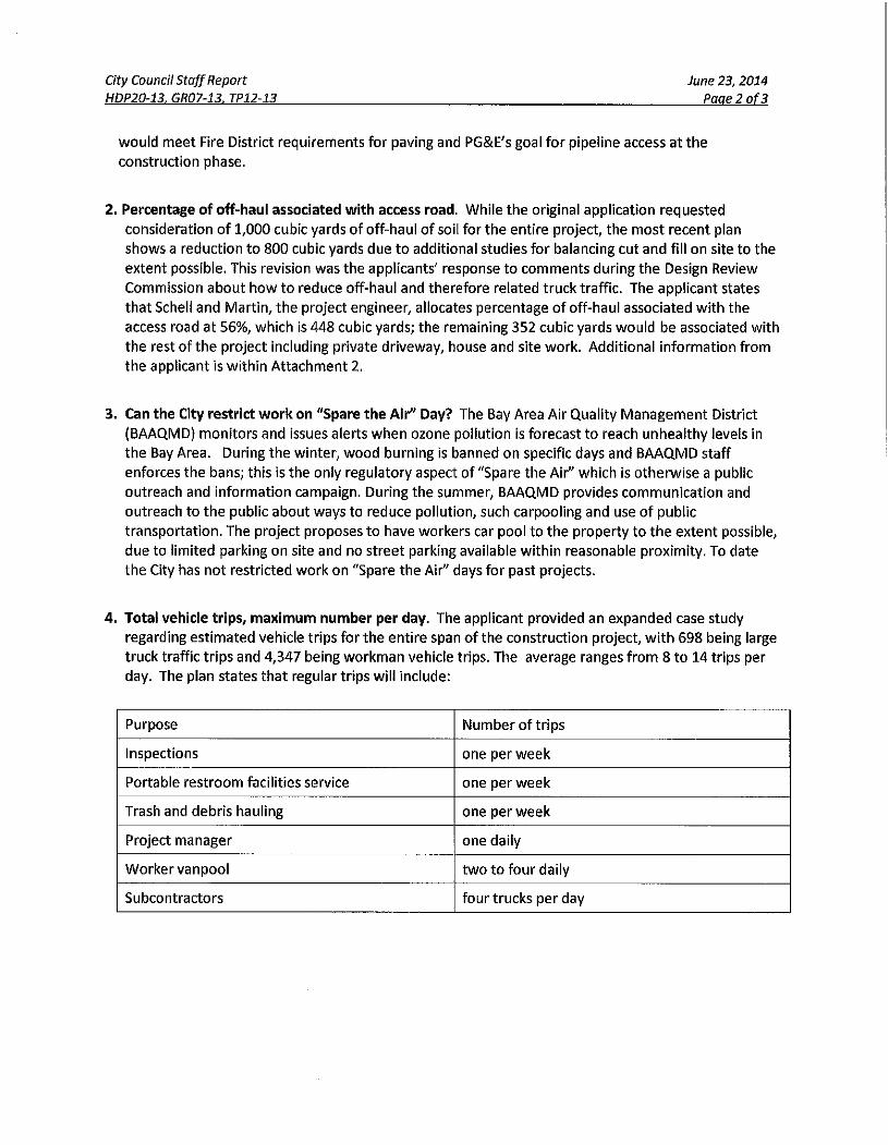
4. Total vehicle tr ips, max imum number per day. The app l icant p rov ided an expanded case s tudy
regard ing e s t i m a t e d vehic le t r i ps f o r t h e en t i r e span o f t h e cons t ruc t i on p ro jec t , w i t h 698 be ing large
t r uck t ra f f i c t r i ps and 4 ,347 be ing w o r k m a n veh ic le t r ips . The average ranges f r o m 8 t o 14 t r i ps per
day. The p lan states t h a t regular t r i ps w i l l i nc lude :
Purpose N u m b e r o f t r i ps
Inspect ions one pe r w e e k
Por tab le r e s t r o o m faci l i t ies service one per w e e k
Trash and debr is hau l ing one per w e e k
Project manager one dai ly
W o r k e r v a n p o o l t w o t o f o u r da i ly
Subcont rac to rs f o u r t rucks pe r day
City Council Staff Report HDP20-13. GR07-13. TP12-13
June 23, 2014 Paae3 of 3
The Cons t ruc t ion M a n a g e m e n t Plan p rov ided for t h e M a y 12,2014 hear ing es t imates a m a x i m u m
n u m b e r o f vehic les o f 16 t o 25 per day, depend ing o n t he specif ic task requ i red and progress o f
cons t ruc t i on ; th i s range is f o r t he day o r days w i t h t he mos t n u m b e r o f vehic les, and n o t t h e n u m b e r
o f vehic les f o r every day o f cons t ruc t i on . The es t imates are based o n a s imi lar ly sized p ro jec t t h a t
has a l ready been cons t ruc ted w i t h i n t he City o f Lafayet te ; t h e case s tudy is a t tached as A t t a c h m e n t
2 .C.
5. W h a t are penalt ies of violating condit ions of approval? Standard Cond i t i on o f A p p r o v a l #12 states
" I f t h e Planning Services Div is ion, e i the r i ndependen t l y o r as a resul t o f comp la in t s f r o m t h e publ ic ,
becomes awa re t ha t these cond i t i ons o f approva l are being v io la ted , and Planning Services Divis ion
s ta f f is unable t o ob ta in compl iance or a b a t e m e n t , t h e City may issue a Stop W o r k Orde r a n d / o r
pursue admin is t ra t i ve remed ies pu rsuan t t o chapters 1-3 and 1-9 o f t h e Lafayet te M u n i c i p a ! Code.
Admin i s t ra t i ve c i ta t ions and f ines may be issued fo r each day a v io la t i on occurs . " Grad ing a n d
cons t ruc t i on pe rm i t s have " m i l e s t o n e " inspect ions and check- in po in ts bu i l t i n to t h e process;
advanc ing t o t h e next phase of inspect ions depends u p o n successful ly c o m p l e t i n g each p reced ing
inspec t ion , inc lud ing s ign-of fs f r o m app l icab le u t i l i t ies .
6. Water tank. A w a t e r t ank is requ i red and p roposed at t he no r th p r o p e r t y l ine area.
7. Size and location of outdoor kitchen. The p roposed o u t d o o r k i tchen area is 228 square f ee t and
located w i t h i n t he area n o r t h w e s t o f t h e poo l .
ATTACHMENTS
1 . Ci ty Counci l Resolut ion 2014-24 [DRAFT]
2. App l i can t response t o City Counci l hear ing o f M a y 12, 2014
a) Let ter f r o m David Bowie , d a t e d June 13, 2014
b) Let ter f r o m Steve W igh t , da ted June 13, 2014
c) Cons t ruc t ion case s tudy. Young &. B u r t o n , da ted June 9 , 2 0 1 4
d) A d d e n d u m le t te r , Site d ra inage /geo techn ica l ,
Jensen-Van Lienden Associates, da ted June 1 1 , 2014
e) Grad ing and dra inage p lan and hyd ro logy calculat ions,
Schell a n d M a r t i n , da ted received June 13, 2014
3. M e e t i n g m inu tes :
Design Review Commiss ion , Apr i l 2 8 , 2 0 1 4
City Counc i l , M a y 12, 2014
BEFORE THE CITY COUNCIL O F THE CITY OF LAFAYETTE
IN THE MATTER OF:
App l i ca t ions by Steven & Linda W i g h t f o r a n e w )
10,003 sq. f t . s ing le- fami ly res idence on a p ro tec ted )
r idgel ine in t h e Hil lside OveHay Distr ict at 1240 )
M o n t i c e l l o Road, APN 245-070-014 . (HDP20-13, ) ' ^ ^ ^ " ' ^
GR07-13 & T P 1 2 - 1 3 ) )
RESOLUTION OF THE CITY COUNCIL O F T H E CITY OF LAFAYETTE DENYING HDP20-13, GR07-13 & TP12-
13, APPLICATIONS F O R : (1) A PHASE 2 HILLSIDE DEVELOPMENT PERMIT F O R A NEW TWO-STORY 9,638
S Q . F T . SINGLE-FAMILY RESIDENCE WITH A HEIGHT OF 28.5 F E E T WITH AN ATTACHED 3 CAR GARAGE
AND A 365 SQ.FT. GARDEN ROOM (GROSS 10 ,003-SQ. FT.); (2) ^ A GRADING |PERMIT FOR--THE
M q V E M E N T OF 4,800 CY OF,EARTH (2^900 C Y C U T / 1,900 CY OF FILL); (3) A TRkEt PERMIT FOR THE
REMOi^AL OF 19 NATIVE TRE : A N T 13 .6^ 'Ap^EPARCEL L 0 ' C A | E D I N T H E HILLSIDE OVERLAY
DIsifRICT W I T H I N , A GLASS I R 1240 MONTICELLO ROAD (APN 245-070-014) .
RECITALS \ \
\ • b ' rocess by which de"Bopment
A. Sect ion 6-206S(.^(8) o f i 4 | Lafayet te Munic ip 'a l Code -establishes t i f a
.III a vacan t lo^ t i r f the Htl lside OveHay D is t r i c | is revieVvi-d hy the C i t ^
' [ V •• •• ^ l# §5-20 |g (a ) lS ) "Deve lo j ^ment o f a bu i ld ing .bn a vacan : h ^ n th ' Iside Over lay Dis t r ic t shall be
reVI^Wed'-in t w o separa te Hillside, D e v e l o p m e n t Permi t app l l ca tp r f s made on a f o r m a f f lBn such
m a n n e r as prescrib^^-^by t he manager. . ^iS^ ^ wJ
(A) App l i ca t i on 1 : Sit ing and massing d e t e r m i n a t i o n by t he Planning Commiss ion
(B) App l i ca t i on 2; Review o f t h e design and impac ts o f t h e p ro jec t "
A 'Phase 1 ' app l i ca t ion assesses t he s i t ing and massing o f a p roposed pro jec t t o establ ish t he
locat ion on t h e parcel and an enve lope w i t h i n w h i c h t he bu i ld ing w i l l be des igned. The 'Phase 2 '
app l i ca t ion evaluates t h e design and impacts o f t he p ro jec t t h a t has been des igned w i t h i n t he
locat ion and massing enve lope estab l ished dur ing Phase 1 .
B. The h is to ry o f t h e processing and app rova l o f t h e Phase I app l i ca t ion (HDP 33-11) is as fo l l ows :
1 . On Oc tobe r 3, 2 0 1 1 , Steven and Linda W i g h t f i led app l ica t ions fo r HDP33-11 and V 1 8 - 1 1 fo r
a Phase 1 s i t ing-and-massing d e t e r m i n a t i o n f o r a n e w th ree -s to r y s ing le- fami ly residence
app rox ima te l y 10 ,000 gross square f ee t in size, excep t ions t o bu i ld ing w i t h i n t he setback
and 15 degree dec l i na t ion of a Class II r idgel ine and var iances t o n u m b e r o f bu i ld ing s tor ies
and locat ion o f a bu i ld ing w i t h i n a ya rd setback in t he Hil lside Over lay Distr ic t located at
1240 Mon t i ce l l o Road ( "Pro jec t " ) . The p ro jec t site Is located in t he LR-10 Dist r ic t .
A T T A C H M E N T 1
City Council Resolution 2014-24 June 23,2014
HDP20-13, GR07-13, TP12~13 Page 1 of 12
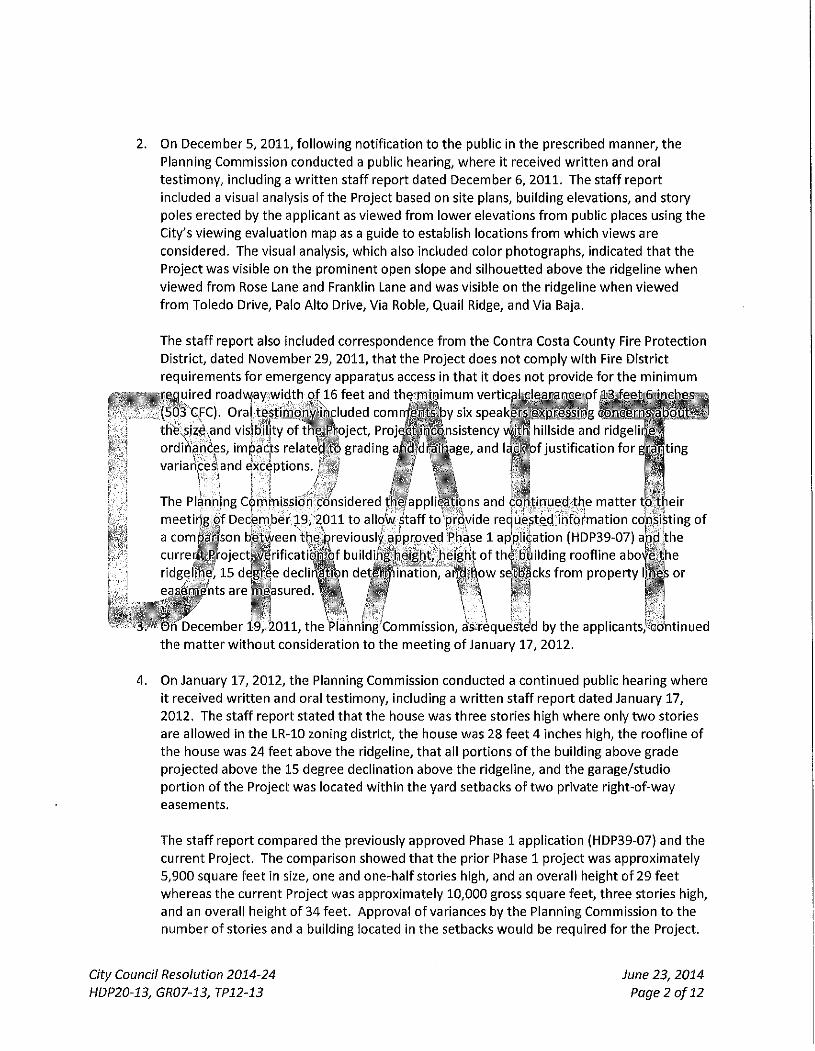
2. On December 5, 2 0 1 1 , f o l l o w i n g no t i f i ca t i on t o t h e publ ic in t he prescr ibed manne r , t he
Planning Commiss ion conduc ted a publ ic hear ing, w h e r e it received w r i t t e n and ora l
t e s t i m o n y , inc lud ing a w r i t t e n s ta f f repor t da ted December 6, 2 0 1 1 . The s ta f f r epo r t
inc luded a visual analysis of t he Project based on site plans, bu i ld ing e levat ions , and s tory
poles e rec ted by t he app l icant as v i ewed f r o m l o w e r e levat ions f r o m publ ic places using t h e
City 's v i ew ing eva lua t ion map as a gu ide t o establ ish locat ions f r o m w h i c h v iews are
cons ide red . The visual analysis, wh ich also Inc luded co lor pho tog raphs , ind ica ted t h a t t h e
Pro ject was v is ib le on t h e p r o m i n e n t open s lope and s i l houe t ted above t he r idgel ine w h e n
v i e w e d f r o m Rose Lane and Frankl in Lane and was vis ible on t he r idgel ine w h e n v i e w e d
f r o m To ledo Dr ive, Palo A l to Dr ive, Via Roble, Quai l Ridge, and Via Baja.
' i
The s ta f f r epo r t also Inc luded co r respondence f r o m the Contra Costa Coun ty Fire Pro tec t ion
Dist r ic t , da ted N o v e m b e r 29, 2 0 1 1 , t ha t t h e Pro ject does no t c o m p l y w i t h Fire Dis t r ic t
r e q u i r e m e n t s f o r emergency appara tus access in t ha t it does no t p rov ide f o r t h e m i n i m u m
r e q u i r e d roadw/ay w i d t h o f 16 fee t and t h ^ t r r n n i m u m v e r t i c ^ ^ l M M f i m o f ' " ' ' ^ ' ml
(50*3 GFC), Ora l t e s t i m o n y ihc luded c o m n f ^ n j ^ j y six s p e a k ^ ^
thfe,size>and v is |b i l i ty o f th"e"Pt"oject, Pn istency v^IIR hi l ls ide and rid
ord lhandes, impacts re la ted t o grad ing . i rn! iir-iii-.-is^e, and u f t p f j us t i f i ca t ion f o r ^ 1 . variances', and Exceptions.
The Planning Commiss ion cons idered t ,•v.,»^.^.•,w^•ons and c o n t i n u e d t h e m a t t e r t p t h e i r
m e e t i n g o f December 19,'^2011 t o a l l o 'ws ta f f t o p rby ide reques ted i n f o r m a t i o n cons is t ing o f
a compa r i son b'et\^een t h e ; ^ r e v i o u s l f app roved Phase 1 ap'pliGation (HDP39-07) ajndlthe
c u r r e n t P r o j e c t ^ | r i f i c a t i ^ ^ f bu i ld ihg he igh t , he igh t o f t h ^ bi^ i lding roo f l i ne abo' fe t h e
r idgel ine^ 15 deBee d e c l i r ^ ^ n de ten jn ina t ion , ancJ|^ow s^ t l | ^cks f r o m p rope r t y Ijnejs or
g n t s a r e S l a s u r e d . ^ f c ^ t / V | ^; f^'j
On December 19, 2 0 1 1 , t h e Rlahning^Commission, as^requested by t he appl icants , con t i nued
t h e m a t t e r w i t h o u t cons idera t ion to t he mee t i ng o f January 17, 2012 .
4 . On January 17, 2012 , t he Planning Commiss ion conduc ted a c o n t i n u e d publ ic hear ing w h e r e
i t rece ived w r i t t e n and ora l t es t imony , inc lud ing a w r i t t e n s ta f f r e p o r t da ted January 17,
2012 . The s ta f f r e p o r t s ta ted t ha t t he house was th ree stor ies h igh w h e r e on ly t w o stor ies
are a l l owed in t he LR-10 zoning d is t r ic t , t he house was 28 fee t 4 inches h igh, t h e roo f l i ne o f
t he house was 24 fee t above t he r idgel ine, t h a t all po r t i ons o f t h e bu i ld ing above grade
p ro j ec ted above t he 15 degree dec l ina t ion above t he r idge l ine , and t he ga rage /s tud io
p o r t i o n o f t h e Pro ject was located w i t h i n t he ya rd setbacks o f t w o pr ivate r i gh t -o f -way
easements .
The s ta f f r epo r t c o m p a r e d t h e prev ious ly app roved Phase 1 app l ica t ion (HDP39-07} and the
cu r ren t Pro ject . The compar i son s h o w e d t h a t t h e p r io r Phase 1 p ro jec t was app rox ima te l y
5,900 square f ee t In size, one and one-ha l f s tor ies h igh, and an overa l l he ight o f 29 f ee t
whe reas t he cu r ren t Project was app rox ima te l y 10,000 gross square fee t , t h ree s tor ies h igh,
and an overa l l he igh t o f 34 fee t . Approva l o f var iances by t h e Planning Commiss ion t o t he
n u m b e r o f s tor ies and a bu i ld ing located in t h e setbacks w o u l d be requ i red fo r t h e Project .
City Council Resolution 2014-24
HDP20-13, GR07-13, 7912-13
June 23, 2014
Page 2 of 12
The Planning Connmission cons idered t he app l ica t ions and reques ted t h a t t h e appl icant
revise t he plans t o reduce t he bu i ld ing height and t o reduce t he mass o r repos i t i on t h e
bui ld ing so it w o u l d no t s i l houe t te above t he r idge l ine.
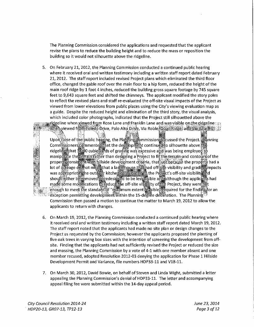
On February 21, 2012 , t he Planning Commiss ion c o n d u c t e d a con t i nued publ ic hear ing
w h e r e it received ora l and w r i t t e n t e s t i m o n y inc lud ing a w r i t t e n s ta f f r e p o r t da ted February
2 1 , 2012 . The s ta f f r epo r t inc luded revised Project plans w h i c h e l im ina ted t h e t h i r d f l oo r
o f f i ce , changed t h e gable roo f ove r t h e ma in f l oo r to a h ip f o r m , reduced t h e height o f t h e
ma in roo f r idge by 1 f o o t 4 inches, reduced t he bu i ld ing gross square foo tage by 745 square
f ee t t o 9,643 square f ee t and sh i f ted t he ch imneys . The app l i can t m o d i f i e d t he s tory poles
t o re f lec t t h e revised plans and s ta f f re-eva luated t he o f f -s i te visual impac ts o f t h e Project as
v i e w e d f r o m l o w e r e levat ions f r o m publ ic places using t h e City 's v i ew ing eva lua t ion m a p as
a gu ide. Despi te t he reduced he igh t and e l im ina t ion o f t he t h i r d s tory , t h e visual analysis,
w h i c h inc luded co lo r pho tog raphs . Ind icated t h a t t he Pro ject sti l l s i l houe t ted above t he
r idgel ine when^y iewed frorr i Rose Lane ani^ Frankl in Lane and was vis ible on t h e r idgel ine ,
w h e n v i e w e d f i f dm : t o l edo Dr ive, Palo A l t o Drive, Via RobleJou^ i l .R idgeJaf id .Via Baja^. '
Upon,cI(^se o f t h e
Comrf i iss ipners co
r idge li health at
publ ic hea.ri'jig, t h e P l a h . h i n g ^ m m i 5 s i o n p i s c u s s e d t h e Project . y^(^nning
; n t c o n t i n u e d i o s i l houe t te a b o v e f h e
e)(cessive a n d was being e m p l o y e d t o
: o : j i n m e n t ^ t | i a t t h e de 'S ' ^p i ^h t c o n t i n u ^ l o s i l houe t te a b o v e | g
i tnat i f f i o cubi„^B/ds of gracfin% was excessive and was being employelS ]e t h ^ | e % ^ i n 1 r a t h e r t h a n desigij i ing a Prd ject t o fi t he ter ra in^and con tou rs of t he
p r o p e r ^ ^ o n s i ^ n t ' w ^ ^ f t y I s i d e d e v ^ q g ' m e n t cVit^ria, t h a t p u s t b e c a u s e t h e property had a
man ip
lo t o f gcreage c id-hot m W m t h a t a la
was appropr iat^ , '^ tbe o u t ^ B f k i t che
shou ld e i t he r b ^ r e m o v e d ^ g e d e s i
made-some mod i f i ca t i ons ^ r e d u c i
e n o u g h to mee^t t l je standal jd o f "
.^^M-ihad offMt^ visibility and gradi^i^P^cts
^_^ute(^lthe PrMct's off-site visibilit^Sd
to be ies^^&ible a^Ps'tiiough the applicaj^ had
e off-site v i ^ ^ t y o l f f
imum extent^Psiblel
le Pro ject , t h e y weresnot
j q u i r e d f o r t h e f lnd ipg- for an
excep t i on p e r m i t t i n g developmenW/ithin t he 1 5 - d ^ ^ e d ^ f l i h a t i o n . The Planninig' '
Commiss ion t h e n passed a m o t i o n t o con t inue t h e m a t t e r t o M a r c h 19, 2012 t o a l low t he
appl icants t o r e tu rn w i t h changes.
On M a r c h 19, 2012 , t he Planning Commiss ion conduc ted a con t i nued publ ic hear ing w h e r e
i t received oral and w r i t t e n t e s t i m o n y inc lud ing a w r i t t e n s ta f f r epo r t da ted M a r c h 19, 2012.
The s ta f f r epo r t n o t e d t h a t t h e appl icants had made no site p lan or design changes t o t he
Project as reques ted by t he Commiss ion ; h o w e v e r t h e app l icants p roposed t he p lant ing o f
f ive oak t rees in vary ing box sizes w i t h t h e i n ten t i on o f screen ing t he d e v e l o p m e n t from o f f -
s i te. Finding t h a t t he app l icants had no t suf f ic ient ly revised t he Project or reduced t he size
and mass ing, t h e Planning Commiss ion by a vo te o f 4 - 1 w i t h one m e m b e r absent and one
m e m b e r recused, a d o p t e d Resolu t ion 2012-03 deny ing t h e app l ica t ion for Phase 1 Hil lside
Deve lopmen t Permi t and Var iance , f i le numbe rs HDP33-11 and V 1 8 - 1 1 .
7. On M a r c h 30, 2012 , David Bowie , on beha l f o f Steven and Linda W i g h t , s u b m i t t e d a le t ter
appeal ing t he Planning Commiss ion 's den ia l o f HDP33-11 . The le t te r and accompany ing
appeal f i l ing fee w e r e s u b m i t t e d w i t h i n t he 14-day appea l pe r i od .
City Council Resolution 2014-24 June 23, 2014
HDP20'13, GR07-13, TP12-13 Page 3 of 12
8. On M a y 14, 2012 , f o l l o w i n g no t i f i ca t ion t o t i i e publ ic In t he prescr ibed nnanner, t he City
Counci l c o n d u c t e d a de novo publ ic hear ing, w h e r e it received w r i t t e n and ora l t e s t i m o n y ,
inc lud ing a w r i t t e n s ta f f r epo r t da ted May 14, 2012 . A f t e r cons ide ra t i on and de l i be ra t i on ,
t h e City Counci l v o t e d t o con t i nue t he m a t t e r t o July 9, 2012 t o a l l ow the app l icant t o make
changes to t h e pro jec t .
9. On July 9, 2012 , t he City Counci l conduc ted a con t i nued de novo publ ic hear ing, w h e r e i t
rece ived w r i t t e n and ora l t e s t i m o n y , inc lud ing a s ta f f r e p o r t da ted July 9, 2012 . A f t e r
cons ide ra t i on and de l i be ra t i on , t h e City Counci l vo ted t o upho ld t h e app l icant 's appeal and
app rove HDP33-11 and V18 -11 subject to specif ic changes in t he p roposed reso lu t ion and
cond i t i ons o f approva l and con t i nued t he m a t t e r t o t h e Sep tember 24, 2012 consen t
ca lendar . In cons ider ing the i r approva l o f t h e Phase 1 Hil lside D e v e l o p m e n t Permi t (HDP33-
11) and Var iance (V18-11) t he City Counci l w a n t e d t o make i t c lear t o t h e p rope r t y o w n e r s
t h a t t he subsequen t Phase 2 Hil lside D e v e l o p m e n t Permi t app l i ca t ion w o u l d be rev iewed on
its o w n mer i t s and i n j i g h t o f t h e requ i red f in j j ings and t h a t ^ p | | ^ ^ ^ ^ h g p h a s e - l ^ - t f r ; ' .
app l i ca t ion d id n o t v-gstvany^^ntit lement o r ensure f u tu re app i i ' ^ ^ ^ S ' h f f i e 2 a ! |p l i c l t ig j } ^^
10. On S^pt^^mber j_ . , ,2012, t ^ ^ ' t y C o u n c i l W n s i d e r e d t he revised reso lu t ion and c c j ' S t i o n s o f
app rova l and v k e t i t o a d o M i t y Counci l f^'esqlution 2012- : .6 , |approv ing H D P 3 3 - l j l apd V18 -
1 1 , upho ld ing t p e r ^ p p l i c a j i j l f a p i : il a n c ^ d v e r t ^ ^ n g t he Ppinhing Commiss ion 's dep ia l o f
t h e app l ica t ions .
1 6 , t he appl icants w e f e . j Pursuant t o cohdi;t ion q f a p p r o v a l #12 o f City^rCbun.cj iF^e^pit ion 2 C ^
j r equ i red t o r e t u ^ ^ in a t imp l y mat inee t o the/city C b u n c i ^ J i e f i n a p d s i o n mak ing b o d ^ f o j r t h e
'i;Phase 2 app l i ca t ibn , fo l lov^ing a rev iew a n d } , e c b m m e n d a f f d m b y t h j'D^esign Review Comni iss ion
D. VOn May 28 , 2013, Steven and Linda AhtCTpplicant") file'^d appHciations HDP20-13, GRO^M^ &
TP12-1-3 fo r : (1) a Phase 2' Hil lside D^Qopment Pe rm i t f o r a n e w t w o - s t o r y , 9,638 sq. f t . s ingle-
f am i l y res idence w i t h an average he ight o f 28.5 fee t w i t h an a t tached 3 car garage and a 365 sq. f t
garden room (10,003 gross square fee t ) ; (2) a Grad ing Permi t for t h e m o v e m e n t of 4 ,800 CY of ea r th
(2 ,900 CY c u t / 1,900 CY o f f i l l ) ; and (3) a Tree Permi t for t h e remova l o f 1 1 nat ive t rees o n a vacan t
13.66 acre parcel located in t he Hil lside Over lay Distr ic t w i t h i n a Class II r idgel ine at 1240 M o n t i c e l l o
Road. The Project site is located in t he Low Density Resident ia l D is t r ic t -10 ("LR-10 D is t r i c t " ) .
Subsequent s ta f f and p ro jec t a rbor is t rev iews iden t i f i ed add i t iona l t rees t o be removed, b r ing ing t he
t o t a l proposed f o r remova l t o 19 p ro tec ted t rees .
E. On August 26, 2013 , t h e Design Review Commiss ion conduc ted a du ly no t i ced publ ic hear ing o n t he
Pro ject , w h e r e it received w r i t t e n and ora l t e s t i m o n y , inc lud ing a w r i t t e n s ta f f r epo r t . The s ta f f
r e p o r t r e c o m m e n d e d t h a t t he hear ing f o l l ow a s tudy session f o r m a t w i t h a focus o n specif ic design
issues, such as massing, co lor , t rees , l ight ing and grad ing . Public t e s t i m o n y inc luded c o m m e n t s
expressing concerns and quest ions a b o u t landsl ide ac t iv i ty , impacts re la ted t o road w i d e n i n g , and
the f i re road .
The Design Review Commiss ion cons idered t he Project and con t i nued t h e m a t t e r t o a f u t u r e
City Council Resolution 2014-24
HDP20-13, GR07-13, TP12-13
June 23, 2014
Page 4 of 12
mee t i ng t o a l l o w s ta f f t i m e t o comp le te t h e e n v i r o n m e n t a l s tud ies and a l low t i m e f o r t he App l i can t
t o f i le a reques t w i t h t h e City Counci l t o ex tend t he Phase 1 Hil ls ide Deve lopmen t Permi t approva l .
F.
G.
H.
On S e p t e m b e r 23, 2013 , t he City Counci l cons idered t he App l i can t ' s ex tens ion reques t and g ran ted
an ex tens ion o f t h e Phase 1 approva l (HDP33-11) f r o m S e p t e m b e r 24, 2013 t o M a y 26, 2014 .
On M a r c h 10, 2014 , Apr i l 14, 2014, and Apr i l 28, 2014 , t he Design Review Commiss ion conduc ted
du ly no t i ced publ ic hear ings on t he Project w h e r e i t received w r i t t e n and oral t e s t i m o n y , and
d o c u m e n t a r y ev idence, inc lud ing s ta f f repor ts and techn ica l s tud ies . Public t e s t i m o n y inc luded
c o m m e n t s expressing concerns and quest ions abou t landsl ide act iv i ty , d ra inage, t ra f f i c impacts ,
cons t ruc t i on m a n a g e m e n t , size of t he p roposed home , and t h e safety o f t he PG&E na tu ra l gas
t ransmiss ion l ine t ha t t raverses t he Project s i te. Wh i l e t h e Ini t ial S tudy /D ra f t M i t i g a t e d Negat ive
Declarat ion was avai lable f o r rev iew fo r all m e m b e r s o f t h e publ ic , t he Design Review Commiss ion
op ined on ma t te rs re la t ing t o aesthet ics and t h e physical appearance o f t h e p ro jec t , and d id no t
-make a r e c o m m e n d a t i o n | p - t h e ^ t y Counci l w i t h respect t o t h e ^ ' ' ^ ^ f f i ^ ^ ^ ' ^ ^ S
D e c l a r a t i o n . O n Apr i l 2 8 , & i 4 4 h ' e ' ^ b e s i g n Review/com'^nlssion a d o ^ ^ B ^ ^ B o l B " "
r ecommend i r i g . t ha t thertfjty C o u ^ p l i p p r o v e thi • P:-iJi:M;i: by a v o t e ^ - 1 w i t h one m e m b e r
a'ri'd one met !ber^ recused.
Ini^compliance Vvltj i t he Cal i forn ia
cir jculated t h e r a f t i n i t l a f s t j
imjpacts o f the jPro jec t froryi
I ' fequlred u n d e r s t a t e CEQA Gul
I. f O n M a y 12, 2014 , t he q i t y
, r ronmental Quaiit^y Ac t ("CEQy^"
m i t i ga ted jhegat ive \dec lara t ion
2014 to,^aV 12, 2914^exceed|ng
e 15073. ft / V
CouncilWhducte^pduly noticed pub l ic
t h e City o f Lafayettje -
analyzing tf^e e n v i r o n m e n t a l
i iear ing, t h e X i t ^ Counci l received ahd'^consTOt-ed w r i t t e n and io ra l t es t imony , and d o c u m e n t b r y
t i i e 30 day c i r cu la t i on per iod
peer ing on t h e Project A t th is
Avia. 5&,.in ^ ^ a s ta f f report, t i re in i t ia l rs tudy and m i t i g ^ J d n e p j i v e dec la ra t ion pre^a/ed f o r
4 h e r f ^ e c f ^ a i l commehtsprece ived regaVdmg'the in i t ia l stuc^Rnd m i ' t ^ a t e d negat ive decl^Miion, the technica l s tudies p repa red in s u p p o r t o f t h e in i t ia l s tudy and mi t i ga ted negat ive dec la ra t ion , and
all p r i o r s ta f f repor ts and approva ls from bo th the Design Review Commiss ion and the City Counci l .
At th is hear ing , 17 res idents spoke in oppos i t i on t o t he Pro ject and no res idents spoke in suppo r t .
The res idents w h o spoke in oppos i t i on raised concerns regard ing publ ic hea l th , sa fe ty and we l f a re
impacts f r o m the Project . In par t icu lar , c o m m e n t e r s expressed extens ive concerns regard ing
cons t ruc t i on t r uck t ra f f i c , t ruck staging, and e n v i r o n m e n t a l hea l th e f fec ts f r o m t ruck t ra f f i c
emissions associated w i t h t he cons t ruc t i on o f t h e Project . C o m m e n t e r s also expressed concerns
regard ing s t o r m w a t e r f l o w and dra inage, t he impacts f r o m t h e s i t ing and massing o f t he p roposed
Project , and genera l ly f e l t t h a t t he f ind ings requ i red f o r app rova l o f t h e Project cou ld n o t be m e t .
Add i t iona l l y , a p e t i t i o n signed by 100 res idents was s u b m i t t e d in oppos i t i on t o t h e Project .
A f t e r hear ing f r o m t h e App l i can t , t he publ ic , and cons ider ing t h e ora l and d o c u m e n t a r y ev idence ,
t he City Counci l c o n t i n u e d t h e publ ic hear ing on t he Project t o its June 23, 2014 m e e t i n g In o rde r to
a l l ow t h e App l i can t t i m e to answer quest ions regard ing t h e legal f ind ings requ i red f o r approva l o f
t he Project . Concur ren t l y , t he City Counci l g ran ted an ex tens ion o f t h e Phase I approva l t h r o u g h
June 23 , 2014 . In its de l i be ra t ions , t he City Counci l had concerns regard ing t he genera l lack o f c lar i ty
City Council Resolution 2014-24
HDP20-13, GR07-13, TP12-13
June 23, 2014
Page 5 of 12
and con fus ion in t h e var ious techn ica l repor ts , and publ ic t e s t i m o n y f r o m the App l icant 's legal
counse l , regard ing t he a m o u n t o f grad ing and o f f -hau l ing o f soi l . The City Counci l also expressed
ques t ions regard ing t he hydro logy calcu lat ions w/hich cou ld no t be addressed by t h e p ro jec t
eng ineer present at t he mee t i ng . Add i t iona l ly , concerns w e r e expressed regard ing t he po ten t i a l
impac ts f r o m the size o f t h e Project as p roposed . In par t icu lar , t h e City Counci l ques t i oned its
comp l iance w i t h t h e c i ty 's hi l ls ide regulat ions and had concerns regard ing t he magn i t ude o f t h e
p ro jec t , pub l ic hea l th , safety and we l fa re risk associated w i t h t he n u m b e r o f t rucks t o be used
dur ing t h e cons t ruc t i on phase o f t he Project and t he locat ion o f these p roposed t rucks .
J. On June 23, 2014 , t h e City Counci l conduc ted t he con t i nued publ ic hear ing .
N O W T H E R E F O R E BE IT RESOLVED THAT:
Section 1. The City Council Hereby Finds That Findings for Approval of the Proiect Cannot Be Made .
Sec| ions 2 t h r o u g h 7 below^set f o r th - the f ind ings o f t h ^ ^ / Counci l o n ^ h e ; basis o f substant ia l evidence'^
p resen ted in t h e > / r i t t e n and ora l t e s t i m o n y r e g a r d i n ^ ^ S r o j e c t , and o theLt to^un7er t t . ^y^ ly |dehGe, i
inc lud ing t h e Ini t ia l s tudy aijid jni t lgatedm''egatlve d e c ^ ^ ^ p p repared f o | t h e Project, all c o m n i ^ n t s
rece ived regard ing t h e ini t ia l s tudy ancj m i t i ga ted n e ^ p v ^ f c c l a r a t i o n , t he techn ica l s tud ies ||r 'epared in
suppo r t o f t h e in i t ia l s tudy ^ncj m i t i g a t ^ ^ e g a t i v e c j W a r a l J n , and all i^rior s ta f f repor ts and approva ls
f r o | n bo th t he Design RevieW ( ; :ommi^J | )*and the ^ ^ C o u p c r j , all o f w h i c h are hereby incorpora :ed by
th ls 'Veference. j /• v/ i - - ; I j
Section 2. The Findings for Approvdl of a Phase II Hillside Development Permit Cannot be M W ^
A. j P u r s u a n t 4 a / a f a y e t m ; j v i u n i c l p a l Code S^ectjon 6 -2071^ t l l e h e a r j a u t h o r i t y may o n l y ^ Drove
an a p p c a t i o j i J ( ^ ^ h i l l s i d e p S y e l o p m e V i t permit;^^^ an existing-) A o f ' " ^ B d a f te r mak ing t he fin'c ings
wit|: i in Section'6-2071. ThejCi ty Counc iKeva lu^ ted the r e q u i r e d ^ ^ f e l i n g ^ ' ^ ' o i l t he basis o f tijie en t i re
recbrd be fo re i t , d e t e r m i n e d t h a t f i n d m g « 6 ^ o f t [ f ) , 6-2071{h) a ^ f t - 2 0 & f l ) canno t be made fo t^ ihe
Project as exp la ined be low .
1 . Lafayet te Mun ic ipa l Code Sect ion 6-2071(f ) requ i res t h e f o l l o w i n g :
" ( f ) D e v e l o p m e n t g rad ing w i l l be m in im ized t o l im i t scarr ing and cu t t i ng o f hi l lsides especial ly f o r
long roads or d r i veways , preserve ex is t ing geologic fea tu res , t o p o g r a p h i c cond i t i ons and ex is t ing
v e g e t a t i o n , reduce sho r t and l ong - t e rm eros ion , sl ides and f l o o d i n g , and abate visual impac ts . "
The Applicant has not demonstrated that grading will be minimized to limit scarring and cutting of
hillsides. The Applicant has submitted differing sets of numbers with respect to grading and off-haul.
In particular, the Applicant has failed to illustrate the genesis of these various numbers and the
resultant potential Impacts. It is not clear that grading has been minimized to the extent feasible as
required by Municipal Code Section 6-2071(f) and it is unclear if the amount of grading and cubic
yards of dirt to be hauled off-site will impact existing geologic features, topographic conditions, or
result In short or long-term erosion and slides and flooding as noted in Municipal Code Section 6-
2071(f).
City Council Resolution 2014-24
HDP20'13, GR07-13, TP12-13
June 23, 2014
Page 6 of 12
The Applicant presented two hydrology reports with differing hydrology calculations. Further, the
project engineer could not clearly explain how certain numbers were arrived at Members ofthe
public expressed concern regarding potential flooding and erosion impacts from water fiow. The
Applicant has not presented clear evidence as to whether the drainage from the site would cause
short or long-term erosion and/or slides and flooding from the proposed Project site that could
impact neighboring property owners.
2. Lafayet te Mun ic ipa l Code Sect ion 6-2071(h) requi res t he f o l l o w i n g :
" (h ) Each s t ruc tu re and p roposed landscaping compl ies w i t h t h e ci ty 's res ident ia l design
gu ide l ines . "
The applicant has not demonstrated to the satisfaction of the City Council how the Project complies
with the city's adopted residential design guidelines. For example, guideline 2.c, regarding
architectural form, states that houses with small footprints are encouraged where the site Is
/restricted by existing nc^^rrMegtures, but the Project proposed ovt
accessory structures on^outwdrdMqg areas.
'fp^opouse,
^S.JLafayette l\/Iunicipal Code Secti( |2071( j ) r e ^ u f r e f t h e f o l l o w i n g
"( j ) The d e v e l o p m e n t Will not,Create a nuisance, hazar,d o r e n f o r c e m e n t p r o b l e m wi th ;
neighborhooc^ o r t f j e c i t y / n o r requ i re t he g l j ^ t o p r ^ v i ^ e an unijisual o r d isproport iona^
publ ic serv ices." ' , \ ' J ^
[m^he
te ' leve l o f
: Appllcantiha^ not pfgyMed clear-estimates ofthe dctuaj^humbei (f trucks to be used dim^g the
istruction phase, the peak trafflf and hov^MCcess and'stam^g wUhsAcur. Additionally, t^¥
->licant has not provided clarity i^gdrding tlje amount of^^dlng^ml the amount ofcubic^ards of
• to be hauled off-site. On this bgsis\it is unclear if the Plp0ct w^^eate a nuisance, hqzard or
'enforcement problem within the neighborhood and the city}
The Applicant anticipates making use of a private road in order to construct the Project There is an
existing agreement for use of this private road which has specific limitations on the hours and times
that this private road can be used. The Applicant's construction management plan does not address
these limitations. On this basis, the Applicant's construction management plan does not
demonstrate to the City Council or the public that the construction ofthe Project will not create a
nuisance, hazard, or enforcement problems in the neighborhood.
The Applicant's construction management plan anticipates the use of Deer Hill fiood near N.
Thompson Road for queuing of construction trucks. There is an existing bike lane on Deer Hill Road
that will be impacted by this queuing of trucks. Additionally, pedestrians making use ofthe existing
crosswalk to the BART station may also be Impacted by this queuing of construction trucks. The
applicant has not demonstrated that the Project will not to create a nuisance or hazard within the
neighborhood and the city.
Section 3. The Findings for Approval of Design Review Cannot be Made .
City Council Resolution 2014-24
HDP20-13, GR07-13, TP12-13
June 23, 2014
Page 7 of 12
A. Pursuant t o the Lafayet te Mun ic ipa l Code, in g ran t ing f inal approva l o f design rev iew pursuan t
t o Ar t ic le 5, Design Review, t h e f ind ings con ta ined w i t h i n Sect ion 6-275{a) shall be m e t . The City Counci l
eva lua ted t h e requ i red f ind ings and , on t he basis o f t h e en t i re record be fo re i t , d e t e r m i n e d t h a t f i nd ing
6-275(a)(2) and 6-275(a)(4) canno t be made fo r t he Project as exp la ined be low .
1 . Lafayet te Mun ic ipa l Code Sect ion 6-275(a){2) requi res t he f o l l o w i n g :
" {a)(2) The approva l o f t he p lan is in t h e best in terest o f t h e publ ic hea l t h , safety and
genera l we l f a re . "
The Applicant did not present a clear explanation as to how hydrology numbers were calculated.
Members ofthe public expressed concern regarding potential flooding and erosion impacts from
water flow. The Applicant has not presented clear evidence as to whether the drainage from the
site would cause short ort^g^term erosion on^d/.or slides and flooding from\the proposed .Pro/ec^
site that'^uld imfia^^netgh^oYing property Iownqrs. On this basiSjJdterejls noklear^ievidence
presentence the Clt^ouncil gs to whether lhe\drqinage fron^^th^e site would cause j. >oding or
other pu^lic'^health/safety andige^eral welf. i'-.: • ip'n ts to neighbouring properties.
There is aim no depr plan for the number!of conspu^tion ^ ^ ^ H ^ that may be intr^^ed into
the area, dnd.no cled^Jocation for a proposed construction ^ p ^ ^ ^ ^ S / ^ ^ l^be w^g^^s and ..^A-^m-r£±L .u^ n ^.-^.J-.-.L - r i - . i A— -^^^^^g^struction 'vities in
dfare i^pftcts.
trucks thafwijl nee^o^acc^$s^he Projectsitje. Thus^,:th^ere is op| i general wijl 'rpult i^miblic health, safetv^anh arrrrnl - . V r -
The Applicant's construction managenient plan anti se of Deer Hill Ro'^mneor N.
Existing bike lane c^Jeer Hill
that use the exlstin^mosswolk
Thompson fioad fof ,queuing of copstrUcijon trucks
will be impacted by tl^is quJuinp of trucks.
••^^^ BART station may also be impacted by this queiJid^'of destruction trucks. oMUis basis,
there is a risk that construction of the Project will result in public health, safety and general
welfare impacts.
2. Lafayet te Mun ic ipa l Code Sect ion 6-275{a)(4) requ i res t h e f o l l o w i n g :
" (a)(4) Genera l a rch i tec tu ra l cons idera t ions , inc lud ing t he character , scale and qua l i t y o f
t h e design, t he a rch i tec tu ra l re la t ionsh ip w i t h t h e si te and o t h e r bu i ld ings, bu i ld ing
mater ia ls , co lors, screening o f ex te r io r appur tenances , ex te r i o r l ight ing and s igning and
s imi lar e lemen ts have been Inco rpo ra ted in o rde r to ensure t he c o m p a t i b i l i t y o f th is
d e v e l o p m e n t w i t h its design concep t and t h e character o f ad jacent bu i ld ings . "
The scale and size of the proposed home is not compatible with neighboring properties in the
area. The public has expressed concern regarding the size of the Project and its compatibility
with the neighborhood. In particular, the 10,003 square foot size of the home is significantly
larger than the existing homes in the area, and includes an additional 7,000 square feet of
accessory structures and outdoor living areas. As noted in Section 1 and this Section 2 of this
Resolution, the Applicant has failed to provide adequate information regarding the amount of
City Council Resolution 2014-24
HDP20-13, GR07-13, TP12-13
June 23, 2014
Page 8 of 12
grading, the amount of dirt to be hauled off-site, the number of trucks to be used during
construction, the staging area for these trucks during the construction phase, and clarity
regarding hydrology calculations. The Applicant has not demonstrated that these potential
impacts could not be reduced with a smaller home. It is on this basis, that the City Council finds
the scale of the home to be incompatible with the adjacent homes.
Section 4. The findings for approval of a new residence exceeding 6,000 square feet Cannot be Made .
A. In g ran t i ng f inal app rova l of design rev iew fo r a h o m e in excess o f 6,000 square f ee t in gross
f l o o r area pu rsuan t t o Ar t ic le 5, Design Review, t he f ind ings c o n t a i n e d w i t h i n Sect ion 6-275(b) shall be
m e t . The City Counci l eva lua ted t he requ i red f ind ings and , o n t h e basis o f t h e en t i re record be fo re i t ,
d e t e r m i n e d t h a t f ind ings 6-275(b)(2) and 6-275{b){4) canno t be m a d e fo r t he Project as exp la ined
b e l o w .
1 . Lafayet te Mun i c i pa l Code Sect ion 6-275(b)(2) requ i res t h e fol lovj/ in.-:
M) The house is so des igned t ha t j ts^mass w i l l no t *appear s ign i f icant ly c fu t jo f scale
w ^ f f l j h e exi^sting n e i g h b o r h o o d . " / I \ I \
\
The mass gf the proposed horn'e Is out ofkedle withithe existifigj\em mod. Th^mbllc has
expressed kor}cern\regarding the size o f ^ f f e Proje^^nd its '^^M^B^ consiste^m/ith the
existing neighborhood'^ In particular, thd-10,003-square foot ^^Bpf home is larg^j ban the
existing hpmes in the,area, and includes an additional i^DOO s^Mrefeet of accessor^:st'uctures
and outdS^oj iivin^^:aleas. As noted jn ^ection~l q_nd\ this • f f l ^ ' o " 2 of this Resilution, the
Applicant has foiled ip provid^ qdequat^ information f/egar^S the amount of g'tgldjng, the
amount of dirt to jjje hauled off-site, the number of tfMks t o M used during const0Qion, the
staging area for these trucks durihg~the construction^'iiase,^id clarity regardinfiWydrology
calculations. The Applicant has not provided clarity as to whether these potential impacts could
be minimized with a smaller home. It is on this basis, that the City Council finds the design of the
Project to be out of scale with the existing neighborhood.
Also, while the subject property is rather large at 13.66 acres, the site is heavily constrained by
steep slopes, existing native vegetation, and geotechnically unsuitable soils, resulting In a very
small developable area by comparison. The subject property is not part of a traditional small-lot
subdivision or city streetscape that is common to the neighborhood and which would provide
immediate small-scale context. The property is viewed in the larger context of the valleys, hills,
ridgelines, pattern and scale of development that constitutes the broader neighborhood.
3. Lafayet te Mun ic ipa l Code Sect ion 6-275{b)(4) requ i res t h e f o l l o w i n g :
" {b)(4} The house does no t , because o f its size, requ i re remova l o f na tu ra l fea tu res ,
requ i re excessive grad ing o r cause t h e unreasonab le remova l o f a hea l thy t ree{s) .
City Council Resolution 2014-24
HDP20-13, GR07-13, TP12-13
June 23, 2014
Page 9 of 12
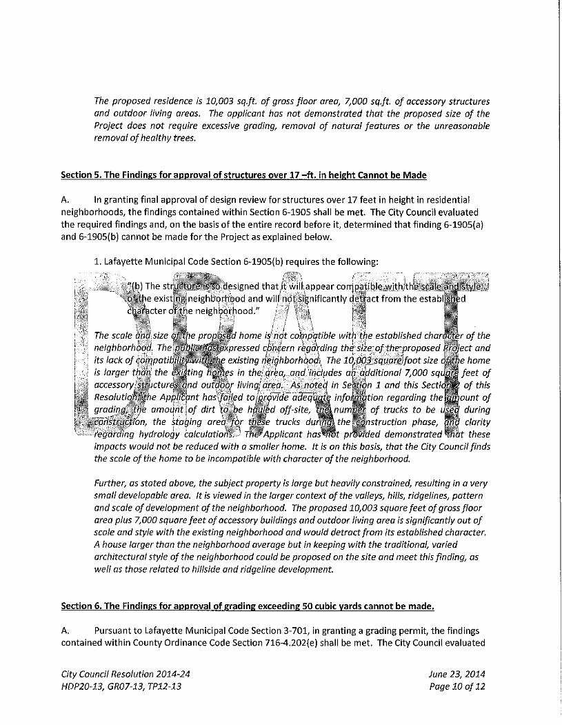
The proposed residence is 10,003 sq.ft. of gross floor area, 7,000 sq.ft of accessory structures
and outdoor living areas. The applicant has not demonstrated that the proposed size of the
Project does not require excessive grading, removal of natural features or the unreasonable
removal of healthy trees.
Section 5. T h e Findings for approval of structures over 17 - f t . in height Cannot be Made
A. In g ran t i ng f inal app rova l o f design rev iew fo r s t ruc tu res ove r 17 f ee t in he ight in res ident ia l
ne ighbo rhoods , t he f ind ings con ta ined w i t h i n Sect ion 6-1905 shall be me t . The City Counci l eva lua ted
t h e requ i red f ind ings a n d , on t he basis o f t h e en t i re record be fore i t , d e t e r m i n e d t ha t f i nd ing 6-1905(a)
and 6-1905(b) cannot be made fo r t h e Project as exp la ined be low .
1 . La fayet te Mun ic ipa l Code Sect ion 6-1905(b) requi res t he f o l l o w i n g :
• - i f " (b ) The str jucture is so designed t h a t It w i l i . appear con- pa t ib le vvith>tKe scale ar id sty le j
^ ' x o f t h e ex is t ing ne ighbo rhood and w i l l n d t s i ^ n i f l c a n t l y c e t i ^ac t f rom the estabi M
character o f t h e ne igh lporhood. "
The scale and\size o/Jbe propbsed home is not coYppqtible with the established char^^r of the
neighborhood, '^^^^^^^^^^^P^^^^^^ concern rega\ding the size of the'proposed ^Siect and
its lack of conr\pati^^^^^^^ existing neidhborhopdi^ The 1C,003 squareJoot size home
is larger than', the ^ ^ t / n g ^ B f s in thej area, ond}includes a.r additional 7,000 sqi^Mfeet of
accessoryis^trhctures^nd outdoo^ livlngj area. As noted^ in Section 1 and this Secti^m of this
ResolutioiffJihe Apjjlicpnt hos'^fail^d toiprovfde adeql^^ information regarding the^^ount of
grading,^ti)'e amount\of dirt \o be hauled off-site, ^ S ^ ' ^ ^ H trucks to be during
cohstructihn, the staging area fox these trucks dur^mthe^mistruction phase, |
regarding hydrology calculations. ^ The-'Applicant ha^mt p^Mded demonstrated 9.
impacts would not be reduced with a smaller home. It is on this basis, that the City Council finds
the scale ofthe home to be incompatible with character ofthe neighborhood.
clarity
t these
Further, as stated above, the subject property is large but heavily constrained, resulting in a very
small developable area. It is viewed in the larger context of the valleys, hills, ridgelines, pattern
and scale of development ofthe neighborhood. The proposed 10,003 square feet of gross floor
area plus 7,000 square feet of accessory buildings and outdoor living area is significantly out of
scale and style with the existing neighborhood and would detract from its established character.
A house larger than the neighborhood average but In keeping with the traditional, varied
architectural style of the neighborhood could be proposed on the site and meet this finding, as
well as those related to hillside and ridgeline development.
Section 6. The Findings for approval of grading exceeding 50 cubic yards cannot be made.
A. Pursuant t o Lafayet te Mun ic ipa l Code Sect ion 3 - 7 0 1 , in g ran t i ng a g rad ing pe rm i t , t h e f ind ings
con ta ined w i t h i n County Ord inance Code Sect ion 716-4.202{e) shall be m e t . The City Counci l eva lua ted
City Council Resolution 2014-24
HDP20-13, GR07-13, TP12-13
June 23, 2014
Page 10 of 12
t he requ i red f ind ings and , o n t he basis o f t he en t i re record be fo re i t , d e t e r m i n e d t h a t f i nd ing 716-
4.202(e)(2) canno t be made fo r t h e Project as exp la ined be low .
1 . Coun ty Ord inance Code Sect ion 716-4.202(e)(2) pursuant t o Lafayet te
3 -701 requ i res t h e f o l l o w i n g :
lun ic ipa! Code Sect ion
"(e)(2) The grad ing wi l l n o t s ign i f icant ly increase e ros ion or f l ood ing a f fec t ing t he si te or
o t h e r p r o p e r t y and wi l l cause impacts t o r ipar ian hab i ta ts , s t ream channe l capaci ty o r
w a t e r qua l i t y t h a t canno t be substant ia l ly m i t i g a t e d . "
Neighboring property owners expressed concern regarding the Project's potential to exacerbate
the existing erosion and flooding problems in the neighborhood. The Applicant has not provided
adequate evidence that the amount of grading and cubic yards of dirt to be hauled off-site will
not exacerbate erosion or flooding in the area that cannot be substantially mitigated.
• — ^ , / l , Further, the Applicant pr_^^^Q^^wo hydrologyjef^orts with d i f f e r in a h vdrOi>ogy:£alculatior)s, : -1
1 with some hglculation's that ^Jdmot be expljain^^^ the project ingineer ot the City^C^^ncil
meeting\pn fhls basisj^ the ApplJeapt has not^dem^Mrated that ine drainage from tht
f would nohexocerbqte erosion orMooding inihe ar^i
Section 7. Tree Removal Permit , t3ursuant to Section Sectio. Lafayette IVIunicipai Code
A. j Pursuant tb-Lafayet te IVIunicipai Code Sect ion 6-1707, a Category Tree Permi t is requ i red if
p roposed cons t ruc t i on may^ resu l t in t he des t ruc t i on o r remova l o f a p ro tep ted t r e e . " C o n s t r u f t i o n " is
de f i ned at Lafayet te Mun i c i pa l Code Sect ion 6-/L702(d) t o m e a n :
^ - "The act o f p lacing, e rec t ing , mod i f y i ng o r re locat ing a s^R tu r^o r t he act o f p r e p a r i n ^ r o p e r t y
f o r such w o r k , inc lud ing c lear ing, s tockp i l ing , t r ench ing , g rad ing , c o m p a c t i o n , pav ing or change
in g r o u n d e leva t i on . "
As t h e City Counci l is deny ing t h e p roposed Phase II Hil lside D e v e l o p m e n t Permi t and Grad ing Permi t , no
cons t ruc t i on can take place o n t he Project s i te . By t he City Counci l 's ac t ion o f deny ing t h e Phase II
Hi l ls ide D e v e l o p m e n t Permi t and Grad ing Permi t , and re la ted cons t ruc t i on , t h e App l i can t ' s need for t he
Category II Tree Permi t is rende red m o o t and t h e City Counci l denies t he Category II Tree Permi t on th is
basis.
Section 8. California Environmental Quality Act (CEQA). On t h e basis o f t h e record b e f o r e i t , t he City
Counci l canno t make the requ i red f ind ings t o app rove t h e Project . In absence o f an a f f i rma t i ve act ion on
t h e Pro ject , a d o p t i o n o f t he In i t ia l S t u d y / M i t i g a t e d Negat ive Dec lara t ion is no t app l icab le .
Section 9. Denial o f t h e Project. The City Counci l hereby denies t h e Project .
City Council Resolution 2014-24
HDP20-13, GR07-13, TP12-13
June 23, 2014
Page 11 of 12
Section 10. Public Records. T i ie locat ion and custod ian o f t he d o c u m e n t s and any o t h e r mate r ia l w h i c h
cons t i t u te t h e record o f proceedings upon w h i c h t h e City Counci l based its decis ion is as f o l l ows : City
Clerk, City o f Lafayet te , 3575 M t . Diab lo Blvd., Suite 210, Lafayet te, Cal i fornia 94549 .
PASSED AND ADOPTED by t he City Counci i o f t h e City o f Lafayet te at a m e e t i n g held o n June 23, 2014 by
t he f o l l o w i n g v o t e :
AYES:
NOES:
ABSENT:
RECUSED:
ATTEST:
Joanne Robbins, C i t " Clerk
v-;: \
City Council Resolution 2014-24
HDP20-13, GRQ7-13, TP12-13
June 23, 2014
Page 12 of 12
BOWIE & SCHAFFER Attorneys at Law
2255 CONTRA COSTA BLVD., SUITE 305
PLEASANT HILL, CA 94523
D A V I D J. BOWIE Telephone (925) 939-5300
ERICCSCHAFFER Facsimile (925) 609-9670
Dave^bb land iaw.oom [email protected]
June 13.2014
The City Coimcil of Lafayette c/o Catarina Kidd, ConU*act Planner 3675 Mt. Diablo Blvd., Suite 210 Lafayette, CA 94549
Re: HDP20-I3/ GR0743 & TP12-t3 Steven and Linda Wight (Owners), LR-10 Zoning: Request for (1) a Hillside Development Permit for site and massing determination for a new two-story, single family residence 9,643 gross square feet in size, (2) exceptions to build within the setback and 15 degree declination of a Class I I ridgeline, and (3) variance to allow a building within a yard setback, located in the Htllside Overlay District on a vacant 13,66 acre parcel at 1240 Monticello Road: APN 245-070-014
Deal- Members of the Lafayette City Council:
This letter has been prepared for consideration by this Council as a part of a requested Phase 2 approval for development of a single family residence on an existing lawful lot within the ridgeline setback. As this Council is awai'e, a Phase 1 approval was previously granted and a Phase 2 application was considered by the Design Review Commission and reported favorably to this Council for approval. At the last hearing, this Council suggested that it could not make certain required findings and that it felt the burden of proof relative to those findings rested with the Project applicant. The following comments are offered for consideration by the Council as it reaches a final determination on the pending Design Review Application.
1. In This Context, a Phase 1 Approval Compels Both A Phase 2 and Proiect Approval:
Section 6-2065 of the Lafayette Municipal Code sets forth procedures for obtaining a Hillside Development Permit. Subsection 8 creates a two phase application process as a prerequisite to development of a building on a vacant lot within the Hillside Overlay District. Phase 1 is a siting and massing determination by the Planning Commission. Phase 2 is a review of the design and of the impacts of the project. The identical findings set forth in the Code are required for both a Phase 1 and a Pl^se 2 approval.
A T T A C H M E N T 2 A
In this instance, this Council made all of the required findings for approval of the specific building site for the current Wight Project. It also concluded that the proposed mass of that project was consistent with all required findings, particularly including those related to visibility, privacy, mass, size, compatibility, and the preservation of ridgelines and scenic hillsides.
It must be emphasized that tliere has been no material change to the siting of the proposed home or to its mass—and the Design Review Commission so found. Therefore* to the extent this Council made the findings to suppoit a Phase 1 approval, i t must make those same findings to approve Phase 2.
Tlie Phase 2 inquiry is supposed to be a review ofthe Project design. In this particular instance, however, the Project design is essentially irrelevant because nothing other than the roof can be seen from lower elevations on the Public Evaluation Map when viewed from the west. From the east, tlie project is entirely screened by trees and vegetation; there are no viewing areas designated on the Public Evaluation Map; the nearest homes are very distant (over 300 feet horizontally and approximately 200 feet lower in elevation); and the design can only be viewed when one is actually on the subject Property. While the design satisfies Lafayette's criteria for hillside consti-uction, the placement ofthe home is such that its design is entirely without offsite impact such that all required findings are necessarily satisfied.
ITie Phase 2 inquiiy is also supposed to be a review of project impacts. Glen residents have claimed that Project impacts include drainage, grading and excavation, soils, the size of the home, its compatibility, and construction-related traffic and disruption.
Drainage is not a Project impact because the Project watershed does not contribute to drainage problems to which residents have testified. In addition. Project related drainage has been studied in depth and engineered to the point that there are no drainage impacts on the adjoining Glen neighborhood and only fully mitigated drainage to the west. These are matters certified by the Project engineer and reviewed and confirmed by the City Engineer. The Project Soils Engineer has reviewed fhe drainage plans and he has concluded that drainage will cause no soils instability problems in light of the proposed drainage improvements to be installed in a fashion consistent with the hydrology studies.
Grading and excavation are not "project impacts". Because ofthe hillside terrain and the access road,, grading is required for any development to occur. Excavation is a correlative process to grading. Excavation sufficient to support the building structure is dictated substantially by this Council's prior determination of the precise site for development and the mass ofthe house. Since no one has ever contended that Project grading will have any adverse impact on topographic or scenic features, the only actual impact of grading is related to the construction process and the quantity of off-haul required. Very littie off-haul is actually related to the construction of the house, itself. Schell and Martin, the Project civil engineer, has allocated the quantity of off-haul amongst the various construction activities related to grading and excavation. By percentage, the Project access accounts for 56% of the aggregate truck traffic required to remove excess dirt; the Garage is anotiier 16%; the pool is 7%; and the house is only 21% of the total. Virtually all grading and excavation and related off-haul is required by the Council's choice of building site and the need to both access the home and turn-around and
park vehicles. Grading and excavation related to the house structure has to do with die need to "bunlcei*" it into the hillside to satisfy the City's own code requirements. It would hardly be fair to chastise the Wights for undue quantities of grading, excavation and/or off-haul when all of such matters are attributable to existing circumstances, the Council's Phase 1 approval, and the codified policies which the City has made a part of its zoning and development regulations.
Everyone has acknowledged that there are no soils issues posed by the development of the house structure. This is because the construction is essentially on the ridgeHne and at bedrock. To the extent there may be soils issues posed by the access road, they have been addressed by construction mitigation measures and they are not "project" impacts because they exist independently of the particular Project.
The size of the home and constmction related disruption are the final two purported "project impacts". The size ofthe home creates no Project impacts because size—in the form of mass—has: already been approved by this Council and * size" is not a proximate cause of any identified "project impacts". It has been suggested that Prqiect size and construction impacts are related. This is not true because most perceived "project impacts" exist irrespective of Project size and because a construction management plan will be employed to manage the construction process. While it should be unnecessary to make this observation, it must be abundantly clear tiiat construction traffic on public roads and potential minor inconvenience are simply not legal grounds to reject a Project and deny Phase 2 approval.
Unless this Council chooses to be arbitrary and capricious, it cannot make findings to support a Phase 1 approval and then deny a Phase 2 approval for this Project on those same findings.
2. A Dialog With Residents of the Glen Has Proven To Be An Unsuccessful Means of Resolution of Differences in Viewpoint:
At the suggestion of this Council, I contacted two separate apparent community leaders in an attempt to open a dialog regarding the Wight project. In this respect, I first contacted Mark Cameron, an attorney and Glen resident. Mr. Cameron declined any role as a spokesperson for the Glen residents and referred me to Donn Walklett, who is the past president of the Muir Heritage Land Trust and the Vice-Chairman ofthe Lafayette Open-Space Committee. Despite an apparent orientation and background that would tend to suggest a lack of receptivity to the Wight Project, I engaged Mr. Walklett in a series of emails related to tiKe Project. Mr. Walklett repeatedly referenced project "impacts" cited by residents of the Glen and demanded a reduction in size of the house by approximately one-half. I pressed Mr. Walklett to explain the proximate causation between the Project size and the perceived impacts. In other words, there is little point to demanding a size reduction unless that size reduction has some corollary mitigation factor which would permit an affirmative finding which would otherwise be negative. Mr. Walklett declined to discuss anything other than the simple demand for a significant size reduction. Since this Council had already approved the Project site and its mass and since that mass has little, i f anything, to do with perceived Project impacts or required legal findings, there appeared to be no puipose in fiirther discussion.
3. At the Prior Hearing, Couacilmembers Failed to Properly Assess the Proj ect and the Evidence in Support of Approval When They Claimed Thev Conld Not Make Certain "Findings":
None of the Members of the Council seemed able to make Endings in support of a Phase 2 and Project approval at the last hearing. While there v as some variation in the findings identified as thOvSe which could not be made in support of approval, tliere was more or less unanimity that certain findings and the burden of proof with respect to those findings were critical. The following comments pertain to the Findmgs which Councilmembers claimed they could not make.
A. Section 6-2071 LMC-Findings related to a Hillside Development Permit.
(f) Development Gradiiig is to be Minimized to Limit Scarring of Hillsides, Preserve Existing Topographic Features, Reduce Erosion, and Visual Impacts.
Al l Councilmembers appear to have found fficulty in affumatively finding that Development Grading had been minimized in this particular instance. That dilficuity is surprising in light of the uncontroverted evidence presented prior to and at heai-ing.
There is an existing, access road. Its location was long ago approved and has nothing to do with this particular Project. The on site grading related to the access road is that required by the Fire Department to ensure its compliance with regulations. The access road will be improved and thus will remediate current conditions which do evidence some level of erosion and which could conceivably add to drainage problems. In other words, the grading at the access road is minimal and represents only an improvement in existing conditions.
There is grading for an auto court and the house structure. The auto coiu-t grading is unavoidable because there is no room on the road for either turnaround or parking as required by the City of Lafayette Residential Design Review Guidelines. The auto court and the structure are geometric features of the lot which relate either to the normal requirement for access or the need to support a structure. The dimensions of the auto court comply with and do not exceed the Residential Guidelmes. It was this Council which spelled out precisely where the home was to be placed and it was this Council which approved its mass—which obviously must be physically supported. By the very fact that this Council made a Phase 1 determination, it must be concluded that visibility issues and the preservation of topogi'aphic features have been fiiliy satisfied. There is literally no evidence which would support a conclusion that the requirements of this Finding have not been Mly satisfied.
0) Development Shall Not Create a Nuisance, Hazard or Enforcement Problem.
All Coimcilmerabers appear to have found difficulty in affirmatively finding that the development would not create a Nuisance, Hazard or Enforcement Problem. Again, this appears
to be a case where Project opponents' complaints (without factual basis) have taken precedence over actual objective evidence and objective determinations.
The development or existence of a single family residence within a permitted zoning district cannot possibly be deemed a nuisance. Lafayette is a residential community and homes are consti'ucted all the time. This Council has already acknowledged that this lawful lot will be developed and it has already approved the location and mass of that development. Neither the existence ofthe homtJ nor the anticipated construction process can be deemed a nuisance or injurious to public welfare unless there is something far beyond the ustml which actually creates public health concems.
There is an interesting observation that must be made regarding this finding and the issue of nuisance or hazard. The finding clearly i elates to the end product—i.e., the completed structure, or the end product ofthe development process. Certainly no one could successfully maintain that the Wight residence, once constructed, might actually present a nuisance or a health concern. That would be ludicrous. Prcijeet opponents have actually twisted the intent of the finding to speak to the development process and characterize tliat process as a nuisance or a health issue. I f this Coimcil were to actually find that this finding could not be made because of the development process—-as opposed to the completed project—it would certainly have departed from past practice and intent. Additionally, the application of such a finding to the development process could adversely impact any consti-uction anywhere witliin the City. This would lead to potentially absurd results. Please note the comments of Yomig and Burton, the Project Contractor, in the context ofthe Construction Management Plan, regarding its Happy Valley project of similar size with substantially more off-haul which gave rise to neither nuisance nor healtli issues despite a 29 month construction process inclusive of a higher volume of construction trips than anticipated for the Wight project.
it is hardly unusual in Lafayette to experience the development of large homes. As but one example, the Edminster—^Atwood Project of 10,000 square feet at 4165 Canyon Road was approved and has now been nearly completed with no untoward impacts which might rise to the level of nuisance or threats to public health. That Canyon Road Project has access and staging issues very similai' to those faced in this instance.
There is a construction management plan which will be adopted to address any unusual impacts of this particular construction process. As indicated in the plan, there v^ll be an average of 11.5 round trips each day and carpooling of workers will be employed. The roof footprint of this Project is no more than 6,350 square feet and that footprint is less than the roof footprints of at least 14 homes within the adjacent neighborhoods. (See Schell and, Martin Exhibit - House Areas Adjacent Neighborhoods dated June 10,1014.) The size of this home has little to do with construction impacts since the bulk of those impacts relate to the home's footprint—^not mere size—^d the footprint is required regardless of the actual size. In short, the construction process will have no unusual consequences for neighbors hence there is no basis for anyone to conclude that nuisance or health concems exist.
It is worth noting that the proposed development actually has a number of positive impacts—as opposed to claims of nuisance. Development will stabilize an existing road.
Development will add to the tax base and improve property values within the neighborhood. Development will contribute substantial monies to the City in the form of fees and expenditm-es of workers during the construction process. Development in this instance has secured the open hillsides and ridgelines for vievnng of the public from lower elevations.
There is a certain amount of inconvenience related to the construction process. Unless public streets are blocked and inaccessible and noise exceeds sound regulations, such conditions neither pose a nuisance nor do they justify a denial ofthe Project. Additiomdly, other regulations exists to control noise and traffic and the proper application of those regulations is the appropriate means of addressing perceived nuisance conditions—not tlie denial of this Project.
B. Section 6-275 Design Review Findings:
(2) The approval ofthe Project is in the best, interest of Public Health, Safety and General Welfare.
A number of Councilmembers felt that the general Design Review Finding requiring that approval was in the best interests of Public Health, Safety and General Welfare could not be made. To an extent, the response to such a conclusion is set forth above. In addition^ however, an approval would preserve private property rights and honor the right to use and develop property. In addition to the positive aspects of development noted above, there is the negative aspect of denial in that such action would necessarily be arbitrary and capricious and would also deprive the property owner ofthe tiglit to use and enjoyment of the property. Litigation would not be in the best interests of the public welfare.
(4) General Architectural Considerations Have Been Incorporated to Insure Compatibility of this Development with Its Design Concept and the Character of Adiaceiit Buildings.
Several Councilmembers voiced concern over an inability to find the General Architectural Considerations^ related to the Project to be appropriate in terms of character, scale and quality. This is ironic since no member of the public has ever voiced an objection to the architecture and design of the Project. They have voiced objections to its size. The proposal clearly calls tor a wel l-considered—and quite expensive—treatment of a custom quality single family residence.
I suspect that the concern in this instance is not with the design or architectural issue but purely over compatibility of this development with other existing development. The appropriate finding in this regard is actually 6-275(bX2). I will discuss that finding elsewhere in this letter.
C. Section 6-275(b) Findings for Approval of Homes In EKCCSS of 6,000 Square Feet:
(1) The house substantially complies with the City*s Residential Design Guidelines.
The Residential Guidelines address botli site and building design. The primary goals relative to site design are to preserve as many trees as possible and to maintain the natural visual character of the site and utilize grading to reduce off-site visibility. Building design is supposed to be compatible with the surrounding land features and care is to be taken to avoid off-site visibility from specific viewing locations. The size of any house is supposed to be appropriate to the acreage upon which it is to be built.
Because of the site topography and siting limitations, tlie Wight home is a tale of two houses: as viewed from the west, the home is single stoiy; only because the land drops away precipitously to the east/south east does it have a two story component. The design of the home does not silhouette above the surrounding land and the home is invisible from offsite views. Roof forms and color selections mimic surrounding land forms and native vegetation colors respectively. The facades of the home are articulated to step forward and back to create interesting and pleasing massing. The footprint of tlie home is compai-able to many homes in nearby neighborhoods and, to the greatest extent possible, follows the natural features surrounding tlie house. The house itself is restricted to approximately one-half acre of a nearly 14 acre site and is obviously appropriate to the acreage upon which it is to be built.
When this Council approved the site and mass of the house as a pail of the Phase 1 review, it created constraints which obviously impact upon the architectural treatment. While every effort has been made to conform the design of the home with Residential Design Guidelines, it is perfectly apparent that this Council's prior action has dictated much of the design treatment. It would obviously be inappropriate for this Council to approve site and massing—which has largely dictated the architectural treatment—and to then somehow conclude that the resulting structure failed to conform to Design Guideiines. Obviously, guidelines are just that and cannot be used as though they constituted strict regulations applicable regardless of the particular context,
(2) The Structure Is So Designed That Its Mass Will Not Appear Significantly Out of Scale With the Existing Neighborhood.
This particular finding requires little discussion. The Phase 1 process employed by this Council specifically approved both the site and the mass of this Project. Neither the site nor the mass has materially tshanged since the date of origmal approval. This finding was expressly made. Councilmembers who voiced concern over this finding need merely be reminded that it was made once and, therefore, must again be found.
(4) The House Does Not, Because of Its Size, Require Removal of Natural Features or Excessive Grading.
Grading for this Project is limited to project access, the courtyard, and the foundation/structure. Road grading and improvements are required regardless ofthe size of the home. The courtyard is also required for practical reasons related to access and parking. Grading for the courtyard has nothmg to do with the size of the home. Grading for the foundation/structure does have some relationship to the size of the home. However, the City's own regulations have required that this home be "bunkered" into the hillside so as to avoid off-
site visibility. In other words, the City has dictated where the home is to be constructed and what level of visibility is acceptable. These City requirements have resulted in necessary grading and excavation. The size ofthe home will not require removal of any natural features.
It is respectfully submitted iliat the size of this home has become a matter of perception— as opposed to objecti ve reality. The home is lai-ge; but the lot is large. There are immerous large homes within Lafayette and particularly Happy Valley. This home will not be seen as the Council has already found. The construction of the home is largely based upon the requirements of lot geometry and its footprint—^whicb really do not relate to its size. An objective review of this Project would necessarily conclude that the size of the home is a non-issue in regulatory terms.
D. Section 6-190.5—Findings For Approval of Structures Over 17 Feet In Height
(1) The Sti'ucture Substantial Complies with Residential Design Guidelines,
See the prior discussion at Section C(i).
(2) The Structure is So Designed That It Will APPEAR Compatible With Scale and Style of The Existing Neighborhood and Will Not Significantly Detract From the Established Character of That Neighborhood.
A number of Councilmembers voiced concern over the compatibility of the proposed home with homes in the Glen neighborhood—based primarily upon size. It might be noted that the regulatory finding sti-esses that compatibility is defined in terms of tlie manner in which the home "APPEARS". Smce the home is essentially screened, architectural compatibility is not an issue. One might also argue that the size ofthe home should also be of no concern because the regulatory finding relates to appearance. In other words, i f tlie home was proposed for 30,000 square feet, but did not appear to be of tJiat size or scale then the requirements of this fmding would nonetheless be satisfied. In this instance, the home is 10,000 square feet and thoroughly screened. Since there is no appearance of excess size or scale, neither the size of the home nor architectural style poses compatibility concerns.
There are actually a number of positive things to state regarding this Project and tliis particular finding. The house's footprint is arguably twice the size of the Glen neighborhood homes. The lot on which it is to be placed,, however, is about 28 times the size of Glen lots. The Project neighborhood is not the Glen; it is the particular development where one might expect large homes to be constructed. Most importantly, compatibility Is all about context and nestling the home away from off-site views to the extent possible. With Uiis latter thought in mind, compafibility is certainly not an issue.
E. Section 3-701 Findings Required for Approval of Grading :
(1) The Grading Will Not Endanger The Stability of Site or Adjacent Property
Although Councilmembers have voiced concems tlmt they could not make this fmding, such concerns were never shared by membei's ofthe public, including an engineer hired by the public.
Everyone has seemingly acknowledged that the proposed home will be constructed on bedrock on a ridgeline. There are no instability issues associated with the home or its grading.
Some concems have been raised regarding the access road. The project will actually improve the stability of the access road and it has been thoroughly reviewed by the Project soils engineer.
The only evidence before this Council is that grading will improve existing conditions mid there is no stability issue posed by the Project at all.
(2) Grading Will Not Significantly Increase Erosion or Flooding Affecting the Site or Other Property.
Councilmembers have voiced concerns over the adequacy of proposed drainage. Questions by Coimcilmember Tatzin engendered some confusion over drainage issues because die statf report contained bolli an earlier hydrology study and a later study which had been shared with the City Engineer. The project engineer was unable to reconcile certain inconsistencies between hydrology studies when asked during hearing.
Since that last hearing, detailed hydrology studies have been completed and reviewed by the City Engineer. This Project has completed studies which ordinarily would be required only as conditions of approval. It is clear that problems experienced by neighbors regarding drainage are unrelated to this Property as different watersheds are involved. More to the point, the approved Hydrology Study clearly demonstrates that drainage will not contribute to erosion or flooding of any adjacent properties.
It might be noted that these types of drainage issues are professional concerns which, must be addressed by qualified engineers. The project engineer and the City engineer are qualified to opine regarding the subject matter of this finding. Neighbor opinions ai-e not qualified both because they lack expertise and because they have never studied the issue, Councilmembers have obviously neither studied site conditions in the context of engineering and drainage nor do they have professional expertise—at least so far as I am aware. I f the Project and City Engineers have found that there is no significant increase in anticipated erosion or floodmg then the fmding is satisfied and there is no basis for a Project denial on the ground that the finding cannot be made.
E. The Design of tlie Proiect Preserve Existing Trees, Etc.
This Council has defined the siting and mass of this Project. I f trees must be removed, that removal is justified by tlie existing approval. In actual fact, very few trees will be removed and replacement trees will be planted as a mitigation matter consistent with usual custom and practice.
4. MisceUaneous Issues;
A. The Gas Line.
Aithough not related directly to any findings, much discussion has ensued and concern voiced regarding the presence of a PG&B gas pipe line. Glen residents have shown photos of that gas pipeHne where it is no longer buried underground.
In contrast to the resident photographs, the gas pipeline on the subject Property is actually underground. The Project applicant will have to work with PG&E to ensure that the pipeline is not damaged. No portion of any structure will be consttucted over the pipeline. The presence of the pipeline has been a factor in the engineering designs for development ofthe site.
None of the foregoing conditions is unique to this Property. The PG&E gas pipeline extends throughout the Glen and other neighborhoods. No one else's home has been disapproved because of a gas pipeline. The Project applicant hardly discounts potential issues with i ie presence of a pipeline on the Property. The point is that the pipeHne has been addressed in customary fashion and is an issue for resolution between PG&E and the applicant. I f the presence of a gas pipeline was grounds for denial of construction of single family residence, then the density of homes within Lafayette would be limited, indeed. There also would be an absence of natural gas a soiirce of energy and, presumably, exclusive reliance on electrical power.
The presence of a gas line—as the issue of size—:has no relevance to the approval of this particular Project or Council deliberations.
B. The Scenic Easement.
Staff has recommended as a condition of approval the creation of a scenic easement which would be coincident with the ridgeline setback. The applicant has proposed a scenic easement as a buffer area protecting the southern and western adjoining neighbors. The City's proposal for a scenic easement is excessive and legally unjustified.
Section 6-2052 authorizes the dedication of open-space, scenic, or conversation easements to protect a scenic vista trail corridor, stream or water course, wildlife or other area of ecological significance. This authorization for a requirement for a scenic easement is found in Aiticie 5 which details the development requirements for subdivisions in the Hillside Overlay District. This Project seeks merely Design Review approval for development of a permitted single family residence on an existing lawful lot. The Code authorization for a scenic easement has no application.
It is well established Constitutional Law that any purported exaction must have a purpose that substantially advances a legitimate state interest and that the means used are reasonably related to that objective., Exactions which relate to a physical taking are subject to strict judicial scrutiny. In Nollen vs. Califorrua Coastal Commission (1978) 107 SCt 3141, the United States Supreme Court found that tlie purpose of a condition requiring a public easement for beach use
as a condition of approval to rebuild a beachfront dwelling advanced a legitimate state interest; however, there was no reasonable relationship or nexus to the permit to rebuild the beach house.
In this paiticular case, there is no legitimate state interest in imposing a scenic easement over virtually all of the subject Property. The Hillside Overlay District already requires a permit for any activity which would alter the terrain which the City proposes to make subject to a scenic easement. More importantly, there is no reasonable relationship between the grant of approval for an already permitted single family residence and a requirement for a physical taking of virtually all of the applicants' property.
The applicant is willing to grant a scenic easement as has been defined in tlie pending application. The claim for a scenic easement coincident with the ridgeline setback is simply a gross overreaching which cannot be justified.
5' The Construction Management Flam
Much has been made ofthe need for a Construction Management Plan. Indeed, Glen resideiits have periodically complained of an alleged lack of transpai'ency in terms ofthe development of a plan and the level of potential construction impacts. It is not unusual for a project approval to be conditioned on a Constmction Management Plan. It is unusual for a detailed construction management plan to be prepared at this stage ofthe approval process given the typical uncertainties which accompany any project prior to the completion of consti-uction dravwngs. Despite all of this, Yomig and Burton has prepared an extensive Construction Management Plan which addresses the construction process and mitigates inconvenience—to at least the degree one might reasonably expect.
In anticipation that Glen residents might still find tiie plans for construction management to be insufficient and might still demand, among other things, that a special employee be hired for the City at applicant's expense purely to monitor this one Project, a detailed study of a similar project has been undertaken.
Young and Burton was the general contractor for a single family residential constmction project on Happy Valley Road in relatively close proximity to Happy Valley Elementary School. The project lasted for 29 months; it involved 8,005 square feet of enclosed living space, a garage of753 square feet, a covered terrace of 2628 square feet, impervious surface of 18,139 square feet, and a maximum building height all constructed on a lot of 100,207 square feet. In other words, this Happy Valley Project was similar in size and scope to the Wight Proje<;t on a lot approximately one-seventh the size. This particular project had ample immediate room for the parking of constmction vehicles. Because of available parking, there was a substantial amount of construction traffic related to personal vehicles of workers. In the case of the Wight Project, personal vehicles will be sharply circumscribed since there is limited available parking. This will ensure that a substantial percentage of construction traffic experienced with respect to the Happy Valley Project will not be a part ofthe Wight Project, Car pooling will eliminate a significant number of personal worker vehicles. Young and Burton has estimated that the personal vehicular traffic per day would be substantially less than that associated with the Happy
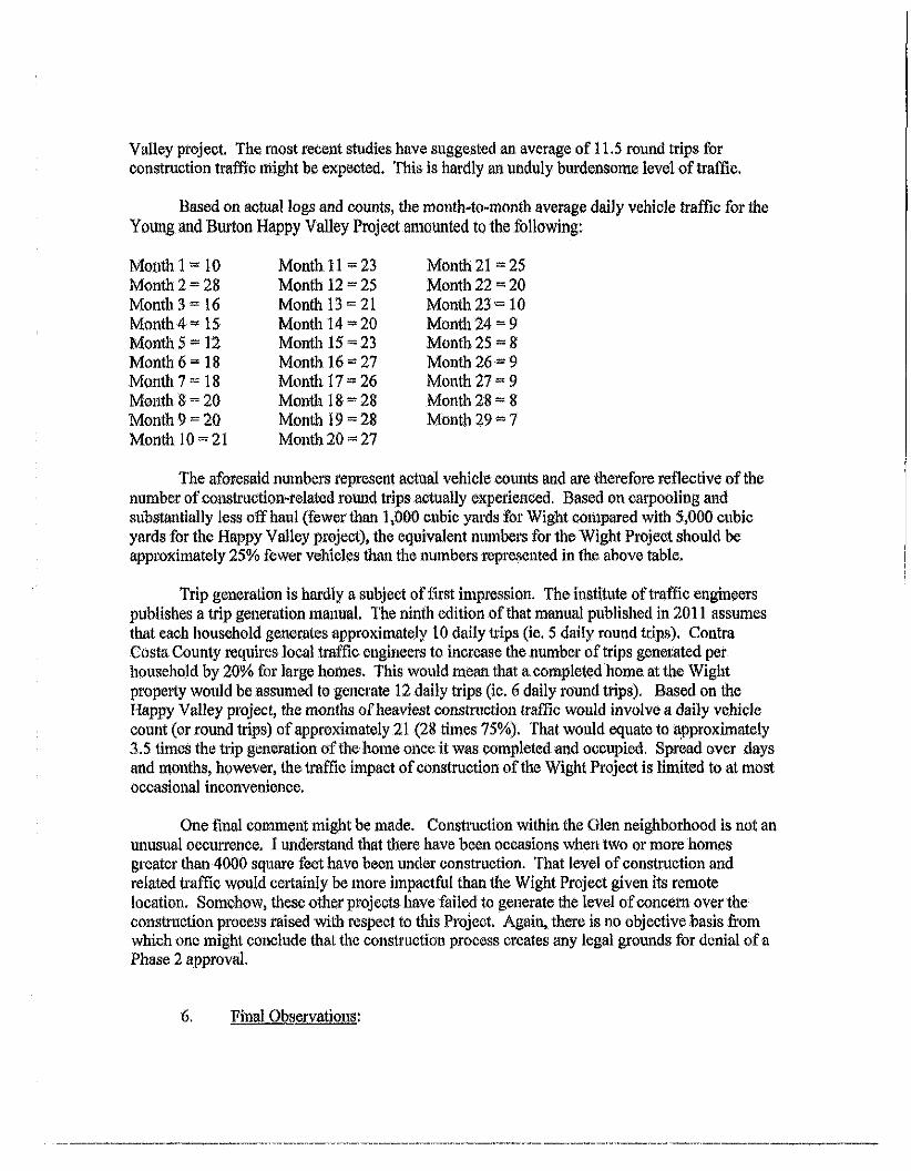
Valley project. The most recent studies have suggested an average of 11.5 round trips for construction traffic might be expected. This is hardly an unduly burdensome level of traffic.
Based on actual logs and counts, the month-to-month average daily vehicle traffic for the Young and Burton Happy Valley Project amounted to the following:
Month 1 ^ 10 Month 11-= 23 Montii 21 -25 Montii 2 = 28 Month 12 - 25 Month 22 -20 Month 3 = 16 Month 13- 21 Month 23 -10 Month 4 « 15 Month 14 20 Month 24 - 9 Month 5 - 12 Month 15 = 23 Month 25 - 8 Month 6 = 18 Month 16= 27 Montii 26 Month 7 = 18 Month 17 = 26 Month 27 - 9 Month 8 - 20 Month 18 28 Month 28 - 8 Month 9 = 20 Montii 19=== 28 Month 29 Month 10 = = 21 Montii 20 27
The aforesaid numbers represent actual vehicle counts and are therefore reflective of the number of construction-related round trips actually experienced. Based on carpooling and substantially less olfhaul (fewer than 1,000 cubic yards for Wight compared with 5,000 cubic yards for the Happy Valley project), the equivalent numbers for tiie Wight Project should be approximately 25% fewer vehicles than the numbers represented in the above table.
Trip generation is hardly a subject of first impression. The institute of traffic engineers publishes a trip generation manual. The ninth edition of that manual published in 2011 assumes that each household generates approximately 10 daily trips (ie. 5 daily round trips). Contra Costa County requires local traffic engineers to increase tiie number of trips generated per household by 20% for large homes. This would mean that a completed home at the Wight property would be assumed to generate 12 daily trips (ie. 6 daily round trips). Based on the Happy Valley project, the months of heaviest constmction traffic would involve a daily vehicle count (or round trips) of approximately 21 (28 times 75%). That would equate to approximately 3.5 times the trip generation of the home once it was completed and occupied. Spread over days and months, however, the traffic impact of construction ofthe Wight Project is Hmited to at most occasional inconvenience.
One final comment might be made. Constmction within the Glen neighborhood is not an unusual occurrence. I understand that there have been occasions when two or more homes greater than 4000 square feet have been under construction. That level of construction and related ti*affic would certainly be more impactftil than the Wight Project given its remote location. Somehow, these other projects have failed to generate the level of concern over the construction process raised with respect to this Project. Again, there is no objective basis from which one might conclude that the consti-uction process creates any legal grounds for denial of a Pliase 2 approval.
6. Final Observations:
Gordon Chong, a Design Review Commissioner, characterized this Project as "complex". That characterization has been echoed by Glen residents who have also cited numerous perceived impacts related to the proposed development. This Project is hardly complex as it is nothing more than building a permitted single family home on an existing lot. To the extent a fairly simple process can be characterized as "complex", the perceived complexities are all essentially generic to hillside development, the Phase 1 approval, and existing conditions. In other words, the same alleged "complexities" and "impacts" would exist independent of house size. In short, there is a complete disconnect between the Project attributes to which opponents have objected and any impacts traceable to those attributes.
This Council made all ofthe fmdings necessary to issue a Phase 1 approval. This is the same Project which has been more and better refined. With better and moi^ complete objective evidence and nothmg other than unsubstantiated opinions, a claim that the findings cannot be made for a Phase 2 approval is simply lacking justification. A decision made without justification is the very definifion of arbitrary and capricious. My long experience with this Council suggests that it will properly conclude, on the record before it, that this Project must be approved.
Thank you for your consideration of this Project. It is respectfully requested that it be approved without fiirther hearing.
cc: Steve and Linda Wight Howard Martin Tom Frye

Linda Wight
From: W igh t , Steve <SWigh t@tnu .com>
Sent: Friday, June 13, 2014 4:26 PlVl
T o : cl<[email protected]
C c : David Bowie ([email protected])
Subject : 1240 Mont ice l lo Road
At tachments : TReilly Quest ions.docx; WIGhjT - HOUSES IN ADJACENT NEIGBORHOODS 10Jun14.pdf;
W i g h t t raf f ic impact 6-12-14.docx; DOC061314.pdf
Catar ina, please f ind a t tached Answers t o M e m b e r Reil ly's Ques t ions and re la ted a t t a c h m e n t s . These are in s u p p o r t o f
o u r Phase 2 app l i ca t ion regard ing t h e sub jec t p rope r t y . Please call w i t h any ques t ions . Regards, Steve W i g h t , App l i can t
4 1 5 - 9 5 6 - 6 3 1 1 (wor i t ) 925 -283-9118 (home)
1 A T T A C H M E N T 2 B
June 12,2014
Answers to Member Reilly's Quest ions
Counci l Meet ing of May 12> 2014
Prepared by Applicant
QUESTIONS:
1. Off -haul?
a. Access, 5 6 %
b. Garage, 16%
c. House, 2 1 %
d . Pool , 7%
2. Average size of home in Glen a r e a ?
a. 2,864 S F ( i i o m e s range in size f r o m 1,082 t o 6,994 SF). Source: W i n 2 D a t a .
b. A p p r o v e d h o m e site is v ia a p r i va te road app rox ima te l y one- i ia l f m i le f r o m t i i e end o f
IVlonticel lo Road (publ ic) .
c. A p p r o v e d i i o m e site is located a t app rox ima te l y 200 f ee t in e leva t ion above t h e end o f
IVlonticel lo Road (publ ic) .
d . A p p r o v e d h o m e site is accessed via Mon t i ce l l o Road (a pub l ic s t ree t ) , j us t as Sessions Road
and N o r t h r i d g e Lane ( b o t h , p r i va te roads) are accessed via Sierra Vista W a y (publ ic) .
e. Compa r i ng t h e app roved h o m e massing (square f oo tage ) t o t h e average Glen area h o m e
w o u l d be l ike compa r i ng m a n y o f t he h o m e s o n Sessions Road and N o r t h r i d g e Lane t o t h e
average size o f homes located on Sierra Vista W a y .
3. Is construction restricted on spare the a i r days? Cons t ruc t i on w i l l be l im i ted in t he same
m a n n e r as o t h e r res ident ia l cons t ruc t i on t h e n u n d e r w a y in t h e City.
4 . PG&E pipeline during construct ion. The app l icant w i l l be m o s t d i l i gen t in insur ing t h a t all
app rop r i a te (PG&E and City adv ised) p recau t ions w i l l be f o l l o w e d .
5. 10,000 SF (roofed plus three wal ls ) plus 7,000 SF Impervious sur faces?
a. A p p r o v e d massing roo f a rea , 6 ,350 SF.
b. Four teen ex is t ing homes w i t h r o o f areas g rea te r t h a n 6,350 SF are loca ted in t h e i m m e d i a t e
area, m a n y o f w h i c h are o n hi l ls ides. Also in t h e i m m e d i a t e area t h e r e are an add i t iona l
t w e l v e h o m e s w i t h roo f areas o f at least 5,000 SF, b u t less t h a n 6,350 SF.
c. 20 M o n t i c e l l o Cour t has a r o o f area o f 6,920 SF.
d. Please see Schell and M a r t i n , EXHIBIT - HOUSE AREAS ADJACENT NEIGHBORHOODS da ted
1 0 J u n l 4 (a t tached)
6. Total loads and delivery on road for the entire project?
a. Young & Bur ton ' s , Cons t ruc t i on Traf f ic Impacts / T r i p Tota ls , W i g h t Residence shows 698
large t rucks and 4 ,347 w o r k m a n vehic le t r ips o v e r 4 4 0 days o r a p p r o x i m a t e l y 11.5 t r ips per
w o r k day. The repor t is a t t ached .
b. Young & Bu r ton also p repared a Cons t ruc t i on Traf f ic Case Study based o n a p ro jec t t h e y
recent ly conc luded o n Happy Val ley Road. Given many p ro jec t s imi la r i t ies , t h e case s tudy
serves t o a f f i rm t h e above re fe renced es t imates . Ad jus ted f o r t h e substant ia l l y less o f f -hau l
{1 ,000 versus 5,000 cubic yards) and an t i c ipa ted carpoo l ing t o t he W i g h t j o b si te t h e case
s tudy suppor ts Young & Bur ton 's above es t imates . The ad jus ted case s tudy an t ic ipa tes 824
large t r uck t r i ps and 4 ,400 w o r k m a n veh ic le t r i ps over t h e p ro jec t pe r i od . The case s tudy is
a t t ached .
7. C O A 0 1 / 1 0 / 1 3 deal t with in Phase 2 ?
a. The app l icant is unable t o address th i s ques t i on because w e w e r e unab le t o i den t i f y t h e
speci f ic COA.
8. Outdoor ki tchen, 0 7 / 0 9 / 1 2 , location to be dealt with in Phase 2 ?
a. The o u t d o o r k i t chen ( inc lud ing t h e roo f ) w i l l be screened by agreed t o - b e - p l a n t e d oaks.
9. Colors and mater ia ls . . . appropriate? R e v i e w ?
a. The w e s t e r n e leva t ion is single s to ry , and fu l ly cons is tent w i t h t he e leva t i on p resen ted t o
t h e Counci l du r i ng its Phase One approva l .
b. The eastern e leva t ion is invis ib le t o any pub l ic v iew ing loca t ion located t o t h e east o n t he
app roved h o m e si te.
c. No negat ive design c o m m e n t s have been received f r o m t h e publ ic .
d . Sample boards have been rev iewed by Design Review.
10. C O A #36 ... wa te r tank required?
a. Yes, t o be located t o t he n o r t h o f t h e app roved h o m e si te.
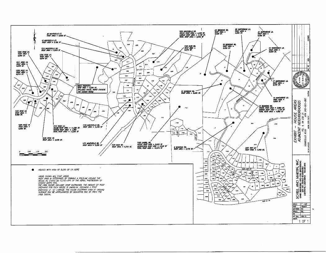
B.XOSF.
1229 ROSEOL
lis* KOSSLH
RtBO SF.
l22BII0S£tM
tS30SF.
imx-RoeFMSA - SF
ISJSmSELH KOOFASEA • 8,830 SF.
(MSfflfiUiM HOUSE KOOF MSA • Si232 SF ROOF ABoi - S.7S0 SF. aaiaswK now AKFA ' 2,oa SF ™ * TOm. ROV/SEA ' 10.274 SF
• HOUSES mm area of 5,000 sf or more
AREAS SHOWN ARS POOF AREAS. ROOF AREA IS OETERI/INED BY DRAWING A POLYLINE AROUND THE HOUSE AS SHOV/N ON CLOSE-UPS OF THE AERIAL PHOTOGRAPH BY GOOGLE EARTH PRO. THE AFIEA SHOWN INCLUDES ROOF OVERHANGS. THE AMOUNT OF ROOF OVERHANG FOR EACH HOUSE IS UNKNOWN. ASSUMING A ROOF OVERHANG OF IB' Ai^ERAGE THE HOUSE FOOTPRINT AREA AT GROUND SURFACF CAN BE APPROXIMATED BY DEDUCTING SOO SF FROM THE AREA SHOWN.
Y O U N G ® B U R T O N INC. CA LICENSE 531879
June 9 , 2 0 1 4 General Contractors 1947 SAN RAMON VALLEY BLVD. SUITE 200
SAN RAMON. CAfi4583
(925) 820-4953 • FAX (925) 820-i 858
HDP20--13, GR07-13 & TP12-13
Wigh t Residence
1240 Mont ice l lo Rd.
Lafayette, CA
Construct ion Traff ic Case Study
Project used for Case Study:
- Single fami ly residence on Happy Valley Road
- 11 /2011 - 04 /2014 , to ta l 29 m o n t h schedule
- Lot size = 100,207 SF
- Tota l Enclosed l iving space = 8,005 SF
- Garage 753 SF
~ Covered Terrace = 454 SF
- imperv ious Surface = 18,139 SF
- M a x i m u m Building Height = 29 ' "9"
Descr ipt ion o f Work :
Mass excavation fo r crawl space, below ground mechanical and pool equ ipment rooms and
pool /spas.
Steel, concrete and w o o d f rame const ruct ion.
- Tennis cour t , covered ter race, second f loor pat io , pool side patios, poo l , two spas, g ro t to w i t h
f i re pi t , mo to r cour t , dr iveway.
Pavilion w i t h ou tdoor ki tchen
- Garage, Mov ie Theater, 2 bedrooms, 4 bathrooms, game room, gym and massage room.
Construct ion Condit ions:
- The construct ion lo t was located behind a lot direct ly on Happy Valley less than 1000 feet f r o m
Happy Valley Elementary School. The homeowne r owns bo th lots and the f ron t lot was most ly
clear, w i t h a small orchard in the midd le . This lo t a l lowed fo r construct ion access and
const ruc t ion parking, staging, mater ial del ivery, etc. This project d id not require van pool ing or
of fs i te staging due t o available on site space. In th is condi t ion, a lmost all individuals arr iv ing t o
site each day t ranspor ted and parked themselves
- W e comple te daily logs document ing everyday dur ing t he construct ion process as part o f
company policy. These logs detai l every person on site, how many deliveries were made, how
many trucks o f o f f haul or concrete trucks on si te, etc. In reviewing t he over 600 daily logs one
by one , w e were able t o get counts fo r the dai ly number o f vehicles on site and wha t k ind of
Case Study:
A T T A C H I V I E N T 2 C
vehicles they were . We were also able t o de termine a t raf f ic f low pat tern over t he course o f t h e
construct ion process. Below are t he f indings and at t he end is a summary compar ing this
projects size, scale, location t o tha t o f the Wight 's and hovi/ we wi l l mi t igate t he t raf f ic for the
Wight project.
Total Number of Vehicles over 29 months = 10,619
Total Truck Imports (gravel, sand, etc) = 115
Total Truck Deliveries ( lumber, wate rp roo f ing , etc) = 200
Total Truck Of f haul = 572
Total Steel Deliveries/Install = 7
Total Concrete Pumps = 35
Total Concrete Trucks = 145
Total personal wo rk vehicles = 9,545
Average number of personal work t rucks/day = 17 [29 months w i t h average 20 work days /mon th - 580
days; 9 ,545/580 = 16.45 ~17]
M o n t h t o M o n t h Average Daily Vehicle Traff ic:
M o n t h 1 - 1 0 M o n t h 1 6 - 2 7
M o n t h 2 - 2 8 M o n t h 17 - 26
M o n t h 3 - 1 6 M o n t h 1 8 - 2 8
M o n t h 4 - 1 5 M o n t h 19 - 28
M o n t h 5 - 1 2 M o n t h 2 0 - 2 7
M o n t h 6 - 1 8 M o n t h 2 1 - 25
M o n t h 7 - I B M o n t h 2 2 - 2 0
M o n t h 8 - 2 0 M o n t h 23 - 1 0
M o n t h 9 - 2 0 M o n t h 2 4 - 9
M o n t h 1 0 - 2 1 M o n t h 2 5 - 8
M o n t h 1 1 - 2 3 M o n t h 2 6 - 9
M o n t h 1 2 - 2 5 M o n t h 2 7 - 9
M o n t h 1 3 - 2 1 M o n t h 2 8 - 8
M o n t h 1 4 - 2 0 M o n t h 2 9 - 7
M o n t h 1 5 - 2 3
Case Study Comparison to Wight Residence:
jCase S t u d y _ ' ^ _ W igh ts^
j s i n j i e f a m i l y r e s i d e n c e o n H a p p y V a H e y Road / [ S i n g l e r e s i d e n c e o n MoHl- i^el lo^^^^
^ 9 m o n t h s c h e d u l e
^j|j3ts1ze=J^ [Total E n c l o s e d l i v i n g spjace = 8,005 SF
^Garage = 7 5 3 S F
l?^9;YSI?.lT£!I?-?®..r 62S SF ^ j i m p e r v i o u s Sur face = 1 8 , 0
l lV lax Imum B u i l d i n g H e i g h t = 2 9 ' - g "
22 m o n t h s c h e d u l e
_ ^ L o t s j z e j ^ 5 ^ ^
T o t a l Enc losed living space = 7 ,784SF
Garage = 2,043 SF
C o v e r e d Ter race = 3^648
Impervious Sur face = 8 , 5 4 4
M a x I m u m B u i I d ! ng^He i gh t - 25 '
Traffic Projections based on Case Study:
Based on the comparat ive size and Infrastructure o f t h e Wight 's residence t o that o f t h e case
study, w e can infer tha t t he t raf f ic counts w o u l d be t he same in t he same si tuat ion o f locat ion,
parking and access. The t ruck/ large vehicle counts cannot be adjusted great ly due t o the
requi red amoun t o f material for the project size, however t he of f haul amount requi red fo r the
Wight residence compared t o the case study is much less (1,QQ0 versus 5000 cubic vards i . We
equate this d i f ference t o be approximately 250 fewer t rucks than the case study. A l ternate ly ,
t he personal vehicle t raf f ic can be great ly decreased via the proposed carpool vans. W i t h the
shorter 22 m o n t h schedule o f t h e Wight 's pro ject compared to t he case study, w e can already
infer 7 months less o f personal vehicle t raf f ic , wh ich w o u l d equate t o a reduct ion o f
approx imate ly 2,380 fewer vehicle t r ips. Taking advantage of carpooling oppor tuni t ies, w e
believe w e can e l iminate 6-14 personal vehicle t r ips per day. Wi th t he carpool ing requi r ing t w o
tr ips per day, plus t he occasional persona! vehicles, w e est imate tha t w e can l imi t t he personal
vehicle t raf f ic per day t o approximately 8-10 vehicles. W i t h 10 vehicles per day for 22 months ,
the to ta l personal vehicle t raf f ic wou ld be 4,400 and w i t h t he truck traf f ic, the to ta l vehicles
over 22 months w o u l d be approximately 5,224.
Cons t ruc t i on Traf f ic I m p a c t s / Tr ip t o ta l s
W i g h t Residence p ro jec t
1240 M o n t e c e l l o Rd.
Lafayet te , CA 94549
For purposes o f th i s i l lus t ra t ion large t rucks w i l l inc lude 10 w h e e l d u m p t rucks , bob ta i l de l i ve ry t rucks , p u m p t rucks , san i ta ry t r ucks ,
debr is t rucks . Concre te t rucks , l u m b e r o r s tee l de l ivery t rucks , o r m o s t mul t r axel t y p e heavy d u t y t rucks . Genera l ly d iesel eng ines w i t h
t o t a l GVW up t o 80 ,000 lbs.
W o r k m a n vehic les w o u l d inc lude a u t o m o b i l e s , p ickup t rucks , smal l dua l axel de l i ve ry f l a tbeds o r vans, ca rpoo l vans etc. e i t he r d iesel o r
gas bu rn ing mos t l y used t o de l iver w o r k m e n t o t h e s i te, hand too ls , subcon t rac to rs e tc .
Regular t ra f f i c w i l l i nc lude : inspect ions avg. 1 pe r week , Po r ta - j ohn service avg. 1 large pe r w e e k , t rash and debr is hau l ing 1 large p e r w e e k
Project manager 1 t r uck every day, v a n p o o l 2-4 everyday, subcon t rac to r ' s avg. 4 t rucks per day
Large Trucks W o r k m a n vehic les To ta l t r i ps Dai ly Av
Day 1-25 (5 weeks ) w o r k w i l l inc lude 55 135 190 8
s tag ing, survey, layout ,excavat ion
e q u i p m e n t del iver ies. Pro ject manager .
Laborers, Porta j o h n , t e m p fenc ing .
Dri l l r ig , Steel i beam and l u m b e r
Del iver ies f o r road w i d e n i n g and
Reta in ing wa l l cons t ruc t i on .
Day 25-50 (5 weeks) w o r k w i l l inc lude con t i nue 140 192 332 13.5
Del ivery o f re ta in ing wa l l s tee l and l umber , conc re te
P lacement at re ta in ing wa l l p iers, begin bulk excavat ion f o r
Parking and house pads / and beg in cons t ruc t i on o f
Roadway i m p r o v e m e n t s , begin excavat ion ut i l i t ies
t r e n c h . Del iver ies inc lude, condu i t , s t o r m dra in p ipe , geo-
Text i le fabr ic f o r roadway , PG&E sand f o r t r e n c h ,
Baserock. O f f hau l o f approx . 1000 cu. yds . o f soils p lus clear and g r u b
Day 50-75 . W o r k w i l l con t i nue o n road bu i ld ing , 82
inc lud ing paving,excavate poo l , House f o u n d a t i o n
foo t i ngs , u t i l i t ies t r e n c h con t inue ,s i te wa l l foo t ings ,
park ing pad subbase, poo l cons t ruc t i on , s t o r m w a t e r
r e t e n t i o n basin excavate and f o r m , o f f hau l .
Del iver ies inc lude f o r m mate r ia l , base rock. Aspha l t ,
Paving mach ine and ro l ler , t r a c t o r f o r pav ing
Reinforc ing s tee l , PG&E sand, misc condu i t s , t rash haul
Porta John serv ice.
Day 75-100. T e m p p o w e r , gun i te poo l . Pour r e t e n t i o n bas in, 60
f o r m and pou r house foo t ings , ins ta l la t ion guardra i l a t
re ta in ing wa l ls , f o r m and pour w a t e r t ank pad , instal l sewer
la tera l , house p o w e r condu i t s , begin block wa l l instal l
Del iver ies inc lude gun i t e f o r poo l , conc re te fo r f oo t i ngs and
Tank pad , re in fo rc ing s tee l , f o r m ma te r i a l , e m b e d d e d ha rdware
M a s o n r y b lock, sand and c e m e n t si lo, sewer p ipe etc.
Day 100-125 Con t inue masonry wa l ls , con t i nue house 33
Founda t ion ma in re ta in ing w a l l , g r o u t par t ia l si te wa l ls .
Drainage in f ras t ruc tu re . Pour house re ta in ing wa l l
Del iver ies f o r m ma te r i a l , r e i n f o r c e m e n t s tee l , sand and
c e m e n t f o r g rou t , condu i t s f o r u t i l i t ies, w a t e r t ank ,
concre te and p u m p e r s
Day 125-150 St r ip , w a t e r p r o o f , shore , backf i l l ma in house 36
W a l l , con t i nue si te w o r k , s tar t f o r m w o r k f o r r ema inde r o f
House f o u n d a t i o n , 1 ^ f l o o r p l u m b i n g , w a t e r p r o o f and f o r m
and pou r ma in f l oo r . M a k e up w a t e r t ank p l u m b i n g and f i l l t ank .
Del iver ies inc lude shor ing , conc re te , pumpe rs , h a r d w a r e .
S tone, p l umb ing rough ma te r i a l , sand w a t e r p r o o f i n g
Days 150-175 Comp le te f o u n d a t i o n , begin f r a m i n g 1 ^ f l o o r 34
t h r u ma in f l o o r jo is ts . Begin r o c k f a c l n g o f si te wa l ls , dra inage
250 332 13.5
250 310 12.5
210 243 10
230 266 1 1
250 2 8 4 11.5
comp le te b io swales
del iver ies inc lude l umber , h a r d w a r e , conc re te , p u m p e r
sand and c e m e n t , dra inage p ipe, landscape bou lders
Day 175-200 IVIain f l o o r f r a m e , s ta r t r oo f f r a m e , rock 25
w o r k con t inues , ex te r i o r shear, h a r d w a r e insta l l , m a i n
f l o o r p l u m b i n g s tar ts , 1 ^ f l o o r H V A C , f i respr ink le r , e lect r ica l .
Del iver ies inc lude l umber , HVAC, f i respr ink le r ma te r ia l ,
e lect r ica l
Day 200-225 roo f f r a m e c o m p l e t e , r oo f d r y - i n , c o m p l e t e 32
Shear, begin w i n d o w / e x t e r i o r d o o r set , rough p l u m b i n g ,
hvac, e lect r ica l , F i respr inkler , begin l o w vo l tage IVIain f l oo r .
Del iver ies inc lude l umber , w i n d o w s , ex te r io r doors , r oo f i ng
Paper, Hvac, e lec t r ica l , p l umb ing , f i r e s p r i n k l e r , s tone
Day 225-250 rough f r a m e , scaf fo ld set a n d stucco w r a p and 3 1
La th , t rades c o m p l e t e , p ickup c o m p l e t e , w i n d o w s and doors
Comp le te , insu la t ion ins ta l led , sheet rock s tocked , r oo f o n
rough f r a m e deck ove r park ing pad
de l iver ies inc lude insu la t ion , shee t rock , s tucco paper and la th
roo f i ng ma te r i a l , s tee l , l umbe r , scaf fo ld
Day 250-275 hang a n d tape shee t rock . Stucco ex te r io r 18
Begin Exter ior s tone ins ta l la t ion , instal l hydron ic h e a t i n g /
gypc re te at l^^and 2nd f l oo r . Pr ime wal ls
Del iver ies inc lude, hydron ics ,gypcre te , s tucco, s tone ,
l imes tone Pavers
Day 275-300 Cabinet ins ta l la t ion , b a n g gu t te rs .
Exter ior pa in t , r e m o v e sca f fo ld , f o r m and pou r rear pa t io
hang in te r io r doors , s tar t l ower f l o o r t l i e w o r k .
25
275 300 12
300 332 13.5
300 3 3 1 13.5
260 278 1 1
275 300 12
beg in pat io decl< pavers
Del iver ies inc lude cab inets , t i le and s tone , s tone
F loor ing, s tone t r i m , garage doo rs , sand and c e m e n t
Day 300-325 T r im w o r k in te r io r , bu i l d t re l l is 25
Pavers o n deck, poo l cop ing , t i le at rear pa t io ,
Ti ie f l oo rs a t M a i n f l oo r , t i le w o r k , misc. t r a d e w o r k ,
T e m p l a t e f o r slab w o r k
Del iver ies inc lude bou lders , t re l l i s ma te r ia l , conc re te
A n d p u m p e r , precast , sand and c e m e n t , poo l cop ing
Day 325-350 T r i m w o r k c o m p l e t e , t i le w o r k d o n e 19
Slabs ins ta l led , pa in t ing beg ins,e levator insta l led
t rades begin t o p o u t Exter ior pa t io comp le te . Trel l is c o m p l e t e
Begin perv ious surfaces at park ing
Del iver ies inc lude slabs, pavers, e lect r ica l , p l u m b i n g
Elevator , i r r iga t ion p ip ing , h a r d w o o d
Day 350-375 pa in t ing , h a r d w o o d f l o o r i n g , ex te r io r w a l k 18
Ways , p lan t ing i r r i g a t i o n / a m e n d m e n t s
Del iver ies inc lude conc re te , p u m p e r , i r r i ga t ion , ha rdware .
Pool e q u i p m e n t
Day 375-400 ha rdware ins ta i ia t ion , app l iances, pa in t ing 26
P lumb ing f i x tu res , ex te r i o r i r r i g a t i o n / a m e n d m e n t s
Ribbed concre te d r i veway , ga tes , poo l t i l e ,
poo l e q u i p m e n t , c losets, handrai ls , i ron rai l ex t .
Del iver ies inc lude conc re te , p u m p e r ,
w . i . guardra i ls , appl iances
Day 400-425 p lan t ing , w i n d o w t r e a t m e n t s , A / V
Carpet , special t ies, tes t ing , sys tems, f i x tu res
Del iver ies inc lude carpet . Aud io v isual , p lan t ing
20
275 300 12
275 294 12
250 268 1 1
250 276 1 1
250 270 1 1
Day 425-440 w i n d o w a n d i iouse Cleanup,
inspec t ion , sys tems,De ta i l s , p lan t i ng , pick up ,
c leaning and Seal ing, f ina l pav ing over lay
De-mob i l i ze , m o v e o u t .
Del iver ies inc lude paving and e q u i p m e n t
M o v i n g vans, landscape
Job to ta ls
19 120 139
698 4 ,347 5 ,045 11.47
June 11.2014
Job N o . ' n 4 4 B B
Steve Wigh t
21 Norl l i r idge Lane
Lafayette, Cal i fornia
Re; Dispersal Units for Site Drainage
Wigh t Residence 1240 Monticel lo Road
Lafayette, Cal i fornia
Dear M r . Wigh l
This letter is an addendum to our letter o f A p r i l 23. 2014, which discussed the use o f
dispersal units to discharge a portion o f t h e storm water runofl 'collected wi th in the area
of the referenced project into a swale west and north o f t h e pi'ojcct site.
The referenced properly is a-stride a prominent north/south trending ridge. The spur ridges
that descend westerly f r o m the ridgehne are separated by four distinct swales. This
topography is illustrated on the Schell and Mar t i i i plan entitled "Hydro logy Exhibit
Proposed Condi t ion. Pel 4. 64 L S M 3 1 . Monticel lo Road. A P N 245-060-002" dated May
16. 2014. The plan di.splays storm water r u n o f f tributary areas; the most northerly o f t h e
west facing swales is in Tributary Area "G* and the next swale to the south o f the first is
in Tributary Area 'F".
The current project drainage plan shows the perforated pipe dispersal units would be
located at the upper end o f t h e swale in Tributary Area "G ' . west and slightly north o f t h e
project building site.
Because in 2007 we observed indications o f active slope instability (shallov*- landsliding)
in one o f t h e swales at the properly south side. and. possibly, geologically older and less
active instability in the swale wi th in Tributary Area ' F \ our August 16. 2007 report noted
that the discharging stonn water r u n o f f into the swale(s) should be avoided i f possible.
It is worthwhile not ing that in 2007 we did not observe past or recent signs o f slope
instability in the swale wi th in Tributary Area •G". Accordingly, the report
recommendation d i d not apply to the swale wi th in Tributary Area "G".
On June 10. 2014.1 examined the ciuTent condition o f all four swales and confirmed the
2007 f ind ing that no slope instability condition exists in Tribii tary Area "G".
The proposed dispersal units should return the accumulated r u n o f f f r o m the project to a
sheet f l o w condit ion similar to that which naturally occurs in Tributary Area •G.
ATTACHMENT 2D
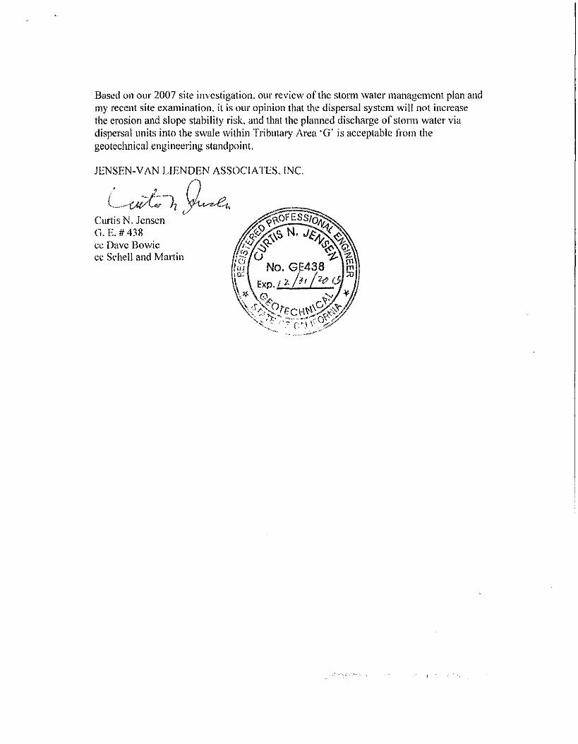
Based on our 2007 site investigation, our review o f tlie storm water management plan and
my recent site examination, it is our opinion that the dispersal system w i l l not increase
the erosion and slope stability risk, and that the planned discharge o f storm water via
dispersal units into the swale wi th in TribiUary Area 'G" is acceptable f rom (lie
geotechnical engineering standpoint.
J E N S E N - V A N L I E N D E N ASSOCIATES. INC.

HYDROLOGY STUDY
WIGHT PROPERTY
APN 245-070-014 PARCEL 4, 64 LSM 31
MONTICELLO ROAD, LAFAYETTE, CA 94549
Schell and Martin, Inc., 337 Mt. Diablo Blvd., Lafayette, CA 94549
June 03,2014 Job No. 420-10
ATTACHMENT 2E
I
Introduction
This report presents the results o f a hydrologic study to determine pre- and post-construction stormwater
peak runoff in the 10-year storm, together wi th a detention calculation which demonstrates that tlie
increase i n peak runof f caused by construction o f the project can be elimmated in the event tliat analysis
o f tlie downst'eam storm drain system reveals tliat i t is not capable o f conveying the increased f low.
I t is proposed to construct a single-family residence at the top o f a north-soutli ridge northwest o f
E B M U D ' s Glen Reservoir. The side-slopes o f the ridge are steep, wi th slopes exceeding 50% in some
locations. The site is covered by grass and trees and the soil is sandy clay.
This hydrologic study was performed to demonstrate that tlie construction o f t he proposed residence w i l l
not contribute any additional f low to tlie Monticello neighborhood, nor w i l l i t increase f low to the
concrete-lined ditch behind the homes at 1244 and 1256 Rose lane. This study also demonstrates that the
drainage system within the Rose lane subdivision is adequate to handle the small additional f low f rom tlie
proposed development.
Presently, the proposed house site is split by the saddle o f the ridge. This causes about 1/3 o f tlie
stormwater i i m o f f to flow to the west o f tlie ridge, primarily to a seasonal watercourse which flows to a
defmed seasonal creek ending at a lieadwall at tlie northeast comer o f 1260 Rose Lane. The other 2/3 o f
the stormwater runoff flows east, combining wi th runoff f r o m a portion o f the vacant lot to die north and
flowing down tlie existing E B M U D paved road to tlie hairpin turn. A t this point the runof f enters a short
culveit which conveys i t to the west side o f this private roadway, where it flows north along the inside
edge of the road.
The points at which this study determines the existing peak flows are as follows:
Point A where the runoff f rom the vacant nortli property arrives at the site o f a proposed inlet,
Point B tlie entrance to tlie culvert at the hairpin tui'n,
Point C the uphil l side o f t he driveway at 1219 Monticello Road,
Point F tlie south end o f tlie existing concrete ditch at a point just east f r o m 1244 Rose Lane,
Point G tlie headwall near the north comer o f 1256 Rose Lane,
Point H tlie headwall northeast o f 1261 Rose Lane,
Point J tlie ciirb inlet near tlie southwest corner o f 1260 Rose Lane,
Point K the inlet at tlie east corner o f 1260 Rose Lane,
Point L tlie curb inlet at tlie northwest comer o f 1248 Rose Lane, and
The above locations are shown on the included hydrology maps for existing and proposed conditions.
Points C, F, G, K and L are tiie critical points for demonstrating the effect that construction w i l l have on peak runof f and on neighboring property owners.
Description of Drainage Pattern
Because o f elevation constraints al l the proposed driveway up to tiie auto court must dram easterly in tiie
Monticello Road direction. However, because the proposed residence is at the saddle o f the ridge, runof f
f rom the house, patio and auto court can be dnected either to tiie east or the west, or tiie flow can be split, wi th some going in each direction.
The neigliborhoods surrounding tlie project site have a history o f landslide and flooding events, however
given tlie existing topography, development o f the site w i l l have no impact on the areas defined by tliese
problems. The existing private portion o f Monticello Road f r o m the Wight residence down to the level
portion o f the road closer to the public portion o f Monticello appears to effectively contain runof f wi th in
tiie roadway. Future road hnprovements f rom the proposed fire department turnaround near tiie new
driveway to tiie Wight home and future road widening required to satisfy the f i re department w i l l include
improvements where necessary to assure tiiat runoff down to the hairpin turn w i l l not overtop the bank
and f l o w down-slope. Proposed storm drain improvements as tiie roadway approaches the public portion
o f the road w i l l capture this runoff before it can reach the large diameter culvert tiiat has been identified
as a problem by many of tiie neighbors and the report by Kropp and Associates. As directed by the
project soils engineer, Curt Jensen, runoff tiiat w i l l f low westerly w i l l not drain to the problem slope
above 1256 Rose Lane. This reflects a revision to the plan set tiiat has been currently under review.
A l l stormwater runoff from tiie house, rear patio and auto court w i l l be directed to permeable surfaces
(vegetated m eas or permeable pavers) in order to comply w i t i i current stormwater regulations per
Provision C.3 o f the Municipal Regional Stormwater Pennit. For tlie purposes o f this study i t is assumed
that tiie 10-year storm w i l l stiike when the ground is already saturated, the gravel storage layer under tiie
permeable pavers is f u l l and the bioretention filter is overflowing. Af te r passing tlirough the various
permeable surfaces, al l stormwater l u n o f f f rom the house, rear patio, auto court and associated
landscaping w i l l be piped to dissipator outlets on that portion of the western slope which is tributary to
the existing headwall near tiie nortii corner o f 1256 Rose Lane. The storm drain system w i l l be designed
wi th multiple outlet dissipators which w i l l allow stormwater to flow to the surface o f the hillside to
commingle wi t i i surface flows. The outlet dissipators w i l l be designed to have adequate length to ensure
tiiat flow is spread out sufficiently. This combination o f adequate length and multiple locations w i l l
prevent stormwater runof f f rom being discharged in a concentrated mamier, thereby preventing erosion o f
the hillside. Tlie construction drawings w i l l contain erosion control provisions to prevent erosion damage
during construction. Below tiie dissipators, tiie ground forms a swale which soon becomes a natural
seasonal watercourse which falls steeply to the west before flattening into a small alluvial fan. The ground
continues to fa l l to tiie west, eventually dropping into the main north-soutii seasonal creek. This seasonal
creek flows southerly tlirough two sets o f debris racks made of vertical steel pipes and tiience to the
headwall at 1256 Rose Lane. From the headwall, a 24" diameter pipe flows southerly between 1256 and
1260 Rose Lane, and westerly to coimect to the main Rose Lane storm drain at the curb inlet at the
nortiiwest corner o f 1248 Rose Lane. The lieadwall's existing tributary area is 8.88 acres. I t is proposed to
increase it to 9.17 acres, an increase o f 3%.
A l l the storm drain pipes in this study are shown on the 1985 hiiprovement Plans for Subdivision 6459
(Rose Lane), by Bryan & Murphy Associates, hic. See the hydrology calculation sheets to correlate the
Tributary Area designations (G, H , etc.) wi th tiie stiicture numbers shown on tiie improvement plans (Str.
# 6459-11, Sti-.# 6459-5, etc.)
Tributary Area Changes
The boundaries o f the tributary areas change between existing and proposed conditions, resulting in
different acreage, as shown on tiie hydrology calculation sheets and on the exliibit "Tributary Area
Changes".
Tributary Area ' A ' increases in size f rom 1.13 to 1.28 acres because o f grading at tiie bottom of tiie house
driveway which raises the road and diverts water north to a proposed inlet.
Tributary Area ' B ' decreases f r o m 2.86 to 2.49 acres, largely because of grading and house construction
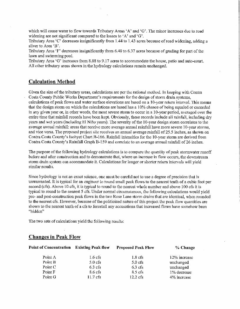
which w i l l cause water to f low towards Tributary Areas ' A ' and ' G ' . Tlie minor increases due to road
widening are not significant compared to the losses to ' A ' and ' G ' .
Tributary Area ' C decreases insignificantly from 1.44 to 1.43 acres because o f road widening, adding a
shver to Area ' B ' .
Tributary Area ' F ' decreases insignificantly f rom 6.40 to 6.37 acres because o f grading for part o f t he
lawn and swimming pool.
Tributary Area ' G ' increases from 8.88 to 9.17 acres to accommodate the house, patio and auto-court.
A l l other tributary areas shown in the hydrology calculations remain unchanged.
Calculation Method
Given the size o f the tributary ai'eas, calculations are per the rational method, h i keeping wi th Contra
Costa County Public Woi'ks Department's requirements for tlie design o f storm drain systems,
calculations o f peak f lows and water surface elevations are based on a 10-year return interval. This means
that the design storm on which the calculations are based has a 10% chance o f being equaled or exceeded
in any given year or, in otlier words, the most severe storm to occur in a 10-year period, averaged over tlie
entire time that ramfall records have been kept. Obviously, tliese records include all rainfall , including dry
years and wet years (including E l Ni i io yeai's). The severity o f the 10-year design stonn correlates to the
average annual rainfall: areas that receive more average annual rainfall have more severe 10-year storms,
and vice versa. The proposed project site receives an annual average rainfal l o f 25.5 inches, as shown on
Contra Costa County's Isoliyet Chart B-166. Rainfall intensities for flie 10-year storm are derived from
Contra Costa County's Rainfall Graph B-159 and correlate to an average annual rainfal l o f 26 inches.
The purpose o f the foUowmg hydrology calculations is to compare the quantity o f peak stormwater runof f
before and after construction and to demonsti*ate that, where an increase in f l o w occurs, tlie downstream
storm drain system can accommodate it . Calculations for longer or shorter return mtervals w i l l yield
similar resuhs.
Since hydrology is not an exact science, one must be careful not to use a degree of precision that is
unwarranted. I t is typical for an engmeer to round small peak flows to tlie nearest tenth o f a cubic foot per
second (cfs). Above 10 cfs, i t is typical to round to the nearest whole nmnber and above 100 cfs it is
typical to round to the nearest 5 cfs. Under normal circumstances, tlie fo l lowing calculations would yield
pre- and post-construction peak flows in the two Rose Lane storm drains Uiat are identical, when rounded
to tlie nearest cfs. However, because o f t h e politicized nature o f this project the peak f l o w quantities are
shown to the nearest tenth o f a cfs to forestall any accusations that increased flows have somehow been
"hidden"
The two sets o f calculations yield the fo l lowing results:
Changes in Peak Flow
Point of Coucentration Existing Peak flow Proposed Peak Flow % Change
Point A 1.6 cfs 1.8 cfs 12% increase
Point B 5.0 cfs 5.0 cfs unchanged
Point C 6.3 cfs 6.3 cfs unchanged
Point F 8.6 cfs 8.5 cfs 1 % decrease
Point G 11.7 cfs 12.2 cfs 4% mcrease
Point H
Point J
Point K
Point L
90.9 cfs
92.5 cfs
12.1 cfs
106.0 cfs
90.9 cfs
92.5 cfs
12.7 cfs
106.5 cfs
unchanged
unchanged
5% increase
0.5% increase
Points ' C , ' F ' , ' G ' , ' K ' and ' L ' are the significmit points o f concentration where tlie runof f leaving the
project is measured.
The increase in peak 10-year f low at Point ' A ' is the result o f increased tributary area and the increase in
impervious surface area at the driveway and road. However, tliis is a localized increase and does not
increase overall outflow f rom tlie east side o f t he project. Point ' A ' is on the same flow-path as Points ' B '
and ' C downstream and, by the time tliat peak runof f reaches these two points, tliere is no increase from
the existing condition. Peak flows at Points ' B ' and ' C ' remain unchanged f r o m tlie existing condition, at
5.0 and 6.3 cfs, respectively. ICeeping tlie peak f l o w at existing levels at tliese two points is achieved by
the transfer o f tributaiy area from Area ' B ' to Area ' G ' , which offsets the increase in impervious coverage
sufficiently to prevent a peak f l o w increase. I t should be emphasized that there w i l l be no increase in the
peak 10-year f l o w that is conveyed by Monticello Road.
Peak f l o w at Point ' F ' is reduced slightly because o f tlie grading for the pool and lawn, which causes
stonn runoff to be diverted from Tributary Area ' F ' to Tributary Area ' G ' .
Peak f l o w at Pomt ' G ' is increased slightly, because o f the increased tributary area derived f r o m Areas
' B ' and ' F ' and the increase in impervious surface area at tiie house, patio and auto-court. This 4%
increase fi'om 11.7 to 12.2 cfs is conveyed by an existing weti-defined natural seasonal watercourse and a
seasonal creek to an existing 24" stonn drain which connects to the main 48" storm di"ain in Rose Lane.
The 0.5 cfs increase at Point ' G ' is continued downstream thi'ough Pomts TC (the rounding error causes i t
to appear as a 0.6 cfs increase at Point ' K ' ) and ' L ' , the junction w i t h the 48" diameter Rose Lane storm
drain.
Capacity of Downstream Storm Drain
The existing Rose Lane stonn dram system was analyzed in tiie existing and proposed conditions to
determine the effects o f constaiction. Starting downstream, water surface elevations for the 10-year stonn
were calculated in each structure. Because o f tiie steepness o f the lines studied, almost all o f the water
surfaces were governed by the inlet control condition present at each structure, rather than by the capacity
o f the pipe itself For example, the 48" pipe can adequately convey several hundred cfs in its steeper
sections, but that much water can't get f r o m the structm'e into the pipe without backing up inside tiie
structui'e and spilling out into the street. The effects o f Inlet Control were detennined using the Bureau o f
Public Roads chart "ITeadwater Depth for Concrete Pipe Culverts W i t h hilet Control". As described
above imder "Calculation Method" these calculations are performed using a greater degree o f precision
than is warranted or is usual, h i order to determme precisely tiie headwater deptiis given by the Inlet
Control Chart, the chart was imported as a raster image into AutoCAD and a logarithmic scale was
superimposed on various portions o f the "Discharge" and "Headwater Depth" lines. By zoommg in ,
values were determined w i t i i extra precision. I n order to determine the difference between -pre- and post-
construction water surface elevations wi th extra precision, in some instances calculations were carried to
the third decimal place.
Water surface elevations were calculated i n the 24" pipe leading from Point ' G ' to tiie 48" Rose Lane
storm dram at Point ' L ' ; in tiie 48" pipe downsti'eam fi-om Point ' L ' ; and in the 48" pipe upstream f r o m
Point ' L ' to determine any upstream effects.
The two sets o f calculations yield tiie fo l lowing results:
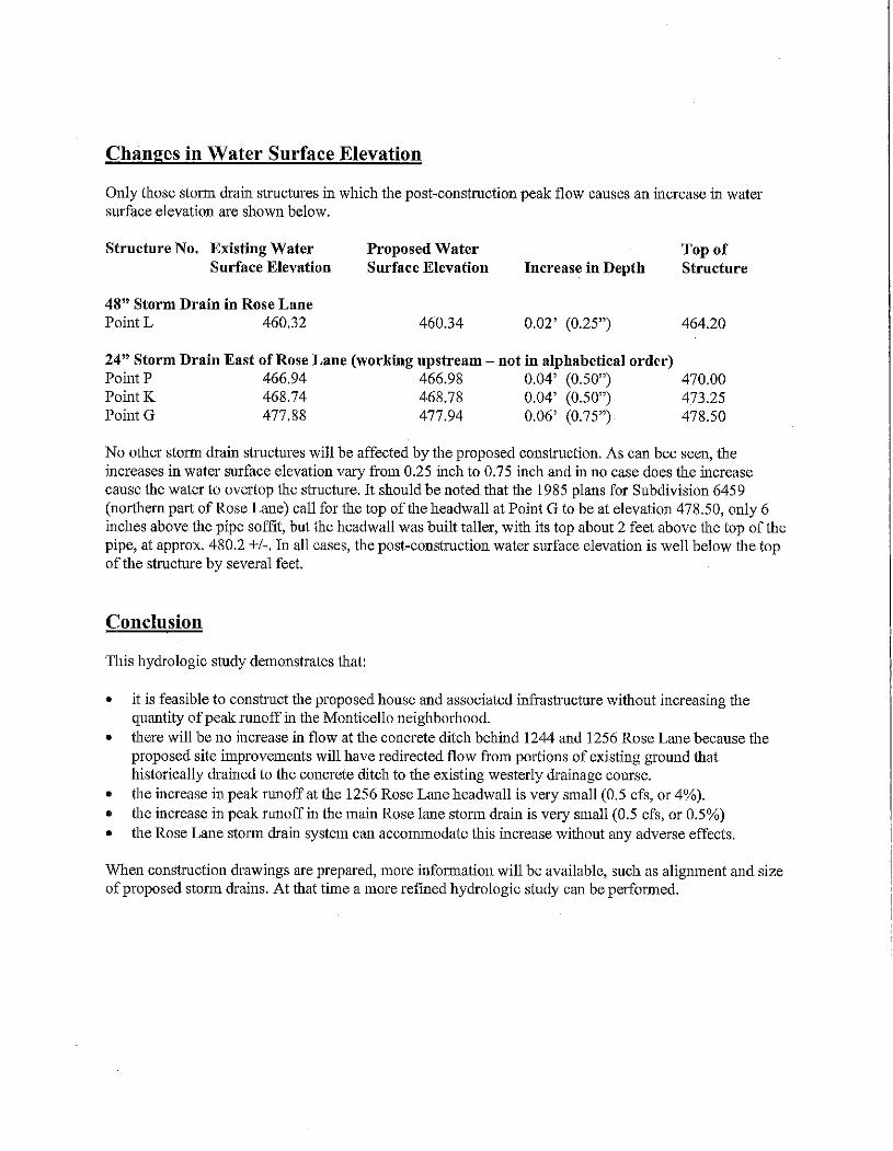
Changes in Water Surface Elevation
Only those stomi drain structures in which the post-construction peak f low causes an increase in water surface elevation are shown below.
Structure No. Existing Water Proposed Water Top of Surface Elevation Surface Elevation Increase in Depth Structure
48" Storm Drain in Rose Lane Point L 460.32 460.34 0.02' (0.25") 464.20
24" Storm Drain East of Rose Lane (working upstream - not in alphabetical order) PomtP 466.94 466.98 0.04' (0.50") 470.00
PomtIC 468.74 468.78 0.04' (0.50") 473.25
Point G 477.88 477.94 0.06' (0.75") 478.50
No other stonn drain stmctures w i l l be affected by the proposed construction. As can bee seen, the
increases in water surface elevation vary from 0.25 inch to 0.75 uich and in no case does the mcrease
cause the water to overtop the structure. I t should be noted that tlie 1985 plans for Subdivision 6459
(northern part o f Rose Lane) call for the top o f tlie headwall at Point G to be at elevation 478.50, only 6
inches above tlie pipe soffi t , but the headwall was buil t taller, w i t h its top about 2 feet above the top of the
pipe, at approx. 480.2 +/-. I n all cases, the post-construction water surface elevation is wel l below the top
o f t he stmcture by several feet.
Conclusion
This hydrologic study demonstrates that:
• i t is feasible to construct die proposed house and associated infrastmcture without increasing tlie
quantity o f peak runof f in tlie Monticello neighborhood.
• there w i l l be no increase in f low at tlie concrete ditch behind 1244 and 1256 Rose Lane because the
proposed site improvements w i l l have redirected f l o w from portions o f existing ground tliat
historically drained to tlie concrete ditch to the existing westerly drainage course.
• the increase i n peak runoff at tlie 1256 Rose Lane headwall is very small (0.5 cfs, or 4%).
• the increase in peak m n o f f m tlie main Rose lane stonn dram is very small (0.5 cfs, or 0.5%)
• the Rose Lane storm di"ain system can accommodate this increase without any adverse effects.
When constmction drawings are prepared, more information w i l l be available, such as aligmnent and size
o f proposed stonn drains. A t tliat time a more refined hydrologic study can be performed.
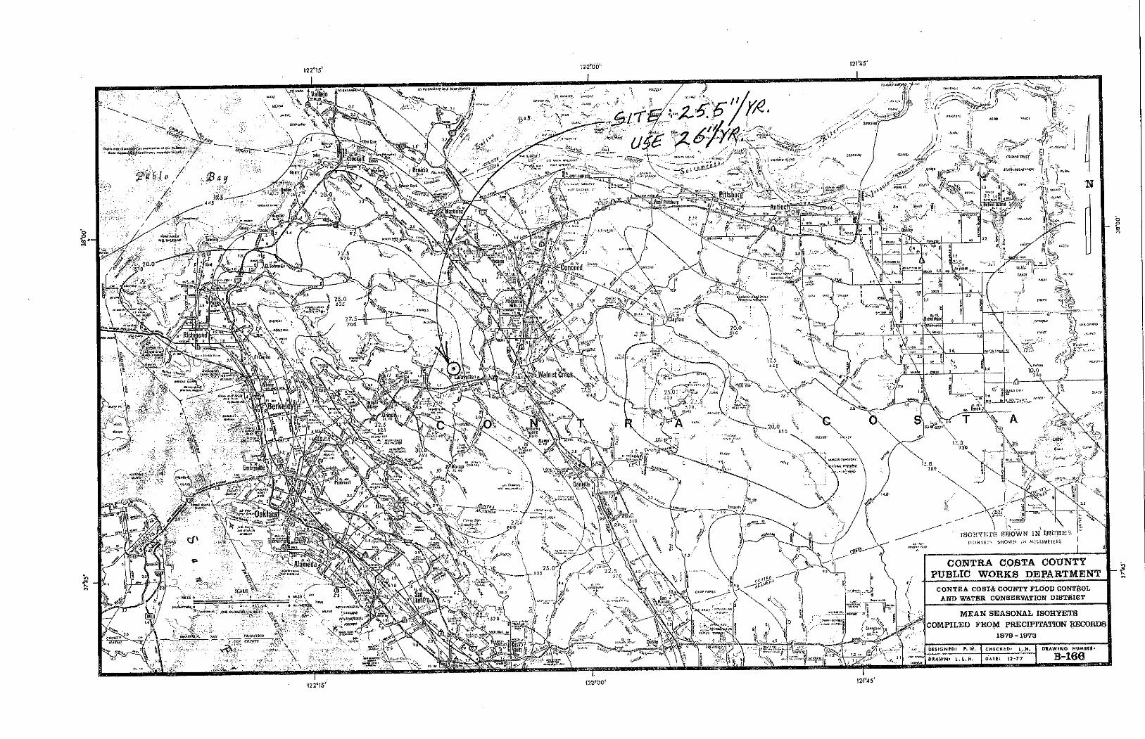
121*45'
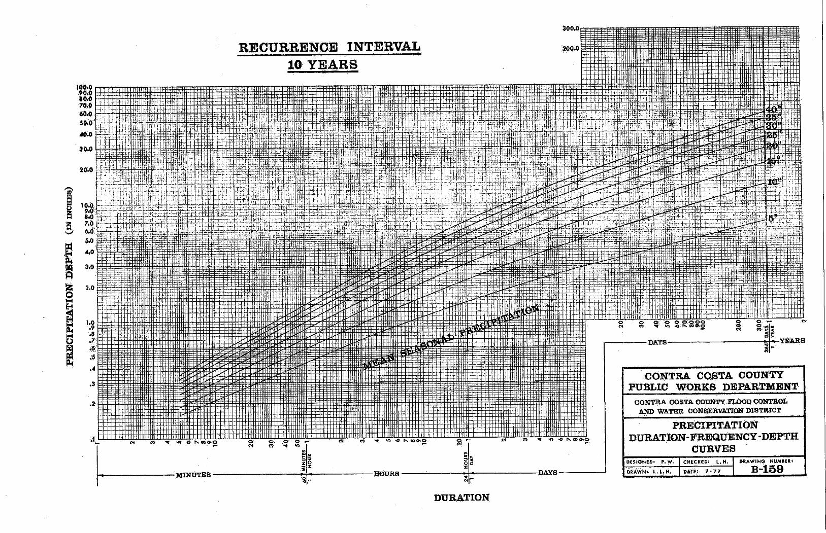
RBCUBRBNOE I N T E R m L
MiNtJTES
z . i
M o X
H0URS -DAYS
-YEARS
C O N T R A C O S H A C O U N T Y
P U B L I C W O R E S D E P A R S M E U t
CONTRA COSTA COtmTY FIibOD CONTROL AND WATER CONS^VATEON DISTRICT
P R E C I P I T A T I O H
D U B A T I O N - F R E Q U E N C Y - D E P T H
C t T R V E S
DESIGNED' P.W. CHECKED! t . H .
mm i - y
DRAWING NUMftERi
D U R A T I O N
f l M ^ C ^ / i ^ ^ ^ f / ^ A f l ^ M dpj^:
*
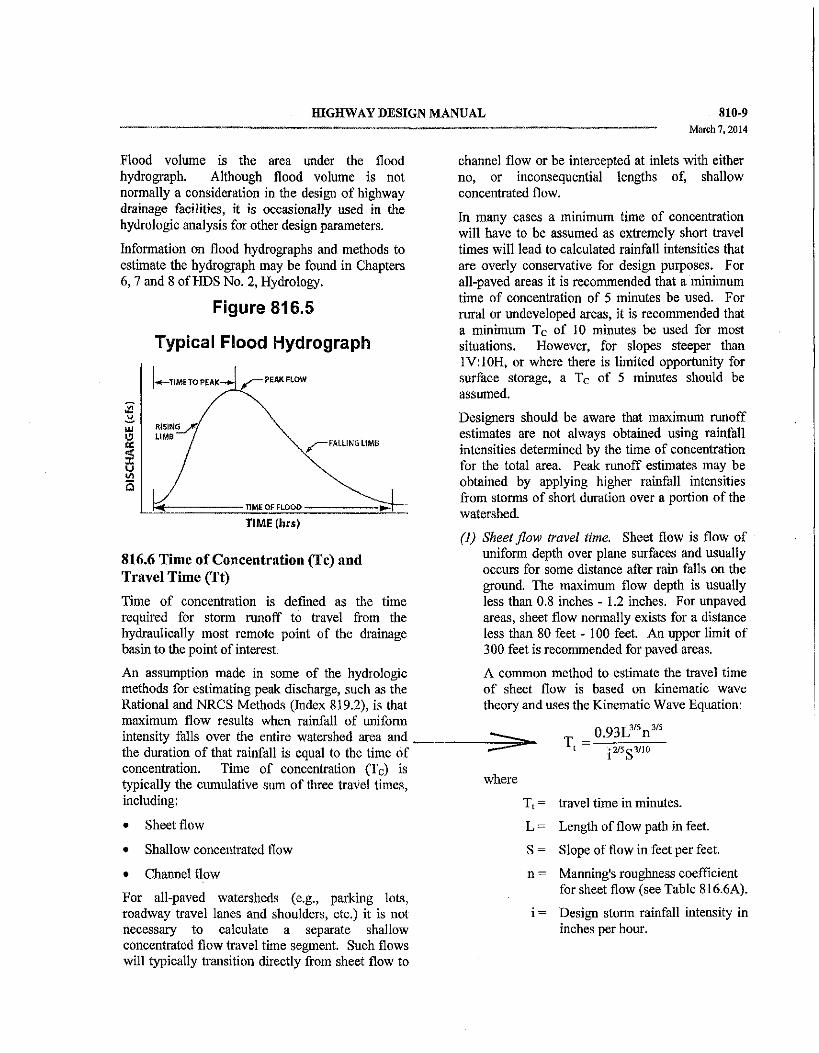
fflGHWAY DESIGN MANUAL
Flood volume is the area under the flood hydrograph. Although flood volume is not normally a consideration in the design o f highway drainage facilities, it is occasionally used in the hydrologic analysis for other design parameters.
Infonnation on flood hydrographs and methods to estimate the hydrograph may be found in Chapters 6,7 and 8 of HDS No. 2, Hydrology.
Figure 816.5
Typical Flood Hydrograph
TIME (hrs)
816.6 Time of Concentration (Tc) and Travel Time (Tt)
Time of concentration is defined as the time required for storm runoff to travel from the hydraulically most remote point of the drainage basin to tiie point of interest.
An assumption made in some of the hydrologic methods for estimating peak discharge, such as the Rational and NRCS Methods (hidex 819.2), is that maximum flow results when rainfall of unifonn intensity falls over the entire watershed area and the duration o f that rainfall is equal to the time of concentration. Time of concentration (Tc) is typically the cumulative sum of tliree travel times, including:
• Sheet flow
• Shallow concentrated flow
• Channel flow
For all-paved watersheds (e.g., parking lots, roadway travel lanes and shoulders, etc.) i t is not necessary to calculate a separate shallow concentrated flow travel time segment. Such flows wi l l typically transition directiy from sheet flow to
810-9
March?, 2014
channel flow or be intercepted at inlets with either no, or inconsequential lengths of, shallow concentrated flow.
h i many cases a minimum time of concentration w i l l have to be assumed as extremely short travel times w i l l lead to calculated rainfall intensities that are overly conservative for design purposes. For all-paved areas it is recommended that a minimum time of concentration of 5 minutes be used. For rural or undeveloped areas, it is recommended that a minimum Tc of 10 minutes be used for most situations. However, for slopes steeper than 1V:10H, or where there is limited opportunity for surface storage, a Tc of 5 minutes should be assumed.
Designers should be aware that maximum runoff estimates are not always obtained using rainfall
intensities determined by the time of concentration for the total area. Peak runoff estimates may be obtained by applying higher rainfall intensities from storms of short duration over a portion of the watershed.
(}) Sheet flow travel time. Sheet fiow is flow of uniform deptii over plane surfaces and usually occurs for some distance after rain falls on the ground. The maximum flow depth is usually less than 0.8 inches - 1.2 inches. For unpaved m eas, sheet flow normally exists for a distance less than 80 feet - 100 feet. An upper limit of 300 feet is recommended for paved areas.
A common method to estimate the travel time o f sheet flow is based on kinematic wave theory and uses the Kinematic Wave Equation:
where
Tt ^ travel time in minutes.
L = Length of flow path in feet.
S ^ Slope of flow in feet per feet.
n = Manning's roughness coefficient for sheet flow (see Table 816.6A).
i = Design storm rainfall intensity in inches per hour.
HIGHWAY DESIGN MANUAL 810-11 March 7,2014
Figure 816.6
Velocities for Upland Method of Estimating Travel Time for Shallow Concentrated Flow
WATERCOURSE SLOPE IN PERCENT
Oi O O O
*
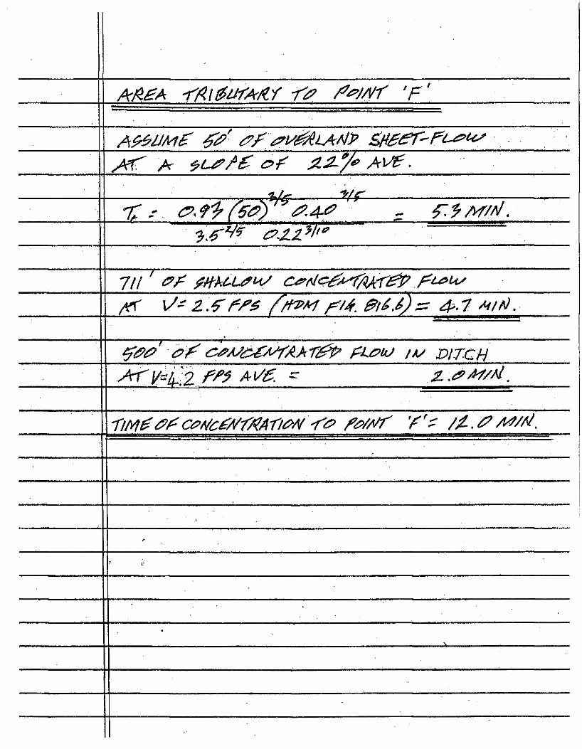
AJ^^A Y/^\0iirAjiY /^^j/vr 'F'
'hi" "^fr
-
^tPi?' (p/^ C^A/i>i:A^AAr^ fU?uj 1 Ay DITCH
' L-
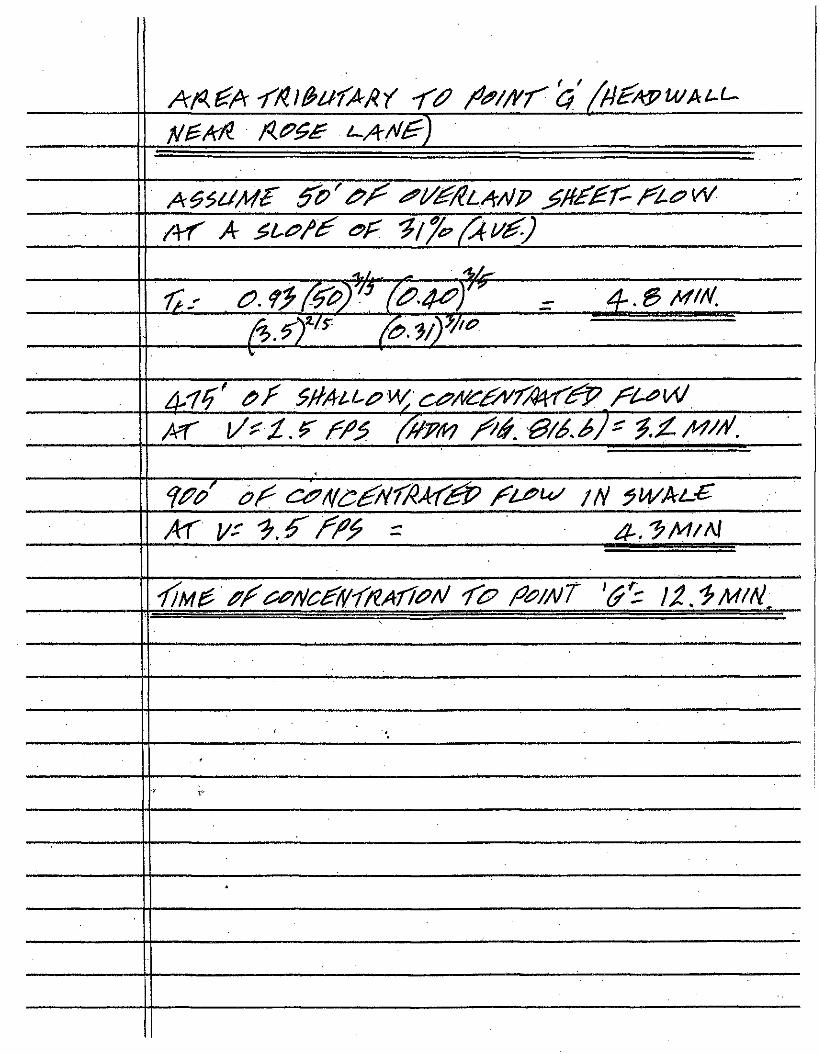
/\r A ^Lc/'A oA '^f/e^(C^uA.)
fi>Ar" r^vT^'"
4-'/f' <PA 0 A L L i P W ^ c^Ai^^fMfi^ A^^ AT i/^i.^ AP^ /Am //^. ^ / / . ^ ) ' ^.X M^A.
o/ <::^/^cANfAAC^ Ai^^ IH fWAt-^
/}M^A/iP^Nc^6/AnAri^/^ A^ A^/AT '^S iz.fMAi
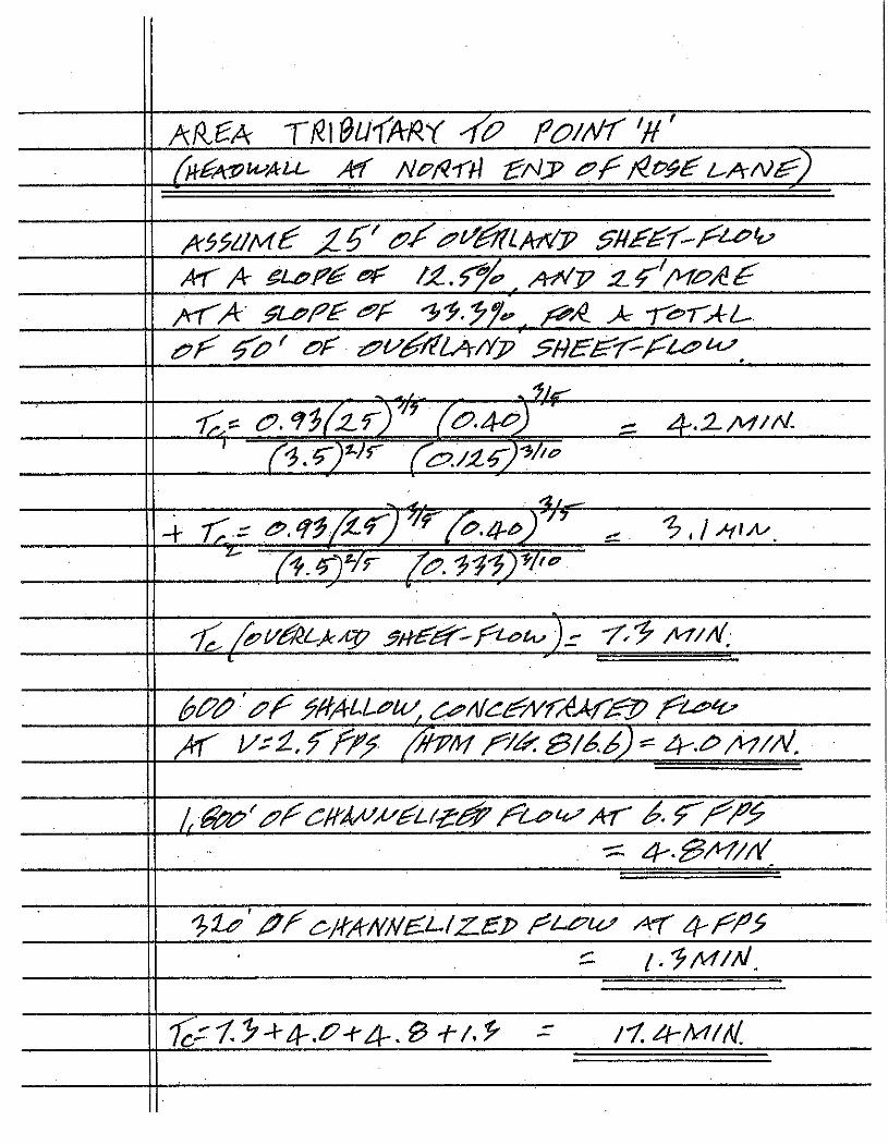
AH^A rR\^Ul'ARr YA f^o/AA'H' f^At^^ALL. Aef A^/^Kri tAj> f^p^A L^A^VA)
A(99i/M^ ^/^f^^LAAT ^MAAA-A^^ AT A ^LiPfi'A e<F _ AAT 2.^'AI'^AA
jvAA ^U'Af^F ^i'.y/^ _ A^A A -r^TAU
i^A AA^ AF Z 2 5 ' ^ ^ M ^ / X > ' Af^BA-A/i^^,
Ai /e^l/AlLAA^ mA^^A^t^^)^ A-'^ AT/A,
^AA 0Al-L^u/, d:^AdiA^AAAA^ / ^ 4 t -/ A i / - ^ . f /AP/II A>^A. ^ A--^A7/A.
1^^^' A CAA^A^Au^^ Ac^i^ AT AfA'AA : 4--0Ar/A_
"h^'^AC'AAAA^U:^ep A^u^ ^ AAA^
HYDROLOGY CALCULATIONS EXISTING CONDITION
LIMIT OF TRIBUTARY AREA
2s
si ^ 3 : fc Si
S
i
L U w» f** <
SCALE: 1 ' : 60'
DATE: 03JunH
DESIGNEE): BM
DRAWN: BM
FB
JOB No.: 420-10
SHEET:
1 OF 4
NOTE: CONTOURS OUTSIDE AREA OF AERIAL TOPOGRAPHIC SURVEY ARE DERIVED FROM CONTRA COSTA COUNTY'S G.I.S. WEBSITE
TRIBUTARY AREA 'C 1.44 Ac.
EBMUD RESERVOIR
TRIBUTARY AREA 1.27 Ac.
TRIBUTARY AREA 'K' 0.45 Ac.
200 400 600
TRIBUTARY AREA 'B' 2.86 Ac.
b Si
Si is
&3
i I
1
53
- J
— I S t E
L U 5
SCALE: r : 2O0' DATE:
DESIGNED:
DRAWN:
FB
JOB No.: 420-10
03J i inU
DM
BM
SHEET:
2 OF 4
R U N O F F C O E F F I C I E N T S - E X I S T I N G C O N D I T I O N
R U N O F F COEFFICIENTS FOR U N D E V E L O P E D AREAS A R E DERIVED F R O M T H E C A L T R A N S H I G H W A Y DESIGN M A N U A L ,
FIGURE 8 1 9 . 2 A , A N D A R E T H E S U M O F I N D I V I D U A L R U N O F F COEFFICIENTS BASED O N T H E F O L L O W I N G F O U R
CATEGORIES: RELIEF, I N F I L T R A T I O N , V E G E T A L C O V E R A N D SURFACE S T O R A G E
TRIBUTARY AREA AREA (Acres) NATURE OF SURFACE
A,F,G,H 0.00
0.00
1.00
IMPERVIOUS
LANDSCAPED/UNUSED
UNDEVELOPED
RELIEF 0.30
INFILTRATION 0.11
VEGETAL COVER 0.10
SURFACE STORAGE 0.10
RUNOFF COEFFICIENT FOR UNDEVELOPED
PORTION OF TRIBUTARY AREA
0.00
0.00
0.61
T O T A L A R E A : 1.00 COMPOSITE RUNOFF COEFFICIENT FOR
ENTIRE TRIBUTARY AREA: 0.61
TRIBUTARY AREA AREA (Acres) NATURE OF SURFACE C
B
0.41 IMPERVIOUS 0.98
B 0.00 LANDSCAPED/UNUSED 0.00
B 2.45 UNDEVELOPED
RELIEF 0.30
INFILTRATION 0.11
VEGETAL COVER 0.10
SURFACE STORAGE 0.10
RUNOFF COEFFICIENT FOR UNDEVELOPED Si 0.61
T O T A L A R E A : 2.86 COMPOSITE RUNOFF COEFFICIENT FOR 0.66
TRIBUTARY AREA AREA (Acres) NATURE OF SURFACE c
c 0.21 IMPERVIOUS 0.98
c 0.00 LANDSCAPED/UNUSED 0.00
c 1.23 UNDEVELOPED
RELIEF 0.30
INFILTRATION 0.11
VEGETAL COVER 0.10
SURFACE STORAGE 0.10
RUNOFF COEFFICIENT FOR UNDEVELOPED 0.61
T O T A L A R E A : 1.44 COMPOSITE RUNOFF COEFFICIENT FOR 0.66
TRIBUTARY AREA AREA (Acres) NATURE OF SURFACE C
J 0.30 IMPERVIOUS 0.98
J 0.23 LANDSCAPED/UNUSED 0.30 J 0.44 UNDEVELOPED
RELIEF 0.25
INFILTRATION 0.11
VEGETAL COVER 0.10
SURFACE STORAGE 0.10
RUNOFF COEFFICIENT FOR UNDEVELOPED 0.56
T O T A L A R E A : 0.97 COMPOSITE RUNOFF COEFFICIENT FOR 0.63
TRIBUTARY AREA AREA (Acres) NATURE OF SURFACE C
K 0.09 IMPERVIOUS 0.98
K 0.36 LANDSCAPED/UNUSED 0.45 K 0.00 UNDEVELOPED
RELIEF 0.00
INFILTRATION 0.00
VEGETAL COVER 0.00
SURFACE STORAGE 0.00
RUNOFF COEFFICIENT FOR UNDEVELOPED 0.00
T O T A L A R E A : 0.45 COMPOSITE RUNOFF COEFFICIENT FOR 0.56
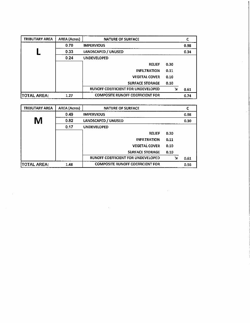
TRIBUTARY AREA AREA (Acres) NATURE OF SURFACE c
0.70 IMPERVIOUS 0.98
L 0.33 LANDSCAPED/UNUSED 0.34
0.24 UNDEVELOPED
RELIEF 0.30
INFILTRATION 0.11
VEGETAL COVER 0.10
SURFACE STORAGE 0.10
RUNOFF COEFFICIENT FOR UNDEVELOPED 0.61
T O T A L A R E A : 1.27 COMPOSITE RUNOFF COEFFICIENT FOR 0.74
TRIBUTARY AREA AREA (Acres) NATURE OF SURFACE c
0.49 IMPERVIOUS 0.98
M 0.82 LANDSCAPED/UNUSED 0.30
0.17 UNDEVELOPED
RELIEF 0.30
INFILTRATION 0.11
VEGETAL COVER 0.10
SURFACE STORAGE 0.10
RUNOFF COEFFICIENT FOR UNDEVELOPED 0.61
T O T A L A R E A : 1.48 COMPOSITE RUNOFF COEFFICIENT FOR 0.56
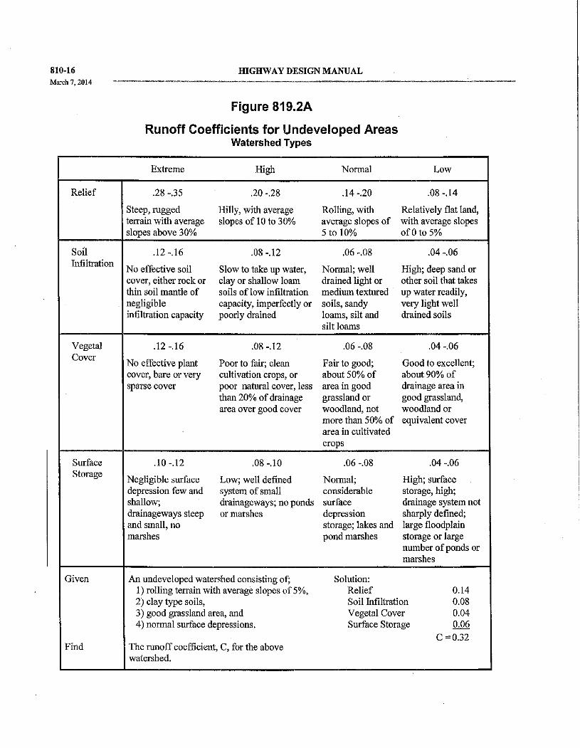
810-16
March 7,2014
HIGHWAY DESIGN MANUAL
Figure 819.2A
Runoff Coefficients for Undeveloped Areas W a t e r s h e d T y p e s
Extreme High Normal Low
Relief .28 -.35 .20 -.28 .14-.20 .08 -.14
Steep, rugged Hilly, with average Rolling, with Relatively flat land, terrain wi th average slopes of 10 to 30% average slopes of with average slopes slopes above 30% 5 to 10% o f O t o 5%
Soil .12-.16 .08 -.12 .06 -.08 .04 -.06 Infiltration
No effective soil Slow to take up water, Normal; well High; deep sand or cover, either rock or clay or shallow loam drained light or other soil that takes thin soil mantle of soils o f low infiltration medium textured up water readily, negligible capacity, imperfectly or soils, sandy very light well infiltration capacity poorly drained loams, silt and drained soils
silt loams
Vegetal .12-.16 .08 -.12 .06 -.08 .04 -.06
Cover No effective plant Poor to fair; clean Fair to good; Good to excellent;
cover, bare or very cultivation crops, or about 50% of about 90% of sparse cover poor natural cover, less area in good drainage area in
than 20% of drainage grassland or good grassland, area over good cover woodland, not woodland or
more than 50% of equivalent cover area in cultivated crops
Surface .10 -.12 .08 -.10 .06 -.08 .04 -.06
Storage Negligible surface Low; well defined Normal; High; surface depression few and system of small considerable storage, high; shallow; drainageways; no ponds surface drainage system not drainageways steep or marshes depression sharply defined; and small, no storage; lakes and large floodplain
marshes pond marshes storage or large number of ponds or marshes
Given A n undeveloped watershed consisting of; Solution: 1) rolling teitain with average slopes of 5%, Relief 0.14 2) clay type soils. Soil hifiltration 0.08 3) good grassland area, and Vegetal Cover 0.04 4) normal surface depressions. Surface Storage 0.06
C=0.32 Find The runoff coefficient, C, for the above
watershed.
fflGHWAY DESIGN MANUAL
Table 819.2B
Runoff Coefficients for Developed Areas
Type of Drainage Area Runoff
Coefficient
Business:
Downtown areas
Neighborhood areas
Residential:
Single-family areas
Multi-units, detached
Multi-units, attached
Suburban
Apartment dwelling areas
Industrial:
Light areas
Heavy areas
Parks, cemeteries:
Playgrounds:
Railroad yard areas:
Unimproved areas:
Lawns:
Sandy soil, flat, 2%
Sandy soil, average, 2-7%
Sandy soil, steep, 7%
Heavy soil, flat, 2%
Heavy soil, average, 2-7%
Heavy soil, steep, 7%
Streets:
Asphaltic
Concrete
Brick
Drives and walks
Roofs:
0.70 - 0.95
0.50 - 0.70
0.30 - 0.50
0.40 - 0.60
0.60 - 0.75
0.25 - 0.40
0.50 - 0.70
0.50 - 0.80
0.60 - 0.90
0.10-0.25
0.20 - 0.40
0.20 - 0.40
0.10-0.30
0.05-0.10
0;10-0.15
0.15-0.20
0.13-0.17
0.18-0.25
0.25 - 0.35
0.70 - 0.95
0.80 - 0.95
0.70 - 0.85
0.75 - 0.85
0.75 - 0.95
8 1 0 - 1 7
March?. 20] 4
use in California are given in Figure 819.2C and Table 819.7A. These equations are based on regional regression analysis of data from stream gauging stations. The equations in Figure 819.2C were derived from data gathered and analyzed through the mid-1970's, while the regions covered by Table 819.7A are reflective of a more recent (1994) study of the Southwestern U.S, which has been supplemented by a 2007 Study of California Desert Region Hydrology. Nomographs and complete information on use and development of this method may be found in "Magnitude and Frequency of Floods in California" published in June, 1977 by the U.S. Department ofthe Interior, Geological Survey.
The Regional Flood-Frequency equations are applicable only to sites witihin the flood-frequency regions for which they were derived and on streams with virtually natural flows. For example, the equations are not generally applicable to small basins on the floor o f the Sacramento and San Joaquin Valleys as the annual peak data which are the basis for the regression analysis were obtamed principally in the adjacent mountain and foothill areas. Likewise, the equations are not directly applicable to streams in urban areas affected substantially by urban development. In urban areas the equations may be used to estimate peak discharge values under natural conditions and then by use of the techniques described in the publication or HDS No. 2, adjust the discharge values to compensate for urbanization. Further limitations on the use of USGS Regional Flood-Frequency equations are:
LOCATION
SUBDIVISION 1
LINE
H Y D R O L O G Y C O i W P U T A T I O N S
OF LOCATION
SUBDIVISION 1
LINE
JO. - AVERAGE ANNUAL RAINFA
RECURRENCE INTERVAL
LL
10, BY
CDMMEh
DATE
OF LOCATION
SUBDIVISION 1
LINE
JO. AVERAGE ANNUAL RAINFA
RECURRENCE INTERVAL
LL
10, BY
CDMMEh ITS
DATE
r/^A\/
LOCATION
SUBDIVISION 1
LINE
AVERAGE ANNUAL RAINFA
RECURRENCE INTERVAL
TRiSUTARY AREA
A AREA (ACRES)
ZA-C Tc
(fnin.) 1
(in/hr) Q
.(cfs)
PIPE SIZE (in.)
COMMENTS TRiSUTARY
AREA C RUNOFF COEFFICIENT (DIMENSIONLESS) ZA-C Tc
(fnin.) 1
(in/hr) Q
.(cfs)
PIPE SIZE (in.)
COMMENTS TRiSUTARY
AREA A C PRODUCT OF AREA AND RUNOFF COEFFICIENT
ZA-C Tc
(fnin.) 1
(in/hr) Q
.(cfs)
PIPE SIZE (in.)
COMMENTS
A A
/.^ A C /.^ A A-C
/.^ A
C
A-C
A A^A.e>Ai C Ak
A-C
o A
o c o A-C
A
^.^ C ^.^ A-C
^.^
A
C
A-C
TIME OF CONCENTRATION
TRIBUTARY AREA
OVERLAND (SHEET) FLOW SHALLOW CHANNELIZED
FLOW CONCENTRATED FLOW
ROOF TO GUTTER
GUTTER FLOW PIPE FLOW Tc TRIBUTARY AREA
FT. VEL. RAIN. FT. VEL. MIN. FT. VEL. MIN. ZONED MIN. FT. VEL. MIN. FT. VEL. MIN. Tc I T c
A tr
A - ^ • B\C> ^ - . • ^
+- ^. /
LOCATION
SUBDIVISION
L I N E
H Y D R O L O G Y C O M P U T A T I O N S
A^P^^ /^Ar^B , SHEET OF LOCATION
SUBDIVISION
L I N E
MO. AVERAGE ANNUAL RAINFA
RECURRENCE INTERVAL
LLL BY
COMMEf
DATE
LOCATION
SUBDIVISION
L I N E
MO. AVERAGE ANNUAL RAINFA
RECURRENCE INTERVAL
LLL
m. BY
COMMEf JTS
DATE
LOCATION
SUBDIVISION
L I N E
AVERAGE ANNUAL RAINFA
RECURRENCE INTERVAL
TRIBUTARY AREA
A AREA (ACRES)
£A'C To
(min.) 1
(in/hr) Q
PIPE SIZE (In.)
COMMENTS TRIBUTARY
AREA C RUNOFF COEFFICIENT (DIMENStONLESS) £A'C
To (min.)
1 (in/hr)
Q PIPE SIZE (In.)
COMMENTS TRIBUTARY
AREA A C PRODUCT OF AREA AND RUNOFF COEFFICIENT
£A'C To
(min.) 1
(in/hr) Q
PIPE SIZE (In.)
COMMENTS
H A -
11.4-H C 11.4-H A-C
11.4-
1 A
1 C 1 A-C
A
C
A-C
A
1.31 lis ^yC. C M / 1.31 lis ^yC.
A-C
1.31 lis ^yC.
M A
M C M A C
A
C
A C
TIME OF CONCENTRATION
TRIBUTARY AREA
OVERLAND (SHEET) FLOW SHALLOW CHANNELIZED
FLOW CONCENTRATED FLOW
ROOF TO GUTTER
GUTTER FLOW PIPE FLOW Tc TRIBUTARY AREA
FT, VEL. MIN. FT. V E L . MIN. FT. VEL. MIN. ZONED MIN. FT, VEL. MIN. FT. V E L . MIN. Tc ZTc
H fA IS /.<=' i>.i
/^^
LOCATION
SUBDIVISION NO. ^ ^ ^ ^
LINE
H Y D R O L O G Y C O M P U T A T I O N S
AVERAGE ANNUAL RAINFALL
RECURRENCE INTERVAL f A ^ / / ^ ,
BY
COMMENTS
SHEET
DATE
TRIBUTARY AREA
A AREA (ACRES)
E A C Tc
(mIn.) 1
(in/hr) Q
(cfs)
PIPE SIZE (in.)
COMMENTS TRIBUTARY
AREA C RUNOFF .COEFFICIENT (DIMENSIONLESS) E A C Tc
(mIn.) 1
(in/hr) Q
(cfs)
PIPE SIZE (in.)
COMMENTS TRIBUTARY
AREA A C PRODUCT OF AREA AND RUNOFF COEFFICIENT
E A C Tc
(mIn.) 1
(in/hr) Q
(cfs)
PIPE SIZE (in.)
COMMENTS
X L A -
A3A^ X L C M A3A^ X L A C ^^^^
A3A^ A
C
A-C
A
C
A C
A
C
A-C
A
C
A C
A
C
A-C
TIME OF CONCENTRATION
TRISUTARY AREA
OVERLAND (SHEET) FLOW SHALLOW CHANNELIZED
FLOW CONCENTRATED FLOW
ROOF TO GUTTER
GUTTER FLOW PIPE FLOW Tc
FT. VEL. MIN. FT. VEL. MIN. FT. VEL. MIN. ZONED MIN. FT. VEL. MIN. FT. VEL. MIN. Tc E T c
X I 7 h o
LOCATION
SUBDIVISION
LINE
H Y D R O L O G Y C O M P U T A T I O N S
OF LOCATION
SUBDIVISION
LINE
JO. AVERAGE ANNUAL RAINFA
RECURRENCE INTERVAL
L L BY
COMME^
0 M DATE
OF LOCATION
SUBDIVISION
LINE
JO. AVERAGE ANNUAL RAINFA
RECURRENCE INTERVAL
L L
rM. BY
COMME^ ITS
DATE
LOCATION
SUBDIVISION
LINE
AVERAGE ANNUAL RAINFA
RECURRENCE INTERVAL
TRIBUTARY AREA
A AREA (ACRES)
E A C Tc
(min.} I
(in/hr) Q
(cfe)
PIPE SIZE (in.)
COMMENTS TRIBUTARY
AREA C RUNOFF COEFFICIENT (DIMENSIONLESS) E A C
Tc (min.}
I (in/hr)
Q (cfe)
PIPE SIZE (in.)
COMMENTS TRIBUTARY
AREA A-C PRODUCT OF AREA AND RUNOFF COEFFICIENT
E A C Tc
(min.} I
(in/hr) Q
(cfe)
PIPE SIZE (in.)
COMMENTS
A
U.7 24 C U.7 24 A-C
U.7 24
K A
K C K A-C
> K
A
> K C €^ K > K
A C
A
C
A-C
A
C
A-C
A
C ^ .^ / A-C
TIME OF CONCENTRATION
TRIBUTARY AREA
OVERLAND (SHEET) FLOW SHALLOW CHANNELIZED
FLOW CONCENTRATED FLOW
ROOF TO GUTTER
GUTTER FLOW PIPE FLOW Tc TRIBUTARY AREA
FT. VEL. MIN. FT. VEL. MIN. FT. VEL. MIN. ZONED MIN. FT. VEL. MIN. FT. VEL. MIN. Tc ETC
<^
X.K <=>•/
f 7fO 4- .7 4-±
HYDRAULICS COMPUTATIONS SHEET OF
LocAWN fKo$E / k ) ( / ^ f / m CA^^Vlfl^N) SUBDIVISION NO. ^^^f LINE ^y<, W TYPE Ol^f N-VALUE 0^^l€'
STRUCTURE NUMBER
INVERT
D/S
pipe: ATTRIBUTES FLO^ ATTRIBUTES LOSS y^ COEFFyA
HEAD / LOSS
CONTROL ELEV. STRUCTURE NUMBER
INVERT
D/S PIPE SIZE
y^ PIPE y^ LENGTH
Q (CFS)
Hv (FT.)
HGL D/S OF STRUCTURE
LOSS y^ COEFFyA
HEAD / LOSS
HGL IN STRUCT.
H
PIPE SIZE
y^ PIPE y^ LENGTH
Q (CFS) V (EPS)
Hv (FT.)
HGL D/S OF STRUCTURE
H
L ^ ric liM-iP
L d^"y^ d^"y^
y^^l.-fp 4 - 7 1 . 1 - ^
a y^^l.-fp 4 - 7 1 . 1 - ^
) Ar-a
OSI ) Ar-
R
OSI
R
H
*LENGT NOT c o r IS CONS
!
H ANDSTATIO^ ^iSISTENT PROP ERVATIVE AND
\ THEY ARE )N THIS SHEET
H
*LENGT NOT c o r IS CONS
!
H ANDSTATIO^ ^iSISTENT PROP ERVATIVE AND
ING SHOWN 01 ^ SHEET TO SH iS AS CONFiR^
^ PLANS FO EETAND FF 1ED BY CUR
R SUBD. 64J ^OM PLAN V RENT MEAS
59, DATED 10-31 IEW TO PROFIL UREMENT OF 1
-85, AF EViEV MPRO\
^E CONTF^ADICTOR^ 4. LENGTH SHOWN C /EMENTS.
\ THEY ARE )N THIS SHEET
LOCAWN A^^^ i^ArNe /^^)if^r/M/^ c^//j>fr/^A/)
SUBDMS/ON NQ.^lh^^__
LiNE^y. TYPEA^I^Mcf N-VALUE
SHEET
DATE
BY
OF
STRUCTURE NUMBER
INVERT u / s y
D/S
r A- y^P^
K
PPE ATTRIBUTES PIPE SIZE
PIPE LENGTH
0 110
FLOW ATTRIBUTES
Q (CFS)
11.7
V (FPS) Hv
(FT,) HGL
D/S OF STRUCTURE
/^16.^0
LOSS COEFF.
HEAD LOSS
CONTROL ELEV. HGL
IN STRUCT
/ f x
* SLOPES SHOWN ON PLANS FOR SUBD. 6459, DATED 10-31-85, ARE INCORRECT. THEY DO NOT CONFORM TO CALCULATED SLOPES BASED ON STATIONING AND INVERT ELEVATIONS. SINCE PIPE CONSTRUCTION IS BASED ON STATIONING AND INVERT ELEVATION (AND NOT ON GIVEN SLOPE), IT IS ASSUMED THAT THE CALCULATED SLOPE IS CORRECT AND THIS iS THE SLOPE SHOWN ON THIS SHEET.
m
i Ull
I
^84
- f t
-« h54
I
I
ST
- I B
s
« m
•ft U Itfl
1 0
- 1 .0
f B #ii ,*t% 3 i( III m^n'i'
p i , - w.
h8.
- 9 . -
H , 9
r k4.
,3,0
HEADWATER DEPTiH F » QQUCmm PIPE GULVEHTS
^l:TH INLET OONiT^OL
From Point 'N' to Point 1 ' Worksheet for Circular Channel
Project Descript ion
Project File
Worksheet
Flow Element
Method
Solve For
c:\haestacl\fmw\wight.fm2
Outfal l Pipe
Circular Channel
Manning 's Formula
Channel Depth
Input Data
Mannings Coeff icient 0.015
Channel Slope 0.073900 ft/ft
Diameter 48.00 in
Discharge 106.00 cfs
Results
Depth 1.54 f t
Fiow Area 4.45 ft^
Wet ted Perimeter 5.35 ft
Top Width 3.89 ft
Critical Depth 3.12 ft
Percent Full 38.44
Critical Slope 0.008012 : ft/ft
Velocity 23.82 ft/s
Velocity Head 8.82 ft
Specif ic Energy 10.35 ft
Froude Number 3.93
Max imum Discharge 364.02 cfs
Full Flow Capaci ty 338.40 cfs
Full Flow Slope 0.007251 ft/ft
Flow is supercrit ical.
06/09/14 10:00:57 AM Haestad Methods, Inc. 37 Brookside Road Waterbury, C T 06708 (203) 755-1666
FlowMaster v5,13 Page 1 of 1

From Point 'L' to Point 'J '
Worksheet for Circular Channel
Project Descript ion
Project File
Worksl^eet
Flow Element
Method
Solve For
c;\haestad\fmw\wight.fm2
Outfal l Pipe
Circular Channel
Manning's Formula
Channel Depth
Input Data
Mannings Coeff icient 0.015
Channel Slope 0.053000 ft/ft
Diameter 48.00 in
Discharge 92.50 cfs
Results
Depth 1.56 ft Flow Area 4.55 ft2
Wet ted Perimeter 5.40 ft
Top Width 3.90 ft
Critical Depth 2.92 ft
Percent Full 39.07
Critical Slope 0.007106 ft/ft
Velocity 20.34 ft/s
Velocity Head 6.43 ft Specif ic Energy 7.99 ft
Froude Number 3.32
Max imum Discharge 308.28 cfs
Full Flow Capaci ty 286.58 cfs
Full Flow Slope 0.005521 ft/ft
Flow is supercri t ical.
•6/05/14 04:09:00 PM Haestad Methods, Inc. 37 Brookside Road Waterbury, C T 0670S (203) 755-1666
FlowMaster v5.13 Page 1 of 1
From Point 'J' to Point 'Q' Worl<sheet for Circular Channel
Project Descript ion
Project File c:\haestad\fmw\wight.frn2
Worksheet Outfall Pipe
Flow Element Circular Channel
Method Manning's Formula
Solve For Channel Depth
Input Data
Mannings Coeff ic ient 0.015
Channel Slope 0.048500.ft/ft
Diameter 48.00 in
Discharge 90.90 cfs
Results
Depth 1.59 ft
F iow Area 4.64 ft^
Wet ted Perimeter 5.45 ft
Top Width 3.91 ft
Crit ical Depth 2.89 ft
Percent Full 39.65
Crit ical S lope 0.007011 ft/ft
Veloci ty 19.60 ft/s
Veloci ty Head 5.97 ft
Speci f ic Energy 7.55 ft
Froude Number 3.17
Max imum Discharge 294.90 cfs
Full F low Capaci ty 274.15 cfs
Full F low Slope 0.005332 ft/ft
F low is supercri t ical.
06/05/14 04:13:45 PM Haestad Mettiods, Inc. 37 Brookside Road Waterbury, C T 06708 (203) 755-1666
FlowMaster v5.13 Page 1 of 1
From Point ' L ' to Point 'P' Worksheet for Circular Channel
Project Descript ion
Project File c: \haestad\fmw\wight. fm2
Worksheet Outfal l Pipe
Flow Eiement Circuiar Channel
Method Manning's Formula
Solve For Channel Depth
Input Data
Mannings Coefficient 0.013
Channel Slope 0.071800 ft/ft
Diameter 24.00 in
Discharge 12.10 cfs
Results
Depth 0.61 ft
Flow Area 0.80 ft^
Wet ted Perimeter 2.33 ft
Top Width 1.84 ft
Crit ical Depth 1.25 ft
Percent Fuii 30.30
Crit ical Slope 0.005606 ft/ft
Velocity 15.06 ft/s
Velocity Head 3.52 ft
Specif ic Energy 4.13 ft
Froude Number 4.01
Max imum Discharge 65.20 cfs
Full R o w Capacity 60.61 cfs
Full Flow Slope 0.002861 ft/ft
F low is supercri t ical.
Oe/09/14 11:02:09 AM Haestad Methods, inc. 37 Brookside Road Waterbury, C T 06708 (203) 755-1666
FlowMaster V5.13 Page 1 of 1
From Point 'P' to Point 'K'
Worksheet for Circular Channel
Project Descript ion
Project Fiie c : \haestad\ fmw\wight im2
Worksheet Outfal l Pipe
Flow Element Circular Channel
Method Manning's Formula
Solve For Channel Depth
Input Data
Mannings Coeff ic ient 0.013
Channel Slope 0.012200 ft/ft
Diameter 24.00 in
Discharge 12.10 cfs
Results
Depth 0.98 ft
Flow Area 1.53
Wet ted Perimeter 3.10 ft
Top Width 2.00 ft -
Critical Depth 1.25 ft
Percent Full 49.07
Critical Slope 0.005605 ft/ft
Velocity 7.89 ft/s
Velocity Head 0.97 ft
Specific Energy 1.95 ft
Froude Number 1.59
Max imum Discharge 26.88 cfs
Full Flow Capacity 24.99 cfs
Full Flow Slope 0.002861 ft/ft
Flow is supercrit ical.
06/09/14 11:00:29 AM Haestad Methods, Inc. 37 Brookside Road Waterbury, C T 06708 (203) 755-1666
FlowMaster v5.13 Page 1 of 1
From Point 'K' to Point 'G' Worksheet for Circular Channel
Project Descript ion
Project File c:\haestad\fmw\wight. fm2
Worksheet Outfal l Pipe
Flow Element Circular Channel
Method Manning's Formula
Solve For Channel Depth
Input Data
Mannings Coeff icient 0.013
Channel Slope 0.141500 ft/ft
Diameter 24.00 in
Discharge 11.70 cfs
Results
Depth 0.50 ft
F low Area 0.62 ft^
Wet ted Perimeter 2.10 ft
T o p Width 1.73 ft
Crit ical Depth 1.23 ft
Percent Full 25.05
Crit ical Slope 0.005522 ft/ft
Velocity 19.00 ft/s
Velocity Head 5.61 ft
Specif ic Energy 6.11 ft
Froude Number 5.62
Max imum Discharge 91.53 cfs
Full Flow Capacity 85.09 cfs
Full Flow Slope 0.002675 ft/ft
F iow is supercrit ical.
06/09/14 10:59:06 AM Haestad Methods, inc. 37 Brookside Road Waterbury. C T 06708 (203) 755-1666
FlowMaster v5.13 Page 1 of 1
HYDROLOGY CALCULATIONS PROPOSED CONDITION
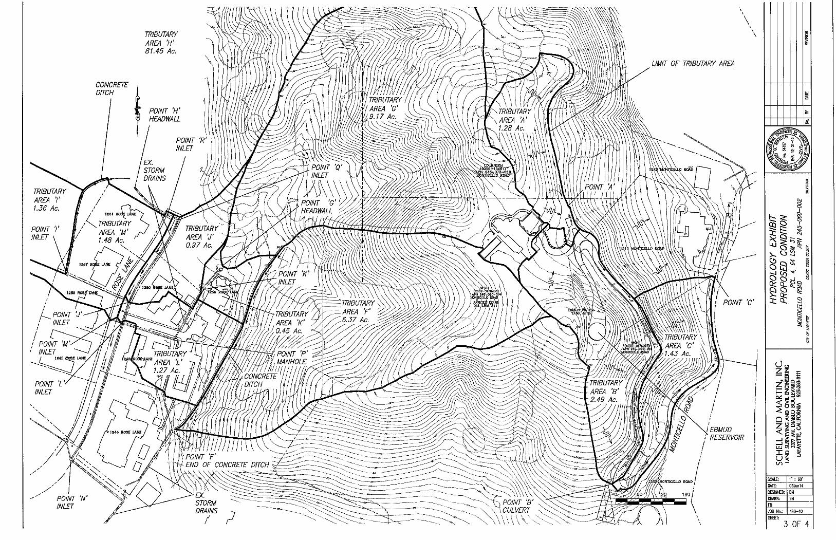
TRIBUTARY AREA r 1.56 Ac.
CONCRETE DITCH
TRIBUTARY AREA 'H' 81.45 Ac.
POINT 'N' INLET
LIMIT or TRIBUTARY AREA
I
i
(Jo
s ^ ^
—I gt^ n — 1 D m C U J i / i i f
SCAl£: 1" : 60'
DATE 03Jun14
DESIGNED: BM
DRAWN: BM
FB
JOB No.: 420-10
SHEET:
3 OF 4
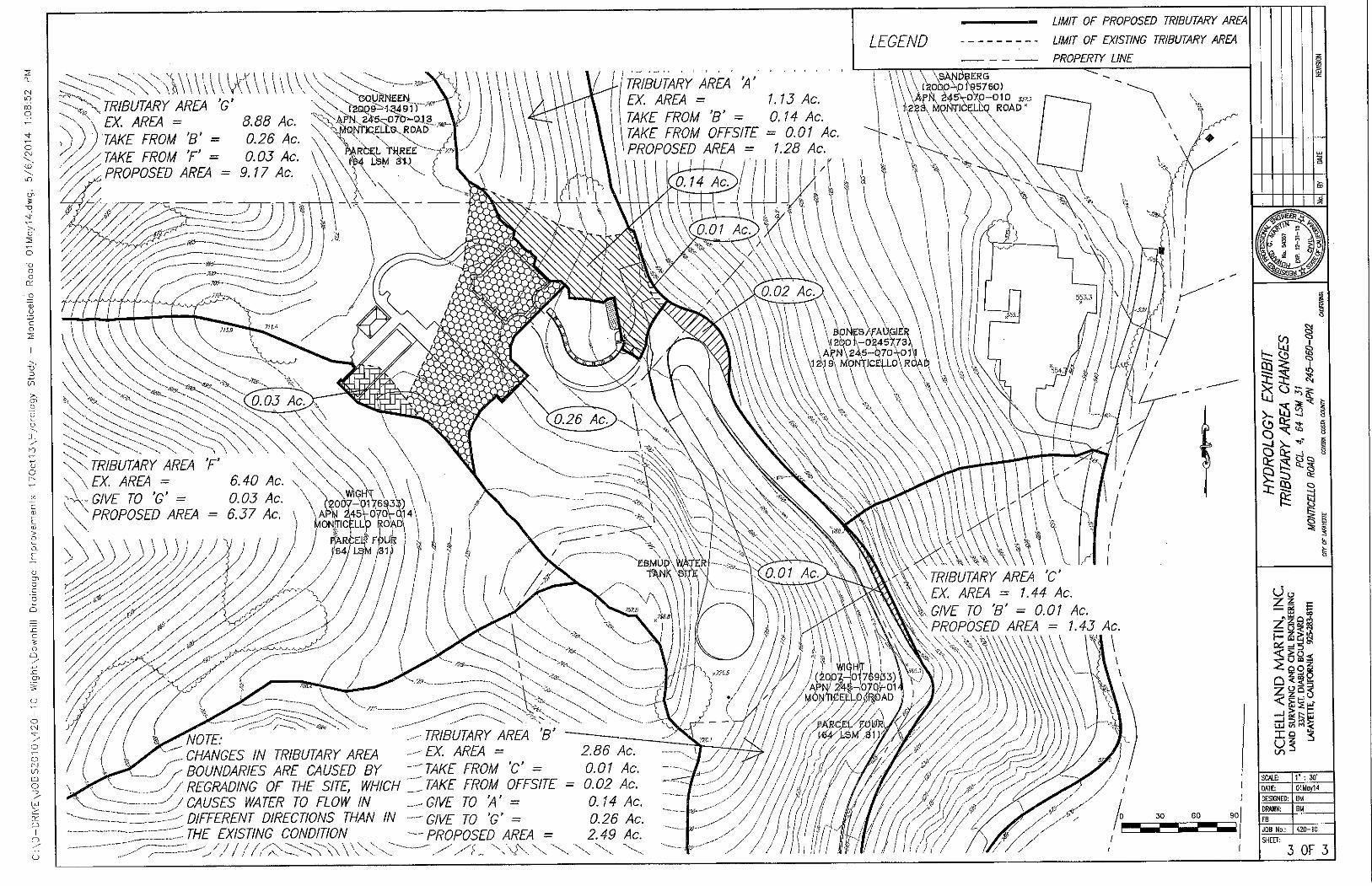
• v \ EX. AREA = ' > I TAKE EROM 'B' =
^^'y// TAKE FROM T = 0.26 Ac. \ \ V \ \ \ .
Ac.
''^^^-^JRiBUTARY AREA 'G' -<>:-i^^,r^[ j
\ \ \ \
LEGEND
LIMIT OF PROPOSED TRIBUTARY AREA
LIMIT OF EXISTING TRIBUTARY AREA
PROPERTY LINE
0.05 AC. \ \ \ E 4 l ^ u ' ^ i
PROPOSED AREA = 9,17 Ac. A \ \ r \ ' ^ T
{TRIBUTARY AREA 'A'
EX. AREA = 1.15 Ac.
TAKE EROM 'B' = 014 Ac
\tAKE FROM OFFSITE = 0 0 1 Ac.
\ PROPOSED AREA = 1.28 Ac.
0.14 A c . '
\
\ \ \ \ \sANr*BERG \ \\\\,[XOQO\01W50)
\\\ApkM5\:07.p-O]0 ,-i...T
* \ i\2S3x MONTlCELbg ROAD ^
. . . . . X \
\
— m - -
' HS.D
'^sTRIBUTARY AREA 'E' \ \ \ E X AREA = 6.40 Ac. \
-vv G/l E TO 'G' = 0.05 Ac. ^ hom-^m^) . \ ^ PROPOSED AREA = 6.57 Ac \ \AP\ d45Vo7tfrai4\
4 ^ 0.02 4 c J , \ \
\ \ \ \
\
\\\ ^ ^
X
\ \ \ \A N\24,5-07O\O1 J \ > \ \ MONTJCEi,L0\R0Ai
55m
\\\\v\\ X. .
•'^A-'-yAy/V///./ A / / / / /
,RCE0 F0L4 I i
y y yyy^y y-
y yy^—
\ E a M D o x w A r
y ./
JA7.t>
A
v. • • -^ ' -^ „
• /
\ V.
TRIBUTARY AREA 'C'
^ ^ ^ ^ ^
, Ay/J
/ / / \
y"
\y^OTE: .-'TRIBUTARY AREA 'B' CHANGES IN TRIBUTARY AREA - X- Af^£^A = 2.86 Ac
y-BOUNDARIES ARE CAUSED BY ^^TAKE FROM 'C = 0.01 Ac y REGRADING OF THE SITE, WHICH Z^TAKE FROM OFFSITE = 0.02 Ac •''/CAUSES WATER TO FLOW IN .^.^GIVE TO 'A' = 0 14 Ac y-DIFFERENT DIRECTIONS THAN IN -GIVE TO 'G' = 0 26 Ac y-THE EXISTING CONDITION -PROPOSED AREA = 2.49 Ac =:~-y///yyyy;:yyyy -yyf^, y\y.w \ \ \
/
'^/i / i / / / y y y / y y y / / III r M y y 30 60 90
—I 15 n >. UJ </i <
SHEET;
3 OF 3
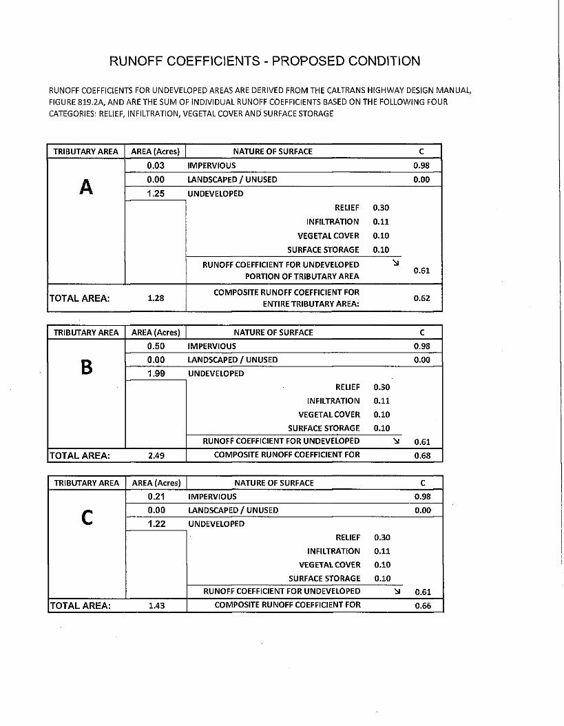
R U N O F F C O E F F I C I E N T S - P R O P O S E D CONDITION
R U N O F F COEFFICIENTS FOR U N D E V E L O P E D AREAS ARE DERIVED F R O M T H E C A L T R A N S H I G H W A Y DESIGN M A N U A L ,
F IGURE 8 1 9 . 2 A , A N D A R E T H E S U M O F I N D I V I D U A L R U N O F F COEFFICIENTS BASED O N T H E F O L L O W I N G F O U R
CATEGORIES: RELIEF, I N F I L T R A T I O N , V E G E T A L COVER A N D SURFACE S T O R A G E
TRIBUTARY AREA AREA (Acres) NATURE OF SURFACE C
0.03 IMPERVIOUS 0.98
A 0.00 LANDSCAPED/UNUSED 0.00
A 1.25 UNDEVELOPED
RELIEF 0.30
INFILTRATION 0.11
VEGETAL COVER 0.10
SURFACE STORAGE 0.10
RUNOFF COEFFICIENT FOR UNDEVELOPED
PORTION OF TRIBUTARY AREA 0.61
T O T A L A R E A : 1.28 COMPOSITE RUNOFF COEFFICIENT FOR
ENTIRE TRIBUTARY AREA: 0.62
TRIBUTARY AREA AREA (Acres) NATURE OF SURFACE C
B
0.50 IMPERVIOUS 0.98
B 0.00 LANDSCAPED/UNUSED 0.00
B 1.99 UNDEVELOPED
RELIEF 0.30
INFILTRATION 0.11
VEGETAL COVER 0.10
SURFACE STORAGE 0.10
RUNOFF COEFFICIENT FOR UNDEVELOPED 0.61
T O T A L A R E A : 2.49 COMPOSITE RUNOFF COEFFICIENT FOR 0.68
TRIBUTARY AREA AREA (Acres) NATURE OF SURFACE c
c 0.21 IMPERVIOUS 0.98
c 0.00 LANDSCAPED/UNUSED 0.00 c 1.22 UNDEVELOPED
RELIEF 0.30
INFILTRATION 0.11
VEGETAL COVER 0.10
SURFACE STORAGE 0.10
RUNOFF COEFFICIENT FOR UNDEVELOPED •:si 0.61
T O T A L A R E A : 1.43 COMPOSITE RUNOFF COEFFICIENT FOR 0.66

TRIBUTARY AREA AREA (Acres) NATURE OF SURFACE C
F 0.00 IMPERVIOUS 0.00
F 0.00 LANDSCAPED/UNUSED 0.00
F 6.37 UNDEVELOPED
RELIEF 0.30
INFILTRATION 0.11
VEGETAL COVER 0.10
SURFACE STORAGE 0.10
RUNOFF COEFFICIENT FOR UNDEVELOPED 0.61
T O T A L A R E A : 6.37 COMPOSITE RUNOFF COEFFICIENT FOR 0.61
TRIBUTARY AREA AREA (Acres) NATURE OF SURFACE c
G 0.27 IMPERVIOUS 0.98
G 0.00 LANDSCAPED/UNUSED 0.00
G 8.90 UNDEVELOPED
RELIEF 0.30
INFILTRATION 0.11
VEGETAL COVER 0.10
SURFACE STORAGE 0.10
RUNOFF COEFFICIENT FOR UNDEVELOPED 0.61
T O T A L A R E A : 9.17 COMPOSITE RUNOFF COEFFICIENT FOR 0.62
TRIBUTARY AREA AREA (Acres) NATURE OF SURFACE c
H 0.00 IMPERVIOUS 0.00
H 0.00 LANDSCAPED / UNUSED 0.00
H 81.45 UNDEVELOPED
RELIEF 0.30
INFILTRATION 0.11
VEGETAL COVER 0.10
SURFACE STORAGE 0.10
RUNOFF COEFFICIENT FOR UNDEVELOPED 0.61
T O T A L A R E A : 81.45 COMPOSITE RUNOFF COEFFICIENT FOR 0.61
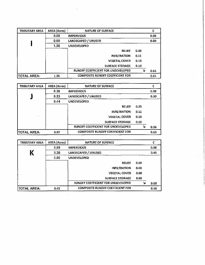
TRIBUTARY AREA AREA (Acres) NATURE OF SURFACE c
1 0.00 IMPERVIOUS 0.00
1 0.00 LANDSCAPED/UNUSED 0.00
1 1.36 UNDEVELOPED
RELIEF 0.30
INFILTRATION 0.11
VEGETAL COVER 0.10
SURFACE STORAGE 0.10
RUNOFF COEFFICIENT FOR UNDEVELOPED 0.61
T O T A L A R E A : 1.35 COMPOSITE RUNOFF COEFFICIENT FOR 0.61
TRIBUTARY AREA AREA (Acres) NATURE OF SURFACE c
J
0.30 IMPERVIOUS 0.98
J 0.23 LANDSCAPED/UNUSED 0.30 J 0.44 UNDEVELOPED
RELIEF 0.25
INFILTRATION 0.11
VEGETAL COVER 0.10
SURFACE STORAGE 0.10
RUNOFF COEFFICIENT FOR UNDEVELOPED 0.56
T O T A L A R E A ; 0.97 COMPOSITE RUNOFF COEFFICIENT FOR 0.63
TRIBUTARY AREA AREA (Acres) NATURE OF SURFACE c
K 0.09 IMPERVIOUS 0.98
K 0.36 LANDSCAPED/UNUSED 0.45 K 0.00 UNDEVELOPED
RELIEF 0.00
INFILTRATION 0.00
VEGETAL COVER 0.00
SURFACE STORAGE 0.00
RUNOFF COEFFICIENT FOR UNDEVELOPED 0.00
T O T A L A R E A : 0.45 COMPOSITE RUNOFF COEFFICIENT FOR 0.56
TRIBUTARY AREA AREA (Acres) NATURE OF SURFACE C
L 0.70 IMPERVIOUS 0.98
L 0.33 LANDSCAPED / UNUSED 0.34 L 0.24 UNDEVELOPED
RELIEF O.SO
INFILTRATION 0.11
VEGETAL COVER 0.10
SURFACE STORAGE 0.10
RUNOFF COEFFICIENT FOR UNDEVELOPED 0.61
T O T A L A R E A : 1.27 COMPOSITE RUNOFF COEFFICIENT FOR 0.74
TRIBUTARY AREA AREA (Acres) NATURE OF SURFACE c
M 0.49 IMPERVIOUS 0.98
M 0.82 LANDSCAPED/UNUSED 0.30 M 0.17 UNDEVELOPED
RELIEF 0.30
INFILTRATION 0.11
VEGETAL COVER 0.10
SURFACE STORAGE 0.10
RUNOFF COEFFICIENT FOR UNDEVELOPED 0.61
T O T A L A R E A : 1.48 COMPOSITE RUNOFF COEFFICIENT FOR 0.56
LOCATION
SUBDIVISION
UNE
H Y D R O L O G Y C O M P U T A T I O N S
/ ^ ^ ^ ^ i - Z r / ^ S . SHEET OF LOCATION
SUBDIVISION
UNE
NO. A^ffiRAGE ANNUAL RAINFAU. BY
COMME
DATE
LOCATION
SUBDIVISION
UNE
NO.
RECURRENCE INTERVAL
BY
COMME NTS
DATE
LOCATION
SUBDIVISION
UNE RECURRENCE INTERVAL
TRIBUTARY AREA
A AREA (ACRES} : A - C
Tc 1 (in/hr)
a (cfe)
PIPE SIZE (tn.)
COHBIENTS TRIBUTARY
AREA C I^NOFP^COEFFIQIENT {EffltAEN^ONLe^} \ : A - C Tc 1
(in/hr) a
(cfe)
PIPE SIZE (tn.)
COHBIENTS TRIBUTARY
AREA A - C PRODUCT OF AREA AND RUNGffF GOSiFlCIEKT
: A - C Tc 1
(in/hr) a
(cfe)
PIPE SIZE (tn.)
COHBIENTS
A '
C z r t r M
A - C
A
C
A - C
A
C
A - C
A
C
A O
A
C
A - C
A
C -
A C
TIME OF COMCENTRATION
TRIBUTARY OVERLAND (SHEET) FLOW SHALLOW CHANNELIZED
FLOW CONCENTRATED FLOW
ROOFTO GUTTER
GUTTER FLOW PIPE FLOW Tc
FT. VEL. MIN. FT. VEL. MIN. FT. VEL. MIN. ZONED MM. - FT. VEL. BSIN. FT. VEL. MIN. .Tc Z T c
I L L , b o —
LOCATION
SUBDIVISION I
LINE
H Y D R O L O G Y C O M P U T A T I O N S
/^CP^^ I.ANA OF LOCATION
SUBDIVISION I
LINE
40. AVERAGE ANNUAL RAINFA
RECURRENCE INTERVAL
LL
/d?,
I f
BY
COMME^
DATE
OF LOCATION
SUBDIVISION I
LINE
40. AVERAGE ANNUAL RAINFA
RECURRENCE INTERVAL
LL
/d?, rA.
I f
BY
COMME^ ITS
DATE
LOCATION
SUBDIVISION I
LINE
AVERAGE ANNUAL RAINFA
RECURRENCE INTERVAL
TRIBUTARY AREA
A AREA (ACRES)
S A C Tc (min.)
1 (inflir)
Q (cfs)
PIPE SIZE (in.)
COMMENTS TRIBUTARY
AREA C RUNOFF COEFFICIENT (DIMENSIONLESS) S A C Tc
(min.) 1
(inflir) Q
(cfs)
PIPE SIZE (in.)
COMMENTS TRIBUTARY
AREA A-C PRODUCT OF AREA AND RUNOFF COEFFICIENT
S A C Tc (min.)
1 (inflir)
Q (cfs)
PIPE SIZE (in.)
COMMENTS
Q A
Q C Q A-C
K A
K C £>.'^^ K A-C
I K A
11.4-I K C r K 11.4-I K A-C
11.4-A
C
A-C
A
C
A C
f A
f C f A C
TIME OF CONCENTRATION
TRIBUTARY AREA
OVERLAND (SHEET) FLOW SHALLOW CHANNELIZED
FLOW CONCENTRATED FLOW
ROOFTO GUTTER
GUTTER FLOW PIPE FLOW Tc TRIBUTARY AREA
FT. VEL. MIN. FT. V E L MIN. FT. V E L MIN. ZONED MIN. FT. VEL. MIN. FT. VEL. MIN. Tc Z T c
^ . ^ ^
a- 11.4
6c? i f ^•1 f Z . O
LOCATION
SUBDIVISION r
LINE
H Y D R O L O G Y C O M P U T A T I O N S
OF LOCATION
SUBDIVISION r
LINE
40. AVERAGE ANNUAL RAINFA
RECURRENCE INTERVAL
LL BY
COMMEN
DATE
OF LOCATION
SUBDIVISION r
LINE
40. AVERAGE ANNUAL RAINFA
RECURRENCE INTERVAL
LL
^ . BY
COMMEN TS / ^ / ^ ^ DATE
LOCATION
SUBDIVISION r
LINE
AVERAGE ANNUAL RAINFA
RECURRENCE INTERVAL
TRIBUTARY AREA
A AREA (ACRES)
I A-C Tc (min.) (in/hr)
Q (cfs)
PIPE S I S (in.)
COMMENTS TRIBUTARY AREA
C RUNOFF COEFRCIENT (DIMENSIONLESS) I A-C Tc (min.) (in/hr)
Q (cfs)
PIPE S I S (in.)
COMMENTS TRIBUTARY AREA
A C PRODUCT OF AREA AND RUNOFF COEFFICIENT
I A-C Tc (min.) (in/hr)
Q (cfs)
PIPE S I S (in.)
COMMENTS
A
0.71 C 0.71 A C
0.71
0 A
0 C 0 A-C
A
C A A-C
A
C
A C
y c
A
1.3} y c
C 1.3} y c
A-C
1.3}
A
C
A-C
TIME OF CONCENTRATION
TRIBUTARY AREA
OVERLAND (SHEET) FLOW SHW.LOW CHANNELIZED
FLOW CONCENTRATED FLOW
ROOF TO GUTTER
GUTTER FLOW PIPE FLOW Tc TRIBUTARY AREA
FT. VEL. MIN. FT. VEL. MIN. FT. A^L. MIN. ZONED MIN. FT. VEL. MIN. FT. VEL. MIN. Tc Z T c
A / • ^ A /
M C
LOCATION
SUBDIVISION
U N E
H Y D R O L O G Y C O M P U T A T I O N S
JLS" AVERAGE ANNUAL RAINFALL
RECURRENCE INTERVAL Y / ^ .
BY
COMMENTS
SHEET
DATE
OF
TRIBUTARY AREA
A AREA (ACRES) Tc
(min.) 1
(Inrtir) Q
(cfe)
PIPE SIZE (in.)
COMMENTS TRIBUTARY
AREA C RUNOFFiJOEFFICIENT (DIMENSIONLESS) £A-C
Tc (min.)
1 (Inrtir)
Q (cfe)
PIPE SIZE (in.)
COMMENTS TRIBUTARY
AREA A C PRODUCT OF AREA AND RUNOFF COEFFICIENT
Tc (min.)
1 (Inrtir)
Q (cfe)
PIPE SIZE (in.)
COMMENTS
H A '
H C H A-C
1
A / ,
-1 C -1
A C -
cr
A
cr C cr A C
> J
A
> J C fi f > J A C
M
A
M C
M A-C 0.33 A
C
A-C
TIME OF CONCENTRATION
TRIBUTARY AREA
OVERLAND (SHEET) FLOW SHALLOW CHAMNEUZED
FLOW CONCENTRATED FLOW
ROOF TO GUTTER
GUTTER FLOW PIPE FLOW Tc TRIBUTARY AREA
FT. VEL. M)N. FT. V E L MIN. FT. V E L MIN. ZONED MIN. FT. VEL. MIN. FT. VEL. MIN. 'Tc E T C
l A ^ . ^ ^ /
HYDRAULICS COMPUTATIONS
LOCAWN Ro9£ LANB (FAOPC^5E3> 0^//7^|f|^PM)
SUBDIVISION NO.
UNE jg'X'. X' TYPE Olf^f N-VALUE O^CPl^
SHEET
DATE _
BY
OF
STRUCTURE NUMBER u / s y
D/S
H
L 4-^4 .7^
A-^ 7.7^1
H
PIPE ATTRIBUTES PPE SIZE
PIPE LENGTH
4 ^ n
4-^
CP,
FLOW ATmiBUTES
0
(CFS) V (FPS) Hv
(FT.)
4- . 66
HGL D/S OF STRUCTURE
LOSS COEFF.
HEAD LOSS
CONTROL ELEV. HGL
IN STRUCT.
\ . o o
o . e \
4-74-. ^ 7
* LENGTH AND STATIONING SHOWN ON PLANS FOR SUBD. 6459, DATED 10-31-85, ARE CONTRADICTORY. THEY ARE NOT CONSISTENT FROM SHEET TO SHEET AND FROM PLAN VIEW TO PROFILE VIEW. LENGTH SHOWN ON THIS SHEET IS CONSERVATIVE AND IS AS CONFIRMED BY CURRENT MEASUREMENT OF IMPROVEMENTS.
HYDRAULICS COMPUTATIONS SHEET OF
LOCATION M^S^ l-A-N e^f^/liP/^O^^ C^/VJ'fr/^Ad ^ ^ j j .
SUBDTVISION NO. Slh^'^ ^
UNE^'y. TYPEA^t'M'^f N-VALUE
STRUCTURE NUMBER
INVERT
D/S
PIPE ATTRIBUTES FLOVi ATTRIBUTES LOSS y COEFFy
yHEAD X LOSS
CONTROL ELEV. STRUCTURE NUMBER
INVERT
D/S PIPE / SIZE y
yPIPE y LENGTH
Q (CFS)
Hv (FT,)
HGL D/S OF STRUCTURE
LOSS y COEFFy
yHEAD X LOSS
HGL IN STRUCT
L -
PIPE / SIZE y
yPIPE y LENGTH
Q (CFS) V (FPS)
Hv (FT,)
HGL D/S OF STRUCTURE
L -
r r p^/ifTl'/.O/
K
p^/ifTl'/.O/
K
IZ.Z /^I6.^f
M / S
IZ.Z /^I6.^f
H' I- IC?' H' I- IC?'
ON PLANS FOR PES BASED ON FRUCTION IS B> i E CALCULATE
SUBD. 645£ STATIONIN ^SED ON ST D SLOPE iS
), DATED 1 0 3 AND INVE ATiONING A CORRECTA
*SL .- CAL
SIN ASS
.OPES SHOWN
.CULATED SLO CE PIPE CONS" SUMED THATTf
ON PLANS FOR PES BASED ON FRUCTION IS B> i E CALCULATE
SUBD. 645£ STATIONIN ^SED ON ST D SLOPE iS
), DATED 1 0 3 AND INVE ATiONING A CORRECTA
•31-85. ARE INC RT ELEVATION; ND INVERT ELE NDTHIS !S THE
ORRECT THEY DO NOT CC
EVATION (AND NOT ON GIVI : SLOPE SHOWN ON THIS £
T
)NFORM TO
HN SLOPE), iT 1! MEET.
From Point 'N' to Point 'L' (Proposed) Wori^siieet for Circuiar Ciiannei
Project Descript ion
Project File c: \ l iaestad\f mw\wig ht. f m 2
Worl<sheet Outfal l Pipe
Flow Element Circuiar Channel
Pwlethod IVlanning's Formula
Solve For Channel Depth
Input Data
Mannings Coeff icient 0.015
Channel Slope 0.073900 ft/ft
Diameter 48 .00 in
Discharge 106.50 cfs
Results
Depth 1.54 ft
Flow Area 4.47 ft^
Wetted Perimeter 5.36 ft
Top Width 3.89 ft
Critica! Depth 3.12 ft
Percent Full 38.54
Critical S lope 0.008049 ft/ft
Velocity 23.85 ft/s
Velocity Head 8.84 ft
Specif ic Energy 10.38 ft
Froude Number 3.93
Max imum Discharge 364.02 cfs
Full Flow Capacity 338.40 cfs
Full Flow Slope 0.007319 ft/ft
Flow is supercri t ical.
06/09/14 10:27:42 AM Haestad Methods, Inc. 37 Brookside Road Waterbury, C T 06708 (203) 755-1666
FlowMaster v5.13 Page 1 of 1
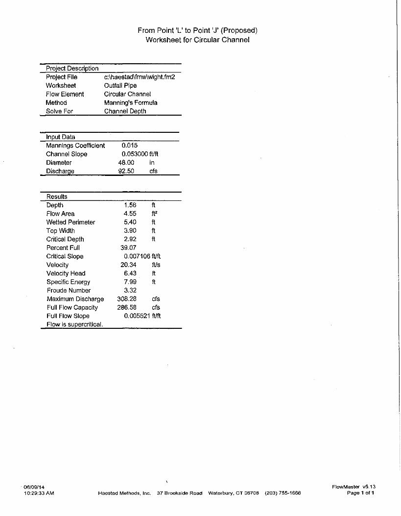
From Point 'L' to Point 'J' (Proposed) Worlcsheet for Circuiar Ciiannel
Project Descript ion
Project File c:\haestad\fmw\wight.fm2
Worksheet Outfall Pipe
Flow Element Circular Channel
Method Manning's Formula
Solve For Channel Depth
Input Data
Mannings Coeff icient 0.015
Channel Slope 0.053000 ft/ft
Diameter 48.00 in
Discharge 92.50 cfs
Results
Depth 1.56 ft
F low Area 4.55 ft^
Wetted Pen meter 5.40 ft
Top Width 3.90 ft
Critical Depth 2.92 ft
Percent Full 39.07
Crit ical S lope 0.007106 ft/ft
Velocity 20.34 Ws Velocity Head 6.43 ft
Specific Energy 7.99 ft
Froude Number 3.32
Max imum Discharge 308.28 cfs
Full Flow Capacity 286.58 cfs
Full Flow Slope 0.005521 fl/ft
Flow is supercrit ical.
06/09/14 10:29:33 AM
V
Haostad Methods, Inc. 37 Brookside Road Waterbury, C T 06706 (203) 755-1666
FlowMaster v5.13 Page 1 of 1
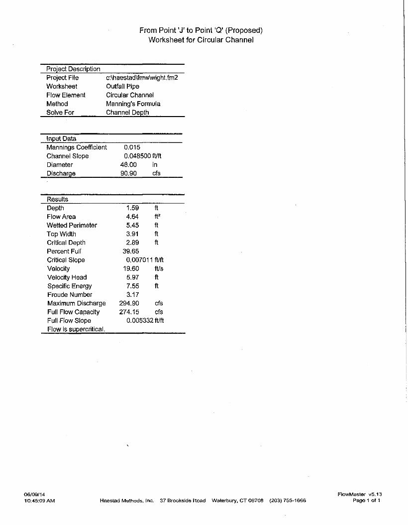
From Point 'J ' to Point 'Q' (Proposed)
Wori^stieet for Circuiar Channel
Project Descript ion
Project File c'Ah aestad\fmwVwig ht.f m2
Worl<slieet Outfall Pipe
Flow Element Circular Channel
Method Manning's Formula
Solve For Channel Depth
Input Data
Mannings Coeff ic ient 0.015
Channel Slope 0.048500 ft/ft
Diameter 48.00 in
Discharge 90.90 cfs
Results
Depth 1.59 ft
F low Area 4.64 ft^
Wet ted Perimeter 5.45 ft
Top Width 3.91 ft
Critical Depth 2.89 ft
Percent Full 39.65
Cntical S lope 0.007011 ft/ft
Velocity 19.60 ft/s
Velocity Head 5.97 ft
Specific Energy 7.55 ft
Froude Number 3.17
Max imum Discharge 294.90 cfs
Full Flow Capaci ty 274.15 cfs
Full Flow Slope 0.005332 ft/ft
Flow is supercri t ical.
FlowMaster v5.13 Haestad Mettiods, Inc. 37 Brookside Road Waterbury. C T 06709 (203) 755-1666 Page 1 of 1
06/09/14 10:45:09 AM
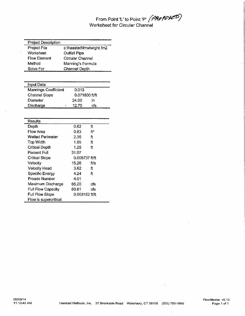
From Point ' L ' to Point 'P' Worl<slieet for Circular Channel
Project Descript ion
Project File c:\haestad\fmw\wight. fm2
Worksi ieet Outfal l Pipe
Flow Element Circular Channel
Method Manning 's Formula
Solve For Channel Depth
Input Data
Mannings Coeff ic ient 0.013
Channel Slope 0.071800 ft/ft
Diameter 24.00 in
Discharge ^ 12.70 cfs
Results
Depth 0.62 ft
Flow Area 0.83 ft^
Wetted Perimeter 2.36 ft
Top Width 1.85 ft
Critical Depth 1.28 ft
Percent Full 31.07
Critical Slope 0.005737 ft/ft
Velocity 15.26 ft/s
Velocity Head 3.62 ft
Specific Energy 4.24 ft
Froude Number 4.01
Maximum Discharge 65.20 cfs
Full Flow Capacity 60.61 cfs
Full Flow Slope 0.003152 : ft/ft
Flow is supercri t ical.
06/09/14 11:13:42 AM Haestad Methods, Inc. 37 Brookside Road Waterbury, C T 06708 (203) 755-1666
FlowMaster v5.13 Pag© 1 of 1
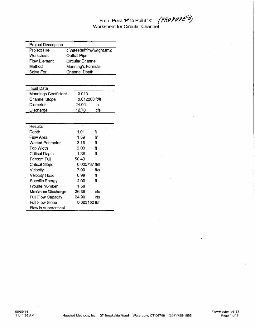
From Point 'P' to Point 'K' ( Wori^slieet for Circular Channel
Project Descript ion
Project File
Worksheet
Flow Element
Method
Solve For
c:\haestad\fmw\wight. fm2
Outfal l Pipe
Circular Channel
Manning 's Formula
Channel Depth
Input Data
Mannings Coeff icient 0.013
Channel Slope 0.012200 ft/ft
Diameter 24.00 in
Discharge 12.70 cfs
Results
Depth 1.01 ft
Flow Area 1.59 ft^
Wet ted Penmeter 3.16 ft
Top Width 2.00 ft Critical Depth 1.28 ft Percent Full 50.49
Critical Slope 0.005737 ft/ft
Velocity 7.99 ft/s
Velocity Head 0.99 ft Specific Energy 2.00 ft Froude Number 1.58
Max imum Discharge 26 .88 cfs
Full Flow Capacity 24.99 cfs
Full Flow Slope 0.003152 ft/ft
Flow is supercrit ical.
06/0&/14 11:11:36 AM Haestad Methods, Inc. 37 Brookside Road Waterbury, C T 06708 (203) 755-1666
FlowMaster v5.13 Page 1 of 1
From Point 'K' to Point 'G' ( f -
Worl<slieet for Circuiar Channei
Project Description
Project File c:\haestad\fmw\wight. fm2
Worksheet Outfail Pipe
F low Element Circular Channel
Method Manning's Formula
Solve For Channel Depth
Input Data
Mannings Coeff icient 0.013
Channel Slope 0.141500f t / f t
Diameter 24.00 in
Discharge 12.20 cfs
Results
Dept i i 0.51 ft
F low Area 0.63 ft==
Wet ted Perimeter 2.12 ft Top Width 1.75 ft Critical Depth 1.26 ft Percent Full 25.58
Cntical Slope 0.005627 ft/ft
Velocity 19.23 ft/s
. Velocity Head 5.75 ft Specif ic Energy 6.26 ft Froude Number 5.62
Max imum Discharge 91,53 cfs
Ful l Flow Capacity 85.09 cfs
Full Flow Slope 0.002909 ft/ft
F low is supercrit ical.
06/09/14 11:09:20 AM Haestad Methods, Inc. 37 Brookside Road Waterbury, C T 06708 (203) 755-1666
FlowMaster v5,13 Page 1 of 1
1 . B A S I S Of E L E V A T j Q N DftTUHt CONTRA COSTA COUNTV BEHCH "
. H A R K f f | 4 l t ' F K H A I L C TAG S,- E . CORNER CONCRETE B O X .
AT [J. W. CORNER O F HAPPY VALLY ROAD AJiD ROSE l A N E ' , .
10 F E E T NORTH OF CURB RETURN. E L E V A T I O N : 4 3 1 . 3 0
2 . A L L STREET IMPROVEMENTS SHALL 8E COfJSTRtJCTED I N ACCORO-
AHCE WITH T H E ' P R O V I S I O N S OF T I T L E ' S OF'THE COONTY ORD
INANCE CODE ANQ ORDINANCE S P E C I F I C A T I O N S , AND W I L L B E
StiBJECT TO THE I N S P E C T I O N AND APPROVAL OF THE C f f t
E M d l M B S R , ; CONTACT e U G I U E E R l M f i CONSTRUCTION
INSPECT I O H AT 2 0 4 ~ ( ? 5 t TO ARRANGE FOR I N S P E C T
ION AT LEAST ^8 HOURS PRIOR TO START CF ANY WORK.
3 . THE'CONTRACTOR SHALL K O T I F Y UNDERGROUKD SERVICE ALERT
( 8 0 0 - 6 4 2 - 2 4 4 ^ 1 48 HOURS PRIOR TO AKY E X C A V A T I O N .
4 . A L L UHDERGROUND. U T I L I T i e S W I T H I N THE : R i G . H T O F WAY, I N - .
. C L U P I H G MAINS A N D - L A T E R A L S , ^SHALL . B E INSTALLED A N D '
B A C K F I L L COHPLETED-.PRIOfl TO T H E S T A R T OF CURB, SIDEWALK
AND PAVING CDKSTRUCTJ.ON,
3 . A L L H E W U T I L I T Y D l S T R t S U T I O N SERVICES ' SHALL B E P L A C E D :
UNDERGROUND. '
6 . PI t lOR TO f L A C I K G SUBBASE OR B A S E . M A T E R ' I A L , • THE P U B L I C •
WORKS DEPT. CONSTRUCTION D I V I S I O N , S H A L L . , B E N O T I F I E D B Y '
T H E OWHF.R OR ACCEPTIM6 AGENCY O F EACH l i T l L I T Y INSTALLA
T I O N eENEATH T H E A R E A T O B E PAVED, THAT T H E I N S T A L L A T I O N
HAS S A T I S F A C T O R I L Y PASSED F i N A L ACCEPTANCE TESTS. . 7 . SHOULD I T APPEAR T H A T ' T H E WORK TO B E ' D Q N E f - O R ANY
MATTER R E L A T I V E THERETO, IS NOT S U F F I C I E N T L Y O E T A I L E O .
OR E X P L A I N E D ON THESE P L A N S , T H E COfJTRACtOa S H A L L CON-'
T A C T BRYAN G HtiRPHY, ASSOC. • I N C . . AT . 3 3 9 - 6 5 0 0 FOR StfCH .
FURTHER E K f L A N A f l O N S AS MAY BE NECESSARY.
8 . I F ARCHAEOLOGIC M A T E R I A L S ARE liNCOVEREI) DUKING GRAD- '
I M G , TRENCHING OR OTHER E X C A V A T I O N , EAJiTH((OI!fC W I T H I H •• •
1 0 0 FEET OF T H E S E - M A T E R I A L S S H A L L ' B E ' STOPPED U N T I L A '
PROFESSIONAL ARCHAEOLOGIST WHO f S C E R T I F I E D BY THE
SCA Af)D/{ tR SOPA HAS HAD AN OPPORTUt l lTY t O EVALUATE
THE S l G N I F f C A H C E O F THE F l K D AND SU6GEST APPROPRIATE
M I T I G A T I O N MEASURES, I F DEEMED NECES&ARY, '
9 . E X I S T I N G CURB AND' S I D E f f A L K TIIAT ARE DAMAGED OR D I S -
P L A C E D , S H A L L B E REPAIRED O R REPLACED, EVEN IF DAMAGE
O R DISPLACEMENT OCCURRED PRIOR TO ANY WORK PERFORMED
8Y T H E CONTRACTOR.
1 0 . . I F PAVING AND STORM D R A I N IMPROVEMENTS AHE N O T C O M
PLETED BY OCTOBER 1 5 , 1 9 8 6 TEMPORARY' S ( 1 T AND DRAINAGE
CONTROL F A C I L I T I E S SHALL BE INSTALLED TO'CONTROL .AND
CONTAIN S I L T DEPOSITS AMD TO PROVIDE FOR THE SAFE D I S - •
CHARGE OF STORM WATERS- INTO E X i S T I f i G S T ' O M M T E R F A C - . •
I L I T I E S . DESIGN OF THESE. F A C I L I T I ES MiJST BE APPROVED
B Y THE B O l l B I N G I N S P E C T I O N DEPARTMENT.
1 1 . CENTERLINE TCP O F BASE ROCK GRADE SHALL BE EQUAL TO TOP
OF CURB GRADE UNLESS OTHERWISE NOTED. E L E V A T I O N S SHOWN
O N C U R B - L I N E S ARE A T TOP OF CURB UNLESS OTHERWISE NOTED.
! 2 . P A V I N G CONFORMS SHALL B E H A D E AT A.SMOOTHLY TRIMMED
B U T T J O I N T . DO NOT OVERLAP E X I S T I N G PAVEMENT.
13 I N S T A L L ONE 3 ' DIAMETER NON-FERROUS D R A I N FOR E A C H L O T .
THROUGH THE CURBS AND BENEATH THE SIDEWALKS TO PROVIDE
FOR FUTURE ROOF DRAIN CONNECTIONS. LOCATION TO BE
DETERMIND ON B A S I S OF GRADING.
1 4 . A P P L I C A B L E P U B L I C WbRKS .DEPARTMENT STANDARD DRAWINGS;
• CC 104 S IGHT CLEARANCE AT INTERSECTIONS
' c c 105 SURVEY MONUMENT
CC iOa BACK OF CURB. FLOW D I V E R T E f l
• • CC ZOa LOCATION OF U T I L I T Y F A C I L I T I E S
C C 3 0 2 MISCELLANEOUS STANDARD D E T A I L S .
CC 303 P I P E D E T A I L S
CC 3 0 6 ' CURBS, S I D E W A L K , D R I V E W A Y S , CONCRETE D I T C H E S ,
VALLEY GUTTERS AND CURBED MEDIANS
. CC 3 0 1 0 I N L E T FRAMES, G R A T E ' A H D COVER PLATE
CC 3 0 I 0 A I N L E T FRAME M f l D l F I C A T I E f N .' •
GC 3 0 1 1 TYPE A INLET
' GC 3 0 1 3 TYPE C I N L E T ,
CC 3 0 2 0 PRECAST « . H . A N D . T Y P E i BASE .
CO 3 0 2 2 TYPE, I I I M . H , BASE • . '
•CC 3 0 2 4 MANHOLE FRAME AND COVER '
• CC 3 0 3 0 TYPE ' B ' ' H S A O m L
• • CC 3 0 5 1 S I G N I N G , S T R ' j P l H G AND i K S T ^ L L A T I O N O E T A i L S
. B - 5 3 . STANDARD ,INTERCEPTOR D I T C H E S ' ' ; ' "
• B~48 'GROUTED •ROCK R I P - R A P SLOPE
15 . THE SURFACE OF SLOPES AT ROAD INTERSECTIONS SHALL BE NO
• HIGHER THAN 3 6 INCHES MEASURED FROM THE FLOW L I H E Of THE
GUTTER OF THE EDGE OF f A V E M E N T , W I T H I « A . T R I A N G U L A R AREA
.•BETWEEN THE TANGENTS OF THE 'CURVE Of T H E i R I G H T - O F - W A Y
L I N E m A D I A G O N A L - U N E . J O I N I N G P O I N T S O ^ T H E TANGENTS '
25 FEET SACK FROM THE POINT OF THEIR I N T E R S E C T I O N .
1 6 . • CONTRACTOR AGREES THAT HE SHALL ASSUME SOLE: AND COMPLETE
. R E S P 0 K S I 6 I L I . T Y - F O R JOB S I T E C O N D I T I O N S DURING THE COURSE
OF^CONSTRUCTIOH OF T H I S PROJECT, I N C L U D I N G - T H E SAFETY OF
A L L PERSONS AND PROPERTY! THAT T H I S REQUIREMENT SHALL
' A P P L Y . C O N T I H U O U S L Y . A N D NOT BE L I M I T E D TO HQRHAL WORKING
• HOURSi AND THAT THE CONTRACTOR S K A L l , - 5 E F E N 0 , I N D E M N I F Y ,
' AND HOLD THE OWNER AND- THE ENGINEER HARMLESS f R O M AMY
AND ALL L I A B I L I T Y , REAL OR A L L E G E D . i N C O N H E C T I O N WITH '
• . THE PERFORMANCE- OF WORK ON T H I S PROJECT, EXCEPTING FOR
L f A B I U T Y A R I S I N G FROM THE SOLE NEGLIGENCE OF THE OWIJER
OR THE ENGINEER.
1 7 . NO WORK" SHALL BE CONOUCTEO. I N E X I S T I f l G DRAINAGE CHAUNELS
• FROM OCTOBER I TO A P R I L 1 5 , UNLESS THE DEVELOPER OBTAINS
WRITTEN PERMISSION FROM THE C I T r B U a i U E E E -
1 8 . . THE PROJECT SHALL BE SERVED BY A CABLE T E L E V l S t O H U N D E R -
GROUND SYSTEM.
1 9 . • S U B D I V I D E R AND O W E R i '
• RUSSELL J: BRU2ZCNE
8 9 9 HOPE LANE
• L A F A Y E T T E , - C A L I F O R N I A
2 0 . A L L R E V I S I O N S TO T H I S PLAN MUST BE APPROVED BY THE C I T Y
OF LAFAYETTE PRIOR TO CONSTRUCTION ANO SHALL BE A C
CURATELY SHOWN ON REVISED PLANS STAMPED ANO D I S T R I B U T E D
BY THE C i r r B W a i U B K B PRIOR TO'ACCEPTANCE OF
THE WORK AS COMPLETE. , _ • .
2 1 . • THE THICKNESS OF S U B - B A S E , BASE, AND SURFACING 5 > f A a 0E
• DETERMINED BY ' R ' VALUE TESTS PERFORMED 8Y THE S O ! L
ENGINEER -AND THE DESI f iN SHALL BE S U B H I T T E D ' T O THE C I T Y
OF LAFAYETTE FOR REVIEW.
i'tOI^M DRAIN ^€SUU • mm. mum
mm um- rrf£-
-m£ rm
i - A • •A in " A • •:A m
3 • •A • • 4 . / } • ' . ^ •
• 4 H.ma rrpc'B' • .i 0 • • -c I 7 c • A sw. 6 • C { 9 B - MM. • I 10 8 • C I II B Mma
• /e e • c • ./ D • •
%
I
\ i • £
u
i
mBfocmiTm
NOT rO \SCAL£
n A.C A.A A.S.B. me LN.
INFORmTION
SANirAR)' si:m^ srm^ piAff 3 P0S£ LAm puf/^mrju 4 mm DfiAiN T. r ^ 'o' nAM^mms 5 smr.'S'.D. oumu smm coumt
sT/anm t siaNi'm hist
*>- s
- i I . 1 ^
III
I I I
I I
I I I !
1 1^^
i 1^ is
5 - »
CIVIL CNGEMEERG • LAND PLANNBRS & SURVEYORS 1Z33 ALPINE ROAD « WAUftTT CREEK • CAUFQRHU 9 < : ^ « ( 4 1 5 ) 9 ^ ^ 0 0
F Q fi PLANS
SUBOIVrSiON 64S9
C/rr OF LAFAYFfre, . . '. CAUFOfiUfA CFD
•A • A n REvraiswts.
\C0mCT4S
BRYAJV^ MURPHY ASSOCIATES, I]>irC. CIVIL ENGINEERS •> LAND PLANNERS & 1233. AUtNE ROAD • WAUiUT CREEK « CAUFORNIA
SURVEYORS
J MPRO V E M E NT P L A^N S
S O S C L A N E
ijg a»rn>^i^ • \
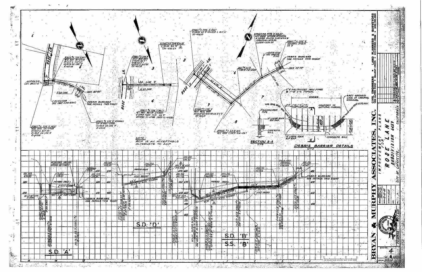
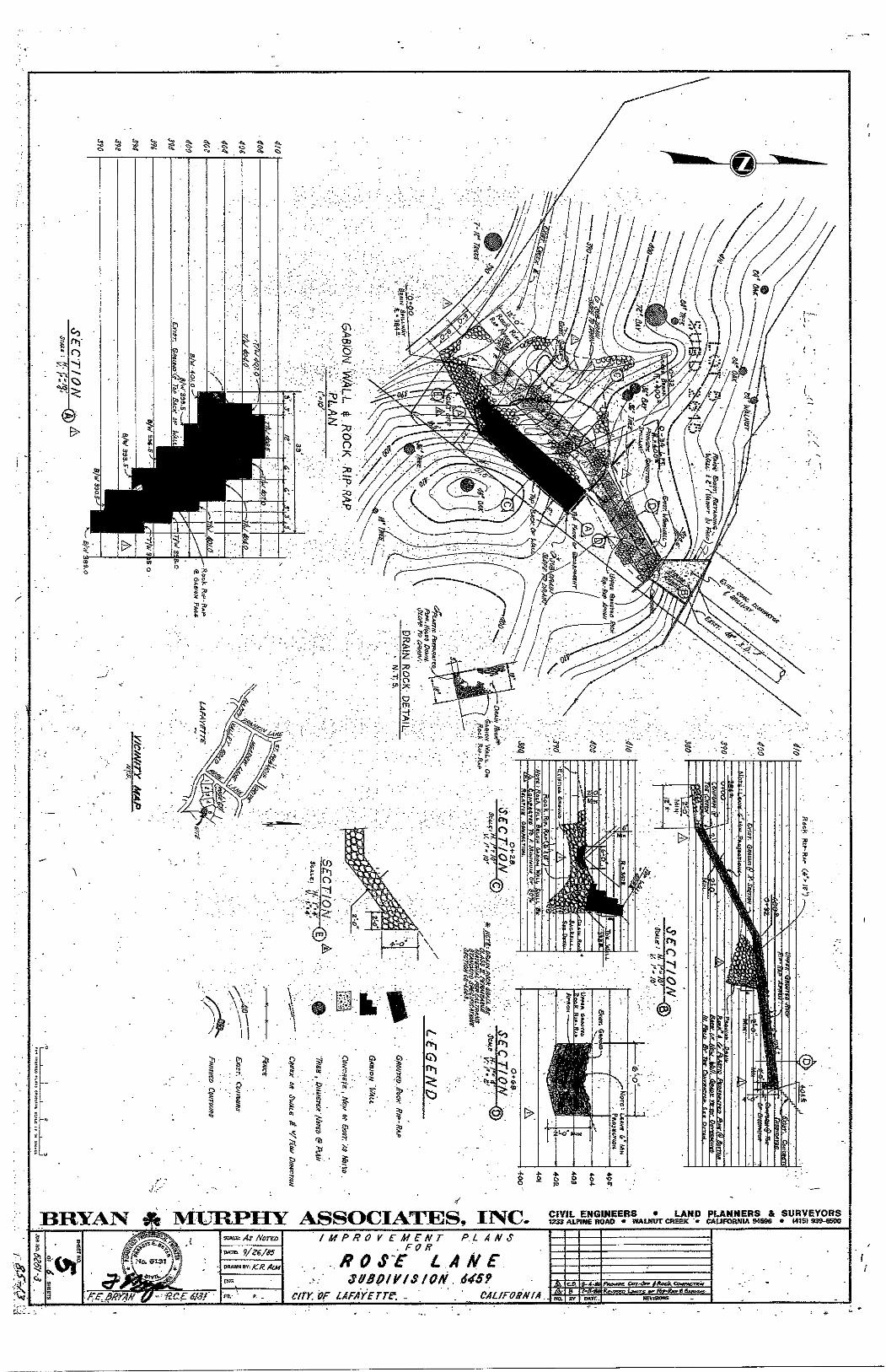
Eh
BRYA3V ^ MURPHY ASSOCIATES, II^C. CIVIL ENGINEERS • LAND PLANNERS & SURVEYORS 1333 AU1HE ROAD « WALNOT CREEK » CAURKINIA 94596 • HIS) 939-KDO
/MPROVEMENT P.L A N 6
0 S A M E
S&Bpll^fSiON. 64S9
C/rK VF LAFAYETTE; _ CAL/F08NfA n^moK CoT'Orr < t e c f c C f t ^ w e n i w
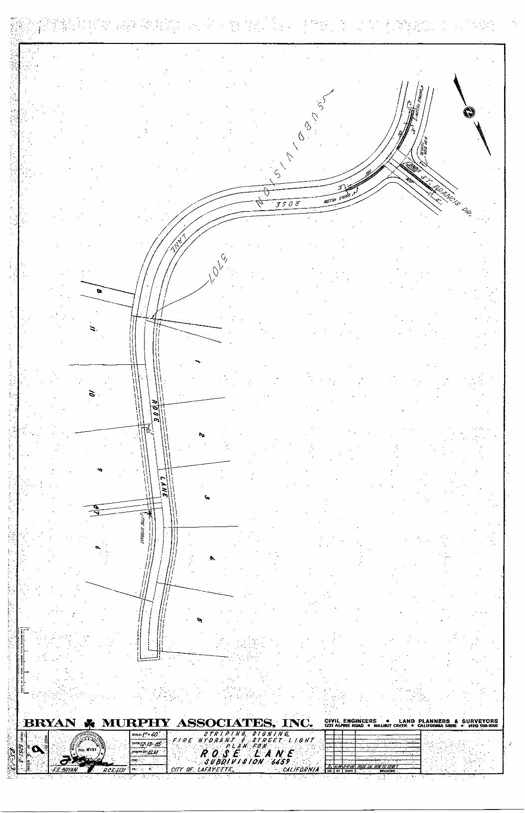
BRYAJV ^ MURPHY ASSOCIATES, I J S C CIVIL ENGINEERS • LAND PLANNERS & SURVEYORS 1233 AUWtE HOAD • WALNUT CREEK • CAUFORmA S4S96 « 933-85D0
I
-r .- g '3-STR IP f N $.. SI G{f IN e,
r//?£ HYOfiA N-T - ST.RCET- L IG f J t . - / • r - -.-.'- RLA^N^ RJ8'R -: •••'•v •-
c/rr OF LAFAYEtrB, : • -CAUFMNJA
' . '• " V -. - •
flSi ta. onus
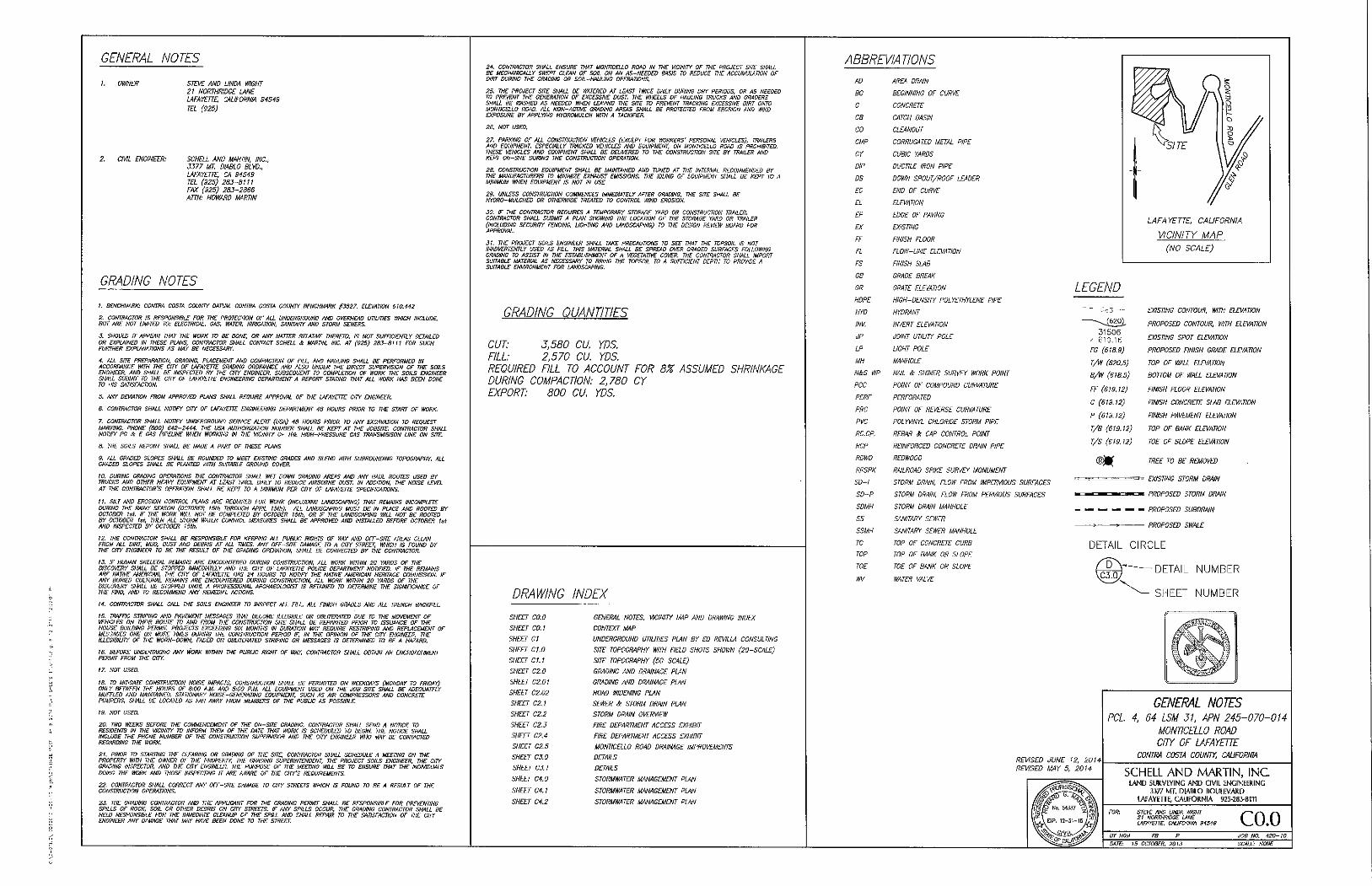
GENERAL NOTES
I. OWNER STE</E AND LINDA WIGHT 21 NORTHRIDGE LANE LAFAYETTE, CALIFORNIA 34549 TEL (925)
2. CIVIL ENGINEER: SCHELL AND MARTIN, INC., 3377 MT. DIABLO BLVD., LAFAYfJTE. CA 94549 TEL (925) 2B3-8111 FAX (925) 283-2866 ATTN: HOWARD MARTIN
GRADING NOTES
1. BENCHMARK: CONTRA COSTA COUNTY DATUM. CONTRA COSTA COUNTY BENCHMARK #3527. ELEVATION 610.442 2. CONTRACTOR IS RESPONSIBLE FOR THE PROTECTION OF ALL UNDERGROUND AND OVERHEAD UTILITIES WHICH INCLUDE. BUT ARE NOT LMITEO TO: ELECTRICAL. GAS, WATER, IRRIGATION, SANITARY ANO STORM SEWERS. 3. SHOULD IT APPEAR THAT THE WORK TO BE DONE. OR ANY MATTER RELATIVF THERETO. IS NOT SUFFICIENTLY DETAILED OR EXPLAINED IN ThESE PL^NS, CONTRACTOR SHALL CONTACT SCHELL & MARTIN. INC. AT (925) 283-8111 FOR SUCH FURTHER EXPLANATIONS AS MAY BE NECESSARY. 4. ALL SITE PREPARATION. GRADING. PLACEMENT AND COMPACTION OF FILL, AND HAUUNG SHALL BE PERFORMED IN ACCORDANCE WITH THE CITY OF LAFAYETTE GRADING ORDINANCE AND ALSO UNDER THE DIRECT SUPERVISION OF THE SOILS ENGINEER, ANO SHALL BE INSPECTED BY THE CITY ENGINEER. SUBSEQUENT TO COMPLETION OF WORK THE SOILS ENGINEER SHALL SUBMIT TO THE CITY OF LAFAYETTE ENGINEERING DEPARTMENT A REPORT STATING THAT ALL WORK HAS BEEN DONE TO HIS SATISFACTION. 5. ANY DEVIATION FROM APPROVED PLANS SHALL REQUIRE APPROVAL OF THE LAFAYETTE CITY ENGINEER. 6. CONTRACTOR SHALL NOTIFY CITY OF LAFAYETTE ENGmERING DEPARTMENT 48 HOURS PRIOR TO THE START OF WORK. 7. CONTRACTOR SHALL NOTIFY UNDERGROUND SERVICE ALERT (USA) 48 HOURS PRIOR TO ANY EXCAVATION TO REQUEST MARKING. PHONE (800) 642-2444. THE USA AUTHORIZATION NUMBER SHALL BE KEPT AT THE JOBSITE. CONTRACTOR SHALL NOTIFY PG & E GAS PIPELINE WHEN WORKING IN THE VICINTTY OF THE HIGH-PRESSURE GAS TRANSMISISON LINE ON SITE. B. THE SOILS REPORT SHALL BE MADE A PART OF THESE PLANS. 9. ALL GRADED SLOPES SHALL BE ROUNDED TO MEET EXISTING GRADES ANO BLEND WITH SURROUNDING TOPOGRAPHY. ALL GRADED SLOPES SHALL BE PLANTED WITH SUITABLE GROUND COVER. 10. DURING GRADING OPERATIONS THE CONTRACTOR SHALL WET DOWN GRADING Ai^EAS AND ANY HAUL ROUTES USED BY TRUCKS AND OTHER HEAVY EQUIPMENT AT LEAST TWICE DAILY TO REDUCE AIRBORNE DUST IN ADDITION, THE NOISE LEVEL AT THE CONTRACTOR'S OPERATION SHALL BE KEPT TO A MINIMUM PER CITY OF LAFAYETTE SPECinCATIONS. 11. SILT AND EROSION CONTROL PLANS ARE REQUIRED FOR WORK (INCLUDING LANDSCAPING) THAT REMAINS INCOMPLETE DURING THE RAINY SEASON (OCTOBER ISih THROUGH APRIL 15th). ALL LANDSCAPING MUST BE IN PLACE AND ROOTED BY OCTOBER Isf. IF THE WORK WILL NOT BE COMPLETED BY OCTOBER 15ih. OR IF THE lANDSCAPING WILL NOT BE ROOTED BY OCTOBER tst. THEN ALL STORM WATER CONTROL MEASURES SHALL BE APPROVED AND INSTALLED BEFORE OCTOBER 1st AND INSPECTED BY OCTOBER 15th, 12. THE CONTRACTOR SHALL BE RESPONSIBLE FOR KEEPING ALL PUBLK RIGHTS OF WAY AND OFF-SITE AREAS CLEAN FROM ALL DIRT. MUD. OUST AND DEBRIS AT ALL TIMES. ANY OFF-SITE DAMAGE TO A CITY STREET. WHICH IS FOUND BY THE CITY ENGINEER TO BE THE RESULT OF THE GRADING OPERATION, SHALL BE CORRECTED BY THE CONTRACTOR. 13. IF HUMAN SKELETAL REMAINS ARE ENCOUNTERED DURING CONSTRUCTION, ALL WORK WITHIN 20 YARDS OF THE DISCOVERY SHALL BE STOPPED IMMEDIATELY AND THE CITY OF LAFAYETTE POLICE DEPARTMENT NOTIFIED. IF THE REMAINS ARE NATIVE AkIERICAN, THE CITY OF LAFAYETTE HAS 24 HOURS TO NOTIFY THE NATIVE AMERICAN HERITAGE COMMISSION. IF ANY BURIED CULTURAL REMAINS ARE ENCOUNTERED DURING CONSTRUCTION. ALL WORK WITHIN 20 YARDS OF THE DISCOVERY SHALL BE STOPPED UNTIL A PROFESSIONAL ARCHAEOLOGIST IS RETAINED TO DETERMINE THE SIGNIFICANCE OF THE FIND. AND TO RECOMMEND ANY REMEDIAL ACTIONS. 14. CONTRACTOR SHALL CALL THE SOILS ENGINEER TO INSPECT ALL FILL, ALL HNISH GRADES AND ALL TRENCH BACKFILL 15. TRAFFIC STRIPING AND PAVEMENT MESSAGES THAT BECOME ILLEGIBLE OR OBLITERATED DUE TO THE MOVEMENT OF VEHICLES ON THEIR ROUTE TO AND FROM THE CONSTRUCTION SITE SHALL BE REPAINTED PRIOR TO ISSUANCE OF THE HOUSE BUILDING PERMIT. PROJECTS EXCEEDING SIX MONTHS IN DURATION MAY REQUIRE RESTRIPING AND REPLACEMENT OF MESSAGES ONE OR MORE TIMES DURING THE CONSTRUCTION PERIOD IF. IN THE OPINION OF THE CITY ENGINEER. THE ILLEGIBIUTY OF THE WORN-DOWN, FADED OR OBLITERATED STRIPING OR MESSAGES IS DETERMINED TO BE A HAZARD. IB. BEFORE UNDERTAKING ANY WORK WITHIN THE PUBLIC RIGHT OF WAY, CONTRACTOR SHALL OBTAIN AN ENCROACHMENT PERMIT FROM THE CITY. 17. NOT USED. 18. TO MITIGATE CONSTRUCTION NOISE IMPACTS. CONSTRUCTION SHALL BE PERMITTED ON WEEKDAYS (MONDAY TO FRIDAY) ONLY BETWEEN THE HOURS OF 8:00 A.M. AND 5:00 P.M. ALL EQUIPMENT USED ON THE JOB SITE SHALL BE ADEQUATELY MUFFLED AND MAINTAINED. STATIONARY NOISE-GENERATING EQUIPMENT. SUCH AS AIR COMPRESSORS AND CONCRETE PUMPERS, SHALL BE LOCATED AS FAR AWAY FROM MEMBERS OF THE PUBLIC AS POSSIBLE. 19. NOT USED. 20. TWO WEEKS BEFORE THE COMMENCEMENT OF THE ON-SITE GRADING, CONTRACTOR SHALL SEND A NOTICE TO RESIDENTS IN THE VICINITY TO INFORM THEM OF THE DATE THAT WORK IS SCHEDULED TO BEGIN. THE NOTICE SHALL INCLUDE THE PHONE NUMBER OF THE CONSTRUCTION SUPERVISOR AND THE CITY ENGINEER WHO MAY BE CONTACTED REGARDING THE WORK. 21. PRIOR TO STARTING THE CLEARING OR GRADING OF THE SITE. CONTRACTOR SHALL SCHEDULE A MEETING ON THE PROPERTY WITH THE OWNER OF THE PROPERTY, THE GRADING SUPERINTENDENT, THE PROJECT SOILS ENGINEER, THE CITY GRADING INSPECTOR, AND THE CITY ENGINEER. THE PURPOSE OF THE MEETING WILL BE TO ENSURE THAT THE INDIVIDUALS DOING THE WORK AND THOSE INSPECTING IT ARE AWARE OF THE CITY'S REQUIREMENTS. 22. CONTRACTOR SHALL CORRECT ANY OFF-SITE DAMAGE TO CITY STREETS WHICH IS FOUND TO BE A RESULT OF THE CONSTRUCTION OPERATIONS. 23. THE GRADING CONTRACTOR AND THE APPUCANT FOR THE GRADING PERMIT SHALL BE RESPONSIBLE FOR PREVENTING SPILLS OF ROCK. SOIL OR OTHER DEBRIS ON CITY STREETS. IF ANY SPILLS OCCUR, THE GRADING CONTRACTOR SHALL BE HELD RESPONSIBLE FOR THE IMMEDIATE CLEANUP OF THE SPILL AND SHALL REPAIR TO THE SATISFACTION OF THE CITY ENGINEER ANY DAMAGE THAT MAY HAVE BEEN DONE TO THE STREET.
24. CONTRACTOR SHALL ENSURE THAT MONTICELLO ROAD IN THE VICINITY OF THE PROJECT SITE SHALL BE MECHANICALLY SWEPT CLEAN OF SOIL ON AN AS-NEEDED BASIS TO REDUCE THE ACCUMULATION OF DIRT DURING THE GRADING OR SOIL-HAULING OPERATIONS. 25. THE PROJECT SITE SHALL BE WATERED AT LEAST TWICE DAILY DURING DRY PERIODS, OR AS NEEDED TO PREVENT THE GENERATION OF EXCESSIVE DUST THE WHEELS OF HAUUNG TRUCKS AND GRADERS SHALL BE WASHED AS NEEDED WHEN LEAVING THE SITE TO PREVENT TRACKING EXCESSIVE DIRT ONTO MONTICELLO ROAD. ALL NON-ACTP^ GRADING AREAS SHALL BE PROTECTED FROM EROSION AND WIND EXPOSURE BY APPLYING HYDROMULCH WITH A TACKIFIER. 26. NOT USED. 27. PARKING OF ALL CONSTRUCTION VEHICLES (EXCEPT FOR WORKERS' PERSONAL VEHICLES). TRAILERS AND EQUIPMENT ESPECIALLY TRACKED VEHICLES AND EQUIPMENT. ON MONTICELLO ROAD IS PROHIBITED THESE VEHKLES AND EQUIPMENT SHALL BE DELIVERED TO THE CONSTRUCTION SITE BY TRAILER AND KEPT ON-SITE DURING THE CONSTRUCTION OPERATION. 28. CONSTRUCTION EQUIPMENT SHALL BE MAINTAINED ANO TUNED AT THE INTERVAL RECOMMENDED BY THE MANUFACTURERS TO MINIMIZE EXHAUST EMISSIONS. THE IDLING OF EQUIPMENT SHALL BE KEPT TO A MINIMUM WHEN EQUIPMENT IS NOT IN USE 29. UNLESS CONSTRUCTION COMMENCES IMMEDIATELY AFTER GRADING, THE SITE SHALL BE HYDRQ-MULCHED OR OTHERWIDE TREATED TO CONTROL WIND EROSION. 30. IF THE CONTRACTOR REQUIRES A TEMPORARY STORAGE YARD OR CONSTRUCTION TRAILER, CONTRACTOR SHALL SUBMIT A PLAN SHOWING THE LOCATION OF THE STORAGE YARD OR TRAILER (INCLUDING SECURITY FENCING. UGHTING AND LANDSCAPING) TO THE DESIGN REVIEW BOARD FOR APPROVAL. 31. THE PROJECT SOILS ENGINEER SHALL TAKE PRECAUTIONS TO SEE THAT THE TOPSOIL IS NOT INADVERTENTLY USED AS FILL THIS MATERIAL SHALL BE SPREAD OVER GRADED SURFACES FOUOWING GRADING TO ASSIST IN THE ESTABLISHMENT OF A VEGETATI\^ COVER. THE CONTRACTOR SHALL IMPORT SUITABLE MATERIAL AS NECESSARY TO BRING THE TOPSOIL TO A SUFFICIENT DEPTH TO PROVIDE A SUITABLE ENVIRONMENT FOR LANDSCAPING.
GRADING QUANTITIES
CUT: 3,580 CU. YDS. FILL: 2,570 CU. YDS. REQUIRED FILL TO ACCOUNT FOR 8% ASSUMED SHRINKAGE DURING COMPACTION: 2,780 CY EXPORT: 800 CU. YDS.
DRAWING INDEX
SHEET CO.O GENERAL NOTES. VICINITY IMP AND DRAWING INDEX
SHEET CO.} CONTEXT MAP
SHEET CI UNDERGROUND UTILITIES PLAN BY ED REVILLA CONSULTING
SHEET C7.0 SITE TOPOGRAPHY WITH FIELD SHOTS SHOWN (20-SCALE)
SHEET C1.1 SITE TOPOGRAPHY (50-SCALE)
SHEET C2.0 GRADING AND DRAINAGE PLAN
SHEET C2.01 GRADING AND DRAINAGE PLAN
SHEET C2.02 ROAD WIDENING PLAN
SHEET CZ 1 SEWER A STORM DRAIN PLAN
SHEET C2.2 STORM DRAIN OVER\^FW
SHEET C2.3 FIRE DEPARTMENT ACCESS EXHIBIT
SHEET C2.4 FIRE DEPARTMENT ACCESS EXHIBIT
SHEET CZ.5 MONTICELLO ROAD DRAINAGE IMPROVEMENTS
SHEET C3.0 DETAILS
SHEET C3.1 DETAILS
SHEET C4.0 STORMWATER MANAGEMENT PLAN
SHEET C4.! STORMWATER MANAGEMENT PLAN
SHEET C4.2 STORMWATER MANAGEMENT PLAN
ABBREVIATIONS
AD AJ^Efi. DRAIN
BC BEGINNING OF CURVE
C CONCRETE
CB CATCH BASIN
CO CLEANOUT
CMP CORRUGATED METAL PIPE
CY CUBIC YARDS
DIP DUCTILE IRON PIPE
DS DOWN SPOUT/ROOF LEADER
EC END OF CURVE
EL ELEVATION
EP EDGE OF PAVING
EX EXISTING
FF FINISH FLOOR
FL FLOW-LINE ELEVATION
FS FINISH SLAB
GB GRADE BREAK
GR GRATE ELEVATION
HOPE HIGH-DENSITY POLYETHYLENE PIPE
HYD HYDRANT
!NV. INVERT ELEVATION
JP JOINT UTILITY POLE
LP LIGHT POLE
MH MANHOLE
N&S WP NAIL & SHINER SURVEY WORK POINT
PCC POINT OF COMPOUND CURVATURE
PERF PERFORATED
PRC POINT OF REVERSE CURVATURE
PVC POLYVINYL CHLORIDE STORM PIPE
RC.CP. REBAR & CAP CONTROL POINT
RCP REINFORCED CONCRETE DRAIN PIPE
RDWD REDWOOD
RRSPK RAILROAD SPIKE SURVEY MONUMENT
SD-I STORM DRAIN, FLOW FROM IMPERVIOUS SURFACES
SD-P STORM DRAIN, FLOW FROM PERVIOUS SURFACES
SDMH STORM DRAIN MANHOLE
SS SANITARY SEWER
S5MH SANITARY SEWER MANHOLE
TC TOP OF CONCRETE CURB
TOP TOP OF BANK OR SLOPE
TOE TOE OF BANK OR SLOPE
WV WATER VALVE
LAFAYETTE. CALIFORNIA VICINITY MAP
(NO SCALE)
LEGEND
3 1 5 0 6
FG (618.3)
T/W (620.5)
B/W (618.5)
FE (619.12)
C (619.12)
P (619.12)
T/B (613.12)
r/S (619.12)
EXISTING CONTOUR, WITH ELEVATION
PROPOSED CONTOUR. WITH ELEVATION
EXISTING SPOT ELEVATION
PROPOSED FINISH GRADE ELEVAWN
TOP OF WALL ELEVATION
BOTTOM OF WALL ELEVATION
FINISH FLOOR ELEVATION
FINISH CONCRETE SLAB ELEVATION
FINISH PAVEMENT ELEVAWN
TOP OF BANK ELEVATION
TOE OF SLOPE ELEVATION
TREE TO BE REMOVED
EXISTING STORM DRAIN
PROPOSED STORM DRAIN
— — — — - PROPOSED SUBDRAIN
>• PROPOSED SWALE
DETAIL CIRCLE
^ ' ' ' "—DETAIL NUMBER
SHEET NUMBER
REVISED JUNE 12, 2014 REVISED MAY 5. 2014
GENERAL NOTES PCL 4. 64 LSM 31. APN 245-070-014
MONTICELLO ROAD CITY OP LAFAYETTE
CONTRA COSTA COUNTY. CAUFORNIA
SCHELL AND MARTIN, INC l A N D SURVEYING A N D CIVIL ENGINEERING
3377 MT, DIABLO BOUITVARD LAFAYETTE, CALIFORNIA 923-283-8111
STEVE AND LINDA WIGHT 21 NORTHRIDGE LANE LAFAYEUE, CALIFORNIA 94549 C O . O
JOB NO. 420-10 DATE: 15 OCTOBER. 2013 SCALE: NONE
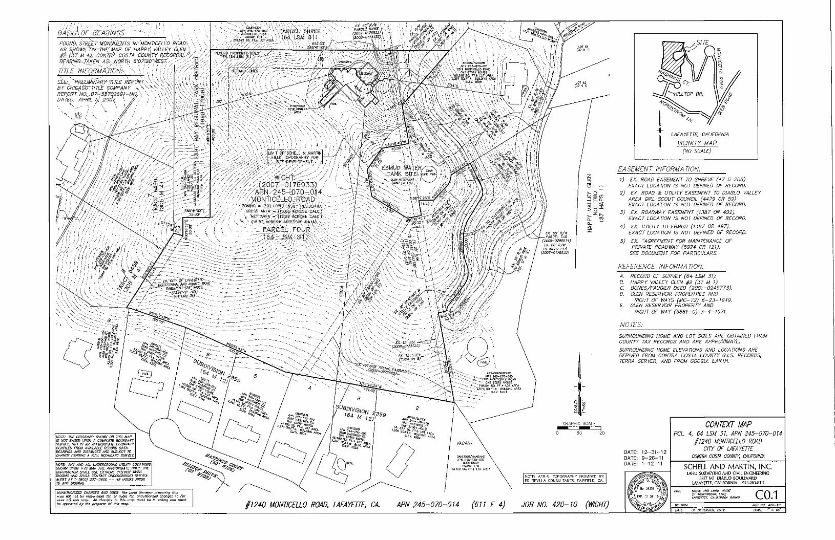
BASfS'y OF BEARINGS'
FOUND. STREET MONUMEhlTS IN'MONTICELLO RQ'AD\ \ \ • AS SHOWN "ON^E'MAP OE. HAPP)'^ VALLEY GLEN ) /2.(37 l^--l). .CONTRA COSTA COUNTY/pECORDSiy''/'/ ^, B^ARm'^JAKEN AS:^..li_ORTH 6V7i2p'')^S^^-;:';;>:y.-^^^
TITLE 'INFORMA/lONk ^' " '' ' ' ' "" '
StE- ''PRELIMINARY'TITLE REeORT\'-BY CPllGA'dO-TITLE COMPANY REPORT NO.. ..Q7-5&7026bl-Mh DATED: APRIL &i .'200V^
' \ \ I , .
-21fl.6M-Sli: rt±,LOTAREA .J \ V • A . — ^ ' \ 1 • V • V ' I CT V ^ i ^ M
wore:' JH£" BOUNDARY SHOWN ON WIS MAP IS NOT BASED UPON A COMPLETE BOUNDARY SURVEY, BUT IS AN APPROXIMATE BOUNDARY COMPILED FROM AVAILABLE RECORD DATA. BEARINGS AND DISTANCES ARE SUBJECT 70 CHANGE PENDING A FULL BOUNDARY SURVEY
NOTE: ANY AND ALL UNDERGROUND UTIUTY LOCATIONS SHOWN UPON THIS MAP ARE APPROXIMATE ONLY THE CONTRACTOR SHALL USE EXTREME CAUVON WHEN DIGGING AND SHALL CONTACT UNDERGROUND SERVICE ALERT AT l-(800) 227-2600 — 48 HOURS PRIOR TO ANY DIGGING
NOTE: AERIAL TOPOGRAPHY PROVIDED BY; ED REVILLA COMSULTANTS, FAIRFIELD, CA,
UNAUTHORIZED CHANGES AND USES: The Land Survajvr praparlng this map uHI noi he responsible far, or liable for, tinaulhoriied changes to (or
ol) this mop. All changes to this map must be In writing and must bs approved by the preparer of this mop. §mO MONTICELLO ROAD, LAFAYETTE, CA. APN 245-070-014 (611 E 4) JOB NO 420-10 (WIGHT)
SITE
LAFAYETTE CALIFORNIA VICINITY MAP
(NO SCALE)
EASEMENT INFORMATION:
1) EX. ROAD EASEMENT TO SHREVE (47 D 206) EXACT LOCATION IS NOT DEFINED OF RECORD.
2) EX ROAD & UTIUTY EASEMENT TO DIABLO VALLEY AREA GIRL SCOUT COUNCIL (4479 OR 59) EXACT LOCATION IS NOT DEFINED OF RECORD.
3) EX ROADWAY EASEMENT (1387 OR 492). EXACT LOCATION IS NOT DEFINED OF RECORD.
4) EX. UTILITY TO EBMUD (1387 OR 497). EXACT LOCATION IS NOT DEFINED OF RECORD.
5) EX. "AGREEMENT FOR MAINTENANCE OF PRIVATE ROADWAY (5924 OR 121).
SEE DOCUMENT FOR PARTICULARS.
REFERENCE INFORMA TION:
A. RECORD OF SURVEY (64 LSM 31). HAPPY VALLEY GLEN §2 (37 M 1). BONES/FAUGIER DEED (2001-0245773). GLEN RESERVOIR PROPERTIES AND
RIGHT OF WAYS (MC-72) 6-23-1949. GLEN RESERVOIR PROPERTY AND
RIGHT OF WAY (5861-G) 3-4-1971.
NOTES:
SURROUNDING HOME AND LOT SIZES ARE OBTAINED FROM COUNTY TAX RECORDS AND ARE APPROXIMATE. SURROUNDING HOME ELEVATIONS AND LOCATIONS ARE DERIVED FROM CONTRA COSTA COUNTY G.I.S. RECORDS, TERRA SERVER. AND FROM GOOGLE EARTH.
DATE: 12-31-12 DATE: 9-26-11 DATE: 1-12-11
CONTEXT MAP PCL. 4, 64 LSM 51. APN 245-070-014
§1240 MONTICELLO ROAD CITY OF LAFAYETTE
COmA COSTA COUNTY, CAUFORNIA
SCHELL AND MARTIN, INC l A N D SURVEYING A N D CIVIL ENGINEERING
3377 MT. DIABLO BOULEVARD LAFAYETTE, CAUFORNIA 925-283-8111
STEVE AND UNDA WIGHT 21 NORTHRIDGE LANE LAEAYETrE. CAurORNIA 34549 C 0 . 1 JOB NO. 420-10
31 DECEMBER. 2012
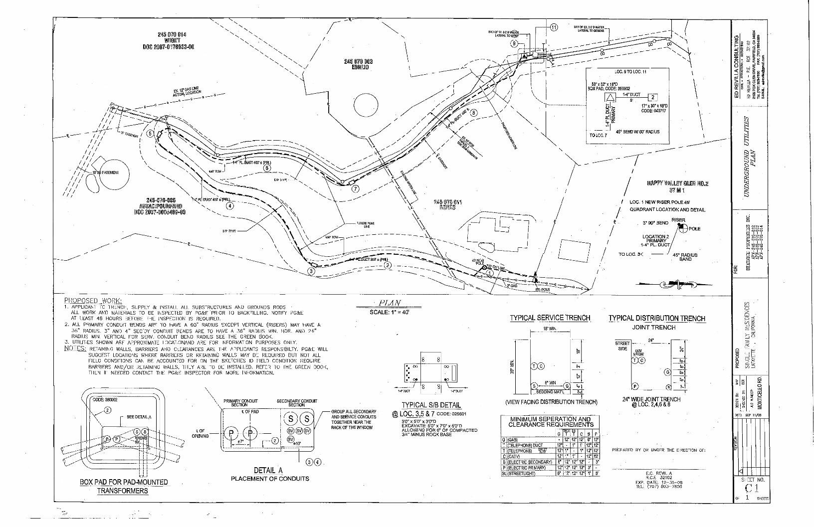
PROPOSED WORK: 1. APPLICANT TO TRENCH, SUPPLY & INSTALL ALL SUBSTRUCTURES AND GROUNDS RODS •
ALL WORK AND MATERIALS TO BE INSPECTED BY PG&E PRIOR TO BACKFILLING. NOTIFY PG&E
AT LEAST 48 HOURS BEFORE THE INSPECTION IS REOUIRED.
2 . ALL PRIMARY CONDUIT BENDS ARE TO HAVE A 6 0 " RADIUS EXCEPT VERTICAL (RISERS) MAY HAVE A
3 6 " RADIUS. 3 " AND 4 " SEC'DY CONDUIT BENDS ARE TO HAVE A 3 6 " RADIUS MIN, HOR. AND 2 4 "
RADIUS MIN. VERTICAL FOR SERV. CONDUIT BEND RADIUS SEE THE GREEN BOOK.
3. UTILITIES SHOWN ARE APPROXIMATE LDCATICNAND ARE FOR INFORMATION PURPOSES ONLY.
NOTES: RETAINING WALLS, BARRIERS AND CLEARANCES ARE THE APPLICANTS RESPONSIBILTY. PG&E WILL
SUGGEST LOCATIONS WHERE BARRIERS OR RETAINING WALLS MAY BE REQUIRED BUT NOT ALL FIELD CONDITIONS CAN BE ACCOUNTED FOR ON THE SKETCHES ID FIELD CONDITION REQUIRE BARRIERS A N D / O R RETAINING WALLS, THEY ARE TO BE INSTALLED, REFER TO THE GREEN BOOK, THEN IF NEEDED CONTACT THE PG&E INSPECTOR FOR MORE INFORMATION.
PLAN SCALE: 1" = 40'
TYPICAL SERVICE TRENCH
CODE: 360002
. ( 1 )
: D E T A I A
,( ^ i ' r^ . - , , L
PRIMARY CONDUIT SECTION
SECOMDARY CONDUIT SECTION
^ a- MIN ^ ^ a- MIN ^
CN
, S )
BEDDING MATL
TYPICAL DISTRIBUTION TRENCH
~ ~ JOINT TRENCH
STREET
SIDE CATV iPHONE
EXs)
24"
®
t O F
OPENING"
t OF PAD
±7"
(|y)@)@)
• GROUP Ai .L SECONDARY
AND SERVICE CONDUITS
TOGETHER NEARTHE
BACK OF THE WINDOW
TYPICAL S/B DETAIL
@ LOC. 3,5 & 7 C O D E ; 0 2 S 6 0 1
3'0" X 5'0!' X 3'0"D E X C A V A T E : 5'0" x 7 '0" x 6 '0"D A L L O W I N G F O R 6" O F C O M P A C T E D 3/4" M I N U S R O C K B A S E
(VIEW FACING DISTRIBUTION TRENCH) 24" WIDE JOINT TRENCH @ LOC. 2,4,6 & 8
BOX PAD FOR PAD-iVlOUNTED
TRANSFORMERS
DETAIL A ®®
PLACEMENT OF CONDUITS
MINIMUM SEPERATION AND CLEARANCE REQUIREMENTS
G T DB T C S P
G (GASl 12" 12" 12" 6" 12" T (TELEPHONE) DUCT 12" 1" 1" 12* 12" T (TELEPHONE) 12" r - 1" 12* 12" C (CATV) 12" r 1" 12' 12" S (ELECTRIC SECONDARY) 6" \T 12" 12" P (ELECTRIC PRIMARY) \2 M' 12" 12" 3" -
SL (STREETLIGHT) 6" 12' 12" 12" 1" 3"
PREPARED BY OR UNDER THE DIRECTION OF:
E.C. REVILLA R.C.E. 3 2 1 0 2
EXP. DATE: 1 2 - 3 1 - O S TEL; ( 7 0 7 ) 8 0 3 - 7 8 0 0
g a s
LU § E
i
CO C M T O ^
c = o o I I I pg o o o
S i l l
r , I I I
C O
o z U J Q •<
m t t ; UJ o
U-
s
< L i _
UJ
ETTE
CD
^ 3
1 1 i s
1 5 g o 5
DATE: SEP 11/OB
SHEET NO.
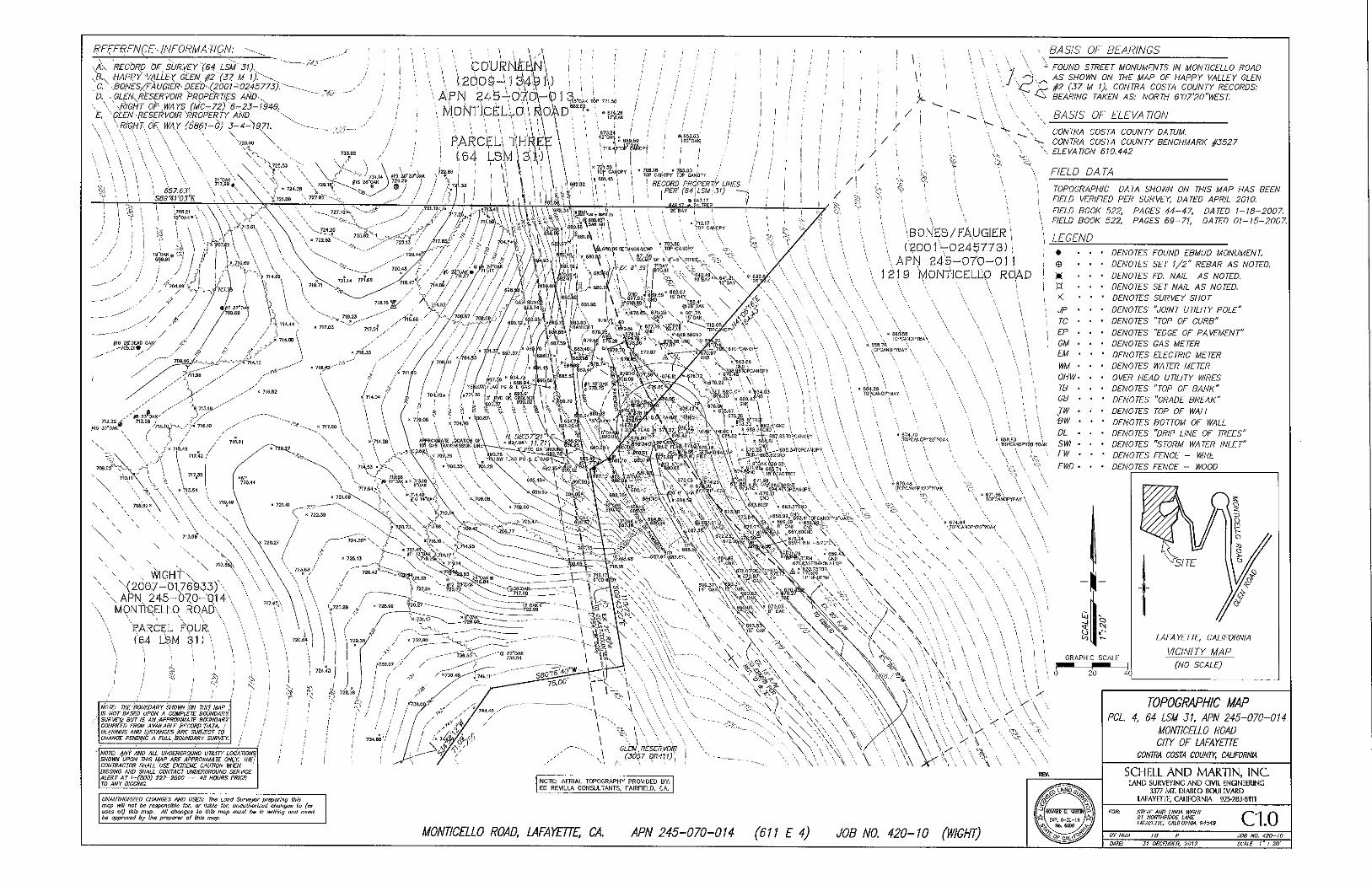
REFE-RENgE'-INFORM A TJQN.
•,A\ 'RECORD dE SUR.VEY"(S4 LSM" 31). ^ a . HAPeY "VALLEX GL^N ^2 '(57 M ))>•-. , C.\8QNESyfAU0IER- DEED^.(2001-0245773):"-D. - GL^EN. RESERVOIR >ROPERnES Af<lD^..
•. \ ^RIGHT OF WA YS (MC- 72) '6.-23- {949. K ^^DEN • RESERVOIR "PROPERTY AhD
\ \ '\R/GH'T..dF WAY (5861-G) 3-4-1971. \ ^ ^\ \ \ "k \ \
\ \ \ . - 725,00 \
"• 657.63'-.
S89%1'03"K
\ M p N T ) c £ L L a \ ^ k ) ^ ^
• (.54 L S M 1 3 ' \ ) \ \
/ kr I I /> \ ]
BASIS OF BEARINGS
OiVK TOP 721. so
• B74.26 / /
i " 8B9.59
;71B.4j7TDl^£'ifiopi
/
i TOyWD SrffEET- MONUMENTS IN MONTICELLO ROAD 7 ^ j , AS SHOWN ON THE MAP OF HAPPY VALLEY GLEN
V '':CZ P- (•^^ V- CONTRA COSTA COUNTY RECORDS: BEARING TAKEN AS: NORTH 6'07'20"WEST
\ BASIS OF ELFVA TION
\ ^ \ CONTRA COSTA COUNTY DATUM. \ CONTRA COSTA COUNTY BENCHMARK 0527
\ ELEVATION 610.442
RECORD PROPERTk LINES
PER' ( 6 4 . , L S M ' 3 1 )
/ FIELD DATA
s i \ \
|,'.7m.6o •
/ If ^ I i I iyK^^~\'^\ih^A \
DBS '• \ 671,SB „ \ ' O /
7 2 a « / . / . , . . .
A
^ / / / /• / / * / W /W^i!'r '"^^i :
f l6 Se'DEAC 0AI5'
X / , ^ / / / / / / / /' U / ^ -tS^B.W .N669.S6GND /
/ .- / / / / / / / / i\ / i X A l i 67B .B / ^ , f i ^"^'^ ' '^^y/g^
709. DCi"
713.28 ; 1 , ' '^1S.1Q^->\ / " - > 716.10
( ; / . V \ ^" 7lS,4B /
> I 7 1 7 . 4 2 /
\ 717,
" \ l 5 , 5
V \ WIGHTN \ \(2007-01769^3y\
\ A P N 245-070-Q14\ \ MONTl-QELtq ROADX
\ 'PARCEL }-om. \
(64 LSJvl 31 n
NOTE: TNE'BOUNDARY.SHOWN :cm THIS MAP i IS NOT BASED UPON A COMPLETE BOUNDARY, SURVEY^ BUT IS AN APPROXIMA TE BOUNDARY COMPILED FROM AVAILABLE RECORD DATA. ! BEARINGS AND DISTANCES ARE SUBJECT TO CHANGE PENDIfIG A FULL BOUNDARY SUR\tY
NOTE: fi,NY AND ALL UNDERGROUND UTILITY LOCATIONS SHOm UPON THIS MAP ARE APPROXIMATE ONLY. THE: CONTRACTOR SHALL USE EXTREME CAUTION WHEN DIGGING AND SHALL CONTACT UNDERGROUND SERi^CE ALERT AT I-(BOO) 227-2600 — 48 HOURS PRIOR TO ANY DIGGING.
\BOKE;S/ ]^UQJER ;
\ APN £4^i-070-0] 1 219 MONtJCELiX) ROAD
TOPOGRAPHIC DATA SHOWN ON THIS MAP HAS BEEN FIELD VERIFIED PER SURVEY. DATED APRIL 2010. FIELD BOOK 522. PAGES 44-47. DATED 1-18-2007. FIELD BOOK 522, PAGES 69-71. DATED 01-15-2007.
LEGEND • • •
© • •
• DENOTES FOUND EBMUD MONUMENT
• DENOTES SET 1/2" REBAR AS NOTED.
w • • • DENOTES ED. NAIL AS NOTED.
n • • • DENOTES SET NAIL AS NOTED.
>< • • ' DENOTES SURVEY SHOT
JP • • • DENOTES "JOINT UTILITY POLE"
TO • ' • DENOTES "TOP OF CURB"
EP . . • DENOTES "EDGE OF PAVEMENT"
GM . . • DENOTES GAS METER
EM • • ' DENOTES ELECTRIC METER
WM • • • DENOTES WATER METER
OHW- • • OVER HEAD UTILITY WIRES
TB • • • DENOTES "TOP OF BANK"
GB • • • DENOTES "GRADE BREAK"
JW • • • DENOTES TOP OF WALL
€W • • • DENOTES BOTTOM OF WALL
DL . . • DENOTES "DRIP LINE OF TREES"
SWI . . • DENOTES "STORM WATER INLET"
FW ' ' • DENOTES FENCE - WIRE
FWD ' • • DENOTES FENCE - WOOD
•TOPCAH0PY20"TOAK
GRAPHIC SCALE
F 2 0 4 0
LAFAYETTE. CAUFORNIA
VICINITY MAP
(NO SCALE)
NOTE: AERIAL TOPOGRAPHY PROVIDED BY: ED REVILLA CONSULTANTS, FAIRFIELD, CA,
UNAUTHORIZED CHANGES AND USES: The Land Surveys preparing this map itlll not be responsible for. or liable for, unauthorized changes to (or uses ot) this mop. All changes lo this mop must ba In writing and must be approved by the preparer of this map.
MONTICELLO ROAD, LAFAYETTE, CA, APN 245-070-014 (611 E 4) JOB NO, 420-10 (WIGHT)
TOPOGRAPHIC MAP PCL. 4. 64 LSM 31, APN 245-070-014
MONTICELLO ROAD CITY OF LAFAYETTE
CONTRA COSTA COUNTY, CALIFORNIA
SCHELL AND MARTIN, INC LAND SURVEYING A N D CIVIL ENGINEERING
3377 MT. DIABLO BOULEVARD
LAFAYETTE, CAUFORNIA 925-283-8in
STEVE AND UNDA WIGHT 21 NORTHRIDGE LANE LAFAYETTE, CAUFORNIA 94549 C 1 . 0
JOB NO. 420-10 SCALE I ~ : 20'
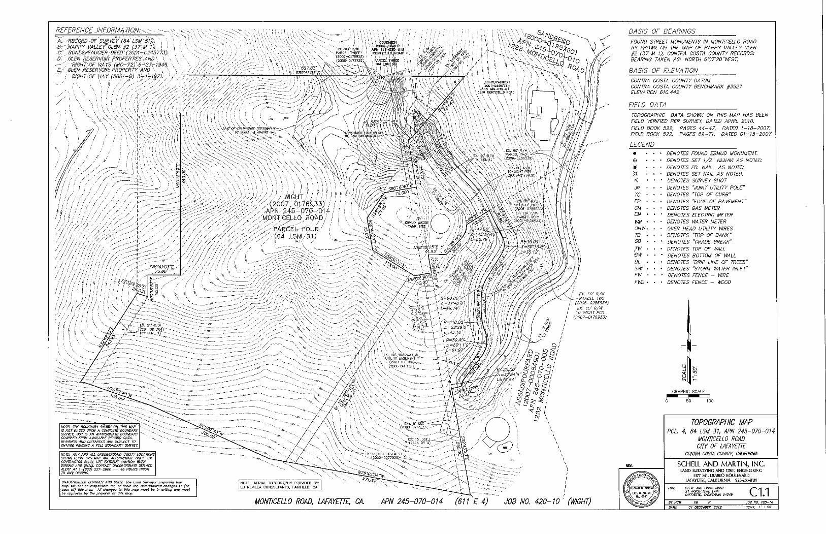
REFERENCE INFORMA HON
•RBCORD-Or SURVEYXB4 LSM'51):. '•-
\HAPPY.. VALLEY"GLEN #2 (57 M'l)i i
..BONES/FAUGIER. DEED • (2001-0245775).
..GLEN RESERVOIR PROPERTIES-AND \ •RfGHT'.OF WAYS (MC-72) 6-^23-r-1949..
.GLEN RESERVOIR: PROPERTY AND \ '. • RIGHTiOF WAY (5861-G) 3-4^1971.- .
BASIS OF BEARINGS
NOTE: ANY ANO ALL UNDERCKOUND UTILITY LOCATIONS SHOWN UPON THIS MAP APE APPROXIMATE ONLY. THE CONTRACTOR SHALL USE EXTREME CAUTION MIEN DIGGING ANO SHALL CONTACT UNDERGROUND SERVICE ALERT AT l-(BOO) 227-2600 — 48 HOURS PRIOR TO ANY DIGGING.
UNAUTHORIZED CHANGES AND USES: The Land Surveyor preparing this mop will not be responsible for, or liable for, unauthorized changes to (or uses of) this mop. All changes to this mop must be In writing and must •e approved by the preparer of this mop.
MONTICELLO ROAD, LAFAYETTE, CA. APN 245-070-014 (611 E 4) JOB NO 420-10 ' (WIGHT)
FOUND STREET MONUMENTS IN MONTICELLO ROAD
AS SHOWN ON THE MAP OF HAPPY VALLEY GLEN
#2 (37 M 1), CONTRA COSTA COUNTY RECORDS:
BEARING TAKEN AS: NORTH 6V7'20"WEST.
BASIS OF ELEVA TION
CONTRA COSTA COUNTY DATUM.
CONTRA COSTA COUNTY BENCHMARK §3527
ELEVATION 610.442
FIELD DATA
TOPOGRAPHIC DATA SHOWN ON THIS MAP HAS BEEN
FIELD VERIFIED PER SURVEY DATED APRIL 2010.
FIELD BOOK 522. PAGES 44-47, DATED 1-18-2007
FIELD BOOK 522. PAGES 69-71, DATED 01-15-2007.
LEGEND
n < JP TC
EP
GM
EM
m OHW
TB
GB
JW
1 9 I V
DL
SWI
FW
FWD
DENOTES FOUND EBMUD MONUMENT.
DENOTES SET 1/2" REBAR AS NOTED.
DENOTES ED. NAIL AS NOTED.
DENOTES SET NAIL AS NOTED.
DENOTES SURVEY SHOT
DENOTES "JOINT UTILITY POLE"
DENOTES "TOP OF CURB"
DENOTES "EDGE OF PAVEMENT"
DENOTES GAS METER
DENOTES ELECTRIC METER
DENOTES WATER METER
OVER HEAD UTILITY WIRES
DENOTES "TOP OF BANK"
DENOTES "GRADE BREAK"
DENOTES TOP OF WALL
DENOTES BOTTOM OF WALL
DENOTES "DRIP LINE OF TREES"
DENOTES "STORM WATER INLET"
DENOTES FENCE - WIRE
DENOTES FENCE - WOOD
GRAPHIC SCALE
0 5 0 100
TOPOGRAPHIC MAP PCL 4, 64 LSM 51, APN 245-070-014
MONTICELLO ROAD CITY OF lAFAYETTE
CONTRA COSTA COUNTY. CAUFORNIA
SCHELL A N D M A R T I N , I N C LAND SURVEYING A N D CIVIL ENGINEERING
3377 MT. D l \ B L O BOULEVAUD
LAFAYETTE, CALIFORNIA 925-283-8111
STEVE AND LINDA WIGHT 21 NORTHRIDGE lANE LAFAYETTE, CALIFORNIA 34549 C 1 . 1
JOB NO. 420-10 31 DECEMBER, 2012 SCALE I - .- 50'
cMu m a s WITH STONE 'FACING '-PER LANDSCAPE'. PLANS
SO" OAK
•' T/W (722pQ) B/W (717.00)
T / ^ (72J.$0)
':B/W (72JIOO) i \
J . ) T / ^ {720.O6)>
B/W (715.00).
T/W (713.00;'
B/W (708.0'
"V.
(eao.BbX.GB
END GRAVEL WMI. £ND^ GRADE mUSITION.
lEND-.CROSS-SLQl'E lYARP
-PROPERTT LINE \
.1 - \ . \ CL (682.86)
>- , . ENDAC PAVEMEHT.l V BEGIN GRAVEL TmSITION TO EXISTING.] .- -
!, 'BEGIN CROSS-SLOPE, WARP' | \
\(r.-. / y \ . s ' ^ j GRAVEL TRANSITION
• ' \ 1?" OAK,^ \
\ \ SQ mn
EP \ T/W 68U'S9..
^B/W 680.0 ( * / - - J
'•^H=I.S9'
CL (881,50) y.£P (68I.SI) EP8B2.00
,., ^ 10" BAr--f ' C - ' / ' J / S 682.20
"•' T0'68i,2O B/W S79.28~:~ H^J,92'
' 12".BAY
T/vr (7ISM) ; ; ~ /W (7i-3.5B) \ \
26"'OAK
J_r/W (7^11.58) ; % C^B/W, (706.5^)^J.^^^
jJ/W (716.00) \ \ ; B/W (713.58) I
f T/Wi(71l.5B) Ob -•^V8/W.(70E.&8)
'T/W (706.58) Gfl'S,
'\^B/W (706.58) T/W 1706.58) ENO
' B/W'(706,58)
(688.00)^ ) \i^^^^^J°>F^M^^^
RETAINING '//ALL WITH GUARDRAIL SEE DETAIL SHfET C3.0 \
r(m.i9) GL.(6S^.40) GB~ -
•Rc"Rr-cuRa,f/~x^
6' Hiclf CIMIN-UNt^fB^CE TO SE-INSTALLED
BEFORE CONSTRUCTION'CQt^HENCES
'.53):GB 'X (703.71). GB
SEE SHEET C2.0t
FRONT GF (706.32) •
,C (\B7,7^
TREti/CH 'Dl^h^
'C (701,33) r R c \ ^ ^ rg<^ fe^? l ^^
^ ^ ^ ^ ^ ^ ^ ^ ^ ^ ^ ^ ^ ^ ^ ^ ^ ^ ^ ^ ^ ^ ^ '
C fe/ftOfA T/&'(675,.59} PCC BEGIN Cr^OSS-SLOP^ WARP
-.a 674.33 •-•-„
-•T/C 674.50 ^ T/W-674.50
B/W 671:33, W=J, )7 ' " - - - „
C (672.42) CS'y
END-OVERiAr OF EX. PAVEMENT. BEGIN 'VERTICAL REAUGNtHENT AND
'NEW PAV£i4ENT SECTION. CL (672.26) GB'--.,
-EX. AC SeSm^.
, CUU (CAliS Wllh srcM£ FACING— , PEI^ LANDSCAPE PLANS • |
COURNEEN (2009-13491)
APN 2 4 5 - 0 7 0 - 0 1 3 MONTICELLO ROAD
PARCEL THREE (64 LSM 31J
TYPE T6'm.,ixiERmn}-
l/H (?2e.W} oa 725.0
B/W (7I9.S0).
SEE SHEET C2.00
I/W (717.85) ^ B/W 717.85 Y
IJ- OAK SJ- OAK
\ T/W (717.53) ""•., B/W (716.00)
LOWPOINI INLET IN lAWN WITH INLET GRATE 3 ABOVfLkWN SURFACE
' ih" OAK ,
rVi -Va^ PERUEA8LE PAVERS rVi -Va^ / / / / / / / / / / / / ' / / GROOVED CONCRETE PER RRE DEPARTMENT STANOAWS SLOPE GREATER THAN I6X
GRAVEL ROAD / PARKING AREAS
10 2 0 3 0
REVISED: MAY 5. 2014
BIORHENTION FILTER GARDEN
GRADING Sc DRAINAGE PLAN PCL. 4, 64 LSM 31. APN 245-070-014
MONTICELLO ROAD an OP lAFAYETTE
CONTRA COSTA COUNTY. CALIFORNIA
SCHELL AND MARTIN, INC l A N D SURVEYING A N D CIVIL ENGINEERING
3377 MT. DIABLO BOUIEVARD
LAFAYETTE, CALIFORNIA 925-283-8111
STEVE AND UNDA WIGHT 21 NORTHRiaGE LANE tAFAYETTE, CAUFORNIA 94549
BY HGM f B P MTE: IS OCTOBER. 2013
C 2 . 0 1 JOB NO. 4X1-10 SCALE 1" = W
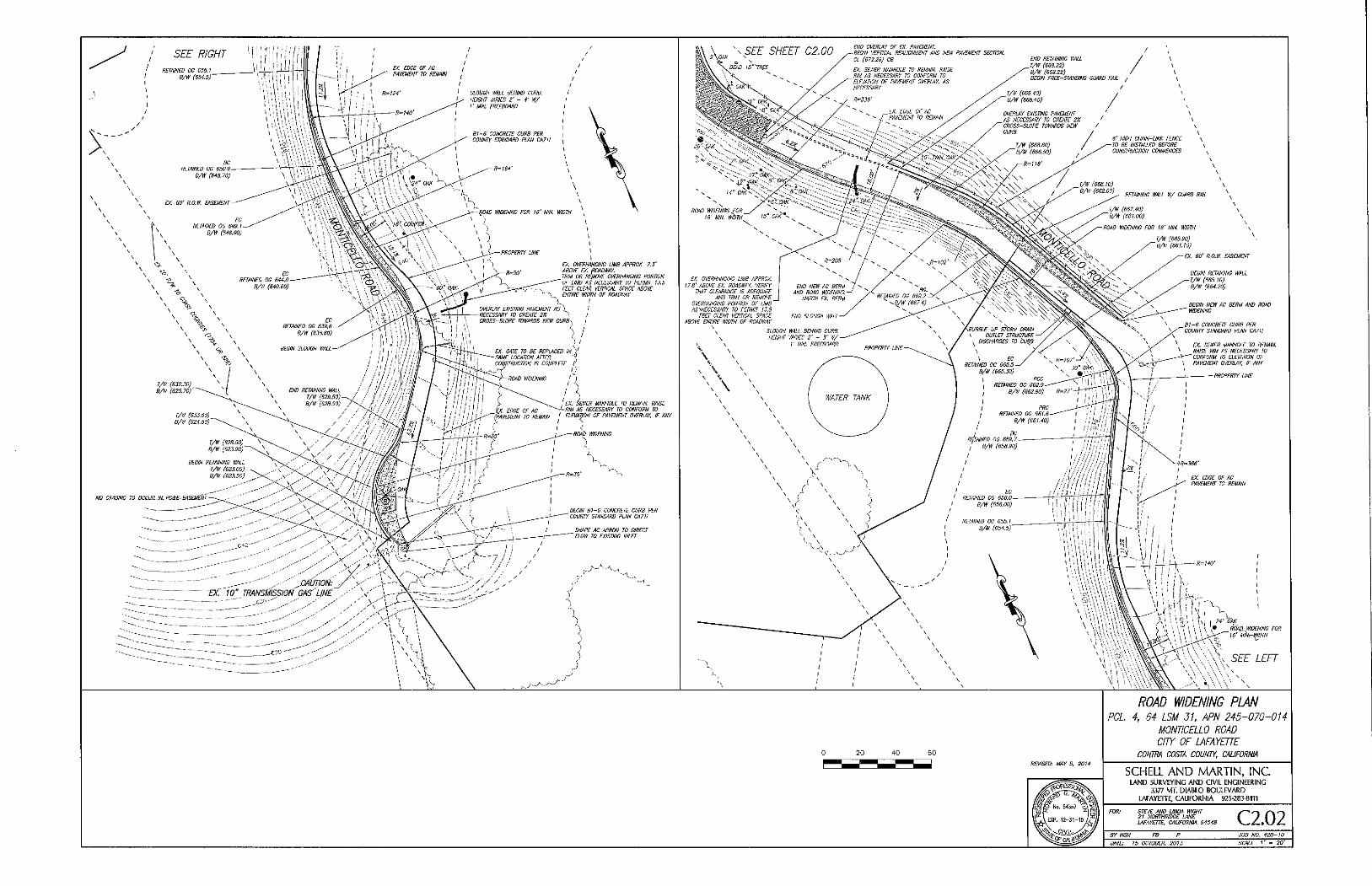
D(. GATE TO BE REPLACED IN }
SAME LOCATION AFTER -{
COt^TRUCWN IS COMPLETE. I[
~~^ROAD WIDENING
/ s 'EX. §^WER MANHOLE TO REMAIN RAISE
u.-, ..r.^.L " V "'H AS NECESSARY TO CONFORM TO
'(PAVEMENT TO REMAIN ' ELEVAWN OF PAVEMENT OVERLAY, IF ANY
NO GRADING TO 0CGUS...1N-PG&E. EASEI^ENT
^CAUTION
EX. 10" TRANSMISSION OAS' UNE
END OVERLAY OF EX. PAVEMENT.
-BESm VERTICAL REALIGNMENT AND NEW PAVEMENT SECTION.
CI (572.2S) GB
6' NIGH CHAIN-LINK FENCE
TO BE INSTALLED BEFORE
CONSTRUCTION COMMENCES
EX. SO' R.O.W. EASEMENT
BEGIN RETAINING WALL
T/W (665,10)
B/W (864.20)
BEGIN NEW AC BERM AND ROAD
WIDENING
B I - 6 CONCRETE CURB PER
COUNW STANDARD PLAN CA7II
EX. SEWER MANHOLE TO REMAIN.
RAISE RM AS NECESSARY TO
CONFORM TO ELEVATION OF
\ PAVEMENT OVERLAY, IF AN/
PROPERTY UNE
4 0 BO
REVISED: MAY 5, 2014
ROAD WIDENING PLAN PCL 4, 64 LSM 31. APN 245-070-014
MONTICELLO ROAD aw OF lAFAYETTE
CONTRA COSTA COUNTY, CALIFORNIA
SCHELL AND MARTIN, INC LAND SURVEYING A N D CIVIL ENGINEERING
3377 MT. DIABLO BOULEVARD
LAFAYETTE, CAUFORNIA 925-283-81TI
STEVE AND UNDA WIGHT
2! NORTHRIDGE LANE
LAFAYETTE, CAUFORNIA 94549 C 2 . 0 2 JOB NO. 420-10
T>ATE: 15 OCTOBER, 2013 SCALE 1" = 20'
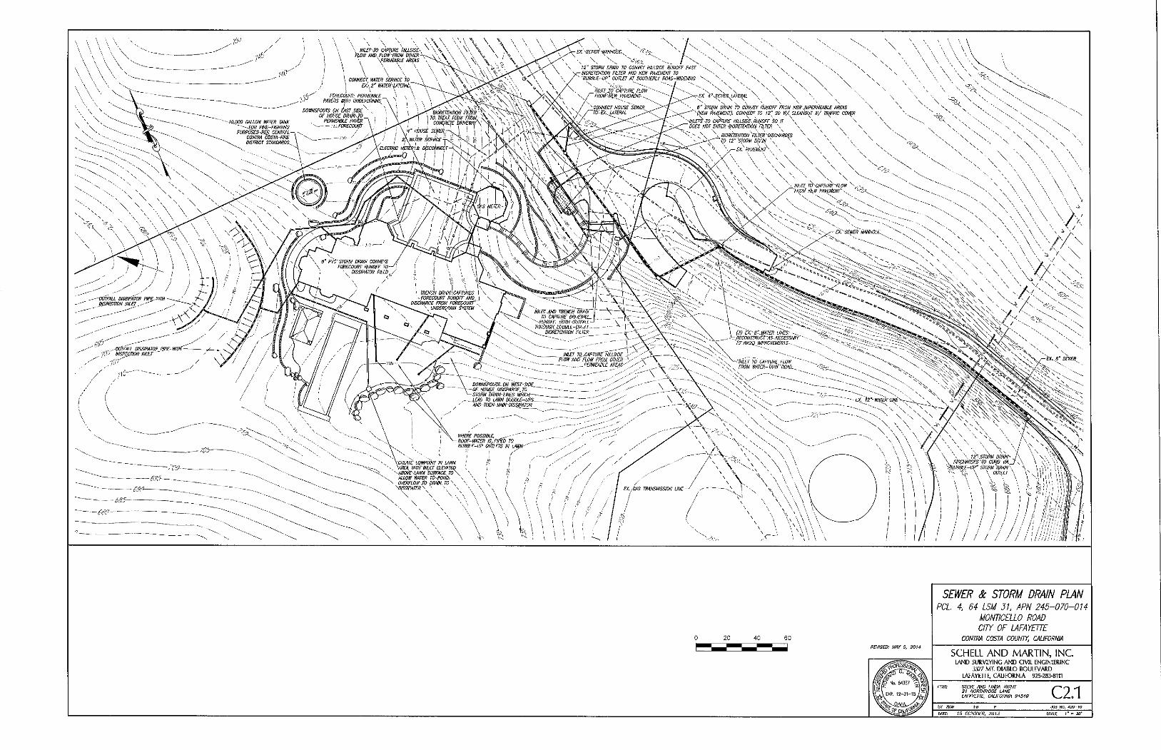
I \ \ ' \ \ \ "\ O^Vi- '- ' J < \ V ' X ^'^'^ ^ C'wici' HILLSIDE RUNOFF PAST
\ V, -K'- \ '-yr BIORETENTION FILTi
2 0 4 0 6 0
RFI/ISEP: IMY 5, 2014
SEWER & STORM DRAIN PLAN PCL 4, 64 LSM 31. APN 245-070-014
MONTICELLO ROAD CITY OF lAFAYETTE
CONTRA COSTA COUNTY. CAUFORNIA
SCHELL AND MARTIN, INC lAND SURVEYING A N D CIVIL ENGINEERING
3377 MT. DIABLO BOULEVARD LAFAYmE, CALIFORNIA 925-283-8111
STEK AND LINDA WIGHT 21 NORTHRIDGE LANE LAFAYETTE, CALIFORNIA 94549 C 2 . 1
JOB NO, 410-to
CUTE: 15 OCTOBER, 2013
•in V'\n\'\s \'^\-\ III
X . : / / A N \ ' ^ < ^ V # A ^ C C < ^ #
COtiQRET^ OITpH \ p, //; ; j j j I I I \ \\
\
~k^^iiffpNf / ,>? / / / /
//iTOm pm^'',6<iTFAtt-AT~_ 'y / / '////STORM DHAIUS ,BiJJTAtt-AT-'^~ y 'pRIZQI^AtpiS^P/.tOR PJPES-
' N \ \ \ \ \ \ ^ \ \ \ \ \ > ; \ \ \ \ \ \ \ \ ^ \ \ \ \ ^ \
\
I •
/ PX.Ao': •SA& L m
- V, V •• ' V X
/ / / / / / / ! ! n \ . - - ' A A - y $ ^ A y . : v / j A / / I A y A : A A A A A A :
T ^ A ' / i i ' y A : - - A : A A ^ A 0 ^
I ', INLEf TO CAPTURE: HILLSIDE \.oJ. / } \ \ \ "-^-^ \
A\\ \ ^ \ \ \ V \ \". il \J:.^^K\SfqRM.miN \ \
^ \ \\'W/fl£7wW^ kjER TREAA RUN^JT
V.fROI^-JI^PERiiEABLf DRIVEWAY. AND\ • • V^V' ••, \-Wai[ flOOTlW 1? ROAD. TREAl^Dl \ ,
\\\ \ \\ \ \\\\\\\
^Wfe^x-^ • V A \ \ \ \ \ \ \ \ \ \ \ \'\^
>;s^li-Ol{LtT,m\NE}^.Vi''^S. >", n
J4 I -TO EX. STORM DRfJN\INLn
-A' W'/y'yy''>^'r^^^-- \ / /
€ l , : . / n m U m / ' i W / r k ^ ' ^ ^ . / y \
A-->--y\T\^ \ \ \
- G f . PRIVATE ROAD
EX. ROADSIDE Sm.E
^ - ^ y v w t v - / - -
V: v y-\
A y . £ m & L / //^A^
flfWfT, FLomS,Aj:ONG flEW CURB. \ IS blRECTED TO,_EXIST!/IS'INLET''
y; )^pi/sfO!iM jmi]i\ \^ \
AAA^'^""""' i I ,.J.\-~\A ,' / EX. HOUSE
5 0 100 150
REVISED: tMY S. 20H tl OCTOBER. 2013
PROPOSED STORM DRAIN
STORM DRAIN OVERVIEW PCL 4, 64 LSM 31. APN 245-070-014
MONTICELLO ROAD CIW OF LAFAYETTE
CONTRA COSTA COUNTY. CAUFORNIA
SCHELL AND MARTIN, INC LAND SURVEYING A N D CIVIL ENGINEERING
3377 MT. DIABLO BOULEVARD
LAFAYETTE, CALIFORNIA 925-283-8111
STEVE AND LINDA WIGHT 21 NORTHRIDGE LANE LAFAYETTE, CALIFORNIA 94549 C 2 . 2
JOB MO. 420-10
DATEi J5 OCTOBER. 2013 SCi lE I" - so'
AS SHOWN ON SHEETS C2.00 & C2.02
LEGEND
18' mOE FIRE ENGINE PATH AFTER COMPLETION OF PROPOSED ROAD WIDENING
ADDITIOm. CONCRETE, ASPHALT OR OTIIER HARD SURFACE OUTSIDE REOUIRED FIRE ENGINE PATH
SEE SHEET C2.4
EX. 60' R.O.Vi. EASEMENT
PROPERTf UNE
0 20 40 60
REVISED: MAY 6, 2014
FIRE ENGINE ACCESS EXHIBIT PCL. 4. 64 LSM 31. APN 245-070-014
MONTICELLO ROAD CITY OF LAFAYETTE
CONTRA COSTA COUNTS. CALIFORNIA
SCHELL A N D M A R T I N , I N C LAND SURVEYSNG AND CIVIL ENGINEEKING
3377 MT. DIABLO BOULEVARD
lAFAYEnE, CALIFORNIA 925-283-8111
FOR: STEVE AND LINDA WIGHT 21 NORTHRIDGE LANE LAFAYETTE. CALIFORNIA 34543 C 2 . 3
BY HGM FB P JOB NO. 420-10
DATE: 15 OCTOBER, 2013 SCALE J ' = 20'
LEGEND
' w W -V-A>-:'~V-/ . y~< y-i /-<
? B ' IWOf" FIRE ENGINE PATH AFTER COIAP!£TION OF PROPOSED ROAD WDENING AND DRIVEWAY MPROVEHENTS
ADDITIONAL CONCRHE, ASPHALT OR OTHER HARD SURFACE OUTSIDE REOUIRED FIRE ENGINE PATH
BC BEGIN CURVE EC END CURVE GB GRADE BREAK HP HIGH POINT LP LOW POINT LT LEFT PCC POINT OF COMPOUND CURVATURE PRC POINT OF REVERSE CURVATURE R RADIUS Rl RIGHT
0 10 20 30
NOTE:
THE REOUIRED 16' WIDE EIRE ENGINE PATH
REFLECTS THE PROPOSED ROAD WIDENING
AS SHOWN ON SHEETS C2.00 & C2.02
FIRE ENGINE ACCESS EXHIBIT PCL 4, 64 LSM 31. APN 245-070-014
MONTICELLO ROAD
cm OF LAFAYETTE CONTRA COSTA COUNTY, CAUFORNIA
SCHELL AND MARTIN, INC LAND SURVEYING AND CIVIL ENGINEERING
3377 MT. DIABLO BOULEVARD
L^FAVETTE, CAUFORNIA 925-283-8111
FOR: STEVE AND UNDA WIGHT 21 NORTHRIDGE LANE lAFAYETTE, CAUFORNIA 94549 C 2 . 4
BY HGM FB P JOB NO. 420-10
DATE: 15 OCTOBER. 2013 SCALE 1" = 10'
PHOTOGRAPH LOCATION.
CIRCLE IS AT POSITION OF CAMERA.
ARROW POINTS IN DIRECTION OF PHOTO
1. END EAST BERM.
LOOKING UPHILL TO SOUTH
2. BEGIN WEST BERM.
LOOKING DOWNHILL
TO NORTH
3. EAST BERM.
LOOKING DOWNHILL
TO NORTHEAST
LOOKING UPHILL 5. FAILED PAVEMENT AT
CULVERT ENTRANCE.
LOOKING WEST
5A. CLOSE-UP OF
FAILED PAVEMENT
6. TWO CULVERTS
UNDER DRIVEWAY.
LOOKING NORTHWEST
'ALL AT cm
7. WATER FLOW
AND PONDING IN
MIDDLE OF STREET
RESHAPE ASPHALT DIKE TO DIRECT FLOW TO INLET
ENO OF EXISTING ASPHALT BERM
EXISTING CORRUGATED METAL CULVERT
LOW POINT IN EXISTING ROAD WHERE ROAD
FAILURE IS OCCURING AS A RESULT OF EROSION
SAWCUT ASPHALT AND REBUILD ROAD SECTION.
PAVE TO A NEATLY TRIMMED BUTT JOINT
END OF EXISTING ASPHALT BERM
CONSTRUCT CONCRETE WING WALL AS REOUIRED TO CONFORM TO EXISTING BANK
INSTALL TYPE" C" SWI AT EXISTING PIPE END WITH BOX FLUSH TO NEW CONCRETE HEADWALL EXTEND CULVERT THROUGH HEADWALL
PLAN VIEW NOT TO SCALE
_NEW ASPHALT BERM 'TO DIRECT FLOW
EXISTING CORRUGATED METAL CULVERT
EXISTING GROUND SURFACE
INSTALL TYPE " C " INLET OVER END OF EXISTING PIPE ANO FORM HEADWALL
FACE TO ALIGN WITH INLET WITH PIPE EXTENSION THROUGH NEW HEADWALL
CONSTRUCT J' CUTOFF WALL UNDER HEADWALL TO PREVENT
UNDERCUniNG OF PIPE
INSTALL LARGE DIAMETER ROCK BOULDERS TO DISSIPATE ENERGY
CONSTRUCT CONCRETE WING WALL TO ALIGN WITH ROAD
SHAPE NEW ASPHALT SURFACE TO DIRECT FLOW FROM BOTH DIRECTIONS INTO INLET
CONCRETE WING WALL WITH J ' CUTOFF WALL FROM BOTH DIRECTIONS INTO INLET
INSTALL LARGE DIAMETER ROCK BOULDERS TO DISSIPATE ENERGY
SECTION NOT TO SCALE
PROPOSED HEADWALL AND PAVEMENT RECONSTRUCTION
20 40 60
REVISED JUNE 12. 2014
CONCEPTUAL OFFSITE DRAINAGE IMPROVEMENTS
PCL 4. 64 LSM 31, APN 245-070-014 MONTICELLO ROAD CITY OF LAFAYEnE
CONTRA COSTA COUNTY. CALIFORNIA
SCHELL AND MARTIN, INC lAND SURVEYING AND QVSL ENGINEERING
3377 MT. DIABLO BOULEVARD LAFAYETTE, CALIFORNIA 925-283-8111 STEVE AND UNDA WIGHT 21 NORTHRIDGE LANE LAFAYETTE, CALIFORNIA 94549 C 2 . 5
MB UO. 4!0-I0
me: 15 OCTOBER, 2013 SCALE I' - so'
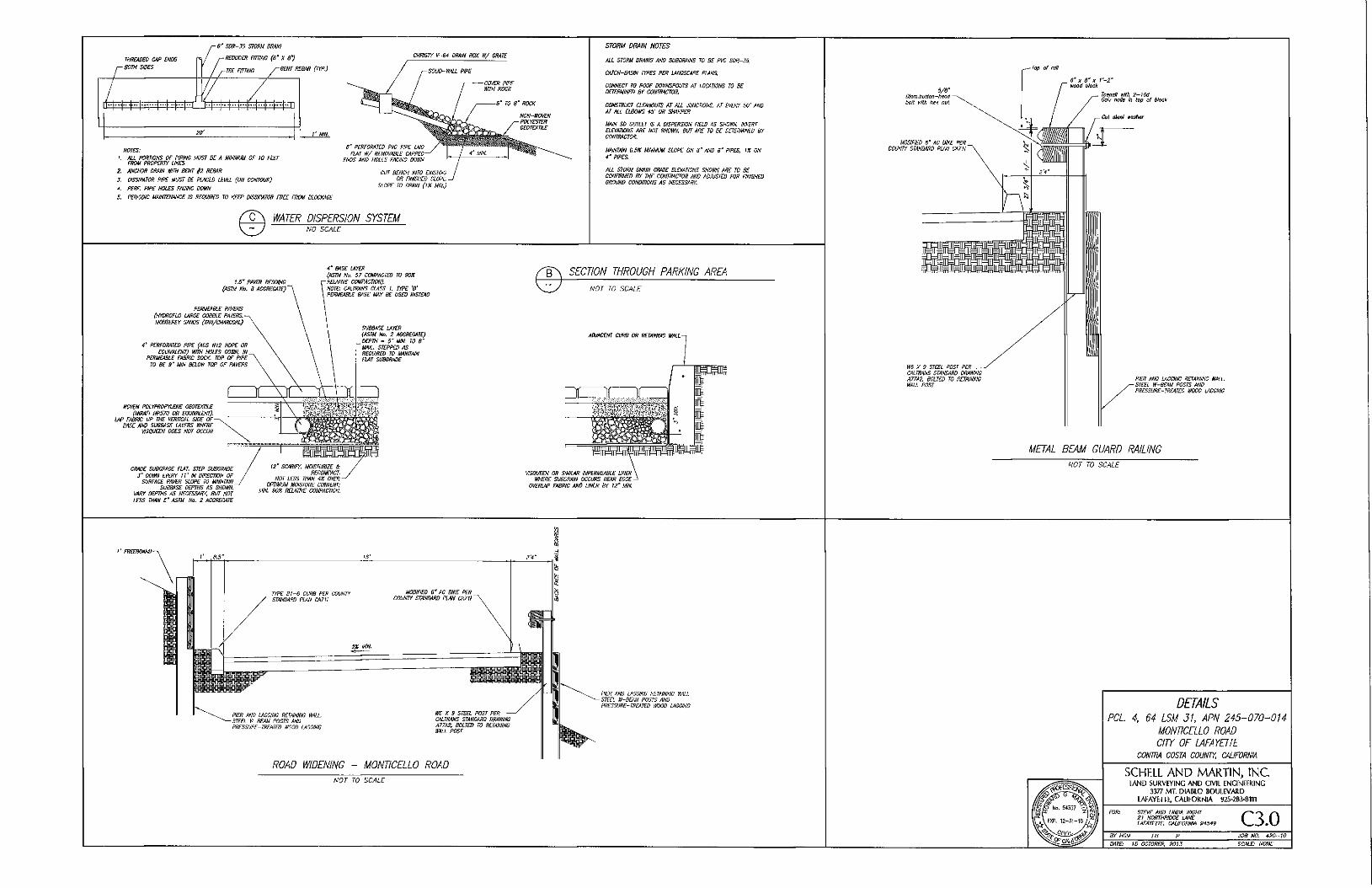
- 6 " SDR-J5 STORM DRAM
THREADED CAP ENDS 1 / ^REDUCER FimUO (6" X 8')
y— BOTH SIDES j - T E E FTTTim y^BENT REBAR (TYP.)
-
^ 1 1 T r - i 1 r r 1 1 — i - ; |- r-r-"-i r i F i u
20' I' MIN.
CHRISTY V-64 DRAIU BOX W/ GRATE
NOTES:
}. AIL PORTIONS OF PIPING MUST BE A MINIMUM OF 10 FEET FROM PROPERTY UNES
2. AUCHOR DRAIN WIN BENT f2 REBAR
J , DISSIPATOR PIPE MUST BE PIACED LEVEL (ON CONTOUR)
4. PERF. PIPE HOLES FACING DOWN
5. PERIODIC MAINTENANCE IS REOUIRED TO KEEP DISSIPATOR FREE FROM BLOCKAGE
8' PERFORATED PVC PIPE LAID
FIAT W/ REMOVABLE CAPPED
ENDS AND HOLES FACING DOWN
CUT BENCH INTO EXISTING
OR FINISHED SLOPE
SLOPE TO DRAIN (IK MIN.)
(^0^ WATER DISPERSION SYSTEM NO SCALE
STORM DRAIN NOTES
ALL STORM DRAINS AND SUBDRAINS TO BE PVC SDR~35:
CATCH-BASIN rrPES PER UNDSCAPE PLANS.
CONNECT TO ROOF DOWNSPOUTS AT LOCATIONS TO BE
DHERMINED BY CONTRACTOR.
CONSTRUCT CLCiNOUTS AT ALL JUNCTIONS, AT EVERT 50' AND
AT ALL ELBOWS 45' OR SHARPER.
MAIN SD OUnn IS A DISPERSION FIELD AS SHCWN. mERT
ELEVATIONS ARE NOT SHOWN, BUT ARE TO BE DETERWNED BY CONTRACTOR.
MAJNTAJN O.SX MINIMUM SLOPE ON 6" AND 8' PIPES, 11 ftV
PIPES.
ALL STORM DRAIN GRATE ELEVATIONS SHOWN ARE TO BE
CONRRMED BY THE CONTRACTOR AND ADJUSTED FOR FINISHED GROUND CONDITIONS AS NECESSARY.
1.5' PAVER BEDDING
(ASTM No. 8 AGGREGATE)
PERMEABLE PAVERS
(HYDROFLO LARGE COBBLE PAI^RS.
MONKEY SANDS (TAN/CHARCOAL)
4" PERFORATED PIPE (ADS NI2 HOPE OR
EOUIVALENT) WITH HOIES DOWN. IN
PERMEABLE FABRIC SOCK TOP OF PIPE
TO BE 9' MIN BELOW TOP OF PA\^RS
WOVEN PDLYPROPYLDJE GEOTEXTILE
(UlRAfl HP370 OR EQUIVALENT). LAP FABRIC UP THE VERTICAL SIDE OF
BASE AND SUBBASE LAYERS WHERE VISOUEEN DOES NOT OCCUR
GRADE SUBGRADE FIAT. STEP SUBGRADE
J " DOWN EVERY iV IN DIRECTION OF SURFACE PAVER SLOPE TO MAINTAIN
SUBBUSE DEPTHS AS SHOm VARY DEPTHS AS NECESSARY, BUT NOT
LESS THAN S' ASTM. No. 2 AGGREGATE
4' BASE IAY£R
(ASTM No. 57 COMPACTED TO 90%
REUiTTVE COMPACTION)
NOTE: CALTRANS CUSS I. TYPE 'B'
PERMEABLE BASE MAY BE USED INSTEAD
SUBBASE LAYER
(ASTM Wo, 2 AGGREGATE)
DEPTH = S ' MIN. TO 8'
MAX.. STEPPED AS REOUIRED TO MAINTAIN FIAT SUBGRADE
B\ SECTION THROUGH PARKING AREA
NOT TO SCALE
ADJACENT CURB OR RETAimO WALL
12" SCARIFY. MOISTURIZE & RECOMPACT.
NOT LESS THAN 4Z OVER-OPTIMUI^ MOISTURE CONTENT;
MIN. 90% REIAIIVE COMPACTION.
VISOUEEN OR SIMItAR IMPERMEABLE UNER WHERE SUBDRAIN OCCURS NEAR EDGE
OVERLAP FABRIC AND UNER BY 12" MIN.
Top of rail
5/3" Diam.button-tieail boll Kilh nul.
MODIHED 8' AC DIKE PER COUNTY STAHDARD PLAN CA7II
6' X 8' X f - 2 ' Kood bhck
Siilll
W5 X 9 STEEL POST PER
CALTRANS STANDARD DRAWING
A77A2. BOLTED TO RETAINING
WAU POST
Tnenail with 2-IBd Galv noils In top ol block
Cut aimi traher
PIER AND LAGGING RETAINING WAIL. STEEL W-BEAM POSTS AND PRESSURE-TREATED WOOD LACCINC
METAL BEAM GUARD RAILING
NOT TO SCALE
I' .8.5
TYPE BI-6 CURB PER CQUNTf STANDARD PLAN CA?!!
MODIFIED 6' AC DIKE PER COUNTY STANDARD PLAN CA7U
PIER AND LAGGING RETAINING WALL STEEL W-BCAM POSTS AND PRESSURE-TREATED WOOD LAGGING
WB X 9 STEEL POST PER CALTRANS STANDARD DRAWING A77A2, BOLTED TO RETAINING WALL POST
ROAD WIDENING - MONTICELLO ROAD
NOT TO SCALE
PIER AND LAGGING RETAINING Y.'ML.
- STEEL W-BEAM POSTS AND
PRESSURE-TREATED WOOD LAGGING DETAILS PCL 4. 64 LSM 31. APN 245-070-014
MONTICELLO ROAD CITY OF lAFAYETTE
CONTRA COSTA COUNTY. CALIFORNIA
SCHELL AND MARTIN, INC LAND SURVEYING AND CIVIL ENGINEERING
3377 MT, DIABLO BOULEVARD LAFAYETTE, CALIFORNIA 925-2B3-8Tn STEVE AND LINDA WIGHT 21 NORTHRIDGE LANE LAFAYETTE, CALIFORNIA 94549 C 3 . 0
JOB NO. 420-10
DATE: 15 OCTOBER. 2015 SCALE: NONE
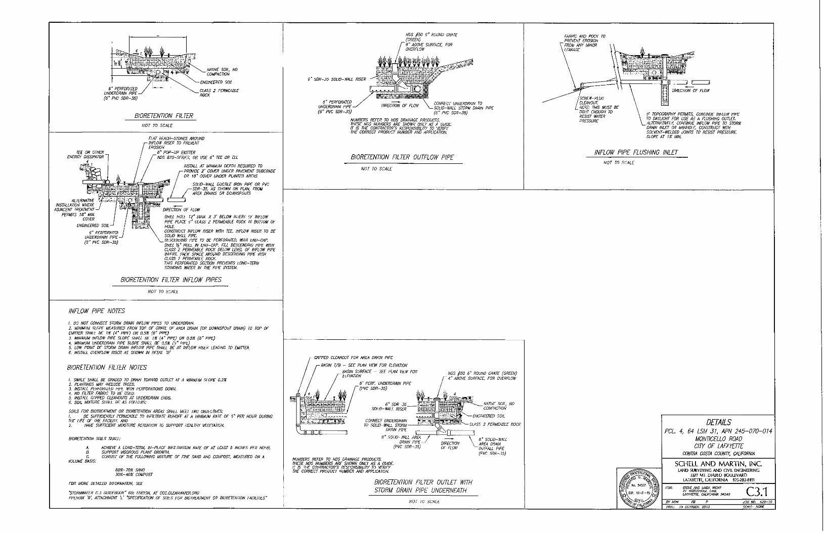
e" PERFORATED UNDERDRAIN PIPE-(6" PVC SDR-55)
NATIVE SOIL, NO ' COMPACTION
•ENGINEERED SOIL
CLASS 2 PERMEABLE ROCK
BIORETENTION FILTER
NOT TO SCALE
TEE OR OTHER ENERGY DISSIPATOR
ALTERNATIVE INSTALLATION WHERE
ADJACENT TREATMENT PERMITS IB' MIN.
COVER
FIAT BEACH-STONES AROUND INFLOW RISER TO PREVENT EROSION
6" POP-UP EMITTER NDS 62Q~SERIES. OR USE 5 " TEE OR ELL
ENGINEERED SOIL
6" PERFORATED UNDERDRAIN PIPE (B" PVC SDR-35)
INSTALL AT MINIMUM DEPTH REQUIRED TO PROWE 2' COVER UNDER PAVEMENT SUBGRADE OR IS" COVER UNDER PLANTED AREAS
SOUO-Wm DUCTILE IRON PIPE OR PVC SDR-35, AS SHOWN ON PLAN. FROM AREA DRAINS OR DOWNSPOUTS
DIRECTION OF FLOW
DRILL HOLE 12° DIAM. X J' BELOW INVERT OF INFLOW PIPE PLACE 6" CLASS 2 PERMEABLE ROCK IN BOTTOM OF HOLE. CONSTRUCT INFLOW RISER WITH TEE. INFLOW RISER TO BE SOLID WALL PIPE DESCENDING PIPE TO BE PERFORATED, WITH END-CAP. DRILL f?" HOLE IN END-CAP. FILL DESCENDING PIPE WITH CLASS 2 PERMEABLE ROCK BELOW LEVEL OF INFLOW PIPE INVERT. PACK SPACE AROUND DESCENDING PIPE WITH CLASS 2 PERMEABLE ROCK. THIS PERFORATED SECTION PREi^NTS LONG-TERM STANDING WATER IN THE PIPE SYSTEM.
NDS §50 6" ROUND GRATE (GREEN) 6" ABOVE SURFACE, FOR OVERFLOW
6 SDR-35 SOLID-WALL RISER
6" PERFORATED UNDERDRAIN PIPE (6" PVC SDR-35)
CONNECT UNDERDRAIN TO SOLID-V/ALL STORM DRAIN PIPE (6" PVC SDR-35)
NUMBERS REFER TO NDS DRAINAGE PRODUCTS THESE NDS NUMBERS ARE SHOWN ONLY AS A GUIDE. IT IS THE CONTRACTOR'S RESPONSIBILITY TO VERIFY THE CORRECT PRODUCT NUMBER AND APPUCATION.
BIORETENTION FILTER OUTFLOW PIPE
NOT TO SCALE
BIORETENTION FILTER INFLOW PIPES
NOT TO SCALE
INFLOW PIPE NOTES
1. DO NOT CONNECT STORM DRAIN INFLOW PIPES TO UNDERDRAIN. 2 MINIMUM SLOPE MEASURED FROM TOP OF GRATE OF AREA DRAIN (OR DOWNSPOUT DRAIN) TO TOP OF EMITTER SHALL BE IX (4' PIPE) OR 0.5% (6" PIPE) 3. MINIMUM INFLOW PIPE SLOPE SHALL BE 1% (4' PIPE) OR 0.5% (6' PIPE) 4. MINIMUM UNDERDRAIN PIPE SLOPE SHALL BE 0.5% (6' PIPE) 5. LOW POINT OF STORM DRAIN INFLOW PIPE SHALL BC AT INFLOW RISER LEADING TO EMITTER 6. INSTALL OVERFLOW RISCR AS SHOWN IN DETAIL 'D'
BIORETENTION FILTER NOTES
h SWALE SHALL BE GRADED TO DRAIN TOWARD OUTLET AT A MINIMUM SLOPE 0.2% 2. PLANTINGS MAY INCLUDE TREES 3. INSTALL PERFORATED PIPE WITH PERFORATIONS DOWN. 4. NO FILTER FABRIC TO BE USED. 5. INSTALL CAPPED CLEANOUTS AT UNDERDRAIN ENDS. 6. SOIL MIXTURE SHALL BE AS FOLLOWS:
SOILS FOR BIOTREATMENT OR BIORETENTION AREAS SHALL MEET TWO OBJECTIVES: 1. BE SUFFICIENTLY PERMEABLE TO INFILTRATE RUNOFF AT A MINIMUM RATE OF 5 " PER HOUR DURING THE LIFE OF THE FACIUVf, AND 2. HAVE SUFRCIENT MOISTURE RETENTION TO SUPPORT HEALTHY VEGETATION.
BIORETENTION SOILS SHALL:
A. ACHIEVE A LONG-TERM. IN-PLACE INFILTRATION RATE OF AT LEAST 5 INCHES PER HOUR 8. SUPPORT VIGOROUS PLANT GROWTH. C. CONSIST OF THE FOLLOWING MIXTURE OF FINE SAND AND COMPOST, MEASURED ON A
VOLUME BASIS:
60%-70% SAND 3D%-40% COMPOST
FOR MORE DETAILED INFORMATION, SEE
'STORMWATER C.3 GUIDEBOOK" 6th EDTTION, AT CCC.CLEANWATER.ORG PPENDIX 'B; ATTACHMENT V "SPECIFICATION OF SOILS FOR BIOTREATMENT OR BIORETENTION FACILITIES"
CAPPED CLEANOUT FOR AREA DRAIN PIPE
-BASIN T/8 - SEE PLAN WaV FOR ELEVATION
BASIN SURFACE - SEE PLAN VIEW FOR ELEVATION
6' PERF UNDERDRAIN PIPE '(PVC SDR-35)
6' SDR-35 SOLID-WALL RISER
CONNECT UNDERDRAIN TO SOLID-WALL STORM
DRAIN PIPE
SOLID-WALL AREA DRAIN PIPE
(PVC SDR-35)
NDS §50 6" ROUND QRATE (GREEN) 4" ABOVE SURFACE, FOR OVERFLOW
NATIVE SOIL, NO COMPACTION
ENGINEERED SOIL
:biSS 2 PERMEABLE ROCK
SOLID-WALL AREA DRAIN OUTFALL PIPE (PVC SDR-35)
NUMBERS REFER TO NDS DRAINAGE PRODUCTS. THESE NDS NUMBERS ARE SHOWN ONLY AS A GUIDE. IT IS THE CONTRACTOR'S RESPONSIBILITY TO VERIFY THE CORRECT PRODUCT NUMBER AND APPLICATION
BIORETENTION FILTER OUTLET WITH
STORM DRAIN PIPE UNDERNEATH
NOT TO SCALE
FABRIC AND ROCK TO PREVENT EROSION FROM ANY MINOR
. LEAKAGE
SCREW-PLUG CLEANOUT NOTE: THIS MUST BE TIGHT ENOUGH TO RESIST WATER PRESSURE
3
DIRECTION OF FLOW
IF TOPOGRAPHY PERMITS. CONTINUE INFLOW PIPE TO DAYLIGHT FOR USE AS A FLUSHING OUTLET. ALTERNATIVELY, CONTINUE INFLOW PIPE TO STORM DRAIN INLET OR MANHOLE CONSTRUCT WITH SOLVENT-WELDED JOINTS TO RESIST PRESSURE SLOPE AT 1% MIN.
INFLOW PIPE FLUSHING INLET
NOT TO SCALE
DETAILS PCL. 4, 64 LSM 31, APN 245-070-014
MONTICELLO ROAD CIW OF lAFAYETTE
CONm COSTA COUNTY. CAUFORNIA
SCHELL AND MARTIN, INC imo SURVEYING A N D CIVIL ENGINEERING
3377 MT, DIABLO BOULfVARD LAFAYETTE, CALIFORNIA 925-Z&3-eni
STEVE AND UNDA WICHT 21 NORTHniDGE LANE LAFAmTE, CAUFORNIA 94549 C 3 . 1
JOB NO. 420-10
DATE: 15 OCTOBER, 2013 SCALE: NONE
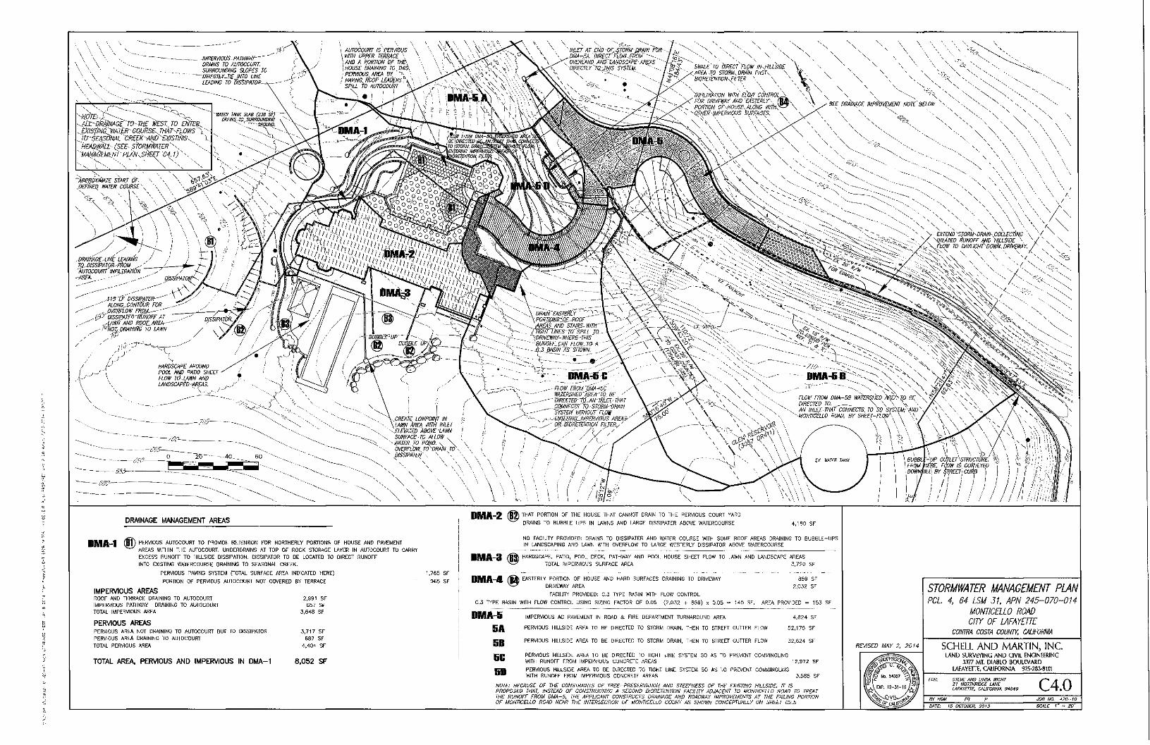
IMBERWUS PAmWAY"" DRAINS TO AUTOCOURT SURROUNDING SLOPES TO
- DIRECTyf-TIEJNTO LINE LEADING TO DISSIPATOR-
K w E ^ - . . ; . • • • ^ • • V -••4Ll~~9kAlmGCT0-TJiE V/ESl TO ENfES. EXl3flNa mXE:R -GQU'RSE. THAr'fl.OWS""). '•'
, TO-SEASdNAL CREEtAt^D'-EXISnNe.. \ HEAkwALt (SEE- StORMVfAJER''^.^
'"MANAGEMENT-PlAN^Sh)sq^^4.
-•APm&xiilATE START OK MmEQ WATER COURSE-
DRAINAGE MANAGEMENT AREAS -2 THAT P O R T I O N O F T H E H O U S E THAT C A N N O T DRAIN T O T H E P E R V I O U S C O U R T Y A R D
• R A I N S TO B U B B L E U P S IN L^WNS AND L A R G E D I S S I P A T E R A B O V E W A T E R C O U R S E 4 , 1 6 0 S F
DMA-1 ® P E R V I O U S A U T O C O U R T T O P R O V I D E R E T E N T I O N F O R N O R T H E R L Y P O R T I O N S O F H O U S E AND P A V E M E N T
A R E A S WITHIN T H E A U T O C O U R T , U N D E H D R A I N S AT T O P O F R O C K S T O R A G E L A Y E R IN A U T O C O U R T T O C A R R Y
E X C E S S R U N O F F T O H I L L S I D E O l S S I P A T I O N . D I S S I P A T O R T O B E L O C A T E D TO O I R E C T R U N O F F
INTO E X I S T I N G W A T E R C O U R S E DRAINING T O S E A S O N A L C R E E K .
NO F A C I L I T Y P R O V I D E D : D R A I N S T O D I S S I P A T E R AND WATER C O U R S E WITH S O M E R O O F A R E A S DRAINING TO B U B B L E - U P S
IN L A N D S C A P I N G AND LAWN WITH O V E R F L O W T O L A R G E W E S T E R L Y D I S S I P A T O R A B O V E W A T E R C O U R S E
H A R D S C A P E , PATIO, P O O L D E C K , PATHWAY AND P O O L H O U S E S H E E T F L O W TO LAWN AND L A N D S C A P E A R E A S
TOTAL I M P E R V I O U S S U R F A C E A R E A 3 , 7 2 0 S F
P E R \ f l O U S PAVING S Y S T E M f O T A L S U R F A C E A R E A INDICATED HERE)
P O R T I O N O F P E R V I O U S A U T O C O U R T NOT C O V E R E D B Y T E R R A C E
IMPERVIOUS AREAS R O O F AND T E R R A C E DRAINING T O A U T O C O U R T 2 , 9 9 1 S F
I M P E R V I O U S PATHWAY DRAINING T O A U T O C O U R T B 5 7 S f
T O T A L I M P E R V I O U S A R E A 3 , 6 4 8 S F
PERVIOUS AREAS P E R V I O U S A R E A NOT DRAINING T O A U T O C O U R T B U T TO D I S S I P A T O R 3 . 7 1 7 S F
P E R V I O U S A R E A DRAINING T O A U T O C O U R T 6 8 7 S F
T O T A L P E R V I O U S A R E A 4 . 4 0 4 - S F
TOTAL AREA. PERVIOUS AND IMPERVIOUS IN DMA-1 8,052 S F
1 . 7 6 5 S F
9 6 5 S F
DMA-3
/ f f j ) E A S T E R L Y P O R T I O N O F H O U S E AND HARD S U R F A C E S DRAINING TO DRIVEWAY 8 5 9 S F
DRIVEWAY A R E A 2,Qi2 S F
FACIL ITY P R O V I D E D : G . 3 T Y P E BASIN WITH F L O W C O N T R O L
C . 3 T Y P E BASIN WITH F L O W C O N T R O L U S I N G S IZ ING F A C T O R O F 0 . 0 5 ( 2 , 0 3 2 + 8 5 9 ) x 0 . 0 5 - 1 4 5 S F . A R E A P R O V I D E D - 1 5 3 S F
BA
SB 5G
SD
I M P E R V I O U S A C P A V E M E N T IN ROAD & F I R E D E P A R T M E N T T U R N A R O U N D A R E A
P E R V I O U S H I L L S I D E A R E A T O B E D I R E C T E D TO S T O R M DRAIN, T H E N TO S T R E E T G U T T E R F L O W
P E R V I O U S H I L L S I D E A R E A T O B E D I R E C T E D TO S T O R M DRAIN, T H E N TO S T R E E T G U T T E R F L O W
4 , 8 2 4 S F
5 2 , 1 7 5 S F
3 2 , 6 2 4 S F
P E R V I O U S H I L L S I D E A R E A T O B E D I R E C T E D TO TIGHT U N E S Y S T E M S O A 3 TO P R B , € N T COMMINGLING
WITH R U N O F F F R O M I M P E R V I O U S C O N C R E T E A R E A S 1 2 , 9 7 2 S F
P E R V I O U S H I L L S I D E A R E A TO B E D I R E C T E D T O TIGHT L I N E S Y S T E M S O A S TO P R E V E N T C O M M I N G U N G
WITH R U N O F F F R O M I M P E R \ ' I O U S C O N C R E T E A R E A S J , 5 B 5 S F
NOTE: BECAUSE OF THE CONSTRAINTS OF TREE-PRESERVATION AND STEEPNESS OF THE EXISTING HILLSIDE. IT IS PROPOSED THAT. INSTEAD OF CONSTRUCTING A SECOND BIORETENTION FACILITY ADJACENT TO MONTICELLO ROAD TO TREAT THE RUNOFF FROM DMAS. THE APPLICANT CONSTRUCTS DRAINAGE AND ROADWAY IMPROVEMENTS AT THE FAJUNG PORTION OF MONTICELLO ROAD NEAR THE INTERSECTION OF MONTICELLO COURT AS SHOWN CONCEPTUALLY ON SHEET C2.5
REVISED MAY 2. 2014
STORMWATER MANAGEMENT PLAN PCL 4. 64 LSM 31, APN 245-070-014
MONTICELLO ROAD
CITY OF LAFAYETTE CONTRA COSTA COUNW. CAUFORNIA
SCHELL AND MARTIN, INC LAND SURVEYING A N D CIVIL ENGINEERING
3377 MT, D IABLO B O U L E V A R D LAFAYETTE, CALIFORNIA 925-283-8TT1
STEVE AND UNDA KICHT 21 NORTHRIDGE lANE LAFAYEnE. CALIFORNIA 9*649 C 4 . 0
JOB NO. 420-10
DATE: IS OCTOBER. 2015 SCALE 1' - 20'
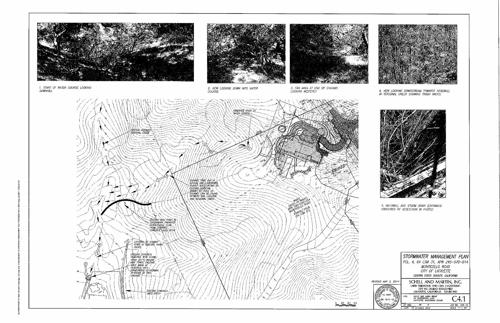
/ , START OF WATER COURSE LOOKING
DOWNHILL 2. VIEW LOOKING DOWN INTO WATER
COURSE
3. FAN AREA AT END OF CHANNEL
LOOKING WESTERLY
mi |V\:vm, „ J \\\ \ /)^_\J^^^\::mE^
\ \ \ \ ' ' \ — '',
: > v / ' / 0 - - ' ^ ' > > : - > - >f \
0 2 0 4 0 6 0
4. VIEW LOOKING DOWNSTREAM TOWARDS HEADWALL
IN SEASONAL CREEK SHOWING TRASH RACKS
5. HEADWALL AND STORM DRAIN (ENTRANCE
OBSCURED BY VEGETATION IN PHOTO)
REVISED MAY 2. 2014
STORMWATER MANAGEMENT PLAN PCL 4, 64 LSM 31, APN 245-070-014
MONTICELLO ROAD CITY OF LAFAYETTE
CONTRA COSTA COUNIY, CAUFORNIA
SCHELL A N D M A R T I N , I N C lAND SURVEYING AND CIVIL ENGINEERING
3377 MT, DIABLO BOULEVARD LAFAYETTE, CALIFORNIA 925-283-8111
STEVE AND UNDA mCHT 21 NOItTHRIDGE LANE LAFAYETTE, CAUFORNIA 94549 C 4 . 1
BY HGU FB JOB NO. 420-10
DATE: 15 OCTOBER, 20TS SCALE /' = 40'
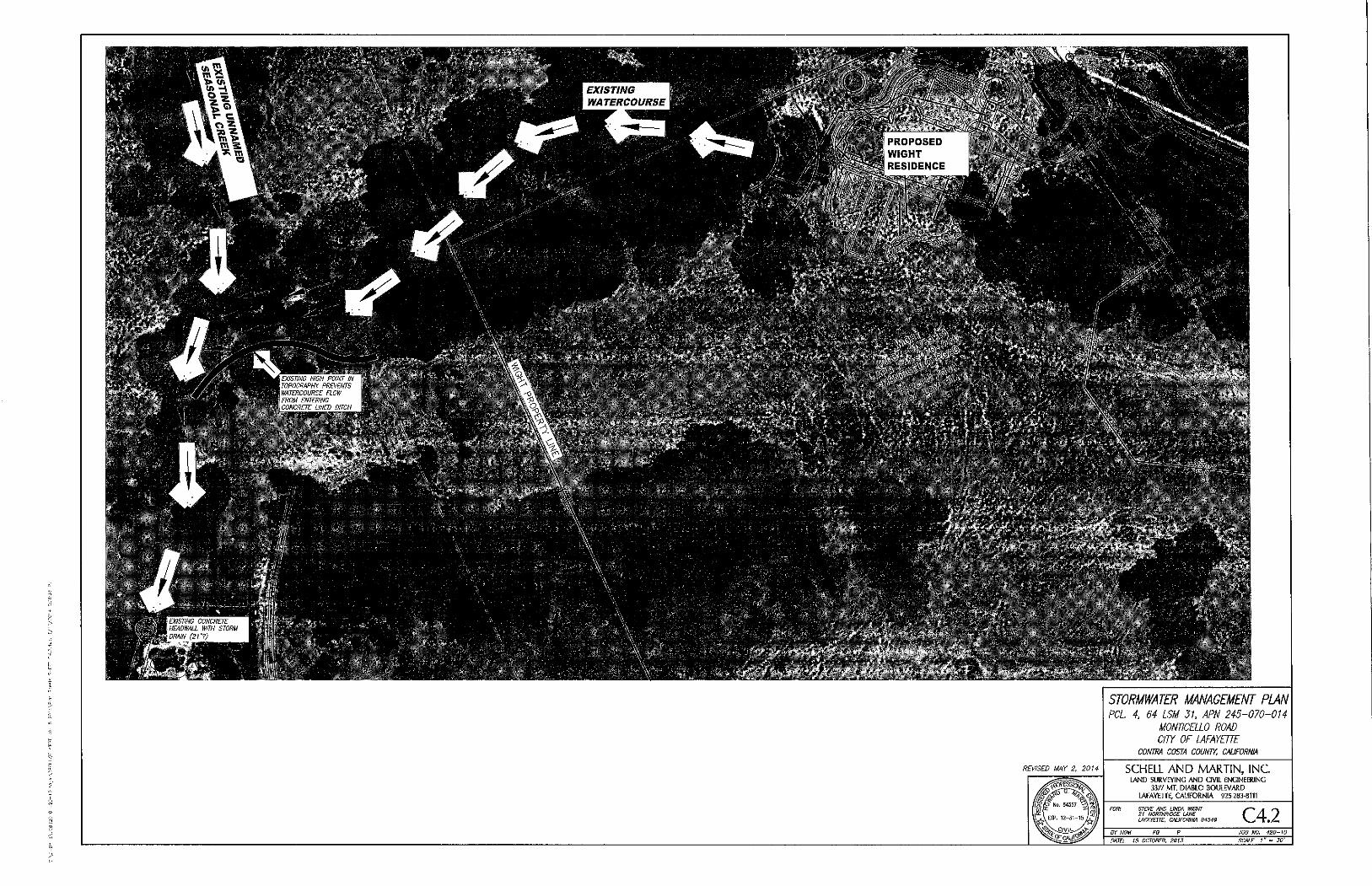
REVISED MAY 2, 2014
STORMWATER MANAGEMENT PLAN PCL 4. 64 LSM 31, APN 245-070-014
MONTICELLO ROAD cm OP lAFAYETTE
CONTRA COSTA COUNTY. CALIFORNIA
SCHELL A N D M A R T I N , I N C LAND SURVEYING AND Q V I L ENGINEERING
3377 MT, DIABLO BOULEVARD
LAFAYETTE, CALIFORNIA 925-283.0111
ST£VE AND UNDA WIGHT 21 NORTHRIDGE LANE lAFAYEnE. CAUFORNIA 94549 C 4 . 2
JOB NO. 420-W
DATE: 15 OCTOBER. 2013 SCALE 1" " 30'
DRAFT
1 Recusal :
2 Commiss ioner Ptasynski recused h imse l f f r o m par t i c ipa t ing in t h e next i t em and le f t t he dais.
3 Commiss ioner Chong cha i red t he m e e t i n g .
4 Commiss ioner Her te l s ta ted t ha t t h e rema in ing t w o i tems are l ikely t o be heard ve ry late at n ight . He
5 suggested t he Commiss ion remove I tem A; MS501-14 Twe lve W i l d w o o d LLC (Owne r ) , and s ta ted t h a t
6 I tem B; DR06-12 Bill Lim & Sheu Poy (Owners) shou ld be ve ry br ief .
7 M r . W o l f f suppo r ted t h e r e c o m m e n d a t i o n t o m o v e I tem A t o t h e nex t mee t i ng . It w o u l d be heard ear ly
8 in t he mee t i ng . Commiss ione r Her te l c o n f i r m e d t ha t con t i nua t i on w o u l d n o t i n t e r r up t t he appl icant 's
9 schedule , and M r . W o l f f added t ha t t he i t e m cou ld be con t i nued t o May 12*'' so i t w o u l d no t push back
10 t h e h e a n n g da te .
1 1 Commiss ioner Cleaver m o v e d t o ad just t h e agenda such , tha t I t em 9A; MS501-14 be c o n t i n u e d t o the
12 M a y 12, 2014 DRC m e e t i n g as a con t i nued publ ic hear ing and be heard f i rs t on t h e agenda;
13 Commiss ioner Ptasynski seconded the m o t i o n w h i c h car r ied by unan imous consen t (3-0-1-1) Ayes:
14 Chong, Cleaver and Her te l . Noes: None ; Absen t : Ag rawa l ; Abs ta in : Ptasynski .
, 15 ^ 16 A. HDP20-13, GR07~13 & TP12-13 Steve and Linda W i g h t (Owners) LR-10 Zon ing : Request f o r (1)
17 a Phase II Hil lside D e v e l o p m e n t Permi t f o r a n e w t w o - s t p r y , 9,638 s.f. s ing je- fami ly residence
18 w i t h an a t tached 3 car garage w i t h an average he ight o f 28.5 fee t and a 365 s.f. garden r o o m ;
f 19 (2) a Grad ing Permi t f o r t he m o v e m e n t o f 4 ,800 GY o f e a r t h (2,900 CY c u t / 1,900 CY o f f i l l ) ;
20 and (3) a Tree Permi t f o r t he remova l o f 1 1 nat ive t rees o n a vacant 13.66 acre parcel located
2 1 in t he Hil lside Over lay Distr ict w i t h i n a Class II r idgel ine a t 1240 Mon t i ce l l o Road. APN 245-
22 070 -014
23 R e c o m m e n d a t i o n : A d o p t Resolut ion 2014-04 , f o r w a r d i n g a r e c o m m e n d a t i o n o f approva l to
24 t he City Counci l , sub jec t t o cond i t i ons . .
25 Project Planner: Catar ina Kidd, Te l . (925) 2 9 9 - 3 2 4 1 , ck jdd@love la fave t te .o rg
26
27 Commiss ioner C l iong rec i ted the .hear ing p ro toco ls and cal led upon s ta f f t o p rov ide an ove rv i ew .
28
29 Cont rac t Planner Catar ina Kidd p resen ted visual displays o f t h e 1240 Mon t i ce l l o Road si te and s ta ted
30 based u p o n a Commiss ioner ' s request at t h e last m e e t i n g , a square f o o t t a b u l a t i o n o f all cons t ruc ted
3 1 areas is in t he s ta f f r e p o r t a t t a c h m e n t , as we l l as an expanded cons t ruc t i on m a n a g e m e n t p lan, a
32 hyd ro logy r e p o r t t o address dovi /nstream m i t i ga t i on faci l i t ies on si te and d o w n s t r e a m , and a response
33 mak ing t h e requ i red f ind ings in DRC Resolut ion 2001-04 . The app l icant 's responses f o r all f o u r i tems are
34 con ta ined in A t t a c h m e n t 1 , w h i c h w e r e f o u n d t o be sat is factory. Relative t o t h e f ind ings, Ms . Kidd
35 d isp layed an exh ib i t w h i c h is an over lay o f t h e p lan o n t o t opog raphy , w h i c h shows d e v e l o p m e n t grad ing
36 t o m in im ize the cu t t i ng o f hi l ls ides. She no ted t h e s i t ing is located in an area w h e r e i t is no t possible t o
37 be inv is ib le; however , t h e s i te is a lmos t 14 acres and a b o u t 2% o f t he p r o p e r t y w i l l be deve loped
38 speci f ical ly f o r t he h o m e . The screening o f t h e h o m e is n o t re ly ing j us t on t rees o r j u s t on landscaping.
39 The si te was specif ical ly chosen because it is a l i t t le m o r e obscure . Topog raphy rises t o t he sou th and
4 0 t h e r e is na tu ra l and substant ia l screening o f t he h o m e as we l l as f r o m the publ ic v i e w i n g areas.
4 1
42 M s . Kidd p resen ted t he civi l p lan t h a t shows the con tex t o f t h e h o m e and d is tances, s ta t ing t o t he wes t
43 it is app rox ima te l y 700 f ee t away f r o m t h e nearest h o m e , t o t h e east i t Is a b o u t 334 f ee t and t o t he
4 4 sou th , 900 feet . So in v i r t ue o f t he d is tance as we l l as t h e percen tage o f t he si te be ing d e v e l o p e d , s ta f f
4 5 bel ieves it mee ts t he f ind ings regard ing v is ib i l i ty and l imi ts g rad ing t o a very smal l area o f t h e s i te.
A T T A C H M E N T 3A
DRAFT
1
2 Commiss ioner Cleaver s ta ted s ta f f has a series o f red and blue cor rec t ions . He asked i f t he red
3 cor rec t ions were based upon c o m m e n t s and b lue cor rec t ions were t he resul ts o f conversa t ions and n o t
4 actual d i rec t ion f r o m t h e Commiss ion . M s . Kidd s ta ted t h e co lor is s o m e w h a t o f a ch rono logy . The
5 or ig ina l March mee t i ng resul ted in t h e b lue tex t . Subsequent ly , f r o m the nex t m e e t i n g , s ta f f had a f e w
6 mo re cor rec t ions based on c o m m e n t s f r o m Commiss ioners as wel l as language c la r i f i ca t ion .
7
8 Commiss ioner Chong s ta ted the re w e r e ve ry specif ic issues in t he Commiss ion 's f ind ings t h a t caused th is
9 con t inuance , and asked t ha t the app l icant focus on those ra the r t han rev iew ma te r i a l a l ready cove red .
10
11 David Bowie , represen t ing t he app l icants , s ta ted th is happens t o be one lo t o f several lots in an ex is t ing
12 subdiv is ion w i t h a p re -de te rm ined access road . As a resu l t , w h a t e v e r t he var ious e n v i r o n m e n t a l issues
13 invo lved in t he or ig ina l deve lopmen ta l approva ls has all since occu r red . They are dea l ing here w i t h a
14 proposal t o bui ld a single fami ly h o m e on an ex is t ing legal lo t . Staf f has m e n t i o n e d t h a t t h e lot i tse l f is
15 abou t 34 acre o f a 14 acre lot and is a ve ry non- in t rus ive d e v e l o p m e n t .
16
17 He said t hey prev ious ly subm i t t ed t o t h e Commiss ion ve ry deta i led hyd ro logy and soils repor ts , and t h e
18 mos t recent repor ts subm i t t ed w e r e in d i rec t response t o quest ions and issues raised by th i s
19 Commiss ion at t h e last heanng . It is usefu l t h a t s ta f f has ind icated t ha t i t has f o u n d those repor ts are
20 \ . adequa te . There was a request f o r a de ta i led b r e a k d o w n o f areas as par t o f th is d e v e l o p m e n t t h a t has
2 1 been p rov ided t o t h e Commiss ion and one po in t made by Ms . Kidd at t h e last hear ing was t h a t t hey
22 real ly have no t had m u c h o f a discussion a b o u t t h e a rch i tec tu re t r e a t m e n t o f th is pa r t i cu la r h o m e . He
23 knows t he re w e r e concerns abou t t h e sou the rn o r eas tern e leva t ion . The re fo re , t h e y b r o u g h t t he i r
24 a rch i tec t f r o m Co lo rado w h o has been mos t responsib le f o r t he design concep t t o discuss t h a t w i t h t h e
25 Commiss ion . They also have in a t t endance David Tho rne , landscape consu l tan t , and hyd ro logy expe r t
26 Howard M a r t i n .
27
28 Lastly, M r . Bowie said t he re has been a lot o f discussion a b o u t t he cons t ruc t i on m a n a g e m e n t p lan. They
29 did revise t he p lan t h a t shows cr i t ical t i m e paths and was m o r e expanded w h i c h has been rev iewed by
30 s ta f f and f ound t o be adequa te fo r all purposes at t h e present t i m e . He t h e n t u r n e d ove r t h e
3 1 p resen ta t ion t o T o m Frye.
32
33 Tom Frye, Resort Design Arch i tec ts , said he has w o r k e d w i t h Go rdon Pierce on th is p ro jec t f o r severa l
34 years n o w and has been invo lved w i t h t he p ro jec t f r o m the s tar t . They have designed m a n y homes on
35 hi l lsides in va r ious parts o f t he U.S. and o t h e r coun t r ies , and th is is one o f t h e m o r e cha l leng ing sites
36 p resen ted . It does create cer ta in d i f f i cu l t ies t hey fee l t h e y have managed t h r o u g h d e v e l o p m e n t o f
37 des ign. He has p repa red the square foo tages reques ted and broke t h e m d o w n in to var ious c o m p o n e n t s .
38 He d r e w a t t e n t i o n t o t h e south e leva t ion render ings w h i c h w e r e inc luded in t h e packet and avai lab le, as
39 we l l as t he mate r ia ! boards. He can t h e n address issues specif ic t o concerns t h e Commiss ion has
40 regard ing t he design and M r . M a r t i n is avai lable t o address hyd ro logy ques t ions o r c o m m e n t s ,
4 1 representa t ives o f Young and Bur ton w h o can discuss t he cons t ruc t ion m a n a g e m e n t p lan , and David
42 Thorne w h o can answer landscape ques t ions .
43
44 Commiss ioner Cleaver re fe r red t o t he cons t ruc t i on m a n a g e m e n t p lan and t hanked M r . T h o r n e f o r w h a t
45 has been done . He apprec ia tes t h e bar char t , bu t w h a t he f inds lacking in th is p resen ta t ion is t he ac tua l
46 physical impac t t o t he n e i g h b o r h o o d . Dur ing g rad ing , he asked h o w many t rucks are go ing in a n d o u t
47 and h o w many emp loyees are ut i l ized d u r i n g t h a t g rad ing pe r i od .
48
Design Review Commiss ion 2 Apr i l 28 , 2014
DRAFT
1 Samantha Bu r t on , Young and Bur ton , said t he p ian shows the average n u m b e r o f vehic les pe r day per
2 m o n t h o n t h e schedu le . It descr ibes specif ical ly w h a t k inds o f t rucks and vehicles t h a t w i l l c o m e up and
3 d o w n each day. She no ted t hey inc lude personal w o r k t rucks , van pools f r o m o f f -s i te park ing , s ta t ing
4 t h e y are p lann ing 4 van poo l t r ips per day. Once t hey get t h r o u g h grad ing and conc re te w i t h i n 6-7
5 m o n t h s , t he re w i l l be m o r e subcon t rac to r vehic les accessing t he s i te . She no ted t h e red represents o f f -
6 haul d u m p t rucks and t hey pro jec t 2 per day fo r 3 m o n t h s . A t t h e end t hey can increase th is m o r e , bu t
7 t hey mus t move a lot o f d i r t on t he site and no t take i t o f f - s i te . The w a y t hey have t o stage t h e vehic les,
8 t hey canno t do m o r e t han 2 t rucks a day. The ye l l ow represents conc re te t rucks and t h e y pro jec t 2-4 per
9 day because o f t i m i n g .
10
11 Commiss ioner Cleaver said his unders tand ing is t h a t t he n u m b e r o f concre te t rucks f o r m o n t h s 3 and 4
12 w o u l d be 10 per day. IVIs. Bu r ton c lar i f ied th is is t o t a l vehic les on s i te. In m o n t h s 3 and 4 , t hey are
13 averag ing 10 t o t a l vehic les per day, 2 o f w h i c h w o u l d be c e m e n t t r ucks . In m o n t h s 5, 6 a n d 7, t hey w i l l
14 have as m a n y as 4 cemen t t rucks per day.
15
16 Commiss ioner Her te l no ted t h a t he recent ly insta l led a smal l re ta in ing wa l l and they had 10 conc re te
17 t rucks in one day and he c o n f i r m e d they w e r e ab le t o be s taged. M s . Bur ton no ted t he re is no space on
18 t h e lot and said t hey mus t have one c o m e up, pour , e m p t y o u t and go d o w n be fo re t hey can have
19 a n o t h e r one c o m e up. Commiss ioner Her te l d id n o t d isagree w i t h t h e logistics, bu t he was n o t sure t he
20 v o l u m e and quan t i t y was co r rec t g iven t h e a m o u n t o f concre te n e e d e d , especial ly w h e n b roken d o w n
2 1 by day. He said t he same th i ng appl ies t o t he 10 -whee l d u m p t rucks . S o m e w h e r e in t h e number , he
22 mus t be conv inced t ha t all o f t he yards go ing o f f o f t h a t site are con ta ined in t ha t n u m b e r o f trucl<s. He
23 asked if t h e y w i l l jus t m e t e r o u t 2 t rucks a day, and M s . Bur ton said th is is t h e i r best es t ima te g iven w h a t
24 t hey can get d o n e the w a y t h e si te is set up . She said she does no t fo resee t h e abi l i ty t o m a n e u v e r m o r e
25 t han th is , g iven t h e grad ing and o f f -hau l ing schedule . Commiss ioner Herte l no ted i t is n o t t h e logist ics o f
26 th is j o b si te b u t t he impac t t o t h e n e i g h b o r h o o d . He said t h e char ts and graphs need to address t h e
27 impac t t o t h e ne ighbors . If t h e y have an average o f 2 t rucks per day, th is does no t descr ibe t h e s i t ua t i on .
28
29 Howard M a r t i n , Young and Bur ton , s ta ted one day i t cou ld be 6 t rucks and t h e next zero t rucks and t h e n
30 t he next day 8 t rucks depend ing on h o w they can load up. At th is po in t in t i m e , t hey canno t p red ic t t h e
3 1 s i tua t ion on a day t o day basis so t hey have t r i ed t o p ro jec t t h e overa l l fee l o f t he impac t t o t he road
32 w i t h t he t i m e f r a m e invo lved . Commiss ioner Her te l said he was n o t t r y i ng t o be a rgumen ta t i ve , b u t was
33 s imp ly t r y ing to ge t t o t he issue regard ing impac t t o t he ne ighbors . He is n o t saying t h e impac t canno t
34 be m i t i ga ted , managed , or hand led , bu t he thinl<s t h e r e is an issue w h e n i t comes t o m a n a g e m e n t .
35 W h e t h e r i t is 10 t rucks a day or zero f o r t he next f e w days, th is is a d i f f e ren t impac t t h a n 2 per day
36 regular ly at the same t i m e . M s . Bur ton said t hey p ropose t o do week l y updates p ro jec t ing w h a t w o u l d
37 be happen ing in t h e f o l l o w i n g w e e k . Commiss ioner Her te l said his on ly concern w i t h t h a t is t h a t as t h e
38 Commiss ion approves t he p ro jec t and t hey do ema i l blasts and upda tes , th i s is a f t e r t he fac t . So he
39 th inks t he ne ighbors are o w e d an unders tand ing o f w h a t is c o m i n g the i r w a y ra ther t h a n w h e n it
40 happens and t h e y mus t ad jus t t o i t . He asked w h a t leverage the Ci ty and res idents have t o m o d i f y t h e
4 1 schedule or p rocedures . Ms . Bu r ton said t he City has holds on f r a m i n g requ i remen ts . W i t h o f f - hau l t hey
42 mus t do a p re - rev iew o f t h e road . They mus t keep the road clean cons tan t l y o r t he City can place a s top
43 not ice on t h e p ro jec t , and t hey canno t f in ish t he p ro jec t unt i l t h e road is i m p r o v e d and t hey res tored it
44 t o its or ig ina l cond i t i on . Commiss ioner Her te l said t o h i m , th is is t h e least o f t he issues. He is ta lk ing
45 a b o u t t he dai ly inconven ience f o r m o n t h s o f t h e n e i g h b o r h o o d . To h im th is is a reasonable ques t i on and
46 wh i le t h e i r char t is beau t i f u l , it does n o t te l l h im e n o u g h o f t h e s to ry .
47
Design Review Commiss ion 3 Apr i l 28 , 2014
DRAFT
1 M r . W o l f f said It seems t h a t t he re are t w o issues at hand ; one is impacts o n t h e road i tse l f w h i c h w i l l be
2 w h a t t hey wi l l be i r respect ive o f t he t i m i n g o f t h e t r ips . If i t is 1,000 t ruck t r ips , it is 1,000 w h e t h e r t h e y
3 happen in one day o r 1,000 days. This char t seems t o be i n fo rma t i ve on th is aspect . W h e t h e r t h e r e are
4 30 concre te t rucks t h a t access t he si te ove r a g iven m o n t h , t h e r e cou ld be one a day or all 3 0 could
5 occur in a single day and the re is a d rama t i c d i f fe rence in t h e staging and impac t on t h e ne ighbors in
6 t h a t c i r cumstance . He said he th inks w h a t t he Commiss ion is hear ing f r o m the app l i can t is t h a t at th is
7 p o i n t in t i m e , it is ve ry d i f f i cu l t t o p ro jec t the mo re nuanced t r i p genera t ion t h a t cons t ruc t i on w i l l have.
8 The i r best e f f o r t is p ro jec t ing it t h i s fa r o u t f r o m cons t ruc t i on and as they ge t closer, t h e r e w i l l be mo re
9 c lar i ty or deta i l ava i lab le . There fo re , i t is qu i te possible t h a t t h e Commiss ion cou ld ask fo r ano the r
10 i t e ra t i on o f mo re de ta i led cons t ruc t i on m a n a g e m e n t p lan as it gets closer t o cons t ruc t i on .
1 1
12 Commiss ioner Her te l said he is concerned t ha t w h a t he sees is a char t o f averages w h e n w h a t real ly
13 needs to happen is a char t o f w o r s t case scenarios. This is his d i f f i cu l t y because those are d rama t i c
14 d i f fe rences .
15
16 Commiss ioner Cleaver added t h a t w h a t Commiss ioner Her te l w o u l d l ike t o see is t h a t t he re are 8
17 m o n t h s over t w o years w h e r e conc re te t rucks w i l l be t rave l i ng t h e road and o u t o f t h a t t i m e , t h e y are
18 an t ic ipa t ing it w i l l be m o r e t han 100 and less t h a n 1,000 t rucks . O t h e r t h a n t h a t t he p lan canno t be
19 m o r e specif ic t h a n t ha t , and he fe l t th is was to ta l l y unde rs tandab le . Ms . Bur ton said t h e i r p ro jec ted
20 concre te is 120 conc re te t rucks t o do all o f t he concre te o n t he j o b . For o f f - hau l t h e y expect 50 t rucks .
2 1 Every th ing else inc ludes del iver ies, emp loyees t o and f r o m t h e van poo l , and t rash r e m o v a l . She no ted
22 10 whee l d u m p t rucks are t he largest t r uck t hey can use, g iven t he access. Commiss ioner Her te l said
23 accord ing t o t he p lan , t hey have 4 m o n t h s o f 10 -whee l d u m p s pu l l ing th ings o f f , and Ms . Bur ton c lar i f ied
24 th is is t he d i r t o f f hau l .
25
26 Commiss ioner Chong said he was no t clear on t h e level o f i n v o l v e m e n t o f t he cons t ruc t i on m a n a g e m e n t
27 t e a m t h r o u g h o u t t he 22 m o n t h e f f o r t . He asl<ed h o w m a n y peop le w i l l s ta f f t h e e f f o r t , n u m b e r o f hours
28 o n s i te, and Ms. B u r t o n s ta ted t h e y m a n all o f t he i r p ro jec ts t h e same. Her f a t h e r is here and is t he
29 o w n e r o f t he c o m p a n y . She is a p ro jec t manager and suppor ts on-s i te s taf f , w o r k s w i t h t h e c l ient , t h e
30 City, and is t he p o i n t o f con tac t and t ransmiss ion o f i n f o r m a t i o n and d o c u m e n t a t i o n fo r t he p ro jec t .
3 1 They have a si te supe r i n tenden t , Dave H o w m a n , w h o s e i n f o r m a t i o n has been inc luded as a p o i n t o f
32 con tac t f o r day t o day w o r k on site every day and c o m p l e t e l y manages all t r ades , all del iver ies and
33 eve ry th ing regard ing t h e s i te. They se l f -pe r fo rm w o r k as we l l so th is usually suppl ies a n y w h e r e f r o m 5~
34 10 o f the i r o w n emp loyees on t h e site as w e l l .
35
36 Commiss ioner Chong asked and c o n f i r m e d t h a t Ms . Bu r ton was t h e genera l con t rac to r and t h a t they
37 manage t h e en t i r e cons t ruc t i on p ro jec t and m a n a g e m e n t p lan . Commiss ione r Chong asked if t he
38 cons t ruc t i on m a n a g e m e n t plan s ta f f is In add i t i on t o t he cons t ruc t i on staf f , and Ms . Bu r ton s ta ted no,
39 t h e y are one in t h e same. They w r o t e t he cons t ruc t ion m a n a g e m e n t p lan and w i l l be i m p l e m e n t i n g i t .
4 0 Commiss ioner Chong said he was t r y i ng t o ge t a sense as t o t h e level of c o m m i t m e n t t o t he issues t ha t
4 1 conce rn t he n e i g h b o r h o o d , such as h o w many people t h e y w i l l have avai lable f r o m a cons t ruc t i on
42 m a n a g e m e n t perspec t ive . He asked w h o is deal ing w i t h t h e cons t ruc t i on m a n a g e m e n t issues o n beha l f
43 o f t he ne ighbors . Ms . Bur ton said th is w o u l d be his f a t h e r w h o is o w n e r o f t h e c o m p a n y , hersel f , Dave
4 4 H o w m a n w h o is t h e p ro jec t s u p e r i n t e n d e n t and she n o t e d t h e r e are 5 peop le f r o m t h e i r o f f ice w h o can
45 a lways be con tac ted and are invo lved w i t h every p ro jec t t h e y w o r k o n .
4 6
47 Commiss ioner Chong opened t h e publ ic c o m m e n t per iod .
4 8
Design Review Commiss ion 4 Apr i l 28, 2014
DRAFT
1 Public C o m m e n t s :
2
3 Richard Sutc l i f fe ceded his t i m e t o Don Wa lk ie t .
4
5 Don Wa lk le t , 3675 N o r d s t r o m Lane, said th is is basical ly a con t i nua t i on o f w h e r e he le f t o f f f r o m the last
6 mee t i ng . He said he th inks the ne ighbo rhood has a lways p resumed the W i g h t s have a r igh t t o bui ld a
7 home on the i r p rope r t y . They have all gone t h r o u g h th is at one t i m e o r a n o t h e r and t h e y are no t asking
8 any th ing t h e y w o u l d n o t ask o f themse lves . W h a t t he ne ighbo rhood has s t rong ly r e c o m m e n d e d is t h a t
9 t ha t t h e Wigh ts should n o t have the r ight t o bu i ld any house on t h e i r p rope r t y . He th inks th is captures
10 w h a t t hey are t r y i ng t o say; size real ly does m a t t e r . He d isp layed a sl ide w h i c h he said is cr i t ical ly
11 i m p o r t a n t , wh i ch is r ight o u t of t he Planning Commiss ion pro jec t den ia l . He read i t as, "As des igned, t h e
12 pro jec t does no t m in im ize grad ing and cu t t i ng o f t he hi l ls ides; ins tead, des ign ing t h e d e v e l o p m e n t t o f i t
13 t he t e r r a i n . The te r ra in is be ing graded and man ipu la ted t o f i t t he p ro jec t . Excessive g rad ing , inc lud ing
14 t he need t o expo r t 1,000 cubic yards o f ear th also has t he po ten t ia l t o create a nuisance o r t ra f f i c hazard
15 as t h e area's res ident ia l and u t i l i t y roads w e r e n o t des igned t o handle large and heavy cons t ruc t ion
16 loads." He t h e n q u o t e d f r o m the mee t i ng of IVIarch 10^'^ w h i c h is f r o m DRC discuss ion; " H o w does th is
17 p ro jec t impac t t h e ne ighbo rhood? I a m concerned abou t t h e size o f t h e house ; t h a t th is is a house
18 cons iderab ly d i f f e ren t t h a n t he rest o f t he n e i g h b o r h o o d and t h e rest o f t he n e i g h b o r h o o d is be ing
19 asked t o bear t h e bu rden o f its cons t ruc t i on . W e should be o p t i n g fo r m i n i m a l so lu t ions as much as
20 possible. The house is large and the c o m m u n i t y is be ing asked t o bear t he b r u n t o f i ts cons t ruc t i on and it
2 1 needs t o be reduced . By cal l ing it a 10,000 square f o o t house, t he re is cons iderab ly m o r e here . The scale
22 o f t he gesture is w h a t w e ' r e ta lk ing abou t . Excessive a rch i tec tu re is be ing c rea ted w h e r e i t is n o t
23 necessary. The scale o f t h e gesture is t o o big f o r th is locat ion and th i s n e i g h b o r h o o d . It isn ' t jus t abou t
24 t he f i t in t he saddle b u t also a ques t ion o f ecological respons ib i l i t y . " M r . W a l k l e t said he has
25 t r e m e n d o u s respect f o r t h e arch i tec t w h o is f r o m Colorado. W h a t he w o u l d like t o see is obv ious ly a
26 w h o l e plan s ta r ted f r o m scratch. They w i sh it w o u l d have s ta r ted th i s way , and he thinl<s t he DRC can
27 apprec ia te t he f a c t t ha t he bel ieves t h a t t hey can achieve a spacious and aesthet ica l ly appea l ing h o m e ,
28 no t necessari ly go ing t h e rou te t hey have t a k e n . He w o u l d like a p lan t h a t e l im ina tes t he 1,000 cubic
29 yards o f o f f -hau l i ng o f soi l . They w o u l d l ike t o m in im ize t h e logist ics o f cons t r uc t i on . They w o u l d lil<e a
30 cons t ruc t i on m a n a g e m e n t plan in co l l abo ra t i on , w h i c h he emphas ized , w i t h t he n e i g h b o r h o o d . They
3 1 ne ighbo rhood is asking f o r r ight-s iz ing t he p ro jec t t o t h e land and t o t he n e i g h b o r h o o d c i rcumstances.
32 He p resen ted a sl ide show ing t h e dra inage t h e y mus t deal w i t h on th i s p rope r t y w h i c h is a big dea l . The
33 civi l eng ineer has addressed it very w e l l , bu t in his latest i t e ra t ion he is ta lk ing a b o u t a p lan t h a t uses t he
34 average annua l ra infa l l o f 27 inches per year. Dur ing t he past El N ino years, ra infa l l has been as much as
35 tw i ce t h a t a m o u n t w h i c h w o u l d dramat ica l l y exceed t h e capaci ty o f t h e Schell and M a r t i n p lan. It is
36 l ikely t h a t f u tu re El Nino events w i l l exceed any past records based o n t he impacts of c l ima te change. He
37 knows the City can p robab l y re ta in even more w a t e r t han the eng ineer proposes, b u t he asl<ed h o w
38 much can be re ta ined , as at some po in t th is becomes a park ing lot at t he t o p o f t h e h i l l . There is also t he
39 gas p ipe l ine w h i c h has n o t been addressed in t h e M M D . He bel ieves m o s t peop le d id n o t even know
40 a b o u t it a t the last mee t i ng . He has w a l k e d the t ra i l up t o t h e r idge and m a n y t i m e s have no t iced t h e
4 1 exposed p ipe l ine and f ina l ly happened t o see PG&E representa t ives and t h e i r p ipe l ine consu l tan ts . They
42 lool<ed aghast a t th is p ipe. He th inks t he re is real concern at PG&E t h a t no t o n l y th i s piece o f t he
43 p ipe l ine , bu t m o r e is po ten t i a l l y a p r o b l e m . He p resen ted t h e le t te r f r o m PG&E w h i c h s ta tes , "Cur ren t l y
44 w e are in t he p lann ing process o f address ing th is segment . Every th ing f r o m th is p ro jec t has been
45 chal lenging due t o t h e area and e n v i r o n m e n t a l impacts . I passed t h e i n f o r m a t i o n on t h e f u t u r e
46 cons t ruc t i on plans fo r t h e area t o t he p ro jec t manager . The City w i l l also w a n t us t o address th is issue
47 t h r o u g h t h e p e r m i t t i n g process. " He said th is is a big deal and he re fe r red t o San Bruno . He said these
48 are quest ions he s u b m i t t e d and w o u l d l ike t h e m addressed. He o f f e r e d t o br ing back t h e slide so t he
Design Review Commiss ion 5 Apr i l 28 , 2014
DRAFT
1 Commiss ion can address t l i e m one by one . In summary , t h e f ind ings under Sect ion 4 w h i c h s ta te , " t he
2 approva l o f t h e p lan is in t he best in terests o f publ ic hea l th , safety and genera l w e l f a r e " , a re real ly w h a t
3 t h e y are ta lk ing abou t . They do no t oppose the W igh ts hav ing a house. They jus t w o u l d l ike t o have it in
4 t h e least impac t fu l way t o t he ne ighbo rhood and have a cons t ruc t i ve d ia logue . They have no d ia logue
5 and no i n te rac t i on .
6
7 G w e n Helvey ceded her t i m e t o Ben Douglas
8
9 Ben Douglas said t hey had c i rculated in t h e ne ighbo rhood a pe t i t i on w h i c h we l l over 100 peop le s igned,
10 asking fo r cer ta in requ i remen ts to manage t ra f f ic . As Commiss ioner Her te l had ind ica ted t h e r e was and
1 1 sti l l is a real lack o f sensi t iv i ty t o t he real i t ies o f th is n e i g h b o r h o o d , g iven t h e n a r r o w s t ree t go ing up t h e
12 road and an even n a r r o w e r s t reet on Mon t i ce l l o and u l t ima te l y t he bo t t l eneck at t he access r o a d . He
13 d i rec ted t h e Commiss ion t o t h e p e t i t i o n and t hey suggested cond i t i ons be inc luded as pa r t o f t h e
14 pro jec t , t ha t t h e r e be on ly one large t ruck in t he n e i g h b o r h o o d at t he t i m e . The reason fo r t ha t is t ha t if
15 t he re are t w o t rucks , i t w i l l cut o f f t h e en t i re t h e ne ighbo rhood ' s t ra f f i c f l o w . They ask t h a t passage of
15 t h e large t rucks be l im i ted outs ide o f rush hour because t he re is on ly one w a y o u t and t u r n i n g le f t on
17 Deerhi l l can be a very t i m e - c o n s u m i n g process. M o s t s ign i f icant is t he ques t ion o f w h o w i l l m o n i t o r
18 cond i t i ons ; as t o h o w f r e q u e n t t h e t rucks are, h o w long t h e y spend wa i t i ng at t h e b o t t o m o f Mon t i ce l l o
19 and t o w h o m do they answer . There is inev i tab le conf l i c t o f in te res t because i t is m o r e e f f i c ien t and
20 more cos t -e f fec t i ve fo r t h e con t rac to r t o stack up a bunch o f t rucks . They w i l l w a n t t o have eve ry th ing
2 1 staged and ready t o go so as soon as o n e comes d o w n , t h e y can pour m o r e concre te or load o f f m o r e
22 d i r t . They say t h e y wi l l n o t do th is and ind icate t hey w i l l have a l im i t o f 5 m inu tes , bu t he ques t i oned
23 w h o w o u l d en fo rce th is . He can unde rs tand t he re w i l l be a t e m p t a t i o n t o let 5 m i n u t e s become 10
24 m inu tes and so f o r t h . If t h e person m o n i t o r i n g th is and f lagg ing i t gets a paycheck f r o m t h a t con t rac to r ,
25 he ques t ioned w h a t w o u l d make t h e m en fo rce t h e s i t ua t i on . This is w h y t he t ra f f i c m o n i t o r shou ld be a
25 City emp loyee o r someone w h o is n o t accountab le t o t h e con t rac to r or app l icants , and s o m e o n e w h o is
27 go ing t o look o u t f o r t he publ ic 's in teres ts . O the rw ise , t he re w i l l a lways be except ions and ne ighbors w i l l
28 have t o chase d o w n the si te manager and w h a t incent ive t hey have t o l is ten t o a ne ighbor w h o is
29 comp la in ing a b o u t a t ruck b lock ing t h e i r d r i veway .
30
3 1 Given t h e lack o f c o m m u n i c a t i o n t hey have had f r o m t h e app l icants , ano the r t h i n g t hey ask f o r is t h a t in
32 o rde r t o m o n i t o r th is , t ha t t hey upgrade t h e ne ighbo rhood secur i ty system so t h e y w i l l have ev idence o f
33 w h e n and w h e r e t rucks are t rave l ing so t h e y can con f i rm t hey are f o l l ow ing t h e p lan. And last ly, t h e y ask
34 t h a t t he app l icants agree in w r i t i ng t h a t t hey w i l l f o l l o w w h a t e v e r s tandards are set as t o f r equency o f
35 t rucks , staging o f t rucks and t h a t t he re be actua l pena l t ies i nvo l ved . They can a lways make promises ,
36 bu t t he t e m p t a t i o n wi l l a lways be t h e r e t o ignore those promises w h e n t hey need t o squeeze one m o r e
37 load o f mater ia ls up t he hil l a t t h e end o f t h e day. This w i l l be m o r e i m p o r t a n t t o t h e m t h a n keep ing t he
38 ne ighbors happy . So, unless t he re is s o m e m o n e t a r y pena l t y , t hey can see inev i tab ly t h a t it w i l l be an
39 ongo ing saga and a rgumen t .
40
4 1 Laurie W a l t e r ceded t ime t o George Bishop.
42
43 George Bishop, 1217 Mon t i ce l l o Road, re fe r red t o e ros ion and f l ood ing and said w h e n at t he last
44 mee t i ng , t hey w e r e to ld t he re was a p lan t h a t w o u l d actua l ly reduce t h e a m o u n t o f f l o w d o w n t o w a r d s
45 Mon t i ce l l o Road. Since t h e n , they have had a chance t o look at t he w r i t t e n plan and i t all depends on
46 rainfal l cons is t ing o f average. If above average, eve ry th ing "goes o u t the w i n d o w . " It seems t o h i m t h a t
47 anybody in t h e cons t ruc t i on indus t ry k n o w s i t is cou r t i ng d isaster t o assume average w e a t h e r . He has
48 seen 45 inches per year or m o r e in t h e n e i g h b o r h o o d , has seen huge f loods jus t in t he last 10 years and
Design Review Commiss ion 6 Apr i l 28, 2014
DRAFT
1 in lool<ing at t h e p lan, i f t hey dec ide t o send the w a t e r his w a y , t h e only w a y they can say i t does n o t
2 increase w a t e r f l o w is t o po in t t o an o d d a r rangemen t o f pipes or a c a t c h m e n t system u n d e r n e a t h t h e i r
3 p rope r t y w h i c h w o u l d be o v e r w h e l m e d i f they had a s t o r m such as New Year's Eve in 2006, w h e r e 6
4 inches o f rain fe l l in one day, or much less. The re fo re , t he p lan assuming 27 inches o f ra infal l a year is
5 jus t n o t he lp fu l and he asked t h a t a w o r s t case scenar io be cons ide red , n o t j us t t he average. He said he
6 g o t i n to t r o u b l e at t he last m e e t i n g w h e n he s tood up and asked M r . M a r t i n w h e r e t h e w a t e r w i l l go . It
7 does ma t t e r , and it t u r n s o u t t ha t i t gets d u m p e d in to his p rope r t y jus t as he fea red and in exact ly t he
8 w o r s t place. The appl icants d id no t s tudy w h a t is a good o r bad place. This is no t an e ros ion or f l ood ing
9 p lan, and all t h e y ta lk a b o u t is t h e v o l u m e o f w a t e r . To t h e ex ten t he unders tands i t , i t goes unde rnea th
10 t h e cu lver t . In his s w o r n dec la ra t ion , he ta lks a b o u t t h e fac t t h a t t he cu lver t t h a t runs f r o m 1219
11 Mon t i ce l l o unde r t he road t o his p rope r t y has been e roded away . The w a t e r goes u n d e r n e a t h t h e
12 cu lver t and no t t h r o u g h i t . In past years, th is w a t e r has e roded and near ly des t royed his rear f ence . In
13 re la t ing th is to t o d a y , i t means t h a t as fa r as t he exist ing cu lver t i t is a disaster w a i t i n g t o happen . It is
14 also an ind ica t ion o f h o w m u c h w a t e r goes t he re and h o w m u c h po ten t ia l damage t h e r e is. They
15 propose t o p u t m o r e w a t e r t he re whe re it is even m o r e damag ing . He said he has heard a bi t a b o u t
16 w h a t M r . Coe had t o say a b o u t t he channe l a round his p rope r t y be ing t o o smal l . He has no t spoken t o
17 h im y e t , and w o u l d like t he chance t o ta lk t o h i m and get some i n p u t be fore t he app l icants send all t h e
IS w a t e r d i rec ted t o his p rope r t y . This is a n o t h e r examp le o f look ing at th is p ro jec t f r o m 30 ,000 f ee t and
19 no t look ing at speci f ics, and n o t ta lk ing to peop le in t he n e i g h b o r h o o d w h o k n o w w h a t is happen ing .
20
2 1 Regarding w h e r e t hey are and w h a t t he task fo r t he Commiss ion is now , M r . Bishop said t he
22 ne ighbo rhood has ta l ked a b o u t these issues f o r m o n t h s , t h e r e have been scores o f peop le at t he pub l ic
23 meet ings , and th is is n o t re f lec ted in t he repo r t s ta f f has g iven t h e Commiss ion w h i c h is very
24 u n f o r t u n a t e . There are no f ind ings or re ferences t o any o f t h e ne ighbors ' ev idence. He asked h o w th is
25 could happen . A lso, t h e r e has been a great deal o f con fus ion a b o u t w h a t t he Commiss ion is be ing asked
26 t o do . He has heard t ha t possibly it is in t h e DRC's pu r v i ew and maybe no t , these are jus t
27 r e c o m m e n d a t i o n s , i t is n o t s o m e t h i n g t h e Counci l wi l l care abou t , b u t t he Commiss ion is be ing asked t o
28 a d o p t s ta f f 's f ind ings as t h e Commiss ion 's o w n . These w i l l be p resen ted to t h e City Counci l and these
29 f ind ings ta lks speci f ical ly a b o u t t he re be ing no impac t on genera l we l f a re , hea l th , safety and exact ly t he
30 kinds o f th ings speakers are ta lk ing abou t . This has t he e f fec t o f sweep ing eve ry th ing under t h e rug
3 1 w i t h o u t ever look ing a t t h e specif ic harms. He does no t w a n t t o be over ly d ramat i c , b u t t h e r e are 120
32 fami l ies in th is ne ighbo rhood and these peop le ma t t e r . These th ings have never been cons idered and
33 they have t o be . If s o m e b o d y is go ing t o say t h a t t he law w i l l n o t a l l o w t h e Commiss ion t o cons ider i t , he
34 asked t o be c lear a b o u t i t . This is no t t he law. If s o m e b o d y is go ing t o say one is n o t requ i red t o cons ider
35 t he concerns o f th is n e i g h b o r h o o d , he asked t h e Commiss ion t o be clear abou t i t . He asked the DRC t o
36 t h i nk a b o u t i t , look at th is and f r o m the perspect ive o f Don Wa l ke t ' s c o m m e n t s . Ne ighbors are e n t i t l e d
37 t o a fa i r hear ing. He asked t o consider t h e burdens th is Commiss ion has a l ready re fe r red t o so many
38 t imes and make th is a reasonable p ro jec t be fo re approv ing i t . Lastly, t he re has been ta l k abou t lack o f
39 t ransparency . He t r i ed t o make sense o f w h a t he heard f r o m the cons t ruc t i on m a n a g e m e n t p lan and he
40 c o m p a r e d it t o w h a t is in the i r p lan. The i r nar ra t ive s tates t h a t t h e average is go ing t o be 10-25 t rucks a
4 1 day. W h a t t hey t h e n ind ica ted was 4 -16 t ruc l ts . There is concern t h a t t he app l icant canno t p lan n o w and
42 canno t make p ro jec t ions , bu t th is is t he p r o b l e m . Neighbors are be ing asked t o take t h e risk n o w . If t hey
43 do n o t know w h a t t h e h a r m is go ing t o be t o t h e n e i g h b o r h o o d , th is is even worse . Staging at t h e end o f
44 Mon t i ce l l o Road is a n o t h e r p r o b l e m . The plan says no staging, bu t i t goes on t o say t h e y can stay t he re
45 fo r 5 m inu tes . He said It is no t t h e per iod of t i m e t h a t ma t te r s ; i t is t he per iod t ha t is s ta ted does n o t
46 ma t t e r . They w i l l be t h e r e unt i l t he t i m e w h e n w h a t e v e r t r uck comes d o w n the hil l and i f a n o t h e r t r uck
47 comes f r o m d o w n be low , they cannot l imi t it t o one because t h e r e is n o w h e r e else to go .
48
Design Review Commiss ion 7 Apr i l 28, 2014
DRAFT
1 Todd Driessen, 10 Mon t i ce l l o Cour t , said he Is a physic ian and one concern he has fo r t h e pro jec t is t h e
2 impac t o f t he hea l th , safety and we l fa re o f t h e c o m m u n i t y . He spoke at t w o meet ings ago, w r o t e a le t te r
3 and in recapping th is , his daugh te r has been d iagnosed w i t h as thma . They l ived in Los Angeles fo r a
4 n u m b e r o f years and she d id have a n u m b e r o f as thma at tacks t h a t ended t h e m up in t he e m e r g e n c y
5 r o o m . Since m o v i n g t o Lafayet te t h e y have been th r i l l ed t h e y have had no such a t tacks. W h e n
6 c o n f r o n t e d w i t h t h e p ro jec t , t hey are r igh t at t he b o t t o m o f t h e hil l a n d r igh t w h e r e t rucks are go ing in to
7 l o w gear and go ing up t h e hil l t o ge t up In t he n e i g h b o r h o o d o f 200 ver t ica l f ee t in t he course o f a b o u t
8 one -qua r te r m i le . There is concern t he re w i l l be po l lu t ion impacts and diesel f u m e s . W h e n research ing
9 t h e impact , he w e n t on Med-L ine and w h e n looking at diesel and as thma , t h e r e are 279 c i ta t ions . One
10 t h i ng m e n t i o n e d In an ar t ic le f r o m 2008 t ha t especial ly w i t h kids, i t is i m p o r t a n t t o focus on ch i ld ren
11 w i t h re la t ionsh ip t o air po l l u t i on because the i r lungs are n o t comp le te l y deve loped . They have greater
12 exposures than adu l ts and these exposures can del iver h igher doses o f d i f f e ren t compos i t ions and t hey
13 rema in in t he lung fo r g rea te r d u r a t i o n . There is th is f o u n d a t i o n and t h e n t h e y have a s i tua t ion in t h e
14 ne ighbo rhood w h e r e t hey do n o t live in an open plain w h e r e air f l ows f ree ly . They live at t he b o t t o m o f
15 a fa i r ly na r row val ley. They w i l l have t rucks go ing up in l o w gear and e m i t t i n g f umes . He does no t k n o w
16 w h e r e those f umes are go ing and is conce rned . He w o u l d like t o have some reassurance t ha t a p lan is in
17 place t o m o n i t o r t h e qua l i t y o f t h e a i r w h e n th is cons t ruc t i on per iod is go ing o n . The par t he is w o r r i e d
18 a b o u t is w h a t w i l l c o m e o u t o f exhaust pipes w i t h each and every t r i p . Also, th is is no t a p ro jec t t h a t w i l l
19 last f o r weeks o r m o n t h s , bu t a m i n i m u m o f t w o years. This does no t even inc lude t h e road cons t ruc t i on
20 costs as fa r and t i m e , cost and e f f o r t in these es t imat ions . Then t h e r e are an add i t i ona l t w o lots at t he
2 1 t o p o f t he hil l w h i c h w i l l use th is p ro jec t as a p receden t . If th is p ro jec t goes 3 years, t hey may f ind
22 themse lves a b e t t e r par t o f 10 years be fo re t he cons t ruc t i on at t h e t o p is d o n e . There fo re , he th inks
23 given t h e publ ic hea l th issues and o t h e r concerns mus t be looked at du r i ng th i s stage.
24
25 W a y n e Hahn, 1225 Mon t i ce l l o Road, said he lives at t he end o f Mon t i ce l l o w h e r e all o f t h e t rucks w i l l be
26 park ing . He re fe r red t o t he cons t ruc t i on m a n a g e m e n t plan and char t and said w h e n he read t h e
27 d o c u m e n t s , it s tates " c e m e n t t rucks ' run w o u l d a m o u n t t o a m a x i m u m o f 8 t o 10 t rucks per pou r day.
28 Those f o u n d a t i o n pour days w o u l d a m o u n t t o 5 t o 10 days depend ing u p o n the f ina l design o f t he
29 f o u n d a t i o n . There wi l l be app rox ima te l y 4-6 pour days requ i red fo r t h e hardscape w i t h anywhe re f r o m 2
30 t o 6 t rucks per day . " However , w h e n look ing at t he char t , th is is spread o u t ove r 3 m o n t h s and i t on ly
3 1 shows 4 t rucks a day. The app l i can t ' s o w n d o c u m e n t a t i o n in t h e repo r t shows 10 to 12 t rucks per pour
32 day, w h i c h does n o t j i ve . He worl<ed fo r Bechtel and dea l t w i t h eng ineer ing cons t ruc t ion pro jec ts and
33 th is does no t ho ld wa te r .
34
35 Chris M a n i , 1256 Rose Lane, said his fam i l y l ives on t he o t h e r side o f t h e pro jec t and it came t o t h e i r
36 a t t e n t i o n t ha t t h e r e are plans t o shun w a t e r ove r t o t h e w e s t side t o c o m e d o w n t h e hil l t o w a r d s t h e i r
37 p rope r t y . He asked fo r s ta f f t o d isplay an overv iew o f t h e W i c h t p rope r t y and s ta ted t h e y bough t t h e i r
38 house in 2008. The i r lot is 1.6 acres. Part o f i t is f la t . A lo t o f it goes up a h i l ls ide t h a t buts up against t h e
39 W i g h t ' s p rope r t y . W h e n t hey b o u g h t t he i r house they had t o sign d o c u m e n t s t h a t t hey acknowledge
40 t h a t the hil lside t h a t comes d o w n in to t he f l a t par t o f t he i r p rope r t y has a po ten t ia l f o r sl iding a n d i t was
4 1 po in ted o u t t o t h e m tha t t he re are lumps and slides c o m i n g d o w n t h a t h i l l . W h e n the p rope r t y was
42 bu i l t , t h e r e was a conc re te cu lver t t h a t goes t o t he base o f t h e hi l ls ide a l ong t h e i r lot t o p reven t w a t e r
43 f r o m going in to t h e landscaping. Since 2008 , they have had t o have c rews go up and clear t he conc re te
44 cu lver t o u t tw i ce j us t f r o m na tu ra l m o v e m e n t o f t h e hi l lside t o w a r d s the i r house . There fo re , he Is ve ry
45 concerned t ha t t he W i g h t p ro jec t , in m o v i n g m o r e w a t e r d o w n t h e i r h i l ls ide, w i l l mal<e t ha t p r o b l e m
46 worse and even cause a bigger sl ide in a heavy rainfal l year . There are several ne ighbors on his side o f
47 t h e hill w h o are concerned and cou ld n o t a t t e n d the m e e t i n g t on igh t . He does no t propose t o represent
48 t h e m , b u t t hey are conce rned . He p o i n t e d t o t h e slide ove rv i ew o f t he W i g h t p r o p e r t y and re fe r red t o
Design Review Commiss ion 8 Apr i l 28 , 2014
DRAFT
1 the t o p r ight co rne r w h i c h is 1256 Rose Lane. Staf f ind ica ted t h e r e is a 700 f o o t s ight l ine to t he W i g h t
2 house, and he po in ted t o a thicl< ver t ica l black l ine t ha t goes t o his p rope r t y , and th i s is t h e concre te
3 cu lver t he has had to have c leaned up. Every th ing t o t he r ight o f t ha t goes uph i l l t o w h e r e it bu t ts up
4 against t he W igh t ' s p r o p e r t y l ine. He th inks t he re is a PG&E easemen t t he re as we l l , w h i c h is st i l l par t o f
5 t h e hi l ls ide.
6
7 M a r y M i l l e r , 1185 M o n t i c e l l o Road, said her f am i l y m o v e d t o th i s house in 1956 and n o w her b ro the r
8 and she owns i t . She mos t respect fu l ly and s incerely asks t h a t t he DRC no t app rove th is pro jec t . She
9 does n o t bel ieve t he necessary f ind ings can be made t o send th is p ro jec t f o r w a r d t o t h e City Counci l and
10 she w o u l d l ike t o vo ice i t ems o f concern . One is t he dra inage eros ion and lands l ide issue. The
1 1 ne ighbo rhood engaged its o w n geotechn ica l consu l tan t ; James Lot t o f A lan Kropp and Associates, w h i c h
12 is a h ighly respected f i r m w i t h a raf t o f s igni f icant pro jec ts under t h e i r bel ts. M r . Lot t in his p re l im inary
13 repo r t ta lks a b o u t t he length d r i veway approach t o t he p rope r t y w h i c h is in t he City 's records. She
14 q u o t e d f r o m t h e repor t , s ta t ing "Carefu l cons idera t ion wi l l need t o be g iven t o eng ineer ing o f t h e
15 dra inage systems a long the d r i veway app roach inc lud ing t he l o w e r po r t i on o f t he d r i veway approach
16 b e l o w t h e sou the rn ha i rp in t u r n t o make sure t he re is a d e q u a t e capaci ty in t h e dra inage system t o
17 handle peak s t o r m events w i t h o u t t h e uncon t ro l l ed loss o f s t o r m w a t e r o f f t h e d r i veway and ove r these
18 s teep slopes. Of par t i cu la r conce rn is design as we l l as f u t u r e ma in tenance of d ra inage i m p r o v e m e n t s at
19 t he sou the rn ha i rp in t u r n w h e r e s t o r m r u n o f f w i l l need t o be re -d i rec ted a lmos t 180 degrees . " She said
20 her and her b ro the r ' s p r o p e r t y is r ight u n d e r n e a t h t h a t ha i rp in t u r n . It is less t h a n 5 0 0 fee t f r o m her
2 1 backyard up t o t h a t ha i rp in t u r n o f f o f a ve ry s teep h i l l . The hydro logy repo r t t h a t w a s issued on Apr i l
22 18*'' does no t address any o f these concerns t h a t w e r e raised by M r . Lott . There is no m e n t i o n o f w o r k to
23 be d o n e re la ted t o t he p o r t i o n o f t he d r i veway be low the ha i rp in t u r n . There has been no geology w o r k ,
24 and she w e n t t h r o u g h all geo logy repor ts , re la ted t o par t o f t h e road t h a t is b e l o w t h e ha i rp in t u r n .
25 There have been no soi l bor ings, no o t h e r analysis she cou ld f i nd , and she spen t a g rea t deal o f t i m e
26 go ing t h r o u g h t h e repor ts . She is one o f several h o m e o w n e r s w h o s e backyards abuts th is steep
27 downs lope and whose p r o p e r t y may we l l be t h r e a t e n e d by t h e lack o f i n d e p e n d e n t analysis o f t he
28 s tab i l i ty o f th is access road and its use as a d ra inage condu i t , w h i c h basical ly as she unders tands t he
29 dra inage p lan, w a t e r w i l l be c o m i n g d o w n t h a t road . Her second concern is issues raised a b o u t t ra f f i c .
30 This has been we l l covered bu t w h e n she rev iewed t h e t ra f f i c p lan , n o w h e r e in t he p lan does i t say h o w
3 1 long i t w i l l take a heavi ly loaded t ruck t o ge t f r o m t h e D e e r h i l l / N o r t h T h o m p s o n in te rsec t ion t o t he si te
32 and th is w i l l take many m inu tes t o get t o t he t o p o f Mon t i ce l l o Road.
33
34 Alicia Favagn, 1219 M o n t i c e l l o Road, t hanked all speakers and l ike many in t he r o o m she has been
35 w o r k i n g since 5:15 a.m. because th is is ve ry i m p o r t a n t . She w o r k s fo r a c o m p a n y cal led MUFG Amer icas
36 M i tsub ish i . It is a g lobal co rpo ra t i on and she does a lo t o f p ro jec t m a n a g e m e n t . W h a t she has learned is
37 t ha t t h e l(ey to success is co l labora t ion and c o m m u n i c a t i o n . This is w h a t she has ta l ked a b o u t in t h e last
38 coup le o f meet ings , ye t t he e lephan t in t he r o o m is co l labora t ion and c o m m u n i c a t i o n . She asl<ed w h e r e
39 t he W i g h t ' s w e r e and w h y t h e y were no t p resen t t o address these ques t ions . M a n y peop le have been
40 present a t the last coup le o f meet ings , spoke a b o u t t h e i r concerns, and n o w t h e y are he re t o ta lk a b o u t
4 1 t he cons t ruc t i on m a n a g e m e n t p lan and t h e fac t t h a t t hey sti l l are here w i t h m a n y issues, eve ry th ing
42 f r o m the PG&E gas t ransmiss ion p ipe l ine t o w h a t cou ld be a ca tas t roph ic even t . This wi l l set t he
43 p receden t fo r t h e next t w o homes t h a t are a p p r o v e d , bu t at t h e end o f t h e day, she echoed w h a t
44 eve rybody has sa id—they are n o t here t o s top t he h o m e as eve rybody has a r ight t o bu i ld w h i c h t hey
45 real ly bel ieve in . Everybody j us t w a n t s t o make t h e home t o t he r igh t size t o make sure all
46 e n v i r o n m e n t a l concerns have been addressed. She said a year o r t w o f r o m n o w , t h e y may hear
47 s o m e t h i n g has happened a f te r t he p ro jec t was app roved , and she asked i f t h e o w n e r s w a n t t o be
Design Review Commiss ion 9 Apr i l 28, 2014
DRAFT
1 responsib le . She asked f o r eve rybody t o w o r k t o g e t h e r t o make sure all concerns are m e t , and asked t h e
2 DRC t o keep th is in m i n d w h e n mak ing a dec is ion.
3
4 Jessica Oxenburgh ceded t i m e t o Daniel Oxenburgh .
5
6 Daniel Oxenbu rgh , 1220 Mon t i ce l l o Road, said m a n y o f he and his w i fe ' s ne ighbors w i t h pro fess iona l
7 exper t ise have raised some i m p o r t a n t insights a b o u t t he geo logy , wa te r , hea l th and s t ruc tu ra l concerns
8 su r round ing th is p ro jec t . The scale and size o f t h e p roposed W i g h t s t ruc tu re d i rec t l y a f fec t these
9 scient i f ic issues, bu t also impac t key design rev iew f ind ings . He w o u l d like t o address t h e f ind ings
10 requ i red t o app rove th i s s t ruc tu re , speci f ical ly t h o s e re la t ing t o size, scale and v is ib i l i ty re fe renced in a
11 n u m b e r o f areas inc lud ing Section 5, n u m b e r 2 and Sect ion 6, n u m b e r 2 and 3. M r . Bowie re ferences
12 th is s t ruc tu re as a single fami ly h o m e , b u t t he l iv ing space a lone is over 10,000 square f ee t . U.S. rea l tors
13 def ine any h o m e over 7,000 square f ee t n o t as a single f am i l y h o m e bu t as a mans ion . U.S. rea l to rs have
14 establ ished the W i g h t ' s plan t o bu i ld a mans ion . The exact de f i n i t i on o f a mans ion is "a ve ry large,
15 impress ive and s ta te ly res idence o r an impos ing residence t h a t is s ign i f icant ly larger t h a n su r round ing
16 homes . " By its ve ry de f i n i t i on , th is mans ion is des igned t o be massive and o u t o f scale w i t h t he
17 n e i g h b o r h o o d . A f t e r m a n y meet ings in w h i c h Commiss ioner Her te l has reques ted square foo tage fo r
18 areas o f the m a n s i o n , he was pleased t h a t t he appl icants have p rov ided deta i ls in t h e mos t recent
19 repo r t . These measu remen ts a l low us t o address f ind ings in Sect ions 5 and 6 w i t h re la t ion t o scale. As
20 his h o m e has comp le te v is ib i l i ty t o t h e t w o - s t o r y m o t o r c o u r t o n t he eas te rn r idge, he was cur ious as t o
2 1 h o w it c o m p a r e d . The m o t o r cour t a lone , w h i c h at his best guess, is an 8-car garage at ove r 2,100 square
22 f ee t is bigger t h a n his en t i re house. The por te -cochere at 1,670 square f ee t and located at t he f r o n t o f
23 t h e m o t o r c o u r t is no ted as a "des ign fea tu re t o c rea te a sense o f arr ival f o r t he h o m e . The p o r t e -
24 cochere is only s l ight ly smal ler than his en t i re house. This means one cou ld t o u r his h o m e in t h e same
25 t i m e i t takes one t o get a sense t ha t one has ar r ived at t h e W i g h t ' s garage. In t he mos t recent repor t ,
26 t h e app l icant p rov i ded detai ls o f t h e fu l l f o o t p r i n t o f t h e mans ion wh ich comes in at ove r 17,000 square
27 fee t . This is 9 t i m e s larger t han his h o m e and 6 t imes larger t han t h e ne ighbo rhood average. The W i g h t
28 mans ion is massive and o u t of scale w i t h t h e n e i g h b o r h o o d and does no t m e e t t he cr i te r ia f o r f ind ings in
29 Sect ions 5 or 6. In addressing t he ques t i on o f v is ib i l i ty and pr ivacy, specif ical ly re fe renc ing Sect ion 5,
30 n u m b e r 3 and Sect ion 6, n u m b e r 4 , in t h e app l i can t response t o Sect ion 3J (page 30 o f t h e s ta f f r epo r t ) it
3 1 is s ta ted t ha t inc idents o f t respass shou ld be decreased because o f t he presence o f a v is ib le pr iva te
32 owne rsh ip . So, in t he app l icant 's o w n w o r d s , t respass f r o m publ ic areas o n t o pr iva te p r o p e r t y w i l l
33 decrease because the W i g h t mans ion w i l l be vis ible f r o m o f f -s i te publ ic areas. There is also one ma jo r
34 var iab le in o f f -s i te v is ib i l i ty and pr ivacy t h a t has no t been addressed w h i c h is t he PG&E Pipel ines
35 Pathway Project . This p ro jec t w i l l r e m o v e thousands o f t rees on pr iva te and publ ic p rope r t i es w h e r e t he
36 t ransmiss ion l ine runs w h i c h inc lude d i rec t l y d o w n the r idge t ra i l t h r o u g h the Wigh t ' s p r o p e r t y . Al l t rees
37 w i t h i n 10 feet o n e i the r side o f t h e gas t ransmiss ion p ipe w i l l be cu t d o w n and all t r ees w i t h canopies
38 t h a t ex tend in to t h e 20 f o o t pa thway marg in , w i l l be r e m o v e d or t r i m m e d . The remova l o f these t rees
39 w i l l c reate h igh v is ib i l i ty o f t he W i g h t mans ion b o t h f r o m o f f -s i te l o w e r e leva t ion areas, t h e r idge
40 co r r i do r and w i l l s ign i f icant ly decrease pr ivacy and impac t v iews b o t h t o t he east and t o t h e w e s t . The
4 1 massive t ree remova l p ro jec t is n e w since t he or ig inal s ight l ine rev iew was c o m p l e t e d . He t h e r e f o r e
42 requests an u p d a t e d v i e w shed analysis be done based o f f o f PG&E's p lans. Beyond v is ib i l i ty and pr ivacy,
43 th is PG&E pro jec t w o u l d a f fec t t w o sect ions t h e DRC d id no t ask to rev iew dur ing t h e last mee t i ng .
44 These sect ions do w a r r a n t add i t i ona l ins ight t o make f ind ings based o f f o f th i s PG&E pro jec t , and these
45 are in Section 7, n u m b e r 5, Sect ion 8, n u m b e r 2, 3, 4 , 5, 6 and 7. W i t h t he app l i can t p ropos ing t o r e m o v e
46 t rees and fo r 96 n e w t rees t o be p lan ted on t h e p r o p e r t y t h a t runs ove r th is t ransmiss ion l ine, t he
47 ne ighbo rhood needs t o unders tand the rami f i ca t ions w i t h i n t he con tex t o f PG&E's plans. In c los ing and
48 in respond ing t o Mr . Bowie 's rebu t ta l at t he last mee t i ng t h a t th is mans ion is no t se t t i ng a p receden t f o r
Design Review Commiss ion 10 Apr i l 28 , 2014
DRAFT
1 f u t u r e homes o n t he r idge, wh i le he unders tands each n e w h o m e wi l l go t h r o u g h a s imi lar ind iv idua l
2 rev iew process t h e W i g h t mans ion w i l l set a p receden t by estab l ish ing a new and vast ly larger mass and
3 scale by w h i c h f ind ings f o r f u t u r e homes w i l l be made . Again, he specif ical ly re ferences sect ions 5 and 6.
4 The W i g h t ' s have the r igh t t o bui ld a h o m e . The W i g h t mans ion as a rch i tec ted cu r ren t l y is t o o big and
5 t oo impos ing f o r cu r ren t and f u t u r e IVlonticel lo n e i g h b o r h o o d .
6
7 Sally Lov i t t , 3686 Hastings Cour t , said she and her husband have l ived on Hastings Cour t f o r 37 years and
8 mo re t h a n 30 years ago, t h e owne rs o f t h e W i g h t ' s p r o p e r t y and o t h e r parcels above had some changes
9 in the i r f am i l y s t ruc tu re . She had l<nown a b o u t springs on t he hi l lside beh ind Hastings Cour t f r o m a
10 ne ighbor w h o h iked t h a t hi l l w i t h his sons b e f o r e t he h o m e s o n Hastings Cour t w e r e bu i l t . As new,
11 young owne rs , t h e y observed smal l ea r th sl ides o n t he uppe r hil l b e l o w the w a t e r t o w e r and a r o u n d the
12 oak t rees in t he d r a w b e l o w t h e w a t e r t o w e r . They have a lways had m id - leve l concern a b o u t t h e hi l ls ide
13 soil s tab i l i t y and she r e m e m b e r s saying t o her husband t h a t if t h e hi l ls ide beh ind t h e m was ever t o be
14 deve loped , she w o u l d w a n t to sell t h e i r h o m e and m o v e because she was t h a t scared. N o w 30 years
15 later, t h e y have upda ted the i r home and ga rden and i t is a per fec t r e t i r e m e n t h o m e , and t h e y hope t o
16 stay a n o t h e r 20 years safely. She has had e n o r m o u s concern t h r o u g h o u t th is p ro jec t in read ing and
17 a t t end ing meet ings a b o u t depos i t o f soil o n t o t h e p rope r t y ra ther t h a n d r iv ing it o f f t he p rope r t y . She
18 cannot imagine changing t h e natura l con tours o f t he hi l lside and soils be ing depos i ted in any w a y . Any
19 d i rec t ion o f w a t e r d o w n t h e hil lside is o f s igni f icant concern and is scary. The w a t e r mus t be t aken o f f
20 via some sort o f condu i t and no t open t renches o r t he creek. W h e n the wa te r fa l l up above Mon t i ce l l o is
2 1 runn ing , i t runs l ike crazy. On a s t o rmy day, t he w a t e r pours d o w n o f f o f t he cl i f fs. In t h e 1980 's du r i ng El
22 Nino years, she w o u l d w a t c h t h e wa te r f a l l , she w o u l d pul l o n her b o o t s and w a l k up t h e hi l ls ide, and
23 check her ea r then and conc re te condu i ts t h a t go d o w n t o Hastings Cour t , and she is ve ry conce rned .
24
25 Peter Clark, 4 1 0 3 Happy Val ley Road, said he Is here o n beha l f o f t he Happy Val ley I m p r o v e m e n t
26 Assoc ia t ion (HVIA). The associat ion has con t inuous ly opposed th is p ro jec t f o r t he past 7 years because
27 t he app l icants have insisted on b la tan t l y v io la t ing Lafayet te 's hi l ls ide o rd inance and its r idge l ine
28 p ro tec t ions . This is in sharp cont ras t t o the i r neu t ra l s tance o n m a n y Happy Val ley p ro jec ts du r i ng t h e
29 same pe r i od . M o s t of t h e m w e r e large bu t we l l - su i ted t o t he overs ized f la t lots on w h i c h t h e y w e r e bu i l t .
30 If t he W i g h t ' s w e r e in te res ted in obey ing t he law, they w o u l d have boug l i t one of those p roper t i es , bu i l t
3 1 the i r mans ion and w o u l d be w e l c o m e d w i t h o p e n arms by t h e HVIA. As t he DRC de l ibera tes t on igh t , t h e
32 HVIA asks t h a t t h e Commiss ion cons ider t he f o l l o w i n g po in ts : 1) i t is a ma thema t i ca l ce r ta in t y t h a t t he
33 f ind ings f o r an excep t i on t o t h e p roh ib i t i on t o d e v e l o p m e n t w i t h i n t h e Class I I r idgel ine canno t be made .
34 A t w o - s t o r y s t ruc tu re is n o t concealed t o t h e m a x i m u m ex ten t possible w h e n a smal ler , one -s to ry
35 s t ruc tu re can be bui l t in t h e same place; 2) t he cu r ren t l y p roposed s t ruc tu re can be seen al l ove r Happy
36 Val ley and b e y o n d . This inc ludes a n u m b e r o f des ignated v i ew ing sites at l o w e r e leva t ions t h a n t h e
37 Wigh t ' s p roposed mans ion . Lafayet te 's r idgel ine p ro tec t ions w e r e des igned t o preserve t h e i r v iews o f
38 pr ist ine r idges al l a round t h e City. This means t h a t t e l e p h o t o v iews o f t he p roposed d e v e l o p m e n t
39 rep resen t ing w h a t many peop le wi l l see are even m o r e i m p o r t a n t t h a n close up seen by jus t a f e w
40 con t ra ry t o t he app l icant 's fa lse assumpt ions. Also con t ra ry t o a n u m b e r o f t h e app l icant 's false c la ims,
4 1 buy ing a highly cons t ra ined r idgel ine lot does no t en t i t l e t h e m t o any par t o f a v i e w f r o m a house t h a t
42 spoils t h e pr is t ine vista f o r thousands o f Lafayet te res idents and v is i to rs . Ins tead, t h e y are en t i t l ed t o
43 bui ld a concea led house and en joy t he v i e w o f u n m o l e s t e d hil ls f r o m b e l o w like t he rest o f us; and 4) t he
44 HVIA is conv inced t h a t t he City Counci l e r red in o v e r t u r n i n g t h e Planning Commiss ion 's den ia l o f th is
45 pro jec t . If t he DRC agrees, he asked t h a t t h e y c o m e o u t and say i t . Since t h e DRC's dec is ion is adv isory , i t
46 does no t need t o be u n a n i m o u s . He asked t o issue an ind iv idual o p i n i o n if one Commiss ione r does no t
47 agree w i t h o the rs . For s o m e u n k n o w n reason, s ta f f and imp l ic i t l y , t h e City Counci l , are urg ing t h e DRC t o
Design Review Commiss ion 1 1 Apr i l 28, 2014
DRAFT
1 become accompl ices in a decis ion con t ra ry to law and bad f o r t he we l f a re o f Lafayet te . If t he DRC can,
2 he asked t o jus t say " n o " .
3
4 Byrne Ma th i sen , 1122 Hi l l top Dr ive, Vice President , HPIV, s ta ted t h a t o n t he east side o f Hi l l top Drive
5 w h e r e she resides, t he re is an u n d e r g r o u n d s t ream and it has t i l t ed s w i m m i n g pools on t h a t side o f t h e
6 s t reet . W h e n t h e y bough t t h e i r house, t hey w e r e advised o f th is and houses o n bo th sides o f t h e s t reet
7 w i t h poo ls have been t i l t ed by b e t w e e n 4 Yz t o 8 inches. One h o m e o w n e r at 1126 Hi l l top Drive dec ided
8 t o remove the i r poo l . A n o t h e r ne ighbor 's pat io is such a cons tan t mess t h a t she does n o t ut i l ize i t . There
9 is m o t i o n in t h e area all t h e t i m e , in add i t i on , A l len Nakai t r i ed t o d ig a we l l t h e r e and he cou ld no t go
10 d o w n far e n o u g h , so th is te l ls peop le h o w deep the creek is t h a t opera tes t h e r e .
11
12 R e b u t t a l - A p p l i c a n t
13
14 David Bowie said t he re have been concerns vo iced a b o u t t he PG&E p ipe l ine . He th inks eve rybody is
15 aware t h a t PG&E pipel ines are no t un ique t o th is par t icu lar loca t ion This same p ipe l ine goes d o w n the
16 hil l and t h r o u g h all ne ighbors in t he area, inc lud ing those w h o spoke t o n i g h t so th is is no th i ng unusual o r
17 special . Obv ious ly , PG&E is supposed t o ma in ta in it and th i s is hard ly any reason t o be conce rned a b o u t
18 approva l or d isapprova l o f th is par t i cu la r app l i ca t ion . Secondly, In con t ras t t o M r . Clark's c o m m e n t s , t he
19 City Counci l d id make a cor rec t and reasoned d e t e r m i n a t i o n t h a t th is is app rop r i a te f o r cons t ruc t i on o f a
20 home o n th is ex is t ing lo t . M o r e specif ical ly, t he City Counci l f o u n d t h e s i t ing t o be app rop r i a te and
2 1 de f ined speci f ical ly w h e r e i t was t o be cons t ruc ted , and i t f o u n d the bulk and mass t o be app rop r i a te in
22 t h e con tex t o f Lafayet te 's var ious hi l lside d e v e l o p m e n t regu la t ions . As a resul t , t h e r e is no basis
23 wha tsoeve r f o r s o m e o n e t o say t he mass, bulk or s i t ing o f th is par t i cu la r h o m e is i nappropr ia te because
24 t ha t has a l ready been d e t e r m i n e d . He basically has heard ve ry f e w c o m m e n t s a b o u t a rch i tec tu re o t h e r
25 than one g e n t l e m a n w h o c o m m e n t e d a b o u t t h e size and v i ews f r o m his o w n h o m e . A t t he |ast hear ing
26 th is person d id display a p h o t o g r a p h show ing w h a t he saw f r o m his h o m e . Tha t pho to ind ica ted t ha t
27 the re was no t m u c h he saw, and th is is n o t t h e s tandard anyway . People do l ive in an u rban area and
28 o the r homes w i l l be seen. The issue is w h e t h e r o r no t under Lafayet te 's pub l ic v i e w i n g map f r o m lower
29 e levat ions and publ ic areas do peop le see th is in some fash ion w h i c h v io la tes Lafayet te 's s tandards . The
30 City Counci l has a l ready d e t e r m i n e d th is is n o t t he case. He heard a lo t o f c o m m e n t s abou t dra inage
3 1 wh ich is i m p o r t a n t because th is is a hi l ls ide area, bu t t h e y have gone way beyond n o r m a l s tudies at th is
32 par t icu lar po in t o f t h e p ro jec t . M r . M a r t i n has d o n e an extens ive hyd ro logy s tudy . It has been rev iewed
33 by t he soils geologis t , and Tony Coe. Those are all p ro fess iona l issues and dea l t w i t h in a pro fess iona l
34 fash ion . They are way d o w n the design ra i l road l ine w h e r e one w o u l d no rma l l y be at a p ro jec t such as
35 th is and i t is c lear Mr . M a r t i n has fu l l y addressed dra inage issues and t h e r e is no po in t in go ing ove r
36 these. He has heard a lo t o f ta lk a b o u t t he cons t ruc t i on m a n a g e m e n t p lan and th is is c o m p l e t e l y
37 puzzl ing t o h i m . Thei r p lan goes w a y beyond any pro jec t o f s imi lar sor t at th is stage o f t he process.
38 There are th ings t hey canno t k n o w un t i l t hey ge t f u r t h e r in to i t . These are all pub l ic s t reets and t h e r e is
39 a r ight t o dr ive o n publ ic s t ree ts . He agrees t he re should be no undue inconven ience t o ne ighbors . They
40 do no t have t h e r igh t t o b lock publ ic access and t hey w i l l n o t because it w o u l d v io la te t h e law. However ,
4 1 they are we l l w i t h i n t h e i r r ights using publ ic s t reets t o cons t ruc t a h o m e w h i c h Is exact ly w h a t anyone
42 w o u l d have t o do t o cons t ruc t any homes in th is area. M o s t c o m m e n t s a b o u t t h e house re late t o size. It
43 is i nappropr ia te t o call i t a mans ion because it is a h o m e and t h e r e are p len t y o f homes in Lafayet te
4 4 wh ich are t he same size. M o r e i m p o r t a n t l y , t h e y have d e m o n s t r a t e d t o t h e DRC w h e t h e r th is was 3,000
45 square f ee t or 10 ,000 square f ee t o r 20 ,000 square f ee t , t he a m o u n t o f o f f - hau l and excavat ion w o u l d
46 essent ial ly be unchanged , and th is is because all g rad ing , excava t ion and w o r k has t o do w i t h t h e access
47 road w h i c h is unchanged , and the g e o m e t r y o f t h e lot t h a t requi res t he re t o be a means o f ga in ing
48 access t o t he house f r o m t h e road w i t h a cou r t o f some sor t so one can park and o the rw i se n o t clog up
Design Review Commiss ion 12 Apr i l 28 , 2014
DRAFT
1 t h e pr ivate road , because the re is no r o o m to deal w i t h i t o the rw i se . So, i t does no t make any d i f fe rence
2 w h e t h e r the re is a 10,000 square f o o t home o r a 3,000 square f o o t h o m e . It w o u l d n o t change the
3 a m o u n t o f o f f -hau l and M r . M a r t i n is present t o con f i rm th is , w h i c h is a t e s t i m o n y prev ious ly o f f e r e d . So
4 c o m m e n t s regard ing size are c o m p l e t e l y i napprop r ia te . To talce i t a s tep f u r t h e r , as he m e n t i o n e d th i s
5 even ing , FAR w h i c h is a s t r ic t de f i n i t i on o f size, is no t a m a t t e r o f Lafayet te 's cons ide ra t i on . It real ly all
6 has t o do w i t h appearances and impacts and so f o r t h and t he re real ly are no o f f - s i te impacts . W h e n
7 look ing at f ind ings t he DRC is supposed t o make , t h e y are ta lk ing a b o u t compa t i b i l i t y w i t h t he design
8 concep t and t h e charac ter o f ad jo in ing land. In summary , t he re is no ev idence t h a t th is h o m e impacts
9 upon anyone in any con tex t o f Lafayet te 's s tandards , so t he re is no basis f o r re jec t ing th is par t icu lar
10 app l i ca t ion .
11
12 Commiss ioner Chong closed the publ ic hear ing and re tu rned discussion t o t he Commiss ion .
13
14 Commiss ioner Cleaver said he apprec ia tes all w o r k by t he app l i can t and t h e n e i g h b o r h o o d , as we l l as
15 t h e i r concerns w h i c h he thinlcs are leg i t imate concerns . He also t h i nks t he app l icant has made leg i t imate
16 gestures t o t r y t o answer those concerns , b u t t h e y are not c o m p l e t e , per fec t and w h a t eve rybody is
17 accept ing . Regarding w h e t h e r he feels it is reasonable in w h e r e t h e y are go ing and w h a t they are
18 p roposed , he feels t h e y are head ing in t h e r igh t d i rec t i on t o t r y and ma in ta in as m u c h c o n t r o l as is
19 reasonable t o address t h e pro jec t . He does t h i n k th is is a special p ro jec t and special cons idera t ions g iven
20 t h e pro jec t are i m p o r t a n t . He also feels a lo t o f t h e design w o r k has been ve ry we l l d o n e and concerns
2 1 t h e DRC b rough t in as a Commiss ion has been t r y i ng t o f ine t u n e cond i t i ons . W h e n look ing at t he
22 rende r ing he is conce rned t h a t t he bu i ld ing is t o o br igh t , colors are t o o l ight , t ha t t he po r te -cochere is
23 g rander t han he had seen in p r io r exh ib i ts as we l l as some e levat ions . He realizes th i s Is an e leva t ion
24 v i e w t h a t very f e w peop le w i l l ever see. He does n o t disagree w i t h mos t th ings M r . Bowie has said
25 mos t l y because i t is a pub l ic road and lot o f record and eve ryone has equal access t o i t . He agrees w i t h
26 these concepts and feels t hey are i m p o r t a n t t o r e m e m b e r . Regarding impac t on t h e n e i g h b o r h o o d and
27 on t he publ ic, i t is i m p o r t a n t and he is conce rned t h a t t hey have enough c o n t r o l or gu idance fo r t he
28 app l i can t mov ing f o r w a r d ; t ha t as t hey p roceed on t h e pro jec t w h a t is bu i l t is done in t h e m o s t h u m a n e
29 m a n n e r as possible f o r ne ighbors . He likes w h a t was said t on i gh t a b o u t t he n u m b e r o f t rucks and the
30 process o f unders tand ing i t . He apprec ia tes t h e level t he app l i can t w e n t t o w i t h t h e f l o w char t in t r y ing
3 1 t o give t he DRC an unders tand ing o f cr i t ica l j unc tu res and h o w the pro jec t is go ing to p roceed . He thinlcs
32 i t is g rea t and it goes f o r t ransparency and disclosure f o r t h e publ ic t o unde rs tand j us t w h a t i t takes t o
33 bui ld t h e pro jec t in a comp l i ca ted area and w h e r e t he pro jec t is go ing t o go . Realist ical ly, th is is an
34 es t ima te in t r y i ng t o m o v e f o r w a r d . Design-wise, he said he is tak ing gu idance f r o m t h e City Counci l on
35 w h e r e t h e y w o u l d like th i s p ro jec t t o go . In t e r m s o f landscape and si te d e v e l o p m e n t , he is sat isf ied w i t h
36 b o t h . The size and bulk o f t he house is b ig, bu t g iven t he locat ion be ing ded ica ted and t h e d e v e l o p m e n t
37 o f t h e pro jec t be ing p r e t t y we l l managed f r o m many areas, he looks t o o t h e r Commiss ioner c o m m e n t s .
38
39 Commiss ioner Her te l said he especial ly agrees w i t h every th ing Commiss ioner Cleaver said a b o u t t he
40 app l i can t ' s submi t t a l o f mater ia ls . They may have had a coax a f e w th ings f r o m t h e m , bu t once
4 1 p rov i ded , they are we l l d o n e w h i c h is app rec ia ted . He said he f o rgo t t o ask M r . M a r t i n a b o u t s o m e t h i n g
42 he was look ing f o r last t i m e w h i c h is any d o w n s t r e a m impacts o f t h e dra inage. There Is a great dra inage
43 s tudy b u t his concern is w h e t h e r pipe sizes wi l l need t o be increased d o w n s t r e a m .
44
45 H o w a r d M a r t i n said t h e r e is a lot o f m isunde rs tand ing a b o u t t he p lan. They are n o t go ing in to t h e
46 damaged cu lver t . They are go ing w e s t o f t h a t and d u m p i n g w a t e r d i rec t ly In to t he creek via t h e s to rm
47 dra in f u r t h e r t o t h e wes t . They are n o t increasing t h e size o f t h e p ipe because it is a d e q u a t e t o handle
48 t h e w a t e r com ing d o w n .
Design Review Commiss ion 13 Apr i l 28, 2014
DRAFT
1
2 Commiss ioner Her te l re fe r red t o t he design o f t h e house and said t h e Ci ty Counci l , in d e t e r m i n i n g t he
3 s i t ing o f t he house and look ing at it and manag ing p re t t y much one e leva t ion o f it wh\ch is t o t h e v^est, is
4 a one-s to ry house and th is is t he best t hey ever ask fo r in any hi l lside app l i ca t ion . Fur ther , i t has a garage
5 t h a t i t cu t in to t h e hi l lside and bunkered in . Organizat ional ly , t he pro jec t does w/hat t h e y hope and w a n t
6 a hi l lside pro jec t t o do . He w a n t e d t he square foo tage laid o u t because t he re is m o r e t he re t h a n mee ts
7 t h e eye. To h i m , in t o ta l i ng t he f o o t p r i n t inc lud ing landscape, ga rden , l awn , w a l k w a y , se rpen t i ne a round
8 t h e house, th is is a 10,000 t o 12,000 square f o o t f o o t p r i n t , w h i c h is a lo t in Lafayet te . This is a big p ro jec t
9 regardless o f w h a t it is cal led. Big th ings have big impacts and those need t o be m i t i ga ted . To h i m , t h e
10 n u m b e r one issue is t h e t rave l ing on publ ic s t reets because th is is n o t an average house. He apprec ia tes
1 1 t h e e f f o r t on t he cons t ruc t i on m a n a g e m e n t p lan bu t he thinl<s t h e r e needs t o be m o r e . There needs t o
12 be one more layer o f unders tand ing o f t h e impac t o f physical ly seeing t h e t rucks id l ing at t h e road ,
13 seeing t he m o v e m e n t s , and unders tand w h e r e park ing is occur r ing as we l l as m o v e m e n t s on and o f f t h e
14 si te. Bar char ts f o r h im are a part ia l so lu t i on and he suggested quan t i f y i ng averages, bu t it is no t e n o u g h .
15 The re fo re , t he re is an impact o f cons t ruc t i on mo re t h a n he o rd ina r i l y prescr ibes t o a p ro jec t in
16 Lafayet te . This is w h a t i t boils d o w n t o . He knows t hey have no t addressed th i s be fo re , bu t t he concern
17 a b o u t t h e gas l ine fo r h i m is f rank ly n o t an exp los ion , b u t PG&E is w o r k i n g on i t and his unde rs tand ing is
18 t h a t t h e y do w a n t t o see t he p ipel ine and t rees c leared, w h i c h is an issue. He does n o t k n o w w h e n th is
19 wi l l c o m e up, b u t his concern is h o w m a n y t rees are l ikely to be i m p a c t e d , w h i c h can be quan t i f i ed n o w .
20 He th inks t he app l i can t can over lay t h e a rbor i s t plan and aer ial and t hey can s tar t ascer ta in ing w h a t
2 1 m igh t happen a n d t h e r e f o r e w h a t m i t i ga t i on t h e DRC shou ld ask f o r now . So, if t h e y are go ing t o cu t a
22 swa th t h r o u g h t h e hi l ls ide, t hey mus t decide h o w t o f i l l gaps th is w o u l d leave in t h e v is ib i l i ty o f t h e
23 h o m e . Regarding t he mater ia ls and co lor , he has seen these be fo re and t hey are exce l lent . This Is a high
24 qua l i ty , f i rs t class p ro jec t , bu t i t has an impac t . It also has s o m e t h i n g t h a t f o r h im has a lways been m o r e
25 o f a design impac t in t h e hil lsides t han the h o m e , wh ich is t he road . Roads take re ta in ing wal ls and o f t e n
26 create a m o r e d is t inc t , v isual impac t t h a n a h o m e does. A roadway can be aw fu l - l oo ldng and a scar on
27 t he hi l ls ide. So, he bel ieves w h a t he reads t h r o u g h o u t t h e d o c u m e n t s and th inks it has been d o n e ve ry
28 w e l l . The house t ucked away works , b u t i t is b ig and it has substant ia l and o u t o f t he o rd ina ry impac ts .
29
30 Al len Sayles, Planning Commiss ioner , said t he Planning Commiss ion has a l ready spoken on th is p ro jec t
3 1 and v o t e d t o d e n y it. This was before he was invo lved w i t h t he Planning Commiss ion . It is a large house
32 and it is s i t t ing o n a g igant ic lo t . He is n o t a geolog is t o r a civi l eng ineer and he hears a rgumen ts b o t h
33 ways f r o m professionals in t he aud ience and exper ts . The ques t ions he has at t he end o f t he day a re :
34 w h e n th is p ro jec t is bu i l t and done if app roved as is, w i l l t h e road be be t te r? He bel ieves t he answer is
35 yes. W i l l t he dra inage o n t he roadway be i m p r o v e d substant ia l ly? He bel ieves t h e answer is yes. So,
36 w h e n he hears peop le ta lk ing and saying h o w they need to be ve ry carefu l t h a t t h e y do no t c rea te a
37 g rea te r impac t t h a n w h a t is a l ready t h e r e , he th inks th is is bu i l t in to t h e des ign; t h a t f o r t h e ha i rp in t u r n ,
38 t h e dra inage is co l lec ted and p rope r t y managed and p robab ly pu t back in to t he si te in a be t t e r m a n n e r
39 t h a n i t was be fo re . He real ly t rusts Tony Coe. He dec imates his p ro jec ts and he can on ly say he bel ieves
40 t h a t w h e n Mr . Coe gets t h rough th is p ro jec t , t he re w i l l be less peak runo f f . The w a t e r w i l l be be t t e r
4 1 managed c o m i n g o f f t h e site t han i t is t o d a y and he th i nks maybe all t he City can do is r e c o m m e n d t h a t
42 he pay extra a t t e n t i o n t o t he cons t ruc t i on p lan. He bel ieves t hey are no t t h e r e y e t and the City has t he
43 cons t ruc t ion p lan t hey need, bu t i t has been s u b m i t t e d and if t rucks are he ld in a s taging area and t h e n
44 re leased so t h e y do n o t sit idle at t he base o f t he h i l l , a m o n g o the r th ings , t h a t may be t h e s o l u t i o n . The
45 City Engineer can cer ta in ly pu t t o g e t h e r w i t h t he app l i can t and c o n t r a c t o r t h e r ight so lu t i on . He does
46 no t th ink t h e DRC can solve it here, b u t can d i rec t t h a t t h e app l icant solve i t be fo re t hey are a l l o w e d t o
47 s tar t . He said t h e ne ighbo rhood associat ion had 5 exce l len t po in ts and he th inks t h e y can do be t te r , b u t
Design Review Commiss ion 14 Apr i l 28, 2014
DRAFT
1 he does no t bel ieve t he DRC are the ones t o do th is t on igh t , b u t it is up t o t he City Engineer t o sit dow/n
2 w i t h eve rybody invo lved t o mal<e sure t hey ge t t h e best possible p lan .
3
4 Commiss ioner Chong said he th inks t he proposa l be fo re t he DRC is f o r a single fami l y res idence w h i c h he
5 great ly apprec ia tes and cer ta in ly bel ieves, like many o t h e r res idents have s ta ted , is app rop r i a te f o r
6 s o m e t h i n g t o be bu i l t on t he s i te. W h a t he is concerned a b o u t is t he fact t ha t t h e n u m b e r and
7 m a g n i t u d e o f t he n u m b e r o f m i t iga t ions requ i red t o actua l ly make th is proposa l happen is
8 ex t rao rd ina ry . W h e t h e r one is concerned a b o u t dra inage, des ign, hav ing a r e t e n t i o n system t h a t
9 composes 4, 40 - foo t long 30 inch pipes is no smal l res ident ia l app roach t o dra inage so lu t ions . Drainage
10 at t he b o t t o m and t r ea t i ng t h e roadway as a cu lve r t t h a t is e rod ing is no smal l p r o b l e m . He is concerned
11 a b o u t t h e impac t on t h e City t o ma in ta in th is fac i l i ty a f t e r t h e design has been c o m p l e t e d . He is
12 concerned a b o u t t he cons t ruc t i on m a n a g e m e n t plan and h o w ex t rao rd ina ry t h e impac ts are re lat ive t o
13 t h e s u r r o u n d i n g n e i g h b o r h o o d t ha t one m i g h t n o t no rma l l y see in w h a t is a "single fami l y res idence
14 d e v e l o p m e n t . " He is concerned abou t PG&E's gas p ipe l ine and the fac t t h a t t hey are n o t ye t reso lved,
15 and t h e i r p lann ing on h o w th is m igh t impac t no t jus t t h e specif ic app l icant 's proposa l bu t t he
16 su r round ing n e i g h b o r h o o d . He is concerned a b o u t f i re access in t h e na r row roads w h e n th i nk ing a b o u t
17 t h e Oak land f i re . Wh i l e th is is a single fami l y d e v e l o p m e n t i t is an ex t rao rd ina ry single fami l y
18 d e v e l o p m e n t t h a t makes h i m th ink i t w o u l d be ve ry d i f f i cu l t t o make t h e f i nd ing o f compa t i b i l i t y and
19 being In t h e best in terest o f hea l th , safety and we l f a re as t w o o f t he DRC's f ind ings because o f t h e
20 ex t rao rd ina ry na tu re o f t h e p roposa l . If t h e y w e r e able t o f i nd a s imp le r so lu t i on t o bu i ld a h o m e w h i c h
2 1 d id n o t requ i re these ex t rao rd ina ry m i t i ga t ions , he th inks it w o u l d be a w e l c o m e add i t i on t o t he
22 n e i g h b o r h o o d , b u t f r o m w h a t he has heard , these are ex t rao rd ina ry m i t i ga t i ons t ha t make h im th i nk th is
23 is no t t h e house o r d e v e l o p m e n t f o r t h e si te.
24
25 Commiss ioner Chong asked f o r a m o t i o n or ac t ion t h e Commiss ion w o u l d like t o take.
26
27 Commiss ioner Cleaver said t he Commiss ion 's charge t o n i g h t is t o e i the r con t i nue the s tudy and t r y i ng t o
28 p repare th is f o r r e c o m m e n d a t i o n t o t he City Counci l . They can e i the r con t inue it o r move i t now . In
29 e i the r even t , t h e Commiss ion w o u l d have c o m m e n t s as t o w h e t h e r it is ready fo r City Counci l n o w or
30 w h e t h e r t hey w a n t t o c o n t i n u e i t t o ge t a m o r e re f ined rev iew. He c lar i f ied t h e y w o u l d no t be mak ing a
3 1 m o t i o n f o r approva l , bu t w o u l d make a m o t i o n f o r r e c o m m e n d a t i o n t o t he City Counc i l . Ms . Kidd s ta ted
32 t h e DRC is mak ing a r e c o m m e n d a t i o n w h i c h t h e Counci l can app rove o r deny based o n t h e f ind ings.
33
34 Commiss ioner Herte l said t h e r e are t h ree legal lots and if t h i s house was half t h e size, i t st i l l requ i res t h e
35 road . He asked h o w m u c h cou ld t he impac t o f t he h o m e be t r i m m e d by scaling i t back. He said he
36 w a n t e d a t a b u l a t i o n o f t h e square foo tage so t he DRC can see w h a t Is p roposed , and at t he same t i m e ,
37 he is seeing i t as t he house being m i t i ga ted f r o m t h e hi l ls ide o rd inance s tandpo in t . He asl<ed
38 Commiss ioner Chong w h a t he w o u l d see as an a l te rna t i ve p ro jec t .
39
40 Commiss ioner Chong said he does no t have an answer . The DRC had o t h e r 9,600 square f o o t homes
4 1 b rough t be fo re t h e DRC w h i c h they have c o m m e n t e d on and a p p r o v e d . In so do ing , t h e process o f
42 ge t t i ng t h a t approva l d id n o t requ i re any m i t i ga t i on t o get th is p ro jec t app roved . This Is w h a t concerns
43 h i m ; is th is t he r ight house f o r t he r ight s i te. He does no t have any p r o b l e m w i t h larger homes o r a h o m e
44 on t he s i te w h i c h t he Counci l has also suggested. He is jus t saying t h a t t h e house be ing p roposed and
45 t h e m i t i ga t ion measures and impac ts t o t he City f o r f u t u r e ma in tenance o f all issues t h a t w i l l be c rea ted ,
46 as we l l as t he impos i t i on o n t h e ne ighbo rhood is ex t rao rd ina ry , and the DRC did n o t see th is on t he
47 o t h e r 9,600 square f o o t house a p p r o v e d . The re fo re , th is is his conce rn .
48
Design Review Commiss ion 15 Apr i l 28, 2 0 1 4
DRAFT
1 Commiss ioner Cleaver said he was n o t sure h o w a smal le r h o m e at t h a t locat ion creates less p rob lems
2 because he sees mos t p rob lems being access and the d r i veway , and dra inage coming o f f t he hi l l . The
3 task by t he app l i can t t h r o u g h d o c u m e n t a t i o n reduces t h e impac t o n t he n e i g h b o r h o o d t h r o u g h t h e i r
4 cons t ruc t ion and dra inage plans. The re fo re , he is no t sure h o w m i t i ga t i on is made by ano the r design o f
5 t h e house unless Commiss ioner Chong is saying t he locat ion is w r o n g and it shou ld be f u r t h e r d o w n the
6 hil l w i t h less roadway . If he w e r e go ing t o play devi l 's advoca te , th is road prepares t h e w a y fo r t h e o t h e r
7 t w o homes and malces t h e m easier t o bui ld because t h e r e w i l l be f i re access, t u r n a r o u n d s , and d i f f i cu l t
8 parts o f t h e p ro jec t w i l l be c o m p l e t e as par t o f th is p ro jec t . But , th is is a d i f f e ren t conversa t ion in w h e r e
9 t h e y are r ight n o w . In t e r m s o f w h a t t he ne ighbo rhood has been concerned a b o u t w i l l be s o m e w h a t
10 s imp le r f o r t he nex t p ro jec ts , and t h e DRC does n o t have t h e charge t o say these are unbu i ldab le lots.
1 1 He was no t sure h o w t o create m o r e m i t i ga t i on fo r t he p ro jec t .
12
13 Commiss ioner Her te l said n o t t o argue w i t h Commiss ioner Chong, the re is landscape m i t i ga t i on fo r
14 s o m e o f the exposed parts of t h e h o m e , bu t f o r t h e mos t par t i t presents a one -s to ry p ro f i le . On t h e
15 back side i t has been m i t i ga ted t h r o u g h landscape and g rad ing . He is concerned a b o u t de -vege ta t i on
16 f r o m the gas l ine, b u t th is is one m i t i ga t i on . They have a roadway , d ra inage sys tems and plans w h i c h are
17 incred ib ly comp l i ca ted . There are soi l s tud ies, and all m i t i ga t i ons are c o m m o n bu t i t is a big pro jec t .
18 Then , back t o t h e roadway , he does n o t k n o w h o w it w o u l d change f r o m w h a t i t is. It is an eng ineer ing
19 f ea t and as Commiss ioner Sayles sa id, he also puts fa i th in eng ineers fo r t h e i r so lu t ions , m i t i ga t ions , and
20 h o w they go a b o u t t h e m . For h i m i t comes back d o w n t o impac ts . He is n o t as conce rned a b o u t t he bag
2 1 o f mi t iga t ions as he is a b o u t t he d i rec t day in day o u t impac t t o t h e ne ighbors . Mu l t i p l e years o f bu i ld ing
22 w o u l d n o t be w e l c o m e d in his n e i g h b o r h o o d , so t he re is an impac t t h a t mus t be m a n a g e d . Just as he
23 bel ieves in eng ineer ing , he bel ieves in m a n a g e m e n t . He bel ieves i t can be m a n a g e d , b u t he has n o t seen
24 t h a t deta i led p lan o f f e red and coo rd ina ted w i t h t h e n e i g h b o r h o o d su f f i c ien t ly ye t .
25
26 Commiss ioner Cleaver said t h e o the r t h i n g he keeps c o m i n g back t o is on a des ign rev iew level . He asked
27 w h a t par t of th i s seems a l i t t le o u t o f t he i r pu rv iew and w h a t par t o f i t is t h r o u g h civi l eng ineers '
28 exper t ise on th is . He said i t fee ls l ike a design concep t t h a t th i s road was as m i n i m a l it cou ld be t o m e e t
29 all r equ i remen ts and t h a t it goes d i rec t ly t o t h e si te as fast as i t can, t h e r e f o r e leaving t he least a m o u n t
30 o f scarr ing, t h e r e b y i m p r o v i n g an ex is t ing cond i t i on . Regarding t h e cu t t i ng o f t rees , he was no t sure t hey
3 1 have con t ro l ove r na tu re or PG&E.
32
33 Commiss ioner Her te l said, howeve r , t h e y can an t ic ipa te th is change and p lan f o r i t . He is w o r r i e d a b o u t
34 s o m e signi f icant t rees be ing taken o u t o f t he eastern s lope and expos ing t h e house m o r e t h a n i t is. This
35 requi res visual s tud ies , wa lk ing t h e gas l ine and t ree l ine beyond t h e DRC rende r ing a decis ive o p i n i o n
36 a b o u t i t . Commiss ioner Cleaver said th i s is w h e r e he comes d o w n t o i t . He feels s o m e w h a t i n c o m p e t e n t
37 t o be ab le t o analyze some o f these th ings com ing t o t h e Commiss ion , such as is t h e civi l eng ineer ing o r
38 w a t e r s h e d analysis app rop r i a te , and he assumes it is based on M r . Coe's c o m m e n t s at t he last m e e t i n g .
39
40 Commiss ioner Chong no ted t h a t t h e Commiss ion mus t make f i nd ings . T w o o f t h e f ind ings he re fe renced
4 1 w e r e w h e t h e r t h e pro jec t is c o m p a t i b l e and w h e t h e r i t is in t he best in te res t o f hea l th , sa fe ty and
42 we l f a re . His p o i n t is t ha t t he gymnast ics t h e Commiss ion is hav ing t o go t h r o u g h w i t h design t o make it
43 compa t i b l e makes h im th i nk t h a t in fac t , i f t hey have t o go t h r o u g h t h a t , it is no t compa t i b le . This is t he
4 4 issue because t h e dra inage so lu t i on he th inks is ex t rao rd ina ry . He thinl<s t h a t t he 24 m o n t h s o f
45 cons t ruc t i on m a n a g e m e n t r e q u i r e m e n t is ex t rao rd ina ry . The po ten t i a l ma in tenance f o l l o w i n g
46 cons t ruc t i on l iab i l i ty back t o t he City is ex t rao rd ina ry f o r a single f am i l y h o m e , and th is is w h a t t h e DRC
47 is a p p r o v i n g — w h e t h e r i t is c o m p a t i b l e and w h e t h e r i t is in t he best i n te res t o f hea l th , sa fe ty and
Design Review Commiss ion 16 Apr i l 28, 2014
DRAFT
1 we l fa re . This is w h a t he is s t rugg l ing w i t h . He is n o t ta lk ing a b o u t t rees , co lor , o r one -s to ry , bu t t he
2 basics o f w h e t h e r this f i t s th is si te and he is s t rugg l ing mak ing t ha t f i nd i ng .
3
4 Commiss ioner Her te l said he mus t come back in his m i n d and say t h r e e lots o f record and t h e y mus t ge t
5 t o t h e m and w h a t do y o u pu t up t h e r e . It is an infeasib le p ro jec t t o bu i ld all o f th is r o a d w a y f o r a 1,500
6 square f o o t house w h i c h w o u l d have less impac t , less m i t i ga t i on fo r d ra inage, and less o f eve ry th ing . For
7 h i m , it is a r e m o t e site and very fa r away f r o m the n e i g h b o r h o o d . He th inks t h a t as l ong as t h e house has
8 been m i t i ga ted f r o m a visual s tandpo in t w h i c h is t he i r hi l ls ide o rd inance and t hey have p rocedures they
9 are f o l l o w i n g in processing lots o f reco rd . He bel ieves he can make t h e f ind ings f o r t h e hi l ls ide
10 c o m p o n e n t s o f th is house. It cou ld be smal le r and less v is ib le, b u t i t is close in m e e t i n g t he s tandards
1 1 held t o o t h e r pro jec ts in hi l lsides. However , he recognized it is a large house far away w h i c h requi res a
12 l o t t o get it t h e r e .
13
14 Commiss ioner Cleaver said w h e n Commiss ioner Chong brings up m i t i ga t ions , f o r mos t pro jec ts , t he DRC
15 does n o t get i n to th is m u c h de ta i l . They look at co lor , mass, l ight ing, and all t h e th ings t h e y norma l l y do
16 o f f o f a d raw ing and n o w they are charged w i t h w h e t h e r t h e cons t ruc t i on m a n a g e m e n t plan is
17 adequa te . Is i t b e y o n d t h e fee l ing t h a t i t beyond his pu r v i ew t o app rove t h a t t he genera l publ ic is no t
18 go ing t o be impac ted negat ive ly by w h e t h e r t he cons t ruc t ion m a n a g e m e n t p lan has 6 m o n t h s o f
19 conc re te w o r k o r 4 m o n t h s ? He does no t see h o w th is af fects design rev iew . He feeis i nadequa te t o be
20 able t o make t h a t dec is ion. Does t h a t mean he canno t mal<e t he f ind ings or it is i napp rop r i a te o f design
2 1 rev iew? He feels the pub l ic has a good pos i t ion in be ing conce rned , bu t he was no t sure design rev iew
22 was the venue t o solve i t or f ix i t , or t o legislate h o w t o f ix it t o th is app l i can t . He feels t hey are d r i f t i ng
23 o u t o f design rev iew.
24
25 Commiss ioner Chong said he th inks t hey have n o t had t o make those kinds o f j u d g m e n t s in o t h e r kinds
26 o f pro jec ts s imp ly because o t h e r p ro jec ts have no t requ i red t h a t th is degree o f ex t rao rd ina ry
27 cons idera t ion be g iven. They have a lways dea l t w i t h t he a rch i tec tu ra l aspects. He th inks t o t he f ind ings
28 t he DRC must m a k e , he is no t sure he cou ld make t h e m .
29
30 Commiss ioner Her te l c o m m e n t e d a b o u t t he DRC's qua l i f i ca t ions t o rev iew eng ineer ing plans. As he
3 1 humorous l y a l luded t o , f o rmu las f o r r un -o f f ca lcu lat ions do no t mean a lo t t o h i m , b u t t he size o f t h e
32 pipe a t t he end o f i t a l l , w h e r e t ha t is l oca ted , h o w i t is con f igured a n d w h a t t he head wa l l looks l ike, he
33 can take t h a t i n f o r m a t i o n and i t is a design e l e m e n t t h a t t h e DRC is be ing asked t o m a n a g e . The re fo re ,
34 s imi lar t o t he t ra f f i c m a n a g e m e n t p lan , he can take all t he data and t r y and d e t e r m i n e h o w th is wi l l play
35 ou t , he feels n o t c o m p e t e n t t o run t h e ca lcu lat ions.
36
37 Commiss ioner Cleaver agreed and said he can rev iew s o m e t h i n g o n a design level , b u t canno t ensure
38 t he hea l th , safety and we l f a re f r o m a house on t o p o f t h e h i l l .
39
40 M r . W o l f f said t h e DRC's charge Is t o rev iew t h e pro jec t w i t h i n its pu r v i ew as a DRC and f ind ings in t h e
4 1 Mun ic ipa l Code. The DRC is no t be ing asked t o analyze t he techn ica l d o c u m e n t s t h a t have been
42 p repa red by t h e pro jec t eng ineer t o assure t hey are who l l y accurate and can m i t i ga te a n y and all risks t o
43 any and all peop le and p rope r t y . If t he re is reasonable ev idence in t he record t h a t shows they have
4 4 looked at it and can d e m o n s t r a t e t h a t techn ica l issues can be addressed, th is shou ld give t he DRC
45 c o m f o r t in mak ing t ha t f i nd i ng . The DRC mus t rely on techn ica l s ta f f t o rev iew the techn ica l d o c u m e n t s .
46 The City Engineer was p resen t at t he last m e e t i n g and spoke t o those th ings , and t h e r e w i l l be add i t i ona l
47 rounds o f rev iew on his par t , t h e Coun ty Bui ld ing Depa r tmen t , t h e grad ing inspec to r , and a series o f
48 indiv iduals rev iew ing t o ensure t he p ro jec t does n o t pose an unreasonab le r isk. So t h e DRC is n o t be ing
Design Review Commiss ion 17 Apr i l 28 , 2 0 1 4
DRAFT
1 asked t o cer t i f y t l i e tec l in ica l w o r k in l ight o f t ha t f i nd ing ; be ing in t h e best in te res t o f t h e hea l t h , safety
2 and genera l we l f a re o f t he publ ic . Staf f w o u l d v i e w tha t f i nd ing w i t h respect to t he land use and design
3 o f t he pro jec t a t a macro level and w h e t h e r it w o u l d c lear ly no t m e e t w i t h t h a t f i nd i ng . The DRC
4 approves t he design o f a s t ruc tu re bu t it is no t cer t i f y ing t h r o u g h t h a t approva l t h a t t h e s t ruc tu re wi l l be
5 safe t o occupy and wi l l n o t pose a risk t o ne ighbors o r occupants . This is t h e charge o f t h e City Engineer
6 as it re lates t o civi l and dra inage, t he Bui ld ing D e p a r t m e n t as i t relates t o s t ruc tu re , e tc . He hoped th is
7 prov ides some gu idance as t o t he level o f deta i l and assurance the DRC is be ing asked t o come t o in
8 cons ider ing t he f ind ings.
9
10 M r . W o l f f said if t h e DRC ident i f ies t h r o u g h some submiss ion or t e s t i m o n y some inadequacy in t he r igor
11 t ha t t h e app l i can t and t h e techn ica l s ta f f o f t he p ro jec t has unde r t aken , i t is we l l w i t h i n t h e DRC's
12 pu rv iew t o impose a cond i t i on o f approva l t o have a cer ta in s tudy d o n e , peer r e v i e w e d , rev iewed by t h e
13 City Engineer, t o have add i t iona l i n f o r m a t i o n re tu rn as a cond i t i on o f app rova l . So t he DRC has t he
14 capaci ty t o app rove the pro jec t and say t he next level o f deta i l in t he cons t ruc t i on m a n a g e m e n t plan
15 should c o m e back be fore cons t ruc t ion d o c u m e n t s are s u b m i t t e d as an examp le . He said Commiss ione r
16 Chong's po in t is r i gh t—i t is no t a typ ica l p ro jec t and n o t a s tandard subd iv ided lot f r o m decades ago.
17 The impac ts o f th is are ex t raord inary w h e n c o m p a r e d t o a typ ica l p ro jec t . They are ex t rao rd i na ry
18 mi t iga t ions in t e r m s o f t he atypica l design fo r d ra inage, etc. Staf f 's v i e w p o i n t is t h a t t h e y can be
19 m i t i ga ted and t h u s t h e pro jec t w o u l d no t impose an unreasonab le impac t on ne ighbors . He th inks
20 Commiss ioner Sayles spol<e t o t he ex is t ing cond i t i ons be ing w h a t t h e y are. The access w i l l be i m p r o v e d
2 1 fo r f i r e f i gh t i ng , ingress and egress, s t o r m w a t e r w i l l n o w be eng inee red , des igned and bu i l t to i m p r o v e
22 t he con t ro l o f s t o r m w a t e r runo f f , so in m a n y respects t h e eng ineer and in bu i l t so lu t ions n o t on ly w o u l d
23 ma in ta in t he s ta tus quo bu t w o u l d i m p r o v e the s i tua t ion and m i t i ga te t h e cu r ren t risk t o d o w n s l o p e
24 ne ighbors .
25
26 Commiss ioner Chong said one o f t h e f ind ings t he DRC m u s t make has t o do w i t h t h e compa t i b i l i t y Issue.
27 He unders tands t h e y are n o t a t t e m p t i n g t o app rove t h e design o f any o f t h e techn ica l eng ineer ing . His
28 po in t abou t t h e compa t ib i l i t y is t ha t because o f t h e ex t rao rd ina ry aspects o f t he design m i t i ga t i ons t o
29 address these issues, it is n o t a c o m p a t i b l e use f o r th is s i te. He asked if M r . W o l f f was saying t h e DRC
30 could make t h e compa t ib i l i t y f i nd ing , g iven t h e ex t rao rd ina ry design m i t i ga t ions . M r . W o l f f said f r o m
3 1 staf f 's and the Commiss ion 's v i e w p o i n t , every p ro jec t is d i f f e ren t bu t t h e r e are no rms in ne ighbo rhoods .
32 If one o f t h e val ley lots w e r e p ropos ing 1,000 cubic yards o f grad ing, t ha t w o u l d seem t o be we l l ou ts ide
33 t he n o r m fo r t h a t area w h e n t h e slopes are no t t h a t g rea t or lots are no t t h a t size. So it w o u l d t r igger t he
34 ques t i on o f w h a t abou t th is p ro jec t is necessi tat ing such an atypica l a m o u n t o f g rad ing , as an e x a m p l e .
35 This is an atypica l lot. There are 3 legal lots o f record up on t he r idge. They have heard and concur t hey
36 need t o be accessed and some d e v e l o p m e n t needs t o occur t he re . Then i t becomes a m a t t e r o f w h a t ,
37 h o w big, w h a t Is feasib le, and h o w can it be m i t i ga ted t o t h e greatest degree possib le. So, in go ing back
38 t o t he e n v i r o n m e n t a l analysis, t he re are no s igni f icant impac ts f r o m a CEQA s tandpo in t . Staf f recognizes
39 t he re w i l l be impac ts associated w i t h cons t ruc t i on , bu t s ta f f bel ieves these t o be c o m m e n s u r a t e w i t h
40 t he p ro jec t . S ta f f v iews compa t i b i l i t y in a land use w a y and th i s is single f a m i l y res idents , a lbe i t
4 1 s igni f icant ly larger t han the homes in t he val ley be low, as we l l as f r o m a pa t t e rn o f d e v e l o p m e n t . This
42 does n o t f i t t he lo t pa t t e rn o f t he val ley be low , and f o r m . The DRC has heard and w i l l hear again t h a t a
43 2- t o 3-story h o m e w o u l d n o t necessari ly be compa t i b l e w i t h t he n e i g h b o r h o o d . It has t o do w i t h t h e
44 p rox im i t y o f t h e con tex t and the con tex t i tself . In s t a f f s v i e w p o i n t , t h i s is in and o f i tsel f i ts con tex t . It is
45 no t a t rad i t i ona l n e i g h b o r h o o d pa t t e rn w h i c h w o u l d i n f o r m t o a much m o r e granu lar degree t he f i nd ing
46 o f compa t ib i l i t y w i t h t he n e i g h b o r h o o d . This largely does n o t have a n e i g h b o r h o o d associated w i t h i t .
47 They de f in i te ly w o u l d have t o go t h r o u g h an ex is t ing ne ighbo rhood t o get t o t he s i te, and t he re w i l l be
48 impacts associated w i t h t he d e v e l o p m e n t , bu t i t does n o t have t h e same ne ighbo rhood con tex t t h a t o n e
Design Review Commiss ion 18 Apr i l 28, 2014
DRAFT
1 f inds in t he val ley be low , Lafayet te Val ley Estates, or Moraga Bou levard , o r any n u m b e r o f locales
2 t h r o u g h o u t t he City.
3
4 Commiss ioner Chong said f r o m a pol icy and p rocedura l issue, it seems tha t one can f i nd t he r ight si te
5 and bu i ld t he r igh t house or one can have a s i te, bu i ld a house , b u t t o make it t he r igh t house fo r t h e
6 r ight s i te , m i t iga t ions are p roposed . V^hat he is t r y i ng t o advocate is t h e f o r m e r ra ther t h a n having t o go
7 t h r o u g h the gymnast ics t o make i t w o r k . From a concep tua l idea, th is is his idea o f compa t i b i l i t y . So
8 much mus t be d o n e t o make it w o r k . For h i m , i t is ex t rao rd ina ry t o have th is d e t e n t i o n fac i l i ty t h a t M r .
9 M a r t i n has o u t l i n e d . M r . W o l f f said he th inks staf f w o u l d v iew th is c o m m e n t as compa t i b i l i t y o f t h e
10 d e v e l o p m e n t w i t h t he site m o r e than compa t ib i l i t y o f t he design w i t h t h e n e i g h b o r h o o d .
1 1
12 Commiss ioner Her te l said he was p repared t o make a m o t i o n .
13
14 MOTIOIM: Commiss ioner Her te l moved t ha t t h e DRC r e c o m m e n d s approva l o f t he p ro jec t , mak ing t he
15 f ind ings. W h a t he sees as compa t i b le is t h a t represen ta t i ves f r o m t h e HVIA ta lk a b o u t all o f Happy
16 Val ley. In look ing at Happy Val ley, t he re are si tes like th is t h a t d o t t he val ley. They are n o t par t o f
17 ne ighbo rhoods be low and t h e y are un ique t o t he t o p o g r a p h y and locat ion and the fac t t h a t a lot had
18 been c rea ted at one po in t in t i m e . So the City has compa t i b l e examples o f r e m o t e si tes, and perhaps th is
19 is t h e ex t r eme . He can make t h e f ind ings o f compa t i b i l i t y and the hi l ls ide o rd inance , w i t h one prov iso.
20 He is leaning o n m i t i ga t i on t o deal w i t h e lemen ts o f th is h o m e t h a t he w o u l d never ever approve in a
2 1 hi l lside se t t ing , w h i c h is t he grand iose, unnecessary gestures o f t h e por te -cochere 's ga rden t o w e r upper
22 te r race t h a t he th inks are comp le te l y unnecessary and add t o t h e pro jec t . They add t o t h e ver t ica l i ty ,
23 v is ib i l i ty , b read th of t h e p ro jec t , and th is is no t w h a t t h e hi l ls ide o rd inance suggests. In fac t i t s tates t h e
24 oppos i t e . The hi l ls ide o rd inance says t o mal<e th ings as unob t rus i ve as possible. The re fo re , he has a
25 p r o b l e m w i t h all e l emen ts and square foo tages . He also has a p r o b l e m w i t h t h e fac t t h a t t he app l icants
26 have e lec ted t o excavate 7 5 % o f t h e bu i ld ing f o o t p r i n t and tuck in a large garage and secondary dwe l l i ng
27 un i t or au pair un i t w h i c h is coun te r t o t he prov is ions o f t h e hi l ls ide r idgel ine o rd i nance . The re fo re , he is
28 " s w a l l o w i n g a big p i l l " a t t h e d i rec t i on o f t he City Counci l and the i r f i nd ing t h a t th is p ro jec t is mov ing in
29 t he r igh t d i rec t i on . He is swa l l ow ing th is big pi l l by saying th is is be ing m i t i ga ted by ex is t ing and added
30 v e g e t a t i o n , w h i c h is a p r o b l e m f o r h im f r o m a design s tandpo in t . W h i l e he is accept ing i t , he is passing it
3 1 o n t o t h e Counci l w i t h his c o m m e n t s a b o u t h o w u n c o m f o r t a b l e he is w i t h t h a t because it is no t
32 cons is ten t w i t h t h e hi l lside r idgel ine o rd inance or any r idgel ine app rova l t h e Ci ty has processed in t he
33 past. He th inks t h e upda ted cond i t ions o f approva l are f i ne . W h a t needs t o be added t o t h e m is a b e t t e r
34 unders tand ing o f t h e cons t ruc t i on m a n a g e m e n t plan and h o w it is be ing hand led . The basis f o r t h a t is
35 t h a t th is is a large p ro jec t and i t places ex t rao rd ina ry burdens on t he c o m m u n i t y d i rec t ly b e l o w . He
36 th inks t h e cons t ruc t i on m a n a g e m e n t p lan needs t o have m o r e speci f ic i ty a b o u t w h a t is happen ing ,
37 w h e n It is happen ing , h o w many t rucks , etc. He is no t expe r t e n o u g h to suggest one t h i ng or ano the r ,
38 bu t i t needs t o be hand led and managed in s o m e w a y . He said his m o t i o n Is sor t o f a p ro tes t o r
39 c o m p l a i n t m o t i o n bu t he is m o v i n g i t as a r e c o m m e n d a t i o n o n t o t h e City Counci l .
40
4 1 Commiss ioner Cleaver asked Commiss ioner Her te l w h y n o t deny t h e p ro jec t and let i t go t o t h e City
42 Counci l f o r those same reasons. Commiss ioner Her te l said th i s is an in te res t ing idea. He said he w a n t s t o
43 go on record a b o u t saying these th ings a b o u t t he p ro jec t because he has sat o n t he DRC fo r many years,
44 has seen m a n y hi l ls ide pro jects , squashing, shov ing , push ing and m i t i ga t i ng , and t hey d id one side o f t h e
45 h o m e beaut i fu l and t h e o t h e r side is no t . However , it canno t be seen so i t does n o t ma t t e r , and he is j u s t
46 uncomfo r t ab l e w i t h i t , as i t is ove r and above .
47
Design Review Commiss ion 19 Apr i l 28 , 2014
DRAFT
1 Commiss ioner Cleaver said he does n o t disagree w i t h Commiss ioner Her te l , bu t it is t h e scale.
2 Commiss ioner Her te l said i t is t he scale d i rec t ly in t he hi l lside and he th inks i t has been m i t i ga ted w i t h
3 exist ing and n e w vege ta t i on and grad ing. Commiss ioner Cleaver said he does n o t disagree and seconded
4 t he m o t i o n .
5
6 M r . W o l f f said Commiss ioner Her te l ind ica ted his m o t i o n is based o n ex is t ing and p roposed v e g e t a t i o n .
7 He also raised t h e ques t ion o f ge t t i ng a be t t e r unders tand ing o f t h e po ten t ia l t ree remova l on t he PG&E
8 easemen t w h i c h w o u l d and could a f fec t v is ib i l i ty o f t h e p ro jec t . To t h a t e n d , he asked i f t h e DRC w o u l d
9 request a cond i t i on o f approva l t ha t th is analysis and landscape p lan r e tu rn as a cond i t i on of a p p r o v a l .
10 Commiss ioner Her te l s ta ted yes, and n o t e d th is s tudy needs to take place because he is s u p p o r t i n g
1 1 mov ing it f o r w a r d . The City knows t h e p ipel ine plan is com ing , and the t rees may be s t r i pped o u t by
12 PG&E.
13
14 Commiss ioner Her te l m o v e d t h a t t he DRC r e c o m m e n d s app rova l o f t h e p ro jec t , mak ing t he app rop r i a te
15 f ind ings, w i t h t h e add i t iona l cond i t i on t h a t analysis and the landscape p lan r e t u r n ; Commiss ioner
16 Cleaver seconded the m o t i o n .
17
18 Commiss ioner Chong said he w o u l d n o t s u p p o r t t he m o t i o n and exp la ined t h a t he th inks it is in t he best
19 in te res t o f t h e City t o f i nd pro jec ts t h a t are app rop r i a te t ha t the gove rn ing bodies can approve ra ther
20 t han pro jec ts t h e y mus t f i nd m i t iga t ions f o r p r io r t o t h e i r app rova l . This is n o t t h e w a y to ge t g o o d
2 1 design in t he City. If Commiss ioner Her te l is in te res ted in sending a message t o t he City Counci l , f o r h i m
22 i t w o u l d be a s t ronger message and he comes t o a d i f f e ren t conc lus ion in t h a t message.
23
24 ACTION: Commiss ioner Her te l m o v e d t h a t t h e DRC r e c o m m e n d s approva l o f t h e p ro jec t , mak ing t h e
25 app rop r i a te f ind ings, w i t h t he add i t i ona l cond i t i on t h a t analysis and t h e landscape p lan r e t u r n ;
26 Commiss ioner Cleaver seconded the m o t i o n , wh ich car r ied by t he f o l l o w i n g vo te (2-1) : Ayes: Cleaver
27 and Her te l , Noes: Chong: Absent : Ag rawa l . Abs ta in : Ptasynski .
28
29 Commiss ioner Chong asked the DRC t o discuss cond i t i ons t o be added as a r e c o m m e n d a t i o n t o t h e Ci ty
30 Counci l . M r . W o l f f said t h e Counci l w o u l d apprec ia te c o m m e n t s f r o m t h e DRC in th is regard . O the rw i se ,
3 1 t he vo te can be recons idered and add those cond i t i ons t o t he m o t i o n . Commiss ioner Chong did n o t
32 suppor t ano the r m o t i o n , bu t he th inks w h a t is i m p o r t a n t t o t r a n s m i t t o t h e City Counci l and Planning
33 Commiss ion is t h e idea o f a t h i r d pa r t y peer rev iew given techn ica l issues. This rev iew shou ld be h i red
34 and under taken by t he City and paid f o r by t he app l icant . He suggested t h e City A t t o r n e y p rov ide t h e
35 DRC w i t h a rev iew and consu l t t o ensure t he re is no l iabi l i ty be ing absorbed by t he City f o r any o f t he
36 w o r k be ing des igned by t he app l i can t and any ma in tenance issues be ing bo rne by t h e City. He th inks
37 t h a t t he cons t ruc t i on m a n a g e m e n t e n f o r c e m e n t issue has no t been addressed and he th inks t h a t a fu l l
38 t i m e inspector h i red by t he City and paid f o r by t he app l icant w o u l d be a reasonab le w a y o f g iv ing
39 assurance. He w o u l d assume all repairs t o roads, sides o f roads, pr iva te p rope r t y , etc. requ i red as a
40 resul t o f cons t ruc t i on w o u l d be b r o u g h t back t o at least i ts or ig inal s ta te . He w o u l d t h i nk t h a t g iven t h e
4 1 size and comp lex i t y o f t he cons t ruc t i on process and its d u r a t i o n , some cons idera t ion fo r f i re safety
42 du r i ng cons t ruc t i on In t e r m s o f a f i re w a t c h such as f i re pe r ime te rs , sources o f w a t e r , app rop r i a te f i re
43 safety f o r t he su r round ing n e i g h b o r h o o d dur ing cons t ruc t i on , access t o and f r o m homes re lat ive t o
4 4 emergency cond i t i ons , and a fu l l t i m e cons t ruc t i on m a n a g e m e n t superv isor paid f o r by t he app l i can t
45 and h i red by t h e City.
46
47 Commiss ioner Cleaver and Her te l vo iced t h e i r suppo r t o f f o r w a r d i n g these r e c o m m e n d a t i o n s t o t h e City
48 Counci l .
Design Review Commiss ion 20 Apr i l 28 , 2014
B. Memorandum of Understanding to Settle Love Lafayette Heritage v. City of Lafayette, et al. (Case No. N13-0931) Recommendation: Authorize City Attorney to Execute the Memorandum of Understanding.
0. Award of Contract for Project Number 014-9698 - 2014 Road Rehabilitation Project Recommendation: 1) Adopt the project plans, specifications and project details to conform to the Uniform Construction Accounting Act; 2) Award 2014 Road Rehabilitation Project, Project Number 014-9698, construction contract to Argonaut Constructors in the amount of $1,997,886.90.
D. Budget Adjustments for FY2013-14 Recommendation: 1) Transfer $5,000 from Fund 12 to Fund 11; and 2) Transfer $10,292 from Fund 12 to Fund 17.
E. Recording of Sliared Equity Transfer Recommendation: Direct Mayor to execute the MOU on behalf of the City of Lafayette.
8. OLD BUSINESS A. Donna Feehan, IVIanagement Analyst
Options for Street Sweeping Services Recommendation: Chose one of the following options: A) Award contract PWS14-01 for street sweeping services to Universal Building Services (UBS) in the amount of $88,697 annually; B) Reduce commercial sweeping by 50%, sweep every other week; C) Reduce residential sweeping by 50%, sweep even months only; D) Reduce both commercial and residential sweeping by 50%.
ACTION: It was M/S/C (M. Anderson/Reilly) to continue the item without consideration to June 9, 2014. Vote: 5-0 (Ayes: B. Andersson, M Anderson, Mitchell, Reilly and Tatzin; Noes: None ;).
B. Tony Coe, City Engineer and Leah Greenblat, Transportation Planner The Circulation Commission Developed a Scope and Problem Statement for a Study of Traffic Congestion Issues in Downtown Lafayette Recommendation: 1) City Council reaffirms its prior direction that a future study of downtown congestion should be conducted with grant funding; 2) Indicates its preference for the program of study that staff should submit for future grant funding, including the upcoming CCTA PDA Planning Grant.
ACTION: It was M/S/C (M. Anderson/Reilly) to continue the item without consideration to June 9, 2014. Vote: 5-0 (Ayes: B. Andersson, M Anderson, Mitchell, Reilly and Tatzin; Noes: None ;).
9. STAFF REPORTS - None
10. PUBLIC HEARING B. Greg Wolff, Senior Planner and Catarina Kidd, Contract Planner
HDP20-13, GR07-13 & TP12-13 Steve & Linda Wight (Owners), LR-10 Zoning: Request for: (1) a Phase II Hillside Development Permit for a new two-story, 9,638 sq. ft. single-family residence with an attached 3 car garage with a height of 28.5 feet and a 365 sq. ft. garden room; (2) a Grading Permit for the movement of 4,800 CY of earth (2,900 CY cut/ 1,900 CY of fill); and (3) a Tree Permit for the removal of 19 native trees on a vacant 13.66 acre parcel located in the Hillside Overlay District and a Class II
City of Lafayette Regular/Special City Council Meeting & Design Review Commission and Planning Commission 22 May 12,2014
ATTACHMENT 3B
Ridgeline Setback at 1240 Monticello Road APN 245-070-014. This item includes consideration of adoption of a mitigated negative declaration of environmental impacts. Recommendation: Approve applications HDP20-13, GR07-13 & TP12-13 and adopt the mitigated negative declaration of environmental impacts, subject to conditions of Resolution 2014-24
Contract Planner Catarina Kidd gave the staff report. She outlined the four basic elements of the staff report which will be the background, scope of the project, DRC and staff comments, and environmental review.
There are questions as to why this item is coming to the City Council. As way of background, in 2011 and 2012, the Planning Commission conducted hearings on Phase I Hillside Development Permit for the site. This project previously had a Phase I approval in 2008 but the applicant decided to revise their home massing and as a result, had to return with a new Phase I in 2011. While the location of the home was the same on the site, the finding from both staff and the Commission was that the home, as proposed, did not meet the findings and because they were unable to make the required findings, the Planning Commission denied the proposal. The proposal was subsequently appealed to the City Council and during that process, the applicant made some revisions to the project over a series of 2-3 hearings and it was through those revisions that the Council approved the Phase I proposal. One of the conditions of approval was that the application in Phase II be returned to design review for review of architecture, colors, materials and landscaping and the entire project return to the City Council as the final hearing body. This is the reason the project is before the Council tonight.
The project scope is a Phase II Hillside Development Permit for 10,003 gross square feet of residential development in a Class II Ridgeline setback. The scope in Phase II on page 3 of the staff report breaks out the square footages of the living areas and unconditioned areas and compares it to the Phase I approval. She also drew attention to an attachment from the architect which breaks out the additional information regarding conditioned versus non-conditioned space as well as the other elements on the site such as the outdoor kitchen, pool, pavement areas, other covered areas on the site that do not qualify as either conditioned or unconditioned space, but the DRC requested this because they felt it was part of the massing of the site, and they also wanted to understand what the scope of the project was.
The DRC held a total of 4 meetings on the subject application starting in 2013. At that point, the Commission made a number of comments and asked the applicants to return after those items were addressed as well as after the draft environmental document was complete. In March 2014, the DRC conducted another public hearing. At that point, a draft mitigated negative declaration was available for review. While it was not an official public comment period, the document was considered by the DRC and comments were taken during that time.
The DRC then conducted another public hearing on April 14 requesting a number of items including an expanded construction management plan which is in the packet and they expressed at the following meeting that they prefer to see a visual plan rather than some of the bar graphs that were presented in the construction management plan. There was concern about where the trucks would wait before proceeding at Monticello Road. A great deal of discussion ensued over that issue and the DRC adopted, by a vote of 2 to 1 with one member absent and one recused, to recommend the Council approve the application. However, DRC member Gordon Chong was the dissenting vote and requested with agreement of the other two voting Commissioners that his additional recommendations be conveyed to the City Council. She noted these are the items staff requests the Council's further direction on because staff understands it was on the advice of the dissenting vote; however, the other Commissioners
City of Lafayette Regular/Special City Council Meeting & Design Review Commission and Planning Commission 23 May 12, 2014
agreed it sPiould be passed onto ihe Council. Staff has added it to the draft Resolution, and these recommendations include the following:
1) That the applicant shall execute an indemnification agreement with the City to the satisfaction of the City Attorney's office;
2) A full-time independent construction management inspector hired by the City and paid for by the developer; and
3) Peer review of hydrology and drainage
Regarding Item 1, there is a standard condition of approval regarding indemnification within the standard conditions of approval. Staff added the sentence to the standard condition; regarding item 2, this requires some discussion and direction because it has not been something required in the past for similar projects in similarly zoned properties; and for item3, the City Engineer takes no position and defers entirely to the City Council regarding the requirement for peer review.
There are two comments staff would also request direction or recommend to add to the conditions should the Council approve the project. The first is that the applicant shall mock up a palette of colors and materials for approval by the DRC prior to installation. She said there was a comment made during the DRC meeting about colors. However, the specific condition was not in the motion. Staff is recommending this be added to reflect the Commission's comment. The second is that language should be clarified in Condition No. 13 regarding construction and staging. There were a number of comments regarding how the City would enforce how long trucks would idle, pause or stop on the streets before proceeding up Monticello Road. The final issue in the staff comment section which staff is requesting additional direction relates to scenic easements. When this application came fonward, one of the components of review was how does this proposal matched or conformed with the Phase I approval. In doing this, staff not only looked at the footprint of the home and what is being proposed in terms of design, size and height but they also looked at the conditions of approval in Phase I approval. There is a condition in the Phase I approval that states, "As conditioned, a conservation and scenic easement intended to protect the natural open space and scenic character of the property will be included in the Phase II hillside development and design review application."
Staff's understanding is that the Phase I condition was a scenic easement within a substantia! area that at a minimum would align with the ridgeline setback. The recommendation Condition No. 17 requires additional discussion and comment from the City Council. She presented a sheet and said there is an existing triangular area that is a private scenic easement and already part of the property. To the left of it, which is the southwest side, there is an 80 foot area adjacent to the southern property line and it runs along the existing trail easement on the west property line that is the proposed area for scenic easement. The question would be whether it meets the condition. The DRC debated the issue but it was not fully vetted.
Lastly, regarding the environmental review, the project was reviewed for compliance with CEQA. While single family homes are often categorically exempt, the planning department has always used exemptions in a very conservative manner. If there are any issues raised regarding potential impacts, they would proceed to conduct the Initial Study. The Initial Study determination was made in September 2013 due to potential concerns about biological resources related to the size of the vacant site as well as the proximity to Briones. A biological resources study was conducted and the applicable mitigation measures have been incorporated. No significant impacts are identified.
City of Lafayette Regular/Special City Council Meeting & Design Review Commission and Planning Commission 24 ivlay 12, 2014
During the DRC meetings as well as when the comment period officially opened on April 11 , the City received extensive comments from members of the public. Because of that, the City staff is requesting that the City Council open the public hearing, accept testimony, commence discussion and questions and continue the hearing to a date certain of potentially June 9, 2014. The purpose of this request is to allow adequate time for staff to incorporate all applicable comments received during the public comment period into the Mitigated Negative Declaration (MND) and in order for a complete and thorough document to be presented. There is adequate information in the public record and technical reports presented tonight, but it should be added specifically to the MND and expanded. The applicant is aware of this staff request and would agree to the continuance pending Council's decision regarding the Phase I condition of approval regarding the deadline of May 26, 2014. This condition stated that the Phase I approval would lapse unless the Phase II application was approved by May 26, 2014. From staff's perspective, the CEQA portion needs to be in order first before any decision can be made regarding approval or denial of the project.
Councilmember Reilly apologized, stating she has quite a few questions and she will state for the record that she was not on the City Council when Phase I was approved. She had many questions with regard to what happened, listened to many of the DRC meeting recordings and walked the property with staff last week. She asked the following:
1. What the percentage of off-haul or truckloads are associated with building of the house versus the road. She noted that Mayor Federighi asked the same question at the July 2012 meeting and the DRC asked at the March 10, 1012 meeting and she could not find the answer.
2. She asked what the average size of the home in the Glen neighborhood or the spectrum of the house sizes so she could have a sense of what a typical house in the Glen neighborhood would look like.
3. She asked if there is ever been times on Spare the Air Days when construction is restricted because she had heard testimony a couple of different times about a child with severe asthma in the neighborhood.
4. Regarding the PG&E pipeline during construction and asked whether it is safe or not. 5. She asked how staff arrived at the 10,000 square feet number. There seems to be
an additional 7,000+ square feet of other outposts and buildings, and to her, this is part of the mass of the project. Mr. Wolff said the 10,003 square foot calculation is the reported gross floor area which the Municipal Code speaks to as area that is roofed and has 3 or more walls. The additional square footage referred to are accessory structures and they would not be included in the calculation because it does not have 3 or more walls and a room. It is still part of the overall development of the project and this goes to the question the DRC was asking for the architect to respond to and acknowledge those.
6. She asked for total loads and deliveries on the road for the entirety of the project. She was not looking for an exact number but more specificity as far as how many loads and deliveries would they expect on that road.
7. Regarding the recommended conditions of approval, she noted that in the letter of January 10, 2013, from Curtis Jensen of Jensen-Van Lienden & Assoc. suggested they be on site when excavation of peers and walls were being made. In addition, they suggested they be on site for observation and testing sen/ices in connection with placement and contraction of engineered fills per their letter. In Condition No. 20 it seemed vague and she was not sure if this was something that could be expanded upon.
8. Regarding the outdoor kitchen, in listening to previous meetings and reading minutes, it states that at the Council meeting of June 9, 2012 questions arose about
City of Lafayette Regular/Special City Council Meeting & Design Review Commission and Pianning Commission 25 May 12, 2014
the location, and Mr. Bowie stated that the size and location of the outdoor kitchen would be dealt with on Phase II, but she could not tell if there were any changes from the original design.
9. She had questions about color and materials and said it did not seem there was a lot of time spent on this. She asked if the palette of colors seemed appropriate by staff; however, it sounds as if staff wants it to return.
10. Regarding Condition No. 36 regarding fire protection, she asked if there will be a water tank required for fire protection since a hydrant would be too expensive.
Mr. Wolff referred to the last question, the plans show a water tank to the northwest corner and staff will illustrate this when going through the plans. He said staff would be happy to go down the list of questions the rest of the Council has if not addressed in the applicant's presentation.
Councilmember Mitchell referred to page 9 of 10 of the required findings, and he asked if these are the 6 findings the Council needs to make. Ms. Kidd said yes, the draft DRC Resolution contains those findings and the text response to each one.
Councilmember Mitchell said he was hoping staff might provide more specificity on the scenic easement, and he asked that the Council could receive a map which shows where the protected ridgeline exists also.
Councilmember Mitchell said in the April 14*' minutes, the second to the last page of the entire package, on page 26 of 27, line 15, it states, "the motion included the inability to make a number of the findings." He asked if there were any additional comments they had with regard to their inability to make those findings. Ms. Kidd said the Commission asked for additional information including a response from the applicants as well as the expanded construction management plan and more on the hydrology to return. There was some comment, and this is where the peer review question came forward. Some commissioners felt that the hearings conducted strayed from the topics they are accustomed to covering. Architecture, articulation of massing, landscape, colors, materials and lighting are areas they typically exhaustively cover and they felt they were not necessarily able to cover these, and this is why staff did make it a point to draw some of their comments into the conditions. The subsequent hearing on April 28"^ debated those points in greater detail as far as findings. As seen from the vote, two of the Commissioners were able to make the findings and one felt he could not make the findings.
Councilmember Mitchell said his question was more directed at the Commission's ability to make the findings. Those findings listed on pages 26 and 27 are also referenced back on pages 23 and 24. Four of the Commissioners had difficulties making various findings. He was directing his question specifically at that and he thinks he understands the answer.
Councilmember M. Anderson said on the CEQA document he did not see protection of the wildlife corridor in the area that was defined by Monk and Associates as either mentioned or covered with the mitigation. He asked if there was a reason for this. He said he thinks there is actually a suggested mitigation of having the scenic easement called out in the Monk report as the permanent wildlife corridor—to resettle that once protections have been in place which they specify in great detail during the project construction. The scenic easement would actually act as the wildlife corridor connecting to EBRPD property. So he does not see that reflected in what the Council has in terms of CEQA impacts or mitigations.
Councilmember M. Anderson said he has yet to see a tree removal plan and he guesses the number or count Is based on a count from November 2013. He was not sure this reflects the plan they have currently that may have been modified since that time, so he asked for
City of LafayettG Regular/Speciai City Council Meeting & Design Review Connmission and Planning Commission 26 May 12, 2014
clarification on this. He read the hydrology study on drainage retention although he said he has worked with engineers in the past and could not understand the final conclusion of that study which to him was very vague. It would be helpful if maybe the applicant could clarify the final conclusion in terms of the discharge rate off of the site based upon the implementation of some kind of drainage retention as part of the project. It would be interesting to see where that retention is occurring on the site.
He noted there was a reference to off-site parking and some sort of van carpool, and he was not sure where they would park and he asked for more information about this.
Vice Mayor B. Andersson said he had an identical question about hydrology, and he was not exactly sure how they would do this. He asked for more explanation about how water is carried off the site, where it goes, and where it goes after exiting the site and whether there is capacity for it in each of the stages.
He also asked about the extra condition suggested by the dissenting DRC member and adopted by the others. He asked whether the indemnification agreement this is something standard or is it done on a regular basis, or has it never been done before. He asked if hiring a full time independent construction manager and a management inspector is something the City has ever done before. He asked if a full time inspector was really necessary in this role.
Mayor Tatzin referred to staff comments on page 7 of 10, it talks about the purpose of Phase I, the purpose of Phase II, and when he looked at Code Section 6-206.25 yesterday, it talked about the purpose of Phase II is to "assess the impacts of the project" and he confirmed this was correct. He confirmed also that his understanding is that in order for the Council to approve this Phase II application, it must make each and every finding that is referenced in the staff report, and if the Council cannot do so, then the Phase II application is denied. He also confirmed that the DRC took their final action on April 28*' . He listened to the tape today, but asked when the Council will have draft minutes of that meeting. Ms. Kidd said if the Council decides to continue the item to June 9*^ the minutes would certainly be available.
City Attorney Mala Subramanian said before opening the public portion of the meeting, if any Councilmember has had an opportunity to speak with members of the public or visit the site, to please disclose this and the nature.
Mayor Tatzin disclosed that on Friday he met at the request of the home of the Bishop's who live in the cul-de-sac. They had invited 20 to 30 neighbors and they held a brief discussion, took a tour, and they went off to hold further conversations and he went home. Councilmember Reilly disclosed that she met a week or so ago with Donn Walklet in regard to another item, but this came up in conversation. She also walked the property with staff a week ago. Councilmember Mitchell disclosed that he has been to the site a half dozen times while on the Planning Commission and today, but never with any applicant or members of the public. Vice Mayor B. Andersson disclosed he has been on the site, although not this date. He also met with Mr. Walklet on another matter and this came up.
Mayor Tatzin referred to page 7 under staff comments on visibility and when talking about PG&E, there is a sentence that states "PG&E further clarified that PG&E trims trees that might be in conflict with above-ground transmission lines and does not typically remove trees unless deemed necessary." So PG&E has two components—the gas component and electric component. The electric component has transmission lines where they might trim. The gas component has a program right now where they are planning to cut down every tree within 10 feet of a gas transmission line. He asked which component element of PG&E the City spoke
City of Lafayette Reguiar/Special City Council Meeting & Design Review Commission and Pianning Commission 27 May 12, 2014
with to get this comment. IVIs. Kidd said staff spoke to a land agent and he specified there are no plans to cut trees on this private property. In fact the program that is actively in place now is work in Briones. IVIayor Tatzin confirmed that this is a high pressure transmission line, and for the record, over time the Council understands from PG&E is that they believe they need to create a 10 foot buffer where there is no vegetation because they believe tree roots damage their pipelines. So they are working with other communities to remove many, many trees not just in Briones but also in incorporated communities.
Ms. Kidd agreed and said one of their comments was that the land agent fonwarded their request and plans to the gas transmission line department which is a separate department, so those representatives must weigh in on the issue as well. But staff did look at the landscape plan and the proximity of trees to that 20 foot right-of-way and the majority of the natural grove is quite a distance away from that line. Currently, they have no project, but will they have a project in the future cannot be known until staff receives something in writing.
Councilmember M. Anderson said he thinks the question here is not just trees. They are clearly concerned about access to their lines in general. If the City has not received the clearance from PG&E Gas about this particular set of improvements, the Council should probably wait and get some reading on it before deciding what they will do. What they are telling the City is that they want to have 100% clear access to those gas transmission lines and to him, whether it is a tree, wall or paving, it all has potential for causing them some concern in terms of access. If they have threatened the City with taking trees out, the City needs to be very aware of how serious they are about this project they are doing.
Mayor Tatzin opened the public hearing and discussed protocols.
David Bowie, attorney representing the Wight's, said it came to his attention that staff has requested and recommended there be a continuance of this public hearing so they can work further on the mitigated negative declaration. I have indicated in response to that request that they did not have an objection to that, but the only request he would make is that if it is to be continued, that the City also extend the time period for the Phase I approval to the same date for the final hearing. Regarding the last issue that was brought up having to do with the PG&E pipeline, obviously this pipeline is not that unique to this site. There are PG&E pipelines, gas transmission lines all over the community, and Councilmember M. Anderson is correct. If PG&E is anxious to make sure there is free access to their pipelines and overhead wires, which is exactly why they have easements. While you cannot put permanent improvements in place within an easement area, it is very routine to put pavement in an easement area which is done everywhere and it does not pose any kind of a problem. Also, while he will have Howard Martin comment to this, the actual trees and screening that create the shroud for this project to ensure it is not visible from either the east or the west, those trees are not affected by the PG&E gas line. So even if there are trees to be removed, they should have no material impact whatsoever on the issue of screening. Also, he knows there was a lot of concern over hydrology and drainage and Mr. Martin did an extensive hydrology review of this entire area. He believes he has reviewed all of this with Mr. Coe who is satisfied with studies done to date. One of the issues about further peer review is that the City has a competent engineer and he needs no additional help in doing his peer review. Also, Schell and Martin have been around forever and have done work in this community. The Council should rest assured that these technical issues are well addressed.
Mr. Bowie said as the Council knows, this is an almost 14 acre site and they are only developing one half acre of that site. This is hardly pillaging and devouring hillsides and ridgelines. In addition, this is a development proposed on an existing law/ful lot within a subdivision that was
City of Lafayette Regular/Special City Council IVIeeting & Design Review Commission and Planning Commission 28 May 12,2014
created many years ago using an access road that existed many years ago which has already been sharply defined in terms of bulk, mass and siting by earlier approvals. So one could say this is pretty much already defined at the present time. He would agree with staff's characterization that the Phase I versus Phase II. Phase II is essentially a relook of the entire matter but the issues of siting, bulk and mass have been decided. In this particular instance, those issues are dictated by the geometry of the lot, the need to access and that sort of thing. So as a result, there is not much to talk about regarding the architecture and this is reflected by the focus of the DRC. During initial meetings there were concerns over landscaping, lighting, and some fence issues and these were all addressed and became non-issues. At the last hearing, they went to great lengths to make sure they had the architect available to answer any questions and address issues having to do with architecture. No one really voiced any concerns about architecture at all. The only comments that came up about architecture related to the possibility of deepening the colors of the paint and trim and they are willing to go along with staff's condition and can defer this to later. People seem to think it should be a bit darker, but othenvise rather non-specific. And the only other comment that came up on the project at all in the context of architecture was that it was too large.
The point made before the Council the first time around is that too large is an odd ball concept in the concept of this particular project, and it is odd ball because this project would require the same amount of off haul essentially whether it was half the size as proposed or the full sized as proposed because the off haul, grading and excavation are all dictated by the roadway, the turn to get up there, the location where the courtyard has to be, the requirement for some sort of garage parking and the further requirement to make sure they get over that gas line so there is a cushion of dirt between the gas line and the courtyard. He said the gas line has never been exposed in the vicinity of this lot. There is an exposed gas line that neighbors have identified in other sections, but not here. Those conditions have all basically said they are where they are. If they reduce the size it is not going to reduce the amount of excavation of any kind or sort or to any significant degree whatsoever.
Mr. Bowie noted there has been a lot of concern and discussion about CEQA issues. This is an existing lawful lot and normally is categorically exempt. The only unusual circumstance of any kind has to do with biotic resources. They have gone to great lengths to identify those and they are a non-issue at this point. Regarding the scenic easement issue, he feels it is unduly burdensome to put a scenic easement over the entire parcel. This is out of context and does not meet the legal standard for there being some kind of nexus between burden and benefit. In addition, he reminded the Council that this is within the Hillside Overlay District (HOD), so any kind of work done in the area is subject to strict requirements, restrictions, hearings and things of that sort. They agree that a scenic easement is appropriate. They have not contested it and have taken great care to make sure they have defined something that actually makes sense. This is a project the Councii already approved, made findings the first time around and nothing significant or material has really changed with respect to those same findings. Everybody is concerned about construction management and this is a legitimate issue, but there is construction management with every single project that is ever constructed and this is access over public roads so they have a legal right to do it. They have a very good construction management plan that has gone to great lengths in light of a project that is yet to be fully approved to address all issues. He asked Mr. Martin to come up and respond to the hydrology concerns.
Howard Martin, Schell and Martin Engineers, asked Ms. Kidd to display the two images that show the water sheds. He said he wants to make clear is that there are some very large watersheds here and the Wight project does not add to the drainage problem they have in the neighborhood. When looking at the larger triangular area, there is close to 48 acres that drains
City of Lafayette Regular/Speciai City Council Meeting & Design Review Commission and Planning Commission 29 May 12, 2014
down. There is a waterfall in one area that appears in certain large storms and drains down into a culvert that was identified in the Allan Propp report. There are several other large watersheds off to the lower right side. There was a big mudslide in the New Year's Eve storm 2005, and it also came down to the Stubber's property of 13 or 14 acres. The Wight's property is on the top of a ridge and that watershed, including the portion of the road that is below the road and is mostly ridge contains about 3 acres. This water flows down the roadway and with proposed improvements will assure that water will continue to flow down that roadway. Other improvements downstream near Mr. Bishop's property will pick up that water before it gets into that problem culvert. In answer to one of Councilmember Anderson's questions, he said right now the water is sitting up in a saddle. Water historically goes west and east in the saddle. There is a water course to the west and down the road to the east it travels down the road. With the development, they are going to take most of the area of the house and it will dissipate the landscape at the top of the ridge, and it cannot flow to the east. There will be a pervious auto court where the portion of the house cannot flow into the landscaped area and has to go to the east. It will go into the pervious auto court. That will all be picked up including the other areas that go into a large dissipater at that water course right to the west of the flying saucer. There is a creek that goes down there. There is a small portion of the road that has to go to the east and cannot get down the hill. There are some increased impervious from the fire department turnaround and widening of the road that is required to make the road safe, but none of that water will get into the problem water sheds that it historically had very large mudslides and will continue to have mudslides.
Mayor Tatzin asked for questions of the applicant.
Councilmember M. Anderson referred to the report and it indicates "An increase in peak flow can be eliminated by the use of detention basin or similar structure. He asked what they are doing to reduce the flow. Mr. Martin said in its current state now, they have discussed with Tony Coe how to handle this. Because they have said a good portion of the saddle to the west, they have been able to reduce the flow or match the flow in its current condition down the hill. So any flow going to the east post development is going to meet what it is in its current state. No more water can get down the hill. So they will have an increase in water to the west which represents .5 CFS and this will drain down into an existing water course that has 8.88 acres. They will increase it with the Wight development to 9.17 acres. This responds to a 3% increase to flow going into that area which means under the current cubic feet of flow at the headwall at the creek is 11.7 CFS. They will increase it to 12.2 CFS. The City Engineer is happy with that the way they are going to spread out the flow. If he finds that acceptable, then they may not have to put in detention. If they have to put in detention, they can put in detention in the pervious auto couri: to meet what the current flow is. They can slow the water down to match what it is doing now, but one-half CFS is not a lot of water, particularly since they are spreading it out over a dissipater in a canyon that is about 110 feet long. Councilmember M. Anderson said he is not trying to argue that but trying to find out if there has actually been a solution. He confirmed they are waiting on Tony Coe to take Schell and Martin's recommendation and consider it.
Mayor Tatzin said his understanding is that Mr. Martin did his calculations based on a typical rain year and a 10 year storm. He asked why he chose that compared to the 100 year storm or a 50 year storm. Mr. Martin said they use a rational method and the County uses the 10 year storm event for properties of this size. Mayor Tatzin asked how much greater is the rain is in a 100 year storm over the peak period. Mr. Martin said in the storm they had New Year's Eve in 2005, this was a measured 50 year storm event in Danville and Alamo. In parts of the county it was less. He does not doubt that knowing there was severe mud flow it was a 50 year storm event. In this circumstance, as he points out before, none of additional water is going to be flowing easterly. The increase in flow will be going to the west but nowhere in the county does
City of Lafeyette Regular/Special City Council IVIeeting & Design Review Commission and Planning Commission 30 May 12, 2014
one design for anything greater than a 10 year storm event. They can do it. If Tony Coe decides there has to be detention, they can size those pipes with an orifice plate to make it hold a 100 year storm, but it is just not common practice and not done.
Mayor Tatzin asked what happens if they design it for a 10-year storm and the 50-year storm occurs someday. Mr. Martin said all the water going to the west will continue going to the west in a 50-year storm. The water that flows in the auto court, if those pipes get overwhelmed, then the excess could come down the driveway, but you have to look at the existing site right now. it is very shallow soils. Once that gets saturated, it is like rock. In a 50- or 100-year storm, water comes off and everything is impervious. Water is going to come racing down the hill and they have not changed the historic drainage pattern. So there may be some excess coming down the driveway but it will be contained in the roadway going down the hill and will enter a storm drain pipe proposed that is westerly of the problem culvert and near Mr. Bishop's property.
Mayor Tatzin referred to page 2 of Mr. Martin's report and a table that talks about points A, B, C, D, E, F and G. He could not read the map well enough to figure out exactly where those are, but his sense is that A, B and C are somewhere in the approach road to the house. Mr. Martin said point G is the headwall in Rose Lane. Mayor Tatzin confirmed F and G are to the west and A, B, and C are along the driveway area. He said there are three columns of data, existing peak flow, proposed peak flow, house drains to east, proposed peak flow, house drains to west. In point A, the existing peak flow is 1.6 CFS in a 10 year storm and you are showing it going to 2.5 which is a 9/1O**' CFS increase. So in point B, the existing peak flow is 5.2 and it goes to 5.7 CFS. He is trying to understand why the increase goes from 9/10*^ CFS down to >2 CFS. He asked what happens with the point A and B that causes this. Mr. Martin asked which report Mayor Tatzin had and Ms. Kidd confirmed he was looking at the introductive narrative of the hydrology study dated April 18*' . Mr. Martin said the Council should have the May 1, 2014 report. He noted they were working on this for the deadline to get it in and he was not sure when they got it to staff, but it is dated May 1^*. Point A is existing peak flow of 1.6 CFS, proposed peak flow 1.8 CFS which is a 12% increase. Point B is 5 CFS existing and 5 CFS proposed unchanged.
Mayor Tatzin said Point B is down the hill from Point A albeit the roadway. He asked how the increase goes from 2/10 ' CFS to zero. He asked where the extra 2/1O '' CFS goes between A and B. Mr. Martin said he cannot answer this now, but continued to review his calculations.
Mayor Tatzin said in the example he has which he understands is an earlier report, by the time they get to Point C, the existing peak flow is 6.7 and it grows to 7.1 CFS so it is now 4/10ths CFS. Mr. Martin said in the May 1®* there are some reductions. Mayor Tatzin said therefore, he has the same question—how do you get further down the road from Point A and have no increase. Mr. Martin said he is saying is that there is no change between existing and proposed. What they have done is that existing peak flow coming off the site in its current state. The second is proposed, so they have increased it a little bit, but by the time they get to point B they do not have a change. They are not adding anything, and Mayor Tatzin said he understands, but there is still the water that existed at Point A of 2 CFS. There is a wider road that is now conveying the water down the hill with a certain length of time getting down there. Mr. Martin said they make assumptions about the velocity of water going down the hill, but when they ran through the numbers, it could have been rounded, but it is not a lot of water. Mayor Tatzin reiterated that he just wants to be sure he has a reasonable understanding of the methodology. The Council's responsibility is to determine whether they can make the findings and they must rely on the information he provides to make the findings and not on the comments of everybody else. If the applicant's information is not sufficient to make the findings, he is going to have a hard time doing it. Mr. Martin said he will review this when the public speaks.
Cify of Lafayette Regular/Special City Council Meeting & Design Review Commission and Pianning Commission 31 May 12, 2014
Councilmember Mitchell asked how recently the county has had a 50 or 100 year storm. Mr. Martin said they have not had a recorded Contra Costa history 100 year storm event. They had a 50 year storm event in 1962 where there was 10 inches of rain in Walnut Creek. In 1955 and 1958, there was flooding in Walnut Creek but they have not had a 100 year storm.
Councilmember M. Anderson said he is still interested in the parking of the workers and the van pool proposal. He asked if there is any detail on this or will this come later on. There is a supposition that there is no impact because people are parking on some private land and City land and then they will take a van to work. Mr. Bowie said they have their construction management representatives here who can answer this, but when going through this they wanted to be sure they did have 4 round trip van pool projects a day to minimize or mitigate the amount of traffic there.
Samantha Burton, Young and Burton, stated in bidding this project which is at a very preliminary stage right now, they have identified some key locations and owners of properties around the Lafayette area that do rent out their property for staging materials or for parking. They have not procured those lots at all because it is too early. One map they did include with their submittal to the City for previous documents was from the City of Lafayette website which shows parking locations within the City that are available for rent and buyout and even whole parking lots that are available with the number of spaces and cost per month located near this project, primarily on Happy Valley and Deer Hill. This would serve employees and they could bus employees in. Councilmember M. Anderson asked if this is the plan; to pursue these sites and possibly others. Ms. Burton said this is correct; there is no possibility of staging on site or parking on site, so they must procure outside areas which have been built into their bid for the client.
Councilmember M. Anderson said there is a statement in the construction management plan that "no trucks shall wait at the end of Monticello Road longer than 5 minutes prior to proceeding to the job site." He asked how this will be achieved. Ms. Burton said there are multiple other locations on Deer Hill where trucks can come in. She confirmed they will not be stacked, but rather it is about proper timing. They cannot have concrete trucks sitting back to back so they have to space them further so it is just in time construction. They do one week, three weeks, three month and one year look-ahead schedules, and this is where they can tell the neighborhood that next week will be a pour day and they expect 10 trucks that day.
Councilmember M. Anderson noted that the City has had trucks stack up on main roads to actually pursue work where there is concrete and construction, and it would be important that they understand there is not going to be any queuing happening on any of the streets, so this would be an acceptable condition to add to the project. Ms. Burton agreed and said they were asked at the DRC meeting about ways of guaranteeing this. One is that it would be a condition of approval and second is the fact that they have been in business for 30 years, just recently completing a 3-year project on Happy Valley Road and they have had no complaints. They have worked with many City staff members and they have been very happy and have continued support of their company working in this area.
Councilmember Reilly referred to the proposed management plan there is a maximum of 8 to 10 trucks per day. Clearly there are averages being done. She knows this has been difficult to determine, but she asked what the worst case day might look like. Ms. Burton said she can provide a best estimate. There is no staging on site or parking so they must wait for every truck to come down before one more can get up there. Even on the road, they cannot have trucks backing each other. Based on that timeline, they estimate that at most, they could have around 20 round trips a day just because of the amount of time it will take to get up the hill to deliver, turn around and drop off people and come down Monticello to let another truck up.
City of Lafayette Regular/Special City Council IVIeeting & Design Review Commission and Pianning Commission 32 May 12, 2014
Councilmember Reilly said she guesses that when pouring, they cannot pour, stop, pour, and stop, while also keeping in mind they must shuttle workers. She asked if this could even be more than 20 round trips. IVIs. Burton said in their analysis of looking at the project, they cannot foresee being able to do more work than 20 round trip truckloads a day. They cannot foresee the timing and placement given the time requirements the City allows them to work.
Councilmember Reilly said it sounds like the maximum is 20 per day and she asked if this is the limit for any one day. Ms. Burton said she could not commit to something like this right now because they do not yet have structural plans. This is their best effort to look and analyze given their historical 30 year data and doing upwards of $350 million in high end residential projects of difficulty like this. Once they get structural plans, work with staff further and work with the County on approvals and know for sure, she will be able to provide a more guaranteed number, and this is in their management plan. As soon as they know information, they can make people aware, but at this time, this is their best estimate of how they can achieve the 20 trucks a day maximum.
Councilmember Reilly said she is being expected to make findings, but not with full and complete information. Ms. Burton said she appreciates this as well and said they want to give people more information, but they are at a very preliminary stage. The project could be approved in January and there may be weather concerns. She cannot procure a lot right now to confirm they have a space for storage and staging because she will not pay for a lot for a year. Therefore, it is a chicken and egg situation and she totally agrees. Staff knows they work together and they share information between each other so they are not trying to evade the situation.
Mayor Tatzin said he was listening to the April 28* ^ DRC meeting and Ms. Burton was speaking. He thought she mentioned a staging area on Deer Hill. He asked if she meant that trucks would essentially pull up on Deer Hill Road to the intersection of Deer Hill and North Thompson and wait until it was their turn to go up or whether they would be staged at a private lot that had access to Deer Hill, or both. Ms. Burton said there is the potential of just-in-time 5 minute time limit staging at that intersection, waiting for that truck to come out and one to go in, but they are still considering this under that 5 minute time period. Other than that, there are quite a few lots that offer staging opportunities for trucks right in that Happy Valley/Deer Hill neighborhood she mentioned earlier.
Mayor Tatzin asked and confirmed Ms. Burton was aware there is a bike lane on Deer Hill Road. He said he noticed in one of the items of correspondence in the packet that it appears the applicant has a right to use the portion of the Monticello Court that is lower in elevation than their property. Ms. Burton said yes, it is a public road. Mayor Tatzin said there is a private road before it gets to the public road, and he recollects the City's right-of-way ends at the cul-de-sac. The letter the Council received was signed by the Eisenberg's and another party that laid out an agreement by which the applicant could use that private portion of the road which is not in their property and it specified certain hours of operation for construction activities. He asked if Ms. Burton factored this into the number of trips and construction management plan. Ms. Burton said the construction management plan always takes into consideration the City's requirements on available construction. Mayor Tatzin suggested she review this letter because the agreement is more restrictive in terms of hours of operation, and it might have implications for the management plan.
Mr. Martin displayed a document on the overhead. He said the areas Mayor Tatzin is questioning, they have changed the roadway. For the fire department turn-around, there is a
City of Lafayette Regular/Special City Council IVIeeting & Design Review Commission and Planning Commission 33 May 12, 2014
storm pipe that picl^s up flow coming down the road coming past the site and it carries that flow. In looking at the areas of question, in Area B and C, there is a queue of 5 and a queue of 6.3. In the left hand column there are different area changes so the numbers end up as very slight. Given improvements and conditions and increase in flow from water coming down that main road because it is going into a pipe, there are some slight changes in there. When they put the numbers in based on the area and the co-efficiency they come up with this. He said it is not like they tried to show there was no change. This is what the numbers showed and they were just as surprised as the Council is here, as they do not have this information.
Mayor Tatzin asked him to walk the Council through this. Residents have expressed concerns about the hydrology in the project. They have received a new report which he did confirm was in the packet that came today. He asked Mr. Martin to provide a brief lesson in hydrology. Mr. Martin explained that first the county provides them co-efficients of run-off. This is a value you will see in the column to the left. They figure out the watershed area and they start up at A which is 0.69 CFS. It is all done in acreage. They determine a time of concentration and there are elaborate formulas that establish that. They are trying to establish what the peak flow is. They look at annual average rainfall charts and pick off the intensity of the rain storm. Then it is a multiplication matter wherein you multiply .69 times 2.33 and you come up with 1.67 which is the cubic feet per second. Mayor Tatzin confirmed this is current condition, and he asked what the current condition is with the project. Mr. Martin said they increased the acreage there because they are putting more area going down the hill. They still have the same time of concentration and they are using a 10-year storm event. They could easily plug in the numbers for a 50 year or 100 year storm. The runoff co-efficient is going to be a little different at .62 and .61 and you multiply that by the acreage. In proposed conditions, it ends up being .79 and existing it is .69, so this is how they end up with this increase in queue of 1.8 CFS. After you have this, you look at flow going down the street, you add time of concentration and in this whole project when getting down to the bottom of the chart, they have channel flow and different sorts of flow. You add this up and you come up with a total time of concentration of 17.2 minutes and this is the peak flow which is what they look at in a 10-year storm event. If they wanted to figure out the flow for 100 year, they would go into the charts and put in a different intensity which might be 2.5 or 3.5 and multiply it which would give them the volume of water coming down the hill.
Mayor Tatzin said his original question on the older version of the chart is when going from Point A to Point B, if you increase the amount of flow with Point A for the project, he asked how it turns out being the same when you get to Point B. Mr. Martin asked to go back to the charts. They have existing condition, the sum of the area which is 2.58, and in the proposed condition they have 2.48 so there is a reduction in area. By the time you multiply the numbers through there, you end up coming up with .5.
Mayor Tatzin asked what is happening to the drainage area, as it is slightly bigger in Point A and the project is a little smaller in Point B. He asked if some of the area feeding Point B draining elsewhere with the developed project. Mr. Martin stated they are getting back to the same question as before—where does the area go to and how do they end up with less area. He thinks he needs to sit down and figure this out.
Mayor Tatzin called upon the architect and said he noted that when the Council acted in July, the outdoor kitchen was specifically excluded from the Phase I approval and the reason for that was that as proposed at the time, it would not pass the visibility guidelines. He wants to understand what changes have been made in the outdoor kitchen between the design then and what is in front of the Council now.
City of Lafayette Regular/Special City Council Meeting & Design Review Commission and Pianning Commission 34 May 12,2014
David Bowie said unfortunately the architect was not at that meeting, but he could speak generally to the outdoor kitchen. He said he thinks the determination was made in the context of design review to see if they had a problem with it. Essentially, all these issues seem to be not visible anyway. They revisited that, brought it to the DRC and they paid no attention to the architecture of the project. He thinks it is an important element to the project and this is why it was left in.
Mayor Tatzin said at this point, he did not see the DRC design the outdoor kitchen in the minutes. It clearly was not part of the Phase I approval, and he asked staff where it stands. Mr. Wolff said they can display the overlay of the proposed current Phase II plan and the Phase I approval. The overlay shows a high degree of correspondence between the two. There are a couple of minor changes that have occurred between Phase I approval and Phase II. Mayor Tatzin said his bigger question is that they did not approve it before and it is almost implied that they now approve it but they have not reviewed it and the DRC has also not reviewed it. It is not the architect's fault, but it did not happen. Mr. Wolff presented the site plan approved as part of Phase i and the kitchen is shaded in red for recognition. He then presented the Phase II proposal and the Phase I overlaying on the Phase II. There is a small modification to the floor area in the vicinity and the Mayor is correct, the outdoor kitchen is still shown on the Phase II proposal.
Councilmember M. Anderson said he would like to understand what that means so the minutes seem to indicate the Phase I approval did not include the outdoor kitchen. Ms. Kidd said this is correct and there were very few comments actually by at least one Commissioner who requested the breakdown of impervious surfaces and other elements of the site besides the home itself. So he wanted to understand the scope of the project, and this was provided. Beyond that, there was not additional comment regarding those accessory structures on the site. This part was debated in the DRC as to how much can people see of this project and what portion of it can be seen. The debate came that if this project was on a flat site and they could see all of it or if it was on part of a hillside where one could see it, would they approve it. But they got back to the question that as it relates to this site, is it visible. So the conclusion was because it was not visible it wasn't an aspect of the site they felt a need to change.
Councilmember M. Anderson said what he does not understand is why is it shown as being part of the approved plan in Phase I if it was not approved. Ms. Kidd said the approved plans from Phase I goes with a resolution that was sent separately, but should be included in the next packet with the plans. The resolutions actually list what is included within Phase I for approval. It is listed explicitly that the kitchen and so forth was not part of Phase 1, but it was on the plan.
Councilmember M. Anderson said it is on the plan here as part of the approved site plan, but this is not correct. Mayor Tatzin said his recollection was of what Ms. Sinnette told them at the time is that it was on the plan but the approval explicitly excluded it. His question is when it was then subsequently approved. He has not seen this occur. The reason it was excluded was there was a belief that it would have not passed the siting and massing guidelines with respect to visibility. It is not clear to him that it is changed enough now that it would meet those requirements because it is not clear how it is changed.
Mr. Bowie said he believes the only issue had to do with the roof and not the outdoor kitchen. Mayor Tatzin concurred it was not the existence of a kitchen; it was the visibility of the roof, but he still has not seen how the roof has changed and now not an issue. Mr. Bowie said in context what happened is they understood they were able to fully consider all architectural issues before the DRC. They were asked to provide detailed breakdowns of all of the square footage which
City of Lafayette Regular/Speciai Cify Council iVIeeting & Design Review Commission and Planning Commission 35 IVlay 12,2014
they did. They invited commentary regarding all of that and it is fair to say at the end of the day, there was no commentary from anyone about that issue. So it did not get addressed.
Councilmember Reilly said she takes issue that even though it was not listed in the DRC's most recent meeting, it was listed at a Council meeting by Mayor Federighi and she was not sure why this was never addressed.
Mayor Tatzin called for public comments.
Public Comments:
JACINTA PISTER ceded her time to Mark Cameron.
MARK CAMERON, said the drainage on the east side that goes down through his backyard, the PG&E line goes back through a lot he co-owns behind him and then it goes under his driveway. For 6 years he has been asking that environmental consideration be made on this project. He feels he has been promised by the Planning Commission, by Ms. Sinnette before she recently retired, by the DRC and by the City Council that at some point they would have thorough environmental consideration of any potential environmental impacts. He appreciates all of the great questions and statements from the Council and they are a large neighborhood which has to sort through this and figure out what it is. He asked if the mitigated negative declaration works or not and are there significant environmental impacts that have not been mitigated insignificant. Often the standard is considered to be if the neighborhood makes a fair argument that there are, either the project needs to be denied or an EIR requested. He realizes that an EIR is an extreme situation here, but it is also a violation of CEQA and he takes great exception with Mr. Bowie's suggestion that the MND was generous. This is a unique location. There is a 16% grade on this and it is not generous. An MND can also not be piecemealed. You cannot take Phase I and say we're okay environmentally on Phase I. Now, let's take Phase II and analyze Phase II and there is the long road which we will analyze separately. This is piece mealing and is not allowed. The City must consider a project in its entirety. This project in that MND has not been considered in its entirety. It has been broken up. Mr. Bowie today suggested Phase I was already decided. In fairness to Ms. Kidd and the staff and the DRC, they treated Phase I as a 10,000 square foot project and we will have to deal with it, and this is not the way to deal with it. He cannot tell how much of this impervious surface has even been considered as roadway versus something else. So they are piece mealing and deferring. The COA's are fine as to details but he asked not to use COA's to defer major environmental considerations. He would submit to the Council that the presentation on the drainage alone establishes that there is a potentially significant environmental impact that has not been satisfactorily addressed into insignificance. Therefore, they have not met the CEQA standard. The MND has various key categories where they call these categories "no impact" or "less than significant impact" implying no mitigation would have to be done. When the Council hears what those categories are, it will not find the MND credible. Four of the five Planning Commissioners voted to reject just Phase I of this project, let alone Phase II. Two of five DRC members abstained or were recused. Only 2 voted in favor. One, the acting Chair, voted against. These are good people.
He said this project is on a unique location, a protected ridgeline, at the end of a long, steep road, the Wight's propose a 16 degree grade and he could not tell the details of the roadway construction. Mayor Tatzin is correct that there is a written private roadway agreement that has narrower considerations, which is obviously something construction management must deal with. An important point he wants to make is that some neighborhoods pulled things back, but they have not held anything back. For 6 years they have been identifying things which are not changed and then they do something else like the kitchen, the drainage and the roadway.
City of Lafayette Reguiar/Speciai City Councii Meeting & Design Review Commission and Pianning Commission 36 May 12,2014
17,000 square feet of impervious surface not including the roadway is what is proposed and they are telling people it will not have any impact on the eastern drainage. If the Council looks at the report, there is something that states do not send water to the western side. He has seen his creek behind his house and 5 out of 6 years there is nothing in it, but once the groundwater is saturated, it is a torrent. He asked to please take this into consideration.
Vice Mayor B. Andersson noted that Mr. Cameron indicated that the hydrology report alone suggests an EIR is required. He is not sure how he gets there and he asked what it is about the report that does this. Mr. Cameron stated that under CEQA a mitigated negative declaration has one purpose—to determine if every potentially significant impact has been mitigated to insignificance or does not exist. There is no CEQA standard about 10 year storms being enough when building a 100 year house. If the neighborhood presents evidence that suggests there is a fair argument that there may be a substantial impact in traffic, noise, drainage, and hydrology, this is enough. You cannot under CEQA approve it at that point. You cannot weigh the facts here.
GWEN HELVEY ceded her time to George Bishop.
GEORGE BISHOP, speaking for the Monticello Glen neighborhood, said the problem with this project is it is too big and too much of the burden is going to be borne by their neighborhood. It is not just his concern. Chair Ptasynski has stated this is a house that is considerably different than the rest of the neighborhood and the rest of the neighborhood is being asked to bear the burden of its construction. This is a very unusual project and not one where the contractor comes, parks on the lawn, the homeowner bears the burden and it gets constructed. The project is huge. He is not just talking about 10,000 square feet but the outbuildings, concrete bore, 10 concrete trucks a day, and 1,000 square feet of net off haul. He has heard the applicant talk many times that this is due to the road. It is not proportional to the house and construction. There are no findings, no quantification and no study that shows that. The submissions they have provided show the opposite. Their construction schedule says the road including everything will be done in 55 days. Their truck schedule shows a high level of truck traffic for the entire 22 months. According to their own submissions, much of their truck traffic comes othenwise. it is their burden of proof to show under Section 6-275 that the approval of the plan is in the best interest of the public health, safety and general welfare not just to the applicants but to the community and neighborhood. It Is their burden to show under 6-671 that the development will not create a nuisance, hazard, or enforcement problem with the neighborhood or the City, nor require the City to provide an unusual, disproportionate level of public services. They cannot show any of those things and they have not. He said their own construction contractor says it is going to be 12,000 trucks over 22 months. If you take an average, assuming 5 work days, this is 25 trucks a day. They said the maximum they can handle is 20 trucks. They are asking us to guess and for the Council to approve this without really knowing what will happen. This is 3 trucks every hour for 2 years unless they extend the construction period. They have indicated they want to work on Saturdays, so in other words, their children have to dodge trucks on Saturdays when home from school, which is not right. What this means is there is only one route in and out of the neighborhood, 17 feet in front of his house and a one lane track up to the site. This is why there is a huge and dangerous staging at the end of his road because if a truck is coming down a truck cannot go up and they cannot turn around. The Council will hear from someone later that they do not have a construction management plan that takes care of that There is no room to pass. They will stray off and damage private property and threaten anyone who is passing. Kids are on skateboards, bicycles and it is a public health and safety hazard. It is a threat to public welfare. The roads have no base rock and are crumbling now. With 12,000 trucks there will be potholes and dust which is also a threat to safety and welfare. At least 8 families have kids who play in the neighborhood and in the circle in front of his home.
City of Lafayette Regular/Special City Council Meeting & Design Review Commission and Pianning Commission 37 May 12,2014
They ride their bil<es and sloteboards and play. With 12,000 trucks going through the neighborhood, they will not be able to do this for 2 years. There are two projects queued up after this in the same subdivision. So kids will not be able to play for 6 years, which is a tremendous burden on hundreds of families that has to be considered before this is approved, and the project cannot be approved under these circumstances. Traffic will be blocked. Kids need to get to school and parents need to get to work. They have two doctors in their neighborhood who need to go to hospitals if called in on emergencies. If there is a 10-wheeler in front of their house, they will be stuck. There will be noise and pollution everyday including Saturdays. He is particularly concerned about staging because they are in the circle. If they are staging, they will be blocking two driveways at a time because they will be on one side to try to give room for the other trucks to get by. The summation of it is that the quality of life is going to be reduced for an entire neighborhood. People who came to live in a quiet urban neighborhood will live in a construction zone for years. None of these facts are disputed. The applicant has not put up anything contrary to this. The applicant stated his position in an April 4*' letter to the DRC when he said, "Even if you assume all of these adverse impacts happen It does not matter. It cannot be considered. It is legal and irrelevant." This is wrong. Their burden is to prove there is no impact on the public's health, safety and welfare, no nuisance, no enforcement, and they have not done that. This has to be denied. In getting back to the size of the project, considering that the interests and welfare of hundreds of people are at stake here, this project should not be approved unless someone takes a serious look at the impacts from the size o f the project. They initially suggested a 5,700 square foot project. He asked if they could design a smaller project that has a proportionally less impact on the neighborhood that makes sense. You cannot say no unless you study it. You cannot just stand up here and say "size doesn't matter". Lastly, he did not have time to talk about erosion.
JESSICA OXENBURGH, said she is a registered nurse and worked for 6 years at the John Muir Walnut Creek Emergency Room as an EMT. She would like to provide the Council with her perspective on the findings under Section 6-275 and 6-2071. In her time in the ER, she saw hundreds of injuries and many fatalities to pedestrians and bicyclists that have been hit by trucks on public and residential streets. In many cases, these were narrow roads without sidewalks and unmarked bike paths similar to Glen Road and Monticello Road. The health, safety and welfare of the public is not just her job but her passion. Her occupation offers a daily reminder of terrible accidents that can unravel lives in our own backyards. When they purchased their home this past December, one of the biggest values was not just that Monticello was a narrow, quiet road, but that it ended on a cul-de-sac where they saw young kids riding bikes and playing during the open house. Having lived in the neighborhood for a few months, she and her husband quickly learned and love that Glen Road is a low traffic street that kids, parents, and commuters use throughout the day to play, ride bikes, walk their dogs, and get to and from the BART station. The unspoken speed limit is well under the 25 mph posted. After 5 months in the neighborhood she can count on one hand the number of times she has had to slow down and carefully allow an oncoming car to pass on this narrow road. Glen Road is a quiet, low traffic street that is more often filled with pedestrians and bicyclists than cars. This would clearly change were the City to allow a home of this scale to be built, requiring because of its scale and site 12,000 truck trips over the course of 2 years. This is to say nothing of the precedent it will set for the next two homes and how many more thousands of trucks over nearly a decade. This would take the neighborhood from a historically quiet and highly desirable place to raise kids, walk to BART and enjoy everything Lafayette has to offer and turn it into a dangerous construction zone. The current construction management plan even allows for construction on Saturdays. No one is suggesting the applicant does not have a right to build a home on their property, but the extraordinary scale of this house and its location on the hdge demands extraordinary plans to mitigate health, safety and welfare concerns. The burden of proof is on the applicant to provide extraordinary construction management plan and the current
City of Lafayette Regular/Special City Councii Meeting & Design Review Commission and Pianning Commission 38 May 12, 2014
CMT is bare bones and not credible. As an example, Condition 13 provides that "there shall be no staging or storage of any kind on public streets and shared access drives." Yet the very next sentence contradicts this, referring to staging "one truck at a time at the end of Monticello shall wait no longer than 5 minutes prior to proceeding to the construction site." Condition 28B incorrectly references a year old construction management plan which is indicative of the lack of attention to detail the neighbors are concerned about. The most recent April 2014 plan which she assumes is the current plan to be used notes that "Deer Hill Road is where they will stage." Again, this is in direct conflict with Condition 13. Staging on Deer Hill or on Monticello would violate public health, welfai'e and safety. The intersection at Deer Hill and North Thompson is directly across from the entrance and exit to the BART station. There is a crosswalk for pedestrians at this intersection and those who travel Deer Hill to get home or to commute on BART know this is essentially a blind hill and already a huge danger to pedestrians, bicyclists and even motorists. Her car was rear-ended at this exact intersection 4 years ago and she has personally seen a number of near misses in her 5 months in the neighborhood. The danger to the public would be exponentially increased by 12,000 10-wheeler trucks coming over the blind intersection at North Thompson and Deer Hill. Again, she reiterated that the existing construction management plan and conditions of approval are not sufficient, contradict themselves, and provide no real means of enforcement. They provide no details on who would enforce the 5 minute idling times or the repercussions on breaking these limits. The CMP and COA are at best, high level guidelines. The scale of this project demands better upfront transparency and planning. The proposed Wight structure is not in the best interest of the public health, safety and general welfare of the neighborhood or the City and the existing construction management plan does nothing to mitigate the risk to the public or the concerns of neighbors and families. The burden of proof is on the applicant and the construction management plan does not provide that proof. She respectfully asked the Council to acknowledge that the findings under Section 6-275 and 6-2701 cannot be made. She asked to please help ensure her new neighborhood does not become one of the most dangerously trafficked areas in Lafayette for the foreseeable future. There is a way to build a home at the top of Monticello that will not threaten them with this reality. This structure and the current construction management plan are not compatible with that goal.
LAURIE WALTER, said her property adjoins the Wight's property. She is down the canyon from the water tower road. She will say that the water does not just flow down the road but a large portion of it flows into a private huge drainage system they have in their backyard which has already silted over once in the 2 years they have lived there; however, she does not have the expertise to present any information on that. She voiced concerns regarding traffic in the area. Her family moved 2 years ago from a hillside home in Lafayette because they were foolish enough to have 3 boys and were specifically looking for a neighborhood where there are children where high energy boys could ride their bikes back and forth to town, to school, to friend's houses and so on. They were thrilled to find a very pedestrian centric neighborhood. There are no sidewalks, no shoulders, and the neighborhood simply pays attention to pedestrians. They drive slowly and are very careful. She does not believe trucks will be doing this. The neighborhood is so concerned with the safety of its pedestrians that they invested in security cameras. If people speed in this neighborhood, people will hear about it through public shaming. Again, when looking at the staggering number of trucks, the numbers do not add up and she is very concerned for the safety of her children and pedestrians. She is also concerned with the amount of fumes coming from those trucks; however other people will speak on this issue. She would never wish to stop someone from building their dream home, but she believes that she is entitled to have her own dreams for her own home and her dreams do not impinge on anybody else's. There is a petition of 112 signatures concerned about traffic from one project and one home. She asked the Council to require the applicant to redesign the project in such a way that fewer truckloads are required. Once redesigned, a detailed traffic management plan
City of Lafayette Regular/Special City Council Meeting & Design Review Commission and Planning Commission 39 May 12, 2014
needs to be developed in conjunction with the applicant and neighborhood, and she believes this is a very reasonable request to mitigate the health and safety risk to an entire neighborhood.
ANN JULIUS ceded time to Daniel Oxenburgh.
DANIEL OXENBURGH, said he and his wife moved to their home at the beginning of 2014 and he offered the Council a perspective as both new residents of Happy Valley Glen and as a homeowner whose property is at a lower elevation to the east of the proposed Wight mansion. Based on the current mass and siting, the findings in Section 6-2071 cannot be made. This section references loss of privacy, visual impact and character of the trail corridor. The story poles that represent the southeast half of the house are clearly visible both from his property as well as the public trail in Briones that abuts their backyard to the east. This section of the public trail lies within the marked elevation map that is used as a guide to establish locations from which views are considered. In the process of purchasing their home, he asked the selling agent why the story poles were not included in the disclosures and his response was that the story poles were so clearly evident from multiple areas from his property that they did not need to be disclosed. Further, he told them that it was the buyer's responsibility to determine "how a clearly very large proposed structure would affect the privacy, views and value of the home." The structure, as proposed, is visible to the southeast today and will create a massive silhouette rising up from what today is a pristine ridgeline. In fact, he often sits in the backyard and watches the sunset over that ridge as it dips behind the poles, and what would be a 2,000 square foot auto court if this house were built. This is all prior to removal of oak trees on the eastern side that are included in the applicant's design plan. Regarding the question of off-site public visibility, he hiked the ridge trail to take in the surrounding neighborhood. From the section of the trail marked on the elevation map, again the story poles are visible from this public space. The other major variable to offsite visibility and privacy is the PG&E Pipeline Pathways project mentioned earlier. The removal of these trees will create greater visibility of the Wight mansion both from off-site lower elevations and the ridge corridor and will significantly decrease privacy and impact views both to the east and to the west. They heard tonight from Mr. Bowie that they will not affect things, but this massive tree removal project has not been accounted for in the existing sight line review. The burden of proof is on the applicant and the current plan does not adequately account for the PG&E Patliways project. At the structure's current mass and height, the findings in Section 6-201 .d and 6-1905, numbers 3 and 4 cannot reasonably be made today even with the existing trees. He submits there is no way to consider these findings until the applicant addresses them within the design and context of PG&E's plans. He would also comment on the scale of the proposed home. Referencing Section 6-1905, number 3, states that the home should be designed to not appear too massive in relation to surrounding structures when viewed from off-site. On a hike in Briones, you can see three homes in tlie Monticello neighborhood nearthe ridgeline. They are ail visible off site. According to public records, the Wight mansion would be 3 to 5 times the size of these existing homes. The findings in Sections 6-275.b and 6-1905 state that the mass and structure of the house will not appear to be significantly out of scale with the existing neighborhood. Whether viewing this mansion from multiple places on his property, public off site areas or the ridge trail, it is clear that these findings cannot be made with the existing scale o f the structure. These same findings reference compatibility with the existing neighborhood will also dictate the scale of the next two proposed homes to be built on this ridge. Were the mansion to be approved, it would set a precedent for a new scale and new mass in this neighborhood by which future homes and structures would be judged. One extraordinarily sized mansion would be visible today and would severely impact the character of the trail corridor. Two more massive homes would permanently mar the beautiful Lafayette Ridge, creating a string of 10,000 square foot homes that are clearly visible from both public and private areas. There is a home of scale and mass that would be
City of Lafayette Reguiar/Speciai City Councii Meeting & Design Review Commission and Pianning Commission 40 May 12, 2014
appropriate for this site. This plan does not meet those standards and would dramatically alter the character of Lafayette's ridge corridor. In closing, he borrowed words from acting chair Gordon Chong at the DRC hearing last month; "There's a reason the applicant has to do so many gymnastics just to fit this extraordinary structure into this location. There is a simpler solution that does not require extraordinary mitigations and does not place extraordinary impacts on the City or impositions on the neighborhood." Again, the burden is on the applicant to provide such a solution, but the one presented here tonight does not meet the extraordinary requirements. There are half a dozen findings on compatibility and health and safety that cannot reasonably be made. He does not believe that a continuation is needed to determine this. He asked the Council to challenge the applicant not to build their dream home in a vacuum but within the context of the real world and with the same respect that all Happy Valley Glen neighbors have for Lafayette and their fellow neighbors.
Councilmember Mitchell asked Mr. Oxenburgh to repeat where his viewing locations are. Mr. Oxenburgh said his home is directly to the east of the proposed home on Monticello. His home is raised at a higher elevation than some of the surrounding neighbors but at a lower elevation than the proposed home. Councilmember Mitchell said the view must come from the public road. Mr. Oxenburgh said in looking at the elevation map provided, the Lafayette Ridge Trail does run through that map marked in red. He hiked up there and can see the home from there. Councilmember Mitchell asked from that location is it still lower from the house itself. Mr. Oxenburgh said he did not measure this specifically and he takes the elevation map for what it is.
TOM STEINBRECHER ceded his time to Peter Clark.
PETER CLARK, representing the Happy Valley Improvement Association, said the association has continuously opposed this project for the past 7 years because the applicants have insisted on blatantly violating Lafayette's hillside ordinance and ridgeline protections. This is in sharp contrast with their neutral stance on many other projects within the association's boundaries. Most of them are large but well suited to the oversized flat lots on which they were built. If the Wight's were interested in obeying the law, they could have bought one of these properties, built their mansion and would have been welcomed with open arms by the HVIA. As the Council deliberates tonight, the HVIA asks the Council to consider the following points: 1) it is a mathematical certainty that the findings for an exception to the prohibition to development within a Class II ridgeline cannot be made. A two-story structure is not concealed to the maximum extent possible when a one-story structure can be built in the same place; 2) the currently proposed structure can be seen all over Happy Valley and beyond. This includes a number of designated viewing sites at lower elevations. Lafayette's ridgeline protections were designed to preserve their view of pristine ridges all around the City. This means that long-distance views of proposed development representing what many people will see are even more important than close ups seen by just a few, contrary to the applicant's false assertions; 3) also contrary to another of the applicant's false claims, buying the highly constrained ridgeline lot does not entitle them to any part of a view from a house that degrades a pristine vista for the whole community. Instead, they are entitled to build a concealed house and enjoy the view of unmolested hills from below like the rest of residents. Aside from being a precedent-setting violation of Lafayette's ridgeline protections, the project is generally ill-conceived and not in the best interest of the City or its residents. DRC member Gordon Chong, former President of the 80,000 member American Institute of Architects emphasized this point when he voted no, saying "good design requires the project to be tailored to the environment rather than manipulation of the environment to fit some preconceived notion." He asked the Council to remember that it is implicitly voting on three Monticello ridge houses. By following the law and insisting that the Wight's build a thoughtfully designed right sized home that is fully concealed
City of Lafayette Regular/Special City Council Meeting & Design Review Commission and Pianning Commission 41 May 12, 2014
from general view, the Council would be setting the stage for two more such homes. The reduction and construction impact on downhill neighbors will be huge.
NICHOLAS HASHIM ceded his time to Ben Douglas.
BEN DOUGLAS, said he is here to focus on traffic issues. The approach of the applicants throughout this process can be summarized in two words—^trust us. Trust us that notwithstanding all concerns about water coming down into people's property, it will work out. He is here to speak on the "trust us" regarding traffic where they ensure residents it will work out once they get their approval. As noted, they circulated a petition in the neighborhood and it was signed by over 100 people to ask for specific conditions. He added that he is not aware of a single person in the neighborhood who is not opposed to this project to some extent. Everyone in the neighborhood is against this for reasons discussed. What they ask is that if this project is approved as proposed or is approved as a modified version, that there be conditions that effectively call the bluff of the applicants when they are asking to be trusted regarding the way they are going to manage the traffic. The first condition is that there only be one truck allowed at a time in the neighborhood. People have raised the concern about trucks getting stacked up and staging. They said they will only stage for up to 5 minutes on Monticello, but he thinks this is very hard to believe that they will handle traffic control so perfectly that they do not get stacked up, given the very narrow road they must use to access the site and the inevitable delays that happen in any project. Secondly, they ask that construction traffic be limited outside of commute hours. As been noted, Deer Hill Road is a major thoroughfare, very dangerous, and there was a fatality last summer. There have been some mitigation to it recently but it is still very dangerous. If there were trucks stacked up along Deer Hill, it would make it even more so. Third, it is not enough for the applicant to simply have their contractor promise that they will manage the traffic in a certain condition given the track record of spotty information that has been provided. The City needs someone who is not on the payroll of the applicant and their contractor to monitor this, ultimately paid for by the applicant, but it needs to be a City employee or someone who has an incentive to actually enforce whatever the rules are, whether it is a maximum of 5 minutes on Monticello or no stacking of trucks. He asked if the City will start flagging the trucks that wait 10-15 minutes and asked that it be someone who does not owe their job to the applicant and contractor. Fourth, they ask for an improved way to monitor traffic, and fifth, there needs to be some teeth in their promises. He said if there is not some kind of financial penalty for them violating these rules, he asked what the incentive is for them to follow the rules once the project is approved. They will do whatever is most financially sensible to maximize the efficiency of their project, which would be to stack up trucks, unless there are significant fines associated with violations of these rules. They ask that this also be part of it. Finally, the neighborhood has been asking for years to meet with the applicants and their contractors and try to figure out how this can be worked out in a way that would not impact the neighborhood. This has not happened, and the Council is hearing frustrations of the neighborhood and from the DRC in the way they were shined on. He therefore asked that the Council consider all these things and consider this is from the entire neighborhood.
B R E A K Mayor Tatzin called for a 5-minute break, and thereafter reconvened the regular meeting at 10:50 p.m.
TODD DRASIN, read a letter into the record he prepared during the DRC deliberations which is pertinent to discussions this evening: Dear Sirs: He is writing to express his concern regarding multiple aspects of the Wight project. He fully appreciates that the Wight's have purchased land and have a right to build a home on that land; however, in its current form, he feels that the Wight project represents a health hazard and an undue burden for his family and his neighbors.
City of Lafeyette Regular/Speciai City Councii Meeting & Design Review Commission and Planning Commission 42 May 12, 2014
He feels that a nearly 10,000 square foot home with a construction period approaching two years represents an undue hardship on the neighborhood. His home is just beyond the Monticello cul-de-sac as it starts to climb the hill towards the construction site. His wife and he are both physicians and the health of their patients depends upon their timely arrival at the hospital. He is concerned his family will not be able to get in or out of their garage when going to work, school, soccer practice, language lessons, etc. He is concerned that the small gravel parking area in front of his home will become part of the staging area for this construction and is concerned that they will not be able to enjoy their garden without feeling like they were living next to a freeway due to the diesel fumes. He has two daughters, ages 6 and 9. His family lived in Los Angeles for a number of years prior to moving to Lafayette. In Los Angeles, his older daughter was diagnosed with asthma in response to air pollution. Since moving to Lafayette her asthma episodes have been few and far between. In his report, the general contractor states there will be at least 10 to 25 construction related round trips daily during the 22 month period of construction, totaling anywhere from 5,000 to 12,000 round trips. The vast majority of trucks traveling to the construction site will be large and diesel powered, bearing heavy loads and operating in low gears to handle the steep climb. They will generate high volumes of air pollution, containing particulates that will rain down upon their home. He feels this pollution will have a cumulative effect on their health over the long construction pehod. He has no desire to return to a situation where his daughter is regulady uncomfortable in and around her own home. He does not want to have to take her to the emergency room for asthma exacerbations. Safeguards to monitor and limit pollution must be in place before any significant construction much less construction of this magnitude is embarked upon. Finally, he feels the scale of the proposed project sets a dangerous precedent in their neighborhood. This is just the first construction and two more lots exist at the top of Monticello Road. It is his experience that construction always takes longer than the estimate and if it is true in this case and all three owners embark on projects of similar scale to the Wight proposal, the neighborhood could be faced with a steady stream of construction vehicles for the better part of a decade. In conclusion, while he recognizes the Wight's have a right to build on their property, he feels the construction should be of appropriate size and scope. The current plan represents an undue hardship for the community, a health hazard for local residents, as well as a dangerous precedent for future construction on adjacent lots.
GLEN ZAMANIAN ceded his time to Robert Sandberg.
ROBERT SANDBERG, said he has been a physician for 35 years and wanted to talk about the problems with diesel engines and air quality. Part of the MMD checklist talks about air quality and staff apparently thought there was less than significant impact. He takes exception to this because the project is below the operational criteria for pollutant screening size threshold and the operation screening greenhouse gas. It is also below the construction related screening size of 114 diesel units (DU). The project will involve more than the usual amount of construction activity associated with a single family dwelling. He thinks exhaust emissions from powered construction equipment, dust, motor vehicle emissions associated with vehicle trips of 12,000 diesel engines. The Glen is like a bowl and with 12,000 trucks coming through it the diesel will just sit there and give problems to children. He referred to a source from the Union of Concerned Scientists; "Exhaust from diesel trucks contain a toxic mixture of gases and particles that are harmful to our health." California is identified that toxic air contaminants and estimates that 75% of the cancer risk from the air we breathe is attributable to diesel. People who live near diesel roads seem to have a higher instance of cancer related illnesses. With 12,000 diesel trucks coming through the neighborhood over a period of time will bring a tremendous amount of diesel. In conclusion, from the diesel standpoint, he thinks it is imperative to look at all of this and decide not to approve this project. He would also like to talk about noise pollution. The staff evaluation maintained there was no impact with noise. He takes issue with this as well, as
City of Lafayette Reguiar/Speciai City Council Meeting & Design Review Commission and Planning Commission 43 May 12,2014
heavy trucks have noise in decibels of betv^een 80 and 85 dBA. One diesel bus or heavy truck produces noise equivalent of over 32 automobiles. When taking 30 times 12,000, this produces noise equivalent to 360,000 cars. The staff evaluation states there is no significant impact on either of these things but it shovirs that both noise and diesel can have significant impact on the health and safety of the neighborhood.
Mayor Tatzin asked what the effect of "clean diesel" is. Mr. Sandberg said it would be less of a problem and he would mandate that the project contractors use clean diesel vehicles for the project, which would be an improvement.
RICHARD STULIFFE ceded his time to Sarah Pei En-Drasin.
SARAH PEI EN DRASIN, said the Council heard her husband Todd speak earlier about their concerns for their daughter's health. They consulted with two specialists in pulmonary medicine who had identical opinions, and in the interest of brevity, she read the letters into the public record: 'To the members of the Lafayette City Council: I am writing this letter on behalf of the residents in the community of Lafayette, CA as a pulmonary medicine specialist regarding the proposed construction project in this community and it has been brought to my attention the proposed residential construction project by Mr. Wight. Due to the nature, location and extent of the work necessary, it is believed that the project will take nearly two years to complete. During this period, there is expected to be significant construction traffic impact in this area. Grave concern has been raised regarding the excessive diesel exhaust exposure that this community might be subjected to during this period of time. As a physician specializing in pulmonary medicine, I deal with common respiratory illnesses such as asthma, emphysema, both of which impact quality of life and can be potentially life threatening when a flare up is triggered. Environmental exposure is a well-recognized trigger leading to clinical exacerbation for these conditions. Diesel exhaust particulate is one such exposure of concern here. It has repeatedly been demonstrated in animal models as well as in clinical settings that diesel exhaust particulate increases oxidated stress and ainA/ay inflammation which in turn are correlated to increased respiratory symptoms and at risk disease control. Furthermore, there is also concern for such exposures in neurological affect in generating allergies and other hypersensitivity reactions, some of which may demonstrate latency and only manifest in symptoms years down the road. While it is unreasonable to eliminate diesel exhaust production altogether and practically impossible to avoid all such exposure in current society day to day activities, one must wonder if the scale of construction being proposed in this locale is truly appropriate for a residential project. Given that this is a family-oriented community one must also consider the potentially serious health consequences for the existing residents in this area both young and old. It is with these concerns that I strongly urge the City to re-examine the potential environmental and health impacts the said project raises. Sincerely, Kenneth Way, M.D. Home Area Critical Care Medicine, Assistant Clinical Professor of Medicine at the David Geffen UCLA School of Medicine." As members of the Council responsible for protecting the safety, health and general welfare of the whole community, she thanked the Council in advance for its thorough consideration of this proposed project.
EXTEND MEETING
ACTION: It was M/S/C (Mitchell/B. Andersson) to extend the meeting to 11:45 p.m. Vote: 5-0 (Ayes: Tatzin, B. Andersson, M Anderson, Mitchell, and Reilly; Noes: None).
CHARLOTTE CRANMER ceded her time to Colby Powell.
City of Lafayette Regular/Speciai City Councii IVIeeting & Design Review Commission and Planning Commission 44 May 12, 2014
COLBY POWELL, said most of the things he was going to tall< about have already been commented on. He spolce of his bacl^ground and what his view of this project has been. He is the Vice President of a concrete construction business at a local company that has been around since 1907. He has been involved in more than 30 multi-million projects, some very large and some very small and he has also rebuilt three of his own homes in the Lamorinda area and is very familiar with what makes a residential projects versus a high end residential, versus a commercial project, and he has a hard time in a neighborhood that he moved into, knowing he could have built a house any size he chose to within the guidelines. Average home size in their neighborhood is between 3,000 and 4,000 square feet and this home is over twice that size. He does not see it as a fit in its current proposal. Because of its size, location and complexity, it is more equivalent in his mind to a commercial project. The fact that it is three times the neighboring sizes doesn't in his mind make it of the same character or in the same context of the other homes and he does not think it can be considered by any stretch a typical residential project They have talked about the construction management plan and while he sympathizes with Young and Burton in knowing lacking details, he also knows there is a risk the applicant takes on when they propose a project like this in this type of location that is this unique. It may mandate that they do more than a normal project would do to prove their case, and this is where he thinks this is falling short. Also discussed are impacts of grading, hydrology, parking, and they have not even begun to discuss utility and infrastructure upgrades that are likely going to be necessary to support a home that is going to be over twice the size of all of its neighbors, located at absolutely the furthest point away from utility services. The Fire Department made him install a fire hydrant when he built his home of 4,200 square feet and he cannot imagine what this will need. So size does matter. It ripples down to everything that goes on with a project, and he really feels strongly that while he supports construction of all kinds, he has a hard time supporting a project this size in his neighborhood. There is a lot of complexity to this project and he said at the DRC meeting that he felt that an EIR would be appropriate. While this is not a technical recommendation, it is a recommendation based on the simple fact that they simply do not know all of the impacts a project of this size will likely have on the surrounding neighborhoods and the very dangerous precedent that it sets for at least two more homes in the immediate ridge and other areas that have views of this same property. Lastly, he pulled an excerpt from the DRC commentary from April 10** : "It is that the scale of the gesture is what we are talking about. Excessive architecture is being created where it is not necessary." In summary, he felt strongly that this project should be right sized and as proposed it is simply too large.
BARBARA SUTLIFFE ceded her time to Alan Yu.
ALAN YU, state he only recently learned of the existence of the PG&E gas transmission pipeline that traverses their neighborhood and is located immediately adjacent to the proposed Wight project at the top of IVlonticello Road. He wants to focus on the significant safety issues of this pipeline which has not been adequately vetted. Gas pipelines carry natural gas at significantly higher pressures than distribution pipelines that typically deliver gas to residential neighborhoods. A rupture of a transmission pipeline due to pipe, joint or seam failure caused by corrosion, earth movement or a construction accident would result in a catastrophic conflagration destroying much o f the neighborhood and starting a Wildland fire in Briones Park, threatening an even larger area of homes. The San Bruno fire was the result of the failure of a transmission pipeline such as this. Regarding the unknown impacts of the PG&E high pressure gas transmission pipeline, PG&E has been contacted three times by the Glen neighborhood to answer the following questions: What is the age and condition of this pipeline? When was it last tested and by which method? At what pressure and cubic feet per minute is the gas flowing? Is there a maintenance and inspection program in place and have these records been checked and verified and by whom? Today's timely Chronicle front page article indicated that PG&E's
City of Lafayette Regular/Special City Council IVIeeting & Design Review Commission and Planning Commission 45 IMay12, 2014
records are either missing and unreliable and many of the findings are inaccurate. To date there has been no responses to our requests for answers from PG&E. The neighborhood has expected that the staff report would address these very relevant issues. He also asked has Lafayette's Fire Department been alerted to the potential fire hazard to this community due to the proximity this project is to the pipeline. He asked about other fire protection agencies affected; Moraga-Orinda Fire, Contra Costa Fire, Cal Fire, and the East Bay Regional Park District Fire. Despite these issues having been raised at a number of other meetings, he does not recall having heard any answers to these questions. There were no safety references to the PG&E gas pipeline in the staff report and attached Mitigated Negative Declaration. He presented two pictures are from the gas pipeline right-of-way just below the Lafayette Ridge Trail. The right photo shows an exposed part of the pipeline with metal corrosion between 1/8*' and % inch. Long time hikers of this trail say this pipeline has been exposed for at least 15 years and presumably has not been inspected in that time period or longer. The lower part of the pipeline crosses the Wight property before descending across Glen Road. This part runs immediately parallel to where the access road construction occurs which may radically change drainage patterns. Immediately below the pipeline is an area above Hastings Court which has historically been an area of soil instability and seasonal landslides, as referenced in the Allen Crop and Associates geotechnical report. He asked why this association was not referenced and subsequently analyzed as part of the Wight project and MND analysis. Frankly, if he was building a house this close to the pipeline, for his own piece of mind and my family's safety and that of my neighbors, i would want these agencies to be contacted and have an opportunity to determine the integrity of this pipeline and determine what measures should be implemented to address the community's fire safety concerns. Today's article in the Chronicle pointed out that it took PG&E 90 minutes to shut off the gas. Meanwhile, the fire raged, destroying more than 37 homes and causing a number of fatalities. Automatic shut-off valves are required now on all gas lines coming into homes at very low pressures. He asked why aren't automatic shut off valves required on high pressure transmission lines traversing residential neighborhoods. Many may recall a house fire a few years ago two houses from him home. The responding firefighters were so concerned that the fire could spread throughout the neighborhood if the tall trees on surrounding properties caught fire that they called in mutual aid and a helicopter was dispatched to prevent the fire from turning to the treetops. This is for a small single family home. He respectfully requests approval of this project be postponed until the significant health and safety issues raised tonight are addressed by the agency in protecting lives and properties.
Vice Mayor B. Andersson said he appreciates Mr. Yu's concern about the PG&E pipeline. PG&E has become a topic of conversation recently and one thing the Council discovered is that he has a pipeline running about 100 feet from his back door and the Mayor has one running through his front yard. He asked why Mr. Yu thinks this particular project causes a safety issue since the exposed parts are not on this property and in fact, the line shown on the map runs under some other homes that are already in existence. Mr. Yu said any project this scale and the movement of that much earth could create earth movement as well as potential construction accidents.
JANE EBE ceded her time to Donn Walklet.
DONN WALKLET referred to the map shown and said the pipeline traverses the property. There is dramatic drainage and landslides all over the property. The pipeline traverses an area of great instability which he pointed to. The landslides are activated by seasonal rains and also the construction on the access road will run contiguous or immediately parallel. The existing access road will change dramatically and will come extremely close to that pipeline. The changing and drainage associated with how this road is built also affects the stability of the pipeline. They honestly do not know what the condition of the pipeline is and this is why they requested
City of Lafeyette Regular/Speciai City Councii IVIeeting & Design Revievi/Commission and Planning Commission 46 May 12, 2014
answers from PG&E. Regarding the subject of complexity, this is what neighbors are talking about. He thinks it comes down to the project's size and that size really does matter. He referred to the contract they had with Allen Crop and Associates which the Council has a copy of. The Wight's contractor and engineers have focused on the ellipses which obviously makes the Wight's quite happy. However, you really get excellent engineered drawings from their contractor but then they start thinking about everybody else. The yellow ellipses are basically all of the other neighborhoods around this project, none of which were consulted or asked, or the conditions of their property investigated. So this is why the neighbors are all here. He referred to the slide previously showing the water drainage patterns which obviously affect the stability of the slope and the gas pipeline. In the hydrology and water quality part of the analysis, there was a designation of no impact. The underlying parts substantially increase the rate and amount of surface runoff in a manner which floods in or off site and which would exceed the capacity of existing or planned stormwater drainage. He points out that the rainfall they reference was an average end year amount of 27.5. The Council asked about the numbers and he presented a document from their local meteorologist in their neighborhood, stating that in 1981 and 1982 there was 45 inches and in 1982 and 1983, 51.8 inches, in 2005 and 2006 there was 43.9 inches, and currently the national climate prediction center projects at least a 2 in 3 chance that the 2014/15 will be an El Nino year. So the 27.5 inch number is totally irrelevant in the context of what needs to be done here. Likewise, he pointed out that the Wight's engineer did point to the fact that there is a massive amount of drainage that comes down from the cul-de-sac. It sounds like they are about to mitigate i t He has no idea what the plan is. He has not seen it but presented pictures of the drainage at the cul-de-sac and on the Monticello Court and said this can happen in any year and not just an El Nino year. They are basically channeling their water which they say is going to be less. He read their material of how they can take an impervious surface and make it generate less drainage. Regarding complexity, there is challenging drainage, elevated terrain, sedimentary rock which is porous, significant modifications to the access road, difficulty with just transporting people and materials, close proximity to a PG&E gas transmission line which no one has any idea of what the status is, and intense disruption of normal neighborhood routines for a long pehod of time. He submitted comments of speakers at the DRC's meeting and suggested that the Planning Commission project denial from the March 12, 2012 meeting says it all as well. He thinks instead of complexity, they should substitute simplicity. He thinks an aesthetically and appealing home can be achieved and asked to eliminate the off haul, minimize the logistics of construction and right-size the project to the land and neighboring circumstances.
ALICIA FAUGIER, she said she owns the private road agreement from the mailbox all the way up to part of the gate and around. She expressed her concerns and thanked everybody for their participation. She started attending these meetings 5 years ago and they only had a few people who came and tonight she knows some people had to leave, but she cited the difference in the number of people here tonight. Of all residents in the area, the development of this 10,000 square foot house, it probably has the most impact on her and her family. She submitted a letter and included a drawing showing where she lives. She is literally right below the Wight's and should anything happen as a result of any of the hillside development, her along with the rest of her family would be most likely to suffer property losses and potential lives should anything happen due to environmental concerns related to the Mitigated Negative Declaration. Regarding the road agreement, she submitted it and highlighted it, and there are many conditions that talk about hours, times, and that the Council acknowledges this. Interestingly, she submitted this one or two years ago and it has still yet to be acknowledged. Even as they have talked about the construction plan, everything she has looked at they have not even noticed or incorporated any of it. If they are not doing that now, she questioned what this means later on as they go forward. As the Council reviews the proposed development she highly encouraged the Council to ensure the MND is factually supported, that the Council properly considers avoidable
City of Lafayette Regular/Speciai City Council Meeting & Design Review Commission and Planning Commission 47 May 12,2014
mitigation wtiere appropriate and that the City follow legal processes. She is concerned that many key impacts have not been fully addressed and this is in everybody's interests. She asked how the Council would feel if something were to happen with life or property and she thanked the Council for their time tonight.
SUMMER HELVEY said she is 10 years old and has 3 siblings, Ted who is 8, Julia who is 12 and Malcolm who is 14 years old. She has lived in her house since she was three years old. She loves playing in her front yard. Some things she likes to do is go on her rope swing, ride bikes, play basketball, ride scooters, skateboard, play volleyball, soccer, catch, and snake eyes. She usually does all of these things with her sisters and brother. They also like to play tag and hide and go seek around the neighborhood. Often they will ride their bikes, scooters and skateboards down neighbor's driveways and hills. Her mom will watch us to make sure there are no cars going up or down the street. Her mom and dad have always told her that one of the only reasons they moved to their street is because of the neighborhood and how quiet it is. They would never have moved here if it was loud and busy. They always wanted her siblings and her to be able to play and be outside a lot. She said if there are trucks driving up and down her street for two years, it will be hard to play and enjoy her same games and activities. If the project is approved and is not finished for 3 years, she could lose the chance to spend a lot of time outside. In 2017, she will start high school and she has seen how much homework her older sister has at Acalanes and she rarely has time to go outside and play. She is worried that she will miss out on her childhood years to run around and play outside without being nervous about big trucks coming up and down the street if the project is approved. A year is a long time in her life and if the project takes one year, she will be sad. If it takes two years, she will be very sad, and 3 years, she will be very, very, very sad. Some people think it does not matter how long the project takes, but it matters to her.
MICHELE CARSON ceded her time to Mardy Robinson.
MARDY ROBINSON, read a letter into the record: "My husband Ned and I purchased our property in Happy Valley Glen in 1953, built their home and moved into their home in July of 1957. The neighborhood was still being built out at that time. Homes in the neighborhood were approximately 2,000 to 3,000 square feet and until recently, most continued at that size. There have been tear downs, remodels and a couple of empty lots now under construction that have been somewhat larger. However, it has remained a neighborhood of families who are concerned for one another and for the integrity of the Glen, as well as the compatibility of the homes. As you know, the roads in the Glen are narrow, have no sidewalks, curbs or gutters. I believe Monticello Road has no real road base and the road edges are crumbling away now. It appears to be narrower than Glen Road. They have always had to be extremely careful of pedestrians and children who use the streets because of this narrow size. Once the Jennings property on Monticello Ridge was subdivided, it was apparent that homes would be built there keeping in mind a community-supported ridgeline ordinance that would protect the hills from obvious development. There is a general consensus in the neighborhood that the Wight's or any other property owners are entitled to build on their property, but it is the size of the proposed structure that is stressing. As you know, from the history of all the years of hearings on this project; the DRC, Planning Commission, City Council, the Planning Commission considered a square footage of between 5,000 and 6,000 square feet to be acceptable. Another architect was brought into the picture and new plans were presented probably a couple of years later. The owners revised the approved plan for a house instead of some 10,000 square feet and the Planning Commission denied the application. But that denial was overturned by the Council. Through this entire process, there seems to be no willingness to consider the concerns of the neighborhood or even speak with the neighbors. The large size of the currently proposed house creates complexity which ultimately will affect the duration of construction and the health and
City of Lafayette Regular/Special City Council Meeting & Design Review Commission and Pianning Commission 48 May 12,2014
safety of the neighborhood. If the Council would consider a significant decrease in total size, it would alleviate the concerns of neighbors with the possibility of half as many truckloads going up and down and through our narrow streets over the couple of years of proposed building. Decreased traffic from the building site would provide less damage to the access road and neighborhood streets as well as address the safety concerns. Less disruption to the natural ridgeline will ameliorate the concern of extensive drainage issues that have impacted the Monticello neighborhood for years. Except for my use of the lower section of Glen Road below Monticello, I am not directly affected by this project but I can see some of it through her trees. However, this is my neighborhood and I do care about the impact on all the neighbors and I do urge the Council to reconsider the size of this project and recommend a smaller home that will be compatible with our neighborhood."
BYRNE MATHIESEN, said she is a 35 year resident of Lafayette and her neighborhood is just south of the infamous U-turn, and as Donn Walklet showed the Council, the water does drain down there. !n the 35 years she has lived on Hilltop Drive, she is aware of both mud and landslides. One was a slip slide when she did not live there in 1969. There have been floods in the area and so when talking about average rainfall, one big storm will rain down and cause a lot of trouble. On Hilltop Drive, the 3 homes on the south side have a tipping of their swimming pools, and hers is included, which is due to the underground stream that picks up some of the flow from the hill. In the time she has lived there, the pool was tipped when they purchased the house, but it tipped further in two increments to the point where they had to raise the shallow end in order for their pool to still function properly. So, this happened in years when they did not have much rain, but they had enough to do that. There are also springs in the house directly across the street on Hilltop Drive. EBMUD did not replace the water tower due to the access road problems and settled for road repairs because it was such a huge project to rebuild the road and put in a new tower. When the deal was struck with the Jennings for the three building lots, in exchange for the ridge as a permanent open space, houses were 2,000 to 3,000 square feet and no one thought they would be up against something like 10,000 square feet. The residents of Monticello are expected to bear the brunt of the construction traffic going up the mountain and without significant mitigation life will be unbearable for residents. She asked the Council to explore the transportation of building materials by helicopter. In Norway, it is a common practice is a country full of challenging terrain. She said while expensive, if the Wight's can build this house, she thinks they can afford this service.
Rebuttal - Applicant
David Bowie said what he has heard are many comments about size. He has not heard anything about the architecture of the home. Size of the home really is not much of an issue because the Council has already made a determination on size, mass, bulk and siting. To do that, the Council must make all the findings it has to remake again this evening. Therefore, if the Council made it once, he does not see how now they cannot make it again. What he heard this evening is that there are incidental aspects of size because there will be more truck traffic and disruption, but this is all people are really talking about. When looking at the findings regarding size, it all has to do with the extent feasible minimizing the loss of privacy or views, to the extent feasible reducing visual impact, to the extent feasible avoiding view sheds from the public viewing map from lower elevations from this particular site. These are all findings the Council has already made and those same findings remain unchanged and still apply to this particular project A number of Councilmembers know that a couple of years ago, he represented the project at 4165 Canyon Road. This was a 10,000 square foot project to be built on a one-acre lot in similar constrained neighborhoods with similar constrained roads. He suggested there was also no staging area. This home is still under construction now and he is not aware of any complaints about construction management and this site was a one-acre lot with less building
City of Lafayette Reguiar/Speciai City Councii IVIeeting & Design Review Commission and Pianning Commission 49 May 12, 2014
area. This site is approximately 14 times the size of the typical lots within the neighborhood and they happen to be building a home that may be arguably 2 to 3 times that size, but it is a home no one can see so it does not make any difference. Even more to the point is the following, and they put this information out to the Council on at least two prior occasions—the cut and fill is 2,725 yards of cut and 1,900 cubic yards of fill and 875 cubic yards of export. Of all of that, 610 cubic yards have to do with the auto court which they must have whether the home is 5,000 or 20,000 square feet, so size is irrelevant on this issue. Another point, it is a red herring to talk in terms of 12,000 trucks. The construction management plan indicates a potential range of vehicles from 6,000 to 10,000 over more than two years. In addition, virtually all of those vehicles are nothing more than trucks, pickup trucks, cars, vans commuting back and forth and so forth. For actual large trucks, the number is actually 300, which is for the off haul and also for the concrete pumping trucks and the input. This is truck trips so half in and half out again. This will be front-end loaded and come over the first 8 months of this project. This amounts to approximately 2 per day. Admittedly, an average is misleading because obviously there will be days when there will be more traffic and other days where there will be no traffic. Practically, they have a situation where the maximum trucks will be 10 in and 10 out. Again, it is 300 and not 12,000 diesel trucks, and there were not that many going up and down Canyon Road either. In this instance, as was the case with respect to Canyon Road, this is public roadway and they have as much right to use those public roads as everyone else. Everyone else has garbage pick-ups and for years there have been none, so in a way, they are getting back what everybody else has enjoyed and there is no additional burden whatsoever. Lastly, he is amazed with this having to do with CEQA. He said this is an existing subdivision and an existing lawful lot with existing access road. Staff will say everything is done in terms of baseline conditions. There might or might not be significant environmental impacts with respect to truck traffic, but this is not a baseline condition involved at all for CEQA purposes. The only CEQA issue is the potential unusual circumstances which might give rise to potential significant impacts related solely to biotic and this is what the mitigated negative declaration is all about. All the rest about CEQA is not applicable as a matter of law. The Council has already approved this project once and in his opinion, the Council must approve it again. There are no real grounds to turn it down and he urged the Council to approve the project after such a long delay.
Vice IVIayor B. Andersson said he looked at the chart from the construction management company and indeed it suggests 6,000 trucks total. Indeed, some of those will be pickups and so forth, but when adding up from the chart the cement trucks and the 10-wheelers and delivery trucks, they are more in the order of 2,000. So they might have been high, but he said Mr. Bowie is low from his own documents. Mr. Bowie said he actually had Young and Burton relook at the whole situation from the standpoint from their construction experience to see what the real number is. The number he indicated at 300 trucks can be confirmed by them.
The public portion of the hearing was closed.
EXTEND MEETING
ACTION: It was M/S/C (Mitchell/B. Andersson) to extend the meeting to 12:00 a.m. Vote: 5-0 (Ayes: Tatzin, B. Andersson, M Anderson, Mitchell, and Reilly; Noes: None).
Mayor Tatzin said he thinks the first thing to discuss is whether the Council believes it can make the findings because if they cannot make the findings this evening, there is no need to discuss either the EIR or conditions. If the Council concludes it can make the findings, they can begin to discuss the other items.
City of Lafayette Regular/Special City Councii Meeting & Design Review Connmission and Planning Commission 50 May 12,2014
Councilmember Mitchell said he cannot mal<e the findings. He agrees with the DRC and thinks Mr. Bowie accurately pointed out that this is a two-phase project and the findings are not necessarily applicable to Phase I. They need to address the Phase II findings. He agrees with DRC Commissioner Chong in his inability to make the findings 6-2071 .f and j . Commissioner Hertel did not make the same section 6-2701.h. Commissioner Chong did not make 6-275.2. He said he cannot make the findings 6-275.4 which talks about general architectural considerations. Commissioner Hertel could not make 6-275.b.1. Commissioner Agrawal could not make finding 6-1905.1 and Commissioner Chong could not make 3-701.2. These all in his opinion apply to the Phase II and he agrees with them and his inability to make the findings.
Mayor Tatzin said two of the Commissioners voted for it, and Councilmember Mitchell agreed that they did vote it but they said they could not make the findings. He agrees with their inability to make the findings.
Vice Mayor B. Andersson said he has gone through the findings, as well and the same tend to jump out at him, particularly 6-2071 .f and j , as well as 6-275.b.4, and most of 3-701. His concern is that there are still questions about how the hydrology works and how the design was actually put together and at this time, he would hope they would get a much better clarification of that design and what is actually intended. There is indication of what sorts of things go in there, but he is not convinced at this point. Some of those findings he cannot make have to do with the scale and indeed, aithough the Council approved earlier the massing and siting, and he still does not have a problem with the visual aspects of it, but the scale is such that because of the amount of grading, off haul and number of trucks, it becomes an issue. It may be that the grading would be the same for a 2,000 square foot home, but he is not convinced of that, but there are other factors as well that the size aggravates this, so he is not prepared to make all of the findings.
Councilmember Reilly said she too agrees with colleagues and cannot make the findings Section 6-2071 . j , primarily due to the massing. She thinks the 10,000 square foot home is one mass but the additional buildings of over 7,000 square feet are part of the project. She can also not make the findings under Section 6-275.b.2 and Section 6-1905.2 with the information she has today. She noted that some of the questions she had asked at the beginning of the evening were not answered so she could make some of these findings.
Councilmember M. Anderson said he actually wanted to get some clarification for the general process of Phase I versus Phase II and he talked with staff about this. He wanted to confirm his sense of the process and counter to what Mr. Bowie is saying Phase I is a massing and siting process. When they went into Phase I, they were looking for a place to put a house that is allowed for an owner of a piece of property on their site. The owner proposed two sites and the Council chose one as being possible, which was within the ridgeline, but the choice was to have it there or have it in a much worse position that was much more exposed, and this is how they ended up with this site. With that proposal there was a mass proposal that was a 10,000 square foot house, but that process has always been about what the envelope is allowed. Given that site, it is what can be put there. It was not an approval of those particular plans but a set of plans handed to the Council for that process but no one approved that plan. This is what the Council is doing now. It is the Phase II process that looks at the specific plan, the specific grading proposal, drainage and all the things that will actually impact the environment and possibly the neighborhood. So with that as a basis, he feels totally free to look at this and say, is this the right size or is it not the right size? The Council did not approve this project in the Phase I process. They gave it a site and a massing envelope. So, he has some difficulty with a few of the findings and not as many as other Councilmembers. His concern would be 6-2701.f which is the grading minimizing, as well as 6-2701 .j which has to do with creating a nuisance or hazard
City of Lafayette Regular/Special City Council l\/leeting & Design Review Commission and Pianning Commission 51 IVlay 12, 2014
or enforcement problem for the neighborhood. He Is concerned about the affect the access and circulation will have on the neighborhood itself, and then he goes to 3-701.2 which is that the grading will not significantly increase erosion or flooding affecting the site or other property. He does not have enough Information to know that in fact this is a project that would not create those problems. So he cannot make those three particular findings.
Mayor Tatzin said clearly there are 4 Councilmembers who cannot make the findings and he cannot make all of them either, but he would add that this is clearly a legal lot. A house is entitled to be built on it. He does not think anyone has contested that and if they do, they should offer to purchase the property because it is a legal lot. People have asked why the Council approved the Phase I design when the Planning Commission turned it down. The reason was that the applicant showed flexibility in that the proposal that the Council approved was different than what was taken from the Planning Commission and the applicants changed the design so the Council felt that the visibility for siting and massing purposes was acceptable, and that was what was in front of them at that point. There is a lot of testimony and conversation by the Council in going through the minutes to make it very clear that this was not an overall approval of the project. They agreed that the Phase I improvement would actually lapse after a certain period of time if the Phase II had not been approved, but it was a reasonable place to start. What Phase II looks at, and he asked this of staff in the beginning because it was not in the staff report, was that the Phase II process is to look at the impacts of the project that is approved in Phase I along with more detailed architectural issues. His concern is that the impacts still appear too great to make all of the findings. The findings he cannot make are similar to those that others cannot make. For example, item j with regards to the hillside findings, items 2 and 4 with regard to the design review findings, the 6,000 square foot home review finding regarding excessive grading, the grading findings 1, 2 and 5, uncertainty regarding the impact of the PG&E easement on the ultimate design because the Council does not know what PG&E may require. And it may be that ultimately the impacts could all be reduced to acceptable levels, but it is the applicant's responsibility to demonstrate that can occur. He does not think that occurred this evening. There is information before the Council that the hydrology study might be fine, but truthfully it did not come across as being as good as it could have been in terms of being as certain as he would hope about what the calculations were. There is some uncertainty about whether there is going to be staging on Deer Hill Road for instance in the middle of a bike lane and what the impacts of that would be for people wanting to turn left in front of a big truck on Deer Hill Road. So, they are just not there. The Council is not in a position to deny the project tonight. They would have to do a denial resolution and he would suggest that the Council direct staff to prepare a denial resolution and that they bring this back at either the first or second meeting in June. This obviously provides an opportunity for the applicants to demonstrate and work with the neighborhood to show that they can develop a project that has acceptable impacts. To him, this is not an issue of size but an issue of impacts. If they can mitigate the impacts, then they can deal with the issues. Some people have objected to the size for size alone. Some people have objected to the size because they think it relates to Impacts, and he is not sure which it is. He thinks they can be able to have this project and figure out how to deal with the impacts separately. For example, at the July 2012 hearing there was many references by Mr. Bowie to his assumption that while maybe there could be 1,000 cubic yards of off haul, it could be zero; that perhaps the whole project could be balanced on site, or that at a maximum it might be 600. Tonight in the document materials it is 1,000 and what we heard from Mr. Bowie in his closing comments it was 800. He does not have any clue. If the applicant cannot give him a clue, he questioned how he can assess the impacts to determine whether the project meets the criteria. He cannot then make the findings. This burden is on the applicant and he thinks at this stage, the Council has no choice but to ask that staff develop a resolution of denial.
City of Lafayette Reguiar/Speciai City Council Meeting & Design Review Commission and Pianning Commission 52 May 12, 2014
Vice Mayor B. Andersson made this motion to direct staff to prepare a resoiution of denial based on the findings discussed tonight and that the Council encourages the applicant to address a number of the issues that relate to those findings.
Councilmember M. Anderson seconded the motion and asked for a date certain.
Mayor Tatzin suggested the second meeting in June and he asked to include in the motion that the Council extend the Phase I approval through June 23, 2014. Councilmembers accepted this amendment. Mayor Tatzin said the applicants must decide what they want to do. He thinks a number of members of the neighborhood have talked about how there are groups of people who would be willing to meet with them and come up with resolution, and the applicants have to decide whether they want to do this.
ACTION: It was M/S/C (B. Andersson/M. Anderson) to direct staff to prepare a resolution of denial for the June 23, 2014 Council meeting based on the findings discussed tonight and that the Council encourages the applicant to address a number of the issues that relate to those findings and to extend the Phase I approval through June 23, 2014. Vote: Ayes: B. Andersson, M Anderson, Mitchell, Reilly and Tatzin; Noes: None).
11. ITEMS REMOVED FROM THE CONSENT CALENDAR - None
12. COUNCIL/COMMISSION REPORTS A. Councilmember report on activities and consideration of matters a
councilmember wishes to initiate for placement on a future agenda.
The Council deferred their reports to the next meeting.
B. Mayor Tatzin 1. SB1455 places a Bond Measure on the 2014 statewide general election ballot
to fund library construction and renovations. Recommendation: Discuss and direct.
ACTION: It was M/S/C (Tatzin/M. Anderson) to continue the item. Vote: 5-0 (Ayes: B. Andersson, M Anderson, Mitchell, Reilly and Tatzin; Noes: None).
2. S B 391 imposes a $75 fee on the recordation of each real-estate document, except for documents related to sales, to provide a permanent funding stream for the Homes and Jobs Trust Fund to support the development, acquisition, rehabilitation, and preservation of homes affordable to low- and moderate-income households. Recommendation: Discuss and direct.
ACTION: It was M/S/C (Tatzin/B. Andersson) to continue the item. Vote: 5-0 (Ayes: B. Andersson, M Anderson, Mitchell, Reilly and Tatzin; Noes: None).
3. Proclamations recognizing members of the Stanley Jazz Messengers - Middle School Big Band Division at the 2014 Next Generation Jazz Festival Recommendation: Direct the Mayor to work with staff to prepare proclamations for presentation to members of the Stanley Jazz Messengers at the May 27, 2014 City Council meeting.
City of Lafayette Regular/Speciai City Council IVIeeting & Design Review Commission and Planning Commission 53 May 12,2014