Atlas of Paleogene Paleogeographic Maps
14
Transcript of Atlas of Paleogene Paleogeographic Maps


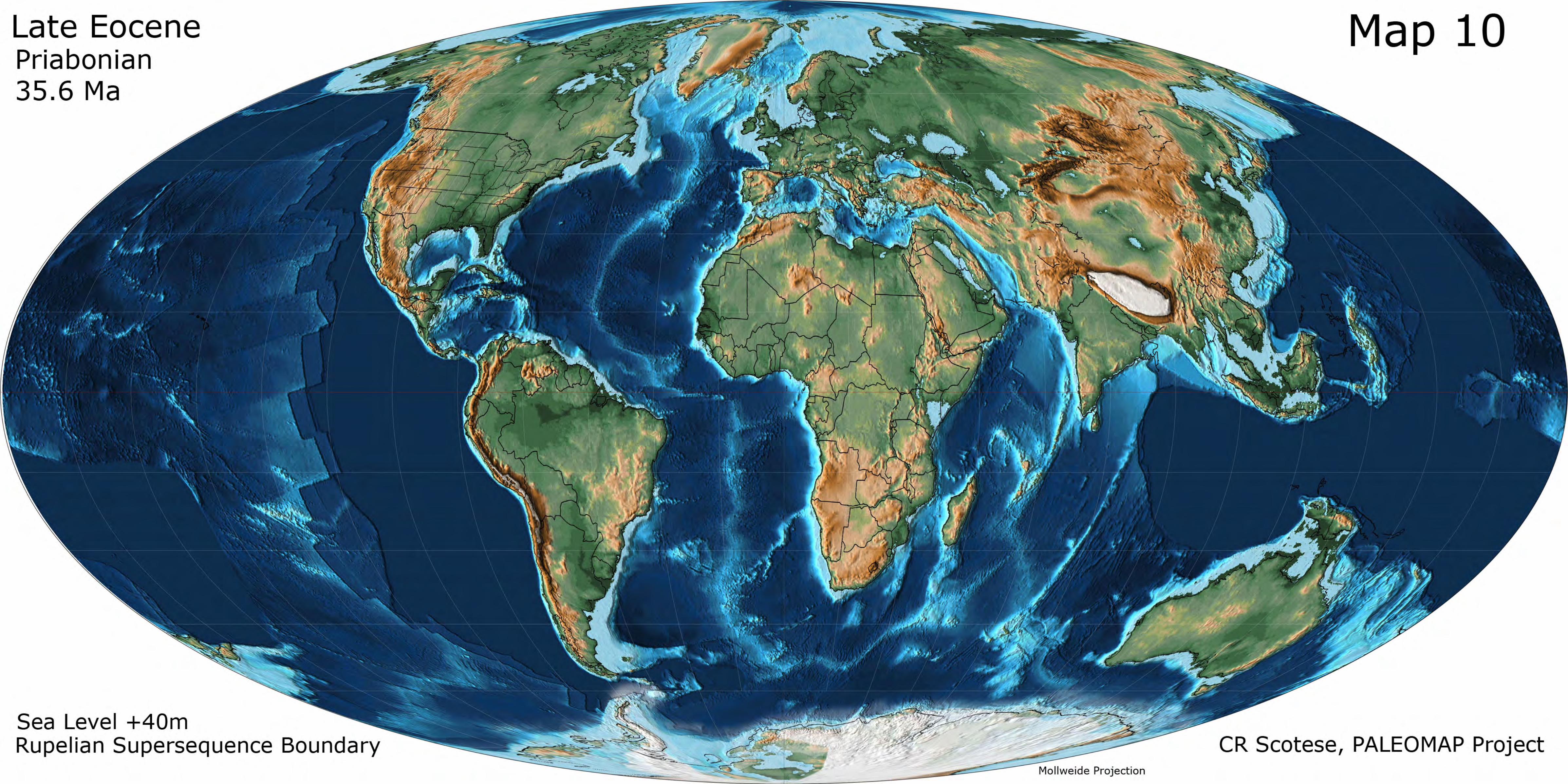
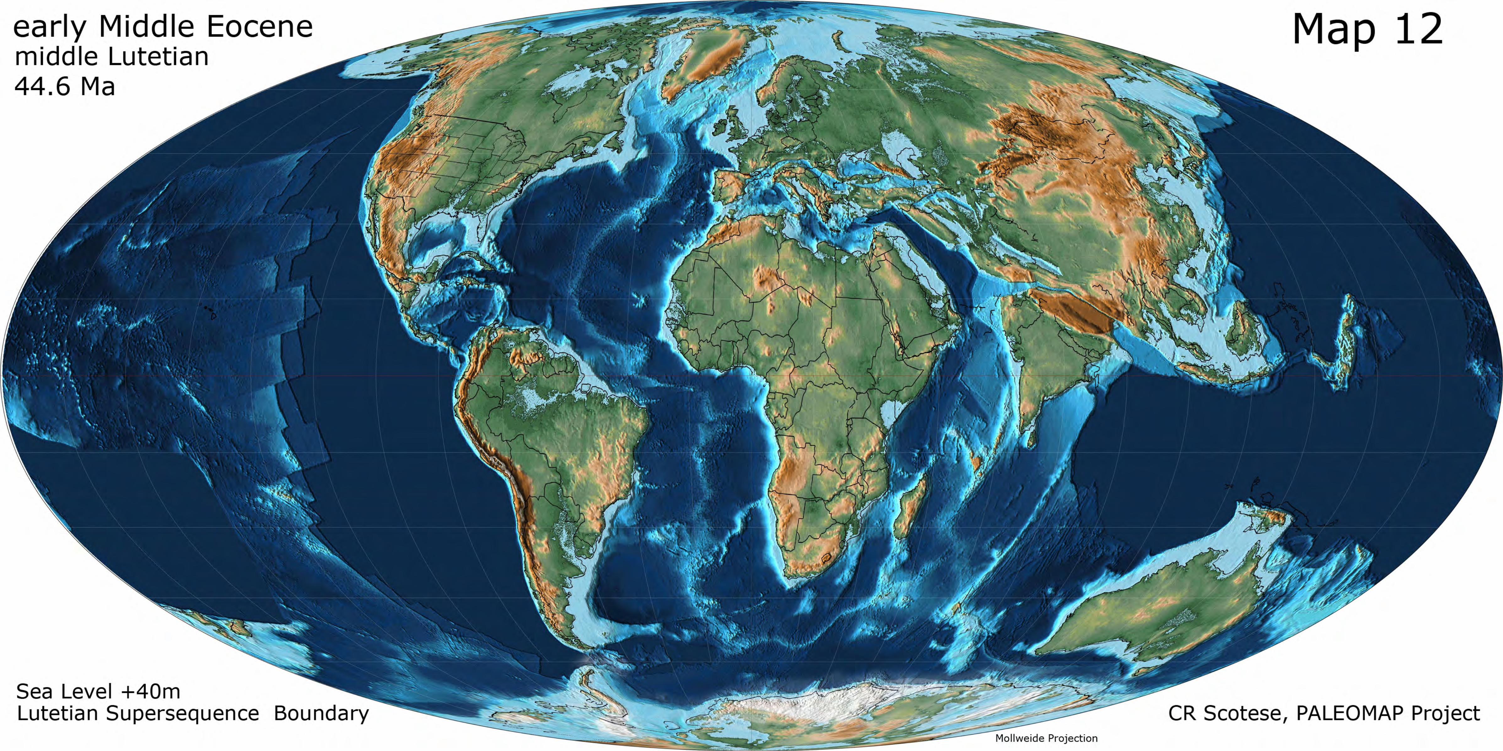
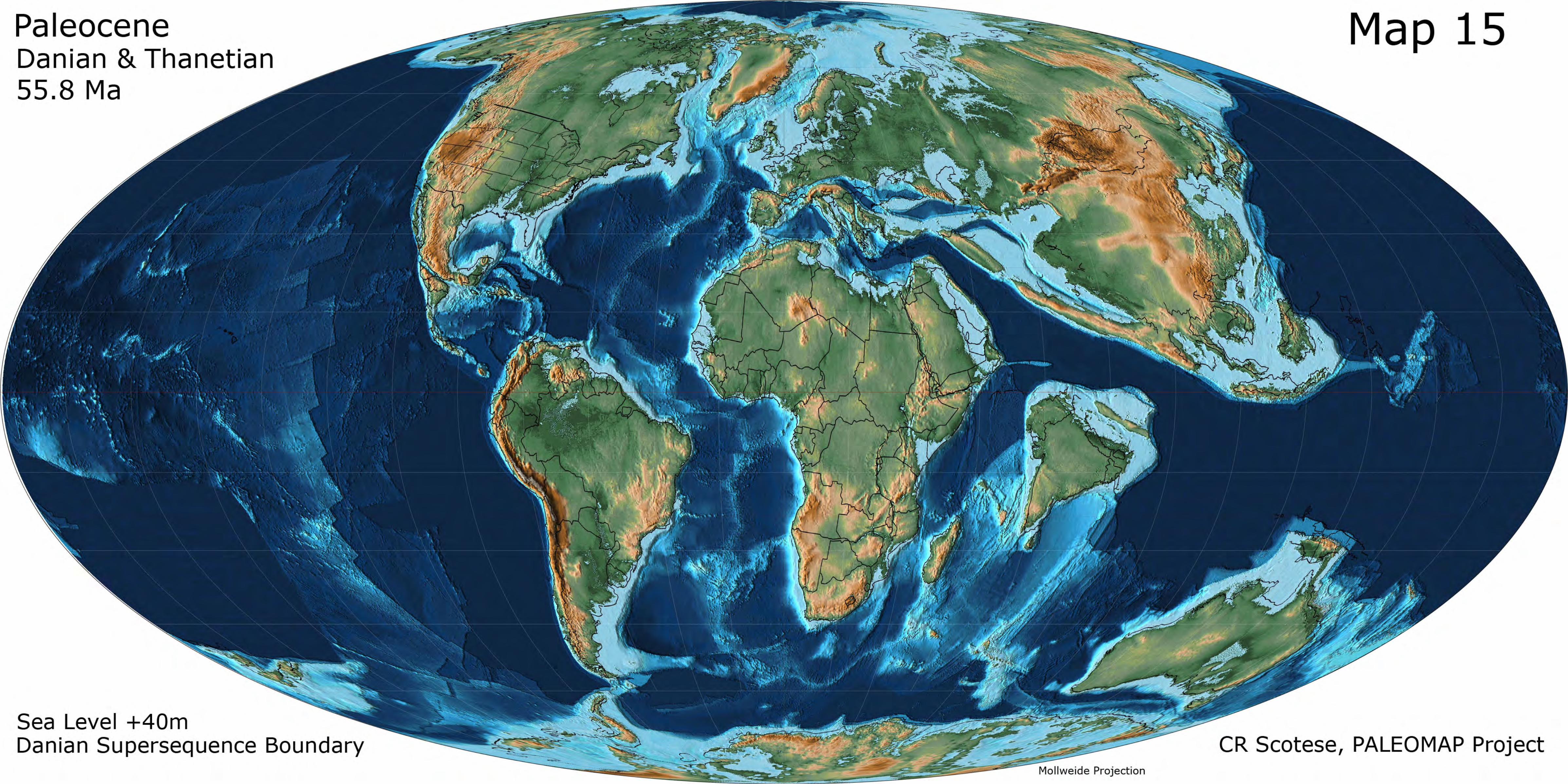
Atlas of Paleogene Paleogeographic Maps This Atlas of Paleogne Paleogeographic Maps shows the changing paleogeography from the Paleocene (60.6 Ma) to the Late Oligocene (25.7 Ma). The maps are from volume 1 of the PALEOMAP PaleoAtlas for ArcGIS (Scotese, 2014). Absolute age assignments are from Ogg, Ogg & Gradstein (2008). For Maps 8, 10, 12, and 15, there are two versions of the paleogeography. One map shows the maximum highstand sea level (maximum flooding surface). The other map shows the minimum lowstand sea level (supersequence boundary). For each paleogeography there is an estimate of sea level change (m) relative to present-day sea level. The following maps are included in the Atlas of Paleogene Paleogeographic Maps: Map 08 Late Oligocene (Chattian, 25.7 Ma Ma) Aquitanian Superseqeunce Boundary & Late Oligocene Transgressive Systems Tract Map 09 Early Oligocene (Rupelian, 31.1 Ma) Maximum Flooding Surface Map 10 Late Eocene, (Priabonian, 35.6 Ma) Rupelian Supersequence Boundary & Priabonian Transgressive Systems Tract Map 11 late Middle Eocene (Bartonian, 38.8 Ma) Bartonian Transgressive Systems Tract Map 12 early Middle Eocene, (middle Lutetian, 44.6 Ma) Lutetian Maximum Flooding Surface & Lutetian Supersequence Boundary Map 13 Early Eocene (Ypresian, 52.2 Ma) Ypresian Maximum Flooding Surface Map 14 Paleocene/Eocene Boundary (PETM, Thanetian/Ypresian Boundary, 55.8 Ma) PETM Transgressive Systems Tract Map 15 Paleocene (Danian & Thanetian, 60.6 Ma) Paleocene Maximum Flooding Surface & Danian Supersequence Boundary This Atlas should be cited as: Scotese, C.R., 2014. Atlas of Paleogene Paleogeographic Maps (Mollweide Projection), Maps 8-15, Volume 1, The Cenozoic, PALEOMAP Atlas for ArcGIS, PALEOMAP Project, Evanston, IL.
References Cited Ogg, J.G., Ogg, G., Gradstein, F.M., 2008. The Concise Geologic Time Scale, Cambridge University Press, Cambridge, UK, 177 pp. Scotese, C.R., 2014, The PALEOMAP Project PaleoAtlas for ArcGIS, version 2, Volume 1, Cenozoic Plate Tectonic, Paleogeographic, and Paleoclimatic Reconstructions, Maps 1-15, PALEOMAP Project, Evanston, IL.