Archaeological Investigations at 40RD271: Old First Presbyterian Church of Murfreesboro
132
ARCHAEOLOGICAL INVESTIGATIONS AT 40RD271 Old First Presbyterian Church of Murfreesboro Kevin E. Smith with contributions by Bruce Burton Chris Hogan Michele Lawson Report of Archaeological Investigations No. 7 Department of Sociology and Anthropology Middle Tennessee State University 2007
Transcript of Archaeological Investigations at 40RD271: Old First Presbyterian Church of Murfreesboro

ARCHAEOLOGICAL INVESTIGATIONS AT 40RD271
Old First Presbyterian Church of Murfreesboro Kevin E. Smith with contributions by
Bruce Burton Chris Hogan
Michele Lawson
Report of Archaeological Investigations No. 7 Department of Sociology and Anthropology
Middle Tennessee State University
2007


Archaeological Investigations at 40RD271
Old First Presbyterian Church of Murfreesboro
Kevin E. Smith Middle Tennessee State University
With contributions by
Bruce Burton Christopher Hogan Michele Lawson
Report of Archaeological Investigations, No. 7 Department of Sociology and Anthropology Middle Tennessee State University
2007


Contents
List of Figures vList of Tables vii
Preface and Acknowledgements ix
Chapter 1 Rediscovering the Old First Presbyterian Church and City Cemetery Kevin E. Smith
1
Chapter 2 History of the Old First Presbyterian Church and City Cemetery Kevin E. Smith and Michele Lawson
3
Chapter 3 Archaeological Remains of the Old First Presbyterian Church and City Cemetery Kevin E. Smith and Christopher Hogan
27
Chapter 4 Historic Period Artifacts from the Old First Presbyterian Church and City Cemetery Kevin E. Smith, Christopher Hogan, and Bruce Burton
51
Chapter 5 Interpreting the Old First Presbyterian Church and City Cemetery Kevin E. Smith
71
References 77Appendix A – Description of the Church submitted with petition
83
Appendix B – Excavation Unit and Feature Summaries 87Appendix C – Artifact Classification Scheme 91Appendix D – Artifact Tables 95


Figures
2.1 Original Church and Presbyterian Burying Ground lot 52.2 Counties created and lands opened for settlement 62.3 Boundaries of the cemetery about 1878 92.4 Reuben Searcy Tombstone in the Old City Cemetery 122.5 Minutes of the Session, July 18, 1864 (MF501) 132.6 Lots sold by the Church Elders in 1867 (RCDB 23, pp. 356-357) 152.7 Benjamin Smith obelisk 162.8 Location of Benjamin Smith obelisk with respect to church lot 162.9 H.R. 2377 (Library of Congress, US Congressional Documents and Debates, 1774-1875) 172.10 Insurance map showing proposed extension of State Street 192.11 Insurance Map showing East State Street completed through the Old City Cemetery 192.12 Map showing East State Street and portion of Old City Cemetery sold in 1912 192.13 Boulder commemorative monument 202.14 Row of eight commemorative markers for Revolutionary War Soldiers 212.15 State Capitol Historical Marker 22
3.1 Nick Fielder supervising excavation of Operation 1, October 1976 283.2 October 1976 excavation trenches 283.3 October 1976 Excavation of “Operation 1” Trench in process 283.4 View southeast from the Vine Street Entrance down the north-south gridline 293.5 Schematic of 2003 excavation units (shaded in black) 303.6 Plan View Showing Features. Intact Limestone Coursework is shaded black.
Builders/Robbers trenches are shaded gray 32
3.7 North foundation wall (view from the east). Projecting foundation presumably for the front of the belltower is visible extending to the left
33
3.8 Profile view of surviving four courses of the north foundation wall 343.9 View to the west of the northwestern corner of the church foundation (highlighted in
yellow). US Bicentennial Pepsi can circled in blue 34
3.10 Builder/robbers trench for western church foundation in Unit N1008E484S 353.11 Unit N1000E484 after excavation showing disturbed remnants of a bottom course of
limestone rubblework (view to the west) 35
3.12 North Foundation wall (view from the west). Northeast corner coursework is visible at the lower center and the interior crosswall at the far left
36
3.13 Unit N998E488W after excavation . The arrow scale points to the edge of an apparent robbers trench (view to the north)
37
3.14 View to the west of a potion of Unit N998E488W and Unit N1000E488SW 373.15 Possible remnants of rubblework in N1014E492 (outlined in yellow) 383.16 Rubblework in N1002E492S (view to north) 383.17 Rubblework in N1002E492 (view to west) 383.18 Units N1004E492/E494/E496 showing joist repair supports and rubblework 393.19 Rubblework in N1002E488SW (view to the west) 393.20 Rubblework in N1002E488W (view to the east) 393.21 Unit N1016E488 showing initial exposure of Feature 18 at lower left 403.22 Unit N1016E488 showing Feature 18 after excavation at lower left 40
v

3.23 Feature 15 during excavation 413.24 Unit N1014E498S showing the brick filled posthole (Feature 4) upon initial exposure 423.25 Unit N1015E498SE showing Feature 31 after excavation 433.26 Units N1016E498SE and N1014E498S showing the relative positioning of Feature 24 (A)
and Feature 4 (B) 43
3.27 Portion of Feature 7 in Unit N1016E492 upon initial identification 443.28 Feature 7 after complete exposure in Units N1016E494/E492 (view to the south). The
limestone “corner” at the upper right is the projecting base for church belltower 44
3.29 Portion of Unit N1016E492 and N1016E494 showing the features uncovered when Feature 7 was removed (view to the north). Feature 8 (scaffolding post) at left with rodent burrow proceeding to the north
45
3.30 Closeup of Feature 8, showing the packed brick rubble (sans plaster or mortar) around the post mold (view is to the west)
46
3.31 Feature 17 463.32 Feature 17 after excavation with Lauren Tomlinson for scale 463.33 Feature 20 after excavation with Jennifer Brown for scale 473.34 Representative profile of the Feature 1 walkway or road 483.35 Feature 25 after excavation 493.36 Profile of Feature 25 after excavation (view west) 49
4.1 Sample of whole bricks 524.2 Bruce Burton measuring window glass 554.3 Flat Glass Distribution using Moir Formula 554.4 Plaster “finished white” and aquatic snail 584.5 Fragment of Rockingham doorknob 594.6 Density distribution of brass furniture tacks 604.7 Assortment of brass furniture tacks 604.8 Bullets 614.9 Density distribution of arms group artifacts 614.10 Military button and percussion cap 634.11 Military buttons 634.12 Iron wrecking bar 654.13 Brass harmonica plate 664.14 Jack 664.15 Canteen half from Feature 15. 664.16 Fragment of Samuel Wilson tombstone. 674.17 Tombstone fragment, Feature 15. 68
5.1 Journal of the Senate, 1820 735.2 Reconstruction sketch of church front 765.3 Reconstruction sketch of church side 76

Tables
4.1 Summary of Nail Types 534.2 Glass Dates (Moir) from selected contexts 574.3 Summary of Container Glass Color 584.4 Animal Remains 594.5 Brass Furniture Tacks 604.6 Arms Group 624.7 Buttons 644.8 Modern Coins 69
5.1 Partial List of Members of the 1822 General Assembly 73
B.1 Summary of Excavation Units 87B.2 Summary of Features 89
D.1 Artifacts from the 2003 FPC Excavations 97D.2 Ceramics 109D.3 Bulk Materials Summary 119

viii
Preface and Acknowledgements
Kevin E. Smith
As I began to make plans for the 2003 MTSU Archaeological Field School course, I noted in our local newspapers the growing excitement about the up-coming Bicentennial of the creation of Rutherford County. I decided to try to find an excavation project that could contribute in some fashion to this cele-bration. Not being as familiar then with the history of Murfreesboro and Ruther-ford County, I turned to my colleagues at the Center for Historic Preservation for some ideas. I offer my thanks to Caneta Hankins (Assistant Director of the Center) for suggesting the site of the original First Presbyterian Church and Old City Cemetery. Like many of the local folks who would eventually visit our “digs” at the church site, I had driven past the Old City Cemetery and the archaeological remains of the church hundreds of times without really noticing it – or appreciating its signifi-cance. Having an idea is just the beginning of the work needed to put together an archaeological project. The remains of the Old First Presbyterian Church are located on a tract of land managed by the Department of Parks and Recrea-tion of the City of Murfreesboro. Many city officials and staff assisted before and during our archaeological project. I extend my special thanks to Mayor Tommy Bragg and the City Council for approving the project; Richard Rucker (city attorney) for assistance with per-
mits and contracts; and Chris Shofner (Public Information Officer) for promot-ing the project. Other special thanks go to the staff of Parks and Recreation who provided significant assistance, including Mr. Dennis Rainier, Lannie Goodwin, and Steve Toombs. During the project, Chris Hogan served ably as Field Assistant for the project. The title of “Field Assistant” hardly reflects the reality of the respon-sibilities – without his dedication before, during and after the field portion of this project, this report would not have been finished. Before, during, and after the field-work, Michele Lawson (then a graduate student in the MTSU Department of His-tory) assisted with research on the Old City Cemetery and First Presbyterian Church (with support from Dr. Lorne McWatters). Our student field crew obviously contributed the most “sweat equity” to successful completion of the project: Crystal Akers, Emily Beahm, Jennifer Brown, Bruce Burton, Bobbi Chahi, Ra-chel Douglas, Hilary Daugherty, Brandi Gartman, Hannah Guidry, Amy Hop-kins, Janine Hunter, Sarah Lacy, Stan Lacy, Robert Pressnell, Amanda Richardson, Chris Simpson, and Lauren Tomlinson. The crew offers special thanks to the Rutherford County Historical Society for catering a lunch for us on two days and to Ms. Dottie Frederick for providing a
x

BBQ lunch on another. Many community members and or-ganizations provided various kinds of support during the field portion of the project. While space prohibits listing each person individually, our special thanks to Mary Brigance, Mari Byers, Chuck Clark, David Garth, Ernest Hooper, Shirley Jones, Charles Nored, and Alice Ray. Once we returned to the lab, Chris Hogan continued service on the pro-ject as lab director – with assistance from a number of MTSU archaeology students. Of notable mention are lab contributions by Bruce Burton and Janine Hunter. Ultimately, the project became the basis for a temporary museum exhibit curated by Kevin Smith and Michelle Lawson from September 13-November 29, 2003 at the Bradley Academy Mu-seum and Cultural Center titled Two Centuries of Hallowed Ground: The Story of Murfreesborough as Told in the Old City Cemetery. Chris Hogan and Georgia Dennis provided significant as-sistance in developing the exhibit. We gratefully acknowledge John Lodl and George Smith with the Bradley Acad-emy Museum and Cultural Center for providing space for the exhibit. Dr. Car-roll Van West and staff of the Tennessee Civil War National Heritage Area also provided substantial assistance in de-veloping the exhibit. During analysis and report prepara-tion, a number of friends, colleagues and community members contributed in various ways to completion of the re-port. Samuel D. Smith (Tennessee Divi-sion of Archaeology) and Dan Allen (Cumberland Research Group) pro-vided various types of information on artifacts discovered during the project. Colleagues at the Center for Historic Preservation provided a great deal of expertise in interpreting architectural
remains and artifacts. My special thanks to Van West, Caneta Hankins and Mi-chael Gavin.
The Crew. Standing (left to right): Janine Hunter (B.S. 2005), Brandy Gartman, Amy Hopkins (B.S. 2004), Emily Beahm (B.S. 2005), Chris Simpson (B.S. 2004), Stan Lacy (B.S. 2003), Sarah Lacey (B.S. 2003), Rachel Douglas (B.S. 2004), Robert Pressnell, Bobbi Bean (B.S. 2004). Kneeling (left to right): Amanda Richardson (B.S. 2004), Crystal Akers, Lauren Tomlinson (B.S. 2004), Hilary Daugherty (B.S. 2004), Jennifer Brown (B.S. 2003), Kevin Smith. Reclining in front: Han-nah Guidry (B.S. 2003), Chris Hogan (B.S. 2004).
Nowadays, I often detour from the shortest path and drive down Vine Street – not only have I learned some-thing about the significance of a cer-tain lot and cemetery sitting quietly along that path, it now holds many fond personal memories of time spent with a wonderful set of students, col-leagues, volunteers, and community members during the summer of 2003.
x

Rediscovering theOld First Presbyterian Church and City Cemetery
Kevin E. Smith
Before 2003, I occasionally drove down East Vine Street on the way to my office at Middle Tennessee State Uni-versity, usually to bypass construction or traffic on East Main Street. I vaguely re-call occasionally noticing some old looking tombstones and historical markers inside a chain-link fence and wondering what they were all about. In late 2002, I began contemplating a lo-cation for my annual summer Archaeo-logical Field School course the next summer. I was looking for a project that would not only meet the needs of train-ing archaeology students, but also would contribute in some fashion to the 2003 Bicentennial Celebration for Ruth-erford County. Ultimately, I selected the Old First Presbyterian Church of Mur-freesboro – a structure that had briefly served as the State Capitol building for Tennessee in 1822. As a result, that mys-terious fenced lot between Vine Street and State Street with the old tomb-stones and historical markers became my destination each day for several weeks in 2003. This report documents the results of the historical and archaeological re-search conducted by a number of scholars and students from MTSU under my general direction on the Old First Presbyterian Church site. Along the way in 2003 and 2004, many members of the
Murfreesboro and Middle Tennessee community volunteered or visited and thus contributed substantially to the re-search. Our primary objectives during the archaeological portion of the pro-ject were to locate and assess the ar-chaeological remains of the original First Presbyterian Church building (A.D. 1820-1864). Although substantial previ-ous historical research had been con-ducted on the church along with some limited “digging” by archaeologists and students alike, we simultaneously tried to pull together this scattered research and fill in some gaps that had never fully been investigated. Another significant objective in-cluded making our “digs” open to the public as part of the Rutherford County Bicentennial Celebration. Throughout the excavation project, we hosted people from the immediate neighbor-hood, members of local historical socie-ties, and a host of other interested indi-viduals and groups. As research pro-ceeded, my personal understanding of the significance of the site and sur-rounding neighborhood changed. Like most property lots in an urban land-scape, this particular place held differ-ent meanings for people over the course of time. Ultimately, we discov-ered many different public audiences interested in the project – often for very
1

different reasons. We were able to pre-sent the (preliminary) results of our ar-chaeological investigations and histori-cal research to these diverse audiences during the official Bicentennial Celebra-tion in fall of 2003 by creating an exhibit entitled Two Centuries of Hallowed Ground: The Story of Murfreesborough as Told in the Old City Cemetery hostedby the Bradley Academy Museum and Cultural Center only a few blocks from the site. While by no means tapping the full historical or archaeological potential of this important place on the Murfrees-boro landscape, the amount of ar-chaeological work completed in 2003 is sufficient to permit some sound inter-pretations of the church building, yard and surrounding cemetery. A number of research questions for the future have been identified – along with con-firmation of the potential of the site to yield significant new information about this early period of Murfreesboro, Ruth-erford County, and Tennessee. Four authors contributed in various ways to the completion of this report. Chapter 2, authored by Kevin E. Smith and Michele Lawson, presents the re-sults of historical research on the church, old city cemetery, and signifi-cant events associated with both. Chapter 3, authored by Kevin E. Smith and Christopher Hogan, presents the results of the 2003 archaeological inves-tigations. Chapter 4, authored by Kevin E. Smith, Christopher Hogan, and Bruce Burton, describes and interprets the ma-terial culture – the artifacts – discovered during the 2003 field season. Chapter 5 summarizes the results of our investiga-tions, the potential for future research, and the context for significance of the locale.
2

History of theOld First Presbyterian Church and City Cemetery
Kevin E. Smith and Michele Lawson
The nearly two-century-long story of the congregation of the First Presbyte-rian Church of Murfreesboro begins alongside the founding of the city in 1811 and continues today in the current church located at the corner of Col-lege and Spring Streets. Our intent is not to relate a full history of the congrega-tion, but rather to place in historical context the first formal church building that housed this congregation from 1820 until 1864. For a more complete history of the church and its people, many details of interest will be found in an article written by Dr. Ernest Hooper (Hooper 1980). Part of this story also involves what is now known as the “Murfreesboro Old City Cemetery.” Initially created as the “Presbyterian Burying Ground” to the south and east of the church, the City of Murfreesboro expanded the church cemetery as a public cemetery in 1837. After the Civil War, the stories of those once separate entities become in-creasingly intertwined. Today, the ar-chaeological remains of the church, original Presbyterian Burying Ground, and Old City Cemetery are all con-tained within the same fenced lot be-tween Vine and State Streets. An ab-breviated “timeline” of relevant events is provided at the end of this chapter.
Pre-Church Phase (1803-1819) Rutherford County was established by the Tennessee General Assembly on October 25, 1803 from sections of Davidson, Wilson, Williamson, and Sum-ner Counties. The first county seat was at Jefferson, a river town now partially inundated by the waters of Percy Priest Lake. By 1811, the population center of the county had shifted south to an area around Murfree Spring, which was situ-ated on two of the principal roads of the time. On June 1, 1811 Reverend Robert Henderson (1764-1834) held a “camp meeting” religious service near Murfree Spring in a log schoolhouse on lands belonging to Hardy Murfree (MF501, Minutes of the Session I:1). Henderson was a former pupil of the famed Pres-byterian scholar Samuel Witherspoon Doak in Washington County, Tennessee (at Martin Academy, later known as Washington College). About 1811, Dr. Henderson also became one of the leading lecturers at Bradley Academy in Murfreesboro, where he instructed a young James K. Polk. Also in 1811, William Lytle donated land to establish the public square of Cannonsburgh, a new town approved by the General Assembly on October
3

17. About a month later on November 19, the General Assembly changed the name to “Murfreesborough” (appar-ently) at the request of Lytle to honor his friend Hardy Murfree. More centrally located in the county than Jefferson, Murfreesborough was designated as the new county seat in 1812. The 1811 “camp meeting” of Rever-end Henderson eventually led to de-nomination of a congregation in April 1812. The Murfree Spring Church was organized with eighteen members and initially continued meeting in the same log schoolhouse. The founding mem-bers of the congregation included Abi-gail Baird, William D. Baird, Joseph Dick-son, Margaret Dickson, Mary Dickson, Frances Henderson, Robert Henderson, John Henry, Susanna Henry, Margaret Jetton, Elizabeth Kelton, Isabella Smith, John Smith, Mary Stewart, Margaret Wasson, Robert Wasson, Grace Wil-liams, and Mrs. Samuel Wilson. For sev-eral years, services were conducted in borrowed spaces in schoolhouses and the county courthouse. As both the congregation and Murfreesborough grew, the need for a larger and more formal home for the congregation was apparent. In 1818, this need was underlined by the designation of Murfreesborough as the capital city of the fledgling state of Tennessee. Since creation of the state in 1796, only four Tennessee cities have served as the State Capital. Knoxville was the first capital from the drafting of the state constitution and the first meet-ing of the General Assembly in 1796 through 1811 (although Kingston served as “capital for a day” when the Gen-eral Assembly met there in 1807 to fulfill a treaty obligation made with the Cherokee Indians). From 1812-1816, the General Assembly met in Nashville, re-turning to Knoxville for the 1817 legisla-tive session. From 1818-1825, Murfrees-
boro served as the state capital city. In 1826, the General Assembly returned to Nashville, which became the perma-nent state capital in 1843. Perhaps aligned with this momen-tous change in the status of Murfrees-borough in 1818, Dr. Robert Henderson returned to the frontier town to resume pastoral charge of the “Murfree Spring Church.” Under his leadership, the con-gregation became the “First Presbyte-rian Church of Murfreesborough” and began raising funds to build the first Murfreesborough church– and what (unconfirmed) oral tradition suggests was the first brick building constructed in the city.
The Presbyterian Church Phase(1820-1861) Although no known primary histori-cal documents detail the construction of the Old First Presbyterian Church, the project must have been initiated some-time in 1819 under the direction of ar-chitect Benjamin Goldson. The building was complete and “open for business” by April 1820. On April 1, 1820 William Lytle recorded the sale of a lot to Wil-liam Baird, Trustee of the First Presbyte-rian Church for one dollar. “to promote the cause of religion & to provide a suitable place for the Society of Chris-tians called Presbyterians on which to erect a church and on which a church is now erected for the worship of al-mighty God” (emphasis added – RCDB, M, 445). According to the deed, the lot was:
on the east side of Murfreesborough on the north-east corner of Lot. No. Seventy as designated in the general plan of the town of Murfreesborough, running thence South Ten poles with the said lot to the southeast corner thereof, thence East nine poles to a stake in said Lytle’s eastern boundary line of his two hun-dred and ten acre tract thence North
4

Figure 2-1. Original Church and Presbyterian Burying Ground lot overlaid on portion of 1897 Sanborn Insurance map (Sanborn-Perris 1897)
ten poles with said line to a stake thence west to the beginning…(RCDB M, 445).
To date, no drawings, sketches, photo-graphs, or other visual images of this building have been identified, but a few written descriptions have survived.
A brick building forty by sixty ft, two storys, windows, painted shutters, three doors in front, two leading to the gallery, finishing off with a cupaloe [sic], about seventy feet high, neatly finished with painted shutters, a large golden ball on the top, a hundred and twenty five pounds bell. The inside work, a gallery on two sides and end, pannel [sic] work all round, also three rows seats round the gallery. The whole supported above and below with turned pillars, standing at proper distance apart. The lower story, all pewed, closed with doors. An elevated pulpit, about three feet from the floor, stair way either side for en-trance with doors, seating three men. All well finished and neatly painted. Pews
all numbered on the doors. This, the general appearance. The work of the whole building was undertaken by Benj. Goldson, at a cost of about four thou-sand dollars. The church was completed in 1820 (Spence 1991:80).
Another issue of substance to our part of this history relates to the estab-lishment of a cemetery associated with the new church. Apparently after some debate and discussion, the congrega-tion determined to establish a church cemetery at approximately the same time the new church was completed. The cemetery was located on the south and east sides of the church and be-came known locally as the Presbyterian Burying Ground.
The church lot enclosed shortly after the erection of the building. Up to this time, a burrying [sic] place was on the land of Mr. Dickinson, one mile from town. It was undetermined whether they would make the church lot a place of burial or not. After the matter was un-derstood, it would be so used. A man the name of Eldridge died. He was of the class usually called saloon keepers (that day known doggery). Whiskey the cause of his death. The question came up, should such be buried in a church lot. The authorities refused on account of his occupation. He was buried in his own ground. The matter after reconsidered, he was taken up and placed in the church lot, the first person in the old cemetery.” (Spence 1991: 178).
Death dates on the surviving monu-ments in the Old City Cemetery support the creation of a “Presbyterian Burying Ground” to the south and east of the church building within the lot illustrated in Figure 2-1.
1822 Legislative Session On April 22, 1822, Governor William Carroll issued a proclamation invoking Article 2, Section 9 of the State Consti-tution to call for an “extraordinary ses-
5

sion” of the General Assembly (Knoxville Register, May 7, 1822). The special ses-sion was to convene in Murfreesboro on Monday, July 22. Although a precise date has not been established, some-time between April and June of 1822, the log county courthouse burned -- leaving the Tennessee General Assem-bly without a meeting place for this ses-sion. Unsubstantiated rumors of the pe-riod implicated political conflict be-tween the Whigs and Democrats over the location of the state capital as a possible source of the fire. Regardless of the fire’s origin, the new First Presbyte-rian Church building was converted to serve as “Capitol” building for this legis-lative session. According to various secondary sources, a floor was laid at the gallery level. From July 22 through August 5, 1822, the Senate met on the second level and the House of Repre-sentatives on the first:
…at this time, the new Presbyterian Church, a two story brick building, large, with a gallery two sides and end, easy access, the pews removed, a floor laid across the open space in the gallery, the work of a short time. When com-pleted, in all respects, making a more convenient place for the meeting of the Legislature than the court house, the former place. Tables and chairs were furnished. By this arrangement, no time lost. The Assembley [sic] met the regular time allotted for meeting. Business commenced and carried on to the close in regular manner as if nothing had happened to retard the movement(Spence 1991: 192).
Although efforts had been mustered to seek funding for a new brick county courthouse to replace the older log building for several years prior to 1822, they had not yet come to fruition.
During the time that the legisla-ture met in Murfreesboro, James K. Polk served as chief clerk of the Tennessee Senate (1819) and as representative of
Maury County in the General Assembly (1823-25). In addition, many individuals prominently remembered in Tennessee history or in the names of counties served as representatives and senators during these legislative sessions – includ-ing Aaron Venable Brown (Governor 1845-47), David Crockett, William Hall (Governor in 1829), William Moore (Moore County), and Robert Weakley (Weakley County). Robert Jetton, who represented Rutherford County in the House of Representatives from 1817-1821 and the Senate from 1823-25 is buried in the Old City Cemetery.
Figure 2-2. Counties created and lands opened for settlement while Murfreesboro was the state capital (shaded black).
Tennessee changed radically during the time Murfreesboro served as capital city. Under the leadership of Governors Joseph McMinn (1815-21) and William Carroll (1821-26; 1829-34) and the Gen-eral Assembly, the state expanded in size – and many new goals were estab-lished. During McMinn’s tenure, four-teen new counties were created as West Tennessee was opened for settle-ment after the Chickasaw Purchase Treaty. Both McMinn County and McMinnville are named for him. Gover-nor William Carroll held the office of Tennessee Governor longer than any other person. During his twelve years as governor, the state progressed from a frontier society to one in which towns and cities were developing quickly. Remembered as Tennessee’s “Reform Governor,” he is credited with new pe-nal laws, the establishment of chancery courts, and the adoption of the revised State Constitution of 1834.
6

During the special session held in the First Presbyterian Church, the General Assembly took the opportunity to nomi-nate General Andrew Jackson for the presidential election of 1824. On July 28, the House of Representatives recorded the following resolution:
The members of the General Assembly of the State of Tennessee, taking into re-view, the great importance of the selec-tion of a suitable person to fill the Presi-dential chair, at the approaching elec-tion for the chief magistracy of the United States, and seeing that those who achieved our independence and laid the foundations of the American Republic, have nearly passed away; and believing that moral worth, political acquirements, and decision of charac-ter, should unite in the individual who may be called to preside over the peo-ple of the United States, have turned their eyes to ANDREW JACKSON, late Major General of the armies of the United States; In him they behold the soldier, the statesman, and the honest man; he de-liberates, he decides, and he acts; he is calm in deliberation, cautious in deci-sion, efficient in action. Such a man we are willing to aid in electing to the high-est office in the gift of a free people. The welfare of a country may be safely en-trusted to the hands of him who has ex-perienced every privation, and encoun-tered every danger, to promote its safety, its honor and its glory; Therefore, Resolved as the opinion of the members composing the General As-sembly of the State of Tennessee, That the name of Maj. Gen. ANDREW JACK-SON, be submitted to the consideration of the people of the United States at the approaching election for the Chief Magistracy (Knoxville Register, August 6, 1822).
As recorded by Sam Houston in a letter dated August 3, 1822: Dear Genl: On this day a resolution has passed the Senate (unanimously) recommending you as a person the most worthy, & suitable to be the next president of our union. The expression cannot be es-
teemed by you any thing less than a grateful and honorable expression of the feelings of your fellow Citizens… (Moser et al 1996:211-212) Andrew Jackson did not attend this momentous event in the First Presbyte-rian Church for personal and political reasons. On August 6, 1822, he wrote to Andrew Jackson Donelson:
I did not visit Murfreesborough as was anticipated, nor do I intend; casually, it being hinted to me, that it was intended by some of my friends to bring my name before the nation, as a fit person to fill the presidential chair, by a resolution of the Legislature, I declined going to the legislature at all, well knowing if I did, that it would be said by my enemies, that such a resolution was produced by my procurement - <and> never having been a applicant for any office I have filled, and having long since determined that I never would, I intend in the pres-ence instance to pursue the same inde-pendent, republican course. They peo-ple have the right to elect whom they think proper – and every individual composing the republic, when they people require his services, is bound to render it, regardless of his own opinion, of his unfitness for the office he is called to fill – I have recd many letters from every quarter of the united states on this subject; I have answered none, nor do I intend to answer any. I shall leave the people free to adopt such course as they may think proper, & elect whom they choose, to fill the Presidential chair, without any influence of mine exercised by me… …But as the legislature of my state has thought proper to bring my name for-ward without consulting me, I mean to be silent – and let the people do as it seemeth good to them – My enemies had at the city of Washington circulated the report that I had no popularity in my own state, the resolution of the Legisla-ture, will inform the nation with how much truth this has been circulated – and I suppose this, with other reasons, prompted the move to bring it forward, and has determined my to be silent… (Moser et al 1996:212-214).
7

In the 1824 presidential race, Jack-son faced three candidates: Secretary of State John Quincy Adams, Speaker of the House Henry Clay, and Secretary of the Treasury William Crawford. Jack-son won both the popular vote and the electoral vote – but did not have the requisite majority (50%) in the Electoral College. With the electoral vote split among three candidates (Jackson, Clay, and Adams), the US House of Representatives was left to determine the outcome of the election. Clay en-dorsed Adams, who was duly selected by the House as President. President Adams then appointed Clay as his Sec-retary of State. Jackson and his sup-porters were furious and charged that there had been a “corrupt bargain” that violated the will of the voters. This was the first of only four times in the history of the United States that a President entered the White House without winning the popular vote. In 1876, Samuel J. Tilden won 51% of the popular vote, while Rutherford B. Hayes captured 48%. However, Hayes won 185 electoral votes, while Tilden re-ceived only 184. A special electoral commission picked Hayes to be presi-dent. In 1888, Benjamin Harrison be-came president by winning 233 elec-toral votes, even though he received only 47.8% of the popular vote. His op-ponent, Grover Cleveland, garnered 48.6% of the popular vote, yet received only 168 electoral votes. Most recently, in the 2000 presidential race between Al Gore, Jr., and George Bush – Gore also won the popular vote, but lost the Electoral College. So, Tennessee holds the “honor” of having candidates in two of the four most contentious elec-tions in the history of the Presidency. In 1828, Jackson and his supporters used the “corrupt bargain” in the campaign against Adams, easily defeating him. In his 1832 re-election campaign, Jackson
defeated Clay, the other candidate from the 1824 race. While Jackson is remembered for greatly expanding the power and pres-tige of the presidential office and con-ducting an unprecedented program of domestic reform, the result of another of his policies intersected more directly with Murfreesborough in 1838. Chero-kees following one of the “Northern Routes” of the Trail of Tears passed through Murfreesborough on Main Street only one block north of the First Presbyterian Church building in which Andrew Jackson was first nominated for the presidency. Conversion of the church building as a place to house the General As-sembly in 1822 was apparently funded largely by the church congregation. By October 1822, repairs were necessary as indicated in the session minutes.
A meeting was held for the purpose of consulting the most suitable means for having our house of worship kept. It was resolved that each pew holder pay an-nually one dollar, to a committee to be appointed for the purpose of keeping the house repaired (MF501, Minutes of the Session, October 1822, pg 3).
Additional records indicate substantial repairs to the church in 1826 and again in 1838:
Resolved that Mr. Jonathan Currin Treasurer be requested to have the floor of our house of worship raised and cer-tain other repairs done to it… (MF501, Minutes of the Session, September 1, 1826).
And also to Samuel H. Hodge and David D. Wendel in about the sum of three hundred dollars, which the said Sam H. and David W. had paid and were still bound bound [sic] to pay for repairs of the xxxxxxxx regular house of worship in the year of 1838…(MF501, Abstract of Deeds).
These records of repairs provide im-
8

portant clues to interpret some of the archaeological finds of 2003.
Creation of the “City Cemetery” of Murfreesborough Although the original “Presbyterian Burying Ground” sufficed for more than fifteen years as a place of interment for the church congregation and some others, the growth of Murfreesborough soon created a need for a “public cemetery.” In December 1837, Mayor Henderson Yoakum and the Aldermen purchased an approximately three-acre tract east and south of the Presby-terian Burial ground to establish the first public “city cemetery” of Murfreesbor-ough. The deed registered on Decem-ber 28, 1837 conveys a tract from Mary
M. Hilliard “to the Corporation of Mur-freesboro’ for the purpose of being used as a Burying ground and for no other purpose” (RCDB, W, 494-495). At least one person had already been bur-ied on the tract south of the Presbyte-rian Burying Ground, since the same deed notes: “reserving however a space of twenty five feet square the same being marked off immediately around the grave of Lavinia M. Leinau deceased which is not here intended to be conveyed.” Although the “Old City Cemetery” is now bounded on the north by East Vine Street and on the south by East State Street, the land conveyed by Mary Hil-liard for the “burying ground” extended south of those current boundaries. In 1837, neither Sevier Street nor State Street had been extended east of the Presbyterian Church lot. While surviving documents provide few direct clues, the surviving tombstones in the Old City Cemetery suggest that the city ceme-tery expanded from north to south – with some interments nearing what is now State Street by the late 1850s. The 1878 Beers Map of Murfreesboro pro-vides the most direct evidence that the original “City Cemetery” extended ap-proximately half a block further south.
Figure 2-3. Portion of the Beers Map of Mur-freesboro showing the boundaries of the cemetery about 1878 (original Presbyterian church and burying ground lot shaded in black).
9

The Church during the Civil War(1862-1864)
The experience of the Civil War in Middle Tennessee was distinct from that of many other parts of the southern United States. While many regions ex-perienced major battles like that of Stones River, the lengthy occupation of Middle Tennessee by federal forces from early in the war changed the face and landscape of the town forever. While virtually every aspect of daily life was affected during this period, churches and their congregations were among the many institutions especially affected by federal occupation. An early history of the First Presbyte-rian Church of Murfreesboro compiled and edited by Annie E. Campbell about 1939 provides a poignant expres-sion of the experience of the congre-gation early in the Civil War:
An incident related by the late Mrs. Lizzie Miller Jones, a lifelong citizen of this county, gives an idea of the spirit of the times. She writes: I attended a service there [in the First Presbyterian Church]when Dr. Eagleton preached a funeral sermon for Confederate soldiers who died at Camp Trousdale. During the ser-vice a runner came up the aisle and handed Dr. Eagleton a note. He read it and said “Dear Friends, Fort Donelson has fallen.” I will never forget the look of sorrow on his face. Then we knew what war was. When the enemy came the church in which we were that day was broken into, the sacrament vessels taken away, and the building made into a stable… (MF501, Campbell history, pg. 9).
After the federal occupation of Middle Tennessee, large gatherings of citizens were generally restricted – in-cluding church congregations. The di-ary of Kate Carney (Carney 1862) re-cords some of the hardships of the local congregations during the occupation
of Murfreesboro:
Friday, May 16th 1862. Today was the Fast day appointed by Jeff Davis, and we kept it until dinner, though we had no service in our churches. It seems hard that we are not permitted to pray to God, when and how we want to.
Sunday, May 25 1862. A bright & beauti-ful day. I accompanied Cousin Ann & Bettie to the Presbyterian church, before we got to church met Jimmie Leiper, who said one of their Regt's had been ordered off. Just after service began, the Yanks got up and left. I was glad Mr. Eagleton reproved them, though I've heard since they received marching or-ders & had to leave all the churches.
The Church building itself, the Pres-byterian Burying Ground, and the City Cemetery were strongly affected by the war as well. Early in the conflict for control of Middle Tennessee, parts of the City Cemetery were used for the temporary interment of Union soldiers – and probably Confederate soldiers as well. The earliest known interments were after the brief recapture of Murfrees-boro by Confederate troops under the command of Nathan Bedford Forrest on July 18, 1862. In his official report to Major General George Thomas on Sep-tember 1, 1867, Chaplain William Earn-shaw of the United States Army (in charge of establishing the National Cemetery at Stones River) noted re-trieval of the bodies of Union soldiers from the City Cemetery: “…we pro-ceeded to the City Cemetery in rear of Presbyterian Church and gathered all that were there interred. Many of these died of wounds received in the battle when Rebel Genl Forrest recaptured the place in 1862” (NARG92). While un-documented, it seems quite likely that Confederate dead were also interred there. The church building may also have begun service as a “field hospital” for troops beginning in July 1862, al-
10

though these informal and temporary uses of buildings are not well docu-mented in any official records. No cur-rently known document indicates that the church congregation was able to meet in the building between May 1862 and the beginning of the Battle of Stones River on December 31, 1862. Soon after the beginning of the Bat-tle of Stones River along the Nashville-Chattanooga rail-line three miles to the northwest of Murfreesboro, many build-ings in Murfreesboro were used as field hospitals for the rapidly growing num-bers of casualties. If not already in use as a temporary hospital, the First Presby-terian Church was quickly put into ser-vice by Confederate medical person-nel. As battle lines shifted to the south and east, the church was seized by the Union Army for use as a field hospital. The limited available records suggest that Confederate surgeons were al-lowed to remain to tend the wounded – probably eventually with the assis-tance of representatives from the United States Sanitary Commission and United States Christian Commission. An unknown number of soldiers passed through the church hospital – some re-covered, but others died from their wounds or infection. Some of these sol-diers – more than 500 by most estimates -- were temporarily or permanently in-terred in the cemetery behind the church.
January 4, 1863. The three college build-ings were used as hospitals, all the churches, several of the [business] store rooms, and several large dwelling houses. The seats out of the churches and shelving and counters out of the store rooms… January 5, 1863. There were large num-bers of wounded lying on the field to collect. Ambulances were busy running for the wounded. They commence fit-ting hospitals in a better manner for ac-commodation of the wounded. The
confederate arm opened a number of hospitals. They had no bunks. The best they could do was to procure clean straw, lay some on the floor, spread a blanket, lay the patient down and cover with other blankets. In this way they lay in rows over the floors. Had been filling the hospitals with both classes of soldiers, up to the time of the retreat. Their stock of medicines was on a limited scale, and, of course, could not do justice to the soldier that necessity required. Confederate surgeons were left behind with their wounded men. January 6, 1963. … the hospitals were all being fitted with the soldiers of both armys. Surgeons still very busy, amputat-ing arms and legs and bandaging shot wounds of soldiers… (Spence 1993:64-65, 70).
Letters from two soldiers – one Union and one Confederate – written in January 1863 after the Battle of Stones River provide a touching and personal sense of the uses of the church and grounds. C. Lewis Diehl, soldier in the 15th Pennsylvania Cavalry of the fed-eral army, wrote from the Presbyterian Church in Murfreesboro on January 7, 1863:
The United States Commissariat supplied this hospital with stores to-day [January 7]. The weather has been cool…. The hospital in which we are is an old Pres-byterian Church and might be made very comfortable, but as it is we have nothing except straw ticks to lay on and a thin blanket for cover, with corn fod-der for a pillow. The surgeons – rebel – treat us very kindly and are doing as much for us as they do for their own men. The ladies – rebel – who visit this hospital generally slight us. Some few will attend to our wants. There was a gen-eral apprehension by the rebels that our men would not treat them kindly; but since they have received our stores, with permission to help themselves to what-ever they need, they think differently.
James Searcy, soldier in the Lumsden’s Battery of the Confederate army, vol-
11

unteered and was given permission to remain in Murfreesboro and help tend his wounded brother and other Con-federate casualties:
(My brother) Reuben died … Wednes-day morning [January 7] after a week and night of intense suffering… we bur-ied him … [Thursday] morning in the Church yard of the old School Presbyte-rian Church. I have the spot well marked. A head stone with his name deeply cut in it.
While we are not certain that it is the original, a head stone with Reuben’s name deeply cut in it remains in the Old City Cemetery today (Figure 2-4).
November 30, 1863. The thermometer this morning ranges at 17 degrees. So far, the coldest weather we have had for the last three years. Is generally an-ticipated that we shall have a very cold winter (Spence 1993:117). Precisely how long the church was
used as a field hospital is difficult to de-termine from the surviving records, but it
appears that it was probably only used for a few months after the Battle of Stones River. Two or three of the Mur-freesboro churches were back in op-eration by March 1863 (but not the First Presbyterian Church):
March 25, 1863… Two or three of the churches have been cleared of the wounded, having been used as hospi-tals. They were cleaned and seats re-placed and ready for church service. This brings the first opportunity for a thing of the kind for three months past(Spence 1993:83).
For the remainder of 1863, the more than forty-year old church building seems to have continued in use as a Union supply warehouse and perhaps even as a stable. The building does not appear to have ever been used again as a church. The winter of 1863-1864 was a harsh one for civilians and soldiers alike. Sol-diers barracked in camps in and around Murfreesboro lived in relatively ephemeral huts and tents. Records from across the nation indicate that this winter was a time of severe and highly unpredictable weather. In Minnesota, killing frosts were recorded as early as July and August 1863 and temperatures sank as much as 25 degrees below av-erage in the winter months. In the far west, fifteen hundred Navajo Indians surrendered to the federal army be-cause of the freezing conditions and lack of food. In his diary entries for the winter of 1863-1864, John Spence re-cords:
Figure 2-4. Reuben Searcy Tombstone in the Old City Cemetery.
December 15, 1863. We are now having quite a cold spell of weather. The Ther-mometer has been down as low as 18
12

degrees (Spence 1993: 120). January 1, 1864. Last night we had a verry remarkable change in the weather… by morning the Thermometer was down to three degrees above zero, a change of 52 degrees in the course of twelve hours. Several soldiers froze to death on the cars on the Chatanooga road, exposed in the box cars. Tis understood that this change was the same all over the U. States. At the north it was more intense, the Ther. at some places, as low as forty degrees below zero… (Spence 1993:122-123)
While the precise date and details of the destruction of the Old First Pres-byterian Church may never be known, sometime between late 1863 and March 1864, the building was demol-ished. Oral tradition suggests that the building was dismantled by Union sol-diers and “contrabands" seeking bricks to improve temporary housing during this harsh winter.
As the Minutes of the Session record for July 18, 1864:
July 18th Session met, & was opened with prayer. Present Rev. Mr. Eagleton & Messrs. James Maney & J.M. Baird.
The Session deem it suitable to record, that since their lastmeeting, which was on the 2d day of Jan. 1862, many sad events have transpired in our midst & around us, which in adoreing submission
to the will of God we do sincerely de-plore.
1. Our surroundings during a portion of the time were of such a character that we could not have access to the house of God.
2. The health of our Pastor was such that he was under the sad necessity of leaving home & being absent 16 months & upwards.
3. There has been an unprecedented destruction of property both private & public; & even the resting-place of the dead, where the remains of many dear, loved ones were depos-ited, & the Sanctuary itself, where we & may of the venerated dead had been accustomed to meet for the worship of God, have been & still are desolated & desecrated!
Joseph Nelson records the destruction of the church in a letter of June 21, 1866:
Our town & county have been greately darnaged by the two Armies, they dis-troed all the tember for miles a round burnt all the rails for 3 or 4 miles in all di-rections burnt & pulled down at least 50 houses in town & of the number was the Old Presbyterian Church, destroed the fence a round the graves broke tomb-stones & desscerated the grave yard generally (Nelson 1866)
The destruction of the church building, interment of soldiers in the cemetery, and vandalism to the cemetery mark the end of the Church Phase of the lot.
Figure 2-5. Minutes of the Session, July 18, 1864 (MF501)
Post-Church Phase Left without a church home for the first time in nearly half a century, the congregation began a lengthy effort to seek restitution for destruction of the building. On October 9, 1865 Reverend William Eagleton and the elders of the First Presbyterian Church petitioned Ma-jor General George M. Thomas for
13

$10,000. Affidavits submitted with the petition stated that the church had been used as a hospital, commissary, and barracks – and was destroyed while under control of the Union Army. The petition was referred to Captain E.B. Whitman, Chief Quartermaster for the District of Middle Tennessee, who submitted his report on December 28, 1865. Whitman concluded that al-though woodwork had been removed by soldiers and citizens while the build-ing was in use by the Army, the struc-ture itself had later collapsed of its own weight or been blown down. He also noted that bricks had been taken by “soldiers to build chimneys, and that citizens and officers of the Society re-moved others.” Whitman added that the post commander, Brigadier Gen-eral Horatio Van Cleve, “constantly used every effort in his power to protect and preserve it from ruin.” However, the critical factor in reject-ing the claim was the issue of loyalty. Whitman argued that most of those who signed the affidavits were “avowed rebels, or secret sympathiz-ers” and hence the congregation did not qualify for compensation. The Of-fice of the Quartermaster General in Washington concurred with the deter-mination. Meanwhile, the trustees of the First Presbyterian Church proceeded with rebuilding. A new lot was purchased in 1867 on the corner of College and Spring Streets and construction of a new church commended. The services of J.V. Kiddell, architect, of Nashville were secured and in August 1867 work was commenced. The corner stone was laid on the 10th of September, 1867, and on the 4th of October, 1868 the church was dedicated to the worship
of God. (Campbell 1939:13). The new church was completed in 1868 on the location where the current church now stands. Reading between the lines, we sur-mise that in 1865 both the church con-gregation and the officials of Murfrees-boro felt that the once hallowed ground on East Vine Street now held too many bitter memories to rebuild in that vicinity. The First Presbyterian Church building was now only a mound of brick rubble, stone, and fragments of shattered windows. Union and Confed-erate dead were removed from their resting places in the “Murfreesboro Cemetery” and relocated to memorial cemeteries between 1865 and 1867 – undoubtedly leaving the City Cemetery and Presbyterian Graveyard dotted and pocked with reminders of the con-flict and occupation. In 1867, the elders of the Presbyte-rian Church subsequently sold burial plots in the lot where the church for-merly stood and in an area extending to the southwest (Figure 2-6).
The undersigned Elders of the Presbyte-rian Church in the town of Murfreesboro Rutherford County Tennessee on the 10th
day of July 1867 sold at public sale … various parcels of ground as hereinafter stated and which parcels are designed by numbers on the plat which heads this Deed… The parcels sold are parts of the lot of ground in sd town of Murfreesboro Tenn. On which the Presbyterian Chuch was situated (the church building have been destroyed) said lot of ground on which said church building was situated a plat of which heads this deed is bounded on the west by John ? McKinleys lot and north by Academy Street and South & East by the grave yard. [RCDB 23, pp. 356-357]
14

Figure 2-6. Lots sold by the Church Elders in 1867 (RCDB 23, pp. 356-357).
Although the deed reads bounded on the ”north by Academy Street,” this is clearly in error – it should read “north by Vine Street.” Lot No. 1 was sold to Ben-jamin Smith, whose obelisk located just south of the church lot records his death at the age of 77 years on Febru-ary 22, 1882 (Figures 2-7 and 2-8). The surviving monuments and archaeologi-cal investigations both suggest that the
burial plots in the southwest extension of the sale in 1867 were probably used, but that those within the square of the church lot proper were not. Although no surviving records document it, we suspect that the creation of the “new city cemetery” at Evergreen was probably chosen as the place of final rest for most of the individuals that originally planned interment at the “Old
15

City Cemetery.” Without assurance of restitution of funds by the government to construct a new church, this sale of plots was almost certainly another venue for the congregation to solicit funds for a new church building. In February 1872, undaunted by the determination of the Quartermaster General, the Session and Diaconate addressed a petition to Congress deny-ing that the building was burned or ruthlessly destroyed, insisting that it was used to care for sick and wounded federal soldiers, and that later the ma-terials from the church were used for the comfort and benefit of the army. The petition also insisted that “neither Minister, Elders, Deacons nor any com-municants… held office or bore arms in the service of the Confederate Gov-ernment.” Attached was a six page set
of specifications for a church building “…in all respects the same as the one occupied by the Presbyterian Congre-gation up to the late War” (see Ap-pendix A).
Figure 2-8. Location of Benjamin Smith obelisk with respect to church lot.
This bill was unsuccessful, but was reintroduced in 1876 and again in 1886. On August 27-28, 1890 and again on September 14, 1891, depositions were taken in Murfreesboro for the Court of Appeals. On March 23, 1898 the Court of Claims reported to the Committee on War Claims that it could find no evi-dence of disloyalty by the congrega-tion. Thirty-five years after the destruc-tion of the church building, a claims bill was passed on March 3, 1899 author-ized payment of $6500 “to the elders of the Presbyterian Church at Murfrees-boro.”
Figure 2-7. Benjamin Smith obelisk.
The Minutes of the Session for July 26, 1899 record the receipt of funds from the United States Government:
The Moderator stated that the business before the joind body was to receive the report of the committee appointed to formulate a plan for the disbursement of the money recently received from the United States Government for dam-ages in destroying the old Church build-ing by the United States Army during the Civil War, which amounted to $4550 net proceeds. (MF501, Minutes of Session, pg. 339).
16

After almost thirty years of efforts, the congregation finally received compen-sation for the destruction of their first church home.
Old City Cemetery The years immediately following the Civil War also saw the transformation of the “City Cemetery” to the “Old City Cemetery” – and the merging of the Presbyterian Burying Ground and church lot with the same. In 1866 and 1867, the streets of Mur-freesboro must have been full of carts and wagons carrying the honored dead – disinterred from their temporary graves to their final resting places. Initial
reports in 1865 indicate about 300 Un-ion soldiers remained in the City Ceme-tery”
7th At and near Murfreesboro, there are several collections of graves containing from (300) three hundred to (1200) twelve hundred graves each. 1. In the City Cemetery adjoining the site of the Old Presbyterian Church, there are about (300) Three hundred graves, mostly with headboards in a good state of preservation and bearing the usual inscriptions, but the grounds have no enclosure… (Whitman 1865:7).
According to the report entitled “Pris-oners of War in National Cemeteries in the States of Kentucky and Tennessee,” another four bodies were moved from “the Murfreesboro Graveyd” to Stones River National Cemetery. The city cemetery is mentioned again in official reports from 1867 and 1868:
The dead already interred in this ceme-tery [Stones River National Cemetery] were brought from the battlefields of Stones River and the burial grounds of the various field hospitals in that vicinity, the city cemetery at Murfreesbroo and the various hospital burying grounds in and around that place… (Whitman 1867, 1868)
Figure 2-9. H.R. 2377 A Bill Making an appro-priation for the benefit of the Presbyterian Church in Murfreesborough, Tennessee (Li-brary of Congress, US Congressional Docu-ments and Debates, 1774-1875)
To date, no detailed records concern-ing the number of Confederate dead originally buried in the City Cemetery have been identified. However, given the documentation of use of the church by Confederate wounded and surgeons, it seems apparent that the dead from both sides probably found temporary resting places there. Initially, over two thousand of the Confederate dead from the Murfreesboro area were placed in a Confederate Memorial Cemetery established south of the town (Murfreesboro Monitor, December 7, 1867). These bodies were subsequently relocated to a mass grave in the Con-federate Circle in Evergreen Cemetery.
17
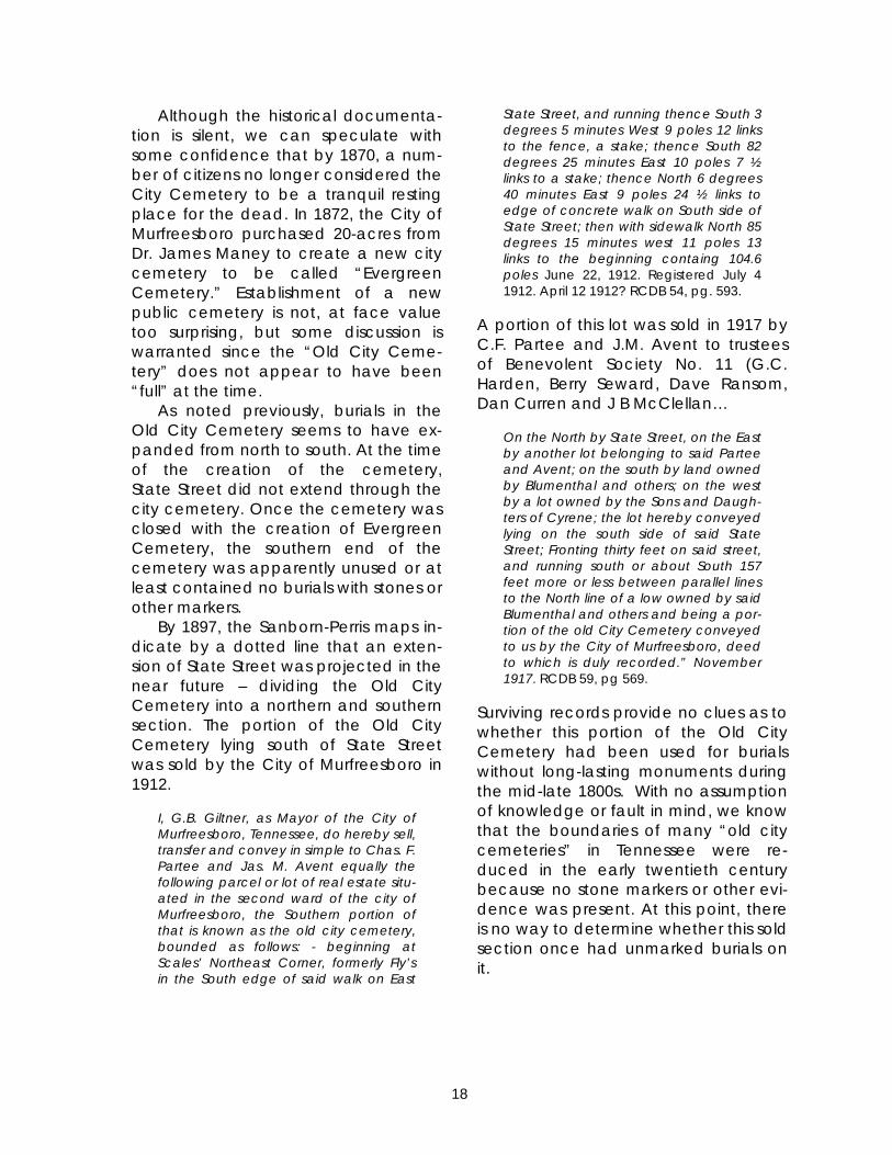
Although the historical documenta-tion is silent, we can speculate with some confidence that by 1870, a num-ber of citizens no longer considered the City Cemetery to be a tranquil resting place for the dead. In 1872, the City of Murfreesboro purchased 20-acres from Dr. James Maney to create a new city cemetery to be called “Evergreen Cemetery.” Establishment of a new public cemetery is not, at face value too surprising, but some discussion is warranted since the “Old City Ceme-tery” does not appear to have been “full” at the time. As noted previously, burials in the Old City Cemetery seems to have ex-panded from north to south. At the time of the creation of the cemetery, State Street did not extend through the city cemetery. Once the cemetery was closed with the creation of Evergreen Cemetery, the southern end of the cemetery was apparently unused or at least contained no burials with stones or other markers. By 1897, the Sanborn-Perris maps in-dicate by a dotted line that an exten-sion of State Street was projected in the near future – dividing the Old City Cemetery into a northern and southern section. The portion of the Old City Cemetery lying south of State Street was sold by the City of Murfreesboro in 1912.
I, G.B. Giltner, as Mayor of the City of Murfreesboro, Tennessee, do hereby sell, transfer and convey in simple to Chas. F. Partee and Jas. M. Avent equally the following parcel or lot of real estate situ-ated in the second ward of the city of Murfreesboro, the Southern portion of that is known as the old city cemetery, bounded as follows: - beginning at Scales’ Northeast Corner, formerly Fly’s in the South edge of said walk on East
State Street, and running thence South 3 degrees 5 minutes West 9 poles 12 links to the fence, a stake; thence South 82 degrees 25 minutes East 10 poles 7 ½ links to a stake; thence North 6 degrees 40 minutes East 9 poles 24 ½ links to edge of concrete walk on South side of State Street; then with sidewalk North 85 degrees 15 minutes west 11 poles 13 links to the beginning containg 104.6 poles June 22, 1912. Registered July 4 1912. April 12 1912? RCDB 54, pg. 593.
A portion of this lot was sold in 1917 by C.F. Partee and J.M. Avent to trustees of Benevolent Society No. 11 (G.C. Harden, Berry Seward, Dave Ransom, Dan Curren and J B McClellan…
On the North by State Street, on the East by another lot belonging to said Partee and Avent; on the south by land owned by Blumenthal and others; on the west by a lot owned by the Sons and Daugh-ters of Cyrene; the lot hereby conveyed lying on the south side of said State Street; Fronting thirty feet on said street, and running south or about South 157 feet more or less between parallel lines to the North line of a low owned by said Blumenthal and others and being a por-tion of the old City Cemetery conveyed to us by the City of Murfreesboro, deed to which is duly recorded.” November 1917. RCDB 59, pg 569.
Surviving records provide no clues as to whether this portion of the Old City Cemetery had been used for burials without long-lasting monuments during the mid-late 1800s. With no assumption of knowledge or fault in mind, we know that the boundaries of many “old city cemeteries” in Tennessee were re-duced in the early twentieth century because no stone markers or other evi-dence was present. At this point, there is no way to determine whether this sold section once had unmarked burials on it.
18

Figure 2-11. Insurance Map showing East State Street completed through the Old City Cemetery (Sanborn-Perris Map Company 1914).
Figure 2-10. Insurance map showing pro-posed extension of State Street (Sanborn-Perris Map Company 1897).
Figure 2-12. Portion of 1878 Beers Map show-ing East State Street (blue) and portion of Old City Cemetery sold in 1912 (yellow).
19

Return to Hallowed Ground (1900-present) At the beginning of the twentieth century, the Old City Cemetery began to re-emerge as an important place on the landscape – particularly for com-memorating the history and heritage of the city and county. The earliest known commemorative marker placed in the Old City Cemetery was in 1933 – ac-knowledging the significance of the First Presbyterian Church in the history of the city and state. According to the Daily News Journal (Monday, October 16, 1933):
Figure 2-13. Boulder commemorative monu-ment.
D.A.R. to Unveil Marker. The Col. Hardy Murfree chapter D.A.R. will unveil a marker in the old cemetery on the spot where stood the Old Presbyterian church, that served as the capitol in 1822, the legislature meeting there in that year, while Murfreesboro was the capital of the state. Miss Lillian Jetton chairman of historical research and marking of historical spots for the chap-ter, is in charge of the program. Mrs. Jo-seph Hays Acklen, of Nashville, vice president general of National Society of D.A.R. and national chai nrman of his-torical research for the southwest divi-sion, will make an address.
The monument text reads:
THE PRESBYTERIAN CHURCH OF MUR-FREESBORO was organized in April 1812 under the name of the Murfree Spring Church with eighteen members. Joseph Dickson, Mary Stewart, Elizabeth Kelton, Susanna Henry, John Smith, Margaret Dickson, Margaret Jetton, John Henry, Frances Henderson, Isabella Smith, Mary Dickson, Mrs. Samuel Wilson, Margaret Wasson, James C. Smith, William D. Baird, Grace Williams, Abigail Baird, Robert Wasson. In 1818 the name of the church was changed to the First Presby-terian Church. A brick building was erected: The Legislature sat here in 1822 during the time when Murfreesboro was the Capitol of Tennessee. The church was demolished by the federal army in
1864. This tablet is placed by the Col. Hardy Murfree Chapter of the National Society of the Daughters of the Ameri-can Revolution September 1933.
According to Garrett (1968:11), the first of the series of markers for Rutherford County Revolutionary War soldiers was placed in the cemetery in 1937. Samuel Wilson was buried about three miles from Murfreeesboro near the National Cemetery in 1830. The original stone was moved to the Old City Cemetery by the Captain William Lytle Chapter of the Daughters of the American Revolu-tion. In 1968, all that remained of this stone was a broken piece reading “72 years here lies the brave, the virtuous, the independent and honest man ____ liberty and truth.” This stone was subsequently incorpo-rated into a row of seven commemora-tive markers placed by the Captain Wil-liam Lytle Chapter of the DAR sometime prior to 1968. Located to the right of the Vine Street entrance, the six additional markers commemorated John Bradley, Richard Keele, William Burnett, Samuel McClanahan, William Smith, and Robert Smith. The actual burial places of these individuals are generally unknown or were destroyed prior to the 1960s. Se-lection of the individuals for placement of government markers by the DAR was
20

Figure 2-14. Row of eight commemorative markers for Revolutionary War Soldiers (the Samuel Wilson marker had been destroyed leaving the gap at the right).
based largely on pension applications indicating they were residents of Ruth-erford County near the time of their deaths. By the 1960s, the Old City Cemetery was in extensive disrepair. Garrett (1968:1) notes that “many of the monuments are down and broken. All tall obelisk-type markers have been pushed over. There are large piles of stones scattered throughout the ceme-tery… Some stones are literally buried in the ground…” On March 19, 1964, the Captain Thomas Jameson Chapter of the Na-tional Society of the Daughters of the American Colonists passed and trans-mitted to the Mayor a resolution urging the “City Council of Murfreesboro to have the City Cemetery restored im-mediately and some provision made for maintenance.” By June 25, Mayor W.H. Westbrooks and the City Council passed a resolution supporting restora-
tion and maintenance of the Old City Cemetery. By March 1965, the “City of Murfreesboro had erected a fence around the Old City Cemetery and that the Association for the Preservation of Tennessee Antiquities had donated funds for the entrance” (Minutes of the Jameson Chapter of DAC, March 18, 1965). With the approach of the United State Bicentennial, the Old City Ceme-tery became a central focus of the city and county celebrations. In September 1975, the DAC requested that a state historical marker commemorating the First Presbyterian Church be placed in the Old City Cemetery. That marker was cast by January 1976 and a dedi-cation ceremony was held on February 22, with Representative John Bragg providing the address (Minutes, Cap-tain Thomas Jameson Chapter of the DAC, September 15, 1975 and 1976).
21

The historical marker reads:
Figure 2-15. State Capitol Historical Marker.
3A 101 – STATE CAPITOL – In August 1822, a called session of the state assembly was held here in the First Presbyterian Church: the lower house met on the first floor and the senate in the gallery. It was used by the legislature as a meeting place after the county courthouse burned while Murfreesboro was the Capital. The church was destroyed by the Union Army during the Civil War.
On July 3, 1976, Mayor Westbrooks presided over a United States Bicen-tennial Ceremony rededicating the Old City Cemetery. The ceremony included dedication of two additional markers in the Revolutionary War Soldiers row for William Cocke and Peter Jennings. These markers were sponsored by the Colonel Hardy Murfree Chapter of the DAR. Since this time, the City of Mur-freesboro, Department of Parks and Recreation has maintained the ceme-tery. The 2003 MTSU Archaeological Field School held at the First Presbyterian Church site was only the most recent in a series of events remembering and recognizing the significance of the Old City Cemetery in the history of Mur-freesboro.
22

Abbreviated Timeline of Significant Events
1803 October 25. Rutherford County established from sections of Davidson, Wil-son, Williamson, and Sumner Counties with county seat at Jefferson
1811 June 1. Reverend Robert Henderson, D.D., holds religious services near Murfree Spring October 17. General Assembly approves proposal of William Lytle to es-tablish the town of Cannonsburgh in the vicinity of Murfree Spring November 19. General Assembly approves name change of the new town to Murfreesborough
1812 April. Murfree Spring Church organized by Reverend Robert Henderson, Abigail Baird, William D. Baird, Joseph Dickson, Margaret Dickson, Mary Dickson, Frances Henderson, John Henry, Susanna Henry, Margaret Jetton, Elizabeth Kelton, Isabella Smith, John Smith, Mary Stewart, Margaret Wasson, Robert Wasson, Grace Williams, and Mrs. Samuel Wilson.
1818 Murfreesboro designated capital city of Tennessee Murfree Spring Church becomes the First Presbyterian Church of Mur-
freesborough 1820 April. First brick church building completed on Vine Street to house the
congregation of the First Presbyterian Church on lands donated by Wil-liam Lytle.
Presbyterian Burying Ground established south and east of the church 1822 April 22. Governor William Carroll issues a proclamation calling for an “ex-
traordinary session” of the General Assembly to convene on July 22 in Mur-freesboroApril-June. Rutherford County courthouse burns (exact date not estab-lished). First Presbyterian Church renovated to house the General Assem-bly for the specially called session July 22. Extraordinary session of the General Assembly convenes in Mur-freesboroJuly 28. House of Representatives passes a resolution in the church nomi-nating Andrew Jackson for President of the United States August 3. Senate passes a resolution in the church nominating Andrew Jackson for President of the United States
1827 October 5. Synod meets in Murfreesboro. During this meeting, one of the earliest temperance societies in Middle Tennessee is formed
1837 December 28. Major Henderson Yoakum purchases a three-acre tract south of the Presbyterian Burying Ground to serve as the first “public cemetery” of Murfreesboro
1862 Murfreesboro occupied by Union troops May 25. Services held in the First Presbyterian Church by Reverend William Eagleton July 13. Confederate troops under the command of Nathan Bedford Forrest briefly recapture Murfreesboro
July (mid). Federal soldiers buried in the city cemetery December. Battle of Murfreesborough/Battle of Stones River. Union and Confederate soldiers treated in a field hospital in the Presbyterian Church
23

1863 January. Union and Confederate soldiers treated in a field hospital in the Presbyterian Church
1864 March. Church building destroyed by Union troops 1865 October 9. Reverend Eagleton and Elders of the First Presbyterian Church
submit petition to Major General George M. Thomas asking for $10,000 in restitution for the church December 28. Captain E.B. Whitman, Chief Quartermaster for the District of Middle Tennessee, rejects the claim of the congregation for restitution
1867 Trustees of the First Presbyterian Church purchase a new lot on the corner of College and Spring Streets for a new church building July 10. Portions of old church lot sold a public sale for grave plots August. J.V. Kiddell, architect of Nashville, commenced work on the new church
1868 October 4. New church building completed and dedicated to the wor-ship of God
1872 February. Session and Diaconate address a petition to Congress request-ing restitution for destruction of the church building May. City of Murfreesboro purchases 20-acres from Dr. James Maney to establish a new city cemetery (Evergreen Cemetery)
1876 Session and Diaconate resubmit the petition to Congress requesting resti-tution for destruction of church
1886 Session and Diaconate resubmit the petition to Congress requesting resti-tution for destruction of church
1890 August 27-28. Depositions taken in Murfreesboro for the Court of Claims concerning restitution for destruction of church
1891 September 14. Additional depositions taken in Murfreesboro for the Court of Claims
1898 March 23. Court of Claims reports to the Committee on War Claims that it could find no evidence of disloyalty by the congregation
1899 March 3. Claims bill passed including authorization of payment of $6500 to the elders of the First Presbyterian Church of Murfreesboro
1912 April 12. G.B. Giltner, as Mayor of Murfreesboro, sells the southern portion of the Old City Cemetery to Charles F. Partee and James M. Avent
1917 November. Charles F. Partee and James M. Avent sell part of the former southern portion of the Old City Cemetery to Benevolent Society No. 11
1933 October 19. Col. Hardy Murfree Chapter of the National Society of the Daughters of the American Revolution places a marker in the Old City Cemetery commemorating the First Presbyterian Church
1937 Samuel Wilson marker moved to the Old City Cemetery 1964 March 19. Resolution passed by the Captain Thomas Jameson Chapter of
the National Society Daughters of the American Colonists and transmitted to the Mayor – urging “City Council of Murfreesboro to have the City Cemetery restored immediately and some provision made for mainte-nance.” June 25. Mayor W.H. Westbrooks presents a resolution from Murfreesboro City Council for the restoration and maintenance of City Cemetery in re-sponse to the DAC resolution.
24

1965 March 18. “The [DAC] Regent announced that the City of Murfreesboro had erected a fence around the Old City Cemetery and that the Asso-ciation for the Preservation of Tennessee Antiquities had donated funds for the entrance.”
1975 September 25. Petition passed by the DAC to request a state historical marker.
1976 January 15. Marker for the Old City Cemetery had been cast and would be placed in the near future. February 22. Dedication ceremony for the state historical marker. Address by Representative John Bragg. July 3. U.S. Bicentennial Ceremony at the Old City Cemetery. Commemo-rative markers for William Cocke and Peter Jennings dedicated by Hardy Murfree Chapter of the DAR October. Archaeological project under direction of Dick Tune and Nick Fielder
Additional exposure of church foundation by MTSU Preservation students under direction of James Huhta
1977 December. Monument made and inscribed by John Lawrence Vaughan, son of Nina H. Lawrence Vaughan installed in the Old City Cemetery.
2003 June 2-July 2. MTSU Summer Archaeological Field Project at the First Pres-byterian Church site
September 13-October 29. Two Centuries of Hallowed Ground: The Story of Murfreesborough as Told in the Old City Cemetery. Temporary exhibit curated by Kevin E. Smith and Michele Lawson at the Bradley Academy Museum and Cultural Center.
25

26

Archaeological Remains of theOld First Presbyterian Church and City Cemetery
Kevin E. Smith and Christopher Hogan
According to several visitors to the 2003 field project, portions of the foun-dations of the Old First Presbyterian Church were visible on the ground sur-face throughout the first half of the twentieth century. Anecdotal evidence suggests that school groups were oc-casionally taken on field trips to the “old church foundations” during that era. At some point in the not too distant past, however, landscaping fill was brought in to cover the exposed foun-dation stones. Although unconfirmed, it seems likely that this event coincided with the city beautification project at the Old City Cemetery in the late 1960s through mid-1970s. The artifacts recov-ered in the upper 10-20 centimeters of our excavations tend to support this – with most of the accumulated 20th cen-tury “midden” artifacts suggesting use of the area for minor but consistent trash disposal during the 1950s to 1960s – with significantly less deposition after that time. Prior to the initiation of the 2003 pro-ject, background research at the Cen-ter for Historic Preservation revealed some 35mm color slides indicating that some minimal archaeological testing had been done on the church lot in 1976 by some students from Middle Tennessee State University (Figures 3-1-3). Additional research revealed that a project was conducted under the di-
rection of Nick Fielder and Dick Tune (Tennessee Historical Commission) in October 1976. Consultation with Mr. Fielder (currently State Archaeologist with the Tennessee Division of Archae-ology) indicated that only a very limited amount of work had been conducted over a couple of weekends as a U.S. Bicentennial Project. The primary goal of the project was simply to examine whether the lot had been substantially disturbed and excavations do not ap-pear to have extended more than about 20 centimeters below the ground surface (Nick Fielder, personal commu-nication, 2003). Based on the 1976 pho-tographic documentation archived at the Center for Historic Preservation, we were able to relocate most of these excavation units. However, as the 2003 project pro-ceeded, it became apparent that con-siderably more “digging” had taken place than could be accounted for by the brief October 1976 project. “Arti-facts of prior archaeology” were identi-fied in many of the excavation units centered on the corners of the church foundation – including nylon twine and fragments of plastic sheets. Apparently after termination of that project, an additional project exposed a substan-tial portion of the church foundation (James Huhta, personal communica-tion 2003). As noted in the introduction
27

Figure 3-1. Nick Fielder supervising excava-tion of Operation 1, October 1976.
Figure 3-2. October 1976 excavation trenches (northern trench backfilled at lower right; crew working on southern trench at upper left).to Rutherford County Historical Society
Publication No. 11 (Anonymous 1978):
Recently, the Preservation classes at Middle Tennessee State University, act-ing under the supervision of Dr. James Huhta, made considerable archaeo-logical explorations in the area of the Old City Cemetery where the building supposedly stood. The ‘digs’ resulted in the exposing of a rather distinct line of foundation stones and other data which have added considerably to the knowl-edge of the architectural design of the structure.
Although a report on the excava-tions may have been produced, the authors have been unable to locate a copy. The disposition of any artifacts resulting from those excavations also remains unclear. As a result, efforts to interpret the stratigraphic integrity of several 2003 excavation units were greatly complicated. Fill in areas that were almost certainly backfilled exca-vation units could not always be readily distinguished from undisturbed deposits, particularly since artifacts were (appar-ently) not systematically retrieved dur-ing these investigations. Given these (and other) largely undocumented dis-turbances, this report focuses primarily on architectural features discovered during our investigations.
Figure 3-3. October 1976 Excavation of “Operation 1” Trench in process.
28

ARCHAEOLOGICAL METHODS
A metric grid (Figure 3-4) was estab-lished aligned with the base of the westernmost cemetery monument on the presumed eastern edge of the church lot (grid north closely approxi-mates current magnetic north). The starting point was assigned a horizontal position of 1000 meters north and 500 meters east (abbreviated N1000E500) from an unlocated starting point N0E0 (outside the area where any investiga-tions were planned). Base excavation unit size was in two-meter squares, with smaller sub-units designated as halves (South – S; West – W; North – N; East – E) or quadrants (Southeast – SE; Northeast – NE; Northwest – NW; Southwest – SW) of these larger units. When excavation units (or subunits) were established,
they were designated by the grid inter-section point at the southwest corner of the two-meter square. Vertical control (elevation) was maintained using a point on the north-west corner of an obelisk base (marking the interment of an unknown Smith). This point was assigned the elevation of 286 meters above mean sea level based on estimates from the U.S.G.S. topographic map. As general practice, excavated soil was passed through ¼-inch hardware mesh to retrieve artifacts. Common bulk materials (brick fragments and limestone chipping debris) were re-corded by volume and discarded in the field. Provenience was maintained by unit-level and/or feature.
Figure 3-4. View southeast from the Vine Street Entrance down the north-south gridline.
29

Excavation Summary
Investigations in 2003 consisted of seventy-four square meters of excava-tion units (Figure 3-5). Initially, excava-tion was conducted in arbitrary ten centimeter levels. After completion of several excavation units, excavation was generally conducted in two “natu-ral” zones – an upper sod/humus zone
ranging from 15-30 centimeters in thick-ness containing a mix of nineteenth and twentieth century artifacts. In some units, the second zone consisted of mixed brick fragments and plaster in a sandy matrix (decayed grout, mortar, and plaster) resting directly on subsoil. In other instances where extensive modern disturbances were identified, units were excavated as a single level. During our excavations, the most
Figure 3-5. Schematic of 2003 excavation units (shaded in black).
30

significant discovery was the exposure of the (relatively) intact foundations for the entire north wall of the church, in-cluding the northwest and northeast corners. Additional portions of the ar-chaeological remains of the east and west walls were also uncovered, along with several exterior features. Due to the time limitations of our project and apparent heavy “robbing” or recycling of limestone blocks from the southern foundation trench, we were not able to identify surviving remains of the south-ern wall with absolute certainty. How-ever, using a mix of historical docu-ments and our archaeological findings, we can fairly confidently identify the full outlines of the church exterior founda-tion at this point. During our fieldwork, thirty-three fea-ture designations were assigned, but many of these eventually turned out to be non-cultural or could not be defined in an interpretable fashion. Table B-2 (Appendix B) includes a full listing of the features designated in the field, but only significant features are discussed in detail in the text (Figure 3-6). Our description and interpretation of the features is divided into three sec-tions: 1) Church Architecture; 2) Church Yard Features; and 3) Miscellaneous Features. The first section addresses features interpreted as directly relating to the exterior and interior architectural features of the church building. The second examines features in the front and side yard areas of the church in-terpreted as related to the construc-tion, use, or demolition of the church. Finally, the third section records infor-mation on the features that we could not identify or interpret in terms of func-tion or chronology.
CHURCH ARCHITECTURE
Exterior Wall Foundations and Build-ers/Robbers Trenches
During the 2003 field season, we ex-posed surviving limestone coursework for almost the entire north foundation wall, including a projecting section centered on the front wall that proba-bly served as support for the front or outside of the church belltower (Figures 3-7, 3-8, 3-9). Excavation units placed to identify the east, west, and southern foundations indicate that the cut lime-stone blocks from the foundation walls were thoroughly salvaged or “robbed” after destruction of the church. Also based on our investigations, it appears that rather than simply creating builder’s trenches to place the massive foundations for the church, the majority of the interior of the church was exca-vated during construction to a depth of approximately two feet (60 cm) below the then current surface. Based on the description of the church on file in the National Archives (see Appendix A), the foundation “will be four feet high, that is two feet below the surface of the ground and two feet above the ground and will be two feet thick.” The church is described by Spence (1991:80) as “forty by sixty ft” (see Chapter 2). The north foundation wall is forty feet in length, indicating that the east and west walls should comprise the sixty foot length.
31

Figure 3-6. Plan View Showing Features. Intact Limestone Coursework is shaded black. Build-ers/Robbers trenches are shaded gray.
32

Figure 3-7. North foundation wall (view from the west). Projecting foundation pre-sumably for the front of the belltower is visible extending to the left.
33

West Foundation Builder/Robber Trench Three areas were investigated along the west foundation of the church, in-cluding the northwest corner, one unit near the center of the length, and a third small unit near or at the southwest corner. Excavations revealed that virtu-ally all of the limestone blocks had been salvaged in the past, leaving only a “robbers trench” as evidence of where the foundation once stood. Be-ginning at the northwestern corner of the church foundation, the stone coursework is absent - leaving only the robbers trench. This particular corner of
the church was clearly one of the areas investigated during one of the 1970s “digs” at the church, since the excava-tion units in this vicinity yielded evi-dence of nylon twine, plastic sheeting, and other materials indicative of a backfilled excavation unit. Figure 3-9 shows the northwestern corner of the church foundation outlined in yellow. The item circled in blue is a United States Bicentennial Pepsi can.
Figure 3-9. View to the west of the northwest-ern corner of the church foundation (high-lighted in yellow). US Bicentennial Pepsi can circled in blue.
Figure 3-8. Profile view of surviving four courses of the north foundation wall.
About halfway down the length of the western foundation wall, excava-tions in Unit N1008E484S revealed clear evidence of a builders/robbers trench aligned with the northwestern corner of the church foundation (Figure 3-10).
34

Figure 3-10. Builder/robbers trench for western church foundation in Unit N1008E484S.
Two additional excavation units (N996E484 and N1000E484SE) were placed in an effort to identify the southwestern corner of the church foundation. Unit N996E484 yielded no evidence of trenches associated with the church construction, and appears to have been outside the south wall of the church building in the back yard area. Given the depth of deposits and general nature of the fill, Unit N1000E484SE (1x1 m) appears to have been entirely within the build-ers/robbers trench at or very near the southwestern corner, but time did not permit expanding this unit (Figure 3-11).
Figure 3-11. Unit N1000E484 after excavation showing disturbed remnants of a bottom course of limestone rubblework (view to the west).
35

East Foundation Coursework and Trenches
The east foundation wall of the church was identified in three excava-tion areas. The northeastern corner of the church was intact with surviving coursework (Figure 3-12). Approximately two-thirds of the way down the length of the eastern wall, a trench consisting of three consecutive 1x2 m excavation units N1004E492/E494/E496) crossed the foundation trench. This particular trench provided clear evidence that a signifi-cant portion of the interior of the church had been excavated during construction (or renovations) to a depth of 60 cm (ca. 2 feet). Unfortunately, the portion of Unit N1004E496 containing the edge of the builders/robbers trench had been disturbed in recent decades, potentially by construction of the mod-ern walkway (see Feature 1 discussion under Miscellaneous Features). How-ever, an apparent remnant trench was
identified. Similar to the southwestern corner, two excavation units were placed to try to catch the southeastern corner of the foundation. Unit N996E496 did not re-veal evidence of a properly oriented trench or corner (however, see discus-sion of Feature 25 in Miscellaneous Fea-tures). Unit N1000E496SW (1x1m) revealed evidence interpreted as a portion of the robbers trench, although this fea-ture was not as clearly defined as in other areas. Part of this excavation unit appears to have been previously exca-vated.
Figure 3-12. North Foundation wall (view from the east). Northeast corner coursework is visible at the lower center and the interior crosswall at the far left.
36

South Wall Foundation
The south wall proved to be slightly elusive during the 2003 investigations – primarily because the impending end of our field class did not permit us to open up some larger excavation areas. However, we are fairly well convinced that these interpretations would be borne out by further excavations (Fig-ures 3-13, 3-14).
37
Figure 3-13. Unit N998E488W after excavation . The arrow scale points to the edge of an apparent robbers trench (view to the north).
Figure 3-14. View to the west of a potion of Unit N998E488W and Unit N1000E488SW. The edge of a robbers trench at the left with a few jumbled limestone blocks still inside the trench at the right of the photograph.

Belltower and VestibleInterior Foundation
38
A second interior foundation wall with surviving coursework paralleling the north exterior wall appears to have served as the support for the back or inside of the belltower and also the rear wall of the entry vestibule (Figure 3-12). The 1865 or 1872 description of the church at the National Archives (Ap-pendix A), provides some details:
The foundations for the two large pillars of collums that support the in or rear side of the cupalo will be covered with one solid Stone of not less than eight inches thick and two feet square and be well bedded in good lime and ?sand?) mortar.
Although the large stones men-tioned had been salvaged prior to our excavations, the remaining coursework provides an indication of the size of the belltower.
Interior Floor Joist Support Walls
The church description also provides clues to interpret apparent coursework discovered in three parts of the interior of the church. The description mentions “two inside walls for the joist to meet on will be good rubble work” (Appendix A). Apparent coursework of largely un-dressed limestone was encountered in three excavation units. Figure 3-15 shows a segment of pos-sible coursework discovered in one of our first excavation units (N1014E492). Although these may simply represent stones displaced from the adjacent foundation walls, they align well with more obvious rubblework encountered to the south in N1002E492S (Figures 3-16, 3-17).
Figure 3-15. Possible remnants of rubblework in N1014E492 (outlined in yellow).
Figure 3-16. Rubblework in N1002E492S (view to north).
Figure 3-17. Rubblework in N1002E492 (view to west).

A similar portion of rubblework was also i
Other possible remnants of rubble-ork for the east joist wall were identi-
Resolved that Mr. Jonathan Currin
, September 1, 1826).
Tak d arc a-son fthe ns discovered during the 2003 field sea-
Resolved that Mr. Jonathan Currin
, September 1, 1826).
Tak d arc a-son fthe ns discovered during the 2003 field sea-
dentified in N1002E488SW (Figures 3-19, 3-20). As discussed in interpretations below, the locations of this rubblework are evenly spaced in the interior of the church, providing two interior walls on which equal length floor joists could rest. While additional testing would be necessary to fully confirm this hypothe-sis, the current archaeological data is supported by the documentary de-scription.
wfied in N1004E492 (Figure 3-18). How-ever, two iron braces interpreted as joist repair supports were identified on either side of this section of the “joist founda-tion.”
2 (Figure 3-18). How-ever, two iron braces interpreted as joist repair supports were identified on either side of this section of the “joist founda-tion.”
As noted in chapter 2, the church min-utes record that repairs to the floor were required in 1826:
As noted in chapter 2, the church min-utes record that repairs to the floor were required in 1826:
Treasurer be requested to have the floor of our house of worship raised and cer-tain other repairs done to it… (MF501, Minutes of the Session
Treasurer be requested to have the floor of our house of worship raised and cer-tain other repairs done to it… (MF501, Minutes of the Session
en together, the documentary anhaeological evidence permit a reably well supported interpretation o exterior and interior foundatio
en together, the documentary anhaeological evidence permit a reably well supported interpretation o exterior and interior foundatio
son. son.
Figure 3-18. Units N1004E492/E494/E496 show-ing joist repair supports and possible remnants of rubblework.
Figure 3-19. Rubblework in N1002E488SW (view to the west).
Figure 3-20. Rubblework in N1002E488W (view to the east).
39

Entryway Foundation?
One shallow feature (Feature 18) adjacent to the north wall foundation appears to be the remnants of a shal-low foundation for the entrance stairs for the west door of the church (Figures 3-21, 3-22). The portion of Feature 18 exposed and excavated was 120 cm (ca. 4 ft) square (although probably ex-tending an additional 120 cm to the west) and was approximately 7 cm (3 in) in depth. The church description (Appendix A) records:
Figure 3-21. Unit N1016E488 showing initial exposure of Feature 18 at lower left.
At the entrance doors there will be one sill at each door, two feet wide not less than eight inches thick and four feet and six inches long, to be hammer-dressed on the top side and front edge and the inside edge straitened to fit the floor. There will also be one step of six feet long and eight inches thick and two feet wide at each door to (?an-swer?) as a platform; these platforms will be supported on a lower step which will project as a margin of not less than ten inches and be eight inches high, all to be dressed off suitable for steps and Platforms and to be well laid in their po-sitions with rubblewall work and lime and sand mortar.
40
The dimensions of Feature 18 match this description fairly closely. Similar features were not identified adjacent to the central and eastern entry doors, but may simply not have been as well pre-served. As an alternative explanation, Feature 18 could represent the remains of some of the 1970s “digs.” The ab-sence of any significant modern arti-facts in the fill of the feature, however, would seem to argue against this possi-bility.
Figure 3-22. Unit N1016E488 showing Feature 18 after excavation at lower left.
Pit or Builder’s Trench
One additional feature between the outer and inner belltower founda-tions is also of interest. Although only partially excavated, the artifactual contents were of particular interest. This feature appears to have been exca-vated as part of the process of con-structing the church, but was filled with debris when the church was demol-ished (Figure 3-23). This feature included two-thirds of a ton of brick rubble (about 15% of the total brick rubble recorded during our excavations). This unusually massive amount of brick rubble undoubtedly comprises the collapse of the belltower.

While other explanations could be mus-tered, the identification of fragments of several pigeon-sized eggs admidst the bricks and mortar atop the Civil War ar-tifacts also tends to support this notion. A seventy-foot-high belltower would have been an attractive place for roosting birds. Near the base of the feature be-neath the demolition rubble, several Civil War era objects were recovered, including a bullet, percussion cap, and half of a canteen probably recycled for use as a plate. The fill also included two fragments of decorative limestone that could be either fragments of broken tombstones or portions of decorative stonework from the belltower. The 1106 fragments of flat glass in Feature 15 yielded a date of 1830.1 – suggesting a later fill date than several of the other features.
Figure 3-23. Feature 15 during excavation.
41

CHURCH YARD FEATURES
Several additional features were identified during the 2003 field season that do not directly relate to the church foundations, but have a bearing on the construction, use, and destruction of the church building and lot. Most of these features were encountered in the “front yard” area of the church.
CHURCHLOT FENCE? Figure 3-24. Unit N1014E498S showing the brick filled posthole (Feature 4) upon initial expo-sure. Some of the documentary evidence
indirectly suggests that the churchyard was separated from the “Presbyterian Burying Ground” by a fence. For exam-ple, Nelson (1866) notes that the [Union and Confederate] armies “destroed the fence a around the graves,” inti-mating that a fence separated the graveyard from the church. Spence (1991:178) also indicates that “the church lot [was] enclosed shortly after the erection of the building.” Two postholes and a possible third posthole discovered on the eastern edge of our excavation areas may comprise evidence of this fence. The location of these features in an appar-ent row between the church founda-tion and the first set of gravemarkers supports this tentative interpretation. Although relatively evenly spaced at 2.5 m (8 ft) intervals, one of the posts is substantially smaller than the other two. Feature 4 in N1014E498S was filled with brick rubble after the post had been removed or rotted (Figure 3-24). The posthole was 36 cm (14 in) in di-ameter and 30 cm (12 inches) in depth In terms of artifacts, the posthole con-tained only brick fragments, 9 frag-ments of flat glass, and 2 cut nails. Feature 24 was a relatively well de-fined posthole approximately 60 cm (24 in) in diameter and 65 cm (26 in) in
depth from the point of origin (Figure 3-26). The posthole fill contained a single piece of unidentifiable (bottle?) glass, 16 pieces flat glass, a single cut nail, a straight pin and perhaps most telling in terms of its chronology, 6 brass furniture tacks. The posthole also contained minimal amounts of brick rubble and limestone debris. Feature 31 was not clearly definable as a posthole since it extended outside of the excavation unit and the depth of rubble deposits in the unit prevented complete excavation (Figure 3-25). Based on the portion of the feature ex-posed it is at least as large in diameter as Feature 24 and potentially of similar depth. The fill of this feature was similar, containing 20 pieces of flat glass, 5 cut nails and one brass tack. Unlike Feature 24, Feature 31 contained substantial quantities of brick rubble and plaster remnants (also evidenced by 66 aquatic snails). The greater depths of destruction deposits in this vicinity may reflect changes in the topography. Careful examination of the deed re-cords indicates that the front yard of the church originally sloped down sig-nificantly to a former elevation of Vine Street. For example, Figure 2-6 shows “steps” leading up from Vine Street. As a result, we are less certain about the
42

identification of Feature 31 as a post-hole without additional excavations. Given its placement and orientation, it does seem reasonable to suggest this as a possibility for future investigation.
Figure 3-25. Unit N1015E498SE showing Feature 31 after excavation.
Figure 3-26. Units N1016E498SE and N1014E498S showing the relative positioning of Feature 24 (A) and Feature 4 (B).
43

BRICK PATHWAY/PATIO
In the “front yard” just to the north-east of the main entrance to the church building, remnants of a brick pathway or patio were identified in N1016E492 and N1016E494. The feature was constructed largely of broken bricks (with a few whole bricks) roughly laid without mortar. Figure 3-27 shows Feature 7 upon initial identification. The excavations were subsequently expanded to the east to expose the entire surviving rem-nants of this feature (Figure 3-28). The portion of this feature identified in 2003 was approximately 240 cm (ca. 8 ft) east-west and 80 cm (ca. 2.5) north-south. No linear edge was obvious anywhere, suggesting that portions of it had been removed in all directions.
44
After the bricks comprising feature 7 were removed, several additional fea-
tures were identified beneath it, includ-ing several that appear to be related to church construction and use (Figure 3-29). Although conjectural, the rather haphazard construction and appear-ance of this pathway or patio does not appear to fit the bill for a sidewalk or patio outside the main entrance of the grandiose church structure. Such a fea-ture might well have been something
Figure 3-27. Portion of Feature 7 in Unit N1016E492 upon initial identification.
Figure 3-28. Feature 7 after complete exposure in Units N1016E494/E492 (view to the south). The limestone “corner” at the upper right is the projecting base for church belltower.

Figure 3-29. Portion of Unit N1016E492 and N1016E494 showing the features uncovered when Feature 7 was removed (view to the north). Feature 8 (scaffolding post) at left with rodent bur-row proceeding to the north.
necessary for use of the church during the Civil War as a storehouse and/or stable. Other remnants of this feature may be present in unexcavated areas to the east, west, and north.
SCAFFOLDING POSTS?
At least three large flat-bottomed postholes (Features 8, 17, and 20) were identified in the front of the church. These appear to represent posts for the scaffolding used in raising the church and belltower walls. Features 8 and 17 were very similar in size and were densely packed around the post with brick fragments serving to anchor the post. The posts appear to have been extracted from the postholes rather than deteriorating in place. Assuming our interpretation of the location of the
belltower is correct, construction at this particular point on the church would have reached seventy feet above the ground. The first of these features, Feature 8, was a large oval-shaped, flat-bottomed posthole and mold slightly disturbed at the surface by a large ro-dent (groundhog?) burrow. The post-hole was packed tightly with fragments around the postmold (Figures 3-29, 3-30). Given the location, size, and the heavy packing of brick rubble as brac-ing for the large post, we interpret this as one of a series of large scaffolding posts used during construction of the church.
Hole diameter: 70 cm; Depth 75 cm Mold diameter: 30 cm; Depth 75 cm).
45

Figure 3-30. Closeup of Feature 8, showing the packed brick rubble (sans plaster or mortar) around the post mold (view is to the west).
Figure 3-31. Feature 17, showing the postmold surrounded by tightly packed brick rubble (sans plaster and mortar).
The post “mold” in Feature 8 contained 341 fragments of flat glass, yielding a window glass date of 1820.7. Feature 8 did not contain any examples of thicker window glass, suggesting the possibility that the post was removed and the hole filled at the time of construction of the church. The brick rubble surround-ing the postmold was not excavated in Feature 8, since excavation Feature 17 had already provided a clear indica-tion of what to expect. Feature 17, an essentially identical feature, was excavated in N1016E488 (Figures 3-31, 3-32).
Hole diameter: 55 cm; Depth 80 cm Mold diameter: 30 cm; Depth 80 cm).
The artifacts from Feature 17 include a greater variety of objects, due perhaps in part to some disturbance by the ad-jacent Feature 16 and that it was not protected by an overlying brick layer. The 433 pieces of flat glass from Feature 17 yield a date of 1820.2 (comparable to Feature 8) and do not include thicker examples. However, the presence of four artifacts that should date to the mid-late 1800s (three wire nails and a piece of ceramic with flow blue deco-ration) suggests that this posthole either dates later than we suggest, or – as we
prefer to argue – these objects were intrusive into this feature at a later date. Feature 17 also contained several brass tacks, suggesting the likelihood that the feature was disturbed during the Civil War or afterwards.
Figure 3-32. Feature 17 after excavation with Lauren Tomlinson for scale.
At any rate, the equal spacing of these posts from their respective north-eastern and northwestern corners of
46

the belltower foundation suggests the possibility that these postholes are as-sociated with construction of that part of the church. A third posthole (Feature 20) in Unit N1016E496 comprises another similarly large possible scaffolding post, al-though it was not packed around the mold with brick rubble (Figure 3-33).
Hole diameter: 55 cm; Depth 71 cm
47
lthough alternative interpretations of
Two relatively similar features (16 and 30) were identified in similar posi-
Similar to Feature 17, the posthole con-tained several artifacts, including six brass furniture tacks and a fragment of ceramic containing flow blue decora-tion. Feature 20 contained only 56 fragments of flat glass, yielding a somewhat unreliable date of 1825.3 because of the small sample size.
Athese features are certainly possible, we argue that their orientation and placement suggests that the most likely explanation is their use as scaffolding posts during construction of the church walls.
PLANTING HOLES?
tions relative to the church foundation. Although speculative, their placement at least suggests that these shallow ba-sin-shaped pits could have served as planting holes for shrubs or other plants located at the front entrance of the church. Alternatively, given their loca-tion relative to the large scaffolding posts, they could have served as sup-ports for additional bracing for scaffold-ing in this area.
Figure 3-33. Feature 20 after excavation with Jennifer Brown for scale.

MISCELLANEOUS FEATURES
In addition to the features described previously, four additional features were identified during the excavations that appear to postdate demolition of the church building or simply were not in-terpretable with the current evidence. Feature 1 was encountered within and beneath the sod in all of the exca-vation units along the eastern bound-ary of the church lot (N996 E496; N1000 E496SW; N1004 E496S; N1014 E498S; N1016 E498SE; N1018 E498SE; N1020 E498SE). The feature is interpreted as a twen-tieth century pathway/road (or poten-tially several superimposed versions of the same pathway) leading from the Vine Street entrance southward into the cemetery. While the width of the fea-ture was not fully exposed in any of the excavation units, it is at least 140 cm (55 in) in width. If the feature is symmetrical in profile, it probably extends to about 250 cm (98 inches) in width. The feature consists of four zones, which could ei-ther represent single or multiple con-struction episodes. From top to bottom, these zones include: (1) dense layer of crushed limestone gravel; (2) dark or-ganically enriched clay with small lime-stone, brick and plaster fragments; (3) thin zone of cinders and coal clinkers; and (4) fine-grained clay with small fragments of brick and plaster. The bot-tom zone appears to rest directly on brick rubble from demolition of the church. Potentially, Zone 4 could repre-sent one of the five-foot wide “walk-ways” identified in the 1867 deed of sale for burial plots (Figure 2-6). Figure 3-34 shows a characteristic profile of the feature.
Figure 3-34. Representative profile of the Fea-ture 1 walkway or road.
Feature 25 was encountered in Unit N996E496 and appears to represent part of a (probably) rectangular pit feature (Figures 3-35, 3-36). As discussed earlier, this 2x2 meter excavation unit was placed in a failed effort to locate the southeastern corner of the church foundation. Upon initial exposure, Fea-ture 25 appeared to be a candidate for the southeastern corner of a builder/robber trench for the founda-tion. However, upon excavation, it ap-pears to represent the eastern end of a presumably rectangular shaft oriented east-west. Although time did not permit full exposure of the feature, Feature 25 has good potential to represent part of a grave shaft. Excavation of the portion of the feature in N996E496 did not re-veal any evidence of human remains, suggesting the possibility that the fea-ture represents one of the graves where the skeletal remains had been re-
48

moved and relocated. If this is the case, the relative position of the feature suggests that it would most likely be one of the temporary interments for Civil War soldiers. At the same time, this interpretation remains speculative without more complete exposure of the feature. The remaining two “miscellaneous” features identified during the 2003 field season are two postholes – Features 26 and 28 – located north of the front church foundation (see Figure 3-6 for locations). Figure 3-35. Feature 25 after excavation. Feature 26 was a small circular area of soft earth about 18 cm in diameter and 20 cm in depth. The feature was not clearly definable as a posthole and the function was indeterminate. Feature 28 included a postmold and posthole. The postmold was approxi-mately 15 cm in diameter and 20 cm in depth. The posthole was 35 cm in di-ameter and was packed with bricks in the lower 10-15 cm and with limestone fragments in the upper 5-10 cm. Given their locations, both Feature 26 and 28 could represent additional posts asso-ciated with construction of the church. Figure 3-36. Profile of Feature 25 after excava-
tion (view west).
49

CONCLUSIONS
Areas around the former founda-tions of the First Presbyterian Church building have been disturbed on sev-eral occasions since 1864, including sal-vage of limestone blocks and relatively undocumented more recent searches for the church foundations. However, the 2003 excavations clearly indicate that this disturbance is not total and much remains to be discovered about the church architecture from further in-vestigations. The most productive areas for future research are in the interior of the church building, where dense layers of brick rubble, plaster, and mortar have protected the artifacts and architec-ture. Additional archaeological re-search could confirm the location of interior walls and identify artifacts asso-ciated with both the church and with the Civil War occupation. Other significantly productive areas for future archaeological research in-clude the yard areas to the front, sides, and rear of the church. Remnants of additional postholes, gates, steps, and pathways may be located there. Other significant features that might be lo-cated here would be privies associated with the church and the military occu-pation of the building.
50

Historic Period Artifacts from the Old First Presbyterian Church and City Cemetery
Kevin E. Smith, Christopher Hogan, and Bruce Burton
After completion of the field portion of our project, over 150 bags of artifacts were washed, inventoried, and ana-lyzed at the archaeology laboratory on the campus of Middle Tennessee State University. The total assemblage recov-ered includes 45.359 artifacts, excluding 1835 pieces of animal bone (includes 4 unidentifiable pieces of worked bone), 824 pieces of unidentified metal, 21 pieces of melted glass, 301 items identi-fied as “modern,” and one prehistoric projectile point. These counts also do not include bulk materials such as fragments of brick, coal, clinkers, wood, charcoal, and plaster. Fifty-six analytical units were used in the analysis – 22 cultural features, 33 excavation units, and one area of sheet midden underlying Feature 7 that was excavated separately after re-moval of the brick pavement. Artifacts were analyzed using a system modified from South’s (1977) artifact patterning concept and records four attributes for historic artifacts: Group, Class, Type, and Subtype. Appendix C shows the classification scheme used for inventory in the lab. Table D-1 (Appendix D) is a master list that shows the distribution of the church assemblage in terms of all groups and classes. Discussion of the specific artifacts in these categories fol-lows.
Outside of architectural artifacts, the vast majority of identifiable artifacts recovered in the 2003 excavations do not relate to the use of the building as a church – in fact, most of the artifacts relate to other uses of the church lot during the late nineteenth and early-mid twentieth centuries.
ARCHITECTURAL GROUP
The most significant artifacts recov-ering in terms of the old First Presbyte-rian Church building proper are archi-tectural remains The Architectural Group is primarily comprised of window glass, bricks, nails, mortar, plaster, and other hardware. Almost 40,000 archi-tectural artifacts were recovered dur-ing the 2003 season (nearly 90 percent of the total assemblage). Above and beyond the artifacts tabulated indi-vidually, several tons of brick rubble and limestone debris were recorded and discarded in the field.
BRICKS
Most of the brick excavated at the First Presbyterian Church site was in the form of rubble – ranging from tiny to relatively large fragments. While whole or largely whole bricks were retained for further analysis, brick rubble was quanti-
51

fied by volume (using buckets gradu-ated in liters) and discarded in the field. An average figure of 1200 grams (26.4 pounds)/liter was used to calculate the weight of brick rubble. A total of 4,600 kilograms (10,117 pounds) of brick fragments was recorded during the 2003 excavations. All of the whole or partial bricks ex-amined were “handmade” (hand-molded in wooden box molds). A total of 30 whole bricks was recorded in the course of the 2003 excavations (Figure 4-1). Some of these exhibited either a dark green or blue-green glaze. Glaze on bricks is attributed to the use of hardwood fuels and the proximity of the brick to the fire in the kiln (Sam Smith 1993:377). The whole bricks recorded range from 206 to 216 mm in length (mean=210 mm), 99-107 mm width (mean=102 mm), and 61-80 mm thick-ness (mean=73 mm). In inches, the “average” brick from the excavations measures 8 ¼ x 4 x 2 7/8 inches. In terms of length and width, all of the bricks conform to the 8-inch stan-dard common brick size and vary minimally in both dimensions (approxi-mately +/- 1/16 of an inch). However, only eleven of the thirty bricks conform to that standard in terms of thickness. The remaining nineteen of the meas-ured bricks are 3.0 inches in thickness. In Guymon’s study, the dimension for non-standard bricks that was most often outside the limits for the other standards was thickness (1986 cited in Smith and Nance 2000:275). Of potential interest is that while the length and width of the bricks at the church site vary little from those found at Fort Southwest Point, Tel-lico Blockhouse, and Fort Blount, the thickness of bricks from Fort Blount and the First Presbyterian Church are at least one-half inch thicker than those from Fort Southwest Point and Tellico
Blockhouse. This may indicate that bricks manufactured in the late 18th
and early 19th century in Middle Tennes-see were slightly thicker than those manufactured in East Tennessee.
PLASTER
Figure 4-1. Sample of whole bricks.
Remnants of wall plaster were re-covered in the majority of excavated units. As outlined in the church descrip-tion (Appendix A):
The ceiling of the house and the galler-ies and partition are to be lathed and have three coats of plaster, the last coat to be white finished. The side walls and window jambs and two large collums are to have two coats and the last coat finished white. All of the (?mor-tar?) to be of fresh burned lime and good (?sharp?) sand and the work to be finished in a good and workmanlike manner.
Many of the excavated samples still ex-hibited white finish.
52

NAILS AND SPIKES (n=3667)
In the present analysis, nails were separated into three types: (1) hand wrought nails; (2) cut nails; and (3) wire nails. Handwrought nails were popular through the eighteenth century, but had begun to decline in use by the 1820s (Nelson 1968). Cut nails were first manufactured in the 1780s and had become popular by the 1820s. Ma-chine-made wire nails were in produc-tion by 1850. The popularity of cut nails decreased with the introduction of cheaper wire nails by the late 1880s and early 1890s (Nelson 1968). Handwrought nails are represented by only a single specimen (N1016E484SE, Level 4). Orser et al (1987:549-558) suggest that the relative proportion of cut to wire nails can serve as an index to the age of a structure and site. Following Orser, the nail as-semblage suggests a date for the site as a whole before ca. 1855 which is en-tirely in line with the historic record.
Table 4-1. Summary of Nail Types Nail Type Quantity Percent of
total nails Cut Nails 3451 94.1 Cut Tacks 27 0.7 Wire Nails 186 5.1 Wire Spikes 2 <0.1 Wrought nail 1 <0.1
WINDOW GLASS (n=36, 134)
Window glass comprises a large por-tion of the architectural artifacts from many historic site archaeological inves-tigations. However, at the church site window glass clearly dominates the en-tire artifact assemblage – almost 80 percent of the total artifacts recovered and over 90 percent of the architec-tural assemblage. We recovered a very
loosely estimated 50 square feet (4.6 sq m) of window glass during the 2003 ex-cavations, the vast majority of which appears to be related to the church structure. The high frequency of window glass at the church site is related both to the nature of the building and the circum-stances of its demolition. According to the description of the church from the National Archives (Appendix A), it sported 20 large windows (3.5 x 8 ft) with two rows of five on the east and west faces. With at least 560 square feet (52 square meters) of windows, a church structure would be expected to yield much more window glass than a more typical residential structure of the mid-19th century. The circumstances of the demolition of the church are also a factor in the high frequency of window glass frag-ments. Regardless of whether the church “blew down” as suggested by the Quartermaster General or was de-molished by Union troops as asserted by church officials, the building was de-molished in short order during wartime occupation without apparent efforts to salvage intact window panes. For archaeological purposes, win-dow glass can be useful as a dating tool for construction and renovation episodes. The use of window glass as a dating tool is based on the assertion that pane thickness increased over time as manufacturing techniques changed (Walker 1971; Chance and Chance 1976 ; Roenke 1978; Ball 1983; Moir 1987; Ison 1990). Both window pane size and pane thickness in-creased from the early nineteenth cen-tury until between 1910 and 1930 when automation and government regula-tion established a standardized thick-ness of 2.29 mm (McKee et al. 2003:79). Several regression formulae have been proposed by historical archae-
53

ologists to generate initial dates of con-struction for structures based on win-dow glass from excavations. The most frequently used formula for sites in the southeastern United States is that pro-posed by Randall Moir (1987). Moir’s regression formula is intended to pro-duce an estimated date of initial con-struction based on the mean thickness of flat glass fragments. Grant Day (2001) subsequently pro-posed an expanded application of the Moir formula to generate a histogram with the goal of identifying not only the date of initial construction but also the length of occupation, periods of reno-vation, and the use of scavenged or salvaged materials. While analysis of window glass from the Old First Presbyterian Church site was not deemed critical to establishing a date of initial construction or period of occupation since these were well known from historical records, the enormous flat glass assemblage pro-vided a rather unique opportunity for several reasons to evaluate the appli-cations of this archaeological tool in the Middle Tennessee region. The use of window glass as a tool for dating the initial construction of build-ings can be affected by several factors: a) salvage and re-use of window glass from earlier structures, b) variation in regional manufacturing and distribution patterns; c) replacement of broken window panes over time; and d) sub-stantial renovation episodes involving the replacement of windows. The early construction date of the church and the (relatively) massive amounts of window panes required for its construction seems to obviate any considerations of salvage and re-use of glass from earlier structures. At this point in the history of Murfreesborough (and Tennessee in general), there simply weren’t very many earlier structures
and certainly few if any that could have produced enough windows for a structure of this size. As such, we assume that the window panes in the church were purchased as a lot from a single distributor and represent glass manu-factured at the same time using similar techniques. Unlike many of the nineteenth cen-tury urban structures investigated in Middle Tennessee, the church was in use for a relatively short period of time (about forty years) and based on church minutes does not appear to have substantially expanded or reno-vated in a fashion that would involve the replacement of windows. A signifi-cant additional distinction of this par-ticular urban lot is the fact that no addi-tional buildings were ever constructed here. After the demolition of the church in 1863-64, it rather quickly was incorpo-rated into a relatively protected ceme-tery lot. Hence, although much of the flat glass at the site came from mixed archaeological deposits representing almost two centuries of historic use, es-sentially all of the flat glass derives from the period between 1820 and 1860. In simple terms, while artifacts such as soda bottle glass, aluminum pop tops, and others accumulated at the site af-ter 1860, the types of trash being de-posited at the site did not include archi-tectural garbage such as window glass. Although little more than an intuitive assertion, we also expect that the inci-dental breakage and replacement of individual window panes in a church would be substantially less likely than in residential and commercial structures of the early nineteenth century (barring unusual events such as storms, vandal-ism, etc.). Since none of these types of events are mentioned in the church minutes for the period from 1820-1860, our initial assumption was that the flat glass assemblage would primarily be
54

representative of window panes dating to 1819-1820 broken when the church was destroyed in 1863-64. With all of these specific circum-stances and factors in mind, the flat glass assemblage from the church site seemed a premium opportunity to ex-amine how well our archaeological data meshed with other applications of window glass analytical and interpre-tive techniques in Middle Tennessee. In the relatively recent past, generating thickness measurements from almost 40,000 pieces of glass would have been deemed unproductive and virtually un-justifiable given the amount of time re-quired for someone to measure, hand record, tabulate, and analyze this amount of data.
Figure 4-2. Bruce Burton measuring window glass.
Fortunately, at the same time that our detailed analysis of the artifacts from this project began, we acquired some new technological tools that made this analysis possible. Using digital calipers with a data input tool, we were able to directly feed individual data measurements into a spreadsheet on a
laptop computer. Although this new technological advance certainly did not make the recording of 36,000 plus thickness measurements for small pieces of glass exciting, it did place this type of analysis within the realm of something more justifiable and poten-tially more productive as a standard analytical tool.
RESULTS
After measuring 36,143 fragments of flat glass from the church excavations,
010002000300040005000600070008000
1755
1763
1772
1780
1788
1797
1805
1814
1822
1831
1839
1847
1856
1864
1873
1881
1890
1898
1906
1915
1923
1932
1940
1949
1957
1965
1974
Num
ber o
f Gla
ss F
ragm
ents
Figure 4-3. Flat Glass Distribution using Moir Formula.
55

we initially generated an estimated date of initial construction based on the mean thickness of all flat glass fragments. Moir’s formula is: Initial Construction Date=84.22(mean thick) +1712.7
Using 1.3 mm as the mean thickness value, the resulting initial construction date is 1822. Based on the historical documents, the glass for the church was probably purchased sometime in 1819 or very early 1820 (prior to April when records indicate the church con-struction was completed). In this spe-cific instance, the Moir formula gener-ates an initial construction date within two to three years of the presumed production date of the glass. The un-usually high accuracy of this result is undoubtedly related to several unique factors of the glass assemblage de-scribed previously, but nonetheless pro-vides additional support for the validity of this specific regression formula in ap-plication to early 19th century sites in Middle Tennessee. While beyond the scope of this re-port, the church window glass assem-blage provides an exceptional data-base that is being used in concert with others from Middle Tennessee to de-velop a more refined statistical evalua-tion of this analytical tool in application to archaeological sites (Smith 2007). While presentation of a refined set of techniques for processing, evaluating, and interpreting flat glass from Middle Tennessee sites is forthcoming, some additional observations about the “glass dates“ from the church site are offered. When examined more specifically within the site, contexts yielding dates earlier than 1819 all had a sample size of less than 100 glass fragments (mean sample size=25; minimum sample size=2; maximum sample size=77). Con-texts yielding dates after 1837 similarly
exhibit a sample size of less than 100 (mean sample size=27; minimum sam-ple size=1; maximum sample size=84). These results suggest that unit-level lots with sample sizes of less than one hun-dred fragments are not as reliable as those with samples greater than 100 fragments. In other words, although many contexts with sample sizes less than 100 did yield results comparable to the total assemblage, they also more frequently yielded earlier and later re-sults. Glass dates generated using the Moir formula do show a corresponding slight decrease in age from site-wide combined Level 1 (uppermost deposits) to combined Level 3 (lowermost depos-its). However, given the proposed range of error, we note that the dates are virtually identical. Level 1 (n=12,389) == 1829 Level 2 (n=8385) == 1827 Level 3 (n=2698) == 1826
These data are generally corroborated by the stratigraphic data from individ-ual units. Examining the lots from exca-vation units where each unit-level had greater than 100 fragments indicates that the resulting dates do generally tend to decrease with stratigraphic depth. Again, however, the dates within units are so close as to be statisti-cally the same.
Table 4-2. Glass Dates for Selected Contexts, Unit Level N DateN1014E492S 1 190 1827.7
2 389 1825.9 N1014E496S 1 305 1833.3
2 353 1832.0 3 282 1819.2
N1014E498S 1 113 1827.3 2 209 1831.8 3 129 1824.7
N1016E484SE 3 768 1829.9 4 630 1828.3
N1016E494 1 2408 1821.5 2 507 1819.0
N1016E496 1 704 1830.8 2 1748 1832
56

Although the unique nature of the window glass assemblage from the First Presbyterian Church site prevents any assertion that the method will serve as a broader dating tool for domestic resi-dential sites, it nonetheless provides cor-roboration that Moir’s formula provides an accurate initial construction date (in this instance +/- 2 or 3 years).
Other Architectural Artifacts
Six fragments of lead were identified as “cames” or strips of lead used to hold pieces of glass in place. Other scrap lead from sheets tabulated under the activities group (n=22) may also represent lead used in various aspects of the church construction.
KITCHEN GROUP
Artifacts included within the Kitchen Group include kitchen ceramics, bottle and table glass, spoons and cutlery, as well as a variety of miscellaneous items.
Kitchen Ceramics (n=648)
Unlike the majority of historic period site investigations, the church excava-tions produced relatively few fragments of ceramics. This was not an unex-pected result given the function of the building. Unlike domestic residential sites, where the breakage of ceramics and disposal in the yard area was a relatively common event, we would expect less use of ceramics in a church – and the yard area of a church would be maintained in a relatively clean and “presentable” fashion. Nonetheless, a few incidental small fragments of bro-ken ceramics made their way into de-posits across the majority of the site. Overall, the collection is dominated by mid-late 19th century types of ceramics
(Table D-2, Appendix D). With a few ex-ceptions, the very small size of the re-covered sherds did not permit identifi-cation of specific vessel form. The application of South’s (1977) formula yielded a “mean ceramic date” of 1843. Using a starting date of 1820, the occupation range suggested by the ceramics is 1820-1866 – match-ing fairly closely the suggested ranges for primary use of the site.
Bottle Glass
The bottle glass (and associated closures) from the excavation units is not reported in great analytical detail herein, since the majority clearly reflect deposition during the late early to late twentieth century. Most of the identifi-able bottle glass is machine-made, colorless, and derives from modern soda, beer, or liquor bottles. Anecdotal evidence from several long-term neighborhood residents indicates that a “fruit stand” or similar type neighbor-hood store was located directly adja-cent to the church site at least during the 1950s and 1960s. Given the gener-ally abandoned condition of the ceme-tery at the corresponding time, forma-tion of a “midden” associated with that structure is a reasonable interpretation of much of the bottle glass recovered during the 2003 field season. Other likely contributing factors include breakage during school outings and the casual tossing of glass bottles into the lot from passing pedestrians and automobiles. The predominance of true colorless glass in the assemblage (over 50% of the total bottle glass) underlines the late nature of most of the assemblage. The manufacture of true colorless glass containers came into prominence in the 1890s. Table 4-3 summarizes the glass from the project.
57

Table 4-3. Summary of Container Glass Color Color Quantity Percentage
Clear/Colorless 2952 73.4 Amber 524 13.0 Olive 81 2.1 Other green 165 4.1 Blue (modern) 41 1.0 Blue, cobalt 16 0.4 Amethyst 21 0.5 White (milk glass)
35 0.9
Aqua 189 4.7 TOTALS 4024 100.0
Miscellaneous Kitchen Group Artifacts
A few fragments of glass were classi-fied as decorative wares, probably twentieth century in origin. These in-cluded fragments of red and amber decorative glass, a fragment of a glass vessel with a scalloped rim, one glass stopper fragment, and one whole glass stopper. Other notable objects include fragments of iron spoons (n=2) and cast iron fragments that probably represent portions of “Dutch ovens” or similar kitchenware (n=2).
Kitchen Group Summary
The relatively small quantities of Kitchen Group artifacts reflect a lack of importance of food preparation and serving activities throughout most of pe-riod when the church building occu-pied the central portion of the lot.
BONE GROUP
The 2003 FPC excavations yielded a total of 1835 fragments of animal re-mains. This category includes bones, eggshell, and shells from shellfish, terres-trial snails, and aquatic snails. Intensive analysis of these remains, which typically includes species identi-fication and interpretation, is beyond
the scope of this study. Given the mixed nature of most of the excavation con-tents, a detailed analysis might yield some additional insights, but the level of uncertainty in such conclusions would be very high. The presence of large quantities of aquatic snails was something of a sur-prise, given the distance from streams or other bodies of water that harbor these creatures. While the presence of these types of snails is common on some kinds of prehistoric Native Ameri-can sites, the near total absence of prehistoric occupation at this location made this an unlikely explanation. Ex-amination of surviving fragments of painted wall plaster revealed several containing small aquatic snails. These snails were almost certainly contained amongst sand brought to the church site for preparation of mortar and plas-ter during the construction of the church (Figure 4-4).
Table 4-4. Animal RemainsQuantity Percentage
Animal bone 605 33.0 Mussel shells 70 3.8 Snail, aquatic 326 18.0 Snail, terrestrial 129 7.0 Eggshell 705 38.1 TOTALS 1835 100.0
Figure 4-4. Plaster “finished white” and aquatic snail.
58

The relatively large number of terres-trial snails recovered can probably be attributed to the creation of an ideal habitat for snail hibernation. The col-lapsed brick walls, particularly in Fea-ture 15 but noticeable elsewhere, pro-vided many unconsolidated holes and areas between bricks filled only with loose sand (decayed mortar and plas-ter).
FURNITURE GROUP
Decorated in a Rockingham style, two fragments of a ceramic doorknob or doorknobs are also probably associ-ated with the church. The production of Rockingham ware reputedly began at East Liverpool by James Bennet in 1839 and at the Fenton works in Vermont in 1846 (Eastwood 2002). Other miscellaneous architectural items include hinges (n=5), a keyhole escutcheon (n=1), doorlock bolt (n=1), slate fragment (n=1), and L-bracket (n=1).
Figure 4-5. Fragment of Rockingham doorknob.
FURNITURE GROUP
Surprisingly, furniture group artifacts are relatively well represented at the church site, including what appears to be the largest single set of brass furni-
ture tacks from any historic period ex-cavation in Tennessee.
Brass Tacks
The 339 brass furniture tacks recov-ered during the excavations have con-vex dome-shaped heads and short square-sectioned pointed shanks. They range in diameter from 5.24 mm-11.48 mm (Median diameter: 9.545 mm; Mean diameter: Mean= 9.4 mm + 1.0). A summary of the tack diameters to the nearest millimeter is shown in Table 4-5.
Table 4-5. Summary of Brass Furniture Tacks
Size Summary (mm) Quantity5 (5.24-5.49) 16 (5.50-6.49) 27 (6.50-7.49) 88 (7.5-8.49) 479 (8.5-9.49) 10810 (9.50-10.49) 13511 (10.50-11.48) 38
Relative to other excavations at roughly contemporaneous sites in the Middle Tennessee area, this represents an enormous quantity of furniture tacks. For example, much larger scale exca-vations at Fort Southwest Point in King-ston, Tennessee yielded only 13 such
Figure 4-7. Assortment of brass furniture tacks with percussion cap at upper left.
59

tacks and Fort Blount only 24 (Smith 1993; Smith and Nance 2000). Large-scale excavations at a domestic resi-dence of similar date, the Gowen Farmstead, yielded only 9 brass tacks (Weaver et al 1993). One possible explanation is that the pews of the church were upholstered. The description of the church (Appen-dix A), indicates that these were de-signed as family “box pews” with panel doors and scroll caps. Deposition of small quantities of the tacks would have taken place during use of the church. The large concentration in the front yard area of the church is attrib-uted to dismantling of the church pews during the Civil War. Some corrobora-tion of this possibility is provided in the historic documentation for the period.
“The three college buildings were used as hospitals, all the churches, several of the store rooms, and several large dwell-ing houses. The seats out of the churches and shelving and counters out of the store rooms…” (Spence 1993:64).
However, although these tacks resem-ble furniture upholstery tacks, they were also used on the exteriors of trunks, chests, and cartridge boxes (Smith 1993). Given the similarity of distribution of the brass tacks and more obvious Civil War military artifacts such as per-cussion caps, bullets, and military but-tons, they may be the result of disposal of these types of items during use of the church as a field hospital and/or store-house.
Other Furniture Related Artifacts
A broken parliament hinge from N1016E490 Level 1 could be from church pew doors. (104.6 mm x 50 mm) – “Each pew will have a panel door hung with parliament butts” (Appendix A). Additional furniture related items in-clude fragments of lamp glass (n=29), a brass thumb mechanism (n=1), and an iron furniture pull (n=1).
Figure 4-6. Density distribution of brass furniture tacks.
60

ARMS GROUP
The irony of the military use of the church by armies on both sides during the Civil War is most clearly reflected in the large numbers of arms-related arti-facts discovered during the 2003 inves-tigations. The majority of the arms group material recovered from the church site can be attributed to the brief Civil War occupation and particularly by the federal army. The assemblage includes significant numbers of percussion caps, bullets, and cartridges. The first American patent for reliable percussion caps was granted in 1822. Most firearms manufactured between the 1840s and 1860s used the percus-sion firing system (Sam Smith et al 1991:14). Percussion caps in the assem-blage were recovered from many of the excavation units both outside and (to a lesser extent) inside the church.
Figure 4-8. Bullets. N1016E484SE L4; N1020E498SE L1; N1016E494 L1; N1014E484SE L2; N1016E484SE L4; N1016E496 L2; N1014 E496N L1+2; N1008E484S L1; N1016E484SE L1+2; N1016E484SE L1+2; N1016E484SE L1+2; N1014E486NW L1+5.
Rimfire pistol cartridges were pat-ented in 1860 and quickly replaced earlier technologies (Smith et al. 1991:17). Shotgun shells were first de-veloped in the early 1870s. The single example from the FPC site is the only apparent late 19th or early 20th century cartridge in the assemblage. Center fire cartridges were developed after the Civil War in about 1869. Except for the shotgun casing, there are no center fire metal casings from the FPC site.
Figure 4-9. Density distribution of arms group artifacts.
61

Table 4-6. Arms Group Description Count
Percussion Caps N1008E484S, L1 One smaller 2 N1012E492, L2-3 5 N1014E484NE, L1 One Smaller 2 N1014E484SE, L3 1 N1014E486NW, L1-5 3 N1014E492S, L2 3 N1014E496S, L1 1 N1014E496S, L3 1 N1014E498S, L2 1 N1016E484SE, L3 1 N1016E488, L3 1 N1016E490, L1 1 Feature 5 1 N1016E494, L1 1
Spherical Lead Balls N0996E484, L1-3 Unfired, 9.54 mm (0.38 caliber) 1
Bullets N1008E484S, L1 Unfired, 1.00 x 0.5735 inches, 3 grooves,
concave round tip cavity (0.40 in depth)
1
N1012E492, L2-3 Possible flattened bullet, weight 26.28 gm 1 N1014E484SE, L2 Deformed, 1.00 x 0.66 (estimated); 3
grooves, concave round tip cavity (est. 035 in depth)
1
N1014E484NE, L1 Unfired, 020 cal. Probably from a “pellet gun”
1
N1014E486NW, L1-5 Unfired but worn, 0.45 cal. 1 groove, 0.45 x 0.67 inches.
1
N1014E496N, L1-2 Unfired, 1.07 x 0.567 inches, 3 grooves 1 N1016E484SE, L4 Unfired, 0.87 x 0.548 inches * 1 N1016E484SE, L4 Possible flattened bullet, weight 10.7 gm,
cut 1
N1016E484SE, L1-2 Unfired, 1.00 x 0.50, 3 groove * 1 N1016E484SE, L1-2 Unfired, 1.00 x 0.56, 3 groove * 1 N1016E484SE, L1-2 Unfired, 1.00 x 0.58, 3 groove * 1 N1016E494, L1 Unfired, no grooves?*, 1.04 x 0.5675 in,
concave round tip cavity (0.46 in depth)
1
N1016E496, L2 Deformed, approximately 1.00 x 0.56 inches, 3 groove
1
N1020E498SE, L1 Deformed, approximately 1.00 x 0.55 inches, 3 groove
1
Cartridges N1004E496, L1 Fired, Rimfire, 0.22 cal. “U” 1 N1004E496, L2 Fired, Rimfire, 0.22 cal. “U” 1 N1014E492N, L1-2 Fired, Rimfire, 0.22 cal 1 N1014E496N, L1-2 Fired, Rimfire, 0.22 cal 1
Shotgun Shells N1000E484SE, L1 Fired, Western No. 12 1
62

CLOTHING GROUP
The Clothing Group includes a vari-ety of artifacts relating to clothing and the manufacture or maintenance of clothing such as buckles, thimbles, but-tons, scissors, pins, and glass beads. Buttons (n=40)
Although only four military buttons are distinguished by the presence of military designs or insignia, other buttons may have been discarded and lost dur-ing the Civil War use of the church.
Figure 4-11. Military Buttons (N1014E486NW, Levels 1-5)
The four military buttons recovered from the excavations were all from the northwest corner of the church. They are all two piece brass buttons with the standard insignia of a line eagle facing right with arrows in its left talons and olive leaves in its right. All exhibit a shield of stripes without an initial on the eagle’s chest. These buttons were in two sizes with the larger buttons (n=2) measuring approximately 19.5 mm in diameter. One of the two larger buttons is marked “EXTRA QUALITY.” The other buttons are smaller, about 14.5 mm in diameter. One of these is also marked “EXTRA QUALITY.” Line eagle buttons with a shield of stripes were General Service buttons. The General Service button came into use about 1854 (Weaver et al 1993: 237).
Non-military buttons include exam-ples manufactured from bone, glass, and various types of metal.
Glass Beads (n=2)
Two glass beads were recovered, including a blue glass wound bead (9.1 x 7.0 mm) and a burgundy glass bead.
Straight Pins (n=7)
Prior to 1824, straight pins were usu-ally tin-plated with heads formed by wrapping wire around the pin shaft. The invention in 1824 of machinery to make stamped, solid-headed pins resulted in the rapid availability of these types (Noel Hume 1970:254). Excavations at the FPC site yielded relatively equal numbers of both types, including three wound head pins (Features 8, 16, and 24) and four pressed (Feature 16; N1016E494 x 2; N1016E498).
Miscellaneous Clothing Related Items
Other clothing related items in-cluded buckles (n=5), a belt end tab (n=1), a shoe heel welt (n=1), grommets (n=5), safety pin (n=1), strap fastener n=1), copper alloy toe guard (n=1), a sleeve link (n=1), and a fragmentary awl or needle (n=1).
Figure 4-10. Military Button and Percussion Cap (N996E496 Levels 1+3)
63

Table 4-7. Buttons
Provenience Material Attachment Diameter (mm) Thickness (mm) Comments Feature 5 Bone 4-hole 15.78 3.06 Feature 17 Iron Eye 17 4.21 N0996E0484 Prosser 4-hole 10.55 2.88 White Dish
N0996E0484 Brass Eye 10.92 1.98
Gilt, three roses and hatching SCOVILL’S EXTRA
N0996E496 Shell 2-hole 13.12 2.18 N1012E492 Prosser 4-hole 10.53 2.68 White dish N1012E492 Prosser 4-hole N/A 3.09 White dish, partial N1012E492 Metal Eye 10.55 Gilt, green glass center N1012E492 Brass Eye 12.87 1.03 TREBLE GILT COLOUR N1012E492 Iron Eye? 18.49 5.16 Heavily rusted N1012E496 Iron 12.85 Button front? N1014E484 Prosser 4-hole 9.93 2.87 Black dish N1014E484 Metal 4-hole 14.31 3.14 2-part iron back; brass front N1014E486 Metal 4-hole 14.12 2.52 Brass?
N1014E486 Copper Eye 14.5 5.17
2-piece military Eagle EXTRA QUALITY
N1014E486 Copper Eye 14.72 4.06 2 piece military Eagle N1014E486 Copper Eye 19.61 3.27 2 piece military Eagle N1014E488 Shell 4-hole 8.03 2.13 Recessed N1016E484 Iron 4-hole 17.37 3.68 Rusted N1016E484 Metal 4-hole 17.64 2.22
N1016E484 Brass Eye 19.77
2 piece military Eagle EXTRA QUALITY
N1016E490 Metal 4-hole 7.75 1.39 2 piece floral/starbust N1016E490 Bone 4-hole 17.37 1.44 N1016E490 Metal 11.5 11.33 Convex-convex corrugated N1014E492 Brass 1-hole? 7.41 0.83 Possible button, brass with small perfoN1016E492 Metal 14.22 7.76 Copper dome front/iron back N1016E494 Shell 4-hole 8.74 1.74 Flat Recessed N1016E494 Iron 4-hole back only N1016E494 Bone 2-hole? 2.72 Partial N1016E494 Bone 5-hole 14.81 2.59 Partial N1016E494 Bone 4-hole 2.52 Partial N1016E494 Metal 4-hole 16.92 2.75 Iron, rusted N1016E496 Prosser 4-hole 11.54 2.9 White dish N1016E496 Metal 4-hole 17.2 Silvered? Back only
N1016E496 Brass Eye 13.81 0.95
DiskBEST
N1016E498 Prosser 4-hole 14.56 3.47 White dish N1020E498 Prosser 4-hole 10.71 2.47 White dish N1020E498 Prosser 4-hole 11.16 2.98 White dish N1020E498 Prosser 4-hole 14.07 3.34 White dish
64

PERSONAL GROUP
The personal group includes a vari-ety of items generally associated with personal use, such as keys, brushes, watch parts, and similar objects. Several of the personal group ob-jects from The FPC project are modern and are discussed in the section on 20th
century artifacts. Of the remainder, about 85 percent are fragments of slate pencils (n=10) and writing tablets (n=22). This relatively high frequency of writing implements is potentially associ-ated with educational uses of the church between 1820 and 1860. Alter-natively, if the oral tradition is correct, the high frequency may be associated with use of the church as a storehouse during the Civil War. One additional ob-ject placed in the personal group category is a fragmentary clasp knife.
Figure 4-12. Iron wrecking bar in situ.
ACTIVITIES GROUP
Artifacts classified in this group gen-erally include objects associated with types of activities – construction, farm-ing, stable and barn, fishing, toys, and so on (Appendix C). Given the nature and function of the building and lot, no clear concentration of specific kinds of activities was anticipated.
Construction Tools
Several broken and fragmentary construction tools were discovered dur-ing the FPC project. One particular ob-ject discovered during the first few days of the project was an iron wrecking bar discovered just outside the church foundation (Figure 4-12). Although the context provides no confirmation, this particular object generated some sub-stantial discussion about the destruction of the church by troops during the Civil War.
Stable and Barn
Several items were classified in the “Stable and Barn” category, including a horseshoe, several horseshoe nails, and a fragment of a probable bridle boss. In addition, two iron tacks with sil-vered heads (Feature 17 – 11.89 mm; N1016E490L1 – 10.45 mm) were placed in this category given their possible as-sociation with horse tack. The horseshoe is of some interest, since it was located inside the church beneath the demolition debris (N1004E498S). While the archaeological evidence is unequivocal, this particular object also generated substantial dis-cussion about the use of the church as a stable during the Civil War.
TOYS
The most significant quantities of ac-tivities group items fall into the “toy” category, including marbles, a jack, and a brass harmonica plate. Most of these objects appear to be related to the use of the church during the Civil War and during the late 19th or early 20th century as a community play-ground.
65

Figure 4-13. Brass harmonica plate (N996E496 Levels 1+3) Figure 4-14. Jack [N1012E496N L1].
In particular, some of the longer term neighborhood residents who vis-ited the project remembered playing marbles in the cemetery during their childhood.
Marbles (n=4)
One marble (N1020E498SE; diame-ter 15.63 mm; ca. 5/8 in) appears to be made of low-fired kaolin clay. Kaolin marbles were introduced from Ger-many, probably beginning in the 1890s. These are similar to two examples found at the Gowen Farmstead (Weaver et al 1993: 282). The three glass marbles are 20th cen-tury artifacts and include a clear mar-ble with red interior (N1014E486NW; di-ameter 15.53 mm; ca. 5/8 in), white and red glass (N1016E494; diameter 20.19 mm; ca. 13/16 in), and blue with white speckles (N1016E488/490/492; diameter 17.73 mm; ca. 11/16 in). The three glass marbles were all found along the north wall of the church where the exposed foundations might have been an at-tractive play area during the early-mid 1900s.
Other Toys
Two other artifacts in this category include a brass harmonica plate (Figure
4-13) and a fragmentary iron jack (N1012E496N) with six prongs (Figure 4-14).
Figure 4-15. Canteen half from Feature 15.
MILITARY OBJECTS
Two objects from Feature 15 appear to be associated with the military uses of the church, including half of a can-teen and a flattened metal bucket. From the context and associated arti-facts, these items were probably used by soldiers.
66

MISCELLANEOUS HARDWARE
Several miscellaneous hardware items such as screws, nuts, staples, washers, and wire fragments were re-covered, but their context precludes much interpretation of when and how they arrived at the site.
CEMETERY ARTIFACTS
One category was added to ac-commodate the cemetery component of the site. During the FPC project, four artifacts were identified as fragments of tombstones. The first is a fragment of tombstone found beneath the sod next to the line of Revolutionary War memorial markers (Figure 4-16). The fragment contains suf-ficient text to identify it fairly confidently as part of the missing marker for Samuel Wilson – the base of his missing tomb-stone is about a meter to the north.
Garrett (1968) noted that this marker was heavily damaged – fragments of this marker are probably scattered in the vicinity beneath the sod.
Figure 4-16. Samuel Wilson tombstone fragment.
The other three fragments of tomb-stones are more interesting and provide some confirmation of the post Civil War reports of damage to tombstones. Two of the three fragments (Figure 4-17) were recovered from Feature 15 in closed association with the canteen half, bucket, a Civil War era bullet and percussion cap, and several brass tacks. The unweathered nature of the tombstone fragments suggests that the stones were fairly new at the time they were broken. As noted by Nelson (1866), “the two armies… broke tomb-stones & desscerated the grave yard generally.” The Minutes of the Session (MF501, July 18, 1864) also indirectly in-dicates damage to tombstones: “There has been an unprecedented destruc-tion of property… even the resting-
67

place of the dead, where the remains of many dear, loved ones were depos-ited… have been & still are desolated & desecrated! These artifacts provide the clearest evi-
dence of the damage to the surround-ing cemetery during use of the church by troops.
TWENTIETH-CENTURY ARTIFACTS
A significant number of the artifacts recovered during the 2003 excavations are from the late nineteenth through mid-twentieth centuries. Although unre-lated to the period of interest for our excavations, they represent a signifi-cant component related to uses of this portion of the Old City Cemetery lot during the twentieth century. Although a comprehensive exami-nation of the twentieth century materi-als would not add much to our under-standing of the site, an overview of the materials suggests that much of the in-cidental materials in the cemetery were deposited during between the 1940s and 1970. This corresponds to the ap-parent greatest period of general abandonment of the cemetery in terms of maintenance. Again without an effort to complete a comprehensive presentation of the
modern materials, a few observations are offered. Soda bottle and can clo-sures (crown caps, pull tabs, etc.) can provide some fairly refined dates for deposits because of fairly rapid changes in these technologies and their popularity during the twentieth century. A number of crown bottle caps were discovered scattered across the church lot. Although patent no. 468,528 for the crown cap was awarded to William Painter in 1892, it was not widely adopted until about 1912 (Kaplan 1982:123). As a liner for crown caps, composition cork was in-troduced in 1909 (Lief 1965:25). Granu-lated cork for similar use was devel-oped in 1927 by Charles E. McManus (Kaplan 1982:124).
Figure 4-17. Tombstone fragment from Fea-ture 15.
The short-skirted crown cap (7/32”) was introduced in the United States in 1956 (Ward et al 1977:239), quickly fol-lowed by the introduction of plastic lin-ers to replace cork (Kaplan 1982:124). The twist-off crown cap was introduced in 1965 (Kaplan 1982:131). Also in the 1960s, the international standard “DIN 6099” or “Intermediate Crown Cap” was developed as a compromise be-tween the long skirt still used in Europe and the short skirt used in the United States. The plastic bottle cap was intro-duced in 1977 (Kaplan 1982:131). The examples from the church excavations all appear to date to the 1950s and 1960s (many fit the specifications for the DIN6099 international standard and ex-hibit plastic liners). Some still contained legible product information, including “Ski Soda” (introduced ca. 1937), and “NuGRAPE” (founded 1921). Fragments of the distinctive “Georgia Green” Coca-cola bottle were also recovered, which dates after 1923. Several marked fragments of bottle glass or whole bottles illustrate the largely 20th century composition of the
68

“midden.” Some identifiable bottle fragments include a large portion of a bottle marked:
“…INKHAM/…E…/COMPOUN…”
This bottle originally contained Lydia E. Pinkham’s Vegetable Compound, pro-duced from 1875 through the 20th cen-tury. Several bottle fragments have por-tions of the embossed legend “NO DE-POSIT NO RETURN.” Non-returnable bot-tles for beer were first introduced in 1935 and for soda in 1948 (Busch 1987:77). Some of the bottle fragments also include remnants of baked enamel labeling (ACL). ACL was initially used on soda bottles in 1934, but was not common throughout the industry until the early to mid-1940s.
Coins
Three relatively modern coins were re-covered during the FPC excavations (Table 4-8). The 1940s date for two of these coins (perhaps lost as the same time) supports the general dating of the twentieth century “midden” around and overlying the church.
Table 4-8. Modern coins.
Description Provenience Comment1942 dime N0996E484 Liberty 1949 penny N0996E484 Wheat 1918 penny N1002E492 Wheat Coin? N1014E484 Heavily worn
coin?
CONCLUSIONS
Analysis of the artifact assemblage from the 2003 field season yielded a number of insights that enhance our understanding of the church building and lot over time. As was anticipated at the beginning of the project, some of the most substantial insights are in the large and small details of the church architecture and furnishings. While the artifacts found along the ex-terior foundation walls of the church are in mixed context from periods of salvaging of bricks and limestone and prior “digging” in search of the founda-tions, the interior of the church contains a strong potential for intact “beneath the floor” deposits dating to the period prior to destruction of the church. Sealed beneath several feet of brick rubble, mortar, and plaster, these de-posits undoubtedly contain many more small “treasures” that slipped beneath the floorboards beneath 1820 and 1860. The churchyard area also has tremendous potential to contain addi-tional features and artifacts of signifi-cance to the pre-1860 period. More surprising was the quantity of artifacts documenting the very short period of use of the church by the troops of both armies during the Civil War. The heavy concentration of Civil War related artifacts around the north-west corner of the church suggests that this area had some special significance in terms of use. The 2003 assemblage suggests that the interior of the church will contain significant additional Civil War era artifacts deposited during use of the church as a temporary field hos-pital and later as a storage building. The churchyard also has a strong po-tential for Civil War related features such as trash disposal pits, privies, and others.
69

70

Interpreting the Old First Presbyterian Church and City Cemetery
Kevin E. Smith
Important things happened here.
Some places on the landscape hold special meaning for a community or communities of people at one point in time or another. In many cases, those special meanings may be lost or forgot-ten as time passes, communities change, buildings are torn down, and new ones built. Some places, however, manage to survive changing times and retain their mystique and special impor-tance. The lot containing the remains of the Old First Presbyterian Church and City Cemetery is one such place where Murfreesboro citizens and students of history have frequently turned their eyes and minds for almost two centuries. As noted in the introduction to this report, until 2003 the Old City Cemetery and its contents were as mysterious to me as they are for the many thousands of newcomers to Murfreesboro. Initially, my understanding of the significance of this site revolved around the political history of the State of Tennessee – as the former location of one of the few buildings that has ever served as an of-ficial meeting place for the General As-sembly of Tennessee. As seems the case with every public project that I work on, my understand-ing of why this particular place was sig-nificant changed throughout the course of the research. That particular aspect of archaeology is probably the main reason that I keep doing it – ar-chaeology is intrinsically interesting to
many people. The people that I en-counter during a project like this one are often folks that I might never other-wise have met. Through this project, their opinions, perceptions, and voices have contributed to my understanding of the many reasons that this particular place on the landscape has remained “hallowed ground” for almost two cen-turies. As one of the first significant public structures built in Murfreesborough, the Old First Presbyterian Church building was one of its most significant land-marks during the first three decades of the city. When completed in 1820, the elegant two-story brick church made a strong statement about the affluence and importance of the recently cre-ated town of Murfreesborough – then serving also as the capital city of the relatively new state of Tennessee. Not until 1859 did a new courthouse over-shadow the public grandeur of a gold ball seated atop a 70-foot high bell-tower. As an institution, the church served an educated, wealthy, and often po-litically powerful congregation. Robert Henderson, the founding reverend of the church in Murfreesboro, was also one of the first and most famed faculty members of the Bradley Academy. Lo-cated only a few blocks from the church, the faculty taught English, grammar, Latin, Greek, arithmetic, writ-

ing, logic, and literature. A young James K. Polk came to the Bradley Academy from Maury County to con-tinue his tutelage under Reverend Hen-derson. While we can only speculate, it seems likely that Polk met his future wife Sarah Childress, a member of the First Presbyterian Church, during that time. As a learned doctor of divinity, Hender-son also wrote the “Series of sermons on practical and familiar subjects” pub-lished as a two-volume set in 1823. These volumes were among the first books published in the state of Tennes-see and are considered among the rarest of “Tennessee Imprints.” The pews and gallery of this church hosted many other families and personages impor-tant in the story of Murfreesboro, Ruth-erford County, Tennessee, and the na-tion. The elevated gallery of the church also served another constituency –African-American slaves. A significant but unknown number of enslaved and potentially free “persons-of-colour” at-tended services in the church. A few were even admitted as communicants of the church. Church minutes include specific mention of persons-of-colour in a few instances:
Bedford (Kilough) a man of colour also admitted upon examination. (9/25/1834) Bedford a man of colour belonging to Mr. Samuel Killough was dismissed at his request to become connected with the Methodist Church in Murfreesboro. (9/18/1838)
Jack a man of colour belonging to … McCulloch were admitted on exami-nation… Jack was baptized. (9/13/1836) Benj McCulloch, his wife Sarah McCulloch, Jane [Grundy], and Jack a man of colour belonging to Mr. McCulloch, were dismissd to join the Church of Nashville into the bounds of which they have removed. (1/30/1838)
Carter a man of colour belonging to Mr. John Wallace [was] admitted on ex-amination. …and Carter [was] bap-tized. (9/14/1836)
Lizzie, a colored girl belonging to Sam-uel Campbell, was admitted to mem-bership in this church, on the profession of her faith, and by baptism (9/15/1861)
The First Presbyterian Church clearly served as a place of religious worship for many levels of Murfreesboro society during the first half of the nineteenth century. As a building rather than an institu-tion, the First Presbyterian Church also served briefly as the political center of Tennessee. For most of the years that the General Assembly convened in Murfreesborough (1818-1825), it met in the County Courthouse. When the log courthouse burned in 1822, however, the citizens of Murfreesborough loaned the brand-new First Presbyterian Church of Murfreesboro to the General Assem-bly by laying a second floor at the gal-lery level. During 1822, many notable politicians in state and national history were members of the Senate and House. Eight Tennessee counties bear the family names of politicians from the 14th General Assembly. Future president James K. Polk, hav-ing graduated from the University of North Carolina at Chapel Hill, served as Clerk of the Senate that year – along-side Felix Grundy, his mentor in the legal profession and Aaron Venable Brown, his law partner and future governor. David Crockett (later popularly known as “Davy Crockett”) also served in 1822. During the meeting of the General Assembly in the First Presbyterian Church in 1822, Aaron V. Brown was the Senator representing Giles and Lincoln counties. Although Tennessee’s nick-name as the “Volunteer State” started during the War of 1812, this reputation

was forever solidified during Brown’s tenure as governor (1845-1847). Brown’s call for 2,600 volunteers in support of the Mexican-American War resulted in 30,000 Tennesseans responding. His old friend and law partner James K. Polk was then serving as President. Many of the members of the 14th General As-sembly went on to establish names and reputations important in the political history of the state and nation. While the fact that the church served as the meeting place for the state legislature in 1822 has been re-membered and celebrated on several occasions over the years, research from our project seems to have been the first to identify one significant and impor-tant national political event that took place in the church building. In 1822, both the Senate and House passed
resolutions nominating Andrew Jackson for President of the United States – ac-tions eventually seconded by other states. Alongside these momentous events, Murfreesborough became an early publishing center – including no-tably the journals of the General As-sembly. G.A. and A.C. Sublett, Printers to the State, found their final resting place in the Old City Cemetery adja-cent to the site of the First Presbyterian Church.
Table 5-1. Partial List of Members of the 1822 General Assembly
Allen, Isaac Armstrong, Hugh C. Balch, John Tennant Barbee, George Blair, John III Bradford, Theodorick F. Brady, William Brewer, Sterling Brown, Aaron Venable Brown, Thomas Bryan, Allen Bunch, Samuel Burns, William Caldwell, Abram Camp, John Hamlin Carriger, Christian Cheatham, J. Anderson Chisholm, James Coleman, Thomas Cowan, Andrew Cowan, David Crockett, David Curl, William David, Sampson Douglass, Burchett Dulaney, Elkanah Robert Dunn, David Dyer, Joel Erwin, Andrew Fentress, James Gillespy, James Graham, John Grundy, Felix Holt, Joshua Jarmon, Robert Jarnagin, Noah Sr. Kendall, Peter Kincaid, Joseph Locke, William Martin, William Miller, Jacob Miller, Pleasant M. Moore, Cleon Moore, William Peck, Jacob Searcy, William W. Sevier, Valentine Smartt, William Cheek Standifer, James Steele, William Taylor, Isaac Tunnell, William Walker, Joel Walton, Timothy Watkins, Charles Williams, Thomas Lanier Yancey, William
Figure 5-1. Journal of the Senate, 1820.
During the Civil War, the church and cemetery became imbued with addi-tional special meanings. In the after-math of the Battle of Stone’s River, the small town of Murfreesborough was overwhelmed with injured and dying soldiers from both armies. Like virtually every other major building in town, the First Presbyterian Church served as a

temporary hospital. The Presbyterian Burying Ground and City Cemetery also became the temporary or final resting place for soldiers from both sides of that battle – and later conflicts such as Na-than Bedford Forrest’s Raid on Mur-freesborough. While difficult to establish clearly from the documentary record, it also seems likely that the First Presbyterian Church became a focal symbol of con-flict between the occupying federal army and local citizens. Many of the prominent members of the church congregation at the time of the Civil War were affluent, politically powerful, and slave-owners. As a highly visible Murfreesborough structure, the church building provided a very tangible sym-bol of control by the occupying army. As reflected in the eventual payment of restitution by the federal government to the congregation nearly 30 years after the war, both sides eventually recog-nized that the destruction of the church served symbolically as a focal demon-stration of that conflict. As our research progressed, it also became apparent that the continued federal occupation of the church and its eventual destruction carried other more subtle meanings and conse-quences. Our archaeological and his-torical investigations revealed an ex-tensive and long term use of the church by federal troops for various purposes. Although as yet unconfirmed from documentary research, it seems possi-ble – and perhaps even likely – that the troops stationed at the First Presbyterian Church were members of the US Col-ored Troops. Regardless of whether fu-ture research confirms that possibility, the continued federal presence at the church almost certainly made it a cen-ter of shelter for black refugees and contrabands. During the Union occu-pation, Murfreesboro witnessed a large
influx of refugee slaves. In 1863, Spence made note of “greater numbers of [Negroes] coming to town… some days by the wagon load, with plunder of every description” (Annals of Rutherford County, pg. 199). These fugitive slaves and contraband of war took up resi-dence wherever they could find shelter – from later historical patterns, it seems likely that the First Presbyterian Church and surrounding neighborhood was one of those places of shelter and ref-uge. Between 1860 and 1870, the num-ber of African Americans in the city doubled – reaching a majority of the total population at 52 percent (Lodl 2004). The cemetery and location of the former First Presbyterian Church building were situated in the sixth ward of the city. By 1870, this neighborhood was 59 percent black, with almost a quarter of the city’s black population calling it home (Lodl 2004). A decade later, these same neighborhoods hosted the largest percentage of Mur-freesboro’s black property owners. Black churches and schools emerged here as well. In 1884, the Bradley Acad-emy building was repaired for use as Murfreesboro’s only African-American school. In 1917, the old building was re-placed with a new school on the same location – serving as the cultural center of the African American community un-til 1955. The 1917 building was reno-vated and reopened to the public in 2000 as the Bradley Academy Museum and Cultural Center. As segregation became the norm in Murfreesboro, the significance of the Old City Cemetery and the First Presby-terian Church changed for many citi-zens. As recorded in an early history of the church:
Characteristic of the changed times the gallery was absent in

the new church. A few old-time negroes retained their member-ship and would slip into the rear seats to worship in the same congregation with former mas-ters and mistresses, or their fami-lies, but one by one they passed away, and the fact that negroes were once communicants re-mains in the memory only of some of the older members of the present church (Campbell 1938:13).
After the abandonment of the Old City Cemetery as an active burying place, it began to gather new signifi-cance for folks in the local neighbor-hood. Many visitors during our project recalled the neighborhood store that sat adjacent to the cemetery – the corner where the church building once stood became an active community center for African-American citizens in the early-to-mid 20th century. Others re-called playing football and marbles amidst the tombstones as children. A historical resource forgotten and largely abandoned by part of the Murfrees-boro community became valuable for other reasons to other members of that community. With the approach of the United States Bicentennial in 1976, community leaders turned their eyes to that aban-doned but not quite forgotten historical place. Cleaned and restored, the Old City Cemetery and site of the First Pres-byterian Church were celebrated and remembered during that momentous national celebration. That celebration also included the addition of a Revolu-tionary War memorial tombstone for Peter Jennings – an early free African-American citizen of Murfreesboro. While the fencing of the City Cemetery lot at this time undoubtedly served to protect this important place for future use, it
also segregated it from use and appre-ciation by most citizens. Many of the several hundred visitors to our 2003 pro-ject were significantly more interested in touring the cemetery than they were in our on-going archaeological exca-vations. Currently, the Old City Ceme-tery is very well maintained by the city Department of Parks and Recreation – but its tremendous potential as a cen-tral place for interpreting the history of Murfreesboro and Tennessee remains largely untapped. Based on the historical and ar-chaeological research, we have pro-vided preliminary sketches of the church building (Figures 5-2, 5-3). Al-though the building exterior undoubt-edly contained many more grand de-tails (pilasters etc.) than these sketches reflect, our interpretive sketches are constrained to the broad architectural details that can be documented with relative accuracy. Like any reconstruc-tion drawing based on partial excava-tions and architectural trends of the time, further archaeological work might substantially alter these initial interpreta-tions. They are not intended to be a complete or final interpretation of the church building. Like the sketches and facial reconstructions of forensic arti-facts, they will not capture an exact replica – but hopefully would be rec-ognizable to someone who had seen the church. For the many citizens whose ances-tors are buried in the Old City Ceme-tery, the grounds serve as a place to remember and appreciate family. For the broader citizenry, it could serve as a place to learn something of the people and events that served as the founda-tion for our shared modern city of Mur-freesboro. The story of Murfreesborough is nearly two centuries long now – the Old City Cemetery is hallowed ground where a significant part of that story

can be interpreted, contemplated, and appreciated by citizens and tour-ists. Alongside the 200th birthday of Rutherford County in 2003, our tempo-rary exhibit at Bradley Academy told a part of The Story of Murfreesborough as Told in the Old City Cemetery. Less than a decade from the time of this writing, Murfreesboro will celebrate its 200th
birthday. Will the Old First Presbyterian Church and Old City Cemetery be a significant part of that celebration? We hope so.
Figure 5.2. Reconstruction sketch of church front.
Figure 5.3. Reconstruction sketch of church side.

REFERENCES
Anonymous 1978 The Cover. (Introduction to)
Rutherford County Historical Society Publication No. 11.
Ball, Donald B. 1983 Approaches Toward the Dating of
19th Century Ohio Valley Flat Glass. Proceedings of the Symposium on Ohio Valley Urban and Historic Archaeology, Volume 1. Louisville, Kentucky.
Beers, D.G. & Company 1878 Map of Rutherford County,
Tennessee from New and Actual Surveys. Compiled and Published by D.G. Beers & Company, Philadelphia. Engraved by Worley and Bracler, Philadelphia. Printed by E. Bourgan.
Benjamin, Asher 1827 The American Builders Companion,
Sixth Edition. Reprint, 1969, Dover Publications, New York.
Brock, Daniel H. 2003 Excavation of a Stone Filled Feature
at Wynnewood State Historic Site, Sumner County, Tennessee. Unpublished Manuscript Series No. 03-2. Tennessee Division of Archaeology, Nashville.
Busch, Jane 1987 Second Time Around: A Look at
Bottle Reuse. Historical Archaeology 21(1):67-80.
Campbell, Annie 1939 A History of the First Presbyterian
Church, Murfreesboro, Tennessee, 1811-1935. Compiled and edited by Annie E. Campbell. Copy included in MF501.
Carney, Kate 1862 (manuscript) Kate Carney Diary:
April 15, 1861-July 31, 1862. Call number 139 (Manuscripts Dept., Southern Historical Collection, University of North Carolina at Chapel Hill). Electronic Copy.
Chance, David H. and Jennifer V. Chance 1976 Kanaka Village/Vancouver Barracks
1974. Reports in Highway Archaeology, No. 3. Department of Highways, State of Washington.
Eastwood, Maud 2002 The Latest Word on Bennington
Knobs and their Look-a-likes. Antique Doorknob Collectors of America. www.antiquedoorknobs.org/Bennington.htm. Accessed December 31, 2006.
Fike, Richard E. 1987 The Bottle Book: A Comprehensive
Guide to Historic, Embossed Medicine Bottles. Peregrine Smith, Salt Lake City.
Garrett, Jill K. 1968 Old City Cemetery. Manuscript. Copy in possession of the author.

Guymon, Gail 1986 An Historical and Archaeological
Study of Brickmaking in Knoxville and Knox County, Tennessee. M.A. Thesis, Department of Anthropology, University of Tennessee, Knoxville.
Hooper, Ernest 1980 First Presbyterian Church,
Murfreesboro, Tennessee: The First Century. Rutherford County Historical Society Publication No. 14, pp. 1-32. Murfreesboro.
Ison, Betty Sue 1990 Window Glass in Kentucky 1790 to
1940: Potential Characteristics and Variation of the Archaeological Assemblage as Produced by the Processes of Manufacture, Distribution, Use, and Deposition. Thesis on file at the University of Kentucky, Lexington, Kentucky.
Kaplan, Samuel R. (editor) 1982 Beverage World: 100 Year History
1882-1982 and Future Probe. Keller Publishing, Great Neck, New York.
Kroll, Wayne L. 1976 Badger Breweries, Past and Present.
Wayne L. Kroll, Jefferson, Wisconsin.
Laughlin, Samuel Hervey 1845 A Diary of Public Events and Notices
of My Life and Family and Of My Private Transactions including Studies, Travels, Readings Correspondence, Business Anecdotes, Miscellaneous Memoranda of Men, Literature, Etc. From January 1st, 1845 to August, 1845 and Sketch of my Life from Infancy.
Leonkirth, Jim 1976 Bicentennial Celebrated. Daily
News Journal, July 4, 1976
Lief, Alfred 1965 A Closeup of Closures: History and
Progress. Glass Container Manufacturers Institute, New York.
Lockhart, Bill 2000 Bottles on the Border: The History
and Bottles of the Soft Drink Industry in El Paso, Texas 1881-2000. Townsend Library, New Mexico State University at Alamogordo. http://alamo.nmsu.edu/~lockhart/EPSodas/. Accessed March 5, 2007.
Lodl, John H. 2004 Building viable black communities:
the transition from slavery to freedom in Murfreesboro, Tennessee, 1860-1880. M.A. thesis, Department of History, Middle Tennessee State University, Murfreesboro.
McKee, Larry, Ted Karpynec, and Marc Wampler 2003 Archaeological Investigation of the
Mansion Yard and Kitchen Wing at Carnton Plantation, in Franklyn, Williamson County, Tennessee. Volume I: Narrative Report. TRC, Inc. Nashville.
MF501 First Presbyterian Church Records, Murfreesboro, Rutherford County, Tennessee. Records 1812-1967, 17 Volumes & 5 items. Microfilm #501, 3 reels, 35mm, Tennessee State Library and Archives. Records of First Presbyterian Church, consisting of church histories, 1811-1839; registers of pasters, elders, deacons and communicants; ten volumes of minutes of session, 1812-1967; five volumes of minutes of the Board of Deacons meetings 1867-1961, with some gaps; minutes of congregational meetings, 1913-1949; abstract of deeds; membership list; and biographical sketches of Dr. Emmet A. Ramsey (1849-1898) of Memphis, former

pastor of this Rutherford County church.
Miller, Julia Clarice 1979 The New Monument in Old City
Cemetery. Rutherford County Historical Society Publication No. 13, pp. 55-71.
Moir, Randall W. 1982 “Windows to Our Past: A
Chronological Scheme for the Thickness of Pane Fragments from 1635-1982.” Unpublished paper in author’s file, Archaeology Research Program, Department of Anthropology, Southern Methodist University, Dallas, Texas.
1987 “Socioeconomic and Chronometric Patterning of Window Glass.” In Historic Buildings, Material Culture, and People of the Prairie Margin,edited by David H. Jurney and Randall W. Moir, pp. 73-81. Richland Creek Technical Series Volume V. Southern Methodist University, Dallas, Texas.
Moser, Harold D., David R. Hoth, and George H. Hoemann (editors) 1996 The Papers of Andrew Jackson,
Volume V, 1821-1824. The University of Tennessee Press, Knoxville.
NARG92 National Archives. Record Group
92. Microfilm.
Nelson, Joseph 1866 Letter to N.L. Douglass.
Murfreesboro, June 21, 1866. Transcribed by Shirley Jones and published in 1994 as “A Letter to Texas” in “The Civil War in Middle Tennessee”, Rutherford County Historical Society Publication No. 37, pp. 8-9. Murfreesboro.
Nelson, Lee H. 1968 Nail Chronology as an Aid to Dating
Old Buildings. Technical Leaflet 48.
American Association for State and Local History, Nashville.
Noel Hume, Ivor 1970 A Guide to Artifacts of Colonial
America. Alfred A. Knopf, New York.
Orser, Charles E. 1983 “A Mean Flat Glass Dating Method
for the Southesatern United States.” Unpublished manuscript on file, Southeastern Archeological Center, Tallahassee, Florida.
Orser, Charles E. Jr., Annette M. Nekola, and James L. Roark 1987 Exploring the Rustic Life:
Multidisciplinary Research at Millwood Plantation, A Large Plantation in Abbeville County, South Carolina and Elbert County, Georgia. Russell Papers 1987, U.S. Army Corps of Engineers, Savannah District. Mid-American Research Center, Loyola University of Chicago. Submitted to the U.S. National Park Service, Archaeological Services Branch, Atlanta.
Ray, Alice N. 1978 The State Capitol (1819-1826).
Rutherford County Historical Society Publication No. 11, pp. 1-6.
RCDB Rutherford County Deed Books, Rutherford County Archives, Murfreesboro, Tennessee
Roenke, Karl G. 1978 “Flat Glass: Its Uses as Dating Tool
for Nineteenth Century Archaeological Sites in the Pacific Northwest and Elsewhere.” Northwest Anthropological Research Notes, Memoir No. 4
Sanborn-Perris Map Company 1897 Sanborn Map of Murfreesboro,
Tennessee. Sanborn-Perris Map Company, New York.

1914 Sanborn Map of Murfreesboro, Tennessee. Sanborn-Perris Map Company, New York.
Schoen, Christopher M. 1990 “Window Glass on the Plains: An
Analysis of Flat Glass Samples from Ten Nineteenth Century Plains Historic Sites.” Central Plains Archaeology 2(1):57-90.
Smith, Samuel D., Fred M. Prouty, and Benjamin C. Nance
1991 A Preliminary Survey of Historic Period Gunmaking in Tennessee. Report of Investigations 8. Tennessee Division of Archaeology, Nashville.
Smith, Samuel D. (editor) 1993 Fort Southwest Point Archaeological
Site: A Multidisciplinary Interpretation. Research Series No. 9, Tennessee Division of Archaeology, Nashville.
Smith, Samuel D. and Benjamin C. Nance 2000 An Archaeological Interpretation of
the Site of Fort Blount, a 1790s Territorial Militia and Federal Military Post, Jackson County, Tennessee. Research Series No. 12, Tennessee Division of Archaeology, Nashville.
Smith, Kevin E. 2007 Windows into the Past: Applications
of Window Glass Analysis for Archaeological Sites in Middle Tennessee. Draft manuscript on file, Department of Sociology and Anthropology, Middle Tennessee State University, Murfreesboro, Tennessee.
Smith, Kevin E. and Christopher C. Hogan 2004 Archaeological Testing at Primm
Park, Brentwood, Williamson County, Tennessee: Technical Report. Report of Archaeological Investigations No. 1, Department of Sociology and Anthropology, Middle Tennessee State University, Murfreesboro, Tennessee.
South, Stanley 1977 Method and Theory in Historical
Archaeology. Academic Press, New York.
Spence, John C. 1991 The annals of Rutherford County.
Murfreesboro, Rutherford County Historical Society Society (vol. 1, 1799-1828; vol. 2, 1829-1870).
1993 A diary of the Civil War.Murfreesboro, Rutherford County Historical Society.
Walker, John W. 1971 Excavation of the Arkansas Post
Branch of the Bank of the State of Arkansas, Arkansas Post National Memorial, Arkansas. United States Department of the Interior, National Park Service, Office of Archaeology and Historic Preservation, Division of Archaeology Southeast Archaeological Center.
Ward, Albert E., Emily K. Abbink and John R. Stein 1977 "Ethnohistorical and Chronological
Basis of the Navajo Material Culture," in Settlement and Subsistence Along the Lower Chaco River: The CGP Survey. University of New Mexico, Albuquerque.
Whitman, E.B. 1865 E.B. Whitman to A.R. Eddy.
December 1, 1865. Pg. 7. Official Records of the Civil War, Copy on file, Stones River National Battlefield, Murfreesboro, Tennessee.
1867 Reports on Natn’l Cemeteries, Dept. of the Cumberland, No. 12. Stones River. September 26, 1867. Official Records of the Civil War, Copy on file, Stones River National Battlefield, Murfreesboro, Tennessee.
1868 Report of disinterments of Union soldiers in parts of Tennessee and Alabama. E. B. Whitman, Louixville KY, April 6 1868. Official Records of the Civil War, Copy on file, Stones

River National Battlefield, Murfreesboro, Tennessee.
Wilgus, Mary H. 1981 Murfreesboro’s Old City Cemetery:
A Record of the Past. Rutherford County Historical Society Publication No. 17, pp. 53-76.
Weaver, Guy G., Jeffrey L. Holland, Patrick H. Garrow, and Martin B. Reinbold 1993 The Gowen Farmstead:
Archaeological Data Recovery at Site 40DV401 (Area D), Davidson County, Tennessee. Garrow & Associates, Inc., Memphis.


APPENDIX A 1865 or 1872 Description of the Church
Editor’s Note: A transcription of this document was provided to the editor by Mrs. Alice Ray. The original document in the National Archives was not personally examined during this project. The introductory paragraph was included by the transcriber.
The material, transcribed from a copy of a longhand statement in the National Archives, Washington D.C. (CJ 6575, Record Group 123), is not identified as to date or authorship. It appears in the copied material immediately following a petition submitted to Congress in February 1872 seeking compensation. It may well be a part of this petition, but since it is followed by copies of material submitted to the Army in October 1865 its date is uncertain. It appears on foolscap with the marginal notes and indicated. (punctuation supplied).
Specifications for a church at Murfreesboro, Tennessee The Building the same in all respects as the one occu-
pied by the Presbyterian Congregation up to the late war and as by accompanying plans
Foundation The foundation is of Stone hammer dressed and laid in courses above the ground. It will be four feet high, that is two feet below the surface of the groun and two feet above the ground and will be two feet thick.
The foundations for the two large pillars of collums that support the in or rear side of the cupalo will be covered with one solid Stone of not less than eight
inches thick and two feet square and be well bedded in good lime and ?sand?) mortar. The two inside walls for the joist to meet on will be good rubble work. All the walls to be laid in good lime and sand mortar and to be completed in a good and workmanlike manner.
Steps, At the entrance doors there will be one sill at each sills, and door, two feet wide not less than eight inches thick lintels and four feet and six inches long, to be hammer-dressed on the top side and front edge and the inside edge straitened to fit the floor. There will also be one step Stone of six feet long and eight inches thick and two feet wide steps at each door to (?answer?) as a platform; these plat- forms will be supported on a lower step which will project as a margin of not less than ten inches and be eight inches high, all to be dressed off suitable for steps and Plat- forms and to be well laid in their positions with rubble wall work and lime and sand mortar. Window There will also be sills of not less than four inches Sills thick and eight inches wide at each window. Lintels There will also be one lintel not less than eight inches thick and nine inches wide set on edge at each window.

These sills and lintels to be of good limestone and hammer- dressed and well bedded and set in their respective places. Brick The walls are to be of well-burned handmade brick, the out- work side to be of the best selected hard brick and all laid in good lime and sand mortar; the wall will be seventeen inches thick, that is the length of two bricks. The tower will be supported on the inside by foundation sill resting on two large collums and on the wall and will be carried up as shown on the elevation. The collums will be good hard brick well laid in good lime and sand mortar and filled up with grounting made (?thin?) so as to pur in and of equal parts of lime and sand and not to be built up any faster than the outside walls and not more than one
foot high before grouting. There will be neat arches turned over the front doors on the circular headed frames. All of the brickwork to be completed in good and workmanlike manner
[portion missing here] ???st not more than two feet apart from centers and to have one row of herringbone bridging of oak strips 2x3 inch well nailed. Floor The floor will be of cedar tongued and grooved and dressed 1 ¼ inches thick and well laid. Roof The roof will be framed with six principal rafters with tie beams resting on the walls, the rafters and tie beams to be of 8x10 inch timber. There will be (?Purlins?) reaching from one principal rafter to the other and at each end resting on the gable walls, these purlins will be 8x8 and placed not more than five feet apart. The common rafter will be fixed to the purlins not more than two feet apart and may be of two lengths of 3x4 timber. The sheathing will be one inch thick. The whole roof to be covered with good cedar shingles, 18 inches long and to lay not more than [illegible] to the weather. There will be ceiling joist of 2x6 framed from one tie beam to the other not more than 16 inches apart from centers. Windows There will be two rows of windows on each side, making ten & doors one each side; these windows will be eight feet high and three feet six inches wide with sash and blind all complete. There will be three front doors folding with circular sash or head as on the elevation. There will also be an outside frontipiece or Pilasters and entablature to each as laid out on elevation. Tower There will be an octagonal Bell tower or Cupalo as drawn on the elevation. The whole building will have a neat plain cornice as well as the tower as laid down on the elevation. Stairs There will be two plain winding stairs one on each side to go up to the gallery. Gallery There will be a gallery on the front and both sides as laid out by the dotted lines on the plan; the galleries will be supported by neat turned collums 8 inches in diameter

and about t twelve [omission between page 4 and 5] apart; these posts or collums to be (?surrounded?) with a neat entablature, ten inches wide and ten inches deep; this entablature will receive the joist of the gallery which will be 2 ½ x 10 inches and framed two feet apart from the centres; they will incline from the wall three feet, making the collums ten feet high and to the joist in the wall will be thirteen feet high; the floor will be laid out in steps of [illegible] feet so as to make one pew on each step. These steps will be framed on the joist with (?2.5?] inch joist, the floor will be of 1 ½ inch dressed tongued and grooved and have risers at each step. The front of the galleries will be panel work surmounted with a neat heavy molded cap and three feet high and over each post there will be a pilaster. The front gallery will be
arranged for an organ and for the choir; the others will have pews on each step.
Pews The body of the church will be fitted with pews as laid down on the plan. The pews will have paneled ends with a scroll cap thus and the back will be paneled and have a top rail 2 ½ x 2 ½ rounded and so as to make a neat and comfortable seat. Each pew will have a panel door hung with parliament butts. Partition There will be a studded partitition of 2x6 studding cutting off the vestibule from the body of the church and will have two folding doors at each aisle as laid down on the plan Pulpit There will be a neat pulpit with a panel front and paneled Pedestal elevated about four feet from the altar and approached by a quarter circle stairs from each side. The (?altar?) and stairs will have a neat walnut rail with turned newell post and bannisters, the rail to be 3x4 inches molded and the bannister to be 2x2 inches turned and the newell post to be 7x7 inches turned and to have suitable caps. All of the woodwork to be completed in a good and workman- like manner and of good and suitable materials, and any palpable omissions in these specifications will be con- sidered as specified herein. Plastering The ceiling of the house and the galleries and partition are to be lathed and have three coats of plaster, the last
coat to be white finished. The side walls and window jambs and two large collums are to have two coats and the last coat finished white. All of the (?mortar?) to be of fresh burned lime and good (?sharp?) sand and the work to be finished in a good and workmanlike manner.
Painting All of the outside woodwork usually painted will have three coats of lead and oil paint and of such a tint as may be
agreed upon. All of the inside will have three coats and finished of such tints as may be wanted by the committee.


APPENDIX B Unit and Feature Summary Tables
Table B-1. Summary of Excavation Units.
Unit Size Levels Bag #s Average Depth below current surface N0996E484 2x2 L1 130, 140 30 cm N0996E496 2x2 Lvl 1-3
Lvl 4 129, 141 142
30 cm
N0998E488W (1x2) 1x2 L1L2L3L4L5
1828,36 40,46,51,61 66, 71 77, 82
42 cm
N1000E484SE (1x1) 1x1 L1L2
146, 148 156, 166
60 cm
N1000E488SW (1x1) 1x1 L1L2
150153
40 cm
N1000E496SW (1x1) 1x1 L1 152 36 cm N1002E488SW (1x1) 1x1 L1 162 33 cm N1002E492S (2x1) 2x1 L1 160, 164 20N1004E492S (2x1) 2x1 L1
L2L3L4L5
20, 27 31, 33, 47 54, 63 68, 74, 81 86
43
N1004E494S (2x1) 2x1 L1L3L4
5, 13, 17 57, 62, 69 73, 80
31
N1004E496S (2x1) 2x1 L1L2L3L4
683739
23
N1008E484S (1x2) 1x2 L1L2
117, 121 127, 131
28
N1012E492 (2x2) 2x2 L1L2
93103, 106, 111, 112
30
N1012E496N (1x2) 1x2 L1 118, 122 18N1014E484E (2x1) NE (1x1)
SE (1x1) L1L1L2L3L6L?
79, 83, 91 101107110100113
58
N1014E486NW (1x1) 1x1 L1-5 67, 70 35N1014E488N (1x2) 1x2 L1-2 105, 114 20N1014E490NW (1x1) 1x1 L1-5 102, 104, 116 34N1014E492 (2x2) S
NL1L1-2
3, 12, 14 22, 26
N1014E494 (2x2) S
N
L1L2L1-2
4, 10 1943, 45, 53
16
N1014E496 (2x2) S L1 2, 11, 16 19
87

NL3L1-2
21, 25 30, 35, 49, 55
N1014E498S (1x2) 1x2 L1L3
1, (7), 9, 15 23, 24
21
N1016E484SE (1x1) 1x1 L1-234
29, 41 42, 48 50, 52
37
N1016E488 (2x2) 2x2 L1L3+
7694, 96
21
N1016E490 (2x2) 2x2 L1L2 (F5?) L3
58, 64, 75, 84 (87), (89), 124 126
20
N1016E492 (2x2) 2x2 L1L2
59, 65, 72 143
22
N1016E494 (2x2) 2x2 L1L1-2L2
78, 85, 90 99115
22
N1016E496 (2x2) 2x2 L1L2
9295, 97, 108
20
N1016E498SE (1x1) 1x1 L1L2L3
32, 34 3844
30
N1018E498SE (1x1) 1x1 L1L2
136137, 139
37
N1020E498SE (1x1) 1x1 L1L2L3
145149161, 167
85
88

Table B-2. Summary of Features.
FeatureNumber
Description Location Comments
1 Gravel pathway N1014E498S, N1004E496S, Add others*
Post church, possibly earlier version in 1860-1870s, but more likely originates in 1960s-1970s
2 Linear cluster of limestone blocks, later determined to be displaced from Feature 3.
N1014E496S Possibly Interior floor joist support
3 Limestone coursework N1014E492S Lvl 1+2 Exterior foundation wall 4 Brick-filled posthole East side of
N1014E498S, Base Level 3
Possibly part of church lot fence
5 North limestone foundation N1014E492/494/496 Exterior foundation wall 6 Circular soil discoloration, non-
cultural? Possible taproot. N1016E484SE in south and east of unit
Indeterminate
7 Brick pathway/patio N1016E492/494 Possibly associated with church, most likely constructed during Civil War
8 Large, deep posthole heavily braced with brick fragments
N1016E492 Scaffolding post associated with belltower construcdtion
9 Dark soil in sw corner N1004E494S Indeterminate 10 Dark soil in se corner N1004E494S southeast
cornerIndeterminate
11 Soil discoloration (near feature 10)
N1004E494S on north side
Indeterminate
12 Reddish soil /brick fragments N1016E490 center to north boundary
Indeterminate
13 Peanut shaped cluster brick/limestone
N1016E490 northeast corner
Indterminate
14 Soil discoloration N998E488 north side of west unit
15 Brick rubble concentration F5 N1014E49216 Dark colored soil circle w/
large brick N1016E488
17 Large limestome rock w/ dark soil stain
N1016E488
18 Possible entryway foundation pit – large mass of brick and limestone rubble
N1016E488
19 Possible builders trench N1016E496 from SE to EW corner
20 Circular soil stain near center of unit
N1016E496
21 Soil discoloration – brick/mortar absent
N1012E492
22 Soil discoloration next to Feature 7
N1016E494 in nw portion of unit
23 oval feature with two bricks in it
N1016E494 near SW corner or unit
24 Possible posthole N1016E49825 Probable previous excavation N996E996 SW 26 Posthole N1016E49227 Questionable circular area
with soft dirt N1016E492?
89

28 Posthole with soft dirt/limestone debris
N1016E492
29 Linear dark stain Along boundary of N1016E492/494
30 Possible large posthole, oval N1016E49231 Possible fencepost hole N1018E498 SE 32 Posthole w iron brace N1004E494S33 Posthole w iron brace N1004E492S
90

APPENDIX C GENERAL ARTIFACT CLASSIFICATION SCHEME
(after Smith 1993)
Artifact GroupsClass Number and Name Examples
Kitchen Group
1. Ceramics many types of whole vessels and sherds 2. Wine Bottle olive green, cylindrical 3. Case Bottle (olive green, amber, pale blue), square sided 4. Tumbler plain, engraved, enamelled 5. Pharmaceutical Type Bottle small square or cylindrical 5a. (General Bottle Glass) other glass bottles, jars and unidentified small
fragments of glass containers 5b. (Bottle Accessory) canning jar lids and liners, closure wires, corks, lead foil seals, metal bottlecaps 6. Glassware stemmed, decanter, dishes, misc. 7. Tableware cutlery, knives, forks, spoons 8. Kitchenware bucket, coffee pot, gridiron, handle, kettle, metal teapot, pot, pan, pothook, trivet, water kettle, etc. 8a. (Additions) Dutch oven, skillet, tinware
Bone Group
9. Bone fragments all faunal remains
Architectural Group
10. Window glass flat glass, but not mirror glass 11. Nails many types 12. Spikes larger than ? 13. Construction Hardware fireplace backing plate, hinge, lead window came, pintle, shutter hook and dog, staple,etc. 13a. (Additions) bracket/brace, ceramic drain pipe, flush bolt, glazing spike, roofing material, sash/door weight 14. Door Lock Parts case lock parts, doorknobs, keyhole escutcheons, ocking bolts and brackets 14a. (Additions) bolt and latch keepers, hasps, latches, rim locks
Furniture Group
15. Furniture Hardware brass tack, drawer pull/lock, escutcheon plate, handle, hinge, knob, keyhole surround, roller, etc. 15a. (Additions) candle holders, grease lamps, lamps and lanterns -- including chimney glass, trunk parts
Arms Group
16. Musket Balls, Shot, Sprue 17 Gun Flints, gunspalls 18. Gun parts, Bullet molds 18a. (Other Arms Materials) bullet, cartridge casing, lead flintgrip, percussion cap

Clothing Group
19. Buckles belt, pants, shoe, etc. 19a. (Other Related) belt end tab, stock clasps, strap slider 20. Thimbles several types 21. Buttons several types 22. Scissors23. Straight pins solid head, wire wound 23a. (Other Related) awls, needles 24. Hook and eye fasteners hooks, eyes 24a. (Other Clothing Fasteners) cloak fasteners, grommets, safety pins, snaps, shoe eyes, shoelace aglets 24b. (Other Clothing Items) shoe parts 25. Bale seals from bales of cloth 26. Glass beads many types for wearing or sewing onto clothing
Personal Group
27. Coins coins and tokens 28. Keys keys for locks 29. Personal Items bone brush, bone fan, mirror, ring, signet set, slate pencil, spectacle lens, tweezer, watch fob, watchfob compass, watch key, wig curler, etc. 29a. (Additions) clasp knife, combs, cuff links, jewelry, lead pencils, pocket watch, razors, slate tablet, toothbrush handles, umbrella parts
Tobacco Pipe Group
30. Tobacco Pipes ball clay and stub-stemmed, many types 30a. (Other Related) tobacco tins, tobacco tin tags
Activities Group
31. Construction Tools augers, ax head, chisels, files, gimlets, hammers, plane pit, punch, rives, saws, etc. 31a. (Additions) carpenter’s rule hinge, drill bits, screw drivers 32. Farm Tools hoes, rake, sickle, spade, etc 32a. (Additions) plow 33. Toys doll parts, jew’s harp, marbles 33a. (Additions) dice, harmonica reed plate, toy ceramics 34. Fishing Gear fishhooks, gigs, sinkers, harpoons 35. Colono-Indian Pottery now called Colono Ware, etc. 36. Storage Items barrel bands, brass cock, etc. 37. Ethnobotanical hulls, melon seeds, nuts, seeds 38. Stable and Barn bit, harness boss, horseshoes, rein eyes, stirrup, wagon and buggy parts, etc. 38a. (Additions) animal bells, carriage knobs, curb chains, farrier’s clippers, harness buckles, harness rings, oxen shoes, saddle braces, spurs 39. Miscellaneous Hardware andiron, bolt, caseknife, chain, flatiron, nut, rope eye thimble, tongs, washer, wick trimmer, etc 39a. (Additions) cotter pin, hooks, metal strap, padlocks, screws, spring, wedge, wire, rivets 40. Other button manufacturing blank, kiln furniture, silversmithing debris, reflects specialized activity

40a. (Additions) blacksmithing debris, brass/pewter scrap, lead scrap or droplet, medical implement, slag, tar 41. Military Objects artillery shot/shell, bayonet, insignia, sword, etc. 41a. (Additions) dagger, bayonet scabbard parts 42. Unidentified Metal unidentified metal objects, amorphous metal
Other Categories
43. Selected Sample Material brick rubble, building stone, coal, cinders, mortar, plaster, raw materials, wood charcoal 44. Miscellaneous modern 20th/21st century artifacts or intrusive materials unrelated to the site component being studied


APPENDIX D ARTIFACT INVENTORY TABLES