APPRAISAL OF - | South Florida Water Management District
387
APPRAISAL OF 40,066 ACRES OF LAND OWNED BY UNITED STATES SUGAR CORPORATION PALM BEACH, HENDRY & GLADES COUNTIES FLORIDA (USSC, SC200-001 THROUGH SC200-025) (USSC, SC200-002, 005, 006 & 018 DELETED) FOR THE SOUTH FLORIDA WATER MANAGEMENT DISTRICT BY ANDERSON & CARR, INC. 521 SOUTH OLIVE AVENUE WEST PALM BEACH, FLORIDA 33401 DATE OF VALUE: MAY 1, 2009 DATE OF REPORT: JUNE 1, 2009 FILE NO.: 290196.001
-
Upload
khangminh22 -
Category
Documents
-
view
4 -
download
0
Transcript of APPRAISAL OF - | South Florida Water Management District
APPRAISAL OF 40,066 ACRES OF LAND OWNED BY
UNITED STATES SUGAR CORPORATION PALM BEACH, HENDRY & GLADES COUNTIES
FLORIDA (USSC, SC200-001 THROUGH SC200-025)
(USSC, SC200-002, 005, 006 & 018 DELETED)
FOR
THE SOUTH FLORIDA WATER MANAGEMENT DISTRICT
BY
ANDERSON & CARR, INC. 521 SOUTH OLIVE AVENUE
WEST PALM BEACH, FLORIDA 33401
DATE OF VALUE: MAY 1, 2009 DATE OF REPORT: JUNE 1, 2009
FILE NO.: 290196.001
ROBERT B. BANTING, MAI, SRA, PRESIDENT FRANK J. CARDO, MAI, VICE PRESIDENT State-Certified General Real Estate Appraiser RZ4 State-Certified General Real Estate Appraiser RZ1190
ANDERSON & CARR, INC.
««««««««««««««««««««««««««««««««««Appraisers•Realtors »»»»»»»»»»»»»»»»»»»»»»»»»»»»»»»
521 SOUTH OLIVE AVENUE WEST PALM BEACH, FLORIDA 33401-5907
www.andersoncarr.com Telephone (561) 833-1661
Fax (561) 833-0234
June 1, 2009 Quality Service Since 1947
i
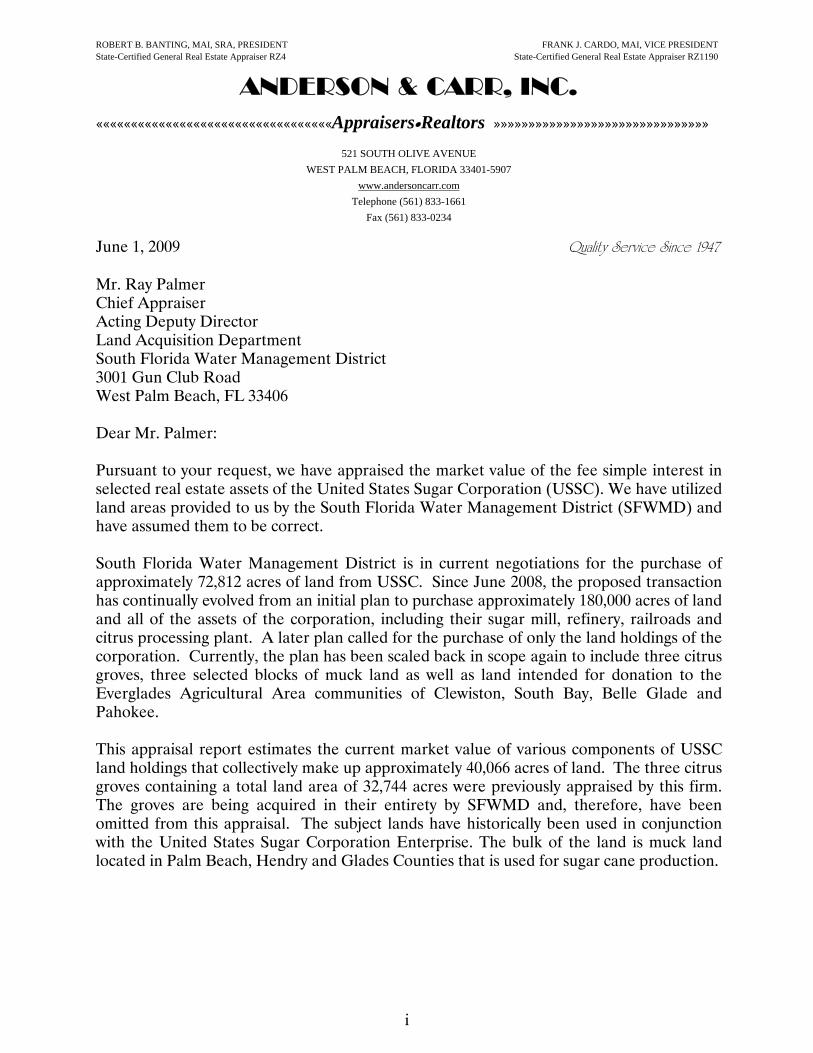
Mr. Ray Palmer Chief Appraiser Acting Deputy Director Land Acquisition Department South Florida Water Management District 3001 Gun Club Road West Palm Beach, FL 33406 Dear Mr. Palmer: Pursuant to your request, we have appraised the market value of the fee simple interest in selected real estate assets of the United States Sugar Corporation (USSC). We have utilized land areas provided to us by the South Florida Water Management District (SFWMD) and have assumed them to be correct. South Florida Water Management District is in current negotiations for the purchase of approximately 72,812 acres of land from USSC. Since June 2008, the proposed transaction has continually evolved from an initial plan to purchase approximately 180,000 acres of land and all of the assets of the corporation, including their sugar mill, refinery, railroads and citrus processing plant. A later plan called for the purchase of only the land holdings of the corporation. Currently, the plan has been scaled back in scope again to include three citrus groves, three selected blocks of muck land as well as land intended for donation to the Everglades Agricultural Area communities of Clewiston, South Bay, Belle Glade and Pahokee. This appraisal report estimates the current market value of various components of USSC land holdings that collectively make up approximately 40,066 acres of land. The three citrus groves containing a total land area of 32,744 acres were previously appraised by this firm. The groves are being acquired in their entirety by SFWMD and, therefore, have been omitted from this appraisal. The subject lands have historically been used in conjunction with the United States Sugar Corporation Enterprise. The bulk of the land is muck land located in Palm Beach, Hendry and Glades Counties that is used for sugar cane production.

ANDERSON & CARR, INC.
ii
Mr. Ray Palmer June 1, 2009 Page 2 The purpose of this appraisal is to estimate the current market value of selected land components based upon a highest and best use which may be realized through their development or utilization in a manner which is inconsistent with their historical agricultural use. This appraisal does not value these land components as an integral part of the combined USSC enterprise or business. These lands have been grouped into several component parts based upon their general utility, highest and best use, physical character and anticipated likely market purchaser. Each grouping of land parcels has been valued assuming a sale on the open market to a buyer who would utilize the land to its highest and best use. This appraisal does not include any crop value that exists as a result of planted sugar cane. At the request of the client we have excluded three citrus groves (SC200-002, SC200-005, and SC200-006) as well as a small building in Clewiston, Florida (SC200-018). This appraisal does not include the business value of U.S. Sugar Corporation. The assets have been valued based on their market value, assuming individual sales to third parties under arms length conditions on the open market. Finally, we have not analyzed the effect of a planned lease back of the subject land at $150/acre per year on the value of the leased fee interest.
The appraisal is intended to conform to the Uniform Appraisal Standards for Federal Land Acquisitions. The subject property is identified as Tracts SC200-001 through SC200-025 (with exclusions) of the South Florida Water Management District’s River of Grass Project. The appraisal is intended to assist the District in negotiating the acquisition of the subject properties, as well as for crediting purposes with its funding partners. The property appraised is not “Policy Lands” in that the ownership to the high-water line and rights of sovereignty were not at issue. We also relied on data from the Palm Beach, Hendry, and Glades County Property Appraisers and their respective zoning departments. This appraisal and our conclusions assumed the property is not impacted by any adverse soil contamination. If soil contamination is found to exist, we reserve the right to revise our opinion of market value accordingly. Based on this information, we have concluded there are no apparent adverse conditions that would have a significant impact on the value or marketability of the subject property.
ANDERSON & CARR, INC.
iii
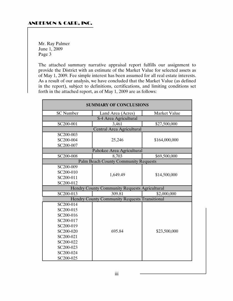
Mr. Ray Palmer June 1, 2009 Page 3 The attached summary narrative appraisal report fulfills our assignment to provide the District with an estimate of the Market Value for selected assets as of May 1, 2009. Fee simple interest has been assumed for all real estate interests. As a result of our analysis, we have concluded that the Market Value (as defined in the report), subject to definitions, certifications, and limiting conditions set forth in the attached report, as of May 1, 2009 are as follows:
SC Number Land Area (Acres) Market Value
SC200-001 3,461 $27,500,000
SC200-003SC200-004SC200-007
SC200-008 8,703 $69,500,000
SC200-009SC200-010SC200-011SC200-012
SC200-013 309.81 $2,000,000
SC200-014SC200-015SC200-016SC200-017SC200-019SC200-020SC200-021SC200-022SC200-023SC200-024SC200-025
695.84 $23,500,000
1,649.49
S-4 Area Agricultural
Central Area Agricultural
Hendry County Community Requests Transitional
SUMMARY OF CONCLUSIONS
Pahokee Area Agricultural
Palm Beach County Community Requests
Hendry County Community Requests Agricultural
25,246 $164,000,000
$14,500,000
ANDERSON & CARR, INC.
iv
Mr. Ray Palmer June 1, 2009 Page 4 The following presents the appraisal in a narrative summary format. This letter must remain attached to the report, which contains 129 pages plus related exhibits, in order for the value opinion set forth to be considered valid. Please direct your attention to the Assumptions and Limiting Conditions on pages 6-9 of this report. Respectfully submitted, ANDERSON & CARR, INC. Robert B. Banting, MAI, SRA State-Certified General Real Estate Appraiser RZ4 Wayne B. Lewis State-Certified General Real Estate Appraiser RZ2452 RBB/WBL:agp
ANDERSON & CARR, INC.
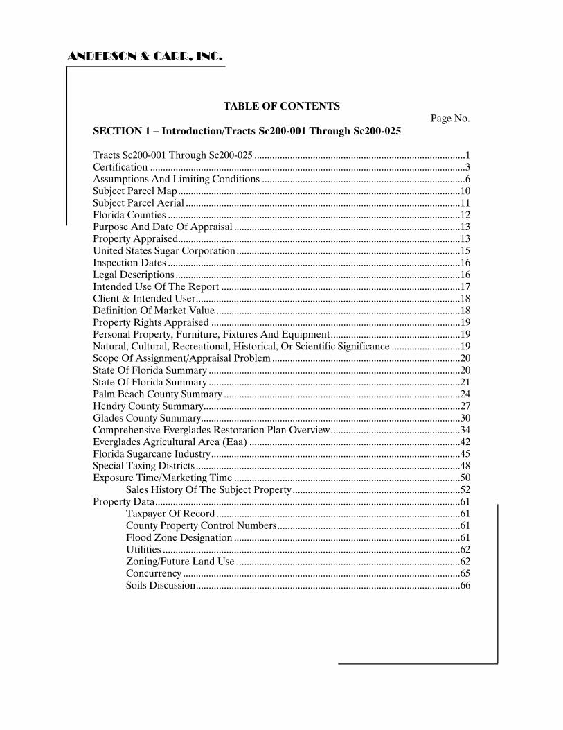
TABLE OF CONTENTS Page No.
SECTION 1 – Introduction/Tracts Sc200-001 Through Sc200-025 Tracts Sc200-001 Through Sc200-025 ...................................................................................1 Certification ............................................................................................................................3 Assumptions And Limiting Conditions ................................................................................6 Subject Parcel Map...............................................................................................................10 Subject Parcel Aerial ............................................................................................................11 Florida Counties ...................................................................................................................12 Purpose And Date Of Appraisal .........................................................................................13 Property Appraised...............................................................................................................13 United States Sugar Corporation ........................................................................................15 Inspection Dates ...................................................................................................................16 Legal Descriptions ................................................................................................................16 Intended Use Of The Report ..............................................................................................17 Client & Intended User........................................................................................................18 Definition Of Market Value ................................................................................................18 Property Rights Appraised ..................................................................................................19 Personal Property, Furniture, Fixtures And Equipment...................................................19 Natural, Cultural, Recreational, Historical, Or Scientific Significance ...........................19 Scope Of Assignment/Appraisal Problem ..........................................................................20 State Of Florida Summary ...................................................................................................20 State Of Florida Summary ...................................................................................................21 Palm Beach County Summary .............................................................................................24 Hendry County Summary.....................................................................................................27 Glades County Summary......................................................................................................30 Comprehensive Everglades Restoration Plan Overview...................................................34 Everglades Agricultural Area (Eaa) ...................................................................................42 Florida Sugarcane Industry..................................................................................................45 Special Taxing Districts ........................................................................................................48 Exposure Time/Marketing Time .........................................................................................50
Sales History Of The Subject Property ..................................................................52 Property Data........................................................................................................................61
Taxpayer Of Record ................................................................................................61 County Property Control Numbers........................................................................61 Flood Zone Designation .........................................................................................61 Utilities .....................................................................................................................62 Zoning/Future Land Use ........................................................................................62 Concurrency .............................................................................................................65 Soils Discussion........................................................................................................66
ANDERSON & CARR, INC.
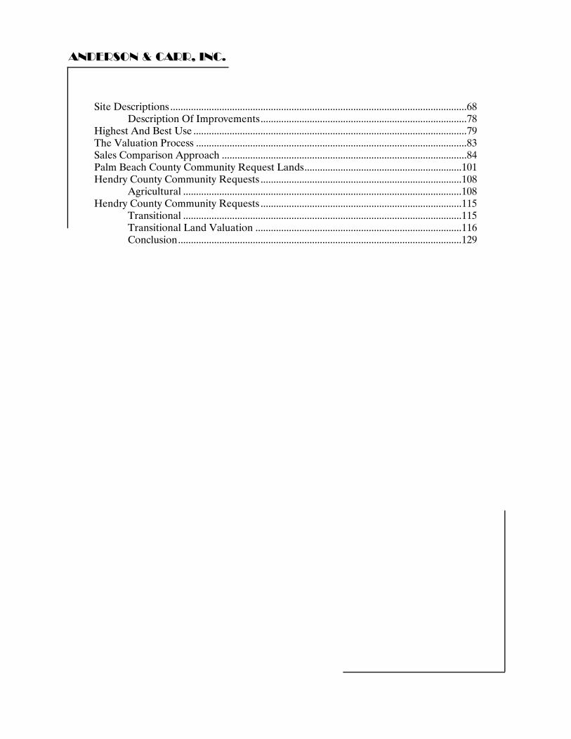
Site Descriptions ...................................................................................................................68 Description Of Improvements................................................................................78
Highest And Best Use ..........................................................................................................79 The Valuation Process .........................................................................................................83 Sales Comparison Approach ...............................................................................................84 Palm Beach County Community Request Lands.............................................................101 Hendry County Community Requests ..............................................................................108
Agricultural ............................................................................................................108 Hendry County Community Requests ..............................................................................115
Transitional ............................................................................................................115 Transitional Land Valuation ................................................................................116 Conclusion..............................................................................................................129
ANDERSON & CARR, INC.
1
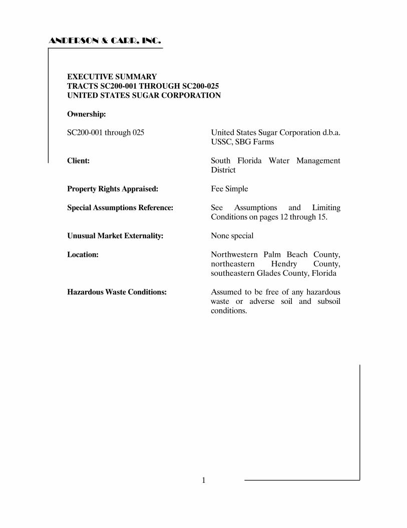
EXECUTIVE SUMMARY TRACTS SC200-001 THROUGH SC200-025 UNITED STATES SUGAR CORPORATION Ownership: SC200-001 through 025 United States Sugar Corporation d.b.a.
USSC, SBG Farms Client: South Florida Water Management
District Property Rights Appraised: Fee Simple Special Assumptions Reference: See Assumptions and Limiting
Conditions on pages 12 through 15. Unusual Market Externality: None special Location: Northwestern Palm Beach County,
northeastern Hendry County, southeastern Glades County, Florida
Hazardous Waste Conditions: Assumed to be free of any hazardous
waste or adverse soil and subsoil conditions.
ANDERSON & CARR, INC.
2
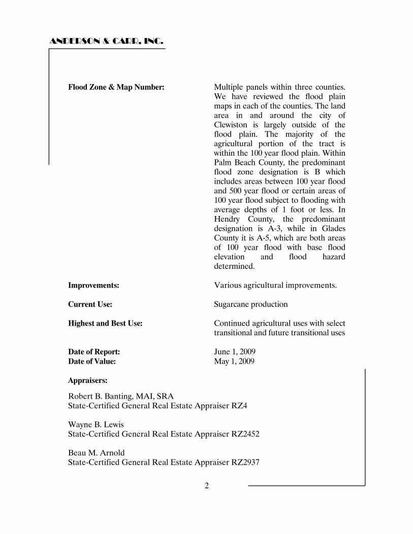
Flood Zone & Map Number: Multiple panels within three counties.
We have reviewed the flood plain maps in each of the counties. The land area in and around the city of Clewiston is largely outside of the flood plain. The majority of the agricultural portion of the tract is within the 100 year flood plain. Within Palm Beach County, the predominant flood zone designation is B which includes areas between 100 year flood and 500 year flood or certain areas of 100 year flood subject to flooding with average depths of 1 foot or less. In Hendry County, the predominant designation is A-3, while in Glades County it is A-5, which are both areas of 100 year flood with base flood elevation and flood hazard determined.
Improvements: Various agricultural improvements. Current Use: Sugarcane production Highest and Best Use: Continued agricultural uses with select
transitional and future transitional uses Date of Report: June 1, 2009 Date of Value: May 1, 2009 Appraisers:
Robert B. Banting, MAI, SRA State-Certified General Real Estate Appraiser RZ4 Wayne B. Lewis State-Certified General Real Estate Appraiser RZ2452 Beau M. Arnold State-Certified General Real Estate Appraiser RZ2937
ANDERSON & CARR, INC.
3
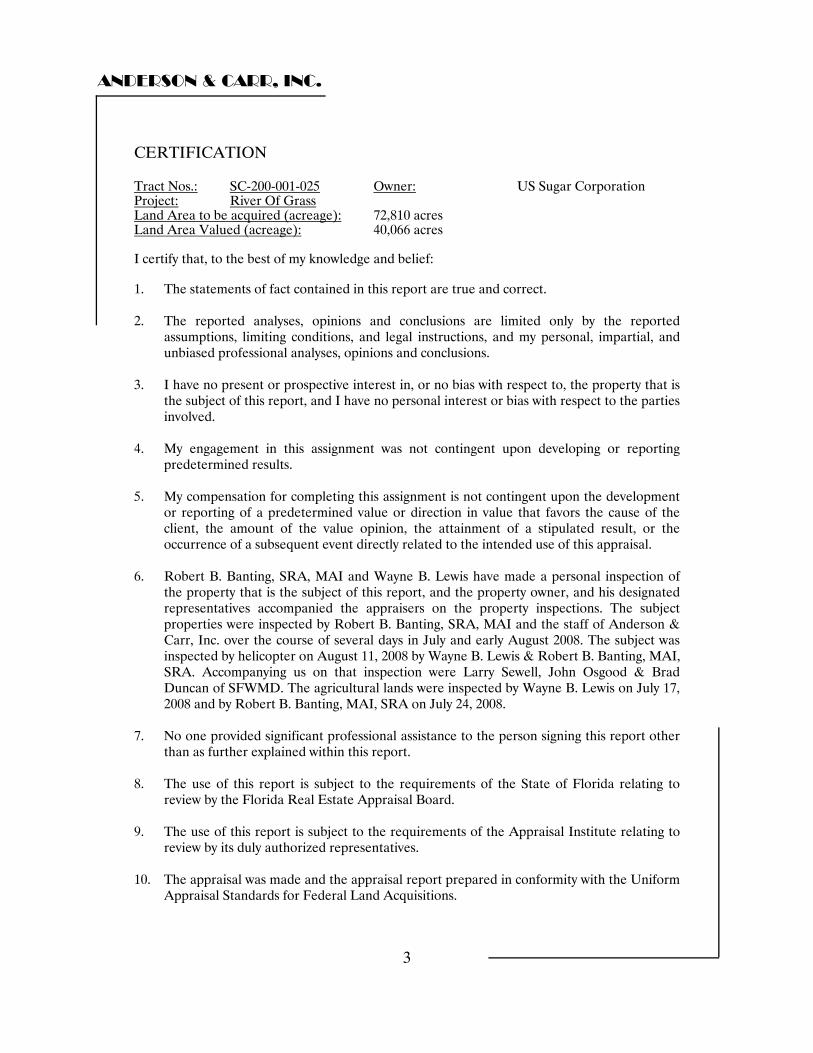
CERTIFICATION
Tract Nos.: SC-200-001-025 Owner: US Sugar Corporation Project: River Of Grass Land Area to be acquired (acreage): 72,810 acres Land Area Valued (acreage): 40,066 acres I certify that, to the best of my knowledge and belief: 1. The statements of fact contained in this report are true and correct. 2. The reported analyses, opinions and conclusions are limited only by the reported
assumptions, limiting conditions, and legal instructions, and my personal, impartial, and unbiased professional analyses, opinions and conclusions.
3. I have no present or prospective interest in, or no bias with respect to, the property that is
the subject of this report, and I have no personal interest or bias with respect to the parties involved.
4. My engagement in this assignment was not contingent upon developing or reporting
predetermined results. 5. My compensation for completing this assignment is not contingent upon the development
or reporting of a predetermined value or direction in value that favors the cause of the client, the amount of the value opinion, the attainment of a stipulated result, or the occurrence of a subsequent event directly related to the intended use of this appraisal.
6. Robert B. Banting, SRA, MAI and Wayne B. Lewis have made a personal inspection of
the property that is the subject of this report, and the property owner, and his designated representatives accompanied the appraisers on the property inspections. The subject properties were inspected by Robert B. Banting, SRA, MAI and the staff of Anderson & Carr, Inc. over the course of several days in July and early August 2008. The subject was inspected by helicopter on August 11, 2008 by Wayne B. Lewis & Robert B. Banting, MAI, SRA. Accompanying us on that inspection were Larry Sewell, John Osgood & Brad Duncan of SFWMD. The agricultural lands were inspected by Wayne B. Lewis on July 17, 2008 and by Robert B. Banting, MAI, SRA on July 24, 2008.
7. No one provided significant professional assistance to the person signing this report other
than as further explained within this report. 8. The use of this report is subject to the requirements of the State of Florida relating to
review by the Florida Real Estate Appraisal Board. 9. The use of this report is subject to the requirements of the Appraisal Institute relating to
review by its duly authorized representatives. 10. The appraisal was made and the appraisal report prepared in conformity with the Uniform
Appraisal Standards for Federal Land Acquisitions.
ANDERSON & CARR, INC.
4
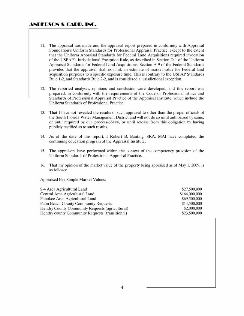
11. The appraisal was made and the appraisal report prepared in conformity with Appraisal Foundation’s Uniform Standards for Professional Appraisal Practice, except to the extent that the Uniform Appraisal Standards for Federal Land Acquisitions required invocation of the USPAP’s Jurisdictional Exception Rule, as described in Section D-1 of the Uniform Appraisal Standards for Federal Land Acquisitions. Section A-9 of the Federal Standards provides that the appraiser shall not link an estimate of market value for Federal land acquisition purposes to a specific exposure time. This is contrary to the USPAP Standards Rule 1-2, and Standards Rule 2-2, and is considered a jurisdictional exception.
12. The reported analyses, opinions and conclusion were developed, and this report was
prepared, in conformity with the requirements of the Code of Professional Ethics and Standards of Professional Appraisal Practice of the Appraisal Institute, which include the Uniform Standards of Professional Practice.
13. That I have not revealed the results of such appraisal to other than the proper officials of
the South Florida Water Management District and will not do so until authorized by same, or until required by due process-of-law, or until release from this obligation by having publicly testified as to such results.
14. As of the date of this report, I Robert B. Banting, SRA, MAI have completed the
continuing education program of the Appraisal Institute. 15. The appraisers have performed within the context of the competency provision of the
Uniform Standards of Professional Appraisal Practice. 16. That my opinion of the market value of the property being appraised as of May 1, 2009, is
as follows: Appraised Fee Simple Market Values: S-4 Area Agricultural Land $27,500,000 Central Area Agricultural Land $164,000,000 Pahokee Area Agricultural Land $69,500,000 Palm Beach County Community Requests $14,500,000 Hendry County Community Requests (agricultural) $2,000,000 Hendry county Community Requests (transitional) $23,500,000
ANDERSON & CARR, INC.
5
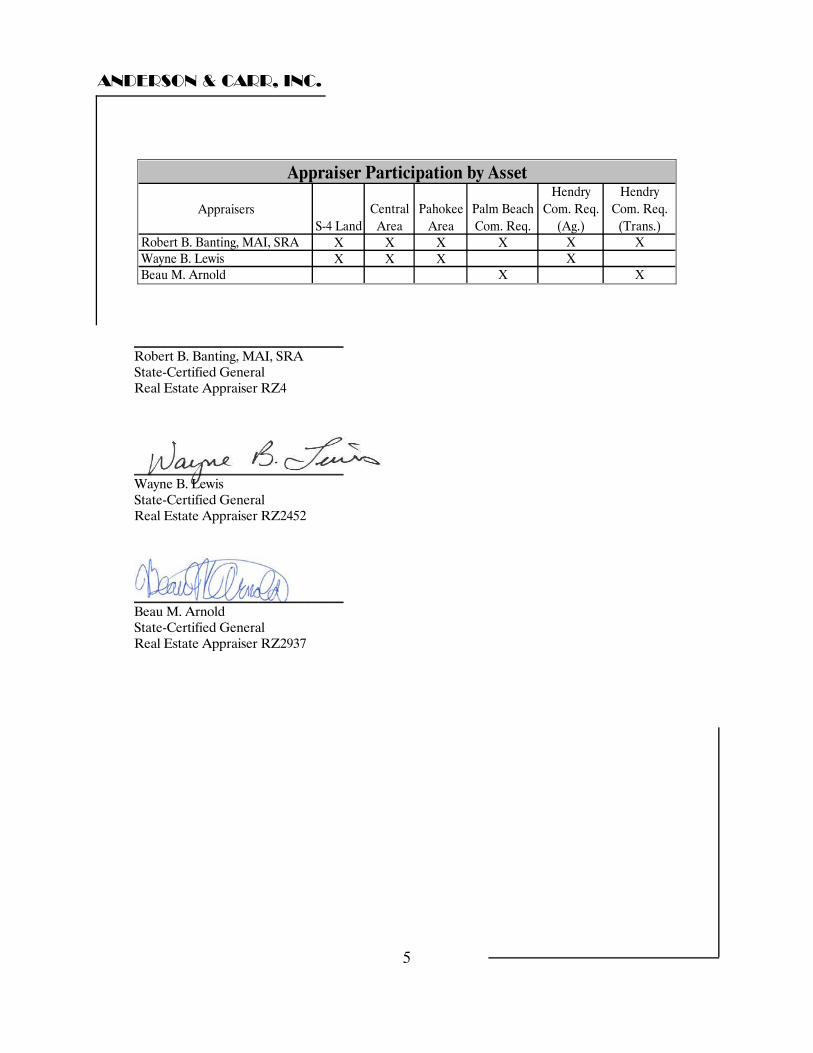
AppraisersS-4 Land
Central Area
Pahokee Area
Palm Beach Com. Req.
Hendry Com. Req.
(Ag.)
Hendry Com. Req.
(Trans.)Robert B. Banting, MAI, SRA X X X X X XWayne B. Lewis X X X XBeau M. Arnold X X
Appraiser Participation by Asset
________________________________ Robert B. Banting, MAI, SRA State-Certified General Real Estate Appraiser RZ4 ________________________________ Wayne B. Lewis State-Certified General Real Estate Appraiser RZ2452 ________________________________ Beau M. Arnold State-Certified General Real Estate Appraiser RZ2937
ANDERSON & CARR, INC.
6
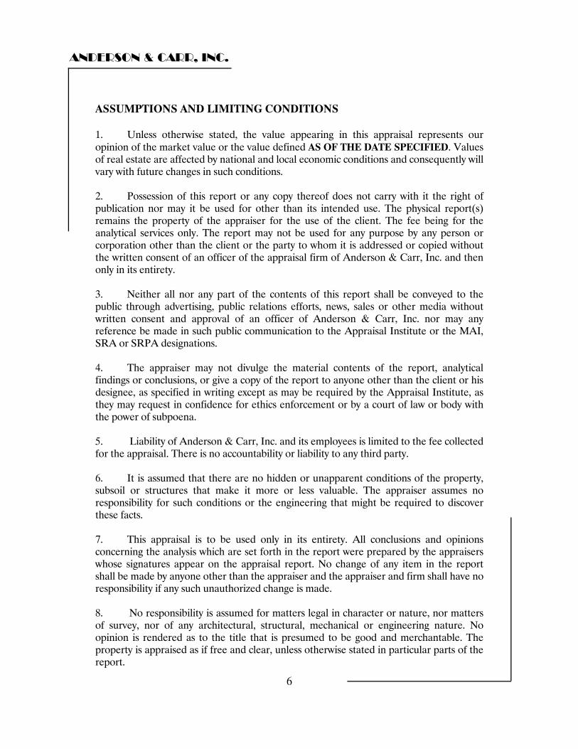
ASSUMPTIONS AND LIMITING CONDITIONS 1. Unless otherwise stated, the value appearing in this appraisal represents our opinion of the market value or the value defined AS OF THE DATE SPECIFIED. Values of real estate are affected by national and local economic conditions and consequently will vary with future changes in such conditions. 2. Possession of this report or any copy thereof does not carry with it the right of publication nor may it be used for other than its intended use. The physical report(s) remains the property of the appraiser for the use of the client. The fee being for the analytical services only. The report may not be used for any purpose by any person or corporation other than the client or the party to whom it is addressed or copied without the written consent of an officer of the appraisal firm of Anderson & Carr, Inc. and then only in its entirety. 3. Neither all nor any part of the contents of this report shall be conveyed to the public through advertising, public relations efforts, news, sales or other media without written consent and approval of an officer of Anderson & Carr, Inc. nor may any reference be made in such public communication to the Appraisal Institute or the MAI, SRA or SRPA designations. 4. The appraiser may not divulge the material contents of the report, analytical findings or conclusions, or give a copy of the report to anyone other than the client or his designee, as specified in writing except as may be required by the Appraisal Institute, as they may request in confidence for ethics enforcement or by a court of law or body with the power of subpoena. 5. Liability of Anderson & Carr, Inc. and its employees is limited to the fee collected for the appraisal. There is no accountability or liability to any third party. 6. It is assumed that there are no hidden or unapparent conditions of the property, subsoil or structures that make it more or less valuable. The appraiser assumes no responsibility for such conditions or the engineering that might be required to discover these facts. 7. This appraisal is to be used only in its entirety. All conclusions and opinions concerning the analysis which are set forth in the report were prepared by the appraisers whose signatures appear on the appraisal report. No change of any item in the report shall be made by anyone other than the appraiser and the appraiser and firm shall have no responsibility if any such unauthorized change is made. 8. No responsibility is assumed for matters legal in character or nature, nor matters of survey, nor of any architectural, structural, mechanical or engineering nature. No opinion is rendered as to the title that is presumed to be good and merchantable. The property is appraised as if free and clear, unless otherwise stated in particular parts of the report.
ANDERSON & CARR, INC.
7
9. No responsibility is assumed for accuracy of information furnished by or from others, the clients, his designee or public records. We are not liable for such information or the work of subcontractors. The comparable data relied upon in this report has been confirmed with one or more parties familiar with the transaction or from affidavit. All are considered appropriate for inclusion to the best of our knowledge and belief. 10. The contract for appraisal, consultation or analytical service is fulfilled and the total fee payable upon completion of the report. The appraiser or those assisting the preparation of the report will not be asked or required to give testimony in court or hearing because of having made the appraisal in full or in part; nor engaged in post-appraisal consultation with client or third parties, except under separate and special arrangement and at an additional fee. 11. The sketches and maps in this report are included to assist the reader and are not necessarily to scale. Various photos, if any, are included for the same purpose and are not intended to represent the property in other than actual status, as of the date of the photos. 12. Unless otherwise stated in this report, the existence of hazardous material, which may or may not be present on the property, was not observed by the appraiser. The appraiser has no knowledge of the existence of such materials on or in the property. The appraiser, however, is not qualified to detect such substances. The presence of substances such as asbestos, urea-formaldehyde foam insulation, or other potentially hazardous materials may affect the value of the property. The value estimate is predicated on the assumption that there is no such material on or in the property that would cause a loss in value. No responsibility is assumed for any such conditions, or for any expertise or engineering knowledge required to discover them. The client is urged to retain an expert in this field, if desired. 13. The distribution of the total valuation of this report between land and improvements applies only under the existing program of utilization. The separate valuations for land and building and the various component assets must not be used in conjunction with any other appraisal, no matter how similar and may not apply if considered separately and are invalid if so used. The market value conclusions only apply under the current asset allocation and property integration. 14. No environmental or impact studies, special market studies or analysis, highest and best use analysis study, or feasibility study has been requested or made unless otherwise specified in an agreement for services or in the report. The appraiser reserves the unlimited right to alter, amend, revise or rescind any of the statements, findings, opinions, values, estimates or conclusions upon any subsequent such study or analysis or previous study or analysis, subsequently becoming known to him.

ANDERSON & CARR, INC.
8
15. The value estimated in this appraisal report is gross without consideration given to any encumbrance, restriction or question of title, unless specifically defined. The estimate of value in the appraisal report is not based in whole or in part upon the race, color or national origin of the present owners or occupants of the properties in the vicinity of the property appraised. 16. This appraisal report has been prepared for the exclusive benefit of the South Florida Water Management District or its designee. It may not be used or relied upon by any other party. Any party who uses or relies upon any information in this report, without the preparer's written consent, does so at his own risk. 17. Site dimensions and site size are per data supplied by the client, SFWMD (South Florida water Management District). We were provided with Google Earth Maps and associated spread sheets indicating land area totaling 40,066 acres. We have relied on these for our understanding of the property’s area and dimensions. Our opinion of value is based upon the available data. If a future survey finds the site’s dimensions and size are significantly different than reported, then our opinion of value may change. 18. To the best of our knowledge, the subject property does not possess any natural, cultural, recreational, historical, or scientific value. If this assumption is incorrect and the subject property does, exhibit any of these values, the appraiser reserves the right to revise this report in order to analyze these factors, which may result in a revised estimate of value. 19. Our client has requested that this appraisal be performed, and that the final value estimate be developed, excluding any and all positive or negative market impact which may have been created by the project identified as the proposed purchase of U.S. Sugar lands by the SFWMD for non-agricultural purposes. This assumption specifically results in the appraiser’s disregarding any market impact caused by the knowledge of the proposed purchase of real properties owned by U.S. Sugar. 20. It is our assumption that all parcels which are the subject of this appraisal are considered to possess adequate physical and legal access consistent with that parcel’s highest and best use. 21. We have assumed for the purposes of this report that no lands which are the subject of this appraisal would be impacted either positively or negatively by subsoil characteristics, mineral deposits, or other unknown conditions, such as contamination. 22. We recognize that many of the lands which are the subject of this appraisal are used in an agricultural capacity which requires water to be used for crop irrigation and production. This assumption specifically anticipates that any wells or water resource which is currently permitted to support agricultural production may continue to be used in the foreseeable future, and that the extension of any permits could be granted without significant change in capacity or operating condition.
ANDERSON & CARR, INC.
9
23. Excluding the current agreement between the SFWMD and USSC, the likely buyer would be various agricultural concerns that would continue farming operations on the majority of the subject lands. 24. We have assumed that there are no reservations of the mineral rights, royalty agreements, or other restrictions on the title or use of the subject property that would affect the use of the subject lands and improvements in accordance with their highest and best use. 25. We have not been provided with documentation of boring samples but, according to newspaper reports, there is a substantial supply of lime rock underneath the muck overburden. We have assumed that there are no reservations of the mineral rights, royalty agreements or other restrictions on the title or use of the subject property that would affect the use of the subject lands and improvements in accordance with their highest and best use. 26. ACCEPTANCE OF, AND/OR USE OF THIS APPRAISAL REPORT CONSTITUTES ACCEPTANCE OF THE PRECEDING CONDITIONS.
ANDERSON & CARR, INC.
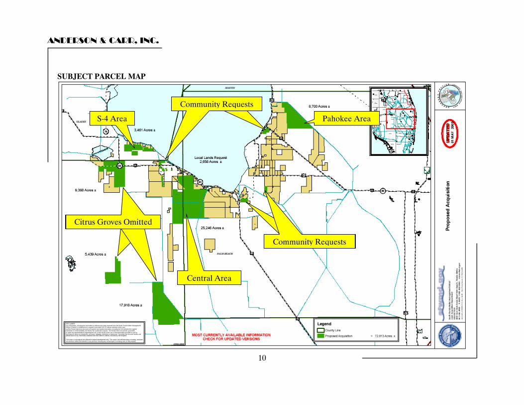
SUBJECT PARCEL MAP
Community Request Community Requests
S-4 Area Pahokee Area
Citrus Groves Omitted Citrus Groves Omitted Citrus Groves Omitted
Community Request Community Requests
Central Area
10

ANDERSON & CARR, INC.
11
SUBJECT PARCEL AERIAL
Community Requests Community Requests
Pahokee Area
Community Requests Community Requests Community Requests
S-4 Area
Central Area
ANDERSON & CARR, INC.
12
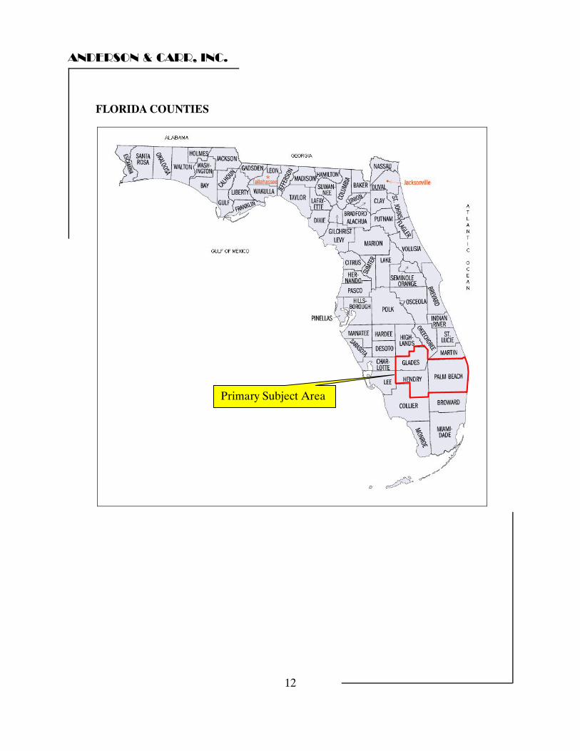
FLORIDA COUNTIES
Primary Subject Area
ANDERSON & CARR, INC.
13
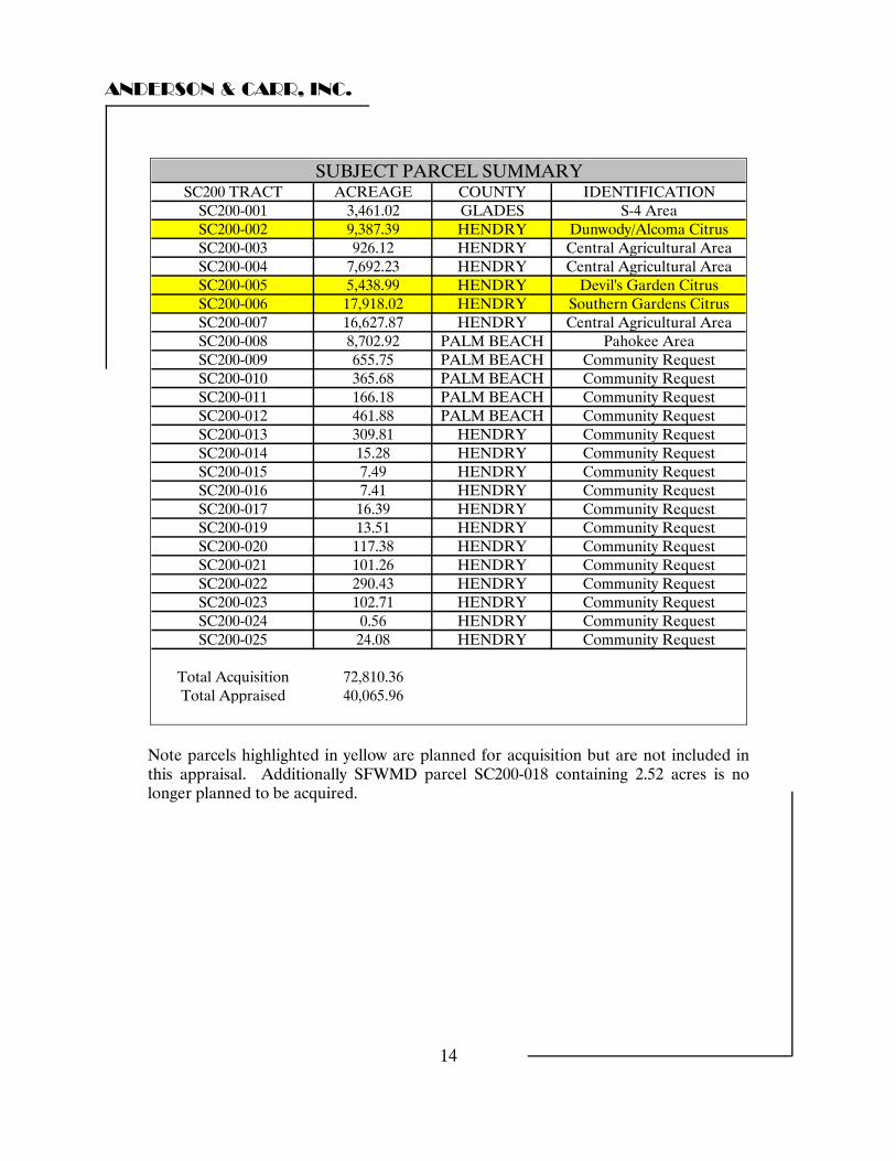
PURPOSE AND DATE OF APPRAISAL
The purpose of this appraisal is to estimate the Market Value of selected agricultural lands in Palm Beach, Hendry and Glades Counties, of the US Sugar Corporation as of May 1, 2009. Fee simple interest has been assumed for the subject’s 40,066 acres of land (total for the six component parts) and associated improvements. PROPERTY APPRAISED
We have appraised the market value of the fee simple interest in selected real estate assets of the United States Sugar Corporation (USSC). As per land areas provided to us by the South Florida Water Management District (SFWMD), the subject property contains a total of 40,066 +/- acres of land.
The bulk of the subject land (99% +/-) is muck land located in Palm Beach, Hendry, and Glades County, Florida and is in sugar cane production. We have not included any crop value that exists as a result of planted sugar cane.
The subject property is identified as Tracts SC200-001 through SC200-025 (with exclusions) of the South Florida Water Management District’s River of Grass Project. At the request of the client we have excluded tracts SC200-002, SC200-005, SC200-006 and SC200-018.
ANDERSON & CARR, INC.
14
SC200 TRACT ACREAGE COUNTY IDENTIFICATIONSC200-001 3,461.02 GLADES S-4 AreaSC200-002 9,387.39 HENDRY Dunwody/Alcoma CitrusSC200-003 926.12 HENDRY Central Agricultural AreaSC200-004 7,692.23 HENDRY Central Agricultural AreaSC200-005 5,438.99 HENDRY Devil's Garden CitrusSC200-006 17,918.02 HENDRY Southern Gardens CitrusSC200-007 16,627.87 HENDRY Central Agricultural AreaSC200-008 8,702.92 PALM BEACH Pahokee AreaSC200-009 655.75 PALM BEACH Community RequestSC200-010 365.68 PALM BEACH Community RequestSC200-011 166.18 PALM BEACH Community RequestSC200-012 461.88 PALM BEACH Community RequestSC200-013 309.81 HENDRY Community RequestSC200-014 15.28 HENDRY Community RequestSC200-015 7.49 HENDRY Community RequestSC200-016 7.41 HENDRY Community RequestSC200-017 16.39 HENDRY Community RequestSC200-019 13.51 HENDRY Community RequestSC200-020 117.38 HENDRY Community RequestSC200-021 101.26 HENDRY Community RequestSC200-022 290.43 HENDRY Community RequestSC200-023 102.71 HENDRY Community RequestSC200-024 0.56 HENDRY Community RequestSC200-025 24.08 HENDRY Community Request
Total Acquisition 72,810.36Total Appraised 40,065.96
SUBJECT PARCEL SUMMARY
Note parcels highlighted in yellow are planned for acquisition but are not included in this appraisal. Additionally SFWMD parcel SC200-018 containing 2.52 acres is no longer planned to be acquired.
ANDERSON & CARR, INC.
15
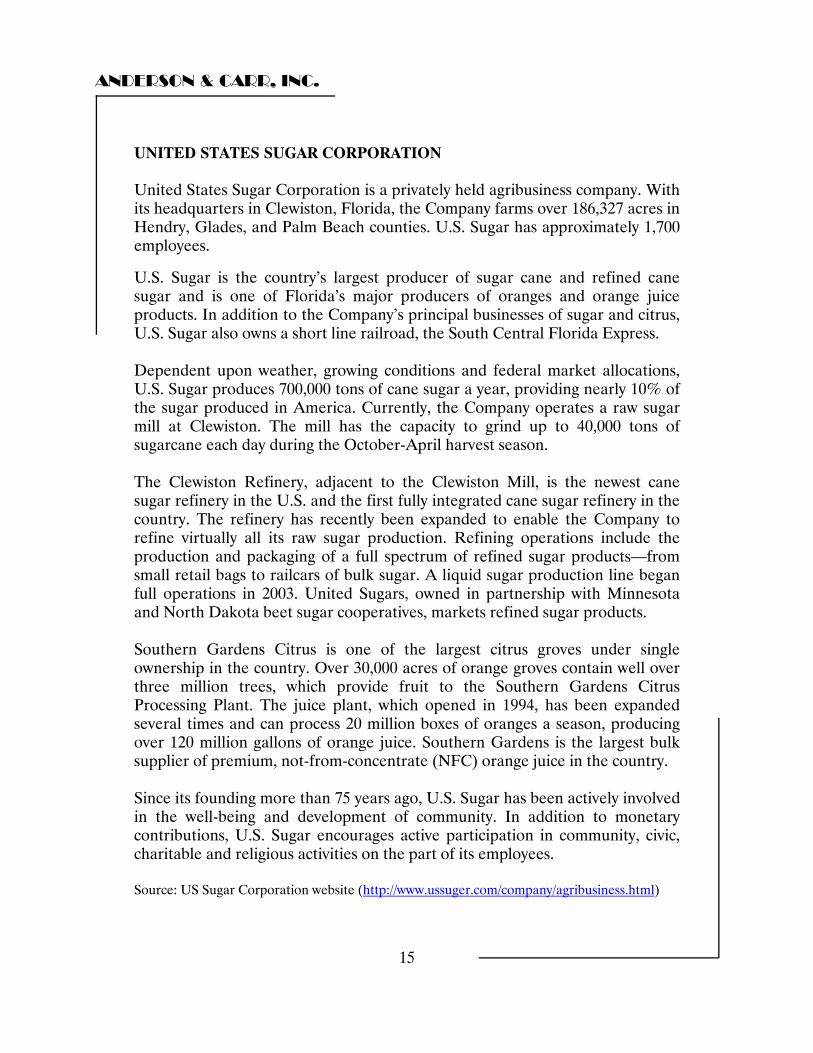
UNITED STATES SUGAR CORPORATION United States Sugar Corporation is a privately held agribusiness company. With its headquarters in Clewiston, Florida, the Company farms over 186,327 acres in Hendry, Glades, and Palm Beach counties. U.S. Sugar has approximately 1,700 employees.
U.S. Sugar is the country’s largest producer of sugar cane and refined cane sugar and is one of Florida’s major producers of oranges and orange juice products. In addition to the Company’s principal businesses of sugar and citrus, U.S. Sugar also owns a short line railroad, the South Central Florida Express. Dependent upon weather, growing conditions and federal market allocations, U.S. Sugar produces 700,000 tons of cane sugar a year, providing nearly 10% of the sugar produced in America. Currently, the Company operates a raw sugar mill at Clewiston. The mill has the capacity to grind up to 40,000 tons of sugarcane each day during the October-April harvest season. The Clewiston Refinery, adjacent to the Clewiston Mill, is the newest cane sugar refinery in the U.S. and the first fully integrated cane sugar refinery in the country. The refinery has recently been expanded to enable the Company to refine virtually all its raw sugar production. Refining operations include the production and packaging of a full spectrum of refined sugar products—from small retail bags to railcars of bulk sugar. A liquid sugar production line began full operations in 2003. United Sugars, owned in partnership with Minnesota and North Dakota beet sugar cooperatives, markets refined sugar products. Southern Gardens Citrus is one of the largest citrus groves under single ownership in the country. Over 30,000 acres of orange groves contain well over three million trees, which provide fruit to the Southern Gardens Citrus Processing Plant. The juice plant, which opened in 1994, has been expanded several times and can process 20 million boxes of oranges a season, producing over 120 million gallons of orange juice. Southern Gardens is the largest bulk supplier of premium, not-from-concentrate (NFC) orange juice in the country. Since its founding more than 75 years ago, U.S. Sugar has been actively involved in the well-being and development of community. In addition to monetary contributions, U.S. Sugar encourages active participation in community, civic, charitable and religious activities on the part of its employees. Source: US Sugar Corporation website (http://www.ussuger.com/company/agribusiness.html)
ANDERSON & CARR, INC.
16
INSPECTION DATES The subject properties were inspected by Robert B. Banting, SRA, MAI and the staff of Anderson & Carr, Inc. over the course of several days in July and early August 2008. The subject was inspected by helicopter on August 11, 2008 by Wayne B. Lewis & Robert B. Banting, MAI, SRA. Accompanying us on that inspection were Larry Sewell, John Osgood & Brad Duncan of SFWMD. The agricultural lands were inspected by Wayne B. Lewis on July 17, 2008 and by Robert B. Banting, MAI, SRA on July 24, 2008. LEGAL DESCRIPTIONS We have not been supplied with specific legal descriptions and have relied upon the maps provided by the South Florida Water Management District for property identification purposes and land areas. Should future research indicate a substantially different site sizes, we reserve the right to amend this report accordingly.
ANDERSON & CARR, INC.
17
INTENDED USE OF THE REPORT The intended use of this report is to provide the client with a supportable estimate of value for the interest to be acquired in the subject property, which can be utilized for internal decision making purposes in negotiating the acquisition of the subject properties and for crediting purposes with funding partners. This appraisal was made and the appraisal report was prepared in conformity with the Uniform Standards of Professional Appraisal Practice (USPAP) of the Appraisal Institute and the Uniform Standards for Federal Land Acquisitions (UASFLA), except to the extent that the Federal Standards required invocation of USPAP’s Jurisdictional Exception Rule, as described in Section D-1 of UASFLA. Section A-9 of the standards provides that the appraisal shall not link an estimate of market value for federal land acquisition purposes to a specific exposure time. This is contrary to USPAP Standards Rules 1-2 and 2-2 and is considered a jurisdictional exception. The Departure Provision of USPAP does not apply to this appraisal This report has been prepared utilizing generally accepted appraisal guidelines, techniques, and methodologies as contained within the Uniform Standards of Professional Practice (USPAP), as promulgated by the Appraisal Foundation. As State-Certified appraisers we are bound by these standards and regulated by the Florida Real Estate Appraisal Board of the Florida Department of Professional Regulation. To the best of our knowledge, the terms and conditions of the appraisal agreement between Anderson & Carr, Inc. and the South Florida Water Management District including South Florida Management District Real Estate Appraisal and Review Standard 04.302 have been adhered to in the appraisal. This appraisal is considered in compliance with the Uniform Standards for Federal Land Acquisitions. The property appraised is not “Policy Lands” in that ownership to the high water line and rights of sovereignty are not an issue of the appraisal. All of the sales used herein are arm’s length transactions.
ANDERSON & CARR, INC.
18
CLIENT & INTENDED USER South Florida Water Management District 3301 Gun Club Road West Palm Beach, Florida 33406 DEFINITION OF MARKET VALUE We have estimated Market Value based on Florida case law (State Road Dept. v. Stack, 231 So.2d 859 FL 1st DCA 1969) Market Value is defined as: The amount of money that a purchaser willing but not obligated to buy the property would pay an owner willing but not obligated to sell, taking into consideration all uses to which the property is adapted and might be applied in reason. Inherent in the willing buyer-willing seller test of the fair market value is the following:
1. A fair sale resulting from fair negotiations.
2. Neither party is acting under compulsion of necessity (this eliminates forced liquidation or sale at auction). Economic pressure may be enough to preclude a sale’s use.
3. Both parties having knowledge of all relevant facts.
4. A sale without peculiar or special circumstances.
5. A reasonable time to find a buyer.
ANDERSON & CARR, INC.
19
PROPERTY RIGHTS APPRAISED The property rights being appraised for the real estate interests are those of fee simple estate. "Fee Simple Estate" is defined as absolute ownership unencumbered by any other interest or estate, subject only to the limitations imposed by the governmental powers of taxation, eminent domain, police power, and escheat.
Source: The Dictionary of Real Estate Appraisal, Fourth Edition, Appraisal Institute, 2002, Page 113.
PERSONAL PROPERTY, FURNITURE, FIXTURES AND EQUIPMENT This appraisal does not include the business value of US Sugar Corporation. It also does not include personal property, furniture, fixture and equipment, removable fixtures, and specialized equipment. The assets have been valued based on their market value assuming sales to third parties for the individual asset groupings outlined in this analysis under arms length conditions on the open market. NATURAL, CULTURAL, RECREATIONAL, HISTORICAL, OR SCIENTIFIC SIGNIFICANCE To the best of our knowledge, the subject property does not possess any natural, cultural, recreational, historical, or scientific value. If this assumption is incorrect and the subject property does exhibit any of these values, the appraiser reserves the right to revise this report in order to analyze these factors, which may result in a revised estimate of value.
ANDERSON & CARR, INC.
20
SCOPE OF ASSIGNMENT/APPRAISAL PROBLEM
In keeping with the purpose of the appraisal and the appraisal process, the appraisers have engaged in original research to provide a complete analysis for the client. Data for the analysis has been gathered from various sources, such as the Palm Beach, Hendry, and Glades County Public Records, RealQuest Data, Inc., Co-Star Comps, county and local planning and zoning departments, local realtors, property owners, and other appraisal offices. In analyzing the current zoning, land use, and future land use development options of the subject property, we have consulted with representatives of the Palm Beach, Hendry, and Glades County planning and zoning departments. We considered this information in estimating highest and best use and selection of appraisal methodology.
Due to the complex nature of the assignment, a team of appraisers were assembled based on their areas of individual expertise. Overseeing the entire project was Robert B. Banting, MAI, SRA. Wayne B. Lewis participated in the appraisal of the agricultural lands as well as overseeing incorporation of each of the individual components of the appraisal into a single summary narrative appraisal report. Assisting Mr. Lewis in the analysis of the agricultural lands was an independent consultant, Edwin Jones.
Robert B. Banting and Beau M. Arnold participated in the appraisal of the community request lands in Palm Beach and Hendry Counties.
We have interviewed the property appraisers for the Palm Beach County Property Appraisers office to determine their methodology in establishing broad value trends across the entire EAA. We have interviewed confidential sources in other sugar processor/producer firms to understand industry trends and value issues associated with the land that is the subject of this report. We have viewed the subject lands and the majority of the comparable sales by helicopter to understand land use patterns as well as value trends associated with the individual assets of USSC. We have also contacted experts in the various fields associated with the subject assets in order to complete the due diligence necessary to present a cogent and defendable appraisal of the subject property.
All transactions used in this report have been verified with a party to the transaction and by copy of deed and plat research.
This appraisal is presented in a narrative summary report.
ANDERSON & CARR, INC.
21
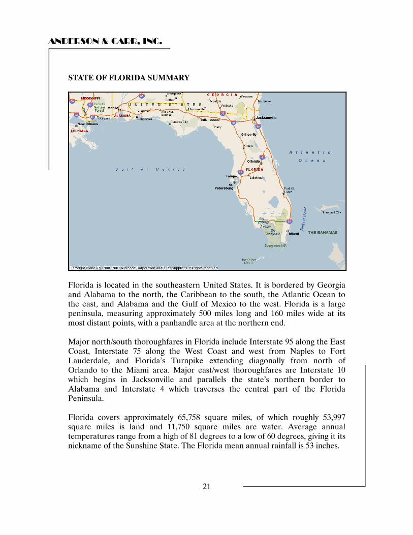
STATE OF FLORIDA SUMMARY
Florida is located in the southeastern United States. It is bordered by Georgia and Alabama to the north, the Caribbean to the south, the Atlantic Ocean to the east, and Alabama and the Gulf of Mexico to the west. Florida is a large peninsula, measuring approximately 500 miles long and 160 miles wide at its most distant points, with a panhandle area at the northern end. Major north/south thoroughfares in Florida include Interstate 95 along the East Coast, Interstate 75 along the West Coast and west from Naples to Fort Lauderdale, and Florida’s Turnpike extending diagonally from north of Orlando to the Miami area. Major east/west thoroughfares are Interstate 10 which begins in Jacksonville and parallels the state’s northern border to Alabama and Interstate 4 which traverses the central part of the Florida Peninsula. Florida covers approximately 65,758 square miles, of which roughly 53,997 square miles is land and 11,750 square miles are water. Average annual temperatures range from a high of 81 degrees to a low of 60 degrees, giving it its nickname of the Sunshine State. The Florida mean annual rainfall is 53 inches.
ANDERSON & CARR, INC.
22
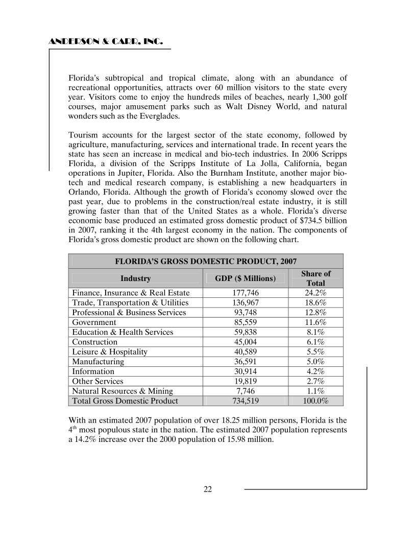
Florida’s subtropical and tropical climate, along with an abundance of recreational opportunities, attracts over 60 million visitors to the state every year. Visitors come to enjoy the hundreds miles of beaches, nearly 1,300 golf courses, major amusement parks such as Walt Disney World, and natural wonders such as the Everglades. Tourism accounts for the largest sector of the state economy, followed by agriculture, manufacturing, services and international trade. In recent years the state has seen an increase in medical and bio-tech industries. In 2006 Scripps Florida, a division of the Scripps Institute of La Jolla, California, began operations in Jupiter, Florida. Also the Burnham Institute, another major bio-tech and medical research company, is establishing a new headquarters in Orlando, Florida. Although the growth of Florida’s economy slowed over the past year, due to problems in the construction/real estate industry, it is still growing faster than that of the United States as a whole. Florida’s diverse economic base produced an estimated gross domestic product of $734.5 billion in 2007, ranking it the 4th largest economy in the nation. The components of Florida’s gross domestic product are shown on the following chart.
FLORIDA’S GROSS DOMESTIC PRODUCT, 2007
Industry GDP ($ Millions) Share of Total
Finance, Insurance & Real Estate 177,746 24.2% Trade, Transportation & Utilities 136,967 18.6% Professional & Business Services 93,748 12.8% Government 85,559 11.6% Education & Health Services 59,838 8.1% Construction 45,004 6.1% Leisure & Hospitality 40,589 5.5% Manufacturing 36,591 5.0% Information 30,914 4.2% Other Services 19,819 2.7% Natural Resources & Mining 7,746 1.1% Total Gross Domestic Product 734,519 100.0%
With an estimated 2007 population of over 18.25 million persons, Florida is the 4th most populous state in the nation. The estimated 2007 population represents a 14.2% increase over the 2000 population of 15.98 million.
ANDERSON & CARR, INC.
23
Florida has eleven public universities and 28 community colleges, some with multiple campuses. In addition Florida has over 28 independent colleges and universities. This gives residents a variety of opportunities for higher education and means that all Florida residents live within 50 miles of a post-secondary educational institution. Conclusion Florida’s climate and recreational opportunities make the state one of the best places in the nation in which to live and work. The robust economy and an effort to bring more high-tech industries to the state indicate that Florida will continue to be a very desirable state to live and do business in for the foreseeable future.

ANDERSON & CARR, INC.
24
PALM BEACH COUNTY SUMMARY
Palm Beach County is located along Florida’s southeast coast. It is bordered by Martin County to the north, Hendry County to the west and Broward County to the south. Palm Beach County is approximately 80 miles north of Miami and 260 miles south of Jacksonville. Interstate 95 is a major north/south thoroughfare connecting the county to the southeast and northeast portions of the state. Florida’s Turnpike also passes through the county and provides connections to the north central area of the state as well as Miami to the south.
ANDERSON & CARR, INC.
25
Palm Beach County encompasses approximately 2,203 square miles, of which roughly 1,974 square miles is land area and 229 square miles is water. The local weather features an average January high temperature of 74 degrees and an average July high temperature of 90 degrees. The average annual rainfall is 61 inches. Palm Beach County has been noted as a premier location since the first army fort was built in Jupiter in 1838 and Henry Flagler extended his railroad from northern locales and built the Breakers Hotel in 1896, which was instrumental in establishing the world famous Town of Palm Beach on the Atlantic Ocean. The county had a population of 1,131,184 persons in 2000. The estimate for the 2007 population is 1,323,572 persons, an increase of 17.0 percent over the 2000 census. The vast majority of the growth has been a result of in-migration from the north as well as from Dade and Broward Counties to the south. As of the 2005 census estimate Palm Beach County ranked third in population in Florida. Tourism is the county's leading industry, employing over 70,000 people and generating about $2 billion dollars annually. The other multi-billion dollar industries have been construction and agriculture. The expanded (1988) Palm Beach International Airport experienced one of its busiest years in 2007 facilitating 1 million flights, an increase of 1.8 percent over 2006. The airports growth has necessitated new direct access overpass interchanges with I-95 (2004). Tourism and in-migration of retirees are the forces that drive the county's growth. The largest employer in Palm Beach County is the Palm Beach County School Board with just over 21,700 employees and a $3.6 billion dollar budget for the 2007-2008 school year. The five largest private sector employers as shown in the following chart.
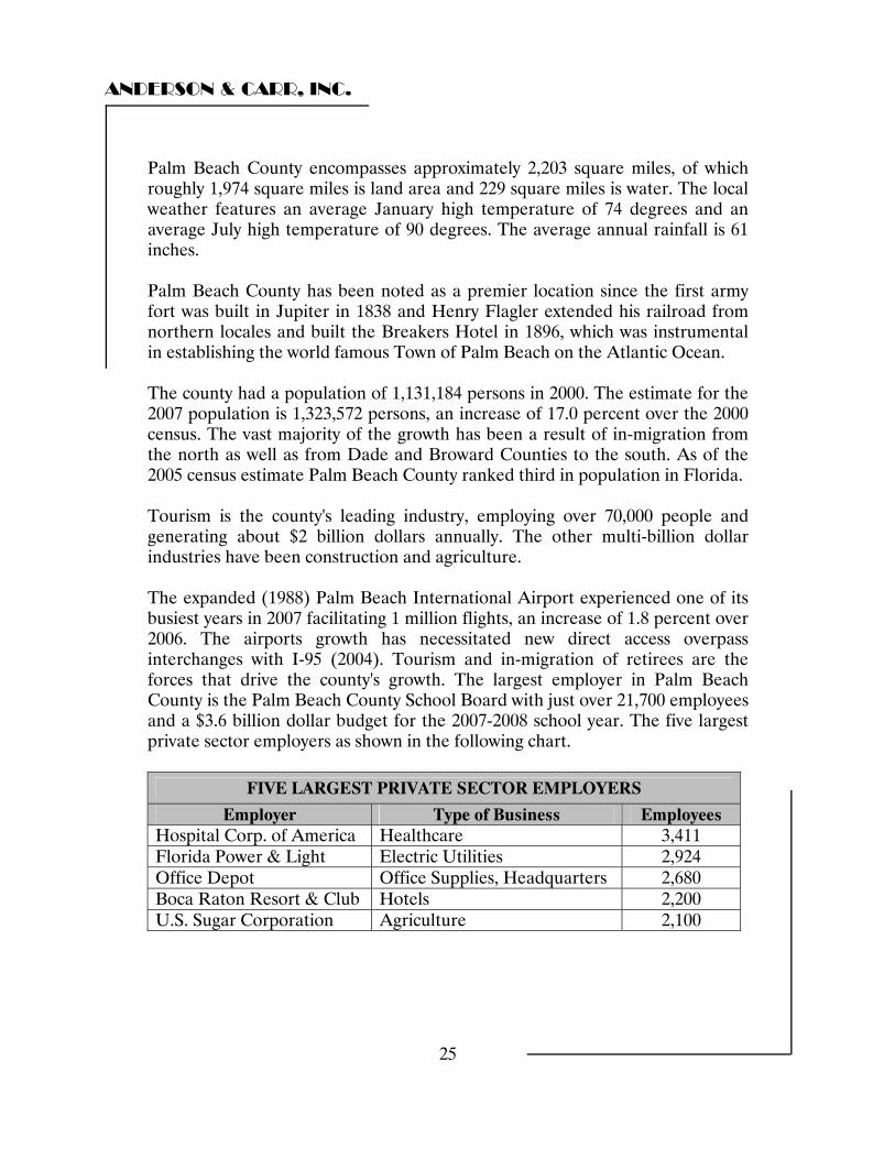
FIVE LARGEST PRIVATE SECTOR EMPLOYERS
Employer Type of Business Employees Hospital Corp. of America Healthcare 3,411 Florida Power & Light Electric Utilities 2,924 Office Depot Office Supplies, Headquarters 2,680 Boca Raton Resort & Club Hotels 2,200 U.S. Sugar Corporation Agriculture 2,100
ANDERSON & CARR, INC.
26
The county has the highest total effective buying power in the state. The climate and recreational opportunities attract wealthy individuals and families. The county boasts forty-seven miles of coastline, along with the Intracoastal Waterway, as well as a bounty of attractions, events, and festivals. With over 140 golf courses, the county is considered the "golf capital of the world." The county includes both unincorporated areas and incorporated municipalities; the largest of which is West Palm Beach, the county seat. Boca Raton, located at the south end of the county is the second largest city, and one of the highest income retail trade areas in the U.S. The town of Palm Beach is one of the wealthiest communities in the country. Palm Beach County had a 2007 real estate tax base of more than 682,500 properties valued at nearly $227.5 billion, representing a moderate value increase of roughly 1.2% over 2006 figures. The residential market accounted for roughly 78% of the tax role with 17% for commercial properties. The balance of the tax roll was made up of agricultural properties and tangible personal property. Some factors that have fed the county’s past growth have diminished. The county has one of the highest tax burdens in Florida and property insurance is no longer affordable. Additionally, recent local political corruption has made national headlines and residential construction has dramatically declined. However, the county retains a large reserve fund and maintains the only AAA bond rating of any county in the State. Conclusion Although in recent years population growth has slowed, and the residential market has been in a decline, the long term outlook for the county remains positive. As population grows over the long term, more supporting commercial, industrial and services development will be required. These factors combined with a finite quantity of developable land create a positive real estate outlook for the long term.
ANDERSON & CARR, INC.
27
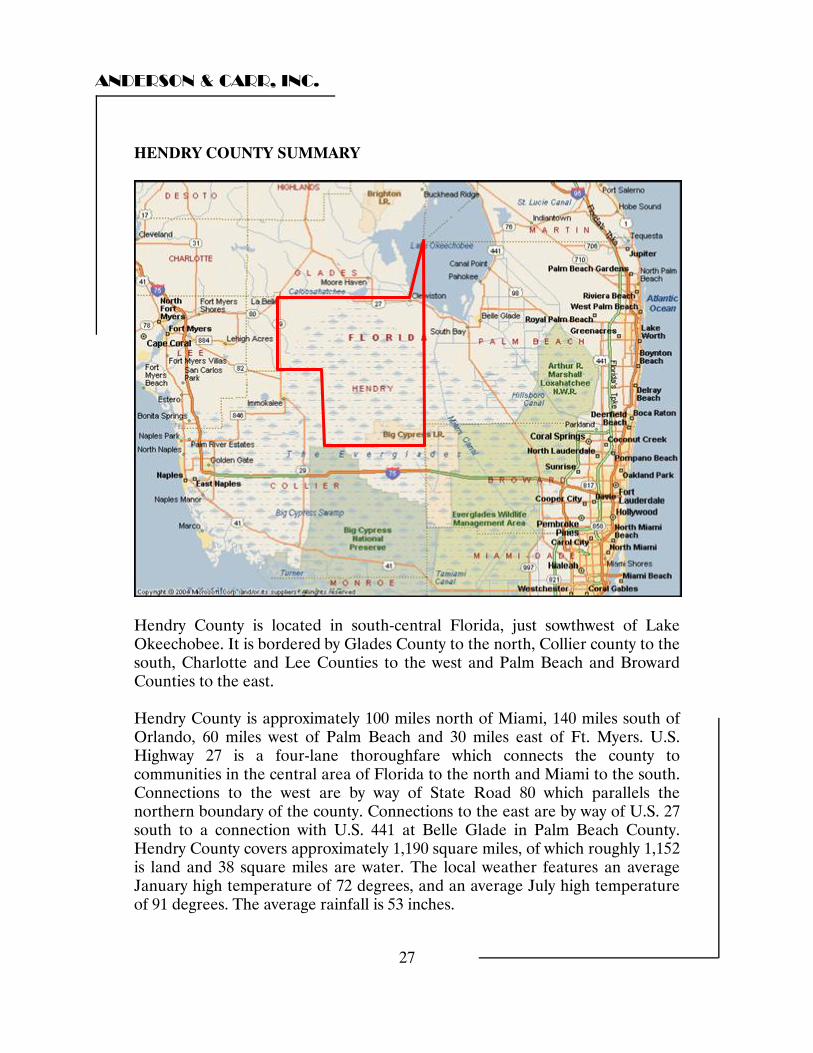
HENDRY COUNTY SUMMARY
Hendry County is located in south-central Florida, just sowthwest of Lake Okeechobee. It is bordered by Glades County to the north, Collier county to the south, Charlotte and Lee Counties to the west and Palm Beach and Broward Counties to the east. Hendry County is approximately 100 miles north of Miami, 140 miles south of Orlando, 60 miles west of Palm Beach and 30 miles east of Ft. Myers. U.S. Highway 27 is a four-lane thoroughfare which connects the county to communities in the central area of Florida to the north and Miami to the south. Connections to the west are by way of State Road 80 which parallels the northern boundary of the county. Connections to the east are by way of U.S. 27 south to a connection with U.S. 441 at Belle Glade in Palm Beach County. Hendry County covers approximately 1,190 square miles, of which roughly 1,152 is land and 38 square miles are water. The local weather features an average January high temperature of 72 degrees, and an average July high temperature of 91 degrees. The average rainfall is 53 inches.
ANDERSON & CARR, INC.
28
The topography of the county is generally flat. Soil composition is mainly sandy mineral soils over a base of limestone. The combination of the topography and soil composition supports a variety of agricultural uses, including sugar cane production, citrus production and cattle ranching. The U.S. Census Bureau reported a county wide population of 36,210 persons in 2000, and estimated the population in 2006 to be 40,459, an increase of 11.7%. The 2006 population estimate equates to roughly 35 people per square mile of land area, compared to a state average of 335.5 people. The sparse population is largely attributable to the agricultural nature of the county. The county has two incorporated municipalities, Clewiston and LaBelle, which also serves as the county seat. Clewiston is the larger of the two, with an estimated population as of 2006 of 7,281 persons. LaBelle’s population was estimated to be 4,537 persons in 2006. In addition to Clewiston and LaBelle, there are three unincorporated communities in Hendry County known as Harlem, Port La Belle, and Felda. The southeastern corner of the county is part of the Big Cypress Seminole Indian Reservation. Hendry County has 14 public schools providing education from kindergarten through twelfth grade. There are 350 public school teachers serving an enrollment of 7,463 students for a ratio of one teacher per 21.3 students. There is also one private elementary school in the county. Edison Community College has a satellite campus in La Belle, and West Palm Beach Community College has a satellite campus in Belle Glade to serve post secondary education needs. The economic base of Hendry County is primarily agricultural with sugar cane, citrus and cattle ranching being the main contributors. There is little evidence that the area will experience any substantial population growth in the next several years. In 2007 a total of 23 building permits were issued for single family homes. The five largest private sector employers in Hendry County are shown on the following chart.
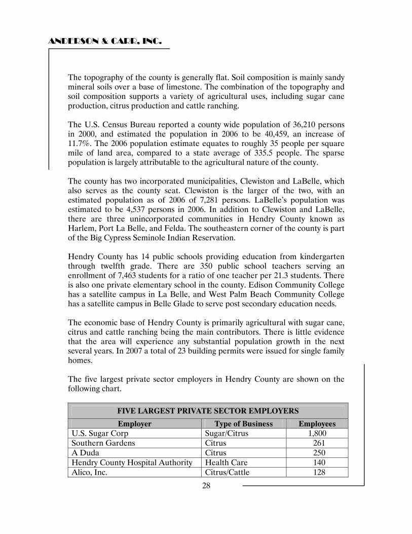
FIVE LARGEST PRIVATE SECTOR EMPLOYERS
Employer Type of Business Employees U.S. Sugar Corp Sugar/Citrus 1,800 Southern Gardens Citrus 261 A Duda Citrus 250 Hendry County Hospital Authority Health Care 140 Alico, Inc. Citrus/Cattle 128
ANDERSON & CARR, INC.
29
As Hendry County has a predominately agricultural economy, there is little demand for increased services, retail or office uses. Consequently, employment and population growth has been moderate. Hendry County is governed by a six-member Board of Commissioners. La Belle is governed by a Mayor and four City Commissioners. Clewiston is also governed by a Mayor and four City Commissioners. In 2007 the ad-valorem millage rate for the county was 18.078. The county wide assessment for real property was $7,799,092,100 and the total taxable value was $2,820,168,445. Conclusion Hendry County will continue to be an agriculturally based economy supported by sugarcane, citrus and cattle into the foreseeable future. Population and job growth are expected to be moderate. Land values have increased in recent years, as have values throughout South Florida. However, the increase in values in Hendry County has been more modest than the more densely populated areas of South Florida.
ANDERSON & CARR, INC.
30
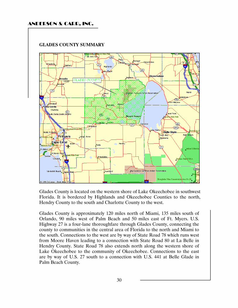
GLADES COUNTY SUMMARY
Glades County is located on the western shore of Lake Okeechobee in southwest Florida. It is bordered by Highlands and Okeechobee Counties to the north, Hendry County to the south and Charlotte County to the west. Glades County is approximately 120 miles north of Miami, 135 miles south of Orlando, 90 miles west of Palm Beach and 50 miles east of Ft. Myers. U.S. Highway 27 is a four-lane thoroughfare through Glades County, connecting the county to communities in the central area of Florida to the north and Miami to the south. Connections to the west are by way of State Road 78 which runs west from Moore Haven leading to a connection with State Road 80 at La Belle in Hendry County. State Road 78 also extends north along the western shore of Lake Okeechobee to the community of Okeechobee. Connections to the east are by way of U.S. 27 south to a connection with U.S. 441 at Belle Glade in Palm Beach County.
ANDERSON & CARR, INC.
31
Glades County covers approximately 986 square miles, of which roughly 774 is land and 212 square miles are water. The local weather features an average January high temperature of 73 degrees, and an average July high temperature of 91 degrees. The average annual rainfall is 53 inches. The topography of the county is generally flat. Soil composition is mainly sandy mineral soils over a base of limestone. The combination of the topography and soil composition supports a variety of agricultural uses, including cattle ranching, sugar cane production, citrus production and sod farming. Glades County is among one of the most sparsely populated counties in the state. The U.S. Census Bureau indicted a county wide population of 10,576 people in 2000, and estimated the population in 2006 to be 11,230, an increase of 6.2%. During the same period the statewide population increased by an estimated 13.2%. The 2006 population estimate equates to roughly 14.5 people per square mile of land area, compared to a state average of 335.5 people. The sparse population is largely attributable to much of the land area in the county being wetlands and wildlife management or refuge areas. The county has only one incorporated municipality, Moore Haven, which serves as the county seat. Moore Haven is located on the southwest shoreline of Lake Okeechobee at U.S. 27 and the Caloosahatchee River. The 2004 population estimate by the U.S. Census Bureau was 1,726. In addition to Moore Haven there are five unincorporated communities in Glades County, Buckhead Ridge, Lakeport, Ortuna, Palmdale and Muse. Glades County is also home to one of five Seminole Indian reservations in the State of Florida. The Brighton Seminole Indian Reservation contains roughly 35,805 acres northwest of Lake Okeechobee, and has 392 residents, many of them cattle ranchers, farmers and fishermen. Glades County has five public schools providing education from kindergarten through twelfth grade. There are 81 public school teachers serving an enrollment of 1,256 students for a ratio of one teacher per 15.5 students. There is also one private elementary school in the County. There are no Community Colleges in Glades County; however. Palm Beach Community College, with a satellite campus in Belle Glade, and Edison Community College, with a satellite campus in La Belle, service the area.
ANDERSON & CARR, INC.
32
There is only one physician in the county. However there is a hospital in Clewiston, which is approximately 15 miles southeast of Moore Haven. The area has six Protestant and one Catholic Church. Recreational facilities include city and state parks as well as commercial marine facilities. The Brighton Seminole Indian Reservation also operates a gambling facility. The economic base of Glades County is primarily agriculture, with sugar cane the major crop. Citrus, row crops and sod also contribute. Tourism makes a contribution to the local economy, with boaters and fishermen taking advantage of Lake Okeechobee and the Caloosahatchee River, both of which are part of the Intracoastal Waterway. As noted above, Glades County, and the surrounding region, is primarily an agricultural area and there is little evidence that the area will experience any substantial population growth in the next several years. Lykes Brothers owns a majority of the private land in the County and the remainder is owned by substantially large landholders for agricultural production. In 2007 a total of 38 building permits were issued for single family homes, and according to the building department, many of these were to replace existing homes. The two largest employers in Glades County are the Glades County Government and the Glades County School District. The five largest private sector employers are shown in the following chart.
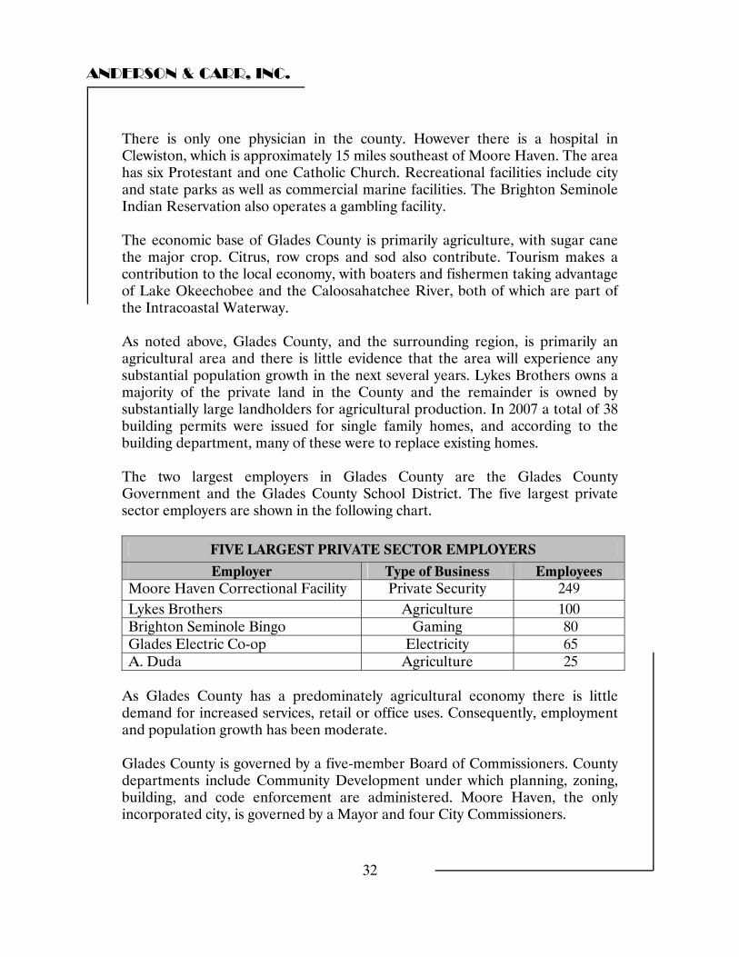
FIVE LARGEST PRIVATE SECTOR EMPLOYERS
Employer Type of Business Employees Moore Haven Correctional Facility Private Security 249 Lykes Brothers Agriculture 100 Brighton Seminole Bingo Gaming 80 Glades Electric Co-op Electricity 65 A. Duda Agriculture 25
As Glades County has a predominately agricultural economy there is little demand for increased services, retail or office uses. Consequently, employment and population growth has been moderate. Glades County is governed by a five-member Board of Commissioners. County departments include Community Development under which planning, zoning, building, and code enforcement are administered. Moore Haven, the only incorporated city, is governed by a Mayor and four City Commissioners.
ANDERSON & CARR, INC.
33
Available utilities in Moore Haven include water, sewer, and electric. Other areas have electric available and depend on wells and septic for water and sanitation. In 2007 the ad-valorem millage rate was 18.078. The total county wide assessment was $780,988,932 and the total taxable value of real property was $623,087,211. This is a modest increase over the 2006 levels of approximately 735 million and 592 million, respectively. Conclusion Glades County will continue to be an agriculturally based economy supported by cattle, sugarcane and row crops. Population and job growth are expected to be moderate. Land values have increased in recent years, as have values throughout South Florida. However the increased values in Glades County have been more modest than the more densely populated areas of South Florida.
ANDERSON & CARR, INC.
34
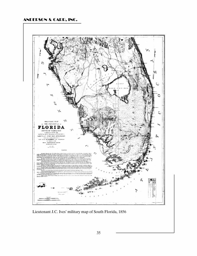
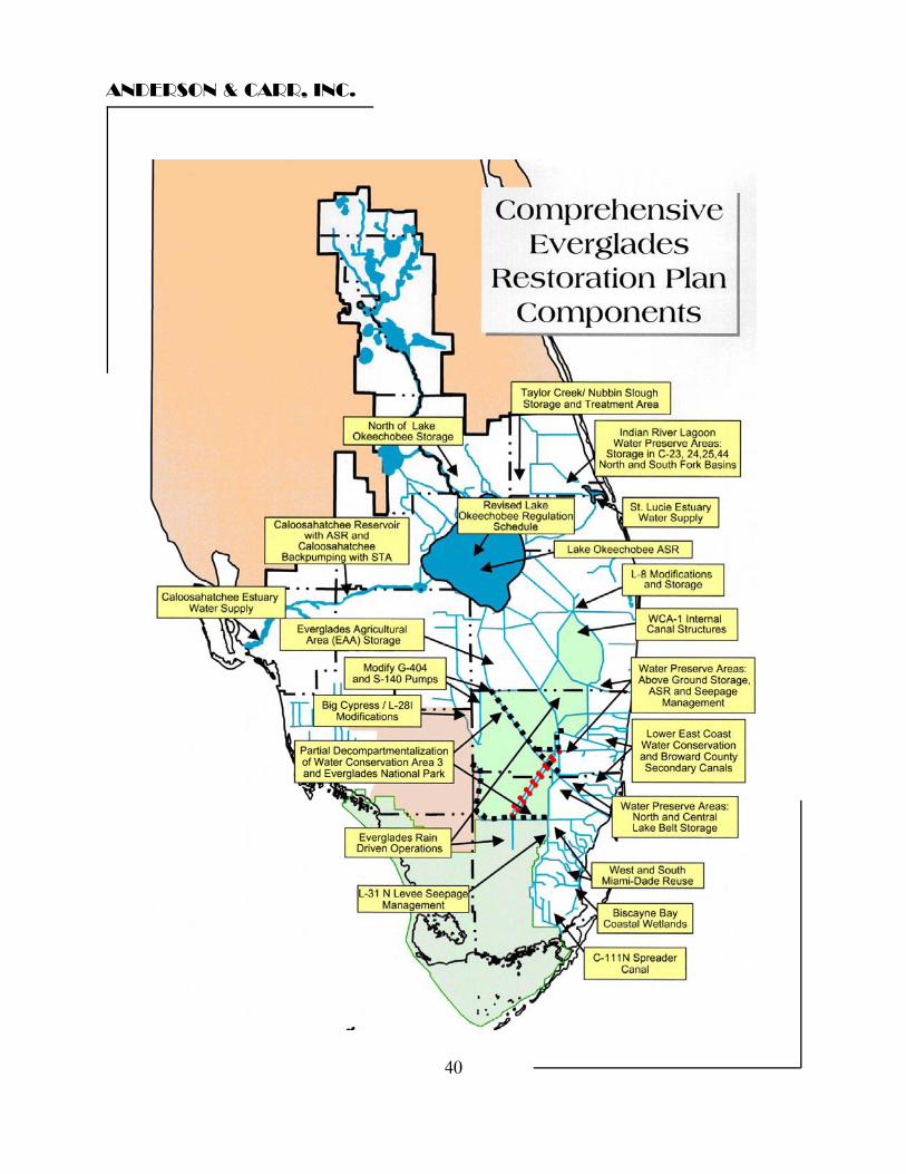
COMPREHENSIVE EVERGLADES RESTORATION PLAN OVERVIEW The Comprehensive Everglades Restoration Plan (CERP) states in its “Vision Statement” that “The overarching objective of the Plan is the restoration, preservation, and protection of the South Florida ecosystem while providing for other water-related needs of the region, including water supply and flood protection”. The Everglades hydrologic area consists of three elements; the Kissimmee River, which serves as the watershed; Lake Okeechobee, which operates as the storage basin; and the Everglades itself, which is the overflow area. To understand the significance of the order of the objectives of the plan it is necessary to look at the historical evolution of water control practices of Central and South Florida. Until the mid 1800s the Florida Everglades remained relatively untouched. The general perception of early settlers was that the Everglades consisted of a vast and inhospitable swamp infested with mosquitoes, snakes and sawgrass. In 1845 Florida joined the Unites States as the 27th state in the Union. The state legislature, seeking new areas where people could settle, petitioned Congress to examine and survey the “vast and extensive region, commonly termed the Everglades,… which has hitherto been regarded as wholly valueless in consequence of being covered with water at stated periods of the year” in regard to the possibility of drainage. The survey was done by Buckingham Smith, an attorney from St. Augustine. In 1848, Smith reported that if canals were dug to connect Lake Okeechobee to the Loxahatchee and Caloosahatchee rivers, the lake could drain into these rivers rather than sending water on its normal southward trek. Smith further reported that drainage canals should also be dug at appropriate spots south of Lake Okeechobee to drain water from the Everglades to the Atlantic and Gulf of Mexico. If these actions were taken, he predicted that the land could produce a wide variety of agricultural products. If the actions were not taken, the land would remain valueless for ages to come. Based on the Smith report, Congress transferred more than 20 million acres to the state of Florida. Between 1851 and 1855 the Florida legislature created the Internal Improvement Fund (IFF). The Theory behind the IFF was that it would give railroad companies land in return for completed rail lines. The rail lines would attract settlers to the interior, the IFF would sell land to the settlers and use the money to develop drainage plans to open up even more land for more sales. In 1856, more information became available about the topographical features of South Florida with the production of a map of the lower Florida Peninsula.
ANDERSON & CARR, INC.
35
Lieutenant J.C. Ives’ military map of South Florida, 1856
ANDERSON & CARR, INC.
36
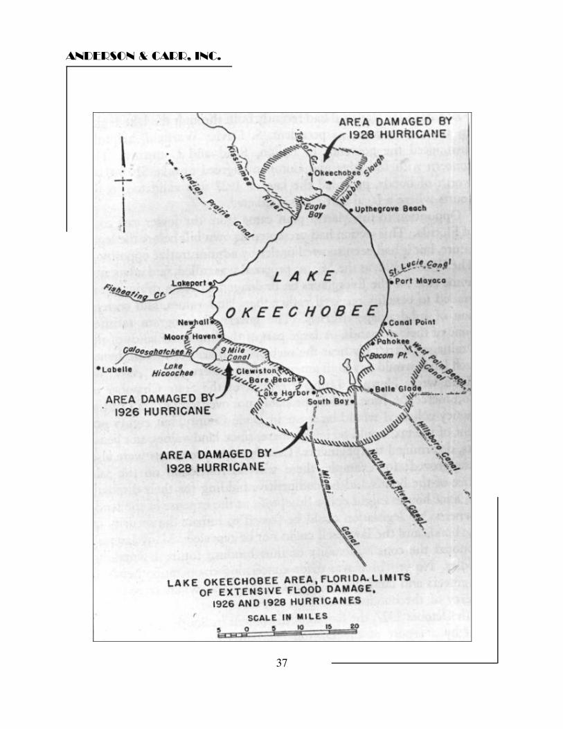
Financial problems plagued the railroads in the post-Civil War era and by the late 1870s the IFF was essentially bankrupt and no drainage plans had been realized. In 1881 the IFF found a new investor, Hamilton Disston, capable of implementing a drainage plan. In 1881, Hamilton Disston began a project by which the Kissimmee River was deepened and straightened, and the Caloosahatchee River was deepened and connected to Lake Okeechobee. By the 1890s, Disston also succumbed to financial difficulties and his project came to an end. The decade long effort “reclaimed” less than 100,000 acres, but demonstrated the agricultural potential of the region and was the first step in draining the Everglades by connecting the Caloosahatchee River to Lake Okeechobee. In 1903 the Florida legislature established the Everglades Drainage District (EDD) and ushered in an era of intensive state interest in drainage. By the end of the 1920s the major drainage canals were largely in place. They included the Caloosahatchee Canal from west Lake Okeechobee to the Gulf of Mexico, the St. Lucie Canal going east from the lake to the Atlantic, and the West Palm Beach, Hillsboro, North New River (Ft. Lauderdale) and Miami canals going south from the lake to the Atlantic. The completion of the canals brought settlement to the area south of Lake Okeechobee as the area was drained and better information was available on how to make the soil more productive. In the 1920s the sugar industry came to the area and became the dominant crop in the region. Even with the canals, flooding still occurred periodically in the region. After excessive rainfall in 1924, the EDD constructed a small dike around the southern end of Lake Okeechobee. Unfortunately, the dike did not hold when a hurricane swept over the area in 1926 and over 400 people were killed. Then in 1928 disaster struck again with another hurricane striking the area after a month of torrential rains and high water levels. This time over 2,000 people were killed and the towns along the southern shores of Lake Okeechobee were devastated. In 1929 the Okeechobee Flood Control District was established with directions to construct flood control structures and regulate Lake Okeechobee and the Caloosahatchee River to prevent damaging floods. Working in cooperation with the U.S. Army Corps of Engineers the Hoover Dike was built around the south end of Lake Okeechobee and levees were constructed along the north shore near the city of Okeechobee. In addition, the Caloosahatchee River was deepened and the Corps assumed control of regulating the water level of Lake Okeechobee to maintain a level between 14 and 17 feet.
ANDERSON & CARR, INC.
37
ANDERSON & CARR, INC.
38
Schemes to drain the Everglades in the first half of the twentieth century created problems that few people foresaw, including the destruction of plant and wildlife in South Florida. There were detrimental effects on the flora and fauna in the Everglades, emphasizing that proper amounts of water were essential to preserve the unique natural resources of the area. Other problems resulted from soil subsidence, saltwater intrusion into freshwater wells, and muck fires raging in times of drought. In 1948 the U.S. Army Corps of Engineers proposed a comprehensive water control plan that would curb floods and supply water for urban and agricultural interests, alleviating fires, soil subsidence, saltwater intrusion and plant and wildlife damage in the process. This became the Central and Southern Florida Flood Control Project(C&SFP). The overall emphasis of the C&SFP was flood control and water supply for urban and agricultural interests. Alleviating muck fires, soil subsidence, saltwater intrusion, and plant and wildlife damage to the Everglades were included in the plan, but seemed secondary to the main objectives of the plan. In the ten years following the establishment of the CS&F Project the Central and Southern Florida Flood Control District (FCD) and the U.S. Army Corps of Engineers worked together to construct and operate the project works. In the words of its chief engineer the FCD was “a cooperative agency between the State and the Federal Government and local interests in projects concerned with water conservation, flood and water control, and allied problems.” In essence the FCD gathered data regarding economic, social and physical factors essential to project development from various State and Federal agencies interested members of the public and presented the data and views to the Corps. The Corps then made construction plans. One of the first construction projects was to build a levee from northwest Palm Beach County to the south of Dade County, thereby preventing flooding from the Everglades to reach the communities on the east coast. Next, control facilities and levees around Lake Okeechobee were modified in order to create more water storage and increase the discharge capacity from the lake. The third major undertaking was to create three water conservation areas in Palm Beach, Broward and Dade counties for water storage. A fourth element was the construction of canals, levees, and pumping stations to protect the Everglades Agricultural Area south of Lake Okeechobee. The next step was the construction of canals and water control structures to handle drainage in the coastal counties from St. Lucie County in the north to Dade County in the south.

ANDERSON & CARR, INC.
39
By the end of the 1990s, the success of the C&SF project to accomplish two of its purposes, providing a high degree of flood protection in South Florida and to control water levels in the region for agricultural use and maintenance of municipal water supplies was clear. It allowed for the creation of the Everglades Agricultural Area, a 700,000-acre region that became a bastion for sugar and vegetable growing, while also providing the necessary mechanisms to allow South Florida to achieve phenomenal growth in the last half of the twentieth century, going from a population of about 500,000 in 1950 to six million in 2000. A third, and subsidiary purpose, the preservation of fish and wildlife resources, did not fare as well. The C&SF Project damaged South Florida’s ecosystem by disrupting hydroperiods and patterns of water flow in order to provide flood control and water supply. This damaged vegetation and fish and wildlife habitat, leading to startling decreases in certain populations. By 2000, 50 percent of the historic Everglades had disappeared, used instead for agriculture or urban growth, leading to a 90 percent reduction in the number of wading birds and the listing of 68 South Florida animal and plant species as either threatened or endangered. It is with this background that CERP was born. For years the National Park Service and the Fish and Wildlife Service had complained that the needs of fish and wildlife took a back seat to flood control and urban water supply. In the 1960s the strengthening environmental movement began to support the NPS and FWS and call for a change in focus of the water management program to emphasize environmental preservation. Approval of CERP was included in the Water Resources Development Act of 2000. It includes more that 60 elements, will take more than 30 years to construct and will cost an estimated $7.8 billion. The CERP projects will capture and store as much as possible of the 1.7 billion gallons of fresh water a day which is currently released into the Atlantic Ocean and Gulf of Mexico. This water will be stored in above and underground reservoirs. When needed, it will be directed to the wetlands, lakes, rivers and estuaries of South Florida.
ANDERSON & CARR, INC.
40
ANDERSON & CARR, INC.
41
CERP is the largest environmental restoration effort in history. Since its inception progress has been made in the restoration of the Kissimmee River, improving water flows to Everglades Nation Park and building treatment marshes to improve water quality in the northern Everglades. In the first five years more than 207,000 acres of land was acquired. Regional studies and pilot projects have begun to test the feasibility of large-scale aquifer storage and recovery and seepage management technologies. Project design of individual projects continues and plans for two important projects, Indian River Lagoon South and Picayune Strand Hydrologic Restoration, have been completed. These projects will move forward when Congressional funding for final detailed design and construction is authorized. Conclusion The success of the C&SF project, with its primary focus on flood control and water supply for urban and agricultural uses has been well demonstrated. In September 2004, when hurricane Frances dumped 13 inches of water on Florida, there was no major flooding within the borders of the C&SF Project. With CERP, environmental restoration is the main focus of water management programs. This is a monumental project to restore the ecosystem of the Everglades which will require the application of modern science and technology to balance the needs of fish and wildlife restoration while maintaining the benefits of flood control and water supply for the people of South Florida. Sources River of Interests: Water Management in South Florida and the Everglades, 1948-2000 by Matthew C. Godfrey, Historian, Historical Research Associates, Inc. www.evergladesplan.org
ANDERSON & CARR, INC.
42
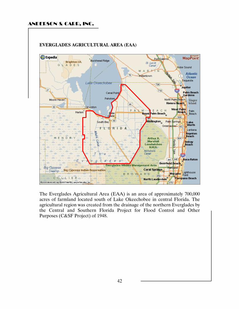
EVERGLADES AGRICULTURAL AREA (EAA)
The Everglades Agricultural Area (EAA) is an area of approximately 700,000 acres of farmland located south of Lake Okeechobee in central Florida. The agricultural region was created from the drainage of the northern Everglades by the Central and Southern Florida Project for Flood Control and Other Purposes (C&SF Project) of 1948.
ANDERSON & CARR, INC.
43
The Everglades Agricultural Area encompasses about 27% of the historic Everglades. It is defined by Florida Statute 373.4592 (15) as extending from the town of Clewiston in the northwest, toward the northeast following the U.S. Army Corps of Engineer’s Levee D-9 along the southern and southeastern portion of Lake Okeechobee to the L-8 canal in northwestern Palm Beach County. The L-8 canal forms the northeastern boundary of the EAA as it follows the L-8 canal southeast to Southern Boulevard. The line then extends south and west along the western boundary of the Arthur R. Marshall Loxahatchee National Wildlife Refuge to the Palm Beach County/Broward County line. The boundary extends westward along the county line following the path of the L-4 & L-5 canals to the Hendry County line in the west where it turns northward to return to the town of Clewiston. The major crop of the EAA is sugar cane. Currently sugar cane is planted on approximately 440,000 acres in the EAA making it the most extensively grown row crop in Florida. Production of sugar cane is centered in Palm Beach County with 80% of the crop grown on the high organic matter muck soils within the EAA. Florida is allotted about 1.7 million tons of production per year under the U.S. sugar program. West Palm Beach based Florida Crystals and Clewiston based U.S. Sugar split 80 percent of the state’s production with the remaining 20% allotted to the Sugar Cane Growers Cooperative of Florida. Agriculture within the EAA depends on a relatively thin, continually shrinking layer of peat soil that overlies the limestone bedrock. In the sixty years since the area has been drained there has been substantial subsidence of the organic muck soil within the region. The causes include mechanical compaction, burning, shrinkage due to dehydration and most importantly oxidation of organic matter. Oxidation is a process that converts organic carbon in the soil to carbon dioxide gas and water. Protection of the muck soils from oxidation has lead in recent years to the introduction of rice cultivation in the region. Growing rice in the EAA is generally not very profitable. Most growers plant rice because flooding of the fields during rice production greatly reduces both oxidation and harmful soil pests such as nematodes. The rice itself contributes large amounts of straw to the fields which improves soil tillage and drainage. These and other factors can result in higher sugar cane yields.
ANDERSON & CARR, INC.
44
Commercial sod production has risen in Florida and approximately 14,000 acres of sod are currently grown in Palm Beach County. The muck soils of the EAA are conducive for growing sod because of its high fertility. Additionally the soil’s low bulk density makes sod grown on muck less expensive to ship than sod grown on heavier soils The EAA’s central location allows easy shipment to both the east and west coasts of Florida. The future of the sugar cane industry in Florida in general and within the EAA in particular has been called into question in recent years. In addition to subsidence and eventual potential depletion of the muck soils, foreign competition will play a major factor. A complex quota and allotment system has helped keep the average wholesale price for U.S. refined sugar at about 25 cents per pound within the U.S. during the past 25 years while it has been traded on the global market at approximately half that amount. Rising costs for machinery, labor and fuel have forced U.S. producers of sugar to shutter more than 30 sugar beet and cane factories in the past decade. The EAA currently has only four working mills which is half of its peak number. The May 2008 farm bill extended the sugar program at a crucial time when the industry was under siege from the final phase–in of deregulation mandated by the North American Free Trade Agreement (NAFTA). At the end of 2007 NAFTA allowed unlimited importation of government subsidized sugar from Mexico. In addition to sugars that receive preferential tariff treatment under free trade agreements such as the North American Free Trade Agreement (NAFTA), the Central American/Dominican Republic Free Trade Agreement (CAFTA/DR), the Caribbean Basin Economic Recovery Act, the Andean Trade Preference Act, or the U.S. Generalized System of Preferences enter at a zero duty. The extension of the sugar program is seen as crucial to allow sugar producers to “manage trade” rather than allow deregulation to go forward unabated. U.S. sugar producers have been forced to increase efficiency in their farming and milling procedures and look for innovative ways of utilizing cane waste and other biomass in the production of biofuels. Toward that end the new farm bill includes a new program that would use the growing sugar surpluses created by NAFTA and other free trade agreements to supplement corn ethanol production. In summary, the vast EAA has had a long history of production of a variety of agricultural products. However, the long term climate for the agricultural industry in the EAA is uncertain due to both soil subsidence and foreign competition.
ANDERSON & CARR, INC.
45
FLORIDA SUGARCANE INDUSTRY Sugarcane was brought to the St. Augustine area in about 1565 by the Spanish colonial governor Menendez. Commercial production of sugarcane began in 1767 in the New Smyrna colony, but was disrupted by the American Revolution. Several attempts to develop commercial operations in central Florida failed in the 1800’s because of unsuitable soils and inclement weather. In the late 1800s and early 1900s pioneer growers moved south and the industry was finally established around the southeastern shore of Lake Okeechobee. Through the 1930s U.S. policy limited American producers to supplying no more than 30% of the U.S. market, which hindered growth of the Florida industry. Prior to 1960, there were three raw sugar mills, producing up to 175,000 tons of raw sugar annually from about 50,000 acres. Opportunity for further expansion came in 1960 when the U.S. stopped the importation of Cuban sugar and acreage restrictions on domestic cane were lifted. In the following four years, cultivation increased to 223,000 acres, the number of sugar mills increased to 11 and sugar production increased to 572,000 tons. In 1965 acreage restrictions and quotas were again imposed, hindering the industry’s growth. With the expiration of the Sugar Act at the end of 1974 and the elimination of production controls, the industry was free to expand as capital and human resources allowed. Industry Organization Unlike other crops, sugarcane must be processed soon after being harvested or the sucrose content deteriorates. Consequently, the mills must be located near the fields. Most of today’s industry is vertically integrated, with large companies and a grower’s cooperative owning the crop land, mills and refineries to deliver the final product to the customer. There are also independent growers that produce some of the output. In Florida there are currently five sugar mills and two sugar refineries. U.S. Sugar operates a mill and refinery located in Clewiston. Florida Crystals, or subsidiary companies, operates three mills, one in South Bay, one in Pahokee and one in Belle Glade. The Sugarcane Growers Cooperative operates a mill in Belle Glade. Refineries are located in Clewiston (U.S. Sugar) and South Bay (Florida Crystals).
ANDERSON & CARR, INC.
46
Production Sugarcane production in Florida continued the expansion trend started in the 1960s and 1970s until 2000. However, in this century there has been a decline in the number of acres harvested and total production. In 2000 the U.S. Department of Agriculture reported that Florida growers harvested 454,000 acres of sugarcane and produced 17.04 million tons of sugarcane. In 2007 the USDA reported that 392,000 acres were harvested, producing 14.17 million tons of sugarcane. Despite these reductions, Florida continues to be the leader in domestic sugarcane production, contributing an average of over 48% of the total domestic production so far this decade. Domestic and Foreign Competition As noted above, the Florida sugarcane industry contributes an average of over 48% of the domestic sugarcane production. The domestic sugar beet industry also contributes to the overall domestic sugar production. When sugar derived from sugar beets is factored in, Florida sugarcane contributes approximately 25% of the domestic sugar production. However, over the last decade the share of sugar beet production has been increasing at about .25% per year and the share of sugarcane production has been declining. In addition to domestic competition from the sugar beet industry, the Florida sugarcane industry, and indeed the entire domestic sugar industry, faces foreign competition. Traditionally the effects of foreign competition have been ameliorated by the Federal Sugar Policy which imposed import quotas and tariffs that protected the domestic sugar industry from foreign competition. However, as of January 2008, Mexico was allowed to import duty free all sugar that is not needed for domestic use in Mexico. As Mexico is a major producer of sugar in the northern hemisphere, it remains to be seen what effect this will have on the domestic market. The passage of the May 2008 Farm Bill seems to have stabilized the environment for the overall sugar industry for the short term and will remain in place over the upcoming five crops.
ANDERSON & CARR, INC.
47
Economic Impact The economic impact of the sugarcane industry is significant, but difficult to quantify. As the industry is dominated by a limited number of privately held corporations and the Sugar Cane Growers Cooperative of Florida, precise economic data is limited. The USDA estimated that the value of sugar cane receipts totaled nearly 357 million dollars in 2006. The Florida Department of Agriculture and Consumer Services estimated that in 2006 the sugarcane industry contributed 1.42 billion dollars to Florida’s economy. An industry trade group estimated the economic impact at 2 billion dollars. In any event, the impact is significant. Conclusion While Florida remains the leading producer of domestic sugarcane, the industry faces significant challenges. The sugar beet industry is increasing its market share of sugar production. With the elimination of some trade barriers, foreign competition will certainly have an effect. Responding to these challenges will require increased efficiency in terms of yield per acre and processing to remain competitive.
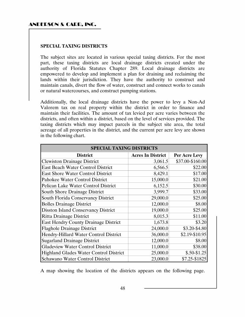
ANDERSON & CARR, INC.
48
SPECIAL TAXING DISTRICTS The subject sites are located in various special taxing districts. For the most part, these taxing districts are local drainage districts created under the authority of Florida Statutes Chapter 289. Local drainage districts are empowered to develop and implement a plan for draining and reclaiming the lands within their jurisdiction. They have the authority to construct and maintain canals, divert the flow of water, construct and connect works to canals or natural watercourses, and construct pumping stations. Additionally, the local drainage districts have the power to levy a Non-Ad Valorem tax on real property within the district in order to finance and maintain their facilities. The amount of tax levied per acre varies between the districts, and often within a district, based on the level of services provided. The taxing districts which may impact parcels in the subject site area, the total acreage of all properties in the district, and the current per acre levy are shown in the following chart.
District Acres In District Per Acre LevyClewiston Drainage District 3,061.5 $37.00-$160.00East Beach Water Control District 6,566.5 $22.00East Shore Water Control District 8,429.1 $17.00Pahokee Water Control District 15,000.0 $21.00Pelican Lake Water Control District 6,152.5 $30.00South Shore Drainage District 3,999.7 $33.00South Florida Conservancy District 29,000.0 $25.00Bolles Drainage District 12,000.0 $8.00Disston Island Conservancy District 19,000.0 $25.00Ritta Drainage District 8,015.3 $11.00East Hendry County Drainage District 1,673.8 $3.20Flaghole Drainage District 24,000.0 $3.20-$4.80Hendry-Hillard Water Control District 36,000.0 $2.19-$10.95Sugarland Drainage District 12,000.0 $8.00Gladeview Water Control District 11,000.0 $38.00Highland Glades Water Control District 25,000.0 $.50-$1.25Schawano Water Control District 23,000.0 $7.25-$1825
SPECIAL TAXING DISTRICTS
A map showing the location of the districts appears on the following page.
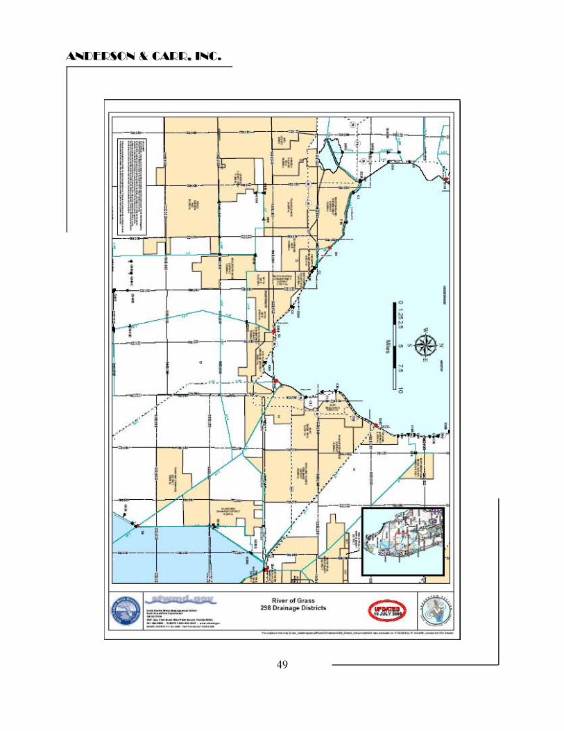
ANDERSON & CARR, INC.
49
ANDERSON & CARR, INC.
50
EXPOSURE TIME/MARKETING TIME Exposure time is the estimated length of time the property interest being appraised would have been offered on the market prior to the hypothetical consummation of a sale at market value on the effective date of the appraisal: a retrospective estimate based on an analysis of past events assuming a competitive and open market. Exposure time is always presumed to occur prior to the effective date of the appraisal. The overall concept of reasonable exposure encompasses not only adequate, sufficient and reasonable time but also adequate, sufficient and reasonable effort. Exposure time is different for various types of real estate and value ranges and under various market conditions.
Source: Appraisal Standards Board of the Appraisal Foundation, Statement on Appraisal Standards No. 6, Fourth Edition, 2002
Marketing time is defined in Advisory Opinion G-7 as "an estimate of the amount of time it might take to sell a property interest in real estate at the estimated market value level during the period immediately after the effective date of an appraisal". The advisory opinion also states that "the request to estimate a reasonable marketing time exceeds the normal information required for the conduct of the appraisal process, and should be treated separately from that process." It is very hard to judge the direction of the agricultural market at this time. Agricultural land participants are facing higher costs for materials, labor and the fuel used to run equipment. In addition, tighter debt markets and more stringent underwriting standards are not easy hurdles for many agricultural land investors to overcome at the present time. Foreign competition and the end of the long history of governmental protection of the sugar industry in Florida cast the future of the entire sugar industry in the area into doubt. Finally, size is an issue that cannot be ignored. The subject parcels contain three larger acreage sites containing 3,461 acres, 25,246 acres and 8,703 acres respectively. Only one of these sites is large enough that the number of potential buyers with the financial and managerial clout to run operations of these sizes is limited. On the positive side, there is a pool of large buyers of muck land suitable for sugar cane production. Also, the subject land is valued as six parcels or groups of parcels that would be suitable for marketing for individual sale with various highest and best uses.
ANDERSON & CARR, INC.
51
The supply of muck land in the world suitable for this type use is severely limited. Within the United States, sugar cane production is limited to the EAA surrounding the subject and small parts of Louisiana and Hawaii. Within the EAA there is strong pressure on the supply of muck land due to new buyers taking former cane land out of cane production for other uses such as tree farms and row crops, rock mining, land fills and to some extent, planned future residential communities. Additionally, the generally growing population of Palm Beach County in particular has caused areas formerly in sugar cane production to be transferred to non-agricultural uses such as the new regional hospital in Belle Glade and the adjacent prison facility and proposed land fill projects. Because of the limited supply of land for sugar cane production we anticipate that the individual components of the subject property would be attractive to individual buyers. Looking at the sales activity, we estimate that an exposure time of 12 to 24 months (for each of the component parts individually) would be reasonable if the property is actively exposed on the open market by professional competent professionals. Looking forward, we see no basis to conclude that marketing time would differ from exposure time. However, it should be noted that, due to the complex nature of this group of properties, an extended due diligence period may be required to research all issues of title and contractual obligations.
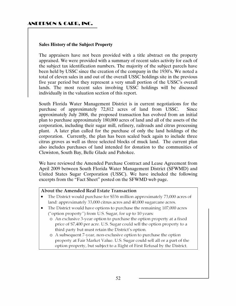
ANDERSON & CARR, INC.
52
Sales History of the Subject Property The appraisers have not been provided with a title abstract on the property appraised. We were provided with a summary of recent sales activity for each of the subject tax identification numbers. The majority of the subject parcels have been held by USSC since the creation of the company in the 1930’s. We noted a total of eleven sales in and out of the overall USSC holdings site in the previous five year period but they represent a very small portion of the USSC’s overall lands. The most recent sales involving USSC holdings will be discussed individually in the valuation section of this report. South Florida Water Management District is in current negotiations for the purchase of approximately 72,812 acres of land from USSC. Since approximately July 2008, the proposed transaction has evolved from an initial plan to purchase approximately 180,000 acres of land and all of the assets of the corporation, including their sugar mill, refinery, railroads and citrus processing plant. A later plan called for the purchase of only the land holdings of the corporation. Currently, the plan has been scaled back again to include three citrus groves as well as three selected blocks of muck land. The current plan also includes purchases of land intended for donation to the communities of Clewiston, South Bay, Belle Glade and Pahokee. We have reviewed the Amended Purchase Contract and Lease Agreement from April 2009 between South Florida Water Management District (SFWMD) and United States Sugar Corporation (USSC). We have included the following excerpts from the “Fact Sheet” posted on the SFWMD web page.
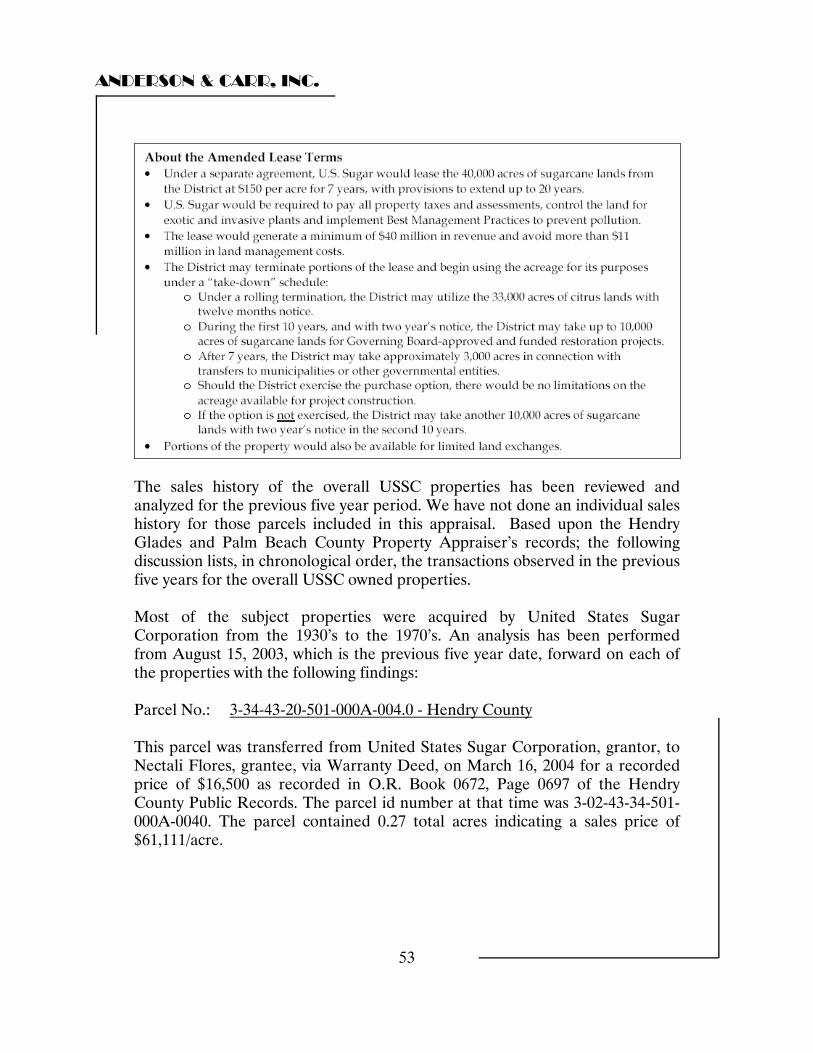
ANDERSON & CARR, INC.
53
The sales history of the overall USSC properties has been reviewed and analyzed for the previous five year period. We have not done an individual sales history for those parcels included in this appraisal. Based upon the Hendry Glades and Palm Beach County Property Appraiser’s records; the following discussion lists, in chronological order, the transactions observed in the previous five years for the overall USSC owned properties. Most of the subject properties were acquired by United States Sugar Corporation from the 1930’s to the 1970’s. An analysis has been performed from August 15, 2003, which is the previous five year date, forward on each of the properties with the following findings: Parcel No.: 3-34-43-20-501-000A-004.0 - Hendry County This parcel was transferred from United States Sugar Corporation, grantor, to Nectali Flores, grantee, via Warranty Deed, on March 16, 2004 for a recorded price of $16,500 as recorded in O.R. Book 0672, Page 0697 of the Hendry County Public Records. The parcel id number at that time was 3-02-43-34-501-000A-0040. The parcel contained 0.27 total acres indicating a sales price of $61,111/acre.
ANDERSON & CARR, INC.
54
Subsequently this same parcel was transferred from Nectali Flores, grantor, to United States Sugar Corporation, grantee, via Warranty Deed, on February 16, 2007 for a recorded price of $16,500 as recorded in O.R. Book 0759, Page 1210 of the Hendry County Public Records. Again, it contained 0.27 total acres indicating a sales price of $61,111/acre. Parcel No.’s: 00-37-42-01-00-000-3000 Palm Beach County 00-37-42-01-00-000-1020 Palm Beach County These parcels were transferred from Camaro Farms, Inc., grantor, to United States Sugar Corporation, grantee, via Warranty Deed, on April 9, 2004 for a recorded price of $300,000 as recorded in O.R. Book 16790, Page 0592 of the Palm Beach County Public Records. The site contained 95.96 total acres which indicates a sales price of $3,126/acre. Parcel No.: 3-34-43-02-391-000B-0008 Hendry County This parcel was transferred from United States Sugar Corporation, grantor, to Norman Raye Parham and Kimberly S. Parham, grantee, via Warranty Deed, on April 5, 2004 for a recorded price of $27,000 as recorded in O.R. Book 0672, Page 0690 of the Hendry County Public Records. Based on a site size of 0.39 acres, the sale amount indicates a price of $69,231/acre. Parcel No.’s: 00-35-43-34-01-000-0020 Palm Beach County 00-35-43-34-01-000-0028 Palm Beach County 00-35-44-03-01-001-0010 Palm Beach County 00-35-44-02-00-000-3020 Palm Beach County 00-35-44-05-00-000-1000 Palm Beach County 00-35-44-02-00-000-3030 Palm Beach County 00-35-44-02-01-000-0033 Palm Beach County 00-35-44-02-01-000-0042 Palm Beach County These parcels were transferred from Star Ranch Enterprises, Inc., grantor, to SBG Farms, Inc., grantee, via Warranty Deed, on October 22, 2004 for a recorded price of $1,240,000 as recorded in O.R. Book 17682, Page 0308 of the Palm Beach County Public Records. Based on a site size of 68.88 acres, the sale price equates to $18,002/acre.
ANDERSON & CARR, INC.
55
Parcel No.: 00-35-43-34-00-000-7040 - Palm Beach County This parcel was transferred from Andy McGahee, LLC, grantor, to United States Sugar Corporation, grantee, via Warranty Deed, on January 21, 2005 for a recorded price of $174,450 as recorded in O.R. Book 18122, Page 0842 of the Palm Beach County Public Records. Based on a site size of 24.57 acres, this sale indicates a price of $7,100/acre. Parcel No.’s: A26-42-32-A00-0050-0000 Glades County A27-42-32-A00-0030-0000 Glades County A35-42-32-A00-0020-0000 Glades County A19-42-33-A00-0020-0000 Glades County A30-42-33-A00-0020-0000 Glades County A19-42-33-A00-001A-0000 Glades County A19-42-33-A00-0020-0000 Glades County These parcels were transferred from Weeks Cattle Company, grantor, to United States Sugar Corporation and SBG Farms, Inc., grantees, via Warranty Deed, on December 16, 2005 for a recorded price of $2,278,400 as recorded in O.R. Book 0247, Page 0484 of the Glades County Public Records. Based on a total site area of 462.91 acres, the sale represents a price of $4,921/acre. Subsequently, these same parcels were transferred from SBG Farms, Inc. and United States Sugar Corporation, grantors to SBG Farms, Inc., grantee, via Quit Claim Deed, on December 16, 2005 for the recorded price of $10 as recorded in O.R. Book 0249, Page 0930 of the Glades County Public Records. Parcel No.: A19-42-3-A00-002B-0000 Glades County This parcel was transferred from Robert G. Richardson, As Personal Representative of the Estate of Robin Weeks, grantor, to United States Sugar Corporation, grantee, via Personal Representative’s Deed, on December 27, 2005 for a recorded price of $5,200 as recorded in O.R. Book 0247, Page 0478 of the Glades County Public Records. The site contained one acre at $5,200/acre.

ANDERSON & CARR, INC.
56
Parcel No.’s: 1-34-45-22-A00-00001.0000 Hendry County 1-34-45-27-A00-00001.0000 Hendry County 1-34-45-34-A00-00001.0000 Hendry County 1-34-46-03-A00-00001.0000 Hendry County 1-34-46-10-A00-00001.0000 Hendry County These parcels were transferred from Knight Agriculture, Ltd., grantor, to United States Sugar Corporation, grantee, via Statutory Warranty Deed, on March 1, 2006 for a recorded price of $12,834,000 as recorded in O.R. Book 0730, Page 1016 of the Hendry County Public Records. The parcel contained 3,208 acres of land which indicates a purchase price of $4,000/acre. Subsequently, these same parcels were transferred from United States Sugar Corporation, grantor to SBG Farms, Inc., grantee, via Quit Claim Deed, on August 16, 2006 for the recorded price of $10 as recorded in O.R. Book 0746, Page 0705 of the Hendry County Public Records. Parcel No.: 3-34-43-16-A00-0012.0000 Hendry County This parcel was transferred from United States Sugar Corporation, grantor, to the City of Clewiston, grantee, via Warranty Deed, on January 12, 2007 for a recorded price of $1,428,500 as recorded in O.R. Book 0757, Page 0318 of the Hendry County Public Records. This involved 33.70 acres of industrially zoned land sold out of US Sugar at an average price of $42,389 per acre. This involves a sale to a governmental agency (City of Clewiston). The bulk of the parcel, 23.7 acres sold at a negotiated price, based on appraisal, of $55,000 the remaining 10 acres was sold at a discounted price of $12,500 per acre. The discount was reportedly made to help the city get a commerce park started. Parcel No.’s: 00-37-44-06-00-000-5030 Palm Beach County 00-37-44-06-00-000-1030 Palm Beach County These parcels were transferred from SBG Farms, Inc., grantor, to BW Belle Glade, LLC, grantee, via Warranty Deed, on February 21, 2007 for a recorded price of $1,505,000 as recorded in O.R. Book 21444, Page 1175 of the Palm Beach County Public Records. The site contains 42.95 acres which indicates a price of $35,041/acre.
ANDERSON & CARR, INC.
57
Parcel No.: 3-34-43-17-A00-0001.0000 Hendry County This parcel was transferred from United States Sugar Corporation, grantor, to RCP Commercial Investments, Inc., grantee, via Warranty Deed, on September 20, 2007 for a recorded price of $201,800 as recorded in O.R. Book 0775, Page 0071 of the Hendry County Public Records. The site contained 8.07 acres at $25,006/acre. Parcel No.: 3-34-43-17-A00-0002.0000 Hendry County This parcel was transferred from United States Sugar Corporation, grantor, to Resource Conservation Properties, Inc., grantee, via Warranty Deed, on September 20, 2007 for a recorded price of $316,000 as recorded in O.R. Book 0775, Page 0067 of the Hendry County Public Records. The 12.64 acre parcel sold for $25,000/acre. The above sales range in price per acre from $3,126 to $69,231. The upper end of the range is represented by small parcels of less than one acre. The sale at $69,231 per acre is for a parcel of .39 acres. Larger agricultural parcels of land are clustered at the lower end of the scale. The sale at $3,126 per acre is for a parcel with 95.96 acres and the sale at $4,000 per acre is for a parcel with 3,208 acres. Both of these sales have Agricultural zoning. Parcels with high density multi-family zoning appear to have sod for higher amounts per acre. The sale of 8.07 acres, zoned Planned Unit Development, in September of 2007 had a price per acre of $25,006 and the sale of 33.70 acres, zoned Industrial in January of 2007 had a price per acre of $42,389. Lawrence Group Buy-Out Offer and Pending Class Action Lawsuit During our routine due diligence, we discovered documentation regarding a class action complaint that has been filed against United States Sugar Corporation, it’s board members and the United States Trust Company, N.A., defendants, by Diallo Johnson, Mary Rafter and Linda Stanley, individually and on behalf of all others similarly situated, plaintiffs. The plaintiffs are U.S. Sugar shareholders. This complaint was originally filed with the United States District Court, Southern District of Florida on January 31, 2008. The following discussion is taken from the Amended Complaint filed on May 2, 2008 and a timeline of the events that took place.
ANDERSON & CARR, INC.
58
Since its founding in 1931 by Charles Stewart Mott, U.S. Sugar has always been associated with his descendants. However, the largest single block of shareholders of U.S. Sugar is comprised of thousands of its employees and former employees, who own approximately 35% of the outstanding shares through the U.S. Sugar Employee Stock Ownership Plan (the “ESOP) as of October 31, 2005 (the “Employee Shareholders”). Their shares in U.S. Sugar are the primary source of retirement benefits for a large number of these employees. The ESOP was formed as part of a transaction in the 1980s in which U.S. Sugar “went private”, and the Mott family cashed in a substantial part of their holdings while still effectively controlling the company. As a private company, there is no public market for U.S. Sugar shares and no publicly available means to determine the value of those shares, due to the fact the company makes no public disclosures of its financial information. The only way for the Employee Shareholders to sell their shares is to sell then back to U.S. Sugar under the terms of the ESOP at the “Fair Market Value”. This “Fair Market Value” is determined by the Trustee of the ESOP and is defined as the price at which shares would change hands between a willing buyer and a willing seller. The price paid by U.S. Sugar to purchase these shares has ranged from a high of $204 to a low of $180 since 2005. Shareholders have never had an opportunity to cash out of their shares in a sale to a third party. Gaylon M. Lawrence, Sr. and Gaylon M. Lawrence, Jr. (the “Lawrence Group”) are the owners of extensive agricultural, banking and industrial operations. They are based out of Franklin, Tennessee. In June of 2005, the Lawrence Group, entered into negotiations with Robert Dolson, then CEO of United States Sugar Corporation, to discuss the acquisition of the stock of the United States Sugar Corporation. Mr. Dolson initially told the Lawrence Group that it would take $600 million to buy the stock of United States Sugar Corporation. The Lawrence Group was willing to buy all of the shares of United States Sugar Corporation, but also willing to buy as little as 51% of the shares, in order to acquire control of the company. Mr. Dolson, however, said a purchase offer would only be considered if the Lawrence Group agreed to purchase all of the shares of United States Sugar Corporation. The Lawrence Group was ready, willing and able to meet that requirement.

ANDERSON & CARR, INC.
59
Negotiations continued through the month of July 2005 between the Lawrence Group and Robert Dolson. On August 4, 2005, after careful financial analysis, the Lawrence Group met again with Mr. Dolson and reached agreement on a purchase price and timetable for definitive documentation and closing. The agreement provided that the Lawrence Group would purchase all of the shares of United States Sugar Corporation for $575 million, in cash ($293 per share), subject to routine due diligence. The Lawrence Group agreed to put up 5% of this sum, $27.5 million, on October 3, 2005 as a deposit towards closing, which was expected to take place by October 31, 2005. This $575 million dollar offer appears to be based only on the purchase of the shares. It is known, that along with the purchase of shares would also come the assumption of any debts that U.S. Sugar may have. According to an article in the Miami Herald on June 26, 2008, U.S. Sugar has a $700 million dollar mortgage with Farm Credit of Southwest Florida which is secured by its land. It is unclear as to when U.S. Sugar Corporation took out this mortgage. This would imply that the offer for a complete buy-out would be approximately $1.275 billion. Mr. Dolson presented the offer to William S. White and the Board of Directors of United States Sugar Corporation on August 5, 2005. This was the last time he had contact with the Lawrence Group. The negotiations were then taken over by William S. White, chairman of the Board of Directors of U.S. Sugar and a member of the Mott family. Mr. White then installed Robert H. Buker, Jr. as CEO who took control of the deal with the Lawrence Group. On March 14, 2006, the Lawrence Group’s offer of $293 per share was formally rejected. Robert H. Buker, the President and current CEO of United States Sugar Corporation wrote to the Lawrence Group on behalf of the Board of Directors that “the Company is not for sale.” Mr. Buker stated in the letter that, “at the Board meeting of March 13, 2006, based on the condition and prospects of the assets and business of the Company, the Board of Directors has decided that the best interest of the shareholders will be served by maintaining ownership.” On January 8, 2007, the Lawrence Group made a second offer to United States Sugar Corporation to buy all of the stock for $293 per share. On January 22, 2007, Mr. Buker wrote to the Lawrence Group rejecting the second offer basing this decision on the fact that “the circumstances surrounding the extensive analysis done last year at the direction of the Board of Directors have not changed in any material way” and that their “conclusions have also not changed.”
ANDERSON & CARR, INC.
60
On November 29, 2008 the Lawrence Group submitted their most recent and highest offer to date. They offered to purchase 100% of the outstanding shares at a price of $300.00 per share based on the understanding that there were approximately 1,808,676 outstanding shares. This implies a total cost for the shares of $542,602,800. The offer stated that they would be willing to assume a maximum outstanding debt of $600,000,000. Thus the offer equates to a total price of $1,142,602,800 for all of the assets of the corporation including land, mills, railways and citrus processing facilities.
ANDERSON & CARR, INC.
61
PROPERTY DATA Taxpayer of Record United States Sugar Corporation County Property Control Numbers We have been provided with an Excel spreadsheet by South Florida Water Management District with tax identification numbers for each of the 52 +/- parcels within three counties that are being appraised. They have been combined into 25 +/- SC200 parcels. That spreadsheet is presented later in this analysis in the Zoning and Future Land use analysis section. It has been augmented to show SC200 parcels with their component tax identification numbers as well and their zoning designations and future land use plan designations. Flood Zone Designation The agricultural portion of the subject property is located within multiple Federal Emergency Management Agency, Flood Insurance Rate Map panels within three counties. We have reviewed the flood plain maps in each of the counties. Palm Beach County Flood Maps (Effective date October 15, 1982): Within Palm Beach County, the predominant flood zone designation is B which includes areas between the 100 year flood and 500 year flood or certain areas of 100 year flood subject to flooding with average depths of 1 foot or less. The subject parcels are contained within the following panels: 120192-0025 B, 120192-0050 B, 120192-0075 B, & 120192-0100 B
ANDERSON & CARR, INC.
62
Hendry County Flood Maps (Effective date May 17, 1982): In unincorporated portions of Hendry County, the predominant designation is A-3 which is an area of 100 year flood with base flood elevation and flood hazard determined. The subject parcels (as well as the citrus tracts) are contained within the following panels: 120107-0100 B, 120107-0125 B, 120107-0200 B, 120107-0225 B, 120107-0275 B, 120107-0300 B, 120107-0350 B, & 120107-0375 B The land area in and around the city of Clewiston (in Hendry County) is largely outside of the flood plain (Zone C). The subject parcels are contained within the following panels: 120108B H-01 & H-02 Glades County Flood Maps (Effective date May 17, 1982): In unincorporated portions of Glades County, the predominant designation is A-5 which is an area of 100 year flood with base flood elevation and flood hazard determined. The subject parcels are contained within the following panels: 120095-0310 B, 120095-0315 B & 120095-0350 B Utilities The agricultural lands portion of the subject property generally has available electric service but would be required to utilize private on-site well, pump and septic tank systems. Public water and sewer are not readily available at this time. The majority of the properties within the communities request for Hendry County adjacent to the city of Clewiston are served by standard public utilities. Zoning/Future Land Use In Palm Beach County the predominant Zoning and Future Land Use is AP Agricultural Production District. The AP District is designed to conserve and protect areas for exclusive, bona fide agricultural and farming related operations particularly where soil and water conditions favor continued agricultural production. A wide range of agricultural activities and their accessory uses shall be permitted in the AP district in order to maintain the vitality of the agricultural industry in Palm Beach County.
ANDERSON & CARR, INC.
63
In Hendry County, the predominant zoning is A-2, General Agriculture with an agricultural future land use. The A-2 district is designed to set aside lands for agricultural purposes, including farming, dairying, pasturage, apiculture, horticulture, floriculture, silviculture, viticulture, animal and poultry husbandry and the necessary accessory uses for packing, treating or storing the produce. Permitted uses include agriculture, hunting camps mobile homes and single family dwellings. The minimum lot area is 5 acres. In Glades County the predominant zoning designation is OUA, Open Use Agriculture with an Agriculture future land use designation. According to the Glades County District Zoning Regulations, “the Open Use Agricultural District is intended for agricultural uses and to preserve for agricultural uses, those lands with productive agricultural development potential. Open spaces, parklands, watersheds and water recharge areas are also intended to be protected in this district. The regulations discourage or prohibit non-agriculturally oriented residential development and generally prohibit commercial and industrial development. Certain recreational activities that are appropriate to the district are permitted. A parcel by parcel summary of the individual zoning and future land use designations is presented on the following page.
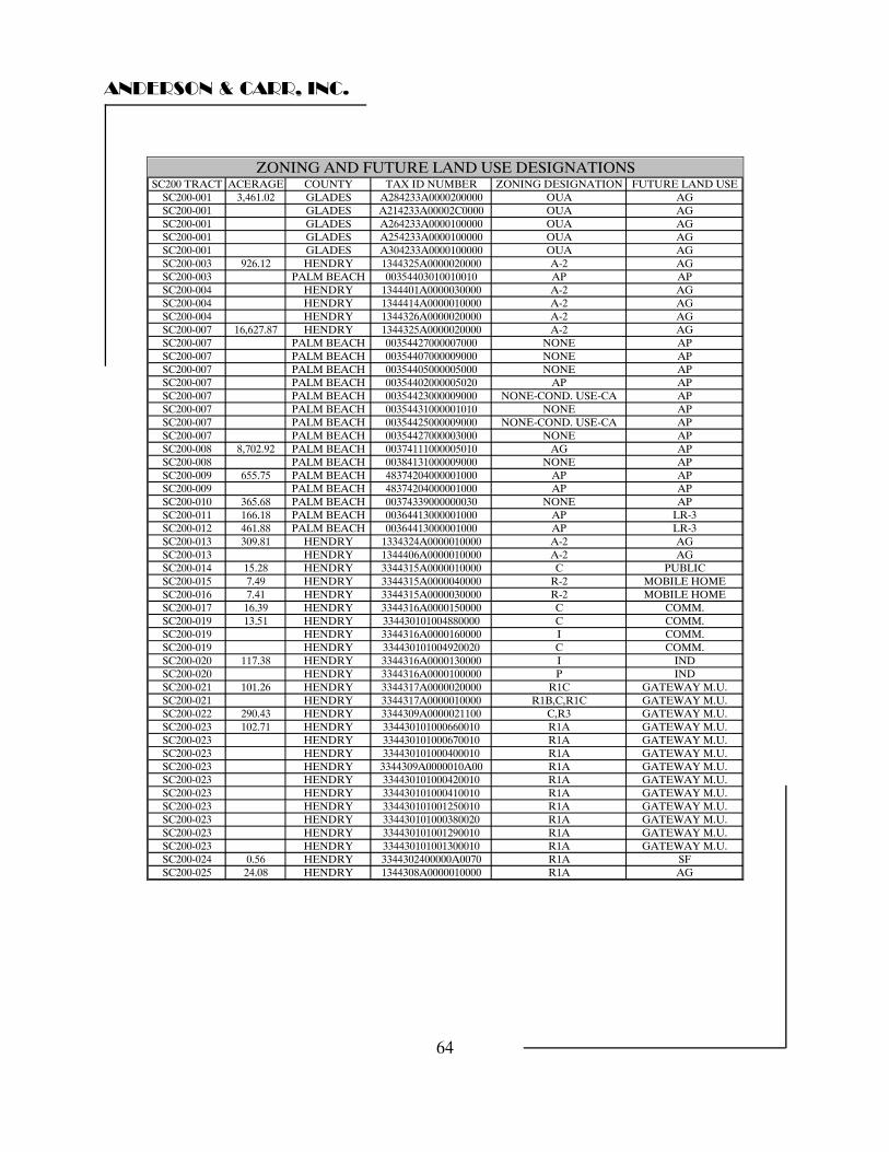
ANDERSON & CARR, INC.
64
SC200 TRACT ACERAGE COUNTY TAX ID NUMBER ZONING DESIGNATION FUTURE LAND USESC200-001 3,461.02 GLADES A284233A0000200000 OUA AGSC200-001 GLADES A214233A00002C0000 OUA AGSC200-001 GLADES A264233A0000100000 OUA AGSC200-001 GLADES A254233A0000100000 OUA AGSC200-001 GLADES A304233A0000100000 OUA AGSC200-003 926.12 HENDRY 1344325A0000020000 A-2 AGSC200-003 PALM BEACH 00354403010010010 AP APSC200-004 HENDRY 1344401A0000030000 A-2 AGSC200-004 HENDRY 1344414A0000010000 A-2 AGSC200-004 HENDRY 1344326A0000020000 A-2 AGSC200-007 16,627.87 HENDRY 1344325A0000020000 A-2 AGSC200-007 PALM BEACH 00354427000007000 NONE APSC200-007 PALM BEACH 00354407000009000 NONE APSC200-007 PALM BEACH 00354405000005000 NONE APSC200-007 PALM BEACH 00354402000005020 AP APSC200-007 PALM BEACH 00354423000009000 NONE-COND. USE-CA APSC200-007 PALM BEACH 00354431000001010 NONE APSC200-007 PALM BEACH 00354425000009000 NONE-COND. USE-CA APSC200-007 PALM BEACH 00354427000003000 NONE APSC200-008 8,702.92 PALM BEACH 00374111000005010 AG APSC200-008 PALM BEACH 00384131000009000 NONE APSC200-009 655.75 PALM BEACH 48374204000001000 AP APSC200-009 PALM BEACH 48374204000001000 AP APSC200-010 365.68 PALM BEACH 00374339000000030 NONE APSC200-011 166.18 PALM BEACH 00364413000001000 AP LR-3SC200-012 461.88 PALM BEACH 00364413000001000 AP LR-3SC200-013 309.81 HENDRY 1334324A0000010000 A-2 AGSC200-013 HENDRY 1344406A0000010000 A-2 AGSC200-014 15.28 HENDRY 3344315A0000010000 C PUBLICSC200-015 7.49 HENDRY 3344315A0000040000 R-2 MOBILE HOMESC200-016 7.41 HENDRY 3344315A0000030000 R-2 MOBILE HOMESC200-017 16.39 HENDRY 3344316A0000150000 C COMM.SC200-019 13.51 HENDRY 334430101004880000 C COMM.SC200-019 HENDRY 3344316A0000160000 I COMM.SC200-019 HENDRY 334430101004920020 C COMM.SC200-020 117.38 HENDRY 3344316A0000130000 I INDSC200-020 HENDRY 3344316A0000100000 P INDSC200-021 101.26 HENDRY 3344317A0000020000 R1C GATEWAY M.U.SC200-021 HENDRY 3344317A0000010000 R1B,C,R1C GATEWAY M.U.SC200-022 290.43 HENDRY 3344309A0000021100 C,R3 GATEWAY M.U.SC200-023 102.71 HENDRY 334430101000660010 R1A GATEWAY M.U.SC200-023 HENDRY 334430101000670010 R1A GATEWAY M.U.SC200-023 HENDRY 334430101000400010 R1A GATEWAY M.U.SC200-023 HENDRY 3344309A0000010A00 R1A GATEWAY M.U.SC200-023 HENDRY 334430101000420010 R1A GATEWAY M.U.SC200-023 HENDRY 334430101000410010 R1A GATEWAY M.U.SC200-023 HENDRY 334430101001250010 R1A GATEWAY M.U.SC200-023 HENDRY 334430101000380020 R1A GATEWAY M.U.SC200-023 HENDRY 334430101001290010 R1A GATEWAY M.U.SC200-023 HENDRY 334430101001300010 R1A GATEWAY M.U.SC200-024 0.56 HENDRY 3344302400000A0070 R1A SFSC200-025 24.08 HENDRY 1344308A0000010000 R1A AG
ZONING AND FUTURE LAND USE DESIGNATIONS
ANDERSON & CARR, INC.
65
Concurrency The strongest growth control measure ever imposed on individual counties was passed by the Florida Legislature and became effective on February 1, 1990. This was mandated by Chapter 163, Florida Statutes, otherwise known as the "Growth Management Law." One provision of this law is referred to as "Concurrency" which dramatically limits the ability to develop real property. It is basically the requirement that adequate infrastructure be available to serve new development. Eight types of infrastructure are affected including traffic, potable water, sewer, drainage, solid waste, recreation and open space, mass transit, and fire rescue. The subject parcels are currently served by a variety of paved county and state roads as well as unpaved farm roads. It is unlikely that any foreseeable development of the lands within the subject site would push the existing roads over their optimum service levels. However, without the benefit of a traffic study, an absolute determination of available trips is beyond the scope of this appraisal assignment. Access To fulfill the stated purpose of this appraisal, our analysis has adopted the assumption that all parcels which are the subject of this appraisal possess adequate physical and legal access consistent with that parcel’s highest and best use. Topography and Drainage The entire subject site has been drained and graded to a level condition. The majority of the parcels are in active sugar cane production. The subject parcels are contained within a total of approximately 6 individual drainage districts as well as areas served by SFWMD. Easements or Encroachments The appraisers have not been provided title commitments for the subject site. For the purposes of this report we have assumed that there are no significant easements or encroachments which will prevent the use of the subject site for its highest and best use.
ANDERSON & CARR, INC.
66
Environmental Conditions We have not been provided with nor have we commissioned a soil or sub-soil condition report. An assumption has been adopted for the purpose of this appraisal assuming that no lands which are the subject of this appraisal are contaminated in any way or contain any substance which would adversely affect the use and/or marketability of the land. Soils Discussion We have reviewed the soil maps provided by the United States Department of Agriculture Natural Resources Conservation Service’s National Cooperative Soil Survey for the subject sites. Within those land areas deemed to be suitable for continued agricultural use, all of the land area has organic, muck soils of varying types. Only a 309.81 acre parcel within Hendry County’s Community Request land area (SC200-013) had a soil type that was predominantly sand. In general, muck soils are nearly level, very poorly drained, organic soils in large freshwater marshes and in small isolated depressions. These soils formed in deposits of varying depths and are composed of hydrophytic plant remains. Under natural conditions, the soils are covered by water, or the water table is within 10 inches of the surface, except during extended dry periods. The natural vegetation is sawgrass, sedges, aquatic grasses and other water-tolerant plants and trees. Muck soils are not suited to cultivation in their natural state. If good water control is established and maintained through a system of ditches, dikes, and pumps, they are well suited to a wide variety of vegetables and sugarcane or high-quality pasture of improved grasses. Beginning in the 1930s with the construction of the Hoover Dike around the southern perimeter of Lake Okeechobee, the process controlling the flow of water through what is now the Everglades Agricultural Area (EAA) began. Today, an extensive system of canals, levees and pumping stations has established a sophisticated method of water-management that provides flood control and water supply for the urban areas along the Atlantic coast. The system also rendered the land south of Lake Okeechobee suitable for agricultural development.
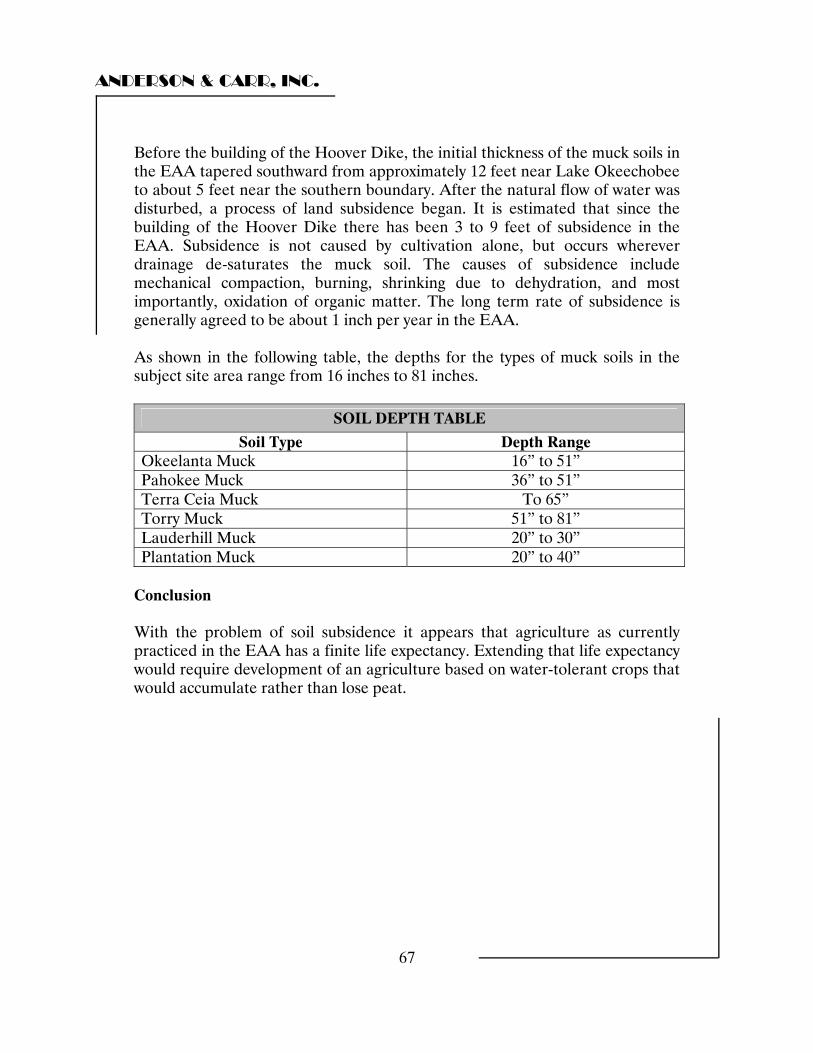
ANDERSON & CARR, INC.
67
Before the building of the Hoover Dike, the initial thickness of the muck soils in the EAA tapered southward from approximately 12 feet near Lake Okeechobee to about 5 feet near the southern boundary. After the natural flow of water was disturbed, a process of land subsidence began. It is estimated that since the building of the Hoover Dike there has been 3 to 9 feet of subsidence in the EAA. Subsidence is not caused by cultivation alone, but occurs wherever drainage de-saturates the muck soil. The causes of subsidence include mechanical compaction, burning, shrinking due to dehydration, and most importantly, oxidation of organic matter. The long term rate of subsidence is generally agreed to be about 1 inch per year in the EAA. As shown in the following table, the depths for the types of muck soils in the subject site area range from 16 inches to 81 inches.
SOIL DEPTH TABLE
Soil Type Depth Range Okeelanta Muck 16” to 51” Pahokee Muck 36” to 51” Terra Ceia Muck To 65” Torry Muck 51” to 81” Lauderhill Muck 20” to 30” Plantation Muck 20” to 40”
Conclusion With the problem of soil subsidence it appears that agriculture as currently practiced in the EAA has a finite life expectancy. Extending that life expectancy would require development of an agriculture based on water-tolerant crops that would accumulate rather than lose peat.
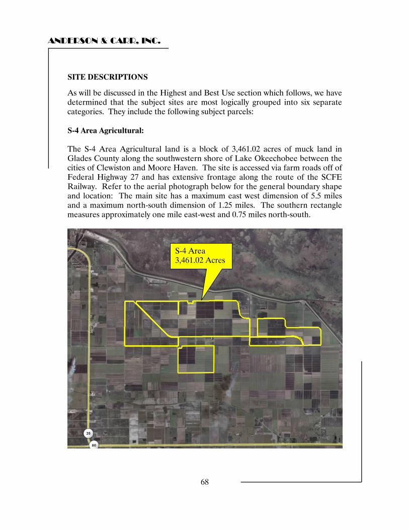
ANDERSON & CARR, INC.
68
SITE DESCRIPTIONS
As will be discussed in the Highest and Best Use section which follows, we have determined that the subject sites are most logically grouped into six separate categories. They include the following subject parcels: S-4 Area Agricultural: The S-4 Area Agricultural land is a block of 3,461.02 acres of muck land in Glades County along the southwestern shore of Lake Okeechobee between the cities of Clewiston and Moore Haven. The site is accessed via farm roads off of Federal Highway 27 and has extensive frontage along the route of the SCFE Railway. Refer to the aerial photograph below for the general boundary shape and location: The main site has a maximum east west dimension of 5.5 miles and a maximum north-south dimension of 1.25 miles. The southern rectangle measures approximately one mile east-west and 0.75 miles north-south.
S-4 Area 3,461.02 Acres

ANDERSON & CARR, INC.
69
Central Area Agricultural The Central Area Agricultural land is a block of 25,246.22 acres of muck land in Hendry County south of Lake Okeechobee and southeast of Clewiston. The site is accessed via farm roads off of State Road 80. The site is traversed by both the SCFE and the USSC railways. Refer to the aerial photograph below for the general boundary shape and location: The site has an average east west dimension of approximately 5.75 miles and a maximum north-south dimension of 8.0 miles. The western boundary is Bloomberg Road while the eastern boundary is the Miami Canal.
Central Area 25,246.22 Acres
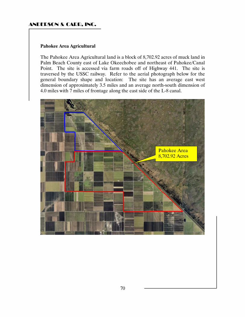
ANDERSON & CARR, INC.
70
Pahokee Area Agricultural The Pahokee Area Agricultural land is a block of 8,702.92 acres of muck land in Palm Beach County east of Lake Okeechobee and northeast of Pahokee/Canal Point. The site is accessed via farm roads off of Highway 441. The site is traversed by the USSC railway. Refer to the aerial photograph below for the general boundary shape and location: The site has an average east west dimension of approximately 3.5 miles and an average north-south dimension of 4.0 miles with 7 miles of frontage along the east side of the L-8 canal.
Pahokee Area 8,702.92 Acres
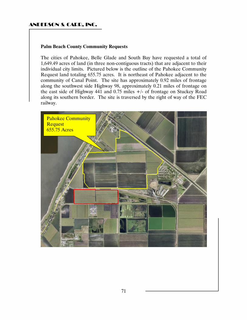
ANDERSON & CARR, INC.
71
Palm Beach County Community Requests The cities of Pahokee, Belle Glade and South Bay have requested a total of 1,649.49 acres of land (in three non-contiguous tracts) that are adjacent to their individual city limits. Pictured below is the outline of the Pahokee Community Request land totaling 655.75 acres. It is northeast of Pahokee adjacent to the community of Canal Point. The site has approximately 0.92 miles of frontage along the southwest side Highway 98, approximately 0.21 miles of frontage on the east side of Highway 441 and 0.75 miles +/- of frontage on Stuckey Road along its southern border. The site is traversed by the right of way of the FEC railway.
Pahokee Community Request 655.75 Acres
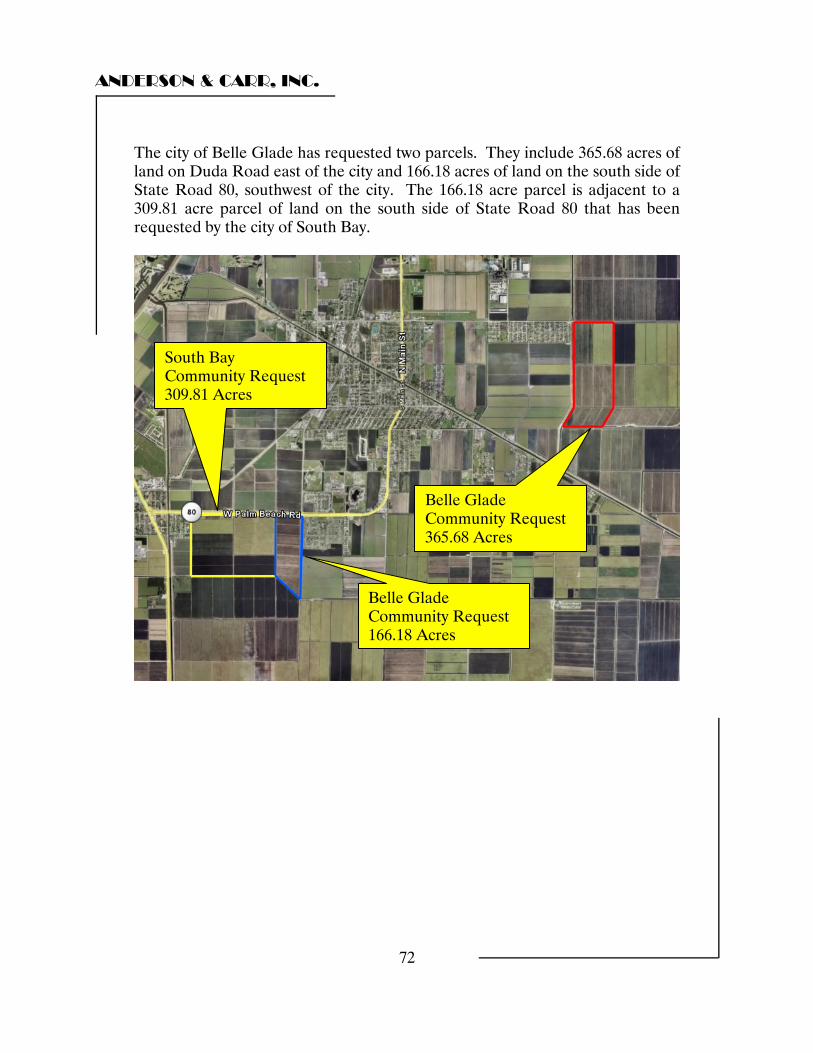
ANDERSON & CARR, INC.
72
The city of Belle Glade has requested two parcels. They include 365.68 acres of land on Duda Road east of the city and 166.18 acres of land on the south side of State Road 80, southwest of the city. The 166.18 acre parcel is adjacent to a 309.81 acre parcel of land on the south side of State Road 80 that has been requested by the city of South Bay.
Belle Glade Community Request 365.68 Acres
Belle Glade Community Request 166.18 Acres
South Bay Community Request 309.81 Acres
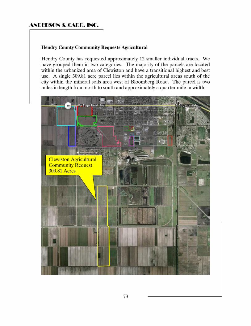
ANDERSON & CARR, INC.
73
Hendry County Community Requests Agricultural Hendry County has requested approximately 12 smaller individual tracts. We have grouped them in two categories. The majority of the parcels are located within the urbanized area of Clewiston and have a transitional highest and best use. A single 309.81 acre parcel lies within the agricultural areas south of the city within the mineral soils area west of Bloomberg Road. The parcel is two miles in length from north to south and approximately a quarter mile in width.
Clewiston Agricultural Community Request 309.81 Acres
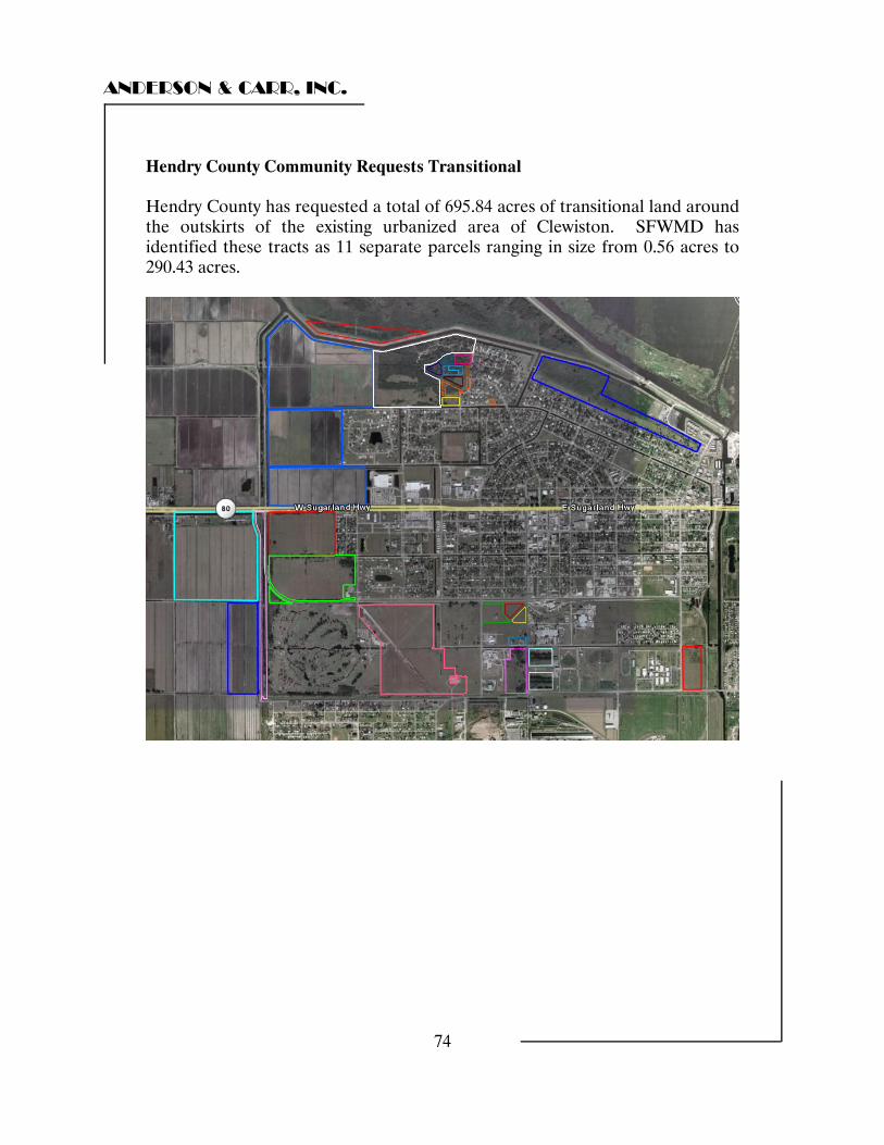
ANDERSON & CARR, INC.
74
Hendry County Community Requests Transitional Hendry County has requested a total of 695.84 acres of transitional land around the outskirts of the existing urbanized area of Clewiston. SFWMD has identified these tracts as 11 separate parcels ranging in size from 0.56 acres to 290.43 acres.
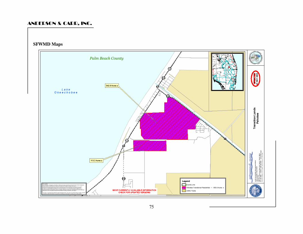
ANDERSON & CARR, INC.
SFWMD Maps
75
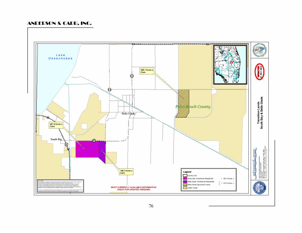
ANDERSON & CARR, INC.
76
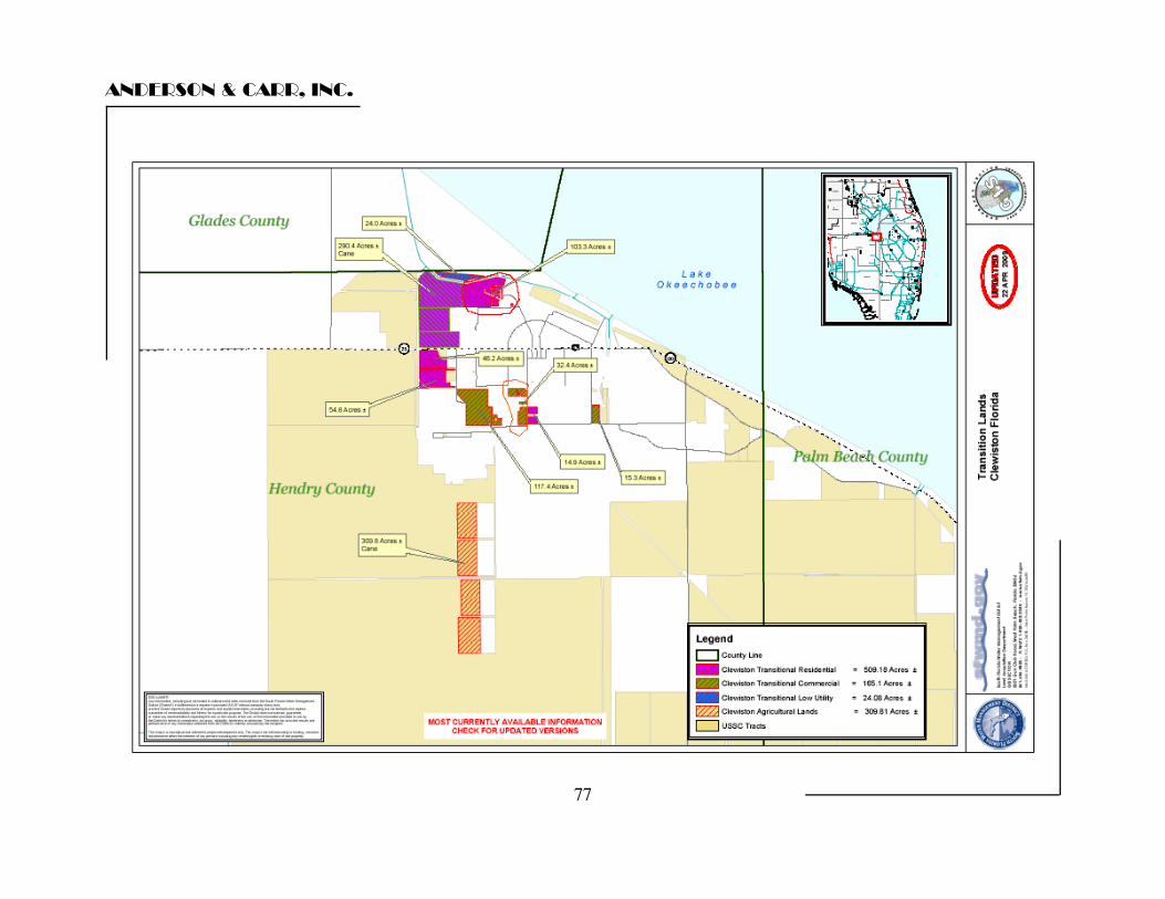
ANDERSON & CARR, INC.
77
ANDERSON & CARR, INC.
78
Description of Improvements There are no known significant building improvements within the subject land area. There are a number of pumps used for irrigation and flood protection whose value is considered captured in the underlying land value due to the fact that that each of our comparable sales were served with similar pumping capacity. There are no significant building improvements within the subject land areas that contribute to value over and above the value of the underlying land. As such, a full discussion of the various agricultural improvements is beyond the scope of this analysis. There are a number of pumps used for irrigation and flood protection which are considered typical and similar to those of our comparable sales. The subject agricultural land also has a number of typical farm offices, pole barns, sheds and maintenance buildings that are used in the daily running of the farming operation. Any contribution to value from these improvements is included in the underlying land value due to the fact that each of our comparable land sales also had similar agricultural improvements.
ANDERSON & CARR, INC.
79
HIGHEST AND BEST USE "Highest and Best Use" is defined as follows: "The most profitable, likely use to which a property can be put. The opinion of such use may be based on the highest and most profitable continuous use to which the property is adapted and needed, or likely to be in demand in the reasonably near future. However, elements affecting value depend on events or a combination of occurrences that, although in the realm of possibility, are not fairly shown to be reasonably probable, and should be excluded from consideration. Also, if the intended use is dependent on an uncertain act of another person, the intention cannot be considered. That use of the land that can reasonably be expected to produce the greatest net return to the land over a given period of time. That legal use that will yield to land the highest present value, sometimes called "optimum use." In estimating highest and best use, there are essentially four stages of analysis: 1. Possible Use. What uses of the site in question are physically
possible? 2. Permissible use (legal). What uses are permitted by zoning and deed
restrictions on the site in question? 3. Feasible Use. Which possible and permissible uses will produce a net
return to the owner of the site?
4. Highest and Best Use. Among the feasible uses, which use will produce the highest net return or the highest present worth?
The analysis of Highest and Best Use normally applies these considerations in a three step process, involving the analysis of the Highest and Best Use of the site as if vacant, determination of the ideal improvement, and a comparison of the existing improvement with the ideal improvement in order to estimate the Highest and Best Use as improved.
ANDERSON & CARR, INC.
80
S-4 Area Agricultural The 3,461.02 acres of land within the S-4 Area Agricultural parcel is a single, largely contiguous block of muck land that has historically been in sugar cane production. All indications are that this site has a highest and best use of continued agricultural use. Due to its location in Glades County separate from any of the other parcels included as a part of the subject, we conclude that this tract would likely be marketed to a single individual buyer who would continue utilizing the tract for agricultural purposes. Central Area Agricultural The 25,246.22 acres of land within the Central Area Agricultural parcel is also a single, largely contiguous block of muck land that has historically been in sugar cane production. All indications are that this site has a highest and best use of continued agricultural use. Due to its location in Hendry County, separate from any of the other parcels included as a part of the subject, we conclude that this tract would likely be marketed to a single individual buyer who would continue utilizing the tract for agricultural purposes. Pahokee Area Agricultural The 8,702.92 acres of land within the Pahokee Area Agricultural parcel is also a single, contiguous block of muck land that has historically been in sugar cane production. This site contains some of the richest and deepest soils within the subject sites. All indications are that this site has a highest and best use of continued agricultural use. Due to its location east of Lake Okeechobee in Palm Beach County, separate from any of the other parcels included as a part of the subject, we conclude that this tract would likely be marketed to a single individual buyer who would continue utilizing the tract for agricultural purposes. Palm Beach County Community Requests The Palm Beach County Community Requests lands are comprised of three non contiguous parcels. Belle Glade and South Bay have requested adjacent sites between the incorporated areas of the two cities. That parcel has a combined area of 628.06 acres with extensive frontage on the south side of State Road 80. Belle Glade has also requested a more remote parcel east of the city containing 365.68 acres with frontage on Duda Road. Finally, Pahokee has requested a 655.75 acre site at the northern edge of town on Highway 441 in the area of the old Bryant Mill.
ANDERSON & CARR, INC.
81
The Community Request Lands in Palm Beach County total roughly 1,649.49 acres. They are all large tracts of muck soil land that are currently in agricultural production with sugarcane. These tracts all have one or more desirable features that may lend these properties to transitioning out of agricultural production at some time in the future. Particularly these features are extensive highway frontage and proximity to existing development. Also the properties lie in what would be considered the logical path of growth. That said, these communities are small, with slow growing economies that are highly dependent on agriculture for jobs. It is most likely that the Community Request Lands in Palm Beach County would remain in agricultural production into the foreseeable future but there is potential for future development. We anticipate that these properties would likely be purchased by a single entity who would continue to farm the land with the anticipation of future more intensive use as economics conditions warrant. Hendry County Community Requests Agricultural The Community Request Lands located in Clewiston total roughly 1,005.65 acres. They are located around and throughout the Town, with the heaviest concentration being on the western edge. The majority of theses lands are considered transitional in nature, except for a 309.81 acre tract located adjacent to the Town’s water treatment facility about ¾ miles south of the US Sugar Mill and two miles south of SR 80, and a 24.08 acre tract of low utility land deemed to have nominal value. The 309.81 acre parcel of mineral soil agricultural land is within an area that has historically been utilized for agricultural purposes. The parcel is zoned for agricultural use and the appraisers do not see any other demand for the property into the foreseeable future. The highest and best use of this parcel is for continued agricultural use.
ANDERSON & CARR, INC.
82
Hendry County Community Requests Transitional The remaining Hendry County Request is considered transitional lands and total roughly 671.76 acres. It has various zoning designations ranging from residential to commercial to industrial. In the future land use element of the Town’s comprehensive plan, much of this land (located on the western edge of town) is identified as Gateway Mixed Use, while the balance of the land (located in the southern part of the town) is identified as Industrial and Commercial. The highest and best use of this portion of the subject site is for development with a variety of commercial, industrial and residential uses. We anticipate that this parcel grouping would likely be purchased by a single developer who would embark on a long term development plan as economic conditions warrant.
ANDERSON & CARR, INC.
83
THE VALUATION PROCESS Generally, the appraiser uses three approaches to value in estimating the market value of a particular property. These approaches are the Cost Approach, the Income Approach, and the Sales Comparison Approach. Due to the fact that this assignment has focused on the value of the underlying land, the appraiser is generally limited to the Sales Comparison Approach to value. The Sales Comparison Approach requires that the appraiser locate recent sales of similar properties and, through an adjustment process, arrive at an indication of what these properties would have sold for if they possessed all of the salient characteristics of the subject property. These adjusted sales prices are then correlated into an estimate of the market value of the property via the Sales Comparison Approach to Value. The Cost Approach is based upon the principle of substitution which affirms that a prudent purchaser will pay no more for a property than the cost of constructing an equally desirable substitution. This approach is most applicable for new properties which represent the highest and best use and for special purpose properties when no comparisons are available. Due to the focus on the value of the underlying land, the cost approach has not been utilized. The Income Approach is based upon capitalization of the net income attributable to the real estate into an estimate of the present worth of the anticipated future benefits. This approach views the property through the eyes of the typical rational investor and is most applicable for investment type properties. We were able to observe a number of long term leases of parcels of land (150 to 6,000 acres) for sugar cane production at rates from between $185 to $322/acre/year. There was a strong centering of data around $200 to $250/acre/year. Observed cap rates ranged from 3% to 5% indicating income supported values of from $4,000 to $8,000 per acre, depending on size. However, most investors in muck land utilize the land with their own varied farming operations. The typical investment in muck land is made for the profits associated with growing operations rather than the more modest passive rental income. For that reason, we have chosen to omit the income approach from this analysis. The final step in the appraisal process is the reconciliation or correlation of the value indications. In the reconciliation or correlation, the appraisers consider the relative applicability of each of the approaches used, examines the range between the value indications, and places major emphasis on the approach that appears to produce the most reliable solution to the specific appraisal problem.
ANDERSON & CARR, INC.
84
SALES COMPARISON APPROACH
S-4 AREA AGRICULTURAL
CENTRAL AREA AGRICULTURAL
PAHOKEE AREA AGRICULTURAL
ANDERSON & CARR, INC.
85
The first three tracts of land valued have both muck soils and a long term highest and best use of continued agricultural use. They include: “S-4 Area” SFWMD Identification: SC200-001 3,461 Acres “Central Agricultural Lands SFWMD Identification: SC200-003 25,246 Acres SC200-004 SC200-007 “Pahokee Area” SFWMD Identification: SC200-008 8,703 Acres The Sales Comparison Approach is "A set of procedures in which a value indication is derived by comparing the property being appraised to similar properties that have been sold recently, then applying appropriate units of comparison and making adjustments to the sale prices of the comparables based on the elements of comparison. The sales comparison approach may be used to value improved properties, vacant land, or land being considered as though vacant; it is the most common method of land valuation when an adequate supply of comparable sales are available."
Source: The Dictionary of Real Estate Appraisal, Fourth Edition, Appraisal Institute, 2002, Page 255.
Land is valued as if vacant and available for development to its highest and best use by comparison to similar land recently sold and/or offered for sale in the open market. Among factors considered and analyzed are location, size, shape, topography, zoning, availability of utilities, and perspective use.
ANDERSON & CARR, INC.
86
We began our analysis considering the subject sites as vacant and available for development to their highest and best use. As was discussed in the Highest and Best Use section of this report, this portion of the subject sites each have a highest and best use of continued agricultural use. A search of the official records of the several counties that make up the Everglades Agricultural Area, local multiple listing service records, discussions with local brokers and appraisers, a personal inspection of the subject locale, and searches through various other “on-line” real estate data sites produced numerous land sales for comparison with the subject property. The sales comparison approach is the preferred method for valuing land when comparable sales are available. In this approach, similar parcels of land are analyzed and compared to the subject property with appropriate adjustments made to indicate the value of the subject. Typically, an appraiser will analyze each value characteristic of a transaction such as location, soil quality, size, title transferred, etc. and apply appropriate adjustments to each aspect of each sale in order to derive an indicated value for the subject. This is a quantitative or mathematical process. However, in this case, because of the imperfections in the market and the inability to accurately quantify specific percentage or dollar amount adjustments, a qualitative method is considered a more realistic way to analyze the data. Applying this method, the appraiser takes into account all aspects of each transaction and property as they relate to the subject in order to determine if the indicated price per acre is reflective of a superior or inferior property compared to the subject property We then reconciled the comparables' value indications to reach a final land value indication for the subject. A summary of the land sales utilized to support the value conclusion of the agricultural land is presented on the following page. Complete details on each sale including a copy of the warranty deed is presented in the addenda of this report.
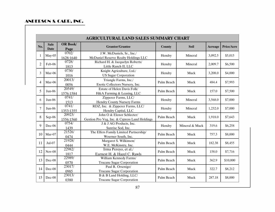
ANDERSON & CARR, INC.
No.Sale Date
OR Book/ Page
Grantor/Grantee County Soil Acreage Price/Acre
1 May-050702/
1628:1640J.W. McDaniels, Sr., Inc./
McDaniel Reserve Realty Holdings LLCHendry Mineral 3,092.5 $5,015
2 Feb-060728/ 1813
Richard H. & Jacquelyn Roberts/ Little Ranch II, LLC
Hendry Mineral 2,009.7 $6,500
3 Mar-060730/ 1016
Knight Agriculture, Ltd./ US Sugar Corporation
Hendry Muck 3,208.0 $4,000
4 Mar-0620013/ 0056
Triangle Farms, Inc./ Exotic Collectors Nursery, Inc.
Palm Beach Muck 484.4 $7,993
5 Jun-0620549/
1576:1584Estate of Helen Davis Folk/
H&A Farming & Leasing, LLCPalm Beach Muck 157.0 $7,500
6 Jun-060741/ 1513
Zipperer Farms, LLC/ Hendry County Nursery Farms
Hendry Mineral 3,568.0 $7,000
7 Jun-060741/
1353:1355RDZ, Inc. & Zipperer Farms, LLC/
Hendry Capital, LLCHendry Mineral 1,232.0 $7,000
8 Sep-0620923/
1556:1560John O & Elenor Schlecter/
Gestion Pro Veg, Inc. & Cypress Land HoldingsPalm Beach Muck 1,918.0 $7,643
9 Dec-060754/ 1439
J & J AG Products, Inc. Sunrise Sod, Inc.
Hendry Mineral & Muck 319.6 $6,258
10 Mar-0721526/ 0474
The Elfers Family Limited Partnership/ Woerner South, Inc.
Palm Beach Muck 757.3 $8,000
11 Jul-0721928/ 0444
Margaret S. Wilkinson/ W.E. McKinstry, Inc.
Palm Beach Muck 182.38 $8,455
12 Nov-0822982/ 1817
Irma Pereyo, et al./ Earnest H. & Hazel C. Rawls
Palm Beach Muck 158.0 $7,716
13 Dec-0822989/ 0570
William Kennedy Farms/ Trucane Sugar Corporation
Palm Beach Muck 362.9 $10,000
14 Dec-0823017/ 0985
Paul R. Orsenigo/ Trucane Sugar Corporation
Palm Beach Muck 322.7 $8,212
15 Dec-0823013/ 0380
B & B Land Holding, LLC/ Trucane Sugar Corporation
Palm Beach Muck 287.18 $8,000
AGRICULTURAL LAND SALES SUMMARY CHART
87
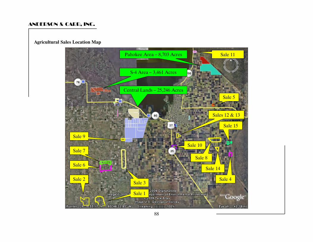
ANDERSON & CARR, INC.
Agricultural Sales Location Map
Pahokee Area – 8,703 Acres Sale 11
Central Lands – 25,246 Acres
S-4 Area – 3,461 Acres
Sale 5
Sale 1
Sale 4
Sale 8
Sale 2
Sale 10
Sale 3
Sale 9
Sale 6
Sale 7
Sale 14
Sale 15
Sales 12 & 13
88
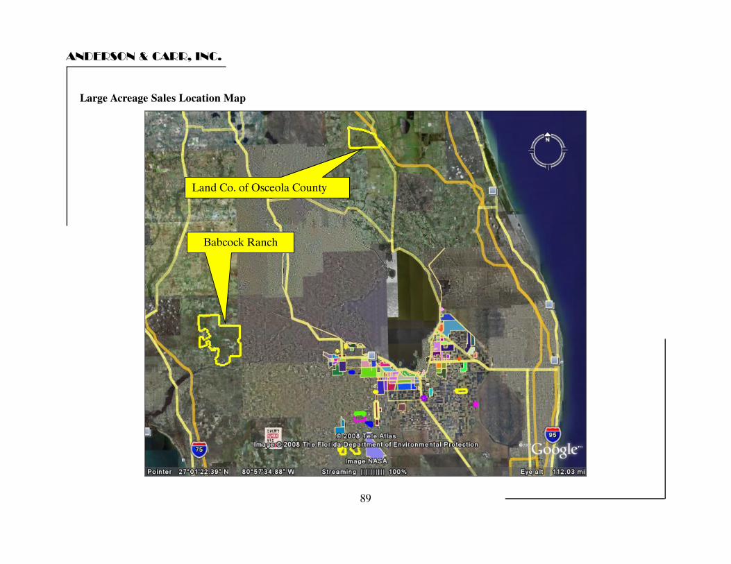
ANDERSON & CARR, INC.
89
Land Co. of Osceola County
Babcock Ranch
Large Acreage Sales Location Map
ANDERSON & CARR, INC.
90
Sales Analysis We reviewed a large number of sales throughout the region and have included the sales that best represented the market for muck land in the region. We also reviewed sales over a relatively long period of time to determine both time related changes in value and time related changes in the uses to which these land sales were being put by the buyers in this market. We observed a number of sales in the late 1990’s and into the very early 2000’s of muck land that were purchased for sugar cane production. The majority of these sales were in the $3,000 to $3,500 per acre range. We have considered them but have not included them in this analysis due to the age of the sales. In late 2005 and early 2006 we observed two sales into U.S. Sugar of sugar cane land that had previously been leased by the company. Those sales occurred in the $4,000 to $5,000 per acre range. We are informed that the company was willing to pay a premium for these lands to ensure that they would have a sufficient supply of sugar cane for their mill. This was coming at a time in the market when significant acreages of land were being taken out of sugar cane production. We also observed a single sale of prime warm land at $9,743 per acre to a user who planned to take the land out of cane production for use as a tree farm due to the ability to attain crop insurance in that location. We have included several of these older sales despite overall changes in market conditions due to the fact that the market price of sugar cane has stayed flat over the period. Due to the stable income for sugar cane usage, we have considered these older sales in our final analysis as a check of the reasonableness of the overall size adjustment. Many of the more recent sales of muck land have been in the $7,000 to $8,500 per acre price range to users who planned to take the land out of sugar cane production. However, we have observed four very recent sales of muck land that will stay in sugar production for the foreseeable future. Three of those sales were the up legs in 1031 exchanges resulting from an earlier land sale in Martin County. Two of the three sales were at or around $8,000 per acre and appear to be market oriented but a third sale transacted at $10,000 per acre and appears to have been influenced by the buyer’s need to defer tax.
ANDERSON & CARR, INC.
91
The warm land on the southeastern side of Lake Okeechobee has been particularly attractive to tree farmers who were able to take advantage of the rich soils while being able to afford insurance (or self insure) for their palm trees against freeze damage. One of the largest muck land sales involved a sale to a lettuce grower who planned to take the land out of sugar cane to grow lettuce under a specific contract to a grocery store chain. Late 2005 and very early 2006 also saw a flurry of sales to sod producers who were reacting to the boom in the local housing market. Many of those buyers are now unable to sell the sod due to both the downturn in the housing market and depressed prices of sod resulting from a glut of new sod producers. One of our recent sales (#15) is a sale out of sod and back into cane. In this analysis, we considered differences between the sales such as property rights sold, financing, conditions of sale, market conditions (trend or time adjustment), location, shape, and site/soil conditions. We also considered development potential differences. Because the sales vary in size and the data correlates well on a price per acre basis, we have based the comparisons on a standardized unit of measure, the price per acre. Following is a brief discussion of the sales and the elements of comparison with the subject property. In order to establish the effect of size on sales of land of this type we have looked at the issue from two perspectives. Due to the magnitude of the sugar industry within the EAA there appear to be large buyers with the financial ability to absorb tracts of this size if any of them were to come on the open market in a single block. However, for the comparatively small parcel sales utilized in this analysis, smaller size expanded the potential purchaser pool sufficiently that it created upward pressure on the sale price per acre. If the appraiser considers only the bottom half of the previous table (the most recent sales) there is a clear trend of $8,000 per acre before consideration of size. Following discussion of the individual adjustments to the available sales there will be a separate discussion of a size adjustment to account for each of the three individual subject sizes.
ANDERSON & CARR, INC.
92
Sale 1 is the May 2005 sale of 3,092.47 acres within a 21,000 acre ranch at $5,015 per acre. At one time the entire 21,000 acres was under contract but no further take downs have occurred and the transaction is reportedly in litigation. This sale involves mineral soil land located just west of Southern Citrus in Hendry County. Downward adjustment is made for conditions of sale. It was a somewhat speculative investment associated with the possibility of Class 3 gambling within the Seminole Indian Reservation located to the south. The buyer purchased the property in anticipation of a need for housing for non native Indians who would be potentially working in the casino if it were approved. Upward adjustment is made for inferior mineral soils. The net adjustment to the $5,015 per acre indication of value is minimal. This sale is considered to set the lower limit of value for the non size adjusted values. Due to the age of this sale we place minimal consideration on it for determining a standard price per acre for the subject lands. Sale 2 is the February 2006 sale of a 2,009.7 acre site at $6,500 per acre. The parcel originally went under contract based on an option at $4,000 per acre. This was at the height of the housing boom and the option was sold to another party who put it under contract and then sold their contract for a $2,500 per acre transfer fee. Downward adjustment is made for superior market conditions at the time of the sale. Additional downward adjustment is made for possible alternative use of ranchettes with attractive native habitat. Upward adjustment is made for inferior soils. The net adjustment to the $6,500 per acre sale price is upward. In the following section we will discuss the effect of size on the price per acre as compared with the subject 8,703 acres
ANDERSON & CARR, INC.
93
Sale 3 at $4,000 per acre involves 3,208 acres of sugar cane land on the west side of Bloomberg Road that was purchased by US Sugar in March of 2006 at $4,001 per acre. Bloomberg Road is the dividing line between the rich highly productive muck soils to the east and the more mineral soils to the west. US Sugar had been leasing the land at $200 per acre per year with a first right of refusal. There were reportedly three to four years remaining on their lease but the seller wanted to cash out. At the time, US Sugar was anticipating the completion of its expanded mill and refinery complex and they wanted to lock in a dependable supply of sugar cane. Downward adjustment is made for conditions of sale (buyer motivation). Additional downward adjustment is made for declining market conditions. Strong upward adjustment is made for inferior soil quality as compared to the soil quality within the Pahokee area parcel. Due primarily to the very good quality of the soils within the Pahokee area parcel, the net adjustment to the $4,000 per acre indication of value is upward. Sale 4 is the March 2006 sale of 484.40 acres of land at a price of $7,993 per acre. The buyer was reportedly somewhat uninformed and attempted to subdivide the land into twenty acre parcels for resale at $13,000 per acre. A couple of parcels sold in the $10,200 per acre range but there has been a very limited market for the lots. Additionally, the land reportedly suffers from seepage from the adjacent Arthur Marshal Loxahatchee National Wildlife Refuge. Downward adjustment is made for declining market conditions since the time of the sale. Due to seepage problems, we have made an upward adjustment for property condition. Upward adjustment is made for lack of paved road frontage. The net adjustment to the $8,000 +/- per acre indication of value is minimal before consideration of size. Sale 5 is the June 2006 sale of 157 acres of good quality sugar cane land to the adjacent property owner at a price of $7,501 per acre. Downward adjustment is made for conditions of sale. The primary motivation of the buyer was for assemblage. The addition of this parcel into his existing holdings allowed the grantee to control approximately 320 acres of land with frontage on State Road 80. A downward adjustment is also made for time. Upward adjustment is made for the lack of paved road frontage. The net adjustment to the $7,501 per acre indication of value is minimal before consideration of size.
ANDERSON & CARR, INC.
94
Sale 6 is the June 2006 sale of a 3,568 acre parcel of agricultural land at $7,000 per acre. The grantee is known as Costa Nursery which is a large nursery operation out of Dade County. They were looking to lessen their hurricane risk by being in an area away from the coast. The site is highly improved for row crops with approximately 16% of the site in citrus. Downward adjustment is made for superior market conditions due to the fact that the contract had been negotiated one year before at the height of the market. Upward adjustment is made for inferior soils. The net adjustment is upward before consideration of size. Sale 7 is located immediately north of the previous sale (Sale 6) and the two sales are related. It sold on the same day in June 2006 and involved a 1,232 acre parcel of agricultural land also at $7,000 per acre. The site is highly improved for row crops. Downward adjustment is made for superior market conditions at the time of the sale due to the fact that the contract had been negotiated one year before at the height of the market. Upward adjustment is made for inferior soils. The net adjustment is upward before consideration of size. Sale 8 is the September 2006 sale of a 1,918.04 acre parcel of muck land in sugar cane production at a price of $7,643 per acre. The buyer had been leasing land from US Sugar and they were losing it. They needed the land to grow lettuce associated with a contract to supply lettuce for a grocery chain. If they failed to satisfy their contractual agreement they faced loss of the contract and potential breach of contract costs. Downward adjustment is indicated for condition of sale. Additional downward adjustment is made for superior market conditions at the time of the sale. The combined adjustment to the $7,643 per acre indication of value for the subject is downward prior to a size adjustment. Sale 9 is the sale of 319.6 acre muck and mineral soil parcel bought for sod production at a price of $6,258 per acre. Downward adjustment is made for superior market conditions at the time of the sale. The market changed before the buyer could even get the sod production plan into operation. Upward adjustment is made for inferior average soil quality as compared to the subject agricultural lands. It was not considered a good piece of land as it had shallow muck in the east and mineral soils in the west. The net adjustment to the $6,258 per acre indication of value is upward before size adjustment.
ANDERSON & CARR, INC.
95
Sale 10 is the relatively recent March 2007 sale of a 757.3 acre parcel of muck land at a price of $8,000 per acre. The site had historically been used for sod production and downward adjustment is indicated for the superior laser leveled condition of the parcel. Following downward adjustment for laser leveled condition, this sale appears support a determination of $8,000 per acre for the subject site before adjustment for size. Sale 11 is the July 2007 sale of a 182.38 acre parcel of muck land at $8,455 per acre. The seller was reaching the end of her life and the transaction was intended be associated with estate planning. The grantee had been a long time tenant on the property. Downward adjustment is made for financing. The seller took back a $1,350,000 purchase money mortgage which allowed the buyer to purchase the site for only $192,000 in cash which equates to a 12.45% cash down payment. Downward adjustment is made for its location along the eastern side of Lake Okeechobee within the very desirable warm land area. The combined adjustment to the $8,455 per acre indication of value is downward (before size adjustment). Sale 12 is the very recent December 2008 sale of a 158 acre tract of muck land at a price of $7,716 per acre. The grantee purchased the tract subject to an existing lease at $250.00 per acre per year and in March 2009 re-leased the tract to the same tenant for six years at $250.00 per acre per year flat for the term. The tenant pays all real estate taxes and insurance. This indicates an overall rate of return for the transaction of 3.24%. This sale is considered supportive of a determination of $8,000 for the subject sites prior to adjustment for size. Sale 13 is next door and to the west of the previous sale. It sold the same month to Trucane Sugar for a price of $10,000 per acre. Downward adjustment is made for conditions of sale. The grantee needed to reinvest 1030 exchange funds in order to defer taxation on the sale of a parcel in Martin County. This sale is reflective of the very upper end of the market for muck land in this area. Sale 14 is also a December 2008 purchase by Trucane Sugar of muck land for sugar cane production at a price of $8,212 per acre. Although the buyer was under the same 1031 exchange motivation, the sales price does not reflect that a premium was paid and no adjustment is made. This sale is considered supportive of a determination of $8,000 per acre for the subject site prior to an adjustment for size.
ANDERSON & CARR, INC.
96
Sale 15 is the final December 2008 purchase by Trucane Sugar of muck land for sugar cane production at a price of $8,000 per acre. Although the buyer was under the same 1031 exchange motivation, the sales price does not reflect that a premium was paid and, therefore, no adjustment is made. Upward adjustment is made for lack of paved road frontage. Counter balancing downward adjustment is made for leveling for the former sod use. A 60 acre portion of the tract remains leased to the seller at a price of $500.00 per acre for use as a sod farm. The net adjustment to the $8,000 per acre indication of value is minimal. This sale is also considered supportive of a determination of $8,000 per acre for the subject tract prior to adjustment for size. Size Adjustment The subject parcels include a 3,461 acre tract, an 8,703 acre tract and a 25,246 acre tract. The 3,461 acre parcel is well within the range of observed sizes and we see no indication of a needed size adjustment for this parcel. The 8,703 acre parcel and the 25,246 acre parcel are, respectively, from approximately two and one half to eight times the size of the largest available comparable muck land sales observed in this analysis. Clearly size is the largest factor to consider in this analysis due to the limited potential pool of investors with the financial backing to acquire parcels of this size. The largest land sale observed by the appraisers occurred in Charlotte and Lee Counties just southwest of the subject in July of 2006. The Babcock Family sold the C Corporation which owned a 91,361 acre parcel to Kitson at an undisclosed price in early 2005. After months of negotiations with the state of Florida, Kitson agreed to sell 73,239.17 acres at $350,000,000 or $4,779 per acre to the State of Florida (OR Book 3011, Page 2078). Kitson retained the balance of the original parcel for future development. This is the only governmental sale used in this analysis. We have analyzed the sale to determine whether or not the government involvement had any effect on the sale price. All indications are that the governmental involvement did not affect sales price and we therefore included it in our analysis. One of the factors that lead us to this determination is that the sale had a very similar sale price per acre as compared with a 27,410 acre sale (presented next) at a price of $5,000 per acre. The site had environmentally sensitive areas of swampland with counterbalancing scenic beauty which affords an alternate highest and best use of ranchette development.
ANDERSON & CARR, INC.
97
To show the lack of effect from governmental influence we also considered the August 2005 sale of a 27,410 acre parcel (OR Book 2869, Page 661) in Osceola and Indian River Counties at $5,000 per acre. The site is pasture and citrus with extensive frontage on both State Road 60 and Florida’s Turnpike. It was purchased for the development of a new planned city with as many as 100,000 residents. Downward adjustment is made for time. This transaction occurred at the peak of the housing boom and development has been stalled to the current date. However, downward adjustment is considered necessary for superior future development potential. Upward adjustment is made for inferior mineral soils. The net adjustment to the $5,000 per acre indication of value is minimal. These two large acreage mineral soil sales indicate a base price of approximately $5,000 per acre. The sites had future development potential as rural ranchettes but limited usefulness as agricultural uses due to their mineral soils. As such, they are not directly comparable to the subject. To show the effect the large size of these sales had on the $5,000 per acre +/- sale price we have considered recent smaller acreage sales in Hendry and Lee Counties to compare them to the very large sales to determine the influence of size. Sales 6 & 7 in our analysis are mineral soils in Hendry County that occurred within a month of the Babcock sale at $7,000 per acre. Before any consideration of site conditions, these sales involving 3,568 and 1,232 acres respectively indicate a discount of 29% for size for the 73,239 acre Babcock sale. We observed a sale that occurred over the period September 2007 to February 2008 in Hendry County to S Ranch Properties in three deeds (775/513, 777/892, and 782/217) involving 1,047.53 acres at a price of $10,288 per acre. It is a mineral soil parcel located two miles west of CR 833 that was purchased for investment, mitigation for wetlands and Panther Habitat. Comparing this sale to the $4,779 per acre Babcock Ranch Sale indicates a size adjustment of 53.55%. However, there was an inflationary period in the time between the Badcock sale and the S Ranch Properties sale so the indicated adjustment would be somewhat less than the indicated 50% +/-. Finally, the older sale (our Sale 1) of the McDaniels Ranch Property at $5,015 per acre indicates minimal size adjustment. However, again the effect of time may be a factor in this case. Based on this information, the range of indicated discounts would be from zero to 50% if any portion of the subject were as large as the 73,239 acre Badcock sale.

ANDERSON & CARR, INC.
98
For the S-4 area parcel containing 3,461 acres we see no indication of the need for a discount for size. For the Pahokee area parcel containing 8,703 acres, size may be a factor. It is a very desirable parcel of land with very good muck soils that is situated in a position to potentially benefit from warming winds from across Lake Okeechobee. Additionally, it is adjacent to lands owned by Florida Crystals. It is possible that Florida Crystals would have an interest in this site for assemblage into its existing holdings. Alternatively, Florida Crystals would have an interest in merely assuring that a competing grower did not acquire the property. We have been informed by brokers active in the EAA that there is a pool of active investors with the financial ability to acquire a parcel of this size. It was noted in our sale 12 (158 acres at $7,716/acre) that the land was leased at $250 per acre per year and was subsequently re-leased at $250/acre per year. This indicates a return of approximately 3.24% per year (before consideration of future reversion). This is in excess of current money market rates and reflects a reasonable savings vehicle for a cash investor. For these reasons, we have applied no discount for size to the 8,703 acres within the Pahokee area parcel. For the Central Agricultural Lands containing 25,246 acres size is a factor. The pool of potential buyers is so small that the site would likely have an increased marketing period or some discount in price would be required. We anticipate that the market would require a discount of from $1,000 to $2,000 per acre for a site of this size. Based on the value indication of $8,000 for the 3,461 acre S-4 parcel and the 8,703 acre Pahokee area parcel, a discount of $1,000 per acre would reflect a discount of 12.5% while a discount of $2,000 per acre would reflect a discount of 25%. A discount of this magnitude would be less than the indicated 29% discount shown in the much larger 73,239 acre Badcock sale which is reasonable. In order to account for the effect of size on the market value of the 25,246 acre Central Agricultural lands parcel we have applied a $1,500 per acre (18.75%) discount to attain a value per acre of $6,500.
ANDERSON & CARR, INC.
99
Conclusion In our sales comparison analysis we have considered not only the physical characteristics such as soil make up and quality but also the conditions of sale including motivations of the buyer. The most important items to consider are size and the highest and best use of the subject which is continued agricultural use. Taking into consideration the data and analysis, it is concluded that the market reflects market values for the subject property as of May 1, 2009 as shown below. 3,461 Acres “S-4 Area” SFWMD Identification SC200-001 3,416 Acres @ $8,000/Acre = $27,328,000 Rounded to: $27,500,000 25,246 Acres “Central Agricultural Lands” SFWMD Identification: SC200-003 SC200-004 SC200-007 25,246 Acres @ $6,500/Acre = $164,099,000 Rounded to: $164,000,000 8,703 Acres “Pahokee Area” SFWMD Identification: SC200-008 8,703 Acres @ $8,000/Acre = $69,624,000 Rounded to: $69,500,000
ANDERSON & CARR, INC.
100
COMMUNITY REQUEST LANDS The Community Request Lands are spread throughout the communities of South Bay, Belle Glade, and Pahokee, in Palm Beach County and Clewiston, in Hendry County. For the purposes of this analysis we grouped the properties based on their location, similarity of use and possible future use. This has led us to divide the Community Request Lands valuation into two components, the Palm Beach County lands and the Clewiston area lands. The sales comparison approach was utilized to value both sets of lands. A search of the official records of the several counties that make up the Everglades Agricultural Area, local multiple listing service records, discussions with local brokers and appraisers, a personal inspection of the subject locale, and searches through various other “on-line” real estate data sites produced numerous agricultural and transitional land sales for comparison with the subject property. The sales comparison approach is the preferred method for valuing land when comparable sales are available. In this approach, similar parcels of land are analyzed and compared to the subject property with appropriate adjustments made to indicate the value of the subject. In some cases an appraiser will analyze each value characteristic of a transaction such as location, size, title transferred, zoning etc. and apply appropriate percentage or dollar amount adjustments to each aspect of each sale in order to derive an indicated value for the subject. This is a quantitative or mathematical process. However, in this case, because of the imperfections in the market and the inability to accurately quantify specific percentage or dollar amount adjustments, a qualitative method is considered a more realistic way to analyze the data. Applying this method, the appraiser takes into account all aspects of each transaction and property as they relate to the subject in order to determine if the indicated price per acre is reflective of a superior or inferior property compared to the subject property. We then reconciled the comparables' value indications to reach a final land value indication for the subject.
ANDERSON & CARR, INC.
101
PALM BEACH COUNTY COMMUNITY REQUEST LANDS
ANDERSON & CARR, INC.
102
PALM BEACH COUNTY COMMUNITY REQUEST LANDS The Community Request Lands in Palm Beach County total roughly 1,649.49 acres. They are all large tracts of muck soil land that are currently in agricultural production with sugarcane. These tracts all have one or more desirable features that may lend themselves to these properties transitioning out of agricultural production at some time in the future. These features are extensive highway frontage and proximity to existing development. The properties lie in what would be considered the logical path of growth. That said, these are small slow growing communities that are highly dependent on agriculture for jobs. It is most likely that the Community Request Lands in these communities will remain in agricultural production into the foreseeable future. Hence, it was deemed most reasonable to value these properties based on their current utilization rather than in comparison to properties which are in the process of transition or are expected to have a shorter time horizon to transition. We have utilized the most similar agricultural sales in the area to value these lands. Some consideration was given to their future transition potential. In valuing the this portion of the subject we have focused our search on sales of lands within the Palm beach County portion of the EAA that exhibit similar muck soil characteristics to the subject. We were able to locate number of them and believe they are the best indicators of value for this portion of the subject property. A summary of the land sales utilized to value the Palm Beach County Community Request Lands is presented in the following table. Complete details on each sale, including a copy of the warranty deed is presented in the addenda of this report. Following the table the sales are discussed and a value per acre for the Palm Beach County Community Request Lands portion of the subject is concluded.
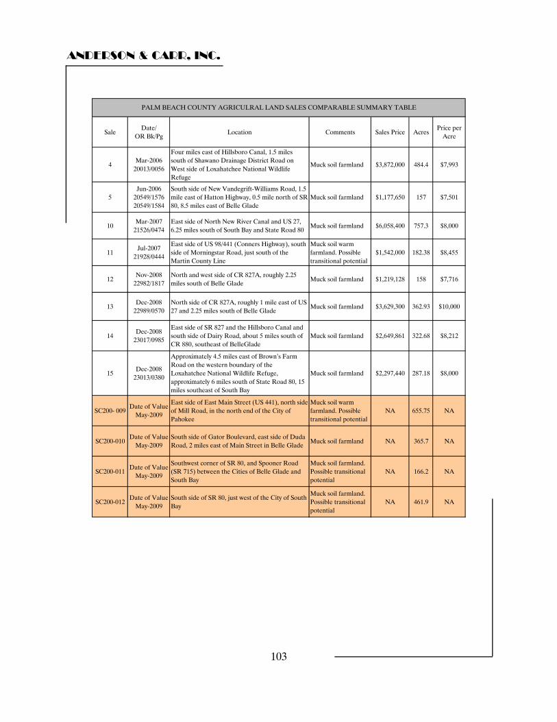
ANDERSON & CARR, INC.
103
SaleDate/
OR Bk/PgLocation Comments Sales Price Acres
Price per Acre
4Mar-2006
20013/0056
Four miles east of Hillsboro Canal, 1.5 miles south of Shawano Drainage District Road on West side of Loxahatchee National Wildlife Refuge
Muck soil farmland $3,872,000 484.4 $7,993
5Jun-2006
20549/157620549/1584
South side of New Vandegrift-Williams Road, 1.5 mile east of Hatton Highway, 0.5 mile north of SR 80, 8.5 miles east of Belle Glade
Muck soil farmland $1,177,650 157 $7,501
10Mar-2007
21526/0474East side of North New River Canal and US 27, 6.25 miles south of South Bay and State Road 80
Muck soil farmland $6,058,400 757.3 $8,000
11Jul-2007
21928/0444
East side of US 98/441 (Conners Highway), south side of Morningstar Road, just south of the
Muck soil warm farmland. Possible $1,542,000 182.38 $8,455
Martin County Line transitional potential
12Nov-2008
22982/1817North and west side of CR 827A, roughly 2.25 miles south of Belle Glade
Muck soil farmland $1,219,128 158 $7,716
13Dec-2008
22989/0570North side of CR 827A, roughly 1 mile east of US 27 and 2.25 miles south of Belle Glade
Muck soil farmland $3,629,300 362.93 $10,000
14Dec-2008
23017/0985
East side of SR 827 and the Hillsboro Canal and south side of Dairy Road, about 5 miles south of CR 880, southeast of BelleGlade
Muck soil farmland $2,649,861 322.68 $8,212
15Dec-2008
23013/0380
Approximately 4.5 miles east of Brown’s Farm Road on the western boundary of the Loxahatchee National Wildlife Refuge, approximately 6 miles south of State Road 80, 15 miles southeast of South Bay
Muck soil farmland $2,297,440 287.18 $8,000
SC200- 009Date of Value
May-2009
East side of East Main Street (US 441), north side of Mill Road, in the north end of the City of Pahokee
Muck soil warm farmland. Possible transitional potential
NA 655.75 NA
SC200-010Date of Value
May-2009South side of Gator Boulevard, east side of Duda Road, 2 miles east of Main Street in Belle Glade
Muck soil farmland NA 365.7 NA
SC200-011Date of Value
May-2009
Southwest corner of SR 80, and Spooner Road (SR 715) between the Cities of Belle Glade and South Bay
Muck soil farmland. Possible transitional potential
NA 166.2 NA
SC200-012Date of Value
May-2009South side of SR 80, just west of the City of South Bay
Muck soil farmland. Possible transitional potential
NA 461.9 NA
PALM BEACH COUNTY AGRICULRAL LAND SALES COMPARABLE SUMMARY TABLE

ANDERSON & CARR, INC.
104
SUBJECT AND SALES LOCATION MAP
ANDERSON & CARR, INC.
105
Sales Discussion We have utilized the data set of sales presented in the previous valuation of the large agricultural parcels and have selected the individual sales most suitable for valuing this component of the subject property. Refer to the agricultural sales addendum for full discussions and warranty deed associated with each of these sales. In this analysis, we considered differences between properties in the area such as property rights sold, financing, conditions of sale, market conditions (trend or time adjustment), location, size, shape, and zoning/future land use designation considerations. Because the sales vary in size and the data correlates well on a price per acre basis, we have based the comparisons on a standardized unit of measure, the price per acre. Following is a brief discussion of the sales and the elements of comparison with the subject property. Sale 4 is the March 2006 sale of 484.40 acres of land at a price of $7,993 per acre. The buyer was reportedly somewhat uninformed and attempted to subdivide the land into twenty acre parcels for resale at $13,000 per acre. A couple of parcels sold in the $10,200 per acre range but there has been a very limited market for the lots. Additionally, the land reportedly suffers from seepage from the adjacent Arthur Marshal Loxahatchee National Wildlife Refuge. Downward adjustment is made for declining market conditions since the time of the sale. Due to seepage problems, we have made an upward adjustment for property condition. Upward adjustment is made for lack of paved road frontage. The net adjustment to the $8,000 +/- per acre indication of value is minimal. Sale 5 is the June 2006 sale of 157 acres of good quality sugar cane land to the adjacent property owner at a price of $7,501 per acre. Downward adjustment is made for conditions of sale. The primary motivation of the buyer was for assemblage. The addition of this parcel into his existing holdings allowed the grantee to control approximately 320 acres of land with frontage on State Road 80. A downward adjustment is also made for time. Upward adjustment is made for the lack of paved road frontage. The net adjustment to the $7,501 per acre indication of value is minimal.
ANDERSON & CARR, INC.
106
Sale 10 is the relatively recent March 2007 sale of a 757.3 acre parcel of muck land at a price of $8,000 per acre. The site had historically been used for sod production and downward adjustment is indicated for the superior laser leveled condition of the parcel. Following downward adjustment for laser leveled condition, this sale appears to support a determination of $8,000 per acre for the subject sites. Sale 11 is the July 2007 sale of a 182.38 acre parcel of muck land at $8,455 per acre. The seller was reaching the end of her life and the transaction was associated with estate planning. The grantee had been a long time tenant on the property. Downward adjustment is made for financing. The seller took back a $1,350,000 purchase money mortgage which allowed the buyer to purchase the site for only $192,000 in cash which equates to a 12.45% cash down payment. Downward adjustment is made for its location along the eastern side of Lake Okeechobee within the very desirable warm land area. The combined adjustment to the $8,455 per acre indication of value is downward. Sale 12 is the very recent December 2008 sale of a 158 acre tract of muck land at a price of $7,716 per acre. The grantee purchased the tract subject to an existing lease at $250.00 per acre per year and in March 2009 re-leased the tract to the same tenant for six years at $250.00 per acre per year flat for the term. The tenant pays all real estate taxes and insurance. This indicates an overall rate of return for the transaction of 3.24%. This sale is considered supportive of a determination of $8,000 for the subject sites. Sale 13 is next door and to the west of the previous sale. It sold the same month to Trucane Sugar for a price of $10,000 per acre. Downward adjustment is made for conditions of sale. The grantee needed to reinvest 1030 exchange funds in order to defer taxation on the sale of a parcel in Martin County. This sale is reflective of the very upper end of the market for muck land in this area. Sale 14 is also a December 2008 purchase by Trucane Sugar of muck land for sugar cane production at a price of $8,212 per acre. Although the buyer was under the same 1031 exchange motivation, the sales price does not reflect that a premium was paid and no adjustment is made. This sale is considered supportive of a determination of $8,000 per acre for the subject site.
ANDERSON & CARR, INC.
107
Sale 15 is the final December 2008 purchase by Trucane Sugar of muck land for sugar cane production at a price of $8,000 per acre. Although the buyer was under the same 1031 exchange motivation, the sales price does not reflect that a premium was paid and, therefore, no adjustment is made. Upward adjustment is made for lack of paved road frontage. Counter balancing downward adjustment is made for leveling for the former sod use. A 60 acre portion of the tract remains leased to the seller at a price of $500.00 per acre for use as a sod farm. The net adjustment to the $8,000 per acre indication of value is minimal. This sale is also considered supportive of a determination of $8,000 per acre for the subject tract. Conclusion Although the subject parcels are split into three non contiguous parcels the combined size of 1,649.49 acres is well within the range of sizes observed in our due diligence. Therefore we have valued this as a single parcel which would be sold to a single buyer in a single transaction. The sales range in price from $7,501 up to $10,000 per acre of land area. Given the preceding discussion of the comparables in relation to the subject properties they indicate support for a value in the range of $8,000 to $10,000 per acre. The majority of the sales point to the lower end of the range, and the upper end did involve a 1031 exchange, which put a time constraint on the buyers purchase decision. Overall the most significant factors in the analysis are the locational qualities. Compared with the sales, all else being equal, the subject properties SC200-009, SC200-0011, and SC200-12 are more desirable due to their highway frontages and/or warm land locations. We conclude that these parcels warrant a premium to the $8,000 per acre strongly indicated by the comparables. Hence, we have concluded a value, as of May 1, 2009, of $9,000 per acre for these parcels and $8,000 per acre for SC200-10, which has neither road frontage or a warm land location. SC200-009: 655.75 acres @ $9,000 per acre = $5,901,750 SC200-0010: 365.68 acres @ $8,000 per acre = $2,925,440 SC200-011: 166.18 acres @ $9,000 per acre = $1,495,620 SC200-012: 461.88 acres @ $9,000 per acre = $4,156,920 1649.49 acres $14,479,730 Rounded to: Estimated Market Value $14,500,000
ANDERSON & CARR, INC.
108
HENDRY COUNTY COMMUNITY REQUESTS
AGRICULTURAL
ANDERSON & CARR, INC.
109
HENDRY COUNTY COMMUNITY REQUESTS AGRICULTURAL We have been asked to value a 309.81 acre tract of land that is a part of the Communities Request Land south of the city of Clewiston. It is identified as: SC200 SFWMD Identification: SC200-001 This parcel is a long narrow strip of mineral soil land located west of Bloomfield Road adjacent to and west of the city of Clewiston’s water treatment plant We began our analysis considering the subject sites as vacant and available for development to their highest and best use. As was discussed in the Highest and Best Use section of this report, this subject site has a highest and best use of continued agricultural use. A search of the official records of the several counties that make up the Everglades Agricultural Area, local multiple listing service records, discussions with local brokers and appraisers, a personal inspection of the subject locale, and searches through various other “on-line” real estate data sites produced numerous land sales for comparison with the subject property. The sales comparison approach is the preferred method for valuing land when comparable sales are available. In this approach, similar parcels of land are analyzed and compared to the subject property with appropriate adjustments made to indicate the value of the subject. Typically, an appraiser will analyze each value characteristic of a transaction such as location, soil quality, size, title transferred, etc. and apply appropriate adjustments to each aspect of each sale in order to derive an indicated value for the subject. This is a quantitative or mathematical process. However, in this case, because of the imperfections in the market and the inability to accurately quantify specific percentage or dollar amount adjustments, a qualitative method is considered a more realistic way to analyze the data. Applying this method, the appraiser takes into account all aspects of each transaction and property as they relate to the subject in order to determine if the indicated price per acre is reflective of a superior or inferior property compared to the subject property We then reconciled the comparables' value indications to reach a final land value indication for the subject. A summary of the land sales utilized to support the value conclusion of the agricultural land is presented on the following page. Complete details on each sale including a copy of the warranty deed is presented in the addenda of this report.
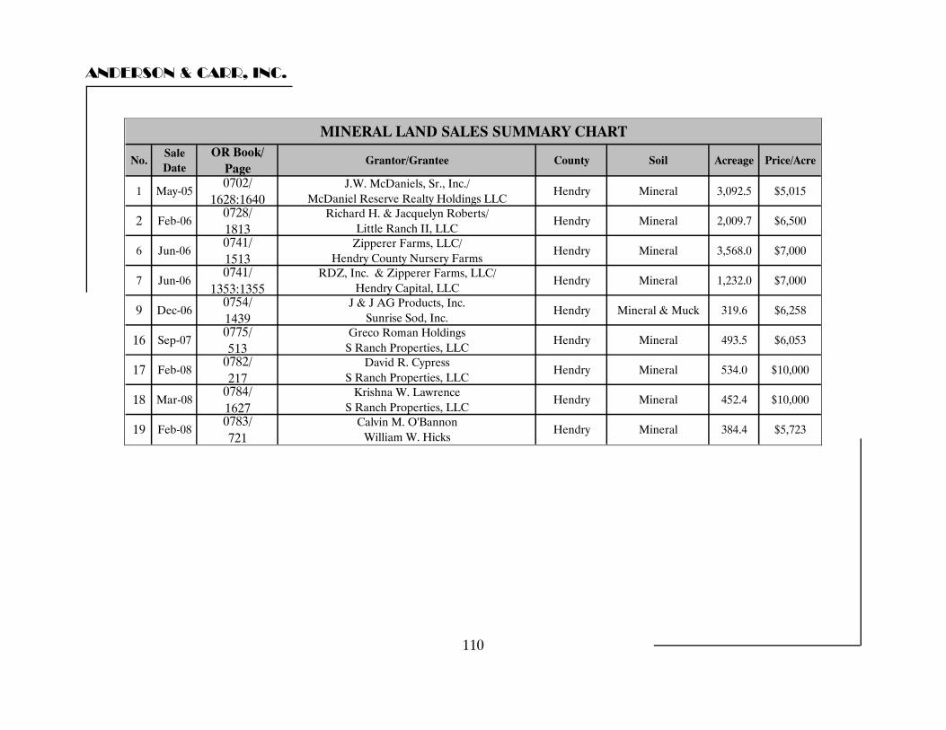
ANDERSON & CARR, INC.
No.Sale Date
OR Book/ Page
Grantor/Grantee County Soil Acreage Price/Acre
1 May-050702/
1628:1640J.W. McDaniels, Sr., Inc./
McDaniel Reserve Realty Holdings LLCHendry Mineral 3,092.5 $5,015
2 Feb-060728/ 1813
Richard H. & Jacquelyn Roberts/ Little Ranch II, LLC
Hendry Mineral 2,009.7 $6,500
6 Jun-060741/ 1513
Zipperer Farms, LLC/ Hendry County Nursery Farms
Hendry Mineral 3,568.0 $7,000
7 Jun-060741/
1353:1355RDZ, Inc. & Zipperer Farms, LLC/
Hendry Capital, LLCHendry Mineral 1,232.0 $7,000
9 Dec-060754/ 1439
J & J AG Products, Inc. Sunrise Sod, Inc.
Hendry Mineral & Muck 319.6 $6,258
16 Sep-070775/ 513
Greco Roman Holdings S Ranch Properties, LLC
Hendry Mineral 493.5 $6,053
17 Feb-080782/ 217
David R. Cypress S Ranch Properties, LLC
Hendry Mineral 534.0 $10,000
18 Mar-080784/ 1627
Krishna W. Lawrence S Ranch Properties, LLC
Hendry Mineral 452.4 $10,000
19 Feb-080783/ 721
Calvin M. O'Bannon William W. Hicks
Hendry Mineral 384.4 $5,723
MINERAL LAND SALES SUMMARY CHART
110

ANDERSON & CARR, INC.
111
Sale 2
Hendry County Community Request
Agricultural 309.81 Acres
Sale 6
Sale 7
Sales 16, 17, & 18
Sale 19
Sale 1
Sale 9
Mineral Soil Sales Location Map
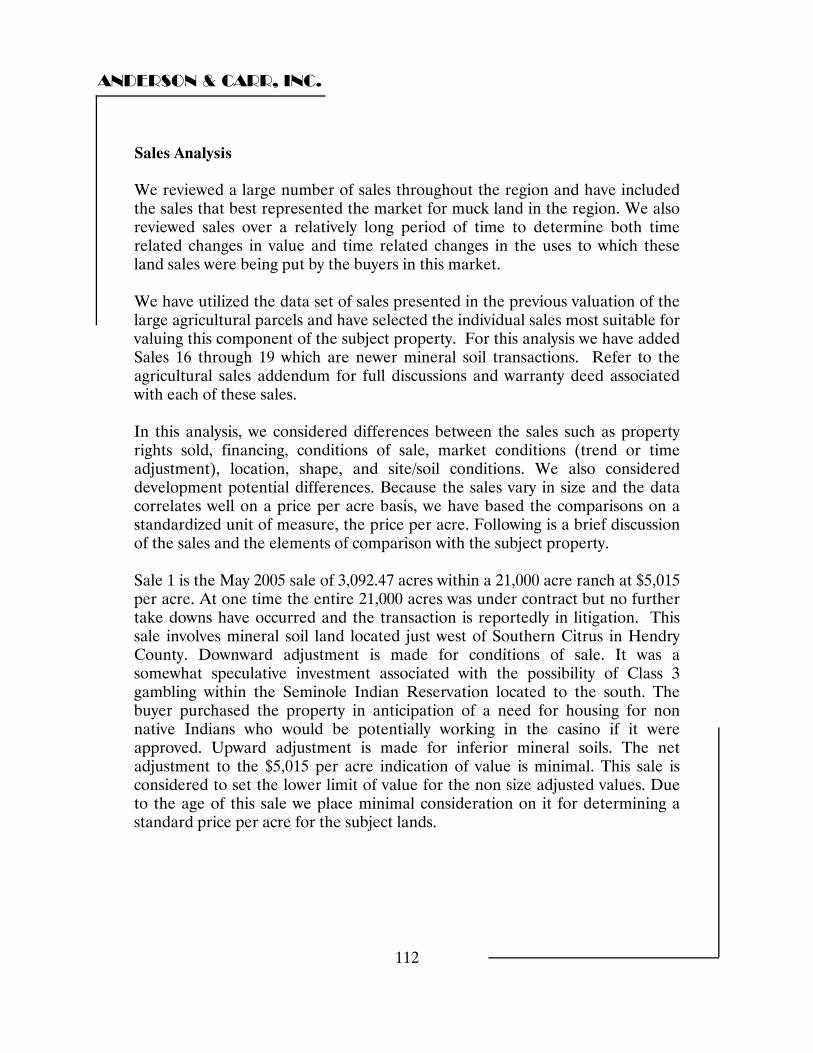
ANDERSON & CARR, INC.
112
Sales Analysis We reviewed a large number of sales throughout the region and have included the sales that best represented the market for muck land in the region. We also reviewed sales over a relatively long period of time to determine both time related changes in value and time related changes in the uses to which these land sales were being put by the buyers in this market. We have utilized the data set of sales presented in the previous valuation of the large agricultural parcels and have selected the individual sales most suitable for valuing this component of the subject property. For this analysis we have added Sales 16 through 19 which are newer mineral soil transactions. Refer to the agricultural sales addendum for full discussions and warranty deed associated with each of these sales. In this analysis, we considered differences between the sales such as property rights sold, financing, conditions of sale, market conditions (trend or time adjustment), location, shape, and site/soil conditions. We also considered development potential differences. Because the sales vary in size and the data correlates well on a price per acre basis, we have based the comparisons on a standardized unit of measure, the price per acre. Following is a brief discussion of the sales and the elements of comparison with the subject property. Sale 1 is the May 2005 sale of 3,092.47 acres within a 21,000 acre ranch at $5,015 per acre. At one time the entire 21,000 acres was under contract but no further take downs have occurred and the transaction is reportedly in litigation. This sale involves mineral soil land located just west of Southern Citrus in Hendry County. Downward adjustment is made for conditions of sale. It was a somewhat speculative investment associated with the possibility of Class 3 gambling within the Seminole Indian Reservation located to the south. The buyer purchased the property in anticipation of a need for housing for non native Indians who would be potentially working in the casino if it were approved. Upward adjustment is made for inferior mineral soils. The net adjustment to the $5,015 per acre indication of value is minimal. This sale is considered to set the lower limit of value for the non size adjusted values. Due to the age of this sale we place minimal consideration on it for determining a standard price per acre for the subject lands.
ANDERSON & CARR, INC.
113
Sale 2 is the February 2006 sale of a 2,009.7 acre site at $6,500 per acre. The parcel originally went under contract based on an option at $4,000 per acre. This was at the height of the housing boom and the option was sold to another party who put it under contract and then sold their contract for a $2,500 per acre transfer fee. Downward adjustment is made for superior market conditions at the time of the sale. Upward adjustment is made for a more remote location. The net adjustment to the $6,500 per acre sale price is minimal. Sale 6 is the June 2006 sale of a 3,568 acre parcel of agricultural land at $7,000 per acre. The grantee is known as Costa Nursery which is a large nursery operation out of Dade County. They were looking to lessen their hurricane risk by being in an area away from the coast. The site is highly improved for row crops with approximately 16% of the site in citrus. Downward adjustment is made for superior market conditions due to the fact that the contract had been negotiated one year before at the height of the market. This sale is considered supportive of a determination of $6,500 per acre for the subject site. Sale 7 is located immediately north of the previous sale (Sale 6) and the two sales are related. It sold on the same day in June 2006 and involved a 1,232 acre parcel of agricultural land also at $7,000 per acre. The site is highly improved for row crops. Downward adjustment is made for superior market conditions at the time of the sale due to the fact that the contract had been negotiated one year before at the height of the market. This sale is considered supportive of a determination of $6,500 per acre for the subject site. Sale 9 is the sale of 319.6 acre muck and mineral soil parcel bought for sod production at a price of $6,258 per acre. Downward adjustment is made for superior market conditions at the time of the sale. Sales 16, 17, & 18 are related sales all of which involved the same buyer. The first transaction involved improved pasture that sold in September of 2007 for $6,053. Two subsequent purchases of 534 and 452 acre parcels at $10,000 per acre brought the total assemblage to 1,480 acres. Sale 16 was improved pasture and requires upward adjustment for remote location. Sale 17 & 18 require overall downward adjustment due to its native habitat that will allow the owner to sell panther credits. Sale 19 involves 384.4 acres of pasture that sold in February 2008 for $5,723 per acre. Upward adjustment is made for location.
ANDERSON & CARR, INC.
114
Conclusion Given the preceding discussion of the comparables in relation to the subject property they indicate support for a value in the range of $6,500 per acre. SC200-013: 309.81 acres @ $6,500 per acre = $2,013,765 Rounded to: Estimated Market Value $2,000,000
ANDERSON & CARR, INC.
115
HENDRY COUNTY COMMUNITY REQUESTS
TRANSITIONAL
ANDERSON & CARR, INC.
116
HENDRY COUNTY COMMUNITY REQUEST LANDS The transitional lands, which total roughly 671.76 acres, have various zoning designations ranging from residential to commercial to industrial. In the future land use element of the Towns’ comprehensive plan, much of this land (located on the western edge of town) is identified as Gateway Mixed Use, while the balance of the land (located in the southern part of the town) is identified as Industrial and Commercial. Transitional Land Valuation The appraisers researched a number of transitional sales throughout the region. The zoning and/or future land use designations of these sales varied among agricultural, residential, commercial and industrial. Among those sales with agricultural designations, it was likely they would be taken out of agriculture and put to a higher use. These sales were found to be most similar to the transitional Community Request Lands located in Clewiston, and best represent their market value. The individual parcels ranged in size from a very small half acre lot to large tracts of a few hundred acres. Although individual portions of the subject transitional land may be small, there is a great deal of land within this category and downward pressure on transitional land values would result from exposing all 672 acres to the market at one time. There is the potential for the parcels to be combined or carved up and developed or sold off in a number of ways. However, due to the large overall project size (roughly 672 acres) it is difficult to speculate what would ultimately be developed. While attempting to keep in mind the individual characteristics of the various parcels involved, we have considered them as a whole in our valuation. Any potential developer would expect to pay a discount for taking on the properties as a package rather than piece by piece. A summary of the land sales utilized to value the transitional land is presented in the following table. Complete details on each sale, including a copy of the warranty deed is presented in the addenda of this report. Following the table the sales are discussed and a value per acre for the transitional land portion of the subject is concluded.
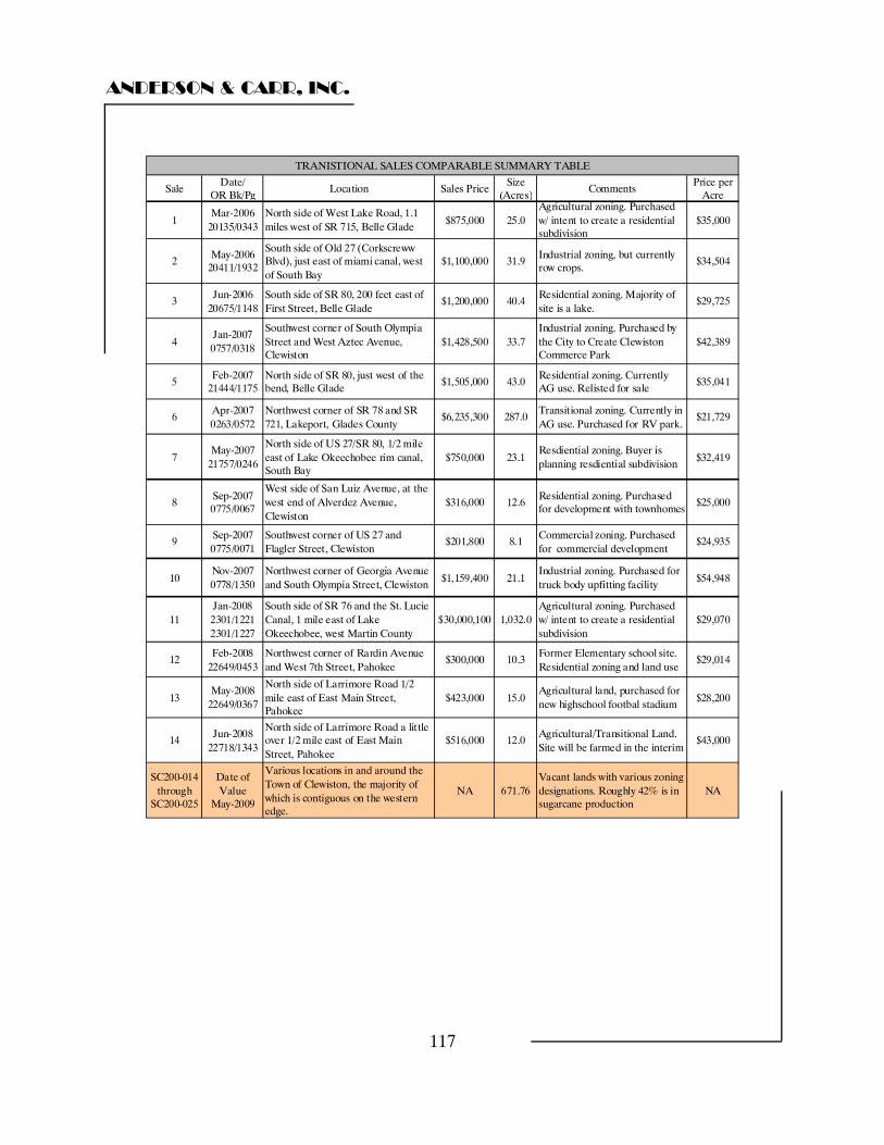
ANDERSON & CARR, INC.
117
SaleDate/
OR Bk/PgLocation Sales Price
Size (Acres)
CommentsPrice per
Acre
1Mar-2006
20135/0343North side of West Lake Road, 1.1 miles west of SR 715, Belle Glade
$875,000 25.0Agricultural zoning. Purchased w/ intent to create a residential subdivision
$35,000
2May-2006
20411/1932
South side of Old 27 (Corkscreww Blvd), just east of miami canal, west of South Bay
$1,100,000 31.9Industrial zoning, but currently row crops.
$34,504
3Jun-2006
20675/1148South side of SR 80, 200 feet east of First Street, Belle Glade
$1,200,000 40.4Residential zoning. Majority of site is a lake.
$29,725
4Jan-2007 0757/0318
Southwest corner of South Olympia Street and West Aztec Avenue, Clewiston
$1,428,500 33.7Industrial zoning. Purchased by the City to Create Clewiston Commerce Park
$42,389
5Feb-2007
21444/1175North side of SR 80, just west of the bend, Belle Glade
$1,505,000 43.0Residential zoning. Currently AG use. Relisted for sale
$35,041
6Apr-2007 0263/0572
Northwest corner of SR 78 and SR 721, Lakeport, Glades County
$6,235,300 287.0Transitional zoning. Currently in AG use. Purchased for RV park.
$21,729
7May-2007
21757/0246
North side of US 27/SR 80, 1/2 mile east of Lake Okeechobee rim canal, South Bay
$750,000 23.1Resdiential zoning. Buyer is planning resdiential subdivision
$32,419
8Sep-2007 0775/0067
West side of San Luiz Avenue, at the west end of Alverdez Avenue, Clewiston
$316,000 12.6Residential zoning. Purchased for development with townhomes
$25,000
9Sep-2007 0775/0071
Southwest corner of US 27 and Flagler Street, Clewiston
$201,800 8.1Commercial zoning. Purchased for commercial development
$24,935
10Nov-2007 0778/1350
Northwest corner of Georgia Avenue and South Olympia Street, Clewiston
$1,159,400 21.1Industrial zoning. Purchased for truck body upfitting facility
$54,948
11Jan-2008 2301/12212301/1227
South side of SR 76 and the St. Lucie Canal, 1 mile east of Lake Okeechobee, west Martin County
$30,000,100 1,032.0Agricultural zoning. Purchased w/ intent to create a residential subdivision
$29,070
12Feb-2008
22649/0453Northwest corner of Rardin Avenue and West 7th Street, Pahokee
$300,000 10.3Former Elementary school site. Residential zoning and land use
$29,014
13May-2008
22649/0367
North side of Larrimore Road 1/2 mile east of East Main Street, Pahokee
$423,000 15.0Agricultural land, purchased for new highschool footbal stadium
$28,200
14Jun-2008
22718/1343
North side of Larrimore Road a little over 1/2 mile east of East Main Street, Pahokee
$516,000 12.0Agricultural/Transitional Land. Site will be farmed in the interim
$43,000
SC200-014 through
SC200-025
Date of Value
May-2009
Various locations in and around the Town of Clewiston, the majority of which is contiguous on the western edge.
NA 671.76Vacant lands with various zoning designations. Roughly 42% is in sugarcane production
NA
TRANISTIONAL SALES COMPARABLE SUMMARY TABLE
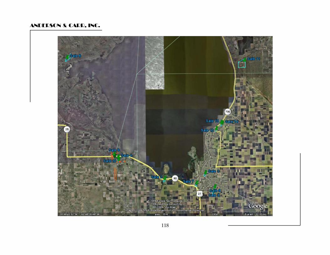
ANDERSON & CARR, INC.
118
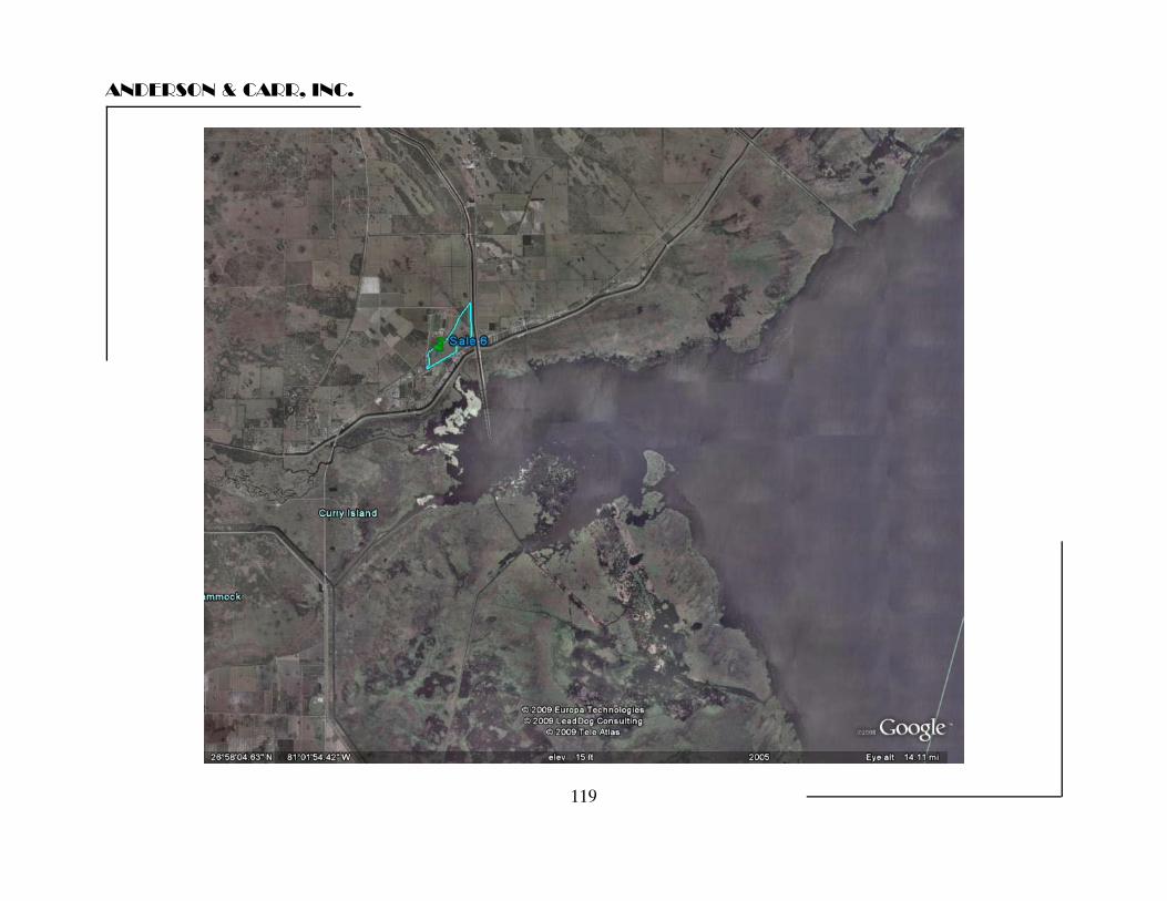
ANDERSON & CARR, INC.
119
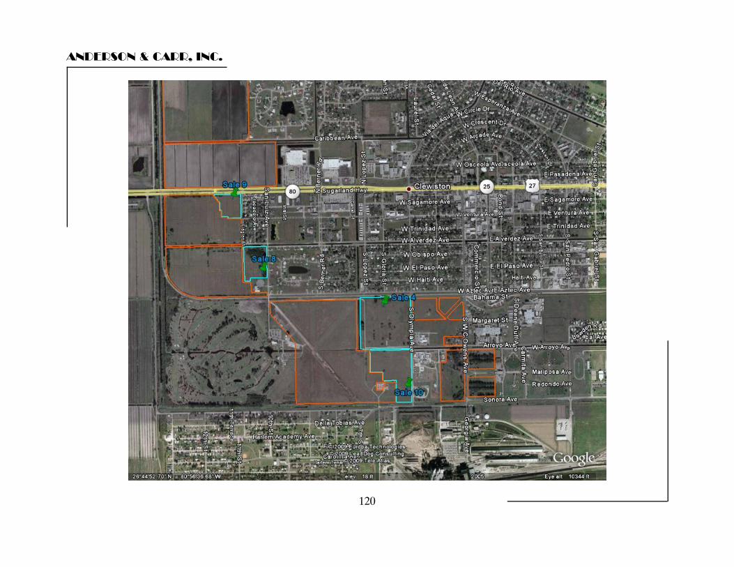
ANDERSON & CARR, INC.
120
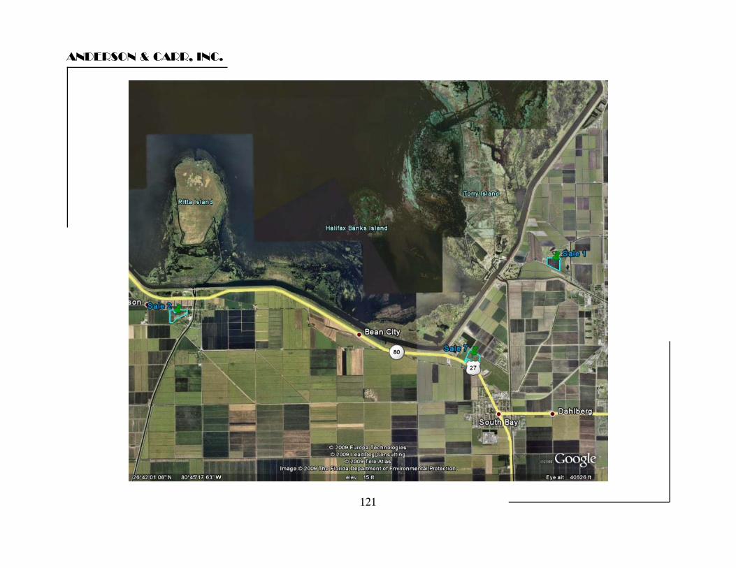
ANDERSON & CARR, INC.
121
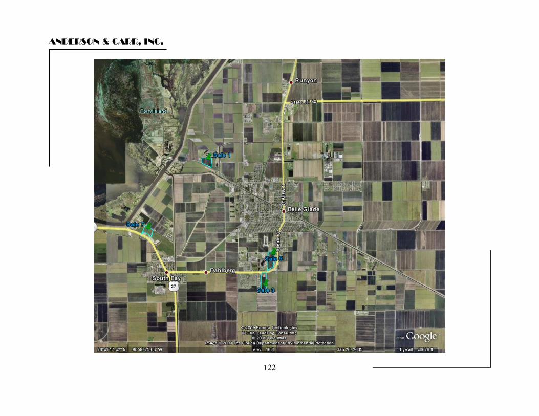
ANDERSON & CARR, INC.
122
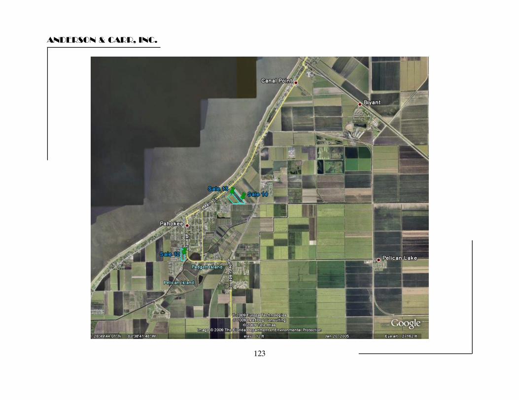
ANDERSON & CARR, INC.
123
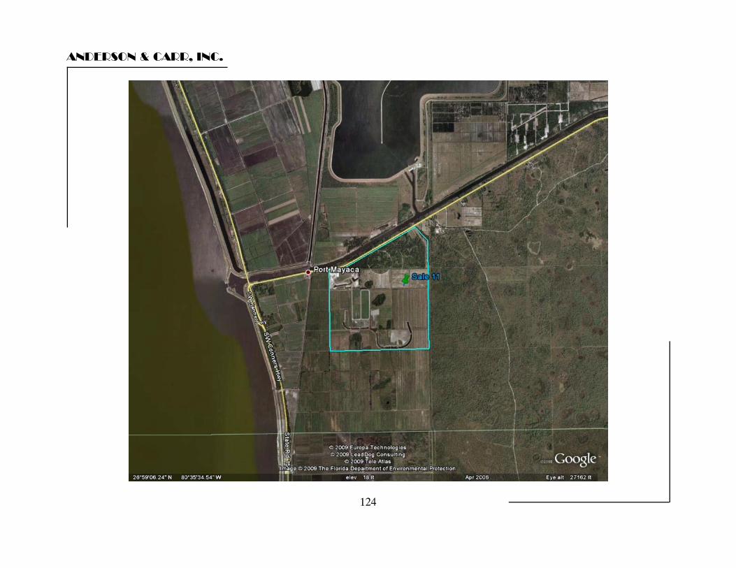
ANDERSON & CARR, INC.
124
ANDERSON & CARR, INC.
125
Sales Discussion We have valued the multiple parcels which make up the subject 671.76 acres as if it were sold together in a single transaction to a single purchaser. In this analysis, we considered differences between properties in the area such as property rights sold, financing, conditions of sale, market conditions (trend or time adjustment), location, size, shape, and zoning/future land use designation considerations. Because the sales vary in size and the data correlates well on a price per acre basis, we have based the comparisons on a standardized unit of measure, the price per acre. Following is a discussion of the sales and the elements of comparison with the subject property. Sale 1 is a 25 acre parcel adjacent to the Belle Glade Municipal Golf Course that sold for $35,000 per acre in March 2006. Downward adjustment is made for deterioration in market conditions since the date of the sale. Downward adjustment is also made for small site size. Upward adjustment is made for its secondary location off of the main commercial road frontage. The net adjustment to the $35,000 per acre indication of value is downward. Sale 2 is the May 2006 sale of 31.9 acres of light industrial zoned land in Lake Harbor on the south side of Old Highway 27 at a price of $34,504 per acre. Downward adjustment is made for deterioration in market conditions since the date of the sale. Downward adjustment is also made for small site size. Upward adjustment is made for secondary road frontage. The net adjustment to the $34,504 per acre indication of value is downward. Sale 3 is a 40.4 acre parcel with a 26 acre lake that sold in June 2006 at $29,725 per acre. Downward adjustment is made for deterioration in market conditions since the date of the sale. Downward adjustment is also made for small site size. Upward adjustment is made for it’s shape and the limited developable land area due to the existence of a large lake on the site. The net adjustment to the $29,725 per acre indication of value is minimal.
ANDERSON & CARR, INC.
126
Sale 4 is the January 2007 sale of 33.70 acres of industrially zoned land out of US Sugar at a price of $42,389 per acre. This involves a sale to a governmental agency (City of Clewiston). The bulk of the parcel, 23.7 acres sold at a negotiated price, based on appraisal, of $55,000 per acre. The remaining 10 acres was sold at a discounted price of $12,500 per acre. The discount was reportedly made to help the city get a commerce park started. Due to the discount associated with this being a sale to a government entity we have not considered it in our analysis. We have included it primarily for informational purposes since the seller was US Sugar. We have also come across the subsequent sale of a lot from the new commerce park. It sold in June of 2008, for roughly $124,368 per acre. However, at only 5.93 acres it is too small to make any meaningful comparison with the subject as a whole. Likewise with another 2.2 acre parcel that sold in May 2008. Sale 5 is a sale of 43 acres of sugarcane land in urbanized Belle Glade at $35,041 per acre. This sale was subsequently put back on the market, but has yet to resell. Downward adjustment is made for deteriorating market conditions, and it’s small site size. Upward adjustment is made for limited road frontage and exposure. The net adjustment to the $35,041 per acre indication of value is minimal. Sale 6 is 287 acres of transitionally zoned land in Glades County that sold in April 2007 for $21,729 per acre. No size adjustment is made due to the relative large size of the comparable sale. Upward adjustment is made for its inferior remote location. The net adjustment is upward. Sale 7 is a May 2007 sale of 23.13 acres at $32,425 per acre. Downward adjustment is made for smaller size. Upward adjustment is made for poor road frontage. The site is accessed by a shared access strip. The net adjustment to the $32,425 per acre indication of value is minimal. Sales 8 & 9 are part of the Bonita Bay transaction involving a 502 acre parcel. Two take downs have occurred involving 12.6 acres and 8.1 acres, each at $25,000 per acre. The terms of the contract on the remaining land area have not been divulged by US Sugar. It is unclear what the price will be for future take downs. The grantee went through the process of getting a comprehensive site plan amendment for 1,500 residential units and 1,000,000 square feet of commercial space on the 502 acres. A hotel parcel has been sold out of the 8.07 acre site at $693,000 for a 1.77 acre parcel ($391,525/acre). No other activity has occurred and the entire project is now on hold.
ANDERSON & CARR, INC.
127
The contract was signed in August 2005 so downward adjustment for superior market conditions is warranted. We anticipate that future take downs will be at some higher number but have no evidence to support that premise due to the refusal of US Sugar to share the contract information. It is possible that the average price for the 502 acres is in excess of $25,000 per acre but without confirmation by the seller we can place limited reliance on the indications of value from these sales. Again, we note that to our knowledge this project is currently on hold and has possibly been cancelled. Sale 10 involves the sale of roughly 21.10 acres of land in the industrial area of Clewiston South of Arroyo Avenue. The sales price calculates to $54,948 per acre. The buyer was a business who developed the property for their own use. This sale warrants downward consideration for both size and for deteriorating market conditions. Net adjustment is downward. Sale 11 involves 1,032 acres of former sugar cane land that sold for $29,070 per acre. The seller had attempted to develop the tract as a polo oriented subdivision. Polo fields had been developed and an extensive system of lakes had been dug. During the process, a deterioration of the market for large acreage lots of this type occurred. Subsequently, the quality of the rock on the site and its proximity to the Hoover Dike indicated that its highest and best use had shifted to rock mining. However, at the time of the purchase, the buyer anticipated an equestrian use. The grantee in this transaction is currently planning to mine the site and then donate the land to SFWMD for water storage. It is our understanding that the donation is being offered as an inducement to Martin County to allow a rock mining permit for the site. This sale requires no adjustments for size. Sale 12 is the February 2008 sale of a 10.3 acre former school site (all improvements removed) to a residential developer for $29,014 per acre. Although the sale involved a governmental entity, all indications are that the sale was based on appraisals and involved a willing buyer and seller so the governmental involvement had no effect on the sale price. Downward adjustment is made for smaller size. Upward adjustment is made for interior location within a residential neighborhood. The net adjustment to the $29,014 per acre indication of value is minimal.
ANDERSON & CARR, INC.
128
Sale 13 at 15.0 acres ($28,200/acre) is related to the previous transaction. Downward adjustment is indicated for size. As with the previous sale, all indications are that the sale was based on appraisals and involved a willing buyer and seller so the governmental involvement had no effect on the sale price. The grantor in this sale did a land swap with the School Board to enable them to build a new football stadium on this site for Pahokee High School. As part of the deal the seller was awarded a contract to perform site work for the stadium construction. It is not clear if and by how much this may have affected the sales negotiation. The appraisers have not made any direct adjustment for this factor. However, we have kept this fact in mind as part of the overall analysis. The net adjustment to the $28,200 per acre indication of value is minimal. Sale 14 is located adjacent to sale 12 and occurred around the same time period. It involves the seller of sale 12 acting as a buyer. At 12.0 acres the sale amounts to roughly $43,000/acre, which is a bit higher than the adjacent sale. It is not entirely clear why the price discrepancy, although the appraisers have kept in mind that the adjacent sale involved a swap and some contracting work. Some upward consideration is warranted for the narrow shape, and downward consideration is warranted for smaller size. The net adjustment to the $43,000 per acre indication of value is minimal to downward.
ANDERSON & CARR, INC.
129
Conclusion The sales range in price from $21,729 up to $54,948 per acre of land area. Given the preceding discussion of the comparables in relation to the subject they indicate support for a value in the range of $30,000 to $40,000 per acre. Overall, the most significant factor in the analysis is the subject’s large size. That said, we should note that while not directly adjusted for in the individual discussion of the sales, it is felt that the subject has a slightly better market location, as evidenced by the comparison of the local Clewiston sales with some of the sales having occurred in other communities around Lake Okeechobee. Although the two largest comparables indicate a value in the lower portion of the range, we believe the locational factor warrants a conclusion closer to the middle. Taking into consideration the data and analysis, it is concluded that the market reflects a value of $35,000 per acre for the 671.76 acre transitional portion of the Clewiston area Community Request Lands. That said, we believe that the value of the 24.08 acre parcel of limited utility is nominal enough that it would be lost in the rounding of our final value conclusion. Therefore, our final value conclusion for the transitional lands as of May 1, 2009 is as follows: SC200-14 - SC200-024: 671.76 acres @ $35,000 per acre = $23,511,600 Rounded to: Estimated Market Value $23,500,000
QUALIFICATIONS OF APPRAISER ROBERT B. BANTING, MAI, SRA PROFESSIONAL DESIGNATIONS - YEAR RECEIVED MAI - Member Appraisal Institute - 1984 SRA - Senior Residential Appraiser, Appraisal Institute - 1977 SRPA - Senior Real Property Appraiser, Appraisal Institute - 1980 State-Certified General Real Estate Appraiser, State of Florida, License No. RZ4 - 1991 EDUCATION AND SPECIAL TRAINING Licensed Real Estate Broker - #3748 - State of Florida Graduate, University of Florida, College of Business Administration, BSBA (Major - Real Estate & Urban Land Studies) 1973 Successfully completed and passed the following Society of Real Estate Appraisers (SREA) and American Institute of Real Estate Appraisers (AIREA) courses and/or exams: Note: the SREA & AIREA merged in 1991 to form the Appraisal Institute. SREA R2: Case Study of Single Family Residence SREA 201: Principles of Income Property Appraising SREA: Single Family Residence Demonstration Report SREA: Income Property Demonstration Report AIREA 1B: Capitalization Theory and Techniques SREA 101: Introduction to Appraising Real Property AIREA: Case Studies in Real Estate Valuation AIREA: Standards of Professional Practice AIREA: Introduction to Real Estate Investment Analysis AIREA 2-2: Valuation Analysis and Report Writing AIREA: Comprehensive Examination AIREA: Litigation Valuation AIREA: Standards of Professional Practice Part C ATTENDED VARIOUS APPRAISAL SEMINARS AND COURSES, INCLUDING: The Internet and Appraising Golf Course Valuation Discounting Condominiums & Subdivisions Narrative Report Writing Appraising for Condemnation Condemnation: Legal Rules & Appraisal Practices Condominium Appraisal Reviewing Appraisals Analyzing Commercial Lease Clauses Eminent Domain Trials Tax Considerations in Real Estate Testing Reasonableness/Discounted Cash Flow Mortgage Equity Analysis Partnerships & Syndications Hotel and Motel Valuation Advanced Appraisal Techniques Federal Appraisal Requirements Analytic Uses of Computer in the Appraisal Shop Valuation of Leases and Leaseholds Valuation Litigation Mock Trial Residential Construction From The Inside Out Rates, Ratios, and Reasonableness Analyzing Income Producing Properties Development of Major/Large Residential Projects Standards of Professional Practice Regression Analysis In Appraisal Practice Federal Appraisal Requirements Engaged in appraising and consulting assignments including market research, rental studies, feasibility analysis, expert witness testimony, cash flow analysis, settlement conferences, and brokerage covering all types of real estate since 1972. President of Anderson & Carr, Inc., Realtors and Appraisers, established 1947 Past President Palm Beach County Chapter, Society of Real Estate Appraisers (SREA) Realtor Member of Central Palm Beach County Association of Realtors Special Master for Palm Beach County Property Appraisal Adjustment Board Qualified as an Expert Witness providing testimony in matters of condemnation, property disputes, bankruptcy court, foreclosures, and other issues of real property valuation. Member of Admissions Committee, Appraisal Institute - South Florida Chapter Member of Review and Counseling Committee, Appraisal Institute - South Florida Chapter Approved appraiser for State of Florida, Department of Transportation and Department Natural Resources. Instructor of seminars, sponsored by the West Palm Beach Board of Realtors. Authored articles for The Palm Beach Post and Realtor newsletter. Real Estate Advisory Board Member, University of Florida.
TYPES OF PROPERTY APPRAISED - PARTIAL LISTING Air Rights Medical Buildings Apartment Buildings Churches Amusement Parks Department Stores Hotels - Motels Marinas Condominiums Industrial Buildings Office Buildings Residences - All Types Mobile Home Parks Service Stations Special Purpose Buildings Restaurants Auto Dealerships Vacant Lots - Acreage Residential Projects Golf Courses Shopping Centers Leasehold Interests Financial Institutions Easements "I am currently certified under the continuing education program of the Appraisal Institute."

QUALIFICATIONS OF APPRAISER WAYNE B. LEWIS
GENERAL INFORMATION State-Certified General Real Estate Appraiser, State of Florida, License No. RZ2452 American Institute of Real Estate Appraisers exams 410, 420, 500, 510, 520, 540, & 550 Florida Licensed Real Estate Sales Person EDUCATION AND SPECIAL TRAINING: Master of Science in Real Estate and Urban Affairs (M.S.R.E.) Georgia State University School of Business Administration; Appraisal major
Bachelor of Business Administration (B.B.A)
Emory University School of Business Administration; Economics major
EXPERIENCE: Anderson & Carr, Inc., FL April 2000 Commercial and residential real estate valuation, highest and best use analysis, market studies and construction loan analysis. Real estate brokerage and leasing. Advanced candidate for MAI designation having passed the comprehensive examination and senior level experience reviews as well as all educational requirements. The Appraisal Group Atlanta, GA October 1999 – March 2000 Commercial and residential real estate valuation, highest and best use analysis, market studies and construction loan analysis. PRIMIS, Inc. Atlanta, GA February 1998 – September 1999 Director of operations of the Atlanta office of PRIMIS, Inc. Successfully turned around an under performing office with annual run rate of $300,000 to a run rate of $1,000,000 in a twelve month period. Established capability to electronically deliver full appraisal reports via the internet resulting in 25% cost savings. Participated in the selection panel tasked with choosing a new computer appraisal software for the nationwide network of offices. Participated in the design of a partially automated residential appraisal software that is proprietary to PRIMIS, Inc. Regularly demonstrate proprietary appraisal ordering, tracking and delivery software for corporate targeted acquisition candidates. Recruited and trained the current staff of 25 appraisers and office assistants (original staff of seven). Engineered high growth while improving customer satisfaction in the appraisal, flood determination and limited title search industry. Served as marketing representative, senior review appraiser, reviewer of monthly income statements and performed all duties of the director of operations. The Atlanta office of PRIMIS, Inc. is currently servicing 400+ residential appraisals per month. The Appraisal Group Atlanta, GA July 1994 – January 1998 Partner/Senior Appraiser - Commercial and residential real estate valuation, highest and best use analysis, market studies and construction loan analysis. Primary activity focused on acquisition and development loan analysis associated with multiphased single family residential community developments. Additional areas of concentration ranged from industrial products such as carpet manufacture; trucking and warehouse distribution buildings; to golf courses; horse facilities; fast food restaurants; office and rental buildings; apartments and single family residences. Long range budget planning with particular attention on cost savings. Served as marketing representative focusing on new client development and retention. Utilized a wide range of computer skills in report writing, discounted cash flow analysis, and development and renovation cost estimation designed to attain effective communication with clients.
QUALIFICATIONS OF APPRAISER BEAU M. ARNOLD
GENERAL INFORMATION State Certified General Real Estate Appraiser RZ2937 State Licensed Real Estate Sales Associate SL3076071 EDUCATION AND SPECIAL TRAINING Graduate, University of Florida, College of Business Administration, BSBA (Majors - Real Estate and Management) 1997 Successfully completed and passed the following courses: UF: Real Estate Analysis UF: Real Estate Valuation AI 200R: Residential Market Analysis and Highest and Best Use AI 300GR: Real Estate Finance, Statistics, and Valuation Modeling AI I310 Basic Income Capitalization AI I410N: National Uniform Standards of Professional Appraisal Practice AI 520: Highest & Best Use and Market Analysis Engaged in appraising and researching real estate with Anderson and Carr, Inc. since May of 1997. TYPES OF PROPERTY APPRAISED Single Family Homes Rights-of-Way Condominiums Easements Vacant Commercial Land Vacant Multi-Family Land Vacant Residential Land Industrial Land Agricultural Land Apartment Buildings Commercial Buildings Warehouse Buildings Proposed Construction Gas Stations Net leased Properties Subdivision Land Public Land Restaurants Office Properties Shopping Centers Special Purpose Properties

ADDENDUM
AGRICULTURAL SALES
Addendum - Agricultural Land Sales
AGRICULTURAL LAND SALES
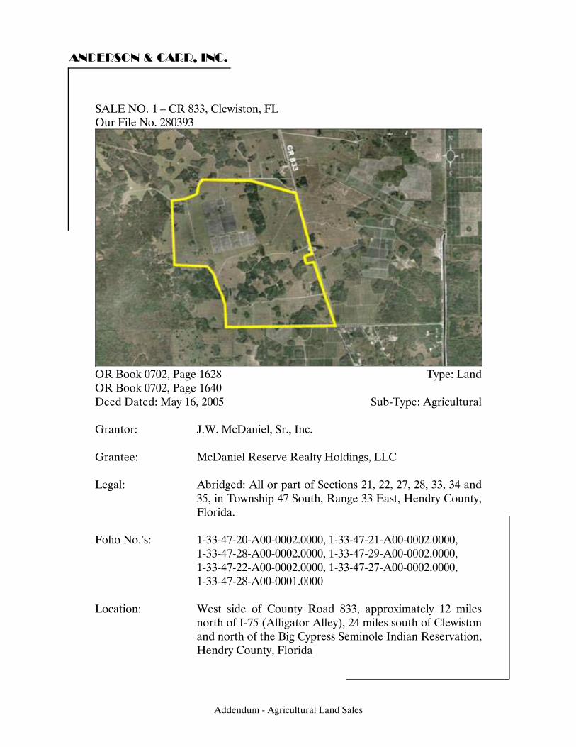
ANDERSON & CARR, INC.
SALE NO. 3 – CR 833, Clewiston, FL Our File No. 280393
OR Book 0702, Page 1628 Type: Land OR Book 0702, Page 1640 Deed Dated: May 16, 2005 Sub-Type: Agricultural Grantor: J.W. McDaniel, Sr., Inc. Grantee: McDaniel Reserve Realty Holdings, LLC Legal: Abridged: All or part of Sections 21, 22, 27, 28, 33, 34 and
35, in Township 47 South, Range 33 East, Hendry County, Florida.
Folio No.’s: 1-33-47-20-A00-0002.0000, 1-33-47-21-A00-0002.0000, 1-33-47-28-A00-0002.0000, 1-33-47-29-A00-0002.0000, 1-33-47-22-A00-0002.0000, 1-33-47-27-A00-0002.0000, 1-33-47-28-A00-0001.0000 Location: West side of County Road 833, approximately 12 miles
north of I-75 (Alligator Alley), 24 miles south of Clewiston and north of the Big Cypress Seminole Indian Reservation, Hendry County, Florida
Addendum - Agricultural Land Sales
1
ANDERSON & CARR, INC.
Zoning: AG - Agricultural by Hendry County Land Use: Agricultural, allowing 1 du/ 5 acres by Hendry County Utilities: Electric, telephone, well pump and septic system Site Size: Front Feet: 47,520 Shape: Irregular Topography/Elevation: Level, above road grade Square Feet: 134,707,993 Acres: 3,092.47 Use: Current Use: Cattle Ranch Intended Use: Eventual equestrian development Highest and Best Use: Continued agriculture - cattle
ranching, long-term rural residential development Verification: Source: Bobby McDaniel Relationship: N/A Conditions of Sale: Arm's length Verified by: Philip M. Holden, MAI Date: September 21, 2005 Sales History: This property has been under the same property ownership
for the past 20 years. Sales Price: $15,507,500 Price/SF Land: $0.12 Price/Acre: $5,015 Financing: Cash to Seller Comments: The initial acquisition of 3,092.47 acres has three miles of frontage on two-lane CR 833. Access for this property is good. The entire 21,000 acres, which is under an option/contract, has approximately 9 miles of paved road frontage. There are farm buildings, cattle pens, pole barns and fencing on the property. The first take down had 3,092.34 gross acres, they now total 21,500 acres. Because of different ownership styles, two transactions made up the first take down of 3,092.47 acres.
Addendum - Agricultural Land Sales
ANDERSON & CARR, INC.
The additional takedowns are scheduled in late 2005 for another 3,000 acres and to be finalized within a maximum period of 6 years. There is little hard money on the future takedowns and the seller retained buy back provisions in case the buyer flips the property. As of July 12, 2006, the buyer is possibly in breach of contract. No additional takedowns have occurred, primarily because the buyer is having trouble getting the desired zoning approvals from Hendry County. The sellers are discussing the matter with their attorney and have a meeting scheduled with the buyer on June 25, 2006 to discuss the status of the deal. Drainage is typical of the area with sheet flow and internal canals and ditches. Collier Land and Cattle Corporation retains subsurface rights in 4 of 9 sections of the property. The site consists of 80% improved pasture (Uplands) and 20% Native (Wetlands). The property was listed with over 21,000 acres total and divided into numerous parcels with this sale representing the first takedown. The contract/option was signed in August 2004 and the first closing occurred in May 2005. The contract calls for price increases of 20% per year over the time of the contract with the last closings at $12,441 per acre. According to Bobby McDaniel, there is little hard money on the future option parcels. The native areas to the west of the first sale will be sold for $3,500 per acre with the last group to be sold and is to remain as natural open space for the eventual equestrian development proposed for the 21,000 acres. The buyers are reserving approximately 500 acres in the midst of the ownership. The buyer considered the location mid-way between the east and west coasts as a factor for future development. Downtown Ft. Lauderdale is 1.5 hours by car. The property was improved with some farm buildings, which had no impact on value. Of the 3,092.47 acres, approximately 500 acres was laser leveled and previously farmed. Approximately 600 acres (20%±) is considered wetlands made up mostly of hammock and cypress. The remainder is improved pasture with water use permits for the installation of four 12-inch wells per section and surface water permits for most of the pasture area.
Addendum - Agricultural Land Sales
ANDERSON & CARR, INC.
The entire McDaniel ownership in this area contains approximately 21,500 acres. It is a large property in southeastern Hendry County. The eastern one-half, east of 833, is permitted and highly improved for farming. The western one-half (including the area of this sale) is less improved but was also permitted. Currently, Mr. McDaniel reports approximately 17,192 acres of laser leveled farmland in production for vegetables and sugarcane and 1,248 acres of citrus made up of 457.64 net tree acres (NTA) of Valencia, 360.95 NTA of Pineapple/Hamlins, and 88.6 NTA of Murcotts. Out of the total 21,500 acres, there is approximately 4,370 acres of native wooded uplands and wetlands, some of which is old growth Cypress. Overall, the ownership has approximately 14 percent wetlands.
Addendum - Agricultural Land Sales

Addendum - Agricultural Land Sales
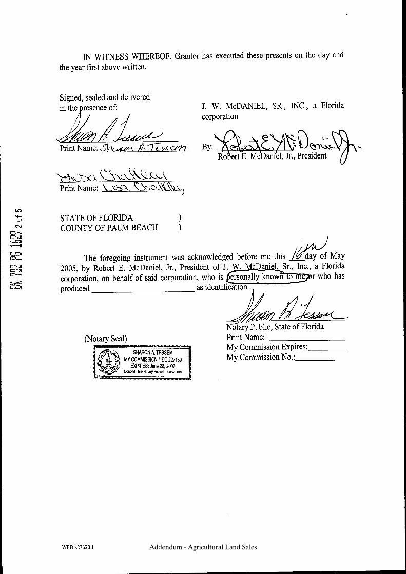
Addendum - Agricultural Land Sales
Addendum - Agricultural Land Sales
Addendum - Agricultural Land Sales
Addendum - Agricultural Land Sales

Addendum - Agricultural Land Sales
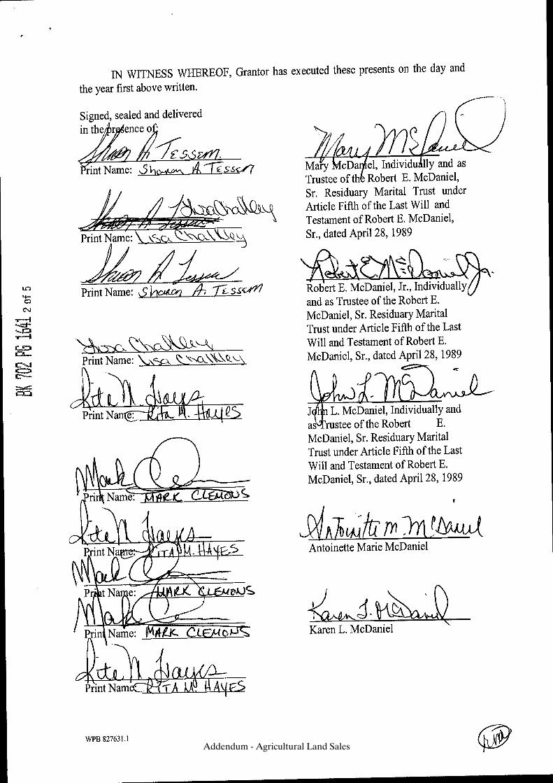
Addendum - Agricultural Land Sales
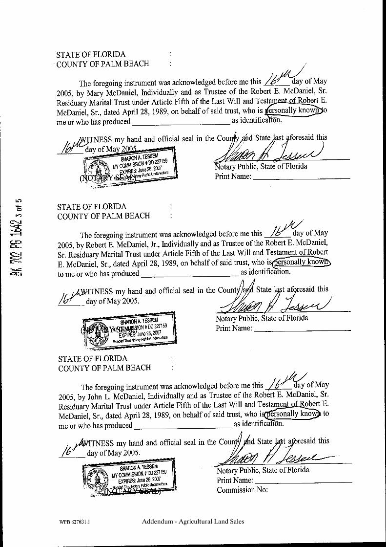
Addendum - Agricultural Land Sales
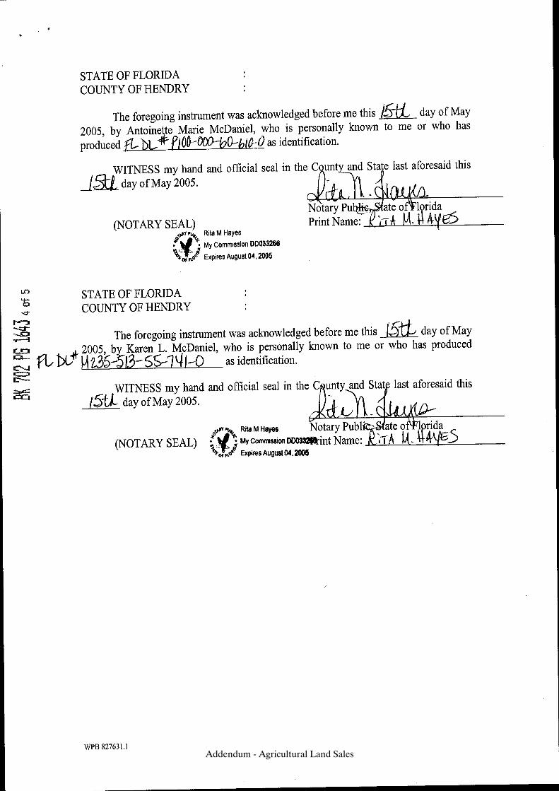
Addendum - Agricultural Land Sales
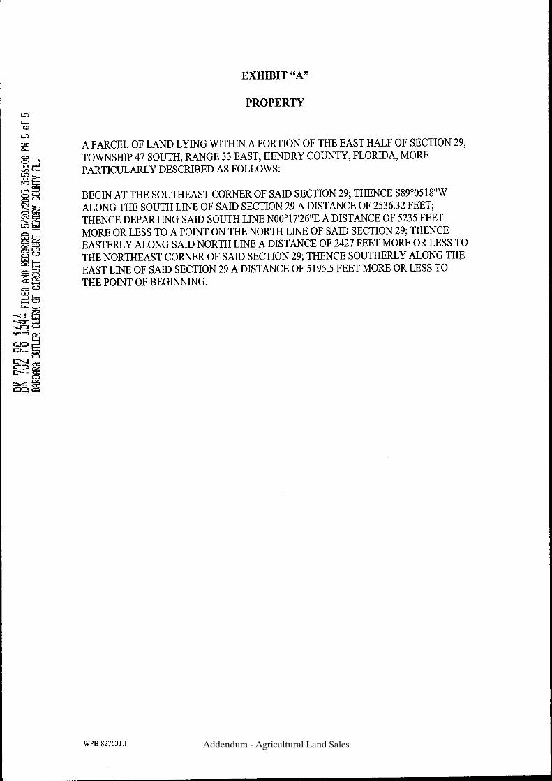
Addendum - Agricultural Land Sales
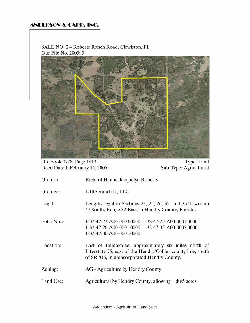
ANDERSON & CARR, INC.
SALE NO. 5 – Roberts Ranch Road, Clewiston, FL Our File No. 280393
OR Book 0728, Page 1813 Type: Land Deed Dated: February 15, 2006 Sub-Type: Agricultural Grantor: Richard H. and Jacquelyn Roberts Grantee: Little Ranch II, LLC Legal: Lengthy legal in Sections 23, 25, 26, 35, and 36 Township
47 South, Range 32 East, in Hendry County, Florida. Folio No.’s: 1-32-47-23-A00-0003.0000, 1-32-47-25-A00-0001.0000, 1-32-47-26-A00-0001.0000, 1-32-47-35-A00-0002.0000, 1-32-47-36-A00-0001.0000 Location: East of Immokalee, approximately six miles north of
Interstate 75, east of the Hendry/Collier county line, south of SR 846, in unincorporated Hendry County.
Zoning: AG - Agriculture by Hendry County Land Use: Agricultural by Hendry County, allowing 1 du/5 acres
Addendum - Agricultural Land Sales
2
ANDERSON & CARR, INC.
Utilities: Electric, telephone, private well, septic system Site Size: Front Feet: Sufficient Shape: Irregular Topography/Elevation: Level, near road grade Square Feet: 87,542,532 Acres: 2,009.70 Use: Current Use: Cattle grazing Intended Use: Cattle grazing with a future hunt club
development Highest and Best Use: Continued agricultural Verification: Source: Jacquelyn Roberts, grantor Relationship: Grantor Conditions of Sale: Arm's length Verified by: Kathy W. Evans Date: September 04, 2006 Sales History: No sales within the last five years Sales Price: $13,063,050 Price/SF Land: $0.15 Price/Acre: $6,500 Financing: Cash to Seller Comments: Drainage to the property is through a canal that runs through the center of the property. It is assumed that the property has no outstanding oil, gas, or mineral rights. This property is next to the Seminole Indian Reservation and was part of a larger site (2,260 acres total). The grantor sold an option to purchase the property to another party who then sold his option to this Grantee. The amount was not available, but the Grantor reported she had heard the price was $1,000,000 (or $442/acre) over and above the Grantor’s contracted price of $4,000 per acre.
Addendum - Agricultural Land Sales
ANDERSON & CARR, INC.
According to Mr. Dubois, the 2,260-acre larger site was under contract to purchase by his father Wayne Dubois and business partner, Brian Lulfs. The contract period was one year and approximately $60,000 per month was paid to the sellers until the closing. These payments were not associated with any agreed upon sale price. Dubois and Lulfs sold the contract to Maurice Cayon with Little Ranch II, LLC and received the $2,500 per acre assignment fee. The remaining 250 acres sold to Jokis, LLC on the same day under the same terms. Sale price as recorded on deed was $8,038,800; plus the $2,500 per acre assignment fee of $5,024,250; equals the total sale price of $13,063,050.
Addendum - Agricultural Land Sales
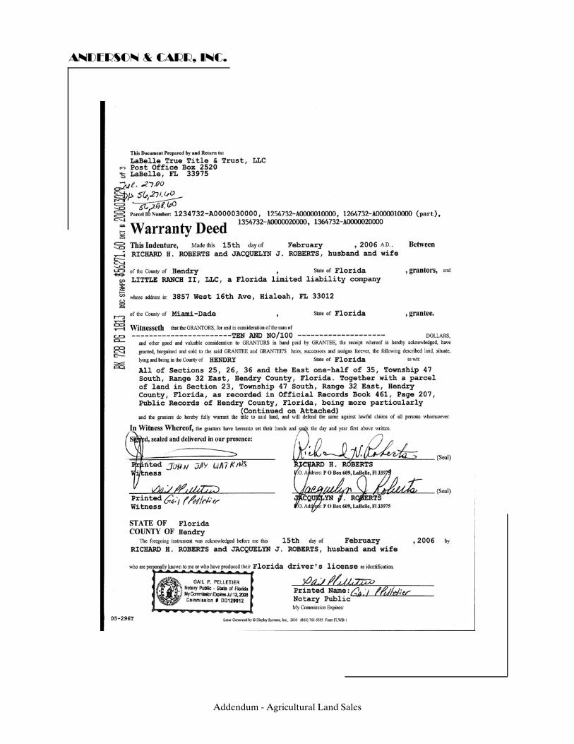
ANDERSON & CARR, INC.
Addendum - Agricultural Land Sales

ANDERSON & CARR, INC.
Addendum - Agricultural Land Sales
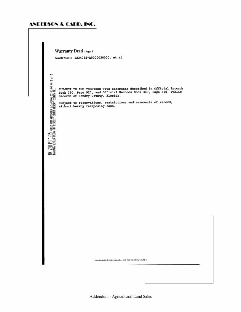
ANDERSON & CARR, INC.
Addendum - Agricultural Land Sales
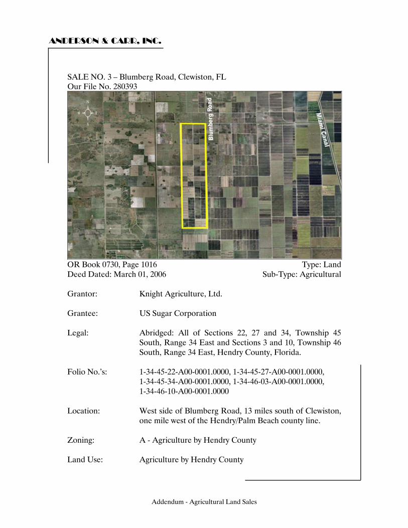
ANDERSON & CARR, INC.
SALE NO. 6 – Blumberg Road, Clewiston, FL Our File No. 280393
OR Book 0730, Page 1016 Type: Land Deed Dated: March 01, 2006 Sub-Type: Agricultural Grantor: Knight Agriculture, Ltd. Grantee: US Sugar Corporation Legal: Abridged: All of Sections 22, 27 and 34, Township 45
South, Range 34 East and Sections 3 and 10, Township 46 South, Range 34 East, Hendry County, Florida.
Folio No.’s: 1-34-45-22-A00-0001.0000, 1-34-45-27-A00-0001.0000, 1-34-45-34-A00-0001.0000, 1-34-46-03-A00-0001.0000, 1-34-46-10-A00-0001.0000 Location: West side of Blumberg Road, 13 miles south of Clewiston,
one mile west of the Hendry/Palm Beach county line. Zoning: A - Agriculture by Hendry County Land Use: Agriculture by Hendry County
Addendum - Agricultural Land Sales
3
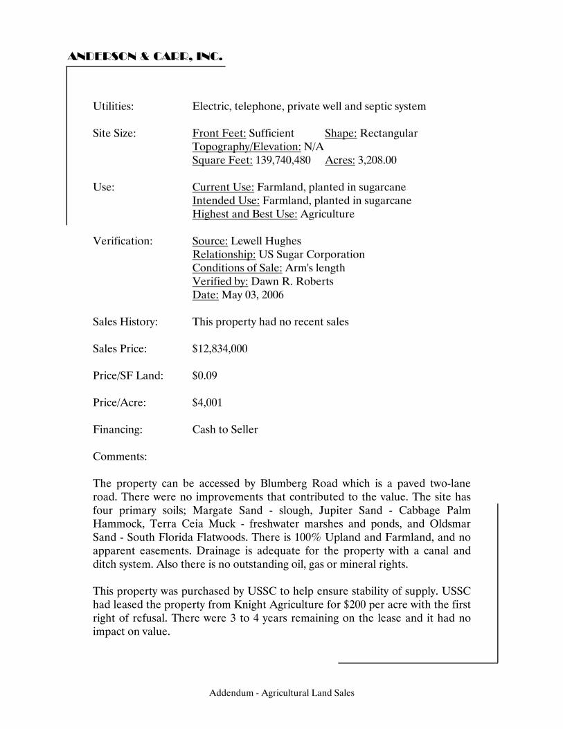
ANDERSON & CARR, INC.
Utilities: Electric, telephone, private well and septic system Site Size: Front Feet: Sufficient Shape: Rectangular Topography/Elevation: N/A Square Feet: 139,740,480 Acres: 3,208.00 Use: Current Use: Farmland, planted in sugarcane Intended Use: Farmland, planted in sugarcane Highest and Best Use: Agriculture Verification: Source: Lewell Hughes Relationship: US Sugar Corporation Conditions of Sale: Arm's length Verified by: Dawn R. Roberts Date: May 03, 2006 Sales History: This property had no recent sales Sales Price: $12,834,000 Price/SF Land: $0.09 Price/Acre: $4,001 Financing: Cash to Seller Comments: The property can be accessed by Blumberg Road which is a paved two-lane road. There were no improvements that contributed to the value. The site has four primary soils; Margate Sand - slough, Jupiter Sand - Cabbage Palm Hammock, Terra Ceia Muck - freshwater marshes and ponds, and Oldsmar Sand - South Florida Flatwoods. There is 100% Upland and Farmland, and no apparent easements. Drainage is adequate for the property with a canal and ditch system. Also there is no outstanding oil, gas or mineral rights. This property was purchased by USSC to help ensure stability of supply. USSC had leased the property from Knight Agriculture for $200 per acre with the first right of refusal. There were 3 to 4 years remaining on the lease and it had no impact on value.
Addendum - Agricultural Land Sales
ANDERSON & CARR, INC.
Addendum - Agricultural Land Sales
ANDERSON & CARR, INC.
Addendum - Agricultural Land Sales

ANDERSON & CARR, INC.
Addendum - Agricultural Land Sales
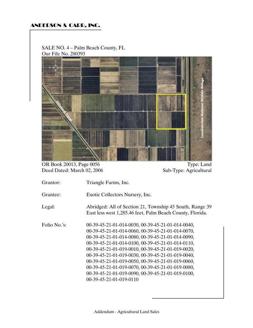
ANDERSON & CARR, INC.
SALE NO. 7 – Palm Beach County, FL Our File No. 280393
OR Book 20013, Page 0056 Type: Land Deed Dated: March 02, 2006 Sub-Type: Agricultural Grantor: Triangle Farms, Inc. Grantee: Exotic Collectors Nursery, Inc. Legal: Abridged: All of Section 21, Township 45 South, Range 39
East less west 1,285.46 feet, Palm Beach County, Florida. Folio No.’s: 00-39-45-21-01-014-0030, 00-39-45-21-01-014-0040, 00-39-45-21-01-014-0060, 00-39-45-21-01-014-0070, 00-39-45-21-01-014-0080, 00-39-45-21-01-014-0090, 00-39-45-21-01-014-0100, 00-39-45-21-01-014-0110, 00-39-45-21-01-019-0010, 00-39-45-21-01-019-0020, 00-39-45-21-01-019-0030, 00-39-45-21-01-019-0040, 00-39-45-21-01-019-0050, 00-39-45-21-01-019-0060, 00-39-45-21-01-019-0070, 00-39-45-21-01-019-0080, 00-39-45-21-01-019-0090, 00-39-45-21-01-019-0100, 00-39-45-21-01-019-0110
Addendum - Agricultural Land Sales
4
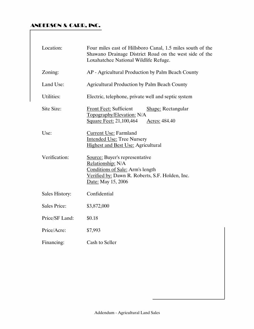
ANDERSON & CARR, INC.
Location: Four miles east of Hillsboro Canal, 1.5 miles south of the Shawano Drainage District Road on the west side of the Loxahatchee National Wildlife Refuge.
Zoning: AP - Agricultural Production by Palm Beach County Land Use: Agricultural Production by Palm Beach County Utilities: Electric, telephone, private well and septic system Site Size: Front Feet: Sufficient Shape: Rectangular Topography/Elevation: N/A Square Feet: 21,100,464 Acres: 484.40 Use: Current Use: Farmland Intended Use: Tree Nursery Highest and Best Use: Agricultural Verification: Source: Buyer's representative Relationship: N/A Conditions of Sale: Arm's length Verified by: Dawn R. Roberts, S.F. Holden, Inc. Date: May 15, 2006 Sales History: Confidential Sales Price: $3,872,000 Price/SF Land: $0.18 Price/Acre: $7,993 Financing: Cash to Seller
Addendum - Agricultural Land Sales
ANDERSON & CARR, INC.
Comments: The property is accessed by Shawano Drainage District right-of-way, a two-lane shell rock road. The primary soil to this site is Terra Ceia Muck (freshwater marshes and ponds). The site is 100% Upland and Farmland with no apparent easements. There is adequate drainage by a canal and ditch system. Property was purchased for a landscape nursery tree farm. Shortly after purchase, the tract was listed for sale at an asking price of $13,000 per acre, with little interest and no serious offers to date. A small parcel was subsequently sold as some type of agricultural condominium project.
Addendum - Agricultural Land Sales
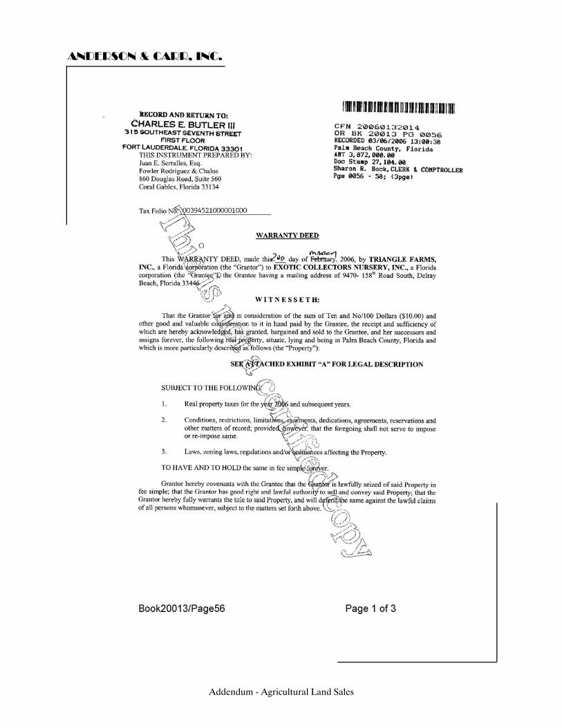
ANDERSON & CARR, INC.
Addendum - Agricultural Land Sales
ANDERSON & CARR, INC.
Addendum - Agricultural Land Sales
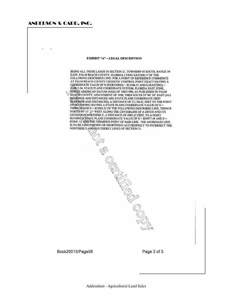
ANDERSON & CARR, INC.
Addendum - Agricultural Land Sales
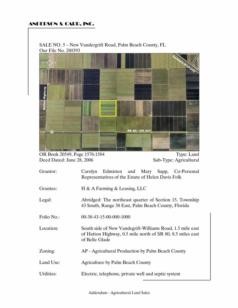
ANDERSON & CARR, INC.
SALE NO. 8 – New Vandergrift Road, Palm Beach County, FL Our File No. 280393
OR Book 20549, Page 1576:1584 Type: Land Deed Dated: June 28, 2006 Sub-Type: Agricultural Grantor: Carolyn Edmisten and Mary Sapp, Co-Personal
Representatives of the Estate of Helen Davis Folk Grantee: H & A Farming & Leasing, LLC Legal: Abridged: The northeast quarter of Section 15, Township
43 South, Range 38 East, Palm Beach County, Florida Folio No.: 00-38-43-15-00-000-1000 Location: South side of New Vandegrift-Williams Road, 1.5 mile east
of Hatton Highway, 0.5 mile north of SR 80, 8.5 miles east of Belle Glade
Zoning: AP - Agricultural Production by Palm Beach County Land Use: Agriculture by Palm Beach County Utilities: Electric, telephone, private well and septic system
Addendum - Agricultural Land Sales
5
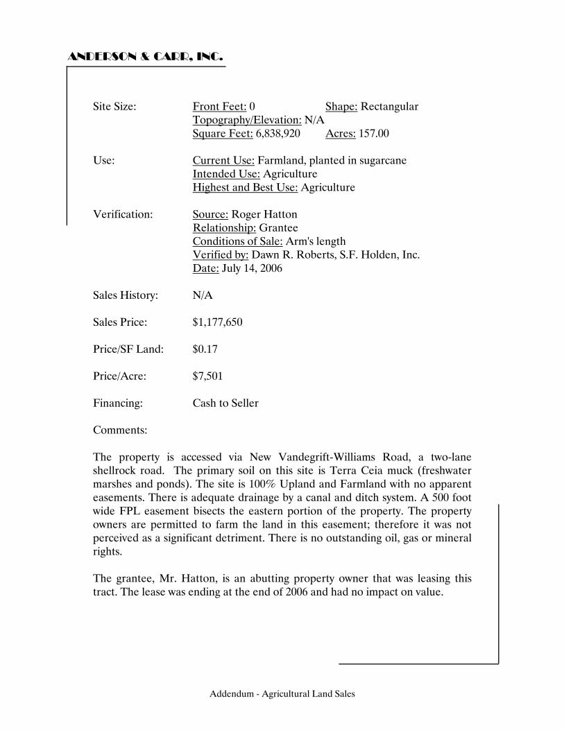
ANDERSON & CARR, INC.
Site Size: Front Feet: 0 Shape: Rectangular Topography/Elevation: N/A Square Feet: 6,838,920 Acres: 157.00 Use: Current Use: Farmland, planted in sugarcane Intended Use: Agriculture Highest and Best Use: Agriculture Verification: Source: Roger Hatton Relationship: Grantee Conditions of Sale: Arm's length Verified by: Dawn R. Roberts, S.F. Holden, Inc. Date: July 14, 2006 Sales History: N/A Sales Price: $1,177,650 Price/SF Land: $0.17 Price/Acre: $7,501 Financing: Cash to Seller Comments: The property is accessed via New Vandegrift-Williams Road, a two-lane shellrock road. The primary soil on this site is Terra Ceia muck (freshwater marshes and ponds). The site is 100% Upland and Farmland with no apparent easements. There is adequate drainage by a canal and ditch system. A 500 foot wide FPL easement bisects the eastern portion of the property. The property owners are permitted to farm the land in this easement; therefore it was not perceived as a significant detriment. There is no outstanding oil, gas or mineral rights. The grantee, Mr. Hatton, is an abutting property owner that was leasing this tract. The lease was ending at the end of 2006 and had no impact on value.
Addendum - Agricultural Land Sales
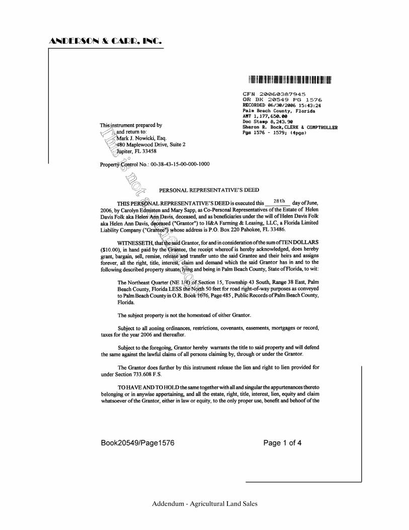
ANDERSON & CARR, INC.
Addendum - Agricultural Land Sales
ANDERSON & CARR, INC.
Addendum - Agricultural Land Sales
ANDERSON & CARR, INC.
Addendum - Agricultural Land Sales
ANDERSON & CARR, INC.
Addendum - Agricultural Land Sales
ANDERSON & CARR, INC.
Addendum - Agricultural Land Sales
ANDERSON & CARR, INC.
Addendum - Agricultural Land Sales
ANDERSON & CARR, INC.
Addendum - Agricultural Land Sales
ANDERSON & CARR, INC.
Addendum - Agricultural Land Sales

ANDERSON & CARR, INC.
Addendum - Agricultural Land Sales
ANDERSON & CARR, INC.
Addendum - Agricultural Land Sales
ANDERSON & CARR, INC.
SALE NO. 9 – CR 846, Clewiston, FL Our File No. 280393
OR Book 0741, Page 1513 Type: Land Deed Dated: June 29, 2006 Sub-Type: Agricultural Grantor: Zipperer Farms, LLC Grantee: Hendry County Nursery Farms, LLC Legal: Abridged: A portion of Sections 1, 2, 3, 10, 11, 12, 13, 14
and 15, Township 46 South, Range 33 East, Hendry County, Florida.
Folio No.’s: 1-33-46-01-A00-0001.0000, 1-33-46-02-A00-0001.0000, 1-33-46-03-A00-0001.0000, 1-33-46-10-A00-0001.0000, 1-33-46-11-A00-0001.0000, 1-33-46-12-A00-0001.0000, 1-33-46-13-A00-0002.0000, 1-33-46-14-A00-0002.0000, 1-33-46-15-A00-0003.0000 Location: West side of County Road 835, 17 miles south of Clewiston
in eastern Hendry County. Zoning: A - Agriculture by Hendry County
Addendum - Agricultural Land Sales
6
ANDERSON & CARR, INC.
Land Use: Agriculture by Hendry County Utilities: Electric, telephone, private well and septic system Site Size: Front Feet: Sufficient Shape: Irregular Topography/Elevation: N/A Square Feet: 155,422,080 Acres: 3,568.00 Use: Current Use: Cropland, pasture and grove Intended Use: Agriculture Highest and Best Use: Agricultural Verification: Source: Doug Zipperer Relationship: Grantor Conditions of Sale: Arm's length Verified by: Dawn R. Roberts, S.F. Holden, Inc. Date: July 19, 2006 Sales History: This property sold October 1, 1979 for $9,000,000, and
April 1, 1978 for $5,187,000 Sales Price: $24,976,500 Price/SF Land: $0.16 Price/Acre: $7,000 Financing: Cash to Seller Comments: The subject had mobile homes and sheds on the property that did not contribute to the value. The site consists of 75% uplands and 25% wetland; of which 61% are row crops, and 16% are citrus acreage. There are two types of primary soils, Immokalee Sand and Basinger Sand. No apparent easements are on this property. This property is the southern portion of a 4,800-acre sale brokered by B & J Realty as part of the Costa Nursery Farms purchase, which is a related corporation to the purchaser.
Addendum - Agricultural Land Sales
ANDERSON & CARR, INC.
This property was under contract for nearly a year prior to closing, which was delayed due to Hurricane Wilma. Mr. Zipperer says that he would sell the property today for the same price, and that some undisclosed penalties were paid for the closing delays. Hendry Capital, LLC purchased the 1,232 acres north of this property and has relisted the property for sale at an asking price of $14,900 per acre, with the hopes that Costa Nursery Farms starting a large nursery operation in the area will attract other growers that view this as a fair price for land.
Addendum - Agricultural Land Sales
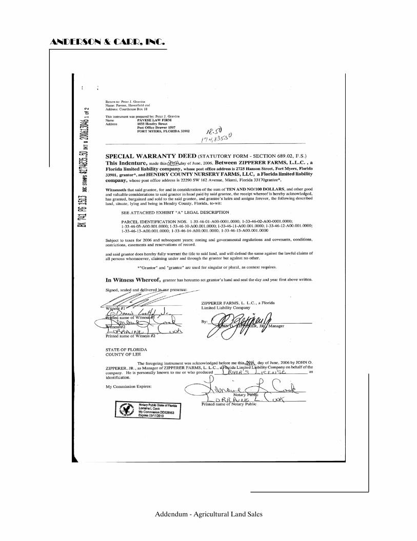
ANDERSON & CARR, INC.
Addendum - Agricultural Land Sales
ANDERSON & CARR, INC.
Addendum - Agricultural Land Sales
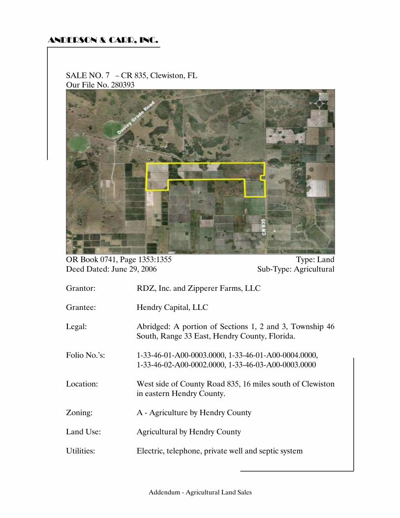
ANDERSON & CARR, INC.
SALE NO. 10 – CR 835, Clewiston, FL Our File No. 280393
OR Book 0741, Page 1353:1355 Type: Land Deed Dated: June 29, 2006 Sub-Type: Agricultural Grantor: RDZ, Inc. and Zipperer Farms, LLC Grantee: Hendry Capital, LLC Legal: Abridged: A portion of Sections 1, 2 and 3, Township 46
South, Range 33 East, Hendry County, Florida. Folio No.’s: 1-33-46-01-A00-0003.0000, 1-33-46-01-A00-0004.0000, 1-33-46-02-A00-0002.0000, 1-33-46-03-A00-0003.0000 Location: West side of County Road 835, 16 miles south of Clewiston
in eastern Hendry County. Zoning: A - Agriculture by Hendry County Land Use: Agricultural by Hendry County Utilities: Electric, telephone, private well and septic system
Addendum - Agricultural Land Sales
7
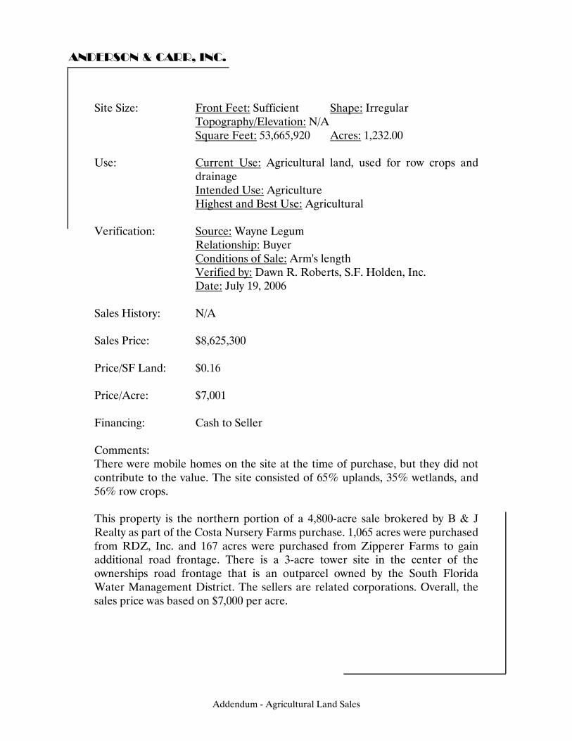
ANDERSON & CARR, INC.
Site Size: Front Feet: Sufficient Shape: Irregular Topography/Elevation: N/A Square Feet: 53,665,920 Acres: 1,232.00 Use: Current Use: Agricultural land, used for row crops and
drainage Intended Use: Agriculture Highest and Best Use: Agricultural Verification: Source: Wayne Legum Relationship: Buyer Conditions of Sale: Arm's length Verified by: Dawn R. Roberts, S.F. Holden, Inc. Date: July 19, 2006 Sales History: N/A Sales Price: $8,625,300 Price/SF Land: $0.16 Price/Acre: $7,001 Financing: Cash to Seller Comments: There were mobile homes on the site at the time of purchase, but they did not contribute to the value. The site consisted of 65% uplands, 35% wetlands, and 56% row crops. This property is the northern portion of a 4,800-acre sale brokered by B & J Realty as part of the Costa Nursery Farms purchase. 1,065 acres were purchased from RDZ, Inc. and 167 acres were purchased from Zipperer Farms to gain additional road frontage. There is a 3-acre tower site in the center of the ownerships road frontage that is an outparcel owned by the South Florida Water Management District. The sellers are related corporations. Overall, the sales price was based on $7,000 per acre.
Addendum - Agricultural Land Sales
ANDERSON & CARR, INC.
This property was under contract for nearly a year prior to closing, which was delayed due to Hurricane Wilma. Mr. Zipperer says that he would sell the property today for the same price, and that some undisclosed penalties were paid for the closing delays. Hendry Capital has relisted this property for sale at an asking price of $14,900 per acre, with the hopes that Costa Nursery Farms starting a large nursery operation in the area will attract other growers that view this as a fair price for land.
Addendum - Agricultural Land Sales
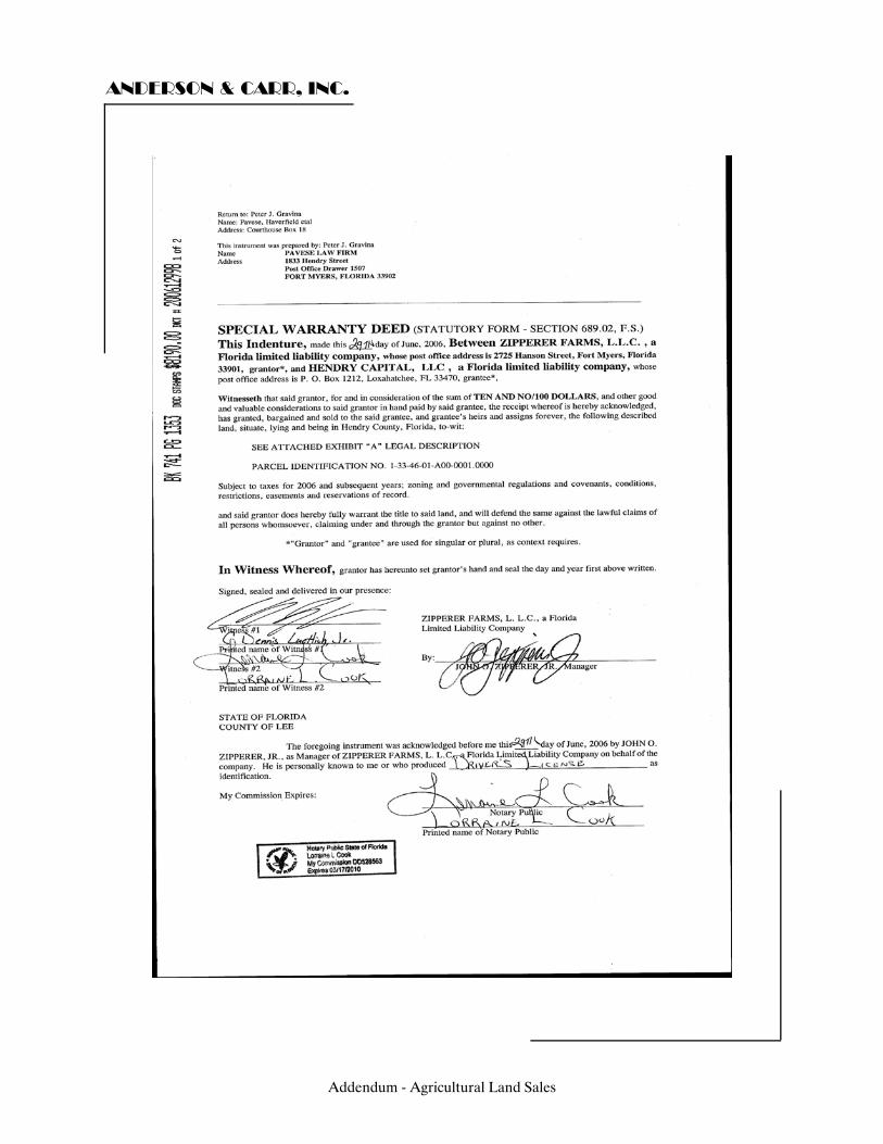
ANDERSON & CARR, INC.
Addendum - Agricultural Land Sales
ANDERSON & CARR, INC.
Addendum - Agricultural Land Sales
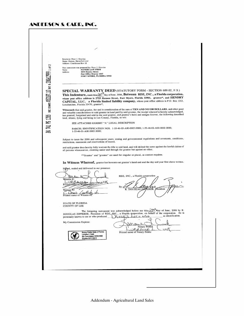
ANDERSON & CARR, INC.
Addendum - Agricultural Land Sales
ANDERSON & CARR, INC.
Addendum - Agricultural Land Sales
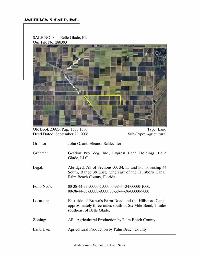
ANDERSON & CARR, INC.
SALE NO. 11 – Belle Glade, FL Our File No. 280393
OR Book 20923, Page 1556:1560 Type: Land Deed Dated: September 29, 2006 Sub-Type: Agricultural Grantor: John O. and Eleanor Schlechter Grantee: Gestion Pro Veg, Inc., Cypress Land Holdings, Belle
Glade, LLC Legal: Abridged: All of Sections 33, 34, 35 and 36, Township 44
South, Range 38 East, lying east of the Hillsboro Canal, Palm Beach County, Florida.
Folio No.’s: 00-38-44-33-00000-1000, 00-38-44-34-00000-1000, 00-38-44-35-00000-9000, 00-38-44-36-00000-9000 Location: East side of Brown’s Farm Road and the Hillsboro Canal,
approximately three miles south of Six-Mile Bend, 7 miles southeast of Belle Glade.
Zoning: AP - Agricultural Production by Palm Beach County Land Use: Agricultural Production by Palm Beach County
Addendum - Agricultural Land Sales
8
ANDERSON & CARR, INC.
Utilities: Private well and septic system Site Size: Front Feet: Sufficient Shape: Irregular Topography/Elevation: N/A Square Feet: 83,549,822 Acres: 1,918.04 Use: Current Use: Farmland, approximately 1,450 acres of
sugarcane and 430 acres of sod are planted Intended Use: N/A Highest and Best Use: Agriculture Verification: Source: Confidential Relationship: Confidential Conditions of Sale: Arm's length Verified by: Dawn R. Roberts, S.F. Holden, Inc. Date: May 15, 2006 Sales History: This property sold November 13, 1985 for $228,000 Sales Price: $14,659,011 Price/SF Land: $0.18 Price/Acre: $7,643 Financing: Cash to Seller Comments: The property is accessed by Concrete Bridge crossing the Hillsboro Canal, extending east from Brown’s Farm Road. A two-lane shellrock road bisects the tract. There is a metal storage building on the tract purchased by Gestion that contains 5,514 square feet according to the Palm Beach County Property Appraiser’s records. This building appears to be in good condition, but according to the buyer, did not contribute to the overall value of the tract. The size to the site is 641.99 acres (Gestion) which sold for $4,907,551; and 1,276.05 acres (Cypress Land Holdings) which sold for $9,751,460; for a total of 1,918.04 acres and total sales price of $14,659,011. The primary soils to this site are Pahokee Muck and Terra Ceia Muck (freshwater marshes and ponds). The site is 100% upland with no apparent easements. There is adequate drainage by canal and ditch system
Addendum - Agricultural Land Sales
ANDERSON & CARR, INC.
This property was offered for sale via bidding process beginning in early 2006. Bids were to start at a minimum of $6,000 per acre for the land and be received by the end of May 2006. Additionally, the sellers were seeking an additional $3,000,000; $1,000,000 would each be allocated to the sugarcane and sod crops and stock shares in the Florida Sugarcane Growers Co-Op. The stock shares were reportedly a hard sell, and confirmation with the grantee’s representatives did not reveal any allocation of the sales price to either crop. Reportedly, if the mill stock was not purchased because approval of the buyer was denied by the Sugarcane Growers Cooperative, the price for the real estate would increase by $500,000. The mill marketing agreement with the seller expired on May 31, 2007. The buyer was losing leased lands locally in which it historically had planted the bulk of its leafy vegetables that were processed at its Cypress Cooling Packing Facility in Belle Glade. The principal motivation of the sale was to replace the loss of the leased land.
Addendum - Agricultural Land Sales
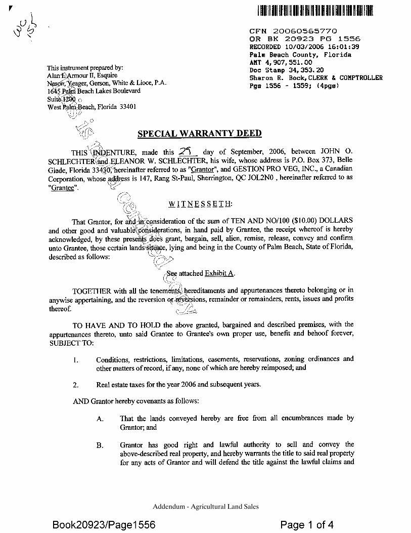
Addendum - Agricultural Land Sales
Addendum - Agricultural Land Sales

Addendum - Agricultural Land Sales
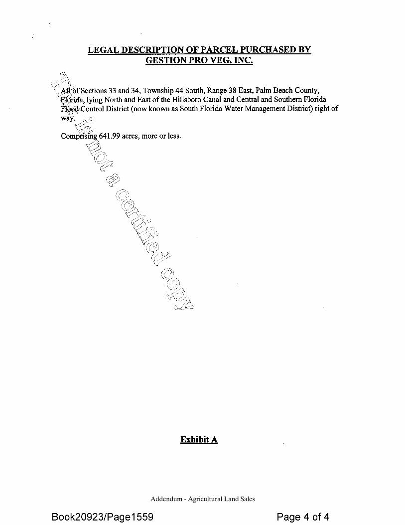
Addendum - Agricultural Land Sales
Addendum - Agricultural Land Sales
Addendum - Agricultural Land Sales
Addendum - Agricultural Land Sales

Addendum - Agricultural Land Sales
ANDERSON & CARR, INC.
SALE NO. 12 – 11251 Blumberg Road, Clewiston, FL Our File No. 280393
OR Book 0754, Page 1439 Type: Land Deed Dated: December 08, 2006 Sub-Type: Agricultural Grantor: J & J AG Products, Inc. Grantee: Sunrise Sod, Inc. Legal: Abridged: The north half of Section 3, Township 45 South,
Range 34 East, Hendry County, Florida. Folio No.: 1-34-45-03-A00-0001.0000 Location: West side of Blumberg Road, one mile south of CR 835,
8.5 miles south of Clewiston, two miles west of Hendry/Palm Beach County line.
Zoning: A-2 - Agriculture by Hendry County Land Use: Agriculture by Hendry County Utilities: Electric, telephone, private well, septic system
Addendum - Agricultural Land Sales
9
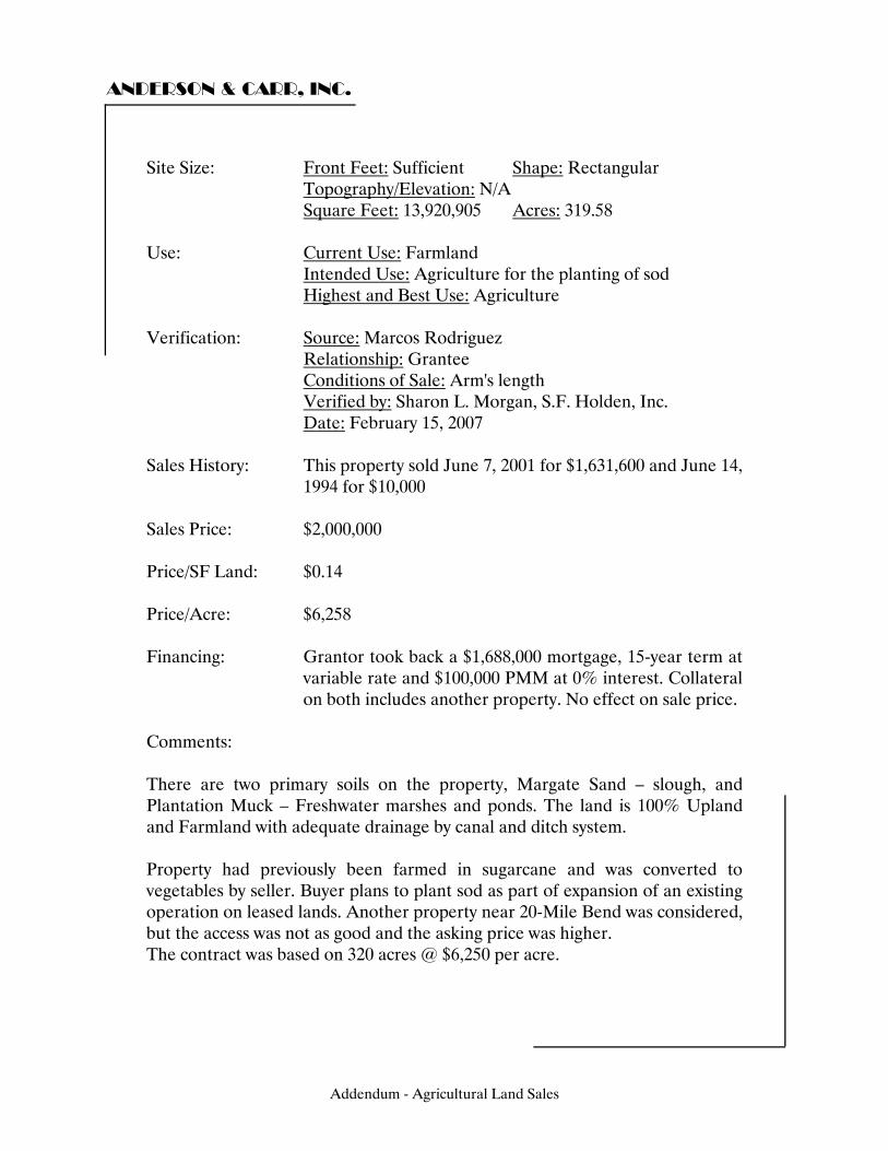
ANDERSON & CARR, INC.
Site Size: Front Feet: Sufficient Shape: Rectangular Topography/Elevation: N/A Square Feet: 13,920,905 Acres: 319.58 Use: Current Use: Farmland Intended Use: Agriculture for the planting of sod Highest and Best Use: Agriculture Verification: Source: Marcos Rodriguez Relationship: Grantee Conditions of Sale: Arm's length Verified by: Sharon L. Morgan, S.F. Holden, Inc. Date: February 15, 2007 Sales History: This property sold June 7, 2001 for $1,631,600 and June 14,
1994 for $10,000 Sales Price: $2,000,000 Price/SF Land: $0.14 Price/Acre: $6,258 Financing: Grantor took back a $1,688,000 mortgage, 15-year term at
variable rate and $100,000 PMM at 0% interest. Collateral on both includes another property. No effect on sale price.
Comments: There are two primary soils on the property, Margate Sand – slough, and Plantation Muck – Freshwater marshes and ponds. The land is 100% Upland and Farmland with adequate drainage by canal and ditch system. Property had previously been farmed in sugarcane and was converted to vegetables by seller. Buyer plans to plant sod as part of expansion of an existing operation on leased lands. Another property near 20-Mile Bend was considered, but the access was not as good and the asking price was higher. The contract was based on 320 acres @ $6,250 per acre.
Addendum - Agricultural Land Sales
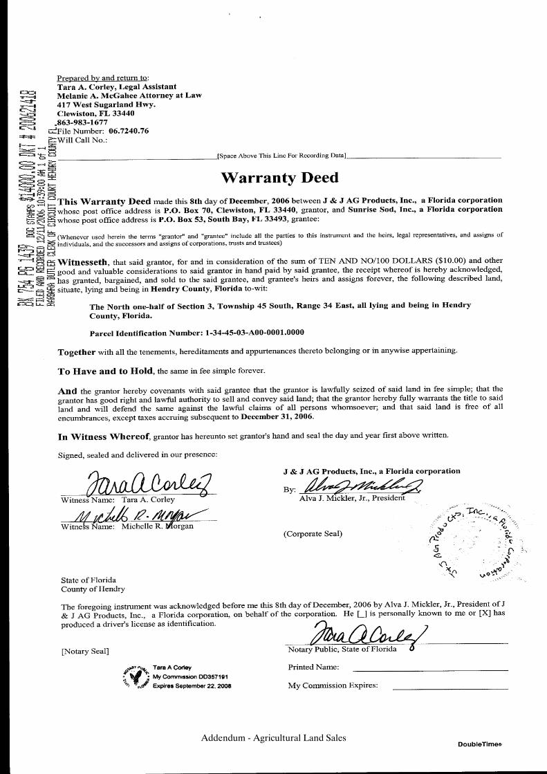
Addendum - Agricultural Land Sales

ANDERSON & CARR, INC.
SALE NO. 13 – US Highway 27, Palm Beach County, FL Our File No. 280393
OR Book 21526, Page 0474 Type: Land Deed Dated: March 16, 2007 Sub-Type: Agricultural Grantor: The Elfers Family Limited Partnership Grantee: Woerner South, Inc. Legal: Abridged: A portion of Sections 13 and 14, Township 45
South, Range 36 East, Palm Beach County, Florida. Folio No.’s: 00-36-45-13-00-000-1000, 00-36-45-14-01-000-0010 Location: East side of North New River Canal and US 27, 6.25 miles
south of South Bay and State Road 80. Zoning: AP - Agricultural Production by Palm Beach County Land Use: Agricultural Production by Palm Beach County Utilities: Electric, telephone, private well, septic system
Addendum - Agricultural Land Sales
10
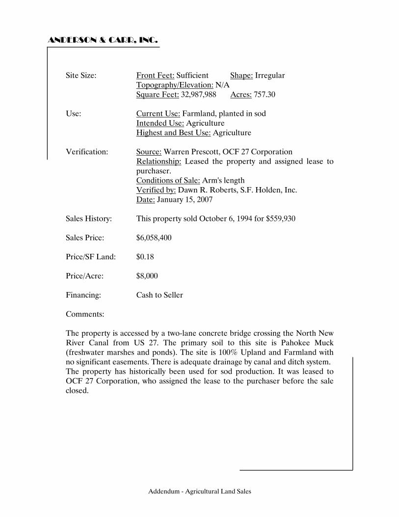
ANDERSON & CARR, INC.
Site Size: Front Feet: Sufficient Shape: Irregular Topography/Elevation: N/A Square Feet: 32,987,988 Acres: 757.30 Use: Current Use: Farmland, planted in sod Intended Use: Agriculture Highest and Best Use: Agriculture Verification: Source: Warren Prescott, OCF 27 Corporation Relationship: Leased the property and assigned lease to
purchaser. Conditions of Sale: Arm's length Verified by: Dawn R. Roberts, S.F. Holden, Inc. Date: January 15, 2007 Sales History: This property sold October 6, 1994 for $559,930 Sales Price: $6,058,400 Price/SF Land: $0.18 Price/Acre: $8,000 Financing: Cash to Seller Comments: The property is accessed by a two-lane concrete bridge crossing the North New River Canal from US 27. The primary soil to this site is Pahokee Muck (freshwater marshes and ponds). The site is 100% Upland and Farmland with no significant easements. There is adequate drainage by canal and ditch system. The property has historically been used for sod production. It was leased to OCF 27 Corporation, who assigned the lease to the purchaser before the sale closed.
Addendum - Agricultural Land Sales
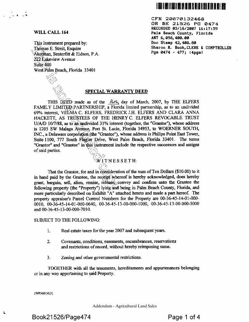
Addendum - Agricultural Land Sales
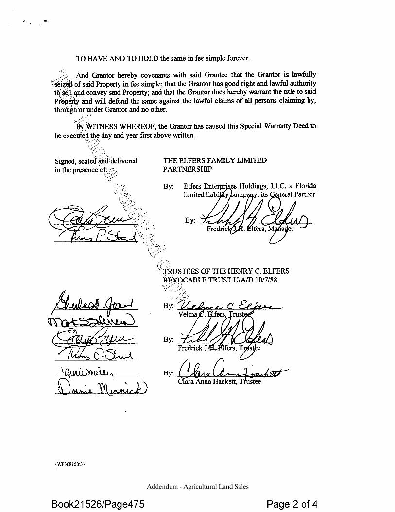
Addendum - Agricultural Land Sales
Addendum - Agricultural Land Sales
Addendum - Agricultural Land Sales
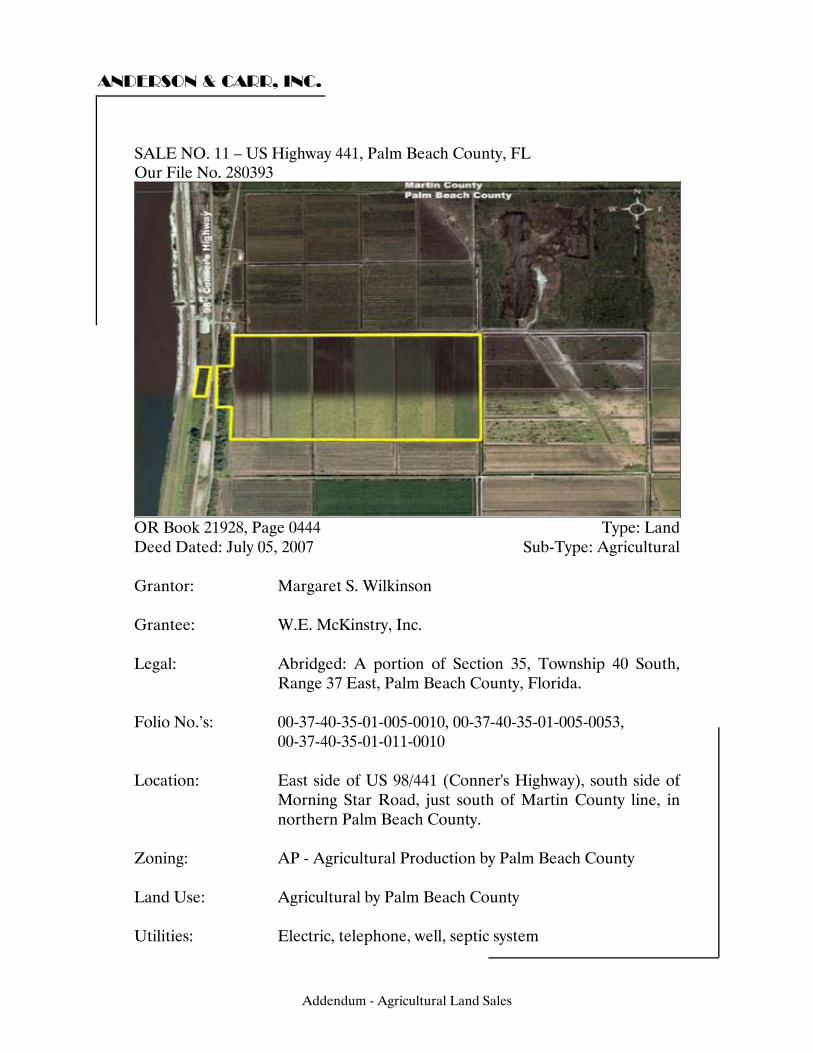
ANDERSON & CARR, INC.
SALE NO. 14 – US Highway 441, Palm Beach County, FL Our File No. 280393
OR Book 21928, Page 0444 Type: Land Deed Dated: July 05, 2007 Sub-Type: Agricultural Grantor: Margaret S. Wilkinson Grantee: W.E. McKinstry, Inc. Legal: Abridged: A portion of Section 35, Township 40 South,
Range 37 East, Palm Beach County, Florida. Folio No.’s: 00-37-40-35-01-005-0010, 00-37-40-35-01-005-0053, 00-37-40-35-01-011-0010 Location: East side of US 98/441 (Conner's Highway), south side of
Morning Star Road, just south of Martin County line, in northern Palm Beach County.
Zoning: AP - Agricultural Production by Palm Beach County Land Use: Agricultural by Palm Beach County Utilities: Electric, telephone, well, septic system
Addendum - Agricultural Land Sales
11

ANDERSON & CARR, INC.
Site Size: Front Feet: Sufficient Shape: Irregular Topography/Elevation: N/A Square Feet: 7,944,473 Acres: 182.38 Use: Current Use: Farmland, planted in sugarcane Intended Use: Agricultural Highest and Best Use: Agricultural Verification: Source: Wilkinson Relationship: Grantor Conditions of Sale: Arm's length Verified by: Tim Holden, S.F. Holden, Inc. Date: December 01, 2007 Sales History: N/A Sales Price: $1,542,000 Price/SF Land: $0.19 Price/Acre: $8,455 Financing: A $1,350,000 mortgage to the grantor Comments: The property is accessed along US 98/441. There are water control canals for irrigation on the property. The primary soils to this site are Torry Muck and Okeelanta Muck. The site is 100% Upland with no apparent easements. It is assumed that there is no outstanding oil, gas or mineral rights.
Addendum - Agricultural Land Sales
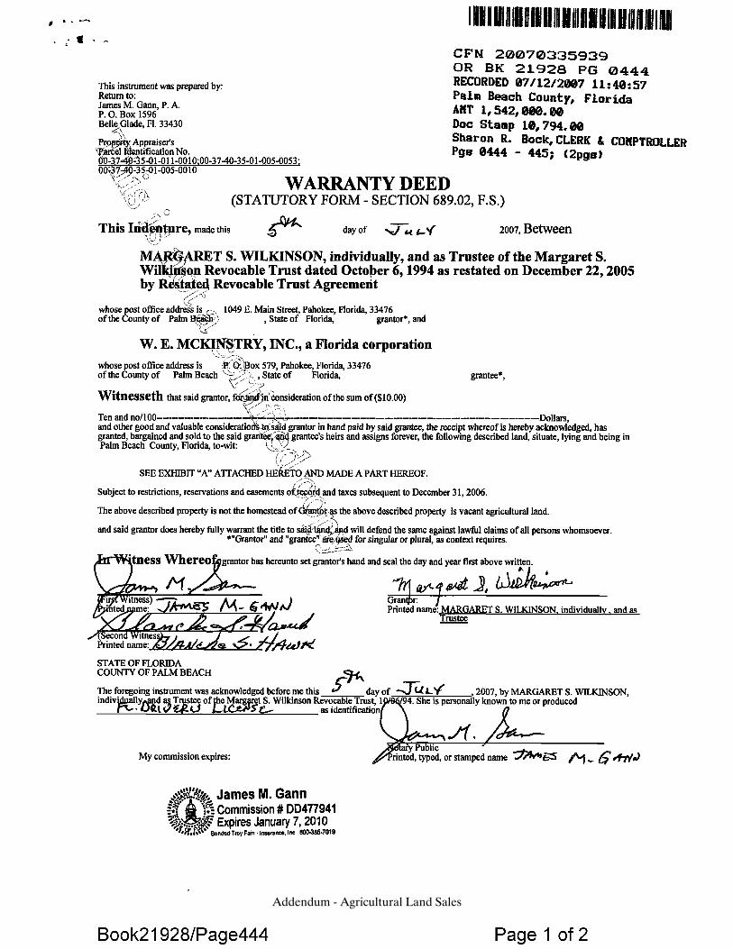
Addendum - Agricultural Land Sales
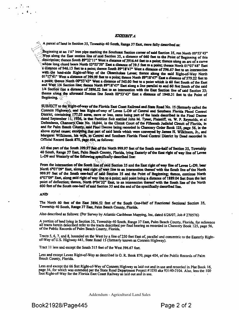
Addendum - Agricultural Land Sales
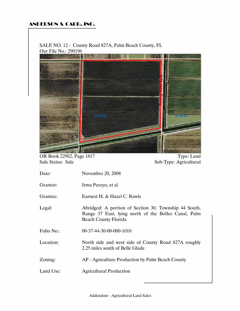
ANDERSON & CARR, INC.
SALE NO. 12 - County Road 827A, Palm Beach County, FL Our File No.: 290196
OR Book 22982, Page 1817 Type: Land Sale Status: Sale Sub-Type: Agricultural Date: November 20, 2008 Grantor: Irma Pereyo, et al Grantee: Earnest H. & Hazel C. Rawls Legal: Abridged: A portion of Section 30, Township 44 South,
Range 37 East, lying north of the Bolles Canal, Palm Beach County Florida
Folio No.: 00-37-44-30-00-000-1010
Location: North side and west side of County Road 827A roughly
2.25 miles south of Belle Glade Zoning: AP - Agriculture Production by Palm Beach County Land Use: Agricultural Production
Addendum - Agricultural Land Sales
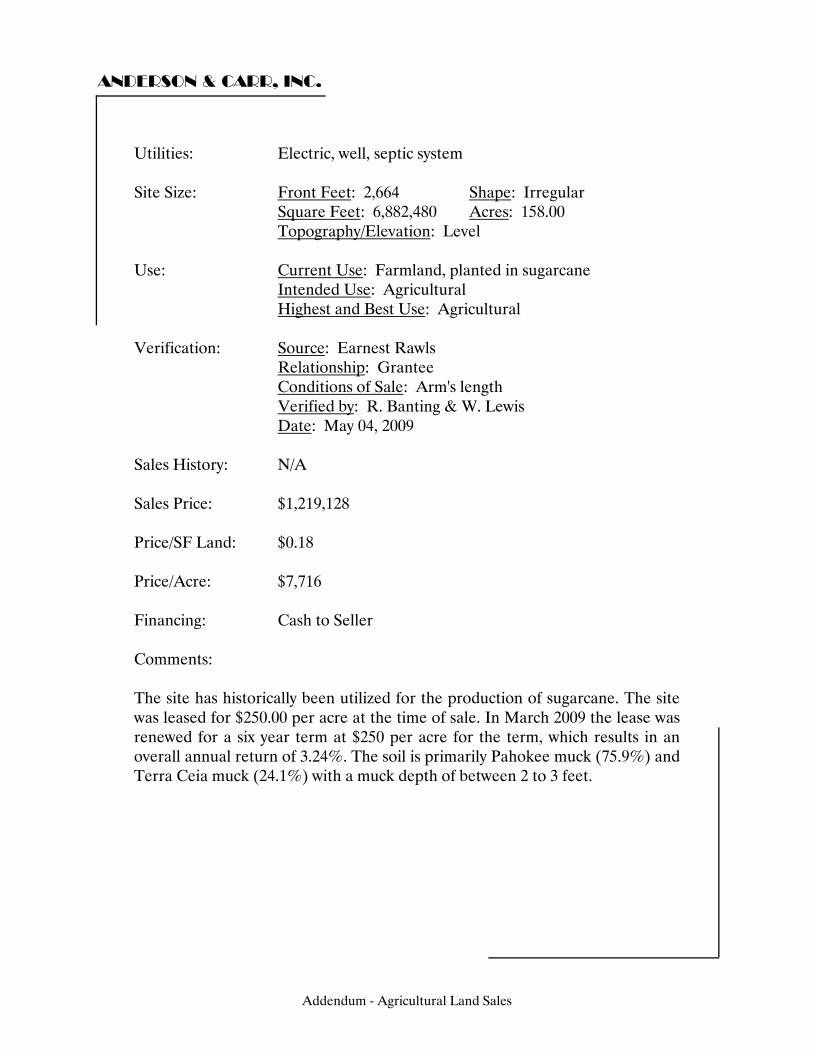
ANDERSON & CARR, INC.
Utilities: Electric, well, septic system Site Size: Front Feet: 2,664 Shape: Irregular Square Feet: 6,882,480 Acres: 158.00 Topography/Elevation: Level Use: Current Use: Farmland, planted in sugarcane Intended Use: Agricultural Highest and Best Use: Agricultural Verification: Source: Earnest Rawls Relationship: Grantee Conditions of Sale: Arm's length Verified by: R. Banting & W. Lewis Date: May 04, 2009 Sales History: N/A Sales Price: $1,219,128 Price/SF Land: $0.18 Price/Acre: $7,716 Financing: Cash to Seller Comments: The site has historically been utilized for the production of sugarcane. The site was leased for $250.00 per acre at the time of sale. In March 2009 the lease was renewed for a six year term at $250 per acre for the term, which results in an overall annual return of 3.24%. The soil is primarily Pahokee muck (75.9%) and Terra Ceia muck (24.1%) with a muck depth of between 2 to 3 feet.
Addendum - Agricultural Land Sales
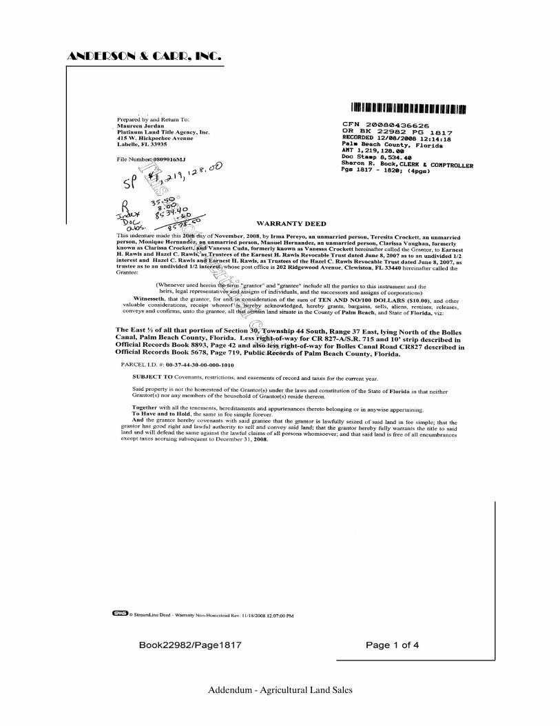
ANDERSON & CARR, INC.
Addendum - Agricultural Land Sales
ANDERSON & CARR, INC.
Addendum - Agricultural Land Sales
ANDERSON & CARR, INC.
Addendum - Agricultural Land Sales
ANDERSON & CARR, INC.
Addendum - Agricultural Land Sales
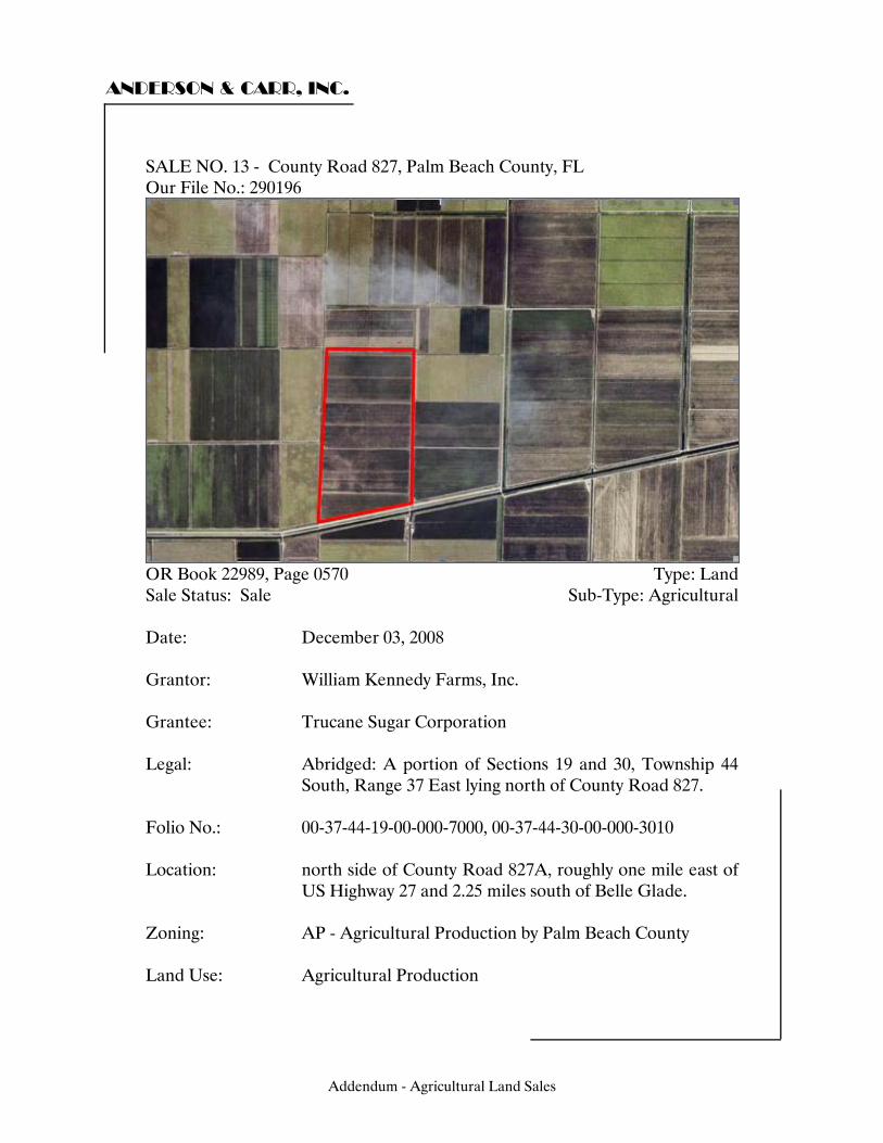
ANDERSON & CARR, INC.
SALE NO. 13 - County Road 827, Palm Beach County, FL Our File No.: 290196
OR Book 22989, Page 0570 Type: Land Sale Status: Sale Sub-Type: Agricultural Date: December 03, 2008 Grantor: William Kennedy Farms, Inc. Grantee: Trucane Sugar Corporation Legal: Abridged: A portion of Sections 19 and 30, Township 44
South, Range 37 East lying north of County Road 827. Folio No.: 00-37-44-19-00-000-7000, 00-37-44-30-00-000-3010
Location: north side of County Road 827A, roughly one mile east of
US Highway 27 and 2.25 miles south of Belle Glade. Zoning: AP - Agricultural Production by Palm Beach County Land Use: Agricultural Production
Addendum - Agricultural Land Sales
ANDERSON & CARR, INC.
Utilities: Electricity, well septic system Site Size: Front Feet: 2,716 Shape: Irregular Square Feet: 15,809,231 Acres: 362.93 Topography/Elevation: Level Use: Current Use: Agricultural Intended Use: Agricultural Highest and Best Use: Agricultural Verification: Source: Ernesto Vilar Relationship: Representative of Grantee Conditions of Sale: Arm's length Verified by: R. Banting & W. Lewis Date: May 04, 2009 Sales History: Previously sold in January 1996 for $1,369,300 as recorded
in OR Book 09074, Page 0972 Sales Price: $3,629,300 Price/SF Land: $0.23 Price/Acre: $10,000 Financing: Cash to Seller Comments: The site has historically been used for the production of sugarcane. The soil type is primarily Pahokee muck (84.3%) and Terra Ceia muck (15.7%) with a depth of between 2 and 3 feet. This sale was a part of a 1031 exchange.
Addendum - Agricultural Land Sales
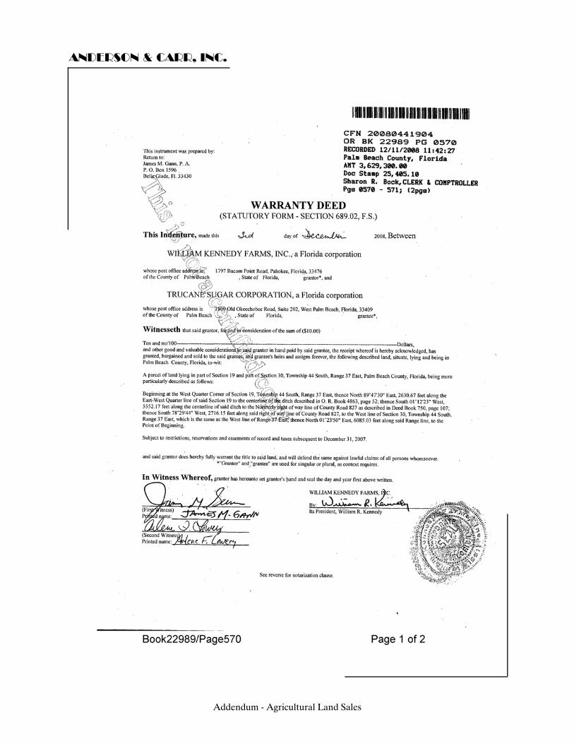
ANDERSON & CARR, INC.
Addendum - Agricultural Land Sales
ANDERSON & CARR, INC.
Addendum - Agricultural Land Sales
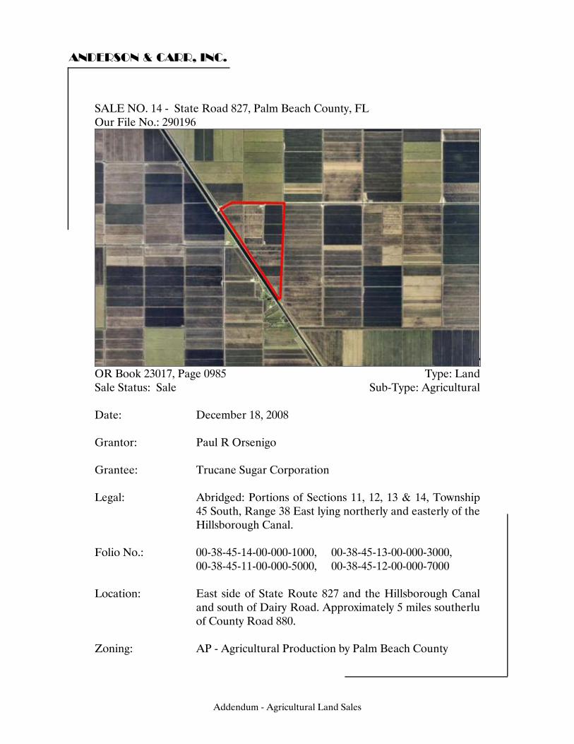
ANDERSON & CARR, INC.
SALE NO. 14 - State Road 827, Palm Beach County, FL Our File No.: 290196
OR Book 23017, Page 0985 Type: Land Sale Status: Sale Sub-Type: Agricultural Date: December 18, 2008 Grantor: Paul R Orsenigo Grantee: Trucane Sugar Corporation Legal: Abridged: Portions of Sections 11, 12, 13 & 14, Township
45 South, Range 38 East lying northerly and easterly of the Hillsborough Canal.
Folio No.: 00-38-45-14-00-000-1000, 00-38-45-13-00-000-3000, 00-38-45-11-00-000-5000, 00-38-45-12-00-000-7000
Location: East side of State Route 827 and the Hillsborough Canal
and south of Dairy Road. Approximately 5 miles southerlu of County Road 880.
Zoning: AP - Agricultural Production by Palm Beach County
Addendum - Agricultural Land Sales
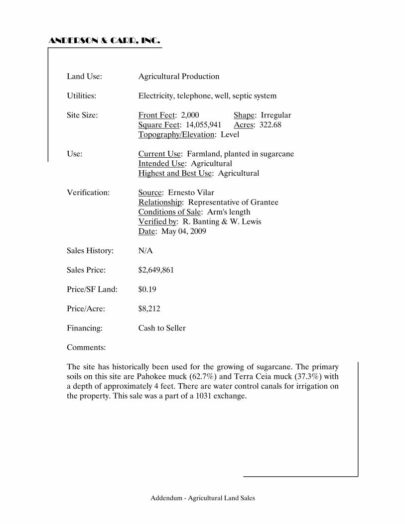
ANDERSON & CARR, INC.
Land Use: Agricultural Production Utilities: Electricity, telephone, well, septic system Site Size: Front Feet: 2,000 Shape: Irregular Square Feet: 14,055,941 Acres: 322.68 Topography/Elevation: Level Use: Current Use: Farmland, planted in sugarcane Intended Use: Agricultural Highest and Best Use: Agricultural Verification: Source: Ernesto Vilar Relationship: Representative of Grantee Conditions of Sale: Arm's length Verified by: R. Banting & W. Lewis Date: May 04, 2009 Sales History: N/A Sales Price: $2,649,861 Price/SF Land: $0.19 Price/Acre: $8,212 Financing: Cash to Seller Comments: The site has historically been used for the growing of sugarcane. The primary soils on this site are Pahokee muck (62.7%) and Terra Ceia muck (37.3%) with a depth of approximately 4 feet. There are water control canals for irrigation on the property. This sale was a part of a 1031 exchange.
Addendum - Agricultural Land Sales
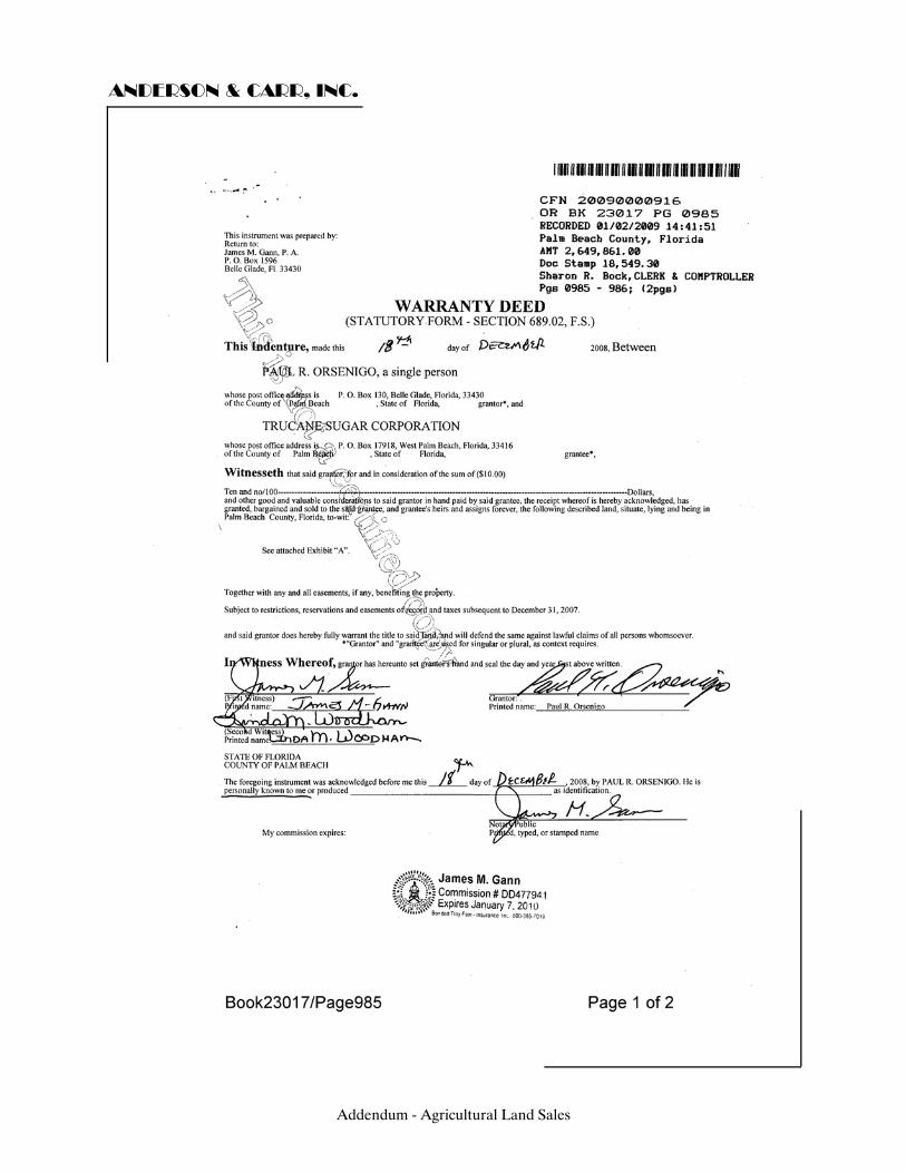
ANDERSON & CARR, INC.
Addendum - Agricultural Land Sales
ANDERSON & CARR, INC.
Addendum - Agricultural Land Sales
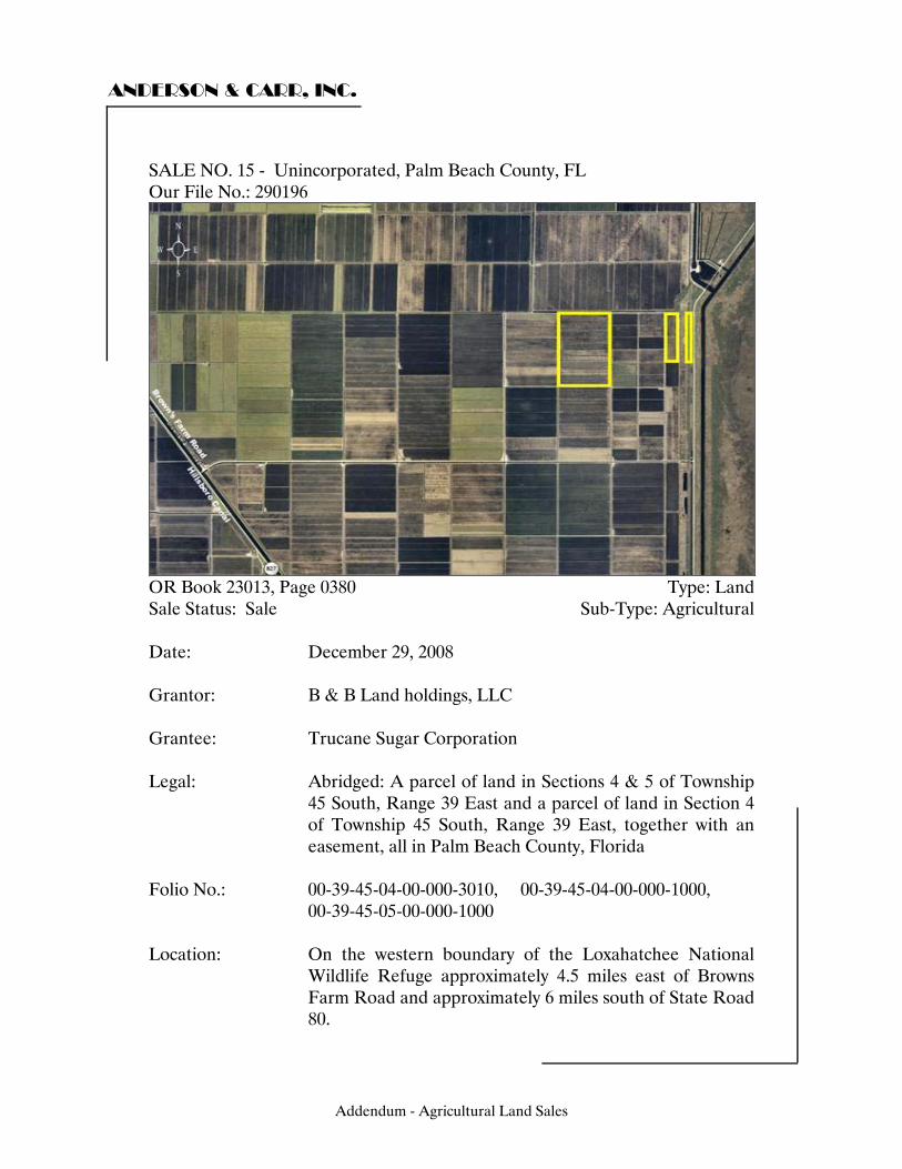
ANDERSON & CARR, INC.
SALE NO. 15 - Unincorporated, Palm Beach County, FL Our File No.: 290196
OR Book 23013, Page 0380 Type: Land Sale Status: Sale Sub-Type: Agricultural Date: December 29, 2008 Grantor: B & B Land holdings, LLC Grantee: Trucane Sugar Corporation Legal: Abridged: A parcel of land in Sections 4 & 5 of Township
45 South, Range 39 East and a parcel of land in Section 4 of Township 45 South, Range 39 East, together with an easement, all in Palm Beach County, Florida
Folio No.: 00-39-45-04-00-000-3010, 00-39-45-04-00-000-1000, 00-39-45-05-00-000-1000
Location: On the western boundary of the Loxahatchee National
Wildlife Refuge approximately 4.5 miles east of Browns Farm Road and approximately 6 miles south of State Road 80.
Addendum - Agricultural Land Sales
ANDERSON & CARR, INC.
Zoning: AP - Agricultural Production by Palm Beach County Land Use: Agricultural Production Utilities: Electricity Site Size: Front Feet: 0 Shape: Rectangular Square Feet: 12,509,561 Acres: 287.18 Topography/Elevation: Level Use: Current Use: Agriculture, primarily planted in sugarcane Intended Use: Agricultural Highest and Best Use: Agricultural Verification: Source: Ernesto Vilar Relationship: Representative of Grantee Conditions of Sale: Arm's length Verified by: R. Banting & W. Lewis Date: May 04, 2009 Sales History: Previously sold for $1,578,500 in February 2006 as
recorded in OR Book 20025, Page 1839. Sales Price: $2,297,440 Price/SF Land: $0.18 Price/Acre: $8,000 Financing: Cash to Seller Comments: The sale consists of two non-contiguous parcels together with an easement. At the time of sale a portion of the property was used for turf production. Since the sale all but approximately 60 acres is in sugercane production and leased for $500 per acre. The soil is primarily Terra Ceia muck (63.7%), Okeechobee muck (21.4%) and Pahokee muck (14.9%). The muck depth is reported to be approximately 4 feet. This sale was a part of a 1031 exchange.
Addendum - Agricultural Land Sales
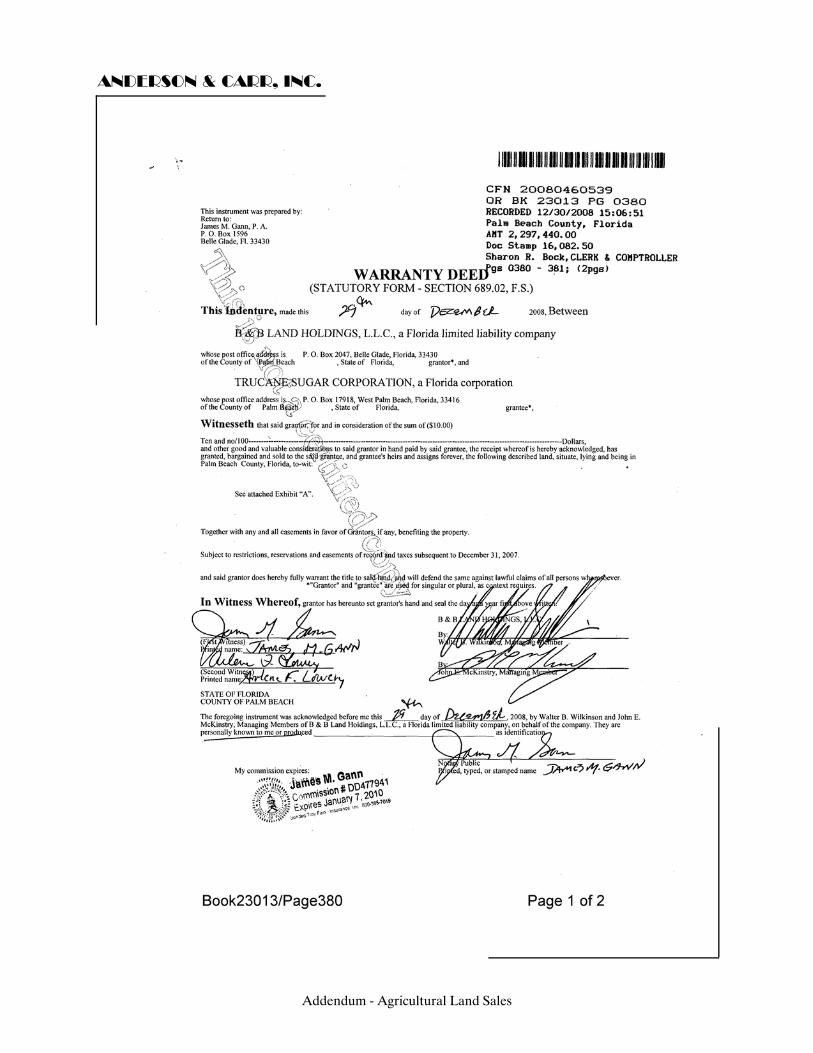
ANDERSON & CARR, INC.
Addendum - Agricultural Land Sales
ANDERSON & CARR, INC.
Addendum - Agricultural Land Sales

ANDERSON & CARR, INC.
SALE NO. 16 - CR 833, Clewiston, FL Our File No.: 290196
OR Book 775, Page 513 Type: Land Sale Status: Sale Sub-Type: Agricultural Date: September 27, 2007 Grantor: Greco Roman Holdings, Inc Grantee: S Ranch Properties, LLC Legal: Abridged: A portion of the East one-half of Section 32 and
the West one-half of Section 33, Township 47 South, Range 33 East, Hendry County, Florida
Folio No.: 1-33-47-33-A00-0002, 1-33-47-32-A00-0002
Location: Approximately 2 miles west of County Road 833 and 15.5
miles north of Interstate 75 via CR 833, Hendry County, Florida.
Zoning: A-2 - Agricultural, 1 Unit per 5 acres by Hendry County Land Use: Agricultural
Addendum - Agricultural Land Sales

ANDERSON & CARR, INC.
Utilities: N/A Site Size: Front Feet: 0 Shape: Irregular Square Feet: 21,498,602 Acres: 493.54 Topography/Elevation: Level Use: Current Use: Agricultural Intended Use: Agricultural Highest and Best Use: Agricultural Verification: Source: Brett Dubois Relationship: Broker Conditions of Sale: Arm's length Verified by: M. Evans Date: May 14, 2009 Sales History: Previously sold in April 2007 for $1,700,000 as recorded in
OR Book 763, Page 7 Sales Price: $2,987,400 Price/SF Land: $0.14 Price/Acre: $6,053 Financing: Cash to Seller Comments: This was part of an assemblage of approximately 1,500 acres of contiguous parcels which occurred between September 2007 and October 2008. The first transaction in September 2007 included 493.54 acres as recorded in OR 775/513. The second transaction in February 2008 included 534 acres as recorded in OR 782/217. The third transaction in March 2008 included 452.44 acres as recorded in OR 784/1627. The forth transaction in October 2008 included 20 acres as recorded in OR 795/205 and OR 795/207. The broker advised that he believed the owner will use the property to sell "Panther Habitat Units" and continue use the property for grazing land.
Addendum - Agricultural Land Sales

ANDERSON & CARR, INC.
Addendum - Agricultural Land Sales

ANDERSON & CARR, INC.
Addendum - Agricultural Land Sales

ANDERSON & CARR, INC.
Addendum - Agricultural Land Sales
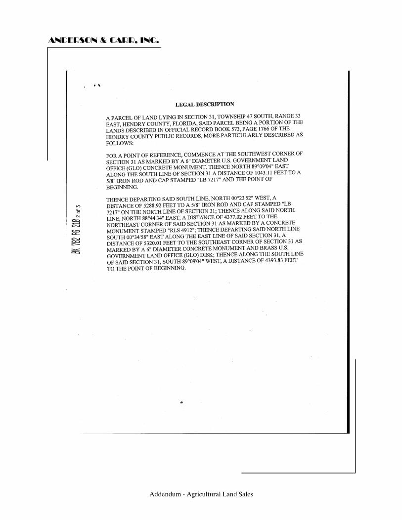
ANDERSON & CARR, INC.
Addendum - Agricultural Land Sales

ANDERSON & CARR, INC.
Addendum - Agricultural Land Sales

ANDERSON & CARR, INC.
Addendum - Agricultural Land Sales

ANDERSON & CARR, INC.
Addendum - Agricultural Land Sales

ANDERSON & CARR, INC.
Addendum - Agricultural Land Sales
ANDERSON & CARR, INC.
Addendum - Agricultural Land Sales
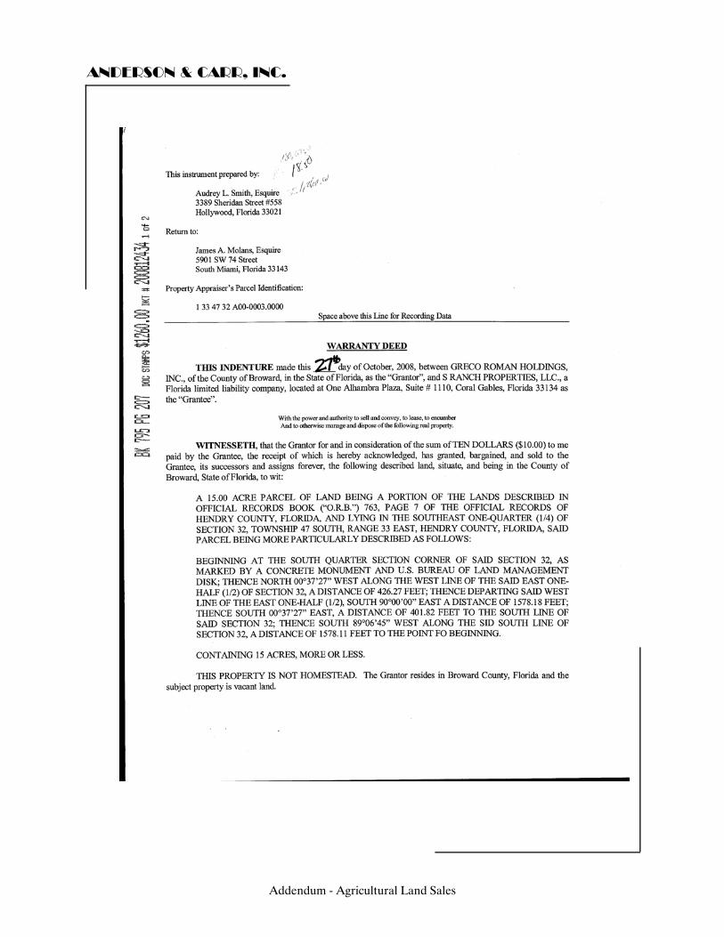
ANDERSON & CARR, INC.
Addendum - Agricultural Land Sales

ANDERSON & CARR, INC.
Addendum - Agricultural Land Sales
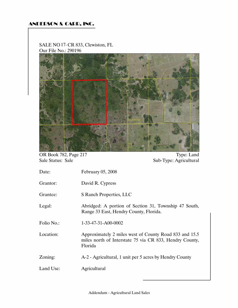
ANDERSON & CARR, INC.
SALE NO. - CR 833, Clewiston, FL Our File No.: 290196
OR Book 782, Page 217 Type: Land Sale Status: Sale Sub-Type: Agricultural Date: February 05, 2008 Grantor: David R. Cypress Grantee: S Ranch Properties, LLC Legal: Abridged: A portion of Section 31, Township 47 South,
Range 33 East, Hendry County, Florida. Folio No.: 1-33-47-31-A00-0002
Location: Approximately 2 miles west of County Road 833 and 15.5
miles north of Interstate 75 via CR 833, Hendry County, Florida
Zoning: A-2 - Agricultural, 1 unit per 5 acres by Hendry County Land Use: Agricultural
Addendum - Agricultural Land Sales
17-

ANDERSON & CARR, INC.
Utilities: N/A Site Size: Front Feet: 0 Shape: Rectangular Square Feet: 23,261,040 Acres: 534.00 Topography/Elevation: Level Use: Current Use: Agricultural Intended Use: Agricultural Highest and Best Use: Agricultural Verification: Source: Brett Dubois Relationship: Broker Conditions of Sale: Arm's length Verified by: M. Evans Date: May 14, 2009 Sales History: Previously sold on December 6, 2007 for $801,000 as
recorded in OR Book 779, Page 605. Sales Price: $5,340,000 Price/SF Land: $0.23 Price/Acre: $10,000 Financing: Cash to Seller Comments: This was part of an assemblage of approximately 1,500 acres of contiguous parcels which occurred between September 2007 and October 2008. The first transaction in September 2007 included 493.54 acres as recorded in OR 775/513. The second transaction in February 2008 included 534 acres as recorded in OR 782/217. The third transaction in March 2008 included 452.44 acres as recorded in OR 784/1627. The forth transaction in October 2008 included 20 acres as recorded in OR 795/205 and OR 795/207. The broker advised that he believed the owner will use the property to sell "Panther Habitat Units" and continue use the property for grazing land.
Addendum - Agricultural Land Sales

ANDERSON & CARR, INC.
Addendum - Agricultural Land Sales

ANDERSON & CARR, INC.
Addendum - Agricultural Land Sales
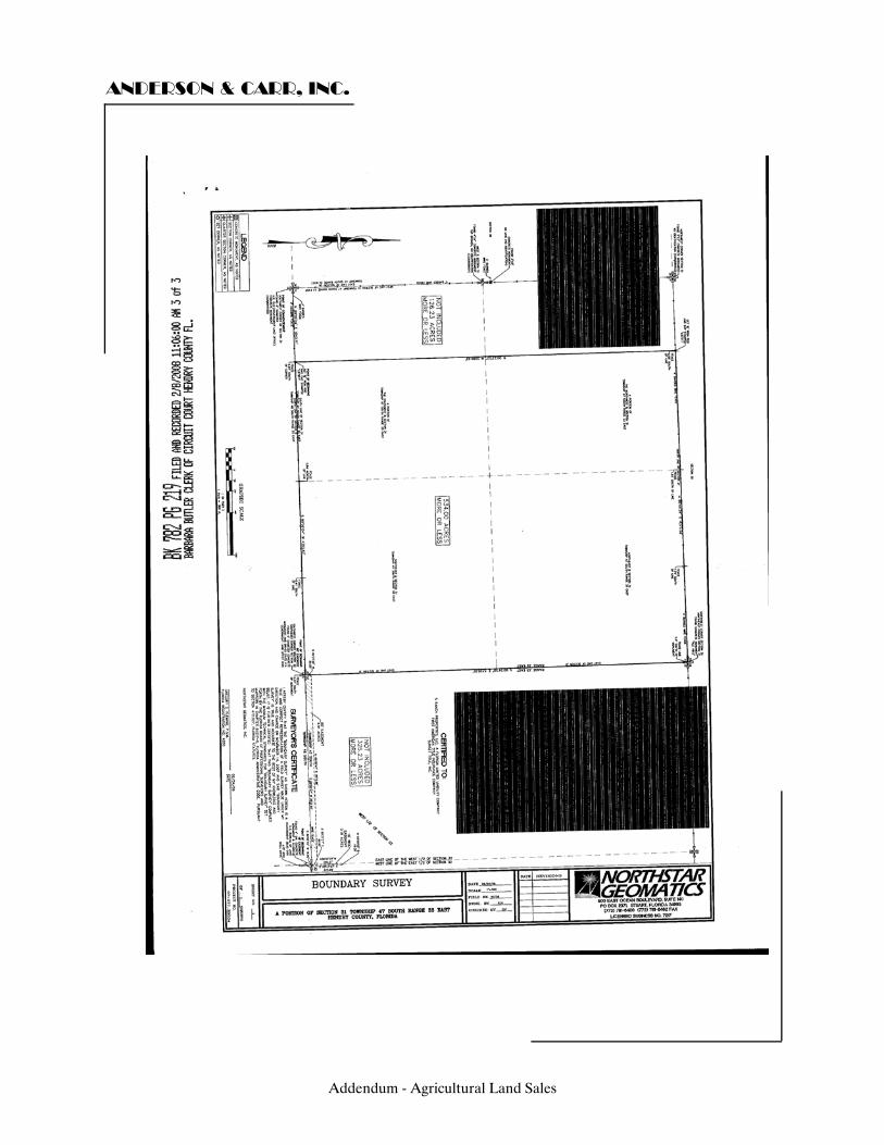
ANDERSON & CARR, INC.
Addendum - Agricultural Land Sales

ANDERSON & CARR, INC.
Addendum - Agricultural Land Sales

ANDERSON & CARR, INC.
Addendum - Agricultural Land Sales
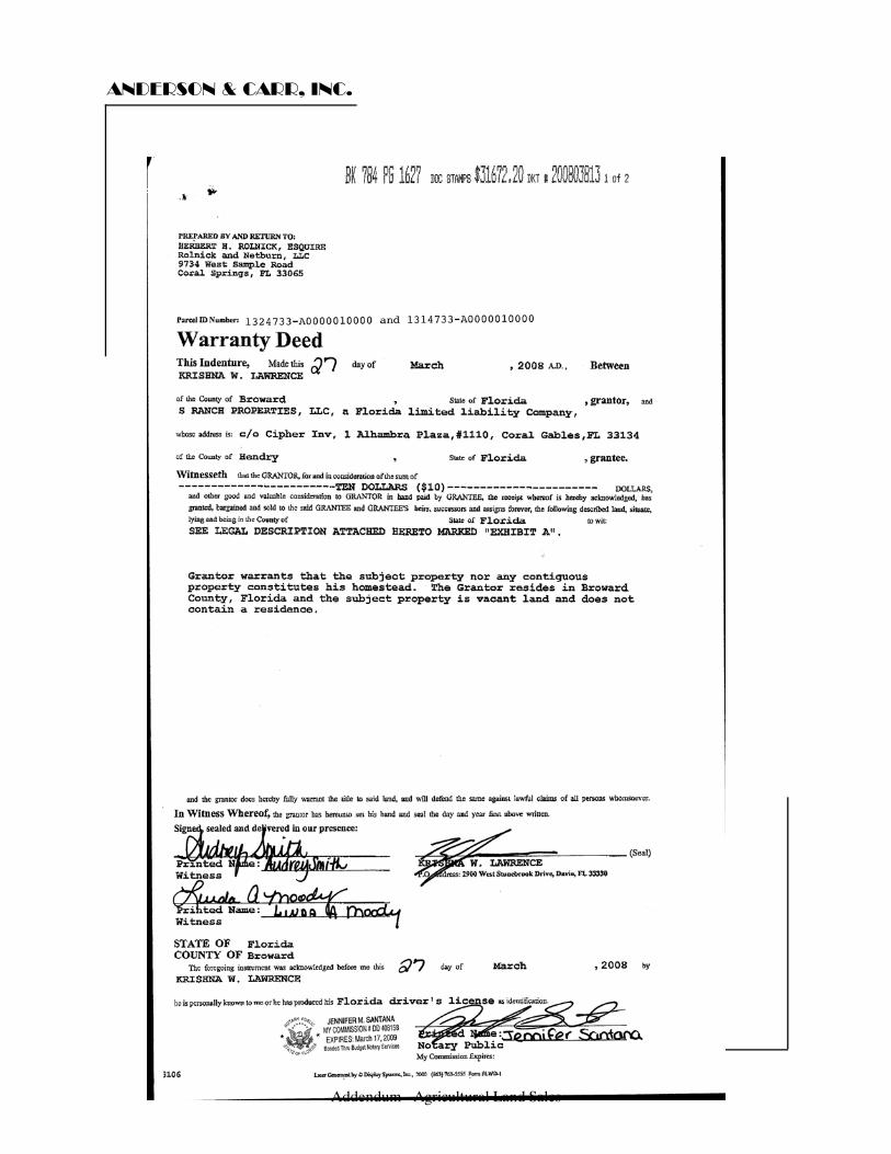
ANDERSON & CARR, INC.
Addendum - Agricultural Land Sales
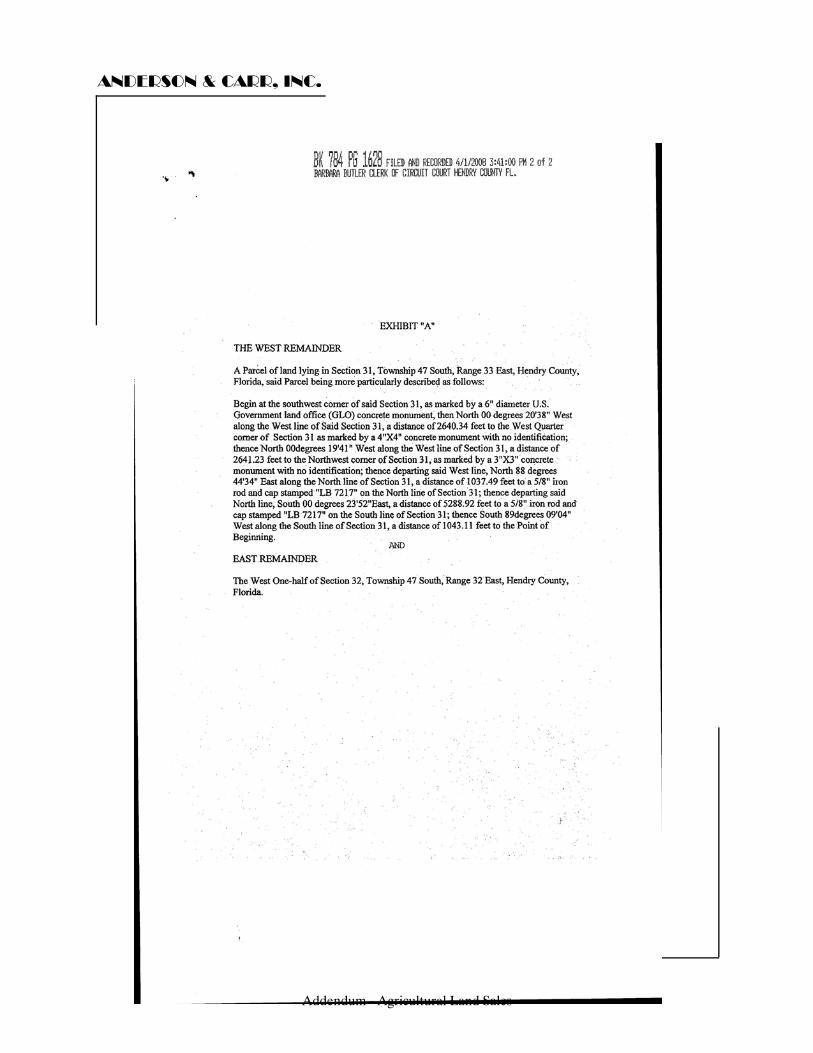
ANDERSON & CARR, INC.
Addendum - Agricultural Land Sales
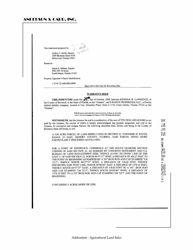
ANDERSON & CARR, INC.
Addendum - Agricultural Land Sales

ANDERSON & CARR, INC.
Addendum - Agricultural Land Sales

ANDERSON & CARR, INC.
Addendum - Agricultural Land Sales
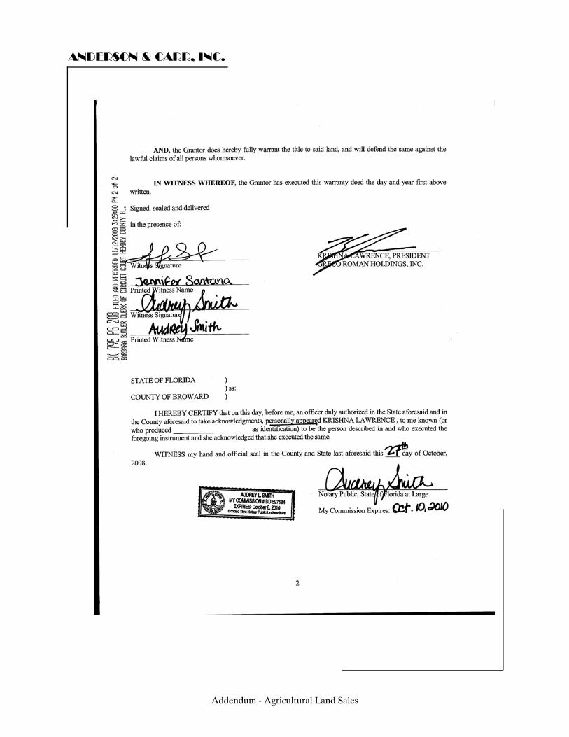
ANDERSON & CARR, INC.
Addendum - Agricultural Land Sales
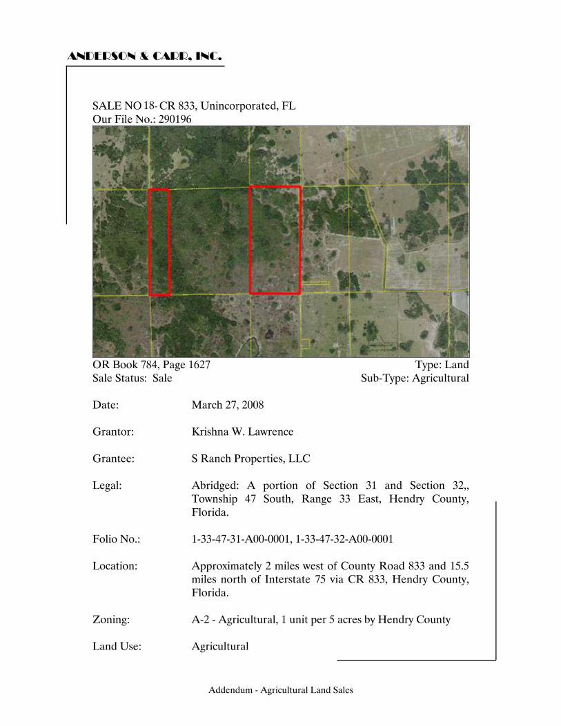
ANDERSON & CARR, INC.
SALE NO. - CR 833, Unincorporated, FL Our File No.: 290196
OR Book 784, Page 1627 Type: Land Sale Status: Sale Sub-Type: Agricultural Date: March 27, 2008 Grantor: Krishna W. Lawrence Grantee: S Ranch Properties, LLC Legal: Abridged: A portion of Section 31 and Section 32,,
Township 47 South, Range 33 East, Hendry County, Florida.
Folio No.: 1-33-47-31-A00-0001, 1-33-47-32-A00-0001
Location: Approximately 2 miles west of County Road 833 and 15.5
miles north of Interstate 75 via CR 833, Hendry County, Florida.
Zoning: A-2 - Agricultural, 1 unit per 5 acres by Hendry County Land Use: Agricultural
Addendum - Agricultural Land Sales
18-
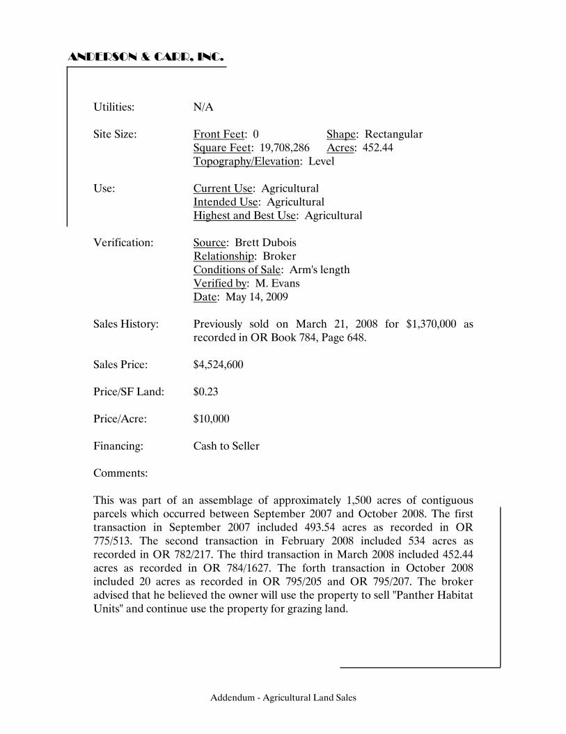
ANDERSON & CARR, INC.
Utilities: N/A Site Size: Front Feet: 0 Shape: Rectangular Square Feet: 19,708,286 Acres: 452.44 Topography/Elevation: Level Use: Current Use: Agricultural Intended Use: Agricultural Highest and Best Use: Agricultural Verification: Source: Brett Dubois Relationship: Broker Conditions of Sale: Arm's length Verified by: M. Evans Date: May 14, 2009 Sales History: Previously sold on March 21, 2008 for $1,370,000 as
recorded in OR Book 784, Page 648. Sales Price: $4,524,600 Price/SF Land: $0.23 Price/Acre: $10,000 Financing: Cash to Seller Comments: This was part of an assemblage of approximately 1,500 acres of contiguous parcels which occurred between September 2007 and October 2008. The first transaction in September 2007 included 493.54 acres as recorded in OR 775/513. The second transaction in February 2008 included 534 acres as recorded in OR 782/217. The third transaction in March 2008 included 452.44 acres as recorded in OR 784/1627. The forth transaction in October 2008 included 20 acres as recorded in OR 795/205 and OR 795/207. The broker advised that he believed the owner will use the property to sell "Panther Habitat Units" and continue use the property for grazing land.
Addendum - Agricultural Land Sales
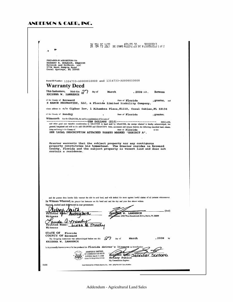
ANDERSON & CARR, INC.
Addendum - Agricultural Land Sales
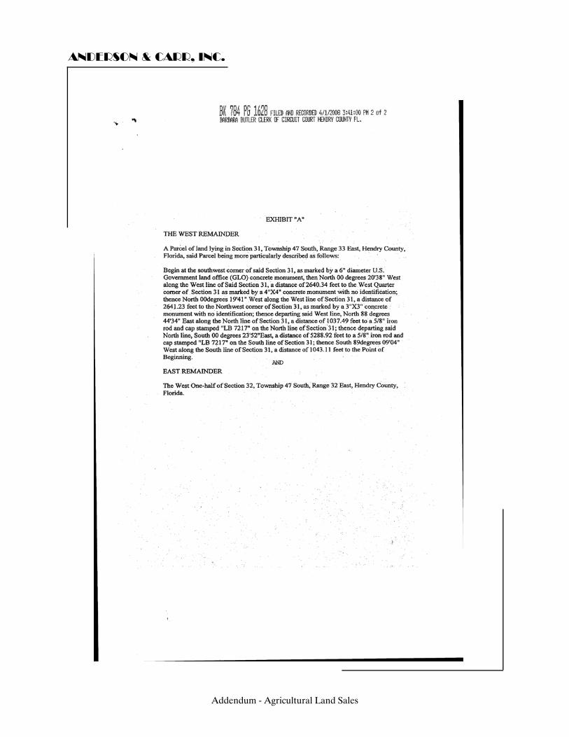
ANDERSON & CARR, INC.
Addendum - Agricultural Land Sales
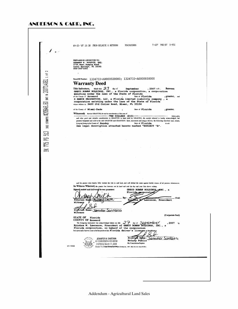
ANDERSON & CARR, INC.
Addendum - Agricultural Land Sales
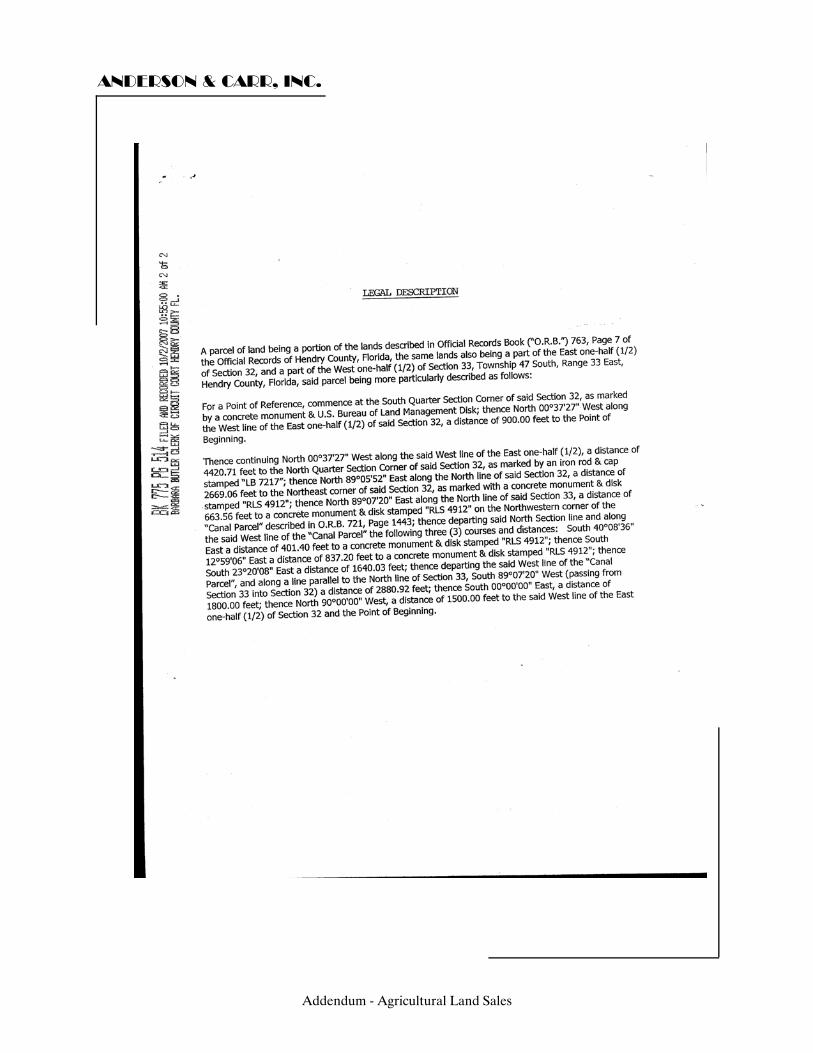
ANDERSON & CARR, INC.
Addendum - Agricultural Land Sales
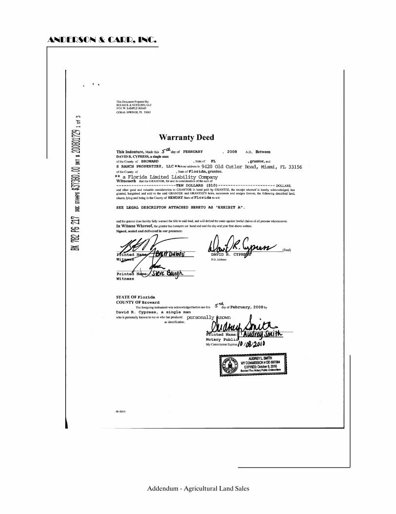
ANDERSON & CARR, INC.
Addendum - Agricultural Land Sales

ANDERSON & CARR, INC.
Addendum - Agricultural Land Sales

ANDERSON & CARR, INC.
Addendum - Agricultural Land Sales

ANDERSON & CARR, INC.
Addendum - Agricultural Land Sales

ANDERSON & CARR, INC.
Addendum - Agricultural Land Sales

ANDERSON & CARR, INC.
Addendum - Agricultural Land Sales

ANDERSON & CARR, INC.
Addendum - Agricultural Land Sales
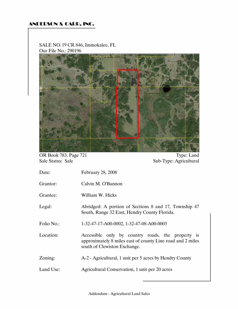
ANDERSON & CARR, INC.
SALE NO. - CR 846, Immokalee, FL Our File No.: 290196
OR Book 783, Page 721 Type: Land Sale Status: Sale Sub-Type: Agricultural Date: February 28, 2008 Grantor: Calvin M. O'Bannon Grantee: William W. Hicks Legal: Abridged: A portion of Sections 8 and 17, Township 47
South, Range 32 East, Hendry County Florida. Folio No.: 1-32-47-17-A00-0002, 1-32-47-08-A00-0003
Location: Accessible only by country roads, the property is
approximately 8 miles east of county Line road and 2 miles south of Clewiston Exchange.
Zoning: A-2 - Agricultural, 1 unit per 5 acres by Hendry County Land Use: Agricultural Conservation, 1 unit per 20 acres
Addendum - Agricultural Land Sales
19
ANDERSON & CARR, INC.
Utilities: N/A Site Size: Front Feet: 0 Shape: Rectangular Square Feet: 16,744,464 Acres: 384.40 Topography/Elevation: Level Use: Current Use: Agricultural Intended Use: Agricultural Highest and Best Use: Agricultural Verification: Source: Donald K. Ross, Jr. Relationship: Transaction Attorney Conditions of Sale: Arm's length Verified by: M. Evans Date: May 15, 2009 Sales History: Previously sold in November 2006 for $1,682,600 as
recorded in OR Book 754, Page 824. Sales Price: $2,200,000 Price/SF Land: $0.13 Price/Acre: $5,723 Financing: Cash to Seller Comments: The buyer is a wealthy individual who intends to maintain the property to preserve existing Panther Habitat Units and also use the property as a private turkey hunting reserve. The soil is primarily Boca and Hallandale sand.
Addendum - Agricultural Land Sales
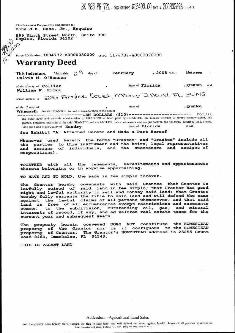
Addendum - Agricultural Land Sales
Addendum - Agricultural Land Sales
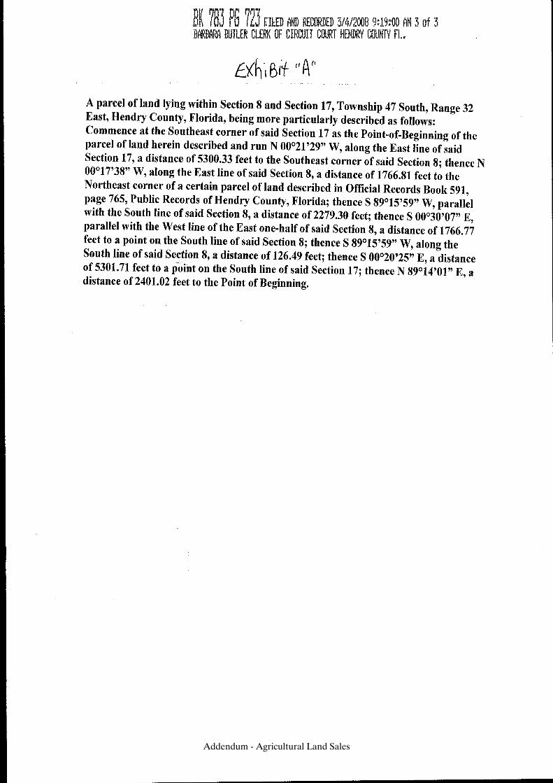
Addendum - Agricultural Land Sales
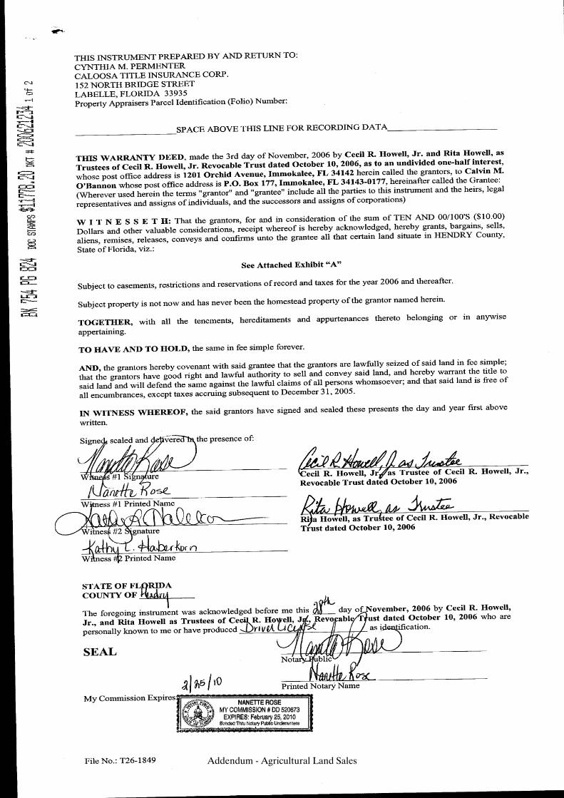
Addendum - Agricultural Land Sales
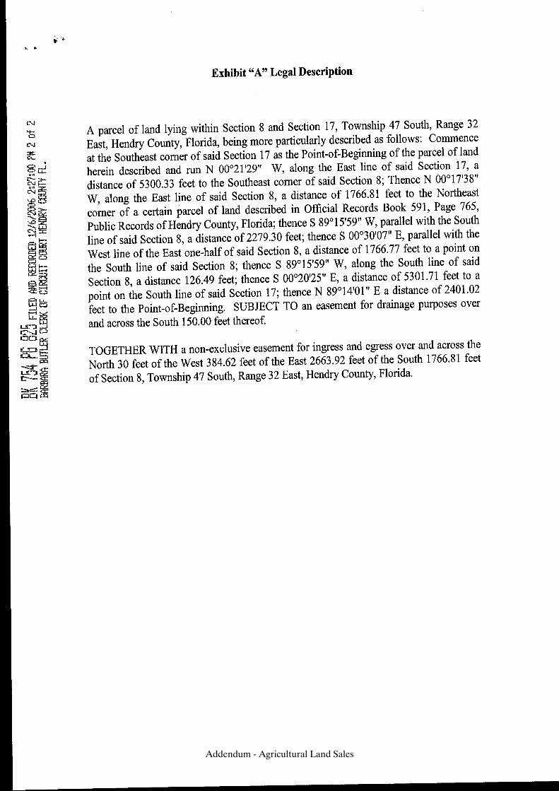
Addendum - Agricultural Land Sales
AGRICULTURAL SALES
TRANSITIONAL LAND SALES
Addendum - Transitional Land Sales
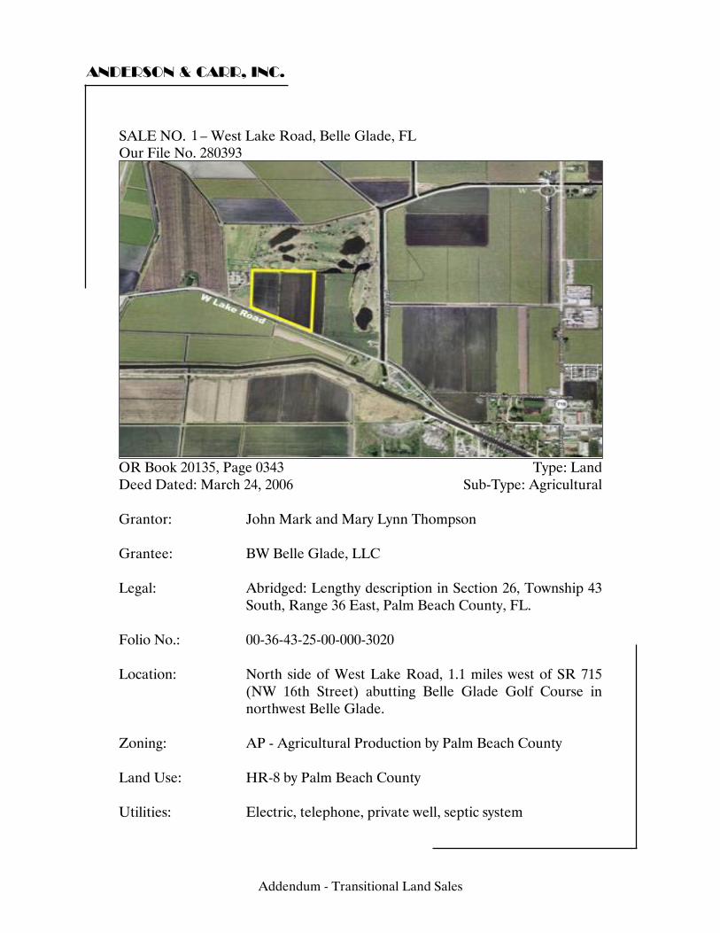
ANDERSON & CARR, INC.
SALE NO. 3 – West Lake Road, Belle Glade, FL Our File No. 280393
OR Book 20135, Page 0343 Type: Land Deed Dated: March 24, 2006 Sub-Type: Agricultural Grantor: John Mark and Mary Lynn Thompson Grantee: BW Belle Glade, LLC Legal: Abridged: Lengthy description in Section 26, Township 43
South, Range 36 East, Palm Beach County, FL. Folio No.: 00-36-43-25-00-000-3020 Location: North side of West Lake Road, 1.1 miles west of SR 715
(NW 16th Street) abutting Belle Glade Golf Course in northwest Belle Glade.
Zoning: AP - Agricultural Production by Palm Beach County Land Use: HR-8 by Palm Beach County Utilities: Electric, telephone, private well, septic system
1
Addendum - Transitional Land Sales
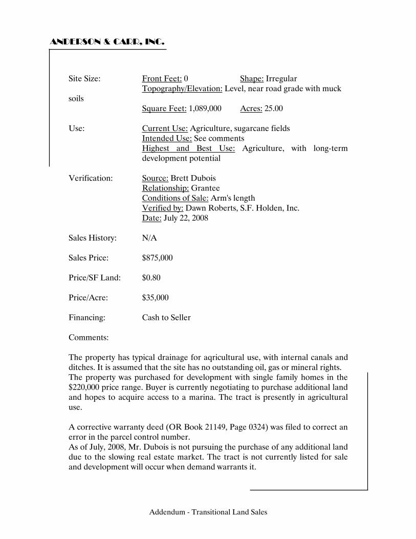
ANDERSON & CARR, INC.
Site Size: Front Feet: 0 Shape: Irregular Topography/Elevation: Level, near road grade with muck soils Square Feet: 1,089,000 Acres: 25.00 Use: Current Use: Agriculture, sugarcane fields Intended Use: See comments Highest and Best Use: Agriculture, with long-term
development potential Verification: Source: Brett Dubois Relationship: Grantee Conditions of Sale: Arm's length Verified by: Dawn Roberts, S.F. Holden, Inc. Date: July 22, 2008 Sales History: N/A Sales Price: $875,000 Price/SF Land: $0.80 Price/Acre: $35,000 Financing: Cash to Seller Comments: The property has typical drainage for aqricultural use, with internal canals and ditches. It is assumed that the site has no outstanding oil, gas or mineral rights. The property was purchased for development with single family homes in the $220,000 price range. Buyer is currently negotiating to purchase additional land and hopes to acquire access to a marina. The tract is presently in agricultural use. A corrective warranty deed (OR Book 21149, Page 0324) was filed to correct an error in the parcel control number. As of July, 2008, Mr. Dubois is not pursuing the purchase of any additional land due to the slowing real estate market. The tract is not currently listed for sale and development will occur when demand warrants it.
Addendum - Transitional Land Sales
ANDERSON & CARR, INC.
Addendum - Transitional Land Sales
ANDERSON & CARR, INC.
Addendum - Transitional Land Sales
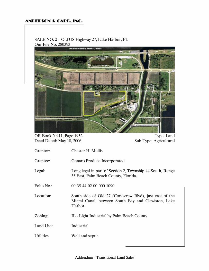
ANDERSON & CARR, INC.
SALE NO. 1 – Old US Highway 27, Lake Harbor, FL Our File No. 280393
OR Book 20411, Page 1932 Type: Land Deed Dated: May 18, 2006 Sub-Type: Agricultural Grantor: Chester H. Mullis Grantee: Genaro Produce Incorporated Legal: Long legal in part of Section 2, Township 44 South, Range
35 East, Palm Beach County, Florida. Folio No.: 00-35-44-02-00-000-1090 Location: South side of Old 27 (Corkscrew Blvd), just east of the
Miami Canal, between South Bay and Clewiston, Lake Harbor.
Zoning: IL - Light Industrial by Palm Beach County Land Use: Industrial Utilities: Well and septic
2
Addendum - Transitional Land Sales
ANDERSON & CARR, INC.
Site Size: Front Feet: 0 Shape: Irregular Topography/Elevation: Level, below road grade Square Feet: 1,388,693 Acres: 31.88 Use: Current Use: Aloe row crops Intended Use: Aloe plant production Highest and Best Use: Agriculture, with long term
industrial development Verification: Source: Chester Mullis Relationship: Conditions of Sale: Arm's length Verified by: Tim Holden Date: December 15, 2007 Sales History: ORB 07483 Pg 1916 November 1992 Sales Price: $1,100,000 Price/SF Land: $0.79 Price/Acre: $34,504 Financing: Cash to Seller Comments: Drainage to this site is typical for agricultural use with internal canals and ditches. It is assumed that the property has no outstanding oil, gas or mineral rights.
Addendum - Transitional Land Sales
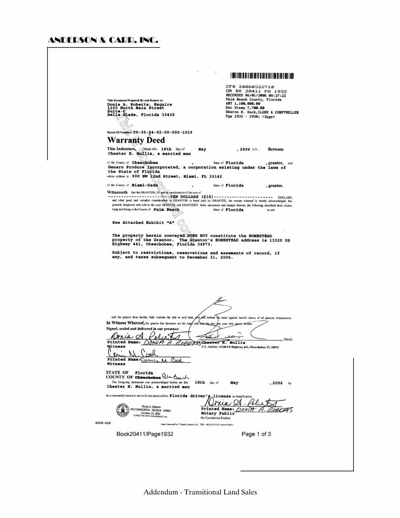
ANDERSON & CARR, INC.
Addendum - Transitional Land Sales
ANDERSON & CARR, INC.
Addendum - Transitional Land Sales
ANDERSON & CARR, INC.
Addendum - Transitional Land Sales

ANDERSON & CARR, INC.
SALE NO. 2 – State Road 80, Belle Glade, FL Our File No. 280393
OR Book 20675, Page 1148 Type: Land Deed Dated: June 30, 2006 Sub-Type: Agricultural Grantor: T & M of Palm Beach Grantee: Glades Development Partnership 1, Ltd. Legal: Abridged: Part of Section 7, in Township 44 South, Range
37 East, Palm Beach County, Florida. Folio No.: 00-37-44-07-00-000-1020; 00-37-44-07-00-000-1050 Location: South side of SR 80, 200 feet east of First Street, in
southern Belle Glade, Florida. Zoning: AR - Agricultural Residential by Palm Beach County Land Use: HR-12 by Palm Beach County Utilities: Electric, telephone, water and septic system
3
Addendum - Transitional Land Sales

ANDERSON & CARR, INC.
Site Size: Front Feet: 0 Shape: Irregular Topography/Elevation: Level, near road grade Square Feet: 1,758,517 Acres: 40.37 Use: Current Use: Agriculture, sugarcane crop Intended Use: N/A Highest and Best Use: Agriculture, with long-term
development potential Verification: Source: Jeff Smith Relationship: Grantee Representative Conditions of Sale: Arm's length Verified by: David Boyd Date: Sales History: ORB 14399 Pg 0989 October 2002 Sales Price: $1,200,000 Price/SF Land: $0.68 Price/Acre: $29,725 Financing: Cash to Seller Comments: The property contains approximately 40 acres. There is a lake containing 26 acres; only 14 acres is useable. As per the developer, the property may be developed at 3 to 4 units per acre. Mr. Smith noted that if the property is annexed, it may be developed between 11 and 12 units per acre.
Addendum - Transitional Land Sales
ANDERSON & CARR, INC.
Addendum - Transitional Land Sales
ANDERSON & CARR, INC.
Addendum - Transitional Land Sales
ANDERSON & CARR, INC.
Addendum - Transitional Land Sales
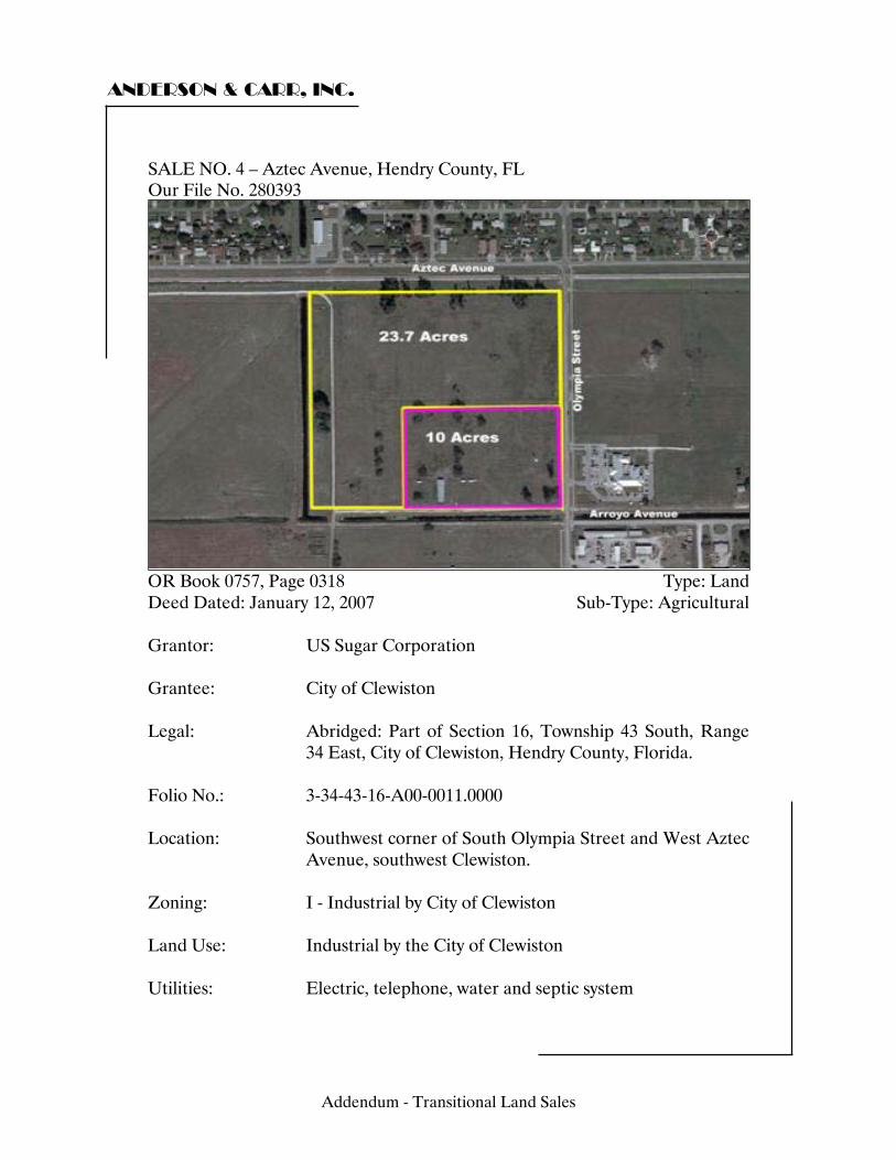
ANDERSON & CARR, INC.
SALE NO. 4 – Aztec Avenue, Hendry County, FL Our File No. 280393
OR Book 0757, Page 0318 Type: Land Deed Dated: January 12, 2007 Sub-Type: Agricultural Grantor: US Sugar Corporation Grantee: City of Clewiston Legal: Abridged: Part of Section 16, Township 43 South, Range
34 East, City of Clewiston, Hendry County, Florida. Folio No.: 3-34-43-16-A00-0011.0000 Location: Southwest corner of South Olympia Street and West Aztec
Avenue, southwest Clewiston. Zoning: I - Industrial by City of Clewiston Land Use: Industrial by the City of Clewiston Utilities: Electric, telephone, water and septic system
Addendum - Transitional Land Sales
ANDERSON & CARR, INC.
Site Size: Front Feet: 0 Shape: Irregular Topography/Elevation: Level, near road grade with mineral (sand) soils Square Feet: 1,467,972 Acres: 33.70 Use: Current Use: Vacant land, pasture Intended Use: Light industrial development Highest and Best Use: Industrial Verification: Source: Edward Almeida, Esquire Relationship: Vice President, Legal Affairs, USSC Conditions of Sale: Verified by: John Osgood Date: July 22, 2008 Sales History: N/A Sales Price: $1,428,500 Price/SF Land: $0.97 Price/Acre: $42,389 Financing: Cash to Seller Comments: Drainage to the property is by a canal along the northern boundary. It is assumed that there is no outstanding oil, gas or mineral rights. The South Central Florida Railway runs along the property’s northern boundary, south of West Aztec Avenue. The total recorded sale price of $1,428,500 included 10 acres at a discounted price of $12,500 per acre ($125,000). USSC sold the 10 acres at a discounted price to help the city get the commerce park launched. The sale price of $55,000 per acre for the remaining 23.7 acres ($1,303,500) was determined by an appraisal ordered by the City of Clewiston. The site is being developed with a light industrial subdivision named the City of Clewiston Commerce Park.
Addendum - Transitional Land Sales
ANDERSON & CARR, INC.
The deed references two parcels, totaling 33.7 acres and restricts development to use as a commerce/business park. The 10-acre parcel, located at the northwest corner of Olympia Street and Arroyo Avenue, was donated to Pranasleep, LLC by the City on April 23, 2007, for construction of a City Mattress manufacturing facility, which should be constructed by April of 2009. The tract was donated by way of a $250,000 Economic Development Grant Agreement and the City of Clewiston and Hendry County have granted public funds as an inducement to locate a new manufacturing plant on the site. The City holds a $250,000 lien on the property. As of July 2008, development in the commerce park is under way and one large lot in the northwest corner has been sold for $737,500.
Addendum - Transitional Land Sales
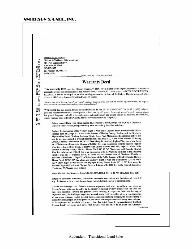
ANDERSON & CARR, INC.
Addendum - Transitional Land Sales

ANDERSON & CARR, INC.
c
Addendum - Transitional Land Sales
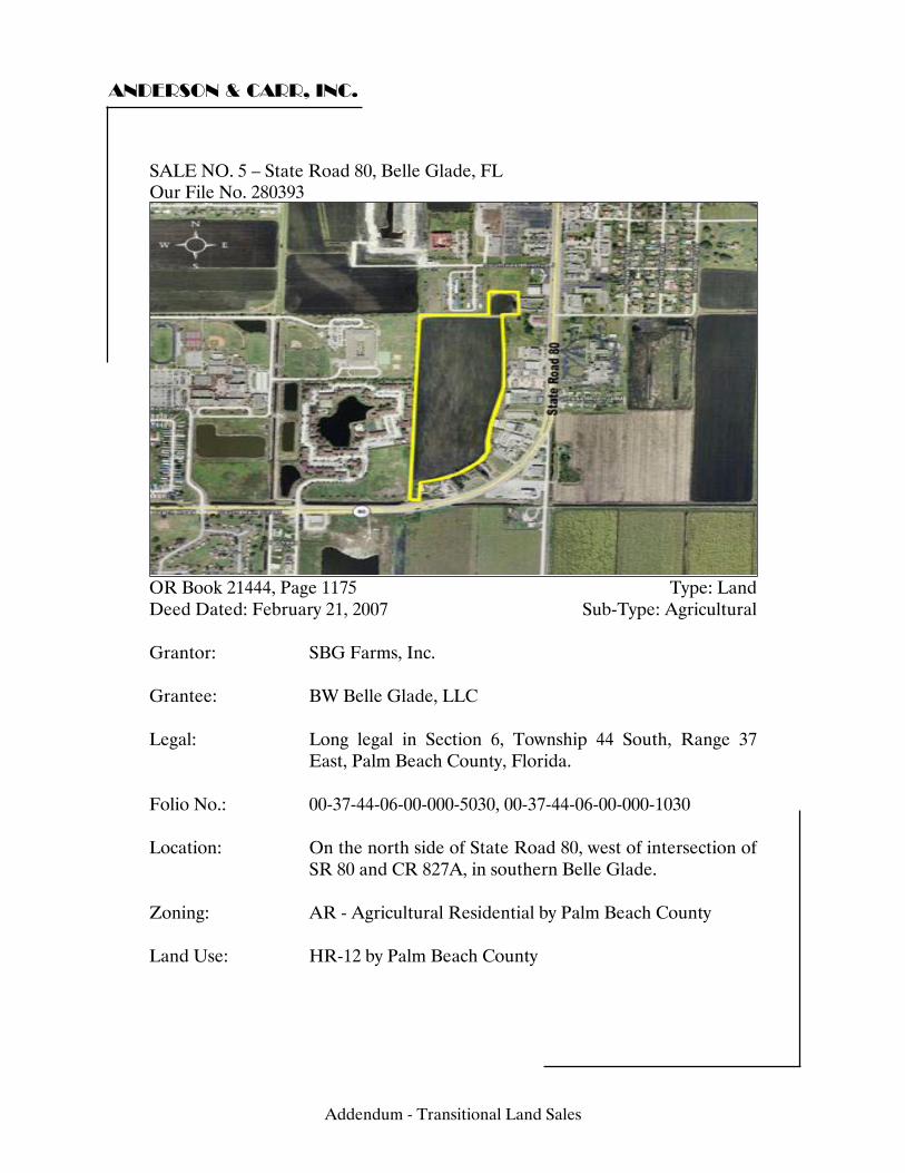
ANDERSON & CARR, INC.
SALE NO. 5 – State Road 80, Belle Glade, FL Our File No. 280393
OR Book 21444, Page 1175 Type: Land Deed Dated: February 21, 2007 Sub-Type: Agricultural Grantor: SBG Farms, Inc. Grantee: BW Belle Glade, LLC Legal: Long legal in Section 6, Township 44 South, Range 37
East, Palm Beach County, Florida. Folio No.: 00-37-44-06-00-000-5030, 00-37-44-06-00-000-1030 Location: On the north side of State Road 80, west of intersection of
SR 80 and CR 827A, in southern Belle Glade. Zoning: AR - Agricultural Residential by Palm Beach County Land Use: HR-12 by Palm Beach County
Addendum - Transitional Land Sales
ANDERSON & CARR, INC.
Utilities: Electric, telephone, private well and septic system Site Size: Front Feet: 0 Shape: Irregular Topography/Elevation: Level, near road grade with muck soils Square Feet: 1,870,902 Acres: 42.95 Use: Current Use: Agriculture, sugarcane crop Intended Use: N/A Highest and Best Use: Agriculture, with long-term
development potential Verification: Source: Brett Dubois Relationship: Grantee Conditions of Sale: Arm's length Verified by: Dawn Roberts, S.F. Holden, Inc. Date: July 22, 2008 Sales History: ORB 03399 Pg 0411 November 1980 Sales Price: $1,505,000 Price/SF Land: $0.80 Price/Acre: $35,041 Financing: Cash to Seller
Addendum - Transitional Land Sales
ANDERSON & CARR, INC.
Comments: Drainage to the property is adequate for agricultural use with perimeter canals. It is assumed that the site has no outstanding oil, gas or mineral rights. On the same day of this sale (February 21, 2007) a 1.70 acre site improved with a motel was purchased for $700,000 between the same parties. This property is situated along the west side of SR 80, in front of the agricultural property. This transaction is referenced in Palm Beach County Official Records Book 21444, Page 1170. Mr. Dubois stated that the motel was purchased to provide SR 80 access to the larger, vacant parcel. The motel is within the limits of the City of Belle Glade and is zoned B-2, Restricted Business District. As of July, 2008, the vacant tract and the motel are listed for sale for $3,015,000, or $71,786 per acre. The properties have been listed by Mr. DuBois, the owner and real estate broker, for 2 or 3 months.
Addendum - Transitional Land Sales
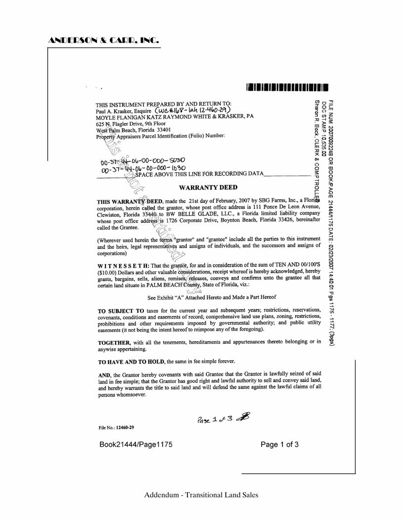
ANDERSON & CARR, INC.
Addendum - Transitional Land Sales
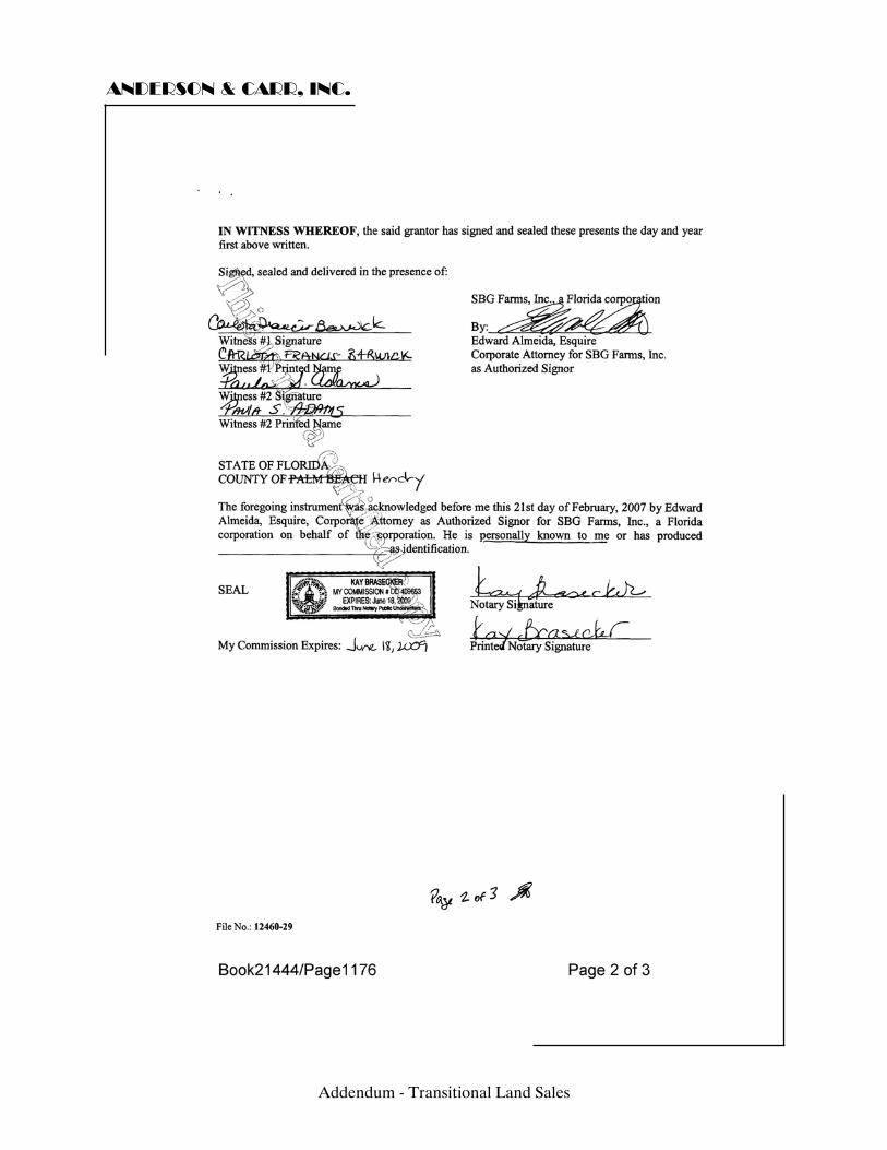
ANDERSON & CARR, INC.
Addendum - Transitional Land Sales
ANDERSON & CARR, INC.
Addendum - Transitional Land Sales
ANDERSON & CARR, INC.
Addendum - Transitional Land Sales
ANDERSON & CARR, INC.
Addendum - Transitional Land Sales
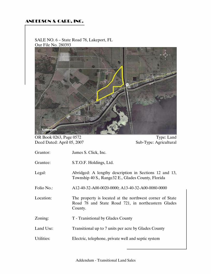
ANDERSON & CARR, INC.
SALE NO. 6 – State Road 78, Lakeport, FL Our File No. 280393
OR Book 0263, Page 0572 Type: Land Deed Dated: April 05, 2007 Sub-Type: Agricultural Grantor: James S. Click, Inc. Grantee: S.T.O.F. Holdings, Ltd. Legal: Abridged: A lengthy description in Sections 12 and 13,
Township 40 S., Range32 E., Glades County, Florida Folio No.: A12-40-32-A00-0020-0000; A13-40-32-A00-0080-0000 Location: The property is located at the northwest corner of State
Road 78 and State Road 721, in northeastern Glades County.
Zoning: T - Tranistional by Glades County Land Use: Transitional up to 7 units per acre by Glades County Utilities: Electric, telephone, private well and septic system
Addendum - Transitional Land Sales
ANDERSON & CARR, INC.
Site Size: Front Feet: 0 Shape: Irregular Topography/Elevation: Level, near road grade Square Feet: 12,499,978 Acres: 286.96 Use: Current Use: Sugarcane productions Intended Use: RV Park Highest and Best Use: Agricultural with long term
development Verification: Source: Joe Martin Relationship: S.T.O.F. Holdings, Ltd. Conditions of Sale: Arm's length Verified by: Tim Holden, S.F. Holden, Inc. Date: April 28, 2008 Sales History: N/A Sales Price: $6,235,300 Price/SF Land: $0.50 Price/Acre: $21,729 Financing: Cash to Seller Comments: Access to the property is achieved through frontage along the north side of State Road 78, a paved two-lane undivided highway that runs along the northern edge of Lake Okeechobee. Drainage is achieved through interior and perimeter canals. It is assumed that there are no outstanding oil, gas or mineral rights. The grantee (S.T.O.F. Holdings Ltd) is an abutting land owner. The motivation for the purchase was for the Seminole Tribe to gain access along SR 78. According to the listing broker, an RV park is planned for part of this property.
Addendum - Transitional Land Sales
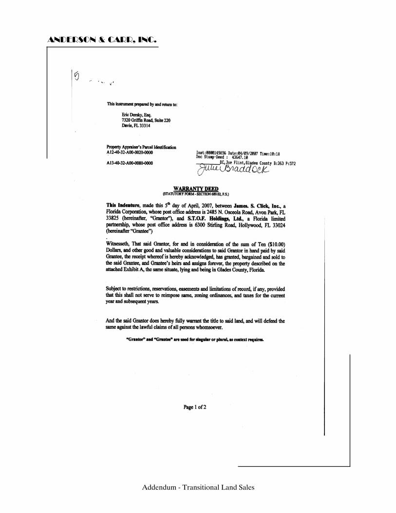
ANDERSON & CARR, INC.
Addendum - Transitional Land Sales
ANDERSON & CARR, INC.
Addendum - Transitional Land Sales
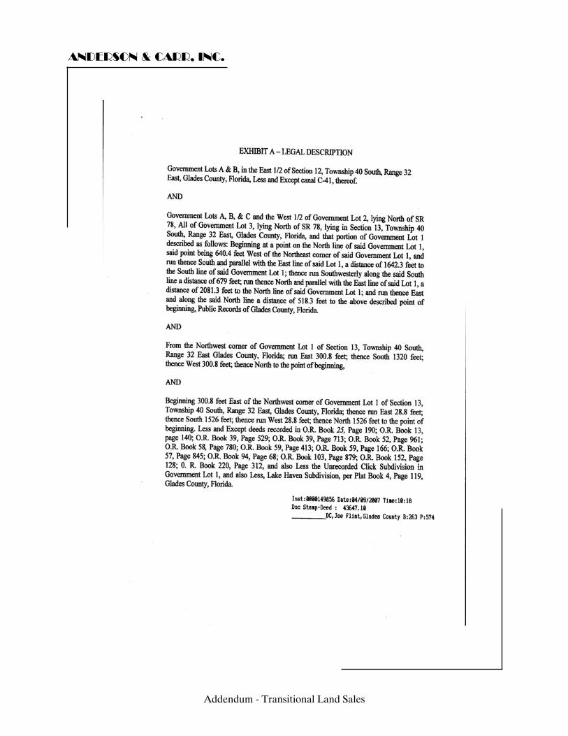
ANDERSON & CARR, INC.
Addendum - Transitional Land Sales

ANDERSON & CARR, INC.
Addendum - Transitional Land Sales
ANDERSON & CARR, INC.
Addendum - Transitional Land Sales
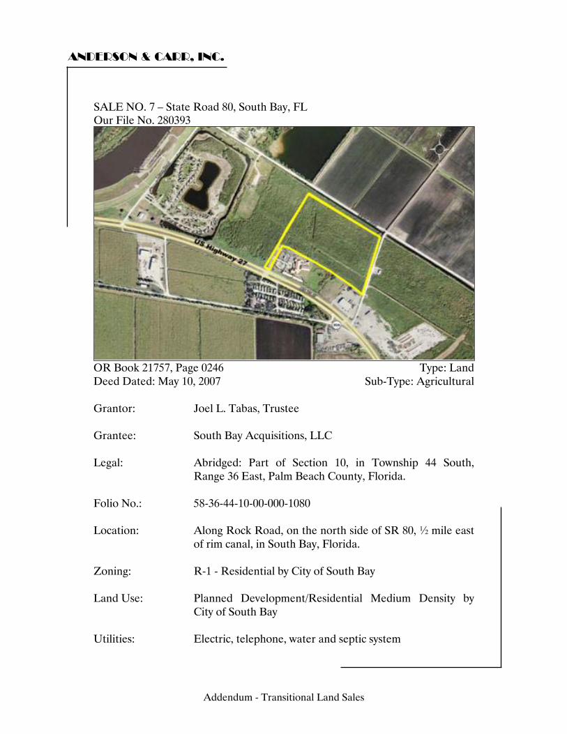
ANDERSON & CARR, INC.
SALE NO. 7 – State Road 80, South Bay, FL Our File No. 280393
OR Book 21757, Page 0246 Type: Land Deed Dated: May 10, 2007 Sub-Type: Agricultural Grantor: Joel L. Tabas, Trustee Grantee: South Bay Acquisitions, LLC Legal: Abridged: Part of Section 10, in Township 44 South,
Range 36 East, Palm Beach County, Florida. Folio No.: 58-36-44-10-00-000-1080 Location: Along Rock Road, on the north side of SR 80, ½ mile east
of rim canal, in South Bay, Florida. Zoning: R-1 - Residential by City of South Bay Land Use: Planned Development/Residential Medium Density by
City of South Bay Utilities: Electric, telephone, water and septic system
Addendum - Transitional Land Sales
ANDERSON & CARR, INC.
Site Size: Front Feet: 0 Shape: Irregular Topography/Elevation: Level, near road grade Square Feet: 1,007,543 Acres: 23.13 Use: Current Use: Vacant Land Intended Use: See Comments Highest and Best Use: Agriculture with long-term
development potential Verification: Source: Ronald Schmidt Relationship: Representative for grantee Conditions of Sale: Arm's length Verified by: Tim Holden, S.F. Holden, Inc. Date: July 23, 2008 Sales History: ORB 17363 Pg 1121 June 2004 Sales Price: $750,000 Price/SF Land: $0.74 Price/Acre: $32,425 Financing: Cash to Seller Comments: Drainage to the property is through perimeter canals. It is assumed that the site has no outstanding oil, gas or mineral rights. This was a bankruptcy sale. The buyer has plans for a residential development with energy efficient homes that are moderately priced. The buyer believes that South Bay is a promising location due to its proximity to Lake Okeechobee and that it is outside of other urban influences in the region.
Addendum - Transitional Land Sales
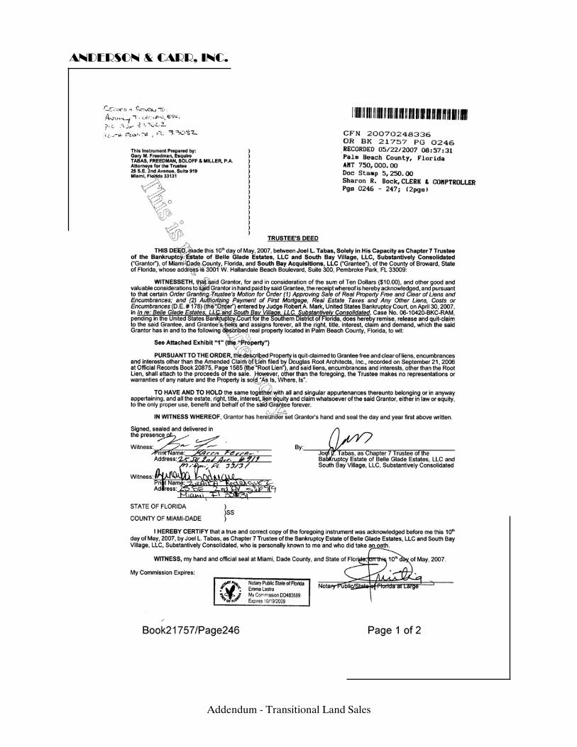
ANDERSON & CARR, INC.
Addendum - Transitional Land Sales
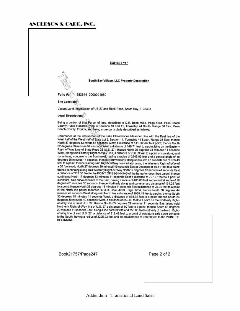
ANDERSON & CARR, INC.
Addendum - Transitional Land Sales
ANDERSON & CARR, INC.
Addendum - Transitional Land Sales
ANDERSON & CARR, INC.
Addendum - Transitional Land Sales
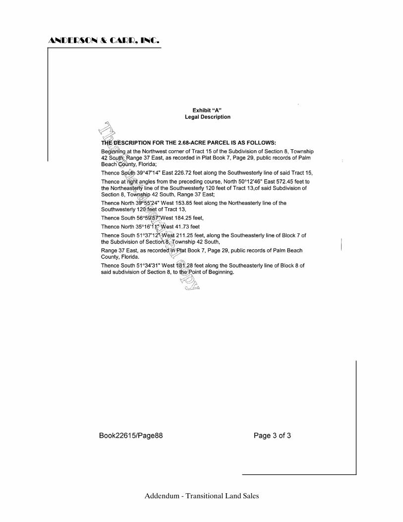
ANDERSON & CARR, INC.
Addendum - Transitional Land Sales
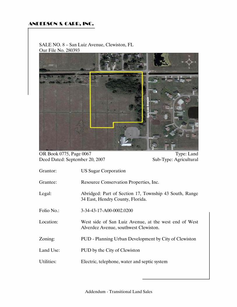
ANDERSON & CARR, INC.
SALE NO. 8 – San Luiz Avenue, Clewiston, FL Our File No. 280393
OR Book 0775, Page 0067 Type: Land Deed Dated: September 20, 2007 Sub-Type: Agricultural Grantor: US Sugar Corporation Grantee: Resource Conservation Properties, Inc. Legal: Abridged: Part of Section 17, Township 43 South, Range
34 East, Hendry County, Florida. Folio No.: 3-34-43-17-A00-0002.0200 Location: West side of San Luiz Avenue, at the west end of West
Alverdez Avenue, southwest Clewiston. Zoning: PUD - Planning Urban Development by City of Clewiston Land Use: PUD by the City of Clewiston Utilities: Electric, telephone, water and septic system
Addendum - Transitional Land Sales
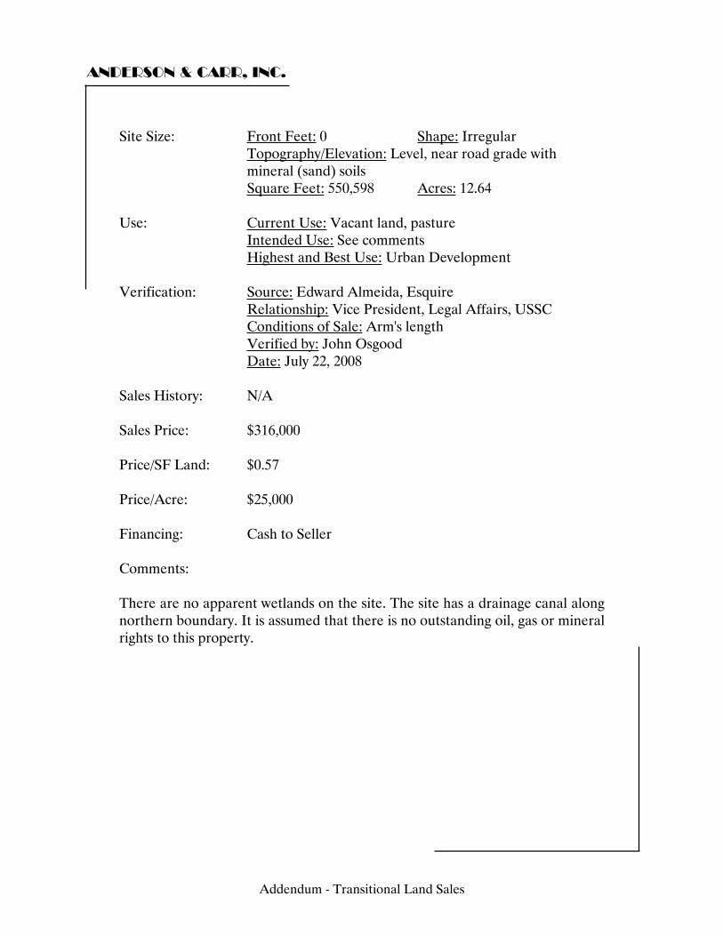
ANDERSON & CARR, INC.
Site Size: Front Feet: 0 Shape: Irregular Topography/Elevation: Level, near road grade with mineral (sand) soils
Square Feet: 550,598 Acres: 12.64 Use: Current Use: Vacant land, pasture Intended Use: See comments Highest and Best Use: Urban Development Verification: Source: Edward Almeida, Esquire Relationship: Vice President, Legal Affairs, USSC Conditions of Sale: Arm's length Verified by: John Osgood Date: July 22, 2008 Sales History: N/A Sales Price: $316,000 Price/SF Land: $0.57 Price/Acre: $25,000 Financing: Cash to Seller Comments: There are no apparent wetlands on the site. The site has a drainage canal along northern boundary. It is assumed that there is no outstanding oil, gas or mineral rights to this property.
Addendum - Transitional Land Sales
ANDERSON & CARR, INC.
This property shall be developed and subsequently sold to a builder or end user or leased to a third party within seven years of this closing or US Sugar can take back title to the property at their discretion. If exercised, US Sugar must pay the developed value of the real property being reverted. This value was set forth in the Purchase and Sale Agreement between the buyer and seller, effective August 30, 2005 concerning 502 acres west of San Luiz Avenue on the north and south sides of US 27. The buyer is affiliated with the Bonita Bay development group. This site will most likely be developed with townhomes to test the market before development on a larger scale occurs.
Addendum - Transitional Land Sales
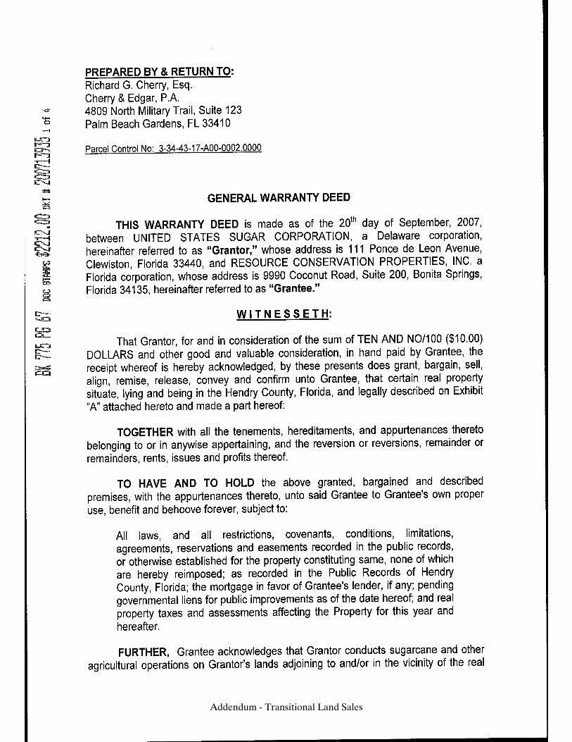
Addendum - Transitional Land Sales

Addendum - Transitional Land Sales
Addendum - Transitional Land Sales
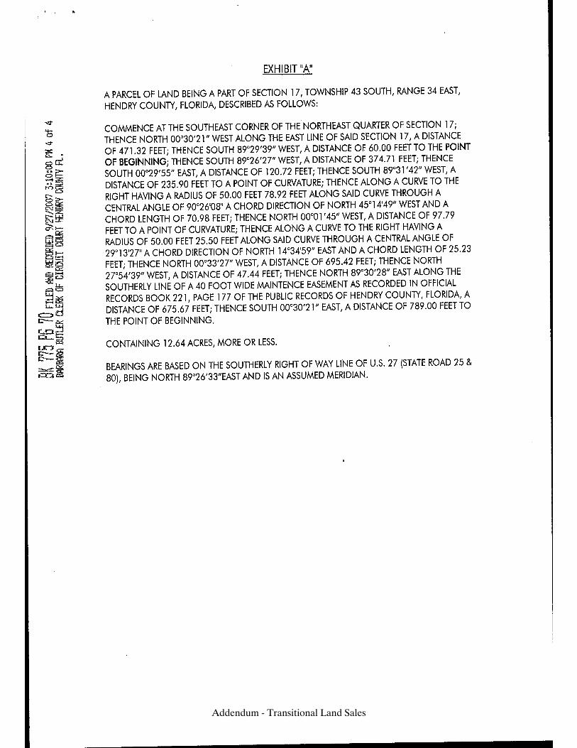
Addendum - Transitional Land Sales
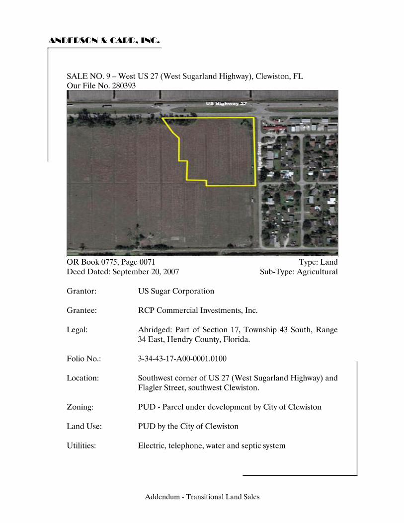
ANDERSON & CARR, INC.
SALE NO. 9 – West US 27 (West Sugarland Highway), Clewiston, FL Our File No. 280393
OR Book 0775, Page 0071 Type: Land Deed Dated: September 20, 2007 Sub-Type: Agricultural Grantor: US Sugar Corporation Grantee: RCP Commercial Investments, Inc. Legal: Abridged: Part of Section 17, Township 43 South, Range
34 East, Hendry County, Florida. Folio No.: 3-34-43-17-A00-0001.0100 Location: Southwest corner of US 27 (West Sugarland Highway) and
Flagler Street, southwest Clewiston. Zoning: PUD - Parcel under development by City of Clewiston Land Use: PUD by the City of Clewiston Utilities: Electric, telephone, water and septic system
Addendum - Transitional Land Sales
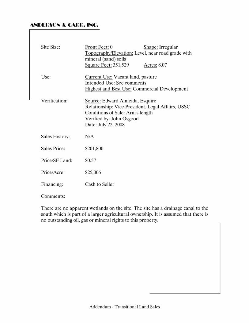
ANDERSON & CARR, INC.
Site Size: Front Feet: 0 Shape: Irregular Topography/Elevation: Level, near road grade with mineral (sand) soils
Square Feet: 351,529 Acres: 8.07 Use: Current Use: Vacant land, pasture Intended Use: See comments Highest and Best Use: Commercial Development Verification: Source: Edward Almeida, Esquire Relationship: Vice President, Legal Affairs, USSC Conditions of Sale: Arm's length Verified by: John Osgood Date: July 22, 2008 Sales History: N/A Sales Price: $201,800 Price/SF Land: $0.57 Price/Acre: $25,006 Financing: Cash to Seller Comments: There are no apparent wetlands on the site. The site has a drainage canal to the south which is part of a larger agricultural ownership. It is assumed that there is no outstanding oil, gas or mineral rights to this property.
Addendum - Transitional Land Sales
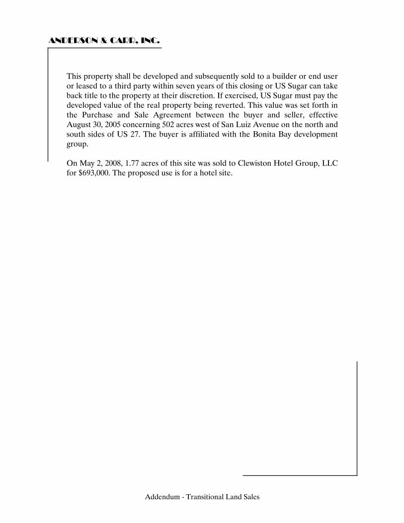
ANDERSON & CARR, INC.
This property shall be developed and subsequently sold to a builder or end user or leased to a third party within seven years of this closing or US Sugar can take back title to the property at their discretion. If exercised, US Sugar must pay the developed value of the real property being reverted. This value was set forth in the Purchase and Sale Agreement between the buyer and seller, effective August 30, 2005 concerning 502 acres west of San Luiz Avenue on the north and south sides of US 27. The buyer is affiliated with the Bonita Bay development group. On May 2, 2008, 1.77 acres of this site was sold to Clewiston Hotel Group, LLC for $693,000. The proposed use is for a hotel site.
Addendum - Transitional Land Sales
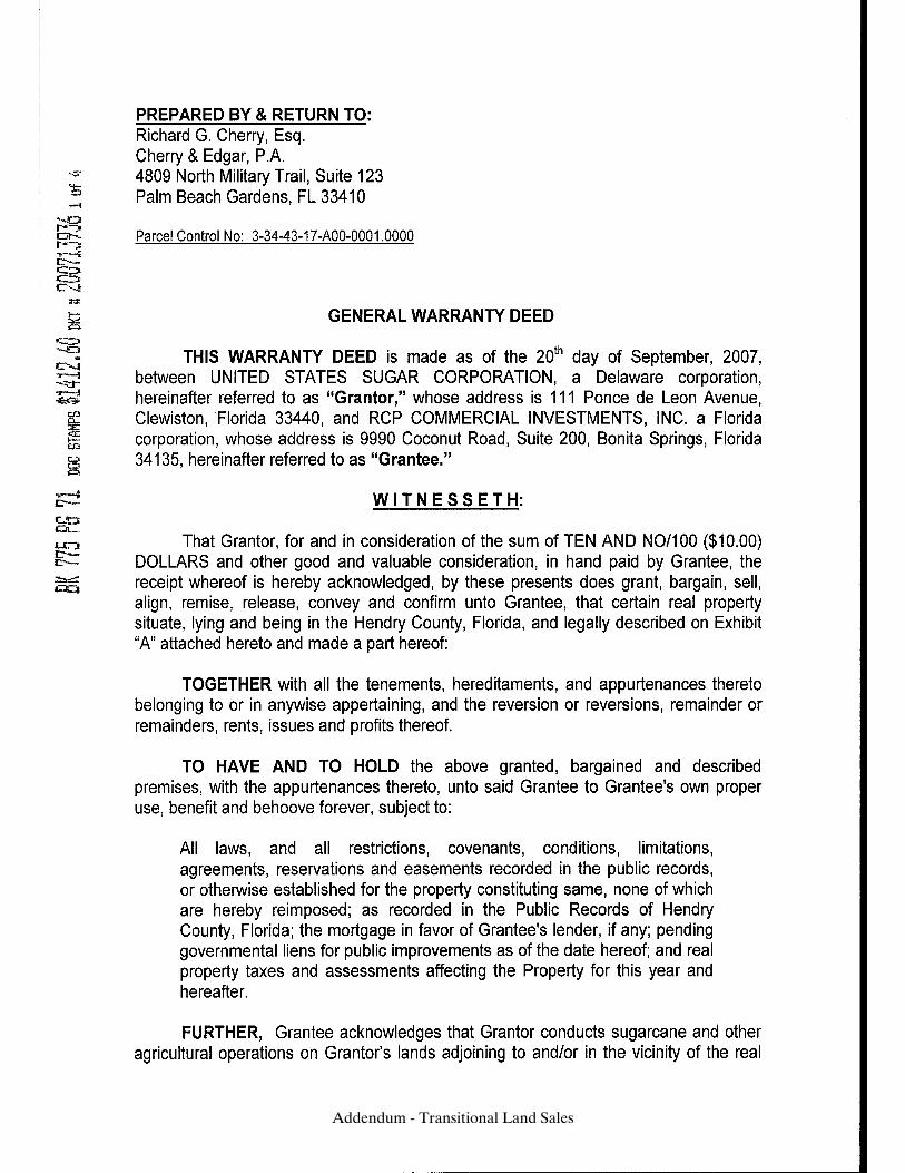
Addendum - Transitional Land Sales
Addendum - Transitional Land Sales
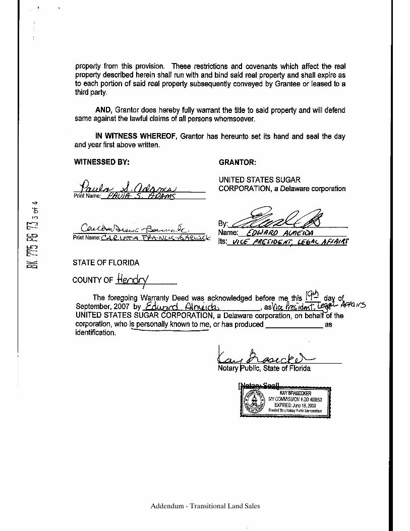
Addendum - Transitional Land Sales
Addendum - Transitional Land Sales
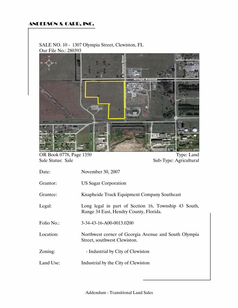
ANDERSON & CARR, INC.
SALE NO. 10 - 1307 Olympia Street, Clewiston, FL Our File No.: 280393
OR Book 0778, Page 1350 Type: Land Sale Status: Sale Sub-Type: Agricultural Date: November 30, 2007 Grantor: US Sugar Corporation Grantee: Knapheide Truck Equipment Company Southeast Legal: Long legal in part of Section 16, Township 43 South,
Range 34 East, Hendry County, Florida. Folio No.: 3-34-43-16-A00-0013.0200
Location: Northwest corner of Georgia Avenue and South Olympia
Street, southwest Clewiston. Zoning: - Industrial by City of Clewiston Land Use: Industrial by the City of Clewiston
Addendum - Transitional Land Sales
ANDERSON & CARR, INC.
Utilities: All Available Site Size: Front Feet: 0 Shape: Irregular Square Feet: 919,116 Acres: 21.10 Topography/Elevation: Level, near road grade Use: Current Use: Vacant land, pasture Intended Use: N/A Highest and Best Use: Industrial development Verification: Source: Edward Almeida, Esquire Relationship: Vice President, Legal Affairs, USSC Conditions of Sale: Arm's length Verified by: John Osgood Date: July 22, 2008 Sales History: N/A Sales Price: $1,159,400 Price/SF Land: $1.26 Price/Acre: $54,948 Financing: Cash to Seller Comments: There are no apparent wetlands on the site. The property has a drainage canal along the northern boundary. It is assumed that there is no outstanding oil, gas or mineral rights. USSC reserves the right to repurchase the property if grantee has not commenced construction of a truck body up-fitting facility within three years of this closing. USSC has the right of first refusal if the property is offered for sale. Any subsequent purchase price shall be the same as this purchase price. The city required at least a 20-acre site for the proposed use. As of July, 2008, development has commenced. The transaction was brokered by Steve Royal, an attorney from Belle Glade. The $55,000± price per ace was based on the appraised value of the parcels USSC sold to the City of Clewiston (ORB 757, Page 318).
Addendum - Transitional Land Sales
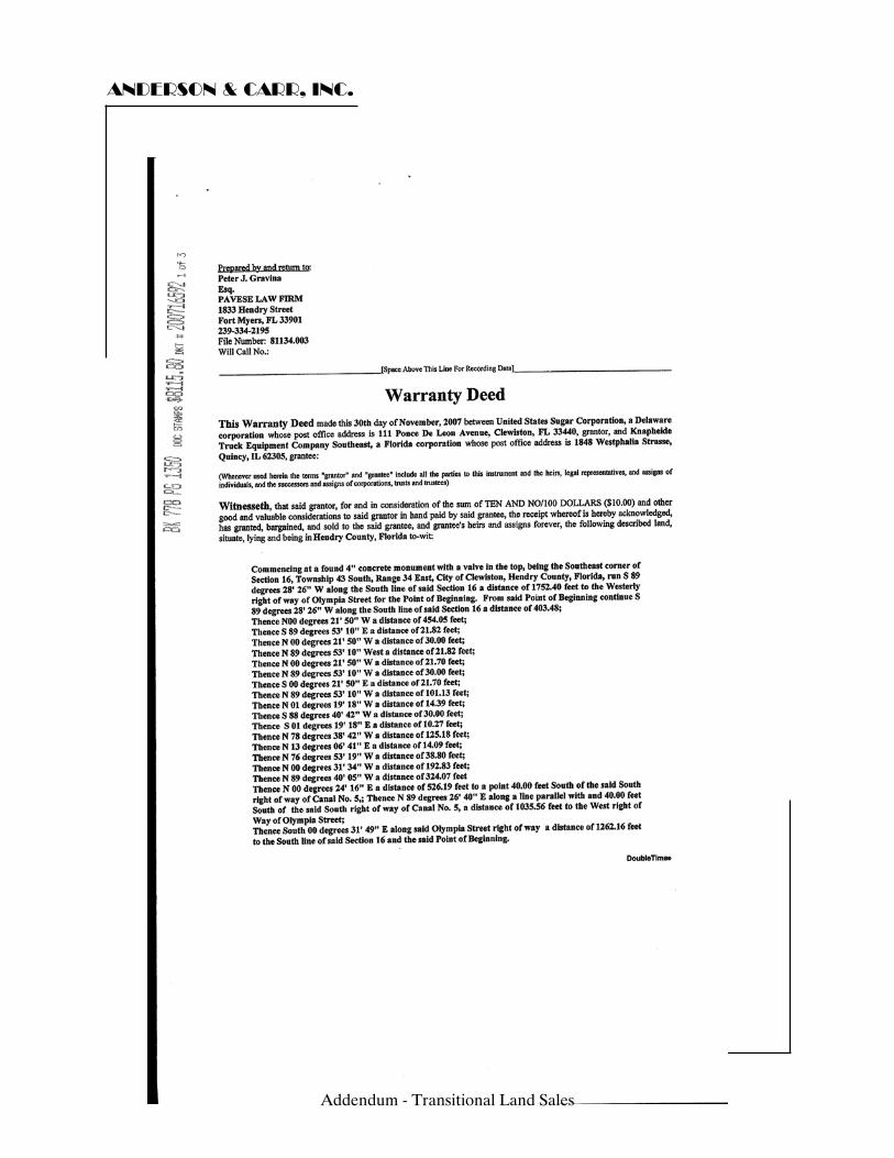
ANDERSON & CARR, INC.
Addendum - Transitional Land Sales
ANDERSON & CARR, INC.
Addendum - Transitional Land Sales
ANDERSON & CARR, INC.
Addendum - Transitional Land Sales
ANDERSON & CARR, INC.
Addendum - Transitional Land Sales
ANDERSON & CARR, INC.
Addendum - Transitional Land Sales
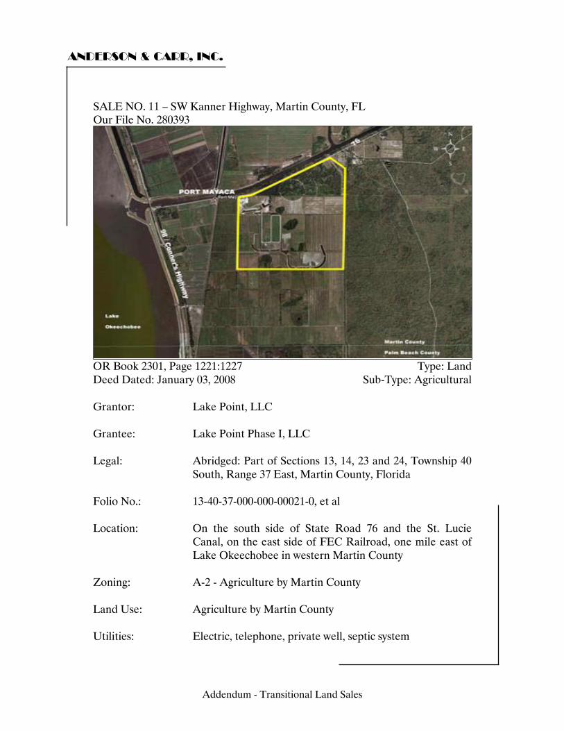
ANDERSON & CARR, INC.
SALE NO. 10 – SW Kanner Highway, Martin County, FL Our File No. 280393
OR Book 2301, Page 1221:1227 Type: Land Deed Dated: January 03, 2008 Sub-Type: Agricultural Grantor: Lake Point, LLC Grantee: Lake Point Phase I, LLC Legal: Abridged: Part of Sections 13, 14, 23 and 24, Township 40
South, Range 37 East, Martin County, Florida Folio No.: 13-40-37-000-000-00021-0, et al Location: On the south side of State Road 76 and the St. Lucie
Canal, on the east side of FEC Railroad, one mile east of Lake Okeechobee in western Martin County
Zoning: A-2 - Agriculture by Martin County Land Use: Agriculture by Martin County Utilities: Electric, telephone, private well, septic system
11
Addendum - Transitional Land Sales
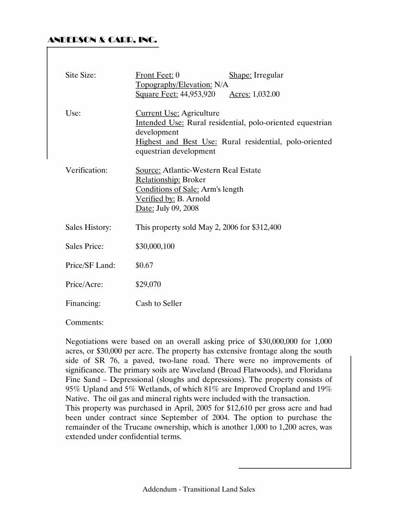
ANDERSON & CARR, INC.
Site Size: Front Feet: 0 Shape: Irregular Topography/Elevation: N/A Square Feet: 44,953,920 Acres: 1,032.00 Use: Current Use: Agriculture Intended Use: Rural residential, polo-oriented equestrian
development Highest and Best Use: Rural residential, polo-oriented
equestrian development Verification: Source: Atlantic-Western Real Estate Relationship: Broker Conditions of Sale: Arm's length Verified by: B. Arnold Date: July 09, 2008 Sales History: This property sold May 2, 2006 for $312,400 Sales Price: $30,000,100 Price/SF Land: $0.67 Price/Acre: $29,070 Financing: Cash to Seller Comments: Negotiations were based on an overall asking price of $30,000,000 for 1,000 acres, or $30,000 per acre. The property has extensive frontage along the south side of SR 76, a paved, two-lane road. There were no improvements of significance. The primary soils are Waveland (Broad Flatwoods), and Floridana Fine Sand – Depressional (sloughs and depressions). The property consists of 95% Upland and 5% Wetlands, of which 81% are Improved Cropland and 19% Native. The oil gas and mineral rights were included with the transaction. This property was purchased in April, 2005 for $12,610 per gross acre and had been under contract since September of 2004. The option to purchase the remainder of the Trucane ownership, which is another 1,000 to 1,200 acres, was extended under confidential terms.
Addendum - Transitional Land Sales
ANDERSON & CARR, INC.
In May, 2007 Martin County approved development of 40 residential lots and four polo fields on the Lake Point tract. In December of 2007 the county agreed to let 2 million cubic yards of rock be mined on the property, possibly for repair of the Hoover Dike around Lake Okeechobee in the surrounding area. A site plan for both phases of the Lake Point Ranches development has been developed, but no sales have been recorded. As of 2008, press indicates that the owners/developers may not believe that a polo development would be economically productive and are pursuing donating the land to government entities for storm-water retention and treatment when the proposed mining operation ends.
Addendum - Transitional Land Sales

ANDERSON & CARR, INC.
Addendum - Transitional Land Sales
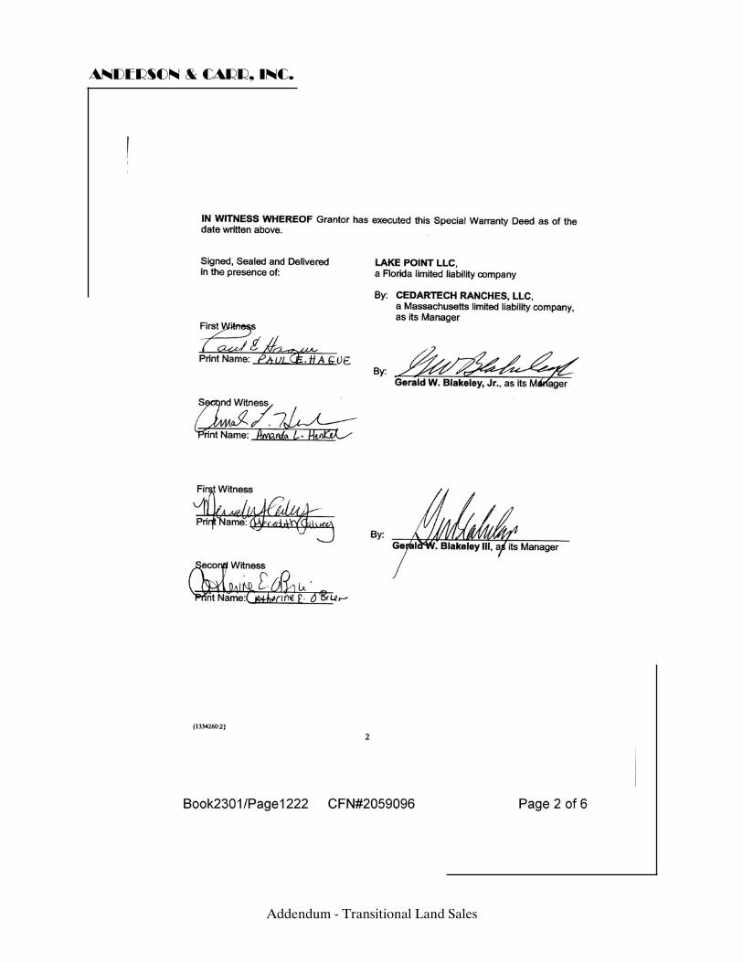
ANDERSON & CARR, INC.
Addendum - Transitional Land Sales
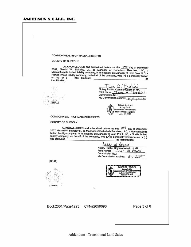
ANDERSON & CARR, INC.
Addendum - Transitional Land Sales
ANDERSON & CARR, INC.
Addendum - Transitional Land Sales
ANDERSON & CARR, INC.
Addendum - Transitional Land Sales
ANDERSON & CARR, INC.
Addendum - Transitional Land Sales
ANDERSON & CARR, INC.
Addendum - Transitional Land Sales
ANDERSON & CARR, INC.
Addendum - Transitional Land Sales
ANDERSON & CARR, INC.
Addendum - Transitional Land Sales
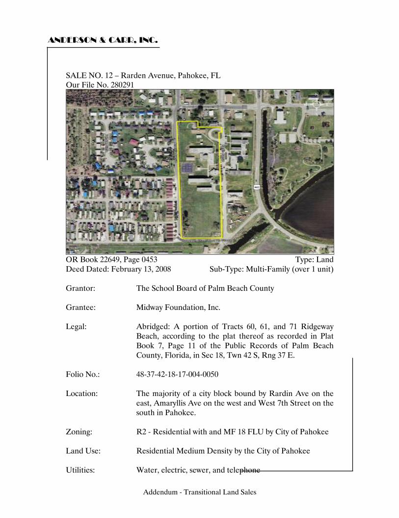
ANDERSON & CARR, INC.
SALE NO. 11 – Rarden Avenue, Pahokee, FL Our File No. 280291
OR Book 22649, Page 0453 Type: Land Deed Dated: February 13, 2008 Sub-Type: Multi-Family (over 1 unit) Grantor: The School Board of Palm Beach County Grantee: Midway Foundation, Inc. Legal: Abridged: A portion of Tracts 60, 61, and 71 Ridgeway
Beach, according to the plat thereof as recorded in Plat Book 7, Page 11 of the Public Records of Palm Beach County, Florida, in Sec 18, Twn 42 S, Rng 37 E.
Folio No.: 48-37-42-18-17-004-0050 Location: The majority of a city block bound by Rardin Ave on the
east, Amaryllis Ave on the west and West 7th Street on the south in Pahokee.
Zoning: R2 - Residential with and MF 18 FLU by City of Pahokee Land Use: Residential Medium Density by the City of Pahokee Utilities: Water, electric, sewer, and telephone
12
Addendum - Transitional Land Sales
ANDERSON & CARR, INC.
Site Size: Front Feet: 0 Shape: Irregular Topography/Elevation: Level, near road grade, de-mucked and filled Square Feet: 450,410 Acres: 10.34 Use: Current Use: Former East Lake Elementary School site Intended Use: N/A Highest and Best Use: Urban development Verification: Source: Dan Schmidt Relationship: Grantee Conditions of Sale: Arm's length Verified by: W. Lewis Date: June 01, 2008 Sales History: N/A Sales Price: $300,000 Price/SF Land: $0.67 Price/Acre: $29,014 Financing: Cash to Seller Comments: The site was the former East Lake Elementary School but all school improvements had been removed at the time of the sale. According to the grantee, the sale price was based on an appraised value determined by the School Board. This transaction was related to an additional transaction between the same parties in which the Midway Foundation sold a vacant parcel across town to the School Board. (See OR Book 22649, Page 0367) Although this was a sale from a governmental entity it was a negotiated transaction based on appraised value and intended to represent market value. The governmental involvement had no impact on the sales price.
Addendum - Transitional Land Sales
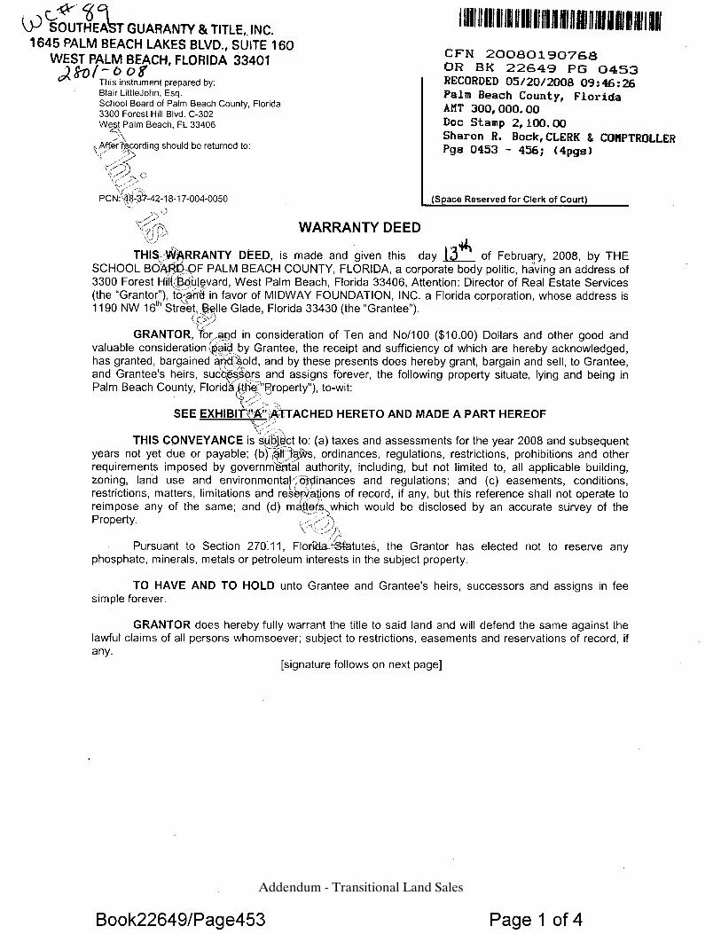
Addendum - Transitional Land Sales
Addendum - Transitional Land Sales
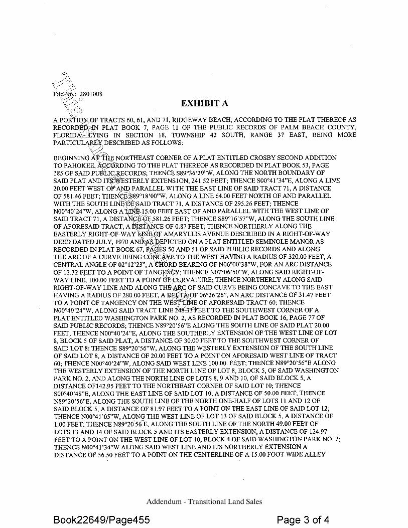
Addendum - Transitional Land Sales
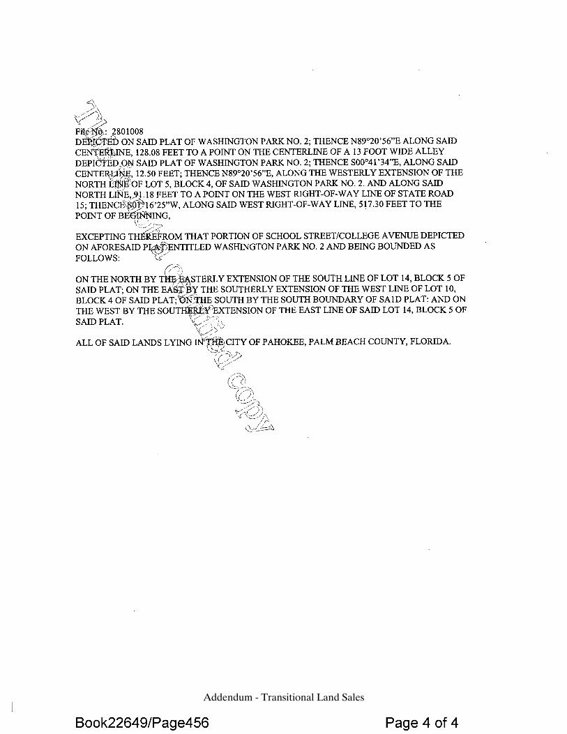
Addendum - Transitional Land Sales
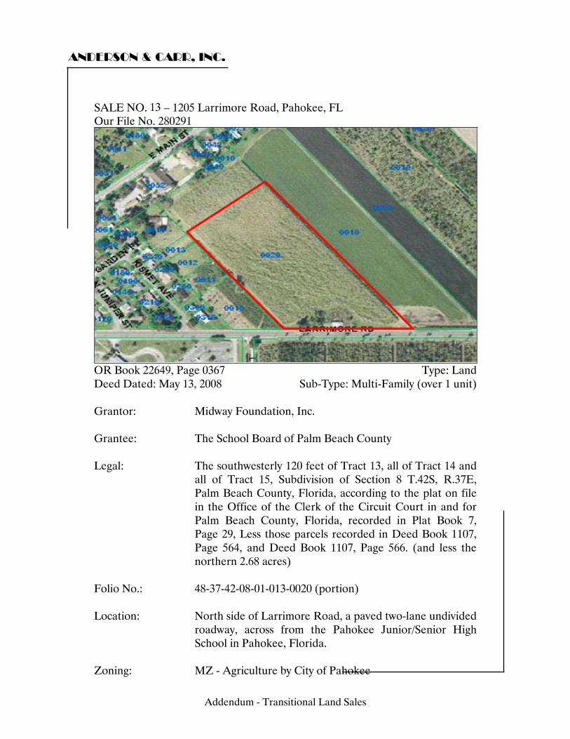
ANDERSON & CARR, INC.
SALE NO. 12 – 1205 Larrimore Road, Pahokee, FL Our File No. 280291
OR Book 22649, Page 0367 Type: Land Deed Dated: May 13, 2008 Sub-Type: Multi-Family (over 1 unit) Grantor: Midway Foundation, Inc. Grantee: The School Board of Palm Beach County Legal: The southwesterly 120 feet of Tract 13, all of Tract 14 and
all of Tract 15, Subdivision of Section 8 T.42S, R.37E, Palm Beach County, Florida, according to the plat on file in the Office of the Clerk of the Circuit Court in and for Palm Beach County, Florida, recorded in Plat Book 7, Page 29, Less those parcels recorded in Deed Book 1107, Page 564, and Deed Book 1107, Page 566. (and less the northern 2.68 acres)
Folio No.: 48-37-42-08-01-013-0020 (portion) Location: North side of Larrimore Road, a paved two-lane undivided
roadway, across from the Pahokee Junior/Senior High School in Pahokee, Florida.
Zoning: MZ - Agriculture by City of Pahokee
13
Addendum - Transitional Land Sales
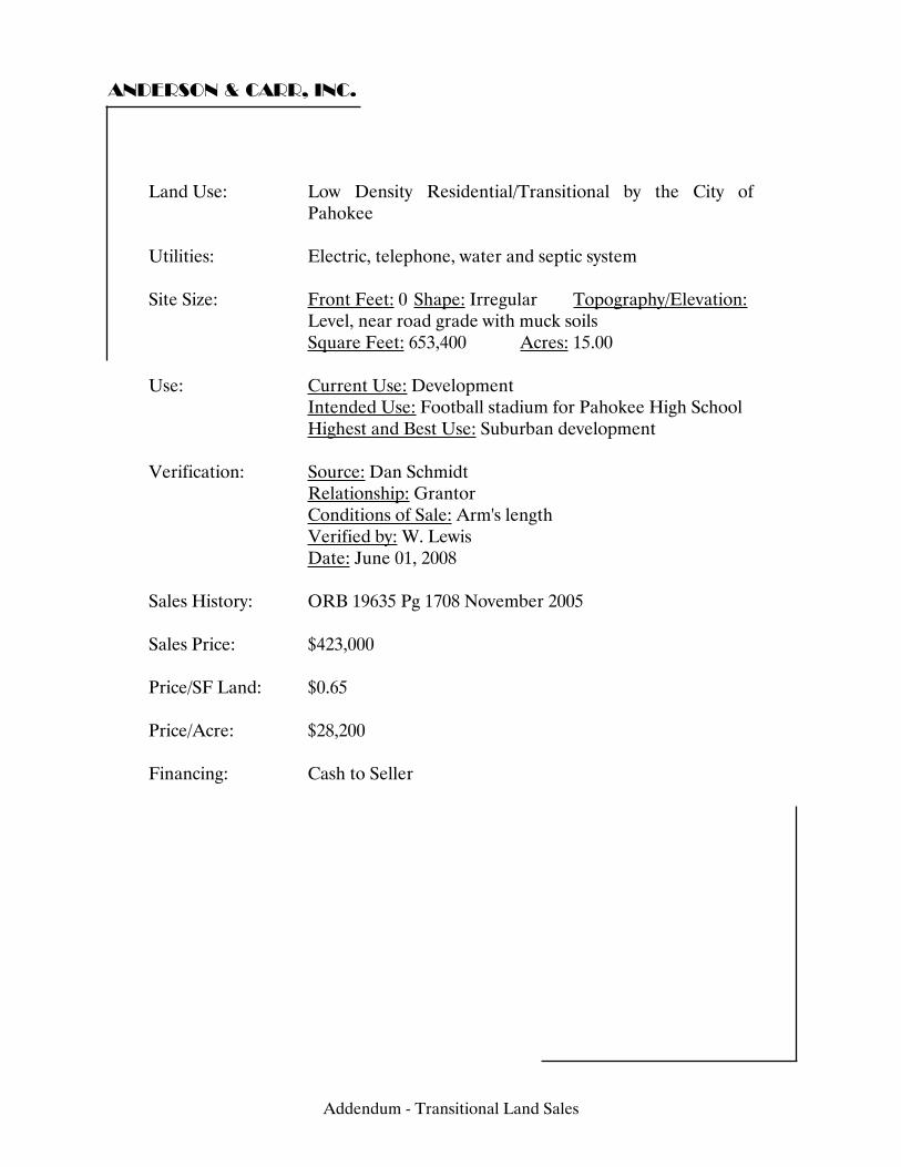
ANDERSON & CARR, INC.
Land Use: Low Density Residential/Transitional by the City of
Pahokee Utilities: Electric, telephone, water and septic system Site Size: Front Feet: 0 Shape: Irregular Topography/Elevation:
Level, near road grade with muck soils Square Feet: 653,400 Acres: 15.00 Use: Current Use: Development Intended Use: Football stadium for Pahokee High School Highest and Best Use: Suburban development Verification: Source: Dan Schmidt Relationship: Grantor Conditions of Sale: Arm's length Verified by: W. Lewis Date: June 01, 2008 Sales History: ORB 19635 Pg 1708 November 2005 Sales Price: $423,000 Price/SF Land: $0.65 Price/Acre: $28,200 Financing: Cash to Seller
Addendum - Transitional Land Sales
ANDERSON & CARR, INC.
Comments: Sale information confirmed by the grantor Dan Schmidt. The site is in current development with the new football stadium for Pahokee High School. According to the grantor the sale price was based on an appraised value determined by the school board. The seller was granted the contract to de-muck and fill the site for the construction of the stadium at a total cost of $300,000. This transaction was related to an additional transaction between the same parties in which the seller in this transaction purchased an old school site across town. Prior to being approached by the school board, the seller had planned to develop single family homes on the site. Although this was a sale to a governmental entity it was a negotiated transaction based on appraised value and intended to represent market value. The governmental involvement had no impact on the sales price. (See OR Book 22649, Page 0453) The rear northwestern 2.82 acres of this property was sold to the Catholic Church that abuts this property on the northwest corner for $194,000. This transaction occurred on April 17, 2008, and is referenced in OR Book 22615, Page 86.
Addendum - Transitional Land Sales
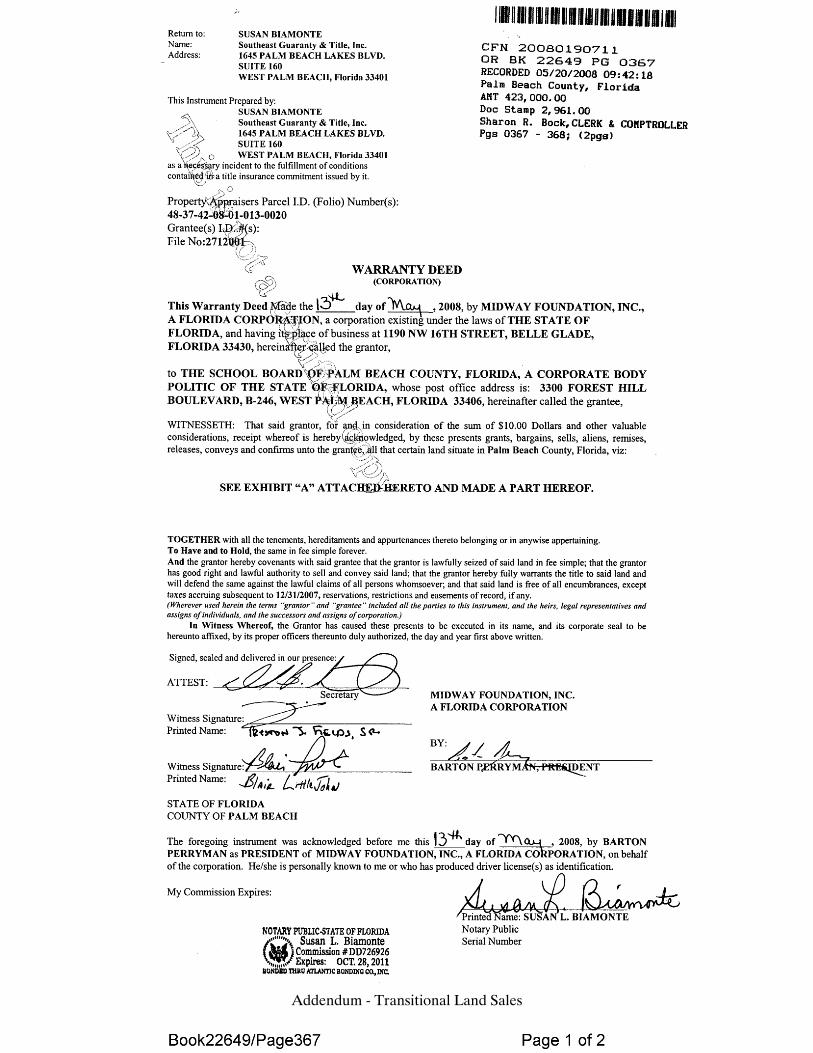
Addendum - Transitional Land Sales
Addendum - Transitional Land Sales
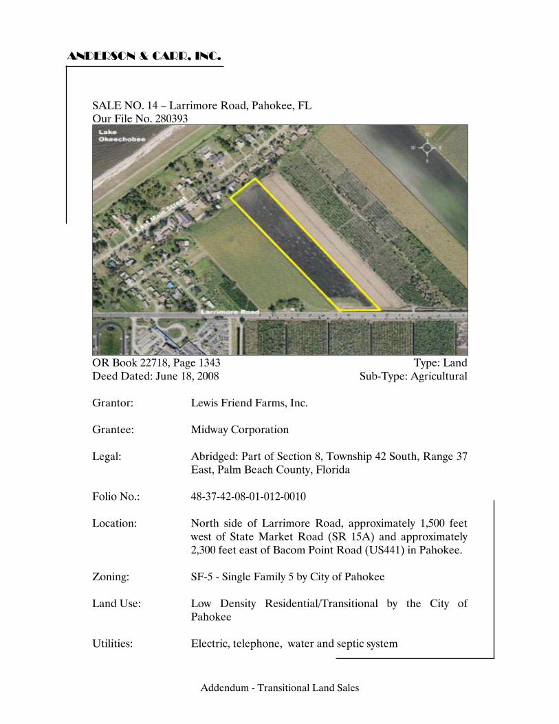
ANDERSON & CARR, INC.
SALE NO. 13 – Larrimore Road, Pahokee, FL Our File No. 280393
OR Book 22718, Page 1343 Type: Land Deed Dated: June 18, 2008 Sub-Type: Agricultural Grantor: Lewis Friend Farms, Inc. Grantee: Midway Corporation Legal: Abridged: Part of Section 8, Township 42 South, Range 37
East, Palm Beach County, Florida Folio No.: 48-37-42-08-01-012-0010 Location: North side of Larrimore Road, approximately 1,500 feet
west of State Market Road (SR 15A) and approximately 2,300 feet east of Bacom Point Road (US441) in Pahokee.
Zoning: SF-5 - Single Family 5 by City of Pahokee Land Use: Low Density Residential/Transitional by the City of
Pahokee Utilities: Electric, telephone, water and septic system
14
Addendum - Transitional Land Sales
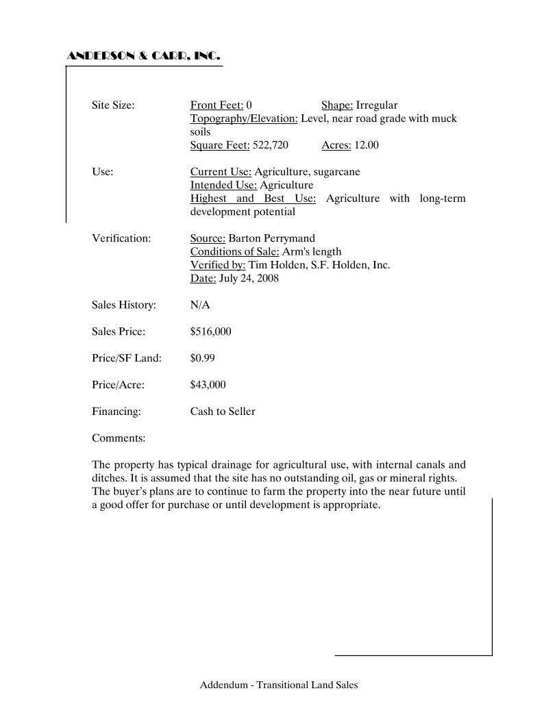
ANDERSON & CARR, INC.
Site Size: Front Feet: 0 Shape: Irregular Topography/Elevation: Level, near road grade with muck soils
Square Feet: 522,720 Acres: 12.00 Use: Current Use: Agriculture, sugarcane Intended Use: Agriculture Highest and Best Use: Agriculture with long-term
development potential Verification: Source: Barton Perrymand Conditions of Sale: Arm's length Verified by: Tim Holden, S.F. Holden, Inc. Date: July 24, 2008 Sales History: N/A Sales Price: $516,000 Price/SF Land: $0.99 Price/Acre: $43,000 Financing: Cash to Seller Comments: The property has typical drainage for agricultural use, with internal canals and ditches. It is assumed that the site has no outstanding oil, gas or mineral rights. The buyer’s plans are to continue to farm the property into the near future until a good offer for purchase or until development is appropriate.
Addendum - Transitional Land Sales
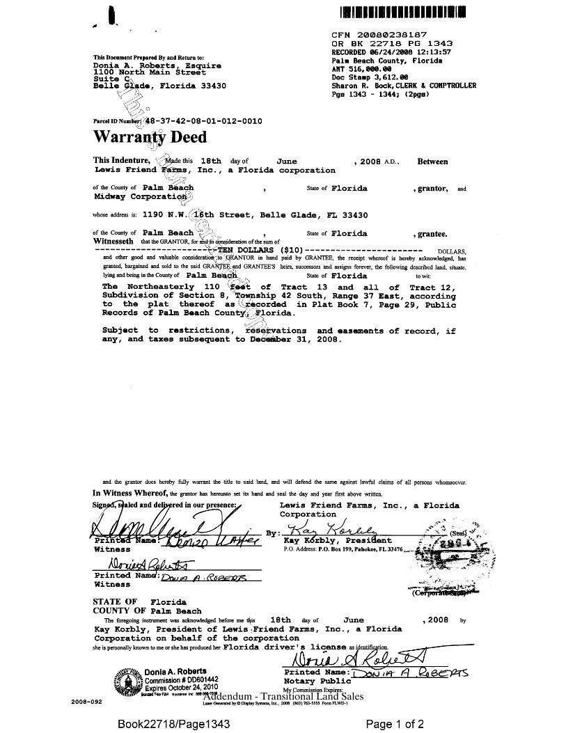
Addendum - Transitional Land Sales
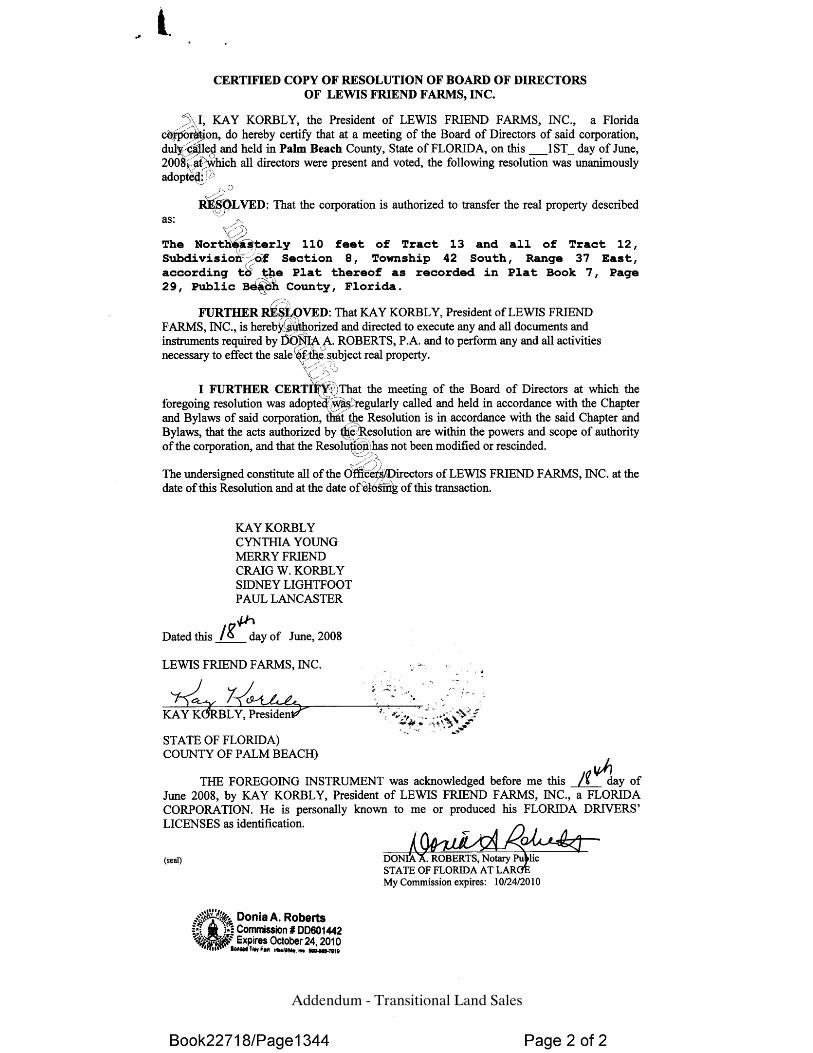
Addendum - Transitional Land Sales
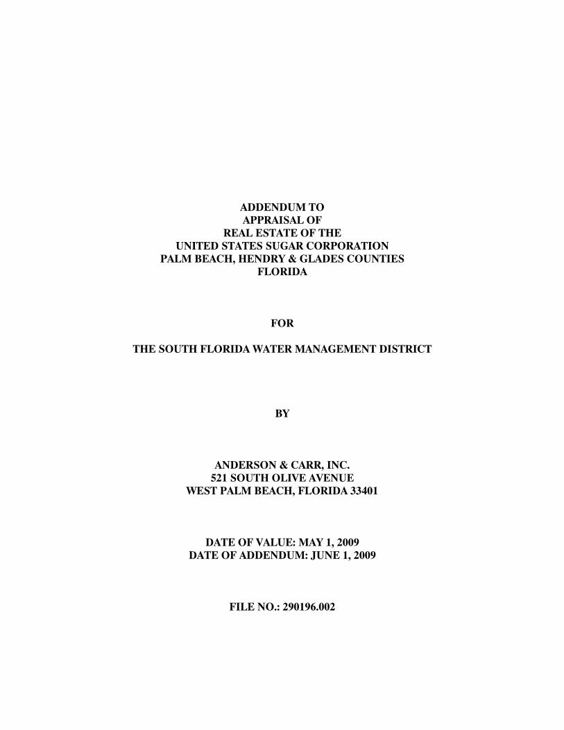
ADDENDUM TO APPRAISAL OF
REAL ESTATE OF THE UNITED STATES SUGAR CORPORATION
PALM BEACH, HENDRY & GLADES COUNTIES FLORIDA
FOR
THE SOUTH FLORIDA WATER MANAGEMENT DISTRICT
BY
ANDERSON & CARR, INC. 521 SOUTH OLIVE AVENUE
WEST PALM BEACH, FLORIDA 33401
DATE OF VALUE: MAY 1, 2009 DATE OF ADDENDUM: JUNE 1, 2009
FILE NO.: 290196.002
ROBERT B. BANTING, MAI, SRA, PRESIDENT FRANK J. CARDO, MAI, VICE PRESIDENT State-Certified General Real Estate Appraiser RZ4 State-Certified General Real Estate Appraiser RZ1190
ANDERSON & CARR, INC.
««««««««««««««««««««««««««««««««««««««Appraisers•Realtors »»»»»»»»»»»»»»»»»»»»»»»»»»»»»»»»»»»
521 SOUTH OLIVE AVENUE WEST PALM BEACH, FLORIDA 33401-5907
www.andersoncarr.com Telephone (561) 833-1661
Fax (561) 833-0234
June 1, 2009 Quality Service Since 1947 Mr. Ray Palmer Chief Appraiser Acting Deputy Director Land Acquisition Department South Florida Water Management District 3001 Gun Club Road West Palm Beach, FL 33406 Re: Option Agreement Analysis Dear Mr. Palmer: We have previously appraised the real estate assets of the United States Sugar Corporation (Our file nos.: 280393, 280593 & 290196.001) for the South Florida Water Management District. This analysis is intended to be an addendum to the prior appraisals. This addendum is not intended to be a stand alone document and must remain attached to our original summary narrative reports in order to be relied upon and fully understandable. Our most recent appraisal included 40,066 acres of agricultural and transitional lands in Palm Beach, Hendry and Glades Counties that is under contract for purchase from USSC by the SFWMD. This analysis pertains to the three year exclusive option that SFWMD would have under the current agreement to buy all 107,500 acres of the remaining land holdings of USSC at an agreed upon option price of $7,400 per acre. We have estimated the competitive pricing advantage that this option provides. This is not market value as the option can not be transferred by SFWMD except to the TIITF which is another government entity. Pursuant to your request, we have reviewed a six page “Option” document provided by you entitled GYS Draft (dated 4/23/2009). It includes Sections 26 and 27 of the proposed contract. It is shown to be pages 50-56 of a larger document. Based on our review of this document, if a closing occurs regarding the current contract for 72,813 acres of land (including 32,745 acres of groves not included in our appraisal 290196.001), the option provides the buyer a three year exclusive option to purchase 107,500 acres (defined in Exhibit 26.a – not provided) at a price of $7,400 per acre (fixed for the three year term). The buyer must buy all 107,500 acres. It additionally grants the buyer a seven year non-exclusive option (right of first refusal) that begins at the end of the three year exclusive option period to purchase the 107,500 acres at either the appraised value determined by the buyer or the average of the buyer and seller’s appraisal (but not at a price other than $7,400/acre).
i
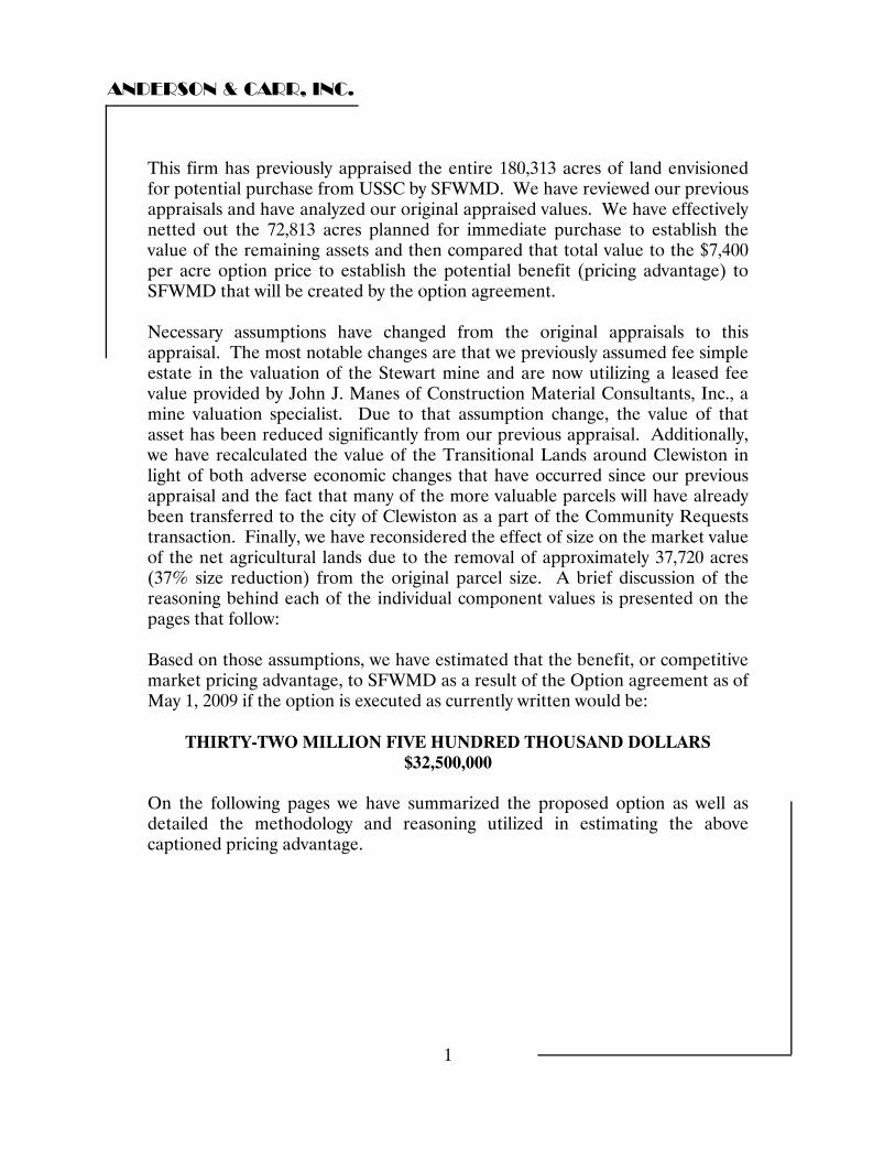
ANDERSON & CARR, INC.
1
This firm has previously appraised the entire 180,313 acres of land envisioned for potential purchase from USSC by SFWMD. We have reviewed our previous appraisals and have analyzed our original appraised values. We have effectively netted out the 72,813 acres planned for immediate purchase to establish the value of the remaining assets and then compared that total value to the $7,400 per acre option price to establish the potential benefit (pricing advantage) to SFWMD that will be created by the option agreement. Necessary assumptions have changed from the original appraisals to this appraisal. The most notable changes are that we previously assumed fee simple estate in the valuation of the Stewart mine and are now utilizing a leased fee value provided by John J. Manes of Construction Material Consultants, Inc., a mine valuation specialist. Due to that assumption change, the value of that asset has been reduced significantly from our previous appraisal. Additionally, we have recalculated the value of the Transitional Lands around Clewiston in light of both adverse economic changes that have occurred since our previous appraisal and the fact that many of the more valuable parcels will have already been transferred to the city of Clewiston as a part of the Community Requests transaction. Finally, we have reconsidered the effect of size on the market value of the net agricultural lands due to the removal of approximately 37,720 acres (37% size reduction) from the original parcel size. A brief discussion of the reasoning behind each of the individual component values is presented on the pages that follow: Based on those assumptions, we have estimated that the benefit, or competitive market pricing advantage, to SFWMD as a result of the Option agreement as of May 1, 2009 if the option is executed as currently written would be:
THIRTY-TWO MILLION FIVE HUNDRED THOUSAND DOLLARS $32,500,000
On the following pages we have summarized the proposed option as well as detailed the methodology and reasoning utilized in estimating the above captioned pricing advantage.
ANDERSON & CARR, INC.
2
Option Summary: We have reviewed a six page “Option” document provided by our client entitled GYS Draft (dated 4/23/2009). It includes Sections 26 and 27 of the proposed contract. It is shown to be pages 50-56 of a larger document. Section 26 “The Option” If a closing occurs regarding the current contract for 72,813 acres of land, the option provides the buyer a three year exclusive option to purchase 107,500 acres (defined in Exhibit 26.a – not provided) at a price of $7,400 per acre (fixed for the three year term). The buyer must buy all 107,500 acres. It additionally grants the buyer a seven year non-exclusive option (right of first refusal) that begins at the end of the three year exclusive option to purchase the 107,500 acres at either the appraised value determined by the buyer or the average of the buyer and seller’s appraisal. Either purchase would be subject to any and all leases for all or any portion of the option property. During the exclusive option period, the seller may sell any or all of the option property with the buyer’s consent. The seller may also sell or lease any or all of the option property without the buyer’s consent provided the property is sold subject to the option. The seller may also lease the property at any time during the option for three year term leases. If the leases are longer than three years, the leases must contain waivers regarding relocation rights. During the non-exclusive option period, the sellers may sell any portion of the property subject to the right of first refusal and may lease any portion for any lease term with no required waiver of relocation rights. If the option is exercised during the exclusive option period, the buyer must include an appraisal setting forth the buyer’s post option fair market rent. If the option is exercised during the non exclusive option period, the option notice must include an appraisal of both the proposed purchase price and the proposed fair market rent. The seller may either elect to accept the buyer’s appraisal or pay for their own. If the seller’s appraisal comes in at 10% above or below the appraisal of the buyer, the values would be averaged. If the seller’s appraisal is in excess of 10% above or below the buyer’s appraisal, the two appraisers will appoint a third appraiser. The average of the two closest appraisals will determine the purchase price and the fair market rental. But if the price is less than $7,400 per acre, the seller is not obligated to sell. Conversely if the price is in excess of $7,400 per acre the buyer has no obligation to exercise their option.
ANDERSON & CARR, INC.
3
If the buyer attempts to purchase the property during the option period but fails to close for any reason other than the seller’s default then the option shall be null and void. There are specified 90 day inspection periods with 120 days to close. But if no agreement is reached within 180 days after the purchase price has been determined, the option becomes null and void. Buyer agrees not to exercise any powers of eminent domain until the expiration of the lease term or the option period or the seller may terminate the option. In no event shall the option be assigned by the buyer to any one other than TIITF and that must be in a manner acceptable to the seller. Section 27 Right of first Refusal If the seller receives an offer (and desires to sell) any portion of the subject during the seven year non exclusive option period, the seller shall offer all of that property to the buyer at the same (not less favorable) terms. The buyer has 40 days to respond and 150 days to affect a closing. On the page that follows we have presented a summary chart showing the individual remaining assets, their component values and a comparison of the average value per acre to the option price of $7,400 per acre.
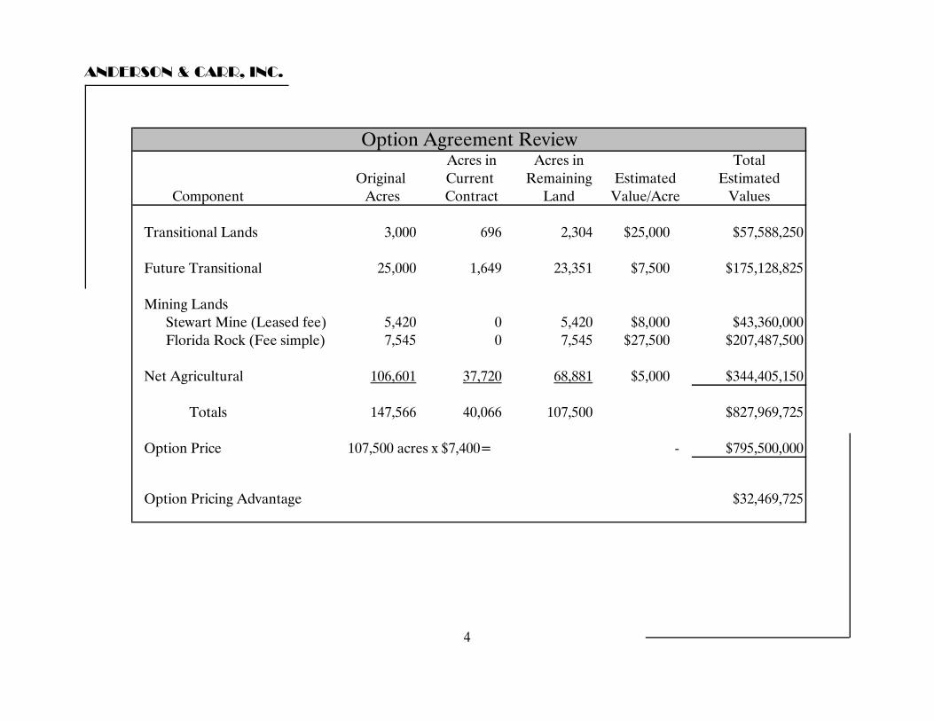
ANDERSON & CARR, INC.
4
Acres in Acres in TotalOriginal Current Remaining Estimated Estimated
Acres Contract Land Value/Acre Values
3,000 696 2,304 $25,000 $57,588,250
25,000 1,649 23,351 $7,500 $175,128,825
Stewart Mine (Leased fee) 5,420 0 5,420 $8,000 $43,360,000Florida Rock (Fee simple) 7,545 0 7,545 $27,500 $207,487,500
106,601 37,720 68,881 $5,000 $344,405,150
147,566 40,066 107,500 $827,969,725
107,500 acres x $7,400= - $795,500,000
$32,469,725
Option Price
Option Pricing Advantage
Net Agricultural
Totals
Mining Lands
Component
Option Agreement Review
Future Transitional
Transitional Lands
ANDERSON & CARR, INC.
5
Summary of Calculations Transitional Lands In our previous appraisal we estimated that there were approximately 3,000 acres of land in and immediately adjacent to the incorporated area of Clewiston that was suitable for immediate or near term transitioning out of agricultural uses and into more intensive commercial, industrial and residential uses. We previously valued that component of the overall USSC holdings at $30,000 per acre. Clewiston has requested 696.47 acres of the overall 3,000 acres be donated to the city by SFWMD. This leaves approximately 2,304 acres of remaining land deemed to be suitable for transitional uses. Since the original date of our appraisal, there has been a general economic slowdown that has diminished the value of assets of this type. Additionally, it is our opinion that Clewiston’s community request land of 696.47 acres includes some of the better land originally categorized as transitional. For those reasons we have reduced the value of the remaining 2,304 acre of transitional land in and around Clewiston to $25,000 per acre. Future Transitional Land In our previous appraisal we estimated that approximately 25,000 acres of land in western Palm Beach County generally along the US Highway 441 corridor just east of Lake Okeechobee, which is traditionally considered the best of the agricultural land in the region, had a highest and best use of future transitional. That category included both land that might be transitioned out of sugar cane production into a more intensive agricultural use as well as land at or adjacent to major highway intersections that might have a future use other than agricultural. This portion of the overall USSC holdings was previously appraised by this firm at $7,500 per acre. The cities of Pahokee, Belle Glade and South Bay have requested roughly 1,649 acres of land from within this category for donation and it has been referred to as “Community Request Land”. This leaves approximately 23,351 acres within our original category. Our valuation of this component of the Option Lands remains unchanged at $7,500 per acre.
ANDERSON & CARR, INC.
6
Mining Leases In our original appraisal we appraised all of the rock mining land in fee simple estate without regard to the terms of the individual leases. Additionally, we were asked to assume that it was likely that mining operations would be permitted for both sites. For purposes of this analysis we have been requested by the client to assume that the lease to Florida Rock Industries is no longer valid (this is the stance of USSC). That portion of the subject site is still appraised in fee simple estate. In our previous appraisal we placed a value of $27,500 per acre on the 7,545 acres within that potential mining area. That valuation is unchanged from our previous appraisal. The Stewart mining operation reportedly has a valid lease and the terms of the lease have been reviewed by John J. Manes, C.M.A., P.G. the Executive Vice President and Senior Geologist for the consulting firm on Construction Material Consultants, Inc. Mr. Manes has provided a detailed technical consulting letter that provides a professional opinion of the probable range of values associated with the Stewart mine under varying assumptions. His letter Opinion of Value presents a range of values under three different scenarios. Each successive scenario makes assumptions that create a progressively higher range of potential values for the mine. The first scenario utilizes the terms of the existing lease (we have chosen to utilize this scenario). Scenario 2 assumes that the lease is renegotiated to allow truck hauling of aggregate materials and resumption of Lake Belt mining. Scenario 3 assumes a renegotiated lease and permanent halting of Lake Belt mining. Due to the speculative nature of the assumptions in Scenarios 2 & 3, and the strong potential for hesitation on the part of Palm Beach County to allow truck transportation of aggregate material when all approvals were based on rail transportation, we have not utilized the valuations presented in those scenarios. Scenario 1 offers a range of potential values from the mine of from $26,470,500 to $45,856,500. We have chosen a value of $8,000 per acre for the 5,420 acres within the mine lease area which results in a leased fee value of $43,360,000. This is toward the upper end of the range for Scenario 1 but this is considered reasonable due to the potential for attainment of more advantageous scenarios in the future.
ANDERSON & CARR, INC.
7
Net Agricultural Land In our original appraisals we utilized a total site size of 182,474 acres of land. Current negotiations have utilized a total site size of 180,313 acres. We have assumed that the loss in acreage has come from the largest component of the transaction which is the net agricultural lands. The option agreement specifies a land area of 107,500 acres. Once Transitional land (2,304 acres), Future Transitional Land (23,351 acres) and Mining Land (12,965 acres) are netted out from the current site size of 180,313 acres we are left with 68,881 acres of net agricultural land. In our previous appraisal we valued 108,906 acre of net agricultural land at $4,500 per acre. This value resulted from a substantial size related adjustment of as much as 50% being applied to the comparable sale data. In the current scenario we are utilizing a site that is 37% smaller than in the original appraisal. Due to the decrease in overall site size we have increased our appraised value per acre from $4,500 per acre to $5,000 per acre for the net agricultural land. In order to test the consistency of our size related adjustments, we have prepared a graph of our valuations of the various components of the subject agricultural lands. In our current appraisal of the planned acquisition we valued the 3,461 acre S-4 parcel and the 8,703 acre Pahokee parcel at $8,000 per acre. We placed a value of $6,500 per acre on the 25,246 acre central agricultural parcel. Finally, we placed a value of $4,500 per acre on the original 108,906 acre agricultural parcel. When those points are graphed based on value per acre and parcel size with an exponential trend line, it is possible to view the trend line to establish size related valuations for the net agricultural lands. When viewed at the point of the current net agricultural parcel size of 68,881 acres, the trend line is supportive of a determination of $5,000 per acre for this portion of the subject site.

ANDERSON & CARR, INC.
8
Size vs. Value Per Acre
010,00020,00030,00040,00050,00060,00070,00080,00090,000
100,000110,000120,000130,000
$4,000 $4,500 $5,000 $5,500 $6,000 $6,500 $7,000 $7,500 $8,000 $8,500
Value/Acre
Parcel Acreage
Net Agricultural Land 68,881 acres
ANDERSON & CARR, INC.
9
Respectfully submitted, ANDERSON & CARR, INC. Robert B. Banting, MAI, SRA State-Certified General Real Estate Appraiser RZ4 Wayne B. Lewis State-Certified General Real Estate Appraiser RZ2452 RBB/WBL:agp

QUALIFICATIONS OF APPRAISER ROBERT B. BANTING, MAI, SRA PROFESSIONAL DESIGNATIONS - YEAR RECEIVEDMAI - Member Appraisal Institute - 1984 SRA - Senior Residential Appraiser, Appraisal Institute - 1977 SRPA - Senior Real Property Appraiser, Appraisal Institute - 1980 State-Certified General Real Estate Appraiser, State of Florida, License No. RZ4 - 1991 EDUCATION AND SPECIAL TRAININGLicensed Real Estate Broker - #3748 - State of Florida Graduate, University of Florida, College of Business Administration, BSBA (Major - Real Estate & Urban Land Studies) 1973 Successfully completed and passed the following Society of Real Estate Appraisers (SREA) and American Institute of Real Estate Appraisers (AIREA) courses and/or exams: Note: the SREA & AIREA merged in 1991 to form the Appraisal Institute. SREA R2: Case Study of Single Family Residence SREA 201: Principles of Income Property Appraising SREA: Single Family Residence Demonstration Report SREA: Income Property Demonstration Report AIREA 1B: Capitalization Theory and Techniques SREA 101: Introduction to Appraising Real Property AIREA: Case Studies in Real Estate Valuation AIREA: Standards of Professional Practice AIREA: Introduction to Real Estate Investment Analysis AIREA 2-2: Valuation Analysis and Report Writing AIREA: Comprehensive Examination AIREA: Litigation Valuation AIREA: Standards of Professional Practice Part C ATTENDED VARIOUS APPRAISAL SEMINARS AND COURSES, INCLUDING:The Internet and Appraising Golf Course Valuation Discounting Condominiums & Subdivisions Narrative Report Writing Appraising for Condemnation Condemnation: Legal Rules & Appraisal Practices Condominium Appraisal Reviewing Appraisals Analyzing Commercial Lease Clauses Eminent Domain Trials Tax Considerations in Real Estate Testing Reasonableness/Discounted Cash Flow Mortgage Equity Analysis Partnerships & Syndications Hotel and Motel Valuation Advanced Appraisal Techniques Federal Appraisal Requirements Analytic Uses of Computer in the Appraisal Shop Valuation of Leases and Leaseholds Valuation Litigation Mock Trial Residential Construction From The Inside Out Rates, Ratios, and Reasonableness Analyzing Income Producing Properties Development of Major/Large Residential Projects Standards of Professional Practice Regression Analysis In Appraisal Practice Federal Appraisal Requirements Engaged in appraising and consulting assignments including market research, rental studies, feasibility analysis, expert witness testimony, cash flow analysis, settlement conferences, and brokerage covering all types of real estate since 1972. President of Anderson & Carr, Inc., Realtors and Appraisers, established 1947 Past President Palm Beach County Chapter, Society of Real Estate Appraisers (SREA) Realtor Member of Central Palm Beach County Association of Realtors Special Master for Palm Beach County Property Appraisal Adjustment Board Qualified as an Expert Witness providing testimony in matters of condemnation, property disputes, bankruptcy court, foreclosures, and other issues of real property valuation. Member of Admissions Committee, Appraisal Institute - South Florida Chapter Member of Review and Counseling Committee, Appraisal Institute - South Florida Chapter Approved appraiser for State of Florida, Department of Transportation and Department Natural Resources. Instructor of seminars, sponsored by the West Palm Beach Board of Realtors. Authored articles for The Palm Beach Post and Realtor newsletter. Real Estate Advisory Board Member, University of Florida.
TYPES OF PROPERTY APPRAISED - PARTIAL LISTINGAir Rights Medical Buildings Apartment Buildings Churches Amusement Parks Department Stores Hotels - Motels Marinas Condominiums Industrial Buildings Office Buildings Residences - All Types Mobile Home Parks Service Stations Special Purpose Buildings Restaurants Auto Dealerships Vacant Lots - Acreage Residential Projects Golf Courses Shopping Centers Leasehold Interests Financial Institutions Easements "I am currently certified under the continuing education program of the Appraisal Institute."
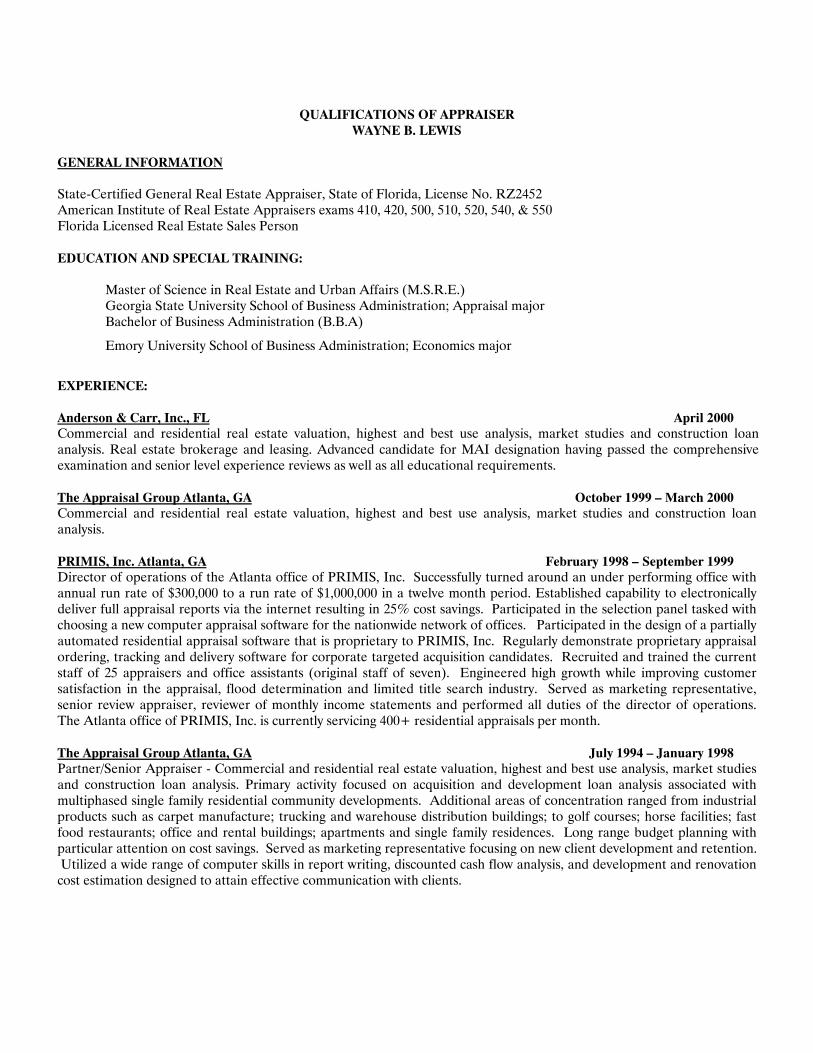
QUALIFICATIONS OF APPRAISER WAYNE B. LEWIS
GENERAL INFORMATION State-Certified General Real Estate Appraiser, State of Florida, License No. RZ2452 American Institute of Real Estate Appraisers exams 410, 420, 500, 510, 520, 540, & 550 Florida Licensed Real Estate Sales Person EDUCATION AND SPECIAL TRAINING: Master of Science in Real Estate and Urban Affairs (M.S.R.E.) Georgia State University School of Business Administration; Appraisal major
Bachelor of Business Administration (B.B.A)
Emory University School of Business Administration; Economics major
EXPERIENCE: Anderson & Carr, Inc., FL April 2000 Commercial and residential real estate valuation, highest and best use analysis, market studies and construction loan analysis. Real estate brokerage and leasing. Advanced candidate for MAI designation having passed the comprehensive examination and senior level experience reviews as well as all educational requirements. The Appraisal Group Atlanta, GA October 1999 – March 2000 Commercial and residential real estate valuation, highest and best use analysis, market studies and construction loan analysis. PRIMIS, Inc. Atlanta, GA February 1998 – September 1999 Director of operations of the Atlanta office of PRIMIS, Inc. Successfully turned around an under performing office with annual run rate of $300,000 to a run rate of $1,000,000 in a twelve month period. Established capability to electronically deliver full appraisal reports via the internet resulting in 25% cost savings. Participated in the selection panel tasked with choosing a new computer appraisal software for the nationwide network of offices. Participated in the design of a partially automated residential appraisal software that is proprietary to PRIMIS, Inc. Regularly demonstrate proprietary appraisal ordering, tracking and delivery software for corporate targeted acquisition candidates. Recruited and trained the current staff of 25 appraisers and office assistants (original staff of seven). Engineered high growth while improving customer satisfaction in the appraisal, flood determination and limited title search industry. Served as marketing representative, senior review appraiser, reviewer of monthly income statements and performed all duties of the director of operations. The Atlanta office of PRIMIS, Inc. is currently servicing 400+ residential appraisals per month. The Appraisal Group Atlanta, GA July 1994 – January 1998 Partner/Senior Appraiser - Commercial and residential real estate valuation, highest and best use analysis, market studies and construction loan analysis. Primary activity focused on acquisition and development loan analysis associated with multiphased single family residential community developments. Additional areas of concentration ranged from industrial products such as carpet manufacture; trucking and warehouse distribution buildings; to golf courses; horse facilities; fast food restaurants; office and rental buildings; apartments and single family residences. Long range budget planning with particular attention on cost savings. Served as marketing representative focusing on new client development and retention. Utilized a wide range of computer skills in report writing, discounted cash flow analysis, and development and renovation cost estimation designed to attain effective communication with clients.